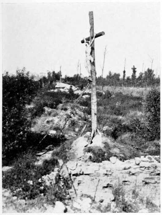
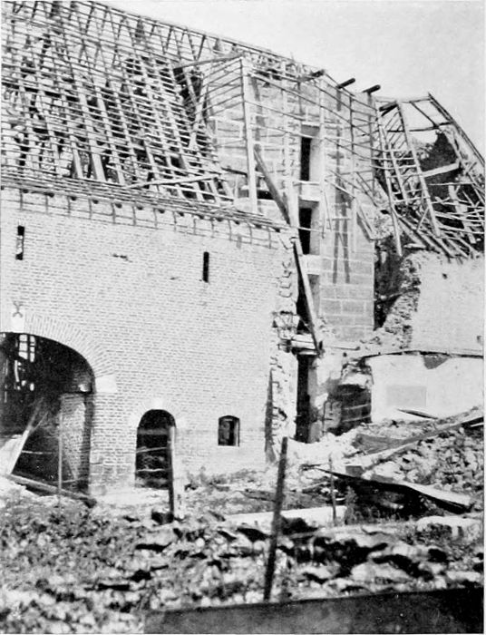
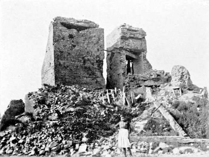
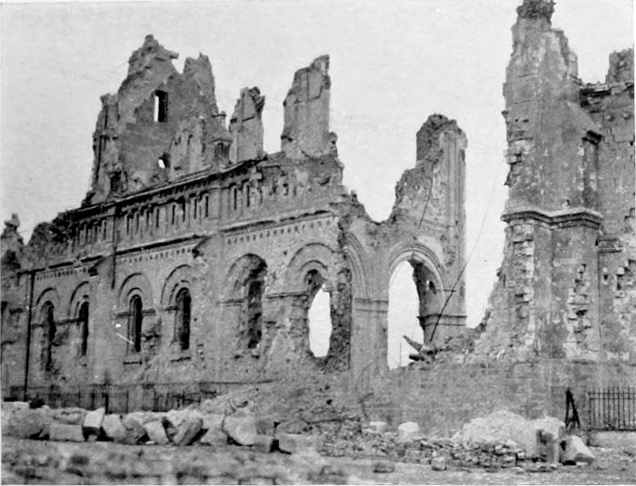
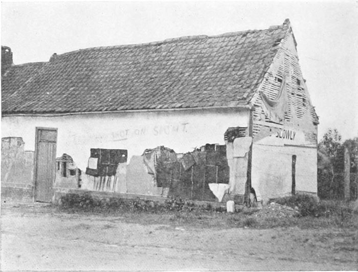
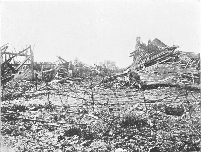
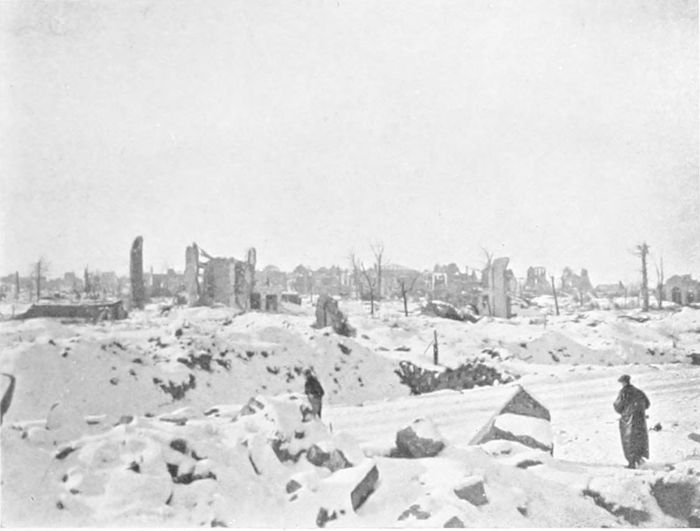
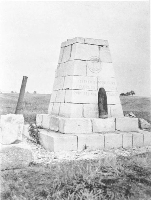
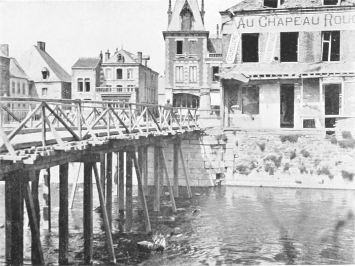
(PLATES 5 TO 18.)
The Ypres Salient was fought over during practically
the whole of the war. The first battle of Ypres,
during the "race to the sea," was in October-November,
1914, when the Kaiser stayed at Thielt
(twenty-five miles north-east of Ypres) for five days
at the beginning of November to be ready to enter
the city, only to suffer one of his many disappointments when the
"old Contemptibles" kept him out. The Germans, however, got
as far as Hooge, only two and a half miles away from the city, and
were there for more than two years. An extremely interesting
account, which is very pleasant reading, of the close co-operation
of the British and French Armies in this first Ypres battle is given
by General Dubois in a book just published.[5] It was presumably
when French and Foch met on the 31st of October, the most critical
day, that the reported conversation occurred (if it ever occurred),
in which French's view that there was nothing left but to die was
met by Foch with the characteristic rejoinder that they had better
stand fast first—they could die afterwards.
The second battle of Ypres lasted from April to June, 1915,
and during this battle the first use of poison gas was made, at St.
Julien. Except in the St. Julien region the lines remained practically
where they were after the three months' fighting. In spite
of this a captured order issued to the German Army in August,
1915, said that "peace in October is certain"!
Mr. Buchan tells a story characteristic of our Tommies, that
during a retirement ordered in May one man "solemnly cleaned
and swept out his dugout before going."[6] But this was equalled
by the tidiness of the old body in Ypres (mentioned in Sister
Marguerite's Journal), who came out and swept away the débris
of the last shell which had burst in front of her house, quite regardless
of the continuous bombardment.
The third battle of Ypres began with our capture of the Messines
Ridge on the 7th of June, 1917, and lasted till November of the same
year, by which time Ypres was so far "cleared" that our lines
were close to Gheluvelt (five miles from the city), and extended
from Passchendaele and Houthulst on the north to Messines and
Hollebeke on the south.
Then in April, 1918, came the great German break-through,
when the Allies lost Armentières and Bailleul, Kemmel and Messines,
and the enemy was in Merville and Estaires, and was inside Zillebeke
and Hooge, and less than a couple of miles from Ypres along the
Menin Road.
But the city itself still and always held out.
Finally our turn came. The Merville area was retaken in
August, 1918 (the 8th of August was Ludendorff's "black day"),
while on the memorable day on which we crossed the Hindenburg
Line on the St. Quentin Canal (28th to 29th of September) the
Germans were driven for the first time back past Gheluvelt by the
Belgians, the French, and ourselves, and two days afterwards they
were in full retreat.
The official despatches and many war books have told about
the salient, about the terrible hardships and the brave doings of
our soldiers there, and those of our Allies who were with us. But
they do not, because they cannot, tell us what was going on within
the walls of the city itself, during those first months of the siege,
while the unfortunate inhabitants were still trying to live there,
hoping—one supposes—from each day to the next that the bombardment
would finally come to an end. Something, however, we
know of this from the account of men who were there, either as
soldiers or in the Red Cross service, on equally dangerous duty.
But among the civilians who were neither one nor the other the
names especially of two out of many will always live in the war
history of Ypres, remembered for their devotion and heroism—Sister
Marguerite and Father Charles Delaere. Father Delaere was
the Curé of Ypres in 1914, later on he became Doyen, and not long
ago a letter from him told me that he had been made a Canon.
Sister Marguerite is a native of Ypres, and was, as a nun, attached
to the Convent of St. Marie, engaged largely in teaching at
the outbreak of the war. Her simple duties were suddenly
changed; she became not only nurse and even doctor, but
carpenter, fireman, baker, barber, shoemaker—all trades! Above
all, she was the universal friend and helper of the poor
creatures who were incapable of helping themselves, for whom
she found shelter while herself without any, and whose children
she mothered when their parents lay buried under the ruins of
their homes, or dying in whatever buildings served at the time for
a hospital.
The Journal[7] kept by Sister Marguerite, and published in 1918
by her permission for Red Cross benefit, gives a picture of life—or
existence—in Ypres during the first eight months of its siege. It is
so vivid, and at the same time so simply told, that (as I fear that
copies of the Journal may no longer be obtainable) I make no
apology for quoting from it. It is the poignant story of war as it
appeared to a woman suddenly called out of a life of peaceful work
to face its realities in their grimmest form, to do so without the
excitement of fighting and without the comradeship of the regiment,
or even the use of the soldierly mask of humour, to cover up the
unrecordable reality.
The Germans actually entered Ypres on the 7th of October,
the first day on which any shells fell on the town, and one civilian
was killed in his own room. But the children on that day
amused themselves afterwards by picking up the shrapnel bullets!
After the Germans were turned out a week later, one of their
companies was found to have left behind a characteristic notice:
"Les Allemands craignent Dieu et hors Lui nulle chose au
monde." They had succeeded in doing a fair amount of pillaging,
as well as making heavy requisitions, during their few days of
occupation.
It is pleasant to find that Sister Marguerite has nowhere anything
but praise for the behaviour of the British soldiers who occupied the
city for so long. She tells of British wounded coming into Ypres,
and with them a German wounded prisoner. A woman ran up to
offer milk to the men, but, with the recollection that her husband
had been killed by a German shell, would not give any to the German.
A soldier, however, who had been wounded by this particular
German, drank only half his milk, and passed the rest on to his
prisoner. She adds: "Ce n'est pas la première fois que nous pouvons
admirer pareils actes de générosité."
On the 6th of November an operation was being carried on
involving the amputation of a man's hand; the Sister who had tried
to act as nurse had fainted, and Sister Marguerite (herself not long
out of the surgeon's hands) took her place:
"Nous commençâmes donc: la main de M. Notevaert était
démise; quand, vers 2 h. ½, un obus tomba sur notre couvent et
détruisit deux classes à 10 métres de l'École menagère ou nous
étions. Les éclats de verre et les pierres arrivèrent jusqu'a nous et
un grand trou fut fait dans le mur. Le docteur venait de faire la
dernière entaille; nous étions là tous les deux, pâles de frayeur,
comme dans un nuage de fumée et blancs de poussière, lui tenant
encore dans sa main le bistouri et moi la main démise dans la mienne.
Quelques instants nous restâmes indécis. Les blessés criaient, et
en un moment tout fut sens dessus-dessous. 'Ta, ta, ta,' dit M. le
docteur, 'ce n'est rien. Continuons notre besogne, car nous n'avons
pas de temps à perdre.' ..."
Among the wounded at this time were three Germans, of whom
one (a Prussian) refused either to eat or drink, alleging that he would
be poisoned!—presumably an idea encouraged by his officers to
prevent surrender. Eventually he took what the sisters gave him.
A few days later came a real baptism of fire:
"Vers 11 heures, M. le Curé me dit d'aller chercher rue du Canon
deux vieilles femmes.... Comme on bombardait justement ce
quartier, je le priai de me laisser attendre le moment d'une accalmie.
'Allez-y tout de suite,' me repondit-il, 'on pourrait oublier ces
pauvres gens plus tard et leur vie en dépend peut-être.' 'Au nom
de Dieu,' me dis-je, et je partis. Mais à peine avais-je fait quelques
pas dans la rue que ... 'sss ... sss ... pon!' La tête d'un
shrapnel roula dans la rue, tout près de moi. Je retournai en
courant. Mais M. le Curé avait entendu le son de ma voix et de la
cuisine il me cria: 'Eh bien! n'êtes vous pas encore parti?' A trois
reprises je retournai pour revenir presque aussi vite. Enfins je
m'enhardis et je revins cette fois avec les petites vieilles, que je
conduisis au couvent. Pas moins de cinq shrapnels passèrent
au-dessus de nos têtes, et vous pouvez penser si le cœur me battait....
Cependant c'est à partir de ce jour que je devins plus courageuse
pour affronter les bombardements."
The "Menin Gate" of Ypres (Plate 5) is nothing now but a
broad gap in the old fortifications, where the long, straight road
from Menin through Gheluvelt bends round to enter the city.
During the whole of the siege of Ypres—that is, in fact, during the
whole of the war—this spot was continuously exposed to German
shell-fire, one of the "hottest" points over the whole war area.
On the left of the "Gate" Canada has purchased a certain amount
of ground for a Canadian memorial. The old walls, however, have
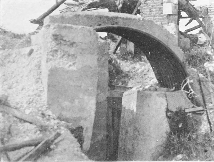
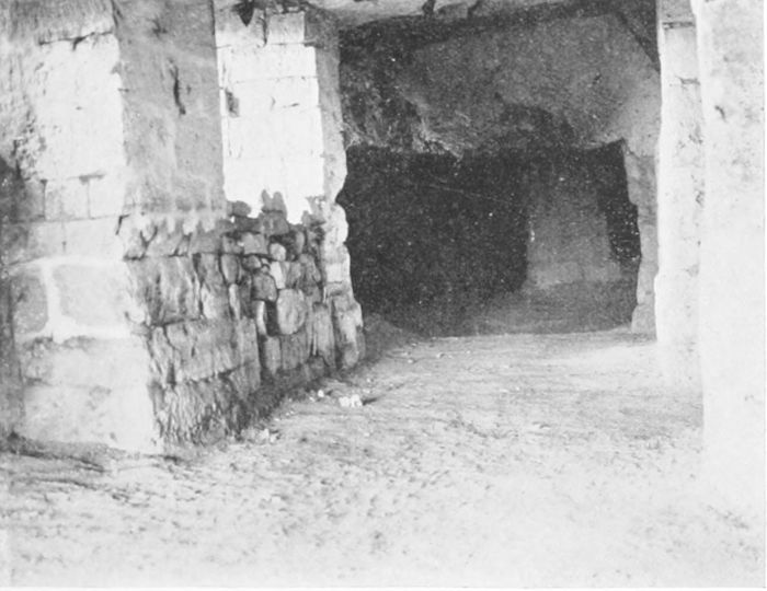
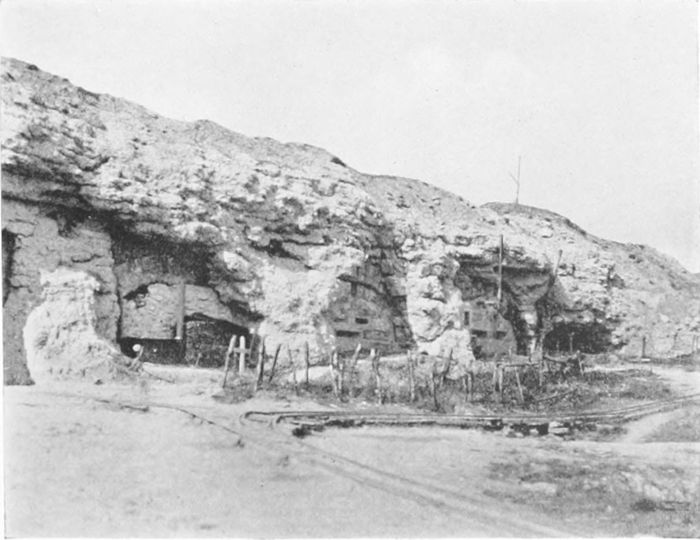
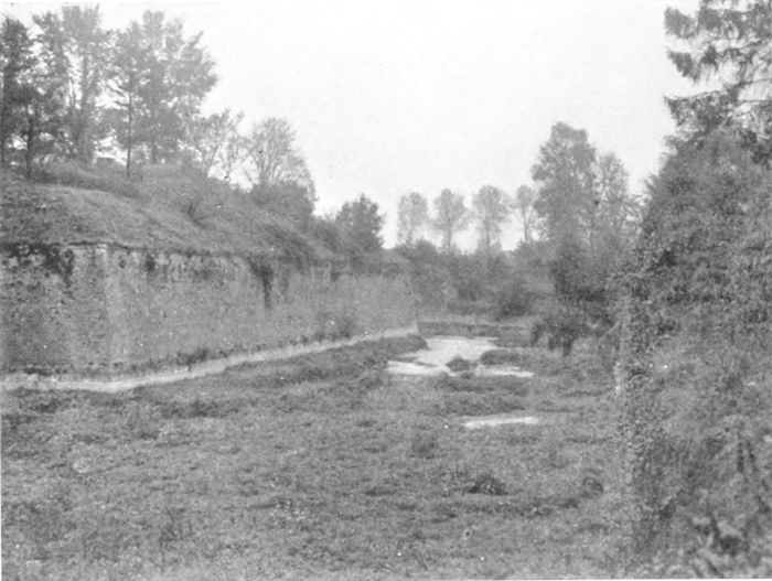
remained, and the "casemates" (Plate 6) on their inner sides were
for many weeks or even months the sole refuge of the poorer inhabitants
who possessed no cellars of their own. The story of how these
poor folk had to be removed, perforce, both for safety and for
sanitary reasons, is best told in Sister Marguerite's words:
5 Decr.—"Chaque famille y choisit son petit coin, y installe
deux ou trois matelas, deux ou trois chaises, une petite lampe,
parfois une petite table et un réchaud à pétrole. La lourde porte
d'entrée[8] était entr'ouverte. Il n'est pas étonnant des lors qu'après
peu de temps, des maladies contagieuses s'y déclarèrent. Des
habitants restèrent six semaines dans ce réduit sans voir la lumière
du jour. J'y trouvai un jour un enfant de deux mois qui y était
né et n'avait pas encore respiré l'air pur du dehors."
7 Jan.—"Ma mission principale est de servir de guide et d'interprète
et aussi de décider les malades à se laisser conduire à l'hôpital,
ce qui n'était pas toujours facile! Quand les malades y consentent,
l'opposition de la famille soulève de nouveaux obstacles et les protestations
injurieuses souvent ne manquent pas, ces pauvres gens
ne comprenant pas qu'on ne veut que leur faire du bien. Une
fois même, une vieille femme empoigna la pelle à charbon et le
tisonnier pour me frapper. Heureusement les messieurs anglais,
ignorant la langue flamande, ne comprennent pas les termes délicats
par lesquels on paye leur dévouement."
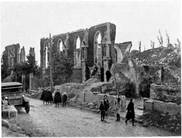
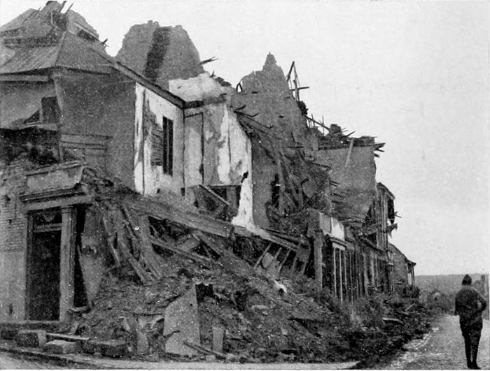
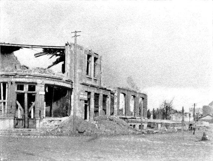
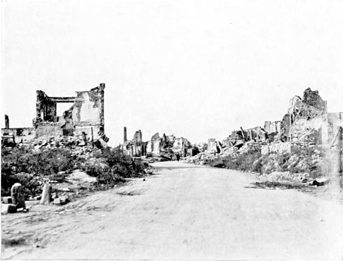
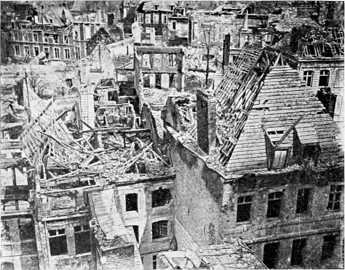
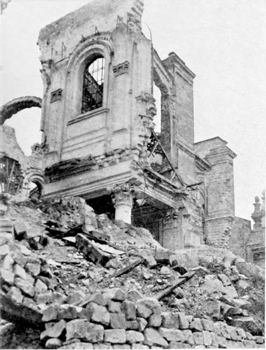
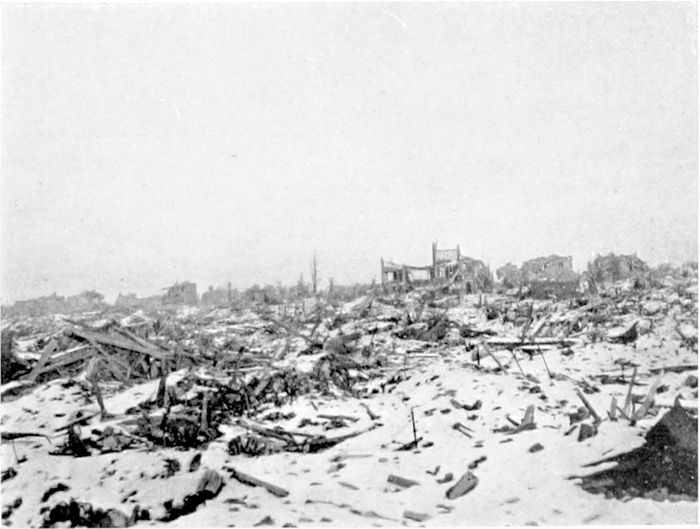
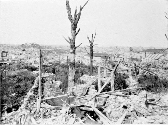
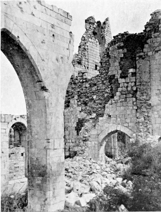
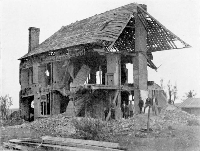
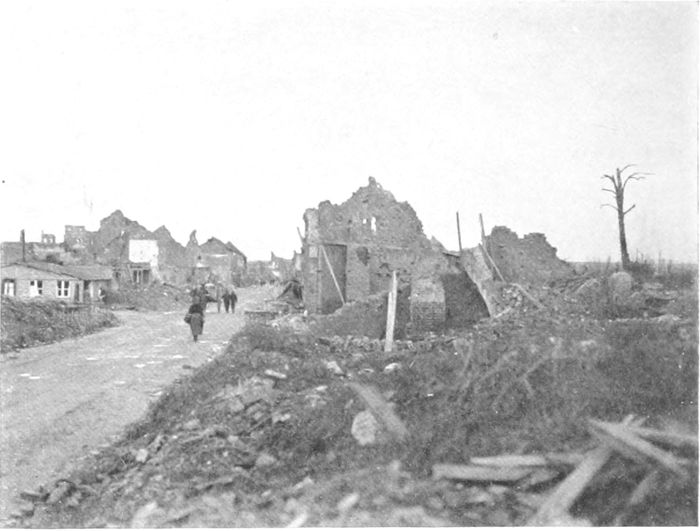
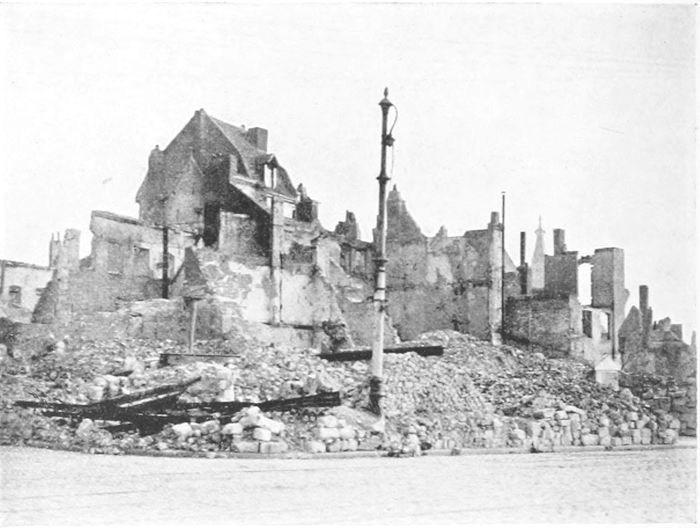
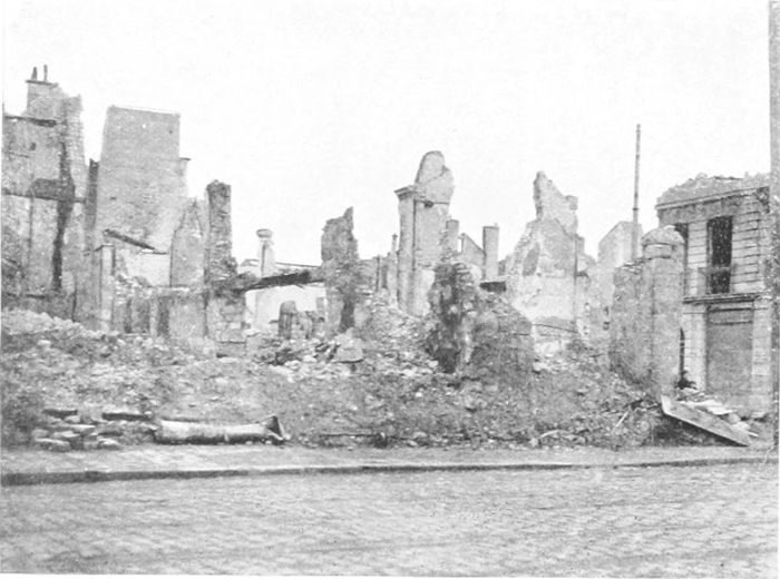
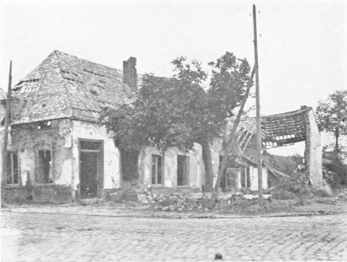
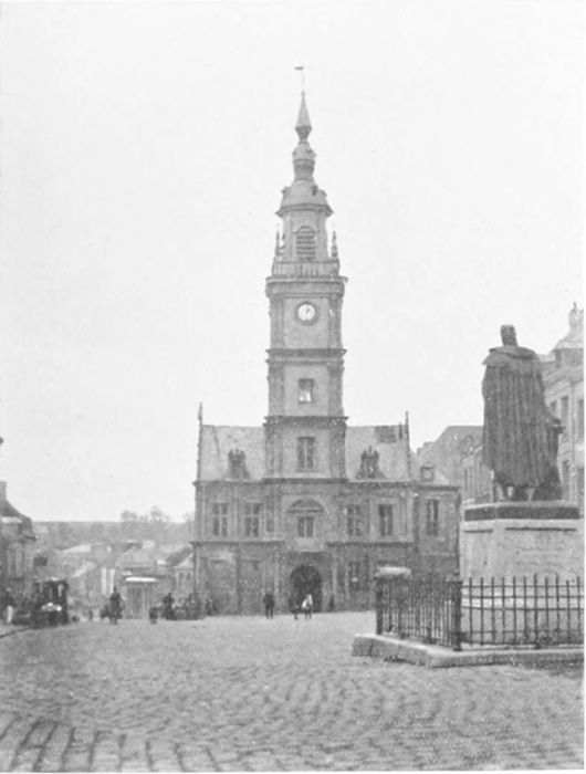
The city was left entirely in ruins (Plate 7 is a view from the
wall at the South Gate), not a single building standing with walls
and roof, or in any condition that could be called habitable. The
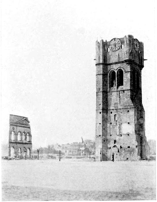
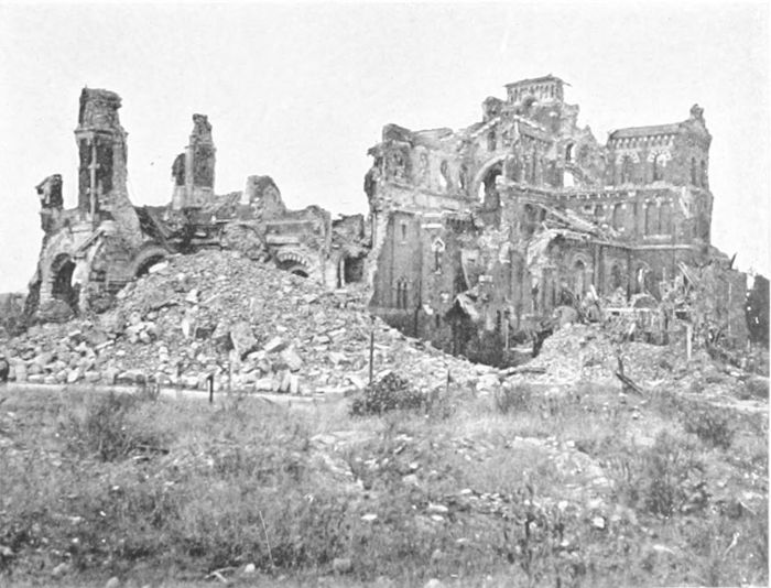
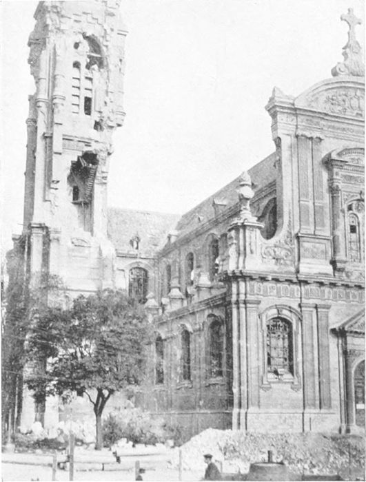
ruined tower (Plate 8), of which the foundation dates from 1201,
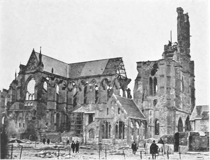
is all that remains of the once beautiful Cloth Hall, and the Cathedral
of St. Martin behind it is just as completely destroyed. It is to be
hoped that after the celebrations of July, 1920, the miserable
restaurants with their flaunting advertisements, which seemed to
smother the tragic ruins with their commonplace banalities in 1919,
may be done away with. It cannot be impossible to find means
by which the natural interest of visitors, for too many of whom the
salient is the grave of friends and relatives, can be gratified without
vulgarising ground which for generations to come will be sacred
in memory to the Allies whose soldiers fought there, and whose sons
it was who formed the "thin red line" which was for so long the
chief barrier to hold back the German hordes from the north of
France, and, in effect, from our own country.
It must be remembered, in looking at such views as Plates 7
and 8, that the clear spaces in the foreground are only clear because
all the buildings upon them have been destroyed, wiped out. Before
the war these spaces were closely built upon, covered all over with
houses. In Plate 7 are seen two or three "reconstructions" started
after the ground had been cleared of the mass of brick and stone
rubbish with which it was thickly covered until the end of the
fighting. It is hardly necessary to say that the general tidiness of
the ground in the Grande Place (Plate 8) belongs to a time months
after the Germans had been driven finally out of range. During
the war there was neither time nor opportunity to clear away the
débris, which covered road and building sites alike.
The Ypres Salient, as we came to know it, is essentially the
ground north and south of the twelve miles of road running from
Ypres to Menin. Ypres itself is about 65 feet above sea-level, and
Menin (on the Lys) about 35 feet. But the ground between them
rises to over 200 feet at "Clapham Junction" (three miles from
Ypres) and remains approximately at the same level for the two
miles farther to Gheluvelt. This higher ground circles round to the
south-west (through Hill 60) until it joins Wytschaete (eight miles
south of Ypres) and the Messines Ridge. To the north it continues
from Gheluvelt by Broodseinde, between Becelaere and Zonnebeke,
to the Passchendaele Ridge (180 feet), some seven miles north-east
of Ypres. The unfortunate city was therefore not only at the centre
of a very narrow salient, but one in which it was encircled by higher
ground on three sides within easy observation and shelling range.
For a long time, until our advance in 1917, the German lines were
only distant two and a half miles north, east, and south from the
city, and everywhere were on levels sufficiently above that of the
city to keep it always under observation.
It would have been cold comfort to our poor fellows who had to
face the horrors of the Flanders mud to know that three centuries
ago a traveller wrote: "Near Ypres they found the road often
indistinguishable from the fields, and the mud came up to their
horses' girths."[9]
But in fact the physical difficulties due to the nature of the soil,
churned up by shells on every square yard, were so horrible that
Lord Haig (who is certainly not given to exaggeration in his despatches)
says of the 1917 advance:[10]
"Our men advanced every time with absolute confidence in
their power to overcome the enemy, even though they had sometimes
to struggle through mud up to their waists to reach him. So
long as they could reach him they did overcome him, but physical
exhaustion placed narrow limits on the depth to which each advance
could be pushed, and compelled long pauses between the advances....
Time after time the practically beaten enemy was enabled to
reorganise and relieve his men and to bring up reinforcements behind
the sea of mud which constituted his main protection."
The statement made that "nine-tenths of the time our men
were fighting Nature, and the remainder fighting Germans," cannot
be much exaggerated.
It is, of course, impossible in photographs taken long after
fighting has ceased, and, indeed, in any photographs except those
taken from aeroplanes,[11] to give an adequate idea of what the surface
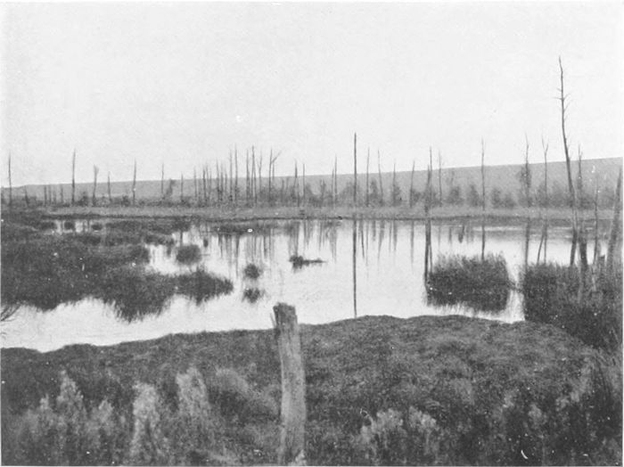
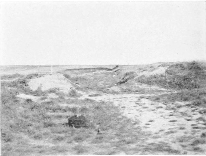
of the salient was during the war. Plate 9 gives some idea of the
ground beside the road, near Hooge, after a dry summer,[12] and
Plate 10 gives a similar view, after rain, near Gheluvelt. The bit
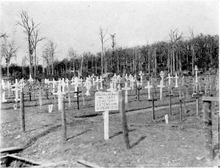
of "Tank Cemetery" at "Stirling Castle" (Plate 11) on the high
ground close to "Clapham Junction," and the illustrations of
Hill 60, serve also to give some rough idea, but only a very imperfect
one, of the conditions. Even now one has to walk in serpentine
fashion along the ridges between the shell-holes in order to make
any progress. But in the war winters each shell-hole was filled
with liquid, sticky mud, and over such ground our men had to
advance time and again, oftener by night than by day, slithering
down the slimy banks into slimier mud, scrambling up the other
side somehow or other, carrying full kit all the time, and continuously
exposed to murderous shell-fire from commanding positions. There
can have been no condition in the whole campaign which brought
out better the indomitable pluck and spirit of our infantry.
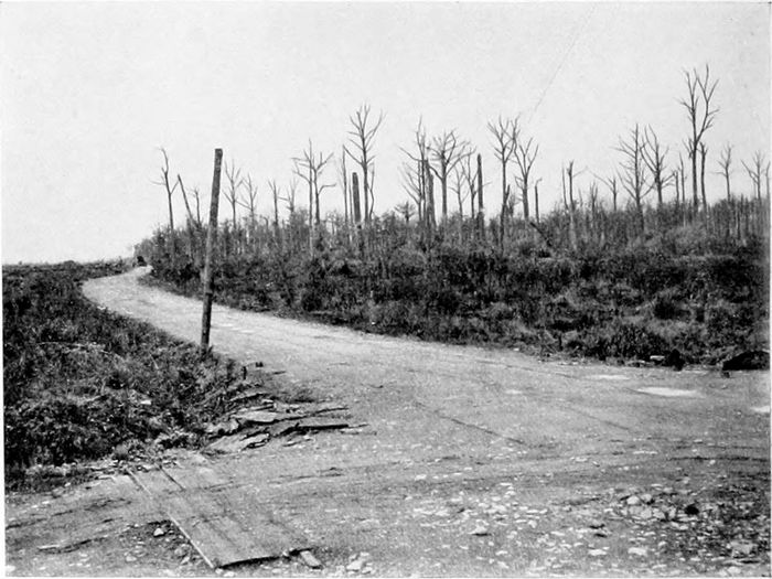
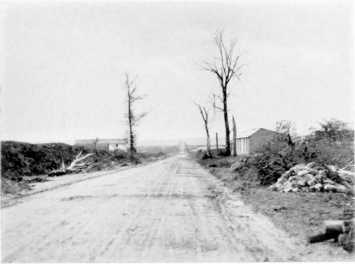
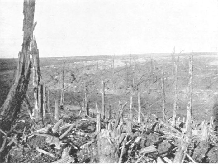
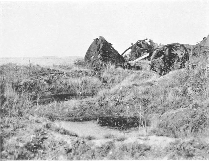
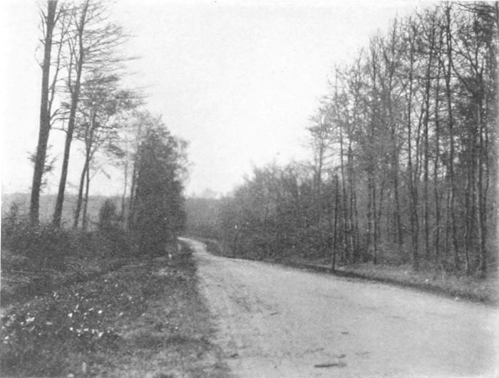
Plate 12 is taken at the cross-roads ("Clapham Junction")
between "Dumbarton Wood" and "Stirling Castle" on one side
and "Glen Corse Wood" on the other. It is at the highest point
of the slope which falls down through Hooge to Ypres. Of the
woods which our men named so picturesquely nothing whatever
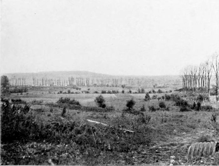
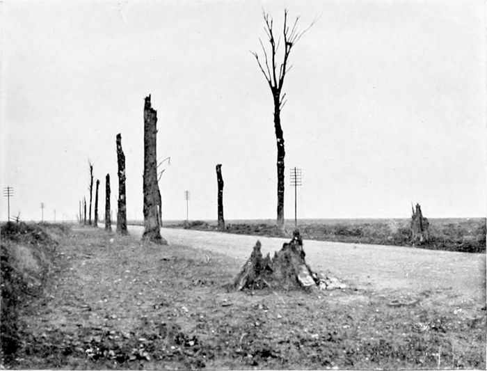
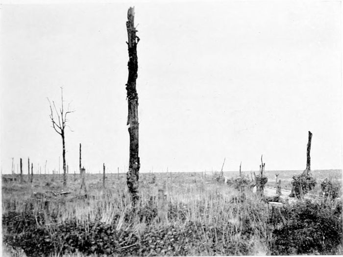
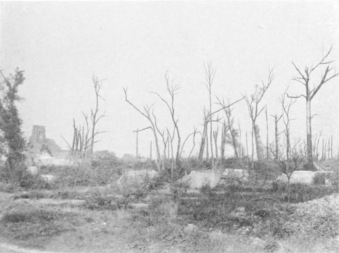
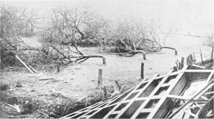
remains—in fact, the skeleton avenue on the Becelaere Road
(Plate 13) contained more trees than were to be seen anywhere else
in the neighbourhood, and even these I found to have been cut
down later on. Their only use would be as firewood.
On my last visit to the salient, a year ago, reconstruction in the
shape of what may be called hutments, or something a little more
substantial, had commenced at the eastern end and extended as
far as Gheluwe, while even up to Gheluvelt there were beginnings
of attempts at cultivation. If one had not seen elsewhere what has
actually been done, it would seem physically impossible that soil
so utterly destroyed could be brought again into cultivation for
a generation. But the Belgian and French peasants are capable of
wonders.
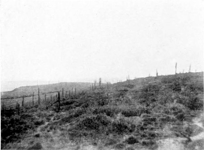
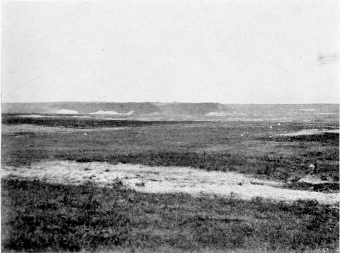
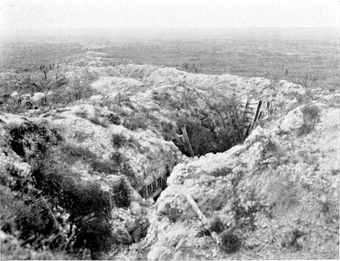
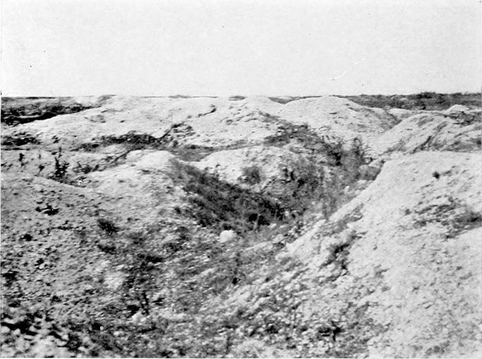
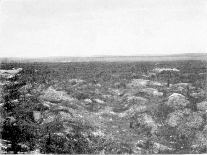
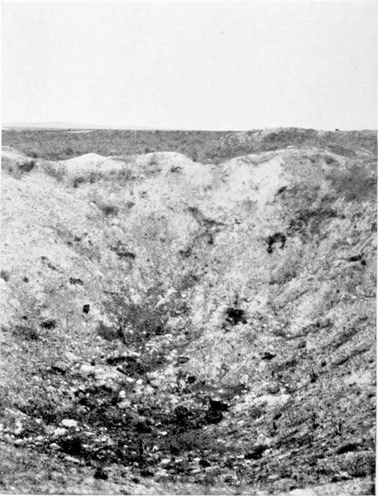
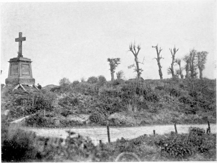
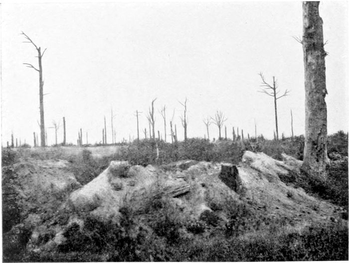
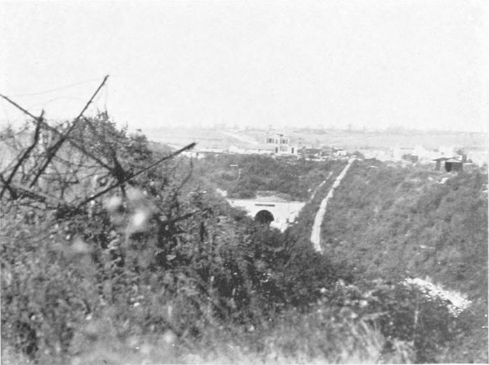
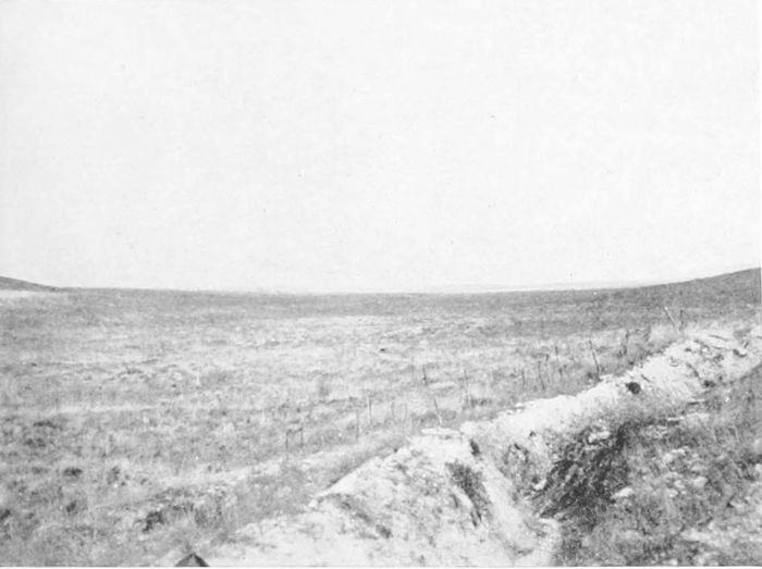
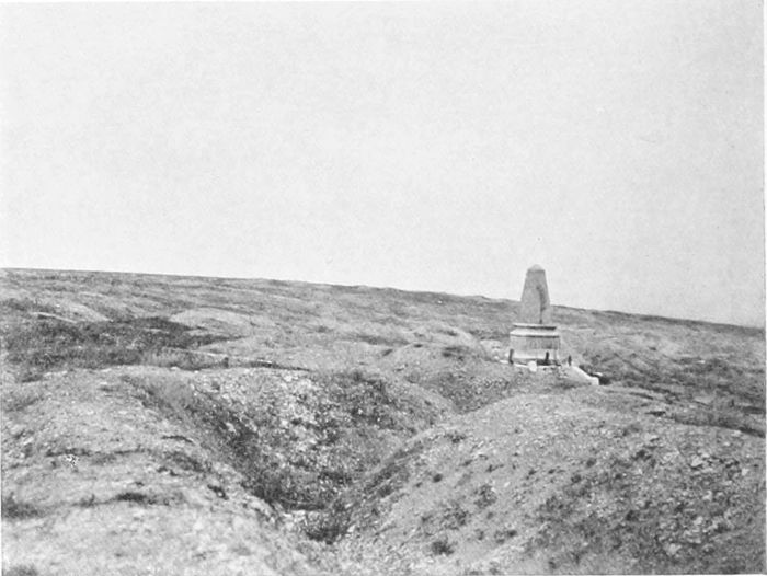
"Hill 60" (Plates 14 and 15) is to all appearance little more
than a heap of spoil from the cutting for the railway running south-eastwards
from Ypres to Lille. But it forms an observation ridge
some 150 feet above the level of Ypres and only two and a half
miles distant from the city. It was captured by the Germans early
in the war, and in April, 1915, retaken by the British after very
heavy fighting, in which 3,000 bodies were said to have been left
on its slopes. A month later, however, it was lost again under
heavy gas attacks, and remained in German possession substantially
until the great attack on the Messines Ridge in June, 1917 (the
third battle of Ypres), when we once more regained it, after ten
months of underground fighting and tunnelling. It was lost again
during the German attack in April, 1918, and only finally recovered
in the final advance in September. Long before the end this
historical hummock had been riddled below ground by mines, and
above ground torn up by their explosions and by incessant shell-fire,
so that it is now merely a mass of craters and shell-holes, with the
remains of dugouts in the soft clay.
The two illustrations give some idea of the state of the ground
and a suggestion of the wide horizon commanded by this insignificant
elevation.
It was on the 22nd of April, 1915, that the Germans startled
and horrified the world by the use of "poison gas" at St. Julien
(about three miles north-east of Ypres), making a "scrap of paper"
of Hague agreements, as of everything else. Before the end of the
war they must have bitterly regretted their action, but on the first
appearance of the yellow death-bearing cloud it answered its purpose
only too well—the Turcos were not to be blamed for flying incontinently
before this devilish terror. The Allies, naturally, had no
means of defence—even the wet handkerchief was not thought of,
but somehow or other a couple of Canadian brigades held on magnificently—fighting
poison gas unprotected must have required even
more pluck than facing machine-guns—and for a time appear to
have been all that stood between Ypres and the enemy. Under the
date of the 22nd of April Sister Marguerite writes in her Journal:
"... Au retour de nos visites aux malades, vers 5 heures, des
soldats français [Turcos] fuyant les tranchées, nous rencontrèrent,
criant et hurlant que les Boches les avaient empoisonnés! Beaucoup
moururent sur la route; d'autres en prie à l'asphyxie demandaient
à grands cris un peu de lait. Je revins à la maison tandis que le
docteur, obligé de continuer, retourna porter ses soins à une femme.
Mais celle-ci, effrayée par le bombardement, s'était enfuie dans les
champs où le docteur Fox la retrouva après une heure de recherches.
Au couvent je trouvai d'autre soldats encore, victimes des gaz
empoisonnés; on leur servait du lait chaud condensé."
"37 nouveaux empoisonnés dans la matinée du 23. Impossible
de les mener plus loin que l'hôpital civil où ils sont logés dans les
caves.... Nous aussi, nous reçûmes notre part: un sur le couvent,
et deux, trois, aux alentours. Voilà qui est terrible! L'eau me
coula des yeux, mes lèvres bleuirent, j'étais prête à suffoquer."
But the brave lady never suggests for a moment that she should
leave the place, and did in fact remain in the city until the military
insisted on everyone leaving on the 9th of May, when there seems
to have been imminent fear of the Germans reaching the city, and
when, at any rate, the Kaiser was again waiting at Thielt in expectation
of entering it.
St. Julien was taken at the time, and the German line advanced
to the canal some miles in front of it; but the ruined village was
afterwards recaptured and gas drenched by us—a strange Nemesis—in
July, 1917, and remained in our hands until the German advance
in 1918. Plate 16 certainly does not suggest the tragedy which we
must always connect with the name of St. Julien; it is a screen at
the entrance to a Chinese camp which stood there in 1919. It
illustrates, oddly enough, an ancient Chinese superstition that
"spirits"—and of course spirits are always malevolent—can only
go straight forward, so that if any kind of screen is placed in front
of the house entrance the spirit will be unable to get in, not,
apparently, having the sense to go round the barrier. The gentleman
standing in front of the screen (which is in effect a huge
triptych) gave us to understand that he was the artist, but our
knowledge of Chinese and his of English were too limited to be very
certain. The screen was certainly quite a satisfactory piece of
decoration.
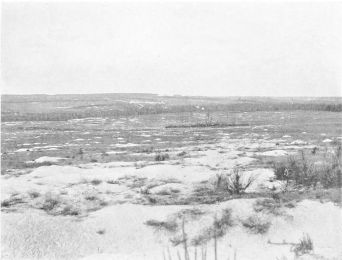
In 1917 we were preparing for the long-drawn attack which
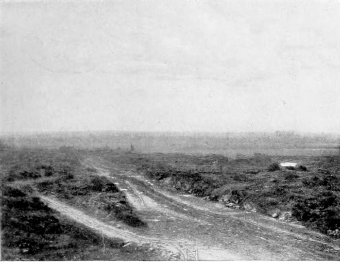
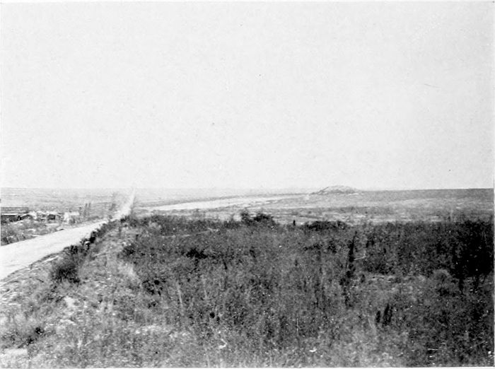
eventually gave us the Passchendaele Ridge (Plate 17), fighting for
months over such ground as the foreground of the photograph
shows. Defence by such means as the construction of a "Hindenburg
Line" was quite impossible in the mud and slime of the salient,
and Von Armin devised the scheme of what we came to call "pillboxes."
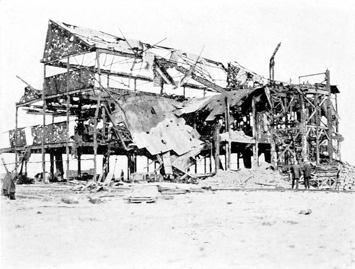
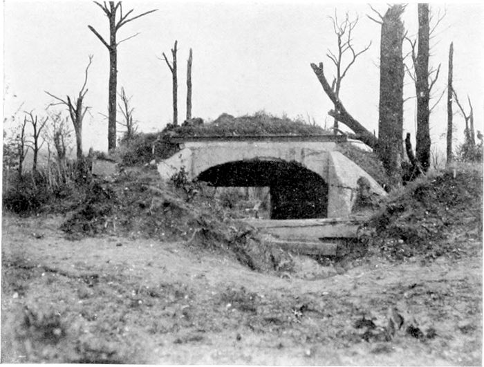
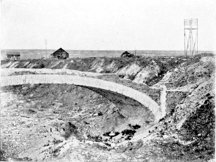
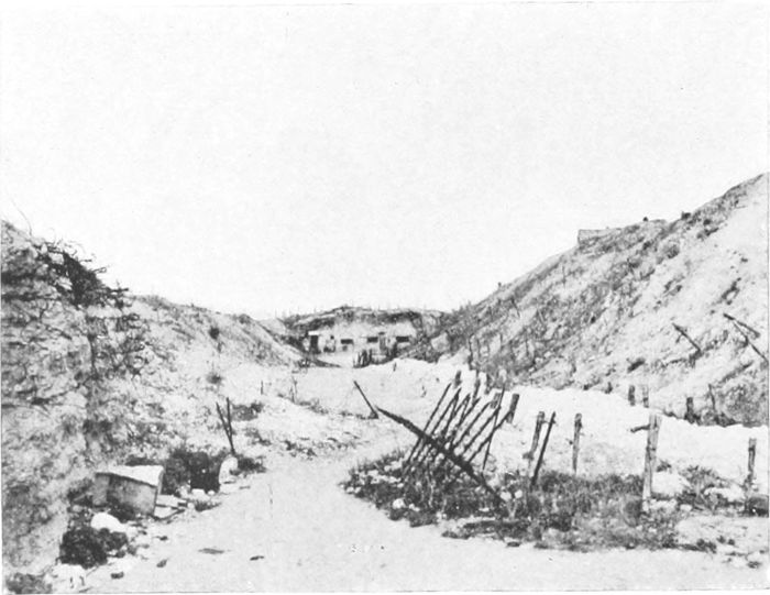
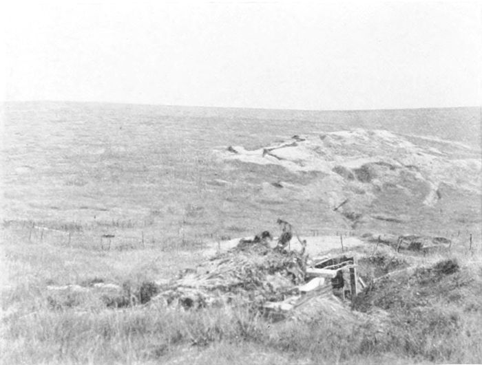
Each pillbox was a structure (Plate 18) of reinforced
concrete, often large enough to hold thirty or forty men with
machine-guns, and strong enough to give protection from everything
short of a direct hit by a large shell. They were only raised
above ground-level sufficiently to allow the guns to be worked,
their entrances being, of course, at the back. They were echeloned
along behind the front line, and connected and protected by barbed-wire
entanglements. They proved a serious difficulty when we
first had to deal with them in July-August, 1917. General Haig
says:
"Many were reduced as our troops advanced, but others held
out during the day, and delayed the arrival of our supports."[13]
But a few months later General Plumer had devised tactics
which countered the pillboxes very successfully, and eventually
the German machine-gunners found that it was better to come out
and fight in the open, and even to surrender, rather than be cooped
up and grenaded when our men got round to the entrance. Already
in October captured documents showed that the German High
Command were inclined to prefer their old methods to the new
ones.[14]
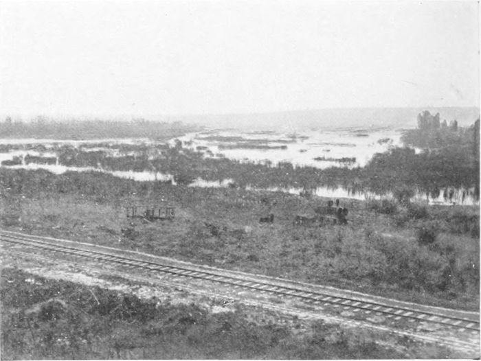
The fight to reach the Passchendaele Ridge (the distant rising
ground shown in Plate 17) lasted in effect from July to November
of 1917. The Germans fought hard and well, but our chief enemy,
as always in the salient, was the weather, and its effect in covering
the whole ground with muddy slime.
The much-coveted Passchendaele Ridge is only about 120 feet
higher than the level of Ypres; it is the continuation northwards of
the rising ground which crosses the Menin Road at Gheluvelt and
passes through Becelaere and Broodseinde. But, once attained, it
affords a clear view over the flat Belgian country towards Roulers
for many miles, just as in the hands of the enemy it afforded a
clear view over Zonnebeke and St. Julien to Ypres.
The fight for the ridge was a long, tedious, and costly affair of
many months, and although we gained it, and incidentally gained
the knowledge of how to circumvent the pillboxes, the delays
which had been caused by the weather conditions prevented us from
attaining the full advantages that had been—quite reasonably—hoped
for and expected.
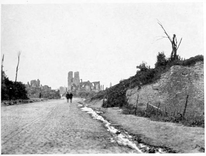
PLATE V.
THE MENIN GATE
OF YPRES.
This gap in the old walls of
Ypres is the entrance of the
road from Menin, which
runs for some eleven miles
straight across the middle of
the Salient by Hooge, Gheluvelt
and Gheluwe, known
throughout the war as the
"Menin Road."
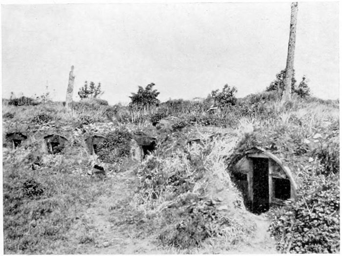
PLATE VI.
DUGOUTS IN THE
WALLS OF YPRES.
The Casemates and Dugouts
on the inner side of the old
fortifications of Ypres were
the refuge of hundreds of the
inhabitants of Ypres—especially
those who had no cellars
of their own—in 1914-15.
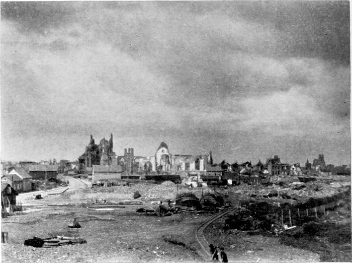
PLATE VII.
YPRES FROM THE
LILLE GATE.
This view is taken from the
City Wall above the South
or Lille Gate of the City.
The church of which some
white ruins are seen is
St. Pierre. The whole of
the bare ground in the foreground
was once covered
closely with buildings, but of
these hardly a trace remains.
Some beginnings of reconstruction
are already to be
seen.
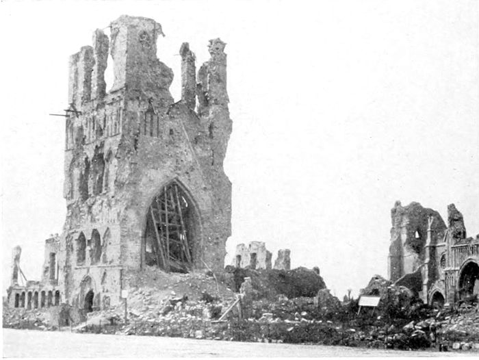
PLATE VIII.
THE BELFRY
TOWER AT YPRES.
The Belfry Tower of the
beautiful Cloth Hall of
Ypres was the oldest part
of the building. The upper
part of the tower itself has
gone entirely, and of course
also the beautiful spire.
The foundation of the Tower
was laid in 1201.
The Cathedral of St. Martin,
of which a few ruins are
seen, stood behind and to the
west of the Cloth Hall. It
is entirely in ruins.
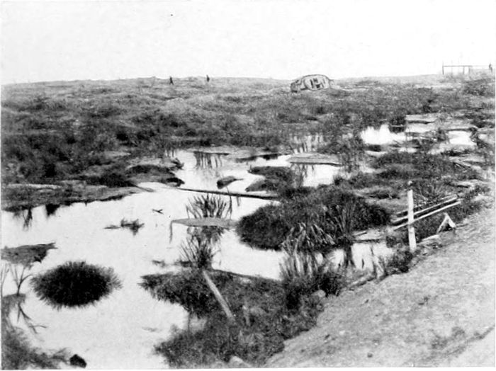
PLATE IX.
THE "TANK CEMETERY,"
HOOGE.
In the Salient south of the
Menin Road, at Hooge,
about three miles from Ypres.
With so much water lying
after a hot summer, it can be
imagined what the shell-holes
were like after continuous
rain. The country was
hopeless for tanks, and horrible
beyond description for our
poor fellows who had to fight
in it.
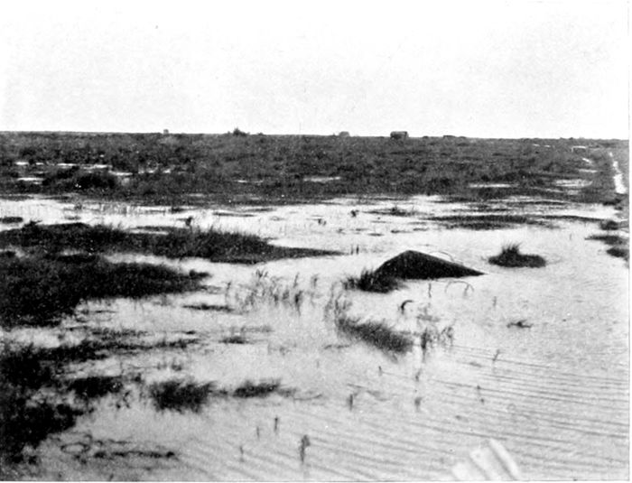
PLATE X.
GHELUVELT.
The Village of Gheluvelt, on
the Menin Road in the
Salient, no longer exists.
But some parts of it stood on
and round about this wet
piece of ground.
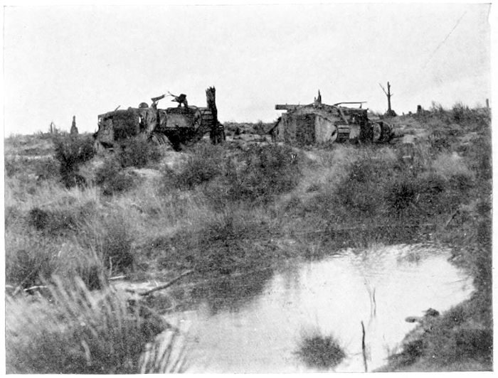
PLATE XI.
"STIRLING
CASTLE."
Why this little shell-holed
hummock received its name
is unknown. It is on the
south side of the Menin
Road between Gheluvelt and
Hooge, and is obviously a
portion of the "Tank
Cemetery."
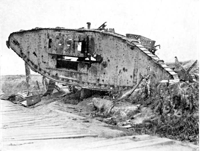
PLATE XII.
"CLAPHAM
JUNCTION."
At the cross-roads on the
highest point of the Menin
Road, some 130 feet higher
than Ypres itself. The half-derelict
Tank was one of the
many such wrecks which
strewed the Salient.
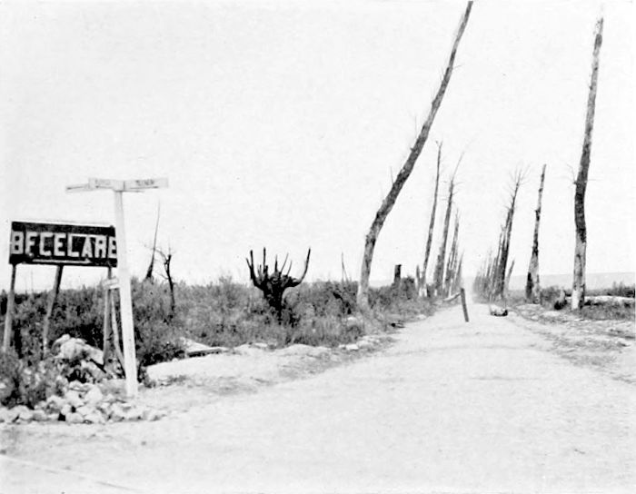
PLATE XIII.
THE ROAD TO
BECELAERE.
Most of the Road Avenues
in the Salient east of Ypres
have disappeared entirely, by
shell-fire and poison gas in
the first instance, and then
by cutting down. This
particular Avenue, a branch
from the Menin Road, still
remained at the end of the
war showing at least what
it might once have been.
The dead trunks have now
been cut down.
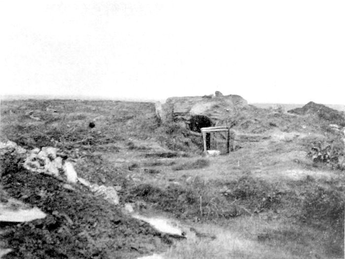
PLATE XIV.
"HILL 60."
Many elevations in Flanders
and France are known by
their heights, in metres, over
sea-level. On so flat a
country the importance of
"Hill 60," and many
another such point, as a position
for observation, is of
course out of all proportion
to its absolute height. This
Hill, so bitterly fought over,
is only some 60 or 70 feet
higher than the surrounding
country.
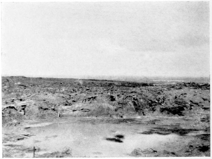
PLATE XV.
"HILL 60."
What is left of a mine
crater on "Hill 60," with a
suggestion of the wide horizon
over the Salient obtained
from this horrible heap of
churned-up clay.
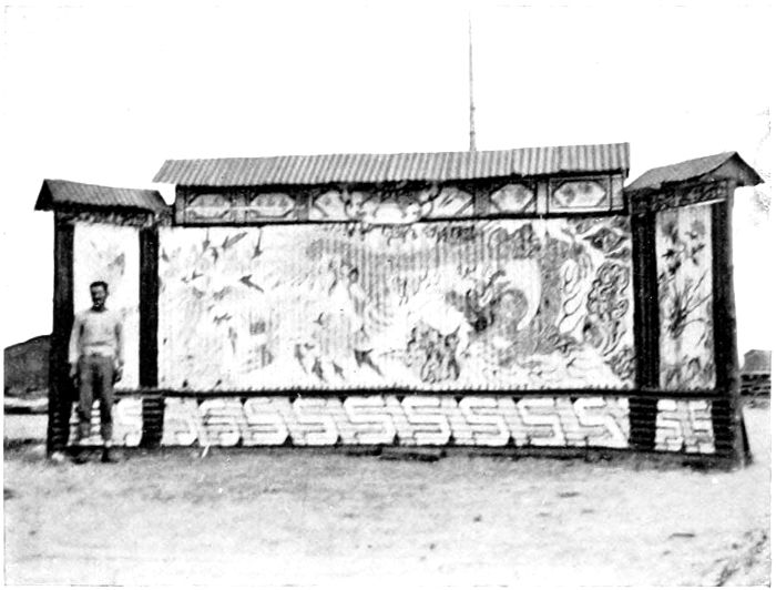
PLATE XVI.
ST. JULIEN.
On the site of the German
first gas attack, on the 22nd
of April, 1915, stood in 1919
a large camp of Chinese, employed
in clearing and levelling
the shell-struck ground
and preparing it to some
extent for agricultural operations.
The painted screen
guarded the entrance to the
camp.
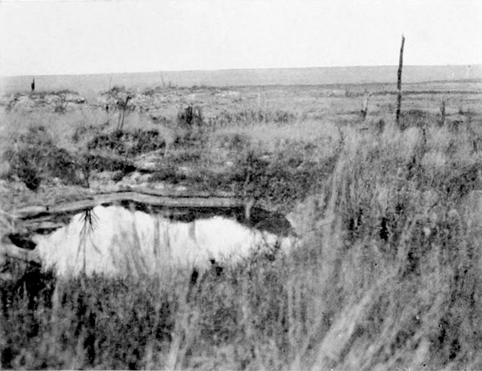
PLATE XVII.
THE PASSCHENDAELE
RIDGE.
A photograph taken in the
north of the Salient with the
long low line of the Passchendaele
Ridge in the distance.
It gives some idea of the way
in which the whole land surface
is covered with weeds
and shell-pits.
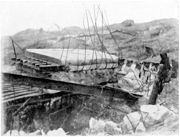
PLATE XVIII.
A "PILLBOX."
The wreck of one of the
German Pillboxes, of very
heavily reinforced concrete,
such as were brought into
use with some flourish of
trumpets in July, 1917, but
very successfully countered by
General Plumer's methods
later on.