Garwood and I, for exercise, started out on ski,
not daring to go far in the dense fog, for, except
by following up the track, it was impossible to
find the camp again once it had passed out of
sight. With the surface snow in such feathery
condition, a track would be obliterated in two
minutes, even by a light wind. Caution, therefore,
was essential. The calm continuing, we
indulged in longer excursions, trudging always
uphill, and sliding down again with increasing
confidence and ease. Assuredly, for the mere
movement, ski-glissading is first-rate fun. Taking
a longer range uphill than before, we came into
a thinner patch of fog, with a quarter-mile reach
of vision, perhaps, and the white ghost of a
sun aloft. Something suggested that a domed
hilltop was close ahead. We pushed on, and
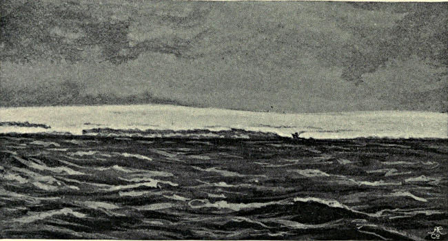
rose above the fog. Clear was the atmosphere in
all directions below a roof of cloud, white and
level, the far-extending floor of fog through
which we had just emerged, as through a trap-door
on to the stage. In front (to the east), and
on our left (to the north), gentle snow-slopes
rose to skylines seemingly near at hand. We
could not but push on. The snow was in perfect
condition for sliding, the air delightfully crisp.
It was grateful merely to have left the clammy
fog behind. The convex curve of the snowfield
was cause of the constant retreat of the skyline
from our advance; but at last a distant summit
peeped over, then another. Evidently there was
a watershed, and from it a view. It developed
very slowly, but at length it was all there—a
downhill slope in front, and then the distance
filled with a prospect on which no human eye
had ever gazed. It was strictly an eastward view,
for in the north the snowfield rose higher, and to
the south fog enveloped everything.
Whether it was the effect of contrast after
the blindness of three days, or whether the
view was absolutely superb, is hard to say; it
certainly impressed us as a very grand sight.
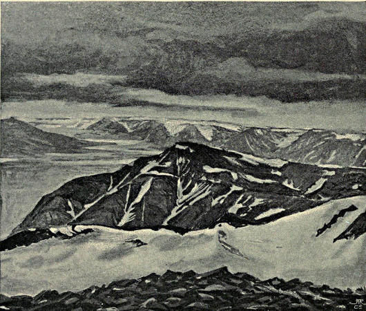
We were standing at the head of a broad
snow-white valley, to which a long slope
drooped from our feet, the level of the valley-floor
being at least 1000 feet below us, or more
than 2000 feet above sea-level. On either side
the valley was enclosed by faces of rock, bluff-fronts
cut out of what was formerly a big plateau,
level with our position. A splintered nunatak
pierced through the glacier below and formed an
effective centre-piece. The glacier itself swept
away in its wide, dignified fashion, first east, then
gradually round in a great curve to the south-east,
on its slow crawl towards Wybe Jans Water.
The row of bluffs on the left (north) were seen,
one beyond another, stretching away fainter and
fainter to the remote distance, where the last may
look down upon the east coast. The nearest and
highest of these bluffs appears to be the Mount
Chydenius of Nordenskiöld. Further north and
masked by clouds were indications of a range of
peaks of bolder form.
We returned to camp for our cameras and
came back with Nielsen, then Garwood set
forward down the hill to investigate the Hecla
Hook rocks of the nunatak, whilst Nielsen and I
went north up the snow-slope. We had not more
than a mile to go before reaching the top of the
highest snow-dome in the watershed area between
the glacier systems draining west to Dickson Bay,
south-east to Wybe Jans Water, and south to
Klaas Billen Bay. Whether the glacier to the
north bent ultimately west to Dickson Bay or
round to the head of East Fjord of Wijde Bay
could not be determined, for it was soon lost
beneath a roof of cloud. The fulmar petrels that
came flying over could have told us. The range
of hills across the north was now clear. There
were indications of a valley between our plateau
and them, and of a pass leading over to it from a
bay of the eastern valley. Unfortunately my
photographs of this important view, like all others
taken by me on roller film this year, failed.
How I now regret not to have carried some good
glass plates to this point! Only blind notes
remain. There was a peak of nearly 4000 feet,
30° west of north, and another due north about
six miles away. Connected with them were
many more of smaller dimensions. West of the
peak first mentioned the land dropped below the
cloud-level, which was from 500 to a 1000 feet
beneath our feet. All in the Dickson Bay direction
was hidden under piled masses of cloud.
It was a fascinating and tantalising view.
One more day’s march would have solved
for certain, instead of merely by inference, the
whole question of the topography of this icy area.
Any one of the peaks ahead would have commanded
views towards Wijde Bay, Hinloopen
Strait, and Wybe Jans Water. But with Svensen
hors de combat we were helpless. To leave camp
for a whole day was impossible, seeing that, in
this featureless white wilderness, if fog came on,
we should never find it again, whilst, without us,
the men left behind could not steer their way to
the coast. I thought, however, that it might be
possible to return by a new route, descending
first down the east valley and then working round
to the south; so we went back to the tents and
asked Svensen whether, if we dragged his sledge,
he could follow on his own feet homeward. He
eagerly jumped at the suggestion; the stuff was
packed and off we started uphill to the point of
our first view at the head of the east valley.
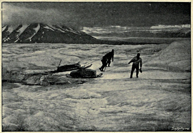
Svensen shuffled along on his ski well enough,
though with a sorry countenance. When he
found us going uphill he protested that that
could not be the way back and that we were
going east instead of south. Arrived at the top
and seeing the valley he became mutinous, said if
we went down there we should all leave our
bones in this horrible land, and generally protested
with all his might. Nielsen joined his
protests, on the ground that, Svensen being the
sort of man he was and apparently ill as
well as terrified, we should probably soon find
ourselves obliged to drag him along on a sledge,
and that, while he could manage to walk, it was
best to get him in the direction of the coast, so
that, if ultimately he had to be carried, it might
be over as few miles as possible. In fact, we were
cornered; there was nothing for it but to turn
coastward.
Before doing so we took one more long gaze
over the great glacier and away to the remote hills
that look down on Wybe Jans Water. One of
them must be Mount Edlund, another the White
Mountain near Heley’s Sound; but it was
impossible to identify them. These were the
peaks climbed by Nordenskiöld and his party in
1864. As they were the only people who have
ever gazed inland over this same sea of ice, I
here insert an abbreviated translation of their
account.[4]
“On August 21, 1864, the weather became so fine that
we returned to land in order to climb Mount Edlund.
We landed at the edge of the glacier, which ends without
a cliff. Parallel with the shore, at a distance of about a
thousand yards, there extends a broad bank of moraine,
beyond which comes the glacier itself. Its lowest part
consists of a mounded ice-field, here and there split by
crevasses, for the most part filled with water. The
ascent was easy, and we soon reached the lowest plateau
of the mountain. A grass-slope followed, becoming
steeper higher up and ending near the upper plateau in a
hyperite cliff faced by four-edged columns. This cliff
was at least fifty feet high, and vertical; but the rocks
were firm, and could easily be climbed. Thus we
reached the top.
“The view fully came up to our expectations. North-westward,
far as the eye could reach, spread endless
hills and plains of snow, only broken here and there by
occasional mountain peaks standing more or less free.
Among these, several remote mountains, probably surrounding
the southern shore of Wijde Bay, deserve
mention. Further round in the north-east a row of
peaks stood up against the horizon. Mount Chydenius
was the most northerly and highest of these great mountains.[5]
We overlooked the whole of Wybe Jans Water
from Whale’s Point and Whale’s Head to its inmost
recess near the White Mountain. Many mountains surrounded
by ice reared themselves in the west. The
view over Hinloopen Strait was hindered by thick mist,
which appeared to lie only over this depression and its
bordering hills, as so often happens.
“In order to follow up the mountain ridge extending
towards the north-west, and to learn whether an expedition
over the snow fields involved difficulties, we went
from the summit farther into the interior of the land,
which lay almost at the same height as the peak. It
was quite level and covered with hard, frozen snow, on
which walking was as easy as on a floor. This plain of
snow appeared to stretch away to Mount Chydenius, so
that that peak would be easy to reach for the purposes of
a triangulation. We went as far as a distant small hill of
snow [apparently the Mount Svanberg of the map] without
any new experiences, except that fresh peaks kept
constantly appearing above the snow; we accordingly
decided to return.
“The shortest way back to the ship led down a rather
steep ice-stream flowing between two hills from the
place where we stood to the same broad, level glacier
over which we had come in the ascent. The true source
of the latter was, in fact, this ice-stream which flows
down from the inland ice. We stood for a time at its
edge, telescope in hand, discussing whether it would be
possible to descend by this apparently easy way, or whether
we must go round by the longer route, somewhat dangerous
as it was by reason of the hyperite cliff. A
young “Balsfjording,” who carried our instruments, and
had certainly climbed many a mountain near his home,
but probably never been on a glacier, looked at us with
wondering eyes when we asked him his opinion. His
expression seemed to say, “How can any one be in
doubt about so obvious a matter?” Without a word, he
sprang down the ice-slope, theodolite in hand, to our
great terror, for we feared that, as usual, the glacier
would be broken by crevasses, and difficult to cross.
Our anxiety did not last long before we saw him come
to a halt, and just in time, for, on coming nearer, we
found that a great schrund was immediately before him.
We crept to its edge and looked down into the weird,
bottomless depth, whose walls were azure-blue cliffs of
ice, here and there covered with white icicles like stalactites.
Lower down everything was lost in a dark-blue
gloom. This crevasse stretched almost the whole way
across the glacier, so that a long detour had to be made
before it could be crossed. Later on we encountered a
great number of such crevasses, some of which we
turned, others jumped over, others again crossed by ice-bridges.
Not till we reached the main stream of the
glacier did the crevasses come to an end and the descent
became quick and easy.”
On returning to the coast they took a boat and
rowed to the mouth of Heley’s Sound, some three
miles north of which they landed in a little bay
and set up their tent. Next day, August 22, was
again fine, so they set forth to make the ascent of
the neighbouring White Mountain.
“We wandered first over the great moraine, which the
glacier has cast down before itself, then climbed the
gently sloping ice-field. This proved to be unexpectedly
fatiguing and disagreeable work. The surface consisted
of thawed and refrozen snow, covered with a crust of
faggot-like formation, which frequently broke up under
our tread, so that the foot sank into the soft snow
beneath and was with difficulty withdrawn through the
icecrust, whose sharp edges cut into the boots. The
top of the mountain, hidden at first by the humps of the
glacier, came into view after an hour’s ascent, but was
still far away. We had several hours of work over snow
of similar character before we reached the summit, a
small plateau covered with powdery snow a foot deep
upon hard ice.
“The view from this point is perhaps the finest
to be found on Spitsbergen. In the east, about sixty
miles away, we saw a high mountain land with two
peaks higher than the rest. [This was Wiches Land.]
Between it and Spitsbergen lay a sea covered with
great, continuous icefloes, obviously impenetrable by a
ship.… In the north-east and north, far as the eye
could reach, appeared the hills of North-East Land and
Hinloopen Strait, with the strait itself and its islands
apparently surrounded by water free of ice. Nordenskiöld
recognised Mount Lovén, ascended by him in
1861.… The interior was likewise displayed before
our eyes, a boundless immeasurable waste of snow, out
of which here and there some mass of rock jutted forth,
dark in contrast with the blinding white surroundings.
Only further away, west and north-west, were there any
connected ranges of mountains. The whole west and
north coasts of Wybe Jans Water were in sight, and the
northern part of Barents Land, whose extreme point
consists of a much crevassed snow-mountain ending
steeply in the sea.”
From this interesting digression we must
return to our own doings. Facing south-east we
kept along the crest of the highest ground and
made quick progress, for a gentle slope drooped
in our favour and the surface of the snow was
in perfect condition for both ski and sledges.
Garwood and I shall ever remember the delight
of this midnight march. High above the clear
air that surrounded us was a dark-blue roof of
soft cloud, resting on skyey walls of marvellous
colours, with streaks of stratus across them,
reflecting the golden sunlight. The sun itself
was hidden in the north, but beneath it hung a
reticulated web, woven of gold and Tyrian purple,
through which shafts of tender light drooped
down like eyelashes upon the snow. All around,
the névé went sweeping away in gentle curves and
domes, greyish-white in some places with purple
shadows, bluish-grey in others, here and there
strewn with carpets of sunlight. The rocks, too,
wherever they appeared, were rich in colour,
showing their own ruddy or orange tints enforced
by the lustrous atmosphere. There was none of
the sharp contrast of black and white that strikes
a superficial observer in high mountain views.
This panorama was a glorious mass of colour,
harmonious without rift and rich without
monotony. Just at midnight the cloud-roof
opened in the north and a flood of sunshine fell
around and upon us—a veritable transfiguration
and thrilling glory which cannot be told.
Entranced with beauty, we marched on and on
over the wide snowfield, with a sense of boundless
space, a feeling of freedom, a joy as in the ownership
of the whole universe—emotions that, in my
experience, only arise in the great clean places of
the earth, where nothing lives and nothing grows,
the great deserts and the wide snowfields. Green
country, after such regions, is land soiled by
mildew.
Coming, in about seven miles march, to the
point where the slope down to the Nordenskiöld
Glacier began to steepen, we halted, not from
fatigue, but because we were loath to quit the far-seeing
uplands and wall ourselves in between a
valley’s sides. So we pitched the camp about
3 A.M., with the doors opening to the south. The
eastward views were better displayed than before.
We could see Wybe Jans Water with Barents
Land beyond, then a series of long rock-faces
supporting high-domed, snowy plateaus, stretching
round to the Terrier on the left side of the
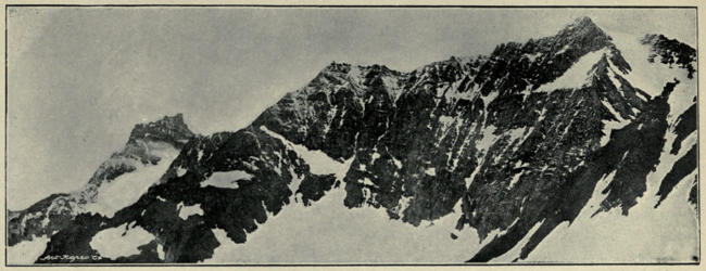
Nordenskiöld Glacier, whilst De Geer Peak
came last, looking from this point like a pyramid
with its top storey horizontally stratified. The
low sun shone golden on the snowfield, casting
blue shadows. All round, near the horizon, the
sky was clear below the soft, thin cloud-roof,
through which the blueness of the vault of heaven
was plainly seen. The remote hills were indigo,
patched with orange, gold, and pink. White
mists lay in hollows of the snow, motionless.
Ivory gulls flew about, projecting their silver
plumage against the blue shadows. The air was
still. Not a sound broke the perfection of the
silence.
It was afternoon of the 19th when we set
forward again over the good, hard snow, the
still air seeming warm, and the sun shining softly
behind a thin grey roof of cloud. All round was
a light-blue frieze of sky with cloud-flakes in lines
below, and then the faint blue-and-white hills. In
the south the burnished surface of Klaas Billen
Bay, shining between purple shores, reflected the
sunlight. The beauty of the scene sapped our
energies. We wanted to look at it, not to haul
sledges. But Svensen said he could do no work,
so hauling was the order of our day. Needless to
say that many halts were made on every kind
of excuse, and every halt was celebrated by the
smoke of pipes. Garwood took the opportunity
to instruct me in the true art of pipe-loading.
“Jam the tobacco in as tight as you can, and then
loosen it with a corkscrew” is his formula. I am
witness to the labour it cost him in practice, and
the tenacity of his adherence to an adopted
principle. One advantage of travelling with sledges
is that you always have comfortable seats
ready. It would have been a sin, at least a folly,
not to avail ourselves of them. We were neither
sinners nor fools after this kind. Yet on the
whole good progress was made, for we walked
fast and kept going for many hours. The view
scarcely changed. That we were coming to lower
levels was obvious, but the hills in front seemed
no nearer after three hours’ marching than at the
start. Ahead were a few rocks emerging from
the glacier. We thought them close at hand, but
they kept their distance. Not for five hours were
they left behind. The actual motion, however,
was pleasant; ski and sledges often ran of themselves.
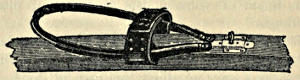
Only Nielsen was miserable with his Canadian
snowshoes, and perforce lagged behind.
“This,” he said, “is the worst thing ever a man
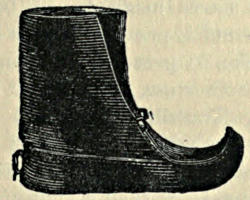
put on his feet—miserables!” His own Lapp
shoes, too, gave him no satisfaction. Melted
snow found a way through them. “They should
have been soaked,” he said, “with two parts
Stockholm tar and three parts cod-liver oil, boiled
together and put on hot. It should be rubbed
well in with a rag while it’s hot. That will make
boots waterproof and keep them soft for three
months in spite of wettings. That is what our
Norwegian fishermen use.” Mr. Frederick Jackson,
however, tells me that he tried this composition
and found it no better than patent dubbin.
A flat plain followed a long and steady descent.
Here, at a level of about 1300 feet, the snow
began to be bad. A foot of new snow lay upon
the ice. It was in places waterlogged, for there
were no open crevasses, and now the sun had
attained power to set things thawing fast. The
blue lakes we saw when coming up existed no
more; drifted snow and frost had abolished
them altogether. We were well below our camping
place at the foot of Mount De Geer, but on the
opposite side of the glacier, approaching its left
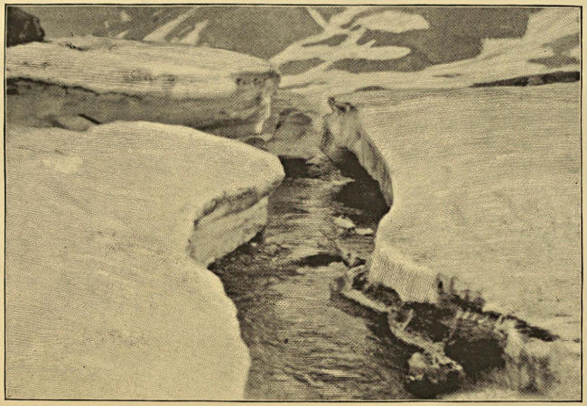
bank. A wide water-channel came, with a rushing
torrent in it, flowing over blue ice between
banks of snow. It was long before we found an
overhanging place where a leap would take a man
from bank to bank. Thence a flat but watery
area intervened before our goal was reached at
the extreme left of the glacier and right below the
highest point of the long Terrier ridge, to the
summit of which we intended to climb next day.
Its cliffs were loud with the sound of countless birds,
whose full-throated cries, mingled together and
wafted afar as a raucous hum, were audible long
before a bird came in sight. From camp we
could see them in their thousands, perched in
rows upon ledges or soaring about the cliff—fulmars,
little auks, and glaucus gulls. Their
feathers were scattered all about, whilst numerous
tracks showed that this breeding-place was no
secret to the foxes—the only animals that rove
over the icy interior of Spitsbergen.
Our projected climb was not to be made, for
rain came on in the night. We awoke (20th) to
find clouds heavy upon us, and all but the
Terrier’s foundations obliterated. It was a disappointment,
but there were compensations, for
the immediate neighbourhood proved unexpectedly
interesting. This discovered, we loaded
the sledges and sent them down with the men,
under orders not to stop till they reached Klaas
Billen Bay. Svensen had no longer any excuse
for malingering. Yesterday, with every hour’s
advance, his face became rounder, his back
straighter, his movements more active. The fear
of destruction was in reality his main disease,
aggravated no doubt by cold and exposure to the
storm. He acknowledged as much later on. The
suggestion that he should hasten down to the bay,
whether dragging a sledge or not, seemed nothing
less than a reprieve from sentence of death. He
set off with alacrity.
Garwood had observed a curious piece of
glacier a few hundred yards away from camp. It
was mounded in a peculiar manner, calling for
investigation. On approaching it, the mounds
were perceived to be arches of ice, barrel vaults
perfectly regular in form. Their origin was
presently self-explained. A wide and deep stream
of surface drainage-water habitually flows near
the foot of the Terrier. Reaching a level place,
the speed of flow is reduced so that the surface
becomes frozen over in cold weather. Snow falls
upon the ice thus formed, and a roof is made, the
remains of which, even at this advanced period of
the summer, were two feet thick or more. The
glacier in its onward movement is compressed
between the Terrier and the De Geer range
opposite, and every portion of it feels this compression,
which, operating on the frozen roof of
the river, bends it up into an icy tunnel of regular
form. By degrees parts of the tunnel fall in, and
thus the detached arches are left. On the King’s
Bay Glacier we afterwards saw more arches of
similar origin. It is to the strength of the arctic
winter’s frost, rather than to the amount of the
annual snowfall, that Spitsbergen glaciers owe
their peculiar phenomena, to which the glaciers of
high mountain regions in the temperate and
tropical parts of the world present no parallels.
Another and still more remarkable outcome of
the same forces presently attracted our attention.
We were descending the left side of the glacier
below the Terrier and approaching the point at
the end of the mountain where a great tributary
glacier comes in from the east. The two ice-streams,
joining, compress one another laterally,
and cause a bulging or convexity of their surfaces,
which only attain a common uniformity of level
at a distance of a mile or so. By this means a
triangular hollow is formed between the glaciers,
and backed against the foot of the intervening
hill. A lake collects in this hollow, and is drained
by a stream, which, gradually cutting down its
bed as the year advances, lowers the level of the
lake. When the winter comes, fresh snow falls
into and blocks this stream, damming back the
waters so that the level of the lake rises. Its
surface, of course, freezes; the ice-covering, with
the thawed, refrozen collection of snow upon it,
attaining a thickness of four feet and more. On
the return of spring, when the snows begin to
melt, fresh quantities of water find their way into
the lake and raise the heavy ice-sheet. The bed
of last year’s streams is of course filled up with
hard-frozen snow, so that there is no exit for the
waters till the cup is full. The moment it begins
to overflow the cutting of the channel takes place.
The pent-up waters are let loose and evidently
operate with extraordinary force, excavating a
deep cañon out of the glacier. The floating ice
acquires a momentum, whereby it not merely gets
ripped and broken up, but forced forward on to
the dry glacier ahead, great tables of it being
turned up on end or piled on one another two or
three deep. When most of the water is drawn off
and the level of the lake is greatly reduced, the
convulsion ceases and only the deep cañon and
the wild ruin of the ice-blocks, strewn abroad over
half a mile square of the glacier, remain to show
what mighty forces have been let loose.
During the summer we came upon several such
burst lakes at the junctions of glaciers. The most
striking of them was this one at the extremity
of the Terrier, for, owing to the configuration of
the ice, it is unusually large and, besides (like
the Märjelen Sea by the Aletsch Glacier), is
the receptacle into which many icebergs fall.
These icebergs in the winter are frozen in, and
tossed out in a wild ruin when the lake
bursts. The chaos of strewn ice-blocks is visible
from far off, but its origin is not then discernible.
Masses of ice were heaped against one another to
a height of forty feet or even more. The blue
cañon was so deep and undercut that we could
not see to the bottom. It was more than sixty
feet in depth. There was something inexpressibly
weird in the silence and repose of this icy ruin
surviving the wild turmoil of its birth. The
catastrophe must have been recent, for the icebergs
retained the blue colouring and transparency
of their submerged parts. We spent a long time
clambering about the débris, then hastened
forward on our ski and caught up with the
sledges.
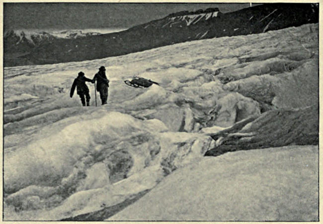
A lunch halt was made at the top of a
steeper slope, just where crevasses began to be
numerous. By keeping well round to the left
their intricacy was easily avoided. Where
the descent was made they were relatively small
and for the most part wedged with winter snow,
strong enough to bear. Leaving the men to
guide the sledges down, we gaily shot the slope,
crevasses and all, on our ski. Though the ice
was rough and much honeycombed, we covered a
mile of descent in a few minutes, “everything
safely,” as our dragoman used to say on the Nile
in a gale of wind. At the foot, where the glacier
became more level, prosaic marching order had to
be resumed. Klaas Billen Bay was nearing, a
leaden purple, almost black expanse, dotted over
with countless icebergs in the gloomy beclouded
evening light. The final descent over the steep
moraine was even more difficult than the ascent,
for the useful snow-strip had melted away and the
stones were more unstable than before. The
sledges were seriously knocked about in the
process of lowering; the metal covering of the
runners was stripped off and the runners themselves
smashed in two places. They just held
together so that we could drag them over the
débris fan and the wide bog beyond to where our
camp was standing uninjured, with the whaleboat
drawn up beside it.
The general result of this inland excursion was
highly satisfactory, notwithstanding our misfortune
with Svensen. It enabled us to record in outline
the general structure of the area included
between Wijde Bay, Dickson Bay, Ice Fjord,
Wybe Jans Water, and Hinloopen Strait. Before
the recently undertaken exploration of the interior,
Spitsbergen was supposed to be covered, like
Greenland, with a big icesheet. There were
known to be some mountains, but they were
described as nunataks—islands of rock poked up
through the enveloping ice. The nature of the
Greenland icesheet is well known; it buries the
whole interior beneath its vast thickness, hiding
hills and valleys together within its mass, and
flowing down over them on all sides to the sea,
toward or into which it sends tongues of ice
through every gap. All the glaciers in Greenland
are but tongues of a single icesheet. Spitsbergen
was supposed to resemble Greenland in this
respect. In 1896 we proved this view to be
erroneous as to the central portion of the island.
The belt of land bounded on the south by Bell
Sound and on the north by Ice Fjord, and stretching
across from sea to sea, is absolutely devoid of
any icesheet. It is a complex of mountains and
valleys, amongst which are many glaciers indeed,
as there are amidst the mountains of Central
Europe, but no continuous covering of ice. Each
glacier is a separate unit, having its own catchment
area and drainage system. The valleys are boggy
and relatively fertile, the hillsides bare of snow in
summer up to more than 1000 feet above sea-level.
There are lines of depression between Ice Fjord
and Bell Sound, and between Sassen Bay and the
east coast, which are absolutely snow-free throughout
the arctic summer.
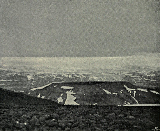
THE COLORADO PLATEAU.
We had a suspicion that the area between
Foreland Sound and Ice Fjord was not covered
by an icesheet, but we still thought it probable
that one would be found in the region north-east
of Ice Fjord. The result of our present expedition
was to prove this not to be the case. We traversed
a great deal of glacier and snowfield, but none
belonging to a true icesheet. The whole of this
region, which I have named Garwood Land, after
my excellent companion, is a glaciated mountain
and valley system. Each glacier in it is a clearly-marked
unit, with its evident watersheds dividing
it from its neighbours. North of the Chydenius
range, by which Garwood Land is bounded, there
does come a true icesheet covering the whole of
New Friesland and flowing down to the sea on all
sides. North-East Land, too, is buried under an
icesheet. These are the only ones in the Spitsbergen
archipelago.
The mountains of Garwood Land are remains
of a denuded plateau, resembling those of the
Sassendal region. They have been carved out by
a denuding agent eating a series of valleys back
into the plateau. Readers of my former book,
“The First Crossing of Spitsbergen,” will remember
how many examples of the rapid formation
and extension of valleys by the eating back of the
head-waters are there recorded. The Colorado
Berg north of the Sassendal was the best example
of the process. That plateau, now bare of ice, is
being rapidly cut up into separate hills by the
excavation of a series of deep, narrow cañons,
which will widen and creep further back year by
year. Now, the hills of Garwood Land are of a
similar type. The wide, deep valley, into the
head of which we looked down from our farthest
point, sends back into the plateau (or remnant of
a plateau) a number of tributary valleys, all of the
same deep, gently sloping, steep-headed type.
From many indications we concluded that a
series of similar valley-heads and cliffs lay to the
eastward of our whole route from where we
turned back as far as the Terrier. This row of
cliffs and bluffs probably flanks the eastern
watershed of the Nordenskiöld Glacier. The bad
weather that prevented our ascent of the Terrier
prevented also the verification of this hypothesis.
If we could assume that Garwood Land was
at any time considerably less glacier-covered than
it now is, so that its valleys were bog-bottomed
like the Sassendal, and its uplands resembled the
Colorado Berg, it would be easy to account for
the present configuration of the land surface.
We should say that it was formed by aqueous
denudation, and subsequently covered up by the
increase of the ice. It is certain that there has
been a great increase in the ice-supply on the
land hereabouts during the last two centuries, for
in that time the Negri Glacier has advanced at
least fifteen, probably twenty, miles into the sea
along a front fifteen miles in width. This fact,
however, does not suffice as foundation for so
great an assumption. It is rather to the steady
elevation of the land that we must look for a
solution. Everywhere in Franz Josef Land and
Spitsbergen the land is known to be rising. The
western belt of the island has been longer
exposed to denudation than the east belt. The
latter, therefore, has perhaps been later elevated.
It came up from the sea as relatively flat ground.
As its elevation continued this flat ground was
raised into a plateau. At first it did not reach the
level of perpetual snow, so that whilst rising it
was being cut down into valleys and cañons by
the action of water, pouring off from the plateau
over its edge, and hurrying down a frost-split
rock-face. The bed of such a valley has of
necessity a very gentle slope. The head is steep,
almost a cliff, the whole face of which is being
continually stripped off, so that the valley, once
begun by a waterfall over the edge of the horizontally
stratified plateau, penetrates steadily backward.
These valleys once formed, with their steep
heads and sides, would maintain themselves even
after the remains of the plateau were covered
with an icesheet and the valleys filled with
glaciers. There is no need to predicate for the
glaciers any power of erosion; that is not the
way arctic icesheets act, for the upper layers of
ice flow over the lower at a far greater speed than
is the case in glaciers under lower latitudes.
Given an existing cliff, however, with a glacier
below it, and the denuding agencies of frost and
water at work upon it, that cliff tends to maintain
itself and to eat its way back into the mountain
mass behind, for its débris fall upon the glacier
below and are carried away; they do not pile
themselves up into a protecting slope at the base
of the cliff. This eating-back process will go
forward with unequal speed according to the
varying qualities of the rocks. Bays will thus be
formed and will eat back into the plateau, just as
the gullies eat back in the Sassendal region, only
the bays will tend to grow wider in proportion
to their depth in a glaciated country than in a
region mainly bare of snow and ice.
For this process to begin it is necessary that
somewhere a rock-face should be exposed to the
air. The exposure may be produced by a fault,
or by a denuding process begun before the land
was much glaciated. We are in no position yet
to assert how the process commenced in Garwood
Land, but that the bays, valleys, and cliffs
now existing are being maintained in the manner
above described is certain. If the ice were again
to cover up the Colorado Berg and the hills
opposite, and were to flow into and down the
Sassendal to Sassen Bay, the aspect of that region
would resemble that of Garwood Land to-day.
It is only in the case of a country like Greenland,
entirely buried under an icecap thousands of feet
thick, through which, save along the coast, no
rock appears and no cliff is exposed—it is only in
such a country that the conservative action of ice
is complete and the modelling of an elevated
land-mass into hills is practically arrested.
Hence the scientific importance of distinguishing
between a proper icesheet (in the Greenland
sense) and a mere assemblage of separate glaciers,
however large in volume and intimate in their
connexion with one another. An icesheet, or
inland-ice, operates in a totally different manner
from a series of glaciers. Save in North-East
Land and in the part of Spitsbergen called New
Friesland, there is no proper icesheet in Spitsbergen,
and the phrase “inland-ice” should be
expunged from maps and descriptions of regions
to which it is not applicable. A chief and no
unimportant result of our explorations in the
interior of Spitsbergen is this discovery that the
parts supposed to be enveloped in an icesheet
are in fact merely glacier regions.