The cause of glaciers—Formation and structure—Motion—Moraines:
Lateral, medial, and terminal—‘Surface’ moraines—Crevasses—Moulins—Glacier
cones—Glacier tables—Surface torrents—Avalanches—Cornices
In a work of this nature it may not be out of place to
briefly describe some of those interesting features and
phenomena which accompany the world above the snow-line.
Here is a quotation from a recent review of Professor
Heim’s work[2] by a prominent member of the
English Alpine Club:—
‘Some thirty years ago a systematic résumé of all
that was known up to that date about existing glaciers
appeared in the work of Professor Albert Mousson,
“Die Gletscher der Jetztzeit,” since which, with perhaps
the exception of Major Hüber’s “Les Glaciers,” no
attempt has been made to collect into a focus the light
which numerous able observers and theorists have
subsequently thrown upon the question. The intricacy
of the problem has, indeed, increased almost in proportion
to our enlarged knowledge of its conditions; and
in spite of the labours of a large and very distinguished
body of investigators, not only do many important
points remain matters of dispute, but the very materials
for a complete solution are still wanting.’
CAUSE OF GLACIERS
The joint cause of glaciers is precipitation and cold.
A low temperature alone can do nothing without
moisture, and this fact quickly disposes of the popular
notion that glaciers invariably exist in cold countries.
Thibet, for instance, and also some parts of Arctic
North America are destitute of ice streams, though
eternal cold may be said to reign supreme in these parts.
Imagine for a moment the higher mountains clear
of snow and ice, and then watch for the formation of a
glacier. Snow falls and fills up all the valleys and
gullies, avalanches descend from the higher parts,
and a great accumulation gathers in all hollows. By
constant repetition of snow-falls (always provided a
greater quantity is deposited than can be melted by the
sun’s rays and by the natural warmth of the earth’s crust)
great pressure is put upon the lower portions by the
superincumbent accumulation, and aided by the infiltration
of water and refreezing (or ‘regelation’ as the
correct term is), a large body of ice is formed which at
once begins to move down the valleys containing it.
GLACIER ICE
Glacier ice is not like the solid blue ice on the surface
of water, but consists of granules joined together
by an intricate network of capillary water-filled fissures.
In exposed sections and upon the surface of the ice
can be observed a ‘veined’ or ‘banded’ structure—veins
of a denser blue colour alternating with those of
a lighter shade containing air bubbles.
The cause of this peculiar structure has been the
subject of much theorising amongst investigators, but
hitherto I believe the greatest authorities consider that
the explanation of the phenomenon is yet wanting.
GLACIER MOTION
The motion of glaciers is yet another bone of contention,
but it is generally admitted that the cause of
it is to be found mainly in gravitation, and is also
partially accounted for by the strange property of
‘viscosity’ in what appears to the casual observer to
be nothing more or less than a rigid solid.
Recently observations for ascertaining the rate of
progress of the Tasman, Murchison, Hooker, and Mueller
Glaciers have been made by the New Zealand Government
Survey Department. Some of the results were
embodied in a paper by Mr. J. H. Baker, the Chief
Surveyor of the Provincial District of Canterbury, and
will appear in the ‘Transactions of the Australasian
Association for the Advancement of Science’ for 1891.
At the late meeting of that body a committee was appointed
to further these investigations, and a sum of
25l. voted for the aid of the same.
Before long, therefore, there will be put before the
scientific public reliable measurements of the motion of
several of the largest and least-known glaciers in
temperate regions.
MORAINES
There is a remarkable feature of the glaciers of this
country which stamps them as unique in one respect—I
refer to the very extensive moraines. I write feelingly
of this, for my acquaintance with them has been a very
close one, and they have impressed me very deeply—in
more ways than one.
The large glaciers of which I have written in this
work are completely moraine-covered over their lower
parts.
‘SURFACE’ MORAINES
Moraines may be divided into four sections:
‘Lateral’ moraines, fringing the sides of the glaciers,
their outlying portions often being ‘dead’—that is, at
present unmoved by the action of the ice, and forming
banks, as it were, for the ice stream to flow between;
‘medial’ moraines, which begin at the junction of two
streams of ice and often continue for many miles to
the terminal face; ‘terminal’ moraines, formed by
the depositing of detritus at the melting point or end
of the glacier; and, lastly, ‘surface’ moraines (so called
by Professor Hutton of Christchurch, N.Z.), which are
the combined accumulations of the first two divisions
in the lower parts of the glacier.
It is these ‘surface’ moraines that are such a characteristic
feature of the glaciers situate on the eastern
side of the chain in New Zealand. Of those on the
western side I am not able to speak with authority,
never having visited them myself; but I understand
that they do not carry such a large quantity of detritus
as those of the eastern slopes.
This disparity remains to be accounted for and
awaits an explanation. I have a theory of my own
upon the subject, which, however, as yet I would not
like to put too strongly forward.
On both sides of Mount Cook, on Mount De la Bêche (ten miles further
along the chain), and on a peak just north of the Hochstetter Dome (ten
miles still further north) I have observed enormous exposed sections of
the rock strata, which in each case dip at a steep angle from east
to west, presenting slab faces, not easily disturbed by the action
of the frost, to the westward, but broken and fast denuding faces
(‘basset’ faces, as they are geologically termed) to the eastward. I
am hoping at some future time to further investigate this interesting
subject.
As the western glaciers, however, must descend steeper valleys than the
eastern, I make no doubt that their rate of progress will be eventually
ascertained to be greater than that of the latter, and this would
militate largely against an accumulation of moraine upon the ice.
THE SURFACE OF A GLACIER
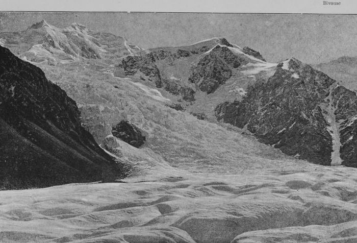
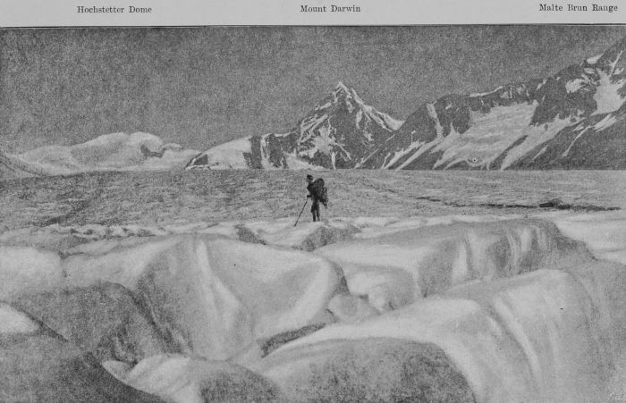
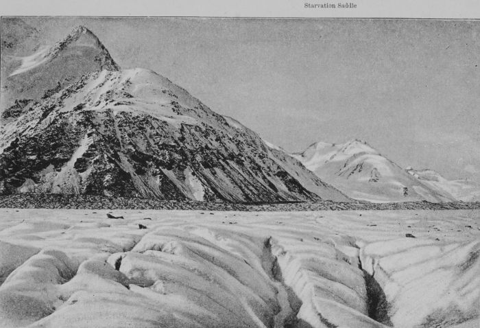
All sorts of queer notions as to what the surface of
a glacier is like exist. Indeed I have often heard
people inquire if it would be possible to skate upon it!
Let us for a moment imagine ourselves at the head
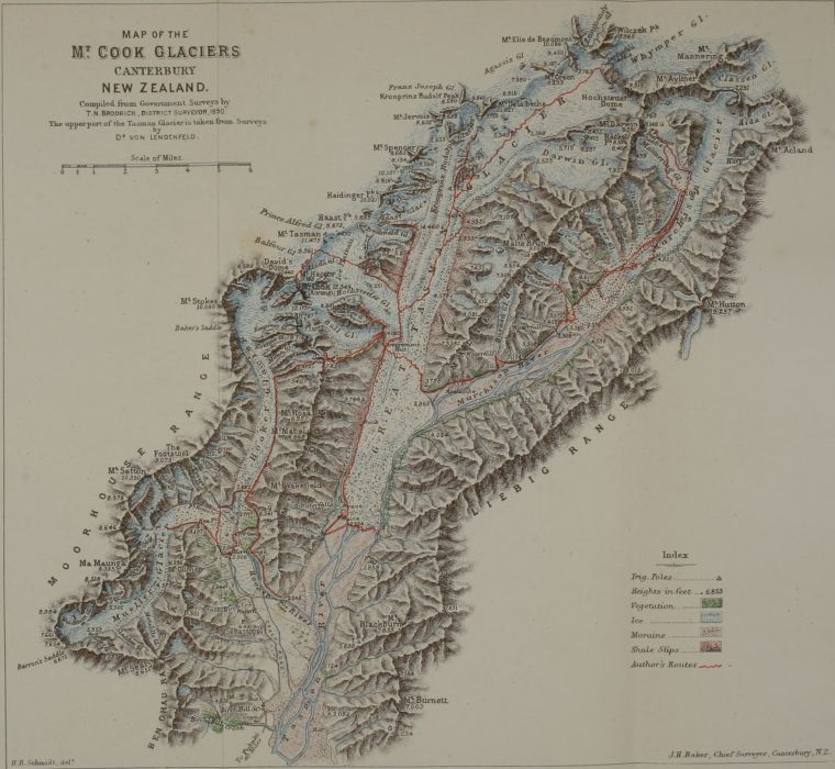
of the great Tasman Glacier, 8,600 feet above sea-level.
All around us is snow, either freshly fallen or merging
into névé. We begin to walk down, and at first, upon
the steeper slopes, cross a few large crevasses and
bergschrunds by means of snow bridges; then, as the
incline becomes less steep, we walk for six miles or so
upon a smooth surface of névé, or perchance knee-deep
in fresh snow, and scarcely a crevasse exists. At
the beginning of the great turn we gradually leave
the névé and find ourselves upon hard, white ice, and
soon transverse crevasses appear; these are a little
further on cut by longitudinal crevasses forming the
surface into huge squares, not flat on the top, but hummocky.
A perfect network of crevasses cuts up the
whole of the surface, but those parts on the outside of
the curve are infinitely more disturbed than those on the
inside, owing to the tension put upon them by the faster
rate at which they have to move. After rounding the
turn the glacier again consolidates and few crevasses
appear, only the surface is covered with old wounds—if
I may coin such a term—from the rents which have
occurred at the turn, and presents a very undulating
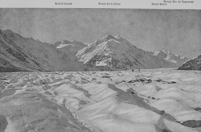
appearance. The little gullies are formed into watercourses
and intersect the glacier in all directions. On
our right, now, is the medial moraine formed by detritus
from Mount De la Bêche, brought down partly by the
Tasman and partly by the Rudolf Glaciers, and it
stands up 100 feet or so above the surface of the clear
ice on either side of it, owing to the protection from
the sun’s rays afforded by it to the ice beneath, so preventing
‘ablation’ or waste going on so quickly. We
follow down for another four or five miles, and then
cross this moraine (which has in the meantime joined
that on the northern side of the Hochstetter Glacier)
on to the Hochstetter on our right.
SURFACE TORRENTS AND MOULINS
We are now immediately below the great ice-fall,
and the surface of the glacier presents an appearance
not unlike the back of some enormous caterpillar
wrinkled transversely by crevasses, which close up as
we proceed downwards, and furrowed longitudinally
by two large or main watercourses whose icy banks
are in places 100 feet above their respective torrents.
These two small rivers are fed from every direction by
minor watercourses, and a mile or two further down
discharge all their contents into crevasses and moulins,
or water-shafts in the ice.
GLACIER TABLES AND CONES—THE ACTION OF WARMTH
The locality of the glacier on which we now are is
very interesting, for Nature’s mills are here seen at work
day by day. Glacier tables—blocks of rock perched
upon pedestals of ice formed by the protection from the
action of the sun’s warmth—are of frequent occurrence.
Glacier cones—heaps of sand and small fragments of
rock raised by a similar agency (after having been
washed to one spot by water)—are in places all around
us. Then, strange and contradictory as it may seem,
we see thousands of holes, each with a stone at the
bottom and filled with the bluest of blue water, formed
also in the first place by the rays of the sun warming
the stone and causing it to sink in the ice. It is well-known
in physics that water at 39° Fahr. is at its heaviest,
and as soon as the warm stone—the dark colour of the
stone having absorbed more heat than the surrounding
ice—begins to sink the warmer water follows it, whilst
that in the neighbouring temperature of 32° Fahr. rises
to the surface and becomes in its turn re-warmed, and
so on. This peculiar current often bores the holes in
the ice to a depth of many feet, and is only checked
by a preponderance of cold. It is the larger stones,
therefore, which rise upon the ice, and the smaller ones
which sink.
‘SURFACE’ AND ‘TERMINAL’ MORAINES
We walk on down the ice stream, and soon the
moraines on either hand close in upon us and we find
ourselves on a mere wedge of ice, at the point of which
we step on to the ‘surface’ moraine. Here the swearing
begins, and it lasts right on to the terminal face
four or five miles below, for it is one continual repetition
of walking on loose and tumbling rocks, up one hillock,
along a ridge, jumping from
Rock to rock with many a shock,
down another hillock, now and then starting a whole
avalanche of many-sided and sharp-edged stones down
a treacherous slope of ice, which we take for a surface
deeply covered and sound of footing.
Skate on the surface of a glacier?
‘Not much!’ (as the Colonials say).
AVALANCHES
Very strange notions also exist amongst the uninitiated
as to the nature of avalanches. The popular
idea of an avalanche is derived from heartrending
accounts of great sweepings away and annihilation of
whole villages, and few of the general run of people
seem to realise that in Alpine work almost any little
descending mass of rock, snow, or ice is dignified by
the name of avalanche. Snow avalanches are most frequent
after fresh falls of snow followed immediately by
warm weather, and after a little experience amongst the
mountains one soon learns to detect their customary
tracks. Ice avalanches are mainly caused through the
overhanging portion of ice at the terminals of secondary
glaciers—that is, glaciers which break off before descending
to the valley or to the parent glacier below. The
tracks of ice avalanches are almost invariably unmistakable
and are swept night and day without cessation,
and very frequently at regular intervals.
Rock avalanches are more treacherous, and one
never knows when to expect them from above; generally
in the early morning the frost holds the stones above
in an icy grip, but as the sun melts the ice in the
chinks the hold is released and a stone will descend
into the couloirs or ditches which scarp the mountain
side. If one happens to be below then it is a case of
sauve qui peut and a rush for the nearest protection, for
there is no saying how many tons, or indeed how many
hundreds of tons, of loose rocks or stone may start in a
wild and dusty rattle down the hillside.
But some snow avalanches almost crawl down the
couloirs, and make a strange and ever-continued hissing
as they move. These are composed of heavy and
sodden snow, and begin after the sun has been up for
some hours, continuing until nightfall. These are not
so dangerous on a gentle slope, and one can often
waddle or half glissade down in the midst of one with
perfect safety, though they make one uncomfortably
wet.
CORNICES
Cornices are a frequent source of danger to the
mountaineer. They are formed by the snow drifting
over one edge of a ridge and forming a hanging mass.
It is needless to say that one soon learns to walk some
feet away from the outer edge of a cornice, for after
poking one’s axe-handle through three feet of snow,
and peeping through a blue hole down a precipice of
perhaps 1,000 feet or so, it is not difficult to fancy
what the result would be should the cornice break.
The Waimakariri—The enormous rainfall—Descent of the Waitaki
River—The Tasman branch—Lake Pukaki—Leaky canoes—The
Pukaki Rapids—The Waitaki Gorge—Out on the plains again—Sixty
miles’ paddle to catch the train—Home once more
Canoeing on the New Zealand rivers is desperately
exciting work. On the west coast of the South Island
there is a canoe club, whose members build boats in
watertight compartments specially suited for the rough
journeys which they undertake. Some of these men
are adepts at canoe-sailing, and think little of going out
to sea in their cockle-shells and even making long coastal
journeys. The brothers Park have established quite a
reputation by their adventurous journeyings. On one
occasion they crossed the South Island with their canoes,
towing up the Teramakau River, crossing a saddle of
1,700 feet at its head, descending the Hurunui and
then coasting fifty miles down to Christchurch. On
another occasion the crossing of Cook Straits was
effected by them.
On the eastern side of the island not much canoeing
has been done, with the exception of the navigation of
two of the largest rivers (the Waimakariri and Waitaki)
from their sources to the sea by Mr. Dixon and myself.
I well remember how universal was the outcry
against our attempting to descend the Waimakariri in
1889, upon which occasion we conveyed the canoes
up to the head waters in the Southern Alps, and came
down ninety miles of rapids at a tremendous rate,
going through the celebrated gorge fourteen miles in
length. Dixon reached Christchurch in one day—a
wonderful feat—but I was not able to accomplish more
than half the distance, and took two days over it. This
involved a descent of 2,550 feet in altitude from the
starting point.
In the following year the Waimakariri was again
navigated by myself and three other kindred adventurous
spirits, when a number of line photographic views
of the scenery in the gorge were secured.
The descent of the Waitaki River, however, promised
some exciting work, in addition to giving a grand insight
into the story of the ancient glacier formation—a
subject of great geological interest.
The rainfall in the New Zealand mountain districts
is enormously heavy, as much or more than 150 inches
per annum being registered in some parts. The rivers
consequently carry a phenomenal amount of water for
their length, and the calculations as to their discharge
give wonderful results. The Clutha River in Otago—the
largest river of the South Island—discharges as
much water per annum as the Nile! It seems a strange
statement to make; but such is the fact, the calculations
having been made by competent men.
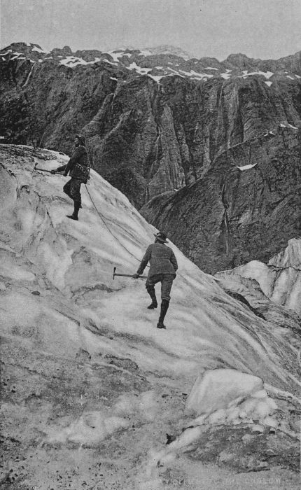
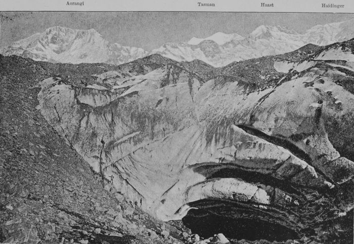
IN THE ICE-FALL OF THE ONSLOW GLACIER
[Wheeler & Son, Photo.
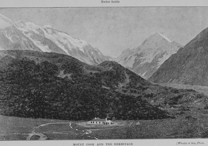
The day following our return from Aorangi we left
the Hermitage at 9 a.m., and by 1 p.m. had begun our
exciting journey of 140 miles to the sea.
The Tasman River takes its rise from the Tasman
and Murchison Glaciers, and is soon joined by the
Hooker, which drains the Hooker and Mueller Glaciers.
Its course from Mount Cook to its delta at the head of
Lake Pukaki is thirty miles in length, and the fall is
considerable, the terminal face of the Tasman Glacier
being 2,456 feet above sea-level, whilst the altitude of
Lake Pukaki is 1,717 feet. The first mile or two of
the journey was marked by several strong rapids, and
we could not avoid shipping much water; and, added
to this, we soon found that some old cracks in the
canoes had opened out through exposure to the sun,
although they had been carefully covered over with
sacking during our absence in the mountains. This
gave us some cause for anxiety, and the discomfort
of paddling in boats which were half full of water
soon made itself painfully apparent. Indeed, there is
nothing more calculated to put a man out of temper
with all the world and his surroundings, to goad him
to strong language, and to give him an uncomfortable
and miserable time generally, than to have to sit for
hours in a boat that floats like an unmanageable log, to
say nothing of the increase of danger to which he is
consequently exposed in some parts of a river such as
the Tasman, running, as it does, something approaching
ten knots in many places.
I don’t think Dixon and myself are likely to forget
the tortures of the four hours which we passed through
on reaching the lake. Here the cracks in my boat,
which was decidedly the worse of the two, had to be
jammed up with handkerchiefs, &c., before we dared
to venture on a journey of eight or nine miles to the
ferry at the other end of the lake, where is situated
the exit of the Pukaki River.
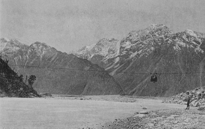
As we scraped over the sandy shallows and pushed
off into deep-green water, my heart sank within me at
the idea of having to cross the lake in its present
rough state (for a strong nor’-wester was blowing) in
our frail canoes, which were not built in watertight
compartments, and were quite unsuited for the work.
Every ten minutes or so I would have to stop paddling
and bale for dear life with the lid of the ‘billy,’ and the
craft would immediately swing round broadside on to
the seas, which seemed to do their best to upset her.
At first we kept edging away for the southern
shore, and about half-way down the lake succeeded in
getting within reasonable swimming distance, which, to
a certain extent, we retained for a short time.
In the distance we could make out the island close
to the ferry, with some trees on it, and from our direction
there appeared to be but three. My thoughts at
once flew back to the island on the Lake of Geneva,
which Byron has immortalised in his ‘Prisoner of
Chillon,’ and on which poor Bonnivard would gaze
with sadness and yearning for freedom and life.
And then there was a little isle,
Which in my very face did smile,
The only one in view.
A small green isle, it seemed no more,
Scarce broader than my dungeon floor;
But in it there were three tall trees,
And o’er it blew the mountain breeze.
And by it there were waters flowing,
And on it there were young flowers growing
Of gentle breath and hue.
I made sure my hair would be grey, like poor
Bonnivard’s, before this lake was crossed; but soon the
wind dropped, and we paddled ashore at 9 p.m. close
to the hotel and called for brandy and water hot, and
seldom was the indulgence more justified.
At Pukaki Ferry we enjoyed a well-earned night’s
rest, and on Sunday morning we effected repairs to the
leaky canoes, in which operation we received much
valuable advice and assistance from Mr. John Gibb,
artist, who was spending a few days in sketching at
this point. By 1 p.m. we were on board again and
looking forward to reaching Rugged Ridges—Mr. W.
G. Rutherfurd’s station on the southern bank of the
Waitaki—before nightfall. But we little knew what
was ahead of us.
A survey of the river from an eminence of the old
moraine through which it has formed a channel, revealed,
as far as the bends of the stream could be
followed, a rushing, seething mass of foam-covered
water, with numberless blocks of rock barring the
clear passage of the current, and though we shot the
first two rapids below the exit from the lake it took
us until seven o’clock in the evening to navigate six
miles of the river’s course.
It is not easy to describe the wild course of the
river in its descent through the enormous ancient
moraine deposits, some of which might almost be
classed as mountains, and must rear their tops to a
height of 1,000 feet above the level of the river. Such
an immense body of rushing water, receiving, as it does,
the whole of the drainage of the Southern Alps, from
the head of the Mueller Glacier to that of the Murchison,
necessarily creates great havoc amongst the
glacial and fluviatile deposits through which it descends,
and, as a matter of course, all the smaller
stones are hurried and rolled along to form shingle on
the river-beds further down, leaving the larger ones,
which alone can stand against the force of the flood.
The natural consequence is a stream of the most
broken and impetuous character, a stream whose rushing,
roaring, and foaming drowns all sounds contiguous
to it; rapid after rapid of seemingly tempest-tossed
and crested billows, of whirlpools and eddies, of back-waters
and heavings into surface currents, and never a
still pool to be found anywhere.
Imagine, then, the troubles of two canoeists in navigating
this stretch of water. No canoe or boat in the
world would have the slightest chance of going through,
out in the current, without being smashed into match-wood
and its occupants infallibly drowned, for swimming
would avail a man nothing in such a place.
All we could do, then, was to keep close to the bank
and let our frail boats down by the tow-lines amongst
the rocks in the comparatively shallow water. Now
shoving them off into a fair stretch and hauling them
up short in time to avoid contact with some ugly rock
in front, then scrambling along ourselves and coiling
our lines as we advanced, clambering over water-worn
and slippery rocks, tearing our way through the Wild
Irishman scrub, or wading a few steps middle-deep in
the turbid water to the points where we had brought
our respective canoes up. Then repeating the same
performance over again and again, bruising our legs
against rocks, slipping down amid the slimy stones,
scratching the skin off and receiving numerous thorns
from the scrub, wishing we had never been born,
lamenting the hardships of our lot, anathematising
canoes, ropes, paddles, river, rocks, scrub, and everything
in creation.
No, that seven miles journey was not all that could
be desired; but having put our hands to the plough,
we both made up our minds that we would go through
with the undertaking, even if we had to repeat the
same performance down to the sea every day for a
week, and the worse the river got the more pig-headed
we became. We had beaten Mount Cook, and we
meant also to gain a victory over the Pukaki and
Waitaki, if it cost us our life-blood. At some places
where a number of large rocks were congregated close
to the river’s bank we would be compelled to take the
boats out, and shouldering them, climb round the rocks
on shore, and launch them afresh in better water
below.
At one time, Dixon, who was leading, accidentally
dropped his paddle, which was whisked away by the
current in a trice. He made a great effort to recover
it, and plunged in up to his armpits in the turbulent
water, but failed to reach the truant paddle. Seeing
his difficulty I pushed my boat out to him, and he
seized my paddle and, jumping into the canoe, gave
chase to the one he had lost. I ran along the bank, but
could not keep near him; and in fear and trembling I
watched him nearing a horrible fall amongst some
sharp teeth-like rocks. I thought his last moment had
come, but just before reaching the danger he overtook
the lost paddle, which he grasped with one hand, and,
jumping out of my canoe, held the tow-rope and
brought the boat up within a few feet of the fall. The
whole affair was the work of a few moments, and was a
wonderful exhibition of smartness and presence of mind.
By 7 o’clock we began to think that we had had
about enough for the day, and, putting the boats
ashore, we walked back, over the old moraine and
along the rabbit fence (which, by the way, I hear is
doing its work splendidly), to the Pukaki Ferry for
the night.
By 7 a.m. next morning we were again with the
canoes, and once more performing gymnastic feats
along the rocky bank. But our reward was now near
at hand, for after an hour or so we got on board and
sneaked down the quieter sides of one or two pools.
The moraine deposits gave way to those of fluviatile
origin, and the size of the stones in the river-bed decreased
rapidly; consequently we soon began shooting
the rapids again and were making grand headway.
The country on either hand opened out; from our left
came in the Tekapo River, and soon after, as we sped
on under Ben More, on our right the Ohau. Now we
were in the Waitaki, which is formed by the junction
of these three rivers. ‘Waitaki,’ or ‘Waitangi,’ means
‘Crying water.’
The hydrographic area of the Waitaki Basin is
4,914 square miles, more than three times as great as
that of the Rakaia or Waimakariri, and it drains most
of the principal eastern slopes of the Southern Alps.
The eastern source of the river drains the Godley
and Classen Glaciers with their numerous tributaries,
forms the Godley River, and flows into Lake Tekapo
(some fifteen miles in length); it issues from the southern
end of the Lake and curves a channel for itself through
the ancient moraine, when it becomes known by the name
of the Tekapo River, which, flowing for a distance of
about twenty-five miles, joins the Pukaki; all these,
with the addition of the Ohau, the junction of which is
a few miles further down, form the Waitaki River. The
Hopkins and Dobson Rivers drain that part of the Alps
immediately south-west of Mount Sefton, and flow into
Lake Ohau. The stream issuing from thence, under the
name of the Ohau River, runs for a course of thirteen
miles, and joins the Pukaki and Tekapo as before
mentioned.
After the union of these three systems of drainage
the course of the river runs through a wider bed for
about five or six miles before entering a gorge some
ten miles in length. Down this fine stretch of water
we now enjoyed a delightful paddle, and soon we sighted
Black Forest sheep station, with its rows of green
willow trees, on our left.
Here various kinds of river birds lent an aspect of
life and gaiety to the scene—gulls, terns, paradise and
grey duck, teal, dotterel, stilt, and red-bill soared over
us, or rose in startled dismay as we shot by.
We had left the snows behind us and were fast
being closed in by the foot-hills. We neared the gorge
at 11 a.m. and paddled ashore on the Otago side and
boiled the ‘billy’ for lunch.
It seemed a delightfully quiet hour after all we had
been through; we sat and smoked in happiness and
watching the rabbits skipping about amongst the
bracken. We were certain, if only by that, that we
were in Otago, where rabbits are the monarchs of all
they survey.
The Mackenzie country hands had told us that we
should find the gorge a little rough, so we knew we
were in for it presently; yet for a couple of miles we
found the river good going, though some ominous spurs
of bed rock now and then entering the current—the
first bed rock we had met with since leaving Mount
Cook—foretold what we were coming to.
After going round a few ugly corners the white
water became more frequent, until suddenly we were
brought up by an awkward rapid into which we dared
not venture.
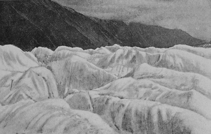
THE SURFACE OF A GLACIER
[Wheeler & Son, Photo.
A survey from the cliffs, sixty feet above the stream,
disclosed a tongue or groyn of rocks running out into
the stream in an oblique direction from the Otago side,
and shooting the main body of the current on to the
rocks opposite. A long stretch of straight water
followed, but the whole stream was confined in rocky
banks so close together that one might throw a biscuit
across, and the pace of the current was something
terrific. For half an hour we considered the situation,
finally determining to shoot the rapid. There was
really only about eight or ten feet of safe water close
to the point of the groyn of rocks, and this was right
in the body of the current. On either hand were
eddies and whirlpools of the most formidable character,
which, in the event of our making a bad shot, might
swirl us among the rocks on one side or the other, and
had such been the case we trembled to think what
would have been our fate. However, at it we went,
Dixon as usual leading, with a head as cool as a
cucumber, and I following, like a spaniel after his
master. One wild rush, a few strokes of the paddle, a
mad tossing about in a sheet of crested foam, half-a-dozen
bucketfuls of water on board, and we were
through, breathing again as we tore down the hurrying,
but straight and safe, current below.
Though we met with no greater obstacles to canoeing
than this rapid in the gorge, such performances
were several times repeated, and we had to land now
and again to survey the course ahead.
To describe the mad plunging of the river through
the gorge is not an easy matter. Here and there, perhaps,
a long even stretch is met with, but for the most
part the river makes a succession of bends bounded by
rocky cliffs on either hand, now and then masses of rock
crop up through the water, against which the stream
is banked up by the force of its mad career to a height
of ten or twelve feet; immediately under the sides
of the rock there are vicious-looking heavings, eddies,
and whirlpools, which, if one chances to get into them,
twist the boat about like a feather when blown upon
the water’s surface. A black swan and three cygnets
kept ahead of us for the last six miles of the gorge, but
as we entered with relieved feelings upon the more open
country, they eluded our further pursuit in a backwater.
Another few miles and we reached our destination for
the night—Mr. W. G. Rutherfurd’s station, Rugged
Ridges—where a warm and hospitable welcome made us
feel that once more we were in the regions of civilisation.
Leaving next morning at 4.30, we gave ourselves
eleven hours to catch the train for Christchurch, at
Waitaki, a distance by water of sixty miles. Four
hours saw us in Duntroon (thirty miles), where we
astonished the natives in disgracefully tattered boating
attire, and indulged in that from which we had long
been estranged—‘a long shandy’—and by 9.15 we
were off again at eight miles an hour, shooting down
the most beautifully safe and rippling rapids, scaring
ducks, plover, gull, stilt, swan, and all manner of wild
fowl; now and then startling a mob of horses or cattle
from their peaceful browsing, or astonishing some slow-going
shepherd or cowboy as they stared open-mouthed
at such an uncommon sight as two madmen in cockle-shells
of canoes rushing down their boatless river,
until we put the final touch to the whole enterprise by
carrying our boats up to the station at Waitaki South
(to the amazement of four railway navvies), at 1 p.m.,
having averaged eight miles an hour for sixty miles,
allowing for one hour stoppages.
The distances by water, allowing for sinuosities in
the course of the rivers from Aorangi to the sea, may
be roughly summarised as follows:—From the end of
the Mount Cook Range to Pukaki Ferry, thirty-four
miles; from the Ferry to Rugged Ridges, thirty-eight
miles; and from thence to the railway bridge near the sea
at Waitaki, sixty miles; a total distance of 132 miles.
If it were not for the Pukaki Rapids the trip
might be comfortably accomplished in three days, and
at a stretch could be done in two; but the way to
enjoy it would be to travel in a good staunch canoe,
with watertight compartments and such accessories as
the west coast canoeists are in the habit of using, and
spend a week over the journey.