| CHAPTER I. |
| Page |
| Appointment to a Mission about to proceed to Tibet—Leave Firozpur for
Simla—Approach to the Mountains—Appearance of Himalaya from
Plains of India—Kalka—Ascent to Kussowlee—Vegetation of Plainward
Face—Origin of Kussowlee Ridge—Climate and Vegetation of
Kussowlee—Aspect of inner ranges—Road from Kussowlee to Simla—Sabathu—Cross
Gambar River—Haripur—Tropical Vegetation of Basin
of Gambar—Steep Ascent to Simla—its extent and situation—its Vegetation—Oak-forest—Pines—Flora
of Spring Months—of Rainy Season—View
from Peak of Jako—Structure of Mountain Ranges |
1 |
| CHAPTER II. |
| Leave Simla—Mahasu Ridge—Pine Forest—Summit of Mahasu—Vegetation
of Northern Slope—Fagu—Theog—Mattiana—Cultivated Valley—Nagkanda—Ascent
of Hattu—Forest of Pine and Oak—Vegetation of
Summit—View from top of Mountain—Plainward slopes bare of forest,
while those facing the interior are well wooded—Cultivation at 9500 feet—Descent
from Nagkanda towards Sutlej—Damp shady Ravine densely
wooded—Kotgarh—Cultivation—Rapid Descent—Change of Climate—Tropical
Vegetation—Rampur—Swing-bridge—Diurnal fluctuations in
level of River—Gaora—Serahan—Tranda—Western boundary of Kunawar |
29 |
| CHAPTER III. |
| Sildang river—Fine grove of Deodars—Nachar—Fruit-trees—Vine seen for
first time—Boundaries of Kulu and Kunawar—Cross Sutlej at Wangtu
bridge—Vegetation of bare rocky valley—Waterfall—Chegaon—Pinus
Gerardiana—Miru—Absence of rain—Alteration of vegetation—Quercus
Ilex—Rogi—Willow and Poplar—Chini—Cultivated Plain—Kashbir—Pangi—Camp
at upper level of trees—Junipers—Werang Pass—Alpine
Vegetation—Birch and Rhododendron—Granite Boulders—Lipa—Alluvial
Deposits—Encamp at 12,500 feet—Runang Pass—Vegetation very
scanty—Stunted Forest—Sungnam |
63
|
| CHAPTER IV. |
| Hangarang ridge separates Kunawar from Piti—Ascent to Hangarang Pass—Alluvial
deposit—Steep ascent—View of valley—Limestone rocks—Caragana
versicolor, or Dama—Camp at 14,000 feet—Top of pass—View
from pass—Vegetation of summit—Descent to Hango—Cultivation
round the village—Luxuriant wild plants—Road to Lio—Crambe—Ravine
of Piti river—Lio—Bridge over Piti river—Ascent to Nako—Nako—Cultivation
of the village—Buddhist temple—Transported blocks—Chango—Changar—Stopped
by villagers on Chinese frontier—Natural
bridge—Kyuri—Alluvium—Clay deposit with shells—Lari—Ramifications
of mountain ranges—Alluvial platforms—Pok—Dankar—Lara—Rangrig—Upper
part of Piti—Climate—Saline exudations |
96 |
| CHAPTER V. |
| Leave valley of Piti river—Kibar—Cultivation above 14,000 feet—Vegetation
of mountains—Rocky gorge—Encampment at 17,000 feet—Parang
Pass—Snow-bed and glacier—First plants at 16,500 feet—Parang valley—Gorge
leading to Chumoreri Lake—Kiang, or wild horse—Chumurti—Remarkable
grassy plain—Lanak Pass—Granite boulders—Plants
above 18,000 feet—Undulating hilly country—Hanle plain—Vegetation—Monastery
of Hanle |
130 |
| CHAPTER VI. |
| Descend Hanle river—Unsettled weather—Encamp on banks of Indus—Upper
course of Indus—Pugha ravine—Forest of Myricaria trees—Borax
plain—Hot springs—Borax lakes of Eastern Tibet—Sulphur
mine—Pulokanka Pass—Salt lake—Lacustrine clays with shells—Ancient
water-mark—Rupchu—Tunglung Pass—Fall of snow—Alluvial conglomerate—Giah—Narrow
ravine—Miru—Upshi—Indus valley—Marsilang—Richly
cultivated plain of Chashut—Bridge over Indus—Le—Buddhist
edifices |
155 |
| CHAPTER VII. |
| Departure from Le—Sabu valley—Pass between Le and Nubra—Snow—Encamp
at 15,500 feet—Digar—Valley of Shayuk—Alluvium—Populus
Euphratica—Tsatti—Nubra river—District of Nubra—Villages—Irrigation—Saline
soil—Isolated rocks—Chirasa—Panamik—Lower Nubra—Platforms
of Alluvium—Traces of a great flood—Unmaru—Kuru—Great
contraction of valley—Mountain pass of Waris—Boghdan ravine—Chorbat—Mahommedan
population—Villages—Outburst of granite—Siksa—Khapalu—Open
plain of Khapalu—Junction of Shayuk and Indus—Nar—Iskardo
plain—Description of Iskardo—Aqueduct—Fort—Lacustrine
clay formation—Vegetation |
187
|
| CHAPTER VIII. |
| Leave Iskardo in the direction of Kashmir—First march through snow
to Turgu—Lacustrine clay—it extends into narrow valleys beyond Nar—Gol—Junction
of Indus and Shayuk—Parkuta—Tolti—Kartash—Extensive
lacustrine deposits—Tarkata—Road turns up the Dras river—Ulding
Thung—Fall of snow—Hardas—Karbu—Continued snow—Dras—Find
pass in front shut by deep snow—Obliged to return to
Iskardo—Rafts and rope-bridges on Indus—Elæagnus and Apricot
apparently wild—Winter at Iskardo |
223 |
| CHAPTER IX. |
| Leave Iskardo for Rondu—Insurrection in Gilgit—Koardu—Kamar—Enter
narrow part of Indus valley—Difficult road—Range of mountains
south of Indus—Description of Rondu—Thawar—Avalanches—Alluvium—Swing-bridge—Villages—Juniper—Pinus
excelsa—Rocks—Vegetation—Return
to Iskardo—Agriculture of Balti—Game of Chaugan—Chakor
hunting—Shigar valley—Journey towards Kashmir—Dras
valley—Karbu—Dras fort—Maten—Cross pass into Kashmir—Baltal—Valley
of Sind river—Sonamarg—Gagangir—Gond—Gangan—Ganderbal—Enter
main valley of Kashmir—Town of Kashmir—Description of
Kashmir—Lacustrine formation—Trap hills—Lake—Climate—Vegetation |
248 |
| CHAPTER X. |
| Environs of Kashmir—City lake—Gardens of Shalimar and Dilawer Khan—Pampur—Avantipura—Platforms
of lacustrine clay—Mountain of
Wasterwan—Ancient city—Clay, with shells and fragments of pottery—Ancient
temple imbedded in clay—Lakes caused by subsidence—Islamabad—Shahabad—Vegetation—Vernag—Banahal
Pass—Valley of Banahal—Tropical
vegetation—Pass above Chenab Valley—Nasmon—Jhula,
or Swing-bridge—Balota—Ladhe ke Dhar—Katti—Fort of Landar—Mir—Kirmichi—Tertiary
sandstones—Dhuns—Seda—Jamu |
285 |
| CHAPTER XI. |
| Leave Jamu to return to Tibet—Lake of Sirohi Sar—Vegetation of lower
hills—Dodonæa—Ramnagar—Garta—Dadu, on a tributary of the Chenab—Camp
at 10,000 feet—Badarwar—Padri pass—Descend a tributary
of the Ravi—and ascend another towards the north—Sach Joth, or pass—Snow-beds—Camp
in Chenab valley |
315
|
| CHAPTER XII. |
| Marked change in the Vegetation—Bridge over Chenab—Pargwal—Description
of Chenab valley—Asdhari—Chatargarh—Road turns up valley
of Butna—Vegetation of Chenab valley—Chishot—Snow-beds—Camp
at 10,500 feet—Ancient moraines—Glacier—Camp at 11,500 feet—Rapid
ascent along glacier—Camp on moraine, at 14,600 feet—Change
of weather—Ascent towards pass over glacier—Cross Umasi La—Descent—Immense
glacier—Encamp in Tibet, at 13,800 feet—Open valley
of Zanskar—Padum—Great change of climate—and in vegetation |
342 |
| CHAPTER XIII. |
| Rope bridge across Zanskar river—Tongde—Zangla—Road leaves Zanskar
river—Takti La—Nira—Bridge over Zanskar river—Singhi La—Phutaksha—Wandla—Lama
Yuru—Cross Indus river—Kalatze—Nurla—Saspola—Nimo—Le—Pass
north of Le—Small glacier—Kardong—Kalsar—Vegetation—Diskit—Passage
of Shayuk river—Upper Nubra—Vegetation
of Nubra—Hot spring at Panamik |
367 |
| CHAPTER XIV. |
| Start for Karakoram—Steep ascent out of Nubra valley—Meet a party of
Merchants from Yarkand—View from summit of pass—Rapid torrent—Large
glacier—Steep moraines—Alpine vegetation—Numerous glaciers—Lakes—Glacier
on crest of Sassar pass—Sassar—Cross Shayuk river—Murgai—Limestone
rocks—Ascend Murgai Valley to 16,800 feet—Singular
limestone formation—Open plain above 17,000 feet—Re-cross
Shayuk river—Karakoram pass—Return to Sassar—Glaciers of Sassar—Return
to Le—Start for Kashmir—Lamayuru—Phatu pass—Kanji river—Namika
pass—Molbil—Pashkyum—Kargil—Dras—Zoji pass—Kashmir—Lahore—Completion
of journey |
408 |
| CHAPTER XV. |
| General description of Tibet—Systems of mountains—Trans-Sutlej Himalaya—Cis-Sutlej
Himalaya—Kouenlun—Four passes across Kouenlun—Boundaries
of Western Tibet—Height of its mountain ranges and
passes—Climate of Tibet—Clouds—Winds—Snow-fall—Glaciers—their
former greater extension—Elevation to which they descend—Snow-level—Geology—Lacustrine
clay and alluvium |
456 |
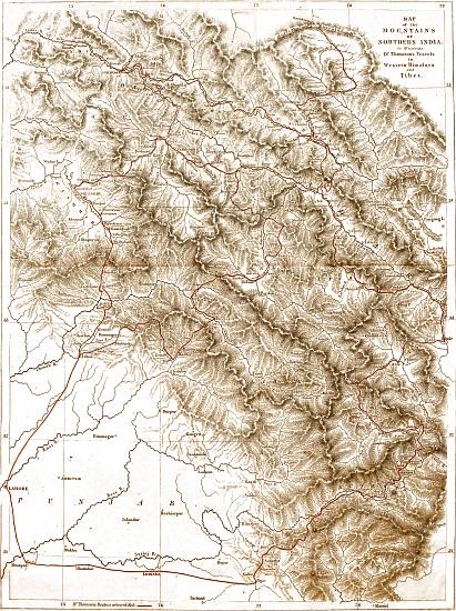
MAP
of the
MOUNTAINS
OF
NORTHERN INDIA.
to illustrate
Dr. Thomson's Travels
in Western Himalaya
and
Tibet.
Dr. Thomson's Route is coloured Red.
Drawn & Engraved by John Arrowsmith.
View larger image (2.4 MB)
WESTERN HIMALAYA
AND
TIBET.
CHAPTER I.
Appointment to a Mission about to proceed to Tibet—Leave Firozpur
for Simla—Approach to the Mountains—Appearance of Himalaya
from Plains of India—Kalka—Ascent to Kussowlee—Vegetation of
Plainward Face—Origin of Kussowlee Ridge—Climate and Vegetation
of Kussowlee—Aspect of inner ranges—Road from Kussowlee to
Simla—Sabathu—Cross Gambar River—Haripur—Tropical Vegetation
of Basin of Gambar—Steep Ascent to Simla—its extent and
situation—its Vegetation—Oak-forest—Pines—Flora of Spring
Months—of Rainy Season—View from Peak of Jako—Structure of
Mountain Ranges.
In the month of May, 1847, while with my Regiment
at Firozpur on the south bank of the Sutlej, I received
intimation that Lord Hardinge, at that time Governor-General
of India, had appointed me a member of a
mission which he had determined to despatch across the
Himalaya Mountains into Tibet; and I was directed to
proceed without delay to Simla, from which place the
mission was to start, as soon as the necessary arrangements
could be completed.
I left Firozpur on the evening of the 20th of May,
and travelling only at night, on account of the extreme
heat, I arrived at the foot of the hills, on the morning
of the 24th. The greater part of the road was through
a perfectly level country, and nearly parallel to the Sutlej,
but without following its sinuosities. During a part of
the last night's journey, I travelled among low hills,
partly composed of loose sand and boulders, partly of
clay and sandstone. The road enters this tract by an
open valley, bounded on both sides by hills, which on the
left are low and rounded. On the right they are scarped
towards the plains, as well as towards the valley up which
I travelled, and the strata of which they are composed,
dip towards the Himalaya. The valley is traversed by
a little stream descending from the mountains, one of
the tributaries of the Gagar or Markanda, that remarkable
river, which runs in a south-west direction,
as if about to join the Indus, but ultimately loses itself
in the sands of the Bikanir desert.
APPEARANCE OF HIMALAYA
FROM THE PLAINS OF INDIA.
May, 1847.
When viewed from the plains of India, at a distance
sufficient to enable the spectator to see the most elevated
part of the chain, the Himalaya appear to form
several distinct parallel ranges on the horizon, rising in
succession one behind another. The most distant of
these is covered with perpetual snow, while the other
two, usually called the middle and outer ranges, have the
usual blue-grey tint of distant mountains. From very
great distances in the plains, the most remote of these
three apparent ranges is alone visible; and as the traveller
advances towards the base of the mountains, the
others rise in succession above the horizon.
The optical deception, in consequence of which, masses
of mountains of every configuration resolve themselves
into ranges perpendicular to the line of sight, as soon
as the eye is so far removed that the outline of the
different parts becomes indistinct, has given to our
maps many mountain-chains, which a nearer inspection
proves to have no existence. As a good instance of
this, I may mention the Suliman range, west of the
Indus, which, though laid down in all our maps as a
mountain belt, parallel to and skirting the plain country,
behind which no mountains at all are represented, evidently
consists of a series of ranges, almost perpendicular
to the Indus, and separated from one another by considerable
rivers. The sources of these rivers lie far
back, and the north and south axis from which they
spring, separates all the tributaries of the Indus from
a succession of streams, which run in a south-westerly
direction, and appear to terminate, without reaching the
sea, in the low and flat country of Seistan and western
Beluchistan.
At distances of between sixty and thirty miles from
the base of the Himalaya, the three parallel chains are
well seen. On a nearer approach, the lower and outer
mountains by degrees become more distinct, and subtend
a greater angle, so as at last to conceal the more distant
portions of the chain. At the same time, the uniformity
of outline by which they had been characterized, insensibly
disappears. Ridges become visible in the face
presented to the eye, which, as the traveller continues to
advance, become developed into projecting spurs, separated
from the general mass by wide valleys, previously
quite undistinguishable. On a still nearer approach, the
elevation continuing to increase, the extent of range embraced
by the eye is gradually lessened, till at last, when
we arrive at the base of the mountains, a single valley
with its bounding ranges of low hills is alone visible,
the giant masses, so conspicuous from a greater distance,
being no longer to be seen.
The low sandy or sandstone hills, which form the
outskirts of the Himalaya, are not, on the road from
Firozpur to Simla, anywhere of greater elevation than
a few hundred feet. A few miles beyond the entrance,
the valley, which has a considerable slope, widens as it
approaches the more lofty mountains, and the sandstone
cliffs are replaced by rounded hills, probably of
a more ancient rock, covered with soil and vegetation.
KALKA.
May, 1847.
At the very base of the steep mountains is situated the
village of Kalka, at which, as it is the termination of palankin
travelling, travellers in general stop, to arrange for
the continuance of their journey. Situated close to the
source of the little stream which I had been following
since I had entered the hilly country, and surrounded
on all sides by low hills, Kalka has an elevation of perhaps
2000 feet above the level of the sea, or 1000 feet
above the plain on the outside of the sandstone hills.
The general aspect of the low hills around Kalka is
barren and uninviting; it was especially so at the season
of my visit, when the great heat had scorched the
herbaceous vegetation, and all nature had a burnt-up
appearance. The subtropical valleys are not here, as
farther to the east along the base of the mountains,
filled with dense forest. They are in general bare, a few
scattered trees only appearing here and there. In the
level part of the valley, at the very entrance, where the
soil was still of some depth, Acacia Arabica and Butea
frondosa, the most prevailing trees of the plains beyond,
were frequent; but the stony water-courses contained
little but a bamboo, and the hill-sides were covered with
scattered bushes of the more ordinary shrubs of the
plains of Northern India, and presented few features of
interest.
ASCENT TO KUSSOWLEE.
May, 1847.
Immediately on leaving Kalka, a long and steep ascent
commenced, continuing for about ten miles, to the military
post of Kussowlee, which occupies the crest of the
ridge overlooking the Kalka valley, and can be seen
throughout the greater part of the ascent, overhanging
the winding road, which has been constructed along the
side of the mountain. The elevation of Kussowlee is
about 6500 feet, an altitude at which the climate in the
Himalaya is perfectly temperate, so that during the
ascent a traveller from the plains of India meets with a
complete change of climate, a change, too, which in the
month of May, the period of my visit, is particularly
grateful, the heat below being most oppressive and disagreeable.
As the elevation increases, the view from the road
becomes more extensive. The low ranges of hills to the
south and west, which had obstructed the view, are by
degrees overtopped, and the plains beyond become visible.
Soon after leaving Kalka the road crosses a low ridge,
and enters a receding bay, or steeply sloping valley beyond,
at the upper extremity of which, all along the
crest, are seen the houses of Kussowlee. Winding round
this valley, and continuing to rise, the stream in its
centre is crossed about midway, and the ascent continues
on the spur which forms its western boundary. This
ridge is crossed close to the point where it is given off
by the main range, and the road, winding round its most
projecting part, enters a fir-wood, and, turning back very
abruptly in an opposite direction, proceeds eastward
along the northern face of the Kussowlee range.
VEGETATION.
May, 1847.
The plainward face of this range, along which the
road from Kalka ascends, is quite devoid of forest. The
lower part is covered with scattered jungle, to use a most
expressive Indian word, of small shrubs, almost all of forms
common in the plains. Carissa and Adhatoda are the
most common, with Rottlera tinctoria, a plant which does
not extend far into the plains, and a scandent leguminous
shrub, apparently a species of Mucuna. Around the few
houses which occur on the ascent, the bamboo occurs
planted, as well as the mango, and other common cultivated
trees of the Indian plains. At an elevation of
about 4000 feet, an alteration in the vegetation begins
to be perceptible. The thin jungle of plain shrubs disappears,
the few shrubs which still occur, are generally
scattered bushes of Hamiltonia, Nyctanthes, Prinsepia,
Scutellaria, and Rubus, but the slopes are usually bare
and grassy. Ferns and mosses appear in the crevices of
the rocks, and the first individuals of those species which
predominate in the temperate zone, are found in shady
spots where they are sheltered from the sun. At the
same elevation Euphorbia pentagona makes its appearance.
This tree, which is confined to the hottest and driest
slopes of the Himalaya, is remarkable for its peculiar
shape, its thick fleshy five-angled branches, and its milky
juice. It is nowhere to be met with in the plains of
Upper India, but is common throughout the subtropical
belt of the Himalaya from Kamaon westward.
ORIGIN OF KUSSOWLEE RIDGE.
May, 1847.
A glance at the map will serve to show that the great
Himalayan mountain range, dividing the waters of the
Sutlej from those of the Jumna, holds a nearly due east
and west course in its middle part, but that at its western
extremity it bends round to the south, and terminates in
the Indian plain, not far from the town of Nahan, and
that (among many others) the Kussowlee ridge is a branch
from it, running in a north-westerly direction, and separating
the waters of the more western branch of the
Gambar, from the small tributaries of the Gagar, which
find their way to the plains on the left hand.
The ridge upon which the station of Kussowlee is built,
nowhere attains an elevation exceeding 7000 feet. It is
very narrow, and often rocky and precipitous immediately
below the crest on the plainward face, which dips very
suddenly. The inner slope is somewhat less abrupt, and
is covered from the summit to perhaps 1000 feet below
it, with an open forest of a species of fir (Pinus longifolia),
which, in general appearance and mode of growth,
much resembles the Scotch fir, but is distinguished by
the very great length of its leaves. The barracks for the
troops and the houses of the residents are scattered over
the northern slope, or perched on the narrow summit of
the ridge.
The shrubby and herbaceous vegetation which occurs
scattered among the fir-wood, is so markedly different
from that which prevails at the base of the mountains,
and during the greater part of the ascent, that the traveller
appears suddenly transported into a new world.
Instead of those tribes of the vegetable kingdom which
abound in the torrid zone, all the forms which now
meet the eye are characteristic of a temperate climate.
The moderate elevation of the range, and its proximity
to the plains, tend to lessen the rapidity of the diminution
of temperature; and as the greater part of the
ascent lies on a bare sunny slope, the tropical flora extends
towards the summit, much farther than it does on
ranges which rise higher, and are clothed with shady
forest. During the ascent, therefore, the traveller, though
often struck with the appearance of new forms, is still
accompanied by many species familiar to him as natives
of tropical jungles, but on passing to the northern face
of the spur, the temperate region is at once entered, and
most of the tropical forms disappear.
VIEW FROM KUSSOWLEE.
May, 1847.
As soon as the crest of the first slope of the Himalaya
has been gained, the eye is naturally directed towards
the mountains beyond, in order to ascertain their appearance
and position, when viewed at a diminished distance
and from so much more considerable an elevation than
had previously been the case. Nor will the view from
Kussowlee in favourable weather disappoint the traveller
who is desirous of meeting with beautiful scenery. Immediately
to the north lies a deep ravine, and beyond a
single ridge is the wide valley of the Gambar, with
numerous mountain spurs, which, from their comparatively
lower level, are not prominently brought into view.
To the south-east the main range dips abruptly to a level,
nearly 1000 feet below what it attains in the station of
Kussowlee itself, but again rises into the finely wooded
hill on which has recently been built the Lawrence
Asylum. Still further to the south are deep dells, with
bare and rugged slaty mountains, scarcely at all wooded.
In the months of May and June, when the atmosphere
is generally extremely hazy, the prospect is limited
to the ranges more immediately in the vicinity; but occasionally
even in these months, as well as in the dry
intervals of the rainy season, and during the delightful
autumn weather which follows the termination of the
rains, a much more distant prospect is opened, stretching
far up the valley of the Sutlej, to the snow-clad peaks
which, on either hand, hem in that river.
In the direction of the plains of India, the view is also
very remarkable. The Kussowlee ridge so completely
overtops the hills which intervene between it and the
level country, that from its summit they interfere very
little with the commanding view of the interminable
flat which, like the ocean, stretches as far as vision extends.
In the usual state of the atmosphere, especially
in the hot season, a dense haze overhangs the plains,
and entirely obscures their more distant parts; but in
the cold season, as well as at day-break in summer, and
especially after heavy rains, the misty vapours are entirely
dissipated, and distant objects are defined with extreme
precision.
Perhaps the most striking, because the most unexpected
part of the view of the inner Himalaya, from
Kussowlee, lies in the great depth of the valleys in the
interior, and the distance of the next elevated range, of
which the appearance of the mountains from the plains
of India affords no indication. The extreme narrowness
of the ridge, and the suddenness of the descent on
both sides, is also very remarkable, and has, as already
remarked, a very sensible effect on the climate, the heat
of the lower mass being conveyed upwards, while the
small extent of the knife-edge-like ridge, which rises
above 6000 feet, exposes a minimum surface to the
refrigerating influences of a rarefied atmosphere.
ROAD TO SIMLA.
May, 1847.
The distance from Kussowlee to Simla is by the road
about thirty miles, though in a direct line the two places
are not much more than half that distance apart. The
road descends from Kussowlee almost to the level of the
plains, crossing the Gambar at an elevation of a little
less than 3000 feet, and ascends to Simla by following
the ridge which runs parallel to that river on its right
bank, the source of the Gambar being immediately below
Simla. It would indeed be possible to reach Simla, by
following the crest of the ridge, without descending at
all into the valley of the river; but for this purpose it
would be necessary to follow the Kussowlee ridge so far
to the southward, in order to reach its junction with the
main range, that the length of the journey would be very
much greater than that now followed. The road, therefore,
only keeps the ridge for a very short distance, or
as far as the "col," or lower part immediately north of
Kussowlee, which is quite bare of trees. It then turns
abruptly to the left, descending on the north face of a
spur, at first in a winding manner, afterwards for a short
distance along a shady ravine, and finally through a good
deal of cultivation, at an elevation of between 4000 and
5000 feet, to a considerable stream which runs towards
the north to join the Gambar. The greatest part of the
descent is bare of trees, except along the banks of the
little stream, which are covered with a belt of wood.
The cultivated lands are extensive, occupying a flattish
terraced slope, such as is of very general occurrence in
the mountains, the fields being adapted for the growth
of rain crops, principally of rice, with a few fields of ginger
and cardamoms.
SABATHU.
May, 1847.
After reaching the stream just mentioned, which is
crossed by a ford, a suspension bridge, for which the
piers are partly built, having never been erected, the
road continues to descend parallel to it towards the
north, passing under the military station of Sabathu,
which, at the elevation of 4200 feet, occupies the crest
of the ridge immediately to the east of the little river, a
very short distance before its junction with the Gambar.
After passing Sabathu the road turns to the right,
round the projecting ridge of the range, and descends
rapidly to the valley of the Gambar river, which is crossed
by a good suspension bridge at an elevation of 2700 feet
above the level of the sea. It then ascends by a steep
and laborious path to Haripur, a small village about
500 feet above the bed of the river. The Gambar
river, where the road crosses it, flows through a narrow
rocky ravine, somewhat picturesque, but quite devoid
of trees. This, however, is not the general character
of the river-bed, which is frequently wide, with a broad
gravelly channel, and sloping though often rather steep
mountains on either side. There is occasionally even a
strip of flat land, capable of cultivation along the banks;
and where such is the case, the water of the river is
carried off in artificial channels, for the purpose of irrigation.
After attaining the crest of the ridge, and passing
through the village of Haripur, the road follows the ridge
parallel to the river Gambar, nearly all the way to Simla,
not always on the very crest or top, which would entail
a great many unnecessary ascents and descents, but
generally a little on one side or other of the hill, as
circumstances may render most convenient; at one time
ascending rather steeply, but more generally rather gently
as far as Sairi, the last stage on the way to Simla, beyond
which the road is pretty level, nearly to the bottom of the
mountain on which Simla stands.
The valley of the river Gambar may be regarded as an
excellent specimen of a smaller Himalayan river, draining
a large extent of country, and discharging its waters
independently into the plains, though not, like the first-class
rivers, deriving its origin from the snowy mountains.
The southern border of the basin of the Gambar, is of
course the main chain of the South Sutlej Himalaya; and
the whole of the country between the Jutog spur, which
leaves that chain at Simla, and the Kussowlee ridge, the
origin of which I have already detailed, is drained by the
Gambar and its tributaries. This includes an extent
of country of not less than 1000 square miles, the
bounding ranges of which have, throughout the greater
part of their extent, an elevation varying from 8000
to about 6000 feet. Both the Kussowlee and Jutog
ranges dip at last rather abruptly, so that it is only
during a very short distance that they are below the
last-mentioned elevation. This elevation, which is quite
temperate, is however by no means that of the whole
superficies of the basin, the bed of the river having,
at its débouchure into the Sutlej, an elevation of not
more than 2000 feet, and rising very gently till near
its source immediately below Simla. The lateral ridges,
which traverse the basin in every direction, are in general
less elevated; not exceeding 5000 feet in their upper
part, and sinking to 3000 or even lower, so that the
mean elevation of the whole basin cannot be estimated,
I should think, higher than 3500 feet.
BASIN OF GAMBAR
VEGETATION.
May, 1847.
Such being the case, it is not surprising that the
general appearance of the vegetation should be tropical,
and closely approximate to that of the low hills on the
very exterior of the Himalaya. This is in general the
case. The hills, which are generally grassy, and, though
steep and frequently stony, rarely rocky or precipitous,
are quite devoid of forest, or even brushwood, except
in a few shady nooks with a northern exposure, and favourably
situated with respect to moisture; the shrubby
vegetation being thin and scattered. This total want of
forest, is unquestionably caused by the dryness of the
climate during the greater part of the year, which is to
a certain degree increased beyond what it would otherwise
be, by the proximity of the surrounding mountain
ranges, to which a large proportion of the rain-clouds are
no doubt attracted.
In the shady ravines north of Kussowlee, where there
is the greatest approach to forest, a species of laurel is
the most conspicuous tree. On the more exposed hills,
Falconeria insignis and Euphorbia pentagona occur, scattered
as small trees, and one small wood of Ægle marmelos
is passed close to the village of Haripur. The
most common shrubs are Adhatoda Vasica, Carissa,
and Zizyphus Jujuba, species universal in the plains of
upper India; Colebrookea oppositifolia, Grislea, Bergera,
Roylea and Bœhmeria nivea, all species which are
throughout the north-west Himalaya, characteristic of the
lower and drier parts of the outer ranges. Two Labiate
shrubs, Plectranthus rugosus and Meriandra strobilifera,
are particularly abundant on the slopes between Haripur
and Sairi, and strongly mark the aridity of the climate.
The herbaceous vegetation, being principally of annual
growth, approaches still more closely to the plains types.
At the season of my journey in May, the extreme drought
had dried up almost all the smaller plants, but during,
and immediately after the rainy season the herbage is
very luxuriant. The steep slopes are then covered with
a uniform herbage of tall grasses, which is in many places
cut and preserved for hay, by the inhabitants of the scattered
villages in the valleys. The most prevailing grasses
are a tall sweet-scented Cymbopogon and Heteropogon contortus.
A species of Kalanchoë, a large and conspicuous
plant, with thick fleshy leaves, is very common, and the
superb Gloriosa or Methonica is by no means rare.
On the highest ridges in the valley, at elevations of
5000 feet and upwards, there are frequent approaches
to the temperate flora, the shady slopes on northern exposures
being frequently covered with small patches of
brushwood, containing species of Berberis, Rubus, Spiræa,
etc., and numerous herbaceous species, of forms
common at Simla. These, however, are quite exceptional,
though no doubt with a very little more humidity the
shrubby vegetation would rapidly extend, and under its
shelter many small plants would be able to grow, which
are now, when they attempt to vegetate, destroyed by the
scorching heat of the sun.
It must also not be forgotten, that notwithstanding the
general tendency to a tropical flora, the natural result
of the low elevation and great aridity of these hills, a portion
of the vegetation even at the lowest levels consists
of plants of European forms, such as characterize the temperate
vegetation of the Himalaya. I do not here refer to
what may be called the cold-weather vegetation of the
plains of north-western India, at which season, the temperature
of the air approaching to that of the summer of
the temperate zone, a considerable number of European
plants make their appearance in corn-fields and along the
banks of water-courses; as, for example, Veronica Anagallis
and agrestis, Anagallis, Medicago, Melilotus, Potentilla
supina, Juncus bufonius, Arenaria serpyllifolia,
Heliotropium Europæum, and many others. These naturally
occur at the same season, in the low valleys
among the hills, in similar situations. The circumstance
to which I desire to advert, is the occurrence
at very low levels among the mountains, during the hot
and rainy seasons, of species belonging to genera characteristic
of temperate climates, and which therefore are
the prevailing forms at considerable elevations on the
Himalaya. As instances, I may adduce the occurrence
in the valley of the Gambar, at elevations not exceeding
3000 feet, of species of Thalictrum, Fragaria, Rosa, Rubus,
Berberis, &c., &c. This remarkable fact has been
ascribed by Jacquemont[1] to the obscure influence of the
mountains; and as the genera just enumerated never
occur in the plains of Upper India, it appears evident
that the mountainous nature of the country must be
viewed as an essential element in the reasons for their
descent. These, with some others which also occur at
low levels in the Himalaya, appear to be in all parts of
the continent of India those genera of temperate climates,
which descend to the lowest altitudes. Some of them
were found by Dr. Hooker on Parasnâth, a hill in upper
Behar, the elevation of which does not exceed 4000 feet;
and they are all natives of moderate elevations on the
Nilgherries and in Ceylon, as well as on the Khasya
mountains in eastern Bengal.
ASCENT TO SIMLA.
May, 1847.
SIMLA.
May, 1847.
The ridge which runs from Haripur to Sairi, parallel
to the river Gambar, is a branch from the Jutog spur,
nearly north of Simla, a ridge which is given off by the
main South Sutlej chain in Simla itself, and which runs
directly north to the Sutlej river. The road, after following
this ridge till within a few miles of Simla, leaves
it on the left hand, to descend into a small stony ravine;
after crossing which it mounts abruptly a very steep
spur, ascending at least 1500 feet to gain the crest of
the ridge, and enter Simla at its north-western extremity.
The hill station of Simla, which was originally selected
as a sanatarium, or suitable residence for the servants of
Government, or other Europeans, whose health had been
impaired by disease, or by too long residence in a tropical
climate, has of late years, in consequence of the political
state of north-western India, and of the increasing number
of retired officers, and of gentlemen unconnected with
the public service, who have made it their residence, become
a place of great importance. Besides an extensive
bazaar or collection of shops, which may now almost be
designated a small native town, Simla contains nearly
400 houses, scattered along the crest of different mountain
ranges. Its situation is a most favourable one, on the
main range of mountains south of the Sutlej river, at a
point where a massive peak rises to a height of 8100
feet, and on the nearest part of the ridge to the plains of
India, which is sufficiently elevated, well wooded, and
situated favourably with regard to water. The greater
part of the station is built on the main range, partly
surrounding the peak of Jako, and partly on the ridge
running north from it, at an elevation of about 7000
feet, as far as a smaller culminating point of the range,
which is by the inhabitants named Prospect Point. At
this point the main range turns sharply to the west, and
the station is continued for nearly a mile on a spur
which runs towards the north, passing through the station
of Jutog. From the scattered position of the houses,
the extent of Simla is much more considerable than the
bare statement of the number of houses might lead one
to suppose. The northern ridge extends almost four
miles, and the circuit of Jako, by the principal road,
which is from 500 to 1000 feet below the summit, measures
five miles.
In consequence of the sudden elevation of the mountain
range at the place where Simla has been built, there is a
most complete and surprising change in the vegetation
and general appearance of the scenery. During the last
ascent on the road from the plains this is sufficiently
perceptible, although from the great ravages which the
proximity of so large a population has made in the oak
woods, only a few stunted bushes are now left on the
southern exposure. Between the plains and Simla the
hills are totally devoid of trees, but immediately on gaining
the top of the ridge on which the station is built, we
enter a fine forest, which covers all the broader parts of
the range, especially the slopes which have a northern
aspect, stretching down on these in many places to the
bottom of the valleys, fully 2000 feet.
OAK FOREST.
May, 1847.
PINES OF SIMLA.
May, 1847.
The nature of the forest varies a good deal with the
exposure and with the quality of the soil. By far the
greater part consists of an oak and a rhododendron,
both small evergreen trees, rarely exceeding thirty or
forty feet, with wide-spreading arms and rugged twisted
branches. A species of Andromeda is also very common,
and a holly, an Euonymus, Rhamnus, and Benthamia,
are the other more common trees, if we except
the Coniferæ, of which four species occur. Of these,
Pinus longifolia is common at the western or lower extremity
of the station, and prevails, to the exclusion of
any other tree, on the dry sunny spurs which run towards
the south, at elevations from 7000 to 5000 feet. This
species is, of all the Indian pines known to me (except its
near ally P. Khasyana), that which is capable of enduring
the most heat, and at the same time the greatest variation
in amount of moisture; as it is found at elevations of not
more than 1000 feet above the level of the sea, equally
in the hot humid valleys of Sikkim, where it enjoys a
perpetual vapour-bath, and on the dry sandstone hills of
the upper Punjab, on which rain hardly ever falls. It
is only, however, at low elevations, where the mean temperature
is high, that it is capable of supporting a great
amount of humidity, for in the damp climates of the
Himalaya it is entirely wanting, except in the deepest
valleys; and even in the drier districts it is always
observed to select the sunnier, and therefore warmer
exposures. Its upper limit is usually about 7000 feet
above the level of the sea, though on Jako at Simla a few
stunted trees rise as high as 7700 feet.
Pinus excelsa is also a very common species at Simla,
particularly on the southern face of Mount Jako, which
is the highest part of the ridge. Abies Smithiana, the
third coniferous tree, is exceedingly rare, a few trees only
occurring in a shady ravine facing the west; while the
deodar, the fourth species, is common on the southern
and western slopes of Jako, above 7000 feet; and again
in shady groves at the bottom of the valleys on both sides
of the ridge, as low as 5000 feet. This beautiful tree,
the cedar of the Indian mountains, seems limited to the
western half of the Himalayan range, extending from
the most westerly part of Nipal, as far as the mountains
of Affghanistan. It was first described by Roxburgh
from specimens sent to him from Kamaon, at a time
when the western Himalaya was almost inaccessible to
Europeans, under the name by which it is known to the
inhabitants of that province, as well as in Kashmir. It
is, however, singularly enough, not known by that name
in the Simla hills, where it is called Kélu; another
conifer, Cupressus torulosa, a rare tree in the district,
having usurped the name, as well as the sacred character,
of deodar.
In the thick woods of Simla, a large white monkey,
the Langúr of the natives, is very common. These animals
move about in large flocks, in which may be seen
individuals of all sizes and ages, and seldom remain
more than a few hours in one place. They are in constant
motion, leaping from bough to bough and from
tree to tree, chattering constantly; and, notwithstanding
their great size, are in general harmless, though ready
enough to defend themselves if assailed.
The forest extends in parts close up to the peak of
Jako, which has an elevation of 8130 feet. The very
summit, however, which is a short flat ridge, and a
considerable part of the east and south face, are bare
and grassy, or covered with scattered shrubs. The more
common shrubby forms of the vegetation of the temperate
zone, are Salix, Rosa, Rubus, Lonicera, Viburnum,
Berberis, Indigofera, and Prinsepia, all, except the two
last, quite European. Indigofera forms a remarkable
exception, and one well worthy of note, as the genus is
a very tropical one, although its shrubby species are
particularly abundant throughout the whole of the western
Himalaya. These shrubby species, however, constitute
a particular section of the genus, very distinct
in habit, and in the large size and bright colour of the
flower, from the more ordinary forms, and they are confined
to the drier parts of the mountains, being quite
wanting in the humid climate of Darjeeling and Khasya,
and almost entirely so in the mountains of the Peninsula.
VEGETATION OF THE SPRING MONTHS.
May, 1847.
The herbaceous vegetation of the spring months quite
corresponds, in the temperate nature of its forms, with
what has been found to be the case with the trees and
shrubs; but during the rainy season, as has been well
pointed out by Dr. Royle in his valuable essay on the
distribution of Himalayan plants, this is much less
markedly the case. At the commencement of spring, in
April (for March is still too cold for much vegetation),
the weather being generally bright, though with occasional
heavy showers, the earliest flowers are species of
Viola, Fragaria, Geranium, Veronica, Valeriana, and
dandelion. From April, as summer advances, the temperature
gradually rises, till towards the end of June,
when the rainy season commences. These months are
generally dry, and if no rain falls the heat is sometimes
considerable, the thermometer rising as high as 80° in
the shade. Still the flora is almost entirely temperate,
the early spring plants being succeeded by many others
of European families, principally Ranunculaceæ, Rosaceæ,
Labiatæ, Stellatæ, Polygonaceæ, Epilobiaceæ, Primulaceæ,
etc. I can scarcely enumerate a single spring flowering
plant which does not belong to an European family, unless
Arum be an exception, which it can hardly be considered,
the flowers only being displayed during May and June,
while the leaves do not make their appearance until
after the rainy season has commenced. Few species are,
however, identical with those of Europe, except Stellaria
media, Cerastium vulgatum, Taraxacum officinale, Verbascum
Thapsus, Thymus Serpyllum, and Poa annua.
FLORA OF RAINY SEASON.
July, 1847.
PEAK OF JAKO.
July, 1847.
The rainy season generally commences about the 20th
of June, or between that date and the end of the month,
and continues till the middle or end of September, with
occasional intermissions, rarely exceeding a week at a
time. During the rains the atmosphere is exceedingly
moist, dense fogs usually prevailing when rain does not
fall. The rain-fall is probably more considerable at
Simla than in the lower ranges, which are nearer the
plains, for it has been observed that ranges of 7-8000
feet (which are generally for this reason well wooded),
attract much moisture, and the peak of Jako and other
parts of Simla are frequently observed from the stations
of Sabathu and Kussowlee, to be covered with dense
clouds or mist, at times when at the latter places the
weather is bright and clear.
The commencement of the rainy season is the signal
in the mountains, as it is very universally throughout
India, wherever that season is well marked, for the
appearance of a very vigorous and luxuriant growth of
plants of annual growth, the seeds (or rootstocks) of
which had been lying dormant in the soil awaiting the
access of heavy rain. At Simla, as elsewhere in the
temperate region of the Himalaya, we find at this
season numerous species of Balsams, Acanthaceæ, Orchideæ,
and Labiatæ, several Gentians and Cichoraceæ, a
great many grasses and Cyperaceæ, and species of Parnassia,
Drosera, Pedicularis, Roscoea, Dipsacus, Thalictrum,
Urtica, etc., etc. Some of these are quite European
genera, while others, as Roscoea, are interesting as belonging
to orders whose maxima occur in very humid climates.
The Labiatæ of the rainy season are mostly
species of Plectranthus and Elsholtzia, both quite Indian
genera, and very extensively distributed in mountainous
districts. Balsams are quite an Indian order, and they
seem everywhere, as has already been remarked by Dr.
Royle and by Dr. Wight, to abound in humid shady
places, either in dense forest or on the stony banks
of mountain streams, in the drier districts only during
the rainy season, but in more humid countries more or
less throughout the year. The Orchideæ of Simla are
entirely terrestrial, the dryness and cold of the winter
months being greater than are compatible with the occurrence
of epiphytical species of this natural order, and
for the same reason, I presume, Melastomaceæ, so abundant
in the Eastern Himalaya, are quite wanting.
Among the many advantages of situation by which
Simla is characterized, one of the most fortunate is its
position on a part of the mountain range which lies
transversely to the ordinary direction of the chain, so
that the view towards the plains of India, as well as up
the Sutlej valley, is very much more extensive than would
be obtained, had the station been situated in a less favourable
position. This advantage is further enhanced
by the sudden rise in elevation of the chain, which
enables a resident at Simla to overlook in the direction
of the plains the continuation of the range which would
otherwise obstruct the view. Towards the interior of
the mountains, this advantage is not possessed by Simla;
for the ridge of Mahasu, which rises 1000 feet higher
than the peak of Jako, obscures at least half of the
snowy range, the view being limited in that direction to
the course of the valley of the Sutlej, and to the mountains
north of that river.
VIEW FROM THE
PEAK OF JAKO.
July, 1847.
With all these advantages of situation, the view from
the peak of Jako is one of the most agreeable and diversified,
which occur in any part of the Himalaya;
although, from the rather too level top of the mountain,
and the intrusion of the forest almost to the very summit,
the whole panorama cannot be embraced at once. Immediately
under the eye are the numerous spurs and
ridges covered with scattered houses, and the deep ravines
which terminate the steep slopes below the station;
towards the plains, the whole valley of the Gambar is
seen, with the stations of Sabathu and Kussowlee, the
church and esplanade of the former appearing low down
almost within a stone's throw, while the brilliant white
of the houses of Kussowlee, more nearly on a level with
the eye, sparkle in the sunbeams. The ridge of Kussowlee
in one place excludes the view of the plains, but
to the right they may be seen stretching away in the distance,
and only recognizable at last by the track of the
Sutlej river, which, from the very remarkable curve close
to its exit from the mountains, may be traced as far as
vision can extend, a distance of 116 miles[2]. To the north
a valley stretches from Simla as far as the Sutlej river,
distant about fifteen miles, so direct that the greater
part of it is seen, though the river itself is concealed.
East of north a long partially wooded ridge, about four
miles distant at its nearest point, running parallel to the
valley just mentioned, excludes the view of the nearer
part of the Sutlej valley; but the lofty ranges north of
that river, covered with dense forest, and backed by
masses of brilliant snow, close in the view in that direction.
Due east lies the Mahasu ridge, covered on the
Simla slopes with a dense forest of deodar; and to the
south, across the valley of the Giri, towards which numerous
rugged ridges run, is the mountain called the Chor,
the highest peak of the range which separates the Giri
from the Tons, the crest of which is upwards of 12,000
feet in height.
From the peak of Jako, the serpentine course of the
range, which prevails universally throughout the Himalaya,
may be well traced, as the eye of the spectator,
following the direct course of the ridge, can observe
numerous turns in its course, each of which, from the
great foreshortening, appears much more abrupt than it
really is. At each curve the range rises into a peak,
while the intermediate portions are lower and excavated
into "cols" or passes. In the concavity of each bend
of the range is situated the head of a valley, numerous
small spurs dividing the different ravines which unite to
form it; while on the convex side, from the high portion
of the ridge, is given off a branch of the range, forming
a separation between two adjacent valleys, each of which
occupies a concavity in the main range of mountain.
On my arrival at Simla on the 25th of May, I found
that Major A. Cunningham, of the Bengal Engineers,
and Captain Henry Strachey, of the 66th Regiment N.I.,
were to be my fellow-travellers, the former having been
appointed the head of the mission. As Captain Strachey
had to travel from Dinapore, it was evident that some
time would elapse before he would arrive at Simla, nor
was it till the beginning of August that the completion of
the necessary preliminaries rendered it possible for us to
commence our journey. I took advantage of this delay
to make myself as far as possible acquainted with the physical
features and vegetation of the surrounding country,
though the necessary preparations for the approaching
journey occupied a good deal of time, and the commencement
of the rainy season rendered travelling difficult, and
even out-of-door exercise unpleasant. I have already attempted
to convey an idea of the general physical aspect
of the scenery, which, after a short residence has made
one familiar with the structure of the ridges, appears very
simple. Situated on the dividing range, by which the
waters of the Giri, a tributary of the Jumna, on the left, are
separated from those of the tributaries of the Sutlej on the
right, the spectator looks into two of the immense basins
into which the Himalaya is divided by transverse ranges
running parallel to the great rivers; and after a short
time he finds that the chaos of mountains, which at first
perplexed the eye and confused the mind, gradually
resolves itself into a definite shape, each ridge being
capable of being referred to its parent, and that in its
turn to a branch of the main chain. From his commanding
position he can also see that the main range is
generally more elevated than its branches, and that each
chain, by a succession of sudden sinkings, diminishes in
elevation, each peak being lower than its predecessor.
Nowhere in the wide tract of country visible is there
the least approach to a system of parallel ridges, such as
is indicated by the distant view of these mountains. On
the contrary, it is seen that the great ranges are, though
very irregularly, perpendicular to the general direction of
the mountain mass, and that it is only the shorter spurs
which have a general uniformity of direction.
STRUCTURE OF THE
MOUNTAIN RANGES.
July, 1847.
Nor could I find in the structure of the mountains
around Simla any confirmation of the view entertained
by Humboldt of the sudden elevation of the Himalaya
out of a vast fissure in the external crust of the earth.
However plausible such a view might appear when the
Himalaya is contemplated as a whole (on a map), without
any portion of its extent being under the eye, I found
it, on the spot, quite impossible to conceive in what way,
after such a sudden elevation, any power in the least
analogous to existing forces could have excavated out
of the solid rock those numerous valleys, so various in
direction, so rugged in outline, and so vast in dimensions,
which now furrow the mountain mass.
On the contrary, the conclusion has been forced upon
me that these mountains have emerged extremely gradually
from an ocean, of the existence of which, at
very various levels, the most evident traces are, I think,
discoverable. The present configuration of the surface
must, I do not doubt, have been given to it during
periods of rest, or of very slow elevation, the action of
the sea upon submerged rocks being so very superficial
that no denudation takes place at any great depth.
During the period of emergence of the Himalaya, from
the great length of the present valleys, which extend
between parallel ranges far into the interior, the coast
must have borne a strong resemblance to that of Norway
at the present day, numerous promontories projecting far
into the sea, and separated from one another by narrow
and deep bays.
GEOLOGY.
The geological structure of the Himalaya between
Simla and the plains is not easily discovered by the cursory
observer. The general basis of the mountains is clay-slate,
occasionally very micaceous, passing into a coarse
sandstone, but here and there limestone occurs interstratified.
The dip is extremely variable, and the rocks,
whatever their age, are evidently highly metamorphosed.
The tertiary formations, so well illustrated by Falconer
and Cautley, extend all along the base of the mountains,
and penetrate in some places far into the valleys, for certain
rocks in the neighbourhood of Sabathu have been
indicated by Major Vicary, which appear to be of the
same age, or perhaps of a still older tertiary epoch.
CHAPTER II.
Leave Simla—Mahasu Ridge—Pine Forest—Summit of Mahasu—Vegetation
of Northern Slope—Fagu—Theog—Mattiana—Cultivated
Valley—Nagkanda—Ascent of Hattu—Forest of Pine and
Oak—Vegetation of Summit—View from top of Mountain—Plainward
slopes bare of forest, while those facing the interior are well
wooded—Cultivation at 9500 feet—Descent from Nagkanda towards
Sutlej—Damp shady Ravine densely wooded—Kotgarh—Cultivation—Rapid
Descent—Change of Climate—Tropical Vegetation—Rampur—Swing-bridge—Diurnal
fluctuations in level of River—Gaora—Serahan—Tranda—Western
boundary of Kunawar.
On the 2nd of August, 1847, every necessary preparation
having been completed, and the officers of the mission
having received the instructions of the Governor-General
to proceed to Ladakh, and thence to take
severally such direction as they should consider most
conducive to the increase of our knowledge of these countries,
Major Cunningham, Captain Strachey, and myself
left Simla.
DEPARTURE FROM SIMLA.
August, 1847.
The route selected as most eligible, in order to reach
Hangarang and Piti, to which we had been instructed in
the first place to proceed, lay up the course of the Sutlej
river, through Kunawar. The advanced period of the
season, at which almost constant rain might be expected,
rendered the river route, on which at most stages tolerable
shelter is obtainable, preferable to that by the Pabar
valley, and the Bruang (or Borendo) pass, which otherwise
we should have preferred, from its passing through
a more elevated tract of country.
From Simla the first day's journey towards the interior
of the mountains is usually to Fagu, a distance of
fourteen miles. Here, and for several stages farther,
as far as the road lies through British territory, there are
houses (bungalows, as they are termed in India) provided
by Government for the accommodation of travellers, upon
the payment of a small fixed sum per diem. Though
often in bad repair, and therefore very uncomfortable
in rainy weather, these houses (which occur also between
Simla and the plains) are a very great convenience,
as they enable tourists to dispense with the
carriage of tents.
The difficulty of making a start, from the small number
of porters procurable for our baggage, was so great
that it was some time after dark before I reached the
Fagu bungalow, in the midst of an extremely heavy fall
of rain, which had commenced about sunset, after a fair
though lowering day. The road from Simla to Fagu
follows throughout the course of the main range, not
always on the very crest of the ridge, but seldom at any
great distance from it. After passing round the peak of
Jako, it turns northward, and descends abruptly about
500 feet, to a low part of the ridge, elevated about 6800
feet, and quite bare of trees, the micaceous slaty rock
being in many places exposed. The ridge continues in
a direction for nearly four miles, varying very
little in level, only one short and rather steep ascent occurring
to a peak where a spur branches off to the south,
beyond which the road again slightly descends. About
half-a-mile to the north of this little ridge, on the slope
of the hill below the road, there is a small cluster of trees
of Cupressus torulosa, a species of cypress, one of the rarer
conifers of the Himalaya; the most favourite situation of
which seems to be on very steep mountains in the interior,
at elevations of from seven to nine thousand feet.
It was found abundantly by Major Madden[3] on Shali, a
peak twenty miles east of Simla, and it appears to extend
thence west as far as Simla, where it occurs in several
places on hot, dry, and very bare rocky hills, as low as
six thousand feet.
About four miles from Simla, a sudden increase in the
elevation of the range takes place, and at the same time
it turns abruptly towards the south-east. The road
ascends the steep face of the ridge, in a series of zigzags,
rather steeply, with a deep ravine on either hand, that
to the right bare, while on the left there is first a thicket
of rose and willow bushes, and further on an oak-wood,
of a species (Quercus floribunda of Wallich) different from
that common at Simla, and indicative of greater elevation,
though here growing with Rhododendron and Andromeda,
common Simla trees. When near the top of the ascent,
the road bends rapidly to the right, keeping on the south
face of the ridge, and passing under but close to a small
house, built on the very crest of the ridge, at an elevation
of about 8000 feet. Close to this bungalow, which occupies
a most excellent site, forest commences, and the
road runs for a mile through fine trees of deodar and
spruce (Abies Smithiana), generally on the very crest of
the ridge, looking down towards the east into a deep and
broad valley. Right across this valley, north-east, rises
the remarkable peak of Shali, a bold rocky mass sloping
gently to the south, while to the north, which seems to
overhang the Sutlej valley, it is cut off very abruptly.
This highly beautiful mountain, the termination of a
northerly spur, given off close to Mattiana, is hardly
visible from Simla, its top only being seen from some of
the more northerly houses.
MAHASU RIDGE.
August, 1847.
From an elevation of about 8000 feet at its north-west
end, the Mahasu ridge rises, at first gradually, to at least
9000 feet, and as it is throughout well wooded, the road
along it is extremely beautiful. On the earlier part of
the ridge, the forest consists chiefly of pine, P. excelsa
and Abies Smithiana being abundant, and more especially
the deodar, which, on the slope facing the west, may be
seen in the greatest profusion, thousands of young trees
springing up in dense masses, on the slopes which have
been bared by the axe, or still more destructively by the
fires of the hill-men.
After about five miles of what, in the Himalaya, may
be called tolerably level road, another sudden ascent follows,
the road inclining rather to the northern slope of
the mountain, and entering a dense forest of large massive
pines, intermixed with two species of sycamore, and
a fine cherry, which relieve the otherwise too gloomy
foliage of the coniferous trees. A magnificent climbing
vine, which attaches itself to the tallest trees, rising in
light green coils round their trunks, and falling in graceful
festoons from the branches high over head, adds much
to the elegance of the scene, and renders it, in the expressive
words of Griffith, who was familiar with the
rich vegetation of the humid forests of the Eastern Himalaya,
the only true Himalayan forest of the western
mountains.
SUMMIT OF MAHASU.
August, 1847.
On this ascent the road rises to about 9000 feet, the
crest of the Mahasu ridge being, according to Captain
Herbert, 9200 feet. The large size and dense shade of
the trees, and the abundance of Abies Smithiana, of the
sycamore, and of the gigantic vine, give the forest a totally
different appearance from that of Simla, and the undergrowth
presents also a considerable amount of novelty;
a species of currant, a fine Spiræa, Indigofera atropurpurea,
and fine species of Rosa and Rubus, forming
thickets under the tall trees. This forest, indeed, from
its dense shade, and great humidity, exhibits a much
greater contrast to the ordinary temperate vegetation of
the Himalaya, than is usually observed below 9000 feet,
at which elevation the upper temperate, or subalpine
vegetation, begins fairly to predominate over that which
is prevalent from 5000 to 9000 feet.
On reaching the summit of the steep ascent, the road
again gains the crest of the ridge, which consists of a
succession of rounded knolls, covered with grass, and
quite bare of trees, the forest rising almost, but not
quite, to the top. On the very summit of one of the
first of these knolls, is a small wooden shrine or temple,
of a form common in the hills; the top of a mountain,
or the summit of any very steep ascent, being
usually selected as a proper spot for the erection of a
sacred building by Indian mountaineers, in whose superstition
every hill and grove is tenanted by supernatural
beings.
POTATO CULTIVATION.
August, 1847.
The steep ascent on the northern shoulder of Mahasu,
from 8000 feet, and even lower, to above 9000 feet, is
the great seat of the potato cultivation in the neighbourhood
of Simla. The steepest slopes seem to be preferred
for this purpose, if they have only a sufficiency of soil,
which is very light, loose, and stony. The undergrowth
of shrubs is cleared away entirely on the spot where
potatoes are planted, but the pine forest is only partially
thinned, the tall straight trunks allowing of a free circulation
of air below, while the thick branches above afford
the amount of shade requisite for the crop. The potatoes
are planted in rows in May; and, early in June, when the
plants have attained a height of a few inches, the soil is
earthed up round their stems in low ridges. The rains
commence in the latter part of June, and during their
continuance nothing is done to the crop, beyond keeping
it clear of weeds. The steepness of the slope seems to
afford a sufficient drainage to prevent any injury from the
great rain-fall and constant humidity. The growth of the
plants is exceedingly luxuriant, the foliage being tall and
bushy. By the middle of October, or after the close of
the rains, the potatoes are dug and ready for market,
supplying not only the station of Simla, but being despatched
in great quantities to the plains of India, where
the potato is only cultivated as a winter crop, and where,
therefore, during the cold months, none are otherwise
procurable.
On the very summit of the Mahasu ridge, there are a
few trees of Quercus semicarpifolia, the alpine oak of
the western Himalaya, an European-looking and partially
deciduous species, and of Picea Webbiana, or Pindrow,
the silver fir of the Indian mountains, a dark sombre-looking
pine, abundant in the forests of the interior.
These trees may be adopted as the characteristics of the
subalpine zone, in every part of which, from 9000 to
about 12,000 feet, which is the highest limit of tree
vegetation in the Western Himalaya, they abound. On
Mahasu they are entirely confined to the crest of the
ridge, and form no part of the forest below.
FAGU.
August, 1847.
The descent from the top of Mahasu to the Fagu
bungalow, is at first abrupt, the road leaving the ridge to
enter the forest on the northern face, and winding down,
after a few hundred yards of bare stony slope, among
dense forest, among which it continues for a couple of
miles, rising at last rather steeply to the crest of the
ridge at the point where it resumes a northerly direction.
Here the bungalow of Fagu has been built, at an elevation
of 8200 feet, at the very base of the steep mountain
ridge behind, which rises abruptly, to a height of six or
seven hundred feet. The bungalow faces the north-east,
and commands a most superb view of the snowy range
beyond the Sutlej, with occasional glimpses of the Jumno-Gangetic
snows on the right hand.
On my arrival at Fagu, in the midst of a pelting fall
of rain, I found the bungalow already occupied by my
fellow-travellers, and before a bright and comfortable
fire I soon forgot the discomfort of my wet ride, which
indeed was not to be complained of, as it was only what
might fairly have been expected in the middle of the
rainy season. The confusion among our baggage, however,
was so great, from its arriving irregularly and being
set down hurriedly by the drenched porters, anxious to
escape as soon as possible to shelter, that it was not
without difficulty I procured the necessary change of
clothing.
The morning of the 3rd of August was densely foggy,
but without rain, and it was unanimously decided that it
would be advisable to push on to the next stage, Mattiana,
a distance of fifteen miles. Our anticipations of
fair weather were unfortunately disappointed, for it began
to rain heavily before ten o'clock, and continued to do
so with little intermission till nearly two, when it cleared,
and the remainder of the day was fine.
GIRI VALLEY.
August, 1847.
The whole day's journey lay along the ridge, which
scarcely fell below 7500 feet, and nowhere rose above
9000 feet. Fagu is situated immediately above the
valley of the river Giri, a large mountain stream, the
most western tributary of the Jumna. A road across
the Jumnetic valleys to Massuri descends abruptly towards
that river, descending more than 5000 feet in
little more than five miles, and crossing the river by a
bridge at an elevation of 3000 feet. The mountains to
the right, which dip into the valley of the Giri, are bare
of forest, with a good deal of cultivation in small terraced
fields on the steep sunny slopes, while scattered houses,
scarcely collected into villages, are seen here and there
among the fields. On the left hand, again, the deep valley
which runs towards the Sutlej is full of forest, not
rising however to the ridge, which is bare, or lined only
with scattered jungle of Indigofera, Desmodium, Spiræa,
roses, and brambles. It seems to be a constant rule
that the depressions of the ridges are bare and open,
while the more elevated portions are covered with forest.
Probably the cause of this is the greater humidity of the
higher slopes, which attract the rain-clouds, while the
lower ranges are dry. The currents of air which sweep
up the valleys may also in part be the cause of the bareness
of the ridges opposite their summits.
THEOG.
August, 1847.
At Theog, nearly eight miles from Fagu, there is a fort
belonging to a Rana, or hill chieftain, and a small village,
with a good many fields. The cultivation at this great
elevation, for the fields reach to at least 8000 feet, is
principally of barley, which is sown in early spring, and
reaped in the beginning or middle of June, according to
the season. Beyond Theog the road rises a little, and is
covered with brushwood on the left hand, but bare on the
right. The highest part of the road is about two miles
beyond Theog, and has an elevation of about 9000 feet.
The northern face of this hill is prettily wooded with the
holly-leaved oak, and covered with numerous large angular
boulders, whose origin is rather difficult to explain.
After passing this little hill the ridge sweeps round to the
left in a semicircle, ascending very gradually and gently
to a low ridge, from the crest of which the bungalow of
Mattiana comes into sight, at a distance of nearly two
miles, the whole of which is a gentle descent. The latter
part of the road has a direction nearly due north, and
the bungalow is situated in a very commanding position
on the top of a little eminence, a quarter of a mile
from the village, which occupies the slope of the hill
facing the south-east, at a considerably lower level.
The hills on both sides of the bungalow, which has an
elevation of 8200 feet, are extremely steep, and descend
at least 2000 feet. The valley on the left, tributary to
the Sutlej, is well wooded, but that on the right is rather
bare, with only a little wood here and there in the ravines,
and on the more shady exposures.
MATTIANA.
August, 1847.
The slopes below Mattiana are covered with numerous
scattered houses and a good deal of cultivation. A little
rice is grown during the rains, but the principal crops are
barley and some wheat, sown in spring and reaped before
the commencement of the rains. The opium poppy, also
a spring crop, is cultivated to some extent in the lower
part of the valley. It is sown in early spring, and the
opium is gathered in June.
On the morning of the 4th of August we resumed our
journey, proceeding as far as Nagkanda, about thirteen
miles. Nagkanda, like Mattiana and Fagu, lies exactly
on the crest of the main range, south of the Sutlej,
and it is possible to proceed to it by a footpath along the
ridge. The ascent, however, immediately north of Mattiana,
where the ridge rises suddenly to nearly 10,000
feet, is so steep, rocky, and difficult, that it is quite
impassable for horses, and so nearly for loaded men, that
a more easy, though somewhat longer road is always preferred.
I have more than once walked from Nagkanda
to Mattiana by the upper road, and found it quite easy
on foot, and so very beautiful as to be well worth a visit.
The ascent from Mattiana is exceedingly steep, and facing
nearly due south, very bare, stony, and barren; but
when the higher portion of the ridge has been gained,
the remainder of the road lies through beautiful forest,
with much fine scenery—the earlier part steep and rocky,
the remainder nearly level, till the last descent, and generally
on the north face of the range.
VALLEY BEFORE MATTIANA.
August, 1847.
On our present journey, however, we took the usual
road, which descends from Mattiana to the valley immediately
on the east, crosses it, and passes over a long
spur on its eastern side, into another valley, the head of
which is immediately below Nagkanda, to which place
the road ascends, at last very steeply. The ravine immediately
below Mattiana is crossed at an elevation
probably a little above 6000 feet, as the trees of the
temperate region, such as the holly-leaved and woolly
oak, Andromeda, and Rhododendron, continue to the
very bottom of the descent; and Pinus excelsa is common
on the eastern slope, a little way above the stream,
which descends very abruptly, like all the hill torrents
near their sources, along a rocky channel, filled with
large boulders. On the banks of the little stream there
were a few trees of an Acacia, common in the lower
forests, which Mr. Bentham considers a hairy variety
of the Albizzia Julibrissin of western Asia. I observed
also a Laurel, an Olive, Rhus, and the common Toon
(Cedrela Toona), all indicative of the commencement
of a subtropical vegetation, which no doubt must be
abundant on its banks a very few miles further down.
Few of the plants observed in the valley were different
from those common around Simla; a species of Caragana,
a Leguminous genus abundant in Siberia, and in
the interior and more dry parts of the Himalaya, was
perhaps the most interesting.
The ascent from the ravine was well wooded in its
lower part with oak and pine. A few trees of a very
handsome poplar (P. ciliata), a tall widely-branching
large-leaved tree, occurred in its lower part, as did also
Benthamia fragifera, and a yew, apparently undistinguishable
from the common European species. The upper
part of the ascent was bare and grassy. The spur
is a steep one, descending rapidly from the main range,
and the road winding round its shoulder does not ascend
beyond 7000 feet, but as soon as it has gained the eastern
face continues nearly level, gradually approaching
the centre of the valley, and winding along the hill-sides
among numerous villages. The slopes are generally
bare; here and there in the hollows or recesses along
the lateral streamlets there is some very fine forest.
CULTIVATED VALLEY.
August, 1847.
The appearance of this valley is considerably different
from that of any of those nearer to the plains. The population
is considerable, and collected into villages, some
of which occupy the lower part of the valley, and are
surrounded by a good deal of cultivation and numerous
walnut and apricot trees, the latter of which are said,
in autumn, frequently to tempt the bears from the forest,
to indulge in what to them is a grateful feast. The ripening
of the apricot in a valley, among forest, at an elevation
of 7000 feet, indicates an undoubted diminution
of the rain-fall. Very little change, however, is observable
in the wild vegetation till the upper part of the last
steep ascent, when a number of species make their
appearance which are strangers to the more external
ranges. A species of hazel, as a tree, and Lappa,
Achillea, Leonurus, Cheiranthus, and Rumex acetosa, as
herbaceous plants, may be mentioned as instances, as
also a lax-paniculate Polygonum, with elegant panicles of
white honey-scented flowers.
NAGKANDA.
August, 1847.
Nagkanda bungalow, elevated 9300 feet above the
level of the sea, is situated on a depression of the main
range, where it has a direction from west to east. The
ridge to the west, towards Mattiana, is elevated little
more than 10,000 feet, while to the east rises the peak
of Hattu to a height of 10,674 feet, by the determination
of the trigonometrical survey. Here the range has
approached nearer to the Sutlej, now distant only about
twelve miles, than at any point since leaving Simla. The
valley of the Sutlej being only 3000 feet above the level
of the sea, while the mountains directly opposite rise to
12,000 feet, the scenery is of the grandest description.
The river itself is nowhere visible, the descent being so
abrupt at the bottom that the intervening spurs entirely
conceal it.
The northern slope of the ridge on which Nagkanda
stands, is occupied by a very deep valley, bounded by
two long spurs, which run towards the Sutlej. The
whole of this valley is occupied by dense forest, a great
part of which is pine, especially on the upper part of the
deep receding bay which runs up nearly to the top of
Hattu, the sides of which are covered with a dense sombre
forest of Picea Webbiana (Pindrow).
ASCENT OF HATTU.
August, 1847.
On the 5th of August, a portion of our baggage, which
had been left at Fagu two days before, from a deficiency
of porters, not having arrived at Nagkanda, it became
necessary to halt, in order to give it a chance of reaching
us. The day was fortunately fine, and we availed
ourselves of the opportunity to ascend Hattu, Captain
Strachey taking with him his barometers, to verify their
accuracy by the trigonometrically determined height of
this mountain, which was one of the stations of the
Himalayan survey by Captain Herbert. As the top of
the mountain is only about 1500 feet above the Nagkanda
bungalow, and the distance is nearly five miles,
the ascent is an easy one. The first mile is nearly level,
and bare of wood on the ridge, though the forest on
both sides rises within a few feet of the crest, which is
bordered by brushwood. As soon as the ascent commences,
the ridge becomes covered with forest, at first
principally pine, spruce and silver fir (Picea) being the
principal species. Yew is also very common, forming a
fine tall tree, and the few non-coniferous trees are chiefly
the alpine oak, sycamore, and cherry. The road, which
at first ascends a western spur, by degrees winds round
to the face of the mountain, and finally ascends to the
summit from the east. The wood on the upper part is
entirely oak, and more open than the pine forest lower
down. The top of the mountain is steep and bare towards
the east, for about five hundred feet, with precipitous
rocks thirty or forty feet high towards the west,
below which the slope is exceedingly steep and rocky in
that direction.
The continuation of the main range towards the east is
at first lower than the peak of Hattu some 600 or 700
feet, but rises again to another peak within a mile. A
long spur or ridge to the south-west is, however, for
nearly two miles, within a few feet of the same height as
the summit of Hattu, and rises at about that distance
into a point, which probably rather exceeds it. It then
sinks rapidly towards the Giri river, the most easterly
branch of which has its source in the ravine on the
eastern face.
TOP OF HATTU.
August, 1847.
On the top of Hattu there are the remains of a square
building, with very thick walls, I believe of native origin,
and intended as a sort of fort, which, however, from the
want of water, must have been quite untenable. It is
now in ruins, its interior being filled with a wilderness
of hemp, nettles, Galium Aparine, dock and other coarse
plants. The grassy slopes of the summit are covered
with a luxuriant herbage of Potentillæ, Labiatæ, Gentianaceæ,
Epilobium, Polygonum, and Anemone, while a
few stunted bushes of Quercus semicarpifolia, a simple-leaved
Pyrus, and a willow, are the only shrubby vegetation.
The forest, however, rises close to the base of the
cliffs on the western face, and contains all the species
common on the ascent of the mountain, the vegetation
of the summit being in no respect peculiar, not even in
early spring exhibiting any truly alpine plant. The
mountain bamboo, a graceful small species of Arundinaria,
which is extremely abundant in the woods of the
upper temperate and subalpine zones, adorns the rocky
hollows close to the summit.
VIEW FROM HATTU.
August, 1847.
In every direction except south, and along the ridge
to the east, the view from the top of Hattu is very extensive,
as it overlooks all the peaks in the immediate
vicinity. To the north the mountains of Kulu, which
separate the valley of the Sutlej from that of the Beas,
and from the upper Chenab, are most beautifully seen,
their peaks rising above one another from west to east,
till they enter the region of perpetual snow. Towards
the plains, in clear weather, the view must be superb;
but in that direction there is so generally a hazy state of
the atmosphere, that though I have ascended Hattu four
times, I have never been fortunate enough to obtain a
favourable day.
In looking back from the summit of Hattu towards
Simla and the plains, it may be observed that the country
is well wooded, though when viewed from Simla or the
heights of Mahasu the same mountains had appeared
almost bare. This diversity in the aspect of the country,
according to the direction from which it is seen, is due
to the ridges being well wooded on one face, and bare of
trees on the other. The plainward face is never, except
under very exceptional circumstances, at all wooded,
while the northern and eastern slopes are generally covered
with forest. Probably the more direct influence of the
sun, and the action of the strong winds which generally
blow up the valleys towards the interior of the mountains,
act in concurrence in drying the atmosphere, and checking
the growth of trees on the southern and western faces
of the ridges.
The shrubby and herbaceous vegetation of Hattu is
exceedingly luxuriant. The more open glades of the
forest are filled with an undergrowth of tall balsams,
annual-stemmed Acanthaceæ, Dipsacus, Compositæ (among
which the beautiful Calimeris is very abundant), while in
the drier pine-forest a graceful little bamboo occurs, often
to the exclusion of every other plant. It grows in dense
tufts, eight or ten or even twelve feet high, the diameter
of the stem not exceeding a quarter of an inch. The
currant of the Mahasu ridge is also common, with many
of the same shrubs which are there abundant. The ridge
close to Nagkanda is much drier, and has fewer peculiar
plants; the resemblance to the Simla flora being there
very remarkable.
CULTIVATION.
August, 1847.
On the southern slopes of this ridge, at elevations
equal to that of Nagkanda bungalow, and even higher, in
some places as high as 9500 feet, there are considerable
patches of cultivation. Barley is probably the spring
crop, but during the rains a good deal of buckwheat is
cultivated. This plant will not thrive in the very humid
regions, and is therefore indicative of a drier climate than
that of Simla; indeed, even the occurrence of cultivation
at such an elevation, during the rainy season, satisfactorily
proves the existence of a more moderate rain-fall and
greater warmth than on the peaks nearer the plains, as
for instance on the Mahasu ridge, on which, except the
potato, no cultivation whatever is attempted during the
rains, though there are a few fields of wheat or barley in
one spot as high as 8000 feet.
DESCENT TOWARDS THE SUTLEJ.
August, 1847.
SHADY RAVINE.
August, 1847.
Our missing loads having arrived at Nagkanda on the
evening of the 5th of August, we resumed our journey
on the morning of the 6th, marching to Kotgarh, ten
miles. At Nagkanda we finally left the main range, and
began to descend towards the valley of the Sutlej, following,
at the commencement of our journey, a spur which
runs from immediately west of the bungalow directly
towards the river. After about four miles we quitted
this spur to descend into the valley on the right, after
crossing which we ascended to Kotgarh, situated on a
long spur descending from the peak of Hattu. The early
part of the descent was very abrupt, through a forest of
large pines, principally P. excelsa and spruce (Abies
Smithiana). Some trees of the latter measured upwards
of seventeen feet in circumference. Sycamore and cherry
were also common in the forest, and a good many trees
of Corylus lacera, the hazel of the north-west Himalaya,
were observed. The trees were festooned with the
gigantic vine already noticed in the Mahasu forest.
After the first two hundred feet of descent, the forest
was less dense, and chiefly pine. Rhododendron arboreum
commenced about 1000 feet below Nagkanda, and
was soon followed by the holly-leaved oak, and a little
lower by Q. incana, the common hoary oak of Simla;
and by the time we had got down to 7000 feet, the
vegetation was quite similar to that of Simla. At a
little below this elevation, the road leaves the crest of the
ridge, which may be seen to continue in a northerly
direction, partly bare and partly pine-clad, and descends
rapidly to the bottom of the deep ravine on the right.
Soon after leaving the ridge we entered thick forest,
and at the bottom of the ravine two considerable
streams are crossed within a very short distance of
one another, at an elevation of about 5500 feet, the
lowest level to which we descended during the day's
journey. Along the banks of these streams, which have
a considerable inclination of bed, the forest is very dense
and shady. Few of the trees are coniferous, nor do oaks
in this part of the Himalaya select such moist localities.
Lauraceæ of several kinds, the horse-chesnut, alder, and
hornbeam (Carpinus viminea), with Toon and Celtis, are
the prevailing trees.
The streams which the road here crosses descend from
different parts of the ridge of Nagkanda. They occupy
the bottom of deep ravines, and are in their whole course
densely wooded. These ravines are, in their upper part
especially, extremely steep and rocky, often with precipitous
walls, and scarcely practicable even on foot. The
denseness of the forest is principally due to their northern
exposure, and to the consequent more equable temperature
and greater humidity. They contain many trees
not previously observed on the journey from Simla,
though all of them, I believe even the horse-chesnut,
occur in the very similar steep rocky ravines below Fagu.
The alder is a common tree at 4-5000 feet in the north-western
Himalaya, always in valleys and on the banks of
streams.
In this shady forest I collected a considerable number
of plants which do not occur at Simla. A scandent
Hydrangea, the loosely-adhering bark of which separates
in long rolls like that of the birch, and is used as a substitute
for paper, was seen twining round the trunks of
trees. I observed also a fine Calanthe, and abundance of
Adenocaulon, a remarkable genus of Compositæ, which,
till Mr. Edgeworth discovered a species in the Himalaya,
was only known as a native of South America. In the
thickest part of the forest in this ravine, I was also fortunate
enough to meet with a few specimens of Balanophora,
which here probably attains its western limit.
All these plants are abundant forms in the most humid
parts of Nepal and Sikkim, and their presence may, I
think, be regarded as indicative of a more equable temperature
throughout the year than prevails in the more
open parts of the Sutlej Himalaya. The range of mountains
on which Nagkanda stands certainly intercepts a
great deal of moisture during the rainy season, and therefore
makes the valleys on its northern aspect less humid
at that period of the year. This would appear to be
more than counterbalanced by the effect of the dense
forest in keeping up moisture and preventing radiation
during winter, for the cold and dryness of that season
seem to have a much greater effect in determining the
cessation of the forms characteristic of the eastern Himalaya,
than the diminished rain-fall during the three
months of the rainy season.
KOTGARH.
August, 1847.
After crossing the stream at the bottom of the valley,
the road advances in a northerly direction, at first gradually
ascending through fine shady woods, but afterwards,
turning to the right, mounting rapidly by very abrupt
zigzags, up a bare dry hill-side, to the Kotgarh ridge.
Here we took up our quarters for the night, in a house
the property of Captain P. Gerard, a little above the
village of Kotgarh, at an elevation of about 7000 feet, in
a fine grove of Pinus excelsa.
Kotgarh, a large village, and the seat of an establishment
of missionaries, was at one time a military post, and
is interesting to the Himalayan traveller, from the fact
of the detachment here stationed having been long commanded
by one of the brothers Gerard, whose labours in
these mountains, geographical and meteorological, are so
well known. It has, however, long been abandoned as
a military station, the peaceable state of the hill population
rendering it unnecessary to keep a garrison in these
mountains.
CULTIVATION.
August, 1847.
Captain Gerard's house, in which we spent the night,
is elevated several hundred feet above the upper part of
the village of Kotgarh, which occupies the steep face of
the ridge directly overlooking the valley of the Sutlej.
One reach of the river is visible from the front of the
house, and the deep roar of the rapid stream was distinctly
audible, notwithstanding that we were still
4000 feet above it. On the morning of the 7th of
August we resumed our journey, descending abruptly
through the village of Kotgarh to the Sutlej. At first
the pine-forest which surrounded our night quarters,
accompanied us down the steep hill-side. It was intermixed
with a few scattered deodars; and the shrubby
and herbaceous vegetation was in all its features identical
with that of Simla. Soon, however, the descent was
on a bare hill-side, and after reaching the village, the
road, inclining to the right or east, kept nearly level
for about a mile, passing through much cultivation, in
terraced fields on the slopes. The crops were Kodon
(Eleusine Coracana) and a cylindrical-headed Panicum,
both grains commonly cultivated in the plains of India.
There were also many fields of Amaranthus and Chenopodium.
The first of these is occasionally cultivated in
all parts of the hills, its bright red inflorescence, in autumn,
tinging with flame the bare mountain slopes.
The Chenopodium was new to me as a cultivated grain,
and is particularly interesting from its analogy with the
Quinoa of South America. It is entirely a rain crop,
and grows very luxuriantly, rising to a height of six or
eight feet, with a perfectly straight stout very succulent
green stem, and large deltoid leaves, either pale green
or of a reddish tinge, and covered with grey mealiness.
The seeds, which are extremely small, are produced in
great abundance on all the upper part of the plant, and
are ripe in September.
DESCENT TO THE SUTLEJ.
August, 1847.
For about a mile after leaving the village of Kotgarh,
the descent was trifling, but the remainder of the road
to the Sutlej was very steep, so that the change in the
vegetation was sudden, commencing just at the point
where Quercus incana disappeared; before which few
plants indicating heat occurred. The want of wood, no
doubt, assisted the rapidity of the change, for the heat
soon became considerable. In the course of the descent,
I noted all the new forms as they occurred; but the exact
order in which each individual species makes its appearance,
depends so much upon accidental and unimportant
circumstances, and is so likely to be affected by errors of
observation, unless many series are obtained in different
aspects of the same slope, that it would lead to no advantage
to enumerate the species as they were met with.
Nearly 1000 feet above the bed of the river, or at an elevation
of about 4000 feet, the vegetation had become
quite subtropical, species of Mollugo, Polanisia, Corchorus,
Leucas, Euphorbia, Microrhynchus, and the ordinary
grasses and Cyperaceæ of the plains, being the common
weeds. The descent continued very abrupt, the
heat increasing rapidly, till the road reached the bank of
the Sutlej, at the village of Kepu, which occupies a flat
piece of land overhanging the river.
VALLEY OF THE SUTLEJ.
August, 1847.
Having commenced our day's journey before daybreak,
in order to complete the march before the extreme heat
had commenced, we stopped here to breakfast, under the
shade of a fine mango-tree. The neighbourhood of the
village was well cultivated, with extensive rice-fields and
a fine grove of tropical trees—mango, Ficus Indica and
religiosa, Melia Azedarach and Azadirachta, Grewia,
oranges, and plantains. Our late residence in a cool
climate made us feel the heat much, though the temperature
at nine in the morning was not much more
than 80°. After breakfast, we continued our journey
up the valley, to Nirt or Nirat, a distance of six or seven
miles, and next day we reached Rampur, the capital
of Basehir, twelve miles further, and still in the Sutlej
valley.
The district of Basehir is an independent hill state,
governed by a rajah, whose dominion also extends over
Kunawar; it commences a very little north of Kotgarh,
and occupies the south side of the river Sutlej and the
mountain slopes above it, as far east as the confines of
Kunawar. The valley of the Sutlej, in the western part
of Basehir, from Rampur downwards, has an elevation
of little more than 3000 feet, Rampur (140 feet above
the bed of the river) being 3400 feet above the level of
the sea[4]. The river, at the season of our journey, which
was the height of the rains, at which time it is at its
largest, is an impetuous torrent, of great size, but very
variable in breadth, foaming along over a stony bed, with
generally very precipitous rocky banks, and filled with
large boulders. During the rainy season it is extremely
muddy, almost milky, and deposits in tranquil parts of its
course a considerable amount of white mud. The valley
is generally very narrow, with steep bare hills on either
side, quite devoid of trees and covered only with a few
scattered bushes and long coarse grass. In the bays or
recesses on the mountain-sides, between the terminations
of the rocky spurs which descend to the river, the valley
is often filled with a hard conglomerate rock, the cement
of which is calcareous, evidently (geologically) of very
recent origin. These patches of conglomerate are flat-topped,
and often scarped towards the river, and are frequently
200 feet and more in thickness. They differ
in degree of consolidation only from ordinary alluvial
deposit, so that they appear to owe their preservation
from the denuding effects of river action, to the calcareous
matter, which has cemented the pebbles and sand
into a solid rock.
VEGETATION.
August, 1847.
The road follows throughout the course of the river,
rising sometimes 200-300 feet, to pass over rocky spurs;
at other times it lies on the surface of the boulder conglomerate,
and more rarely close to the river. Here and there
is a small village, with a few rice-fields, but the greater part
of the valley is utterly sterile. Like the valleys of the outer
Himalaya, that of the Sutlej here exhibits a curious mixture
of the ordinary vegetation of the plains, with forms
which point out the mountainous nature of the country.
The whole flora is strongly characteristic of a dry soil
and an arid climate. The mountain ranges to the west
and south, no doubt, intercept a good deal of rain; and
the lofty mountains, 10-12,000 feet in height, which, on
the right and left, rise rapidly from the river, appropriate
to themselves a great part of the moisture which
reaches the valley. We may, therefore, in the absence
of direct meteorological observations, infer, from the
physical structure of the valley, and from the nature of
its vegetation, that its climate is drier than that of the
valleys at the base of the Himalaya.
The Sutlej valley cannot, of course, be properly compared
with the base of the mountains farther east, where
luxuriant forest covers all the slopes; but when contrasted
with the Pinjor valley, or the low hills above
Kalka, it is only on a careful comparison that a difference
is to be observed, and then, perhaps, more by the
absence of forms abundant in them than by any marked
addition of new ones. The ordinary shrubs of the Sutlej,
at 3000 feet, are Adhatoda Vasica, Carissa edulis,
Colebrookea, Rottlera tinctoria, and some species of Bœhmeria,
all characteristic of the outer hills, and the two
first common plains plants. The remarkable Euphorbia
pentagona is also common. Butea, Ægle, and Moringa
do not occur, nor are there any bamboos. Flacourtia
sepiaria, Capparis sepiaria, and Calotropis, which are
three of the commonest plants of the plains, were also
not observed. A large white-flowered caper (Capparis
obovata, Royle) and a glabrous Zizyphus were the most
remarkable new forms. The herbaceous vegetation differed
scarcely at all from that of the plains, consisting
chiefly of species which, during the rainy season, spring
up in the lightest and driest soils.
Mountain plants were only occasional, and mostly
such as at Simla descend on the dry grassy slopes into
the valleys: a berberry and bramble (Rubus flavus),
Plectranthus rugosus, which is a grey and dusty-looking
shrub, Melissa umbrosa, Micromeria biflora, a little
Geranium, Ajuga parviflora, a Galium, Senecio, Aplotaxis
candicans, and one or two Umbelliferæ. They did
not, however, amount to a twentieth part of the whole
vegetation, and the aspect of the flora was quite subtropical.
A little Eriophorum, which is everywhere
common in arid places at the base of the Himalaya,
from Assam to the Indus, was frequent in the crevices
of the rocks. Ferns were very scarce, only two or three
being observed.
RAMPUR.
August, 1847.
The town of Rampur is a considerable place, on a
small level tract of ground, about a hundred feet above
the bed of the river Sutlej, which it overhangs. The
houses are substantially built, in the form of a square,
with an open space in the centre; they are mostly one-storied,
and have steeply-sloping slated roofs. The
town has a good deal of trade with Tibet, principally
in shawl wool, and is the seat of a small manufacture
of white soft shawl-cloths. The river is here
crossed by a rope suspension-bridge, of a kind very
common in the lower valleys, which has often been
described. It consists of nine stout ropes, which are
stretched from one side of the river to the other. The
width of the Sutlej at the bridge, according to Captain
Gerard, by whom it was measured, is 211 feet.
During our stay at Rampur, Major Cunningham
directed my attention to the alteration of the level
of the river at different periods of the day, from
the variable amount of solar action on the snows by
which it is fed. This effect he had noticed on his former
visit to the mountains, and we had frequent opportunities
of observing it during our journey. At Rampur
the diurnal variation was not less than three or four
feet, the maximum being, I believe, during the night or
early in the morning. In the immediate vicinity of
snow, the streams are highest in the afternoon, but as
the distance increases the period of greatest height becomes
by degrees later and later.
Except on our two first days' journey, we had been
extremely fortunate in weather since leaving Simla. The
day of the 8th was very cloudy and oppressive, and the
9th, on which we remained stationary at Rampur to
make arrangements with the Rajah for our further progress
through Basehir and Kunawar, was rainy throughout.
The rain, however, was light, and did not prevent
the Rajah from visiting us in the afternoon, impelled, I
suppose, by a desire to see our apparatus and arrangements
for travelling. We were lodged in an excellent
upper-roomed house of his, overhanging the Sutlej, and
not far from his own residence, which lies at the east end
of the town, and externally is quite without beauty, presenting
to view nothing but a mass of dead walls. The
Rajah seldom remains during the hot season at Rampur,
as he has a second residence at Serahan, twenty miles
up the river, and 7000 feet above the level of the sea,
in which he usually spends the summer, though during
1847, for some reason or other, he remained during the
greater part of the year at Rampur.
ANCIENT RIVER-CHANNEL.
August, 1847.
On the morning of the 18th of August we resumed
our journey. Our direction still lay up the valley of the
Sutlej, and for the first three miles the road kept parallel
to the river, ascending occasionally a few hundred feet to
cross spurs, when the immediate margin of the Sutlej
was too rocky and precipitous to allow of a passage. This
was not unfrequently the case, and after a few miles the
river-bank became so rugged and difficult, that the road
left it, to ascend a long ridge, descending from the
mountain range to the south. The early part of the
road, from the many views of the river rushing over its
rocky bed, often among immense boulders, and from the
general boldness of the mountain scenery, was, though
bare of forest, very striking. Frequently the road overhung
the river, which ran through a narrow rocky ravine
many hundred feet below. At other times, it lay over
the surface of the flat platforms which occupied the valley,
and in several places curious excavations were noticed
on the rocky surface, as if the river had formerly
flowed over higher levels. One of these ancient channels
was so very remarkable, that it could not be
overlooked. The rocky banks on either side were at
least a hundred feet apart, and the large water-worn
boulders, with occasional rugged pointed rocks which
filled the bed, conveyed unmistakeably the conviction
that we were walking over an ancient river-bed, though
the elevation could not be less than 150 feet above the
present level of the river.
ASCENT TOWARDS GAORA.
August, 1847.
Three miles from Rampur the road began to ascend
a long spur in a south-east direction. After we had
ascended a few hundred feet, the course of the river
could be seen on the left among precipitous rocks, quite
impracticable. The ascent was through a well-cultivated
tract, the base of the hill and lower slopes being covered
with fields of rice, still only a few inches high. The
road ascended rapidly, through villages with numerous
fruit-trees. At first, the vegetation continued the same
as in the valley, and the hills were bare, except close to
the village. Within a thousand feet of the base, the
cultivation ceased, and the road entered a wood of scattered
firs, mixed after a little with the common oak (Q.
incana). At about 5000 feet the steep lateral spur
joined the ridge, and the road turned to the eastward,
and continued along the steep sides of the ridge, which
overhang the valley of the river 2000 feet below. The
Sutlej was well seen, running among bare rocky hills,
the pine-wood being confined to the upper parts of the
steep slopes.
Had we continued our course along this ridge, it
would in time have conducted us to the crest of the main
range south of the Sutlej, the same which we had left at
Nagkanda to descend into the Sutlej valley. It would
have been necessary for this purpose to ascend to a height
of between 12,000 and 13,000 feet, and to proceed to a
considerable distance south; our object, however, being to
keep along the river as nearly as possible, it would not have
suited our purpose to ascend so far, and the road only
left the banks of the Sutlej on account of the difficult
nature of the ground in the bottom of the valley. We
found, therefore, after continuing a mile or two on the
steep slope of the ridge, that the road again began to
descend, not exactly towards the Sutlej, but to the bottom
of the ravine or dell, by which the spur on which
we had ascended was separated from that next in succession
to it.
GAORA.
August, 1847.
As far as the beginning of the descent the hill-side had
been bare, or only clothed with scattered pine-wood, but
as soon as the eastern slope was gained, and the descent
commenced, the slopes became well wooded with Rhododendron
and Oak. The descent was probably not more
than 1000 feet, perhaps scarcely so much, as the ravine
sloped very abruptly to the Sutlej; on the lower part of
the descent, and on the bank of the stream, the wood
was principally alder, and a few subtropical grasses and
Cyperaceæ marked the commencement of the vegetation
of the lower region, while a valerian, a Hieracium, a
species of Datisca, and an Arundo or allied grass, were
the new species of plants observed; of these, perhaps
the Datisca alone markedly indicated an approach to the
interior Himalaya. After crossing the ravine the road
ascended abruptly up a well-wooded slope, on the northern
face of a steep spur, to the village of Gaora, at which,
for the first time since leaving Simla, we encamped, no
house being available for our accommodation. The
morning had been fair, though dull, but soon after our
arrival at Gaora it began to rain, and continued to do so
all the afternoon.
Gaora is situated, according to Captain Gerard, about
3000 feet above Rampur; but from the appearance of
the vegetation, and a comparison with known heights on
both hands, we estimated the elevation of our encampment
to be not more than 5500 feet, so that probably
Captain Gerard's observations refer to some more elevated
point.
MANGLÂD VALLEY.
August, 1847.
On resuming our journey on the morning of the 11th
of August, we continued the ascent of the spur on which
the village of Gaora is situated, which is well wooded
with the ordinary trees of the temperate zone of the
Himalaya. There were a few rice-fields on the hill-side
on cleared places above 6000 feet, and some orange-trees
in the villages at about the same elevation; from both of
which facts, more sun-heat and less rain during summer
may be inferred, than in similar elevations on the outer
Himalaya, where neither rice nor oranges occur so high.
A little way higher up, the forest changed its character,
the holly-leaved oak, the deodar, and the spruce, being
the common trees, among which the road continued
for four or five miles, without much change of level,
when the forest ceased, and the road, after continuing
for a short time at about the same level, descended
abruptly to the ravine of the Manglâd river, a considerable
stream, now swollen into a furious torrent, which
rushed with impetuosity down its steep rocky bed. A
great part of the descent was bare, over crumbling mica-slate
rocks.
The vegetation in the bottom of the glen showed, as
on former occasions, indications of a low elevation, but
presented no novelty, except in the occurrence of Melia
Azedarach, apparently wild. I have occasionally noticed
this tree in the interior of the Himalaya, always at an
elevation of between 4000 and 5000 feet, and invariably
in the drier valleys of the mountains, but it is so commonly
cultivated in India, that its occurrence can scarcely
be regarded as a proof of its being indigenous, especially
if we consider that it is a rare circumstance to find it in
even an apparently wild state. I do not, however, know
that it has a greater claim to be considered a native of
any part of the world.
SERAHAN.
August, 1847.
The ascent on the east side was long, steep, and fatiguing,
up well-wooded slopes. At about 6000 feet, a
single tree of Hippophaë conferta, with nearly ripe fruit,
was observed near a spring, and a few hundred feet
higher the road gained the ridge, and continued for a
mile and a half of very gentle ascent, on a broad, nearly
level mountain-side, to Serahan, through beautiful forest
of oak and pine. Serahan, the summer residence of the
Basehir Rajah, is pleasantly situated at an elevation of
7000 feet above the level of the sea, on the northern
slope of the mountain range, surrounded on all sides by
pine-forest. The village is small, and occupies the lower
margin of an open glade of considerable extent, on which
there is a good deal of cultivation, of the same plants as
I have noted at Kotgarh. The latter part of our march
had been through heavy rain, which continued all the
evening, and the greater part of the night, but we were
fortunate enough to find an empty house, capable of sheltering
our servants and baggage, as well as ourselves.
Besides the Hippophaë, which I noted on the ascent
from Manglâd, several plants appeared on this day's journey,
which served to chronicle a gradual alteration in the
flora, notwithstanding that the forest-trees and general
character continued generally the same. Of these, the
most interesting, by far, was a plant discovered by Mr.
Edgeworth, in the same tract of country, and by him
described as Oxybaphus Himalayanus, a species of a
genus otherwise entirely South American. It is a rank-growing,
coarse, herbaceous plant, with tumid joints, and
a straggling dichotomous habit, and has small pink or
rose-coloured flowers, covered with a viscid exudation.
It grows in open pastures and in waste places near villages,
and is an abundant species throughout the Kunawar
valley.
TRANDA.
August, 1847.
On the morning of the 12th of August we marched
to Tranda, along the mountain-side, winding a little with
its sinuations, and occasionally descending to cross the
little streamlets which furrow its side, and separate the
lateral ridges from one another. The road lay through
beautiful forest, and as the day was fine we obtained
at intervals a succession of superb views, of the deep
and well-wooded valleys below, and the rugged mountains
north of the Sutlej. The forest-trees were still the
hoary and holly-leaved oak, with deodar and spruce,
though in the more shady woods along the streams, the
horse-chesnut, and a fine glaucous-leaved laurel, were
common. The shrubby and herbaceous vegetation was
in general character the same as in the denser woods of
Simla, the new species being still quite exceptional.
It soon became necessary to descend, in order to gain
a place on the next range in succession to the eastward,
so as not to leave the river at too great a distance. Forest
continued to the bottom of the descent, which showed
no signs of tropical vegetation, and was therefore not to
so low a level as those of previous days. The remainder
of the day's journey consisted of a succession of ascents
and descents, mostly long and fatiguing, with occasionally
half a mile nearly level. Many of the steeper parts
were very rocky and rugged, so difficult that artificial
steps were required to make them practicable, and
even with their aid a horse could scarcely pass. The
greater part of the road lay through forest, and two
considerable streams were crossed besides the one on
the early part of the march. From the last of these a
long and very laborious ascent led to the crest of the
Tranda ridge, on the very top of which we halted for the
night in a log hut, built for the accommodation of travellers,
in the midst of a fine forest of deodar-trees.
The Tranda ridge has, till near its termination, an elevation
of upwards of 8000 feet, and projects boldly forward
towards the Sutlej, dipping at last extremely abruptly to
the river. The Sutlej is here thrown to the north, in a
sharp bend, and runs through a deep gloomy ravine.
This ridge, therefore, more lofty and abrupt than any farther
west, is considered as the commencement of Kunawar;
and the valley to the eastward, as far as the Wangtu
bridge, is generally called Lower Kunawar, to distinguish
it from the upper and drier parts of that district. The
rise of the bed of the river is so gradual, that the transition
of climate takes place at first by almost insensible
gradations; but as soon as the spurs retain a height of
8000 feet till close to the Sutlej, they exercise a powerful
influence upon the climate, and the vegetation and
physical aspect of the country change with great rapidity.
CHAPTER III.
Sildang river—Fine grove of Deodars—Nachar—Fruit-trees—Vine
seen for first time—Boundaries of Kulu and Kunawar—Cross Sutlej
at Wangtu bridge—Vegetation of bare rocky valley—Waterfall—Chegaon—Pinus
Gerardiana—Miru—Absence of rain—Alteration
of vegetation—Quercus Ilex—Rogi—Willow and Poplar—Chini—Cultivated
Plain—Kashbir—Pangi—Camp at upper level of trees—Junipers—Werang
Pass—Alpine Vegetation—Birch and Rhododendron—Granite
Boulders—Lipa—Alluvial Deposits—Encamp at
12,500 feet—Runang Pass—Vegetation very scanty—Stunted
Forest—Sungnam.
SILDANG VALLEY.
August, 1847.
The night we spent at Tranda was stormy, with thunder
and heavy showers of rain, but the morning of the 13th
was bright and beautiful, enabling us to see from our
elevated position on the ridge, a single snow-peak, far to
the eastward, in Kunawar. At the commencement of
the day's march, the road receded from the Sutlej into a
deep mountain bay, densely wooded with deodar and
pine (Pinus excelsa). A few trees only of spruce and
horse-chesnut occurred. After a mile, passing round a
projecting spur, a fine view was obtained of the river
Sutlej at the bottom of a deep ravine, and of the mountain
range north of the river, now in several places covered
with heavy snow. A little farther on, the road
descended very abruptly along the face of rugged and
precipitous rocks, to the valley of the Sildang river, a
large stream which was crossed in two branches by two
very indifferent wooden bridges. The Sildang valley, at
the point where the road crosses it, has been stated by
Gerard to be elevated 5800 feet above the level of the
sea. It is a larger stream than any of those yet crossed
since leaving Rampur, and its ravine is beautifully
wooded. The ascent to the east was gentle, through
woods of oak and pine, and after rising a few hundred
feet, the road continued nearly level for some miles, with
the Sutlej in sight below. A large village was passed
on the latter part of the march, with many temples evidently
of old date, and situated in a grove of very large
deodar-trees, several of which were upwards of twenty
feet in circumference. One large tree with a flattened
trunk, as if formed by the union of two, measured, at
five feet from the base, thirty-five and a-half feet round.
This grove was evidently of great age, and probably
consisted of old trees, at the time the village was
founded, and the temples were built under its sacred
shade.
Nachar, at which we took up our quarters for the
night, is a very large village, by far the most considerable
yet passed, with many good houses, much cultivated
land, and great numbers of fine fruit-trees. Walnuts,
peaches, apricots, and mulberries, were all common; and
I saw one grape-vine, which bore a good many bunches
of fruit. The crops cultivated were chiefly millet and
buckwheat, with a good many fields of Amaranthus and
Chenopodium. The fruit-trees were evidently, from their
numbers and luxuriance, a very valuable part of the possessions
of the inhabitants; and it was very interesting
to meet with the vine, though only in small quantity, and
evidently not yet in a thoroughly suitable climate. The
elevation of the village, which occupied a great extent of
the hill-side sloping down towards the Sutlej, now close
at hand, was nearly 7000 feet.
EASTERN BOUNDARY OF KULU.
August, 1847.
Nearly opposite Nachar, the district of Kunawar, which
had hitherto been confined to the south bank of the Sutlej,
extends to both sides of the river; the province of
Kulu, which had hitherto occupied the northern bank,
being bounded on the east by the mountain-chain which
separates the waters of the Beas river from those of the
Piti, a tributary of the Sutlej. By this very lofty chain,
the villages on the north side of the Sutlej, to the east
of the point now reached, are entirely cut off from
the valley of the Beas, and naturally become connected
with the district immediately opposite to them, with
which alone they have an easy communication. Kulu,
till the campaign of 1846, had belonged to the Punjab;
but one of the results of the Sikh war, in that year, was
the transfer of that district to British rule, so that the
Sutlej, in its lower course, no longer served as a boundary
between hostile states. In Kunawar, the north side
of the river is the most important, because it is more
populous and fertile than the south, not only from its
more favourable exposure, but because the chain to the
south of the Sutlej continues to increase in elevation as
it proceeds eastward, while that on the north becomes
gradually lower as it advances towards the confluence of
the Sutlej and Piti rivers.
DESCENT TOWARDS THE SUTLEJ.
August, 1847.
For this reason the main road or highway through
Kunawar crosses to the right bank of the Sutlej, a short
way above Nachar. At starting, therefore, on the morning
of the 14th of August, we began to descend towards
the river. For about a mile and a half the descent was
very gentle, through a good deal of cultivation. There
were many fruit-trees, but very little natural wood; a
few horse-chesnut trees were observed, and occasionally
a scattered deodar, spruce, or pine. On the earlier part
of the road the pines were P. excelsa, but lower down
that tree gave place to P. longifolia. After a mile and
a half, the descent became more rapid, over a rocky and
bad road, which continued to the bridge, distant three
miles from Nachar. On the bare, arid, and rocky hills
between Nachar and the river, several very striking novelties
were observed in the vegetation; but as the road
had for several days been at a higher level, and generally
among dense forest, it is not improbable that many of
these new plants may occur on the lower parts of the
hills, in the immediate vicinity of the river, further to
the westward. The new species were in all about six
in number, of which three—two species of Daphne and
an olive—were very abundant, and therefore prominent
features in the appearance of the country.
WANGTU BRIDGE.
August, 1847.
At the point where the bridge has been thrown across,
the river Sutlej has an elevation, by the determination of
Captain Gerard, of 5200 feet above the level of the sea. Its
bed and the banks on both sides are very rocky and bare,
and the width of the stream not more than seventy feet.
The bridge is of that kind called by the mountaineers
sanga, which means a wooden bridge or bridge of planks,
contrasted with jhula, a rope-bridge. On the left bank
the pier of the bridge is formed by an isolated rock, separated
from the rocky banks by an ancient bed of the
river, now quite dry, but worn smooth by the action of
the current. This former channel is stated by Gerard
to have been blocked up by a fall of rocks from above;
previous to which occurrence, the isolated rock must have
stood as an island in the centre of the stream. The
construction of the bridge is singular, but simple, and
only adapted for very little traffic. Six stout trunks of
trees are laid alongside of one another on the pier, so
that the end towards the river is a little higher than the
other; above these are placed in succession two similar
layers of trunks, each projecting several feet beyond the
one below it, and the whole of these are kept in position
by a substantial stone building, through which the roadway
runs. A similar structure on the opposite bank
narrows the distance to be spanned, at the same time
that it affords support to the central portion of the
bridge, which consists of two strong pine-trees fifty feet
in length, placed about two feet apart, and supporting
stout cross planking. The whole forms a bridge quite
strong enough to support foot-passengers or lightly laden
horses, the only purpose for which it is required.
WATERFALL.
August, 1847.
In spite of the considerable elevation which the Sutlej
valley had now acquired, a number of plants of tropical
character occurred in the neighbourhood of the Wangtu
bridge. These were mostly common grasses and Cyperaceæ,
Polycarpæa corymbosa, Achyranthes aspera, and
a few other species, all common mountain-plants at low
elevations, which here, from the great heat caused by the
lessened rain and the concentration of the sun's rays, at
the bottom of a deep bare valley, surmounted on both
sides by mountains 10,000 feet above its level, enjoy a
congenial climate. They are, however, confined to the
most exposed places, and to the lower levels only. A few
rugged pine-trees are scattered on the steep rocks, both
Pinus excelsa, which does not descend quite to the base
of the hills, and Pinus longifolia, which has here reached
nearly its eastern limits, the elevation of the river-bed
soon becoming greater than that at which it will grow.
Close to the Wangtu bridge, on the right bank, a considerable
stream joins the Sutlej from the north, and is
crossed by the road not far from its junction with the
great river. The lower part of this tributary exhibits a
succession of fine rapids and a waterfall, now much swollen
by the melting of the snow; and which, notwithstanding
the want of trees and consequent bareness of the accessories,
formed a picture such as often greets the eye of
the traveller in the alpine districts of Himalaya, but which
no amount of repetition renders less grand and magnificent.
Captain Gerard has, in his little 'Tour in Kunawar,'
described this torrent in strong language, which
showed that he felt the beauty of the scene. For this he
has been condemned by Jacquemont, who sneeringly says
that he describes it "comme si c'était le Niagara," an expression
which induced me to turn on the spot to Gerard's
book, so that I can testify to the accuracy and absence of
exaggeration of his description.
After crossing this stream, the road ascends the spur
which runs parallel to it, to an elevation of about 1000
feet above the Sutlej, but only to descend again to
its banks, the ascent being caused by the impracticable
nature of the rocky banks of the river. The spur was
bare of trees, but with scattered brushwood, in which
the olive and white Daphne, observed on the descent
from Nachar, still abounded, with several other novelties,
among which a Clematis, Silene, Stellaria, and Selaginella,
all previously-described Kunawar species, were
the most remarkable. Several of the grasses of the
plains of India, such as a Panicum (perhaps P. paludosum),
Eleusine Indica, and Heteropogon contortus, occurred
on the hot dry pastures among the rocks, up to
above 6000 feet. The rock was everywhere gneiss, but
varied much in appearance and texture, and contained
many granite veins.
CHEGAON.
August, 1847.
After regaining the river, the road ran along its bank,
or on low spurs not more than a few hundred feet above
it, through a dry treeless tract, till about two miles from
the end of the day's journey, when a long steep ascent
led to Chegaon, a large village situated on a stream with
steep rocky banks, the houses as usual being surrounded
with fruit-trees. Here we encamped after a march of at
least fourteen miles, at an elevation of 7000 feet above
the level of the sea, or nearly 1800 feet above the valley
of the Sutlej.
GERARD'S PINE.
August, 1847.
Next day our journey was a short one, not more than
five and a half miles, to the village of Miru. It began by
a rapid ascent for two miles to the crest of the ridge,
advancing all the time towards the Sutlej, which wound
round the base of the steep spur 2000 feet below. The
ascent was bare (as the slopes facing the west generally
are), and the hill-side almost precipitous; but as soon as
the crest of the ridge, at an elevation of about 8000 feet,
had been gained, scattered trees appeared of a species
not previously seen. This was P. Gerardiana, the pine
of Kunawar and the other dry regions of the Western
Himalaya, from the back parts of Garhwal (where it has
been seen by Dr. Jameson) to the valleys of the Upper
Chenab. The first trees met with were small, and in
appearance quite distinct from P. longifolia and excelsa,
being more compact, with much shorter leaves and a very
peculiar bark, falling off in large patches, so as to leave
the trunk nearly smooth.
MIRU.
August, 1847.
Beyond the crest of the ridge, from which the view
into the Sutlej valley, and towards the mountains across
the river, was superb, the road on the east slope again
receded from the river, entering an oak-wood, through
which it continued nearly level for more than a mile,
but soon began to descend slightly towards the stream,
which ran at the bottom of a deep ravine, down to which
the road plunged abruptly, to ascend again as steeply on
the other side; after which a steep ascent of upwards of
a mile led to Miru, a large village in which we encamped,
at an elevation of 8500 feet.
At this delightful elevation, in a climate where the
periodical rains of the Himalaya are scarcely felt, embosomed
in extensive orchards of luxuriant fruit-trees,
and facing the south, so that it has the full benefit of the
sun's rays to mature its grain-crops, Miru is one of the
most delightful villages of Kunawar, being rivalled only
by Rogi and Chini, beyond which the climate becomes
too arid for beauty. The crops at Miru, both of grain
and fruit, were most luxuriant, and the vine thrives to
perfection. The principal vineyards, however, are lower
down, at elevations of between 6000 and 7000 feet, at
which level the sun has more power in autumn to ripen
the grape.
The scenery around Miru is indescribably beautiful,
as it almost overhangs the Sutlej 3000 feet below, while
beyond the river the mountain-slopes are densely wooded,
yet often rocky and with every variation of form. A
single peak, still streaked with snow, but too steep for
much to lie, rises almost due opposite; behind which the
summits of the chain south of the Sutlej rise to an elevation
of upwards of 18,000 feet.
At Miru we found that we had completely left the
rainy region of the mountains, and henceforward the
weather continued beautiful. The change had been very
gradual. At Serahan we had heavy rain; a rainy night
at Tranda was succeeded by a brilliant day, till the afternoon,
when it rained smartly for an hour. The next day
was again fine, and at Miru, though the afternoon was
cloudy, and a heavy storm was visible among the mountains
across the Sutlej, only a few drops of rain fell.
The transition from a rainy to a dry climate had thus
been apparently very sudden, four days having brought
us from Serahan, where the periodical rains were falling
heavily, to a place at which there were only light
showers. This was in part, of course, accident. Fine
weather may, perhaps, have set-in in the interval in all
parts of the mountains. In very rainy seasons, when
the rain-fall in the outer Himalaya is considerably above
the mean, heavy showers extend into Kunawar, at least
as far as Chini; and careful meteorological observations
would probably show that the transition of climate is a
very gradual one, the snowy mountains and the great
spurs which run towards the Sutlej collecting and condensing,
as they increase in elevation, more and more of
the moisture which is brought by the south-east winds
from the Bay of Bengal.
VEGETATION OF KUNAWAR.
August, 1847.
Jacquemont, in the valuable journal of his tour in
India, which has been published by the French Government,
has observed that the passage of the ridge between
Chegaon and Miru may be considered as producing
a marked change in the vegetation. This change,
as we have seen during our journey up the Sutlej, had
long been going on, though very gradually and almost
insensibly. Several circumstances combine to make the
transition appear at this point more sudden than a careful
calculation of the number of new species will prove
to be the case. It is the first wooded ridge on the north
side of the Sutlej over which the road passes, and it rises
higher than any other part of the route east of Nagkanda.
A considerable effect is also produced by several
new arboreous or shrubby species making their appearance,
as well as by the fact that the new forms, which
day by day have insensibly been increasing in number,
have at last begun to form a prominent feature in the
country.
I find among my notes a list of all the species of
plants which came under my observation during the
walk from Chegaon to Miru. Their number is rather
above 150 species, of which number about 120 are
common Simla plants. Of the remaining thirty, eleven
were quite new to me, ten had occurred only the day
before, and nine had been common for some days past.
These numbers convey a very different idea of the
amount of change from that produced at the time, but
the latter must be admitted to be very fallacious, the eye
of the botanist being so naturally attracted by novelty,
to the utter disregard of what is common, that it is
difficult to preserve the degree of attention requisite to
observe properly.
QUERCUS ILEX.
August, 1847.
Pinus Gerardiana produces a very large cone, containing,
like the stone-pine of Europe, eatable nuts, of an
elongated oblong form, which, when roasted like chesnuts,
are agreeable to the taste, though with a little flavour of
turpentine. This tree has been repeatedly tried in the
rainy districts of the Himalaya, but will not succeed, a
dry climate being essential to it. Besides Gerard's pine,
a new species of oak was the most conspicuous tree,
forming a thick dry wood on western exposures. This
oak, the only species of the genus which grows in the
interior of Kunawar, is the Quercus Ilex. The specimens
which I collected quite agree with the European plant,
and belong to that form of the evergreen oak, which has
been called Q. Ballota. The same tree is common in
some parts of Affghanistan, where it is called Balút.
A small graceful ash was also common, and species of
Stellaria, Lychnis, Dianthus, Herniaria, Cruciferæ, Senecio,
and Valeriana, which, with several Chenopodiaceæ
and Artemisiæ, were the new species observed.
VIEW OF THE SUTLEJ.
August, 1847.
On the morning of the 16th of August, we proceeded
to Rogi, eight and a half miles. On leaving Miru the
road at first ascended gradually through a pretty wood
of deodar and Gerard's pine. The common pear-tree
of the Himalaya, and many of the more ordinary Simla
shrubs, species of Desmodium, Indigofera, Spiræa, Buddleia,
and Plectranthus, were common under the shade
of the pine-forest. As the elevation increased, the trees
gradually diminished in number, and the road continued
to rise along the side of a rocky hill, with only a few
scattered deodars. A very pretty reach of the Sutlej
now came into sight. The river was broader than usual,
and seemed to flow with a gentle stream along an even
bed, without interruption from rocks. Opposite the
junction of the Miru tributary, which was in sight at the
end of the reach, the Sutlej was particularly wide, and
its channel was divided into several branches, which enclosed
a number of gravelly islands, immediately beyond
which the stream again contracted in width, and resumed
its usual rocky character.
From the top of the steep ascent, which must have exceeded
9000 feet in elevation, the road continued along
the side of the hill, without much change of level. The
slopes were nearly bare, a few trees of the deodar and
Gerard's pine only occurring occasionally. The latter
tree was more common, and larger than the day before.
It is a compact small tree, with much-twisted ascending
branches, and a mottled grey bark, quite smooth from
the decortication of the outer layers. It bore abundance
of large pendulous cones, the size of a small pine-apple,
still quite green.
BURANG PASS.
August, 1847.
A little more than two miles from Miru, the road descended
to pass a stream, which was crossed in two
branches. Immediately afterwards another long ascent
commenced, at first steep and bare, with a western exposure,
then more gradual through an open wood of
deodar and Pinus excelsa. The highest elevation attained
was almost 11,000 feet, and close to the summit a most
superb view was seen to the south. The valley of the
Sutlej was not in sight, but the whole course of the
Baspa, except its junction with the Sutlej, and a great
extent of fine snowy range beyond, were beautifully seen.
The Burang or Borendo pass, elevated 16,000 feet, which
leads from the Baspa valley to the upper part of the
Pabar or Tons river, a branch of the Jumna, was very conspicuous,
with many large patches of grey dirty-looking
snow on the hills near it, but its summit seemingly bare.
At the highest elevation attained the face of the hill was
a mass of precipitous rocks. A fine peak, which had
long been visible across the Sutlej, was now almost opposite.
This mountain, the termination of the range to
the east of the Baspa river, when viewed from the west
and north-west, has the appearance of a vast precipice,
rocky and bare of trees, commencing within little more
than a thousand feet of the Sutlej. The north-east face,
which comes into view for the first time from the heights
above Miru, is covered throughout with magnificent
forest, rising to an elevation considerably higher than
that at which I stood.
VEGETATION.
August, 1847.
The elevation we had now attained was higher than
any previous part of our journey, being 200 feet above
the peak of Hattu. A cold westerly wind was blowing
up the valley of the Sutlej, evidently bringing a good
deal of moisture along with it, for thin wreaths of mist
were occasionally condensed, for a few minutes obscuring
the distant view, and then melting again into transparent
vapour. The vegetation was less different from that below,
than I had expected, and much more luxuriant than
I could have supposed, with nothing of an alpine character.
Many of the species were identical with those
of Nagkanda and the crest of Hattu; but there was no
bamboo, nor any of the Acanthaceæ, so common in the
more shady and humid forest further east. Balsams,
however, were abundant and large, Potentillæ, Salvia
nubicola, and Nepetæ, Polygona, Achilleæ, Gnaphalia, and
several species of Pedicularis and Ophelia, formed a thick
and rank growth. The most remarkable forms observed
were Astragaline, of which several species, one a spinous
Caragana, were abundant. A pretty little Veronica and
Bupleurum, and several new Cichoraceæ, were also collected,
as well as an Orobanche, parasitical upon the roots
of the common thyme (Thymus Serpyllum).
ROGI.
August, 1847.
From the crest, the remainder of the road consists
of a succession of short ascents and descents, along
the face of a very rocky hill, till within a mile of Rogi,
when it descends very abruptly down the side of a
rugged ravine to that village, which, though elevated
9000 feet, lies low down on the mountain-side, and has
the appearance of being in a hollow. At Rogi we
found the grapes quite ripe, and extremely abundant, but
all from vineyards at lower levels. The commonest
grape is globular, and of a deep, nearly black colour;
but many varieties are cultivated. The apricots were
also ripe, and had been gathered from the trees. The
flat tops of the houses were now covered with them,
drying in the sun. They are split up the middle and
dried, the stones being taken out. In this state they
keep well, and form a considerable article of export to
India. Peach and walnut trees are also common at
Rogi, and I saw a few apple-trees. A species of willow,
which, in shape of leaf and general appearance, closely
resembles a common English willow (Salix alba), is commonly
planted along with a glabrous poplar, a small,
rather spreading tree, which is frequent throughout Tibet,
and seems to be the balsam poplar of Siberia and North
America. The English henbane (Hyoscyamus niger)
abounds in waste places. This also is a common Tibetan
plant, and extends into the drier valleys of the Himalaya,
such as Kunawar and Kashmir, but not into the outer
mountains, where the periodical rains are heavy.
On the 17th of August we proceeded to Pangi, nine
miles farther, passing on the road the village of Chini,
the largest inhabited place and most fertile tract of Kunawar,
of which it may therefore be considered the
capital. From Rogi we had to make a considerable
ascent to regain the road, that village lying lower than
the direct route from Miru. The ascent lay first through
the cultivated lands of the village, and afterwards through
open wood. After regaining the road, the ascent continued
through a gloomy forest of large deodar-trees for
about a mile, terminating at about 10,000 feet of elevation,
at which height, turning round a corner on the crest
of the ridge, we found ourselves on the upper part of a
precipitous cliff, which descends sheer down to the Sutlej.
Unfortunately the morning was very misty, a dense fog,
condensed from the steadily blowing west wind, enveloping
everything, till after ten o'clock, by which time we
had long passed the precipitous part of the road. We
were told, however, that the cliff was absolutely impracticable
below, and, indeed, even where we passed, no little
engineering skill was displayed, as the road led along
the face of an absolute precipice, on ledges scarcely three
feet broad, or just as often over wooden planking, supported
at intervals by large upright pieces of timber,
whose resting-places were invisible in the dense mist by
which we were surrounded.
CHINI.
August, 1847.
As soon as this rocky projection was passed, the road
descended rapidly, but over good level ground for half
a mile, through a forest of deodar, in which some of the
trees were of large size, one of them measuring nineteen
feet eight inches in circumference. At the bottom of
this descent, after passing a projecting rocky ridge, the
village of Chini came in sight, straggling along the side
of a sloping hill. Chini occupies the most level, and
therefore the most fertile, valley in Kunawar. The
village is prettily situated among deodar-trees, while below,
and on either side of it, the slopes are disposed in
a succession of terraces, some of them of considerable
extent, richly cultivated with wheat, barley, and buckwheat.
Through this fertile tract, the road was quite
level, winding among the stone enclosures of the fields,
and often bordered on both sides by grassy pastures, or
patches of beautiful green turf, where the little rills,
which served to irrigate the fields, had overflowed their
banks, and converted the flat land into swampy meadows.
Near Chini, we passed a single vineyard of small extent,
at an elevation of 7000 feet, the fruit still quite unripe,
though for several days we had been plentifully supplied
with ripe grapes from the lower vineyards. The vines
are supported by erect poles, about four feet high, placed
about three feet apart, and connected by horizontal ones
laid across them, on which the vines twine.
KASHBIR.
August, 1847.
A little further we passed the small village of Kashbir,
consisting of two or three houses only; beyond which a
pleasant forest of deodar and Gerard's pine was entered,
quite dry, and almost devoid of undergrowth; a few
bushes of Daphne, occasionally a small ash-tree, two or
three stunted oaks, and quantities of withered grass
and dried-up Artemisia, being the only plants observed.
Everything looked arid, notwithstanding the eastern
exposure, and showed strikingly the rapid change of
climate which was taking place. Some of the trees of
Pinus Gerardiana, which seemed to thrive more in this
arid wood than further west, were between fifty and
sixty feet in height, and one of the largest of them
which I noticed was nearly twelve feet in circumference.
Through this forest the road continued nearly level, till
it reached a ravine, on the opposite bank of which was
situated the village of Pangi. A very steep descent of
half a mile brought us to the stream; and an ascent of
more than a mile, in the course of which we rose about
1000 feet vertically, terminated the day's journey. Pangi
is a large village, 9000 feet above the level of the sea,
with much cultivation and magnificent orchards of apricots,
peaches, and walnuts.
PANGI.
August, 1847.
From Chegaon to Pangi we had passed through the
finest and most fertile part of Kunawar, which is, however,
by no means confined to the north bank of the
Sutlej; many large villages having been seen on the opposite
side of the valley, with almost as much cultivation
as those through which we had passed. The communication
across the Sutlej is kept up by paths which
lead through the lower cultivation and vineyards to the
bank of the river, which is spanned in several places by
rope-bridges, one of which only, we saw at a distance.
During these three days' journey, the weather was most
beautiful, and we could never sufficiently admire the
ever-changing beauties of the scenery, which, probably,
for variety and magnificence, is nowhere surpassed. The
great peak of Raldang, a culminating point of the south
Sutlej Himalaya, lies nearly opposite to Chini, and, from
a great part of the Kunawar valley, is a prominent feature
from almost every point of view. It forms a
rugged rocky mass, and the ravines on its slopes are filled
with large masses of snow, the lowest beds at this season
of a dirty grey colour, and evidently still rapidly receding
under the influence of the powerful autumn sun. No
glaciers were anywhere in sight.
We were now about to enter upon a very troublesome
part of our journey, the crossing of the various ridges which
are given off by the mountain range north of the Sutlej,
at the great bend of that river where it is joined by the
almost equally large Piti river, from the north. These
long ranges, given off by an axis 18,000 feet in height,
slope at first gently towards these rivers, but at last dip
extremely abruptly into the enormous ravine, at the bottom
of which the Piti and Sutlej rivers run. Occasionally
a rugged and difficult footpath may be found to lead
among these precipices, by frequent steep ascents and
descents, at no great distance above the river. These
paths are always most laborious, and often very dangerous,
and the usual road into the valley of the Piti
river leads across the higher part of all these ridges,
where they are no longer precipitous, but slope at a
gentle inclination.
ROCKS OF KUNAWAR.
August, 1847.
During the journey from Simla, I had been able to
acquire very little information regarding the geology of
the valley of the Sutlej; the quantity of forest, and the
rapidity with which we travelled, being unfavourable
to the determination of the nature of the rocks. In
the earlier part of our journey argillaceous schist, often
highly micaceous, predominated. In Kunawar, from
Wangtu eastward, gneiss and mica-schist were almost
the only rocks which I observed. These appeared to
alternate again and again as we advanced, but I obtained
no certainty regarding their relative position.
Veins of granite occurred occasionally in the gneiss,
especially at Wangtu, and probably, from the number
of boulders, the axis of the range north of the Sutlej is
composed of granite.
Behind Pangi is the Werang ridge, crossed by the pass
of that name at a point where its height is 13,200 feet
above the sea. This ridge, as will be seen by the map,
separates the valley east of Pangi from that of Lipa, the
next in succession to the eastward, through which a large
tributary flows to join the Sutlej. From Pangi to Lipa,
the distance, though considerable, is not too much for an
active man to accomplish in one day. It would, however,
have been a very long march, allowing of no delay
on the way, or on the top of the pass. We therefore
divided the distance into two days' journey, ascending on
the 18th of August to the upper limit of tree vegetation
on the west side of the ridge, and leaving the remainder
of the ascent and the whole descent for the next day.
ASCENT TOWARDS
THE WERANG PASS.
August, 1847.
At daybreak we were on foot, preparing for the ascent.
The morning was, as usual for some days past, thickly
foggy, and a heavy dew had fallen during the night. At
starting we ascended gently through a dry pine-wood,
towards the face of the mountain ridge of which Pangi
occupies the western slope. This ridge, like that above
Rogi, on the previous day's journey, is very precipitous
towards the Sutlej; and the road leads among rocks, and
sometimes over planks of wood, ascending gradually as
we advanced. After about a mile and a half, rounding
the most projecting part of the ridge, we began to recede
from the Sutlej on the eastern slope of the range,
along the western side of a beautifully wooded open
valley, at the bottom of which ran a large rapid stream,
evidently descending from snow. Without descending
at all, we continued to advance for a mile and a half
through fine forest, till we nearly met the stream, which
we crossed after a slight abrupt descent. Immediately
after crossing, a steep fatiguing ascent of not less than
three miles commenced, continuing, with scarcely any
intermission, till we reached the spot selected for our
encampment, inclining all the way in the direction of the
course of the stream, and therefore towards the Sutlej;
so that when we stopped, we almost overlooked that river,
and had a fine view of the peak of Raldang, covered with
a dazzling coat of fresh snow.
The forest at the base of this ascent was principally
composed of deodar and Gerard's pine. The former continued
abundant till within a quarter of a mile of the top,
when it suddenly disappeared. Pinus Gerardiana gradually
diminished in number during the ascent, and at last
disappeared about the same time as the deodar. Pinus
excelsa was not seen at the bottom, and was scarce on
the earlier part of the ascent, but became more abundant
as we increased our elevation, and was the only
tree seen round our encampment. At this point the
trees were straggling and distant, but very tall and luxuriant,
being well sheltered by rocks. Above our encampment,
which was, according to Captain Strachey's
barometer, 11,800 feet, there were only a very few
stunted trees on a rocky ridge behind. Excepting in
the occurrence of a few new species of Astragalus and
Artemisia, now quite typical forms, the vegetation during
the greater part of the ascent was the same as on
the higher levels east of Miru, and it was only above
11,000 feet that any considerable change was observed.
Here three species of juniper made their appearance, all
stunted bushes, though one of them was J. excelsa, which,
in more favourable circumstances, grows to a small tree.
The second species was J. squamosa, a depressed shrub,
with rigid twisted branches, and the third was undistinguishable
from the common juniper of Europe. A thorny
species of Ribes, very like the common gooseberry,
a strongly scented Labiate, Dictamnus Himalayanus,
several Compositæ, one of which was a large-flowered
thistle, and European-looking Junci and grasses, were all
observed above 11,000 feet. A beautiful Rose (R. Webbiana)
was common all the way from the stream.
During the ascent, after crossing the ravine, the rock
was throughout gneiss, passing sometimes into a curious
dark slaty rock. It was often very fine-grained; and in
one place a granite vein was observed, entirely without
stratification, and about a foot thick. Throughout the
ascent the surface was strewed with erratic blocks of
granite, evidently transported from a distance.
The slope below our camp, for several hundred feet,
was cultivated with barley, but the crops were indifferent.
Lower down, the mountain-side was too steep to admit
of tillage. There were no houses, the fields being the
property of the inhabitants of a village a long way below,
to the east of Pangi.
The morning of the 19th, before sunrise, was a good
deal clearer than the two last had been, but mist began
to collect soon after sunrise, and did not entirely
disappear for about two hours. Immediately after
starting, the last trees of Pinus excelsa were left behind,
and the ascent to the crest of the pass was gentle, over
rough stony ground, covered with tufts of juniper, a
shrubby Artemisia, and Pteris aquilina. The pass,
which has an elevation of 13,200 feet, occupies a low
part of the ridge, the slope to the left descending gently,
but rising again into a sharp rocky peak, five or six
hundred feet higher. The crest of the pass is a vast
mass of loose rocks, and the slopes of the hill on the right
are likewise covered with a mass of fragments. These
angular boulders are all granite, none of which occurs
in situ; the rocks throughout the ascent, so far as I
could observe, being gneiss and mica-slate, the latter
in one place containing large crystals of cyanite in great
abundance.
In the crevices of the loose stones which covered
the pass, a very luxuriant vegetation was found; the
same plants grew on the hill to the right, and were
especially abundant among its rocky recesses. The
forms were, for the first time on our journey, quite
alpine, very few of the plants being even shrubby, while
the great majority were small herbs. A willow, a very
small Rhododendron, and Andromeda fastigiata, were
almost the only shrubby plants, and the majority of
forms were those common on the Alps of Europe, and
comprised species of Astragalus, Stellaria, Anemone,
Ranunculus, Meconopsis, Saxifraga, Sedum, several Umbelliferæ,
Pedicularis, Gentiana, Gnaphalium, Dolomiæa,
Saussurea, Artemisia, Ligularia, Morina, Galium, Valeriana,
and many others. I added to my collection in
all about thirty new species in a very short time. I
had, however, never before been at so great an elevation
in the Himalaya, so that almost every plant I met was
new to me.
The view from the top of the pass was only remarkable
for its barrenness. In the direction we had ascended,
the prospect was not striking; and to the north-east,
the valley in advance and hills beyond were almost
bare, scattered bushes and very little forest being visible.
The wind blew over the pass from the Indian side, and
continued throughout the day to blow on our backs
strongly as we descended.
DESCENT FROM
THE WERANG PASS.
August, 1847.
From the crest of the pass, the descent to Lipa was long
and steep, the distance being about five miles. At about
500 feet or rather more (of perpendicular height) below
the pass, the first tree, a large birch, stood quite alone,
with a stout erect trunk. A little further down, a small
grove of the same trees was passed, in which every individual
had its trunk bent in the direction of the slope,
probably by the weight of the winter's snow. No birches
had been seen on the south face of the pass, nor did the
dwarf Rhododendron and little Andromeda appear till the
summit had been gained, though they were abundant on
the northern face. Rhododendron campanulatum was the
next plant observed, forming bushes four or five feet in
height, and growing in large green patches, along with
the willow, which I had found on the top, and the same
rose common on the southern side. About 1200 feet
below the summit, that is, about 12,000 feet above the sea,
pine-trees commenced—Pinus excelsa and Picea making
their appearance together, the deodar not till a considerably
lower level had been reached. The trees of
silver fir were small, with smaller and shorter leaves than
the common tree of the forests in the outer Himalaya,
and were therefore the true Picea Webbiana of Royle,
the more common long-leaved form being the Picea
Pindrow of that author[5].
At an elevation of 11,000 feet, at a rough estimate,
we passed the first deodars, and at the same height cultivation
commenced. The first fields were wheat, now
nearly ripe. With the cultivation many plants of lower
elevation began to appear, which had disappeared on the
upper part of the mountain, but many were missed which
had been common, and the general aspect of the vegetation
was strikingly altered, the diminution affecting at
once the number, the abundance, and the luxuriance
of the plants. Juniper was frequent till some time after
the first corn-fields were passed, and Gerard's pine was
common on the lower part of the descent. Throughout
the whole distance from the crest to the Lipa stream,
the road lay along a ravine, which was very rough and
uneven, and covered with numerous and often very large
boulders of granite[6] scattered irregularly over the surface
of the valley. Towards the end of the day's march,
we reached the Lipa stream, which was of large size; and
we continued along its right bank, through a dry fir-wood,
till close to the village, when we crossed by a substantial
wooden bridge to enter Lipa, which is situate on a flattish
piece of ground on the left bank of the stream, and very
little above its level. It is a small village, with some
cultivation, and a rather odd-looking little temple, close to
which are two fine trees of Juniperus excelsa, the sacred
juniper of the Kunawarees and Tibetans. We were
accommodated with a room close to the temple, which
afforded us sufficiently comfortable quarters.
At the back of the village a thick bank of alluvial clay
was observed resting on the rocks behind, and vast masses
of the same extended up the valley for a considerable
distance. This was the first occurrence of a very common
feature of Tibetan valleys, so common as to be
almost universal; and as I shall have many opportunities
of referring to it again, and shall find it necessary to
try to give some explanation, or rather to attempt some
conjectures as to its cause, I shall only here pause to
observe that the first time of its occurrence coincided
with the first entrance into an extremely dry climate; the
passage of the Werang ridge having effected a greater
change in the aspect of the country than had been seen
during very many previous days—the change from luxuriant
forest, not indeed to treelessness, but to thin and
stunted woods.
LIPA.
August, 1847.
In the valley of Lipa I met with a species of caper,
apparently the same which I had collected at Rampur
on the Sutlej, on hot rocky places close to the river, but
which had not been met with in the intermediate parts
of the journey. This little prickly shrub I afterwards
found to be a common Tibetan plant, which (like most
of its tribe) prefers the hottest and driest exposures, expanding
its large white blossoms on dry stony ground, or
among rocks where hardly any other plant will vegetate.
Lipa is situated at no great distance from the Sutlej,
at an elevation of 8000 feet above the level of the sea.
The next range to the eastward is that of Runang, separating
the Lipa valley from that of the Ruskalan, on
which is situated the village of Sungnam. As in the
former instance, we divided the passage into two days'
journey, encamping on the 20th of August at an elevation
of 12,500 feet. The road began to ascend as soon as
we left Lipa. At first we took the direction of the
stream, gradually rising along the face of a rocky hill
composed of a dark clay-slate, which had now taken the
place of the gneiss of the lower part of the Sutlej; but
turning to the left, to ascend the ridge, as soon as its crest
had been gained. The surface was everywhere barren and
dried up. A few scattered pine trees occurred at intervals,
but nothing approaching to forest, and the parched stony
ground was quite destitute of any covering of turf or of
herbaceous vegetation in sufficient quantity to attract the
notice of the general observer. The ascent on the ridge
was steep and uninterrupted; but as the general direction
of the day's journey was down the range, or towards the
Sutlej, we had to pass from one ridge to the next in succession,
across the ravine by which the two were separated.
Here the road was nearly level, and took a long
curve in the receding hollow of the hill, turning round
a belt of green which occupied the middle of the hollow.
On the left hand, above the road, there was not a
trace of verdure in the ravine; but just below the road
a small spring burst out from the stony ground. For
three or four yards the banks of the little streamlet were
quite bare, but at about that distance from its source
they were fringed with luxuriant marsh plants, Veronica
Beccabunga and Anagallis, rushes, and several kinds of
grasses, which gradually increased in abundance. Within
a hundred yards of its origin a thicket of willows bordered
the stream, and a rich vegetation grew under their
shade. From this it would appear that the barrenness
of the country cannot be ascribed to any fault of temperature
or of altitude, but solely to the deficiency of
moisture.
ASCENT TOWARDS
THE RUNANG PASS.
August, 1847.
On the next ridge beyond this little green spot, the
ascent continued steep, over loose shingly soil, among
scattered trees of deodar, and occasionally a fine tree of
Pinus Gerardiana; a spinous Astragalus, and several
species of Artemisia, formed almost all the scanty vegetation.
Higher up there was, in one place, a good view
of the Sutlej to the south-east, with a very lofty snowy
mountain beyond. A little further on, the pines ceased
to grow, and no tree but juniper was seen, the vegetation
becoming more and more wretched in appearance, though
the same Astragalus and Artemisiæ predominated. Above
12,000 feet, two or three alpine species made their appearance;
these were a Polygonum, a Mulgedium, and a little
shrubby Potentilla. Except these, however, not one of
the numerous alpine forms observed on the Werang pass
two days before were to be seen.
We encamped at an elevation of 12,500 feet on the
north-east slope of the ridge, overhanging a deep wide
valley, in which there were several patches of cultivation
still green, at an elevation which I estimated at about 1000
feet below the level of our tents. By this wide valley,
(in the lower part of which, on its east side, is the village
of Kanam,) we were still separated from the central range
on which the Runang pass is situated. The hills all
round had a desolate aspect. They were rounded in
outline, and appeared quite smooth and destitute of
herbage, excepting large dark-green patches of juniper,
by which they were mottled. A single stunted tree of
Pinus excelsa stood within a short distance of our encampment,
and four or five hundred feet lower was a
small grove, apparently of birch. During the afternoon
a furious west wind blew without intermission. The
morning had been quite calm, but before noon the wind
had begun to blow, and gradually increased in violence
till late in the afternoon; after dark it became calm.
The next morning was clear, with scarcely any wind,
but the mountains above us were partly shrouded in
mist. For the first time during our journey we had
Zobos furnished for the conveyance of our tents. These
animals, which are mules between a Yak bull and Indian
cow, are intermediate between the two, having most of
the peculiarities by which the Yak is distinguished,
though in a much less degree. Their colour varies
much,—black, white, and iron-grey being all common.
They have coarse long shaggy hair, much shorter than in
the Yak, a stout rounded body, and the tail has a small
tuft at the end, quite similar in miniature to that of the
Yak. These mules are exceedingly common in Upper
Kunawar and Hangarang, and are much preferred as
beasts of burden to the Yak, being more docile, and less
sensitive to climatic influences.
THE RUNANG PASS.
August, 1847.
The first half-mile of the ascent to the pass was very
gentle, till we passed round the hollow of the valley which
lay below our encampment. The hill-sides were covered
with stones, among which grew a few tufts of thyme, a
large-leaved saxifrage, a yellow Scorzonera, a curious
Polygonum, and an Oxyria, the same in appearance
with that of the Alps of Europe. Two or three little rills
of water trickled across the road, but their margins had
no trace of green. The remainder of the ascent was
more rapid, but nowhere fatiguing, and I reached the
top about 9 A.M. Nothing can be conceived more dreary
and bare than the aspect of the pass and the mountains
all around. The hills, which at a distance appeared
smooth and rounded, were now seen to be covered with
loose stones piled upon one another, in the crevices of
which a few plants found an attachment for their roots.
The elevation was about 14,500 feet, but there was no
appearance of snow. To the north-east a wide and
straight valley ran from the crest, at the end of which,
far below and perhaps eight miles off, was seen the village
of Sungnam, beyond which another lofty range of
equally rounded mountains, apparently smooth, ran parallel
to that on which I stood. On this range, at a level,
to the eye sensibly the same as that of the Runang pass,
an evident track indicated the pass of Hangarang, over
which lay the continuation of our journey.
VEGETATION.
August, 1847.
I spent a considerable time on the top of the pass,
and by close searching, in the crevices of the stones,
especially on the hill which rose to the south-east, I succeeded
in collecting a considerable number of species of
plants, though very much fewer than on the Werang
pass two days before. From our morning's camp to the
top of the pass the whole number of species which I
met with was only forty-six, not half of which were observed
on the summit. The number gathered on the
former pass was nearly three times as great. It must
not be forgotten, however, in comparing the two ranges,
that the Werang pass is 1300 feet lower than that of
Runang, and ought therefore, independent of climate,
to be more productive. The species which were observed
for the first time on the summit of the Runang
pass were not more than six, and were all forms
which I have since found to be abundant throughout the
higher parts of Tibet. A little willow, creeping among
the stones, and scarcely more luxuriant than Salix herbacea,
was the only shrubby plant. The others were
Oxytropis chiliophylla, Biebersteinia odora, a Draba,
Lamium rhomboideum of Bentham, and a species of
rhubarb, of which I found only a few leaves and one
or two panicles, from which the ripe fruit had nearly
fallen away.
The descent from the pass to Sungnam was even more
barren and desolate than the other side. The valley was
open and almost straight, and the slope gradual. Till
nearly half-way not a drop of water occurred on the
road, and for miles almost the only vegetation on the hill-sides
was an erect branched Polygonum, never more than
a foot in height. At an elevation of about 10,000 feet,
a few deodars occurred, all miserably stunted in height,
though often with trunks of considerable diameter.
Gerard's pine, and the ash of Tibet, also appeared a
little lower, but in very small numbers. During the
greater part of the descent, the white houses of Sungnam
were in sight, to all appearance at the end of the valley
down which we were proceeding; but when near the
bottom, we discovered that we were still separated from
them by a wide and level plain, that of the Ruskalan
river. On the opposite side of this plain, on the side of
a hill just sufficiently high to terminate the vista down
the valley by which we descended from the pass, stands
the town of Sungnam; while the cultivated lands, which
form a wide belt, scarcely higher than the level of the
river, were entirely out of sight till we arrived close to
the precipitous bank parallel to the river. Here the descent
was abrupt to the bed of the Ruskalan. The bank
was alluvial, with enormous boulders, and was covered with
tufts of Ephedra, a remarkable leafless plant with rod-like
branches, which is abundant in every part of northern
Tibet, especially in the driest and hottest exposures. It
extends also occasionally into the partially rainy district,
being found in Kunawar nearly as far west as the bridge
of Wangtu.
SUNGNAM.
August, 1847.
Sungnam is one of the principal places of Kunawar,
dividing with Kanam, which we did not visit, the claim
to be the principal seat in the Sutlej valley of the Buddhist
religion. It contains numerous temples and monasteries,
with also a considerable industrial population.
Cultivation occupies a great part of the valley, and
extends up the course of the stream to a considerable
distance. The level tract along the river has in many
places a breadth of nearly a quarter of a mile, and the
town occupies a ridge on the mountain side, to which
a gently-sloping road leads from the bridge by which we
crossed the Ruskalan.
The elevation of Sungnam above the level of the sea
is 9000 feet. Still the vine thrives well, the steep slopes
facing the river being covered with vineyards: the grapes
were not yet ripe. The principal fruit-trees are apricots
and apples. Willows and poplars are also frequent in
the village; a new species of the latter being for the
first time observed, with leaves white and downy underneath,
which appears in no way to differ from Populus
alba, the common white poplar of Europe.
CHAPTER IV.
Hangarang ridge separates Kunawar from Piti—Ascent to Hangarang
Pass—Alluvial deposit—Steep ascent—View of valley—Limestone
rocks—Caragana versicolor, or Dama—Camp at 14,000 feet—Top
of pass—View from pass—Vegetation of summit—Descent to Hango—Cultivation
round the village—Luxuriant wild plants—Road to
Lio—Crambe—Ravine of Piti river—Lio—Bridge over Piti river—Ascent
to Nako—Nako—Cultivation of the village—Buddhist
temple—Transported blocks—Chango—Changar—Stopped by villagers
on Chinese frontier—Natural bridge—Kyuri—Alluvium—Clay
deposit with shells—Lari—Ramifications of mountain ranges—Alluvial
platforms—Pok—Dankar—Lara—Rangrig—Upper part of
Piti—Climate—Saline exudations
The Hangarang ridge, as we may conveniently call that
mountain range on which the pass of Hangarang is
situated, forms the boundary between the districts of
Kunawar and Hangarang. As this range terminates at
or close to the point where the Sutlej is joined by the
Piti river, this division is geographically convenient. It
has also a marked physical signification, forming the
absolute limit of the deodar and Gerard's pine; and indeed,
if we except the juniper, of all tree vegetation.
On the 22nd of August, our party left Sungnam to
ascend towards the Hangarang pass, encamping, as on
the two previous occasions, on the upper part of the
ascent, so as to get to the summit of the pass at an early
hour next day. Our road lay up a narrow ravine,
through which a small stream descended from the vicinity
of the Hangarang pass, to join the Ruskalan immediately
below Sungnam. We followed for a long time
the course of this rivulet, so that the ascent was by no
means fatiguing. A very few stunted deodars, and a
single tree of Pinus Gerardiana, were the only trees met
with. A little shrubby vegetation was now and then
seen, consisting of an ash, rose, Colutea, Lonicera, and
Spiræa. The banks of the ravine were everywhere composed
of a conglomerate of angular stones, in general
imbedded in soft clay, though the matrix was not unfrequently
calcareous, and in several places even composed
of crystalline carbonate of lime.
BEDS OF CONGLOMERATE.
August, 1847.
The hard calcareous conglomerates are, I think, of different
origin from the clayey ones. Indeed, I was induced
to believe from what I saw in the neighbourhood of
Sungnam, and occasionally in other districts (as I shall
have again occasion to notice), that the calcareous conglomerates,
which only occur in the neighbourhood of
the limestone formation, and therefore where calcareous
springs are common, are formed by the infiltration of
water containing lime among beds of loose shingle which
have accumulated along the base of the steep hills.
These calcareous conglomerates are quite local, never
very extensive, and are often covered with an incrustation
of lime, showing the continued existence of the calcareous
springs, by the action of which I suppose them
to have been formed.
ALLUVIAL CONGLOMERATE.
August, 1847.
The clay beds, on the other hand, are continuous and
uniform in appearance. They vary much in thickness,
but are on the whole much thicker and more remarkable
in the upper part of the ravine, where (on the east
side) a mass of clay, not less than five or six hundred
feet in thickness, has accumulated, forming steep sloping
or quite perpendicular banks, which at the top are worn
away into pinnacles, and excavated into deep grooves and
hollows, I presume by the action of melting snow. The
fragments of rock which it contained were all angular, or
at most a very little worn at the edges.
Five or six miles from Sungnam, the road left the
course of the ravine, and began rapidly to ascend the
steep spur which bounded it on the left. At first we
followed a fissure in the clay conglomerate, which still
had a thickness of nearly two hundred feet. Above,
the ridge was rocky and very steep. When we had
attained a sufficient height to overlook the valley by
which we had ascended from Sungnam, I was able to
estimate better than while in the ravine, the extent of
the clay deposit. It was now seen to occupy both sides
of the valley, and to be pretty equally diffused throughout,
but certainly thicker on the left or eastern side,—in
the upper part at least, for low down, just behind
Sungnam, it capped a round sloping hill of considerable
elevation to the right of the little streamlet and
of the road. The valley did not narrow at the lower
extremity, where it debouched into that of the Ruskalan,
so much as to give any reason for supposing that it could
have been closed by a barrier, so as to form a lake. Indeed,
the absolute elevation of the conglomerate was so
great at the upper end of the valley, that it would be necessary
to suppose a barrier several thousand feet above
the bed of the Ruskalan to produce such an effect. The
greater thickness of the conglomerate in the upper part
of the ravine, and the almost complete angularity of the
fragments, were equally opposed to such a view. Nor
was I able to form any probable conjecture as to the
mode in which these accumulations had been formed.
ROCKS OF HANGARANG.
August, 1847.
In the earlier part of the day's journey, the rock,
where exposed, was invariably clay-slate, not different
in appearance from that which, commencing at Lipa,
had been observed on every part of the Runang ridge.
It dipped generally at a high angle, but was often much
contorted. In the upper part of the ravine, thick beds
of a hard cherty quartz rock alternated with the slate;
and in the course of the last steep ascent, at an elevation
of about 13,500 feet, the first limestone was observed.
It was of a dark blue colour, very hard, coarsely stratified,
and much veined with white calcareous spar. It
seemed to dip at a high angle towards the north-east.
The ridge by which we ascended was quite bare of
trees and exceedingly barren, producing very little vegetation
of any sort, and no novelty, till we had almost
attained an elevation of 14,000 feet. We then observed
bushes of a species of Caragana (C. versicolor), the Dama
of the Tibetans, a very curious stunted shrub, which is
very extensively distributed at elevations which no other
woody plants attain, and which, therefore, is much
prized and extensively used as fuel. I had not met with
it before, nor does it appear to extend at all into the
wooded region of the Himalaya. We encamped on a
flat piece of ground at 14,000 feet. Notwithstanding
the elevation, the heat of the sun was very great during
the day, but the evening and night were extremely
cold.
HANGARANG PASS.
August, 1847.
Early next morning a short steep ascent of about 800
feet brought us to the top of the pass, which has an
elevation of 14,800 feet above the sea. The Dama, in
green patches from two to four feet in diameter, was
abundant till near the summit. The pass occupies a
hollow in the ridge, which rises considerably on both
sides. To the north-west, on the northern exposure,
there was at a short distance one small patch of snow,
from which the pass and surrounding mountains were
otherwise quite free. No remarkable difficulty of breathing
was experienced by any of the party, except immediately
after any exertion. The ascent was latterly
so steep, that it was necessary to stop frequently to take
breath, and the pulse was found to be very considerably
accelerated when counted immediately after walking.
There was, however, a great difference according to the
individual; in one case it rose as high as 136; but
a few minutes' rest restored it nearly to the usual
standard.
At the crest of the pass, the rock was a hard bluish-grey
limestone, traversed in every direction by numerous
crystalline veins. I ascended the hill to the south-east,
to an elevation of nearly 16,000 feet, which was within
a few hundred feet of the summit. At that height it
was composed of a mass of loose fragments of black
slate, perfectly moveable, and so steep, that it was difficult
to progress in an upward direction. Vegetation
had almost disappeared; more, however, from the
moveable shingly soil than from the elevation attained,
for wherever a solid rock peeped out, straggling plants
still lingered; the rhubarb, Biebersteinia, a minute saxifrage,
and a yellow lichen, were the species which attained
the greatest altitude.
The view from the summit of the pass, and the steep
hill above it, was extensive, but very desolate. In the
direction of our previous journey, the rounded outline
of the Runang range bounded the view, but in front a
much wider and more diversified extent of country was
embraced. To the eastward, the lofty mountain of Porgyul
was seen almost to its base; its upper part a magnificent
mass of snow, the summit being upwards of
22,000 feet in height. To the north of Porgyul, where
the valley of the Piti river allowed the distant mountains
to be seen, a succession of ranges rose one beyond another,
the furthest evidently at a great distance, and covered with
heavy snow[7].
The vegetation at the summit of the ridge was even
more scanty than on the Runang pass. There was, however,
more novelty in species than I had met with there.
A grass, several saxifrages, Potentillæ and Seda, a little
Thermopsis, an Anemone, and a beautiful Delphinium
(D. Brunonianum, Royle), were the new species observed;
and these, I believe, (as was indeed to be expected
from the minuteness with which the country had
been investigated by Dr. Royle's collectors,) were all previously
described species.
HANGO.
August, 1847.
From the pass the descent was pretty steep all the
way to Hango, a small village, elevated 11,500 feet.
The road lay on the side of a ravine, keeping the hills
on the left hand, and the channel of the stream on the
right. The Dama, which had disappeared at the summit,
was again plentiful on the northern slope; and a
shrubby species of Potentilla, quite new to me, was exceedingly
common. Otherwise, little change was visible.
The road was good, but the hills were dry and stony.
The village of Hango, notwithstanding its great elevation,
has a considerable extent of cultivation, though I
think the corn was less luxuriant than at lower levels.
The wheat was still green, and rather scanty, a good deal
of a wild oat (perhaps Avena fatua) being mixed with
it; but the barley was stronger and more productive.
There was also a number of fields of Hordeum Ægiceras,
that curious awnless monstrous barley, which seems peculiar
to the higher regions of Tibet, where it is very
frequently cultivated. This grain was much further
advanced than the wheat, being nearly ripe. The arable
lands of Hango are nearly destitute of trees, a few willows
being the only arboreous vegetation. They are abundantly
supplied with water, circulating in copious rills among
the different fields, which are disposed in terraces one
above another, faced by walls about three feet in height.
On the margins of the cultivation, stimulated by the
moisture derived from the irrigation, there was a very
abundant growth of shrubs, and of luxuriant herbaceous
plants. The gooseberry, Hippophaë, and rose, were the
shrubs, and several large Umbelliferæ, one of which was
closely allied to the Assafœtida, a tall Thalictrum, a yellow-flowered
Medicago, Verbascum Thapsus, two species of
thistle, the common henbane, dock, mint, Plantago, and
various species of Artemisia, were the most common herbaceous
plants.
HANGO VALLEY.
August, 1847.
On the 24th of August we proceeded to Lio, a village
on the right or west bank of the Piti river. The road
crosses the small stream which runs past Hango, a little
below the village, and gradually ascends the slope of the
hill on its left bank. Close to the stream there is a
bank of clayey alluvium, with stones, and traces of it may
be seen at intervals for some distance down the valley,
but it is nowhere of any great thickness. The hill along
which the road lay was composed of a cherty sandstone
of a light-blue colour, often nearly white; in fragments,
and especially when pulverized, it was quite so; and
being extremely brittle, the slopes were covered with fine
white dust, the glare of which, in the bright sunshine,
was very unpleasant. On this gravelly ascent the vegetation
was equally scanty, and much the same in character
as at moderate elevations on the two previous days;
a large thistle, species of Artemisia, Chenopodiaceæ, and
a spinous Astragalus, being the most abundant plants.
The road continued to ascend gently for about half
a mile, rapidly increasing its height above the stream,
which had a considerable slope. The next two miles
were tolerably level, over a good but stony road, at an
elevation a little under 12,000 feet. A species of Crambe,
with a long fusiform root, smelling somewhat like a
turnip, was common along this part of the road. The
young leaves of this plant are used by the Tibetans as a
pot-herb, and are said to be well-flavoured. A species
of currant (R. glandulosum), with viscid, glandular, very
aromatic-smelling leaves, was also met with; its fruit,
now ripe, had a sweetish taste, but no flavour. It is a
common Tibetan species, extending on the Indus as low
down as 6500 feet.
THE PITI RIVER.
August, 1847.
An abrupt descent followed, of not less than seven
or eight hundred feet, into a wide steeply-sloping
valley, descending from the north to join that of Hango.
On the surface of this hollow, the road passed
among a multitude of large angular boulders of limestone,
irregularly scattered over the surface. This limestone
was much like that of the Hangarang pass, and as
it nowhere occurred in situ on the road, the boulders
must have come from the hills on the upper part of the
lateral ravine. A small spring of water and a solitary
willow marked the centre of the valley, beyond which
the road again ascended slightly, till on rounding a corner,
the Piti river came into view, at the bottom of a
most remarkable rocky ravine. Full in front, just beyond
the river, was a scarped rock of great height; it
was of a dark grey colour, and was traversed in every
direction by immense white veins. Round this precipice,
which seemed to project beyond the general mass,
the river swept in a deep curve, of which the convexity
was towards me.
The mountains on the right bank of the river, which
formed the termination of the range on which I stood,
seemed not less steep than those opposite, for the road,
instead of passing round them without change of level,
rose rapidly as it turned to the left, till it had attained
an elevation of at least 12,000 feet, at which height
it wound among precipitous rocks of hard dark slate,
covered with bushes of Ephedra, and scattered trees of
Juniperus excelsa. When fairly round the rocky projecting
range, the village of Lio was discovered more than
2000 feet below, in a narrow ravine, on the bank of a
small stream descending from the north-west, and close
to its junction with the Piti river. The descent was very
abrupt, in a rocky ravine among large boulders, partly
of slate, partly of granite. This rock occurred in thick
veins in the clay-slate, most abundantly on the lower
part of the precipices which rose on the left hand during
the descent.
LIO.
August, 1847.
Lio, at an elevation of 9600 feet above the sea, is a
considerable village, with a large tract of cultivation,
disposed in terraces from three to six feet above one another.
The crops of wheat and barley had been all cut,
but there were many fields of buckwheat in full flower,
and of millet (Panicum miliaceum) still quite green.
Numerous apricot-trees, from which the fruit had long
been gathered, were interspersed among the cultivated
lands. Surrounded on all sides by very precipitous
mountains, which reflect the sun's rays, Lio appears to
enjoy a great amount of heat, and the weeds which bordered
the corn-fields were rank and abundant, and included
many species which had not been seen at the
higher villages. Salvia glutinosa, almost the only remaining
Simla plant, burdock, sow-thistle, lucerne, and melilot,
were the commonest weeds. A little Cuscuta was
common on these latter. No tree of any kind occurred
in the valley, nor on the slopes on either side. Elevation
could not be the cause of this, the height being
much lower than the line of upper limit of tree vegetation
in the outer Himalaya, and the temperature of the
valley, as was evident from the kinds of grain cultivated,
very much greater than it would have been at the same
level, in the more rainy climates nearer the plains of India.
The ravine through which the Lio stream runs is narrow
and rocky, and contains a great number of transported
blocks of various sizes, scattered irregularly over
the surface. Close to the village there is a curious isolated
rock, separated by the stream from the mountain
mass with which it has evidently once been connected.
CROSS THE PITI RIVER.
August, 1847.
On the 25th of August we crossed the Piti river, a
little above Lio, and ascended to the village of Nako,
on a very steep ridge, which descended from the great
mountain Porgyul. After leaving the cultivated lands
of Lio, which extend for half a mile from the upper
part of the village, we ascended the right bank of the
Piti river for nearly a mile, to a bridge, by which it is
crossed. The river ran here in an extremely narrow
ravine, precipitous mountains rising on either side.
Its banks were steep, and covered with loose shingle,
the débris of the precipices above. The stream is
of considerable size, but much inferior to the Sutlej
where we had last observed it close at hand, though
I believe it is nearly as large as that river, at the point
of junction of the two. The Piti runs in this part of
its course with great rapidity, and is probably of considerable
depth.
ASCENT TO NAKO.
August, 1847.
The bridge was situated at a bend of the river, where
the rocky banks contract more than usual. It was
similar in structure to that over the Sutlej at Wangtu,
but much smaller, and in so dilapidated a state, that it
could scarcely be expected to last another year. The
ascent to Nako was throughout steep, the difference
of elevation being about 2500 feet, and the distance
not more than two miles and a half. When at a sufficient
height above the narrow dell in which the Piti
runs, a good view was obtained of the mountains by
which we were surrounded, which rose on all sides in
rugged precipices. The steepness of the cliffs allowed
their geological structure to be well seen. The fundamental
rock, wherever I saw it, appeared to be clay-slate,
sometimes passing into chert or quartzy sandstone.
This basal rock was everywhere traversed by
innumerable veins of quartz and granite, which exhibited
no signs of parallelism, but ramified in every direction.
These veins were often of great thickness. Not unfrequently,
indeed, the mass of granite much exceeded the
slaty beds between which it was interposed; but its connection
with other veins of more moderate size rendered
it evident that it had been injected into the slate.
Behind the village of Lio a thick deposit of alluvial
clay was discernible, which seemed to suggest the idea
of the valley having formerly been a lake; and at no place
where I had seen these clayey accumulations was this
hypothesis so plausible, for the precipices south of the
junction of the Lio stream, rose almost perpendicularly
for more than 1000 feet above the Piti river, and approached
so close to one another, that their disruption
was at least a possible contingency.
The slopes, as we ascended, were covered with boulders
of granite in countless profusion, and the vegetation
was extremely scanty, Ephedra being the most abundant
plant observed. On the upper part of the ascent the
road crossed a little streamlet, which was conducted in
an artificial channel to irrigate a few fields of wheat.
The margins of this little stream, and a belt a few feet
in width on both sides, where the ground was swampy,
were covered with a dense thicket of Hippophaë and rose-bushes,
among which grew thickly and luxuriantly a
scandent Clematis, and Rubia cordifolia, mint, dock,
and thistles. The number of species altogether was
scarcely more than a dozen, but the brilliant green
formed so delightful a contrast with the prevailing monotony,
that what in a more fertile country would have
been passed as a mere thicket of thorns, to my eyes
appeared a most beautiful grove of graceful shrubs; and
I lingered in the swampy ground, till I had traversed
it repeatedly in every direction, and completely exhausted
the flora.
NAKO.
August, 1847.
Nako is a smaller village than Lio, and from its elevation
(12,000 feet) has no fruit-trees; but at the base of
the cultivation, which is extensive, there was a copse of
willows and poplars. The predominant crop was barley,
now quite ripe, and being cut; the species was the common
one, not H. Ægiceras, but the ears were very short,
and the return must, I should think, have been very
small. There was abundance of water, which ran in
every direction through the fields. The little streamlets
had a narrow belt of green on their margins, consisting
of small grasses, several gentians, and Potentillæ, one of
which I could not distinguish from P. anserina, a Polygonum
very like P. viviparum, and, most remarkable of
all, a small orchideous plant, which seemed to be a
species of Herminium.
BUDDHIST TEMPLES.
August, 1847.
At Nako, we had a most satisfactory proof of the
little estimation in which the lamas, or priests of the
Buddhist religion, hold their religious buildings, the
apartments furnished to us in the village being the
different parts of the temple, surrounded with full-sized
figures of the different incarnations of Buddha, in sitting
posture, each with his hands in the position which
is conventionally used to indicate the individual. The
remarkable forms and system of the Buddhist religion,
as practised in Kunawar and Ladak, have been so often
and accurately described, that it would be useless for
me to attempt to give any account of what I could,
from want of previous knowledge, very imperfectly understand,
and from my other occupations scarcely at all
inquire into. The gradual transition, in ascending the
Sutlej, from Hinduism to Buddhism, is very remarkable,
and not the less so because it is accompanied by an
equally gradual change in the physical aspect of the inhabitants,
the Hindus of the lower Sutlej appearing to
pass by insensible gradations as we advance from village
to village, till at last we arrive at a pure Tartar population.
The people of upper Piti have quite the Tartar
physiognomy, the small stature and stout build of the
inhabitants of Ladak, to whom also they closely approximate
in dress. To what extent mere climatic influences
may cause these differences, and how far they
depend on an intermixture of races, I do not pretend to
decide. It is impossible, however, to avoid being struck
by the coincidence between these physical and moral
changes in the human race, and the gradual alteration in
the forms of the vegetable world, which are observable
as we advance from a wet to a dry climate.
PORGYUL
August, 1847.
From Nako we proceeded, on the 26th of August, nearly
due north, to Chango, about ten miles up the Piti valley.
Nako is situated on the shoulder of the great mountain
Porgyul, which rises to a height of 10,000 feet above
that village, and Chango is at the very extremity of a
long spur given off by that mountain further east: it
is therefore separated from the Nako spur by a valley
of considerable size, which descends abruptly towards
the Piti river. Our road lay in a long sweep round the
deep bay formed by this valley, at an elevation not lower
than that of Nako, crossing in the most receding part
a foaming torrent which descends from the perpetual
snows of the mountain behind. Half a mile from Nako,
and scarcely lower than that place, is a patch of cultivation,
watered, as I was surprised to find, by a conduit
brought more than a mile along the side of the hill from
the stream which occupies the mid-valley; the water of
which was collected into several ponds, one above another,
in which it was kept in reserve till required for irrigation.
The crops cultivated were buckwheat and a species of
Brassica, both in flower. A number of poplars and willows
were planted along the stream, but no fruit-trees.
ANGULAR BOULDERS.
August, 1847.
Beyond this cultivated tract, the road, till we reached
Chango, was entirely barren. For several miles we continued
to pass through a most extraordinary accumulation
of transported blocks, scattered irregularly on the
gently sloping sides of the mountains. They covered a
very large area, and occurred in such almost incredible
profusion, that the road seemed to lie in a hollow among
fragments of rock on all sides. They were all angular;
and at so considerable an elevation as 12,000 feet, I
have now no hesitation in referring them to glacier action.
The rock in situ was clay-slate, with copious granite
veins, and the boulders were in general the same.
In one place, however, a dark mica-slate, with large
crystals of cyanite, was the predominating rock of the
erratic blocks, which no doubt might have been traced to
its source in the ravine above, as I nowhere saw it in situ
during the day.
After passing the torrent which occupies the centre
of the valley, the road very gradually approaches the
Piti river, from which it had at first receded considerably.
We could now observe that the mountains which
overhung the river in this part of its course were much
less precipitous, and the valley wider and more open,
than around Lio. Alluvial beds of great thickness everywhere
rested on the ancient rocks, assuming the most
diversified forms, but in general thicker and higher on
the sides of the hills, at some distance from the river,
than in the centre of the valley. About a mile and a
half from Chango, the road began to descend rather
rapidly along a dry water-course filled with huge boulders.
It then crossed a stream, which had cut for itself
a very deep channel through the alluvial conglomerate,
and ascended slightly to the village of Chango. Close
to the last stream was a bed of very fine clay, which
had a thickness of at least twenty-five feet, and did
not appear to contain any stones, pebbles, or fragments
of rock. This clay had quite a different appearance
from the alluvial conglomerate, which covered it, without
appearing to pass into it. It occurred extensively
in several places in the neighbourhood of Chango, and
had entirely the appearance of having been deposited
in a very tranquil lake, while the alluvium which
rested upon it, and, therefore, was of more recent formation,
contained so many fragments of rock, all seemingly
angular, that its origin could scarcely be assigned
to deposition under water, unless under some very peculiar
circumstances.
CHANGO.
August, 1847.
Chango is situated in the middle of an open, nearly
level tract of considerable size, which slopes very gently
towards the Piti river. The cultivation is extensive,
water being more than usually abundant, so that much
of the ground is swampy from its waste, and covered
with tufts of a small Iris and a species of Equisetum.
The barley had been all cut, as well as the beans, which
are here grown to some extent. Buckwheat and rape-seed
(a species of Brassica) were still in flower, and the
millet quite green. Apricot-trees were still common,
though the elevation of Chango is about 10,500 feet.
The village lies nearly opposite to Shialkar, but separated
from it by the Piti river, which, at the bridge of
that place, is elevated exactly 10,000 feet above the level
of the sea.
ZUNGSAM RIVER.
August, 1847.
A little way above Shialkar and Chango, two very considerable
rivers unite to form the Piti river. The larger
of these, descending from the north-west, is known by
the same name. The other, which flows from the north-east,
may be called the Parang river, by which name it is
known in the upper part of its course; lower down, it
seems to be usually called Zungsam. The direct road
from Hangarang to the Indus lies up this river, which
unfortunately flows for several days' journey through
districts which are included within the Chinese frontier.
It was our wish to proceed by the most expeditious
route, and at the same time that nearest the line of
boundary, to Hanle. It was, therefore, our object to
effect, if possible, a passage up the Zungsam river, though,
as we knew that Captain Gerard and M. Jacquemont
had both been stopped upon the frontier, we had no
reason to anticipate any more favourable result.
We therefore took, on leaving Chango, a north-easterly
direction, proceeding, on the 27th of August, to a
village on the left bank of the Parang or Zungsam river,
called Changar, the same place which, by Gerard and
Jacquemont, is named Changrezing. Leaving the cultivated
lands of Chango, and crossing the stream which
skirts the plain, we immediately commenced a steep zigzag
ascent over a barren shingly road, to the heights
which overhang the village to the north-east. After a
very fatiguing climb of not less than 1300 feet, we attained
the summit of the ridge, and advanced along it
for some distance without much change of level, but still
gradually ascending among low-topped gravelly hills.
A very steep ascent followed to the summit of the pass,
which was called Changrang La[8], and could not be
much under 13,000 feet. The whole ascent was extremely
barren, the arid slopes producing a minimum
of vegetation. A fleshy Cruciferous plant, with a strong
pungent taste not unlike horse-radish (Christolea of
Decaisne in Jacquemont), a fine Nepeta (N. floccosa,
Benth.), and a little Stipa, were the only novelties; and
these, with the Ephedra, a little Lactuca, an aromatic
species of Chenopodium (C. Botrys), the Tibetan Euphorbia,
and a shrubby white-flowered spinous Astragalus,
were almost all the plants observed.
CHANGAR.
August, 1847.
From the summit of the pass, the road descended
abruptly into a deep ravine, which originated in a
snowy mountain to the south. At the bottom of this
ravine, between rocky precipitous banks, ran a considerable
torrent, which was crossed by a very frail wooden
bridge. Immediately after crossing, the road began to
ascend rapidly, rising to an elevation only a few hundred
feet lower than the pass from which we had descended,
after which, half a mile of nearly level road
brought us to our camp at Changar, a small village on
a stony hill, of which only one house seemed habitable.
A few fields of barley, not yet ripe, separated our
tents from the village; these were irrigated by a small
streamlet, whose source was a spring on the rocky hill-side
a few hundred yards off, shaded by a few rose-bushes
and a small clump of juniper-trees.
We remained one day stationary at Changar, to complete
some arrangements which were required previous
to our leaving the district of Hangarang; and on the
29th we proceeded to ascend the valley of the Zungsam
river, intending, if no obstacles were offered, to follow
its course and the regular road to Hanle; but in case of
obstruction, which there was every reason to apprehend,
to adopt the plan which had been already followed both
by Gerard and Jacquemont, of crossing the river, encamping
on its north bank, and proceeding in a westerly
direction along the course of the Piti river to the Parang
pass, in which direction we could effect a passage to
Hanle without the necessity of entering on the territories
under Chinese control.
BLACK CURRANT.
August, 1847.
Our road, for about three miles, was undulating, with
rather a tendency to descend, but without any abrupt
change of level. It lay along the gently sloping side of
the ridge, and crossed a good many little ravines. To
the right was the crest of the ridge; to the left, the valley
of the Zungsam river, which was nearly 2000 feet below,
the slope being very precipitous. In many of the ravines,
where there was a stream of water, there was a
dense jungle of shrubs, which contrasted strongly with
the barrenness of the hills. A willow, rose, Lonicera, a
shrubby Astragalus, an Artemisia, a Potentilla of large
size, and a black currant, closely resembling that of our
gardens, were the principal shrubs; and the herbaceous
vegetation was the same as in similar places since entering
the Tibetan region. The currant, which occurred here
for the first time, was quite a new species: its ripe fruit
was quite black, and had the size and flavour of the common
black currant, with, however, a considerable degree
of acidity.
About three miles from Changar, an abrupt descent
led from the platform on which we had been travelling,
to the level of the banks of the river, more than 1000
feet lower. The path by which we descended was steep,
rocky, and difficult. The rock was still clay-slate, with
granite veins. The granite in general very much exceeded
in quantity the rock into which it had been
injected, as was well seen on several precipitous cliffs
along the course of the stream, in which the stratification
of the slaty rock and the ramifications of the granite
could be examined in detail. The banks of the river
were adorned with a species of Myricaria, a small tree,
with very delicate graceful foliage and beautiful rose-coloured
flowers.
CHINESE FRONTIER.
August, 1847.
On reaching the small streamlet which forms the frontier
of the Chinese dominions, we found, as indeed we
expected, that there was no intention of permitting us to
proceed by the direct road to Hanle; and all arguments
to induce a compliance with our wish proving ineffectual,
we agreed to take the route up the Piti river by Dankar,
and were then permitted to proceed about a mile, to the
village of Kyuri, where we encamped for the day. I
have now no doubt that if we had resolutely advanced,
no serious opposition to our progress would have been
made; but our instructions were so precise that we should
not have been justified in using the smallest degree of
force, or incurring any risk of a collision.
To reach Kyuri[9], we crossed the Zungsam river by a
very remarkable natural bridge, composed of an enormous
block of granite, which has in some way been placed
across the stream, at a spot where it is much contracted
in width, flowing in a deep rocky fissure from fifteen to
twenty-five feet in width, evidently of great depth. At
this point a considerable number of boulders of large
size are piled on both banks, of which the one that spans
the channel is eighty-five feet in length and probably
not less than forty in width and twenty in depth; it is
placed obliquely across the stream, its left or southern
extremity being lower, and inclined at so considerable
an angle that the passage is one of some difficulty for
horses and loaded cattle, though for men, with ordinary
care, it is quite easy. The higher end is so much
elevated above the surface on which it rests, that a
rudely constructed stair of stones is necessary to enable
travellers to descend.
KYURI.
August, 1847.
Our encamping ground at Kyuri was on a gently
sloping barren plain, seven or eight hundred feet above
the valley of the Zungsam, and was reached by a short
steep ascent from the bridge. There was no cultivation;
but about a mile to the east, a long sloping tract of alluvium
interposed between the mountains and the river
was covered with green fields, though it had only two
houses and not a single tree. Alluvium abounded in
every direction, forming steep sloping banks, often much
worn away by running water, and occasionally from two
to three hundred feet in thickness. The plain on which
we were encamped was also of recent origin; it consisted
of a fine clay, curiously worn into cliffs and narrow
ridges. A few layers of fine sand were included in the
clay, and by a careful search I found three or four small
fresh-water shells in the clay, belonging to at least two
species—one a Lymnæa, the other a Planorbis. The
shells were, however, very scarce, and all found near
one spot, nor did any other portion of the deposit seem
fossiliferous. The clay was in front of and below our
encampment, and was covered by coarse alluvial conglomerate.
THE ROAD REJOINS
THE PITI VALLEY.
August, 1847.
The road up the valley of the Parang river being
tabooed to us by the jealousy of the Chinese Government,
it became necessary to make a very considerable
détour, no practicable road being known in the mountains
north of Piti, between that which we were thus
prevented from following, and the Parang pass, to reach
which we had to make five or six marches up the Piti
river before turning to the north. On leaving Kyuri,
on the 30th of August, we ascended gently on a bare
gravelly hill for several hundred feet, and then proceeded
for two miles to the westward, along the steep side of
the mountain. The road was rocky and very barren,
the caper and an Astragalus being almost the only
plants seen. We then descended rapidly, so as to reach
the bank of the Piti river, at the place where it makes
its great bend and assumes a southerly direction. Here
it is joined by the Giu (Gumdo of Jacquemont), a considerable
stream, which has its source in the lofty and
inaccessible range to the north. This torrent had excavated
a deep channel in the alluvial beds, which were
composed of alternations of coarse incoherent conglomerate
and fine clay. In this ravine, which sheltered them
from the bleak winds of the more exposed slopes, I
found a luxuriant growth of shrubs; of which the commonest
forms were the rose, ash, Colutea, Rhamnus, Myricaria,
Capparis, Ephedra, and Artemisiæ. As soon as
the stream was passed, a steep ascent commenced, but
the luxuriant vegetation at once disappeared, and the road
was as barren, dusty, and stony as usual. We ascended
only to descend again, and encamped on a small level
spot forty or fifty feet above the Piti river, destitute of
cultivation or inhabitants, but known to the people of the
district by the name of Huling.
On our next day's journey, the country at first presented
the same general character. The mountains along
the road were lofty and rugged, and sloped steeply to the
river. A mass of alluvial deposit generally rested on
their bases, and the road lay at no great distance above
the river, rising a few hundred feet to pass over the spurs,
and again descending on their western sides. The steep
slopes were in several places covered with an incrustation
of hard angular breccia, with a calcareous matrix,
the origin of which I conceive to have been the same as
that of the breccia noticed in the vicinity of Sungnam.
Across the river there was a considerable tract of level
ground, covered with cultivation surrounding a small
village, with a few poplar and willow trees; but the left
bank, on which we travelled, was entirely barren. Nearly
opposite this village, the bank of the river becoming steep
and precipitous, we ascended about a thousand feet, and
continued at that elevation till the difficulty was passed,
after which we returned to the river-side. At this elevation
two or three springs broke out on the steep face
of the hill, and, trickling down among the rocks below,
promoted the growth of a few willows and rose-bushes,
and a small thicket of Hippophaë. Round the springs
the ground was covered with a slight saline exudation.
LARI.
August, 1847.
The village of Lari, at which we encamped, is elevated
11,200 feet. It occupies a large extent of alluvial surface,
sloping at a very small angle from the base of the
mountains to the river, at a place where a stream issued
from among the mountains. The cultivated lands are
extensive, but very bare of trees when compared with
the villages in Kunawar, or even in Hangarang. One
apricot-tree only could be seen in the village lands, but
there were still a few willows and poplars. The flora of
the cultivated tracts had not altered. The little Iris,
first seen at Chango, was very common, and the gentians,
Potentillæ, Astragali, and other small plants, were
the same as had been common since crossing the Hangarang
pass; the season, however, was so far advanced, that
much of the luxuriant vegetation had withered away.
The crops of wheat and barley were quite ripe, and had
been partly cut; but a few fields of millet were still green.
MOUNTAINS OF PITI.
August, 1847.
In the neighbourhood of Lari, the Piti valley is considerably
more open than lower down. It had, indeed,
been gradually expanding since we joined it at Lio.
The mountains now recede considerably from the river,
a long sloping surface of alluvium being interposed,
which is at one time largely developed on the north side
of the river, in which case the southern spur generally
projects. A little further on, the northern mountains
send down a projecting spur, and an open tract is seen
to the south. The mountains behind the alluvial platforms
rise very abruptly, and present towards the plain,
steep, almost perpendicular slopes, which, from the peculiar
nature of the rock, a very fragile slate, are covered
by a steeply-sloping mass of débris almost to the top.
This talus, indeed, on some of the cliffs behind Lari,
seems to rise to the very summit of the ridges.
It is not easy to convey an idea in words of the mode
in which these mountains are arranged, unless it is recollected
that it is an universal rule that all mountains
are ramifications of an axis, giving off branches on both
sides, and that each branch is again divided in a similar
manner, till the ultimate divisions are arrived at. All
mountainous districts are in this respect similar to one
another, and differ principally in the proportion borne
by the altitude to the superficial extent of the ranges of
which they are composed. An examination of the map
will show that the axis of the range which lies north of
the Piti valley, passes through the Parang pass, and in
fact occupies the midway between the Piti and Parang
rivers, terminating in the great bend of the latter, to
the east of its junction with the Piti. The whole of
this range is of great altitude, and it seems to rise in
elevation to the eastward, no passage being known
further east than the Parang pass. The primary branches
of this chain, descending towards the Piti valley, are
separated by considerable tributaries which discharge
themselves into that river. In general, these lateral
streams have, in the lower part of their course, very
rugged rocky channels, but they rise rapidly, and, at a
distance of a few miles from the main river, their ravines
expand into open valleys, three or four thousand feet above
its level. The ramifications of the primary branches are,
as might be expected, in their upper part concealed
among the mountains, but those near their termination
abut upon the main valley, in a series of ridges separated
by little streamlets. We have, therefore, as we ascend
the Piti river, not a wall of mountain, parallel to its
course, but a succession of ridges, more or less perpendicular
to it, all descending from a great elevation, and
rapidly diminishing in height. The result is necessarily
a great degree of irregularity, the width of the alluvial
belt varying much, while the direction of the ridges, and
of the cliffs by which they are bounded, is constantly
changing.
ALLUVIAL PLATFORMS.
September, 1847.
Leaving Lari on the 1st of September, we continued
our journey up the Piti valley. The road lay partly on
the platforms of alluvial conglomerate, and partly over
the steep shingly talus which rested on the hills where
they were not separated by alluvium from the river.
One alluvial plain, about two miles from Lari, was well
cultivated with the usual crops, the barley being quite
ripe, the wheat very nearly so, the oil-seed and buckwheat
out of flower, and the millet, of which there were
only a few fields, still green. The platforms of alluvium
have, in general, an irregularly triangular form, the base
resting on the river, the apex at the termination of a
mountain ravine, down which a stream runs. This stream,
instead of bisecting the platform, usually runs in a hollow
channel on one side or other between the mountains
and the alluvium, and is, where practicable, carried off
in small artificial conduits for the purposes of irrigation.
The platforms always slope gently from their apex to
the river, and they are generally cut off in a cliff at the
lower end. These cliffs always show marks of stratification,
sensibly parallel to the river, and the pebbles which
the alluvium contains, are (and have been for the last two
days) usually rounded.
I ought not to omit to mention, that I use the word
alluvium merely as a convenient mode of expression,
without meaning to convey an idea of the mode in which
these beds originate. No equally suitable word suggests
itself, and the phenomena occur so frequently, that it is
necessary to have some short expression by which to
describe them. The origin of these alluvia is certainly
very puzzling. At first sight, in any particular spot, the
most natural suggestion is, that they have been deposited
under water, and probably therefore in a lake. Their
occurrence day after day, notwithstanding the greatest
changes of altitude, their enormous thickness in many
places, and the peculiar position in which they occur,
soon dispel this idea, and throw the observer into a
maze of doubt and difficulty, at last leading him to the
conclusion, that no one cause is sufficient to explain the
highly variable phenomena which he observes, and that
a lengthened series of patient observations will be necessary
before the subject can be understood. These
observations have yet to be supplied, but I believe I
shall best serve future observers, by detailing as fully
as possible the points which attracted my attention,
without attempting for the present to speculate upon
the causes of the phenomena. The suggestions which
I have to offer to the reader, will be best understood
when I have detailed all the facts upon which they are
founded.
It is especially necessary to distinguish between three
forms of alluvium, all of which have already occurred in
Piti. These are, first, the fine clay; secondly, the platforms,
such as I have described in the last paragraph;
and thirdly, the enormous masses, which are without any
definite limits, and do not seem referable to any present
valley system.
POK.
September, 1847.
We encamped at Pok, a large village nearly nine miles
from Lari. Here we found again an extensive alluvial
platform, covered with much cultivation; and on the
mountain ravine above the village there was a considerable
grove of young juniper-trees. A week or two before,
I should have considered them as scattered trees; now
they had quite the appearance of a forest, so bare had
the country been since crossing Hangarang.
West of Pok, our journey of the 2nd of September
was over the alluvial platform, which continued for two
miles beyond the cultivation of the village, gradually
contracting in width by the encroachment of successive
spurs, which at last advanced close to the river. The
road now ascended by a short steep path on the mountain-side,
to a higher level. At the base of this ascent
there were a great many angular masses of limestone,
evidently transported from the valleys behind. These
fragments were very numerous, and many of them of
great size. They continued abundant during a great
part of the day, but no limestone was seen in situ. I
have not preserved any record of the exact position of
these angular fragments with regard to the valleys behind,
but I have little doubt that they will be found to
be of glacial origin, such being certainly the case in many
other similar instances. The limestone was very compact,
of a blue or grey colour, and many of the fragments
were almost full of coralline remains. I collected
many fossiliferous specimens, which were afterwards despatched
from Hanle to Simla by a messenger, on whom
we thought we could rely, but they never reached their
destination[10].
DANKAR.
September, 1847.
We encamped at Dankar, after travelling ten miles.
This place is the principal village of the Piti valley, and
is 13,000 feet above the level of the sea. The valley of
the Piti is here very wide, and divided into numerous
channels, which are separated by low gravelly islands,
the whole width of the river being not less than half a
mile. Here the alluvium is very highly developed, lying
in patches on the face of the steep hills. The village of
Dankar, though 1000 feet above the river, occupies both
sides of a steep ridge entirely composed of alluvium.
Nor is this its utmost limit; for several hundred feet
above the houses, similar alluvial masses occur. These
beds are not, however, continuous from these great elevations,
down to the level of the river: they rest, on
the contrary, on the ancient rocks, which are here very
steep, and the clay may be seen in isolated projecting
masses, capping the most prominent ridges[11].
RANGRIG.
September, 1847.
The village of Dankar is built on arid barren soil, but
the cultivated lands stretch from about the level of the
village almost to the river, on a very steep slope. Thickets
of Hippophaë were scattered among the cultivation,
where the ground was swampy; and notwithstanding the
great altitude, the exposure being favourable, the crops
seemed good, and the wild plants were more luxuriant
than usual. One of the new species observed was a
pretty gentian (G. Moorcroftiana, Wall.), interesting as
having been one of the few plants sent from the Tibetan
country by the unfortunate traveller whose name it bears.
It is also a common species in the valley of Dras, in which,
perhaps, Mr. Moorcroft's specimens were collected, unless,
indeed, they were obtained in Piti by Mr. Trebeck,
during his journey to that valley from Ladak.
Leaving Dankar on the morning of the 3rd of September,
we ascended the heights behind the village to
the side of the main ridge behind, along which we proceeded
without change of level. The mountain was
almost precipitous, and extremely barren, but commanded
a fine view of the open flat plain of the Piti river, descending
from the north-west; and of the course of the
Pin, a large tributary which descends from the south-west,
at the source of which there is a pass, by which it
is possible to descend upon the Sutlej at Wangtu. The
mountain range interposed between the Sutlej and Piti
valleys was, from the elevation at which we now stood,
seen to great advantage. These mountains are, indeed,
in the terse words of Jacquemont, "d'une affreuse stérilité;"
yet, in their varied outline, massive forms, and
snow-sprinkled summits, there is no doubt a degree of
grandeur, which produces a powerful impression.
At about a mile and a half from Dankar, during
which we had, with the ridge, gradually approached the
river, the road began to descend, and we at last reached
the bank of the river, close to which, and sometimes
even on its gravelly bed, we continued for several miles.
Where the banks were lowest, and the gravel was moist,
there were thickets of low shrubs, Hippophaë, Myricaria,
Ribes, and willow; elsewhere, the gravel was barren and
unproductive. We encamped at Lara, a village nine miles
from Dankar, at which there were only two poplar trees,
and a very small extent of arable ground. The wheat
was ripe and very luxuriant, the ears being large and
well filled.
On the 4th of September, we continued our progress
up the Piti valley, which had quite the same aspect as on
the day before, encamping on the left bank of the river,
opposite to the village of Rangrig, on a desert spot
among limestone rocks, at an elevation of 12,300 feet.
Here we had attained our furthest limit in a north-westerly
direction, our road now turning to the right, and
ascending a considerable valley towards the Parang pass,
in a direction which promised much novelty and interest,
as it had only been traversed by one traveller, the unfortunate
Trebeck, who, in the year 1822, travelled from
Le to Dankar by this route. The further course of the
Piti river, which, as we learn from Moorcroft's travels,
was visited in 1822 by Captain Mercer, was afterwards
surveyed by Captain Broome. It communicates with
Lahul, which is the upper part of the valley of the Chandrabhaga
or Chenab river, by the Kulzum pass, a depression
in that great branch of the trans-Sutlej Himalaya,
by which the waters of the Sutlej and its tributaries on
the east, are separated from those of the Chenab and
Beas.
During our journey through the district of Piti, the
weather had been almost uniformly dry and serene,
though we were now in the very height of the Indian
rainy season. The only exception occurred while we
were encamped at Changar, on the lower part of the
Parang river, about the 29th of August, when the sky
was for two days very cloudy, and on one night it rained
gently for nearly half an hour. The clouds were, however,
high, and never dense, and the unsettled state of
the atmosphere was of very short continuance. While
it lasted, it was accompanied by violent wind, very irregular
in direction.
SALINE INCRUSTATIONS.
September, 1847.
In every part of Piti we found the margins of springs,
and the grassy turf which grew on low swampy spots
along the river, covered with a saline incrustation, in the
form of a dry efflorescence, which encrusted the blades
of grass. It appeared to be confined to the vicinity of
water, the barren rocky tracts being destitute of it.
This saline matter, as elsewhere in Tibet, consists of sesquicarbonate
of soda, and, as a consequence of the abundance
of that alkali, soda-producing plants were common,
especially Chenopodiaceæ, among which the common
Salsola Kali was very abundant.
PITI.
September, 1847.
The district of Piti, which was formerly almost independent,
but paid tribute to, or exchanged presents with,
all the Tibetan countries in its neighbourhood, namely,
with Garu, Ladak, and Lahul, as well as with Kunawar,
followed in 1846 the fortunes of Lahul in being transferred
to British rule. It is a very thinly populated
valley, the villages being small and distant, and the
arable tracts of no great extent. The mountains on its
southern border, by which it is separated from Kunawar,
are so very elevated that they entirely intercept all
access of humidity from the districts to the northward of
them, and render the climate entirely rainless. The
houses are in consequence very generally built of unburnt
bricks, made of the fine lacustrine clay so common in
the valleys, and their flat roofs are thickly covered with
a layer of the same material.
CHAPTER V.
Leave Valley of Piti river—Kibar—Cultivation above 14,000 feet—Vegetation
of mountains—Rocky gorge—Encampment at 17,000
feet—Parang Pass—Snow-bed and glacier—First plants at 16,500
feet—Parang valley—Gorge leading to Chumoreri Lake—Kiang, or
wild horse—Chumurti—Remarkable grassy plain—Lanak Pass—Granite
boulders—Plants above 18,000 feet—Undulating hilly
country—Hanle plain—Vegetation—Monastery of Hanle.
Our last occupation in the valley of the Piti river was
to make the necessary arrangements for the transport of
our baggage through the deserts which were to be traversed
before we should again arrive at inhabited tracts.
The principal part of our effects were carried by men,
but our party was so large that it was not easy to provide
porters for the necessary amount of food during
a journey of a week in an uninhabited country. A
motley group of ponies, asses, and yaks therefore formed
part of the train which accompanied us into the desert
country between Piti and the Indus.
Three miles north-west of our encamping ground opposite
Rangrig, we left the Piti river on the morning of
the 5th of September, turning up the valley of a considerable
stream which here joined the main river. The
platform of alluvium on which we had been travelling
continued for about half a mile up the lateral valley,
and was covered with large boulders of angular fragments.
The rock was limestone, the same as had occurred everywhere
since leaving Lara. A little village called Ki,
and a large monastery, situated on a curious, seemingly
isolated, conical hill above the village, were passed on the
right hand. Soon after, the ascent became rapid on a
steep ridge to the east of the stream, and the Piti valley
was completely shut out from view as we got in among
the mountains. The ridge by which we ascended was
barren and stony, and produced little vegetation. A
curious broad-leaved Allium was the only novelty. We
continued to ascend along the stream till we reached the
village of Kibar, at which we encamped, at an elevation
of 13,800 feet, in a narrow valley surrounded on all sides
by lofty mountains.
KIBAR.
September, 1847.
Kibar is rather a pleasing-looking village, remarkable
for its houses being all built of stone, instead of the
mud or unburnt brick so commonly used in the valley of
Piti. It is situated on the summit of a limestone rock,
on the right bank of the stream. Our tents were on a
patch of green-sward on the opposite bank, separated
from the village by a deep ravine. Crossing this on the
morning of the 6th, we ascended the slope of the hill
above the village, among cultivation which rose on the
hill-side fully 300 feet higher. Except one field of oil-seed,
the crops were all barley, which was ripe, and
partly cut: it was apparently very poor, being thin and
deficient in ear. After leaving the cultivation, we continued
to ascend on the ridge, till we attained an elevation
of nearly 15,000 feet, at which height the road wound
round the sides of hills, without any considerable change
of level, for two or three miles. It was still early morning,
and the air was very frosty. Every little rill was
covered with a thick coating of ice, and some small
swamps which we passed were crisp with frost.
VEGETATION.
September, 1847.
Notwithstanding the considerable elevation, I noticed
but little in the vegetation different from that common
in Piti. The forms were by no means so alpine as on
the passes between Kunawar and Hangarang, though
the elevation was greater than on any of these. It
was probably owing to the aridity of the climate that
the flora, at elevations of 15,000 feet, instead of being
composed of delicate alpine plants, was much the same
as it had been 4000 feet lower. The rose, the common
Rhamnus of Piti, a little shrubby Potentilla, a spinous
Astragalus, and several Artemisiæ, were the common
shrubs, and two species of rhubarb grew abundantly on
the dry hills above Kibar. The Dama, which shuns the
level country, the Allium first observed the day before, and
Lamium rhomboideum of the Hangarang pass, were almost
the only striking plants observed; all the others were those
of the ordinary flora of the dry hills and gravelly plains
of the Piti valley. It is necessary, of course, in comparing
this vegetation with that of the passes, to recollect that
we were here in a valley, on slopes surrounded on all
sides by lofty ridges, not on the summit of a range overlooking
everything around, or only surpassed a very little
by the continuation of the same ridge; so that the temperature
of the summer months must be considerably
higher than on the more exposed though less elevated
passes.
ROCKY GORGE.
September, 1847.
Further on, the road descended rapidly to the stream,
which flowed in a rocky gorge, through which we held
our course for three miles. A few willows, and stunted
shrubs of Myricaria, occurred on the descent, and the
willow was found occasionally on the banks of the stream
in the gorge, which was enclosed by high and steep limestone
rocks on both sides. These gradually contracted
as we advanced, but again expanded at the point where
we encamped, which was close to the bank of the stream.
The ravine being now more open, we could see the hills
to better advantage, and were struck with astonishment
at the desolation by which we were surrounded. We were,
in truth, in a wilderness of rocks, which to the south
closed together, so as to shut in the ravine by which we had
ascended. High walls of cliffs rose on either hand to an
elevation of at least 1500 feet, displaying a natural section
of a multitude of strata, which seemed to be repeated
again and again in a succession of beds of limestone and
slate. The elevation of our encampment was 14,800 feet.
On the 7th of September, the wish of our guides and
porters according with our own, we did not cross the
Parang pass, which was still five miles distant, and nearly
4000 feet above us, but contented ourselves by ascending
to the highest water, perhaps 1500 feet below the summit.
We ascended on a steep shingly ridge to the right
of the stream where we had passed the night. Tufts of
Lamium rhomboideum grew among the loose shingle, but
no other plant seemed to vegetate in such an ungenial
soil. When we had passed from the shingle, which
was confined to the base of the ascent, the ridge was
dry and gravelly, with tufts of Dama and of a species
of nettle. Above 16,500 feet, the spur was rocky and
uneven, and some alpine vegetation was observed, for
which I conjecture that the melting of the snow had
probably supplied moisture, as lower down the sterility
had been complete. About fifteen species were collected,
two Potentillæ, Biebersteinia odora, a Lychnis, a little
tufted saxifrage, and species of Nepeta, Artemisia, Gnaphalium,
Saussurea, Allardia, Polygonum, Rheum, Blitum,
one grass, and a fern. Three or four lichens grew on
the stones, and I obtained one specimen of a moss without
fructification. The Allardia, a pretty little rose-coloured
flower, with an agreeable smell, was the only new species;
all the others were already familiar to me. They grew
in the crevices of the rocks, in extremely small quantity,
struggling as it were for existence against the unfavourable
circumstances to which they were exposed.
ASCENT TOWARDS
THE PARANG PASS.
September, 1847.
A stony ravine, elevated about 17,000 feet, was the
place selected for our encampment. A small stream,
supplied by a patch of snow a little way above, trickled
down under the angular gravel. The ascent had been
extremely fatiguing, because almost without intermission,
and we were glad of rest on reaching that elevation.
During the day, however, I ascended a ridge of rugged
rocks, which rose above our tents to a height of more
than 500 feet, being desirous of ascertaining to what elevation
I should find vegetation. An Alsine was common
among the gravel, with two small plants which were not
in a determinable state; and on the rocks, to the highest
level to which I succeeded in ascending (probably 17,600
feet), the little Allardia continued to occur occasionally.
The ridge afforded a good view of the mountains round.
The range to the north, which we had still to cross, lay
in a semicircle behind; to the east was the continuation
of the ridge by which we ascended; and a deep hollow
lay to the west. Rugged rock everywhere met the view.
The slates which alternated with the limestone were so
very brittle that they everywhere formed piles of angular
fragments, which filled all the hollows, and formed a
sloping talus against every precipice. The view was
one not to be forgotten, its desolation far surpassing any
conception of waste and utter barrenness which I could
have formed.
During the whole day I was never free from a dull
headache, evidently caused by the great elevation. Rest
relieved it, but the least exertion brought it back again.
It continued all evening, as long as I was awake, and
still remained in the morning of the 8th, when I rose
soon after daybreak to prepare for the journey. A few
paces took us beyond the shingly ravine in which we had
been encamped, and the remainder of the ascent was
throughout over loose angular fragments, the débris of
the cliffs on the right. Under the latter we passed, winding
round the side of the semicircular bay, till we got to
about its centre, when the ascent became excessively
steep and toilsome. The exertion of raising the body
was very fatiguing, and the last few hundred yards were
only accomplished after many pauses. A few large
patches of snow lay in hollows along the road; but up to
the very crest of the pass there was no trace of perpetual
snow, nor even any continuous snow-bed.
THE PARANG PASS.
September, 1847.
The summit of the Parang pass is a narrow ridge,
covered with large blocks of stone. To the north lay a
large field of snow, sloping downwards at a very gentle
angle. In this direction the view was limited within
two miles by steep rugged mountains, which closed in on
both sides. To the right and left also, the pass was
overlooked by ridges close at hand. The only direction
in which a distant view was obtained was south, where
the mountains beyond the Piti river were beautifully seen:
from the great elevation at which we stood, their summits
were everywhere in view; their elevation was surprisingly
uniform, and the whole range was capped with snow.
The mountains close at hand presented much the same
appearance as I had seen from the rocks above our encampment
the day before.
GLACIER.
September, 1847.
I reached the summit of the pass, which has an elevation
of 18,500 feet, at a quarter before eight in the
morning. At that time the temperature was 28°; and
a cold southerly wind blew with considerable violence,
making us seek the shelter of the blocks which lay
around. A small red lichen, (Lecanora miniata,) on
the fragments of rock, was the only vegetable production
I observed. After an hour's rest, we commenced
the descent over the snow-bed, proceeding towards a gap
which was visible in the mountains. The snow was
hard frozen, and crisp under the feet. Descending
steadily without any fatigue, we were soon evidently on a
snow-covered glacier. A few fissures were passed, but
mostly not above a few inches wide, and none that we
could not with ease step over, the widest not exceeding
two feet. At a distance of about a mile and a half from
the crest, the mountains, which on both sides surrounded
the snow-bed in the form of a circle, had so much approached
to one another, that they formed a narrow
valley, down which the snowy mass continued in the form
of a rugged glacier. We now left the surface of the ice,
and proceeded along the stony side of the ravine, with
the glacier on our left hand, and steep limestone rocks
on our right. Blocks of limestone strewed our path as
we descended, and numerous small fragments of the same
rock covered the edge of the glacier.
About three miles from the summit of the pass the
glacier terminated abruptly in a bluff precipice, the
height of which was more than 100 feet. Little rills
of water were, at the time we passed (9½ A.M.), trickling
from every part of the surface, and a small streamlet ran
along the edge of the glacier under an arch of ice. The
structure was here very evident: broad white bands, and
narrower ones of a dirty colour, from the earthy matter
which they had absorbed, ran parallel to the slope of the
ravine, the arches or loops (so well explained by Professor
Forbes in his delightful work on the glaciers of the Alps)
being drawn out to a great length.
At the termination of the glacier, we descended from
the steep mountain-side, along which we had hitherto
travelled, to the flat plain, the continuation of the surface
on which the glacier rested. On this descent the first
vegetation appeared at an elevation of about 16,500
feet. Two small grasses, Biebersteinia odora, a Lychnis,
and a little villous Astragalus, were the plants observed:
they grew in the crevices of the rock, and scarcely rose
above the ground. None of the species were different
from those collected in the mountains of Piti.
THE PARANG VALLEY.
ITS VEGETATION.
September, 1847.
When we had reached the middle of the valley, so as
to be exactly in face of the glacier, we found that a large
stream issued from a vaulted cavity at its termination.
For some hundred feet the stream ran among large
masses of ice, as if the glacier had very recently extended
further, and had melted away irregularly, leaving these
masses standing. Leaving the glacier, we still followed
the valley, which was confined on both sides by steep
cliffs. We kept close to the stream, walking over its
gravelly bed, and I collected a few more plants as I descended;
none, however, new to me. A little Nepeta,
four species of Potentilla, a Gnaphalium, several grasses
and Carices, and a very small fern, were the species.
About three miles from the end of the glacier we found
our tents pitched on a small plain, connected with a
lateral ravine, and covered with tufts of Dama, and a
little species of Alsine in flat tufts, which was quite
new to me. The elevation of our encampment was
16,000 feet.
We followed the course of the valley into which we
had thus descended, for three days, without meeting with
any inhabitants, and through so uniform a country, that
it is unnecessary to detail each day's journey. Rugged
and rocky mountains, of moderate elevation, principally
limestone, bounded the view on both sides. In front we
seldom saw more than a few miles; and behind, the view
was in general equally limited, though occasionally we
could see, up a lateral valley, the peak of a snowy mountain.
The valley was almost invariably wide and level,
once or twice only interrupted by projecting ridges of
low rocks advancing to its centre. Low platforms of
alluvium, like those of Piti, occupied the wider parts,
their upper angles resting (as in Piti) on the opening of
lateral ravines, while their bases were cut into cliffs by
the stream.
During these three days we descended from 16,000
to about 14,800 feet. The surrounding mountains were
quite barren and desolate. The gravelly plains were
covered with tufts of Dama and of the curious tufted
Alsine, which formed dense flattened hassock-like masses,
of considerable size. The soil was very saline, and as
we descended it gradually became more so. In the
earlier part of the descent, the alpine forms were the
same as those to the south of the Parang pass, and the
plants were few in number and much scattered. Lower
down, however, more novelty was met with. A little
willow was the first shrubby plant, and was followed by
Ephedra, Myricaria, and Hippophaë, all much stunted.
Still lower there were large patches of green-sward along
the stream, generally swampy, and always covered with
a saline incrustation. Artemisiæ, Astragali, Gentianæ,
and Potentillæ, were the commonest forms, with a
number of saline plants, chiefly Chenopodiaceæ, which
abounded on the lowest spots.
On the 11th, the last of these three days, the vegetation
had quite lost its alpine character, notwithstanding
that the elevation was still 15,000 feet. No Biebersteinia
was seen, and the little species of Potentilla, Alsine,
Saxifraga, Cruciferæ, and Parnassia, were no longer
met with. The large Hyoscyamus of Piti (Belenia of
Decaisne) had made its appearance, with tall Artemisiæ,
a Clematis, a rank-growing Corydalis, Cicer Soongaricum,
and other plants in no way alpine. I was much surprised
to observe so complete a change in so moderate a
descent, and very much interested to find that the alpine
flora had so completely disappeared. I regret that I am
as yet unable to give my results in more perfect form, the
necessary comparison and determination of the species
collected still remaining to be done.
CHUMORERI.
September, 1847.
During our descent we had gradually taken a more
easterly course, and on the 11th our direction was nearly
due east. On this day we passed the gorge in the
mountains, up which the road turns to the Chumoreri
lake, by which Mr. Trebeck had travelled to and from
Ladakh. This would have been our most direct route
to Le, but we were desirous of visiting the more eastern
districts, so as to reach the Indus as soon as possible.
The mountains in this gorge suddenly lowered; a wide
gravelly plain sloped gently up to a low ridge, which did
not appear to rise higher than two or three hundred feet
above the level of the Parang river. Beyond this ridge,
on the assurance of our guides, confirmed by Major
Cunningham, who had on a former occasion travelled
along the Chumoreri lake as far as its southern extremity,
lies the lake, without any more considerable elevation
separating it from the Parang river.
It is much to be regretted that the late period of the
season, and the other important objects which we had to
accomplish, should have prevented us from crossing this
narrow neck of land. It would probably have thrown
much light upon the question of the origin and nature
of the salt lakes, which are, as is well known, scattered
over Tibet, Central Asia, and Siberia. The Chumoreri
lake has certainly no outlet, but from the nature of the
surrounding mountains, everywhere steep and lofty, there
can be no doubt that at one period its waters were discharged
at its south end by the narrow valley which we
saw from the south side of the Parang river[12]. An accurate
determination of the height of the separating ridge
above the present surface of the lake, a careful examination
of the configuration of the surface at its southern
end, and an analysis of the water, which is described as
sufficiently brackish to be unpleasant though not absolutely
undrinkable, would certainly enable conclusions to
be drawn as to the nature of the cause which has lowered
the level of the waters of the lake, and so put an end to
its discharge.
WILD HORSE.
September, 1847.
In the plain which sloped gently upwards from the
Parang river towards the Chumoreri lake, we saw for the
first time a Kiang, or wild horse, but at too great a distance
to enable his shape and appearance to be distinctly
made out; and the river, which was interposed between
us, prevented our approaching nearer. We afterwards
frequently saw these animals, but from their extreme wariness,
and the open nature of the country, we were never
fortunate enough, notwithstanding repeated trials, to get
within gunshot distance of them. They appear to
abound at elevations between 14,000 and 16,000 feet, on
the open undulating tracts on the summits of the mountain
ranges, and to avoid valleys and rocky districts, where
they would be liable to surprise.
THE PARANG VALLEY.
September, 1847.
To the eastward of the former outlet of the lake, the
valley of the Parang river was more contracted than it
had been in any previous part of its course. Rocky
hills, projecting from the southern mountains, advanced
so close to the river, that no passage was practicable along
their base, and the road several times ascended several
hundred feet to cross these ridges. This obstruction was,
however, but temporary, lasting only for a few miles,
beyond which the valley expanded into a very wide plain,
extending for five or six miles in an easterly direction,
by about half that distance from north to south. The
borders of this wide expanse were very low platforms,
almost horizontal, and not more than from six to ten feet
above the river. The middle portion was a plain of
gravel, scarcely higher than the level of the stream, and
evidently occasionally submerged. Here the river bends
rapidly round towards the south-east. The district at
which we had now arrived is called Chumurti, and about
eight or ten miles to the east of our encampment on the
11th of September, is a village or assemblage of tents
called Chumur, from which we obtained a supply of
porters, to relieve the party who had accompanied us
from Piti. Here also, in accordance with the instructions
we had received on leaving Simla, Captain Strachey left
us, with the intention of following the course of the
Parang river, as far as he conveniently could, and then
turning to the left across one of the passes of the great
trans-Sutlej chain to the Indus. Major Cunningham
and myself, on the other hand, proposed to proceed by
the direct, and equally unknown, route to Hanle, and
thence to visit the Indus, and proceed to Le.
THE PARANG RIVER.
September, 1847.
The Parang river, whose source is in the mountains immediately
north of the Parang pass, has, as we have seen,
at first a northerly direction, but gradually bends more
and more to the eastward and southward, and finally
has a nearly south-west course, where it joins the Piti
river, nearly opposite Shialkar. Its source, as well as
its confluence with the Piti river, are within the British
territory; but the most important, because the most
populous, part of its course lies within the Chinese border.
The boundary of the Chinese district runs nearly
from north-east to south-west, passing a little to the west
of Rodok, and crossing the Indus at the village of Chibra,
where Mr. Trebeck was stopped in his attempt to penetrate
up the Indus; thence a little south of Haule, and
across the course of the Parang river. It then bends
more towards the south, and again crosses the Parang at
the point where we were stopped in the end of August,
whence its direction is nearly due south as far as Nilang,
on the Jahnavi branch of the Ganges.
The Parang river being a tributary of the Sutlej, by
crossing the great chain at the Parang pass we had not
reached the Indus valley, but had descended into a lateral
valley still connected with the drainage of the Sutlej.
The great line of watershed between the Indus and
Sutlej lay still before us. This chain, which is the prolongation
of Kailas, must be called the trans-Sutlej
Himalaya, unless the name Himalaya be restricted to
the chain south of the Sutlej, in which case the mountains
of Lahul, Kishtawar, and Kashmir, would lose their
claim to that appellation.
ASCENT TOWARDS
LANAK PASS.
September, 1847.
Towards this chain, which we were to cross by the
Lanak pass, we commenced our journey on the morning
of the 12th of September. Our road lay across the
Parang river, which flowed in several channels among
the wide expanse of gravel which here formed its bed.
The morning was bitterly cold, and the water almost
icy, to the great discomfort of our porters. The largest
stream was perhaps twenty-five feet wide and two and
a half deep, with a moderately rapid current. After
crossing the river we took a northerly direction, leaving
the valley or plain of the Parang river, and ascending an
open, almost level valley, bounded by low hills. The
mountains on the left, which were interposed between
our route and the Chumoreri lake, were the most rugged
in sight. In the centre of the plain was the channel
of a stream, very shingly, but without water, along
which, or on alluvial banks only a few feet higher, we
gradually advanced. The level of our camp on the Parang
river had been 14,800 feet; and from this we were now
gradually but imperceptibly rising. The hills on either
hand were rounded and low, but increased in height as
we receded from the Parang river. The soil was very
barren, and showed many indications of salt. Scattered
plants of Salsola were common, with Christolea, a
pretty Cruciferous plant, with purple flowers and fleshy
wedge-shaped leaves, tasting strongly of horse-radish,
which has been described by Decaisne from specimens
collected by Jacquemont in Piti. A little white Alyssum,
which I had not previously met with, was also very
common.
Four miles from the Parang river we reached a flat
grassy plain of considerable extent, with deep black soil,
in which meandered a very slowly running stream, perhaps
twelve feet wide, which seemed to have an outlet
by an open valley on our right, and to join the Parang
some miles to the east of where we left it. A great part
of this plain was swampy, the turf rising in little knolls,
but round the edges and in all the higher parts it was
covered with a thick incrustation of white efflorescent
salt. To the north and east, low gently-sloping hills as
barren as ever rose from the edge of the green plain;
and in the north-east corner, close to the foot of the
hills, a large fountain, discharging copiously clear tasteless
cold water, was evidently the source of the stream
which flowed over the plain. The grassy turf produced
a considerable number of plants, not a few of which were
new to me. An Umbellifera, an Aster with large purple
flowers, a Saussurea, and two species of Pedicularis, one
with white, the other with yellow flowers, were very common,
as were also a species of Triglochin, a white Juncus,
several Carices, and three or four very beautiful grasses.
In the shallow water of the pools scattered over the
plain, a species of alga was common, floating without
attachment. It was a broad foliaceous green plant, and
has been determined by the Rev. M. J. Berkeley to be a
species of Nostoc, closely allied to, if not identical with
N. commune, a species which occurs in all parts of the
globe.
After crossing this plain, and stopping to rest by the
fountain, we began to ascend the long slopes of the hills,
partly on a level ridge, partly along the wide sloping
valleys by which the low hills were separated. Both
hills and plain were frightfully arid, the aspect of the
country being of an uniform grey colour; and coarse
gravel, with scattered stones of larger size, everywhere
covered the surface. The ascent was very inconsiderable
till towards the end of the day's journey. The distance
travelled was about ten miles, and we encamped at about
15,800 feet, on the left bank of a small stream which
descended from the north, the borders of which were
swampy and covered with green turf, in which the common
plants of the country occurred, such as little gentians,
Ranunculi, Parnassia, several Polygona and Potentillæ,
Carices, and grasses. On the west bank of the
stream was a low ridge of clay-slate rocks, while on the
right and in the valley was a heap of granite boulders;
no doubt an ancient moraine, for the fragments were
piled on one another to a great height, and rose far
above the stream as well as the ordinary level of the
plain.
LANAK PASS.
September, 1847.
On the 13th of September we crossed the Lanak pass,
which lay before us at a distance of about five miles.
From our encampment the mountains appeared easy of
access and rounded in outline, and we commenced the
ascent by a nearly level walk across the gravelly plain.
After a mile and a half we rejoined the stream, and
kept along it for a little way. Its banks were green
with a narrow belt of turf; and the bed was often rocky,
the rock being still clay-slate, notwithstanding the granite
boulders everywhere scattered about. The edges of the
stream were frozen, spiculæ of thin ice adhering to the
herbage. The vegetation was quite alpine, the elevation
being certainly above 16,000 feet. A Delphinium, which
seemed the same as the D. Brunonianum of the Hangarang
pass, a little yellow saxifrage, and a white-flowered
species of the same genus, which I believe to be the Scottish
alpine S. cernua, an entire-leaved yellow Ranunculus,
a Pedicularis with purple flowers, and some grasses, were
the most remarkable plants observed.
After a mile, we left the ravine and ascended to the
open gently-sloping ground on its left, still rising sensibly
as we advanced. The surface was, as usual, dry and
gravelly, and Oxytropis chiliophylla and a little Stipa
were almost the only plants. We continued nearly parallel
to the ravine, and crossed it again a little further on.
It was now dry, and its steep stony banks were covered
with bushes of Dama. Still gradually ascending, we
crossed the same ravine a third time, where its bed was
upwards of 17,000 feet. There was again no water visible,
but the ground was still moist, the streamlet probably,
as is very general in these arid regions, trickling
under the surface among the loose gravel. The little
alpine nettle, which I had first found on the northern
spurs of Porgyul, near Changar, and again on the southern
face of the Parang pass, was here common, as were
two species of Alsine, which formed dense tufts. A
little saxifrage and the Delphinium were also still observed,
but all the other plants had disappeared.
Leaving the ravine for the last time, we continued
the ascent, which became steeper as we advanced. A
rounded ridge lay to our right hand, and we rose nearer
and nearer to its crest. Fragments of granite, piled on one
another in increasing numbers, covered the steep slopes.
Rock in situ was only to be seen in one place; it was
still clay-slate, containing a good deal of mica. The top
of the pass was nearly level for several hundred yards,
and covered with boulders, principally of granite, but a
few of quartz and of a trappean rock, quite black and
homogeneous. The outline of the mountains was generally
rounded, and they rose gradually in both directions
above the pass, which had an elevation of 18,100 feet.
The view, both towards the direction in which we had
come and that in which we were proceeding, was rather
extensive, but from the prevailing uniformity of outline and
colour it was more striking than beautiful. There were
no trees or villages, no variation of surface greater than
an occasional grey rock, but everywhere the same dreary
sterile uniformity. Nothing could be seen of Lake Chumoreri,
which lies at least fifteen miles westward, and
is surrounded by mountains, everywhere (except in the
direction of the former outlet) higher than that on which
we stood.
The occurrence of great accumulations of boulders, of
a rock different from that which occurs in situ on the
very summit of the pass, was quite conformable to what
I had observed on some of the passes between Kunawar
and Hangarang. It was not, however, on this account
the less puzzling, nor was it till I crossed the Sassar pass,
in August, 1848, that I could at all conceive in what way
it was to be explained. On this pass, as I shall afterwards
relate in detail, a glacier occupies the crest of the
pass, descending from higher mountains to the north, and
presenting a bluff termination in two directions.
On the summit of the pass I collected specimens of
three phenogamous plants, probably nourished by a recently
melted patch of snow; for though there was none
on the pass itself, nor on the descent on either side,
a steep mountain, half a mile to the right, in a due
northern exposure, was still covered with snow to at
least five hundred feet below the level of the pass. The
small quantity of snow seen in the distant view was very
remarkable, and the more so as there was no indication
of diminished elevation; ridge rising beyond ridge, and
peak behind peak, to the utmost limits of view. The
three plants which were observed were a little Arenaria
or Stellaria, and two Cruciferous plants, one of which
only was in fruit. A red lichen, the same as that seen
on the Parang pass, covered the stones.
The descent from the Lanak pass was at first gentle,
but very soon became steep, to the bottom of a valley in
which a small stream of water was running, derived, I
suppose, from some small snow-beds in a lateral ravine
out of sight, for it almost immediately disappeared under
the gravel. Soon after leaving the crest of the pass, we
came upon clay-slate rock finely laminated, and dipping
south-south-west at a high angle. The valley by which
we descended gradually contracted into a rocky ravine,
at last very narrow, with high precipitous walls, and full
of large boulders. We encamped for the night at its
junction with a large stream descending in a rocky dell
from the west. Around our camp, on both sides of the
stream, there was an outbreak of greenstone, which had
upheaved the clay-slate rocks.
On the 14th of September we proceeded along the
stream close to which we had encamped the day before.
High mountains, whose summits could not be seen from
the bottom of the narrow ravine, rose on both sides.
The rock on both banks was clay-slate, much altered by
heat, often very hard, and with numerous quartz veins;
no more greenstone was observed. The stream, copious
when we started, gradually disappeared as the ravine
widened, and water soon lay only in pools along the
gravelly bed. Boulders of granite were abundant all
along. After three miles the ravine opened into a wide
gravelly plain, skirted by rounded hills of considerable
elevation, to which the alluvial platforms sloped very
gently on both sides. Christolea, a little shrubby Artemisia,
and a small Stipa, were the plants which grew
among the gravel.
UNDULATING COUNTRY.
September, 1847.
After about a mile and a half, the direction of the
plain trending to the south more than was suited to our
purpose, we turned to the left, to cross the ridge which
ran parallel to it on the north-east. A long gravelly
plain, sloping almost imperceptibly upwards, led us to
the summit of the ridge, which was not more than two
or three hundred feet above the plain we had left. From
this pass, for such it was, though an insignificant one,
an open valley, skirted on both sides by low rounded
hills, ran to the north-east for nearly five miles. The
appearance of the country was very remarkable. The
hills were all very gentle in slope, and quite rounded in
outline, so that the surface was almost undulating. It
required reflection on the fact that we were traversing a
tract in which the bottoms of the valleys were from
15,000 to 15,500 feet above the level of the sea, to
make us aware of the very mountainous nature of the
country we were passing through, which was, if any
part of Tibet (which I have seen) may be so called, the
Table Land north of the Himalaya. The height of the
mountains, too, was in fact greater than we had at first
been inclined to believe, the gentleness of the slopes making
us think the ridges nearer than they really were, and
therefore leading to a false estimate of their height. In
general they were from 1000 to 2000 feet in height,
and their summits therefore from 16,000 to 17,000 feet
above the level of the sea.
OPEN VALLEYS.
September, 1847.
The open valley along which we now proceeded was
remarkable in another point of view. It was quite
waterless, and seemed hemmed in on both sides by hills,
so that its drainage must take place in the direction of
its long axis; at least, no lateral depression could be perceived
on either side. About a mile from its eastern
end, this plain was lower than in any other part. We
had been descending along it from west to east, and we
could see that beyond that point it rose gently to the
eastward. The surface of the lowest part was covered
with a hard shining white clay, without any of the fine
gravel which abounded elsewhere. A few tufts of an
Eurotia were the only plant which it produced. It was
evident that the winter snows which fall on this isolated
spot, when melted in summer, finding no exit, form a
small lake, till they completely disappear by evaporation.
HANLE PLAIN,
ITS VEGETATION.
September, 1847.
After crossing this low clayey tract, we ascended gently
for nearly a mile in an easterly direction, when the valley
terminated very abruptly and unexpectedly in a precipitous
descent of four or five hundred feet, the clay-slate
rocks emerging suddenly from beneath the gravel at the
very edge of the precipice. The road descended in a narrow
gorge, which had apparently been worn by aqueous
action in the almost perpendicular cliff. On emerging
from this gorge, we found ourselves on the border of a
very extensive perfectly level tract, seemingly surrounded
by hills, and approaching in shape to a circle, though its
outline, from projecting ranges of hills, was very irregular.
The margins of this plain were dry and gravelly;
the centre, as seen from a distance, was green, but in
many places encrusted with a saline efflorescence.
Skirting this plain, which lay on our right, while
ranges of hills, separated by wide gravelly valleys, occupied
the left, we reached Hanle, a Buddhist monastery
inhabited by about twenty lamas, built on the summit of
a steep hill which rises abruptly out of the plain. We
encamped in a ravine at the foot of the hill on which the
monastery is built, in which the tents of the wandering
population are erected when they bring their flocks into
this neighbourhood.
The plain of Hanle, which is not, I think, less than
six or eight miles in diameter, resembles very much that
curious flat tract which we passed on the 12th of September,
on the south side of the Lanak pass; it is,
however, much larger in dimensions. Several streams,
very tortuous and sluggish, wind over its surface.
These were frequently three feet or more in depth, and
contained multitudes of small fish, usually about six
inches in length, but growing to eight or ten inches at
least. They were a species of carp. We tried to eat
them, but, though sweet and well-tasted, the bones were
so numerous and troublesome that we relinquished the
attempt. We were much interested at the occurrence of
fish at an elevation of 14,300 feet, a height at which,
à priori, it would scarcely have been expected that they
would have existed.
The surface of the plain was very saline, and, where
not swampy, covered with coarse grasses and Cyperaceæ.
It was very uneven, hummocks or knolls being scattered
over the surface, which made walking very difficult.
These, I presume, were caused by the gradual growth of
plants, which, in process of time, formed heaps in spots
not covered by water during the melting of the snow in
spring. In some parts there were extensive patches of
Dama. A species of Elymus and a Blysmus were very
abundant. The ground in the vicinity of the streams
was swampy, and the coarse grasses of the drier parts
were replaced by little Potentillæ, Glaux maritima, Taraxacum,
Aster, and a number of Chenopodiaceous plants.
In the running waters a Potamogeton and Ranunculus
aquatilis were plentiful. The streams, which must, I
believe, as in the case of the plain of the 12th, principally
derive their supply from springs which break out on the
edge of the flat country, all converge to a point at the
north-east end of the plain, and, uniting into one, continue
their course down an open valley in a northerly
direction towards the Indus.
As no section of the bed of this remarkable plain is
anywhere to be seen, it is not possible to form an estimate
of the depth of its boggy soil, or of the nature of
the subjacent deposit. It can scarcely be doubted that
it has at one time been a lake, which has been gradually
silted up; but it is not easy to conjecture the length of
time which has elapsed since it became dry land, in the
absence of any knowledge of the nature and contents of
the deposits which occur beneath the surface. As an
outlet for the waters of the plain exists to the northward,
we may infer that the waters of the lake were always fresh.
We remained two days at Hanle, to effect a change
of porters, a matter which cannot be accomplished in a
hurry in an almost uninhabited country, without unnecessary
hardships on individuals. There is no settled
population except the monks or lamas; a few stone huts
without roofs, which were scattered about the foot of the
rock, having no tenants. To the east of the monastery,
on the border of the plain, watered by an artificial channel
brought with considerable labour from the river, we
observed two or three small fields. The grain, which
was barley, had been cut and carried away, so that harvest
at Hanle was over. The view from the top of the
monastery was extensive, as we overlooked the whole
plain to the south, and the valley of the Hanle river on
the east. The mountains were highest to the east, where
a very lofty, steep, and irregular range, with a good deal
of snow in some places, separated Hanle from the Indus.
To the south and west, the mountains, though high, were
rounded.
The rock on which the monastery is built is wholly
igneous, but varies from a coarse-grained granite, rapidly
decaying, to a dark-coloured greenstone, with large
crystals scattered through it. Close to the foot of the
hill, the clay-slate was in a few places visible, considerably
altered by igneous action, as was to be expected
from its proximity to the greenstone.
CHAPTER VI.
Descend Hanle river—Unsettled weather—Encamp on banks of Indus—Upper
course of Indus—Pugha ravine—Forest of Myricaria-trees—Borax
plain—Hot springs—Borax lakes of Eastern Tibet—Sulphur
mine—Pulokanka Pass—Salt lake—Lacustrine clays with
shells—Ancient water-mark—Rupchu—Tunglung Pass—Fall of
snow—Alluvial conglomerate—Giah—Narrow ravine—Miru—Upshi—Indus
valley—Marsilang—Richly cultivated plain of Chashut—Bridge
over Indus—Le—Buddhist edifices.
On the 17th of September we left Hanle, en route to Le.
Our road lay down the left bank of the river by which the
waters of the lake-plain are discharged into the Indus.
The valley through which it flowed was open and level,
and its slope imperceptible. On the left lay a low range
of hills, an irregular mass increasing much in width, as
well as in height, as we proceeded northwards, the Hanle
extremity being the termination where it slopes into the
plain. On the right, a very lofty range, some of the
peaks of which were certainly not less than 21,000 feet
in elevation, ran parallel to our course, separating the
open valley of the Hanle river from the Indus.
HANLE RIVER.
September, 1847.
The width of the valley varied from one to three miles.
The stream was very winding, crossing from side to side,
and often pressing the road close to the spurs of the
range on the left. The range on this side was principally
clay-slate, with occasional outbreaks of trap, which
had in many places converted the stratified rock into a
hard red or green jasper. From the immediate proximity
of the igneous rock the stratified masses were very
much contorted, and no regular dip was observable.
Saline efflorescence occurred everywhere in great quantity
in the vicinity of the stream; as a consequence, Chenopodiaceous
plants were more than usually abundant,
and I collected at least three species of that family which
I had not previously observed. The banks of the stream
were everywhere bordered by a belt of green herbage,
more or less broad, in which the usual species of Ranunculus,
Gentiana, Pedicularis, Juncus, Cyperaceæ, and
grasses were common. Glaux maritima also occurred
abundantly. Two other European plants were found
in the swamps along the course of the river, which were
very interesting as a proof of the extremely European
nature of the flora: these were Hippuris vulgaris and
Limosella lacustris. Towards the end of the day's
journey, Caragana versicolor (Dama) became very common,
covering a large extent of surface, and growing to
a much greater size than I had ever before seen, with an
upright stem nearly six feet in height. I could scarcely
persuade myself that the species was the same as the
little depressed shrubs which grew on the passes further
south. Two species of Myricaria, both of which I had
seen in Piti, also reappeared during the day, so that we
were evidently approaching a lower level and more genial
climate.
Banks of alluvial conglomerate occurred on the sides
of the valley, in the spaces between the projecting spurs
of the range on the left hand, on the latter part of the
day. The beds were distinctly stratified and very sandy,
more or less full of rounded stones, and often passing into
pure sand, which was interstratified with the coarser beds.
The day was very cloudy and threatening, and a few drops
of rain fell for the first time since the 29th of August,
the weather during the whole of that interval having been
brilliant and quite dry. We encamped eleven miles from
Hanle, on a gravelly plain close to the river.
Dining the night the weather did not improve, but
continued very cloudy, and on the morning of the 18th
the mountains on the right side of the valley were covered
with snow, down to within 1500 feet of the plain.
The wind blew strongly from the northward, and the
day, which was still very cloudy, was bitterly cold, and,
to our feelings, extremely uncomfortable. We continued
to follow the course of the Hanle river, passing over long
gravel flats, which alternated with turfy saline meadows.
Several low spurs from the mountains on the left, which
projected far into the plain, making the river bend much
to the right, were crossed as we proceeded. About ten
miles from our morning's camp, we left the course of
the river, which turned to the right and entered a rocky
mountain gorge, while our road kept its northerly direction.
An open valley led us to the crest of a low ridge
of trap and slate, from which a very long stony monotonous
valley descended to an extensive plain covered
with fine mud and saline exudation, on which the only
vegetation was a few tufts of Suæda and coarse grass.
Crossing this plain, on which the dry clay was in many
places deeply cracked and fissured, as if it had till within
a short time been under water, or at least swampy, we
encamped, at an elevation of 13,800 feet, on the banks
of the Indus, here a muddy torpid stream, without any
apparent current, about four feet deep and twenty or
twenty-five feet wide. There was, however, another
channel, separated from that on which we were encamped
by a small island.
RIVER INDUS.
September, 1847.
So sluggish was the stream at the point where we
joined it, that we were for a long time uncertain in
which direction the current was flowing; and though
we were prepared to find the Indus at the end of our
day's journey, the river on whose banks we were encamped
was so much less than our anticipations, that we
were very unwilling to be convinced that we had really
arrived at the great river, to which we had so long looked
forward as one of the most interesting objects of our
journey. The island in the centre of the channel was
a bank of very fine sand or mud, on which large flocks
of wild-fowl were resting; it was very little elevated
above the surface of the water, which must frequently, I
should think, rise sufficiently to cover it. The bank on
which we were encamped, though rather higher, was not
more than four feet above the water; it was quite vertical,
and composed of fine clay, without any intermixture of
stones or gravel.
UPPER COURSE OF THE INDUS.
September, 1847.
The course of the river Indus, from its source to
Le, has hitherto been less known than any other part
in Tibet; but as Captain Strachey, a month or two
after our visit, descended along it from the Chinese frontier,
as far as Le, the unknown portion is now very much
reduced. It rises in the mountains north of the lakes
of Mansarawer and Rawan Rhad, and runs in general
towards the north-east. Moorcroft has described its
appearance at Garu or Gartop, where it is a very insignificant
stream; but the intervening country is so little
known, except by native report, that we can scarcely be
said to have an exact knowledge of the upper part of its
course. There is in some maps an eastern branch laid
down, but of that we have no definite information. From
the arid and snowless nature of the country through which
it must flow, it is probably a very small stream, but its
length may be considerable.
Immediately above the open plain in which we joined
the Indus, it would appear to have a very rocky and rugged
channel. Such, at least, was the description given to
us by our guides of the lower course of the Hanle river,
which we left only a few miles before it joined the Indus;
and as the mountains to the south-west appeared to close
in very abruptly within a very short distance of our encampment,
we could not doubt that the open and level
plain which we found in this portion of the river's course
was of limited extent, and quite an exceptional feature
in the character of the country through which the
Indus flows. From the great elevation and abrupt slope
of the range which runs parallel to the Hanle river on
the east, there can be no doubt that the spurs which it
sends down on its north-east slope, towards the Indus,
must be bold and rocky; and though the hills on the
left bank of the Hanle river are much less elevated, yet
they rise as they advance to the eastward. The descent
of this river too, though very gentle in the upper part
of its course, while its valley is broad, is probably very
abrupt in the last few miles, where its channel is rocky
and its ravine narrow. The elevation of its junction with
the Indus is, I believe, about 13,800 feet above the level
of the sea.
INDUS VALLEY.
September, 1847.
On the 19th of September our road lay in a westerly
direction down the Indus. The weather was still extremely
unsettled, the sky being cloudy and a violent
north or north-west wind continuing to blow in frequent
gusts. No rain, however, fell. The plain gradually
narrowed as we advanced, and the mountains on the left
approached by degrees close to the river. Low grassy
plains, covered with a saline incrustation, quite dry, and
without any brushwood or tall herbaceous vegetation,
skirted the river, the course of which we followed very
closely. Indeed, notwithstanding the considerable diminution
of altitude, the aspect of the valley of the Indus
was more dreary and barren than we had for some days
been accustomed to. The rocky spurs were quite bare;
and even on the level tracts no vegetation was seen, excepting
on the very lowest banks, which were moistened
by the river. This utter sterility was no doubt due to
the absence of lateral rivulets, the hills which rose on our
left hand being stony and steep, and not rising to a sufficient
elevation to be covered with perpetual snow, or to
accumulate and retain snow-beds in their ravines till a
late period of the year.
The rock on the left-hand mountains during the day
was quite different from any that had hitherto occurred,
being a conglomerate, with rounded stones of various
sizes, many of them granite. The matrix was of a very
dark colour, and generally extremely hard; more rarely it
was a coarse sand, crumbling to pieces. This conglomerate
was everywhere stratified, the beds dipping to the south-west,
at an angle of about forty-five degrees. During
the day the river varied much in width, being seldom
less than twenty-five yards, and sometimes as much as
eighty. The stream was generally very gentle, not exceeding
two miles an hour, except in a few rapids, and
the river was in most places fordable. We encamped
on the left bank, in a place where it was shallow and
wide.
On the 20th of September we continued at first to
follow the left bank of the Indus, which gradually assumed
a more northerly direction. The mountains on
both sides approached much more closely to the river than
they had done the day before, and those on the right continued
extremely lofty. The river now flowed more rapidly,
and was often wider and more shallow; one rapid
was not less than 150 yards in width. Banks of alluvial
clayey conglomerate were usually interposed between the
mountains and the river, forming cliffs which attained
not unfrequently an elevation of fifty feet. These were
separated by projecting spurs, over which the road passed
wherever they advanced so close to the centre of the valley
as to prevent a passage along the level plain. Some small
streamlets were crossed during the day, and in consequence
the vegetation was at times more varied, and at
the same time more luxuriant, than it had been the day
before. A few bushes of Myricaria were seen on the
bank of the river; and in the lateral ravines the ordinary
shrubs and herbaceous vegetation were common. The
only new plant was a species of Labiatæ, a coarse-growing
under-shrub, probably a species of Ballota.
PUGHA RAVINE.
September, 1847.
The hard conglomerate of the day before did not
again occur, various forms of clay-slate being the prevailing
rock. The steep slopes were, however, very
frequently covered with a talus of angular fragments,
which obscured the structure of the lower portions of
the mountains, at the same time that it revealed the
nature of the higher strata, which would otherwise have
been inaccessible. Red and green jaspery rocks, very
hard and brittle, were abundant, with various forms of
greenstone, at times closely resembling syenite. These
were evidently the same rocks as had been met with
in the neighbourhood of Hanle, and along the river
for some way below that town. Their recurrence here,
therefore, tended to confirm what had for some time appeared
to me to be the prevailing strike of these formations,
namely, from S.S.E. to N.N.W.
After following the course of the Indus for about
eight miles, we turned abruptly to the left, ascending a
narrow gorge, in which a considerable stream flowed
from the south-west. The slope was, from the first, considerable,
and the course of the ravine very winding.
Steep rocky cliffs rose precipitously on both sides, and
generally approached so close to one another that their
tops could not be seen. The channel of the stream was
at first stony and quite bare, but after a mile bushes of
the Myricaria became common, fringing the stream, but
nowhere growing at any distance from it. These gradually
increased in size and abundance, and at our
camping place, three miles from the commencement of
the ravine, they were generally small trees, many of them
not less than fifteen feet in height, with stout erect trunks
five or six inches in diameter.
The morning of the 21st of September was bright and
clear, and intensely frosty, the unsettled weather which
had continued since our leaving Hanle having quite disappeared.
Our road still lay up the gorge, which had
quite the same appearance as on the previous day. High
precipices, or very steep banks, hemmed in the stream
on both sides. Small trees of Myricaria still continued
abundant in the immediate vicinity of the water; elsewhere,
all was as desolate as ever. Some of these trees
were not less than a foot in diameter; the trunk was
generally very short, often branching within a foot of the
base. At intervals there was a good deal of alluvium,
partly in the shape of coarse conglomerate, partly a fine
micaceous sand, filling up the recesses at the bends of
the ravine. After three miles, the ravine suddenly expanded
into a narrow plain, the surface of which was
irregularly undulating, and completely encrusted with
salt. As this plain was interesting in consequence of
the production of borax, we encamped on the bank of
the little stream about a mile from the end of the
gorge, and remained stationary the next day in order to
examine the nature of the locality in which the borax is
found.
HOT SPRINGS.
September, 1847.
As the day's journey was a very short one, we arrived
at the salt plain by eight o'clock A.M. The air was still
quite frosty. While our tents were being pitched on a
dry bank a little way above the stream, we proceeded to
its bank, and were not a little surprised to find the water
quite tepid, notwithstanding the extreme cold of the air.
On procuring a thermometer, it was found to have a
temperature of 69°. Advancing up the stream, we found
that numerous hot springs rose on its banks, and sometimes
under the water. The hottest of these had a temperature
of 174°. From these springs gas was copiously
evolved, smelling strongly of sulphur; and in their immediate
neighbourhood the water of the little river had a
faintly sulphurous taste, though elsewhere it was quite
pure and good. The stream, which was perhaps twenty
feet wide, was usually rather deep. Dense masses of
aquatic weeds, chiefly species of Zannichellia and Potamogeton,
grew in the water, and along the margins their
dead stems, mixed with mud, formed immense banks,
scarcely strong enough to bear the weight of a man, and
yet seemingly quite solid. A small crustaceous animal
was common among the weeds, but though I searched
with care I could find no shells. The stream was full
of fish, which swarmed among the weeds, and darted
backwards and forwards in the tepid water in immense
shoals. They were generally about six inches in length,
and appeared to my inexperienced eye to belong to two
or three species, all different from those which had been
seen at Hanle. In the hottest water of the hot springs
I collected three species of Conferva.
MYRICARIA TREES.
September, 1847.
The existence of the tree Myricaria in the gorges between
Pugha and the Indus, which had appeared to us at
the time very remarkable, was fully explained by the occurrence
of the hot springs, and the consequent high
temperature of the water of the stream, and was peculiarly
interesting as an illustration of the influence of
temperature upon vegetation. It may fairly be considered,
I think, as a proof, that arboreous vegetation
does not cease at great elevations in consequence of the
rarefaction of the air, but only on account of the diminution
of temperature which usually accompanies increased
elevation. The trees of Myricaria, it must be
observed, came abruptly to an end with the ravine, none
occurring on the open plain. We cannot suppose that
the trifling increased elevation caused their disappearance;
it seems probable that the narrow walls of the gorge, by
concentrating the heat, prevented its escape, and that,
therefore, the temperature was more elevated than in
the open plain, where the action of winds and free radiation
combined to lower it. The occurrence of fish in
the water of Pugha, at an elevation of nearly 15,500
feet above the level of the sea, is also very remarkable,
and still more strikingly demonstrative of the same fact,
inasmuch as it would certainly not have been very surprising
that air at that elevation should, from its rarity,
be insufficient for the support of life in animals breathing
by gills.
At the gorge, where the narrow ravine expands into
the lake plain of Pugha, the rock is clay-slate, but the
hills which skirt the open plain are micaceous schist,
varying much in appearance, often with large crystals of
garnet, and crumbling rapidly to decay. On the surface
of the plain lay many scattered boulders of a peculiar
kind of granite, evidently transported from a considerable
distance along the stream; and in all the central parts of
the plain, a very remarkable conglomerate in horizontal
strata, consisting of angular fragments of the surrounding
rocks, cemented together by calcareous matter, was observed.
BORAX PLAIN.
September, 1847.
The whole of the plain is covered, to the depth of
several feet at least, with white salt, principally borax,
which is obtained in a tolerably pure state by digging,
the superficial layer, which contains a little mixture of
other saline matters, being rejected. There is at present
little export of borax from Pugha, the demand for the
salt in Upper India being very limited, and the export
to Europe almost at an end.
BORAX LAKES OF TIBET.
September, 1847.
It has long been known that borax is produced naturally
in different parts of Tibet, and the salt imported thence
into India was at one time the principal source of supply
of the European market. I am not aware that any of
the places in which the borax is met with had previously
been visited by any European traveller, but the nature
of the localities in which it occurs has been the subject
of frequent inquiry, and several more or less detailed
accounts have been made public. These differ considerably
from one another, and no description that I have met
with accords with that of the Pugha valley. Mr. Saunders[13]
describes (from hearsay) the borax lake north of
Jigatzi as twenty miles in circumference, and says that
the borax is dug from its margins, the deeper and more
central parts producing common salt. From the account
of Mr. Blane[14], who describes, from the information of
the natives, the borax district north of Lucknow, and,
therefore, in the more western part of the course of the
Sanpu, it would appear that the lake there contains boracic
acid, and that the borax is artificially prepared by
saturating the sesquicarbonate of soda, which is so universally
produced on the surface of Tibet, with the acid.
At least, the statement that the production of borax is
dependent on the amount of soda, leads to this conclusion.
The whole description, however, (as is, indeed,
to be expected in a native account of a chemical process,)
is very obscure, and not to be depended upon. Mr.
Saunders does not notice any hot springs in the neighbourhood
of the borax; but in the more western district
described by Mr. Blane, hot springs seem to accompany
the borax lake as at Pugha.
It is not impossible that the three districts in which
the occurrence of borax has been noticed, which are only
a very small portion of those which exist, may represent
three stages of one and the same phenomenon. The
boracic acid lake may, by the gradual influx of soda, be
gradually converted into borax, which, from its great
insolubility, will be deposited as it is formed. On the
drainage or drying-up of such a lake, a borax plain, similar
to that of Pugha, would be left behind[15].
From Pugha, two roads towards Le were open to us.
We might either return to the Indus, and follow the valley
of that river throughout, or proceed by a more direct
route across the mountains to join the road from Lake
Chumoreri to Le, by which Mr. Trebeck had travelled
on his way to Piti. As we knew that the Indus route
would be surveyed by Captain Strachey, who was desirous
of following the course of the river as far as practicable,
we preferred the more mountainous road, and,
therefore, on leaving our encampment at Pugha, on the
morning of the 23rd of September, we continued to
ascend the valley of the little stream, on the banks of
which we had been encamped. For the first two miles
the plain was nearly level, and similar in character to
what has just been described, hot springs being observed
at intervals.
SULPHUR MINE.
September, 1847.
Two miles from our encampment, we stopped and examined
the spot whence sulphur is obtained, at the base
of the mountain slope on the north side of the valley.
Ascending a few feet over a loose talus of shingle, which
skirted the bottom of the hill, we found two narrow
caverns in the slaty rock, apparently natural, or only a
little widened by art, roughly circular, and less than three
feet in diameter at the mouth. One of these caverns
continued a long way inwards, nearly horizontally, but
it contracted considerably in diameter, and was so dark
that we could not penetrate far. The rock was principally
gypsum, interstratified with very friable mica-slate.
Sometimes the gypsum was amorphous and powdery,
at other times in needles two or three inches long,
perpendicular to the strata of slate. The sulphur was
in small quantities, scattered among the gypsum, and
was more abundant in the lower beds. It was frequently
in very perfect crystals, not, however, of any
great size.
The air which issued from these funnel-shaped apertures
was very sensibly warm, and had a strongly sulphurous
odour. Unfortunately, we had not anticipated
the necessity for observing the temperature, which was
not by any means oppressive, and was only remarkable
in contrast with the extreme cold of the external air.
In the neighbourhood of the sulphur-pits, the hot
springs along the course of the stream were very numerous,
evolving much gas. A little higher they ceased
altogether, and the upper part of the plain was without
any springs, as was evident from the quantity of ice by
which it was covered. For more than a mile it was a
dead level, and very swampy; but afterwards the valley
became gently sloping and gravelly, the little stream
being often hidden under the pebbles. Large boulders
of the same granite which we had observed the day
before, were scattered over the surface. The vegetation
in this valley was extremely scanty, a few scattered tufts
of Dama, and some shrubby Artemisiæ, were occasionally
seen, but the herbaceous vegetation had been almost
entirely destroyed by the intense morning frosts, which
had for some time been of daily occurrence. On the
latter part of the day's journey the rock on the mountain-side
changed from mica-slate to gneiss, of which
very lofty scarped cliffs rose abruptly on the right hand.
We encamped on a level spot, after ten miles of almost
imperceptible ascent.
Next morning we continued to ascend the valley, which
was now very rugged, from masses of boulders, which
were heaped one on another to a very great thickness.
The stream had cut for itself a narrow channel, nearly
a hundred feet in depth, the walls of which were entirely
composed of huge incoherent masses of rock, all
more or less angular. A walk of three miles brought
us to the crest of the pass, which was nearly level and
grassy for about a mile; its elevation was about 16,500
feet. The pass (Pulokanka La) is a very deep depression
in the axis of the chain, which runs parallel to the left
bank of the Indus, separating the waters tributary to
that river from those which join the Zanskar river, some
of the feeders of the latter springing from the valleys
on the western slopes of these mountains. The hills
right and left of the pass rise very boldly into rugged
masses, contrasting strongly with the level plain which
constitutes the pass, in which the watershed is scarcely
perceptible.
SALT LAKE.
September, 1847.
From the pass the descent was considerably more
abrupt than the ascent had been. The valley to the
right was bare and stony, watered by a small streamlet,
which had, as on the eastern face of the pass, cut a deep
channel for itself among boulders. On descending, we
turned gradually to the right, and a lake by degrees came
in view, towards the southern extremity of which the
road advanced over undulating hills of fine clay, full of
fresh-water shells, almost entirely of one species of Lymnæa,
of which the specimens were extremely numerous.
This lake is the Thogji Chumo of Mr. Trebeck, who
travelled along it on his journey from Le to Piti.
FOSSILIFEROUS CLAYS.
September, 1847.
I was much surprised, and not a little pleased, to find
that the clay-beds contained fossils; as, except on one
occasion in Piti, where I found one or two specimens of a
small Planorbis, I had in vain sought in the clayey beds
for any trace of organized beings. Here, however, shells
were in prodigious abundance, and as the species was a
large one, they were very conspicuous. The clay formation
was horizontally stratified, and quite impalpable.
The uppermost beds were at least a hundred feet above
the level of the lake; and as the valley by which we
descended was in its lower part almost horizontal, the
lacustrine beds extended to a considerable distance from
the lake, forming a slightly undulating surface, over
which the road ran.
After reaching the banks of the lake, the road kept
its eastern shore throughout its whole length, which was
about three miles, and we encamped close to its north
end, on the edge of a level salt plain. Our elevation was
about 15,500 feet. The margins of the lake, which was
intensely saline, were generally very shallow, and its banks
often swampy, and covered with saline plants, especially
Chenopodiaceæ; a species of Suæda, with cylindrical fleshy
leaves, was especially abundant, growing in the soft mud
close to the banks of the lake. A Blysmus, several grasses,
and Ranunculus Cymbalaria were also common along the
banks of the lake. No shells could be seen in the water.
The surrounding hills were not very lofty, but often rose
abruptly several hundred feet, and were in general rugged
and rocky. At the height of perhaps 150 feet
above the lake, a weathered mark could be traced on the
face of the mountains, wherever they were rocky, everywhere
quite horizontal. This was most conspicuous from
a distance, and became indistinct on a near approach. It
appeared to indicate, as I shall hereafter show, the level
of the surface of the lake at some former period.
On the morning of the 25th of September, our day's
journey commenced by rounding the north end of the
lake, keeping at some distance from its margin to avoid
swamp. For about two miles from the northern end,
the ground continued almost level, and contained great
masses of the lacustrine clay quite horizontally stratified,
and very little higher than the surface of the water, but
here quite without shells. A wide valley, rising gently
towards the north, lay beyond this level plain; but our
road, passing across the end of the lake, ascended another
valley, which ran in a north-west direction from its north-west
corner. The slope of this valley was very gentle. It
was bounded by low undulating or rocky hills, on which,
where the surface was suitable, the same remarkable
water-mark could be traced continuously, and still, to all
appearance, quite horizontal. The centre of the valley
was occupied by clay, at first non-fossiliferous, but a little
further on containing a great abundance of shells, the
same as in the bed seen the day before. A few specimens
of a very small bivalve, seemingly a species of Cyclas,
were also met with; but they were so very rare, that they
bore an infinitesimally small proportion to the Lymnæa.
ANCIENT WATER-MARK.
September, 1847.
FORMER OUTLET OF LAKE.
September, 1847.
For several miles the ancient water-mark could be
traced along the sides of the hills, appearing to descend
gradually, as the valley slightly rose in elevation. Beds
of clay continued to occupy the middle of the valley
nearly as long as the water-mark remained visible. At
last it disappeared where a depression on the left, leading
to the valley of Rukchin, seemed to indicate the
former drainage of the lake, at a time when its waters
occupied a much higher level, and contained in a living
state the large mollusca of which the shelly coverings
still remain in such vast abundance in the clay. As
it was at the very edge of the lacustrine clay formation
that the shells were so abundant, while the masses of
clay in the vicinity of our encampment of the 25th, at
the north-east extremity of the lake, were without any,
it would appear that the species was quite littoral, while
in the more central parts fine mud was deposited, without
shells. The outlet was indicated to me by Major
Cunningham, who in a previous journey had travelled
along a part of the Rukchin valley in descending from
the Lachalang pass towards the salt lake. As it may
fairly be inferred that the lake was quite fresh at the
time when it was inhabited by Lymnææ and Cyclades,
it is satisfactory to know that so very small an increase
of the height of the surface of the water, as about 150
feet, would be sufficient to admit of its discharging its
waters along the course of an open valley into one of the
tributaries of the Zanskar river.
Our road, after passing the ravine on the left, along
which I suppose the discharge of the lake at its original
level to have been effected, turned still more towards the
north, and ascending an open valley to the right, crossed
a low col, or pass, and descended into a small basin surrounded
by hills, which was evidently at some former
period the bed of a small lake, for it was filled with pure
fine clay, in which, however, I could not observe any
shells. From this plain we passed into another open
valley, up which we ascended in a northerly direction for
five or six miles, encamping where the mountains on both
sides began to close in a circle. Throughout the day
we had been gradually but very gently ascending, and
the height of our encampment was probably about 16,500
feet. We were about two miles from the Tunglung
pass, a depression in the range parallel to the Indus, the
same ridge which we had crossed before descending to
the salt lake. The axis of the range had been very near
us on the right hand since we had crossed it on the
24th, and had sent down a succession of spurs, separated
by wide valleys, along which we had been travelling.
These separating ridges appeared usually to rise to an
elevation of from one to two thousand feet above the
nearly level valleys which lay at their bases, and were,
though often rocky, less remarkably so than in many
previous parts of our journey.
ASCENT TOWARDS
TUNGLUNG PASS.
September, 1847.
The elevated country surrounding the sources of the
Parang and Hanle rivers, and those of the more eastern
branches of the Zanskar, as well as that encircling Lake
Chumoreri, constitutes as near an approach to what Humboldt
has denominated a knot (nœud) of mountains, as
any part of the Himalaya which I have visited; not
that I conceive there is any reason to suppose that we
have in this part of the chain an intersection of two
mountain masses of different ages, to which cause the
distinguished geographer is disposed to assign those
aggregations of mountains which he has so designated.
There is, however, as indicated by the origin of so many
considerable streams in a confined area, an extensive tract
of highly elevated land, in which the valleys have a very
gentle slope, while the surrounding mountains are not
much elevated above them. The whole tract is nevertheless
eminently mountainous, if contrasted, not with
the still more rugged districts by which it is on every
side surrounded, but with the hilly districts of less alpine
countries.
In the elevated district which we had been traversing
since crossing the Parang pass, there is little or no cultivation,
a field or two at Hanle and at the monastery on
the banks of Lake Chumoreri (as I am informed by
Major Cunningham) being the only exceptions. The
district, however, is much frequented by a nomade population
of shepherds, who, living in tents, move about
with their flocks as the abundance of food or their own
caprice may lead them. Clusters of black tents were
now and then seen by us at intervals, especially in Rupchu,
by which name the districts round the salt lake are
known to the wandering inhabitants.
During the whole of the 25th of September, a furious
north wind had continued to blow, accompanied by a
cloudy sky, and all the indications of extremely unsettled
weather, such as had been met with in the neighbourhood
of Hanle only a week before. It was evident that,
as winter approached, these periods of disturbance recurred
more and more frequently. This time the fury
of the blast increased as the day advanced, and after dark
the cold in our tents was very severe. About 10 P.M.
it began to snow slightly, and at daybreak on the 26th
the ground was covered with snow to a depth of between
two and three inches. As we had a prospect of arriving
in milder regions by diminishing our elevation during
the day, we hastened our departure as much as possible.
A mile and a half of level ground brought us directly
under the pass, the ascent to which was at last very steep.
The road was very stony and rugged, but everything
being covered with snow a good deal deeper than on
the open plain on which we had encamped, we did not
linger at the summit. The wind still blew strongly
from the north, driving in our faces the still falling
snow, and opposing our progress towards the crest,
which was very rocky, being composed of a mass of
hard stratified quartz. The elevation of the summit was
about 17,500 feet.
TUNGLUNG PASS.
September, 1847.
The descent from the pass was very rapid. After a
few paces, we were in a narrow and steep ravine, in which
we continued to descend very abruptly, without obtaining
any view of the surrounding country. Three miles from
the summit, at perhaps 2000 feet lower level, snow
ceased to lie on the ground, but it continued to fall
lightly till the afternoon. Large rounded tufts of an Alsinaceous
plant were common on the upper part of the
descent, conspicuous under the snow. Lower down, the
remains of species of Corydalis and Saussurea were discoverable
in crevices of the rocks, the only remains of the
alpine vegetation. The rock on both sides was clay-slate.
Continuing to descend rapidly, the ravine widened a
little, and became filled with a most extensive development
of alluvial conglomerate, forming thick masses,
worn into pinnacles and fantastic shapes, like the similar
deposits above Sungnam in Kunawar. This was particularly
conspicuous where a lateral valley joined that along
which we descended, a flat-topped promontory of alluvium
there projecting far beyond the primitive rocks.
GIAH.
September, 1847.
After a descent of about 4000 feet of perpendicular
height, we arrived at Giah, elevated 13,400 feet above
the sea, not a little glad to be among houses, in a more
temperate region than it had been for some time our lot
to travel in. We took up our quarters in the upper
room of a two-storied house, which had been prepared
for our reception, and willingly agreed to halt a day in
order to give time for arrangements, for a change of
porters, and a rest to our servants and guides. Giah
will be recollected, by those acquainted with Moorcroft's
travels, as the place where he entered the Tibetan country,
and where he was for some time kept in considerable
uncertainty as to the nature of the reception he would
meet with. Since that time the supremacy of the Sikhs
has entirely changed the state of the country; and though
the king (Gylpo) of Giah still exists, he does not even
exercise a nominal sovereignty, but lives a pensioner
on the Sikh government, without power and with a very
limited income.
The influence of the Sikhs has, however, produced
little change in the character of the people, as their occupation
of the country, except in Le itself, and at one or
two military posts, is entirely nominal, and only maintained
by the moral influence of their known superiority
in resources and military skill. The gumpa, or monastery,
as in Moorcroft's time, crowns a rocky hill on the
right bank of the Giah stream, while the town, or more
properly village, on the left bank, is built on the steep
alluvial banks high above the stream. There was a considerable
extent of cultivation round the village, barley
and peas being the chief crops; both had been cut, but
were still lying in small heaps in the fields. Notwithstanding
the great elevation, a number of poplar-trees,
of the large cordate-leaved species (which seems identical
with P. balsamifera), occur in the village, several of
which attain a considerable size.
GIAH RAVINE.
September, 1847.
On the morning of the 28th of September we resumed
our journey towards Le. By crossing the Tunglung
pass, we had again gained the eastern slope of the ridge
dividing the waters of the Zanskar from those of the
Indus. The Giah stream flows towards the latter
river with a north-easterly course, and two marches of
little more than seven miles each, brought us to the
banks of the Indus at a village called Upshi. For the
first mile after leaving Giah, the valley was somewhat
open, with steep banks of alluvial conglomerate; it then
contracted rather suddenly into a narrow ravine, with
steep rocky walls, composed of highly inclined strata of
conglomerate and sandstone. Owing to the diminished
elevation, the vegetation was considerably more recognizable
than it had been for the last week, and several
shrubby plants were seen which had long been absent.
Ephedra was common in the crevices of the rocks, and
the Tibetan rose and a small shrubby Lonicera grew on
the gravelly banks of the little stream.
REMARKABLE GORGE.
September, 1847.
At Miru, a considerable village where we encamped,
the valley expanded into a little plain, filled as usual with
alluvium, and covered with cultivation. A few poplar-trees
occurred in the village. The ravine contracted
immediately below this place, and was, if possible, more
narrow and rocky than the day before, as the little stream
had to be crossed not less than four or five times in as
many miles, on small wooden bridges of rough planks.
A very beautiful Labiate shrub, a species of Perowskia,
with bright blue flowers, which I afterwards found very
abundant in the Indus valley from 12,000 to 8000 feet,
was here met with for the first time. Close to its junction
with the Indus, the ravine expanded into an open
plain, well covered with houses and enclosures, with
scattered poplar and willow trees, as well as a few apricots,
and traversed by canals of irrigation conducted from
the little Giah rivulet. The Indus is here not more than
forty feet wide, flowing swiftly over large boulders, and
quite unfordable.
Throughout the whole course of this very remarkable
gorge by which we descended from Giah, the rock continued
to be conglomerate, alternating with strata of
sandstone and of a very friable slate. The conglomerate
was extremely hard, and generally of a dark brown
colour. The matrix, which had often a semi-vitrified
appearance, was not less hard than the enclosed stones,
which were all rounded and very various in size and
composition, jasper rock, granite, and quartz being all
seen. The sandstone which accompanied the conglomerate
varied much in colour, various shades of red, brown,
and green being predominant. It was also extremely
hard. These strata, which were highly inclined, often
nearly vertical, were in general well marked, in consequence
of the beds of hard sandstone and conglomerate
being thrown out in relief by the more rapid decay of
the soft slates with which they alternated. The dip was
everywhere very variable, and several very distinct sections
were displayed, where it was evident that the strata
were curved and sinuated. The curves observed were
convex below; the strike of the strata was nearly perpendicular
to the general direction of the ravine, or from
north-west to south-east.
INDUS VALLEY.
September, 1847.
From Upshi, our course lay down the Indus valley in a
direction west of north. The width of the Indus, which
was a rapid stream, varied from thirty or forty to a hundred
feet. Platforms of alluvium, almost level-topped,
and often attaining a thickness of a hundred feet, were
interposed between the river and the mountains, which,
still composed of highly inclined strata of conglomerate
and its associated rocks, advanced in a succession of spurs
towards the centre of the valley. These platforms were
quite bare of vegetation, a few tufts of a prickly Echinops
being the only plant worthy of note which I observed.
No villages were passed till we reached Marsilang,
at which we encamped after a journey of about ten
miles. Here there was very extensive cultivation on the
surface of the platform, on both sides of a deep ravine,
cut in the alluvium by a considerable stream, which descended
from the west. The plantations of willow and
poplar were very luxuriant. The willows were planted
in rows, and were frequently pollarded, their twigs being
in great demand for baskets and other useful purposes
in so treeless a country. When allowed to grow their
full size, they spread much, and attain a length of upwards
of thirty feet. The cultivated willows of Tibet are
mostly European forms; Salix fragilis and S. alba are
the most common. The poplars are of two sorts: one
a spreading tree with large cordate leaves, which was
first seen in Upper Kunawar, and is common in all the
Tibetan villages, up to the highest limit of tree cultivation;
it is quite identical with Populus balsamifera,
which I cannot distinguish in the herbarium from P. laurifolia,
of Ledebour. The other, which I had not before
seen in Tibet, was a tall, erect, and slender tree, with
much darker foliage and smaller leaves; it seems, so far
as my specimens enable me to decide, to be the common
black poplar (P. nigra) of Europe.
MARSILANG.
September, 1847.
At Marsilang the Indus is crossed by a good wooden
bridge, thirty-four paces in length, which enables its inhabitants
to communicate with the large villages and
extensive cultivated tracts on the east bank of the river.
As soon as we left the cultivated lands of Marsilang, on
the morning of the 1st of October, we found ourselves
again on a platform of alluvium; but after a few miles we
reached another village, with extensive cultivation, and
on the latter part of the day's journey passed through a
succession of villages separated by gradually shorter intervals
of unprofitable and barren land. These cultivated
tracts were everywhere well irrigated; indeed,
every spot, where irrigation was easy of execution, seemed
to be under cultivation. Each village had its plantation
of poplars and willows, not, however, so plentiful as at
Marsilang. The grain had everywhere been cut and
housed, the operations of harvest being seemingly quite
at an end. The whole of this richly-cultivated district
is called Chashut.
Our journey of the 2nd of October was for about six
miles through an uninterrupted tract of cultivation, very
little elevated above the level of the river, the alluvial
platforms being here of inconsiderable thickness. The
direction of the valley was also much more westerly, and
the mountains on both sides had receded considerably
from the river, leaving an open plain of five or six miles
in width. Numerous irrigation channels intersected
the fields, which gradually, as we proceeded, united one
to another, till at last they all combined into one large
and deep canal, by which the superfluous waters were
conveyed to the Indus. Crossing this canal, we reached
the river, which we crossed by a bridge twenty-five
paces in length. A few houses, and a small patch of cultivation,
lay on the right bank of the river, immediately
beyond the bridge, but no extent of fertile country;
low spurs of rocky hills descending from the north,
close down upon the Indus. After crossing the bridge
we turned up a wide and gravelly valley between two
of these ridges, the course of which we followed, ascending
very gradually among large boulders, strewed over
the surface, for about three miles. We then turned abruptly
to the left, through a narrow ravine in the low granitic
hills by which the valley was on that side bounded.
Emerging from this, we entered a quite similar and parallel
valley, and obtained our first view of the town of
Le, covering the top and slopes of a steep hill by which
the valley was apparently terminated, about two miles
beyond the point at which we entered it.
LE.
September, 1847.
Le, the capital of the province of Ladak, and the
most important place, and only town, of Western Tibet,
is situated about three miles from the Indus, in the
upper part of an open valley, which rises gradually as it
recedes from the river, so that the town is rather more
than 1200 feet above its level, or about 11,800 feet above
the sea. The town occupies the slope, and surrounds
the base of a low spur, on the left or east side of the
valley, while the centre and right side are occupied by
extensive tracts of cultivation, the fields rising in terraces
one above another, and watered by little rills drawn from
a stream which descends in the centre of the valley.
The aspect of the town, which is very peculiar, is
faithfully represented in the frontispiece to the second
volume of Moorcroft's Travels, from a sketch by Mr.
Trebeck.
In the neighbourhood of the town there are several
small enclosures, planted with poplar and willow trees,
in one of which we pitched our tents. These plantations
were all young, a very fine garden of old trees having
been, it was said, destroyed at the time of the Sikh invasion.
The governor of Ladak, a deputy of Maharaja
Gulab Singh, the ruler of Kashmir, to whom the
rule of Ladak has devolved as a dependency of the latter
country, resides in the town; but the detachment of
troops, amounting to about 150 men, who form the military
garrison of the place, occupy a small square fort
on the west side of the valley, about a mile from the
town of Le.
The peculiarities of the Buddhist religion, as practised
in Tibet, which are everywhere conspicuous in
all parts of Ladak, are especially remarkable in the
capital. The principal monasteries in the neighbourhood
of Le are at some distance from the town in the vicinity
of villages both up and down the Indus; but religious
edifices, of the many kinds which are everywhere so
common in Tibet, are seen all round Le in great numbers.
Along the road by which we approached the town,
there is a very long building, of the kind called Mané,
extending for more than half a mile. It consists of two
parallel walls, twelve or fifteen feet apart, and nearly six
feet high, the intervals between which are filled up with
stones and rubbish, and the whole covered with a sloping
roof, which rises at a gentle angle to the central ridge,
midway between the two walls. On the roof are laid
large slabs of slate, every one of which is covered with
Tibetan letters, or more rarely with a rude drawing of a
temple. The words on these stones are (I believe, invariably)
a repetition of the mystical Buddhist prayer,
from one of the words of which these curious, and apparently
useless, erections take their name. The Mane
seems one of the most indispensable accompaniments of
a Tibetan village, and they may occasionally be seen even
in desert tracts; so that the amount of labour which has
been expended in their construction must have been
very great, some of the largest containing many millions
of repetitions of the words Om Mane Padme Hom. In
the smaller villages they are often very inferior in size,
sometimes not more than twenty or thirty feet in length,
and three feet high. Every traveller has constant occasion
to notice that in passing these walls the Tibetans
always leave them on the right hand, considering it both
wrong and unlucky to do otherwise; those proceeding in
contrary directions therefore take opposite sides.
RELIGIOUS EDIFICES
OF TIBET.
September, 1847.
Equally conspicuous in the environs of Le are the urn-like
buildings, called Chokten or Chosten, which are, I
believe, erected over the ashes of Lamas, or priests, and
are, therefore, in a country where a third or fourth part
of the male population adopt a monastic life, particularly
abundant. Long rows of these, consisting of twenty or
more urns of various sizes, may often be seen in conspicuous
places above the villages, forming, from the brilliant
whitewash with which they are covered when new, very
prominent objects. Many of those near Le are of large
size, and ornamented with rude paintings of dragons and
other mythological animals of uncouth form.
The religion of Tibet, from the remarkable nature of
its institutions and ceremonies, has of late years attracted
much attention; but as, from the hurried nature of my
journey, I had no opportunity of acquiring any information
regarding it which has not already been made public,
it is not necessary for me to dwell upon it at any length.
Throughout the whole of Western Tibet, the monasteries
are very poor, in comparison with those in the neighbourhood
of Lassa, of which we read such gorgeous descriptions;
all their wealth in silver and gold having
been plundered by the Sikhs, during their short possession
of the country as far east as Garu and Taklakhar.
Still the number of Lamas does not seem to have much
diminished, though they are more dependent upon the
cultivation of the soil than in Eastern Tibet, where some
of the monasteries are said to contain thousands of
priests.
LE.
September, 1847.
The town of Le is said to contain about 3000 inhabitants.
Many of the houses are very high, the former
residence of the king containing seven stories. They
are usually built of unburnt brick, formed from the
fine lacustrine clay of the neighbourhood. The Sikh
Thannadar has lately built for himself a house of stone,
but he found it necessary to bring lime from Nubra, a
distance of nearly forty miles, none being procurable so
near in the valley of the Indus. The timber used in
the construction of the houses is all poplar or willow,
both of which are found to last a very long time in the
arid climate of Tibet. The beams are laid perhaps two
feet apart, and covered sometimes with small planking,
but more generally with brushwood, over which is laid
a thick coating of clay, so as to form a flat roof, to which
there is usually access by a small stair or ladder.
The mountain ranges which bound the valley in which
the town of Le is situated, though not lofty, are very
generally rocky and inaccessible. They consist partly
of distinctly stratified gneiss, but principally of a fine
white granite, which decays with great rapidity, and contains
many irregular nodules of an iron grey colour, much
finer in the grain than the rest. The width of the fertile
plain of Chashut, over which I made the last two
marches down the Indus, had prevented me from ascertaining
the nature of the rocks on the mountains to the
left, so that I cannot fix the exact point where the
granitic eruption comes in contact with the slates and
conglomerates of the Giah ravine.
CHAPTER VII.
Departure from Le—Sabu Valley—Pass between Le and Nubra—Snow—Encamp
at 15,500 feet—Digar—Valley of Shayuk—Alluvium—Populus
Euphratica—Tsatti—Nubra river—District of Nubra—Villages—Irrigation—Saline
soil—Isolated rocks—Chirasa—Panamik—Lower
Nubra—Platforms of Alluvium—Traces of a great
flood—Unmaru—Kuru—Great contraction of valley—Mountain
pass of Waris—Boghdan ravine—Chorbat—Mahommedan population—Villages—Outburst
of granite—Siksa—Khapalu—Open plain
of Khapalu—Junction of Shayuk and Indus—Nar—Iskardo plain—Description
of Iskardo—Aqueduct—Fort—Lacustrine clay formation—Vegetation.
While we were at Le there was a good deal of unsettled
weather, and two very slight falls of snow. On the 9th
of October we had an opportunity of observing an
eclipse of the sun, which was welcomed by the inhabitants
of the town with a most discordant beating of
drums, intended to frighten away the demons who had
taken possession of the sun. After a week's halt, Major
Cunningham and myself started in different directions;
Major Cunningham following the course of the Indus,
and proceeding by Dras to Kashmir, while I crossed the
range of mountains to the north into the valley of the
Shayuk, and descended along that river to its junction
with the Indus. The mountain range which separates
these two rivers barely rises into the region of
perpetual snow, a very few peaks only retaining any snow
throughout the year. It is therefore crossed by passes
at the head of each valley; but the pass nearest to Le
having a small but very steep glacier on its northern
face, is difficult and dangerous in autumn, after the
snow has entirely melted from the surface of the ice. I
was, therefore, recommended to cross into Nubra, by a
pass a few miles further east, at the head of the valley
of Sabu, which is separated from that in which the town
of Le lies, by a steep ridge of granite hills.
SABU VALLEY.
October, 1847.
I left Le on the morning of the 11th of October.
The road to the Sabu valley enters the granite range
close to the town, ascending a narrow stony valley in an
easterly direction, and crossing by a short steep ascent
a depression in the ridge, to descend into a narrow
ravine which has a south-east course into the Sabu
valley, up which the road led. The hills were very
stony and bare, or covered with the large Echinops of
the Indus valley, of which the heads of fruit were falling
to pieces. I encamped for the night in the valley of
Sabu, which is very like that of Le, with pretty extensive
cultivation, but few trees.
LAZGUNG PASS.
October, 1847.
Next day I crossed the pass. The ascent was very
long and fatiguing, and, from the lateness of the season,
very uninteresting. A cold bleak wind blew from the
north in strong gusts, and the sky was overcast with
light clouds. The valley contracted into a rocky ravine
before the road left it to ascend rapidly the steep mountain-sides,
which were covered with masses of boulders,
heaped together in great confusion. The upper part of
the ascent, which was very steep, was covered with snow,
which lay on the loose stones of the crest to the depth
of about a foot. It was late in the evening before I
reached the top of the pass, the distance being much
greater than I had been led to anticipate. The elevation
of the summit, by the observations of Captain Strachey,
is about 18,300 feet.
On the north face of the pass snow lay thickly for two
miles or rather more, and more scantily for a mile further.
As evening had begun to close before I reached
the summit, I hurried my descent as much as possible.
Fortunately, a great part of my baggage porters were in
advance, but it had been for some time quite dark before
I reached a spot sufficiently free of snow to be suitable
for an encampment. The night was intensely cold,
the sky being clear; and next morning, at half-past six
o'clock, the thermometer stood at 15°. At the same
time I found that water boiled at 184°, indicating an
elevation of upwards of 15,500 feet.
In the morning I made a short march to the village
of Digar, which I ought to have reached the day before,
had not the darkness prevented me. The distance was
not more than four miles, and the descent about 2500
feet, Digar being rather more than 13,000 feet above the
level of the sea. The general direction of the valley in
which I was encamped was north-east, and it was surrounded
on all sides by extremely rugged mountains,
now much covered with snow, down to about 14,000
feet. Throughout the descent, vast piles of boulders,
heaped one on another, and forming steep banks, evidently
moraines, occupied the flanks of the valley. The
village of Digar, though small, and possessing only two
small trees, had a considerable extent of cultivation, and
seemed prosperous. It was situated on the left side of
the valley, or rather on the slope of the mountains on
that side opposite a lateral ravine, from which a stream
of boulders had at one time descended. The centre of
the valley was much lower, being excavated out of the
alluvium which had once filled the whole.
VALLEY OF SHAYUK.
October, 1847.
On the morning of the 14th of October, I descended
to the valley of the Shayuk, making a march of fifteen
miles to the village of Tsatti, on the right bank of
that river. The road skirted the steep stony hills on
the left side of the valley, parallel to the Digar stream,
for about two miles, descending rapidly, but still high
above the bottom of the dell. The Digar ravine, before
reaching the Shayuk, joined a wider one which descends
from the south-east, and the united valley has a nearly
due north direction. As the road turned by degrees to
the left, round a spur of the mountains, the Shayuk
valley came in sight, 1500 feet below. It was of considerable
width, and very stony, barren, and desolate.
Mountains of black slate, very lofty and rugged, in many
places too steep for snow to lie, were seen to the north-east,
from among which the river appeared to issue into
the more open tract immediately below.
The road did not descend at once to the level of the
river, but, turning abruptly to the left, proceeded along
a platform of alluvium, at least a thousand feet in thickness,
for more than a mile, before it descended, which
it did at last very abruptly down a steep sandy slope.
The mass of alluvium was, in many places, almost pure
sand, but in general many pebbles and boulders were
mixed with it. Towards the river it presented scarped
cliffs, in which its composition was well seen.
POPULUS EUPHRATICA.
October, 1847.
The Shayuk, where I descended to it, flowed through
a wide gravelly plain, varying in breadth from one to
two miles, and quite destitute of vegetation. Rocky
spurs of black slate and conglomerate, with many granite
veins, projecting from the mountains on the south,
occasionally narrowed the valley, while the recesses were
generally filled with a mass of alluvium. The river was
occasionally divided into several branches. In some of
the recesses small trees of a peculiar species of poplar
(P. Euphratica) were not uncommon, growing in pure
sand. This tree is remarkable for its extended distribution.
Originally discovered on the banks of the
Euphrates, it has been found by Griffith, and more recently
by Dr. Stocks and others, to be abundant on the
banks of the Indus, in Sind and Multan. It occurs
also at intervals along the valley of the Indus, within
the mountains, but appears to be far from common,
and to confine itself to hot sandy places. In several
parts of Nubra it is common enough, but only, so far
as I have observed, on the south side of the Shayuk.
This poplar is also remarkable for the very changeable
shape of its leaves, which vary from broadly deltoid
and coarsely toothed, to narrow-linear and quite entire.
The leaves of the full-grown tree are generally broad
and much toothed, while young plants have very narrow
leaves; the shoots of pollarded plants, which are
common, the tree being much used for fuel, are also
narrow.
After proceeding parallel to the river for six or seven
miles, I crossed to the right bank. The stream was undivided,
and about a hundred yards broad. It had a
considerable velocity, and was about three feet deep in
the centre. Its bed was full of large waterworn boulders
and gravel, and the banks on both sides were, for a great
distance from the river, of similar structure, and so little
elevated above its surface, that a very slight rise of the
water would have been sufficient to submerge them.
From the village of Tsatti, at which I encamped on
the 14th of October, I followed the course of the Shayuk
to its junction with a large stream descending from the
north, which, from the name of the district in which the
junction is situated, is commonly called the Nubra river.
Thence I ascended the latter stream for about twenty
miles, with the intention of making an attempt to penetrate
to the north-east, across the mountains to the
Nubra Chu of Vigne; but the lateness of the season,
and especially the occurrence of several falls of snow,
which extended down the mountain slopes almost as far
as the plain, induced me to place reliance on the assurances
of the people of the valley, that the difficulties of
the road would be quite insurmountable.
DISTRICT OF NUBRA.
October, 1847.
The district of Nubra includes the whole course of the
Shayuk river, from its great bend to the eastward of the
point where I joined it below Digar, till it again contracts
nine or ten miles below the village of Unmaru; and
also the lower part of the valley of the Nubra river, as far
up, indeed, as population and cultivation extend. The
place of junction of the two rivers is elevated, according
to my observation of the boiling-point of water, about
10,600 feet above the level of the sea. This may be
considered as the mean elevation of the whole district;
for the cultivated tracts nowhere rise to any height above
the bed of the rivers, which have everywhere a very gentle
and apparently uniform inclination.
DESCRIPTION OF NUBRA.
October, 1847.
The valley of the Shayuk is widest at the point of its
junction with the Nubra river. At this place the level
plain, including the gently sloping alluvium on each side,
has a breadth of about six miles. The width of the valley
gradually diminishes as we recede from the centre,
the mountains encroaching more and more, till at last
they hem in the river, leaving no space for villages or
cultivation, and the valley ceases to be inhabited. The
centre of the plain is uniformly occupied by a flat gravelly
expanse, one to three miles in width, scarcely raised
above the surface of the river, which, when flooded, covers
a great part of it. On both sides of this gravelly bed, low
platforms of alluvium, in the form of triangles, with their
apices resting on the mountain ravines, slope very gently
towards the base of mountains, which rise abruptly and
precipitously on both sides of the valley, to a height of
three or four thousand feet. Some of the more projecting
spurs, even where the width of the valley is greatest,
advance so far into the open plain as to abut
upon the river and compel the traveller to ascend their
slopes, in order to cross them in travelling from village
to village.
The gravelly plain over which the Shayuk flows, is
usually quite devoid of vegetation. A few scattered
bushes of Tamarix and Myricaria appear, indeed, near
its junction with the Nubra river, but further up the
gravel is absolutely bare: in this it contrasts strongly with
similar portions in the valley of the Nubra river, which
are densely wooded. The cause of this difference seems
to lie in the frequent floods which have, at different
periods, devastated the whole course of the Shayuk valley,
from the glaciers of Sassar. These floods, which
appear to be due to the blocking-up of the upper course
of the river by the ice, have been most destructive to the
prosperity of the valley.
VILLAGES.
October, 1847.
Throughout Nubra, the villages, with scarcely an exception,
occupy the surface of the low platforms of alluvium
which fill up the funnel-shaped terminations of the
ravines. In Tibet the size of the villages, and the extent
of cultivation by which they are surrounded, entirely depend
on the supply of water and on the facility with which
it can be diverted from its bed for purposes of irrigation;
and as, in this district, the width and horizontality of the
alluvial tracts are very favourable to the industry of man,
the villages are in general large and surrounded with much
cultivation. Indeed, a super-abundance of water is in
general indicated by the swampy banks of the irrigation
canals, as the water, oozing through the loose gravel of the
platforms, produces a dense jungle of Hippophaë scrub,
which makes the cultivated tracts conspicuous, even in
winter, when the trees are bare of leaves and the fields of
crops.
This copious supply of water no doubt depends on
the great elevation of the surrounding mountains, which
everywhere rise, if not above, yet almost to the level
of perpetual snow, which is about 18,000 feet, so that
at the head of each little stream there is either a glacier,
or a snow-bed which does not entirely melt till the latter
end of autumn, affording therefore a nearly perennial
supply of water. Even in the hottest months slight
falls of snow are of occasional occurrence at all elevations
above 16,000 feet; and as every range rises much
above that height, a small addition to the supply is thus
obtained.
The villages have generally a few fruit-trees, as well
as a good many poplars and willows, which yield almost
the only timber the inhabitants can command. The
walnut and Elæagnus, both of which trees find their
upper limit in Nubra, are so extremely scarce that they
are not available for such purposes.
In most parts of Nubra the soil is very generally saline,
the dry grassy plains which are common on the banks of
the streams being generally covered with a copious efflorescence
of carbonate of soda; while the abundance of
Salsolæ and other Chenopodiaceous plants on the dry
alluvial plains, and even on the rocky hills, seems to
prove that the saline matter is not confined to the immediate
vicinity of water, or to the lowest levels, but is
very generally diffused over the surface.
VALLEY OF NUBRA RIVER.
October, 1847.
The valley of the Nubra river, for upwards of twenty
miles, is very similar in general character to that of the
Shayuk. The same wide gravelly expanse occupies its
centre, forming a plain of one or two miles in width,
through which the river runs in many branches. A
great part of this gravelly plain, particularly on the
right side of the valley, is covered by a dense thicket
of Hippophaë, extending continuously for four or five
miles, usually impervious, except in certain beaten tracts,
and tenanted by vast numbers of hares. The gravel on
which this jungle grows is almost on a level with the
river, so that it is very generally swampy, and traversed
here and there by little streamlets of water. The Hippophaë
is here a small tree, attaining a height of fifteen
feet, with a short thick trunk and stiff crooked spinous
branches.
CHIRASA.
October, 1847.
In several parts of the course of the Nubra river, low
hills rise in the valley, isolated, or nearly so, from the
mountain ranges behind, and forming, therefore, a remarkable
feature. On one of these, on the right bank
of the river, is situated the little fort and village of Chirasa,
a considerable mass of houses, of a class a little
better than those usual in the district, and conspicuous
from their elevated position. The rock on which they
stand is composed of a hard porphyry, which has been
injected from below, and has displaced the black slate,
which is the more usual rock in the lower part of this
valley.
In the lower part of the ravine behind the town of
Chirasa, the alluvium is more extensively developed than
usual in this valley, where aqueous action seems in a
great measure to have removed the accumulation of detritus,
which once, no doubt, occupied the whole valley.
Beds of gravelly conglomerate, at times passing into fine
clay, may here be seen, at a height of perhaps 1000 feet,
on the mountain-sides in isolated patches, generally faced
by cliffs, in which a tendency to horizontal stratification
is observable.
NUBRA VALLEY.
October, 1847.
The lower part of the Nubra valley is very fertile, and
on the east side cultivation extends, with little interruption,
from Tirit as far as Panamik, in a belt varying in
width from a few hundred feet to nearly a mile. The
villages are large, and seem populous. Many of the
houses are very substantially built, and the long sacred
walls, called Mané, are numerous, and of great length and
size. Several watercourses, which are carried along the
sides of the hills at an elevation of several hundred feet
above the cultivation, and are easily recognizable by the
fringe of Hippophaë bushes, which forms an impenetrable
belt along their margins, indicate a degree of industry
and energy very unusual in Tibet, where, however, the
amount of cultivable land is seldom sufficient to promise
much reward to any extensive and elaborate system of
irrigation.
As the advanced period of the year rendered exploration
at great elevations scarcely practicable, and made it
desirable to reach a lower level as soon as possible, I did
not remain more than a week in Nubra. On the 22nd
of October I started from Lyakjung, at the mouth of the
Nubra river, towards Iskardo, following the course of
the Shayuk river. The district of Nubra extends about
thirty miles below the junction of the river of that name
with the Shayuk; but I found the level valley gradually
to diminish in width as I descended. On the 22nd of
October I encamped at Hundar; on the 23rd, at Tertse;
and on the 24th at Unmaru, beyond which village there
is no cultivation, and the valley becomes extremely narrow.
On the 25th of October I reached an encamping
ground called Kuru, at the termination of the Nubra
district, where the mountains, which for three days had
gradually been encroaching on the valley, completely
closed in, and the river entered a deep gorge, walled in
on both sides by lofty and almost perpendicular cliffs of
black slate.
LOWER NUBRA.
October, 1847.
FOSSIL SHELLS IN THE CLAY.
October, 1847.
The general aspect of the lower part of Nubra requires
no particular description, as it presents much the same
features as the other parts of the district. The mountains
on both sides of the valley are not less steep, barren,
and inaccessible than elsewhere in Tibet. The
alluvial platforms, which were everywhere present, increased
remarkably in thickness as they diminished in
size. Widely spread out in the broadest parts of the
valley, they were not more than from twenty to forty
feet thick where cut across by the river, and sloped very
gently. In the narrower parts of the valley they were
often not less than a hundred feet high along the river.
In structure these platforms varied much. The greater
part certainly consisted of gravel and clay, quite unstratified,
but the lower beds were very frequently fine clay,
or fine sand, or alternations of these two. The superposition
of the coarse beds to the fine was nearly uniformly
observed, though occasionally, above the fine clays, alternations
of gravel with thin beds of sand or clay were
met with. In one place, on the north side of the river,
nearly opposite to the village of Tertse, I found these
beds to contain fresh-water shells. The fossiliferous bed
was elevated very little above the present level of the
river, and was composed of a fine somewhat sandy clay,
stratified horizontally, and covered with upwards of fifty
feet of coarse conglomerate. The shells, which were all
small, were species of Planorbis and Lymnæa, apparently
identical with those afterwards found in the neighbourhood
of Iskardo, but quite different from those of the
salt lake of Thogji.
The villages of Lower Nubra are not numerous, but
some of them possess very extensive cultivation. Hundar
in particular, at the mouth of a large ravine, by
which a considerable tributary stream descends from
the south (at the source of which there is a pass
across the range into the valley of the Indus), is a
very large village (probably the most populous in Nubra),
with very fine orchards of apricot-trees. Walnut,
mulberry, and Elæagnus became common at Unmaru,
on the north bank of the river. Perhaps the gradual
narrowing of the valley may have a considerable effect
in modifying the climate, for the diminution of elevation
is very inconsiderable, the river at Kuru being nearly
10,300 feet above the sea, or not more than 300 feet
lower than the junction of the Shayuk and Nubra
rivers.
In this part of its course, and at this advanced season,
when the great summer floods are over, the Shayuk
appears to be everywhere fordable. It is, however, a
noble stream, with a rapid current; and is usually divided
into many channels. Above Hundar, where I forded it,
one branch was not less than 300 feet wide, and was
from one to two feet deep. Opposite Tertse, again, I
found the stream running in seven branches, of which
three were from 100 to 150 feet wide, and had an
average depth of about two feet, increased in the centre
to about three. The other branches were, however,
much smaller.
GREAT FLOOD OF THE SHAYUK.
October, 1847.
In several places between Hundar and Tertse, on the
gravelly plain which skirted the river, I observed manifest
traces of a flood, consisting of such rejectamenta as
are usually seen deposited by swollen streams, fragments
of wood and twigs, straw, sheep's dung, and other light
materials, forming a bed two or three feet wide, continuous
in many places for hundreds of yards, at a distance of
not less than half a mile from the river. To my inquiries
as to the nature of the flood which had deposited these
reliquiæ, the invariable reply was, that a great flood had
taken place five years before, by the bursting of a lake
called Khundan Chu, at which time the whole course of the
river was devastated, and much destruction of property,
sometimes even life, ensued, particularly in the narrower
parts of the valley. In most parts of the world the preservation
of such insignificant vestiges of a flood for so
long a period would have been impossible; but here, where
rain is almost unknown, and where the winter falls of
snow seldom exceed one or two inches, there are no disturbing
causes which could prevent them from remaining
till carried away or altered in position by another
similar flood. I should, therefore, have had no difficulty
in attaching credence to the testimony of the inhabitants
of the country, even had I not, in my journey down the
river, received the most abundant proofs that the flood
was everywhere well known, at least as far as Iskardo.
The vegetation of Lower Nubra had so entirely disappeared,
that I could form scarcely any idea of its character;
but, as the general aspect of the country was
unaltered, I had no reason to look for any change. In
the gravelly bed of the river, bushes of Myricaria and
Tamarix were common; thickets of Hippophaë, loaded
with very acid yellow berries, lined the watercourses,
forming an impenetrable barrier. Little bushes of Artemisia,
Lycium, Perowskia, and Ephedra, were also occasionally
seen on the rocks, but the herbaceous vegetation
had quite withered away. In the villages, the cultivated
trees were also rapidly shedding their leaves; constant
night frosts, and frequent falls of snow on the mountain-sides,
having so far reduced the temperature that winter
was evidently at hand.
NARROW GORGE.
October, 1847.
Below the village of Unmaru, the width of the valley
had so much diminished that many of the lateral spurs
advanced close to the river. Several of these prominent
spurs consisted of trap rocks, various forms of
basalt and greenstone occurring, with not unfrequently
veins of coarse serpentine. Stratified rocks, however,
still continued, but the hard black slate was often with
difficulty distinguishable from the basalt.
My encamping ground at Kuru was on the north side
of the river, and close to the gorge into which the Shayuk
disappeared among rocks of black slate, which rise almost
perpendicularly from the river. A small tributary, descending
from the north, ran parallel and close to the
rugged mountain spur which formed the barrier of the
valley; and immediately above, a deep bay or recess in
the mountains was entirely filled with beds of loose sand,
resting on the alluvial clay formation. The appearance
of the place was altogether most singular. Much of the
light sandy beds were evidently of very recent origin,
probably referable to the great flood five years before, at
which time the waters, suddenly checked at the gorge,
after having spread out ad libitum in the open valley of
Nubra, rose to a height of not less than fifty feet above
their usual level, and required several days to subside.
The beds of clay under the loose sand were all stratified,
and were, no doubt, referable to the same lacustrine formation
as the fossiliferous beds observed higher up the
valley of the Shayuk.
WARIS RAVINE.
October, 1847.
From Kuru there is no road along the bank of the
river, the rocks being on both sides too precipitous to
permit of a passage, and the river too deep to be forded.
In winter, when the river is frozen, travellers are able to
continue their course along its bed by proceeding on
the ice in those places where the steepness of the rocks
obstructs the passage; but at other seasons it is necessary
to make a long détour, and to ascend a lateral
ravine for eight miles before a point is reached where
the steep ridge is capable of being crossed. Leaving
Kuru on the morning of the 26th of October, I encamped
at the village of Waris, elevated 12,400 feet,
among a few fields from which the crops had long been
cleared. The few huts which formed the village contained
no inhabitants, being abandoned, as soon as the
harvest has been reaped and housed, for the more temperate
climate of the river valley.
The ravine by which I ascended from Kuru was very
narrow and rugged. The road generally lay at a considerable
height on the steep slopes of the hills, but
three times crossed the stream; once by a natural
bridge composed of a huge mass of rock lying across
a very narrow part of the stream, where it had worn out
in the solid rock a channel not more than from three
to twelve feet wide. The steep sloping banks of the
ravine were usually shingly and devoid of vegetation;
but on the margin of the little stream there were a
good many shrubs, principally willows, and occasionally
the cordate-leaved poplar so commonly cultivated
in the Tibetan villages, which here appeared quite indigenous.
The geological structure of this rocky ravine was very
intricate, from the great mass of igneous rock, granite,
greenstone, and amygdaloid, which everywhere occurred.
A very hard conglomerate, similar in character to that
of the upper Indus and of the Giah ravine, was also
observed at intervals, alternating with very highly metamorphic
slates. After about five miles, the road left the
main ravine to ascend into a lateral branch, much more
steep than the former. Here masses of alluvial conglomerate
of great thickness rested on the sides of the
mountains, many hundred feet above the bed of the
stream. During the day the weather had been very
cloudy and threatening, and a little snow fell in the
afternoon at my encamping ground at Waris.
PASS ABOVE WARIS.
October, 1847.
During the night more snow fell, and on the morning
of the 27th it was four or five inches deep. From
my camp I ascended at once, very steeply, to the crest
of the ridge on the left, which I then followed in a
succession of undulations in a westerly direction. As
soon as I had gained the summit, a reach of the Shayuk
was seen, distant perhaps a mile and a half, flowing
among steep black rocks, with here and there banks
of gravel at the bends. The view from the ridge was
very striking, the dark colour of the rocks below contrasting
strongly with the snowy whiteness of the upper
parts of the mountains, which, on the south side of the
Shayuk, rise very abruptly to a height of perhaps 18,000
feet.
The summit of the ridge was not less than 14,700 feet
above the sea. At this elevation, the snow, on southern
exposures, had, by eleven A.M., quite melted, under the
influence of a bright sun. Along the ridge, tufts of a
prickly Statice, still displaying the remains of flowers,
were very common, and a few stunted trees of juniper
occurred at intervals. The descent from the ridge was
exceedingly abrupt (three thousand feet in less than a
mile), into a narrow valley, in which I encamped among
the fields of a summer village named Boghdan, now, like
the one I had left in the morning, deserted by its inhabitants,
who had gone for the winter to the village of Chulungka,
nine miles distant, on the banks of the Shayuk.
I was now in the district of Chorbat, the ridge which I
had just crossed being the boundary of Nubra on the west.
BOGHDAN RAVINE.
October, 1847.
The Boghdan ravine, though very narrow and tortuous,
is well wooded with small trees of poplar and willow,
and with shrubs, chiefly of Hippophaë and Myricaria.
These plants are entirely confined to the level bottom of
the ravine, forming a belt, ten or twenty feet wide, on
each side of the little stream. After a descent of three
miles, I again joined the Shayuk, along which a journey
of four days brought me to Siksa, the principal village
of Chorbat, encamping on the way at the villages of Chulungka,
Turtuk, and Pranu.
DISTRICT OF CHORBAT.
October, 1847.
The district of Chorbat is a dependency of the government
of Iskardo, which, like that of Le, is subject
to Kashmir. The desert country by which Nubra and
Chorbat are separated has, for the present, acted as a
barrier to the further extension eastward of the Mahommedan
religion, which is now universally that of the people
of the whole of the Iskardo (or Balti) district, as well
as of Dras. On the Indus, and in the valleys south of
it, there is no uninhabited tract between the two, so that
the Mahommedan and Buddhist population are in direct
contact. The result is, that Mahommedanism is in that
part gradually, though very slowly, extending to the eastward.
In this part of its course the Shayuk river is in general
very rapid, and is hemmed in so closely by the mountains
on both sides, that little space is left for the accumulation
of alluvium, except where considerable lateral
streams join the main river. The barrier by which Chorbat
is separated from Nubra is the most contracted part
of the valley, and the general ruggedness by degrees becomes
less marked as we continue to descend the river.
The mountains, everywhere steep, rocky, and inaccessible,
close in general to within a quarter of a mile of one
another, and their projecting spurs, at short intervals,
advance quite to the centre of the valley, forming deep
bays, either filled with sand or occasionally occupied by
platforms of conglomerate, on the top of which, where
water is procurable, there is generally a village. The
river, winding from one side of its channel to the other,
washes the foot of each rocky spur, so that the road frequently
quits the level of the river to ascend abruptly
the rocky hills, which are often so steep as to be only
accessible by means of scaffoldings of wood, propped up
against the face of the perpendicular cliffs by trunks of
trees. Once or twice the road lay at a great height
above the river for several miles, without descending at
all to its level.
BRIDGES.
October, 1847.
The channel of the Shayuk is generally formed of
coarse gravel or large rolled stones, and immense
boulders are everywhere scattered on the level banks.
The stream is rapid and deep, and the fall much more
considerable than in Nubra, Siksa being only about
9000 feet above the sea. It is nowhere in the whole
distance fordable; and as the villages lie alternately on
opposite sides of the river, I had occasion to cross it
three times before reaching Siksa. In every case a narrow
and rapid part of the river is selected, the bridges
being composed of poplar trunks, stretching from bank
to bank, with a light and rude hand-rail of hurdles to
give support. Opposite Turtuk, the bridge, which rests
upon piers projecting on each side eight feet into the
river, measures twenty-five paces, so that the river is not
more than eighty feet wide.
Where platforms of alluvium occupy the lateral ravines,
they attain a very great thickness, seldom less than two
hundred feet, and occasionally at least twice as much.
They are generally cut off in steep cliffs by the river,
beautifully showing the structure of the alluvium. In
the sections of these masses of boulders and clay, I
several times observed that the strata, instead of being
horizontal, were highest in the middle and sloped gently
downwards on either side. This would indicate, I think,
a local origin of these deposits, which probably commenced
under water, close to a ravine on the mountain-side,
and gradually extended, by the addition of successive
layers, till they met similar accumulations, derived
from the opposite side of the valley.
VILLAGES.
October, 1847.
In the upper part of the district of Chorbat, the villages
are few and very insignificant, but lower down
several are of great extent. Chulungka, the highest
village, consists of three or four houses, on a small
platform about fifty feet above the river. This village
stood formerly on the low ground close to the Shayuk,
but the cultivable soil at the lower level was entirely
swept away by the flood of 1842, so that the inhabitants
were obliged to change the position of their houses. The
first considerable village is Turtuk, on the south side of
the river. Pranu, on the north side, is remarkable for
the great extent of its cultivation, and for several isolated
rocks, behind which the alluvium has accumulated to a
thickness of at least six or seven hundred feet.
All the villages are surrounded by fine orchards of
apricot-trees. Walnut and mulberry trees are also common;
and at Turtuk I saw a few vines; these latter are,
however, by no means generally cultivated in the district.
Willows are less frequent than in Nubra, but there are
plenty of poplars. The black poplar is the common species,
but a white downy-leaved species (P. alba), which
is cultivated also in Kunawar, and which seems to be
indigenous in some of the Himalayan valleys south of
Kashmir, occurs for the first time at Turtuk. The fields
are everywhere terraced, and water seems to be very
abundant.
ROCKS OF CHORBAT.
October, 1847.
A very remarkable outburst of granite commences at
the junction of the Boghdan ravine with the Shayuk, and
continues as far as Siksa, altering the secondary rocks so
that they can scarcely be recognized. The granite is
frequently in great mass, and usually occupies the lowest
part of the valley, sending out gigantic veins or branches
into the overlying slates, which are often transformed into
a coarse serpentine. The hard conglomerate which is
associated with the slate, seems the same as occurs in
Lower Nubra, so that probably the slates are also a continuation
of the same series, and the whole may even be
connected with the conglomerates and slates of the Giah
valley and of the Indus below Le, the strike of which to
the N.W. or N.N.W. would carry them nearly in the
direction of Chorbat. Here the intrusion of the granite
renders both dip and strike obscure, the beds being frequently
quite vertical.
PLAIN OF KHAPALU.
October, 1847.
From Siksa, close to which there is a small fort or
castle on an isolated rock, a road leads across the Hanu
pass into the valley of the Indus. By this route Mr.
Vigne proceeded when he abandoned his intention of
penetrating by the Shayuk to Nubra, and it has since
been crossed by several travellers at different times. It
is, indeed, a route very commonly adopted in travelling
from Iskardo to Le, as the lower part of the Shayuk is
more open and practicable than the Indus below the
junction of the river of Dras.
Below Siksa, the valley of the Shayuk continues narrow
for eight or ten miles. It then begins again to expand,
and its width continues to increase as far as Khapalu,
which is situated near the centre of a wide plain similar
to that of Nubra, and, like that, coincident with the
junction of a large river from the north. It is certainly
worthy of note, that it is always at the point of junction
of large tributaries that the valley of the Shayuk is
widest, and that the evidences of the former existence of
lakes are most evident, while in the intermediate parts
of its course the valley is narrow and rugged, and shows no
certain indications of having been at any period lacustrine.
MACHULU RIVER.
November, 1847.
The great axis of the plain of Khapalu is from south-east
to north-west, in the direction of the river Machulu,
which runs through a very open and wide gravelly plain,
apparently for a considerable distance. This stream,
which is probably at least as large as the Nubra river,
has its source in heavily-snowed mountains to the north.
The general surface of the plain is gravelly, and its appearance
on the whole is so similar to that of Nubra
that no detailed description is necessary. The river divides
in the open gravelly plain into numerous branches,
which separate to a considerable distance from one another,
and ramify very irregularly. There is not much
alluvial accumulation in this plain, except in the immediate
vicinity of Khapalu, where a very curious isolated
rock of black slate rises abruptly in the middle of the
plain, its base being washed by one branch of the Shayuk,
now (after its junction with the Machulu) too deep to
be forded. Behind this rock there is an accumulation
of alluvium, forming a steep ridge six or seven hundred
feet in height; which it is necessary to cross in travelling
from Surmu to Khapalu, as the abruptness with
which the clay-slate rock rises out of the water, completely
prevents a passage along the margin of the river.
On the 2nd of November I forded the Shayuk a little
below the village of Abadan, where it runs in two
branches, each about a hundred yards wide, and with an
average depth of about two feet. A little further down
it is joined by the Machulu, and it does not appear to be
anywhere fordable in its further course, even in winter,
so that probably the influx of water brought by that
stream is very considerable. I did not, however, see the
junction, which is situated on the north side of the
plain, quite out of the direct road towards the town of
Khapalu.
Where the valley is widest, the mountain ranges on
both sides of the river are well seen. The range south
of the Shayuk rises close at hand into a very steep
mountain mass, now much snowed. A pass which
leads from Khapalu to Kartash was (I was informed)
already shut up by snow, and impracticable for travellers.
To the north, up the wide valley of the Machulu, the
mountains are more distant, and the main chain of the
Muztagh is evidently fully in sight; the absence of
hills close at hand allowing a considerable extent of it to
be seen; it was very heavily snowed. The nearest,
and apparently loftiest peak, bore N. 13 W. (Magn.) from
Surmu.
KHAPALU.
November, 1847.
The principal villages of this open tract are Surmu
and Khapalu, both on the south side of the Shayuk, and
separated from one another by a high alluvial ridge, which
rests on a bold scarped rock rising immediately out of the
river. Surmu has a very long and narrow tract of cultivation,
skirting the gravelly river-bed. It occupies the
slopes of a projecting platform of alluvium of no great
height. In this village many fields, on a level with the
river, have evidently been destroyed by the flood of
1842, as fruit-trees were still standing among the gravel
and shingle of the river-beds. Khapalu, on the other
hand, which is situated at the point of junction of a
considerable stream, occupies the surface of a thick bed
of alluvium of great extent, sloping very steeply from
the apex of the triangle in a recess among the mountains
to its base, which is formed by the Shayuk. The fort
of Khapalu is perched at a great height on a remarkable
projecting scarped rock, just at the mouth of the ravine
behind the village. The cultivation has a width of not
less than two miles, and, as it abounds in fruit-trees, it
must in summer, when the fields are green and the trees
are in leaf, be a place (for Tibet) of considerable beauty.
From the abruptness of the slope of the alluvial platform,
the terrace-walls of the fields are very high, often as
much as six feet. The fruit-trees are the same as those
commonly cultivated in Nubra and Chorbat; the elm
and Elæagnus of Nubra are also common, as well as the
white poplar. At Khapalu there are also a few plane-trees,
which do not extend further east.
The Lycium of Nubra, which had entirely disappeared
in the narrow and rocky parts of the Shayuk, reappeared
as soon as the valley spread out into a gravelly plain,
being common at Abadan, and abundant at Surmu and
Khapalu. A species of berberry, a genus wanting in
the higher parts of the Shayuk (except in the mountains,
where a small alpine species is occasionally seen), was
found in Surmu. The species was apparently identical
with the common berberry of Europe, which extends
even into the drier valleys of the Himalaya. I also recognized
a few other new plants—a small, almost herbaceous
Sophora was one of these, and, still more remarkable,
Peganum Harmala, a species which extends from the
Mediterranean flora as far east as the Punjab, and which
indicates a very considerable amount of summer heat.
The shrubby Hippophaë is still very plentiful, but,
either from more careful cultivation, or because the nature
of the slopes prevents the formation of swampy margins
to the little irrigation streams, it does not spread to so
great an extent over the cultivated tracts, which, therefore,
in the winter season look considerably more bare
than those around the villages of Nubra.
The height of the bed of the Shayuk at Khapalu may
be roughly estimated at about 8000 feet, as the determination
of the boiling-point of water at my tent, which
was high up in the village, gave an elevation of 8300
feet. I arrived at Khapalu from Surmu on the 3rd of
November, and remained there during the 4th. The
weather, which for some days had been very unsettled
and disagreeable, suddenly cleared up on the 2nd of November,
and continued for nearly a week very fine, the
days being uniformly bright and sunny, with a gentle
wind blowing up the valley of the Shayuk. The temperature
in the sun was extremely agreeable, though the
shade maximum was never much higher than 50°. The
nights were clear and cold, the thermometer falling at
Khapalu more than 14° below the freezing-point.
A little below Khapalu I found a number of people
washing the sand of the Indus for gold; but the produce
seemed to be very trifling, and the work is only carried
on during winter, when labour is of no value for other
purposes. I purchased for a rupee (paying, I believe, a
good deal more than the value) the produce in gold-dust
of one man's labour for three weeks. I suppose, however,
he only worked occasionally.
BRAGHAR.
November, 1847.
Below Khapalu the valley of the Shayuk again begins
to contract, but the open plain may be considered to extend
for some way below the village of Braghar, where
a large tributary joins from the north, and to which place
there is a great deal of cultivation, especially on the
right bank. Immediately below Braghar, there is a remarkable
saline grassy plain, very swampy, and traversed
by numerous small streamlets, in which a Chara and a
linear-leaved Potamogeton were abundant. Below this
plain the mountain spurs close in upon the river, contracting
its channel very much, and frequently preventing
all passage along the bank. The narrow portion of the
river extends within a few miles of Iskardo, or for at
least thirty miles of river distance. Throughout this
tract the valley is very similar to that between Nubra
and Chorbat. Villages are numerous, occupying very
elevated platforms, on which there is frequently luxuriant
cultivation. In many of the narrowest and most rugged
places there is no passage along the river, and the road
crosses spurs of considerable elevation.
Between Kunes and Kuru the narrowness of the river
is probably at its maximum, as the road lies altogether
along a ridge, elevated perhaps a thousand feet, to which
the ascents and descents are extremely abrupt. Many
parts of this ridge are capped with alluvium, which occurs
in many places along this part of the course of the
Shayuk in very great quantity. The largest village on
this part of the river is Kiris, situated just above the
junction of the Shayuk and Indus, on a nearly level
alluvial platform of large size. Round Kiris there is
a very extensive deposit of lacustrine clay, very fine,
and horizontally stratified. Good sections of this,
sometimes at least fifty feet in thickness, are exposed
east of Kiris, not far from the Shayuk. I did not observe
any fossils; but in so cursory an inspection as I
was able to make, it is very probable that I may have
overlooked them.
JUNCTION OF SHAYUK WITH INDUS.
November, 1847.
The junction of the Shayuk and Indus rivers takes
place a little way below Kiris. The Shayuk is considerably
wider and more rapid than the Indus, but much less
deep, so that neither river so decidedly preponderates over
the other as to enable their relative size to be determined
at a glance. Probably the discharge of the two will be
found nearly equal. The direction of the united streams
is the same as that of the Shayuk, which the Indus joins
nearly at a right angle.
The granitic and slate rocks of the district of Chorbat
are continued unaltered as far as the junction of the
Indus and Shayuk. In many places the granite so
predominates as to form almost the whole mass of the
mountains, but more generally there is also a good deal
of slate. The schists are of very various appearance; a
very hard black slate is the most common, but in contact
with and near the granite many portions of the slaty
mass are quite undistinguishable from gneiss. The
direction and inclination of the dip vary extremely. In
general the granitic veins appear to be parallel to the
strata of schist, but instances are not unfrequent where
vertical strata of schist are cut through by horizontal
veins of granite.
NAR.
November, 1847.
On the 9th of November I encamped at Kiris, and
next day I passed the junction of the Indus and Shayuk.
The direction of the united streams soon becomes nearly
due north, and it flows for many miles through a very
narrow ravine, along which the road is of a most difficult
nature, partly high on the mountains, partly on platforms
of alluvium, and occasionally over angular blocks of rock,
which are piled in enormous heaps along the banks of
the river. At the most northerly point of the river,
where the ravine is narrowest, I passed through the
cultivated lands of the village of Nar, which extend for
more than two miles on the surface of an alluvial platform
many hundred feet above the bottom of the valley.
Leaving this village, I continued to ascend, and entirely
lost sight of the Indus, which flowed to the south-west,
while the road kept winding among rocky hills, gradually
ascending to the crest of a low pass, among rocks of
black slate, which entirely prevented me from seeing the
nature of the surrounding country. From the summit
of the ascent I descended gradually down a narrow valley,
and emerging at last rather suddenly on an open
plain, I found myself in sight of the valley of Iskardo,
which presented to the eye an expanse of level ground
much greater than I had seen since leaving Khapalu, to
which and to Nubra the district round Iskardo bears a
very close resemblance.
When the road entered the open country, at the north-east
corner of the plain of Iskardo, it lay for miles
over loose sand, utterly barren, forming low undulating
hills, which rested upon a deposit of pure white clay.
Three miles from Iskardo, a spur from the northern
mountains advances close to the river, and the road
skirting the latter is for a short distance rocky and uneven.
Soon, however, it again enters a tract of bare
sand, which extends as far as the ferry immediately
above the town of Iskardo. The river, being here unfordable,
is crossed by means of a flat-bottomed boat.
ISKARDO.
November, 1847.
The plain of Iskardo, which surrounds the junction of
the Shigar river with the Indus, is nearly twenty miles
in length, and has an average breadth of about five miles.
It is elevated about 7200 feet above the level of the sea.
In its very centre, on the south bank of the Indus, and
opposite to the junction of the Shigar river, an isolated
rock of black slate rises to the height of nearly a thousand
feet, directly overhanging the Indus, parallel to which it
stretches for nearly a mile. It is faced on all sides by
perpendicular cliffs, inaccessible except at the west end,
where a steep and difficult path leads to the summit,
which is a long narrow ridge.
The name Iskardo is a Mahommedan corruption of a
Tibetan name Skardo, or Kardo, as it is very commonly
pronounced; but as the first-mentioned name is most
familiar to foreigners, and is likely to become universal,
as well from the inhabitants of the district being all
Mahommedans, as from the country being now subject
to Kashmir, it is better, I think, to retain it, than to
attempt to substitute the more pure Tibetan pronunciation.
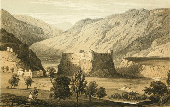
Pl. II.
J. W. del. W. L. Walton, Lithog.
Printed by Hullmandel & Walton.
ISKARDO
From South-east of the Valley.
The mountains which surround the Iskardo plain rise
at once with great abruptness, and are very steep and
bare. Those on the south side, derived from the range
which separates the Indus from the table-land of Deotsu,
the axis of which is not more than ten or fifteen miles
distant, rise very abruptly in rocky pinnacles, covered, at
the time I reached the valley, with much snow. Two spurs
from this range run forward to the Indus, one five miles
east of Iskardo, the other about three miles to the west
of it, dividing the whole south side of the valley into
three deep bays, each watered by a considerable stream,
whose source is in the southern mountains. The mountains
on the north side, the terminal spurs of two great
branches of the Kuenlun or Muztagh, which flank the
Shigar river, are considerably lower, but equally barren
and desolate.
The river Indus traverses the open valley in an extremely
winding course. At one time it washes the base
of the cliffs which terminate the projecting mountain
spurs; at another it flows between high banks of alluvial
conglomerate or of fine clay. Not unfrequently
these clayey cliffs recede to a considerable distance from
the river, in which case the intervening space is generally
sandy. A small branch of the stream, at times little
more than a chain of pools, often runs close to the cliffs,
indicating a former channel of the river; and when this
is the case, the low ground between the two channels is
often swampy and grassy.
The bed of the Indus in this part of its course is very
little inclined, the stream flowing in general very gently
over a sandy bed, its surface quite smooth and tranquil,
occasionally only a little rippled in turning round a projecting
rocky spur, where its bottom is gravelly and the
inclination perhaps a little greater. Opposite Iskardo
the Indus is even in the depth of winter a noble stream,
often more than 500 feet wide, and nine or ten feet deep
in the centre.
Iskardo occupies a nearly level plain of fine alluvial
clay elevated fifty or sixty feet above the river, and extending
from the isolated rock which overhangs the
Indus towards the mountains on the south side of the
valley. To the right and left of the rocky hill, two
small streams have excavated for themselves out of the
soft clay deep and wide ravines, which are covered with
coarse gravel, and are faced by more or less steep banks
of clay or sand. The surface of the platform on which
all the cultivated ground lies is watered by means of
artificial canals, brought from a distance of nearly two
miles, from the point where the streams issue from
among the hills.
The neighbourhood of the rock of Iskardo was doubtless
selected as the site of the principal town of the kingdom
of Balti, from the advantages which it afforded as a
place of defence; and in the days of the independence
of the country a fortified palace occupied its eastern extremity,
while the western and more accessible end was
apparently protected by a series of rude works. The
principal buildings of the palace seem to have been at
the very base of the rock. A mass of ruins, showing
large blocks of well-hewn stone, fragments of marble
fountains, and some solid walls supporting terraces,
which appear at one time to have been gardens, alone
remain to show the former magnificence of the place. A
mausoleum, raised to the memory of the last independent
king, Ahmed Shah, perched on a rock perhaps 300
feet above the plain, is still untouched and uninjured.
An aqueduct or canal extends in a direct line from the
palace towards the mountains, a distance of at least a
mile. It is an exceedingly massive work, consisting of
two walls raised perhaps fifteen feet above the level of
the plain, and built of very large blocks of hewn stone.
The intervening space is filled with earth. At present,
a small conduit, a foot or so wide, brings all the water
which is required for the use of the inhabitants of Iskardo;
but a very large quantity might be conveyed along the
aqueduct, and the work is so strong and substantial that
very little repair would be requisite to restore it to its
original condition.
The fortified post of the present rulers of the country
is built on the margin of the platform of alluvium, on the
right bank of the little stream which joins the Indus to
the east of the rock of Iskardo, and is separated by a
hollow from the palace and the principal part of the village.
It is built of unburnt brick, and is extremely
irregular in shape, with rounded bastions at the angles.
The houses of Iskardo are very much scattered over a
large extent of surface, so that there is no appearance of
a town; nor is the population in the immediate neighbourhood
of the rock so extensive as that of some of the
more remote villages in the valley, and especially of those
on the banks of the Shigar river, which are very richly
cultivated. Many of the Iskardo houses, however, are
very good, being often of two stories, and built of unburnt
bricks in a framework of wood. Latticed windows,
covered with paper or small plates of mica, are also common.
The roofs are all flat, and covered with mud
beaten hard.
LACUSTRINE CLAY.
November, 1847.
The lacustrine clay formation occurs in great quantity
throughout the valley of Iskardo, and is nowhere seen
in greater perfection than in the immediate neighbourhood
of the town, where the cliffs facing the Indus, and
those along the little lateral streams which descend from
the south, exhibit an abundance of sections of these beds.
The height of the cliffs is very variable; but it is seldom
less than thirty feet, and to the east of the town is as
much as a hundred feet. The clay formation varies
much in appearance, being most commonly a very fine
unctuous cream-coloured clay, stratified quite horizontally,
but occasionally gritty and mixed with numerous
particles of mica. Now and then thin beds of sand and
of small waterworn pebbles alternate with the finer clays.
In many places near the rock of Iskardo, the beds are
very irregular, undulating a good deal, and at times exhibiting
very remarkable flexures, as if the isolated rocky
mass (which must have once been under water) had
formed eddies in the lake, and prevented that regularity
of deposition which is elsewhere so universal.
Fossils are very rare in these clays, but occurred in
several different localities. Close to Iskardo I once
found a very few small specimens of a Lymnæa and
Planorbis, but after repeatedly searching carefully did
not succeed in obtaining any more. I was more fortunate
in two places east of Iskardo, where fresh-water
shells are sufficiently common in one or two thin seams
of very fine clay, mixed with a good deal of apparently
vegetable matter. The great mass of the clay is, however,
quite non-fossiliferous.
The surface of the clay formation round Iskardo is
very undulating, and is often covered with masses of
large boulders. Opposite two of the ravines which penetrate
the mountains on the southern side of the valley,
two very remarkable banks of boulders project forward
into the valley. They consist of very large fragments
of rock, angular or more or less rounded, piled on one
another to a height of forty or fifty feet. They terminate
abruptly, and are, I think, evidently moraines.
On the very top of the isolated rock, in the middle of
the Iskardo plain, horizontal beds of coarse sandstone
rest upon the hard clay-slate of which the rock is composed.
This sandstone crumbles with great ease in the
hand, the particles of which it is composed being very
slightly coherent. These beds, in which I could find
no traces of shells or of vegetable remains, are elevated
at least 800 or 1000 feet above the level of the Indus.
The sandstone seems to cap the whole hill, but is exposed
only in a few places, being in a great measure covered
by the loose drift or alluvium which has been deposited
above it.
VEGETATION.
November, 1847.
The vegetation of Iskardo had so entirely disappeared,
that I was able to form very little idea of its nature. A
few shrubby species, and some withered fragments of autumn
flowering plants, alone remained. On the whole,
I was struck with the similarity of the few plants which
I recognized with those of Nubra and Le. Artemisiæ
and Chenopodiaceæ were still abundant. Hippophaë was
the universal shrub along all the streamlets, and Lycium
was common in sandy places; a berberry (the same
already seen at Khapalu) was also frequent. The few
novelties were Kashmir plants. Lycopsis arvensis, Prunella
vulgaris, a thistle, a species of Sium, some gentians,
and Ranunculus aquatilis, were the most Indian forms
which I met with. From the mountains I procured
specimens of a juniper (J. excelsa), and of the alpine
birch of the Himalaya, which skirts the southern borders
of the Tibetan region, without extending into the driest
parts of that country.
CHAPTER VIII.
Leave Iskardo in the direction of Kashmir—First march through snow
to Turgu—Lacustrine clay—it extends into narrow valleys beyond
Nar—Gol—Junction of Indus and Shayuk—Parkuta—Tolti—Kartash—Extensive
lacustrine deposits—Tarkata—Road turns up
the Dras river—Ulding Thung—Fall of snow—Hardas—Karbu—Continued
snow—Dras—Find pass in front shut by deep snow—Obliged
to return to Iskardo—Rafts and rope-bridges on Indus—Elæagnus
and Apricot apparently wild—Winter at Iskardo.
UPPER PART OF ISKARDO PLAIN.
December, 1847.
On the 2nd of December I left Iskardo, in the direction
of Kashmir, by way of Dras, all other routes being shut
with snow. My first march was to Turgu, seven miles.
The ground was all the way covered with snow which
had fallen during the night, but it thawed a good deal
during the day, making the journey rather unpleasant.
The road lay along the south bank of the river, at first
over the level platform of lacustrine clay, among large
boulders, which were scattered over its surface, but
soon descending by a narrow and steep footpath, on
the face of the clayey cliff, to the level of the river, to
cross a deep bay, from which the clay formation has
been entirely removed, to a large village three miles
from Iskardo, through the cultivation of which the road
ascended gradually, and proceeded on the barren stony
slopes behind. About five miles from Iskardo, a spur,
from the mountain range on the south, which abuts in a
scarped cliff upon the river, has been taken advantage of
by the inhabitants to build a small gateway, through
which the road is made to run. The extreme steepness
of the mountain mass which lies to the south and east,
makes it scarcely possible to approach Iskardo along the
south bank of the river from these directions, without
passing through this gateway, and, therefore, a small
party of soldiers is kept on this rocky pass by the Sikh
rulers of the country. A species of Daphne was very
common on the rocky hills about this pass, apparently
an evergreen, as it was in full leaf in the midst of the
snow. From the higher parts of the road, and from
the rocky pass which overhangs the river, there is an
extensive view over the barren sandy waste on the
north bank of the river. The lacustrine clay is, at this
end of the valley, very thick and but little excavated,
forming cliffs which rise close to the river, which has,
as it were, worn for itself a narrow channel in the clay
formation. The banks or cliffs are of very different
heights, and many of them consist of alluvial gravel and
boulders, overlying and quite obscuring the clays. Behind
Turgu, and in many places on the last part of the
march, there are great masses of angular fragments of
rock piled into a steeply sloping mass, as if they had
fallen from the mountains behind, but so mixed with
smaller fragments and with gravel, that it seems probable
that they were accumulated under water.
WATERWORN ROCKS.
December, 1847.
The next day's march, from Turgu to Gol, round the
great bend of the Indus, was entirely barren. On the
western side of the curve several rocky spurs were
crossed, but after the road turns to the south it runs
generally on the surface of very elevated platforms of
coarse alluvial debris, covered in many places with enormous
boulders, partly derived, in all probability, from
the fall of masses of rock from the cliffs above, but in
more than one place so curiously arranged, at the apertures
of lateral ravines, as to be, I think, almost certainly
of glacial origin. Many of the large boulders which occurred
in the alluvium were observed to be much waterworn,
spherical cavities being worn out in them. Similar
waterworn rocks were also seen in situ at great heights
above the river, in places to which no water has at present
access, and where it is difficult to understand in
what way the effect was produced. Behind the alluvial
platforms, which are generally one or two hundred feet
above the level of the river, the mountains rise precipitously,
in cliffs of granite, which has now replaced the
slate rocks of Iskardo.
EXTENT OF LACUSTRINE CLAY.
December, 1847.
At the point where the river changes its direction from
north to south-west, the mountains on the southern bank
advance quite to the river, and on the north side also
they approach very near. It would therefore, at first sight,
appear that the lake, in which the clay formation of Iskardo
has been deposited, had here terminated to the eastward,
no clay being seen in the narrow ravine above Nar, or near
the river anywhere between Nar and Gol. I had at first no
doubt that I had reached the eastern extremity of the lake;
but some time after passing the most northerly point of
the ravine I observed a patch of very fine cream-coloured
clay, quite similar to the finest portions of the Iskardo
formation, clinging in a remarkable position on the flank
of a very steep rocky cliff, not less than 1000 or 1200
feet above the river. Several other patches came into
sight soon after, all high up on the mountain-sides; one
above the village of Golochu, and others at intervals
all the way to the junction of the Indus and Shayuk. I
cannot, therefore, doubt that the lake in which the clay
beds of Kiris were deposited, was the same as that which
occupied the Iskardo basin; nor does it seem easy to fix
its exact boundaries. The great height of the patches of
clay, in the narrow channel above Nar, show that the
depth of the lake had been very considerable; and if
we assume a depth of 1500 feet, which seems necessary,
and at the same time admit the arrangement of the
ancient rocks to have been the same as at present, we
must either suppose some great barrier to have existed
in the narrow passage below Khapalu, or must admit
that the Khapalu lake was also continuous with that of
Iskardo. I did not, however, observe any beds of fine
clay higher up than Kuru, in the narrow part of the
ravine of the Shayuk, which would warrant the drawing
such a conclusion; although vast masses of alluvium
certainly abound there, piled at great heights above the
river. Is it possible that these may at one time have
been continuous, and have blocked up the whole valley,
and that the portions now seen capping ridges, whose
origin is otherwise inexplicable, are the last remnants of
a continuous mass which occupied the whole interspace?
and if so, to what are we to ascribe the deposition of
such an enormous mass of alluvium-like accumulation?
JUNCTION OF INDUS WITH SHAYUK.
December, 1847.
To the eastward of the village of Gol the valley of
the Indus again becomes a little wider, an open sandy
plain extending round the junction of the two rivers.
The cultivation round Gol is on a high platform of
alluvium; but the road descends, soon after leaving
the village, nearly to the level of the river, and continues
over the low ground, skirting the mountains of
the southern bank, till it reaches the junction of the two
rivers, where it turns abruptly to the south, ascending
the left bank of the Indus, which runs nearly due
north in a narrow rocky ravine. A bluff projecting ridge
of granite, sixty or eighty feet high, polished on
the surface by aqueous action, and of a brilliantly brown-black
colour, so that the nature of the rock is only
discoverable by breaking it, here advances close to the
river, and is crossed by a steep sinuous path, eked out
by flights of steps, with wooden supports, where it
would otherwise be impracticable. The Indus is here
very narrow and deep, and runs with an extremely rapid
current. The path, after crossing this ridge, again descends
to the level of the river. Even in this narrow
ravine I was surprised to find the fine cream-coloured
clay of the lacustrine formation, similar to many of the
beds of the same deposit round Iskardo. It was here
quite on a level with the river.
INDUS VALLEY.
December, 1847.
The mountains rise on both sides of the Indus very
abruptly, being almost always precipitous. From the
narrowness of the valley the great elevation of these is
not seen, and the lesser height of those on the right bank
of the Indus, which form the termination of the chain
separating that river from the Shayuk, is not brought
prominently to notice. For more than two miles, the
ravine continues very narrow, and several steep spurs
are crossed. It then becomes gradually a little wider,
narrow platforms of conglomerate skirting the stream,
and changes its direction from nearly due south to south-east.
The right bank is stony and unproductive the
whole way, but on the left there is one small village,
three miles from the junction of the Shayuk, and thence
after three miles of desert, a succession of small villages
continuing with little intermission on the surface of alluvial
platforms as far as Parkuta, at which I encamped.
In one of the villages a good many small juniper-trees
were seen.
The lacustrine clay formation, though not continuous
throughout the whole of this day's march, may be traced
in patches, with so little interval that its former continuity
cannot be doubted. The spots in which I observed
its presence in the narrow ravine were all close to
the river, the low level of the road not permitting an
extended view of the higher slopes of the mountains.
Further up, however, patches were in my subsequent
April journey seen at considerable elevations, but in
December the slopes were covered with snow to within
a thousand feet of the river. In several places the clay
formed cliffs, which rose perpendicularly from the Indus,
and could be seen to be covered with modern alluvium
deposited during floods, just as the ancient rocks are in
other places. The clay appeared everywhere extremely
fine, without any intermixture of sand or micaceous grains.
I saw no appearance of fossils, which I think never occur
in the very fine cream-coloured clays, but seem always
to accompany more sandy, or at least gritty varieties, as if
the influx of a small stream, and probably the proximity
of land, were requisite to the existence of testaceous
mollusks; while the central part of the lake, in which
the very finest clays were deposited, was quite devoid of
them.
PARKUTA.
December, 1847.
Parkuta is a very large village, three or four hundred
feet above the river, occupying both slopes of a deep
ravine cut in the thick mass of alluvium by a large stream
from the south. The alluvium is scarped towards the
Indus, and a low granitic hill, the cause of its accumulation
to such a height, just rises above the general surface
of the platform. This is covered with a mass of
buildings, formerly the residence of the Rajah of Parkuta,
a branch of the same family who ruled at Iskardo,
and dependent on them while that state remained independent;
he has, however, been removed by the Sikhs,
and his house is at present untenanted. The village
is large, with extensive cultivation, and many fine
fruit-trees. Vines are plentiful, climbing over the
poplars.
TOLTI.
December, 1847.
On the 5th of December my day's journey carried me
to Tolti, a distance of twelve miles. The valley continued
narrow, and the mountains rose precipitously on
both sides. On the early part of the march there were
many villages, and much cultivation on the left bank.
The village of Urdi, three or four miles from Parkuta,
seemed very populous, and extended for a great distance
along the river. It was remarkable for an aqueduct
supported on pillars of stone, which crossed a ravine
immediately above the village. At this spot the cultivation
terminated abruptly, and the alluvial platform was
for more than a mile, during which space it gradually
narrowed by the encroachments of the cliffs, covered
with an accumulation of very large granitic boulders,
which seemed to have fallen on it from the mountains
behind.
KARTASH.
December, 1847.
As I approached Tolti the valley of the Indus became
much more rugged and narrow. A long gentle ascent
to a ridge more than a thousand feet above the bottom
of the valley, but which dipped abruptly to the river,
occupied the latter part of the march. At Tolti the belt
of cultivation is very narrow, just skirting the river on
very narrow platforms of alluvium, which are irrigated
by artificial canals carried with considerable labour between
the fields and the mountains. Tolti was the most
gloomy village which I had yet seen, the precipitous
mountains forming a circle all round it, and almost shutting
out the light of day. The bird's-nest fort in the
ravine behind the village, perched on the top of a rock
(in a most untenable position, though probably well suited
for defence against sudden attack), accorded well with the
gloomy aspect of the place. The temperature was here
considerably lower than in the more open valley, as large
patches of snow lay still unmelted in the fields, though
four days had elapsed since its fall. At Gol, two days
before, it had quite melted. On a bank a mile or two
below Tolti, I saw a few trees of Populus Euphratica,
just recognizable by a few withered leaves which still
remained on the tree.
From Tolti, I made three marches to Tarkata, a small
village on the Indus, six miles below its junction with the
river of Dras. The general aspect of the valley of the
Indus was but little changed in this distance, notwithstanding
a very long and remarkable bend of the river
above Kartash, in which its direction is to the eastward
of north. From Tolti, the easiest road in an upward
direction crosses the Indus, and proceeds on the right
bank; but to avoid the labour of crossing, I suppose, my
guides conducted me by a road on the left bank. On
this side, the lower part of the valley is so steep as to
be impracticable; and I found it necessary to ascend at
once from Tolti on a stony ridge, almost directly away
from the river. The ascent was long and fatiguing;
the ridge being capped, in the same manner as that
above Kunes on the Shayuk, with masses of alluvium.
The ridge was more than 1500 feet above the river,
and its upper part was covered with snow, through
which the path lay for four or five miles, after which it
descended very abruptly to the river, which had been
in sight almost all the way, generally running among precipitous
rocks, but with a few villages scattered at intervals
on the northern bank. After regaining the bank
of the river, the road was for five or six miles nearly
level, passing opposite the village of Kartash, with a fort
on a hill. Here still resides the Rajah Ali Sher Khan,
the most intelligent of the princes of Balti; though
now past the prime of life, he still retains the intelligence
and kind hospitality for which he is so deservedly
praised by Vigne.
INDUS VALLEY.
December, 1847.
Kartash being situated at the northern or lower end
of the great bend of the Indus, and in an extremely
narrow part of the ravine, is a most sombre-looking
place. It is possible, however, that in summer, when
the villages are green with cultivation and fruit-trees,
the appearance of this and other places may be less
gloomy, and that, from having only seen this part of
Tibet in the depth of winter, I may be disposed to
regard it in too unfavourable a point of view. The
abrupt and precipitous rise of the mountains on all sides
must undoubtedly tend strongly to modify the summer
temperature, which, from the want of rain, and the reflection
from masses of bare rock, would otherwise be
oppressive. The fort seems to have some good buildings,
and to be kept in excellent order, and the village looked
extensive and prosperous.
All along the narrow ravine, from Tolti nearly as far
as Tarkata, deposits of alluvium were very extensively
developed, not only in the valley of the river, but at
considerable heights on the ridges. There was, however,
I believe, none of the lacustrine clay, as contradistinguished
from the coarser alluvium. I speak here with
considerable hesitation, as I find with regret that I have
not in my notes attended with sufficient care to the
distinction between the two, not having at the time
sufficiently adverted to their probably different origin.
I am now disposed to think that in the narrow ravine
above Tolti was situated the barrier which bounded
on the east the lake basin of Iskardo, a vast inland
sea, which must have extended thence in a north-westerly
direction as far as Rondu. This barrier, if
my supposition be correct, must have consisted of a
mass of coarse drift or alluvium, entirely blocking up
the narrow ravine to a height of three thousand feet or
more above the present level of the Indus.
The mountains all along this ravine are extremely
elevated, the peaks above Kartash (from which a pass
leads to Khapalu on the Shayuk) being, I should think,
not less than 18,000 feet. The bareness and desolation
of their sides exceeded anything I had seen since
leaving Iskardo, and quite equalled the most rugged
parts of Tibet which I had yet visited. They consisted
of large masses of rock, split and fractured in every
direction, often very precipitous, without a vestige of
soil, and with scarcely the slightest traces of vegetation.
Immense tracts, both along the river and on the slopes
of the ravines descending from the mountains, were
covered with boulders or with angular fragments of
rock, strewed irregularly on the surface, or piled in
masses one on another. Granite formed the great mass
of the mountains, mixed with stratified rocks, which were
always highly metamorphic, but extremely variable in
appearance, sometimes, though rarely, having the appearance
of ordinary gneiss. A singular porphyritic rock
appeared (as boulders) along the river in one place only.
About two miles west of Tarkata, the Indus resumes
its more usual direction, and, at the same time, its valley
becomes somewhat more open, the mountains, without any
diminution of elevation, receding considerably from the
river. Their lower slopes present a very different aspect
from those in other parts of the Indus, being composed
not of primitive rock, but of a soft and almost incoherent
sandstone, alternating irregularly and without
any definite order with boulder conglomerate, and fine
clay. These beds, which are very extensively developed
on both sides of the river, around the village of Tarkata,
for some distance in both directions, attain a thickness
of at least six or seven hundred feet. They are, however,
very irregular, forming a succession of ridges
separated by deep ravines or gullies, on the sides of
which fine sections of the strata are generally exposed,
showing them to be uniformly horizontal, and to consist
of a great many alternations of sand, clay, and drift.
Above Tarkata, very fine clays were abundant.
SOFT SANDSTONE ROCKS.
December, 1847.
The sandstone, of which a greater part of these curious
deposits consists, is formed principally of coarse grains
of quartz, which only cohere very slightly, and easily
crumble under pressure. It is quite similar in appearance
to the sandstone which occurs on the summit of the
rock of Iskardo, differing only in being very much more
extensively developed than that is, and in being associated
and alternating with the very fine clays resembling
those which occupy the lower levels of the valley of
Iskardo. The sandstones of Tarkata did not appear to
be fossiliferous, nor did I, in the slight examination
I was able to give them, discover any shells in the fine
clays in this neighbourhood. The general similarity,
however, of these deposits to the lacustrine clays of the
Iskardo valley, makes it nearly certain that their origin
is similar, while the association of the sandstones and
the fine clays in the neighbourhood of Tarkata, renders
it probable that I am right in assuming the arenaceous
beds of the summit of the rock of Iskardo to be lacustrine.
FLOATING ICE.
December, 1847.
Ever since leaving Iskardo, the weather had been
very unsettled, but no more snow had fallen. The sky
had been pretty generally overcast with light clouds,
and during the day the wind had almost invariably
blown down the river, generally with great violence,
and, especially in the narrowest parts of the valley, in
furious gusts, against which it was most laborious
to make any progress. The mornings had been always
frosty, but the temperature rose in the middle of the
day several degrees above 32°. On the 8th of December,
a sudden increase of cold seemed to take
place, the temperature not rising above the freezing-point.
Large cakes of ice, which appeared early on
the morning of that day, floating down the river, indicated
an evident commencement of very severe weather
in the upper part of its course, and the descent of
such masses of ice, in cakes of from one to ten feet in
diameter, tended very much to lower the temperature
of all parts of the river to which they extended. The
elevation of Tarkata I found to be 7800 feet above the
sea.
The road from Iskardo to Kashmir leaves the valley
of the Indus at the junction of the river of Dras, and
follows the course of that river almost to its source.
The lower part of the valley of Dras is a deep and
narrow rocky ravine, bordered by precipices of granite,
which are so steep that the bottom of the valley is quite
inaccessible. In passing from the Indus into the valley
of Dras, the road crosses the granitic spur which separates
the two rivers, at an elevation of about 2000 feet
above the Indus, ascending to this height very rapidly
along a steep spur, which recedes almost in a perpendicular
direction from that river. From the shoulder of
this ridge, which was elevated probably about 10,000 feet,
the course of the Indus was visible for some distance
above the junction of the river of Dras. It appeared
to be hemmed in very closely by rocky mountain spurs.
A good many patches of fine lacustrine clay were in
sight, on both banks.
VALLEY OF DRAS.
December, 1847.
From the same ridge, the view up the Dras valley
was very remarkable. The river of that name, which
formed many deep pools and was partially frozen, ran
at the bottom of a deep gorge. On the right bank
opposite to where I stood, a sheer precipice rose nearly
to a level with my eye. Between the ridge on which I
stood and the next in succession up the Dras valley,
an open and shallow valley, everywhere strewed with
enormous blocks of granite, sloped gently till it approached
the brink of the almost perpendicular cliffs
which overhang the Dras river. Crossing this open
valley, and the low spur beyond it, I encamped at a
small village called Ulding Thung, situated at the point
of junction of the Dras river, with a considerable tributary
descending from the west.
This little village occupies the gentle slope of a hill-side,
but I encamped at the lowest part of it, which was
a small level plain surrounded by a number of giant
boulders, resting on the upper edge of a very steep slope,
and evidently, I think, of glacial origin. They were
quite angular, and not less than from twenty to thirty
feet in length.
On the slope of the hill above my encampment at
Ulding, the lacustrine clay formation again occurred in
great quantity. It was a very fine impalpable clay,
without fossils, and was here (as is not uncommon elsewhere)
dug out by the inhabitants for the purpose of
extracting its salt, which is obtained in a state of brine
by simply washing the clay with water. The elevation
of this clay formation was probably a good deal more
than 8500 feet, but not greater than that of many of
the hills and patches of similar deposit around Tarkata
in the valley of the Indus.
At daybreak on the morning of the 18th of December
I found that between three and four inches of snow had
fallen during the night. It had ceased snowing at
that time; and during the day, which was stormy and
often very cloudy, no more fell. There was a good
deal of thaw during the day, and towards evening the
snow, except in sheltered spots, was nearly melted. My
day's journey was about ten miles, to the village of
Hardas, on the left bank of the Dras river; passing
about two miles before the end of the march the river of
Kargyl or Pashkyum, a very large stream which descends
from the south-east. During the earlier part of this
day, the road was extremely bad. It descended from
Ulding abruptly to the level of the Dras river, to cross
at its point of junction a large tributary whose source
is in the eastern slopes of Deotsu. A succession of
steep ascents and descents followed for four or five miles,
throughout which distance the ravine through which the
river ran was narrow and precipitous and quite without
villages. Further up, the valley widened a little, the
mountains rose less steeply, and left narrow strips of
level ground along the margin of the stream.
SNOW STORM.
December, 1847.
Very early on the morning of the 11th of December,
it began again to snow, and continued with little intermission
throughout the day. I marched ten miles to
Karbu, crossing the river three miles above Hardas, and
keeping on the right bank during the remainder of the
day. I could see that the valley was wider than the
day before, but the incessant snow made the appearance
of the country undistinguishable. The margins of the
stream were occasionally fringed with bushes of poplar
and willow. Karbu is a village high up a steep lateral
valley, with scattered groves of juniper on the sides of
the hills above the cultivation. By evening the depth of
snow was about fifteen inches.
On the 12th of December, after marching five miles
through a heavy fall of snow to the village of Tashgang,
crossing the river by a wooden bridge close to the village,
a violent storm of wind and snow-drift, blowing
directly down the valley, compelled me to halt for the
night. The snow-storm continued till about eight P.M.,
when the weather cleared, and the night was clear and
starlight. Next morning, the weather continuing fine,
I was able to proceed to Dras. The depth of snow
had increased to about two feet; and the labour of
progressing through this depth of untrodden snow was
much increased by the shortness of the steps of the
porters, treading exactly after one another, so as to form
pits in the snow, not more than a foot apart, and alternately
on the right and left.
DRAS.
December, 1847.
I reached the Sikh fort at Dras, which was distant
eleven miles, about two o'clock; the road was pretty
level and the valley open, with low hills on either hand.
The depth of snow increased as I advanced, and was
three feet in the plain round the fort. Here I was
greeted by the most unwelcome tidings, that my advance
so far was fruitless, the pass in front being
blocked up with snow. For this I was quite unprepared,
having been led to believe that the road to
Kashmir in this direction was always open, and no
hint having been given me at Iskardo that my delay
there might in the least prevent my reaching Kashmir.
The heavy snow-fall of the last three or four days seemed
to have been something quite unusual; and it had accumulated,
as I was told, on the pass to a depth which
quite precluded all possibility of a passage for many days
to come.
Notwithstanding all these assurances, I should certainly
have tried to advance at least as far as Maten,
had I not found at Dras one of the principal inhabitants
of Kargyl, who had returned the day before from that
place, after attempting in the morning to advance towards
the pass, which is ten miles further on, and being
stopped by finding the snow ten and twelve feet deep,
and quite soft. After the assurances of this traveller, I
should not have been justified in taking so many porters
across the pass, supposing them to have acceded to my
wishes to make the attempt; I therefore very reluctantly
gave up the idea of proceeding.
It then became a question what I should do. It
might and would probably be many weeks before the
pass would be practicable for loaded men. To have remained
at Dras so long would have been impossible.
The demands of my party for fuel were found very difficult
to supply, even for a day, the faggots of brushwood,
which alone are there available, being soon consumed,
and, therefore, unwillingly parted with; I therefore resolved
to return to Iskardo, and remain there till the
return of spring should enable me to resume my travels,
and to visit the district further down the Indus, before
crossing into Kashmir.
RETURN TOWARDS ISKARDO.
December, 1847.
My return journey, being from a severe to a milder
climate, was sufficiently agreeable. At first a succession
of bright and clear days reduced the temperature very
much. The thermometer fell to zero in the mornings,
and the frost throughout the day was intense. I was
no longer able to inhabit my tent, which I had continued
to occupy up to the period of my arrival at Dras,
where, in the Sikh fort, I found, rather to my surprise,
a room, with a fire-place and chimney, allotted for my
accommodation by the kindness of the commandant.
In descending again towards the Indus, I took shelter
in the villages, occupying, if possible, a cow-house in
preference to one used by the inhabitants. The houses
are generally built of waterworn stones, without cement,
but plastered with mud outside and inside. The roofs
are flat; the rafters are unsawn trees or branches of poplar,
covered with willow twigs, over which is laid a thick
coating of mud. A hole in the centre of the roof serves
for a chimney, the fire being made in the centre of the
floor. In some of the poorer villages the houses were
less elaborate, consisting merely of wattle-work of willow
twigs, covered with a thin coating of clay.
FROZEN WATERFALLS.
December, 1847.
In the open plain below Dras I observed many withered
stems of Prangos, the celebrated Umbelliferous
plant so much valued by the inhabitants of Dras as a
food for their sheep, still bearing ripe seeds. Juniper,
too, was common, even along the bank of the stream.
As I descended the river, I found that a very few days
had made a great change in the temperature. The river
was everywhere hard frozen, and all the little streams
which ran down the mountain-sides were coated with a
thick shell of ice. More than once I saw a waterfall
with a covering, perhaps a yard in thickness, of clear
blue ice, under which the little streamlet could be distinctly
seen. At Ulding, though the cold was severe,
I found the ground partially free of snow, so that the
amount of fall, at that distance from the central chain of
mountains, had been quite insignificant.
On the 19th of December, on which day I regained
the valley of the Indus, it was again snowing heavily,
after an interval of exactly seven days. The river was
now entirely frozen over, and so solid, that one of my
servants, a native of India, losing his way in the snow-storm,
instead of turning to the left on arriving at the
Indus, walked across the river to a village on the right
bank, without being aware that he had quitted the proper
road.
Instead of keeping the left bank of the river, as I had
done in my upward course, I crossed it on the ice about
three or four miles above the village of Kartash, or Karmang,
as it is also called, and kept on the north side till
within a mile of Tolti. About two miles below Kartash,
there are a succession of rapids in the stream, which extend,
without much intermission, considerably more than
a mile, and must produce a very considerable change in
the elevation of its bed. The river was nowhere frozen
between Kartash and Tolti, the stream being too rapid
to freeze readily. In crossing to the left bank I made
use of a raft of skins, which consisted of a light frame-work
of willow rods, six feet square, resting on about a
dozen inflated sheep or goat skins. This flimsy contrivance
just floated on the water when loaded with three or
four people.
ROPE BRIDGES.
December, 1847.
At Tolti and at Karmang are the only rope-bridges
which I saw on the Indus, above Iskardo. The cables
used in their construction are here made of willow twigs,
twisted into a thick rope. Seven such ropes on each
side are combined to form the parallel lateral cables,
about a yard apart, from which the road way of the bridge
is suspended. These bridges are perfectly safe, though,
from their open structure, rather formidable to those
who are not accustomed to use them. The principle on
which they are made is the same as one which is in use
in all the hill provinces of India, from the Khasya mountains
and Butan, as far west as the Indus; but the material
differs with each particular locality, cane being used
in the most eastern parts, rope (often of grass or Eriophorum)
in the Western Himalaya; and in Tibet, where
even that material is not available, willow twigs are employed
as a substitute.
In many parts of the Indus valley, even in the most
rugged and desolate spots, I noticed, occasionally, trees
of the Elæagnus and of apricot, growing in rocky places
along the river, where it was very evident that they had
never been planted. The Elæagnus is always conspicuous,
even in mid-winter, in consequence of the withered
leaves remaining attached to the tree instead of falling
at the end of autumn. Occasionally, no doubt, the occurrence
of these trees was due to the former existence
of villages in the vicinity of the places in which they were
observed, but they also seemed sometimes to occur in
places where no cultivation could ever have existed. Their
occurrence, however, must, I think, be considered purely
accidental: they were too few in number to be regarded
as really indigenous; nor is it surprising that
these trees, which are so extensively cultivated round all
the villages of Baltistan, and so universally used as food
by the inhabitants, should occasionally vegetate at a great
distance from their usual place of growth.
WINTER AT ISKARDO.
December, 1847.
I reached Iskardo on the evening of the 25th of December,
and succeeded, without difficulty, in hiring a
house sufficiently large to accommodate all my party.
As I remained stationary at this place for two months, I
was able to make some observations of the thermometer,
and to watch the state of the weather during the whole
of that period. The elevation of Iskardo above the level
of the sea is about 7200 feet. Winter may be said to
have commenced on the 28th of November, on which
day the first snow fell. From that date, falls of snow
recurred constantly at intervals, which varied from two
or three days to a week. The earlier falls were very
slight, not more than an inch or two in depth, but the
quantity gradually increased, until each fall was from
four to six inches. The entire depth of the snow in
the middle of February, beyond which time the fresh
falls were insignificant, was from fifteen to eighteen
inches.
After each fall of snow, the weather usually became
bright and calm, with a serene cloudless sky. The sun
shone out brightly, and was agreeably warm to the feel,
while the temperature of the air rose nearly to, or a little
above, the freezing-point. In the earlier part of the
winter, the snow melted rapidly, and the ground in
the open valley was generally nearly free of it before the
next fall. After the beginning of January, however, the
cold increased, and the snow lay permanently, except on
the most sunny slopes. The sun seemed to have much
less power, and little thaw took place except on rocks
and beaten paths. The diminution in the quantity of
snow by evaporation was often considerable.
The greatest cold which was registered at Iskardo was
at daybreak on the 8th of February, when Fahrenheit's
thermometer stood at half a degree above zero. The
mean temperature at sunrise during the whole winter
was 19½°, and that at two P.M. 33¾°. The mean temperature
during the period from the 28th of December to
the 31st of January was 27½°, and from the 1st to
the 24th of February 25¾°. The increase of cold was
principally by the depression of the night temperature,
the mean highest temperature being within a fraction
of a degree the same during both periods.
On the first or second day of clear weather after a fall
of snow, the temperature in the morning was often very
low, with abundant hoar-frost, which, except at such
times, was not seen at all. The surface of the plain was
covered with a dense fog, which remained till nearly noon
before the sun was able to dispel it. On the second or
third day the sky would become hazy, the sun being
partly obscured by a thin stratum of cloud at a great
elevation. During the continuance of this haze, the
temperature was always more elevated than when the
sky was clear. The hazy weather was once or twice
dissipated by violent winds, without any fall of snow on
the open plain; but more generally it increased gradually,
till the sky was completely and densely overcast, and
snow began again to fall, perhaps most frequently during
the night.
During the greater part of the winter the snow was
invariably in extremely minute grains. It was not till the
latter part of February, when spring was rapidly approaching,
that large flakes fell. I more than once observed
the phenomenon of small quantities of extremely
fine-grained snow falling when the sky was quite clear,
and the air at the surface of the earth quite motionless.
During clear weather very little thaw took place, the
cold produced by radiation appearing to counteract the
sun's action; at the same time the snow diminished
rapidly by evaporation, which was not the case when the
sky was overcast.
The fall of snow was evidently much less considerable
in the open plain than on the mountains round Iskardo.
During the heavier falls, the snow on the steep mountain
slopes often slipped downwards. It was but rarely
that these avalanches were visible, but the noise of the
snow in motion was heard like distant thunder, often
many times a day, and the bare spots which it had left
could be seen after the snow-storm had ceased. When
the weather was settled, the wind was in general very
gentle, and blew up the valley of the Indus; during
snow-storms it was usually violent, and very irregular in
direction. The storms came mostly from the south-west,
a moisture-bringing upper current of air from that
direction being condensed by the dry and cold north
wind.
My collections had accumulated to such an extent,
and got into such confusion, during five months of almost
incessant travelling, that I was very glad to have an opportunity
of devoting some time to their arrangement,
and found, without difficulty, occupation for all my time
during two months of rest. The snow was never so deep
as to prevent me from taking regular exercise, so that I
was soon familiar with all the roads in the neighbourhood
of the town, and examined the cliffs of clay in every
direction in search of fossils, without discovering (as I
had some hopes of doing) any mammalian remains. The
communication with Le was open all winter; I was
therefore able to correspond with Captain Strachey, who,
after examining the course of the Indus from the Chinese
boundary downwards, was spending the winter there.
By his assistance I succeeded in replenishing my store
of tea and sugar, both of which were exhausted. The
sugar which I procured from Le was very good, and
the brick tea, though not superexcellent in quality,
was, in the absence of better, quite good enough for use.
Other supplies I had no difficulty in procuring at Iskardo,
sheep and flour being abundant. The wood supplied for
fuel was almost entirely Elæagnus, no wild timber occurring
in the country.
The Thannadar of Iskardo, who is the deputy of
Maharajah Gulab Singh of Kashmir, is the governor of
all Balti, but he rules by means of native Mahommedan
chiefs or rajahs. In some instances, where no opposition
was made to the Sikh invasion, the former ruler was
allowed to retain his position; in other cases a change
was made. At Iskardo, Mahommed Shah, the present
Rajah, had been an exile in Kashmir, from being on bad
terms with his father. He is a feeble and sickly young
man, without the energy of his father, M. Vigne's host
in Iskardo. The inhabitants of Balti, though Tibetan
in language and appearance, are all Mahommedans, and
differ from the more eastern Tibetans of Le (who call
themselves Bhotias, or inhabitants of Bhot) by being
taller and less stoutly made. Their language, I am told,
differs considerably from that of Le, but only as one
dialect differs from another.
CHAPTER IX.
Leave Iskardo for Rondu—Insurrection in Gilgit—Koardu—Kamar—Enter
narrow part of Indus valley—Difficult road—Range of mountains
south of Indus—Description of Rondu—Thawar—Avalanches—Alluvium—Swing
bridge—Villages—Juniper—Pinus excelsa—Rocks—Vegetation—Return
to Iskardo—Agriculture of Balti—Game
of Chaugan—Chakor hunting—Shigar valley—Journey towards
Kashmir—Dras valley—Karbu—Dras fort—Maten—Cross
pass into Kashmir—Baltal—Valley of Sind river—Sonamarg—Gagangir—Gond—Gangan—Ganderbal—Enter
main valley of Kashmir—Town of Kashmir—Description of Kashmir—Lacustrine
formation—Trap hills—Lake—Climate—Vegetation.
It was not till the 25th of February that the approach
of spring was sufficiently decided to permit me to make
a move with any chance of fair weather. On that day
I started from Iskardo, with the intention of making
eight or ten days' journey down the Indus in the direction
of Rondu. The district of Rondu may be understood
to comprise the whole of the narrow part of the
Indus valley, from the western end of the Iskardo plain
to the great bend of that river, where it assumes a southerly
direction. It is only during the winter season that
the route along the valley of the Indus is much frequented,
as it is quite impracticable for horses, and so
very bad even for travellers on foot, that the road over
the passes towards Hasora is always preferred in summer.
At the season of my journey I had no option, the passes
being still covered with heavy snow.
KOARDU.
February, 1848.
Unfortunately for my objects, the inhabitants of Gilgit
had since the beginning of winter been in a state of open
insurrection, and had besieged the garrison placed by Gulab
Singh in one of the forts of the valley. Attempts had
been made by the Thannadar of Iskardo to send a force
to their relief, but the garrison of that place was too
weak to enable him to detach more than a very small
portion of it; and the forced levies of Balti men, collected
in all the districts of the country, had evidently no desire
to fight against the more active inhabitants of Gilgit
and the robber tribes of the higher valleys of Hunza and
Nagyr. Large parties of fifty and a hundred were continually
arriving during the winter at Iskardo, and were
as soon as possible despatched towards the disturbed
country; but the greater number of them, I was told,
managed to desert, and to return to their villages, or
to hiding-places elsewhere, long before the detachment
arrived at the end of its journey.
Crossing the Indus in the ferry-boat, a little below the
rock of Iskardo, my road lay along the north bank of
the river, through extensive tracts of cultivation. There
was much less snow on the surface of the fields in the
village of Koardu, the first through which I passed on
the north bank, than in the town of Iskardo, owing to
the more favourable exposure. The villagers were busy
sprinkling a thin layer of earth over the snow to hasten
its melting. This village, which is about five miles distant
from Iskardo, is backed by very high masses of clay
conglomerate and clay, forming very irregular, often precipitous
banks, resting on the ancient rocks behind.
From Iskardo these beds are very conspicuous, but in
the village itself only a very small portion can be seen
at a time.
KAMAR.
February, 1848.
West of Koardu, a ridge of mica-slate, containing
abundance of garnets, advances close to the river, which
here runs on the northern side of the valley. The road
up the valley skirts the base of this projecting spur, and
then passes over level platforms for about four miles.
The level tracts were still covered with snow, but in rocky
places, and on all slopes facing the south, the ground was
quite bare. Four miles from Koardu I passed the very
large village of Kamar, the fields rising in terraces one
behind another on a steeply sloping platform, which
skirts the plain for nearly two miles. Behind the village,
the same system of conglomerate and clay-beds, as at
Koardu, rises in steep banks.
About a mile beyond Kamar, which is the last village
on the north side of the Iskardo plain, the valley of the
Indus contracts very suddenly, the mountains closing in
upon the river. The beds of lacustrine clay extend
without any diminution to the end of the open valley,
and are covered, when close to the mountains, by numerous
boulders of all sizes, many of which are of great
dimensions. The fine clay at the termination of the
open plain appears to underlie a great mass of boulder
conglomerate, which is continued into the narrow part
of the river valley.
ENTRANCE OF RONDU.
February, 1848.
Where the river passes from the open plain into the
narrow ravine, the inclination of its bed seems increased,
and the rapidity of its motion becomes much greater.
This result is quite in accordance with what has been
observed in the Nubra and Khapalu plains. Indeed,
narrow valleys are so generally steeply sloping, and wide
valleys so generally nearly level, that it can scarcely be
doubted that the inclination of the surface is in some
way connected with the width or amount of excavation
of the valley.
For a mile or two beyond the end of the Iskardo
plain, the mountains are sufficiently far apart to allow of
the interposition of a narrow platform of conglomerate,
over which the road runs. Soon, however, even this
disappears, and thenceforward, as far as I went, the Indus
runs through a narrow ravine of very uniform character.
The mountains on both sides of the river are extremely
steep, and, so far as I could judge at so early a season,
almost uniformly rocky and precipitous. At distant
intervals a small platform of alluvium is interposed
between the cliffs and the river, but much more frequently
precipices directly overhang the stream, or steep
bare rocks, only not absolutely precipitous, rise from its
margin. It is but seldom that the stony bed of the
river or the alluvial platforms overhanging it, afford a
level road for a few hundred yards at a time. In general
the path continually ascends and descends over each
successive ridge; the elevation to which it is required to
ascend to find a practicable passage, varying from a few
hundred to several thousand feet above the bottom of
the valley. In at least eight or ten places between
Iskardo and Rondu, the path ascends or descends by
means of ladders placed against the face of a perpendicular
wall of rock, or crosses fissures in the cliffs by
planks laid horizontally over them. This road is therefore
quite impracticable for beasts of burden or horses,
and is never used except in winter, when no other route
is open to the traveller.
INDUS VALLEY.
February, 1848.
As the road lies altogether on the north or right bank
of the Indus, the elevation and appearance of the mountains
on that side cannot well be seen. This range separates
the Indus valley from that of Shigar, which is in
no part of Rondu more than twenty-five miles distant,
and is crossed in several places by passes at the head of
the larger ravines. These passes being still blocked up
with snow, I could not cross them, nor ascertain their
elevation, which is perhaps nowhere less than fourteen or
fifteen thousand feet, except at the very eastern extremity
of the ridge.
From the higher parts of the road, where it attained
an elevation of eight and nine thousand feet, the mountain
ranges on the south of the Indus could be well seen.
They were covered with snow from base to summit, and
in general rose so very abruptly, that the nearer spurs
completely concealed from view the main range, except
when a more open valley than usual permitted the view
to extend backwards. Occasionally very lofty peaks
were seen, which appeared to attain a height of at least
eighteen or twenty thousand feet; but, as the whole
landscape was covered with snow, distances could not be
estimated with any accuracy. As the ridge to the south
of the Indus keeps very close to the river, it is probable
that the highest summits seen in that direction were
situated beyond the valley of Hasora.
VILLAGES OF RONDU.
February, 1848.
The villages of Rondu are not numerous, and are of
very small extent; still every available spot seems to be
occupied by a small patch of cultivation. The platforms
are generally high above the river. In the lower part of
the district, where the lateral ravines are of greater
length, they open out above the very steep slope, by
which they debouche into the Indus, into gently sloping
open valleys. The villages of Thawar and Murdu, being
situated in these open valleys, are much more extensive
than any of those close to the Indus. The fort of Rondu
is on the left bank of the river, on a platform perhaps
two hundred feet above its level, nearly opposite the
end of the Thawar valley, and not far from the termination
of a valley which descends from the southern
mountains, along which there is a road across a pass to
Hasora.
From Iskardo to Thawar, a large village in a lateral
ravine on the north side of the Indus, almost opposite to
the fort of Rondu, the road distance is about forty miles.
As five days were employed in traversing this distance,
the average day's journey was only eight miles; and yet,
from the difficult nature of the road, all the marches
appeared long, and were felt to be very fatiguing. A
great part of the road being at an elevation much more
considerable than that the Iskardo plain, I met with
much snow on all the higher parts of the mountains. In
the valley of the Indus thaw made rapid progress, and
by the beginning of March, in favourable exposures,
there was no snow below 8000 feet.
AVALANCHES.
March, 1848.
The progress of the thaw occasioned constant avalanches,
the snow slipping from the steep sides of the
ravines, and when once in motion, advancing with
constantly increasing momentum till it reached the
lowest level. All day long the mountains echoed with
the sound of falling snow; the avalanches were not often
visible, as they took place in the ravines, but now and
then (where the ravines terminated in precipices) they
were seen pouring in cataracts of snow over the face of
the cliffs. In each large ravine which joined the Indus
I found one of these gigantic avalanches, and was enabled
to see that they were composed of a congeries of
balls of snow, varying in diameter from one to six feet,
and often containing fragments of rock in their centre.
Many of these snow-streams were not less than forty or
fifty feet thick. At the level of the Indus they were
now very soft, and evidently thawing rapidly.
In many parts of Rondu are to be seen very distinct
indications of the boulder conglomerate, by which the
ravine was perhaps at one period entirely filled; though
from the very steep slopes of the mountains in most
places, there is not often a resting-place for it. The
platforms on which the villages are built are all formed
of this alluvium, and are often covered with transported
blocks of vast size. Between Siri and Baicha I saw
several which were not less than sixty feet in length. In
the upper part of the valley of Thawar, which is more
level than the ravines higher up the Indus, a great accumulation
of clay and boulders is seen attaining a height
of at least 8000 feet above the level of the sea, as it
forms hills a thousand feet above the village, which is at
least as much above the Indus.
The valley in which the village of Thawar is situated
slopes gently towards the Indus till near its termination,
when it descends extremely abruptly down a very
steep inclined bank of boulders, which appears to block
up the whole of the end of the valley. The slope of this
steep bank was so great that it was only possible to descend
by a very devious route. Between the lower part
of the cultivation and the commencement of the steep
slope, the valley was very irregular, and filled with heaps
of boulders, forming long low hills. The appearance of
the mass of debris in this valley was very remarkable,
and had much the appearance of an old moraine deposited
by a glacier, which had extended as far as the
end of the present cultivation, and had shot forward the
boulders by which it had been covered into the abyss
below.
BRIDGE OF RONDU.
March, 1848.
The Indus is crossed by a swing-bridge of willow
twigs, which leads from the villages on the north bank
to the fort of Rondu. From Thawar I descended to this
bridge, in order to ascertain the boiling-point of water,
so as to get an approximation to the elevation of the bed
of the river. It is thrown across a remarkably contracted
part of the river, where it flows between perpendicular
rocks rising several hundred feet out of the water,
and the path by which the bridge is reached from Thawar
descends the scarped face of the precipice by a succession
of ladders.
From the boiling-point of water I estimated the elevation
of the bridge, which was more than a hundred feet
above the river, at 6200 feet. This would indicate a fall
of about 1000 feet since leaving Iskardo, or, as the river
flows very tranquilly till it leaves the Iskardo plain, from
the commencement of Rondu, a distance by the road of
twenty-nine miles, but not, I should think, more than
twenty along the course of the river, as the road winds
very much in crossing ridges. This is equivalent to a
fall of about fifty feet per mile, which, for a stream discharging
so vast a volume of water, is very considerable
indeed, but not more than is indicated by the general
turbulent course of the river.
CULTIVATED TREES.
March, 1848.
The villages of Rondu, though mostly small, have
abundance of fruit-trees. The apricot is still the commonest
of these; but there are also many fine walnuts,
and plenty of vines climbing up the trees, and remarkable
for the great size of their trunks. Willows are very
common, and two kinds of poplar, and now and then
there occurs a plane-tree of enormous girth and stature,
which must, no doubt, afford a most welcome shade from
the rays of the too-powerful sun of summer, the heat of
which, in so deep and rocky a ravine, must be very oppressive.
The willow and poplar had already begun to
show signs of vitality, the flower-buds being almost ready
to expand; the other trees seemed still quite inert.
All over the hills of Rondu the juniper[16] is rather
common, and seemingly quite at home both on the
higher ridges, and in the bottom of the ravine close to
the river. It forms generally a low bush, but occasionally
I saw small trees, and once, in a level tract close to
the river and near a village, a considerable tree perhaps
forty feet high. The young plants had made considerable
shoots, and were covered with longish acicular patent
leaves, very different from the short adpressed scaly
leaves of the adult plant.
PINE TREES.
March, 1848.
Rondu is remarkable for producing another Coniferous
tree, indeed a true pine, namely, Pinus excelsa, which occurs
in small groves in several places on the south side
of the river, at elevations from eight to ten thousand
feet above the sea. It was first observed opposite the
village of Siri, but is more plentiful above the fort of
Rondu. One or two trees occur close to the river, and
on the north side, so that I was enabled to get specimens
and ascertain the species. The occurrence of this
tree must be considered to indicate a greater degree of
humidity than exists in the upper parts of the Indus
valley, so that Rondu is the place of transition between
the Tibetan climate and that of the eastern Punjab, into
which the Indus passes at its point of exit from the
mountains.
The mountains of Rondu contain much granite, which
occurs in great mass at the bridge opposite the fort. In
this place the granite occupies the lower part of the ravine,
close to the river, while the higher parts of the
mountains are composed of gneiss or clay-slate, sometimes
passing into sandstone, or of a highly crystalline
magnesian rock. The granite consists chiefly of quartz
and mica, the former, as well as the felspar, white, the
mica black and highly crystalline. The stratified rocks
are always highly metamorphic, and are shattered and
dislocated by the intrusion of the granite to a very great
extent.
LOWER PART OF RONDU.
March, 1848.
Below Thawar and the fort of Rondu, the valley of
the Indus continues extremely narrow and difficult, and
ceases to be inhabited at the village and fortified post of
Tok, at which place a few soldiers are stationed, to keep
up the communication with Gilgit, and to give notice of
any incursions from that side. Thence, as far as the
mountain range which bounds the Gilgit valley on the
east, the valley is said to be quite desert. The disturbed
state of Gilgit had made me abandon my original intention
of continuing my journey in that direction; I
therefore made only one march to the westward of
Thawar, and found the ravine, along which the river
flowed, so barren and uninteresting, that I did not
consider it necessary to visit Tok, but retraced my
steps towards Iskardo, which I reached on the 11th of
March.
VEGETATION OF RONDU.
March, 1848.
I should have been glad to have had an opportunity
of observing the nature of the vegetation of the valley of
Rondu, but the season of the year was unfortunately not
favourable for that purpose. The cultivated plants were
not different from those of Iskardo, and much of the
shrubby vegetation was the same as that common higher
up the Indus. An ash, of which the flowers were just
expanded, but which was still quite leafless, appeared a novelty;
but it was probably the same species which I had
already collected in Kunawar and Piti. The only subtropical
plants of which I saw any traces, were Linaria
ramosissima, a shrubby Plectranthus, now leafless, but
which I guessed to be P. rugosus, and some withered
stems of tall reedy grasses, species of Saccharum and
Erianthus. In summer, no doubt, many more would
have occurred, and a complete list of the plants of Rondu
would be of very great interest, as illustrative of the
connection between the alpine flora of Ladak, which
passes into that of Siberia, and the vegetation of the
mountains of Affghanistan, the plants of which are in
a great measure the same as those of Persia and Asia
Minor. There is also a transition through this country,
down the valley of the Indus, to a third flora, that of the
hot dry plains of the Punjab and of Sind, which extends
with little variation along the littoral districts of Beluchistan
and Persia, into Arabia and Egypt.
On my return to Iskardo, I found the plain almost
free from snow, a little only remaining on banks facing
the north. The mountains on the south side of the
valley were, however, still snow-clad to the very base,
and the fruit-trees had scarcely begun to show any signs
of vegetation. Along the watercourses there was more
appearance of spring; a little gentian and Hutchinsia
were already in flower, and most of the spring plants
had begun to grow rapidly.
AGRICULTURAL OPERATIONS.
March, 1848.
The return of spring set the whole population of the
district to work in their fields; and both in Rondu and
in the neighbourhood of Iskardo, I had an opportunity
of seeing the mode in which the processes of agriculture
are carried on. As soon as the ground is clear of snow,
the manure, which has been accumulated during the preceding
year, consisting of the contents of the cowhouse
and stable, mixed with every sort of refuse, is carried in
small baskets to the fields, on which it is deposited in
small heaps. It is then spread uniformly over the surface
by hand. Occasionally the field has had a previous
ploughing, but it is more usually just in the state in
which it had been left after the harvesting of the previous
crop.
After the manure has been spread, it is ploughed into
the land. The plough is usually drawn by a pair of
bullocks, and is formed entirely of wood, the front part
being blunted and hollow. The ploughshare, a sharp
and hard piece of wood, is passed through the hollow,
beyond which it projects several inches. This moveable
piece of wood does the principal work, and is easily
replaced when it has sustained injury. After the ploughing,
the seed is sown broadcast, and the field is then
harrowed. The harrow is a frame-work of wood, weighted
with stones, but without spikes; or a heavy board,
weighted; or occasionally only a thorny bush, with
several large stones laid upon it. It is generally drawn
by one man, who assists its action by breaking with his
feet the clods which would otherwise be too bulky to
be crushed by it. The harrowing is repeated till the
soil is reduced to a sufficient fineness, an operation which
is much facilitated by the dryness of the atmosphere.
The field is then laid out into small square beds, for
convenience of irrigation, and water is supplied to it at
intervals throughout the summer.
About the middle of March, an assembly of all the
principal inhabitants of the district took place at Iskardo,
on some occasion of ceremony or festivity, the nature
of which I have forgotten. I was thus fortunate enough
to be a witness of the national game of the Chaugan,
which is derived from Persia, and has been described
by Mr. Vigne as hockey on horseback, a definition so
exact, as to render a further detail unnecessary. Large
quadrangular enclosed meadows for this game may be
seen in all the larger villages of Balti, often surrounded
by rows of beautiful willow and poplar trees.
CHAKOR HUNTING.
March, 1848.
About the same time, I was invited by the Thannadar
of Iskardo to be present at a hunting party, which he
had arranged for the capture of the chakor, or painted
partridge, by surrounding a spot of ground, in which
these birds are numerous, with a ring of men, who, approaching
from all directions, gradually form a dense
circle of perhaps a hundred yards in diameter. When
the partridges are disturbed by a horseman in this enclosure,
they naturally fly towards the living wall by
which they are surrounded. Loud shouts, and the beating
of drums and waving of caps and cloaks, turn them
back, and they are driven from side to side, till at last,
exhausted with fatigue, and stupid from the noise and
confusion, they sink to the ground, and allow themselves
to be caught by hand. The scene was a very striking
one. The spot selected was a deep dell, full of rocks,
but without trees. The sport, however, did not seem so
successful as usual, six or eight birds only being captured.
The chakor is an extremely common bird in all
parts of the valley of the Indus, and indeed throughout
Tibet. In winter, when the hills are covered with snow,
they are to be found in great numbers close to the river,
even in the immediate neighbourhood of the villages; and
in general, when approached, they lie very close among
the crevices of the stones.
SHIGAR VALLEY.
March, 1848.
Before finally leaving Iskardo, I devoted three days
to a visit to the valley of Shigar, which is watered by
a very large tributary which joins the Indus opposite
the rock of Iskardo. The terminal ridges of the mountain
ranges on both sides of the Shigar river, advance
close to the centre of the valley where the stream
enters the Indus. The road to Shigar from Iskardo,
therefore, crosses low hills of dark schistose rocks,
winding among dry valleys which are occupied by
great masses of alluvium. A coarse sandstone, horizontally
stratified, formed beds of fifty feet thick, alternating
with and capped by beds of clay conglomerate
containing numerous angular fragments. The sandstone
was very similar to that which I had previously seen on
the top of the rock of Iskardo, and rested upon thinner
strata of a bluish-grey indurated clay, quite non-fossiliferous,
and different in appearance from any deposit
which I had seen in Tibet. These lacustrine strata
occupied both sides of the valley along which the road
lay. From the summit of the low range of hills, the
road descended rapidly to the level of the cultivation of
the Shigar plain. The Shigar river flows through a wide
gravelly channel in many branches; and low, grassy,
and swampy tracts skirt the stream. Fifty feet above
these are the platforms of alluvium, which extend along
the left bank of the river uninterruptedly for five or six
miles, and vary in width from a quarter of a mile to a mile
or more. They are almost entirely covered with arable
land, formed into terraces which rise gradually one above
another, and a succession of small villages are scattered
among the fields. Numerous little streams descend
from the mountains, and irrigation canals ramify in
every direction. Ploughing was the universal occupation
of the villagers; and the yellow flowers of Tussilago
Farfara were everywhere seen expanding on the clayey
banks of the rivulets.
The fort of Shigar is close to the mountains on the east
side of the valley, where a considerable stream makes
its exit from them. By this stream, Mr. Vigne ascended
to a pass on the high range to the eastward, and descended
upon the Shayuk at the village of Braghar.
Where it terminates in the Shigar plain, this valley is
for a few hundred yards very narrow; but a little above
its entrance it widens considerably, and the flanks of
the mountains are covered with a great accumulation of
the alluvial deposits, clinging to the face of the rocks
on both sides, certainly as high as a thousand feet above
the stream. The beds were sometimes, but rarely, stratified,
and were very variable in appearance. Coarse
conglomerates, at one time with angular boulders, at
others, with rounded stones, alternated with coarse and
fine sand and finely laminated clays. No fossils of any
kind were observed.
In summer, the discharge of the Shigar river, which
descends from the snowy masses of the Muztagh or
Kouen-lun, must be immense, as prodigious glaciers
descend very low among the valleys of its different
branches. Up one of the streams a practicable road
exists towards Yarkand over an enormous glacier. I
met with one or two people at Iskardo who had traversed
it; but it is now not at all frequented, being
very unsafe, in consequence of the marauding propensities
of the wild Mahommedan tribes who inhabited
the Hunza valley. It was described to me as an exceedingly
difficult road, lying for several days over the
surface of the glacier.
DEPARTURE FROM ISKARDO.
April, 1848.
On the 31st of March, I left Iskardo for the last time.
It was expected that the pass between Dras and Kashmir
would be easily accessible by the time I should
reach it. My road as far as Dras was the same as that
along which I had twice travelled in December, and,
except from the indications of returning spring, was
much the same as it had then been. The crops of
wheat and barley in the fields in the Iskardo plain
were an inch or two high, the buds of the apricot were
just beginning to swell, and the willows had almost
expanded their flowers.
At Gol and Nar, where the valley is narrow and the heat
therefore more concentrated, the corn was considerably
further advanced, and in some of the apricot flowers the
petals had begun to expand. Wild flowers had also
begun to vegetate: a violet was in flower on the banks
of streamlets, as well as a Primula and an Androsace.
Above Parkuta, again, the season was more backward.
Large snow-banks, which had descended in avalanches,
still remained in all the larger furrows on the mountain-sides.
The river had been discoloured since the day
I left Iskardo, and on the 4th of April, the day I reached
Kartash, it became very much so, and was said to be
rising rapidly.
VALLEY OF DRAS.
April, 1848.
On the 6th of April, I entered the Dras valley, and
encamped at Ulding Thung, where there were still a
few patches of snow. On the 7th, I marched to Hardas,
ten miles. Here, at about 9000 feet, spring had scarcely
commenced. The fruit-trees showed no signs of vitality;
and though the fields had been ploughed, the grain had
not yet begun to vegetate. The valley of the Dras
river begins to expand at the village of Bilergu, four
or five miles above Ulding. As soon as there is enough
of level space, beds of conglomerate, and more rarely
of fine clay, appear along the river. Round the village
of Bilergu, the poplars, willows, and apricots are as numerous
as in the valley of the Indus; but beyond it,
the inclination of the valley is considerable, and at
Hardas there were but few trees. Above Bilergu the
quantity of snow increased considerably, and the contrast
between the sides of the valley was very striking:
at Hardas, the shady slope was quite white, while that
facing the south had only a few patches of snow.
On the 8th of April, I marched to Karbu, eight
miles. As I advanced, I found much more snow; but
the road was in general free, except in the ravines where
snow-slips had descended. On the latter part of the
day, these were universal in all the ravines, and were
frequently of great depth, and so soft as to be difficult to
cross: on the least deviation from the beaten path, I sank
to the middle at every step. These avalanches were cut
off abruptly by the river, forming cliffs of snow fifteen
or twenty feet high, in which the structure and development
of the mass by successive slips, alternating with
falls of snow, could be distinctly made out. One or two
of them still crossed the river, which flowed below the
bridge of ice. Three miles below Karbu, the granite,
which had been the rock ever since entering Dras, was
replaced by a peculiar slate, apparently magnesian, and
perhaps hornblende slate, passing into or containing beds
of a coarse sandstone.
At Karbu, where I was detained a day, the Thannadar
not having expected me so soon, and my porters not
being ready, the weather was very unsettled, and in the
evening, and during the nights of the 8th and 9th of
April, there was a good deal of rain, especially on the
9th. The wind during the storm was very irregular in
direction. The ground was still covered to the depth of
more than a foot with snow. The morning of the 10th
was gloomy, but as the day advanced the clouds broke,
and the afternoon was bright and beautiful, with a gentle
air down the valley.
FORT OF DRAS.
April, 1848.
On the 11th of April I reached the fort of Dras. For
the last ten miles the snow lay continuously, and two or
three feet deep, but there was always a clear path. The
temperature being much above the freezing-point, the
thaw proceeded rapidly. A good deal of Prangos, which
is evidently a common wild plant (as it is also in many
parts of Kashmir), was seen; the withered inflorescence
projecting through the snow. I observed it also very
abundantly in the hay, which is preserved in the villages,
and seems to consist of all the plants of the meadows
cut indiscriminately, and not of Prangos alone, as I had
erroneously imagined.
MATEN.
April, 1848.
My former journey having terminated at Dras, the road
in advance was new to me; but the whole country being
still covered with snow, I could see little of the nature
of the surface. The fort of Dras is about 10,000
feet above the sea: it is situated in an open, nearly
level plain of some width, skirted by low hills. The
higher mountains, which are several miles distant on
both sides, are very steep. Several villages are scattered
over the plain, at some distance from the fort, which
stands alone, on the bank of a little stream, just before
it joins the Dras river. Beyond Dras, the road to the
pass having scarcely been used, there was no beaten
path. In the morning the snow was hard and firm, and
even in the afternoon, notwithstanding the warmth of
the midday sun, the foot did not sink more than three
or four inches. The depth of snow increased rapidly as
I advanced. Two miles above the fort the plain contracts
into a narrow valley, and the channel of the river
becomes very rocky; the stream is also very rapid,
and the slope of its bed evidently considerable. The
valley again expands around the village of Pain Dras.
Immediately beyond this I crossed the river on a bridge
of snow, at least forty feet thick, which covered the
river for more than a hundred yards. This snow-bed,
which was continuous with the general level of the surface,
was to all appearance quite solid. After a march
of ten miles I encamped at Maten, the last village of
Dras, a small group of stone huts half a mile from the
river on its eastern bank, and immediately at the base
of a very steep scarped mountain, which rises in precipices
several thousand feet above the village. Maten I
estimated, from the boiling-point of water, to be 10,700
feet above the sea.
ZOJI PASS.
April, 1848.
On the 13th of April I crossed the pass into Kashmir,
starting, as the distance was said to be considerable, at
about half-past two o'clock in the morning. The evening
before had been dull, with irregular squalls of wind,
so that the weather did not promise very favourably.
It was very dark and quite calm at two A.M., and
when I started it snowed slightly, but not enough
to induce me to stop, as I hoped it would cease
with daylight. Unfortunately, on the contrary, it increased
rapidly, and by four o'clock was snowing heavily,
and continued to do so till the afternoon. There was
no wind, and the air was very mild, so that I suffered
no inconvenience from cold. The surface of the snow,
even in the morning, was a little soft, the cloudy night
having prevented it from freezing. After four o'clock it
snowed so heavily that the accumulation of fresh snow
soon amounted to several feet, and we sank above the
knee at every step. There was scarcely any slope, the
road appearing quite horizontal. Before daylight my
guides managed to lose their way, and we wandered for
more than half an hour puzzled by our own footsteps.
The compass was of no use, as I did not know the direction
in which we ought to proceed, nor was it till after
dawn that we recovered the road.
VALLEY OF THE SIND RIVER.
April, 1848.
After daylight there was no improvement in any respect,
as the heavy snow completely obscured the view.
The leaders of the party, however, seemed to recognize
the outlines of the hills, as they held their course without
hesitation. The valley was quite full of snow, which
completely covered all irregularities of surface. The
river was often quite covered by the mass of snow for
distances of more than a furlong without interruption.
Our path often crossed it; and, latterly, for several miles
before gaining the crest of the pass, the stream was
completely concealed.
About noon the snow fell more lightly, and we could
see around. The width of the valley was from half a
mile to a mile, and steep mountains rose on both sides
to a considerable height, the peaks being, I should think,
at least 16,000 feet. Patches of willow and juniper
were seen on the sides of the hills. Still the road was
to appearance quite level. The valley made several
bends, and we turned finally to the right, before gaining
the crest of the pass, to which there was a barely
perceptible rise.
The descent was at first gradual, but soon became
very steep, down a bank of snow, which filled the
whole of a narrow ravine. The rocky walls on either
side were at first bare, but soon became sprinkled with
birch and pine. For two thousand feet below the summit
of the pass the descent was uninterrupted, till I
reached the banks of the Sind river, which flows through
the northernmost valley of Kashmir, and is separated
from the main valley by a lofty range of mountains.
Here, on a level space separated by a little stream from
pine-forest, I found a log-hut buried up to the roof in
snow, which was heaped up round the building, probably
from having been thrown off the roof. The
snow at Baltal—for so this first halting-place on the
Kashmir side of the Zoji pass is called—was not deep,
probably little more than what had fallen during the day.
DETENTION AT BALTAL.
April, 1848.
My whole party took possession of the log-hut; but
not liking the smoke which, in an instant, filled it, so
that there was no seeing across its width, I had a space
cleared for my tent. It rained smartly in the evening,
but soon after dark it again began to snow, and long
before morning I was awoke by the cracking of the
ridge-pole of my tent, which had given way under the
pressure of a foot and a half of snow. Had it fallen at
once I should probably have been buried till morning, as
I was too distant to make myself heard, and had to rise
to summon assistance, to move my bed into the log-hut.
All day on the 14th it snowed unceasingly, and my
people would not continue the journey; but on the 15th
it was fair, and I gladly made a move, as the log-hut of
Baltal was a most uncomfortable resting-place. The
road lay along the Sind river, which ran to the south-west,
through a deep but rather open valley, only partially
wooded. The forest consists partly of pines,
partly of deciduous-leaved trees. Of these I could recognize
birch, poplar, and willow, which formed the
mass of the woods, but there were no doubt many others.
The pines were principally Pinus excelsa; silver fir and
spruce also occurred, but I saw no deodar nor Gerard's
pine. The trees grew in well defined masses of forest,
separated by much open ground, in the level plain which
skirted the river on the south side of the valley; on this
side they also rose high on the mountains, but the slopes
on the north side were bare.
SONAMARG.
April, 1848.
Seven or eight miles from Baltal, I found an uninhabited
house, at a place called Sonamarg[17], where a bridge
crosses the Sind river. Snow had been continuous all
the way, diminishing in depth as we descended the river.
A mile or two before reaching Sonamarg, the stream approaches
close to the mountains on the north side of the
valley, barely leaving a passage for the road, which for
some distance skirted the base of steep cliffs. In one of
the ravines which here furrowed the mountain slopes,
I had an opportunity of seeing the descent of an avalanche.
While crossing the ravine I was warned by
the sound that a snow-slip was approaching, but had
abundance of time to retreat to a place of safety before
it came near. When the avalanche came into sight, the
ravine, which was narrow and deep, was completely filled
by balls of snow of various dimensions, which continued
to flow past for several minutes. The snow-slip terminated
in the river, which was speedily blocked up for
two-thirds of its width with an immense accumulation
of snow.
At Sonamarg the Sind river bends abruptly towards
the south, and enters a rocky gorge, down which its
stream advances with great rapidity, over a steeply inclined
bed, very rocky and much interrupted by rapids.
Leaving Sonamarg on the morning of the 16th of April,
I crossed the river, and after a mile and a half of level
ground bare of trees, still covered with snow, I entered
a thin forest of pine and silver fir, which continued to
the entrance of the gorge. The silver fir (Picea Webbiana)
was a fine straight tree, with short horizontal
or drooping branches, and its leaves were very variable
in length.
When I had fairly entered the narrow gorge of the
river, I found that it was in many places still blocked up
with snow, which had descended in avalanches down the
narrow ravines, and had accumulated in the bed of the
stream. We crossed the river three times on snow-beds.
From the rapidity of the descent, however, the climate
changed rapidly. After four or five miles there was no
snow, except in ravines, where it had accumulated in avalanches,
and at last even these had almost entirely melted
away. Still snow lay in patches on the right bank of
the river, in the village of Gagangir, at which I halted
for the day; and on the left bank, which faced the north,
and was therefore in shade, snow still covered the whole
surface down to the bank of the river.
GAGANGIR.
April, 1848.
At the village of Gagangir the Sind river resumes its
south-westerly direction, and its valley becomes more
open, and the descent of its bed less abrupt. The elevation
of the village is about 7900 feet above the level
of the sea, so that the descent from Sonamarg is probably
not less than a thousand feet in a distance of nine
miles—a very considerable fall. On the latter part of
the day's journey, a very considerable change was observable
in the aspect of the vegetation. Birch and willow
continued common throughout, but were mixed latterly
with many other trees and shrubs, all of which were beginning
to show symptoms of vitality. The hazel (Corylus
lacera) and a species of Viburnum were in full flower, both
still devoid of leaves; a few herbaceous plants were also in
flower in open places, the most abundant of which were
a species of Colchicum, remarkable for its bright orange-coloured
flowers, and a pretty little rose-purple Corydalis,
very closely allied to, if not the same as, a species of
eastern Europe. Still the general aspect of the country
was very wintry, as there were few pines, and the forest
was therefore quite bare of leaves, while the signs of
progress, though evident on a near inspection, did not
attract attention in the general view.
SIND VALLEY.
April, 1848.
At Gagangir, which is the first village of Kashmir by
the route along which I was travelling, I was enabled to
relieve my Dras porters, who had accompanied me so far.
The discharge and payment of these men occupied me a
great part of the 17th of April; and as the day was rainy
I did not leave Gagangir till the 18th, when I marched
to Gond, seven miles. The road still followed the course
of the Sind river, which I crossed twice during the day.
The width of the valley was considerable all along,
with much arable land, and a good many villages in
ruins on both sides. The mountains on the right hand
were uniformly bare of trees, and often rocky; on the
left they were well wooded to the summit, the forest
being most dense above. Early in the day several of
the ravines were still full of snow; and on the shady
side a good deal lay in patches. Further on, the
snow in the valley had quite disappeared, but on the
mountain slopes there was still plenty. As I advanced
the cultivated land increased in extent, and the appearance
of the valley became exceedingly picturesque, the
centre being occupied by a broad belt of fields and
orchards, while the hills on both sides rose abruptly to
a great elevation. The fruit-trees were principally walnuts,
apples, and apricots. Groves of poplar occurred
occasionally along the river, but I saw no birch during
the day. Many more spring plants were in flower than
on the previous day; Cruciferæ were the prevailing
family, but I also collected species of Nepeta and Gagea,
and a pretty little tulip. On the latter part of the
march, a small shrubby species of Amygdalus was very
abundant; and Fothergilla involucrata of Falconer, a
plant of the natural order Hamamelideæ, which was just
bursting into flower, formed a dense coppice on the hills
on the north bank of the river. Though the greater
part of the plants was new to me, still I recognized a
number of species which occur in the valley of the Indus.
Juniperus excelsa was common in rocky places, and the
Ribes and rose were the same as those common at Iskardo.
VEGETATION.
April, 1848.
On the 19th, the road still followed the course of the
Sind river, now a rapid torrent, much swollen by the
heavy rains, flowing through an open valley. A good
deal of level ground was interposed between the mountains
and the stream, and was laid out in terraced fields
evidently adapted for rice cultivation, but now quite bare.
I met with many very interesting plants. Tussilago
Farfara was abundant, growing in gravelly places along
the river. In shady woods a species of Hepatica, with
a small white flower, first discovered by Dr. Falconer,
was common. In more sunny places a Primula and
Androsace were in full flower. On open sandy soil a
species of the curious Siberian genus Ceratocephalus was
a very striking novelty. On the higher hills there was
still dense forest of Pinus excelsa, spruce, silver fir, and
deodar, mixed with yew and Juniperus excelsa, and with
many deciduous-leaved trees, few of which were recognizable.
After travelling twelve miles I encamped at
Gangan, which is elevated about 6000 feet.
Next day I remained stationary; but on the 21st I
continued my journey to Ganderbal, nine miles further
and close to the point where the Sind valley expands
into the open plain of Kashmir. As I advanced, the
valley gradually widened, and turned more to the south.
There were several platforms, or steppes, as it were, of
nearly level arable land, one above another, and below
them the river flowed through a wide stony plain.
The mountains on the right, high and snow-topped, receded
to a considerable distance; those on the left gradually
diminished in elevation, became less covered with
forest, and at last terminated in low ranges of hills
covered only with brush-wood. The road was extremely
pretty. At first it lay along the right bank of the river,
through fine underwood, and among beautiful meadows,
which skirted the bank of the stream; it then crossed
to the left bank, and, ascending the lower hills, entered
a fine wood, in which apricot, pear, and cherry trees, all
bursting into flower, were common, and to all appearance
wild, though they had probably spread into these woods
from the neighbouring villages. Latterly we emerged
upon a somewhat elevated platform sloping to the south,
covered with bushes and many fruit-trees, with here and
there a village, and a great deal of cultivated ground.
Where the Sind valley joined the plain of Kashmir, it
was several miles in width, and evidently richly cultivated.
The expanse of the plain of Kashmir was much
greater than I had anticipated; the mountains on its
south side, which were still covered with snow, were
in sight, but at a considerable distance.
Above Gond the valley of the Sind river is very poorly
inhabited, and deserted villages and abandoned cultivation
showed that the population is diminishing. The
lower part of the valley, however, is very populous.
The villages are numerous and large, and the houses
good: they are usually built entirely or partially of
wood, with high sloping roofs, which are either thatched
or covered with wood. The cultivated lands all rest
upon platforms or banks of alluvium, which are probably
analogous to those of the Tibetan valleys, though, as they
are generally faced by sloping banks covered with bush-jungle,
their structure is not so easily determined as that
of the platforms of that more barren country.
PLAIN OF KASHMIR.
April, 1848.
On the morning of the 22nd of April, after following
the base of the low hills for half a mile, till the last projecting
point had been rounded, I entered the valley of
Kashmir. This "celebrated valley" did not at all come
up to the expectations which I had formed from previous
descriptions, and from the appearance of the termination
of the valley of the Sind river. The first impression was
one of considerable disappointment. It was by no means
well wooded, and the centre of the valley along the river,
being very low, had an unpleasant swampy appearance.
The road to the town, which is about ten miles from Ganderbal,
led over an elevated platform. There were several
villages, and plane, willow, and fruit trees were scattered
here and there, though far from abundantly. The platform
was in general covered with a carpet of green, now
spangled with myriads of dandelions and other spring
flowers. The mountains on the left, which at first were
very low, gradually rose in elevation, and were throughout
rugged and bare. As I approached the town I
mounted an elephant, which formed a part of the cortège
sent, according to the usual oriental etiquette, to receive
an expected visitor; and I consequently saw the town
to much better advantage than I should have done had
I ridden through it on my little Ladak pony. Passing
completely through the city, I was conducted to the
Sheikh Bagh, a garden on the banks of the Jelam, at
its eastern extremity, in a pavilion in the centre of which
I took up my quarters.
CITY OF KASHMIR.
April, 1848.
The town of Kashmir is apparently of great extent,
and seems very densely populated. Its length is much
greater than its width, as it is hemmed in between the
Jelam on the south and a lake on the north. The principal
part of the town is on the north side of the Jelam,
but a large suburb occupies the opposite bank, surrounding
the Sher-Garhi, or fortified palace of the ruler of the
country. The streets are in general so narrow, that there
are but few through which an elephant can pass; and the
houses, which have mostly several stories, are built with
a wooden frame-work, the lower story of stone and those
above of brick. There are no buildings of any great
note; and the elaborate account of Moorcroft renders it
unnecessary to enter into any detail. The river is crossed
by many bridges, all built of deodar-wood.
PLAIN OF KASHMIR.
April, 1848.
The province or country of Kashmir consists of an extensive
plain, surrounded on all sides by lofty mountains.
It is the valley of the river Behat, or Jelam, which is separated
from that of the Chenab on the south, by rugged
and often snowy ranges, and from the basin of the Indus
on the north, by the main axis of the Western Himalaya,
which, originating in the peaks of Kailas, separates the
basins of the Sutlej and the Chenab from that of the Indus.
The mountains which surround the plain of Kashmir
are very lofty. Those on the north are for the most
part bare and rugged on their southern face, while those
which lie to the south appear from the plain to be magnificently
wooded with forests of pines and deciduous-leaved
trees, descending almost to their base. On both
sides of the valley the mountains rise above the level of
perpetual snow, but those on the north side are considerably
more lofty than the others. Numerous transverse
valleys penetrate into these mountains, which are well
cultivated in their lower parts, and, higher up, present
superb mountain scenery. On the south side of the
valley, many passes, varying in elevation from 10,000 to
14,000 feet, lead across the main chain to the Chenab
valley and the plains of India. To the north there are
only two frequented routes, that by the Garys pass towards
Hasora and Deotsu, and that by the valley of the
Sind river towards Dras. At the eastern end of the
valley a high pass leads across the mountains to the
valley of Wardwan, from which travellers can reach
Kargil and the Indus on the left, and Kishtwar in the
valley of the Chenab on the right.
The flat country or alluvial plain of Kashmir, which is
5300 feet above the sea, is about fifty miles in length,
and not more than ten or twelve miles wide. It commences
close to Islamabad, where the last spurs of
the mountains at the east end of the valley disappear;
and terminates at Baramula, where the ranges, branches
of the opposite mountain chains, again advance close to
the bank of the river. It is traversed in its whole length
by the river Jelam, which rises at the east end of the
valley, and winds from one side of the plain to the other,
at one time washing the base of the northern hills,
at another receding to a considerable distance from
them. The Jelam flows with a tranquil stream, and,
being navigable throughout the whole of the level
country as far up as Islamabad, for boats of considerable
burden, is the great highway for the traffic of the
country, in which, notwithstanding its being perfectly
level, wheel-carriages are unknown. At Islamabad it is
a very small stream, but it gradually enlarges, by additions
from both sides, as it descends. Near the town
of Kashmir it is from fifty to a hundred yards wide, often
very deep, and in few places fordable, even at the driest
season.
LACUSTRINE STRATA.
April, 1848.
The plain of Kashmir has evidently at one time been
the bed of a lake, a deposit of fine clayey and sandy
strata, more rarely partially indurated into a soft sandstone
rock, occupying a great part of the surface. Soft
pebbly conglomerate is also occasionally met with, and an
indurated conglomerate, containing water-worn pebbles,
occurs in many places in the lower course of the Sind
river. This lacustrine formation forms elevated platforms,
which are from fifty to one hundred and fifty feet
or more above the level of the river. In many places,
both on the Jelam and along the lateral streams which
descend from the mountains to join it, the beds of clay
have been removed by aqueous action. In such places
the plain has a lower level, often very little above the
surface of the river, and is covered with rice-fields or
with marshy lands, undrained and not under cultivation.
LAKE OF KASHMIR.
April, 1848.
The platforms of lacustrine clay are called, in Kashmir,
"karewah." They are often quite dry, and generally
uncultivated, but where water is procurable they
are highly cultivated, yielding luxuriant crops of wheat
and barley. A proper application of artificial irrigation
would, I believe, make the whole of these more elevated
parts of the plain fertile, as the soil is everywhere well
adapted for the growth of corn. These karewahs generally
run parallel to the lateral streams which join the
Jelam, and extend from the base of the mountains till
they are cut off by the river. There are, however, in
the upper part of the valley, several isolated patches, all
horizontally stratified, from which I infer that they had
originally been continuous. One of these, near Bijbeara,
forms a table-topped hill of considerable extent, surrounded
on all sides by low land. Several low hills
near Islamabad, also, are evidently outlying patches of
the same formation. The sands and sandy clays of
these platforms are usually quite non-fossiliferous; but I
determined the lacustrine nature of the strata by finding,
on the flanks of Takht-i-Suleiman, a hill near the
town of Kashmir, and close to the city lake, but at least
thirty feet above its level, a bed of clay, which contained,
abundantly, shells of the genera Lymnæa and
Paludina.
The main chain of the Himalaya, north of Kashmir,
consists, where I crossed it, by the Zoji pass north of
Baltal, of metamorphic schist; and all its branches,
which descend towards the plain of Kashmir, seem
to be formed of the same rock. Along the north side
of the valley, however, a series of hills of trap rise,
almost isolated, out of the plain. Ahathung, near the
Wulur lake, is, I believe, the most westerly of these,
but I did not visit it, and only infer its structure from
its conical shape and from its similarity in appearance
to those further east. Near the town of Kashmir
there are two of these isolated hills, composed of an
amygdaloidal trap: these are Hari-Parbat, which is
fortified, and Takht-i-Suleiman, which rises about eight
hundred feet above the plain. The former lies to the
north-west, and the latter on the north-east side of the
town.
The lake or Dal of Kashmir lies to the north of the
town, stretching from the base of these two hills to the
more lofty mountain range which bounds the valley on
the north. It is nearly circular and four or five miles
in diameter, but is only open in its northern half, the end
nearest the town being occupied by large islands, with
narrow channels between them, in some of which there
is a good deal of current. Its waters are discharged
into the Jelam by a considerable stream, which, flowing
from its south-east corner, runs to the westward in a
course nearly parallel to the southern margin of the lake
for nearly a mile, when it turns abruptly south to enter
the Jelam in the middle of the town of Kashmir. This
stream is evidently an artificial canal, and the embankment
by which it is separated from the lake appears to
have been constructed in order to keep the surface of the
latter higher than it would naturally be. The stream
at its point of exit from the lake flows through a narrow
canal of masonry, and has, when the Jelam is low, a fall
of several feet. A pair of flood-gates prevent the return
of the stream in times of flood, when the waters of the
river are higher than those of the lake.
The Wulur lake, below the junction of the Sind river
with the Jelam, appears to be similar in appearance to
that close to the town, and, like it, to owe its extent in
part to artificial means. Its dimensions are, however,
much greater. There are several large marshy tracts in
different parts of the plain, which, by a little engineering,
might also be converted into lakes: one in particular,
near Avantipura, is quite under water in spring, though
in summer and autumn it is only a swamp.
CLIMATE OF KASHMIR.
April, 1848.
The climate of Kashmir is the same as that of the
interior valleys of the Himalaya, but modified by its
extreme western position, which brings it within the influence
of the spring rains which prevail in Affghanistan
and the countries on the lower mountain course of the
Indus. There are at least four months of winter; and
in general a good deal of snow falls. March and April
are very rainy; the summer months mostly dry and fine.
The periodical rains of India cannot be said to extend
into Kashmir; but in July and August showers and
thunder-storms are said to be frequent. The spring
and autumn are unhealthy seasons. In the former, the
cold rainy weather affects those who have already suffered
from the malaria produced by the action of a powerful
sun on neglected swamps. The abandonment of cultivation,
in consequence of the long oppression of the
country under a foreign government, has been the cause
of the increase of marshy ground. The river in seasons
of flood rises higher than the level of the lowest portion
of the alluvial land, and is only excluded (as in Holland)
by means of artificial works along the course of the river.
By the omission to repair these bunds, or dykes, a large
extent of country which might be under cultivation is
left in a state of swamp.
VEGETATION OF KASHMIR.
April, 1848.
There is no natural forest on any part of the open
plain of Kashmir, and the cultivated trees are not numerous;
the plane, poplar, and willow are all common,
with numerous fruit-trees, chiefly walnuts, apples, apricots,
cherries, and quinces. A mulberry is also common,
the dried specimens of which are in no way distinguishable
from those of the common white mulberry
of Europe, with which I have compared it. The
vines are trained up the poplar-trees, rising to their
very tops, and hanging down from their summits. A
species of Celtis, which is commonly planted around the
town, is, I think, the most tropical of all the Kashmirian
trees, being common in the warmer valleys of the outer
Himalayas; it is, however, I think, Celtis australis, L.,
a species which is a native of western Asia and eastern
Europe, and appears to find its eastern limit in the
Himalaya.
At the time of my arrival in Kashmir, the fruit-trees
were in full blossom; the wild vegetation had, however,
made very little progress, only the earliest plants
being in flower. The spring flora was eminently European
in character; not only the genera, but many of
the species, being identical with those of our own island.
Cruciferæ were the most abundant natural order; and,
among many others, I collected Draba verna, Capsella,
Erysimum, Alliaria, Turritis glabra, and European species
of Lepidium, Thlaspi, Alyssum, and Sisymbrium. Other
common forms were Lycopsis arvensis, Lithospermum
arvense, Myosotis collina, Scandix Pecten, Ranunculus
Philonotis, Anagallis arvensis, Euphorbia Helioscopia,
and several species of Veronica. None of the annual
plants were Indian forms, though a few of them were
such as occur commonly in the plains in the cold season.
The shrubby vegetation was very limited: a Juniper (J.
communis), a Cotoneaster, Rubus, Rosa Webbiana, Zizyphus,
Elæagnus, Daphne, and two species of Berberis,
were the most common. A few straggling trees of Pinus
excelsa, which grew on the northern face of the low hill
called Solomon's Throne, were the only pines which I
saw in any part of the open valley.
CHAPTER X.
Environs of Kashmir—City lake—Gardens of Shalimar and Dilawer
Khan—Pampur—Avantipura—Platforms of lacustrine clay—Mountain
of Wasterwan—Ancient city—Clay, with shells and
fragments of pottery—Ancient temple imbedded in clay—Lakes
caused by subsidence—Islamabad—Shahabad—Vegetation—Vernag—Banahal
Pass—Valley of Banahal—Tropical vegetation—Pass
above Chenab Valley—Nasmon—Jhula, or Swing-bridge—Balota—Ladhe
ke Dhar—Katti—Fort of Landar—Mir—Kirmichi—Tertiary
sandstones—Dhuns—Seda—Jamu.
During my stay in Kashmir, besides the necessary ceremonial
of complimentary visits, my chief occupation was
visiting the principal places in the vicinity. From my
residence in the Sheikh Bagh I had easy access to the
river, as well as to the canal by which it communicates
with the lake. A broad road, three-quarters of a
mile in length, shaded on both sides by very fine
poplar-trees, runs from the eastern end of the town,
parallel to this canal, as far as the hill called the Takht,
at the foot of which is situated the passage by which the
lake discharges its waters into the canal. The weather
was very favourable, the spring rains having terminated
a day or two before my arrival. The Kashmiris are
accomplished boatmen, a great part of the population
living upon the water; and as most of the conspicuous
objects around the town are only accessible by
water, I gave pretty constant employment to a boat's
crew whom I hired during my stay.
LAKE OF KASHMIR.
April, 1848.
My first visit was to the lake, and to the celebrated
gardens on its northern shore, which were the delight
of the emperors who made Kashmir their retreat from
the heat and cares of Delhi and Lahore. The southern
part of the lake is very shallow, and I sailed along
narrow channels, which separated large patches of tall
reeds, among which a very narrow-leaved Typha and
an Arundo were the commonest plants. Three or four
species of Potamogeton were abundant in the lake,
just coming into flower, but most of the water-plants
were only beginning to vegetate. I saw three or four
flowers of a water-lily (Nymphæa alba), and could just
recognize Villarsia nymphæoides, Menyanthes trifoliata,
and Trapa, all of which had been recorded by previous
travellers as natives of Kashmir. I looked anxiously
for Nelumbium, but saw no signs of it, except the
withered capsules of the previous year, many of which
I observed floating on the lake.
GARDENS OF KASHMIR.
April, 1848.
The gardens of Shalimar and of Dilawer Khan rise in
a succession of terraces from the margin of the lake.
They are laid out in a stiff formal style, straight walks
crossing one another at right angles, and are irrigated
by means of straight water-courses, branching from a
long canal which passes down the centre, through a succession
of ponds well built in masonry, and provided
with artificial fountains, which are made to play on
festivals and holidays. Pavilions of fine marble occupy
the intersections of the principal walks. Magnificent
plane-trees form the chief ornament of these gardens,
which are now much neglected; straggling bushes and
a wilderness of weeds occupying all the less conspicuous
parts, while the main avenues alone are kept a little
neat.
Although the chief beauty of the valley of Kashmir
is undoubtedly the magnificent girdle of snowy mountains
by which it is surrounded, the orchards and gardens,
which are still numerous in the neighbourhood of
the capital, are charming spots, and the more so from
the contrast which they present with the barrenness of
the surrounding country, and the absolute ugliness of the
swamps in the centre of the valley. Nor should it be
forgotten, when we compare the accounts given by early
travellers with the impressions made upon us by the
present appearance of the valley, that Kashmir is no
longer in the same state as it was in the days of the
emperors; a long continuance of misrule, under a succession
of governors, whose only interest it has been to extract
as much revenue as possible from the unfortunate
inhabitants, having produced the only conceivable result,
in abandoned cultivation, a diminished revenue, and an
impoverished people.
On the 2nd of May I left the town of Kashmir, taking
the route by the Banahal pass, towards Jamu and the
plains of India. As my road lay for several days' journey
along the course of the Jelam (or Behat, as it is
always called in Kashmir), I engaged boats for the transport
of my servants and baggage as far as Islamabad,
travelling myself, however, generally by land and on
foot, in order to see the country. My first halting-place
was Pampur, seven miles from the town of Kashmir.
After traversing the magnificent avenue of poplars, which
runs north-west from the town, the road winds round
the base of the Takht, the eastern face of which is only
separated from the Jelam by a low swampy tract, a few
hundred yards in breadth. East of the Takht a succession
of rugged trap hills skirt the road, but beyond
these the more distant mountains are evidently stratified.
The road was grassy and quite level, and passed through
much cultivation, the young wheat and barley being
dripping with a heavy dew which had fallen during the
night. A scarlet poppy and Adonis were common weeds
among the corn.
AVANTIPURA.
May, 1848.
Next day I travelled to Avantipura, seven miles further.
The lacustrine formations, which had made their appearance
on the bank of the river a little west of Pampur,
continued to occur more or less constantly as we proceeded
eastward, and the road traversed for some miles
an elevated plain, quite bare of trees, and only partially
cultivated, while the remainder was covered with grass.
The surface of this plain was eroded by wide transverse
valleys, formed by little streams which ran towards the
Jelam: these were flat, and well cultivated, some of
the wheat being already in ear. On the highest parts
of the platform the cultivation of saffron is carried on,
in beds four or five feet square, separated by deep ditches
or furrows from one another. The plant, which flowers
in autumn, was now in full leaf.
ASCENT OF WASTERWAN.
May, 1848.
Behind Avantipura lies a high mountain, called Wasterwan,
rising to a height of 10,000 feet above the sea
by the determination of Jacquemont, or 4700 feet above
the plain. It projects forward in an almost isolated
manner, though it is connected by a narrow ridge behind
with the general mass of the range on the north
side of the valley. On the 4th of May I ascended to
the summit of this mountain, which I found to be entirely
formed of trap, partly homogeneous, and partly
amygdaloidal. Several gigantic Umbelliferæ, already in
full flower, were abundant in the lower parts of the open
valley by which I ascended. One of these was Prangos
pabularia, which formed dense thickets four or five feet
high. From this open valley I got upon a sharp ridge,
grassy below but very rocky above, along which I proceeded
almost to the top; but being stopped by a precipice,
I was obliged to enter a narrow rocky ravine,
by ascending which I managed to gain the summit,
which was grassy and rounded, and covered with a few
patches of snow. On the northern face of the hill snow
still lay in great quantity. The view from the top was
very fine, the day being in every respect favourable: the
greater part of the valley of Kashmir was seen spread
out far below, and a complete circle of snowy mountains
bounded the horizon. The mountains to the north were
seen to be distinctly stratified.
The commonest plants on the ascent were a beautiful
rose-coloured Oxytropis, and a tulip (T. stellata), the
flowers of which, when fully expanded, spread out like
a star. A few trees of Pinus excelsa were seen on the
upper part of the ridge; and in a hollow close to the top
there were about a dozen yew-trees. On the summit,
though the vegetation was not generally alpine, most
of the plants of the middle zone extending to the very
top, there were many pretty little spring flowers, which
did not extend far down. A Primula, Pedicularis, Gentiana,
Leontopodium, Corydalis, and Callianthemum, were
all in flower. On the northern slope of the mountain, a
wood of deciduous trees, still bare of leaves, commenced
a few yards below the summit. At first the trees were
all birch, but lower down a cherry and maple were mixed
with it; the former with young leaves, and just-formed
racemes; the latter only recognizable by the last year's
leaves, which strewed the ground. A few horse-chesnut
trees were also seen near the top.
ANCIENT CITY OF AVANTIPURA.
May, 1848.
The neighbourhood of the village of Avantipura is one
of the most interesting places in which the lacustrine
strata of the Kashmir valley can be studied, as there is
distinct evidence of the existence in that place of deposits
much more recent than those which extend over the
whole plain, and which were therefore formed when the
valley was occupied by a large lake. Avantipura was
formerly the site of a very large town, the capital, I
believe, of the kingdom; built in the shape of an amphitheatre
in a deep semicircular bay, enclosed by two low
spurs, which project from the mountain Wasterwan, which
rises immediately behind.
The ruins of the ancient town are still visible,
consisting of heaps of stones, some of immense size,
indicative of large buildings, but none of them showing
the slightest traces by which the shape or structure
of the edifices could be determined. These ruins extend
all round the deep recess in the mountains, and terminate
below quite abruptly, without any apparent cause,
in a perfectly horizontal line along the mountain-side.
The mountain behind is an isolated peak, furrowed by
numerous ravines, which are dry except immediately after
rain. The place would therefore appear singularly inappropriate
as the site of a large city, were there not,
I think, sufficient evidence that a lake existed in front
of the town, the surface of which was on a level with
the horizontal line by which the ruins are abruptly
terminated.
CLAY, WITH BROKEN POTTERY.
May, 1848.
The ruins of the ancient city stand upon the lacustrine
clay of the Kashmir plain, and are therefore posterior
in age to the period when the valley was occupied
by one large lake. Immediately in front of the ancient
ruins, between them and the small modern village of
Avantipura, which is situated on the banks of the Jelam,
there occur beds of fine brown-coloured clay, containing
in great quantity fragments of pottery, with here and
there small pieces of charcoal and bone. In one place
on the bank of a small ravine, which then probably
carried a streamlet into the lake, I found the clay
to contain, mixed with the broken pottery, numerous
shells, some fresh-water and some land species, and all
the same as are common at the present day in the river
Jelam, or on the grassy hill-sides in the valley. The
place where these shells occur is fifty or sixty feet above
the river.
The appearance of this evidently very modern deposit
is exactly that which would no doubt be exhibited, were
the present lake close to the city of Kashmir dried up,
and a section of its bed exposed. This lake contains
abundance of shells, and in the neighbourhood of the
town it is made the receptacle of refuse of every kind,
broken pottery being particularly plentiful. In shallow
places in the river, close to the town of Bijbehara, a similar
deposit is accumulating, valves of a Cyrena being
found to some depth in the fine mud, mixed with broken
pots, charcoal, bones, and other refuse.
TEMPLE IMBEDDED.
IN LACUSTRINE CLAY.
May, 1848.
The most remarkable fact connected with this very
recent lacustrine deposit is, that the ruins of an ancient
temple exist on the plain above the Jelam, a little west
of the modern village, partially buried in the clay. The
upper parts of two temples, resembling in all respects
the ruins on the elevated platform at Martand, near Islamabad,
stand on the open plain, not far from the river,
but perhaps twenty feet above its level, and certainly far
below the level to which the clay containing pottery rises
on the hill-sides. One of the temples is quite in ruins,
the immense blocks of which it is built being piled confusedly
on one another. The beautiful colonnade (exactly
like that at Martand) by which it is surrounded, is evidently
quite uninjured in any way; but it is entirely
buried under the lacustrine clay, except a very small
portion, consisting of three pillars, which were exposed
by Major Cunningham in 1847. These three pillars
may be seen in a cavity under the level of the present
surface of the ground, and the clay in which they were
imbedded contains fragments of pottery in profusion.
If these temples (the date of which I believe is approximately
known to antiquarians) were contemporaneous
with the ancient town, they must have been
buried in the lacustrine silt at some period not very
long subsequent to their erection, if I am right in supposing
a lake to have existed at the same time with the
town. Probably, therefore, they are anterior in age to
the town, as they are imbedded in such masses of
pottery as could only have been accumulated in the
neighbourhood of a very dense population. Their present
appearance, I think, helps to explain the nature
and origin of the many lakes or marshy depressions
which occur in all parts of the valley. It appears
evident that at Avantipura, at some period subsequent
to the building of the temples, a subsidence of
the ground must have taken place during one of the
many earthquakes which are well known to have convulsed
the Kashmir valley. This subsidence, which
must have been partial, and not co-extensive with the
valley, converted the ground on which the temples stood
into a lake. A fresh subsidence, or the gradual wearing
away of the incoherent clay strata lower down the river,
must at last have drained the little lake, and left the
country round Avantipura in the state in which we now
see it. Even now a marsh partly under water during the
spring months extends from Avantipura for several miles
up the river.
The occurrence of repeated partial subsidences in
various parts of the Kashmir plain appears to me the
only way in which the general appearance of the country
can be explained. The abrupt, broad, and shallow
depressions between the different platforms are seemingly
much too extensive to have been formed by the
trifling streamlets which now run along them, without
the assistance of volcanic action. The lakes, too, are
deeper than the present level of the river, a circumstance
only explicable in an alluvial country on some
such supposition; and as it is well known that violent
earthquakes have at intervals convulsed this valley for
many centuries, this mode of explaining the phenomena
becomes highly probable.
BIJBEHARA.
May, 1848.
ISLAMABAD.
May, 1848.
On the 5th of May I continued my journey to Islamabad,
which is about eleven miles from Avantipura.
The peak of Wasterwan is the termination of a long
mountain ridge, which separates two large valleys from
one another. Immediately to the eastward, therefore,
the mountains recede from the river, and the road traverses
a marshy tract, a great part of which, from the
late heavy rains, was still under water, while the remainder
was laid out in fields, prepared for the cultivation of
rice. Further on, cliffs of lacustrine clay again rose perpendicularly
from the river. Several streams joined the
Jelam from both sides, some of them deep and sluggish,
with straight banks like canals, while others were almost
as large as the main stream, and broad and shallow, with
a sandy bed and gently flowing current. Near Bijbehara,
a considerable village, with many timber-built houses
and a substantial bridge of deodar, the banks are beautifully
wooded with shady trees. Above this village the
Jelam is much smaller, often shallow, and the banks
lower, though still eight or ten feet above the water, and
not swampy, but either fringed with willow and mulberry
trees, or bare and covered with fields of green
corn, or of rape now in full flower. The bridge of
Islamabad, which is the limit of navigation, is nearly a
mile from the town, which is a considerable place, the
next in importance to the capital, though very much
smaller. It lies on low ground close by the river, but
immediately behind it a long promontory of the lacustrine
formation stretches back for several miles, rising
abruptly out of the finely cultivated and well-wooded
valley on the left, in steep, rugged cliffs, which are worn
into irregular ravines by the action of rain. These formations
attain here a thickness of at least 150 feet, and
well deserve the particular attention of the geologist.
The ancient temple of Martand, the most perfect of its
class of ruins in the valley, is built on the upper and
back part of this platform.
Leaving Islamabad, I crossed immediately one branch
of the Jelam, which descends from the west. It had
already lost the tranquil character of the stream lower
down. There were pebbles in its bed, and it had a
more rapid current. After crossing this stream, the
country was for some distance quite flat, and entirely
covered with rice-fields, now bare; some of them had
been ploughed, but most were still just as they had been
left after harvest. They were traversed by numerous
ditches or canals for irrigation, in all of which a proportion
of fresh-water shells, chiefly Lymnææ, were
seen. Further on, the appearance of the country
began to change: there were still plenty of rice-fields,
but they rose in steps one above another, and the
water in the irrigation canals flowed rapidly over
pebbly beds. Crossing another branch of the Jelam,
which had a broad channel full of large boulders, but
shallow and easily fordable, the road began gradually
to ascend a low range of hills covered with grass and
bushes where it was dry, but still laid out in rice-fields
wherever water was procurable. These hills, which are
the termination of a long range which descends from
the snow-clad mountains at the east end of the valley,
are composed of a very hard limestone, the strata of which
are much bent, sinuated, and fractured. On the south
side of this ridge is the valley of Shahabad, which is
watered by the principal branch of the Jelam. It contains
numerous villages, surrounded with fine orchards,
and its rice-fields are arranged in terraces. Water being
plentiful, the whole valley is cultivated with rice, and the
district appears to be one of the richest in Kashmir.
SHAHABAD.
May, 1848.
The general character of the vegetation continues the
same as further west, and the more advanced season enabled
me to recognize a few common Himalayan plants.
The scandent white rose (R. Brunonis) was one of these,
also Lonicera diversifolia and a shrubby Indigofera. I
also observed Viola serpens, Thymus Serpyllum, Lactuca
dissecta, and Fragaria Indica. Among the rice-fields
several plains plants occurred, such as Potentilla supina,
Convolvulus arvensis, Mazus rugosus, Salvia plebeia,
and Marsilea quadrifolia. Nor were the plants of a
Tibetan climate altogether wanting, for Rosa Webbiana
was everywhere common, and a species of Myricaria
grew plentifully among the boulders on the banks of all
the streams.
FOUNTAIN OF VERNAG.
May, 1848.
From Shahabad I made, on the 7th, a short march to
Vernag, a celebrated fountain near the bottom of the
Banahal pass. Crossing the river, the road lay up the
open valley of the Jelam, still among rice-fields, rising
step by step behind one another, as the valley sloped
upwards. Vernag lies close to the mouth of a little
lateral valley, up which our further course lay. The
fountain, which is built of marble, is large, contains
many fish, and supplies a considerable stream. It is
the reputed source of the Behat or Jelam, but the main
branch of that river descends from the mountains a good
way further to the south-west. The hills on both sides
of the Shahabad valley are of limestone, the strike of which
seemed to be west-south-west, or nearly in the direction
of the valley. It is very much indurated, and its colour
is bluish-grey; it has all the appearance of having been
much altered by heat. The dip appeared different on
the opposite sides of the valley: on the north it was east
of north, on the other side southerly; the inclination of
the beds varied much, and they were often very much
distorted. I did not see any eruption of igneous rock on
any part of the day's journey.
On the hills above Vernag there was a good deal of
brushwood, consisting chiefly of Fothergilla involucrata,
two species of Viburnum, Cotoneaster, Lonicera, and a
few trees of Pinus excelsa, yew, and deodar. The opposite
hills were bare and grassy. In the forests of Kashmir
(as was first pointed out by Dr. Falconer) we do not
find the oak, Andromeda, and Rhododendron, which are
so abundant at similar elevations in the outer Himalaya.
The appearance of the woods is, therefore, remarkably
different, as these trees, which, in the temperate zone of
the mountains near the plains, constitute almost all the
forest, give the woods there a peculiar character.
BANAHAL PASS.
May, 1848.
On the 8th of May I passed from the valley of Kashmir
into the basin of the Chenab, crossing the Banahal
pass, the summit of which is not more than 10,000 feet
above the sea: it is a very narrow ridge, separating two
deep valleys. Starting through rice-fields, and passing
at the upper limit of cultivation a few fields of barley
and rape, I soon entered brushwood, the same as on the
hills above Vernag. In the ravines on the left hand,
snow descended below 7000 feet. Ascending rapidly
on a ridge, the brushwood gave place to a fine wood of
maple, horse-chesnut, cherry, hazel, and elm, all just
bursting into leaf. The dip of the limestone rocks was
exceedingly variable, at one time southerly, at another
northerly, but the strike was, I believe, the same as the
day before. The ascent continuing rapid, the shady side
of the ridge was soon covered with snow; but the road
kept on the southern exposure, which was sometimes bare
of forest. Birch at last appeared among the other trees,
and, as the elevation increased, it began to predominate.
About the same time, the limestone gave place to a
slaty rock, which was almost immediately followed by
an amygdaloid, which continued to the summit. Both
the slate and the limestone appeared to have been upheaved
by the igneous rock, and I thought the slate
seemed inferior to the limestone.
On the upper part of the ascent the birch gradually
became more and more stunted; it was here almost the
only tree, with the exception of a few specimens of
Picea Webbiana, at the limit of forest a little below the
summit. Here the hills were bare and rocky; but the
forest did not cease on account of elevation, because on
the opposite hill, which had a northern exposure, a shady
wood, chiefly consisting of pines, rose to a level considerably
higher than that of the pass, which was a depression
in the ridge, considerably overtopped by the hills
on both sides. The crest of the pass was undulating,
and covered with green-sward, among which a few spring
plants were in flower; these were a Corydalis, an Anemone,
and Primula denticulata. A large patch of snow
occupied the northern slope, just below the top.
The view from the summit would have been magnificent
had the day been more favourable; but a thick haze
rested over the more distant parts of the valley of Kashmir,
as well as over the southern mountains in the direction
of the plains of India. The southern slope of the range
on which I stood was bare, scarcely even a bush being
visible; and the Banahal valley, nearly four thousand
feet below, appeared as a perfectly level plain, covered
with rice-fields and scattered villages, marked by groves
of trees. On the descent I followed a very steep rocky
ridge. About half-way down, the amygdaloid was replaced
by metamorphic slate, and for the remainder of
the descent the rocks were alternations of slate, very hard
conglomerate, and quartz rock. The dip of these strata
was very variable, and on the face of several spurs, at a
little distance, sections were exposed, exhibiting enormous
flexures. I saw no limestone on the southern face
of the pass, except in the valley of Banahal, where there
was a good deal of a horizontally stratified limestone,
very different in appearance from that on the other side,
which, as it was confined to the bottom of the valley,
and was there very local, appeared to be of much more
recent origin.
BANAHAL VALLEY.
May, 1848.
After joining the Banahal river, the descent became
more gradual. At first, the valley was almost level and
quite covered with rice-fields, all under water. The villagers
were busy ploughing, both bullocks and men knee-deep
in soft mud. Further on, the valley contracted,
and cultivation only occurred at intervals. In the narrower
parts, the stream was fringed with trees, but the
hill-sides were still quite bare. Round the villages there
were very fine trees, chiefly walnut, horse-chesnut, and
elms, with the ordinary fruit-trees; but the plane and
black poplar do not occur, nor are any vines cultivated
in the valley. The winter is said to be quite as severe
as in Kashmir; and the elevation, so far as I could
determine it by the boiling-point of water, is a little
greater, the lower villages (in one of which I encamped)
being about 5500 feet, while the highest fields are about
6000 feet. In the woods, Fothergilla, cherry, sycamore,
and horse-chesnut were common, just as in Kashmir. The
season was much further advanced than on the north
side of the pass, all these trees being fully in leaf, and
the horse-chesnut in flower. The greater part of the
vegetation was identical with that of Kashmir, but I
saw many more species, probably only from the
more advanced state of the season. The Zizyphus and
rose (R. Webbiana) of Kashmir were still common, and
the white poplar was wild along the banks of the
stream. I did not, however, see Daphne or Myricaria.
In shady lateral ravines an oak was frequent, the more
interesting as I had seen none in Kashmir; it was Q.
floribunda, a species of the middle zone of the outer
Himalaya, which usually occurs at higher levels than
Q. incana, and lower than Q. semecarpifolia.
Though the river of Banahal is a tributary of the
Chenab, yet the district has always been considered as
a dependency of Kashmir, from which it is only a short
day's journey distant, while for several days in descending
towards the Chenab, the country is almost uninhabited.
Halting one day at Banahal to change my porters, I made
three marches to Nasmon, on the right bank of the
Chenab, following the course of the Banahal river during
the first and part of the second march, but afterwards leaving
it, on account of its increasing ruggedness, to cross
the range on the left hand by a pass about 8000 feet
above the sea, which overhangs the valley of the Chenab.
The bounding spurs which hem in the Banahal valley descend
almost perpendicularly upon the Chenab, and dip
at last very abruptly to that river. At first, large masses
of snow were visible at the sources of all the lateral
valleys, but lower down the elevation was not sufficient,
and the hills were bare. After leaving the last village of
Banahal, the bottom of the valley was for some time level
and covered with fine forest, consisting chiefly of magnificent
trees of Celtis, elm, and alder; the others were
two species of Acer, Fraxinus, Morus, Populus ciliata,
and a willow. Fothergilla now grew to a small tree,
and Marlea made its appearance, the first indication of
an approach to a hot climate. Soon, the banks of the
river became rocky, and left no passage, so that the road
ascended on the right bank, and lay at a considerable
elevation on the hill-sides, looking down upon a richly
wooded and often rocky glen. The hills were steep and
generally bare, but the ravines were often well wooded.
Pinus excelsa occurred occasionally; Quercus floribunda
was common, and Q. lanata made its appearance.
Before leaving the Banahal river, I had got down to
about 4000 feet, meeting latterly with some familiar
plants of the warmer zone: Pinus longifolia formed dry
woods, Cedrela Toona, a fig, Albizzia mollis, and last of
all, Dalbergia Sissoo. Still, most of the plants of the
upper part of the valley accompanied me throughout;
even the hoary oak had not disappeared, and the general
appearance of the vegetation was very different from
what it would have been at the same elevation further
east, the plants of a hot climate being chiefly such as
delight in a dry heat, and are capable of enduring a considerable
amount of winter cold, provided the summer
temperature be sufficiently elevated. It was evident that
the temperature was considerably lower than it would
have been at the same height in the Sutlej valley, and I
drew the same inference with regard to the humidity,
from the appearance of a number of dry-climate plants;
for instance, a yellow spinous Astragalus, a Dianthus,
and Eremurus, an Asphodeleous genus common in Kunawar,
and other dry valleys of the Himalaya.
PASS ABOVE NASMON.
May, 1848.
In the ascent of the lateral ravine, towards the pass
above Nasmon, I encountered, for the first time, Rhododendron
arboreum and Andromeda ovalifolia, the two
trees which, with the hoary oak, form the mass of the
Simla woods. The forest was now very fine, as I was on
the northern slope of the range. On the upper part of
the ridge by which I ascended, there was a grove of fine
deodar-trees, and in the bottom of the dell a shady wood
of horse-chesnut and sycamore. I had now entered a
zone in which the flora was quite similar to that of
Simla; Fothergilla being the only tree I observed, which
is not common in that district. And it was curious
that it was on the northern and most shady, as well as
most humid exposure, that this identity of flora became
first remarkable, and that the same trees which at Simla
form the forests of the drier slopes and more exposed
situations, grew in this valley low down on the hill-sides,
in the most sheltered spots.
VEGETATION.
May, 1848.
The ascent towards the ridge was latterly steep, with
a good deal of silver fir and deodar. The trees rose
to the very top of the northern slope, but, as usual, the
summit was bare and grassy, though the tops of the
trees were actually higher than the crest of the ridge,
and obscured the view to the north. As the elevation
was only 8000 feet, there was no peculiarity of vegetation,
all the plants being those of the middle zone,
except the silver fir, which descended to a lower level
than it usually does in the Simla hills. There was some
cultivation of wheat and barley within a very short distance
of the summit, which overlooked the valley of the
Chenab; and as the day was fortunately clear, there was
a very fine view. The ravine through which the river
flowed appeared everywhere rugged, more especially
towards the plains, where a succession of steep rocky
hills were seen, the nearest of which surrounded the
mouth of the Banahal river. Across the Chenab, a high
range, beautifully wooded, ran parallel to the river, rising
into a snowy peak nearly opposite to me. This peak,
which concealed all view of the plains beyond, lay on my
road to Jamu, and was about 9000 feet in height.
BRIDGE OVER THE CHENAB.
May, 1848.
The descent to Nasmon, which is only 2700 feet above
the level of the sea, was very steep. At first it led along
the face of a bare hill, but soon entered a shady ravine,
filled with alder, oak, walnut, and Celtis, but without any
of the superb horse-chesnuts which had been so abundant
in the humid valleys on the northern face of the range;
nor was there any Rhododendron. Crossing a considerable
stream, the road ascended through fine forest to
the crest of a ridge, beyond which there was a long and
steep descent of at least 1500 feet, to the village of Nasmon,
on which tropical vegetation made its appearance
very abruptly. Pinus longifolia grew scattered along
the sides of this hill, and Daphne, pomegranate, the olive
of the Sutlej valley, Vitex Negundo, Colebrookea, Rottlera,
Sissoo, Adhatoda Vasica, a thorny Celastrus, Acacia
modesta and Lebbek, and Bauhinia variegata, made their
appearance in succession, in the order in which I have
named them. Most of these are the same as the shrubby
forms common in the Sutlej valley at Rampur; but the
Celastrus and Acacia modesta are plants of the plains of the
western Punjab, and do not extend so far west as that
river. The range parallel to the Chenab on the north,
which I had just crossed, has probably a granitic axis,
for boulders of granite were common on the upper part
of the ascent on both sides of the pass, though I did not
anywhere see that rock in situ. On both sides the first
rock exposed was a fine-grained gneiss, with large crystals
of felspar. Lower down, on the north face, I observed
mica-slate, with garnets; and in the bed of the
Banahal river ordinary clay-slate occurred.
NASMON.
May, 1848.
Nasmon is a very large but scattered village, with
much cultivation. It lies on a high platform of alluvium,
considerably above the bed of the river. Plane,
orange, apricot, and pear trees grew in the gardens,
with Melia Azedarach, and a few trees of the European
cypress (C. sempervirens), bearing apparently ripe fruit.
The day was oppressively warm, the thermometer rising
above 85° in the shade.
On the 13th of May, I crossed the Chenab by a
bridge about a mile above Nasmon. The descent to the
bank of the river was gradual, and very bare. Rocks
of a black clay-slate and of conglomerate, in nearly vertical
strata, formed the bed of the river, which was as
large as the Sutlej at Rampur, and very much swollen
and muddy. The bridge is the simplest form of jhula,
a single set of ropes, from which a wooden seat is suspended,
which is pulled from side to side by means of
a rope, worked from the rocks on either side of the river.
The banks of the river were adorned with a profusion of
bushes of Nerium odorum, in full flower, and highly ornamental.
The vegetation along the river exhibited the
same curious contrast of tropical and temperate forms,
which I have already described as characteristic of the
dry valleys of the interior of the Himalaya, at elevations
between two and four thousand feet; and the tropical
plants were so similar to those which I observed on the
Sutlej, that I need not particularize them. There was
no forest in any part of the valley near the river, but a
few trees of Pinus longifolia grew scattered on the bank;
and on the stony ground which skirted the stream, there
was a low jungle of the same tropical shrubs as had occurred
on the lower part of the descent the day before. I
saw also Zizyphus nummularia, a shrub which is eminently
characteristic of a dry climate, being common in the
most desert and rainless districts of the Punjab. The
shrubby temperate forms were not numerous, being
chiefly Rosa Brunonis, and the Himalayan pear, Lonicera
diversifolia, Myrsine bifaria, and Jasminum revolutum,
all plants which have a very wide range in the Himalaya.
WILD OLIVES AND POMEGRANATES.
May, 1848.
Passing through the bush jungle which skirted the
river, I entered a large tract of almost level cultivated
land, covered with fields of barley, ripe and partly cut.
One or two plantain-trees, and some buffaloes, were
signs that we were still in a very hot region. Crossing
a considerable stream, the road began to ascend rapidly
on a narrow ridge. Passing some farm-houses, surrounded
by fields, I entered a scattered wood of wild
olive-trees (Olea cuspidata), mixed with Zizyphus and
wild pomegranate. The young shoots and panicles of
the olive were abundantly covered with a white floccose
glutinous matter, the source of which I could not exactly
determine; but I could see no trace of any insects by
which it could have been formed, so that it was perhaps
a natural exudation from the tree. Small woods of Pinus
longifolia occurred at intervals, almost alone, for few
plants seem to thrive under its shade. At 4000 feet,
while the olive and pomegranate were still abundant,
Quercus lanata appeared. At 4500 feet, which was
about the upper limit of the olive, I re-entered a cultivated
district, disposed in terraces on the slopes of the
hills. The barley was quite ripe, and being cut, but
the wheat, though in full ear, was still green. There
were also a few fields of the opium poppy in full flower,
and of safflower (Carthamus tinctorius), which was not
nearly so far advanced.
I encamped at the village of Balota, elevated 5000
feet. Round the village were some very fine table-topped
deodars, perhaps the relics of a former forest, though
more likely planted by the villagers. The hills on all
sides were richly cultivated, as far up as 6000 feet, above
which elevation fine forest commenced; and the snowy
top of the mountain behind, which I had seen from the
pass of the 12th, was visible rising behind the forest.
During the whole of the ascent from the Chenab, the
rock was a coarse-grained sandstone, in highly inclined
strata, generally of a reddish-brown colour, the surface
of which rapidly passes into a state of decay.
LADHE KE DHAR.
May, 1848.
The range of mountains to the south of the Chenab,
by which that river is separated from the basin of the
Tawi or river of Jamu, still lay between me and the
plains of India. On the 14th of May, I crossed a spur
from this range, descending into a valley watered by a
tributary of the Chenab. This ridge, which is called
Ladhe ke Dhar, rises a little above 9000 feet, that being
the elevation at which the road crosses it. After leaving
the cultivated lands of Balota, the ascent, which was
steady, lay through fine brushwood and stunted oaks.
On the banks of the stream, which occupied the centre
of the valley by which I ascended, sycamore, horse-chesnut,
and cherry, were abundant. On the slopes
there were a few trees of Pinus excelsa and Picea, but
the forest was not dense. About 7000 feet, on the
north-western face of a spur, there was much cultivation
of wheat and barley, hardly yet in ear. Here there was
a fine view in the direction of the upper valley of the
Chenab, of rugged mountains, scarcely wooded on the
slope exposed to view, rising behind one another, the
more distant still heavily snowed. Higher up, the forest
was chiefly formed of the holly-leaved oak, but the latter
part of the ascent was through a dark forest of silver
fir, intermixed with a few fine yews. The underwood
here was chiefly Viburnum nervosum, still in flower,
though its leaves were almost fully developed. On
emerging from this gloomy forest, in the upper part
of which there was a thin sprinkling of snow, I found
myself on the crest of the range, which was bare and
rounded. Snow lay in large patches, and had evidently
been till very recently continuous over the whole top,
as vegetation was just commencing, and few plants
were in flower. Primula denticulata was common,
as well as a little gentian, which extended on both
sides at least 2000 feet lower; the only alpine plant
was the little Callianthemum which I had found some
days before on the summit of Wasterwan in Kashmir.
The distant view was unfortunately quite obscured by
haze, so that I could not see, as I had expected, the
plains of India.
KATTI.
May, 1848.
In descending the southern face of this mountain,
the road at once entered a forest of silver fir, in the
upper part of which I saw one tree of Quercus semecarpifolia,
a species which I had not met with on the
Kashmir passes, or anywhere since leaving the Sutlej.
About 8000 feet, the pines were replaced by the holly-leaved
oak, forming open woods, in the glades of which
patches of cultivation soon occurred; I encamped at
about 7000 feet, at the village of Katti. During the day
the sandstone rock occurred uninterruptedly, partly, as
the day before, of a reddish-brown colour, partly grey,
or nearly white. On the descent large angular fragments
of this rock were everywhere scattered over the
surface, almost always more or less imbedded in the
soil: these had somewhat the appearance of a former
moraine, but the surface was so much covered with wood,
and the boulders were so much buried, that I could not
trace their arrangement in a satisfactory manner.
LANDAR.
May, 1848.
Next morning I continued the descent, which was
rapid, so that I soon arrived at tropical vegetation.
There was but little forest, except in ravines, and the
heat soon became very great. About three miles from
Katti I passed the fort of Landar, built on an almost
isolated cliff, overhanging the ravine; and a little further
on I descended abruptly to a small stream, running
towards the Chenab, the elevation of whose bed was
about 3000 feet. The descent, which was almost precipitous,
led down the face of a mass of clay, in some
respects like the alluvial deposits so common in Tibet.
Similar masses of alluvium, all table-topped, and very
steep, and much worn by ravines, had occurred throughout
the whole of the descent from Katti. A few pines
grew on this steep bank, and all the shrubs which I
had found on the banks of the Chenab at Nasmon were
again met with. After crossing this stream, the bed
of which was filled with large water-worn boulders, I
again ascended to about 5000 feet, chiefly among cultivation,
and encamped at Mir, a small village close to
the crest of the main range south of the Chenab, the
elevation of which was now very inconsiderable.
OPEN VALLEYS OF THE
OUTER HIMALAYA.
May, 1848.
Next day, a gentle ascent of half an hour brought me
to the crest of this range. The mountain slopes were
bare and grassy, but in the ravines there was now
and then some brushwood. Andromeda ovalifolia and
Rhododendron arboreum were both noticed; and, much
to my surprise, I observed at intervals a few trees of
Fothergilla, for I had not expected to find this Kashmir
tree so close to the plains, and in a district the flora of
which was so completely that of the Simla hills. On the
summit of the pass, which was not more than 6000 feet,
I found a beautiful gentian (G. Kurroo of Royle) and a
yellow spinous Astragalus, seemingly the same species
which I had found at Nasmon, on the Chenab. It was
curious to find a representative of the spiny-petioled
group of this genus in so hot a climate and so near the
plains; for in the rainy parts of the mountains, and in
the more humid parts of the Indian plain, the genus is
almost wanting, and this particular section entirely so.
From the summit I descended at once through a pine-wood
to the bottom of a valley, the course of which I
followed throughout the day in a southerly direction. It
gradually widened as I advanced; villages became frequent,
and were surrounded by extensive cultivation, and
all temperate vegetation disappeared. I encamped at
the village of Kirmichi, where the valley which I was
following appeared to expand into an open plain of some
width. Here oranges and mulberries were cultivated in
gardens, and the toon and mango, pipal and banyan
(Ficus religiosa and Indica) were planted in groves round
the houses.
On the 17th of May, I continued my journey towards
the plains of the Punjab. An open, somewhat undulating
valley lay before me, appearing to stretch from
east to west, and to be bounded by two ranges of hills
which had the same direction. Trikota Debi, a curious
three-peaked hill, the last culminating point of the range
separating the Chenab from the Tawi, rose some miles
to the westward. To the eastward the valley of the Tawi
was open as far as Ramnagar, which was distant about
twenty miles. In crossing this open plain, or dhun, I
nearly followed the course of a little stream which had
excavated for itself a deep channel in the soft sandstone
of which the plain was composed. This rock was very
different in appearance from the red or grey sandstone
which had accompanied us from Balota; it was pure
white, and almost horizontally stratified, while that was
always highly inclined. During the latter part of my
journey of the 10th I nowhere saw rock in situ, so that
I had no opportunity of ascertaining the contact of these
two formations, which are probably of very different
epochs, the sandstone of the open plain being certainly
the Sewalik tertiary formation, while the red sandstone
of the higher mountains, which in the total absence of
all organic remains is as yet of uncertain age, is perhaps
the same as the gypsiferous and saliferous sandstones
which skirt a great part of the western Himalaya.
One or two pine-trees, and some bushes of Euphorbia
pentagona, were almost the only features in the vegetation
which distinguished this open valley from the
plains of India. On shady rocks along the stream three
or four ferns were common; the oleander also grew
near water; a dwarf date-palm occupied drier spots;
and I saw a few trees of Cassia fistula. Crossing a
broad shallow river which flowed to the eastward at the
southern boundary of this dhun, in a depression faced by
cliffs of sandstone, I entered among low hills covered with
scattered trees of Pinus longifolia. This plant appears
to grow luxuriantly on hot dry hills; the trees did not
attain a great size, but appeared vigorous and healthy,
with thick trunks and gnarled branches, exactly like the
Scotch fir, except in the great length of the leaves, which
are pendulous from the ends of the branches.
SANDSTONE RANGES.
May, 1848.
On the 18th, I crossed a sandstone range, in which
the strata exhibited an anticlinal axis, dipping towards
the plain on both sides. The ascent was easy, and the
summit was not above the limit of tropical vegetation,
as a banyan-tree grew on the top. The descent was
much steeper and considerably longer, the valley to the
south being a good deal lower. The road was good,
being in the steeper parts paved with large flat stones,
while in the more rocky parts the sandstone was cut
into steps. A flat and well cultivated valley lay to
the south of this range, in the centre of which
flowed a river, in a wide channel several hundred feet
below the level of the plain: it was very shallow, and
was crossed by stepping-stones. Another hilly tract
followed, covered with straggling bush jungle, and on
the upper part with pine-forest: this was also of sandstone,
very soft, and excavated by the various little
streams which traversed it, into narrow and deep ravines.
Even foot-paths, by constant use, were sunk four
or five feet deep in the soft rock. The dip of this
range was gentle, towards the plains of India.
JAMU.
May, 1848.
I encamped on the 18th at Seda, under the shade
of a superb banyan-tree, in a hollow in this sandstone
range, and next day continued my journey to Jamu.
Emerging from the hills after a mile or two, I entered
a third valley, and followed the course of the little
stream by which it was watered, to its junction with
the Tawi, along which I travelled about four miles;
to the town of Jamu, which is built on the outermost
range of hills, at the point where the river Tawi finally
quits the mountains. These hills rise very gently
from the plains, their southern slope forming a long
inclined plane, densely covered with a jungle of low
thorny trees. The same sort of jungle usually skirts
their base to a distance of two or three miles, or as
far as the alluvial soil of the level country which lies
beyond is covered with stones and shingle. It is principally
composed of Acacia modesta and Catechu, and of
two species of Zizyphus. The northern or inner face
of this range of hills is very steep, often quite precipitous;
and where they overhang the Tawi, they terminate
abruptly in a line of cliffs facing the river. A similar
range, but a good deal lower, descends from the eastward
towards Jamu, and, like the other, presents a series
of vertical cliffs covered with brushwood towards the
river. The town occupies the gentle slope which faces
the plains; it is a straggling and dirty place, but with
some very good houses. The principal building is the
residence of Maharaja Gulab Sing; at the time of my
visit occupied by his eldest son. It is situated on the
edge of the cliff, overhanging the river, and commands
a fine view of the open valley of the Tawi below, and of
the mountain ranges to the north and east, the more
distant of which were still tipped with snow.
The outermost range of hills, which does not rise
to any great elevation, consists entirely of loose conglomerate
coarsely stratified, the beds dipping very
gently towards the plains. The boulders of which it is
composed are waterworn, and very various in composition,
but all referable to the interior ranges; a few
thin beds of sand and of a clay resembling pipe-clay,
are interposed between the strata of conglomerate.
The very curious country through which I had been
travelling since the 16th, had so much the appearance
of a succession of valleys parallel to the plains, and separated
by long ranges of hills, that it was difficult to avoid
taking up that impression, which, notwithstanding, I
believe to be an erroneous one. The gentle slope of
the different tributaries which join the Tawi from the
right and left, tends to keep out of sight the longitudinal
ranges parallel to that river, from which the lateral
ramifications proceed. When we obtain a detailed survey
of the district, it will be found that the lateral
valleys on each side of the Tawi do not correspond in
direction, and are not quite opposite to one another, and
that the apparent uniformity is caused by the great
width of their valleys, when compared with the elevation
of the bounding ranges. The Sewalik sandstone here
attains a width of at least thirty miles, which is very
much more than is found further west.
CHAPTER XI.
Leave Jamu to return to Tibet—Lake of Sirohi Sar—Vegetation of
lower hills—Dodonæa—Ramnagar—Garta—Dadu, on a tributary
of the Chenab—Camp at 10,000 feet—Badarwar—Padri pass—Descend
a tributary of the Ravi—and ascend another towards the
north—Sach Joth, or pass—Snow-beds—Camp in Chenab valley.
On my arrival in Kashmir, I had forwarded an application
to the Indian Government, requesting permission to
return to Tibet, for the purpose of visiting the mountains
north of Nubra, which, from the advanced state of the
season, I had been unable to do the previous year.
Soon after reaching Jamu, I received intimation that
the Governor-General, Lord Dalhousie, had been pleased
to accede to my request. I had already determined, if
permitted to return to Le, to take the route by Zanskar,
which, though much frequented by the natives of the
country, was quite unknown to European travellers; but
as the season was far advanced, I chose a road through
the higher hills, instead of taking that leading directly
to Chamba, which would have obliged me to travel for
at least a week through the hot valleys of the outer
ranges.
LAKE OF SIROHI SAR.
May, 1848.
I left Jamu on the morning of the 23rd of May.
After crossing the Tawi by a ferry immediately below
the town, my road lay for three miles up the left bank
of that river, along an open sandy plain, only very partially
cultivated. I then turned to the right, and entered
the low hills which skirted the plain on that side.
The road generally followed the course of the ravines,
which have been excavated out of the soft sandstone
by the numerous tributaries which descend to join the
Tawi. These streams are all of small size, with gravelly
or sandy beds, and are separated by low ridges of some
breadth, faced generally by perpendicular cliffs. An
undulating country of this nature occupies the whole of
the space which intervenes between the outer range of
hills and that next to it, a distance, by the road along
which I travelled, of about twelve miles. This second
range is a branch given off by an axis, whose direction
is nearly east and west. The road ascended to it by a
very steep rocky path, after surmounting which I found
myself on a considerable tract of nearly level ground,
partly occupied by a pretty little lake, with grassy
banks. On the banks of this lake, which is called
Sirohi Sar, and is rather less than half a mile in length,
I encamped on the 24th of May, in a grove of very fine
mango-trees. The depth of the lake did not appear
great, its margins being for a considerable distance very
shallow, and producing an abundance of reeds and water-plants,
among which the sacred Nelumbium, with its gay
flowers, was conspicuous. The elevation of the lake, as
deduced from the boiling-point of water, I found to be
2200 feet. It occupies a depression in the top of the
ridge, being surmounted on both sides by low ranges of
hills, rising only to the height of a few hundred feet.
At the east end, a low flat plain, interrupted only by a
few regular rocky knolls, seemed to indicate that the size
of the lake had formerly been more considerable than at
present.
VEGETATION OF SANDSTONE HILLS.
May, 1848.
The vegetation of the country between Jamu and
Sirohi Sar was entirely of a tropical character. The
rocky hills were in many places covered with thinly
scattered pines, all of small size, and generally with
much-contorted trunks, but apparently healthy and
vigorous. In the cultivated grounds the plants were
identical with those of the plains, but, as is usual in all
hilly countries, the barren tracts produced a flora of a
different character. Nerium odorum was abundant on
the banks of streams, and I met with Cassia fistula,
Punica, species of Rhus and Casearia, as well as the
curious Euphorbia pentagona, and now and then the
beautiful Bauhinia Vahlii. Acacia modesta and a Zizyphus
were the most common trees. The lake produced
a great variety of water-plants, but except an Alisma
and Dysophylla, both of which were new to me, the
species seemed all natives of the plains.
On the 25th of May, I proceeded along the side of
the ridge in an easterly direction, passing several small
flat-bottomed depressions, apparently the sites at a
former period of small lakes, similar to that from
which I had commenced my march. The road was
rocky and rugged, and gradually rose several hundred
feet to the crest of the ridge. Pine-trees were
generally plentiful. On reaching the top, shortly
after daybreak, a fine wide undulating valley was seen
below, bounded on the north at the distance of about
ten miles by a third range of mountains, and traversed
by several streams, which had excavated for themselves
deep perpendicular-sided ravines in the sandstone strata.
All these streams had a westerly course to join the
Tawi, which, issuing from a deep valley behind the
third range, crossed the open plain in a south-west
direction.
SANDSTONE RANGES.
May, 1848.
Leaving the ridge, the road descended gradually to
the plain, and after crossing a deep ravine, with precipitous
walls, continued through a fine level country to
the village of Thalaura, about a mile from the third
range of hills. The sandstone frequently contained a
few waterworn pebbles scattered through it; and a
bed of coarse conglomerate, with an indurated matrix,
capped the cliff above this ravine. Some strata of indurated
clay and soft slate also alternated, but rarely, with
the sandstone. The plain was well cultivated, being
chiefly laid out in rice-fields; and the people were all
busy ploughing, sowing rice, and harrowing with a log
of wood, drawn by bullocks and kept down by the
weight of a man.
On the earlier rocky part of the road, the vegetation
was much the same as the day before. Dodonæa was
common, as it is in most parts of this hilly tract, never,
however, rising out of the tropical belt. I do not know
how far to the eastward of Jamu this plant extends; but
as it does not seem to occur to the east of the Sutlej,
and probably stops much sooner[18], it appears to prefer
a rather dry climate, and will, I think, be found limited
to the drier portion of the Peninsula, from which it probably
extends through Central India, and along the hilly
country west of Sind. On the open plain the pines entirely
disappeared, and the aspect of the vegetation was
entirely that of the plains of India.
From Thalaura I marched, on the 26th of May, to
Ramnagar, crossing the third range of hills, the ascent
of which was at first very steep and rocky, over a made
road, paved with large stones, in many places much out of
repair. This range was also sandstone, dipping to the
north at a gentle angle; some strata of indurated clay
occurred between the beds of sandstone. These hills
were precipitous to the south, and sloped gently towards
the north, in the direction of the dip. The tree
Euphorbia, which, with its stiff fleshy branches springing
in verticils of five from the stem, forms a striking
feature in the vegetation of the lower hills, was common
on the ascent, and the yellow spinous Astragalus, which
I had observed between the Chenab and Jamu a fortnight
before, was frequent on both sides of this ridge;
but even at the top, except one species of Indigofera, no
plants indicating elevation were met with: on this account
I omitted to determine the height of the range
by the boiling-point of water, but comparing its elevation
with that of Ramnagar, which was in sight, I
estimated that it might be about 3600 feet. To the
north lay another valley, considerably more rugged than
that crossed the day before, and evidently much more
highly inclined, as its eastern termination was not far
distant. This valley was traversed by the principal
branch of the Tawi, the source of which is in the mountains
east of Ramnagar.
RAMNAGAR.
May, 1848.
The descent from this range was very gradual, the
road running obliquely to the eastward, among scattered
pine-trees, over bare sandstone rocks, till it reached the
bank of a small stream separated from the Tawi by a
low range of hills. During the descent, a number of
plants of Himalayan forms made their appearance, which
had not occurred before: these were a berberry, Rubus
flavus, and Myrsine bifaria. Olea cuspidata was seen
lower down, and a species of alder grew in shady ravines
along the edge of the stream. In the bottom of
the valley, the mixture of the forms of the middle and
lower zones was curious and interesting. Pinus longifolia
occurred with Phœnix sylvestris, alder with
Rondeletia and Rottlera, pear with Sissoo, and Fragaria
Indica and Micromeria with Trichodesma and
Solanum Jacquini. At the same time, it was evident
that in this dry stony valley the tropical species, which
formed the majority, were more at home than the stragglers
which had descended from above.
After ascending for a short distance along the banks
of the little stream, the road crossed it, and after a short
steep ascent from the right bank, the remainder of the
day's journey was nearly level, along the sides of hills,
or over a high table-land to Ramnagar, a small town and
fort, formerly the residence of Rajah Suchet Sing, since
whose death the place has been rapidly falling to decay,
most of the shops of its well-built bazaar being now
empty. There were in the neighbourhood one or two
large gardens, in which the trees and plants were nearly
all Indian, Sissoo and Melia Azedarach being the most
common. A single plane-tree was scarcely an exception;
for though undoubtedly more at home at greater
elevations, the plane (like the poplar and many of the
fruit-trees of temperate climes) does not refuse to grow
even in the plains, as is proved by the occurrence of a
number of trees of it of considerable size and apparently
healthy in gardens at Lahore.
GARTA.
May, 1848.
Leaving Ramnagar on the morning of the 27th, I
continued to ascend the valley of the Tawi for about
three miles, the road running along the sides of the hills
among rich cultivation at a considerable height above
the stream. It then descended somewhat abruptly to the
river, and soon crossed to the right bank, from which a
steep ascent commenced at once, and continued, with one
or two interruptions of level cultivated ground, to the
end of the day's journey. The ascent had throughout
a southern exposure, and was in consequence generally
bare of trees, and dry and grassy. Much cultivated land
was met with, wherever the ground was sufficiently level
to admit of it. I encamped at a small village, or rather
cluster of farmhouses, called Garta, at a height of
about 5800 feet. From the bare grassy nature of the
ascent and its hot sunny exposure, the number of
species of plants which occurred was very limited, and
the change of vegetation much less marked than in
better-wooded regions of these mountains. A few oaks
(Q. lanata) made their appearance about half-way up,
or perhaps at 4500 feet.
During this day's journey, I believe that I passed the
point of contact of the tertiary sandstone with the more
ancient rock, for on the ascent after crossing the river,
the strata were very highly inclined, and often bent into
large curves. The rock was also more indurated, and
different in colour and appearance from that of the outer
hills. I did not, however, observe the place where the
change took place.
PATA.
May, 1848.
Next day, the ascent continued equally steep and
bare as the day before, and there was still much cultivation,
wherever the surface was sufficiently level for
the purpose, or could be made so by means of terracing.
During the preceding day's march, the fields of
wheat and barley had been for some time cut, but here,
though generally ripe, they were still standing. On attaining
an elevation of about 7000 feet, the steep spur
which I had been ascending joined the main ridge, and
the road, turning to the east, entered a thick forest of
small oak-trees (Q. lanata) through which it continued,
alternately descending and ascending a little, as it entered
the recesses or advanced along the projecting ridges.
The greatest height attained may have been about 8000
feet, and the summit of the range, which was frequently
visible, did not seem to be above 1000 feet higher. After
about three miles of forest, the hills again became bare,
and continued so till the end of the march, which terminated
by an abrupt descent of 600 or 700 feet to a
ravine, and an equally steep ascent to the village of Pata,
which was elevated about 7500 feet. Throughout the
day, the vegetation, both in the forest and on the open
tracts, was identical with that of the Simla hills. The
forest consisted of oak, Rhododendron, and Andromeda.
Pines were visible at the very top of the ridge, but did
not cross to the southern exposure: they appeared to be
Picea Webbiana (Pindrow). The village at which I
encamped was of considerable size, with extensive
wheat cultivation, very luxuriant and in full ear, but
still quite green. Many trees of the glabrous holly-leaved
oak were scattered among the fields, which,
from the lateral branches having been lopped off by
the villagers, rose to a great height with an erect
poplar-like trunk, bearing only a small tuft of branches
at the top, in a manner very foreign to the usual habit
of the tree.
On the 29th of May I crossed the range along which
I had travelled the previous day, and descended into a
valley watered by a tributary of the Chenab, running
towards the north-west. The ascent, which was bare
and grassy, amounted only to about 1000 feet in perpendicular
height. Close to the top, a few trees of Picea made
their appearance, while I was still on the south face of
the ridge, and on gaining the crest of the pass, I found
that the northern slope was occupied by a fine forest of
the same tree. As the range was not sufficiently elevated
to produce any really alpine plants, the vegetation presented
little worthy of note. Viburnum nervosum was
the commonest shrub, and an Anemone, a Ranunculus,
the common Gypsophila and Trifolium repens were the
herbs which predominated at the top.
VALLEY OF DADU.
May, 1848.
The road descended rapidly through fine forest. The
sombre silver fir was, after a short descent, mixed with
plenty of horse-chesnut and sycamore, and of the glabrous-leaved
oak. Lower down, deodar and Abies Smithiana
also appeared, and on arriving in the valley, the forest
gave place to cultivated fields, with only a few oak-trees
scattered among them. The road now ascended the
valley, which was tolerably open and well cultivated.
The stream ran through a deep ravine, with steep, well-wooded,
often rocky banks, far below the level of the
cultivation. I encamped at an elevation of about 6800
feet, at a village called Dadu, or Doda, situated on the
edge of a small open plain, covered with luxuriant crops
of wheat.
Near the village, and along the edges of the cultivation,
were numerous apricot-trees of large size; and a
willow, apparently the same which occurs in Kashmir
(S. alba) was commonly planted. The general appearance
of the place was very much that of the villages in
lower Kunawar; and I was much interested to find that
although the greater part of the vegetation was the same
as is common in the outer ranges of the mountains,
a few plants indicative of a drier climate were to be seen.
I was particularly surprised to find that Quercus lanata,
Rhododendron arboreum, and Andromeda ovalifolia, three
trees which are everywhere most abundant in the outer
ranges of the Himalaya in the temperate zone, had entirely
disappeared. The Kashmir Fothergilla was not uncommon,
and I noted at least four or five herbaceous plants,
which I had first met with in that valley or in Kunawar.
On the northern face of this range, between Pata and
Dadu, the sandstone, which had continued since I left
the valley of the Tawi, was replaced by a succession of
metamorphic slates, sometimes very micaceous. In the
valley of Dadu, boulders of gneiss, with crystals of felspar
from one to three inches in length, were common, but
the rock did not occur in situ.
The range of mountains bounding the valley on the
south, did not appear to rise anywhere to a greater height
than between 9000 and 10,000 feet, and where I crossed
it, was not, I should think, higher than 8500. Immediately
to the east of this low pass, however, it began to
rise rapidly, and at the head of the valley lay a high
snowy mountain, evidently a projecting peak of a long
range descending from the north-east, and forming the
boundary between the basins of the Chenab and the
Ravi. This range, which in most places must be upwards
of 11,000 feet, and which in some probably rises
to 14,000, must, I think, to some extent check the progress
of the masses of clouds during the monsoon, and
therefore tend to diminish the quantity of rain, particularly
as the rain-clouds come from the eastward, on which
account the lower altitude of the ridge to the south-west
is of less importance.
Halting at Dadu on the 30th of May, my road on the
31st lay up the valley towards the snowy range to the
eastward. Cultivation did not continue beyond the village;
and after a steep, somewhat rocky ascent and
descent over a bare spur, I followed the course of the
stream as nearly as the precipitous nature of its banks
would permit, through a forest of sycamore, walnut, alder,
horse-chesnut, and holly-leaved oak. Pines also were
abundant, of the four common species: namely, deodar,
spruce, silver fir, and Pinus excelsa. After following the
course of the river for about a mile, the road crossed a large
lateral tributary descending from the right, and ascended
a steep bare spur between it and the main stream for
perhaps 500 feet, after which it ran for some distance
through fields of wheat still green, at first at a considerable
distance above the stream, the bed of which, however,
rose so rapidly that a very short descent brought
me again to its banks. I then re-entered a beautiful
forest, principally pine, in which the Pindrow was now the
most common tree, bearing in abundance its erect purple
cones. As the road rose rapidly, the vegetation soon
began to change: Syringa Emodi, a currant, and other
plants of the sub-alpine zone, making their appearance.
The most common shrubby plants were Viburnum
nervosum and Spiræa Lindleyana, both of which occurred
in vast quantity. For perhaps a mile and a half,
the valley was extremely beautiful; the torrent being
rocky and rapid, and the forest very fine. The road
then crossed the stream by a good wooden bridge, and
a steep ascent commenced. As the forest was confined
to the bottom of the valley, I soon emerged on dry
grassy slopes. The precipitous nature of the banks rendered
it necessary to ascend nearly 1000 feet, after which
the road was again level along the dry mountain slope
facing the south. The bed of the stream rose very
rapidly, so that the road soon re-approached it; and
when nearly on a level with it, I again entered forest,
in which Quercus semecarpifolia, the alpine oak of Himalaya,
was the prevailing tree. After about a mile,
having attained an elevation of 10,000 feet, I encamped
on an open grassy spot in the forest. The ravines facing
the north had for some time been full of snow, but I
had got close to camp before any appeared in those on
the right bank, along which the road lay. A snowy peak,
the upper part of which was high above the level of trees,
lay to the south-east.
ASCENT TOWARDS PASS.
May, 1848.
In the lower part of the ascent, the rock was clay-slate;
but near my camp it was succeeded by the same
gneiss, with large crystals of felspar, which I had found
(in boulders) around Dadu. In general appearance, this
gneiss was very similar to that observed on the mountains
north of Nasmon, on the Chenab; and as these
two places have nearly the same relative position as the
usual line of strike in the north-western Himalaya, it is
very probable that the rock is the same in both.
On the morning of the 1st of June, I continued
to follow the course of the stream, ascending now
very gently. The valley was open, and the road lay
over undulating grassy ground, the forest having receded
to some distance on both sides. Round my camp
I had noticed very little in the vegetation different from
what was common one or two thousand feet lower; but
almost immediately after starting, I found myself among
numerous bushes of Rhododendron campanulatum in full
flower, and many other alpine plants appeared very
shortly afterwards: of these, perhaps the most lovely
was the elegant Primula rosea, which was extremely
plentiful in hollow marshy spots from which snow had
recently melted.
PASS SOUTH OF BADARWAR
June, 1848.
The ascent continued exceedingly gentle till close to
the end, when, turning suddenly to the left into a pine-clad
ravine, a few steps brought me to the crest of the
ridge over which my road ran,—a lateral spur from the
great snowy mass, which (as is often the case) was a good
deal lower where it branched off than at a greater distance
from the main range. After gaining the crest of
the ridge, I followed it for a few hundred yards previous
to commencing the descent. I had unfortunately
somewhat rashly concluded, the day before, that the
ascent during the day would be very trifling, and therefore
did not carry with me the means of ascertaining the
elevation of the pass; I believe, however, that it a little
exceeded 11,000 feet. It was still in the forest zone.
The trees were mostly the alpine oak, with a few scattered
individuals of Pinus excelsa. At a short distance,
on the more shady slope, and still higher than
the pass, Picea was plentiful. The highest level of
trees only rose a few hundred feet above me, and the
lofty snowy peak which lay to the southward, attaining
a height of probably little under 14,000 feet, was
quite bare.
BADARWAR.
June, 1848.
I reached the summit of the ridge between nine and
ten A.M., at which time a dense mass of heavy clouds
filled the whole of the valley below, while the sky above
was perfectly clear. Vivid flashes of lightning were seen,
accompanied by loud thunder, and the clouds were in
violent commotion, being driven about by violent gusts
of wind; but in less than half an hour they had entirely
disappeared, disclosing a most magnificent view,
bounded only by the grand snowy range beyond the
Chenab, stretching in both directions as far as the eye
could reach. Much nearer lay a second range of snowy
mountains, evidently that which runs parallel to the
Chenab on the south. Still nearer were other ranges of
mountains, which, from the elevation at which I stood,
looked like gently undulating hills. Immediately below,
lay the rich and fertile valley of Badarwar, to which the
descent was extremely rapid, down the face of a projecting
spur, densely covered for the upper half of the way with
forest. At the top of the pass, there were here and there,
on slopes facing the north, large patches of snow, especially
under the shade of trees, but on the descent it appeared
only in the most shady ravines. As the elevation diminished,
the same change in the forest was observed as
during the ascent. The alpine oak and spruce gave
place to horse-chesnut, sycamore, and holly-leaved oak,
with deodar and spruce. Lower down, cultivation appeared,
and the road, lying on the southern slope of the
spin, was generally bare and grassy, with only a few
scattered deodar-trees of small size. At the base of the
descent, clay-slate rocks replaced the gneiss.
The town of Badarwar is of considerable size, containing,
I should think, not less than from three to four
hundred houses, all, however, small and without any
indication of wealth. It lies at the elevation of 5800
feet, in the upper part of a valley watered by a tributary
of the Chenab, from which it is distant, according to
Vigne, twelve or fourteen miles. Round the town the
valley is two or three miles in width, and completely covered
with fields, rising in terraces one above another.
Some rice is cultivated, but millet and Indian corn,
neither of which were yet sown, are, I was informed, the
principal produce.
The vegetation of the valley of Badarwar was hardly
at all different from that of the one which I had just left,
and the few new forms which occurred were for the most
part Kashmir species. Quercus lanata, and the trees
usually associated with it, did not occur; but Fothergilla
was plentiful in the woods on the hill-sides, and in open
exposed sunny places a Kashmir Daphne and Zizyphus
were common: both of these species, however, are natives
of the Sutlej valley. In the shady ravines a species
of Philadelphus, and the Nima of Hamilton, were met
with. Vines were cultivated near the town, as well as a
few trees of Populus nigra, and a rough small-leaved elm,
which grew to a gigantic size.
From Badarwar two roads were open to me, by either
of which I could reach Chatargarh on the Chenab, from
which place there is a road into Zanskar. One of
these follows the course of the Badarwar valley to its
junction with the Chenab, and ascends that river by
Kishtwar; the other crosses the mountains to the eastward,
so as to get into the valley of the Ravi, and to
join the road which leads from Chamba to Zanskar. Of
these I selected the latter, which appeared to present the
advantages of being less known, of leading through a
more elevated country, and also (as I was led to believe)
of saving several days.
PADRI PASS.
June, 1848.
I started from Badarwar on the morning of the 3rd
of June, and proceeded up the valley in a south-easterly
direction, towards the Padri pass, a depression in the
range which separates the districts drained by the Chenab
from those whose waters run towards the Ravi. At first
the road lay through cultivation. The fields of barley
were ripe, those of wheat still green, and considerably
more backward than at the same height in valleys
more distant from the snow. The elevation of the valley
increased gently but steadily, and its breadth gradually
diminished as I advanced, the fields becoming reduced to
a narrow strip along the bank of the stream, and then
ceasing altogether. The road lay on the right bank, and
was generally open, but the opposite slopes and ravines
were often prettily wooded. After three miles the road
began to ascend the hill-sides on the north of the valley,
for about a mile gently, but afterwards more steeply.
The hill-sides were bare, but on the opposite side of the
valley there was a fine forest; and as soon as the road
had attained the crest of the ridge or spur, the same
dense forest was observed to cover the whole of its steep
northern face, stopping abruptly at the top. As the
elevation increased, the trees and herbaceous vegetation
exhibited the same gradual change which I had noted on
the ascent two days before, and I met with very few
species which I had not collected at that time. In the
shady woods on the northern slope of the ridge, I found
the little Kashmir Hepatica, another instance of the extension
to the eastward of plants characteristic of that
valley. Near the top Thermopsis barbata was plentiful,
in full flower, on open stony banks. The ascent continued
steep to the top of the pass, the height of which
was 10,000 feet. The top was nearly level for some
distance, and was covered with large patches of snow.
The continuation of the range to the north was undulating
and grassy, and the hills of very moderate elevation
above the level of the pass. To the southward they
rose abruptly to a considerable height, and the ravines
were filled with forest. I encamped on a grassy plain
close to the top. The morning had been cloudy, and
after eleven A.M. it rained smartly till evening; the temperature
at sunset was 47½°.
LANGERA.
June, 1848.
Next morning, before commencing the descent, I
ascended a ridge on the mountains to the south, to the
height of about 1000 feet above the pass. The
snow had evidently only just melted from the greater
part of the surface; it still lay in large patches under
the trees, and the spring plants were just bursting into
flower. The forest, as is usually the case at that height,
was principally the alpine oak. A rose, willow, currant,
cherry, Lonicera, and Viburnum nervosum were bursting
into leaf, and Rhododendron campanulatum was abundant
and in full flower. The greater part of the herbaceous
vegetation consisted of Primula denticulata, a yellow
Corydalis, and species of Thermopsis, Anemone, Caltha,
Onosma, Potentilla, Valeriana, Trillium, and Gentiana. I
continued to ascend to the limit of herbaceous vegetation,
stopping only where the ground was uninterruptedly covered
with snow. The uppermost level of trees was still
at least 500 feet above me. In descending I followed the
course of a ravine full of snow, the sides of which were
covered by a dense forest of silver fir.
After reaching the direct road from the pass, which I
had quitted to ascend the hills in the morning, there was
a short ascent over a low spur, and then a long and very
steep descent, to the bottom of a deep rocky ravine, so
narrow and sheltered from the sun's rays, that the stream
was still covered with a great thickness of snow. Over
this I crossed to the north side of the valley, down which
the road ran for the remainder of the march, descending
at first with great rapidity, but on the latter half much
more gently. There was plenty of fine forest, but, as
usual, it was for the most part confined to the south
side of the valley. The road lay along grassy slopes,
sometimes steep and rocky, at other times, where there
was any extent of tolerably level ground, covered knee-deep
with a rank herbage of dock, Polygona, thistles,
and a variety of other plants not yet in flower. It was
in general at a considerable height above the bottom of
the valley, which was deep and gloomy, and filled with
snow during a great part of the way. I encamped at a
village called Langera, at the height of about 7600 feet,
and was surprised to observe large patches of snow still
lying on the banks of the stream, at least three hundred
feet below me.
DEGHI.
June, 1848.
On the 5th of June, my road again lay on the left side
of the valley, and usually along the hill-sides at some
height above the stream, to which it descended only once
or twice. The valley was very pretty, being generally
deep and more or less rocky, and on the south side well
wooded. For the first three miles, large patches of snow
were seen now and then in the most shady parts, more
than once covering over the stream. The forest presented
a good deal of variety. Except Picea, all the
common pines occurred, as well as horse-chesnut, cherry,
elm, Celtis, Populus ciliata, and holly-leaved oak. Fothergilla
was very common all along, and on the latter
half of the march Quercus lanata and Andromeda ovalifolia
made their appearance. The occurrence of these
trees I regarded as a sure indication that the rains were
somewhat more heavy than on the west side of the pass,
and as a confirmation of the view I had taken when in
Badarwar, that the climate of that valley was considerably
modified by the occurrence of a high and partially
snowy range to the eastward. Throughout the day's
journey there was a good deal of cultivation, always considerably
above the stream; and at the village of Deghi,
at which I encamped, at about 5800 feet, the fields of
wheat were being cut, clearly showing that the climate
was much milder on the east side of the pass than at the
same elevation in Badarwar, where they had been still
quite green two days before.
On the 6th of June, I again followed the course of the
valley, at a considerable height on the steep but well-cultivated
hill-sides overlooking a deep and pretty glen.
The slopes along which the road ran were bare, or covered
with scattered brushwood, trees only occurring in
ravines, but the opposite bank was usually well wooded.
I encamped at a small village called Buju (just below
5000 feet), considerably higher than the bottom of the
valley. The vegetation was in most respects (except the
occurrence of Fothergilla, which was plentiful) what is
usual in the neighbourhood of Simla, at similar elevations.
Several species of the sub-tropical belt occurred,
mixed with the ordinary plants of the middle zone, such
as Marlea, Albizzia mollis, Olea cuspidata, Xanthoxylon,
and others, and in the neighbourhood of Buju
Pinus longifolia was common on the south side of the
valley.
From Badarwar to the summit of the Padri pass, and
throughout the descent, clay-slate had been the prevailing
rock. It varied much in appearance, and latterly
it alternated with a conglomerate, and was often very
fragile, splitting into thin shaly layers. Near the village
of Dewar, a hard bluish limestone occurred in considerable
quantity, close to the river.
DISTRICT OF CHAMBA.
June, 1848.
The general direction of my journey, while descending
this valley, had been south-east, the elevation of
the mountains on my left hand having been too great
to permit me to turn to the north. On this march,
however, about three miles from its termination, at a
village called Dewar, I left the road to Chamba, which
there crosses the stream and proceeds direct over low
hills to the Ravi, while the valley (and my road)
turned suddenly to the north-east. A little below
my camp at Buju, the river resumed its former direction,
and, uniting itself with a large stream descending
from the northward, took a southerly course, to join
the Ravi.
VALLEY NORTH OF CHAMBA.
June, 1848.
Along the valley, which descended from the north, ran
the road from Chamba to Chatargarh on the Chenab,
and on the 7th I proceeded in that direction. The two
streams, at their junction, flowed through an extremely
deep rocky ravine, so that I had several fatiguing ascents
and descents before I succeeded in passing into the valley
which I wished to ascend. I was, however, gratified, at
the highest part of the road, where I turned for the first
time fairly towards the north, by a superb view of the
snowy range, towards which I was now travelling. On
the 8th and 10th of June (having halted on the 9th) I
continued to ascend the valley, encamping on the latter
day at 8000 feet. During both days, many parts of
the road were very rocky and difficult, with frequent steep
ascents. At other times, when it was more level, very
long detours were necessary, to pass deep lateral ravines.
The valley was in general open, and the hill-sides only
sparingly wooded, though at intervals along the stream
there was a fine and dense forest of oaks, horse-chesnut,
laurels, and Celtis. The ranges of mountains on both
sides were tipped with snow, and from my camp of
the 10th the snowy range in front appeared so close,
that I could scarcely give credence to the assurances of
my guides that I was still a good day's journey from its
base.
Since I had left Jamu, the weather had been very
uniform. The mornings were generally fine, with a
cloudless sky and little or no wind; towards the afternoon,
or if not then, certainly in the evening or during
the night, clouds collected, and it rained heavily. This
was of daily occurrence; sometimes the rain lasted for
several hours, but before morning the sky was always
serene. The atmosphere was hazy, as is usually the case
in the Himalaya during the dry season, before the accession
of the rains.
ALPINE VEGETATION.
June, 1848.
On the 11th, I continued to ascend the valley. At
the commencement of the march, the hills were bare
and open, and the vegetation was still entirely that of
the middle zone. There was a good deal of cultivation,
and the wheat was still green. After crossing
several ravines, the road began to ascend rapidly
through a wood of small trees of holly-leaved oak, interspersed
with numerous small patches of cultivation.
Among the corn, Adonis æstivalis, and a number of
other common Kashmir weeds, were abundant, and apricot-trees
were commonly planted. By degrees, other
trees were mingled with the oaks, and the forest became
very dense, with luxuriant undergrowth of Indigoferæ,
Spiræa Lindleyana, and Philadelphus, and a
vine was common, climbing up the trunks of the trees.
Numerous open glades, covered with a luxuriant herbaceous
vegetation of dock and other rank plants, were
met with in the forest, which, though not so beautiful,
a good deal resembled that of Mahasu, near Simla. On
the opposite and shady side of the valley, the forest
seemed to be chiefly composed of pines. As the elevation
increased, silver fir and alpine oak began to appear,
and soon became the only trees in the forest. The
ravines were now all full of snow, the oaks were still
in flower, and there was little or no vegetation under
their shade, except in swampy places, where a bright
yellow Caltha and a pink Dentaria were in full flower.
I encamped at 10,600 feet, on an open grassy spot overlooking
a deep ravine full of snow, which lay between
me and the snowy range in front.
On emerging from the forest, which extended close to
my camp, I found myself surrounded by a truly alpine
vegetation. Rhododendron campanulatum, which is certainly,
when en masse and in full flower, the pride of our
northern Indian mountains in early spring, was in vast
abundance and great beauty. The hills around were
covered with birch; Rhododendron lepidotum, Gaultheria
trichocarpa, Deutzia corymbosa, willows, and many other
alpine shrubs, covered the rocks, and the moist grassy
sward of the open spots was adorned with the brilliant
flowers of Primula denticulata, Corydalis Govaniana,
Gagea, Caltha, and other plants. The sky was brilliantly
clear, the very heavy rain of the preceding day having,
for the time, quite removed the usual haze, and the view
from my tent was superb. The last village in the valley
was many miles behind, and no cultivation was anywhere
in sight. The opposite spurs, which rose, like
that on which my tent was pitched, abruptly from the
snowy ravine, were beautifully wooded, up to the limit
of forest, while all above was covered with snow.
ASCENT TOWARDS
SACH PASS.
June, 1848.
On the 12th of June, I crossed the snowy range into
the valley of the Chenab. At starting, the road lay
through forest, which covered the precipitous face of the
rocky hill overhanging the deep ravine above which I had
encamped. After crossing the ravine, which was full of
snow, the road ascended a bare steep slope, which was
swampy and covered with Caltha and Primulæ. Every
other part of the face of the hill was occupied by a dense
jungle of shrubs, almost impenetrable from the prostrate
position which their branches had taken from the
pressure of the winter's snow. Very stunted bushes
of Quercus semecarpifolia constituted the greater part of
this shrubby jungle. With it grew Rhododendron campanulatum,
a cherry, and a birch, whose silvery trunks
rose conspicuous above all the others. This dense covering
of shrubs being confined to the lower part of the
slope, the road soon rose above its level, and continued
obliquely along the face of the bare grassy hill, rising
very gently, and by degrees approaching the line of
snow. I observed that the line of the highest level of
trees varied much according to the exposure, being more
elevated on the shady side than on slopes exposed to the
sun. The snow level, as might have been expected, was
extremely indefinite, varying with the degree of inclination
of the surface, with the absence or presence of trees,
and especially with the exposure. On the slope facing
the south, it was about 12,000 feet, while on that opposite
it descended among the trees several hundred feet
lower. Close to the snow, among rocks and in swampy
places, the alpine vegetation was extremely luxuriant and
beautiful.
After skirting the snow for perhaps half a mile, I
descended a little to cross a ravine, and immediately
after began to ascend rapidly over snow, which was hard
and firm, so that it was traversed without difficulty.
Throughout the whole ascent, there were at intervals
steep slopes and masses of rock bare of snow, and even
on the smallest of these spots vegetation was making rapid
progress, under the encouragement of a powerful sun and
abundant moisture. The plants observed were all alpine:
among the number were several Primulæ, and species of
Draba, Potentilla, Sibbaldia, Ranunculus, and Pedicularis.
The ascent continued steady to the top of the
pass, which was a mass of bare rock, quite free of snow,
and elevated 14,800 feet. The pass (the name of which
is Sach Joth) was a deep depression in the crest of the
range, which rose on both sides to a considerable height.
The ridge was a mass of black slate rock, in highly
inclined strata, on which no snow lay, and which absorbed
so much heat from the sun, that a number of
minute plants were not only vegetating but in full
flower. Primula minutissima and a yellow Draba were
common, and a little Ranunculus and Potentilla, with
one moss and a species of lichen, also occurred more
sparingly. The view from the pass was extensive to the
southward, but to the north entirely intercepted by lofty
precipitous ridges, distant not more than a mile. The
morning had been beautiful, but before I reached the
summit, a high wind had sprung up from the south,
drifting heavy watery clouds over the crest, from which
there were slight showers of hail.
DESCENT INTO THE
VALLEY OF THE CHENAB.
June, 1848.
The descent on the north side was over snow,
commencing a few feet from the rocky crest of the
pass. After the first few hundred yards, the snow-bed
was very steep, and perhaps covered a small glacier.
Further on, the mountains on both sides closed in so
as to form a narrow valley, the course of which I
followed for many miles, before I could find a bare
spot upon which to encamp. The valley was bounded
on both sides by exceedingly steep rocky mountains,
sometimes quite precipitous, which soon became bare
of snow. After descending rapidly for a considerable
time, patches of juniper appeared on the hill-sides, succeeded
by birch, and soon after by a few pines, which,
from their shape, were, I believe, silver fir. A little
lower, pines became frequent wherever the mountain-sides
were not absolutely precipitous; Picea and Pinus
excelsa were first recognized, and a little lower down
Abies Smithiana; deodar did not appear till I had
nearly reached the end of the day's journey. I encamped
at 8500 feet, on the first available bare spot,
among a few pine-trees.
From the summit of the pass till within a few hundred
yards of my encampment, snow was continuous
in the valley along which I descended, covering the
stream and the whole of the level portion of the valley
for many miles after it had melted from the steep sloping
hills on both sides, on which vegetation was already making
rapid progress. This snow-bed was not in the least
icy, but consisted of pure snow, much compressed and
often dirty. Its slope followed that of the valley, and
its surface was quite smooth till close to its termination,
where it was broken up into fragments by the fall of
portions into the stream below. The greater permanence
of snow in valleys and ravines than on mountain slopes
seems to be due to its accumulation there during the
winter to a great depth by avalanches from both sides.
CHAPTER XII.
Marked change in the Vegetation—Bridge over Chenab—Pargwal—Description
of Chenab valley—Asdhari—Chatargarh—Road turns
up valley of Butna—Vegetation of Chenab valley—Chishot—Snow-beds—Camp
at 10,500 feet—Ancient moraines—Glacier—Camp at
11,500 feet—Rapid ascent along glacier—Camp on moraine, at
14,600 feet—Change of weather—Ascent towards pass over glacier—Cross
Umasi La—Descent—Immense glacier—Encamp in Tibet,
at 13,800 feet—Open valley of Zanskar—Padum—Great change of
climate—and in vegetation.
As a great part of my baggage and some of my
servants did not reach camp till after dark, in the
evening of the 12th of May, I halted on the 13th.
I was encamped in a very narrow valley, on both sides
of which lofty mountains rose very abruptly. The
spurs which projected into this ravine were all of very
peculiar configuration, their northern face being uniformly
quite precipitous, while to the south, though
still steep, they were green and sloping. I ascended
on the southern slope of the spur, nearest to my tent,
to a height of perhaps 1500 feet, without obtaining
any extensive view of the valley of the Chenab,
though I afterwards found that I was not more than
two miles in a direct line from that river, but that the
rocky mountains right and left, retaining their elevation
till they were close to it, completely interrupted the view
in every direction, except directly down the ravine, where
a small portion of the snow-topped mountains beyond
the river was visible.
VEGETATION OF CHENAB VALLEY.
June, 1848.
From the great elevation of the mountains which I
had just crossed, I was prepared to find a marked
change in the aspect of the vegetation, and I was not
disappointed. The steep slopes were covered with a
most luxuriant herbage, above two feet in height. A
tall panicled Rheum was very common, and numerous
Umbelliferæ, Silene inflata, Geranium, and Pteris aquilina
were abundant. The most remarkable plant, however,
from the extreme quantity in which it occurred,
was an Asphodelaceous plant (Eremurus, Bieb.), the long
scapes of which, from four to five feet in height, covered
the hill-sides in countless myriads. These scapes were
clothed, for nearly half their length, with a profusion
of elegant white flowers, very slightly tinged with a
pale yellowish green. I met, during the day, with most
of the characteristic plants of the Kunawar flora; as
instances, I may mention Ephedra, Dictamnus, Rosa
Webbiana, Dianthus, and Scutellaria orientalis. The
arboreous vegetation was much the same as on the
other side of the pass. The right side of the ravine
was well clothed with pines, of all the four ordinary
species; the left side was usually bare, the northern
faces of the spurs, which are generally wooded, being too
precipitous, but in the hollows there were a few small
clumps of trees, principally pine, walnut, and sycamore.
VALLEY OF CHENAB
June, 1848.
On the 14th of June I resumed my journey. The
ravine in front was pronounced by my guides impracticable,
and, as I afterwards saw, not without reason, as it
gained the Chenab by running down an almost precipitous
rocky slope between 1200 and 1500 feet in height. The
road ascended the steep hills to the right rather abruptly,
inclining to the north at the same time, till it gradually
wound round the northern angle of the mountain range
which formed the side of the ravine, when I found myself
looking down on the valley of the Chenab from a
height of about 3000 feet above the bed of the river.
Unfortunately the day was foggy, with a light drizzling
rain, or no doubt the view would have been magnificent.
After rounding this rocky angle, the road ran parallel
to the Chenab, but in a direction contrary to its course,
and continued to rise very gently among shady forests,
with scattered patches of snow. I conjectured at the
time that an immediate descent was prevented by precipices
below; and I afterwards ascertained from the
opposite side of the river that such was the case. After
about a mile and a half an extremely abrupt descent
commenced, at first through dense forest, but afterwards
among numerous fields and scattered houses, constituting
a large village between 8000 and 9000 feet in elevation.
Fruit-trees were abundant, principally walnut, of which
there were many magnificent trees. The crops of wheat
were not yet in ear.
PARGWAL
June, 1848.
Below the village lands the road entered a forest of
deodar, and continued to descend rapidly. The deodars
continued nearly to the river, a few hundred feet only at
the lowest part being covered with high brushwood,
principally consisting of Fothergilla. The Chenab (or
Chandrabhaga, as it is always called in the mountains)
is a noble-looking, rapid stream, running through a deep
rocky channel. It is crossed at a considerable height
above the water by a good and substantial wooden
bridge, from which the course of the valley could be seen
both up and down, to a considerable distance; and in
both directions the river flows between lofty ranges of
mountains, generally very rocky and precipitous, and
often finely wooded. I did not determine the elevation
of the bed of the river, but believe that it may safely be
stated to be about 7000 feet. After crossing the Chenab
the road ascended very abruptly to the village of Pargwal,
in which I encamped, at an elevation of about 8500 feet.
On the lower part of the ascent the forest was much
more luxuriant than on the opposite side, and than it
usually is on slopes facing the south: this was caused by
the great depth and narrowness of the ravine through
which the river flowed.
This day's march was rendered unpleasant by rain,
which commenced about seven A.M., and continued to
fall steadily till near sunset; the sky being completely
overcast, and the day nearly calm. It was, however,
very gentle, so that the quantity which fell during the
day was beyond a doubt much less than would have
fallen with constant rain for an equal length of time in
the outer ranges of mountains, where no snowy range is
interposed to stop the rain-clouds. It did not rain again
while I continued in the valley; still one day's experience
would of itself be quite insufficient to warrant any
conclusion, were it not that the inhabitants describe the
climate as tolerably dry. Their account is, that the rains
continue lightly at intervals for about a month from the
middle of June, after which they cease entirely. I have
already pointed out that the climate of lower Kunawar is
precisely the same in character, and these two valleys are
equally similar in situation with respect to the mountain
ranges.
DESCRIPTION OF
CHENAB VALLEY.
June, 1848.
I had reached the Chenab at a point a good deal
higher up than Chatargarh, from which place the most
frequented road into the Zanskar valley turns to the
north. There is, I believe, another pass a good deal
more to the eastward, the road to which leaves the
Chenab not far from the place where I crossed it; but I
was informed that it is at all times extremely difficult,
and that the season was still too early to attempt it. I
therefore proceeded, on the 15th and 16th of June,
down the right bank of the Chenab, through an exceedingly
mountainous country, and generally at a great
height above the stream, but with frequent descents to
cross lateral torrents. The mountains to the north were
generally crested with snow, and dipped very abruptly
to the river. The north-west face of each ridge was
invariably precipitous, so that all the descents along
the road were abrupt, rocky, and difficult. Many villages
were met with in the valley, and much cultivation
usually high up on the sides of the mountains.
Poplars (P. nigra and alba) and apricots were commonly
planted, but the favourite fruit-tree seemed to be the
walnut. I did not see any vines cultivated. On both
days the scenery was extremely fine, varying with every
turn of the valley; at times the view from the top of
the scarped precipices, which were frequent, was of the
grandest possible description. The south side of the
valley, where not absolutely precipitous, was covered with
forest, most frequently of pine; and on the north side,
on which the road lay, though the upper parts were often
bare and grassy, or only covered with brushwood, yet
the banks of the river were usually well wooded, and all
the ravines, which were deep and shady, were filled with
a dense forest of deodar, horse-chesnut, hazel, sycamore,
birch, and Fothergilla, with many other trees. Pinus
Gerardiana, which may be looked upon as more characteristic
of a moderately dry climate than any other
tree, inasmuch as it will not flourish where the rains are
at all heavy, was extremely common. On the 16th a
great part of the road lay through an extensive wood, of
a species of oak (Q. Ilex), which I had only before seen
in Kunawar, where it is not uncommon.
On the 15th I encamped at the village of Asdhari, at
an elevation of 8800 feet, and nearly 2000 feet above
the river. On the 16th my halting-place was Shol, a
large village close to the Chenab, with an extensive tract
of cultivation, quite bare of trees, except a few cherries.
The elevation of my tent was here about 6900 feet: it
was not more than fifty feet above the river. Opposite
the village, on the south bank of the river, under a cliff
which screened it from the rays of the sun, there was a
very large patch of snow.
CHATARGARH.
June, 1848.
The early part of my march of the 17th was still along
the Chenab, through fine shady forest, for about three
miles, rising to the height of about 1000 feet, and again
descending close to the water's edge. The road then
continued nearly on a level with the stream, and became
very rocky and difficult, planks of wood or rough bridges
being laid in some places from rock to rock to effect a
passage. Below this narrow rocky part of the channel
the valley widened out on the north side into an open
sandy plain, watered by a large tributary stream, descending
from the north. Close to this stream lay the
small fort of Chatargarh, the residence of the Thannadar
of the valley, and of a small garrison of soldiers. The
Butna, which here joins the Chenab, and up which my
road lay, is a large impetuous stream. I crossed it a
short way above the fort, by a good bridge, and, following
its right bank for about two miles through oak forest,
encamped at the village of Liundi.
The flora of the valley of the Chenab, as far as my
road lay along it, continued to agree in most respects
with that of Kunawar. As I descended the river, there
were some indications of an approach to the vegetation
of the outer Himalaya; but the number of species
belonging to that flora which appeared was not great.
A Zizyphus common in the lower Sutlej and in Kashmir,
the common pomegranate, and a shrubby Desmodium,
were those noted. This gradual transition in the character
of the vegetation occurs equally in Kunawar; and as
both the Sutlej and the Chenab commence their course
in an arid climate, and enter the plains under the full
influence of the rains, it is quite in accordance with what
might be expected to happen. The change is in both
valleys extremely gradual, and appears to be directly
proportional to the diminished elevation of the mountains
which run parallel to the rivers on the south.[19]
BUTNA VALLEY.
June, 1848.
On the 18th of June my road again lay up the valley
of the Butna, usually close to the stream, partly through
bare country, with scattered bushes of Zizyphus and
Daphne, but mostly through very beautiful forest of oak,
alder, horse-chesnut, and ash. The river varied much in
character; but for the most part it flowed with great
rapidity over a rocky channel, and in one place formed
a cataract of some size. More than once, however,
and always above the most rapid parts, it was tranquil,
though still swift, and flowed between gravelly islands.
The hills on both sides were steep and lofty, and after
the first two miles, patches of snow occurred in every
ravine. I passed several villages and a good deal of cultivation,
and encamped at Chishot, at about 8200 feet
above the level of the sea.
ASCENT OF
BUTNA VALLEY.
June, 1848.
Next day, at starting, the road lay through pine-forests
for about two miles, the elevation rapidly increasing. At
about that distance, there was a very long rapid or cataract,
with a fall of several hundred feet within a space
of 150 or 200 yards. At the lower end of the rapid,
the river disappeared under a snow-bed, which formed an
arch across it from bank to bank. Above, the stream was
wide and tranquil, and the pine-forest ceasing, the road
entered an open valley, with much cultivation around
the village of Himor. Along the water-courses by
which the lands of this village were irrigated, there was
a good deal of swampy ground, in which grew Parnassia,
Polygonum viviparum, an Orchis not unlike O.
latifolia, a Triglochin, and some Carices, all Kunawar
species. Beyond the village, the valley continued open
and bare, but was very rocky, and covered with
large boulders. There was no wood, except in the ravines,
which were occupied by groves of poplar (P.
ciliata) and walnut; a few trees of the same and of
birch being scattered over the hill-sides. No oak or
Gerard's pine was seen during the day. The herbaceous
vegetation on the open sunny banks was very
luxuriant, and the species were mostly the same as I
have recorded in a similar situation, and at the same
elevation, on the 13th, after descending from the Sach
pass. I must except the Eremurus, then so abundant,
which was here entirely wanting. There were also a few
novelties. Large tracts were covered with a tall fern
(Pteris aquilina?). After passing through the cultivated
lands of a second village, and crossing some snow-beds,
the road entered a wood of stunted deodars, and, turning
to the left, proceeded up the more northerly of two
ravines, into which the valley here divided. That to
the south, which in direction was a continuation of the
valley, was filled with forest, but the one up which the
road turned was steep and stony, and contained only a
few scattered trees of birch, hazel, and poplar. After a
march of about eight miles, I encamped on an open
level spot, where there were a few fields, and one or
two huts, at present uninhabited, at an elevation of
10,500 feet.
VIEW OF THE GLACIER.
June, 1848.
On the 20th, I proceeded further up the same valley,
ascending gently but steadily. The valley was open and
bounded on both sides by steep rocky mountains, those
on the right partially wooded with birch, on the other side
quite bare. Behind, beyond the point from which I had the
day before turned abruptly to the left, rose a lofty snowy
peak, very steep and rocky; in front, only a very small
portion of the snowy range which I was rapidly approaching
could be seen. The stream was for the most
part covered with snow, and the road crossed numerous
snow-beds. At first, the hill-sides were rounded and
covered with vegetation, but very soon the road became
rocky, and was covered as yesterday with enormous
boulders, evidently indicative of a former glacier. These
were all gneiss, which rock also occurred in situ, as
had been the case ever since I had left Chatargarh,
where it replaced the clay-slate, which had been common
on the banks of the Chenab. After walking for
about two miles among these huge masses of rock, I
suddenly emerged into open country, and, after descending
a few feet, entered a level plain, nearly two
miles in length and at least half a mile in width, partly
covered with snow stretching down from the ravines
on each side. This plain appeared to have been at
one time the bed of a small lake; and as its lower end
was crossed by an evident moraine, it seems probable
that a glacier had at some former period crossed the
valley and dammed up the channel of the stream. Small
groves of willow of two distinct species, one twelve to
fifteen feet high, the other not above two or three, were
scattered over this plain. The surface, where free from
snow, was usually grassy, and near the lower end very
swampy. The snow had evidently very recently covered
the whole surface, as few plants were yet in flower,
except a bright blue gentian in the marshy parts, and
a viscid Cerastium on the gravel. A species of rhubarb
was abundant on the banks surrounding this
plain, and its acid leaf-stalks were eagerly eaten by the
men who carried my luggage. The road traversed the
whole length of this level tract, and, at its upper end,
crossed two low ridges of boulders, evidently moraines.
Beyond these lay another plain, much more barren and
desolate-looking than the previous one, the greater part
being still covered with snow. Those parts from which
the snow had melted were gravelly, with scarce a vestige
of vegetation. I encamped on the last bare spot of
this plain, close to extensive snow-beds, from below
which the stream flowed, and about a mile from the
end of a large glacier which filled up the end of the
valley, but was cut off abruptly at the commencement
of the open plain. The elevation of my tent was 11,400
feet. The plain on which I was encamped was surrounded
on all sides by lofty mountains, all extremely
steep and rugged. Those to the south and east were covered
with snow to the very base, but to the north little
or no snow was visible, the hills close at hand rising so
abruptly that they entirely excluded the view of the
ranges behind. The southern slopes from the base to
the height of about 1000 feet were covered with birch-trees,
still quite leafless, except a few on the edge of the
plain, which were beginning to throw out buds, the snow
having melted round their roots.
On the 21st of June I continued my journey over the
snow-bed close to which I had encamped, in the direction
of the end of the glacier. While still several
hundred yards distant from it, the road turned
abruptly to the left, ascending a very steep stony hill,
which formed the side of a lateral ravine descending
from the north. When I had ascended a few hundred
feet, I obtained an excellent view of the glacier which
occupied the valley below. Its surface, from the great
slope of the valley, was extremely irregular, and to all
appearance quite impassable, from the numerous fissures
which traversed it in every direction, and the irregular
pinnacles of ice which rose above its surface. It was
terminated abruptly by a perpendicular cliff, which
projected more in the centre than on the sides, and
was much and deeply fissured both horizontally and
perpendicularly. The glacier was in parts covered with
masses of boulders and gravel, on which lay a sprinkling
of snow in small patches. The lateral moraines
were well marked, being much higher than the surface
of the glacier, and separated by a deep fissure from the
rocky wall of the valley. Immediately in front of the
termination of the glacier, the surface of the plain was
free from snow; numerous boulders of large size were
scattered over it, and large masses of ice, evidently fragments
of the glacier, lay among them.
ASCENT TOWARDS
BARDAR PASS.
June, 1848.
The ascent of the lateral ravine continued steep, sometimes
over rock, often over what appeared to be an
ancient moraine, and now and then over grassy sward,
adorned with numerous alpine plants in full flower.
Among these was a little Iris, which I had seen the day
before in fruit, Podophyllum, Fritillaria, and a pretty
rose-coloured Pedicularis. There were a few stunted
bushes of birch on the first part of the ascent, but they
were soon left behind. After ascending about 1500 feet,
I passed a singular-looking little circular plain, perhaps
half a mile in diameter, still covered with snow. The
road lay on the left of this plain over a hill of boulders.
It now ascended very rapidly, and soon reached another
glacier, the termination of which was extremely oblique,
being prolonged much further on the right or south-east
side of the ravine than on the other. The slope of the
valley was so extremely abrupt, that the surface of the
glacier was fissured in a most extraordinary manner;
and it was still partially covered with snow. The road
ascended over the moraine which lay between the glacier
and the wall of the valley, generally at a great
height above the level of the ice. In the crevices of the
stones one or two plants still lingered: Primula minutissima
was in flower, and a little Sedum and a dwarf willow
(S. repens, L.) were beginning to expand their buds.
My day's march amounted to about five miles, and I
encamped upon the moraine on a level piece of ground
just large enough to hold my tent, and close to the glacier.
The temperature of boiling water indicated an
elevation of about 14,600 feet. All around was snow
and ice, except one steep sloping bank facing the south,
on the most sheltered corner of which my baggage porters
established themselves. On this bank vegetation had
already made considerable progress: at least a dozen
species were in flower, of which the most abundant were
a rose-coloured Polygonum, a Potentilla, and Ranunculus,
and, most abundant of all, a beautiful blue Gymnandra.
The surface of the glacier opposite to my tent was
much covered with debris, and many large boulders
were imbedded in the ice, which was very much fissured,
rising into sharp pinnacles. As the day advanced, it was
traversed by numerous rills of water, and the sound of
falling stones was heard in every direction.
I had hitherto been extremely fortunate in weather,
considering the season; but just at sunset, a few light
clouds having first appeared in the south horizon, the
sky became suddenly overcast, and light snow began
to fall. Very little fell during the night, but at daybreak
on the 22nd of June, just as I was preparing
to start, it began to snow rather heavily. I had unfortunately
no choice but to proceed. The place in
which I was encamped was not at all adapted for a
resting-place during a heavy fall of snow; and arrangements
had already been made for the relief of the baggage
porters who had come with me, by a party of
Zanskaries at the top of the pass on this day.
LARGE GLACIER.
June, 1848.
The first part of the ascent lay up the moraine parallel
to the glacier, and was extremely steep for nearly 1000
feet of perpendicular elevation, up to the top of the very
abrupt ravine in which I had been encamped. Beyond
this, the valley widened considerably; and as its slope
was now very gentle, the glacier was quite smooth, and
the path lay over its surface, which was covered by a
considerable layer (five or six inches) of last winter's
snow, as well as by a sprinkling of that which had fallen
during the night. The ice was a good deal fissured, but
in general the fissures were not more than a few inches
in width; a few only were as much as two feet. The
road continued for two or three miles over the surface of
the glacier, which gradually widened out as I advanced.
Its upper part was expanded into an icy plain of great
width, bounded by a semicircular arch of precipitous
rocks, except where three ravines descended into it, down
which three narrow glaciers flowed to contribute a supply
of ice to the vast mass in the bay. On the smooth
ice below, central moraines were very visible, and could
be distinctly traced to the rocks by which the three
smaller glaciers were separated. A great part of these
central moraines were covered with snow; but now and
then an immense detached boulder of gneiss was seen,
supported by a column of clear blue ice, veined with
horizontal white bands, by which it was raised high above
the surface of the glacier, and the snow which covered it.
SUMMIT OF PASS.
June, 1848.
The three branches which united to form this grand
sea of ice were very steep, and consequently much fissured
and fractured. The road lay up that to the right,
ascending by the moraine to the left of the glacier, the
surface of the ice being quite impracticable. This ascent,
which I estimated at the time to amount to at least 1000
feet, was exceedingly steep and laborious, as beneath a
thin layer of fresh snow it was covered with hard frozen
snow, on which the footing was quite insecure. On attaining
the summit of this steep ascent, I found the
surface of the glacier much more smooth, the inclination
of the bed of the ravine having suddenly changed; it
was now, however, covered with a layer of snow several
feet thick, which probably tended to render small inequalities
of surface unobservable. I was now in a
wide valley or basin, the rocky hills on both sides rising
precipitously to a height of from 200 to 1000 feet above
the level of the snow. After perhaps two miles of
gradual ascent, these rocky walls gradually closing in
united in a semicircle in front, and the road passed
through a gorge or fissure in the ridge, to the crest of
which the snow-bed had gradually sloped up. This
fissure, which was not more than two feet in width, was
the pass, but when I reached it, snow was falling so
thickly that I could not see ten yards in any direction.
I therefore remained only long enough to ascertain that
the boiling-point of water was 180·3°, indicating an elevation
of at least 18,000 feet.
The commencement of the descent was very rapid
down a narrow gorge, into which the fissure at the top
widened by degrees. The fresh snow, which had fallen
to the depth of at least a foot, was quite soft and yielding,
so that great caution was required. After four or
five hundred yards, the slope became more gradual and
the ravine considerably wider. The road was now evidently
over the surface of a glacier. The mountains on
both sides were extremely rocky, rugged, and precipitous.
Each lateral ravine brought an additional stream of ice to
swell that in the central one; and on each lateral glacier
there was a moraine which had to be crossed. Further
on, the slope again increasing, the road left the surface
of the glacier, and ascended the moraine by its side.
This was at first covered with deep snow, both old and
fresh; but as I advanced I found the old snow only in
patches, but covered with a layer of new. At last I
reached a point at which the snow melted as it fell, and
not long after the glacier stopped abruptly, a considerable
stream issuing from beneath the perpendicular wall
by which it terminated.
IMMENSE GLACIER.
June, 1848.
Beyond the end of the glacier the valley continued very
steep. It was several hundred feet across, and covered
with loose stones of various sizes, over which the stream
ran in a wide shallow channel. Lower down, the bed of
the rivulet became contracted and rocky, and I crossed
to its right bank over a natural bridge consisting of one
large stone, ten or twelve feet long, which had fallen so
as to lie across the rocky channel. Advancing a few
paces beyond this bridge, I suddenly found myself at the
end of the ravine, and overlooking a wide valley many
hundred feet below, filled by an enormous glacier descending
from the left. This glacier was completely
covered with a mass of debris, which entirely concealed
the ice, and from its enormous dimensions must have
had a very distant source. I had no means at the time
of determining with accuracy either its width or depth,
nor do I find any estimate of it (except in superlatives)
in my notes made on the spot; I cannot, therefore, at
this distance of time, venture to give any exact dimensions:
I can only say that it much exceeded in size
any that I have before or since had an opportunity of
seeing.
It was just at the termination of the upper ravine that
the first traces of vegetation were observed: till reaching
this point the rocks and gravel had been quite bare.
The first plant observed was Primula minutissima; the
only other in flower was a large purple-coloured Crucifera
(a species of Parrya), but leaves of several others
were beginning to expand.
ZANSKAR.
June, 1848.
The road did not descend at once into the large valley,
but, turning abruptly to the right, ran parallel to the
glacier but high above it on the rocky mountain-side,
for nearly a mile, gradually descending so as to reach
the bottom of the valley just as the glacier ended. The
valley beyond its termination was wide and stony, and I
encamped among a number of very large boulders about
half a mile further on. The elevation of my camp was
13,800 feet, so that I had descended upwards of 4000
feet from the top of the pass. I found that the inhabitants
on the two sides of the pass knew it by different
names, those of Padar, on the south, calling it the Bardar
pass, while to the Zanskaries it is known as Umasi La.
The morning of the 23rd of June was bright and clear,
but intensely frosty. The valley in which I was encamped
was enclosed by lofty mountains covered with
much snow, though on the level ground there were
only a few patches. The road lay down the valley,
which soon became narrow and stony, and the descent
somewhat rapid. The ground was at first quite bare,
and devoid of any sort of vegetation, except here and
there on the bank of the stream, where, close to the
water's edge, a small patch of green was occasionally to
be seen. The narrowest parts of the ravine were occupied
by large snow-beds, entirely covering the rivulet,
but at intervals the valley widened out into a gravelly
plain. After about a mile, some vegetation began to
appear, and after four or five miles it became plentiful.
The banks of the stream, in the wide and gravelly parts,
were fringed with dwarf willows just bursting into leaf.
Primula minutissima was plentiful in the crevices of the
stones, and I met with many plants scattered about, of
which none but the very earliest were yet in flower. Two
or three species only could be identified with the plants
of the Indian side of the pass; the majority were quite
different. Lithospermum Euchromon of Royle, and the
Parrya first seen the day before, were among the commonest
species; several other Cruciferæ were also seen,
as well as a Gentiana, one or two Astragali, a species of
Meconopsis, a small Gagea, Ephedra, and Nepeta glutinosa.
Species of Artemisia, Cynoglossum and other
Boragineæ, of Polygonum and Rheum, though not in
flower, were recognizable, but the greater number of
plants were only beginning to vegetate. As I descended,
a few shrubs of Lonicera hispida and of Rosa Webbiana
(the Tibet rose) were met with, but all very stunted.
VALLEY OF ZANSKAR.
June, 1848.
The valley continued to descend, and the snow soon
receded to some distance up the mountain-sides. At last
I came to a single habitation, a little monastery inhabited
by one Lama, and built under the precipitous
rocks on the left side of the valley. A very small patch
of cultivation lay on the bank of the stream just below
it; the corn was not more than two or three inches
high. A little further on, the road suddenly turned into
a much larger and more open valley, watered by a considerable
stream, which ran through a wide, open, gravelly
channel, from which long and very slightly inclined gravelly
slopes extended on both sides to the base of the
mountains. The stream proved to be the western branch
of the Zanskar river. To the north-westward of the
point where I entered its valley, its upward course was
visible for eight or ten miles, all the way through an
open gravelly plain. Several villages and a good deal
of cultivation were seen in that direction, on the slopes
descending from the mountains.
My road lay to the eastward down the valley, partly
through cultivated lands, partly over barren gravelly or
stony plains, and often over grassy meadows on the banks
of the river. Wheat, barley, and peas were the crops
cultivated, all only a few inches in height. Round
the fields and on the banks of the water-courses a luxuriant
herbage was beginning to spring up, which contrasted
strongly with the sterility of the stony plains.
The fields were quite flat and generally unenclosed, the
valley being too level to require terracing; small canals
conducted water for irrigation to every field. The villages
were all small and bare, and during the day I saw
only a single tree—a small poplar—in a garden or enclosure
at one of the last villages through which I passed,
before halting for the day. I encamped, after a march
of at least twelve miles, near the village of Markim, on
a fine grassy plain close to the river, the banks of which
were lined by a few bushes of Myricaria and Hippophaë.
The elevation of my tent was 12,100 feet.
In the valley of the Chenab the prevailing rock had
everywhere been clay-slate, but where I turned up the
valley of the Butna it was replaced by gneiss, which
continued to form the whole mountain-mass on both
sides of the Umasi pass, so far as I could infer the
nature of their structure from the boulders brought
down by glaciers. On the earlier part of this day's
journey, the gneiss gave place again to mica-slate and
clay-slate; but in the wide valley, where no rock was
seen in situ, the boulders were all composed of gneiss,
and had probably, therefore, been transported from the
upper part of the mountains.
PADUM.
June, 1848.
On the 24th of June I continued my journey to
Padum, which is considered the capital of Zanskar.
My road lay still east, down a wide, open plain. The
mountains on the north side of the valley were not to
appearance very lofty, and were merely tipped with
snow; those to the south were much higher and had a
great deal of snow, which, however, did not come within
perhaps 1500 feet of the plain. There was no snow in
the plain itself, which had a width of from two to
four miles. Cultivated tracts were frequent, occurring
wherever water was easily procurable for irrigation, but
the greater part of the surface was dry, barren, and
stony, producing scarcely any herbage. The river ran
through a wide, gravelly bed, and was divided into numerous
channels. It was often fringed with low jungle
of Myricaria and Hippophaë, two shrubs which, though
not entirely confined to Tibet, are most abundant in
every part of that country up to nearly 14,000 feet, in the
gravelly beds of streams. In some places the banks of the
stream were very low and swampy, and covered with turf.
About half-way down the plain the different branches of
the river united into one, which ran with a swift impetuous
current over the boulders which formed its bed,
the melting of the snow on the mountains having brought
down a very large body of water. At this point it was
crossed by a rope-bridge, leading to a large village on
the left bank. A little further on I passed through a
considerable village, with extensive cultivated lands, and
a large well-built monastery, in which, I believe, Csoma
de Körös resided while in Zanskar. The road then made
a considerable detour to the south, to the base of the
mountains, to reach a bridge over a lateral stream now
so much swollen as to be unfordable. After crossing
this stream by a good wooden bridge, the road entered
an open grassy plain sloping imperceptibly from the
mountains towards the river, at the south-east angle of
which lay the town or village of Padum.
Padum, which was at one time the principal place in
Zanskar, is, though now much decayed, still considered
as such, probably both from its central situation and
from the garrison of Gulab Singh's troops being established
near it. It is built on a low hill lying at the
south-east corner of a wide open plain which surrounds
the junction of two large streams which here unite to
form the Zanskar river. Of these, one descending from
the south runs through a rocky and barren country, which
contains, I was informed, but few and small villages. It is
that to which Moorcroft, who crossed it near its source,
has given the name of Zanskar; and as it appears to the
eye the larger stream of the two, it will probably be found
entitled to retain the name, although the district watered
by the western branch, which runs gently through an
open country, is much more fertile and populous. The
junction of these two streams takes place four or five
miles north of Padum. The plain is partly low and
partly a platform nearly a hundred feet above the level
of the rivers.
CLIMATE OF ZANSKAR.
June, 1848.
Entirely secluded by lofty ranges of snowy mountains
from the approach of any moisture-bringing winds, the
valley of Zanskar has an absolutely Tibetan climate.
Tree vegetation is entirely wanting, and the mountains
and plains are dry, barren, and desolate. At the same
time, from the dryness of the summer, the powerful influence
of the sun induces here, as elsewhere in Tibet, a
much milder climate than prevails at an equal elevation
within the influence of the periodical rains, for in no
part of the Indian portion of the mountains does any
cultivated valley exist at an elevation of 12,000 feet
above the level of the sea. The extent of open country
is more considerable in this portion of the Zanskar valley
than elsewhere in the basin of the Indus. Villages
also are frequent, particularly in the lower part, and the
cultivated lands of many of them are extensive. The
alluvial platforms are of great extent, and so nearly
level, that no terracing is required for purposes of irrigation.
On this account, and from the total want of
fences, the appearance of the plain is remarkable, and
very different from that usual around Tibetan villages.
At the period of my visit, the crops were only a few
inches in height, and the whole population were busy in
the fields, irrigating them and keeping out straggling
cattle. The inhabitants, in appearance, manners, and
mode of life, are the same as those of Ladak; their
language and religion too are the same, as far as I could
learn.
VEGETATION OF ZANSKAR.
June, 1848.
The change of climate was, as a matter of course,
accompanied by an almost total change of vegetation,
which had assumed entirely the Tibetan character.
Scarcely more than a fourth, on a rough estimate, of the
species observed, were the same as grew on the Indian
side of the pass. Of these, a very few were cosmopolitan
or widely-diffused plants. Such were Thymus Serpyllum,
Plantago Asiatica, Taraxacum, Veronica biloba,
Medicago lupulina, and Polygonum aviculare or a closely-allied
species. The greater number were species of the
dry climate, which, from being capable of bearing a certain
quantity of moisture, vegetate also in the first valleys
on the opposite side of the pass, though quite incapable
of living under the full influence of the rains:
as instances, I may mention Rosa Webbiana, Myricaria,
Hippophaë, Ephedra, Aquilegia Moorcroftiana, and several
Astragali.
Excluding both these classes, more than two-thirds of
the plants were entirely different from those which
flourish on the Indian side. The season was early spring,
so that a great part of the vegetation was still dormant,
but it was making rapid strides under the influence of a
powerful sun, particularly in the neighbourhood of the
town of Padum, which appeared to be the warmest nook
in the valley. The dry, barren tracts, which constitute
the greater part of the surface, produced numerous,
generally dwarf species of Boragineæ and Cruciferæ.
Three Potentillæ were common, one of them P. anserina.
Near the river there was a more luxuriant vegetation.
Rank species of Heracleum, Astragalus, Scrophularia,
Matthiola, and Eurotia were coming into flower under
the shelter of walls and bushes. In richer soil a species
of Hyoscyamus, with pale yellow trumpet-shaped flowers
(Belenia of Decaisne), was common, while around the
fields grew species of Geranium, Cynoglossum, Nepeta,
and Astragalus. Except a little Poa, no grasses were
yet in flower, but several small Cyperaceæ formed dense
patches of turf. The meadows close to the edge of the
river were invariably swampy, and had a peculiar vegetation
of their own, consisting of two species of Triglochin,
a white-flowered Taraxacum, a little Primula,
Ranunculus Cymbalaria, and Glaux, with Hippuris and
Utricularia in the pools of water.
CHAPTER XIII.
Rope bridge across Zanskar river—Tongde—Zangla—Road leaves
Zanskar river—Takti La—Nira—Bridge over Zanskar river—Singhi
La—Phutaksha—Wandla—Lama Yuru—Cross Indus river—Kalatze—Nurla—Saspola—Nimo—Le—Pass
north of Le—Small
glacier—Kardong—Kalsar—Vegetation—Diskit—Passage of
Shayuk river—Upper Nubra—Vegetation of Nubra—Hot spring at
Panamik.
TONGDE.
June, 1848.
I remained at Padum two days, to make inquiries as to
the road and arrangements for porters and supplies. On
the 27th of June, I commenced my journey towards the
Indus. The road lay down the valley of Zanskar, crossing
the eastern branch of that river opposite the town of
Padum, by a rather insecure-looking rope-bridge, high
above the stream, which was deep, rapid, and muddy.
The rope, as is usual in Tibet, was formed of willow
twigs. After crossing this bridge, I followed the right
bank of the stream in a north-easterly direction, principally
over dry, desert, stony plains, considerably elevated
above the river. These high banks were composed of
fine clay, which was occasionally quite pure, but more
frequently contained numerous fragments of a black slate
rock. These were especially abundant where lateral ravines
descended from the mountains, while in the intervening
spaces the clay was comparatively free of them.
The same black slate cropped out in situ in several
places along the bank of the river; and from the numerous
boulders everywhere scattered over the surface of
the platform, it appeared to be the prevailing rock in the
mountains on the right. The platforms usually terminated
abruptly, being either scarped or sloping very
steeply towards the river. A strip of low, wet, grassy
ground, which was more or less covered with Hippophaë
jungle, was generally interposed between the cliffs and
the river. When this was absent, the steep slopes were
barren till close to the water's edge. On the left bank
of the river, after the first two miles, the table-land
sank, an extensive low plain forming a tongue of land
between the two branches. On this low land, close to
the eastern river, and about two miles from the town of
Padum, lay the fort occupied by the military force of
the valley: a small square, with four round bastions.
After marching nine or ten miles, I encamped at a small
village called Tongde, among undulating clay hills, by
which the view of the river and valley was excluded.
Nearly opposite, a mile or two below the junction of the
two rivers, was Karsha, at present the largest town in
Zanskar: it lies in a ravine at a considerable distance
from the river, and, from the steepness of the slope on
which it is built, presents rather an imposing appearance.
The level tract intervening between the town and
the river was covered with cultivation.
ZANGLA.
June, 1848.
On the 28th, I continued along the valley, but in a
more northerly direction than the day before. The lofty
snowy range to the south-west was now finely seen,
forming a semicircle of rocky peaks behind Padum.
The road lay again over dry plains, partly stony, partly
hard clay; even the banks of the river were dry and
stony, without a vestige of turf. The only species
worthy of note which occurred during the day, in addition
to the plants common on these barren tracts, was
Oxytropis chiliophylla: it was very scarce at the beginning
of the march, but before I had reached half-way it
had become so abundant that at a distance the ground
appeared of a bright red colour, from the immense abundance
of its flowers. Several villages were passed on
the road, and two considerable streams, both of which
had excavated deep ravines in the loose conglomerate of
which the plateau was formed. On the latter part of
the march, the mountains which formed the right side of
the valley approached close to the river, leaving no passage
along the bank, so that the road made a short steep
ascent over loose shingly debris and rocky ground, and
continued for more than a mile along the face of the
ridge. After that distance, it descended to a grassy,
saline, very swampy plain, close to the river. I encamped
at the village of Zangla, which lies at the base
of the mountains, on the upper part of a steep stony
slope, extending down to the river.
The alluvial platforms during this day's journey were
generally of great thickness. This was especially the
case around Tongde, where the clay formation formed
considerable hills; and on the latter part of the march,
where the mountains advanced nearly to the stream.
Here high banks of clay were accumulated on the ridges,
and were frequently, as in many other parts of Tibet,
worn into fantastic shapes by the melting of the snow.
Near Zangla, too, detached masses were seen clinging
to the sides of the mountains, at considerable heights, in
positions which indicated great denudation.
THE ROAD LEAVES
THE VALLEY OF ZANSKAR.
June, 1848.
The result of my inquiries at Padum had been, that
the lower part of the course of the Zanskar river (which
I had hoped I might be able to follow to its junction
with the Indus) was so rocky and difficult as to be
impracticable, and that at the present season, when the
torrents were all swollen by the melting snow, the only
practicable road to the Indus lay through the mountains,
at a distance from the river. I was now approaching
the point where the road entered the mountains, and
could already see that the fine open valley through which
I had been travelling was soon to have an end. At
Zangla it had become sensibly narrower, and the mountains
on both sides, still tipped with snow, were extremely
rocky and rugged.
The earlier part of the march of the 29th of June
was still parallel to the river, partly over table-land, at
other times through a dense jungle of Hippophaë, which
covered its low banks, as well as several islands in its
channel. After about four miles, the road turned suddenly
to the right, and, leaving the valley altogether,
commenced a rapid ascent on the steep slope of the
mountain. From the point at which the road turned
off, the Zanskar valley ahead could be seen to narrow
rapidly, by the closing-in of the mountains. A turn in
its direction, at the distance of four or five miles, hid
the further course of the river from view, but the steep
scarped mountains, which seemed to rise almost perpendicularly
from its bed, left no doubt of the difficult
nature of the country through which it ran.
The first part of the ascent was very steep and bare.
A prickly Statice, in dense round tufts, made its appearance
after the first few hundred feet, accompanied by
another very common Tibetan plant, which had not been
met with in the open plain, a species of Cicer, described
by Bentham as C. microphyllum, if indeed the Siberian
C. Soongaricum be not the same species. This plant is
remarkable, not only for a very viscid exudation, but
also for its peculiar strong aromatic and pungent odour,
which, except that it is very much more powerful, a good
deal resembles that of its cultivated congener C. arietinum,
the well-known gram of Upper India. It also
recalls to mind the smell of the common black currant,
which, however, is more aromatic and less pungent and
acidulous. On the lower part of the ascent the prevailing
rock was limestone, of a dark bluish-grey colour,
extremely hard, containing many white veins and crystals
of calcareous spar; it closely resembled the limestone of
the Hangarang pass, and, like it, alternated with hornstone
and cherty quartz rock, and with finely laminated
slates.
MOUNTAINS ON RIGHT BANK
OF ZANSKAR RIVER.
June, 1848.
On leaving the bare slope, the road entered a narrow
ravine, and continued to ascend rapidly along the bank
of the streamlet which trickled down it. The ravine
was full of loose angular stones, and had on both sides
high rocky precipices of limestone and slate. Close to
the little rivulet, a willow, a Lonicera, and a rose
grew in great plenty among the loose stones, forming
a dense bushy mass of green, six or eight feet high,
which contrasted strongly with the barrenness of the
shingle remote from the water, and of the rocky walls
on either side. The ascent was rapid, and ere long,
as the elevation increased, the shrubby vegetation disappeared,
and the only plants which grew among the
loose fragments of slate were a few small alpine species:
Anemone, Corydalis, Thermopsis, and Androsace, were
the genera to which these hardy plants belonged. In
the crevices of the rocks, a large fleshy-leaved saxifrage,
of the subgenus Bergenia, was common: it was a different
species from either of the two hitherto described
from India, as well as from S. crassifolia of Siberia, and
was particularly interesting as a connecting link between
these two floras. Further on, the ascent became more
gentle; a few small patches of snow were passed, and
soon after, the road ascended a very steep and shingly
slope after the north side of the ravine, to the crest of a
ridge, the elevation of which I estimated at about 15,500
feet.
The top of the ridge was rounded, and had more soil,
and, as a consequence, more vegetation, than the stony
dell below. Several plants of the valley reappeared,
particularly Lithospermum Euchromon and a species of
Cynoglossum, both of which seem to have a wide range
in altitude. A few new species of Cruciferæ and Astragalus
were obtained on the ridge. There was a very
good and extensive view to the north, of mountain behind
mountain, all bare and desolate; but in every
other direction ridges close at hand intercepted the
view. The most distant ridge had much snow on
it, and appeared very elevated: I supposed it to be
that between the Zanskar river and the Indus. After
leaving the ridge, the road gradually descended towards
the north, down a ravine full of fragments of
slate: the hills on both sides were low and rounded.
On the descent, Caragana versicolor, the Dama of the
Tibetans, occurred very plentifully; it is, however, in
general, much less common in the north-west parts of
Tibet than further to the south, where it is very luxuriant.
Following the course of the ravine, after a considerable
distance, I observed bushes of willow and
Lonicera to appear in the dry channel, and almost immediately
afterwards a little water was found trickling
down it, so that I was enabled to encamp, after rather a
fatiguing march, at an elevation of about 13,700 feet.
NARROW RAVINE.
June, 1848.
Next day I continued to descend the ravine. The
hills were now considerably higher and more rugged
than in the upper part, and were faced by cliffs of a
clayey conglomerate, partly soft, but often indurated. A
rapidly decaying yellowish slate, in highly inclined strata,
was seen occasionally in the bed of the river. The
stream was, as usual, fringed by willow and Lonicera;
and a species of poplar, forming a small tree, occurred
frequently. There was scarcely a single vestige of vegetation
on the mountain-sides. After descending about
two miles, I reached a large ravine, the slope of which
was much more gradual. The banks were still composed
of clay conglomerate, which rose in lofty precipices
on both sides; after about three miles, however,
this disappeared, and the ravine became very narrow
and rocky. The road was now very rugged, ascending
high on the mountain-side, and then descending to cross
the stream. The limestone cliffs, which here approached
within ten or twelve feet of one another, were marked
with horizontal undulating grooves, perhaps indicative
of the former existence of a glacier in this spot. As
I advanced, after crossing to the right bank of the stream,
the road became still more rocky and difficult, till at
last the ravine in front became quite impracticable. I
now turned suddenly to the right, and entered a narrow
passage with perpendicular walls of rock, down which
ran a very small streamlet. In this dark shady dell,
which was so narrow that the light of the sun could not
possibly reach the bottom, there were several large
patches of snow. The ascent was at first rapid, but
after a mile and a half the slope became more gradual
and the ravine considerably wider. The usual shrubs
then appeared on the water's edge, close to which I encamped,
after a march of perhaps nine miles, at about
13,600 feet, very nearly the same elevation as the
place from which I had started in the morning, and in
an equally desert situation. The whole march was exceedingly
barren, and without any cultivation or village.
A few small bushes of juniper (J. excelsa) were met with
about half-way, for the first time during my present
journey.
TAKTI PASS.
June, 1848.
On the 1st of July, I continued the ascent of the ravine,
which was still extremely barren and stony, except
in the immediate vicinity of the stream, where the usual
vegetation of willow and Lonicera continued plentiful.
A few birch-trees were seen on the road-side. After
following the ravine for nearly two miles, I reached a
point at which it divided into two branches. The luggage
porters took that to the right, which was said to be easier,
but longer, while my guide led me to the left, up a steep
ravine, which, after a few hundred yards, contracted to a
mere fissure three to six feet in width, with very lofty
rocky walls, and full of loose shingle. In several places,
large masses of hard smooth ice had to be passed, which,
from the steepness of the slope, proved no easy task, and
would certainly have been almost an impossibility for
loaded men. After passing through this fissure, which,
as usual, opened out in its upper part, the road turned to
the left up a long steep shingly hill-side, to the top of the
ridge, which was rounded. While in the ravine I saw
no plants; but on the shingly ascent a number of alpine
species made their appearance. One of the first was an
Anemone, but by far the most abundant was a yellow
species of Thermopsis, which was in full flower, and
seemed to thrive best among loose stones. A small
Veronica, with bright blue flowers, occurred several times
on the ascent.
The pass over this ridge is called Takti La. Its elevation
was, according to my observation of the boiling-point
of water, 16,360 feet. The mountains to the right
and left, rising perhaps 1500 feet higher than the pass,
obstructed all view. Behind, the landscape was shut
in by a lofty snowy mountain, not a mile off; and in
front, part of the same snowy range which I had observed
from the ridge two days before, was visible. There
was a good deal of vegetation at the top, which was in
part swampy round a small spring, where probably the
snow had only recently melted. The plants were all
alpine: Biebersteinia odora, a well-known North Asiatic
form, was very common, with several Ranunculaceæ and
Cruciferæ, and one or two species of Polygonum.
NIRA.
July, 1848.
On the steep shingly ascent which faced the south, I
had met with no snow till close to the top, when I saw
a few very small patches. On leaving the top of the
pass, the road continued to run along the side of the
mountain on the left hand, nearly level for about a
mile. As I got more fully on the north face, I found
snow lying in large patches, which were melting rapidly;
and when fairly on the northern slope, I found that,
though very steep, it was covered by a continuous bed
of snow from the very crest down to about 15,500 feet,
as near as I could guess. The view to the north, which,
from the pass itself, had been very limited, was now extensive.
The range in front was everywhere tipped
with snow, and the road up to its crest, with the pass
by which I was to cross it, were distinctly visible. Between
this range and that on which I stood was interposed
the deep ravine of the Zanskar river, the course of
which could be traced for a long way, though from the
precipitous rocks through which it ran, the stream itself
could not be seen.
I find it extremely difficult to describe in an adequate
manner the extreme desolation of the most barren parts
of Tibet, where no luxuriant forest or bright green herbage
softens the nakedness of the mountains, but everywhere
the same precipices, heaps of rocks, and barren monotonous
deserts meet the eye. The prospect now before me
was certainly most wonderful. I had nowhere before
seen a country so utterly waste. At the great elevation
on which I stood I completely overlooked the valley, and
the two or three villages which I afterwards found to
exist were either seen as mere spots, or concealed by
ranges of hills. Directly in front, across the Zanskar
river, a rocky precipice, worn and furrowed in every
direction, and broken into sharp pinnacles, rose to the
height of at least 2000 feet, overhanging a deep ravine,
while to the right and left mountain was heaped upon
mountain in inextricable confusion, large patches of snow
crowning the highest parts.
From the edge of the snow I descended rapidly to the
village of Nira. On the earlier part of the descent, the
ground was soft and miry from the recent melting of the
snow, which still lay in the more shady parts in large
patches. A bright yellow Ranunculus, with numerous
petals, and the pretty Lloydia serotina were plentiful close
to the snow. Further down, the road was extremely stony,
and the descent very abrupt, but towards the end I followed
the course of a small streamlet, the margins of which
were skirted by a belt not more than a foot in width of
vividly green turf. The village of Nira, in which I encamped,
was 12,900 feet above the level of the sea: its
cultivated lands were extensive, and both in the village
and on the hills around, juniper-trees of considerable size
were common.
CROSS ZANSKAR RIVER.
July, 1848.
YULCHUNG.
July, 1848.
On the 2nd of July I crossed the Zanskar river to the
village of Yulchung (13,700 feet). At Nira, besides the
usual crops of barley, there was a good deal of buckwheat,
which was just above ground. The fields were
bordered, as usual, by a rank vegetation. A Nepeta, very
like N. Sibthorpiana, was quite new to me, and a tall
erect Wahlenbergia, with very large pale greenish-blue
flowers, and coarse, somewhat fetid leaves, was very abundant,
just coming into flower; the rest of the plants
observed were the same as in the upper part of Zanskar.
The stream which ran by the village had in some places
spread out into a marshy meadow, in which a large pink-flowered
Cardamine or Dentaria occurred plentifully,
with Orchis latifolia? a white Juncus, and many common
plants.
Below the village the descent was bare and stony, and
extremely abrupt the whole way down to the river; the
Tibetan rose was in full flower on the road-side. The
river did not come into sight till it was close at hand,
the bottom of the ravine through which it flowed being
narrow and rocky. A common wooden bridge, without
side-rails, forty or fifty feet above the surface of the
water, was thrown over at the narrowest part, where
the stream was hemmed in by high rocky walls, and
was, I think, not more than forty feet broad. The
current was rapid, and the water much discoloured.
The course of the river at the bridge was easterly,
but below, after a slight bend to the south of east,
the valley seemed to take a more northerly direction,
and above the bridge it came from the south-west.
The banks of the river did not seem to be at all practicable,
and I was informed that it was only when the
river was frozen that travellers could proceed down it to
Le. Accounts differed much as to the length of time
required for the journey, and I could not discover that
any of my party had ever travelled it, so that I presume
the route is not very much frequented.
Immediately after crossing the river, a long, steep,
utterly barren ascent commenced over stones and shingle.
A deep ravine, with a small stream at the bottom, lay to
the right of the road, beyond which were the lofty
rugged precipices which had been so conspicuous from
the heights the day before. At about 13,000 feet I
gained the summit of a projecting ridge, which rose,
a little to the right, into a rocky peak, and then sank
abruptly down to the ravine. The road then dipped
into a hollow filled with large boulders and fragments
of rock, perhaps of glacial origin, and rose again more
gradually to a second ridge, in the hollow beyond
which lay the village at which I had determined to encamp,
its lowest houses overhanging the deep ravine on
the right. The elevation not being materially different
from that of Nira, the plants of the cultivated grounds
were the same. Potentilla anserina was very plentiful,
and remarkably luxuriant.
The rocks during the ascent were chiefly a very hard
but very brittle quartz or schist, alternating with loose
crumbly slates, and a little limestone. I diverged a little
from the direct road, to visit an iron mine, and to see the
process of smelting. The ore was yellow ochre, occurring
in a breccia-looking conglomerate situated on the flanks
of a steep narrow ravine. There were two smelting furnaces,
built of stone, of a conical shape, three feet in
height, and about six inches in diameter at the top. The
fuel employed was charcoal, and no flux was mixed with
the ore.
SINGHI PASS.
July, 1848.
On the 3rd of July, I crossed Singhi La, the pass
which I had seen so distinctly on the 1st. The ascent
commenced at once from the village of Yulchung, over
dry rounded hills, at the same time receding considerably
from the deep ravine on the right. No rock in situ was
visible on the earlier part of the ascent, the hills being
entirely covered with coarse gravel and small stones,
among which a spinous Astragalus and a species of Polygonum
were the predominant plants; a glabrous Artemisia,
a little Euphorbia, and the prickly Statice, were
also frequent. After about 1000 feet of ascent, plants of
the alpine zone began to appear. Afterwards the ascent
was more gentle, over similar ground, till I attained an
elevation of about 15,000 feet; at which height the road
was for some distance nearly level, winding round a deep
bay or hollow in the mountains, with high hills rising
on the left hand, and the deep ravine still on the right.
Several small streams were crossed, and many alpine
plants seen, all familiar to me, except a species of rhubarb,
which grew among the shingle in considerable
quantity, and which is probably an undescribed species.
After completing the circuit of the deep bay, the ascent
recommenced, but was not at all rapid, till within a few
hundred yards of the top, when a short steep pull occurred.
On the latter part of the ascent, from the loose, stony
nature of the soil, vegetation was very scanty; and at the
top, which was rounded, there was absolutely none. The
elevation was 16,500 feet. Several large patches of snow
occurred on the south side when close to the top, but not
continuously. The view was extensive to the south, embracing
a considerable portion of the great snowy range
north of the Chenab, which, from the great elevation of
the spot on which I stood, as well as of the intermediate
ranges, and from the much smaller quantity of snow on
its northern face, looked much less imposing than it does
when viewed from the Indian side. Right and left were
huge rocky peaks, and in front the view was obstructed
by mountains close at hand, except to the north-west, in
which direction a long gently-sloping valley was visible,
running between two steep ridges, along which, I was
informed, the next day's journey lay. From the top of
the pass I attempted to form an estimate of the height of
the neighbouring ranges, taking the quantity of snow as
a guide, and it appeared to me that they were in general
between 19 and 20,000 feet, a few isolated peaks only
exceeding that altitude. Such guesses, however, are
necessarily extremely vague.
Quartzy rock, slate, and limestone, alternated during
the ascent; and near the summit of the pass the limestone
evidently contained organic remains, perhaps coralline,
though the traces were not sufficiently distinct to
enable me to decide the point. The fossils were not
observed in situ, but the angular fragments in which
they occurred did not appear to have been transported
from any distance.
On the north side of the pass a snow-bed commenced
at the very crest, down which the descent was very steep
for a few hundred yards. The snow was very soft, and
was rapidly melting, but it possibly covered a permanent
mass of ice, as it terminated abruptly, and the valley at
its base was wide and but little inclined, with only a few
patches of snow. The ground near the snow was swampy,
owing to the rapid thaw. Here a little sweet-scented
Primula was abundant, with one or two more alpine
plants. The road followed the course of a wide arid
valley, descending very gently. Two species of rhubarb
were common, and a dwarf willow fringed the margins of
the stream.
PHUTAKSHA.
July, 1848.
As I advanced, the valley gradually narrowed, and on
the right high precipitous rocks ere long overhung the
stream, so that I crossed to the left bank, and, instead of
keeping on the bottom of the valley, proceeded horizontally
along the hill-sides. A little further on, the stream,
which had hitherto had a north-west course, turned suddenly
to the north, and entered an extremely narrow
rocky ravine, which to all appearance was quite impassable.
Here the road turned abruptly to the left, and
ascended to cross a low ridge. On attaining the summit
an open valley was seen 1000 feet below, which at its
lower extremity contracted into a fissure precisely similar
to that just described; and as the two ravines were only
separated by a narrow rocky ridge, which rose to the
north into a high cliff, there can be no doubt that the
two streams joined a mile or two below. Descending
gradually into the valley, I encamped at the village of
Phutaksha, at an elevation of about 14,300 feet.
LACUSTRINE CLAY.
July, 1848.
Notwithstanding its great elevation, the valley of Phutaksha
was partially cultivated. The fields formed a
narrow belt parallel to the stream, along which they extended
almost up to 15,000 feet, but the crops were
scanty. The wild plants of the borders of the cultivated
land were the same as those common in Zanskar, and
grew with great luxuriance along the margins of the irrigation
streamlets. Alluvial boulder clay was common in
the valley; and I saw also a great deal of the fine cream-coloured
clay, which I have elsewhere noticed as being
probably of lacustrine origin. The occurrence of this
clay at an elevation of upwards of 14,000 feet is rather
uncommon, and here, as well as elsewhere, appears to be
accompanied by such a conformation of the mountains as
to render the former existence of a small lake probable.
Below Phutaksha, as I have already observed, the ravine
of the little stream is exceedingly narrow and rocky, and
as likely as any other part of Tibet to have been blocked
up by alluvial deposits so as to form a lake.
On the 4th of July my road lay up the valley. The
banks of the little stream were lined with most beautiful
green turf, producing all the characteristic plants already
mentioned. I took the right-hand branch of two which
here united, and, on looking up the other, observed that
the snow-line on the northern slope of the mountains, at
its head, was very considerably above the level at which
I stood; its height, where lowest, seemed to be about
16,000 feet. In one small side-ravine there was an incipient
glacier. After leaving the cultivated lands the
valley became extremely stony and barren, fragments of
a brittle limestone rock being everywhere scattered about.
The vegetation changing to that of the alpine zone, several
new species of Astragalus and Phaca were collected.
Following the streamlet almost to its source, the road
afterwards ascended to the top of a steep ridge, elevated
probably a little more than 16,000 feet; this ridge was
rocky, or covered with shingle of a dark slate, which had
succeeded to the limestone. The yellow Thermopsis
was almost the only plant which grew on the summit,
from which I had a fine view of the pass crossed the
day before, and of the range of mountains I had left; but
to the north there was no distant view, the valley bending
abruptly to the right.
HANUPATA.
July, 1848.
From the top of the pass I descended rapidly along a
deep valley, generally at some height above the stream,
to the village of Hanupata, elevated 13,100 feet. This
valley was throughout barren and stony, and became very
narrow in the lower part. Dama was very plentiful, but
otherwise there was little novelty in the vegetation, except
along the bank of the stream in its upper part,
where I made a rich collection of small alpine species.
A large-flowered Aster, a white Pyrethrum, and a little
Pedicularis, were the new species obtained. In the
lower part of the valley willow and Lonicera as usual
appeared; and when close to Hanupata, I met with a
shrubby species of Labiatæ (perhaps a Ballota) which is
an extremely common plant in the valley of the Indus
from 7000 to 14,000 feet, but seems never to occur far
from that river.
WANDLA RAVINE.
July, 1848.
On the 5th of July I proceeded down the same valley
to Wandla, a distance of about eleven miles. The fields
of Hanupata occupied only a narrow strip along the bank
of the stream, the sides of the valley being steep and
rocky. The crops were much further advanced than any
I had hitherto seen; the barley in particular was very
luxuriant, and one field was already in ear. Along the
margins of the field there was the same rank herbage
as usually occurs in similar situations. Lucerne and
melilot, both seemingly the common European species,
were very plentiful. Poplars and willows were cultivated;
and I observed some large juniper-trees. Beyond the cultivation
the valley became very narrow. The bed and
banks of the stream were gravelly, and on the latter grew
a dense thicket of Myricaria, Hippophaë, willow, and
rose. After two or three miles there was not left space
even for these, the mountains coming so close together
that in many places there was not room to pass between
them and the water. The current was too rapid for
fording, so that it repeatedly became necessary to ascend
to a considerable height in order to effect a passage.
One of these ascents was not much less than 1000 feet
perpendicular, up a narrow lateral ravine, and then over
a very steep bank of loose shingle, descending again with
great abruptness to the water's edge. The road also
crossed the stream several times.
In one place I observed a very remarkable natural
tunnel, where the stream flowed below a solid mass of
conglomerate rock, which formed an arch obliquely across
it. The conglomerate was exceedingly hard, and rested
on both sides on very soft friable slate, by the excavation
of which, by the action of the stream, the tunnel appeared
to have been formed. The original channel of the stream
was still visible six or eight feet higher than its present
level a little to the right. The ravine continued narrow
and rocky for nearly seven miles, but during the last two
of these the road lay high upon the mountain-side, and
was tolerably level and good. Near the end the valley
became wider, and several small patches of cultivation
appeared, with a few apricot-trees; and a double yellow
rose was planted near some of the houses. The last
mile of the day's journey was entirely through very rich
and luxuriant cultivation, which was further advanced
than any I had yet seen.
WANDLA.
July, 1848.
The elevation of Wandla is only 11,000 feet, and the
heat of the sun was very oppressive. On the latter
part of the march, many plants of the Indus valley
which were familiar to me from my journey of the year
before, but which I had not seen during my present
visit to Tibet, made their appearance. Echinops and
Nepeta floccosa, Mulgedium Tataricum, a large and handsome
yellow Corydalis, Capparis, and numerous Chenopodiaceæ
were abundant. The leaves of Tussilago
Farfara were common along the water-courses; in the
corn-fields a little viscid Cerastium (Lepyrodiclis) was
only too plentiful. By far the most conspicuous plant
was the rose (R. Webbiana), which, in the rich and well-watered
soil of the cultivated plain, grew most luxuriantly,
forming dense almost spherical bushes, many of which
were at least fifteen feet high, as much in diameter, and
bushy down to the ground. They were now in full
bloom, and the foliage was almost entirely concealed by
the profusion of bright red flowers.
I was obliged to remain a day at Wandla, owing to
the serious illness of one of my servants, who, though a
native of a mountainous country, had suffered much more
on the high passes than any of the inhabitants of the
plains of India, and was now so much exhausted as to
be unable to move. On the 7th, however, I proceeded
towards the Indus, not a little glad to be at last within a
day's journey of that river, as I was considerably later
than I had originally calculated, not having made allowance
for the very rugged nature of the country between
Zanskar and Le.
LAMAYURU.
July, 1848.
The valley of Wandla, I was informed, contracted
again into a rocky ravine a very little way below the village.
This ravine was not quite impracticable, but the
stream had to be forded very frequently; and as it was
at least four feet deep, I was recommended to follow another
route, a little more circuitous, but free of difficulty.
For the first mile I proceeded up an open valley, which
joined at a right angle from the west that which I had
descended on the 5th. I then turned to the right up a
very sterile ravine, with much saline efflorescence; in
a few places a small streamlet trickled among the stones,
but for the first part the channel was quite dry, the water
filtering underneath the gravel. The sides of the ravine
were bare and shingly and without vegetation, except
at the entrance, where a Corydalis, thistle, and one or
two other plants occurred sparingly. On the most stony
parts Güldenstädtia cuneata, Benth., was common, and
here and there in the gravelly channel was a bush of
Myricaria (not M. elegans, but a smaller and much less
handsome species). After a gentle ascent of about two
miles, I gained the head of the ravine, and crossing a
stony ridge not high enough for alpine plants, descended
another valley on its north side, which, though at first if
possible more barren than the ascent, soon became somewhat
green with willow-bushes and the ordinary plants.
After descending perhaps a thousand feet, I reached
an extensive tract of cultivation, just above which, in
another ravine, lay the village and monastery of Lamayuru,
of which a circumstantial account has been
given by Moorcroft[20]. At this place, I joined the road
from Kashmir by Dras to Ladak, which has been repeatedly
traversed by European travellers, and is particularly
described in Moorcroft's Travels.
INDUS VALLEY.
July, 1848.
KALATZE.
July, 1848.
Below this village the valley contracted, and was for
some distance full of immense masses of lacustrine clay;
lower down it became a narrow rocky ravine. The road
descended with great rapidity till I reached the Wandla
stream, which I had left in the morning; it was afterwards
less steep, following the banks of that river through a
winding rocky valley to its junction with the Indus,
which was not seen till close at hand. The valley of the
Indus, where I entered it, was very barren, with bare
rugged mountains on both sides. A stony platform of
alluvial conglomerate usually intervened between the
mountains and the river, over which my road lay for
about three miles up the river, to a good wooden
bridge, defended on the north side by a small, very indifferent
fort. By this bridge I crossed to the right side
of the river, and a mile further on reached the village of
Kalatze (or Kalsi, as it is commonly pronounced), at which
I encamped.
In the lower part of the Wandla ravine, the clay-slate
rock became much indurated, and alternated with a very
hard conglomerate, the matrix of which had a semi-fused
appearance, while the pebbles which it contained
were all rounded. This rock is very similar to, and
probably identical with, that of the Giah ravine north
of the Tunglung pass, and of the upper Indus. A
modern conglomerate, with an indurated sandy and
calcareous matrix, in horizontal beds, rested unconformably
upon the more ancient rock, but afforded
no indications by which I could form an opinion of its
exact age.
VEGETATION OF VALLEY OF INDUS.
July, 1848.
The elevation of my tent at Kalatze I made to be
10,400 feet; but I was encamped at the highest part of
the village, and the bed of the river was not much
above 10,000 feet. The cultivated lands, which are
very extensive, lie on the top of a thick platform of
alluvium, through which the river has excavated a deep
broad channel. The lands of the village slope gradually
from the base of the mountain to the edge of the
cliff overhanging the river, and the fields are made into
level terraces by walls of stones from three to six feet in
height. Numerous streams of water are conducted
through the fields for irrigation, upon which cultivation in
Tibet entirely depends. The crops had an appearance
of great luxuriance: they consisted of wheat and barley
(both in full ear, the latter even beginning to turn yellow),
buckwheat, peas, and oil-seed (Brassica Napus). Fruit-trees
were abundant, chiefly apricots; but there was no
deficiency of apples, pears, walnuts, and mulberries.
Along the water-courses and on the edges of the fields
grew plenty of wild plants, many the same as occur
everywhere in Tibet, but, from the diminished elevation,
numerous novelties were observed. A Clematis, with
dingy brownish-orange flowers, straggled over bushes;
a shrubby Ballota and a Perowskia covered the walls;
Iris, Capsella, Veronica biloba and agrestis, Lamium
amplexicaule, Mentha, Potentillæ, Plantago Asiatica,
Thalictrum, and numerous other plants grew along the
water-courses; while in the fields among the corn the
weeds were much the same as are common in Europe
and in the plains of India in the cold season; Vaccaria,
Silene conoidea, Stellaria media, Malva rotundifolia, and
Convolvulus arvensis being plentiful.
NURLA.
July, 1848.
On the 8th of July, I marched to Nurla[21], about eight
miles up the valley of the Indus. After leaving Kalatze,
the whole day's journey was quite barren, the road
usually lying on the top of an alluvial platform. Just
beyond Kalatze, a large stream had cut a deep ravine
through the platform, showing it to be composed of
large incoherent water-worn stones, mixed with gravel
and clay. The mountains on both sides were steep, rocky,
and bare. The vegetation on these platforms was scanty:
Boragineæ and Chenopodiaceæ were the two prominent
orders; Nepeta floccosa, a little Hyoscyamus, Güldenstädtia,
a large and handsome Corydalis, a Matthiola,
and several Astragali, Cruciferæ, and Artemisiæ, were
also prevalent. Of grasses, Stipa was the most common,
but several sub-tropical forms were observed, which
were interesting and somewhat unexpected. A species
of Cymbopogon, and an Andropogon allied to A. Ischæmum,
grew among rocks close to the river. In similar
places I met with two species of Vincetoxicum, one a
twiner, and the other erect; Tribulus, too, was common
on the most barren spots. At Nurla, the cultivated
lands are very extensive: the crops and fruit-trees as at
Kalatze; some of the barley was nearly ripe. The common
bean seemed a good deal cultivated, usually intermixed
with wheat; Lathyrus sativus was also a common
crop[22].
Behind the village of Kalatze, rounded hills of moderate
elevation were capped with incoherent beds of sand
and boulders of considerable thickness, horizontally stratified;
similar beds, sometimes indurated into a soft
sandstone rock, occurred at intervals throughout the day.
Boulders of granite were abundant in the alluvium and
on the surface of the platforms, derived, I believe, from
the axis of the chain separating the Indus from the
Shayuk. These transported masses of granite were not
observed anywhere between lower Zanskar and the
Indus; it may therefore, I think, be inferred that the
superficial alluvium (which, where the two occur together,
generally covers the lacustrine clays) has been
deposited since the present river system was in full operation,
and is not, as I at one time conjectured, analogous
to the drifts of Europe. The ancient rocks between
Kalatze and Nurla were alternations of friable
slate with indurated conglomerate and grey sandstone.
SASPOLA.
July, 1848.
Between Nurla and Saspola, to which place (eleven
miles) I marched on the 9th, the valley of the Indus
was narrower than before, as well as more rocky. The
rock was chiefly grey sandstone. The road frequently
ascended to some height in places where the banks of
the river were too rugged to permit a passage. On the
10th of June I proceeded to Nimo, ten miles further.
At Saspola the road leaves the banks of the Indus, to
ascend a barren valley, among hills of loose conglomerate.
At first, the banks of the little stream were green
and turfy; but after about a mile I entered a dry stony
ravine, along the bed of which the road gradually ascended.
The rocks were clay-slate, conglomerate, and sandstone,
and all the hills were capped with modern alluvial clay
conglomerate. Granite boulders occurred abundantly,
and marks of the action of water were seen on the rocks
far above the reach of the present streams. At the
summit, which must have been nearly 1000 feet above
the Indus, I emerged suddenly upon a wide and open
gravelly plain. To the right, a number of low hills concealed
the course of the Indus; to the left, the mountain
range had receded to some distance, and could be seen
to be here and there tipped with snow. The road lay
for several miles over this barren plain, which was entirely
alluvial, descending afterwards very abruptly into
a deep flat-bottomed hollow, excavated out of the soft
conglomerate by a considerable stream. In this hollow,
quite concealed till close at hand, was the village of
Bazgo, with a long narrow strip of cultivation along the
margin of its stream. Following the course of this
valley till near the Indus, I then ascended its left bank,
and emerged upon another extensive alluvial platform,
high above the river, but parallel to it. At the east end
of this platform was the village of Nimo, the termination
of my day's journey.
NIMO.
July, 1848.
From this place my journey of the 12th brought me to
Le, about twelve miles. About a mile above Nimo the
Indus is joined by the Zanskar river. The valley where
the two rivers unite is very rocky and precipitous, and
bends a long way to the south. The road to Le does
not follow the river, but ascends among gravelly ravines
behind the village, and emerges on a wide open plain,
which, as on the previous march, is interposed between
the northern range of mountains and the present channel
of the Indus. The height of this plain above the
river was at least 1000 feet; it was lowest in the centre,
sloping up not only towards the mountains to the north,
but to a range of round-topped hills of moderate elevation,
which overhung the valley of the Indus, sinking on
their south face very abruptly down to the river. The
higher mountains were chiefly granite, with a few interposed
beds of slate dipping at a high angle. The granite
exhibited the usual tendency of that rock to decay
in spheres, or rather in irregular-shaped masses with
rounded angles.
In proceeding along this plain, the road at first rose
almost imperceptibly, but after two miles I reached the
highest part of it, from which it sloped down towards
the east. From this point the course of the Indus in
front of Le, and to the south-east for many miles, was
finely seen. The river runs through a wide valley,
but the range of mountains to the north sends down
many rugged spurs, which, in the shape of low rocky
hills, advance close to the river. On the south or
left bank, on the contrary, a wide, open, gently-sloping
plain extends to a considerable distance. From the
highest level of the plain a long gradual descent brought
me to the Indus, to which it was necessary to descend
in order to get round one of the spurs just referred to.
It is here a tranquil but somewhat rapid stream, divided
into several branches by gravelly islands, generally
swampy, and covered with low Hippophaë scrub.
The size of the river was very much less than it had
been below the junction of the river of Zanskar, the latter
appearing to contribute considerably more than half
the amount of water. At the point of the low spur lay
the village of Pitak, on an isolated hill, surrounded by
extensive deposits of cream-coloured lacustrine clay.
From this village there is a gradual ascent of about four
miles to the town of Le, which is built on a low hill at
the upper corner of a wide open valley.
PITAK.
July, 1848.
The bed of the Indus at Pitak, below Le, has an elevation
of about 10,500 feet above the level of the sea,
but the town is at least 1300 feet higher. Its sheltered
situation, in a hollow surrounded by hills, and facing the
south, compensates to a certain extent for this increase of
elevation; still the crops are very much inferior to those
on the banks of the Indus. There are but few trees, the
apricot being the only fruit-tree cultivated, and it does
not seem to thrive. Water is plentiful in the valley, and
is conveyed through the cultivated lands in deeply-cut
canals or trenches, faced with walls of stone. Natural
meadows of tall grasses, intermixed with luxuriant lucerne
and melilot, are common along the banks of the
river, especially above the town.
LE.
July, 1848.
The vegetation in the vicinity of Le scarcely differed
from that of the Indus at Kalatze. The most abundant
families of plants were Chenopodiaceæ, Labiatæ, and
Artemisiæ, which covered the barren and stony tracts;
the Boragineæ, so abundant throughout Tibet in early
spring, had already quite dried up and disappeared.
In the meadows tall species of Thalictrum, Silene, and
Heracleum, were coming into flower, and in swamps
Veronica Beccabunga and Anagallis, Limosella, and a
yellow Pedicularis, were the most abundant plants.
At Le I had the pleasure of meeting Captain Strachey,
who had spent the winter there, and had returned shortly
before my arrival, from an exploring journey to the eastward.
After a week's stay I set out for Nubra on the
19th of July, crossing the lofty chain separating the two
rivers by the pass directly north of Le, which, during
the summer months, presents no difficulty, and is therefore
preferred as being the most direct. The pass is distinctly
visible from the town of Le, to which it appears
very close, though the distance is at least ten or twelve
miles. I did not attempt to cross it the first day, but
encamped as far up on the southern face as I conveniently
could, so as to reach the top early in the morning. At
starting, the road lay for about three miles through an
open valley, partly cultivated, and with a good deal of
swampy ground. Higher up, the valley contracted into
a barren ravine, with a narrow strip of green along the
margin of the stream. About half-way, the road left the
bottom of the valley, and for the remainder of the march
I proceeded along the bare side of the mountain, ascending
very rapidly. There was a striking change in the
vegetation as the height increased. On the lower slopes
Cicer and Statice were abundant, with several Astragali;
on the latter part of the ascent many alpine plants were
observed, belonging to the genera Corydalis, Elsholtzia,
Potentilla, and Draba. A very small violet was extremely
plentiful in the crevices of the rocks, and among
stones, after I had reached 15,000 feet. I encamped at
about 15,700 feet, on a level piece of ground, a few
hundred feet above the bottom of the valley.
PASS NORTH OF LE.
July, 1848.
On the 20th I crossed the pass, starting about sunrise.
The morning was intensely frosty, and the stones and
vegetation near the water were encrusted with ice. The
path lay close to the stream, ascending somewhat rapidly
among the green turf which grew along its margin, in
which I found many little alpine plants, among which, a
large-flowered Aster and a small poppy with still unexpanded
flowers were the most conspicuous. The last
part of the ascent was extremely steep, among immense
angular granite boulders, with here and there a little
snow in the crevices. Here a most elegant sweet-scented
species of Primula was common, so firmly fixed in the
frozen mud, that I could with difficulty procure a specimen.
Except in very small patches, there was no snow
till within two hundred yards of the top of the ascent,
for which distance it was continuous, but very soft, and
evidently melting rapidly. The crest of the pass was
a narrow ridge of large spheres of granite, seemingly
quite detached from one another, but which had probably
been formed on the spot they now occupied by
the peculiar decay characteristic of that rock.
The continuation of the ridge on both sides was for
some distance very little more elevated than the pass
itself, the height of which was 17,700 feet. To the
south, the view was very extensive, embracing a great
extent of snowy mountains, with numerous lofty peaks,
as well as a part of the Indus valley, and the town
of Le, immediately below; to the north it was much
more limited, as hills close at hand completely excluded
all distant view, except directly in front, where
one snowy peak could be seen a long way off, evidently
beyond the Shayuk.
On the north side of the pass snow commenced at
the very top, and continued for at least 1200 feet of
perpendicular height. The descent for this distance was
extremely steep, over a snow-bed, which appeared to
cover an incipient glacier. About 1200 feet below the
top I came to a small oval-shaped lake, completely
frozen over; a little higher up I had passed a small
bare piece of rock projecting through the snow, and
perhaps thirty feet long, on which the beautiful blue-flowered
Nepeta multibracteata, Benth., had already put
forth its flowers. Beyond the frozen lake the descent
became at once much more gentle, and was partially free
of snow. The path lay over a vast accumulation of
angular stones, which appeared to have fallen from the
rocks above. Many parts of the valley were swampy,
evidently from recently melted snow, and in such places
the Primula, noticed on the ascent, occurred in great
abundance, its scapes rising to the height of six to eight
inches, and bearing large globes of deep rose-coloured
flowers. Among the loose stones Nepeta multibracteata
was common. About three miles from the top I
passed the end of an exceedingly well-marked moraine,
which must have been deposited by a glacier at a
time when, from increased cold, these masses of ice
stretched down much further than they do at present.
The remainder of the descent was again more abrupt,
but very bare, stony, and uninteresting. A single tree
of Juniperus excelsa grew in one of the ravines, and
below 14,000 feet a species of berberry, with very small
leaves, was common on dry stony ground. I encamped
at the small village of Kardong, at 13,500 feet. The
cultivation round this village was on a level plain without
any terracing.
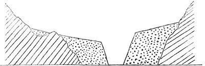
Metamorphic rocks. Alluvium. Stream. Alluvium. Metamorphic rocks.
KARDONG.
July, 1848.
ALLUVIAL PLATFORMS.
July, 1848.
On the 21st I proceeded to Karsar, a village on the
bank of the Shayuk river, distant about nine miles. A
few hundred feet above the village of Kardong the alluvial
boulder clay had begun to occur in the valley, and
around the village, which occupied the end of a lateral
ravine, it was already very thick. From Kardong to the
Shayuk this alluvium continued in great quantity, forming
elevated platforms, sloping very gently from the
mountains, and faced by steep, often quite perpendicular
cliffs. Where lateral ravines joined the main valley the
alluvium was deeply excavated by the little streams
which traversed them, and the road descended abruptly
by steep and curiously winding paths down the cliffs of
clay, and among piles of boulders, to re-ascend to the
platform beyond the stream. Such a ravine, of great
depth, occurred just below Kardong. After crossing it
the road lay over the surface of the clay platform, which
was nearly level, and consequently at an increasing
height above the bottom of the Kardong valley, which
rapidly diminished in elevation. This platform was extremely
barren, and quite devoid of water. Here and
there isolated rocky masses rose up through the alluvium.
The rock was peculiar, being very hard, and, as it were,
porphyritic, with a black, basaltic-looking matrix, quite
homogeneous, in which numerous white specks were
diffused. In hand specimens and boulders, and even
on a near view of the hills, this rock appeared quite an
igneous rock, but when an extensive section was exposed,
it could be seen to be distinctly stratified.
KARSAR.
July, 1848.
When within a short distance of the Shayuk valley,
though still high above it, the road turned to the left, and,
leaving the alluvial platform, proceeded among rugged
rocky hills, in a direction parallel to that river, at the
same time descending somewhat rapidly to a platform of
modern lacustrine clay and conglomerate, which filled up
the whole of a deep recess in the mountains facing the
Shayuk, to a thickness of at least 1000 feet. The village
of Karsar, at which I encamped, lies in a deep ravine,
excavated out of the clay formation by a considerable
stream, on both sides of which, for nearly a mile,
there is a belt of cultivation, very narrow where the
stream issues from the mountains, but gradually widening
as it descends. Owing to the sheltered situation,
from the great height of the cliffs of clay on both sides,
the crops were exceedingly luxuriant, and fruit-trees
were plentiful, principally apples and apricots. Some
very fine walnut-trees also occurred.
From the same cause the herbaceous vegetation was
particularly rich, and I met with many species which
were new to me. The banks of the stream, from the
point where it issued from among the mountains, were
everywhere bordered by large bushes of Myricaria elegans,
now adorned with masses of sweet-scented rose-coloured
flowers. In the lower part of the village-lands
there were shady plantations of poplar and willow,
which seemed to be occasionally irrigated, in order that
they might produce a rich natural pasture. In these
groves Euphrasia officinalis, species of Gentiana, Ranunculus,
Potentilla, and Carum grew most luxuriantly; a
tall but very small-flowered Pedicularis was also very
common. No less than three species of Orchideæ occurred,
a family which more than any other dislikes dryness:
these were Orchis latifolia, an Epipactis, and an
Herminium. Many of the weeds of the cultivated fields
were also new and interesting: a Hypecoum, an Elsholtzia,
and some species of Polygonum, were those I particularly
noted.
LACUSTRINE DEPOSIT.
July, 1848.
The lacustrine formation of Karsar consists mostly of
very pure white clay, horizontally stratified; but at the
lower end of the ravine, where it is about to expand into
the open plain of the Shayuk, a tolerably solid but still
very friable sandstone, the strata of which were also
quite horizontal, occurred under the clay. I saw no
fossils, but when the clay is examined with care, they
will probably be occasionally detected. At all events,
as this clay formation is at least a thousand feet thick,
if we take into consideration the open nature of the
whole valley of Nubra, there can be no doubt that it
must have been deposited from the same waters with the
very similar clay which I found at Tertse, in lower Nubra,
in October, 1847, and that it is therefore lacustrine. If
this be admitted, it seems impossible to escape from the
conclusion, that the deposits in the Kardong valley, (of
which I have given an imaginary section in page 398,)
though different in appearance, belong to the same lake.
Now, these attain an elevation of 13,500 feet and upwards,
as they commence above Kardong: the level
of the surface of the Nubra lake can therefore hardly
have been less than 14,000 feet; so that it must have
extended up the Tanktse valley, almost as far as the low
pass by which that district is separated from the Pangong
lake.
DISKIT.
July, 1848.
From Karsar, I marched on the 25th of July, down
the valley of the Shayuk, to Diskit. The earlier part of
the road, after ascending abruptly out of the Karsar
ravine, lay over the clay platform, which was perfectly
flat; but after about four miles, it descended nearly
to the level of the river, whose wide gravelly plain
now extended on the south side to the very foot of
the mountains, the lacustrine beds having been entirely
removed. The plain was traversed by several
small streamlets, apparently derived in a great measure
from the river, the water of which seemed to sink among
the gravel and sand of its bed, and to spring up again
at a distance from the main channel. One of these
streams ran at the extreme edge of the plain, close under
the cliffs, which here rose almost precipitously to a great
height. Its banks were very saline, and in the neighbourhood
of Diskit a great part of the plain was encrusted
with soda.
The cultivated lands of the village, which is of considerable
size, lie on a sloping bank, rising rather steeply
out of the plain. Many apricot-trees grow among the
houses, some of which were large enough to afford a
shade under which a tent could be pitched. The
vegetation was in general the same as at Karsar, but
a white-flowered Allium was new, as well as a species
of Chloris, which was abundant in the pastures. A
very small Cyperus, which grew in the water-courses,
appeared to be a dwarf state of a species common in
the plains of India, and, with the Chloris, which is a
tropical grass, was interesting as an indication of the
considerable heat of the summer climate in the valley
of the Shayuk, notwithstanding its great elevation.
PASSAGE OF SHAYUK RIVER.
July, 1848.
The village of Diskit is almost exactly opposite the
place where the Nubra river joins the Shayuk from the
northward. In October, 1847, I had crossed the Shayuk
five or six miles above Karsar, and descended along
its right bank, but during the hot months this route is
not practicable, as there are no bridges, and the river is
too deep to be forded anywhere except just at its junction
with that of Nubra, where the wide gravelly plain
of the Shayuk expands to its greatest diameter, and the
river is divided into numerous branches.
The greater part of the 26th of July was occupied by
the passage of the Shayuk, which was both tedious and
difficult, the river being now nearly at its greatest height.
The first branch was nearly two miles from Diskit, the
intervening gravelly plain being partly swampy, with a
few bushes of Hippophaë, Tamarix, and Myricaria.
There were four large branches to be crossed, besides
several of smaller size. Nearly a mile of sand separated
the last large branch from the remainder, and the ford
was a most intricate one, each branch being crossed
obliquely and at a different point from the adjacent
ones. The united breadth of all the streams could not,
I think, have been less than half a mile. The velocity
of the water was so great, that though the depth nowhere,
I think, exceeded three and a half feet, and was
more usually about two and a half, people on foot appeared
to have the utmost difficulty in retaining their
footing, and the loaded men had to be supported by one
or two without loads on each side. In the more difficult
parts, two men placed themselves on each side of
my horse's head, to guide him in the proper road, and
two more at each stirrup to give him support in case of
need. When in the centre of the current, where, from
the necessity of keeping my eye on the horse's motions,
I had to look at the water, I found it impossible to avoid
a feeling of giddiness, and an impression that horse and
rider were being hurried upwards with extreme velocity
in a direction contrary to the stream. These very rapid
portions, however, were never more than ten or twenty
yards broad; the remainder was more moderate and
shallower.
LYAKJUNG.
July, 1848.
After safely effecting the passage with all my party
and baggage, I proceeded about a mile over loose sand,
and encamped at the village of Lyakjung, situated at the
border of the low plain of the river, at the point of union
of the two valleys. The Shayuk valley is visible from
this place as far as the large village of Hundar, about
ten miles, the river running throughout that distance
through a wide gravelly plain, but with high rocky mountains
on both sides.
VALLEY OF NUBRA.
July, 1848.
From the 27th of July till the 9th of August, I remained
in the valley of Nubra, the necessary preparations
for my further journey, which was to be entirely
through an uninhabited country, requiring considerable
time. During this interval, I moved from place to
place in the valley, which is well inhabited and rather
pretty. The river is in the hot months very large and
rapid, and has its origin, no doubt, in the great snowy
mountains to the north. I crossed it twice a little above
the town of Chirasa, and found its current quite as
strong as that of the Shayuk, and in many places as
deep, but its breadth was considerably less. In one of
the channels, a lad, carrying a light bundle, was carried
away by the stream, and rolled over repeatedly in the
water, after being separated from his load, before he was
picked up by a number of men who hastened to his
assistance. The difficulty of crossing was much increased
by numerous quicksands, which made it necessary
to proceed by a tortuous path, and which were
evidently very liable to shift, as the guides proceeded
very cautiously, and more than once abandoned a ford
on finding the footing insecure.
The general appearance of the valley of Nubra is very
agreeable, and superior to that of any other part of Tibet
at the same elevation. The villages are well wooded, with
orchards of apricot-trees, and with poplars and willows,
which are either planted in rows, or scattered irregularly
in meadows on the skirts of the cultivated lands: the
willows, when not pollarded, attain a large size, and afford
an ample shade. The fields are carefully enclosed with
walls, or hedges of Hippophaë, or with a fence of the
dead branches of that plant. Green and shady lanes,
bordered by high Hippophaë hedges, full of Clematis and
rose-bushes, lead through the village lands. The crops
are chiefly wheat and barley, with a few fields of millet
(Panicum miliaceum), buckwheat, and rape. There is
also much pasture, particularly along the little streams,
and in fields near the river, which are often swampy.
The beauty of the cultivated tracts is much enhanced
by the utter sterility of the drier parts of the plain, which
are either gravelly or stony, and utterly barren, except
that occasionally from some peculiarity of soil or position
there is a considerable extent of clayey soil not
low enough to be swampy, but not remote from water,
covered with short turf much encrusted with soda. These
grassy plains are more common in the upper part of the
district, and are perhaps connected with springs containing
carbonate of soda in solution[23].
VEGETATION OF NUBRA.
August, 1848.
Except from the more advanced period of the season,
the flora of Nubra differed but little from that of Le.
Species of Artemisia, Labiatæ, and Chenopodiaceæ, were
now in full flower on the more desert and stony tracts,
in which a shrubby Lycium (which is not found on the
Indus) was also common. Chenopodiaceæ had become
extremely plentiful, and belonged to many different
genera: shrubby species of Eurotia and Caroxylon were
common, but the greater number were herbaceous, and
belonged to the genera Chenopodium, Ambrina, Salsola,
Echinopsilon, and Corispermum. A species of thistle
grew on barren soil, particularly where the ground was
saline; on the salt soil, Glaux, a little Crucifera, and a
Polygonum were the most abundant plants. Mulgedium
Tataricum, a Galium (very like G. Aparine), and a scandent
species of Vincetoxicum, were frequent in hedges; and
species of Mentha, Erodium, Epilobium, Lepidium, and
Matthiola, all common plants at Le, being now in full
flower, attracted notice more than at an earlier period.
A very tall species of grass (Melica?) in large and elegant
tufts, often six feet high, was one of the most ornamental
plants in the valley; while as uncommon forms I may
enumerate a prickly Sophora, Orobanche, Parietaria, and
in ponds a little Utricularia, closely resembling a European
species.
A small-leaved elm, which is common near Tagar, is
apparently wild,—at least it is not acknowledged by the
inhabitants as a cultivated tree. I have not observed
this tree elsewhere in Tibet, but Mr. Vigne mentions
that he met with an elm in the mountains between Shigar
and Khapalu. It appears to be the same with a species
common in the forests of the lower valleys of Kashmir.
HOT SPRINGS.
August, 1848.
About a mile from the large village of Panamik are
the hot springs formerly visited by Moorcroft. They are
two in number, and spring from the rocky mountain-side,
about a hundred yards from the edge of the plain.
The temperature of the water in the spring which I tried
was 170·5°. It was faintly sulphurous both in taste
and smell, but not perceptibly saline, and deposited a
thick calcareous incrustation on everything within its
reach.
To the south of Panamik the rocks of Nubra are
chiefly black slate, but transported blocks of granite are
everywhere common, and at that village the latter rock
descends to the level of the river, and continues to form
the whole mass of the mountains on the left side of the
valley as far as I continued along it. On the right side
there were indications of stratification on the steep sides
of the mountains, and, from the colour, the rock there
appeared to be partly granite and partly metamorphic
slate.
CHAPTER XIV.
Start for Karakoram—Steep ascent out of Nubra valley—Meet a party
of Merchants from Yarkand—View from summit of pass—Rapid torrent—Large
glacier—Steep moraines—Alpine vegetation—Numerous
glaciers—Lakes—Glacier on crest of Sassar pass—Sassar—Cross
Shayuk river—Murgai—Limestone rocks—Ascend Murgai
Valley to 16,800 feet—Singular limestone formation—Open plain
above 17,000 feet—Re-cross Shayuk river—Karakoram pass—Return
to Sassar—Glaciers of Sassar—Return to Le—Start for Kashmir—Lamayura—Phatu
pass—Kanji river—Namika pass—Molbil
Pashkyum—Kargil—Dras—Zoji pass—Kashmir—Lahore—Completion
of journey.
Having at last completed the preparations necessary for
a journey of twenty days through uninhabited regions, I
started on the 9th of August from the village of Taksha.
My first day's journey lay up the Nubra valley, which
continued wide, though the alluvial platforms were destitute
of cultivation, and quite barren. In several places
(always opposite to ravines) they were covered with enormous
boulders, which had all the appearance of having
been brought to the position they occupied by glaciers.
Two small villages were seen, both on the west bank of
the river. Four miles from Taksha I crossed, by a good
wooden bridge, a large stream which descended from the
mountains on my right hand through an exceedingly
rocky gorge. After seven miles and a half, I found that
I had reached the point at which the road followed by
the merchants in travelling from Le to Yarkand leaves
the valley of Nubra. It was too late in the day to attempt
the ascent of the ridge to the right; I therefore encamped
in a grove of willows, which formed a belt along the margin
of a stream whose bed was now quite dry, its scanty
supply of water having been diverted into an artificial
channel for the irrigation of a couple of fields of indifferent
barley not far off.
In the valley of Nubra, beyond this encamping ground,
which is known by the name of Changlung, there are, I
believe, only three small villages, the most distant of which
appeared to be not more than five or six miles off. In
the direction of the valley, which was still north-north-west,
very lofty mountains were visible at no great distance,
all with snowy tops, and generally with heavy snow-beds
and glaciers in their hollows; and according to the statement
of my guides, the river at the distance of less than
two days' journey issues from beneath a glacier, by which
all passage is stopped[24].
ASCENT OUT OF NUBRA VALLEY.
August, 1848.
On the 10th of August I started at daybreak, immediately
commencing the ascent of the mountain range
which enclosed the valley on the east. The mountain was
exceedingly steep, indeed almost precipitous, and the road
proceeded in a zigzag direction over bare granite rock,
with scarce a vestige of vegetation. During the ascent
I had a good view of the valley, and of the mountain
range which bounded it on the south-west; large patches
of snow lay on its peaks, and here and there I saw a
small glacier in its ravines. The upper part of the valleys
by which these mountains were furrowed had a very
moderate slope, but from about 14,000 feet down to the
bottom they were extremely abrupt.
YARKAND MERCHANTS.
August, 1848.
After about 3500 feet of extremely laborious climbing,
I arrived at a small level plain, perhaps two hundred
yards long and forty or fifty wide, evidently much frequented
as a resting-place by travellers, a small pool of
water being the inducement. I here met a party of merchants
on their way from Yarkand to Le. Their goods
were conveyed by ponies, apparently much exhausted
by their long journey through desert country. I had
noticed, on the way up the mountain, that the road was
lined by numerous skeletons and scattered bones of
horses; I had also seen one or two of the same animals
recently dead, and the appearance of these loaded ponies
enabled me to understand the cause of the great mortality.
Many of the unfortunate animals appeared
scarcely to have strength to accomplish the few miles
of descent which still intervened between them and
plenty of food. The main reliance of the merchants for
the support of their horses is on corn carried with them,
to which there must be a limit, otherwise they would
carry nothing but their own food.
SUMMIT OF PASS.
August, 1848.
From this halting-place the remainder of the ascent
was less abrupt, though still steep and extremely stony.
There was, however, a little more vegetation than on the
lower part, where the barren rocks, except at the very
base, produced scarcely anything but Ephedra, a dwarf
species of Rhamnus, and tufts of the hardy Statice.
Higher up, several species of Astragalus and Artemisia
were plentiful, with Lithospermum euchromon, Dracocephalum
heterophyllum, and several Chenopodiaceæ and
grasses. The top of the ridge had an elevation of
15,300 feet, but from its extreme aridity and rockiness,
and its consequent elevated temperature, no alpine plants
occurred. On reaching the top I was able to see something
of the road before me, regarding which I had
previously had little information, except in accounts of its
extreme difficulty. These I had been inclined to consider
exaggerated, but the prospect before me was undoubtedly
far from tempting. Immediately below lay a
narrow stony valley, to which, from the spot on which I
stood, the descent was almost perpendicular. Opposite
to me there was a range of mountains higher than that
on which I stood, with here and there a patch of snow.
The valley below me was partly occupied by a mass of
loose alluvial conglomerate, through which the stream
had excavated a deep ravine; its direction was south-south-west,
and there could be no doubt that the stream which I
had crossed the day before, about half-way, was that which
drained the valley upon which I now looked down. On
the top of the alluvial platform, on the opposite side,
there was a narrow strip of green, indicating a small
patch of cultivation, without, however, any habitation,
the crop being apparently left to its fate till ready for the
reaper. In every other direction, stones and snow were
alone visible.
BARREN VALLEY.
August, 1848.
I descended obliquely into the valley, so as to reach it
about a mile and a half higher up than the spot from
which it was first visible. The descent was very laborious,
a great part of it being covered with loose gravel
or coarse sand, produced by the disintegration of the
granite rocks. There was rather more vegetation than
on the opposite face, and I collected a number of plants
which I had not recently met with; a Nepeta, Scrophularia,
Cicer, and Heracleum, and two shrubby Potentillæ,
were the commonest species. One of the species of
Potentilla (P. discolor of Jacquemont) was remarkable
for exciting violent sneezing when touched or shaken;
this curious property seemed to be owing to a very fine
dust which covered the under surface of the leaves.
After reaching the surface of the alluvial platform
overhanging the stream, about half a mile of gentle
ascent among large stones brought me, after a journey
of ten miles, to my encamping ground. This was a level
spot, close to a lateral torrent, which had its source in
a snow-bed in the mountains on the left, and was rushing
in a most impetuous milk-white torrent over immense
boulders, to unite itself to the main stream. The elevation
of my camp was about 14,000 feet.
On the morning of the 11th, at starting, I crossed the
torrent close to camp. Although much less considerable
than it had been the previous afternoon, still, from its
great rapidity and the number of boulders in its bed,
the crossing was not accomplished without difficulty by
the laden animals, who carried the greater part of my
baggage. I crossed it myself by leaping from boulder
to boulder, which would have been quite impossible in
the afternoon of the previous day, when it was swollen by
the action of the sun upon the snow. The road lay up
the valley parallel to the river, among a most extraordinary
accumulation of granite boulders of all sizes, from
one to ten feet in diameter, piled upon one another in
vast heaps, and evidently transported by a former glacier.
After about half a mile, I crossed the river by a wooden
bridge of two or three beams, which must have been
brought from Nubra for the purpose, as no timber of any
sort grows in the valley. The stream was very rapid
and muddy. A mile further, a torrent descending from
the mountains on the right was crossed, and soon after I
got upon the bank of the main stream, now more tranquil
and fordable. The road for the remainder of the
march lay along its left bank, over boulders and gravel,
ascending now and then a little way on steep sloping
banks, entirely composed of transported materials. I
encamped on a level, somewhat grassy spot of ground,
which was evidently commonly used as a halting-place,
having travelled only four and a half miles, an unnecessarily
short day's work. I had throughout my journey
had considerable difficulty in fixing the marches at proper
lengths, the inhabitants having no measure of distance
but the day's journey. In the present instance, my tent
was pitched, and most of the party had commenced to
cook, or were dispersed to collect fuel, long before my
arrival, so that I was obliged to rest content for the day.
GLACIER.
August, 1848.
The course travelled during the day had been north-north-east,
but I had evidently arrived nearly as far as was
practicable in that direction, for about half a mile in front
was the bluff end of a very large glacier, filling up the
continuation of the valley. This glacier, which was nearly
half a mile wide, was covered almost entirely with stones
and earth, very little of its surface being visible, and the
dirty black colour of its terminating cliff showing how
much soil had been mixed up with it in its progress.
The elevation of my tent was about 14,500 feet, and the
termination of the glacier may have been 250 feet higher.
All around the mountains were very lofty, their tops
covered with snow, which nowhere came within 2000
feet at least of the valley, even on northern exposures.
Granite was everywhere the prevailing rock, but on the
higher mountain slopes, which were often precipitous,
it was much intermixed with a dark rock, probably clay-slate.
ALPINE NETTLE.
August, 1848.
During the day I had scarcely seen any vegetation,
except when close to the edge of the stream. Among
the boulders and on the bare stony ground there was
frequently not a vestige of herbage. Near one of
the ravines I found the white shrubby Potentilla, along
with an exceedingly pretty prostrate plant, with bright
rose-coloured flowers, belonging to the order of Compositæ:
it was a species of the genus Allardia, described
by M. Decaisne from the collections of Jacquemont, by
whom it was found in Piti. One of the very few alpine
plants which I saw during the day was a little gentian,
common among the turf close to my tent. Round camp
a species of nettle was plentiful, seemingly, like others
of the genus, attracted by the nitrogenous nature of the
soil of an encamping ground much frequented by shepherds
with their flocks. The sting of this nettle, though
rather faint, was quite perceptible. It was decidedly an
alpine plant, which is rather uncommon, not only in the
genus, but the order to which it belongs.
The journey of the 12th of August commenced by a
steep ascent into a lateral valley descending from the
eastward. The hill-side up which I climbed (apparently
the bluff termination of an ancient moraine) was very
stony and dry. When a sufficient elevation above my
encampment had been gained, I obtained a commanding
view of the glacier which occupied the continuation of
the main valley. It was nearly straight, and, as I believe,
at least five or six miles long; distances, however, are so
difficult to estimate on snow, that this must be regarded
as a mere guess. The inclination of its surface was considerable;
but, while the distance remained doubtful, no
just estimate of the height of the ridge from which it
descended could be made. On each side, two or three
lateral glaciers, descending from the mountains by which
it was enclosed, contributed to increase its size, all loaded
with heaps of stones, which had at the lower end of the
central glacier so accumulated as completely to cover its
whole surface.
MORAINES.
August, 1848.
After 800 or 1000 feet of ascent I found that I had
attained the level of the lateral valley, along which the
road ran, and that the remainder of the way was much
more gentle, but exceedingly fatiguing, from its excessive
roughness, and from the great elevation, which made the
slightest exertion difficult. On both sides were high
ranges of mountains, which had much snow on their
summits, and in one or two ravines there was a small
snow-bed or incipient glacier, but the distance from the
crest of the ridge not being great, no glacier of any
length was formed. On the left hand, the mountains
were steeper and higher than those on the right, and
several bulky glaciers on very steep slopes occupied their
ravines. None of these entered the valley along which
my road lay, but their moraines often projected to its
very centre, forming immense piles of angular fragments
of rocks, which attained, in more than one place, a height
of several hundred feet, and indicated that the glaciers
had at some former period advanced much further than
they now do. The main valley was itself everywhere
covered with boulders; in some places large blocks, ten
to twenty feet in diameter, were arranged at moderate
distances from one another, but more frequently the
fragments were all small.
SASSAR PASS.
August, 1848.
After the first steep ascent, the slope of the valley was
uniformly gentle, except when a steep-sided moraine had
to be passed. Latterly a few small patches of snow occurred
in the valley. I encamped at 16,600 feet, on a
level grassy spot of ground close to a small circular plain
resembling the bed of a lake, and still partially covered
with snow. The snow level on the mountains to the
south had approached within less than one hundred feet
of the level of the plain. Though the distance travelled
during the day was only six miles, I felt a good deal
fatigued, and suffered much from headache, caused by
the rarefaction of the air.
From the great quantity of snow on the mountains
all around, there had been throughout the day an abundance
of moisture, and vegetation was in consequence
much more plentiful than usual. The plants were all
alpine, and being mostly diminutive, had to be sought
in the crevices of rocks, and among the stones which
everywhere abounded. The banks of the stream were
frequently grassy, and there was a great deal of marshy
ground. Most of the plants obtained were in full flower,
and the colours were in general very bright, and sufficiently
varied. By far the greater part belonged to the
same genera which prevail on European mountains, such
as Draba, Saxifraga, Sibbaldia, Potentilla, Ranunculus,
Papaver, Pedicularis, Cerastium, Leontopodium, and Saussurea.
The most remarkable forms were three species of
Allardia, several Astragali, a one-flowered Lychnis, Delphinium
Brunonianum, and a Ligularia. The alpine nettle
was common on many parts of the road, chiefly near
places frequented by the shepherds as halting-places.
Next day at starting I proceeded along the edge of the
small plain close to which I had been encamped. On the
right hand was an ancient moraine, which prevented me
from seeing the road in advance. At the upper end of
the plain I found a small streamlet running parallel to the
moraine; and about a mile from camp I reached the end
of a small glacier, from which the streamlet had its origin.
Crossing the latter, which was still partially frozen, I
ascended in a deep hollow between the left side of the
glacier and the moraine. The icy mass had not yet begun
to thaw, the temperature being still below freezing. After
half a mile I ascended on the surface of the ice, and as soon
as I did so, was enabled to see that the glacier had its
origin in a ravine on the south, and entered the main valley
almost opposite to me. The great body of the ice
took a westerly direction, forming the glacier along which
I had been travelling; but a portion formed a cliff to the
eastward, which dipped abruptly into a small, apparently
deep lake. At the distance of perhaps five hundred
yards there was another glacier, which descended from a
valley in the northern range of mountains, and, like the
one on which I stood, presented a perpendicular wall to
the little lake. Right and left of the lake were enormous
piles of boulders, occupying the interval between its
margin and the mountains, or rather filling up a portion
of the space which it would otherwise have occupied.
Into this very singular hollow I descended, on a steep
icy slope, and passing along the northern margin of the
lake, ascended on the glacier beyond; as before, between
the ice and moraine.
On reaching the surface of the second glacier, I found
that a similar but smaller depression lay beyond it to
the east, in which also there was a small lake, with
another mass of ice beyond it. This third glacier also
came from the north, and was a much more formidable
mass than those which had already been crossed. It
was very steep, and was covered with snow, which was
beginning to thaw more than was convenient. When at
the highest part, I found that though apparently nearly
level, it sloped downwards sensibly, though very slightly
for nearly half a mile, in an easterly direction. It was
evident that I had now reached the highest part of the
ascent, and that the crest of the pass was covered by this
glacier. I did not make any observation to determine its
altitude, but the ascent from camp was very moderate,
not, I think, exceeding a thousand feet. Assuming this
estimate to be correct, the height of the pass would be
about 17,600 feet, which I believe will prove not far from
the truth.
On so icy an ascent vegetation could not be expected
to be plentiful; still, even in the depressions between
the glaciers, the crevices among the boulders produced
a few plants, mostly the same as those observed the day
before, but three species of Saussurea were the most
common of all. Before arriving at the first glacier, the
beautiful Primula collected on the pass above Le was
met with in great abundance.
SASSAR.
August, 1848.
For about half a mile, as I have said, the slope of the
glacier was just perceptible; beyond that distance the
descent was abrupt. On reaching the end of the level
portion, I obtained an excellent view to the eastward, in
which direction a wide valley was seen at a distance of
several miles. Through this valley, from left to right,
ran a considerable river, which proved to be the Shayuk.
Beyond the river, rocky mountains were seen,
apparently nearly as high as those near at hand, and
perfectly barren. In descending from the pass, I soon
left the surface of the ice, which, as soon as the slope
became abrupt, was too rugged to be walked over. I
then got upon the moraine; about half-way down, the
glacier, which had latterly been almost entirely covered
with debris, came to an end, but a moraine continued
a long way down, and the remainder of the descent
was very stony. I encamped at about 15,400 feet on
a dry gravelly plain, close to the broad valley of the
Shayuk, but at least 500 feet above it. To the right,
in a very deep ravine, was a small stream, on the banks
of which were patches of snow. The name of the
ground on which I encamped, which is a usual halting-place,
was Sassar, and the Turki merchants call the pass
also by the same name.
PLAIN OF SHAYUK RIVER.
August, 1848.
From Sassar not more than three or four miles of the
upward course of the river were visible, but within that
distance three glaciers were in sight. Two of these
stopped short of the valley, while the third, which was
at the most distant point visible, appeared to descend to
the river. An enormous precipice, which must have
been at least 3000 feet in height, rose on the opposite
side of the valley beyond the glaciers. Downward the
valley of the Shayuk was seen for nearly ten miles, as a
wide gravelly plain, with high rugged mountains on both
sides.
On the morning after my arrival at Sassar, it was
snowing slightly at daybreak, and continued to do so
till near noon. The snow melted almost immediately
on the level ground, but on the mountain-sides it lay all
day, down as low as the level of my tent. The afternoon
was dull and stormy, but no more snow fell. This
unfavourable weather was of less consequence, because
I had determined to halt in order to make fresh arrangements
for my baggage, being advised not to take any
cattle beyond Sassar, the roads in advance being very
bad. I afterwards found that they were gravelly, which
is more injurious than even rock to the unprotected feet
of the Tibetan bullock.
The gravelly sloping hills round my encampment were
covered with abundance of vegetation, but few of the
species were alpine, and almost all were familiar to me.
A species of Allium, with purple flowers and broad strap-shaped
leaves, was the most plentiful of all. Thermopsis
was frequent, in fruit; other common plants were
species of Artemisia, Cynoglossum, Cicer, and Dracocephalum.
The only new species were a very handsome
dark purple Nepeta, which grew in large tufts among
loose shingle, and a tall Saussurea, by far the largest
species of the genus which I had found in Tibet, but I
believe one of those described from Jacquemont's collections.
A species of Rheum occurred occasionally on dry
stony places, but it was the same which I had found
several times before.
On the 15th of August I resumed my journey. The
morning was misty, with a few flakes of snow at intervals,
and the sky remained overcast all day, with high
squalls of wind. My road lay across the Shayuk, but I
found it necessary to ascend about half a mile on the
high bank before I reached a place where it was possible
to descend to its gravelly plain, which was more
than half a mile wide, and quite destitute of any kind of
vegetation. The river was running in several channels,
with an average depth of about a foot and a half; in one
place only it was as much as two feet. The current ran
with considerable rapidity.
On the opposite side of the plain of the Shayuk, I entered
an extremely narrow ravine, bounded by precipices
of black slate, down which ran a small stream, which
crossed at every turn of the ravine from one side to the
other, generally close to the rocky wall, and had to be
forded a great number of times. After a mile and a
half, the road, suddenly quitting the ravine, turned to
the right, and ascended by a steep pathway to a wide,
very gently rising plain, bounded on both sides by
snowy mountains. This plain was partly grassy, but
mostly composed of hard dry clay. In a few spots
where snow appeared recently to have lain, the clay
was soft and treacherous, sinking under the feet.
About a mile's walk over this plain brought me to the
highest part of it, beyond which it began to slope to
the eastward, at first very gently but afterwards more
rapidly. Many large isolated boulders were observed
on its surface. It was curious to observe that the gravel
produced by the disintegration of the mountains (chiefly,
I suppose, by snow-slips in winter) differed in colour
on the two sides of the valley, and that the line of demarcation
followed very closely the centre of the valley.
The northern mountains, being granitic, produced a hard
quartzy gravel, while those to the south, which were
schistose, contributed a dark-coloured gravel of sharp
slaty fragments. On the lower part of the descent, a
small rivulet made its appearance in the centre of the
plain, and I encamped, after nine and a half miles, close
to an open valley of considerable size, whose course
seemed to be south-east.
MURGAI.
August, 1848.
This encamping-ground is called by the Turki merchants
Murgai, by the Tibetans, Murgo-Chumik; the former
name being probably a corruption of the latter. It
was the last place at which I was to expect a sufficiency
of fuel, or even, with rare exceptions, of grass for my
horse, which, though not often used, I was unwilling to
leave behind, lest I should by any accident be disabled
from walking. The temperature of boiling water here
indicated an elevation of about 15,100 feet, but as the
weather was stormy and threatening, this was probably
several hundred feet more than the truth. A number
of springs appeared to break out of the ground close to
my tent, where there was a considerable extent of boggy
pasture, much greener than is usual at so great an elevation.
A few bushes of Myricaria elegans were the only
shrubs, but tufts of Artemisia and Eurotia were sufficiently
plentiful to produce an abundance of fuel. In
the boggy meadow, a pretty little species of Primula
was very abundant; the other plants observed were a
white Pedicularis, two species of Triglochin, and some
Carices and grasses.
The morning of the 16th of August was bright and
beautiful, the clouds having been entirely dissipated
during the night. The wide valley near which I was
encamped descended, as I was informed, to the Shayuk,
which it was said to join through a rocky gorge eight or
ten miles lower down than Sassar. Along its course
the merchants are in the habit of ascending at the season
when the valley of the Shayuk is followed all the way
from Nubra, which is only practicable in early spring
and late in the autumn, at which times that river is fordable
throughout. It is a fortunate circumstance for the
trade that there is thus a choice of routes, for at these
seasons the Sassar pass must be in a great measure
blocked up with snow.
ASCENT OF
MURGAI VALLEY.
August, 1848.
On my arrival at Murgai, I had observed that the
mountains to the north were very precipitous, and had
been puzzled to decide what direction the road might
take. On starting, however, I found that it lay along
the upward course of the stream which watered the valley
before me, and which here issued from the mountains
through a very narrow ravine with high precipices on
both sides. At first I ascended to the top of a platform
of conglomerate which lay at the base of the mountains.
The ground was strewed with fragments of limestone,
evidently derived from the mountains above; and about
half a mile from camp I passed a calcareous spring
which had deposited large quantities of tufa throughout
the whole of the space between its source and the face
of the precipice which overhung the river: the thickness
of the incrustation was, in front of the cliff, from six
to eight feet. A little further on, the road descended
abruptly to the stream, and, after crossing it several times
within a few hundred yards, ascended equally abruptly
the steep stony slopes on its left bank, at a point where
its course, which had previously been nearly north,
turned rather suddenly to the eastward. On emerging
from the ravine, two small glaciers came in sight almost
directly opposite, in branches of a narrow and very deep
gorge, which descended from the mountains to the north
nearly in the original direction of the ravine. The road
ascended to the height of at least 1000 feet, and then
proceeded along the steep slopes, alternately ascending
and descending over very stony ground, occasionally covered
with loose limestone shingle. The stream was
visible below, running through a narrow rocky fissure.
After about a mile and a half, the road again descended
to the river, now a little wider, with a gravelly
channel. Here I found that there were two roads.
One of these, for loaded animals, ascended steeply on
the north side, to the height of nearly 1000 feet,
and again descended very abruptly. The other was in
the bed of the stream, which was partially filled up with
huge blocks of rock. The stream being almost dry, I
took the lower road, which for pedestrians was only objectionable
from its great roughness, and because it was
necessary to cross the rivulet occasionally. After about
a quarter of a mile, the ravine suddenly opened out into
a gravelly plain nearly half a mile in width, traversed by
numerous branches of the little stream: these were now
almost dry, owing to the cloudy weather of the last few
days having in a great measure stopped the melting of
the glaciers by which they were supplied. Along this
open plain I continued for nearly five miles. In one
place only it contracted again for a few hundred yards
into a gorge full of huge rocky masses heaped one on another,
by which it was apparently quite blocked up; this
however was avoided by a slight ascent among angular
limestone fragments. On descending into the plain
again, I observed a very small patch of grassy ground
on a bank a few feet above the level of the stream, the
only herbage seen during the day. About a mile further
on I encamped, after a march of nine miles, on the south
side of the plain, on a dry bank elevated four or five feet
above its gravelly bed. There was a sudden change in
the direction of the valley just at my encamping-ground,
its further course being in a direction west of north.
The elevation of my tent was very nearly 16,000 feet.
High, rugged, precipitous mountains, with snowy tops,
rose on both sides of the road during the whole of this
day's journey. The rock throughout the day was limestone,
a few thin layers of slate excepted. It varied much
in colour, but was generally very dark and highly crystalline,
and often contained large masses of white calcareous
spar. It was distinctly stratified, and occasionally exhibited
obscure traces of what might be fossils, but which
were too indistinct to be relied upon. The principal mass
of snow seen was nearly due south of my encampment,
but this was probably owing to the northerly exposure
of the mountains on that side. The vegetation observed
during the day was scanty in the extreme; Eurotia, a
Saussurea with very viscid leaves, Oxytropis chiliophylla,
and Biebersteinia odora being almost the only plants on
the stony slopes and shingle during the first half of the
way. On the gravelly plain there was no vegetation at
all, but on its margins a few scattered plants were occasionally
to be found, a Pyrethrum and two or three Cruciferæ
being the species noted. The most remarkable
plant observed during the day was a species of Alsine
in dense hemispherical tufts, a foot or more in diameter.
This plant (the moss of Moorcroft's visit to Garu, and
of other travellers in and on the borders of Tibet) is a
common Tibetan plant at very great elevations, 16,000
feet being perhaps not far from its lowest level[25].
On the 17th my road lay entirely along the gravelly
plain in a direction always considerably to the west of
north. The plain gradually narrowed as I advanced,
and came to an end by contracting into a rocky ravine,
just as I halted for the day. The mountains on the left
were still very lofty; one glacier was seen on that side.
On the right the mountains were lower and quite without
snow, but extremely rugged and rocky. The slope
of the valley was scarcely perceptible, but I found at the
end of my day's journey, which amounted to twelve
miles, that I had risen above 700 feet, the height of my
encampment being a little more than 16,700 feet. The
day was bright and sunny, and the stream, which, in the
morning was quite insignificant, not three feet wide and
scarcely ankle-deep, had increased much by the afternoon,
and had become of a dirty red colour. It was
twenty feet wide, and a foot and a half deep, where I
crossed it just before halting. The vegetation was still
more scanty than the day before, though most of the
plants then noted were again seen occasionally. Small
tufts of a little Stipa were not uncommon, constituting
almost the only food for cattle, as patches of green grass,
a few feet in diameter, were only seen twice during the
day. Two very small Saussureæ formed dense tufted
masses on the surface of the ground, and a little rose-coloured
Astragalus spread itself prostrate over the
gravel; indeed, this mode of growth seemed to be characteristic
either of the climate or soil, as I found, though
rarely, a species of Myricaria, with short thick wiry
branches lying flat on the ground and spreading into
patches a yard in diameter.
REMARKABLE LIMESTONE.
August, 1848.
Not far from the point where the direction of the valley
changed so suddenly, the blue or greyish massive but
brittle limestone of the higher mountains gave place to a
rock of a very different appearance. This was also a
limestone, perfectly white, or with a very faint yellowish
or greyish tinge, and either quite amorphous, with a
saccharine texture, and often honeycombed, or composed
of a congeries of very minute crystals. Occasionally,
but rarely, rolled pebbles were seen in it. No traces of
stratification were anywhere discoverable, in which respect
it differed very strikingly from the limestone of the
previous day, in which lines of stratification, much contorted,
were well seen in many sections exposed at different
heights. This remarkable limestone formed the
rock on both sides of the gravelly plain during the
greater part of the day's journey. In one place only
metamorphic slate was seen below it, dipping at a high
angle to the north-east. The limestone was extremely
brittle, and the cliffs terminated above in sharp pinnacles
of the most fantastic shapes, while at the base they were
covered with heaps of angular debris[26]. A coarse conglomerate
replaced the limestone during the last mile previous
to my encamping.
ELEVATED PLAIN OF KARAKORAM.
August, 1848.
On the 18th of August, after following for a few hundred
yards the course of the stream through a narrow
rocky gorge, the road turned abruptly to the right, up
a dry stony ravine, ascending rather rapidly. The coarse
conglomerate of the lower part of this ravine was succeeded
by a coarse sandstone, and that again by an incoherent
alluvial conglomerate with a clayey matrix. After
a short distance, the ravine widened out into a narrow,
gravelly, moderately steep valley, with low rounded hills
on either side. By degrees, as I increased my elevation,
superb snowy mountains came in sight to the south-west,
and on attaining the top of the ascent an open, gravelly,
somewhat undulating plain lay before me, while behind
a grand snowy range was seen in perfection, forming
apparently a continuous chain, with a direction from
south-east to north-west. The snow was to the eye perfectly
continuous in both directions as far as the mountains
were visible, and appeared everywhere to lie on the
mountain-sides to three and four thousand feet below
their tops. As I had passed through this apparent chain
of mountains without rising above 16,000 feet, the continuity
of the snowy mass was of course a deception.
Many very lofty peaks rose above the others at intervals.
The height of the more distant ones I could not venture
to estimate, but I felt at the time fully convinced that a
very high peak, just opposite to me, and distant, according
to bearings taken afterwards, about ten miles (in a
direct line) from the edge of the plain, was 6000 or 7000
feet higher than the ground on which I stood, or at least
24,000 feet above the level of the sea. I do not wish
that any great degree of confidence should be placed on
this estimate, but I think it right that I should state
my impression at the time, formed without any wish to
exaggerate.
The stream along which I had ascended during the two
last days lay in a deep ravine far below the level of the
plain. Its source was evidently not far distant, and it
issued no doubt from a large glacier at the head of the
gorge, though the slight upward slope of the plain to the
west prevented me from seeing its precise origin. In a
northerly direction the plain appeared to extend for six
or seven miles, and beyond it lay several ranges of mountains
running from east to west, but only very moderately
patched with snow. Eastward the plain diminished
slightly in elevation for four or five miles, at which distance
there was a low range of hills, and immediately at
their foot a small stream apparently running to the northward.
Beyond these low hills were a number of lofty
black peaks to the northward of the great mass of snow,
on the further side of which the country probably dips to
the eastward in the direction of Khoten. Every one of
my guides positively denied the existence of any road in
that direction; afraid, perhaps, that I might attempt to
proceed by it; for I learned afterwards, on my return
to Le, from a merchant of Yarkand, that there was an
unfrequented path by which Khoten might be reached,
if the Chinese authorities were willing to permit it to
be used.
My road lay across the open plain in a direction very
little west of north. The surface of the ground was
covered with a few boulders and many small pebbles, for
the most part rolled, and very various in composition;
granite, greenstones of many sorts, amygdaloid, limestone,
and different-coloured slates, being all seen. Many
of these were encrusted with a calcareous concretion,
and the whole plain had the appearance of having formerly
been the bed of a lake. Skeletons and scattered
bones of horses indicated with great exactness the road
across this arid tract, which seemed to be almost destitute
of either animal life or vegetation. The only living
beings seen were a few ravens, a hoopoe, and a small
bird somewhat like a sparrow. Tufts of the moss-like
Alsine, referred to on the 17th, were the only vegetation,
except in the bed of a little rivulet near the middle of
the plain, which produced a few specimens of Saussurea
and Sibbaldia. This streamlet rose in a large patch of
snow about half a mile to the westward, and ran towards
the east, turning afterwards nearly due north along the
foot of a low range of hills mentioned above. The elevation
of its bed, which was the lowest part of the table-land
in the direction in which I crossed it, was 17,300
feet, and the lowest part of the plain was immediately
under the low hills to the eastward, where it probably
was about 17,000 feet.
There was no snow on the plain, except one patch close
to its highest part, in which the little rivulet had its
source, and a very few remnants on the shady side of a
low undulating ridge, which crosses it near its northern
border. After about five miles, having been ascending
very gradually since leaving the banks of the stream, I
passed through an opening between two low gravelly
hills, and found myself looking down upon a wide
valley, into which I descended very gradually along a
dry ravine. Passing a small patch of swampy, grassy
ground, at which I left my horse with a servant till my
return, as there was no food for him further on, I
arrived, about two miles from the point at which the
valley just came in sight, at a small river about thirty
feet wide and ankle-deep, running from east to west.
According to the information of my guides, this was the
river which runs past Sassar,—in fact, the Shayuk. None
of them had followed its course, but they assured me
that there was no doubt of the accuracy of their statement,
which indeed is confirmed by the fact (which I
mention on the authority of Yarkand merchants) that formerly
travellers used to ascend the Shayuk from Sassar,
in order to reach the Karakoram pass, instead of pursuing
the circuitous route by which I travelled; but that
about ten or twelve years ago the glaciers above Sassar
descended so low as entirely to prevent any one passing
in that direction, for which reason it became necessary
to adopt a new road[27].
SHAYUK RIVER.
August, 1848.
The course of the Shayuk was visible for several miles,
running nearly due west. Beyond that distance, it disappeared
among rocky hills. Fording the river, I ascended
a steep bank, to get upon a stony platform, over
which I proceeded in a northerly direction, gradually
approaching a small stream which came from the north
to join the Shayuk. Passing a low rounded hill to the
right, I descended after about two miles into the ravine
excavated by this little stream, and, crossing it, encamped
under low limestone rocks on its right bank after a march
of twelve miles. I did not ascertain the elevation of this
halting-ground, but, from the result of an experiment
made at a place which appeared nearly midway (in point
of elevation) between it and the bed of the Shayuk,
where I got a boiling-point, indicating an elevation of
17,000 feet, I estimate the bed of the river at 16,800
feet, and my encamping-ground of the 18th at 17,200
feet. The plain all round seemed destitute of vegetation,
so that, as on the two last days, there was a great
scarcity of fuel, which had to be collected from a distance
of many miles; and consisted only of the roots
of a small bushy Artemisia or Tanacetum, which rose
three or four inches above the ground. During these
three days, I suffered very considerably from the effects
of the rarefaction of the air, being never free from a
dull headache, which was increased on the slightest exertion.
KARAKORAM PASS.
August, 1848.
On the 19th of August, leaving my tent standing, I
started to visit the Karakoram pass, the limit of my journey
to the northward. The country round my halting-place
was open, except to the north, where a stream
descended through a narrow valley from a range of hills,
the highest part of which was apparently about 3000
feet above me. All the rivers had formed for themselves
depressions in the platform of gravel which was spread
over the plain. At first I kept on the south bank of the
river close to which I had halted, but about a mile from
camp I crossed a large tributary which descended from
the south-west, and soon after, turning round the rocky
termination of a low range of hills, entered a narrow
valley which came from a little west of north-west. At
the foot of the rocky point of the range were three very
small huts, built against the rock as a place of shelter for
travellers, in case of stormy or snowy weather; and bones
of horses were here scattered about the plain in greater
profusion than usual.
VEGETATION OF KARAKORAM
August, 1848.
I ascended this valley for about six miles: its width
varied from 200 yards to about half a mile, gradually
widening as I ascended. The slope was throughout
gentle. An accumulation of alluvium frequently formed
broad and gently sloping banks, which were cut into
cliffs by the river. Now and then large tracts covered
with glacial boulders were passed over; and several
small streams were crossed, descending from the northern
mountains through narrow ravines. About eight miles
from my starting-point the road left the bank of the
stream, and began to ascend obliquely and gradually on
the sides of the hills. The course of the valley beyond
where I left it continued unaltered, sloping gently up to
a large snow-bed, which covered the side of a long
sloping ridge four or five miles off. After a mile, I turned
suddenly to the right, and, ascending very steeply over
fragments of rock for four or five hundred yards, I found
myself on the top of the Karakoram pass—a rounded
ridge connecting two hills which rose somewhat abruptly
to the height of perhaps 1000 feet above me. The
height of the pass was 18,200 feet, the boiling-point of
water being 180·8°, and the temperature of the air about
50°. Towards the north, much to my disappointment,
there was no distant view. On that side the descent was
steep for about 500 yards, beyond which distance a small
streamlet occupied the middle of a very gently sloping
valley, which curved gradually to the left, and disappeared
behind a stony ridge at the distance of half a
mile. The hills opposite to me were very abrupt, and
rose a little higher than the pass; they were quite
without snow, nor was there any on the pass itself,
though large patches lay on the shoulder of the hill to
the right. To the south, on the opposite side of the
valley which I had ascended, the mountains, which were
sufficiently high to exclude entirely all view of the lofty
snowy mountain seen the day before, were round-topped
and covered with snow. Vegetation was entirely wanting
on the top of the pass, but the loose shingle with
which it was covered was unfavourable to the growth of
plants, otherwise, no doubt, lichens at least would have
been seen. Large ravens were circling about overhead,
apparently quite unaffected by the rarity of the atmosphere,
as they seemed to fly with just as much ease as
at the level of the sea.
The great extent of the modern alluvial deposit concealed
in a great measure the ancient rocks. At my
encampment a ridge of very hard limestone, dipping at
a high angle, skirted the stream. Further up the valley
a hard slate occurred, and in another place a dark blue
slate, containing much iron pyrites, and crumbling rapidly
when exposed to the atmosphere. Fragments of this
rock were scattered over the plain in all states of decay.
On the crest of the pass the rock in situ was limestone,
showing obscure traces of fossils, but too indistinct to
be determined; the shingle, which was scattered over
the ridge, was chiefly a brittle black clay-slate.
On my return no plants were met with till I had
almost reached the bank of the stream. The first species
which occurred was a small purple-flowered Crucifera
(Parrya exscapa of Meyer). Throughout the day the
number of flowering plants observed was seventeen, of
which three were grasses, three Saussureæ, and two Cruciferæ;
there was also one species of each of the following
genera, Aster, Nepeta, Gymnandra, Sedum, Lychnis,
Potentilla, and Phaca; the dense-tufted Alsine, and
a shrubby Artemisia with yellow flowers, complete the
number. The only animals seen, besides ravens, were a
bird about the size of a sparrow, a bright metallic-coloured
carrion-fly, and a small dusky butterfly. Returning
by the same road, I arrived at my tent a little
after sunset, the distance from the top of the pass being
about ten miles.
MURGAI RIVER.
August, 1848.
While travelling at these great elevations the weather
was uniformly serene and beautiful. There was but
little wind, and the sky was bright and cloudless. At
night the cold was severe, and the edges of the streams
were in the morning always frozen. On my return towards
Sassar I found that the bright sunny weather
which had continued since the 16th, had made a great
alteration in the state of the stream in the wide gravelly
valley along which the road ran. It was now impetuous
and muddy, increasing considerably towards the afternoon,
when it ran in several channels, which were not
always easily fordable. In some places the gravel was
throughout the whole width of the plain saturated with
water, and gave way under the feet, so that it became
necessary to ascend on the stony sloping banks on
one side or other, instead of following the centre of the
valley. At Murgai, on the evening of the 23rd of
August, just after sunset, I felt three slight shocks of an
earthquake. On that day the weather again became
dull, and on the morning of the 24th there was a slight
fall of snow for about an hour.
The remarkable open plain to the south of the Karakoram
pass occupies a deep concavity in the great chain
of the Kouenlun, which there appears to form a curve,
the convexity of which looks northward. The main range
to the eastward was distinctly visible, forming a range
of snowless, but certainly very lofty, black peaks beyond
the sources of the most eastern branch of the Shayuk;
while the heavily-snowed mountains, the summits of
which were seen further east, were probably also a part
of the axis of the chain, which apparently bends round
the sources of the river of Khoten, or of some stream
draining the northern flanks of the Kouenlun. To the
westward, no peaks rose behind the snowy ridge which
terminated the western branch of the Shayuk a little
west of the Karakoram pass, beyond which the surface
probably dips, while the axis of the Kouenlun bends to
the southward, towards the glaciers of the Nubra river.
SNOW LEVEL.
August, 1848.
In crossing the open plain on my return towards Sassar,
I had the splendid snowy peaks to the south-west
always in view, and was able to form a tolerable estimate
of their appearance and elevation. The range was very
heavily snowed, and from the lateness of the season but
little additional thaw could be expected. What seemed
the highest peak was very near, and its position could be
determined by bearings with little risk of error. It rose
abruptly in the midst of a great mass of snow, which
filled the hollows and slopes of the range all around.
The surface of the plain over which I was travelling
sloped very gently up to the westward, and partly concealed
the lower edge of the perpetual snow on the
mountains behind, the limit of which was, I think, between
17,500 and 18,000 feet. To the northward and
eastward the snow-line was certainly much higher. Here
and there, where there was shade, there were patches
below 18,000 feet, but even up to 20,000 feet there
was no continuous snow. As the source of the snow-fall
on these mountains is no doubt the Indian Ocean
to the south-west, the gradual rise of the snow-level in
advancing north-east, and the occurrence of the highest
peaks, and of the greatest mass of snow on branches of
the chain, and not on its main axis, are quite in accordance
with what is usually the case throughout every part
of the Himalaya.
The occurrence of a nearly level plain, six or eight
miles in diameter, with a mean elevation of not less than
17,300 feet, is certainly very remarkable. The ridge or
watershed of the plain appeared to me parallel to the
deep ravine, excavated by the stream along which I had
travelled on the 17th of August, and at no great distance
from it, as the descent was abrupt. All the northern
and western part of this level tract was composed of
loosely cohering matters, and was possibly of lacustrine
origin; but a much more accurate acquaintance with the
outline, structure, and elevation of the plain will be necessary
before any certain conclusion can be drawn as to
its age or origin.
GLACIERS OF SASSAR.
August, 1848.
Before leaving Sassar, I visited the glaciers which descend
into the valley of the Shayuk, a little to the north
of that place. The path at first lay along the high platform
on which I was encamped, which was precipitous
towards the Shayuk; it afterwards descended to the
level of the river, close to which I travelled for some
distance over enormous boulders. The bluff ends of two
glaciers were seen high above at the top of the precipitous
alluvial bank, and after a walk of upwards of three
miles, I arrived at a most superb glacier, which, descending
a broad and deep valley in the mountains, and
latterly in the alluvial platform, entered the bed of
the Shayuk at the bottom of a deep bend, and fairly
crossed the river, which flowed out below the ice. On
the opposite side of the river, the mountains were precipitous
a few hundred feet from the water's edge, but
the stream of ice did not extend to the foot of the precipice,
but stopped a very few feet up the opposite bank.
I could of course only see the position of the ice at the
edge of the glacier: how far it extended in the centre I
could not tell.
The glacier was extremely rugged, being covered with
huge sharp pinnacles of ice, and I was obliged to ascend
a long way parallel to its side before I could find a place
where it could be crossed. Near its lower extremity it rose
high above the surface of the plain, and sloped rapidly
down to the river: its sides were there scarped and inaccessible,
but higher up it lay in a deep hollow in the
alluvial conglomerate. A moment's reflection showed
how impossible it was for clay and boulders to resist the
friction of such an enormous mass; still I was much
pleased to observe the glacier buried, as it were, in a
groove of its own forming, from the light which was
thereby thrown on the origin of the many broad, shallow,
flat-bottomed valleys which occasionally occur in the
modern alluvial and lacustrine formations in all parts of
Tibet, as for instance at Karsar in Nubra, and at Bazgo
below Le. An ancient moraine, deposited at a period
when the glacier must have been much more bulky than
it now is, skirted the edge of the high bank of alluvium,
and prevented the ice from being seen till close at
hand, and then only by mounting on the top of the pile
of boulders. Down this moraine, which on the face
towards the glacier was extremely steep and perhaps
sixty feet high, I descended to the surface of the present
moraine. The descent required great caution, many of
the blocks being loose and easily displaced. When I
had reached the surface of the glacier, the passage was
not difficult. About a quarter of its width on each side
was occupied by blocks of stone; the centre was almost
entirely ice, extremely irregular, and here and there a little
fissured. The pathway, which was only marked by the
footsteps of two men whom I had sent the day before to
select a place for crossing, at one time ascended to the
top of a ridge of ice, at another descended into a deep
hollow. At the time I crossed (about eleven A.M.) numerous
streams of water had begun to flow in furrows
on the surface of the ice. The whole width was close
upon half a mile, and on the north side I ascended a
steep moraine similar to that which I had previously
descended.
From the top of the bank on which the moraine rested,
a second glacier came in sight at the distance of a mile.
My exploring party reported that they had been unable
to find a point at which this glacier could be crossed, and
as from the appearance of the mountains behind I felt
certain that after crossing it I should only arrive at a
third, I did not long persevere in trying to find a passage,
but descended to its extremity in order to see whether
or not I could walk round it, as it did not appear
to enter the water. At the bottom of the valley it spread
out in a fan-shaped manner to the width of at least a mile;
perhaps indeed much more, for as I failed in getting
round it, I was unable to ascertain precisely. At its
south-east corner, where it was nearly a hundred yards
from the river, a considerable stream, white with suspended
mud, was rushing out from beneath an arched
vault of ice, even before sunrise. To avoid fording this
icy stream, the margins of which were thickly frozen, I
crossed with a good deal of difficulty an angle of the end
of the glacier. On its surface I found several small moraines,
which had sunk down into grooves ten or fifteen
feet deep, and had therefore been invisible from outside.
Further progress on the ice was stopped by cliffs which
were not accessible without ladders, so that I had to descend
to the bank of the Shayuk. I walked along between
the ice and the river, till my advance was stopped
by the glacier fairly projecting into the water in such
a manner that I could not see anything of what lay beyond.
The icy wall being quite inaccessible, I could not
get upon the surface of the glacier to attempt to advance
in that way, nor could I ford the river, which was very
deep.
The terminal cliff of the glacier varied in height from
fifteen to thirty feet, and a talus of large stones lay in
front, evidently deposited by it. Indeed, while I was
there I saw several small stones which projected from
the face of the cliff, drop out by the melting of the ice
in which they were imbedded. Many cavities were seen
in the ice, from which large stones must have dropped
out no longer ago than the day before, and the stones
which corresponded in size to them were seen lying
close at hand. Before I left the front of the glacier,
the heat of the sun having become considerable, rapid
thaw had commenced; rills of water trickled down its
face in every direction, and the sound of falling stones
was to be heard on all sides. Now and then a report
as loud as that of a cannon was heard, caused, as I
supposed, by the fall of a very large boulder from one
of the smaller glaciers, which stopped abruptly at the top
of the high cliff of alluvium.
Before quitting finally these magnificent glaciers, I
ascended to a height on the mountain-side in order to see
whether or not there was any lake in sight corresponding
to that laid down, from information, by Mr. Vigne
as Nubra or Khundan Chu. The mountains were very
steep and stony, and were covered above 16,000 feet with
snow, which had fallen in a storm a few days before; I
did not, therefore, get up to any great elevation, probably
not beyond 16,500 feet, but at that height I could see nothing
of the river beyond the second glacier, though its
course through the mountains could be traced distinctly
enough. It is, however, highly improbable that any permanent
lake exists. Such could, I think, only be formed
by the stoppage of the river by a glacier, an obstruction
which could only be temporary, and would inevitably be
followed by a terrific inundation, such as is known repeatedly
to have devastated the valley of the Shayuk.
RETURN TO LE.
August, 1848.
It had been my original intention, on my return from
Karakoram, to follow the course of the Shayuk all the way
from Sassar to Nubra, but on my return to the former
place after visiting the pass, I found that there was no
probability of the road along the river being practicable
for at least three weeks, the depth of the stream, which
requires frequently to be forded, being still much too
great; I was therefore reluctantly compelled to return
by the same route as that by which I had reached Sassar.
Early in September, I found the crops in Nubra ripe, the
barley being mostly cut; buckwheat and a few fields of
millet, however, were still quite green. The Shayuk had
very considerably diminished in size: one branch which
in July had been three feet deep was quite dry on the
6th of September. On the 11th of that month I crossed
the pass above Le, the state of which was a good deal
altered. The little lake, which on the 20th of July was
still frozen over, was now free of ice, nor was there any
snow, except a very few small patches, below the steep snow-bank
on the northern side. The snow, which had covered
this steep descent, had melted away, exposing a mass of
ice, which was not crossed without a good deal of difficulty
and some little risk. Loaded cattle were unable
to get to the top of the pass till the afternoon. The snow
on the south face had almost entirely gone.
I reached Le just in time to escape some very unsettled
weather, during which snow fell on the mountains down
to about 13,000 feet. This was ushered in by very
high wind, blowing in gusts from all points of the compass.
Heavy clouds formed, but always high: on the
14th there was a good deal of thunder, and during the
following night a smart shower of rain, which lasted
about an hour.
The inhabitants were busy with the operations of harvest.
A coarse knife or rude sickle was employed to cut
the wheat and barley as close to the ground as possible;
they were then tied into large bundles, each sufficient for
one load, which were carried (usually by women) to the
threshing-floors, not without considerable loss, from the
ripeness of the ears and the great bulk of the loads, which
were rubbed against every obstacle, particularly the
narrow walls of the pathways between the fields. The
grain was trodden out of the ear by cattle and asses, all
muzzled, on small threshing-floors made of clay beaten
hard. It was then winnowed, by being gently shaken
out of flat vessels held as high as possible above the
ground.
On the 15th of September I left Le for Kashmir. For
five days my route was the same as that by which I had
travelled in July. On the fourth day I reached Kalatze
on the Indus, and on the 19th of September I encamped
at the village of Lama-Yuru, close to which the road from
Zanskar joins that along which I proposed to travel towards
Dras. In the valley of the Indus a great part of
the vegetation was already destroyed by the night frosts;
Chenopodiaceæ were now the most numerous family, and
these were rapidly ripening their seeds. In the narrow
ravine of the Wandla river, on the ascent to Lama-Yuru,
I found a few plants indicative of lower and hotter regions
than those in which I had lately been travelling: a little
wiry Lactuca with decurrent leaves, a spathulate-leaved
Statice, and a small Hyoscyamus, all plants of the neighbourhood
of Iskardo, were those which I noted.
PHATU PASS.
September, 1848.
On the 20th of September I crossed the Phatu pass,
stated by Moorcroft to be 14,000 feet above the sea, but
which Major Cunningham has ascertained to be only
about 13,500 feet. The discrepancy is probably owing
to some error in Moorcroft's manuscripts, from which
the elevations given in his work were calculated by Professor
Wilson. In the neighbourhood of Lama-Yuru
lacustrine clay occurs in great abundance, and the ascent
to the summit of this pass was gentle, up a gravelly
valley, which was full of alluvium, almost to the very
summit. The pass did not nearly attain the elevation
requisite for alpine vegetation, still the flora was a good
deal altered; two large-flowered thistles, Caragana versicolor,
and several species of Umbelliferæ were observed,
none of which had occurred in the hills to the north of
the Indus; the prickly Statice was also common, but
the Chenopodiaceæ of the Indus valley had entirely disappeared.
The descent along the Kanji river to Karbu,
at which I encamped, was long and gradual, down a wide
valley skirted by gently sloping hills, which, at some distance
on the left, rose into high mountains, but on the
right attained only a moderate elevation, the Indus being
at no great distance. Alluvium occurred throughout the
descent, latterly indurated into a coarse conglomerate.
NAMIKA PASS.
September, 1848.
From Karbu I marched on the 21st to Molbil, crossing
the Namika pass. The previous night had been
very threatening, with violent wind, and at daybreak all
the hills around were covered with snow; it was still
snowing slightly, but none lay in the valley, and before
nine o'clock it cleared, and the remainder of the forenoon
was tolerably fine. For two miles I followed the banks
of the Kanji river; afterwards the road turned to the
left to ascend a clayey valley, to the rounded summit of
a ridge separating that river from the Pashkyum on
the left. The pass has been determined by Major Cunningham,
who crossed it in October, 1847, to be 12,900
feet above the sea. The descent was long, but not rapid
after the first mile. The upper part was desert, but
lower down villages were frequent and cultivation extensive.
At first the rocks were clay-slate, but these were
replaced in the lower part by a hard limestone; alluvium
was everywhere plentiful, forming, near Molbil,
table-topped platforms of indurated conglomerate, horizontally
stratified, and faced towards the stream by
scarped cliffs. The afternoon was again stormy, and a
good deal of rain fell during the night.
PASHKYUM.
September, 1848.
Next day I made a long march to Pashkyum, following
the course of the river of that name. The descent
was very gradual, and the road varied much in character,
the valley being sometimes open, at other times
narrow and rocky. The villages increased in numbers
as the elevation diminished, and latterly for several miles
cultivation was continuous. Pashkyum is not more than
8600 feet above the sea, and accordingly the season was
much less advanced than it had been three and four
thousand feet higher, the weather being much milder,
and the summer heat no doubt much more considerable
than in the neighbourhood of Le. The crops had long been
cut, except the buckwheat, the fields of which were
however quite ripe; the plants were being plucked up
by the roots and laid down separately in the fields to
dry, previous to removal to the threshing-floor.
A remarkable change had taken place in the appearance
of the country during this day's journey. The
banks of the river were frequently shaded with immense
willows, and the trees of the cultivated lands were numerous
and of great size. Many new forms of plants were
also seen, though the general character of the flora was
unaltered. Shrubby Artemisiæ were extremely plentiful,
and the Perowskia, Ballota, Echinops, and Iris of
the Indus valley were very abundant. The new plants
were all species of Kashmir or Iskardo, such as Verbascum
Thapsus, Lappa, Valeriana, Swertia, and Gentiana
Moorcroftiana. Trifolium repens and fragiferum grew
in the pastures close to the river, and tropical species of
Setaria and Amaranthus were common weeds in the corn-fields.
SINGULAR SANDSTONE FORMATION.
September, 1848.
In the immediate neighbourhood of Pashkyum the
rocks consist of coarse-grained grey or white sandstones,
often containing small water-worn pebbles, and
alternating with dark crumbling pyritiferous shales. These
rocks, which dip to the east or south-east, at an angle of
not more than 15°, rise on the north side of the valley to
the summit of a long sloping ridge, which appears to
overhang the Indus. As these sandstones and shales
contained, so far as I could observe, no fossils, their age
is a matter of complete uncertainty. They were quite
independent of the modern lacustrine formation, patches
of which, perfectly horizontally stratified, and therefore
unconformable to the other, were seen in several places
resting on the sandstone. These sandstones perhaps
reach as far as the Indus, but I was not able to determine
how far they extended to the southward, in which
direction high and rugged mountains, now covered with
snow, skirted the valley at a distance of a few miles.
KARGIL.
September, 1848.
On the 23rd of September, I followed the Pashkyum
river to its junction with that of Dras. Crossing, at
starting, to the left bank of the river, the road lay for a
mile through cultivated lands; it then ascended to a platform
of alluvium, which blocked up the valley, while the
river disappeared in a narrow ravine far to the right.
Five miles from Pashkyum, I descended very abruptly
from this elevated plain, to the village of Kargil, where
the Pashkyum river is joined by a large stream from
Suru, called by Moorcroft the Kartse; which I crossed
by a good wooden bridge, close to a small fort, occupied
by a Thannadar with a small party of soldiers. The
cultivated lands of Kargil, which is elevated about 8300
feet, are extensive and well wooded; but immediately
below, the valley becomes narrow and rocky, and continues
so for more than a mile, till the stream joins the
Dras river. Nearly due south of Kargil the stratified
rocks of the mountains are replaced by igneous rocks,
and the point of contact of the two is well marked on
the precipitous face of a lofty peak. At first the igneous
rock was dark and resembling greenstone, but it
soon changed to granite, which, as I had observed in
April, occurs everywhere in the valley of Dras, below
Karbu.
I encamped on the right bank of the Dras river, about
a mile above the village of Hardas. Henceforward my
route was the same as I had travelled in April. On the
24th I travelled to Tashgong, and on the 25th I arrived
at Dras. In most parts of the valley I found a great
deal of alluvium, but I saw none of the fine clay which
is characteristic of the purely lacustrine strata above the
village of Bilergu, where I had observed it in April.
Gravelly conglomerate was everywhere the prevailing
form,—sometimes indurated, but generally soft and
shingly. Most of these deposits were unstratified, but
distinct stratification was far from uncommon. The
alluvium often capped low hills in the open valley many
hundred feet above the bed of the river, and it was observed
at frequent intervals in every part of the valley,
from the junction of the Pashkyum river to Dras itself.
ALLUVIUM OF DRAS.
September, 1848.
The great extent and remarkable forms of alluvium
which I had seen in the district through which I had
travelled, between Kalatze and Dras, induced me to
note with care the position and composition of the alluvial
beds of the Dras valley. The known low elevation
of the Zoji pass, between Dras and Kashmir, which is
only 11,300 feet above the sea, made the great extent
and continuity of these deposits very remarkable, and
with difficulty explicable, unless on the supposition of
the existence of a series of lakes separated from one
another by extensive accumulations of alluvium, now to
a great extent removed by denudation. The lacustrine
clays of lower Dras, about Ulding, appear continuous
with those of the Indus valley about Tarkata, but the
clays of Pashkyum, which are separated from them by a
very thick mass of alluvium, which occupies that part
of the Dras and Pashkyum rivers immediately above the
junction of the two, may have been deposited in an
isolated lake. Further east again, at Lamayuru, there
are beds of pure clay as high as the summit of the Zoji
pass, so that the alluvial beds of the upper part of the
Phatu ridge must have separated the lake in which these
were deposited from the more western waters, which (it
may be conjectured) at the same time covered the whole
of the valley of Molbil and Pashkyum.
The vegetation of Dras was still very Tibetan, but
transitional forms were becoming frequent. The Chenopodiaceæ
(except Eurotia) had all disappeared, but Artemisiæ
and Umbelliferæ were very abundant. The new
forms were all Kashmirian, and indicated a considerable
increase of humidity: a small white-flowered balsam
was observed not far from Hardas, and Prunella, Thymus
Serpyllum, an Achillea, Senecio, Galium, and Silene inflata
were all seen below the fort of Dras. At that place
the harvest was but just over; indeed, a field or two of
wheat were still uncut.
MATEN.
September, 1848.
On the 26th of September, I marched to Maten, along
a road which, in April, had been entirely covered with
deep snow. Part of the road was rocky, but in general
the valley was open. During this day's journey, a very
great change took place in the vegetation. Hitherto,
Kashmirian plants had been the exception, the greater
part of the species being Tibetan; to-day the reverse
was the case, most of the plants seen being those common
in the comparatively moist climate of Kunawar, or
species new to me, but belonging to families or genera
which inhabit a more humid climate than Tibet. Groves
of dwarf willows lined the banks of the stream, and
nearly sixty species of plants not observed in Tibet were
collected during the day. Vitis, Aconitum, Hypericum,
Vernonia, a prickly juniper, Convallaria, and Tulipa,
may be selected as illustrative of the greatness of the
change, which was particularly interesting from its
suddenness. Numerous Tibetan forms no doubt still
lingered, but principally such as extend into Kashmir.
At Maten the barley was still uncut, notwithstanding
that it is upwards of a thousand feet lower than Le, at
which place harvest was nearly over at the time of my
departure.
ZOJI PASS.
September, 1848.
There can be no doubt that the sudden alteration in
the character of the vegetation is due to the great depression
in the chain separating Tibet from Kashmir,
at the Zoji pass, which is far below the usual level of
the lowest parts of these mountains. The access of a
great amount of humidity, which would have been condensed
if the moisture-bringing winds had been obliged
to pass over a lofty chain, makes the autumn partially
rainy, and frequently cloudy, thereby diminishing the
action of the sun's rays, and lowering the mean temperature
of the summer.
On the 27th of September, I crossed the pass of Zoji La,
which had now a very different aspect from that which it
had presented in April. From Maten the road lay up a
wide open valley with a scarcely perceptible ascent, generally
along the edge of a small stream, but occasionally
on the slope of the hill-sides. The valley was flat and
often swampy; but the mountains on both sides, more
particularly on the left, were high and abrupt, not unfrequently
precipitous. On that side there were in most of
the ravines large patches of snow, and in one there was
a fine glacier, which stopped abruptly within a hundred
yards of the main valley. Latterly a few patches of snow
lay even in the open valley. The vegetation was almost
entirely Kashmirian, not more than six or seven out of
about 110 species being otherwise; the hill-sides were
covered with brushwood, at first of willow and prickly
juniper, but latterly principally of birch.
Five or six miles from Maten, the main branch of the
stream was found to descend from a narrow ravine on the
left, at the head of which there was perhaps a glacier.
In the valley along which the road lay, there was scarcely
any water in the bed of the stream, and about a mile
further on, without any increase in the inclination, I came
to a large patch of dirty snow, beyond which there was
a very evident slope to the southward. The boiling-point
of water here indicated an elevation of 11,300 feet. A
few hundred yards further, I arrived at a large pond (it
could hardly be called a lake), into which a very small rill
of water was trickling from the north, while from the
opposite end a stream ran towards the south. This little
lake was not, as I had expected, on the crest of the pass,
but undoubtedly on the Kashmirian side of it.
BALTAL.
September, 1848.
Beyond the lake, the descent became steep, and the
valley contracted into a rocky ravine, full of snow, under
which the little stream disappeared. The road was at
first on the left side of the valley, but crossed on the
snow at the commencement of the contracted part, and
ascended rather abruptly a steep hill on the right
through a very pretty grove of birch. The top of this
steep ascent is usually considered by travellers as the
pass, and is the place to which the name Zoji La properly
belongs. The point of separation of the waters must of
course, for geographical purposes, be considered as the actual
pass, but this ridge, which, if not actually higher, is at
all events on a level with it, and has in addition a steep
ascent on both sides, has not unnaturally had that honour
assigned to it. On reaching the shoulder of the ridge,
the valley of Baltal came in sight, presenting, in the words
of Moorcroft, "as if by magic, a striking contrast in its
brown mountains and dark forests of tall pines to the
bare rocks and few stunted willows to which we had so
long been accustomed." The sight of a forest is certainly
a great source of gratification to a traveller who
has been long in Tibet; but the pleasing effect of the
view from the Zoji pass is not owing merely to contrast;
as the traveller looks down upon the bed of Sind
river, more than 2000 feet below, and the forest in the
valley is not too dense, but interspersed with open glades,
while beyond rise high mountains tipped with snow. I
do not think that I have anywhere in the Himalaya seen
a more beautiful scene than that which then lay before
me; but the effect was enhanced by the recollection of
the appearance of the same spot in April, when the whole
landscape was covered with snow, and I descended from
the summit of the pass on a snow-bank which filled
up the now inaccessible ravine, on account of which I
was obliged to make a long detour. The descent was
extremely abrupt, through a pretty wood, down to a log
hut built for the accommodation of travellers a few
hundred yards from the river, at an elevation of 9,200
feet.
The flora of the Sind valley at Baltal was very rich: the
forest consisted chiefly of pine, poplar (P. ciliata), birch,
and sycamore, intermixed with underwood of Ribes,
Berberis, Viburnum, Lonicera, and Salix. The herbaceous
vegetation had all that excessive luxuriance which characterizes
the subalpine forests of the Himalaya at the end
of the rainy season. Gigantic Compositæ, Labiatæ, Ranunculaceæ,
and Umbelliferæ were the prevailing forms.
There were several large patches of snow in the bed of
the lateral torrent which descended from Zoji La, as low
down as the log hut; and it was not a little curious
to observe, that in spots from which the snow had only
recently melted, the willows were just beginning to expand
their buds, and the cherry, rhubarb, Thalictrum,
Anemone, Fragaria, and other plants of early spring, were
in full flower.
KASHMIR.
October, 1848.
In descending the Sind valley towards Kashmir, my
route was the same by which I had travelled in April.
The mountains on the left were extremely precipitous
and heavily snowed, and in a ravine a little below Sonamarg
a glacier descended almost to 9000 feet. The
lower part of the valley was one sheet of cultivation,
chiefly of rice, which was almost ripe. In the neighbourhood
of Kashmir, where I arrived on the 5th of October,
the season of vegetation was almost at an end; species
of Nepeta, Eryngium, Daucus, Centaurea, Carpesium, and
several Artemisiæ being the most remarkable of the herbaceous
plants remaining. In the lake there were vast
groves of Nelumbium leaves, but the flowers and fruit
were both past; Salvinia was everywhere floating in
great abundance; while the other aquatic plants were
species of Bidens, Stachys, Mentha, Scutellaria, Hippuris,
and Typha, all European or closely resembling
European forms.
Besides rice, which constitutes the staple crop of the
valley, the principal grains cultivated in autumn appeared
to be different kinds of millet, and a good deal of
maize; Indian species of Phaseolus also were common,
now nearly ripe. The wheat and barley, which are much
earlier, were already above ground. I saw a few fields
of Sesamum (the Til of India), and in drier spots a good
deal of cotton, which was being picked by hand, but appeared
a poor stunted crop, much neglected.
On the high platforms between Pampur and Avantipura
the saffron was in flower, and its young leaves were
just shooting up. This crop seems a very remunerative
one to the Raja, who retains the monopoly in his own
hands, compelling the cultivators to sell the produce to
him at a fixed price. The bulbs are allowed to remain
in the ground throughout the year, and continue in vigour
for eight or ten years, after which the produce diminishes
so much in quantity that the beds are broken up, and the
bulbs separated and replanted. The flowers are picked
towards the end of October, and carried into the town
of Kashmir, where the stigmas are extracted.
Another very important product of Kashmir is hemp,
which grows spontaneously along the banks of the river,
forming dense thickets often twelve and fifteen feet in
height, and almost impenetrable. It is only used in the
manufacture of an intoxicating drink, and for smoking;
and the plant is preserved entire, in store-houses, in the
town of Kashmir, till required for consumption.
From Kashmir I proceeded towards the plains of the
Punjab by the same route by which I had travelled in
May. During my absence in Tibet, the second Sikh war
had broken out, and as it was then at its height, it was
not easy to reach the British territories. I was therefore
detained a good while, first in Kashmir, and afterwards
at Jamu, and did not reach Lahore till the 16th
of December.
CHAPTER XV.
General description of Tibet—Systems of mountains—Trans-Sutlej
Himalaya—Cis-Sutlej Himalaya—Kouenlun—Four Passes across
Kouenlun—Boundaries of Western Tibet—Height of its mountain
ranges and passes—Climate of Tibet—Clouds—Winds—Snow-fall—Glaciers—Their
former greater extension—Elevation to which
they descend—Snow-level—Geology—Lacustrine clay and alluvium.
The elevated country of Central Asia, situated to the
north of the lofty snowy mountains which encircle India
from Kashmir to Assam, is familiarly known to Europeans
by the name of Thibet or Tubet,—most properly, I
believe, Tibet. This name is also commonly employed
by the Mohammedan nations to the north and west to
designate the same country, but is not, so far as I am
aware, known in the language of the Tibetans themselves,
among whom different portions of the country are usually
known by different names.
BOUNDARIES OF TIBET.
The whole of Tibet (as far as our present very limited
knowledge of the south-east portion enables an opinion
to be formed) appears to be characterized by great uniformity
of climate and productions, and perhaps also of
natural features, on which account it appears convenient
to retain the name for the whole country, although, as
has already been pointed out by Baron Humboldt[28], it
is naturally separable into two grand divisions. One of
these, the waters of which collect to join the Sanpu, which
in India becomes the Brahmaputra, is still scarcely known;
the other, drained principally by the Indus and its tributaries,
has been repeatedly visited by European travellers.
The line of separation between these two portions lies a
little to the east of the great lakes[29], from the neighbourhood
of which the country must gradually slope in both
directions towards the sea.
If the whole of western Tibet formed (as it does,
according to the popular opinion on the subject of the
countries to the north of the Himalaya) an extensive
plain bounded on the south by the great chain of the
Himalaya, and on the north by the lofty mountains of
Kouenlun, it would be an easy task to define its limits.
This is, however, so far from being the case, that the
greater part of the surface of the country is traversed in
all directions by ranges of mountains in every respect
similar to the Himalaya, of which in fact those south of
the Indus are ramifications, while those on the north are
branches of the snowy chain of Kouenlun.
If, again, the Himalaya formed an uninterrupted chain
along the southern border of Tibet, broken only by the
passage of the Indus at one extremity and by that of the
Brahmaputra at the other, the mountainous nature of
the interior would be no obstacle to the existence of a
clear and distinct boundary. Unfortunately, however,
for simplicity of definition, no such chain exists. A line
of high snowy peaks may doubtless be traced in a direction
nearly parallel to the plains of India, but these are
separated from one another by deep ravines, along which
flow large and rapid rivers, and therefore afford no tangible
line of demarcation between the two countries.
TRANS-SUTLEJ HIMALAYA.
Between the river Indus and the plains of north-west
India is interposed a mountain tract which has a breadth
of about 150 miles in linear distance. This tract is
everywhere (with one exception) extremely rugged and
mountainous, nor is it at all an easy task to convey an
idea of the extreme complication of the ramifications of
the numerous ranges of which it consists. No wide plain
(Kashmir alone excepted) is interposed between these
ranges, so that the only feasible mode of division which
appears to be applicable to them is afforded by the
course of the different rivers which traverse them in
various directions. If these be taken as a guide, the
mountains will be found to resolve themselves into two
great systems connected to the eastward, but otherwise
independent of, though nearly parallel to, one another.
From the sources of the west branch of the Chenab
or Chandrabhaga river, a range of very great elevation
runs in a north-west direction as far as Kashmir, and,
after reaching the north-east corner of that valley, assumes
a more westerly direction so as to encircle the
whole of its north side, bending at the same time gradually
towards the south. This chain forms the line of
separation between the waters of the Indus and those
of the Chenab and Jelam. To the eastward of the
Baralacha Pass it ramifies to a considerable extent, its
different branches including between them several depressions
quite unconnected with the general drainage of
the country, and surrounded on all sides by ranges of
hills which prevent any exit of their waters. The principal
of these depressions is that of lake Chumoreri; another
is occupied by the little salt lake first visited by
Trebeck, and called by him Thogji[30].
SALT LAKES.
All these depressions, though at present unconnected
with any of the river systems, have evidently at some
former period been so. Chumoreri, as I am informed
by Major Cunningham, is even now very slightly saline,
though scarcely perceptibly so to the taste. It has evidently
had an outlet at its southern extremity, where it
is only separated from the valley of the Parang river by
a very low range of hills which was crossed in 1846 by
Mr. Agnew, and more recently by Captain H. Strachey.
The outlet of the little salt lake of Thogji has evidently
been near its north end, and its waters, previous to the
change in the state of the country which interrupted their
exit, in all probability flowed into that tributary of the
Zanskar river which runs to the eastward of the Lachalang
pass, and which is marked in the map accompanying
Moorcroft's Travels as the Sumghiel. Major Cunningham,
who travelled in 1846 by the same route as that
previously followed by Moorcroft, informs me that no
obstacle intervenes to prevent the waters of the lake taking
that direction in case of their being raised in the
lake itself to a height of two or three hundred feet above
their present level.
If we consider the basins of these two lakes to be
referable to the systems of drainage to which they appear
to have formerly belonged, though now separated from
them by accidental alterations of level, the course of the
mountain chain which I am endeavouring to trace must
be considered to run between the two. This is in fact
the position of the loftiest part of the chain, which, skirting
the north and east sides of Chumoreri, is thence continued
in a south-east direction, forming that lofty but
little-known range which separates the valley of the
Sutlej from that of the Indus. This chain was crossed
by Moorcroft on his visit to Garu, and appears to extend
uninterruptedly as far as Kailas to the north of lake
Manasarawar.
The mountain chain which lies to the south of the
river Sutlej may also be considered to have its origin in
the lofty country adjoining the lakes, but a little to the
south and east of them. This chain, which separates the
valley of the Sutlej from that of the Ganges and its tributaries
(including the Jumna), sinks at last into the plains
of India a little to the south of the town of Nahan.
CIS-SUTLEJ HIMALAYA.
The course of this chain has been admirably described
by Captain Herbert in his Geological Report of the Himalaya[31],
a paper which contains exceedingly accurate
general views of the mountains between the Sutlej and
Jumna. He was quite unacquainted with the details of
the mountains north of the former river, and therefore
could not form any idea of their arrangement. Captain
Herbert calls the chain south of the Sutlej the Indo-Gangetic
chain, a very inappropriate name, for which,
however, it is difficult to substitute a better. Perhaps
the name of Cis-Sutlej Himalaya, though not exactly
classical, is the best that can be devised, and if so,
the chain which, commencing in Kailas, separates the
waters of the Sutlej from those of the Indus, may not
improperly be designated the Trans-Sutlej Himalaya[32].
To these two great chains the whole of the mountains
between the Indus and the plains may be referred. Both
are of very great elevation, in the eastern half of their
course more especially, but that north of the Sutlej is
much less covered with snow than the other. This is
owing to the moisture-bringing winds, which are entirely
derived from the Indian side, being stopped by the chain
to the south; and in fact, as soon as the elevation of the
latter is so far diminished that it ceases to be covered
with perpetual snow, the more northerly chain, without
any increase of elevation, becomes much more snowy,
so as to merit the appellation of great snowy range, a
term which, more to the eastward, is applied to the
mountains south of the Sutlej. As several of the principal
ramifications of the northern chain attain an elevation
not at all inferior to that of the axis from which they
are derived, they produce a similar effect upon the climate
of the ranges to the north of them, being themselves
covered with vast masses of snow, while the mountains
which they shelter are in a great measure bare.
KOUENLUN.
The northern boundary of Tibet is formed by the
great chain north of the Indus, to which Humboldt,
following Chinese geographers, has given the name of
Kouenlun. Our knowledge of the appearance and
course of this chain of mountains, by which Tibet is
separated from Yarkand and Khoten, is so extremely
limited that, except as to its general direction, very little
can be said regarding it. The only conclusion which
can be drawn from the scanty notices of it by travellers
is, that it must be of extreme height and covered with
perpetual snow. Many of the principal ramifications
which it sends down towards the Indus are very elevated,
and immense glaciers descend in their valleys, so that,
except in a very few places, the main chain cannot be
seen from the valley of the Shayuk, the mountains in
the immediate vicinity of that river in general obstructing
the view.
PASSES ACROSS KOUENLUN.
I am not aware of more than four places in which
passes exist across the Kouenlun. The most westerly of
these, called in Balti the pass of the Muztagh, lies at the
source of the right branch of the Shigar river, a stream
which joins the Indus opposite the town of Iskardo.
The road over this pass to Yarkand was formerly frequented
by merchants, but has for many years been disused,
the reason assigned being the danger of plunder
by the hordes of robbers beyond. As described to me
by persons who had crossed it, the snow is reached after
ten days' journey from Iskardo, and continues during
three marches. It is said to be quite impracticable for
horses, from which it may, I think, be inferred that there
are numerous glaciers.
The second pass is that marked in Vigne's map as the
Alibransa pass, at the head of a considerable tributary
which joins the Shayuk river opposite Khapalu. The
enormous glacier over which this road runs, by which,
in conjunction with the lateness of the season, Mr.
Vigne's attempts to cross the pass were frustrated, has
been well described by that traveller[33]. I did not, while
in Tibet, meet with any one who had crossed it, and
I was assured by the inhabitants of Nubra that they
were not acquainted with any road from the upper part
of their valley, either towards Khapalu or towards
Yarkand.
The third pass, and the only one now frequented, is
that of the Karakoram, an extremely easy though very
elevated one. The most easterly pass of which I find
any notice occurs on the road between Ruduk and
Khoten; it is mentioned by Moorcroft[34], but without
any account of the nature of the road, or the elevation of
the mountains.
To the westward of Karakoram, the direction of the
Kouenlun is seemingly as nearly as possible parallel to
the Indus, but to the east of that pass nothing certain
is known regarding it. In Humboldt's map it is laid
down as running nearly from west to east, on the authority
of Chinese geographical works. Its course is unquestionably
to the north of the Pangong lake, but till
it has been explored by European travellers its direction
must, I think, be regarded as involved in much doubt.
Another lofty range, however, unquestionably runs parallel
to the Indus from south-east to north-west. This
range, which is continuous with that by which the Indus
and Shayuk rivers are separated, terminates (or more
properly originates) in the still almost unknown mass of
mountains which lies to the north of lake Manasarawar.
Between this chain and the Kouenlun is situated a tract
of country of unknown extent, which seems to be made
up of a number of isolated lake-basins quite unconnected,
not only with one another, but with the general drainage
of the country by which they are surrounded.
PANGONG LAKE.
If we except the basin of the Pangong lake, into
which Moorcroft and Trebeck descended after crossing
the range of mountains parallel to the Indus, every part
of this country must be viewed as a terra incognita. It
cannot, I think, be doubted, from the description of the
Pangong lake given by Moorcroft and Trebeck, that the
basin in which it rests had originally an outlet at its
north-west extremity, discharging itself along the valley
of Tanktse into the Shayuk. The country to the eastward
is so totally unknown, that it is impossible to conjecture
whether the little lake-basins of which it is said
to consist, discharge themselves towards the Pangong
lake, or southward into the Indus.
BOUNDARIES OF TIBET.
Western Tibet, then, is a highly mountainous country,
lying on both sides of the river Indus, with its longer
axis directed like that river from south-east to north-west.
It is bounded on the north-east by the Kouenlun
chain of mountains, by which it is separated from the
basin of Yarkand. On the south-east its boundary is
formed by the ridge which separates the waters of the
Indus from those of the Sanpu. To the north-west and
south-west its boundaries are somewhat arbitrary, unless
the political division of the country be had recourse to,
which, depending on accidental circumstances entirely
unconnected with physical geography or natural productions,
is so liable to change, that its adoption would be
extremely inconvenient. The best mode of drawing a
line of separation between India and Tibet, in those
parts where mountain chains are not available for the
purpose, appears to consist in regarding the latter to
commence only at the point where the aridity of the
climate is too great to support forests of trees, or any
coniferous tree except juniper.
As limited by these boundaries, West Tibet includes
the whole of the valley of the Indus and its tributaries,
down to about 6000 feet above the level of the sea, a
considerable portion of the upper course of the Sutlej
down to between 9000 and 10,000 feet, and small portions
of the upper course of the Chenab, of the Ganges
(Jahnavi), and of the Gogra.
MOUNTAIN RANGES.
Every part of Tibet is traversed by ranges of mountains
which have their origin either in the Kouenlun on
the north, or in the trans-Sutlej Himalaya on the south.
These mountain ranges are generally extremely rocky
and rugged, but as a general rule it may be said that
they are less so in the upper part of the course of the
different rivers, than in their lower parts. This rule applies
not only to the Indus and to the Sutlej, but with
scarcely an exception to all the tributaries of these rivers.
There are no extensive open plains in any part of the
country, the only level portions being in the valleys of
the rivers, the width of which is usually not more than
one or two miles, and very seldom exceeds five miles.
To this general description of the surface of the
country I have met with no exception in those parts of
Tibet which I have had an opportunity of examining.
I have not, however, had an opportunity of seeing the
extreme south-west portion, my knowledge of the course
of the Indus not extending further up than Hanle[35].
The height of the mountain ranges which traverse
West Tibet is in all parts pretty much the same, and, as
a consequence, the depth of the valleys in the lower portion
of the course of the Indus and of all its tributaries
is very much greater than near the sources of these
rivers. In the higher valleys therefore the mountains
are apparently much less lofty; they are also frequently
rounded and sloping, or at all events less rocky and precipitous
than lower down, though to this there are many
exceptions.
ELEVATION OF PASSES.
The elevation of the passes in a mountainous region
represents in general the height of the lowest part of the
chain. In the mountain ranges of Tibet the average
height of the ridges does not exceed from 1000 to 2000
feet above the passes, many of which indeed are scarcely
at all lower than the highest crest of the ridge in which
they are situated. I believe that in estimating the principal
ranges of mountains at 19,000 feet, and the minor
ranges at from 17,000 to 18,000 feet, I approximate
very closely to the truth. This estimate applies to all
parts of the country, the height of the ranges being remarkably
uniform; but peaks occur at intervals in every
one of the principal mountain ranges, which considerably
exceed the elevation just stated, rising very generally
(so far as can be judged by the eye from known heights
of 17,000 and 18,000 feet) to twenty-one or twenty-two
thousand feet; some peaks appearing to exceed even
this.
It is generally supposed that the great peaks of the
Himalaya on the southern border of Tibet are much
more lofty than the mountains of the interior of that
country. I do not think, however, that the facts of the
case are such as to warrant this assumption. West of
the Sutlej, in which district only the mountains of Tibet
may be said to be at all known, many peaks of the interior
of that country are probably much more lofty than
any of those near the plains of India, and if inaccessibility
is to be any criterion, the chain of the Kouenlun is
beyond a doubt a much more elevated mass than any part
of the Western Himalaya. Of Tibet east of the Sutlej
little is known, except that between Ruduk and Lassa no
road into the interior of Asia appears to exist.
CLIMATE.
The climate of Tibet is in every part extremely arid,
because it is surrounded almost entirely by ranges of
mountains so elevated that the rarefied air which passes
over them can contain only a very small proportion of
aqueous vapour. Along the Indus, indeed, no mountain
chains are interposed to obstruct the passage of moist
air, but the lower course of that river lies entirely in a
comparatively dry climate, so that the winds which blow
over the plains of Sind and the lower mountains of
Eastern Affghanistan cannot convey any excess of moisture
to lower Tibet. In the few Tibetan valleys which,
like that of the Sutlej, are traversed by rivers debouching
on the plains of India in a rainy climate, the quantity of
moist air which they can receive being limited to that
which proceeds directly up the valley, the upward current,
even when saturated with moisture at the commencement,
being gradually rarefied by the increasing
elevation of the river-bed, and meeting with descending
currents of cold air in its course, it very early deposits its
moisture, first in the form of light showers, afterwards
of fog and mist, and in its further progress is just as
dry as the air in the more interior parts of the country.
RAIN-FALL.
It will probably be long before lengthened registers of
meteorological phenomena will be obtained from all the
different stages between India and the central parts of
Tibet, so as satisfactorily to establish the gradual transition
of climate. Till such shall be the case, the best
evidence from which to deduce the fact of the alteration
of climate, is afforded by the gradual change in the
vegetation of the country as one advances towards the
interior. Direct observation will probably at some future
period fix the point in the outer Himalaya, at which
the quantity of rain—always greater, cæteris paribus,
among mountains than in level countries—is a maximum.
I believe that in the Western Himalaya the greatest quantity
of rain will be found to fall on mountains elevated
from seven to nine thousand feet. Ranges of mountains
which attain an elevation of from ten to eleven thousand
feet have already (in the Western Himalaya) a very sensible
effect in diminishing the quantity of moisture, as
indicated by the vegetation; and when the mountain
chains became sufficiently elevated to be capped by perpetual
snow, they condense a very great proportion of the
moisture of the air-currents which pass over them.
To a traveller who penetrates directly to the Tibetan
interior from the plains of India, the change of climate
is perceptible to the senses; most markedly so of course
if his journey occurs during the Indian rainy season.
Even during the rains, however, the irregularities which
everywhere occur in the fall of rain prevent the gradations
of climate from being ascertained during a journey
with the precision which a lengthened series of observations
would permit; but the phenomena of vegetable
life, which are dependent on the average seasons, are not
affected by accidental irregularities, and therefore form
an unerring guide.
CLOUDS.
Though the climate of the whole of Western Tibet
may, in general, be characterized as extremely dry, it is
by no means cloudless. The winter months in particular
are often very cloudy, and a good deal of snow falls.
During the summer the sky is either bright and clear, or
overcast with very light clouds. These clouds, usually
cirrhi, are in general elevated and extremely thin. The
cirrhus, when it remains for any length of time, changes
or increases into a uniform hazy stratum, which covers
the whole sky; more rarely, and perhaps only by an
optical deception, it is seen under the form of stratus.
Cumuli are very uncommon. After several dull days
the clouds generally accumulate, descend lower in the
atmosphere, and rest on the mountain; as a few drops
of rain fall in the valleys, the clouds disappear, and the
highest peaks are seen to have received a slight sprinkling
of snow, which is soon melted by the rays of the
sun. It is only very rarely that the quantity of rain exceeds
a few drops, or merits the appellation of a shower.
The few occasions on which I have observed any fall of
rain, at all deserving of being called by that name, have
mostly been in early spring or in the latter part of
autumn.
TEMPERATURE.
When the sky is clear, the sun, in all parts of Tibet,
even at great elevations, but especially in the valleys at
and below ten and eleven thousand feet, is extremely
powerful. The shade temperature depends, of course,
in a great measure on the elevation above the level of
the sea, but also on the situation, exposure, and many
other accidental circumstances. In the lower part of
the Indus valley, at elevations of seven and eight thousand
feet, it is said to be frequently very high[36], the
clear dry atmosphere allowing the full influence of the
sun to be exerted on the bare, often black rocks. Even
as far up as 11,000 feet, in narrow valleys, the heat is
often great in the middle of the day, but the more open
plains are generally very temperate in the shade, and the
nights and mornings are always cool.
On the tops of the lower passes, and in the alpine
valleys, the temperature of the nights and mornings is,
in clear weather, very much depressed by radiation, so
that the mornings, except when the sky is overcast, are
intensely frosty, at elevations of 15,000 and 16,000 feet,
or far below the level of perpetual snow. This is the
case even in the month of August, which is the hottest
of the year. The shade temperature at these high elevations
rarely rises very high, even when the heat of the
sun is oppressive, as it is moderated by the action of the
violent winds which so generally prevail.
The periods of cloudy sky, which now and then alternate
with the bright sunshine, which is the prevailing
weather, are in the alpine regions extremely cold. The
stratum of cloud, at first high in the atmosphere, gradually
lowers itself, and the traveller is enveloped in a
frozen mist, followed most commonly during the night
by a fall of snow. The quantity of snow which falls is
very small, seldom, so far as I have seen, more than an
inch or two in depth, and it speedily disappears as soon
as the clouds have been dissipated and the sky resumes
its usual serenity.
WINDS.
The whole of Western Tibet is subject to extremely
violent winds, the course and direction of which could
only be satisfactorily studied by a resident. From the
great depth of the valleys, the wind in general follows
their course, blowing at one time up them, at other times
down. In unsettled weather the direction is extremely
variable, often changing repeatedly in the course of the
day, but in clear settled weather the direction of the
wind is, during the day at least, more frequently up the
valleys than in the contrary direction. I have not observed
any constancy in the course of the wind on the
passes, on which it would be principally important to be
acquainted with it, but it probably varies in direction
according to the period of the day, so that a traveller,
whose time does not permit him to delay to register the
changes as they occur, is not likely to be able to discover
any general law.
The Tibetan wind, in the ordinary state of the atmosphere,
commences after the sun has nearly attained the
meridian, the mornings being in general quite calm. It
increases in violence during the afternoon, sometimes
till after sunset, ceasing to blow after dark, or at all
events before midnight. This wind seems to be pretty
constant over the whole country, from the upper Sutlej
as far west as Rondu; and as a very similar wind blows
in the valleys of Affghanistan, which have an identical
summer climate in respect of moisture, it must, I presume,
be caused by the influence of the sun, in heating
the barren rocky plains and hills.
During periods of cloud, and throughout the winter,
the wind is much less regular in its direction, as well
as in the periods during which it blows. It frequently
changes its direction very abruptly. About the equinoxes,
or at the commencement and end of winter, at
which times there seems to be generally a good deal of
unsettled weather, it blows for some days with extreme
violence. In March, 1848, at Iskardo, for several nights
the wind almost amounted to a hurricane; its direction
was from the south, or directly across the mountains.
This was very commonly the case at Iskardo, in unsettled
weather, during the winter, but never when the days were
bright and cloudless.
SNOW-FALL.
The amount of snow-fall varies much, diminishing as
we advance into the interior of the country, but being
always much greater on the mountains than in the valleys
at their feet. In the outer Himalaya, the amount at
equal distances from the plains diminishes as we advance
westward, but in the Kouenlun, where the source of
moisture lies to the westward, the snow-fall diminishes
rapidly from west to east. The same is the case in the
valley of the Indus, where the amount of winter's snow,
except in the most westerly parts, is quite insignificant.
It is probably owing to the absence of cumular clouds,
and to the general uniform expansion of the condensed
vapours over the whole sky, that the outward manifestations
of electricity—thunderstorms—are of very rare
occurrence in Tibet. I find only one instance of a
thunderstorm recorded as having been observed while
I was in a Tibetan climate. This was at Le, in September,
1848, at which time there was a good deal
of cloudy weather for several days. From the extreme
dryness of the air, electricity is evolved with great facility
by friction: all articles of woollen clothing, blankets,
and even the hair, emit sparks when rubbed in the
dark. I have even observed this to be the case at the
elevation of 15,500 feet, in cloudy weather, when snow
was falling.
GLACIERS.
In every part of the Himalaya, and of Western Tibet,
wherever the mountains attain a sufficient elevation to
be covered with perpetual snow, glaciers are to be
found. The occurrence of glacial ice is a sufficient indication
of the existence of snow of more than one year's
duration, and (setting aside trifling cases of masses of
ice in deep and sunless ravines, which, indeed, are not
an exception, as they have no motion,) it may be laid
down as a general law, that every glacier has its origin
in perpetual snow.
The converse of this proposition does not seem to be
so universal. We have the high authority of Humboldt
for the fact, that no glaciers occur in the Andes of
tropical America, from the equator to 19° north latitude.
Nor is it, I think, possible that the existence of glaciers
should have escaped his notice, did they occur of such
dimensions as would be indicated by the solitary and
doubtful instance mentioned by M. Boussingault, to which
Humboldt refers[37], which is stated to have been seen
at the same elevation as the town of Quito, or more
than 5500 feet below the level of perpetual snow in that
region of the Andes. The cause of the non-existence
of masses of moving ice, in connection with the perpetual
snow of the American tropics, must apparently be
sought in the extreme uniformity of the seasons, and in
the small quantity of snow which falls at any time of
the year.
In every region of the earth, so far as is known to me,
where the mean temperatures of summer and winter are
very different, or where the climate is what is called excessive,
perpetual snow produces glaciers. These rivers
of ice, as they have most appropriately been called, vary
very much in size and appearance. In the lofty chains
of the cis- and trans-Sutlej Himalaya, and of the Kouenlun,
whose peaks rise to a very great height, and collect
in winter enormous depths of snow, they are of great
length. In the central parts of Tibet, which are often
lower, and even in their loftiest parts are less snowy than
the bounding chains, the glaciers are of inferior dimensions,
often of that kind which I have called incipient,
where the snow-bed is at once cut off abruptly in an ice
cliff, which can hardly be said to be in motion, or rather
whose motion must be almost entirely from above downwards.
The general appearance of an Indian glacier seems in
every respect to accord with those of Switzerland and of
other parts of the temperate zone. It is only of late
years, indeed, that they have been generally recognized
in the Himalaya; but it must not be forgotten that it is
only recently that the researches of modern investigators,
and in particular the delightful work of Forbes, have
familiarized the untravelled world with their appearance,
and more especially with the fact and cause of
their motion. It has also, singularly enough, long
been the custom to look upon the Himalaya as a tropical
range of mountains, in which it was, as a matter
of course, regarded as impossible that glaciers could
exist[38].
The upper end or origin of a glacier seems commonly
to be in an enormous snow-bed, occupying the whole
space included by an amphitheatre of snowy peaks. The
snow-slips and accumulations by which the snow-bed
is added to during winter, must to a great extent remain
concealed from human eyes; and in summer, when
these icy fields are accessible, they are generally, I believe
I may say always, covered by a thick layer of snow,
which assists at the same time that it conceals the process
by which the snow is converted into ice.
I have never measured the dimensions of any of the
great glaciers of the Himalaya, nor is it easy to ascertain
the length of any of them even approximately, as they
are seldom traversed by roads, and are usually bent so
that only a small part of their course can be seen. Many
of them must considerably exceed ten miles in length;
I have seen several which were more than half a mile
broad; and the depth of the icy mass frequently amounts
to hundreds of feet.
The appearance of the surface of a glacier seems to
depend almost entirely on the inclination of its bed.
Where the slope is gentle the surface is nearly uniformly
smooth, or at most only slightly fissured. I have not
had occasion to observe any fissures of more than a foot
or two in width, so that, though often very deep, they are
crossed without difficulty. In describing the icy surface
as smooth, it is necessary to mention that such is only
the case in the upper part of the glacier, where the moraines
are small or only lateral. Whenever the surface
supports rocky fragments in great quantity, it is extremely
unequal till such time as the whole superficies becomes
covered with stones, when the melting being uniform,
the surface again becomes tolerably even.
On steeply inclined planes the glacier is traversed in
every direction by enormous fissures, between which the
surface is very irregular, rising into sharp icy pinnacles
of the most fantastic shape and appearance. More than
once I have seen extremely steeply sloping glaciers,
which were terminated abruptly by a lofty precipice, at
the bottom of which huge piles of boulders and occasional
icy fragments sufficiently indicated the forward
motion of the ice; at other times, the slope of the valley
in which the glacier lies again becoming gentle, the ice
ceases to be fissured and rugged, and is capable of being
walked on without difficulty.
Moraines, which, on the larger glaciers and among
mountains of easily decaying rocks, are of astonishing
dimensions, form the margins of each glacier, and also
occur longitudinally on different parts of their surface,
increasing in number as the glacier advances, till at last
the different series whose origin can long be traced to
the different ramifications of the glacier, become blended
into one. The nature, origin, and aspect of the moraines,
the mode of melting of the ice beneath them, and the
isolated pinnacles of ice which support large solitary
boulders, agree so entirely with descriptions of glaciers
in other parts of the world, that it is unnecessary to
dwell upon them. The large glaciers are often a good
deal lower in their central parts than where they are covered
by a bulky moraine; and a curious ravine-like hollow,
between the moraine and the bare ice, which makes
the former appear as if entirely disconnected from the
glacier, is of very common occurrence. There is, however,
also very often an ancient moraine, not now resting
on ice, which runs parallel to the glacier, and seems to
indicate its former greater extent.
FORMER GREATER
EXTENSION OF GLACIERS.
In every part of the Tibetan mountains, and in very
many parts of the Indian Himalaya, I have thought that I
could recognize unmistakeable proofs of all the valleys
having been formerly occupied by glaciers at much lower
levels than at present. At first sight it seems rather
improbable, that in sub-tropical latitudes the present
extension of perpetual snow should at any former period
have been exceeded; but it would not be difficult to
show that the mean temperature, and particularly the
mean summer temperature, is very much higher in the
Western Himalaya and Tibet than it might fairly be
expected to be in such a latitude. In fact, in the more
humid climate of Eastern Bengal, though at least four
degrees nearer to the equator, the mean summer temperature
at equal elevations in the mountains is probably
considerably lower than in the mountains of North-west
India, and the snow-level is certainly lower. It is fair,
therefore, to conclude, looking back to a period when
the sea washed the base of the Himalaya in the upper
part of the Punjab, that at that period a very different
state of atmospheric circumstances prevailed from that
which we find at the present time.
Wherever I have seen glaciers in Tibet or the mountains
of India, I have been able to trace their moraines
to a level very considerably lower than their present
termination; and when I find in those ranges of the
Himalaya which do not at present attain a sufficient elevation
to be covered with perpetual snow, series of angular
blocks, evidently transported, because different
from the rocks which occur in situ, and, so far as I can
judge, exactly analogous in position to the moraines of
present glaciers, I feel myself warranted in concluding
that they are of glacial origin, and find it necessary to look
about for causes which should render it probable that
the snow-level should have formerly been lower than it
is at present. In the rainy districts of the Himalaya,
where forest covers the slopes of the hills, it is difficult
to fix the lowest limits at which evident moraines occur,
but in many places I have seen them at least three thousand
feet lower than the terminations of the present glaciers.
In the valley of the Indus, accumulations of boulders,
which I believe to be moraines, occur in Rondu as
low as 6000 feet.
Glaciers, as is well known, terminate inferiorly at the
point where the waste by melting in any given time
begins to exceed in amount the mass of solid ice which
is in the same space of time pushed forward by the vis
à tergo. In the mountains of Tibet the elevation of this
point is very different in different places. It seems to
depend principally on the mass of the glacier, as large
glaciers invariably descend much lower than those of
smaller size; the inclination of the bed has perhaps also
some influence in determining the matter.
In comparing the glaciers of the Tibetan Himalaya
with those on the Indian face of the same mountains, it
will be found that, cæteris paribus, glaciers descend much
lower on the Indian side, or in a moist climate, than in
the dry and arid Tibetan climate. It is indeed impossible
to ascertain with certainty that any two glaciers are
of equal size, but it appears to me sufficiently accurate
to compare the main glaciers on the opposite sides of
the same pass. In the Umasi pass, which is situated in
the main chain of the trans-Sutlej Himalaya, all the circumstances
seem favourable for comparison. On the
south side of this pass the principal glacier terminates
at about 11,500 feet, while on the north side a much
more massive glacier comes to an end abruptly at 14,000
feet. The difference then, on opposite sides of the same
pass, where the pass coincides with the line of transition
of climate, amounts to 2500 feet.
That I am justified in ascribing the cause of this difference
to the change of climate appears from the fact,
that in the interior of Tibet, where no such change is
observed in crossing even very lofty passes, there is frequently
a glacier on the north declivity when none exists
on the south. This is the case, for instance, on the
Parang pass, and on the pass immediately north of Le.
It may therefore be inferred, that when glaciers occur
on both sides of a pass, that on the northern exposure
will, unless there be a marked alteration of climate, invariably
descend lower than that on the south side. I
have not had an opportunity of seeing glaciers on both
sides of any pass in the most external ranges of the
Himalaya, but I have been informed that in the range
south of the Chenab river, glaciers frequently occur on
the north sides of the passes, while none exist towards
the south. If this were to be found universally the case,
it would be an additional proof that the lower descent
of glaciers on the south or Indian side of the mountain
chain is an exceptional occurrence.
GLACIERS OF KOUENLUN.
The glaciers of the southern slope of the Kouenlun
appear, from the descriptions of travellers, to be on a
still more gigantic scale than those of the Himalaya.
Five mountain ranges of great height, separated from
one another by rivers of great size, descend from the
axis of that chain towards the Indus and Shayuk, and
attain so great an elevation, that, with scarcely an exception,
there is no passage from one of these lateral valleys
to another. All these ranges rise far above the line of
perpetual snow, and in their valleys enormous glaciers
descend to a level which is gradually lower as we advance
westward in the direction of the source of the
rain- and snow-fall. The range east of the Shayuk has
comparatively few and small glaciers, but to the west
of that river the glaciers of Sassar terminate at about
15,000 feet. A little further west, a glacier, overhanging
the valley of Nubra, terminates at 14,700 feet, and the
great glacier of Nubra was found, by Captain Strachey,
to terminate at 13,000 feet. In the range between
Nubra and the Machulu again there are vast glaciers,
but their height has not been determined, nor do we
know precisely to what level those of the Shigar valley
descend; though it is evident, from their proximity to
the main valley, and their small distance from Shigar,
which is not more than 7200 feet above the level of
the sea, that they must descend very low, perhaps to
10,000 feet. In the valley of Gilgit, I am informed by
Mr. Winterbottom, the glaciers descend as low as 8000
feet.
LEVEL OF
PERPETUAL SNOW.
In the mountains further east than the Shayuk it
would appear that the snow-fall is so very small that the
level of perpetual snow recedes to an enormous height.
This has been found to be the case on the passes north
of the Pangong lake, many of which were crossed by
Captain H. Strachey. The great height of the mountains
without snow, east of the Karakoram pass, confirms the
fact; and it is probable, so rapidly does the snow-level
rise in advancing eastward, that if we could penetrate
a very short distance beyond the eastern extremity of
the Pangong lake, an absolutely dry country might be
reached, in which rain or snow never falls.
So much error has unfortunately taken place regarding
the height above which the mountains of North-west
India are covered with perpetual snow, that it appears
necessary that travellers should put upon record the
results of their observations, however limited. It is
for this reason, and not because I expect to throw
much additional light on the subject, that the following
remarks are hazarded. The recent paper of Captain R.
Strachey[39] has furnished facts which had hitherto been
wanting, while the theoretical considerations which have
been laid down by Humboldt are so accurate and comprehensive,
that the undoubted mistake into which he
has fallen is the more to be regretted.
The Indian and Tibetan Himalaya, west of Nipal,
lies entirely within the temperate zone, and from that
circumstance has its year divided into summer and winter.
The periodical rains, which it is well known are principally
confined to the outermost parts of the mountains,
being derived from the Bay of Bengal, are excessive
in the easternmost part of the chain, and gradually
diminish as we advance westward; there is no reason,
however, to believe that the winter monsoon, which is
particularly dwelt upon by Captain Strachey in the valuable
paper to which I have had occasion to refer, is so.
Probably indeed it is the reverse, though I have no detailed
observations to refer to in corroboration of this
opinion; I may however recall to mind, that the winter
is the season of heavy snow, and the spring of heavy
rain, throughout the north of Affghanistan, and that in
the Punjab frequent cloudy weather and rain occurs
during the cold season, while in the plains of India the
weather seems to become at that period less unsettled as
we advance eastward.
The quantity of rain which falls during the summer
in the outer Himalaya has necessarily a very material
influence on the sun's action during the time in which he
has most power, and therefore on the mean temperature
of the summer months, which at corresponding elevations,
notwithstanding the northing of the chain as we advance
from east to west, must be higher to the westward. In
the interior or Tibetan portion of the Himalaya, this difference
is not observed, the climate being the same, or
nearly so, from east to west of the region under consideration.
WINTER, THE SEASON OF SNOW.
In the most western part of the Himalaya, in Kashmir
and Balti, the winter's fall of snow commences about
the beginning of December, and continues on the highest
ranges nearly to the beginning of May. The supply of
moisture from which the snow is condensed is evidently
derived from the Indian seas, and I suppose principally
from the south-west, that being the general direction from
which I observed snow-storms to arrive at Iskardo. The
fall of snow must therefore, equally with that of rain in the
rainy season, be greatest in the outermost (snowy) ranges,
and very much less in all those in the interior. In the
lower parts of Tibet on the Indus the snow-fall during
winter is very considerable, though during summer the
climate is as dry as elsewhere in Tibet. This difference
seems to be explained by the westerly point from which
the winter's wind blows, and by the much greater moisture
of the atmosphere at that season over Affghanistan
and Sind, so that the south-west wind advances loaded
with vapour up the valley of the Indus. The increase
of elevation in the bed of that river of course causes all
the excess of moisture to be deposited without penetrating
to any great distance, so that the more eastern
parts of the country are not affected by this cause.
The snowy season in the highest mountains is probably
in every part of the range very much the same.
On the low outer ranges, which do not attain the height
of perpetual snow, it is gradually lessened in duration
as the elevation diminishes, ceasing entirely, in average
years, at about 4000 feet. When the winter is at an
end, the influence of a powerful sun and gradually increasing
temperature is at once brought to bear on the
mass of snow which has fallen; on the inner ranges
where the summer is dry, this action proceeds uninterruptedly
till the commencement of the next winter, but
on the outermost snowy ranges it is modified by the
access of the rainy season.
MELTING OF SNOW IN SUMMER.
On the outer ranges of the Himalaya, the crests of
which rise to between five and ten thousand feet, the
powerful sun soon dissipates all snow. It is in the inner
ranges, which rise nearly to the height of perpetual snow,
and where the river-beds are from six to eight thousand
feet above the level of the sea, that the snow remains for
a great length of time. When the valleys are open, the
plain on the banks of the stream becomes first of all bare
of snow, then the banks which face the south, and lastly
the northern slopes. It is not so, however, in the deep
narrow valleys and ravines through which the Himalayan
rivers generally flow. In these the bottom of the glen
is so much sheltered from the sun that a dense mass of
snow, the result of accumulation from the avalanches of
the winter, remains for a very long time after both slopes
are quite bare of snow. These snow-beds have nothing
of the nature of a glacier in them, but are simply firm,
hard snow. I have, in the month of June, descended
along one of them from 13,000 feet (above which height
there was perhaps a glacier beneath), to 8500 feet, a
distance of seven miles without a break. It was entirely
confined to the bottom of the ravine, both banks being
throughout all that distance free of snow, and often
covered with a most luxuriant herbage.
SNOW-BEDS IN RAVINES.
Similar snow-beds are to be seen in every ravine which
is not too wide to be choked up by snow in winter.
Their occurrence so universally is probably in a great
measure the reason why glaciers were not recognized in
our Indian mountains till so recent a period. These beds
being so clearly transitory in existence, it was assumed
that all masses of snow and ice were equally so. A visit
to one of the great glaciers at the end of autumn would
of course at once have indicated the dissimilarity.
In many narrow ravines remains of these snow-beds
may be seen at surprisingly low elevations throughout
the year, their permanence depending much more on the
amount of the winter's fall of snow, and of the accumulation
in that particular locality, than upon the mean
or summer temperature of the place. At Baltal, in the
upper part of the Sind valley in Kashmir, the little
stream which descends from the Zoji pass was still arched
over by a bed of snow several feet thick, in the end of
September, at an elevation of not more than 9500 feet.
This was not, as might have been expected, in a very
shady spot, but fully exposed to the action of the sun;
it was, however, in a place where the fall of snow during
winter is very great.
The causes which are enumerated by Baron Humboldt
as affecting the snow-level are numerous, but several are
of only local effect. Two in addition to the latitude seem
more important than the others, namely, the amount of
fall during winter, and the amount of solar heat during
summer. Captain R. Strachey regards the diminished
amount of the winter's fall of snow as the main cause of
the greater height of the snow-line in the interior of the
Himalaya, but I feel disposed to believe that both causes
co-operate equally to produce the effect.
LEVEL OF PERPETUAL SNOW.
Captain R. Strachey has estimated (from the mean of
several observations) the snow-level on the southern
slope of the cis-Sutlej Himalaya at 15,500 feet. This
elevation is, no doubt, as near as possible correct. Captain
Herbert, in his geological report, had fixed upon
15,000 feet, which is a little too low even in the district
of Basehir, to which his estimate, I believe, refers. In
the trans-Sutlej Himalaya, from the diminished amount
of summer cloudy weather, the snow-level is probably a
little higher, but we are not yet in possession of any
accurate determinations of heights in that range in those
parts which are in close contact with the plains of India.
Two of its ramifications are extremely well adapted for
determining the height of perpetual snow. First, the
Chumba range, which, as has been pointed out to me by
Major Cunningham, is barely snow-tipped throughout
the year; and second, the Pir Panjal range south of
Kashmir, the northern slopes of which have perpetual
snow and glaciers, while on the south side the snow has
entirely melted before the end of summer. The elevation
of the Pir Panjal has not been determined with accuracy,
the heights given by Baron Hügel and by Mr. Vigne
being estimated from their measurement of the pass over
which they crossed[40].
SNOW-LEVEL IN TIBET.
In the interior of north-west Tibet every principal
range attains the elevation of perpetual snow, but only
a few peaks rise much above it. There is therefore no
very great mass of snow during the summer months
to lower the temperature of the air, and consequently
circumstances are the most favourable possible for the
elevation of the snow-line to an extreme degree; a dry,
stony, desert, treeless country, violent winds, clear sky,
and powerful sun, being all combined. In the most
central part of the country, the Lanak pass, near Hanle,
and the Sabu pass, near Le, both elevated as nearly as
possible 18,000 feet, are without perpetual snow, but
the Parang pass, between 18,400 and 18,600 feet, has
a glacier on its north face, and therefore exceeds in elevation
the snow-line. The snow-level in central Tibet
must therefore be sought between these heights, but
nearer that of the Parang pass, which has no perpetual
snow towards the south: it is, therefore, certainly not
below 18,000 feet.
In the Kouenlun, on the northern border of Tibet,
where the mountains are again much more elevated, the
snow-level descends no lower. Even on the 19th and
20th of August, the mass of snow, which was on the
northern face of its highest peaks continuous down
from 20,000 feet and upwards, did not descend below
17,500 feet, and the open level plain of the upper
Shayuk had at that height only trifling patches of snow.
On the Karakoram pass (18,200 feet) there were only
large patches of snow, the south face of the ridge being
quite bare for some distance in both directions.
LEVEL ON OPPOSITE SIDES OF PASSES.
The vexata quæstio of the difference of the level at
which snow lies on the north and south slopes of the
Himalaya, affords a singular instance of misconception.
Enunciated originally in an obscure and somewhat incorrect
form, when little was known of the structure of
the inner part of the chain, the fact has been repeatedly
contradicted by those who thought they found it contrary
to their experience. Both parties were to a certain
extent right. On each individual range the snow-level
will at all times be found lower on the north face than
on the south, except when the range which we are crossing
happens to coincide with a very marked and abrupt
change of climate, which will only be the case when it
is extremely elevated. When this is the case, the proposition,
otherwise true of the mountains en masse, or
the inner ranges compared with the outer, becomes applicable
to a particular range. This is probably the case
in the very pass in Kamaon (I know not which it was)
from which the law was first inferred. It is certainly
so in the great passes north of the Chenab, where, on the
Indian face, I found in June snow at 11,500 feet, while
on the north side, only twenty miles distant, it had already
receded beyond 15,000 feet.
From the rapid nature of my journey, and the great
number of objects to which I was obliged to devote my
attention, the geological observations which I was enabled
to make were much more imperfect than I could
have wished. It appeared, however, desirable, hurried
as they were, to enumerate them, for the purpose of
drawing the attention of future travellers to the subject;
and for the same reason I shall here recapitulate the
general conclusions which appear to result from the facts
observed.
GEOLOGY OF TIBET.
The greater part of Tibet consists of plutonic and metamorphic
rocks; and from the gigantic scale on which the sections
are exposed, and the general bareness of the mountains,
which enables their structure to be seen, that country
probably presents the finest field in which these classes
of rocks could be studied. Granite occurs in great abundance,
sending immense veins in all directions into the
metamorphic rocks, which are seen to be everywhere upheaved
and dislocated by the injected mass. In the
immediate vicinity of the plutonic masses, all traces of
the direction of the strata of the superposed rocks are
lost; but elsewhere, with every variety of dip, it is very
generally found that the stratified rocks strike in a direction
which varies between north-west and south-east, and
north-north-west and south-south-east. As all my observations
were made roughly and unconnectedly, and without
my discovering this identity till after my return to
India, the strike is probably very uniform throughout a
great extent of country.
It is not a little remarkable that a belt twenty miles
wide, in the direction of this line of strike, drawn from
Iskardo to the Niti pass, would cover every place south
of the Indus in which limestone has been observed in
Tibet. It would pass through Molbil on the Pashkyum
river, the limestone districts of Zanskar, and the Lachalang
pass, where limestone was found by Gerard. It
would also cover Piti, Hangarang, and Bekhar, all well-known
limestone tracts. Of course the limestones of
Nubra and the Karakoram on the one hand, and of
Kashmir on the other, cannot in any way be connected
with this line.
The sandstones, slates, and conglomerates, which so
closely resemble in appearance those rocks which in
Europe are chiefly members of the old red sandstone
and greywacke series, appear to assume also the same
direction. I bring forward these coincidences of direction
only as a remarkable fact, worthy of investigation,
without attaching any great weight to them, as more careful
observation may show that they are merely accidental,
and that rocks of very different ages exist among the limestones
and associated rocks of the northern Himalaya.
ALLUVIAL AND LACUSTRINE DEPOSIT.
The great extent and development of a very modern
alluvium-like formation, composed of great masses of clay
with boulders, and occasionally of very fine laminated
clay, constitutes one of the most remarkable and striking
features of Western Tibet. In every part through which
I have travelled, and at all elevations, except on the
highest passes, I have found these deposits in greater or
less quantity. In their most common state they consist
of loose earthy or clayey unstratified masses, containing
boulders either angular or rounded. Very fine clay,
distinctly and horizontally stratified, is also common;
sandstone and hardened conglomerate are more rare, but
also occur occasionally.
That some of these beds are of lacustrine origin, the
occurrence of fresh-water shells appears to prove very
clearly; and though here and there small portions may
be terrestrial and of glacial origin, it cannot, I think,
be doubted that the great mass of the boulder clay was
deposited under water.
In the structure of Scotland at the present day we
have a state of circumstances which appears to me capable
of throwing much light on the nature of these
deposits. We find there a series of narrow arms of the
sea, stretching far into the land, and separated by rugged
and generally steep ranges of metamorphic or plutonic
rocks. They are all more or less silted up by sedimentary
matter, and near their mouths, especially where, as
is often the case, they are much contracted, we generally
find a bar, shallower than the remainder. At various
elevations above the sea-level again there is a series of
fresh-water lakes, differing little in aspect from the arms
of the sea. We find also in many parts of the Highlands
of Scotland long valleys, nearly level, which are
filled with incoherent sedimentary deposits, and bounded
like the lochs by steep mountains. If these were formerly
arms of the sea, which by the elevation of the
land have been converted into dry land, then the fresh-water
lakes probably occupy those parts of the narrow
channels which were originally deepest, or which, being
wider than the rest, have remained unoccupied by sedimentary
matter at the time of the elevation. In conformity
with this view we find that at the lower end of
these lakes the mountains generally approach very close
to one another.
If we were to suppose the gradual elevation of Scotland
to continue till the mountains attained an elevation
equal to that of the Himalaya, it is evident that a continued
series of marine sedimentary deposits would extend
from the summit to the sea-level, unless removed
by the action of streams or other ordinary causes. Some
of the valleys would be of considerable width, and would
contain marine fossils in great abundance; but in the
narrower mountain valleys the gravel and boulders would
be quite destitute of fossils. Here and there fresh-water
formations of partial extent would occur, but they would
be separated from one another by large tracts filled with
marine beds. The gradual elevation of the land would
bring to bear upon these incoherent strata the powerful
action of running water, which would remove portion
after portion, till at last deep valleys would be excavated,
and small patches only of the gravel and clay would remain
where the action of the streams was least powerful.
Such I conceive to be the present state of Tibet, but a
much more detailed investigation of that remarkable
country would be necessary, before this view can be regarded
in any other light than an hypothesis.
The causes by which the metamorphic rocks, which
must have been brought into their present remarkable
state at a great depth in the interior of the globe, acquired
their present configuration of mountain and valley,
form a question on which I am not now prepared
to enter. One continued process of elevation seems inadequate
to produce the observed effects; but however
numerous the alternations of elevation and depression
may have been, it is evident that the alluvial deposits at
present existing must all be referable to the last period
of elevation, as such incoherent strata could not withstand
the continued action of the sea.