VOLUME I.
———
| CHAPTER I. |
| PAGE |
| Departure from Monte Video—Port Santa Elena—Geological
remarks—Cape Fairweather—Non-existence of Chalk—Natural
History—Approach to Cape Virgins, and the
Strait of Magalhaens (or Magellan) |
1 |
| CHAPTER II. |
| Enter the Strait of Magalhaens (or Magellan), and anchor
off Cape Possession—First Narrow—Gregory Bay—Patagonian
Indians—Second Narrow—Elizabeth Island—Freshwater
Bay—Fuegian Indians—Arrival at Port Famine |
12 |
| CHAPTER III. |
| Prepare the Beagle, and a decked boat (the Hope) for surveying
the Strait—Beagle sails westward, and the Hope
towards the south-east—Sarmiento's Voyage—and description
of the colony formed by him at Port Famine—Steamer
Duck—Large trees—Parroquets—Mount Tarn—Barometrical
observations—Geological character—Report
of the Hope's cruise |
26 |
| CHAPTER IV. |
| Deer seen—Hope sails again—Eagle Bay—Gabriel Channel—'Williwaws'—Port
Waterfall—Natives—Admiralty
Sound—Gabriel Channel—Magdalen Channel—Hope returns
to Port Famine—San Antonio—Lomas Bay—Loss
of boat—Master and two seamen drowned |
48 |
|
CHAPTER V. |
| Lieutenant Sholl arrives—Beagle returns—Loss of the Saxe
Coburg sealer—Captain Stokes goes to Fury Harbour to
save her Crew—Beagle's proceedings—Bougainville's memorial—Cordova's
memorial—Beagle's danger—Difficulties—Captain
Stokes's boat-cruise—Passages—Natives—Dangerous
service—Western entrance of the Strait of
Magalhaens—Hope's cruise—Prepare to return to Monte
Video |
65 |
| CHAPTER VI. |
| Trees—Leave Port Famine—Patagonians—Gregory Bay—Bysante—Maria—Falkner's
account of the Natives—Indians
seen on the borders of the Otway Water, in 1829—Maria
visits the Adventure—Religious ceremony—Patagonian
Encampment—Tomb of a Child—Women's employment—Children—Gratitude
of a Native—Size of
Patagonians—Former accounts of their gigantic height—Character—Articles
for barter—Fuegians living with
Patagonians—Ships sail—Arrive at Monte Video and Rio
de Janeiro |
84 |
| CHAPTER VII. |
| Leave Rio de Janeiro—Santos—Sta. Catharina—Monte
Video—Purchase the Adelaide schooner, for a Tender to
the Adventure—Leave Monte Video—Beagle goes to Port
Desire—Shoals off Cape Blanco—Bellaco Rock—Cape
Virgins—Possession Bay—First Narrow—Race—Gregory
Bay—View—Tomb—Traffic with Natives—Cordial meeting—Maria
goes on board—Natives intoxicated—Laredo
Bay—Port Famine |
106 |
| CHAPTER VIII. |
| Find that the Cutter had been burned—Anxiety for the Beagle—Uxbridge
Sealer—Beagle arrives—Her cruise—Bellaco
Rock—San Julian—Santa
Cruz—Gallegos—Adeona—Death of Lieutenant Sholl—Adelaide sails—Supposed
Channel of San Antonio—Useless Bay—Natives—Port
San Antonio—Humming-birds—Fuegians—Beagle sails—Sarmiento—Roldan—Pond—Whales—Structure—Scenery—Port
Gallant |
118 |
| CHAPTER IX. |
| Detention in Port Gallant—Humming-birds in snow
showers—Fuegians—Geological remarks—Canoes—Carving—Birds—Fish—Shag
Narrows—Glaciers—Avalanches—Natives—Climate—Winter setting in—Adelaide
loses a boat—Floods—Lightning—Scurvy—Adelaide's
survey—Bougainville Harbour—Indians cross the Strait,
and visit Port Famine—Sealing vessels sail—Scurvy increases—Adelaide
sent for guanaco meat—Return of the
Beagle—Captain Stokes very ill—Adelaide brings meat
from the Patagonians—Death of Captain Stokes |
133 |
| CHAPTER X. |
| Account of the Beagle's cruise—Borja Bay—Cape Quod—Stuart
Bay—Cape Notch—Remarks on weather, and
errors of Chart—Evangelists—Santa Lucia—Madre de
Dios—Gulf of Trinidad—Port Henry—Puma's track—Humming-birds—Very
bad weather—Campana Island—Dangers—Gale—Wet—Sick—Santa
Barbara—Wager's
beam—Wigwams—Guaineco Islands—Cape Tres Montes—St.
Paul—Port Otway—Hoppner Sound—Cape Raper |
154 |
| CHAPTER XI. |
| Leave Port Otway—San Quintin Sound—Gulf of Peñas—Kelly
Harbour—St. Xavier Island—Death of Serjeant
Lyndsey—Port Xavier—Ygnacio Bay—Channel's mouth—Bad
weather—Perilous situation—Lose the yawl—Sick
list—Return to Port Otway—Thence to Port Famine—Gregory
Bay—Natives—Guanaco meat—Skunk—Condors—Brazilians—Juanico—Captain
Foster—Changes of
officers |
173 |
|
CHAPTER XII. |
| Adventure sails from Rio de Janeiro to the River Plata—Gorriti—Maldonado—Extraordinary
Pampero—Beagle's
losses—Ganges arrives—another Pampero—Go up the
river for water—Gale, and consequent detention—Sail
from Monte Video—part from Consorts—Port Desire—Tower
Rock—Skeletons—Sea Bear Bay—Fire—Guanacoes—Port
Desire Inlet—Indian graves—Vessels
separate—Captain Foster—Chanticleer—Cape Horn—Kater
Peak—Sail from St. Martin Cove—Tribute to
Captain Foster—Valparaiso—Santiago—Pinto Heights—Chilóe—Aldunate |
189 |
| CHAPTER XIII. |
| Beagle and Adelaide anchor in Possession Bay—Beagle
passes the First Narrow—Fogs—Pecket Harbour—Adelaide
arrives with Guanaco meat—Portuguese Seamen—Peculiar
light—Party missing—Return—Proceed towards
Port Famine—Fuegians—Lieut. Skyring—Adelaide sails
to survey Magdalen and Barbara Channels—Views—Lyell
Sound—Kempe Harbour—Cascade Bay—San Pedro
Sound—Port Gallant—Diet—Rain—Awnings—Boat
cruise—Warning—Jerome Channel—Blanket bags—Otway
Water—Frequent rain—Difficulty in lighting fires |
212 |
| CHAPTER XIV. |
| Place for a Settlement—Frost—Boats in danger—Narrow
escape—Sudden change—Beagle Hills—Fuegian Painting—Tides—Medicine—Water
warmer than the air—Jerome
Channel—Mr. Stokes returns to the Beagle—Cape Quod—Snowy
Sound—Whale Sound—Choiseul Bay—Return
to the Beagle—Adelaide returns—Plan of operations—Difficulties
removed—Preparations—Wear and tear of
clothing—Ascend the Mountain de la Cruz—Sail from
Port Gallant—Tides—Borja Bay—Cape Quod—Gulf of
Xaultegua—Frost and snow—Meet Adelaide—Part—Enter
Pacific—Arrive at Chilóe |
230 |
|
CHAPTER XV. |
| Extracts from the Journals of Lieutenants Skyring and
Graves—Magdalen Channel—Keats Sound—Mount Sarmiento—Barrow
Head—Cockburn Channel—Prevalence
of south-west winds—Melville Sound—Ascent of Mount
Skyring—Memorial—Cockburn and Barbara Channels—Mass
of Islets and Rocks—Hewett Bay—Cypress trees
useful—Adelaide rejoins Beagle in Port Gallant—Captain
King's narrative resumed—Plan of future proceedings—Adelaide
arrives at Chilóe—Abstract of Lieutenant Skyring's
account of her proceedings—Smyth Channel—Mount
Burney—'Ancon sin Salida'—Natives—Kirke
Narrow—Guia Narrow—Peculiar tides—Indians in plank
Canoes—Passage to Chilóe |
251 |
| CHAPTER XVI. |
| Chilóe—Its probable importance—Valdivia founds seven
Cities; afterwards destroyed by the Indians—Migration of
Spanish settlers—Province and Islands of Chilóe—Districts
and population—Government—Defence—Winds—Town—Durability
of wooden Buildings—Cultivation—Want
of industry—Improvement—Dress—Habits of lower
Classes—Morality—Schools—Language—Produce—Manufactures—Exports
and imports—Varieties of wood—Alerse—Roads—Piraguas—Ploughs—Corn—Potatoes—Contributions—Birds—Shell-fish—Medical
practitioners—Remedies—Climate |
269 |
| CHAPTER XVII. |
| Chilóe the last Spanish possession in South America—Freyre's
Expedition—Failure—Second Expedition under Freyre
and Blanco—Quintanilla's capitulation—Chilóe taken—Aldunate
placed in command—Chilóe a dependency of
Chile—Beagle sails to sea coast of Tierra del Fuego—Adelaide
repaired—Adelaide sails—Adventure goes to
Valparaiso—Juan Fernandez—Fishery—Goats—Dogs—Geology—Botany—Shells—Spanish
accounts—Anson's
voyage—Talcahuano—Concepcion—Pinoleo—Araucanian
Indians—Re-enter the Strait of Magalhaens—Fuegians |
298 |
| CHAPTER XVIII. |
| Adelaide's last cruise—Port Otway—San Quintin—Marine
Islands—Unknown river or passage—San Tadeo—Isthmus
of Ofqui—San Rafael—Sufferings and route of Wager's
party—Channel's Mouth—Byron—Cheap—Elliot—Hamilton—Campbell—Indian
Cacique—Passage of the
Desecho—Osorio—Xavier Island—Jesuit Sound—Kirke's
report—Night tides—Guaianeco Islands—Site of the
Wager's wreck—Bulkely and Cummings—Speedwell Bay—Indigenous
wild Potato—Mesier Channel—Fatal Bay—Death
of Mr. Millar—Fallos Channel—Lieutenant Skyring's
illness—English Narrow—Fish—Wigwams—Indians—Level
Bay—Brazo Ancho—Eyre Sound—Seal—Icebergs—Walker
Bay—Nature of the Country—Habits
of the Natives—Scarcity of population |
323 |
| CHAPTER XIX. |
| Sarmiento Channel—Ancon sin Salida—Cape Earnest—Canal
of the Mountains—Termination of the Andes—Kirke
Narrow—Easter Bay—Disappointment Bay—Obstruction
Sound—Last Hope Inlet—Swans—Coots—Deer
River—Lagoon—Singular Eddies—Passage of the Narrow—Arrival
at Port Famine—Zoological remarks |
346 |
| CHAPTER XX. |
| Beagle sails from San Carlos—Enters Strait—Harbour of
Mercy—Cape Pillar—Apostles—Judges—Landfall Island—Cape
Gloucester—Dislocation Harbour—Week Islands—Fuegians—Latitude
Bay—Boat's crew in distress—Petrel—Passages—Otway
Bay—Cape Tate—Fincham
Islands—Deepwater Sound—Breaker Bay—Grafton Islands—Geological
remarks—Barbara Channel—Mount Skyring—Compasses
affected—Drawings—Provisions—Opportunities
lost |
360 |
| CHAPTER XXI. |
| Skyring's chart—Noir Island—Penguins—Fuegians—Sarmiento—Townshend
Harbour—Horace Peaks—Cape
Desolation—Boat lost—Basket—Search in Desolation Bay—Natives—Heavy
Gale—Surprise—Seizure—Consequences—Return
to Beagle—Sail to Stewart Harbour—Set
out again—Escape of Natives—Unavailing search—Discomforts—Tides—Nature
of Coast—Doris Cove—Christmas
Sound—Cook—York-Minster—March Harbour—Build
a boat—Treacherous rocks—Skirmish with
the Natives—Captives—Boat Memory—Petrel |
386 |
| CHAPTER XXII. |
| Mr. Murray returns—Go to New Year Sound—See Diego
Ramirez Islands from Henderson Island—Weddell's Indian
Cove—Sympiesometer—Return to Christmas Sound—Beagle
sails—Passes the Ildefonso and Diego Ramirez
Islands—Anchors in Nassau Bay—Orange Bay—Yapoos—Mr.
Murray discovers the Beagle Channel—Numerous
Natives—Guanacoes—Compasses affected—Cape Horn—Specimens—Chanticleer—Mistake
about St. Francis Bay—Diego
Ramirez Islands—Climate—San Joachim Cove—Barnevelt
Isles—Evouts Isle—Lennox Harbour |
417 |
| CHAPTER XXIII. |
| Set out in boats—Find Guanacoes—Murray Narrow—Birch
Fungus—Tide—Channel—Glaciers—View—Mountains—Unbroken
chain—Passages—Steam-vessels—Jemmy Button—Puma—Nest—Accident—Natives—Murray's
Journal—Cape
Graham—Cape Kinnaird—Spaniard
Harbour—Valentyn Bay—Cape Good Success—Natives—Lennox
Island—Strait le Maire—Good Success Bay—Accident—Tide
race—San Vicente—San Diego—Tides—Soundings—North-East
Coast—San Sebastian—Reflections—Port
Desire—Monte Video—Santa Catharina—Rio de Janeiro |
438 |
| CHAPTER XXIV. |
| A few Nautical remarks upon the passage round Cape Horn;
and upon that through the Strait of Magalhaens, or Magellan |
463 |
FOR PLACING THE PLATES.
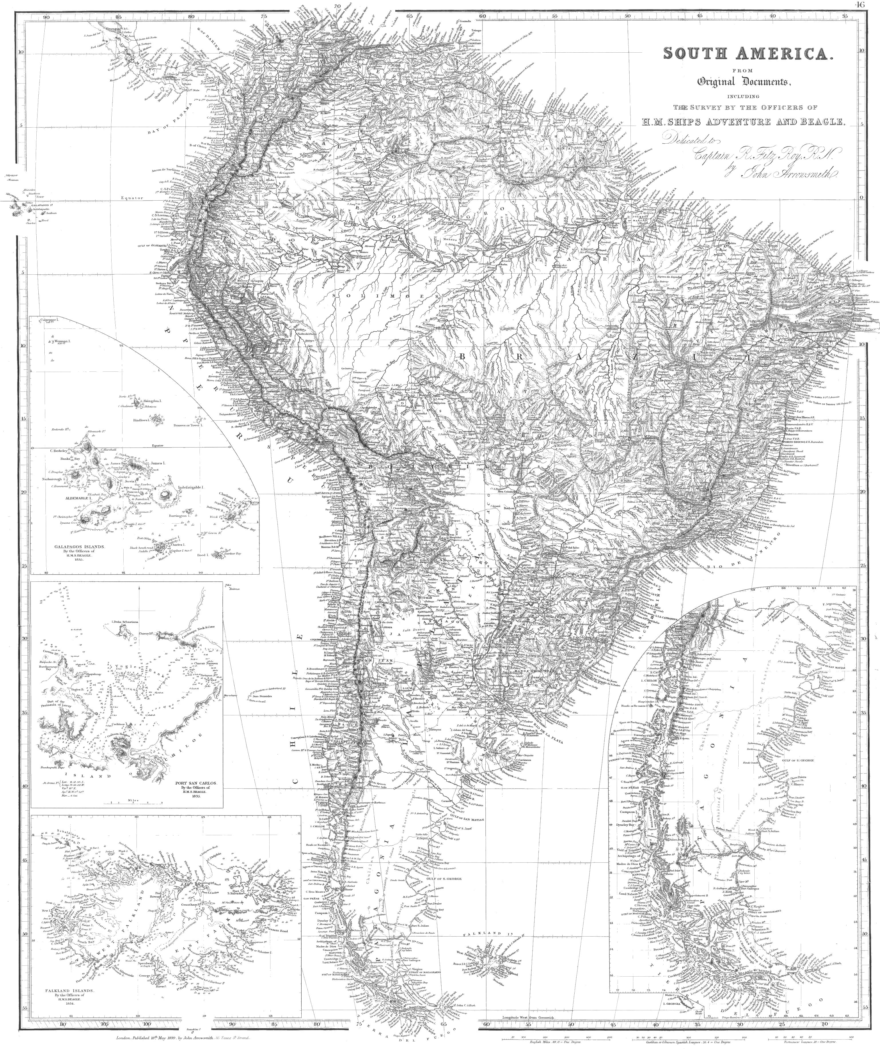
| Map of South America | Loose. |
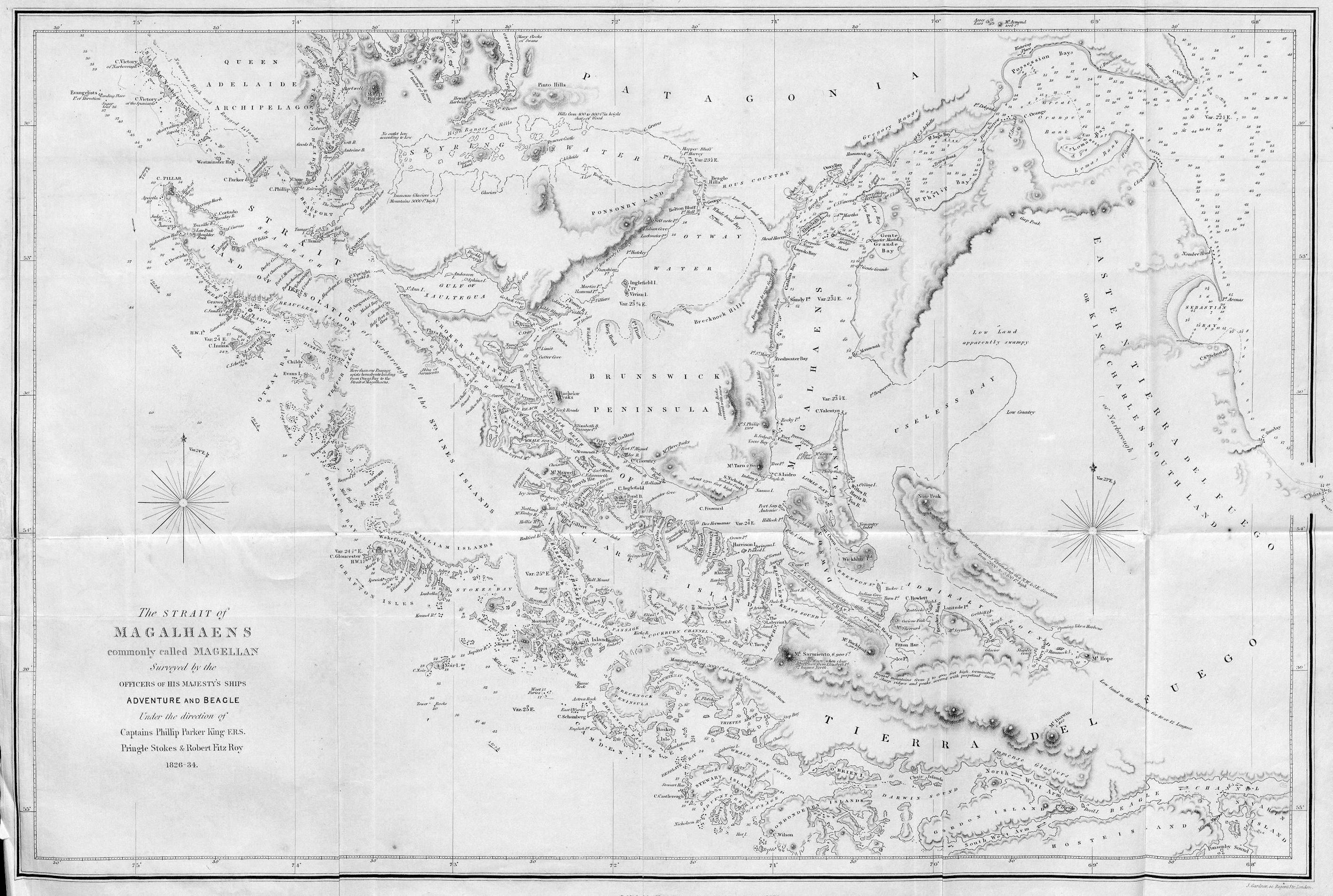
| Strait of Magalhaens | Loose. |
| Patagonian | Frontispiece. |
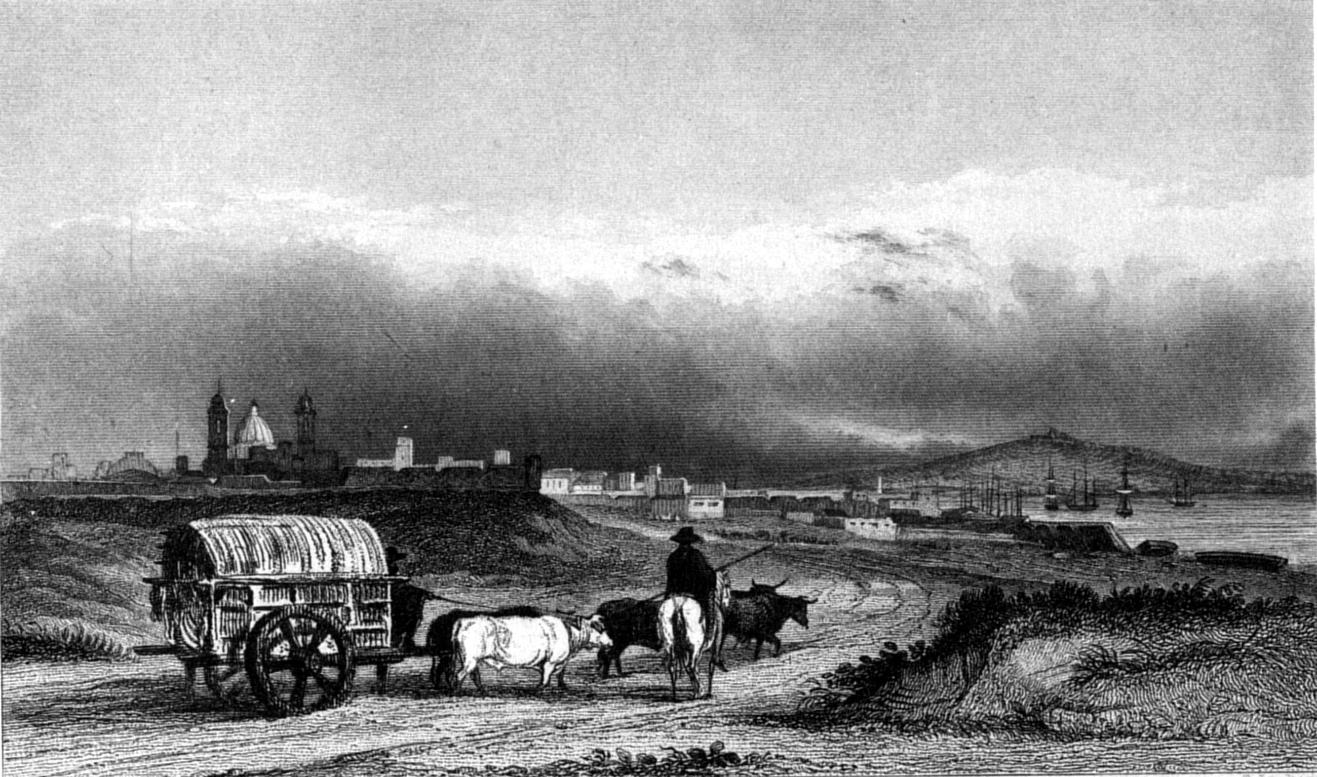
| Monte Video | to face page 1 |
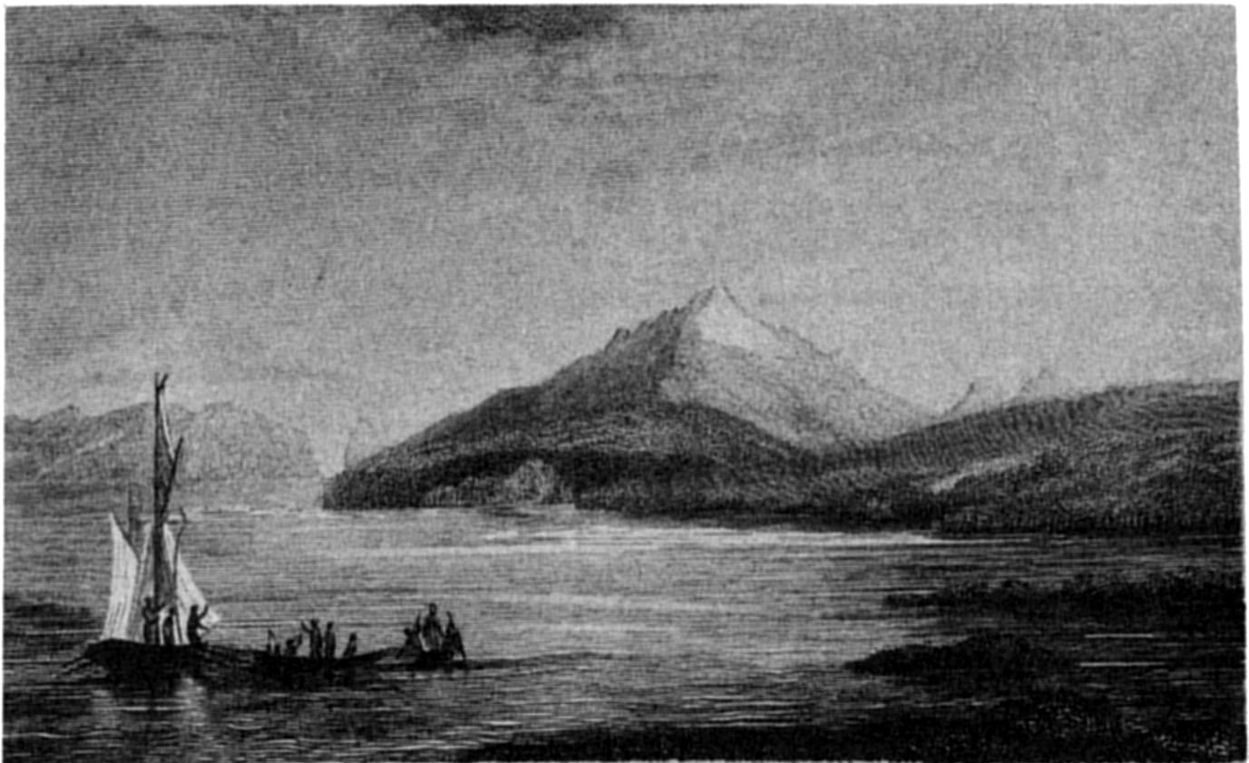
| Distant View of Mount Sarmiento (with two other views) | 26 |
| Curious Peak—Admiralty Sound (with other views) | 52 |
| Patagonian 'toldo' and tomb | 94 |
| Monte Video Mole | 105 |
| Rio de Janeiro | 106 |
| Fuegian Wigwams at Hope Harbour, in the Magdalen Channel | 126 |
| Monte Video—Custom-House | 187 |
| Corcovado Mountain | 188 |
| Mount Sarmiento | 252 |
| San Carlos de Chilóe | 275 |
| Breast Ploughing in Chilóe | 287 |
| Point Arena—Chilóe (with other views) | 300 |
| South West opening of Cockburn Channel (with views of Headlands) | 407 |
| Wollaston Island, near Cape Horn | 433 |
| Chart of a part of South America, by Captain P. P. King | 463 |
———
Note.—The loose Plates are to be folded into pockets in the covers of
the volumes.
———
Page 76, line 4 from bottom, for lying, read being.
118, Heading, line 4,
for Beagle sailed, read Beagle sails.
123, line 17,
insert narrow, before and shoal.
164, line 23,
instead of the, read our.
174, line 6, for
cuts, read cut.
193, line 5, for
have, read had.
223, (Note) line 2 from
bottom, for they, read he.
229, line 9, for
was, read were.
265, line 8,
after day, insert a colon instead of a comma.
273, line 21,
after as well, insert as.
301, line 23,
for Lieutenants Skyring and Graves again took with them,
read Lieutenant Skyring again took with him.
411, line 2,
dele the.
437, line 16,
for contiue, read continue.
443,
line 19, for wit, read with.
462, line 21,
for Santa Catalina, read Santa Catharina.
473, line 17,
after which is, insert a.
481, bottom line,
for 53. 32. 30, read 53. 52. 30.
485, line 7, (of
positions) for 53. 31, read 53. 51.
—— bottom
line, for 11. 51, read 3. 26.
488, line 9, for
Northern, read Southern.
489, line 4 from
bottom, for 46. 03, read 46. 30; and for 40. 50,
read 40. 05.
490, line 6, for
50°, read 49°.
491, line 6, for
36. 56, read 36. 16.
493, line 9, for
54. 30. 00, read 54. 05. 20; and for 73. 1. 30, read
73. 25. 30.
526, for
Variation, read Dip.
MAMMALIA.
529, line 8, for
Harlau read Harlan.
531, line 6, for
Keroda read Kerodon.
BIRDS.
532, line 1, for
Dumérel, read Duméril.
—— line 7,
for Miloago, read Milvago.
—— line 19,
for Sparoerius, read Sparverius.
533, line 16,
dele Spix.
—— bottom
line, for Silvia, read Sylvia, and in next page the same.
534, line 12,
dele Fursa, Veillot.
—— line 10
from bottom, for Smaragdimis, read
Smaragdinus.
536, line 9 from
bottom, for Strutheo, read Struthio.
—— line 6
from bottom, for rinacea, read binacea.
537, line 14,
for Totamus, read Totanus.
538, line 5, for
subtas, read subtus.
—— lower
lines, where Hœmatopus occurs,
read Hæmatopus.
540, last line, for
meneque, read mineque; and for pariè, read
parcè.
541, line 12,
for Catarrhoctes, read Catarrhactes.
—— line 2
from bottom, for ud, read ad.
543, line 13, for
gracillimus, read gracillimis.
SHELLS.
545, last line, for
brachyptera, read brachypterus; for Patachonica,
read Patachonicus.
C. MartensT. Landseer
MONTE VIDEO.
Published by Henry Colburn, Great Marlborough Street,
1838
SURVEYING VOYAGES
OF THE
ADVENTURE AND THE BEAGLE,
1826-1830.
———
Departure from Monte Video—Port Santa Elena—Geological
remarks—Cape Fairweather—Non-existence of Chalk—Natural
History—Approach to Cape Virgins, and the Strait of Magalhaens (or
Magellan)
We sailed from Monte Video on the 19th of November 1826; and, in
company with the Beagle, quitted the river Plata.
According to my Instructions, the Survey was to commence at Cape San
Antonio, the southern limit of the entrance of the Plata; but, for the
following urgent reasons, I decided to begin with the southern coasts of
Patagonia, and Tierra del Fuego, including the Straits of Magalhaens.[4] In the first place, they
presented a field of great interest and novelty; and secondly, the
climate of the higher southern latitudes being so severe and tempestuous,
it appeared important to encounter its rigours while the ships were in
good condition—while the crews were healthy—and while the
charms of a new and difficult enterprize had full force.
Our course was therefore southerly, and in latitude 45° south, a few
leagues northward of Port Santa Elena, we first saw the coast of
Patagonia. I intended to visit that port; and, on the 28th, anchored, and
landed there.
Seamen should remember that a knowledge of the tide is of especial
consequence in and near Port Santa Elena. During a calm we were carried
by it towards reefs which line the shore, and were obliged to anchor
until a breeze sprung up.
The coast along which we had passed, from Point Lobos to the
north-east point of Port Santa Elena, appeared to be dry and bare of
vegetation. There were no trees; the land seemed to be one long extent of
undulating plain, beyond which were high, flat-topped hills of a rocky,
precipitous character. The shore was fronted by rocky reefs extending two
or three miles from high-water mark, which, as the tide fell, were left
dry, and in many places were covered with seals.
As soon as we had secured the ships, Captain Stokes accompanied me on
shore to select a place for our observations. We found the spot which the
Spanish astronomers of Malaspina's Voyage (in 1798) used for their
observatory, the most convenient for our purpose. It is near a very steep
shingle (stony) beach at the back of a conspicuous red-coloured, rocky
projection which terminates a small bay, on the western side, at the head
of the port. The remains of a wreck, which proved to be that of an
American whaler, the Decatur of New York, were found upon the extremity
of the same point; she had been driven on shore from her anchors during a
gale.
The sight of the wreck, and the steepness of the shingle beach just
described, evidently caused by the frequent action of a heavy sea, did
not produce a favourable opinion of the safety of the port: but as it was
not the season for easterly gales, to which only the anchorage is
exposed, and as appearances indicated a westerly wind, we did not
anticipate danger.
While we were returning on board, the wind blew so strongly that we
had much difficulty in reaching the ships, and the boats were no sooner
hoisted up, and every thing made snug, than it blew a hard gale from the
S.W. The water however, from the wind being off the land, was perfectly
smooth, and the ships rode securely through the night: but the following
morning the gale increased, and veered to the southward, which threw a
heavy sea into the port, placing us, to say the least, in a very uneasy
situation. Happily it ceased at sunset. In consequence of the
unfavourable state of the weather, no attempt was made to land in order
to observe an eclipse of the sun; to make which observation was one
reason for visiting this port.
The day after the gale, while I was employed in making some
astronomical observations, a party roamed about in quest of game: but
with little success, as they killed only a few wild ducks. The fire which
they made for cooking communicated to the dry stubbly grass, and in a few
minutes the whole country was in a blaze. The flames continued to spread
during our stay, and, in a few days, more than fifteen miles along the
coast, and seven or eight miles into the interior were overrun by the
fire. The smoke very much impeded our observations, for at times it quite
obscured the sun.
The geological structure of this part of the country, and a
considerable portion of the coast to the north and south, consists of a
fine-grained porphyritic clay slate. The summits of the hills near the
coast are generally of a rounded form, and are paved, as it were, with
small, rounded, siliceous pebbles, imbedded in the soil, and in no
instance lying loose or in heaps; but those of the interior are
flat-topped, and uniform in height, for many miles in extent. The valleys
and lower elevations, notwithstanding the poverty and parched state of
the soil, were partially covered with grass and shrubby plants, which
afford sustenance to numerous herds of guanacoes. Many of these animals
were observed feeding near the beach when we were working into the bay,
but they took the alarm, so that upon landing we only saw them at a
considerable distance. In none of our excursions could we find any water
that had not a brackish taste. Several wells have been dug in the
valleys, both near the sea and at a considerable distance from it, by the
crews
of sealing vessels; but, except in the rainy season, they all contain
saltish water. This observation is applicable to nearly the whole extent
of the porphyritic country. Oyster-shells, three or four inches in
diameter, were found, scattered over the hills, to the height of three or
four hundred feet above the sea. Sir John Narborough, in 1652, found
oyster-shells at Port San Julian; but, from a great many which have been
lately collected there, we know that they are of a species different from
that found at Port Santa Elena. Both are fossils.
No recent specimen of the genus Ostrea was found by us on any
part of the Patagonian coast. Narborough, in noticing those at Port San
Julian, says, "They are the biggest oyster-shells that I ever saw, some
six, some seven inches broad, yet not one oyster to be found in the
harbour: whence I conclude they were here when the world was formed."
The short period of our visit did not enable us to add much to natural
history. Of quadrupeds we saw guanacoes, foxes, cavies, and the
armadillo; but no traces of the puma (Felis concolor), or South
American lion, although it is to be met with in the interior.
I mentioned that a herd of guanacoes was feeding near the shore when
we arrived. Every exertion was made to obtain some of the animals; but,
either from their shyness, or our ignorance of the mode of entrapping
them, we tried in vain, until the arrival of a small sealing-vessel,
which had hastened to our assistance, upon seeing the fires we had
accidentally made, but which her crew thought were intended for signals
of distress. They shot two, and sent some of the meat on board the
Adventure. The next day, Mr. Tarn succeeded in shooting one, a female,
which, when skinned and cleaned, weighed 168 lbs. Narborough mentions
having killed one at Port San Julian, that weighed, "cleaned in his
quarters, 268 lbs." The watchful and wary character of this animal is
very remarkable. Whenever a herd is feeding, one is posted, like a
sentinel, on a height; and, at the approach of danger, gives instant
alarm by a loud neigh, when away they all go, at a hand-gallop, to the
next eminence, where they quietly resume their feeding, until again warned
of the approach of danger by their vigilant 'look-out.'
Another peculiarity of the guanaco is, the habit of resorting to
particular spots for natural purposes. This is mentioned in the
'Dictionnaire d'Histoire Naturelle,' in the 'Encyclopédie Méthodique,' as
well as other works.
In one place we found the bones of thirty-one guanacoes collected
within a space of thirty yards, perhaps the result of an encampment of
Indians, as evident traces of them were observed; among which were a
human jaw-bone, and a piece of agate ingeniously chipped into the shape
of a spear-head.
The fox, which we did not take, appeared to be small, and similar to a
new species afterwards found by us in the Strait of Magalhaens.
The cavia[5] (or, as it is
called by Narborough, Byron, and Wood, the hare, an animal from which it
differs both in appearance and habits, as well as flavour), makes a good
dish; and so does the armadillo, which our people called the shell-pig.[6] This little animal is found
abundantly about the low land, and lives in burrows underground; several
were taken by the seamen, and, when cooked in their shells, were savoury
and wholesome.
Teal were abundant upon the marshy grounds. A few partridges, doves,
and snipes, a rail, and some hawks were shot. The few sea-birds that were
observed consisted of two species of gulls, a grebe and a penguin
(Aptenodytes Magellanica).
We found two species of snakes and several kinds of lizards. Fish were
scarce, as were also insects; of the last, our collections consisted only
of a few species of Coleoptera, two or three Lepidoptera,
and two Hymenoptera.
Among the sea-shells, the most abundant was the Patella
deaurata, Lamk.; this, with three other species of Patella, one
Chiton, three species of Mytilus, three of Murex,
one of Crepidula, and a Venus, were all that we
collected.
About the country, near the sea-shore, there is a small tree, whose
stem and roots are highly esteemed for fuel by the crews of
sealing-vessels which frequent this coast. They call it 'piccolo.' The
leaf was described to me as having a prickle upon it, and the flower as
of a yellow colour. A species of berberis also is found, which when ripe
may afford a very palatable fruit.
Our short visit gave us no flattering opinion of the fertility of the
country near this port. Of the interior we were ignorant; but, from the
absence of Indians and the scarcity of fresh water, it is probably very
bare of pasturage. Falkner, the Jesuit missionary, says these parts were
used by the Tehuelhet tribes for burying-places: we saw, however, no
graves, nor any traces of bodies, excepting the jaw-bone above-mentioned;
but subsequently, at Sea Bear Bay, we found many places on the summits of
the hills which had evidently been used for such a purpose, although then
containing no remains of bodies. This corresponds with Falkner's account,
that after a period of twelve months the sepulchres are formally visited
by the tribe, when the bones of their relatives and friends are collected
and carried to certain places, where the skeletons are arranged in order,
and tricked out with all the finery and ornaments they can collect.
The ships sailed from Port Santa Elena on the 5th December, and
proceeded to the southward, coasting the shore as far as Cape Two
Bays.
Our object being to proceed with all expedition to the Strait of
Magalhaens, the examination of this part of the coast was reserved for a
future opportunity. On the 13th, we had reached within fifty miles of
Cape Virgins, the headland at the entrance of the strait, but it was
directly in the wind's eye of us. The wind veering to S.S.W., we made
about a west course. At day-light the land was in sight, terminating in a
point to the S.W., so exactly like the description of Cape Virgins and
the view of it in Alison's voyage, that without considering our place on
the chart, or calculating the previous twenty-four hours' run, it was
taken for the Cape itself, and, no one suspecting a mistake, thought of
verifying the ship's position. The point, however, proved to be Cape
Fairweather. It was not a little singular, that the same mistake should
have been made on board the Beagle, where the error was not discovered
for three days.[7]
From the appearance of the weather I was anxious to approach the land
in order to anchor, as there seemed to be every likelihood of a gale; and
we were not deceived, for at three o'clock, being within seven miles of
the Cape, a strong wind sprung up from the S.W., and the anchor was
dropped. Towards evening it blew so hard, that both ships dragged their
anchors for a considerable distance.
On the charts of this part of the coast the shore is described to be
formed of "chalk hills, like the coast of Kent." To geologists,
therefore, especially, as they were not disposed to believe that such was
the fact, this was a question of some interest. From our anchorage the
appearance of the land favoured our belief of the existence of chalk. The
outline was very level and steep; precipitous cliffs of whitish colour,
stratified horizontally, with their upper part occasionally worn into
hollows, strongly resembled the chalk cliffs of the English coasts.
The gale prevented our landing for three days, when (19th) a few
minutes sufficed to discover that the cliffs were composed of soft clay,
varying in colour and consistence, and disposed in strata running
horizontally for many miles without interruption, excepting where
water-courses had worn them away. Some of the strata were very fine clay,
unmixed with any other substance, whilst others were plentifully strewed
with round siliceous gravel,[8] without any vestige of organic remains.
The sea beach, from high-water mark to the base of the cliffs, is formed
by shingle, with scattered masses of indurated clay of a green colour.[9] Between the high and low
tide marks there is a smooth beach of the same green clay as the masses
above-mentioned, which appears to have been hardened by the action of the
surf to the consistence of stone. Generally this beach extends for about
one hundred yards farther into the sea, and is succeeded by a soft green
mud, over which the water gradually deepens. The outer edge of the clay
forms a ledge, extending parallel with the coast, upon the whole length
of which the sea breaks, and over it a boat can with difficulty pass at
low water.
The very few shells we found were dead. Strewed about the beach were
numbers of fish, some of which had been thrown on shore by the last tide,
and were scarcely stiff. They principally belonged to the genus
Ophidium; the largest that we saw measured four feet seven inches
in length, and weighed twenty-four pounds. Many caught alongside the ship
were, in truth, coarse and insipid; yet our people, who fed heartily upon
them, called them ling, and thought them palatable. The hook, however,
furnished us with a very wholesome and well-flavoured species of cod
(Gadus). Attached to the first we found two parasitical animals;
one was a Cymothoa, the other a species of Lernæa, which
had so securely attached itself under the skin, as
not to be removed without cutting off a piece of the flesh with it. An
undescribed species of Muræna was also taken.
Whilst we were on shore, the Beagle moved eight or nine miles nearer
to the Cape, where Captain Stokes landed to fix positions of remarkable
land. One peaked hill, from the circumstance of his seeing a large animal
near it, he called Tiger Mount. Mr. Bowen shot a guanaco; and being at a
distance in shore, unable to procure assistance, he skinned and quartered
it with his pocket-knife, and carried it upon his shoulders to the
boat.
Next morning the ships weighed, and proceeded towards Cape
Virgins.
When a-breast of Cape Fairweather, the opening of the river Gallegos
was very distinctly seen; but the examination of it was deferred to a
future opportunity. Passing onward, the water shoaled to four fathoms,
until we had passed extensive banks, which front the river.
Our approach to the entrance of the Strait, although attended with
anxiety, caused sensations of interest and pleasure not easily to be
described. Though dangers were experienced by some navigators who had
passed it, the comparative facility with which others had effected the
passage showed that, at times, the difficulties were easily surmounted,
and we were willing to suppose that in the former case there might have
been some little exaggeration.
The most complete, and, probably, the only good account of the
navigation of the Strait of Magalhaens is contained in the narrative of
Don Antonio de Cordova, who commanded the Spanish frigate Santa Maria de
la Cabeza, on a voyage expressly for the purpose of exploring the strait.
It was published under the title of 'Ultimo Viage al Estrecho de
Magallanes.' That voyage was, however, concluded with only the
examination of the eastern part, and a subsequent expedition was made,
under the command of the same officer, the account of which was appended
to the Cabeza's voyage; so that Cordova's expedition still retained the
appellation of 'Ultimo Viage, &c.' It is written in a plain and
simple style, gives a most correct account of every thing seen, and
should therefore be in the possession of every person who attempts the
navigation of the strait.
Cordova's account of the climate is very uninviting. Speaking of the
rigours of the summer months (January, February, and March), he says,
"Seldom was the sky clear, and short were the intervals in which we
experienced the sun's warmth: no day passed by without some rain having
fallen, and the most usual state of the weather was that of constant
rain."[10]
The accounts of Wallis and Carteret are still more gloomy. The former
concludes that part of his narrative with the following dismal and
disheartening description: "Thus we quitted a dreary and inhospitable
region, where we were in almost continual danger of shipwreck for near
four months, having entered the strait on the 17th of December, and
quitted it on the 11th of April 1767: a region where, in the midst of
summer, the weather was cold, gloomy, and tempestuous, where the
prospects had more the appearance of a chaos than of nature; and where
for the most part the valleys were without herbage and the hills without
wood."
These records of Cordova and Wallis made me feel not a little
apprehensive for the health of the crew, which could not be expected to
escape uninjured through the rigours of such a climate. Nor were the
narratives of Byron or Bougainville calculated to lessen my anxiety. In
an account, however, of a voyage to the strait by M. A. Duclos Guyot, the
following paragraph tended considerably to relieve my mind upon the
subject:—"At length, on Saturday the 23d of March, we sailed out of
that famous Strait, so much dreaded, after having experienced that there,
as well as in other places, it was very fine, and very warm, and that for
three-fourths of the time the sea was perfectly calm."
In every view of the case, our proximity to the principal scene of
action occasioned sensations of a peculiar nature, in which, however,
those that were most agreeable and hopeful preponderated. The
officers and crews of both ships were healthy, and elated with the
prospect before them; our vessels were in every respect strong and
sea-worthy; and we were possessed of every comfort and resource necessary
for encountering much greater difficulties than we had any reason to
anticipate.
There has existed much difference of opinion as to the correct mode of
spelling the name of the celebrated navigator who discovered this Strait.
The French and English usually write it Magellan, and the Spaniards
Magallanes; but by the Portuguese (and he was a native of Portugal) it is
universally written Magalhaens. Admiral Burney and Mr. Dalrymple spell it
Magalhanes, which mode I have elsewhere adopted, but I have since
convinced myself of the propriety of following the Portuguese orthography
for a name which, to this day, is very common both in Portugal and
Brazil.
Enter the Straits of Magalhaens (or Magellan), and anchor off Cape
Possession—First Narrow—Gregory Bay—Patagonian
Indians—Second Narrow—Elizabeth Island—Freshwater
Bay—Fuegian Indians—Arrival at Port Famine.
A contrary tide and light winds detained us at anchor near Cape
Virgins until four o'clock in the afternoon, when, with the turn of the
tide, a light air carried us past Dungeness Point, aptly named by Wallis
from its resemblance to that in the English Channel. A great number of
seals were huddled together upon the bank, above the wash of the tide,
whilst others were sporting about in the surf. Cape Possession was in
sight, and with the wind and tide in our favour we proceeded until ten
o'clock, when the anchor was dropped. At daylight we found ourselves six
miles to the eastward of the cape. The anchor was then weighed, and was
again dropped at three miles from the cape until the afternoon, when we
made another attempt; but lost ground, and anchored a third time. Before
night a fourth attempt was made, but the tide prevented our making any
advance, and we again anchored.
Mount Aymond[11] and
"his four sons," or (according to the old quaint nomenclature) the Asses'
Ears, had been in sight all day, as well as a small hummock of land on
the S.W. horizon, which afterwards proved to be the peaked hillock upon
Cape Orange, at the south side of the entrance to the First Narrow.
At this anchorage the tide fell thirty feet, but the strength of the
current, compared with the rate at which we afterwards found it to run,
was inconsiderable. Here we first experienced the peculiar tides of
which former navigators have written. During the first half of the
flood[12] or westward tide,
the depth decreased, and then, after a short interval, increased until
three hours after the stream of tide had begun to run to the
eastward.
The following morning (21st) we gained a little ground. Our glasses
were directed to the shore in search of inhabitants, for it was
hereabouts that Byron, and Wallis, and some of the Spanish navigators
held communication with the Patagonian Indians; but we saw none. Masses
of large sea-weed,[13]
drifting with the tide, floated past the ship. A description of this
remarkable plant, although it has often been given before, may not be
irrelevant here. It is rooted upon rocks or stones at the bottom of the
sea, and rises to the surface, even from great depths. We have found it
firmly fixed to the ground more than twenty fathoms under water, yet
trailing along the surface for forty or fifty feet. When firmly rooted it
shows the set of the tide or current. It has also the advantage of
indicating rocky ground: for wherever there are rocks under water, their
situation is, as it were, buoyed by a mass of sea-weed[14] on the surface of the sea, of larger
extent than that of the danger below. In many instances perhaps it causes
unnecessary alarm, since it often grows in deep water; but it should not
be entered without its vicinity having been sounded, especially if seen
in masses, with the extremities of the stems trailing along the surface.
If there be no tide, or if the wind and tide are the same way, the plant
lies smoothly upon the water, but if the wind be against the tide, the
leaves curl up and are visible at a distance, giving a rough, rippling
appearance to the surface of the water.
During the last two days the dredge had furnished us with a few
specimens of Infundibulum of Sowerby (Patella
trochi-formis, Lin.), and some dead shells (Murex
Magellanicus) were brought up by the sounding-lead.
We made another attempt next morning, but again lost ground, and the
anchor was dropped for the eighth time. The threatening appearances of
the clouds, and a considerable fall of the barometer indicating bad
weather, Captain Stokes agreed with me in thinking it advisable to await
the spring-tides to pass the First Narrow: the ships were therefore made
snug for the expected gale, which soon came on, and we remained several
days wind-bound, with top-masts struck, in a rapid tide-way, whose stream
sometimes ran seven knots. On the 28th, with some appearance of improving
weather, we made an attempt to pass through the Narrow. The wind blowing
strong, directly against us, and strengthening as we advanced, caused a
hollow sea, that repeatedly broke over us. The tide set us through the
Narrow very rapidly, but the gale was so violent that we could not show
more sail than was absolutely necessary to keep the ship under command.
Wearing every ten minutes, as we approached either shore, lost us a great
deal of ground, and as the anchorage we left was at a considerable
distance from the entrance of the Narrows, the tide was not sufficient to
carry us through. At slack water the wind fell, and as the weather became
fine, I was induced to search for anchorage near the south shore. The
sight of kelp, however, fringing the coast, warned me off, and we were
obliged to return to an anchorage in Possession Bay. The Beagle had
already anchored in a very favourable berth; but the tide was too strong
to permit us to reach the place she occupied, and our anchor was dropped
a mile astern of her, in nineteen fathoms. The tide was then running
five, and soon afterwards six miles an hour. Had the western tide set
with equal strength, we should have succeeded in passing the Narrow. Our
failure, however, answered the good purpose of making us more acquainted
with the extent of a bank that lines the northern side of Possession Bay,
and with the time of the turn of tide in the Narrow; which on this day
(new moon) took place within a few minutes of noon.
As we passed Cape Orange, some Indians were observed lighting a fire
under the lee of the hill to attract our notice; but we were too busily
engaged to pay much attention to their movements. Guanacoes also were seen
feeding near the beach, which was the first intimation we had of the
existence of that animal southward of the Strait of Magalhaens.
When day broke (29th) it was discovered that the ship had drifted
considerably during the night. The anchor was weighed, and with a
favourable tide we reached an anchorage a mile in advance of the Beagle.
We had shoaled rather suddenly to eight fathoms, upon which the anchor
was immediately dropped, and on veering cable the depth was eleven
fathoms. We had anchored on the edge of a bank, which soon afterwards, by
the tide falling, was left dry within one hundred yards of the ship.
Finding ourselves so near a shoal, preparations were made to prevent the
ship from touching it. An anchor was dropped under foot, and others were
got ready to lay out, for the depth alongside had decreased from eleven
to seven fathoms, and was still falling. Fortunately we had brought up to
leeward of the bank, and suffered no inconvenience; the flood made, and
as soon as possible the ship was shifted to another position, about half
a mile to the S.E., in a situation very favourable for our next attempt
to pass the Narrow. This night the tide fell thirty-six feet, and the
stream ran six knots.
The ensuing morning we made another attempt to get through the Narrow,
and, from having anchored so close to its entrance, by which the full
benefit of the strength, as well as the whole duration of the tide was
obtained, we succeeded in clearing it in two hours, although the distance
was more than twenty miles, and the wind directly against us, the sea, as
before, breaking repeatedly over the ship.
After emerging from the Narrow we had to pass through a heavy 'race'
before we 'reached' out of the influence of the stream that runs between
the First and Second Narrow, but the tide lasted long enough to carry us
to a quiet anchorage. In the evening we weighed again, and reached
Gregory Bay, where the Beagle joined us the next morning.
Since entering the Strait, we had not had any communication with the
Beagle on account of the weather, and the strength of the tide; this
opportunity was therefore taken to supply her with water, of which she
had only enough left for two days.
The greater part of this day was spent on shore, examining the country
and making observations. Large smokes[15] were noticed to the westward. The shore
was strewed with traces of men and horses, and other animals. Foxes and
ostriches were seen; and bones of guanacoes were lying about the
ground.
The country in the vicinity of this anchorage seemed open, low, and
covered with good pasturage. It extends five or six miles, with a gradual
ascent, to the base of a range of flat-topped land, whose summit is about
fifteen hundred feet above the level of the sea. Not a tree was seen; a
few bushes[16] alone
interrupted the uniformity of the view. The grass appeared to have been
cropped by horses or guanacoes, and was much interspersed with cranberry
plants, bearing a ripe and juicy, though very insipid fruit.
Next day the wind was too strong and adverse to permit us to proceed.
In the early part of the morning an American sealing vessel, returning
from the Madre de Dios Archipelago on her way to the Falkland Islands,
anchored near us. Mr. Cutler, her master, came on board the Adventure,
passed the day and night with us, and gave me much useful information
respecting the nature of the navigation, and anchorages in the Strait. He
told me there was an Englishman in his vessel who was a pilot for the
strait, and willing to join the ship. I gladly accepted the offer of his
services.
In the evening an Indian was observed on horseback riding to and fro
upon the beach, but the weather prevented my sending a boat until the
next morning, when Lieutenant Cooke went on shore to communicate with him
and other Indians who appeared, soon after dawn, upon the beach. On
landing, he was received by them without the least distrust. They were
eight or ten in number, consisting of an old man and his wife, three
young men, and the rest children, all mounted on good horses. The woman,
who appeared to be about fifty years of age, was seated astride upon a
pile of skins, hung round with joints of fresh guanaco meat and dried
horse-flesh. They were all wrapped in mantles, made chiefly of the skins
of guanacoes, sewed together with the sinews of the same animal. These
mantles were large enough to cover the whole body. Some were made of
skins of the 'zorillo,' or skunk, an animal like a pole-cat, but ten
times more offensive; and others, of skins of the puma.
The tallest of the Indians, excepting the old man, who did not
dismount, was rather less than six feet in height. All were robust in
appearance, and with respect to the head, length of body, and breadth of
shoulders, of gigantic size; therefore, when on horseback, or seated in a
boat, they appeared to be tall, as well as large men. In proportion to
the parts above-mentioned, their extremities were very small and short,
so that when standing they seemed but of a moderate size, and their want
of proportion was concealed by the mantle, which enveloped the body
entirely, the head and feet being the only parts exposed.
When Mr. Cooke landed, he presented some medals[17] to the oldest man, and the woman; and
suspended them round their necks. A friendly feeling being established,
the natives dismounted, and even permitted our men to ride their horses,
without evincing the least displeasure, at the free advantage taken of
their good-nature. Mr. Cooke rode to the heights, whence he had a
distinct view of the Second Narrow, and Elizabeth Island, whither, he
explained to the Indians who accompanied him, we were going.
Mr. Cooke returned to the ship with three natives, whom he had induced
to go with us to Elizabeth Island; the others were to meet them, and
provide us with guanaco meat, to which arrangement the elders of the
family had, after much persuasion, assented. At first they
objected to their companions embarking with us, unless we left hostages
for their safety; but as this was refused, they did not press the point,
and the three young men embarked. They went on board singing; in high
glee.
While the ship was getting under way, I went ashore to a larger number
of Indians who were waiting on the beach. When my boat landed they were
mounted, and collected in one place. I was surprised to hear the woman
accost me in Spanish, of which, however, she knew but a few words. Having
presented medals to each of the party, they dismounted (excepting the
elders), and in a few minutes became quite familiar. By this time Captain
Stokes had landed, with several of his officers, who increased our party
to nearly double the number of theirs: notwithstanding which they evinced
neither fear nor uneasiness. The woman, whose name was Maria, wished to
be very communicative; she told me that the man was her husband, and that
she had five children. One of the young men, whom we afterwards found to
be a son of Maria, who was a principal person of the tribe, was mounted
upon a very fine horse, well groomed, and equipped with a bridle and
saddle that would have done credit to a respectable horseman of Buenos
Ayres or Monte Video. The young man wore heavy brass spurs, like those of
the Guachos of Buenos Ayres. The juvenile and feminine appearance of this
youth made us think he was Maria's daughter, nor was it until a
subsequent visit that our mistake was discovered. The absence of whiskers
and beard gives all the younger men a very effeminate look, and many
cannot be distinguished, in appearance, from the women, but by the mode
in which they wrap their mantles around them, and by their hair, which is
turned up and confined by a fillet of worsted yarn. The women cross their
mantle over the breast like a shawl, and fasten it together with two iron
pins or skewers, round which are twisted strings of beads and other
ornaments. They also wear their hair divided, and gathered into long
tresses or tails, which hang one before each ear; and those who have
short hair, wear false tails made of horse-hair. Under their mantle the
women wear a sort of petticoat, and the men a triangular piece of hide
instead of breeches. Both sexes sit astride, but the women upon a heap of
skins and mantles, when riding. The saddles and stirrups used by the men
are similar to those of Buenos Ayres. The bits, also, are generally of
steel; but those who cannot procure steel bits have a sort of snaffle, of
wood, which must, of course, be frequently renewed. Both sexes wear
boots, made of the skins of horses' hind legs, of which the parts about
the hock joints serve for the heels. For spurs, they use pieces of wood,
pointed with iron, projecting backwards two or three inches on each side
of the heel, connected behind by a broad strap of hide, and fastened
under the foot and over the instep by another strap.
The only weapons which we observed with these people were the 'bolas,'
or balls, precisely similar to those used by the Pampas Indians; but they
are fitter for hunting than for offence or defence. Some are furnished
with three balls, but in general there are only two. These balls are made
of small bags or purses of hide, moistened, filled with iron pyrites, or
some other heavy substance, and then dried. They are about the size of a
hen's egg, and attached to the extremities of a thong, three or four
yards in length. To use them, one ball is held in the hand, and the other
swung several times around the head until both are thrown at the object,
which they rarely miss. They wind round it violently, and if it be an
animal, throw it down. The bolas, with three balls, similarly connected
together, are thrown in the same manner.
As more time could not be spared we went on board, reminding the
natives, on leaving them, of their promise to bring us some guanaco meat.
Aided by the tide, the ships worked to windward through the Second
Narrow, and reached an anchorage out of the strength of tide, but in an
exposed situation. The wind having been very strong and against the tide,
the ship had much motion, which made our Patagonian passengers very sick,
and heartily sorry for trusting themselves afloat. One of them, with
tears in his eyes, begged to be landed, but was soon convinced of the
difficulty of compliance, and satisfied with our promise of sending
him ashore on the morrow.
After we anchored, the wind increased to a gale, in which the ship
pitched so violently as to injure our windlass. Its construction was bad
originally, and the violent jerks received in Possession Bay had done it
much damage. While veering cable, the support at one end gave way, and
the axle of the barrel was forced out of the socket, by which some of the
pawls were injured. Fortunately, dangerous consequences were prevented,
and a temporary repair was soon applied.
The Beagle, by her better sailing, had reached a more advanced
situation, close to the N.E. end of Elizabeth Island, but had anchored
disadvantageously in deep water, and in the strength of the tide. Next
morning we made an attempt to pass round Elizabeth Island, but found the
breeze so strong that we were forced to return, and were fortunate enough
to find good anchorage northward of the island, out of the tide.
The Patagonians, during the day, showed much uneasiness at being kept
on board so much longer than they expected; but as they seemed to
understand the cause of their detention, and as their sickness ceased
when we reached smooth water, they gradually recovered their good-humour,
and became very communicative. As well as we could understand their
pronunciation, their names were 'Coigh,' 'Coichi,' and 'Aighen.' The
country behind Cape Negro they called 'Chilpéyo;' the land of Tierra del
Fuego, 'Oschērri;' Elizabeth Island, 'Tŭrrĕtterr;' the
island of Santa Magdalena, 'Shrēe-ket-tup;' and Cape Negro,
'Oērkrĕckur.' The Indians of Tierra del Fuego, with whom they
are not on friendly terms, are designated by them
'Săpāllĭŏs.' This name was applied to them in a
contemptuous tone.
Aighen's features were remarkably different from those of his
companions. Instead of a flat nose, his was aquiline and prominent, and
his countenance was full of expression. He proved to be good-tempered,
and easily pleased; and whenever a shade of melancholy began to appear,
our assurance of landing him on the morrow restored his
good-humour, which was shown by singing and laughing.
The dimensions of Coichi's head were as follows:—
| From the top of the fore part of the head | to the eyes | 4 inches. |
| Dodo | to the tip of the nose | 6 |
| Dodo | to the mouth | 7 |
| Dodo | to the chin | 9 |
| Width of the head across the temples | | 7½ |
| Breadth of the shoulders | | 18½ |
The head was long and flat, at the top; the forehead broad and high,
but covered with hair to within an inch and a half of the eyebrow, which
had scarcely any hair. The eyes were small, the nose was short, the mouth
wide, and the lips thick. Neck short, and shoulders very broad. The arms
were short, and wanting in muscle, as were also the thighs and legs. The
body was long and large, and the breast broad and expanded. His height
was nearly six feet.
The next day we rounded Elizabeth Island, and reached Cape Negro,
where we landed the Indians, after making them several useful presents,
and sending some trifles by Aighen to Maria, who, with her tribe, had
lighted large fires about the country behind Peckett's Harbour, to invite
us to land. Our passengers frequently pointed to them, telling us that
they were made by Maria, who had brought plenty of guanaco meat for
us.
Our anxiety to reach Port Famine prevented delay, and, as soon as the
boat returned, we proceeded along the coast towards Freshwater Bay, which
we reached early enough in the afternoon to admit of a short visit to the
shore.
From Cape Negro the country assumed a very different character.
Instead of a low coast and open treeless shore, we saw steep hills,
covered with lofty trees, and thick underwood. The distant mountains of
Tierra del Fuego, covered with snow, were visible to the southward, some
at a distance of sixty or seventy miles.
We had now passed all the difficulties of the entrance, and had
reached a quiet and secure anchorage.
The following day was calm, and so warm, that we thought if Wallis and
Cordova were correct in describing the weather they met with, Duclos
Guyot was equally entitled to credit; and we began to hope we had
anticipated worse weather than we should experience. But this was an
unusually fine day, and many weeks elapsed, afterwards, without its
equal. The temperature of the air, in the shade on the beach, was 67½°,
on the sand 87½°; and that of the water 55°. Other observations were
made, as well as a plan of the bay, of which there is a description in
the Sailing Directions.
Here we first noticed the character of the vegetation in the Strait,
as so different from that of Cape Gregory and other parts of the
Patagonian coast, which is mainly attributable to the change of soil; the
northern part being a very poor clay, whilst here a schistose sub-soil is
covered by a mixture of alluvium, deposited by mountain streams; and
decomposed vegetable matter, which, from the thickness of the forests, is
in great quantity.
Two specimens of beech (Fagus betuloides and
antarctica), the former an evergreen,—and the winter's bark
(Wintera aromatica), are the only trees of large size that we
found here; but the underwood is very thick, and composed of a great
variety of plants, of which Arbutus rigida, two or three species
of Berberis, and a wild currant (Ribes antarctica, Bankes
and Solander MSS.), at this time in flower, and forming long clustering
bunches of young fruit, were the most remarkable. The berberis produces a
berry of acidulous taste, that promised to be useful to us. A species of
wild celery, also, which grows abundantly near the sea-shore, was
valuable as an antiscorbutic. The trees in the immediate vicinity of the
shore are small, but the beach was strewed with trunks of large trees,
which seemed to have been drifted there by gales and high tides. A river
falls into the bay, by a very narrow channel, near its south end; but it
is small, and so blocked up by trees as not to be navigable even for the
smallest boat: indeed, it is merely a mountain torrent, varying in size
according to the state of the weather.
Tracks of foxes were numerous about the beach, and the footsteps of a
large quadruped, probably a puma, were observed. Some teal and wild ducks
were shot; and several geese were seen, but, being very wary, they
escaped.
Upon Point St. Mary we noticed, for the first time, three or four huts
or wigwams made by the Fuegian Indians, which had been deserted. They
were not old, and merely required a slight covering of branches or skins
to make them habitable. These wigwams are thus constructed: long slender
branches, pointed at the end, are stuck into the ground in a circular or
oval figure; their extremities are bent over, so as to form a rounded
roof, and secured with ligatures of rush; leaving two apertures, one
towards the sea, and the other towards the woods. The fire is made in the
middle, and half fills the hut with smoke. There were no Indians in the
bay when we arrived, but, on the following evening, Lieutenant Sholl, in
walking towards the south end of the bay, suddenly found himself close to
a party which had just arrived in two canoes from the southward.
Approaching them, he found there were nine individuals—three men,
and the remainder women and children. One of the women was very old, and
so infirm as to require to be lifted out of the canoe and carried to the
fire. They seemed to have no weapons of any consequence; but, from our
subsequent knowledge of their habits, and disposition, the probability is
they had spears, bows, and arrows concealed close at hand. The only
implement found amongst them was a sort of hatchet or knife, made of a
crooked piece of wood, with part of an iron hoop tied to the end. The men
were very slightly clothed, having only the back protected by a seal's
skin; but the females wore large guanaco mantles, like those of the
Patagonian Indians, whom our pilot told us they occasionally met for the
purpose of barter. Some of the party were devouring seal's flesh, and
drinking the oil extracted from its blubber, which they carried in
bladders. The meat they were eating was probably part of a sea lion
(Phoca jubata); for Mr. Sholl found amongst them a portion of the
neck of one of those animals, which is remarkable for the long
hair, "like a lion's mane," growing upon it. They appeared to be a most
miserable, squalid race, very inferior, in every respect, to the
Patagonians. They did not evince the least uneasiness at Mr. Sholl's
presence, or at our ships being close to them; neither did they interfere
with him, but remained squatting round their fire while he staid near.
This seeming indifference, and total want of curiosity, gave us no
favourable opinion of their character as intellectual beings; indeed,
they appeared to be very little removed from brutes; but our subsequent
knowledge of them has convinced us that they are not usually deficient in
intellect. This party was perhaps stupified by the unusual size of our
ships, for the vessels which frequent this Strait are seldom one hundred
tons in burthen.
We proceeded next morning at an early hour. The Indians were already
paddling across the bay in a northerly direction. Upon coming abreast of
them, a thick smoke was perceived to rise suddenly from their canoes;
they had probably fed the fire, which they always carry in the middle of
their canoe, with green boughs and leaves, for the purpose of attracting
our attention, and inviting us to communicate with them.
It was remarked that the country begins to be covered with trees at
Cape Negro; but they are stunted, compared with those at Freshwater Bay.
Near this place, also, the country assumes a more verdant aspect,
becoming also higher, and more varied in appearance. In the neighbourhood
of Rocky Point some conspicuous portions of land were noticed, which,
from the regularity of their shape, and the quantity as well as size of
the trees growing at the edges, bore the appearance of having been once
cleared ground; and our pilot Robinson (possessing a most inventive
imagination) informed us that they were fields, formerly cleared and
cultivated by the Spaniards, and that ruins of buildings had been lately
discovered near them. For some time his story obtained credit, but it
proved to be altogether void of foundation. These apparently cleared
tracts were afterwards found to be occasioned by unusual poverty of soil,
and by being overrun with thick spongy moss, the vivid green colour of which
produces, from a distance, an appearance of most luxuriant pasture land.
Sir John Narborough noticed, and thus describes them: "The wood shows in
many places as if there were plantations: for there were several clear
places in the woods, and grass growing like fenced fields in England, the
woods being so even by the sides of it."[18]
The wind, after leaving Freshwater Bay, increased, with strong squalls
from the S.W., at times blowing so hard as to lay the ship almost on her
broadside. It was, however, so much in our favour, that we reached the
entrance of Port Famine early, and after some little detention from
baffling winds, which always render the approach to that bay somewhat
difficult, the ships anchored in the harbour.
Prepare the Beagle, and our decked boat (the Hope) for surveying the
Strait—Beagle sails westward, and the Hope towards the
south-east—Sarmiento's voyage—and description of the colony
formed by him at Port Famine—Steamer-duck—Large
trees—Parroquets—Mount Tarn—Barometrical
observations—Geological character—Report of the Hope's
cruize.
In almost every account published of the Strait of Magalhaens, so much
notice has been taken of Port Famine, that I had long considered it a
suitable place for our purposes; and upon examination I found it offered
so many advantages, that I did not hesitate to make it our head-quarters.
As soon, therefore, as the ship was moored, tents were pitched, our
decked-boat was hoisted out and hauled on shore, to be coppered and
equipped for the survey;—and Captain Stokes received orders to
prepare the Beagle for examining the western part of the Strait; previous
to which she required to be partially refitted, and supplied with fuel
and water.
For several days after our arrival, we had much rain and strong
south-westerly wind, with thick clouds, which concealed the high land to
the southward; allowing us only now and then a partial glimpse. One
evening (11th) the air was unusually clear, and many of the mountains in
that direction were distinctly defined. We had assembled to take leave of
our friends in the Beagle, and were watching the gradual appearance of
snow-capped mountains which had previously been concealed, when, bursting
upon our view, as if by magic, a lofty mountain appeared towering among
them; whose snowy mantle, strongly contrasted with the dark and
threatening aspect of the sky, much enhanced the grandeur of the
scene.
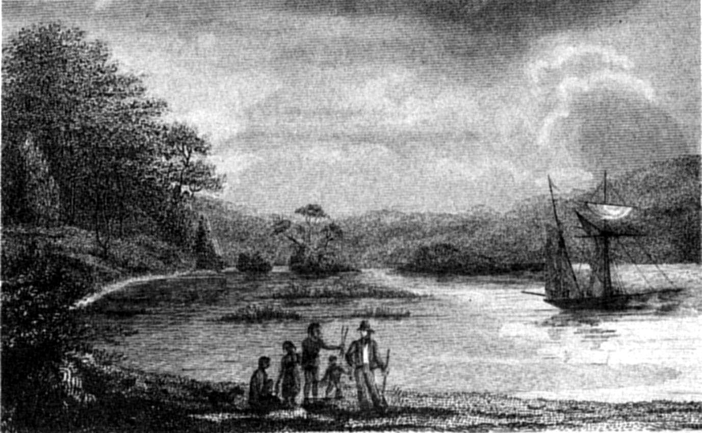
THE HOPE, IN THE STRAIT OF MAGALHAENS.
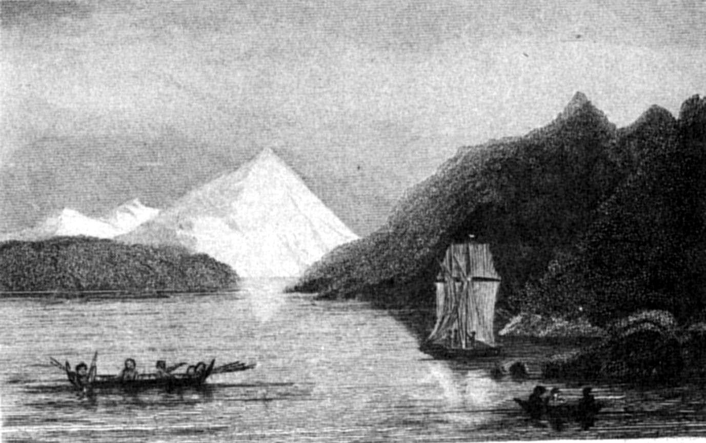
THE ADELAIDE, IN HUMMING BIRD COVE.
P. P. KingS. Bull
DISTANT VIEW OF MT. SARMIENTO.
Published by Henry Colburn, Great Marlborough Street,
1838
This mountain was the "Snowy Volcano" (Volcan Nevado) of
Sarmiento, with whose striking appearance that celebrated navigator seems
to have been particularly impressed, so minute and excellent is his
description. It is also mentioned in the account of Cordova's voyage.[19] The peculiar shape of its
summit as seen from the north would suggest the probability of its being
a volcano, but we never observed any indication of its activity. Its
volcanic form is perhaps accidental, for, seen from the westward, its
summit no longer resembles a crater. From the geological character of the
surrounding rocks its formation would seem to be of slate. It is in a
range of mountains rising generally two or three thousand feet above the
sea; but at the N.E. end of the range are some, at least four thousand
feet high. The height of the "Snowy Volcano," or as we have called it,
Mount Sarmiento,[20] was
found, by trigonometrical measurement, to be six thousand eight hundred
feet[21] above the level
of
the sea. It is the highest land that I have seen in Tierra del Fuego; and
to us, indeed, it was an object of considerable interest, because its
appearance and disappearance were seldom failing weather guides. In our
Meteorological Diary, a column was ruled for the insertion of its
appearances.[22]
This clear state of the atmosphere was followed by a heavy fall of
rain, with northerly and easterly winds, which did not, however, last
long.
In the vicinity of our tents erected on the low land, on the S.W. side
of the bay, were several ponds of water, perfectly fit for immediate use;
but, perhaps, too much impregnated with vegetable matter to keep good for
any length of time. Captain Stokes, therefore, filled his tanks from the
river; but as that water did not keep well, it was probably taken into
the boat too near the sea. This, however, was unavoidable, except by
risking the boats among a great number of sunken trees in the bed of the
river.
The Beagle sailed on the 15th, to survey the western entrance of the
Strait, with orders to return to Port Famine by the end of March.
Our decked boat, the Hope, being ready, the command of her was given
to Mr. Wickham, who was in every way qualified for the trust. We were,
however, much mortified by finding that she leaked so considerably as to
oblige us to unload, and again haul her on shore. When ready for sea, she
sailed under the direction of my assistant-surveyor, Mr. Graves, to
examine the St. Sebastian channel and the deep opening to the S.E. of
Cape Valentyn. Her crew consisted of seven men, besides Mr. Wickham, and
Mr. Rowlett, the purser.
Having despatched the Beagle and the Hope, I was at leisure to carry
on the survey of the coast in the neighbourhood of Port Famine, and to
make a plan of the port itself. The Transit, and Altitude
circle, were set up; but from the very unfavourable state of the weather,
and the interference of other occupations, I was only enabled to procure
a series of zenith distances of the sun, and stars, for the latitude.
Port Famine, a name well known to all who have interested themselves
about the Strait of Magalhaens, was selected by Sarmiento as the most
convenient place for the site of an establishment formed, at his
suggestion, by Philip II. King of Spain.
The voyage of Sir Francis Drake through the Strait into the Pacific,
and his successes against the Spanish colonies and trade on the western
side of the continent of America, induced the Viceroy of Lima to send an
Expedition to pursue the "Corsair," with orders to fight and take him,
dead or alive.[23] This
Expedition, commanded by Pedro Sarmiento de Gamboa, who had already been
engaged twice with Drake, consisted of two ships, containing in all two
hundred armed men, sailors and soldiers; a force which was considered
sufficient to ensure the capture.[24]
The Strait of Magalhaens being the most likely place to meet with
Drake, Sarmiento was ordered to proceed through it, and take the
opportunity of exploring its coasts.
All this he performed in a manner highly creditable, as well for the
excellent description handed down in his unpretending journal, as for the
enterprising zeal, and steady perseverance, shown among difficulties of
no trifling nature. To his accounts of various places there will be
frequent occasion to refer. Our object, at present, is to give a short
account of the Colony.
Sarmiento sailed from Peru (1583), and entered the Strait from the
Pacific. After experiencing many serious difficulties, and escaping
imminent dangers, in the western part of the Strait, where the climate is
so rigorous and the country so desolate, it was not surprising that he
should become enraptured with the verdant, and picturesque appearance of
the shores to the eastward of Cape Froward, and with the open country in
the
neighbourhood, and to the northward of Cape Virgins.[25] After much opposition from the Duke of
Alva[26] and other powerful
people, he succeeded in convincing the King of the expediency of
fortifying the shores of the First Narrow, and forming several
establishments within the Strait, to prevent the passage of strange
ships, to the prejudice of the King's colonies in Chile and Peru; for at
that time the passage round Cape Horn was not known. Accordingly, an
Expedition was prepared, consisting of twenty-three vessels, under the
joint command of Diego Florez de Valdez and Sarmiento; the former being
appointed Captain-general of the fleet, and of the coast of Brazil; and
the latter, Captain-general of the Strait of Magalhaens, and Governor of
all the Establishments that should be formed within it.
Of the twenty-three ships which sailed from Spain, five only reached
the entrance of the Strait; and these, after experiencing many
difficulties from bad weather and foul winds, returned to Rio de Janeiro
to refit, where Sarmiento met four vessels which had been sent from Spain
to his succour. His colleague and General in chief, Florez, who had
deserted the Expedition, did all in his power to impede Sarmiento, to the
latest moment of his stay at the Brazils. At last, however, five ships,
commanded by Ribera, and manned by five hundred and thirty men,[27] sailed; and, without
encountering further loss or detention, arrived off the Strait in
December (1584), and soon after reached an anchorage, between the First
and Second Narrows.
Ribera would go no further; but landed about three hundred men, under
Sarmiento. A city was marked out, and named Jesus,[28] in a valley well provided with water.
The ships were blown away to sea, leaving the
colonists very destitute; fortunately, however, they were enabled to
return, but were four times, afterwards, obliged to put to sea, from
stress of weather. On the last return, one of the ships, La Trinidad, was
run on shore. The ardour of Ribera being damped by repeated misfortunes,
he returned to Spain, without the knowledge or consent of Sarmiento,
leaving, for the use of the colony, only one ship, the Maria.
While unloading the Trinidad, the Spaniards were attacked by Indians,
whom they dispersed.
Sarmiento, after making the necessary arrangements at Jesus, set out
by land with one hundred men, to go to Point St. Anna,[29] the ship Maria being ordered to follow.
On the journey, the sufferings of the party were very great, as well from
the fatiguing nature of the march, as from their being harassed by the
natives, with whom they had an engagement, in which one was killed, and
ten men were wounded. A mutiny among his people then broke out, which was
quelled by assistance from the ship. At last they reached their
destination, and founded, with the usual solemnities, the city of King
Philip (or San Felipe).
At the latter end of March, while preparing habitations, the winter
set in so suddenly, that for fifteen days it did not cease to snow.
Sarmiento, then, after quelling a mutiny which had broken out afresh
among the soldiers, embarked with thirty men to visit the first
encampment at Jesus, and to superintend the erection of forts in the
Narrow; but upon reaching the anchorage, a gale of wind forced him to
sea, and, lasting twenty days, obliged him (with his people blinded and
frost-bitten) to bear up for Rio de Janeiro.
Here his ship was stranded; upon which he chartered a vessel to convey
flour to the Strait, and went himself to Pernambuco, to procure large
boats for carrying supplies to his colony, and assisting in
the recovery of his stranded ship; she had, however, drifted off, and
sunk near Bahia; and all his boats were destroyed. Still Sarmiento
persevered in his zealous efforts to succour his friends in the Strait;
and succeeded in procuring a vessel of fifty or sixty tons, which, loaded
with arms and whatever he considered useful, sailed, and reached Rio de
Janeiro a month after the departure of the first vessel (January 1585).
He followed, but in the latitude of 39° met with a furious gale, which
drove him back to Rio de Janeiro, where the vessel that had preceded him
had returned in distress.
Disappointed in his attempts to carry succour to the colony, he
determined to go to Spain; but on his voyage thither, to complete the
catalogue of his misfortunes, his ship was captured by three English
vessels, and taken to England, after which the ill-fated colony in the
Strait was neglected, if not entirely forgotten.
Two months after Sarmiento's departure from the Strait of Magalhaens,
in the month of August, the middle of the winter of that region, the
party belonging to the first establishment at Jesus set off by land, and
joined that at San Felipe, with the unwelcome tidings of their deserted
state. But as the provisions at San Felipe were insufficient to support
all the people, Andres de Viedma, who, after Sarmiento's departure, had
assumed the command, detached two hundred soldiers, under the command of
Juan Iniguez, back to Jesus, for the purpose of communicating with any
ship that might make her appearance, and awaiting the expected return of
Sarmiento; but the winter and following summer passed by without any
relief.
In this unhappy state, the colonists were obliged to think only of
providing for their safety, and built two boats; in which fifty people
embarked, besides Viedma, Suarez, a Franciscan friar named Antonio, and
five Spanish women. They had not proceeded farther than Point Santa
Brigida,[30] when one of the
boats struck upon a reef, and was lost, but the people were saved. The
loss of this boat caused them to give up every hope of saving themselves
in that way; and Viedma, with Suarez, the friar, and twenty soldiers,
returned in the remaining boat to San Felipe, leaving the rest of the
party, consisting of thirty men and five women, to support themselves
through the approaching winter as they could. After that season had
passed, Viedma sent to collect the wanderers; but fifteen men, and three
women only, could be found; the rest having died of hunger and disease.
The survivors then determined upon going to the first establishment at
Jesus; on their way to which they passed by the skeletons of the two
hundred who had been first detached. Travelling onwards, they observed
three ships entering the strait, which anchored at a distance to the
southward.
During the night, Viedma and his companions kept up large fires,
supposing that the ships belonged to their own nation. Next morning a
boat was despatched from them; and three of Viedma's party obtained
permission to go and reconnoitre her. Having approached near enough, a
signal was made; upon which, the people in the boat pulled towards the
beach, and said they were from England, bound to Peru, and that if the
Spaniards wanted a passage, they had better embark. After some
hesitation, arising from the fear of trusting themselves in the power of
heretics, they consented; and one was permitted to get in, but the other
two were left on the beach. In the boat was the enterprizing Cavendish[31] himself, who, on hearing
the particulars of their story, sent the other two soldiers to Viedma,
offering to take him and the residue of his people on board. Cavendish
returned to his ship; but, without further delay, sailed on to the Isla
dos Patos (Santa Magdalena Island), where he leisurely salted down six
casks of penguins; and then proceeded to San Felipe, for wood and water;
he remained there four days (during which time he destroyed the houses of
the Spaniards, and embarked six guns); and thence continued his voyage.
The person saved by Cavendish, whose name was Tomé Hernandez,
afterwards escaped from him at Quintero, near Valparaiso; and, proceeding
to Peru, gave an account of the fate of this cruelly neglected
colony.
This was the first, and perhaps will be the last, attempt made to
occupy a country, offering no encouragement for a human being; a region,
where the soil is swampy, cold, and unfit for cultivation, and whose
climate is thoroughly cheerless.
The name, San Felipe, ceased with the colony; for Cavendish called it
Port Famine, in allusion to the fate of the colonists, all of whom,
except the man he took away, and one saved two years afterwards (in
1589), by Andrew Mericke,[32] perished from hunger and its attendant
diseases; and by this appellation the bay has since been universally
known. To commemorate the ill-fated town, a very thickly-wooded mountain
at the bottom of the bay, which forms a conspicuous and picturesque
object, has been named by us Mount San Felipe.
At this port, Sarmiento, on his first voyage through the Strait,
communicated with a large party of Indians, in consequence of which he
called it Bahia de la Gente; and the river, which now bears the name of
Sedger, he named San Juan. Of this river Sarmiento took formal
possession, as well as of the whole Strait, for the 'Mui Poderoso y mui
Católico Señor Phelipe Segundo,' &c. &c. It was also here that,
in consequence of the miraculous preservation of his vessel on many occasions, he attempted to change the name
of the strait to Estrecho de la Madre de Dios; but it had been too long
called Magalhaens, for even the influence of Sarmiento, backed by the
power of Philip, to persuade the world to countenance so great an
injustice.
"Magallanes, Señor, fué el primer hombre
Que abriendo este camino le dió nombre."
Ercilla Araucana, Cant. I. oct. 8.
During an excursion with Mr. Tarn to Eagle Bay,[33] beyond Cape San Isidro, we found many
wigwams. They were then novelties to us, and we were ignorant of their
being such certain indications of very sheltered places, as subsequent
experience has shown them to be. We often used them, after they had been
well cleaned out: a boat's sail, thrown over the hemispherical roof, was
a sufficient protection from rain;—and from wind they are always
well defended by their situation. Here we saw, for the first time, that
most remarkable bird the Steamer-duck. Before steam-boats were in general
use, this bird was denominated, from its swiftness in skimming over the
surface of the water, the 'race-horse,' a name which occurs frequently in
Cook's, Byron's, and other voyages. It is a gigantic duck, the largest I
have met with. It has the lobated hind-toe, legs placed far backwards,
and other characteristics of the oceanic ducks.[34] The principal peculiarity of this bird
is, the shortness and remarkably small size of the wings, which, not
having sufficient power to raise the body, serve only to propel it along,
rather than through the water, and are used like the paddles of a
steam-vessel. Aided by these and its strong, broad-webbed feet, it moves
with astonishing velocity. It would not be an exaggeration to state its
speed at from twelve to fifteen miles an hour. The peculiar form of the
wing, and the short rigid feathers which cover it, together with the
power this bird possesses of remaining a considerable length of time
under water, constitute it a striking link between the genera Anas
and Aptenodytes. It has been noticed by many former navigators.
The largest we found measured forty inches, from the extremity of the
bill, to that of the tail, and weighed thirteen pounds; but Captain Cook
mentions, in his second voyage, that the weight of one was twenty-nine
pounds.[35] It is very
difficult to kill them, on account of their wariness and thick coat of
feathers, which is impenetrable by any thing smaller than swan shot. The
flavour of their flesh is so strong and fishy, that at first we killed
them solely for specimens. Five or six months, however, on salt
provisions, taught many to think such food palatable, and the seamen
never lost an opportunity of eating them. I have preferred these ducks to
salt-beef, but more as a preventive against scurvy, than from liking
their taste.
I am averse to altering names, particularly in natural history,
without very good reason, but in this case I do think the name of
'steamer' much more appropriate, and descriptive of the swift paddling
motion of these birds, than that of 'race-horse.' I believe, too, the
name of 'steamer' is now generally given to it by those who have visited
these regions.
Many shells[36] were
taken from the bottom by means of a fizgig which Mr. Tarn found in one of
the wigwams: it was a rough pole, eight or ten feet long, split
crosswise at one end, and opened so as to form four prongs, kept apart by
two small pieces of wood. Although rudely made, it was excellently
adapted for a shell-gatherer, and is used by the Indians for collecting
sea-eggs, which are found in the Strait of very large size, and are
doubtless, to them, a great delicacy.
During our excursion we ascertained the best place to ascend the snowy
mountain, since named 'Tarn;' and the surgeon, whose name it bears, set
off with a party of officers to make the attempt, in which he succeeded,
and obtained such an extensive view as induced me to decide upon
ascending it, a few days afterwards, to procure bearings from the summit,
and for the purpose of measuring its height with a barometer.
In the meantime I visited the Sedger river (Sarmiento's 'Rio de San
Juan de Posesion'), and found some difficulty in entering it, because of
several banks which are dry at low water. Between them, however, the
stream keeps a small channel open, by which we effected our purpose.
Every gale of wind causes the banks to shift, and between the times of
our first, and last, visit to Port Famine, the river's mouth underwent
many changes. The bed of the river is so full of fallen trees, that we
could not go, with the boat, more than three miles and a half above the
entrance; there it was about fifteen yards wide, bounded on each side by
thickly wooded banks, of moderate height. The trees on these banks are
large, chiefly the two species of Beech before-mentioned, and
Winter's-bark; there are besides many shrubs, and an impenetrable
underwood of Arbutus, Berberis, and currant bushes. The largest
Beech-tree that we saw could not have been more than thirty or forty
inches in diameter, which was insignificant compared with those noticed
by Commodore Byron. In describing his excursion up this river, he
mentions "trees that would supply the British navy with the best masts in
the world."[37] "Some of
them are of a great height, and more than eight feet in diameter, which
is proportionally more than eight yards in circumference."[38] The Commodore may have
been pleased by the appearance of these trees, but must have fancied
their quality and dimensions such as he describes. The largest are
generally rotten at the heart, and all are more or less defective. Their
wood is heavy, and far too brittle for masts: we could not use it even
for boat-hook staves. It makes, however, tolerable plank for
boat-building, and, when seasoned, might be used in ships. For common
purposes, such as houses, or fences, it is very serviceable.
We wandered about to examine the country; but, excepting the track of
some quadruped, whose foot was small and cloven, rather like a pig's, we
saw nothing new. The traces of foxes were numerous every where. We found
no fish of any description in the river. Geese and wild ducks were
numerous, whose young were at this time scarcely fledged, and an easy
prey. We also observed here, for the first time, the parroquet, which
Bougainville described to be common in the Strait. He carried specimens
home with him; but some naturalists of those days decided that there must
have been a mistake, because, as they averred, parroquets did not exist
in so high a latitude. Bougainville, however, made no mistake, for the
species[39] is very
abundant in the neighbourhood of Port Famine, and has been seen by us in
all parts of the Strait. It feeds principally upon the seeds of the
Winter's-bark. The existence of this bird in Tierra del Fuego is also
mentioned by Cook and Narborough.[40]
All accounts of Port Famine informed us of its abounding in fish, but
as yet we had taken none excepting with hook and line, although the seine
had been frequently shot. At last, however, in the first week of
February, we had a successful haul of mullet and smelts, many of the
former weighing eight pounds, and the latter measuring fifteen inches in
length. After this we were often very fortunate, and on one occasion
caught, at one haul of the seine, sixteen hundred-weight of smelts, some
weighing two pounds, and measuring twenty inches in length. A few days
previously we had a draught of mullet, which served the crews of both
Adventure and Beagle for three days. Geese, wild ducks and teal, snipe,
and now and then woodcocks, were to be found by taking a short walk;
there were, however, no quadrupeds fit for food which we could take.
Foxes and wild cats were occasionally seen, and a foot-mark of some large
animal of the feline race, probably a puma, was once observed upon the
beach. We found many traces of horses, which showed that the Patagonian
Indians sometimes come thus far south. Had we been so fortunate as to
meet them here, we might have procured, perhaps, a regular supply of
guanaco meat.
On the 9th of February, as the weather seemed favourable for ascending
Mount Tarn,[41] Lieutenant
Cooke, the Surgeon, and Anderson, the botanical collector, set off in
advance to select a convenient place for passing the night, carrying with
them a tent and provisions. I followed later in the day, and, while the
boat's crew were arranging their loads, made some observations with a
barometer on the beach.
Our way led through thick underwood, and then, with a gradual ascent,
among fallen trees, covered with so thick a coating of moss, that at
every step we sunk up to the knees before firm footing could
be found. It was very laborious work, and the ground being saturated, and
each tree dripping with moisture, we were soon wet through. We proceeded
along the same sort of road up a steep ascent; some one of the party
constantly falling into deep holes covered by moss, or stumbling over
fallen trunks of trees. As I carried a barometer I was obliged to proceed
with caution, and succeeded in emerging from this jungle without
accident. After about three quarters of an hour spent in this way, we
reached an open space, where we rested, and I set up the barometer. Here
we found a cypress of very stunted growth.
Our road hence was rather more varied: always steep, but sometimes
free from impediment. Here and there we observed the boggy soil was faced
with a small plant (Chamitis sp.) of a harsh character, growing so
thick and close as to form large tufts, over which we walked as on hard
ground. We struggled through several thickets of stunted beech-trees,
with a thick jungle of Berberis underneath, whose strong and sharp thorns
penetrated our clothes at every step; and began to find the fatigue very
oppressive: some of my boat's crew suffered much, being unused to such
exercise. At last we approached the place where Mr. Cooke and his party
had established themselves, and upon hailing, were invigorated by a cheer
in reply. We reached the bivouac in a very way-worn condition, and found,
to our great comfort, the tent pitched, and a good fire burning.[42]
The ground was so exceedingly wet, that although we slept upon
branches, forming a layer at least a foot thick, we found ourselves, in
the night, lying as if in a morass, and suffering from cold, even with a
large fire blazing at our feet. At daylight next morning, just as we were
starting, a boat was seen sailing round Cape San Isidro, which, by the
aid of a telescope, I made out to be the Hope.
We resumed the ascent, and passed over, rather than through, thickets
of the crumply-leaved beech, which, from their exposure to the
prevailing winds, rose no higher than twelve or fourteen inches from the
ground, with widely-spreading branches, so closely interwoven, as to form
a platform that bore our weight in walking. We next traversed an extent
of table-land,[43] much
intersected by ponds of water. Mr. Tarn shot two plovers of a new species
(Charadrius rubecola, Zool. Jour. vol. iv. p. 96), and a snipe. We
then ascended three or four hundred feet, and crossed a deep ravine. The
bottom of the ravine was clay-slate in a decomposing state, but the
surface of the ground was strewed with pebbles of granite. Another plain,
with many ponds, succeeded; the intervening spaces being covered with
tufts of chamitis, and studded here and there with small clusters of
dwarf beech; but the ground was so hard, and firm, that we proceeded
rapidly, without fatigue, until we attained the height of 1,800 feet,
when the ascent became very steep. Near the summit lay a large mass of
snow, rapidly melting away. We reached the highest pinnacle of the mount
at seven o'clock (having left our resting-place at four), and immediately
set up the instruments. I was obliged to avail myself of Mr. Tarn's
assistance to hold the barometer, whilst two of my boat's crew held the
legs of the theodolite-stand, for the wind was blowing very strongly, and
the edge of a precipice was close to us, perpendicular for many hundred
feet, and thence downwards so steep, that any body going over would fall
at least a thousand feet. The theodolite-stand was unavoidably placed
within a very few inches of the edge, and I took a round of angles,
suffering, however, intense pain from the piercing coldness of the wind,
which, heated as we were by the ascent, was much felt, though the
temperature was not lower than 39°. I was lightly clothed, and should
have fared badly, had not one of the party lent me his Flushing jacket,
while he descended under the lee of the mountain-top to make a fire. The
barometer stood at 26,618, the temperature of the air being 40°, and of
the
mercury 43°.[44]
Unfortunately the day was very cloudy, and many squalls of sleet and
rain, which obscured the hills, passed whilst I was taking bearings. To
the N.E., towards the supposed Sebastian Channel, the horizon was too
hazy to allow much view. A deep inlet was seen in that direction; but
whether the land closed round, or whether a channel was at the bottom, we
could not distinguish. A considerable body of water was observed to the
southward of Cape St. Valentyn, behind Lomas Bay, but its extent was
screened from our view by the intervention of the Lomas hills. It
appeared to be a channel, the opposite or eastern side of it being formed
by the high ranges previously seen from Point St. Mary. Cordova's Ports
San Antonio and Valdez were distinctly made out; but, to the southward,
every thing was enveloped in mist.
The bearings and observations, which occupied me nearly two hours,
being completed, we all adjourned to a sheltered cleft in the rock close
to our station, where we soon recovered the use of our fingers.[45]
Having accomplished our object, we began the descent. In a
comparatively mild and agreeable spot, I again set up the theodolite and
barometer, while some of the party employed themselves in fruitless
attempts to kindle a fire. The height, by the barometer, proved to be
1,845 feet above the sea; and the bearings from this station were much
better than those I had taken from the exposed summit.
We reached our tent at noon, having been absent seven hours. At three
we reached the beach, where the barometer stood at 29,312 (air 61.°3,[46] and mercury 62,°5).
Excepting near the sea, where clay-slate (very similar to that of
Point St. Anna, but with an opposite dip) showed itself, the side of the
hill is clothed with trees and underwood, and no rock is visible until
one arrives at the ravine. Around the summit of Mount Tarn the ground is
bare, but so covered with small decomposed fragments, that the solid rock
only appears occasionally: it is very hard, and breaks with a conchoidal
fracture: some of the specimens which we detached bore indistinct
impressions of organic remains. We also found, projecting from the rock
in which they were embedded, nodules, or small rounded masses of stone,
in an advanced state of decomposition, mouldering away in laminar forms
somewhat resembling the inner leaves of a cabbage. Several were brought
away carefully, but before we arrived on board they had crumbled to
pieces: the nucleus was quite hard, but was surrounded by concentric
laminæ, more brittle the nearer they approached to the outer surface. It
seemed as if the face of the summit above-mentioned was
covered with the decomposing fragments of these nodules.
The highest parts of the Mount form a ridge extending S.E. and N.W.,
being a succession of strata of slaty rock, dipping to the eastward, at
an angle of 15° or 20° from the horizon. The strata are very narrow, and
separated from each other by a vein of quartz, much of which is in a
crystallized state. We reached the ship about seven o'clock, and found
that the Hope and her party had done well. Her cruize proved interesting,
with regard to the geography of the Strait, and a summary of it is
subjoined.
Mr. Graves's orders were to survey the Sebastian Channel; but in the
event of his seeing any thing more interesting to the S.E., he was
allowed to defer that service to another opportunity. The Hope crossed
the Strait, and anchored in a small bay, formed between the two
projecting points of Cape Valentyn, where some few defects in the vessel
were remedied, and a good round of angles obtained from the summit of the
Cape, whence there was a fine view. The country was low, undulating, and
destitute of trees. From a station about two miles overland, to the
eastward, a large body of water was observed to the southward, forming a
channel, or deep sound, and it was determined to follow up its
examination, rather than risk the crew in the deep bay that was supposed
to communicate with the San Sebastian Channel, on board a vessel whose
capabilities were unknown. Several fire-places and remains of wigwams
were seen; the latter were, however, very different, both in shape and
material, from those at Port Famine, for the country being destitute of
trees, they were built of driftwood, piled up in a conical form.
Passing round Cape Valentyn, the Hope hauled to the southward, keeping
the land on board. At night she anchored in Philip Gidley Cove, at the
bottom of Willes Bay, where she was weather-bound until the 29th of
January. The shores of Willes Bay are thickly clothed with wood, growing
to the water's edge, except at the S.W. side. The great abundance of
muscles and limpets attracts the Indians, whose wigwams were found
standing, and from the green appearance of the branches with which they
were formed, seemed to have been lately erected. After leaving Willes
Bay, the Hope visited Fox Bay, and Sir Edward Owen's Sound, which, it was
thought, would lead into Lomas Bay, opposite to Port Famine; but, after
running ten miles up, they got into shoal water, and as there was no
current, or stream of tide, they landed, and found that a mile and a half
farther on, the sound was terminated by low land. Another day, while
proceeding along the south side of Brenton Sound, the smoke of Indians'
fires was noticed near the beach. As this was the first time the Natives
of this part had been seen, the course was shaped towards them, until the
Hope anchored. Three Indians then approached, holding up the skins of
some animal, and inviting them to land. The small boat was hoisted out,
and Messrs. Wickham and Rowlett, with Robinson the pilot, went on shore.
The Fuegians presented a fox skin to each of the party, who in return
gave them some trifles. After a short interview the boat left them, and
no further communication was held that night. The following morning a
canoe came off to the vessel, containing three young men, two women, and
three children, the youngest not more than four months old. They were no
sooner alongside than the men went on board, and commenced an active
traffic with all the valuables they possessed; and for a few buttons, a
glass bottle, or an empty preserved-meat canister, many of their goods
were bartered. They had several fox-skins with them, but no other kind of
peltry, except their clothing, obtained from the seal or guanaco: and
though many of them wore a penguin skin suspended from their girdle, some
were without even that covering. This canoe was followed by another,
containing an old man, sixty or seventy years of age, with a grey beard;
an elderly woman, and two children. Before they came alongside they put
their dogs on shore.
Although the visit from these Indians did not last very long, they had
time enough to pilfer. One of the young men, who was seen going into a
canoe, excited, by his manner, a suspicion of his having stolen something,
and a tin pot was found concealed under his mantle. As there was every
probability of their soon separating, and Mr. Graves feared that
punishment would cause a rupture, he only turned him out of the vessel:
the rest soon followed him, and landed. Having made a fire, the men
squatted round it; while the women were despatched to collect
shell-fish.
As soon as the Natives had finished their meal, they embarked, and
proceeded eastward. Next day they again visited the Hope, but in
consequence, perhaps, of the occurrence the day before, did not venture
alongside, until invited by the words, 'ho-say, ho-say,' which mean,
'come, come.' In a few minutes confidence was restored, and they began to
barter. The trade was opened by one of the women making a peace-offering
of a shell necklace, in return for which, red caps and medals were given
to each of the women and children. The Hope went thence to Soapsuds Cove,
where the crew washed their clothes, and replaced a broken spar.
In a S.E. direction from this cove there appeared to be a considerable
channel leading to the S.E., and to the southward was a deep sound,
towards which they were proceeding the next morning; but having advanced
about two miles, the land of Cape Expectation trended suddenly round to
the eastward, and a long narrow channel presented itself, which seemed
likely to communicate with the Strait, to the southward of Port San
Antonio. They proceeded through this channel, which takes a very straight
course, and gradually narrows from Port Waterfall, where it is two miles
and a half wide, to Passage Cove, where it is scarcely three quarters of
a mile; and there they anchored.
Between Port Waterfall and Passage Cove, a party of Natives was seen;
but, being probably the same who were met at Indian Cove, no attention
was paid to their hallooings and fires of invitation.[47] The Hope came into the Strait, eastward
of an opening then called Magdalen Sound; her passage must therefore
have been through Sarmiento's 'San Gabriel' Channel.
At night, when between Cape Froward and Port San Antonio, a heavy
squall from S.W. carried the little vessel rapidly towards Cape San
Isidro, and, at daylight the next morning, she was in the position
observed by us, while ascending Mount Tarn.
Deer seen—Hope sails again—Eagle Bay—Gabriel
Channel—'Williwaws'—Port
Waterfall—Natives—Admiralty Sound—Gabriel
Channel—Magdalen Channel—Hope returns to Port
Famine—San Antonio—Lomas Bay—Loss of boat—Master
and two seamen drowned.
From Mr. Graves's report of the appearance of the channel to the S.E.
of Dawson Island, I decided to proceed there as soon as the Hope was
ready, for she required some alteration, and repairs.
A deer having been seen on Point St. Anna, Mr. Tarn landed, very early
in the morning, eager for the prize, but could only get an ineffectual
shot. At another time a few deer were seen by our party, near the river;
but instead of returning with the information, they fired their guns,
loaded with small shot only, which served but to scare them away. As the
animal was new to us, and we had evidence of its being equally new to
Science, I was anxious to procure a specimen, but never afterwards had an
opportunity. Here Sarmiento saw the only deer which he mentions in his
journal.
The morning of the 16th seeming more favourable, I set out in the
Hope. The heights were covered with snow which had fallen the preceding
night, the thermometer had been at freezing point, and much ice had
formed; but the appearance of the weather deceived us: we had scarcely
left the ship, when it began to rain, and by the time we reached Cape San
Isidro the wind had freshened to a gale, which obliged me to anchor in
Eagle Bay.
Having landed, a tent was pitched, and a blazing fire made to dry our
clothes. In the evening the gale blew with great violence from S.W., and
the Hope, at her anchor, sheered about by the squalls, was occasionally
laid over so as to dip her gunwale under water.
The following day (17th), although the rain had ceased, the wind was
still strong. Towards evening it fell, and early on the 18th we left
Eagle Bay with a fresh breeze from E.N.E., and passed close to Port San
Antonio; but were then delayed by calms and squalls. At noon a westerly
wind sprung up, and we proceeded down the Gabriel Channel, with the wind
aft, and the tide in our favour. Port Waterfall sheltered us for the
night.
The apparently artificial formation of this channel is very striking.
It seems to have been formerly a valley between two ridges of the range,
in the direction of the strata (of which there are frequent instances,
such as the valley in the Lomas Range, opposite Cape San Isidro, the
valley of Valdez Bay, and one immediately to the north of the channel
itself, besides many others), and that at some remote period the sea had
forced its way through, effecting a communication between the Strait and
the waters behind Dawson Island: as if one of those great 'northern
waves,' of which we once heard so much, had rolled down the wide reach of
the Strait (the parallelism of whose shores is also remarkable) from the
north-west, towards Cape Froward; and finding itself opposed by the Lomas
Range, had forced a passage through the valley until stopped by the
mountains at Fitton Bay. Having imagined such a wave in motion, the
reader may fancy it uniting with another northern roller from Cape San
Valentyn, attacking the hills and carrying all before it, until Mount
Hope, at the bottom of Admiralty Sound, arrested its course. I have
already noticed the remarkably straight direction in which this curious
channel trends. At both extremities the width may be from two to three
miles; but the shores gradually approach each other midway, and the coast
on each side rises abruptly to the height of fifteen hundred feet. The
south shore, sheltered from the prevailing and strongest winds, is
thickly covered with trees and luxuriant underwood, which, being chiefly
evergreen, improve the scenery greatly, particularly in the
winter season: the north shore is also well wooded for about two-thirds
up; but the summit is barren and the outline very much serrated, as is
usual in slate formations.
On the north shore we noticed some extraordinary effects of the
whirlwinds which so frequently occur in Tierra del Fuego. The crews of
sealing vessels call them 'williwaws,' or 'hurricane-squalls,' and they
are most violent. The south-west gales, which blow upon the coast with
extreme fury, are pent up and impeded in passing over the high lands;
when, increasing in power, they rush violently over the edges of
precipices, expand, as it were, and descending perpendicularly, destroy
every thing moveable. The surface of the water, when struck by these
gusts, is so agitated, as to be covered with foam, which is taken up by
them, and flies before their fury until dispersed in vapour. Ships at
anchor under high land are sometimes suddenly thrown over on their
beam-ends, and the next moment recover their equilibrium, as if nothing
had occurred. Again a squall strikes them, perhaps on the other side, and
over they heel before its rage: the cable becomes strained, and checks
the ship with a jerk, that causes her to start a-head through the water,
until again stopped by the cable, or driven astern by another gust of
wind.
At all these anchorages, under high land, there are some parts more
exposed than others; and by watching for those places which are least
troubled by these squalls, a more secure, or rather a more quiet, spot
may be selected. I do not consider ships so anchored to be in danger if
their ground tackle be good; but every thing that offers a stiff
resistance must suffer from the fury of these blasts. In many parts of
this country trees are torn up by the roots, or rent asunder by the wind;
and in the Gabriel Channel the 'williwaws' bursting over the mountainous
ridge, which forms the south side of the channel, descend, and striking
against the base of the opposite shore, rush up the steep, and carry all
before them. I know of nothing to which I can better compare the bared
track left by one of these squalls than to a bad broad road. After having
made such an opening, the wind frequently sweeping through prevents the
growth of vegetation. Confused masses of up-rooted trees lie at the lower
ends of these bared tracks, and show plainly what power has been
exerted.
The southern shore of the channel is formed by the base of that range
of hills, which extends, from the eastern side of the Magdalen Channel,
towards the E.S.E. It is the highest part of Tierra del Fuego, and on it
are several remarkable mountains, besides Sarmiento, towering over
all.
Close to the east end of the Gabriel Channel is Mount Buckland, a tall
obelisk-like hill, terminating in a sharp needle-point, and lifting its
head above a chaotic mass of 'reliquiæ diluvianæ,' covered with perpetual
snow, by the melting of which an enormous glacier on the leeward, or
north-eastern side, has been gradually formed. This icy domain is twelve
or fourteen miles long, and extends from near the end of the channel to
Port Waterfall, feeding, in the intermediate space, many magnificent
cascades, which, for number and height, are not perhaps to be exceeded in
an equal space of any part of the world. Within an extent of nine or ten
miles, there are upwards of a hundred and fifty waterfalls, dashing into
the channel from a height of fifteen hundred, or two thousand feet. The
course of many is concealed, at first, by intervening trees, and, when
half-way down the descent, they burst upon the view, leaping, as it were,
out of the wood. Some unite as they fall, and together are precipitated
into the sea, in a cloud of foam; so varied, indeed, are the forms of
these cascades, and so great their contrast with the dark foliage of the
trees, which thickly cover the sides of the mountain, that it is
impossible adequately to describe the scene. I have met with nothing
exceeding the picturesque grandeur of this part of the Strait.
There are several coves on the south shore, but opposite to them there
is no shelter until you reach a deep bay in which are several islets; and
where, I think, there is a communication with Brenton Sound, but we did
not enter it.
Port Waterfall may easily be known by a large flat-topped bare rock,
lying across the summit of the eastern head, and by a magnificent cascade
formed by the union of two torrents.
All the plants of the Strait grow here: a sweet-scented Callixene
(C. marginata, Lamk.) filled the air with its odour;
and a beautiful flower we had not previously seen, was found by Mr.
Graves: it was pendulous, tubular, about two inches long (Class. Hexand.
Monog. Cal. 2 Pet. 3. pointed), and of a rich carnation colour.
The trees are small and stunted; they are of the usual species, Beech
and Winter's-bark. Here we first noticed a large fern,[48] having a stem two or three feet long,
and five or six inches in diameter, very similar to the Zamia of New
Holland. We saw very few birds, and no quadrupeds. Among the former was a
king-fisher, which at the time was new to us; but it is distributed over
a large tract of South America, and I have since seen a specimen said to
have been shot at Rio de Janeiro.
Fitton Harbour is a deep inlet, surrounded on all sides by precipitous
land, rising to the height of three, or four thousand feet, and
terminated by peaks, of most fantastic shape, covered with ice and
snow.
Between Fitton Harbour and Cape Rowlett are high mountains, two of
which, more conspicuous than the rest, we called 'Mount Sherrard,' and
'Curious Peak.'
Card Point proved to be clay-slate, and I think the projection of Cape
Rowlett, and the mountains, are also of this rock.
While crossing over towards Cape Rowlett, (the south head of a deep
sound, trending to the S.E., which it was my intention to examine), we
were met by three canoes, containing, together, about twenty-four people,
and ten or twelve dogs. Mr. Wickham recognised them to be the same party
who had visited the Hope on her last cruize; the thief, however, was not
amongst them, fearing probably he might be known.
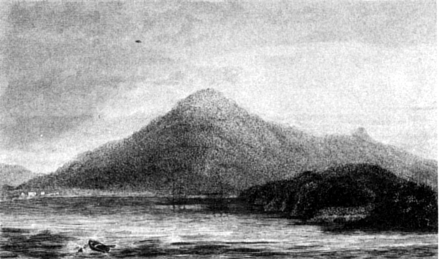
PORT FAMINE
(Looking Northwards).
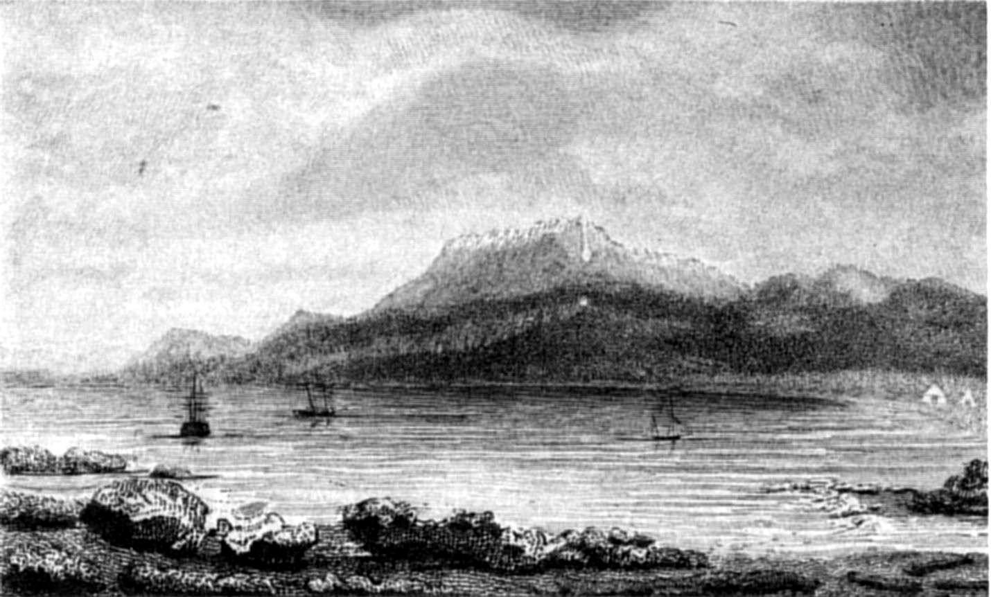
PORT FAMINE
(Looking Southwards).
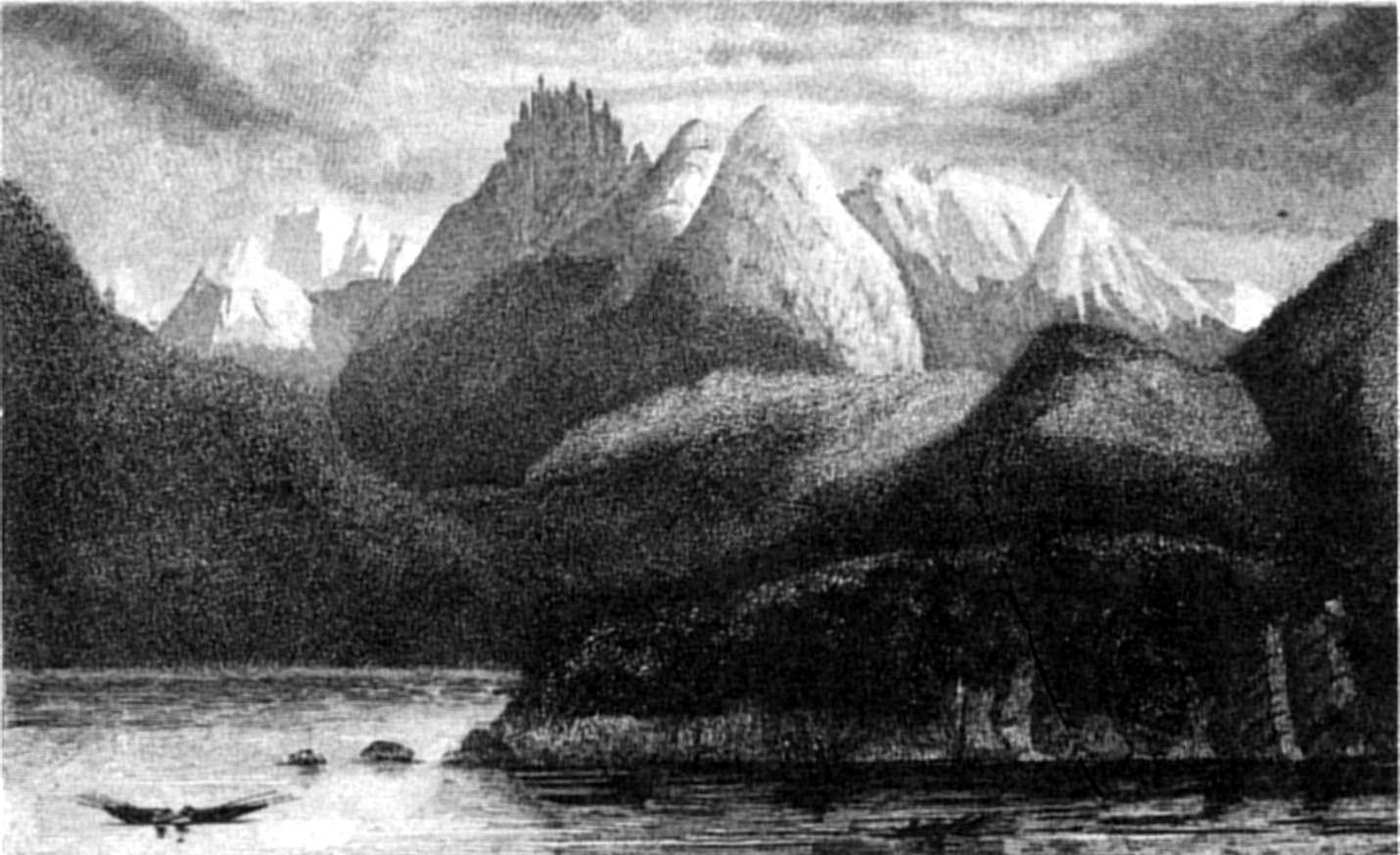
P. P. KingS. Bull
CURIOUS PEAK, ADMIRALTY SOUND.
Published by Henry Colburn, Great Marlborough Street,
1838
These natives conducted themselves very quietly, and, except one of
the women, who wished to keep a tin-pot in which some water had been
given her, made no attempt to pilfer. One of the party, who seemed more
than half an idiot, spit in my face; but as it was not apparently done
angrily, and he was reproved by his companions, his uncourteous conduct
was forgiven.
If possessed of any furs, they had left them, perhaps concealed, near
their wigwams: only a few arrows, a necklace of shells, and a fillet for
the head, made of ostrich feathers, were obtained by barter. Their canoes
were paddled by the women, occasionally helped by the men. One or two of
the former were young, and well-featured, but the rest were hideous; and
all were filthy and most disagreeable, from the quantity of seal-oil and
blubber, with which they had covered their bodies. After we had obtained,
by barter, all the articles they had to dispose of, I presented them with
red caps and medals, of which they were very proud: the latter they
requested might have a hole drilled through them, that they might be
suspended by a string round their necks. Their astonishment was much
excited, and they were pleased by hearing a watch tick; but I believe I
had very nearly, though unintentionally; given great offence, by cutting
off a lock of hair, from the head of one of the men. Assuming a grave
look, he very carefully wrapped the hair up, and handed it to a woman in
the canoe, who, as carefully, stowed it away in a basket, in which she
kept her beads and paint: the man then turned round, requesting me, very
seriously, to put away the scissors, and my compliance restored him to
good-humour.
The features of these people bore a great resemblance to those of the
Patagonian Indians, but in person they were considerably shorter and
smaller. The elderly people of both sexes had hideous figures; the
children, however, and young men, were well-formed; particularly one of
the boys, whom they called 'Yāl-lă-bă,' which, I
believe, meant a youth, or a young warrior. The word
'Shērrōo' was used to denote a canoe, or vessel.
They were ill-clothed, with mantles made of guanaco, or otter skins,
but not so neatly as those of the Patagonians. Their bodies were smeared
over with a mixture of earth, charcoal, or red-ocre, and seal-oil; which,
combined with the filth of their persons, produced a most offensive
smell. Some were partially painted with a white argillaceous earth;
others were blackened with charcoal; one of the men was daubed all over
with a white pigment. Their hair was bound by a fillet of plaited twine,
made perhaps with strips of bark, and a few of them had it turned up; but
to none did it appear to be an object of attention, except one of the
young women, who repeatedly combed and arranged her's with the
well-toothed jaw of a porpoise.
During a remarkably calm night, we were frequently startled by the
loud blowing of whales, between us and the shore. We had noticed several
of those monsters on the previous day, but had never heard them blow in
so still a place.
At dawn, a light air carried us towards some broken land to the S.E.
of Cape Rowlett, between the eastern trend of which, and the projecting
point of an island, we found a secure and land-locked harbour, with two
entrances, one to the north and the other to the south of High Islet. The
south side of the port, which I called Port Cooke,[49] is a narrow strip of land, forming the
head of a deep inlet or sound, called[50] Brook Harbour. It seemed to extend to
the base of the high mountainous range, and to be separated only by a
narrow isthmus from Fitton Harbour.
We had scarcely been at anchor half an hour when the same party of
Fuegians was seen arriving. The men hastened to us in their canoes, as
soon as the women had landed, to cover or thatch the wigwams, which they
found standing, and to light fires.
We afterwards went ashore, and, sitting down near them, commenced a
brisk trade for arrows, skins, necklaces, and other commodities. The furs
which covered their backs they parted with, for a few beads, and went
quite naked the whole evening.
Among them was a young man, who appeared to be treated with some
deference by the others; he was one of the best-looking of the party; and
there was a good-natured smile on his countenance during our
communication, while the rest frequently manifested displeasure, even
about trifles. He was, at least, the master of one of the two families;
his wigwam contained his wife, and two children, his, or his wife's
father, and mother, as well as the idiot, and his wife, who, from her
appearance, must have been a Patagonian, or else a woman of unusual size
among these people. The old woman was very inquisitive, and the man, in a
long speech, described to her all the wonders I had shown him, applying
to me, from time to time, to point out to her the articles he was trying
to describe.
Their dexterity with the sling is extraordinary; and, I should think,
when used as a weapon of offence, it must be very formidable. Upon asking
the same man to show us its use, he picked up a pebble, about the size of
a pigeon's egg, and placed it in the sling; then intimating that he was
going to strike a canoe, he turned his back to the mark, and threw the
stone in an opposite direction, against the trunk of a tree, whence it
rebounded over his head, and fell close to the canoe.
I have seen them strike a cap, placed upon the stump of a tree, fifty
or sixty yards off, with a stone from a sling. In using the bow and
arrow, also, with which they kill birds, they are very dexterous. The
spear is principally for striking porpoises and seals, but is also used
in war; and from the nature of the barb, must be an efficient weapon. For
close quarters, they use clubs, stones held in the hand, and short wooden
daggers, pointed with very sharp-edged quartz, pitch-stone, or flint.
The next morning, seeing us underweigh, they came alongside and tried
to induce us to anchor again. The young man, of whom I have spoken, was
very importunate, and at last offered us his wife, as a bribe, who used
all her fancied allurements to second his proposal.
So highly did they esteem beads and buttons, that a few of each would
have purchased the canoe, the wife, and children, their dogs, and all the
furniture. Seeing us proceed to the southward, with the apparent
intention of sailing down the inlet, they motioned to us to go to the
north, repeatedly calling out 'Sherroo, sherroo,' and pointing to the
northward; which we thought intimated that there was no passage in the
direction we were taking.
At noon, I landed to observe the latitude, and take bearings down the
Sound to the S.E., at the bottom of which was a hill, standing by itself,
as it were, in mid-channel. The view certainly excited hopes of its being
a channel; and as we had begun to calculate upon reaching Nassau Bay in a
few days, we named this hill, Mount Hope.
The point on which we landed was at the foot of a high snow-capped
hill, called by us Mount Seymour; whence, had not the Indians been near,
I should have taken bearings.
We sailed south-eastward, close to the south shore, until the evening;
when from the summit of some hills, about three hundred feet above the
sea, we had a view down the Sound, which almost convinced us it would
prove to be a channel. The rock at this place differed from any we had
seen in the Strait. The mountains are high, and evidently of clay-slate;
but the point, near which we anchored, is a mass of hard, and very
quartzose sand-stone, much resembling the old red sand-stone formation of
Europe, and precisely like the rock of Goulburn Island, on the north
coast of New Holland.[51]
The following morning (23d), we proceeded towards Mount Hope, while
running down to which some squalls passed over, clouding the south shore,
and as we passed Parry Harbour it bore so much the appearance of a
channel, that we stood into it; but the clouds clearing away soon exposed
the bottom to our view, where there seemed to be two arms or inlets. In
the south-eastern arm, the shores were covered with thick ice (like the
bottom of Ainsworth Harbour, to the west of Parry Harbour, where an
immense glacier slopes down to the water's edge). The south-west arm
appeared to be well sheltered, and if it affords a moderate depth of
water, would be an excellent harbour.
After satisfying ourselves that there was no channel here, we bore up
on our original course; but, before long, found ourselves within two
miles of the bottom of the Sound; which is shallow, and appears to
receive two rivers. The great quantity of ice water, which mingles here
with the sea, changed its colour to so pale a blue, that we thought
ourselves in fresh water.
Mount Hope proved to be an isolated mass of hills, lying like the rest
N.W. and S.E., having low land to the southward, over which nothing was
visible except one hill, thirty or forty miles distant, covered with
snow, to which the rays of the sun gave the appearance of a sheet of
gold. Finding ourselves embayed, we hastened out of the scrape, and,
after beating for some hours, anchored in Parry Harbour.
Our entrance into a little cove in Parry Harbour disturbed a quantity
of ducks, steamers, shags, and geese. Their numbers showed that Indians
had not lately visited it.
Next day we reached Ainsworth Harbour, which is of the same character
as Parry Harbour, and affords perfect security for small vessels: by dint
of sweeping, we reached a secure anchorage in a cove at the south-east
corner.
The bottom of the port is formed, as I before said, by an immense
glacier, from which, during the night, large masses broke off and fell
into the sea with a loud crash,[52] thus explaining the nocturnal noises we
had often heard at Port Famine, and which at the time were thought to
arise from the eruption of volcanoes. Such were also, probably, the
sounds heard by the Spanish officers during their exploration of the
Straits, whilst in the port of Santa Monica, where they had taken refuge
from a violent gale of wind.[53]
The harbour was full of fragments of ice, the succeeding morning,
drifting into the Sound, where the sea-water, being at a higher
temperature than the air, rapidly melted them.
Since our departure from Port Waterfall, the weather had been mild,
clear, and settled; but as it wanted only three days of the change of the
moon, at which period, as well as at the full, it always blew a gale, I
wished to reach a place of security in the Gabriel Channel or Magdalen
Sound.
Near the islands of Ainsworth Harbour, three canoes passed us,
steering across the Sound, each with a seal-skin fixed up in the bow for
a sail; and we recognised in them the party left at Port Cooke, among
whom was the Indian who had been detected in stealing a tin pot. They did
not come along-side; but as we went by, pointed to the north, apparently
urging us to go in that direction.
We had noticed several wigwams at Parry and Ainsworth Harbours, which
shows that they are much frequented by Indians, perhaps on their way to
the open low country east of Mount Hope, where numerous herds of
guanacoes may be found.
Porpoises and seal were not scarce in this inlet, and in the entrance
there were many whales. The presence of seal and whales made me think it
probable there was a channel; but I believe every person with me was
satisfied of its being a sound, terminating under Mount Hope. Since my
later experience of the deceptive character of some passages in Tierra
del Fuego (the Barbara Channel, for example), I have felt less certain
that there may not be a communication with the low land, behind Mount
Hope, round its northern base. The improbability was, however, so
great,—from the bottom of the sound being shoal,—from
the very slight tide-stream,—and from the information of the
Natives; who evidently intended to tell us we could not get out to
sea,—that we did not consider it worth while to make another
examination.
I have before observed that the strata of the slate rocks, in the
Strait, dip to the S.E.; and I found that they dip similarly all the way
to the bottom of this inlet, which I named Admiralty Sound.
The north side, like that of the Gabriel Channel, is steep, without
indentations, excepting where there is a break in the hills; but on the
south shore there are many coves, and bights, the cause of which is shown
in the accompanying imaginary section of the Gabriel Channel. The same
cause operates on the outline of the north shore of the reach of Cape
Froward, westward as far as Cape Holland, where the rock assumes a still
more primitive form. Its general character, however, is micaceous slate,
with broad veins of quartz; the latter being particularly conspicuous at
Port Gallant.
The following slight sketch, intended to represent an imaginary
section of such an opening as the Gabriel Channel, may also serve to give
a general idea of many Fuegian anchorages;—of deep water passages
existing between the almost innumerable islands of Tierra del
Fuego;—and of the effects of those sudden, and violent gusts of
wind,—so frequent and dangerous,—commonly called
hurricane-squalls,[54] or
williwaws.
The rock, of course, decomposes equally on both sides; but on that
exposed to the south wind, it breaks off in flakes parallel to the
direction of the strata, and therefore does not make the course of the
beach more irregular; while on the other side it moulders away
transversely to the direction of the dip, leaving holes, in which water
lodges, and hastens decomposition by entering deeply into the
interstices. Water, air, and frost decompose the rock, and form a soil,
which, if not too much exposed to the wind, is soon occupied by
vegetation.
The rugged faces of the cliffs, on the southern shore, caused by the
rock decomposing across the grain, collect sand and mud; and hence it
happens that anchorages are frequently found on one side, whilst, on the
other, the anchor will not hold, from the steepness of the ground; there
being nothing upon the smooth declivity to retain mud and sand before it
gets to the bottom; which, in most cases known to me, lies far beyond the
reach of the anchor.
After a tedious and difficult passage through the Gabriel Channel, we
anchored in a snug harbour within the entrance of Magdalen Channel, on
the west side, under a peaked hill called by Sarmiento 'El
Vernal,'—in our plan, the 'Sugar-loaf.' The entrance is about a
quarter of a mile wide; but after a few hundred yards the harbour opens,
extending in for nearly a mile. It is of easy depth; seven fathoms in the
entrance, and four, five, and six fathoms within; so that it is very
convenient for a small vessel: to us, indeed, it was a most welcome
discovery. The land rises, around this cove, to the height of two or
three thousand feet. It is covered with Beech, and Winter's-bark, and
near the water is adorned with large groves of Fuchsia, Berberis, and the
common shrubs of Port Famine, growing so thickly as to form an almost
impenetrable jungle; but, notwithstanding the picturesque character of
its scenery, the towering height of the hills, which exclude the sun's
rays for the whole day, during the greater portion of the year, renders
it a gloomy and melancholy spot.[55]
We found a family of Fuegians in the inner harbour. Three canoes were
hauled up on the beach, but their owners were not at first visible. At
last, after our repeatedly calling out 'Ho-say, ho-say,' they appeared,
and, rather reluctantly, invited us, by signs, to land. There seemed to
be fourteen or fifteen people, and seven or eight dogs. Mr. Wickham and
Mr. Tarn went on shore to these natives, who exhibited some timidity,
until a hideous old woman began to chatter, and soon made them understand
that the young men (Lā-ā-pas) were absent on a hunting
excursion, but were every moment expected to return. There were only
three men with the women and children. To inspire them with confidence in
our good intentions, Mr. Wickham gave each man a red cap, and some other
trifles. One of them complained of being sick, but I rather imagine his
illness was feigned, and the others did not at all seem to like our
visit. By degrees their fears subsided, and, restraint being laid aside,
an active trade began; in which several otter skins, shell-necklaces,
spears, and other trifles, were obtained from them in exchange for beads,
buttons, medals, &c. The otters are caught by the help of dogs, on
which account, principally, the latter are so valuable.
These people were slightly clothed with skins of the seal and otter,
but some had pieces of guanaco mantles over their shoulders, whence we
supposed that they were either of the same tribe, or at peace, with the
Indians of Admiralty Sound: unless, indeed, they trade with the
Patagonian Indians; but such is the poverty of the Fuegians, they can
scarcely possess any thing of value sufficient to exchange with the goods
of their northern neighbours, unless it be iron pyrites, which I think is
not found in the open country inhabited by the Patagonian Indians, and,
from the facility with which it yields sparks of fire, must be an object
of importance.
We were not a little amused by the surprise which these natives showed
at the things in our possession, and by the effect produced in their
countenances when they saw any thing extraordinary: the expression was
not that of joy or surprise, but a sort of vacant, stupified, stare at
each other. They must have been very suspicious of our intentions, or
very much excited by what they had seen during the day, as throughout the
night an incessant chattering of voices was heard on shore, interrupted
only by the barking of their dogs.
Looking down the Magdalen Inlet, we saw two openings, which, while the
hills were enveloped in mist, had the appearance of being channels. We
proceeded for some distance into the more westerly of the two, but found
that it was merely a sound, terminated by high land. The boat was then
steered under a steep mass of black mountainous land,[56] the summit of which is divided into
three peaks, which Sarmiento called 'El Pan de Azucar de los Boquerones'
(the Sugar-loaf of the Openings). We ran southward, fifteen miles down
this sound, and reached the Labyrinth Islands; but finding there no
suitable anchorage, resumed our course towards the bottom of what we
thought another sound, terminated by mountains. At noon, the furthest
point, on the west shore, which we called Cape Turn, was within three
miles of us, and we should soon have discovered the continuation of the
channel (as it has since been proved); but a breeze set in from the S.W.,
and in a short time it blew so strong as to oblige us to turn back.
'Williwaws' and baffling eddy winds kept us seven hours under Mount
Boqueron. These squalls were at first alarming, but by taking in all
sail, before they passed, we sustained no injury. At sunset we were
abreast of Hope Harbour, in which we purposed taking shelter from the
gale. Our late neighbours, the Indians, had lighted a fire at the
entrance to invite our return; but wind and tide were against us, and as
we knew of no port to leeward, our only resource was to run out of the
sound. Furious squalls carried us into the true, or steady, wind, which
we found very strong; and as Port San Antonio was on the lee-bow, we had
to carry such a press of sail, that our excellent boat had nearly half
the lee side of her deck under water. By daylight we got into smooth
water, and, with less wind and better weather, steered for Port Famine.
The smoother water enabled us to light a fire and cook a meal, not an
unimportant affair, as we had eaten nothing since six o'clock on the
preceding morning.
In our absence Mr. Graves had surveyed Lomas Bay, and, after his
return, Mr. Ainsworth had crossed the Strait with the gig and cutter to
survey Port San Antonio. They were victualled for five days; the gig was
manned by my own boat's crew, and the cutter by volunteers: but although
they had not come back, we felt no anxiety about their safety, being
assured that Mr. Ainsworth would not run the risk of crossing the Strait
during bad weather. The tempestuous state of the two following days,
however, made us uneasy, and on the third morning, when the wind
moderated much, we looked out anxiously for their arrival. In the evening
the cutter returned; but, alas! with the melancholy information of the
loss of Mr. Ainsworth, and two seamen, drowned by the upsetting of the
gig. One of the latter was my excellent coxswain, John Corkhill. The
remainder of the gig's crew were only rescued from drowning by the
strenuous exertions of those in the cutter.
Mr. Ainsworth, anxious to return to the ship, thought too little of
the difficulty and danger of crossing the Strait during unsettled
weather. He set out from Port San Antonio under sail, and, while
sheltered by the land, did very well; but as soon as they got into the
offing, both wind and sea increased so much that the gig was in great
danger, although under only a small close-reefed sail.
The people in the cutter were anxiously watching her labouring
movements, when she disappeared! They hastened to the spot—saved
three men; but the other two had gone down. Poor Ainsworth was still
clinging to the gig's gunwale when his shipmates eagerly approached; but
letting go his hold from extreme exhaustion, and being heavily clothed,
he sunk from their sight to rise no more.
He had been cheering the drowning crew, and trying to save his
companions, till the moment his grasp relaxed. Just before Ainsworth
himself let go, Mr. Hodgskin lost his hold, exclaiming, Ainsworth, save
me! when, exhausted as he was, with one hand he rescued his friend, and,
directly afterwards, his strength failing, sunk.
This addition of three people to the already loaded cutter, made her
cargo more than was safe, therefore Mr. Williams, who commanded her, very
prudently bore up for the first convenient landing-place, and happily
succeeded in reaching the only part of the beach, between Lomas Bay and
Cape Valentyn, where a boat could land.
The following morning, the weather being more favourable, they crossed
under sail to Freshwater Bay, and thence pulled to Port Famine.
This melancholy disaster was much felt by every one. Ainsworth was a
deserving officer, and highly esteemed. Corkhill was captain of the
forecastle, and had served in the Polar voyages under Sir Edward Parry.
On the Sunday following, the colours were hoisted half-mast high, and the
funeral service was read after morning prayers: for although to recover
the bodies was impossible, their watery grave was before our eyes; and
the performance of this last sad duty was a melancholy satisfaction.
"Ours are the tears, tho' few, sincerely shed,
When ocean shrouds and sepulchres our dead."
A tablet was subsequently erected, on Point St. Anna, to record this
fatal accident.
Lieutenant Sholl arrives—Beagle returns—Loss of the Saxe
Cobourg sealer—Captain Stokes goes to Fury Harbour to save her
crew—Beagle's proceedings—Bougainville's
memorial—Cordova's memorial—Beagle's
danger—Difficulties—Captain Stokes's
boat-cruize—Passages—Natives—Dangerous
service—Western entrance of the Strait of Magalhaens—Hope's
cruize—Prepare to return to Monte Video.
The Beagle's time of absence had expired on the 1st of April, and our
anxiety, more excited by our recent loss, was becoming painful. I
detained the Hope from going upon a service for which she was prepared,
in case she might be required to search for our consort: but on the 6th a
strange whale-boat was descried pulling towards us from the southward, in
which we soon distinguished Lieut. Sholl. His appearance, under such
circumstances, of course raised fears for the Beagle's safety; but, on
approaching, his gratifying shout, "all's well!" at once removed
anxiety.
Mr. Sholl informed me, that the Beagle had picked up a boat, belonging
to the schooner 'Prince of Saxe Cobourg,' wrecked in Fury Harbour, at the
south entrance of the Barbara Channel; and that she had put into Port
Gallant, whence Captain Stokes had gone with the boats to assist the
Sealers, leaving Lieut. Skyring on board.
The safety of the Beagle being established, I despatched Mr. Graves,
in the Hope, to examine some openings between the Magdalen Channel and
the Dos Hermanos of Bougainville.
Several days earlier than I expected, the Beagle made her appearance,
and Captain Stokes soon gave me the agreeable intelligence of having
succeeded in saving the Prince of Saxe Cobourg's crew. Favoured by the
weather, though delayed by his guide having forgotten the way, Captain
Stokes reached Fury Harbour in two days, and embarked the master and crew of
the wrecked vessel, with all their personal property, and the greater
part of the seal-skins which they had cured. He reached Port Gallant
again on the fourth day; sailed immediately in the Beagle, and two days
afterwards anchored in Port Famine.
The Prince of Saxe Cobourg, belonging to Mr. Weddel (whose voyage
towards the South Pole is so well known), and commanded by Mr. Matthew
Brisbane, who accompanied Weddel on that occasion, sailed from England in
the summer of 1826, on a sealing voyage. At South Shetland she
encountered a continuance of bad weather, was beset by a large body of
ice for several days, and received so much damage as to oblige her to run
for the Fuegian coast, and anchor in Fury Harbour, at the entrance of the
Barbara Channel. There (December 16th, 1826) she was driven on shore by
the furious strength of the williwaws, and wrecked. The crew were,
however, enabled to save most of the provisions and stores, as well as
their three boats. Having made tents, and established themselves on
shore, they remained in anxious expectation of the arrival of some vessel
which might relieve them; day after day however passed, without
succour.
Two boats were despatched to look for any sealing vessel that might be
in the vicinity, but after fifteen days' absence they returned
unsuccessful. In this interval one of the crew, who had long been sickly,
died; and another, in carelessly discharging a musket, exploded twenty
pounds of gunpowder, by which he was very much burned. Three of the
people being mutinous, were punished by being sent, each to a different
island, with only a week's provisions.
Soon afterwards another boat was sent away, which reached Hope
Harbour, but found no vessel there. Seven of the people then obtained
permission from the master (who kept up a very proper state of
discipline), to take the largest whale-boat, and go towards the River
Negro. Previous to their departure they drew up articles of agreement for
their general conduct, a breach of which was to be punished by the
offender being left upon the coast, wherever they might happen to be. The
boat eventually arrived safely at the place of her destination, and the
crew entered as volunteers on board of the Buenos Ayrean squadron, at
that time engaged in the war with Brazil.
Again a boat was despatched, directed to go westward through the
Strait in search of vessels. She had only reached as far as Playa Parda,
when the Beagle fell in with her (March 3d, 1827). While passing through
the small channels, before entering the Strait, she met several canoes,
with Indians, who endeavoured to stop her, and shot arrows at the crew;
but, happily, without doing any mischief.
After the last boat's departure, Mr. Brisbane began to build a small
vessel, and, while so employed, was visited by a party of natives, who
conducted themselves very peaceably, and went away. Their visit, however,
gave the shipwrecked people, now much reduced in number,[57] reason to apprehend the return of a
larger body, who might try to possess themselves of the property which
was lying about on the shore; they therefore buried a great deal, and
took means to preserve the rest by making preparations to repel attack.
When Captain Stokes appeared with his two boats, the Sealers flew to
their arms, calling out "the Indians, the Indians!" but in a very few
minutes excess of joy succeeded to their sudden alarm.
Captain Stokes found the vessel lying on the rocks, bilged, and an
utter wreck. The master and crew were extremely anxious to get away, he
therefore embarked them, with as much of the property as could be
carried, and succeeded (after another night in the boats, and a long pull
of eighty miles,) in conveying them safely to the Beagle.
The following is an abstract of Captain Stokes's journal of his cruise
to the western entrance of the Strait.
The Beagle sailed from Port Famine on the 15th of January, to explore
the Strait westward of Cape Froward, and to fix particularly the
positions of Cape Pillar, the rock called Westminster Hall, and the
Islands of Direction, at the western entrance of the Strait.
For the first night Captain Stokes anchored in San Nicolas Bay, and in
the evening examined a harbour[58] behind Nassau Island, which
Bougainville, in the year 1765, visited for the purpose of procuring wood
for the French settlement at the Falkland Islands.
On the second night, after a day nearly calm, the Beagle was anchored
in a cove to the eastward of Cape Froward, and the next day (17th) passed
round the Cape, carrying a heavy press of sail against a dead foul wind.
Captain Stokes's account of this day's beat to windward will give the
reader an idea of the sort of navigation.
"Our little bay had screened us so completely from the wind, that
though, when (at five A.M.) we weighed, the
breeze was so light as scarcely to enable us, with all sail set, to clear
its entrance; no sooner were we outside, than we were obliged to treble
reef the topsails. We continued to beat to windward under a heavy press
of sail; our object being to double Cape Froward, and secure, if
possible, an anchorage ere night-fall under Cape Holland, six leagues
further to the westward. At first we made 'boards' right across the
Straits to within a third of a mile of each shore, gaining, however, but
little. We then tried whether, by confining our tacks to either coast, we
could discover a tide by which we might profit; and for that purpose I
began with the north shore, for though we were there more exposed to
violent squalls which came down the valleys, I thought it advisable to
avoid the indraught of various channels intersecting the Fuegian coast;
but having made several boards without any perceptible advantage, we
tried the south shore, with such success that I was induced to keep on
that side during the remainder of the day.
"And here let me remark, that in consequence of the westerly winds
which blow through the western parts of the Straits of Magalhaens, with
almost the constancy (as regards direction, not force) of a trade-wind; a
current setting to the eastward, commonly at the rate of a knot and three
quarters an hour, will be found in mid-channel. The tides exert scarcely
any influence, except near either shore; and sometimes appear to set, up
one side of the Straits, and down the other: the weather tide is
generally shown by a rippling.(c)
"Heavy squalls off Cape Froward repeatedly obliged us to clew all up.
By day their approach is announced, in time for the necessary
precautions, by their curling up and covering with foam the surface of
the water, and driving the spray in clouds before them.
"At last we doubled Cape Froward. This Cape (called by the Spaniards
El Morro de Santa Agueda), the southernmost point of all America, is a
bold promontory, composed of dark coloured slaty rock; its outer face is
nearly perpendicular, and whether coming from the eastward or westward,
it 'makes' as a high round-topped bluff hill ('Morro').
"Bougainville observes, that 'Cape Froward has always been much
dreaded by navigators.'[59]
To double it, and gain an anchorage under Cape Holland, certainly cost
the Beagle as tough a sixteen hours' beat as I have ever witnessed: we
made thirty-one tacks, which, with the squalls, kept us constantly on the
alert, and scarcely allowed the crew to have the ropes out of their hands
throughout the day. But what there is to inspire a navigator with 'dread'
I cannot tell, for the coast on both sides is perfectly clear, and a
vessel may work from shore to shore."
From Cape Holland, the Beagle proceeded to Port Gallant, and during
her stay there, Mr. Bowen ascended the Mountain de la Cruz. Upon the
summit he found some remains of a glass bottle, and a roll of papers,
which proved to be the memorials stated to have been left by Don Antonio
de Cordova, and a copy of a document that had previously
been deposited there by M. de Bougainville. With these papers was found a
Spanish two-rial piece of Carlos III., which had been bent to admit of
its being put into the bottle. It was with considerable difficulty that
any of the writing could be decyphered, for the papers, having been
doubled up, were torn, and the words defaced at the foldings, and
edges.
Bougainville's memorial was in Latin. Cordova's, besides a document in
Latin, was accompanied by an account of his voyage, written in four
languages, Spanish, French, Italian, and English. The legible part of the
former was as follows:—
Viatori Benevolo salus . . . . . . . .
. . . . . . . . que a periculose admodum naviga . . . . . .
. . . . . . . . Brasilie Bonarve et insularum . . . . . . . . . .
. . . . . . . . . . . . . . . . . . . . . . . . . . . . . . . . . . . . . . . . . . . .
. . . . . . . . . . incertis freti Magellanici portubus . . . .
. . . . . . . . . . . . . . . . . . . . . . historia astronomia . . . .
. . . . Boug . . . . . . . . . . . . . . . . . . . . . . . . . . . . . . . . .
. . . . Boug . . . . Duclos et de la Giranda 2 navium . .
. . . . . . . . . . . . . . Primaris
. . . . Comerson . . . . Doct med naturalista Regio
accu . . . . m. Veron astronomo de Romainville hidrographio
. . . . . . . . . . a rege Christianissimo demandans
. . . . . . . . . . Landais Lavan Fontaine navium
Loco tenentibus et Vexillariis . . . . . . . .
. . . . . . . . itineris locus DD Dervi Lemoyne . . . .
. . . . . . . . . . . . Riouffe voluntariis.
. . . . . . . . . . . . . . . . vives . . . . . . . . . . scriba
Anno MDCCLXVI.
The Latin inscription of Cordova was as follows:—
Benevolo Navigatori
Salutem
Anno Domini MDCCLXXXVIII Vir celeberrimus
DD Antonius de Cordova Laso de Vega navibus duabus (quarum
nomina SS Casilda et Eulalia erant ad scrutamen Magellanici
freti subsequendum unâque littorum, portuum aliorumque notabilium
. . . . . . . . . . . . . . . . . . . . iter iterum fecit.
. . . . e Gadibus classis tertio nonas Octobris habenas immittit
quarto idus ejusdem Nova . . . . . . vidit
A Boreali ad Austra . . . . . . miserium postridie Kalendæ
Novembris emigravit.
Decimo quarto Kalendas Januarii Patagonicis recognitis
litoribus ad ostium appulit freti.
Tandem ingentibus periculis et horroribus tam in mari quam
in freto magnanime et constanter superatis et omnibus
portubus atque navium fundamentis utriusque litoris
correctissime cognitis ad hunc portum Divini Jose vel
Galante septimo idu Januarii pervenit ubi ad
perpetuam rei memoriam in monte sanctissimæ crucis hoc
monumentum reliquit.
Tertio et excelso Carolo regnante potente
Regali jussu facta fuere suo.
Colocatum fuit nono Kalendæ Februarii Anno MDCCLXXXIX.
together with a list of the officers of both vessels, and enclosing a
memorial of Cordova's former voyage in the Santa Maria de la Cabeza. The
originals are placed in the British Museum; but before we finally left
the Strait, copies were made on vellum, and deposited on the same
spot.
The Beagle left Port Gallant[60] with a fair wind, which carried her to
Swallow Harbour.
The next stopping place was Marian's Cove, a very snug anchorage on
the north shore, a few miles beyond Playa Parda. Proceeding thence to the
westward, with the wind 'in their teeth,' and such bad weather, that they
could only see the land of either coast at intervals, and failing in an
attempt to find anchorage under Cape Upright, the Beagle was kept under
weigh during a squally dark night.
In that very place, Commodore Byron, with the Dolphin and Tamar,
passed the anxious night, which he thus describes:—
"Our situation was now very alarming; the storm increased every
minute, the weather was extremely thick, and the rain seemed to threaten
another deluge; we had a long dark night before us, we were in a narrow
channel, and surrounded on every side by rocks and breakers."[61] The Beagle was under
similar circumstances, but the land being known to be high and bold, her
danger was not considered so imminent.
Eastward of Cape Upright the water was smooth; but between it and Cape
Providence a heavy breaking sea was caused by the deep swell of the
Pacific. Captain Stokes found an anchorage the next night in a bay under
Cape Tamar; and the following evening very nearly reached another under
Cape Phillip; but the darkness of a rainy night, and strong squalls,
prevented their attempting to anchor in an unknown place, and the only
resource was to bear up for shelter under Cape Tamar, where the previous
night had been passed. Even this was a dangerous attempt; they could
hardly discern any part of the high land, and when before the wind could
not avoid the ship's going much too fast. While running about eight
knots, a violent shock—a lift forward—heel over—and
downward plunge—electrified every one; but before they could look
round, she was scudding along, as before, having fairly leaped over the
rock.
It was afterwards found that a great part of the gripe and false keel
were knocked away. Captain Stokes's account of this day's beat will give
an idea of the difficulties which the Beagle's crew encountered, in
working out of the Strait.
January 31st. "The hands were turned up at daylight up anchor; but the
heavy squalls that came off the high land of the harbour, rendered it too
hazardous to weigh, until a temporary lull enabled us to make sail, and
re-commence beating to the westward against a dead foul wind, much rain,
hard squalls, and a turbulent cross sea.
"The squalls became more frequent and more violent after noon; but
they gave, in daylight, sufficient warning, being preceded by dark clouds
gradually expanding upwards, until their upper line attained the altitude
of about fifty degrees: then came heavy rain, and perhaps hail;
immediately after followed the squall in all its fury, and generally
lasted fifteen or twenty minutes.
"In working to windward we frequently extended our 'boards' to the
south shore (not without risk considering the state of the weather), with
the hope of making out Tuesday Bay, or some anchorage thereabout; but the
coast was covered with so thick a mist, that not a single point,
mentioned by preceding navigators, could be recognised.
"About seven in the evening we were assailed by a squall, which burst
upon the ship with fury far surpassing all that preceded it; had not sail
been shortened in time, not a stick would have been left standing, or she
must have capsized. As it was, the squall hove her so much over on her
broadside, that the boat which was hanging at the starboard quarter was
washed away. I then stood over to the north shore, to look for anchorage
under the lee of a cape, about three leagues to the north-west of Cape
Tamar. On closing it, the weather became so thick that at times we could
scarcely see two ships' lengths a-head.
"These circumstances were not in favour of exploring unknown bays, and
to think of passing such a night as was in prospect, under sail in the
Straits, would have been a desperate risk; I was obliged therefore to
yield the hard-gained advantage of this day's beat, and run for the
anchorage whence we had started in the morning.
"It was nearly dark ere we reached it; and in entering, desirous to
keep well up to windward, in order to gain the best anchorage, I went too
close to the outer islet, and the ship struck violently on a rocky ledge.
However, she did not hang a moment, and was soon anchored in safety."
Finding so much danger and difficulty, in proceeding with the ship,
without first knowing where to run for anchorages, Captain Stokes left
her in Tamar Bay, under the charge of Lieutenant Skyring; and,
accompanied by Mr. Flinn, set out in the cutter, with a week's
provisions, to examine the south coast.
In a very arduous and dangerous cruize he discovered several
well-sheltered anchorages, but experienced a "constant heavy gale from
W.N.W., with thick weather and incessant drenching rain."
Captain Stokes says, "Our discomfort in an open boat was very great,
since we were all constantly wet to the skin. In trying to double the
various headlands, we were repeatedly obliged (after hours of ineffectual
struggle against sea and wind) to desist from useless labour, and take
refuge in the nearest cove which lay to leeward."
From the Harbour of Mercy, Captain Stokes attempted to cross the
Strait, on his return to the Beagle; but the sea ran too high, and
obliged him to defer his daring purpose until the weather was more
favourable.
During his absence, Lieutenant Skyring surveyed Tamar Bay and its
vicinity.
Again the Beagle weighed, and tried hard to make some progress to the
westward, but was obliged a third time to return to Tamar Bay. After
another delay she just reached Sholl Bay, under Cape Phillip, and
remained there one day, to make a plan of the anchorage, and take
observations to fix its position.
The Beagle reached the Harbour of Mercy (Separation Harbour of Wallis
and Carteret),[62] after a
thirty days' passage from Port Famine, on the 15th, having visited
several anchorages on the south shore in her way. But tedious and
harassing as her progress had been, the accounts of Byron, Wallis,
Carteret, and Bougainville show that they found more difficulty, and took
more time, in their passages from Port Famine to the western entrance of
the Strait. Byron, in 1764, was forty-two days; Wallis, in 1766,
eighty-two; Carteret, in the same year, eighty-four; and Bougainville, in
1768, forty days, in going that short distance.
Five days were passed at this place, during which they communicated
with a few natives, of whom Captain Stokes remarks; "As might be expected
from the unkindly climate in which they dwell, the personal appearance of
these Indians does not exhibit, either in male or female, any
indications of activity or strength. Their average height is five feet
five inches; their habit of body is spare; the limbs are badly turned,
and deficient in muscle; the hair of their head is black, straight, and
coarse; their beards, whiskers, and eyebrows, naturally exceedingly
scanty, are carefully plucked out; their forehead is low; the nose rather
prominent, with dilated nostrils; their eyes are dark, and of a moderate
size; the mouth is large, and the under-lip thick; their teeth are small
and regular, but of bad colour. They are of a dirty copper colour; their
countenance is dull, and devoid of expression. For protection against the
rigours of these inclement regions, their clothing is miserably suited;
being only the skin of a seal, or sea-otter, thrown over the shoulders,
with the hairy side outward.
"The two upper corners of this skin are tied together across the
breast with a strip of sinew or skin, and a similar thong secures it
round the waist; the skirts are brought forward so as to be a partial
covering. Their comb is a portion of the jaw of a porpoise, and they
anoint their hair with seal or whale blubber; for removing the beard and
eyebrows they employ a very primitive kind of tweezers, namely, two
muscle shells. They daub their bodies with a red earth, like the ruddle
used in England for marking sheep. The women, and children, wear
necklaces, formed of small shells, neatly attached by a plaiting of the
fine fibres of seal's intestines.
"The tracts they inhabit are altogether destitute of four-footed
animals; they have not domesticated the geese or ducks which abound here;
of tillage they are utterly ignorant; and the only vegetable productions
they eat are a few wild berries and a kind of sea-weed. Their principal
food consists of muscles, limpets, and sea-eggs, and, as often as
possible, seal, sea-otter, porpoise, and whale: we often found in their
deserted dwellings bones of these animals, which had undergone the action
of fire.
"Former voyagers have noticed the avidity with which they swallowed
the most offensive offal, such as decaying seal-skins, rancid seal, and
whale blubber, &c. When on board my ship, they ate or drank greedily
whatever was offered to them, salt-beef, salt-pork, preserved meat,
pudding, pea-soup, tea, coffee, wine, or brandy—nothing came amiss.
One little instance, however, happened, which showed what they preferred.
As they were going ashore, a lump of the tallow used for arming the lead
was given to them, and received with particular delight. It was
scrupulously divided, and placed in the little baskets which they form of
rushes, to be reserved for eating last, as the richest treat.
"To their dwellings have been given, in various books of voyages, the
names of huts, wigwams, &c.; but, with reference to their structure,
I think old Sir John Narborough's term for them will convey the best idea
to an English reader; he calls them 'arbours.' They are formed of about a
couple of dozen branches, pointed at the larger ends, and stuck into the
ground round a circular or elliptical space, about ten feet by six; the
upper ends are brought together, and secured by tyers of grass, over
which is thrown a thatching of grass and seal-skins, a hole being left at
the side as a door, and another at the top as a vent for the smoke. A
fire is kept burning within, over which the natives are constantly
cowering; hence, when seen abroad, instead of appearing to be hardy
savages, inured to wet and cold, you see wretched creatures shivering at
every breeze. I never met people so sensible of cold as these Fuegian
Indians.
"The nature of their domestic ties we had no opportunity of
discovering; their manner towards their children is affectionate and
caressing. I often witnessed the tenderness with which they tried to
quiet the alarms our presence at first occasioned, and the pleasure which
they showed when we bestowed upon the little ones any trifling trinkets.
It appeared that they allow their children to possess property, and
consult their little whims and wishes, with respect to its disposal; for
being in a boat, alongside one of the canoes, bargaining for
various articles, spears, arrows, baskets, &c., I took a fancy to a
dog lying near one of the women, and offered a price for it; one of my
seamen, supposing the bargain concluded, laid hands on the dog, at
which the woman set up a dismal yell; so bidding him desist, I increased
my offers. She declined to part with it, but would give two others. At
last, my offers became so considerable, that she called a little boy out
of the thick jungle (into which he had fled at our approach), who was the
owner of the dog. The goods were shown to him, and all his party urged
him to sell it, but the little urchin would not consent. He offered to
let me have his necklace, and what he received in exchange was put away
in his own little basket.
"These people never evinced any thankfulness for our presents.
Whatever was offered they 'clutched at,' doubtful of getting it, although
held out to them; and when in their own hand, it was instantly stowed
away, as if they feared it would be recalled.
"I sometimes tried to discover whether they preferred any particular
colour, and for that purpose held out three strings of beads, black,
white, and red; they clutched at all three, in their usual manner,
without showing any preference.
"Their pronunciation is exceedingly harsh and guttural; not more than
two words, whose signification was at all ascertained, could be made out,
'sherroo,' a ship, boat, or canoe, and 'peteet,' a child. They have a
wonderful aptitude for imitating the sounds of strange languages: let a
sentence, of even a dozen words, be distinctly pronounced, and they will
repeat it with the utmost precision.
"Their only articles of traffic, besides such implements and weapons
as they use, are seal and otter skins; and I should say that the quantity
of peltry to be procured from them would be insignificant towards
completing the cargo of a sealing vessel."
During the next few days the Beagle was employed in the most exposed,
the least known, and the most dangerous part of the Strait. Fortunately,
she was favoured by weather, and effected her purpose without injury or
loss; but I never reflect upon this piece of service without an inward
tribute of admiration to the daring, skill, and seamanship of Captain
Stokes, Lieutenant Skyring, and Mr. Flinn.
In his journal Captain Stokes says:
"Incessant rain and thick clouds prevented my completing, until this
day (19th), the observations necessary for making an island, just outside
the Harbour of Mercy, the southern end of my base, for the
trigonometrical connection of the coasts and islands near the western
entrance of this weather-beaten Strait.
"On the 20th, I weighed and beat to windward, intending to search for
anchorage on the north shore, where I might land and fix the northern end
of our base line. In the evening we anchored in an archipelago of
islands, the real danger of whose vicinity was much increased to the eye
by rocks, scattered in every direction, and high breakers, occasioned
doubtless by reefs under water. We observed that most of the larger
islands have small banks of sand at their eastern sides, on which
anchorage may be found; but for ordinary purposes of navigation, this
cluster of islands[63] need
only be pointed out to be avoided. The number and contiguity of the
rocks, below as well as above water, render it a most hazardous place for
any square-rigged vessel: nothing but the particular duty on which I was
ordered would have induced me to venture among them. Fore-and-aft vessels
might work with far less risk; and as the rocks are frequented by vast
numbers of fur seal, a season or two might be profitably passed here by a
sealing vessel so rigged.
"This morning (21st) I landed on one of the larger islands, with
Lieutenant Skyring, and having ascended an eminence (Observation Mount)
with the necessary instruments, fixed its position, and made it the
northern end of our base.
"It was a beautiful, and clear day; the Isles of Direction (or
Evangelists), as well as every point of importance on the adjacent coast,
were seen distinctly during several hours.
"My next object was to fix the position of Cape Victory, and ascertain
whether anchorage could be found in its neighbourhood. Accordingly, we
weighed early next morning (22d,) and after extricating ourselves from
this labyrinth (not without much difficulty and danger), we beat to the
westward. Violent squalls, a heavy sea, and thick weather, which came on
about noon, obliged me to choose the least evil,
and run for the Harbour of Mercy.
"On the 23d, we went out again, and beat towards the Isles of
Direction, off which we passed a night under sail.
"The morning of the 24th was very fine, and the wind moderate. Leaving
the Beagle to sound about the Isles of Direction, I set out in my boat,
with two days' provisions, towards Cape Victory. As we rowed along these
rocky shores, threading the mazes of the labyrinth of islets which fringe
them, we saw vast numbers of black whales, and the rocks were quite
covered with fur seal and brant geese.
"After pulling, in earnest, for six hours, we landed upon Cape
Victory, the north-western limit of the Strait of Magalhaens, and there,
with a sextant, artificial horizon, and chronometer, ascertained the
position of this remarkable promontory. From an eminence, eight hundred
feet above the sea, we had a commanding view of the adjacent coasts, as
well as of the vast Pacific, which enabled us to rectify former material
errors. Late in the evening we were fortunate enough to get safely on
board again, which, considering the usual weather here and the heavy sea,
was unexpected success. This night was passed under sail in the Pacific,
and next morning we commenced our return to Port Famine.
"When within four or five miles of Cape Pillar, and to the westward of
it, a current was found to set southward, at about two knots an hour. As
we neared the Cape the wind fell, and the Beagle was set rapidly towards
those dangerous rocks, called the Apostles. Fortunately, a commanding
breeze sprung up, and we extricated ourselves from the difficulty. While
passing Cape Pillar, I landed in a cove near it, and determined its
position. By sunset we had arrived near the Harbour of Mercy; and being
becalmed, towed the ship in, with her boats, until an anchor was dropped
at the proper place.
"On the 26th, we went to Tuesday Bay, and on the 27th crossed the
Strait, and anchored under Cape Parker. I have rarely witnessed such a
high, cross, and irregular sea as we this day passed through, near the
strange mass of rock, called by Narborough, 'Westminster Hall.' The coast
about our unsafe anchorage was as barren and dismal-looking as any part
of this country, which, as the old navigator above-mentioned said, is 'so
desolate land to behold.'
"Next day (March 1st) we ran down to Cape Upright, and there remained
until the 3d, collecting the required data for our survey.
"While standing towards the bay called Playa Parda (on the 3d), a boat
under sail was seen making towards us from the southern coast. I fired
several guns, to show our position, before we became shut in by the land,
and soon after anchoring a whale-boat came alongside, with the second
mate and five men belonging to the sealing-vessel Prince of Saxe
Cobourg.
"Anxious not to lose a moment in hastening to the relief of our
shipwrecked countrymen, I ran down next day to Port Gallant, and thence
proceeded with two ten-oared boats (on the 5th) through the Barbara
Channel, and the following evening reached Fury Harbour."
Having already given a short account of the Saxe Cobourg's loss, and
the rescue of her crew by Captain Stokes, I will not repeat the story by
extracting more from his journal.
Mr. Graves returned from his cruize in the Hope on the 17th, after
suffering much from stormy weather and incessant rain; but having made a
survey of the openings in the land to the west of Magdalen Channel as far
as the Sugar Loaf Point, at the west head of Lyell Sound, which he found
to be deep inlets, affording no anchorages of value to navigation.
The time having arrived for our return to Monte Video, preparations
were made for sailing, and in the mean time I went to the northward, in
the Hope, to survey the coast between Port Famine and Elizabeth Island,
including Shoal Haven.
At the bottom of Shoal Haven we were stopped by the water shoaling to
five feet, so that we were obliged to haul out till we could anchor in
more than two fathoms. During the night the wind shifted to N.E., and
blew right in, obliging us to weigh, and work under the S.W. end of
Elizabeth Island into a bay close to that shore. From the summit of the
S.W. point I afterwards took angles, among which
the most important gave Mount Sarmiento bearing S. 1½° W. (true). Its
distance must have been (by recent observations) ninety-four miles.
Elizabeth Island is a long, low strip of land, lying parallel to the
shores of the Strait, which here take a N.N.E. direction. Compared with
the land to the southward it is very low, no part being more than two or
three hundred feet high. It is composed of narrow ranges of hills,
extending in ridges in the direction of its length, over which are
strewed boulders of the various rocks, which have been noticed before as
forming the shingle beaches of Point St. Mary and Point St. Anna; two
kinds of rock, greenstone and hornblende, being the most common. The
vallies which divide the hilly ridges were well clothed with grass, and
in many places were seen hollows, that had contained fresh water, but now
were entirely dried up. These spots were marked by a white crust,
apparently caused by the saline quality of the soil.
Geese and wild ducks, and the red-bill (Hæmatopus), seem to be
the only inhabitants of this island. The Indians sometimes visit it, for
at the S.W. end we found remains of wigwams and shell-fish. Perhaps it is
a place whence they communicate with the Patagonian natives, or they may
in the season frequent it for eggs.
We anchored in Laredo Bay, and visited a lake about a mile from the
beach, distinguished on the chart by the name of Duck Lagoon: it is very
extensive, and covered with large flights of gulls, ducks, and widgeons.
We shot one widgeon, which was a most beautiful bird, and of a species we
had not before seen.[64]
Here the country begins to be clothed with the deciduous leaved Beech
tree (Fagus Antarctica), which is stunted in growth, but very
convenient for fuel. Though the hardiest tree of this region, it is never
found of large size, the larger trees being the evergreen Beech (Fagus
betuloides). We also met with several small plants common to Cape
Gregory. One may consider Cape Negro to be the boundary
of two countries, as entirely different from each other in geological
structure and appearance, as they are in climate, to which last
difference may be attributed the dissimilarity of their botanical
productions.
Hence we returned to Port Famine. In our absence, a boat from the
Beagle had crossed the Strait to Lomas Bay, where a party of natives had
kindled fires of invitation.
The weather, since the sun crossed the equator, had been unusually
fine; and, with the exception of one day's heavy rain, the sky was so
clear (the wind being moderate from the N.E.) that all the heights were
exposed to our view, and amongst them Mount Sarmiento stood
pre-eminent.
Our preparations for sailing being nearly completed, the Hope was
unrigged and hoisted in, and our temporary settlement on shore abandoned.
It consisted of a marquee and a large bell tent. In the former was Mr.
Harrison (mate), who had charge of the party, and of the meteorological
instruments: the bell tent held the crew. Near them were the observatory,
a sawpit, and a cooking place, where a cheerful fire was always blazing.
The carpenter's shop, cooper's bench, and armourer's forge had each its
place, as well as a rope-walk, close to which our rigging was refitted,
and the sails were repaired. After working-hours the shore party roamed
about the woods with guns, or at low water picked up shell fish,[65] by which they usually
procured a fresh meal twice, but always once, a week. Meanwhile the ship
was kept carefully clean and in order. The officers not immediately
employed in active duty made excursions with their guns; and although the
immediate vicinity of our tents was pretty well thinned of game, yet a
walk of a few miles was always rewarded by ample sport. When
opportunities offered, some of the men were permitted to amuse themselves
on shore with their guns, for which many had provided themselves with
powder and shot. Every Sunday, after divine service, which was performed
as regularly as possible under our circumstances, such of the ship's
company as desired permission to land obtained it. On one
occasion, however, we had nearly suffered for this indulgence, which was
conducive to the men's health, and seldom abused: for one of them having
made a fire at a little distance from the tents, the flames spread, and
the exertions of all hands, for three hours, only just prevented it from
communicating to the tents. On another occasion, two men set out on a
shooting excursion, intending to cross the river Sedger, against doing
which there had been no particular orders, as such a proceeding was
scarcely contemplated. Having reached the bank near its mouth, and
searched for a fordable place unsuccessfully, they launched a log of
wood, and sitting astride, without providing themselves with a pole or
paddle, pushed off from the shore, supposing it would go across; but, on
reaching the middle of the stream, it was soon carried, by the current,
out of the river, into the bay. One man, Gilly, seeing that the log was
still floating away with the ebb tide, plunged in, and just reached the
shore south of the river, in a very exhausted state; the other, Rix,
unable to swim, kept his place, and was carried out to sea on a voyage
that might have been fatal, had he not been seen from the ship, and saved
by a boat.
Before leaving Port Famine we hauled one of our boats ashore, and left
her (as we thought) securely hidden among the trees.
Being now ready to sail, and only waiting for wind, the officers of
both ships, twenty-seven in number, dined together on shore.
Trees—Leave Port Famine—Patagonians—Gregory
Bay—Bysante—Maria—Falkner's account of the
Natives—Indians seen on the borders of the Otway Water, in
1829—Maria visits the Adventure—Religious
Ceremony—Patagonian Encampment—Tomb of a Child—Women's
employment—Children—Gratitude of a Native—Size of
Patagonians—Former accounts of their gigantic
height—Character—Articles for barter—Fuegians living
with Patagonians—Ships sail—Arrive at Monte Video and Rio de
Janeiro.
While detained by northerly winds, the carpenter and a party of people
were employed in the woods selecting and cutting down trees to be ready
for our next visit. After felling thirteen trees, from twenty-four to
thirty-six inches in diameter, eight were found to be rotten at the
heart; but by afterwards taking the precaution of boring the trees with
an augur, while standing, much trouble was saved, and fifteen sound
sticks of considerable diameter were cut down. We found one tree, an
evergreen beech, too large for any of our saws: it measured twenty-one
feet in girth at the base, and from the height of six feet to twenty it
was seventeen feet in circumference; above this height, three large arms
(each from thirty to forty inches in diameter), branched off from the
trunk. It is, perhaps, the very tree described by Byron in his account of
this place. We only once saw it equalled in size, and that was by a
prostrate trunk, very much decayed.
In this interval of fine weather and northerly wind, we had the
thermometer as high as 58°, and the barometer ranging between 29.80 and
30.00; but for two days before the wind shifted, the alteration was
predicted by a gradual descent of the mercurial column, and a
considerable increase of cold. On the 7th May, as there was some
appearance of a change, we got under weigh; but were hardly outside the
port, when a northerly wind again set in, and prevented our going farther
than Freshwater Bay, where we passed the night.
At last, on the 8th, accompanied by the Beagle, we proceeded on our
course with a strong south-westerly breeze, which carried us quickly up
to Cape Negro, when it blew so hard that I anchored off Laredo Bay. At
this anchorage we certainly felt the air much colder and sharper than at
Port Famine, arising from our being in a more exposed situation, and from
the approach of winter, as well as from the severe south-west gale which
was blowing.
After the gale had abated, we proceeded with fair weather and a light
breeze to the Second Narrow, when the wind fell; but the tide being in
our favour, we passed rapidly through. On a hill near us we observed
three or four Patagonian Indians standing together, and their horses
feeding close to them. A fire was soon kindled, to attract our notice, to
which signal we replied by showing our colours; and had we not already
communicated with these people, we should certainly have thought them
giants, for they "loomed very large" as they stood on the summit of the
hill. This optical deception must doubtless have been caused by mirage:
the haze has always been observed to be very great during fine weather
and a hot day arising from rapid evaporation of the moisture so
abundantly deposited, on the surface of the ground, in all parts of the
Strait.
As soon as the Patagonians found they were noticed, they mounted and
rode along the shore abreast of us, being joined by other parties, until
the whole number could not have been less than forty. Several foals and
dogs were with them. Having anchored in Gregory Bay, where I intended
remaining for two days to communicate with them, I sent up a rocket,
burnt a blue-light, and despatched Lieutenant Cooke on shore to ask for a
large supply of guanaco meat, for which we would pay in knives and beads.
The boat returned on board immediately, bringing off four natives, three
men and 'Maria.' This rather remarkable woman must have been, judging by
her appearance, about forty years old: she is said to have been born at
Assuncion, in Paraguay, but I think the place of her birth was nearer
Buenos Ayres. She spoke broken, but intelligible, Spanish,
and stated herself to be sister of Bysante, the cacique of a tribe near
the Santa Cruz River, who is an important personage, on account of his
size (which Maria described to be immense), and his riches. In speaking
of him, she said he was very rich; he had many mantles, and also
many hides ("muy rico, tiene muchas mantas y tambien muchos
cueros"). One of Maria's companions, a brother of Bysante, was the
tallest and largest man of this tribe; and though he only measured six
feet in height, his body was large enough for a much taller man. He was
in great affliction: his daughter had died only two days before our
arrival; but, notwithstanding his sad story, which soon found him
friends, it was not long before he became quite intoxicated, and began to
sing and roar on the subject of his misfortunes, with a sound more like
the bellowing of a bull than the voice of a human being. Upon applying to
Maria, who was not quite so tipsy as her brother, to prevent him from
making such hideous noises, she laughed and said, "Oh, never mind, he's
drunk; poor fellow, his daughter is dead" (Es boracho, povrecito, muriò
su hija); and then, assuming a serious tone, she looked towards the sky,
and muttered in her own language a sort of prayer or invocation to their
chief demon, or ruling spirit, whom Pigafetta, the companion and
historian of Magalhaens, called Setebos, which Admiral Burney
supposes to have been the original of one of Shakspeare's names in the
"Tempest"—
"—————— his art is of such power
He would controul my dam's god Setebos.[66]"
Maria's dress was similar to that of other females of the tribe; but
she wore ear-rings, made of medals stamped with a figure of the Virgin
Mary, which, with the brass-pin that secured her mantle across her
breast, were given to her by one Lewis, who had passed by in an American
sealing-vessel, and who, we understood from her, had made them
"Christians." The Jesuit Falkner, who lived among them for many years,
has written a long and, apparently, a very authentic account of the
inhabitants of the countries south of the River Plata, and he describes
those who inhabit the borders of the Strait and sea-coast to be,
"Yacana-cunnees, which signifies foot-people, for they have no horses in
their country; to the north they border on the Sehuau-cunnees, to the
west on the Key-yus, or Key-yuhues, from whom they are divided by a ridge
of mountains; to the east they are bounded by the ocean; and to the south
by the islands of Tierra del Fuego, or the South Sea. These Indians live
near the sea on both sides of the Strait, and often make war with one
another. They make use of light floats, like those of Chilóe, in order to
pass the Straits, and are sometimes attacked by the Huilliches and other
Tehuelhets, who carry them away for slaves, as they have nothing to lose
but their liberty and their lives. They subsist chiefly on fish, which
they catch either by diving, or striking them with their darts. They are
very nimble afoot, and catch guanacoes and ostriches with their bowls.
Their stature is much the same as that of the other Tehuelhets, rarely
exceeding seven feet, and oftentimes not six feet. They are an innocent,
harmless people."[67]
To the north of this race, Falkner describes "the Sehuau-cunnees, the
most southern Indians who travel on horseback; Sehuau signifies in the
Tehuel dialect a species of black rabbit, about the size of a field rat;
and as their country abounds in these animals, their name may be derived
from thence: cunnee signifying 'people.'"
With the exception of their mode of killing the guanaco by bowls, or
balls, the description of the Key-yus would apply better to the Fuegian
Indians; and if so, they have been driven across the Strait, and confined
to the Fuegian shores by the Sehuau-cunnees, who must be no other than
Maria's tribe. The Key-yus, who are described to inhabit the northern
shore of the Strait, between Peckett's Harbour and Madre de Dios, are
probably the tribe found about the south-western islands, and now called
Alikhoolip; whilst the eastern Fuegians, or Yacana-cunnees, who have also
been turned off the continent by their powerful neighbours, are
now called Tekeenikas. Our knowledge of the names of these two tribes,
Alikhoolip and Tekeenika, results from Captain Fitz-Roy's subsequent
examination of the outer coast of Tierra del Fuego in the Beagle (1830).
A Cacique, belonging to the nation of the Key-yus, told Falkner that he
had been in a house made of wood, that travelled on the water. A party of
the Indians, in four canoes, were met on the borders of the Otway Water
by Captain Fitz-Roy in 1829, whose arms, implements, and every thing they
had, were precisely like the Fuegian Indians, excepting that they had a
quiver made from the skin of a deer, and were in form a superior race,
being both stronger and stouter.
For want of better information upon the subject, we must be content to
separate the natives into Patagonians and Fuegians. The sealing vessels'
crews distinguish them as Horse Indians, and Canoe Indians.
These people have had considerable communication with the sealers who
frequent this neighbourhood, bartering their guanaco skins and meat,
their mantles, and furs, for beads, knives, brass ornaments, and other
articles; but they are equally anxious to get sugar, flour, and, more
than all, "aqua ardiente," or spirits. Upon the arrival of a boat from
any vessel, Maria, with as many as she can persuade the boat's crew to
take, goes on board, and, if permitted, passes the night. As soon as our
boat landed, Maria and her friends took their seats as if it had been
sent purposely for them. Not expecting such a visit, I had given no order
to the contrary, and the novelty of such companions overcame the scruples
of the officer, who was sent on shore to communicate with them. Their
noisy behaviour becoming disagreeable, they were soon conducted from
below to the deck, where they passed the night. Maria slept with her head
on the windlass; and was so intoxicated, that the noise and concussion
produced by veering eighty fathoms of cable round it did not awake her.
The following morning, whilst I was at breakfast, she very
unceremoniously introduced herself, with one of her companions, and seating
herself at table, asked for tea and bread, and made a hearty meal. I took
the precaution of having all the knives, and articles that I thought
likely to be stolen, removed from the table; but neither then, nor at any
time, did I detect Maria in trying to steal, although her companions
never lost an opportunity of pilfering.
After breakfast the Indians were landed, and as many of the officers
as could be spared went on shore, and passed the whole day with the
tribe, during which a very active trade was carried on. There were about
one hundred and twenty Indians collected together, with horses and dogs.
It is probable that, with the exception of five or six individuals left
to take care of the encampment, and such as were absent on hunting
excursions, the whole of the tribe was mustered on the beach, each family
in a separate knot, with all their riches displayed to the best advantage
for sale.
I accompanied Maria to the shore. On landing, she conducted me to the
place where her family were seated round their property. They consisted
of Manuel, her husband, and three children, the eldest being known by the
appellation of Capitan Chico, or "little chief." A skin being spread out
for me to sit on, the family and the greater part of the tribe collected
around. Maria then presented me with several mantles and skins, for which
I gave in return a sword, remnants of red baize, knives, scissors,
looking-glasses, and beads: of the latter I afterwards distributed
bunches to all the children, a present which caused evident satisfaction
to the mothers, many of whom also obtained a share. The receivers were
selected by Maria, who directed me to the youngest children first, then
to the elder ones, and lastly to the girls and women. It was curious and
amusing, to witness the order with which this scene was conducted, and
the remarkable patience of the children, who, with the greatest anxiety
to possess their trinkets, neither opened their lips, nor held out a
hand, until she pointed to them in succession.
Having told Maria that I had more things to dispose of for guanaco
meat she dismissed the tribe from around me, and, saying she was going for
meat (carne), mounted her horse, and rode off at a brisk pace. Upon her
departure a most active trade commenced: at first, a mantle was purchased
for a string of beads; but as the demand increased, so the Indians
increased their price, till it rose to a knife, then to tobacco, then to
a sword, at last nothing would satisfy them but 'aqua ardiente,' for
which they asked repeatedly, saying "bueno es boracho—bueno
es—bueno es boracho;"[68]—but I would not permit spirits to
be brought on shore.
At Marians return with a very small quantity of guanaco meat, her
husband told her that I had been very inquisitive about a red baize
bundle, which he told me contained "Cristo," upon which she said to me
"Quiere mirar mi Cristo" (do you wish to see my Christ), and then, upon
my nodding assent, called around her a number of the tribe, who
immediately obeyed her summons. Many of the women, however, remained to
take care of their valuables. A ceremony then took place. Maria, who, by
the lead she took in the proceedings, appeared to be high priestess[69] as well as cacique of the
tribe, began by pulverising some whitish earth in the hollow of her hand,
and then taking a mouthful of water, spit from time to time upon it,
until she had formed a sort of pigment, which she distributed to the
rest, reserving only sufficient to mark her face, eyelids, arms, and hair
with the figure of the cross. The manner in which this was done was
peculiar. After rubbing the paint in her left hand smooth with the palm
of the right, she scored marks across the paint, and again others at
right angles, leaving the impression of as many crosses, which she stamped
upon different parts of her body, rubbing the paint, and marking the
crosses afresh, after every stamp was made.
The men, after having marked themselves in a similar manner (to do
which some stripped to the waist and covered all their body with
impressions), proceeded to do the same to the boys, who were not
permitted to perform this part of the ceremony themselves. Manuel,
Maria's husband, who seemed to be her chief assistant on the occasion,
then took from the folds of the sacred wrapper an awl, and with it
pierced either the arms or ears of all the party; each of whom presented
in turn, pinched up between the finger and thumb, that portion of flesh
which was to be perforated. The object evidently was to lose blood, and
those from whom the blood flowed freely showed marks of satisfaction,
while some whose wounds bled but little underwent the operation a second
time.
When Manuel had finished, he gave the awl to Maria, who pierced his
arm, and then, with great solemnity and care, muttering and talking to
herself in Spanish (not two words of which could I catch, although I
knelt down close to her and listened with the greatest attention), she
removed two or three wrappers, and exposed to our view a small figure,
carved in wood, representing a dead person, stretched out. After exposing
the image, to which all paid the greatest attention, and contemplating it
for some moments in silence, Maria began to descant upon the virtues of
her Christ, telling us it had a good heart ('buen corazon'), and that it
was very fond of tobacco. Mucho quiere mi Cristo tabaco, da me mas, (my
Christ loves tobacco very much, give me some). Such an appeal, on such an
occasion, I could not refuse; and after agreeing with her in praise of
the figure, I said I would send on board for some. Having gained her
point, she began to talk to herself for some minutes, during which she
looked up, after repeating the words "muy bueno es mi Cristo, muy bueno
corazon tiene," and slowly and solemnly packed up the figure, depositing
it in the place whence it had been taken. This ceremony ended, the
traffic, which had been suspended, recommenced with redoubled
activity.
According to my promise, I sent on board for some tobacco, and my
servant brought a larger quantity than I thought necessary for the
occasion, which he injudiciously exposed to view. Maria, having seen the
treasure, made up her mind to have the whole, and upon my selecting three
or four pounds of it, and presenting them to her, looked very much
disappointed, and grumbled forth her discontent: I taxed her with
greediness, and spoke rather sharply, which had a good effect, for she
went away and returned with a guanaco mantle, which she presented to
me.
During this day's barter we procured guanaco meat, sufficient for two
days' supply of all hands, for a few pounds of tobacco. It had been
killed in the morning, and was brought on horseback cut up into large
pieces, for each of which we had to bargain. Directly an animal is
killed, it is skinned and cut up, or torn asunder, for the convenience of
carrying. The operation is done in haste, and therefore the meat looks
bad; but it is well tasted, excellent food, and although never fat,
yields abundance of gravy, which compensates for its leanness. It
improves very much by keeping, and proved to be valuable and wholesome
meat.
Captain Stokes, and several of the officers, upon our first reaching
the beach, had obtained horses, and rode to their 'toldos,' or principal
encampment. On their return, I learned that, at a short distance from the
dwellings, they had seen the tomb of the child who had lately died. As
soon, therefore, as Maria returned, I procured a horse from her, and,
accompanied by her husband and brother, the father of the deceased, and
herself, visited these toldos, situated in a valley extending north and
south between two ridges of hills, through which ran a stream, falling
into the Strait within the Second Narrow, about a mile to the westward of
Cape Gregory.
We found eight or ten huts arranged in a row; the sides and backs were
covered with skins, but the fronts, which faced the east, were open; even
these, however, were very much screened from wind by the ridge of hills
eastward of the plain. Near them the ground was rather bare, but a little
farther back there was a luxuriant growth of
grass, affording rich and plentiful pasture for the horses, among which
we observed several mares in foal, and colts feeding and frisking by the
side of their dams: the scene was lively and pleasing, and, for the
moment, reminded me of distant climes, and days gone by.
The 'toldos' are all alike. In form they are rectangular, about ten or
twelve feet long, ten deep, seven feet high in front, and six feet in the
rear. The frame of the building is formed by poles stuck in the ground,
having forked tops to hold cross pieces, on which are laid poles for
rafters, to support the covering, which is made of skins of animals sewn
together so as to be almost impervious to rain or wind. The posts and
rafters, which are not easily procured, are carried from place to place
in all their travelling excursions. Having reached their bivouac, and
marked out a place with due regard to shelter from the wind, they dig
holes with an iron bar or piece of pointed hard wood, to receive the
posts; and all the frame and cover being ready, it takes but a short time
to erect a dwelling. Their goods and furniture are placed on horseback
under the charge of the females, who are mounted aloft upon them. The men
carry nothing but the lasso and bolas, to be ready for the capture of
animals, or for defence.
Maria's toldo was nearly in the middle, and next to it was her
brother's. All the huts seemed well stored with skins and provisions, the
former being rolled up and placed at the back, and the latter suspended
from the supporters of the roof; the greater part was in that state well
known in South America by the name of charque (jerked beef); but this was
principally horse-flesh, which these people esteem superior to other
food. The fresh meat was almost all guanaco. The only vessels they use
for carrying water are bladders, and sufficiently disagreeable
substitutes for drinking utensils they make: the Fuegian basket, although
sometimes dirty, is less offensive.
About two hundred yards from the village the tomb was erected, to
which, while Maria was arranging her skins and mantles for sale, the
father of the deceased conducted me and a few other officers.
It was a conical pile of dried twigs and branches of bushes, about ten
feet high and twenty-five in circumference at the base, the whole bound
round with thongs of hide, and the top covered with a piece of red cloth,
ornamented with brass studs, and surmounted by two poles, bearing red
flags and a string of bells, which, moved by the wind, kept up a
continual tinkling.
A ditch, about two feet wide and one foot deep, was dug round the
tomb, except at the entrance, which had been filled up with bushes. In
front of this entrance stood the stuffed skins of two horses, recently
killed, each placed upon four poles for legs. The horses' heads were
ornamented with brass studs, similar to those on the top of the tomb; and
on the outer margin of the ditch were six poles, each carrying two flags,
one over the other.
The father, who wept much when he visited the tomb, with the party of
officers who first went with him, although now evidently distressed,
entered into, what we supposed to be, a long account of the illness of
his child, and explained to us that her death was caused by a bad cough.
No watch was kept over the tomb; but it was in sight of, and not very far
from their toldos, so that the approach of any one could immediately be
known. They evidently placed extreme confidence in us, and therefore it
would have been as unjust as impolitic to attempt an examination of its
contents, or to ascertain what had been done with the body.
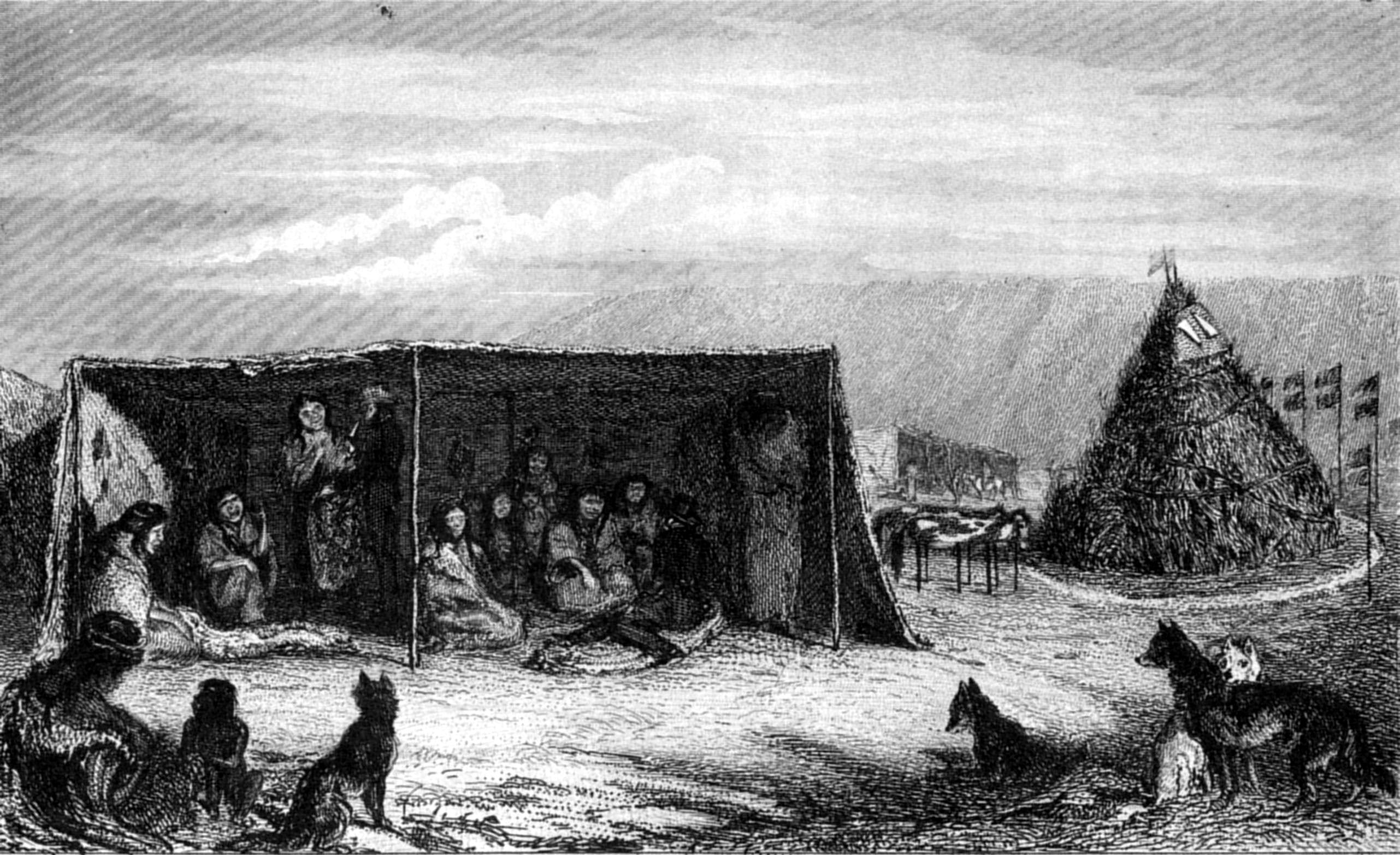
P. P. KingT. Landseer
PATAGONIAN 'TOLDO' AND TOMB.
Published by Henry Colburn, Great Marlborough Street,
1838
The Patagonian women are treated far more kindly by their husbands
than the Fuegian; who are little better than slaves, subject to be
beaten, and obliged to perform all the laborious offices of the family.
The Patagonian females sit at home, grinding paint, drying and stretching
skins, making and painting mantles. In travelling, however, they have the
baggage and provisions in their charge, and, of course, their children.
These women probably have employments of a more laborious nature than
what we saw; but they cannot be compared with those of the Fuegians, who,
excepting in the fight and chace, do every thing. They paddle the canoes,
dive for shells and sea-eggs, build their wigwams, and keep up the fire;
and if they neglect any of these duties, or incur the displeasure of
their husbands in any way, they are struck or kicked most severely.
Byron, in his narrative of the loss of the Wager, describes the brutal
conduct of one of these Indians, who actually killed his child for a most
trifling offence. The Patagonians are devotedly attached to their
offspring. In infancy they are carried behind the saddle of the mother,
within a sort of cradle, in which they are securely fixed. The cradle is
made of wicker-work, about four feet long and one foot wide, roofed over
with twigs like the frame of a tilted waggon. The child is swaddled up in
skins, with the fur inwards or outwards according to the weather. At
night, or when it rains, the cradle is covered with a skin that
effectually keeps out the cold or rain. Seeing one of these cradles near
a woman, I began to make a sketch of it, upon which the mother called the
father, who watched me most attentively, and held the cradle in the
position which I considered most advantageous for my sketch. The
completion of the drawing gave them both great pleasure, and during the
afternoon the father reminded me repeatedly of having painted his child
("pintado su hijo.")
One circumstance deserves to be noticed, as a proof of their good
feeling towards us. It will be recollected that three Indians, of the
party with whom we first communicated, accompanied us as far as Cape
Negro, where they landed. Upon our arrival on this occasion, I was met,
on landing, by one of them, who asked for my son, to whom they had taken
a great fancy; upon my saying he was on board, the native presented me
with a bunch of nine ostrich feathers, and then gave a similar present to
every one in the boat. He still carried a large quantity under his arm,
tied up in bunches, containing nine feathers in each; and soon
afterwards, when a boat from the Beagle landed with Captain Stokes and
others, he went to meet them; but finding strangers, he withdrew without
making them any present.
In the evening my son landed, when the same Indian came down to meet
him, appeared delighted to see him, and presented him with a bunch of
feathers, of the same size as those which he had distributed in the
morning. At this, our second visit, there were about fifty Patagonian men
assembled, not one of whom looked more than fifty-five years of age. They
were generally between five feet ten and six feet in height: one man only
exceeded six feet—whose dimensions, measured by Captain Stokes,
were as follows:—
| | ft. | in. |
| Height | 6 | 1¾ |
| Round the chest | 4 | 1⅛ |
| Do.loins | 3 | 4¾ |
I had before remarked the disproportionate largeness of head, and
length of body of these people, as compared with the diminutive size of
their extremities; and, on this visit, my opinion was further confirmed,
for such appeared to be the general character of the whole tribe; and to
this, perhaps, may be attributed the mistakes of some former navigators.
Magalhaens, or rather Pigafetta, was the first who described the
inhabitants of the southern extremity of America as giants. He met some
at Port San Julian, of whom one is described to be "so tall, that our
heads scarcely came up to his waist, and his voice was like that of a
bull." Herrera,[70]
however, gives a less extravagant account of them: he says, "the least of
the men was larger and taller than the stoutest man of Castile;" and
Maxim. Transylvanus says they were "in height ten palms or spans; or
seven feet six inches."
In Loyasa's voyage (1526), Herrera mentions an interview with the
natives, who came in two canoes, "the sides of which were formed of the
ribs of whales." The people in them were of large size "some called them
giants; but there is so little conformity between the accounts given
concerning them, that I shall be silent on the subject."[71]
As Loyasa's voyage was undertaken immediately after the return of
Magalhaens' expedition, it is probable that, from the impressions
received from Pigafetta's narrative, many thought the Indians whom they
met must be giants, whilst others, not finding them so large as they
expected, spoke more cautiously on the subject; but the people seen by
them must have been Fuegians, and not those whom we now recognise by the
name of Patagonians.
Sir Francis Drake's fleet put into Port San Julian, where they found
natives 'of large stature;' and the author of the 'World Encompassed,' in
which the above voyage is detailed, speaking of their size and height,
supposes the name given them to have been Pentagones, to denote a
stature of "five cubits, viz. seven feet and a half," and remarks that it
described the full height, if not somewhat more, of the tallest of
them.[72] They spoke of the
Indians whom they met within the Strait as small in stature.[73]
The next navigator who passed through the Strait was Sarmiento; whose
narrative says little in proof of the very superior size of the
Patagonians. He merely calls them "Gente Grande,"[74] and "los Gigantes;" but this might have
originated from the account of Magalhaens' voyage. He particularises but
one Indian, whom they made prisoner, and only says "his limbs are of
large size:" ("Es crecido de miembros.") This man was a native of the
land near Cape Monmouth, and, therefore, a Fuegian. Sarmiento was
afterwards in the neighbourhood of Gregory Bay, and had an encounter with
the Indians, in which he and others were wounded; but he does not speak
of them as being unusually tall.
After the establishment, called 'Jesus,' was formed by Sarmiento, in
the very spot where 'giants' had been seen, no people of large stature
are mentioned, in the account of the colony; but Tomé Hernandez, when
examined before the Vice-Roy of Peru, stated, "that the Indians of the
plains, who are giants, communicate with the natives of Tierra del Fuego,
who are like them."[75]
Anthony Knyvet's account[76] of Cavendish's second voyage (which is
contained in Purchas), is not considered credible. He describes the
Patagonians to be fifteen or sixteen spans in height; and that of these
cannibals, there came to them at one time above a thousand! The Indians
at Port Famine, in the same narrative, are mentioned as a kind of strange
cannibals, short of body, not above five or six spans high, very strong,
and thick made.[77]
The natives, who were so inhumanly murdered by Oliver Van Noort, on
the Island of Santa Maria (near Elizabeth Island), were described to be
nearly of the same stature as the common people in Holland, and were
remarked to be broad and high-chested. Some captives were taken on board,
and one, a boy, informed the crew that there was a tribe living farther
in-land, named 'Tiremenen,' and their territory 'Coin;' that they were
"great people, like giants, being from ten to twelve feet high, and that
they came to make war against the other tribes,[78] whom they reproached for being eaters
of ostriches!"[79]
Spilbergen (1615) says he "saw a man of extraordinary stature, who
kept on the higher grounds to observe the ships;" and on an island, near
the entrance of the Strait, were found the dead bodies of two natives,
wrapped in the skins of penguins, and very lightly covered with earth;
one of them was of the common human stature, the other, the journal says,
was two feet and a half longer.[80] The gigantic appearance of the man on
the hills may perhaps be explained by the optical deception we ourselves
experienced.
Le Maire and Schouten, whose accounts of the graves of the Patagonians
agree precisely with what we noticed at Sea Bear Bay, of the body being
laid on the ground covered with a heap of stones, describe the skeletons as
measuring ten or eleven feet in length, "the skulls of which we could put
on our heads in the manner of helmets!"
The Nodales did not see any people on the northern side of the Strait;
those with whom they communicated were natives of Tierra del Fuego, of
whose form no particular notice is taken.
Sir John Narborough saw Indians at Port San Julian, and describes them
as "people of a middling stature: well-shaped. ... Mr. Wood was taller
than any of them." He also had an interview with nineteen natives upon
Elizabeth Island, but they were Fuegians.
In the year 1741, Patagonian Indians were seen by Bulkley and his
companions. They were mounted on horses, or mules, which is the first
notice we have of their possessing those animals.
Duclos de Guyot, in the year 1766, had an interview with seven
Patagonian Indians, who were mounted on horses equipped with saddles,
bridles, and stirrups. The shortest of the men measured five feet eleven
inches and a quarter English. The others were considerably taller. Their
chief or leader they called 'Capitan.'
Bougainville, in 1767, landed amongst the Patagonians. Of their size
he remarks: "They have a fine shape; among those whom we saw, not one was
below five feet ten inches and a quarter (English), nor above six feet
two inches and a half in height. Their gigantic appearance arises from
their prodigiously broad shoulders, the size of their heads, and the
thickness of all their limbs. They are robust and well fed: their nerves
are braced and their muscles strong, and sufficiently hard, &c." This
is an excellent account; but how different is that of Commodore Byron,
who says, "One of them, who afterwards appeared to be chief, came towards
me; he was of gigantic stature, and seemed to realise the tales of
monsters in a human shape: he had the skin of some wild beast thrown over
his shoulders, as a Scotch Highlander wears his plaid, and was painted so
as to make the most hideous appearance I ever beheld: round one
eye was a large circle of white, a circle of black surrounded the other,
and the rest of his body was streaked with paint of different colours. I
did not measure him; but if I may judge of his height by the proportion
of his stature to my own, it could not be less than seven feet. When this
frightful colossus came up, we muttered somewhat to each other as a
salutation, &c."[81]
After this he mentions a woman "of most enormous size;" and again, when
Mr. Cumming, the lieutenant, joined him, the commodore says, "Before the
song was finished, Mr. Cumming came up with the tobacco, and I could not
but smile at the astonishment which I saw expressed in his countenance
upon perceiving himself, though six feet two inches high, become at once
a pigmy among giants, for these people may, indeed, more properly be
called giants than tall men: of the few among us who are full six feet
high, scarcely any are broad and muscular, in proportion to their
stature, but look rather like men of the common bulk grown up
accidentally to an unusual height; and a man who should measure only six
feet two inches, and equally exceed a stout well-set man of the common
stature in breadth and muscle, would strike us rather as being of a
gigantic race, than as an individual accidentally anomalous; our
sensations, therefore, upon seeing five hundred people, the shortest of
whom were at least four inches taller, and bulky in proportion, may be
easily imagined."[82]
This account was published only seven years after the voyage, and the
exaggeration, if any, might have been exposed by numbers. There can be no
doubt, that among five hundred persons several were of a large size; but
that all were four inches taller than six feet must have been a mistake.
The commodore says, that he "caused them all to be seated," and in that
position, from the length of their bodies, they would certainly appear to
be of very large stature.[83]
Shortly afterwards, Wallis, in the neighbourhood of Cape Virgins,
communicated with the same people, and as the story of the Patagonian
giants had been spread abroad, and was very much discredited, he carried
two measuring rods with him; and says, in his narrative, "We went round
and measured those that appeared to be the tallest. One was six feet
seven inches high, several more were six feet five, and six feet six
inches; but the stature of the greatest part of them was from five feet
ten to six feet."
In the voyage of the Santa Maria de la Cabeza,[84] 1786, it is related that the height of
one or two Patagonians, with whom the officers had an interview, was six
feet eleven inches and a half (of Burgos), which is equal to six feet
four inches and a half (English). This man wore a sword, on which was
engraved "Por el Rey Carlos III.," and spoke a few words in Spanish,
proofs of his having had communication with some of the Spanish
settlements. It does not, however, appear from the account that there
were many others, if any, of that height.
Of all the above accounts, I think those by Bougainville and Wallis
the most accurate. It is true, that of the number we saw, none measured
more than six feet two inches; but it is possible that the preceding
generation may have been a larger race of people, for none that we saw
could have been alive at the time of Wallis's or Byron's voyage. The
oldest certainly were the tallest; but, without discrediting the accounts
of Byron, or any other of the modern voyagers, I think it probable that,
by a different mode of life, or a mixture by marriage with the southern
or Fuegian tribes, which we know has taken place, they have degenerated
into a smaller race, and have lost all right to the title of giants; yet
their bulky, muscular forms, and length of body, in
some measure bear out the above accounts; for had the present generation
proportionate limbs, they might, without any exaggeration, justify the
account of Commodore Byron. The Jesuit Missionary Falkner,[85] who, from an intercourse
of forty years with the Indians of South America, must be considered as
one of the best authorities, says, speaking of a Patagonian named
Cangapol, "This chief, who was called by the Spaniards the Cacique
Bravo,[86] was tall and
well-proportioned; he must have been seven feet and some inches in
height, because on tiptoe I could not reach the top of his head: I was
very well acquainted with him, and went some journeys in his company: I
do not recollect ever to have seen an Indian that was above an inch or
two taller than Cangapol. His brother Sausimian was but about six feet
high. The Patagonians or Puelches are a large-bodied people; but I never
heard of that gigantic race which others have mentioned, though I have
seen persons of all the different tribes of the Southern Indians."
This is an account in 1746, only twenty years before that of
Bougainville. Taking all the evidence together, it may be considered,
that the medium height of the males of these southern tribes is about
five feet eleven inches. The women are not so tall, but are in proportion
broader and stouter: they are generally plain-featured. The head is long,
broad and flat, and the forehead low, with the hair growing within an
inch of the eyebrows, which are bare. The eyes are often placed
obliquely, and have but little expression, the nose is generally rather
flat, and turned up; but we noticed several with that feature straight,
and sometimes aquiline: the mouth is wide, with prominent lips, and the
chin is rather large; the jaws are broad, and give the face a square
appearance; the neck is short and thick; the shoulders are broad; the
chest is broad, and very full; but the arm, particularly the fore-arm, is
small, as are also the foot and leg; the body long, large and fat, but
not corpulent. Such was the appearance of those who came under my
observation.
As to their character, the Patagonians are friendly, without that
disposition to quarrel, after the novelty of first acquaintance has worn
off, which is so common among savages in general. This probably arises
from interested motives, certainly not from fear, unless it be the fear
of being avoided instead of visited by the ships which pass by, and from
which they procure many useful articles, and many temporary
gratifications.
Swords, long knives, tobacco, Paraguay tea, bits, saddles, guns, lead
for balls, red cloth, beads (particularly of a sky-blue colour), flour,
sugar, and spirits, are much desired in exchange for their peltry and
guanaco meat; but they have no idea beyond that of satisfying the wants
of the moment.
After a few pounds of tobacco had been distributed amongst them,
although they are very fond of smoking, it became quite a drug, and it
was necessary to produce something new to excite their attention. From
Maria's influence, and the reference so constantly made to her, it would
seem that she was considered as cacique of the tribe; but her apparent
superiority may arise from her connexion with Bysante, of whom they all
spoke as 'El Cacique Grande,' or from the attention paid to her by ships
with whom they communicate.
The people of this tribe seemed to live together harmoniously; no
bickerings or jealous feelings were observed, and certainly none were
expressed by any one of our bulky friends on witnessing another receiving
a valuable present, or a good exchange for his property.
At sunset our people were ordered to embark, upon which the price of
Patagonian goods immediately fell, at least, a thousand per cent., though
many held back in expectation of the next day. Maria put
into the boat, after my refusal to let her go on board to pass the night,
two bags, and asked me to send her flour and sugar. She was most
importunate for aqua ardiente, which, however, I refused. Her constant
cry was "It is very good to be drunk; I like drinking very much; rum is
very good.—Give me some?" ('Muy bueno es boracho, mucho mi gusta,
mucho mi gusta de beber, muy bueno es aqua ardiente.—Da me no
mas?')
Among them was a Fuegian Indian; but it did not appear clearly whether
he was living with them permanently, or only on a visit. Some of us
thought we understood the account of one of the Patagonians, who seemed
to be the most interested about him, to be, that a master of a sealer had
left him amongst them. We knew him instantly by his squalid and
comparatively diminutive appearance, and were confirmed in our ideas by
his recognition of the words 'Hosay' and 'Sherroo.' The Patagonian name
for a ship is 'Carro grande,' and for a boat 'Carro chico,' a mixture of
their own and the Spanish language. All that I could understand of his
history was, that he was Cacique of some Indian tribes at a distance: he
was evidently a great favourite, and although Maria spoke generally with
much contempt of the Fuegian Indians, she had patronised this stranger,
for he lived in her toldo, and shared all the presents that were made to
her.
The following morning it rained hard, and blew so fresh a gale, from
the westward, that it would have been dangerous to send a boat on shore:
and I was obliged to weigh without landing the things which I had
promised. After we were under weigh, the weather cleared partially, when
we observed Maria on the beach, mounted on her white horse, with others
watching our departure, and when it was evident that we were really gone,
she rode slowly back to her toldo, no doubt considerably vexed. I was
very sorry to treat them in this way, for their conduct towards us had
been open and friendly. All I could hope to do, to make amends, was to
give something of value at my return.
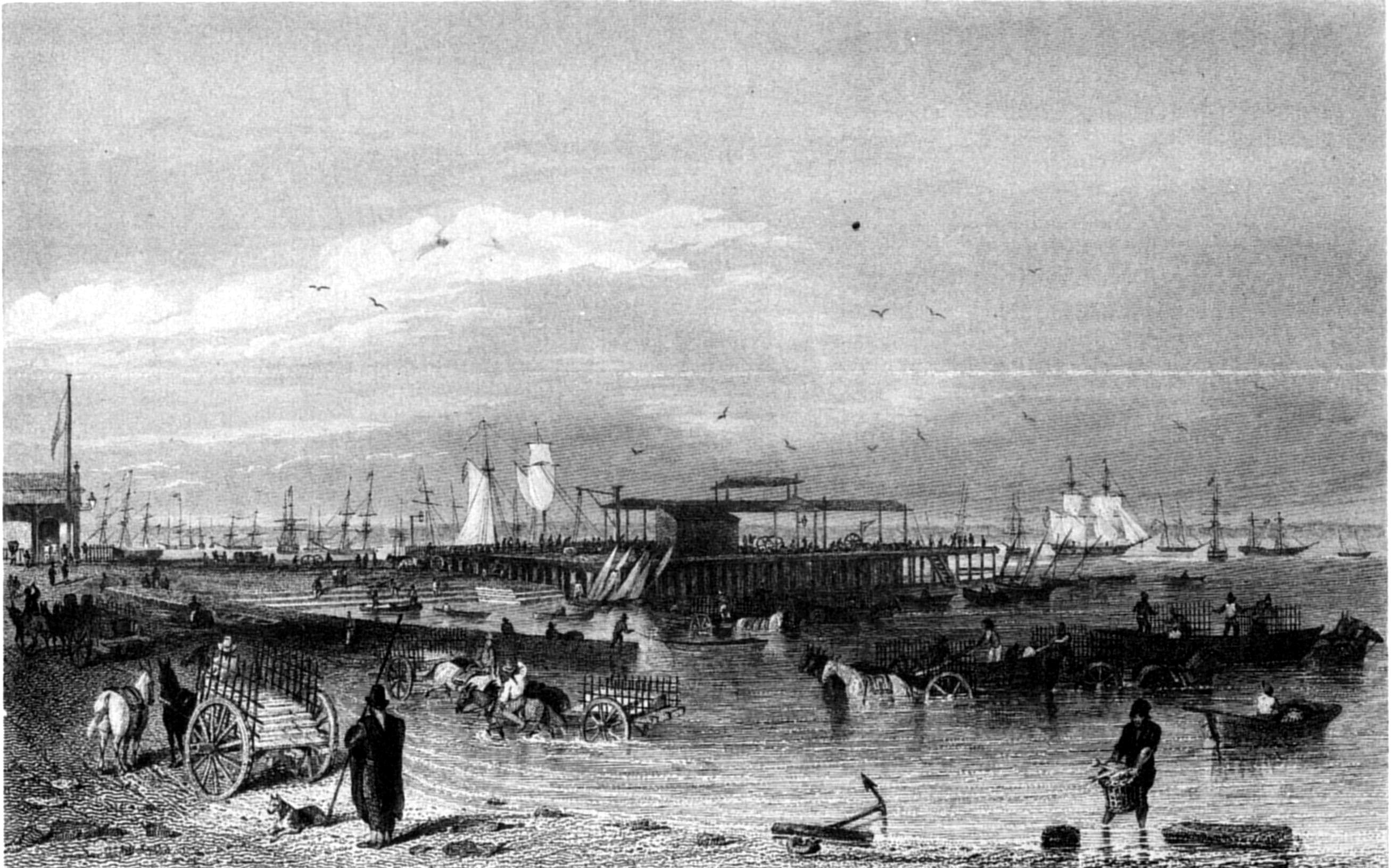
A. EarleT. A. Prior
MONTE VIDEO, MOLE.
Published by Henry Colburn, Great Marlborough Street,
1838
We steered across the Bay of St. Philip, accompanied by the Beagle,[87] left the Strait of
Magalhaens with a fair wind, and, after a favourable passage, reached
Monte Video on the 24th April 1827.
From Monte Video we went to Rio de Janeiro, to procure stores, and
prepare for another voyage to the Strait. On our arrival I received the
Commander-in-chief's leave to apply to the Lord High Admiral for
permission to employ a tender, to facilitate the surveys of the sounds
and deep channels, in the neighbourhood of the Strait, and the inner
sounds on the west coast; for which, neither the Adventure, nor the
Beagle, were adapted; and I thought it best to delay our departure until
an answer to my application was received.
Leave Rio de Janeiro—Santos—St. Catherine's—Monte
Video—Purchase the Adelaide schooner, for a Tender to the
Adventure—Leave Monte Video—Beagle goes to Port
Desire—Shoals off Cape Blanco—Bellaco Rock—Cape
Virgins—Possession Bay—First Narrow—Race—Gregory
Bay—View—Tomb—Traffic with Natives—Cordial
meeting—Maria goes on board—Natives intoxicated—Laredo
Bay—Port Famine.
We were ready to resume our voyage early in September (1827); but not
having received any communication by the packet, from the Admiralty,
relative to the purchase of a tender, I determined to await the arrival
of the next, early in October. I was again disappointed, and very
reluctantly left Rio de Janeiro, on the 16th, for Monte Video; but that I
might still benefit by the orders which were sure to be in the following
packet, I determined upon calling at Santos, and St. Catherine's, for
chronometrical observations; leaving the Beagle to wait for letters
conveying the decision of his Royal Highness the Lord High Admiral.
We reached Santos on the 18th, and staid there until the 28th. In this
interval I paid a short visit to St. Paul's, for the purpose of making
barometrical observations.[88] At St. Catherine's we remained eight
days, and during the interval necessary for ascertaining the rates of the
chronometers, I obtained magnetic observations.
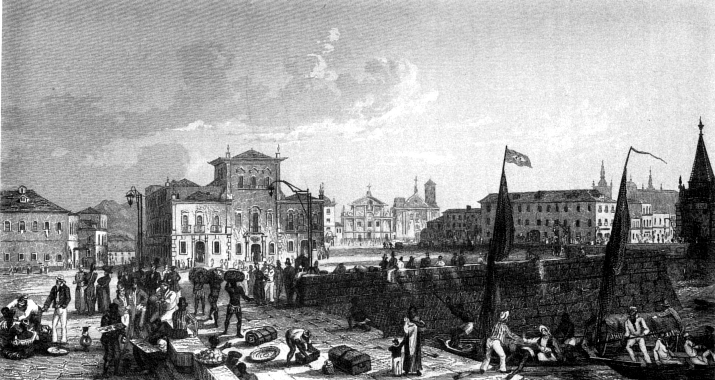
A. EarleT. Hair
MOLE, PALACE AND CATHEDRAL, RIO DE JANEIRO.
Published by Henry Colburn, Great Marlborough Street,
1838
After a tedious voyage of nineteen days from St. Catherine's, I
arrived at Monte Video, and there received intelligence that the
long-wished permission from the Lord High Admiral, to procure a tender,
had been obtained. I accordingly purchased a schooner, which I named the
Adelaide, and appointed Lieutenant Graves to the command. Five months'
additional provisions for both vessels were purchased, and put into her;
and on the 23d December, after running up the river to complete our
water, we sailed out by the southern entrance, passing to the westward of
the Archimedes' Shoal, and proceeded without farther detention to the
southward.
On the 1st of January (in latitude 43° 17′ and long. 61° 9′), I was informed that we were close to a rock.
Upon going on deck, I saw the object; but in a very short time I
perceived it was a dead whale, upon whose half-putrid body large flocks
of birds were feeding. Many on board were, however, sceptical, until, on
passing to leeward, the strong odour testified the fact. Its appearance
certainly was very like the summit of a dark brown rock, covered with
weeds and barnacles, and the myriads of birds which surrounded it added
to the deception. It could, however, be distinguished by its buoyancy;
for the water did not break over it, as of course it would have done had
it been a fixed body. Such is probably the origin of half the 'vigias'
that are found on the charts. Whales, when struck by the fishers,
frequently escape and perish; the carcass then floats on the surface of
the sea, until decomposed or eaten by birds and fishes. A small vessel
striking against such a mass, would probably be severely injured; and at
night, the body, from its buoyancy and the sea not
breaking against it, would not be readily seen.
On the 4th, being about one hundred miles to the N.E. of Cape Blanco,
I communicated with Captain Stokes, and gave him directions to proceed to
Port Desire for chronometrical observations, and then follow me
immediately to Cape Fairweather or Cape Virgins. We had light winds
during the night, so that the Beagle made very little progress. In the
afternoon, Cape Blanco, a long level-topped ridge, came in sight, of
which good views are given in Lord Anson's voyage. We steered towards the
land, and at six o'clock were in eighteen fathoms, the rocky hill at the
extremity of the Cape bearing S. 10° E. thirteen miles; at seven o'clock,
the same hill was six miles and a half off, bearing S. 3° E., when we
observed a line of rippling water, extending from east to as far as we
could see on the south horizon. The depth was seventeen fathoms, but as
we proceeded it gradually decreased to twelve and ten, and soon
afterwards to seven fathoms, when the Beagle was observed to be firing
guns; but whether they were intended to warn us of danger, or as signals
of her own distress, we could not determine, and I hauled to the wind to
cross where the ripple appeared least violent. In passing through it we
had not less than seven fathoms, and then it deepened to twelve and
fifteen fathoms. We had now leisure to attend to the Beagle, and soon saw
that her signals were only to warn us, for she had resumed her course
under a press of sail.
After steering four miles to the S.E., we again found ourselves in the
midst of ripplings, in which the water shoaled to six fathoms. It being
then dark, and not knowing how to proceed, we shortened sail and brought
to the wind, in order that if the ship struck it might be with less
force; but happily we passed on without any further decrease of
soundings. In going through the ripple, the Adelaide, though deeply
laden, behaved well.
Commodore Byron passed over these shoals, which he describes as lying
at a greater distance from the shore: it was to avoid them that we passed
so near the land.
During the following evening there was a very heavy dew, the
never-failing prognostic of a northerly wind; the horizon, also, was very
hazy, and the water perfectly smooth. We were not more than ten miles off
shore, yet the land was completely distorted in appearance by mirage.
Next morning we were very close to the position assigned to the
Bellaco, or St. Estevan's Shoal, the existence of which has been very
much doubted. It was discovered by the Nodales, and in the diary of their
voyage is thus described: "At five o'clock, or later in the evening, we
discovered a rock a-wash ('una baxa que lababa la mar en ella') about
five leagues from the shore, more or less. It is a very deceitful rock
('Es muy bellaco baxo'), because it is under water, over which, in fine
weather and smooth water, the sea breaks. We sounded near it, and found
twenty-six fathoms stony bottom. Its latitude is 48½°, according to our
noon observation, and the course and distance we have since run."[89]
The late Don Felipe Bauza, one of the companions of Malespina,
informed me, that on the voyage of the Descubierta and Atrevida, their
boats were sent to look for it, but were unsuccessful.
At noon we were in lat. 48° 40′ S., long. 66° 6′, depth forty-two fathoms, but without any
signs of the Bellaco. Sailing on, the coast was seen in the neighbourhood
of Beachy Head (so named from its resemblance to the well-known
promontory). Afterwards, Cape Fairweather came in sight, and on the 10th
Cape Virgins, which we passed in the evening, and, half an hour
afterwards, rounding Dungeness, we again entered the Strait of
Magalhaens; and anchored near the northern shore.
In Possession Bay we were detained several days, although repeated
attempts to pass the First Narrow were anxiously made.
One evening, clouds gathered, and the weather assumed such a
threatening appearance, that I expected to be obliged to run to sea; but
to our surprise, when the cloudy mass seemed on the point of bursting
over us with a deluge of rain, it suddenly vanished, and was succeeded by
a beautifully clear and fine night. This favourable appearance gave us
hopes of being able to make good our entrance on the following day; but a
fresh gale set in, and kept us at our anchorage.
Early on the 14th we made another fruitless attempt to pass the First
Narrow. As the Adelaide sailed under our stern, Lieutenant Graves
informed me that he had lost an anchor, and had only one left, to which
he had bent his chain-cable; and that she had shipped so much water in
attempting to beat through, that he was on the point of asking permission
to bear up when we ourselves gave up the attempt. It blew too hard to
give any assistance to the Adelaide, but next morning, when the weather
was more moderate, I seized an opportunity of sending our two kedge
anchors; and in the afternoon we supplied her with some water and other
necessaries, so that she was comparatively well off, and my anxiety on
her account much relieved.
Fires on the Fuegian side had been kept up since our arrival, but we
could not distinguish any inhabitants; on the Patagonian shores we saw a
great number of guanacoes feeding quietly, a proof of there being no
Indians near them.
On the 16th, the weather appearing favourable, our anchor was weighed,
and, with the Adelaide, we soon entered the sluice of the Narrow,
proceeding rapidly, though the wind blew hard against us. The tide
carried us to an anchorage, about four miles beyond the western entrance,
and it was slack water when the anchor was dropped; but, no sooner had
the stream turned, than we found ourselves in the midst of a 'race,' and
during the whole tide, the water broke furiously over the ship. At slack
water we got underweigh, but the Adelaide not being able (from the
strength of the tide), to purchase her anchor, was obliged to slip the
cable: it was fortunate that we had supplied her with our kedges, or she
would then have been without an anchor. The night was tempestuous, and
although we reached a much quieter birth, the Adelaide drifted
considerably; had she remained at the morning's anchorage, in order to
save her anchor and cable, we should probably never have seen her
again.
The succeeding morning, after a hard beat to windward, both vessels
anchored in Gregory Bay. No Indians were in the neighbourhood, or we
should have seen their fires. In the afternoon the wind moderated, and as
there was every appearance of fine weather, I remained to survey the
coast.
On the summit of the land, about half a mile northward of the
extremity of the Cape, while Lieutenant Graves and I were taking
bearings, and making observations, two guanacoes came up and stood
neighing at us; the observation, however, was of consequence, and as they
were not disturbed, they remained watching us for some minutes before
they took alarm and fled.
Lieutenant Wickham and Mr. Tarn made an excursion to the summit of the
Table Land, previously described as extending from the low land behind
the Second Narrow to the N.E., in the direction of Mount Aymond, and were
amply repaid for a fatiguing walk, with the thermometer at 81°, by a
magnificent view: Cape Possession to the eastward, and to the south the
mountains near Mount Tarn, eighty miles distant, were plainly
distinguished. The view to the westward, stretching over a large extent
of grassy plains, was bounded by lofty ranges of snow-capped mountains;
but to the north it was intercepted by another summit of the mountain
upon which they stood. The country they passed over was covered with
short grass, through which a mass of granite occasionally protruded.
Neither trees nor shrubs were observed, excepting a few herbaceous
plants, and the berberis; a goose, some ducks, snipe, and plovers were
shot; and guanacoes were seen at a distance, but no ostriches, nor did
they meet any Indians. Large fires were, however, kindled on both shores
of the Strait, in answer to the fire which they made for cooking. In
consequence of those on the Patagonian coast appearing so close to us, we
expected a visit from the natives before night, but none made their
appearance.
Next morning, Mr. Graves accompanied me in a boat to a station three
miles within the Second Narrow on the north side, and in our way we found
the geological structure of the cliffs to be of a decomposed clay-slate,
arranged in strata, much distorted by the violent action of the water,
and dispersed in vertical and inclined directions in very thin
laminæ.
These cliffs are about one hundred feet high, the soil a sandy
alluvium, of a sterile character, scantily covered with a wiry, stunted
grass, and here and there a berberis bush, loaded with ripe fruit, which,
from the poverty of the soil, was tasteless and dry; the ground was also,
in many parts, over-run to a considerable extent with an insipid
cranberry, scarcely worth the trouble of gathering.
We struck across the country, with the view of examining the place
where the Indians were residing at our last visit, and the tomb which had
then been erected. Grass had grown up, and effaced the traces of feet;
but the tomb had suffered no farther alteration than the weather might
have effected. We found that the place had been recently visited by the
natives, for within a few yards of the entrance were strewed the ashes of
a large fire, containing vestiges of the former decorations of the tomb,
and the end of one of the flag-staffs, with the unburnt corner of one of
the banners. Amongst the ashes, also, we found calcined bones; but
whether they were human or not, we could not ascertain.
The discovery of the bones impressed us with the idea that the body
had been burnt, and determined me to examine the tomb. The bushes that
filled up the entrance appeared to be placed exactly as when we first saw
them, and indeed the whole pile seemed to have remained quite
undisturbed; but there was no appearance of the brass ornaments, or of
the effigies of the horses.
Having effected an opening in the bushes, we found an inner covering,
made of horse-skins. Having cut two holes opposite each other, for the
admission of light, we saw nothing but two parallel rows of stones, three
in each row, probably intended as a bier for the body or a covering for
the grave; but the ground around and between them bore no appearance of
having been disturbed for burial.[90] As we hourly expected the Indians would
arrive (the place being in the direct line of their journey to the
ships), and were unwilling to let them know we had disturbed the
sanctuaries of their dead, we restored the former appearance of the tomb;
and it was fortunate we did so, for three women on horseback, carrying
their children in cradles, with a quantity of skins, provisions, and
other merchandise, evidently the harbingers of the tribe, made their
appearance, and immediately began to erect their tents.
When we next went on shore we found several Indians arrived, and
divided into three groups, with mantles, ostrich-feathers, skins, and
joints of guanaco meat displayed for sale.
As the meat appeared fresh, it is probable that, on seeing us, the
women were despatched to place the toldos, while the men set out to
provide guanaco meat, for they knew our partiality for this excellent
food. When we landed, an active barter began.
From the haste and avidity shown in offering their goods, and closing
the bargains, it seemed as if they were anxious to monopolize our
articles of barter before the rest of their party, or tribe arrived. One
old man attempted to cheat; but my interdiction of all farther traffic
with him brought him to a sense of his error, and I then made him a
present of some tobacco and allowed him to trade, which he afterwards
did, with cheerfulness and honesty.
One of the party was the Fuegian chief, whom I previously noticed, as
a squalid, meagre-looking man; but he was now enlarged to Patagonian
dimensions, by his improved diet and more cheerful mode of life. The
appearance of bad weather obliged us to suspend the barter and get on
board. After we had reached the ship, successive parties of the tribe
arrived, and formed the encampment. Among them,
mounted on her white horse, was Maria, who, duly escorted, paraded on the
beach to challenge our recognition. In the centre of the encampment, a
large flag suspended from a pole was a signal to us, and showed the
position of her toldo.
The next morning being fine, we landed near the encampment, and were
most cordially received. Maria was particularly attentive, and embraced
me closely, while her companions chaunted in chorus a song of delight at
our arrival.
When we reached her toldo, a mat was spread out for me to sit on.
Maria and her family placed themselves in front of me, while the rest sat
round. Almost the first question was an inquiry for my son Philip, whom
they called Felipe,[91] and
two or three skins were given to me for him. They then asked for our
pilot on the former voyage, and were much disappointed to find he had
left the ship. After a short conversation I returned the two bags (which
I had so unwillingly carried away at our last visit), having filled them
with flour and sugar, and then proceeded to deliver our presents. As each
article was delivered into her hands, she repeated, in Spanish, I'll pay
for this; but upon a bit for her horse being presented, a general burst
of admiration followed, and it was handed round the tents, whilst each
individual, as it passed on, looked, I thought, anxious to be its
possessor.
Maria then began to consider what adequate requital she could possibly
make me. The result was, a present of two mantles, one new, of guanaco
skin, and the other well worn, of zorillo skin, besides two or three
skins of the puma. She then produced a piece of paper, carefully wrapped
up in canvas, containing a letter, or memorandum, left by Mr. Low, master
of the Uxbridge sealer, addressed to any shipmaster passing through the
Strait, apprising him "of the friendly disposition of the Indians, and
impressing him with the necessity of treating them well, and not
deceiving them; for they had good memories, and would seriously resent
it."
The advice, no doubt, was good; but I think the fear of forfeiting
advantages and comforts to be derived from traffic would induce them to
restrain their resentment.
I brought no spirits; for which, after a short time, Maria asked,
complaining that she was very ill, and had sore eyes, and for some time
past had nothing but water to drink, and wood to smoke. Her illness was
evidently assumed, but her eyes seemed highly inflamed; and no wonder,
for the upper part of her face was smeared over with an ochrous red
pigment, even to the very edge of her eyelids: indeed, the whole tribe
had ornamented themselves similarly, in compliment, I suppose, to our
visit.
As I prepared to return on board, Maria's importunity induced me to
allow her to accompany me; upon which she began to muster up all her
empty bags, old mantles, and skins, and, attended by her husband, her
brother-in-law, his wife and daughter, got into the boat. While going on
board, the spray washed the painted countenances of our visitors, much to
their regret.
Upon reaching the ship, I ordered them to be regaled with meat and
biscuit, of which they partook very sparingly, but took care to put what
remained into their bags. Some spirits and water, too, which I thought
would be soon dispatched, and which had been plentifully diluted to
prevent their being made tipsy, they emptied into bottles to take on
shore "for the evening," when, as Maria said, they would be "very
drunk."
Among various things shown to amuse them was a musical snuff-box,
which I had procured for the express purpose of exciting their
astonishment; but I was surprised to find, that a penny-whistle produced
a ten-fold greater effect upon their senses. This indifference to musical
sounds I should not have suspected, because they frequently sing, though
certainly in a monotonous manner.
As soon as their repast was concluded, the party, except Maria and the
girls, commenced bartering their mantles and skins, and, by the time
their stock was expended, they had amassed a large quantity of biscuit,
and a bundle of various trifles, some of which they had attempted
to get by pilfering. They made themselves so contented, that it was not
without much difficulty we could persuade them to go on shore. Maria had
made her mind up to pass the night on board, and so anxious were they all
to remain, that it was only by giving Maria two bottles of spirits (which
had been well diluted) that they were induced to get into the boat, and
accompany me ashore. Being a lee-tide, and low water, the boat grounded
at a considerable distance from the beach; seeing this, some of the
Indians rode into the water, and taking us up behind them, conveyed us to
the encampment, my place being behind Maria, the smell of whose
zorillo-skin mantle was hardly bearable; but it was necessary to conceal
our dislike of our companions as much as possible, for they are very
sensitive, and easily offended.
While waiting for the tide, we witnessed a drunken scene at Maria's
toldo. Fifteen persons, seated around her, shared the spirits she had
obtained on board, until all were intoxicated. Some were screaming,
others laughing, some stupified, and some bellowing. The uproar drew all
the other Indians round the tent, who tendered their assistance to
compose their friends, and we returned to the ship. When we visited them
the next day, they were quite recovered, and gave us some guanaco meat,
which had been brought in that morning. On communicating my intention of
proceeding on the voyage, Maria wished to know when we should finish our
"seal-killing," and come back. I told her "in five moons," upon which she
endeavoured to persuade me to return in four, because she would then have
plenty of skins to barter.
I wrote a few lines to Captain Stokes, who, I expected, would arrive
in a day or two, communicating my desire that he should follow, as soon
as possible, to Port Famine, and committed the letter to Maria's care,
who promised to deliver it to him; then, taking leave of her and her
companions, I embarked, and proceeded through the Second Narrow to an
anchorage off Cape Negro.
Our visit to Gregory Bay, and communication with the Indians,
furnished us with many additions to our zoological collection; among them
was a tiger-cat, which seemed, from the description, to be the Felis
pajaros of the Encyclopédie Méthodique (the "Chat de Pampa" of
D'Azara). Maria gave me a very large bezoar stone, that was taken from
the stomach of a guanaco. It is used medicinally by the Indians, as a
remedy for bowel complaints.[92]
Whilst we were at the anchorage before Cape Negro, Mr. Tarn and Mr.
Wickham visited the lake at the back of Laredo Bay, and saw two swans,
which, from the colour of their plumage, seemed to be the black-necked
swan of the River Plata and of the Falkland Islands[93] (Dom Pernettey, ii. p. 148). They
brought on board with them a new species of duck, which is described in
the proceedings of the Zoological Society as Anas specularis
(Nob.), and a small burrowing animal, of the rat tribe, that, from the
character of its teeth, is probably of a genus not hitherto noted: it
approaches nearest to F. Cuvier's Helamys.
We next anchored in Port Famine, where the tents, &c. were
replaced in their former positions, the ship was unrigged and secured for
the winter, and all hands set to work, preparing the Adelaide for
service.
Find that the Cutter had been burned—Anxiety for the
Beagle—Uxbridge Sealer—Beagle arrives—Her
cruize—Bellaco Rock—San Julian—Santa
Cruz—Gallegos—Adeona—Death of Lieutenant
Sholl—Adelaide Sails—Supposed Channel of San
Sebastian—Useless Bay—Natives—Port San
Antonio—Humming-birds—Fuegians—Beagle sails—Sarmiento—Roldan—Pond—Whales—Structure—Scenery—Port
Gallant.
Port Famine bore evident marks of having been visited in our absence
by the Indians, for a large fire, apparently recent, had over-run the
grass, and burned the trees upon Point Santa Anna, particularly in that
part where our boat had been so carefully concealed. Eager to know
whether she had escaped the fire, I lost no time in hastening to the
spot, directly after the Adventure anchored, and found, as our fears had
anticipated, that she had been completely destroyed, scarcely a vestige
of her wood remaining, and most of the iron-work having been carried
away; for which, doubtless, the Indians had set her on fire.
The sheds for the cooper and armourer, which had been erected with
some pains, were also entirely consumed, and every thing portable had
been carried away. Those things which were of no use to them were either
broken or burnt; but some of our station poles on Point Santa Anna were
left uninjured; as well as the tablet erected to the memory of Mr.
Ainsworth and the boat's crew; which was singular, because it was secured
by iron hoops—of great value, in their eyes.
From the fresh traces of horses in the neighbourhood, we at first
suspected the conflagration to have been caused by the Patagonians; but
we soon found we owed our loss to the Fuegians, for in two new wigwams
were strewed some remains of our boat.
The last winter appeared to have been milder than that preceding it,
for last January, Mount Sarmiento and the hills to the southward, over
Fitton Bay, were so covered with snow, that not a particle of the rock
could be seen; but this year many bare spots were visible. Every thing
else, however, indicated a bad season, and the berberis bushes and
arbutus shrubs had scarcely any show of fruit; which was rather a
disappointment, as the berries of the former plant proved an agreeable
addition to our food last year. However, there was no scarcity of birds,
and with the seine we procured plenty of fish.
The Beagle's long and unexpected absence caused us much uneasiness,
and some apprehension for her safety. Her visit to Port Desire ought not
to have occupied more than three days, and her superior sailing should
have enabled Captain Stokes to rejoin us in the entrance of the Strait.
People were sent daily to look out for her, and every succeeding day
increased our anxiety.
A long succession of blowing and rainy weather much impeded our
progress with the Adelaide; but the Hope was hoisted out, and prepared
for service.
Before daylight on the 14th I was informed that the Beagle was seen in
the offing. Blue lights were burnt, and lanterns immediately shown to
guide her to the anchorage; but our disappointment was great when the
stranger proved to be Mr. W. Low's schooner, the Uxbridge. He had been
sealing since November in the neighbourhood of Noir Island, near the
outer entrance of the Barbara Channel, and was on his way to Cape Gregory
to meet his elder brother, who had been collecting sea-elephant oil at
South Shetland. The Uxbridge had entered the Strait from the Pacific, by
the Magdalen 'Channel,' which last year we thought a Sound, and had
attempted to explore in the Hope, but had been deceived by the abrupt
change in the direction of the Channel at Cape Turn.
At last (on the 28th), after the Beagle's absence had been protracted
to more than a month beyond the time intended, we were relieved from
painful anxiety, and much rejoiced, by Mr. Tarn's telling us he had just
seen her, and in two hours afterwards she arrived.
Captain Stokes, to my great surprise, told me that he had been
examining the whole coast between Port Desire and Cape Virgins, and for
the last ten days had been detained in the Gallegos River by heavy gales
of wind. He had sounded round, and fixed the position of the Bellaco
Rock, or St. Estevan's Shoal, the existence of which had been so long
doubted. He had also visited and partially surveyed, the harbours of Port
San Julian and Santa Cruz, besides Coy Bay, and had made almost a
complete survey of the River Gallegos, which he found to be a large and
rapid river, whose entrance forms a spacious port: instead of being
blocked up by a mound of shingle four or five feet above the level of the
sea, and having so small a stream as to escape the notice of Mr. Weddell
as he walked along the beach.[94] Cape Fairweather is so remarkable, and
so correctly placed upon the chart, that Mr. Weddell, in his search for
the river, must have very much deceived himself. I should think he must
have mistaken the ravine described upon my former visit, since that is
the only part which answers his description: it could not be Coy Bay,
because that opening, although of minor importance, has a broad boat
communication with the sea.
Captain Stokes described the tide at the anchorage, within the mouth
of the Gallegos, as running at the rate of five knots, and rising
forty-six feet. From Mr. Weddell's account, he was on the point of
passing by without examining it; but the weather being fine, he
determined to go in his boat and ascertain the truth of that description.
It was soon evident that the river was large, and, returning to his ship,
he lost no time in anchoring her within the entrance, where she rode out
a heavy gale from S.W.
The Beagle left the Gallegos on the 23d, and reached Port Famine on
the 28th, a very short passage, since she remained for a night and the
greater part of a day at Gregory Bay, to communicate with the natives.
When approaching the First Narrow, Captain Stokes observed a brig,
apparently at anchor, under Cape Orange, and supposing her either to have
found a good anchorage, or to be in distress, steered towards her. Before he had reached within two miles of
her, the Beagle touched the ground, but was extricated from the danger
most fortunately, because it was nearly high water; and had she remained
a-ground during the tide, the consequences might have been
serious—at least, she could not have been got off without
lightening her considerably. The brig proved to be the Adeona (Mr. Low's
vessel), on her way to meet the Uxbridge. In attempting to enter the
narrow, she grounded on the shoals, and had been left dry. The following
tide again floated her, and she was on the point of getting underweigh,
when the Beagle hove in sight. Captain Stokes finding that the Adeona had
received no damage, proceeded to Gregory Bay.
By the Beagle's arrival we were informed of the death of Lieutenant
Robert H. Sholl, after an illness of ten days. His remains were interred
at Port San Julian, where a tablet was erected to his memory.
This excellent young man's death was sincerely regretted by all his
friends, and by none more than by me. He was appointed to the expedition,
as a midshipman, solely on account of his high character.
During our voyage from England, he made himself conspicuously useful
in saving the cargo of a vessel, which was stranded in Port Praya; and on
our arrival at Rio de Janeiro, the Commander-in-chief appointed him to a
vacant lieutenantcy on board the Beagle: an appointment which, up to the
period of his lamented death, he filled zealously and most creditably.[95]
On the 1st of March we were surprised by the appearance of three
Europeans, walking round Point St. Anna. A boat was sent for them, and
we found they were deserters from the Uxbridge, who had come to volunteer
for our ships.
The following day the Adeona and Uxbridge arrived, on their way to
Port San Antonio, to boil their oil; but I recommended Bougainville, or
(as the sealers call it) Jack's Harbour, as more convenient for their
purpose, and more secure from storms, as well as from troublesome visits
of the natives.
Upon my offering to restore the three deserters to the Uxbridge, Mr.
Low requested me to keep them, and another, also, who was anxious to join
the Adventure, to which I consented, as the Adelaide wanted men.
A few days after Mr. Low's departure, he returned in a whale-boat to
ask assistance in repairing the Uxbridge's rudder. By our help it was
soon made serviceable, and she was enabled to prosecute her voyage, which
could not otherwise have been continued.
The Adelaide being ready for sea: her first service was to be an
examination of the St. Sebastian Channel, which, from its delineation on
the old charts, would seem to penetrate through the large eastern island
of Tierra del Fuego. In the voyage of the Nodales (in the year 1618), an
opening on the eastern coast, supposed to be the mouth of a channel,
communicating with the Strait of Magalhaens, was discovered. After
describing the coast to the south of Cape Espiritu Santo, the journal of
that voyage states: "We found, in the channel of St. Sebastian, twenty
fathoms clear ground. The north shore is a beach of white sand, five
leagues in extent, stretching out from the high land that terminates at
Cape Espiritu Santo, and giving the coast here the appearance of a deep
bay; but, on a nearer approach, a projecting tract of low shore is
observed. The south extremity of this low beach is a sandy point, round
which the channel trends; the mouth is a league and a half wide. The
south shore is higher than the land to the northward, and in the middle
of the bay the depth is from fifteen to twenty fathoms clear ground, and
a good bottom; but from mid-channel to the south shore the bottom is
stony, and the water, of little depth, there being only six and seven
fathoms. From hence the channel shows itself, and
continues, as far as we could see, of the same breadth. It seemed to be a
large sea. The latitude was observed to be 53° 16′."[96]
From the above account, and from the chart that accompanies it, in
which this inlet is made to communicate with the Strait of Magalhaens by
the opening round Cape Monmouth, our knowledge of the supposed St.
Sebastian Channel was derived. That there is a deep bay, in the latitude
of 53° 16′, not only appears from the
account of the Nodales, who were within the heads, although it seems they
did not proceed beyond the stony ground on the south side of the
entrance; but also from the accounts of vessels who have lately seen it;
and of one ship-master who was deterred from entering, by the formidable
notice on our charts of its being "only navigable for small vessels,"
whence he conjectured that the tides would be very strong, and the
channel occasionally narrow, as well as narrow, and shoal.
Sarmiento, Narborough, Byron, Wallis, Bougainville, and Cordova, have
severally noticed an opening, which corresponds to this supposed channel,
namely, that between Capes Monmouth and Valentyn; but the object of those
voyagers having been to make the passage through the known Strait, to
explore this opening was, in all probability, considered a waste of time;
yet, that such a channel was supposed to exist, we must conclude from the
conspicuous figure it makes in the charts of Tierra del Fuego.
Had there been a knowledge of its affording any communication with the
sea, surely Sarmiento and Narborough, as well as the Nodales, who
navigated the Strait from west to east, would have been induced to
attempt to pass through; and avoid the dangers, as well as difficulties,
of the channels to the northward.
Anxious to set the question at rest, I gave Captain Stokes orders to
proceed to survey the western coasts, between the Strait of Magalhaens
and latitude 47° south, or as much of those dangerous and
exposed shores as he could examine, with the means at his disposal, and
sailed myself, in the Adelaide, to explore the supposed St. Sebastian
Channel. Every discretionary power was given to Captain Stokes to act as
he pleased, for the benefit of the service; but he had strict orders to
return to Port Famine by the 24th of July, when I hoped to move the
Adventure to some other part of the Strait, and to recommence operations
with the earliest days of spring, if the winter should be unfit for our
work.
Having crossed over to the southward of Point Boqueron, we proceeded,
on the 13th of March, to the N.E. (in which direction the opening
trended), at no great distance from the northern shore; behind which the
country seemed to rise gradually to the summit of a long ridge of
table-land, terminating near the First Narrow, and appearing like that in
the neighbourhood of Cape Gregory. It was inhabited; for here and there
we observed the smoke of fires, perhaps intended as invitations for us to
land.
The south side of the opening seemed (after forming a small bay under
Nose Peak) to extend in a direction parallel to the northern coast of the
bay, for three or four leagues, when it dipped beneath the horizon.
Neither shore had any opening or indenture in its coast line, of
sufficient size to shelter even a boat; so that a vessel caught here,
with a south-westerly gale, would have little chance of escape; unless a
channel should exist, of which, from the stillness of the water and the
total absence of tide, we had very little hope. The soundings were
variable between twenty and thirty fathoms, and the bottom seemed to be
of shells, probably covering a substratum of clay or sand. As we stood
on, a small rocky lump came in sight, which appeared to be the
termination of the northern shore, and again we flattered ourselves with
the expectation of finding a passage; but in less than half an hour
afterwards, the bay was distinctly seen to be closed by low land, and the
rocky lump proved to be an isolated mass of rock, about two miles inland.
As every person on board was then satisfied of the non-existence of any
channel, we put about to return, and by bearings of Mount
Tarn, crossed by angles from Mount Graves, Nose Peak, and Point Boqueron,
our position, and the extent of this bay, were determined. As it affords
neither anchorage nor shelter, nor any other advantage for the navigator,
we have named it Useless Bay. It was too much exposed to the prevailing
winds to allow of our landing to examine the country, and its
productions, or to communicate with the Indians; and as there was not
much likelihood of finding anything of novel character, we lost no time
in retreating from so exposed a place. Abreast of Point Boqueron the
patent log gave for our run twenty-six miles, precisely the same distance
which it had given in the morning; so that from five o'clock in the
morning until ten, and from ten o'clock until four in the afternoon, we
had not experienced the least tide, which of itself is a fact
confirmatory of the non-existence of a channel.
From the fires of the natives in this part having been noticed at a
distance from the beach, it would seem that they derive their subsistence
from hunting rather than fishing; and as there are guanacoes on the south
shore of the First Narrow, it is probable the people's habits resemble
those of the Patagonians, rather than the Fuegians; but as they have no
horses, the chase of so shy and swift an animal as the guanaco must be
fatiguing and very precarious.[97]
Sarmiento is the only person on record who has communicated with the
natives in the neighbourhood of Cape Monmouth. He calls them in his
narrative a large race (Gente grande). There it was that he was attacked
by the Indians, whom he repulsed, and one of whom he made prisoner.
We remained a night in Port Famine, and again set out in the Adelaide
to survey some of the western parts of the Strait. Bad weather forced us
into Port San Antonio; of which Cordova gives so favourable an account,
that we were surprised to find it small and inconvenient, even for the
Adelaide.
He describes the port to be a mile and a half long, and three quarters
of a mile broad: we found the length a mile and a quarter, and the mean
breadth scarcely a quarter of a mile. It possesses no one advantage that
is not common to almost every other harbour and cove in the Strait; and
for a ship, or square-rigged vessel of any kind, it is both difficult to
enter, and dangerous to leave. Besides the local disadvantages of Port
San Antonio, the weather in it is seldom fair, even when the day is fine
elsewhere. It lies at the base of the Lomas Range, which rises almost
perpendicularly to the height of three thousand feet, fronting the great
western channel of the Strait, whence it receives upon its cold surface
the western winds, and is covered by the vapour, which is condensed from
them, while in all other parts the sun may be shining brightly.
This port is formed by a channel, a quarter of a mile wide, separating
two islands from the shore. The best anchorage is off a picturesque
little bay on the south island, which is thickly wooded to the water's
edge with the holly leaved berberis,[98] fuchsia, and veronica, growing to the
height of twenty feet; over-topped and sheltered by large beech, and
Winter's-bark trees, rooted under a thick mossy carpet, through which a
narrow Indian path winds between arbutus and currant bushes, and round
prostrate stems of dead trees, leading to the seaward side of the island.
Upon the beach, just within the bushes, and sheltered by a large and
wide-spreading fuchsia bush, in full flower, stood two Indian wigwams,
which, apparently, had not been inhabited since the visit of poor
Ainsworth. He had occupied these very wigwams for two days, having
covered them over with the boat's sail; and remains of the ropeyarns that
tied it down were still there: a melancholy memento.
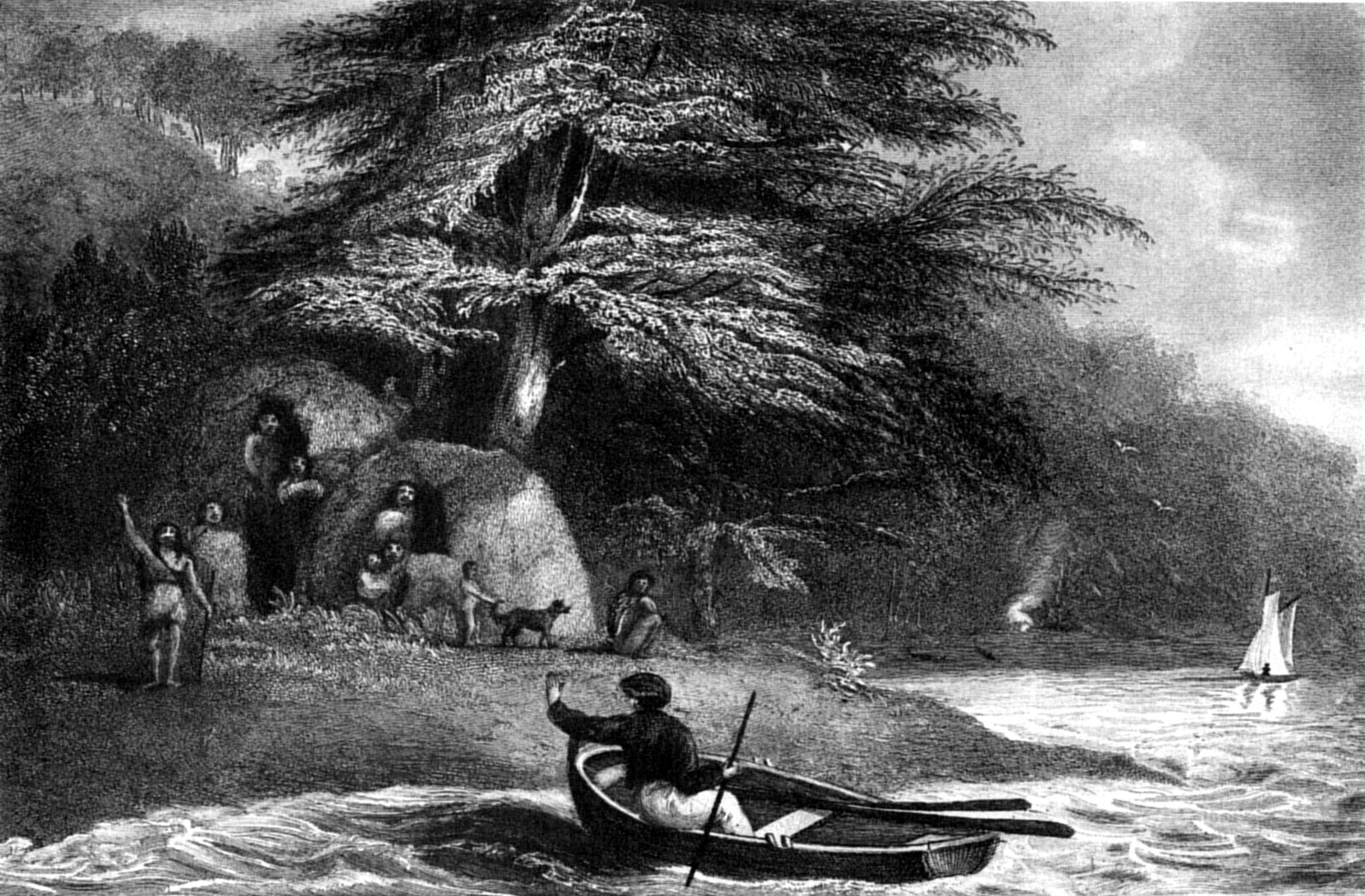
P. P. KingS. Bull
FUEGIAN WIGWAMS AT HOPE HARBOUR IN THE MAGDALEN
CHANNEL.
Published by Henry Colburn, Great Marlborough Street,
1838
In no part of the Strait did we find the vegetation so luxuriant as in
this little cove. Some of the Winter's-bark and currant trees had shoots
more than five feet long, and many of the Winter's-bark trees were two
feet in diameter. The veronica (I believe V. decussata) grows in
the sheltered parts to the height of twenty feet, with a stem six inches
in diameter. It was found too on the windward side of the island in
abundance, and of large size, rooted in the very wash of the sea-beach,
and exposed to the full force of the cold winds and hail-storms, which
rush down the wide western reach of the Strait.
The fuchsia also grows to a large size; but it is a more delicate
plant than the veronica, and thrives only in sheltered places. Many were
observed six inches in diameter; the stems of the two last plants were
used by us, during our stay, for fuel.
The day after our arrival, the gale subsided, and the weather became
very fine indeed. The stillness of the air may be imagined, when the
chirping of humming-birds, and buzzing of large bees, were heard at a
considerable distance. A humming-bird had been seen at Port Gallant last
year, and was brought to me by Captain Stokes, since which none had been
noticed. Here, however, we saw, and procured several; but of only one
species.[99] It is the same
as that found on the western coast, as high as Lima; so that it has a
range of 41° of latitude, the southern limit being 53½°, if not farther
south.
The islets, at the north part of the port, were well stocked with
geese and other birds, which supplied our people with fresh meals. The
steamer duck we found difficult to shoot, from its excessive wariness,
and power of remaining, for a great length of time, under water.
Our fine weather lasted but a few hours, and (no unusual occurrence in
these regions) was succeeded by a week's rain and wind, during which we
were confined to the small space of the Adelaide; and
for some days had three anchors down, owing to the violent squalls.
Farenheit's thermometer ranged between thirty-six and forty-six degrees,
and we had several snow storms, but the snow did not lie on the low
grounds.
On the 28th the gale began to subside, and there was a change for the
better; but we were again disappointed, and not until the 31st could we
effect our departure from this dreary and confined little place.
The day before we sailed, three canoes, containing in all sixteen
persons, of whom six only were men, came alongside.
For about an hour they had hesitated to approach; but when once near
us, very little invitation was necessary to induce them to come on board.
One was clothed in a duck shirt, which was recognised by one of our
people, who had joined us from the Uxbridge, as having been given to them
a few weeks before, when that vessel passed through Magdalen Channel:
another wore a red flannel shirt, and in the canoe we observed an
European boarding-pike, painted green, and a part of the iron-work of the
cutter, burned at Port Famine during our absence; also some relics of the
boat in which Mr. Ainsworth was drowned, which last they had doubtless
found thrown up on the beach. Upon our inquiring how they became
possessed of the iron-work, they pointed towards Fort Famine; and I have
no doubt they were concerned in the fire; but as we could not explain to
them the mischief they had occasioned, it was thought better not to
notice the affair, and the articles were returned to them. They could
have had no idea of our being the owners of the boat, or they would have
concealed all that belonged to her.
They conducted themselves very quietly during their stay on board,
with the exception of one, who tried to pick my pocket of a handkerchief;
the offender was ordered out of the vessel, and there was no further
attempt to pilfer. They wished to go below; but this was not permitted,
because the odour of their oily persons was scarcely tolerable, even in
the open air. As to food, tallow-candles, biscuit, beef, plumb-pudding,
were equally liked, and swallowed most
voraciously. One of them was discovered taking the tallow out of the end
of the deep sea lead and eating it, although mixed with sand and
dirt.
Before sunset their canoes were despatched on shore to prepare the
wigwams, during which operation three of the men remained on board; and
as soon as the preparations were made they called for a canoe and went on
shore. We obtained several spears, baskets, necklaces, bows and arrows
from them in barter; but they seemed to have very few skins. Perhaps
those they possessed were hidden in the bushes, because they had no wish
to part with them.
One woman was covered with a guanaco mantle; another merely wore a
seal-skin over her back and shoulders, which, while she crouched in the
canoe, was sufficient to cover her person. One had a black stripe down
the nose, but she was the only female among them who was so painted.
Next morning the Indians visited us with a fresh assortment of bows
and arrows, in the manufacture of which they had evidently passed the
night, for every one was quite new; the bows were of green wood, and the
arrows not even pointed. They found, however, a ready sale. One of the
party was a man who had been turned out of our vessel the preceding
evening, for picking my pocket; but he was daubed over with a whitish
pigment to deceive us, and would probably have escaped detection, but for
the unusual ugliness of his person, which was not so easily disguised. He
was much disconcerted by our recognition; and our refusal to barter with
him made him angry and sullen.
The women had daubed their faces all over with bright red ochre; to
add to their beauty, no doubt.
We sailed out of the port by the northern passage, and standing across
the Strait, anchored in San Nicolas Bay. Mr. Graves went to Bougainville
Harbour, to communicate with the Adeona, and take letters from me to
Lieutenant Wickham. He brought back an account of all being well at Port
Famine, and of the Beagle having sailed on the 17th.
When we left Port Famine my intention was to examine the Magdalen
Channel; but, upon leaving San Nicolas Bay (1st April), the weather was
so favourable for our proceeding to the westward, that I changed my mind
and steered round Cape Froward in order to get to Port Gallant, whence,
with a westerly wind, we might more easily survey the coast in returning.
An easterly breeze carried us near Cape Holland, into Wood's Bay, where
we anchored, and obtained a bearing of Mount Sarmiento, which, being
clear of clouds, was a conspicuous, and even splendid object; for the
sun's setting rays, shining upon the projecting snowy ridges on its
western side, gave it the appearance of a mass of streaky gold. It had
been in sight the whole day, as well as the preceding evening, when its
bearings were taken from the islet in San Nicolas Bay.
The next day was so calm that we only reached an anchorage in Bradley
Cove, on the west side of Bell Bay, of which a plan was made; an
extensive set of bearings was also taken on the west point of the bay,
evidently that called by Sarmiento Tinquichisgua.[100] The conspicuous mountain at the back
of the bay, on its south-eastern side, is particularly noticed by him,
and, according to his opinion, is the "Campana de Roldan" of
Magalhaens.[101] Between
Bradley Cove and Point Tinquichisgua are two coves, over which a high
double-peaked mountain forms a conspicuous object upon rounding Cape
Froward; and they were named in compliment to Mr. Pond, the late
Astronomer Royal.
While at Point Tinquichisgua we were discovered by some natives to the
westward, who immediately got into their canoes, and paddled towards us;
but, as we had no arms in the boat, I did not think it prudent to await
their arrival; and therefore, after taking the requisite angles, embarked
and returned to the Adelaide, examining the inlets under Mount Pond on
our way. Nothing more was seen of the Indians until the following
morning, when, as we sailed out of the bay, they made their appearance,
but we did not communicate with them. They were as vociferous as
usual, and pointed to the shore, inviting us to land. One of them, who
stood up in the canoe while we passed, was ornamented about the hair and
body with white feathers.
This part of the Strait teems with whales, seals, and porpoises. While
we were in Bradley Cove, a remarkable appearance of the water spouted by
whales was observed; it hung in the air like a bright silvery mist, and
was visible to the naked eye, at the distance of four miles, for one
minute and thirty-five seconds before it disappeared.
A glance at the chart of this part of the Strait will show the
difference of geological structure in the opposite coasts. The north
shore, from Cape Froward to Port Gallant, forms a straight line, with
scarcely a projection or bight; but on the opposite side there is a
succession of inlets, surrounded by precipitous mountains, which are
separated by ravines. The northern shore is of slate; but the other is
principally of greenstone, and its mountains, instead of running up into
sharp peaks, and narrow serrated ridges, are generally round-topped. The
vegetation on both sides is almost equally abundant, but the trees on the
south shore are much smaller. The smooth-leaved beech (Fagus
betuloides) and Winter's-bark are the principal trees; but here and
there a small tree was observed, like a cypress, which does not grow to
the eastward, excepting on the sides of Mount Tarn, where it only reaches
the height of three or four feet.
The scenery of this part of the Strait, instead of being as Cordova
describes it, "horrible," is at this season exceedingly striking and
picturesque. The highest mountains certainly are bare of vegetation; but
their sharp peaks and snow-covered summits afford a pleasing contrast to
the lower hills, thickly clothed with trees quite to the water's side,
which is bordered by masses of bare rock, studded with ferns and moss,
and backed by the rich dark-green foliage of the berberis and arbutus
shrubs, with here and there a beech-tree, just beginning to assume its
autumnal tints.
In working into the narrow entrance of Port Gallant, the schooner
grounded upon a bank that extends off the mouth of the river; but the
water being perfectly smooth, no damage was caused. As a secure cove,
Port Gallant is the best in the Strait of Magalhaens; from the stillness
of its waters, it is a perfect wet dock, and from its position it is
invaluable. There are many coves as safe and convenient when once
entered; but the prevailing steepness of the shores, as well as the great
depth of water, are obstacles of serious importance. Here, however, is an
exception: the bottom is even and the depth moderate; besides, Fortescue
Bay, close by, is an excellent roadstead or stopping-place, to await an
opportunity of entering.
For repairing a ship, Port Famine is more convenient, on account of
the quantity and size of well-seasoned timber lying about the beach, and
also from the open character of the country. At Port Gallant the trees
are much stunted, and unfit for present use, while the shore, as is the
case around almost every cove to the westward of Cape Froward, is covered
with shrubs and brushwood, quite to the high-water mark; so that there is
no possibility of walking easily to any distance from the sea-side. A
shingle, or sandy beach, twenty or thirty yards in length, occasionally
intervenes, but is scarcely preferable to a vessel's deck, for a
walk.
Detention in Port San Antonio—Humming-birds in snow
showers—Fuegians—Geological
remarks—Canoes—Carving—Birds—Fish—Shag
Narrows—Glaciers—Avalanches—Natives—Climate—Winter
setting in—Adelaide loses a
boat—Floods—Lightning—Scurvy—Adelaide's
survey—Bougainville Harbour—Indians cross the Strait, and
visit Port Famine—Sealing vessels sail—Scurvy
increases—Adelaide sent for guanaco meat—Return of the
Beagle—Captain Stokes very ill—Adelaide brings meat from the
Patagonians—Death of Captain Stokes.
Our stay at this port was prolonged beyond my intention by thick snowy
weather and hard gales, which cut off our communication with the shore;
for notwithstanding we were in so sheltered a place, and the vessel had
three anchors down, we did not consider her quite secure against the
violent squalls. We had been fortunate in procuring observations, and
took advantage of our detention to lay down the operations of the
preceding days on paper. Muscles were found in great abundance on the mud
flats. There are three varieties, one of which has a bitter, disagreeable
taste, but the others are exceedingly good and wholesome. One of the
latter is of large size (Mytilus Magellanicus of the Ency. Méth.)
The other is of a more globose form than the bitter sort, and has a very
obtuse hinge and margin. The bitter kind contains pearls, which are
valueless, because small, and of a bad colour.
At first there were plenty of sea-birds[102] in the cove, which took refuge at the
head of the bay; till after two days, they deserted us altogether. There
appeared to be an abundance of fish; but as we had not provided ourselves
with a seine, and they would not take bait, we were confined for
refreshments principally to shell-fish.
No traces of quadrupeds, excepting an Indian dog, were noticed. Here
Wallis's people saw a large cloven-footed animal, which they described to
be as "big as a jack-ass." It was probably a deer, one or two of which
had occasionally appeared at Port Famine.(e)
It has been mentioned that we found many humming-birds at Port San
Antonio, which we attributed to the sheltered situation of the place, and
the luxuriant growth of fuchsias and other plants, upon the sweets of
whose flowers they feed. Here, however, one of the same species was seen
sporting about in a most exposed place and during the falling of a snow
shower, a proof of the hardy character of this little bird, which, if it
does migrate upon the approach of winter to a warmer clime, lingers, at
least, as long as it possibly can. This was the middle of April, the
winter had, in fact, already commenced, and all the mountains around us
were clothed with snow, while the ground was also coated with the same
dazzling covering. Mr. Graves intended to ascend the Mountain de la Cruz;
but a heavy fall of snow prevented the attempt, and we lost the
opportunity of obtaining a round of angles from that elevation, which
would have materially assisted our operations. We should also have
obtained a bird's-eye view of the Barbara Channel and the Sounds on the
opposite side of the Strait, whose extent and nature we did not know; for
Cordova's notice of San Simon's Bay, and a deep inlet which exists to the
westward of it, is very unsatisfactory.
There were no signs of a recent visit from the Fuegians, though at the
entrance of the cove we found three or four wigwams in good repair;
whence it seems probable, that the place is one of their frequent haunts.
When the Beagle came here last year, some station staves were left
standing; but, before her return, every one had been removed; and when
Captain Stokes went down the Barbara Channel, to the relief of the Saxe
Cobourg's crew, those staves were seen in the possession of the
Indians.
A fine morning (11th) induced us to leave this quiet anchorage, to
examine the openings of the south shore; and in the afternoon, the anchor
was dropped in a convenient place, on the west side of the western inlet,
named by us Warrington Cove. While crossing the bay from Point Elvira,
the north extremity of Cayetano Island, several 'smokes' were observed on
the low land, at the bottom of the inlet; and after we anchored two
canoes visited us, containing six men, four women, and two or three
children. They approached very cautiously, and could not be induced to
come alongside. At last the men landed, and invited us to communicate
with them. I therefore went on shore with two or three officers, and
remained with them half an hour, during which they gradually lost the
distrust they had at first evinced; but each man still carried a number
of pebbles in the corner of his wrapper, ready to repel any attack we
might make upon them; from the knowledge we have since obtained of their
character, I think it probable that they had lately committed some act of
aggression on a sealing-vessel, and were afraid of retaliation. Our
conduct tended to assure them of our friendship; and, shortly after we
left the shore, they came alongside in their canoes, and were very
familiar, eagerly bartering their necklaces and baskets. In their way to
us they had probably landed their more valuable goods, such as otter and
seal-skins, as well as their weapons and dogs, without which they never
go far.
The natives of this part are considered by the sealers to be the most
mischievously inclined of any in the Strait, or Tierra del Fuego. The
appearance of our visitors was certainly against them; but they did not
commit themselves during our two or three days' communication, by any act
which could make us complain, or cause suspicion of their honesty and
friendship. We, however, kept too good a look-out, to enable them to take
advantage of our seeming good-nature.
Among bushes behind the high beach were three wigwams, but the Indians
had no intention of remaining with us for the night. They went away,
to our great satisfaction, at an early hour, and returned to the bottom
of the sound, where a large party of their countrymen was assembled.
Their departure enabled us to look round, in the vicinity of our
anchorage, and examine its productions, which differed in no way from
those of other parts of the coast. Its geological structure is, however,
different: the rocks are greenstone, or granite, without slate. Mount
Maxwell, rising immediately over the cove, is the termination of a rocky
mountain range, whose summits are crowned with snow. The verdant sides of
the hill, interspersed at intervals with large masses of bare rock,
produced, from a distance, rather a pleasing effect; but, upon
examination, the verdure was found to consist principally of moss, or a
stunted vegetation, covering a soft and swampy soil. The upper portions
of the mount are so precipitous as not to be easily reached; and, indeed,
many parts rise with a perpendicular ascent for more than a hundred feet.
On the south side of Mount Maxwell is Smyth Inlet, which contains
anchorage on the north shore, particularly one in Earle Cove; but in the
centre the water is deep, and on that account, it is not an inviting
place for a ship. During Mr. Graves's absence in Smyth Harbour, I
examined the coast as far as Cape Edgeworth, where I obtained an
extensive set of bearings. The afternoon was particularly favourable for
the purpose, the snow-capped mountains of the north shore were perfectly
distinct; and among them was a very high one, shaped like a Highland
target, the peak of the mountain answering to the central spike of the
shield. We never afterwards saw it, nor could I, on this occasion, fix
its position better, than by estimating its distance. The rock is chiefly
greenstone, accompanied by considerable masses of granite. A little
islet, off Dighton Cove, is composed of granite, of a lamelliform
structure. Mr. Graves brought me a specimen of lamelliform granite
attached to a mass of greenstone.
The Indians visited us every day, their number being generally from
twelve to sixteen, of which five or six only were men, the rest were
women, and children of all ages. One of the latter could not have been
more than three weeks old; yet the mother, apparently
about sixteen years of age, was always occupied in the laborious
employment of paddling the canoes. The child was secured in the mother's
lap, with its head on her bosom, by a mantle, which was drawn tightly
round both mother and child. Their canoes were similar to those of the
eastern parts of the Strait, about ten feet long, holding four or five
grown persons and two or three children, besides their dogs, implements,
and weapons: they are formed of bark, and kept in shape by wooden cross
supports secured to the gunwale, which is lined by a long, slender pole.
They are divided into three compartments, the foremost occupying about
one-third of the length, contains the spears, placed ready for immediate
use; in the second are the grown persons, with the fire-place between
them, the men sitting between the fire-place and the spears, to be ready
to use them upon the approach of seals or porpoises; on the opposite side
of the fire-place are seated the women who paddle the canoe, in which the
men sometimes assist, when great expedition is necessary. Behind the
women, in the third division, are the elder children and the dogs, the
younger children being generally stowed away in the women's laps, for the
sake of mutual warmth. The fire is made upon a layer of clay, several
inches thick, at the bottom of the canoe; and above the fire, across the
gunwales, are laid several pieces of half-burnt wood, for fuel.
During our communications with these visitors they conducted
themselves peaceably, and made no attempt to pilfer, although there was
some little roguery displayed by them in barter. One of the men having
parted with all his disposable property, tendered one of his daughters, a
fine girl of fourteen or fifteen years of age, for some mere trifle, and,
being refused, became very pressing and importunate to close the bargain
for the price that was jestingly offered; nor was it without difficulty
that he was convinced we were not in earnest. They were as poor as the
rest of their countrymen, very badly clothed, and possessing few skins to
barter. Two of them exchanged their otter skin mantles for cotton shirts,
which they continued to wear without complaining of cold.
As their visits lasted all day they always brought their food,
consisting of the blubber of seals and porpoises. The method used by them
in cutting it up is nearly similar to that adopted by the Esquimaux
Indians, as described by Sir Edward Parry in his second voyage, and also
resembles the process of the natives of King George's Sound, which I have
described in the account of my survey of Australia (vol. ii. p. 140): a
piece of blubber being held in the left hand, a corner of it is taken
between the teeth, and it is then cut by a knife, held underhanded, into
strips backward and forward, without passing the instrument entirely
through: so that when the operation is finished the piece draws out into
a long band, about an inch thick, formed by the connected strips. The
whole affair from first to last is most offensive to the sight; and the
countenance of the carver is beyond description, for his eyes being
directed to the blubber, squint shockingly, and give his ugly face a
hideous appearance. The strip of blubber is next divided among the party,
each of whom proceeds to extract its oily juices by drawing it through
his teeth and sucking it, after which it is warmed in the fire to
facilitate its division into small pieces, which are swallowed or bolted
without mastication. Morsels of this dainty food were given not only to
the elder children, but even to infants at the breast.
On the 14th, while preparing to weigh, the Indians came on board and
helped to heave in the cable, but without rendering us much real
assistance. When the sails were loosed, the women in the canoes began to
chatter and scream for fear we should carry off their friends, and their
alarm was no sooner given than the deck was cleared of our visitors, who
seemed to be quite as much frightened for their safety as the women were.
In a few minutes afterwards we were proceeding to the southward, and
first tried to anchor in a bay on the south side of Smyth Harbour, but
finding the depth too great, I sent Lieut. Graves to sound behind an
islet where there were indications of a place of shelter, but he returned
unsuccessful. During his absence I went to a very narrow passage, which
he had discovered, leading to a large channel or sound; but finding it
intricate, I deferred trying to enter with
the vessel until a more favourable opportunity should offer, and we
returned to the place south of Warrington Cove, called Dighton Bay, where
we anchored off a sandy beach in twenty fathoms, and secured the vessel
by laying the kedge on the shore. This sandy beach was the first we had
found in the eastern part of the Strait. The sand is quartzose, of a
white colour, and being a novelty, rendered the place interesting. A
stream, supplied by the ravines of Mount Maxwell, runs over the beach
into the sea, and from it an abundant supply of excellent water may be
obtained without difficulty.
We observed no quadrupeds; but, of the feathered tribe, we found
woodpeckers, kingfishers, and woodcocks, and in the sheltered nooks
several humming-birds were darting about the flowery underwood of
berberis, fuchsia, and arbutus. In the tide-way, at the narrow passage,
the sea teemed with fish; over which hovered corvorants and other
sea-fowl, preying upon the small fry that were trying to elude their
voracious enemies, the porpoises and seals, thousands of which were seen
sporting about as we proceeded on our way. Whales were also numerous in
the vicinity, probably because of an abundance of the small red shrimp,
which constitutes their principal food.
I went again to examine the passage, and the tide being against us, we
were obliged to pull close to the western shore to benefit by the partial
eddies, otherwise we could not have proceeded until the turn of the
tide.
These narrows, named 'Shag' Narrows, from the quantity of birds there
so called by seamen, are not a hundred yards wide. The south end is
fronted by an island, from whose summit, about four hundred feet high, I
hoped to obtain a good view southward, and after passing the narrows we
landed and reached the summit. While looking around at the view, and
preparing the theodolite, a woodcock started up from the long grass and
walked away so leisurely, that Mr. Tarn nearly succeeded in striking it
with a stick. This bird afforded us a name for the station, which we
found to be at the northern side of a large basin, ten miles wide, and
six long, terminated at its south end by a channel leading to the
open sea, but crowded with islands and rocks. A deep inlet or chasm in
the land, at the N.W. corner of this basin, was filled with masses of
floating ice, broken from an enormous glacier.
After obtaining all the bearings and embarking, we pulled three miles
to the westward, and took a round of angles at Point Cairncross, the
south-west point of Field's Bay, and again another set at the south head
of Icy Sound, near Dinner Cove, where we found a very convenient
anchorage for small vessels. Through Icy Sound we found some difficulty
in penetrating, as the channel was much obstructed by ice.
Three miles within this sound the rocky shore became more precipitous,
and at two miles farther, where the width across was not more than one
hundred and fifty yards, the rocks rise perpendicularly on each side to
the height of seven or eight hundred feet. Beyond this remarkable part
the channel opens out to a basin about half a mile in diameter, bounded
by a sloping glacier, from which immense masses of ice broke off
frequently, and falling with a noise like the discharge of a ship's
broadside, threw up the foaming water with terrific violence.
As we entered the basin, we were startled by a sudden roar, occasioned
by the fall of one of these avalanches, followed by echoes which
reverberated round the basin and among the mountains. We remained for
half an hour afterwards waiting for another fall, but were not gratified.
Several were heard at a distance, probably high up the sides of the
glacier. The examination of Icy Sound occupied us until dark, when we
returned to the schooner.
During our absence, Indians had again visited the Adelaide, the
greater number of whom were strangers. We had also seen a party in a
canoe close to Mount Woodcock, who were striking seal, and too intent
upon their object to pay much attention to any thing else.
On the 16th, the term of our absence having expired, we left Dighton
Bay on our return: at night we anchored in St. Nicholas Bay, and the day
after arrived at Port Famine. Natives had discovered and visited the
ship while I was away, but Lieut. Wickham did not encourage them to
remain; and two or three attempts to pilfer being detected, they were
treated with very little ceremony; so finding their company was not
desired, they went across the Strait to Lomas Bay, where for several days
afterwards the smoke of their fires was seen. They were the same Indians
whom we had met at Port San Antonio.
That these Indians should be received so coolly, may seem to have been
impolitic on our side, when it is considered that our smaller vessels and
boats might be met with, and their crews ill-treated by way of
retaliation. It was, however, time that they should know our superiority;
for, of late, several very treacherous attacks had been made by them on
sealing vessels, and this party was the most forward and insolent we had
seen. One of them was teazing several of the men to box, an
accomplishment he had probably learnt from the crews of sealing vessels;
among others, he fixed upon the serjeant of marines, who very
unceremoniously pushed him over the side, and made him return to his
canoe, which he resented by pushing off from the ship's side, and
throwing a stone at the serjeant, who was standing at the gangway. As it
missed him, and did no harm, no notice was taken of his mischief. We
afterwards heard that the same party had visited Bougainville Harbour,
where the Adeona was at anchor; but as Mr. Low neither gave them
encouragement to remain, nor permitted them to go on board his brig, they
very soon went away.
The difference between the climates of the western and eastern
portions of the Strait was very striking. To the westward the country,
being principally clothed with evergreens, such as the smooth-leaved
beech, and Winter's-bark, with an underwood of arbutus and berberis,
seems to possess a constant verdure, nor until the snow covers all, does
it assume any thing like the appearance of winter. To the eastward,
evergreens are less common, their place being occupied by the beech
(Fagus Antarctica), whose leaves fall very early. Snow had also
begun to cover the lower grounds, giving signs of winter. April terminated
with finer weather than we had experienced for some weeks, but May set in
with north-easterly winds and much rain, succeeded by a heavy fall of
snow.
"Tristis hyems montes niveo velamine vestit."
As yet the thermometer had not been very low. On one or two occasions
it had fallen during the night to 28°, but generally it ranged between
45° and 33°.
The Adelaide was again despatched on the 30th April, to carry on an
examination of the openings on each side of Cayetano Island; but she
returned on the 21st of May, with the disagreeable intelligence of having
had her only serviceable boat stolen by the Indians. This was a serious
loss, not only on account of so much time being thrown away, but also
because we had no other boat to substitute for her. To prevent delay, I
sent to Mr. Low, at Bougainville Harbour, requesting that he would sell
one of his boats; but he was himself so badly off, from similar losses,
that he could only assist us by lending one for a few weeks, and as it
was the only boat he possessed, it could not be spared to go far from his
vessel. I, therefore, despatched Mr. Graves, in the Adelaide, to
Bougainville Harbour, to employ himself in examining the coast thence to
Cape Froward, and in the mean time began to build a whale-boat, to be
ready for the Adelaide's use as soon as winter had passed over; for, from
Mr. Graves's report of the state of the climate to the westward, very
little could be done during the winter months.
The following is Lieut. Graves's account of the loss of his
boat:—Upon leaving Port Famine he proceeded at once to Port
Gallant, and surveyed Cordes Bay; after which he crossed the Strait to
St. Simon's Bay, and anchored in Millar Cove, on its western side,
immediately to the north of Port Langara, from which it is only separated
by a narrow neck of land. The Adelaide remained there at anchor while Mr.
Graves visited the different parts of the bay. Her presence had attracted
a large party of Indians, who, occupying several wigwams near the
entrance of the cove, paid daily visits to our people, and were
apparently very familiar and well-disposed.
But they had cast a longing eye on the whale-boat, which, when
equipped for service, contained many things very useful to them, and they
laid a plan to carry her off, which succeeded. One evening she was
prepared for going away at an early hour the following day, and, to save
time, every thing that might be required was placed in her, and she was
made fast for the night. Two or three Indians were then on board, and
observing what was done, laid their plan, and at sunset took their leave
as usual. The night was pitchy dark, and at nine o'clock the boat was
missed from alongside. The alarm was given, and instant search made at
the wigwams of the Indians, who had all decamped, without leaving the
least trace of themselves or the boat. The 'painter,' or rope by which
she had been fastened to the vessel, had been cut through with some sharp
instrument, most probably a knife, which our people had sharpened for
them on the grindstone that very day.
Every possible search was made next morning, but without success; the
boat that was left was one which could not be used with any advantage,
and Mr. Graves returned to Port Famine. Vexatious as the accident was, I
could not blame him for what had occurred, for no one had suspicions of
such conduct from the Indians, who, on all other occasions, had kept at a
distance from us after night-fall. The boat was properly secured
alongside, and the night was so cold that no person would have thought
the Indians would expose themselves to such a temperature (28°); for they
must have swum alongside to cut her adrift, and then must have towed her
away very gradually, to prevent the theft being discovered, for there
were two persons walking the deck at the time.
Mr. Tarn, who accompanied Mr. Graves on this occasion, brought me a
very fine sea-eagle (Polyborus Novæ Zealandiæ), and some other
birds, and a specimen from a shrub which we had not before observed, a
species of Desfontanea.
In order to prevent a similar loss in future, the Adelaide was
forthwith fitted with cranks outside, for hoisting up her boats when in
harbour.
Winter advanced rapidly; the ground was constantly covered with snow,
from one to two feet deep, and every night more fell. In the early part
of June we had a gale of wind from the N.W., which flooded the low ground
upon which our tents stood; but fortunately the large tent had been
accidentally placed on a higher part, and escaped. This flood filled,
and, of course, spoiled the water in all the ponds about the tents; and
we had afterwards to procure our supplies from a considerable
distance.
On the 8th of June much lightning was observed to the northward, and
repeated rumbling noises were heard, which continued for long periods;
one lasted distinctly for the space of twenty minutes. At first, they
were thought to be eruptions of some distant volcano; but, from the
frequent lightning, they were probably echoes of thunder, reverberating
through the deep ravines that intersect the rocky ridges of the
Cordillera, from which we were distant at least one hundred and fifty
miles.
A succession of bad weather followed, during which the barometer
fluctuated rapidly. On the 14th, the mercury fell to 28. 17. inches,
after which it gradually rose, with fine settled weather, until it
reached 30. 50., when bad weather again set in. The people at the tents
experienced another inundation. Had the water risen six inches more, it
would have carried every thing away; and as the wind was blowing dead
upon the shore, while a heavy surf was beating upon the beach, we could
have rendered them very little assistance from the ship.
The severity of the weather brought a most disagreeable accompaniment.
Scurvy appeared, and increased; while the accidental death of a seaman,
occasioned by falling down a hatchway, followed by the decease of two
others, and also of Mr. Low, of the Adeona, whose body was brought to me
for burial, tended to create a despondency amongst the crew that I could
in no way check. The monotony of their occupations, the chilling and
gloomy appearance of the country, and the severity of the climate, all
tended to increase the number of the sick, as well as the
unfavourable symptoms of their disease. The Beagle's term of absence was,
however, drawing to a close, and I caused a rumour to be spread, that
upon her appearance we should quit Port Famine. To give a semblance of
reality to this report, the topmasts were ordered to be fidded, and the
ship otherwise prepared for sea, which had a manifest effect upon the
scorbutic, of whom several were in a bad stage of that horrid disease,
and many others were just attacked. We found ourselves now, too, thrown
on our own resources for fresh food: scarcely a fish was taken with the
hook, and the seine, although frequently shot, never caught anything. Of
birds, only a few hawks and small finches were procured, which were all
reserved for the sick, the greater number of whom lived on shore, at the
tents, where they might walk about, and amuse themselves as they
pleased.
The Adelaide returned from Bougainville Harbour on the 18th of June,
having succeeded in the object for which she was sent. The extremity of
Cape Froward, a bluff head, over which is a round-topped hill (precisely
the French 'Morre') is what Sarmiento called the Morro de Santa Agueda.
Any name given by this excellent old navigator is too classical and
valuable to be omitted; therefore, while the extremity itself may retain
the modern appellation of Cape Froward, the mountain by which it is
formed may still be allowed to keep his distinction. Behind it, the land
rises to a higher ridge, the edge of which is remarkably serrated, and
probably of a slaty character.
The specimens procured from the Cape were clay-slate, much intermixed
with iron pyrites, and crossed by small veins of white quartz. Of the
anchorages examined by Mr. Graves, Bougainville Harbour, better known to
sealers by the name of Jack's Cove, or Harbour, is the most
sheltered.
It is surrounded on all sides by high precipitous hills, thickly
clothed with trees. The depth is moderate, and the water so beautifully
clear, that the anchors, and even shells and stones, were distinctly seen
upon the bottom. It was here that Bougainville procured wood for the use
of the settlement at the Falkland Islands. Captain Stokes
says of this place: "After seeing the abundant supplies of timber which
Freshwater Bay and Port Famine afford, I had shared in the surprise which
Byron expresses, that any one should have come so far up the Strait to
get it; but on examining the spot, I found that a happier selection could
not have been made. It is a little cove, just round the eastern point of
the Bay of San Nicolas, about a hundred yards wide and three times as
long. Here, moored to the shore, a ship may lie in eight fathoms,
perfectly sheltered from any wind, the water as smooth as in a wet-dock.
Shapely trees, of all dimensions, are growing within a few yards of the
shore; and the wood, when felled, may be hoisted on board from the beach,
by tackles from the yard-arms. Here, too, with very little trouble, a
supply of water may be got from the many streams that make their way
through the underwood which skirts the cove. As we pulled up this
sequestered nook, the unusual sound of our oars and voices put to flight
multitudes of birds, and the surface of the water was broken by the
jumping of fine fish. Some very eatable geese were shot. Our stay was too
short to admit of hauling the seine; but my boat's crew contrived to
half-fill the boat with excellent muscles and limpets, which are found
here in great plenty."
The geological character of the coast between Cape St. Isidro and San
Nicolas Bay is clay-slate; near the beach, however, this rock is not
visible, since it is there covered with a kind of breccia of rounded
pebbles, in an indurated sandy rock, of green colour. The pebbles are
principally of slate; but some were found to be of granite and other
quartzose rock, perhaps greenstone.
One of the headlands, called by M. Bougainville Cape Remarquable, was
examined by Mr. Graves for fossil shells, of which the French navigator
speaks. Half the rock was beaten to pieces, without detecting anything
like organic remains. Living shells were in the greatest abundance about
the base of the Cape, but that is the case every where. The species
generally found are limpets and muscles, but with little variety and no
novelty.
On the 21st of June, after a heavy north-east gale, we had an
unusually fine day. The hills at the bottom of Magdalen Channel were more
distinct than we had ever noticed them, and Mount Sarmiento was
particularly clear; indeed its outline was so sharply defined, that the
distance did not appear to be more than ten miles. This extraordinary
transparency of the air was at first considered a presage of wet weather;
yet the clear and sharp appearance of the distant land was unlike that
which usually precedes a fall of rain. The long series of rainy weather
we had experienced made us look for a good result from such an unusual
atmosphere, and we were not deceived. The following day our hopes were
still further confirmed by seeing three Indian canoes, coming across the
Strait, towards us, from Lomas Bay, which they would not have attempted
had they not been sure of its continuing fine; for their canoes are ill
adapted to encounter the short cross sea found during bad weather in
mid-channel of the Strait.
Although the presence of the natives did not in general please me,
because it naturally put a stop to all work; yet, on this occasion it was
agreeable, as it tended in some measure to enliven the monotonous manner
in which we passed our days.
Upon reaching the bay, the Indians did not approach the ship, but
paddled into the coves under Point Santa Anna, where our boat was
employed watering. Mr. Graves went to them, to prevent mischief, and
found they were the same party who had before visited us. When our boats
returned, they paddled over to the wigwam at the head of the port, about
a quarter of a mile beyond our tents, and began to repair it, and by
sunset were housed and sheltered for the night. We had, however, so
lately experienced their treacherous disposition, that no confidence was
placed in appearances. Sentinels were posted at the tents, to give the
alarm, should any of them approach; and at eight o'clock a volley of
musketry was fired, by way of intimidation, and to impress them with the
idea that we kept a watch upon their movements, and were prepared.
While the wigwams were repairing, a few of the Indians visited our
tents; but were not allowed to pass within a rope that, by my orders, was
stretched around our property, a restriction which they did not attempt
to evade. At sunset all were told to go away, and they immediately, as
well as cheerfully, complied.
The next morning, and indeed throughout the whole day, the
neighbourhood of the wigwams exhibited the appearance of a fair. I
visited them, and found that they had not only repaired an old wigwam,
but erected another. Both together contained the whole party, consisting
of twenty-six individuals, among whom were an old man, and two old women.
They had brought over a collection of baskets, bows and arrows, stone
heads of knives, &c. to sell to our people, who had always shown
eagerness to possess these curiosities. The knife-heads were made
generally of pitch-stone; but the greater number were of broken glass
bottles, which they had collected when they visited us last year. A few
strings of beads purchased all their riches; after which they sold their
dogs, and Mr. Graves procured one of them for a knife and a string of
beads. It was a remarkably fine animal, and showed great reluctance to be
handled by our people, several of whom were bitten in their attempts to
take him to the boat.
At night one of the canoes was despatched to collect shell-fish,
probably sea-eggs, from the reef of Rocky Bay. The following morning all
their goods were embarked, and then they paddled their canoes to the
beach, near the tents, where some of their men landed. They had nothing
to offer in exchange for several things which tempted them, and were
beginning to grow troublesome. One of them, the individual who threw a
stone at the sergeant, persisting to pass the boundary that was marked
upon the ground, which no one of them had before presumed to do, was
pushed back by the sentinel; upon which he ran to his canoe and took out
several spears, doubtless intending to try to force a passage; but the
appearance of two or three muskets brought him to his senses, and the
spears were returned to the canoe; after which he became familiar, and
apparently friendly. This affair, however, was soon followed by their
departure, which gave me much satisfaction. They went southward, landing
for the night in Voces Bay, and the following day went to the Adeona, in
Bougainville Harbour, where they remained some days.
The day after the Indians left us, a boat came from the Adeona, to
acquaint us that, in a day or two, she and her companions, the Uxbridge
and Mercury, intended to leave the Strait for the Falkland Islands; upon
which I prepared letters for England, and a report of my proceedings for
the Secretary of the Admiralty. The ships passed by on the 30th, and took
my letters.
This last month (June) set in with snow or rain, which continued until
the 11th, when the weather assumed a very threatening appearance. On the
14th the barometer fell to 29. 27, and the wind blew a hard gale from
N.E.; but in the afternoon it veered round to S.W., and the mercury rose
rapidly. A gale from S.W. followed, and then to the end of the month we
had a series of moderate weather, but much snow. The mean temperature for
June was 32°,97 the range being between 19°,2 and 48°,7.
July commenced with an unusually low temperature and a high barometer;
the former, on the 4th was 12°,2, and the latter, at the same time, at
30,5 inches, having risen since the 14th of June 1.82 of an inch. After
this we had a few mild and fine days, but paid dearly for them; a
northerly gale set in, bringing with it unwholesome damp weather, in
which the temperature rose to between 35° and 42°, and melted much of the
snow that had covered the ground, quite to the water's edge, during the
last two months. Our sick-list, particularly of cases of scurvy,
increased so much, during this damp, trying weather, that I determined
upon sending the Adelaide to the northward, to procure a supply of fresh
meat from the Patagonians; and, at the same time, to survey that part of
the Strait lying between Cape Negro and the Second Narrow.
Lieutenants Graves and Wickham, and Mr. Tarn, went upon this service,
the latter being most anxious to procure some change of diet for the sick
under his care, for some of whom he was much alarmed. The appearance and
severity of this disease, although every precaution had
been used, and subsequent attention paid to their diet, are not easy to
account for: fresh provisions, bread baked on board, pickles,
cranberries, large quantities of wild celery, preserved meats and soups,
had been abundantly supplied; the decks were kept well-aired, dry, and
warm, but all to no purpose; these precautions, perhaps, checked the
disease for a time; but did not prevent it, as had been fully
expected.
The Adelaide sailed on the 16th of July, with every prospect of fine
weather. The same evening, an American sealing schooner anchored near us,
on her way to Staten Land. She had entered the Straits by Cutler and
Smyth Channels, and in forty-eight hours arrived at Port Famine. After
obtaining some trifling assistance from our forge, she sailed.
On the 25th, three new cases of scurvy appeared, one being the
assistant-surgeon, which increased our sick-list to fourteen. Feeling the
necessity of doing something, I ordered the hands to be turned up,
'Prepare ship for sea!' No sooner had the words escaped the boatswain's
lips, than all was life, energy, and delight. The preliminary
preparations were made, and every one looked forward with pleasure to the
change, except myself. I had hoped to pass the twelve months at Port
Famine, with the intention of completing a meteorological journal, for
which this place afforded peculiar advantages. My plan was, on the
Beagle's return, to despatch her and the schooner along the West Coast,
and join them in the Adventure at Chilóe.
As our departure was now supposed to depend on the Beagle's arrival,
every eye was on the stretch to watch for her, and every morning some one
of our party ascended the heights, to look out. On the 27th she was seen,
beating up from the southward; but as the wind was contrary, she did not
anchor in the bay until the evening. Her return was greeted with three
most hearty cheers; but on passing under our stern, Lieutenant Skyring
informed me that Captain Stokes was confined to his cabin by illness, and
could not wait on me. I therefore went to the Beagle, and found Captain
Stokes looking very ill, and in low spirits. He expressed himself much
distressed by the hardships the officers and crew under him
had suffered; and I was alarmed at the desponding tone of his
conversation. He told me that the Beagle had been up the western coast as
high as Cape Tres Montes, in latitude 47°, had surveyed the Gulf of Peñas
and other portions of the coast, particularly Port Henry, at Cape Three
Points, the entrance of the Gulf of Trinidad, and Port Santa Barbara, at
the north end of Campana Island.
During the survey of the Gulf of Peñas they had experienced very
severe weather, both stormy and wet, during which the Beagle's crew were
incessantly employed, and had consequently suffered greatly. Captain
Stokes seemed not to have spared himself. He appeared much gratified by
my visiting him, and before we parted he was for a time restored to his
usual energy, detailing the circumstances of the voyage, and conversing
upon the plan of our future operations with considerable animation.
The return of the Beagle cheered our ship's company, and on the 30th
the Adelaide came back, with a large quantity of guanaco meat, which had
been procured from the Patagonian Indians at Peckett's Harbour.
When the Adelaide anchored there, about thirty natives appeared on the
shore. Mr. Tarn landed, and communicated our wants, saying that he would
give tobacco and knives for as much guanaco meat as they could procure;
with them was the Fuegian, who seemed to be a leading man, and to have
become one of the most active of the party. He was the principal
spokesman, and upon commencing the hunt he pointed to the snow upon the
ground, and called it 'bueno' (good), because it would show the traces of
the animals, and the direction they had taken. Mr. Wickham thus described
to me the manner in which they hunted: Two men ascended a hill, placed
themselves one at each end of its summit, and stood motionless for some
time, on the look-out. As soon as guanacoes were seen, their position and
movements were communicated, by signs, to the men in the valley, who were
thus enabled to approach their game unawares. The guanacoes are taken
with the bolas, which entangle their legs and throw them down. As soon as
they are killed, they are skinned and cut up. The first
night seven hundred pounds of meat were brought, and two thousand and
forty-six pounds were obtained in a few days.
This ample change of diet inspired me with the hope that our sick, at
least those affected by scurvy, would recover, and that after another
large supply, which we now knew how to obtain, we might be enabled to
prosecute our voyage as was first intended. All hands were therefore
allowed fresh meat for a week, and the residue was placed at the disposal
of the surgeon, for the use of the sick, but all ineffectually; the list
still increased, and Lieutenant Wickham, with a violent cold, and Mr.
Rowlett, with scurvy, were added to it. The assistant-surgeon's became
the worst case of scurvy on board; and our people, finding that the
preparations for quitting the place were not going on, began to despond
again. Captain Stokes was anxious to prepare his vessel for another
cruize, being very averse to giving up our plans and returning to Monte
Video, since he thought the crews, from utter disgust at the privations
and hardships they had endured, would not be persuaded to go on another
voyage; but that if they were to go to Chilóe or Valparaiso, to refresh,
they might recover their strength and spirits, and be willing to renew
the survey; which, however, he himself seemed to dread, for he never
mentioned the subject without a shudder. He was evidently much excited,
and suspicions arose in my mind that all was not quite right with him. I
endeavoured to prevail on him to give his people a longer rest, but he
was the more anxious to make preparations. On the 31st July he sent an
application for provisions, and in the evening I received a note from
him, which was written in his former usual flow of spirits. The officers,
however, knew more of the diseased state of his mind than I did; and it
was owing to a hint given to me, that I desired Mr. Tarn to communicate
with Mr. Bynoe, and report to me whether Captain Stokes's health was
sufficiently restored to enable him to commence another cruize. This was
on the 1st of August. The provisions had been sent, in compliance with
his application, and the surgeons were on board the Adventure, considering upon their report, which was,
as I afterwards found, very unfavourable, when a boat came from the
Beagle, with the dreadful intelligence that Captain Stokes, in a
momentary fit of despondency, had shot himself.
The surgeons instantly repaired on board, and finding him alive, had
recourse to every means in their power, but without hope of saving his
life. During the delirium that ensued, and lasted four days, his mind
wandered to many of the circumstances, and hair-breadth escapes, of the
Beagle's cruize. The following three days he recovered so much as to be
able to see me frequently; and hopes were entertained by himself, but by
no one else, that he would recover. He then became gradually worse, and
after lingering in most intense pain, expired on the morning of the
12th.
Thus shockingly and prematurely perished an active, intelligent, and
most energetic officer, in the prime of life. The severe hardships of the
cruize, the dreadful weather experienced, and the dangerous situations in
which they were so constantly exposed—caused, as I was afterwards
informed, such intense anxiety in his excitable mind, that it became at
times so disordered, as to cause the greatest apprehension for the
consequences. On the return of the Beagle he got better; and the officers
were so sanguine in hoping for his complete restoration to health, on
account of his progressive recovery, that nothing which had transpired
was communicated to me until after his decease.
His remains were interred at our burial-ground, with the honours due
to his rank, and a tablet was subsequently erected to his memory.
Account of the Beagle's cruize—Borja Bay—Cape
Quod—Stuart Bay—Cape Notch—Remarks on weather, and
errors of Chart—Evangelists—Santa Lucia—Madre de
Dios—Gulf of Trinidad—Port Henry—Puma's
track—Humming-birds—Very bad weather—Campana
Island—Dangers—Gale—Wet—Sick—Santa
Barbara—Wager's beam—Wigwams—Guaianeco
Islands—Cape Tres Montes—St. Paul's—Port
Otway—Hoppner Sound—Cape Raper.
The following account of the Beagle's cruize is drawn up from Captain
Stokes's unfinished journal, and from detached memoranda, which were
found amongst his papers.
It will be recollected that, on my departure from Port Famine, in the
Adelaide, in the month of March, to survey portions of the southern side
of the Strait, I left instructions with Captain Stokes to proceed in the
execution of his orders as soon as the Beagle was ready. The details of
those orders it is unnecessary to repeat here, as they were performed to
my entire satisfaction; it will be merely requisite, as briefly as
possible, to follow him through a most arduous and distressing service.
It is the sequel that embitters the record.
"On the 18th of March, I sailed from Port Famine, and next day reached
Port Gallant.
"On the 23d, we anchored in the little cove called Borja Bay, which,
though very confined, and rather difficult of access, suited our purpose
extremely well. (See Sailing Directions). While there we measured the
height of one of the principal hills in the neighbourhood, and found it
1,800 feet.
"Bad weather detained us until the 26th, when we passed Cape Quod, and
reached Stuart Bay. Many places were left unexamined, because my object
was to hasten westward before the year was farther advanced.
"(27th.) We left Stuart Bay, and continued our progress to the
westward, with westerly winds, thick weather, and rain. The shores of
the Straits were seldom visible to us, from a thick mist with which they
were clouded: it is, however, a bold coast on each side, otherwise the
Strait would be utterly unnavigable in such weather. Near Cape Notch the
mountains spire up into peaks of great height, singularly serrated, and
connected by barren ridges. About their bases there are generally some
green patches of jungle; but, upon the whole, nothing can be more sterile
and repulsive than the view. This afternoon we passed Playa Parda, and in
the evening anchored in Marian Cove.
"In the course of the next day the wind freshened to a strong and
squally gale from the W.N.W., with much rain; the weather was so thick
that we could scarcely make out the coast. In this kind of weather, the
lower parts of the shore are screened from view by mist, and the upper
ones are seen looming through it in lofty masses, in a manner which would
lead a stranger to believe that the ship was completely environed with
islands.
"In the evening we anchored in the little cove called Half Port Bay,
and next morning resumed our daily struggle against wind, tide, and
weather.
"We crossed the mouth of a deep sound on the north shore,[103] where no tide or
current was remarked: the delineation of the coast about this point is
particularly defective in the old charts; fortunately, however, for the
navigator, he has here to deal with shores where the omission of a whole
island, or even the addition of a few that do not exist, is of less
consequence to his safety than the exact limit of one sand-bank in other
parts of the world. This night we anchored in Upright Bay, which, though
affording excellent shelter from the prevailing winds, is bad with a
southerly one; as, from the steepness of the bottom requiring a vessel to
anchor close to the shore, sufficient scope is not left for veering
cable.
"Sheltered by the high land under which we were anchored, with the
exception of occasional gusts down the ravines and sounds, we had the
wind light at W.S.W.; but the rapid travelling of the scud over-head
showed that the usual weather prevailed. We weighed early next morning
(30th), and by noon had reached so far to the westward that the
easternmost of the round islands in Cape Tamar Bight bore north about two
miles. By nightfall we were off Cape Cortado; but the weather seeming
settled and the wind drawing to the southward, I resolved to keep under
weigh, and try to get out to sea that night. Circumstances favoured us;
the weather was fine, the moon remained unclouded, and the wind held at
S.S.W. An hour after midnight Cape Pillar bore W.S.W., distant about two
miles, and thence we shaped our course for the Evangelists, which we
passed at the distance of a mile.
"The Evangelists, as they are called by the early Spanish voyagers, or
as they were afterwards named (1670) by Sir John Narborough, the Isles of
Direction,[104] are a
group of four rocky islets, and some detached rocks and breakers,
occupying altogether a space of three miles; they are exceedingly rugged
and barren, and suited only to afford a resting-place for seals and
oceanic birds. From the heavy sea prevalent there, and the raging surf
that generally breaks around, landing on them can be rarely practicable;
yet sealers effect it. The mate of a sealing vessel told me that he had
landed on the largest in a whale-boat, and killed several thousand seals.
The Evangelists are of sufficient height to be seen in clear weather from
a ship's deck, at the distance of six or seven leagues, but the superior
elevation of the coast on both sides will usually render it visible,
before these islands can be observed.
"Immediately on rounding the Evangelists a cape was distinguished,
appearing to terminate the northern coast line, which we made out to be
'Cape Isabel' of the Spanish charts. It is a steep, rocky promontory of
great height, having at its base some detached columnar masses of rock,
and at its summit a peak, and a serrated ridge; off it is a steep-sided
island, which proved to be that (Beagle Island) of
which Lieut. Skyring and I took the bearing last year, when we were on
the summit of Cape Victory.
"Northward of Cape Victory the land forms a deep bight, of which Cape
Santa Lucia is the north-eastern headland. The coast in the interval is
exceedingly rugged and mountainous. Cape Santa Lucia may be distinguished
by a portion of flat table-land, about one-third of the altitude of the
mountain from which it proceeds, and terminating at its outer face with a
perpendicular precipice.
"The coast between Capes Isabel and Santa Lucia is dangerous to
approach nearer than ten miles, for there are within that distance many
sunken rocks, on which the sea only occasionally breaks. Some of these
breakers were seen to seaward of us, as we proceeded along the coast, at
the distance of five or six miles. When off Santa Lucia, whales were very
numerous around us.
"The general aspect of this portion of the coast is similar to that of
the most dreary parts of the Magalhaenic regions: bare, rugged, rocky,
and mountainous, intersected by inlets, and bordered by islets, rocks,
and breakers.
"The information we possessed respecting the prevalent winds on this
coast was very scanty; yet, since all we could procure represented them
as prevailing from the northward and north-westward, I considered it
advisable to take advantage of the present southerly wind to proceed to
the northern part of the coast assigned for our survey, instead of
stopping to explore the bight between Cape Isabel and Cape Santa
Lucia.
"From the bearings at sunset,[105] we ran along the land with bright
moonlight, sounding every hour; and at daylight were about ten miles from
the Island of Madre de Dios.
"We closed the land and proceeded to the northward, keeping at a
distance of about three miles off shore, sounding between twenty-eight
and thirty-three fathoms, sandy bottom. The weather was clear and fine,
and we were enabled to make observations, and take the bearings and
angles, necessary for laying down the coast satisfactorily.
"At noon we were in latitude 50° 12′ south, and in the meridian
of Cape Tres Puntas, between which and a cape bearing from us N. 13° E.
(magnetic), distant eight miles, there was evidently an inlet: this cape
is marked on the chart as Cape William. The character of the land is the
same with that which we had hitherto passed, bare, rugged, rocky
mountains, with peaks, and sharply serrated ridges. From daylight to noon
we had run twenty-one miles along the coast; in that interval only one
inlet was seen, which was in the latitude of 50° 27′ south, agreeing well with the 'West Channel'
of the Spanish chart. It was four miles wide at its mouth, and appeared
to follow a winding course to the eastward. The land of Cape Tres Puntas
curved in to the eastward, until it closed with Cape William; at dusk we
were abreast of Cape William, and two leagues off shore, where we lay-to
till daylight, as I wished to examine the inlet between it and Cape Tres
Puntas, which subsequently proved to be Sarmiento's Gulf of Trinidad. The
old navigator thus describes its discovery:
"'At daylight, 17th of March, 1579, in the name of the most holy
Trinity, we saw land, bearing E.S.E., ten leagues distant, towards which
we steered to explore it. At mid-day, being near the land, we observed
the latitude 49½°, but Hernando Alonzo made it 49° 9′. In approaching the shore we saw a great bay
and gulf, which trended deeply into the land towards some snowy
mountains. To the south there was a high mountain, with three peaks,
wherefore Pedro Sarmiento named the bay 'Golfo de la Sanctisima
Trenidad.' The highest land of the three peaks was named 'Cabo de Tres
Puntas ó montes.' This island is bare of vegetation, and at the
water-side is low and rugged, and lined with breakers; on the summit are
many white, grey, and black-coloured portions of ground, or rock. Six
leagues to the north of Cape Tres Puntas is the opposite side of the
gulf, where it forms a large high mountain, backed to the north by low
land, and fronted by many islands. This high mountain, which appears to
be an island from the offing, was called 'Cabo Primero.''[106]
"The following night was clear, and the wind moderate from S.E., but
in the course of next morning it shifted to N.E., with squalls, rain, and
thick weather; we worked into the inlet notwithstanding, and by noon had
reached three miles within its S.W. head-land, Cape William, and were
abreast of a bay, into which I sent a boat to look for anchorage. On her
return we stood into it, and anchored in the excellent harbour,
afterwards named Port Henry, where we remained from the 2d to the 5th of
April, employed in making a correct survey of the harbour and its
adjacencies, and determining the latitude and longitude.[107]
"The inner harbour, distinguished in the plan by the name of 'Aid
Basin,' is perfectly land-locked, and sufficiently spacious to contain a
numerous squadron of the largest ships in twenty fathoms water, over a
mud bottom, and as completely sheltered from the effects of wind and sea
as in wet-docks. At the south-west side of the basin is a fresh-water
lake, which discharges itself by a small stream, whence casks might be
conveniently filled by means of canvas hoses, and the shores around have
wood for fuel in abundance; but, from the lofty surrounding mountains,
some rising almost perpendicularly to an elevation of two thousand feet,
the thick clouds with which this basin was generally overhung, and the
dense exhalations that arose from it during the rare intervals of
sunshine, together with the exceeding prevalence of heavy rain on this
coast, this place must be disagreeable and unhealthy. Such objections do
not apply to the outer harbour, for while its shores afford shelter, they
do not obstruct a free circulation of air. It is sufficiently large to
afford convenient and secure anchorage for five or six frigates.
"We hauled the seine with very poor success, as a few smelt only were
taken; we had no better luck with our fishing-lines; but the trial
might have been more profitable at another season, judging from the
number of seals we saw on the rocks off the Port, which live principally
upon fish. Muscles, limpets, and sea-eggs abound here, and are good and
wholesome of their kind. Birds are few in number, and of the species most
common in these regions. No quadruped of any kind was seen; but the
purser told me that he had observed, near the sandy beach, traces of a
four-footed animal, resembling those of a tiger: he followed them to a
cavern, and thence to the jungle. He also said that he had seen several
humming-birds.
"With the exception of wild celery and the arbutus berry, I know not
of any useful vegetable production that this place affords, unless the
'Winter's-bark tree' may be mentioned. Some coarse grass, fit perhaps for
animals, may be there procured. The only signs of inhabitants were some
wigwams on the western point, which seemed to have been long forsaken: in
their construction they were precisely similar to those erected by the
migratory tribes in the Straits of Magalhaens: and the shells of muscles,
limpets, and sea-eggs, within and about them, showed that the former
tenants of these hovels drew, like the Magalhaenic tribes, a principal
part of their subsistence from shell-fish.
"Around the harbour are granite mountains, perfectly bare at their
summits and north-western sides, but the lower parts are thickly covered
in sheltered places and ravines, partly with trees, and partly with
brushwood: among the trees growing here we observed, as usual, two kinds
of beech, a tree like the cypress, but of small size, and the
Winter's-bark. The underwood is composed of all the various shrubs we had
met with in the Straits of Magalhaens; and this brushwood is so thickly
spread over the lower parts of the shores of the harbour, that it is only
by crawling over it that the distance of a few yards from the rocks can
be gained; and being generally of insufficient strength to support a
man's weight, it frequently gives way beneath him, and he is so
completely buried, as to make it difficult for him to extricate
himself.
"Scarcely any of the trees attain a size to render them fit for any
thing but firewood; of those we felled there was scarcely one that was
not more or less rotten at the heart, a defect probably caused by the
extreme humidity of the climate.
"During our stay, the master, accompanied by our boatswain's mate,(f) an experienced
sealer, went to take seal on the rocks, and returned in a few hours with
some of the inferior sort, called 'hair seal,' which were numerous; but
the surf was in most places too heavy to allow them to land without much
risk. The fry of the young seals we thought extremely good, not exceeded
even by the finest lamb's fry.
"On the morning of the 5th we worked to the westward, to clear the
land on each side of the inlet; and at sunset, Capo Tres Puntas bore
N.b.W. ½ W., distant two leagues. The northerly breeze, which we had
worked with since leaving Port Henry, increased rapidly to a hard gale,
and by 8 P.M. we were reduced to the close-reefed
main-topsail and reefed foresail. The gale continued with unabated
violence during the 6th, 7th, and 8th, from the north, N.W., and S.W.,
with a confused mountainous sea. Our decks were constantly flooded, and
we could rarely show more than the close-reefed main-topsail and reefed
foresail. Only two accidents occurred: the little boat which we carried
astern was washed away by a heavy sea that broke over us, while hoisting
her in-board; and the marine barometer was broken by the violent motion
of the vessel. At noon, on the 8th, Cape Corso bore from us, by account,
S.E. (true), distant fifty-five miles. I had tried to gain a wide offing
to get a less turbulent sea, and because not even an outline of the
sea-coast of Campana Island was drawn in the chart. We had not, during
these three days, a glimpse of the sun or of a star, for it blew a
constant gale, accompanied by squalls, thick weather, and rain. According
to the time of year, the season of winter had not arrived, but the
weather seemed to say it was already come—
Sullen and sad, with all it's rising train
Of vapours, clouds, and storms.
"The wind abated at daylight on the 9th, and drew to the southward,
and thence to the S.E. (the fair weather quarter of this coast). We bore
up to make the land, and at about 10 A.M. the
'loom' of it was seen from the mast-head. At noon, high mountains were
visible from the deck; our latitude, by observation, was 48° 51′, and our longitude, by chronometer, 00° 27′ west of Port Henry. No soundings were
obtained with one hundred and ten fathoms of line. Hence we steered east
(magnetic) towards a remarkable mountain, which, from our being nearly in
the parallel of it at noon, has been marked in the chart as Parallel
Peak. The coast we were upon was that of the Island 'Campana,' and, in
its general appearance, did not differ from that of Madre de Dios. It was
late before we got very close to the land; but, for a couple of leagues
to the northward, and about a league to the southward of the parallel of
our latitude at noon, we could distinguish rocks and breakers skirting
the coast to a distance of two leagues from the shore.
"At dusk we hauled off for the night; but instead of being able to
resume the examination of the coast next morning, we had to encounter
another gale of wind from the N.W., which, before noon, reduced us to
close-reefed main-topsail and reefed foresail. This gale suddenly
subsided in the western quarter, which was singular; for those we have
experienced generally commenced at north, thence drew round to the
westward, from which point to S.W. they blew with the greatest fury, and
hauling to the southward, usually abated to the eastward of south.
"During the afternoon, we again made the land near Parallel Peak, but
could not close it. Next morning (11th), with fine weather, and a fresh
breeze at S.W.b.W., we once more saw the land about Parallel Peak; and
when distant from the shore about eight miles, steered N.b.E. along the
coast. At noon our latitude was 48° 47′.
"Throughout our run along the coast this day, we skirted a number of
rocky islets, rocks, and breakers, lying off shore at the distance of
three or four miles. Some of the islets were elevated several feet above
the surface of the sea; others were a-wash, and there were
breakers that showed themselves only occasionally. Along this line the
surf beat very heavily, and, outside, a long rolling sea prevailed, in
which the ship was very uneasy.
"This line of dangers is not altogether continuous; for there is an
opening about two miles wide, abreast of Parallel Peak, to the southward
of which is a bight, where possibly a harbour may exist; but, considering
the prevalence of heavy westerly gales and thick weather, if there be
one, few vessels would venture to run for it; and this line must, I
should think, be considered as a barrier that they ought not pass. As
seal are found on the rocks, vessels engaged in that trade might not,
perhaps, be deterred by these dangers, but every other would give all
this extent of coast a wide berth. We ran past the breakers at the
distance of about a mile, having rocky soundings, from thirty to
twenty-three fathoms.
"The termination of the coast line northward was a high, rugged
island, with a small peak at the north end. The extremity of the main
land was rather a high bluff cape, whence the coast extends southward,
with craggy, mountainous peaks and ridges, as far as Parallel Peak. At
sunset, the N.W. end of Campana bore north (magnetic), distant three
leagues, and from the mast-head I could see very distinctly the belt of
rocks and breakers extending uninterruptedly to the northward, as far as
the end of Campana.
"We hauled off for the night, and had light variable airs, or calms,
until 2 A.M. of the 12th, when a breeze from the
northward sprung up, and freshened so rapidly, that by noon we were again
reduced to a close-reefed main-topsail and foresail. The gale was
accompanied, as usual, by incessant rain and thick weather, and a heavy
confused sea kept our decks always flooded.
"The effect of this wet and miserable weather, of which we had had so
much since leaving Port Famine, was too manifest by the state of the sick
list, on which were now many patients with catarrhal, pulmonary, and
rheumatic complaints. The gale continued undiminished until the morning
of the 13th, when, having moderated, we bore up and
steered N.E. to close the land. At noon a good meridional altitude gave
our latitude 48° 30′ south, and about the
same time we saw the land bearing N.E.b.E., which we soon made out to be
Parallel Peak. After allowing amply for heave of sea, and lee-way, we
were considerably southward of our reckoning, which indicates a southerly
current; but under such circumstances of wind and weather its exact
direction, or strength, could not be ascertained.
"We proceeded along the land, taking angles and bearings for the
survey, and at sunset the N.W. end of Campana bore from us north
(magnetic), distant five leagues. Being now off the N.W. end of the
island of Campana, which forms the south-western headland of the Gulf of
Peñas, I considered that, before I proceeded to examine its inlets, I
ought to look for the Harbour of Santa Barbara, which has been placed on
the old charts in this neighbourhood. Accordingly we lay-to during the
night, and at 4 A.M. bore up to close the land;
at daylight the extremes of it were seen indistinctly through a very
cloudy and hazy atmosphere, from N. 39° E. to S. 53° E. About noon the
weather cleared off, and we got the meridian altitude of the sun, which
gave our latitude 48° 09′ south.[108] We directed the course
for our Dundee Rock, and when abreast of it, steered N.E. (compass)
for an opening in the low part of the coast ahead, backed by very high
mountains, which we found was the entrance of Port Santa Barbara. The
coast to the southward was lined with rocky islets, rocks, and breakers,
extending a league to seaward, and there were others to the northward. We
were in a channel half a mile wide, through which we continued our
course, sounding from fifteen to eleven fathoms, and in the evening
anchored near the entrance of the harbour.
"As our present situation was completely exposed to westerly winds, I
went to examine a deep bight in the southern shore, which proved to be a
good harbour, perfectly sheltered from all winds, with a depth of three
and a half fathoms over a fine sandy bottom. In the afternoon we weighed
anchor and warped into a berth in the inner harbour, where we moored in
three fathoms. I found lying, just above high-water mark, half buried in
sand, the beam of a large vessel.[109] We immediately conjectured that it
had formed part of the ill-fated Wager, one of Lord Anson's squadron (of
whose loss the tale is so well told in the narratives of Byron and
Bulkeley): the dimensions seemed to correspond with her size, and the
conjecture was strengthened by the circumstance that one of the knees
that attached it to the ship's side had been cut, which occurred in her
case, when her decks were scuttled to get at the provisions; all the
bolts were much corroded; but the wood, with the exception of the outside
being worm-eaten, was perfectly sound. Our carpenter pronounced it to be
English oak.
"The land about this harbour is similar to that about Port Henry. Its
shores are rocky, with some patches of sandy beach, but every where
covered with trees, or an impervious jungle, composed of dwarfish trees
and shrubs. The land, in most places, rises abruptly from the shore to
mountains, some of which attain an altitude of more than two thousand
feet, and are quite bare at their summits and on their sides, except in
sheltered ravines, where a thick growth of trees is found. These
mountains, or at least their bases, where we could break off specimens,
were of basalt, with large masses of quartz imbedded in it; but on some
parts of the shores the rocks were of very coarse granite.
"As in the vicinity of Port Henry, the thickness of the jungle
prevented our going far inland; the greatest distance was gained by
Lieut. Skyring, who, with his wonted zeal to prosecute the survey,
ascended some of the mountains for the purpose of obtaining
bearings of remote points: he remarked to me, 'that many miles were
passed over in ascending even moderate heights; the land was very high
and very irregular; the mountains seemed not to lie in any uniform
direction, and the longest chain that was observed did not exceed five
miles. The flat land between the heights was never two miles in extent:
the ground was always swampy, and generally there were small lakes
receiving the drainage of mountain-streams. Indeed the whole country
appeared broken and unconnected.'
"Some of the mountains were ascertained to be 2,500 feet high, but the
general height was about 2,000 feet. A large island, on the northern side
of the harbour, is an excellent watering-place, at which casks may be
conveniently filled in the boat. It is also an object of great natural
beauty: the hill, which forms its western side, rises to seven or eight
hundred feet, almost perpendicularly, and when viewed from its base in a
boat, seems stupendous: it is clothed with trees, among which the
light-green leaves of the Winter's-bark tree, and the red flowers of the
Fuchsia, unite their tints with the darker foliage of other trees. This
perpendicular part extends to the northward till it is met by the body of
the mountain, which is arched into a spacious cavern, fifty yards wide
and a hundred feet high, whose sides are clothed with a rich growth of
shrubs; and before it a cascade descends down the steep face of the
mountain.
"On the shore we found two Indian wigwams and the remains of a third;
but they had evidently been long deserted, for the grass had grown up
both around and within them to the height of more than a foot. These
wigwams were exactly similar to those in the Strait of Magalhaens: one
was larger than any I had met with, being eighteen feet in diameter. The
only land birds I saw were two owls, which passed by us after dusk with a
screeching noise.
"On the patches of sandy beach, in the inner harbour, we hauled the
seine, but unsuccessfully; we expected to find fish plentiful here, from
seeing many seals on the rocks outside, and from finding the water quite
red with the spawn of crayfish. Muscles and limpets were pretty
abundant, and the shells (Concholepas Peruviana) used by the
Magalhaenic tribes as drinking cups, were found adhering to the rocks in
great numbers.
"Nothing; could be worse than the weather we had during nine days'
stay here; the wind, in whatever quarter it stood, brought thick heavy
clouds, which precipitated themselves in torrents, or in drizzling rain.
We were well sheltered from the regular winds; but many troublesome
eddies were caused by the surrounding heights, while the passing clouds
showed that strong and squally north-west winds were prevalent.
"On the morning of the 24th, we put to sea with a southerly breeze.
The extent of coast from the eastern part of Port Santa Barbara to the
outer of the Guaianeco Islands presents several inlets running deep into
the land; but it is completely bound by rocks and rocky islets, which,
with its being generally a lee-shore, renders it extremely unsafe to
approach. Observing an opening between some islets, of which we had taken
the bearing at noon, we stood in to see whether it afforded anchorage;
and approaching the extremity of the larger island, proceeded along it at
the distance of only half a mile, when, after running two miles through a
labyrinth of rocks and kelp, we were compelled to haul out, and in doing
so scarcely weathered, by a ship's length, the outer islet. Deeming it
useless to expend further time in the examination of this dangerous
portion of the gulf, we proceeded towards Cape Tres Montes, its
north-western headland.
"At sunset Cape Tres Montes bore N. 25° W., distant eighteen miles. In
this point of view the cape makes very high and bold; to the eastward of
it, land was seen uninterruptedly as far as the eye could reach. We stood
in shore next morning, and were then at a loss to know, precisely, which
was the cape. The highest mountain was the southern projection, and has
been marked on the chart as Cape Tres Montes: but none of the heights,
from any point in which we saw them, ever appeared as 'three mounts.' The
land, though mountainous, seemed more wooded, and had a less rugged
outline than that we had been hitherto coasting, since leaving the
Strait. We steered along the western coast of the land near Cape Tres
Montes, and at noon, being three miles from the shore, observed, in
latitude 46° 5. south, the cape, bearing N. 80° E. (mag.), distant seven
miles. The northernmost cape in sight N. 26° W., distant ten miles,
soundings ninety-seven fathoms. Shortly afterwards another cape opened at
N. 37° W. (mag.).
"The parallel of forty-seven degrees, the limit assigned for our
survey, being already passed, I did not venture to follow the coast
further, although we were strongly tempted to do so by seeing it trend so
differently from what is delineated on the old charts. An indentation in
the coast presenting itself between mountainous projections on each side
of low land (of which the northernmost was the cape set at noon), we
hauled in to look for an anchorage; but it proved to be a mere
unsheltered bight, at the bottom of which was a furious surf. We then
stood to the southward, along the land of Cape Tres Montes, with the view
of examining the north side of the Gulf of Peñas.
"The following morning was fine: Cape Tres Montes bore N.E., distant
about three leagues. We lay off and on during the day, while the master
went in the whale-boat, to examine a sandy bay (of which Cape Tres Montes
was the easternmost point) for anchorage: he returned about sunset, and
reported that it did afford anchorage; but was quite unsheltered from
wind, and exposed to a great swell. The boat's crew had fallen in with a
number of seals, and the quantity of young seal's fry they brought on
board afforded a welcome regale to their mess-mates and themselves.
"At daylight (27th) we were four leagues from Cape Tres Montes,
bearing N. 68° W. (magnetic) a remarkable peak, marked in the chart the
'Sugar Loaf,' N. 19° E., distant twenty-four miles, and our soundings
were sixty-eight fathoms. This peak resembled in appearance, the Sugar
Loaf at Rio de Janeiro: it rises from a cluster of high and
thickly-wooded islands, forming apparently the eastern shore of an inlet,
of which the land of Cape Tres Montes is the
western head. Further to the N.E. stands a lofty and remarkable mountain,
marked in our chart as 'the Dome of Saint Paul's.' It is seen above the
adjacent high land. The height of the Sugar Loaf is 1,836 feet, and that
of the Dome of Saint Paul's, 2,284 feet.
"During the day we worked up towards the land, eastward of Cape Tres
Montes, and at night succeeded in anchoring in a sandy bay, nine miles
from the Cape, where our depth of water was twelve fathoms, at the
distance of a cable and a half off shore. We lay at this anchorage until
noon the following day, while Lieut. Skyring landed on some low rocks
detached from the shore, where he was able to take some advantageous
angles; and on his return we weighed and worked up the gulf, between the
eastern land of Cape Tres Montes, and high, well wooded islands. The
shores of the main land, as well as of the islands, are bold, and the
channel between them has no dangers: the land is in all parts luxuriantly
wooded. About a mile and a half to the northward of the sandy beach which
we had left, lies another, more extensive; and a mile further, a
considerable opening in the main land, about half a mile wide, presented
itself, having at its mouth two small thickly-wooded islands, for which
we steered, to ascertain whether there was a harbour. The water was deep
at its mouth, from thirty-eight to thirty-four fathoms; but the
comparative lowness of the shores at its S.W. end, and the appearance of
two sandy beaches, induced us to expect a moderate depth within. As we
advanced, a long white streak was observed on the water, and was reported
from the mast-head as a shoal; but it was soon ascertained to be foam
brought down by the tide, and we had the satisfaction of anchoring in
sixteen fathoms over a sandy bottom, in a very excellent port, which we
named Port Otway, as a tribute of respect to the Commander-in-chief of
the South American Station, Rear Admiral Sir Robert Waller Otway,
K.C.B."
A deficiency here occurs in Captain Stokes's journal, which the
Beagle's log barely remedies. From the 30th of April to the 9th of May
there was a succession of stormy weather, accompanied by almost incessant
and heavy rain, which prevented the ship being moved; but proved, in one
respect, advantageous, by affording a very seasonable cessation from work
to the fatigued crew, and obliging Captain Stokes to take some little
rest, which he so much required; but regretted allowing himself, and
submitted to most reluctantly. He continues his journal on the 9th of
May, stating that, "Among the advantages which this admirable port
presents to shipping, a capital one seems to be the rich growth of stout
and shapely timber, with which its shores, even down to the margin of the
sea, are closely furnished, and from which a frigate of the largest size
might obtain spars large enough to replace a topmast, topsail-yard, or
even a lower-yard. In order to try what would be the quality of the
timber, if, in case of emergency, it were used in an unseasoned state, I
sent the carpenter and his crew to cut two spars for a topgallant-mast
and yard. Those they brought on board were of beech-wood; the larger
being thirteen inches in diameter, and thirty feet in length.
"On the 10th, the weather having improved, the Beagle was moved to the
head of the inlet, to an anchorage in Hoppner Sound, and on the 11th I
went with Lieut. Skyring to examine the opening, off which we were
anchored.
"On each side of it we found coves, so perfectly sheltered, and with
such inexhaustible supplies of fresh water and fuel, that we lamented
their not being in a part of the world where such advantages could
benefit navigation. The depth of water in mid-channel was generally forty
fathoms; in the bights, or coves, it varied from sixteen to twenty-five
fathoms, with always a sandy bottom. We saw a great many hair seals,
shoals of pie-bald porpoises, and birds of the usual kinds in
considerable numbers. On several points of the shores were parts of the
skeletons of whales; but we no where saw a four-footed animal, or the
slightest trace of a human habitation. The unusual fineness of the
morning, the smoothness of the water, and the proximity of the adjacent
lofty mountains, clothed almost to their summits by the fullest foliage,
with every leaf at rest, combined with the stillness
around to give the scene a singular air of undisturbed repose. We reached
the extremity of the inlet, which we found was about six miles from its
mouth; and thinking that it was the inner shore of an isthmus, of no
great width, curiosity prompted us to endeavour to see its outer shore:
so we secured the boat, and accompanied by five of the boat's crew, with
hatchets and knives to cut their way, and mark the trees to guide us on
our way back, we plunged into the forest, which was scarcely pervious on
account of its entangled growth, and the obstructions presented by trunks
and branches of fallen trees.
"Our only guide was an occasional glimpse, from the top of a tree, of
the ranges of mountains, by which we steered our course. However, two
hours of this sort of work were rewarded by finding ourselves in sight of
the great South Sea. It would be vain to attempt describing adequately
the contrast to the late quiet scene exhibited by the view we had on
emerging from this dark wood. The inlet where we left our boat resembled
a calm and sequestered mountain lake, without a ripple on its waters: the
shore on which we now stood was that of a horrid rock-bound coast, lashed
by the awful surf of a boundless ocean, impelled by almost unceasing west
winds.
"Our view of the coast was limited on each side by rocky mountainous
promontories: off the northernmost, which I called Cape Raper, were rocks
and breakers, extending nearly a mile to seaward. Having taken the few
bearings our situation enabled us to obtain, we retraced our steps to the
boat, and by aid of the marks we had left on the trees, reached her in an
hour and forty-three minutes.
"Some of the beech-trees of this wood were fifteen feet in
circumference; but I noticed none differing in their kind from those
already observed about Port Otway. A few wrens were the only living
creatures we saw; not even an insect was found in our walk. In the beds
of some of the streams intersecting the woods was a singularly sparkling
sand, which had so much the appearance of gold, that some of our party
carried a bag-full on board to be tested. The
shining substance proved to be, as I had supposed, the micaceous
particles of disintegrated granite. It was not our good fortune to
discover streams similar to those sung of by the poet,
"Whose foam is amber, and whose gravel gold."
Leave Port Otway—San Quintin's Sound—Gulf of
Peñas—Kelly Harbour—St. Xavier Island—Death of Serjeant
Lindsey—Port Xavier—Ygnacio Bay—Channel's
mouth—Bad weather—Perilous situation—Lose the
yawl—Sick list—Return to Port Otway—Thence to Port
Famine—Gregory Bay—Natives—Guanaco
meat—Skunk—Condors—Brazilians—Juanico—Captain
Foster—Changes of officers.
The Beagle returned to Port Otway the following day, and in an
interval of better weather obtained the observations necessary for
ascertaining the latitude and longitude of the port, and for rating the
chronometers.
Captain Stokes's journal continues on the 19th of May: "We left Port
Otway, and as soon as we had cleared its entrance, steered E.N.E. across
the gulf; leaving to the northward all that cluster of islands,
distinguished in the chart as the 'Marine Islands,' and went to within a
mile from the eastern shore. Thence we ran four miles and a half parallel
with the direction of coast E.S.E. (mag.), at the mean distance of a mile
off shore. The aspect of the eastern and western portions of this gulf is
very different, and the comparison is much to the disadvantage of the
eastern. Ranges of bare, rugged, rocky mountains now presented
themselves, and where wood was seen, it was always stunted and distorted.
A long swell rolled in upon the shore, and every thing seemed to indicate
a stormy and inclement coast. There are a few bays and coves, in which is
anchorage depth, with a pretty good bottom of dark coarse sand: but
rock-weed in large patches, seen in some of them, denoted foul ground;
and they are all more or less exposed, and extremely unsafe. As night
advanced, the weather became rainy and thick; so having reached a bight
which seemed less insecure than others that we passed, I hauled in, and
at about seven P.M., guided only by the gradual
decrease of our soundings, from fourteen to eight fathoms, and the noise
of the surf, came to an anchor.
"Next morning (20th) we found that we had anchored in a small bay, at
about half a mile from a shingle beach, on which a furious surf was
breaking so heavily as to prevent our landing any where. We were
completely exposed to S.W. winds, with a heavy rolling sea; and the surf
on all points cut off communication with the shore. A breeze from the S.W.
would have rendered it difficult to get out, and would have exposed us to
imminent hazard. It is called on the chart Bad Bay. We left it eagerly,
and proceeded to trace the coast to the E.S.E., until we were nearly
abreast of a moderately high and thickly-wooded island, called Purcell
Island. We passed to the northward of Purcell Island, leaving on the left
a rock only a few feet above the surface of the sea, which lies about
midway between that island and the main land. As we advanced to the
eastward, a large and very remarkable field of ice was seen lying on the
low part of the coast, which, at a distance, we took for a dense fog
hanging over it, as nothing of the kind was observable in any other part.
When nearly abreast of San Xavier Island, a deep sound was observed to
the left, or north, which we concluded was the San Quintin Sound of the
Spanish chart: it seemed to be about five-miles in breadth, and following
a westerly direction. We kept sight of the Sugar Loaf, and other points
we had fixed, until more could be established, which enabled us to chart
the coast as we went along. My next object was to trace the Sound of San
Quintin to its termination, and at nightfall we succeeded in getting an
anchorage at the entrance.
"On the 21st we proceeded up the sound, passing to the northward of
Dead Tree Island. Our soundings, until abreast of it, were from sixteen
to ten fathoms, on a mud bottom; it then shoaled to four fathoms, and
after running about three miles in that depth, we came to an anchor at
the distance of a mile from the north shore of the sound, in four
fathoms.
"Exceedingly bad weather detained us at this anchorage. From the time
of our arrival, on the evening of the 21st, until midnight of the
22d, it rained in torrents, without the intermission of a single minute,
the wind being strong and squally at W., W.N.W., and N.W.
"When the weather improved, on the 23d, we weighed, and made sail
along the northern side of the sound, for the purpose of ascertaining
whether it admitted of a passage to the northward. We kept within a mile
of the shore, sounding from eight to fifteen fathoms, generally on a
sandy bottom; and a run of seven miles brought us within three miles of
the bottom of the inlet, the depth of water being four fathoms, on sand.
The termination of this sound is continuous low land, with patches of
sandy beach, over which, in the distance, among mountains of great
height, we were again able to make out and take the bearing of that
remarkable one, named the 'Dome of St. Paul's.' The shores of this inlet
are thickly wooded; the land near them is, for the most part, low, but
rises into mountains, or rather hills, from twelve to fifteen hundred
feet in height, from which many streams of water descend. As soon as a
ship has passed Dead Tree Island, she becomes land-locked; and as in all
parts of the sound there is anchorage depth, with a muddy or sandy
bottom, the advantages offered to shipping would be of great consequence
in parts of the world more frequented than the Gulf of Peñas.
"Whales were numerous, and seals were seen in this inlet, now called
the Gulf of San Estevan.
"Hence we went to Kelly Harbour, at the north-eastern side of the Gulf
of Peñas, four miles N.E. of Xavier Island. The land around it is rocky
and mountainous, but by no means bare of wood. Near the entrance it is
low, as compared with the adjacent land; but in the interior are lofty
snow-capped mountains.
"A large field of ice, lying on the low land near Kelly Harbour, was
remarkable. There was none on the low grounds at the other (southern)
side of the port, though it was almost the winter solstice at the time of
our visit.
"Another day and night of incessant rain. In the morning of the 25th
we had some showers of hail, and at daylight found that a crust of ice,
about the thickness of a dollar, had been formed in all parts of the
harbour. The water at our anchorage being fresh at half-tide, was, no
doubt, in favour of this rapid congelation. Lieutenant Skyring having
completed the examination of the harbour, we left it and steered between
St. Xavier Island and the mainland, through a fine bold channel, nearly
four miles wide, with a depth of more than thirty fathoms. The land on
both sides is closely wooded, and rises into high mountains. About dusk
we stood into Port Xavier, a little bight, with a sandy beach, on the
eastern side of the island; and, at a distance of two cables' length from
the beach, anchored for the night in seventeen fathoms.
"(26th). This sandy beach extended about half a mile between the
points of the bay, and, at fifty yards from the water, was bounded by
thick woodland, which rose with a rapid ascent to the height of a
thousand feet. The trees were like those in the neighbourhood of Port
Otway, and were stout and well-grown. A tree, large enough for a
frigate's topmast, might be selected close to the shore. The
Winter's-bark tree attains here a greater size than I had before seen.
One, which was felled by our wood-cutters, measured eighty-seven feet in
length, and was three feet five inches in circumference. All the trees
were in full foliage and verdure, though the season corresponded to the
latter part of November in our northern latitudes. At the south end of
the sandy beach was a stream of fresh water, several yards in width, and
various waterfalls descended from the mountains. The shore to the
southward was composed of fragments of granite, lying at the base of a
lead-coloured clay cliff, at least three hundred feet in height. In this
cliff the mountain-torrents had formed deep chasms, and strewed the beach
with its débris, and with uprooted timber. The only living creatures seen
were steamer-ducks, king-fishers, and turkey-buzzards.
"While on shore, I received a melancholy message, announcing the death
of Serjeant Lindsey, of the Royal Marines. During the last few days he
had suffered from inflammation of the bowels, which brought his existence
to a close.
"The following day (27th) a grave was dug, and we discharged the last
sad duties to our departed shipmate. A wooden cross was erected at the
head of his grave, on which was an inscription to his memory: we also
named the south point of the bay after him. About noon we left Port
Xavier, and coasted the island, at the mean distance of a mile, examining
it for anchorages, until, after a run of eight miles, we reached its
south point. For the first four or five miles of that distance, the coast
of the island consisted of a high steep cliff, having at its base a
narrow beach, composed of various-sized masses of rock. In the interior
there were heights, rising twelve or fourteen hundred feet, wooded nearly
to the summits, with many streams of water descending from them; but for
the remainder of the distance the coast was low, and the wood stunted and
scanty. All along the shore rolled a heavy surf, that would have rendered
any attempt to land exceedingly hazardous; there was no place fit for
anchorage, except a small bight, near the extreme south point, into which
we stood, and with some difficulty succeeded in anchoring at a cable's
length from the shore. The bay proved to be that called by the Spanish
missionary voyagers 'Ygnacio Bay.' Over the south point,—a narrow
tongue of land, about five hundred yards across, with rocks and breakers
stretching off shore, to the distance of two miles,—we took
bearings and angles to various fixed points in the northern part of the
gulf. The latitude, chronometric differences of longitude, and magnetic
variation, were determined on shore at this southern point.
"Our observations being completed, we left this anchorage; and as it
is little likely to be visited again, it will be enough to say that it is
exceedingly dangerous. Nothing would have induced me to enter it, but the
duty of examining the coast for anchorage, and the danger of remaining
under sail close to an unexplored shore.
"Under an impression that the island of St. Xavier[110] was the scene of the Wager's
wreck, I wished to examine its western side; but a strong N.N.E. wind did
not permit my doing so, without risking the loss of more time than could
be spared for an object of mere curiosity. I steered, therefore, to the
south-eastward for an inlet, which proved to be the Channel's Mouth of
the Spanish charts, and reached it, after running seventeen miles from
the south end of Xavier Island. We got no soundings with ninety fathoms
of line, when at its entrance; but making no doubt that we should get
anchorage within, we left, at the distance of half a mile, the islets of
the northern point; passed between two others distant apart only
one-fifth of a mile, and shortly after anchored in twenty fathoms,
sheltered by an island to the westward, but with rocky islets around us
in all directions, except the S.E., some of which were less than a
cable's length from us.[111] Here we were detained until the 10th
of June by the worst weather I ever experienced: we rode with three
anchors down and the topmasts struck; and though we lay within a couple
of hundred yards of the islands and rocks, and less than half a mile from
the shores of the inlet, such a furious surf broke on them all, that it
was but rarely a boat could land, even in the least exposed situations
the inlet afforded. The evening of our arrival was fine, and we put up
the observatory tent, on the island to the westward of us; but the
weather was so bad, during the next day, that we could effect no landing
to remove it, although we anticipated the result that followed, namely,
its being washed away.
"In the short intervals of the horrible weather that prevailed, boats
were sent to the northern shore of the inlet, for the purpose of
procuring water and fuel; but though they sometimes succeeded, by dint of
great perseverance, in landing through a raging surf, it was but seldom
they could embark the small casks (barecas) which had been filled, or the
wood they had cut.
"Upon this shore the master observed remains of some Indian wigwams,
that seemed to have been long forsaken, and he described them to be
exactly like those we had hitherto met to the southward.
"This was the northernmost point at which we noticed traces of human
beings.
"Finding the boats' crews suffer much from their unavoidable exposure
during continually wet weather, I ordered some canvas to be given to each
man for a frock and trowsers, to be painted at the first opportunity, as
a protection against rain and spray.
"Nothing could be more dreary than the scene around us. The lofty,
bleak, and barren heights that surround the inhospitable shores of this
inlet, were covered, even low down their sides, with dense clouds, upon
which the fierce squalls that assailed us beat, without causing any
change: they seemed as immovable as the mountains where they rested.
"Around us, and some of them distant no more than two-thirds of a
cable's length, were rocky islets, lashed by a tremendous surf; and, as
if to complete the dreariness and utter desolation of the scene, even
birds seemed to shun its neighbourhood. The weather was that in which (as
Thompson emphatically says) 'the soul of man dies in him.'
"In the course of our service since we left England, we have often
been compelled to take up anchorages, exposed to great risk and danger.
But the Beagle's present situation I deemed by far the most perilous to
which she had been exposed: her three anchors were down in twenty-three
fathoms of water, on a bad bottom of sand, with patches of rock. The
squalls were terrifically violent, and astern of her, distant only half a
cable's length, were rocks and low rocky islets, upon which a furious
surf raged.
"I might use Bulkeley's words in describing the weather in this
neighbourhood, and nearly at this season: 'Showers of rain and hail,
which beat with such violence against a man's face, that he can hardly
withstand it.'
"On the 10th, the wind being moderate, and the weather better,
preparations were made to quit this horrid place. We put to sea, with a
moderate breeze from N.b.W., which increased rapidly to a
strong gale; and scarcely were we fairly freed from the channel, than we
found ourselves in a heavy confused sea. Anxious to clear the entrance, I
had not waited to hoist in the yawl, with which we had weighed one of our
anchors, expecting to find smooth water as we went out; but the sea we
met made it unsafe to tow her, and while hauling up to hoist her in, she
was so badly stove by blows received from the violent motion of the ship,
that we were obliged to cut her adrift. This was a heavy loss. She was a
beautiful boat, twenty-eight feet in length,—pulled and sailed
well, and was roomy, light, and buoyant; her loss was second only to that
of the ship.
"We endeavoured to clear the Guaianeco Islands, by carrying a heavy
press of sail, but soon after midnight were obliged to furl the reefed
mainsail. Before daylight the wind shifted suddenly to W.b.N., taking us
aback by a violent squall, with much vivid lightning and heavy rain. Our
admirable little vessel paid off without sustaining any damage; but for a
minute her situation was critical. At daylight, the land of Cape Tres
Montes bore W. ½ N. (magnetic), distant four leagues. The violence of the
gale we had just had put it out of our power to clear the gulf; and, from
the state to which we were reduced by the loss of our yawl, both gigs
being in bad condition, and our cutter so much stove as to be useless, I
considered that it would not be justifiable to attempt proceeding in a
lone ship to an unknown and most stormy coast, without a single efficient
boat; so I resolved to hasten to Port Otway, and put the boats into an
effective state. We had baffling winds all day; but in the evening
succeeded in reaching the harbour, and anchoring nearly in our old berth.
On the 13th and 14th, we had a continued hard gale, with the usual
accompaniment of heavy rain. The carpenters were, however, kept
constantly at work to render the cutter effective. On the 15th, the state
of the sick list caused me to require from the surgeon, his opinion as to
the 'necessity of a temporary cessation of surveying operations.' Mr.
Bynoe's reply stated 'that in consequence of great exposure to a
long-continued succession of incessant and heavy rain, accompanied by
strong gales, the health of the ship's company had been seriously
affected, particularly with pulmonic complaints, catarrhal, and rheumatic
affections; and that, as a recurrence of them would probably prove fatal
in many instances, a temporary cessation would be of the greatest
advantage to the crew, by affording an opportunity of recruiting their
health.'
"On receiving the above communication from the surgeon, I ordered the
yards and topmasts to be struck, and the ship covered over with sails.
Precaution was used to prevent the people from being subjected to
frequent exposure, by not employing any of them in boats, except once a
day in procuring muscles, and every thing was avoided that could in the
least interfere with the recovery of their health: but this place is
exceedingly ill adapted for the winter quarters of a ship's company, as
the woods that surround it, down even to the water's edge, allow no space
for exercise on shore, and there is neither game nor fish to be procured,
except shell-fish; of which, fortunately (muscles and clams), we found an
abundance, and they proved useful in removing symptoms of scurvy, besides
affording a change of diet. The place being destitute of inhabitants, is
without that source of recreation, which intercourse with any people,
however uncivilized, would afford a ship's company after a laborious and
disagreeable cruise in these dreary solitudes. Every port along this
coast is alike ill suited for a winter's residence, and it was only our
peculiar situation that induced me to determine on making a short stay at
this place."
Here poor Captain Stokes's remarks and notes end. Those who have been
exposed to one of such trials as his, upon an unknown lee shore, during
the worst description of weather, will understand and appreciate some of
those feelings which wrought too powerfully upon his excitable mind.
The Beagle remained quiet until the 29th of June, when the surgeon
reported "the crew sufficiently healthy to perform their duties without
any material injury to their constitutions." Leaving Port Otway, she
steered along the coast with, strange to say, easterly winds and fine
weather, which enabled Lieut. Skyring to add much to the survey of the
coast of Madre de Dios. Captain Stokes now began to show symptoms of a
malady, that had evidently been brought on by the dreadful state of
anxiety he had gone through during the survey of the Gulf of Peñas. He
shut himself up in his cabin, becoming quite listless, and inattentive to
what was going on; and after entering the Strait of Magalhaens, on his
return to Port Famine, he delayed at several places without any apparent
reason; conduct quite opposite to what his would naturally have been, had
he then been of sound mind. At last, want of provisions obliged him to
hasten to Port Famine; and the day on which he arrived every article of
food was expended.
The fatal event, which had cast an additional gloom over every one,
decided our quitting the Strait. Both ships were immediately prepared,
and we sailed on the 16th August; but previously, I appointed Lieutenant
Skyring to act as commander of the Beagle; Mr. Flinn to be master of the
Adventure; and Mr. Millar, second master of the Adventure, to act as
master of the Beagle. The day we sailed, Mr. Flinn was taken ill; and,
Lieutenant Wickham being on the sick list, I was the only commissioned
officer able to keep the deck. As the wind was from the N.W., we were
obliged to beat to windward all night, and the next morning were off
Sandy Point; but it blew so very strong from the westward, and the
weather was so thick from snow-squalls, which passed in rapid succession,
that we bore up, and anchored in Freshwater Bay, where the ships were
detained by northerly winds until the 21st, when we proceeded; the wind,
however, again opposing, we anchored about half a mile from the shore, in
a bight, seven miles southward of Sandy Point. The following day we were
underweigh early, and reached Gregory Bay. When off Elizabeth Island, I
despatched the Beagle to Pecket's Harbour to recall the Adelaide, in
which Lieutenant Graves had been sent to procure guanaco meat. The Beagle
worked through, between Elizabeth Island and Cape Negro, and was seen by
us at anchor off Pecket's Harbour before
we entered the Second Narrow.
Upon our anchoring under Cape Gregory, two or three Patagonians were
seen on the beach, and before half an hour had elapsed others joined
them. By sunset several toldos, or tents, were erected, and a large party
had arrived. When the Adelaide first went to Pecket's Harbour, Mr. Tarn
told the Indians that the Adventure would be at Gregory Bay in
twenty-five days, and, accidentally, we arrived punctually to the time.
The Patagonians must have been on their way to meet us, for they could
not have travelled from Pecket's Harbour in the short space of time that
we were in sight. To their great mortification, however, we held no
communication with them that evening, and the next day the weather was so
bad we could not even lower a boat. At noon the wind blew harder than I
had ever witnessed; but since we were on good holding-ground, and the
water was smooth, no danger was anticipated.
As the snow-squalls cleared off, we looked towards the Patagonians,
with the full expectation of seeing their huts blown down:—to our
astonishment, they had withstood the storm, although placed in a very
exposed situation. We counted twelve or fourteen of them, and judging by
our former experience of the number belonging to each, there must have
been, at least, one hundred and fifty persons collected. During the gale
they kept close; and it was only now and then that a solitary individual
was observed to go from one toldo to another.
The weather having moderated, the Beagle and Adelaide joined us on the
following day. They rode the gale out, without accident, off the entrance
of Pecket's Harbour. The next morning being fine, we prepared to proceed;
but previous to weighing I landed, and communicated with our old
acquaintances. Maria was with them, and, if possible, dirtier, and more
avaricious than ever. We collected the guanaco meat they had brought for
us; distributed a few parting presents, and then returned on board.
The Adelaide brought sixteen hundred pounds of meat, which, with what
was first obtained, amounted to four thousand pounds weight; and cost
altogether ten pounds of tobacco, forty biscuits, and six pocket-knives.
At first a biscuit was considered equivalent to forty or fifty pounds of
meat; but as the demand increased, the price rose four or five hundred
per cent. With the Patagonians were two of Mr. Low's crew, who had left
him. They were Portuguese, in a miserable state, and appeared to be
thoroughly ashamed of being the companions of such a dirty set: they
could not speak English, and could give us very little information. They
had not then assumed the Indian garb, although, from the state of their
clothes, they would very soon be obliged to adopt it.
At Pecket's Harbour a few words of the native language were collected,
which are very different from those given by Falkner, in his description
of the Patagonian natives: he says himself, that the language of the
northern Indians differs materially from that of the 'Yacana
Cunnees.'
During Lieutenant Graves's communication with the natives, at Pecket's
Harbour, he obtained some interesting information respecting these
Indians, which will be given in a subsequent part of the work.
The Adelaide brought me a few very gratifying additions to my
zoological collection, among which was the Zorillo, or Skunk, of the
Pampas; differing in no way whatever from the species found about the
River Plata, in such numbers as to impregnate the air with their
disagreeable odour for many miles around.
I have frequently found the scent of this offensive little animal
distinctly perceptible when I was on board the Adventure, lying at anchor
about two miles from Monte Video, with the wind blowing from the land.[112]
A very large condor was shot by one of the Adelaide's party, which
measured, in length, four feet three inches and a half, and nine feet two
inches between the extremities of the wings. It was presented to the
British Museum. Many exaggerated accounts of this bird have been given by
old voyagers; but the largest dimensions stated, of whose accuracy there
exists no doubt, are those of one that was preserved in the Leverian
Museum, which measured thirteen feet one inch, from wing to wing. This,
however, must have been an old bird; for the one we killed is larger than
the usual size of specimens which have been obtained. Molina states, in
his account of this bird, vol. i. p. 298, that the largest he ever saw
measured fourteen feet and some inches (Spanish measure), from the tip of
one wing to that of the other. M. Humboldt also gives a detailed
description.
It is with the condor, says this celebrated voyager, "as with the
Patagonian, and many other objects of natural history; the more they are
examined, the more they diminish in size." They inhabit the highest
mountains of the Andes, and only descend to the plains when pressed by
hunger. Frequently, in troops, they attack cattle, deer, guanacoes, and
even the puma, and always succeed in killing them; but their principal
food is carrion, of which, in a country so abundantly stocked with
quadrupeds, there is probably no want.
Our departure from the Strait was attended with beautiful weather; the
moon was full, and the wind fair and moderate. Cape Virgins was passed
soon after sunset, and we proceeded on our course with rapidity.
The timely supply of guanaco meat had certainly checked the scurvy,
for we had no new cases added to the number of the sick, now amounting to
twenty. The Beagle was not so sickly; but, during the last cruise,
upwards of forty cases, principally pulmonic, had occurred, and several
were not yet recovered. On the passage, a man fell overboard from the
Beagle, at night, and was drowned.
In latitude 45° S. we were delayed three days, by northerly winds and
damp foggy weather, after which a fresh S.W. gale carried us into the
River Plata. Having obtained good chronometer sights in the afternoon, we
steered on through the night, intending to pass to the westward of the
Archimedes Shoal; which would have been rather a rash step, had we not
been well assured of the correctness of our chronometrical reckoning. At
this time Brazil and Buenos Ayres were at war, and some of the blockading
squadron of the former were generally to be met with in the mouth of the
river; but we saw none, until half-past two in the morning, when several
vessels were observed at anchor to leeward, and we were soon close to a
squadron of brigs and schooners, whose number was evident by a confusion
of lights, rockets, and musketry, on board every vessel. I bore down to
pass within hail of the nearest, which proved to be the Commodore's, the
Marañao of eighteen guns; and on approaching, explained who and what we
were; but they were so confused, I could not even make myself understood.
The breeze, at the time, had fallen so light, that, fearing to get foul
of the brig, the ship was hove up in the wind, and the anchor ordered to
be let go. Unluckily a stopper was foul, and before another bower could
drop, the Brazilians had fired several muskets into us, happily without
doing any mischief; and threatened us, if we did not immediately anchor,
with a broadside, which, in their utter confusion, I am astonished they
did not fire.
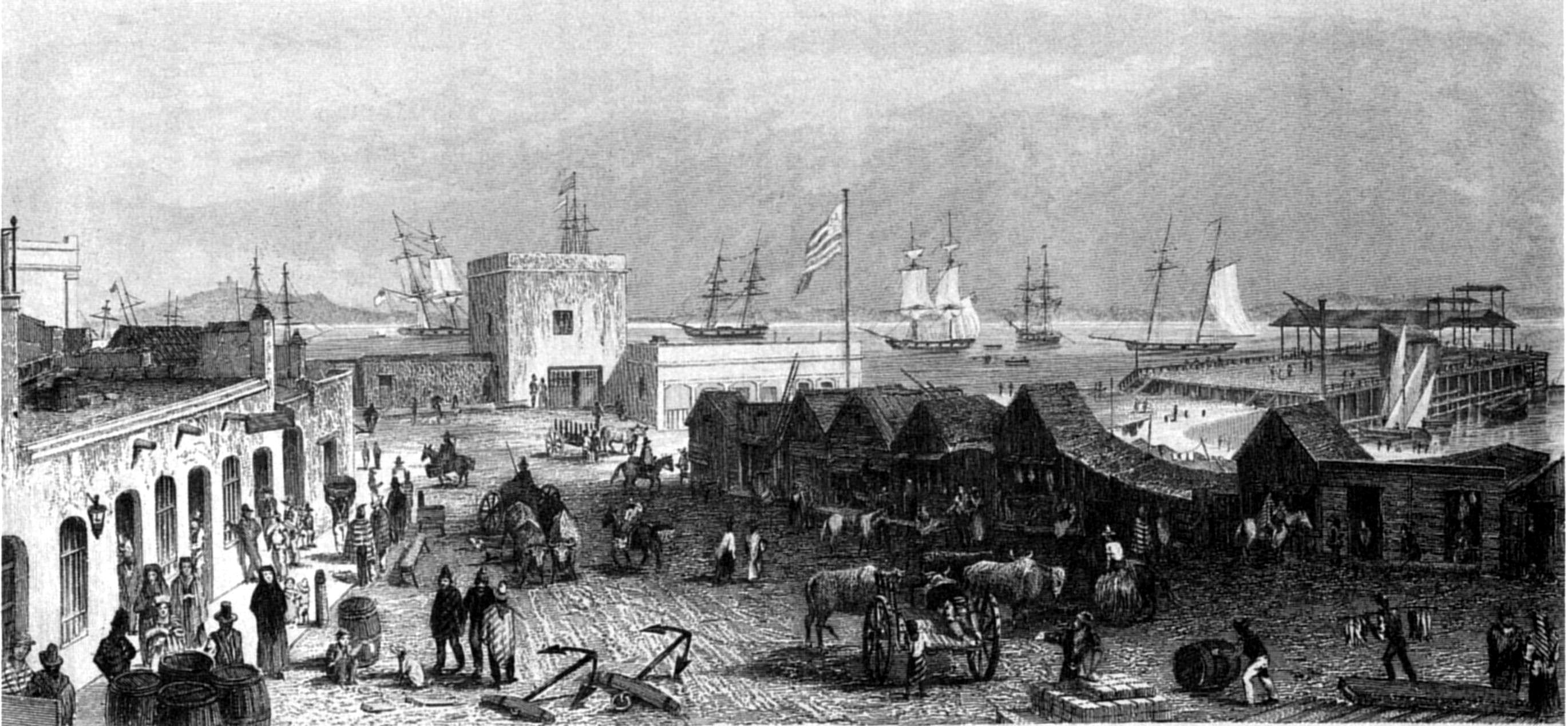
A. EarleT. A. Prior
MONTE VIDEO.—CUSTOM HOUSE.
Published by Henry Colburn, Great Marlborough Street,
1838
Having anchored, and lowered the topsails, I sent a boat to inform the
Brazilian who we were, and to request, that in consequence of the number
of our sick (we had only ten serviceable men on deck), we might not be
detained, as even a few hours might prove of serious consequence; but all
I could urge was unavailing, and we were detained until daylight with
trifling excuses. We were so situated, that unless the brig veered her
cable, or dropped out of our way, we could not move without getting foul
of her, else I should have proceeded without permission. After daylight,
the brig gave us room, by tripping her anchor; and upon an officer coming
on board to release us, I told him my opinion of the affair, and said I
should report the captain's conduct to his admiral. This report was
afterwards made, in a very spirited manner, by Captain Henry Dundas, of
H.M.S. Sapphire; but the admiral defended the conduct of his officer by
saying that he had merely acted, "magna componere parvis," as an English
blockading squadron would have done in a similar case.
Whether the act was borne out, or not, by the law or custom of
blockade, it was very uncivil; and one for which, after the explanation
given, and the proofs offered, there could not be the slightest occasion.
Owing to this detention, we did not reach the anchorage at Monte Video
until too late in the day to procure refreshments for the sick. We found,
to our sorrow, that fresh provisions were so extremely scarce, owing to
the war, that none could be procured for our ships' companies; and had it
not been for the kindness of Señor Juanico, a well-known, and highly
esteemed resident at Monte Video, who supplied us plentifully with bitter
(Seville) oranges, we might have been much distressed. The free use,
however, of this fruit alone caused a rapid change in the health of those
affected by scurvy, and in less than a week every man was at his
duty.
A few days after our arrival, through the intervention of the British
minister, a peace was concluded between the belligerents, in which Buenos
Ayres gained all it had contended for, and Brazil gave up what she had so
imperiously demanded.
I was extremely gratified by meeting, at this port, the late Captain
Henry Foster, in H.M.S. Chanticleer, on his pendulum voyage. He was
established at an observatory on a small island, called Rat, or Rabbit
Island, whither I lost no time in proceeding, and found him deeply
engaged in that series of observations which has reflected so much honour
upon his memory.
Before he sailed, I made an arrangement to meet the Chanticleer,
either at Staten Land or Cape Horn, for the purpose of supplying her with
provisions, to enable him to proceed thence to the Cape of Good Hope,
without returning to Monte Video.
On the 13th of October, we sailed for Rio de Janeiro to procure some
stores, which had been sent from England for our use, and to be caulked
and refitted. The Beagle remained at Monte Video, to prepare for our next
cruise. Before we were ready to leave Rio de Janeiro, the
Commander-in-chief, Sir Robert Otway, arrived from Bahia, in his
flag-ship, the Ganges. Sir Robert acquainted me, that he considered it
necessary for the Beagle to be hove down and repaired;—that he
intended to supersede Lieutenant Skyring; and had sent the requisite
orders to Monte Video. When the Beagle arrived, Lieutenant Robert Fitz
Roy, flag lieutenant of the Ganges, was appointed as commander; Mr. J.
Kempe, mate, as lieutenant; and Mr. M. Murray, second master of the
Ganges, as master.
Although this arrangement was undoubtedly the prerogative of the
Commander-in-chief, and I had no reason to complain of the selection he
had made to fill the vacancies, yet it seemed hard that Lieutenant
Skyring, who had in every way so well earned his promotion, should be
deprived of an appointment to which he very naturally considered himself
entitled.
The conduct of Lieutenant Skyring, throughout the whole of his service
in the Beagle,—especially during the survey of the Gulf of Peñas,
and the melancholy illness of his captain,—deserved the highest
praise and consideration; but he was obliged to return to his former
station as assistant surveyor: and, to his honour be it said, with an
equanimity and good-will, which showed his thorough zeal for the
service.
Captain FitzRoy was considered qualified to command the Beagle: and
although I could not but feel much for the bitterness of Lieutenant
Skyring's disappointment, I had no other cause for dissatisfaction.
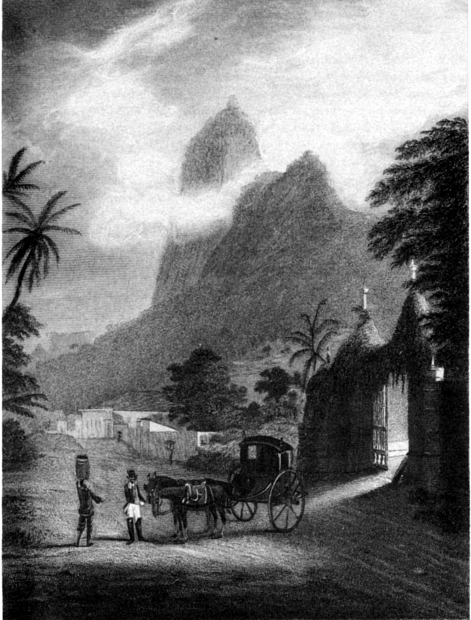
A. EarleS. Bull
CORCOVADO MOUNTAIN, RIO DE JANEIRO.
Published by Henry Colburn, Great Marlborough Street,
1838
Adventure sails from Rio de Janeiro to the River
Plata—Gorriti—Maldonado—Extraordinary
Pampero—Beagle's losses—Ganges arrives—Another
pampero—Go up the river for water—Gale, and consequent
detention—Sail from Monte Video—Part from our
consorts—Port Desire—Tower Rock—Skeletons—Sea
Bear Bay—Fire—Guanacoes—Port Desire Inlet—Indian
graves—Vessels separate—Captain Foster Chanticleer—Cape
Horn—Kater's Peak—Sail from St. Martin Cove—Tribute to
Captain
Foster—Valparaiso—Santiago—Pinto—Heights—Chilóe—Aldunate.
The Adventure sailed from Rio de Janeiro on the 27th of December 1828,
leaving the Beagle to complete her repairs, and follow to the River
Plata. The day before our arrival at Maldonado, we were overtaken by the
Commander-in-chief, in H.M.S. Ganges, and entered the river in company.
The Ganges proceeded to Monte Video; but we went into Maldonado Bay,
where I had determined to wait for the Beagle.
Since our last visit to this place, the Island of Gorriti had been
occupied by Brazilian troops, who, before going away, set fire to the
buildings, and destroyed all the wood-work. As one object of my stay was
to obtain observations for the latitude and longitude, I erected our
portable observatory, and set up an azimuth altitude instrument.
On the 30th of January, after some intensely hot and sultry weather,
we experienced a very severe 'Pampero.' It was preceded by the barometer
falling to 29.50, and by a strong N.W. wind, which suddenly veered round
to S.W., when the pampero burst upon us. Our ship and boats fortunately
escaped any bad effects from the violence of the squall, which was so
strong as to lay the former, at anchor, upon her broadside; but on shore
our tent was blown down, and a boat that had been lately built, and fresh
painted, on the Island Gorriti, was completely destroyed. The part above
the thwarts, was torn away from the bottom of the boat, and carried, by
the violence of the wind, for two hundred yards along the beach. A boat,
also, on the opposite shore, was blown to atoms.
When the squall commenced, one of our boats was coming off from the
island; the officer being quite unconscious of the approaching hurricane,
and as she was overloaded with people, I felt very uneasy until after the
squall cleared away, when I observed her beached on the opposite shore,
many yards above high water mark, to which position she had been driven
by the force of the wind. The violence of this pampero, during the twenty
minutes it lasted, was terrific. Old inhabitants of Maldonado declared,
that they had experienced nothing like it for the last twenty years. The
spray was carried up by whirlwinds, threatening complete destruction to
every thing that opposed them. In less than half an hour it had
diminished to a strong S.W. gale, which lasted during the night.
Just before the pampero commenced, L'Aréthuse, French frigate, was
observed over the point of land under all sail; but not being seen after
the squall cleared off, we were much alarmed for her safety. At daylight,
however, the next morning, she was seen at anchor under Lobos Island, and
near her was our consort, the Beagle, of whose approach we had known
nothing; but she appeared to be lying quietly, with topmasts struck,
under the lee of the island. L'Aréthuse slipped her cable in the
afternoon, and ran out to sea.
On the 1st of February the wind moderated, and enabled the Beagle to
join us, when we found that she had been nearly capsized by the pampero;
and had suffered a considerable loss of sails and masts, besides injury
to her boats. Both topmasts, and jib-boom, with all the small spars, were
carried away; and her jib and topsails, although furled, were blown to
pieces. The vessel was on her beam ends for some time; but letting go
both anchors brought her head to wind and righted her, which prevented
the necessity of cutting away the lower masts. To add to their
misfortune, two men were blown overboard, from aloft, and drowned.
These severe losses caused considerable detention; but, fortunately,
the Ganges arrived, and rendered every assistance in repairing and
replacing the Beagle's damages.
On the night of the 2d of February we experienced another very severe
pampero, during which one of the Beagle's boats, hauled up on shore, was
blown to atoms. The barometer had previously fallen to 29.39.
On the 9th of February, we went to Monte Video, and on the 17th ran up
the north side of the river for water; but did not find it fresh until we
were within four miles of Cape 'Jesus Maria.' The wind was against our
return, so that we had to beat down the river, in doing which the
Adelaide grounded, but without receiving any injury. We anchored twice in
our passage out, and, at the second anchorage,[113] experienced a very heavy westerly
gale. In attempting to weigh at its commencement, our windlass was so
much injured, that we were obliged to ride the gale out, which we did by
veering to one hundred and ten fathoms of chain cable; and the Beagle, to
one hundred and fifty fathoms. Owing to a short heavy sea, in which the
Adventure frequently pitched her bowsprit and stern alternately under
water, her jolly-boat was washed away. This loss we could ill afford, as
we were already three boats short of our establishment, and wants; and as
the Adelaide had suffered severely, by losing her topmast and jib-boom,
and carrying away the head of her bowsprit, we were obliged to return,
very reluctantly, after the gale had subsided, to Monte Video; whence we
finally sailed on the 1st of March. On the 5th a S.S.E. gale separated us
from our consorts, our course, therefore, was directed for the first
rendezvous, at Port Desire.
When off Cape Blanco, the high land of Espinosa, in the interior, was
clearly distinguished at a distance of sixty miles, and might probably be
seen twenty miles further; so that its height must be, at least, four
thousand feet. This range is of irregular form, and has several peaked
summits, so very different from the general features of this coast, where
the heights are either flat-topped, or of an undulating outline, that I
suppose the rock to be of a character unlike that of the porphyry hills
common hereabouts.
On anchoring off Port Desire (14th), we found that the Beagle had
arrived, but had not met the Adelaide. The following afternoon I landed
to examine the Tower Rock, a very conspicuous object, on the south side
of this harbour, having the appearance of an enormous dead tree with its
branches lopped off. On our way to it we passed over an undulating plain,
composed of a sandy light soil, lying on a rocky basis, which in many
parts protruded. The soil was so poor, as only to produce a few tufts of
grass, and here and there a straggling bush of Berberis, or Piccoli, a
dwarf woody shrub, which is much esteemed as firewood by the sealers who
frequent the coast. Sir John Narborough, in describing this place, says,
"The soil is gravelly and sandy, with tufts of dry seared grass growing
on it;" again: "from the tops of the hills I could see a great way into
the land, which is all hills and downs, like Cornwall, toilsome
travelling to those who were not used to it."
The Tower Rock is evidently the remains of what was once probably a
considerable rocky mass, which has either been partially destroyed by
some convulsion, or, more probably, has been gradually worn away by the
effect of weather. Like all the débris around, it is of a fine-grained
red porphyritic claystone, much decomposed, but very hard, and difficult
to break.[114]
It stands erect at the summit of a mound or heap of broken stones, of
all sizes, some being very large blocks, from ten to twenty, or thirty
tons weight. It is about forty feet high, and twelve in diameter, having
its upper portion cleft, as it were, for about one-third down the middle,
which gives it a resemblance to the forked branch of an immense tree. It
is covered with moss and lichen, and, from its peculiar shape and
prominent situation, presents a very remarkable object.
Near it we observed traces of an Indian visit, among which was a
horse's skull. From the sterility of the soil and absence of fresh water,
it is probable that it is but little frequented by them. Port Desire is
celebrated as being the place where Schouten, the Dutch
navigator, is said to have found skeletons measuring eleven or twelve
feet in length!
Captain Fitz Roy informed me that he had not seen the Adelaide since
we separated. The Beagle had lost another boat in the gale; the eleventh
we had lost in the expedition since leaving England. As the Adelaide
did not make her appearance, I determined upon proceeding in the
Adventure to Sea Bear Bay, a few miles to the southward of Port Desire,
to await her arrival with the Beagle. While standing into the bay, we
were amused by a chase of a novel description: a guanaco was observed
following a fox, which had much difficulty in keeping his pursuer at a
distance. As the guanaco is not carnivorous, it may have been in
playfulness: Reynard, however, by his speed, and anxiety to escape, did
not seem to think it an amusement. How the chase terminated we did not
see, for they disappeared in a valley.
While the ship was being moored, I landed to examine some wells near
the outer point, which have been said to afford some tuns of good water.
I found them to be deep holes in the solid rock, within the wash of a
heavy surf, and large enough to contain two hundred gallons of water; but
in one only was the water fresh, the sea having broken into the others,
and, of course, spoiled their contents. They receive the rain from the
ravines, and are much depended upon by sealing vessels which frequent
this coast.
Sea Bear Bay was discovered in the voyage of the Nodales, in the year
1618; they describe the place, but give it, as it deserves, a very poor
character. "The port," they say, "for a short stay, is not bad, since it
affords a good depth of water and a clear bottom; but otherwise it
possesses nothing to make it worth a ship visiting it, for there is
neither wood nor water, which are what ships most require." Nodales
called the bay 'Sea Lion,' from the multitude of sea-lions (Phoca
jubata) found on Penguin Island. Why it has been changed to Sea Bear
Bay I cannot determine.
In one of Mr. Tarn's excursions into the country, he observed a sail
in the offing, which he thought was a whale-boat; and supposing it
might be in distress, if not one of the Adelaide's, kindled a fire to
attract attention. As the grass was very dry, it blazed furiously, and
spread rapidly around, yet without exciting fear that it could do us any
injury; but the next morning flames being observed on the crest of the
hills, behind the valley in which our tent had been erected, a boat was
sent to save it, and remove the instruments. Our men had just left the
ship, when, fanned by a land breeze which rose with the sun, the flames
flew on with rapidity, descended the valley, and before the boat reached
the shore, had consumed every vestige of the tent, and several articles
of minor consequence. The sextant and artificial horizon, lying on the
ground, escaped destruction, and the dipping-needle had fortunately been
taken on board. Before the fire burned itself out, the whole country for
fifteen or twenty miles around was completely over-run, so that all hope
of procuring guanacoes was destroyed. Previous to the fire, Mr. Tarn had
shot one; but being young, the carcase only weighed one hundred pounds,
and was scarcely worth the trouble of sending fifteen miles for; however,
as an amusement to the people, I sent a party to bring it on board, and
it proved sufficient to furnish the ship's company with a fresh meal.
We had seen several herds within four miles of the ship before the
conflagration; but the country was so very level and open, that these shy
animals were always warned of the approach of our people by their
vigilant scouts. So watchful and attentive is the look-out at his post,
that he never drops his head even to feed, and it is only with the
greatest cunning and care a man can get near the herd. The best way is,
to lie concealed near the water holes, and await their coming to drink. A
small stream of fresh water trickled over the beach into the bay, fringed
by a patch of grass which the fire had spared, at which having once
observed a guanaco drinking, we set a watch; but whether the animals were
aware of it or not, none came until the morning we sailed, when a small
herd walked down to the place quite unconcernedly, having no doubt first
ascertained that there was no danger.
The little vessel Mr. Tarn saw was an American sealer, which anchored
in the bay next morning.
Besides the guanacoes, and fox, above-mentioned, we saw no quadrupeds,
although two or three sorts of cavia and the puma are common in this
neighbourhood. Of birds, nothing interesting was seen, except a plover
(Totanus fuscus?), oyster-catcher (Hæmatopus niger, rostro
rubro, pedibus albis), and one of the night bitterns, very much
resembling the young of the European bird;[115] but these three species had
previously been found at Port Famine. Several lizards were taken, and
preserved.
This extremely sterile and barren country is very unfavourable for
animals of any kind. The soil is like that already described about Port
Desire. The rock is of the same character as at Port St. Elena and Port
Desire: red porphyritic claystone.[116]
On the 23d of March, a week having passed since we came to Port
Desire, my anxiety for the Adelaide's safety was much increased;
especially as both wind and weather had been favourable for her approach
to this rendezvous. I therefore despatched Lieut. Wickham overland to
Port Desire to order the Beagle to join us, and proceed with us to the
other points of rendezvous, Port San Julian and Cape Fairweather. Lieut.
Wickham reached Port Desire after a fatiguing walk, and early next
morning the Beagle was beating into Sea Bear Bay against a very strong
wind which increased, and detained us. I seized this opportunity of
completing our consort's provisions to five months. Captain Fitz Roy
informed me that he had taken advantage of his stay at Port Desire, to
ascend the inlet to the head. It extended for thirty miles, and the water
was salt to its very extremity; but, from the height of the old banks on
each side, it appeared likely that at times there may be considerable
freshes. At the head of the river he lighted a fire, which spread,
and soon joined that which Mr. Tarn had made. Their union probably burned
many square leagues of country.
On the 27th, we were still detained by a southerly gale. Captain Fitz
Roy accompanied me in search of Indian graves, which are described to be
on the summits of the hills. We found the remains of two, one of which
had been recently disturbed, but the other had been opened a considerable
time.
No vestiges of bones were left. It is said that the corpse is extended
in an east and west direction, on the top of the highest pinnacle of the
hill, and then covered over with large stones until secure from beasts of
prey. Decomposition takes place, or the flesh is consumed by small
animals or insects, without the bones being removed, so that complete
skeletons are formed. According to Falkner, the bones are collected at a
certain period, and removed to some general cemetery, where the skeletons
are set up, and tricked out with all the finery the Indians can collect.
The avidity they evince for beads and other ornamental trifles is,
perhaps, caused by this desire of adorning the remains of their
ancestors.
The next morning we left Sea Bear Bay and proceeded to San Julian, off
which we anchored for a few hours, while Captain Fitz Roy entered the
port to look for the Adelaide, or for some vestige of Lieutenant Graves's
visit. Finding nothing in the port, nor any tracks upon the shore, we
went on towards Cape Fairweather, and in our way met the Adelaide. After
parting from us during the gale in which all her sails were split, she
went to Port Desire, where she arrived first, and, not seeing us,
proceeded to the two other places of rendezvous, and had been lying at
anchor eight days off Cape Fairweather. Finding we were not there, she
was returning to Port San Julian, when we met her.
The weather being calm, so good an opportunity of supplying the
Adelaide with provisions was not lost, and she was completed to six
months.
On the 1st of April we were off Cape Virgins, and parted from the
Beagle and Adelaide; Captain Fitz Roy having previously received orders
from me to proceed through the Strait of Magalhaens, and despatch the
Adelaide to survey the Magdalen and Barbara Channels, while he
was to survey part of the south shore of the Strait and the Jerome
Channel, and then proceed, in company with the Adelaide, to Chilóe.
The Adventure then proceeded along the coast of Tierra del Fuego
towards Staten Land, for the purpose of communicating with the
Chanticleer, or obtaining some intelligence of her. The appointed
rendezvous was New Year's Harbour, and the day on which I had promised to
be there was past.
It was so foggy that no part of the coast of Tierra del Fuego could be
seen; but as any detention might cause Captain Foster inconvenience, I
did not wait for fair weather, but went at once to the place
appointed.
When crossing Strait le Maire, we were very nearly drifted through by
the tide, which, however, changed just in time to admit of our keeping on
the north side of Staten Land.
With a strong squally breeze we entered New Year's Harbour, and seeing
nothing of the Chanticleer, should have sailed without further
investigation, had we not observed a cleared white space on one of the
islands, which being near the place where I had requested Captain Foster
to leave a document, I concluded was intended to attract our attention.
The anchor was therefore dropped in twenty-five fathoms (the island
bearing from N. to N.W. ¼ W.), nearly in the spot where Captain Cook
anchored, and a boat was sent to the white mark, near which a flag-staff
was observed, at whose foot was a tin canister, containing a letter from
Captain Foster, which informed me of his having been obliged, in
consequence of a longer detention here than he had anticipated, to alter
his arrangements, and requesting me to meet him at St. Martin's Cove,
near Cape Horn, about this day. We therefore lost no time in getting
under weigh, but in doing so, broke an anchor. We passed round Cape St.
John, and with a fair wind made rapid progress to the westward. At noon,
the next day, being seventy-five miles from Cape Horn, bearing W. by S.,
the high mountains on the S.E. end of Tierra del Fuego came in sight,
among which the 'Sugar Loaf'(g) was a conspicuous object. By an angular
measurement of its altitude, and the distance given by the chart, its
height must be nearly five thousand feet, and the average height of its
neighbouring mountains full three thousand.
A south-west gale now set in, and delayed our reaching Cape Horn until
the 16th, when we anchored off the entrance of St. Martin's Cove and
found the Chanticleer moored within. A boat soon after came with the
welcome information of all being well on board her. We were not able to
warp into the Cove until next day, and in doing so found much difficulty,
owing to the violence of the squalls, which repeatedly obliged us to
slacken the hawsers quickly, else we should have carried them away.
The Adventure was moored in seventeen fathoms, about a cable's length
within the low green point on the south side: and the Chanticleer lay in
ten fathoms near the head of the Cove. The summit of Cape Horn being in a
line with the south point of entrance, we were quite land-locked, and
perfectly sheltered from all winds, excepting the williwaws, or furious
gusts from off the high land, which sometimes suddenly struck the ship,
and threw her on her broadside; but being as momentary in duration as
they were sudden in approach, we found them more disagreeable than
dangerous.
During our stay here I made a partial survey of the Bay of St.
Francis, which has since been completed by Captain Fitz Roy. St.
Joachim's Cove, to the southward of St. Martin's Cove, is more exposed
than the latter, but is of easier depth. These coves are separated from
each other by a steep and precipitous mass of hills of greenstone, which
in many parts appear to be stratified, the dip being to the westward, at
an angle of 40°. I landed at the point, and ascended the hill, which I
found more difficult to do than I supposed, the whole surface being
covered with stunted beech bushes, so thickly matted or interwoven
together, that I was obliged to walk or crawl over their tops. Among them
were occasionally seen the berberis ilicifolia and veronica, the latter
of very small size. Another day, Lieutenant Kendall, of the Chanticleer,
accompanied me to Weddel's Port Maxwell, which is
evidently St. Bernard's Cove of D'Arquistade.(h) Port Maxwell is contained between Jerdan
Island, Saddle Island, and a third island, forming a triangle. It has
four entrances, the principal one being to the north of Jerdan Island,
and affords tolerable anchorage in the centre, in nineteen and twenty
fathoms, sand;[117]
nearer the shores of the island the depth is more moderate, but the
bottom is very rocky.
The summit of Saddle Island, which I ascended for bearings, is
composed of large blocks of greenstone rock, on one of which the compass
(Kater's Azimuth, without a stand) was placed; but the needle was found
to be so much influenced by the ferruginous nature of the rock, composed
of quartz and feldspar, thickly studded with large crystals of
hornblende, that the poles of the needle became exactly reversed. An
experiment was then made, by taking bearings of a very distant object, at
several stations around, about fifty yards from the magnetic rock, when
the extreme difference of the results amounted to 127°. The block upon
which the compass stood, in the first instance, is now conspicuously
placed in the museum of the Geological Society.[118]
Saddle Island, like the others near it, is clothed with low stunted
brushwood of beech, berberis, and arbutus, and the ground is covered with
a species of chamitis, and other mountain plants. While Mr. Kendall and I
were absent from the boat, the crew caught several kelp fish, which are
very delicate and wholesome food. On the following day, while going with
Mr. Kendall to Wollaston Island, we passed a great many whales, leaping
and tumbling in the water. A blow from one of them would have
destroyed our boat, and I was glad to cross the Sound without getting
within their reach. We returned by the west side of Jerdan Island, where
there are bights which might afford shelter to a small vessel.
The Sound that separates Wollaston Island from the Bay of St. Francis,
I named after Sir John Franklin, and the harbour to the east of the point
on which we landed, after Lieutenant Kendall, who was one of Sir John
Franklin's companions in his last journey to the north-west coast of
America.
On the west point of Kendall Harbour, I observed a magnetic property
in the rock, which is of the same character as that on Saddle Island.
Weddel noticed the same at St. Martin's Cove; but I placed the compass in
various parts of that cove, without observing any difference from the
correct bearing. This was, perhaps, owing to the rock being much covered
with soil; for, being of the same character with that of the places
above-mentioned, it should cause a similar effect.
The next day S.W. gales and thick weather set in, and confined us
almost to the ship. Taking advantage of a short interval of more moderate
weather, I ascended the highest peak on the south side of the cove,
immediately over the anchorage, taking two barometers, one of the
Englefield construction, and the other a syphon barometer, on M. Gay
Lussac's plan, made by Bunten, of Paris. Mr. Harrison accompanied me,
taking charge of one barometer, whilst I carried the other. My coxswain
carried a theodolite. On landing, the barometers were set up at the edge
of the water and read off, and at the same moment the barometer on board
was read off. We then ascended, but the rise was so precipitously steep
as to offer very great impediments; and had it not been for a
water-course, in whose bed we climbed for the first part, the ascent,
with delicate instruments, would have been almost impracticable. We had
ascended but little way, when the unfortunate theodolite escaped from my
coxswain, rolled down the ravine, and was much damaged. It was an
excellent magnetic transit, and for that purpose was irremediably
injured; but, as a theodolite, it was yet useful. The first third of the
ascent, from the comparative facility offered by the
water-course, was only impeded by loose stones, which frequently yielded
to the foot, and rolled down the gully, to the great danger of those who
followed. The banks of the ravine were saturated with water, and covered
either with spongy moss, or matted with plants,[119] which afforded no assistance; had it
not therefore been for straggling shrubs of arbutus, or veronica, and
tufts of rushes, growing on the steeper parts, we should have had many a
fall; and however unimportant we might think bruises and scratches, a
broken barometer would have been a serious accident, and much care was
required to avoid it. We had to leave the bed of the torrent, when it
became full of wood, and then our difficulty increased much; for in many
places we had to scramble over the thickly-matted and interwoven branches
of the stunted bushes of beech which frequently yielded to our weight,
and entangled our legs so much, that it was no easy matter to extricate
ourselves.
At the height of one thousand feet, vegetation became much more
stunted; we found the plants and shrubs of very diminutive size,
consisting principally of the deciduous-leaved beech, one plant of which,
though not more than two inches high, occupied a space of four or five
feet in diameter, its spreading branches insinuating themselves among
wild cranberry, chamitis, donacia, arbutus, and escalonia, so closely
matted together, as to form quite an elastic carpet. For the last two
hundred feet, we walked over the bare rock, on which no other vegetation
was observed than lichens. The summit of the peak is formed by a loose
pile of green-stone rock, in which the hornblende appears in very varied
forms, sometimes in large crystals, and again so small and disseminated,
as to be scarcely visible; on the summit it is seen, in very long, narrow
(? filiform) crystals, and the feldspar predominating, gives it a white
appearance.[120]
The only living creatures we saw were a solitary hawk and one
insect, a species of Oniscus. Nothing, in fact, could be more desolate,
and we had only the satisfaction of a good observation for the height,
and an excellent bird's-eye view of the surrounding islands and channel,
to repay us for the labour of the ascent. On reaching the top, the
barometers were suspended under the lee of the rock, twelve feet below
its summit, and I then proceeded to set up the theodolite, which I found
more damaged than I had anticipated; but not so much as to deprive me of
a very extensive round of angles, in which were contained bearings of the
Ildefonso Islands. We were thus occupied about an hour and half, which
afforded me an opportunity of obtaining two good readings of the
barometer.
The view to the N.W. was very extensive, and bounded by long ranges of
snow-clad mountains of great height; the atmosphere was remarkably clear,
and every object unusually distinct. Bearings of the islands of Diego
Ramirez would have been taken, but for the extreme force of the wind,
which more than once blew me from the theodolite, and once actually threw
me on the ground. The temperature was not below 38°; but, owing to the
wind, the cold was intense, and the rapid evaporation produced the most
painful sensations, particularly in our feet and legs, which were
thoroughly wet when we reached the top.
Our descent was not effected in less than an hour and twenty minutes,
owing to the difficulty of passing through the beech thickets; but we
reached the base without injury to the barometers, which was being more
fortunate than I expected. They were again set up on the beach, and read;
after which we returned on board, amply gratified and rewarded for our
fatigue.
The height of the peak, which, from its vicinity to the station
selected by Captain Foster for the pendulum experiments, could not
receive a more appropriate name than Kater's Peak, was found to be 1,742
feet above the high-water mark.[121]
The next day, after a beautifully clear and mild morning, with a fresh
northerly breeze, the weather became cloudy, and the wind veered to the
S.W. blowing excessively hard, with hail and rain. The gusts, or
williwaws, rushed through the valley of the cove with inconceivable
violence, heaving the ship over on her broadside every minute, so that we
were obliged to have every thing lashed as if at sea. Fortunately, we had
completed wood and water, and now only waited for observations, to rate
the chronometers, for our run to Valparaiso, whither it was my intention
to proceed. Days, however, passed without a glimpse of the stars, and the
sun only appeared for a few minutes above the hills. Captain Foster had
completed his observations, and embarked all his instruments, excepting
the transit, which remained for taking the passages of stars; but the bad
weather continued, with little intermission. On the 3d, the gale was most
violent, and the williwaws became short hurricanes, in some of which the
ship drifted and fouled her anchors. On the 10th, we had a dry and fair
day, which permitted us to sight the anchors and moor again.
The fine weather was of only a few hours duration, when the gale again
sprung up, and lasted, with little intermission, until the day of our
departure (the 24th). From the 4th to the 22d the sky was so perpetually
clouded, that the only transits obtained in that interval were, one of
Antares, one of Regulus, and one of the limb of the moon, though Captain
Foster even slept close to the telescope, in the greatest anxiety to
obtain observations. On the night of the 22d four stars were observed,
by which the error of the clock was satisfactorily ascertained.
Captain Foster's pluviameter, a cubic foot in size, placed on a stand
two feet above the ground, at an elevation of forty-five feet above the
sea, contained eight inches and a quarter of rain, after standing thirty
days; therefore, with the quantity evaporated, at least twelve inches
must have fallen. The day after the above was registered, the vessel only
contained seven inches and a quarter; so that in twenty-four hours one
inch had evaporated, by which an idea may be formed of the sort of
weather we experienced, and of the humidity of the climate.
With respect to the geological features, I can only add, that all the
islands on which I landed, and, I believe, all the others, are composed
of green-stone of various characters. The lower portion, or base, being
less decomposed, is a fine-grained green-coloured rock, in which the
component parts are so blended as not to be distinguished from each
other. It appears sometimes in strata, dipping at various angles, from
20° to 45° from the vertical; and is very similar to the rock which
alternates with granite in the Straits of Magalhaens, at the entrance of
the Barbara; and also to that about Pond Harbour, and Bell Bay. At a
greater elevation the feldspar predominates, the hornblende is observed
in distinct crystals,[122] and the rock contains a considerable
quantity of iron, which is observed in the reddish tinge of its surface.
I have before noticed the magnetic property of this rock, which was more
or less according to the quantity of hornblende: the beach-stones are
different sorts of green-stone.
The lower parts of the hills, around St. Martin's Cove, are thickly
wooded with the smooth-leaved, evergreen beech, which I have before
described. Its leaves were as fresh and vivid, when we sailed, as if it
were the height of summer; but those of the deciduous-leaved beech had
assumed their autumnal tint, and were falling fast. Neither species
attained a greater size, in diameter, than six or eight inches. The
Winter's-bark was found in sheltered places, but not larger
in dimensions than the beech.[123] Where no trees are produced, the
ground is covered with tufts of chamitis and donacia, which, being of a
bright-green colour, give the sides of the hills a lively and verdant
appearance. Had the state of the weather permitted our boats to leave the
neighbourhood of the cove, or had the woods afforded any addition to
collections for natural history, our detention would have been more
agreeable; but, with the exception of a few corvorants, divers, and
'steamers,' with now and then a solitary hawk, or a Patagonian 'warbler,'
we saw no traces of animal life. No Indians came near us, having been
frightened away by the Chanticleer; for when Captain Foster was absent at
night, after attempting to land at Cape Horn, several rockets were fired
off as signals, and a few Indians who were then in the cove were so much
alarmed, that they went away next day, and never afterwards showed
themselves, although I dare say we were very narrowly watched by
them.
Having supplied the Chanticleer with the provisions she required, we
prepared to leave St. Martin's Cove. On the 24th the Chanticleer sailed,
and in two hours after we also left this dismal cove, in which we
experienced a succession of very bad weather, an almost constant S.W.
wind, and for the last month a scarcely ceasing fall of either rain,
hail, or snow. The Chanticleer bore away round Cape Horn, and was soon
out of sight.
This was my last meeting with Captain Foster, who, the night before we
sailed, communicated to me a presentiment, which he could not shake off,
that he should not survive the voyage. I cannot now resist indulging in
the melancholy satisfaction of saying a few words to the memory of my
late excellent friend, and lamenting, with many others,
the severe loss which science suffered in his death. He was a fellow of
the Royal, and Astronomical Societies, and to the former had contributed,
to use the words of His Royal Highness the Duke of Sussex, as President
of the Royal Society, a most valuable and extensive series of
observations upon the diurnal variation, diurnal intensity, and dip of
the magnetic needle; and upon other subjects connected with the
terrestrial magnetism and astronomical refraction, which formed an entire
fourth part of the Philosophical Transactions for the year 1826. For
these papers he received the Copley medal; and the Lords of the Admiralty
acknowledged their sense of the honour which was thus conferred upon the
profession to which he belonged, by immediately raising him to the rank
of Commander, and by appointing him to the command of the Chanticleer,
upon a voyage of discovery and observation in the South Seas. The address
of the President of the Royal Astronomical Society, at the anniversary
meeting,[124] also bears
ample testimony to his active and useful services in the expedition,
under Captain Parry, towards the North Pole; as well as to his ardent
zeal, very great attention, and accuracy, in every thing which he
undertook for the promotion of science; and concludes the notice of his
death in the following words: "In the premature death of this young and
accomplished officer, the Society has to deplore the loss of a zealous
and active votary to science; and his memory will be long held dear by
those who were more intimately acquainted with him in the relations of
private life." Captain Foster was unfortunately drowned, near the close
of his voyage, while descending the River Chagres in a canoe.
No sooner had we cleared the land, than we found a strong westerly
wind, and a heavy sea; so that if we had entertained any expectation of
making a quiet passage to the westward, we should have been
disappointed.
The land of Hermite Island, and its vicinity, has a most remarkable
appearance when seen from the south. Its outline is a series of peaks,
following each other in regular succession, and resembling the worn
teeth of an old saw. Mount Hyde is made sufficiently distinct by its
rounded apex, and by being higher than any land near it. Kater's Peak
also is remarkable in this view, from its conical form and very pointed
summit, and from being situated at the eastern end of the island. The
'Horn' itself needs no description; it cannot easily be mistaken.[125]
Westerly winds carried us as far as 60° south latitude before we could
make any westing, and then we had a slant from the eastward, followed by
variable winds. Our run to Valparaiso was much like all other voyages in
this climate; we had the usual quantity of foul and fair winds, with a
share of tempestuous weather, and arrived at Valparaiso Bay on the 22d of
June. While remaining here our chronometers were cleaned, and some of
them repaired; and the ship was refitted and provisioned, with a full
supply for the Beagle and Adelaide as well as herself.
At the latter end of July, Lieutenant Wickham accompanied me to
Santiago, the capital of Chile, ninety miles from the port, for the
purpose of waiting upon General Pinto, the Director; and communicating to
him the purpose of our voyage, to prevent exciting suspicion, or
receiving any interruption on the part of the authorities of places we
might visit, particularly Chilóe, where our stay might be viewed with
distrust or apprehension; for rumour had already said that the English
were about to take that island. Ridiculous as such a report was, I deemed
it sufficiently important to induce me to explain to the Chilian
Government our views and orders, which could be done better by personal
explanation than by a correspondence.
We commenced our journey early on the 11th of July, travelling in a
covered chaise, drawn by three horses, one in the shafts, and the
others outside, attached to the carriage by a single trace of hide; and
preceded by a drove of horses, from which, at the end of every stage of
twelve or fifteen miles, we selected a relay. The day was so very stormy,
that we saw but little of the country. Immediately after leaving the
Almendral, or suburbs of Valparaiso, we ascended twelve hundred feet, and
then descended about four hundred feet to an extensive plain, reaching to
the Cuesta de Zapato, the summit of which, at least the highest part of
the road over it, we found by barometrical measurement to be 1,977 feet
above the sea. In the interval we passed through the village of Casa
Blanca, lying eight hundred and three feet above the sea. After passing
the Cuesta de Zapato, between it and the Cuesta de Prado, is another
extensive valley, through which runs the River Poangui. At Curacavi,
where we crossed the river, the height above the sea is six hundred and
thirty-three feet;[126]
and the road proceeds by a gentle ascent to the foot of the Cuesta de
Prado, near which is the village of Bustamente, eight hundred and eight
feet above the sea.
This 'cuesta' is passed by a very steep road, and is ascended by
twenty-seven traverses, which carry one to a height of 2,100 feet above
the plain, or 2,950 feet above the sea. When we reached the summit of
this mountain the weather was so cloudy, that the Andes were almost
concealed from view. Beneath us was the extensive plain of Maypo, with
the city of Santiago in the distance, a view of considerable extent, and
possessing very great interest; but from the state of the weather, its
beauty would not have been seen to advantage, had not portions of the
towering Andes, raised by optical deception to apparently twice their
height, appeared at intervals among the clouds. On a fine day, when the
range of mountains is uncovered, the view is grand; but not so imposing
as when their lower portions are concealed, and their summits partially
exposed. This part of the Andes rises about 11,000 feet above the plain,
and is covered half way down the sides with snow, the lower edge of which
is regularly defined, and presents a change of colour so abrupt and
horizontal as to appear unnatural, and therefore diminish the grandeur of
the scene very much. But under whatever circumstances this view is seen
from the Cuesta de Prado, it is magnificent, and produces an effect
beyond description. The road descends down the eastern side of this
Cuesta, to a plain about 1,100 feet below the summit. So much rain had
fallen during the two preceding days, and last night, that our driver
expressed some doubt whether we should be able to cross the Podaguel, a
river which is frequently impassable from the strength of its current.
The idea of spending a night at the miserable hovel we were leaving was
enough to induce us to run a considerable risk, and we set off to make
the attempt. The water was very deep, and the current sufficiently strong
to render it a performance of some danger; but, this difficulty being
passed, we soon reached the city of Santiago, and in the house of Mr.
Caldcleugh, enjoyed the hospitality and society of a warm-hearted
friend.
I waited on the Director (Pinto), who received me with the greatest
politeness. He entered into the particulars of our past voyage with much
interest, assuring me that every facility should be afforded, and every
assistance rendered, whenever it might be required; and in this assurance
we never found ourselves deceived, for on all occasions the conduct of
the executive authorities towards us was marked in attention, and even
kindness. I make this observation with the more pleasure, as it was very
unusual in our communications with the authorities of those governments
we had previously visited, to find the objects of our voyage considered
in the least interesting.
Although the weather, during our visit to Santiago, was not there
considered fine, we left the city and its neighbourhood with a strong
impression of the salubrity of the climate, and the mildness of
its temperature, which even in the middle of winter, and at the height of
nearly 2,000 feet above the sea, ranged no lower than 45° Fahrenheit, and
during the day the maximum height of the thermometer never exceeded
62°.[127](k)
We returned to Valparaiso on the 26th of July, and made preparations
to sail; but were detained by a strong northerly gale for many days, in
which we were enabled to render assistance to a large Indian trader that
would otherwise have been wrecked. On the 10th of August, we sailed for
Chilóe; and on our way were greatly delayed by southerly winds, which
carried us in sight of the island of Juan Fernandez. We reached our
destination on the 26th, and found the Beagle, to our great delight,
arrived, and all well. Captain Fitz Roy came on board before we anchored,
and gave me an outline of his proceedings, and those of the Adelaide,
which had not returned, but was daily expected, having
been despatched to survey some interior channels on her way to Chilóe.
Our anchorage was off Point Arenas, which is not only the best in the
bay, but appeared to be well adapted to our wants. The Beagle had arrived
early in July, and had sent to Valparaiso for stores with which to refit,
and make preparations for another cruize to the south.
The harbour master, Mr. Williams, an Englishman, visited us soon after
our anchoring, and by him I forwarded to the Yntendente (or governor),
Don José Santiago Aldunate, the letters brought for him from Chile.
In the afternoon I received his acknowledgments, and offers of all the
assistance in his power to render. As it was probable that our stay would
occupy some weeks, I established myself at a house in the town, obtained
by his kindness; and there fixed my portable observatory, and set up an
azimuth altitude instrument.
Beagle and Adelaide anchor in Possession Bay—Beagle passes the
First Narrow—Fogs—Pecket Harbour—Adelaide arrives with
Guanaco-meat—Portuguese Seamen—Peculiar light—Party
missing—Return—Proceed towards Port
Famine—Fuegians—Lieut. Skyring—Adelaide sails to survey
Magdalen and Barbara Channels—Views—Lyell Sound—Kempe
Harbour—Cascade Bay—San Pedro Sound—Port
Gallant—Diet—Rain—Awnings—Boat
cruise—Warning—Jerome Channel—Blanket bags—Otway
Water—Frequent rain—Difficulty in lighting fires.
The following is an account of the Beagle's and Adelaide's operations,
after separating from the Adventure, on the 1st of April, at the entrance
of the Strait of Magalhaens.
Light northerly winds were favourable for their entering the Strait,
and they reached Possession Bay the first night. The following day was
foggy, and almost calm, until the afternoon, when both vessels weighed,
and proceeded with the tide. At sunset the Adelaide anchored on the north
shore; but the Beagle stood on, and entered the Narrow. After dark, when
within it, with a rapid tide running, the wind fell light, and an anchor
was let go, under the north shore, in eight fathoms; but the cable being
accidentally checked too soon, snapped like a small rope, and the vessel
was hustled out into deep water. As it would have been both useless and
imprudent to let go another anchor, the Beagle was kept underweigh, and
worked to the westward, aided by a very powerful tide, which speedily
carried her through the Narrow, without accident, although the night was
dark; and they had no guide but the chart and lead. At eleven o'clock she
was anchored within the Narrow, in twelve fathoms, soon after which the
tide turned, and ran with great strength; but the night was calm, as well
as the next morning.
While waiting for wind, and the change of tide, several Patagonian
Indians were observed on horseback hunting guanacoes. A very large
dead cod-fish was also seen, floating past, which was taken on board; on
its skin were several parasites.[128]
With the evening tide the Beagle reached Gregory Bay; and the next day
(April 4th) worked through the Second Narrow, and anchored in Pecket
Harbour.
As soon as she arrived people were sent on shore to make a large fire,
to show the natives where the ship was, and attract them to her. Next
morning, the 5th, it had spread very much, and overrun several acres of
ground, which showed either a very dry soil, or that there had not been
much rain for some time. The ground was covered with cranberries; so much
so, that it had quite a red tinge; they were very good. Plenty of wild
celery was found, but no wood of any kind. Water was obtained in small
quantities, from a spring about eighty yards from the beach, abreast of
the anchorage: it may also be procured by sinking wells. Early on the 6th
of April the Adelaide anchored near the Beagle. Captain Fitz Roy went on
board, and found that Lieutenant Graves had seen the Indians in Gregory
Bay; and had anchored there for the purpose of obtaining guanaco meat, of
which he got about nine hundred pounds weight. Thick fogs had prevented
his getting through the First Narrow until the 4th. At Gregory Bay,
Lieutenant Graves took three Portuguese seamen on board, who claimed his
protection, having been left by an English sealing vessel nearly a year
before. One of them asked to be again put ashore, and was landed on Quoin
Hill to carry a message to the Indians, from whom he promised to bring a
supply of meat in two days. The other two were entered on the books as
supernumeraries, and employed in the Adelaide. Having given the Beagle
two-thirds of the meat, the Adelaide weighed; and in two hours was out of
sight, on her way to Port Famine.
The following are extracts from Captain Fitz Roy's journal of this
cruise of the Beagle.
"Monday 7th April. Several of our people were employed in gathering
cranberries, and preserving them for future use; they are anti-scorbutic,
as well as the wild celery, much of which has been used with our guanaco
soup.
"Wednesday, 8th. I went to Oazy Harbour with Lieutenant Skyring, who
surveyed the harbour while I examined the cove to the northward.
"Oazy Harbour appears large, but the part where there is anchorage is
very small, and a strong tide sets in and round it, by which a bank is
thrown up, a short distance inside the entrance; there is very little
wood, and some difficulty in obtaining fresh water, even in a small
quantity. The anchorage outside might be more convenient for procuring
guanaco meat from the Indians than Gregory Bay, but it is exposed to
winds between W.S.W. and S.S.E.
"At my return to the Beagle, I was much surprised to find that
Lieutenant Kempe, Mr. Bynoe, and a boy, had not yet come back from a
shooting excursion. A boat had been to the appointed place at sun-set,
and had waited an hour without seeing them. At seven, a light was seen on
the top of Quoin Hill, and I sent a boat to the spot, with cautions about
landing, being in doubt whether it was shown by them or by the Indians;
but the boatswain, who went with her, could find no person, nor any
light. He waited some time, and returned on board.(l) A similar light was
again seen, more than once, during the dark and gloomy weather, with
small misty rain falling, and a light breeze from the westward, which we
had all night.
"Thursday, 9th. No signs of our officers, nor any appearance of the
Indians. Fearing that some accident had happened, I sent two boats away,
with arms and provisions, to look for them all round the harbour, and the
large lagoon which communicates with it. Both boats were thoroughly
cautioned about the Indians, for I had thoughts of their treachery. Just
as the boats got out of sight, three people were observed on the ridge of
a hill, about six miles distant; and, at the same time two other persons
appeared, much nearer the ship, on the east side of the harbour. Which
was our party, and who the others were, it was perplexing to say. Both
disappeared again for about two hours, when our stragglers came over a
hill, very near the ship. Upon their arrival on board, they were scarcely
able to move: they had been on their legs, almost without food, and
without shelter from the rain, since they left the ship. Their intention
had been to walk round the harbour, which appeared an employment for two
hours only; but at its head they found a lake, and beyond that lake a
much larger one, joined to the first by a passage, which they could not
cross. When they arrived at this passage, it was too late to return by
the way they went, and their best chance seemed to be going on. After
dark, they tried to make a fire, but the rain prevented them. It was too
dark to see their way, and the cold rain obliged them to keep moving
about, though in one place. When daylight came, they travelled on, and
until they reached the ship at two o'clock, were constantly walking.
"The other people seen by us must have been Indians; none were met by
our wanderers, but several places were passed where fires had been made
by them.
"April 10th. Directly our boats returned, we weighed and made sail;
but the wind soon failed, and the tide setting against us, obliged me to
anchor.
"April 11th. Made sail towards the passage between Elizabeth Island
and Cape Negro, and anchored there to wait for the tide, which ran past
us when at anchor, at the rate of three knots an hour. About Cape Negro
the appearance of the land entirely changes. A low barren country gives
way to hills covered with wood, increasing in height, and becoming more
rocky and mountainous as you go southward.
"On the 13th, when working near the land, against a light southerly
breeze, we saw a small canoe paddling along shore, and some people walking
on the beach. While the ship was standing off, I went to them, being the
first savages I had ever met. In the canoe were an old woman, her
daughter, and a child, and on shore were two Fuegian men with several
dogs. Their figures reminded me of drawings of the Esquimaux, being
rather below the middle size, wrapped in rough skins, with their hair
hanging down on all sides, like old thatch, and their skins of a reddish
brown colour, smeared over with oil, and very dirty. Their features were
bad, but peculiar; and, if physiognomy can be trusted, indicated cunning,
indolence, passive fortitude, deficient intellect, and want of energy. I
observed that the forehead was very small and ill-shaped; the nose was
long, narrow between the eyes, and wide at the point; and the upper lip,
long and protruding. They had small, retreating chins; bad teeth; high
cheek-bones; small Chinese eyes, at an oblique angle with the nose;
coarse hair; wide ill-formed mouths, and a laugh as if the upper lip were
immoveable. The head was very small, especially at the top and back;
there were very few bumps for a craniologist. They asked earnestly for
'tabac, tabac,' but seemed very timid. We bartered some biscuit and old
knives for a few of their arrows, skins, spears, &c.
"Their canoes, twenty-two feet long, and about three wide, were
curiously made of the branches of trees, covered with pieces of
beech-tree bark, sewed together with intestines of seals. A fire was
burning in the middle, upon some earth, and all their property,
consisting of a few skins and bone-headed lances, was stowed at the
ends.
"The young woman would not have been ill-looking, had she been well
scrubbed, and all the yellow clay with which she was bedaubed, washed
away. I think they use the clayey mixture for warmth rather than for
show, as it stops the pores of the skin, preventing evaporation and
keeping out the cold air. Their only clothing was a skin, thrown loosely
about them; and their hair was much like a horse's mane, that has never
been combed.
"April 14th. Anchored in Port Famine."
"April 16th. Lieutenant Skyring went on board the Adelaide with Mr.
Kirke, five seamen, and one of the Beagle's whale-boats. Mr. Bynoe, the
assistant-surgeon, also went as a volunteer.
"April 17th. The Adelaide sailed to survey the Magdalen and Barbara
Channels; after which she was to rejoin the Beagle at Port Gallant. She
soon got into a strong southerly wind, and could make no progress, as the
current was against her; she therefore again stood into the bay, and
anchored.
"A sharply cold night made us remember we were far south, although the
weather by day had been mild. I have said little about this anchorage, as
it has already been described. The appearance of the surrounding country
is striking and picturesque. Mount Tarn, with its patches of snow, rising
from thick woods, and the high snow-covered mountains in the distance,
with dark blue sea at their base, are very remarkable objects.
"We sailed on the 19th with the Adelaide, which had been prevented
from going sooner by strong and unfavourable winds: and about noon we
parted from our consort, whose course was southerly, into the Magdalen
Channel, while we went towards Lyell Sound.
"I cannot help here remarking, that the scenery this day appeared to
me magnificent. Many ranges of mountains, besides Mount Sarmiento, were
distinctly visible, and the continual change occurring in the views of
the land, as clouds passed over the sun, with such a variety of tints of
every colour, from that of the dazzling snow to the deep darkness of the
still water, made me wish earnestly to be enabled to give an idea of it
upon paper; but a necessary look-out for the vessel, not having a
commissioned officer with me who had been in the Strait before, kept my
attention too much occupied to allow me to make more than a few hasty
outlines. Under the high land the Beagle had but little wind, and night
closed upon us before we could gain an anchorage in Lyell Sound, so we
shortened sail after dark, and kept near mid channel until the
morning.
"The night was one of the most beautiful I have ever seen; nearly
calm, the sky clear of clouds, excepting a few large white masses, which
at times passed over the bright full moon: whose light striking upon the
snow-covered summits of the mountains by which we were surrounded,
contrasted strongly with their dark gloomy bases, and gave an effect to
the scene which I shall never forget.
"At daylight, on the 20th, we were close to Lyell Sound, and stood
along its west side, looking for an anchorage, until we found a very good
harbour, about a mile inside Mazaredo Point.
"I then went away, with two boats, to examine the Sound, leaving the
master to sound and plan the inner harbour.
"Kempe Harbour, within Lyell Sound, would hold six large ships in
security; but, like most of the harbours hereabouts, access is difficult,
on account of the squalls off the high land, which are so irregular, and
often violent.
"During the night of the 21st, it blew strong in squalls, and the
chain-cable kept us awake by rattling very much over rocks; yet when the
anchor was hove to the bows next morning, it appeared to have been well
bedded in stiff clay. To these sounds we afterwards became
familiarised.
"Wednesday, 22d. Strong squalls from the south-eastward during the
night, and in the morning; when, being anxious to reach Cascade Bay, I
weighed, though the weather was thick, and the wind against us. The flaws
were so variable, that we were two hours knocking the helm and sails
about before we could clear the anchorage, and move half a mile in still
water. I should recommend warping in and out of these harbours, in
preference to making sail: as it is far easier, if a ship is provided
with small hawsers and kedges: and the hawsers can often be made fast to
the rocks, or roots of trees.
"The tide rises about four feet in Kempe Harbour; and there is a place
where a vessel might be grounded or careened with perfect safety.
"Mazaredo Peak (Bougainville's Sugar Loaf) is an excellent guide to
Kempe Harbour; the valley-like appearance of the land also shows its
situation to a vessel in the Straits. What at first appears to be Lyell
Sound is Kempe Harbour, the Sound lies more to the left.
"After passing Mazaredo Point, the land is rugged and less woody; it
is not very high, and has a peculiar, rounded appearance, like the tops
of loaves of bread.
"There was slate in Kempe Harbour, which seemed to me fit for roofing
purposes.
"In Cascade Bay we found the abundance of limpets and muscles usual on
these shores, and of particularly good quality. The Indians live almost
entirely upon them and sea-eggs, though birds, and occasionally a seal,
add to their subsistence. Vegetation, both on shore and in the water, is
most abundant. At every step one sinks knee-deep in moss, grass, fern, or
low bushes. Trees seem to arrive but seldom at perfection; the climate is
so moist that they rot while growing, before they attain any size. Moss
grows every where; each bough is covered with it: and the water appears
to be as favourable to the growth of kelp as the land is to that of
plants. The large kind (Fucus giganteus) shoots up, from many
fathoms depth, to the surface, with strong stalks and large leaves.
"23d. A bad day; blowing strong, and at times raining. Mr. Murray, Mr.
Stokes, and I, went with three boats to continue our work of exploring
and sounding.
"Saturday, 25th. We weighed and made sail; but the breeze failed, and
flaws came against us. While laying out warps, and hanging by the
stream-cable, a squall took the ship and drove her against the rocks, but
without doing her any injury, for they were quite wall-sided. The
main-yard and spanker-boom were among the trees. We again laid out warps,
and had made some progress, when another strong squall obliged us to go
back into our anchorage, to remain until the hail, snow, wind, and rain
should cease.
"26th. An unpromising and wet morning; but the heavy rain being over,
we weighed, and in a few hours reached the western side of San Pedro
Sound.
"About a mile from the point we anchored in Murray Cove, which affords
good shelter from westerly winds, and is very easy of access, being a
small roadstead rather than a harbour.
"27th. We set out early with the boats, but the weather was too bad to
do much; however, something was done, and at dusk we went ashore on a
small island in the Sound. It rained very hard all the afternoon and
during part of the night. We sheltered ourselves as well as we could with
the boat's sails and tarpaulins; but during the night the wind shifted,
and blew so hard, that it threw down our slight shelter, and made me very
anxious about the ship; for I was doubtful of the security of the
anchorage where she lay.
"28th. This morning was very cold, it rained hard and blew strong; but
when it cleared away for a short time, we set to work again, to explore
what appeared to be a channel.
"After a three hours' pull against wind, snow, and hail, my channel
proved to be only one of the numerous inlets which encroach upon the
Fuegian territory; and the boats returned to the Beagle, with the help of
strong squalls from the S.W. I was not a little glad to see the ship in
the place where I had left her. During the night another anchor had been
let go; but she had not moved from her position. This anchorage is so
easy of access, that I hope it will be of use to vessels passing through
the Strait. There is room for one large sized ship to lie conveniently,
or for two or three small craft.
"The weather has not yet been so cold as I expected it would be: snow
lies on the deck a short time, but the thermometer has not been lower
than 31° (Fahrenheit).
"29th. A rainy, blowing morning: Mr. Stokes and I set out in the
boats; but it rained so much, that we could only make a fire to dry our
clothes, and remove the numbness, caused by sitting a long time in the
wet.
"On the 3d of May, we anchored in Port Gallant: though perfectly
secure, this is a dismal harbour in winter, being so surrounded by high
mountains, that the sun is seldom visible. Until the 7th, in addition to
our usual daily duties, we were occupied in preparing for an excursion,
in boats, to the Jerome Channel. Salt provisions were entirely withheld
from the crew for three days, and instead of them,
preserved meat, shell-fish, and a large pig, brought from Monte Video,
were substituted. We found in this, as in almost every Fuegian harbour,
abundance of muscles, limpets, and wild celery; some fish and some
wild-fowl. Many of our party thought shags good eating, but only one
person could be found daring enough to try whether old Sir John
Narborough was quite warranted in saying that a fox was 'savoury food,'
and that one repented of his experiment during a week's serious
illness.
"My reason for entirely stopping the use of salt-meat, for a few days,
was the belief that, at least, two or three days' change of diet is
necessary to cause any real alteration in the system; and that it is
better to give fresh provisions for three days in succession, and
salt-meat during the remainder of three weeks, than to give fresh-meat at
three separate intervals in the same period.
"During the wet weather of these regions, we derived great benefit
from awnings, painted for the purpose, while refitting at Rio de Janeiro
and Maldonado: they kept the lower, and a great part of the upper deck
quite dry, even in heavy rain.
"May 7th. Mr. Stokes and I set out with a cutter and whale-boat, to
explore the Jerome Channel. We were well provided, with as much as the
boats could stow, of what we thought likely to be useful during a month's
cruise. Of water we took but little, trusting to the wetness of these
regions for a supply. Each man had his clothes covered with canvas, or
duck, well painted; and instead of a hat, every one had a 'south-wester'
(like a coal-heaver's cap).
"Our provisions, being sufficient for twenty-eight days, made the
boats rather deep; and I soon found the cutter pulled very heavily, and
was obliged to take her in tow. All our party slept in the cutter the
first night, the whale-boat being made fast astern. Towards midnight it
blew fresh, and as the boats were anchored near the wash of the beach,
they rolled a good deal; and soon afterwards, feeling the whale-boat
hanging heavily on her rope, I hauled her up alongside, and found she was
almost swamped; in a few minutes she must have sunk with all
her heavy cargo, to us invaluable. The plug had worked out by her
rolling:—I seldom left her afloat at night after this warning.
Having saved the boat, made me think less of all our things being wetted,
and of some of the instruments being almost spoiled.
"At daylight, on the 8th, we pulled along shore, with the wind against
us, and reached Point York before the tide made strongly; but that place
we could not pass; and sooner than give up an inch of ground, let go our
grapnels, in the middle of a race of tide, that tumbled in over both
gunwales, and ran past us at the rate of five knots. At one P.M. it slackened, and we pulled on into Bachelor
River, very glad to get so good a place to dry our clothes, and put the
boats to rights. Three deserted wigwams gave us shelter; and while some
made fires, others went to collect shell-fish, or shoot birds. Though the
season was so far advanced, some shrubs were in flower, particularly one,
which is very like a jessamine, and has a sweet smell. Cranberries and
berberis-berries were plentiful: I should have liked to pass some days at
this place, it was so very pretty; the whole shore was like a shrubbery.
I cannot account for the exaggerated accounts of the Fuegian coasts given
by some voyagers: it is true that the peaks of the mountains are covered
with snow, and those sides exposed to the prevailing west winds are
barren, and rugged; but every sheltered spot is covered with vegetation,
and large trees seem to grow almost upon the bare rock. I was strongly
reminded of some of the Greek islands in winter, when they also have a
share of snow on their mountains.
"May 9th. The tide carried our boats rapidly up the Jerome Channel,
which, though narrow, is quite free from danger. The west shore is very
high, and steep, and well covered with wood; the eastern is lower, and
less woody.
"Having passed this channel, we entered the mysterious Indian Sound,
with all that anxiety one feels about a place, of which nothing is known,
and much is imagined. I hoped to find a large river; and the strong tide
setting up the channel convinced me that there was a body of water
inland, but of what nature remained to be discovered. At dusk we put
into a small creek, and secured the boats, hauling up the whale-boat on
the sand. When too late to remove, we found the place of our bivouac so
wet and swampy, that nearly two hours were occupied in trying to light a
fire. Supper and merry songs were succeeded by heavy rain, which
continued throughout that night and the next day without
intermission.
"10th. Continual hard rain prevented our moving: the whale-boat's men
were thoroughly drenched in their tent during the night; but made a
better one in the morning. The cutter, having a tarpaulin cover, gave her
crew a better lodging; and although a small and loaded boat, only
twenty-four feet long, could not be expected to allow much room to a
dozen sleepers, during such weather, with the help of our blanket bags,(m) we did very
well.
"11th. During this night, also, it rained very hard. Early the next
morning, however, it cleared a little, and we got under-weigh. When in
the fair-way our hopes were much excited; for beyond a high island, like
a sugar-loaf, appeared an opening without land. I tasted the water
repeatedly, fancying it less salt, and that we were approaching a
river.
"Less salt it might have been, from the number of waterfalls dashing
down the mountains on each side of the channel, which is here about two
miles wide, with a current, or rather stream of tide, running at the rate
of two knots an hour.
"At noon, we reached the Sugar Loaf: it cost a struggle to get to the
top with the instruments; but the view repaid me. For three points of the
compass towards the north-east, I could see no land, except two islands;
and the farthest extreme to the eastward, appeared to me distant, at
least, thirty miles. No mountains or high land could be seen to the north
or east; the country seemed there to change its character, and become
lower and less wooded. This was, indeed,
an animating view: I stood considering what might be the boundary of this
water, till I recollected, that the longer I thought about it, the longer
I should be finding it out; so we pushed on with the boats, of course
taking the necessary bearings and angles, until we reached the 'Point of
Islets' in 'Otway Water.'
"On the 12th, our oars were going early.
"The two islands, 'Englefield' and 'Vivian,' were the only land upon
the horizon for six points of the compass. The southern coast trended
away nearly east from Cape Charles, preserving the high mountainous
character of the Fuegian shores, while that to the northward was low,
though as yet well wooded.
"I was nearly tempted to try whether Fanny Bay led towards the Gulf of
Xaultegua; but fortunately did not, as I should have regretted the time
so employed.
"Point Hamond is thickly-wooded with evergreens, similar to those of
the Strait; and with a species of pine, about thirty or forty feet in
height.
"To the S.E. three remarkable promontories stand out in bold relief
from the Fuegian shore; but beyond them the land sinks into the tame
flatness of Patagonia.
"The water on the west shore is not deep; from ten to thirty fathoms
at a quarter of a mile off shore, but getting more shallow advancing
northward. There is anchorage for a vessel after passing Indian Channel,
the whole way along; and as the prevailing winds are off shore, it would
generally be safe. In Indian Channel I only know of two anchorages,
Cutter Bay and Bending Cove.
"Such constant rain fell during this evening, that it was not until
after much trouble that we at last made fires. Carrying dry fuel in the
boats we found indispensable, and I would recommend any person who passes
a night on shore in this wet climate, with a boat, to carry a sheet of
copper, or a piece of flat iron, in preference to any boat-stove, as a
fire can be lighted upon it much more easily, and it does not take much
stowage: the great difficulty about fires here is getting fuel to burn
when the ground is wet, or when snow lies on it.
"13th. Raining so steadily all day, that it was useless to proceed: I
could neither see my way, nor notice any thing but wind and rain.
"14th. So mild was the weather, that I bathed this morning, and did
not find the water colder than I have felt it in autumn on the English
coast; its temperature, at a foot below the surface, averaged 42°; that
of the air was 39°. From this place, Point Hamond, I saw seven points of
the compass clear of land, my eye being twenty feet above the level of
the sea. The water was quite salt, therefore we were certain of being in
an unexpected inland sea, or large lagoon. Four miles from Point Hamond
lie Englefield and Vivian Islands, rather low, but well wooded with
evergreens. They are the only islands of any note in the Otway Water. The
farthest point I could discern I called Cape Marvel, for much I wondered
at the hitherto unsuspected extent of this inlet.
"At noon we were off the north end of Englefield Island. Mr. Stokes
and I observed the sun's meridian altitude satisfactorily from the boats,
so smooth was the water. This quiet day was too fine, for it was hard
work pulling from nine till five, without any help from sails. Towards
evening a breeze sprung up in our favour, and with its assistance we ran
along the land about ten miles. Taking advantage of the moonlight, I did
not look out for a resting-place till past seven o'clock, when we had a
great deal of trouble in landing; the coast having quite changed its
character; and instead of deep water with a rocky shore, we found a flat
shingly beach and shoal water, with very large stones scattered between
high and low water marks, so numerously as to make it dangerous for a
boat, especially at night. Upon landing, we found the ground quite
changed into a fine light soil, with stunted bushes and trees; and so dry
was the wood, that a fire was easily kindled, but not a drop of water
could be got any where to cook our supper. A considerable rise and fall
of tide was observed, much greater than near Indian Channel.
"15th. No breakfast this morning, for want of water—a decided
proof of the change of climate and country. North of us the sky was
clear; but to the southward, over the Strait, hung thick clouds. The
trees were not evergreen, and at this time their leaves were withered and
falling.
"While pulling along shore, and passing a low projecting point, we saw
the smoke of three fires, and approaching nearer, observed four canoes
lying on the beach, near several wigwams. Their owners soon appeared,
running along the shore, hallooing and jumping. The first who came near
us reminded me of an old-fashioned sign of the 'Red Lion,' for he was
painted red all over, and looked more like a wild beast than a human
being; another was covered with a bluish mixture; a third was quite
black. Several had the lower half of the face blacked, and the oldest men
and women were painted entirely black. There were about eight men, six or
eight boys, and perhaps a dozen women and girls. Some had a skin over
their shoulders, but others had no covering at all, except paint; they
seemed apprehensive, and hid several skins and other things in the wood,
as soon as they saw us approaching.
"When they found we were peaceably disposed, and had tobacco and
knives, they were eager to barter with us. How they have learned the use
of tobacco is curious, but they are fond of it to excess. Guanaco, as
well as seal and otter skins, are in their possession; therefore they
probably barter with the Patagonians. They have also the skins and horns
of a deer, which, as I understood them, inhabits their country.(n) They catch small
animals with snares, made of whalebone, just like hare-snares. This tribe
was very rich in Fuegian wealth, such as skins, arrows, lances, &c.
They appeared to be of a race similar, but superior, to the Fuegians,
being stronger, stouter, more lively, and more active. I persuaded one of
their boys to have his face washed, and found his natural complexion was
scarcely darker than that of a European. Their language sounds like that
of the Fuegians, and the huts and weapons are precisely similar to
their's. We asked them for water, and they pointed to a place about a
mile further, making signs to us that we must dig in the
earth for it. We went there, and near a green-looking spot some good
water was found. We then landed, and enjoyed our breakfast at one
o'clock, being not a little thirsty.
"The natives were still with us; they seemed inquisitive and cunning;
and shewed great surprise at a sextant and artificial horizon, by which
they sat down, attentively watching what was done. I put my watch to
their ears; they were much astonished, and each came in his turn to hear
it tick. I pointed to the watch and then to the sky; they shook their
heads and suddenly looked so grave, that from their manner in this
instance, and from what I could understand by their signs, I felt certain
they had an idea of a Superior Being, although they have nothing like an
image, and did not appear to us to have any form of worship. We could
learn scarcely any words of their language, because of their trick of
repeating whatever we said.
"They saw how we lighted a fire, by means of a tinder-box, and took an
opportunity to tread it out of sight. Our loss was not known until
leaving the spot, when that material necessary was missed. It was evident
they had stolen it; and while I was meditating a reprisal, one of our men
by chance trod upon the missing box, which was artfully hid under the
sand. After this discovery, they seemed rather inclined for a skirmish,
all having clubs, while our men appeared to have no weapons. However, we
parted without a quarrel.
"The features of these people differed from those of the Fuegians whom
I had previously seen, in being better formed, and having a less artful
expression.
"We pulled hence along a low shore until evening, when distant land
began to show itself, stretching to the northward and eastward, and
bounding this supposed inland sea. At dusk we discovered an opening,
which appeared to be either a river or a channel, and I steered for its
north bank, securing the boats for the night in a place we named Donkin
Cove, as a mark of respect to the preserver of meat, to whom we had been
so often thankful. A little of this meat, mixed with wild fowl, and some
wild celery, makes a wholesome and agreeable mess. On boat
service, meat preserved in tin is particularly useful, being already
cooked, and therefore fit for dinner without the aid of fire.
"We were surprised at the mildness of the weather. Indeed, the change
of climate was as pleasant as it was sudden and unexpected.
"16th. At daylight, we found ourselves in the entrance of what was
thought a river. Under this impression, I hoped to penetrate into the
interior of the country, and meet some new tribes of Patagonians. As soon
as we could get underweigh, we pulled and sailed along a winding channel,
on one side of which was a pleasant-looking, woody country, extending
towards Tierra del Fuego; and on the other, a low, barren district, like
Eastern Patagonia. The banks on both shores were from five to forty feet
high, sloping, and covered with grass.
"The current was in our favour, which with the saltness of the water,
inclined me to think it a channel, and not the mouth of a river. In this
opinion I was confirmed in a short time, by seeing surf breaking against
some land beyond an opening, which showed that we were approaching a
large body of water. Soon after, we reached the extreme west point of
this small channel; and, to our surprise, saw an expanse, at least thirty
miles across from east to west, and twenty from north to south. I thought
it more at first, but probably was deceived. West and south of it I
observed high snow-covered mountains; and the summit of one was
remarkable, being like a castle with a high tower. Northward, the land
was low; excepting a few ranges of down-like hills with large plains
between them.
"It happened to be a very clear day, and all that could be seen at any
time was visible. In two places there seemed to me to be openings to the
westward; in the southernmost I could see no land at all; the other was
backed by distant mountains, but still had the appearance of an opening.
After this I went to the top of a hill near me, about three hundred feet
high, to gain a better view, yet so small an elevation made but little
difference, and I rather thought the opposite coast farther off than I
had at first supposed.
"Having sent the cutter back a short distance, to make a fire and land
our things, I crossed the channel to a fine level plain, and measured a
base line. In crossing, I found a most rapid tide, at least five or six
knots at neap tides, and to pull against it was out of the question. It
caused a considerable swell and race at the entrance, which is not a
quarter of a mile wide, though it averages twelve fathoms in depth. On
the plain was growing thick grass, like that in the vicinity of the river
Plata. So rich and good were the grass and trefoil, that I saved a few seeds, hoping some
day to see their produce in England. No tree was seen; the soil seemed
dry, rich, and light. Skunks, and a small kind of cavy, had burrowed
every where, which proves the climate to be of a different nature from
that of the Strait. The bones and traces of guanacoes were numerous, and
some horses' tracks were found; as also part of a dead guanaco, which
appeared to have been a prey to wild beasts. Water was not so plentiful
as to the southward; but quite sufficient for all useful purposes, many
small brooks being noticed, besides springs in the sides of the low
hills. We shot a swan(o) and some coots; the swans were so fat, or
so tame, that they would not rise from the water.
"17th. While on Whitestone Plain, a very heavy squall of wind and hail
passed over from the S.W., so cuttingly cold, that it showed me one
reason why these plains, swept by every wind from S.S.W. to N., are
destitute of trees.
"After dark, we returned to the cutter and partook of a large mess,
made of the swan we had shot, the coots, some limpets, and preserved
meat. The shortness of the days was becoming very inconvenient; from
eight to four were the only hours of daylight; but some of the nights
were so fine, that I got many sets of observations of the moon and
stars.
Place for a Settlement—Frost—Boats in danger—Narrow
escape—Sudden change—Beagle Hills—Fuegian
painting—Tides—Medicine—Water warmer than the
air—Jerome Channel—Mr. Stokes returns to the
Beagle—Cape Quod—Snowy Sound—Whale Sound—Choiseul
Bay—Return to the Beagle—Adelaide returns—Plan of
operations—Difficulties removed—Preparations—Wear and
tear of clothing—Ascend the Mountain de la Cruz—Sail from
Port Gallant—Tides—Borja Bay—Cape Quod—Gulf of
Xaultegua—Frost and snow—Meet Adelaide—Part—Enter
Pacific—Arrive at Chilóe.
"18th of May. Very cold, raining heavily, and blowing strong from S.W.
The tide turned this day (full moon), and set to the westward at 1.15. I
only say 'turned,' because I could not distinguish the ebb from the
flood, so little rise and fall was there. No sooner had the tide ceased
to run in one direction, than it began to run as strongly in the other,
for about six hours. For the last four nights I noticed, that soon after
sunset the sky was suddenly overcast, a trifling shower fell, and
afterwards the heavens became beautifully clear. The climate must be much
like that of the east coast of Patagonia, as shrubs grow here like those
I saw at Port Desire. While walking, the leaves and dry sticks crackled
under foot, which is very different from what one observes about the
Strait of Magalhaens, where everything is wet and spungy. I was inclined
to think this place suitable for a settlement. There is water, wood, and
good soil, fit for planting, besides pasture land; the climate is not
bad; and probably the Patagonian Indians might be induced to trade in
guanaco meat, as they now do at Gregory Bay; while any of their hostile
incursions would be prevented by the channel.
"19th. Two natives, a man and a boy, came to our boats this morning;
they seemed to have neither curiosity, nor fear, nor even a relish for
tobacco. They took a piece of tinder, picked up a stone, and went away to
some wigwams, at a little distance, where we soon afterwards saw a fire
burning.
"During this night and the preceding it froze sharply; but the sky was
so clear, that I observed many sets of distances, on each side the
moon.
"20th. We went eastward through the little channel. Every thing was
frozen; and the boat's sails were useless until thawed. We left Donkin
Cove directly after noon, and with a fresh and fair wind, steered towards
Pecket Harbour. I may as well mention here my reasons for taking this
course, instead of going farther westward.
"Considering our very limited time, and provisions, I wished to do
first what was most useful; and to find a new passage, seemed to me the
primary object. Having surveyed the narrow winding channel, and proved
its navigability for vessels of any class; I thought it desirable to
ascertain next the nature of the separation between Otway Water and the
Strait of Magalhaens, between Laredo Bay and Pecket Harbour.
"A western passage might be sought by the Adelaide schooner, or by
myself, at a future time. If we tried to cross the Skyring Water, our
success would be very doubtful, for during the whole time we had been in
the channel, the wind blew strong from S.W., raising so much sea, that it
was with great difficulty I could sound outside the western entrance,
even in a whale-boat.
"A fine breeze carried us rapidly eastward; but it freshened too fast,
reef after reef was taken in, until at two o'clock we were obliged to
lower the sail, and pull to windward; for as far as we could see, the
shore continued unbroken, flat, and low, with a high surf breaking on it.
To have attempted to land, would have been folly; and as the wind
continued to increase, and a current setting to windward caused a very
short awkward sea, I sent Mr. Stokes off in the cutter, under his small
close-reefed sails, to hang to windward as long as he could carry sail,
while I kept the whale-boat head to wind. At three o'clock, we were
embayed, and about a mile from the shore. My boat was deeply laden, and
as our clothes and bags got soaked, pulled more heavily. We threw a bag
of fuel overboard, but kept everything else to the last. At sunset the
sea was higher, and the wind as strong as
ever. I saw the cutter a little before, about three miles from us,
standing to the eastward on a wind; but whether she would clear the shore
I could not make out.
"After dark, finding we could not well be worse off as to risk, I bore
up, and pulled with the sea rather abaft the beam, twisting the boat 'end
on' to each wave as it came, hoping to get into smoother water to the
westward. Night, and having hung on our oars five hours, made me think of
beaching the boat to save the men; for in a sea so short and breaking, it
was not likely she would live much longer. At any time in the afternoon,
momentary neglect, allowing a wave to take her improperly, would have
swamped us; and after dark it was worse. Shortly after bearing up, a
heavy sea broke over my back, and half filled the boat: we were baling
away, expecting its successor, and had little thoughts of the boat
living, when—quite suddenly—the sea fell, and soon after the
wind became moderate. So extraordinary was the change, that the men, by
one impulse, lay on their oars, and looked about to see what had
happened. Probably we had passed the place where a tide was setting
against the wind. I immediately put the boat's head towards the cove we
left in the morning, and with thankful gladness the men pulled fast
ahead. In ten minutes the sea was smooth, and the breeze so moderate, as
not to impede our progress. Our only anxiety was then about the cutter;
for we could not tell how she had weathered the gale. I was sure she
would have prospered if kept by the wind; but some accident, or change of
purpose, was to be feared.
"About an hour after midnight, we landed in safety at Donkin Cove; so
tired, and numbed by the cold, for it was freezing sharply, that we could
hardly get out of the boat. The embers of our morning fire were still
burning; so we put on some wood, and lay down round them. No men could
have behaved better than that boat's crew: not a word was uttered by one
of them; nor did an oar flag at any time, although they acknowledged,
after landing, that they never expected to see the shore again. We
resolved to start early to look for the cutter, and fell
asleep: but before daylight I was roused by some one, and to my joy, saw
Mr. Stokes standing by me. He had just arrived with the cutter, having
kept his wind till the sea fell; and since that time had been pulling
towards this spot: with what thankful feelings all hands lay down to
sleep may be easily supposed.
"21st. This morning I believe no one waked before ten o'clock. Drying
our clothes, and putting the boats to rights, occupied most of the day.
Our time was now so short, besides having almost expended our provisions,
that I gave up the idea of crossing the Otway Water, and decided to
return nearly the way we came, after taking a view from the higher
ground.
"22d. A sharp frost, during the past night and this day, hardened the
ground, and with four of my boat's crew, I walked to the Beagle Hills.
Our way led through a scattered wood, the only one seen on the north side
of the channel, and in which most of the trees appeared to have been
burned. We gained the summit of the heights soon after noon, and were
amply rewarded by an extensive view.
"Although not more than eight hundred feet above the sea, I could
discern the Gregory Hills (so plainly as to make out their yellowish
brown colour); Cape Bartholomew, Nassau Island; Cape Monmouth; the high
peaks over Cape Froward; the range of mountains thence to the Jerome
Channel, and from the Jerome, westward to all those about Cape Phillip,
and Cape Parker; and the whole extent of the Otway and Skyring Waters;
the latter being bounded to the N.W. by down-like hills, about six or
eight hundred feet high. North of the Beagle Hills, a range of similar
downs extended; and to the east was a succession of lagoons, completely
intersecting the flat country towards Pecket Harbour.
"We left a memorial, cut in lead, at the foot of a post sunk in the
ground; but the air was so cold, that the men, who wished to add their
names, were unable to mark them on the lead. It was eight o'clock before
we regained our bivouac, much fatigued by the day's work.
"23d. I went into a wigwam, where there was a woman and two
children. A rough likeness made of her did not please at all, because it
was white: she took out her red paint, and put some on her own cheeks, as
drawn on the paper, and then was quite satisfied, sitting as still as a
mouse, while I made another sketch. In return for the compliment paid to
her countenance, she daubed my face, as well as my coxswain's, with the
same red mixture.
"24th. A sharp frost during the night. We left Donkin Cove, as soon as
I had taken observations for the chronometers. A fine breeze in our
favour carried us rapidly along, and at dusk we were near Englefield
Island. The last few nights have been so clear, that two or three of the
men, and myself, have slept in the open air without any other covering
than our blanket-bags, and clothes. My cloak has been frozen hard over me
every morning; yet I never slept more soundly, nor was in better
health.
"We had a good view of Mount Misery this day. It is about 3,000 feet
in height; twice as high as the surrounding mountains, and quite bare,
even of snow, on the summit. The night tides here rise more than those of
the day at this season: the times of high water do not differ much on the
opposite shores. About an hour after dusk we reached Englefield Island,
having made a capital run, with a fresh and fair wind. Creeping in the
dark, along shore, we at last found shelter for the boats, and formed a
snug place amongst the bushes for our tent and fires. One of my boat's
crew was ill this day; the first man that had been seriously so, although
several had been slightly affected by the muscles and limpets; and one
had fits. A draught of hot port wine and Winter's-bark, certainly seemed
to be an efficient medicine for the slighter complaints.
"25th. Blowing strong from the westward, with much rain. I forced a
way, with much difficulty, among thick bushes, to the top of the island,
and when I got there found, to my mortification, that by no possible
contrivance could I see round, for I was encompassed by lofty trees of
nearly equal height.
"26th. We crossed over to the east shore: the temperature of the water,
between Englefield Island and the nearest land, one foot beneath the
surface, was 42°; the air at the same time being 38°. While the sea water
preserves this temperature, it must tend much to moderate the severity of
cold, one would naturally expect in this latitude, near so many
snow-covered mountains. We arrived at the Point of Islets, soon after
sunset, on the 27th.
"28th. Almost every night I observed that the wind subsided soon after
sunset, the clouds passed away, and the first part of the night was very
fine; but that, towards morning, wind and clouds generally succeeded.
From Point of Islets, we sailed southward; and were again close to the
mountains: from whose appearance at this spot, no one would suppose that
any passage lay between them; so intricate and winding are the
channels.
"I was sorry to leave the open country, behind me; but time pressed;
and there was yet much to do with our loaded boats, which could not make
very great progress in the short daylight afforded by this season. After
passing Bennett Island the land became rugged, and mountainous on each
side, covered, however, with wood and vegetation wherever it could grow;
and we were again in the Magalhaenic regions.
"This day I examined as much of the west side of the channel, as time
would allow, and reached Corona Creek at about eight o'clock. What I
called the Sugar Loaf must be the Corona Island of Cordova's officers;
for at some distance it looks somewhat like a crown. It is singular that
they inserted (in their chart) an island near their Corona, which cannot
be distinguished from the main-land, until one is within two miles of it;
and as at that distance the Otway Water is plainly visible, must they not
have seen the opening? Tired of their job, did they return without
prosecuting the discovery, or was the weather too thick to see far? Their
description of the Jerome Channel, leads to the supposition of a
continual current setting through in one direction, instead of a regular
ebb and flood; and the surest sign of a passage between places in Tierra
del Fuego, is a current or stream. Many large inlets and
sounds look like channels; but on going a short distance into them, you
find dead water.
"29th. We passed through Jerome Channel, and reached the bar, off
Bachelor River, after dark; but the cutter got aground, and gave us some
trouble to float her again. Afterwards one of the men was landed on the
bar, and by his walking in the deepest water, and the whale-boat going
next, we got into the little river at nine o'clock, not sorry to be in
safety. There are tide races between the Jerome Channel, and Bachelor
River, which are sometimes dangerous; but as the breeze was moderate, we
passed them without difficulty.
"May 30th. Employed chiefly in stowing the cutter afresh, packing
specimens, and preparing my boat to take what remained of our provisions.
At two next morning, when the tide served, Mr. Stokes set out to return
to the Beagle: and having both wind and tide in his favour arrived early
at Port Gallant.
"The wind increased after daylight, and blew strong, with squalls. I
waited a short time, but, having no hopes of its improving, left the
river. My boat was much lumbered, having the chronometer-box, and more
instruments than before; yet she pulled pretty well, even against the
heavy squalls. After landing at the west side of the entrance to the
Jerome Channel, to take bearings and angles, we pulled along shore to the
westward, and at dark hauled the boat up in a small sheltered corner.
After she was secured, we employed ourselves looking for limpets and
muscles for supper, by the light of a lanthorn, as we had good appetites,
and our provisions were scanty.
"June 1st. We pulled along shore against a strong and squally wind,
and before evening nearly reached Cape Quod; but not being able to pass
it, stopped in a cove on the east side.
"2d. At the oars again, early, having a fine clear morning, with the
tide rather in our favour. By eleven, Cape Quod was astern of us; and a
long view of the Strait presented itself. This part is very rugged and
barren, and looks triste, indeed; still wherever a tree can take root it
tries to grow. This night was passed on a small island at the west point
of Snowy Sound.
"3d. We began at daylight, and worked, from point to point, up the
sound, thinking it a channel. Two good anchorages were found on the west
side, but none on the east, except a trifling cove between the little
island and the land, which would only shelter a small vessel. The night
was passed on an island five miles within the sound. It rained hard for
an hour before we landed, and all the night afterwards. Our rest was not
the most satisfactory, as the ground was wet and swampy.
"Two of the boat's crew got into a hole under a tree thinking they
should be warm; but in the middle of the night they complained of not
being able to get up, and of being half frozen.
"4th. The rain ceased at times this morning, but the wind continued.
After going to the top of an island, we pulled and sailed onwards, not
having a doubt of soon getting into Whale Sound. At noon, the passage
appeared suspiciously small; yet I could not doubt the fine large opening
laid down in our old charts, and proceeded until the shore made a sudden
turn, when, to my astonishment, I saw a high black cliff stopping farther
progress. After a hearty growl, we turned back, and landed to look for a
sleeping place. Not a spot could we find that was not wet like a sponge;
but night was closing in, and obliged us to stay where we were. It was
bitterly cold, all of us were wet through, the ground was a mere swamp,
we could not get a fire to burn, and the frost was sharp.
"After daylight on the 5th, we succeeded in making a large fire, and
spent two hours drying our clothes and warming ourselves. In order to
lighten the boat, no one carried more clothes, since leaving the cutter,
than those he wore, except one shirt. We hastened back towards Charles
Island, passing some very remarkable glaciers, one of which looked like
an enormous frozen river, covering the whole side of a mountain. Many
portions were of a transparent blue colour, which, contrasted with the
snowy whiteness of others, and with the dark shadows of bare rocky
places, had a very striking effect. At noon, we passed out of the sound,
and steered for Charles Island, with a light breeze in our
favour. Seeing a canoe coming across, we made towards it, and found a
wretched-looking family, consisting of a man, his wife, and three
children, with some small dogs, seemingly more miserable than their
owners. A few wooden-headed spears were all the property they possessed,
excepting the worn-out skins thrown over their shoulders. The man sold me
a little dog for a bit of tobacco, and afterwards wanted to have him
again, because his wife would not consent to the bargain. However, I kept
the dog, and they began to abuse us in right earnest, the woman
alternately crying and scolding, and the man apparently calling on the
wind and water to destroy us. His gestures were very expressive and
animated. I was surprised to see so much feeling for a wretched little
half-starved puppy, and made them happy by returning him, without asking
for the tobacco.
"El Morrion(p)
(the helmet) was certainly an excellent name for the promontory we passed
this day. It reminded me of the 'Castle of Otranto.'
"We reached a small islet, at the west point of Charles Bay, and
passed a good night on the top of a bare rock. So often had we slept in
wet places, that a dry, though stony berth, was thought very comfortable.
The boat's two sails, oars, and boat-hook, formed our tent.
"6th. We left the islet as soon after day-light as we could get
breakfast, and take the required bearings and angles; went into Spot
Cove, thence crossed to Charles Island, and to the narrow opening between
it and the nearest land. Ulloa's memory can no longer be preserved here
in an island, though it may in a peninsula. This small channel is narrow,
and has a strong tide setting through it. There is anchorage all the way,
though generally over a rocky bottom, and it is navigable for small
vessels: its average width is a quarter of a mile, and its length about
three miles. For a boat going westward through the Strait, it is far
preferable to the regular channel. Two old Fuegians were living here, a
man and a woman.
"When in Whale Sound, appearances were such that had I not been to
the bottom of Snowy Sound, I should have thought they joined. After going
far enough, to see quite to the end, we returned, hauled the boat on a
shingle beach, and secured her for the time. When a bit of shingle beach
could be found, it was a prize; for on it we could always make a good
tent, and have a dry bed, besides hauling the boat up easily. There is a
greater rise and fall of tide here, than at the other side of Charles
Island, being not less than seven or eight feet, at springs. During the
night, a dog stole a small piece of pork, which we had reserved for our
last dinner; and, until his track was discovered, there was no little
distrust among our party.
"Whale Sound is a large and deep inlet, ending in a valley between
mountains. On the south side, a vessel may anchor in one place, at the
west side of Last Harbour; but there, though the harbour appears large,
the anchorage is small, and close to the shore. We pulled and sailed
along the south shore, landing occasionally to take bearings, until we
reached Choiseul Bay, and in a cove, at its west side, we passed the
night. This is a place no ship need approach: it is a large, deceiving
bay, full of islets and patches of kelp, under which, probably, there are
rocks, and between the islets the water is deep and unfit for anchorage.
The temperature of the sea this day, in the middle of the sound, one foot
below the surface, was 45°.
"8th. As it rained heavily, we remained under such shelter as we could
obtain; and prepared for our return to the Beagle, by making use of the
only razor we had. When the rain ceased, we left the cove and sailed
across to Port Gallant, with a fresh breeze. The smoke of natives' fires
was seen near the entrance of the Barbara Channel; and on Prince Island,
where we stopped a few minutes, the first man seen had on an old pair of
sailor's trowsers, which he had obtained from the Beagle, tied round his
legs in six places. The wigwam these people were living in was not half
covered: both wind and rain passed through it. How they bear the cold is
surprising, being without clothes: one minute sitting close to the fire,
and the next perhaps up to the waist in water, getting muscles or
sea-eggs. The women dive for sea-eggs, even in the middle of winter; but
the water is never very cold (42° to 44°).(q) In the afternoon we saw the Beagle's
mast-heads, and soon afterwards arrived on board, and enjoyed the
happiness of finding all hands well, and every thing ready for farther
progress. Lieutenant Kempe had turned the few hours of light, each day
afforded, to the best account. Those who have had the care of ships in remote places,
will know my feelings at finding all as it should be, after a long
absence, in a country little known. Not a man had been ill; and the
weather had been very tolerable compared with what was expected. There
was less snow on the mountains than when I left Port Gallant early in
May. One thing only disappointed me,—the Adelaide had not arrived.
It was past the time appointed for her, but she might have found much
more to do than was expected, or might have been obliged to return by the
Magdalen, instead of coming through the Barbara Channel.
"During my absence, two sealing vessels had been at Port Gallant, on
their way through the Strait. From one (an American), which arrived on
the 7th of May from Staten Land, information was received that the
Adventure had not been there. The Chanticleer had remained some time, but
had sailed for the Cape of Good Hope. The master of the American had a
brother staying with a boat's crew in Staten Land, during the whole of
April, who would probably have seen the Adventure, had she called. The
other was Mr. Cutler's vessel, the Uxor, bound to the United States; he
had been through a channel which leads from the Gulf of Trinidad to Cape
Tamar, and spoke well of it; but could give no drawing, nor precise
information; having passed through rapidly.
"Lieutenant Kempe had been at the summit of the Mountain de la Cruz,
and left a memorial. No rare animals had been seen, nor any new birds.
Small fish were still caught with hook and line, but very few with the
seine.
"I never was fully aware of the comfort of a bed until this night. Not
even a frost-bitten foot could prevent me from sleeping soundly for the
first time during many nights.
"9th. At one o'clock this day, I heard an exclamation of 'The
schooner!' and soon saw her standing across from the Barbara Channel with
a fair wind. Before she anchored in Port Gallant, I went on board, and,
to my joy, found Lieutenants Skyring and Graves, and all their companions
well, having thoroughly completed the work they had to perform, without
loss, or even an accident. The difficulty of their task was increased by
very bad weather; but they succeeded in tracing and surveying the
Magdalen Channel to its junction with the sea, and thence returned by the
Barbara Channel to Port Gallant; carrying on a regular chain of
triangles, and connecting their work with points previously fixed in the
Strait of Magalhaens. A multitude of small islands, and much bad weather,
detained them longer than was expected.
"While Lieutenants Skyring and Graves, assisted by Mr. Kirke, were
employed surveying, Mr. Bynoe collected geological and other specimens.[129]
"11th. We had nearly reached the shortest day; the sun did not rise
above the hills until past eleven; it disappeared again before two (the
land being less high towards the N.W.), and even in those three hours was
seldom visible.
"12th. Finding that Lieutenant Skyring agreed with me in thinking that
the channel from Cape Tamar to the Gulf of Trinidad might be surveyed by
the Adelaide, in her way to San Carlos de Chilóe, I resolved to send him
and Lieutenant Graves on that service, hoping that it would lead to the
discovery of a passage into the Skyring Water, and give vessels another
way of getting into or out of the Strait, should thick weather or adverse
winds oppose them in the usual channel.
"In making this arrangement there was much to be considered. As I had
received no orders from Captain King to employ the Adelaide in surveying,
after her return from the Magdalen Channel; and as I had been desired to
repair, with her, to San Carlos, in Chilóe, during which voyage
Lieutenant Skyring was to be on board his own vessel,
the Beagle, it would be incurring considerable responsibility, to order a
new piece of service to be undertaken, which might not be successful; and
would require officers, men, a boat, provisions, and stores from the
Beagle.
"I did not doubt that the measure would be approved by Captain King,
because he had discussed the feasibility of such a plan with me, and had
expressed a wish that it should be tried; but as I had not received any
orders, I could not decide without anxiety.
"Another, though a minor difficulty, arose from sending Lieutenant
Skyring in command of the Adelaide, over Lieutenant Graves, her proper
commander, who had expected to take her to Chilóe, and was quite
competent to undertake this or any other service in which she might be
employed. Both these officers excelled in their professional duties; but
Skyring had been on the western coasts of Patagonia before, and was the
senior.
"Much to the credit of Lieutenant Graves, he removed one weight, by
volunteering to go any where I thought proper to direct, either alone or
with Lieutenant Skyring, and the necessary orders were forthwith given.
(See Appendix). Mr. Kirke was again to form one of their party, as well
as Mr. Bynoe, who exchanged temporarily with Mr. Park. The Beagle's
whale-boat was also lent, with five able seamen to man her; and good care
was taken that nothing the ship could give should be wanting in their
outfit for a service which, at that time of year, must be severe and
tedious.
"Anchors and cables, hawsers and kedges, were abundantly supplied,
because in warping into unknown places, or anchoring hastily, many an
anchor is unavoidably broken or lost.
"The boat's crew, who had been away with the Adelaide, and were going
in her again, were supplied with extra clothing at the expense of
Government, the wear and tear of their clothes having been far beyond
what they could be expected to make good out of their pay.
"As an instance, I may mention, that a careful north countryman
carried with him, when he left the Beagle, two new pair of shoes (besides
those on his feet), and three pair of new stockings: but brought back
only a ragged pair of stockings and the remains of one shoe. The others
had been fairly worn out, or lost, in scrambling over rocks and ascending
mountains.
"One height ascended by Lieutenant Skyring was so steep, that the men
were obliged to pass the instruments from one to another, at a great risk
of their own lives; and when they reached the summit, the wind was so
strong, that a heavy theodolite and stand, firmly placed, was blown over;
and even a Kater's compass could scarcely be used.
"With good clothing and provisions, weather may be almost defied, and
work may be done at the less unfavourable times; but without them,
ill-humour and ill-health must inevitably appear in such a climate as
this.
"14th, Sunday. I had the satisfaction of keeping this day in a proper
manner, for the first time since we entered the Strait. So much had
depended upon employing every minute of our time while the weather would
allow, that there had been little distinction of days.
"17th. The morning being fine, with not much wind, though a sharp
frost, I left the ship with Mr. Murray and four men, and landed in
Fortescue Bay, intending to ascend the mountain 'De la Cruz,' if the snow
and ice did not prevent me.
"On the beach, close to the water, I suspended the mountain barometer,
and let it remain half an hour before we began the ascent, which, from
the snow lying so deep, was troublesome; for at one step a hard rock
received one's foot, and at the next, perhaps, a deep hole amongst broken
trees. Sometimes we tumbled head foremost into soft snow, slightly
covering rotten mossy boughs and swampy ground; and at others, slipped
between the concealed trunks of trees, which, though much decayed, were
hard enough to cause many a bruise. Each movement of our arms or legs
shook down a shower of snow from the trees, among which we were forcing
our way.
"At noon we gained the part that is clear of wood, but so very steep
and slippery was the summit, that we were obliged to go on our hands and
knees, forcing them as deeply into the snow as possible, to avoid sliding
down again. The highest point is not visible from Port Gallant.
"While I took angles with the theodolite, the seamen made a fire. It
was well we carried some fuel and a tinder-box, with a sheet of copper,
upon which to kindle it; for without a fire we should have been quite
numbed. Standing in one place for two hours, after being much warmed by
exertion, made us more sensible of the cold. The highest spot is but a
few yards wide, and by barometrical measurement is 2,280 feet above the
sea.[130] The height is,
in truth, small; but as the mountain is so steep, and rises so abruptly
from the sea, it appears considerable.
"When we had finished our observations with the barometer and
theodolite, we deposited a Memorial, containing a list of the officers
and crews of the Beagle and Adelaide—an account of the object of
their voyage, how far it had succeeded, and where we were going—and
a collection of coins, well-soldered up in a tin case—upon the bare
rock; and made a great pile of stones over it.
"Having again examined the barometer, we began to descend; for the sun
disappearing behind the distant mountains, warned us that it was time to
return. We had enjoyed a magnificent view on all sides, and were
reluctant to leave our station. In descending, we made rapid progress at
first, sliding many yards together down the soft snow; but, by the time
we reached the woody part, it was getting dark, and having foolishly
tried to return by a straight line, instead of going round, we found
steep cliffs, and ravines covered with rotten trees, which perplexed us
exceedingly. Darkness, and the deep snow, much increased our dilemma; yet
we could not resist laughing heartily at the ludicrous scrapes some of
the party got into: one man was rather a-head, looking for a way to
descend a steep place, when the snow slipped from under him, and down he
went, about eighty feet, partly sliding, partly falling, but
quite against his consent. What he did by accident, we were obliged to
do, because there was no alternative; so away we slid, one after another,
like so many sledges upon Russian ice-hills, holding the instruments as
we could, by one hand, while the other was employed to check or steady
us. With a little more of this sort of work, and some struggling through
the wood at the bottom, we reached the shore, where a boat was waiting
for us, and at about eight arrived on board, in a half-wet, half-frozen
condition.[131]
"19th. Every thing was brought on board, the ship unmoored, and all
made ready for our departure next morning.
"20th. Sailed from Port Gallant, leaving the Adelaide to rate her
chronometers, and rejoin us before leaving the Strait. In the evening we
anchored in Elizabeth Bay, after a severe day's struggle against a strong
and contrary wind, with much rain.
"21st. Blowing hard again this morning from the N.W., with a great
deal of rain. Weighed and made sail under reefed courses and treble
reefed topsails, but the wind and tide were more than a match for us, so
we stood across into Whale Sound, and worked up under the lee of Carlos
Island, finding the tide there rather in our favour. The 'williwaws' (I
know no better name for the sudden gusts that come off the high land)
gave us some trouble, occasionally laying us almost on our beam ends. At
half past two I was induced to anchor under the lee of the south-east
extremity of Carlos Island, and thought our day's work was repaid by a
snug position close to a weather-shore, besides having made some little
progress; but after dark the wind became more violent, and a williwaw
drove us out into deep water. We set the storm sails, which, with the
weather-tide, known to be then making strongly, I hoped would take her
a-head sufficiently to clear Rupert Island (lying under our lee), and all
hands then went to the capstan; but while heaving-in the cable, our bower
anchor again caught the ground and brought us up. We veered away cable
directly, let go another anchor, and rode
out the rest of the gale, which was extremely violent, without
driving.
"The instant our anchor caught, I knew we must be on a ridge, of which
Lieut. Skyring had spoken to me, lying between Rupert and Carlos Islands,
across which the tide makes strongly, at the rate of about three knots.
Rupert Island was still under our lee, distant less than half a mile.
"22d. Blowing hard and raining. At 9 A.M. it
cleared and moderated, but so strong a tide set past us, to the south,
that we could not attempt to weigh. It differs here from that in
mid-channel by two hours, which may much assist a vessel if she manages
so as to take eight hours tide in her favour.
"At eleven we unmoored, and got ready for moving at the turn of
tide.[132] At one we
weighed and made sail with a moderate wind from N.W., and by keeping
close to Carlos Island, and making short boards, we had a weather-tide,
while in the fairway of the Strait the stream was running to the S.E. We
anchored in Bachelor's Bay (or York Roads), choosing an outside berth in
order to have more room to weigh again and work with the morning tide. It
blew hard in the night, but we rode securely, although the tide ran at
least three knots where we were.
"23d. We started and worked to the westward, and at nine were abreast
of Borja Bay; but by trying for too much, nearly lost all that we had
gained, for in standing across from the bay, hoping to weather Cape Quod,
the flood tide took us so strongly, that it cost three hours close
working to get to an anchor even in Borja Bay. We had rain and sleet
continually through the day, and it blew hard at night, but as plenty of
chain was out, the topsails and courses were close reefed, and the
top-gallant masts on deck, we were ready for anything.
"24th. Heavy squalls, with almost constant rain, prevented our moving
westward, and similar weather continued throughout the day, becoming
worse at night. Had we had plenty of provisions I should not have minded
this delay, because we might have remained at anchor till it was over;
but so much had been said about the difficulty
sometimes found in working through the Strait, that it concerned us
greatly not to lose a chance of making progress. During this night the
squalls were very heavy. The holding ground must have been excellent, for
williwaws drove the ship from one side to the other as if she had been a
chip upon the water.
"26th. Weighed this morning, weathered Cape Quod, and worked to the
westward, the weather having cleared and become very fine. The part where
most tide is felt was then past. Cape Quod projects so far south that the
Strait is there extremely narrow, and though very deep, has a strong
tide.
"27th. At daylight we found ourselves to windward of Marian's Cove.
Looking eastward upon the land about Cape Quod, it has a very bleak and
rugged appearance. The almost perennial west winds prevent vegetation
from growing on the heights exposed to their action. Hence the desolate
look of the western shores of Tierra del Fuego. We saw a sail beyond Cape
Notch, and, just before we moored, close to the shore in Half-port Cove,
we made her out to be the Adelaide.
"28th. A bad morning, snowy and blowing, but the wind being moderate
between the squalls, I went in a whale boat to examine the Gulf of
Xaultegua, and pulled along the south shore towards Cape Monday. Having
gained some distance to windward, while the snow was so thick it was
impossible to see the shore, we made sail across the Strait, and hit the
place within a cable's length. When the snow ceased falling, we saw a
large space of water before us, the land opposite being at least five
miles distant. We sailed towards a strange looking islet in the middle of
the gulf, very similar to the old mouldering figures of the fabled
Sphinx, but the snow becoming again almost incessant, only allowing us to
see our way at intervals, while the wind was too strong for even a close
reefed sail, we landed, and hauled the boat up on an island. I was in
hopes of finding an opening which would lead me to the Skyring Water; and
my boat's crew, being almost as eager as I was, cared little for the wind
or snow. This night we made a larger tent than usual, with a top-gallant
studding sail, and the consequence was, we were extremely
cold, as there was a sharp frost, and the snow was lying every where very
deep. Next night we were wiser, and reduced our tent to the smallest
dimensions.
"29th. Early in the morning we resumed our search. I had a chronometer
with me, but as we never saw the sun, nor even a star, I should have been
as well without it. We pulled and sailed towards the northernmost corner
first, but found no opening, and went thence to the eastward, with a
strong and favourable breeze. Passing Still-hope Point I felt sure of
finding a passage, for before me were the tops of mountains seen from the
Otway Water. I was, however, deceived, the gulf ended in two bights, or
inlets, unconnected with other waters: so we returned to Still-hope Point
and hauled up the boat. The night passed very well, in a snug place among
trees, although the snow was falling thickly. Early next morning we left
the shore, having employed a quarter of an hour in clearing the snow out
of our boat. When we started, it snowed fast but without wind, and we
steered by compass for the Sphinx. I sketched what I could see of the
south side of this gulf, but did not consider it worth delaying longer,
in such weather, for so unimportant a place, while anxious that the
Beagle should reach Chilóe before her provisions were expended, and that
I should fall in with the Adelaide before leaving the Strait. If ever a
minute survey is made of this gulf, it should be after all others have
been examined, as it is utterly useless. The temperature of the water
within it we found to be 40° Fahr. We landed on St. Anne's Island, having
run near thirty miles since the morning, and thence we sailed across the
Strait, reached His Majesty's little vessel, and found that the Adelaide
had not yet passed by. All looked cold and wintry, every thing being
covered with snow; and our sails were hard frozen, for the first
time.
"July 1st. After beating loose the sails, we stood out in the ship to
meet the Adelaide, which was seen coming towards us. I went on board, and
found every one well. They too, in attempting to anchor off Carlos
Island, had, like ourselves, been driven out: we compared
chronometers, and supplied her with a few things not thought of before
(keeping under all sail meanwhile to profit by an easterly wind); and the
Beagle's officers lent the Adelaide their own stove.
"In the afternoon, we parted company; the Adelaide stood towards
Upright Bay, and anchored at dusk, while we steered out of the Strait,
with a freshening breeze from the east, which increased much as we made
westing. At midnight, we were in the Pacific, and all our anxiety about
weeks of beating to windward upon short allowance of provisions, vanished
as quickly as the land astern. The glass falling, with the wind in the
S.E. quarter, foretold unusually bad weather; we therefore shortened sail
by degrees, making all secure.
"2d. At six o'clock in the morning, it was blowing a gale of wind,
with so much sea, that it was necessary to steer right before
it,—or heave-to,—which with a fair wind was not preferable;
and we found the vessel scud extremely well, under close reefed fore and
main topsails, and double reefed foresail. Our quarter boats caused
anxiety, for the davits were low, and at every lurch the boats were
risked. Frequently they dipped in the sea, and sometimes were half
filled; but they hung fast till by a moment's neglect of the steerage, a
sea broke over the whale-boat, and carried her away. The other, being
much smaller and stronger, held on well, though frequently under water.
Towards midnight the gale broke; by the next morning the weather was more
moderate; and from that time it continued fine, until our arrival at
Chilóe.
"On the 5th, at daylight, we saw land at a great distance, which
afterwards proved to be the Island of Guafo, and in the afternoon the
south end of Chilóe was seen.
"On the 8th, we were working towards the Port of San Carlos, being off
Point Huapilacuy, and next day (9th) anchored in the port of San Carlos,
which seemed to be well sheltered by a country, the appearance of which
was very agreeable when contrasted with that of Tierra del Fuego.
"The town reminded me of a Cornish village. I thought, from their
appearance and colour, that the houses were built of stone, and roofed
with slate; but afterwards found they were of wood, from their
foundations, to the tops of their roofs. Except a few cleared spaces, the
island is entirely covered with trees, even on the highest hills. The
Captain of the Port (an Englishman) boarded us as we neared the
anchorage, and was very obliging in his offers. From him I learnt that
the Adventure had not yet arrived, nor even been heard of on the coast.
We anchored under the lee of Barcacura Heights, in a good berth, and
moored ship. I went on shore immediately, and paid my respects to the
Governor, Don José Santiago Aldunate, a brigadier-general in the Chilian
Service, whose kind manner, and friendly offers of every assistance he
could render us, were very gratifying. From the master of a merchant
ship, lately arrived, I was surprised and concerned to learn, that the
Adventure had not reached Valparaiso before the time of his sailing
thence (20th of June).[133]
"Refitting the Beagle, repairing and building boats, occupied most of
the officers, and all the crew, while Mr. Stokes and I were engaged in
the work of the survey, during our stay in the Port of San Carlos. Our
ship required caulking, which, in so rainy a climate, was difficult to
accomplish. So continually wet was the weather, that had we not dried our
sails, and unbent them, during three fine days which we had(r) on our arrival,
they would not have been dry during our stay."
Extracts from the Journals of Lieutenants Skyring and
Graves—Magdalen Channel—Keats Sound—Mount
Sarmiento—Barrow Head—Cockburn Channel—Prevalence of
south-west winds—Melville Sound—Ascent of Mount
Skyring—Memorial—Cockburn and Barbara Channels—Mass of
Islets and Rocks—Hewett Bay—Cypress trees
useful—Adelaide rejoins Beagle in Port Gallant—Captain King's
narrative resumed—Plan of future proceedings—Adelaide arrives
at Chilóe—Abstract of Lieutenant Skyring's account of her
proceedings—Smyth Channel—Mount Burney—'Ancon sin
Salida'—Natives—Kirke Narrows—Guia
Narrows—Peculiar tides—Indians in plank canoes—Passage
to Chilóe.
The extracts from Captain Fitz Roy's first journal being ended, I
shall now give some passages from the journals of Lieutenants Skyring and
Graves, while employed in the Adelaide, exploring and surveying the
Magdalen and Barbara Channels.
The reader will remember, that the Adelaide parted company with the
Beagle, at the entrance of the Magdalen Channel, on the 19th of April;
and steered to the southward under the direction of Lieutenant
Skyring.
Lieutenant Graves says:—
"The east and west shores of the Magdalen Channel run nearly parallel
to each other: but the east side is broken by a large opening, named
Keats Sound, which runs into the land for eight miles, and appears very
like a channel.(s)
"At the S.W. angle of the Magdalen Channel stands Mount Sarmiento: the
most conspicuous, and the most splendid object in these regions. Rising
abruptly from the sea, to a height of about 7,000 feet, it terminates in
two sharp peaks, which seem absolutely in the sky: so lofty does the
mountain appear, when you are close to its base.
"Two thirds of the height are covered with snow; and two enormous
glaciers descend into the deep blue waters of the sea beneath. When the
sun shines, it is a most brilliant and magnificent sight.
"Many days were almost lost to us, in consequence of heavy gales,
accompanied by torrents of rain; but we profited by intervals of fine
weather to move from cove to cove.
"On the 5th of May, while working out of Stormy Bay, we grounded, and
remained fixed upon a rock several hours, but were lifted off again by
the next tide, without having sustained material injury.
"To vessels navigating this channel, I should strongly recommend
giving a preference to the south shore, where there are many openings,
and I have no doubt good anchorages, which, as our time was limited, and
the weather very tempestuous, we had not an opportunity of examining. If
any such exist they would have a decided advantage over those on the
north shore, from being generally to windward, and therefore easy to
leave, as well as more secure. King and Fitz Roy Islands, lying in
mid-channel, between Stormy and Park Bays, are of bold approach, as are
also the Kirke Rocks, which lie further to the S.W.
"One morning, being anxious to obtain a more secure situation for the
vessel, we started in search of a better berth, intending, if possible,
to reach a bay on the other shore, near Barrow Head, apparently affording
good anchorage; but after beating about, from nine until four o'clock,
without being able to reach it, the breeze freshening, and sea
increasing, we bore up, and again anchored under the lee of the same
island. S.W. winds prevail in these parts throughout the year: in
confirmation of which, besides the experience we ourselves have had, all
the trees which stand exposed, are bent in an opposite direction; and on
the S.W. side of all the land open to that point, not only does the
vegetation commence much further from the water's edge, but it is
scarcer, and more stunted. In sheltered places the trees grow to within a
foot of high-water mark.
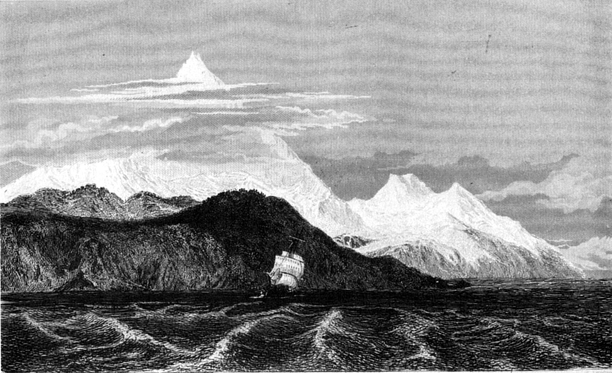
C. MartensT. Landseer
MOUNT SARMIENTO.
Published by Henry Colburn, Great Marlborough Street,
1838
"May 11th. We remained at the above-mentioned anchorage; and while
Lieutenant Skyring was examining a cluster of islands in the vicinity, I
obtained observations for the latitude and longitude; and as it was the
first fine day, indeed the only one since entering this channel in which
we had a fair proportion of sunshine, it was taken advantage of to dry
and air all our clothes and bedding, and clean out the vessel
thoroughly.
"The next anchorage we took, was in a cove just large enough to hold
the schooner, at the entrance of Dyneley Sound, on the north shore. In
crossing over, we had a fine view of Mount Sarmiento; and looking to
seaward, from the hill over this cove, the Tussac, and the Fury Rocks, at
the entrance of Melville Sound, which are much resorted to by sealers,
were clearly distinguishable.
"During our stay here, until May 15th, the neighbouring coast was
examined, whenever the weather permitted. We also communicated with
several canoes full of Indians, but gained no additional information
respecting the habits of the natives.
"The next start carried us through the islands of Melville Sound, to
an anchorage in a small cove, at the N.E. end of the largest of the
Magill Islands, upon which is Mount Skyring. Having resolved to ascend to
the top, as it offered so commanding a view, and was so centrally
situated, we remained for that purpose." The weather, for several days,
was very unfavourable, and it was not until the 21st, that there was any
reasonable prospect of obtaining a view from the summit; when Lieutenant
Skyring and Mr. Kirke had a most laborious excursion, and the latter was
nearly frost-bitten in ascending the mountain; but they were fully
recompensed for the trouble and difficulty they had experienced.
Lieutenant Skyring says:—
"We gained the summit after three hour's hard travelling. During the
last five hundred feet of ascent, the mountain was almost precipitous,
and we had the utmost difficulty in passing the instruments from hand to
hand. Its formation is remarkable, although, I believe, the same
structure exists throughout the hills around. The base is a coarse
granite, but this solid formation cannot be traced half the
height; above is an immense heap of masses of rock, irregularly and
wonderfully thrown together, many huge fragments overhanging, with
apparently very little hold. This station was the most commanding we had
chosen during the survey, and answered well for the object we desired;
which being attained, we returned on board, and I rejoiced when all were
safe, for it was neither an easy, nor a pleasant enterprise."
A document, of which the following is a copy, was enclosed in a bottle
and a strong outer case, and left at the summit of the mountain.
(Copy.)
This Memorial was left by the officers of H.M. Schooner Adelaide,
while employed on a survey of the Magdalen, Cockburn, and Barbara
Channels; and any person finding it is requested to leave the original
document, and build the pile, under which it is placed, at least six feet
higher.
Signed this 16th day of May 1829, by
W. G. Skyring, Lieut. and assist. surveyor of H.M.S. Beagle.
Thomas Graves, Lieut. of H.M. Schooner Adelaide.
James Kirke, Midshipman H.M.S. Beagle.
Alex. Millar, Master assist. H.M.S. Adelaide.
Benj. Bynoe, Assist. surgeon H.M.S. Beagle.
Jno. Park, Assist. surgeon H.M.S. Adventure.
"In the Cockburn Channel,[134] the flood-tide sets to seaward; but
it was not found to be of consequence to a vessel in working through. The
rise and fall is not more than six, or at most, eight feet, at
spring-tides.
"May 22d. We quitted this anchorage; and having worked to the
westward, through the Adelaide Passage, took up a berth in a small bay,
two miles and a half to the northward, where we remained during the
night, and next morning; then, after examining the neighbouring coast
sufficiently to carry on our triangulation, proceeded to an anchorage on
the north side of Bynoe Island. From the summit of this place an
extensive view was obtained of the islands in Melville Sound, as well as
of the entrance to the Cockburn and Barbara Channels. Such a complicated
mass of islands and rocks, I never before saw; to lay them all down
correctly would occupy a long time. Sufficient, however, has been done to
take the navigator through this labyrinth; but I am well aware, that very
much is still wanting to complete the survey.
"Fury and North Harbours, of which the former became more particularly
known to us from the Prince of Saxe Cobourg having been wrecked there in
December 1826, were laid down from an eye-sketch only; but the peaks of
the island, and its extremes, were fixed by triangulation.[135]
"Melville Sound is formed by the islands which separate the Cockburn
from the Barbara Channels. Generally speaking, they, as well as the
coasts in the immediate neighbourhood which are exposed to seaward,
present a most barren and desolate appearance.
"Until the 26th of May, we were much occupied among the surrounding
islands; but time being short, we took advantage of a southerly wind to
run up the Barbara Channel, and soon reached an anchorage in Hewett Bay.
While securing the vessel, a canoe, containing only a man, woman, and
child, and three dogs, was seen coming round the south point of the bay.
As they seemed very unwilling to pay us a visit, remaining at a distance,
and vociferating as usual, 'Ho-say,' 'Ho-say!' Mr. Bynoe and I
communicated with them in the dinghy; but finding they had not an
article worth bartering for, we soon left them, and returned on board. It
was suspected their companions were not far off, and indeed, the day
after, Lieutenant Skyring saw several canoes; but the moment he was
discovered, they were beached, and the men, taking to the woods, kept at
a distance.
"On the 29th, we left Hewett Bay, and, after threading the needle
through a multitude of islands, islets, and small rocks, for more than
three miles, reached an anchorage in a small cove, at the north entrance
of Brown Bay, where we were detained, and confined to the vessel, by
heavy gales, and stormy weather, until June 2d; when, having a fine day,
we reached a spot (marked in the chart as North anchorage) sufficiently
secure for a small vessel; but not to be recommended to any other.
"Between Hewett Bay, and the above anchorage, there are several rocks,
among patches of kelp, which, as they only show themselves at half ebb,
or near low water, render the navigation rather intricate. A good maxim
in these channels is, 'Avoid kelp, and you avoid danger.' Forty-three
days had passed since we left Port Famine; and in this interval, I find
we had nine favourable days, twelve partially favourable, some hours of
which we could employ in the work about which we were engaged, and the
remaining twenty-three were days of rain and wind, far too unfavourable
to serve our purpose in the least.
"June 4th. While turning to windward, we, for the first time, felt the
influence of the tide, which, from the channel's narrowing, begins to be
sensible: here it was sufficiently strong to prevent our gaining ground
in beating to windward, although with a good working breeze; we therefore
ran into a bay on the west side, and anchored. The country around had
rather a pleasing appearance, the shores being partially covered with the
evergreen, and deciduous-leaved beech, and a few stunted cypress-trees.
These last are serviceable for boat-hook spars, or boats' masts; and,
when seasoned, work up very smoothly, and wear well: the beech-trees do
not equal those found further northward in the Strait, except here and
there in sheltered corners.
"With a leading wind, the next morning, we reached the south narrows
of the Barbara Channel, through which we were carried by a strong tide,
and anchored in Bedford Bay.
"Here, as well as throughout the Barbara channel, the flood tide sets
to the southward. We obtained at this place angles which connected our
triangulation with points fixed by Captain King during the previous year,
and finished our examination of these channels within a very few days of
the time allotted.
"On the 8th of June we attempted to pass through the Shag Narrows, but
not saving the tide, were obliged to anchor for the night in Field Bay,
which is small and much exposed to southerly winds; the bank also is very
abrupt, and the water is deep close to the shore.
"On the 9th we succeeded in clearing the Narrows, and reached Port
Gallant early in the afternoon, where we rejoined the Beagle."
Having given these brief extracts from Journals kept on board the
Beagle and Adelaide, during the time occupied by the Adventure about Cape
Horn, or on her way to Chilóe, I will resume my own narrative.
As it was my intention to remain at this port[136] until the Beagle and Adelaide were
equipped, the Adventure was made snug, and, by way of relaxation, such of
the officers as could be spared from the duties of the ship, resided in
turns at the town, where also the ship's company had frequently
permission to amuse themselves.
The Hoxsley schooner arrived from Valparaiso and brought me letters
from the Admiralty, acquiescing in my request to return to England
direct, instead of proceeding by way of New South Wales and the Cape of
Good Hope, as was originally intended. I therefore determined to return
to Valparaiso as soon as our consorts had taken their departure, proceed
thence to Port Famine, where we were to be joined by the Adelaide, and
afterwards repair to Rio de Janeiro to await the Beagle's arrival, when
we should sail for England.
On the 20th of September my anxiety for the Adelaide was relieved by
her appearance, and by finding all on board her in good health. She had
gone up the coast by the channels that communicate with the Strait of
Magalhaens at Beaufort Bay, passing inside of Hanover Island and Madre de
Dios; and Lieut. Skyring gave me a very interesting account of their
discoveries, of which the following is an abstract.
It will be remembered that the Beagle left the Adelaide at anchor
under Cape Upright. While there the wind freshened up from the eastward,
and threw a swell into the bay, which rendered the anchorage very unsafe,
as the schooner's stern was in the foam of the sea that broke on the
rocky shore close to her. Much anxiety was felt for their safety, but the
anchors held well. As soon as the weather permitted they sailed, entered
Beaufort Bay, and steered towards a deep opening to the eastward of Cape
Phillip, into which they ran with a steady S.E. wind, and found an
anchorage on the west side in Deep Harbour.
On the 5th of July Lieut. Skyring and Mr. Kirke were absent in a
whaleboat, exploring a deep opening eastward of Cape Tamar, which they
found to terminate in two sounds, named by them Icy Sound and Glacier
Bay; the first from its being covered with a sheet of ice, and the latter
from its being full of large masses which had been detached from an
extensive glacier occupying the bottom of the bay. The examination of
this opening was made in search of a channel, through which, vessels had
entered the Strait, and the schooner was to proceed to her rendezvous.
The result proved that the Adelaide was already in the channel they were
looking for, therefore they returned on board, and proceeded (7th) to the
northward. In passing Mount Joy a strong tide was observed, the certain
indication of a channel; for, as has been before remarked, within sounds
the tide has no perceptible stream. To gain a better knowledge of their
way they anchored early in Good's Bay; the course of the channel, from
the intersection of points, and intervention of islands, being by no
means distinct. Lieut. Graves made a plan of the bay, while Lieut.
Skyring, and his assistant,[137] completed the survey of the entrance
to the passage, which was named Smyth Channel, as a compliment to Capt.
W. H. Smyth, R. N., under whom, while surveying the Mediterranean, both
Lieuts. Skyring and Graves had served.
The best channel they found to the eastward of Renouard Island, and
the Adelaide took that course, but stopped a night in a small cove on the
eastern side of the island, and in passing Shoal Island next day struck
on a rock; she was got off however without injury, and anchored
afterwards, for a night, on the north side of the Island of the
Narrows.
The two following days (10th and 11th) were spent in examining the
coast, and exploring Clapperton Inlet, which had the appearance of being
a channel. From the hills at the bottom Lieut. Skyring noticed a
considerable tract of low land and open plain, extending to the
northward. On the 12th, being Sunday, they remained quiet, and on the
13th the weather was so calm that they only reached Hose Harbour, on the
east side; and the next day Oake Bay. Thence crossing the channel in a
whaleboat they explored some distance along that shore; and on the 15th
anchored in Otter Bay. This slow progress was unavoidable, owing to the
calm state of the weather, and to the survey being principally, if not
entirely, carried on in boats.
On the 16th the schooner was towed onwards, and passing over an
extensive shoal flat of three fathoms, reached the Summer Islands, where
she might have stopped, but, as the tide was still favourable, she
proceeded to an anchorage under Long Island, the most northern in the
Elson group.
The eastern shore of the channel was there very different in character
from what they had so long been accustomed to, being nearly level; and,
extending for some distance off every low point, there was shoal
water.
For some days a lofty mountain, covered with snow, had been in sight;
which, by angular measurement, proved to be 5,800 feet in
height. It was named Mount Burney, in compliment to the admiral.
On the 17th the Adelaide reached Fortune Bay, situated at the east
extreme of a headland, on each side of which is a channel, leading,
apparently, towards Cape Isabel. The northern seemed to be the principal
one, and therefore was followed next day (18th) as far as Welcome
Bay.
Continuing the survey onwards they reached Victory Passage, which they
entered, thinking they were in the mouth of the 'Ancon sin Salida,' as
laid down from Sarmiento's journal by Admiral Burney. The weather,
however, became so bad, that they were obliged to take shelter in Island
Bay, and the next day the wind setting in from the eastward, they gave
up, for a time, their search for the 'Ancon sin salida,' and proceeded by
Smyth Channel, as far as Hamper Bay, where they were again detained by
bad weather. Here a few rock fish were caught, but at no other time
during this cruise were the fishermen successful, although the channel
was so filled by porpoises and seals, that it is probably well stocked
with fish at the proper season: and there are many places where the seine
might be shot. Proceeding slowly on the 25th, the Adelaide struck on a
rock, and remained fast for a few hours, but as the tide rose she swung
off without damage. Upon examining Rocky Bay they found it a complete bed
of rocks; yet, bad as it was, the Adelaide was obliged to remain there
five days, owing to the tempestuous state of the weather. On the 30th
they reached the north end of Smyth Channel, and anchored in Narrow
Creek.
On the 31st Lieut. Skyring went to a remarkable hill, which he called
Mount Trafalgar, but thought it might have been the 'Monte Trigo'[138] of Sarmiento, so much
did its appearance remind him of a corn stack. The day was most
favourable: a round of angles, and an extensive view down Lord Nelson's
Strait, were obtained from the summit. They remained on an island all
night, sheltered by the boat, and next morning went to two points, called
by Sarmiento 'Oueste,' and 'Mas al Oueste,' (west and more west,)
returning to the Adelaide in the evening.
The following morning was fine, and the Adelaide moved out of Smyth
Channel, the survey of which was completed very satisfactorily, although
their progress was slow, owing to constant northerly winds.
By towing the Adelaide during tedious calms, they reached Montague Bay
in the evening, and next day anchored in Relief Harbour, on the S.W. side
of Vancouver Island.
As it was evident that the 'Ancon sin salida' was within Piazzi and
Ceres Islands, up the west coasts of which they had passed, Lieut.
Skyring left the schooner moored in Relief Harbour, and proceeded, on the
4th August, to the southward, in a whale-boat with Mr. Kirke; but he took
no more than a week's provisions, that time being all he could devote to
this exploration.
The 4th, 5th, and 6th, Lieutenant Skyring employed in pulling or
sailing to the southward and eastward, through winding and intricate
passages; although strong winds and much heavy rain annoyed him, and
impeded his progress.
On the 7th the weather was much more favourable than it had lately
been. The boat pulled and sailed to the southward, and at noon Lieutenant
Skyring ascended a height,[139] having on each side of it a deep
opening, but he was disappointed in the view; and, after taking bearings,
pulled round the adjacent bights, one of which was exactly opposite
Artist Bay, in Smyth Channel, and so near it that the two waters were
only separated by a few hundred yards;[140] the other,[141] eastward of the height, was large,
and closed at the bottom by very low lands. It was directly supposed to
be the 'Ancon sin Salida;'[142] but Sarmiento's description, and the
chart compiled by Burney, were insufficient to enable them to decide
with any degree of certainty. After looking round this bay, they
continued to the eastward, and passed a point beyond which there was
apparently a wide channel; having run about six miles down it without
discovering any termination, they hauled their boat up on the beach for
the night.
On the 8th, two canoes were noticed on the west shore; but seeing
strangers the natives, apparently much frightened, all landed, except an
old man; and taking with them what they most valued, hid themselves among
the brush-wood, leaving their canoes fastened to the sea-weed. By some
Fuegian words of invitation, the men were, however, induced to approach
and traffic, receiving for their otter skins whatever could be spared. In
appearance and manner these Indians were exactly similar to the Fuegians;
and by their canoes only, which were built of planks, could they be
distinguished as belonging to another tribe.
After leaving the natives, the boat passed Cape Earnest, and
Lieutenant Skyring observed a wide channel leading north and then
N.N.W.;[143] also,
another opening to the eastward. The wind being easterly, he ran some
distance to the northward, to gain more knowledge of the first inlet; and
having gone ten or twelve miles from Cape Earnest, and observing the
opening for eight miles beyond to be as wide as where they then were, he
concluded it to be a channel, or else a deep sound terminated by low
land, for there was evidently a division in the mountains, such as
to justify this belief. Returning, they entered the smaller opening to
the eastward, and were almost assured of its being a channel; for when
they were between the points, many porpoises and seals were observed, and
a tide was found setting westward, at the rate of two knots. At dark,
they hauled their boat on the beach of an excellent bay, at the north
side of the narrow reach, and secured her for the night.
On the 9th, shortly after daylight, they set out in a N.E. direction
to ascertain the truth of their supposition; and before noon knew, beyond
a doubt, that they were correct in their belief, being in the narrows of
a channel before unknown, that had eluded Sarmiento's notice. These
narrows, which Lieutenant Skyring felt assured would lead to a large
opening, were upwards of three miles in length, and generally about
one-third of a mile in breadth. A strong tide took the boat through; and
at the N.E. extremity, where the narrows were reduced to four hundred
yards in width, the water, although a neap-tide, rushed at the rate of
four knots, forming whirling eddies, which were carefully avoided by
Lieutenant Skyring. At spring-tide, the strength of these rapids would
probably not be less than seven knots.
Having passed through them, a clear channel was seen, upwards of two
miles wide, running to the N.b.E. for, at least, eight miles, and then
turning directly eastward, between moderately high land. Another channel,
nearly a mile and a half wide, trended to the S.E. for two or three
miles, and then also turned to the eastward. Here they stopped.
Lieutenant Skyring regretted extremely not being able to prosecute the
discovery, and have one more view from the eastern point of the N.E.
channel; but as only one day's provisions remained, it would have been
imprudent to delay his return. It was evident, that they had passed
through the range of the Cordilleras,[144] for to the eastward the country
appeared totally different, the highest hill not being above seven
hundred feet. The opening to the N.E. was thought to communicate with the
'waters' lately discovered by Captain Fitz Roy. The latitude was
obtained on Point Return; and in the afternoon, reluctantly but
anxiously, they retraced their way, and passed that night at their former
quarters, in Whale-boat Bay.
On the 10th, at daylight, they proceeded on their return. The wind was
fair until they reached Cape Earnest, when it drew right against them;
and they had the unpleasant prospect of a tedious pull to the schooner,
with very little provision.
The 11th was a thoroughly wet day, and the wind was so strong from the
northward, with a very heavy sea running, that it was impossible to
proceed.
On the 12th, they left the bay soon after daylight, and having pulled
along shore a few miles, crossed Union Sound, and gained the Narrows of
San Benito, the wind being still fresh from the northward; thence they
continued pulling until they hauled up, after dark, in a bay, opposite
Point Benito, and waited till the morning of the 13th, when with a fresh
S.W. wind they made good progress, which was of the more consequence, as
their provisions were expended, although they had eked them out with
corvorants and muscles. At last, the sight of the Adelaide rejoiced them,
and they soon afterwards reached her. Their appearance was a relief to
all who were on board, as they were becoming very anxious, and Lieut.
Graves was preparing to send the other whale-boat in search of them.
During their absence he had made the necessary astronomical observations,
and finished the examination of those shores adjacent to the
harbours.
From the 13th to the 17th, the schooner was detained by bad weather,
and the following day only succeeded in reaching Escape Bay, in San
Estevan Channel, which was found to be a good and well-sheltered
anchorage, although small.
On the 19th, after angles had been taken on each side of the Channel,
the Adelaide got under weigh, and steered up the Channel. At noon she
passed the mount which they supposed to be Sarmiento's Monte Trigo, and
soon after, nearing Esperanza Island, they sought for some mark by which
to recognise the Mountain of the Fox ('Monte de la Zorra'). In the white
part of a cliff, they fancied some resemblance to an animal, and
noticed a harbour opposite, in which they anchored. They had such trouble
in getting to the northward, that this day's run, though only eighteen
miles, was a cause of much satisfaction.
On the 20th, at daylight, the boats were employed around the
anchorage, and at nine o'clock the vessel was underweigh, and working to
the northward, although it rained hard then, as well as throughout the
whole day: after beating until the evening, she anchored on the west
shore.
Constant rain fell through the whole night, and during the 21st; it
was therefore impossible to make any progress to the northward.
On the 22d the Adelaide weighed, and the weather being calm, was towed
during the whole forenoon. At noon a southerly wind sprung up, and by the
evening she was in the Guia Narrows (of Sarmiento). They tried for
anchorage in Unfit Bay, conceiving it to be Sarmiento's Port Ochavario;
but none being found, the vessel was towed into a cove, and securely
moored.
Next day the boats surveyed the Guia Narrows. Although long, they did
not appear hazardous to pass, for the tides are not very rapid. The ebb
tide runs to the northward, but at the south entrance of the San Estevan
Channel, the ebb sets to the southward; which difference in direction,
within so short a distance, is extraordinary, and difficult to account
for without knowing more of the coast. Certainly there is a meeting of
tides between the two entrances; probably, all the land westward of San
Estevan is a collection of large islands, and water flows into this
channel, from the Pacific, through many openings, which may be the cause
of this peculiarity.
24th. With light breezes from the eastward, the schooner weighed and
stood through the Narrows; passed Point San Juan, and continued along the
eastern shore of Concepcion Strait to Guard Bay, where she was
moored.
25th. Rainy weather until near noon, when the boats were employed.
On the 26th the schooner was towed out, and, as it was calm, kept a
boat a-head the whole day. She anchored in a small bight, formed by
Chance Islands, about seven miles from Guard Bay.
The 27th was rainy, but the boats went to different points, and angles
were taken before the schooner weighed and worked northward. At noon she
came to an anchor in a small bay, northward of the Hocico de Caiman.
Constant rain during the remainder of the day.
On the 28th it rained too incessantly the whole morning, to allow the
party to work, even in boats; and the day was passed in laying down
former observations.
29th. After angles had been taken near the anchorage, the schooner was
moved, and worked along the coast. A strong wind from the N.W., with a
heavy sea, brought the vessel under close-reefed sails, and obliged her
to anchor in Walker Bay.
On the 30th, the Adelaide anchored in Molyneux Sound. To give a
clearer idea of the delays experienced in making progress to the
northward through these intricate channels, I shall now extract part of
Lieutenant Skyring's Journal, in his own words:
"31st. Wind N.N.W. with a heavy swell in the Strait; the boats at
daylight went north and south of the anchorage, and angles were obtained.
At nine, ready for starting; but the weather was too unfavourable, and
continued so until the 4th of September, when, at seven o'clock in the
morning, we weighed. At nine, squally—obliged to double-reef; but
the tide serving, we gained a few miles to windward, and at one, P.M., stood among a mass of islands on the west side,
and moored in Tom's Bay, steadying the vessel with the stream anchor. In
the afternoon the survey was continued, and from the heights a view was
obtained of the Gulf of Trinidad, and of several points observed last
year. Another detention of two days, owing to bad weather.
"7th. Cloudy; weighed at daylight, and stood for the narrows. At
eight, squally, with thick snowy weather; but, being once under weigh, we
refrained from returning, until compelled. It certainly was not a
favourable day for working through; but the wind moderated, and our
attempt succeeded. No anchorage being found by the boats on the north
side of the narrows, we made for the weather-shore of the gulf, and
anchored early in Windward Bay. In the afternoon, angles were taken on
Middle Island, and east and west of the anchorage. The time of our
departure drawing near, it became doubly necessary to work constantly,
that we might join this survey with that of last year, in the Beagle.
"8th. Weighed at daylight; wind light from N.W.; but, falling calm,
boats were detached for continuing the angles, and the latitude was
observed on Red Beak Rocks. At five o'clock, we gained an anchorage,
close to the eastward of the Ancon del Morro, on the S.E. side of
Division Isle, in a bay which answered our purpose, although it was
rather a confined place. Some angles were taken on Point Candelaria,
preparatory to continuing our course next morning.
"9th. At daylight weighed and stood over to the northern shore, and at
eleven, anchored in Neesham Bay, in eleven fathoms. Boats employed in the
afternoon, on the survey. While at anchor, two canoes, containing
together thirty-two Indians, came alongside; they were chiefly men, a
finer race of people, better formed, and better featured than the
Fuegians, and much less noisy. Their canoes were made of planks, the
longest upwards of twenty-three feet in length: they appeared exceedingly
buoyant, and pulled quickly.
"10th. At daylight, we sailed out of the bay, with a light breeze from
the eastward; at seven, the wind increased, and a heavy sea rose in the
gulf. It was my intention to get an anchorage under Mount Corso; but, as
that was now a leeward coast, with a heavy sea setting upon the shore, it
would have been improper to attempt seeking for one. If it had answered
our purpose, we might have gone to Port Henry, and, indeed, this was the
only safe course we could have pursued, if our object had been to remain
in the gulf; but no time was left to wait for favourable weather;
therefore I chose in preference to leave the gulf, and take advantage of
the fair wind to gain an offing, the time of our return being so
near.
"We left the gulf two days before I had expected to have done so; but
we all rejoiced at our departure. No crew could have performed their duty
more willingly than the Adelaide's; but such lengthened fatigue as they
had undergone, was sufficient to make any men feel happy at the prospect
of a respite.
"It was a pleasing reflection to Lieutenant Graves and myself, that
the orders had been fully executed; that the coast we had passed was
throughout well connected; and that this service was concluded without
any illness or accident among the crew, without any damage to the vessel,
without any loss of boats, or even the slightest misfortune."
During the Adelaide's passage to Chilóe, Lieutenant Skyring and his
companion were assiduously employed in transferring their observations to
paper, notwithstanding the violent motion of their little vessel, during
ten days of rough weather.
Chilóe—Its probable importance—Valdivia founds seven
cities; afterwards destroyed by the Indians—Migration of Spanish
settlers—Province and Islands of Chilóe—Districts and
population—Government—Defence—Winds—Town—Durability
of wooden buildings—Cultivation—Want of
industry—Improvement—Dress—Habits of lower
classes—Morality—Schools—Language—Produce—Manufactures—Exports
and imports—Varieties of
wood—Alerse—Roads—Piraguas
Ploughs—Corn—Potatoes—Contributions—Birds—Shell-fish—Medical
practitioners—Remedies—Climate.
As the Island of Chilóe was formerly shrouded from notice, by the
policy of its master, the King of Spain, and therefore little known to
the world; I have considered it not irrelevant to the narration of the
voyage, to introduce a short account of its present state, particularly
as since the trade of the whole coast has been opened, a new era has
dawned upon this interesting island; and although it has been, as yet,
the least frequented of the South American States, I think the time is
not far distant, when it will become an important part of the Chilian
territory.
After the foundation of the city of Penco, or Concepcion, by Don Pedro
de Valdivia, in the year 1550, he passed on towards the south in search
of convenient situations for other cities; and crossing the river Bio
Bio, which separates Concepcion from the territory of the Araucanian
Indians, successively founded Imperial, Valdivia, Villa Rica, Angol,
Cañete, and Osorno; the last being effected in the year 1558. The
necessary distribution of the Spanish forces, to protect so many points,
made them comparatively defenceless, in a country inhabited by a large
population of Indians, who contemplated the hostile occupation of their
native land, by the invading army, with a deep dissatisfaction. They had
for some time endured, with sullen patience, the yoke of the Spaniards;
but at last, incensed by the servility and bondage to which they were
reduced, and, probably, by no small portion of ill-treatment; the whole
population rose simultaneously, and waged a most destructive and harassing war against the Spaniards, in
which the above-mentioned cities were all destroyed, and the greater
number of their inhabitants put to death.
The destruction of the city of Osorno caused the province of Chilóe,
or, at least, the adjacent districts of Calbuco and Carelmapu, to be
occupied. This town, being more distant from the seat of war, where the
main body of the Indian army was actively employed, was enabled to hold
out for some time; but, at last, cut off from assistance, prevented from
communicating with friends, and utterly destitute of supplies, the
inhabitants retired to the fort, or citadel; which they maintained, until
compelled, by absolute want of provisions, to abandon their position, and
proceed to the south, with a view of establishing themselves in Carelmapu
and Calbuco; where they hoped to be safe from attack.
Their retreat was attended by much suffering; many died from fatigue,
and many were cut off by the Indians, who hovered about them and murdered
all who fell into their hands.[145] At last they reached their
destination, and established themselves first at Carelmapu, which is on
the main-land, on the north side of the Boca de Chilóe, opposite to San
Carlos; and afterwards at Calbuco, on an island at the entrance to the
Gulf of Reloncavi. The latter position by its insularity, was effectually
protected against any attack from Indian tribes, who, for many years,
continually harassed the inhabitants of Carelmapu.
At what date this journey was made does not appear; nor is it certain
that these places were occupied before the foundation of the city of
Castro, in 1566, by the Licentiate Lope Garcia de Castro, in pursuance of
an order from the Viceroy of Peru, Marshal Don Martin Ruiz de Gamboa.[146]
The island of Chilóe, from its situation, is a place of considerable
importance, and may be termed the key of the Pacific. It is the
northernmost of that vast archipelago, which borders the coast from
latitude 42° south to Cape Horn.
The province of Chilóe, one of the eight divisions of the Chilian
Republic, includes several islands, and extends on the main-land, as far
as the south bank of the River Maullin;[147] which takes in the districts of
Carelmapu and Calbuco. Its southern extent is not defined; but as the
existence of Chilian authority is not known, to the southward of the
Chonos Archipelago, certainly not farther south than the land of Tres
Montes, the parallel of 47° may be considered its southern limit. The
country thence, to the Strait of Magalhaens, is known by the appellation
of Western Patagonia.
Besides the Isla Grande, as Chilóe is called, the following islands
are inhabited:—Achao, or Quinchao, Lemuy, Quehuy, Chelin, Linlin,
Llignua, Quenac, Meulin, Caguach or Cahuache, Alao, Apiao, Chaulinec, all
in front of Castro; the Chaugues Islands, opposite to Tenoun; Calbuco,
Llaichua, Quenu, Tabor, Abtao, Chiduapi (on which is the fort); Huar in
the neighbourhood, and district of Calbuco; and, to the South, Tanqui, to
which may be added Caylin, which is also called El fin de la
Cristiandad.[148]
Of the above, next to the Isla Grande, the principal are Quinchao and
Lemuy, both of which are very populous, and almost entirely
cultivated. The other islands are small, and very close to each other;
but separated by navigable channels, which offer many dangers to the
frail vessels in which the islanders move about.
The province is divided into ten districts, or Partidos, as
follows:—
1. San Carlos, containing the northern coast of the island, as far as Chacao.
2. Chacao. The N.E. part of the island.
3. Carelmapu and Maullin.
4. Calbuco.
5. Dalcahue, extending from Chacao to Tenoun.
6. Quenac.
7. Quinchao.
8. Castro.
9. Lemuy.
10. Chonchi, which extends from Castro to the south extremity of the island.
By the census of 1828, the population of the large island, and those
in its neighbourhood would appear to be, comparatively, very
considerable; the number of souls being 43,131:[149] particularly as the greater portion
of the interior, and much of the sea-coast, are quite uninhabited. The
population of the district of San Carlos is confined principally to the
town; for between it and Chacao, there are very few inhabitants. At
Chacao there are only about two hundred houses, and Dalcahue is but
thinly occupied: but Castro, Quinchao, and Lemuy, are very populous.
These three districts are the most fertile and productive part of the
island, particularly for seven or eight miles round Castro. The peninsula
opposite to that town, which is entirely cleared, would abundantly repay
its cultivators, were industry more common among them.
Chilóe is governed by an 'Yntendente,' or civil governor, who exacts
obedience to the constitutional laws, as well as to the orders of the
executive powers, and the resolutions of the provincial assembly, which
is composed of members, elected by the people, at the rate of one deputy
for 7,500 souls; but whatever the number may be, short of 90,000, twelve
deputies are to be elected. The duration of the assembly is biennial, and
its business is to superintend the civil regulations of the province.
Under the Yntendente each province has a local governor, whose
principal duties are to maintain order, preside in the municipal
meetings, see their regulations carried into execution, and obey the
orders of the Yntendente of the province. Whilst we were at Chilóe, the
duties of Yntendente, and military commandant, were performed by one
person, Brigadier-general Don José Santiago Aldunate; but, upon his
resignation, the offices were separated: the military commandant
retaining the charge of the treasury. The duties of the military chief,
are to dispose of the troops under his command, as he sees occasion, so
as to ensure the quietness, and subordination of the province, for which
he is responsible; and to render the Yntendente such assistance as he may
require; but, for all ordinary purposes, the Militia, who are under the
immediate control of the Yntendente, are employed. For the administration
of the law there is a Judge (Juez de letras), who tries all civil as well
as criminal actions. The province sends two deputies to the
Chilian congress, one from San Carlos, and the other from Castro. At the
beginning of the year 1829, the Militia amounted to more than seven
thousand men, and the regular troops to three hundred and thirty, which
was quite sufficient for the province.
The port of San Carlos is capable of being well defended, and, during
the time of the Spaniards, was in a good state of defence. The entrance
was protected by a battery on the highland of the Corona, and by the
castle of Aguy, which effectually commands it. Farther in, on the same
side of the port, was the small, but well-placed, two-gun battery of
Barcacura; close under which is the anchorage. On the town side there are
several batteries; but, towards the Pudeto it is weak, although capable
of being made very strong. Fort San Carlos, which, for some years past,
has been used as a cemetery, was well-selected as to position, and
constructed in a manner very creditable to the engineer. It was
surrounded by a deep and wide ditch; and under it lay two small
batteries: one, San Antonio, commanding the passage between the small
island of Cochinos, and the Main; and the other flanking the anchorage
off the town. At the Mole were two guns, and opposite to it, under the
governor's house, was the battery, Del Carmen, mounting twelve or
fourteen guns. In the town, in a convenient situation, there were
excellent barracks, capable of containing more than one thousand men.
The original establishment was at the Sandy Point, on the western side
of the port, where the situation is better sheltered, and, perhaps,
equally capable of being well defended. It is, also, on the windward side
of the harbour, and close to the safest anchorage which the port affords;
but the inconvenience of water-carriage was found to be so great, that
the establishment was removed to its present site. A still better
situation might have been selected opposite to Sandy Point, at Leche
Agua; where the anchorage is perfectly safe, and the communication with
Castro could be more advantageously made.
Northerly and westerly winds prevail, and the town is exposed to all
their fury, which, at times, is extreme. The anchorage nearest to it, for
the sake of convenience, and expedition in loading and unloading cargoes,
is often taken up, but is very unsafe, many vessels having been lost
there, from the bottom being shoal, and rocky; and the swell, during a
northerly gale, is so short and deep, that anchors will not hold.
The town is built on two rising grounds, and in the valley that
separates them; through which a rivulet runs into the bay, at a mole
which affords sufficient protection to the boats and piraguas frequenting
the port. The houses, which are all of wood, are generally small, and
have but little comfort. The plaza, or square, without which no town in
Chile of the least importance is to be found, is situated on a flat piece
of ground at the summit of the southern hill, and commands an extensive
view. It is about one hundred and eighty yards square, with a flag-staff
in the centre.
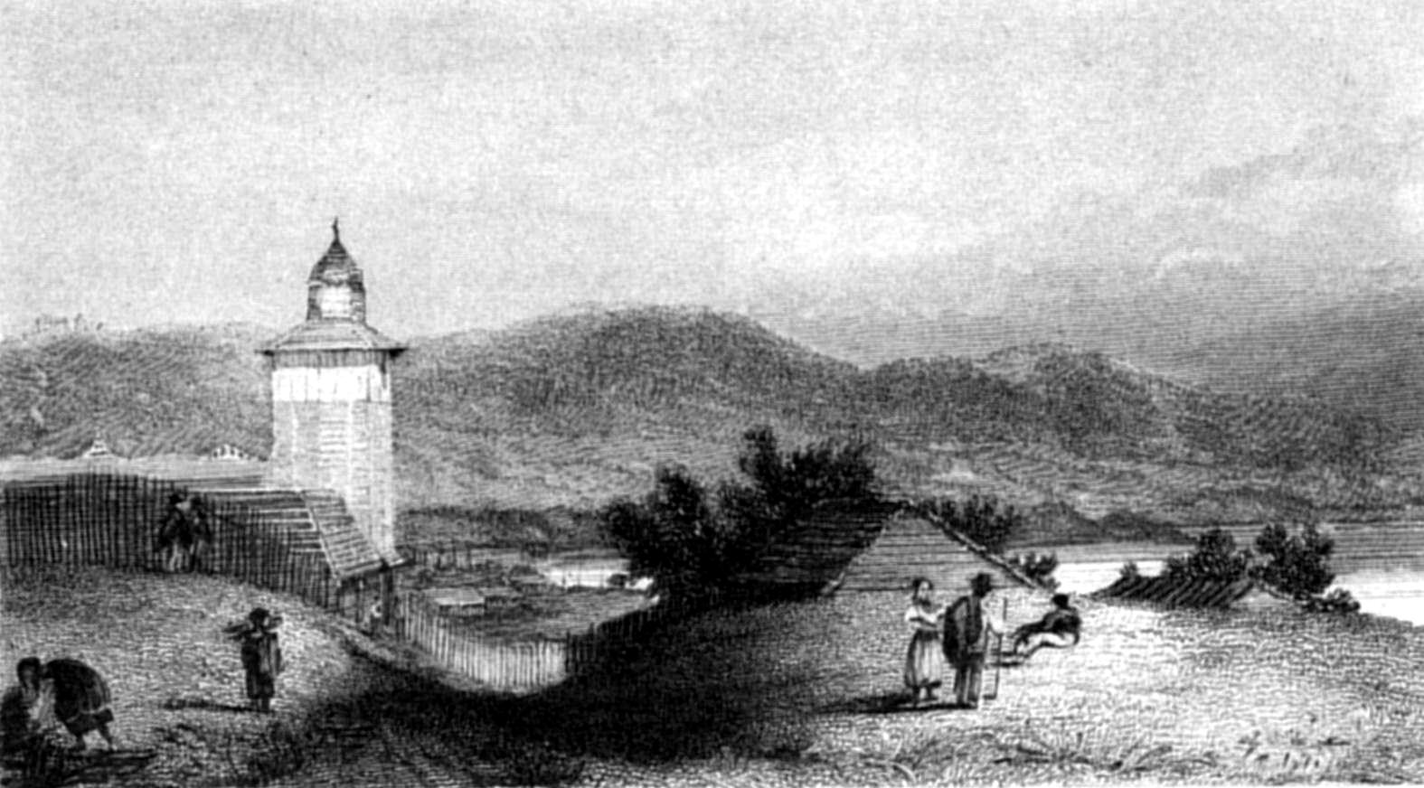
SAN CARLOS DE CHILÓE.
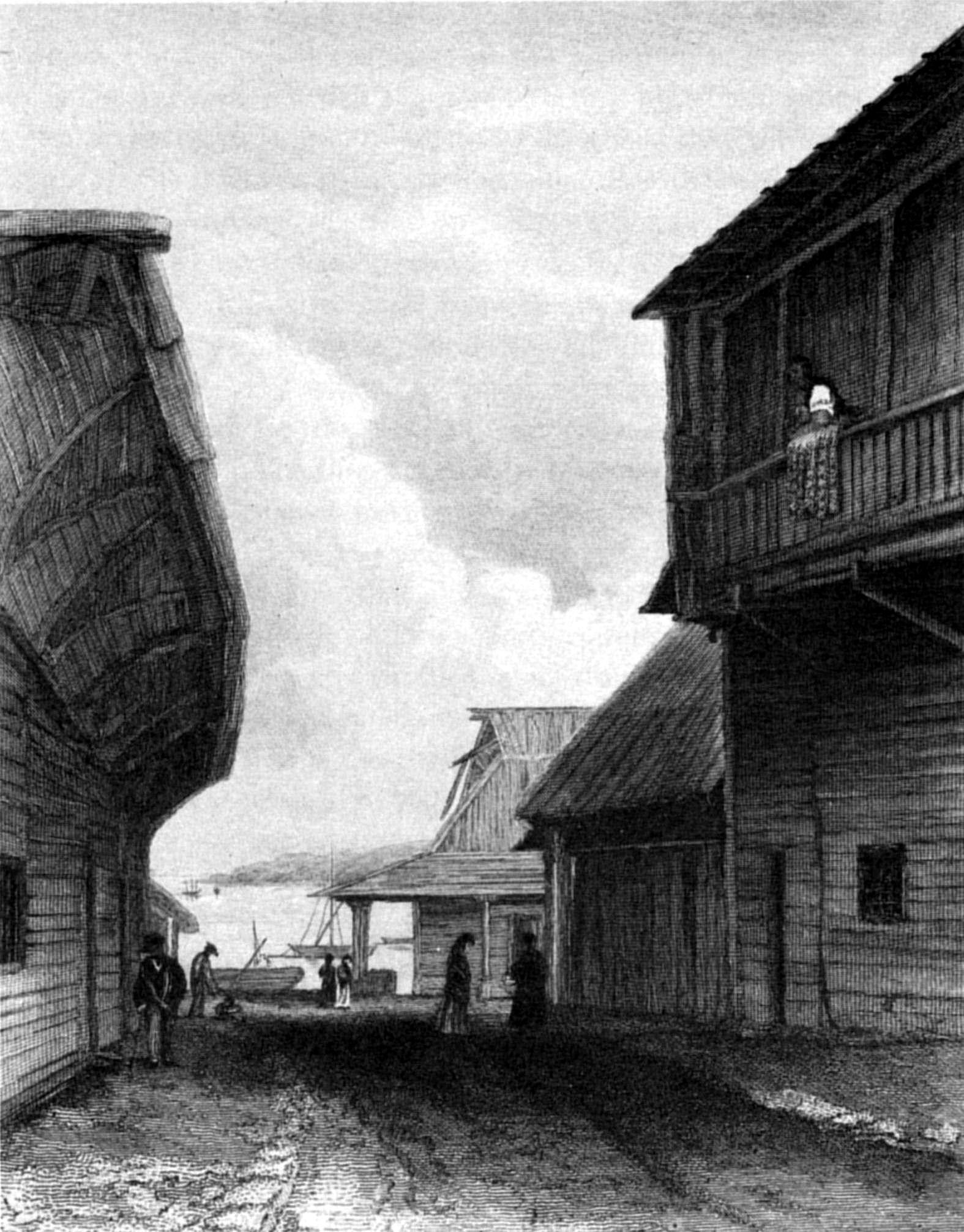
C. MartensS. Bull
SAN CARLOS DE CHILÓE.
Published by Henry Colburn, Great Marlborough Street,
1838
On the north side there is a strong, well-built stone storehouse, and
opposite to it is the church, also built of stone. On the side next the
sea is the Yntendente's residence, a low range of wooden buildings,
erected without regard to taste, convenience, or comfort; and opposite to
this are two or three dwellings, very little superior to common huts, or
ranchos.
Within the last few years, however, some substantial buildings have
been erected by the more wealthy people in the town, an example which is
likely to be followed. During our visit, several were built equally
creditable for strength and convenience; and not a little remarkable for
the rapidity, with which they were completed.
Wood, being abundant, and cheap, as well as easily worked, is the only
material used in the construction of houses, which, with the exception of
the provision-store, and the church, are all built of it; and
notwithstanding the perishable nature of the material, which is not
protected by paint, or any external coating, from the humidity of the
climate, they are of extraordinary durability. The treasury, one of the
oldest houses in the place, has been built upwards of seventy years; and
is even now tight, and dry, and by no means unserviceable: but its
removal has been ordered, and, probably ere this, it has been replaced by
another. In Chacao, where, in former days, the Yntendente resided, the
greater number of the government-buildings, not less than sixty or
seventy years old, are still standing. This durability can only be
accounted for by the nature of the wood, and the practice of charring the
ends of the timbers before they are inserted in the ground. The lower
frame is of 'Roble;'(t) the beams are of laurel, and the floors
and partitions, as well as the weather-boarding and shingles, of
'Alerse:' the latter forms an excellent substitute for tiles, or slate,
being much lighter, and almost as durable. Some of the houses are
thatched with reeds; but this shift is only used by those who cannot
afford the expense of shingling.
The inclosures, round the houses, are fenced with stakes of Luma,
three or four yards in length, fastened above and below to cross-rails,
by ligatures of creeping plants, of which there is an abundance in the
woods close to the town: the general name for them is Buque.
The land in the vicinity of San Carlos, which is a peninsula, is
cleared of timber, and partially cultivated. In the valley, through which
the rivulet runs into the sea near the mole, there are a few attempts at
gardens; but the extent to which the inhabitants cultivate, seems to be
confined to a rood of potatoes and wheat, which, with a litter of pigs,
and an inexhaustible store of shell-fish on the coast, are the principal
support of their families. It is not surprising, when so little personal
trouble is necessary to provide subsistence, that the Chilotes(u) should not be an
industrious race. Byron, in his narrative of the loss of the Wager, has
given a most excellent and correct account of the inhabitants of this
island; which, excepting for those about San Carlos and Castro, may well
serve at the present time. In the town, trade, a free communication with
other parts of South America, and the residence of several Europeans,
have introduced approaches towards refinement; and besides the articles
of luxury that occasionally make their appearance, such as chairs and
tables, crockery-ware, and similar domestic comforts; shoes and stockings
are now, on feast days, in common use among the females; although in many
instances one can easily observe, that the wearer is actuated by vanity,
rather than by any comfort or pleasure she derives, from a confinement to
which her feet have not been accustomed.[150] This is one of the steps towards
civilization, which the Chilote peasantry are making, and among the
higher classes 'el ultimo modo' (the latest fashion), is not less the
theme of conversation than it is in other parts of the Republic.
In style of dress, among the upper ranks, the men are more advanced
than the women, many having been in other countries. They have
given up the use of the poncho, and in this particular, they say they are
before the gentry at Concepcion, who wear it on all occasions: and
probably are quite right, for, with respect to comfort, there is much to
admire in the poncho, as, of all cloaks, it is the most generally
convenient, and the best adapted for protecting the person, especially on
horseback, where it is indispensable: its use, however, offers the wearer
such an opportunity to neglect the other part of his dress, which it
effectually conceals, that sometimes, beneath the poncho, the body is
very ill-clothed.
The dress of men in the lower orders, consists of a pair of trowsers,
and a shirt, over which is thrown the all-concealing poncho. The women
are as slightly clad; but instead of a poncho, they wear a rebozo, or
shawl, which, however, is very often dispensed with, and their persons
are left too much exposed.
These lower classes, or Indians, as they, with much reason, are
termed, are scarcely superior to the uncivilized savages of the southern
coasts; and live principally upon shell-fish, with what little they are
enabled to procure besides by the sale of a few pigs, or poultry, which
they rear on the scanty store of potatoes and wheat, that remains after
their new crop comes to maturity. One roof shelters a whole family.
Father and mother, sons and daughters, dogs and pigs, all live and sleep
in their only room, in the middle of which, a fire is made; whence the
smoke escapes by numerous apertures in the roof and sides of the
dwelling.
As to their morals, within the precincts of their habitations, I have
reason to believe they have not much to boast of, although they are
described, by Agüeros and other writers, as most innocent, and
well-conducted. Agüeros speaks highly of their character; and cites Padre
Ovalle, who, writing upon Chilóe, between the years 1629 and 1636, says:
"The natives of these islands are the most docile and noble (dociles y
nobles) of all Chile, and are the least given to drunkenness, and other
vices; therefore they are best disposed to be edified by the light of the
Gospel."
Since the province became subject to the Chilian Republic, the
government has made several attempts to improve the condition of the
inhabitants; among which, the instruction of public schools, was not the
least important. From an official report there appear to be ninety
schools, in which 3,840 children receive an education, according to the
abilities of the masters, who are employed; but these, from the small
salary attached to the situation, cannot be expected to be superior.
The language in common use, is Spanish; the original Indian tongue
being almost forgotten: but it is supposed to be the same as that spoken
by the Indians of Madre de Dios; for, on a late occasion, a whaler which
had been upon the coast of those islands, and had taken on board an
Indian, as a pilot, called at Castro; and during her visit, the Indian
communicated with those who understood the language of the Chonos, and by
them was tolerably well understood. This Indian has been frequently
embarked on board American or English sealers, which frequent those
coasts, to serve as a pilot to the seal-rookeries.[151] He is known by the name of Dan.
The products of the island, for the year 1828, according to the
census, and returns, officially made, were—
| Wheat | 64,935 fanegas (175 lbs. in a fanega) about 200,000 bushels. |
| Barley | 21,645. |
| Potatoes | 194,805. |
and the muster of stock, and apple-trees, as follows:—
| Horned cattle | 5,411 head. |
| Sheep | 86,580 |
| Swine | 21,645 |
| Apple trees | 75,754 |
The manufactures of the province are Carro, a coarse woollen cloth,
two and a half, or three yards long, and three quarters of a yard wide,
used for men's garments, and of very durable quality.
Ponchos—both these and the carro are manufactured by women, in a
rude sort of loom, of wool dyed of various colours from plants that are
found in the island, or imported for the purpose. Of the latter
indigo is much used, and it is the general colour for the ground-work of
the ponchos.
Frezadas, bordillas, sabanillas, mantillas de lana, blankets or rather
counterpanes of different textures, are also among the manufactures: none
of the above are exported, being made merely for their own use.
Cables, hawsers, and rope, they make of a plant, called Quilineja,
which is supposed to be the root of a species of Callixene.
No wine or spirit is made in the province, but Chicha (a very good
cyder) is manufactured from apples. The only other fruit produced is the
'Frutilla,' a kind of strawberry.
The exports must very nearly amount to the value of foreign imports,
which consist principally of sugar, wine, brandy, salt, wearing apparel,
and household furniture. The import duty on European and North American
produce is twenty-seven per cent.; from which, however, some articles,
such as arms and munitions of war, instruments of music, and other things
of less importance, are exempt. Spirits of all kinds, foreign wines,
tobacco, tea, and cards, are monopolized by the government, and sold at
an immense profit. The unauthorized sale of these goods is declared
illegal, and is punishable by a heavy fine, and sequestration of
goods.
The exports, during the year 1828, consisted of wood in beams, planks,
and boards; hams, wheat, a small quantity of dried fish, fire-wood, and
brooms,[152] to the
amount of 52,320 dollars, of which 35,683 dollars were for wood, and
10,887 for wheat. These articles were exported in sixteen vessels under
national, and eight under foreign flags. The exports are said to be
increasing very much. In the year 1791, Agüeros describes the exports of
alerse planks (tablones) to Lima, to be between fifty and sixty thousand
in number; and some years previous to have been in a much greater
quantity. The number of alerse boards exported, during the last year, was
328,928, but of planks only 2,623.
The island, and neighbouring part of the main land, produce a great
abundance, as well as variety, of wood fit for exportation, as well as
home consumption. The following is a list of the principal trees, with
their qualities, and the use to which they are most adapted.
Avellana (Quadra heterophylla), a handsome tree, in appearance
like the ash of Europe, of a light wood, which shrinks very much when
dry, and may be used with advantage for oars, being light, strong, and
springy, as well as for planking small vessels below the water, and for
the ceiling within; it is bad for firewood, being too light. The seed is
a nut, about the size of a cherry, the kernel of which is roasted and
eaten. The tree abounds at Concepcion, and in the country to the south,
and grows on the Peninsula of Lacuy.
Roble (Fagus obliqua, Mirb.), a large tree; and, from the
durable quality of its timber, considered the best in the island, for
ground-frames of houses, planks for vessels, and beams. The piraguas are
built chiefly of this wood. There are two sorts, one an evergreen, and
the other a deciduous-leaved tree. It is evidently a beech, and the same
that grows in all parts of the Strait of Magalhaens; the smooth-leafed
sort is F. obliqua of Mirb.—see Bertero, in Mercurio
Chileno, No. 14, p. 640.
Tiqui, heavy wood; but esteemed strong and durable. Piraguas are
sometimes built of it.
Laurel, used for house building in-doors, for beams and rafters, and
posts; durable when not exposed to damp, in which it soon perishes.
Mañu, a tree of great dimensions, tall and straight, the leaf is like
that of a yew; it is a very useful wood in ship-building, for planks,
and, next to alerse, is the best for spars which the island produces; but
the large trees have a great tendency to become rotten at the heart,
owing possibly to the humidity of the climate, and to the very wet
soil.
As the Adelaide wanted a mast, I sent her round to Castro for a mañu
spar, for which I agreed to pay eighty dollars; but of twenty trees that
were cut down, not one was sound at the heart. The wood is heavy, with
large knots, which penetrate into the trunk to a great depth. A great
deal of this timber grows in the Gulf of Peñas.
Muermo. There is no wood produced on the island more useful than the
muermo. It is used for timbers, and knees, and all other purposes of
ship-building: and is excellent for the planks of boats, as it bears wet
and dry without suffering from either. It is abundant, and much used as
firewood, for which it is well suited.
Luma (Myrtus Luma), a very tough and useful wood, used for
tree-nails, for stakes in fencing, for rafters in the roofs of houses;
and is exported in large quantities to Lima, for shafts and poles of
carriages. The fruit is sweet, and might yield a strong spirit; it is
called cauchao.
Ciruelillo, a small tree, used only for washing-bowls and boxes; it is
of little value.
Quiaka. Of no value.
Tapu, a very crooked tree, growing along the ground in swampy places.
It might serve for floors, and timbers for small vessels; but it is not
used, from its being so very hard.
Tenu, something like muermo, and considered a good wood.
Peta, a species of Myrtus, of which hoops for barrels are
made.
Ralral, considered to be like the wood of the walnut-tree, and of
general use, on account of its toughness and durability; it is made into
blocks for ships.
Meli, more tough than luma: of this the country people make pick-axes,
for cultivating the ground (Agüeros, p. 127).
Pelu, also tough; useful for axle-trees and gun-carriages (Agüeros, p.
127).
Mayten, useful for turning; and lasts long under water.
The above mentioned are produced on the island; but the two following,
alerse and cypress, are from the main-land, in the neighbourhood of the
Cordilleras. They are not only in general use in Chilóe, but are exported
in large quantities to all the ports to the northward. The alerse, near
Chilóe, is of better quality than that which comes from Concepcion.
The Cypress is brought to the island in 'tablones' (or planks), seven
or eight feet long, two inches thick, and nine or ten inches wide, as is
also the alerse; but the latter, from the facility with which it
splits, is brought in boards also, four feet long, half an inch thick,
and six inches broad, which, as I have before remarked, are the principal
articles of barter.
The Alerse is found in great quantities near Calbuco; but at so great
a distance from the beach that it cannot easily be conveyed thither for
embarkation, except in the above form. The tree is cut down and squared,
then hewn by the axe into as many logs of seven or eight feet long as it
will afford; and these, with the assistance of iron wedges, are split
into planks and boards, in which state, without being further trimmed,
they are tied together in bundles, and carried on men's backs, or dragged
over the ground to the beach.
The extraordinary straightness of the grain of this tree enables the
natives to split it, so as to make it appear as if it had been dressed
with an adze, or even with a plane; but, as I have said, the axe is the
only instrument used. So great is the difficulty of obtaining a spar of
this wood, that when I wished to procure a new mast for the Adelaide, I
offered four times the value of an alerse spar to the natives, besides
the assistance of twenty men, and tackles, &c. to assist in conveying
it to the beach. The temptation was almost too great to be withstood; but
the man to whom I applied, who had before been employed to get masts for
a schooner in the Chilian service, and a flag-staff for the town, said
that it would take his own party two months to bring one to the beach:
with the assistance of our people, however, it might be done in a month.
The trees were distant, and there were two or three ridges of heights to
cross, that would cause much delay. The facility with which these people
usually handle timber was a sufficient proof to me that such a task, if
refused by them, must be very difficult indeed, and I gave it up, as the
Yntendente was so obliging as to give me the flag-staff, which had taken
the same party two months to procure.
The Hoxsley, a national schooner, built at Chilóe, for the government,
was masted with alerse spars, which proved to be very strong.
Alerse is used principally for the floors, partitions, and weather-boards of houses, also for
shingling the roof; for which purpose it is very superior and durable:
after exposure to the weather it turns blue, and has the appearance of
slate. It does not shrink or warp; and though brittle, is of a very close
grain, and well adapted for furniture. Of this wood the country people
make staves for casks; and the bark of the tree is used for caulking the
seams of vessels, for which it answers remarkably well, being extremely
durable when constantly wet, though it soon decays when exposed to the
sun and air.
Spars of alerse, eighty or ninety feet in length, may be procured; and
from eight hundred to a thousand boards are frequently obtained from a
single tree. I was told that as many as one thousand five hundred have
sometimes been cut out of one trunk. Alerse is found on the island, but
not of any size. It is also common in the Strait of Magalhaens, in all
those parts west of Cape Froward; but there, from the poverty of the
soil, it is of very stunted growth.
The cypress is thought to be a different tree, but I rather imagine it
to be only a variety; the wood being white, whilst that of the alerse is
of a deep red colour. As the trade of the island is principally carried
on by water, roads are seldom used for that purpose, for which, indeed,
the few that exist are far from being convenient. Between San Carlos and
Castro there is a road cut through the forest, forty or fifty feet in
width, in the middle of which is a causeway, four or five feet wide,
formed of logs of wood, laid transversely. This is the only way of
communication, unless, which rarely occurs, the weather has been dry
during some days; for, off the causeway, there is a mere bog, in which a
horse frequently sinks up to the girths in mud. In many parts of the
causeway, indeed, where the logs have decayed, and have not been
repaired, the passage is equally bad, so that in wet weather, only
persons without a load are able to pass. For the greater part of the way,
the trees on each side prevent an extensive view; but on approaching
within five or six miles of Castro, the country becomes more open, having
been cleared by cultivation, and there, of course, the road improves.
There is a track branching off from the main road to the district of
Dalcahue; but on it, I believe, there is no causeway.
As the only mode of supplying the town of San Carlos with provisions
is by water-carriage, it is frequently ill supplied during winter, when
N.W. winds prevent the arrival of the piraguas. A southerly wind for two
days, at that season, brings from fifty to a hundred piraguas from
Dalcahue and Castro, laden with hams, potatoes, pigs, grain, fowls,
calves, dried fish, and charcoal, which are sold at a cheap rate, paying
one-tenth to the government.
The arrival of so many piraguas at San Carlos creates no slight bustle
in the neighbourhood of the mole; and a stranger happening to arrive at
the time would think it a place of considerable trade; the return,
however, of the N.W. wind, with all its attendant "vapours, clouds, and
storms," very soon dispels the illusion: the piraguas depart, one after
another, and in two days all is dull and monotonous.
These piraguas, the boats used by the natives of the archipelago of
Chilóe, are all similar in form and material; but vary much in size,
according to the voyage they have to perform. The largest are from
thirty-five to forty feet long. The head and stern are alike, and
resemble those of a whale-boat, being sharp at both ends. The transverse
section is that of a thick wedge, so that they have no bearings, and must
be extremely unsafe,(v) particularly with so lofty a sail as they
hoist; and yet these vessels have made long, and even dangerous passages,
as is fully attested in Agüeros's account of the missionaries' visit to
the archipelago southward of Tres Montes. These boats are literally sewn
together, there is not a nail used in their construction; every portion
of the hull is of a vegetable nature. The lower, or garboard strake, is
sewn to the keel by strips of the stem of a creeping plant, called
Pepoi,[153] and the seam
is caulked with bark of the alerse, which, while under water, is
admirably adapted for the purpose. The upper planking consists of three
or four broad boards on each side, sewn together, and their seams
caulked. The wood of which they are made is the roble, or sometimes
tiqui.
Agüeros's description of the construction of a piragua cannot be
improved. "They are constructed of five or seven planks, each of which is
from two to four fathoms long, half or three-fourths of a yard wide, and
two or three inches thick. These are fashioned, or worked, narrow at each
end, so as to form the bow and stern, and afterwards are exposed to the
fire, in order to burn the outer surface on both sides. To unite these
planks, they bore or burn holes, two inches from each other, along the
edges of the planks, through which they sew them together with a rope of
solid reeds (soquillas), or twisted cane (coligues), forming a junction
as close as a seam of cloth. To prevent water from passing through the
seams, they apply along the plank, within and without, pounded leaves of
trees, over which they pass the stitches, and with the same preparation
of leaves the holes are filled up. Thus constructed, it is in appearance
a perfect boat, or vessel, but without keel or deck. That they may resist
the pressure of the water, and retain their shape, curved pieces (curbas)
of wood, called 'barrotes' are fitted inside, and fastened by wedges of
wood, instead of nails. For all this, they are dangerous; and, since
their sails, oars, and other furniture are very inferior to what boats
require, they are much exposed to be easily sunk, and the risk is greatly
increased by want of care and management in those who navigate them."
In the above description Agüeros has given a very good account of the
rude manner in which they are built, and has not in the least magnified
the danger attendant on their use. It is, indeed, a miserable and unsafe
vessel; and for the rudeness of its construction, and the poverty of its
equipment, is a perfect prototype of the crew which it conveys.
The largest have from eight to ten people, each of whom furnishes one
poncho, and the 'patron,' who steers, and directs the course and all
their movements, provides two ponchos, all which are sewn together to
form their sail, which is hoisted by 'lazos,' or thongs of bullock's
hide.
These sails are generally in a wretched state, the name Santisima is
applied to them all by the crews, with the hope of securing the
protection of their patron saint. The anchor is of wood, formed of four
crooked pieces, in the shape of a grapnel with four flukes, at the
bottom, or crown of which a large stone is fastened, to increase its
weight. The crews are exceedingly timid, and instead of making exertions
to extricate their vessel from any impending danger, they throw
themselves on their knees, beating their breasts and calling loudly upon
their saint, for 'misericordia.'
I was given to understand that very few of them can swim, which seems
extraordinary, since they are born and bred in the immediate vicinity of
the sea, and depend chiefly upon its productions for subsistence. The
fact speaks strongly for the indolence of their character, even although
the rigour of the climate forms a bar to bathing as a mere amusement.
Several piraguas were lost while we were at Chilóe, and, as may be
inferred, their crews were all drowned.
With regard to the cultivation of land, they are very far behind, and,
comparing the present state with the description of Byron (1740), and of
Agüeros (1791), very little improvement seems to have been made. The
ground is prepared by make-shift ploughs, of a very rude construction.
Two poles of hard wood (luma), about three yards long and proportionably
large, trimmed to a sharp point at one end and rounded at the other, are
held by the middle, one in each hand, and pointed very obliquely into the
ground; in this direction they are forced forward, by pressing against
the blunt end with the abdomen, which is defended by a sheepskin,
suspended in the form of an apron. After these have penetrated twelve or
fourteen inches into the soil, a second person, generally a woman or a
boy, places a stout stick under the poles, or 'lumas,' as they are
called, close to the earth, to form a solid support for them.
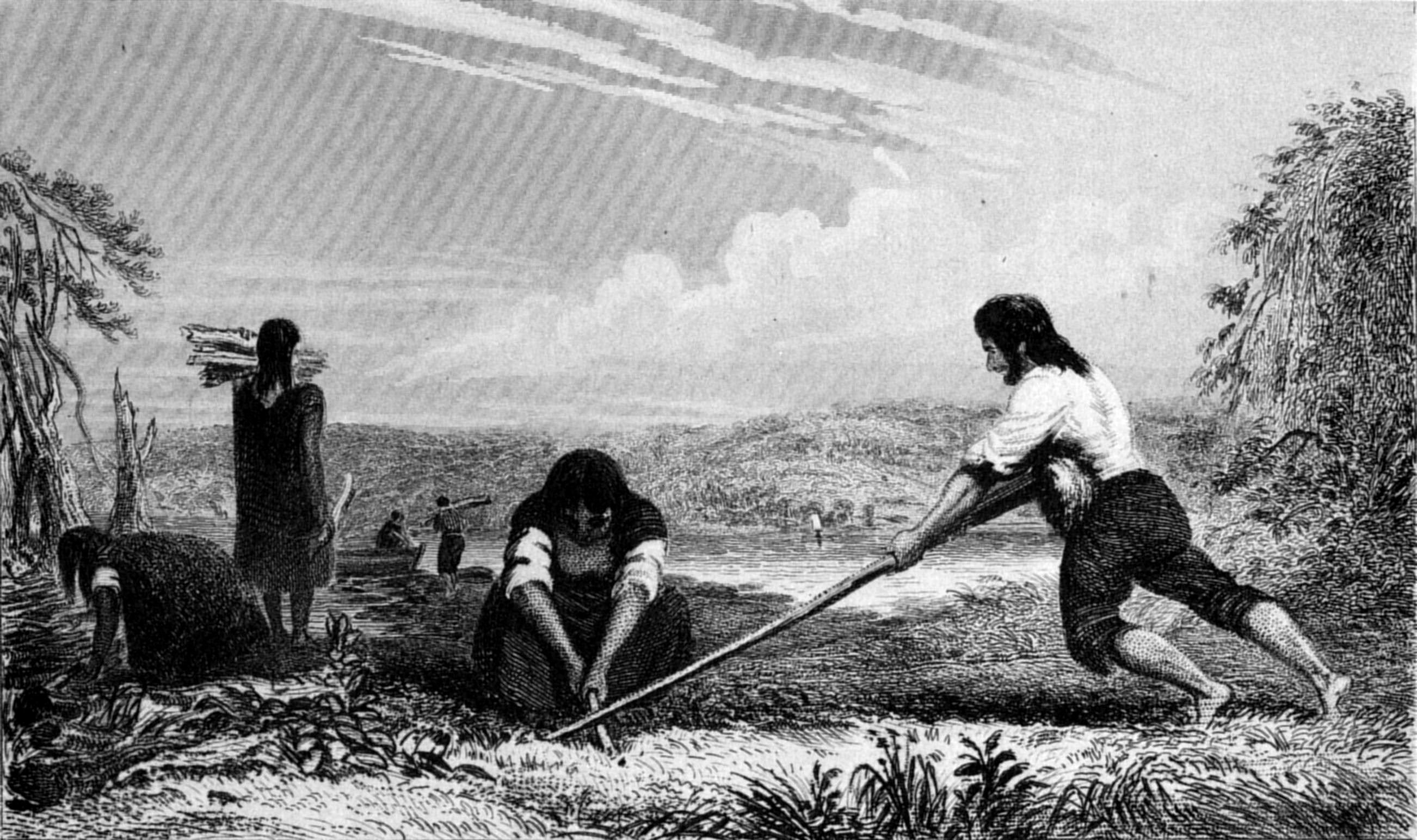
P. P. KingT. Landseer
BREAST PLOUGHING AT CHILÓE.
Published by Henry Colburn, Great Marlborough Street,
1838
The large ends are then forced down, the ground turned up, and the
lumas pushed forward again, while the woman uses her stick to turn the
clods over, to the right and left, alternately. These clods are
afterwards broken up by a wooden tool, in the shape of a pick-axe, called
'hualate,' made of the wood named meli. Rude as this process is, the
operation is rapidly performed, and I have seen a field, ploughed in this
way, that would not do much discredit to an expert ploughman with a
European plough.
The soil is a rich, sandy loam, of a dark red colour; and although
rarely, if ever manured, produces fair average crops. According to the
usual allowance of 175lbs for a fanega of wheat,[154] the weight of a bushel would not be
more than 51½lbs., which shews that the grain is but poor. Wheat is sown
in the month of April, and cut in the same month of the following year;
but from the humidity of the climate, and constant rain, particularly at
that season (the commencement of winter), it is frequently reaped before
it is ripe, and almost always gathered in wet. Every subsequent sunny day
is taken advantage of, to dry the grain, but a part must be spoiled by
mildew. The evaporation, however, is so great, that merely moving it
about, and keeping it thinly strewed in granaries, will effect much. It
is trodden out by oxen, and to clean it, the grain is thrown up in the
wind by means of broad wooden shovels, and effectually separated from the
chaff. This rude winnowing takes place frequently in the principal
streets of San Carlos, and even at the mole, where one would suppose that
a great deal must be lost; but from the adroitness of the operation, it
is not only well cleaned, but suffers no diminution.
Potatoes are planted in September, October, and November, and are fit
to dig up in May.
Of the proceeds of harvest, one-tenth is paid as a tribute, or tax,
to the government; but forced contributions may be required, when the
necessities of the state demand them. These contributions are sometimes
unfairly levied in Chile; for the subsidy is only taken from those who
possess grain, or some equally tangible article which can easily be
turned into money; so that persons who are rich enough to live without
cultivating land, or trading for their support, contribute nothing
towards the emergency of the State. How does this accord with republican
principles? or how can a republican government, so conducted, expect to
become respectable among nations?
I am not aware that such contributions have yet been levied in Chilóe.
From the character of General Aldunate, I do not for a moment think he
would commit such an act of injustice; but it is in the power of any
Yntendente to call for them, and I afterwards witnessed an example of
this, during my visit to Concepcion. A considerable quantity of wheat,
purchased by a Russian vessel, for the use of their settlements on the
coast of California, was brought down to the port, at a time when the
government was much in want of money, and knew no just way of obtaining
it. They therefore very unceremoniously seized the wheat, and applied its
value in dollars to their own use, giving only an uncertain, almost a
nominal security to the owner for the recovery of his money. The only way
of accounting for such an arbitrary proceeding is, that the country was
distracted by civil war, and that the person who owned the property was
opposed to that party, which at the time happened to have the upper hand,
and which held, by main strength alone, the reins of government.
Among the birds of Chilóe, the most remarkable are the 'Cagge,' the
'Cancania,' or 'Canqueña,' and the 'Barking bird.'[155]
The shell-fish,[156]
for which this island is justly famed, are principally brought from
Calbuco, and consist of the finest muscles, of which there
are two sorts: the Choro (Mytilus Choras, Molina), and Cholgua
(Mytilus Magellanicus, Lamarck), Picos (Balanus psittacus nob.
Lepas psittacus Molina, 1, p. 223), a large barnacle,[157] and the oyster (O.
Edulis), which is exceedingly well-flavoured. Besides which there are
several kinds of shell-fish of less value, but equally abundant, such as
Navajuelas (Solen sp.); Caracoles (Turbo); Cornes
(Pholas Chiloensis, Molina); Campaña (Calyptræa); Lapas
(Crepidula); Tacas (Chama Thaca, Molina); Locos
(Concholepas Peruviana, Murex Loco of Molina); Quilmagues;
Piures (Pyura sp. Molina); and others.
The apparently inexhaustible abundance of shell-fish with which nature
has provided the inhabitants of these islands, the facility with which
they are obtained, and their consequent cheapness, is the principal cause
of that want of industry which is so remarkable in the Chilotes.
Of the above-mentioned shell-fish, those deserving more particular
notice are the large muscle, the oyster, and the pico.
Molina has described the choro of Conception, which is not at all
different from that of Chilóe. It is often found seven or eight inches
long. The fish is as large as a goose's egg, and of a very rich flavour:
there are two kinds, one of a dark brown, and the other of a yellow
colour; but the last is most esteemed. There is also another sort, much
larger than the choro, yet equally delicate and good, the fish of which
is as large as a swan's egg: it is called cholgua; but as the shells seem
to be of the same species, I think the distinction can only be owing to
size. In Febres's Dictionary of the Chileno language, the word cholchua
is rendered into Spanish by "cascara de choros blancos," or shell of the
white muscle. Cholhua, or cholgua (the letters g and h are
indiscriminately used), must be a corruption; for it is now used in
Chilóe to distinguish the large from the small choros.
The manner in which the natives of these islands, both Indians and
descendants of foreigners, cook shell-fish, is very similar to that used
for baking in the South Sea Islands, and on some parts of the coast of
New Holland. A hole is dug in the ground, in which large smooth stones
are laid, and upon them a fire is kindled. When they are sufficiently
heated, the ashes are cleared away, and shell-fish are heaped upon the
stones, and covered, first with leaves or straw, and then with earth. The
fish, thus baked, are exceedingly tender and good; and this mode of
cooking them is very superior to any other, as they retain, within the
shell, all their own juiciness.
The oyster, which is a true Ostrea edulis, is found in beds, at
low water, or taken with the dredge. It is about the size of the native
oyster of England, and not at all inferior to it in flavour. In Agüeros's
account of Chilóe, he notices this excellent shell-fish; but remarks,
that the islanders are ignorant of the value at which it is appreciated.
It is rather curious, that, excepting in the neighbourhood of Chilóe, the
oyster is very rarely to be met with on the South American coast, while
there it is in the greatest abundance. We have never observed any shells
of this fish anywhere between the river Plata and Chilóe; nor is it known
elsewhere upon the western coast, I believe, to the southward of
Guayaquil, which is very near the equinoctial line.[158] The oyster-shells at Port San Julian
are fossils. Of the Linnæan genus, Ostrea, there are many sorts, on all
parts of the coast, both east and west, but they are what we call the
pecten or scollop. At Coquimbo, a species of scollop is much used as an
article of food, and called oyster; but it has no further right to the
name than because Linnæus classed them all as Ostrea, and Molina
describes this to be Ostrea edulis.
The pico, which is a barnacle, grows to a very large size; at
Concepcion, however, it is still larger, being six or seven inches in
length. It has, when properly cooked, very much the flavour of a crab,
and by the inhabitants of this Archipelago is considered preferable to
any other shell-fish.
Before concluding this imperfect description of the shell-fish of
Chilóe, the piure claims some consideration, if it be only for its
peculiar and disagreeable appearance. It was considered by Molina as a
genus allied to Ascidia (Mol. i. 214), none of the varieties of
which are inviting in their look, as an edible substance, but the piure
is still less so. It is thus described by Molina: "The piure, scarcely
deserving the name of a living animal, is as remarkable for its figure,
as for the manner in which it is lodged. The body is about the size and
shape of a small pear, an inch in diameter; or it may be described as a
small, conical, fleshy bag, of a red colour, filled with saline liquor,
and provided with two trunks or processes in the upper part, one of which
is the mouth, similar to that of the Tetias; and between these processes
are seen two small, black, and shining points, which are supposed to be
the eyes. I could distinguish no other organs, nor any viscera in the
fleshy substance of which it is composed, which is smooth without and
spongy within. They are extremely sensitive, and when touched, spout
water out of both apertures. These small animals are shut up in a firm,
but glutinous case, of various shapes; one case often contains eight or
ten distinct bodies, separated from each other by cells, formed of a
strong membraneous substance. They are attached to rocks or stones, under
water, excepting when left uncovered by a low tide. The natives eat them
boiled, or roasted in their shells. They also dry them for exportation to
the province of Cusco, where their flavour is much esteemed, and
considered equal to that of the lobster."
At Chilóe, the piure is said to be a remedy for barrenness; and to
such an extent has this idea prevailed, that a Chilote woman, eating this
fish, literally says, if asked what she is doing, that "she is making
children." One would not, however, suppose, from the number of children
which are seen crowding round the doors, that the
Chilotes had any necessity for such food.
If one may judge from the few applications made to our medical men for
advice, the climate is either very healthy, or the natives prefer their
own mode of cure. They have very few medical advisers, and those few are
not held in much estimation, being people of little or no education. A
prejudice against medical men has been, even in late years, extended to
foreign practitioners, and carried to great lengths. This illiberal
feeling is, however, fast wearing away; but, among the lower orders, the
application of herbs and other simples is yet wholly resorted to for the
removal of their complaints. One day, when I was employed in making some
astronomical observations, at Sandy Point, a woman passed me, and forcing
her way through a thicket of thorny plants, began to gather branches of a
species of arbutus (A. rigida.), a small shrubby plant, which is
every where abundant, especially to the south, and in the Strait of
Magalhaens. My curiosity prompted me to inquire her reason for collecting
it with such apparent anxiety. She replied, with a desponding air, "It is
chaura[159] for a poor,
sick child. These branches," she said, "are to be put into the fire, and,
being green, will produce a thick smoke, and yield a very strong aromatic
smell. The child, who is only five months old, is to be held over it,
which, as they say, is a good remedy; but," she added, with an air of
doubt, "I know not (dicen que es bueno, pero yo no sé)." "Who says so?" I
asked. "Los que saben (those who know)," replied the half-credulous
mother, with a deep sigh, partly doubting the efficacy of the remedy, but
unwilling to lose the advantages of whatever virtue it might possess, for
the benefit of her sick infant.
The climate of Chilóe is considered, by those who live in other parts
of Chile, to be "rigorous, cold, and damp." Certainly there is much
reason for such an opinion, particularly in the winter months, when it
almost always rains, and the wind, with little cessation, blows hard,
from N. to N.W., and, by the W. to S.W.; but notwithstanding the
great quantity of rain that falls, the evaporation is great, and it
cannot therefore be called unhealthy; indeed, from experience, it is
considered quite otherwise. Agüeros, to whose excellent account of Chilóe
I have so often referred, dilates much upon this subject, and from having
resided there a considerable time, may be taken as the best authority.
Those who now reside upon the island speak very much against it, and all
whom I met, previous to my visit, condemned it, as being "the worst in
the world." Perhaps we, who had lately been experiencing a much more
disagreeable climate, went to Chilóe with the expectation of finding it
exceed in severity that to which we had been accustomed in the Strait of
Magalhaens, but we found ourselves agreeably mistaken. Our visit
certainly was in the better season, and we had, perhaps, no right to form
a decided opinion upon the other part of the year. I shall, therefore,
first quote Agüeros, and then describe what we found the weather from
September to December; yet as these months were considered by the
inhabitants to be finer than is usual at that season, we can only form a
vague idea of the spring and summer. For the autumn and winter I must
depend upon the accounts of others.
After explaining the contra-position of the seasons, to what is
experienced north of the equator, with regard to the months of the year;
Agüeros says, "Chilóe has also its four seasons, but does not enjoy the
benefit of those changes, as do other parts of Chile; for there is
neither that abundance of fruit, nor are its fields adorned with so many
and such beautiful flowers, and useful medicinal plants. The summer is
the best time; for in the month of January, from ten o'clock in the
morning till three in the afternoon, the heat is excessive. Between these
hours, however, a sea-breeze, which is called 'Vira-zon,' refreshes the
air. In the winter the temperature is very cold; but the frosts are by no
means so severe as in Europe. I have never seen ice, even in the small
streams, nor does snow lie any length of time on the ground.
"In the winter months, as well as in other parts of the year, there
are falls of rain, and heavy gales from N.N.W., and west, which last
frequently for the whole moon, with scarcely a cessation, and the wind,
at times, is so furious, that the houses are not secure, and the largest
trees are torn up by the roots. The weather, when it is fine, cannot be
depended upon for any length of time; not even in summer; for in the
month of January I have frequently experienced gales, and rain, as severe
and copious as in the winter. During the summer months southerly winds
are more prevalent, and, while they last, the weather is fine, and clear,
and the air particularly dry.
"Although the winter months, and a considerable part of the other
seasons, are very disagreeable, owing to the severity of the winds, and
exceeding quantity of rain, it cannot be denied that the climate is
healthy. In Chilóe no epidemic diseases are experienced. The small-pox
and measles are not known;[160] nor have tertian fevers, so common in
the north, ever been experienced on the island. Spotted fever
(tabardillo), and acute pains in the stomach, are the only disorders to
which the inhabitants of this archipelago are subject. Thunder and
lightning are rarely experienced; but earthquakes have occurred at
intervals. In the year 1633 the church and houses were destroyed, and in
the year 1737 much damage to the village of Isla grande was caused by
earthquakes."
So far Agüeros. On the whole, the climate is not so unfavourable as we
had been led to expect from all that we had heard.
Captain Fitz Roy arrived there in July, during the latter part of
which, and the month of August, the weather was very wet, with some heavy
gales from the N.W.; but in his Meteorological Journal for those months
there is no record of the thermometer falling below 38°, and it is
recorded to have fallen to that degree only on one occasion, the general
height being from 45° to 50°. The first part and the middle of September
were boisterous and wet; but towards the end of the month the wind was
chiefly from the southward, and the weather dry and extremely
fine. In October it was rather changeable; but for the last ten days,
with the exception of one, on which there was a fresh gale with a heavy
fall of rain, it was fine and dry, and the winds were moderate.
The month of November was generally fine, but the first half of
December continued tempestuous and wet. The mean temperature of the
months, and other meteorological remarks, are as follows:
| 1829 |
Temperature |
Pressure
reduced
to 32°. |
Hygrometer (Daniells') |
No. of Days |
Rain |
|
|---|
| Months |
Mean at
9 A.M. |
Ex. of
Temp. |
Dew
Point. |
Dew
Point
less
than
Air. |
Expansion. |
Dryness
by
Thermo.
Scales. |
Weight
of a
cubic
foot
of air. |
Fine. |
Rain. |
Quantity
fallen. |
Quantity
evaporated. |
Remaining
in the
gage at
end of
month. |
|---|
| Air |
3 P.M.
water
at anch. |
Max. |
Min. |
|---|
| July | 22 days |
46.9 | 47.9 | — | — | 29.927 |
— | — | — | — | — |
— | — | — | — | — |
| Aug. | 31 ... |
— | — | — | — | — |
— | — | — | — | — |
— | — | — | — | — |
| Sept. | 30 ... |
47 | — | 64.5 | 35.2 | 30.061 |
40.9 | 6.18 | 296.9 | 806.2 | 3.3854 |
7 | 7 | 1.68 | 0.48 | 1.2 |
| Oct. | 31 ... |
50.9 | — | 73 | 37 | 29.979 |
45.8 | 5.14 | 349.8 | 845.0 | 3.9575 |
21 | 10 | 4.22 | 2.25 | 1.97 |
| Nov. | 30 ... |
53.5 | — | 68.5 | 42 | 29.898 |
48.4 | 4.79 | 416.2 | 844.5 | 4.3361 |
14 | 16 | 4.89 | 2.28 | 2.61 |
This table partly shows the state of the weather during three spring
months. The greatest quantity of rain in the gage at the end of the month
of November did not exceed 2.6 inches. At St. Martin's Cove, near Cape Horn, after
thirty days' observation, the rain-gage contained eight inches; so that
although Chilóe bears the character of being a very wet place, it is not
one-third so bad as Cape Horn. The time of our visit to San Carlos was
certainly the finest part of the year; and I believe that the weather we
experienced was unusually dry even for the season; therefore, the above
table does not present a fair criterion of the climate: I do not,
however, think it is by any means so bad as has been represented.
Chilóe the last Spanish possession in South America—Freyre's
Expedition—Failure—Second Expedition under Freyre and
Blanco—Quintanilla's capitulation—Chilóe taken—Aldunate
placed in command—Chilóe a dependency of Chile—Beagle sails
to sea coast of Tierra del Fuego—Adelaide repaired—Adelaide
sails—Adventure goes to Valparaiso—Juan
Fernandez—Fishery—Coats—Dogs—Geology—Botany—Shells—Spanish
accounts—Anson's
voyage—Talcahuano—Concepcion—Pinoleo—Araucanian
Indians—Re-enter the Strait of Maghalhaens—Fuegians.
The island of Chilóe was the last place the King of Spain possessed in
South America; and even to this day he is not without friends there, who
would gladly restore his absolute monarchy, notwithstanding the
advantages that are acknowledged to have been derived from the change of
masters, and the consequent opening of trade, which has added very much
to the comfort, as well as civilization of the inhabitants.
During the struggle for independence, this island was too distant from
the seat of war to render it important; but when all other parts of Chile
were freed from the king's troops, the new government despatched an
expedition, consisting of between three and four thousand men, commanded
by the Director-General Freyre, to attack it. Upon the appearance of this
expedition off the harbour of San Carlos, the Spanish governor,
Quintanilla, was inclined to capitulate; but, instead of anchoring in the
roads, the squadron proceeded to Chacao, landed troops there, and
despatched some of their forces to Castro, where they were repulsed by
the Spanish and native troops, and obliged to re-embark. In this
interval, one of the ships left the squadron, and returned to Valparaiso,
whence she was immediately ordered back; but meanwhile the Director had
embarked his troops, and returned to Concepcion. Not long afterwards, in
January 1826, a second expedition, under the same general, sailed from
Valdivia, convoyed by a strong squadron, under the command of Admiral
Blanco.
"Upon this occasion the troops landed, on the 8th, at the little inlet
of the Bay of Huechucucuy; and Fort Corona was immediately taken. On the
10th, the disembarkation of the troops was completed. A battalion was
left to mask Fort Aguy, while a force, under Colonel Aldunate, passed on,
and took the battery of Barcacura. On the 10th, Admiral Blanco shifted
his flag; and, leaving the O'Higgins outside, stood into the bay with the
rest of the squadron, which anchored off Barcacura.
"The governor, Quintanilla, with upwards of three thousand Royalists,
took up a strong position on a hill, at the S.E. side of the bay, flanked
on the left by an impenetrable wood, on the right by the shore, and
supported by three gun-boats in shallow water. These were taken by the
boats of the squadron, under Captain Bell, and turned against the
Royalists. Their position was thus enfiladed, and they retired. Freyre
then advanced: some skirmishing took place: Quintanilla capitulated; and
the territory of Chile was no longer sullied by the Spanish flag.
"Colonel Aldunate, Majors Maruri, Asagra, and Tupper (a native of
Jersey); and Captain Bell, of the navy, greatly distinguished
themselves.—Miller's Memoirs."
Colonel Aldunate was afterwards invested with the government of the
island; but, owing to the disaffection of the troops, who were urged on
by the King of Spain's agents, a revolution took place, Aldunate was
imprisoned, and afterwards sent to Valparaiso, and the Spanish flag once
more waved in Chilóe. It was, however, for a short time only; Aldunate
was despatched once more, and with a small force of three hundred veteran
troops, headed by Colonel Tupper, and accompanied by the Aquiles, brig of
war, again obtained possession of the island, which he has since kept,
though not quietly, for the Royalists were constantly on the alert, and
made several futile attempts to recover the place for their king. Time
has now reconciled the greater number to the change; and, I believe,
Chilóe may be considered a contented dependency of the republic of
Chile.
The Beagle being ready to resume her voyage, sailed on the 19th of
November to survey the southern coasts of Tierra del Fuego; after which,
she was to rejoin the Adventure at Rio de Janeiro.[161]
As the Adelaide had received some damage in getting aground, it was
requisite to lay her on the beach for examination and repair. Her
mainmast, also, was found to be sprung so badly, as to render a new one
necessary; which we should have found much difficulty in obtaining, but
for the kindness of General Aldunate, who, finding that we were at a
loss, proposed to give us the flag-staff of the town, a beautiful spar of
alerse, that was in every way suitable. Previously, however, to accepting
his offer, being aware that such an act might expose him to much reproach
from the people of the town, who were all very proud of it, I caused
inquiry to be made whether a spar of the necessary dimensions could be
brought from Calbuco; and in the meantime we proceeded with the
repairs.
A creek behind Sandy Point offering every convenience for heaving her
down, the Adelaide was moved into it, and laid on the beach. On stripping
her copper off, the injury proved to be considerable; but not beyond our
means to repair. Upon examination, the foremast was found to be in a bad
state, but could be rendered effective by fishing it with the sound
portion of the other mast, therefore our only real difficulty was to get
a mainmast. From the account I received from Calbuco, I found that,
without a great delay, not less than two months, and sending a portion of
our people with ropes and tackles, there was no chance of procuring a
spar: it could only be obtained at a considerable distance from the
shore, and when felled must be dragged over several high ranges of hills,
which might be called mountains, before it could be got to the
water-side. General Aldunate, through whom this inquiry was made, then
renewed his offer of the flag-staff, which I accepted most thankfully;
and by his order it was taken down, and conveyed to the ship, soon after
which it was converted into an excellent mainmast for the schooner.
Before it was moved, a new, but shorter staff, with a topmast, was fitted
for the flag; notwithstanding which, many unpleasant observations were
made, and absurd reports circulated, which spread to Chile, and even to
Peru, that the English were about to take possession of Chilóe, and had
already removed the flag-staff of San Carlos.
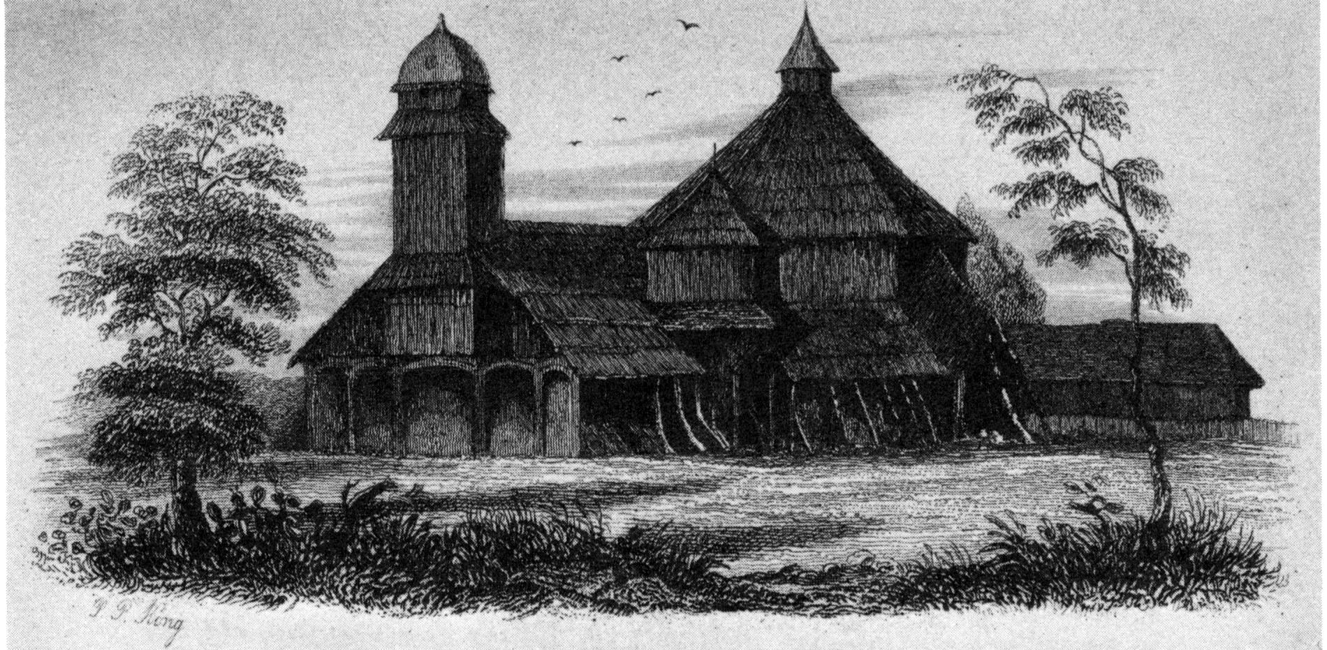
OLD CHURCH AT CASTRO.
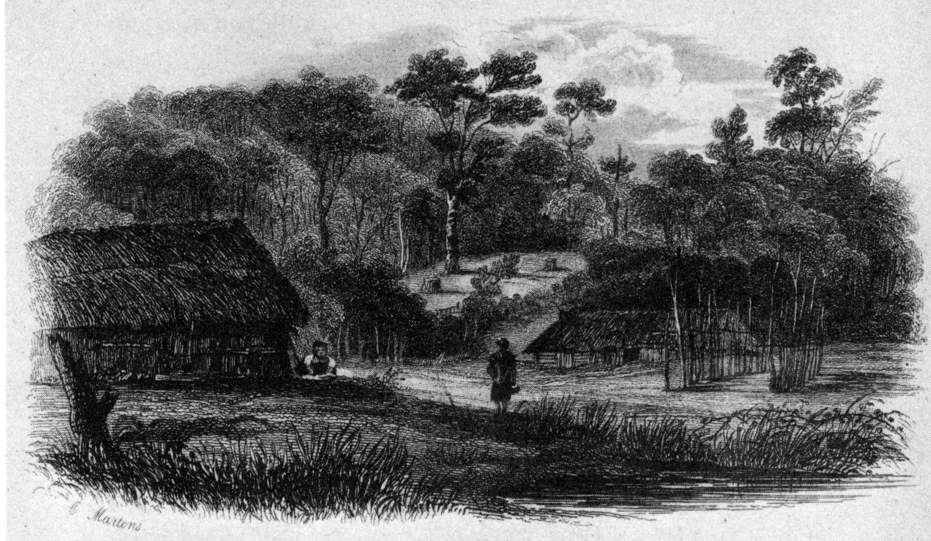
NEAR PT. ARENA.
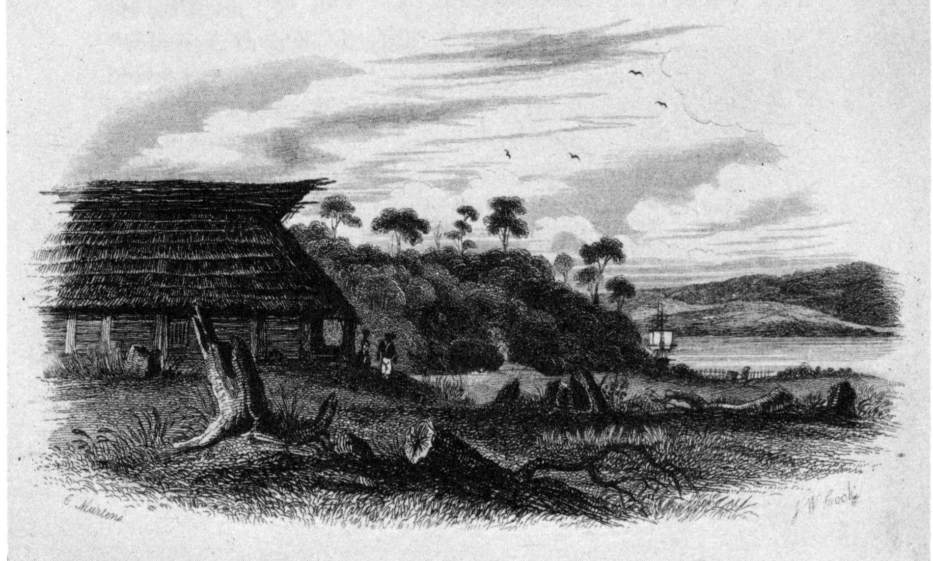
PT. ARENA.—SAN CARLOS CHILOE.
Published by Henry Colburn, Great Marlborough Street,
1838
By Lieutenant Mitchell's activity in superintending the Adelaide's
repairs, she was got ready for sea at the beginning of December, and
sailed on the 8th, under the command of Lieutenant Skyring, with orders[162] to survey those parts
of the Gulf of Peñas which had not been examined by the Beagle;
particularly the River San Tadeo, in San Quintin's Sound; the openings
behind Xavier Island; the Channel's Mouths; and the Guaianeco Islands,
where the Wager was wrecked: and then to proceed down the Mesier Channel,
behind the Island Campana, which was supposed to communicate with
Concepcion Strait, by the Brazo Ancho (or Wide Channel) of Sarmiento. He
was then to go to the Ancon sin Salida, examining all the openings into
the main land, on his way, and search for a communication with the large
waters, discovered by Captain Fitz Roy, through which he was to try to
enter the Strait, and join the Adventure, at Port Famine, during the
month of April.
Lieutenant Skyring again took with him, by Captain Fitz Roy's
permission, Mr. Kirke and Mr. Bynoe, of the Beagle; Mr. Alexander Millar
and Mr. Parke also accompanied them.
Having thus despatched our companions, we prepared, on board the
Adventure, to return to Valparaiso; intending to proceed to Rio de
Janeiro; by way of Concepcion, Port Famine, and Monte Video; for the sake
of adding some links to our chronometric chain: with a view to which, I
had taken the opportunity of having the chronometers cleaned at
Valparaiso by Mr. Roskell, agent for Messrs. Roskell chronometer-makers
at Liverpool. General Aldunate being on the point of returning to
Valparaiso, I had an opportunity of obliging him, and showing my sense of
the assistance, and essential kindness we had received, by offering
him and all his family a passage in the Adventure, which he accepted; and
on the 17th we left Chilóe. In our way we touched at Concepcion, and
anchored at Valparaiso on the 2d of January.
We remained there until the 11th of February, and then sailed on our
return to Rio de Janeiro, with the intention of passing though the Strait
of Magalhaens, and taking that opportunity of completing some few parts,
which our former surveys had left unfinished. As the breeze, which, on
this coast, blows with the constancy of a trade wind, would carry us
close to the island of Juan Fernandez, I determined upon visiting it, for
a few days; and then proceeding again to Concepcion.
We reached Cumberland Bay, on the north side of Juan Fernandez, on the
16th, and anchored, within two cables lengths of the beach, in ten
fathoms.
I have seldom seen a more remarkable and picturesque view, than is
presented by the approach to Juan Fernandez. When seen from a distance,
the mountain of the 'Yungue' (Anvil), so called from its resemblance to a
blacksmith's anvil, appears conspicuously placed in the midst of a range
of precipitous mountains, and is alone an object of interest. It rises
three thousand feet above a shore, which is formed by an abrupt wall of
dark-coloured bare rock, eight or nine hundred feet in height, through
whose wild ravines, broken by the mountain torrents, views are caught of
verdant glades, surrounded by luxuriant woodland.
The higher parts of the island are in general thickly-wooded; but in
some places there are grassy plains of considerable extent, whose lively
colour contrasts agreeably with the dark foliage of myrtle-trees, which
abound on the island.
The Yungue is wooded, nearly from the summit to its base; whence an
extensive and fertile valley extends to the shore, and is watered by two
streams, which take their rise in the heights, and fall into the sea.
This valley appears to have been formerly cleared and cultivated by
the Spaniards, who had a colony here; for the stone walls, which
served to divide their enclosures, still remain. From Walter's account of
Anson's voyage, and the view given with it of the commodore's tent, there
is no difficulty in determining this valley to be the spot on which his
encampment was placed.
The island is now (1830) occupied, or rather rented from the governor
of Chile for a term of years, by Don Joachim Larrain. The establishment
consists of a superintendent (mayor-domo), there called, 'the governor;'
and forty persons, who are employed in the seal and cod fishery, and in
drying fish for the Chilian market. Their dwellings are erected on the
flat land, at the north side of the bay, where the soil is richer than in
other parts; and where it is more sheltered from the squalls, which,
during strong southerly gales, rush down the valley of the Yungue, the
situation of the former establishment, with great violence.
The remains of a fort, called San Juan Baptiste, are yet in a
tolerable state; and from an inscription on the wall, it appears to have
been repaired, or completed, in the year 1809. It is situated on a rising
ground, about one hundred and thirty feet above the sea, at the S.W. part
of the bay, and overlooks the village; there are now no guns mounted,
but, with a few, it might be made very effective in a short time; and,
from its situation, would command the bay.
In the middle of the beach are some ruins of a four-gun battery, and
there are also traces of a fort at the N.W. end of the bay.
At present, except wild-goats, wild peaches, figs, abundance of fish,
and excellent fresh water, no refreshments can be procured. An
establishment of forty persons, with very little to do, might naturally
be expected to cultivate the land, raise vegetables and fruit, and rear
poultry and pigs, to supply the vessels, which frequently touch here for
wood and water; but it is not the character of the Chileno to take any
trouble, unless obliged, although his own comfort and advantage may be
materially concerned.
The mayor-domo, however, told me that their attempts to cultivate the
soil, and raise potatoes, had been defeated by the destructive ravages of
a worm.
By sending a boat to the east point of the bay, to fish in forty
fathoms water, a most delicious kind of cod-fish may be taken, in such
numbers, that two men, in half an hour, could fill the boat. Craw-fish,
of large size, are almost equally abundant; they are taken with a hooked
stick: one of our boats caught forty-five in a very short time. The
inhabitants catch them, and cure their tails, by exposure to the sun, for
exportation to Chile, where they are much esteemed, and fetch a high
price.
Wild-goats are very numerous among the inaccessible parts of the
island, but are not easily obtained; they are sometimes shot, or taken
with a lazo. These animals, according to Woodes Rogers, and other
writers, were originally left on the island by Juan Fernandez, who, for a
short time, lived there. According to the 'Noticias Secretas,' p. 50 to
56, they are supposed to have been landed by the Buccaneers, who
frequented this island. Certain it is, that, without such refreshments,
the Buccaneers would not have been able to carry on their harassing war
of plunder against the Spanish possessions on the American coast to such
an extent; nor should we, perhaps, have heard anything more about
Commodore Anson, and the crews of the Centurion and Gloucester, who were,
on their arrival at this island, in the last stage of scurvy.
To prevent Juan Fernandez from being so tempting a resort to
Buccaneers, the Viceroy of Peru caused a great many dogs to be landed,
which hunted down and destroyed the goats in great numbers: this in some
measure has prevented their subsequent increase. The dogs however drove
the goats to places where they could not follow them, and were then
obliged to destroy seals for food. Large troops of these dogs still range
about the lower grounds; but the heights are in the undisturbed
possession of wild-goats; which may be seen in numbers browsing on
elevated and almost inaccessible places, where they live in safety.
The geological character of this island, according to Mr. Caldcleugh,
who accompanied me in this trip, is of basaltic green-stone, and trap,
which appears, at first sight, to be volcanic; but, on a more particular
examination, the lava-like appearance of the rock does not seem to arise
from an igneous origin.
The green-stone is full of crystals of olivine, which, as they
decompose, leave hollows, resembling those of scoriæ. Mr. Caldcleugh
communicated an account of the structure to the Geological Society.[163] In Captain Hall's
interesting journal, there is a list of Geological and Mineralogical
specimens, of which one from Mas-a-fuéra[164] is named 'Vesicular Lava.' May it not
be this same rock in a decomposed state?
The late Signor Bertero, whose botanical collections from Chile have
enriched many of the principal herbaria in Europe, accompanied me to make
a collection of the Flora of the island; and he considered that the
character of the vegetation was very little allied to the Chilian, but
partook more of that of California. The sandal-wood, which has been
described as indigenous to this island, was not found by us, growing, but
a large quantity was collected about the hills and vallies, in a dry
state, and apparently very old. It is of the red kind, and still
preserves a strong scent. The mayor-domo told me there were no
sandal-wood trees in the island; but we had reason to think his
information was incorrect, for one of the inhabitants would have taken us
to a place where he said they were growing in large quantities, had not
our arrangements for sailing interfered.
The island produces several kinds of grass; but the most abundant
herbaceous plant is a species of oat, which grows very luxuriantly, and
towards the westward covers the ground for many miles. The neighbourhood
of Cumberland Bay is over-run with strawberry plants, wild radishes,
mint, and balm, besides peach, apple, cherry, and fig trees, which are
found wild every where, and remind one of
Lord Anson's visit.[165]
Not only in its botanical productions does this island differ from the
Chilian coast, but also in its shells: the shell fish being extremely
scarce, and dissimilar in character. On the rocks we found a patella and
a small chama, but we saw no mytilus. From the deep water I fished up
some coral, and attached to one fragment was a new species of arca.[166] The fishing-lines
brought up, from the depth of eighty fathoms, a branch of coralline, to
which an infinite number of a species of caryophyllia were attached. The
existence of coral is mentioned in Mr. Barry's translation of the
'Noticias Secretas de America; por Don J. Juan, y Don A. de Ulloa,' a
work which contains a long and, generally speaking, good account of the
island; but their description of the anchorage does not agree with ours.
They say, "The distance between the two points, which form the bay, is
two miles, and its depth about half a league; and, although the depth is
nearly the same in all parts, the best berth to moor ships is in the
front of the 'Playa del Este;' but it is necessary to be close to the
stones of the beach, for at one or two cables' length there are fifty
fathoms water, and the outer anchor is in the depth of seventy or eighty
fathoms; but if the vessel is three or four cables off, it will be
necessary to drop the outer anchor in one hundred fathoms, which, even
with two cables an end, will scarcely secure the ship." Now, at three
cables' length from the beach, we had only ten fathoms, our outer anchor
was dropped in seventeen fathoms, and in a line between the two points of
the bay there is not more than fifty fathoms.
If the accounts of those Spanish officers were correct, the
earthquakes, which certainly affect these islands, must have caused a
considerable uprising of the base of the island; but, on referring to the
plan in Anson's voyage, the soundings in 1741 do not appear to have been
different from ours. The innermost ship, whose berth we occupied, is, in
that plan, at anchor in nineteen fathoms, and the depth between
the points of the bay is shown to be about fifty fathoms.
There are few persons who have not read, with much interest, Mr.
Walter's account of the Centurion's voyage, and who are not well
acquainted with his description of this island, which we found
exceedingly correct. The views of the land, although old-fashioned in
execution, are most correctly delineated, and the plan of the bay is
quite sufficient for every common purpose of navigation; but as we had an
opportunity of fixing its latitude and longitude more correctly, it
became desirable to make a more detailed plan than Commodore Anson's.
The seals and sea-lions, which were so abundant formerly, are now
reduced to such a small number, as to make the seal-fishery scarcely
worth notice. They have been destroyed by taking them indiscriminately,
without regard to age or sex, leaving none to propagate the race but
those who by chance escaped. At present the island is let to a tenant,
who is not permitted to kill them until the young have taken to the
water, by which means an opportunity is given for them to increase.
I am not aware that there are any indigenous animals. Dogs, goats, and
rats, have been imported. Land birds are not numerous; some pigeons, said
to have been imported, and a few hawks, are occasionally seen, besides
three species of humming-birds, two of which are new to science.[167] Of sea-birds we saw
very few; but were informed that the 'Goat Islands,' at the south-west
end of Juan Fernandez, are completely covered by them at the breeding
season.
During our stay, several excursions were made, in various directions,
from the village, and much facilitated by beaten paths, one of which
leads up a valley, westward of that of the Yungue, and thence to a
pass over the principal range, communicating with the other side of the
island. This pass, called the Puertozuela, is 1,800 feet high, and was
visited several times by the officers. On one occasion, they went to the
western part of the island, to hunt wild goats. The party set out in
boats with the mayor-domo, or governor, as their guide; but before they
reached the proper landing-place, became so impatient that they landed,
intending to walk back. The governor, however, persevered, and returned,
in the evening, with five fine she-goats, which he had taken with
'lazos.' Our pedestrians found their return by no means so easy as they
had contemplated, being obliged to pass the night in a cave, which they
fortunately found at sunset, and they did not reach the ship until the
following afternoon, fatigued, but much pleased by their ramble.
The thermometer on board ranged, during the day, between 63° and 82°,
and the barometer between 29.98, and 30.16. On shore the thermometer
stood higher, in fine, unclouded weather, and lower when the summits of
the hills were covered with clouds.
We put to sea on the 22d, anchored at Talcahuano on the 3d of March,
and sailed again on the 17th, to proceed through the Strait of
Magalhaens.
While at Concepcion I had an opportunity of seeing Pinoleo,[168] the Indian chief, from
whom Captain Basil Hall endeavoured to obtain the release of a captured
Araucanian female, whose husband had been murdered in cold blood before
her eyes.[169]
Mr. Rouse, our consul, procured for me the necessary introduction,
and, with one of the governor's aides-de-camp, accompanied us to the
Indian quarters, situated on the outskirts of the town,
towards the river Bio-Bio. We found the chief's residence (little better
than a rancho, or hut of the country), surrounded by Indians, some of
whom were armed; and at the door were his two daughters, young, and
rather good-looking, whose persons and dress we had leisure to examine,
whilst waiting the chiefs pleasure to receive us. They were clothed with
a mantle, or wrapper, of green baize, enveloping the body from the neck
to the feet, and fastened at the breast by a toup, or tupu[170] (a silver pin, or
skewer, headed with a round silver plate, three inches in diameter), over
which hung a string of beads. Their hair, which was remarkably fine and
clean, as well as neatly dressed, was divided into two plaited tails
('trensas'), and their foreheads were ornamented with a broad fillet,
worked over with beads.[171] They also wore necklaces, bracelets,
ear-rings, and anklets of similar manufacture.
Our names having been announced to Pinoleo, he came to the door to
receive us, and invited us to enter. Some of our party he recognized, and
seemed pleased at their visiting him. We were early, and found him sober;
but from his bloated and haggard appearance, it seemed that he had not
been long so. On entering the hut, we observed a number of Indians,
scarcely sober, seated round, near the walls. Some turbid wine was
presented to us, in a silver cup, which we sipped as it passed round; but
the last of our party knowing that to return the cup without emptying it,
would be an offence, was obliged to drink the contents, and a bitter
potion they were. Pinoleo was then stout and rather corpulent, five feet
ten inches in height, of a fairer complexion than the generality of his
countrymen, and had lost much of his hair. He had laid aside the Indian
dress, and wore the deshabille of a
Spaniard, a shirt and pair of trowsers, in a very slovenly manner. He
spoke Spanish with great facility, and appeared to be quite at his ease
in conversation. He has the rank of lieutenant-colonel in the Chilian
army, and receives pay, as a retainer for his friendship.
A very short visit was sufficient to satisfy us, and we took the first
opportunity of retiring, for fear of a second cup of wine. While leaving
the hut, we were beset by some of his followers, asking for money. The
Indian quarter is a scene of drunkenness the whole day; the women,
however, are prevented from thus injuring themselves; they are
industrious and cleanly, and are principally occupied in the manufacture
of ponchos. These Indians are frequently at war with other tribes, who
live on the south side of the Bio-Bio river, and who have never yet been
conquered by white men, of which they are not a little proud.(w)
These Araucanians are by no means to be despised. The Cacique
Mariloan,[172] who
resides near San Carlos, on the Bio-Bio, has three hundred fighting men
under his own command; and from the influence he holds over neighbouring
Caciques, could bring upwards of one thousand men into the field. Upon
the occasion of a late revolution in Chile, a deputation of chiefs was
sent by the Araucanian Caciques to inquire into the cause of those
disturbances, of which they had received intelligence. They first asked
for an interpreter, whom they cautioned to give a true and literal
translation of their speech; and then they made a long harangue, in which
they explained the cause of their visit, and declared their willingness
to assist their friends, if their aid should be required, to expel a
foreign foe; but if the troubles were caused only by the quarrels and
dissensions of parties, they would not take an active part. They were
then given to understand that an attempt had been made by one party to
put down another, upon which they declined assisting either. The
conference being ended, some horses were slaughtered and
skinned. Large holes were dug, and the skins put into them, to form
substitutes for vessels, into which barrels of wine were poured, and the
Indians commenced their feast of horses' flesh and turbid wine, which
threw them rapidly into a state of excitement and intoxication, that
lasted some hours after the wine was all drunk.
In this neighbourhood, the Araucanian pine (Araucaria
imbricata) is found, but very few of the trees grow near the sea. One
beautiful specimen which I saw in a garden was, at least, forty feet in
height, with branches sweeping the ground. The cones of these trees,
called piñones, are brought to the town from the mountains where they
grow, and are roasted, to be sold in the streets.
On the 31st of March, the land about Cape Lucia was seen, and at noon
it bore E.b.N., distant twelve miles, when the wind ceased, and a heavy
swell setting us towards the land, made our situation an anxious one. A
breeze, however, sprung up, and by carrying a press of sail, we succeeded
in gaining an offing before dark. The night was very squally, but next
morning (1st April) the weather was better, so we stood in, and made the
Evangelists, which were seen from the mast-head, at a distance of
twenty-two miles. Between these islands and Cape Pillar we found a most
turbulent sea; yet no sooner had we entered the Strait, than the water
became perfectly smooth. I intended anchoring in the Harbour of Mercy;
but the night proved fine, and the wind was so favourable, that we
proceeded by the chart, using a patent log, and passing within two miles
of the headlands. Sail was reduced as much as possible, to give us space
sufficient to run on during the night, steering E. ¾ S. by compass.
Towards midnight the weather became cloudy, and occasionally the land was
concealed from our view.
Abreast of Cape Tamar, and as far as Cape Providence, some sharp
squalls raised a sea, rather heavy, considering we were in the Strait;
but afterwards the water became smooth again. Off the latter cape, the
patent log indicated a distance run equal to that shown by the chart,
which proved that we had experienced no current. At daylight we
were in the entrance of the 'Long Reach,' abreast of Cape Monday.
While passing the opening opposite to Playa Parda, a schooner was
observed at anchor, and a boat was seen coming out to us. It contained
the mate of the schooner Industry, of New Bedford, who informed us that
she had been lying there, weather-bound, for nearly a month. He came to
make inquiries about good anchorages to the westward (having already lost
two anchors), and to learn in what part of the Strait he was; his own
idea being, that the vessel was under Cape Monday. Having given him the
required information, we proceeded; but the wind fell light, and we were
glad to anchor in the cove of Playa Parda. With our chains we found it
safe; but the bottom, being rocky, would probably do much injury to
hempen cables.
The opening opposite to us, where the schooner was lying, was
evidently Sarmiento's 'Abra.' It appeared to us to be a mile and a half
wide, with an island in the entrance. Within, it seemed to take a south,
then a south-west direction, and afterwards to trend round a low hummocky
point of the eastern shore, under a high, precipitous ridge, on the
opposite or western shore, towards the S.E.; beyond this its course could
not be observed. When passing through this part of the Strait, Captain
Stokes found the weather so bad, that although the distance across was
only two or three miles, the shores were often concealed by clouds and
rain, so as to render it impossible for him to make any survey of
them.
We were detained the two following days by bad weather. On the 5th we
proceeded, but before we got abreast of Snowy Sound, heavy rain set in,
which lasted all day.
As we passed Borja Bay, a schooner was observed at anchor in it, so
like the Adelaide, that we altered our course to communicate with her.
From a boat which came off to us, we learned that it was a
sealing-vessel, called the Hope, of New York, going through the Strait,
from Staten Land. She had seen nothing of the Adelaide.
When abreast of Bachelor River, a canoe, containing two men and two
women, came out to us; but we did not delay long, and at five the anchor
was dropped in Fortescue Bay.
As it did not appear that the Adelaide had preceded us, I determined
upon remaining, to make a chronometric measurement from Port Gallant to
Port Famine; and the next morning Lieutenant Graves landed, and obtained
a set of sights for time.
In the early part of the day, two canoes, containing eight or ten
Fuegians, entered the bay. They came from the westward; but we did not
recognize among them any of those who visited the ship as we passed
Bachelor's River. Several had red baize shirts, and some had 'Union
caps,' such as are supplied to our men-of-war; which they must have
procured from the Beagle or Adelaide, or from the Chanticleer, at Cape
Horn.(x) After
hanging about us all day, they landed at sunset, and took up their
quarters in some old wigwams in the inner harbour.
The canoes of these natives were very different in their construction
from any we had seen to the eastward. Instead of being paddled, they were
pulled with oars; one of which was an ash oar, probably obtained from
some sealing-vessel. The canoes were large; at the bottom was a plank,
twenty inches wide, to which were sewn the sides, in the manner of the
piraguas, and they were caulked with bark, in a similar way.
We did not remark any thing peculiar among these people which we had
not perceived in other natives of Tierra del Fuego, except that they
frequently used the word 'pecheray,' a word particularly noticed by
Bougainville, who thought that it meant the name of the tribe; and, in
consequence, the Fuegians have been often called Pecherays.
On one of the officers cutting a lock of hair from a woman's head, the
men became angry, and one of them taking it away, threw half of it into
the fire, and, rolling up the other portion between the palms of his
hands, swallowed it. Immediately afterwards, placing his
hands to the fire, as if to warm them, and looking upwards, he uttered a
few words, apparently of invocation: then, looking at us, pointed
upwards, and exclaimed, with a tone and gesture of explanation,
'Pecheray, Pecheray.' After which, they cut off some hair from several of
the officers who were present, and repeated a similar ceremony.
From this fact, one might suppose the word to be connected with their
ideas of divine worship; but we had heard it used for so many opposite
things, that I could not consider it of so much importance as some of the
officers were inclined to think it.
The next day a party ascended the Mountain de la Cruz, to deposit a
pewter plate, on which were cut the names of the ship and officers. At
the summit they found the pile of stones made by Captain Fitz Roy, which
they left undisturbed; but made another, in which a bottle was placed,
containing the little Spanish coin, and copies, on vellum, of the
memorials we had formerly taken from it, also several English coins, and
some medals. The bottle was corked, covered with resin, and enveloped in
sheet lead. Our party returned in the evening, having been seven hours in
going up and descending.
The next day I obtained an angular measurement of the Mountain de la
Cruz, with a theodolite, having measured a base of 2,608 feet, which gave
for its elevation 2,364 feet, 74 feet more than Captain Fitz Roy's
barometrical determination.
During the day several Fuegian families had arrived, and, by the
evening, ten canoes, containing altogether about sixty natives, were
collected. I landed to visit them, for I had never before seen so many
assembled. We entered all the wigwams but one, which was said to be
occupied by a woman in labour. In the opening stood her husband, painted
all over with a red ochrous earth, and his head and breast ornamented
with the white down of birds. The other Fuegians called him 'Pecheray;'
and appeared to consider him, while in the character he had assumed, as a
being superior to themselves.
Hence, there evidently is something of a superstitious nature
connected with the word; but our frequent attempts to find out its
precise meaning, were unsuccessful. On repeating this expression to a
group of natives, one of them immediately coughed up a piece of blubber,
which he had been eating, and gave it to another, who swallowed it with
much ceremony, and with a peculiar guttural noise; then, looking up, and
pointing with his finger to the skies, solemnly pronounced the talismanic
'Pecheray,' This word is also used in pointing to the sun.
On the 10th April, I went to Charles Islands, and surveyed them. There
is very good anchorage for a small vessel, in eighteen fathoms, at the
north end of the passage which separates them; and at the bottom, or
elbow, under the eastern island, in thirteen or fourteen fathoms. The
next day, a fresh arrival in two canoes increased the number of Indians
to eighty; rather a formidable body for a small vessel to encounter. They
conducted themselves, on the whole, very peaceably, but seemed determined
that our curiosity should not be gratified by finding out the contents of
the 'tabooed' wigwam. It was always guarded by the 'Pecheray,' who seemed
ready and determined to dispute all access to it, by means of a heavy
club. One of the midshipmen, however, with a little coaxing, persuaded
the man to let him put his head in; but those who were inside, having
received their lesson, threw ashes in his face, and nearly blinded him.
After this, seeing they were determined on the point, I desired that no
further attempt should be made to ascertain what was really going on
inside the wigwam.
We sailed the next day (11th), not without some apprehension that the
Adelaide might meet this large concourse of Indians before they
separated; as Port Gallant was a place rarely passed by vessels without
stopping, and the natives being all housed behind a point of land, could
not be seen until too late.
We were abreast of Cape Froward at noon; in the evening we anchored in
French Bay, and next day (13th) reached Port Famine. As I purposed
remaining until the Adelaide should arrive, the tents were set up, the
boats landed for repair, and the transit instrument was set up, in the
hope that a comet might be visible, which we had seen in our
passage from Concepcion to the Strait; but the weather was at first too
cloudy, and afterwards the comet itself was too faint to be discerned.[173]
On the 21st, nine canoes arrived in the bay, containing a large party
of Fuegians, principally those who frequent the Magdalen Channel, and
probably the sea-coast. They had generally shown themselves disposed to
be mischievous, and I determined upon preventing their encamping near us;
for their presence would greatly impede our watering and wooding parties,
by distracting the attention of the people. I, therefore, went to meet
them at the watering-place, under Point St. Anna, where they had landed,
near one of our boats which was on the beach. Among them we only
recognised three who had visited us before, and those three were brought
to our remembrance by their former misconduct. I had always made it a
rule to treat them kindly, with the view of obtaining their good-will;
but I found it was the wrong way to gain their respect, for it only made
them expect more from me, the consequence of which was, that when we
separated, neither party was pleased with the other. I used on this
occasion a more dictatorial tone than I had hitherto done; for, seeing
several with slings in their hands, and a collection of large, round
pebbles wrapped up in the corner of their mantles, I desired them to
throw the stones away, which they did not hesitate to do. The Indians
were now all landed, and evidently presuming upon their numerical
strength, upwards of eighty being assembled, began to make themselves
very familiar.
I thought it best to check their advances, by desiring them not to
visit the side of the bay where our tents stood, but to go round Point
St. Anna, to an adjoining cove. They seemed to understand me perfectly,
and soon afterwards embarked, while I returned on board. The natives,
however, landed again, in the middle of the bay, at the north side, and
there encamped.
Next morning, the men of the tribe visited our tents, but found them
surrounded by a rope I had caused to be fixed, and which they were not
permitted to pass. At noon, after observing the sun's transit, I went to
the barrier, and while the people were at dinner, endeavoured to amuse
our visitors, who were from fifteen to twenty in number, by showing them
several trifles; among the rest, a pocket set of coloured glasses,
belonging to the transit. They looked through them at the sun, but
handled them rather roughly, and broke the frame; upon which I expressed
my anger, and turned them away. Soon afterwards, however, I walked
towards them, and selecting the Indian who had offended me, gave him a
bunch of beads, and thus restored peace; but desired them, at the same
time, to go to their wigwams, which they did. In their way, they
mischievously broke down a part of my meridian mark; seeing which, I sent
a carpenter, attended by a marine, to repair it, and went myself to
inspect its being again set up. The natives were collected round it,
evidently in expectation of my being angry, and awaited my approach. Upon
my coming near, I showed them that I was much displeased, and ordered
them into their canoes; when one of the party, muttering a few words,
picked up a stone from the ground, and was fixing it in his sling, when I
took the marine's musket, and presented it at him, upon which the whole
took to their heels; the principal offender and another ran along the
beach, and the rest to their canoes. I could not resist the opportunity
of letting them know we were prepared for them, by firing over the heads
of the two who were running near the water.
The report of the musket attracted the attention of Lieutenant
Mitchell, who was on board on the look-out, expecting some fracas would,
sooner or later, take place; and seeing four or five canoes paddling
across, and the two Indians running along the beach, he manned a boat,
and pulled towards the canoes, which tried to evade him, and stones were
thrown at him as he approached. A musket fired over their heads, soon
quieted them, when he pulled round their canoes, to show them they were
in his power, but did not molest them, and then allowed the party to
proceed.
This affair alarmed the women at the wigwams, and hastily gathering
up their effects, they hurried into their canoes, and joined the others,
who all paddled round Point St. Anna. The men, however, landed there, and
remained on shore, armed with slings, spears, and bows, ready to defend
themselves, and, by their gestures, defying us to land. No attention was
paid to them, and, after a short time, they went over the hills to the
coves on the north side of the point. As we had now openly quarrelled, I
thought it better that they should keep at a distance; and therefore,
taking two boats, pulled round the point, to tell them to go five miles
farther, to Rocky Bay; but the canoes were already beached, and the women
had taken up their quarters. As we approached, the hills echoed with the
screams of the women and the shouts of the men; all of whom, stark naked,
armed, and daubed with white paint, their heads being stuck full of white
feathers, hastened down to the point of the bay. The place, from its
nature, offered a good defence, as the beach was lined by large rocks,
behind which they could conceal themselves from our view, and yet assail
us with stones. When within a few yards of the beach, we held a
parley—the object of which was, that they should go farther to the
northward; to this they vociferously replied, by desiring us to leave
them. Seeing there was no chance of enforcing our demand, without
shedding blood, I ordered the boats away; and on getting about a
musket-shot from the beach, one of the Fuegians threw a stone, which fell
close to us. In an instant, every one of them was concealed behind the
rocks; but we returned their fire, and another large stone fell within
two feet of the boat. A second musket was fired, and another stone was
returned, with equal precision. After the interchange of a few more
stones for bullets, they ceased throwing them, and we returned on board.
It was very unlikely that any of our shot took effect; for we were at a
long distance, and could only see their heads above the rocks.
Fortunately, none of the stones struck us, for they were large enough to
have caused a severe bruise. It is astonishing how very correctly they
throw them, and to what a distance. When the first stone fell close to
us, we all thought ourselves out of musket-shot.
The next morning, five or six natives were seen crouching down among
high grass, on the hill over our watering-well, waiting for the people to
go for water; probably with the intention of assailing them, for it
appeared afterwards that their slings and bows were in readiness. To show
them they were not out of our reach, I caused a six-pound shot to be
fired over their heads, which, as it went high above them, made no
impression. The gun was then pointed lower, and another ineffectual shot
fired. A third, however, fell close to them, when they jumped up, shook
their mantles in the air, with the most violent gestures, and, apparently
in a furious rage, scampered off; but the last man, before he
disappeared, threw an immense stone, which did not reach one quarter of
the distance.
We saw nothing more of the natives until the evening, when Lieutenant
Mitchell, who went to look for them, found they had moved away to Rocky
Bay, where they had encamped on the open beach. The next day, I sent him
to endeavour to make peace, which he very easily effected, by the
interchange of a few trifles.
After this we had much bad weather, during which most of the Indians
kept close to their wigwams; but a few occasionally communicated with our
watering party, quite peaceably, as if nothing had happened. A day or two
after, the weather improved, and the Fuegians dispersed, probably for
want of food, some going to the northward, but the greater part along
shore to the southward. These people pointed upwards to the sky, when
they were going away, repeating the word 'Pecheray.'
This was our last interview with the wretched Fuegians. Naturally
petulant and quarrelsome, they are also ever intent upon mischief; the
fear of punishment alone restraining them. Weakly-manned vessels passing
through this Strait should always avoid them, if they are numerous; for
unless they are given what they want, they try to steal it, and any
consequent punishment probably brings on a quarrel. Their conduct, and
servile bearing, at our first seeing them, gave them an appearance of
being timid and inactive; while, in reality, they are the very reverse.
Had we attempted to land on the last occasion, I do not think we should
have effected our object, without receiving some severe contusions from
their stones, which they sling with such extraordinary precision and
force: so much so, that I consider the sling, in their dexterous hands,
to be equal to a musket in ours. Indeed, with many of us, a native would
have had the advantage. It has been too much the practice, when obliged
to fire upon them, to fire over their heads; by which proceeding the
savages are led to consider our weapons as so uncertain in their effect,
that they become much depreciated in their estimation. It would be almost
preferable to inflict a slight wound, in order to show the nature of our
arms, and as a warning against further hostilities.
When the Uxbridge, sealer, was at anchor in a harbour in the Magdalen
Channel, some Indians, who were on board, angry at being ordered out of
the vessel at sunset, threw stones at the person who was walking the
deck, as they returned to the shore. Several muskets were fired over
their heads, at which they expressed neither fear nor concern; but
paddled leisurely away, and the next morning came off again to the
vessel, as if nothing had happened. At Port Famine, Duclos Guyot had a
skirmish with natives, the particulars of which are described in Dom
Pernetty's History (ii. 653). Three of the Indians were killed, and three
of the French were severely wounded. It may be here remarked, that the
chief's name, according to M. Duclos Guyot, was 'Pach-a-chui,' which is
not unlike 'Pecheray;' the women were called 'Cap, cap,' probably a
mistake for 'Cab, cab;' which evidently means 'no, no!' for it was an
expression we frequently used, and was never misunderstood. Their cunning
is sufficiently proved by the theft of the Adelaide's boat, in St.
Simon's Sound (page 142).
The absence of the Fuegians permitted us to move about a little; and
among other places, we visited their late encampment at Rocky Bay, our
approach to which was offensively indicated by a most sickening smell. On
our way, I found two fossils; one was very interesting, bearing the
appearance of a large orthoceratite:[174] the other was a Venus. From Rocky
Point we descried a strange sail, which, by her movements, we thought
must be the Beagle: I returned, therefore, and sent Lieutenant Mitchell
out to her. She arrived in the evening, but proved to be a ship belonging
to the Hudson Bay Company, called the Dryad, bound to the Columbia River,
and last from the Falkland Islands. She came to wait for Mr. Low, of the
Adeona, who had promised to pilot her through the Magdalen Channel. The
Adeona arrived on the 3d of May; and the following day, to our great joy,
the Adelaide hove in sight: and being becalmed, was towed to an
anchorage.
The result of her cruise proved to be very interesting, although no
communication had been discovered between the 'Ancon sin Salida,' and the
Skyring Water. The only loss they had sustained was, however, a severe
one; Mr. Alexander Millar having died of inflammation in the bowels. The
death of this promising young man threw a damp over the happiness we felt
at meeting again, after having so nearly completed this long and tedious
voyage.
We had, for some days, been getting ready for sea, and now hastened to
complete our preparations. The Dryad, after receiving some assistance
from us, sailed in company with the Adeona, and passed out to the
Pacific, by going through the Magdalen Channel. The day afterwards we
took our final departure—crossed the shoal that extends off
Magdalena Island, in five fathoms, sailed on rapidly, and passed Gregory
Bay at noon. Seeing us approach, a large party of Patagonians, at least a
hundred in number, assembled at the usual place of communication; but as
both wind and tide were in our favour, and we could derive no novel
information from them, we continued on our course. The Indians were
probably much mortified and disappointed; but all on board were delighted
by avoiding the anticipated delay. We showed our colours to them, but I
dare say our friend, Maria, was not very well pleased with my want of
courtesy, in passing by so old an acquaintance without a salutation;
or, what she coveted much more, such presents as she had always received
when we anchored.
Just before entering the First Narrow, we passed through a furious
'tide-race,' which broke over the Adelaide, and not a little impeded her
progress. No accident, however, was the consequence; and a rapid tide,
running at the least nine knots an hour, swept us through the Narrow, and
round the reef off Cape Orange: after which we proceeded rapidly, and
rounded Cape Virgins at ten P.M., not a little
elated by leaving behind us, with no expectation of ever seeing it again,
the famous Strait of Magalhaens.
Our voyage to Monte Video was rather long; but we delayed there only
to water the ship, in the usual place, off Cape Jesu Maria, and then
proceeded to Rio de Janeiro, where we awaited the arrival of the Beagle.
Our anxiety for her safety, during so hazardous a survey as that of the
sea-coasts of Tierra del Fuego, was soon removed, by hearing that she had
touched at Monte Video; and, on the 2d of August, our consort was seen
entering the harbour; when we were delighted by finding all well on
board, and the little vessel quite ready for sea, having refitted on her
passage.
Adelaide's last cruise—Port Otway—San Quintin—Marine
Islands—Unknown river or passage—San Tadeo—Isthmus of
Ofqui—San Rafael—Sufferings and route of the Wager's
party—Channel's
Mouth—Byron—Cheap—Elliott—Hamilton—Campbell—Indian
Cacique—Passage of the Desecho—Osorio—Xavier
Island—Jesuit Sound—Kirke's report—Night
tides—Guaianeco Islands—Site of the Wager's
wreck—Bulkeley and Cummings—Speedwell Bay—Indigenous
wild potato—Mesier Channel—Fatal Bay—Death of Mr.
Millar—Fallos Channel—Lieutenant Skyring's
illness—English
Narrow—Fish—Wigwams—Indians—Level Bay—Brazo
Ancho—Eyre Sound—Seal—Icebergs—Walker
Bay—Nature of the country—Habits of the
natives—Scarcity of population.
I will now relate the principal incidents of the Adelaide's last
cruise. The following pages contain extracts from Lieutenant Skyring's
journal, and also notices obtained from other sources.
The Adelaide sailed from Chilóe on the 8th of December 1829, made Cape
Tres Montes on the 14th, and anchored in Port Otway the same evening. Of
this place Lieutenant Skyring writes: "Good anchorage, wood, water, and
shell-fish (such as muscles and clams), Port Otway affords: but no more.
Excepting in one or two sandy bights, a landing is hardly to be effected;
walking along shore is impossible, and it is scarcely practicable to
enter the country, the land being so thickly wooded, from the summits of
the hills down to the water-side. No soil is to be discovered; the
shrubs, and even the trees, which are of large growth, rise out of moss,
or decomposed vegetable substances. The climate is very wet; none but
amphibious animals were seen, among which hair-seals were numerous. There
were very few birds, excepting turkey buzzards; and not a trace of human
beings; indeed, I do not believe Indians ever go there—(y) they rarely leave
the direct channels; as a proof of which, some articles left by the
Beagle, in a conspicuous place, were found by us untouched." During the
Adelaide's stay at Port Otway, the openings on the east side of Hoppner
Sound were explored, yet they proved to be only small inlets. Mr. Kirke
examined some, which appeared to communicate with San Quintin Sound; but
found them to be merely channels dividing the group of the Marine
Islands,[175] excepting
the most southern, which is the entrance of Newman Inlet, a deep bight,
without anchorage, but abounding with hair-seal.
From Byron's Narrative it would appear, that there is a channel
somewhere hereabouts communicating with the Gulf of San Rafael, to the
east of the Peninsula of Tres Montes; for the Indian guide wanted to
conduct the Wager's barge through it, but was prevented by the strength
of the current.
The Adelaide sailed from Port Otway on the 18th, and the same evening
reached San Quintin Sound, anchoring opposite an opening northward of
Dead-tree Island, that proved to be the mouth of the River San Tadeo, by
which Byron and his unfortunate companions effected their escape to
Chilóe.
The sufferings of this party, which are so affectingly described in
Byron's narrative of the loss of the Wager, made so deep an impression on
our minds, that I thought it not irrelevant to the object of this voyage
to endeavour to trace their steps. Among the numerous incidents that
occurred to them, the passage of the 'Desecho,' or carrying-place over
the Isthmus of Ofqui, is, from all the circumstances connected with it,
one of the most interesting. It may be remembered, that, upon the
departure of Captain Cheap, and his shipwrecked crew, from the place of
the wreck (Byron's Narrative, p. 69), they proceeded round the shores of
the Gulf of Peñas, with an intention of tracing the Coast of Chilóe. They
first attempted to steer for Cape Tres Montes, which headland they had
seen, in one of the intervals of fair weather, from the summit of Mount
Misery, and which appeared to be twenty or thirty leagues distant. The
wind, however, freshened to a gale, and they
were obliged to run before it, and throw all their provisions overboard
to lighten the boat.
At night they took refuge in a small opening, which led to a secure
harbour, and next day advanced a little farther, till they reached some
small islands, where they were detained three or four days by bad
weather.
After leaving that place, they found an opening, into which they
rowed, flattering themselves it would prove to be a passage; but, being
disappointed, they were obliged to return. This was probably the inlet,
called 'Channel's Mouth.' Xavier Island was the next place they went to,
named by them Montrose Island. Byron describes this island so exactly,
that there cannot be the least doubt of its identity. "The next morning,"
he says, "being calm, we rowed out; but as soon as clear of the island,
we found a great swell from the westward: we rowed to the bottom of a
very large bay, which was to northward of us, the land very low, and we
were in hopes of finding some inlet through, but did not; so kept along
shore to the westward. This part, which I take to be fifty leagues from
Wager Island, is the very bottom of the large bay it lies in. Here was
the only passage to be found, which (if we could by any means have got
information of it) would have saved us much fruitless labour. Of this
passage I shall have occasion to say more hereafter."—Byron's Nar.
p. 74. This is evidently San Quintin Sound. They proceeded to the
westward and northward, entered a larger bay (Holloway Sound), and
discovered another headland at a great distance to the westward (Cape
Tres Montes), which they reached with much difficulty; but being unable
to get round it, and losing the boat that accompanied them, besides being
obliged to leave four of the marines behind, they became quite
disheartened, and returned to Wager Island, to linger out their miserable
lives, without the least prospect of again seeing home. This expedition
occupied two months, during which they lived principally upon sea-weed,
called 'tangle;' but sometimes passed whole days without eating anything
at all. While they were absent, some Indians had visited the
wreck; and, about a fortnight after their return, they arrived a second
time, in two canoes. Among them was an Indian Cacique of the Chonos
tribe, who live in the neighbourhood of Chilóe. It was supposed that a
report of the wreck had reached that place; and that this Cacique, and
another Indian, had come to derive some advantage from it. As the Cacique
spoke Spanish, the surgeon, Mr. Elliot, made himself so far understood,
as to let him know that they wished to reach some of the Spanish
settlements; and eventually bargained to give him the barge, and every
thing in it, if he would conduct them to Chilóe. The party consisted of
Captain Cheap; Mr. Elliot, the surgeon; Mr. Campbell, Mr. Hamilton, and
Mr. Byron, midshipmen; and eight men, besides the two Indians; in all
fifteen. The first night they slept on an island, and the next laid upon
their oars, to the westward of Montrose Island, not being able to
land.
They then pulled, "to the bottom of a great bay, where the Indian
guide had left his family, a wife and two children." There they staid two
or three days; after which, taking on board the family, they proceeded to
a river, "the stream of which," Byron says, "was so rapid, that after our
utmost efforts, from morning to evening, we gained little upon the
current; and, at last, were obliged to desist from our attempts, and
return."
This was probably a river, or channel, to the westward of San Quintin
Sound, which eluded our search; and, if so, it must communicate with
channels north-eastward of the Peninsula of Tres Montes. The Indians,
anxious to get the barge to the Chonos, had no other way to effect their
purpose; for the usual route was over the 'Desecho;' to pass which, it
was necessary to take a boat or canoe to pieces, and carry her,
piecemeal, over a high mountain.
After losing the barge, they crossed the Peninsula of Forelius, by
hauling canoes over a narrow neck of land, and reached the water of San
Quintin Sound; where they met another native family, with whom they
proceeded to the River San Tadeo, "up which they rowed four or five
leagues; and then took to a branch of it that ran first to
the eastward, and then to the northward." There they landed, took the
canoes to pieces, and carried them over the isthmus; then putting them
together again, re-embarked, and proceeded through the Chonos Archipelago
to Chilóe.
When at Chilóe, I saw an old man, Pedro Osorio, who had been in two of
the last missionary voyages (in 1769 and 1778), to the Guaineco Islands;
where the Wager was wrecked. He related to me the particulars of these
voyages, and gave me an account of the 'Desecho,' over which the
missionaries transported their piraguas. He also remembered Byron and his
companions; and described them by the following names:—Don David
(Captain David Cheap); Don Juan (John Byron); Hamerton (Hamilton); and
Plasta. The name Plasta is not once mentioned in Byron's Narrative; but
on referring to Bulkeley's and Cumming's account, one Plastow is
described as the captain's servant; and perhaps he was one of the number
who remained with Captain Cheap.(z) Pedro Osorio must have been upwards of
ninety years of age, in 1829.(a) A detailed account of these voyages is
given in Agüeros's Historical Description of the province of Chilóe, p.
205.
Captain Stokes's 'Dead-tree Island,' in the entrance of San Estevan
Gulf, is near the 'Cirujano Island' (Surgeon Island) of those voyages.
Pedro Osorio told me that it was so called, because the surgeon of the
Wager died there. From Byron's Narrative it would appear, that the
surgeon died, and was buried, just before they embarked to cross the
sound.—See Byron, p. 147.
As the examination of the River San Tadeo, and the discovery of the
'Desecho,' formed a part of Lieutenant Skyring's instructions, he
proceeded up it, in a whale-boat, accompanied by Mr. Kirke. The entrance
of the river is blocked up by a bar of sand and stones, which, at low
spring-tide, must be nearly dry; and a heavy swell breaks upon its whole
length, joining the surf of the beach, on each side; so that there is
no deep channel; and, except in very fine
weather, an attempt to cross is hazardous.
At its mouth, the breadth is about a quarter of a mile, but within the
entrance it increases for a short distance: at three miles up, it is
three hundred yards, and thence gradually diminishes. The shores are a
mixture of clay and sand; and the country, on both sides, is low and
marshy, abounding with brant-geese, ducks, teal, and snipe.
The land, near the mouth of the river, is studded with dead trees (a
species of pine, about twenty feet high), which appear to have been
killed by the sea overflowing the banks;(b) as it does at high-water for several
miles.
Three miles from the entrance this river divides into two branches,
one leading N.W., and the other eastward. Considering the latter, from
Byron's description, to be the proper course, Lieutenant Skyring followed
it. At nine miles from the mouth, a stream was found falling into the
river from the north, in every respect differing from the principal
stream; the water being fresh, dark, and clear, and the current
constantly running down, uninfluenced by the tide; while the water of the
river was brackish and turbid, and affected by the ebbing and flowing of
the tide, although, at that distance, its effect was much diminished.
The shores of the Black River, as this new stream was called, are
thickly wooded, which is not the case with the principal stream. They had
entered it about a hundred yards before they discovered that they had
left the main river; but being desirous of proceeding, they followed its
windings, the next day, for three leagues; during the greater part of
which distance, they found a strong current against them, and were also
much impeded by fallen trees lying in the bed of the river. In many parts
they dragged their boat along by the help of overhanging branches, or
projecting roots; and the width, generally, was not more than fifty
yards. As no piragua could pass there, Lieutenant Skyring felt assured
that he was not in the right stream; therefore, returning to the main
river, he proceeded up it during the next two days. At two
miles above the junction, the tide ceased to be felt; and a rapid current
met them, which increased in strength until they were unable to stem it;
and as they were prevented from tracking the boats, by trees growing on
the banks, they could ascend no farther.
This place was not more than eleven miles from the sea; although, from
the tortuous course of the stream, they had gone double that distance,
and were about two miles from the foot of a mountain, whence the river
descends. The mountain was very high, and the vallies, or ravines, were
filled with glaciers. From Byron's description, it seems probable that
Lieutenant Skyring was near the carrying place; but as further delay
could answer no good end, he very prudently returned, looking carefully
about, as he proceeded, for some signs of a landing-place, but without
success. He re-crossed the bar, reached the Adelaide without accident,
and the next day went on in her to Xavier Island. On the way they passed
Dead-tree Island; where, observing seal on the rocks, a boat was sent
ashore, and her crew succeeded in killing a few sea-elephants, twenty
feet long.
Favoured with fine weather, they were enabled to land on the north
side of Xavier Island, to improve the former survey; and in the evening
anchored in Xavier Bay, where they remained four days; during which,
Jesuit Sound was explored, and found to terminate in two narrow inlets.
Being a leewardly opening, it is unfit for any vessel to enter.
The name Jesuit Sound, and those of the two inlets at the bottom,
Benito and Julian, are memorials of the missionaries, who, in the
expedition of 1778, entered and explored it.[176] (Agüeros, p. 232.)
The Adelaide anchored the next night in Ygnacio Bay, at the south end
of Xavier Island, which Lieutenant Skyring recommends for small
vessels; the depth of water being six or eight fathoms, and the anchorage
well sheltered from the wind.
On the 31st they anchored under the Hazard Islands, in the Channel's
Mouth: "preparatory," writes Lieutenant Skyring, "to commencing new work
with the new year; for since entering the gulf, except while examining
the San Tadeo, we had followed the Beagle's track, and only completed
what she left unfinished; but from this place all would be new. This was
the last wild anchorage she had taken; and although now fixed in the best
situation, and in the height of summer, we found our position almost as
dangerous as hers.
"Early on the 1st of January 1830, Mr. Kirke went in a whale-boat to
examine the openings, at the mouth of which we had anchored: he returned
on the 9th, having traced to the end, all which had the least appearance
of being channels. The two largest, the south and the east, penetrated
into the Cordillera for thirty miles. All these inlets are narrow but
deep arms of the sea, running between ranges of very steep hills; their
sides affording not the least shelter, even for a boat, and apparently
deserted; for neither seal, nor birds of any kind were seen, nor were
there even muscles on the rocks."
Mr. Kirke, in his report, says: "The three northernmost of the inlets
of the Channel's Mouth end with high land on each side, and low sandy
beaches at the head, beyond which there rises a ridge of high mountains,
about two miles from the beach. The S.E. inlets end in rivers rushing
down from the mountains, and a rocky shore: not the smallest shelter
could I find, even for the boat. Two days and nights I was forced to keep
her hauled up on a rock, just above high-water mark, in a strong gale,
while the williwaws were so violent, that we were all obliged to add our
weight to that of the boat, to prevent her from being blown off: and
twice we were washed out of our resting-places, on the beach, by the
night tide rising about fifteen or sixteen inches above that of the
day."
This opening in the coast is noticed by the pilot Machado (Agüeros, p.
210); but by whom the name of Channel's Mouth was given, does not appear.
It is by no means descriptive of what it has been proved
to be; but as Lieutenant Skyring thought that a change in the name would
not answer any good purpose, he very properly left it unaltered.
The day after Mr. Kirke returned, very bad weather set in, and
detained the Adelaide nine days, during which nothing could be done, out
of the vessel.
January 19th, Lieutenant Skyring writes, "with moderate weather, and
an easterly wind, we left the Channel's Mouth, and, standing for the
Guaianeco Islands, passed those of Ayautau (between which and the
mainland are several rocky reefs, though the passage seems to be
sufficiently clear for any vessel); and skirting Tarn Bay, we
distinguished the Mesier Channel, and could see many leagues down it. The
entrance of the Mesier Channel is very remarkable, from having two high
and singular peaks on the islands at its mouth: the northernmost very
much resembling (although higher than) Nelson's monument, near the
Strait; and the other, more to the southward, and much higher, resembling
a church with a cupola, instead of a spire. Both are easily made out from
the westward, at a distance of twenty or thirty miles.
"We reached the Guaianeco Islands in the afternoon. The two largest
are divided by a narrow passage, on the west side of which we anchored,
in ten fathoms, in a spacious and secure haven, which proved to be
Speedwell Bay of Bulkeley and Cummings; the boats were employed next day,
and, while the examination of the coast was pursued, I sought to
ascertain the exact spot of the wreck of the Wager, but never could
discover it: not a fragment of that ill-fated vessel was seen in any of
our excursions. A few pieces of the boat lost by the Beagle last year
were picked up; but nothing more that could tend to denote the
misfortunes which have occurred near these islands.
"From the description of the Wager's wreck, in Bulkeley and Cummings,
there seems to be little doubt of the place being at the N.W. end of the
eastern Guaianeco Island, near my Rundle's Passage, which is the place so
often mentioned in their account as the 'Lagoon.'
"Being well supplied with powder and small shot, the people provided
themselves plentifully, during our stay at Speedwell Bay, with a variety
of wild-fowl, namely, geese, ducks, redbeaks, shags, and the ibis;
curlew, snipe, plover, and moorhens, were also met with, and fish were
observed in shoals near the vessel, but, as we had no seine, they
escaped. With hooks and lines our fishermen had no luck; the baits were
no sooner at the bottom, than they were taken away, and for a day or two
the cause of their loss was unknown; but being accidentally ascertained,
small trap-nets were made, and great numbers of crabs were taken, about a
pound each in weight.
"In almost every bay we noticed the potato, growing among wild celery,
close above high-water mark: but in so unfavourable a situation, choked
by other vegetables, its produce was very small.
"The trees are not of large growth in these islands, neither is the
land thickly wooded; but above the beach, and almost round the coast,
there is a breast-work of jungle and underwood, from fifty to one hundred
yards broad, and nearly impenetrable; beyond which is a great extent of
clear, but low and swampy ground.
"On the 25th, we left this port, and ran to the S.E., through what I
have named Rundle's Passage. This small channel, where the islands
approach each other, is about a quarter of a mile wide, perfectly clear
in the whole extent, and also at its southern entrance; but at the
northern there are many detached rocks, which are obstacles to entering
Speedwell Bay, except in daylight. Rounding the islets, at the S.E.
extreme of Byron Islands, we anchored in Muscle Bay, which lies on the
northern side: by no means a secure place,—but the only one that
could be found, by the boats, after many hours' search. I selected this
situation in order that the entrance to the Fallos Channel, and the whole
outline of these islands, might be laid down, and properly connected with
the land of Port Barbara; which was thoroughly executed by Mr. Kirke and
Mr. Millar, although delayed in the completion of their work until the
1st of February.(c)
On that day we sailed, and entered the Mesier Channel, anchoring in a
small open bay, the only stopping-place we could perceive; which, from
the loss we sustained shortly after our arrival, was called Fatal Bay. It
is insecure, and the anchorage ground confined: the only convenience was,
that wood and fresh-water were near. During our stay we had much rain,
which retarded us. Mr. Kirke went away in a boat, whenever the weather
permitted, and, on the 8th, we sailed for an anchorage, about ten miles
to the southward, where he had previously been; but a sad event happened
before our departure.
"On the afternoon of the 3d, we had the misfortune to lose Mr.
Alexander Millar, who died in consequence of a severe attack of
inflammation of the bowels, which carried him off, after an illness of
only three days.
"On Thursday afternoon he was buried, close to the shore, near the
anchorage, and just within the edge of the wood.
"That our progress had been so slow during the last month, was a great
disappointment; but we had had many causes of detention. All the early
part of January the weather was stormy: eighteen days we were anchored
within the Channel's Mouth; yet during two only could our boats leave the
vessel.
"Among the Guaianeco islands we had moderate weather, but also much
wet: still the chief cause of our delay, I fear, was my own illness. From
the beginning of January, I had been confined to my bed, with a tedious
and obstinate disease; and from that time most of the angles were taken,
and all the observations were made, by Mr. Kirke, who was ever
exceedingly willing and indefatigable. After the loss of Mr. Millar, not
only almost the whole duty of surveying fell upon him, but much of the
duty of the vessel.
"At noon this day (8th), we moored in Island Harbour, a small but
excellent landlocked anchorage, with good holding ground, and abundance
of wood and water. The two following days, Mr. Kirke was away examining
the coast; the third we were confined by bad weather; and, indeed, during
our whole continuance at this place, we had very much rain.
"We sailed early on the 12th from Island Harbour, and by night reached
Waterfall Bay, an anchorage about fifteen miles to the southward: the
wind all day was light, and the tide, the greater part of the time,
against us; so that, with every exertion, we scarcely gained anchoring
ground before it was quite dark: the strength of the tide was upwards of
a mile an hour, at neap-tides: the ebb and flood were of equal duration,
the former running to the S.b.E., the latter N.b.W. Thirty miles within
the Mesier Channel it is as wide as at the entrance, and for several
miles to the southward appears clear: so that no one is liable thus far
to mistake its course.
"The land on the west side appears to be a number of large islands,
with here and there wide passages leading to the S.W., rendering it
probable that there are many (although not direct) communications between
the Mesier and the Fallos Channels. Our anchorages were chiefly on the
eastern shore, that the openings on that side might be more readily
examined; but all which appeared to run far inland were found to be
merely narrow inlets, or sounds ending abruptly. On each side the land is
hilly, but not high; and this distinguishes the Mesier Channel from many
others, whose shores for miles are formed by ranges of steep-sided
mountains. Here, in many places, there is much low land, which is
generally thickly wooded, yet with no greater variety of trees than is to
met with in the Strait of Magalhaens. The beech, birch, pine, or cypress,
Winter's-bark, and a kind of red-wood, form the forests; but none were
observed that could be at all serviceable for the larger spars of a
vessel.
"(16th). Left Waterfall Bay, and with a N.W. breeze passed Middle
Island, entered Lion Bay, and moored in White Kelp Cove. The coast survey
was soon finished, but we were confined at our anchors here four days;
not by bad, but by extraordinarily fine weather. During such intervals,
so very rare in these regions, the wind, if there is
any, is almost always southerly, and light.
"At every anchorage we had found Indian wigwams, but as yet had not
met with any natives. Here we took a great number of fish; and, among
them, one like the ling, found on the east coast of Patagonia, off Cape
Fairweather, but of smaller size, for the largest did not weigh more than
two pounds. Very few water-fowl were seen; steamers and shags were the
only ones shot; but in the woods we noticed king-fishers, woodpeckers,
barking-birds, parroquets, and humming-birds.
"(21st.) With a light northerly wind we left this cove, and about ten
miles to the southward the appearance of the channel changed greatly.
Instead of sailing through unconnected land, of moderate height, we were
confined between two mountainous ridges.[177] At noon we were obliged to anchor in
Halt Bay, no opening appearing to the right or left, and being apparently
embayed. On the west side, the high land was skirted by several low
islands, among which our only way of proceeding seemed to lie. This day
and the next Mr. Kirke was away, seeking a passage; and having found one,
and noticed the tides, we sailed through on the 23d, and gave it the name
of the English Narrow. It is long and intricate, chiefly formed by
islands; and in three places, where the shores approach each other, the
distance across is less than four hundred yards, yet with a fair wind and
slack tide, there is no hazard in passing. In the afternoon, we moored in
ten or twelve fathoms in Level Bay, a spacious anchorage near the
southern entrance of the Narrow; the bottom mud and sand, and the depth
of water equal throughout. Mr. Kirke, who was among the islands opposite
this bay, saw numerous shoals of fish in many of the bights; with a
seine, therefore, an abundant supply might be obtained.
"The woodland eastward of our anchorage had very recently been on
fire, and the conflagration must have been extensive, and very
destructive; for throughout a space of ten or twelve miles along shore,
all the trees had been consumed, the dead trunks of the larger ones alone
remaining. We left Level Bay on the morning of the 25th, and passed a
canoe full of Indians; but they pulled to the shore, and ran into the
woods; therefore, since they avoided us, and we had a fair wind, I did
not seek their acquaintance. We had noticed traces of them in the
neighbourhood of the Narrow, on each side of which many wigwams, that had
been recently occupied, were seen.
"For the next ten or twelve miles we went through a fine reach, whose
shores were low, and whose channel was interspersed with several islands,
affording probably excellent anchorages; but to the southward the hills
became more steep, and, except in the ravines, were destitute of
vegetation. At four or five leagues to the E.S.E., beyond the English
Narrow, an opening, apparently a channel, presented itself, and the reach
in which we were sailing seemed to end. Doubtful which course to follow,
we anchored the vessel in Rocky Bight, and despatched the boats to
examine both passages. That to the E.S.E. was found to run direct nearly
ten miles, and to communicate with a fine clear channel, trending to the
S.S.W., which proved afterwards to be the Wide Channel (Brazo Ancho) of
Sarmiento. At the junction, a considerable arm extended to the N.N.E.,
apparently a continuation of the Wide Channel.
"On Mr. Kirke's return from examining the passage in which we were
sailing, I learnt that the same width continued about five miles
southward of our present anchorage, and that there the shores approached
closely, forming the intricate passage called Rowlett Narrow; which,
after a S.E. course of many miles, also joins Wide Channel. The island
formed by the two channels was named Saumarez Island, in honour of the
gallant admiral.
"It rained hard and blew strongly the whole day, which prevented our
moving; but on the 27th we shifted our anchorage to Fury Cove, in Wide
Channel.
"Mr. Kirke, on the 28th, examined an opening to the northward, called
Sir George Eyre Sound, which terminates in a wide fresh-water river,
running through low land from a large glacier. The low grounds extend two
or three miles from it, and then the land becomes high. Behind the
glacier there is a ridge of high mountains, covered with snow, which we
had seen twice before; first, from near White Kelp Cove, and again from
Halt Bay. In the sound, we saw three whales, and being the first we had
observed, since leaving the Gulf of Peñas, they inclined us to think we
were near the Gulf of Trinidad. A great number of fur seal, besides two
of their rookeries, or breeding-places, were also seen. Several icebergs
were floating out of the sound, some of which were dark-coloured; and
upon one I found a quantity of rock that had come down with it from the
mountains. There was serpentine and granite, specimens of which were
collected, and given to Captain King. One of the bergs, which was large,
was aground. It was nearly seven fathoms above the water, and bottom
could not be found by sounding round it with twenty-one fathoms of
line.
"Fury Cove is diminutive; there is not more than sufficient space for
two small vessels; but the ground is good, and in every other respect it
is a secure haven. We sailed on the 3d of March with the expectation of
soon recognizing some known points in the Gulf of Trinidad; but as the
wind failed, we were obliged to anchor for the night in Sandy Bay, in
eight fathoms.
"As we proceeded to the southward, the appearance of the country
gradually changed: the mountains seemed more barren, the trees and shrubs
more stunted, the land rose more suddenly, and the shores of the channel
became bolder, and presented an uniform rocky line of coast.
"(4th.) We again steered southward, and at noon an opening appearing
on the east side, which ran several miles inland, I sought an adjacent
anchorage, in order that it might be explored. Our boats were examining
the shore all day, and sounding in the coves, but no fit spot was
found; therefore we were forced to stop in an ill-sheltered nook, termed
Small Craft Bight, which just served us (having fair weather) as a
resting-place until morning (5th), when we set out again to find a better
anchorage; for I still desired to ascertain whether the opening to the
eastward was a sound or a channel. In our course to the southward we
traced both shores in search of a stopping-place; but there was neither
bight nor cove where it was possible to anchor, until we arrived at Open
Bay, which lies near the entrance of Wide Channel. Even this was such a
very insecure place, that although I remained the next day, to examine
the neighbouring coast, it was far too exposed an anchorage for the
vessel to continue in while the boats were away at a distance.
"Disappointed by not finding a place for the schooner near the opening
I wished to explore, I was yet averse to leaving it unexamined, having
traced every inlet to its extremity for upwards of two hundred miles
along the continent. I wished to continue so sure a mode of proceeding;
and although I felt certain that this opening terminated like the rest,
and Mr. Kirke held the same opinion, I would gladly have prevented any
doubt by following its course in the boats, could we have gained a safe
anchorage for the vessel. The nearest harbour that could be found was
thirty miles from the opening, and it would have detained us too long to
send the boats such a distance; so considering that we had yet a great
extent of coast to examine; that my state of health did not permit me to
undertake any very exposed or arduous service; and that Mr. Kirke was the
only person to whom such duty could be entrusted, I was induced to
relinquish our former practice of exploring every opening to its end.
"We left Open Bay on the 7th, and soon entered Concepcion Strait,
keeping along the east shore, and sending a boat, at every opening, to
seek a situation for the vessel. In the afternoon, a tolerably sheltered
bay was found, at the south end of the North Canning Island, open only
from S.E. to S.W.; but those winds being frequent and violent, and the
bay exposed to a long reach of sea from
that quarter, it cannot be accounted a safe harbour; yet it was very far
preferable to many places in which we had been obliged to anchor.
"This bay (Portland Bay) is on the north side of an opening called by
Sarmiento 'Canal de Tres Cerros,' and from the broken state of the
interior high land, one is led to imagine a channel might be found there.
His conclusion, I have no doubt, was drawn from this appearance, since
the view down the opening is very limited, and, at the distance of three
or four miles within the entrance, is interrupted by several small
islands. Mr. Kirke passed between those islets, and followed an opening
to the S.E., for upwards of eight leagues. On his return, he reported
that he had found a fine channel, of which the principal entrance was the
opening of Sarmiento's 'Canal San Andres.'
"On the 12th, in full anticipation of making some interesting
discovery, we sailed into the 'Canal San Andres,' anchoring in the
afternoon in Expectation Bay, where we remained until the 15th. During
that time, Mr. Kirke was employed examining the different openings, and
tracing this supposed channel farther. At his return, he said that he had
found a termination to every opening, even to that in which we then were,
which he had previously thought to be a channel. Like the rest, it
extended only to the base of the snowy Cordillera, and then was suddenly
closed by immense glaciers.
"This information caused great disappointment, as all hope of passing
through the Cordillera, thus far northward, was now given up; and I was
fearful we should be delayed many more days before we could extricate
ourselves from this (as we then supposed) false channel. We were many
miles within the entrance; in that distance there were no anchorages, and
the wind being generally from the westward, I anticipated much labour
before we could effect our return; but the very next day we were so
fortunate as to have a slant of fair wind, by which we cleared this
opening, and a second time entered Concepcion Strait. Knowing, by our
former survey, that there was no anchorage along the coast to the
southward of Cape San Andres before reaching Guard Bay, I ran over to
Madre de Dios, and brought up in Walker Bay.
Fortunate we were, too; for before midnight the weather became so stormy
as to oblige us to strike the topmasts and yard, let go a second anchor,
and veer a long scope of cable. At few places in these channels where we
had anchored, could we have veered even half a cable. We remained the
following day, and on the 21st, the weather being moderate, ran for the
Guia Narrow, and having a favourable tide, passed through easily.
"It was my wish to have anchored among the islands to the southward of
Cape Charles, since that would have been the most convenient place for
the Adelaide, while examining the opening beyond Cape San Antonio; but
hauling round the headland into a bay formed by those islands, no
soundings could be gained; and not perceiving any bight at all likely to
afford shelter, I continued my course for Puerto Bueno, where Sarmiento
thought there was good anchorage. In the evening, with the assistance of
the boats, we moored in Schooner Cove, Puerto Bueno, and the next day,
Mr. Kirke went to examine the opening north of San Antonio.
"While we remained, a plan was made of this port, which lies five
miles S.E. from Cape Charles and three and a-half from Bonduca Island.
The shore is steep, and without any indenture. To the southward is Lear
Bay, a mile in extent, affording anchorage, but not to be chosen when
such an excellent haven as Puerto Bueno is near. The south extreme of
this bay forms the north point of Puerto Bueno, and a few hundred yards
south of that point is Rosamond Island, which is low and pointed; four
hundred yards S.S.E. of this, is a small round islet, bold to on every
side; and between this islet and a low point, a quarter of a mile to the
S.E., is the widest channel to the anchorage. Sarmiento, indeed, most
appropriately named it Puerto Bueno. It has both an inner and an outer
port, the depth of water throughout is from nine to six fathoms, and any
position in either I consider safe; but excepting that it affords better
shelter, it differs in no respect from other anchorages in these regions.
Wood and water are generally found in abundance near them all: fish may
be caught; geese, ducks, shags, and steamers may be shot;
and shell-fish gathered. The country, also, has the same appearance, and
is of a similar nature; for if you force a passage through the woods, it
is over fallen trees and moss; if you walk over clear flat ground, the
place is found to be a swamp; and if you ascend the hills, it is by
climbing over rocks, partially covered with spongy moss.
"Mr. Kirke returned on the 24th, having found that the opening beyond
San Antonio led to the N.E., and at ten miles from the cape communicated
with that called the Canal San Andres.
"At daylight we left Schooner Cove, and in passing down Sarmiento
Channel I tried, though unsuccessfully, to reconcile some of his remarks
with our own observations. South of San Marco and San Lucas there are two
extensive bays, which we afterwards found communicated with an opening
between San Mateo and San Vicente, separating the greater part of the
eastern shore of this channel from the main land.
"I wished to anchor near Cape San Lucas, but around that opening no
place could be distinguished likely to afford shelter, the shore in every
part being bold, steep, and rocky. A like uniformity of coast presented
itself as far as Cape San Mateo; but on the west side, along both
Esperanza and Vancouver Island, lie many bays that are well adapted for
vessels. Sailing, however, under Cape San Lucas, we stood for San Mateo,
and succeeded in anchoring in a small port, formed by Weasel Island,
scarcely large enough, but perfectly safe, when once we were secured.
From this place the boats were despatched. An opening east of our present
station was to be traced, and this part of Sarmiento Channel, with the
entrance between San Mateo and San Vicente, was to be laid down. These
operations, which in moderately fair weather would not have occupied
three days, were not completed before the 31st, from our being delayed by
violent winds, and almost continual rain. We had also had exceedingly bad
weather during our stay in Puerto Bueno, and those employed in the boats
had undergone very severe fatigue, and had suffered much from wet and
cold. A short distance within the entrance of the opening, between Cape
San Mateo and San Vincent, it turns suddenly to the south and S.b.E.,
continues in that direction for nearly thirty miles, washing the base of
the Cordillera which rises from it precipitously, and is closed by a low
isthmus, two miles across, dividing this inlet from Stewart Bay, and over
which Mr. Kirke passed to take the bearings of several points that he
recognised in Collingwood Strait.
"In the prosecution of the survey northward of our anchorage, those
passages were discovered which separate so much of the east coast of
Sarmiento Channel from the main land; and the islands thus made known I
named after Commodore Sir Edward Owen,[178] the channel of separation being
called Blanche Passage.
"One of the boats met with a canoe containing eight Indians; this was
only the second that had yet been seen during our cruise.
"An interview, which two of the schooner's men had with these people,
is so characteristic of the habits of the natives who wander in canoes,
that I add the account, as given by one of those men: 'When we arrived at
the wigwam, there were two women and five children inside, and a dozen
dogs near it. At our entrance, the children crept close to one side of
the wigwam, behind their mothers, who made signs for us to sit down on
the opposite side, which we did. The women, seeing that we were wet, and
meant to do them no harm, sent the two eldest children out to gather
sticks, and made up a large fire; so we cut some pieces of bread from a
loaf which we had, and distributed them. They all appeared to like the
bread, particularly the youngest, which was sucking at the breast; for it
eat its own slice, besides one we gave its mother. After we had been
there about half an hour, and had given them some beads and buttons, a
man came in from behind the wigwam, where he had concealed himself when
we entered, and sat down beside us. By signs, he asked where our boat
was, and how many men there were with us. We told him the men and boat
were a little way off, and made signs that we wanted to stay all night
with him. We then gave him some bread, which he smelt, and afterwards
eat. He offered us some sea-elephant blubber, about two inches and a-half
thick; we took it, and making signs it was not good, flung it on the
fire. As soon as it began to melt, he took it from the fire, put one part
in his mouth, and holding the other drew it back again, squeezing out the
oil with his teeth, which were nearly shut. He put the same piece on the
fire again, and, after an addition to it, too offensive to mention, again
sucked it. Several more pieces were served the same way, and the women
and children partook of them. They drank large draughts of water as soon
as they had done eating. As it grew dark at about eight o'clock, the man
began to talk to the women about our 'sherroo' or boat, and our men, who
he thought were near. They seemed to be alarmed, for the women shortly
after left the wigwam, and did not return. They were quite naked. The man
took the youngest child in his arms, squatted down with the rest, and
making signs that he was going to sleep, stretched himself by the fire,
the children lying between him and the side of the wigwam. Soon
afterwards another man came in, who seemed to be about twenty-two years
of age, younger by ten years than the first we saw. He had a piece of
platted grass round his head, in the form of a band. After talking some
time with his companion, he talked and laughed with us, ate some bread,
and would have eaten all we had, if we had not kept it from him. He ate
about two pounds of blubber, broiling and squeezing it, as the other had
done, and drank three or four pints of water. We had only one case knife,
which he was very fond of borrowing now and then, to cut the blubber,
pretending that the muscle shells, which he broke for the purpose, were
not sharp enough. He examined all our clothes, felt our limbs and
breasts, and would have taken our clothes off, if we had let him. He
wanted a knife, and was continually feeling about us for one, as we did
not let him know that we had only one. He opened a rush basket, and took
out several trifles, such as fire-stone,[179] feathers, spear-heads, a sailor's old
mitten, part of a Guernsey-frock, and other things, some
of which he offered for the knife.
"'About midnight it rained very hard, and the inside of the wigwam
became soaked with wet; so they all roused up, and made a large fire;
then ate some blubber, and drank some more water. They always carried a
firebrand with them when they went out in the dark to get water, or for
any thing else they might want. When they had well warmed themselves they
lay down again. The young man lay close to us, and, when he supposed we
were asleep, began to search the man who had the knife, but we kept watch
and he could not get it. About two hours afterwards he made up the fire,
and went out, as we thought, for firewood: but for no other purpose than
to take away bushes from the side of the wigwam, that he might have a
clear passage for what he intended to do. Returning, he took up a piece
of blubber, and asked for the knife to cut it. As soon as he had cut a
slice, and put it on the fire, he darted through the part of the wigwam,
which he had weakened, like an arrow. The other man seemed to be very
much vexed, and thinking, perhaps, that we should do some mischief in
consequence of the loss of the knife, watched an opportunity, when he
thought we were asleep, to take out all the children, and leave us quite
by ourselves. About two hours after, he returned, and pulling down dry
branches, from the inside of the wigwam, made up a large fire. We had no
doubt that the younger man was at hand watching us, and just at daybreak,
as we were preparing to start, he jumped into the wigwam with his face
streaked almost all over with black, and pretended to be quite a
stranger. When we asked for the knife, he would not know what we meant,
but took up one of our shoes that lay on the ground, and gave it to us.
The band of grass was taken off his head, and his hair was quite loose.
There were neither skins, spears, nor arrows in the wigwam, but no doubt
they were in the bushes; for when we threatened to take the canoe he
jumped into the wood, resting on one knee, with his right hand on the
ground; and eyed us sharply till we were out of sight.'
"The other family seen in the Mesier Channel we did not communicate
with, and it may be remarked that in this passage, although between four
and five hundred miles in extent, we did not meet twenty human beings; a
strong evidence that these regions are very thinly inhabited,
particularly when it is considered that we made no rapid progress, and
that our boats traversed, through different channels, at least twice the
distance run by the vessel."
Sarmiento Channel—Ancon sin Salida—Cape
Earnest—Canal of the Mountains—Termination of the
Andes—Kirke Narrow—Easter Bay—Disappointment
Bay—Obstruction Sound—Last Hope
Inlet—Swans—Coots—Deer—River—Lagoon—Singular
eddies—Passage of the Narrow—Arrival at Port
Famine—Zoological remarks.
"(April 1st). This morning the weather was very unsettled, squally,
and thick: but as no delay could be admitted, when there was a
possibility of moving, we left at eight o'clock, and followed the course
of Sarmiento Channel. I have no doubt that a passage exists eastward of
Point San Gaspar, leading to Collingwood Strait, and forming an island
between that point and Cape San Bartolomé: but with the N.W. wind and bad
weather we then had, that bight was too leewardly for us to venture
into.
"The knowledge of an opening there could be of no great importance,
yet had I been able to find an anchorage near Cape San Bartolomé I would
gladly have profited by it, in order to assure myself of the existence of
a passage. In hauling round, the appearance of the land favoured my
impression; but our chief object being to seek a channel through the high
mountains, I stood toward Stewart Bay, the most southern part examined by
the boats. Finding I could not anchor there without entering the bight
and risking delay, which I was unwilling to do, as I wished to reach
Whale-boat Bay as soon as possible, we proceeded and anchored in the
evening in Shingle Roads, ready for moving the next morning. Having, last
year, passed along the whole line of coast, from Cape Earnest to this
place, there seemed to me no necessity for a closer examination, for I
knew there was no opening within that distance, and I could very little
improve what was then laid down on the chart. The weather was
very unpromising, and at daylight the next morning it blew hard from the
N.W., but we weighed and ran to the southward. When in the 'Ancon sin
Salida' of Sarmiento the wind suddenly shifted to the S.E., and was so
strong that we were quite unable to beat between Cape Earnest and the
northern island of the 'Ancon,' but passing round, found anchorage near
the east end in a small bay: however, as the wind had moderated, and the
Canal of the Mountains was open to us, on the east side of which there
appeared to be several secure bays, we kept under sail, and in the
evening anchored in Leeward Bay, which we at first thought would afford
excellent shelter, but on reaching it found we had erred exceedingly.
There was no time to look for another, so we moored, and prepared for bad
weather, which, as usual, was soon experienced; and we were kept two days
without a possibility of moving, or doing any thing to make our situation
more secure. We had heavy squalls during the whole time; the wind being
generally west or W.N.W., but at times nearly S.W., when more swell was
thrown into the bay.
"On the 5th we got clear of this bad and leewardly anchorage, the wind
being more to the N.W.; but we had still such very squally weather, with
rain, that it was a work of several hours to beat to Whale-boat Bay,
where we moored in the evening, and prepared for examining the coast with
our boats, both to the east and west. Before leaving Leeward Bay, a round
of angles was taken from high ground north of the anchorage, and it was
satisfactory to reflect that the 'Ancon sin Salida' was traced far more
correctly than could be done in our former visit. There was constant rain
and squally weather all the morning, and only in the latter part of the
day could any work be performed in the boats. On the following morning
Mr. Kirke went to trace the Canal of the Mountains, and I rejoice to say
that I was again able to assist in the boat service, and went to examine
some openings. After leaving Kirke Narrow on the right hand a wide sound
appeared, about nine miles in length; and having traversed it, we turned
to the east, through a narrow intricate channel (White Narrow), obstructed
by several small islets, and passed suddenly out into a clear, open bay.
Our prospect here became wholly different to that which for months before
we had daily witnessed. North and south of us were deep bays, while to
the east, between two points seven or eight miles apart, our view was
unobstructed by land, and we were sanguine in hoping that we had
discovered an extensive body of water. There was also a considerable
change in the appearance of the country, which no less delighted than
astonished us; for so gratifying a prospect had not been seen since
leaving Chilóe. Eastward, as I said before, we could perceive no land; to
the north-east and south-eastward lay a low flat country, and the hills
in the interior were long, level ranges, similar to that near Cape
Gregory, while behind us, in every direction westward, rose high rugged
mountains. I fully believed that our course hereafter would be in open
water, along the shores of a low country, and that we had taken leave of
narrow straits, enclosed by snow-capped mountains: the only difficulty to
be now overcome was, I imagined, that of getting the vessel safely
through the Kirke Narrow; which, hazardous as I thought the pass, was
preferable to the intricate White Narrow, through which we had just
passed. Such were my expectations; and with so noble a prospect in view,
I hastened to look for anchorage for the schooner, which I succeeded in
finding at a place named by me Easter Bay, and returned on board the next
day through Kirke Narrow. Mr. Kirke employed three days about his work,
having traced the inlet, which trended northward from Cape Grey for
nearly eleven leagues. He found that it was bordered on each side by a
steep range of mountains, broken here and there by deep ravines, which
were filled with frozen snow, and surmounted by extensive glaciers,
whence huge avalanches were continually falling. The western side of this
canal is formed by the southern termination of the Andes. At the northern
end are two bays, with sandy beaches, backed by low land, which, however,
rises gradually to high peaked mountains, distant about two miles.
"Early on Easter Tuesday we left Whale-boat Bay, and proceeded
towards the Kirke Narrow. We had been unvarying in watching and trying
the strength of the tides during our stay; but the observations never
accorded with those in the narrow, and our calculations this morning,
after all the trouble we had taken, were found to be erroneous. On
approaching the place we met a stream of tide setting to the S.W. between
two and three knots; the wind was light; we sometimes gained
ground—at others were forced back by the strength of the
tide—and thus kept hovering near the entrance until eleven o'clock;
when the tide slackened, and we neared the eastern end, which is by far
the narrowest part, and where, I apprehended, every exertion would be
required to clear the rocks; but fortunately it was at the moment of
slack water—we passed through easily, and our anticipated
difficulty vanished. This eastern entrance is narrowed by two islands,
which contract the width, at one part, to a hundred and fifty yards. When
clear of this passage, Point Return, Point Desire, and Easter Bay were in
sight, and we found ourselves in a channel much wider than those to which
we had been lately accustomed. To the south was a deep sound, apparently
branching in different directions between high land, but our principal
object was the low country to the N.E., and through this we were so
sanguine as to make sure of finding a passage. In the evening we anchored
in Easter Bay, and moored the schooner in four and six fathoms, over a
muddy bottom.
"Next morning (12th) the boats were prepared for going away to gain a
better knowledge of the country around, to find out the best anchorage,
and to become acquainted with some of the many advantages that, from the
prospect before us, we considered ourselves sure of experiencing. Mr.
Kirke went to examine Worsley Sound, and he was desired to examine every
opening as he proceeded eastward. As soon as he was gone, I set about
measuring a base between Easter Bay and Focus Island; which, being of
moderate height, appeared to be a favourable position for extending the
triangulation. This work was soon finished; but I was greatly
disappointed, when on the summit of the island, with the view that
presented itself to the eastward. The low points, before
mentioned, beyond which, from Easter Bay, we could distinguish no land,
and between which we expected to make good our course to the S.E.,
appeared to be connected by a low flat country. An extensive sheet of
water was indeed observed to the eastward, yet I could only, from its
appearance, conclude that it was a spacious bay.
"My attention was next drawn to the southward, in which direction, to
the east of Woolley Peninsula, appeared a wide and deep opening, and this
I determined to explore on the morrow; for it was now the only course
likely to lead us to Fitz Roy Passage, where it became every day more
indispensable that we should arrive, since our provisions were getting
short. At my return on board, I learnt from Mr. Kirke that he had
examined the greater part of Worsley Sound, whose eastern shore formed a
line of coast almost connected with that of the bight before us, to which
the name of Disappointment Bay was given.
"It was arranged that he should proceed from his last point, and
carefully trace the shore of Disappointment Bay to the eastern headland
of the southern opening, down which it was my intention to proceed. With
these objects in view, we left the schooner next morning. A fair wind
soon brought me to the entrance, where I landed to take bearings on the
west side, and arrived at the promontory of 'Hope' by noon. There I
ascended to the summit of the hills, but found them so thickly wooded,
that my anticipated view of the land was almost intercepted, and the
angles taken were in consequence very limited.
"At this promontory the course of the channel trends slightly to the
eastward; and its direction is afterwards to the S.S.E., being open and
clear for eight or ten miles, when low land stretching across from the
west side intercepts the view. In passing to the southward, I landed
frequently to continue the angles, and hauled up, at the close of day, in
Rara Avis Bay, still doubtful of the nature of the opening.
"Next morning, passing Point Intervene, we pulled into an extensive
reach; and having landed, to take bearings, on the east side, near Cape
Thomas, I proceeded, in hopes that beyond the next point some better
prospect would be gained: on arriving there, however, my expectations
were instantly checked by a bold rising shore, continuing uninterruptedly
as far as the Oliver Islands, which we passed soon afterwards.
"The width of the channel between the Oliver Islands and the northern
shore is not more than a mile, but it afterwards increases, and turns
sharply first to the west, and then S.S.W. In the west reach there are
many small islands, and the high ranges on both sides being detached from
each other, gave me yet some hopes of finding a passage between them.
Proceeding in the afternoon, a bight appeared to the S.S.E., about two
miles to the westward of Cape Up-an'down, which was examined, although
there was no prospect of meeting with success by tracing it, and in it
were found two small passages leading to the S.E., suitable only for
boats. We ran down the largest, and a mile within the entrance were
embayed. At the bottom of this bight the land was low, and I tried to get
on some eminence, that I might command a view to the S.E., but was always
impeded by an impervious wood. I observed, however, distant high land in
that direction, and could see a sheet of water, about six miles from me:
but whether it was a lagoon, or a part of the Skyring Water, was
doubtful. I could not, at this prospect, rejoice as Magalhaens did, when
he first saw the Pacific, for my situation, I began to think, resembled
that of Sterne's starling.
"Keeping along the south shore, until late in the evening we gained
the west end of this reach, and finding no shelter for the boat, crossed
to the broken land on the west side, and passed that night in Hewitt
Harbour.
"On the following morning, we pursued our course to the S.S.W., and at
eleven o'clock reached the extremity of this extensive sound. All our
suspense was then removed, and all our hopes destroyed; for the closing
shores formed but a small bay in the S.W., and high land encircled every
part without leaving an opening.
"Throughout the examination of this sound, we did not distinguish
any decided stream of tide, and the rise and fall did not appear to have
ever exceeded a foot: that there was a slight tidal movement of the water
seemed evident, from the streams of foam coming from the cascades; and
also from the fallen leaves which were borne on the water, from the
shores of the bays, in long lines; but signs like these are indicative of
there being no strength of tide: I have frequently noticed such
appearances in large sounds, or inlets, but never in any channel where
there was a current.
"The bays between Hope Promontory and Point Intervene are frequented
by immense numbers of black-necked swans (Anser nigricollis):
hundreds were seen together; they appeared not at all wild when we first
passed; but, on our return, there was no approaching them within musket
shot. Many ducks and coots were also observed. On a rock, near the Oliver
Islands, was a small 'rookery' of hair-seal; and, in our progress down
the sound, we passed some few shags and divers. This is the enumeration
of all we saw, and these few species seem to possess, undisturbed, this
Obstruction Sound; for we neither observed any wigwams, nor saw any
traces of inhabitants.
"Having no interest in remaining, after some necessary angles were
taken on Meta Islet, we commenced our return; and, with a fair wind, made
good progress, landing only where it was necessary for angles, and
reached the vessel on the evening of the next day (16th). I have fully
stated the examination of this sound, and have been, perhaps,
unnecessarily particular and diffuse; but I think that when its near
approach to the Skyring Water is known by others, it will be considered
very singular that no communication exists between them. To every one on
board the Adelaide it was a great disappointment. The only inlet now
remaining to be explored was through the S.S.E. opening, east of Point
Return; which, on the 18th, I went to examine. Mr. Kirke returned on the
same day as myself, having traced the coast as far as he had been
directed, and found the large expanse of Disappointment Bay nearly
bounded by a flat stony beach; and the water so shallow, that even his
whale-boat could seldom approach the shore within a quarter of a mile;
but he had left a small opening in the N.E. unexplored, which, as our
last hope, I thought it necessary to examine; and he went for that
purpose the next morning. Situated as we were, we had great reason to be
very earnest in the search for a passage; and, I think, that no channel
into the Skyring Water, however small and intricate, would have been left
unattempted at this crisis. During the vessel's continuance in Easter
Bay, the men, who remained on board, were employed in clearing the hold,
and completing wood and water to the utmost, in order that we might not
be delayed at any anchorage after our departure thence.
"On the 18th, I went, in a boat, down the opening east of Point
Return; and by noon reached Virginia Island. Two miles to the southward
the channel branches to the S.E., and to the S.W.; I followed the latter
branch, landing where necessary to continue the angles, and arrived in
the evening at the extremity, which was closed by low land; in the middle
was a wide and rapid stream. The slot of a deer was seen along the margin
of the shore. Next day we proceeded down the S.E. branch to the Centre
Island, thence steered towards an opening that appeared in the S.W., and
passing through a narrow winding passage, entered a large bay, which was
closed at the bottom by low land, similarly to the branch examined
yesterday. Only an opening to the N.E. now remained to be explored; but
night coming on, we hauled up in Tranquil Bay, near the northern
extremity. The N.E. opening was found to trend eastward for three miles,
and then turn to the S.E., forming an extensive bay, whose shores were
encircled by low land, and only separated from Obstruction Sound, by an
isthmus two miles broad. Our search being concluded, I hastened back, and
arrived on board the schooner late in the evening. Finding Mr. Kirke had
not returned, I still entertained some little hope, and the vessel was
prepared to move either one way or the other as soon as he came back.
"Late on the 21st, Mr. Kirke arrived. The opening in the N.E. had been
traced for nearly thirty miles from the entrance, first to the N.E., and
then to the W.N.W., till it was closed by high land far to the
northward of Worsley Bay. Many deer were seen on the plains eastward of
the inlet, and some were shot at, but escaped. Swans, ducks, and coots
had been killed in such numbers, that on their return all the schooner's
crew were plentifully supplied. Of this place Mr. Kirke says: 'At the
commencement of the N.E. sound there is low land, which extends about
thirteen miles up its shores. The entrance is three or four miles wide;
but five miles up, the inlet is contracted to about half a mile in width,
by a shoal connecting three islets with the western shore. These islets
were literally surrounded by black-necked swans, mixed with a few which
had black-tipped wings: the male of the latter has a peculiar note, which
sounds like 'ken kank,' but the female only sounds 'kank.'
"'A few coots were shot in this neighbourhood, out of an immense
quantity seen. In each of two flocks, I think, there must have been
upwards of a thousand.
"'From these islets the sound trends nearly north for seven or eight
miles, when it is again narrowed by an island, on each side of which
there is a narrow passage for a vessel; but the eastern one is the best.
The few bays near here are fit for small vessels only.
"'Beyond this island the face of the country begins to alter from low
to mountainous land, with long flats in the valleys, and the sound also
changes its course more to the N.W. Near a high bluff on the eastern
shore, eight miles further up the sound, the land becomes higher and
covered with snow; yet there are still a few level patches between the
mountains. From this bluff the sound trends about a point more westerly
for five or six miles, to a place where there is a small inlet, on the
left, between two snow-covered, mountainous ridges. The water there was
changed to a clayey-colour, and had a brackish taste. Continuing our
course for two miles, I found a large expanse of water, the north end of
which was limited by low land, backed by high snowy mountains in the
distance; its southern extreme terminated at the foot of high mountains,
also covered with snow; and had a large run of water from a glacier on the
western side. In returning we saw some deer on the eastern shore of the
low land, between the islands of the second reach, but could not get
within gun-shot: they appeared to be of a dark colour, and fully as large
as a guanaco. Some of our men thought they could distinguish small
straight horns, but I could not myself see them.(d) I endeavoured to cross the isthmus, where
Lieutenant Skyring had seen water from Focus Island, near Easter Bay, and
first attempted it by the course of a fresh water river, at the head of
the bay; but I found the country so thickly covered with stunted wood,
about eight feet high, and exceedingly prickly, that I lost my way twice,
and returned to the shore; I tried again however, about half a mile more
to the eastward, and at last got to a high part of the land. When there,
and mounted on another man's shoulders, I could scarcely see above the
trees (which, at the roots, were not thicker than a man's wrist): there
was evidently a large expanse of water, but I could not distinguish much
of it. I think it probable that it is fresh, as the river, fifty yards
wide, is rapid, and appears to run out of it. There is not any high land
in the neighbourhood, whence such a run of fresh water could be
supplied.
"'I saw numbers of deer tracks about this place, and the boat's crew
observed three deer similar to those above-mentioned.'—(Kirke
MS.)
"We weighed on the 22d, and towed out of Easter Bay, with the hope of
repassing Kirke Narrow; but shortly afterwards so dense a fog arose, that
we could distinguish no land, and were unable to profit by the advantage
of a light fair wind, with otherwise favourable weather. In the
afternoon, when it cleared up a little, we anchored in Fog Bay, on the
west side of the channel, about three miles from Kirke Narrow.
"(23d.) A thick fog confined us at our anchorage till eight, when,
having some hopes of the weather clearing, we weighed, and stood for the
Narrow, but a continued haze prevented us from entering until after noon.
As we approached, no tide could be perceived, and again we were doubtful
of our calculations, having expected to find it favourable, however, we
steered for the islands. To give a better idea how we were driven about
as we tried to approach this Narrow, I have attempted, in the subjoined
plan, to show the direction of the currents, and the courses we were
carried by the eddies.
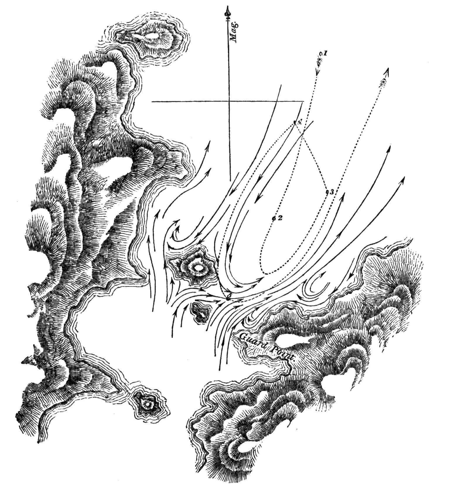
"The wind was light from the north-eastward. Upon our reaching the
station marked 1, without having previously noticed any current, we
observed a strong rippling in the Narrow, and immediately sent the boats
a-head to tow us towards mid-channel. We proceeded rather quickly until
we arrived at 2, when our progress was checked, and we were carried
rapidly back, as far as 3. In the Narrow the tide was evidently against
us; but in crossing to the N.W. at 4, we were forced by the
counter-current against all the efforts of the boats—were carried
close to the large island—and for the space of thirty yards, were
brushing the overhanging trees with our main-boom. This part was, most
fortunately, quite steep; for had the vessel touched in her swift course,
she must have been swung with violence against the rocks, and much
damaged, perhaps irreparably.
"No sooner had we passed the end of this island, than we were shot
into mid-channel to 5, and then as suddenly and swiftly carried back by
the stream of the tide. The boats could never keep hold of the vessel
while in these whirlpools; and it was several times fortunate that they
had cast off the tow-rope in time, for thrice we were twisted round, as
if on a pivot, by those violent eddies.
"A favourable moment was seized, the boats were again sent a-head;
and, by great exertions, we were towed out of the influence of the tide,
and then waited for the time of slack water.
"At three o'clock Mr. Kirke was sent to Guard Point, to ascertain the
time of high water; and at half-past four, in consequence of his signal,
we towed in with both boats, and passed the islands with a favouring
tide; but one quarter of a mile farther, we met ripplings, which we had
no sooner entered than a reverse of tide was found, as if the waters from
the sounds were gradually forcing back the tide of the channel. We still,
however, made progress to the S.W.; but it was not before eight o'clock
that we anchored in the west entrance of this Narrow, pleased, indeed, to
be again secure, and to have escaped unharmed.
"24th. Thick, hazy weather in the morning; but at eight o'clock it
cleared a little, so we weighed, and soon reached the Ancon of
Sarmiento. A strong S.E. wind, during the forenoon, carried us past Cape
Año Nuevo, and at noon we were near the opening into Smyth Channel, which
I have called Victory Passage. We moored in Sandy Bay, in eight fathoms,
purposing to remain during the next day (Sunday); and on the 26th, with a
moderate wind from the northward, we left Sandy Bay, and stood to the
south, passed the Elson Islands by noon, and at three moored in Hose
Harbour. Next day we cleared Smyth Channel, and anchored in Deep
Harbour.
"(28th.) Wind light and northerly. We towed out of Deep Harbour at
daylight, stood across Beaufort Bay, and anchored in Tamar Bay; where,
the weather being unfavourable, we remained during all the next day,
filling water and cutting wood,—preparatory to our run to Monte
Video,—in case of not finding the Adventure at the appointed
rendezvous, Port Famine.
"On the 30th, with a moderate breeze from the N.W., we left Tamar Bay;
but the wind soon after becoming contrary, we made but little progress,
and anchored that evening in a small cove, near the east point of Upright
Bay, where we passed the following day, in consequence of the wind
continuing easterly, and causing much sea in the Strait.
"2d. Weighed, stood out, and made all sail, steering through the
Strait. We passed Playa Parda early that afternoon, and Cape Quod soon
afterwards, and as there was every appearance of a moderately fine night,
continued our course. We hauled in near Port Gallant, when it grew dark,
and burned a blue light, to call the attention of any vessel lying there;
but no return was made, so we passed on. At midnight we were between Cape
Holland and Cape Froward, the wind being light and the weather
moderate.
"3d. On rounding Cape Froward, we beat up in-shore against a N.N.E.
breeze, and in the evening were three or four miles to the northward of
Point St. Isidro. After a tempestuous night, we reached Port Famine,
where, to our great joy, we found the Adventure."
With the exception of such fish and birds as had been previously
observed near the Strait, Lieutenant Skyring and his party saw few living
creatures. One novelty which Mr. Bynoe gave me was a splendid corvorant,
which, being quite new, and the most beautiful of the genus, I named
Phalacrocorax Imperialis.[180]
I also received a species of swan, quite distinct from the common one
of the Strait, which has been long known as the black-necked swan
(Anser nigricollis of Ind. Orn., ii. 834; and Latham, x. 223).
Considering it an undescribed species, it was named Cygnus
anatodoides.[181]
Several deer were seen, but none obtained. There is reason, however,
to suppose them to be of a novel species. The horns are short and
straight.
Beagle sails from San Carlos—Enter Strait—Harbour of
Mercy—Cape Pillar—Apostles—Judges—Landfall
Island—Cape Gloucester—Dislocation Harbour—Week
Islands—Fuegians—Latitude Bay—Boat's crew in
distress—Petrel—Passages—Otway Bay—Cape
Tate—Fincham Islands—Deepwater Sound—Breaker
Bay—Grafton Islands—Geological remarks—Barbara
Channel—Mount Skyring—Compasses
affected—Drawings—Provisions—Opportunities lost.
Captain Fitz Roy having received his orders on the 18th of November
(see Appendix), sailed the following morning from San Carlos, and
proceeding to the southward, approached the entrance of the Strait of
Magalhaens on the night of the 24th. The following are extracts from his
Journal:—
"At daylight on the 25th, with the wind at S.W., we made Cape Pillar
right a-head (E.N.E. by compass), distant seven or eight leagues. The
wind became lighter, and we were set by a current to the S.W., which
obliged us, in nearing the Cape, to alter our course from E.N.E. to
N.N.E., to avoid being carried too near the Apostle Rocks. A dangerous
rock, under water, on which the sea breaks, lies half a mile more towards
the north than either of the Apostles. Cape Pillar is a detached
headland, and so very remarkable that no person can fail to know it
easily.
"A very good latitude was obtained at noon, from which, and the
astronomical bearing of the Cape, we made its latitude within half a mile
of that given in the chart by Captain Stokes and Lieutenant Skyring; and
the weather being clear and fine, sketches were taken of all the
surrounding land. At one, we passed the Cape, and at three, anchored in
the Harbour of Mercy. By the distance we had run, as shown by the patent
log and compared with the chart, there had been a current against us of
more than a knot an hour.
"In working into the harbour we passed over several patches of kelp,
under which the bottom was plainly visible; but the lead never showed
less than five fathoms, until we were about to anchor, when the vessel
shot a-head into a weedy place, where we had three fathoms. This was
about a cable's length in-shore (towards the highest mountain) of the
spot marked by Lieutenant Skyring as good holding ground, to which we
warped and anchored. It proved to be very good ground, being extremely
tough clay.
"27th. A promising morning tempted me to try to obtain observations
and a round of angles on or near Cape Pillar. I therefore left the ship
with the master, and went in a boat to the Cape. To land near it in much
swell was not easy upon such steep and slippery rocks: at last we got
ashore in a cove, and hauled the instruments up the rocks by lines, but
could get no further, on account of precipices. I, therefore, gave up
that attempt, and went outside the Cape, to look for a better place; but
every part seemed similar, and, as the weather was getting foggy, it was
useless to persevere. In going to the Cape, and in returning, I measured
the distance by a patent log, and found the mean of the two measurements
agree with the chart. What current there was, ran to the westward.
"A small ox, which we had carried from Chilóe, was doomed to end his
voyage at this place, and probably we were the first people who ever eat
fresh beef in the Strait of Magalhaens.
"28th and 29th. Gloomy days, with much wind and rain; and the gusts
coming so violently over the mountains, that we were unable to do any
work, out of the ship.
"30th. Still blowing and raining.
"Dec. 1st and 2d. Cloudy days, with strong wind; but one short
interval of sunshine was gladly made use of for rating our
chronometers.
"3d. This morning we weighed, and worked out; and at one P.M. we were three miles westward of Cape Pillar, with
every appearance of a N.W. gale. Shortly after, the weather became so
thick, that I could not see any part of the coast; and therefore stood
off shore, under low sail, expecting a bad night. Contrary to my
expectation, the wind did not much increase; but the thick weather, and a
heavy swell, induced me to stand farther out than I had at first
intended. At eleven, P.M., we wore and stood in
until daylight on the 4th, when we found ourselves so much to the
southward, that the land about Cape Pillar bore N.b.W., the Cape itself
being shut in. We steered for the land, hoping to turn the day to some
account; but those hopes soon ceased, for before we had run sufficient
distance to make a serviceable base line, the weather became so thick as
to oblige us to haul our wind. We saw just enough to make out a number of
rocks and breakers, lying at a considerable distance off shore. After
noon it was clearer, and we again stood in-shore; but found that the
current was setting us so fast to the southward, that it was necessary to
carry all sail and keep on a wind, to avoid losing ground; yet, with a
fresh, double-reefed topsail breeze and a deeply laden weatherly vessel,
we could not hold our own, and at seven in the evening were close to an
islet which lies off Cape Sunday. We had seen very little of the coast
thus far: the current had rendered the patent log useless for measuring
bases, and the weather was very unfavourable for astronomical
observations. The land appeared to be high and mountainous, as far as
Cape Deseado, whence it seemed lower and more broken, forming a large bay
between that cape and Cape Sunday. Many rocks on which the sea breaks
violently lie at a distance from the shore, besides those two clusters
called the 'Apostles' and the 'Judges:' the latter off Cape Deseado, and
the former off Apostle Point, a little south of Cape Pillar.
"5th. To our mortification, we found ourselves a great way off shore;
and Landfall Island, which was eight miles to leeward the last evening,
was now in the wind's eye, at a distance of about six leagues. A strong
wind, with much swell, prevented our regaining lost ground in a northerly
direction, I therefore preferred standing to the S.E. by the wind,
intending to seek for a harbour, as it seemed hopeless to try to survey
this coast while under sail, with such obstacles to contend against as a
current setting about a mile an hour, and a sky generally clouded over.
Our only chance appeared to be, going from harbour to harbour and keeping
close in-shore.
"Behind Landfall Island the coast forms a deep bay, apparently full of
islands, and it is said there is in that part a communication with the
Strait of Magalhaens. Looking from seaward there seems to be an
opening.
"From the southern point of this bay the coast presents a high and
regular line for a few miles, and then there is a succession of islets,
rocks, and broken land. We stood in close to the breakers, but too late
in the evening to find an anchorage. I observed kelp on the surface of
the water, growing up from the bottom, while the lead gave a depth of
forty-five fathoms. This was in a wild-looking, open bight, full of rocks
and breakers, and much exposed.
"We stood off, close to the wind, hoping to make northing and westing
during the night; but at midnight it fell calm, and at day-break on the
6th, to our astonishment, we found ourselves to the southward of Cape
Gloucester, a high, remarkable promontory, standing out from the land as
if it were an island, with a peaked top, which, from the southward,
appears notched. The day proved very fine, and as a breeze sprung up from
the S.E. and gradually increased, I had hopes of seeing more of the
coast, along which we had been hustled so fast, and so much against our
inclination.
"In running along shore, I noticed several inlets that seemed likely
to afford good harbours. This coast has not, by any means, such a rugged
and harsh appearance as I expected; but the number of islets and breakers
is quite enough to give it a most dangerous character. The land is not
very high near the sea, and seems to be wooded wherever the prevailing
winds will allow trees to grow. Soundings were taken at various distances
within four miles of the shore, and the depth generally was between
twenty and one hundred fathoms. A good idea may be formed of the current
which had taken us to the S.E., when I say that, even with a fresh and
fair wind, it occupied us the whole of the 6th to regain the place we had
left the previous evening.
"7th. At daylight it blew half a gale of wind; but we stood in, a
little south of the cluster of rocks, called the Judges, towards a part
of the shore which promised to afford a harbour. On closing it we saw an
inlet, apparently large; but so fortified at the entrance by rocks and
breakers, that I did not like to run in, without first sending a boat;
yet it blew too strong, and there was too much sea, to lower one;
therefore I stood off to wait for more moderate weather, for the place
suited my purpose exactly, being near enough to the Judges, and Apostles,
to fix their situation. This morning, Mr. Murray slipped across the
forecastle and dislocated his shoulder: an accident which deprived us of
his services for some time, and on account of it, we called the place
where we anchored soon afterwards, Dislocation Harbour. So many rocks lie
off this coast, that a vessel ought not to approach it unless she has
daylight and clear weather. The lead will give warning, should the
weather be thick, as soundings extend at least to four miles off shore,
at which distance there are from thirty to one hundred fathoms, and
generally speaking, there is less water as you approach the land.
"On the 8th, 9th, and 10th, we were busily occupied in surveying the
harbour and adjacent coast. In this place water may be obtained very
easily, as boats can lie in a fresh water stream which runs from the
mountains. Wood is also plentiful. The harbour is large enough for four
small vessels, and the bottom is very even, from fifteen to twenty-five
fathoms, fine white sand. The entrance is narrow, but all dangers are
visible, and now are laid down in the chart. It is much exposed to west
winds, and the westerly swell, which might for weeks together prevent a
vessel from getting out to sea.
"11th. A strong wind and much haziness prevented my weighing until
near noon, when it became more moderate, though the weather was still
thick. We then worked out with a light and variable breeze, which baffled
us near the entrance, but at last we gained a good offing. I rejoiced to
be outside, for our business in the harbour was over, and I had feared
that west winds would detain us. The promontory, just to the southward of
Dislocation Harbour, appeared to me to be 'Cape Deseado,' and that to
the northward I called Chancery Point. Mr. Wilson ascended some heights
at the back of the harbour, from which he saw many lakes, among barren
and rugged hills; but a farther view was obstructed by other
mountains.
"An oar was picked up near the watering place, and recognised by one
of the men as the same which was left on a rock near Cape Pillar (in
Observation Cove) by Captain Stokes, in January 1827. There could be no
doubt of the fact, as the man's initials were on the oar, and it is
curious as a proof of an outset along the south side of the Strait (near
Cape Pillar), and of its continuation along shore. Traces of a fire were
found, which showed that the natives visit even this most exposed part of
the coast. The land about here is high, and craggy; and very barren,
except in the valleys, where much wood grows. Some wild fowl were seen
and shot.
"From Cape Deseado, the coast is high and unbroken for three miles; (a
rocky islet lies about a mile from the shore) then there is an opening
which probably leads into a good harbour behind a number of islands.
Several islands succeed, for a space of two miles, after which is
Barrister Bay; an exposed place, full of islets, rocks, and breakers,
extending nearly to Murray Passage. In sailing along this coast we passed
inside of several breakers; and, I hope, noted all that lie in the
offing: but, we cannot be sure, for breakers on rocks which are under the
surface of the sea do not always show themselves. As it was getting dark,
we hauled to the wind, near Cape Sunday, and, in doing so, were startled
by a huge breaker which suddenly foamed up at a small ship's length from
us. Although looking out on all sides we had not previously seen any
break near that spot. During the night we carried a heavy press of sail
to avoid being drifted to the S.E., and at daylight I rejoiced to find
that we had not lost ground, so we steered for the land, and rounded
Graves' Island. Observing several openings, I hauled close round a point,
and tried to enter one of them; the wind, however, baffled us, and our
anchor was let go in an exposed berth, but on good holding ground. We
found a cluster of islands with so many anchorages between them, that
thinking they ought to be surveyed, I returned on board, weighed, and
worked towards the nearest opening. We shot into it, and warped to a
berth four cables' lengths up a narrow passage, and anchored in
twenty-four fathoms, upon sand and clayey mud.
"13th. Many wigwams were found in this neighbourhood, which showed
that our Fuegian acquaintances were occasional visitors. The inner
harbour seemed to be a fine basin; but the bottom was found inferior to
that of the anchorage at which the Beagle lay moored.
"15th. Strong wind and frequent rain prevented much being done out of
the ship this day. I went to the top of a mountain near the ship, but
could not take many angles because of the violent squalls and the rain.
At night it blew a hard gale: the squalls came furiously over the
heights, and obliged us to let go a third anchor and strike topmasts. We
were quite sheltered from the true wind; but were reached most
effectually by the williwaws, which came down with great force. However
vexed we might have been at not being able to go far from the ship, we
were certainly very fortunate in escaping this gale at a secure
anchorage. It appeared to be blowing very heavily at sea.
"16th. A strong gale all day, with much rain, prevented our leaving
the ship. In coming down a height on the 15th, I found some red porphyry
rock, like that about Port Desire; and the first I had seen in these
parts. Another novelty was a tract of about two acres of pure white sand
thinly covered with grass.
"Though the middle of summer, the weather was not much warmer than in
winter. The average height of the thermometer was about ten degrees
greater; being nearly the same, as during the months of August and
September, in Chilóe.
"17th. A continuance of bad weather: no work was done in the boats
this day. In the afternoon I tried to go up the mountain I had ascended
on Tuesday, to bring down a theodolite which I had left at the top; but
the wind obliged me to return unsuccessful.
"18th. Similar weather continued until noon: frequent strong squalls,
and rain: the sky being so constantly overcast that we saw neither sun
nor stars. Although no progress was made in this weather, it was some
satisfaction to think that we lost nothing but time; and that we saved
much wear of the vessel by lying at anchor instead of being at sea. Being
more moderate in the afternoon, our boats went away, and the ship was
prepared for sailing. We tried to get some fur-seal, which were seen on a
rock near the harbour, but they were too wary.
"My boat was almost capsized by a 'blind breaker,' which rose suddenly
underneath her, and in an instant she was surrounded by and floated upon
a white wave of foam, which broke all round and over, but without
upsetting or swamping her.
"19th. Weighed and ran across to an anchorage in Landfall Island which
I had seen from the heights. We anchored in a sheltered bay lying on the
north side of the larger island, at the east opening of a passage which
separates it from the smaller. These islands are high and, towards the
sea, barren; but the sides of the hills, towards the east, are thickly
wooded.
"A large smoke made near the bay showed us, that the Fuegians were in
possession of our intended quarters; and soon after we anchored, a canoe
came off to us full of men, women, and children, sixteen in all. They
were in every respect similar to those we had so frequently met before;
and from their unwillingness to part with furs or skins, unless for
serviceable articles, such as knives, &c. appeared to have had
dealings with Europeans: beads and trinkets they did not value. They had,
in the canoe, many eggs, and dead birds, which they eat raw: the birds
were a light blue, or dove-coloured, petrel, about eight inches long,
which goes on land for a part of the year to lay eggs in holes in the
ground. During this and the following day, we were fortunate enough to
obtain observations, and nearly all the necessary bearings and
angles.
"As yet I was pleased with the anchorage; the bottom shoaled gradually
from twenty to five fathoms (fine sand), and it was sheltered from west
winds, besides others, except north. Having obtained particularly good
observations for latitude at this spot; I called it Latitude Bay. It is
remarkably easy of access, and is also easy to leave: rather rare
qualities in a Fuegian Harbour. Cape Inman being prominently situated, is
a good guide to the anchorage.
"Sunday 20th. A fine day; and, knowing its value, we turned it to
account. From a height I saw Cape Gloucester and the point of land on
this (the northern) side of it; and to the northward I could distinguish
the land about the entrance to the Strait. The Landfall Islands appeared
to be the top of a ridge of mountains lying (partly below the sea) in the
same direction as most of the neighbouring ranges. Many dangerous rocks
lie off the S.W. side; and there is no passage for a ship between the
islands, for the opening is narrow, and has only two fathoms in some
places.
"21st. This morning I sent the master and Mr. Wilson[182] in a whale-boat to the east end of
the island, to make a plan of that part, and get some angles and bearings
necessary for continuing the survey.
"22d. A bad day, blowing hard and raining. The wind being from north
and N.N.W. threw in a swell; and as we were not yet sure of the quality
of the bottom, though apparently good, we struck topmasts and veered away
a long scope of cable.
"24th. The wind shifted to the S.W. and became rather more moderate,
though still squally, with much rain. It freshened again in the night,
and backed to the northward.
"Christmas-day. Blowing strong from N.N.W. with a thickly clouded sky
and heavy rain. I was very anxious to see the master return, but he could
not in such weather. I feared that his provisions would be exhausted,
having taken only enough for four days; yet they had a good tent, guns,
and ammunition.
"26th. A strong wind with thick weather and much rain throughout the
whole day. There was no possibility of sending a boat to the master, or
of his returning by water. The island being very narrow he, or some of
his party, could walk across, if they were in want of provisions, so as
we did not hear from them I trusted that they had found wild fowl enough,
and were not in distress.
"27th. Rather a more moderate morning with clearer weather. We looked
out anxiously for the whale-boat, as, in such weather, she might get back
to the ship without much difficulty. Before noon Mr. Wilson and the
coxswain were seen on shore making signals to the ship; and a boat was
sent immediately to bring them on board. They were very weak and tired,
having walked across the island during the preceding afternoon and night,
and having had no food for the last two days. The master and the other
four men were said to be in a cove at the back of the island, and to have
been without provisions since the 24th, not having been able to find
either shell-fish or wild fowl.
"At the time Mr. Wilson arrived on board, I was absent taking angles
and bearings, but was soon informed of his return, and at noon left the
ship with a week's provisions for the master's party and my own boat's
crew. I had not lost sight of the Beagle when I met the former returning.
Having given them some food, and two fresh hands to help them in pulling
to the ship (it being then quite moderate and fine) I continued my course
to the place they had left, in order to do what the bad weather had
prevented the master from doing. Being favoured with a fine afternoon I
succeeded in obtaining the necessary angles and bearings, and returned to
our vessel the following morning.
"28th. At my return I found the master and his party nearly recovered.
They had tried every day to return to the ship, but had been repeatedly
forced back, at the risk of being driven out to sea. The gusts of wind
from off the high land were so powerful as almost to upset the boat,
although she had not even a mast up. Continual rain had wetted their
ammunition and tinder, and they were then without fire or victuals: upon
which Mr. Wilson and the coxswain set out, on Saturday afternoon, to
acquaint us with their situation.
"When they came down to the sea-side the Fuegians took advantage of
their weak state to beat the coxswain and take away some of his clothes;
therefore after my return I went in search of them. They had however
taken the alarm, and were all gone away. This party consisted of about
twenty persons, eight of whom were men, and the rest women and children.
When some of our officers went to their wigwams they appeared armed with
clubs, spears, and swords, which seemed to have been made out of iron
hoops, or else were old cutlasses worn very thin by frequent cleaning.
They must have obtained these, and many trifles we noticed, from sealing
vessels. By the visits of those vessels, I suppose, they have been taught
to hide their furs and other skins, and have learned the effects of
fire-arms. The chief part of their subsistence on this island appeared to
be penguins, seal, young birds, and petrel which they take in a curious
way. Having caught a small bird they tie a string to its leg and put it
into a hole where blue petrels lay eggs. Several old birds instantly
fasten upon the intruder, and are drawn out with him by the string.
"We weighed and worked out of the bay, increasing our depth of water
very gradually as we left the shore, but having always the same bottom,
fine speckled sand. I can safely recommend this bay as a good anchorage
for shipping, and two cable's lengths N.N.W. of the Beagle's berth as the
best place. Wood and water are not to be found so close to the anchorage
as in other Fuegian harbours, but they may be obtained with very little
trouble, and in any quantity, by going up the passage (between the
islands) to one of many streams which run from the high land. There is
plenty of water also very near the best berth, on the south side, but
frequently a surf breaks on that beach. Two particular advantages which
this roadstead[183]
possesses, consist in the ease with which a vessel can enter or leave it,
during any wind; and in its situation being well pointed out by a
remarkable headland, named Cape Inman (in compliment to the Professor),
which is high, with perpendicular cliffs, and almost detached from other
land; so that a vessel, knowing her latitude within five miles of
the truth, cannot fail to make it out, if the weather is tolerably clear.
Wild fowl and shell-fish were very scarce there, probably because the
Fuegians had scared or consumed them. From the top of a mountain, at the
east end of the large island, I saw a great way down two channels or
openings, which appeared to run far to the eastward, among many islands
and very broken land. Such a succession of islets, rocks, and breakers,
as the coast presented, was astonishing: many hundreds were counted while
looking eastward from one station only.
"I wished much to know where these openings led, and whether there was
a direct communication through them to the Strait, as seemed almost
certain; but considering the time already spent, the extent of coast to
be surveyed, and the small advantage of such information, except to
satisfy curiosity, I determined to proceed to the next prominent
headland, a mountain at the S.E. extremity of Otway Bay, whose position I
had already fixed with respect to stations on Landfall Island.
"If there is a passage through those openings into Otway Bay, it must
be unfit for vessels, being hampered with outlying rocks and breakers
among which she could find no shelter in the event of rainy weather
coming on before she cleared them; and clouds and rain are prevalent. As
yet we had been extremely fortunate, in being under sail at intervals of
fine weather, and anchored during the gales; but this was partly owing to
a very careful attention to the barometer and sympiesometer.
"Having left Latitude Bay, we stood off until midnight, and then in
shore again, carrying a press of sail all the time, in order to 'hold our
own' against our old enemy, the current.
"At daylight (29th), not having been swept to leeward by the current,
we were in a good position for continuing the survey from the place left
the previous night. We bore up as soon as the land could be distinctly
seen,—rounded Landfall Island very near the outer rocks, and then
steered for Cape Tate (the extremity of the mountain I mentioned
yesterday). Those outlying rocks are not very dangerous, as the sea always breaks violently upon them. In
crossing Otway Bay, the morning being clear, I was enabled to add
considerably to what had been already learned respecting the shores and
dangers around it.(e)
"Off Cape Tate, to the north and west, lie the College Rocks. Those
nearest the Cape are also nearest the track of a ship running along the
land, and half a mile west of them lies a detached and dangerous rock,
under water. The sea generally breaks on it.
"We had very thick weather when close to those rocks, which obliged us
to 'haul our wind' for half an hour; when, as it cleared, we steered
round Cape Tate, about a mile off shore. I was in hopes of gaining an
anchorage between it and the Fincham Islands, and therefore kept as near
the land as I could; but seeing numerous breakers a-head and outside of
me, I altered our course, and steered to go outside of all the rocks.
After we had passed some of them, a large bight opened out to the
north-eastward, and tempted me to haul up for it. We entered the sound at
noon, and stood on for nearly four miles without finding an anchorage, or
even gaining bottom with fifty fathoms of line, although at the entrance
we had from twenty to ten fathoms. Thick weather coming on, made me very
anxious to anchor somewhere, and we were now too much hampered to stand
out again. We appeared to be among a multitude of islands, very near each
other, yet without any anchorage between them; therefore, having no other
resource, we let go both anchors upon the end of a steep-sided islet,
where one fell into seven, the other into ten fathoms water, and hooked
the rocks. Veering half a cable on each, we found forty fathoms under the
stern, with a similar rocky bottom; so that we had the pleasant prospect
of shouldering both our anchors, and drifting into deep water, with the
first strong squall. During the remainder of that day, our boats were
looking for better anchorage, but without success; they found patches of
rocky ground with from ten to twenty fathoms
here and there, but not one that could be preferred to our islet.
"30th. One Fuegian family was found here, consisting of a man and
woman, with their children. During this day it rained too hard for
anything to be done out of the ship; the wind was moderate; yet much as I
disliked our rocky berth, it could not be changed.
"31st. Moderate wind, with clearer weather. Mr. Murray and Mr. Stokes
went away to different parts of the sound, while I was employed near the
ship. Observations for latitude, longitude, and variation were made.
"1st January. During part of the last night and this morning, the wind
blew strongly in squalls, and made me very anxious; but the weather
rendered it impossible to move voluntarily, for it was raining hard as
well as blowing. At about eight it cleared, and the wind shifted to the
southward, when we weighed, and worked down the sound; but it was after
noon before we had cleared its entrance, and seven in the evening before
we were outside of all the breakers, the wind having been light and
contrary the whole time.
"(2d.) At five this morning, being close to the Fincham Islands, with
clear weather, and a fresh breeze from the N.W., we steered into Breaker
Bay, towards a ragged-looking projecting point. Having approached as near
as we could, and sounded, and taken angles, we steered so as to pass
outside of some very outlying rocks, near the middle of the bay; for
in-shore of them, I saw from the mast-head numerous breakers, rocks, and
islets, in every direction. A worse place for a ship could scarcely be
found; for, supposing thick weather to come on when in the depth of the
bay, she would have lurking rocks and islets just awash with the water,
on all sides of her, and no guide to take her clear of them, for
soundings would be useless; and in such weather, the best chart that
could be constructed would not help her. With this idea of the place, and
for reasons similar to those which induced me to pass hastily across
Otway Bay, I steered for Cape Gloucester, after passing the Midbay Rocks,
at the distance of a quarter of a mile. The land at the
bottom of the bay appeared to be distant, and much broken. Indeed, from
the Week Islands to Cape Gloucester,(f) there is an almost innumerable succession
of islands and rocks, without any continued tract of land, so that
channels might be found in all directions; valuable, no doubt, to
Fuegians in their canoes, but not often to seamen in ships, nor even to
sealers; for where the natives go with their canoes, seals are never
found in any numbers.
"In crossing Breaker Bay, even with a moderate wind, there was a very
cross and awkward sea, owing, doubtless, to the ocean swell rolling into
this deep bight. Such a swell would add much to the difficulty which
vessels might find in getting out of this bay: I should therefore
recommend them to avoid it particularly. Cape Gloucester is a most
remarkable promontory, which can never be mistaken, after seeing even an
indifferent sketch of it. At a distance it makes like a mountain rising
out of the sea, but, on approaching nearer to it, a narrow neck of land
appears.
"We found from twenty to thirty fathoms water, at the distance of a
mile from the cape; and saw several outlying breakers about half a mile
off shore. From the steep and rocky nature of these coasts one would not
expect to find soundings until close to the land: but on every outer part
of this coast, that we have visited, the bottom may be reached with the
sounding line. Some natives were seen under the cape, who made a large
fire. We stood into two bights, looking for anchorage, but, finding only
rocks and breakers, steered along shore, rounded Ipswich Island, and
hauled into a spacious bay, at the northern side of which there appeared
to be several openings like harbours. In working across, we were
agreeably surprised to find it a continued roadstead, open only towards
the S.E., and having regular soundings, from twenty to fourteen fathoms.
We anchored about a mile from the entrance of what seemed to be a
harbour, at the N.W. corner, having worked up against a fresh N.W. wind.
Our anchor was dropped in sixteen fathoms, and held well. I went directly
to look at the opening, and found a passage,
in which were good soundings, leading into a very snug basin, perfectly
sheltered from wind and sea, in which the bottom was composed of sand and
clay, and the depth of water from five to fifteen fathoms. As soon as I
returned we weighed and worked up to the entrance of the basin; then
anchored, warped into it, and moored with half a cable each way.
"This was the most secure and sheltered cove I had yet seen. It was
called Laura Basin; and the bay we had crossed was named Euston Bay. I
was very glad to discover so safe a place, because it enabled me to
ascertain the position of Cape Gloucester and the neighbouring land, with
the correctness which so prominent a place required, and because I hoped
that it would prove useful as a harbour for vessels. From the top of a
high ridge surrounding the basin, I thought Cape Gloucester seemed to be
about seven miles off, and seeing a valley lead some distance in the
desired direction, determined to go to it overland. I was so much pleased
with the bay and the basin, that I did not hesitate to spend some time in
the examination of their vicinity. The mountains hitherto examined
between Cape Pillar and these (the Grafton) islands, consist of
greenstone, slate, or sandstone (excepting those near Deep-water Sound,
which are of very coarse-grained whitish granite); and from the continual
action of such heavy seas as break on those shores, the sandstone and
slate rocks wear away, and by their detritus not only the bottoms of
harbours are covered, but a bank is formed which extends into the offing.
A moderate depth of water and good anchorages were found near slaty or
sandstone hills, but exactly the reverse in the vicinity of granite.(g)
"4th. Early this morning I sent Mr. Murray in a whale-boat to examine
and plan some openings I had noticed on the north side of Euston Bay; and
Mr. Stokes to make a plan of the harbour, and the basin in which we were
lying. The master carried six days' provisions with him, in case he
should be detained, as on a former occasion, by bad weather. No place
could be more convenient than this for
such purposes as wooding and watering; and we took advantage of it to the
utmost by filling the ship's hold. The water casks were filled in our
boat, in perfectly smooth water, and the wood was cut close to the water
side.
"6th. A party of twelve, consisting of the Purser, Mr. W. Wilson, Mr.
Megget, eight seamen and myself, set out from the ship, intending to walk
to Cape Gloucester. We landed in a valley at the N.W. corner of the
harbour and began our march, two men carrying the tent, and the others
our instruments and provisions: we had arms also, in case of meeting
Indians. Difficult travelling, with such a cargo, very soon obliged us to
stop and rest, but by continual changes with the heaviest loads, and
great exertion on the part of those who carried them, we got over
two-thirds of our journey in the course of the day, and at night pitched
our tent, and defied the rain which poured incessantly until seven the
following morning: when every height was covered with snow, as if it had
been the middle of winter.
"7th. As soon as we had breakfasted we moved on again, and at noon
reached the foot of a mountain which forms the Cape. Leaving the others
to pitch our tent and cook some victuals, Mr. Wilson, Mr. Megget, and two
seamen, ascended the mountain with me. A very severe task we had, but at
last gained the highest pinnacle, where there was just room to place the
theodolite and kneel by it, at the risk of a puff of wind canting us over
either side. A stone moved from its place, would have reached the water
as soon from one side as from the other. It was not a very clear day, but
sufficiently so to enable me to gain the desired angles and bearings.
From this summit I had a clear view of that dangerous place Breaker Bay,
and was more confirmed in the idea I had formed of it, and rejoiced that
I did not stand farther in with the Beagle. Having thus succeeded, and
buried two memorials, one cased in tin and the other in a bottle, we
filled our pockets with pieces of the rock and returned; rather too
quickly, for the steepness of the hill assisted us more than we wished.
During our absence some Fuegians had appeared, who were quiet and inoffensive; but they seemed very
distrustful of us, and, before sun-rise next morning, were all gone
except one man. These natives seemed to be very active and went up the
mountain in about half the time that our party required. They had two
canoes with them, but how they had reached this place by water was
puzzling, when the exposed bay they must have crossed and the prevailing
weather were considered. Perhaps they had carried their canoes overland,
being rather like the Chilote piraguas, made of boards sewed
together.
"8th. We heard the voices of the Fuegians at day-break this morning;
but at four o'clock only one old man remained, who was probably left to
watch us. We began our return, rather stiff from previous days'
exertions, and looking dismally at the high rugged hills between the
Beagle and ourselves. The first ascent on our way back was the worst of
all: how the men carried their cargo so well astonished me, for with a
very light load I was glad to rest frequently. Breakfast revived us, and
by taking afterwards a better line we avoided the steepest hills and
found much easier walking. While resting at our meal the weather was so
clear that I got bearings of Cape Inman and other points more than fifty
miles distant. There was very little variety or novelty in this walk
through a Fuegian island. The same kind of scenery and the same species
of plants and shrubs were found which we had seen every where else in
Tierra del Fuego. Being more or less rocky made the only change. Of
quadrupeds, excepting otters and dogs, I saw no traces, nor do I think
any were to be found. A large kind of snipe, by some called a woodcock,
and quails, of a large and, I think, peculiar species, were often seen
and shot. The latter are not by any means so well tasted as the European
quail, and their flesh is darker and coarser. At seven this evening we
were again on board the Beagle, not a little tired.
"Should any future voyager feel inclined to make a similar excursion
towards Cape Gloucester, he had better not think too lightly of his
task.
"9th. Mr. Murray returned, having been into many openings between the
islands to the eastward, and having collected much information. This
afternoon it blew a heavy gale, but in such a sheltered place we only
felt a few williwaws. From Mr. Murray's account it appeared that this
island and those adjoining it to the eastward are a cluster lying
together, but quite separated from the mainland, or rather the main body
of islands, by a channel opening northward into Breaker Bay, and to the
southward into Stokes Bay. They were called the Grafton Islands.
"10th. We had a heavy gale throughout this day with much rain. Bad
weather, while at a good anchorage, I did not at that time regret, as the
materials for our charts accumulated fast, and afforded no leisure time
while we were detained on board.
"11th. A favourable day allowed us to examine and sound the outer
roads, and obtain a round of angles from the western extreme of Ipswich
Island, which completed my triangulation. Landing there was dangerous,
and ascending the hill extremely difficult, on account of thick tangled
brushwood which grows about three or four feet high on every part of the
east side, and is so matted together as to be almost impenetrable. We
generally scrambled over this jungle, but sometimes crept under it.
"12th. A tolerably fine day. The sun was visible both in the morning
and afternoon; and from different summits Mr. Stokes and I took angles.
The sky being clear near the horizon gave us a wide range. Meanwhile the
ship was prepared to sail in search of a new place at which to employ our
instruments. I hoped that this basin, harbour, and roadstead, might be of
service, and therefore spared no pains about them. Eight latitudes were
obtained by sets of circum-meridional altitudes; with four different
sextants: two by Mr. Stokes, the rest by me: and as they all agreed,
within fifteen seconds, I supposed their mean to be nearly correct. The
sights for time were good, and the chronometers were going so steadily
that dependence may be placed upon the accuracy of their results. To a
vessel bound round Cape Horn and meeting with an accident, or in want of
wood or water, this place might be useful. It is very easy to find, and
easy to enter or depart from with the prevailing westerly winds.
"13th. We weighed and left the harbour, but the morning proved too
hazy to allow of our running down the coast, therefore until eight
o'clock we kept under easy sail in the roads. Being clear and moderate
after that time, we passed Leading Island, and hove-to, to watch for a
breaker near it. It broke but twice during the hour that we waited,
therefore probably there is water enough to allow any vessel to pass in
safety. At ten we bore up, and ran towards Isabella Island; my first
object being to look for a place called by sealers 'Hope Harbour,' which,
from what I could learn, ought to lie thereabouts. Its situation was not
recognised by our boatswain,(h) who had been in it when sealing on this
coast; so passing close to Isabella Island, we hauled our wind under the
lee of the land, and came to an anchor in fifteen fathoms, sheltered from
north to S.W.b.S. A high peaked hill, over the cove where I took
observations, made this a suitable place for the business of the survey.
Mr. Murray went up the height, while Mr. Stokes and I were employed near
the water, till rain set in and drove us on board. This is the
easternmost of the Grafton Islands. Beyond the channel, which separates
them from the main body of islands, appeared a succession of broken land,
not very high, but reaching apparently to a distant range of snowy
mountains. The part nearest to us was a labyrinth of islets and rocks.
Towards night the wind increased much, and drew to the S.W. and S.W.b.S.
I was doubtful of our anchorage, and had the wind drawn one point more to
the southward, we should have had a heavy sea to deal with, and must have
slipped our cable.
"14th. It moderated again, and the sun showed himself enough to enable
us to get sights, and be on board in time to weigh at nine. We had reason
to think a sealing vessel had been along this coast not long before us,
by the traces our boats found in several places. Indians also had
frequented these islands, for their wigwams were found everywhere.
Observations on shore made our anchoring here of some consequence,
although as a safe anchorage for other vessels, it is
out of the question, being an exposed roadstead, with many rocks, both to
seaward and in-shore. A sealer might use it, but not willingly I should
think. As we ran towards the Agnes Islands, before a strong W.N.W. wind,
many rocks and breakers showed themselves, and when we neared the
islands, became numerous on each side of us. It would have been more
prudent to have kept outside all of them; but I was anxious to find Hope
Harbour, or run into the entrance of the Barbara Channel, and anchor in
the north cove of Fury Island. Having passed the three Agnes Islands, and
being nearly abreast of Cape Kempe,[184] our view became far from agreeable,
for the sea, on all sides, seemed strewed with breakers; and how to steer
so as to pass between them was perplexing. We were at this time running
free, under treble reefed topsails, with top-gallant yards and masts on
deck; the wind being strong from W.N.W., but the weather tolerably clear.
Suddenly the boatswain hailed, 'Hard-a-port, a rock under the bows!'
Round the little vessel turned, almost as fast as the order was given;
but the thrill that shot through us was happily not the precursor of our
destruction; for the supposed rock proved to be a huge whale which had
risen close to the bows, and was mistaken for the top of a rock by the
boatswain, who was looking out on the forecastle, while I was at the
mast-head, and the 'hands' were upon deck. This part of the coast, from
the Agnes Islands to Cape Schomberg, is the worst I have seen, it is so
very broken, and has so many rocks and dangerous breakers lying at a long
distance from the shore.
"At noon we were close to Fury Island; but the wind fell and prevented
our making much progress. Fury Harbour, where the Saxe Cobourg was lost,
is a wild exposed place, and, as the bottom is bad, it ought to be
avoided by all vessels: there is but one patch of good ground, and that
is very small.
"Passing round Fury Island, we entered the Barbara Channel, at the
entrance to which stands Mount Skyring, a high, peaked, and most barren
mountain, visible at a great distance. We all felt much
additional interest in what was then seen, on account of the late survey
in the Adelaide. Cape Schomberg and the Astrea Rock were easily known by
Lieutenant Graves's sketch. To a high mountain, which in some views very
much resembled the dome of St. Paul's, I gave that name (finding it out
of the limits of Lieutenant Skyring's survey): it lies a short distance
east of Cape Schomberg. A passage appeared to go to the eastward, passing
from the Barbara channel, northward of Cape Schomberg and St. Paul's.
Light baffling winds and an ebb-tide, of about a knot an hour, setting
out of the Barbara, detained us until six P.M.,
between the Magill and Fury Islands; but soon after that hour we anchored
in North Cove, a small but perfectly secure place. By reaching this
anchorage, I had the satisfaction of being enabled to connect my work
with Lieutenant Skyring's, and to take a fresh start for the next piece
of coast. Hitherto we had been extremely fortunate, both with the ship
and the boats; but such success could not be expected always.
"15th. Early this morning, Mr. Murray went in a whale-boat to the
islands, near Cape Kempe, to ascertain the situations of some reefs and
islets thereabouts, and sketch the outer coast. Mr. Stokes went in
another boat to look for Hope Harbour, and examine part of the coast. The
boatswain accompanied him, as he thought he knew his way by passages
among the islands, although he had failed to recognise the place from the
offing.
"16th. Bad weather, blowing a gale of wind and raining nearly all the
day.
"17th. A squally and disagreeable day; but our boats made some
progress.
"18th. Some Natives came alongside for a short time. As usual, we
would not allow them to come on board, because of their being such
dexterous thieves. A man to whom the canoe appeared to belong was far
better featured, and more stoutly made, than any we had seen among the
Fuegians. After bartering some of their very valuable property they left
us.
"19th. Early this morning Mr. Stokes returned: he had been near
enough to Hope Harbour, to see that it was in the Grafton Islands, and
was one of the coves examined by Mr. Murray. He then returned as he had
been desired; but made very good use of his time while away, by
collecting materials for the charts. He fell in with a canoe under sail
(the sail being a seal-skin); the first instance I had then known of a
Fuegian canoe sailing. As far as Mr. Stokes could see to the northward,
the land was very broken, or rather it was a mass of islands reaching to
the base of a range of snowy mountains.
"North Cove is large enough to hold any vessel when moored; but the
passage, in and out, is too narrow and difficult for a ship of more than
three or four hundred tons, unless she uses warps. Being on the weather
side of high land, but sheltered by low islands, williwaws do not annoy
during westerly winds; but in a southerly gale I think they would be
furious.
"My next task was to ascend Mount Skyring. As there was but little
snow on it, and the ground quite clear of wood, the ascent was easy; but
when at the summit I could not see far, because of low misty clouds. I
had taken only a compass with me, intending to look round, and ascend a
second time with my usual companion, a theodolite. After taking a few
bearings, I moved the compass off its stand, and placed it on a stone;
when, to my surprise, I found the bearing of a point, I had just been
looking at, altered twenty degrees. Suspecting the cause, I put it on
another stone, a few feet distant, and found the bearing again altered
many degrees. I then examined the stones, and found there was much
pyrites in them;[185] and
that when broken, or struck against one another, they smelt strongly of
sulphur. The compass was then replaced on its stand, and bearings of the
same point taken from various spots, only a few feet apart, the point
being many miles distant, and at each spot the compass gave a different
bearing, and was very dull and sluggish, although it was a good Kater's
compass, with a light card. Having thus satisfied myself of the very
strong local attraction existing, I returned to the ship, intending to
make no further use of a compass in this place; and as Lieutenant Skyring
might have been deceived in his bearings from a similar cause, I hoped to
procure a round of angles, with a theodolite set to a true bearing, which
might be serviceable for his work, as well as my own. Many pieces of the
stone, from different heights, were brought down; and in most of them
were traces of metal.
"The peaked top of this mountain is a mere heap of loose stones of all
sizes. Whether the rock has been shattered in this manner by frost, by
volcanic fire, or by lightning, I cannot tell; but I should think, from
its appearance, by all three. Many of the stones are vitrified, and many
are porous, like pumice-stones, although not so light.
"20th. I again went up Mount Skyring, taking a theodolite with me; and
as the day was perfectly clear, and free from clouds, every point of land
was visible, which can at any time be seen from that summit. Mount
Sarmiento appeared in all its grandeur, towering above the other
mountains to at least twice their height, and entirely covered with snow.
Having set the theodolite to a painted post, fixed on shore near the
Beagle (five miles distant), from which I had previously obtained the
exact astronomical bearing of the spot on which the theodolite was
placed; I obtained a most satisfactory round of angles, including most of
the remarkable peaks, islands, and capes, within a range of forty miles
from the mountain. The day was so fine, that it was not cold on the
height, nor was there any wind to disturb the adjustment of the
instrument.
"This business being completed, I returned on board with Mr. Wilson,
who, during the time I was on the height, made some very good sketches.
Even at this early period his drawings were becoming a valuable addition
to the gleanings of our cruise, and their number increased fast; for he
took much pains with them, and produced not only good drawings, but most
accurate delineations of the coast.
"21st. Fine weather for this climate. Mr. Murray returned in the
whale-boat, having had a successful trip.
"By shooting and fishing we obtained frequent change of diet, for we
shot much wild fowl (geese, shags, and ducks), and caught fish in the
kelp, which were excellent eating. All that could be procured was
regularly and equally distributed to the different messes in turn, and an
account kept in a 'game book.' (Appendix.)
"22d. Mr. Stokes went to examine Fury Harbour, and returned late at
night. In consequence of his account of the remains of the Saxe Cobourg
sealing schooner, lost in that harbour, I sent a boat with the carpenter
to collect from it some wood and bolts which might be useful to our ship,
and remained at anchor for a day longer than I had intended.
"This day all hands were put upon two-thirds' allowance, but as it was
a measure which affected the crew much and myself not at all, I was
reluctant to give the necessary order, without first proposing the
measure openly, and giving the following reasons:—
"Having succeeded beyond expectation in the examination of the coast
thus far, and hoping to be able to continue the survey in the same
manner, while our provisions lasted, I thought it better to shorten the
allowance while all hands were well and hearty, and could obtain supplies
of fish and wild fowl, rather than at a later period, when we might be
otherwise situated. An extent of coast lay before us, and the parts
particularly pointed out by Captain King, were yet unexamined.
"24th. A tolerably fine day; I tried all the compasses on shore, in
three different places, placing them in a line to a distant mark; because
in taking bearings, for the variation of the compass, during previous
days, I had found very wide differences between the results of the same,
as well as different compasses; and they were also very sluggish; the
light cards being more so than the heavy ones. I found it impossible to
reconcile their results by change of place or position, therefore it is
probable that all the rock affected the needle; and I suspect that not
only this island and the one on which Mount Skyring is situated, but most
of the islands near are magnetic: particularly a cluster lying about a
mile to seaward of the Magill Islands, on which, I believe, Lieutenant
Skyring, or some of his party, took bearings. A boat was sent to watch
the tide, on the day of new moon, at the entrance of the channel, and
brought back a piece of the rock of which the last-mentioned cluster of
islets consists. It is similar to that of Fury Island and Mount Skyring,
apparently metallic, with a sulphureous smell, when struck or broken.[186] Small pieces put near
the compass did not seem to affect it sensibly; but I did not spend time
in trying the experiment with nicety, being satisfied of the general
result. There may be metal in many of the Fuegian mountains, and I much
regret that no person in the vessel was skilled in mineralogy, or at all
acquainted with geology. It is a pity that so good an opportunity of
ascertaining the nature of the rocks and earths of these regions should
have been almost lost.
"I could not avoid often thinking of the talent and experience
required for such scientific researches, of which we were wholly
destitute; and inwardly resolving, that if ever I left England again on a
similar expedition, I would endeavour to carry out a person qualified to
examine the land; while the officers, and myself, would attend to
hydrography."
Skyring's chart—Noir
Island—Penguins—Fuegians—Sarmiento—Townshend
Harbour—Horace Peaks—Cape Desolation—Boat
lost—Basket—Search in Desolate Bay—Natives—Heavy
gale—Surprise—Seizure—Consequences—Return to
Beagle—Sail to Stewart Harbour—Set out again—Escape of
Natives—Unavailing
search—Discomforts—Tides—Nature of Coast—Doris
Cove—Christmas Sound—Cook—York-Minster—March
Harbour—Build a boat—Treacherous rocks—Skirmish with
the Natives—Captives—Boat-memory—Petrel.
"25th. We weighed, and went round to Fury Harbour, for the carpenter
and his cargo, and met him with a spar and a raft of plank, taken from
the wreck. Having hoisted the boat up, and got the plank on board, we
stood out towards the West Furies, by the wind; my intention being either
to sail round Noir Island, or anchor under it, before running to the
eastward, in order that no part of the sea-coast might be left
unexamined. We passed very near some of the rocks, but as the day was
fine and the weather clear, a good look-out at the mast-head could be
trusted.
"Before leaving the vicinity of Mount Skyring, I should remark that
the true bearing of Mount Sarmiento's summit, which I obtained from the
top of Mount Skyring, laid off on Lieutenant Skyring's chart, passed as
truly through his position of the summit as if the line had been merely
drawn between them. This is highly creditable to his work, for I know he
did not himself see Mount Sarmiento, when upon Mount Skyring.
"The breeze freshened, and drew more to the westward towards evening,
I had therefore no hopes of nearing Noir Island. We saw the Tower Rocks
distinctly before dark, and stood on towards them until ten o'clock,
closing Scylla to avoid Charybdis, for in-shore of us lay all those
scattered rocks, among which we had steered when passing
the Agnes Islands and Cape Kempe.
"The night was spent in making short boards, under reefed topsails,
over the same two miles of ground, as nearly as possible, with the lead
going, and a thoroughly good look-out. At daylight next morning the wind
became strong and the weather thick, with rain, but we made as much sail
as we could carry, and worked to windward all the day. In the afternoon
it moderated, and before dark we anchored in a very good roadstead, at
the east end of Noir Island, sheltered from all winds from N. to S.b.E.
(by the west); over a clear, sandy bottom; and with a sheltered cove near
us where boats may land easily, and get plenty of wood and water. In
working up to the Island, we passed very near a dangerous rock, under
water, lying four miles off shore; and another, near the anchorage. The
sea does not break on either of them when there is not much swell.
"27th. A fine day favoured us; the master went to one part of the
island, and Mr. Stokes to another, while I went to a third. Having taken
angles at the extreme west point (which ends in a cluster of rocks like
needles), I passed quite round the island, and returned to the anchorage
after dusk, landing here and there for bearings, in my way.
"There is a cove at the south part of the island, where boats would be
perfectly safe in any weather, but the entrance is too narrow for decked
vessels. The island itself is narrow and long, apparently the top of a
ridge of mountains, and formed of sand-stone,[187] which accounts for the bottom near it
being so good, and for the needle-like appearance of the rocks at the
west end; as the sand-stone, being very soft, is continually wearing away
by the action of the water.
"Multitudes of penguins were swarming together in some parts of the
island, among the bushes and 'tussac'[188] near the shore, having gone there for
the purposes of moulting and rearing their young. They were very
valiant in self-defence, and ran open-mouthed, by dozens, at any one who
invaded their territory, little knowing how soon a stick could scatter
them on the ground. The young were good eating, but the others proved to
be black and tough, when cooked. The manner in which they feed their
young is curious, and rather amusing. The old bird gets on a little
eminence, and makes a great noise (between quacking and braying), holding
its head up in the air, as if it were haranguing the penguinnery, while
the young one stands close to it, but a little lower. The old bird having
continued its clatter for about a minute, puts its head down, and opens
its mouth widely, into which the young one thrusts its head, and then
appears to suck from the throat of its mother for a minute or two, after
which the clatter is repeated, and the young one is again fed; this
continues for about ten minutes. I observed some which were moulting make
the same noise, and then apparently swallow what they thus supplied
themselves with; so in this way I suppose they are furnished with
subsistence during the time they cannot seek it in the water. Many hair
seal were seen about the island, and three were killed. Wild fowl were
very numerous. Strange to say, traces of the Fuegians (a wigwam, &c.)
were found, which shows how far they will at times venture in their
canoes.
"No danger lies outside of Noir Island, except in the Tower Rocks,
which are above water, and 'steep-to,' but many perils lie to the
south-eastward. Indeed, a worse place than the neighbourhood of Cape
Kempe and the Agnes Islands could not often be found, I think: the chart
of it, with all its stars to mark the rocks, looks like a map of part of
the heavens, rather than part of the earth.
"28th. At daylight, we sailed from these roads, and passed close to
the Tower Rocks (within half a cable's length): they are two only in
number, a mile and a half apart, and steep-sided. Thence we steered
towards St. Paul's, my intention being to seek an anchorage in that
direction. This day proved very fine and so clear that when we were
becalmed, off St. Paul's, we saw Mount Sarmiento distinctly from the
deck. A breeze carried us through Pratt Passage, which
separates London Island from Sydney Island, to an anchorage in a good
harbour, under a high peaked hill (Horace Peaks), which is a good mark
for it. Finding no soundings in the Passage as we approached, gave us
reason to be anxious; but in the harbour, the bottom proved to be
excellent, and the water only of a moderate depth. As soon as we
anchored, I tried to ascend Horace Peaks, but returned without having
reached their summits before dark; however, I saw enough to give me a
general idea of the distribution of the land and water near us. I thought
that this anchorage would be favourable for ascertaining the latitude of
Cape Schomberg[189] with
exactness: having found a considerable difference between our chart and
that of Lieutenant Skyring, respecting the latitude of that
promontory.
"Meanwhile I contemplated sending the master to a headland called by
Cook, Cape Desolation, and which well deserves the name, being a high,
craggy, barren range of land. I was not sorry to find myself in a safe
anchorage, for the weather seemed lowering; and after being favoured with
some moderate days, we could not but expect a share of wind and rain.
"29th. This morning the weather looked as if we should be repaid for
the few fine days which we had enjoyed; but as we felt it necessary to
work in bad weather as well as in good, it did not prevent the master
from setting out on his way to Cape Desolation; near which, as a
conspicuous headland, whose position would be of great consequence, he
was to search for a harbour, and obtain observations for connecting the
survey. He could not have been in a finer boat (a whale-boat built by Mr.
May, at San Carlos); and as he well knew what to do with her, I did not
feel uneasy for his safety, although after his departure the wind
increased rapidly, and towards evening blew a hard gale. The barometer
had not given so much warning as usual; but it had been falling gradually
since our arrival in this harbour, and continued to fall. The
sympiesometer had been more on the alert, and had fallen more
rapidly.
"(30th.) A continued gale, with rain and thick weather throughout the
day. During the night the weather became rather more moderate; but on the
morning of the 31st, the wind again increased to a gale, and towards
noon, the williwaws were so violent, that our small cutter, lying astern
of the ship, was fairly capsized, though she had not even a mast
standing. The ship herself careened, as if under a press of sail, sending
all loose things to leeward with a general crash (not being secured for
sea, while moored in so small a cove), but so rapidly did these blasts
from the mountains pass by, that with a good scope of chain out, it was
hardly strained to its utmost before the squall was over. While the gale
was increasing, in the afternoon, the topmasts were struck; yet still, in
the squalls, the vessel heeled many strakes when they caught her a-beam.
At night they followed in such rapid succession, that if the
holding-ground had not been excellent, and our ground-tackle very strong,
we must have been driven on the rocks.
"Under the lee of high land is not the best anchorage in these
regions. When good holding-ground can be found to windward of a height,
and low land lies to windward of the anchorage, sufficient to break the
sea, the place is much to be preferred; because the wind is steady and
does not blow home against the height. The lee side of these heights is a
great deal worse than the west side of Gibraltar Rock while the strongest
Levanter is blowing.
"Considering that this month corresponds to August in our climate, it
is natural to compare them, and to think how hay and corn would prosper
in a Fuegian summer. As yet I have found no difference in Tierra del
Fuego between summer and winter, excepting that in the former the days
are longer, and the average temperature is perhaps ten degrees higher,
but there is also then more wind and rain.
"The gale still continued, and prevented any thing being done out of
the ship. However safe a cove Mr. Murray might have found, his time, I
knew, must be passing most irksomely, as he could not have moved about
since the day he left us. He had a week's provisions, but with moderate
weather would have returned in three days.
"Feb. 2d. Still very squally and unsettled. This gale began at N.N.W.,
and drew round to S.S.W. Much rain comes usually from the N.W. quarter;
and as the wind draws southward, the weather becomes clearer. The squalls
from the southern quarter bring a great deal of hail with them.
"3d. I was enabled to take a round of angles from Horace Peaks, over
the ship, the sky being clear near the horizon. The theodolite had been
left near the top since the 28th, each day having been too bad to use it.
These peaked hills required time and exertion in the ascent; but the wide
range of view obtained from their summits on a clear day, amply repaid us
for both. If the height was sufficient, it gave a bird's-eye view of many
leagues, and showed at a glance where channels lay, which were islands,
and what was the nature of the surrounding land and water. The shattered
state of all these peaks is remarkable: frost, I think, must be the chief
cause.
"After being deceived by the magnetism of Mount Skyring and other
places, I never trusted the compass on a height, but always set up a mark
near the water, at some distance, and from it obtained the astronomical
bearing of my station at the summit. This afternoon we prepared the ship
to proceed as soon as the master should arrive.
"4th. Moderate weather. I was surprised that the master did not make
his appearance; yet, having full confidence in his prudent management,
and knowing that he had been all the time among islands, upon any one of
which he could haul up his boat and remain in safety during the gales, I
did not feel much anxiety, but supposed he was staying to take the
necessary angles and observations, in which he had been delayed by the
very bad weather we had lately experienced.
"At three this morning (5th), I was called up to hear that the
whale-boat was lost—stolen by the natives; and that her coxswain
and two men had just reached the ship in a clumsy canoe, made like a
large basket, of wicker-work covered with pieces of canvas, and lined
with clay, very leaky, and difficult to paddle. They had been sent by the
master, who, with the other people, was at the cove under Cape
Desolation, where they stopped on the first day. Their
provisions were all consumed, two-thirds having been stolen with the
boat, and the return of the natives, to plunder, and perhaps kill them,
was expected daily.
"The basket, I cannot call it a canoe, left the Cape (now doubly
deserving of its name) early on the morning of the 4th, and worked its
way slowly and heavily amongst the islands, the men having only one
biscuit each with them. They paddled all day, and the following night,
until two o'clock this morning (5th), when in passing the cove where the
ship lay, they heard one of our dogs bark, and found their way to us
quite worn out by fatigue and hunger. Not a moment was lost, my boat was
immediately prepared, and I hastened away with a fortnight's provisions
for eleven men, intending to relieve the master, and then go in search of
the stolen boat. The weather was rainy, and the wind fresh and squally;
but at eleven o'clock I reached the cove, having passed to seaward of the
cape, and there found Mr. Murray anxiously, but doubtfully, awaiting my
arrival. My first object, after inquiring into the business, was to
scrutinize minutely the place where the boat had been moored, (for I
could not believe that she had been stolen;) but I was soon convinced
that she had been well secured in a perfectly safe place, and that she
must, indeed, have been taken away, just before daylight, by the natives.
Her mast and sails, and part of the provisions were in her; but the men's
clothes and the instruments had fortunately been landed. It was the usual
custom with our boats, when away from the ship, to keep a watch at night;
but this place appeared so isolated and desolate, that such a precaution
did not seem necessary. Had I been with the boat, I should probably have
lost her in the same manner; for I only kept a watch when I thought there
was occasion, as I would not harass the boat's crew unnecessarily; and on
this exposed and sea-beaten island, I should not have suspected that
Indians would be found. It appeared that a party of them were living in
two wigwams, in a little cove about a mile from that in which our boat
lay, and must have seen her arrive; while their wigwams
were so hidden as to escape the observation of the whale-boat's crew. At
two o'clock on the first morning, Mr. Murray sent one of the men out of
the tent to see if the boat rode well at her moorings in the cove, and he
found her secure. At four another man went to look out, but she was then
gone. The crew, doubtful what had been her fate, immediately spread about
the shore of the island to seek for traces of her, and in their search
they found the wigwams, evidently just deserted: the fire not being
extinguished. This at once explained the mystery, and some proceeding
along the shore, others went up on the hills to look for her in the
offing; but all in vain. The next morning Mr. Murray began the basket,
which was made chiefly by two of his men out of small boughs, and some
parts of the tent, with a lining of clayey earth at the bottom. Being on
an island, about fifteen miles from the Beagle, their plan was as
necessary as it was ingenious: though certainly something more like a
canoe than a coracle could have been paddled faster.
"The chronometer, theodolite, and other instruments having been saved,
Mr. Murray had made observations for fixing the position of the place,
and had done all that was required before I arrived, when they embarked,
with their things, in my boat, which then contained altogether eleven
men, a fortnight's provisions, two tents,[190] and clothing; yet with this load she
travelled many a long mile, during the following week, a proof of the
qualities of this five-oared whale-boat, which was also built by Mr.
Jonathan May, our carpenter, while we were at San Carlos.
"The very first place we went to, a small island about two miles
distant, convinced us still more decidedly of the fate of our lost boat,
and gave us hopes of retrieving her; for near a lately used wigwam, we
found her mast, part of which had been cut off with an axe that was in
the boat. Our next point was then to be considered, for to chase the
thieves I was determined. North and east of us, as far as the eye could
reach, lay an extensive bay in which were many islands, large and
small; and westward was a more connected mass of large islands reaching,
apparently, to the foot of that grand chain of snowy mountains, which
runs eastward from the Barbara Channel, and over the midst of which
Sarmiento proudly towers. I resolved to trace the confines of the bay,
from the west, towards the north and east, thinking it probable that the
thieves would hasten to some secure cove, at a distance, rather than
remain upon an outlying island, whence their retreat might be cut off. In
the evening we met a canoe containing two Fuegians, a man and a woman,
who made us understand, by signs, that several canoes were gone to the
northward. This raised our hopes, and we pushed on. The woman, just
mentioned, was the best looking I have seen among the Fuegians, and
really well-featured: her voice was pleasing, and her manner neither so
suspicious nor timid as that of the rest. Though young she was uncommonly
fat, and did justice to a diet of limpets and muscles. Both she and her
husband were perfectly naked. Having searched the coves for some distance
farther, night came on, and we landed in a sheltered spot.
"The next day (6th), we found some rather doubtful traces of the
thieves. Towards night it blew a strong gale, with hail-squalls and
rain.
"On the 7th, at a place more than thirty miles E.N.E. of Cape
Desolation, we fell in with a native family, and on searching their two
canoes found our boat's lead line. This was a prize indeed; and we
immediately took the man who had it into our boat, making him comprehend
that he must show us where the people were, from whom he got it. He
understood our meaning well enough, and following his guidance we reached
a cove that afternoon, in which were two canoes full of women and
children; but only one old man, and a lad of seventeen or eighteen. As
usual with the Fuegians, upon perceiving us they all ran away into the
bushes, carrying off as much of their property as
possible—returning again naked, and huddling together in a corner.
After a minute search, some of the boat's gear was found, part of her
sail, and an oar, the loom of which had been made
into a seal-club, and the blade into a paddle. The axe, and the boat's
tool-bag were also found, which convinced us that this was the resort of
those who had stolen our boat; and that the women, six in number, were
their wives. The men were probably absent, in our boat, on a sealing
expedition; as a fine large canoe, made of fir-plank, perhaps from the
wreck of the Saxe Cobourg, was lying on the beach without paddles or
spears. She did not come there without paddles: and where were the spears
of which every Fuegian family has plenty? It was evident that the men of
the party had taken them in our boat, and had cut up our oars like the
one they had accidentally left. The women understood what we wanted, and
made eager signs to explain to us where our boat was gone. I did not like
to injure them, and only took away our own gear, and the young man, who
came very readily, to show us where our boat was, and, with the man who
had brought us to the place, squatted down in the boat apparently much
pleased with some clothes and red caps, which were given to them. We had
always behaved kindly to the Fuegians wherever we met them, and did not
yet know how to treat them as they deserved, although they had robbed us
of so great a treasure, upon the recovery or loss of which much of the
success of our voyage depended. Following the guidance of these two
natives, we pulled against wind and rain until dark, when it became
absolutely necessary to secure our boat for the night, deeply laden as
she was with thirteen people. As we were then at a great distance from
the place, whence we brought the natives, having pulled for four hours
alongshore, and as they seemed to be quite at their ease, and contented,
I would not secure our guides as prisoners, but allowed them to lie by
the fire in charge of the man on watch. About an hour before daylight,
although the look-out man was only a few yards distant from the fire,
they slipped into the bushes, and as it was almost dark were immediately
out of sight. Their escape was discovered directly, but to search for
them during darkness, in a thick wood, would have been useless; besides,
our men were tired with their day's work, and wanted rest, so I would
not disturb them until daylight (8th), when we continued our search in
the direction the natives had indicated; but after examining several
coves without finding any traces of Fuegians, we hastened back towards
the wigwams we had visited on the previous day. Sailing close
along-shore, a large smoke suddenly rose up, out of a small cove close by
us, where we immediately landed, and looked all round; but found only the
foot-prints of two Fuegians, probably the runaways, who had just
succeeded in lighting a fire at the moment we passed by. This shows how
quickly they find materials for the purpose, for when they left us, they
had neither iron nor fire-stone (pyrites), nor any kind of tinder. They
had carried off two tarpaulin coats, which Mr. Murray had kindly put on
to keep them warm; although, treated as he had so lately been, one might
have thought he would not have been the first to care for their comfort.
I mention these incidents to show what was our behaviour to these
savages, and that no wanton cruelty was exercised towards them.
"After looking for these two natives, and for Mr. Murray's coats,
which at that time he could ill spare, we returned to our boat, and
pushed on towards the wigwams. The moment the inmates saw us, they ran
away, and we gave chase, trying, in vain, to make them stop. Disappointed
in the hope of obtaining a guide, we determined to prevent these people
from escaping far, and spreading any intelligence likely to impede the
return of our boat, which we daily expected: we therefore destroyed two
canoes, and part of a third, that the natives were building, and burned
every material which could be useful to them in making another canoe.
"(9th). Next day, we went straight across the bay to Cape Desolation,
against a fresh breeze: by pulling in turns, the boat was kept going fast
through the water, and late in the evening we reached the cove from which
the thieves had first started, when they stole the boat; but no traces of
their having been there again, were found. I thought it probable that
they would return to see what had become of our party, and whether our
people were weak enough to be plundered again, or perhaps attacked.
"This idea proving wrong, we retraced (10th) much of our former
course, because the direction pointed out by the Fuegians who ran away
from us seemed to lead towards the place we now steered for, Courtenay
Sound, and was a probable line for the thieves to take. During the night
it blew a gale from the southward, which increased next day (11th), and
became more and more violent until the morning of the 12th, when it
abated.
"We continued our search, however, sometimes under a close-reefed
sail; sometimes on our oars, and sometimes scudding with only the mast
up. Although the wind was very violent, too strong for a close reefed
sail (with four reefs), the water was too much confined by islands to
rise into a sea, but it was blown, as 'spoon drift,' in all directions.
This day the Beagle had her topmasts and lower yards struck, for the gale
was extremely heavy where she lay. The barometer foretold it very well,
falling more than I had previously seen, although the wind was southerly.
In an exposed anchorage, I do not think any vessel could have rode it
out, however good the holding ground.
"12th. This morning the weather was better, and improving fast. We
went over much ground without the smallest success, and in the afternoon
steered to the eastward again, for a third visit to the boat stealers'
family. As it was late when we approached the place, I landed half our
party, and with the rest went to reconnoitre. After a long search we
discovered the Indians in a cove, at some distance from that in which
they were on the previous day; and having ascertained this point, taken a
good view of the ground, and formed our plans, we returned to our
companions, and prepared for surprising the natives and making them
prisoners. My wish was to surround them unawares, and take as many as
possible, to be kept as hostages for the return of our boat, or else to
make them show us where she was; and, meanwhile, it was an object to
prevent any from escaping to give the alarm.
"13th. Whether the men belonging to the tribe had returned during our
absence, was uncertain, as we could not, without risk of
discovery, get near enough to ascertain: but, in case we should find
them, we went armed, each with a pistol or gun, a cutlass, and a piece of
rope to secure a prisoner. We landed at some distance from the cove, and,
leaving two men with our boat, crept quietly through the bushes for a
long distance round, until we were quite at the back of the new wigwams;
then closing gradually in a circle, we reached almost to the spot
undiscovered; but their dogs winded us, and all at once ran towards us
barking loudly. Further concealment was impossible, so we rushed on as
fast as we could through the bushes. At first the Indians began to run
away; but hearing us shout on both sides, some tried to hide themselves,
by squatting under the banks of a stream of water. The foremost of our
party, Elsmore by name, in jumping across this stream, slipped, and fell
in just where two men and a woman were concealed: they instantly attacked
him, trying to hold him down and beat out his brains with stones; and
before any one could assist him, he had received several severe blows,
and one eye was almost destroyed, by a dangerous stroke near the temple.
Mr. Murray, seeing the man's danger, fired at one of the Fuegians, who
staggered back and let Elsmore escape; but immediately recovering
himself, picked up stones from the bed of the stream, or was supplied
with them by those who stood close to him, and threw them from each hand
with astonishing force and precision. His first stone struck the master
with much force, broke a powder-horn hung round his neck, and nearly
knocked him backwards: and two others were thrown so truly at the heads
of those nearest him, that they barely saved themselves by dropping down.
All this passed in a few seconds, so quick was he with each hand: but,
poor fellow, it was his last struggle; unfortunately he was mortally
wounded, and, throwing one more stone, he fell against the bank and
expired. After some struggling, and a few hard blows, those who tried to
secrete themselves were taken, but several who ran away along the beach
escaped: so strong and stout were the females, that I, for one, had no
idea that it was a woman, whose arms I and my coxswain endeavoured to
pinion, until I heard some one say so. The oldest woman of the tribe
was so powerful, that two of the strongest men of our party could
scarcely pull her out from under the bank of the stream. The man who was
shot was one of those whom we had taken in the boat as a guide, and the
other was among our prisoners. Mr. Murray's coats were found in the
wigwams divided into wrappers to throw over the shoulders. We embarked
the Indians (two men, three women, and six children), and returned to the
spot where we had passed the preceding night. One man who escaped was a
one-eyed man we had seen before; he was more active than any, and soon
out of our reach. Two or three others escaped with him, whom I did not
see distinctly.
"That a life should have been lost in the struggle, I lament deeply;
but if the Fuegian had not been shot at that moment, his next blow might
have killed Elsmore, who was almost under water, and more than half
stunned, for he had scarcely sense to struggle away, upon feeling the
man's grasp relax. When fairly embarked, and before we asked any
questions, the natives seemed very anxious to tell us where our boat was;
but pointed in a direction quite opposite to that which they had
previously shown us. We guarded them carefully through the night, and
next morning (14th) set out upon our return to the Beagle, with
twenty-two souls in the boat. My object was, to put them in security on
board, run down the coast with the ship to some harbour more to the
eastward, and then set out again upon another search; carrying some of my
prisoners as guides, and leaving the rest on board to ensure the former
remaining, and not deceiving us. We made tolerable progress, though the
boat was so over-loaded, and on the 15th reached the Beagle with our
living cargo. In our way we fell in with a family of natives, whose
wigwams and canoes we searched; but finding none of our property, we left
them not only unmolested, but gave them a few things, which in their eyes
were valuable.
"This conduct appeared to surprise our prisoners, who, as far as we
could make out, received a wholesome lecture, instead of assistance,
from the strangers. At all events, when they parted, our passengers were
as discontented as the others were cheerful. When we got on board, we fed
our prisoners with fat pork and shell-fish, which they liked better than
any thing else, and clothed them with old blankets.[191]
"Next morning (16th) we weighed, and sailed along the coast towards
Cape Castlereagh, at the east side of Desolate Bay. Many straggling rocks
and rocky islets were observed lying off Cape Desolation and in the Bay.
That afternoon, we stood into a narrow opening, which appeared to be the
outlet of a harbour close to Cape Castlereagh, and found a very good
anchorage, well suited for the purposes both of continuing the survey and
looking for the lost boat.
"(17th.) The master and I, with the cutter and a whale-boat, set out
upon a second chase, taking a week's provisions. In the first cove I
searched, not two miles from the Beagle, I found a piece of the boat's
lead-line, which had been left in a lately deserted wigwam. This raised
our hopes; and, in addition to the signs made by our prisoners, convinced
us we were on the right track.
"I took with me a young man as a guide, and in the cutter the master
carried the two stoutest of the women, having left all the rest of our
prisoners on board. As far as we could make out, they appeared to
understand perfectly that their safety and future freedom depended upon
their showing us where to find the boat.
"We intended to go round the Stewart Islands; and after examining many
coves, and finding signs that a party of natives had passed along the
same route within the last two days, we stopped in a sheltered place for
the night. Having given our prisoners as much food as they could eat,
muscles, limpets, and pork, we let them lie down close to the fire, all
three together. I would not tie them, neither did I think it necessary to
keep an unusual watch, supposing that their children being left in our
vessel was a security for the mothers far stronger than rope or iron. I
kept watch myself during the first part of the night, as the men were
tired by pulling all day, and incautiously allowed the Fuegians to lie
between the fire and the bushes, having covered them up so snugly, with
old blankets and my own poncho, that their bodies were entirely hidden.
About midnight, while standing on the opposite side of the fire, looking
at the boats, with my back to the Fuegians, I heard a rustling noise, and
turned round; but seeing the heap of blankets unmoved, satisfied me, and
I stooped down to the fire to look at my watch. At this moment, another
rustle, and my dog jumping up and barking, told me that the natives had
escaped. Still the blankets looked the same, for they were artfully
propped up by bushes. All our party began immediately to search for them;
but as the night was quite dark, and there was a thick wood close to us,
our exertions were unavailing.
"Believing that we could not be far from the place where the natives
supposed our boat to be, I thought that they would go directly and warn
their people of our approach; and as the island was narrow, though long,
a very little travelling would take them across to the part they had
pointed out to us, while it might take a boat a considerable time to go
round; I therefore started immediately to continue the search in that
direction, and left the master to examine every place near our tents.
"In the afternoon of the same day I returned to him, having traversed
a long extent of coast without finding an outlet to sea-ward, or any
traces of the lost boat. Meanwhile Mr. Murray had searched every place
near our bivouac without success; but he found the spot where the
Fuegians had concealed themselves during the night, under the roots of a
large tree, only a dozen yards from our fire.
"As it was possible that the thieves might have returned to the place
whence we had taken the natives, I desired the master to cross the sound
and go there, and afterwards return to meet me, while I continued the
search eastward. With a fair and fresh wind I made a good run that
evening, found a passage opening to the sea,[192] and a wigwam just
deserted. Here was cause for hope; and seeing, beyond the passage, some
large islands lying to seaward of that which we had been coasting, it
appeared probable that our boat had been taken there for seal-fishing.
Our prisoners had given us to understand plainly enough that such was the
object of those who had stolen her, and outlying islands were the most
likely to be visited, as on them most seal are found.
"Next day (19th) I passed over to Gilbert Island, and in a cove found
such recent marks of natives, that I felt sure of coming up with the
chase in the course of the day. When the Fuegians stop anywhere, they
generally bark a few trees, to repair their canoes or cover their
wigwams; but those whose traces we were following, had made long journeys
without stopping; and, where they did stay, barked no trees, which was
one reason for supposing them to be the party in our boat. In the course
of the day we pulled nearly round the islands,[193] looking into every cove.
"On the 20th, we discovered three small canoes with their owners in a
cove.[194] All the men
ran away, except two. As we saw that there were no more persons than the
canoes required, we did not try to catch them, knowing that this could
not be the party we were in search of. We had now examined every nook and
corner about these islands, and I began to give up all hope of finding
our boat in this direction. Having no clue to guide me farther, and much
time having been lost, I reluctantly decided to return to the Beagle. Our
only remaining hope, that the master might have met with the boat, was
but very feeble.
"(21st.) All this day we were pulling to the westward, to regain the
Beagle. At night-fall I met Mr. Murray, with the cutter, in the cove
where I had appointed a rendezvous. He had not found any signs of the
boat upon the opposite shore, and therefore returned; but he saw the
people who had escaped from us when we surprised the whole family. They
fled as soon as his boat was seen. Leaving, therefore, three men to watch
in the bushes, he stood out to sea in the boat; and the stratagem
succeeded sufficiently to enable our men to get very near to the natives,
but not to catch any of them. One old man squinted very much, and in
other respects exactly answered the description of a Fuegian who
ill-treated some of the Saxe-Cobourg's crew, when they were cast away in
Fury Harbour. I wish we could have secured him; but he was always on the
alert, and too nimble for our people. In their canoe, which was taken,
was found the sleeve of Mr. Murray's tarpaulin coat, a proof that these
people belonged to the tribe which had stolen our boat. The canoe was a
wretchedly patched affair, evidently put together in a great hurry.
"Next morning (22d) the master and I set out on our return to the
Beagle; but seeing a great smoke on the opposite shore, in Thieves'
Sound, I thought it must be made by the offenders, who, having returned
and found their home desolate, were making signals to discover where
their family was gone: sending the cutter therefore on board, I pulled
across the sound towards the smoke. As the distance was long, and the
wind fresh against us, it was late before I arrived; yet the smoke rose
as thickly as ever, exciting our expectations to the utmost:—but,
to our disappointment, not a living creature could be seen near the fire,
nor could any traces of natives be found. The fire must have been kindled
in the morning, and as the weather was dry, had continued to burn all
day.
"We were then just as much at a loss as ever, for probably (if that
was the party), they had seen us, and would, for the future, be doubly
watchful. At first we had a chance of coming upon them unawares, but the
time for that had passed: every canoe in the sound had been examined, and
all its inhabitants knew well what we were seeking.
"It blew too strong, and it was too late, to recross Whale-boat Sound
that night, so I ascended a height to look round. Next morning (23d) we
again searched many miles of the shores of Thieves' Sound without any
success; and afterwards sailed across to Stewart Harbour. We reached the
Beagle in the evening, but found that all the other prisoners, excepting
three children, had escaped by swimming
ashore during the preceding night. Thus, after much trouble and anxiety,
much valuable time lost, and as fine a boat of her kind as ever was seen
being stolen from us by these savages, I found myself with three young
children to take care of, and no prospect whatever of recovering the
boat. It was very hard work for the boats' crews, for during the first
ten days we had incessant rainy weather, with gales of wind; and though
the last few days had been uncommonly fine, the men's exertions in
pulling about among the coves, and in ascending hills, had been extremely
fatiguing.
"While the bad weather lasted, the men's clothes were seldom dry,
either by day or night. Frequently they were soaked by rain during the
greater part of the day, and at night they were in no better condition;
for although a large fire (when made) might dry one side, the other as
quickly became wet. Obliged, as we were, to pitch our small tent close to
the water in order to be near our boat;—and because every other
place was either rocky or covered with wood;—we were more than once
awakened out of a sound sleep by finding that we were lying partly in the
water, the night-tide having risen very much above that of the preceding
day: although the tides should have been at that time 'taking off'
(diminishing).
"Sometimes extreme difficulty was found in lighting a fire, because
every thing was saturated with moisture; and hours have been passed in
vain attempts, while every one was shivering with cold,—having no
shelter from the pouring rain,—and after having been cramped in a
small boat during the whole day.
"In Courtenay Sound I saw many nests of shags (corvorants) among the
branches of trees near the water: until then, I had understood that those
birds usually, if not invariably, built their nests on the ground or in
cliffs.
"Much time had certainly been spent in this search, yet it ought not
to be considered as altogether lost. Mr. Stokes had been hard at work
during my absence, making plans of the harbours, and taking observations,
and I am happy to say, that I had reason to place great confidence in
his work, for he had always taken the utmost pains, and had been most
careful. My wanderings had shown me that from the apparent sea coast to
the base of that snowy chain of mountains which runs eastward from the
Barbara Channel, there is much more water than land, and that a number of
islands, lying near together, form the apparently connected coast; within
which a wide sound-like passage extends, opening in places into bays and
gulfs, where islands, islets, rocks and breakers, are very numerous.
These waters wash the foot of the snowy chain which forms a continued
barrier from the Barbara Channel to the Strait of Le Maire. This cruise
had also given me more insight into the real character of the Fuegians,
than I had then acquired by other means, and gave us all a severe warning
which might prove very useful at a future day, when among more numerous
tribes who would not be contented with a boat alone. Considering the
extent of coast we had already examined, we ought to be thankful for
having experienced no other disaster of any kind, and for having had the
means of replacing this loss.
"I became convinced that so long as we were ignorant of the Fuegian
language, and the natives were equally ignorant of ours, we should never
know much about them, or the interior of their country; nor would there
be the slightest chance of their being raised one step above the low
place which they then held in our estimation. Their words seemed to be
short, but to have many meanings, and their pronunciation was harsh and
guttural.
"Stewart Harbour, in which the Beagle remained during the last boat
cruise, proved to be a good one, and, having three outlets, may be
entered or quitted with any wind, and without warping. Wood and water are
as abundant as in other Fuegian harbours; and it may be easily known by
the remarkable appearance of Cape Castlereagh, which is on the island
that shelters the anchorage from the S.W. wind and sea. The outlets are
narrow, and can only be passed with a leading wind; but if one does not
serve, another will answer. It should be noticed, that there are
two rocks nearly in the middle of the harbour, which are just awash at
high water. A heavy swell is generally found outside, owing to the
comparatively shallow water, in which there are soundings to about three
miles from the Cape. In the entrances are from ten to twenty fathoms,
therefore if the wind should baffle, or fail, an anchor may be dropped at
any moment.
"In my last search among the Gilbert Islands, I found a good harbour
for shipping, conveniently situated for carrying on the survey, in a
place which otherwise I should certainly have overlooked: and to that
harbour I decided on proceeding.
"For two miles to the eastward of Stewart Harbour, the shore projects,
and is rocky and broken, then it retreats, forming a large bay, in which
are the Gilbert Islands, and many rocky islets. We passed between Gilbert
and Stewart Islands, anchored at noon under a point at the west entrance
of the passage, and in the afternoon moved the Beagle to Doris Cove, and
there moored her.
"I had decided to build another boat as quickly as possible, for I
found it so much the best way to anchor the vessel in a safe place and
then work with the boats on each side, that another good one was most
necessary. Our cutter required too many men, and was neither so handy,
nor could she pull to windward so well as a whale-boat; and our small
boat was only fit for harbour duty. The weather on this coast was
generally so thick and blowing, as not to admit of any thing like exact
surveying while the vessel was under sail: the swell alone being usually
too high to allow of a bearing being taken within six or eight degrees:
and the sun we seldom saw. If caught by one of the very frequent gales,
we might have been blown so far to the eastward that I know not how much
time would have been lost in trying to regain our position. These coasts,
which are composed of islands, allow boats to go a long distance in
safety, and, from the heights near the sea, rocks and breakers may be
seen, and their places ascertained, much better than can possibly be done
at sea. For building a new boat we had all the materials on board, except
prepared plank; and for this we cut up a spare spar, which was intended
to supply the place of a defective or injured lower mast or bowsprit.
With reluctance this fine spar, which had been the Doris's main-topmast,
was condemned to the teeth of the saw; but I felt certain that the boat
Mr. May would produce from it, would be valuable in any part of the
world, and that for our voyage it was indispensable.
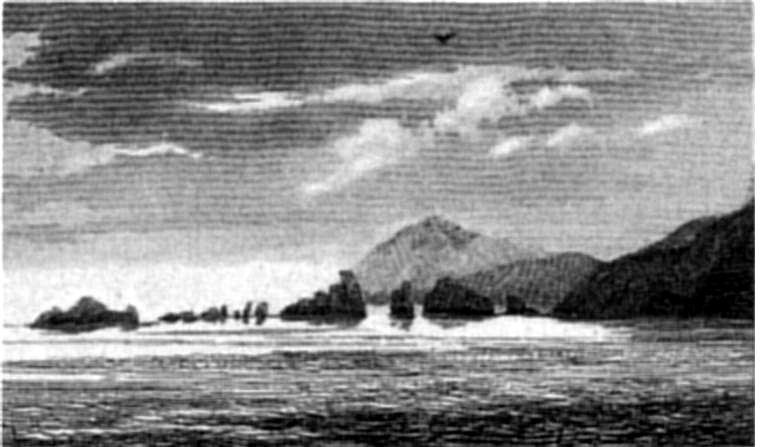
CAPE HORN.
|
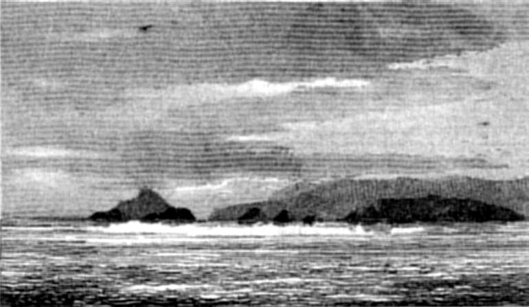
CAPE HORN.
|
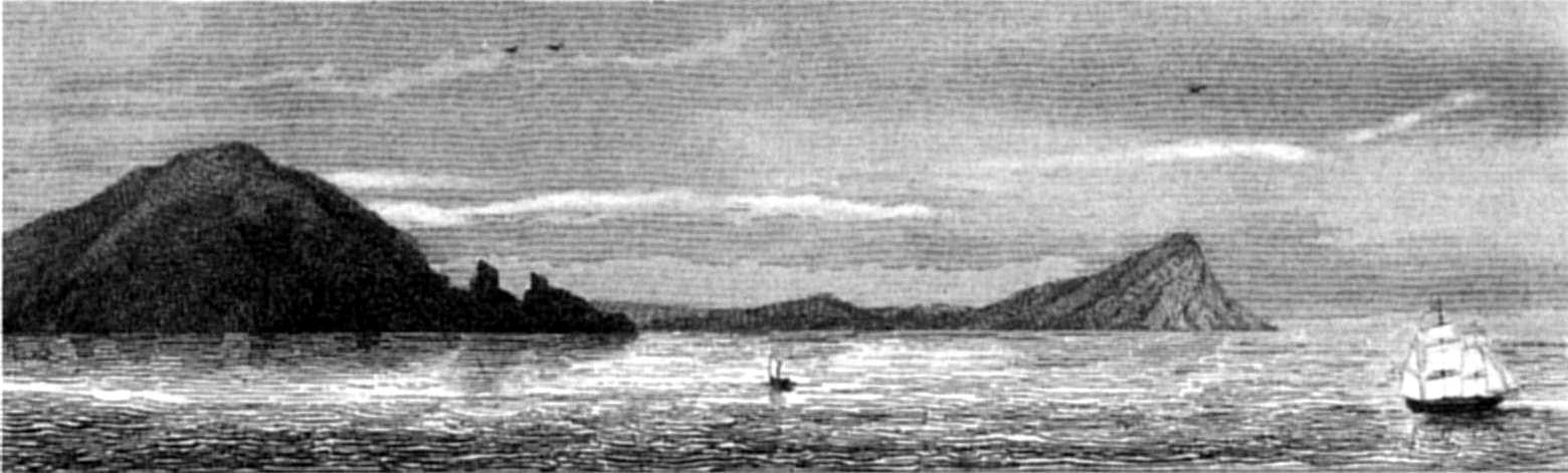
CAPE SPENCER AND CAPE HORN.
|
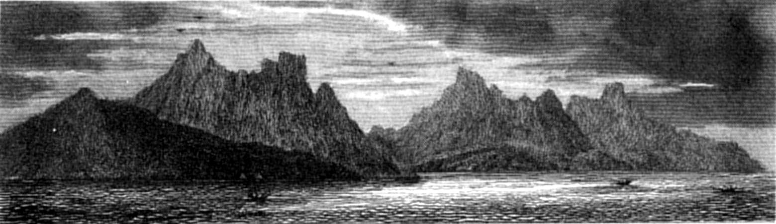
ST FRANCIS BAY AND ENTRANCE OF ST MARTIN
COVE.
( Kater Peak) Kater Peak)
|
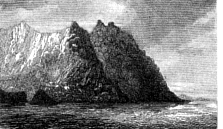
YORK MINSTER.
|
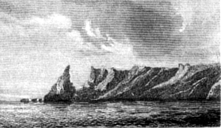
FALSE CAPE HORN.
|
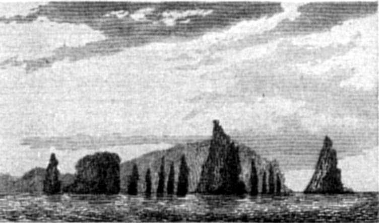
CAPE NOIR.
|
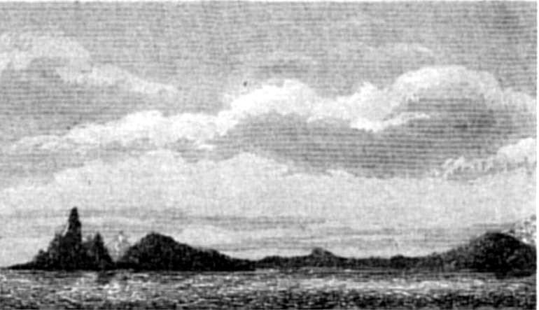
CAPE NOIR.
|
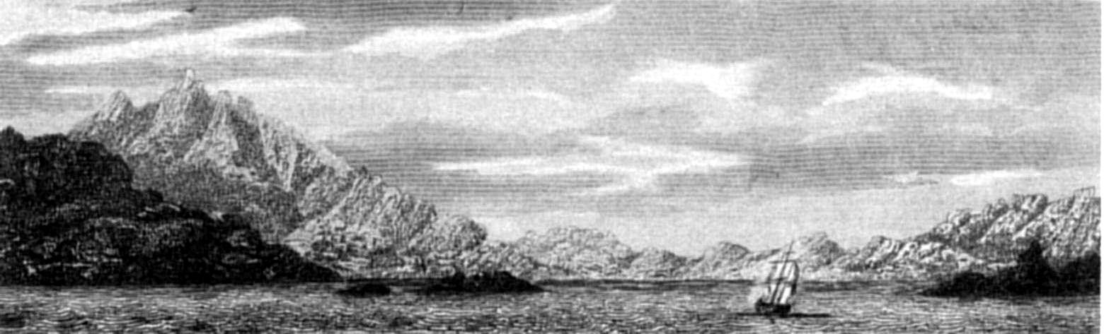
W. W. WilsonS. Bull
SOUTH WEST OPENING OF COCKBURN CHANNEL.
( Mount Skyring) Mount Skyring)
Published by Henry Colburn, Great Marlborough Street,
1838
|
"Profiting by a clear day, I went to a height in the neighbourhood,
whence I could see to a great distance in-shore, as well as along the
coast, and got a view of Mount Sarmiento. While away from the Beagle, in
search of the lost boat, we had enjoyed four succeeding days of fine
weather, during which that noble mountain had been often seen by our
party. The astronomical bearing of its summit was very useful in
connecting this coast survey with that of the Strait of Magalhaens.
"25th and 26th. Mr. Murray went to the S.W. part of the island, taking
three days' provisions. Mr. Stokes and I were employed near the ship,
while every man who could use carpenter's tools was occupied in preparing
materials for our new boat. The rock near here is greenstone, in which
are many veins of pyrites. Specimens are deposited in the museum of the
Geological Society.
"28th. Weighed, warped to windward, and made sail out of Adventure
Passage. I was very anxious to reach Christmas Sound, because it seemed
to me a good situation for the Beagle, while the boats could go east and
west of her, and the new boat might be built. Running along the land,
before a fresh breeze, we soon saw York Minster, and in the evening
entered Christmas Sound, and anchored in the very spot where the
Adventure lay when Cook was here. His sketch of the sound, and
description of York Minster, are very good, and quite enough to guide a
ship to the anchoring place. I fancied that the high part of the Minster
must have crumbled away since he saw it, as it no longer resembled 'two
towers,' but had a ragged, notched summit, when seen from the westward.
It was some satisfaction to find ourselves at anchor at this spot in February, notwithstanding the vexatious
delays we had so often experienced.
"As we had not sufficiently examined the coast between this sound and
Gilbert Islands, I proposed sending Mr. Murray there with the cutter,
while I should go to the eastward, during which time our new boat would
be finished.
"1st March. This morning I went to look for a better anchorage for our
vessel, that in which we lay being rather exposed, and very small.
Neither Pickersgill Cove nor Port Clerke suited; so I looked further, and
found another harbour, nearer to York Minster, easier of access for a
ship arriving from sea, and with a cove in one corner where a vessel
could lie in security, close to a woody point. Having sounded this
harbour, I returned to move our ship. Cook says, speaking of Port Clerke,
'South of this inlet is another, which I did not examine:'—and into
that inlet, named March Harbour, the Beagle prepared to go, but before we
could weigh and work to windward, the weather became bad, which made our
passage round the N.W. end of Shag Island rather difficult, as we had to
contend with squalls, rain, and a narrow passage between rocks. The
passage between Waterman Island and the south end of Shag Island is more
roomy; but there is a rock near the middle which had not then been
examined. We worked up to the innermost part of the harbour, and moored
close to a woody point, in the most sheltered cove. Finding this to be a
very convenient spot for building our boat, and in every point of view a
good place for passing part of the month of March, I decided to keep the
Beagle here for that purpose. This harbour might be useful to other
vessels, its situation being well pointed out by York Minster (one of the
most remarkable promontories on the coast), and affording wood and water
with as little trouble as any place in which the Beagle had anchored.
"March 2d. The master set out in the large cutter, with a fortnight's
provisions, to examine the coast between the north part of Christmas
Sound and Point Alikhoolip, near which we passed on the 28th, without
seeing much of it. With moderate weather and a little sunshine, he
might have been expected to return in a week or ten days. He carried a
chronometer and other necessary instruments. Two of the three children,
left by their mother at Stewart Harbour, I sent with Mr. Murray, to be
left with any Fuegians he might find most to the westward, whence they
would soon find their friends. The third, who was about eight years old,
was still with us: she seemed to be so happy and healthy, that I
determined to detain her as a hostage for the stolen boat, and try to
teach her English. Lieutenant Kempe built a temporary house for the
carpenters, and other workmen, near the ship and the spot chosen for
observations, so that all our little establishment was close together.
The greater part of the boat's materials being already prepared, she was
not expected to be long in building, under the able direction and
assistance of Mr. May.
"3d. Some Fuegians in a canoe approached us this morning, seeming
anxious to come on board. I had no wish for their company, and was sorry
to see that they had found us out; for it was to be expected that they
would soon pay us nightly as well as daily visits, and steal every thing
left within their reach. Having made signs for them to leave us, without
effect, I sent Mr. Wilson to drive them away, and fire a pistol over
their heads, to frighten them. They then went back, but only round a
point of land near the ship; so I sent the boat again to drive them out
of the harbour, and deter them from paying us another visit. Reflecting,
while Mr. Wilson was following them, that by getting one of these natives
on board, there would be a chance of his learning enough English to be an
interpreter, and that by his means we might recover our lost boat, I
resolved to take the youngest man on board, as he, in all probability,
had less strong ties to bind him to his people than others who were
older, and might have families. With these ideas I went after them, and
hauling their canoe alongside of my boat, told a young man to come into
it; he did so, quite unconcernedly, and sat down, apparently contented
and at his ease. The others said nothing, either to me or to him, but
paddled out of the harbour as fast as they could. They seemed to belong
to the same tribe as those we had last seen.
"4th. This afternoon our boat's keel was laid down, and her moulds
were set up. Fuegia Basket[195] told 'York Minster'[196] all her story; at some parts of which
he laughed heartily. Fuegia, cleaned and dressed, was much improved in
appearance: she was already a pet on the lower deck, and appeared to be
quite contented. York Minster was sullen at first, yet his appetite did
not fail; and whatever he received more than he could eat, he stowed away
in a corner; but as soon as he was well cleaned and clothed, and allowed
to go about where he liked in the vessel, he became much more
cheerful.
"At Cape Castlereagh and the heights over Doris Cove in Gilbert
Island, the rock seemed to contain so much metal, that I spent the
greater part of one day in trying experiments on pieces of it, with a
blowpipe and mercury. By pounding and washing I separated about a
tea-spoonful of metal from a piece of rock (taken at random) the size of
a small cup. I put the powder by carefully, with some specimens of the
rock—thinking that some of these otherwise barren mountains might
be rich in metals. It would not be in conformity with most other parts of
the world were the tract of mountainous islands composing the Archipelago
of Tierra del Fuego condemned to internal as well as external
unprofitableness. From the nature of the climate agriculture could seldom
succeed; and perhaps no quadrupeds fit for man's use, except goats and
dogs, could thrive in it: externally too, the land is unfit for the use
of civilized man. In a few years its shores will be destitute of seal:
and then, what benefit will be derived from it?—unless it prove
internally rich, not in gold or silver, but perhaps in copper, iron, or
other metals.
"5th. This day all hands were put on full allowance, our savings since
we left San Carlos having secured a sufficient stock of provisions to
last more than the time allotted for the remainder of our solitary cruise.
"By using substitutes for the mens' shoes, made of sealskin, we
secured enough to last as long as we should want them. I have never
mentioned the state of our sick list, because it was always so trifling.
There had been very little doing in the surgeon's department; nothing
indeed of consequence, since Mr. Murray dislocated his shoulder.
"The promontory of York Minster is a black irregularly-shaped rocky
cliff, eight hundred feet in height, rising almost perpendicularly from
the sea. It is nearly the loftiest as well as the most projecting part of
the land about Christmas Sound, which, generally speaking, is not near so
high as that further west, but it is very barren. Granite is prevalent,
and I could find no sandstone. Coming from the westward, we thought the
heights about here inconsiderable; but Cook, coming from the South Sea,
called them 'high and savage.' Had he made the land nearer the Barbara
Channel, where the mountains are much higher, he would have spoken still
more strongly of the wild and disagreeable appearance of the coast.
"6th. During the past night it blew very hard, making our vessel jerk
her cables with unusual violence, though we had a good scope out, and the
water was perfectly smooth. We saw that the best bower-anchor had been
dragged some distance, it was therefore hove to the bows when its stock
was found to be broken, by a rock, in the midst of good ground, having
caught the anchor. It had been obtained at San Carlos from a merchant
brig, but being much too light for our vessel, had been woulded round
with chains to give it weight: its place was taken by a frigate's
stream-anchor, well made and well tried, which I had procured from
Valparaiso.[197] In
shifting our berth, the small bower chain was found to be so firmly fixed
round another rock that for several hours we could not clear it. Such
rocks as these are very treacherous and not easily detected, except by
sweeping the bottom with a line and weights. A very heavy squall,
with lightning and thunder, passed over the ship this afternoon,
depressing the sympiesometer more than I had ever witnessed. Very heavy
rain followed.
"8th. In the forenoon I was on a height taking angles, when a large
smoke was made by natives on a point at the entrance of the harbour; and
at my return on board the ship, I found that two canoes had been seen,
which appeared to be full of people. Supposing that they were strangers,
I went in a small boat with two men to see them, and find out if they
possessed any thing obtained from our lost whale-boat, for I thought it
probable she might have been taken along the coast eastward, to elude our
pursuit. I found them in a cove very near where our carpenters were at
work. They had just landed, and were breaking boughs from the trees. I
was surprised to see rather a large party, about fourteen in number, all
of whom seemed to be men, except two women who were keeping the canoes.
They wanted me to go to them, but I remained at a little distance,
holding up bits of iron and knives, to induce them to come to me, for on
the water we were less unequal to them. They were getting very bold and
threatening in their manner, and I think would have tried to seize me and
my boat, had not Lieutenant Kempe come into the cove with six men in the
cutter, when their manner altered directly, and they began to consult
together. They were at this time on a rock rising abruptly from the
water, and the canoes, which I wanted to search, were at the foot of the
rock. Under such local disadvantages I could not persevere without arms,
for they had stones, slings, and spears, ready in their hands. Lieutenant
Kempe and myself then returned on board for arms and more men, for I
resolved to drive them out of the harbour, as it was absolutely
necessary. Already they, or their countrymen, had robbed us of a boat,
and endangered the lives of several persons; and had they been allowed to
remain near us, the loss of that part of another boat which was already
built would have followed, besides many things belonging to the
carpenters and armourer, which they were using daily on shore.
"Another motive for searching the canoes, arose from seeing so many
men without women, for I concluded that some of the whale-boat thieves
were among them, who, having seen our cutter go to the westward full of
people, might suppose we had not many left on board: one boat's crew, as
they perhaps imagined, being left on an island, and another away in
search of them. They had hitherto seen only merchant-vessels on this
coast, and judging of the number of a crew by them, might think there
could not be many persons on board, and that the vessel would be easy to
take. At all events they came prepared for war, being much painted,
wearing white bands on their heads, carrying their slings and spears, and
having left all their children and dogs, with most of their women, in
some other place.
"Two boats being manned and armed, I went with Lieut. Kempe and Mr.
Wilson to chase the Fuegians, who were paddling towards another part of
the harbour. Seeing the boats approaching, they landed and got on the top
of a rock, leaving the canoes underneath with the two women. From their
manner I saw they were disposed to be hostile, and we therefore
approached leisurely. Their canoes being within our reach, I told the
bowman to haul one alongside that we might search it; but no sooner did
his boathook touch it, than a shower of stones of all sizes came upon us,
and one man was knocked down, apparently killed, by the blow of a large
stone on the temple. We returned their volley with our fire-arms, but I
believe without hitting one of them. Stones and balls continued to be
exchanged till the cutter came to our assistance. The Fuegians then got
behind a rock, where we could not see them, and kept close. Their canoes
we took, and finding in them some bottles[198] and part of our lost boat's gear, we
destroyed them. The man of my crew who was knocked down by a stone was
only stunned, and soon recovered, but the blow was very severe and
dangerous. Not choosing to risk any further injury to our people, and
seeing no object to be gained, I would not land, though our numbers were
much superior, and we had fire-arms. It appeared that the savages
knew of no alternative but escape or death, and that in trying to take
them they would certainly do material injury to some of our party with
their spears, stones, or large knives made of pieces of iron hoops.
Remaining therefore with Lieut. Kempe, in the cutter, to watch their
motions, I sent my boat on board with the man who was hurt. The Fuegians
made their escape separately through the bushes, and were quickly out of
sight and reach: we fired a few shots to frighten them, watched their
retreat over the barren upper part of the hills, and then went to look
for their wigwams, which could not be far distant, as I thought; but
after unsuccessfully searching all the coves near us, a smoke was seen at
the opposite side of the sound, on one of the Whittlebury islands; so
concluding it was made by the rest of their tribe, and being late, I
returned on board.
"9th. At daylight, next morning, I went to look for the wigwams, on
the Whittlebury Islands, at the north side of the sound: we saw their
smoke when we were half-way across, but no longer. The natives had
probably seen us, and put out their fire directly, well knowing the
difference between our boat and their own canoes, and noticing her coming
from a part of the sound distant from the point whence they would expect
their own people, and crossing over against a fresh breeze, which a canoe
could not attempt to do. The wigwams were entirely deserted, and almost
every thing was taken away; but near their huts a piece of 'King's white
line,' quite new, was picked up; therefore our boat[199] had been there, or these were some of
the people who stole her. For the late inmates of the wigwams we searched
in vain—only their dogs remained, they themselves being hidden.
Looking round on the other side of that islet, we saw two canoes paddling
right away from the islands, though it was blowing a fresh breeze, and a
considerable sea was running. Knowing, from the place they were in, and
their course, that they were the fugitives from the wigwams, we gave
chase, and came up with them before they could land, but so
close to the shore that while securing one canoe, the other escaped. From
that which we seized a young man and a girl jumped overboard, deserting
an old woman and a child, whom we left in order to chase the young man;
but he was so active in the water that it was fully a quarter of an hour
before we could get him into our boat. Having at last secured him, we
followed the others, but they had all landed and hidden, so we returned
across the sound with our captive. In our way a smoke was seen in a cove
of Waterman Island, and knowing that it must be made by those who escaped
us yesterday, as there were no other natives there, we made sail for it;
but the rogues saw us, and put out their fire. When we reached the spot,
however, we found two wigwams just built, and covered with bark; so that
there they had passed the night after their skirmish. I would not let any
one land, as the Fuegians might be lurking in the bushes, and might be
too much for two or three of us on shore,—but left the place. They
would think us gone for more boats, as at the former meeting, and would
shift their quarters immediately; so by thus harassing them, I hoped to
be freed from any more of their visits while we remained in the
neighbourhood.
"The bodily strength of these savages is very great ('York Minster' is
as strong as any two of our stoutest men), which, with their agility,
both on shore and in the water, and their quickness in attack and defence
with stones and sticks, makes them difficult to deal with when out of
their canoes. They are a brave, hardy race, and fight to the last
struggle; though in the manner of a wild beast, it must be owned, else
they would not, when excited, defy a whole boat's crew, and,
single-handed, try to kill the men; as I have witnessed. That kindness
towards these beings, and good treatment of them, is as yet useless, I
almost think, both from my own experience and from much that I have heard
of their conduct to sealing vessels. Until a mutual understanding can be
established, moral fear is the only means by which they can be kept
peaceable. As they see only vessels which when their boats are away have
but a few people on board, their idea of
the power of Europeans is very poor, and their dread of fire arms not
nearly so great as might be imagined.
"From this cove we returned to the Beagle. My Fuegian captive, whom I
named 'Boat Memory,' seemed frightened, but not low-spirited; he eat
enormously, and soon fell fast asleep. The meeting between him and York
Minster was very tame, for, at first, they would not appear to recognise
or speak to each other. 'Boat' was the best-featured Fuegian I had seen,
and being young and well made, was a very favourable specimen of the
race: 'York' was one of the stoutest men I had observed among them; but
little Fuegia was almost as broad as she was high: she seemed to be so
merry and happy, that I do not think she would willingly have quitted us.
Three natives of Tierra del Fuego, better suited for the purpose of
instruction, and for giving, as well as receiving information, could not,
I think, have been found.
"10th. This morning, having been well cleaned and dressed, 'Boat'
appeared contented and easy; and being together, kept York and him in
better spirits than they would probably otherwise have been, for they
laughed, and tried to talk, by imitating whatever was said. Fuegia soon
began to learn English, and to say several things very well. She laughed
and talked with her countrymen incessantly.
"12th. Some evenings, at dusk, I observed large flights of birds, of
the petrel kind, skimming over the sea (like swallows), as if in chase of
insects. These birds were black, about the size of a 'Cape Pigeon.' We
tried to shoot one, but did not succeed."
Mr. Murray returns—Go to New Year Sound—See Diego Ramirez
Islands from Henderson Island—Weddell's Indian
Cove—Sympiesometer—Return to Christmas Sound—Beagle
sails—Passes the Ildefonso and Diego Ramirez Islands—Anchors
in Nassau Bay—Orange Bay—Yapoos—Mr. Murray discovers
the Beagle Channel—Numerous Natives—Guanacoes—Compasses
affected—Cape Horn—Specimens—Chanticleer—Mistake
about St. Francis Bay—Diego Ramirez Islands Climate—San
Joachim Cove—Barnevelt Isles—Evouts Isle—Lennox
Harbour.
"14th. This morning the master returned, having succeeded in tracing
the coast far enough to join our former work, although the weather had
been very unfavourable. He met with many Fuegians, most of whom were
armed with slings, spears, and cutting weapons made with pieces of iron
hoop fastened on a stick. They were very troublesome, especially at
night, and obliged him to keep them at a distance. Their respect for a
musket was not so great as might have been expected, and unless they saw
it tolerably close, and pointed directly at them, they cared not. The
boat's crew bought some fish from them, for buttons and other trifles.
From forty to fifty men, besides women and children, were seen in one
place alone; and many were met elsewhere.
"Mr. Murray penetrated nearly to the base of the snow-covered
mountains, which extend to the eastward in an unbroken chain, and
ascertained that there are passages leading from Christmas Sound to the
large bay where the whale-boat was stolen; and that they run near the
foot of the mountains. He also saw a channel leading farther to the
eastward than eye-sight could reach, whose average width seemed to be
about a mile. He left the two children in charge of an old woman whom
they met near the westernmost part which his party reached, who appeared
to know them well, and to be very much pleased at having them placed in
her care.
"15th. Raining and blowing:—as usual, I might say. When it
moderated I left the Beagle, and set out in a boat with Mr. Wilson
(mate), taking a fortnight's provisions; though I hoped to be again on
board in less than ten days, by which time our new boat would be
finished, and Mr. Stokes, as well as Mr. Murray, would have laid down his
last work. My object was to go eastward towards Indian Sound and Nassau
Bay, but the weather soon stopped our progress, and obliged us to put
into a small cove on the west side of Point Nativity, where we hoped to
get shelter from the increasing wind, though not from the rain, which
poured down in torrents. The cove proved to be much exposed, but we staid
there till daylight on the following morning, when we pulled out, and
round the point to the eastward, gladly enough, for we had been in a bad
berth during the night, exposed to wind and rain, besides swell. We ran
along the land, with a moderate westerly wind, stopped for a time near
Cape Rolle, the point of land next to Weddell's 'Hope Island;' and in the
evening went into some openings among the adjacent islands.
"17th. At daylight we set out again, and ran along-shore with a fresh
west wind, crossed the mouth of a bay which seemed likely to afford
shelter, but did not then delay to look at it closely. Soon after noon we
passed Weddell's 'Leading Hill,' which is a very singular double-peaked
height, conspicuous from a long distance, and remarkable in every point
of view. Between it and Black Point (a projecting craggy rock) lies a bay
or sound, which appears to extend some distance northward. This part of
the coast is bad for vessels to close with, being much broken, and having
several rocky islets scattered near it; but two miles off shore there is
no danger. Having found a secure cove near Leading Hill, we landed, and
the men set up our tent, while Mr. Wilson and I ascended the heights to
look round. The wind soon freshened to a gale, and made us rejoice at
having reached a sheltered place.
"18th. The whole of this day was lost by us, for it blew a strong gale
with continual rain. Collecting limpets and muscles—cutting
wood—and drying our clothes on one side by the fire, while the
other got wet, were our only occupations.
"19th. Still a strong wind, but less rain. Between the squalls I
obtained a few sights of the sun, for time, and at noon a tolerably good
set for latitude. Being then better weather, and likely to improve, we
crossed in the boat to Leading Hill, and from its summit took the
necessary angles. It was very cold and windy, but we effected all that
was then required.
"20th. Decamped very early and ran across Duff Bay, towards Henderson
Island, with a moderately fresh breeze off the land; and as my object was
to obtain a good view and a round of angles from the summit of a height
on that island, I passed Weddell's Morton Isle, Blunder Cove, &c.
without stopping, and reached the north end of Henderson Island soon
enough to get sights for time. From that spot we went a short distance to
a cove, where the boat might remain during my absence on the hill,
observed the latitude, and then ascended. Before we were half-way up, a
squall came on from S.W. and increased rapidly, but having ascended so
far, I was not disposed to turn back, so we pushed on and reached the
summit; yet, when there, I could not use a theodolite, on account of the
wind. Towards the east I could see a long distance, to the farthest of
the Hermite Islands; but towards the west the view was obscured by haze;
so leaving the instruments, I hastened down to the boat and found her
safe, though she had been in great danger. By this time the wind had
moderated, and before dark we measured the distance between the morning
and noon stations: that from the latter to the summit of the hill I had
measured, when at the top, by a micrometer. We then passed round the
north end of the island, and in the dark searched the east side for a
resting-place, which after some time was found.
"21st. A fine clear day enabled me to make the necessary observations,
and I then went up the height and succeeded in obtaining a distinct view
of the Diego Ramirez Islands. As this hill is distant from them between
fifty and sixty miles, I felt sure of getting a good cross bearing from
the south end of the Hermite Islands, distant from them, as I then
thought, only about forty, and thus fixing their position.
"New Year Sound appears to be a large body of water extending
towards the N.W., with a multitude of islands scattered about it. From
its east side the land trends away towards a point which is curiously
peaked, like a horn, and which I supposed to be the western point of
Nassau Bay.[200]
"22d. We had hardly left our cove, when steady rain set in; however,
we went across towards New Year Sound, sometimes favoured by the wind,
but could do little. As far as I saw the day before, the snowy chain of
mountains continued to the eastward, therefore I had little hope of
finding a body of water in the interior of Tierra del Fuego, about the
head of Nassau Bay. About noon we were near Weddell's 'Indian Cove,' but
the weather being thick I did not recognise it, so we stood up the sound
with a fresh breeze from the W.S.W. I soon found that it led only to the
north and west, and probably communicated with some of the passages which
Mr. Murray saw leading to the eastward from the neighbourhood of
Christmas Sound. Towards the north and east I had already noticed a long
range of mountains. Concluding therefore from what I then observed, and
from views obtained from the heights, that no passage leads from this
sound direct to Christmas Sound, and that to return to the Beagle I must
go part of the way by the sea-coast, or else go round, by a series of
intricate passages, to the places which Mr. Murray had seen in the
cutter; I preferred the coast, as a second view of it would be of use,
while a traverse among the islands could not be very beneficial.
"Putting about, we returned down the sound, the breeze still allowing
us to sail fast. We closed the western shore to look for Indian Cove,
and, as the weather had cleared up, found it without difficulty. It is
not so good a place as I expected; for except at the inner corner close
to a run of water, I found only rocky soundings. The few casts of good
ground were so close to the shore that the place can only be considered
fit for a cutter, or small craft, which could lie quite close to the
land. This cove is, in my opinion, too far inland to be of general use;
and an anchorage under Morton Island would be far preferable for a
vessel arriving from sea. We found an empty North-American cask,
apparently left that season: on a height near the cove there was a pile
of stones we had not time to examine: and much wood appeared to have been
cut down lately by the crew of some vessel. We saw several wigwams, but
no Indians. That night we stopped near the S.W. point of the sound, close
to Gold-dust Island.
"23d. After examining the cove, in which we passed the night, and
taking observations, we crossed Duff Bay, towards Leading Hill. I wished
to have seen more of a promising bay on the east side of Morton Island,
where I thought there was good anchorage, but could not afford time, as
it was probable that we should be delayed in our return along this
exposed part of the coast against the prevailing winds. There is a
considerable tide between Morton Isle and the point next to Gold-dust
Isle. The flood comes from the westward, about one knot, or at times two
knots, an hour. With the ebb it is nearly slack water, or perhaps there
is a slight tendency towards the west; and such appears to be the case
all along this coast, from Christmas Sound. We reached Leading Hill late
in the afternoon, although the wind had increased much and was directly
against us: at night it blew a gale from the westward.
"24th. A strong gale prevented our moving, or making any beneficial
use of our time.
"25th. Still blowing very fresh; but I thought we could pull round
into the next bay, and there do some good by planning the harbour,
&c., although we might get no farther for some days. From the season,
the state of the sympiesometer, and the appearance of the weather, I did
not expect any favourable change until about the end of the month. The
sympiesometer was my constant companion: I preferred it to a barometer,
as being much more portable and quicker in its motions. By great exertion
on the part of the men, for it required five hours' hard pulling, we got
round a headland into the next bay, a distance of only four miles. It
rained great part of the time, and in the afternoon poured steadily, but
we succeeded in finding a sheltered spot for our lodging, and soon put
ourselves into somewhat better plight than we had been in
during the greater part of the day, the men having been constantly soaked
through, and their hands quite numbed with cold and wet. I was
disappointed by this place; the various coves were sounded, without
getting bottom with twenty-five fathoms of line; and I could find no
anchorage without going further up the inlet than would suit any vessel
running in from sea for a temporary shelter.
"26th. A strong gale prevented our going outside, but in hopes that
there might be an inland passage I set out to look for one. Having pulled
and sailed about six miles up the inlet, we reached its termination, and
thence returned to our bivouac. There seemed to be an opening into Duff
Bay not previously seen, which would have saved us some time and trouble
had we known of its existence.
"27th. The gale continued with more or less violence, and during the
greater part of the day we were occupied in gathering limpets and
muscles, as a stock of food in case of being detained longer than our
provisions would last. Shooting did not succeed, because the sea-birds
were very wild and scarce. I regretted that there was no harbour in the
inlet which could be planned during our stay. Every cove we could find
had deep water, and so rocky a bottom that we found difficulty in
securing even our small boat; for this continued gale raised so much
swell that we were kept on the alert at night to shift her berth as often
as the wind changed.
"28th. This day, and the preceding night, the wind was exceedingly
violent, from N.W. to S.W., but generally southward of west. In pulling
across the cove to get limpets, the squalls at times forced the oars out
of the men's hands, and blew them across or away from the boat. Much rain
fell during most nights, but after sunrise it generally ceased; sometimes
however the rain poured down by day as much as by night.
"I here saw many seals teaching their young ones to swim. It was
curious to see the old seal supporting the pup by its flipper, as if to
let it breathe and rest, and then pushing it away into deep water to
shift for itself.
"29th. This morning, with better weather, we sailed very early in
hopes to get round Black Point; the wind being moderate promised well,
but, with the sun, it rose again. However, we tried hard for about six
hours, during four of which I hardly hoped to succeed, for it blew
strong, and the tide race was dangerous: but before evening we gained the
sheltered part of Trefusis Bay. The men were on their oars from five in
the morning till four in the afternoon, and, excepting two rests of a
quarter of an hour each, pulling hard all the time. We landed in a
sheltered spot, about half a mile within the entrance of a passage which
leads from Trefusis Bay to Christmas Sound. Our fatigue and thorough
drenching, by sea and rain, was then little cared for, having gained our
point, and being only a day's pull from the Beagle.
"I had seen along this passage from Christmas Sound, as well as from
Leading Hill, and rejoiced to get into it, for the outer coast is a wild
one for a boat at any period of the year—and this was the month of
March; about the worst time.
"30th. A fine clear morning. We started with the sun, and pulled so
fast along in the smooth water, that by the evening we reached our little
vessel, and found that all was well on board; that there had been no more
visits from the Fuegians, nor any troubles. The new boat was finished on
the 23d, only twenty days having been occupied by Mr. May and three men
in building her. Appearance was very much in her favour, notwithstanding
the disadvantages under which she was built. Lieutenant Kempe had
finished all the ship's work with his usual promptness: new topmast
rigging had been fitted, and every thing prepared for sea. I was two days
over the time for which we carried provisions, but by my coxswain's care
of them, and by using limpets and other shell-fish, we still had a
sufficiency.
"Having seen as much as seemed necessary of the coast between
Christmas Sound and Nassau Bay (I mean necessary in proportion to our
limited time and provisions), the Ildefonsos and Diego Ramirez Isles were
to be our next objects.
"31st. A strong wind, with much rain, prevented our moving
early—but as the sun rose higher the weather improved, and we tried
to weigh,—yet were provokingly delayed, for the chain was so fast
round a rock, that for nearly an hour we could not move it. At last we
succeeded, without injury to anything—left the harbour, and stood
away for the Ildefonsos with a strong W.S.W. wind and a confused high
swell.
"March Harbour (so called from our having passed the month of March in
it) is not so good as I at first thought. The bottom is certainly
excellent in some parts; it is well sheltered, and easy of access, but
there are many rocky places which would injure a hemp cable. Besides,
there is a dangerous rock under water in the wide part of the harbour,
hidden by a large patch of kelp.
"We passed along the S.W. side of the Ildefonsos, at the distance of
half a mile. They appeared like the higher parts of a mountain almost
under water, lying N.W. and S.E., nearly broken through by the sea in
several places, so as to form several islets, of which the highest and
largest is about two hundred feet above the sea, and one-third of a mile
in length; another is about one-quarter of a mile long; the rest are mere
rocks. The two larger are covered with tussac,[201] among which we saw numerous seal
which had scrambled up to the very summits. Having seen enough of these
islets, we hauled our wind, and shortened sail, to prepare for the night:
for it blew a fresh gale, with every appearance of its increasing and
drawing to the southward. I wished to make the Diego Ramirez Islands the
next morning, and thence run to the north-eastward; and, had the wind
been moderate, could have done so without difficulty; but after carrying
a press of sail during the night, and making southing, with as little
easting as possible, I found myself, at daylight next morning, five miles
to leeward of the above-mentioned islands, with the wind strong from the
N.W., and too much sea to allow me to hope to see more of them without
remaining under sail until the weather moderated. This would not have
suited the chronometers, or our limited
time; therefore we wore round and steered (by Weddell's chart) for the
western part of the Hermite Islands, intending to run along the land from
West Cape. The wind became more moderate towards noon, but the weather
got so thick that no part of the land could be made out distinctly; and
supposing that a point of land which I saw was Cape Spencer, we steered
directly for it, as the day was drawing to a close and obliged me to give
up my intention of coasting. Nearing the land, I found it resembled the
point I had seen from Henderson Island, and supposed to be the S.W.
extreme of Nassau Bay, but did not correspond to any part of the Hermite
Islands, as shewn by Captain King's plan. Evening was approaching, thick
misty clouds shut out other land from our view, but being a weather
shore, I trusted to finding anchorage somewhere, and stood on.
"The wind increased, and blew in very strong squalls off shore,
obliging us to carry low sail until we had run several miles along the
land in smooth water, when we anchored at the entrance of a bay, in
thirteen fathoms water, over a coarse sandy bottom. A low projecting
point covered us from the force of the wind as it then blew; and the land
on each side from all other westerly winds: but the squalls increased so
violently in the early part of the night, that although in smooth water,
with eighty fathoms of chain out, the top-gallant masts down, and yards
braced up, the vessel drove, and we were obliged to let go another
anchor, and veer a long scope of cable; after which she held on firmly
through the night.
"2d. At daylight we hove up the best bower, but found one fluke broken
off. After getting the sheet anchor to the bows, and the broken one
in-board, we weighed and made sail to windward, in search of a good
anchorage. When the weather cleared in the morning, I had discovered that
we were in Nassau Bay, near Orange Bay, and that the curiously-peaked
headland we had passed was 'False Cape Horn,' the same which I had seen
from Henderson Island. Finding this the case, I determined to turn the
mistake to account, and at once set to work in this quarter, postponing
our visit to the Hermite Islands. Short runs were essential,
because of the chronometers, and this last had been a long one for them,
with much motion, therefore it was necessary I should get
observations.
"Towards noon the weather cleared and became very fine, with a light
breeze from the northward. We stood across near the north end of the
Hermite Islands, carrying soundings right across; but the view we
obtained of the head of Nassau Bay, did not encourage us to hope for
either interior waters or a passage, as the mountains seemed to continue
in an unbroken chain to the eastward of New Island, and from the
mast-head I saw other high mountains far to the eastward. In the
afternoon we stood into a fine-looking clear bay, well sheltered, and
with regular soundings, from twelve to twenty fathoms over fine sand. I
afterwards found that this was Orange Bay, and that the bay at the south
point of which we anchored last night was that called, by the Dutch,
Schapenham Bay. Being a large, roomy place, with even bottom, we remained
at single anchor; but the glass had been falling so much, and was then so
extremely low, that I thought it prudent to prepare for the worst, and
struck topmasts.
"During the latter part of our stay in Christmas Sound, and up to the
present time, our sick-list had been considerable, therefore I was not
sorry to gain a safe anchorage in a place which appeared likely to afford
the means of recruiting our invalids, and restoring them to health. Colds
and rheumatisms, owing to bleak winds and much wet, were the chief
complaints. This was the only time since the Beagle left Rio de Janeiro
that her sick-list had been worthy of notice.
"Notwithstanding the unusual fall of the barometer and sympiesometer
and their still continuing to sink, this day was as fine, and seemed as
likely to continue so, as any day I had ever seen, therefore we took
advantage of it, by getting the necessary observations for time,
latitude, and true bearing; by airing bedding, and cleaning the ship
throughout. This appeared to be an excellent place for vessels: the land
around is rather low, and looked much more cheerful than the high dismal
mountains under which we last anchored. Wood and water were
plentiful, and easily obtained. Wild-fowl were numerous, and our people
brought on board a serviceable supply, enough for all the sick, and for
most of those who were in health.
"3d and 4th. Still very fine weather, although the barometer and
sympiesometer were lower than I had yet seen them in this country. Our
Fuegians were becoming very cheerful, and apparently contented. We gave
them as much fresh provision (birds and fish) as we could obtain with
guns and lines, and hitherto they had fared very well. All that was shot
went to one stock, from which it was divided in rotation to the messes,
the sick being first provided for, and then the Fuegians.
"5th and 6th. Two more fine days, with a very low glass, shook my
faith in the certainty of the barometer and sympiesometer.[202] During those days, the
wind had been light from N.N.W., and twice before I had known these
instruments to be similarly affected during exactly similar wind and
weather: once at Port Desire, on the coast of Patagonia; and once at Port
Gallant, while I was in the Otway Water.
"The master went towards the head of Nassau Bay, and Mr. Stokes set
out in the opposite direction. Mr. Murray had one of our best
chronometers, kept in a box, well packed in wool, but exposed to the
temperature of the air. Before going away and after returning, it was
kept and rated in the same box on deck, because the variations of
temperature in the open air of this climate are small; much less than a
chronometer would experience if alternating between a warm cabin and a
cold boat. I was sadly grieved at finding that some Fuegians who arrived
were not of the same tribe as our captives, nor even spoke the same
language. On the contrary, much enmity appeared to exist between them;
though their colour, features, and habits were similar. At first, 'York'
and 'Boat' would not go near them; but afterwards took delight in trying
to cheat them out of the things they offered to barter; and mocked their
way of speaking and laughing; pointing at them, and calling them 'Yapoo,
yapoo.' 'Fuegia' went on deck; but the instant she saw them, screamed and
ran away. Some one told her, in jest, to go into their canoe and live
with them, which frightened her so much, that she burst into tears and
ran below to hide herself. After they were gone, 'Boat' and 'York' made
us understand they had had fights with that tribe, and shewed the scars
of wounds received from them. By the help of signs we could comprehend
much of their meaning; but very few words were yet learned on either
side. We afterwards found that these Yapoos built their wigwams in a
manner differing from that of the western tribes, being made of a number
of poles, or pieces of wood, placed on end around a small space, and
meeting at the top.
"Our Yapoo acquaintances established themselves in the bay near our
forge, but without attempting to steal any thing. They frequently came
alongside the ship with fish, which they caught in the kelp. They take
these fish by means of a line without a hook, having only a small piece
of bait at the end, with which to entice them to the top of the water,
close to the side of the canoe. A fish bites, and before it can detach
its small teeth from the soft, tough bait, the hand holding the line
jerks the prize above the water, and the other catches it. The fisher
then bites out a large piece of its belly, takes out the inside, and
hangs the fish on a stick by the fire in the canoe.
"10th. Still fine steady weather, notwithstanding the unusually low
fall of the barometer already mentioned.
"12th. By the assistance of Mr. May, at the forge, we made one good
anchor out of two broken ones, and fitted new hawse-plates where they
were worn through, by constantly using the chains. Fortunately, we
brought from San Carlos a good supply of iron and coals, and applied the
latter only to the use of the armourer and the small stoves, so that we
were enabled to use the forge very often; and between the wants of the
ship and those of the boats, there was always much work for that most
useful appendage.
"The glasses had at last been rising; and during the past night and
this day, the wind was very strong with much rain. The wind shifted from
the northern quarter into the southern, drawing round to the S.E.; which,
of course, would make the mercury rise higher after being so very low,
though the weather might prove extremely bad.
"14th. The master returned, and surprised me with the information that
he had been through and far beyond Nassau Bay. He had gone very little to
the northward, but a long distance to the east, having passed through a
narrow passage, about one-third of a mile wide, which led him into a
straight channel, averaging about two miles or more in width, and
extending nearly east and west as far as the eye could reach. Westward of
the passage by which he entered, was an opening to the north-west; but as
his orders specified north and east, he followed the eastern branch of
the channel, looking for an opening on either side, without success.
Northward of him lay a range of mountains, whose summits were covered
with snow, which extended about forty miles, and then sunk into ordinary
hills that, near the place which he reached, shewed earthy or clayey
cliffs towards the water. From the clay cliffs his view was unbroken by
any land in an E.S.E. direction, therefore he must have looked through an
opening at the outer sea. His provisions being almost exhausted, he
hastened back.
"On the south side of the channel there were likewise mountains of
considerable elevation; but, generally speaking, that shore was lower
than the opposite. Mr. Murray saw great numbers of natives near the
narrow passage and upwards of a hundred canoes were seen in one day, each
containing from two to six people. These Fuegians had much guanaco skin,
and many of the bones of that animal made into spear-heads, but very
little seal-skin. The wigwams were large and commodious, compared with
those of the western tribes, being built of small trees piled up endwise,
and tied together at the top, their outside being covered with bushes,
grass, &c. to keep out the cold, and the earth inside scooped out
much below the surface of the ground. Some could hold about twice as many
people as the western wigwams: but all were not
so large. Every canoe gave chase to our boat, eager to see the strangers,
and exchange small fish, spear-heads, or arrows, for buttons, beads, and
other trifles. No arms or offensive weapons were seen among them,
excepting fish spears, bows, arrows, and slings: they had not even clubs,
nor such lances as are used by the western tribes. They seemed to be more
tractable, and less disposed to quarrel than those of the west. Wherever
the boat went, she was followed by a train of canoes, each full of
people, and having a fire smoking in the middle. Where they got the
guanaco skins was a question not easy to answer. Was there a passage to
the northward, by which they could trade with the people living
there?—or were there guanacoes in the southern part of Tierra del
Fuego? Both the bones and skins seemed abundant; but the people made
signs to Mr. Murray that they came from the eastward:—none pointed
towards the north. One native showed how they ran, and their shape, and
how they were killed, also the kind of noise they made.
"15th. Mr. Stokes returned, after going a long way to the north and
west, without finding a passage into New Year Sound. His examination,
united to Mr. Murray's, almost completed the north and west part of
Nassau Bay; and only the east side remained to be explored. Our
anchorage, called Orange Bay, is excellent; and one of the few on this
coast which are fit for a squadron of line-of-battle ships. Its approach
from the sea is as easy as the harbour is commodious. There are three
fathoms close to the shore; yet in no part are there more than twenty;
and every where there is a sandy bottom. Water is abundant; wood grows
close to the sea; wild-fowl are numerous; and although shell-fish are
scarce, plenty of small fish may be caught with hook and line among the
kelp, and in the summer a seine will furnish abundance.
"On the 16th we left Orange Bay, but light winds prevented our
reaching the open sea that day, or during the following night. I was
equally disposed to run out again to the Diego Ramirez—to look at
the coast west of False Cape for about ten miles—or to run for the
Bay of St. Francis; but the wind failed entirely. During the night we
had a breeze that would have carried us down to the latter spot, but
wishing to see, and take bearings of the land as I went, I did not profit
by it; and in the morning was baffled with light airs and a current
setting to the northward.
"17th. During the early part of the day we had light variable winds,
scarcely sufficient to help us against the current which seemed to set
constantly into the bay, from the sea, at the rate of about one knot an
hour. The manner in which our compasses were affected in this bay was
remarkable; all of them being extremely sluggish, and, unless continually
shaken, they did not show the proper magnetic bearings, or agree
together, nearer than two points. I sharpened the centres with much care,
and examined the agate caps, without improving the results. The compasses
considered the best in other places, were here as bad as the worst; an
excellent one, upon Alexander's principle, with central jimbals, being
nearly useless. In trying the compasses on shore, the heavy cards with
large needles had been less affected by local influence than light
delicate cards of Kater: the heavy ones having averaged 24° variation
along the whole coast, though Kater's differed in some places as much as
from 19° to 28°; agreeing nearly with each other, but not with Gilbert's
or Alexander's compasses, in both of which were cards comparatively
heavy.
"We passed much too close to West Cape, but having fortunately cleared
it, ran along the land before a moderate breeze, and rounded Cape Spencer
at dusk. The weather was so thick that Cape Horn could not be seen, and
we mistook the former for the famous cape; especially as, in that view,
the lower part of Cape Spencer looked like the head of a double-horned
rhinoceros: but as we drew nearer, Cape Horn appeared. The wind failed as
we entered the Bay of St. Francis, and left us to the alternative of
anchoring in deep water, or driving about with the current: we therefore
anchored off San Joachim Cove, near the Seal Rock. The night proved fine,
so we lay quietly till next morning, and then made sail to a breeze from
the northward and anchored in San Martin Cove. I afterwards went
in a boat to Horn Island, to ascertain the nature of the landing, and
whether it was practicable to carry any instruments to the summit of the
Cape. Many places were found where a boat might land; and more than one
spot where she could be hauled ashore: so that taking instruments to the
summit did not seem likely to be a very difficult task. As the weather
continued favourable I returned on board that night, and the next morning
(19th) arranged for a visit to Cape Horn; a memorial having been
previously prepared, and securely enclosed in a stone jar.
"After taking observations at noon for latitude, we set out, carrying
five days' provisions, a good chronometer, and other instruments. We
landed before dark, hauled our boat up in safety on the north-east side,
and established ourselves for the night on Horn Island.
"20th. At daybreak we commenced our walk across the island, each
carrying his load; and by the time the sun was high enough for observing,
were near the summit, and exactly in its meridian; so we stopped while I
took two sets of sights and a round of angles. Soon afterwards we reached
the highest point of the Cape, and immediately began our work; I and my
coxswain, with the instruments; and Lieut. Kempe with the boat's crew
raising a pile of stones over the memorial.
"At first the Diego Ramirez Islands were seen, but before I could get
the theodolite fixed and adjusted, the horizon became hazy. At noon
satisfactory sets of circum-meridional altitudes were obtained with two
good sextants. A round of angles, compass bearings for the variation, and
good afternoon sights for time completed our success. The pile made over
our memorial was eight feet high, and in it were stones which required
the united exertions of all seven men to raise to the top. We drank the
health of His Majesty King George the Fourth, and gave three hearty
cheers, standing round the Union Jack. Directly all was finished we
travelled towards our boat as fast as possible: but darkness surrounded
us before we were more than half-way. Those who had loads which would not
be hurt by tumbling about among bushes, travelled on; but, having the
chronometer and a sextant to take care of, I waited till one of the men
returned with a lantern. All reached the boat before nine o'clock,
without losing or injuring any thing; but the cargo of stones, for
specimens, which each brought back, delayed our returning progress
materially.
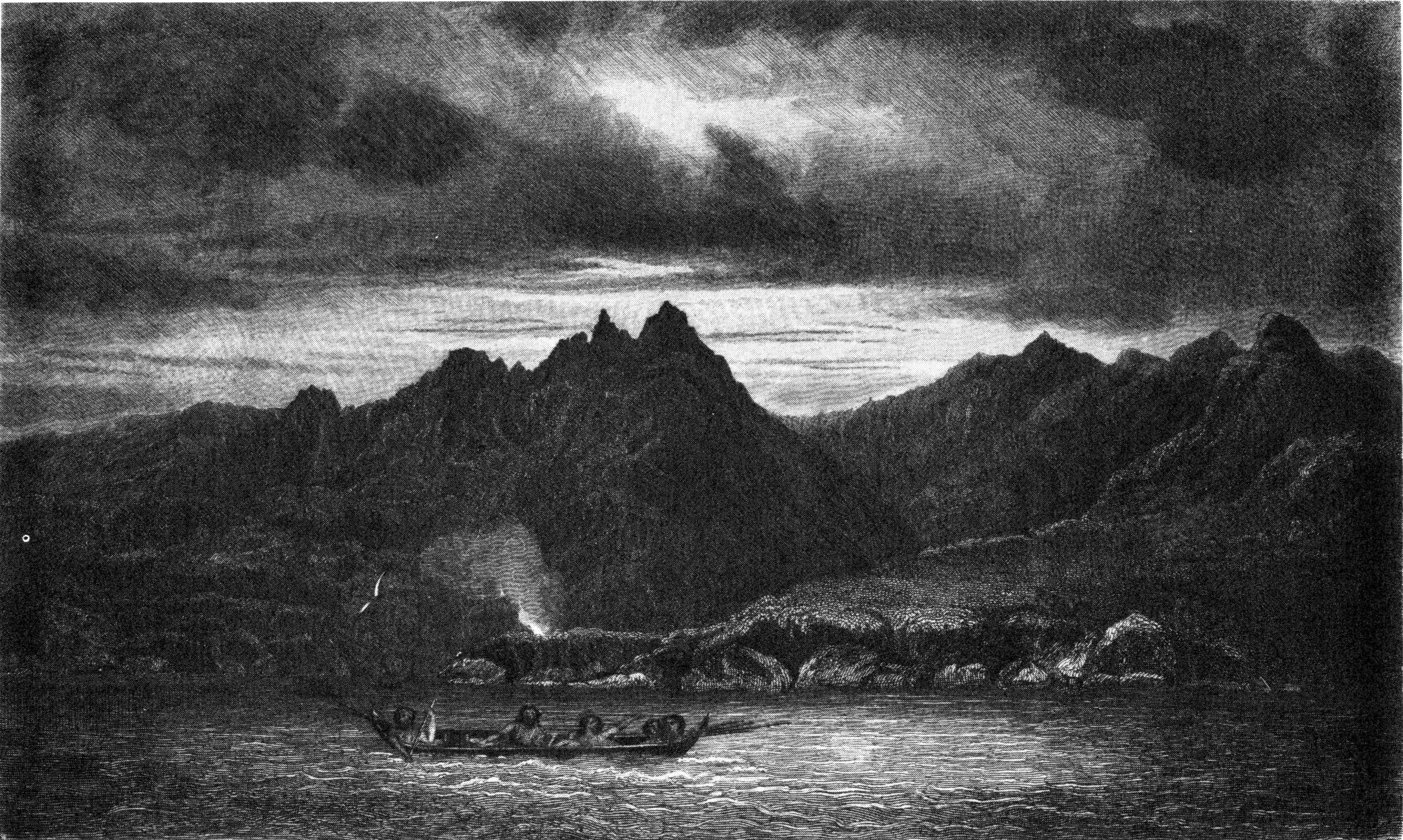
C. MartensS. Bull
NORTH-EAST SIDE OF WOLLASTON ISLAND NEAR CAPE
HORN.
Published by Henry Colburn, Great Marlborough Street,
1838
"At day-light (21st) we launched and stowed our boat, and set out on
our return. We reached the ship that afternoon, well laden with fragments
of Cape Horn.
"22d. Since the end of March the weather had been more settled, and
much finer than we had yet had it on any part of the coast; but our visit
to Horn Island was only just in time, for it soon changed again to
blowing and raining. Being close to the head of the cove, we did not feel
the williwaws—though they appeared to blow sharply enough about the
middle of it. I did not wonder at the American, whom we met in the Strait
of Magalhaens, saying that he saw 'marks of a very large establishment;'
for the head of this cove appeared to have been colonized by the
Chanticleer, so many remains of wooden roads and wooden houses were
visible every where.
"23d-24th. Bad weather. I was waiting anxiously for an opportunity of
getting a true bearing of Diego Ramirez, from the top of Kater Peak, or
Cape Spencer, to cross the bearings obtained from Henderson Island.
"25th. I went up to the summit of the Peak, but found so thick a haze,
that no distant object could be seen. Leaving the instruments at the top,
after taking a few angles, and observations of the sun for true bearings,
I descended, and afterwards examined St. Bernard Cove, which appeared to
be a good harbour. By comparing the old charts with this place and Nassau
Bay, I became convinced that there had been a great mistake, and that the
Bay of Nassau is, or rather was, the bay of St. Francis; and that the
plan given in the Admiralty charts is a very fair sketch of its west
side, from False Cape to Packsaddle Island; but the bottom and east side
of the bay are evidently put in at random, and would have been better
left out to give place to the words, 'Land was seen in this direction.'
Neither in shape, bearings, distance, or soundings, does that
plan correspond with the place now called St. Francis Bay; but it does
agree very closely, considering the date of its being made, with the part
I have mentioned. The words Cape Horn may have misled the compiler, as
the plan does not show any latitude or longitude, and those who since
visited the place, previously to the Beagle's arrival, had not been in
Nassau Bay.
"26th. Another fine day. I went up the peak again and obtained the
desired angles; but Diego Ramirez appeared nearly as distant as when seen
from the top of Henderson Island. Meanwhile the Beagle was unmoored and
got under sail. I reached her outside the cove, and stood to seaward; but
the day was too fine, there being little or no wind till dark, when a
light breeze carried us out of the bay. I steered for the Diego Ramirez
Islands, anxious to profit by the fine weather, and examine them more
closely.
"27th. The water being smooth, we had a good opportunity of taking
angles for placing the coast between West Cape and Cape Spencer, which
completed what was wanting in that part; afterwards, we again steered
towards the Diego Ramirez.
"28th. A fine morning with a fresh breeze, just such as we desired.
Having kept our wind under easy sail during the night, we bore up, and,
at daylight, ran along the east side of the rocky cluster, the wind being
from the N.E. We hove-to frequently to take angles and soundings, and
sailed quite round the islands at the average distance of half a mile,
and then stood away to the northward. They are quite similar to the
Ildefonsos; the top of a ridge of hills showing above the water, and
broken through by the sea. The two largest are about two hundred feet
high, and are covered with tussac: there is a shingle beach on one (the
second in size), where a boat may be hauled up in safety; and there is
enough good water on the east side of the same island to supply thirty
men. A furious surf breaks against the west shore, and sends a spray over
the whole island. There is no sheltered anchorage for a vessel: for
though she might bring up in deep water, on the eastern side of the
group, for a short time, she would even then risk losing her anchor. The
least water I found was fifty fathoms, though Weddell's chart shows that
there is less than forty off the S.E. end. The heavy swell prevented my
landing; but the appearance of the rocks induced me to suppose that they
were greenstone. If not of that nature, and similar to the rock about
Cape Horn, they may be of very hard sandstone.
"29th. In this climate, during the few intervals of settled fine
weather, the sky is frequently overcast soon after sunset, and a slight
shower falls. I noticed this frequently here, as well as during the
preceding April, May, and June, in the Strait.
"We stood into the bay which lies between False Cape and New Year
Sound; but it offered nothing inviting to a ship, being a leeward bight,
with rocks and islets scattered along it near the shore. Perhaps there is
shelter for a vessel amongst them; but I would not choose their
neighbourhood, if it could be avoided, as the bay is exposed to the S.W.
winds, which on this coast are the worst. The breeze freshening, and
drawing to the northward, enabled us to reach Cape Spencer in the
evening, when, as the weather promised ill, I was glad to anchor in
eighteen fathoms, over a sandy bottom, off the entrance of San Joachim
Cove.
"Expecting wind, we sent top-gallant masts on deck, braced up, and
veered to eighty fathoms. After eight the weather cleared, and appeared
likely to remain fine, but the glasses continued to fall. At ten a sudden
heavy squall came over the land, and the tops of the hills became thickly
covered with clouds. Successive furious gusts followed: we let go a
second anchor, and veered a whole cable on each. The squalls came most
violently from the S.W., and in half an hour the bank of clouds
disappeared; but a strong gale from S.W. continued till daylight, when it
moderated. Cape Spencer protected us very well, both from wind and sea:
should a ship wish to enter San Martin Cove, and the wind or daylight
fail her, she will find this spot a convenient stopping-place.
"30th. The Beagle unmoored, got under sail, and stood towards Cape
Horn: at noon she was close to the famous Cape, with beautifully fine
weather, more like the climate of Madeira than that of
fifty-six south latitude. During this day I had excellent opportunities
of taking angles, bearings, and soundings, which I hoped would be
sufficient for the south and east sides of the Hermite Islands. The
following night we worked to the northward, near the Barnevelt Islands,
the weather being fine, and the moon shining brightly.
"May 1st. A beautiful day—May-day indeed. I landed on the
Barnevelt Islands, and took sights for time, latitude, and true bearing,
besides a round of angles, while the Beagle was making slow progress to
the northward, the wind being very light, and variable. There is no good
landing-place on those islands; but as the water was then comparatively
smooth, we were enabled to land upon a steep rocky part, where the surf
did not break much. They are two low islets, lying nearly north and
south, covered with grass, tussac, and weeds. The largest is about half a
mile long, and one-third of a mile wide; the other is about two cables'
length square. Several rocks lie off the south end, towards both the east
and west; and one above water lies detached, towards the Hermite Islands,
nearly in mid-channel: but no other appearance of danger was visible. The
angles gained here, crossing those from Orange Bay, bounded the Hermite
Islands towards the north—though the detail of their coast-line,
northwards, yet remained to be ascertained.
"2d. As fine a day as the preceding. We were close to Evouts, an islet
similar to the Barnevelts, but rather higher. The weather enabled Mr.
Wilson to continue his sketches of the coast: but indeed no part along
which we sailed had been quite omitted. In the afternoon we closed the
shore near New Island, and were looking out sharply for banks and shoals,
fancying, because the land looked lower, and the Nassau flat had shoal
soundings, that we should find banks detached from the land. Shoaler
water we certainly found, compared with that to which we had been lately
accustomed, namely, from fifteen to twenty fathoms, gradually decreasing
as we neared the shore, but we never had less than ten till we were
standing into a harbour in the evening. I could here trace no resemblance whatever to any published
chart; but seeing a place at the back of some low islets which appeared
likely to afford sheltered anchorage, we steered for it, and at sunset
anchored in a well-sheltered harbour on the east side of a large island,
to the west of New Island. The water shoaled gradually, over a fine sandy
bottom; but we ran in rather too far, and had only three fathoms after
veering cable, so we were obliged to shift our berth.
"3d. Mr. Murray prepared to go along the coast towards Cape Good
Success, carrying one of the chronometers, and other necessary
instruments, and taking three weeks' provisions. He set out, in a
whale-boat, with six men, well armed and equipped in every way. Having
despatched the master, I prepared for an excursion into the interior
passages of this part of Tierra del Fuego: while Mr. Stokes, in another
boat, was to continue the survey of the coast from the east side of the head
of Nassau Bay to the vicinity of New Island; and Lieut. Kempe would take
care of the ship, and forward her refitting, besides wooding and
watering.
Set out in boats—Find Guanacoes—Murray Narrow—Birch
Fungus—Tide—Channel—Glaciers—View—Mountains—Unbroken
chain—Passages—Steam-vessels—Jemmy
Button—Puma—Nest—Accident—Natives—Murray's
Journal—Cape Graham—Cape Kinnaird—Spaniard
Harbour—Valentyn Bay—Cape Good
Success—Natives—Lennox Island—Strait Le
Maire—Good Success Bay—Accident—Tide Race—San
Vicente—San Diego—Tides—Soundings—North-east
Coast—San Sebastian—Reflections—Port Desire—Monte
Video—Santa Catalina—Rio de Janeiro.
"4th. Mr. Stokes and I each began another trip in the boats, taking
chronometers, and the necessary instruments. He steered to the northward,
to get to the mainland; I kept outside to the south-westward, to make the
most direct course towards the communication between Nassau Bay and the
newly discovered passage or channel. I was surprised to find that the
eastern shore of Nassau Bay resembled much of the coast of Patagonia
(being a stratum of earth without rock), and differed entirely from the
general character of the coasts and islands of Tierra del Fuego. At
sunset we landed, and hauled up our boat on a shingle beach which
extended several miles, and upon walking only a few yards inland I saw
the prints of large cloven hoofs, almost the size of those of a cow. This
discovery gave an answer to the question about the guanaco skins and
bones found among the Fuegians, but made me less sanguine of finding a
passage northward through the interior of the country. Much brushwood was
found near this place; and a profusion of rich grass covered an extensive
plain.
"5th. We launched the boat, and continued our course along-shore,
finding rather shoal water (three to six fathoms within about half a
mile), with a very thick bed of kelp, through which it was difficult to
force the boat. We had not advanced far, when, passing round a low point
of land, we saw four fine guanacoes feeding close to the
water. They did not seem to be much alarmed; but walked away from us
round a projecting part of the shore, which prevented our getting a shot
at them. They appeared to be much larger than those I had seen near Port
Desire, on the Patagonian coast, their bodies being far heavier, and
their tails longer and more bushy. These differences might be the natural
result of a different climate, as cool weather, with plenty of food and
water, would probably increase their size. I would not delay, on their
account, hoping to fall in with others, but pushed on along the shore.
These animals were near what is called in the chart 'Windhond Bay.' In
the afternoon, we were again among rocky mountains and deep-water shores,
and being so fortunate as to get a fresh breeze from the S.E., made much
progress before night. We saw several canoes, full of natives; but did
not turn aside to speak to them, as time was too precious.
"6th. A very cold and blowing morning, the wind being against us, yet
we made better progress than I had hoped for, as our boat proved to be so
excellent; and whether sailing or pulling, was all we could wish for.
This night we bivouacked close to the Murray Narrow, but took care not to
land till after dark, and then carefully concealed the fire, so that our
rest might not be disturbed by visits from the Fuegians. A sharp look-out
was, of course, kept by the watch; and by my two dogs, who were very
useful in that way.
"7th. Soon after we set out, many canoes were seen in chase of us; but
though they paddled fast in smooth water, our boat moved too quickly for
them to succeed in their endeavours to barter with us, or to gratify
their curiosity. The Murray Narrow is the only passage into the long
channel which runs so nearly east and west. A strong tide sets through
it, the flood coming from the channel. On each side is rather low land,
rising quickly into hills, behind which are mountains: those on the west
side being high, and covered with snow. When we stopped to cook and eat
our dinner, canoes came from all sides, bringing plenty of fish for
barter. None of the natives had any arms; they seemed to be smaller in
size, and less disposed to be mischievous, than the western race:
their language sounded similar to that of the natives whom we saw in
Orange Bay. We found a very large wigwam, built in a substantial manner,
and a much better place to live in than many of the huts which are called
houses in Chilóe. I think twenty men might have stood upright in it, in a
circle; but, probably, of these Fuegians, it would house thirty or forty
in the cold weather.
"While our men were making a fire and cooking, I walked into the wood,
but found it bore little resemblance to that which our eyes had lately
been accustomed to. The trees were mostly birch, but grew tall and
straight. The ground was dry and covered with withered leaves, which
crackled as I walked; whereas, in other parts where we had lately passed
our time, the splashing sound of wet, marshy soil had always attended our
footsteps, when not on rock. These Fuegians appeared to think the
excrescences which grow on the birch trees, like the gall-nuts on an oak,
an estimable dainty. They offered us several, some as large as an apple,
and seemed surprised at our refusal. Most of them had a small piece of
guanaco, or seal-skin, on their shoulders or bodies, but not enough for
warmth: perhaps they did not willingly approach strangers with their
usual skin dress about them, their first impulse, on seeing us, being to
hide it. Several, whom I surprised at their wigwams, had large skins
round their bodies, which they concealed directly they saw me. Fish and
the birch fungus must be their chief food, for shell-fish are scarce and
small; but they catch an abundance of excellent rock-fish, smelt, and
what might be called a yellow mullet. Guanaco meat may occasionally be
obtained by them, but not in sufficient quantity to be depended upon as
an article of daily subsistence.
"Leaving the natives, we sailed across towards the western arm of the
long channel, and continued making our way westward, with oar and sail,
until dusk, when we landed, unperceived, as we thought, and established
ourselves for the night. Just as we had moored the boat, kindled a fire,
and pitched our tent, a canoe came into the cove; another and another
followed, until we were surrounded with natives. Knowing we must either
drive them away by force, or be plagued with them all night, we at once
packed up our things, and wished them good evening. About three miles
further westward, we again landed, and fixed our tent in a cove, which
gave us good shelter through the night, without any interruption. It was
high water this afternoon at four o'clock (being the day of full moon),
and the tide rose three feet. The channel here, and opposite the Narrow,
is about three miles wide; on its north side is an unbroken line of high
mountains, covered with snow to within about a thousand feet of the
water. Southward are likewise snow-covered heights, so that the channel
is formed by the valley lying between two parallel ridges of high
mountains.
"8th. This morning it froze very sharply. We started at sun-rise, with
a fine breeze from the eastward, and made a long run before it. The
channel preserved the same character, and nearly the same width; on the
north, the mountains continued without any opening; but a few miles
farther, we saw what appeared to be one. I soon found that there was one
passage leading westward, and another rather to the southward of west,
which appeared to open into the sea. The easterly breeze failing, and
squalls from the N.W. succeeding, we did not make much progress in the
afternoon; yet before dark had reached the place where the two channels
commence, and stopped for the night on a small island. Soon after dark,
one of the boat's crew was startled by two large eyes staring at him, out
of a thick bush, and he ran to his companions, saying he had seen the
devil! A hearty laugh at his expense was followed by a shot at the bush,
which brought to the ground a magnificent horned owl.
"Next day, we continued our westerly route. No natives were seen,
though a few wigwams, of the round-topped kind, were passed. The
westernmost sharp-pointed, or Yapoo wigwam, was on the main-land, close
to the island of the Devil; it was made of small trees, piled up in a
circle (the branches and roots having been broken off) with the smaller
ends meeting at the top. The boat's crew said it had been a
'Meeting-House,' and perhaps they were not far wrong; for being so large, and just on what might be called
neutral ground between the two tribes, it is not unlikely that there may
have been many a meeting there—perhaps many a battle. At the
separation, or meeting of the two channels, it was high water at a
quarter before five this morning, and the flood came from the west, about
a knot an hour; the ebb-tide set to the west at about half that strength.
Much drift-wood and large fragments of ice were carried along with it.
Between some of the mountains the ice extended so widely as to form
immense glaciers, which were faced, towards the water, by lofty cliffs.
During a beautifully fine and still night, the view from our fireside, in
this narrow channel, was most striking, though confined. Thickly-wooded
and very steep mountains shut us in on three sides, and opposite, distant
only a few miles, rose an immense barrier of snow-covered mountains, on
which the moon was shining brightly. The water between was so glassy,
that their outline might be distinctly traced in it: but a death-like
stillness was sometimes broken by masses of ice falling from the opposite
glaciers, which crashed, and reverberated around—like eruptions of
a distant volcano.
"10. Before daylight this morning, we were on our oars; and by the
time the sun was high enough for observing, were many miles westward of
our resting-place. After sights, while the men were cooking, I obtained a
few bearings, and prepared to return, not intending to go further
westward. I saw water from that spot, more than twenty miles to the west
(by compass); and then my view was limited by the channel turning towards
the south. In those twenty miles, not the slightest appearance of an
opening to the northward could be seen; mountain succeeded mountain, in
unbroken succession. Three ridges, or ranges, could be traced, lying
parallel to each other; and the nearest summits of those in the third, or
furthest range, stretching from the northward and eastward of me, and
continuing, as far as eye could reach, towards the north and west, were
at least five leagues distant. Their height I supposed to be about four
thousand feet: that of those nearest to me, about two thousand: and of
those in the middle range, mentioned just now, about three
thousand. At a distance, the channel appeared to trend to the southward
of west, and there the sides of the mountains seemed to be very bare, and
weather-beaten, while near me they were covered with wood. This led me to
conclude that farther westward they were open to the sea winds, and that
there the channel ended. By the observations, I found that we were[203] nearly in the
longitude of Christmas Sound, and in latitude 54° 54′ S., being therefore twenty miles south of the
end of Admiralty Sound, but considerably to the westward of it. This
position, and the bearings and estimated distances, showed me that the
other arm of this long channel opened near the spot where Mr. Murray laid
down (near the head of Christmas Sound) a 'channel, running to the
eastward, beyond eyesight;' and that the branch in which I was must lead
towards the bay or sound to the N.W. of Christmas Sound, at the base of
very high land, which Mr. Murray laid down as 'an unbroken range of
snow-covered mountains.' The time of high water in this channel exactly
corresponded with that on the adjacent sea-coast, but did not nearly
agree with that of the Strait of Magalhaens. These facts, and the
appearance of the land, removed every doubt in my mind of the existence
of an unbroken chain of mountains, reaching from the Barbara Channel to
the Bell Mountain, and I therefore decided to spend no further time in
searching thereabouts for a passage northward, but make all haste to
examine the exterior shores.
"The channel here was about a mile wide, but the mountains on each
side rising so abruptly, made it appear much narrower. It might be a good
passage for a ship to sail through, from the westward, were it not for
the trouble and anxiety of getting in with the land at the right place;
and that a ship might sail on her course, in the open sea, by night as
well as by day; but here she could hardly choose to run at night, because
there are a few low islets, near mid-channel, in some parts. For a boat,
in case of shipwreck, or other urgent reason, it might be convenient: but
going through to the westward would be very difficult, because it would
be necessary to ply to windward all day, and
every day, making half-mile boards in defiance of squalls strong enough
to capsize a vessel. A steam-vessel might answer in this region, as there
is plenty of wood every where. Directly the noon observations were
finished, and the instruments safely stowed, we began our return, and as
a fresh breeze sprung up from the westward, we dashed along with a
favouring tide at a great rate.
"11th. Next day we landed, for dinner and rest, near the Murray
Narrow, and close to a wigwam, whose inmates ran away; but soon returned,
on seeing us seated quietly by their fire. We bought fish from them for
beads, buttons, &c., and gave a knife for a very fine dog, which they
were extremely reluctant to part with; but the knife was too great a
temptation to be resisted, though dogs seemed very scarce and
proportionably valuable. Afterwards we continued our route, but were
stopped when in sight of the Narrow by three canoes full of natives,
anxious for barter. We gave them a few beads and buttons, for some fish;
and, without any previous intention, I told one of the boys in a canoe to
come into our boat, and gave the man who was with him a large shining
mother-of-pearl button. The boy got into my boat directly, and sat down.
Seeing him and his friends seem quite contented, I pulled onwards, and, a
light breeze springing up, made sail. Thinking that this accidental
occurrence might prove useful to the natives, as well as to ourselves, I
determined to take advantage of it. The canoe, from which the boy came,
paddled towards the shore; but the others still paddled after us, holding
up fish and skins to tempt us to trade with them. The breeze freshening
in our favour, and a strong tide, soon carried us through the Narrow, and
half an hour after dark we stopped in a cove, where we had passed the
second night of this excursion. 'Jemmy Button,' as the boat's crew called
him, on account of his price, seemed to be pleased at his change, and
fancied he was going to kill guanaco, or wănăkāye, as
he called them—as they were to be found near that place.
"12th. We continued our course with a fresh and favouring breeze
from the N.E.; passed Windhond Bay, and at sunset hauled the boat up,
though a surf on the stony beach made it a difficult task. Several
guanacoes were seen near the shore as we passed along.
"At daylight this morning (13th), we went in search of guanacoes; but,
seeing none, soon returned to the boat, and launched her. I lost my new
dog in the bushes, yet we could not stop to recover him. During our walk
this morning, I observed traces of a large land-animal, which I supposed
to be a puma; and two of the men noticed a place, like a large nest, made
in the trees by the natives, in which I have no doubt they watch for the
guanacoes, to spear them as they pass underneath. We reached the Beagle
in the evening, and found all well on board excepting one man, who, in
carrying a guanaco,[204]
shot by the cutter's crew, had slipped and broken his leg. Mr. Stokes,
with whom he was, contrived to set it for him; but very properly made the
best of his way to our ship with the man, whose leg was there found to be
so well set, and bandaged up with splints, by those in the boat, that the
surgeon had nothing to alter. Mr. Stokes went away again directly; and
both he and Mr. Murray were absent at my return; but Lieut. Kempe, with
the few men left on board, had done what was required, and gave a good
account of the harbour, with respect to safety as well as shelter from
wind. Ten canoes had come, at different times, to the ship; but the
natives were extremely quiet and inoffensive, and sold our people a large
quantity of fish. By success in shooting, Lieut. Kempe had been enabled
to stop the issue of salt provisions for two days. Our Fuegians were in
high spirits, and the meeting between them and Jemmy Button was droll
enough: they laughed at him, called him Yapoo, and told us to put more
clothes on him directly.
"17th. Mr. Murray returned from his excursion to Cape Good Success,
having done all that was expected, but not without incurring considerable
danger on so exposed a coast. Had not his boat been a very fine one, his
crew good, and he himself a most skilful manager, I do
not think he could have gone so far along an unprotected shore, through
'races' of tide, and yet have returned in safety."
The following are extracts from his Journal.
"'Near Cape Graham we saw a large party of Indians, with several
canoes, one of which, paddled by two men and a woman, came alongside of
our boat, and they sold us some fine fish, for the large price of two
metal buttons and a small string of beads. Finding no place at which I
could land, on account of the rocks and heavy swell, we steered for the
shore about fifteen miles to the northward. Approaching a flat-topped
bluff, covered with grass, I saw a large guanaco, and just afterwards a
whole herd feeding, for which he seemed to be doing the duty of a
sentinel. The shore was inviting, and earthy soil seemed abundant; but
too many rocks showed their sharp points at the water's edge to allow of
our landing. At last we found a small patch of shingle between two reefs
of rocks, and there we succeeded in beaching the boat, through a heavy
surf. I ascended a steep woody height to obtain a view of the
neighbourhood, and found that for some miles the country was level, and
apparently covered by thick grass. Traces of, and paths made by,
guanacoes, were very numerous in every direction. Next day we pulled to
the eastward against a tumbling sea, caused by a weather tide, and at
sunset tried to land; but were disappointed, by finding that the shore
was so fronted every where by rocks, that we could not approach. We
therefore hastened towards a long reef of outlying rocks, which might
afford some shelter, as a breakwater, during the night, but found such
overfalls near them, that we were again obliged to continue our route
alongshore in the dark. At last I heard the noise of a large waterfall,
between the breakings of high surf on the rocks, and fancied a cove could
be made out, towards which we cautiously advanced, sounding with the lead
and a long pole, and succeeded in obtaining a place of temporary
security.
"'In passing along the shore on the following day, many herds of
guanacoes were seen feeding. At night we again had much embarrassment in
obtaining a place for the boat. On the 7th there was too much sea and
wind to admit of our proceeding, so I went to various points suited for
obtaining angles and bearings. One of these stations was a large rock,
looking like a tower, which stood alone on a level plain.
"'The weather being less unfavourable and the sea smoother on the 8th,
we launched our boat and sailed to the eastward. In passing round Cape
Kinnaird, great numbers of fur-seal were observed, so many indeed that
they completely covered several of the large rocks.
"'Spaniard Harbour proved to be a shallow bay, full of rocks, and
dangerous reefs lining the shore, and without shelter, although there is
anchorage for a vessel.
"'In a large cave in a rock, which forms the south head of a little
cove where our boat was secured, I found the recent traces of Indians,
who had left bones of guanacoes and birds lying about near the ashes of a
large fire. I went into the cave for a considerable distance, until it
became too dark to find my way farther, but did not reach the end.
Afterwards we sailed to the eastward again, under a treble reefed sail,
and landed before dark in a corner between projecting rocks. Numbers of
guanacoes were feeding around; but, after our shooting one of them, they
made off. In every place at which we landed, traces of Indians had been
found; yet hitherto we had seen only one party during this trip. The
country near us, on the east side of Spaniard Harbour, or rather Bay,
seemed level, though here and there were low hills, whose eastern sides
were thickly covered with wood: some of the trees (beech) growing large
and straight enough to make topmasts or lower yards for a small ship;
though probably their qualities would be unsuitable.
"'May 10th. During a heavy gale, I ascended the highest hill, near the
sea, and noticed many rocks, on which the sea was breaking, that I had
not seen before. On the 11th we passed through a very dangerous
'tide-race' off Bell Cape. There was little or no wind, but it was
scarcely possible to use our oars, so much was the water agitated: it was
heaving and breaking in all directions, like water
boiling in an immense caldron. When through, and again in safety, I was
astonished at our fortunate escape. Looking back upon it, only a mass of
breakers could be seen, which passed rapidly to the westward, and
therefore led me to suppose that the 'race' was caused by a meeting of
tides; not by a strong tide passing over a rocky ledge.
"'The land near Bell Cape is steep, high, and so rocky, that we could
not find any place at which to land. We went into all the small coves,
but they were so guarded by rocks as to be impracticable. Sailing
eastward, I at last found a small cove, near Valentyn Bay, in which we
hauled the boat ashore. A small stream ran into it, near which were many
wigwams, but no natives could be seen.
"'12th. We crossed Valentyn Bay, and landed near Cape Good Success. I
walked to the summit, and thence obtained a good view of Staten Island,
on the east; and all the coast westward, as far as New Island. In the
north-east corner of Valentyn Bay, we found some Indians, living in one
large wigwam, without any canoes. There were eight men, each of whom had
a bow and a few arrows in his hand, and all, except one, were clothed in
guanaco-skins hanging down to their heels, the woolly side being
outwards. We obtained several bows from them, by barter, but they were
reluctant to part with many arrows. One of the number wore a large
seal-skin, that I purchased with a knife, which, to my surprise, he
distinctly called 'cuchillo.' They had some fine dogs, one being much
like a young lion; but nothing we could offer seemed, in their eyes, to
be considered an equivalent for his value. Afterwards we examined
Valentyn Bay, and found it unfit for vessels, being exposed to a heavy
swell, and affording but bad anchorage.
"'On the 13th and 14th, a heavy gale confined us to our cove, into
which such numbers of wild-fowl came, for shelter I suppose, that we shot
as many as we wanted.
"'On the 15th, 16th, and 17th, we were returning to the Beagle, not
without meeting difficulties and risks similar to those already
mentioned, but which it would be as tedious as unnecessary to
relate.'"
"Soon after the Master came alongside, Mr. Stokes also returned,
having been a long way into the channel first discovered by Mr. Murray,
and having examined all the shores about its eastern communication with
the sea. He met many groups of Indians, but managed so as not to have any
collision or trouble with them.
"18th. Digging in various places on Lennox Island, showed me that the
soil is unlike that where the guanacoes were seen on Navarin island,
which is fit for cultivation; this being very moist, and too full of
tussac and other roots, to be serviceable in any agricultural point of
view.
"19th. Natives had come alongside at various times, during the last
few days, to sell fish for old buttons and other trifles. It was amusing
to witness York and Boat taking in these people, by their bargains. The
same men who, two months back, would themselves have sold a number of
fish for a bit of glass, were seen going about the decks collecting
broken crockery-ware, or any trash, to exchange for the fish brought
alongside by these 'Yapoos,' as they called them; not one word of whose
language did they appear to comprehend. Lieut. Kempe returned from an
unsuccessful excursion to Navarin island in search of guanacoes. He saw
many, but could not get within shot. The footmarks of a puma were noticed
by him in several places.
"23d. After obtaining a few sights of the sun, for the chronometer
rates, we sailed from Lennox harbour, a very secure place for small
vessels; but, as it is rather shallow, ships drawing more than fourteen
feet of water should anchor outside the entrance, where they would be
safe, and in smooth water, excepting when a south-east gale blows, with
which wind they would not, in all probability, wish to remain at anchor.
The soundings are regular in the offing, and there is anchoring ground
every where in the vicinity. Wood and water may be obtained, in any
quantity: wild fowl and fish are also to be had, but not in abundance.
The easiest way of getting fish is to give bits of broken
glass or buttons to the natives, who catch them in the kelp, by a baited
line, without a hook, enticing the fish to the top of the water and then
seizing them with the hand, or, if the fish has swallowed the bait,
jerking it out of the water before it can disengage itself; as I
mentioned before.
"At daylight (24th), being off Cape Good Success, we bore up, and ran
towards the Strait of Le Maire, with a fresh gale at south, and thick
snow squalls. The strait appeared clear of all obstacles, no rocks, nor
even kelp being visible. The shore from Cape Success to the north head of
Success Bay is high and bold, with water for a ship as near to it as she
could desire, or ought to go. We hauled our wind during a severe snow
squall, lest we should run beyond the harbour, and afterwards bearing up,
ran into Good Success Bay, and anchored under the lee of its south head
as a temporary berth. As soon as the ship was secure, I went to look for
the best anchorage; and when it moderated, we weighed and shifted to a
position where I supposed the ship secure when moored in smooth water,
with sixty fathoms on our seaward anchor, and fifty on the other, the
anchors lying respectively in eight and seven fathoms, over a clear,
sandy bottom. The gale continued during the day, and towards night
increased, drawing more to the eastward, and sending a swell into the
bay. The wind was very cold, and the snow and hail froze fast, as they
lodged upon any exposed part of the ship. Between eight and nine it blew
heavily; afterwards it became much more moderate; and at midnight there
was only a fresh wind from E.S.E. A long swell then began to set into the
bay from the same quarter; but the ship rode so easily, and the night
seemed to be improving so fast, with the glass rising steadily, that I
went to bed without an anxious thought respecting her safety: however, I
was hardly asleep when I was told that the small bower, our seaward
cable, had parted. I ran instantly upon deck, when finding the night
fine, and no increase of swell, I thought at first it was a mistake; but
was quickly set right by the ship turning her broadside to the swell, and
dropping down upon her lee anchor. The critical
nature of our situation at once struck me: it was evident, that the frost
had rendered our chains, so often tried, a doubtful security against the
jerk of rollers which occasionally set into the bay—one or two,
perhaps, in half an hour—though the swell was at other times
trifling. We veered a whole cable on the in-shore anchor (a small one,
got at San Carlos), cleared away and let go the sheet-anchor, shackled
the remainder of the small bower chain to the best bower, and rode with
two-thirds of a cable on the sheet, and a cable and a half on the bower,
close to the beach, though in six fathoms water, keeping the cables
constantly streaming wet at the hawse-holes, with sea-water, to prevent
their freezing: the temperature of the water being 44°, though the snow
and hail lay frozen on the weather-side of the masts. The link that
broke, of the chain, was in the hawse exposed to a current of cold air
through the hawse-hole. It certainly appeared defective, when examined
next day; but as it had withstood many a heavy strain, I attribute its
parting to the action of the frost, and would caution seamen to be on
their guard when using chain cables in similar weather. The wind
moderated, and the swell decreased towards morning; so we became again at
ease with respect to the safety of the ship, after a few hours of anxious
suspense, for we had no hemp cables, and were close to the surf of the
shore.
"25th. The wind drawing southward brought the vessel's broadside to
the swell, and prevented our getting the boats out for some time, as she
rolled heavily, and I would not risk their being injured without absolute
necessity. In the evening we crept for the end of the chain, weighed, and
bent a stout hawser to it; and next day hove up the sheet anchor, and
moored afresh, at a greater distance from the land.
"27th and 28th. Blowing a furious gale of wind.
"May 29th. The first tolerable day in this place was employed by the
officers in taking bearings and soundings in the bay; and by the ship's
company in wooding and watering. Some wigwams and the traces of
guanacoes' hoofs were seen, but the land is high, and being thickly
wooded shut us out from the best guanaco country. I was not
sure which was the height Mr. Banks ascended; but the broad road
mentioned by Cook is still a good mark for the bay, if the inbend of the
land does not show it sufficiently. The weather here was colder than we
had yet found it, the wind being so much in the south quarter; there were
very sharp frosts at night, and snow lay deep, even close to the sea
water-mark.
"May 30th. I was in hopes of finding a harbour between Cape San Diego
and Cape San Vicente, or a little farther along the coast, where we might
be able to fix the position of Cape San Diego and the adjacent land; for
I did not like sending a boat along this coast, the tides being so very
strong, and the shore so rocky, without any inlets, where she could be
secured at night. (During Mr. Murray's last trip, he was extremely
fortunate in having a fine interval; as the coast he passed would have
been impracticable for a boat in blowing weather. Had these last strong
southerly gales begun before he came back, his situation would have been
extremely critical.) We therefore stood into the strait, the wind being
variable and light with us, though blowing strongly over the tops of the
hills, and striking the water nearest them in strong squalls. At half a
mile from the land there was little wind; but from that distance to the
shore was torn up by williwaws. This strange appearance must have been
caused by the cold air rushing from the snow-covered hills and displacing
the warmer air near the surface of the water.
"With the ebb tide and what flaws of wind we could catch we stood to
the southward, to get some angles and bearings, and see more of the shore
between Cape Good Success and the bay. In the afternoon we had a steady
wind from N.N.W.; and having done what was necessary, to the southward,
returned, and anchored after dark near the middle of the bay.
"May 31st. At daylight this morning, we weighed and made sail with a
fresh northerly breeze. I trusted to the weather improving, as the
glasses were rising; but, indeed, our time was becoming too short to
allow of a choice of days. We worked to the northward with the
flood-tide, taking the required angles and bearings, and at noon were
close to Cape San Diego, where the flood-tide opposed the north wind very
strongly, and in addition to a heavy swell from the northward, made such
an irregular high sea, as nearly caused the loss of our new boat, and
would have damaged many a vessel. The weather became worse; and as the
swell continued high from the northward, I was obliged to stand to sea,
and carry a press of sail to keep off the land, which by that time was
too much obscured by haze and clouds to admit of our running back.
"June 1st. Bad weather, with rain nearly all day. At about twelve
miles to the northward of Cape San Vicente, by estimation, we stood off
and on until in the latter part of the day we got a breeze from south, to
which sail was made to close the land about Cape San Vicente.
"At noon, on the 2d, we were well in-shore, and stood along the land,
looking for a harbour. Seeing a promising place, we anchored off it, in
twenty-two fathoms water; and, as the night proved to be fine, remained
quiet in smooth water, with the wind off the land, and a regular tide
setting past the ship.
"At daylight next morning, I went to look at the opening, which, from
the masthead, seemed like a spacious harbour; but I found it to be so
shallow an inlet, that at its entrance, just within the heads, there was
no more than one fathom of water. Nevertheless this cove must be the
place which the Spaniards dignified with the name of Port San
Policarpo.
"We weighed and sailed along-shore, but the wind being scant, and the
tide against us, it was late before we could get into San Vicente Bay,
where we anchored in a line between that cape and Cape San Diego, but
nearest to the former. In a cove at the head of this bay, Mr. Banks
landed when Cook was here. During the night we were tossed about by a
very heavy swell, opposing a strong tide; the wind being moderate, not
enough to steady the vessel.
"Finding this morning (June 4th), that the swell was too high to allow
a boat to be lowered in safety, I gave up my intention of examining the
cove, and hastened back to the Bay of Good Success, to
complete wood and water, and obtain rates for the chronometers,
previously to leaving the coast. Wind and tide favoured us, and at noon
we were moored in Good Success Bay. Soon afterwards I left the Beagle, in
my boat, with a week's provisions, intending to try to land near Cape San
Diego, and thence walk to the cape with the instruments; but I found a
cross swell in the strait, and a rocky shore without a place in which the
boat could land: though I risked knocking her to pieces by trying to land
in the only corner where there seemed to be any chance. After this escape
I tried farther on, without success; by which time it became dark, and if
I had not returned immediately, while the ebb-tide made, the flood would
have begun and obliged me to lie at a grapnel, during a frosty night, in
a strong tide-way, with the boat's crew wet through: I turned back,
therefore, and pulled towards Success Bay, assisted by the tide, but the
cockling sea it made half filled the boat more than once, and we were
thankful when again safely on board the Beagle.
"Having failed in this scheme for settling the latitude of Cape San
Diego, I thought of effecting it by bringing the Beagle to an anchor in
the strait, two or three miles to the eastward of Good Success Bay, and
thence connecting the Cape to known points by triangulation; the heads of
this bay and Cape Good Success, quite correctly placed, serving as the
foundation.
"June 5th. I obtained some sights of the sun this morning and
observations at noon, besides bearings and angles to verify former ones.
All hands were busy wooding and watering, preparatory to returning to
Monte Video. A large albatross was shot by my coxswain, which measured
nearly fourteen feet across the wings.
"6th. The snow which covered the ground when we were first here was
quite gone, and the weather was comparatively mild. The frost at night
was not more than in a common winter's night in England, the thermometer
ranging from 27° to 32°. The tide was carefully noticed this day, being
full moon. It was high water at a quarter past
four, and the tide rose seven feet.
"7th. We unmoored, weighed, stood to the eastward and anchored with
the stream anchor, and a large hawser, in fifty fathoms water, about
three miles from Success Bay. After taking the required angles and
bearings we weighed at eleven, and stood towards Cape San Diego with the
first of the flood. The tide being strong, we made rapid progress, and
were soon out of the strait; but wishing to see as much of the N.E. coast
as possible, in our progress northward, we hauled to the wind and kept
near the land during the night, as the weather was fine and settled.
"Before leaving Good Success Bay and the Strait of Le Maire, I felt
satisfied that we had acquainted ourselves with the tides, which are as
regular and as little to be dreaded as in any part of the world where
they run with strength. They will materially assist any vessel in her
passage through the strait; which is very wide, perfectly free from
obstacles of any kind, and has Good Success Bay close at hand, in case
wind or tide should fail. When the tide opposes the wind and swell, there
is always a heavy, and, for small vessels, dangerous 'race' off Cape San
Diego, where the water is more shoal than elsewhere (k), we found it so at
a neap flood-tide, but let it be remembered that on another day, at the
top of the springs, being the day after full moon, we passed the same
spot, at half flood, with the water perfectly smooth, and although strong
eddies were seen in every direction, the vessel's steerage was but little
affected by them. It is high water in Success Bay soon after four in the
afternoon, on the full and change days, and low water exactly at ten in
the morning. The flood tide-stream begins to make to the northward about
an hour after low water, and the ebb, to the southward, about the same
time after high water. The tides rise from six to eight feet,
perpendicularly. At Cape Pillar the turn of tide, with high water, is at
noon: but along the S.W. and S.E. coast the time gradually increases to
this coast. From Cape San Diego the flood tide sets north and west along
the shore, from one knot to three knots each hour, as far as twenty miles
along shore; and the ebb in a contrary direction, but not so strongly,
except in San Vicente Bay. The flood in the Strait of Le Maire runs about
two knots in mid channel, more or less according to the wind, and the ebb
about one knot an hour. Perhaps, at times, when a strong spring tide is
retarded in its progress by a northerly wind, there will be a dangerous
overfall off Cape San Diego, like the bores in some parts of the
world.
"The soundings are tolerably regular, and may give notice of an
approach to Staten Land, or to the N.E. coast, and may guide a ship to
the fairway of the strait; but I should not place much confidence in
them, near such a rocky coast as that of Staten Land.
"Good Success Bay is an excellent anchorage for vessels of any size to
stop in for wood or water; but it would not answer if a vessel required
to lie steady for repair, as a swell frequently rolls in. It is quite
safe, yet, in the winter season, when easterly gales are common, no
vessel should anchor so near the head of the bay as she might in summer;
for heavy rollers at times (though rarely) set in. Fish we did not try to
get, not having spare time, and only a few birds were shot.
"On the 8th, a very fine day with but little wind, we were off the
flat-topped hill, called the Table of Orozco; and, from the mast-head, I
had an extensive view of the adjacent country. About Success Bay and Bell
Mount the land is high, but north of Success Bay it slopes away towards
Cape San Diego, which is a long, low, projecting point. Thence, as far as
I could see, the N.E. coast extended, low, excepting a few hills here and
there, and unbroken by inlets; the country near it being a pleasant
looking hill and dale land, well wooded and quite free from snow. I could
distinguish a snow-covered chain of mountains which must have lain near
Admiralty Sound, the country on this side of them appearing to be a
continued succession of hill and valley, with only a few of the hills
capped with snow, although this was the depth of winter. Smoke was seen
at but one place, about two miles inland. In the evening we got a breeze
off shore, and stood along the coast, the moon shining brightly and the
weather being fine. I kept rather close to the land, during the night, in
order to be near the entrance of the supposed St. Sebastian Channel in
the morning.
"At midnight Cape Santa Inez was distant from us three or four miles,
but thence we saw very little of the land, till three, near Cape Peñas,
after which the weather became thick, and the wind drew round to the
N.E., which made me keep more off shore until daylight (9th), when we
bore up and stood for the land. Having found Cape Santa Inez and Cape
Peñas correctly laid down on the chart we used, I thought Cape St.
Sebastian would not be far wrong, and we had taken several observations
during the early part of the night to correct our reckoning. Standing
towards the shore, we quickly shoaled our water, and found a ground swell
increasing. Having made what I supposed to be Cape Sebastian, and seeing
from the mast-head a large opening to the northward of it similar to that
laid down in the chart, with low distant land yet farther northward
corresponding to the shores of 'Bahia de Nombre de Jesus,' I stood on
confidently, thinking how well the chart of this coast had been laid
down, and regardless of the soundings decreasing as we went on. Seeing,
however, from the mast-head, what seemed to be a tide-ripple, two or
three miles distant, I called the boatswain, who had been much among the
tide-races on this coast, to ask his opinion of it: but before he could
get up aloft to me, I saw that it was very low land, almost level with
the sea, and what I thought the ripple, was the surf on the beach.
Standing on a little farther we had but seven fathoms water over a bottom
of dark muddy sand, with bits of black slate. At this time, the weather
had cleared enough to see the land fifteen or twenty miles on each side,
but nothing like an opening appearing, on the contrary, a plain extending
to the westward, as horizontal as the sea, I hauled to the wind and stood
alongshore to the S.E., to look for an inlet, fancying I had overshot
the proper place; especially as the land continued flat, and unbroken,
for many miles to the N.W., while to the S.E. it seemed hilly and
irregular.
"Having ranged along shore several miles, yet still seeing from the
mast-head a continuation of the same kind of coast-line, as far as an eye
could trace the surf on the beach, without any opening, we wore ship and
stood to the northward, satisfied that the St. Sebastian channel did not
exist within many miles of the position laid down in the chart.
"In the afternoon the weather became very thick, with rain, a fresh
wind blowing right on shore, and the glasses falling; so we carried sail
to get off the land and out of the shoal water, in which there was a
heavy ground swell. At midnight we had obtained a good offing.
"On the 10th, a fresh breeze from the N.E., a low glass, and thick
weather, with constant rain, would have prevented my nearing the land
again if I had been disposed to do so. Though reluctant to leave any part
of the coast of Tierra del Fuego unexplored, while I had so effective a
vessel, and all with me in good health, I was bound to remember our
distance from the appointed rendezvous; the state of our provisions, of
which we had only three weeks left on board; and that I was ordered to be
at Rio de Janeiro on the 20th of this month. I therefore decided to
hasten to Port Desire, for the sake of the chronometer measurements; and
from thence proceed to Monte Video and Rio de Janeiro. I had previously
made up my mind to carry the Fuegians, whom we had with us, to England;
trusting that the ultimate benefits arising from their acquaintance with
our habits and language, would make up for the temporary separation from
their own country. But this decision was not contemplated when I first
took them on board; I then only thought of detaining them while we were
on their coasts; yet afterwards finding that they were happy and in good
health, I began to think of the various advantages which might result to
them and their countrymen, as well as to us, by taking them to England,
educating them there as far as might be practicable, and then bringing
them back to Tierra del Fuego. These ideas were confirmed by finding that
the tribes of Fuegians, eastward of Christmas Sound, were hostile to York
Minster's tribe, and that therefore we could not, in common humanity,
land them in Nassau Bay or near the Strait of Le Maire. Neither could I
put the boy ashore again, when once to the eastward of Nassau Bay,
without risking his life; hence I had only the alternative of beating to
the westward, to land them in their own districts, which circumstances
rendered impracticable, or that of taking them to England. In adopting
the latter course I incurred a deep responsibility, but was fully aware
of what I was undertaking.
"The Fuegians were much slower in learning English than I expected
from their quickness in mimickry, but they understood clearly when we
left the coast that they would return to their country at a future time,
with iron, tools, clothes, and knowledge which they might spread among
their countrymen. They helped the crew whenever required; were extremely
tractable and good-humoured, even taking pains to walk properly, and get
over the crouching posture of their countrymen.
"When we were at anchor in Good Success Bay, they went ashore with me
more than once, and occasionally took an oar in the boat, without
appearing to harbour a thought of escape.
"During the night of the 13th, we were near the land about Sea Bear
Bay; the wind, however, drew to the northward, and with a strong current
setting to the S.E., drove us off again.
"The 14th was foggy; clouds preventing any observations, but at three
in the afternoon we made the land, a little north of Port Desire, near
what is called in the chart 'Rivers Peak.' The wind having hauled to the
southward, and the current setting northward, prevented our approaching
nearer to the port on that day.
"At daylight on the 15th, we were again off Rivers Peak,
notwithstanding our having carried a press of sail in order to make
southing during the night. We were set twenty miles to the northward
during that time; but a slant of wind and the turn of tide in our
favour carried us towards the entrance of the harbour, into which we
worked, the tide of ebb having just ended; and we moored abreast of the
ruins. My first care was to look for traces of the Adventure or Adelaide,
but I found none. A bottle which I had deposited for the Adelaide, at our
last visit, by Captain King's direction, was exactly where I then left
it, and the papers it contained were untouched. While in this port I got
good observations, the weather being clear, though very cold. No
guanacoes were shot although many were seen, but numbers of sea-birds
were brought on board.[205] A quince was given to me which was
found in a place where the Spanish colony had made a garden. We remarked
that the tracks of the guanacoes on shore here were not so large, by
one-half, as those we had so lately seen in Tierra del Fuego. Having
noticed the currents particularly, in order to compare them with what I
observed formerly and with the tide in the port; I can now say,
decidedly, that the flood tide comes from the southward, and that the ebb
sets to the south-east. North of Port Desire, or from Port Desire to Cape
Blanco, the flood is much the strongest, but off Penguin Island the ebb
is, I think, the strongest, setting two or three knots an hour. It is
high-water and slack-water, in Port Desire, at half-past twelve, on the
days of full and change. The tides, if not attended to, would baffle a
ship much in making this port.
"On the 21st we sailed, with a fresh breeze from the S.W.; and at nine
A.M. on the 25th when about one mile southward of
the alleged position of the Ariel rocks, and near the nominal longitude,
I hauled to the wind and ran some distance on their parallel, looking out
for broken water. There was a very irregular and heavy swell, as much as
would be raised by a gale of wind, but caused apparently by a current;
and while waiting for the meridian altitude, before bearing up, having
run twenty miles on the same parallel, a heavy swell rose on the quarter,
which struck our weather quarter boat, and turned her in upon the deck,
breaking both iron davits. One of the davits of the lee-boat was also
unshipped by the jerk, and the after-part of the vessel well drenched
with water. We secured both boats again, but the one to windward was
badly stove. For a moment, I thought we had indeed found the rocks, and
the huge black back of a dead whale which just then shewed itself very
near the vessel, much increased the sensation. I imagined that we were in
a meeting of tides or currents; where old trees, dead whales, &c. are
often found, and have frequently caused reports of rocks; for the water
was not more shallow than we had found it during the day, the soundings
having varied from forty to fifty fathoms; so having obtained the
meridional altitude we bore up, and steered our course again.
"On the 26th we entered the Plata, and at one A.M. on the 27th, Lobos Island was seen, and soon
afterwards the high land about Pan de Azucar. We continued working to the
westward, and at daylight were off Whale Point, but the wind fell light,
and the current being against us, we lost during the day what had been
gained in the night. At seven P.M. the current
set so strongly out of the river that we were obliged to drop a kedge
with a stout hawser, and ride by it, though keeping all sail set and
going between four and five knots through the water. When the hawser bore
a strain, the log was hove, and the current found to be setting more than
five knots. This was off Maldonado; Lobos bearing N.N.E., distant four
miles. Soon after nine the stream slacked, we tripped the kedge and
worked up the river, the wind being still westerly, but the current
having turned in our favour. The U.S. frigate Hudson passed, steering to
the eastward:—she was the first sail we had seen since leaving San
Carlos de Chilóe. At daylight next morning (28th), we were in sight of
Flores Lighthouse, which was reported to be a vessel under sail. Soon
after which another vessel was reported as being under all studding
sails; this was the Mount itself: so curiously were objects distorted by
the haze. Soon after noon we anchored off Monte Video, and from Captain
Talbot, of H.M.S. Algerine, I heard of the arrival there, and subsequent
departure of the Adventure and the Adelaide.
"On the 9th of July we sailed from Monte Video,—on the 18th made
the high land over the island of Santa Catharina, and after dark anchored in the bay. My object in
calling there was to continue the chronometric chain, between Tierra del
Fuego and Rio de Janeiro, by as short intervals as possible: and the
results so obtained proved to be very satisfactory.
"While in Monte Video I tried to have the Fuegians vaccinated, but the
virus did not take any effect on them. Little Fuegia was living several
days with an English family, who were extremely kind to her; and the
others were on shore at different times with me. No one noticed them;
being so very like the Indians of the neighbourhood.
"The apparent astonishment and curiosity excited by what they saw,
extraordinary to them as the whole scene must have been, were much less
than I had anticipated; yet their conduct was interesting, and each day
they became more communicative. It was here that I first learned from
them that they made a practice of eating their enemies taken in war. The
women, they explained to me, eat the arms; and the men the legs; the
trunk and head were always thrown into the sea.
"On the 23d we sailed from Santa Catalina; and on the 2d of August
anchored in the harbour of Rio de Janeiro."
Here the extracts from Captain Fitz Roy's Journal end.
The Adventure and the Beagle sailed together from Rio de Janeiro on
the 6th of August, having left the Adelaide as a tender to the flag-ship,
but reimbarked her officers and crew; and, after a most tedious passage,
anchored in Plymouth Sound on the 14th of October. Both vessels were soon
afterwards paid off; the Beagle at Plymouth, and the Adventure at
Woolwich.
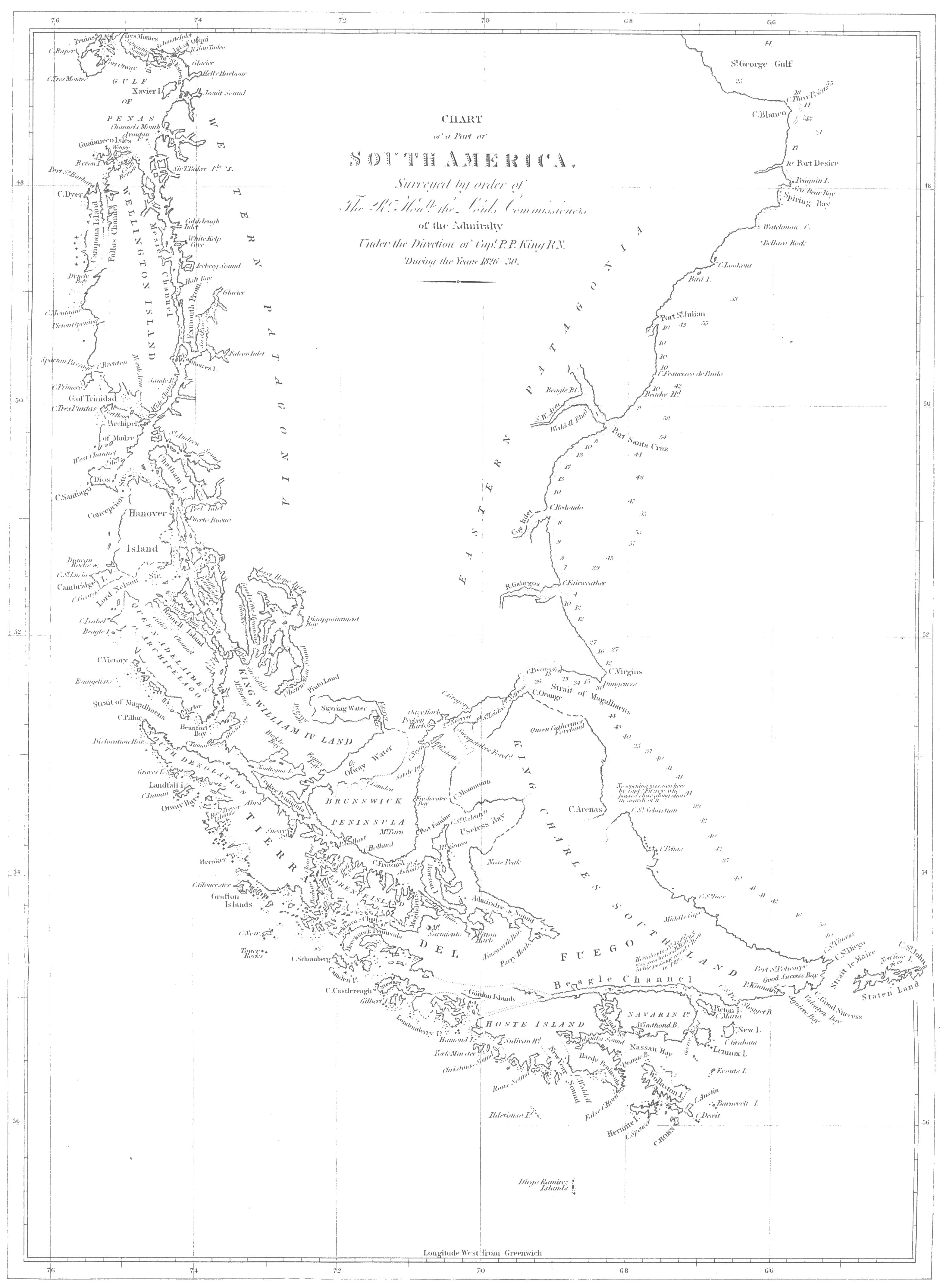
Engraved by J. Gardner.
Published by Henry Colburn, Great Marlborough
Street, 1839.
A FEW NAUTICAL REMARKS UPON THE PASSAGE ROUND CAPE HORN; AND UPON THAT
THROUGH THE STRAIT OF MAGALHAENS, OR MAGELLAN.
Ships bound from the Atlantic to any of the ports in the Pacific, will
find it advantageous to keep within one hundred miles of the coast of
Eastern Patagonia, as well to avoid the heavy sea that is raised by the
westerly gales, which prevail to the eastward, and increase in strength
according to the distance from the land, as to profit by the variableness
of the wind when it is in the western board. Near the coast, from April
to September, when the sun has north declination, the winds prevail more
from the W.N.W. to N.N.W. than from any other quarter. Easterly gales are
of very rare occurrence, but even when they do blow, the direction being
obliquely upon the coast, I do not consider it at all hazardous to keep
the land on board. In the opposite season, when the sun has south
declination, the winds will incline from the southward of west, and
frequently blow hard; but, as the coast is a weather shore, the sea goes
down immediately after the gale. In this season, although the winds are
generally against a ship's making quick progress, yet as they seldom
remain fixed in one point, and frequently shift backward and forward six
or eight points in as many hours, advantage may be taken of the change so
as to keep close in with the coast.
Having once made the land, which should be done to the southward of
Cape Blanco, it will be beneficial to keep it topping on the horizon,
until the entrance of the Strait of Magalhaens be passed.
With respect to this part of the voyage, whether to pass through
Strait Le Maire or round Staten Island, much difference of opinion
exists. Prudence, I think, suggests the latter; yet I should
very reluctantly give up the opportunity that might offer of clearing the
strait, and therefore of being so much more to windward. With a southerly
wind it would not be advisable to attempt the strait; for, with a weather
tide, the sea runs very cross and deep, and might severely injure and
endanger the safety of a small vessel, and to a large one do much damage.
In calm weather it would be still more imprudent (unless the western side
of the strait can be reached, where a ship might anchor), on account of
the tides setting over to the Staten Island side; where, if it becomes
advisable to anchor, it would necessarily be in very deep water, and
close to the land. With a northerly wind the route seems not only
practicable, but very advantageous, and it would require some resolution
to give up the opportunity so invitingly offered. I doubt whether
northerly winds, unless they are very strong, blow through the
strait—if not, a ship is drifted over to the eastern shores, where,
from the force of the tides, she must be quite unmanageable.
Captain Fitz Roy seems to think there is neither difficulty nor risk
in passing the strait. The only danger that does exist, and that may be
an imaginary one, is the failure of the wind. Ships passing through it
from the south, are not so liable to the failure of the south-westerly
wind, unless it be light, and then a breeze will probably be found from
N.W., at the northern end of the strait. The anchorage in Good Success
Bay, however, is at hand, should the wind or tide fail.
In passing to leeward of Staten Island, the tide race, which extends
for some distance off Cape St. John, at the N.E. end of the island, must
be avoided: otherwise there exist no dangers.
The anchorage under New Year Islands, although it is a wild one, the
bottom bad, and the tide very strong, yet offers good shelter from
south-west winds, and might be occupied with advantage during the
existence of a gale from that quarter, which is so unfavourable for ships
bound round the Horn.
After passing Staten Island, if the wind be westerly, the ship
should be kept upon the starboard tack, unless it veer to the southward
of S.S.W., until she reaches the latitude of 60° south, and then upon
that tack on which most westing may be made. In this parallel, however,
the wind is thought to prevail more from the eastward than from any other
quarter. Never having passed round Cape Horn in the summer season, I may
not perhaps be justified in opposing my opinion to that of others, who,
having tried both seasons, give the preference to the summer months. The
advantage of long days is certainly very great, but, from my experience
of the winds and weather during these opposite seasons at Port Famine, I
preferred the winter passage, and in our subsequent experience of it,
found no reason to alter my opinion. Easterly and northerly winds prevail
in the winter off the cape, whilst southerly and westerly winds are
constant during the summer months; and not only are the winds more
favourable in the winter, but they are moderate in comparison to the fury
of the summer gales.
Having passed the meridian of Cape Pillar, it will yet be advisable to
take every opportunity of making westing in preference to northing until
the meridian of 82° or 84° be reached, which will enable a ship to steer
through the North-westerly winds that prevail between the parallels of
50° and 54°. (See Hall's South America, Appendix.)
With respect to the utility of the barometer as an indicator of the
weather that is experienced off Cape Horn, I do not think it can be
considered so unfailing a guide as it is in the lower or middle
latitudes. Captain Fitz-Roy, however, has a better opinion of the
indications shewn by this valuable instrument: my opinion is, that
although the rise or fall at times precedes the change, yet it more
frequently accompanies it. The following sketch of the movement of the
barometer, and of the weather that we experienced, may be not without its
use.
Being to the north of Staten Island for three days preceding full
moon, which occurred on the 3d April (1829), we had very foggy weather,
with light winds from the eastward and northward, causing a
fall of the mercury from 29.90 to 29.56. On the day of full moon the
column rose, and we had a beautiful morning, during which the high
mountains of Staten Island were quite unclouded, as were also those of
Tierra del Fuego. At noon, however, a fresh gale from the S.W. set in,
and enveloped the land with a dense mist. No sooner had the wind changed,
than the mercury rose to 29.95, but fell again the next morning; and with
the descent the wind veered round to N.W., and blew strongly with thick
cloudy weather and rain, which continued until the following noon, when
the wind veered to S.W., the barometer at 29.54, having slightly risen;
but after the change it fell, and continued to descend gradually until
midnight, when we had a fresh gale from W.S.W. When this wind set in, the
mercury rose, and continued to rise, as the wind veered without
decreasing in strength to S.S.W., until it reached 29.95, when it fell
again and the weather moderated, but without any change of wind. During
the descent of the mercury, the sky with us was dull and overcast, with
squalls of wind and rain, but on shore it seemed to be very fine sunshiny
weather.
The column now fell to 29.23, and during its descent the weather
remained the same, dull and showery; but as soon as the mercury became
stationary, a fresh breeze set in from the southward, with fine
weather.
After this to new moon the weather was very unsettled, the wind
veering between South and W.S.W.; the barometer rising as it veered to
the former, and falling as it became more westerly; but on no occasion
did it precede the change.
The mean height of the barometer is about 29.5.
The mercury stands lowest with N.W. winds, and highest with S.E.
With the wind at N.W. or northerly the mercury is low; if it falls to
29 inches or 28.80, a S.W. gale may be expected, but it will not commence
until the column has ceased to descend. It frequently, however, falls
without being followed by this change. In the month of June, at Port
Famine, the barometer fell to 28.17, and afterwards gradually rose to
30.5, which was followed by cold weather, in
which the thermometer stood at 12°.
The following Table shews the mean temperature and pressure as
registered at the Observatory at Port Famine in the Strait.
| 1828. | Temperature. | Pressure |
|---|
| February | 51.1 | 29.40 |
| March | 49.4 | 29.64 |
| April | 41.2 | 29.57 |
| May | 35.5 | 29.30 |
| June | 32.9 | 29.28 |
| July | 33.0 | 29.57 |
| August | 33.2 | 29.28 |
The difficulties that present themselves to Navigators in passing
round Cape Horn, as well from adverse winds as the severe gales and heavy
sea to which they are exposed, are so great, that the Strait of
Magalhaens has naturally been looked to as a route by which they may be
avoided. Hitherto no chart has existed in which much confidence could be
placed; but by the present survey, the navigation through it, independent
of wind and weather, has been rendered much easier; since a correct
delineation of its shores, and plans of the anchorages, have been made;
and in the preceding pages, sufficient descriptions of them have been
given to assure the navigator of his place, and furnish him with advice
as to his proceedings. The local difficulties therefore have been
removed; but there remain much more serious ones, which I should not
recommend a large, or even any but a very active and fast-sailing
square-rigged vessel to encounter, unless detention be not an object of
importance.
For a square-rigged vessel bound through the Strait, the following
directions will be useful:—
In the eastern entrance the winds will frequently favour a ship's
arrival off the First Narrow; where, if she selects a good anchorage on
the bank which bounds the northern side of the channel, she may await an
opportunity of passing through the First Narrow and of reaching Gregory
Bay; where also a delay may safely be made for the purpose of passing the
Second Narrow and arriving at the neighbourhood of Cape Negro; at which
place the difficulties and dangers of the eastern entrance cease.
The dangers being carefully placed on the chart, and now sufficiently
described, nothing need be repeated here; and indeed much must be left to
the judgment and discretion of the navigator.
The tides answer best for vessels entering the Strait at the period of
full and change of the moon, since there are two westerly tides in the
day. In the winter season, if the morning tide be not sufficient to carry
a vessel through the First Narrow, she may return to Possession Bay,
select an anchorage, and be secured again before night; or, in the
summer, if she has passed the Narrow, and has been enabled to anchor for
the tide, there will be sufficient daylight for her to proceed with the
following tide to Gregory Bay, or at least to a safe anchorage off the
peaked hillocks on the north shore.
I have twice attempted to pass the First Narrow, and been obliged to
return to the anchorage in Possession Bay; and twice I have passed
through it against a strong breeze blowing directly through, by aid of
the tide; which runs, in the narrower parts, at the rate of ten or twelve
miles an hour. When the tide and wind are opposed to each other, the sea
is very deep and heavy, and breaks high over the decks; it is therefore
advisable to close reef, or lower the topsails on the cap, and drift
through; for the tide, if at the springs, will generally be sufficient to
carry a ship to an anchorage, although, not always to one where it would
be safe to pass the night. On this account, it would be prudent to
return; for, although the holding ground is exceedingly good, yet, to
part in the night, or drift towards, or through the Narrow, could
scarcely happen without accident.
In leaving the anchorage in Gregory Bay, attention must be paid to the
tide, which continues to run to the eastward in the Second Narrow, three
hours after it has commenced setting to the S.W. at the anchorage.
With a leading wind through the Second Narrow, a ship will easily
reach an anchorage off Laredo Bay, but, if the tide fails upon emerging
from it, she should seek for a berth in the bay to the north of Elizabeth
Island, as near to the island as possible, but to the westward of its
N.E. end, to be out of the influence of the tide. The depth of water,
however, will be the best guide.
Directions for passing round the south side of Elizabeth Island are
given elsewhere; and as this part offers some dangers, the chart and the
description should be carefully referred to.
The only advice that seems wanting, to improve the directions for the
coast from this to Port Famine, is, with a south-westerly wind, to keep
close to the weather shore, in order to benefit by the flaws down the
valleys; but this must be done with caution, in consequence of the
squalls off the high land, the violence of which cannot be well imagined
by a person unaccustomed to them.
Of the anchorages between Port Famine and Cape Froward, the only
convenient one for a ship is St. Nicholas Bay, to which, if defeated in
passing round the Cape, she had better return; for it is easy to reach as
well as to leave, and extremely convenient for stopping at, to await an
opportunity of proceeding.
From Cape Froward to the westward, unless favoured by a fair wind, it
is necessary to persevere and take advantage of every opportunity of
advancing step by step. There are several anchorages that a ship may take
up, such as Snug Bay, off Woods Bay, near Cape Coventry, in Fortescue
Bay, Elizabeth Bay, and York Roads. To the westward, in Crooked Reach,
the anchorages are not so good, and excepting Borja Bay, none seem to
offer much convenience. Borja Bay, however, is well calculated to supply
the deficiency, although for a square-rigged vessel there must be some
difficulty in reaching it.
Long Reach is both long and narrow, and ill supplied with anchorages
for a ship; such as they are, Swallow Harbour, Playa Parda, Marian Cove,
and Half Port Bay, seem to be the best. In thick weather, although the
channel is very narrow, yet one side is scarcely visible from the other,
and the only advantage it has over other parts of the strait is the
smoothness of the water. In Sea Reach there is a heavy rolling swell,
with a short and deep sea, which renders it very difficult to beat to
windward.
Tamar Harbour, Valentine Harbour, Tuesday Cove, and the Harbour of
Mercy, are the best anchorages; and the latter is particularly convenient
to occupy, while awaiting an opportunity of sailing out of the
strait.
In the entrance, the sea runs very heavy and irregularly during and
after a gale; so that a ship should not leave her anchorage in the
Harbour of Mercy, without a fair or a leading wind to get her quickly
through it.
For small vessels, particularly if they be fore-and-aft rigged, many,
if not all of the local difficulties vanish; and inlets which a ship dare
not or cannot approach, may be entered with safety, and anchorage easily
obtained by them. A large ship will perhaps be better off in entering and
leaving the Strait where there is open space and frequently a heavy sea;
but for the navigation of the Strait, a small vessel has considerably the
advantage. She has also the opportunity of passing through the Cockburn
Channel should the wind be north-westerly, which will very much reduce
the length of the passage into the Pacific.
One very great advantage to be derived from the passage through the
Strait is, the opportunity of obtaining as much wood and water as can be
required, without the least difficulty; and another benefit is, that by
hauling the seine during the summer months, from January to May, at the
mouth of the river or along the beaches in Port Famine, at the first
quarter flood, a plentiful supply of fish may be obtained. Excellent fish
are also caught at the anchorage with the hook and line, at all seasons,
early in the morning or late in the evening. Fish may also
be obtained with the seine at any other place where there are rivers.
Freshwater Bay and Port Gallant are equally productive. On the outer
coast of Tierra del Fuego an excellent fish may be caught in the
kelp.
The advantage which a ship will derive from passing through the
Strait, from the Pacific to the Atlantic is very great; and it ought to
be great to induce the seaman to entangle his ship with the land when
fair winds and an open sea are before him. After passing through the
Strait, the prevailing winds being westerly, and more frequently from the
northward than from the southward of west, they are fair for his running
up the coast; or if not, the ship is not liable to receive much injury
from the sea, which is comparatively smooth; whereas, to a ship passing
round the Horn, if the wind be north-west she must go to the eastward of
the Falkland Islands, and be exposed to strong gales and a heavy beam
sea, and hug the wind to make her northing. To a small vessel the
advantage is incalculable; for, besides filling her hold with wood and
water, she is enabled to escape the severe weather that so constantly
reigns in the higher latitudes of the South Atlantic Ocean.
Coming from the northward, it will be advisable to keep an offing
until the western entrance of the Strait is well under the lee, to avoid
being thrown upon the coast to the northward of Cape Victory, which is
rugged and inhospitable, and, forming as it were a breakwater to the deep
rolling swell of the ocean, is for some miles off fringed by a cross
hollow sea almost amounting to breakers.
The land of Cape Victory is high and rugged, and much broken; and if
the weather be not very thick, will be seen long before the Evangelists,
which are not visible above the horizon, from a ship's deck, for more
than four or five leagues.[206] Pass to the southward of them, and
steer for Cape Pillar, which makes like a high island. In calm
weather do not pass too near to the cape, for the current sometimes sets
out, and round the cape to the southward; but with a strong wind, get
under the lee of it as soon as you please, and steer along the shore. In
the night it will be advisable to keep close to the land of the south
shore; and if a patent log be used, which no ship should be without, your
distance will be correctly known. The course along-shore, by compass, is
E. ¾ S.; and if the weather be hazy, by keeping sight of the south shore,
there will be no difficulty in proceeding with safety.
The Adventure entered the Strait on the 1st of April, 1830, at sunset;
and after passing within half a mile of the islets off the Harbour of
Mercy, steered E. ¾ S. magnetic, under close-reefed topsails, braced by,
the weather being so squally and thick that the land was frequently
concealed from us; but being occasionally seen, the water being quite
smooth, and the course steadily steered, with the patent log to mark the
distance run, we proceeded without the least anxiety, although the night
was dark, and the squalls of wind and rain frequent and violent. When
abreast of Cape Tamar, that projection was clearly distinguished, as was
also the land of Cape Providence, which served to check the distance
shewn by the patent log; but both giving the same results, proved that we
had not been subjected to any current; whereas the account by the ship's
log was very much in error, in consequence of the violence of the squalls
and the long intervals of light winds, which rendered it impossible to
keep a correct account of the distance. At daybreak we were between Cape
Monday and the Gulf of Xaultegua; and at eight o'clock we were abreast of
Playa Parda, in which, after a calm day, the ship was anchored.
In the summer season there is no occasion to anchor any where, unless
the weather be very tempestuous, for the nights are short, and hardly
dark enough to require it, unless as a precautionary measure, or for the
purpose of procuring wood and water; the best place for which is Port
Famine, where the beaches are strewed with abundance of
logs of well-seasoned wood, which is very superior to the green wood that
must otherwise be used.
Notwithstanding that the Adventure experienced no current in the
western part of the Strait, there is generally a set to the eastward,
which is more or less felt according to circumstances. The direction and
strength of the currents are caused by the duration of the gales.
The chart will be a sufficient guide for vessels bound through from
the westward as far as Laredo Bay; after which a few directions will be
necessary. The land here should be kept close on board, to avoid the Reef
off the south-west end of Santa Magdalena. Being abreast of it, bear
away, keeping the N.E. extremity of Elizabeth Island on the starboard
bow, until you see Santa Marta in one with, or a little to the southward
of, the south trend of the Second Narrow (Cape St. Vincent), which is
a leading mark for the fair channel until you pass the spit of
shoal soundings, which extends across to Santa Magdalena. There are also
shoal soundings towards the south-west end of Elizabeth Island; at half a
mile off we had five fathoms,—Cape St. Vincent being then the
breadth of Santa Marta open to the northward of that island. Keeping the
cape just in sight to the northward of Santa Marta, steer on and pass
round the low N.E. extremity of Elizabeth Island, off which are several
tide eddies. The tide here sets across the channel.
Now steer for the Second Narrow, keeping Cape Gregory, which will be
just discernible as the low projecting extreme of the north side of the
Second Narrow, on the starboard bow, until you are three miles past Santa
Marta; the course may then be directed for the cape, opening it gradually
on the larboard bow as you approach it, to avoid the shoal that extends
off it.
If you anchor in Gregory Bay, which is advisable, in order to have the
whole of the tide for running through the First Narrow, haul up and keep
at a mile and a half from the shore. When the north extremity of
the sandy land of the Cape is in a line with the west extreme of the high
table-land, you will be near the anchorage; then shorten sail, and when
the green slope begins to open, you will have fourteen fathoms: you may
then anchor or keep away to the N.E., and choose a convenient depth,
taking care not to approach the shore, so as to bring Cape Gregory to the
southward of S. by W. ¼ W. (by compass). The best berth is with the Cape
bearing S.S.W.
Hence to the First Narrow, the course by compass is due N.E. by E.[207] The land at the
entrance being low, will not at first be perceived; but, steering on, you
will first see some hummocky land, making like islands. These are hills
on the eastern, or Fuegian side of the Narrow. Soon afterwards, a flat,
low sand-hill will be seen to the northward, and this is at the S.W.
extremity of Point Barranca. On approaching the narrow, at four miles
off, keep a cliffy head, four or five miles within the east side of the
narrow, open of the trend of Point Barranca, by which you will avoid the
shoal that extends off the latter point. You should not go into less
depth than six fathoms. At most times of the tide there are long lines
and patches of strong ripplings, through which you must pass. The shoal
is easily distinguished by the kelp.
When the channel through the narrow bears by compass N. by E. ¾ E.,
steer through it; and that, or a N.N.E. course, will carry you through.
On each side, the bank extends off for some distance; but by keeping in
mid-channel, there is no danger until the cliffy coast be past, when
reefs extend off either shore for some distance, particularly off Cape
Orange. The N.N.E. course must be kept until the peak of Cape Orange
bears south, and the northern Direction Hill W.S.W., or W. by S. ½ S. by
compass. Then steer E.N.E. for Cape Possession, taking care not to
approach too near to the bank off Cape Orange, or to that on the north
side of Possession Bay, for which the chart must be consulted.
For a small vessel, the passage through the strait, from west to east,
is not only easy, but strongly to be recommended as the best and safest
route. Indeed, I think the passage would be quite as expeditious, and
perhaps much safer, to enter the Gulf of Trinidad, and pass down the
Concepçion Strait, the Sarmiento or St. Estevan Channels, and Smyth
Channel, and enter the Strait at Cape Tamar. In these channels northerly
winds prevail, and there is no want of convenient and well-sheltered
anchorages for the night, many of which have already been mentioned, and
multitudes of others, perhaps much better ones, might be found.
———
TABLES of LATITUDE and LONGITUDE, VARIATION of the COMPASS, TIDE, and
HEIGHT.
MAGNETIC OBSERVATIONS, discussed by Major
Sabine, R.A., F.R.S.
ZOOLOGY; including Mammalia—Birds—and Shells.
COPIES of ORDERS.
EXTRACTS from a Paper published in the Journal of the Royal Geographical
Society.
EXTRACT from a Game-book.
INDEX.
TABLES
OF
LATITUDE AND LONGITUDE, VARIATION OF THE COMPASS,
AND TIDE.
———
I.
COASTS OF BRAZIL, RIVER PLATA, AND EASTERN PATAGONIA.
———
The Latitudes to which the character  is prefixed, have
resulted from Astronomical Observation. The Longitudes which have been
determined by Chronometers, are designated by C.; and those by Lunar
Distances by
is prefixed, have
resulted from Astronomical Observation. The Longitudes which have been
determined by Chronometers, are designated by C.; and those by Lunar
Distances by  . Those without distinguishing marks
are the result of Triangulation.
. Those without distinguishing marks
are the result of Triangulation.
The Longitudes in the following Tables depend upon that of Villegagnon
Island at Rio de Janeiro, which was found by fourteen Chronometers from
Plymouth to be 43° 05′ 03″ West of
Greenwich.
| Coast, &c. |
Name of |
Latitude
South. |
Longitude
West. |
Variat
East. |
Tide. |
|---|
| Place. |
Particular
Spot. |
H. W. at
F. & C. |
Direction
of Flood,
and Rise
of Tide. |
|---|
| |
|
° ′ ″ |
° ′ ″ |
° ′ |
H. M. |
|
Coast of
Brazil. |
Santos |
Arsenal |
23 55 51 |
C. 46 16 33 |
4 22 |
|
|
| —— |
Moela Lighthouse |
24 03 06 |
C. 46 12 20 |
|
|
|
| Alcatrasse Island |
Centre |
24 08 10 |
C. 45 39 15 |
|
|
|
| Abrigo Island |
Centre |
25 07 28 |
C. 47 52 51 |
|
|
|
| Figuera Island |
Centre |
25 21 29 |
C. 47 54 11 |
|
|
|
| Paranagua |
Fort on the Bar |
25 30 14 |
C. 48 17 10 |
5 44 |
|
|
| —— |
West Point of Cotinga |
25 29 50 |
C. 48 26 32 |
5 34 |
|
|
| —— |
Church of Sta Antonina |
25 25 42 |
C. 48 39 52 |
|
|
|
| St. Catherine |
Sta Cruz d'Anhatomirim |
27 25 35 |
C. 48 29 41 |
6 30 |
|
|
| —— |
City, President's House |
27 35 30 |
|
|
|
|
| Cape St. Mary |
Extremity |
34 40 20 |
C. 54 05 58 |
|
|
|
River
Plata. |
Gorriti Island |
Well at N.E. end |
34 57 00 |
C. 54 53 38
54 53 40 |
13 48 |
|
|
| Monte Video |
Rat Island, Flagstaff |
34 53 23 |
56 09 30 |
11 23 |
|
|
| —— |
Cathedral, Cupola |
34 54 37 |
56 07 35 |
12 07 |
|
|
| —— |
Lighthouse on Mount |
34 53 21 |
56 11 04 |
|
|
|
| Buenos Ayres |
Cathedral |
34 35 50 |
C. 58 17 53 |
|
|
|
East
Coast of
Patagonia. |
Port Sta Elena |
Observy marked on Plan |
44 30 45 |
C. 65 17 25 |
19 10 |
4 0 |
17 feet |
| Cape Two Bays |
Hill at projecting Point |
44 58 00 |
|
|
|
|
| Cape Blanco |
North Point |
47 15 00 |
|
|
|
|
| Port Desire |
Ruins |
47 45 05 |
C. 65 51 45 |
19 42 |
12 10 |
18½ feet |
|
Penguin Island |
Mount at North end |
47 54 45 |
65 41 30 |
|
|
|
| Sea Bear Bay |
Sandy Beach at S. side |
47 56 49 |
C. 65 44 00 |
20 47 |
12 45 |
20 feet |
| Shag Rock |
Rock |
48 08 25 |
65 52 56 |
|
|
|
| Watchman Cape |
Monte Video |
48 18 55 |
66 18 00 |
|
|
|
| Bellaco Rock |
Rock |
48 30 50 |
C. 66 09 25 |
|
|
|
| Port St. Julian |
Shag Island, in Harbour |
49 16 00 |
C. 67 38 02 |
22 17 |
10 30 |
Northward
rises 38 feet,
(observed off
the river's mouth.) |
| —— |
Wood Mount |
49 14 00 |
67 43 34 |
|
|
|
| —— |
Cape Curioso |
49 11 10 |
67 34 30 |
|
|
|
| C. Franc. de Paulo |
Extremity |
49 41 18 |
67 34 30 |
|
|
|
| Santa Cruz |  |
|
Observatory opposite
Sea-Lion Island |  |
|
50 06 43 |
68 25 00
C. 68 22 42 |
20 54 |
10 15 |
33 feet |
| —— |
Mount Entrance |
50 08 30 |
68 19 10 |
|
|
|
| —— |
Station up the River |
49 57 30 |
68 52 55 |
|
|
|
| —— |
—— |
50 07 30 |
69 08 00 |
|
|
|
| Broken Cliff Peak |
Brink |
50 14 30 |
68 31 15 |
|
12 15 |
Northw. |
| Lion Mount |
Summit |
50 20 00 |
68 49 30 |
|
|
|
| Observation Mt. |
Summit |
50 32 35 |
69 00 40 |
|
|
|
| Coy Inlet | |
|
Height on South side
of Entrance | |
|
50 58 27 |
69 06 50
C. 69 05 17 |
|
9 30 |
|
| —— |
Station up the Inlet |
51 06 30 |
69 24 10 |
|
|
|
| Cape Sanches |
Extremity |
51 06 56 |
69 03 30 |
|
|
|
| Tiger Mount |
Summit |
51 21 36 |
69 01 50 |
|
|
|
| —— |
|
|
C. 69 03 28 |
|
|
|
| C. Fairweather |
South extreme. |
51 32 05 |
68 55 15 |
|
9 0 |
N.W.28 feet |
| Gallegos River |
Observatory Mound |
51 33 21 |
68 57 50
C. 68 56 42 |
21 47 |
8 50 |
46 feet |
| North Hill |
—— |
51 49 56 |
69 24 30 |
|
|
|
| Friars |
Smallest & Northernm. |
51 49 12 |
69 10 00 |
|
|
|
| —— |
Largest & Southernm. |
51 50 08 |
69 09 00 |
|
|
|
| Convents |
Northern |
51 52 09 |
69 18 40 |
|
|
|
| —— |
Southern |
51 53 01 |
69 17 00 |
|
|
|
TABLE II.
———
STRAIT OF MAGALHAENS,
INCLUDING
THE COCKBURN AND BARBARA CHANNELS, AND THE OTWAY AND
SKYRING WATERS.
| Coast, &c. |
Name of |
Latitude
South. |
Longitude
West. |
Variat
East. |
Tide. |
|---|
| Place. |
Particular
Spot. |
H. W. at
F. & C. |
Direction
of Flood,
and Rise
of Tide. |
|---|
| |
|
° ′ ″ |
° ′ ″ |
° ′ |
H. M. |
|
East
Entrance |
Cape Virgins |
S.E. extreme. |
52 18 35 |
68 16 55
C. 68 17 46 |
22 30 |
|
Northward. |
| Dungeness |
Extremity |
52 22 40 |
68 21 50 |
|
|
|
| Mount Dinero |
Summit |
52 18 25 |
68 30 00 |
|
|
|
Possession
Bay |
Cape Possession |
Centre of Cliff |
52 16 35 |
68 53 35 |
|
|
|
| Mount Aymond |
Summit |
52 06 35 |
69 30 30 |
|
|
|
| Cape Orange | |
|
Peak on the S. side of
the entrance of
the first Narrow | |
|
52 28 10 |
69 26 05 |
|
H. W. about
3 0, but the
tide begins to
set to the N.E.
at noon. |
36 feet. |
| C. Espiritu Santo |
Summit 5 miles inland |
52 42 30 |
68 40 51 |
|
|
|
Eastern part
(2d Narrow to
Port Famine) |
Cape Gregory |
Extremity |
52 38 18 |
70 09 50 |
|
|
|
| —— |
Bush on summit of land |
52 38 03 |
C. 70 09 51 |
23 34 |
|
|
| Elizabeth Island |
North-east bluff. |
52 49 18 |
C. 70 33 25 |
|
|
|
| Oazy Harbour |
Entrance |
52 42 20 |
70 31 06 |
|
|
|
| Pecket Harb. | |
|
Beach opposite the
anchorage outside. | |
|
52 46 45 |
70 40 31 |
23 49 |
12 0 |
|
| Cape Negro |
South-east extreme |
52 56 44 |
C. 70 45 30 |
|
|
|
| Sandy Point |
Extremity |
53 09 00 |
70 49 31 |
|
|
|
| Point St. Mary |
—— |
53 21 40 |
70 54 01
C. 70 53 26 |
23 26 |
|
|
| Rocky Point |
—— |
53 35 18 |
70 51 58 |
|
|
|
| Port Famine |
Observatory |
53 38 12 |
C.
| 70 54 01 |
|
23 30 |
12 0 |
South.
5 or 6 ft. |
| —— |
Point Santa Anna |
53 37 55 |
70 51 19 |
|
|
|
| Cape Monmouth |
Extremity |
53 23 30 |
70 24 01 |
|
|
|
| Point Boqueron |
—— |
53 28 35 |
70 12 01 |
|
|
|
| Cape St Valentyn |
Summit at extreme |
53 33 30 |
70 30 01 |
|
|
|
| Nose Peak |
Summit |
53 32 30 |
70 01 36 |
|
|
|
Admiralty
Sound |
Port Cooke |
Rivulet in the Bay |
54 17 10 |
69 58 01 |
|
|
|
| Latitude Point |
Extremity |
54 16 45 |
69 50 51 |
|
|
|
| Bottom of Admiralty Sound |
Summit of Mount Hope |
54 26 30 |
68 59 11 |
|
|
|
| Curious Peak |
Summit |
54 19 35 |
70 08 31 |
|
|
|
East Coast
of Dawson
Island |
Mount Seymour |
Summit |
54 19 05 |
69 46 36 |
|
|
|
| Ainsworth Harb. |
Project point on W. side |
54 23 00 |
69 34 01 |
|
|
|
| Parry Harbour |
Outer point on W. side |
54 25 20 |
69 16 31 |
|
|
|
| Card Point |
Point |
54 21 00 |
69 12 01 |
|
|
|
| Willes Bay |
Islet in Ph. Gidley Cove |
53 48 15 |
70 31 46 |
|
|
|
| Cannon Point |
Extremity |
54 03 47 |
70 25 31 |
|
|
|
| Soapsuds Cove |
Rivulet |
54 16 28 |
70 13 46 |
|
|
|
| Sharp Peak |
Summit |
54 06 50 |
70 23 01 |
|
|
|
| Cape Expectation | |
|
South Extremity, or
trend at entrance of
Gabriel Channel | |
|
54 19 00 |
70 15 21 |
|
|
|
| Gabriel Channel |
Port Waterfall |
Port |
54 20 20 |
69 19 01 |
|
|
|
| Nar. of Gabriel C. |
Midway |
54 15 08 |
69 32 31 |
|
|
|
| Cone Point |
Summit |
54 06 35 |
70 48 01 |
|
|
|
| Dawson Island |
Mount Graves |
South summit |
53 45 00 |
70 33 46 |
|
|
|
| St. Peter and St. Paul Islet |
Centre |
53 42 10 |
70 42 01 |
|
|
|
| Port San Antonio |
Humming Bird Cove |
53 53 52
53 54 25 |
70 50 26 |
|
|
|
| —— |
S.W. pt of North Island |
53 54 03 |
70 51 51 |
|
|
|
Coast from
Pt. Famine to
C. Froward |
Mount Tarn |
Peak at North end |
53 45 06 |
70 58 26 |
|
|
|
| Cape San Isidro |
Extremity |
53 47 00 |
70 55 03 |
23 30 |
1 0 |
8 feet
Southw. |
| C. Remarquable |
Extremity |
53 49 25 |
71 00 31 |
|
|
|
| Nassau Island |
South-east point |
53 50 23 |
71 00 56 |
|
|
|
| St. Nicholas Bay |
Islet in the centre |
53 50 38 |
71 03 13 |
|
2 6 |
|
Cape Froward
to the Jerome
Channel, and
North shore
of Clarence
Island |
Cape Froward |
Summit of the Morro |
53 53 43 |
71 14 31 |
|
1 0 |
N.E. |
| Cape Holland |
S. point of Wood Bay |
53 48 33 |
71 35 41 |
|
|
|
| Bougainville Sugar Loaf |
Summit of Peak |
53 57 32 |
71 24 13 |
|
|
|
| Cascade Harb. |
Small rock in Harbour |
53 57 48 |
71 27 46 |
24 18 |
|
|
| Cordes Bay |
Outer-point West side |
53 42 55 |
71 53 08 |
|
|
|
| Bell Bay |
N.W. pt. Bradley Cove |
53 53 15 |
71 47 16 |
|
|
|
| Cape Inglefield |
Islet off it |
53 50 20 |
71 51 41 |
|
|
|
| Cape Gallant |
Extremity |
53 42 11 |
71 59 01 |
24 35 |
|
|
| Port Gallant |
Wigwam Point |
53 41 43 |
C. 71 56 57 |
24 04 |
9 3 |
5 or 6 ft. |
| Charles Island |
Wallis Mark |
53 43 57 |
72 02 00 |
|
|
|
| Rupert Island |
Summit |
53 42 00 |
72 08 00 |
|
|
|
| Monmouth Islands |
Summit of largest island |
53 39 40 |
72 08 39 |
|
|
|
| Point Elizabeth |
Passage Point Reef |
53 37 00 |
72 08 41 |
|
|
|
| Point York |
Extremity |
53 32 35 |
|
|
|
|
| Bachelor River |
Entrance |
53 33 00 |
C. 72 17 11 |
24 06 |
1 46 |
|
| Jerome Channel |
| Bluff extremity, or
W. point of entrance | |
|
53 31 00 |
72 20 41 |
|
|
|
| Crooked Reach |
Cape Cross-tide |
Extremity |
53 33 03 |
72 22 16 |
|

At Borja Bay. |
|
|
|
|
|
1 50 |
6 feet |
El Morrion, or
St. David Head | |
|
Extremity |
53 33 20 |
72 28 31 |
|
|
|
| Cape Quod |
Extremity |
53 32 10 |
72 29 41 |
|
|
|
| Long Reach |
Snowy Sound |
Centre of Ulloa Island |
53 31 30 |
72 36 13 |
|
|
|
| Cape Notch |
Extremity |
53 25 00 |
72 45 11 |
|
|
|
| Playa Parda Cove |
Anchorage |
53 18 30 |
72 56 00 |
|
1 8 |
|
| Half-port Bay |
Centre |
53 11 36 |
C. 73 14 57 |
|
|
|
| Cape Monday |
Extremity |
53 09 12 |
73 18 16 |
|
|
|
| Sea Reach |
St. Anne Island |
Centre |
53 06 30 |
73 12 46 |
|
|
|
| Cape Upright |
Extremity, North trend |
53 04 03 |
73 32 16 |
|
|
|
|
Cape Providence |
—— |
52 59 00 |
73 31 00 |
23 22 |
|
|
| Cape Tamar |
Observatory, Tamar Bay |
52 55 06 |
C. 73 44 02 |
23 24 |
3 5 |
5 feet |
| —— |
Extremity of Cape |
52 55 30 |
73 44 26 |
|
|
Eastwd. |
| Beaufort Bay |
Stragglers, Southernmost |
52 48 03 |
73 46 00 |
|
|
|
| Cape Phillip |
Sholl Bay |
52 44 05 |
C. 73 48 20 |
|
|
|
| —— |
Summit over the Cape |
52 44 20 |
73 53 00 |
|
|
|
| Cape Parker |
Station near it |
52 41 49 |
C. 74 07 10 |
|
|
|
| Point Felix |
Station on its East side |
52 56 31 |
|
|
|
|
| —— |
Extremity |
52 56 00 |
74 09 00 |
|
|
|
| Valentine Harb. |
Mount (see Plan) |
52 55 00 |
74 15 00 |
|
2 0 |
|
| Cape Cuevas |
Extremity |
52 53 19 |
74 17 30 |
|
|
|
| Cape Cortado |
Extremity |
52 49 37 |
74 22 56 |
23 40 |
|
|
| Westminst. Hall |
Eastern summit |
52 37 18 |
74 20 26 |
|
|
|
| Observation Mt. |
—— |
52 28 58 |
C. 74 32 18 |
25 09 |
3 0 |
|
| Harbr. of Mercy |
Observation Islet |
52 44 57 |
C. 74 35 31 |
23 48 |
1 47
or
0 58 |
4 feet |
| Cape Pillar |
Extremity |
52 42 53 |
C. 74 37 41 |
|
1 0 |
|
| Cape Victory |
Extremity |
52 16 10 |
C. 74 50 55 |
|
|
|
Evangelists, or
Isles of Direction |
| Sugar Loaf to South
Eastward | |
|
52 24 18 |
75 02 56 |
|
|
Variable |
Magdalen
Channel |
Vernal |
Pinnacle on summit |
54 06 28 |
70 57 40 |
|
|
|
| Anxious Point |
Extremity |
54 06 50 |
70 53 26 |
|
|
|
| Mount Boqueron |
Centre pinnacle |
54 10 40 |
70 56 00 |
|
|
|
| Labyrinth Islands |
Summit of Jane Island |
54 19 10 |
70 57 36 |
|
|
|
| Cape Turn |
Extremity |
54 24 08 |
71 04 00 |
|
|
|
| Warping Cove |
—— |
54 24 08 |
C. 71 05 25 |
24 57 |
|
|
| Mnt. Sarmiento |
N.E. peak (6800 feet) |
54 27 00 |
70 47 30 |
|
|
|
Cockburn
Channel |
King Island |
Summit |
54 22 38 |
71 13 15 |
|
|
Westwd
6 or 8 ft. |
| Prowse Islands |
Station |
54 22 13 |
71 20 57 |
|
|
|
| Park Bay |
Beach on isthmus |
54 19 00 |
71 15 00 |
24 56 |
0 30 |
6 or 7 ft. |
| Bayne Islands |
| Cove at the N. end of
of South-east island | |
|
54 18 15 |
71 35 50 |
|
|
|
| Eliza Bay |
Centre |
54 17 45 |
71 37 00 |
|
|
|
| Kirke Rocks |
Body |
54 22 30 |
71 42 30 |
|
|
|
| Enderby Island |
Centre |
54 13 00 |
71 53 31 |
|
|
|
Melville
Sound |
Mount Skyring |
Summit (3000 feet) |
54 24 44 |
72 07 40 |
|
|
|
| Tom Harbour |
Cove near it |
54 24 23 |
C. 72 02 07
72 02 31 |
25 19 |
|
|
| North Cove |
Entrance |
54 24 27 |
C. 72 14 51
72 14 30 |
|
|
|
| Fury Harbour |
West Point |
54 28 25 |
72 15 00 |
|
|
|
| West Furies |
Body |
54 34 30 |
72 17 00 |
|
|
|
| East Furies |
Body |
54 38 00 |
72 08 00 |
|
|
|
| Cape Schomberg |
Summit over extremity |
54 38 48 |
72 02 46 |
|
|
|
| Cape Kempe |
Peaks over |
54 23 30 |
72 26 46 |
|
|
|
| Copper Kettle |
Summit |
54 23 50 |
72 21 41 |
|
|
|
Barbara
Channel |
Bynoe Island |
Centre |
54 19 30 |
72 09 00 |
|
|
|
| Mortimer Island |
Summit |
54 18 12 |
72 16 00 |
|
|
|
| Hewett Bay |
South point |
54 15 30 |
72 16 51 |
24 0 |
0 30 |
6 or 7 ft.
Southw. |
| Brown Bay |
Anchorage |
54 12 20 |
72 16 00 |
|
|
|
| Bell Mount |
Summit |
54 09 54 |
72 11 51 |
|
|
|
| North Anchorage |
—— |
54 09 25 |
C. 72 11 21 |
24 12 |
|
|
| Bedford Bay |
Entrance |
54 00 15 |
72 18 31 |
24 0 |
0 30 |
7 or 8 ft.
Southw. |
| Field Bay |
Point Cairncross |
53 51 06 |
72 16 31 |
|
|
|
| Cayetano Peak |
Summit |
53 53 04 |
72 06 00 |
|
|
|
| Shag Narrow |
North end |
53 51 24 |
72 10 31 |
|
0 0 |
[208] |
|
Dighton Bay |
Latitude Beach |
53 48 40 |
72 09 36 |
|
|
|
| Point Elvira |
Extremity |
53 49 12 |
72 00 11 |
|
|
|
| Cape Edgeworth |
Extremity |
53 47 03 |
72 05 16 |
|
|
|
Jerome
Channel |
Bachelor Peak |
Northernmost |
53 29 30 |
72 15 46 |
|
|
|
| Three Island Bay |
Centre |
53 28 30 |
72 20 20 |
|
|
|
| Real Cove |
Centre |
53 24 30 |
72 23 55 |
|
|
|
Indian
Sound |
Cutter Cove |
Centre |
53 21 45 |
72 23 20 |
|
4 0 |
|
| False Corona |
Smallest islet |
53 21 49 |
C. 72 28 55
|
|
|
|
Otway
Water |
Bennett Island |
—— |
53 13 14 |
72 16 46 |
|
|
|
| Fanny Bay |
Gidley islet at S. entrance |
53 11 00 |
72 08 30 |
|
5 0 |
|
| Point Martin |
—— |
53 07 00 |
C. 72 00 51
71 58 00 |
23 58 |
5 0 |
|
| Inglefield Island |
North Point |
53 04 20 |
C. 71 52 27
71 49 30 |
23 56 |
4 0 |
|
| Shell-note Point |
Extremity |
52 51 34 |
71 29 50 |
|
|
|
| Point Hall |
Extremity |
52 49 45 |
71 22 10 |
|
4 0 |
N.W. |
Fitz-Roy
Passage |
Donkin Cove |
Spot marked on Plan |
52 45 30 |
C. 71 21 36
71 19 55 |
23 40 |
|
|
| Wigwam Cove |
Do. |
52 39 30 |
C. 71 25 20
71 24 10 |
23 34 |
Sets to East
until 1 30 |
|
Skyring
Water |
Euston opening |
Centre |
52 52 40 |
72 18 00 |
|
|
|
| Dynevor Castle |
Summit |
52 34 30 |
72 28 40 |
|
|
|
TABLE III.
———
THE WESTERN COAST, AND INTERIOR SOUNDS,
FROM
THE STRAIT OF MAGALHAENS TO THE NORTH EXTREMITY OF THE
GULF OF PEÑAS.
| Coast, &c. |
Name of |
Latitude
South. |
Longitude
West. |
Variat
East. |
Tide. |
|---|
| Place. |
Particular
Spot. |
H. W. at
F. & C. |
Direction
of Flood,
and Rise
of Tide. |
|---|
| |
|
° ′ ″ |
° ′ ″ |
° ′ |
H. M. |
|
| Smyth Channel |
Fairway Isles |
—— |
52 43 25 |
73 44 25 |
|
|
|
| Deep Harbour |
South point of entrance |
52 41 10 |
73 44 40 |
23 04 |
|
|
| Good Bay |
North point |
52 34 16 |
73 42 45 |
23 20 |
0 30 |
6 or 7ft. |
| Oake Bay |
Larch Island |
52 25 38 |
73 43 25 |
|
|
|
| Otter Bay |
Anchorage |
52 23 50 |
73 40 15 |
|
|
|
| Summer Isles |
Summit of larger island |
52 20 25 |
73 39 20 |
|
|
|
| Fortune Bay |
Rivulet |
52 15 48 |
73 41 25 |
23 40 |
0 50 |
7 or 8 ft. |
| Point Palmer |
Extremity |
52 13 38 |
73 38 40 |
|
|
|
| Isthmus Bay |
Centre |
52 10 30 |
73 36 40 |
|
|
|
| Welcome Bay |
Entrance of Cove |
52 09 15 |
73 43 03 |
23 40 |
0 50 |
7 or 8 ft.
(Flood sets
to the
Northward.) |
| Point St. Julian |
Extremity |
52 00 50 |
73 45 40 |
|
|
|
| Island Bay | |
|
Island at south side
of port | |
|
51 59 05 |
73 49 00 |
|
|
|
| Hamper Bay |
Anchorage |
51 54 08 |
73 53 15 |
|
|
|
| Rocky Cove |
N.W. point |
51 50 04 |
74 05 20 |
|
|
|
| Cape Cheer |
Summit |
51 41 35 |
74 15 00 |
|
|
|
Lord Nelson
Strait |
Narrow Creek |
—— |
51 47 22 |
74 09 30 |
24 09 |
|
|
| Mount Trafalgar |
Summit |
51 48 10 |
74 21 00 |
|
|
|
| Point West |
Extremity |
51 31 45 |
74 04 57 |
|
|
|
| Cape Kendall |
Extremity |
51 27 15 |
74 06 20 |
|
|
|
| Relief Harbour |
Rock on West side |
51 26 27 |
74 07 00 |
24 40 |
|
|
St. Estevan
Channel |
Escape Bay |
Anchorage |
51 22 00 |
74 12 00 |
|
|
Northw. |
| Mount Trigo |
Summit |
51 15 04 |
74 12 00 |
|
|
|
| Cape Donaldson |
Extremity |
51 06 10 |
74 16 40 |
|
|
|
|
Rejoice Harbour |
North point of entrance |
51 02 12 |
74 16 00 |
|
|
|
| Anchor Bay |
North point of entrance |
50 55 00 |
74 16 40 |
|
|
|
| Latitude Cove |
—— |
50 50 54 |
74 16 00 |
|
|
|
| Guia Narrow | |
|
North extremity in
mid channel | |
|
50 43 00 |
74 23 10 |
|
2 8 |
Southw. |
Sarmiento
Channel |
Bonduca Island |
Centre |
50 55 00 |
74 09 40 |
|
|
|
| Puerto Bueno |
N. pt. of Schooner Cove |
50 58 35 |
74 07 10 |
21 00 |
1 40 |
Flood sets
to the
South. |
| Blanche Passage |
Entrance. |
51 13 40 |
73 59 00 |
|
|
|
| Port San Mateo |
—— |
51 23 50 |
74 00 35 |
|
|
|
| Cape St. Vincent |
Northern trend |
51 30 00 |
73 58 35 |
|
|
|
| Point Balthazar |
Extremity |
51 38 05 |
73 56 55 |
|
|
|
| Cape San Bartholomew |
—— |
51 46 05 |
73 51 15 |
|
|
|
| Staines Peninsul. |
Isthmus |
51 40 35 |
73 37 00 |
|
|
|
| Cape Flamstead |
Rock off the Extremity |
51 46 35 |
73 48 00 |
|
|
|
Union
Sound |
Shingle Road |
Anchorage |
51 51 30 |
73 42 30 |
|
|
|
| Point Maskelyne |
Extremity |
51 55 00 |
73 42 30 |
|
|
|
| Brinkley Island |
Summit |
51 58 45 |
73 39 10 |
|
|
|
| Peñas de Altura |
—— |
52 06 05 |
73 36 55 |
|
|
|
| Crater Cove |
—— |
52 04 10 |
73 27 20 |
|
|
|
| Stony Bay |
West point |
52 06 03 |
73 23 58 |
|
|
|
| Cape Año Nuevo |
North Extremity |
52 07 30 |
73 27 40 |
|
|
|
Interior
Sounds |
Mount Burney |
Centre peak |
52 19 42 |
73 22 00 |
|
|
|
| Ancon Sin Salida | |
|
Summit of large island
opposite to Cape
Earnest | |
|
52 12 20 |
73 15 15 |
|
|
|
| Cape Earnest |
Extremity |
52 10 52 |
73 14 30 |
|
|
|
| Leeward Bay |
Islets within anchorage |
52 11 00 |
73 10 30 |
|
|
|
| Whale Boat Bay |
Beach |
52 05 32 |
73 08 35 |
|
|
|
| Cape Retford |
Extremity |
52 04 38 |
73 02 20 |
|
|
|
| Point Return |
" |
52 03 39 |
72 58 50 |
|
|
|
|
Virginia Island |
S. E. Point |
52 06 16 |
72 58 00 |
|
|
|
| Easter Bay |
Beach |
51 53 10 |
C. 72 53 16 |
|
|
|
| Canal of the Mountains |
Bottom |
51 34 00 |
73 23 00 |
|
|
|
| Last Hope Inlet |
—— |
51 25 38 |
73 09 48 |
|
|
|
| Focus Island |
Summit (centre) |
51 53 23 |
72 44 15 |
|
|
|
| Obstruction Sd. |
Bottom |
52 29 00 |
72 53 35 |
|
|
|
| —— | |
|
S. E. bight, or the
nearest part to Skyring
Water | |
|
52 22 35 |
72 29 40 |
|
|
|
| Point San Juan |
S. W. Extremity |
50 39 52 |
74 29 38 |
|
|
|
Concepçion
Strait |
Guard Bay |
Anchorage |
50 34 10 |
C. 74 32 57 |
|
|
|
| Innocent Island |
Summit at North End |
50 31 55 |
74 43 00 |
|
|
|
| Tapering Point |
Extremity |
50 28 55 |
74 38 30 |
|
|
|
Point Hocio
de Cayman | |
|
—— |
50 24 30 |
74 48 35 |
|
|
|
| Walker Bay |
Beach |
50 21 15 |
74 48 00 |
|
|
|
| Molyneux Sound | |
|
Rock to N. of Point
Michael | |
|
50 16 48 |
74 44 45 |
|
|
|
| Portland Bay | |
|
Centre of island fronting
the anchorage | |
|
50 14 42 |
74 36 48 |
|
|
|
| Expectation Bay |
Anchorage |
50 25 08 |
74 13 15 |
|
|
|
| Tom Bay |
Beach near anchorage |
50 11 00 |
74 41 30 |
|
|
|
| Open Bay |
Summit of Island off |
50 07 00 |
74 31 00 |
|
|
|
| Pt. Brazo Ancho |
Extremity |
50 08 35 |
74 37 25 |
|
|
|
Gulf of
Trinidad |
Red Bill Island |
Summit |
50 05 30 |
74 44 15 |
|
|
|
| Windward Bay |
Beach |
50 03 12 |
74 38 00 |
|
|
|
| Double Peak Mt. |
Eastern Peak |
49 57 35 |
74 36 00 |
|
|
|
| Cathedral Mount |
Summit |
49 46 03 |
74 40 50 |
|
|
|
| Neesham Bay |
Beach |
49 53 54 |
C. 74 55 57 |
|
|
|
| Easter Peak |
Summit |
50 00 15 |
75 09 35 |
|
|
|
| Port Henry |
Observatory |
50 00 18 |
C. 75 15 11 |
20 50 |
Noon. |
5 feet |
|
Seal Rocks |
Body |
49 54 48 |
75 14 02 |
|
|
|
| Cape Tres Puntas | |
|
Pillar Rock at the
extremity | |
|
50 02 00 |
75 19 30 |
|
|
|
| Cape Primero |
Extremity |
49 50 04 |
75 32 07 |
20 58 |
|
|
| Wide Channel |
Mount Corso |
Summit |
49 45 02 |
75 28 55 |
|
|
|
| Small-craft Bight |
—— |
50 01 20 |
74 27 00 |
|
|
|
| Sandy Bay |
East Point. |
50 45 25 |
74 13 10 |
|
|
|
| Saumarez Island |
Bold Head |
49 32 18 |
74 03 20 |
|
|
|
| Fury Cove |
Head |
49 31 46 |
74 00 00 |
|
1 15 |
W.S.W. |
Sir Geo.
Eyre Sd. |
Falcon Inlet |
Cape Wellesley, extrem. |
49 28 15 |
73 51 30 |
|
|
|
| Bottom of the Sd. |
—— |
48 56 50 |
73 40 00 |
|
|
|
Mesier
Channel |
Rocky Bight |
West point. |
49 25 35 |
74 10 40 |
|
|
|
| Level Bay |
Outer point, N. side |
49 07 35 |
74 11 30 |
|
|
|
| English Narrow |
South end |
49 06 00 |
74 13 20 |
12 45 |
|
|
| —— |
North end |
48 55 30 |
74 13 38 |
|
|
|
| Halt Bay. |
—— |
48 53 50 |
74 13 10 |
|
12 30 |
S.S.E. |
| Iceberg Sound | |
|
Station Rock, on the
N. side of entrance | |
|
48 39 23 |
74 11 20 |
|
|
|
| —— |
Bottom |
48 47 00 |
74 10 10 |
|
|
|
| White Kelp Cove |
Rock off the entrance |
48 30 46 |
74 15 35 |
|
|
|
| Middle Island |
North point |
48 27 35 |
74 20 50 |
|
12 0 |
Northw. |
| Waterfall Bay |
Bottom |
48 17 00 |
74 22 00 |
|
|
N. by W. |
| Island Harbour |
West point |
48 06 25 |
74 28 38 |
|
|
|
| Millar Island |
South extreme |
48 03 20 |
74 35 30 |
|
|
|
| —— | |
|
Millar's Monument,
North extreme | |
|
47 55 12 |
74 41 50 |
|
|
|
| Campana Island |
Summit at South end |
47 45 10 |
74 37 30 |
|
|
|
| Cape Roman |
Extremity |
47 44 37 |
74 52 45 |
|
|
|
Guaianeco
Islands |
Ayautau Island |
Summit on the largest |
47 34 22 |
74 40 30 |
|
|
|
| Wager Island |
Easternmost point |
47 41 05 |
74 55 25 |
|
|
|
| —— | |
|
Supposed position of
the Wager's wreck | |
|
47 39 40 |
75 06 30 |
|
|
|
|
Speedwell Bay |
North Beach |
47 40 17 |
C. 75 08 34
75 10 20 |
|
|
|
| Rundle Pass |
South end |
47 45 30 |
75 05 45 |
|
|
|
Islet, the most
Northern of
the group | |
|
Summit |
47 38 30 |
75 14 25 |
|
|
|
| Good Harbour |
Isthmus at the bottom |
47 45 00 |
75 20 50 |
|
|
|
| Byron Island |
Most western point |
47 44 50 |
75 24 32 |
|
|
|
Gulf of
Peñas |
| Channel's Mouth | |
|
Body of rocks off the
South entrance | |
|
47 30 20 |
74 33 20 |
|
|
|
| —— | |
|
Hazard Isles, centre
and westernmost | |
|
47 29 30 |
74 24 50 |
|
|
|
|
E side of northern islet |
47 28 56 |
C. 74 24 13 |
|
|
|
| —— |
Bottom of east arm |
47 35 12 |
73 53 32 |
|
|
|
| —— |
Bottom of south arm |
47 46 10 |
74 09 20 |
|
|
|
| Xavier Island |
Ignacio Bay (beach) |
47 10 28 |
C. 74 25 49 |
19 50 |
|
|
| —— |
Xavier Bay (Lyndsey Pt) |
47 05 00 |
74 16 40 |
|
|
|
| Jesuit Sound | |
|
North point of entrance,
or head of False
Harbour | |
|
47 07 15 |
74 12 30 |
|
|
|
| Kelly Harbour |
North point of entrance |
46 58 54 |
C. 74 05 41 |
|
|
|
| Cirujano Islet |
North-east point |
46 51 15 |
74 21 50 |
|
|
|
| San Tadeo River | |
|
Sand Hills on East
side of entrance | |
|
46 47 40 |
74 15 50 |
|
11 45 |
Head of St.
Quintin Gulf.
6 ft. |
| Purcell Island |
Summit |
46 55 30 |
74 39 55 |
|
|
|
| Isthmus |
Centre |
46 50 20 |
74 41 35 |
|
|
|
| Port Otway |
Observatory |
46 49 31 |
C. 75 19 00 |
20 32 |
11 37 |
6 feet. |
| Sugar Loaf |
Summit |
46 42 40 |
75 15 00 |
|
|
|
| Dome of St. Paul |
—— |
46 36 56 |
75 13 20 |
|
|
|
Peninsula of
Tres Montes |
Pt. Mitford Rees |
Extremity |
46 43 08 |
75 40 55 |
|
|
|
| Cape Raper |
—— |
46 48 20 |
75 39 35 |
|
|
|
| Cape Tres Montes |
—— |
46 58 57 |
75 27 30 |
|
|
|
Coast of
Wellington and
Campana Islands |
Bynoe Island |
Entrance of Fallos Ch. |
47 57 55 |
75 23 45 |
|
|
|
| Break Sea Island |
Northernmost point |
48 01 00 |
75 29 15 |
|
|
|
|
Port Santa Barbara |
Observation Inlet |
48 02 15 |
C. 75 29 12 |
19 10 |
11 45 |
3 to 4 feet
at Neaps |
| Dundee Rock |
Summit |
48 06 16 |
75 42 00 |
|
|
|
| Cape Dyer |
Extremity |
48 05 55 |
75 34 35 |
|
|
|
| Sisters |
Centre peak |
48 37 40 |
75 28 10 |
|
|
|
| Parallel Peak |
Summit |
48 45 40 |
75 29 35 |
|
|
|
Coast of
Madre de Dios |
Cape Montague |
Summit |
49 07 20 |
75 33 40 |
|
|
|
| April Peak |
—— |
50 10 52 |
75 17 35 |
|
|
|
| Cape Santiago |
—— |
50 42 02 |
75 24 00 |
|
|
|
|
Cape Sta. Lucia |
—— |
51 30 00 |
75 25 00 |
|
|
|
| Cape Isabel |
—— |
51 51 40 |
75 09 30 |
|
|
|
TABLE IV.
———
OUTER, OR SEA COAST, OF TIERRA DEL FUEGO.
———
In order to adapt the longitudes of the places mentioned in this Table
to the meridians of Port Famine and St. Martin Cove, at Cape Horn, the
following corrections[209] have been made to Captain Fitz-Roy's
chronometrical results, viz:—
Townshend Harbour
Stewart Harbour
Doris Cove
March Harbour
Good Success Bay |
|
have been placed |
|
0′ 11″
023
033
16
20 |
|
to the Eastward of Captain Fitz-Roy's chronometrical deductions. |
By Captain Fitz-Roy's observations St. Martin Cove would be in long.
67° 31′ 18″, which is 2′ 15″ to the Westward of the mean of
upwards of thirty chronometrical results from Monte Video. The difference
has, therefore, been equally divided between North Cove and St. Martin
Cove; the longitude of the latter being taken at 67° 29′ 03″, and of Port Famine at 70° 54′.
| Coast, &c. |
Name of |
Latitude
South. |
Longitude
West. |
Variat
East. |
Tide. |
|---|
| Place. |
Particular
Spot. |
H. W. at
F. & C. |
Direction
of Flood,
and Rise
of Tide. |
|---|
| |
|
° ′ ″ |
° ′ ″ |
° ′ |
H. M. |
|
Sea Coast
of Tierra
del Fuego |
Dislocation Har. |
Near the projecting pt. |
52 54 13 |
C. 74 33 03 |
23 53 |
1 40 |
4 |
| Week Islands |
Saturday Harbour |
53 11 26 |
74 14 36 |
24 0 |
2 0 |
4 |
| Latitude Bay |
West point of entrance |
53 18 40 |
74 12 6 |
23 56 |
2 5 |
4 |
| Deepwater Snd. |
—— |
53 34 58 |
C. 73 34 46 |
|
|
|
| Laura Basin |
North point |
54 06 58 |
C. 73 15 20 |
|
1 0 |
4 |
| Noir Roads |
Penguin Point |
54 28 15 |
72 56 00 |
24 40 |
2 30 |
4 |
| Cape Noir |
Extremity |
54 30 00 |
73 01 30 |
25 00 |
|
|
| Tower Rock |
South Easternmost |
54 37 05 |
72 59 00 |
|
|
|
| Cape Gloucester |
Summit |
54 30 00 |
73 01 30 |
|
|
|
| Fury Harbour |
Island in the entrance |
54 28 00 |
72 14 00 |
24 30 |
2 30 |
4 |
| Isabella Sound |
—— |
54 13 00 |
|
|
|
|
| North Cove |
—— |
54 24 26 |
C. 72 14 46 |
24 30 |
2 30 |
4 |
| Mount Skyring |
Summit |
54 24 44 |
72 07 40 |
|
|
|
| St. Paul |
South-east Peak |
54 39 48 |
71 56 50 |
|
|
|
| Townshend Har. |
Islet on N. side of Harb |
54 42 15 |
C. 71 51 49 |
24 34 |
1 30 |
4 |
| Cape Castlereagh |
Extremity |
54 56 40 |
71 25 00 |
|
|
|
| Stewart Harbour |
E side of Shelter Island |
54 54 24 |
71 25 05 |
24 14 |
2 50 |
4 |
| Doris Cove |
East Point entrance |
54 58 45 |
71 05 35 |
24 16 |
3 0 |
4 |
| Cape Alikhoolip |
Extremity |
55 11 55 |
70 47 50 |
|
|
|
| York Minster |
Summit |
55 24 30 |
70 01 50 |
|
|
|
|
March Harbour |
Entrance of the Basin |
55 22 35 |
69 53 57 |
24 4 |
3 10 |
4 |
| Adventure Cove |
Rocky Pt. N end of Beach |
55 21 12 |
60 50 00 |
24 40 |
3 10 |
4 |
| Ildefonsos |
—— |
|
|
|
|
|
| Henderson Id. |
—— |
55 35 46 |
| 68 58 00 |
|
(Mount Beaufoy.) |
|
| —— |
—— |
55 35 54 |
|
| Orange Bay |
Middle of Bay |
55 30 50 |
C. 68 00 23 |
23 56 |
3 30 |
4 |
| St. Martin Cove |
Head of the Cove |
55 51 19 |
C. 67 29 03 |
|
|
|
| Cape Horn |
Summit |
55 58 41 |
67 10 53 |
|
|
|
| Lennox Harbour |
Point at N. end of Beach |
55 17 04 |
66 44 03 |
23 40 |
4 40 |
8 |
| Evouts Island |
Centre |
55 33 00 |
66 40 03 |
|
|
|
| Diego Ramirez |
S or Boat Island, summit |
56 26 35 |
63 36 20 |
24 0 |
|
|
| —— |
Northernmost Rock |
56 22 25 |
68 36 45 |
|
|
|
| Barnevelt Islds. |
Centre |
55 48 54 |
66 39 48 |
|
|
|
| Spaniard Harb. |
Point Kinnaird |
54 57 05 |
65 42 54 |
|
|
|
| Good Success Bay |
S. side near Sandy Beach |
54 48 02 |
C. 65 09 18 |
22 42 |
4 15 |
9 |
| Cape San Diego |
Extremity |
54 40 35 |
65 01 53 |
|
|
|
TABLE V.
———
COAST OF CHILE.
| Coast, &c. |
Name of |
Latitude
South. |
Longitude
West. |
Variat
East. |
Tide. |
|---|
| Place. |
Particular
Spot. |
H. W. at
F. & C. |
Direction
of Flood,
and Rise
of Tide. |
|---|
| |
|
° ′ ″ |
° ′ ″ |
° ′ |
H. M. |
|
Coast of
Chile |
San Carlos Chilóe |
Sandy Point |
41 51 34 |
C. 73 50 25 |
18 33 |
11 15 |
6 |
| Talcahuano |
Fort Galvez |
36 41 58 |
C. 73 03 05 |
16 47 |
|
|
| Valparaiso |
Cerro Alegre |
33 01 58 |
C. 71 34 12 |
15 18 |
|
|
| Juan Fernandez |
| Fort San Juan, in
Cumberland Bay | |
|
33 37 36 |
C. 78 46 04 |
17 13 |
|
|
TABLE
OF
OBSERVED OR ESTIMATED HEIGHTS OF MOUNTAINS
AND
PARTICULAR PARTS OF THE SEA COAST.
Ang. denotes the height to have been ascertained by Angular
Measurement; Bar. by Barometer; and Est. by Estimation.
NORTH ATLANTIC OCEAN.
——— |
| CAPE VERD ISLANDS. |
| FEET. |
| Peak at the N.W. end of San Antonio | 7086 Ang. |
| Pico Antonio, on St. Jago | 4725 Ang. |
| Pico of Fuego | 8815 Ang. |
|
| SOUTH ATLANTIC OCEAN. |
———
COAST OF BRAZIL. |
| Corcovado, at Rio de Janeiro | 2330 Bar. 5 Obs. |
| Sugar Loaf,do | 1275 Ang. |
| Cubatoa, at Santos (Telegraph House) | 2502 Bar. 5 Obs. |
| City of San Paulo (Base of the Cathedral) | 2444 Bar. 16 Obs. |
———
EAST COAST OF PATAGONIA. |
| Cliffy Coast, near Port St. Julian | 300 to 330 Est. |
| Mount Entrance (Santa Cruz) | 356 Ang. |
| Cape Fairweather and the Cliffs to the Northward | 300 Est. |
| Cape Virgins and the Cliffs to the Northward | 300 Est. |
———
STRAIT OF MAGALHAENS. |
| Cape Possession | 300 Est. |
| Table Mountain behind Cape Gregory | 1500 to 2000 Est. |
| Point Santa Anna (Port Famine) | 104 Ang. |
| Mount St. Philipdo. | 1308 Ang. |
| Mount Graves, North Summit (Dawson Island) | 1315 Ang. |
| Do.Southdo.do. | 1498 Ang. |
| Lomas Range, the highest part over Port San Antonio | 2963 Ang. |
| Mount Tarn (Peak at the N.E. end) | |
| 2602 Bar. 4 Obs.
2852 Ang. |
| Mount Buckland, Gabriel Channel | 4000 Est. |
| Mount Boqueron (entrance of Magdalen Channel) | 3000 Est. |
| Mount Sarmiento (bottom ofdo.) | 6800 Ang. |
| Pyramid Hill(do.do.) | 2500 Ang. |
| Cape Froward (Land behind the Morro) | 2500 Est. |
| Cape Holland | 1800 Est. |
| Mount Pond | 2500 Est. |
| Mount Cross, Port Gallant | |
| 2290 Bar.
2264 Ang. 3 Obs. |
| Average height of the land near Sea Reach | 1000 to 2500 Est. |
———
OUTER COAST OF TIERRA DEL FUEGO. |
| Kater Peak, on Hermite Island | 1742 Bar. 4 Obs. |
| Bell Mount, near Strait le Maire | 4000 Est.[210] |
| Noir Island | 600 Est. |
|
| SOUTH PACIFIC OCEAN. |
———
WESTERN COAST OF PATAGONIA. |
| Mount Burney | 4800 Ang. |
| Cape Three Points | 2000 Est. |
| Mountain within Kelly Sound | 1540 Ang. |
| Sugar Loaf (Marine Islands, in Holloway Sound) | 1836 Ang. |
| Dome of St. Paul (do.do.) | 2284 Ang. |
| Highest peak of Juan Fernandez (The Yungue, or Anvil) | 3005 Ang. |
MAGNETIC OBSERVATIONS,
DISCUSSED BY
MAJOR SABINE, R.A., F.R.S.
1. Observations of the Dip.
Captain Fitz-Roy was furnished with two Dip Circles, one by Gambey,
and the other by Dollond; the latter supplied by Government, and Gambey's
purchased by himself.
Gambey's, being found to give results more accordant with each other
than Dollond's, was used at all the stations, except Rio de Janeiro. The
Circle was nine and a-half inches in diameter, and was furnished with two
needles. This instrument was, in all respects, a very superior one. It
was placed for observation on a stand, which raised it from two to three
feet above the ground. The needle was observed in eight positions, and as
the readings accorded sufficiently well with each other, their
arithmetical mean has been taken as the dip resulting from the
observation. The eight positions were as follows: 1, with the graduated
face of the circle towards the east; 2, with the same towards the west.
The needle was then taken out and replaced with the ends of the axle
changed, so that each end rested on a different plane to what it did
before; it was then observed, 3, with the face of the circle towards the
west, and 4, with the same to the east. The poles were then inverted, so
that the end of the needle which was before a north pole became a south
pole, and the four positions were again repeated. The arc indicated by
both ends of the needle was read in every position: an observation of the
dip consisted, consequently, of sixteen readings. In the subjoined
tabular record these are comprised in four entries, a mean being taken of
the arc read at the two extremities of the needle, and of the positions 1
and 3, 2 and 4: 1 and 3 form the column, a; 2 and 4 the column, a′; and the same positions, with the poles
reversed, the columns a″ and a″′.
Magnetic Dip.
| Station. |
Date. |
Above
the
Sea. |
Therm. |
Obs-
erver. |
Needle. |
Needle |
Dip Deduced. |
Place of Observation. |
|---|
Marked end a
N. Pole. |
Marked end a
S. Pole. |
|---|
| a | a′ | a″ | a″′ |
|---|
|
1831 |
Feet. |
° |
|
|
° ′ |
° ′ |
° ′ |
° ′ |
° ′ ° ′ |
|
| Plymouth |
| Nov. 20 | |
|
50 |
58 |
F. |
1 |
69 49 |
69 06,5 |
69 53 |
69 08 | | 69 29,1 | | 69 27,6N. | | 69 26,1 |
|
Athenæum |
| 50 |
58 |
F. |
2 |
69 23,5 |
69 29,5 |
69 26 |
69 25,5 |
|
1832 |
|
|
|
|
|
|
|
|
|
|
| Port Praya |
| Jan. 28 | |
|
20 |
71 |
F. |
1 |
46 46,5 |
46 19 |
46 36 |
45 40 | | 46 20,4 | | 46 20,2N. | | 46 20,0 |
|
Landing Place |
| 20 |
71 |
F. |
2 |
46 16,5 |
46 23,5 |
46 23 |
46 17 |
| Bahia |
| Mar. 6 | |
|
16 |
83 |
S. |
|
6 18 |
6 02 |
3 27,5 |
3 38 | | 4 51,5 | | 4 55,8N. | | 4 28,7 | | 5 07,7 | | 5 13,5 |
|
San Antonio
(Dollond's Instr.) |
| 16 |
83 |
S. |
|
7 19,5 |
7 02 |
1 39 |
1 54,5 |
| 16 |
84 |
S. |
|
7 59 |
9 29,5 |
1 08,5 |
1 54 |
| 16 |
84 |
S. |
|
6 29 |
6 02,5 |
4 11,5 |
4 11 |
| Rio de Janeiro |
| Apr. 30 | |
|
10 |
78 |
S. |
|
13 42 |
12 05,5 |
14 27 |
14 05,5 | | 13 34,2 | | 13 37,4S. | | 13 52,7 | | 13 24,5 |
|
Villegagnon Island.
(Dollond's Instr.) |
| 10 |
78 |
S. |
|
13 02 |
11 54,5 |
15 15,5 |
15 16,5 |
| 10 |
79 |
S. |
|
14 24 |
14 06 |
12 04,5 |
13 03 |
| Blanco Bay | |
|
| Sept.5 | |
|
18 |
49 |
F. |
1 |
40 45 |
42 50 |
40 50 |
43 42,5 | | 42 01,9 | | 41 54 S. | | 41 53,4 | | 41 51,2 | | 41 49,4 |
|
The Wells at
Point Johnson. |
| 18 |
49 |
F. |
2 |
42 34 |
41 47,5 |
41 15 |
41 57 |
| Sept.19 | |
|
18 |
67 |
F. |
1 |
41 28 |
42 02,5 |
41 32,5 |
42 22 |
| 18 |
67 |
F. |
2 |
41 48 |
41 52 |
41 46,5 |
41 51 |
|
1833 |
|
|
|
|
|
|
|
|
|
|
| Falkland Islands | |
|
| Mar. 12 | |
|
8 |
48 |
F. |
1 |
53 23 |
53 27 |
56 22 |
51 48 | | 53 45 | | 53 30,4S. | | 53 07,2 | | 53 34,7 | | 53 34,8 |
|
Berkeley Sound,
Magellan or
Johnson Cove. |
| 8 |
49 |
F. |
2 |
53 25 |
53 32 |
50 47 |
54 45 |
| Mar.13 | |
|
8 |
50 |
F. |
1 |
53 08 |
53 53 |
53 19 |
53 59 |
| 8 |
51 |
F. |
2 |
53 40 |
53 38 |
53 27 |
53 34 |
| Monte Video |
| Nov. 25 | |
|
10 |
84 |
F. |
1 |
35 10 |
34 40 |
35 28,5 |
34 40 | | 34 59,4 | | 34 51,2S. | | 34 43,1 |
|
Rat Island. |
| 10 |
84 |
F. |
2 |
34 55 |
34 47,5 |
34 20 |
34 50 |
|
Port Desire |
| Dec. 30 | |
|
48 |
58 |
F. |
1 |
53 05 |
52 29 |
53 20 |
52 22,5 | | 52 49,1 | | 52 43,5S. | | 52 37,9 |
|
Spanish Ruins. |
| 48 |
58 |
F. |
2 |
52 45 |
52 27,5 |
52 49 |
52 30 |
|
1834 |
|
|
|
|
|
|
|
|
|
|
| Falkland Islands |
| Mar. 19 | |
|
60 |
45 |
F. |
1 |
53 16,5 |
53 21,5 |
52 58 |
54 05 | | 53 25,2 | | 53 19,6S. | | 53 14,7 | | 53 18,9 | | 53 19,7 |
|
Berkeley Sound,
Port Louis. |
| 60 |
45 |
F. |
2 |
53 40 |
52 58 |
53 23 |
52 58 |
| 60 |
45 |
F. |
1 |
53 23 |
52 45 |
53 59 |
53 08,5 |
| 60 |
45 |
F. |
2 |
53 19 |
53 19 |
53 22 |
53 19 |
| River Santa Cruz |
| May 10 | |
|
20 |
48 |
F. |
1 |
55 37 |
54 37 |
55 45 |
54 48 | | 55 11,7 | | 55 15,7S. | | 55 19,7 |
|
Keel Point |
| 20 |
48 |
F. |
2 |
55 30 |
55 21 |
55 21 |
55 07 |
| Port San Andres |
| Dec. 24 | |
|
8 |
62 |
F. |
1 |
54 32 |
54 12 |
54 40 |
54 00 | | 54 21,0 | | 54 13,6S. | | 54 06,2 |
|
Christmas Cove |
| 8 |
62 |
F. |
2 |
54 19 |
54 10 |
54 07 |
53 49 |
|
1835 |
|
|
|
|
|
|
|
|
|
|
| Port Low |
| Jan. 15 | |
|
6 |
57 |
F. |
1 |
51 27 |
50 44 |
51 42 |
51 00 | | 51 13,2 | | 51 20,1S. | | 51 27,0 |
|
Observation Islet |
| 6 |
57 |
F. |
2 |
51 48 |
51 40 |
51 10 |
51 10 |
| Chilóe |
| Jan. 26 | |
|
10 |
66 |
F. |
1 |
49 12 |
48 29 |
49 30 |
48 41 | | 48 58 | | 48 58,9S. | | 48 59,8 |
|
San Carlos, Pt. Arena. |
| 10 |
66 |
F. |
2 |
49 09 |
49 02 |
48 57 |
48 51 |
| Valdivia |
| Feb. 18 | |
|
8 |
69 |
F. |
1 |
46 58 |
46 18 |
47 22 |
46 34 | | 46 48 | | 46 46,5S. | | 46 45 |
|
Corral. |
| 8 |
69 |
F. |
2 |
46 56 |
46 42 |
46 44 |
46 38 |
| Concepçion |
| Apr. 13 | |
|
90 |
59 |
F. |
1 |
43 30 |
42 47 |
43 47 |
42 58 | | 43 15,5 | | 43 15,4S. | | 43 15,2 |
|
Fort Galvez. |
| 90 |
59 |
F. |
2 |
43 25 |
43 15 |
43 11 |
43 10 |
| Valparaiso |
| June 27 | |
|
15 |
57 |
Sg. |
1 |
38 24 |
37 26 |
38 33,5 |
37 46 | | 38 02,4 | | 38 03,1S. | | 38 03,8 |
|
Near Fort St. Antonio. |
| 15 |
57 |
Sg. |
2 |
38 17,5 |
38 01,5 |
38 00 |
37 56 |
| Callao |
| Aug. 26 | |
|
12 |
64 |
Sg. |
1 |
6 46,5 |
6 50 |
7 34,5 |
7 24 | | 7 08,7 | | 7 02,8S. | | 6 56,9 |
|
Arsenal. |
| 12 |
64 |
Sg. |
2 |
7 05 |
6 35 |
6 54,5 |
7 04,5 |
| Galapagos Islands |
| Sept.22 | |
|
6 |
72 |
Sg. |
1 |
9 08 |
8 53,5 |
8 35 |
8 30 | | 8 46,6 | | 8 41,2N. | | 8 35,9 |
|
Chatham Island,
Stephen Bay |
| 6 |
73 |
Sg. |
2 |
8 29,5 |
8 40,5 |
8 42,5 |
8 31 |
| Galapagos Islands |
| Oct. 16 | |
|
8 |
70 |
F. |
1 |
9 47,5 |
9 41 |
9 17 |
9 13,5 | | 9 29,7 | | 9 28,6N. | | 9 27,6 |
|
Charles Island. |
| 8 |
70 |
F. |
2 |
9 24,5 |
9 32,5 |
9 26 |
9 27,5 |
| Otaheite, or Tahiti | |
|
| Nov. 16 | |
|
4 |
79 |
Sg. |
1 |
30 02 |
30 06 |
30 39,5 |
29 51 | | 30 09,6 | | 30 13,5S. | | 30 10,6 | | 30 23 | | 30 10,6 |
|
Point Venus. |
| 4 |
79 |
Sg. |
2 |
30 21 |
29 58 |
30 10,5 |
30 13 |
| Nov. 23 | |
|
4 |
80 |
Sg. |
1 |
30 17,5 |
30 11 |
30 58 |
30 05,5 |
| 4 |
80 |
Sg. |
2 |
30 18 |
30 07,5 |
30 08 |
30 09 |
|
New Zealand |
| Dec. 23 | |
|
10 |
63 |
Sg. |
1 |
59 44 |
59 04,5 |
60 09,5 |
59 14 | | 59 33 | | 59 32 S. | | 59 31 |
|
Paihia Islet. |
| 10 |
64 |
Sg. |
2 |
59 43,5 |
59 28,5 |
59 32,5 |
59 19,5 |
|
1836 |
|
|
|
|
|
|
|
|
|
|
| Sydney |
| Jan. 15 | |
|
24 |
72 |
Sg. |
1 |
63 00,5 |
62 26,5 |
63 19 |
62 35 | | 62 50,2 | | 62 49,4S. | | 62 48,5 |
|
Fort Macquarie. |
| 24 |
72 |
Sg. |
2 |
62 55,5 |
62 48,5 |
62 53,5 |
62 35,5 |
| Hobart Town |
| Feb. 6 | |
|
35 |
51 |
Sg. |
1 |
70 51,5 |
70 13 |
71 02,5 |
70 15,5 | | 70 35,6 | | 70 34,9S. | | 70 34,2 |
|
Fort Mulgrave. |
| 35 |
51 |
Sg. |
2 |
70 43,5 |
70 27 |
70 37 |
70 25,5 |
| King George Sound |
| Mar. 8 | |
|
4 |
67 |
Sg. |
1 |
64 57,5 |
64 17,5 |
65 09 |
64 25 | | 64 42,2 | | 64 41,3S. | | 64 40,5 |
|
Landing Place. |
| 4 |
67 |
Sg. |
2 |
64 49,5 |
64 35 |
64 44,5 |
64 33 |
| Keeling Islands |
| Apr. 4 | |
|
3 |
79 |
Sg. |
1 |
38 48,5 |
37 45,5 |
39 08 |
38 24 | | 38 31,5 | | 38 33,1S. | | 38 34,7 |
|
Direction Inlet. |
| 3 |
79 |
Sg. |
2 |
38 43,5 |
38 32 |
38 35,5 |
38 28 |
| Mauritius |
| May 3 | |
|
5 |
81 |
Sg. |
1 |
54 21,5 |
53 23 |
54 41 |
53 46,5 | | 54 03,1 | | 54 00,8S. | | 53 58,6 |
|
Cooper Island. |
| 5 |
81 |
Sg. |
2 |
54 08,5 |
54 00,5 |
53 58 |
53 47,5 |
Cape of Good
Hope | |
|
| June 2 | |
|
4 |
64 |
Sg. |
1 |
52 53 |
51 53 |
53 14,5 |
52 22 | | 52 35,6 | | 52 34,4S. | | 52 33,2 |
|
Simon Town. |
| 4 |
64 |
Sg. |
2 |
52 40,5 |
52 32,5 |
52 34 |
52 26 |
| June 10 | |
|
35 |
65 |
Sg. |
1 |
53 03 |
52 37 |
53 14 |
52 27,5 | | 52 35,4 | | 52 35,5S. | | 52 35,5 |
|
Observatory
(outside) |
| 35 |
65 |
Sg. |
2 |
52 39 |
52 40 |
52 38 |
52 25 |
| St. Helena |
| July 11 | |
|
17 |
70 |
Sg. |
1 |
18 01 |
17 18,5 |
18 43,5 |
18 10,5 | | 18 03,4 | | 18 01,2S. | | 17 59,0 |
|
James Town. |
| 17 |
70 |
Sg. |
2 |
18 06,5 |
17 48,5 |
17 55 |
18 05,5 |
| Ascension Island |
| July 21 | |
|
15 |
72 |
Sg. |
1 |
2 02,5 |
2 01 |
1 22,5 |
1 15,5 | | 1 40,4 | | 1 39,2N. | | 1 38,0 |
|
Barrack Square. |
| 15 |
72 |
Sg. |
2 |
1 25,5 |
1 52 |
1 48,5 |
1 26 |
| Bahia |
| Aug. 4 | |
|
6 |
74 |
Sg. |
1 |
5 34,5 |
5 29 |
6 28 |
6 10,5 | | 5 55,5 | | 5 53,5N. | | 5 51,5 |
|
San Antonio. |
| 6 |
74 |
Sg. |
2 |
6 01 |
5 48,5 |
5 35 |
6 01,6 |
|
Pernambuco |
| Aug. 13 | |
|
5 |
76 |
F. |
1 |
13 37 |
13 24 |
13 05 |
12 52 | | 13 14,5 | | 13 12,9N. | | 13 11,5 |
|
Arsenal. |
| 5 |
76 |
F. |
2 |
13 10 |
13 15 |
13 15 |
13 05 |
| Port Praya | |
|
| Sept. 1 | |
|
18 |
80 |
Sg. |
1 |
46 19,5 |
45 22,5 |
45 52 |
45 01 | | 45 38,9 | | 45 46,5N. | | 45 41,6 | | 46 01,7 | | 45 58,6 | | 45 38,4 | | 45 40,0 |
|
|
Landing Place. |
|
|
| 18 |
80 |
Sg. |
2 |
45 42,5 |
45 40,5 |
45 47 |
45 36,5 |
| Sept. 2 | |
|
25 |
81 |
Sg. |
1 |
46 49,5 |
45 53,5 |
46 07,5 |
45 16,5 |
| 25 |
81 |
Sg. |
2 |
46 04 |
45 52,5 |
45 54,5 |
46 02,5 |
| Sept. 3 | |
|
50 |
80 |
Sg. |
1 |
45 15 |
45 22 |
45 48 |
45 08,5 |
|
Quail Island. |
|
|
| 50 |
80 |
Sg. |
2 |
45 42,5 |
45 33 |
47 47,5 |
45 37 |
| Terceira |
| Sept.21 | |
|
4 |
72 |
Sg. |
1 |
68 39 |
67 45 |
68 24 |
67 45,5 | | 68 08,4 | | 68 06 N. | | 68 03,5 |
|
Angra. |
| 4 |
72 |
Sg. |
2 |
67 58,5 |
67 59 |
68 14 |
68 02,5 |
| Falmouth |
| Oct. 4 | |
|
100 |
58 |
F. |
1 |
69 29 |
69 26 |
69 16 |
69 19 | | 69 22,5 | | 69 19,5N. | | 69 16,6 |
|
Mr. Fox's. |
| 100 |
58 |
F. |
2 |
69 17 |
69 06,5 |
69 27,5 |
69 15,5 |
| Plymouth |
| Oct. 12 | |
|
50 |
54 |
Sg. |
1 |
69 54 |
68 59,5 |
69 46,5 |
68 40,5 | | 69 20,1 | | 69 18,5N. | | 69 16,9 |
|
Mount Wise. |
| 50 |
54 |
Sg. |
2 |
69 15,5 |
69 09 |
69 33 |
69 10 |
| Plymouth |
| Oct. 15 | |
|
100 |
56 |
Sg. |
1 |
69 57 |
68 54 |
69 16,5 |
68 43 | | 69 20,1 | | 69 17,6N. | | 69 15 |
|
Athenæum. |
| 100 |
56 |
Sg. |
2 |
69 17 |
69 02,5 |
69 29,5 |
69 11 |
Observers:—F. Capt. Fitz-Roy.S. Lieut. Sulivan.Sg. Mr. Stebbing
2. Observations of Intensity.
The method employed by Captain Fitz-Roy to determine the variations of
the magnetic force was that of noting the time of vibration of a magnetic
cylinder suspended horizontally.
The cylinder was one which had been given by M. Hansteen, in 1826, to
Captain Phillip Parker King, R.N., and had been used by him during the
survey of the coast of South America, which he conducted from 1826 to
1830. The apparatus in which it was vibrated, both in Captain King's and
Captain Fitz-Roy's voyages, was the well-known one of M. Hansteen.
By observations made with this cylinder on the 22d March 1826, and
again on the 24th January 1830, in the garden of the Royal Observatory at
Greenwich, it appeared that its time of performing 300 vibrations had
increased from 734,45 seconds in 1826, to 775,80 seconds in 1831; or
41,35 seconds in 1,770 days. A change of such magnitude in the magnetic
intensity of the instrument employed to measure the variations of the
terrestrial intensity, and which ought itself, therefore, to be
invariable, would, in the generality of cases, have prevented any
satisfactory conclusion whatsoever being drawn from the observations.
Fortunately from the nature of the duties in which Captain King was
engaged, he had occasion to return frequently to the same anchorages, and
by his extreme care to repeat observations on every such return, he has
provided a means of computing the decrease of the intensity of the
cylinder, proportioned to intervals of time, between 1826 and 1831; and
of thus introducing compensations for it, which render the results on the
whole nearly as satisfactory as if the cylinder had preserved an uniform
magnetic condition throughout.
The voyage which Captain Fitz-Roy had to perform promised to furnish
few, if any, such opportunities of examining the state of the magnetism
of the cylinder, between the departure from and the return to England;
and,—as it cannot but be extremely discouraging to officers to make
observations which they have reason to apprehend may prove unavailing
from defect in the instrument employed,—it must be regarded as
exceedingly creditable to Captain Fitz-Roy and his officers, that, with
the knowledge of the change which the cylinder had undergone in
the preceding voyage, they persevered in diligently observing, and
carefully recording, its time of vibration, at most of the principal
ports which they visited in their voyage of five years' duration. Nor was
it until their return to the Cape Verd Islands, in September 1836, that
they could infer, from observations repeated at the same spot as in their
outward passage in 1832, that the cylinder had not varied in any thing
like the degree that it had done in the preceding voyage, and that the
care and pains they had bestowed were therefore likely to be recompensed
by success.
This appears a fitting opportunity to remark, how much the
establishment in England of a depository for magnetic needles is needed;
whence officers, and persons desirous of making such observations, might
be supplied with instruments, which had been kept a sufficient time to
have attained their permanent magnetic state, and had been examined from
time to time to prove that they had done so. The correction for
temperature should be ascertained for each needle, and given with it; as
well as the time of vibration (or whatever else constituted the measure
of intensity,—as, for example, the angle of deflection in Mr.
Lloyd's statical needles,)—observed at the spot which should be
selected as most suitable for a point of general comparison; and the
observations should be repeated at the same spot on the return of the
needle. The want of such an establishment has long been greatly felt; and
opportunities, where nothing was wanting but proper instruments, have
been lost in consequence, where determinations of great value might have
been obtained, in parts of the world of the highest magnetic interest,
and where such opportunities are of rare occurrence.
The corrections necessary to render the times of vibration at the
different stations strictly comparable with each other, are as
follows.
1st, For the rate of the chronometer.
2d, For the temperature of the needle.
3d, For the arc of vibration.
4th, For any change in the magnetic condition of the cylinder.
In extensive voyages, the last-named correction, or that for the
change in the cylinder itself, is the one which requires principal
consideration. The corrections for temperature, and for the arc, on the
first of which particularly much stress has sometimes been laid, are
important when extreme accuracy is sought; as for example, in comparing
the force at stations which have served as the unities of different
observers: their effect is, however, of little moment in observations
which include great differences of the terrestrial intensity. But when
the magnetic condition of the needle has varied, and interpolation
becomes necessary, the instances are rare in which it can be done with
entire satisfaction.
The time of vibration of this cylinder at Plymouth, with corrections
applied for the chronometer's rate, the temperature, and the arc, was, in
December 1831, 770,8 seconds, with a dip of 69° 27′,6, and in October 1836, 777,3 seconds with a
dip of 69° 17′,5. The difference in its
magnetic state, at the two periods, is shown by the squares of the times
of vibration multiplied by the cosine of the dip observed at the
respective periods. This makes known what the time of vibration of the
same cylinder would have been, had it been free to move in the direction
of the dipping-needle, instead of being suspended horizontally; and,
consequently, if it had been acted upon by the total magnetic intensity,
instead of by the horizontal component only. It is here assumed that the
total terrestrial intensity is constant at the same place. This is
doubtless not strictly true; but the amount of the change must be too
small to require consideration in the period occupied by Captain
Fitz-Roy's observations. The horizontal component must, however,
necessarily vary with the changes in the dip: and it is, therefore, from
the time of vibration in the direction of the dipping-needle, and not
from the time of horizontal vibration, that the change, or otherwise, in
the magnetism of the needle is to be inferred. We find, then, the
equivalent time of vibration of this cylinder in the direction of the
dipping-needle to have been 456,4 seconds in December 1831, and 462,2
seconds in October 1836; showing a difference of 5,8 seconds in
fifty-eight months. If we compare this amount with the far greater loss
of intensity sustained by this cylinder in the preceding voyage, it seems
a probable supposition that, at the commencement of Captain Fitz-Roy's
voyage, the cylinder had nearly attained its permanent magnetic state;
and that its further loss of magnetism, occasioning an increase of 5,8
seconds in the time of vibration, took place in the early part of the
voyage: supposing the loss to have been progressive, and not sudden, as
from accidents, of which the observations give no indications. Consistently with this supposition, the
loss has been distributed through the first half, or twenty-nine months,
of this voyage, in the proportion of three-tenths of a second per month
in the first ten months, commencing December 1st 1831; two-tenths per
month in the next nine months; and one-tenth per month in the remaining
nine months. In the last twenty-nine months of the voyage, the intensity
of the cylinder is supposed to have been uniform, and the same which it
was found to possess on the return to England in 1836.
It is satisfactory that, with this compensation, the observations at
Port Praya, in January 1832, and in September 1836, assign almost
identically the same relative magnetic intensity to that station.
The correction for temperature for this cylinder not having been
previously examined, I received it from Captain Fitz-Roy for that
purpose, and made with it the following observations. The cylinder, in
its own apparatus, was placed in a large earthen jar, glazed at the top,
and standing in a larger earthen vessel, into which warm water could be
poured at pleasure, and the cylinder was then vibrated alternately in
heated air and in air of the natural temperature. These experiments were
made at Tortington, in Sussex.
|
Day. |
Hour. |
Thermom.
(Reaumur.) |
Time of
Vibration |
|
|---|
|
|
h. m. |
° |
s |
|
| Exp. 1 |
|
June 12 |
11 50 A.M. |
12,00 |
774,91 |
|
h. m. |
° |
s |
| — |
0 12 P.M. |
12,00 |
775,37 |
Mean, 0 12 P.M. |
12,0 |
775,33 Natural Temperature. |
| — |
0 34 P.M. |
12,00 |
775,71 |
| | |
| — |
1 58 P.M. |
31,65 |
777,31 |
|
| | |
| — |
2 21 P.M. |
32,20 |
777,09 |
Mean, 2 20 P.M. |
31,72 |
777,09 Heated Air. |
| — |
2 42 P.M. |
31,30 |
776,86 |
| | |
| — |
4 00 P.M. |
15,45 |
774,00 |
|
| | |
| — |
4 22 P.M. |
15,80 |
774,25 |
Mean, 4 22 P.M. |
15,65 |
774,16 Natural Temperature. |
| — |
4 44 P.M. |
15,70 |
774,23 |
| | |
| Exp. 2 |
|
June 13 |
10 49 A.M. |
14,90 |
773,77 |
|
Mean, 11 02 A.M. |
15,0 |
773,57 Natural Temperature. |
| — |
11 16 A.M. |
15,10 |
773,37 |
| — |
0 20 P.M. |
34,80 |
775,94 |
|
Mean, 0 31 P.M. |
35,7 |
775,92 Heated Air. |
| — |
0 42 P.M. |
36,55 |
775,89 |
| — |
1 30 P.M. |
17,70 |
774,06 |
|
Mean, 1 41 P.M. |
16,8 |
774,08 Natural Temperature. |
| — |
1 52 P.M. |
15,90 |
774,11 |
In the first Experiment,T=777,09; T′ 774.74; t=103°,4 Faht.; and t′=63°,1 Faht.
In the second Experiment, T=775,92; T′ 773,83; t=112°,3 Faht.; and t′=67°,8 Faht.
| The first Experiment gives | | = | | = .000075. |
| The second Experiment gives | | = | | = .000061. |
|
Whence the formula T′=T [1 × 0.000068 (60°-t)], in which T is
the time of vibration at any station, t, the temperature of the cylinder
in degrees of Fahrenheit, and T′ is the
equivalent time at a standard temperature of 60°. The thermometer was
noted at the beginning and ending of every set of vibrations, and was
always placed in the box with the cylinder.
At all Captain Fitz-Roy's stations the apparatus was placed for
observation on a stand, which raised it from two to three feet above the
ground, thereby rendering the cylinder somewhat less liable to be
disturbed by local influences: it was not furnished with a means of
examining the strict horizontality of the cylinder, that improvement
having been introduced into M. Hansteen's apparatus at a later period. On
this point Captain Fitz-Roy remarks: "A small leaden tripod was used as a
stand, whose upper surface was adjusted by a small spirit-level—or
roughly by the trough of an artificial horizon, filled with mercury. Upon
the leaden stand the box containing the needle was adjusted by its
foot-screws, so that the suspending fibre of silk hung centrally in the
wooden tube, the needle's centre being over that of the graduated circle,
and the needle itself near, but not touching, the bottom of the box. The
needle was not always strictly parallel to the bottom of the box, nor
strictly horizontal, because I would not move the brass stirrup in which
it was suspended, but its deviation from strict horizontality
never exceeded two degrees, and was seldom nearly so much."
The time of completing every tenth vibration was recorded. The time of
performing 300 vibrations is deduced from a mean generally of seven
partial results: i.e. from the 0th to the 300th; 10th to the
310th; and so on, to the 60th and 360th vibrations; the commencing
vibration being always at an arc of 20°. In a very few instances the
number of vibrations observed, after the commencing arc of 20°, was less
than 360; in such cases the first vibration after the arc had become 20°
has still been taken as the commencing one, though previous ones may have
been recorded; it being kept strictly in view, to obtain the relative
time of vibration in arcs as nearly the same as possible, and not
exceeding 20° as the initial. The arc was reduced to 10° generally about
the 100th vibration; and one thousandth of the time of vibration has been
taken throughout the series as the correction to infinitely small arcs.
The object of noting the time of every tenth vibration is to check
errors in the counting, which will sometimes occur in the course of the
360, particularly with the very short and quick-moving needles of M.
Hansteen's very portable apparatus, and at stations of low dip, where the
horizontal force is greatest, and the needle consequently moves most
quickly. Several such mistakes evidently occurred. When the time of
completing every supposed tenth vibration is observed with tolerable
exactness, and the duration of each pair of vibrations decidedly exceeds
any irregularity of probable occurrence, apart from miscounting the
number of vibrations, such mistakes can be discovered with ease, and
rectified with certainty. This has been done in every case where no doubt
could exist of a mistake of the kind having occurred; such as when all
the intervals are of nearly equal duration, with one or two exceptions,
which differ as much as three or four seconds from the general body.
There are two stations, however, Callao and Keeling Islands, where the
rectification is not so clear, or the true result so obvious. At Callao
there are three series of horizontal intensities, each of forty observed
intervals, which should be of ten vibrations each. Several of these
intervals are between 17,5 and 18,5 seconds, and several others between
20,5 and 21,5 seconds. These can hardly represent an equal number of
vibrations, because the difference between them is greater than can
easily be supposed due to any uncertainty in seizing the particular beat
of the chronometer at which the vibration was completed; it is, moreover,
about the time that would be occupied by two vibrations more or less. The
question then arises, do the longer intervals represent 12, and the
shorter 10 vibrations, or do the longer represent 10, and the shorter 8?
In the former supposition the intensity at Callao would be about 1.01
(Paris = 1.348): in the latter about 0.75. The difference shews how great
an error would be risked by either assumption. If we take a mean of all
the intervals as they stand, the amount of error risked would be
certainly lessened; but we should assuredly not have the true time of
three hundred vibrations, except on one supposition: namely, that the
irregularities in question are not errors in estimating the number of
vibrations, but that each interval really represented an equal number,
and that some unusual and accidental cause occasioned the needle to
differ so greatly in successive intervals. But this supposition
would imply a disturbing cause vitiating the series as a measure of the
magnetic intensity at the station. I have not ventured, therefore, to
draw any conclusion from these observations, farther than to notice, as
above, the limits within which, in either of the two first suppositions,
the intensity would fall.
A nearly similar reasoning applies to the observations at Keeling
Islands; of three series, one is decidedly so irregular, that no
inference could be drawn from it; in the two other series the
irregularities are neither so frequent, nor so large: my general
impression (in the uncertainty created by the irregularity of the first
series), is, that the majority of the intervals are of twelve vibrations,
and not of ten: if of twelve, the intensity would be about 1,21; if of
ten, about 0,85.
The inconvenience of the rapid motion of the needle, occasioned, at
one part of the voyage, the practice to be discontinued of observing
every tenth vibration, and every twentieth was substituted. This no doubt
relieved the perplexity in which the observer occasionally found himself,
in having to observe, and record, and be prepared again to observe, at
every twenty seconds or less, and so far the change enabled him to
observe better. But still, the disadvantage remains, in so quick moving a
needle, that if a mistake of two vibrations is made, the difference of
time occasioned is not of so marked and decided a character as to be at
all times at once distinguished. It is of much more importance that there
should be no miscount of the vibrations, than that the times should be
recorded correctly to the fraction of a second. It is only the earlier
and later times that are finally influential; but every undetected error
in the number of vibrations falls with its whole weight upon the
result.
The occasional discrepancies in the results of the same, or of
different, observers, or on the same, or on different, days, which are
seen in the subjoined table, are not, I believe, traceable to the source
I have been discussing, nor apparently to any other than an actual
difference in the time of the cylinder performing its vibration. A mean
has been taken as the result at each station, except at St. Helena, where
the discrepancy on the 11th and 13th of July was so considerable, that it
has been thought more satisfactory to collect the observations of each
day into separate results.
The subjoined table comprises the result of each observation, and
the general results deduced for each station. The column entitled "Time"
is that of 300 vibrations; and the "Corrected Time" is the mean of these,
corrected for the rate of the chronometer and the arc, and reduced to an
average temperature of 60°. The dips are those observed by Captain
Fitz-Roy; except at Port Famine, where, as Captain Fitz-Roy did not
observe, it has been supplied from Captain King's observations; and at
Coquimbo, where, for the purpose of computing the intensity, it has been
supplied by estimation from the other geographic positions on this coast,
at which Captain Fitz-Roy observed the dip. In the column showing the
time of vibration as a dipping-needle at Plymouth corresponding to the
periods of observation at the several stations, the compensations have
been introduced for the variation in the intensity of the cylinder,
agreeably to what has been said above on that subject. The two final
columns exhibit the values of the total magnetic intensity at the
different stations derived from these observations. In the first of the
two columns, the values are given relatively to the force at Plymouth,
considered as unity; and in the second column, relatively to the force at
Plymouth, expressed by 1.375; for the purpose of exhibiting Captain
Fitz-Roy's results in direct comparison with the determinations of
continental observers, who have taken Paris as their basis, giving the
force at Paris the arbitrary expression of 1.3482. I have taken the ratio
of the force at Plymouth to that at Paris to be as 1.375 to 1.348, which
I believe will prove a very near approximation; it is that which results
from Captain Fitz-Roy's observations at Plymouth, in October 1836 (page
17), and mine, at Tortington, in Sussex, in June 1837 (page 10): the dip
at Tortington, at the period in question being 68° 57′, and the intensity, compared with Paris,
through the medium of London, 1.368.
| Station. |
Date. |
Time. |
Chron.'s
Rate. |
Therm. |
Observer. |
Corrected
Time |
Observed Dip |
Time of Vibration
as a Dipping-Needle. |
Intensity |
|---|
At each
Station. |
At
Plymouth. |
1. |
2. |
|---|
|
|
1831 |
|
s. |
s. |
° |
|
s. |
° ′ |
s. |
s. |
|
|
| Plymouth |
|
Dec. | 1 |
770,79 |
-3,0 |
50 |
Kg. |
|
770,6 |
69 27,6 |
456,4 |
456,4 |
1,000 |
1,375 |
|
1832 | | | | | | | | | | |
| Port Praya |
|
Jan. | 27 |
600,17 |
-6,4 |
83 |
F. |
|
600,1 |
46 20,2 |
498,8 |
457,0 |
0,839 |
1,154 |
| — | 27 |
604,58 |
-6,4 |
76 |
K. |
| — | 28 |
598,33 |
-6,4 |
75 |
F. |
| — | 31 |
602,19 |
-6,4 |
85 |
K. |
| Feb. | 1 |
602,50 |
-6,4 |
85 |
F. |
| Rio de Janeiro |
|
May | 1 |
582,78 |
-4,3 |
82 |
S. |
|
581,3 |
13 37,8 |
573,1 |
457,9 |
0,638 |
0,878 |
| Blanco Bay |
|
Sept. | 21 |
592,33 |
0,0 |
68 |
F. |
|
591,9 |
41 54 |
510,7 |
459,4 |
0,810 |
1,113 |
| — | 21 |
593,34 |
0,0 |
68 |
F. |
|
1833 | | | | | | | | | | |
Falkland Islands,
Magellan Cove | |
|
|
Mar. | 12 |
603,22 |
+1,5 |
50 |
F. |
|
603,0 |
53 30,4 |
465,0 |
460,6 |
0,981 |
1,349 |
| — | 14 |
604,56 |
+1,5 |
63 |
F. |
| — | 15 |
603,12 |
+1,6 |
55 |
F. |
| — | 15 |
603,40 |
+1,6 |
64 |
F. |
| Monte Video |
|
Nov. | 25 |
583,93 |
+7,1 |
90 |
F. |
|
581,9 |
34 51,2 |
527,1 |
461,8 |
0,767 |
1,055 |
| — | 25 |
583,61 |
+7,1 |
90 |
F. |
| Port Desire |
|
Dec. | 29 |
597,68 |
+3,9 |
62 |
F. |
|
597,1 |
52 43,5 |
464,7 |
461,9 |
0,988 |
1,359 |
| — | 29 |
597,98 |
+3,9 |
62 |
F. |
|
1834 | | | | | | | | | | |
Falkland Islands,
Port Louis | |
|
|
Mar. | 26 |
603,10 |
+5,0 |
60 |
K. |
|
595,9 |
53 19,6 |
460,5 |
462,1 |
1,007 |
1,385 |
| — | 26 |
598,72 |
+5,0 |
60 |
K. |
| — | 26 |
596,36 |
+5,0 |
60 |
K. |
| — | 26 |
590,29 |
+5,0 |
60 |
K. |
| — | 26 |
594,20 |
+5,0 |
61 |
K. |
|
R. Santa Cruz |
|
May | 10 |
601,67 |
+8,0 |
53 |
K. |
|
601,1 |
55 15,7 |
454,0 |
462,2 |
1,037 |
1,425 |
| — | 10 |
601,72 |
+8,0 |
54 |
St. |
| — | 10 |
601,03 |
+8,0 |
50 |
St. |
| Port Famine |
|
June | 4 |
613,25 |
+6,0 |
70 |
S. |
|
612,6 |
59 52,6 |
434,0 |
462,2 |
1,136 |
1,560 |
| — | 4 |
614,03 |
+6,0 |
70 |
S. |
| Chilóe |
|
Dec. | 10 |
586,31 |
+9,2 |
62 |
K. |
|
586,0 |
48 58,9 |
474,7 |
462,2 |
0,948 |
1,304 |
| — | 10 |
587,14 |
+9,2 |
62 |
K. |
|
1835 | | | | | | | | | | |
| Port Low |
|
Jan. | 15 |
587,14 |
+8,8 |
56 |
K. |
|
588,7 |
51 20,1 |
465,3 |
462,2 |
0,964 |
1,260 |
| — | 15 |
591,16 |
+8,8 |
56 |
K. |
| Valdivia |
|
Feb. | 19 |
587,67 |
+8,0 |
60 |
K. |
|
588,7 |
46 46,5 |
487,2 |
462,2 |
0,900 |
1,238 |
| — | 19 |
591,01 |
+8,0 |
61 |
K. |
| Concepçion |
|
Apr. | 13 |
584,63 |
+10,5 |
65 |
K. |
|
583,1 |
43 15,4 |
497,7 |
462,2 |
0,863 |
1,186 |
| — | 13 |
585,30 |
+8,6 |
65 |
K. |
| — | 14 |
584,94 |
+8,6 |
64 |
K. |
| — | 14 |
581,03 |
+8,6 |
64 |
K. |
| Coquimbo |
|
June | 4 |
566,81 |
+7,6 |
64 |
K. |
|
565,8 |
34 20 |
514,2 |
462,2 |
0,808 |
1,111 |
| — | 4 |
566,37 |
+7,6 |
64 |
K. |
Galapagos Islands,
Charles Island | |
|
|
Oct. | 16 |
529,66 |
-0,4 |
88 |
St. |
|
527,9 |
9 28,6 |
524,2 |
462,2 |
0,777 |
1,069 |
| — | 16 |
529,21 |
-0,4 |
88 |
St. |
| Otaheite, or Tahiti |
|
Nov. | 16 |
580,33 |
+6,0 |
91 |
K. |
|
578,4 |
30 13,5 |
537,6 |
462,2 |
0,739 |
1,017 |
| — | 16 |
580,66 |
+6,0 |
93 |
K. |
| — | 23 |
578,44 |
+6,0 |
85 |
K. |
| — | 23 |
581,00 |
+6,0 |
85 |
K. |
|
New Zealand |
|
Dec. | 22 |
604,76 |
+7,8 |
80 |
K. |
|
603,6 |
59 32,0 |
429,8 |
462,2 |
1,157 |
1,591 |
| — | 22 |
605,37 |
+7,8 |
80 |
K. |
|
1836 | | | | | | | | | | |
| Sydney |
|
Jan. | 14 |
620,63 |
-5,4 |
78 |
S. |
|
617,9 |
62 49,4 |
417,6 |
462,2 |
1,225 |
1,685 |
| — | 14 |
619,83 |
-5,4 |
82 |
S. |
| — | 22 |
618,14 |
-5,8 |
86 |
K. |
| — | 22 |
619,21 |
-5,8 |
87 |
K. |
| Hobart Town |
|
Feb. | 6 |
698,63 |
+2,3 |
65 |
S. |
|
697,4 |
70 34,9 |
402,1 |
462,2 |
1,321 |
1,817 |
| — | 6 |
698,13 |
+2,3 |
65 |
S. |
| King George Sound |
|
Mar. | 7 |
634,17 |
-5,6 |
72 |
S. |
|
634,1 |
64 41,3 |
414,6 |
462,2 |
1,243 |
1,709 |
| — | 10 |
636,71 |
+2,4 |
80 |
S. |
| Mauritius |
|
May | 3 |
647,95 |
-9,2 |
87 |
K. |
|
647,7 |
54 00,8 |
496,5 |
462,2 |
0,867 |
1,192 |
| — | 3 |
650,79 |
-9,2 |
94 |
K. |
| — | 3 |
650,37 |
-9,2 |
94 |
K. |
| Cape of Good Hope |
|
June | 1 |
691,13 |
-7,2 |
68 |
S. |
|
690,6 |
52 35,0 |
538,4 |
462,2 |
0,737 |
1,014 |
| — | 1 |
691,42 |
-7,2 |
69 |
S. |
| — | 10 |
691,62 |
+0,4 |
61 |
F. |
| — | 10 |
692,00 |
+0,4 |
63 |
F. |
| St. Helena |
|
July | 11 |
612,90 |
-8,0 |
78 |
S. |
|
613,2 |
18 01,2 |
598,0 |
462,2 |
0,598 |
0,822 |
| — | 11 |
615,30 |
-8,0 |
79 |
St. |
| — | 11 |
615,40 |
-8,0 |
78 |
S. |
| St. Helena |
|
— | 13 |
604,69 |
-8,0 |
76 |
S. |
|
602,9 |
18 01,2 |
587,9 |
462,2 |
0,618 |
0,850 |
| — | 13 |
605,23 |
-8,0 |
77 |
S. |
| — | 13 |
602,34 |
-8,0 |
72 |
S. |
| Ascension |
|
July | 21 |
581,58 |
-9,4 |
75 |
S. |
|
580,2 |
1 39,2 |
580,1 |
462,2 |
0,635 |
0,873 |
| — | 21 |
581,31 |
-9,4 |
75 |
S. |
| — | 21 |
581,09 |
-9,4 |
75 |
S. |
| Bahia |
|
Aug. | 3 |
583,78 |
-9,4 |
75 |
S. |
|
582,3 |
5 53,5 |
580,7 |
462,2 |
0,633 |
0,871 |
| — | 3 |
583,26 |
-9,4 |
75 |
S. |
| — | 4 |
583,13 |
-9,4 |
79 |
S. |
| — | 4 |
583,89 |
-9,4 |
79 |
S. |
|
Pernambuco |
|
Aug. | 13 |
576,12 |
-9.2 |
80 |
S. |
|
574.5 |
13 12,9 |
566,8 |
462,2 |
0,665 |
0,914 |
| — | 13 |
576,00 |
-9.2 |
81 |
S. |
| — | 17 |
575,96 |
-9.2 |
85 |
S. |
| — | 17 |
575,71 |
-9.2 |
87 |
S. |
| Port Praya |
|
Sept. | 1 |
603,13 |
-9.8 |
91 |
S. |
|
603,4 |
45 46,5 |
503,9 |
462,2 |
0,841 |
1,157 |
| — | 1 |
602,84 |
-9.8 |
92 |
S. |
| — | 1 |
607,63 |
-9.8 |
91 |
S. |
| — | 1 |
607,49 |
-9.8 |
89 |
S. |
| Terceira |
|
Sept. | 21 |
736,73 |
-9.2 |
77 |
S. |
|
735,3 |
68 06 |
449,1 |
462,2 |
1,059 |
1,457 |
| — | 21 |
737,01 |
-9.2 |
77 |
S. |
| Plymouth |
|
Oct. | 15 |
778,10 |
+5.0 |
63 |
Ss. |
|
777,3 |
69 17,5 |
462,2 |
462,2 |
1,000 |
1,375 |
| — | 15 |
778,26 |
+5.0 |
64 |
Ss. |
| — | 15 |
778,65 |
+5.0 |
64 |
Ss. |
|
| Observers:— |
F. Captain Fitz-Roy. |
Ss. Mr. J. L. Stokes. |
Kg. Capt. King. |
|
S. Lieut. Sulivan. |
St. Mr. P. B. Stewart. |
K. Mr. P. G. King. |
|
3. Captain King's Observations of Dip and Intensity.
Captain King, having hitherto made known his observations with the
same cylinder in the years 1826 to 1830 only by communicating them to M.
Hansteen, from whom he received the apparatus, has now given permission
to Captain Fitz-Roy to publish them with his own. I have already noticed
the great loss of magnetism which took place in this cylinder during
Captain King's voyage, and the care with which that officer availed
himself of every opportunity of ascertaining, by direct observation, the
proportion of the loss sustained in separate portions of the voyage.
There are twelve stations of observation on the east and west coasts of
South America, besides three stations in ports of the Atlantic on the
outward voyage. By the practice of repeating observations at the same
station at distant intervals, the South American stations are so linked
together and connected, that by adopting a method similar to that used in
determining longitudes by means of chronometers, we may compute the
intensity at all the South American stations referred to and dependent on
the force at Rio de Janeiro; regarding Rio in the same light as a first
meridian is considered in determinations of longitude. We may then make
Rio the means of connecting the whole series with Europe; for which it is
remarkably well suited, the intensity there having been determined,
independently of Captain King, by four observers of different nations,
whose results are extremely accordant.
The dip observations of Captain King were communicated, in occasional
correspondence during the voyage, to M. Hansteen, who computed them by
Mayer's formula, and arranged them in a table, of which a copy was given
by Captain King to Captain Fitz-Roy, and is printed in the next page. At
some of the stations Captain Fitz-Roy also observed the dip in the
subsequent voyage, and, as will be seen, the results of the two observers
sometimes differ considerably. This may have been caused, either by
instrumental or other error of observation, or by actual differences of
dip existing in different localities at the same station.
Dips, observed by Capt. P. P. King, 1826 to 1831.
| Station. |
Needle. |
Marked end a N. Pole. |
Marked end a S. Pole. |
Dip deduced. |
Remarks. |
|---|
| a |
a′ |
a″ |
a″′ |
|---|
|
|
|
° ′ |
° ′ |
° ′ |
° ′ |
° ′ |
|
° ′ |
|
| Rio de Janeiro |
|
1 |
15 58,5 |
13 02,4 |
15 05,7 |
13 18,0 |
14 16,2 |
|
14 00,1 S. |
|
| 2 |
14 39,4 |
12 30,4 |
14 49,0 |
13 07,3 |
13 44,1 |
|
| Sta. Catharina |
|
1 |
22 54,1 |
24 04,7 |
21 55,6 |
22 46,0 |
22 49,6 |
|
22 12,4 S. |
| 2 |
23 22,8 |
20 32,3 |
23 34,2 |
21 00,7 |
22 03,6 |
| 3 |
21 17,8 |
21 08,5 |
23 26,2 |
22 57,2 |
21 44,0 |
| Monte Video |
|
1 |
36 48,4 |
37 49,3 |
35 25,4 |
37 26,9 |
37 00,7 |
|
36 28,4 S. |
| 2 |
37 17,2 |
34 53,8 |
37 17,1 |
34 37,4 |
35 59,3 |
| 3 |
36 36,1 |
35 10,3 |
37 12,4 |
36 13,2 |
36 25,3 |
| Port Famine |
|
1 |
64 41,7 |
52 42,6 |
65 51,2 |
54 54,0 |
59 44,9 |
|
59 52,6 S. |
| 2 |
60 41,9 |
59 32,2 |
60 32,1 |
59 33,6 |
60 04,5 |
| 3 |
60 03,9 |
58 43,4 |
60 35,5 |
59 37,5 |
59 48,5 |
| Gorriti |
|
1 |
41 09,9 |
30 50,9 |
41 04,6 |
31 32,6 |
35 38,3 |
|
35 05,9 S. |
| 2 |
36 29,2 |
33 26,4 |
35 17,1 |
34 02,7 |
34 43,8 |
| 3 |
34 52,3 |
34 18,5 |
36 06,9 |
35 01,3 |
34 55,6 |
| Sea Bear Bay |
|
1 |
58 26,5 |
47 53,8 |
60 34,8 |
47 53,4 |
53 13,5 |
|
53 13,5 S. |
| St. Martin Cove |
|
1 |
65 24,7 |
54 23,8 |
65 47,7 |
54 43,6 |
59 46,4 |
|
59 43,8 S. |
| 2 |
60 25,6 |
59 28,3 |
59 49,9 |
58 48,6 |
59 38,4 |
| 3 |
59 48,9 |
58 40,7 |
60 43,4 |
59 53,3 |
59 46,6 |
| Chilóe |
|
1 |
54 23,9 |
45 38,3 |
56 19,2 |
45 11,1 |
49 59,4 |
|
49 52,6 S. |
| 2 |
50 24,0 |
49 12,9 |
50 28,4 |
48 29,6 |
49 38,7 |
| 3 |
49 43,9 |
48 48,3 |
51 24,5 |
50 02,2 |
49 59,7 |
| Valparaiso |
|
1 |
43 04,5 |
33 59,9 |
44 38,8 |
34 54,6 |
38 40,1 |
|
40 10,7 S. |
| 2 |
40 48,2 |
40 49,7 |
40 53,7 |
41 09,7 |
40 55,4 |
| 3 |
40 54,9 |
40 45,4 |
40 49,8 |
41 16,7 |
40 56,7 |
| Juan Fernandez |
|
1 |
50 22,7 |
39 16,0 |
51 08,2 |
40 03,2 |
44 40,5 |
|
53 13,5 S. |
| 2 |
44 19,3 |
45 57,6 |
43 45,8 |
46 13,7 |
45 04,6 |
| 3 |
45 50,4 |
45 07,9 |
44 34,8 |
43 25,7 |
44 44,7 |
| Talcahuano |
|
|
|
|
|
|
|
|
45 10,0 S.* |
* The particulars of this
observation are wanting. |
The following Table contains Captain King's Observations of Intensity, with the times of
vibration corrected for the arc and reduced to a standard temperature of
60°.
Magnetic Intensity, observed by Capt. P. P. King between 1826 and 1831.
| Station. |
Date. |
Time. |
Therm. |
Corrected
Time. |
Particular place. |
|---|
|
|
|
s. |
° |
|
|
|
|
| Greenwich |
|
1826 | Mar. | 22 |
734,45 |
55,0 |
|
733,97 |
|
Observatory. |
| 1831 | Jan. | 24 |
775,80 |
41,6 |
|
776,01 |
| Madeira |
|
1826 | May | 31 |
628,68 |
66,0 |
|
627,79 |
|
Consul's Garden. |
| Teneriffe |
|
— | June | 12 |
607,96 |
75,0 |
|
606,73 |
|
Fort St. Pedro. |
| Port Praya |
|
— | — | 22 |
559,53 |
81,5 |
|
557,08 |
|
Landing Place,
Quail Island. |
| — | — | 24 |
557,58 |
85,0 |
| Rio de Janeiro |
|
— | Aug. | 29 |
546,36 |
77,0 |
|
545,16 |
|
Rat Island. |
| 1827 | Sept. | 12 |
552,06 |
75,5 |
|
|
| — | — | 15 |
552,95 |
80,0 |
|
551,70 |
| — | — | 15 |
553,73 |
83,0 |
| — | — | 15 |
553,48 |
85,0 |
| 1828 | Dec. | 21 |
562,55 |
84,0 |
|
561,05 |
| Sta Catharina |
|
1827 | Nov. | 3 |
554,42 |
67,5 |
|
553,58 |
|
Anhatomirim. |
| Gorriti |
|
1826 | Oct. | 29 |
550,68 |
63,0 |
|
549,44 |
|
The Well. |
| — | Nov. | 6 |
549,63 |
66,0 |
| 1829 | Jan. | 10 |
564,12 |
80,0 |
|
562,78 |
| Monte Video |
|
1827 | Dec. | 18 |
555,12 |
78,3 |
|
553,87 |
|
South point near
the sea. |
| 1828 | Oct. | 8 |
562,00 |
72,5 |
|
560,95 |
| 1830 | June | 1 |
565,41 |
59,0 |
|
564,89 |
| Port Sta Elena |
|
1826 | Dec. | 4 |
557,26 |
68,0 |
|
556,42 |
|
Landing-place. |
| Sea Bear Bay |
|
1829 | Mar. | 20 |
577,36 |
70,0 |
|
576,37 |
|
Landing-place. |
| St. Martin Cove |
|
1827 | Jan. | 15 |
584,88 |
56,0 |
|
584,29 |
|
|
| — | — | 15 |
583,48 |
58,0 |
|
Head of the
Cove. |
| — | — | 22 |
585,82 |
55,0 |
| — | Mar. | 27 |
585,82 |
64,0 |
|
585,08 |
| Port Famine |
|
1828 | Jan. | 28 |
589,75 |
55,0 |
|
589,36 |
|
Observatory. |
| — | May | 8 |
596,49 |
43,8 |
|
596,54 |
| — | June | 18 |
595,86 |
32,7 |
|
595,81 |
| — | July | 30 |
594,85 |
36,2 |
| 1830 | Apr. | 30 |
598,95 |
45,0 |
|
598,97 |
| Chilóe |
|
1829 | Sept. | 1 |
565,40 |
54,0 |
|
565,23 |
|
San Carlos. |
| — | Dec. | 15 |
565,69 |
53,0 |
|
| Juan Fernandez |
|
1830 | Feb. | 19 |
552,77 |
70,0 |
|
551,83 |
|
Landing-place. |
| Talcahuano |
|
1829 | Dec. | 18 |
556,42 |
67,0 |
|
555,59 |
|
Fort Galvez. |
| 1830 | May | 12 |
557,18 |
60,5 |
|
557,18 |
| Valparaiso |
|
1829 | Aug. | 4 |
549,10 |
59,0 |
|
548,59 |
|
Almendral. |
| 1830 | Jan. | 11 |
551,77 |
77,0 |
|
551,60 |
| — | Feb. | 1 |
553,50 |
68,5 |
At Rio de Janeiro, which was the first station observed at in South
America, the cylinder was vibrated in August 1826, September 1827, and
December 1828; in the intervals between these dates are comprised the
greater part of the observations on the east side of South America. There
is no direct observation at Rio subsequently to December 1828; but we are
enabled to supply the time of vibration, which would have been observed
had the cylinder been employed at Rio on June 1, 1830, in the following
manner. We have seen that on the 15th September 1827 the time of
vibration was observed at Rio; on the 18th December following it was
observed at Monte Video. These observations give the intensity at Monte
Video relatively to that at Rio, subject to whatever change of magnetism
the cylinder may have undergone in the interval of three months. This
comparison was repeated in the following year, on Captain King's return
from Monte Video to Rio, the interval being nearly of the same duration,
and the order of the experiment reversed, the passage being in this
instance from Monte Video to Rio, it having been before from Rio to Monte
Video. On the supposition of an uniform, or nearly uniform rate of change
in the cylinder, the errors arising therefrom during the two passages
would be of opposite kinds, and should compensate each other in a mean of
the two comparisons. Calling the force at Rio unity, these comparisons
give its value at Monte Video respectively as follows, namely,
| September and December |
1827 ... 1.197 |
|
Mean 1.202. |
| October and December |
1828 ... 1.207 |
On the 1st of June 1830, being then on his return from the west coast
of South America, and on the eve of sailing for England, Captain King
again observed the time of vibration of the cylinder at Monte Video;
whence, through the preceding comparison, we obtain the time of vibration
at Rio, which should belong to the same date. We have thus a fourth date
at Rio, which, added to those enumerated above, will include the whole of
the South American stations; and we have only to distribute in each
interval the loss of magnetism which the observations shew to have taken
place from one date to the next, in the manner which may appear most
suitable. There is no very obvious indication that the loss was other
than gradual; and by considering it uniform in each separate interval,
the results are found extremely accordant at several other stations at
which observations were repeated at distant intervals.
In the first of the subjoined tables are given the times of vibration
at Rio at the four periods referred to; and the corresponding times as a
dipping needle. In its three last columns are shewn,—the number of
days comprised in each interval,—the increase in the time of
vibration owing to the loss of magnetism,—and the resulting daily
correction, on the supposition in each case of the loss having been
uniform in the interval during which it occurred.
The second table contains the corrected times of horizontal vibration
at each of the South American stations, at the dates respectively
inserted,—the corresponding times as a dipping needle,—the
times of vibration as a dipping needle at Rio de Janeiro at the same
dates, derived from the observations in the first table,—and the
resulting intensity at each station relatively to unity at Rio. Thus far
the results are derived from Captain King's observations, unmixed with
those of any other observer: but in order to bring Captain King's series
into connexion with the general body of results of other observers, the
values of his intensities are expressed in the final column in terms of
the scale in common use, in which the force at Paris = 1,348, and at Rio
de Janeiro 0,884; the latter being the mean of four independent
determinations by the following observers, namely,
| 1817 and 1820 | Freycinet | 0,890 |
| 0,884 |
| 1827 | Lütke | 0,886 |
| 1830 | Erman | 0,879 |
| 1836 | Fitz-Roy | 0,878 |
Port St. Elena is not included in this table, as no dip was observed
there, and the total intensity consequently cannot be computed. The three
stations, Madeira, Teneriffe, and Port Praya, at which the cylinder was
vibrated in the outward voyage, are also without dips observed by Captain
King. The deficiency at Port Praya has been supplied from Captain
Fitz-Roy's observations and my own, both having been made at the same
place at which Captain King's intensity was observed,—Captain
Fitz-Roy's at a later, and mine at an earlier date. At Madeira also the
dip has been supplied from my observations, which were made in the
British consul's garden at Funchal, where Captain King's cylinder was
vibrated. I have deducted, from my determination of the
dip, 12′ for the probable change between
1822 and 1826. At Teneriffe the dip has been frequently observed; but the
values assigned by different observers vary so much as to indicate a more
than usual frequency of local disturbance, which might also be expected
from the geological character of that island. It would be unsafe
therefore to employ any dip for that station but one which was certainly
obtained at the same spot at which the horizontal intensity was
observed.
The dates of the observations at these three stations fall between the
observations at Greenwich in March 1826, and those at Rio de Janeiro in
August of the same year. Having the intensity at Greenwich = 1,372 and at
Rio = 0,884, and the dip at Greenwich 69° 52′, and at Rio 14° 00, we have the time of
vibration of Captain King's cylinder as a dipping needle at Rio at the
respective dates as follows, namely,
| March | 1826 | 536,2. |
| August | 1826 | 537,0. |
It appears therefore that but a very slight change took place in the
magnetism of the cylinder during the outward voyage, and we may take
536,6 as the time of vibration at Rio, corresponding to the dates of the
intermediate observations; and this is done in the table for Madeira and
Port Praya.
Table I.
| Rio de Janeiro. |
Time of Vibration. |
Interval. |
Loss. |
Per Diem. |
|---|
| Horizontal. |
As a Dipping
Needle. |
|---|
|
s. |
s. |
Days. |
s. |
|
| August 29, 1826 |
545,2 |
537,0 |
|
382 |
6,5 |
.017 |
| September 15, 1827 |
551,7 |
543,5 |
| December 21, 1828 |
561,1 |
552,7 |
|
462 |
9,2 |
.020 |
| June 1, 1830 |
563,8 |
555,4 |
|
527 |
2,7 |
.005 |
Table II.
| Station. |
Date. |
Time of Vibration. |
Intensity. |
|---|
| At the Station. |
At Rio. |
Rio=1,000. |
Rio=
0,884. |
|---|
| Horizon. |
As a
Dipping
Needle. |
As a
Dipping
Needle. |
|---|
|
|
|
|
|
|
s. |
s. |
s. |
|
|
|
|
| Madeira |
|
1826 |
May |
31 |
|
627,79 |
430,1 |
536,6 |
1,556 |
|
|
1,377 |
| Port Praya |
|
1826 |
June |
22 |
|
557,08 |
465,4 |
536,6 |
1,330 |
|
|
1,177 |
|
and |
24 |
| Sta Catharina |
|
1827 |
Nov. |
3 |
|
553,58 |
532,7 |
544,5 |
1,045 |
|
|
0,920 |
| Gorriti |
|
1826 |
Oct. |
29 |
|
549,44 |
497,0 |
538,1 |
1,172 |
|
1,175 |
1,041 |
| and |
Nov. |
6 |
| — |
|
1829 |
Jan. |
10 |
|
562,78 |
509,0 |
552,8 |
1,179 |
| Monte Video |
|
1827 |
Dec. |
18 |
|
553,87 |
496,7 |
545,4 |
1,206 |
|
1,203 |
1,065 |
| — |
|
1828 |
Oct. |
8 |
|
560,95 |
503,0 |
551,3 |
1,201 |
| — |
|
1830 |
June |
1 |
|
564,89 |
506,6 |
555,4 |
1,202 |
| Sea Bear Bay |
|
1829 |
Mar. |
20 |
|
576,37 |
446,0 |
553,1 |
1,538 |
|
|
1,361 |
| St. Martin Cove |
|
1827 |
Jan. |
15 |
|
584,29 |
414,9 |
539,4 |
1,691 |
|
1,692 |
1,498 |
|
and |
22 |
| — |
|
— |
Mar. |
27 |
|
585,08 |
415,4 |
540,6 |
1,694 |
| Port Famine |
|
1828 |
Jan. |
28 |
|
589,36 |
417,5 |
546,2 |
1,712 |
|
|
|
| — |
|
— |
May |
8 |
|
596,54 |
422,6 |
548,2 |
1,683 |
|
1,700 |
1,505 |
| — |
|
— |
June |
18 |
|
595,81 |
422,1 |
549,3 |
1,694 |
| and |
July |
30 |
| — |
|
1830 |
April |
26 |
|
598,97 |
424,3 |
555,1 |
1,712 |
| Chilóe |
|
1829 |
Sept. |
1 |
|
565,23 |
453,7 |
554,2 |
1,402 |
|
|
1,321 |
| and |
Dec. |
15 |
| Juan Fernandez |
|
1830 |
Feb. |
19 |
|
551,83 |
464,7 |
554,8 |
1,425 |
|
|
1,262 |
| Talcahuano |
|
1829 |
Dec. |
18 |
|
555,59 |
466,5 |
554,6 |
1,413 |
|
1,412 |
1,250 |
| — |
|
1830 |
May |
12 |
|
557,18 |
467,4 |
555,3 |
1,412 |
| Valparaiso |
|
1829 |
Aug. |
4 |
|
548,59 |
479,5 |
553,9 |
1,334 |
|
1,329 |
1,176 |
| — |
|
1830 |
Jan. |
11 |
|
551,60 |
482,1 |
554,6 |
1,324 |
| and |
Feb. |
1 |
4.—The following Table exhibits the Magnetic
Observations of Captains King and Fitz-Roy collected in one
view.
|
° ′ |
|
° ′ |
|
° ′ |
|
|
|
° ′ |
|
|
|
|
| Madeira |
32 38 |
N. |
16 56 |
W. |
— |
|
|
|
|
|
|
K. |
1,377 |
| Terceira |
38 39 |
N. |
27 13 |
W. |
24 18 |
W. |
|
F. |
68 06 |
N. |
|
F. |
1,457 |
| Port Praya |
14 54 |
N. |
23 30 |
W. |
16 30 |
W. |
|
|
— |
|
|
K. |
1,177 |
| F. |
46 20,2 |
N. |
|
F. |
1,154 |
| F. |
45 46,5 |
N. |
|
F. |
1,157 |
| Ascension |
7 56 |
S. |
14 24 |
W. |
13 30 |
W. |
|
F. |
1 39,2 |
N. |
|
F. |
0,873 |
| St. Helena |
15 55 |
S. |
5 43 |
W. |
18 00 |
W. |
|
F. |
18 01,2 |
S. |
|
F. |
0,822 |
| F. |
0,850 |
| Falkland Islands |
51 32 |
S. |
58 07 |
W. |
19 00 |
E. |
|
F. |
53 30,4 |
S. |
|
F. |
1,349 |
| F. |
53 19,6 |
S. |
|
F. |
1,385 |
| Pernambuco |
8 04 |
S. |
34 51 |
W. |
5 54 |
W. |
|
F. |
13 12,9 |
N. |
|
F. |
0,914 |
| Bahia |
12 59 |
S. |
38 30 |
W. |
4 18 |
W. |
|
F. |
4 55,8 |
N. |
|
F. |
0,871 |
| F. |
5 53,5 |
N. |
| Rio de Janeiro |
22 55 |
S. |
43 09 |
W. |
2 00 |
E. |
|
K. |
14 00,1 |
S. |
|
F. |
0,878 |
| F. |
13 37,4 |
S. |
| Sta Catharina |
27 26 |
S. |
48 33 |
W. |
— |
|
|
K. |
22 12,4 |
S. |
|
K. |
0,920 |
| Gorriti |
34 57 |
S. |
54 57 |
W. |
— |
|
|
K. |
35 05,9 |
S. |
|
K. |
1,041 |
| Monte Video |
34 53 |
S. |
56 13 |
W. |
12 00 |
E. |
|
K. |
36 28,4 |
S. |
|
K. |
1,065 |
| F. |
34 51,2 |
S. |
|
F. |
1,055 |
| Blanco Bay |
38 57 |
S. |
61 59 |
W. |
15 00 |
E. |
|
F. |
41 54,0 |
S. |
|
F. |
1,113 |
| Port Desire |
47 45 |
S. |
65 55 |
W. |
20 12 |
E. |
|
F. |
52 43,5 |
S. |
|
F. |
1,359 |
| Sea Bear Bay |
47 51 |
S. |
65 48 |
W. |
— |
|
|
K. |
53 13,5 |
S. |
|
K. |
1,361 |
| R. Santa Cruz |
50 07 |
S. |
68 24 |
W. |
20 54 |
E. |
|
F. |
55 15,7 |
S. |
|
F. |
1,425 |
| St. Martin Cove |
55 51 |
S. |
67 34 |
W. |
— |
|
|
K. |
59 43,8 |
S. |
|
K. |
1,498 |
| Port Famine |
53 38 |
S. |
70 58 |
W. |
23 00 |
E. |
|
K. |
59 52,6 |
S. |
|
K. |
1,505 |
| F. |
1,560 |
| Port San Andres |
46 35 |
S. |
75 35 |
W. |
20 48 |
E. |
|
F. |
54 13,6 |
S. |
|
|
— |
| Port Low |
43 48 |
S. |
74 02 |
W. |
19 48 |
E. |
|
F. |
51 20,1 |
S. |
|
F. |
1,326 |
| Chilóe |
41 51 |
S. |
73 56 |
W. |
18 00 |
E. |
|
K. |
49 52,6 |
S. |
|
K. |
1,321 |
| F. |
48 58,9 |
S. |
|
F. |
1,304 |
| Valdivia |
39 53 |
S. |
73 29 |
W. |
17 30 |
E. |
|
F. |
46 46,5 |
S. |
|
F. |
1,238 |
| Concepçion |
36 42 |
S. |
73 10 |
W. |
16 48 |
E. |
|
K. |
45 10,0 |
S. |
|
K. |
1,250 |
| F. |
43 15,4 |
S. |
|
F. |
1,186 |
| Valparaiso |
33 02 |
S. |
71 41 |
W. |
15 18 |
E. |
|
K. |
40 10,7 |
S. |
|
K. |
1,176 |
| F. |
38 03,1 |
S. |
| Coquimbo |
29 59 |
S. |
71 26 |
W. |
14 24 |
E. |
|
|
— |
|
|
F. |
1,111 |
| Callao |
12 04 |
S. |
74 14 |
W. |
10 00 |
E. |
|
F. |
7 02,8 |
S. |
|
|
|
| Galapagos Islands |
0 50 |
S. |
89 37 |
W. |
9 30 |
E. |
|
F. |
8 41,2 |
N. |
|
|
|
| Ditto |
0 15 |
S. |
90 31 |
W. |
9 30 |
E. |
|
F. |
9 28,6 |
N. |
|
F. |
1,069 |
| Juan Fernandez |
33 38 |
S. |
78 53 |
W. |
|
|
|
K. |
44 49,8 |
S. |
|
K. |
1,262 |
| Otaheite |
17 29 |
S. |
149 30 |
W. |
7 54 |
E. |
|
F. |
30 13,5 |
S. |
|
F. |
1,017 |
| Cape of Good Hope |
34 11 |
S. |
18 26 |
E. |
28 30 |
W. |
|
F. |
52 35,0 |
S. |
|
F. |
1,014 |
| Mauritius |
20 09 |
S. |
57 31 |
E. |
11 18 |
W. |
|
F. |
54 00,8 |
S. |
|
F. |
1,192 |
| Keeling Islands |
12 05 |
S. |
96 55 |
E. |
1 12 |
W. |
|
F. |
38 33,1 |
S. |
|
|
|
| New Zealand |
35 16 |
S. |
174 00 |
E. |
14 00 |
E. |
|
F. |
59 32,0 |
S. |
|
F. |
1,591 |
| King George Sound |
35 02 |
S. |
117 56 |
E. |
5 36 |
W. |
|
F. |
64 41,3 |
S. |
|
F. |
1,709 |
| Hobart Town |
42 53 |
S. |
147 24 |
E. |
11 06 |
E. |
|
F. |
70 34,9 |
S. |
|
F. |
1,817 |
| Sydney |
33 51 |
S. |
151 17 |
E. |
10 24 |
E. |
|
F. |
62 49,4 |
S. |
|
F. |
1,685 |
General Remarks.
1. Variation.
Captain Fitz-Roy's observations are so well distributed over the
southern hemisphere, that a good view of the changes which the variation
is undergoing throughout its meridians may be obtained by comparing his
determinations with those of earlier observers at the same stations. The
following table has been formed for the purpose of exhibiting such a
comparison at all those stations where materials for it exist; and I may
here remark how much such comparisons are facilitated by the valuable
collection of early observations contained in the Appendix to the
Magnetismus der Erde.
| Cape of Good Hope. |
Valparaiso. |
| Observer. |
Date. |
Variation. |
Observer. |
Date. |
Variation. |
|
|
° |
′ |
|
|
|
° |
′ |
|
| Davis |
1605 |
0. |
30 |
E. |
Don G. Juan |
1744 |
12. |
30 |
E. |
| Keeling |
1609 |
0. |
12 |
W. |
Vancouver |
1793 |
14. |
49 |
E. |
| Leydecker |
1675 |
8. |
28 |
W. |
Lütke |
1827 |
15. |
00 |
E. |
| Mathews |
1724 |
16. |
22 |
W. |
Fitz-Roy |
1835 |
15. |
18 |
E. |
| La Caille |
1752 |
19. |
0 |
W. |
|
| Wales |
1772 |
20. |
26 |
W. |
Callao. |
| Wales |
1775 |
21. |
14 |
W. |
Ulloa |
1740 |
9. |
02 |
E. |
| Bligh |
1788 |
23. |
16 |
W. |
Duperrey |
1823 |
9. |
30 |
E. |
| Dentrecasteaux |
1792 |
24. |
30 |
W. |
Fitz-Roy |
1835 |
10. |
36 |
E. |
| Freycinet |
1818 |
26. |
31 |
W. |
|
| Fitz-Roy |
1836 |
28. |
30 |
W. |
Galapagos Islands. |
|
Vancouver |
1794 |
8. |
00 |
E. |
| St. Helena |
B. Hall |
1821 |
8. |
20 |
E. |
| Davis |
1610 |
7. |
13 |
E. |
Fitz-Roy |
1835 |
9. |
30 |
E. |
| Halley |
1677 |
0. |
40 |
E. |
|
| Halley |
1691 |
1. |
0 |
W. |
Otaheite. |
| Mathews |
1724 |
7. |
30 |
W. |
Cook |
1769 |
4. |
45 |
E. |
| Wales |
1775 |
12. |
18 |
W. |
Wales |
1773 |
5. |
40 |
E. |
| Hunter |
1789 |
15. |
30 |
W. |
Bayley |
1774 |
5. |
49 |
E. |
| Macdonald |
1796 |
15. |
48 |
W. |
Vancouver |
1794 |
6. |
12 |
E. |
| Krusenstern |
1806 |
17. |
18 |
W. |
Duperrey |
1823 |
6. |
40 |
E. |
| Fitz-Roy |
1836 |
18. |
00 |
W. |
Fitz-Roy |
1835 |
7. |
34 |
E. |
| |
|
| Rio de Janeiro. |
Bay of Islands, N. Zealand. |
| Cook |
1768 |
7. |
34 |
E. |
Tasman |
1643 |
8. |
40 |
E. |
| Hunter |
1787 |
6. |
12 |
E. |
Cook |
1769 |
11. |
25 |
E. |
| Freycinet |
1820 |
2. |
54 |
E. |
Duperrey |
1824 |
13. |
22 |
E. |
| Rumker |
1821 |
3. |
21 |
E. |
Fitz-Roy |
1835 |
14. |
00 |
E. |
| Erman |
1830 |
2. |
10 |
E. |
|
| Fitz-Roy |
1836 |
2. |
00 |
E. |
Sydney. |
|
Cook |
1770 |
8. |
00 |
E. |
| Falklands Islands. |
Hunter |
1787 |
8. |
30 |
E. |
| Freycinet |
1820 |
19. |
26 |
E. |
Flinders |
1803 |
8. |
51 |
E. |
| Duperrey |
1822 |
19. |
07 |
E. |
Freycinet |
1819 |
9. |
15 |
E. |
| Fitz-Roy |
1833 |
19. |
00 |
E. |
Duperrey |
1824 |
8. |
56 |
E. |
|
Fitz-Roy |
1836 |
10. |
24 |
E. |
| Port Famine |
|
| Wallis |
1766 |
22. |
30 |
E. |
Van Diemen's Land. |
| Carteret |
1766 |
22. |
22 |
E. |
Tasman |
1642 |
3. |
00 |
E. |
| Fitz-Roy |
1831 |
23. |
00 |
E. |
Bayley |
1777 |
7. |
29 |
E. |
|
Bligh |
1778 |
8. |
33 |
E. |
| Concepçion. |
Fitz-Roy |
1836 |
11. |
06 |
E. |
| La Perouse |
1786 |
15. |
15 |
E. |
|
| B. Hall |
1821 |
15. |
30 |
E. |
Mauritius. |
| Duperrey |
1823 |
16. |
16 |
E. |
Keeling |
1609 |
21. |
0 |
W. |
| Fitz-Roy |
1835 |
16. |
48 |
E. |
Mathews |
1722 |
19. |
4 |
W. |
|
Freycinet |
1818 |
12. |
46 |
W. |
|
Duperrey |
1824 |
13. |
46 |
W. |
|
Fitz-Roy |
1836 |
11. |
18 |
W. |
We may derive from the facts in the above table the following general
and easily remembered conclusion in regard to the changes of the
variation in the southern hemisphere; namely, that taking for our point
of departure the meridian of 65° west in South America, we find that at
all the stations east of that meridian to the Cape of Good Hope
inclusive, the north pole of the needle has moved towards the west; and
that all the stations west of the same meridian to Mauritius inclusive,
the north pole of the needle has moved towards the east.
An almost equally simple generalization may be drawn in respect to the
changes of situation of the lines of equal variation in the southern
hemisphere: but here it must be supposed either that the reader is
thoroughly familiar with the general arrangement of these lines, or that
he has a map of them before him. He will find such a map of the variation
lines in 1787 in the Fifth Report of the British Association; but any
other map, corresponding to any epoch within the last hundred years, will
equally serve the purpose. Referring to such a map, it will be seen that
the lines of variation in the South Pacific, form a system of nearly
concentric curves, of an oval, or pear-shaped form, the outside curves
having a higher variation, which progressively diminishes to the centre.
We may regard this system as comprehending the whole of the geographical
space between the coast of South America and the meridian of New Zealand.
Throughout this space the variation is easterly, and increases: we may
consequently characterize the change in the situation of the lines of
equal variation as a progressive closing-in of the curves from all
sides towards the centre, by which the areas severally comprehended by
them become less; and the lower variations, as they successively reach
the centre, disappear, and are replaced by the closing-in of those of
next higher amount. The changes which have taken place at all Captain
Fitz-Roy's stations comprised within the space referred to, are accordant
with the systematic alteration thus described.
In all other parts of the hemisphere the lines of variation have a
progressive westerly movement, and to this also Captain Fitz-Roy's
observations correspond.
It follows, from what has been stated, that the lines on the western
side of the concentric system in the South Pacific have an eastward
movement, which presents an apparent anomaly to the general progress of
the lines of variation in the southern hemisphere, which is from east to
west.
Otaheite, and the Bay of Islands in New Zealand, present examples of
changes in the variation corresponding to this apparent anomaly. The
consistency, however, both of the movement and of the configuration of
the lines of variation in this quarter, with those in other parts of the
southern hemisphere, and with the general system of the magnetic
phenomena, has been shewn by Mr. Hansteen in the Magnetismus der Erde,
and in the Annalen der Physik, vol. xxi.
The annual amount of the change of the variation appears considerably
greater at the Cape of Good Hope and Mauritius than at any other of
Captain Fitz-Roy's stations, amounting to about eight minutes; shewing
that the variation lines in that quarter are changing their position more
rapidly than elsewhere. The north pole of the needle is moving to the
west at the Cape, and to the east at Mauritius; but it will be seen, by a
reference to the map, that these opposite movements are in perfect
correspondence with the uniform westerly progression of the variation
lines, and result from their configuration.
At the stations in the vicinity of the meridian of 65° west, the
change appears to be very small.
[The variation at Ascension (13° 30′ W.) is correctly inserted
in the tables: it is the only one of Captain Fitz-Roy's stations at which
his observations are not accordant with those of other observers: the
discordance may be occasioned by the great prevalence of local
disturbances at Ascension.]
II. Dip.
The following table exhibits the comparison of Captain Fitz-Roy's
observations of the dip in the southern hemisphere, with those of earlier
observers, at stations where the materials for such a comparison
exist.
| Ascension. |
Observer. |
Date. |
Variation. |
| Observer. |
Date. |
Variation. |
|
|
° |
′ |
|
|
|
° |
′ |
|
Lütke |
1827 |
45. |
33 |
S. |
| La Caille |
1754 |
11. |
10 |
N. |
King |
1829 |
45. |
10 |
S. |
| Cook |
1775 |
8. |
57 |
N. |
Fitz-Roy |
1835 |
43. |
15 |
S. |
| Sabine |
1822 |
4. |
30 |
N. |
|
| Duperrey |
1825 |
1. |
58 |
N. |
King George Sound. |
| Fitz-Roy |
1836 |
1. |
39 |
N. |
Vancouver |
1791 |
64. |
54 |
S. |
|
Flinders |
1801 |
64. |
01 |
S. |
| St. Helena. |
Fitz-Roy |
1836 |
64. |
41 |
S. |
| La Caille |
1754 |
9. |
0 |
S. |
|
| Cook |
1775 |
11. |
25 |
S. |
Van Diemen's Land. |
| Fitz-Roy |
1836 |
18. |
01 |
S. |
Cook |
1777 |
70. |
15 |
S. |
|
Bertrand |
1792 |
70. |
50 |
S. |
| Cape of Good Hope. |
Dentrecasteaux |
1792 |
70. |
30 |
S. |
| La Caille |
1751 |
43. |
0 |
S. |
De Rossel |
1793 |
70. |
10 |
S. |
| Bayley |
1772 |
45. |
37 |
S. |
Fitz-Roy |
1836 |
70. |
35 |
S. |
| Bayley |
1775 |
45. |
19 |
S. |
|
| Abercrombie |
1775 |
46. |
26 |
S. |
Sydney. |
| Bayley |
1776 |
46. |
31 |
S. |
Flinders |
1803 |
62. |
52 |
S. |
| Freycinet |
1818 |
50. |
47 |
S |
Freycinet |
1819 |
62. |
47 |
S. |
| Fitz-Roy |
1836 |
52. |
35 |
S. |
Brisbane |
1821 |
62. |
36 |
S. |
|
Duperrey |
1824 |
62. |
20 |
S. |
| Mauritius (Port Louis) |
Fitz-Roy |
1836 |
62. |
49 |
S. |
| La Caille |
1754 |
52. |
17 |
S. |
|
| Duperrey |
1824 |
53. |
51 |
S. |
N. Zealand (Bay of Islands). |
| Fitz-Roy |
1836 |
54. |
01 |
S. |
Duperrey |
1824 |
59. |
45 |
S. |
|
Fitz-Roy |
1835 |
59. |
32 |
S. |
| Otaheite. |
|
| Cook |
1773 |
29. |
43 |
S. |
Tierra del Fuego. |
| Cook |
1774 |
29. |
59 |
S. |
Bayley
Lat. 55°. 22′;
Long. 70. 03. | |
|
|
|
|
|
| Bayley |
1777 |
29. |
47 |
S. |
1774 |
66. |
54 |
S. |
| Duperrey |
1823 |
30. |
03 |
S. |
|
|
|
|
| Erman |
1830 |
30.29.5S. |
King
Lat. 55°. 51′;
Long. 67. 34. | |
|
|
|
|
|
| Fitz-Roy |
1835 |
30.13.5S. |
1828 |
59. |
44 |
S. |
|
|
|
|
|
| Lima and Callao. |
|
| Feuillée |
1710 |
10. |
30 |
S. |
Falkland Islands. |
| Humboldt |
1799 |
9. |
59 |
S. |
Freycinet |
1820 |
55. |
20 |
S. |
| Duperrey |
1823 |
8. |
33 |
S. |
Duperrey |
1822 |
54. |
49 |
S. |
| Fitz-Roy |
1835 |
7. |
03 |
S. |
Fitz-Roy |
1833-4 |
53. |
25 |
S. |
| |
|
| Valparaiso. |
Sta Catharina. |
| Malaspina |
1793 |
44. |
58 |
S. |
Duperrey |
1822 |
22. |
54 |
S. |
| Vancouver |
1795 |
44. |
15 |
S. |
King |
1827 |
22. |
12 |
S. |
| Lütke |
1827 |
39. |
56 |
S. |
|
| King |
1829 |
40. |
11 |
S. |
Rio de Janeiro. |
| Fitz-Roy |
1835 |
38. |
03 |
S. |
La Caille |
1751 |
20. |
0 |
S. |
|
Freycinet |
1817 |
14. |
42 |
S. |
| Concepçion. |
King |
1826 |
14. |
00 |
S. |
| Feuillée |
1710 |
55. |
30 |
S. |
Lütke |
1827 |
14. |
35 |
S. |
| Perouse |
1786 |
50. |
00 |
S. |
Erman |
1830 |
13. |
31 |
S. |
| Duperrey |
1823 |
44. |
55 |
S. |
Fitz-Roy |
1832 |
13. |
37 |
S. |
We may classify the changes which are taking place in the dip in the
southern hemisphere in four divisions, characterised by an alternate
increase and decrease of dip. Commencing with the meridian of Greenwich,
and proceeding eastwardly round the hemisphere, we may distinguish the
divisions as follows, in the order of their geographical succession.
1st. South dip increasing.
|
|
annually. |
|
|
annually. |
| St. Helena |
1754 to 1775 |
6,9′ |
Cape of Good Hope |
1775 to 1836 |
6,6 |
| Do. |
1775 to 1836 |
6,5 |
Mauritius |
1754 to 1824 |
1,3 |
| Cape of Good Hope |
1751 to 1775 |
7,2 |
Do. |
1824 to 1836 |
0,8 |
To this division also belongs Ascension; but as the north end of the
needle dips at that island, the change is north dip diminishing,
instead of south dip increasing.
| Ascension | 1754 to 1775 | 6,3 annually. |
| Do. | 1775 to 1836 | 7,2 — |
| 2d. South dip decreasing. |
| New Zealand | 1824 to 1835 | 1,2 annually.[211] |
| 3d. South dip increasing. |
| Otaheite | 1775 to 1836 | 0,5 annually. |
4th. South dip decreasing.
|
|
annually. |
|
|
annually. |
| Lima and Callao |
1710 to 1799 |
0,4′ |
Tierra del Fuego |
1774 to 1828 |
8,0 |
| Do |
1799 to 1835 |
4,9 |
Falkland Islands |
1820 to 1834 |
8,2 |
| Valparaiso |
1794 to 1835 |
10,0 |
Sta Catharina |
1822 to 1827 |
8,4 |
| Concepçion |
1710 to 1786 |
3,7 |
Rio de Janeiro |
1751 to 1817 |
4,8 |
| Do. |
1786 to 1835 |
8,3 |
Do. |
1817 to 1832 |
4,3 |
In the 2d and 3d divisions the annual change is small; in the 1st and
4th considerably greater. It is greatest at the southern station in South
America; the observations at Valparaiso, Concepçion, Tierra del Fuego,
and the Falkland Islands, concur in shewing it to exceed 8′. The observations at Ascension, St. Helena,
and the Cape of Good Hope, concur in shewing an annual change in that
quarter of the 1st division exceeding 6′.
As the south dip decreases in South America, and increases in Africa,
it is obvious that somewhere intermediately the dip must be stationary.
Between Africa and New Zealand, for the same reason, there must be a
second locality so characterised. Between New Zealand and Otaheite, a
third; and between Otaheite and the west coast of South America, a
fourth. Captain Fitz-Roy has stations in the second of these localities
only, between Africa and New Zealand. At Hobart Town, Sydney, and King
George Sound, there appears to have been little or no change in the dip
since the commencement of the present century.
The arrangement of the changes of dip in the southern hemisphere in
four divisions, characterised by an alternate increase and decrease of
dip, is in correspondence with the double flexure of the lines of
dip; and is a consequence of the western motion of the two southern
magnetic poles.
Careful observations made at St. Petersburgh, have shewn that the
annual change of the dip in the northern hemisphere takes place
altogether between the months of May and December; there being in fact a
small movement in an opposite direction between December and May. This
fact is of great interest in its bearing on the study of the causes of
the magnetic phenomena. We have as yet no corresponding knowledge in
regard to the southern hemisphere. The magnitude of the annual change
which Captain Fitz-Roy's observations show is now taking place at the
Cape of Good Hope, is deserving of attention in this respect. A large
amount of annual change is obviously highly favourable for a
determination of all the circumstances belonging to it; and its existence
at the Cape, where there is already a fixed observatory, points to that
station as most eligible for this investigation.
The observations at Ascension shew that the epoch is fast approaching
when the needle will pass from north to south dip at that island: it is
extremely desirable that the period at which this change takes place
should be determined with as much precision as possible.
III. Intensity.
I have discussed in the Seventh Report of the British Association, the
very important inferences in regard to the general distribution of
magnetism in the southern hemisphere, afforded by Captains King and
Fitz-Roy's most valuable series of intensity observations; but no
inferences in regard to the changes which this phenomenon may be
supposed to undergo can be drawn, as has been done in the cases of the
variation and dip, because we possess no observations of the intensity
made at a sufficiently early period to afford good materials for such a
comparison.
Catalogue of the more interesting Specimens of Natural History that were collected during the voyage.
———
MAMMALIA.
1. Mustela Zorilla. Desm:[212]
The skunk. This animal was found abundantly on the coast of Patagonia,
between Monte Video and Cape Gregory, at the eastern entrance of the
Strait of Magalhaens. It appeared to be the same species throughout the
whole extent of the coast.—Mus. Zool. Soc.
2. Mustela lutris.—Lin.
Lutra marina, Steller. Erxleb. Harlan; Enhydra marina, Fleming.
The sea otter exists, but not very plentifully, on the coast of Tierra
del Fuego; we saw very few. The Fuegian Indians hunt them with dogs which
are trained for the purpose.—Museum Zool. Soc.
3. Canis.
The dogs belonging to the Fuegian Indians are certainly of the
domesticated kind, originally obtained, probably, from the Spanish
settlements at Buenos Ayres; generally they resemble the Esquimaux breed,
but are much more diminutive in size.
4. Canis Vulpes.
Two if not three distinct species of the fox were brought home; one,
of a small size, was thought to be a novelty; the other, perhaps, was
only remarkable for its large size. Mr. Vigors thought the small one was
quite new; the last is perhaps C. cinereo argenteus.—Museum
of Zool. Soc.
5. Felis puma.
Several were seen: a skeleton was found on the shores of the Strait,
supposed to be one of the above species.
6. Felis pajeros.—Desm. E. M. p. 231.
Chat pampa, D'Azara, 1. 179.
A variety of this species was given to me, by the Patagonian Indians,
that had been recently killed; the skin was preserved, and is now in the
museum of the Zoological Society. The following is the description of my
specimen:—
The prevailing colour is a yellowish grey, deeper above, and gradually
blending into the colour of the belly, chin, neck, inner part of the
legs, the region of the anus, and below the root of the tail, which are
white; the under part of the neck and belly also are spotted with black,
disposed in transverse bands; the fore arms have three similar transverse
bands, and the thighs four encircling the legs; ears white inside and
tipped black; eyes dark blue, eyelids whitish, corner of the eyes black,
particularly at the anterior or inner angle; claws whitish, and paws
black; whiskers white, and some long white hairs over the eyes; the
canine teeth are very acute, and have the longitudinal grooves or angles
deeply marked.
|
Inches. |
| Length of the body from the extremity of the nose |
|
| to the root of the tail |
29 |
| Length of tail |
11¾ |
| Ditto head |
6 |
| Breadth of head between the ears |
2⅞ |
| Height at the shoulder |
12 |
7. Otaria jubata.—Desm. E. M. No. 380.
The sea lion of Anson and other voyagers; numerous in the eastern
entrance of the Strait, and particularly at Port San Julian and the
neighbourhood of Port Desire.
8. Otaria flavescens.—Desm: E. M. 250.
A young male was found on the beach, near Port Famine, that had been
recently wounded by the Indians, and had crawled on shore to die.
9. Ctenomys Magellanicus. n. s.—Bennet.
This little animal possesses fur as soft as the chinchilla. It abounds
in the neighbourhood of Cape Gregory, at the eastern entrance of the
Strait of Magalhaens, and burrows under the ground, which is so
much undermined by them that it gives way at almost every step. It is a
timid little fellow, feeds upon grass, and is eaten by the Patagonian
Indians.—See Bennet in the Proceedings of the Zool. Soc. Dec. 22,
1835. A specimen is preserved in the Museum.
10. Kerodon Kingii. n. s.
See Bennet ut supra, in Museum of Zool. Soc.
11. Cavia Cutleri, n. s. nob.—See Bennet ut supra.
This specimen is in the collection of the Society. It was known in the
voyage by the name of the Peruvian cavy: it was presented to one of the
officers of the Beagle by an American sailing master, Mr. Cutler, of
Stonington, U.S., a very intelligent person, to whom we are much indebted
for information. The name which I have proposed for it is in recollection
of the benefit we derived from his experience and knowledge of the
intricate navigation of the south-western coast of Patagonia, which was
freely imparted to us on several occasions.—See Bennet in
Proceedings of Zool. Soc. ut supra.
12. Dasyprocta Patachonica.—Desm. E. M. 358.
I regret very much that the only specimen obtained was not preserved.
Desmaret seems to suspect that it differs sufficiently in its dentition
from the agouti to constitute a new genus, for which he has proposed the
name Dolichotis.—See E. M. 359.
13. Dasypus minutus.—Desm.
Procured at Port Sta Elena, and corresponds exactly with
the description of the above species. It is the Tatou pichiy, or Tatou
septième of D'Azara.
14. Auchenia Glama.—Desm. E. M. 655.
A living female guanaco was brought home in the Adventure, and placed
in the garden of the Zoological Society. The guanaco inhabits Patagonia
from Buenos Ayres to the Strait of Magalhaens: we also found it on King
Charles Foreland, the eastern island of Tierra del Fuego, and on Navarin
Island, at the north side of Nassau Bay, in the vicinity of Cape
Horn.
BIRDS.
1. Sarcoramphus Gryphus.—Duméril. The Condor.
Vultur Gryphus.—Lin.
2. Cathartes Iota.—Chilian Eagle.
3. Polyborus vulgaris.—Falco Brasiliensis. Latham.
Caraçara Eagle.
Strait of Magalhaens.
4. Milvago ochrocephala.—Spix. Young birds.
Strait of Magalhaens.
5. Haliætus erythronotus.—Nob. in Zool. Journal, iii. 424.
Hal. capite alisque fusco-griseis; dorso scapularibusque rufis,
corpore caudâque subtus albis, fasciis fuscis gracilibus leviter notatis,
hâc fasciâ latâ prope apicem nigrâ.
The total length of the bird from the apex of the bill to the
extremity of the tail is 2 feet; of the bill from the rictus to
the apex 2 inches; from the cere 1 inch; of the wing, from the end
of the carpal joint to the end of the third quill feather, 18 inches; of
the tail 10½ inches; of the tarsus three inches.
Strait of Magalhaens.
6. Falco sparverius.—Latham.
Strait of Magalhaens.
7. Falco peregrinus?
Strait of Magalhaens.
| 8. | Polyborus Brasiliensis.
Polyborus Novæ Zealandiæ.
Falco Novæ Zealandiæ of Latham. |
9. Circus histrionicus.—Nob. in Zool. Journal, iii. 425.
Falco histrionicus, Quoy and Gaimard.
Circo cineraceus uropygio corporeque subtus albis: hoc fasciis
frequentibus rufis notato.
The length from the apex of the bill to that of the tail is 18
inches; bill 1 inch; wing, from the carpal
joint to the end of the third quill feather, 13½ inches; tail 9 inches;
tarsus 2½ inches.
Strait of Magalhaens.
10. Strix rufipes.—Nob. in Zool. Journ., iii. 426.
Str. saturate brunnea, albido fulvoque maculata fasciataque femorum
tarsorumque plumis rufis.
The total length is 15½ inches; that of the bill 1 inch; of the wing,
from the carpus to the end of the fourth quill feather, 11 inches;
of the tail 7½ inches; of the tarsi 2⅜.
11. Strix nana.—Nob. in Zoological Journal iii. 427.
Str. fusco brunnea, fronte nuchâ alisque albo-notatis, gulâ albâ,
caudâ fasciis frequentibus rufis notatâ.
The total length is 54⁄5 inches; of the bill ½ inch; of the wing, from the
carpal joint to the extremity of the fourth quill feather, 3¾
inches; of the tail 2¾ inches; of the tarsi ⅞.
N.B.—Three other species of this genus are in the collection which appear to be new.
12. Hirundo.—Sp.*
13. Hirundo.—Sp.*
14. Hirundo.—Sp.*
* Three distinct species of swallow, very much resembling the British
species,—Hir. rustica, urbica, and
riparia.
Strait of Magalhaens.
15. Turdus Magellanicus.—Nob. in Proceedings of Zool. Soc.
Turd. corpore supra grisescenti olivaceo, subtus pallidè
rufescenti, capite supra, remigibus, caudâque fusco-atris gulâ-alba,
fusco-atro lineatâ.
Strait of Magalhaens.
16. Synallaxis anthoides.—Nob. in Proceedings of Zool. Soc.
Syn. supra brunnea plumis in medio fusco latè striatis, tectricibus
alarum superioribus rufo tinctis subtus pallidè cinerea; rectricibus
lateralibus ad marginem externum, fasciâque alarum, rufis. Statura. Syn.
Spinicaudæ.
Strait of Magalhaens.
17. Sylvia Spinicaudæ.—Latham.
18. Sylvia dorsalis.—Nob. in Zool. Journ. iii. 428.
Syl. nigra, dorso scapularibusque rufis, remigibus rectricibusque
fuscis.
The length from the end of the bill to that of the tail is 4½
inches.
19. Sylvia obscura.—Nob. in Zool. Journ. iii. 429.
Syl. corpore unicolore fusco-nigro, alis brevibus rotundatis caudâ
brevi, pedibus elongatis, fortibus pallidis.
The length from the apex of the bill to that of the tail is 4¼ inches;
of the wing, from the carpal joint to the end of the fourth quill
feather, 1⅞; of the tail 1¼; of the tarsi ¾.
20. Troglodytes.
21. Fringilla.—(Several species, probably new.)
| 22. | Sturnus Militaris.—Lin.
Motacilla patachonica.—-Lin.
Patagonian warbler of Dixon's voyage. |
23. Sturnus.—Sp. (black)? Leistes sp. Vigors.
24. Dendrocolaptes albo-gularis.
Nob. in Proceedings of Zool. Soc.
Dend. corpore supra, abdominisque lateribus, rufo brunneis;
remigibus secundariis, dorso imo, caudâque rufis; mandibulâ inferiori ad
basim, gulâ, jugulo, pectore, abdomineque medio, albis, hujus plumis
brunneo ad apicem marginatis; rostro sursum recurvo.
Length 64⁄10
inches.—Strait of Magalhaens.
25. Psittacus smaragdinus.—Gmel.
26. Psittacara leptorhynca.
Nob. in Proceedings of Zool. Soc.
Psitt. viridis: fronte, strigâ per oculos, caudâque rufis: capite
nigro, abdomine imo rufo, variegatis; mandibulâ superiori elongatâ,
gracillimâ.
Staturâ.—Psitt. Lichtensteinii æqualis.
Habitat in insulâ Chilóe. |
27. Picus Magellanicus.—Nob. in Zool. Journ. iii. 430.
Pic. niger, capite cristato colloque coccineis, remigibus albo
notatis.
Fœm. Capite cristato nigro, fronte mentoque
coccineis.
The length of the bird from the tip of the bill to the extremity of
the tail is 17 inches; of the bill 2½; of the wing, from the carpal joint
to the fourth quill feather, 8¾; of the tail 7½; of the tarsi
1⅛; of the external hind toe, the nail included, 2.
Strait of Magalhaens.
28. Picus melanocephalus.—Nob. in Proceedings of Zool. Soc.
Pic. capite corporeque supra nigris, hoc albo maculato; pectore
abdomineque albis, illo albo lineato, hoc albo fasciato.
Length 6 or 7 inches.—Strait of Magalhaens and Chilóe.
29. Mellisuga Kingii--Vigors in Zool. Journal, iii. 432.
Ornismya sephanoides.—Lesson et Garn.
Mell. supra metallicè viridis, infra alba viridi variegata, vertice
splendide rubeo, rectricibus acuminatis.
This bird was found in the Strait of Magalhaens, so late in the year
as the month of May, when it was seen flying in a snow-squall. It seemed
regardless of the cold, and so long as the fuchsia and
veronica were in blossom, so long did this hitherto supposed to be
delicate little bird, remain to cull their sweets, or rather to prey upon
the insects which buried themselves in the flowers; for, innocent as it
seems, it is insectivorous. The bird was long known to naturalists, but
was not described until November 1827, when Mr. Vigors described it, from
a specimen transmitted by me to the Museum of the Zoological Society. It
was found by MM. Lesson and Garnot, on the coast of Chile, where we also
subsequently found it. M. Lesson described it in his useful little Manuel
d'Ornithologie, ii. p. 80, as above, and has given a detailed account.
Had not Mr. Vigors previously described it, I should have had pleasure in
referring it to their description, and their excellent plate, in Lesson's
Monograph upon the Trochilidæ.
30. Trochilus Fernandensis.—Nob. in Proceedings Zool. Soc.
Troch. ferrugineo-rufus; capitis vertice splendenti-coccineo;
remigibus fuscis.
Length, 5 inches.
Island of Juan Fernandez, South Pacific.
31. Trochilus Stokesii.—Nob. in Proceedings of Zool. Soc.
Troch. corpore supra viridi-splendente, subtus albo viridi-guttato;
capite supra, guttisque confertis gulæ lazulino-splendentibus; remigibus
fusco-atris; remigum omnium, mediis exceptis, pogoniis internis
albis.
Length 5 inches.
Island of Juan Fernandez.
Hylactes.—Novum genus. Megapodio affine.
Characteres Generici.
Rostrum subelongatum, subtenue, apice subemarginato; naribus
basalibus, longitudinalibus, membranâ subtumescenti pilisque per mediam
longitudinem tectâ.
Alæ, brevissimæ, rotundatæ; remige 5ta longissimâ.
Cauda, subelongata, gradata.
Pedes, fortes: tarsis subelongatis, in fronte scutellatis; digitis
unguibusque elongatis, hic fortioribus subcompressis; halluce fortissimo,
incumbente.
This genus appears to have some resemblance to MM. Quoy and Gaimard's
genus Megapodius: but no specimen of it being in this country, and
my bird differing in essential points from its generic characters,
particularly in the length and form of the wings, which in my bird are
rounded, and so short as not to reach beyond the base of the tail, I have
formed it into a new genus, for which the term Hylactes (from its note,
which very much resembles the sharp bark of a dog) has been selected.
32. Hylactes Tarnii.—Nob. in Proceedings of Zool. Soc.
Hyl. saturate fusco-brunneus; fronte, dorso, abdomineque rufis, hoc
fusco fasciato.
At Chilóe and Port Otway, in the Gulf of Peñas.
The specific name I have selected is in compliment to Mr. John Tarn,
surgeon of the Adventure, to whose attention, in procuring and preserving
numerous specimens in ornithology, I am greatly indebted.
33. Struthio Rhea.—Lin. (223.)
The American ostrich. Maldonado.
34. Columba Fitz Royii.—Nob. in Proceedings of Zool. Soc.
Col. binacea; alis, dorso imo, caudâque plumbeis, hujus fasciâ
remigibusque atris: nuchæ plumis viridi-splendentibus; fascia occipitali
albá.
In the woods of Chilóe.
Dedicated to Captain Robert Fitz Roy, who succeeded to the command of
H.M.S. Beagle upon the death of Captain Stokes.
35. Columba meridionalis.—Nob. in Zool. Journal, iv. 92.
Col. brunnescenti-plumbea, subtus rufescens; colli lateribus
purpureo nitore splendentibus, genis pennisque secundariis nigro
maculatis, rectricibus apice griseo fasciâque sub-apicali nigrâ.
Length, 9½ inches.
36. Ardea.—Sp. One of the night bitterns.
37. Ardea Major.—Bonat., E. M. 1148.
Port Otway, Gulf of Peñas.
38. Ibis Melanopis.—Bonat., E. M. 1148.
Port San Julian.
In the Ency. Méth. the length of the bird is stated to be 21 inches,
but in the Dict. d'Histoire Naturelle 27 inches is given, which is
correct.
39. Totanus Fuscus?
40. Scolopax Magellanicus.—Nob. in Zool. Jour. iv. 93.
Scol. supra brunneus, rufo fulvo nigroque maculatus undulatusque;
abdomine medio albo; pectore brunneo rufoque sparso; tarsis
brevibus.
The length of the bird from the front to the end of the tail is 8½
inches; of the beak 2½; of the wing, from the carpal joint to the end of
the quill feather, 5; of the tail 2½; and of the tarsi 11⁄16.
Strait of Magalhaens.
41. Rhynchæa Occidentalis.—Nob. in Zool. Jour. iv. 94.
Rhync. supra brunnea, capite summo pectore alisque saturatioribus,
fulvo undulata strigataque; abdomine, maculâ utrinque pectorali,
maculisque alarum, albis, stringâ frontali brunneâ.
The length of the bird from the forehead to the end of the tail is
seven inches; of the bill 1⅜; of the wing from the carpal joint to
the extremity of the first quill feather, 4¼; of the tarsus 15⁄16; of the tail
1¾.
Strait of Magalhaens.
This bird may be considered as one of the most interesting
acquisitions made in our voyage. The singular and strongly marked genus
has been hitherto considered peculiar to the Old World; and two species
only having been discovered, an additional species from the New World is
an important accession to science. The form of our Magellanic bird
accords accurately with that of the Old World species, the bill being
distinguished chiefly by its inferior length. The general appearance of
the plumage also is similar, although it possesses sufficiently
distinctive characters to authorize this species being separated from the
other.
42. Rallus Setosus.—Nob. in Zool. Journ. iv. 94.
Rall. supra brunneus, dorso alisque nigro notatis, subtus plumbeus; remigibus primariis rectricibusque fuscis, his
saturatioribus; fronte setoso.
The length of the bird from the forehead to the extremity of the tail
is 10 inches; of the bill 115⁄16; of the wing, from the carpal joint to the end of
the second quill feather, 4⅞; of the tail 3; of the tarsus
1⅝.
43. Rallus antarcticus. Nob. in Zool. Jour. iv. 95.
Rall. supra brunneus, nigro strigatus; subtus plumbeus, femorum
tectricibus crissoque atris, albo-fasciatis.
The length of the body is 7½ inches; of the bill 1¼; of the wing, from
the carpal joint to the end of the second quill feather, 3¾; of the tail,
1¾; of the tarsus 15⁄16.
44. Fulica chloropoïdes.—Nob. in Zool. Journ. iv. 95.
Ful. capite, coll. superiore, caudâque atris; corpore reliquo
atro-fusco, crisso albo.
The length of the body is 15 inches; of the bill 1¼; of the wing, from
the carpal joint to the extremity of the second quill feather, 6½; of the
tail 3; of the tarsi 2.
45. Fulica gallinuloïdes.—Nob. in Zool. Jour. iv. 96.
Ful. atro-fusca; dorso saturatiore, capite atro, gulâ albo-notatâ
crisso albo, rostro angusto, in frontem parum extendente.
46. Chionis alba.—Forster.
Seen at Cape Horn, and at sea, four hundred miles from the nearest
land. Captain Foster, of H.M.S. Chanticleer, saw some at South
Shetland.
47. Hæmatopus palliatus.—Temminck.
Strait of Magalhaens.
48. Hæmatopus leucopus.—Gam.
Strait of Magalhaens.
The above two species of Hæmatopus were frequently seen on the shores of the
Strait; the latter appears to answer the description of M. Bougainville.
See Lesson, Manuel d'Ornithologie, ii. 30.
49. Charadrius pluvialis.—Var.
Not to be distinguished from the golden plover.
50. Charadrius rubecola.—Nob. in Zool. Jour. iv. 96.
Char. capite summo, dorso, alis, caudâque supra grisescenti-fuscis,
thorace nuchâque pallide griseis; pectore rufo, collari subpectorali
nigro; fronte, striga superciliari, abdomine, crisso, rectricibusque
lateralibus albis.
The length of the body is 8⅔ inches; of the bill ¾; of the
wing, from the carpal joint to the end of the first quill feather,
5⅝; of the tail 3; of the tarsi 1¼.
Mountains of the Strait of Magalhaens 2,000 feet above the level of
the sea.
51. Vanellus cayanensis.—Ency. Méth. 1073. pl. 57, fig. 2.
Maldonado, River Plate.
52. Podiceps.—Sp.
Very much resembling P. minor.
53. Podiceps.—Sp.
54. Podiceps Leucopterus.—Nob. in Zool. Jour. iv. 101.
Pod. capite colloque superioribus nigris, gulâ griseo-albidâ, collo
inferiore rufo; dorso fusco-atro; abdomine strigâque latâ alarum
albis.
The length of the body is 20 inches; of the bill 3; of the wing, from
the carpal joint to the apex of the second quill feather, 7¼; of the
tarsi 2.
55. Aptenodytes Magellanica.—E. Méth.
56. Aptenodytes Chrysocome.?—A young bird.
57. Phalacrocorax niger.—Nob. in Zool. Journal, iv. 101.
Phal. intensè niger, circulo angusto ab oculis descendente,
mandibulasque circumcingente, paucisque genarum capitisque plumis
albis.
The length of the bird is 31 inches; of the bill 3⅜; of the
wing, from the carpal joint to the extremity of the third quill feather,
11; of the tail 7½; of the tarsi 2. The irides a bright blue
green; the pupils black.
This bird is probably D'Azara's black Zaramagullon (No. 432 of his
Birds of Paraguay), but it has not hitherto been described.
58. Phalacrocorax atriceps.—Nob. in Zool. Journal, iv. 102.
Phal. capite supra corporeque superiore atris, inferiore albo;
rostro pedibusque flavescentibus, rectricibus duodecim.
The dimensions are nearly the same as those of the last bird, except
those of the bill, which is a quarter of an inch longer.
59. Phalacrocorax cirriger.
Phal. supra fusco-griseus, subtus albidus; gulâ, cirroque
longitudinali per collum utrinque descendente, albis; rostro pedibusque
rubris; rectricibus quatuordecim.
The length of the body is 26 inches; of the bill 33⁄16; of the wing, from
the carpal joint to the extremity of third quill feather, 10; of the tail
6; of the tarsi 1¾.
60. Phalacrocorax imperialis.—Nob. in Proceedings of
Zoological Society.
Phal. capite cristato, collo posteriori, corporeque supra intense
purpureis; alis scapularibusque viridi atris; remigibus rectricibusque
duodecim fusco-atris; corpore subtus, fasciâ alarum, maculâque dorsi
medii sericeo-albis; rostro nigro; pedibus flavescentibus.
Statura.—Phal. carbonis.
Hab.—Interior Sounds of Western Patagonia.
61. Phalacrocorax Sarmientonus.
Phal. capite, collo, dorsoque imo atro-purpureis; pectore
abdomineque albis; dorso superiori, scapularibus, alisque viridi-atris;
remigibus rectricibusque duodecim atris; gulâ, genis, femorumque
tectricibus superioribus albo-notatis; rostro nigro; pedibus
flavescentibus.
Staturâ præcedentis.
Strait of Magalhaens.
62. Phalacrocorax erythrops.—Nob. in Proceedings of
Zoological Society.
Phal. capite, collo, corporeque supra purpureo-atris; pectore abdomineque albis; genis parcè albo-notatis; facie nudâ rubrâ; remigibus, rectricibus
duodecim, rostroque sub-brevi atris: pedibus flavescentibus.
Staturâ paulo minor præcedentibus duobus.
63. Larus hæmatorhynchus.—Nob. in Zool. Journ. iv. 103.
Lar. corpore plumbeo-griseo, dorso medio alisque nigris, his albo
notatis; rostro pedibusque sanguineis.
The length of the bird is 18 inches; of the bill 2; of the wing, from
the carpal joint to the end of the first quill feather, 13; of the tail
6; of the tarsi 2. Irides green silvery colour, pupil dark.
64. Larus fuscus?
65. Larus ridibundus?
66. Lestris catarrhactes?
67. Procellaria gigantea. A young bird.
68. Procellaria capensis.
This beautiful, but well-known petrel, was, of course, our constant
companion on all occasions of our being at sea, and was particularly
numerous off the entrance to the river Plata, feeding probably upon the
exuviæ that drift out with the current. One being taken with the hook,
was killed, and in its entrails several small fragments of granite were
found mixed with the half-digested food. A remarkable instance of the
natural habits of this bird has lately come to my knowledge, which
deserves to be recorded. The late Mr. George Fairfowl, surgeon R.N., on
his return from New South Wales, in the year 1831, caught one of these
birds, and let it go, with a ribbon tied round the body, by which it was
easily distinguished; the bird was thereby observed to follow the ship,
from day to day, for the space of 5,000 miles.
69. Procellaria Berardi.
| 70. | Procellaria Wilsonii.—Prince of Musignano.
Thalassidroma Wilsonnii—Vigors. |
71. Diomedea exulans.
72. Cygnus anatoïdes.
Cygn. albus, remigibus primariis ad
apicem nigris; rostro pedibusque rubris, illo lato, subdepresso,
tuberculo nullo.
Interior Sounds on the west coast of Patagonia.
Molina describes a Chilian duck, anas coscoroba, thus: A.
rostro extremo dilatato rotundato; corpore albo; but I do not
think it can be the same as mine, or he would have noticed its red feet
and bill. It certainly is not A. candidus, of Viellot; the
ganso blanco of D'Azara, which the author of the article in the
Dict. d'Hist. Nat. xxiii. supposes to be the one and the same with A.
coscoroba. Molina gives but a short description of that bird.
73. Anser inornatus.—Nob. in Proceedings of Zool. Society.
Mas. Ans. albus: dorso inferiori, caudâ, fasciis nuchæ dorsique
superioris femorumque tectricum, pteromatibus, remigibusque atris: rostro
nigro, pedibus flavescentibus. Fœm. Capite colloque canis;
dorso superiori corporeque inferiori albis, nigro confertim fasciatis;
dorso imo remigibus, rectricibusque nigris; ptilis speculoque albis;
tarsis subelongatis.
74. Micropterus brachypterus.—Quoy and Gaimard. Zool.
de l'Uranie, pl. 39.
Oidemia patachonica.—Nob. Zool. Journal, iv. 100.
Anas brachyptera.—Latham.
Racehorse.—Cook.—Byron. |
Micropt. supra plumbeo-grisescens, abdomine albescente speculo
alarum albo; rostro luteo; ungue nigro.
75. Micropterus Patachonicus.—Nob. in Proceedings of Zool.
Soc.
Micropt. supra plumbeo grisescens; gulâ scapularibusque
rufescentibus; abdomine speculoque alarum albis; rostro virescenti-nigro,
ungue nigro.
Smaller than M. brachypterus.
This bird having a smaller body than the first, is enabled to fly;
which with the scapulars and the feathers of the throat being of a redder
hue than those of M. Brachypterus, authorizes its being considered
as specifically new.
76. Anas nigricollis.—Ind. Orn. ii. 834.
This bird has a wide range on the South American continent. It
frequents the River Plata, Strait of Magalhaens, and several parts of the
Western Coast, as far up as Chilóe.
77. Anas chiloensis.—Nob. in Proceedings of Zool. Society.
An. fronte, genis, abdomine, uropygio, pteromatibusque albis;
capite posteriori, collo, dorso inferiori, ptilis, remigibusque
primariis, caudâque fuscis; dorso superiori, pectoreque fusco et albo
fasciatis; remigibus secundariis et tertiis scapularibusque nitidè atris,
his albo lineatis; abdominis lateribus crissoque rufescentibus; strigâ
post oculos, latâ splendidè purpurascenti-viride.
Length about 16 inches. Island of Chilóe.
78. Anas fretensis.—Nob. in Proceedings of Zool. Soc.
An. gulâ, genis, collo, pectore, dorsoque anteriori pallidè badiis;
collo graciliter undulato; pectore dorsoque anteriori atro maculato;
dorso abdomineque imis, crisso, caudâque albis nigro fasciatis; dorsi
fasciis latis, abdominis gracillimis, caudæ sublatioribus, crissi sparsim undulatis;
capite supra, remigibus, scapularibusque virescenti-atris; his albo in
medio lineatis; tectricibus plumbeo-canis, fasciâ apicali albâ; speculo
supra viridi, deinde purpureo, fasciâ atrâ apice albo terminatâ.
Statura Anatis creccoidis, Nob.
Strait of Magalhaens.
79. Anas Rafflesii.—Nob. in Zool. Jour. iv. 97.
An. castaneo-rufa, capite abdomineque medio saturatiorbus; notis
dorsi, remigibus, caudâ supra, crissoque nigris; ptilis cæruleis,
pteromatibus albis, speculo alarum viridi.
A figure of the bird is given in the supplementary plates of the Zool.
Jour. Supp. XXIX.
Length, 20 inches.
Strait of Magalhaens, and Western coast to Chilóe.
This beautiful bird bears the name of the late Sir J. Stamford
Raffles, to whose exertions the science of Zoology is under no trifling
obligation.
80. Anas specularis.—Nob. in Zool. Jour. iv. 98.
An. capite summo, dorso, alis, caudâque nigris: subtus pallidè
griseus, pectore brunneo undulato: speculo lato purpurascenti-aureo
splendente, fasciâ atrâ alterâque albâ marginato: maculâ utrinque
suboculari, mento, thoraceque albis.
The length of the bird is 26 inches; of the bill 2⅜; of the
wing, from the carpal joint to the extremity of
the second quill feather, 11; of the tail 6; of the tarsi 2¼.
81. Anas specularioides.—Nob. in Zool. Jour. iv. 98.
An. capite summo corporeque supra fuscis: subtus pallidè griseus,
pectore rufo-brunneo fasciato: remigibus, crisso, rectricibusque atris:
speculo subangusto purpurascenti-aureo splendente, fasciâ atrâ, alterâque
apicali albâ.
The length of the bird is 24 inches; of the bill 2⅛; of the
wing, from the carpal joint to the extremity of the second quill feather,
10½; of the tail 6; of the tarsus 1½.
This is the common duck in the vicinity of Port Famine, and in the
winter months is excellent eating.
82. Anas creccoides.—Nob. in Zool. Jour. iv. 99.
An. pallidè brunneo-griseus, fusco sparsus notatusque; dorso imo,
ptilisque fuscis, his apice rufo; speculo nigro, fulvo marginato.
The length of the bird is 16½ inches; of the bill 1¾; of the wing,
from the carpal joint to the extremity of the second quill feather,
83⁄16; of the
tail 4⅜; of the tarsus 1¼.
SHELLS.
Description of the Cirrhipeda, Conchifera, and Mollusca, in a
Collection formed by the Officers of H.M.S. Adventure and Beagle,
employed between the years 1826 and 1830 in surveying the Southern Coasts
of South America, including the Strait of Magalhaens and the coast of
Tierra del Fuego. By Captain Phillip P. King, R.N., F.R.S., &c.,
assisted by W. J. Broderip, Esq., F.R.S., &c. (From the Zoological
Journal.)
The testacea, of which the following paper is a descriptive list, were
principally collected upon the coast of South America; and, upon my
arrival in England, were submitted to the examination of Mr. George
Sowerby; who very obligingly selected the undescribed species from the
collection which had been formed under my superintendence by the Officers
of H.M.S. Adventure and Beagle, employed under my command in surveying
the southern coast of South America.
To these gentlemen I am greatly indebted for the unwearied assiduity
which they at all times displayed, and for the extent of the collection
in this, as well as in other departments of Natural History.
In the description of the species I have had the benefit of the advice
and assistance of my friend Mr. Broderip; and to his knowledge of the
subject, and the attention which he has devoted to my collection, I owe
in a great measure the paper which I have now the satisfaction of
presenting to the public through the medium of the Zoological
Journal.
Upon examining my specimens, Mr. George Sowerby found that he
possessed several species not in my collection. These had been obtained
during the voyage, and had been purchased from some of the crew by Mr.
Sowerby, who handsomely put his acquisitions into my hands for
description.
———
1. Balanus Psittacus.
Syn. Lepas Psittacus. Molina, 1., 223.
B. testâ albido-rosaceâ, subconicâ, elongatâ, rudi,
longitudinaliter creberrimè striatâ; radiis transversim striatis;
operculo transversìm profundè sulcato, lineis elevatis
creberrimè plicatis; valvis posticis valdè productis, acuminatis.
Habitat ad oras Concepçionis et insulam Chilóe. Mus. Brit., nost.,
Broderip, &c.
This cirrhiped which, at Concepçion de Chile, is frequently found of a
larger size than 5½ inches long and 3½ in diameter, forms a very common
and highly esteemed food of the natives, by whom it is called
Pico, from the acuminated processes of the two posterior opercular
valves. The anterior and posterior opercular valves, when in contact,
present some resemblance to a parrot's beak, whence Molina's name. It is
also found very abundantly at Valdivia and at Calbuco, near the north end
of the island of Chilóe. It occurs in large bunches, and presents
somewhat of a cactus-like appearance. The parent is covered by its
progeny, so that large branches are found composed of from fifty to one
hundred distinct individuals, each of which becomes in its turn the
foundation of another colony. One specimen in the possession of my friend
W. J. Broderip, Esq., consists of a numerous group based on two large
individuals. They are collected by being chopped off with a hatchet. At
Concepçion, where they are found of larger size than to the southward,
they are principally procured at the Island of Quiriquina, which lies
across the entrance of the bay; whence they are exported in large
quantities to Valparaiso and Santiago de Chile, where they are considered
as a great delicacy, and indeed with some justice, for the flesh equals
in richness and delicacy that of the crab, which, when boiled and eaten
cold, it very much resembles.
2. Elminius Leachii.[213]
E. testâ albidâ, truncatâ, longitudinaliter striatâ, radiis
creberrimè longitudinaliter substriatis; operculo ad basin transversim
striato, quadripartito; long. ⅝; lat. ⅜; poll.
Habitat.In Museo
Geo. Sowerby et nost.
3. Scalpellum Papillosum.
S. pedunculo creberrimè papilloso; testâ lævi valdè compressâ;
long. omnino 11⁄16; 4⁄16 pedunculi; lat. 5⁄16, poll.
Habitat in mare alto circa oras Patagonicas. Mus. nost., G.
Sowerby.
Taken by a dredge in 40 fathom water, off the coast of South America,
in latitude 44½° south, and found adhering to a Terebella.
4. Pholas Chiloensis. Molina.
P. testâ elongatâ posticè ovato-rotundatâ, costis posticis
dentato-muricatis; anticè attenuatâ striis transversis posticè
undato-muricatis, anticè muticis; lat. 5: long. 2; poll.
Habitat ad insulam Chiloei. Mus. Brit., nost., Brod.,
Stokes.
Some doubt has been thrown upon the existence of this shell,
notwithstanding the description of Molina. A species very nearly
approaching it, if not identical, was found at Rio de Janeiro; but as
only single valves were obtained, and these were in a very imperfect
state, I have not ventured to characterise it.
The soft parts of Pholas Chiloensis are considered very
delicate by the inhabitants of the Island of Chilóe, by whom the animal
is called "Co-mes." They are found in great abundance at low water
imbedded in the rocks near Sandy Point, at San Carlos de Chilóe.
5. Solen scalprum.
S. testâ lineari subrectâ extremitatibus subrotundatis; cardine
bidentato; long. 13⁄16; lat. 311⁄16; poll.
Habitat ad Patagoniæ oras Orientates (Sea Bear Bay). Mus.
nost.
6. Anatina elliptica.
A. testâ ellipticâ, subtenui, transversim striató, anticè
sub-truncatâ, epidermide fuscâ, tenui; long. 1⅜; lat. 2⅜;
poll.
Habitat ad oras Antarcticas (New South Shetland). Mus.
Brit., nost.
This shell was found at New South Shetland, by Lieutenant Kendall, of
his Majesty's sloop, Chanticleer, by whom it was presented to me.
7. Mactra edulis.
M. testâ subtrigonâ, tumidâ, sublævi, fulvo-squalidâ, intus albâ,
dentibus lateralibus prominentibus; long. 2; lat. 24⁄8; poll.
Habitat in freto Magellanico (Port Famine). Mus. Brit.,
nost., Brod.
This shell was found in great abundance on the flat of sandy mud,
which fronts the west shore of Port Famine, and proved a valuable
article of food to the ship's company, particularly during the winter
months, when sea-birds and game were not to be procured, and the fish had
deserted us. I have named it, in allusion to its affording us a grateful,
as well as seasonable, supply of fresh food.
8. Erycina Solenoides.
E. testâ subellipticâ, transversim creberrimè substriatâ, albidâ,
epidermide fusco-griseâ; long. 1 paulo minus; lat. 2; poll.
Habitat in freto Magellanico (sandy mud flats of Port Famine).
Mus. Brit., nost., Brod.
9. Tellinides rosacea.
T. testâ subtrigonâ, planulatâ, striis concentricis creberrimis;
long. 6⁄8; lat.
15⁄16;
poll.
Habitat ad littora Brasiliæ (Santos). Mus. nost.
10. Venus inflata.
V. testârotundatâ, concentricè substriatâ, albente, intus albâ,
lunulâ obsoletâ; long. 19⁄16; lat. 1⅝; poll.
Habitat in freto Magellanico (Port Famine). Mus.
nost.
11. Venus antiqua.
V. testâ sub-ovali, convexiusculâ, creberrimè cancellatâ,
sub-fuscâ, intus albidâ; lunulâ cordatâ; long. 2⅝; lat. 3;
poll.
Obs. in junioribus, striis transversis concentricis elevatis,
acutis.
Habitat ad littora occidentalia Patagoniæ (Gulf of Peñas and
its vicinity). Mus. Brit., nost., Brod.
12. Arca angulata.
A. testâ transversâ, subcordato-quadratâ, intus fusco-violascente;
latere antico producto, elevato, undulatim lamellato, postico rotundato;
umbonibus valdè remotis, areâ cardinali maximâ, striatâ; margine hiante;
long. 1⅛; lat. 1⅞; poll.
Habitat ad Juan Fernandez. Mus. nost.
This shell was dredged up from 80 fathoms water in the offing of
Cumberland Bay, at Juan Fernandez; it was attached to a branch of
coral.
The hinge is broad and smooth, with distinct markings; the gape is
rather wide, and the anterior part of the shell rises rather elegantly,
like the stern of some Indian canoes, and in all the specimens but one,
terminates in a point. The one above described has a rounded
form; the bows or front being rather elegantly and finely lamellated in a
wavy form; the colour of the hinge is red, and the inside is generally of
a brownish purple; in some it has a more yellow tinge.
13. Arca pectinoides.
A. testâ auriculatâ, cordatâ, ventricosâ, multi-costatâ,
transversim striatâ, albâ, epidermide rufo nigricante, pilosâ; umbonibus
sub-approximatis, incurvatis, margine crenulato; long. 1; lat. 12⁄8; poll.
Habitat ad Rio de Janeiro. Mus. Brit., nost., Brod.
14. Nucula striata.
N. testâ striatâ, subtumidâ, crassâ, sub-trigonâ, albâ; latere
antico productiori, sub-rostrato; long. 9⁄32; lat. ⅜;
poll.
Habitat in mari alto circa oras Patagonicas. Mus. nost.
Taken by a dredge in 40 fathoms water, 20 miles from the coast of
South America, in the neighbourhood of Port Sta Elena.
15. Modiola sinuosa.
M. testâ ventricosâ, subovatâ, longitudinaliter striatâ; intus
iridescente, margine sinuoso, epidermide fuscâ; long. 7⁄16; lat. 14⁄16 fere;
poll.
Habitat ad littora Brasiliæ (Santos). Mus. nost.
16. Pecten Patachonicus.
P. testâ sub-æquivalvi, brunneâ, longitudinaliter creberrimè
elevato-radiatâ; intus albidâ, longitudinaliter sub-radiatâ; long. 24⁄8; lat. 24⁄8; poll.
Obs. auribus inæqualibus.
Habitat in freto Magellanico passim. Mus. nost.
17. Pecten vitreus.
P. testâ subæquivalvi, translucente, longitudinaliter
multi-sulcatâ; sulcis convexis flavidulis, valvâ inferiore pallidiori;
long. 19⁄16; lat.
14⁄8;
poll.
Obs. Auribus inæqualibus.
Habitat in freto Magellanico passim. Mus. nost.
This shell is found attached to the leaves of the Fucus
giganteus, and, with other Mollusca, is the food of the
Steamer or Race-horse Duck (Micropterus brachypterus and M. Patachonicus).
18. Terebratula flexuosa.
T. testâ rotundato-cordatâ, gibbâ, sub-fuscâ, longitudinaliter
creberrimè sulcatâ; margine valdè flexuoso; long. 1⅜; lat. 14⁄8 paulo minus;
poll.
Habitat in freto Magellanico (Port Famine). Mus. Brit.,
nost., Brod.
This shell, which was dredged up from deep water in the bay of Port
Famine, attached to stones, is not a common shell in the Strait.
19. Terebratula Sowerbii.
T. testâ subrotundâ, planiusculâ, subfuscâ, longitudinaliter
radiatim transversim substriatâ, medio supernè depressâ, infra convexâ,
subglabrâ; margine utrinque crenulato, medio glabro; long. 17⁄16; lat. 7⁄16 paulo plus; alt.
11⁄16
poll.
Habitat in freto Magellanico. Mus. nost., Geo. Sowerby.
20. Chiton setiger.
C. testâ ovali, anticé subattenuatâ; valvis subdentatis, tenuiter
concentricè striatis, anticâ 10-radiatâ, posticâ lævi, parvulâ; areis
lateralibus striis duabus elevatis marginalibus; ligamento marginali
lævigato, setigero; long. 2⅜; lat. 1⅜; poll.
Habitat ad oras insulæ Tierra del Fuego et in freto
Magellanico. Mus. Brit., nost., Brod.
Shell ovate, rather attenuated towards the anterior end, generally of
a light blue-green colour, variegated with markings of dark slate. Valves
slightly beaked with minute concentric striæ, the lateral compartments
with two marginal ridges, which in some specimens are granulose, in
others smooth. The anterior valve has eight, besides two marginal, ridges
of the same character; the posterior valve is very small and smooth.
Border coriaceous, and set with bristles produced from three rows of
tufts or pores. In some of the specimens in my possession the bristles
are rubbed off.
The shell is found in all parts of the shores of Tierra del Fuego,
particularly on its seaward coast, and the western parts of the Strait of
Magalhaens.
21. Chiton Bowenii.
C. testâ oblongo-ovatâ, castaneo-rufâ; dorso elevato; valvis
subdentatis, sublævibus concentricè tenuiter striatis; areis lateralibus
radiatim sulcatis; ligamento marginali granuloso, nigro; long. 32⁄8; lat. 1½;
poll.
Habitat ad oras insulæ Tierra del Fuego et in freto
Magellanico. Mus. Brit., nost., Brod.
Shell oblong-ovate, and generally of a chestnut red, and the granulose
ligament black; the colour of the younger specimens is more brilliant,
and sometimes interspersed with yellow. Middle valves slightly toothed,
and very delicately lineated, the lines forming an obtuse angle in the
direction of the axis of the shell; the lateral compartments are marked
with deeper striæa or grooves, radiating from the upper angle to the
base, which, crossing the transverse markings of the valve, have a
reticulated appearance: the anterior and posterior valves are radiated
with fine lines.
This Chiton was discovered by Mr. Bowen, surgeon of the Beagle, by
whom it was presented to me. The specimen was sent home among a
collection of Natural History, transmitted in the year 1827.
22. Fissurella coarctata.
F. testâ ovatâ, anticé attenuatâ, elevatâ; radiis frequentibus
elevatis; internè virescenti; foraminis margine externo juxta medium
coarctato, subdentato; long 25⁄16; lat. 113⁄16; alt. 14⁄16; poll.
Habitat ad Portum Praya. Mus. Brit., nost.
23. Helix translucens.
H. testâ subglobosâ, translucente, levissimè transversim striatâ;
anfractu basali lineâ longitudinali castaneâ sub-mediâ ornato; long.
17⁄32; lat. 9⁄16; poll.
Habitat ad Rio de Janeiro. Mus. Brit., nost., Brod.
24. Helix pusio.
H. testâ rotundo-complanatâ, creberrimè striatâ, translucente,
maculis castaneo-rufis ornatâ; long. 1⁄16; lat. 3⁄16; poll.
Habitat ad Juan Fernandez. Mus. Brit., nost., Brod.
25. Helicina sordida.
H. testâ globoso-conoideâ; anfractibus rotundatis longitudinaliter
striatis; operculo castaneo; long. 2⁄8 paulo plus; lat 5⁄16 paulo plus;
poll.
Habitat ad Rio de Janeiro. Mus. Brit., nost.
The colour of this shell is of a dirty yellowish white, with a slight
tinge of diaphanous violet within the margin of the lip.
26. Pupa subdiaphana.—No. 194. MSS.
P. testâ cylindraceâ, albâ, subdiaphanâ, transversim creberrimè
substriatâ; long. 4⁄8 paulo minus; lat. 3⁄16 paulo minus;
poll.
Habitat ad Portum Praya. (Cape Verd Islands.) Mus. Brit.,
nost.
27. Bulinus Gravesii.
B. testâ subventricosâ, longitudinaliter subrugosâ, sub-albidâ,
fusco-maculatâ, spirâ longitudinaliter striatâ; long. 14⁄8; lat. 13⁄16 paulo minus;
poll.
Habitat ad Valparaiso. Mus. nost.
I have named the shell after my shipmate and friend, Lieutenant Thomas
Graves, whose zeal and assiduity in assisting and increasing my
collections of Natural History was as unwearied as the alacrity and
ability which he displayed in the primary and more important objects of
the voyage, of which, in his Majesty's ship Adventure, he filled the
appointment of assistant surveyor. To Lieutenant Graves I am principally
indebted for my land-shells, and I therefore take the opportunity of
recording the valuable assistance he rendered me during the whole period
of his serving under my command.
28. Bulinus Gravesii, var.
B. testâ subpyramidali, scabrâ, albidâ, aliquando lineolis raris;
epidermide lutescente; long. 19⁄16; lat. 11⁄16 paulo plus. poll.
Habitat ad Valparaiso. Mus. Brit., nost., Brod.
This is certainly a variety of No. 27, Bulinus Gravesii.
29. Bulinus dentatus.
B. testâ cylindraceâ, punctatâ, sub-diaphanâ, fusco maculatâ;
aperturâ dentatâ, clausiliam mentiente; long. 15⁄16; lat. 5⁄16; poll.
Habitat ad oras Brasiliæ (St. Catherine). Mus. Brit.,
nost.
30. Bulinus lutescens.—No. 140. MSS.
B. testâ obovatâ, ventricosâ, subscabrâ, lutescente; long.
1⅛; lat. 11⁄16; poll.
Habitat ad Maldonado (Gorriti). Mus. Brit., nost.,
Brod.
31. Bulinus corrugatus.—No. 941 MSS.
B. testâ subalbidâ, transversim et longitudinaliter rugoso-striatâ,
maculis fuscis, obsoletis; aperturâ purpurascente; columellâ nigricante
purpureâ; long. 16⁄8 paulo plus; lat. 13⁄16; poll.
Habitat ad Concepcion. Mus. Brit., nost., Brod.
The body-whorl of the older specimens of this shell is rather roughly
striated or wrinkled, the last but one slightly so, and the remaining
whorls are quite smooth. The colour is whitish, with purple spots
more or less obsolete: the old specimens are sometimes of a dull
yellowish white. A specimen is deposited in the British Museum.
The young shells of this species are of a whitish brown, with darker
coloured striæ. They are very fragile and semi-transparent.
32. Bulinus sordidus.—No. 803 MSS.
B. testâ pyramidali, transversim striatâ, fuscâ; anfractu basali ad
suturam subalbido, lineâ subcentricâ pallidâ; labii vix reflexi margine
albo; long. 115⁄16; lat. ⅞ poll.
Habitat ad Brasiliam (Rio de Janeiro). Mus. nost.
33. Bulinus multicolor.[214]—No. 791 MSS.
B. testâ ovato-pyramidali, longitudinaliter et transversim
creberrimè substriatâ, luteo-fuscâ maculis albis et purpureo-atris
fucatâ; labio roseo subreflexo; columellâ subalbidâ, aperturâ intus
subatropurpureâ; long. 15⁄16; lat. 9⁄16; poll.
Habitat ad Brasiliam. Mus. nost., Geo. Sowerby.
33.* Bulinus rosaceus.
B. testâ ovato-oblongâ, scabriusculâ; apice et anfractibus primis,
rosaceis, cæteris viridi-fuscis; labro albo; suturis crenulatis seu
plicatis; long. 2⅛; lat. 1; poll.
Habitat ad oras Americæ meridionalis (Chile). Mus. Brit.,
nost., Brod., Geo. Sowerby, &c.
Soon after the return of the expedition, my friend Mr. Broderip, to
whose inspection Lieutenant Graves had submitted his collection,
observing symptoms of life in some of the shells of this species, took
means for reviving the inhabitants from their dormant state, and
succeeded. After they had protruded their bodies, they were placed upon
some green leaves, which they fastened upon and ate greedily. These
animals had been in this state for seventeen or eighteen months, and five
months subsequently another was found alive in my collection, so that
this last had been nearly two years dormant. The shells
were all sent to Mr. Loddige's nursery, where they lived for eight
months, when they unfortunately all died within a few days of each other.
Soon after the shells were first deposited at Mr. Loddige's, one got
away, and escaped detection for several months, until it was at last
discovered in a state of hybernation; it was removed to the place where
the others were kept, when it died also. The upper surface of the animal
when in health is variegated with ruddy spots and streaks on an
ash-coloured ground.
34. Partula flavescens.
P. testâ subfusiformi, pallide flavâ, interdum castaneâ vel flavo
et castaneo variâ; long. 11⁄16; lat. 5⁄16 paulo plus; poll.
Habitat ad oras Americæ meridionalis (Valparaiso). Mus.
Brit., nost., Brod.
This shell varies in its colour almost as much as Bulinus
citrinus.
35. Achatina Donellii.—No. 413 MSS.
A. testâ subalbidâ, transversim substriatâ, anfractu basali
ventricosâ; long. 7⁄16 paulo plus; lat. 2⁄8; poll.
Habitat ad Lima. Mus. nost.
36. Achatina diaphana.
A. testâ subcylindraceâ, diaphanâ, transversim striatâ; long. 5⁄16; lat. 5⁄32; poll.
Habitat ad insulam Juan Fernandez, in montibus. Mus.
Brit., nost., Brod.
37. Achatina strigata.—No. 462 MSS.
A. testâ diaphanâ, subalbidâ, creberrimè transversim substriatâ,
strigis longitudinalibus castaneis raris; anfractu basali subangulato;
long. 11⁄16 paulo
plus; lat. 6⁄16
paulo minus; poll.
Habitat in paludibus Brasiliæ (Santo Paulo). Mus.
nost.
38. Achatina sordida.—No. 798 MSS.
A. testâ subdiaphanâ, subconicâ, anfractu basali ventricoso; long.
6⁄8 paulo plus;
lat. ⅜ paulo plus; poll.
Habitat ad Brasiliam (Rio de Janeiro). Mus. nost.
39. Achatina Sellovii.
A. testâ cylindraceâ transversim striatâ subdiaphanâ; long. 5⁄16; lat. 2⁄16; poll.
Habitat ad Brasiliam (St. Catherine). Mus. Brit., nost.,
Brod.
This shell, which I found at the city of Nossa Sena. de
Estero, I have dedicated to my friend, Dr. Sellow,
whose researches in Natural History for several years past in the
interior of Brazil, are well known to the scientific world.
40. Succinea fragilis.
S. testâ ovato-acutâ, diaphanâ, ventricosâ, transversim striatâ,
obliquè subrugosâ; spirâ brevi; long. 9⁄16 paulo minus; lat.
6⁄16;
poll.
Habitat ad insulam Juan Fernandez. Mus. Brit., nost.,
Brod.
41. Succinea patula.
S. testâ diaphanâ, ovato-rotundatâ, ventricosissimâ, transversim
creberrimè striatâ; spirâ brevissimâ; aperturâ patulâ; long. 4⁄8 paulo plus; lat.
⅜ paulo plus; poll.
Habitat ad insulam Juan Fernandez.
Marinula. Nov. Genus.
Character Genericus.
Testâ ovato-productâ, sub-solidâ; aperturâ ovatâ, integrâ;
columellâ bidentatâ, et basin versus uniplicatâ; dentibus magnis
sub-remotis conniventibus, superiore maximo; operculum nullum.
42. Marinula pepita.
M. testâ ovato-productâ, viridi-fuscâ; anfractibus sub-tumidis;
spirâ brevi; aperturâ nigricante; dentibus plicâque albidis; long. 7⁄16; lat. 4⁄16; poll.
Habitat ad insulam Chilóe. Mus. Brit., nost., Brod., G.
Sowerby.
This animal, which I have thought it necessary to assign to a new
genus, appears to have for its nearest neighbours the genera Auricula and
Pedipes. It was found on the wooden piles which support the mole in the
Bay of San Carlos, in Chilóe, below the wash of the high water. The mole
stands out into the sea, and there is no fresh water near it, save a very
little rill, which discharges its tiny stream more than fifty yards
off.
43. Lymnæa diaphana.—No. 349 MSS.
L. testâ turritâ, transversim substriatâ, anfractibus ventricosis;
long. 11⁄16;
paulo plus; lat. 5⁄16; poll.
Habitat ad fretum Magellanicum (Cape Gregory). Mus. Brit.,
nost., Brod.
This shell was found in the fresh-water ponds in the neighbourhood of
Cape Gregory, which is on the continental side of the eastern end of the
Strait of Magalhaens.
44. Ampullaria Cumingii.
A. testâ globosâ, transversim striatâ, subalbidâ, longitudinaliter
castaneo-lineatâ et fasciatâ, epidermide virescente; umbilico parvo; lat.
17⁄16; long.
16⁄16;
poll.
Habitat in Sinu Panamæ; (island of Saboga, in a small
hill-stream). Mus. Brit, nost., Brod.
From Mr. Cuming's collection. I have named this shell after Mr.
Cuming, from whom I received it.
45. Natica globosa.
N. testâ globosâ, tenui, ventricosissimâ, corneâ, vel subalbidâ,
subtilissimè striatâ; spirâ brevi; umbilico parvo; operculo valdè tenui;
long. 15⁄16 paulo
plus; lat. ⅞; poll.
Habitat ad fretum Magellanicum (Cape Gregory). Mus. Brit.,
nost., Brod.
46. Natica castanea.
N. testâ ovato-acutâ castaneâ, albo-lineatâ; aperturâ mediocri;
columellâ valdè callosâ; umbilico mediocri; long. 13⁄16; lat. 21⁄32; poll.
Habitat ad Brasiliæ; oras, circa Santos. Mus. nost.
47. Turbo lugubris.
T. testâ nigricante, striatâ; aperturâ argenteâ; labri margine
nigrâ, subcrenulatâ; operculo valdè lapidoso, albo; long. 2⅛; lat.
22⁄8 fere;
poll.
Habitat ad Sinum Peñas. Mus. Brit., nost., Brod.
48. Odontis subplicata.
O. testâ granuloso-striatâ, viridi-fuscâ, nigro maculatâ; umbilico
mediocri; labri margine sub-plicato; long. 10⁄16; lat. 13⁄16 paulo plus;
poll.
Habitat ad Brasiliam (Rio de Janeiro). Mus. Brit.,
nost.
49. Littorina flava.
L. testâ longitudinaliter striatâ, sub-flavâ; spirâ brevi; anfractu
basali ventricoso; columellæ purpurascentis margine et aperturâ
sub-flavâ; operculo nigricante; long. ⅝ paulo plus; lat. 7⁄16 poll.
Habitat ad Brasiliam (Rio de Janeiro). Mus. Brit.,
nost.
In young shells there are a few obscure reddish brown streaks crossing
the striæ.
50. Littorina perdix.
L. testâ striis elevatis balteatâ, albidâ, fusco-maculatâ, striis
interstitialibus minus elevatis, ambabus sub-cancellatis; aperturâ albâ,
labri margine tenui, castaneo-maculatâ;
long. 13⁄16; lat.
17⁄32
poll.
Habitat? Mus. nost.
51. Littorina striata.
L. testâ ovato-conicâ, fuscâ, striis elevatis scabrâ; spirâ brevi;
anfractu basali tumido; aperturâ nigricante, basin versus strigâ
luteoalbâ ornatâ; labri margine crenulato albo-fulvido; operculo nigro;
long. 4⁄8 paulo
plus; lat. 7⁄16
ferè; poll.
Habitat in Mari Atlantico boreali (Port Praya). Mus. Brit.,
nost.
52. Margarita fasciata, n. s.
M. testâ albidâ, creberrimè striatâ, purpureo fasciatâ, aperturâ
argenteâ; long. 4⁄16; lat. 5⁄16 ferè; poll.
Habitat in Mari Pacifico. Mus. nost.
Portions of the striated surface are elevated into belts, which are of
a purple colour.
53. Margarita violacea.
M. testâ sub-ovatâ, violaceâ, spirâ brevi; anfractibus tumidis;
aperturâ iridescente; long. 7⁄16; lat. 8⁄16 fere; poll.
Habitat ad fretum Magellanicum. Mus. Brit., nost., Brod.
Of this shell the Indians make their necklaces; it is found adhering
to the leaves of the Fucus giganteus, and is the principal food of the
Steamer or Racehorse Duck (Micropterus Patachonicus, nob. in
Proceedings of the Zoological Society, December 14, 1830, page 15).
54. Margarita cœrulescens.
M. testâ sub-complanatâ, cœruleâ, striatâ, albido-lineatâ,
aperturâ iridescente; lat. 13⁄16 ferè; long. 15⁄16; poll.
Habitat ad fretum Magellanicum (Cape Gregory). Mus. Brit., nost.,
Brod.
55. Turritella tricarinata.
T. testâ turritâ, anfractibus tricarinatis; carinis nodulosis;
long. 1⅝; lat. 9⁄16 paulo minus; poll.
Habitat ad oras Americæ meridionalis (Valparaiso). Mus.
Brit., nost., Brod.
The Carinæ are nodulous, or twisted like the strands of a rope;
the twists of the upper carina are in the direction of a
water-laid, or right-handed rope, and those of the two
lower carinæ are in the opposite direction, or like what is termed
a hawser-laid rope. Between these nodulous carinæ are elevated
lines, and the base is very strongly striated. Found in deep water in the
Bay of Valparaiso. Dead shells of this species are occasionally found
thrown upon the beach, near the Almendral.
56. Turritella nodulosa.
T. testâ elongato-turritâ; anfractibus striatis; striis duabus
maximis subnodulosis; long. 111⁄16; lat. 7⁄16 fere; poll.
Habitat? Mus. Brit., nost.
The two large striæ, which are remarkable for the nodules, are
not far from the middle of each whorl, and generally are nearer the upper
suture: of these the lowest is the largest.
57. Murex salebrosus.
M. testâ elongato-ovatâ, subalbidâ, fasciis fuscis, epidermide
cinereâ; spirâ brevi; anfractibus angulatis, nodulosis; aperturâ oblongâ
ad basin angustâ, castaneâ, intus albâ; labro internè denticulato,
dentibus obtusis albis; columellâ rectâ, lævi; canali brevi; long. 37⁄16; lat. 2;
poll.
Habitat? Mus. nost., Geo. Sowerby.
This species approaches Murex vitulinus very nearly; the
body-whorl is very much elongated, and the nodules which mark the angles
of the whorl are formed of the more elevated parts of what may be termed
coarse longitudinal plaits.
58. Murex Rhodocheilus.
M. testâ ventricosâ, albâ, fasciis elevatis striatis; septemfariam
varicosâ, varicibus roseis denticulatis; aperturâ rotundatâ, roseâ, intus
albidâ; labri margine asperrimè denticulato; caudâ mediocri, sub-recurvâ;
long. 313⁄16;
lat. 27⁄16;
poll.
Habitat? Mus. nost.
59. Triton ranelliformis.
T. testâ ovato-fusiformi, subdepressâ, albidâ fusco fasciatâ,
costatâ; costis granulosis, interstitiis striatis; aperturâ subrotundâ,
albidâ; columellâ subrugosâ; labro internè obtusè denticulato; margine
undulato; epidermide viridi-fuscâ, scabrâ; long. 33⁄16; lat. 16⁄8; poll.
Habitat ad Sinum Peñas et oram occidentalem Americæ meridionalis.
Mus. Brit., nost., Brod.
The denticules of the outer lip are ranged in pairs, at regular and
somewhat distant intervals.
60. Triton scaber.
T. testâ ovato-acutâ, cancellatâ; spirâ elongatâ; epidermide fuscâ,
setosâ; aperturâ albâ granulosâ; labro interne obtusè denticulato; long.;
lat.; poll.
Habitat ad oras Americæ meridionalis (Valparaiso). Mus.
nost.
The denticules of the inner lip are more elevated than those of the
last (T. ranelliformis), and are equidistant. It was fished up with the
anchor in Valparaiso Bay.
61. Monoceros fusoides.
M. testâ ventricosâ, spirâ mediocri, anfractibus bicarinatis;
anfractu basali lineis elevatis admodum distantibus cincto; aperturâ
patulâ; dente labiali brevi, lato, obtuso; canali producto, recto,
integro; operculo corneo; long. 2¾; lat. 1⅝; poll.
Habitat ad oras Americæ meridionalis (Concepcion). Mus.
Brit., nost., Brod.
Approaching Fusus in its elongated and entire canal, while its
exterior lip has the labial tooth which distinguishes Monoceros.
The columella is not straight, as in all the other species, but curved,
so as to make an angle in some specimens at the commencement of the
canal, and in all it becomes very broad at the point where it is opposite
to the tooth. The shell is of a reddish colour, ventricose, and girt with
elevated lines, about a quarter of an inch apart. The spire has only two
of these lines on each whorl, and has a bicarinated appearance. The
aperture is wide, the outer lip sinuous, its tooth short, broad, and
obtuse, and the operculum horny. The shell is seldom found in a perfect
state, the beak being generally broken off, and the surface is, in all
the specimens that I have seen, covered with a calcareous encrustation,
entirely concealing the colours.
62. Buccinum muriciforme.
B. testâ ovato-fusiformi, cinereâ; anfractibus tumidis,
costellatis, costellis cancellatis; aperturâ castaneo-nigricante; labri
margine crenulato. Muricem mentiens; long. 1; lat. 9⁄16; poll.
Habitat ad fretum Magellanicum. Mus. Brit., nost., Brod.
The eggs of this species were found, and are preserved in spirits.
63. Buccinum squalidum.
B. testâ conico-fusiformi, fuscâ; anfractu basali ventricoso; spirâ
mediocri; aperturâ fuscâ, lutescenti, patulâ; long. 115⁄16; lat. 1⅛;
poll.
Habitat? Mus. Brit., nost., Brod.
64. Buccinum deforme.
B. testa ovatâ, subponderosâ, subalbidâ, fasciis duabus fuscis
obscuris; spirâ brevi; anfractu basali subdepresso, suturam versus
crasso; columellâ valdè callosâ; long. 19⁄16; lat. 1 paulo
plus; poll.
Habitat ad flumen Plata (Gorriti). Mus. Brit., nost.
The eggs of this shell, contained in a transparent orbicular nidus,
the size of a turtle's egg, were found thrown up on the sea-beach of the
island. In the month of January they were observed in all stages of
growth. A series was preserved in spirits, and presented to the College
of Surgeons.
65. Columbella mitriformis.
C. testâ fusiformi, luteo-rufescente, fasciis nigro-castaneis,
maculis albis tessellatâ; long. 7⁄16; lat. 3⁄16; poll.
Habitat? Mus. Brit., nost., Brod.
66. Mitra pusilla.
M. testâ ovato-acutâ, ventricosâ, fulvâ, creberrimè costatâ; costis
interstitiisque striatis, basi granulosâ; spirâ brevi, anfractibus
suturam supereminentibus; columellâ quinque-plicatâ; long. ⅝; lat.
5⁄16 paulo plus;
poll.
Habitat? Mus. nost.
The denticules of the outer lip are arranged in pairs, at regular, and
somewhat distant, intervals.
67. Voluta.
A fragment of a turbinated shell, bearing marks more assignable to
Voluta than to any other genus, was found on the sea-beach in the
neighbourhood of Cape Fairweather, on the east coast of Patagonia, in
latitude 51½° south. The remains appear to differ from Voluta
Ancilla and V. Brasiliana.
COPIES OF ORDERS.
———
His Majesty's surveying vessel Adventure, Sea Bear Bay.
It is my direction, that when finally parting company from me, you
proceed to the execution of the following orders, in company with the
Adelaide schooner, the commander of which, upon our meeting him, will
receive instructions to put himself under your command.
You will, as soon as possible, make the best of your way to Port
Famine, stopping at Pecket Harbour to communicate with the Indians,
should they be there, for the purpose of securing a supply of guanaco
meat for the ship's company.
At Port Famine you will immediately detach Lieutenant Skyring, with a
boat and boat's crew, in the Adelaide, to co-operate with Lieutenant
Graves in surveying the Magdalen Channel and its communication with the
sea; after which you will direct him to rejoin you, by the Barbara
Channel, at Port Gallant, whither you will proceed, after completing your
water at Port Famine; on your way to which, if you should have an
opportunity, the following bays, on the south side of the Strait, might
be planned, viz. Lyell Bay, Cascade Bay, San Pedro Bay, and Freshwater
Bay (or Cove). The coast also to the west of the Barbara Channel, behind
the islands of Charles and Ulloa, should be examined; and of the northern
arm of the Jerome Channel, called in the chart, Indian Sound, we know
nothing.
If, after the return of the Adelaide, you should find the weather so
favourable as to permit your extending your exploration of those parts of
the Strait which are yet unknown to us, you will remain for that purpose;
but, at all events, you are to leave the Strait by the middle of June, or
the first of July at latest, and repair with the Adelaide to San Carlos,
at the north end of Chilóe, where you will find or hear of me, by the
10th of August.
In performing the above orders you will act as you may consider best
for their most effectual execution, keeping in mind that the most
desirable part is the survey of the Magdalen Channel.
From our experience, last year, of the weather during the months of
April and May, I am in hopes of your being able to work during those
months, with success; but should you meet with bad weather, you will be
most careful in not exposing your people unnecessarily to the severity of
the climate.
Upon detaching the Adelaide you will appoint Lieutenant Skyring to the
superintendence of the service upon which she is sent, giving Lieutenant
Graves instructions to that effect accordingly.
| (Signed) | I have, &c.
Phillip Parker King,
Commander and Senior Officer. |
His Majesty's surveying sloop Beagle, Port Famine.
In obedience to the orders I have received from Commander Phillip
Parker King, senior officer of the Expedition for the survey of a part of
South America, it is my direction that you proceed immediately, in the
Adelaide schooner, to survey as much of the Magdalen Channel and the
Strait or Channel of Santa Barbara as you find practicable at this season
of the year.
If, in the execution of this service, you should find the season too
much advanced to proceed without much risk to the vessel, or exposing
yourself and the men to much bad weather, you will give up the design,
and hasten to Port Gallant.
Should the Beagle not be in Port Gallant at your return, and no letter
left for you in a bottle, you will wait there one week, and then return
to Port Famine. At all events, you will endeavour to rejoin the Beagle
before the first week in June has ended.
| (Signed) | I have, &c.
Robert Fitz-Roy,
Commander. | |
To Lieut. Wm. Geo. Skyring,
His Majesty's sloop Beagle.
| Sir; | Beagle, Port Famine, 19th April 1829. |
In obedience to the orders I have received from Captain King, it is my
direction that you put yourself under the orders of Lieut. Skyring, and
proceed with him as he may think best for the execution of the service
upon which he is ordered, and in which you will give him every assistance
that you can afford.
Mr. Kirke, with a boat and boat's crew, will be sent to assist
you.
| (Signed) | I have, &c.
Robert Fitz-Roy,
Commander. | |
To Lieut. Thos. Graves,
Commanding His Majesty's schooner Adelaide.
| Sir; | Beagle, Port Gallant, 19th June 1829. |
It is my direction that you put yourself under the orders of
Lieutenant Skyring, and co-operate with him in the execution of the
service on which he is about to be employed.
Mr. Kirke, with a boat and five men, will be sent to assist.
I have, &c.
(Signed) Robert Fitz-Roy.
To Lieut. Thos. Graves, Commander.
His Majesty's schooner Adelaide.
| Sir; | Beagle, Port Gallant, June 19th 1829. |
It is my direction that as soon as you consider the rates of the
chronometer on board the Adelaide sufficiently settled, you proceed in
her to search for, and, if practicable at this season of the year, survey
such part of the passage which is supposed to lead from the vicinity of
Cape Tamar to Concepcion Strait and the Gulf of Trinidad, as your time
and provisions will allow.
Your chief object will be to open a passage from Cape Three Points to
Cape Tamar, between the mass of islands which lie between those capes.
When to the northward of Cape Tamar, and before reaching as far north
as Oracion Bay, or the latitude of 52° 6′,
should you notice an opening to the eastward, with a current or stream of
tide setting through it, and an appearance of its joining another body of
water, of considerable extent, you will endeavour to ascertain whether it
communicates with the Skyring Water, provided that, in so doing you do
not turn from your chief object more than a few days.
In the execution of the above orders you will act as you may consider
best for the service of his Majesty; and if, at any time before its
completion, you find your provisions getting short, the climate too
severe, or yourself, or those under your orders, in bad health, you will
immediately make the best of your way to Chilóe.
You will endeavour to be at San Carlos, in the island of Chilóe,
before the 20th of September, and will let nothing that can be avoided
detain you beyond that time.
| (Signed) | I have, &c.
Robert Fitz-Roy,
Commander. | |
To Lieutenant Wm. Geo. Skyring,
His Majesty's sloop Beagle.
By Phillip Parker King, Esq., Commander of His Majesty's surveying
vessel Adventure, and Senior Officer of an Expedition for the survey of a
part of South America.
As soon as you shall have completed the rates of your chronometers and
be otherwise ready, it is my direction that you proceed to sea in His
Majesty's sloop under your command, to survey the sea-coast of Tierra del
Fuego, from Cape Pillar to the east entrance of the Strait of Magellan,
in the progressive examination of which you will be guided by the state
of the weather, and other circumstances, keeping in view that the most
interesting part of the coast is that portion between Christmas Sound and
the Strait Le Maire, particularly the openings of New Year Sound and
Nassau Bay, and the openings to the eastward of the latter as far as New
Island; as there is reason to believe that there is a considerable body
of water to the eastward of the termination of Admiralty Sound,
communicating with the sea by some one if not many openings in the
neighbourhood of Nassau Bay, and with an outlet on the N.E. coast (St.
Sebastian Channel); and as the existence of such a strait would be of the
greatest importance to small vessels bound to the westward round Cape
Horn, you will see it fitting not to spend so much time to the westward
of Cape Noir as may in the least impede the determination of the
question, or prevent it being completely explored. It is my intention to
be at Port Famine by the 1st of April, and at Rio de Janeiro by the 1st
June, calling in my way at Monte Video, or Gorriti, for chronometrical
observations; and if can, conveniently, I shall also go to Port Desire
for the same purpose. But as it is at present uncertain what orders I may
find for me at Valparaiso, you are to act according to your own
discretion, so that you arrive at Rio by the 20th of June to rejoin
me.
Given under my hand, on board the Adventure, at St. Carlos de Chilóe,
November 18th, 1829.
Phillip P. King, Commander.
To Robert Fitz-Roy, Esq.,
Commander of H.M.S. Beagle.
By Phillip Parker King, Esq., Commander of His Majesty's surveying
vessel Adventure, and Senior Officer of an Expedition for the survey of a
part of South America.
As soon as the Adelaide Tender is ready, you will proceed to sea, in
the execution of the following orders:—
As your principal object will be to trace the main-land from the
peninsula of Tres Montes to the southward, by penetrating into all the
openings that lead easterly, you will commence at the Channel Mouths, and
explore them to their termination.
In the event of their affording a communication with the Gulf of
Trinidad, and your having time, you will examine the channels that you
have reported to exist in the neighbourhood of Neesham Bay, so as to
complete the Fallos Channel, which separates Campana from the land within
it.
Should the Channel Mouths not afford the expected termination, you
will proceed through the Mesier or Fallos Channels, in which, and in
the channels more to the southward, you will explore all openings leading
into the interior, and, if possible, not lose sight of the main-land
until you reach the Strait of Magellan; by doing which it is expected,
from the results of your last survey, that you will pass through the
Skyring and Otway Waters, and enter the Strait by the Jerome Channel. The
above being the principal object of your operations, you will take every
opportunity of examining all other interesting parts of the coast, in the
vicinity of your anchorages, among which the following seem to be of most
interest:—
The Guaianeco Islands, and the probable place of the Wager's wreck,
which would seem to be to the southward of, and not far from the Dundee
Rock of your former survey.
If time afforded, it would be interesting to lay down the shores of
Concepcion Strait; also to examine the deep opening on the west side of
St. Estevan Channel, in the latitude of 51° 8′.
Lord Nelson Strait is also of much interest, and any extension of our
knowledge of the land that bounds the western side of Smyth Channel.
But in these you will be guided by your own discretion, keeping in
mind the principal object of the present survey, that of tracing the
shores of the main-land.
The Adventure will be at Port Famine by the 1st of April, if nothing
occurs to prevent it; and at Rio de Janeiro by the 1st of June, where you
will rejoin me; but you are at liberty to call at Monte Video, on your
way, for any supplies which you may require.
(Signed) Phillip P. King.
7th Dec. 1829. San Carlos de Chilóe.
To Lieutenant W. G. Skyring,
commanding H.M. schooner Adelaide,
Tender to H.M.S. Adventure.
Some Observations relating to the Southern Extremity of South America,
Tierra del Fuego, and the Strait of Magalhaens; made during the Survey of
those Coasts in his Majesty's ships Adventure and Beagle, between the
years 1826 and 1830. By Captain Phillip Parker King, F.R.S., Commander of
the Expedition.
———
[The original paper, from which the following observations have been
extracted, was read before the Geographical Society of London on the 25th
of April and 9th of May 1831; and was printed in the Journal of that
Society for the same year.
It is here reprinted, with a few omissions and very slight
alterations, in order that this volume may contain all that the Author
has yet published respecting South America; excepting particular Sailing
Directions.]
———
Considering the vast extent of the sea-coast of the southern extremity
of America, it is not a little surprising that it should have been so
frequently passed by, during the last century, without having been more
explored. Within the last twenty years, however, it has been very much
resorted to by English and American vessels in the seal trade, and to the
observing portion of their enterprising crews many of its intricacies are
well known; but as the knowledge they have derived from their experience
has only in one instance, that of Mr. Weddell's voyage, been published to
the world, our charts cannot be said to have been much improved for the
last fifty years.
The eastern coast of Patagonia, by which name the country between the
River Plata and the Strait of Magalhaens[215] is known, was coasted, as well as
the north-eastern side of Tierra del Fuego, by Malaspina; and the charts
of his voyage not only vie with any contemporaneous production for
accuracy and detail, but are even now quite sufficient for the general
purposes of navigation.
The Strait of Magalhaens has been explored by several navigators; but,
among the numerous plans of it extant, those of Sir John Narborough and
Cordova are the most correct. The first is particularly noticed in the
late Admiral Burney's very useful work, and the result of the last has
been published in the Spanish language, and is entitled "Ultimo Viage al
Estrecho de Magallanes." A second voyage was also made by Cordova to the
Strait, the proceedings of which form an appendix to the above work. It
is furnished with a good general chart of the coast, another of the
Strait, and many plans of the anchorages within it. Byron, Wallis,
Carteret, and Bougainville, had already made considerable additions to
Narborough's plan, from which a chart had been compiled that answered all
the purposes of general geographical information, and might even have
been sufficient for navigation: for the latter purpose, however,
Cordova's chart was much superior; but, being published in Spain only,
and its existence little known in England, I found great difficulty in
procuring a copy before I sailed, for my own use.
The southern coast of Tierra del Fuego, between Cape Good Success, the
southern limit of Strait le Maire, and Cape Pillar at the western end of
the Strait of Magalhaens, was very little known. Cook's voyage affords
several useful notices of the coast between Cape Deseado and Christmas
Sound, and the Dutch fleet under Hermite partially explored the
neighbourhood of Cape Horn: a confused chart of this coast, however, was
the best that could be put together; and although Mr. Weddell has more
recently published an account of the harbours and anchorages near Cape
Horn and New Year Sound, yet little available benefit was derived from
it, because these different navigators having confined their examinations
to small portions of the coast, it was difficult to connect their
respective plans, even on so small a scale as that of the general
chart.
The western coast of South America, which is very intricate, extending
from Cape Victory (the north-west entrance of the Strait of Magalhaens)
to the island of Chilóe, may be said to have been wholly unknown; for
since the time of Sarmiento de Gamboa nothing in the least descriptive of
it had been published, with the exception of the brief notices of two
missionary voyages in piraguas, from Chilóe to the Guiateca and Guaianeco
islands.
Every person conversant with South American geography, must be
acquainted with the voyage of Sarmiento. From the determined perseverance
shown by that excellent and skilful navigator, through difficulties of no
ordinary nature, we are possessed of the details of a voyage down the
western coast, and through the Strait of Magalhaens, that has never been
surpassed. His journal has furnished us with the description of a coast
more difficult and dangerous to explore than any which could readily be
selected—for it was at that time perfectly unknown, and is exposed
to a climate of perpetual storms and rain: yet the account is written
with such minute care and correctness, that we have been enabled to
detect upon our charts almost every place described in the Gulf of
Trinidad, and the channels to the south of it, particularly their
termination at his Ancon sin Salida.
It would be irrelevant to enter here into the history of Sarmiento's
voyage, or indeed of any other connected with these coasts. Modern
surveys are made so much more in detail than those of former years, that
little use can be made of the charts and plans that have been hitherto
formed; but the accounts of the voyages connected with them are replete
with interesting and useful matter, and much amusement as well as
information may be derived from their perusal, particularly Sir John
Narborough's journal, and Byron's romantic and pathetic narrative of the
loss of the Wager.
The Cordillera of the Andes, which is known to extend from the
northern part of the continent almost to its southern extremity,
decreases in elevation near the higher southern latitudes. In the
neighbourhood of Quito, Chimborazo and Pinchincha rear their summits to
the height of nearly twenty-two thousand feet above the level of the sea;
near Santiago de Chile the highest land is supposed to be fourteen
thousand feet; farther south, near Concepcion, it is lower; and near
Chilóe there are few parts of the range exceeding seven thousand feet.
Between Chilóe and the Strait of Magalhaens the average height
may be taken at three thousand feet; though there are some mountains
which may be between six and seven thousand feet high.
By a reference to the chart it will be seen that about the parallel of
40° the coast begins to assume, and retains to its furthest extremity, a
very different appearance from that which it exhibits to the northward,
where the sea, which is kept at a distance from the Cordillera by a belt
of comparatively low land for continuous intervals of some hundred miles,
washes a long unbroken shore, affording neither shelter for vessels nor
landing for boats; but, to the southward of that parallel, its waters
reach to the very base of the great chain of the Andes, and, flowing as
it were into the deep ravines that wind through its ramifications, form
numerous channels, sounds, and gulfs, and, in many instances, insulate
large portions of land. In fact, the whole of this space is fronted by
large islands and extensive archipelagoes, of which the most conspicuous
are the great island of Chilóe, Wellington Island, the Archipelago of
Madre de Dios, Hanover Island, and Queen Adelaide Archipelago. The last
forms the western entrance of the Strait on its north side. The land of
Tres Montes, however, is an exception: it is a peninsula, and is the only
part of the continent within the above limits that is exposed to the
ocean's swell. It forms the northern part of the Gulf of Peñas, and is
joined to the main by the narrow isthmus of Ofqui, over which the
Indians, in travelling along the coast, carry their canoes, to avoid the
extreme danger of passing round the peninsula. It was here that Byron and
his shipwrecked companions crossed over with their Indian guides: but it
is a route that is not much frequented; for this part of the coast is
very thinly inhabited, and the trouble of pulling to pieces and
reconstructing the canoes,[216] an operation absolutely necessary to
be performed, is so great, that I imagine it is only done on occasions of
importance. In this way the piraguas which conveyed the missionary
voyagers to the Guaianeco Islands were transported over the isthmus; the
particulars of which are fully detailed in their journals.[217]
The river San Tadeo, although of small size, being navigable only for
eleven miles, is the largest river of the coast south of the archipelago
of Chilóe, and therefore merits a particular description. At seven miles
from the mouth it is fed by two streams or torrents, the currents of
which are so strong that a fast-pulling boat can hardly make way against
it. One of these streams takes its rise in a mountainous range, over
which perhaps the communicating road passes; and the other is the drain
of an extensive glacier or plain of ice of fifteen miles in extent. The
river falls into the Gulf of St. Estevan over a shallow bar, upon which
there is scarcely two feet water, and at low tide is probably dry.
At the head of St. Estevan Gulf is St. Quintin Sound; both were
examined and found to afford excellent anchorage, and they are both of
easy access should a ship, passing up the coast, find herself upon a lee
shore and not able to weather the land, as was the case with the
ill-fated Wager.[218]
The Guaianeco islands form the southern head of the Gulf of Peñas;
then follows Wellington Island, separated from the main by the Mesier
Channel, which had not been previously explored, its mouth only being
laid down in the charts, compiled from the information of Machado, a
pilot who was sent in 1769 by the Viceroy of Peru to examine the coast
from Chilóe to the Strait of Magalhaens.[219] This channel is also noticed in one
of the two missionary voyages above mentioned; but the object of these
expeditions being for the purpose of converting the Indians to
Christianity,[220] and
not for the extension of geographical knowledge, little information of
that nature could be obtained from their journal: the entrance of the
Mesier, however, is described by them; and on one occasion they were
obliged to take refuge in it for fifteen days.[221] With this exception I cannot find
that it had ever been entered before our visit.
The length of the channel is one hundred and sixty miles, and it joins
the Concepcion Strait behind the Madre de Dios archipelago, at the Brazo
Ancho of Sarmiento. Lieutenant Skyring, who superintended this particular
part of the survey, called the land which it insulates, Wellington
Island; the seaward coast of which is fronted by several islands. Fallos
Channel, which separates the Campaña and Wellington Islands, was
examined, from its northern entrance, for thirty-three miles, and was
conjectured, after communicating with the sea at Dynely Sound, to extend
to the southward, and fall into the Gulf of Trinidad by one of the deep
sounds which were noticed on the north shore.
About thirty miles within the Mesier Channel, from the northern
extremity, the west side appears to be formed by a succession of large
islands, many of which are separated by wide channels leading to the
south-west, and probably communicating with the Fallos Channel. On the
eastern shore the openings were found to be either narrow inlets or
abruptly terminating sounds.
On both sides of the channel the coast is hilly, but not very high,
and in many places there is much low and generally thickly wooded land.
This character distinguishes the Mesier from other channels in these
regions.
The trees here are nearly of the same description as those which are
found in all parts between Cape Tres Montes and the Strait of Magalhaens.
Of these the most common are an evergreen beech (Fagus
betuloides), a birch-like beech (Fagus antarctica), the
Winter's bark (Winterana aromatica[222]), and a tree with all the appearance
and habit of a cypress, of which the Indians make their spears. Among
others there is one, the wood of which being extremely hard and weighty,
answers better than the rest for fuel: the sealers call it 'the red
wood,' from its colour. From the great quantity of timber which grows
here it would be naturally supposed probably that spars for masts could
be easily obtained, or at least wood useful for less important purposes;
but although many trees were found that were sufficiently large at the
base, they grew to no great height; and, in consequence of the moisture
of the climate, and the crowded state of the forests preventing the
admission of the sun's rays, the wood generally proved to be decayed in
the heart; besides being very apt, even after a long seasoning, to warp
and split when exposed to a dry air.
Ten miles beyond White-kelp Cove, which is fifty miles within the
entrance, the character of the Mesier Channel changes entirely; the shore
on either side being formed of mountainous and precipitous ridges rising
abruptly from the water. After this, at Halt Bay, twenty-three miles
beyond White-kelp Cove, the channel narrows for a considerable distance,
and in three particular places is not more than four hundred yards wide.
This part of the channel is called in the chart the English Narrow. It is
long and intricate, with many islands strewed throughout; and preserves
its tortuous and frequently narrow course to its junction with the Wide
Channel, in which the breadth increases to two miles and a half; and
then, running thirty-four miles with a direct and unimpeded course, falls
into the Concepcion Strait as above stated.
At the point where the Mesier and the Wide Channels unite, a deep
sound extends to the N. N. E. for forty-six miles. It was named Sir
George Eyre Sound. An extensive glacier sloping into the sea from the
summit of a range of high snowy mountains, that are visible from many
parts of the Mesier Channel, terminates this sound; and near the head of
it several large icebergs, containing no inconsiderable blocks of
granite, were found aground.[223]
Of the archipelago of Madre de Dios we know very little. It has
probably many deep openings on its seaward face, and is fronted by
islands and rocks. Its character is rocky and mountainous, and by no
means agreeable. The wide and safe channel of Concepcion Strait separates
it from the main land, which in this part is much intersected by deep
sounds, the principal of which, the Canal of San Andres, extends to the
base of the snowy range of the Cordillera, and there Lieutenant Skyring
describes it to be suddenly closed by immense glaciers.
Behind Hanover Island, which is separated from Madre de Dios by the
Concepcion Strait, the main-land is very much intersected by sounds like
the San Andres Channel, extending to the base of the Andes.
South of Hanover Island is Queen Adelaide Archipelago, through which
are several channels that communicate with the Strait of Magalhaens; of
which the principal, Smyth Channel, falls into the Strait at Cape
Tamar.
In the winter of 1829, Captain Robert Fitz-Roy, then commanding the
Beagle, in examining the Jerome Channel, which communicates with the
Strait in that part called Crooked Reach, discovered 'Otway Water,' an
inland sea fifty miles long, trending to the N.E., and separated from the
eastern entrance of the Strait by a narrow isthmus; the actual width of
which was not ascertained, for in the attempt the boats were nearly lost.
The south-eastern shore is high and rocky, and generally precipitous, but
the northern is formed by low undulating grassy plains, free from trees,
and precisely like the country about the eastern entrance of the Strait.
At the north-west corner of the water a passage was found leading in a
north-west direction for twelve miles, when it opened into another extent
of water, about thirty-four miles long and twenty wide. This he called
the Skyring Water. Its southern and western sides are bounded by
mountainous land, but the northern shore is low, apparently formed of
undulating downs and grassy plains, and in some places watered by
rivulets. At the western extremity of the water two openings were
observed, separated by a remarkable castellated mountain which was called
Dynevor Castle. Beyond the southernmost opening there was no land
visible, not even a distant mountain, which induced Captain Fitz-Roy to
suppose that it was a channel communicating with the western coast;
but from what we now know, it is not probable that it can lead to
anything of consequence. It is, perhaps, backed by low marshy land
reaching to the hills at the bottom of Glacier Bay, which, from the
distance being seventy miles, were not visible above the horizon. The
northern opening probably passes Dynevor Castle, and, perhaps, nearly
reaches the bottom of Obstruction Sound. The Skyring Water was not
further explored; partly from want of a sufficient quantity of provisions
to undertake it with any prospect of succeeding, and partly from a strong
south-westerly gale, from which there was no shelter for the open boats
in which this examination was performed. The remainder, therefore, of
Captain Fitz-Roy's time was spent in completing what he had commenced;
and, after an absence of thirty-two days, he rejoined his ship at Port
Gallant.
At the western end of the passage, which unites the waters, the shore
is well clothed on the north side with luxuriant grass and trefoil, with
here and there a sprinkling of brushwood, but is entirely destitute of
trees. The soil, although dry, is light, and tolerably good; but the
ground is perforated everywhere by some burrowing animal, probably
skunks, or cavias. The tracks of horses were noticed in many
places, and the bones of guanacoes were scattered about. Water was not
very plentiful, but several small brooks and springs in the sides of the
hills were observed, sufficient for all useful purposes.
On the south side of the passage the land is low, but wooded: the
banks are from five to forty feet high, sloping to the water, and covered
with grass. In the entrance the tide ran five or six knots at the neaps,
but inside with only half that rapidity. On the north side, at the
distance of a mile and a-half, there is a ridge of hills, to the summit
of which Captain Fitz-Roy made an excursion, which is described in the
Narrative.
In consequence of the supposed communication of the Skyring Water with
some part of the western coast, a careful examination was made of every
opening trending into the interior behind the islands and archipelagoes
that line the western coast; the result of which has proved that the
hypothesis so naturally formed was not confirmed by fact. A reference to
the chart will show how carefully the search was carried on, and with
what want of success it was concluded. The deep opening discovered by
Sarmiento, and named by him, 'Ancon sin salida,' was
found, upon examination, to extend so far into the interior, and in the
direction of the Skyring Water, that the most strict investigation of the
numerous sounds and canals was made, in the perfect conviction of finding
the desired communication. But after a patient, laborious, and minute
examination, particularly of those openings which led to the southward,
among which Obstruction Sound held the most flattering appearance,
Lieutenant Skyring, who performed this service, was obliged to give up
the search and return. At one part, near the south-eastern end of the
sound, he entered an opening, which at first had an appearance that was
favourable to the desired communication, but it terminated in low, woody
land. There was, however, a hill near the shore, which he ascended with
the hope of obtaining a view of the country; but the sides and summit of
the hill were so thickly wooded as to obstruct his view, and with the
exception of some distant high land in the south-east quarter, and a
sheet of water about six miles off in the same bearing, nothing was
discerned to repay him for the fatigue and trouble of the ascent. Whether
the water is a lagoon, or a part of the Skyring Water, or whether it
communicates with the opening trending round the north side of Dynevor
Castle, yet remains to be ascertained.
Being foiled in this attempt, Lieutenant Skyring proceeded onward in a
S.S.W. direction, and after a pull often miles came to the bottom of the
sound, which was terminated by high, precipitous land encircling every
part. Neither wigwams nor traces of Indians were seen, another proof,
were one required, of the sound not communicating with the Skyring Water;
for the Indians very rarely visit these deep inlets, but are always to be
found in narrow straits or communicating channels, where, from the
strength of the tide, seals and porpoises, which constitute the principal
food of the Fuegian Indians, abound. Sarmiento's name, therefore, of
'Ancon sin salida,' which we had hoped to have expunged from the chart,
must now remain, a lasting memorial of his enterprising character, and of
a voyage deservedly one of the most celebrated, as well as most useful,
of the age in which it was performed.
The termination of Obstruction Sound is one of the most remarkable
features in the geography of this part of South America.
In this examination the southern extremity of the Cordillera was ascertained. The eastern shores of the
interior channels were found to be low plains, with no hills or mountains
visible in the distance; and such being characteristic also of the
northern shores of the Otway and Skyring Waters, it is probable that all
the country to the east of the sounds is a continued plain.
Recent traces of Indians were seen in some places; but at the time our
party was there, they were either absent or had concealed themselves. I
should not think that these interior sounds are much frequented by them;
a family was, however, met in the passage between the Otway and the
Skyring Water, clothed with guanaco skins, like the Patagonian tribes,
but in manners and disposition resembling the wandering inhabitants of
the Strait and Tierra del Fuego; and they had canoes, which the
Patagonians do not use. They had probably come thus far for the purpose
of communicating with the latter tribes, with whom they frequently have
friendly intercourse. No guanacoes were seen either on the shores of the
inland waters or of the sounds within the 'Ancon sin salida,' although
the country, being open and covered with luxuriant grass, was peculiarly
suited to their habits; but as several large herds of deer were observed
feeding near the sea-shore of Obstruction Sound, and the neighbouring
country, the presence of these latter animals may probably be the cause;
for on the eastern coast, where the guanacoes are every where abundant,
the deer do not make their appearance. Sea-otters were the only other
animals that we met with; but they were only occasionally noticed,
swimming about the kelp. The shores of the sounds were in many places
crowded with the black-necked swan (Anas nigricollis, Linn.), and
there were a few seen, but only one captured, whose plumage, excepting
the tips of the wings, which were black, was of a dazzling white colour.
I have described it in the first part of the Proceedings of the
Zoological Society as a new species (Cygnus anatoïdes.)
The Strait of Magalhaens, being a transverse section of the continent,
exhibits a view of its geological structure. The Strait may be divided
into three portions; the western, the central, and the eastern. The
western and central are of primitive character, rugged and very
mountainous; but the eastern portion is of recent formation and low. The
western tract is composed of a succession of stratified rocks, a
difference at once distinguishable by the form and nature of the
ranges, and the direction of the shores: the hills are irregularly heaped
together; the sounds are intricate and tortuous in their course, and the
shores are formed by deep sinuosities and prominently projecting
headlands: the channels, also, are studded with innumerable islands and
rocks extremely dangerous for navigation. In this portion the rock is,
for the most part, granite and greenstone.
Near the centre of the Strait, the rock being clay-slate, the
mountains are higher, and more precipitous and rugged in their outline;
and consequently not easily to be ascended. They are in general three
thousand feet, but some are found to be four thousand feet, in height;
and one, Mount Sarmiento, is upwards of six thousand feet high, and is
covered throughout the year with snow. The line of perpetual snow in the
Strait seems to be about three thousand five hundred feet above the sea:
the mountains, whose height does not exceed three thousand, are, during
the summer, frequently free from any, excepting in holes, where a large
quantity is accumulated by drifting, and protected from the sun. The
Strait here is quite free from islands, and it is a remarkable fact, that
where the greenstone formation terminates, there the islands cease to
appear.
The slate formation continues as far as Freshwater Bay, where the
stratified rocks leave the coast and extend in a north-west direction.
The soil then becomes apparently a mixture of decomposed slate and clay;
the slate gradually disappearing on approaching to Cape Negro, where the
rock partakes of the character of the east coast. Here again we observe,
along with the change of geological character, the re-appearance of
islands, the soil of which is clayey, but with masses of granite,
hornblende rock and clay slate protruding in many places through the
superficial soil, which, although it yields a poor grass, is entirely
destitute of trees.
In that portion of the Strait to the eastward of Cape Negro the hills
are remarkable for the regularity and parallelism of their direction, and
their general resemblance to each other. On the north shore, near Cape
Gregory, a range of high land commences suddenly, with rather a
precipitous ascent, and extends for forty miles to the north-east, where
it terminates in detached rocky hills. The south-western end of the range
is a ridge of flat-topped land covered with soil, but with here and
there a protruding mass of primitive rock: one of these appeared to be of
sienite or granite. The north-eastern end of this range is perhaps more
bare of soil, and, therefore, exposes the rock, which shows itself in
detached hills. Precisely similar in appearance and direction is a range
on the south shore, about fifty miles in length, commencing at Cape
Monmouth and terminating in detached hills in the vicinity of the south
side of the First Narrow. The courses, also, of both the First and Second
Narrow, which are just within the eastern entrance of the Strait, are
nearly parallel with these hills; and the smaller ranges of eminences,
Elizabeth Island and the cliffy land of Cape Negro, where the clay
formation commences, all trend to the N.N.E., preserving a general
resemblance of form and character to the two ranges above mentioned.
The irregularity of the topographic features of the western portion of
the Strait, combined with its confused assemblage and immense number of
islands and rocks;—the regularity of the strata—the
coinciding parallelism of all the bays, channels, and sounds,—and
the total absence of islands in the central portion or slate
formation;—together with the remarkable similarity of the direction
of the hills and coast line, and the stratification of the north-eastern
tract, which is very different from that of the centre;—are very
striking facts, and, geologically considered, are of great interest.
No less remarkable, however, and equally interesting, is the character
of the vegetation; not so much in the variety of plants, as in their
stunted growth to the westward, their luxuriance in the centre, and the
total absence of trees to the eastward. For this modification the
following reasons seem to me to account sufficiently. To the westward the
decomposition of granite, and the other primitive rocks which are found
there, forms but a poor, unproductive soil; so that, although the land is
thickly covered with shrubs, they are all small and stunted: the torrents
of water also that pour down the steep sides of the hills, wash away the
partial accumulations of soil that are occasionally deposited;
consequently, few trees are to be found, excepting in clefts and recesses
of the rock, where decomposed vegetable matter collects and nourishes
their growth; but even there they are low and stunted, for the most
luxuriant seldom attain a larger diameter than nine or ten inches.
From the regularity of the direction of the strata in the slate
districts the vallies are very extensive, and, being bounded on either
side by precipitous mountains much intersected by deep ravines, receive
large streams of water, which, uniting together in their course to the
sea, form no inconsiderable rivers. During the winter months these rivers
become swollen and overflow their banks, and deposit a quantity of
alluvium, which, blending with the fallen leaves and other putrescent
substances, produces a good superficial soil, in which trees grow to a
large size, and the shrubs and smaller plants become particularly
luxuriant and productive.
At Port Famine, and in its neighbourhood, the evergreen beech
(Fagus betuloides) grows in the greatest abundance, and reaches a
very large size. Trees of this species, of three feet in diameter, are
abundant; of four feet, there are many; and there is one tree (perhaps
the very same noticed by Commodore Byron[224]), which measures seven feet in
diameter for seventeen feet above the roots, and then divides into three
large branches, each of which is three feet through. This venerable tree
seemed to be sound, but from our experience of several others that were
cut down, might be expected to prove rotten in the centre. This tendency
to decaying in the heart may be attributed to the coldness of the
schistose sub-soil upon which the trees are rooted, as well as to the
perpetual moisture of the climate above alluded to.
The slate formation ceases at Port St. Mary, but there is no decided
change in the vegetation until we come to Cape Negro, where the clay
commences; and from thence onwards there is not a tree to be found. The
nature of the soil is not favourable to plants which take a deep root,
and, therefore, only shrubs and grasses are found: the former are thinly
scattered over the extensive plains which characterise this country; but
the grasses are abundant, and although of a harsh and dry appearance,
must be nourishing, for they form the chosen food of numerous and large
herds of guanacoes.
Besides the evergreen beech above-mentioned, there are but few other
trees in the Strait that can be considered as timber trees. Such an
appellation only belongs to two other species of beech and the Winter's
bark. The last, which is also an evergreen, is to be found mixed with the
first, in all parts of the Strait; so that the country and hills,
from the height of two thousand feet above the sea, to the very verge of
the high-water mark, are covered with a perpetual verdure which is
remarkably striking, particularly in those places where the glaciers
descend into the sea; the sudden contrast in such cases presenting to the
view a scene as agreeable as it seems to be anomalous. I have myself seen
vegetation thriving most luxuriantly, and large woody-stemmed trees of
Fuchsia and Veronica[225]
(in England considered and treated as tender plants), in full flower,
within a very short distance of the base of a mountain, covered for
two-thirds down with snow, and with the temperature at 36°. The Fuchsia
certainly was rarely found except in sheltered spots, but not so the
Veronica; for the beaches of the bays on the west side of San Juan Island
at Port San Antonio are lined with trees of the latter, growing even in
the very wash of the sea. There is no part of the Strait more exposed to
the wind than this, for it faces the reach to the west of Cape Froward,
down which the wind constantly blows, and brings with it a succession of
rain, sleet, or snow; and in the winter months, from April to August, the
ground is covered with a layer of snow, from six inches to two or three
feet in depth.
There must be, therefore, some peculiar quality in the atmosphere of
this otherwise rigorous climate which favours vegetation; for if not,
these comparatively delicate plants could not live and flourish through
the long and severe winters of this region.
In the summer, the temperature at night was frequently as low as 29°
of Fahrenheit, and yet I never noticed the following morning any blight
or injury sustained by these plants, even in the slightest degree.
I have occasionally, during the summer, been up the greater part of
the night at my observatory, with the internal as well as the external
thermometers as low as freezing point, without being particularly warmly
clad, and yet not feeling the least cold; and in the winter, the
thermometer, on similar occasions, has been at 24° and 26°, without my
suffering the slightest inconvenience. This I attributed at the time to
the peculiar stillness of the air, although, within a short distance in
the offing and overhead, the wind was high.
Whilst upon this subject, there are two facts which may be mentioned
as illustrative of the mildness of the climate, notwithstanding the
lowness of the temperature. One is the comparative warmth of the sea near
its surface, between which and the air, I have in the month of June, the
middle of the winter season, observed a difference of 30°, upon which
occasion the sea was covered with a cloud of steam. The other is, that
parrots and humming-birds, generally the inhabitants of warm regions, are
very numerous in the southern and western parts of the Strait—the
former feeding upon the seeds of the Winter's bark, and the latter having
been seen by us chirping and sipping the sweets of the Fuchsia and other
flowers, after two or three days of constant rain, snow, and sleet,
during which the thermometer had been at freezing point. We saw them also
in the month of May upon the wing, during a snow shower: and they are
found in all parts of the south-west and west coasts as far as
Valparaiso. I have since been informed that this species is also an
inhabitant of Peru; so that it has a range of more than 41° of latitude,
the southern limit being 53½° south.[226]
Tierra del Fuego is divided by several channels; a principal one of
which is opposite to Cape Froward, and another fronts Port Gallant. The
easternmost, called Magdalen, trends in a due south direction for
nineteen miles, and separates the clay slate from the more crystalline
rocks, which seem to predominate in Clarence Island, and are chiefly of
greenstone; though, at the eastern end, there is much mica slate. At the
bottom of Magdalen Sound the channel turns sharply to the westward; and,
after a course of about forty miles, meets the Barbara Channel, which, as
above-mentioned, communicates with the Strait opposite to Port Gallant,
and both fall into the sea together. Magdalen Sound and its continuation,
Cockburn Channel, are almost free from islands and rocks; but the Barbara
Channel, which separates the granite from the greenstone and mica
slate districts, is throughout thickly strewed with islands, which reduce
the channel in some parts to a mile, and, in one place, to not more than
fifty yards in width. Here, of course, the tide sets with great strength.
Several vessels, however, have passed through it under sail; and one
ship, a whaler belonging to Messrs. Enderby, working through the Strait,
and finding much difficulty in passing to the westward, bore up, and, the
wind being fair and the distance to sea only fifty miles, ran through it
without accident. The land to the westward of the Barbara Channel is high
and rugged; and although in the vallies, ravines, and sheltered nooks,
there is no want of vegetation, yet, in comparison with the eastern part
of the Strait, it has a very dismal and uninviting appearance. It was
called by Sarmiento, 'Santa Ines Island';[227] but Narborough called it, 'South
Desolation; it being,' as he says, 'so desolate land to behold.'[228]
Clarence Island, which is fifty-two miles long and twenty-three broad,
although equally rocky, is much more verdant in appearance. The uniform
direction of the headlands of the north shore of the island is
remarkable. Upon taking a set of angles with the theodolite placed upon
the extremity of the west end of Bell Bay, opposite to Cape Holland, the
most prominent points to the south-east, as far as could be seen, were
all visible in the field of the telescope at the same bearing. The same
thing occurred on the opposite shore of the Strait, where the projections
of Cape Gallant, Cape Holland, and Cape Froward, are in the same line of
bearing; so that a parallel ruler placed on the map upon the projecting
points of the south shore, extended across, will also touch the headlands
of the opposite coast.
The eastern island, which had been previously called, and of course
retains on our chart the name of King Charles South Land, extends from
the entrance of the Strait to the outlet of the Barbara and Cockburn
Channels, at Cape Schomberg. The northern part partakes of the geological
character of the eastern portion of the Strait. The centre is a
continuation of the slate formation, which is evident at a glance, from
the uniformity of the direction of the shores of Admiralty Sound, the
Gabriel Channel, and all the bays and mountain ranges of Dawson Island.
The south shore, or seaward coast line, is principally of greenstone,
excepting the shores of the Beagle
Channel, which extends from Christmas Sound to Cape San Pio, a distance
of a hundred and twenty miles, with a course so direct that no points of
the opposite shores cross and intercept a free view through; although its
average breadth, which also is very parallel, is not much above a mile,
and in some places is but a third of a mile across. The south shores of
Hoste and Navarin Islands are of horn-blende rock, which is also the
principal component of the islands in the neighbourhood, as well as of
the island itself of Cape Horn. The eastern part of King Charles South
Land is low, with plains like the Patagonian coast; but the range of high
land interrupted at Port Famine extends down the north side of Admiralty
Sound, and perhaps, with some few intervals, continues to the south-east
extremity of the land, near Cape Good Success, which is the south cape of
the west side of Strait Le Maire, and there terminates in lofty mountains
covered with snow, one of which, called in the charts 'The Sugar Loaf,'
is probably four thousand feet high.
The eastern shore of King Charles South Land, towards the south part,
is lofty, but near the northern part is very low. The interior is also
low, with extensive plains, abounding with guanacoes, some of which also
were found, and shot by the officers of the Beagle, within fifty miles of
Cape Horn.
The eastern coast of Patagonia, from the entrance of the Strait of
Magalhaens to the River Plata, is comparatively low. From Cape Virgins to
Port St. Julian, where porphyritic claystone commences, the coast is
formed of clay cliffs, horizontally stratified, and the country is
undulating, with extensive plains, or pampas, covered with grass, but
without trees. At Port St. Julian, the country becomes hilly, and
continues so as far to the northward as latitude 44°, the rock being
porphyritic. The clay formation to the southward has been likened to the
appearance of the coast of Kent, and at a short distance it bears
certainly a very great resemblance to it; but the cliffs, instead of
being of chalk, are composed of a soft marly clay, without any gravel or
impressions of organic remains, excepting at Port St. Julian, where
fossil shells, both bivalves and univalves, are found imbedded in clay
cliffs; and on the surface are lying, strewed about, large
oyster-shells.
In the clay formation there are two rivers: the Gallegos, in lat. 51°
38′; and Port Santa Cruz, in lat. 50° 7′. The Gallegos, at high water, may be
easily entered, but at low water the banks are dry to a great extent; a
channel, however, is left on its south side, of sufficient depth for a
small vessel: the tide rises forty-six feet, and the stream is very
strong.
Port Desire, in 47° 45′ south latitude, has a narrow entrance
with strong tides; but affords in the offing very good anchorage as well
as shelter from the prevailing winds, which are offshore, or westerly.
The inlet extends up the country, nearly in a west direction, for
eighteen miles; but the land is dry and parched, and very unsuitable for
the establishment which the Spanish government formed there not many
years since, and of which evident traces remain to this day.
St. George's Gulf, called in the old charts 'Bahia sin Fondo,' or
Deep-Sea Gulf, was formerly considered to be a deep sinuosity of the
coast, into which a river emptied its waters after winding through a
large tract of country; for, until the Descubierta and Atrevida's voyage
of discovery, very vague accounts had been given of this, or indeed of
any other part of the coast. The Gulf, upon that examination, was found
to possess no river or creek in any part excepting on the north side,
where there are several deep bays and coves, which are, and have been
frequented by our sealing vessels. The country about is dry and parched,
although partially covered with small shrubs, and a wiry grass on which
large herds of guanacoes feed.
According to Falkner (the Jesuit missionary, who resided many years
among the Indian tribes inhabiting the country about Buenos Ayres), the
eastern coast between the latitudes of 41° and 51° is frequented by the
natives for the purpose only of burying the dead: they have, however,
been occasionally met with travelling along the coast, apparently without
any particular object in view. Near Port Desire I have seen the graves of
the Indians on the summit of the hills, but the bodies had been removed,
probably by the Indians themselves; for we are informed by Falkner, that,
after the dead have been interred twelve months, the graves are visited
by the tribe, for the purpose of collecting the bones and conveying them
to their family sepulchres, where they are set up and adorned with all
the beads and ornaments the friends and family of the deceased can
collect for the occasion. The ceremony is performed by certain
women of the tribe whose peculiar office it is to attend to these
rites.
In the year 1828, from the commencement of January to the middle of
August, the Adventure (the ship I commanded) was at anchor at Port
Famine, in the Strait of Magalhaens, in latitude 53° 38¼′ south, and longitude 70° 54′ west of Greenwich; and during the whole of
that time a careful meteorological journal was kept. The temperature was
registered from a very good thermometer of Fahrenheit's scale, suspended
within a copper cylindrical case of nine inches diameter, and perforated
above and below with holes, to admit a free current of air. The cylinder
was fixed to the roof of a shed, thatched with dried leaves to shelter it
from the sun, while the sides were open. The barometer (a mountain
barometer made by Newman, with an iron cylinder) was hung up in the
observatory, five feet above the high-water mark, and both instruments
were examined carefully and regularly at the following hours, namely: six
and nine o'clock in the morning, at noon, and at three and six o'clock in
the evening. The state of the atmosphere was observed daily, by Daniel's
hygrometer, at three o'clock in the afternoon. The maximum and minimum
temperatures were also observed twice in twenty-four hours, from a Six's
thermometer, namely: at nine o'clock in the morning, and at nine in the
evening. From this journal the following abstract has been drawn
up:—
SUMMARY OF METEOROLOGICAL OBSERVATIONS.
———
Table I.
| Mean height of the Barometer, corrected for Neutl. Pt. and Capilly. and reduced
to the temperature of 32°. |
|---|
| Hour |
AUTUMNAL PERIOD. |
BRUMAL PERIOD. |
12 Days
of
August. |
MEANS. |
|---|
| Feb. |
March. |
April. |
May. |
June. |
July. |
Autumn. |
Brumal. |
Au.&Br. |
|---|
|
inches |
inches |
inches |
inches |
inches |
inches |
inches |
inches |
inches |
inches |
| VI. |
29.404 |
29.631 |
29.569 |
+29.322 |
+29.279 |
29.581 |
29.230 |
29.531 |
+29.394 |
29.463 |
| IX. |
+.415 |
+.655 |
+.581 |
.311 |
.277 |
.584 |
.257 |
+.550 |
.391 |
+.470 |
| XII. |
.405 |
-.641 |
.574 |
.292 |
.272 |
.576 |
.308 |
.540 |
.380 |
.460 |
| III. |
-.399 |
.647 |
-.555 |
-.285 |
-.271 |
-.542 |
.318 |
-.534 |
-.366 |
-.450 |
| VI. |
.404 |
.657 |
.579 |
.308 |
.294 |
.571 |
.318 |
.540 |
.391 |
.465 |
| Means |
29.405 |
29.646 |
29.572 |
29.304 |
29.279 |
29.571 |
29.286 |
29.539 |
29.384 |
29.462 |
Table II.
| Thermometer—Fahrenheit. |
|---|
| Hour |
AUTUMNAL PERIOD. |
BRUMAL PERIOD. |
12 Days
of
August. |
MEANS. |
|---|
| Feb. |
March. |
April. |
May. |
June. |
July. |
Autumn. |
Brumal. |
Au.&Br. |
|---|
| ° | ° | ° | ° | ° | ° | ° | ° | ° | ° |
| VI. |
44.30 |
44.20 |
35.82 |
34.74 |
30.67 |
30.53 |
33.46 |
41.44 |
31.98 |
36.71 |
| IX. |
51.38 |
49.87 |
40.61 |
36.36 |
31.83 |
31.50 |
35.11 |
47.29 |
33.23 |
40.26 |
| XII. |
54.23 |
52.53 |
45.42 |
40.68 |
36.02 |
35.93 |
37.92 |
50.73 |
37.54 |
44.13 |
| III. |
54.44 |
52.39 |
44.88 |
39.62 |
34.36 |
34.59 |
36.24 |
50.57 |
36.19 |
43.38 |
| VI. |
51.16 |
47.84 |
39.83 |
35.97 |
31.98 |
32.58 |
33.54 |
46.13 |
33.51 |
39.82 |
| Means |
51.10 |
49.37 |
41.22 |
35.47 |
32.97 |
33.03 |
33.25 |
47.23 |
34.49 |
40.86 |
Table III.
| Daniel's Hygrometer, observed at 3 P.M., daily, and compared with the mean
temperature. |
|---|
| Hour |
AUTUMNAL PERIOD. |
BRUMAL PERIOD. |
12 Days
of
August. |
MEANS. |
|---|
| Feb. |
March. |
April. |
May. |
June. |
July. |
Autumn. |
Brumal. |
Au.&Br. |
|---|
| ° | ° | ° | ° | ° | ° | ° | ° | ° | ° |
| Monthly mean tem. | | | from Table II. |
|
51.10 |
49.37 |
41.22 |
35.47 |
32.97 |
33.03 |
33.25 |
47.23 |
34.49 |
40.88 |
| Temperature of | | | dew point |
|
41.31 |
40.75 |
34.83 |
34.88 |
30.28 |
29.41 |
30.28 |
38.96 |
31.52 |
35.24 |
| Difference between | | | mean temperat. | | and dew point |
|
9.79 |
8.62 |
6.39 |
0.59 |
2.69 |
3.62 |
2.97 |
8.27 |
2.30 |
5.28 |
| Dryness (the point | | | of Saturation | | being 1000) |
|
711.8 |
736.42 |
809.9 |
980.6 |
903.8 |
876.3 |
894.6 |
752.71 |
920.23 |
836.47 |
| Elasticity of vapour |
295.7 |
289.0 |
238.64 |
239.04 |
202.24 |
196.46 |
202.2 |
274.44 |
212.58 |
243.51 |
| Weight of a cubic | | | foot of vapour in | | grains |
|
3.3441 |
3.2801 |
2.7550 |
2.7926 |
2.3731 |
2.3048 |
2.3421 |
3.1264 |
2.4902 |
2.8083 |
Table IV.
| Months |
Pressure. |
Temperature. |
Dew Point,
Hygrometer. |
|
|---|
| Air. |
Water. |
|---|
| Max. |
Min. |
Range |
Max. |
Min. |
Range |
Max. |
Min. |
Range |
Max. |
Min. |
Range |
|---|
|
inches |
inches |
inches |
° |
° |
° |
° |
° |
° |
° |
° |
° |
| February |
30.087 |
28.768 |
1.319 |
66 |
28 |
38.0 |
52.5 |
43.7 |
8.8 |
51.2 |
31 |
20.2 |
| March |
30.099 |
29.004 |
1.095 |
68 |
30.5 |
37.5 |
50.5 |
41.5 |
9.0 |
47 |
35 |
12 |
| April |
30.055 |
28.844 |
1.211 |
57.5 |
28 |
29.5 |
47.8 |
40.5 |
7.3 |
42 |
27 |
15 |
| May |
29.850 |
28.795 |
1.055 |
49.5 |
20.5 |
29.0 |
48.2 |
42.8 |
5.4 |
43 |
21 |
22 |
| June |
30.079 |
28,274 |
1.805 |
48.7 |
19.2 |
29.5 |
47.0 |
40.3 |
6.7 |
41.5 |
20 |
21.5 |
| July |
30.500 |
28.942 |
1.558 |
44.2 |
12.6 |
31.6 |
45.0 |
41.8 |
3.2 |
39.7 |
19 |
20.7 |
August
12 days | |
|
29.782 |
28.709 |
1.073 |
49.2 |
18.5 |
30.7 |
43.1 |
40.2 |
2.9 |
37.2 |
2.5 |
16.7 |
From the preceding tables it will be seen that the mean temperature
for the autumnal period (the months of February, March, and April) was
47°.2; the maximum and minimum were respectively 68° and 28°. For the
brumal period, the three following months, the mean temperature was
34°.5, and the maximum and minimum 49°.5 and 12°.6. During the former, or
autumnal period, the barometer ranged between 30.099 and 28.768 inches,
and for the latter it was between 30.5 and 28.274 inches. The range for
the first being 1.331 inches, and for the last 2.226 inches.
EXTRACT
FROM THE
BEAGLE'S 'GAME' BOOK, 1830.
| Date. |
Giver. |
Given for Fresh Provisions. |
|---|
| May |
16 |
Mr. May |
4 Ducks 2 Redbills. |
|
— |
George West |
3 Gulls, 1 Goose. |
|
17 |
Mr. Murray |
90 lbs. of Guanaco meat. |
|
19 |
Capt. Fitz-Roy |
36 Fish (from Natives). |
|
19 |
Do. |
10 Shags, 4 Redbills. |
|
27 |
J. Bennett |
2 Shags, 1 Goose, 3 Penguins. |
| June |
6 |
J. Bennett |
7 Shags, 14 Fish. |
|
7 |
Capt. Fitz-Roy |
1 Albatross, 1 Bittern. |
|
16 |
Lieut. Kempe |
5 Shags, 2 Geese. |
|
16 |
Mr. Brailey |
1 Hawk, 1 Owl. |
|
16 |
Jas. Forsyth |
17 Redbills, 5 Sea-pigeons, |
|
17 |
Do. |
15 Redbills, 1 Hawk. |
|
19 |
Do. |
6 Shags. |
|
— |
Lieut. Kempe |
16 Shags, 4 Ducks, 6 Redbills,
4 Sea-pigeons. |
|
20 |
Lieut. Kempe, Mr. Stokes,
and J. Forsyth |
41 Shags, 3 Steamer-ducks, 11 Redbills,
5 Sea-pigeons, 3 Hawks, 2 Owls. |
Note.—Otters, foxes, and seal, were tried more than once, but discarded.
Very young seal, however, were liked, as well as young penguins.
EXTRACT
FROM THE
BEAGLE'S 'GAME' BOOK, 1830.
| Date. |
Given as Fresh Provisions. |
To whom. |
|---|
| May |
17 |
|
|
4 Ducks, 1 Goose |
|
|
The Sick. |
|
— |
3 Gulls, 2 Redbills |
The Fuegians. |
|
18 |
90 lbs. of Guanaco meat |
All Hands. |
|
19 |
36 Fish |
Sick & Fuegians. |
|
20 |
6 Shags, 2 Redbills |
Sick. |
|
21 |
4 Shags, 2 Redbills |
Fuegians. |
|
28 |
2 Shags |
Sick. |
|
29 |
1 Goose, 3 Penguins |
Fuegians. |
| June |
7 |
7 Shags, 14 Fish |
Sick. |
|
8 |
1 Albatross, 1 Bittern |
Fuegians. |
|
17
18 |
|
|
5 Shags, 17 Redbills, 1 Owl,
5 Pigeons, 2 Hawks, 2 Geese |
|
All Hands.[229] |
|
19 |
|
|
6 Shags |
|
Sick and Fuegians. |
|
20 |
16 Shags, 4 Ducks, 6 Redbills |
All Hands.[230] |
|
21 |
20 Shags, 9 Pigeons, 2 Owls |
All Hands. |
|
23 |
11 Shags, 6 Redbills, 3 Hawks |
All Hands.[231] |
|
24 |
5 Shags, 5 Redbills |
|
Sick and Fuegians. |
|
25 |
5 Shags, 3 Steamers |
Adelaide (Tender) granted, 107
proceedings, 108, 110, 111
goes to look for San Sebastian Channel, 122-124
return to Port Famine, 140
sent to Cayetano Island, loses boat, 142-143
in Bougainville Harbour, 145
further proceedings, 149, 151, 182, 183
suffers from gale in River Plata, 191
detention, 192-196
goes to Magdalen Channel, 197, 212, 213, 217, 241, 248
proceedings, 251-257
at Chilóe, 258
proceedings, 258-268
repaired, 300
sails to Gulf of Peñas, 301
arrives at Port Famine, 321
sails with Adventure to Monte Video and Rio de Janeiro, 322
particulars of her last cruise, 323-358
left as tender to flag-ship, 462.
Adventure, leaves River Plata, 1
at Sta. Elena, 2-6
anchors near Cape Fairweather, 7
enters Strait of Magalhaens, 12
passes First Narrow, 15
in Gregory Bay, 16
passes Second Narrow, 20
in Freshwater Bay, 22
at Port Famine, 25-84
in Laredo Bay, 85
in Gregory Bay, 85-104
at Rio de Janeiro, 105
goes to Santos, Sta. Catharina, Monte Video, thence to southward, 106, 107
re-enters Strait, in Possession Bay, 109
in Gregory Bay, 111
in Port Famine, 117
scurvy on board, 144
leaves Port Famine, 182
enters River Plata, Brazilian squadron, 186, 187
at Rio de Janeiro, 188
in pampero, 189, 190
at Port Desire, 192
in Sea-Bear Bay, 193
goes to Staten Land, 197
St. Martin Cove, 198
at Valparaiso Bay, 207
at Chilóe, 210
at Valparaiso, goes to Juan Fernandez, 302
at Concepcion, 308
enters Strait of Magalhaens, 311
in Playa Parda, 312
Fortescue Bay, 313
reaches Port Famine, 315
departs finally, 321
at Rio de Janeiro, 322
arrival in England, 462.
Admiralty Sound, glaciers, weather, Indians, passages, description of shores, 56-59.
Agnes Islands, rocks, dangers, 380.
Agüeros, boundaries of Chilóe, 271
description of Piraguas, 285
quoted on climate, 294, 295
account of missionary voyages, 327-329.
Ainsworth, Mr., goes to survey Port San Antonio, drowned, burial-place, 63-64.
Aldunate, takes Chilóe, Yntendente of the province, 299
anecdote, 300
goes in Adventure to Valparaiso, 302.
Alerse, good qualities of wood, difficult to obtain, 282-283.
Anas specularis, 117.
Ancon Sin Salida (of Sarmiento), 262
Adelaide there, weather, traced, 347.
Andres San, canal (of Sarmiento), disappointment, 339.
Anser Nigricollis, 352.
Anson, Juan Fernandez, 307.
Antonio San, Port, Cordova's account, vegetation, 126
humming-birds,
weather, 127, 128
detention there, 133-135.
Apterodytes Magellanica, 5.
Araucanian Indians, dress, 309
meeting, 310, 311.
Araucaria imbricata, 311.
Argonauta tuberculosa, found in maw of dolphin, containing Octopus Ocythöe, 106, 107.
Ariel Rocks, supposed, search for, meeting of currents gave rise to false report of their existence, 460, 461.
Asses' ears, 12.
Aymond Mount, 12.
Barbara Channel, islands, rocks, tides, 256.
Barbara Santa, Port, 164
oak-beam, supposed Wager's, found, 165
mountains, island, productions, wigwams, weather, 166, 167.
Barnevelt Islands, 436.
Barometer, 41
observations for height of Mount Tarn, 42, 43
for weather, 144, 149
before pampero, 189, 191
observations, 202, 203, 210
for height of Mountain de la Cruz, 244
attention to, 371
changes, 426, 427, 429, 465, 466, 467.
Beagle, leaves Monte Video, 1
at Sta. Elena, 7
approaches Strait of Magalhaens, 13
passes First Narrow, 15
at Gregory Bay, 16
at Port Famine, 25
prepared to go to West part of Straits, and sails, 26, 28
anxiety for, arrival, 65
proceedings, currents, squalls, doubles Cape Froward, leaves Port Gallant, Cape Tamar, danger, difficulties, dangerous service, 68-80
sails from Pert Famine for Monte Video, 85
goes thence to Rio de Janeiro, 105
ordered to Port Desire, 108
protracted absence, arrival at Port Famine, 119
sails again, 129
return, 151
proceedings during absence, dangers off Parallel Peak, sufferings of crew, at Port Santa Barbara, Port Henry, Port Otway, perilous situation in Channel's mouth, sufferings of crew, at Port Otway for recovery, 154-181
injured during pampero in River Plata, 190
sails thence, 191
at Port Desire, 192
in Sea-Bear Bay, 195
proceedings from, 212
to, arrival at Chilóe, 250
sails for Tierra del Fuego, 300
at Rio de Janeiro, 322
proceedings during absence, weather, anchorage, gales, boat stolen, critical accident, in Good Success Bay, at Monte Video, returns to England, 360-462.
Bell Cape, tide-race, rocks, 448, 456.
Bellaco Rock, unsuccessful search for, 109
found and examined, 120.
Black River, branch of San Tadeo River, 328
rapid currents, obstructions, shores, glaciers, 329.
Blanco Cape, shoals off, 108.
Boat upset, lives lost, 63, 64
boat stolen, 142, 143
yawl lost, 180
another boat lost, 193
boats in danger, 231
whale-boat stolen near Cape Desolation, 391
basket-like substitute described, 392
boat building, 407
finished, 423.
Borja Bay, weather, williwaws, 247, 312.
Bougainville, 10, 35, 39, 69
memorial, 70, 71
on Patagonians, 99, 101.
Bougainville Harbour, 122, 145, 146.
Breaker Bay, 373, 374.
Buckland Mount, 51.
Bueno Port, its excellence, productions, 340, 341.
Burney Mount, 260.
Bynoe, Mr., excursion, 214
volunteer in Adelaide, 217, 241
meets Indians, 255
volunteers again in Adelaide, 301, 359.
Byron, Commodore, notice of Sedger River, 38
of Patagonians, 99
of cave near Port Otway, 323
endeavour to trace steps of his party after loss of Wager, account of circumstances connected with it, 324-329
his description of Montrose Island, 325.
Bowen, Mr., ascends Mountain de la Cruz, 69.
Campana Island, bad weather, danger of Beagle, 161, 163.
Candish, arrival in the Strait, 33
conduct to settlers, gives the name of Port Famine, 34.
Canqueña, or Cagge, 288, 289. (Note.)
Carlos San, de Chilóe, 249
anchorage, position, 274
buildings, woods, 275
piraguas, 284-286.
Cascade Bay, 219.
Cavia, by some called hare, 5.
Centurion, 303, 304, 307.
Chama, 306.
Channel's mouth, anchorage, weather, surf, 178
desolate scene, perils, squalls, 179
inlets near, gales, tides, 330.
Chanticleer at Monte Video, 187
at St. Martin Cove, 198
sails thence, 205.
Charadrius rubecola, 41.
Charles Islands, surveyed, 315.
Chilóe, position, extent, population, 271, 272
government, troops, 273
cultivation, peasantry, 276
manners, morals, 277
schools, language, produce, 278
manufactures, exports, imports, 279
varieties of wood, 280, 281
log roads, 283
ploughs, 286
soil, 287
forced contributions, birds, 288
shell-fish, 290
mode of cooking, 291
anecdote, 293
climate, 294-296
struggles against Chile, 298.
Cholgua (Mytilus Magellanicus, Lamarck), 290.
Choro (Mytilus choras, Molina), 290.
Cockburn Channel, 254.
Coleoptera, a few species at Sta. Elena, 6.
Concholepas Peruviana, used as drinking cups, 167.
Condor, size, accounts of Molina and Humboldt, 185.
Crepidula, one species at Sta. Elena, 6.
Cruz, de la, mountain, ascended, 69
memorials found, 70, 71
ascended again, 243, 244
its height, 314.
Cygnus Anatodoides, 359.
Dasyprocta (agouti), 5.
Dasypus Minutus, of D'Azara, 5.
Deer, on Point Sta. Anna, 48
track near Obstruction Sound, 353
many more observed, 354
supposed of a novel species, 355.
Desire, Port, examined, 120, 192, 195, 349
quince found there, tides, 460.
Diego Ramirez Islets, 434
climate, 435.
Diego San, Cape, strong tide, 453
coast near, 456.
Dislocation Harbour, 364.
Dogs, 46, 52, 62, 76, 89, 137
fine one (Fuegian), 148, 216
small-sized, 238
at Juan Fernandez, 304
fine Fuegian dog, 444
one like young lion, 448.
Doris Cove, weather, 406.
Dungeness Point, 12.
Eagle Bay, 35, 37, 48.
Easter Bay, 348, 349.
Elena, Sta. Port, arrival there, coast, 2
bad weather, fossil oyster-shells, 4
animals and birds, 5
scarcity of fish, trees, traces of natives, departure, 6.
Englefield Island, 225.
Estevan San, channel of, tides, 265.
Evangelists, or Isles of Direction, 156.
Eyre, Sir George, Sound, glaciers, whales, seal, icebergs, 337.
Fairweather, Cape, gale near, singular error, 7
abundance of fish, 8, 9
departure from, 9, 120.
Falkner, the Jesuit, description of Patagonians, 86, 87
funeral ceremonies, 113
graves, 196.
Famine, Port, 26
former Spanish colony, 29, 30, 31, 32, 33
named by Candish, 34
shells, 37
animals, birds, 38
fishing, 39
preparations and departure, 84
re-visited, 117
events there during absence, 118
weather, 119
winter, 142
floods, lightning, 144
scurvy, 145
effects of weather, 149, 150
Beagle there, 216
Adventure there, 315
finally quitted, 321.
Felipe, San, Spanish settlement under Sarmiento, Viedma, 31, 32
abandoned, now Port Famine, 34.
Felis pajaros, 117.
Fire, at Port Sta. Elena, 3
at Port Famine, 83
boat and sheds destroyed by Fuegians, 118,
at Port Desire, 193, 194
in Gregory Bay, 213
traces of near Level Bay, 336.
Fitz-Roy, Robert, Commander, appointed to Beagle, 188
proceedings at Port Desire, 195
explores Jerome Channel, 221
scenery, 222
Indian Channel, 224
narrow escape, 232
at Port Gallant, 240
search for passage into Skyring Water, 248
at Chilóe, 250
leaves San Carlos, 360
goes to relieve party in distress, 369
excursion to Cape Gloucester, 376, 377
search for lost boat, 393-404
remarks on Tierra del Fuego, 410
excursion in boat, bad weather, gales, 418
proceedings and return on board, 419, 423
further proceedings to return to England, 423, 462.
Fortescue Bay, 132, 313, 315.
Foster, Henry, Captain, meeting with, 187
arrangements, 188
in St. Martin Cove, 198
sails thence, 205
some account of his death, 206.
Fox, at Sta. Elena, 5
curious chase of one, 193.
Freshwater Bay, 22
vegetation, 25.
Freyre, attacks and takes Chilóe, 298, 299.
Froward, Cape, 69
described, 145.
Fuegians, first seen, wigwams, numbers, 23
dress, food, character, 24
near Cape Rowlett, manners, curious anecdote, 53, 54
weapons, skill, 55
barter in Magdalen Channel, 61
conduct, 62
in Harbour of Mercy, 74
description of persons, ornaments, food, habitations, domestic ties, affection, 75, 76, 77
at Port San Antonio, 128
behaviour, appearance, cunning, 129
in Warrington Cove, 135
visits, canoes, 137
carving, 138
natives at Port Famine, mischievous, 141
near Point Santa Anna, 147
troublesome, 148
met again, 216
near Otway Water, 226
paint, cunning, 227
anecdote, 234
abuse, 238
in Fortescue Bay, plank canoes, 'Pecheray,' anecdote, 313
curious circumstances, 315
at Port Famine, misconduct, 316
precautions, quarrel, 317, 318
driven away, caution, 319, 320
met by Adelaide's boat's crew, curious notices, habits, theft, 342, 344
few in number, 345
at Landfall Island, 367
conduct to party in distress, arms, bird-catching, 370
near Otway Bay, living among tame seals, 372
traces on Noir Island, 388
steal whale-boat, 391
met with, 394
further meetings, boat's gear found, 395
various incidents connected with natives, 396, 397
thieves' family seized, 398
another party met, 399
guides escape, 401
other meetings, 402, 403
three children left on board Beagle, 404
two of them restored, natives in March Harbour, young man detained, 409
disturbance in March Harbour, 412
skirmish, 413
their strength and daring, 'York-minster,' 415
'Boat memory,' 'Fuegia Basket,' 416
conduct of Fuegians on board to other natives, 427, 428
'Yapoos' mode of fishing, 428
natives near Nassau Bay, skins, wigwams, 429
without arms, tractable, 430
in Murray Narrow, large wigwam, food, 440
'Jemmy Button,' 445
in Valentyn Bay, dogs, 448.
Fury Harbour, wreck of Saxe Coburg, 66
described, 380
examined, 384
rocks, 386.
Gabriel Channel, 49
weather, 50
squalls called 'williwaws,' 59.
Gadus, 9.
Gales, usual direction, 162, 163
observations, 235
usual course of, 391.
Gallant, Port, 131, 132
humming-birds, natives, 134, 135, 220, 241.
Gallegos River, 9
tides, 120.
Geology of country near Port Sta. Elena, 3
Cape Fairweather, 7, 8
Mount Sarmiento, 27
Mount Tarn, 44
Port Waterfall, 52
Admiralty Sound, 59
Gabriel Channel, 60
near Second Narrow, 112
Cape Froward and Port Gallant, 131
Mount Maxwell, 136
Tower Rock, 192
Cape Horn, St. Martin Cove, 204
Juan Fernandez, 305
Grafton Islands, 375
Cape Castlereagh, Doris Cove, 410.
Gilbert Islands, Doris Cove, 406.
Glaciers, 51, 57, 140, 237, 252, 337, 339, 442.
Gloucester, Cape, 373, 374
excursion to, weather, 376
natives, produce, 377.
Graves, Mr., goes in Hope, 28
proceedings, 45, 46, 47
surveys Lomas Bay, 63
sails again in Hope, 65
returns, 80
appointed to Adelaide tender, 107
in Gregory Bay, 110, 111
in Port Gallant, 134, 136
detached, 142
loss of boat, 142, 143
at Bougainville Harbour, 145, 146
with Patagonians, 149, 151
at Port Gallant, 241
honourable trait, 242
journal, 251-257
near Cape Upright, 258
goes to Chilóe, 268.
Gregory Bay, Beagle joins Adventure there, 16
gales, mirage, Patagonians, 85
scenery, productions, fires, 111
natives, 183.
Guanacoes, 3, 4, 5
near Cape Orange, 15
in Gregory Bay, 111
bezoar-stone, 117
mode of hunting them, 151
unusual chase, 193
near Sea-Bear Bay, 194
very large ones seen near Windhond Bay, 439
numerous near Aguirre Bay, 446.
Guayaneco Islands, 167, 331.
Guyot Duclos, 10, 22
notice of natives, 99
skirmish with natives, 320.
Henry, Port, 159
productions, scenery, 160, 161.
Hermite Island, remarkable peaks, survey, 207.
Hope, Mount, 56, 57, 58.
Hope, decked boat, 26
crew, sails on survey, 28
proceedings, meets Fuegians in Brenton Sound, 45, 46
passage back to Port Famine, 47
repaired, 48
goes to Eagle Bay, into Gabriel Channel, 49
further proceedings, 50-63
sails again, 65
goes with Captain King, 80
further proceedings, 82.
Horn, Cape, ascent of highest point, memorial left, 432
weather, 433.
Horn Island, 432.
Hymenoptera, at Port Sta. Elena, 6.
Icebergs, field of ice, 175, 337, 442.
Icy Sound, glaciers, avalanches, 140.
Ildefonsos, 424.
Indian Channel, bivouac, weather, 223.
Island Harbour, 333
weather, 334.
Jerome Channel, 221
scenery, 222.
Jesuit Sound, explored, 329.
Juan Fernandez, 302
establishment, productions, 303
dogs, goats, fish, buccaneers, 304
botany, trees, fruits, 305, 306
shells, coral, anchorage, 306
animals, seals, birds, 307
excursions, thermometer, 308.
Kater Peak, ascended, 200, 201, 202
again, 433, 434.
Kelp, or sea-weed, its great use, 13
immense growth, 363.
Kelp fish, excellent food, 199.
Kelly Harbour, 175.
Kempe, Lieut., excursions, 214, 409
in chase of Fuegians, 412, 413
promptness, 423, 432
left in charge of Beagle, 437
vigilance, 445, 449.
Kempe Harbour, 218.
Kirke, Mr., goes in Adelaide, 217, 241, 242
ascends Mount Skyring, 253
near Cape Tamar, 258
sails again in Adelaide, 301
examines the Channel's Mouth, 330
zealous exertion, 333
examines Sir George Eyre Sound, 337
further proceedings, 338, 339
traces Canal of the Mountains, 347, 348
Worsley Sound, 349
disappointments, 350, 359
further examinations, 354-357.
Latitude Bay, 368
advantages, 370.
Laura Basin, 375.
Leeward Bay, 347.
Lennox Harbour, 437
natives, 449.
Lepidoptera, a few species at Port Sta. Elena, 6.
Liévre pampa, of D'Azara, 5.
Lizards, 6.
Lobos, Port, 2.
Lomas Bay, 63.
Loyasa's voyage quoted, 96.
Lucia Santa, Cape, coast near, 157.
Lyndsey, Serjeant, death of, 176
burial, 177.
Magalhaens, Strait of, voyage to explore, under Don Antonio de Cordova, 9
account of bad weather, confirmed by Wallis and Carteret, 10
difference in spelling name, 11
vegetation of Strait, 22
animals, 23
scenery, 51
whales, &c., 131
climate, 141
re-passed, 186
entered again, 311
finally quitted, 322.
Magdalen Channel, 60
anchorage, scenery, 61
examined, 251
directions, 252.
Magnetic influence, unusual, 199, 200, 204, 382, 383, 384, 385.
Maire Le, Strait, tides in, 455, 456.
Malaspina, at Port Sta. Elena in 1798, 2.
March Harbour, 408, 424.
Maria, a Patagonian, first interview with, 18
at Gregory Bay, 85, 86
visits ships, 88
obtains guanaco meat for them, interview with on shore, 89
acts as priestess, 90
cupidity, 92
'toldo,' 93
disappointment, 104
cordial meeting with, presents, 114
importunity, anecdote, 115
scene in toldo, 116
re-visited, 183.
Marian Cove, 71.
Martin St. Cove, 198
weather, ascent of Kater Peak, 200, 201, 202
gales and williwaws, 203.
Maxwell, Port, 199.
Mesier Channel, entrance to, 331
entered by Adelaide, 333
anchorages, shores, trees, 334
scarcity of inhabitants, 345.
Millar, Alexander Mr., death of, 321.
Misery Mount, 234.
Mitchell, Lieut., activity, 301, 317, 319.
Montes Tres, Cape, 167, 168, 169, 322.
Morton Island, 420
tide between it and Gold-dust Isle, 421.
Mountains, canal of the, 347.
Morrion El, 238.
Muræna, near Cape Fairweather, 9.
Murray, Mr, accident, 364
goes to E. end of Landfall Islands, 368
in distress, 369
goes to Euston Bay, 375-378
goes to Cape Desolation, bad weather, 390
severe gales, return anxiously looked for, sends coxswain back in basket-like canoe, 391
loss of whale-boat, 393
search for her, 401, 402, 403
goes away again, 407
penetrates into channels leading from Christmas Sound, 417
goes to head of Nassau Bay, 427
discovers Beagle Channel, 429
natives, 430
goes towards Cape Good Success, 437
extract from journal, natives near Cape Graham, difficulties, 446, 447, 448.
Muscle Bay, 332.
Murex at Port Sta. Elena, 6
(Magellanicus) brought up by lead, 13
found in Eagle Bay, 37.
Mytilus, at Port Sta. Elena, 6
at Port Gallant, 133.
Mytilus choras, at Chilóe 290.
Mytilus Magellanicus, at Chilóe, 290.
Narborough, Sir John, quoted, 4, 5, 25, 76
notice of Patagonians, 99, 123, 192.
Narrow, English, described, 335, 336.
Narrow, First, passage attempted, 14
cleared, tides, 15
passed again, 110, 111
tide-race before filtering, 322.
Narrow, Guia, tides, 265
passed by Adelaide, 340.
Narrow, Kirke, 347
prospect after leaving it, 348
tides, errors, wider channel, 349
plan of Narrow, singular eddies, 356, 357.
Narrow, Murray, tides, shores, natives, woods, 439, 440
channels near, mountains, anecdote, wigwam, 441
tides, glaciers, 442
disadvantages, 443.
Narrow, Second, passed, 20, 85.
Narrow, Shag, 139.
Narrow of San Benito, 264.
Narrow, White, intricate, 347
agreeable prospect, 348.
Nassau Bay, 425
master passes through it, 429
formerly Bay of St. Francis, errors in charts, 433
further examined, 438.
Nautical remarks, gales on the eastern coast of Patagonia, entrance of Strait of Magalhaens, 463
Staten Island, New Year Islands, 464
passage round Cape Horn, barometer, 465
barometer off Cape Horn, 466, 467
directions for passage through Strait, 468
anchorages, 469, 470
advantage of passing Strait from Pacific to Atlantic, 471, 472
further directions, 473, 474, 475.
Neesham Bay, Indians near, 267.
Negro Cape, 21, 22, 24, 215.
New Year Sound, 419, 420.
Nodales, voyage of the, 7, 99
Bellaco Rock, 109
San Sebastian Channel, 122, 123
discovered Sea-Bear Bay, 193.
Noir Island, roadstead, penguins, 387
Tower Rocks, 388.
North Cove, 382.
Obstruction Sound, tides, 352
remarks, 352.
Oidemia Patachonica, 35.
Oliver Islands, 351.
Ophidium, near Cape Fairweather, 8.
Orange Bay, 426, 427
anchorage, productions, 430.
Orthoceratite, fossil resembling an, Rocky Bay, 321.
Osorio Pedro, at Chilóe, Byron, 'Desecho,' 327.
Ostrea Edulis, at Chilóe, 291.
Ostrea, fossil at Port Sta. Elena, 4.
Otway, Port, 169
weather, woods, 170
trees, soil, birds, 323.
Otway Water, 224.
Pampero, 189, 190.
Parallel Peak, 163, 164.
Patagonians, near Gregory Bay, 16
size, friendliness, dress, weapons, three go in Adventure to Cape Negro, native names, 20
appearance described, 21
met again in Gregory Bay, animals with them, 85
account of various tribes, 86, 87
go on board ships, intoxication, 88
trade, 89
religious ceremony, 90, 91
toldos, 92
utensils, 93
tomb, father's grief, women, occupations, 94
parental affection, anecdotes, 95
their size, 96
former accounts compared, 97, 98, 99, 100, 101, 102
character, 103
contempt for Fuegians, 104
fires, 110
tomb in Gregory Bay re-visited, 112
natives arrive, traffic, 113
cordial meeting, 114
natives on board, 116
in Pecket Harbour, hunting, 151, 152
seen again, toldos, 183
Portuguese sailors living with them, native language, 184
observed again in passing Gregory Bay, 321.
Patagonian Cavy, 5.
Patella deaurata, at Port Sta. Elena, 6.
Patella trochi-formis, 13.
Paul's, St., dome of, 169.
Pecheray, Fuegian expression, anecdotes, 313, 314, 315
mentioned again, 320.
Pecket Harbour, 151, 183, 184, 213.
Pecten vitreus, in Eagle Bay, 37.
Penguins, 387
mode of feeding young, 388.
Phalacrocorax Imperialis, 359.
Phoca Jubata, food of Fuegians, 24.
Pico, 292.
Pillar, Cape, 79, 311, 361
mountains near, 375
tide, 455.
Pinoleo, Araucanian Cacique, account of meeting near Concepcion, daughters, their dress, ornaments, reception from him, his appearance, 309
followers, intoxication, 310.
Pinto, General, Director of Chile, 209.
Piure, remarkable appearance, 292.
Plata, River, Brazilian Squadron, confusion, mistake, 186
severe 'pampero,' effects, 189, 190
gales, 191
currents, 461.
Playa Parda, 312.
Polyborus Novæ Zealandiæ, 143.
Possession, Cape, 12
tides, 13, 15
detention, 109
weather, 110.
Psittacus smaragdinus, near Port Famine, 39.
Quintin San, Sound, 174, 175
Adelaide there, 324.
Quod, Cape, 247.
Roldan Campana de, 27.
Rundle Passage, 322.
Rupert Island, rocks, weather, 246.
Saddle Island, magnetic, needle much affected, scenery, whales, kelp-fish, 199.
Santiago, journey to, 207, 208
weather, 210.
Sarmiento, 26
sent to look for Sir Francis Drake, enters Strait, 29
sails to form establishments, 30
marks out city, colonists' sufferings, goes to Rio de Janeiro, 31
disappointments, taken to England, 32
his account of natives near Useless Bay, 125
Campana de Roldan, 130
discovery of Gulf of Trinidad, 158, 159
his 'Abra' opposite Playa Parda, 312
quoted, 340.
Sarmiento channel, passed, 341
discoveries, 342
course followed, 346.
Sarmiento Mount, first appearance, 26
height, 27, 28
seen again, 130, 147, 252.
Saxe Cobourg, Prince of, wrecked in Fury Harbour, 66
crew's sufferings, saved by Beagle, 67.
Sea-Bear Bay, 6
described by Nodales, 193
animals, birds, 195.
Seal, teaching their young to swim, 422.
Sebastian San, Channel supposed, noticed by Nodales, 122
various voyagers' opinions, 123
vain search, 458.
Sedger River, mouth changes, remarks, 37
trees, 38.
Shags (corvorants), nests on trees in Courtenay Sound, 404.
Sholl, Robert Lieut., interview with natives, 23, 24, 65
death of, 121.
Skyring, Lieut., 77, 78, 165
takes command of Beagle, 182
superseded, 188
takes command of Adelaide, goes to survey Magdalen, Cockburn, and Barbara Channels, reaches Port Gallant, 241
part company near Cape Upright, 249
meets Indians, 256
near Cape Upright, 258
searches for 'Ancon Sin Salida' of Sarmiento, 261
natives, 262
tides, 263
weather, 264
his journal, 266
sails for gulf of Peñas, 301
journal of proceedings, 323
examines River San Tadeo, 327
proceedings, 328
returns to Adelaide, 329
illness, 333
officers' proceedings, 346
resumes duty, 347
disappointments, 350, 351
excellence of charts, 386.
Skyring Mount, ascent, memorial, 253, 254
described, strong local attraction, effect on compasses, 382, 383
view from it, 383.
Skyring Water, 228
tides, land, birds, 229.
Skunk, or Zorillo, 184, 185.
Smyth Channel, 259
fish, 260
survey, 261.
Snakes at Port Sta. Elena, 6.
Snowy Sound, 237.
Speedwell Bay, abundance of wild-fowl, crabs, potatoes, trees, 332.
Spencer Cape, 431, 435.
Steamer-Duck, or Race-Horse, 35, 36.
Stewart Harbour described, its advantages, 406.
Stokes, Pringle Captain, commands Beagle, 2, 18, 26, 28
rescues crew of shipwrecked vessel, 65
journal, 67 to 80
dangerous cruise, 73
skill and daring, 77
rides to Patagonian toldos, 92
ordered to Port Desire, 108
arrival at Port Famine, 119
proceedings during absence, 121
sails again, 124
describes Bougainville Harbour, 146
returns to Port Famine, sufferings, illness, 150, 151
death, 153
unfinished journal, 154-181.
Stokes, Mr. goes to explore Jerome Channel, 221, 225
narrow escape, 232, 233
examines Hope Harbour, 382
Fury Harbour, 384, 445.
Success Good, Cape, 445, 448
shores, anchorage in bay, swell, 450
gales, 451.
Tadeo San, River, 323, 327, 328.
Tamar Cape, weather off, 72
Beagle in Bay of, 73
returns three times, 74.
Tarn, Mr., 4
excursion to Eagle Bay, 35
ascends Mount Tarn, 40, 42
interview with natives, 61
summit of Table Land, 111
Laredo Bay, 117
in Adelaide, 143, 149
with Patagonians, 151
signal-fire, guanacoes, 194.
Tarn Mount, ascent of, 40
temperature, observations, descent, 42, 43.
Teal found at Port Sta. Elena, 5.
Tower Rock near Port Desire, remarkable, Narborough's description, 192.
Tower Rocks, off Noir Island, 388.
Tower, rock like, near Aguirre Bay, 447.
Trinidad Sanctisima, Golfo de la, 158.
Tres Puntas Cape, 158, 161.
Trochilus at Juan Fernandez, 307.
Ulloa, Don J. Juan, y Don A. de, their account of the anchorage at Juan Fernandez, 306.
'Ultimo Viage al estrecho de Magallanes,' quoted, 10, 27, 57, 101.
Upright, Cape, 71
bay, 155
weather, 258.
Useless Bay, 124
natives near, 125.
Valdivia de, Don Pedro, founds cities, 269
Indians destroy them, settlers migrate, 270.
Valentyn Hay, natives, 448.
Valparaiso, 207, 210.
Vicente San, Bay, 453.
Viedma Andres de, at San Felipe, 32
wrecked, return, distresses, 33, 34.
Video Monte, departure from, 1
return to, and sail from, 105
revisited, meeting with Captain Foster at, 187
gales in leaving, 191
return there, 322
finally quitted, 462.
Virgins Cape, 12, 105, 109.
Wager, loss of, 324 to 327, 331.
Warrington cove, 135
geology, 136
productions, 139.
Waterfall Bay, weather, tides, 334.
Waterfall, Port, 51-52.
Weddell's Leading Hill, 418, 421.
Whales, dead, mistaken for rocks, 107, 380.
White Kelp Cove, fish, birds, 335.
William, Cape, 158.
Wickham Lieut., takes command of Hope, 28
meets Indians, 45
returns to Port Famine, 47
in Gregory Bay, 111
obtains curious birds, 117
at Port Famine, 141
goes to Patagonians, 149
ill, 152
goes overland to Port Desire, 195
at Santiago, 207, 210.
Williwaws, 50, 203.
Wilson, Mr., goes to Landfall Island, 368, 369, 376
good drawings, 383
natives, 409, 413
sketches of coast, 436.
Woodcock Mount, 139-140.
Wreck found in Port Sta. Elena, 2
in Fury Harbour (of Saxe Cobourg), 66, 67.
Xavier San Island, 176
examined further, 329.
Xavier Port, woods, water, birds, 176.
Xaultegua, Gulf of, curious islet, frost and snow, 247.
York-Minster of Cook, noticed, 407
mark for March Harbour, 408, 411.
'Yungue' (Juan Fernandez), height, woods, squalls, 302, 303.
END OF VOL. I.
LONDON:
Printed by J. L. Cox and Sons, 75, Great Queen Street,
Lincoln's-Inn-Fields.
[1] Excepting one for signals.
[2] Twelve additional seamen having
been ordered, by the Admiralty, for the Adelaide schooner.
[3] On the north side of the river
Plata.
[4] Commonly called Magellan. See p.
11.
[5] Dasyprocta patachonica: it
is the Patagonian cavy of Dr. Shaw, and Pennant's Quadr., tab. 39,
and the liévre pampa of D'Azara. M. Desmarest thinks that if the
teeth were examined it would form a new genus, for which he proposes the
name of Dolichotis (Ency. Meth. Mamm. p. 359). At present he has,
from its external character, placed it amongst the genus
Dasyprocta (agouti). The only one that was taken was not
preserved, which prevented me from ascertaining the fact.
[6] Dasypus minutus, Desm.
Tatou pichiy, or tatou septième of D'Azara, &c. &c.
It has seven bands.
[7] A similar error was made by one
of the ships of the fleet under Loyasa in the year 1525. The Nodales
also, in their description of the coast, mention the similarity of
appearance in the two capes, Virgins and Fairweather. "Y venido de mar en
fuera à buscar la tierra facilmente podian hacer de Rio de Gallegos el
Cabo de Virgenes," (and in making the land Cape Virgins may easily be
mistaken for the river Gallegos).—Viage de los Nodales, p. 53.
[8] Some of the specimens of the clay
strata consist, according to Dr. Fitton, who has kindly examined my
collection, of a white marl not unlike certain varieties of the lower
chalk; and of a clay having many of the properties of fuller's earth. The
pebbles on the beach consist of quartz, red jasper, hornstone, and flinty
slate, but do not contain any stone resembling chalk flint.
[9] Dr. Fitton considers these masses
of clay to bear a resemblance to the upper green sand of England.
[10] Ultimo Viage al Estrecho de
Magallanes, part ii. p. 298.
[11] A hill on the north shore of
Possession Bay, having near it, to the westward, four rocky summits,
which, from a particular point of view, bear a strong resemblance to the
cropped ears of a horse or ass. These are described less briefly in the
Sailing Directions.
[12] Flowing into the strait from
the east towards the west.
[13] Fucus giganteus.
[14] Usually called by seamen
'kelp.'
[15] Columns of smoke rising from
large fires.
[16] Berberis.
[17] Previous to the expedition
quitting England, I had provided myself with medals, to give away to the
Indians with whom we might communicate, bearing on one side the figure of
Britannia, and on the reverse George IV. "Adventure and Beagle," and
"1826."
[18] Narborough, p. 67.
[19] Ultimo Viage, p. 120.
[20] From an attentive perusal of
the voyage of Magalhaens, I have lately been led to think that this is
the mountain which Magalhaens called Roldan's Bell. Sarmiento has,
however, assigned that name to a mountain at the back of his Bay of
Campana, which will be noticed in it's proper place. The name of Mount
Sarmiento was too long, and too well established with us, or I should
have restored the name bestowed upon it by Magalhaens. Herrera, in his
Descripcion de las Indias Occidentales, cap. xxiii, notices the "Campana
de Roldan" as a great mountain in the midst of the entrance of a channel;
they gave it this name (Campana de Roldan) because one of Magalhaens's
companions, named Roldan, an artillery officer, went to examine it. "Y la
Campana de Roldan una Peña grande en medio al principio de un canal:
dieron le este nombre porque la fué a reconocer uno de los compañeros de
Magallanes llamado Roldan que era artillero."
[21]
By angular measurement, with a theodolite, from the tent,
the base being by diff. of lat. 297,863 feet, and allowing
1⁄12 of the intercepted arc for terrestrial refraction | 6,864 feet. |
By angular measure with sextant (index error, dip, and 1⁄12
of the intercepted arc being allowed) the base being
290,074 feet | 7,237 |
By angular measurement, with a theodolite, from Warp
Bay, by Lieuts. Skyring and Graves | 6,800 |
| ——— |
| Mean | 6,967 feet, |
| ——— |
but as the last observation, from the angle of elevation being
greater, was more likely to be correct, 6,800 feet is considered to be
its elevation.
[22] At a subsequent visit,
embracing a period of 190 days, it was only seen on twenty-five, and
during seven days only was it constantly visible. On the remaining
eighteen, portions only were seen, and those but for a few hours at a
time.
[23] Sarmiento's Voyage, p. 25.
[24] Id. l.c.
[25] See Burney, ii. p. 45, for a
fuller account; also id. 71.
[26] Who made a remark on the
occasion, which became proverbial, "that if a ship carried out only
anchors and cables, sufficient for her security against the storms in
that part of the world, she would go well laden." Burney Coll. vol. ii.
45.
[27] Burney, ii. 51.
[28] The situation of "Jesus" must
have been about half-way between the First and Second Narrow, near the
point named in the chart N.S. de Valle, where some peaked elevations,
dividing vallies near the coast line, are conspicuous. The Beagle
anchored there, and found plenty of fresh water.
[29] Close to Port Famine.
[30] From Sarmiento's description
of the coast, Point Santa Brigida is the outward point of Nassau
Island.(a) See
Sarmiento's Voyage, p. 220.
[31] Formerly spelled
'Candish.'
[32] "Near to Port Famine they took
on board a Spaniard, who was the only one then remaining alive of the
garrison left in the Strait by Sarmiento. The account given by this man,
as reported by Magoths, is, that he had lived in those parts six years,
and was one of the four hundred men sent thither by the King of Spain in
the year 1582, to fortify and inhabit there, to hinder the passage of all
strangers that way into the South Sea. But that town (San Felipe) and the
other Spanish colony being destroyed by famine, he said he had lived in a
house, by himself, a long time, and relieved himself with his caliver(b) until our coming
thither." Burney, ii. p. 96. This man died on the voyage to Europe. Id.
p. 97.
[33] So named by Bougainville.
[34] It belongs to the group which
M. Temminck has lately named Hylobates, without attending to the
name long since conferred upon it by Dr. Fleming. I designated it
Oidemia Patachonica, from its large dimensions, in my
communication upon the Ornithology of the Straits. Zoological Journal,
vol. iv. p. 100. On my return to England, I found that M. de Freycinet
had figured this bird, in the account of his last voyage in l'Uranie,
where it is described by Messrs. Quoy and Gaimard under the name of
Micropterus brachypterus.
[35] Cook's Second Voyage, 4to. p.
570.
[36] On the shores of Eagle Bay we
procured a large collection of shells, among which were Margarita
violacea (Nob. in Zool. Journ. v. 346, No. 53), a beautiful
Modiola (M. trapesina, Lam.k), a new
Pecten (P. vitreus Nob. in Zool. Jour. v. 337, No. 17), and a
delicate transparent-shelled Patella, answering the description of
P. cymbularia. These four species were found attached to floating
leaves of the kelp (Fucus giganteus), and afford food to the
steamer-duck. We also collected good specimens of Murex
Magellanicus, Lam.k, of Fissurella picta,
Lam.k, and a great number of the common patella of the Strait,
which forms a considerable article of food for the Natives.
[37] Byron's Voyage round the
World, 4to. p. 38.
[38] l. c.
[39] Psittacus smaragdinus,
Gmel. I have no doubt that the bird we saw is the same as Bougainville
procured, and from which a description has been given in the Ency. Méth.,
art. Ornith. 139; although a material error is made, for they are not
splendidé viridis, nor is the uropygium red, in other
points, however, the description is correct. See Buffon's Hist. Nat. des
Oiseaux, vi. 262. Pl. enl. n. 85, Perruche des Terres Magellaniques.
[40] Bougainville says, "we have
likewise perceived some perrokeets: the latter are not afraid of the
cold." To which the English translator, T. R. Forster, who is incredulous
of the correctness of Bougainville's assertion, appends the following
note: "Perruches, probably sea-parrots, or auks." Buffon also doubted the
fact, and the author of Histoire Naturelle, art. Oiseaux, tom. ii. p.
322, suggests the possibility of a specimen having been obtained in some
other part of the world, and put, by mistake, amongst those collected in
the Strait.
[41] So named because Mr. Tarn, the
surgeon of the Adventure, was the first person who reached its
summit.
[42] The height of this place, as
shown by the barometer, on the ascent, was 941 feet, and, on the descent,
973 feet.
[43] On this table-land the
barometer stood at 27,767. Temperature of the air 46°,5, and of the
mercury 47°,5, which gave the elevation 1,327 feet.
[44] The result of the barometric
observation for the height of Mount Tarn is as follows:
| Height |
by |
one |
barometer |
|
ascent
descent |
2,567.7
2,625.4 |
|
mean |
2,596.5 feet. |
| Do. |
|
two |
do. |
|
ascent
descent |
2,619.3
2,596.7 |
|
— |
2,608.0 |
| ——— |
| 2,602.2 |
| ——— |
By angular measurement from Observation Cove, Port Famine, with
theodolite, allowing 1⁄12 of the intercepted arc for terrestrial refraction,
the height is 2,850 feet.
Another observation, with the sextant, made it 2,855 feet. The mean
2,852 I consider more correct, from the difficulty of obtaining a correct
reading of the barometer on the summit.
[45] By Daniell's hygrometer, used
in this sheltered spot, I found the temperature of the air to be 48°; dew
point 41°: but upon exposing the instrument to the wind, the air was
39½°, and the dew point 36°: the difference in the former being 7°; and
the latter 3½°; from which the following results are obtained:
|
air. |
dew pt. |
diff. |
exp. |
dryness. |
weight of a cubic
foot of air. |
|---|
| In the ravine |
48 |
41 |
7 |
292 |
776 |
3.323 |
| Exposed to wind |
39½ |
36 |
3½ |
248 |
898 |
2.871 |
| Difference |
8½ |
5 |
3½ |
44 |
122 |
0.452 |
The above being the difference in the short space of three feet apart;
the instrument, in the first case, being just under the lee of the rocky
summit of the mountain, and in the last, above it, exposed to the
wind.
[46] The air was so dry this
afternoon that I failed to procure a deposit of dew upon Daniell's
hygrometer, although the internal temperature was lowered from 61° to
37°. One of Jones's portable hygrometers was also tried, and the
temperature was lowered to 31°½ without a deposit; so that, the
difference being more than thirty degrees, the expansive force of the air
must have been less than 212, the dryness, on the thermometric scale,
less than 367, and the weight of vapour, in a cubic foot of air, less
than 2,355 grains.
[47] Fires made to attract
attention, and invite strangers to land.
[48] This fern we found at the
island of Juan Fernandez also.
[49] After the lieutenant of the
Adventure.
[50] At Mr. Tarn's request.
[51] King's 'Australia,' vol. i. p.
70; also vol. ii. pp. 573, 582, and 613.
[52] At high tide the sea-water
undermines, by thawing, large masses of ice, which, when the tide falls,
want support, and, consequently, break off, bringing after them huge
fragments of the glacier, and falling into the still basin with a noise
like thunder.
[53] "En los dias 24, y 25, oimos
un ruido sordo, y de corta duracion, que, por el pronto, nos pareció
trueno; pero habiendo reflexîonado, nos inclinamos à creer que fué efecto
de alguna explosion subterranea, formado en el seno de alguna de las
montañas inmediatas, en que parece haber algunos minerales, y aun
volcanes, que están del todo ó casi apagados, movièndonos a hacer este
juicio, el haberse encontrado, en la cima de una de ellas, porcion de
materia compuesta de tierra y metal, que en su peso, color, y demas
caracteres, tenia impreso el sello del fuego activo en que habia tomado
aquel estado, pues era una perfecta imagèn de las escorias del hierro que
se ven en nuestras ferrerías.—Apendice al Viage de Cordova al
Magallanes, p. 65.
[54] No canvas could withstand some
of these squalls, which carry spray, leaves, and dirt before them, in a
dense cloud, reaching from the water to the height of a ship's lower
yards, or even lower mast-heads. Happily their duration is so short, that
the cable of a vessel, at anchor, is scarcely strained to the utmost,
before the furious blast is over. Persons who have been some time in
Tierra del Fuego, but fortunate enough not to have experienced the
extreme violence of such squalls, may incline to think their force
exaggerated in this description: but it ought to be considered, that
their utmost fury is only felt during unusually heavy gales, and in
particular situations; so that a ship might pass through the Strait of
Magalhaens many times, without encountering one such blast as has
occasionally been witnessed there.—R. F.
[55]
"sub rupe cavatâ
Arboribus clausam circum atque horrentibus umbria."
[56] Mount Boqueron.
[57] Including the master, there
were on board, when cast away, twenty-two persons.
[58] Bougainville Harbour, better
known to Sealers by the name of 'Jack's Harbour.'
[59] "Voyage autour du Monde."
1767.
[60] One of the feathered tribe,
which a naturalist would not expect to find here, a 'humming bird,' was
shot near the beach by a young midshipman.—Stokes MS.
[61] Hawkesworth's Coll. of
Voyages, vol. i. p. 76.
[62] It was here that Commodore
Wallis and Captain Carteret separated, the Dolphin going round the world;
the Swallow returning to England. Sarmiento's name of Puerto de la
Misericordia, or 'Harbour of Mercy,' being of prior date, ought doubtless
to be retained.
[63] Called the Scilly Isles.
[64] 'Anas Rafflesii,' Zool.
Journ., vol. iv., and Tab. Supp., xxix.
[65] Of these a species of mactra
(M. edulis Nob.) was most abundant.
[66] Burney, i. 35 and 37.
[67] Falkner's Patagonia, pp. 110,
111.
[68] It is good to be drunk, it is
pleasant to be drunk.
[69] Two Portuguese seamen,
however, who had resided some months with them, having been left behind
by a sealing vessel, and taken off by us at a subsequent period of the
voyage at their own request, informed us that Maria is not the leader of
religious ceremonies. Each family possesses its own household god, a
small wooden image, about three inches in length, the rough imitation of
a man's head and shoulders, which they consider as the representative of
a superior being, attributing to it all the good or evil that happens to
them.
[70] Burney, i. p. 33.
[71] Ibid. p. 135.
[72] Burney, i. 318.
[73] Ibid, i. 324.
[74] Sarmiento, p. 244.
[75] Sarmiento's Appendix,
xxix.
[76] Purchas, iv. ch. 6 and 7.
[77] Burney, ii. p. 106.
[78] The tribes described by this
boy are the
1. Kemenites, inhabiting a place called Karay.
2. Kennekas, Karamay.
3. Karaike, Morine.
4. Enoo, the tribe to which the Indians, whom they murdered, belonged.
[79] Burney, ii, 215.
[80] Ibid. ii. 334.
[81] Hawksworth's Coll. i 28.
[82] Ibid.
[83] See a letter from Mr. Charles
Clarke, an officer on board the Dolphin, to Mr. Maly, M.D., secretary of
the Royal Society, dated Nov. 3, 1766, read before the Royal Society on
12th April 1767, and published in the fifty-seventh volume of the Phil.
Trans., part i. p. 75, in which an exaggerated account is given of this
meeting. The men are described to be eight feet high, and the women seven
and a half to eight feet. "They are prodigious stout, and as well and
proportionably made as ever I saw people in my life." This communication
was probably intended to corroborate the commodore's account.
[84] Ultimo Viage, p. 21.
[85] Falkner, according to Dean
Funes, was originally engaged in the slave trade at Buenos Ayres; but
afterwards became a Jesuit, and studied in the college at Cordova, where,
to an eminent knowledge of medicine, he added that of theology. He is the
author of a description of Patagonia, published in London after the
expulsion of the Jesuits.—(Ensayo de la Historia Civil del
Paraguay, Buenos Ayres, y Tucuman, por el Doctor Don Gregorio Funes, iii.
p. 23, note. Published at Buenos Ayres. 8vo. 1817.)
[86] See Dean Funes's account of
Buenos Ayres, and of the Indian tribes, vol. ii. 394.
[87] We left Gregory Bay in the
morning, and passed Cape Virgins in the evening of the same day.
[88] On our passage from Santos to
St. Catherine's, in latitude 28° south, we caught a 'dolphin'
(Coryphena), the maw of which I found filled with shells, of
Argonauta tuberculosa, and all containing the 'Octopus
Ocythöe' that has been always found as its inhabitant. Most of the
specimens were crushed by the narrow passage into the stomach, but the
smaller ones were quite perfect, and had been so recently swallowed that
I was enabled to preserve several of various sizes containing the animal.
To some of them was attached a nidus of eggs, which was deposited between
the animal and the spire. The shells varied in size from two-thirds of an
inch to two and a half inches in length; each contained an octopus, the
bulk and shape of which was so completely adapted to that of the shell,
that it seemed as if the shell increased with the animal's growth. When
so many learned naturalists have differed so materially as to the
character of the inhabitants of the argonauta, it would be presumption in
me to express even an opinion; I therefore merely mention the fact, and
state that in no one specimen did there appear to be any connexion
between the animal and the shell.
[89] Nodales, p. 48.
[90] Falkner says, in his account
of the burial ceremonies of the southern Patagonians—that, after a
certain interval, the bodies are taken out of the tomb, and skeletons are
made of them by the women—the flesh and entrails having been burnt.
It is possible that in this case the body had been so treated, and that
the fire near it was for the purpose of burning the flesh, and perhaps
with it all the flags and ornaments of the tomb.
[91] He was a great favourite with
them.
[92] The medicinal property of this
intestinal concretion is well known wherever the animal is found.
Marcgrave, in his "Tractatus topographicus et meteorologicus Brasiliæ,"
folio, p. 36, says:—"Hæc animalia (guanacoes) generant lapides
Bezoares in sinu quodam ventriculi, qui maximi æstimantur contra venena
et febres malignos ad roborandum et refocillandum cor, aliosque affectus.
Materia è qua generantur sunt herbæ insignis virtutis, quibus vescuntur
naturæ instinctu ad sanitatem tuendum, aut morbos et venena superandum.
Hi lapides inveniuntur in adultioribus hisce animalibus atque interdum
tam grandes, ut unum in Italiam attulerim qui pendet uncias duas supra
triginta."—Mr. Thompson, on Intestinal Concretions. See his Syn. of
Chemistry, iv. 576.
[93] Anser nigrocollis.
Encyc. Méthod., art. Ornithol. 108.
[94] Weddell's Voyage.
[95] I cannot avoid noticing here
the considerate conduct of the Commander-in-chief (Sir George Eyre) with
respect to this appointment. By the tenor of my instructions the
Adventure and Beagle were placed under the Admiral's orders; and the
vacancy, had he wished to exercise his prerogative, might have been
filled by one of his own followers. It was, however, given, at my
request, to Mr. Sholl, as being more conversant with the duties of this
peculiar service than any of the midshipmen of the flag-ship. The
Admiral's conduct, on this occasion, calls for my warmest thanks.
[96] Relacion del Viage, &c.
que hicieron los Capitanes B. G. de Nodales y Gonzalo de Nodales, p.
59.
[97] Falkner describes the Indians
who inhabit the eastern islands of Tierra del Fuego, to be
'Yacana-cunnees,' and as he designates those who inhabit the Patagonian
shore of the Strait by the same name, it might be inferred that they are
of the same race; but however closely connected they may have been
formerly, they certainly are not so now, for Maria (the Patagonian) spoke
very contemptuously of them, and disclaimed their alliance; calling them
'zapallios,' which means slaves.
[98] Berberis
ilicifolia.—Banks and Solander MSS.
[99] The specimen that was found at
Port Gallant was sent by me to Mr. Vigors, who considering it, although
well known to ornithologists, as never having yet been named, describes
it in the Zoological Journal (vol. iii. p. 432, Aug. 1827), as Mellisuga
Kingii. Shortly afterwards M. Lesson published it in his Manuel
d'Ornithologie (vol. ii. p. 80.), as Ornismya sephaniodes, as a
discovery belonging to La Coquille's voyage, in the illustrations of
which it is figured at plate 31. I rather think, however, that it is
Molina's Trochilus galeritus.—(Molina, i. 275.).
[100] Sarmiento, p. 213.
[101] Este monte es el que llaman
las Relaciones antiguas la Campana de Roldan.—Sarmiento.
[102] Here we obtained a second
species of the Steamer-duck, which is described in the Proceedings of the
Zoological Society of London, as 'Micropterus Patachonicus, Nob.'
It differs from the M. brachypterus not only in colour but in
size, being a smaller bird, and having the power of raising its body, in
flight, out of the water. We called it the 'Flying Steamer.'
[103] Afterwards examined by
Capt. Fitz Roy. It was called Xaultegua by Sarmiento, who very correctly
describes it.—(Sarmiento's Voyage, p. 208.)
[104] Because they formed a
capital leading mark for the Strait of Magalhaens.
[105] Beagle Island N. 71°. E.,
Cape Isabel N. 32°. E., a remarkable mountain in the bight between Cape
Santa Lucia and Cape Isabel N. 11°. W. Cape Santa Lucia N. 33°. W.;
distance off shore three leagues; and soundings fifty fathoms, sandy
bottom.
[106] (Sarmiento, p. 65.)
[107] The description of Port
Henry is given in our Sailing Directions.
[108] The N.W. end of the Island
de la Campana bearing N. 71°. 40′. E. Two
distant hummocky islands (answering pretty well in position with the
Guaianeco Islands of the Spanish charts) N. 53°. 30′. E., and N. 55°. 48′. E., and a remarkable rock, the 'Dundee' of
Bulkeley and Cummings, about forty-five feet high, rising like a tower
from the sea, distant offshore five miles, bearing east of us, distant
one mile.
[109] Length twenty feet five
inches and a half, sided twelve inches, and moulded eight inches and a
half.
[110] Xavier's Island is
certainly the Montrose Island of Byron's Narrative. The Wager was lost,
as will be seen, more to the southward, on the Guaianeco Islands.
[111] This group was afterwards
called Hazard Isles.
[112] D'Azara, in his Essai sur
l'Histoire Naturelle des Quadrupèdes de Paraguay, gives the following
account of this animal, which he calls Yagouaré. It burrows in the
ground, eats insects, eggs, and birds, when it can surprise them, and
moves about the plains and fields both by day and night in search of
food; brushing the ground with its body, and carrying its tail
horizontally. It regards not the presence of man or beast; unless an
attempt be made to injure or take it, when it gathers up its body,
bristles up the hairs of its tail, erecting it vertically; and in this
position awaits the approach of its enemy, at whom it ejects its urine,
which produces so unbearable a smell, that neither man, dog, nor tiger,
will attempt to touch the animal.
The yagouaré moves very slowly, and cannot run. It produces two young
ones, which are placed at the bottom of its burrow. The unconquered
Indians of the Pampas make mantles with the furs of the fox, cavia, or
other animals, and border them with the skins of the yagouaré, which are
very soft and fine, and would be fit for being employed by the furrier
were it not for the disagreeable odour which they impart to every thing
they touch. The Indians eat the flesh of this animal, which they irritate
until its only means of defence is unavailing, and it can be captured
without offensive consequences.
[113] From which the Mount (at
Monte Video) bore N. 11°. W., distant eight leagues.
[114] Specimens of this rock are
deposited in the Geological Society's Museum, Nos. 3 and 3-1.
[115] See Zoological Journal,
vol. iv. p. 92.
[116] Nos. 1 and 2 in the
Geological Society's Museum. A new species of Solen (Solen
Scalprum, nob., Zool. Journ. V. 335. No. 5.) was found on the beach;
and the camerated nidus of Buccinum muriciforme, nob., Zool.
Journal, l.c. No. 62.
[117] According to Capt. Fitz Roy
the best berth is in sixteen fathoms. (Sail. Directions.)
[118] Nos. 268 to 271, Geo. Soc.
Museum.
[119] A species of Gunnera
(Dysemore integrifolia, Banks and Solander), and the green-stemmed
Cineraria (Cin. leucanthema. Banks and Solander).
[120] Nos. 283 to 286, in Geol.
Soc. Museum.
[121] The changes of pressure,
during the intervals of ascent and descent, were obtained by registering
the ship's barometer, which was done by signal from the stations on
shore, when the readings were taken. During the ascent the column fell
0.039 inches, and during the descent rose 0.041 inches. Corrections were
made for the dew point, as observed by Daniell's hygrometer at the base
and summit, and the calculations were made according to the formula in
Daniell's Meteorological Essay.
The following is the result:
| By Bunten's Syphon. | | By Jones 509. |
| Ascent | 1743.4 | | 1749.3 |
| Descent | 1738. | | 1739.1 |
| —— | | ——— |
| Mean | 1741. | | 1744.2 |
| Mean of the two instruments 1742.4 feet. |
[122] This rock is very similar
to the boulders and pebbles which we found on the beach at Point St. Mary
(Freshwater Bay).
[123] The underwood is composed
chiefly of Arbutus rigida—Berberis parvifolia and
ilicifolia—(sempervirens of Banks and Solander).
Veronica (decussata?) and, in moist places, Cineraria
leucanthema, and Dysemore integrifolia; both of which are
found in all the sheltered corners of Tierra del Fuego. No Fuchsia
was seen, but Mr. Anderson gathered the sweet-scented Callixene
marginata, and a species of Escalonia, on the hill sides.
[124] Ann. Meeting, 30th Nov.
1832.
[125] The Survey of this part now
presents the navigator with the means of ascertaining his position, to a
nicety, by angles taken with a sextant between Cape Horn summit and
Jerdan's Peak, or Mount Hyde, and Kater's Peak; and if Jerdan's Peak and
Mount Hyde be brought in a line, and an angle taken between them and Cape
Horn summit, the operation will be still more simple.
[126] Miers, in his account of
Chile, gives a table of barometrical measurements of the heights of the
land between Valparaiso and Mendoza, from which it appears that he has
deduced the height of Curacavi to be 1,560 feet. As my determinations are
the results of observations made on my way to and from Santiago, I have
no doubt of their correctness, and think that the registered height of
Miers's table should be 29.355 instead of 28.355.
[127] The following are the
results of the barometrical determination of the height of various points
on the road between Valparaiso and Santiago:—
| Feet above the sea. |
| Casa Blanca, ten leagues from Valparaiso | 803 |
| Highest point of the road over the Cuesta de Zapata | 1,977 |
| Inn at Curacavi | 633 |
| Plain near Bustamente | 808 |
| Summit of Cuesta de Prado (not certain to 200 feet) | 2,949 |
| Inn, or post-house, at the base of the east side of the |
| Cuesta de Prado | 1,804 |
| Santiago, by mean of numerous observations | 1,821 |
| Miers makes the above places above the sea as follows:— |
| Feet above the sea. |
| Casa Blanca | 745 |
| Summit of Cuesta de Zapata | 1,850 |
| Curacavi | 1,560 |
| Summit of Cuesta de Prado | 2,543 |
| Post-house, Prado | 1,773 |
| Santiago, | mean of two observations | 7,691 |
| Do. | by Malespina | 2,463 |
| Spanish |
| 2,254 |
| English |
| Do. | Mercurio Chileno | 1,693½ | 1,550 |
[128] Probably they are the same
as we observed on the fish taken by us off Cape Fairweather, and which, I
believe, to be nearly allied to the one that is figured in Cuvier's Règne
animal, Plate XV. figure 5, a species of Lernæa, or
Entomoda of Lamarck, iii. 233. The species is new.
[129] Geol. Soc. Museum, Nos. 176
to 205, and Zool. Mus.
[130] By angular measurement it
was found to be 2,270 feet.
[131] The wristbands of our
shirts, and all our outer clothes, were coated with ice, while our inner
clothing was wet through.
[132] On heaving up the best
bower, we found it had lost one fluke.
[133] The Adventure arrived on
the 21st.—P. P. K.
[134] In the old Dutch charts, a
passage was laid down near the place, and nearly in the direction of the
Cockburn Channel, and named 'Jelouzelt:' but until some written authority
can be produced to prove that this passage was explored, or, at the
least, discovered by the person who gave the name of 'Jelouzelt' to one
of the almost innumerable openings in Tierra del Fuego, it does not
appear that the inlet so called has any claim to our consideration,
greater than that of the non-existing San Sebastian Channel,—or a
number of other imaginary passages which must have been laid down, upon
supposition only, in many old charts.
The first person known to have passed through the Cockburn Channel was
the mate of the Prince of Saxe Cobourg, who went in a boat (see page 66).
It was afterwards passed by Mr. William Low, master of the Mercury, and
has since been used by several vessels.
[135] Since surveyed by Capt.
Fitz Roy in the Beagle, 1829-30.
[136] San Carlos, in Chilóe.
[137] Mr. Kirke.
[138] A heap, or stack of
corn.
[139] No doubt the Mount Oracion
of Sarmiento, p. 144.—P. P. K.
[140] This place is described in
Sarmiento's journal, p. 144.—P. P. K.
[141] Ensenada de la Oracion of
Sarmiento.—P. P. K.
[142] This bay is also described
by Sarmiento as an 'Ancon sin salida,' p. 143; but it is evidently not
the one that bears that name on the chart.—P. P. K.
[143] Here is certainly the Ancon
sin salida of Sarmiento, whose journal describes the inlet as terminating
in a cove to the north, p. 142. The mountain of Año Nuevo cannot be
mistaken; indeed the whole of the coast is so well described by the
ancient mariner, that we have little difficulty in determining the
greater number of places he visited. In all cases we have, of course,
preserved his names. The chart compiled by Admiral Burney is a remarkable
instance of the care which that author took in arranging it, and how
ingeniously and correctly he has displayed his judgment; it is also a
proof that our favourite old voyager, Sarmiento, was at least correct in
his descriptions, although he appears to have been quite ignorant of the
variation of the compass.—See Burney Coll. Voyages, p. 31; and
Sarmiento, p. 162.
[144] 'Cordillera Nevada' of
Sarmiento.
[145] A very full and detailed
account of this journey is given by Agüeros, in his 'History of the
Province of Chilóe,' pp. 50 to 56, as well as in the 'Chronicles of the
Province of Lima, by Padre Fr. Diego de Cordova,' Salinas, chap. xvii. p.
485.
[146] Agüeros, l. c. p. 57.
[147] Agüeros describes its
boundary thus:—It is situated between the latitudes 41° 30′ and 44°; from Point Capitanes to Quilan. On
the north it is bounded by the territories of the Indian tribes Juncos
and Rancos, which extend to Valdivia; on the N.E. by those of the ancient
but destroyed city Osorno; on the south by the archipelago of Guaitecas
and Guaianeco, and others which extend to the Strait of Magalhaens; on
the east by the Cordillera; and on the west by the sea. (Agüeros, p.
61.)
[148] When the Yntendente, or
governor of the province, visited Castro for the purpose of taking a
census of the population, a family of Indians waited upon him to render
an account of their property; who, upon being asked whence they came,
replied, "Del fin de la Cristiandad." The name being new to the
Yntendente, it was explained to him that they belonged to Caylin, which
was more generally known by the above name, because there existed no
Christian population beyond, or to the southward of, that island.
[149] In the year 1783 there were
23,447 (Agüeros): and in 1832, 43,830.
[150] Agüeros says, "both men and
women go generally with the foot and leg uncovered; with the exception of
the principal families; but even those do not all wear
shoes."—(Agüeros, p. 108.)
[151] Places where seal
congregate—so called always by the sealers.
[152] Potatoes are not mentioned
in the report, yet they must have been exported in considerable
quantities.
[153] Molina, i. 167. A species
of 'Dolichos.'
[154] The fanega weighs 175 lbs.
and contains twelve almudes, which being cubic measures of eight inches
and a half, contain each 614.125 cubic inches; therefore a fanega
contains 7369.5 cubic inches, and as an English bushel contains 2150.4
cubic inches (2150.4 x 175)/7369.5 = 516⁄10 lbs. the weight of
a bushel.
[155] Molina notices the 'Cagge,'
or 'Chilóe duck,' (Anas antarctica) vol. i. p. 268, and calls it
Anas hybrida. M. Lesson, in his 'Manuel d'Ornithologie,' ii. 409,
has taken great pains to describe it, and remarks, with reason, that much
obscurity exists in the specific descriptions of the goose kind in the
Malouine (Falkland) Islands, and the extreme southern land of America.
The male, Lesson says, is white, the feet and beak of a bright yellow
colour. All the specimens that we saw, and numbers were killed by us, had
a black beak with a red cere—otherwise M. Lesson's description is
correct. In many specimens, however, we found the tip of the primary wing
feathers black, which is not to be wondered at when the colour of the
female is considered, but which it is not an easy task to describe. M.
Lesson, I think, has done it justice in a note to his vol. ii. p.
409:—"Anas antarctica. A capite griseo, genis gulo colloque albo et
nigro acuti-striatis; oculorum circuitu nudo: pectore abdomineque omninò
atris, atque vittis niveis notatis: tectricibus alarum nigris; dorso
uropygio caudâ et ano albis; alis niveis cum speculo lato virescente,
brunneo marginato; pennis longis aterrimis; rostro et pedibus,
aurantiacis."
These birds are very common in the Straits of Magalhaens, and every
where on the west coast between the Strait and Chilóe; also at the
Falkland Islands.
The Cancania (or Canqueña) is the Anas
Magellanica, Anser Magellanicus (Ency. Méth. p. 117). From
Buffon's description, and a well-drawn but badly-coloured figure, in the
Planches Enluminées, No. 1006, I have no hesitation in assigning it to
that kind. The colour of the head, however, instead of being 'reddish
purple,' is cinereous with a reddish hue; the feathers of the sides and
thigh covers are white, with five black bars, the extremity being white;
the central portion of the abdomen is white; the speculum of a splendid
shining green. This bird is common to the Strait as well as to Chilóe,
and is probably Byron's 'Painted Duck,' and the Anser pictus of
the Ency. Méth., p. 117. M. Lesson considers Anas leucoptera,
Gmel. as the male of Anas Magellanica, which may be doubted. The
'Barking Bird,' as our sailors called it, was first brought to me by
Capt. Stokes, having been shot during the Beagle's visit to Port Otway,
in the Gulf of Peñas. It was an imperfect specimen; but Mr. Tarn
afterwards obtained for me several others. It seems to have a great
affinity to the genus Megapodius; but no specimens of that genus
being in England when I was last there, and the Barking Bird differing in
essential points from M. Tenminck's description of the genus, and from
the figured specimen of Megapodius
Freycinettii;—particularly in the length and form of its wings,
which are rounded, and so short as not to reach beyond the base of the
tail;—also in the emargination of the upper mandible;—I have
been induced, by Mr. Vigors' advice, to form it, provisionally, into a
new genus, termed Hylactes. (See Proc. Zool. Soc., vol. i. p. 15.)
There is another specimen in our collection (now in the Zoological
Society's Museum), which will probably be placed in this genus, but there
existed some uncertainty in essential points, which prevented my
describing it before I left England.
[156] Among the numerous
testaceous productions is a small shell, which constitutes a new genus.
Marinula, nob. in Zool. Journal, vol. v. p. 343. It was found on
the wooden piles which support the mole in the bay of San Carlos, below
the wash of the high water. The mole stands out into the sea, and there
is no fresh water near it, save a very little rill, which discharges its
tiny stream more than fifty yards off. This shell was named Marinula
Pepita, Zool. Journal, l. c. No. 43. The following is its generic
character:—'Testa ovato-producta, sub-solida; apertura ovata,
integra; columella bidentata et basin versus uniplicata; dentibus magnis
sub-remotis conniventibus, superiori maximo; operculum nullum.'
[157] Zool. Journal, vol. v. p.
333.
[158] Some have since been found
on the north-east side of the Guaytecas Islands.
[159] Chaura. Una murta que no se
come. Febres, Dict. of the Chileno language. It is, however, edible, and
has rather a pleasant flavour.
[160] The small-pox was
introduced into the island, in the year 1776 by a ship from Lima; but it
was confined to San Carlos, and was soon eradicated. The measles also
were introduced by similar means, in the year 1769; but did not re-appear
after once ceasing.
[161] See orders to Captain Fitz
Roy, in the Appendix.
[162] See orders to Lieut.
Skyring, in the Appendix.
[163] Phil. Journal, and Annals
of Philosophy, for March 1831 (new series x.), 220.
[164] Juan Fernandez is called
'de Tierra,' because it is nearer the mainland than another adjacent
island, which is called 'Mas-a-fuéra' (farther off, or more in the
distance).
[165] Anson's Voyage, p. 118.
[166] Arca angúlata. See Zool.
Journal, vol. v. p, 336.
[167] Trochilus Fernandensis,
nob. Troch: ferugineo-rufus; capitis vertice splendento-coccineo;
remigibus fuscis. Long. 5 uncias.
Trochilus Stokesii, nob. Troch: corpore supra viridi-splendente,
subtus albo, viridi-guttato; capite supra, guttisque confertis gulæ
lazulino-splendentibus: remigibus fusco-atris; remigum omnium, mediis
exceptis, pogoniis internis albis. Long. 4½ uncias. Proceed. Zool.
Society, vol. i.; also Phil. Magazine, for March 1831, p. 227.
[168] Pinoleo (from 'Pino,'
pisando; and 'leo,' rio; or, pisando sobre el rio, living close to the
banks of a river), is the Chief of a small tribe, whose territory is near
the River Imperial; but he generally lives in the confines of Concepcion.
He has four wives in the interior (la tierra) and three in the town.
[169] Hall's Extracts from a
Journal, vol. i. pp. 316. 322.
[170] In Febres 'Arte de la
lengua de Chile' they are thus described "Ahujas grandes con una plancha
redonda de plata como una hostia, ò mayor, con que prenden las mujeres
sus mantas—Certain large bodkins, with a round silver plate, as
large as, or larger than, an oyster, with which the women fasten their
mantles."
[171] The ornament on the
forehead, which is worn only by unmarried women, is called Trare-lonco,
from the old Chilian words trarin, to fasten, and lonco, the head. The
bracelet is called Anello curo; the anklets, Anelleo.
[172] From 'Mari,' diez, and
'loan,' huapo: whence Mariloan means 'huapo como diez,' or, 'equal to ten
men.'
[173] The same comet was seen at
the Mauritius; and its orbit calculated. See Ast. Soc. Proceedings, and
Phil. Journal.
[174] They are deposited in the
Museum of the Geological Society.
[175] The Marine Islands were so
called, in remembrance of the four marines who were put on shore from the
Wager's boats, and left behind. See Byron's Nar., p. 85.
[176] Mr. Kirke, who examined
them, says, "There are two openings opposite Xavier Island, on the
mainland: the northernmost runs through high land, and is terminated by a
low sandy beach, with a river in the middle, running from a large
glacier; the southern inlet is ended by high mountainous land."
[177] On the west shore Mr. Kirke
noticed what appeared to be a channel, about twelve miles N.W. of Halt
Bay, in the mouth of which was a considerable tide-ripple; an almost
certain indication of such an opening. "I thought the inlet about twelve
miles north-west of Halt Bay much like a channel. I also noticed a
distinct tide ripple, which I did not remark near any other opening. To
me this appeared the southernmost inlet, of any depth; or at all likely
to be a channel."—Kirke MS.
[178] At the request of
Lieutenant Mitchell, of the Adventure.
[179] Iron pyrites.
[180] Phal: capite cristato,
collo posteriori, corporeque supra intensè purpureis; alis
scapularibusque viridi-atris; remigibus rectricibusque duodecim
fusco-atris; corpore subtus, fasciá alarum maculâque dorsi medii
sericeo-albis; rostro nigro; pedibus flavescentibus. Staluria Phal.
Carbonis. It was found in the Inner Sounds, within the 'Ancon sin
Salida.'—Proceed. of the Zool. Society, vol. i.; also Phil.
Magazine, for March 1831, p. 227.
[181] C. albus remigibus
primariis ad apicem nigris, rostro pedibusque rubris, illo lato
subdepresso. Molina describes a Chilian duck thus. Anas
Coscoroba—A. rostro extremo dilatato rotundato, corpore
albo, but I do not think it is the same as my specimen; certainly it
is not Anser Candidus of Veillos, the ganso blanco of D'Azara,
which the author of the Dict. D'Hist. Nat. (xxiii. 331.) supposes to be
the same as A. Coscoroba (id. p. 332). Molina's description is very
short, and does not mention the tips of the primary wing-feathers being
black.
[182] Mate, lent to the Beagle,
from the Adventure.
[183] A small vessel may moor
between the islands, instead of lying in the outer road.
[184] The three peaks, in-shore
of Cape Kempe, are very remarkable.
[185] Specimens of the rock at
the summit are in the collection at the Geological Society, numbered 184
and 188.
[186] Geological Society, Coll.
No. 197.
[187] Geological Society, No. 238
to 240, (perhaps clay-slate. P. P. K.)
[188] Name given by sealers to a
thick rushy kind of grass, which grows near the sea, in these
latitudes.
[189] A high mountain at the N.W.
end of London Island.
[190] I carried two tents from
the Beagle, theirs having been cut up for the basket.
[191] It afterwards appeared that
we had taken the families of the very men who stole the boat from Mr.
Murray.
[192] Adventure Passage.
[193] Gilbert Islands.
[194] Doris Cove.
[195] So called in remembrance of
the basket-like canoe by which we received intelligence of the loss of
our boat.
[196] The man I took out of the
canoe.
[197] It had formerly belonged to
H.M.S. Doris, which was condemned at Valparaiso; being unserviceable.
[198] Mr. Murray had some bottles
of beer in his boat—besides those in which the men's allowance of
spirits was kept.
[199] In the lost boat were
several pieces of spare line, 'King's white line,' quite new.
[200] False Cape Horn, or Cape
False.
[201] A rushy kind of coarse
grass.
[202] The mercury in the
barometer fell to 28,94, and the oil in the sympiesometer to 28,52; the
thermometer ranging from 40° to 48° (Faht.)
[203] In longitude 69.20. W.
[204] The stuffed skin is now in
the British Museum.
[205] The powder and shot
expended here procured four meals of fresh provisions for all hands.
[206] From the Adventure's deck,
the eye being thirteen feet above the water, they were seen on the
horizon at the distance of fourteen miles.
[207] If from the Second Narrow,
N.E. ¼ E. will be the compass course; but I should recommend a ship to
haul up to the northward until abreast of Cape Gregory, and then to steer
as above.
[208] The Tide begins to set to
the Southward at Noon, at Full and Change.
[209] In the Appendix to the
second volume these alterations are discussed.—R. F.
[210] 2,600 Ang. R. F.
[211] This is derived from the
observations of Captains Duperrey and Fitz-Roy at the Bay of Islands, in
Lat. 35°. 16′. The interval is short; but
the indication receives confirmation from the observations of Captains
Cook and Vancouver at Dusky Bay, New Zealand, in Lat. 45°. 47′.
| Cook |
1773 |
70°. |
06′ |
|
1′.4 annual decrease. |
| Vancouver |
1791 |
69. |
43 |
[212] Or Mephitis
Americana?
[213] Elminius Kingii,
Gray in Zool. Miscell. from a specimen collected during the
voyage.—Ed.
[214] Whilst this sheet was
printing, the September number of the Annales des Sciences made its
appearance in England, containing a description of the above shell by M.
Sander Rang, accompanied by an excellent figure (Annales des Sciences
Naturelles, September 1831, p. 55, pl. 3, f. 1). It is there named
Helix multicolor. In my description I have considered it to be a
Bulinus, but its specific name has been altered to that given to
it by M. Rang.
[215] There has existed much
difference of opinion as to the correct mode of spelling the name of this
celebrated navigator. The French and English usually write it Magellan,
and the Spaniards Magallanes; but by the Portuguese, (and he was a native
of Portugal,) it is universally written Magalhaens. Admiral Burney and
Mr. Dalrymple spell it Magalhanes, which mode I have elsewhere adopted:
but I have since convinced myself of the propriety of following the
Portuguese orthography for a name, which to this day is very common both
in Portugal and Brazil.
[216] During our examination of
this part, our boats ascended the river San Tadeo, and endeavoured in
vain to find any traces of the road; an almost impenetrable jungle of
reeds and underwood lined the banks of the river, and time was too
valuable to admit of further delay, in search of an object comparatively
of minor importance.
[217] Agüeros, Descripcion
Historial de la Provincia y Archipielago de Chilóe, 1791, p. 229.
[218] The precise situation of
the wreck of this vessel had hitherto been very vaguely marked on our
charts: a careful perusal, however, of Byron's narrative, and of Agüeros'
account of the Missionary Voyages in 1779, sufficiently points out the
place within a few miles. It is on the north side, near the west end of
the easternmost of the Guaianeco islands, which we named, in consequence,
Wager Island. At Port Santa Barbara, seventeen miles to the southward of
this group, a very old worm-eaten beam of a vessel was found, which there
is reason to think may be a relic of that unfortunate ship. It was of
English oak, and was found thrown up above the high-water mark upon the
rocks at the entrance of the port. No other vestige was detected by
us;—the missionaries, however, found broken glass bottles, and
other evident traces of the wreck. At Chilóe I saw a man who had formed
one of this enterprising party, and obtained from him a curious and
interesting account of those voyages.
[219] Agüeros, p. 205, et
seq.
[220] Ibid. p. 181, et seq.
[221] Ibid. p. 237.
[222] Living plants of the above
trees, and other vegetable productions from the Strait of Magalhaens,
were introduced into England upon the return of the expedition, and have
since thriven exceedingly well.
[223] Near Falcon Inlet, seven
miles up the eastern side of Sir George Eyre Sound, are some large
'rookeries,' or breeding-haunts, of fur-seal. Many thousands of these
animals were congregated together, which probably had been driven from
the sea-coast by the activity of the seal-fishers; and perhaps, for many
years, if not ages, have been breeding undisturbed in this hitherto
unknown, and therefore safe and quiet recess. Two seals that were killed
appeared to be of the same description as the species which frequents the
sea-coasts.
[224] Hawkesworth, Voyages, i.
38.
[225] The stems of both from six
to seven inches in diameter.
[226] This bird, although not
rare in several English collections had never been noticed until I
forwarded it to England in the early part of the year 1827, when my
friend Mr. Vigors described it in the Zoological Journal for the month of
November 1827 (vol. iii. p. 432), under the name of Mellisuga
Kingii. Shortly afterwards, M. Lesson published it in his Manuel
d'Ornithologie (vol. ii. p. 80), as Ornismya sephaniodes, as a
discovery belonging to the Coquille's voyage, in the illustrations of
which it is figured at plate 31.
[227] Sarmiento, p. 180.
[228] Narborough's Voyage, p.
78.
[229] Except gun-room, second and
third messes.
[230] Except cabin, fourth and
fifth messes.
[231] Except cabin, sixth and
seventh messes.
(a) By Nassau
Island is meant the land forming the south shore of the Second
Narrow.—R. F.
(b) A kind of
gun.—R. F.
(c) While the
'current' runs eastward for many days in mid-channel, or along one shore,
it often happens that the 'stream of tide' either sets in a contrary
direction, along each side of the Strait, or that it follows only the
shore opposite to that washed by the 'current.'—R. F.
(e) Or the animal
called by Molina 'Huemul.'—R. F.
(f) Thomas
Sorrell, now boatswain of the Beagle (1837). He was boatswain of the Saxe
Cobourg, when wrecked in Fury Harbour.—R. F.
(g) Campana, or
Bell Mountain.—R. F.
(h) I do not
think the bay adjacent to Cape Horn is that which was named by
D'Arquistade 'St. Francis,' and, if my supposition is correct, Port
Maxwell is not the place which was called 'St. Bernard's Cove.' See
Second volume.—R. F.
(k) Sharp frosts
sometimes occur.—R. F.
(l) This was a
remarkable instance of what I often observed afterwards in those regions,
a kind of 'ignis fatuus,' which sometimes was stationary, like the light
of a lanthorn, and at others suddenly flitting, like the flashes of
pistols, at a distance. It was only seen upon the lower
hills.—R. F.
(m) Each officer
and man, when detached from the Beagle during a night, carried a blanket,
or large poncho (sewed up, and with a drawing-string, like a large bag),
in which he slept, and found much comfort and warmth.—R. F.
(n) Like a
roebuck; supposed to be the 'Huemul' mentioned by Molina.—R. F.
(o) Black-necked
swan, noticed elsewhere by Captain King.—R. F.
(p) Noticed
previously by Captain Stokes.—R. F.
(q) At the
western entrance of the Strait the water is said to be generally a few
degrees warmer than at the eastern.—R. F.
(r) Por milagro
(miraculously); as the inhabitants told me.—R. F.
(s) I do not
think that there is any opening at the bottom of Keats Sound; which lies
at the base of a chain of snow-covered mountains, whose southern side I
have closely traced.—R. F.
(t) A kind of
beech, found every where on these shores. The literal meaning of Roble,
is oak.—R. F.
(u) Native of
Chilóe.—R. F.
(v) When
moderately laden they are stiff under sail; and are not such very bad
sea-boats, if properly managed.—R. F.
(w) Not since the
first Spanish conquest, perhaps.—R. F.
(x) I believe
that the natives who have canoes of the kind described above, do not go
near the Hermite Islands, on which Cape Horn is situated.—R. F.
(y) For evidence
that Indians have been thereabouts, see Byron's account of the cave
entered by the surgeon of the Wager. I believe that curious place was
either in, or close to, Port Otway.—R. F.
(z) Could
'Plasta' refer to Alexander Campbell?—R. F.
(a) Pedro Osorio
died at San Carlos in 1832.—R. F.
(b) Or by an
earthquake wave.—R. F.
(c) During much
of this cruise, Lieutenant Skyring was so ill that he was unable to leave
the Adelaide; and for a month he was confined to bed. His illness was
caused by fatigue, and by sitting too long while constructing
charts.—R. F.
(d) Mr. Kirke was
rather short-sighted, and therefore unable to discern distant objects
clearly. From the natives of Ponsonby land, between the Otway and Skyring
Waters, I procured, and gave to Captain King, some short straight horns,
and parts of the skins of animals, which were probably deer of the kind
seen by Mr. Kirke, and, since that time, by Mr. Low, when he followed my
track into the Skyring Water with his sealing vessel, the Unicorn
schooner.—R. F.
(e) In Otway Bay,
not far from Landfall Island, is a rock on which Mr. Low found Fuegians
living among a number of (apparently) tame seals. See second
volume.—R. F.
(f) And thence to
the Strait of Le Maire.—R. F.
(g) See second
volume for further remarks on this subject.—R. F.
(h) Mr. Sorrell,
formerly with Mr. Weddell, and since that time with Mr.
Brisbane.—R. F.
(k) Five fathoms
only were found in one spot during the Beagle's last
voyage.—R. F.