VIEWS OF NATURE: OR CONTEMPLATIONS ON THE SUBLIME PHENOMENA OF CREATION; WITH SCIENTIFIC ILLUSTRATIONS.
Transcriber’s Note:
The cover image was created by the transcriber and is placed in the public domain.
BAXTERS PATENT OIL COLOR PRINTING XI, NORTHAMPTON SQUARE
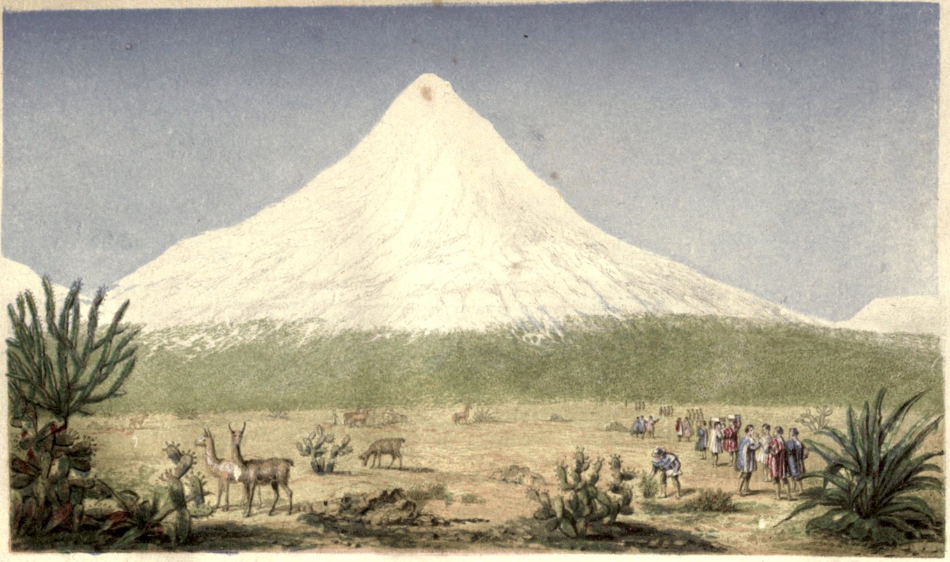
CHIMBORAZO
BY
ALEXANDER VON HUMBOLDT.
TRANSLATED FROM THE GERMAN
BY E. C. OTTÉ, AND HENRY G. BOHN.
WITH A FRONTISPIECE FROM A SKETCH BY THE AUTHOR, A FAC-SIMILE OF HIS HAND-WRITING, AND A COMPREHENSIVE INDEX.
LONDON:
HENRY G. BOHN, YORK STREET, COVENT GARDEN.
1850.
PRINTED BY HARRISON AND SONS,
LONDON GAZETTE OFFICE, ST. MARTIN’s LANE.
PREFACE BY THE PUBLISHER.
v
Great pains have been taken with the present translation,
as well in regard to fidelity and style, as in what may be
termed the accessories. In addition to all that is contained
in the original work, it comprises an interesting view of
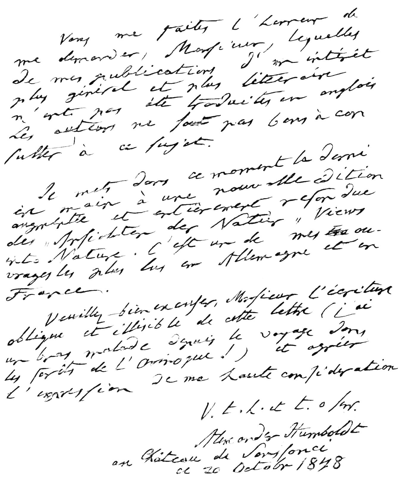
Chimborazo, from a sketch by Humboldt himself; a fac-simile
of the author’s handwriting; head-lines of contents; translations
of the principal Latin, French, and Spanish quotations;[A]
a very complete index; and a conversion of all the foreign
measurements. It was at first intended to give both the
foreign and English measurements, in juxta-position; but this
plan was abandoned on perceiving that the pages would become
overloaded with figures, and present a perplexing and somewhat
appalling aspect, without affording any equivalent advantage
to the English reader. In some few instances, however,
where it seemed desirable, and in all the parallel tables,
duplicate measurements have been inserted. The French
toises are converted into their relative number of English
feet; and German miles, whether simple or square, are reduced
to our own. The longitudes have been calculated from
Greenwich, conformably to English maps, in lieu of those
given by Humboldt, which are calculated from Paris. The
degrees of temperature, instead of Reaumur’s, are Fahrenheit’s,
as now the most generally recognised.
It here becomes necessary to say something of the translators,
viand the cause of so much unexpected delay in producing
this volume; the more so as many of the subscribers to the
Scientific Library have expressed an interest in the subject,
owing, in some measure, to a controversy which arose out
of my previous publication of Cosmos. The translation was
originally entrusted to E. C. Otté, with an agreement as to
time, according to which I had every reason to expect that I
should fulfil my engagement to publish it in October last, or
at latest in November; but, after much of the manuscript was
prepared, the translator’s indisposition and subsequent absence
from London, occasioned a serious suspension. In this dilemma
I found it necessary to call in aid, as well as to
assist personally. The result of this “co-operation of forces”
will no doubt prove satisfactory to the reader, inasmuch as
every sheet has been at least trebly revised, and it is hoped
proportionably improved. In addition to the responsible
translator, my principal collaborateur has been Mr. E. H.
Whitelocke, a gentleman well qualified for the task.
All the measurements are calculated by the scientific friend,
who fulfilled this department so satisfactorily in my edition of
Cosmos.
The translation of the pretty poem, The Parrot of Atures,
(page 189,) now first given in English, is contributed by
Mr. Edgar A. Bowring.
For the additional notes subscribed “Ed.” I am myself, in
most instances, responsible.
Much has been said, pro and con, about the sanction of the
Author to the several translations of his works. My answer
has, I believe, been generally considered satisfactory and
conclusive. I have now only to add, that when I wrote to
Baron Humboldt, more than a year and a-half ago, presenting
viihim with my then unpublished edition of Cosmos, I announced
my intention of proceeding with his other works, and consulted
him on the subject. He replied in the kindest spirit,
without intimating any previous engagement, and honoured
me with several valuable suggestions. A portion of one of
his letters is annexed in fac-simile. In consequence of what I
then presumed to be his recommendation, I determined to
make the Ansichten my next volume, and announced it, long
before any one else, though not at first by its English name.
At that time I had reason to hope that I should receive the
new German edition at least as early as any one, but was
disappointed. This circumstance, added to the delay already
alluded to, has brought me late into the field. In now, however,
presenting my subscribers with what I have taken every
available means to render a perfect book, I hope I shall
afford them ample atonement.
A few words respecting the work itself. The first edition
was published forty-three years ago, the second in 1826, and
the third, of which the present volume is a translation, in
August last. The difference between the three editions in
respect to the text (if I may so distinguish the more entertaining
part of the work from the scientific “Illustrations”)
is not material, excepting that each has one or more new
chapters. Thus to the second edition was added the Essay on
Volcanos and the curious allegory on vital force, entitled The
Rhodian Genius, and to the third The Plateau of Caxamarca.
The additions to the “Illustrations” however in the third
edition are considerable, and comprise a rapid sketch of
whatever has been contributed by modern science in illustration
of the Author’s favourite subjects.
No intellectual reader can peruse this masterly work
viiiwithout intense interest and considerable instruction. After
feasting on the highly wrought and, it may be said, poetical
descriptions, written in the Author’s earlier years, he will
turn with increased zest to the elaborate illustrations, which,
in a separate form, are brought to bear on every subject
of the text. This scientific portion, although not at first the
most attractive, presents many delightful episodes, which will
amply repay the perusal of even those who merely read for
amusement.
HENRY G. BOHN.
York Street, January, 1850.
AUTHOR’S PREFACE, TO THE FIRST EDITION.
ix
With some diffidence, I here present to the public a series
of papers which originated in the presence of the noblest
objects of nature,—on the Ocean,—in the forests of the
Orinoco,—in the Savannahs of Venezuela,—and in the solitudes
of the Peruvian and Mexican Mountains. Several
detached fragments, written on the spot, have since been
wrought into a whole. A survey of nature at large,—proofs
of the co-operation of forces,—and a renewal of the enjoyment
which the immediate aspect of the tropical countries affords
to the susceptible beholder,—are the objects at which I aim.
Each Essay was designed to be complete in itself; and one
and the same tendency pervades the whole. This æsthetic
mode of treating subjects of Natural History is fraught with
great difficulties in the execution, notwithstanding the marvellous
vigour and flexibility of my native language. The
wonderful luxuriance of nature presents an accumulation of
separate images, and accumulation disturbs the harmony and
effect of a picture. When the feelings and the imagination
are excited, the style is apt to stray into poetical prose.
But these ideas require no amplification here, for the following
pages afford but too abundant examples of such deviations
and of such want of unity.
Notwithstanding these defects, which I can more easily
xperceive than amend, let me hope that these “Views” may
afford the reader, at least some portion of that enjoyment
which a sensitive mind receives from the immediate contemplation
of nature. As this enjoyment is heightened by an
insight into the connection of the occult forces, I have subjoined
to each treatise scientific illustrations and additions.
Everywhere the reader’s attention is directed to the perpetual
influence which physical nature exercises on the moral
condition and on the destiny of man. It is to minds
oppressed with care that these pages are especially consecrated.
He who has escaped from the stormy waves of
life will joyfully follow me into the depths of the forests, over
the boundless steppes and prairies, and to the lofty summits
of the Andes. To him are addressed the words of the chorus
who preside over the destinies of mankind:
AUTHOR’S PREFACE, TO THE SECOND AND THIRD EDITIONS.
xi
The twofold object of this work,—an anxious endeavour
to heighten the enjoyment of nature by vivid representations,
and at the same time to increase, according to the present
state of science, the reader’s insight into the harmonious
co-operation of forces,—was pointed out by me in the
preface to the first edition, nearly half a century ago. I there
alluded to the several obstacles which oppose themselves to the
æsthetic treatment of the grand scenes of nature. The combination
of a literary and a purely scientific aim, the desire to
engage the imagination, and at the same time to enrich life
with new ideas by the increase of knowledge, render the due
arrangement of the separate parts, and what is required as
unity of composition, difficult of attainment. Notwithstanding
these disadvantages, however, the public have continued to
receive with indulgent partiality, my imperfect performance.
The second edition of the Views of Nature, was published
by me in Paris in 1826. Two papers were then added, one,
“An inquiry into the structure and mode of action of Volcanos
in different regions of the earth;” the other, “Vital Force, or
The Rhodian Genius.” Schiller, in remembrance of his youthful
xiimedical studies, loved to converse with me, during my
long stay at Jena, on physiological subjects. The inquiries
in which I was then engaged, in preparing my work “On the
condition of the fibres of muscles and nerves, when irritated
by contact with substances chemically opposed,” often imparted
a more serious direction to our conversation. It was
at this period that I wrote the little allegory on Vital Force,
called The Rhodian Genius. The predilection which Schiller
entertained for this piece, and which he admitted into his
periodical, Die Horen, gave me courage to introduce it here.
My brother, in a letter which has recently been published
(William von Humboldt’s Letters to a Female Friend, vol.
ii. p. 39), delicately alludes to the subject, but at the
same time very justly adds; “The development of a physiological
idea is exclusively the object of the essay. Such
semi-poetical clothings of grave truths were more in vogue
at the time this was written than they are at present.”
In my eightieth year I have still the gratification of completing
a third edition of my work, and entirely remoulding
it to meet the demands of the age. Almost all the scientific
illustrations are either enlarged or replaced by new and more
comprehensive ones.
I have indulged a hope of stimulating the study of nature,
by compressing into the smallest possible compass, the
numerous results of careful investigation on a variety of
interesting subjects, with a view of shewing the importance
of accurate numerical data, and the necessity of comparing
them with each other, as well as to check the dogmatic
smattering and fashionable scepticism which have too long
prevailed in the so-called higher circles of society.
My expedition into northern Asia (to the Ural, the Altai,
xiiiand the shores of the Caspian Sea) in the year 1829, with
Ehrenberg and Gustavus Rose, at the command of the Emperor
of Russia, took place between the second and third
editions of my work. This expedition has essentially contributed
to the enlargement of my views in all that concerns
the formation of the earth’s surface, the direction of
mountain-chains, the connexion of the Steppes and Deserts,
and the geographical distribution of plants according to ascertained
influences of temperature. The ignorance which has
so long existed respecting the two great snow-covered mountain-chains,
the Thian-schan and the Kuen-lün, situated
between the Altai and Himalaya, has (owing to the injudicious
neglect of Chinese sources of information) obscured
the geography of Central Asia, and propagated fancies instead
of facts, in works of extensive circulation. Within
the last few months the hypsometric comparisons of the
culminating points of both continents have unexpectedly
received important and corrective illustration, of which I am
the first to avail myself in the following pages. The measurement
(now divested of former errors) of the altitude of the
two mountains, Sorata and Illimani, in the eastern chain of
the Andes of Bolivia, has not yet, with certainty, restored the
Chimborazo to its ancient pre-eminence among the snowy
mountains of the new world. In the Himalaya the recent
barometric measurement of the Kinchinjinga (26,438
Parisian, or 28,178 English feet) places it next in height
to the Dhawalagiri, which has also been trigonometrically
measured with greater accuracy.
To preserve uniformity with the two former editions of the
Views of Nature, the calculations of temperature, unless
where the contrary is stated, are given according to the
xiveighty degrees thermometer of Reamur. The lineal measurement
is the old French, in which the toise is equivalent to six
Parisian feet. The miles are geographical, fifteen to a
degree of the equator. The longitudes are calculated from
the first meridian of the Parisian Observatory.
Coast-chain and mountain-valleys of Caracas. The Lake of Tacarigua.
Contrast between the luxuriant abundance of organic life and the
treeless plains. Impressions of space. The steppe as the bottom of an
ancient inland sea. Broken strata lying somewhat above the surface,
and called Banks. Uniformity of phenomena presented by plains.
Heaths of Europe, Pampas and Llanos of South America, African
deserts, North Asiatic Steppes. Diversified character of the vegetable
covering. Animal life. Pastoral tribes, who have convulsed the world—pp.
1–5.
Description of the South American plains and savannahs. Their
extent and climate, the latter dependant on the outline and hypsometrical
configuration of the New Continent. Comparison with plains
and deserts of Africa—pp. 5–10. Original absence of pastoral life in
America. Nutriment yielded by the Mauritia Palm. Pendant huts
built in trees. Guaranes—pp. 10–13.
The Llanos have become more habitable to man since the discovery
of America. Remarkable increase of wild Oxen, Horses, and Mules.
Description of the seasons of drought and rain. Aspect of the ground
and sky. Life of animals; their sufferings and combats. Adaptability
with which nature has endowed animals and plants. Jaguar,
Crocodiles, Electric Fishes. Unequal contest between gymnoti and
horses—pp. 13–19.
Retrospective view of the districts which border steppes and deserts.
Wilderness of the forest-region between the Orinoco and Amazon rivers.
Native tribes separated by wonderful diversity both of language and
customs; a toiling and divided race. Figures graven on rocks prove
that even these solitudes were once the seat of a civilization now extinct—pp.
19–21.
The island-studded Lake of Tacarigua. Its relation to the mountain-chains.
Geognostic tableau. Progress of civilization. Varieties of
the sugar-cane. Cacao plantations. Great fertility of soil within the
tropics accompanied by great atmospheric insalubrity.—pp. 22–26.
Banks, or broken floetz-strata. General flatness. Land-slips—pp.
26–28.
Resemblance of the distant steppe to the ocean. Naked stony crust,
tabular masses of syenite; have they a detrimental effect on the atmosphere?—pp.
28–29.
xviiiModern views on the mountain systems of the two American
peninsulas. Chains, which have a direction from S.W. to N.E., in
Brazil and in the Atlantic portion of the United States of North
America. Depression of the Province of Chiquitos; ridges as watermarks
between the Guaporé and Aguapehi in 15° and 17° south lat.,
and between the fluvial districts of the Orinoco and Rio Negro in 2°
and 3° north lat.—pp. 29–31.
Continuation of the Andes-chain north of the isthmus of Panamá
through the territory of the Aztecs, (where the Popocatepetl, recently
ascended by Capt. Stone, rises to an altitude of 17,720 feet,) and through
the Crane and Rocky Mountains. Valuable scientific investigations of
Capt. Frémont. The greatest barometric levelling ever accomplished,
representing a profile of the ground over 28° of longitude. Culminating
point of the route from the coast of the Atlantic to the South
Sea. The South Pass southward of the Wind-River Mountains. Swelling
of the ground in the Great Basin. Long disputed existence of
Lake Timpanogos. Coast-chain, Maritime Alps, Sierra Nevada of California.
Volcanic eruptions. Cataracts of the Columbia River—pp.
31–38.
General considerations on the contrast between the configuration of
the territorial spaces, presented by the two diverging coast-chains, east
and west of the central chain, called the Rocky Mountains. Hypsometric
constitution of the Eastern Lowland, which is only from 400 to somewhat
more than 600 feet above the level of the sea, and of the arid
uninhabited plateau of the Great Basin, from 5000 to more than 6000
feet high. Sources of the Mississippi in Lake Istaca according to
Nicollet, whose labours are most meritorious. Native land of the
Bisons; their ancient domestication in Northern Mexico asserted by
Gomara—pp. 38–42.
Retrospective view of the entire Andes-chain from the cliff of Diego
Ramirez to Behring’s Straits. Long prevalent errors concerning the
height of the eastern Andes-chain of Bolivia, especially of the Sorata
and Illimani. Four summits of the western chain, which, according
to Pentland’s latest determinations, surpass the Chimborazo in height,
but not the still-active volcano, Aconcagua, measured by Fitz-Roy—pp.
42–44.
The African mountain range of Harudje-el-Abiad. Oases of vegetation,
abounding in springs—pp. 44–46.
Westerly winds on the borders of the desert Sahara. Accumulation
of sea-weed; present and former position of the great fucus-bank, from
the time of Scylax of Caryanda to that of Columbus and to the present
period—pp. 46–50.
Tibbos and Tuaryks. The camel and its distribution—pp. 50–53.
Mountain-systems of Central Asia between Northern Siberia and
India, between the Altai and the Himalaya, which latter range is aggregated
with the Kuen-lün. Erroneous opinion as to the existence of
one immense plateau, the so-called “Plateau de la Tartarie”—pp. 53–56.
xixChinese literature a rich source of orographic knowledge. Gradations
of the High Lands. Gobi and its direction. Probable mean
height of Thibet—pp. 56–63.
General review of the mountain systems of Asia. Meridian chains:
the Ural, which separates lower Europe from lower Asia or the
Scythian Europe of Pherecydes of Syros and Herodotus. Bolor,
Khingan, and the Chinese chains, which at the great bend of the
Thibetan and Assam-Burmese river, Dzangbo-tschu, stretch from
north to south. The meridian elevations alternate between the parallels
of 66° and 77° east long. from Cape Comorin to the Frozen Ocean, like
displaced veins. Thus the Ghauts, the Soliman chain, the Paralasa,
the Bolor, and the Ural follow from south to north. The Bolor gave
rise, among the ancients, to the idea respecting the Imaus, which Agathodæmon
considered to be prolonged northwards as far as the lowland
or basin of the lower Irtysch. Parallel chains, running east and west,
the Altai, Thian-schan with its active volcanos, which lie 1528 miles
from the frozen ocean at the mouth of the Obi, and 1512 from the Indian
Ocean at the mouth of the Ganges; Kuen-lün, already recognized by
Eratosthenes, Marinus of Tyre, Ptolemy, and Cosmas Indicopleustes,
as the greatest axis of elevation in the Old World, between 35½° and
36° lat. in the direction of the diaphragm of Dicæarchus. Himalaya.
The Kuen-lün may be traced, when considered as an axis of elevation,
from the Chinese wall near Lung-tscheu, through the somewhat more
northerly chains of Nan-schan and Kilian-schan, through the mountain
node of the “Starry Sea,” the Hindoo Cush (the Paropanisus and
Indian Caucasus of the ancients), and, lastly, through the chain of the
Demavend and Persian Elburz, as far as the Taurus in Lycia. Not
far from the intersection of the Kuen-lün by the Bolor, the corresponding
direction of the axes of elevation (inclining from east to west
in the Kuen-lün and Hindoo Cush, and on the other hand south-east
and north-west in the Himalaya) proves, that the Hindoo Cush is a
prolongation of the Kuen-lün, and not of the Himalaya which is associated
to the latter in the manner of a gang or vein. The point where
the Himalaya changes its direction, that is to say, where it leaves
its former east-westerly direction, lies not far from 81° east long. The
Djawahir is not, as has hitherto been supposed, the next in altitude to
the Dhawalagiri, which is the highest summit of the Himalaya; for,
according to Joseph Hooker, this rank is due to a mountain lying in the
meridian of Sikhim between Butan and Nepaul, called the Kinchinjinga
or Kintschin-Dschunga. This mountain (Kinchinjinga) measured by
Col. Waugh, Director of the Trigonometrical Survey of India, has for its
western summit an altitude of 28,178 feet, and for its eastern 27,826 feet,
according to the Journal of the Asiatic Soc. of Bengal, November,
1848. The mountain, now considered higher than the Dhawalagiri, is
represented in the engraving to the title-page of Joseph Hooker’s
splendid work, The Rhododendrons of Sikkim Himalaya, 1849. Determination
of the snow-limits on the northern and southern slopes of the
Himalaya; the former lies in the mean about 3620 up to 4900 feet
higher. New statements of Hodgson. But for the remarkable distribution
xxof heat in the upper strata of the air, the table-land of western
Thibet would be uninhabitable to millions of human beings—pp. 63–80.
The Hiongnu, whom Deguignes and John Müller considered to be
a tribe of Huns, appear rather to be one of the widely spread Turkish
races of the Altai and Tangnu mountains. The Huns, whose name was
known even to Dionysius Periegetes, and who are described by Ptolemy
as Chuns (hence the later territorial name of Chunigard!) are a Finnish
tribe, from the Ural mountains, which separate the two continents—pp.
80–81.
Representations of the sun, animals, and characters, graven on rocks
at Sierra Parime, as well as in North America, have frequently been
regarded as writing—p. 82.
Description of the cold mountain regions between 11,000 and 13,000
Parisian, or 11,720 and 13,850 English feet in height, which have been
designated Paramos. Character of their vegetation—p. 83.
Orographic remarks on the two mountain clusters (Pacaraima and
Sierra de Chiquitos) which separate the three plains of the lower Orinoco,
the Amazon, and La Plata rivers from each other—p. 84.
Concerning the Dogs of the New Continent, the aboriginal as well
as those from Europe, which have become wild. Sufferings of Cats at
heights surpassing 13,854 feet—pp. 85–88.
The Low Land of the Sahara and its relations to the Atlas range,
according to the latest reports of Daumas, Carette, and Renou. The
barometric measurements of Fournel render it very probable, that
part of the north African desert lies below the level of the sea.
Oasis of Biscara. Abundance of rock-salt in regions which extend
from S.W. to N.E. Causes of nocturnal cold in the desert, according to
Melloni—pp. 88–92. Information respecting the River Wadi Dra (one-sixth
longer than the Rhine), which is dry during a great part of the
year. Some account of the territory of the Sheikh Beirouk, who is
independent of the Emperor of Morocco, according to manuscript
communications of Capt. Count Bouet Villaumez, of the French Marine.
The mountains north of Cape Nun (an Edrisian name, in which by a
play of words a negation has been assumed since the 15th century)
attain an altitude of 9186 feet—pp. 92–94.
Gramineous vegetation of the American Llanos between the tropics,
compared with the herbaceous vegetation of the Steppes in Northern
Asia. In these, especially in the most fertile of them, a pleasing effect
is afforded in spring by the small snow-white and red flowering Rosaceæ,
Amygdaleæ, the species of Astragalus, Crown-imperial, Cypripedias, and
Tulips. Contrast with the desert of the salt-steppes full of Chenopodiæ,
and of species of Salsola and Atriplex. Numerical considerations with
respect to the predominant families. The plains which skirt the Frozen
Ocean (north of what Admiral Wrangel has described as the boundary
of Coniferæ and Amentaceæ), are the domain of cryptogamic plants.
Physiognomy of the Tundra on an ever-frozen soil, covered with a
thick coating of Sphagnum and other foliaceous mosses, or with the
snow-white Cenomyce and Stereocaulon paschale—pp. 94–96.
xxiChief causes of the very unequal distribution of heat in the European
and American continents. Direction and inflection of the isothermal
lines (equal mean-heat of the year, in winter and summer)—pp. 96–105.
Is there reason to believe that America emerged later from the
chaotic covering of waters?—pp. 105–107. Thermal comparison between
the northern and southern hemispheres in high latitudes—pp. 107–109.
Apparent connexion between the sand-seas of Africa, Persia, Kerman,
Beloochistan, and Central Asia. On the western portion of the Atlas,
and the connection of purely mythical ideas, with geographical legends.
Indefinite allusions to fiery eruptions. Triton Lake. Crater forms,
south of Hanno’s “Bay of the Gorilla Apes.” Singular description
of the Hollow Atlas, from the Dialexes of Maximus Tyrius—pp. 110–11.
Explanations of the Mountains of the Moon (Djebel-al-Komr) in the
interior of Africa, according to Reinaud, Beke, and Ayrton. Werne’s
instructive report of the second expedition, which was undertaken by
command of Mehemet Ali. The Abyssinian high mountain chain,
which, according to Rüppell, attains nearly the height of Mont Blanc.
The earliest account of the snow between the tropics is contained in the
inscription of Adulis, which is of a somewhat later date than Juba.
Lofty mountains, which between 6° and 4°, and even more southerly,
approach the Bahr-el-Abiad. A considerable rise of ground separates
the White Nile from the basin of the Goschop. Line of separation
between the waters which flow towards the Mediterranean and Indian
seas, according to Carl Zimmermann’s map. Lupata chain, according
to the instructive researches of Wilhelm Peters—pp. 114–120.
Oceanic currents. In the northern part of the Atlantic the waters
are agitated in a true rotatory movement. That the first impulse to the
Gulf-stream is to be looked for at the southern apex of Africa, was a fact
already known to Sir Humphrey Gilbert in 1560. Influence of the Gulf-stream
on the climate of Scandinavia. How it contributed to the
discovery of America. Instances of Esquimaux, who, favoured by
north-west winds, have been carried, through the returning easterly
inclined portion of the warm gulf-stream, to the European coasts. Information
of Cornelius Nepos and Pomponius Mela respecting Indians,
whom a King of the Boii sent as a present to the Gallic Proconsul
Quintus Metellus Celer; and again of others in the times of the Othos,
Frederick Barbarossa, Columbus, and Cardinal Bembo. Again, in
the years 1682 and 1684, natives of Greenland appeared at the Orkney
Islands—pp. 120–125.
Effects of lichens and other cryptogamia in the frigid and temperate
zones, in promoting the growth of the larger phanerogamia. In
the tropics the preparatory ground-lichens often find substitutes in the
oleaginous plants. Lactiferous animals of the New Continent; the
Llama, Alpaca, and Guanaco—pp. 125–128. Culture of farinaceous
grasses—pp. 128–131. On the earliest population of America—pp.
131–134.
The coast-tribe the Guaranes (Warraus), and the littoral palm Mauritia,
according to Bembo, Raleigh, Hillhouse, Robert and Richard
Schomburgk—pp. 134–136.
xxiiPhenomena produced in the Steppe by a long drought. Sand-spouts,
hot winds, deceptive images by aërial refraction (mirage). The
awaking of crocodiles and tortoises after a long summer sleep—pp.
136–142.
Otomaks. General considerations respecting the earth-eating of certain
tribes. Unctuous and Infusorial earths—pp. 142–146.
Carved Figures on rocks, which form a belt running east and west
from the Rupunuri, Essequibo, and mountains of Pacaraima, to the
solitudes of the Cassiquiare. Earliest observation (April, 1749) of such
traces of an ancient civilization, in the unpublished travels of the
Surgeon Nicolas Hortsmann, of Hildesheim, found among d’Anville’s
papers—pp. 147–151.
The vegetable poison Curare, or Urari—pp. 151–152.
ON THE CATARACTS OF THE ORINOCO, NEAR ATURES AND MAYPURES
The Orinoco, general view of its course. Ideas excited in the mind
of Columbus on beholding its mouth. Its unknown sources lie to the
east of the lofty Duida and of the thickets of Bertholletia. Cause of the
principal bends of the river—pp. 153–162. The Falls. Raudal of
Maypures, bounded by four streams. Former state of the region. Insular
form of the rocks Keri and Oco. Grand spectacle displayed on
descending the hill Manimi. A foaming surface, several miles in extent,
suddenly presents itself to view. Iron-black masses of tower-like
rocks rise precipitately from the bed of the river; the summits
of the lofty palms pierce through the clouds of vapoury spray—pp.
162–168.
Raudal of Atures, another island-world. Rock-dykes, connecting one
island with the other. They are the resort of the pugnacious, golden-coloured
rock manakin. Some parts of the river-bed in the cataracts
are dry, in consequence of the waters having formed for themselves
a channel through subterranean cavities. Visit to these parts on the
approach of night, during a heavy thunder-storm. Unsuspected propinquity
of crocodiles—pp. 168–171. The celebrated cave of Ataruipe,
the grave of an extinct tribe—pp. 171–173.
Abode of the river-cow (Trichecus Manati) in the sea, at the spot
where, in the Gulf of Xagua on the southern coast of the Island of Cuba,
springs of fresh water gush forth—pp. 174, 175.
Geographical illustration of the sources of the Orinoco—pp. 175–179.
Juvia (Bertholletia), a Lecythidea, remarkable as an instance of lofty
organic development. Haulm of an Arundinaria upwards of sixteen feet
from joint to joint—pp. 179–180.
The Parrot of Atures, a poem by Ernst Curtius. The bird lived
in Maypures, and the natives declared that he was not understood, because
he spoke the language of the extinct Aturian tribe—pp. 188–190.
Difference in the richness of languages as regards precise and definite
words for characterizing natural phenomena, such as the state of vegetation
and the forms of plants, the contour and grouping of clouds, the
appearance of the earth’s surface, and the shape of mountains. Loss
which languages sustain in such expressive words. The misinterpretation
of a Spanish word has enlarged mountain-chains on maps, and
created new ranges. Primeval Forest. Frequent misuse of this
term. Want of uniformity in the association of the arboral species
is characteristic of the forests within the tropics. Causes of their imperviousness.
The Climbing plants (Lianes) often form but a very
inconsiderable portion of the underwood—pp. 191–196.
Aspect of the Rio Apure in its lower course. Margin of the forest
fenced like a garden by a low hedge of Sauso (Hermesia). The wild
animals of the forest issue with their young through solitary gaps, to
approach the river-side. Herds of large Capybaræ, or Cavies. Fresh-water
dolphins—pp. 196–199. The cries of wild animals resound
through the forest. Cause of the nocturnal noises—pp. 199–200.
Contrast to the repose which reigns at noontide on very hot days within
the tropics. Description of the rocky narrows of the Orinoco at the
Baraguan. Buzzing and humming of insects; in every shrub, in the
cracked bark of trees, in the perforated earth, furrowed by hymenopterous
insects, life is audible and manifest—pp. 200–201.
Characteristic denominations of the surface of the earth (Steppes,
Savannahs, Prairies, Deserts) in the Arabic and Persian. Richness of
the dialects of Old Castile for designating the forms of mountains.
Fresh-water rays and fresh-water dolphins. In the giant streams of
both continents some organic sea-forms are repeated. American nocturnal
apes with cat’s eyes; the tricoloured striped Douroucoali of the
Cassiquiare—pp. 202–203.
Pentland’s measurements in the eastern mountain-chain of Bolivia.
Volcano of Aconcagua, according to Fitz-Roy and Darwin. Western
mountain-chain of Bolivia—pp. 204–205. Mountain systems of North
America. Rocky Mountains and snowy chain of California. Laguna
de Timpanogos—pp. 205–207. Hypsometric profile of the Highland of
Mexico as far as Santa Fé—pp. 207–209.
Universal profusion of life on the slopes of the highest mountain
summits, in the ocean and in the atmosphere. Subterranean Flora.
Siliceous-shelled polygastrica in masses of ice at the pole. Podurellæ
in the ice tubules of the glaciers of the Alps; the glacier-flea (Desoria
glacialis). Minute organisms of the dust fogs—pp. 210–213.
xxivHistory of the vegetable covering. Gradual extension of vegetation
over the naked crust of rock. Lichens, mosses, oleaginous plants.
Cause of the present absence of vegetation in certain districts.—pp. 213–220.
Each zone has its peculiar character. All animal and vegetable conformation
is bound to fixed and ever-recurring types. Physiognomy
of Nature. Analysis of the combined effect produced by a region.
The individual elements of this impression. Outline of the mountain
ranges; azure of the sky; shape of the clouds. That which chiefly
determines the character is the vegetable covering. Animal organizations
are deficient in mass; the mobility of individual species, and
often their diminutiveness, conceals them from view—pp. 220–223.
Enumeration of the forms of Plants which principally determine the
physiognomy of Nature, and which increase or diminish from the
equator towards the Pole, in obedience to established laws—
Enjoyment resulting from the natural grouping and contrasts of
these plant-forms. Importance of the physiognomical study of plants
to the landscape-painter—pp. 229–231.
Organisms, both animal and vegetable, in the highest Alpine regions,
near the line of eternal snow, in the Andes chain, and the Alps; insects
are carried up involuntarily by the ascending current of air. The small
field-mouse (Hypudæus nivalis) of the Swiss Alps. On the real height
to which the Chinchilla laniger mounts in Chili—pp. 232–233.
Lecideæ, Parmeliæ on rocks not entirely covered with snow; but
certain phanerogamic plants also stray in the Cordilleras beyond the
xxvboundary of perpetual snow, thus Saxifraga Boussingaulti to 15,773 feet
above the level of the sea. Groups of phanerogamic Alpine plants in the
Andes chain at from 13,700 to nearly 15,000 feet high. Species of Culcitium,
Espeletia, Ranunculus, and small moss-like umbellifera, Myrrhis
andicola, and Fragosa arctioides—pp. 233–234. Measurement of Chimborazo,
and etymology of the name—pp. 234–236. On the greatest
absolute height to which men in both continents, in the Cordilleras and
the Himalaya,—on the Chimborazo and Tarhigang—have as yet ascended—p.
236.
Economy, habitat, and singular mode of capturing the Condor
(Cuntur, in the Inca language) by means of palisades—pp. 237–239.
Use of the Gallinazos (Cathartes urubu and C. aura) in the economy of
nature, for purifying of the air in the neighbourhood of human dwellings;
their domestication—pp. 239–240.
On the so-called revivification of the rotifera, according to Ehrenberg
and Doyère; according to Payen, germs of Cryptogamia retain their
power of reproduction in the highest temperature—pp. 240–241.
Diminution, if not total suspension, of organic functions in the
winter-sleep of the higher classes of animals—p. 242. Summer-sleep
of animals in the tropics. Drought acts like the cold of winter.
Tenrecs, Crocodiles, Tortoises, and East-African Lepidosirens—pp.
242–244.
Pollen, Fructification of Plants. The experience of many years
concerning the Cœlebogyne; it brings forth mature seeds in England
without a trace of male organs—pp. 244–245.
The phosphorescence of the Ocean through luminous animals as
well as organic fibres and membranes of the decomposing animalculæ.
Acalephæ and siliceous-shelled luminous infusoria. Influence of nervous
irritability on the coruscation—pp. 245–250.
Pentastoma, inhabiting the lungs of the rattle-snake of Cumana—p.
251.
Rock-constructing Coral animals. The structure surviving the architects.
More correct views of the present period. Coast-reefs, Reefs surrounding
islands and Lagoon-islands. Atolls, Coral walls inclosing a
lagoon. The royal gardens of Christopher Columbus, The Coral Islands
south of Cuba. The living gelatinous coating of the calcareous fabric
of the coral-stems allures fishes in quest of food, and also turtles.
Singular mode of fishing with the Remora, Echeneis Naucrates (the
little angling fish)—pp. 251–258.
Probable depth of the coralline structures—pp. 258–260. Besides a
great quantity of carbonate of lime and magnesia, the madrepores and
Astreæ contain also some fluoric and phosphoric acid—pp. 260–261.
Oscillating state of the sea-bottom according to Darwin—pp. 261–262.
Irruptions of the sea. Mediterranean Sea. Sluice-theory of Strato.
Samothracian legends. The Myth of Lyctonia and the submerged
Atlantis—pp. 262–266. Concerning the precipitation of clouds—p.
xxvi266. The indurating crust of the earth while giving out caloric.
Heated currents of air, which in the primordial period, during the frequent
corrugations of the mountainous strata, and the upheaval of
lands, have poured into the atmosphere through temporary fissures
and chasms—pp. 266–268.
Colossal size and great age of certain genera of trees, e. g., the
dragon-tree of Orotava of 13, the Adansonia digitata (Baobab) of 33
feet in diameter. Carved characters of the 15th century. Adanson
assigns to certain Baobab-stems of Senegambia an age of from 5000 to
6000 years—pp. 268–273.
According to an estimate based on the number of the annual rings,
there are yews (Taxus baccata) of from 2600 to 3000 years old. Whether
in the temperate northern zone that part of a tree which faces the north
has narrower rings, as Michael Montaigne asserted in 1581? Gigantic
trees, of which some individuals attain a diameter of above 20 feet and
an age of several centuries, belong to the most opposite natural families—pp.
273–274.
Diameter of the Mexican Schubertia disticha of Santa Maria del Tule
43, of the oak near Saintes (Dep. de la Charente inf.) 30 feet. The
age of this oak considered by its annual rings to be from 1800 to 2000
years. The main stem of the rose-tree (27 feet high) at the crypt of
the church of Hildesheim is 800 years old. A species of fucus, Macrocystis
pyrifera, attains a length of more than 350 feet, and therefore
exceeds all the conifera in length, not excepting the Sequoia gigantea
itself—pp. 274–276.
Investigations into the supposed number of the phanerogamic species
of plants, which have hitherto been described or are preserved in herbariums.
Numerical ratios of plant-forms. Discovered laws of the geographical
distribution of the families. Ratios of the great divisions: of the
Cryptogamia to the Cotyledons, and of the Monocotyledons to the Dicotyledons,
in the torrid, temperate, and frigid zones. Outlines of arithmetical
botany. Number of the individuals, predominance of social
plants. The forms of organic beings stand in mutual dependence on
each other. If once the number of species in one of the great families
of the Glumaceæ, Leguminosæ, or Compositæ, on any one point of the
earth, be known, an approximative conclusion may be arrived at not
only as to the number of all the phanerogamia, but also of the species
of all remaining plant-families growing there. Connection of the
numerical ratios here treated on in the geographical distribution of the
families, with the direction of the isothermal lines. Primitive mystery
in the distribution of types. Absence of Roses in the southern, and of
Calceolarias in the northern zone. Why has our heath (Calluna vulgaris),
and why have our Oaks not progressed eastwards across the Ural
into Asia? The vegetation-cycle of each species requires a certain
minimum heat for its due organic development—pp. 273–287.
Analogy with the numeric laws in the distribution of animal forms.
If more than 35,000 species of phanerogamia are now cultivated in
xxviiEurope, and if from 160,000 to 212,000 phanerogamia are now contained,
described and undescribed, in our herbariums; it is probable
that the number of collected insects scarcely equals that number of
phanerogamia; whereas in individual European districts the insects
collected preponderate in a threefold ratio over the phanerogamia—pp.
287–291.
Considerations on the proportion borne by the number of the phanerogamia
actually ascertained, to the entire number existing on the
globe—pp. 291–295.
Influence of the pressure of atmospheric strata on the form and life
of plants, with reference to Alpine vegetation—pp. 295–296.
Specialities on the plant-forms already enumerated. Physiognomy
of plants discussed from three different points of view: the absolute
difference of the forms, their local preponderance in the sum total
of the phanerogamic Floras, and their geographical as well as climatic
dispersion—pp. 296–346. Greatest height of arboral plants; examples
of 223 to 246 feet in Pinus Lambertiana and P. Douglasii, of 266 in P.
Strobus, of 300 feet in Sequoia gigantea and Pinus trigona. All these
examples are from the north-western part of the New Continent. The
Araucaria excelsa of Norfolk Island, accurately measured, rises only
from 182 to 223 feet; the Alpine palms of the Cordilleras (Ceroxylon
andicola), only 190 feet—pp. 322–324. A contrast to these gigantic
vegetable forms, presented not merely by the stem of the arctic willow
(Salix arctica, two inches in height,) stunted by cold and exposure on
the mountains, but also in the tropical plains by the Tristicha hypnoides,
a phanerogamic plant which is hardly three French lines (quarter of an
inch) in height, when fully developed—pp. 324–325.
Bursting forth of blossoms from the rough bark of the Crescentia
Cujete, of the Gustavia augusta, from the roots of the Cacao tree. The
largest blossoms borne by the Rafflesia Arnoldi, Aristolochia cordata,
Magnolia, Helianthus annuus—p. 348.
The different forms of plants determine the scenic character of vegetation
in the different zones. Physiognomic classification, or distribution
of the groups according to external facies, is from its basis of
arrangement entirely different from the classification according to the
system of natural families. The physiognomy of plants is based
principally on the so-called organs of vegetation, on which the preservation
of the individual depends; systematic botany bases the classification
of the natural families on the consideration of the organs of
reproduction, on which the preservation of the species depends—pp.
348–352.
ON THE STRUCTURE AND MODE OF ACTION OF VOLCANOS IN DIFFERENT PARTS OF THE EARTH—
Influence of travels in distant lands on the generalization of our ideas
and on the progress of physical orology. Influence of the conformation
of the Mediterranean on the earliest ideas respecting volcanic phenomena.—Comparative
xxviiiGeology of Volcanos. Periodical return of
certain revolutions in nature, the cause of which lies deep in the interior
of the globe. Proportion of the height of volcanos to that of their
cone of ashes in the Pichincha, Peak of Teneriffe, and Vesuvius.
Changes in the height of volcanic mountain summits. Measurements
of the margins of the crater of Vesuvius from 1773 to 1822; the
author’s measurements embrace the period from 1805 to 1822—pp.
353–365. Circumstantial description of the eruption in the night between
the 24th and 25th of October, 1822. Falling in of a cone of ashes
more than 400 feet high, which stood in the interior of the crater. The
eruption of ashes from the 24th to the 28th of October, was the most
memorable among those, of which authentic accounts are possessed,
since the time of the elder Pliny—pp. 365–371.
Difference between volcanos that are of very diverse forms, with
permanent craters, and the phenomena more rarely observed in historic
times, in which trachytic mountains suddenly open, eject lava and ashes,
and reclose, perhaps for ever. The latter phenomena are peculiarly
instructive for geognosy, because they remind us of the earliest revolutions
that occurred in the oscillating, upheaved, fissured surface of the
earth. In ancient times they led to the notion of the Pyriphlegethon.
Volcanos are intermittent earth-springs, the result of a permanent or
transitory connection between the interior and exterior of our planet,
the result of a reaction of the still fluid interior against the crust of the
earth; hence the question is useless, as to what chemical substance burns
in the volcanos, and furnishes the material for combustion—pp. 371–373.
The primary cause of subterranean heat is, as in all planets, the formative
process itself, the separation of the conglomerating mass from a
cosmic vaporous fluid. Power and influence of the calorific radiation
from numerous deep fissures, unfilled veins in the primordial world.
Great independence, at that period, of the climate (atmospheric temperature)
in respect to geographical latitude, the position of the planet
towards the central body, the sun. Organisms of the present tropical
world buried in the icy north—pp. 373–375.
Barometric measurements on Vesuvius, comparison of the two crater-margins
and the Rocca del Palo—pp. 376–379. Increase of temperature
with depth, being 1° of Fahrenheit for every 54 feet. Temperature
of the Artesian well in Oeynhausen’s Bath (New Salt-works near
Minden), at the greatest depth yet reached below the level of the sea.
As early as the third century the thermal springs near Carthage led
Patricius, Bishop of Pertusa, to form correct suppositions respecting
the cause of calorific increase in the interior of the earth—p. 379.
The Rhodian Genius is the development of a physiological idea in a
mythical garb. Difference of views concerning the necessity and nonnecessity
xxixfor the assumption of peculiar vital forces—pp. 386–387. The
difficulty of satisfactorily reducing the vital phenomena of the organism
to physical and chemical laws is, principally, based on the complexity
of the phenomena, on the multiplicity of forces acting simultaneously,
as well as on the varying conditions of their activity. Definition of
the expressions, animate and inanimate matter. Criteria of the
miscent state ensuing upon separation, are the simple enunciation of
a fact—pp. 387–389.
THE PLATEAU OF CAXAMARCA, THE ANCIENT CAPITAL OF THE INCA ATAHUALLPA, AND FIRST VIEW OF THE PACIFIC FROM THE RIDGE OF THE ANDES.
Cinchona, or Quina-woods in the valleys of Loxa. First use of the
fever-bark in Europe; the Vice-Queen Countess of Chinchon—pp. 390–392.
Alpine vegetation of the Paramos. Ruins of ancient Peruvian causeways;
they rise in the Paramo del Assuay almost to the height of
Mont Blanc—p. 394. Singular mode of communication, by a
swimming courier—p. 399.
Descent to the Amazon River. Vegetation around Chamaya and
Tomependa; red groves of Bougainvillæa. Rocky ridges which cross
the Amazon River. Cataracts. Narrows of the Pongo de Manseriche, in
which the mighty stream, measured by La Condamine, is hardly 160
feet broad. Fall of the rocky dam of Rentema, which for several hours,
laid bare the bed of the river, to the terror of the inhabitants on its
banks—p. 401.
Passage across the Andes chain, where it is intersected by the magnetic
equator. Ammonites of nearly 15 inches, Echini and Isocardia of
the chalk-formation, collected between Guambos and Montan, nearly
12,800 feet above the sea. Rich silver-mines of Chota. The picturesque,
tower-like Cerro de Gualgayoc. An enormous mass of filamentous
virgin silver in the Pampa de Navar. A treasure of virgin gold,
twined round with filamentous silver, in the shell-field (Choropampa),
so named on account of the numerous fossils. Outbursts of silver and
gold ores in the chalk-formations. The little mountain-town of Micuipampa
lies 11,873 feet above the sea—pp. 402–405.
Across the mountain wilderness of the Paramo de Yanaguanga the
traveller descends into the beautiful embosomed valley or rather
Plateau of Caxamarca (almost at an equal altitude with the city of Quito).
Warm baths of the Inca. Ruins of Atahuallpa’s palace, inhabited by
his indigent descendants, the family of Astorpilca. Belief entertained
there, in the existence of subterranean golden gardens of the Inca; said
to be situated in the lovely valley of Yucay, under the Temple of
the Sun at Cuzco, and at many other points. Conversation with the
son of the Curaca Astorpilca. The room is still shown in which the
unfortunate Atahuallpa was kept prisoner for nine months, from the
November of 1532; also the wall on which he made a mark to indicate
xxxthe height to which he would cause the room to be filled with gold, if his
persecutors would set him free. Account of the prince’s execution on
the 29th of August, 1533, and remarks on the so-called “indelible blood
stain” on a stone slab before the altar in the chapel of the city prison—pp.
406–414. How the hope in a restoration of the Inca empire,
also indulged in by Raleigh, has been maintained among the natives.
Causes of this fanciful belief—p. 414.
Journey from Caxamarca to the sea-coast. Passage across the Cordilleras
through the Altos de Guangamarca. The often disappointed
hope of enjoying the sight of the Pacific from the crest of the Andes,
at last gratified, at a height of 9380 feet—pp. 415–420.
On the origin of the name borne by the Andes Chain p. 421.
Epoch of the introduction of Cinchona (Peruvian) bark into Europe—p. 422.
Ruins of the Inca’s causeways and fortified dwellings; Aposentos de
Mulalo, Fortaleza del Cañar, Inti-Guaycu—p. 423.
On the ancient civilization of the Chibchas or Muyscas of New
Granada—p. 425. Age of the culture of the potato and banana—p. 427.
Etymology of the word Cundinamarca, corrupted from Cundirumarca,
and which, in the first years of republican independence, designated
the whole country of New Granada—p. 427.
Chronometric connection of the city of Quito with Tomependa, on
the upper course of the Amazon River, and the Callao de Lima, the
position of which was accurately determined by the transit of Mercury
on the 9th of November, 1802—p. 428.
On the tedious court ceremonies. of the Incas. Atahuallpa’s imprisonment
and unavailing ransom—p. 429.
Free-thinking of the Inca Huayna Capac. Philosophical doubts on
the official worship of the sun, and obstacles to the diffusion of knowledge
among the lower and poorer classes of people, according to the
testimony of Padre Blas Valera—p. 431.
Raleigh’s project for the restoration of the Inca dynasty under
English protection, which should be granted for an annual tribute of
several hundred thousand pounds—p. 432.
Columbus’ earliest evidence of the existence of the Pacific. It was
first seen on the 25th of September, 1513, by Vasco Nunez de Balboa,
and first navigated by Alonso Martin de Don Benito—p. 432.
On the possibility of constructing an Oceanic canal through the
isthmus of Panama (with fewer locks than the Caledonian Canal).
Points, the exploration of which has been hitherto totally neglected—p.
435.
At the foot of the lofty granitic range which, in the early
age of our planet, resisted the irruption of the waters on the
formation of the Caribbean Gulf, extends a vast and boundless
plain. When the traveller turns from the Alpine valleys of
Caracas, and the island-studded lake of Tacarigua[1], whose
waters reflect the forms of the neighbouring bananas,—when
he leaves the fields verdant with the light and tender green
of the Tahitian sugar-cane, or the sombre shade of the cacoa
groves,—his eye rests in the south on Steppes, whose seeming
elevations disappear in the distant horizon.
From the rich luxuriance of organic life the astonished traveller
suddenly finds himself on the dreary margin of a treeless
waste. Nor hill, nor cliff rears its head, like an island in the
ocean, above the boundless plain: only here and there broken
strata of floetz, extending over a surface of two hundred square
miles, (more than three thousand English square miles[C],) appear
sensibly higher than the surrounding district. The natives
term them banks[2], as if the spirit of language would convey
some record of that ancient condition of the world, when
these elevations formed the shoals, and the Steppes themselves
the bottom, of some vast inland sea.
Even now, illusion often recalls, in the obscurity of night,
these images of a former age. For when the guiding constellations
illumine the margin of the plain with their rapidly
rising and setting beams, or when their flickering forms are
2reflected in the lower stratum of undulating vapour, a shoreless
ocean seems spread before us[3]. Like a limitless
expanse of waters, the Steppe fills the mind with a sense of
the infinite, and the soul, freed from the sensuous impressions
of space, expands with spiritual emotions of a higher
order. But the aspect of the ocean, its bright surface diversified
with rippling or gently swelling waves, is productive
of pleasurable sensations,—while the Steppe lies stretched
before us, cold and monotonous, like the naked stony crust
of some desolate planet[4].
In all latitudes nature presents the phenomenon of these
vast plains, and each has some peculiar character or physiognomy,
determined by diversity of soil and climate, and
by elevation above the level of the sea.
In northern Europe the Heaths which, covered by one sole
form of vegetation, to the exclusion of all others, extend from
the extremity of Jutland to the mouth of the Scheldt, may
be regarded as true Steppes. They are, however, both hilly
and of very inconsiderable extent when compared with the
Llanos and Pampas of South America, or even with the
Prairies on the Missouri[5] and Copper River, the resort
of the shaggy Bison and the small Musk Ox.
The plains in the interior of Africa present a grander and
more imposing spectacle. Like the wide expanse of the
Pacific, they have remained unexplored until recent times.
They are portions of a sea of sand, which towards the east
separates fruitful regions from each other, or incloses them
like islands, as the desert near the basaltic mountains of
Harudsch[6], where, in the Oasis of Siwah, rich in date-trees,
the ruins of the temple of Ammon indicate the venerable
seat of early civilization. Neither dew nor rain refreshes these
barren wastes, or unfolds the germs of vegetation within the
glowing depths of the earth; for everywhere rising columns
of hot air dissolve the vapours and disperse the passing clouds.
Wherever the desert approaches the Atlantic Ocean, as
3between Wadi Nun and the White Cape, the moist sea-air
rushes in to fill the vacuum caused by these vertically ascending
currents of air. The navigator, in steering towards the
mouth of the river Gambia, through a sea thickly carpeted
with weeds, infers by the sudden cessation of the tropical east
wind[7], that he is near the far-spreading and radiating sandy
desert.
Flocks of swift-looted ostriches and herds of gazelles
wander over this boundless space. With the exception of
the newly discovered group of Oases, rich in springs, whose
verdant banks are frequented by nomadic tribes of Tibbos
and Tuarycks[8], the whole of the African deserts may be
regarded as uninhabitable by man. It is only periodically
that the neighbouring civilized nations venture to traverse
them. On tracks whose undeviating course was determined
by commercial intercourse thousands of years ago, the long
line of caravans passes from Tafilet to Timbuctoo, or from
Mourzouk to Bornou; daring enterprises, the practicability of
which depends on the existence of the camel, the ship of the
desert[9], as it is termed in the ancient legends of the East.
These African plains cover an area which exceeds almost
three times that of the neighbouring Mediterranean. They
are situated partly within and partly near the tropics, a
position on which depends their individual natural character.
On the other hand, in the eastern portion of the old continent
the same geognostic phenomenon is peculiar to the temperate
zone.
On the mountainous range of Central Asia, between the
Gold or Altai Mountain and the Kouen-lien[10], from the
Chinese wall to the further side of the Celestial Mountains,
and towards the Sea of Aral, over a space of several thousand
miles, extend, if not the highest, certainly the largest Steppes
in the world. I myself enjoyed an opportunity, full thirty
years after my South American travels, of visiting that portion
of the Steppes which is occupied by Kalmuck-Kirghis
4tribes, and is situated between the Don, the Volga, the
Caspian Sea, and the Chinese Lake of Dsaisang, and which
consequently extends over an area of nearly 2,800 geographical
miles. The vegetation of the Asiatic Steppes, which are
sometimes hilly and interspersed with pine forests, is in its
groupings far more varied than that of the Llanos and the
Pampas of Caracas and Buenos Ayres. The more beautiful
portions of the plains, inhabited by Asiatic pastoral tribes, are
adorned with lowly shrubs of luxuriant white-blossomed Rosaceæ,
Crown Imperials (Fritillariæ), Cypripedeæ, and Tulips.
As the torrid zone is in general distinguished by a tendency
in the vegetable forms to become arborescent, so we also find,
that some of the Asiatic Steppes of the temperate zone are
characterized by the remarkable height to which flowering
plants attain; as, for instance, Saussureæ, and other Synanthereæ;
all siliquose plants, and particularly numerous species
of Astragalus. On crossing the trackless portions of the herb-covered
Steppes in the low carriages of the Tartars, it is
necessary to stand upright in order to ascertain the direction
to be pursued through the copse-like and closely crowded
plants that bend under the wheels. Some of these Steppes
are covered with grass; others with succulent, evergreen,
articulated alkaline plants; while many are radiant with the
effulgence of lichen-like tufts of salt, scattered irregularly
over the clayey soil like newly fallen snow.
These Mongolian and Tartar Steppes, which are intersected
by numerous mountain chains, separate the ancient and long-civilized
races of Thibet and Hindostan from the rude nations
of Northern Asia. They have also exerted a manifold influence
on the changing destinies of mankind. They have inclined
the current of population southward, impeded the intercourse
of nations more than the Himalayas, or the Snowy Mountains
of Sirinagur and Gorka, and placed permanent limits to the
progress of civilization and refinement in a northerly direction.
History cannot, however, regard the plains of Central Asia
5under the character of obstructive barriers alone. They
have frequently proved the means of spreading misery and
devastation over the face of the earth. Some of the pastoral
tribes inhabiting this Steppe,—the Mongols, Getæ, Alani, and
Usüni,—have convulsed the world. If in the course of earlier
ages, the dawn of civilization spread like the vivifying light
of the sun from east to west; so in subsequent ages and
from the same quarter, have barbarism and rudeness threatened
to overcloud Europe.
A tawny tribe of herdsmen[11] of Tukiuish i. e., Turkish
origin, the Hiongnu, dwelt in tents of skins on the elevated
Steppe of Gobi. A portion of this race had been driven
southward towards the interior of Asia, after continuing for a
long time formidable to the Chinese power. This shock,
(dislodgement of the tribes) was communicated uninterruptedly
as far as the ancient land of the Fins, near the sources of
the Ural.[D] From thence poured forth bands of Huns, Avars,
Chasars, and a numerous admixture of Asiatic races. Warlike
bodies of Huns first appeared on the Volga, next in
Pannonia, then on the Marne and the banks of the Po,
laying waste those richly cultivated tracts, where, since the
age of Antenor, man’s creative art had piled monument on
monument. Thus swept a pestilential breath from the Mongolian
deserts over the fair Cisalpine soil, stifling the tender,
long-cherished blossoms of art!
From the Salt-steppes of Asia,—from the European Heaths,—smiling
in summer with their scarlet, honey-yielding
flowers,—and from the barren deserts of Africa, we return to
the plains of South America, the picture of which I have
already begun to sketch in rude outline.
6But the interest yielded by the contemplation of such a
picture must arise from a pure love of nature. No Oasis here
reminds the traveller of former inhabitants, no hewn stone[12],
no fruit-tree once cultivated and now growing wild,
bears witness to the industry of past races. As if a stranger
to the destinies of mankind, and bound to the present alone,
this region of the earth presents a wild domain to the free
manifestation of animal and vegetable life.
The Steppe extends from the littoral chain of Caracas to
the forests of Guiana, and from the snow-covered mountains of
Merida, on whose declivity lies the Natron lake of Urao,—the
object of the religious superstition of the natives,—to the vast
delta formed by the mouth of the Orinoco. To the south-west
it stretches like an arm of the sea[13], beyond the
banks of the Meta and of the Vichada, to the unexplored
sources of the Guaviare, and to the solitary mountain group
to which the vivid imagination of the Spanish warriors gave
the name of Paramo de la Suma Paz, as though it were the
beautiful seat of eternal repose.
This Steppe incloses an area of 256,000 square miles.
Owing to inaccurate geographical data, it has often been
described as extending in equal breadth to the Straits of
Magellan, unmindful that it is intersected by the wooded
plain of the Amazon, which is bounded to the north by the
grassy Steppes of the Apure, and to the south by those of
the Rio de la Plata. The Andes of Cochabamba and the
Brazilian mountains approximate each other by means of
separate transverse spurs, projecting between the province of
Chiquitos and the isthmus of Villabella[14]. A narrow plain
unites the Hylæa of the Amazon with the Pampas of Buenos
Ayres. The area of the latter is three times larger than that
of the Llanos of Venezuela; indeed so vast in extent, that it
is bounded on the north by palms, while its southern extremity
is almost covered with perpetual ice. The Tuyu, which resembles
the Cassowary, (Struthio Rhea,) is peculiar to these
Pampas, as are also those herds of wild dogs[15], which dwell
7in social community in subterranean caverns, and often ferociously
attack man, for whose defence their progenitors fought.
Like the greater part of the desert of Sahara[16], the
Llanos, the most northern plains of South America, lie within
the torrid zone. Twice in every year they change their
whole aspect, during one half of it appearing waste and barren
like the Lybian desert; during the other, covered with
verdure, like many of the elevated Steppes of Central Asia[17].
The attempt to compare the natural characteristics of
remote regions, and to pourtray the results of this comparison
in brief outline, though a gratifying, is a somewhat difficult
branch of physical geography.
A number of causes, many of them still but little understood[18],
diminish the dryness and heat of the New World.
Among these are: the narrowness of this extensively indented
continent in the northern part of the tropics, where
the fluid basis on which the atmosphere rests, occasions
the ascent of a less warm current of air; its wide extension
towards both the icy poles; a broad ocean swept by cool
tropical winds; the flatness of the eastern shores; currents
of cold sea-water from the antarctic region, which, at first
following a direction from south-west to north-east, strike
the coast of Chili below the parallel of 35° south lat., and
advance as far north on the coasts of Peru as Cape Pariña,
where they suddenly diverge towards the west; the numerous
mountains abounding in springs, whose snow-crowned summits
soar above the strata of clouds, and cause the descent
of currents of air down their declivities; the abundance of
rivers of enormous breadth, which after many windings invariably
seek the most distant coast; Steppes, devoid of
sand, and therefore less readily acquiring heat; impenetrable
forests, which, protecting the earth from the sun’s rays, or
radiating heat from the surface of their leaves, cover the
richly-watered plains of the Equator, and exhale into the interior
of the country, most remote from mountains and the
8Ocean, prodigious quantities of moisture, partly absorbed
and partly generated—all these causes produce in the flat
portions of America a climate which presents a most striking
contrast in point of humidity and coolness with that of Africa.
On these alone depend the luxuriant and exuberant vegetation
and that richness of foliage which are so peculiarly
characteristic of the New Continent.
If, therefore, the atmosphere on one side of our planet be
more humid than on the other, a consideration of the actual
condition of things will be sufficient to solve the problem of
this inequality. The natural philosopher need not shroud the
explanation of such phenomena in the garb of geological myths.
It is not necessary to assume that the destructive conflict
of the elements raged at different epochs in the eastern and
western hemispheres, during the early condition of our planet;
or that America emerged subsequently to the other quarters
of the world from the chaotic covering of waters, as a swampy
island, the abode of crocodiles and serpents[19].
South America presents indeed a remarkable similarity to
the south-western peninsula of the old continent, in the form
of its outlines and the direction of its coast-line. But the
internal structure of the soil, and its relative position with
respect to the contiguous masses of land, occasion in Africa
that remarkable aridity which over a vast area checks the
development of organic life. Four-fifths of South America lie
beyond the Equator, and therefore in a region which, on
account of its abundant waters, as well as from many other
causes, is cooler and moister than our northern hemisphere[20].
To this, nevertheless, the most considerable portion
of Africa belongs.
The extent from east to west of the South American Steppes
or Llanos, is only one third that of the African Desert. The
former are refreshed by the tropical sea wind, while the latter,
situated in the same parallel of latitude as Arabia and
Southern Persia, are visited by currents of air which have
9passed over heat-radiating continents. The venerable father
of history, Herodotus, so long insufficiently appreciated, has
in the true spirit of a comprehensive observer of nature, described
all the deserts of Northern Africa, Yemen, Kerman,
and Mekran (the Gedrosia of the Greeks), as far even as
Mooltan in Western India, as one sole connected sea of
sand[21].
To the action of hot land winds, may be associated in
Africa, as far as we know, a deficiency of large rivers, of
forests that generate cold by exhaling aqueous vapour, and
of lofty mountains. The only spot covered with perpetual
snow is the western portion of Mount Atlas[22], whose narrow
ridge, seen laterally, appeared to the ancient navigators
when coasting the shore, as one solitary and aërial pillar of
heaven. This mountain range extends eastward to Dakul,
where the famed Carthage, once mistress of the seas, lies in
crumbling ruins. This range forms a far extended coast-line
or Gætulian rampart, which repels the cool north winds and
with them the vapours rising from the Mediterranean.
The Mountains of the Moon, Djebel-al-Komr[23], fabulously
represented as forming a mountainous parallel between
the elevated plain of Habesch—an African Quito—and the
sources of the Senegal, were supposed to rise above the lower
sea line. Even the Cordilleras of Lupata, which skirt the
eastern coast of Mozambique and Monomotapa, in the same
manner as the Andes bound the western shores of Peru, are
covered with eternal snow in the gold districts of Machinga
and Mocanga. But these mountains, abundantly watered, are
situated at a considerable distance from the vast desert which
extends from the southern declivity of the chain of Atlas to
the Niger, whose waters flow in an easterly direction.
Possibly, these combined causes of aridity and heat would
have proved insufficient to convert such large portions of the
African plains into a dreary waste, had not some convulsion
of nature—as for instance the irruption of the ocean—on
10some occasion deprived these flat regions of their nutrient
soil, as well as of the vegetation which it supported. The
epoch when this occurred, and the nature of the forces which
determined the irruption, are alike shrouded in the obscurity
of the past. Perhaps it may have been the result of the
great rotatory current[24], which drives the warmer waters
of the Gulf of Mexico over the bank of Newfoundland to
the old continent, and by which the cocoa-nut of the West
Indies and other tropical fruits have been borne to the shores
of Ireland and Norway. One branch of this oceanic current,
after it leaves the Azores, has still, at the present time, a
south-easterly course, striking the low range of the sandy
coasts of Africa with a force that is frequently fraught with
danger to the mariner. All sea-coasts—but I refer here
more particularly to the Peruvian shore between Amotape and
Coquimbo—afford evidence of the hundreds, or even thousands
of years, which must pass before the moving sand
can yield a firm basis for the roots of herbaceous plants,
in those hot and rainless regions where neither Lecideæ nor
other lichens can grow[25].
These considerations suffice to explain why, notwithstanding
their external similarity of form, the continents of
Africa and South America present the most widely different
climatic relations and characters of vegetation. Although
the South American Steppe is covered with a thin
crust of fruitful earth, is periodically refreshed by rains, and
adorned with luxuriant herbage, its attractions were not sufficient
to induce the neighbouring nations to exchange the
beautiful mountain valleys of Caracas, the sea-girt districts,
and the richly watered plains of the Orinoco, for this treeless
and springless desert. Hence on the arrival of the first European
and African settlers, the Steppe was found to be almost
without inhabitants.
The Llanos are, it is true, adapted for the breeding of cattle,
but the primitive inhabitants of the new continent were
11almost wholly unacquainted with the management of animals
yielding milk[26]. Scarcely one of the American tribes
knew how to avail themselves of the advantages which nature,
in this respect, had placed before them. The American
aborigines, who, from 65° north lat. to 55° south lat., constitute
(with the exception, perhaps, of the Esquimaux,) but
one sole race, passed directly from a hunting to an agricultural
life without going through the intermediate stage of
a pastoral life. Two species of indigenous homed cattle (the
Buffalo and the Musk Ox) graze on the pasture lands of
Western Canada and Quivira, as well as in the neighbourhood
of the colossal ruins of the Aztek fortress, which rises like
some American Palmyra on the desert solitudes of the river
Gila. A long-horned Mouflon, resembling the so-called progenitor
of the sheep, roams over the parched and barren limestone
rocks of California; while the camel-like Vicunas,
Huanacos, Alpacas, and Llamas, are natives of the southern
peninsula. But of these useful animals the two first only
(viz. the Buffalo and the Musk Ox) have preserved their
natural freedom for thousands of years. The use of milk and
cheese, like the possession and culture of farinaceous grasses, is
a distinctive characteristic of the nations of the old world[27].
If some few tribes have passed through Northern Asia to
the western coast of America, and preferring to keep within
a temperate climate, have followed the course of the ridges of
the Andes southward[28], such migrations must have been
made by routes on which the settlers were unable to transport
either flocks or grain. The question here arises, whether on
the downfall of the long-declining empire of the Hiongnu, the
consequent migration of this powerful race may not have
been the means of drawing from the north-east of China and
Korea, bands of settlers, by whom Asiatic civilisation was
transported to the new continent? If the primitive colonists
had been natives of those Steppes in which agriculture was
unknown, this bold hypothesis (which as yet is but little
12warranted by etymological comparisons) would at all events
explain the remarkable absence of the Cereals in America. Perhaps
contrary winds may have driven to the shores of New
California one of those Asiatic Priest-colonies who were instigated
by their mystic dreameries to undertake distant voyages,
and of which the history of the peopling of Japan, at the time
of the Thsinschihuang-ti, affords a memorable instance.[29]
If a pastoral life—that beneficent intermediate stage which
binds nomadic bands of hunters to fruitful pasture lands, and
at the same time promotes agriculture—was unknown to the
primitive races of America, it is to the very ignorance of
such a mode of life that we must attribute the scantiness of
population in the South American Steppes. But this circumstance
allowed freer scope for the forces of nature to develop
themselves in the most varied forms of animal life; a
freedom only circumscribed by themselves, like vegetable life
in the forests of the Orinoco, where the Hymenæa and the giant
laurel, exempt from the ravages of man, are only in danger of
a too luxuriant embrace of the plants which surround them.
Agoutis, small spotted antelopes, the shielded Armadillo,
which, rat-like, terrifies the hare in its subterranean retreat;
herds of slothful Chiguires, beautifully striped Viverræ, whose
pestilential odour infects the air; the great maneless Lion;
the variegated Jaguar (commonly known as the tiger), whose
strength enables it to drag to the summit of a hill the body
of the young bull it has slain—these, and many other forms
of animal life[30] roam over the treeless plain.
This region, which may be regarded as peculiarly the
habitation of wild animals, would not have been chosen as a
place of settlement by nomadic hordes, who like the Indo-Asiatics
generally prefer a vegetable diet, had it not possessed
some few fan-palms (Mauritia) scattered here and there.
The beneficent qualities of this tree of life have been universally
celebrated.[31] Upon this alone subsist the unsubdued
tribe of the Guaranes, at the mouth of the Orinoco northward
13of the Sierra de Imataca. When they increased in numbers
and became over-crowded, it is said that, besides the huts
which they built on horizontal platforms supported by the
stumps of felled palm-trees, they also ingeniously suspended
from stem to stem spreading mats or hammocks woven of the
leaf-stalk of the Mauritia, which enabled them, during the rainy
season, when the Delta was overflowed, to live in trees in the
manner of apes. These pendent huts were partly covered
with clay. The women kindled the fire necessary for their
culinary occupations on the humid flooring. As the traveller
passed by night along the river, his attention was attracted by
a long line of flame suspended high in the air, and apparently
unconnected with the earth. The Guaranes owe the
preservation of their physical, and perhaps even of their moral
independence, to the loose marshy soil, over which they move
with fleet and buoyant foot, and to their lofty sylvan domiciles;
a sanctuary whither religious enthusiasm would hardly
lead an American Stylite.[32]
The Mauritia not only affords a secure habitation, but
likewise yields numerous articles of food. Before the tender
spathe unfolds its blossoms on the male palm, and only at
that peculiar period of vegetable metamorphosis, the medullary
portion of the trunk is found to contain a sago-like meal,
which like that of the Jatropha root, is dried in thin breadlike
slices. The sap of the tree when fermented constitutes
the sweet inebriating palm-wine of the Guaranes. The narrow-scaled
fruit, which resembles reddish pine-cones, yields,
like the banana and almost all tropical fruits, different articles
of food, according to the periods at which it is gathered,
whether its saccharine properties are fully matured, or whether
it is still in a farinaceous condition. Thus in the lowest
grades of man’s development, we find the existence of an
entire race dependent upon almost a single tree; like certain
insects which are confined to particular portions of a flower.
Since the discovery of the new continent, its plains (Llanos)
14have become habitable to man. Here and there towns[33]
have sprung up on the shores of the Steppe-rivers, built to facilitate
the intercourse between the coasts and Guiana (the Orinoco
district). Everywhere throughout these vast districts the
inhabitants have begun to rear cattle. At distances of a
day’s journey from each other, we see detached huts, woven
together with reeds and thongs, and covered with ox-hides.
Innumerable herds of oxen, horses, and mules (estimated at
the peaceful period of my travels at a million and a half)
roam over the Steppe in a state of wildness. The prodigious
increase of these animals of the old world is the more remarkable,
from the numerous perils with which, in these
regions, they have to contend.
When, beneath the vertical rays of the bright and cloudless
sun of the tropics, the parched sward crumbles into dust,
then the indurated soil cracks and bursts as if rent asunder
by some mighty earthquake. And if, at such a time, two
opposite currents of air, by conflict moving in rapid gyrations,
come in contact with the earth, a singular spectacle
presents itself. Like funnel-shaped clouds,[34] their apexes
touching the earth, the sands rise in vapoury form through
the rarefied air in the electrically-charged centre of the
whirling current, sweeping on like the rushing water-spout,
which strikes such terror into the heart of the mariner. A
dim and sallow light gleams from the lowering sky over the
dreary plain. The horizon suddenly contracts, and the heart
of the traveller sinks with dismay as the wide Steppe seems
to close upon him on all sides. The hot and dusty earth forms
a cloudy veil which shrouds the heavens from view, and increases
the stifling oppression of the atmosphere[35]; while
the east wind, when it blows over the long-heated soil, instead
of cooling, adds to the burning glow.
Gradually, too, the pools of water, which had been protected
from evaporation by the now seared foliage of the
fan-palm, disappear. As in the icy north animals become
15torpid from cold, so here the crocodile and the boa-constrictor
lie wrapt in unbroken sleep, deeply buried in the
dried soil. Everywhere the drought announces death, yet
everywhere the thirsting wanderer is deluded by the phantom
of a moving, undulating, watery surface, created by
the deceptive play of the reflected rays of light (the mirage[36]).
A narrow stratum separates the ground from the
distant palm-trees, which seem to hover aloft, owing to the
contact of currents of air having different degrees of heat and
therefore of density[E]. Shrouded in dark clouds of dust, and
tortured by hunger and burning thirst, oxen and horses scour
the plain, the one bellowing dismally, the other with outstretched
necks snuffing the wind, in the endeavour to detect,
by the moisture in the air, the vicinity of some pool of water
not yet wholly evaporated.
The mule, more cautious and cunning, adopts another method
of allaying his thirst. There is a globular and articulated
plant, the Melocactus[37], which encloses under its prickly integument
an aqueous pulp. After carefully striking away the
prickles with his forefeet, the mule cautiously ventures to
apply his lips to imbibe the cooling thistle juice. But the
draught from this living vegetable spring is not always unattended
by danger, and these animals are often observed to
have been lamed by the puncture of the cactus thorn.
Even if the burning heat of day be succeeded by the cool
freshness of the night, here always of equal length, the wearied
ox and horse enjoy no repose. Huge bats now attack the
animals during sleep, and vampyre-like suck their blood;[F]
or, fastening on their backs, raise festering wounds, in which
mosquitoes, hippobosces, and a host of other stinging insects,
burrow and nestle. Such is the miserable existence of these
16poor animals when the heat of the sun has absorbed the waters
from the surface of the earth.
When, after a long drought, the genial season of rain
arrives, the scene suddenly changes[38]. The deep azure
of the hitherto cloudless sky assumes a lighter hue. Scarcely
can the dark space in the constellation of the Southern
Cross be distinguished at night. The mild phosphorescence
of the Magellanic clouds fades away. Even the vertical stars
of the constellations Aquila and Ophiuchus shine with a
flickering and less planetary light. Like some distant mountain,
a single cloud is seen rising perpendicularly on the
southern horizon. Misty vapours collect and gradually overspread
the heavens, while distant thunder proclaims the
approach of the vivifying rain.
Scarcely is the surface of the earth moistened before the
teeming Steppe becomes covered with Kyllingiæ, with the
many-panicled Paspalum, and a variety of grasses. Excited
by the power of light, the herbaceous Mimosa unfolds its
dormant, drooping leaves, hailing, as it were, the rising sun
in chorus with the matin song of the birds and the opening
flowers of aquatics. Horses and oxen, buoyant with life and
enjoyment, roam over and crop the plains. The luxuriant grass
hides the beautifully spotted Jaguar, who, lurking in safe concealment,
and carefully measuring the extent of the leap, darts,
like the Asiatic tiger, with a cat-like bound on his passing prey.
At times, according to the account of the natives, the
humid clay on the banks of the morasses[39], is seen to rise
slowly in broad flakes. Accompanied by a violent noise, as
on the eruption of a small mud-volcano, the upheaved earth
is hurled high into the air. Those who are familiar with
the phenomenon fly from it; for a colossal water-snake or a
mailed and scaly crocodile, awakened from its trance by the
first fall of rain, is about to burst from his tomb.
When the rivers bounding the plain to the south, as the
Arauca, the Apure, and the Payara, gradually overflow their
banks, nature compels those creatures to live as amphibious
17animals, which, during the first half of the year, were perishing
with thirst on the waterless and dusty plain. A part of the
steppe now presents the appearance of a vast inland sea[40].
The mares retreat with their foals to the higher banks, which
project, like islands, above the spreading waters. Day by
day the dry surface diminishes in extent. The cattle, crowded
together, and deprived of pasturage, swim for hours about
the inundated plain, seeking a scanty nourishment from the
flowering panicles of the grasses which rise above the lurid
and bubbling waters. Many foals are drowned, many are
seized by crocodiles, crushed by their serrated tails, and
devoured. Horses and oxen may not unfrequently be seen
which have escaped from the fury of this blood-thirsty and
gigantic lizard, bearing on their legs the marks of its pointed
teeth.
This spectacle involuntarily reminds the contemplative observer
of the adaptability granted by an all-provident nature
to certain animals and plants. Like the farinaceous fruits of
Ceres, the ox and horse have followed man over the whole
surface of the earth—from the Ganges to the Rio de la Plata,
and from the sea-coast of Africa to the mountainous plain of
Antisana, which lies higher than the Peak of Teneriffe[41].
In the one region the northern birch, in the other the date-palm,
protects the wearied ox from the noonday sun. The
same species of animal which contends in eastern Europe with
bears and wolves, is exposed, in a different latitude, to the
attacks of tigers and crocodiles!
The crocodile and the jaguar are not, however, the only
enemies that threaten the South American horse; for even
among the fishes it has a dangerous foe. The marshy waters
of Bera and Rastro[42] are filled with innumerable electric
eels, who can at pleasure discharge from every part of their
slimy, yellow-speckled bodies a deadening shock. This species
of gymnotus is about five or six feet in length. It is powerful
enough to kill the largest animals when it discharges
18its nervous organs at one shock in a favourable direction.
It was once found necessary to change the line of road from
Uritucu across the Steppe, owing to the number of horses
which, in fording a certain rivulet, annually fell a sacrifice
to these gymnoti, which had accumulated there in great numbers.
All other species of fish shun the vicinity of these formidable
creatures. Even the angler, when fishing from the
high bank, is in dread lest an electric shock should be conveyed
to him along the moistened line. Thus, in these regions, the
electric fire breaks forth from the lowest depths of the waters.
The mode of capturing the gymnotus affords a picturesque
spectacle. A number of mules and horses are driven into a
swamp, which is closely surrounded by Indians, until the
unusual noise excites the daring fish to venture on an
attack. Serpent-like they are seen swimming along the surface
of the water, striving cunningly to glide under the
bellies of the horses. By the force of their invisible blows
numbers of the poor animals are suddenly prostrated; others,
snorting and panting, their manes erect, their eyes wildly
flashing with terror, rush madly from the raging storm; but
the Indians, armed with long bamboo staves, drive them back
into the midst of the pool.
By degrees the fury of this unequal contest begins to
slacken. Like clouds that have discharged their electricity,
the wearied eels disperse. They require long rest and nourishing
food to repair the galvanic force which they have so
lavishly expended. Their shocks gradually become weaker
and weaker. Terrified by the noise of the trampling horses,
they timidly approach the brink of the morass, where they are
wounded by harpoons, and drawn on shore by non-conducting
poles of dry wood.
Such is the remarkable contest between horses and fish.
That which constitutes the invisible but living weapon of
these inhabitants of the water—that, which awakened by the
contact of moist and dissimilar particles[43], circulates through
19all the organs of animals and plants—that which flashing
amid the roar of thunder illuminates the wide canopy of
heaven—which binds iron to iron, and directs the silent recurring
course of the magnetic needle—all, like the varied
hues of the refracted ray of light, flow from one common
source, and all blend together into one eternal all-pervading
power.
I might here close my bold attempt of delineating the
natural picture of the Steppe; but, as on the ocean, fancy
delights in dwelling on the recollections of distant shores, so
will we, ere the vast plain vanishes from our view, cast a rapid
glance over the regions by which the Steppe is bounded.
The northern desert of Africa separates two races of men
which originally belonged to the same portion of the globe,
and whose inextinguishable feuds appear as old as the myth of
Osiris and Typhon[44]. To the north of Mount Atlas there
dwells a race characterised by long and straight hair, a sallow
complexion, and Caucasian features; while to the south of
Senegal, in the direction of Soudan, we find hordes of Negroes
occupying various grades in the scale of civilization. In
Central Asia the Mongolian Steppe divides Siberian barbarism
from the ancient civilization of the peninsula of Hindostan.
In like manner, the South American Steppes are the boundaries
of a European semi-civilization[45]. To the north,
between the mountain chain of Venezuela and the Caribbean
Sea, lie, crowded together, industrial cities, clean and neat
villages, and carefully tilled fields. Even a taste for arts,
scientific culture, and a noble love of civil freedom, have long
since been awakened within these regions.
To the south, a drear and savage wilderness bounds the
Steppe. Forests, the growth of thousands of years, in one
impenetrable thicket, overspread the marshy region between
the rivers Orinoco and Amazon. Huge masses of lead-coloured
granite[46] contract the beds of the foaming rivers.
Mountains and forests re-echo with the thunder of rushing
20waters, the roar of the tiger-like jaguar, and the dull rain-foreboding
howl of the bearded ape[47].
Where the shallower parts of the river disclose a sandbank,
the crocodile may be seen, with open jaws, and motionless as
a rock, its uncouth body often covered with birds[48]; while
the chequered boa-constrictor, its tail lashed round the trunk
of a tree, lies coiled in ambush near the bank, ready to dart
with certain aim on its prey. Rapidly uncoiling, it stretches
forth its body to seize the young bull, or some feebler
prey, as it fords the stream, and moistening its victim with
a viscid secretion, laboriously forces it down its dilating
throat[49].
In this grand and wild condition of nature dwell numerous
races of men. Separated by a remarkable diversity of languages,
some are nomadic, unacquainted with agriculture, and
living on ants, gums, and earth, mere outcasts of humanity[50],
such as the Ottomaks and Jarures: others, for instance the
Maquiritares and Macos, have settled habitations, live on
fruits cultivated by themselves, are intelligent, and of gentler
manners. Extensive tracts between the Cassiquiare and
the Atabapo are inhabited solely by the Tapir and social
apes; not by man. Figures graven on the rocks[51] attest
that even these deserts were once the seat of a higher
civilization. They bear testimony, as do also the unequally
developed and varying languages (which are amongst the
oldest and most imperishable of the historical records of man),
to the changing destinies of nations.
While on the Steppe tigers and crocodiles contend with
horses and cattle, so on the forest borders and in the
wilds of Guiana the hand of man is ever raised against his
fellow man. With revolting eagerness, some tribes drink
the flowing blood of their foes, whilst others, seemingly unarmed,
yet prepared for murder, deal certain death with a
poisoned thumb-nail[52]. The feebler tribes, when they
tread the sandy shores, carefully efface with their hands the
traces of their trembling steps.
21Thus does man, everywhere alike, on the lowest scale of
brutish debasement, and in the false glitter of his higher culture,
perpetually create for himself a life of care. And thus,
too, the traveller, wandering over the wide world by sea and
land, and the historian who searches the records of bygone
ages, are everywhere met by the unvarying and melancholy
spectacle of man opposed to man.
He, therefore, who amid the discordant strife of nations,
would seek intellectual repose, turns with delight to contemplate
the silent life of plants, and to study the hidden
forces of nature in her sacred sanctuaries; or yielding to that
inherent impulse, which for thousands of years has glowed
in the breast of man, directs his mind, by a mysterious presentiment
of his destiny, towards the celestial orbs, which, in
undisturbed harmony, pursue their ancient and eternal
course.[G]
On advancing through the interior of South America, from
the coast of Caracas or of Venezuela towards the Brazilian
frontier (from the 10th degree of north latitude to the equator),
the traveller first passes a lofty chain of mountains (the littoral
chain of Caracas) inclining from west to east; next vast treeless
Steppes or plains (Los Llanos), which extend from the
foot of the littoral chain to the left bank of the Orinoco;
and, lastly, the mountain range which gives rise to the cataracts
of Atures and Maypure. This mountain chain, which I
have named the Sierra Parime, passes in an easterly direction
between the sources of the Rio Branco and Rio Esquibo,
in the direction of Dutch and French Guiana. This region,
which is the seat of the marvellous myths of the Dorado,
and is composed of a mountain mass, divided into numerous
gridiron-like ridges, is bounded on the south by the woody
plain through which the Rio Negro and the Amazon have
formed themselves a channel. Those who would seek further
instruction regarding these geographical relations, may compare
the large chart of La Cruz Olmedilla (1775), which has
served as the basis of nearly all the more modern maps of South
America, with that of Columbia, which I drew up in accordance
with my own astronomical determinations of place, and published
in the year 1825.
The littoral chain of Venezuela is, geographically considered,
a portion of the Peruvian Andes. These are divided at the
great mountain node of the sources of the Magdalena (lat.
1° 55′ to 2° 20′) into three chains, running to the south of
Popayan, the easternmost of which extends into the snowy
mountains of Merida. These mountains gradually decline
towards the Paramo de las Rosas into the hilly district of
Quibor and Tocuyo, which connects the littoral chain of Venezuela
with the Cordilleras of Cundinamarca.
This littoral chain extends murally and uninterruptedly from
Portocabello to the promontory of Paria. Its mean elevation
is scarcely 750 toises, or 4796 English feet; but some few summits,
like the Silla de Caracas (also called the Cerro de Avila),
23which is adorned with the purple-flowering Befaria (the red-blossomed
American Alpine rose), rise 1350 toises, or 8633
English feet above the level of the sea. The coast of the Terra
Firma everywhere bears traces of devastation, giving evidence
of the action of the great current which runs from east to
west, and which, after the disintegration of the Caribbean
Islands, formed the present Sea of the Antilles. The tongues of
land of Araya and Chuparipari, and more especially the coasts
of Cumana and New Barcelona, present to the geologist a remarkable
aspect. The rocky islands of Boracha, Caracas, and
Chimanas rise like beacon-towers from the sea, affording
evidence of the fearful irruption of the waters against the
shattered mountain chain. The Sea of the Antilles may
once have been an inland sea, like the Mediterranean, which
has suddenly been connected with the ocean. The islands of
Cuba, Hayti, and Jamaica still exhibit the remains of the
mountains of micaceous schist which formed the northern
boundary of this lake. It is a remarkable fact that the
highest peaks are situated at the very point where these islands
approach one another the closest. It may be conjectured that
the principal nucleus of the chain was situated between Cape
Tiburon and Morant Point. The height of the copper mountains
(montañas de cobre) near Saint Iago de Cuba has not
yet been measured, but this range is probably higher than the
Blue Mountains of Jamaica (1138 toises, or 7277 English feet),
whose elevation somewhat exceeds that of the Pass of St.
Gothard. I have already expressed my conjectures more
fully regarding the valley-like form of the Atlantic Ocean, and
the ancient connection of the continents, in a treatise written
at Cumana, entitled Fragment d’un Tableau géologique de
l’Amérique méridionale, which appeared in the Journal de
Physique, Messidor, an IX. It is remarkable that Columbus
himself makes mention, in his official report, of the connection
between the course of the equinoctial current and the form of
the coast-line of the Greater Antilles.[H]
The northern and more cultivated portion of the province
of Caracas is a mountainous region. The marginal chain is
divided, like that of the Swiss Alps, into many ranges, enclosing
longitudinal valleys. The most remarkable among these is
24the charming valley of Aragua, which produces an abundance
of indigo, sugar, and cotton, and, what is perhaps the most
singular of all, even European wheat. The southern margin
of this valley is bounded by the beautiful Lake of Valencia,
the ancient Indian name of which was Tacarigua. The contrast
presented by its opposite shores gives it a striking resemblance
to the Lake of Geneva. The barren mountains of
Guigue and Guiripa have indeed less grandeur and solemnity
of character than the Savoy Alps; but, on the other hand,
the opposite shore, which is covered with bananas, mimosæ,
and triplaris, far surpasses in picturesque beauty the vineyards
of the Pays de Vaud. The lake is 10 leagues, (of which 20
form a degree of the Equator), i.e., about 30 geographical miles,
in length, and is thickly studded with small islands, which
continually increase in size, owing to the evaporation being
greater than the influx of fresh water. Within the last few
years several sandbanks have even become true islands, and
have acquired the significant name of Las Aparecidas, or the
“Newly Appeared.” On the island of Cura the remarkable
species of solanum is cultivated, which has edible fruit, and
has been described by Willdenow (in his Hortus Berolinensis,
1816, Tab. xxvii.). The elevation of the Lake of Tacarigua
above the level of the sea is almost 1400 French feet (according
to my measurement, exactly 230 toises, i.e., 1471 English feet)
less than the mean height of the valley of Caracas. This lake
has several species of fish peculiar to itself,[I] and ranks among
the most beautiful and attractive natural scenes that I am
acquainted with in any part of the earth. When bathing,
Bonpland and myself were often terrified by the appearance
of the Bava, a species of crocodile-lizard (Dragonne?), hitherto
undescribed, from three to four feet in length, of repulsive
aspect, but harmless to man. We found in the Lake of Valencia
a Typha, perfectly identical with the European bulrush,
the Typha angustifolia—a singular and highly important fact in
reference to the geography of plants.
In the valleys of Aragua, skirting the lake, both varieties of
the sugar-cane are cultivated, viz., the common Caña criolla,
and the species newly introduced from the South Sea, the
Caña de Otaheiti. The latter variety is of a far lighter and
25more beautiful green, and a field of it may be distinguished
from the common sugar-cane at a great distance. Cook and
George Forster were the first to describe it; but it would
appear, from Forster’s treatise on the edible plants of the
South Sea Islands, that they were but little acquainted with
the true value of this important product. Bougainville
brought it to the Isle of France, whence it passed to Cayenne
and (subsequently to the year 1792) to Martinique, Saint
Domingo or Haiti, and many of the Lesser Antilles. The
enterprising but unfortunate Captain Bligh transported it,
together with the bread-fruit tree, to Jamaica. From Trinidad,
an island contiguous to the continent, the new sugar-cane
of the South Sea passed to the neighbouring coasts of
Caracas. Here it has become of greater importance than the
bread-fruit tree, which will probably never supersede so
valuable and nutritious a plant as the banana. The Tahitian
sugar-cane is more succulent than the common species, which
is generally supposed to be a native of Eastern Asia. It
likewise yields one-third more sugar on the same area than
the Caña criolla, which is thinner in its stalk, and more
crowded with joints. As, moreover, the West Indian Islands
are beginning to suffer great scarcity of fuel (on the island
of Cuba the sugar-pans are heated with orange-wood),
the new plant acquires additional value from the fact of
its yielding a thicker and more ligneous cane (bagaso). If
the introduction of this new product had not been nearly
simultaneous with the outbreak of the sanguinary Negro war
in St. Domingo, the prices of sugar in Europe would have
risen even higher than they did, owing to the interruption
occasioned to agriculture and trade. The important question
which here arises, whether the sugar-cane of Otaheiti, when
removed from its indigenous soil, will not gradually degenerate
and merge into the common sugar-cane, has been
decided in the negative, from the experience hitherto obtained
on this subject. In the island of Cuba a caballeria,
that is to say, an area of 34,969 square toises (nearly 33
English acres), produces 870 cwt. of sugar, if it be planted
with the Tahitian sugar-cane. It is remarkable enough that
this important product of the South Sea Islands should be
cultivated precisely in that portion of the Spanish colonies
which is most remote from the South Sea. The voyage
26from the Peruvian shore to Otaheiti may be made in twenty-five
days, and yet, at the period of my travels in Peru and
Chili, the Tahitian sugar-cane was not yet known in those
provinces. The natives of Easter Island, who suffer great
distress from want of fresh water, drink the juice of the sugar-cane,
and, what is very remarkable in a physiological point
of view, likewise sea-water. On the Society, Friendly, and
Sandwich Islands, the light green and thick stemmed sugar-cane
is everywhere cultivated.
In addition to the Caña de Otaheiti and the Caña criolla, a
reddish African sugar-cane is cultivated in the West Indies,
which is known as the Caña de Guinea. It is less succulent
than the common Asiatic variety, but its juice is esteemed
especially well adapted for the preparation of rum.
In the province of Caracas the light green of the Tahitian
sugar-cane forms a beautiful contrast with the dark shade
of the cacao plantations. Few tropical trees have so thick a
foliage as the Theobroma Cacao. This noble tree thrives best in
hot and humid valleys. Extreme fertility of soil and insalubrity
of atmosphere are as inseparably connected in South America
as in Southern Asia. Nay, it has even been observed that
in proportion as the cultivation of the land increases, and the
woods are removed, the soil and the climate become less
humid, and the cacao plantations thrive less luxuriantly.
But while they diminish in numbers in the province of Caracas,
they spread rapidly in the eastern provinces of New Barcelona
and Cumana, more especially in the humid woody region
lying between Cariaco and the Golfo Triste.
2. p. 1—“The natives term this phenomenon ‘banks.’”
The Llanos of Caracas are covered with a widely-extended
formation of ancient conglomerate. On passing from the
valleys of Aragua over the most southern range of the coast
chain of Guigue and Villa de Cura, descending towards Parapara,
the traveller meets successively with strata of gneiss and
micaceous schist, a probably Silurian transition rock of argillaceous
schist and black limestone; serpentine and greenstone
in detached spheroidal masses; and lastly, on the margin of
the great plain, small elevations of augitic amygdaloid and
porphyritic schist. These hills between Parapara and Ortiz
appear to me to be produced by volcanic eruptions on the
27old sea-shore of the Llanos. Further to the north, rise the far-famed
cavernous and grotesquely-shaped elevations known
as the Morros de San Juan, which form a species of devil’s
dyke, the grain of which is crystalline, like upheaved dolomite.
They are, therefore, to be regarded rather as portions
of the shore than as islands in the ancient gulf. I consider
the Llanos to have been a gulf, for when their inconsiderable
elevation above the present sea level, the adaptation of their
form to the rotation current, running from east to west, and
the lowness of the eastern shore between the mouth of the
Orinoco and the Essequibo are taken into account, it can
scarcely be doubted that the sea once overflowed the whole of
this basin between the coast chain and the Sierra de la
Parime, extending westward to the mountains of Merida and
Pamplona (in the same manner as it probably passed through
the plains of Lombardy to the Cottian and Pennine Alps).
Moreover, the inclination or line of strike of these Llanos is
directed from west to east. Their elevation at Calabozo, a
distance of 100 geographical (400 English) miles from the sea,
scarcely amounts to 30 toises, or 192 English feet; consequently
15 toises (96 English feet) less than the elevation of Pavia, and
45 toises (288 English feet) less than that of Milan in the plain
of Lombardy between the Swiss Lepontine Alps and the Ligurian
Apennines. This conformation of the land reminds us of
Claudian’s expression, “curvata tumore parvo planities.” The
surface of the Llanos is so perfectly horizontal that in many
parts over an area of some 480 English square miles, not a
single point appears elevated one foot above the surrounding
level. When it is further borne in mind that there is a total
absence of all shrubs, and that in some parts, as in the Mesa
de Pavones, there is not even a solitary palm-tree to be seen, it
may easily be supposed that this sea-like and dreary plain
presents a most singular aspect. Far as the eye can range, it
scarcely rests on any object elevated many inches above the
general level. If the boundary of the horizon did not continually
present an undefined flickering and undulating outline,
owing to the condition of the lower strata of air, and
the refraction of light, solar elevations might be determined
by the sextant above the margin of the plain as above the
horizon of the sea. This perfect flatness of the ancient sea-bottom
renders the banks even more striking. They are
28composed of broken floetz-strata, which rise abruptly about
two or three feet above the surrounding level, and extend
uniformly over a length of from 10 to 12 geographical (i.e.,
40 to 48 English) miles. It is here that the small rivers of
the Steppe take their origin.
On our return from the Rio Negro, we frequently met with
traces of landslips in passing over the Llanos of Barcelona.
We here found in the place of elevated banks, isolated strata
of gypsum lying from 3 to 4 toises, or 19 to 25 English feet,
below the contiguous rock. Further westward, near the confluence
of the River Caura and the Orinoco, a large tract of
thickly grown forest land to the east of the Mission of San
Pedro de Alcantara, fell in after an earthquake in the year
1790. A lake was immediately formed in the plain, which
measured upwards of 300 toises (1919 feet) in diameter.
The lofty trees, as the Desmanthus, Hymenæa, and Malpighia,
retained their verdure and foliage for a long time after
their submersion.
3. p. 2—“A shoreless ocean seems spread before us.”
The distant aspect of the Steppe is the more striking when
the traveller emerges from dense forests, where his eye
has been familiarised to a limited prospect and luxuriant
natural scenery. I shall ever retain an indelible impression
of the effect produced on my mind by the Llanos, when, on
our return from the Upper Orinoco, they first broke on our
view from a distant mountain, opposite the mouth of the
Rio Apure, near the Hato del Capuchino. The last rays of
the setting sun illumined the Steppe, which seemed to swell
before us like some vast hemisphere, while the rising stars
were refracted by the lower stratum of the atmosphere.
When the plain has been excessively heated by the vertical
rays of the sun, the evolution of the radiating heat, the ascent
of currents of air, and the contact of atmospheric strata of
unequal density, continue throughout the night.
The deserts of Africa and Asia acquire a peculiar character
from the frequent occurrence of immense tracts of
land, covered by one flat uniform surface of naked rock. In
the Scha-mo, which separates Mongolia and the mountain
chain of Ulangom and Malakha-Oola from the north-west
29part of China, such rocky banks are termed Tsy. In the
woody plains of the Orinoco they are found to be surrounded
with the most luxuriant vegetation.[J] In the midst of these
flat, tabular masses of granite and syenite, several thousands
of feet in diameter, presenting merely a few scattered lichens,
we find in the forests, or on their margins, little islands of
light soil, covered with low and ever-flowering plants, having
the appearance of small gardens. The monks settled on the
Upper Orinoco, singularly enough regard the whole of these
horizontal naked stony plains, when extending over a considerable
area, as conducive to fevers and other diseases. Many
of the villages belonging to the mission have been transferred
to other spots on account of the general prevalence of this
opinion. Do these stony flats (laxas) act chemically on the
atmosphere or influence it only by means of a greater radiation
of heat?
5. p. 2—“Compared with the Llanos and Pampas of South
America, or even with the Prairies on the Missouri.”
Our physical and geognostic knowledge of the western
mountain region of North America has recently been enriched
by the acquisition of many accurate data yielded by the
admirable labours of the enterprising traveller Major Long,
and his companion Edwin James, but more especially by the
comprehensive investigations of Captain Frémont. The
knowledge thus established clearly corroborates the accuracy
of the different facts which in my work on New Spain I could
merely advance as hypothetical conjectures regarding the
northern plains and mountains of America. In natural history,
as well as in historical research, facts remain isolated
until by long-continued investigation they are brought into
connection with each other.
The eastern shore of the United States of North America
inclines from south-west to north-east, as does the Brazilian
coast south of the equator from the Rio de la Plata to Olinda.
On both these regions there rise, at a short distance from the
coast line, two ranges of mountains more nearly parallel to
each other than to the western Andes, (the Cordilleras
of Chili and Peru), or to the North Mexican chain of the
Rocky Mountains. The South American or Brazilian mountain
30system, forms an isolated group, the highest points of
which, Itacolumi and Itambe, do not rise above an elevation
of 900 toises, or 5755 English feet. The eastern portion of
the ridge most contiguous to the sea is the only part that
follows a regular inclination from S.S.W. to N.N.E., increasing
in breadth and diminishing in general elevation as it
approaches further westward. The chain of the Parecis hills
approximates to the rivers Itenes and Guaporé, in the same
manner as the mountains of Aguapehi and San Fernando
(south of Villabella) approach the lofty Andes of Cochabamba
and Santa Cruz de la Sierra.
There is no direct connection between the two mountain
systems of the Atlantic and South-sea coasts (the Brazilian
and the Peruvian Cordilleras); Western Brazil being
separated from Eastern or Upper Peru by the low lands of
the province of Chiquitos, which is a longitudinal valley that
inclines from north to south, and communicates both with the
plains of the Amazon and of the Rio de la Plata. In these
regions, as in Poland and Russia, a ridge of land, sometimes
imperceptible (termed in Slavonic Uwaly), forms the line of
separation between different rivers; as for instance, between
the Pilcomayo and Madeira, between the Aguapehi and Guaporé,
and between the Paraguay and the Rio Topayos. The
ridge (seuil) extends from Chayanta and Pomabamba (19°–20°
lat.,) in a south-easterly direction, and after intersecting
the depressed tracts of the province of Chiquitos, (which has
become almost unknown to geographers since the expulsion
of the Jesuits,) forms to the north-east, where some scattered
mountains are again to be met with, the divortia aquarum
at the sources of the Baures and near Villabella (15°–17°
lat.)
This water-line of separation which is so important to the
general intercourse and growing civilization of different
nations corresponds in the northern hemisphere of South
America with a second line of demarcation (2°–3° lat.)
which separates the district of the Orinoco from that of the
Rio Negro and the Amazon. These elevations or risings in
the midst of the plains (terræ tumores, according to Frontinus)
may almost be regarded as undeveloped mountain-systems,
designed to connect two apparently isolated groups, the Sierra
Parime and the Brazilian highlands, to the Andes chain of
31Timana and Cochabamba. These relations, to which very
little attention has hitherto been directed, form the basis of my
division of South America into three depressions or basins,
viz., those of the Orinoco in its lower course, of the Amazon,
and of the Rio de la Plata. Of these three basins, the exterior
ones, as I have already observed, are Steppes or Prairies;
but the central one between the Sierra Parime and the
Brazilian chain of mountains must be regarded as a wooded
plain or Hylæa.
In endeavouring by a few equally brief touches to give a
sketch of the natural features of North America, we must first
glance at the chain of the Andes, which, narrow at its origin,
soon increases in height and breadth as it follows an inclination
from south-east to north-west, passing through Panama,
Veragua, Guatimala, and New Spain. This range of mountains,
formerly the seat of an ancient civilization, presents a
like barrier to the general current of the sea between the
tropics, and to a more rapid intercommunication between
Europe, Western Africa, and Eastern Asia. From the
17th degree of latitude at the celebrated Isthmus of Tehuantepec,
the chain deflects from the shores of the Pacific, and
inclining from south to north becomes an inland Cordillera.
In Northern Mexico, the Crane Mountains (Sierra de las
Grullas) constitute a portion of the Rocky Mountains. On
their western declivity rise the Columbia and the Rio
Colorado of California; on the eastern side the Rio Roxo
of Natchitoches, the Canadian river, the Arkansas, and the
shallow river Platte, which latter has recently been converted
by some ignorant geographers, into a Rio de la Plata, or a
river yielding silver. Between the sources of these rivers rise
in the parallels of 37° 20′ and 40° 13′ lat., three huge peaks
composed of granite, containing little mica, but a large proportion
of hornblende. These have been respectively named
Spanish Peak, James or Pike’s Peak, and Big Horn or Long’s
Peak.[K] Their elevation exceeds that of the highest summits
of the North Mexican Andes, which indeed nowhere attain
the height of the line of perpetual snow from the parallels of
18° and 19° lat., or from the group of Orizaba, (2717 toises,
or 17,374 English feet), and of Popocatepetl (2771 toises, or
17,720 English feet) to Santa Fé and Taos in New Mexico.
32James’ Peak (38° 48′ lat.) is said to have an elevation of
11,497 English feet. Of this only 8537 feet have been determined
by trigonometrical measurement, the remainder being
deduced in the absence of barometrical observations, from
uncertain calculations of the declivity or fall of rivers. As
it is scarcely ever possible, even at the level of the sea, to
conduct a purely trigonometrical measurement, determinations
of impracticable heights are always in part barometrical.
Measurements of the fall of rivers, of their rapidity and of the
length of their course, are so deceptive, that the plain at the
foot of the Rocky Mountains, more especially near those summits
mentioned in the text, was, before the important expedition
of Captain Frémont, estimated sometimes at 8000 and
sometimes at 3000 feet above the level of the sea.[L] From a
similar deficiency of barometrical measurements, the true
height of the Himalaya remained for a long time uncertain;
now, however, science has made such advances in India, that
when Captain Gerard had ascended on the Tarhigang, near
the Sutledge, north of Shipke, to the height of 19,411 feet,
he still had, after having broken three barometers, four equally
correct ones remaining.[M]
Frémont, in the expedition which he made between the
years 1842 and 1844, at the command of the United States
Government, discovered and measured barometrically the
highest peak of the whole chain of the Rocky Mountains to
the north-north-west of Spanish, James’, Long’s, and Laramie’s
Peaks. This snow-covered summit, which belongs to the
group of the Wind River Mountains, bears the name of
Frémont’s Peak on the great chart published under the direction
of Colonel Abert, chief of the topographical department
at Washington. This point is situated in the parallel
of 43° 10′ north lat., and 110° 7′ west long., and therefore
nearly 5° 30′ north of Spanish Peak. The elevation of Frémont’s
Peak, which according to direct measurement is 13,568
feet, must therefore exceed by 2072 feet that given by Long to
James’ Peak, which would appear from its position to be identical
with Pike’s Peak, as given in the map above referred to.
The Wind River Mountains constitute the dividing ridge
(divortia aquarum) between the two seas. “From the summit,”
33says Captain Frémont in his official report,[N] “we saw on the one
side numerous lakes and streams, the sources of the Rio Colorado,
which carries its waters through the Californian Gulf
to the South Sea; on the other, the deep valley of the Wind
River, where lie the sources of the Yellowstone River, one of
the main branches of the Missouri which unites with the
Mississippi at St. Louis. Far to the north-west we could
just discover the snowy heads of the Trois Tetons, which
give rise to the true sources of the Missouri not far from
the primitive stream of the Oregon or Columbia river, which
is known under the name of Snake River, or Lewis Fork.”
To the surprise of the adventurous travellers, the summit
of Frémont’s Peak was found to be visited by bees. It is
probable that these insects, like the butterflies which I found
at far higher elevations in the chain of the Andes, and also
within the limits of perpetual snow, had been involuntarily
drawn thither by ascending currents of air. I have even seen
large winged lepidoptera, which had been carried far out to
sea by land-winds, drop on the ship deck at a considerable
distance from land in the South Sea.
Frémont’s map and geographical researches embrace the
immense tract of land extending from the confluence of
Kanzas River with the Missouri, to the cataracts of the
Columbia and the Missions of Santa Barbara and Pueblo de
los Angeles in New California, presenting a space amounting
to 28 degrees of longitude (about 1360 miles) between
the 34th and 45th parallels of north latitude. Four hundred
points have been hypsometrically determined by barometrical
measurements, and for the most part, astronomically: so that
it has been rendered possible to delineate the profile above
the sea’s level of a tract of land measuring 3,600 miles
with all its inflections, extending from the north of Kanzas
River to Fort Vancouver and to the coasts of the South Sea
(almost 720 miles more than the distance from Madrid to
Tobolsk). As I believe I was the first who attempted to
represent, in geognostic profile, the configuration of entire
countries, as the Spanish Peninsula, the highland of Mexico,
and the Cordilleras of South America (for the half-perspective
34projections of the Siberian traveller, the Abbé Chappe,[O]
were based on mere and for the most part on very inaccurate
estimates of the falls of rivers); it has afforded me
special satisfaction to find the graphical method of representing
the earth’s configuration in a vertical direction, that is,
the elevation of solid over fluid parts, achieved on so vast
a scale. In the mean latitudes of 37° to 43° the Rocky
Mountains present, besides the great snow-crowned summits,
whose height may be compared to that of the Peak of Teneriffe,
elevated plateaux of an extent scarcely to be met with in any
other part of the world, and whose breadth from east to west
is almost twice that of the Mexican highlands. From the range
of the mountains, which begin a little westward of Fort Laramie,
to the further side of the Wahsatch Mountains, the elevation
of the soil is uninterruptedly maintained from five to
upwards of seven thousand feet above the sea’s level; nay,
this elevated portion occupies the whole space between the
true Rocky Mountains and the Californian snowy coast range
from 34° to 45° north latitude. This district, which is a
kind of broad longitudinal valley, like that of the lake of Titicaca,
has been named The Great Basin by Joseph Walker and
Captain Frémont, travellers well acquainted with these western
regions. It is a terra incognita of at least 8000 geographical
(or 128,000 English) square miles, arid, almost
uninhabited, and full of salt lakes, the largest of which is
3940 Parisian (or 4200 English) feet above the level of the
sea, and is connected with the narrow Lake Utah,[P] into which
the “Rock River” (Timpan Ogo in the Utah language) pours
its copious stream. Father Escalante, in his wanderings from
Santa Fé del Nuevo Mexico to Monterey in New California,
discovered Frémont’s “Great Salt Lake” in 1776, and confounding
together the river and the lake, called it Laguna de
Timpanogo. Under this name I inserted it in my map of
Mexico, which gave rise to much uncritical discussion regarding
the assumed non-existence of a large inland salt lake,[Q]—a
35question previously mooted by the learned American traveller
Tanner. Gallatin expressly says in his memoir on the aboriginal
races[R]—“General Ashley and Mr. J. S. Smith have found
the Lake Timpanogo in the same latitude and longitude nearly
as had been assigned to it in Humboldt’s Atlas of Mexico.”
I have purposely dwelt at length on these considerations
regarding the remarkable elevation of the soil in the region of
the Rocky Mountains, since by its extension and height it
undoubtedly exercises a great, although hitherto unappreciated
influence on the climate of the northern half of the
new continent, both in its southern and eastern portions.
On this vast and uniformly elevated plateau Frémont found
the water covered with ice every night in the month of August.
Nor is the configuration of the land less important when
considered in reference to the social condition and progress
of the great North American United States. Although the
mountain range which divides the waters attains a height
nearly equal to that of the passes of Mount Simplon (6170
Parisian or 6576 English feet), Mount Gothard (6440 Parisian
or 6863 English feet), and the great St. Bernard (7476
Parisian or 7957 English feet), the ascent is so prolonged and
gradual that no impediments oppose a general intercourse by
means of vehicles and carriages of every kind between the
Missouri and Oregon territories, between the Atlantic States,
and the new settlements on the Oregon (or Columbia) river,
or between the coast-lands lying opposite to Europe on the
one side of the continent, and to China on the other. The
distance from Boston to the old settlement of Astoria on
the Pacific at the mouth of the Oregon when measured in
a direct line, and taking into account the difference of longitude,
is 550 geographical, i.e., 2200 English miles, or one-sixth
less than the distance between Lisbon and Katherinenburg
in the Ural district. On account of this gentle ascent
of the elevated plains leading from the Missouri to California
and the Oregon territory (all the resting-places measured
between the Fort and River Lamarie on the northern branch
of the Platte river to Fort Hall on the Lewis Fork of the
Columbia, being situated at an elevation of from five to upwards
of seven thousand feet, and that in Old Park even at
the height of 9760 Parisian or 10,402 English feet!), considerable
36difficulty has been experienced in determining the
culminating point, or that of the divortia aquarum. It is
south of the Wind River Mountains, about midway between
the Mississippi and the coast line of the Southern Ocean,
and is situated at an elevation of 7490 feet, or only 480 feet
lower than the pass of the Great Bernard. The emigrants call
this culminating point the South Pass.[S] It is situated in a
pleasant region, embellished by a profusion of artemisiæ,
especially A. tridentata (Nuttall), and varieties of asters and
cactuses, which cover the micaceous slate and gneiss rocks.
Astronomical determinations place its latitude in the parallel
of 42° 24′, and its longitude in that of 109° 24′ W. Adolf
Erman has already drawn attention to the fact, that the line
of strike of the great east-Asiatic Aldanian mountain-chain,
which separates the basin of the Lena from the rivers flowing
towards the Great Southern Ocean, if extended in the form
of a great circle on the surface of the globe, passes through
many of the summits of the Rocky Mountains between 40°
and 55° north lat. “An American and an Asiatic mountain-chain,”
he remarks, “appear therefore to be only portions of
one and the same fissure erupted by the shortest channels.”[T]
The western high mountain coast chain of the Californian
maritime Alps, the Sierra Nevada de California, is
wholly distinct from the Rocky Mountains, which sink towards
the Mackenzie River (that remains covered with ice for a
great portion of the year), and from the high table land on
which rise individual snow-covered peaks. However injudicious
the choice of the appellation of Rocky Mountains may
be, when applied to the most northerly prolongation of the
Mexican central chain, I do not deem it expedient to substitute
for it the denomination of the Oregon Chain, as has
frequently been attempted. These mountains do indeed give
rise to the sources of three main branches constituting the
great Oregon or Columbia river (viz., Lewis’, Clarke’s, and
North Fork); but this mighty stream also intersects the chain
of the ever snow-crowned maritime Alps of California. The
name of Oregon Territory is also employed, politically and
officially, to designate the lesser territory of land west of the
37coast chain, where Fort Vancouver and the Walahmutti
settlements are situated; and it would therefore seem better
to abstain from applying the name of Oregon either to the
central or to the coast chain. This denomination, moreover,
led the celebrated geographer Malte-Brun into a misconception
of the most remarkable kind. He read in an old Spanish
chart the following passage:—“And it is still unknown (y
aun se ignora) where the source of this river” (now called the
Columbia) “is situated,” and he believed that the word ignora
signified the name of the Oregon.[U]
The rocks which give rise to the cataracts of the Columbia
at the point where the river breaks through the chain, mark
the prolongation of the Sierra Nevada of California from the
44th to the 47th degree of latitude.[V] In this northern prolongation
of the chain lie the three colossal elevations of
Mount Jefferson, Mount Hood, and Mount St. Helen’s, which
rise 14,540 Parisian (or 15,500 English) feet above the sea-level.
The height of this coast chain or range far exceeds
therefore that of the Rocky Mountains. “During an eight
months’ journey along these maritime Alps,” says Captain
Frémont,[W] “we were constantly within sight of snow-covered
summits; and while we were able to cross the Rocky Mountains
through the South Pass at an elevation of 7027 feet,
we found that the passes in the maritime range, which is
divided into several parallel chains, were more than 2000
feet higher”—and therefore only 1170 (English) feet below the
summit of Mount Etna. It is also a very remarkable fact,
and one which reminds us of the relations of the eastern and
western Cordilleras of Chili, that volcanoes still active are
only found in the Californian chain which lies in the closest
proximity to the sea. The conical mountains of Regnier and
of St. Helen’s are almost invariably observed to emit smoke;
and on the 23rd of November, 1843, the latter of these
volcanoes erupted a mass of ashes which covered the shores
of the Columbia for a distance of forty miles, like a fall of
snow. To the volcanic Californian chain belong also in the
far north of Russian America, Mount Elias (according to La
Pérouse 1980 toises, or 12,660 feet, and according to Malaspina
2792 toises, or 17,850 feet in height), and Mount Fair
38Weather (Cerro de Buen Tiempo, 2304 toises, or 14,733
feet high). Both these conical mountains are regarded as
still active volcanoes. Frémont’s expedition, which has proved
alike useful in reference to botany and geognosy, likewise
collected volcanic products in the Rocky Mountains
(as scoriaceous basalt, trachyte, and true obsidian), and
discovered an old extinct crater somewhat to the east of Fort
Hall (43° 2′ north lat., and 112° 28′ west long.), but no traces
of any still active volcanoes emitting lava and ashes, were to
be met with. We must not confound with these the hitherto
unexplained phenomenon termed smoking hills, côtes brûlées,
and terrains ardens, in the language of the English settlers and
the natives who speak French. “Rows of low conical hills,”
says the accurate observer M. Nicollet, “are almost periodically,
and sometimes for two or three years continually,
covered with dense black smoke, unaccompanied by any
visible flames. This phenomenon is more particularly noticed
in the territory of the Upper Missouri, and still nearer to the
eastern declivity of the Rocky Mountains, where there is a
river named by the natives Mankizitah-watpa, or the river of
smoking earth. Scorified pseudo-volcanic products, a kind
of porcelain jasper, are found in the vicinity of the smoking
hills.”
Since the expedition of Lewis and Clarke an opinion has
generally prevailed that the Missouri deposits a true pumice on
its banks; but here white masses of a delicate cellular texture
have been mistaken for that substance. Professor Ducatel was
of opinion that the phenomenon which is chiefly observed in the
chalk formation, was owing to “the decomposition of water by
sulphur pyrites and to a reaction on the brown coal floetzes.”[X]
If before we close these general remarks regarding the
configuration of North America we once more cast a glance
at those regions which separate the two diverging coast
chains from the central chain, we shall find in strong contrast,
on the West, between that central chain and the Californian
Alps of the Pacific, an arid and uninhabited elevated
plateau nearly six thousand feet above the sea; and in the East,
between the Rocky Mountains and the Alleghanies. (whose
highest points, Mount Washington and Mount Marcy, rise,
39according to Lyell, to the respective heights, of 6652 and
5400 feet,) we see the richly watered, fruitful, and thickly-inhabited
basin of the Mississippi, at an elevation of from
four to six hundred feet, or more than twice that of the
plains of Lombardy. The hypsometrical character of this
eastern valley, or in other words, its relation to the sea’s
level, has only very recently been explained by the admirable
labours of the talented French astronomer Nicollet,
unhappily lost to science by a premature death. His great
chart of the Upper Mississippi, executed between the years
1836 and 1840, was based on two hundred and forty astronomical
determinations of latitude, and one hundred and seventy
barometrical determinations of elevation. The plain which
encloses the valley of the Mississippi is identical with that
of northern Canada, and forms part of one and the same
depressed basin, extending from the Gulf of Mexico to the
Arctic Sea.[Y] Wherever the low land falls in undulations, and
slight elevations which still retain their un-English appellation
of côteaux des prairies, côteaux des bois, occur in connected rows
between the parallels of 47° and 48° north lat., these rows and
gentle undulations of the ground separate the waters between
Hudson’s Bay and the Gulf of Mexico. Such a line of separation
between the waters is formed, north of Lake Superior
or Kichi Gummi, by the Missabay Heights, and further west
by the elevations known as Hauteurs des Terres, in which are
situated the true sources of the Mississippi, one of the largest
rivers in the world, and which were not discovered till the
year 1832. The highest of these chains of hills hardly
attains an elevation of from 1500 to 1600 feet. From its
mouth (the old French Balize) to St. Louis, somewhat to
the south of its confluence with the Missouri, the Mississippi
has a fall of only 380 feet, notwithstanding that the
itinerary distance between these two points exceeds 1280
miles. The surface of Lake Superior lies at an elevation
of 618 feet, and as its depth in the neighbourhood of the
island of Magdalena is fully 790 feet, its bottom must be
172 feet below the surface of the ocean.[Z]
Beltrami, who in 1825 separated himself from Major Long’s
40expedition, boasted that he had found the sources of the
Mississippi in Lake Cass. The river passes, in its upper
course, through four lakes, the second of which is the one
referred to, while the outermost one, Lake Istaca (47° 13′
north lat., and 95° west long.), was first recognised as the
true source of the Mississippi, in 1832, in the expedition of
Schoolcraft and Lieutenant Allen. This stream, which subsequently
becomes so mighty, is only 17 feet in width, and
15 inches deep, when it issues from the singular horse-shoe-shaped
Lake Istaca. The local relations of this river were
first fully established on a basis of astronomical observations
of position by the scientific expedition of Nicollet, in the
year 1836. The height of the sources, that is to say, of the
last access of water received by Lake Istaca from the ridge
of separation, called Hauteur de Terre, is 1680 feet above
the level of the sea. Near this point, and at the southern
declivity of the same separating ridge, lies Elbow Lake, the
source of the small Red River of the north, which empties
itself, after many windings, into Hudson’s Bay. The Carpathian
Mountains exhibit similar relations in reference to
the origin of the rivers which empty themselves into the
Baltic and the Black Sea. M. Nicollet gave the names of
celebrated astronomers, opponents as well as friends, with
whom he had become acquainted in Europe, to the twenty
small lakes which combine together to form narrow groups
in the southern and western regions of Lake Istaca. His
atlas is thus converted into a geographical album, reminding
one of the botanical album of the Flora Peruviana of
Ruiz and Pavon, in which the names of new families of
plants were made to accord with the Court Calendar, and
the various alterations made in the Oficiales de la Secretaria.
The east of the Mississippi is still occupied by dense
forests; the west by prairies only, on which the buffalo
(Bos Americanus) and the musk ox (Bos moschatus) pasture.
These two species of animals, the largest of the new world,
furnish the nomadic tribes of the Apaches-Llaneros and
Apaches-Lipanos with the means of nourishment. The
Assiniboins occasionally slay from seven to eight hundred
bisons in the course of a few days in the artificial enclosures
constructed for the purpose of driving together the wild
41herds, and known as bison parks.[AA] The American bison,
called by the Mexicans Cibolo, is killed chiefly on account of
the tongue, which is regarded as a special delicacy. This
animal is not a mere variety of the aurochs of the old world;
although, like other species of animals, as for instance the
elk (Cervus alces) and the reindeer (Cervus tarandus), no less
than the stunted inhabitants of the polar regions, it may be
regarded as common to the northern portions of all continents,
and as affording a proof of their former long existing connection.
The Mexicans apply to the European ox the Aztec term
quaquahue, or horned animal, from quaquahuitl, a horn. The
huge ox-horns which have been found in ancient Mexican
buildings near Cuernavaca, south-west of the capital of
Mexico, appear to me to belong to the bison. The Canadian
bison can be used for agricultural labour, and will breed with
the European cattle, although it is uncertain whether the hybrid
thus engendered is capable of propagating its species. Albert
Gallatin, who, before his appearance in Europe as a distinguished
diplomatist, had acquired by personal observation a
considerable amount of information regarding the uncultivated
parts of the United States, assures us that the fruitfulness of
the mixed breed of the American buffalo and European cattle is
an undoubted fact: “the mixed breed,” he writes, “was quite
common fifty years ago in some of the north-western counties
of Virginia, and the cows, the issue of that mixture, propagated
like all others.” “I do not remember,” he further adds,
“that full-grown buffaloes were tamed; but dogs would at that
time occasionally bring in the young bison-calves, which were
reared and bred with European cows. At Monongahela all
the cattle for a long time were of this mixed breed. It was
said, however, that the cows yielded but little milk.” The
favourite food of the buffalo is the Tripsacum dactyloides
(known as buffalo-grass in North Carolina) and a hitherto
undescribed species of clover allied to the Trifolium repens,
and designated by Barton as Trifolium bisonicum.
I have elsewhere[AB] drawn attention to the fact, that according
to a passage of the trustworthy Gomara[AC], there
42lived, as late as the sixteenth century, an Indian tribe in the
north-west of Mexico, in 40° north lat., whose greatest
wealth consisted in hordes of tamed buffaloes (bueyes con una
giba). Yet, notwithstanding the possibility of taming the
buffalo, and the abundance of milk it yields, and notwithstanding
the herds of Lamas in the Peruvian Cordilleras, no
pastoral tribes were met with on the discovery of America.
Nor does history afford any evidence of the existence, at
any period, of this intermediate stage of national development.
It is also a remarkable fact that the North American bison
or buffalo has exerted an influence on geographical discoveries
in pathless mountain districts. These animals advance
in herds of many thousands in search of a milder
climate, during winter, in the countries south of the Arkansas
river. Their size and cumbrous forms render it difficult for
them to cross high mountains on these migratory courses, and
a well-trodden buffalo-path is therefore followed wherever it
is met with, as it invariably indicates the most convenient
passage across the mountains. Thus buffalo-paths have indicated
the best tracks for passing over the Cumberland Mountains
in the south-western parts of Virginia and Kentucky, and
over the Rocky Mountains, between the sources of the Yellowstone
and Plate rivers, and between the southern branch of
the Columbia and the Californian Rio Colorado. European
settlements have gradually driven the buffalo from the eastern
portions of the United States. Formerly these migratory
animals passed the banks of the Mississippi and the Ohio,
advancing far beyond Pittsburgh.[AD]
From the granitic rocks of Diego Ramirez and the deeply-intersected
district of Terra del Fuego (which in the east
contains silurian schist, and in the west, the same schist
metamorphosed into granite by the action of subterranean
fire,)[AE] to the North Polar Sea, the Cordilleras extend over
a distance of more than 8000 miles. Although not the
loftiest, they are the longest mountain chain in the world,
being upheaved from one fissure, which runs in the direction
of a meridian from pole to pole, and exceeding in linear
43extent the distance which, in the old continent, separates the
Pillars of Hercules from the Icy Cape of the Tschuktches, in
the north-east of Asia. Where the Andes are divided into
several parallel chains, those lying nearest the sea are found
to be the seat of the most active volcanoes; and it has moreover
been repeatedly observed that when the phenomenon
of an eruption of subterranean fire ceases in one mountain
chain, it breaks forth in some other parallel range. The
cones of eruption usually follow the direction of the axis
of the chain; but in the Mexican table-land, the active volcanoes
are situated on a transverse fissure, running from sea
to sea, in a direction from east and west.[AF] Wherever the
upheaval of mountain masses in the folding of the ancient
crust of the earth has opened a communication with the
fused interior, volcanic activity continued to be exhibited on
the murally upheaved mass by means of the ramification of
fissures. That which we call a mountain chain has not been
raised to its present elevation, or manifested as it now appears,
at one definite period; for we find that rocks, varying
considerably in age, have been superimposed on one another,
and have penetrated towards the surface through early formed
channels. The diversity observable in rocks is owing to the
outpouring and upheaval of rocks of eruption, as well as to
the complicated and slow process of metamorphism going on
in fissures filled with vapour, and conducive to the conduction
of heat.
The following have for a long time, viz., from 1830 to
1848, been regarded as the highest or culminating points of
the Cordilleras of the new continent:—
The Nevado de Sorata, also called Ancohuma or Tusubaya
(15° 52′ south lat.), somewhat to the south of the village of
Sorata or Esquibel, in the eastern chain of Bolivia: elevation,
25,222 feet.
The Nevado de Illimani, west of the mission of Yrupana
(16° 38′ south lat.), also in the eastern chain of Bolivia: elevation,
24,000 feet.
The Chimborazo (1° 27′ south lat.), in the province of Quito:
elevation, 21,422 feet.
The Sorata and Illimani were first measured by the distinguished
geologist, Pentland, in the years 1827 and 1838;
44and since the publication of his large map of the basin of
the Laguna de Titicaca, in June, 1848, we learn that
the above elevations given for the Sorata and Illimani are
3960 feet and 2851 feet too high. His map gives only
21,286 feet for the Sorata, and 21,149 feet for the Illimani.
A more exact calculation of the trigonometrical operations
of 1838 led Mr. Pentland to these new results. He ascribes
an elevation of from 21,700 to 22,350 feet to four summits of
the western Cordilleras; and, according to his data, the Peak
of Sahama would thus be 926 feet higher than the Chimborazo,
but 850 feet lower than the Peak of Aconcagua.
6. p. 2—“The desert near the basaltic mountains of
Harudsch.”
Near the Egyptian Natron Lakes, which in Strabo’s time
had not yet been divided into the six reservoirs by which
they are now characterized, there rises abruptly to the north
a chain of hills, running from east to west past Fezzan,
where it at length appears to form one connected range
with the Atlas chain. It divides in north-eastern, as Mount
Atlas does in north-western Africa the Lybia, described by
Herodotus as inhabited and situated near the sea, from the
land of the Berbirs, or Biledulgerid, famed for the abundance
of its wild animals. On the borders of Middle Egypt the
whole region, south of the 30th degree of latitude, is an
ocean of sand, studded here and there with islands or oases
abounding in springs and rich in vegetation. Owing to the
discoveries of recent travellers, a vast addition has been
made to the number of the Oases formerly known, and which
the ancients limited to three, compared by Strabo to spots
upon a panther’s skin. The third Oasis of the ancients, now
called Siwah, was the nomos of Ammon, a hierarchical seat
and a resting-place for the caravans, which inclosed within
its precincts the temple of the horned Ammon and the spring
of the Sun, whose waters were supposed to become cool at
certain periods. The ruins of Ummibida (Omm-Beydah)
incontestably belong to the fortified caravanserai at the Temple
of Ammon, and therefore constitute one of the most ancient
monuments which have come down to us from the dawn of
human civilization.[AG]
45The word Oasis is Egyptian, and is synonymous with Auasis
and Hyasis.[AH] Abulfeda calls the Oases el-Wah. In the
latter time of the Cæsars, malefactors were sent to the Oases,
being banished to these islands in the sandy ocean, as the
Spaniards and English transported their malefactors to the
Falkland islands and New Holland. The ocean affords almost
a better chance of escape than the desert surrounding the
Oases; which, moreover, diminish in fruitfulness in proportion
to the greater quantity of sand incorporated in the soil.
The small mountain range of Harudsch (Harudje[AI]) consists
of grotesquely-shaped basaltic hills. It is the Mons Ater of
Pliny, and its western extremity, known as the Soudah
mountain, has been recently explored by my unfortunate
friend, the enterprising traveller Ritchie. These basaltic
eruptions in the tertiary limestone, and rows of hills rising
abruptly from fissures, appear to be analogous to the basaltic
eruptions in the Vicentine territory.
Nature repeats the same phenomena in the most distant
regions of the earth. Hornemann found an immense quantity
of petrified fishes’ heads in the limestone formations of the
White Harudsch (Harudje el-Abiad), belonging probably to
the old chalk. Ritchie and Lyon remarked that the basalt
of the Soudah mountain was in many places intimately
mingled with carbonate of lime, as is the case in Monte
Berico; a phenomenon that is probably connected with
eruptions through limestone strata. Lyon’s chart even indicates
dolomite in the neighbourhood. Modern mineralogists
have found syenite and greenstone, but not basalt, in Egypt.
Is it possible that the true basalt, from which many of the
ancient vases found in various parts of the country were
made, can have been derived from a mountain lying so far
to the west? Can the obsidius lapis have come from there,
or are we to seek basalt and obsidian on the coast of the
Red Sea? The strip of the volcanic eruptions of Harudsch,
on the borders of the African desert, moreover reminds
the geologist of augitic vesicular amygdaloid, phonolite,
and greenstone porphyry, which are only found on the
northern and western limits of the steppes of Venezuela
46and of the plains of the Arkansas, and therefore, as it were, on
the ancient coast chains.[AJ]
7. p. 3—“When suddenly deserted by the tropical east wind,
and the sea is covered with weeds.”
It is a remarkable phenomenon, although one generally
known to mariners, that in the neighbourhood of the African
coast, (between the Canaries and the Cape de Verde islands,
and more especially between Cape Bojador and the mouth of
the Senegal,) a westerly wind often prevails instead of the
usual east or trade wind of the tropics. The cause of this
phenomenon is to be ascribed to the far-extending desert of
Zahara, and arises from the rarefaction, and consequent
vertical ascent of the air over the heated sandy surface. To
fill up the vacuum thus occasioned, the cool sea-air rushes in,
producing a westerly breeze, adverse to vessels sailing to
America; and the mariner, long before he perceives any continent,
is made sensible of the effects of its heat-radiating
sands. As is well known, a similar cause produces that
alternation of sea and land breezes, which prevails at certain
hours of the day and night on all sea-coasts.
The accumulation of sea-weed in the neighbourhood of
the western coasts of Africa has been often referred to by
ancient writers. The local position of this accumulation is
a problem which is intimately connected with the conjectures
regarding the extent of Phœnician navigation. The
Periplus, which has been ascribed to Scylax of Caryanda,
and which, according to the investigations of Niebuhr and
Letronne, was very probably compiled in the time of Philip
of Macedon, contains a description of a kind of fucus sea,
Mar de Sargasso, beyond Cerne; but the locality indicated
appears to me very different from that assigned to it in the
work “De Mirabilibus Auscultationibus,” which for a long time,
but incorrectly, bore the great name of Aristotle.[AK] “Driven
by the east wind,” says the pseudo-Aristotle, “Phœnician
47mariners came in a four days’ voyage from Gades to a place
where the sea was found covered with rushes and sea-weed
(θρύον καὶ φῦκος). The sea-weed is uncovered at ebb, and
overflowed at flood tide.” Does he not here refer to a shoal
lying between the 34th and 36th degrees of latitude? Has
a shoal disappeared there in consequence of volcanic revolution?
Vobonne refers to rocks north of Madeira.[AL] In
Scylax it is stated that “the sea beyond Cerne ceases to be
navigable in consequence of its great shallowness, its muddiness,
and its sea-grass. The sea-grass lies a span thick,
and it is pointed at its upper extremity, so that it pricks.”
The sea-weed which is found between Cerne (the Phœnician
station for merchant vessels, Gaulea; or, according to Gosselin,
the small estuary of Fedallah, on the north-west coast of
Mauritania,) and Cape Verde, at the present time by no
means forms a great meadow or connected group, “mare
herbidum,” such as exists on the other side of the Azores.
Moreover, in the poetic description of the coast given by
Festus Avienus,[AM] in which, as Avienus himself very distinctly
acknowledges, he availed himself of the journals of Phœnician
ships, the impediments presented by the sea-weed are described
with great minuteness; but Avienus places the site of this
obstacle much further north, towards Ierne, the Holy Isle.
Sic nulla late flabra propellunt ratem,
Sic segnis humor æquoris pigri stupet.
Adjicit et illud, plurimum inter gurgites
Exstare fucum, et sæpe virgulti vice
Retinere puppim ...
Hæc inter undas multa cæspitem jacet,
Eamque late gens Hibemorum colit.
When we consider that the sea-weed (fucus), the mud or
slime (πηλὸς), the shallowness of the sea, and the perpetual
calms, are always regarded by the ancients as characteristic of
the Western Ocean beyond the Pillars of Hercules, we feel
inclined, especially on account of the reference to the calms,
to ascribe this to Punic cunning, to the tendency of a great
trading people to hinder others, by terrific descriptions, from
competing with them in maritime trading westwards. But even
48in the genuine writings of the Stagyrite,[AN] the same opinion
is retained regarding the absence of wind, and Aristotle
attempts to explain a false notion, or, as it seems to me, more
correctly speaking, a fabulous mariner’s story, by an hypothesis
regarding the depth of the sea. The stormy sea between
Gades and the Islands of the Blest (Cadiz and the
Canaries) can in truth in no way be compared with the sea,
which lies between the tropics, ruffled only by the gentle
trade-winds (vents alisés), and which has been very characteristically
named by the Spaniards[AO]El Golfo de las Damas.
From very careful personal researches and from comparison
of the logs of many English and French vessels, I am
led to believe that the old and very indefinite expression
Mar de Sargasso, refers to two fucus banks, the larger of
which is of an elongated form, and is the easternmost one,
lying between the parallels of 19° and 34°, in a meridian 7°
westward of the Island of Corvo, one of the Azores; while
the smaller and westernmost bank is of a roundish form, and
is found between Bermuda and the Bahama Islands (lat.
25°–31°, long. 66°–74°). The principal diameter of the
small bank, which is traversed by ships sailing from Baxo de
Plata (Caye d’Argent,) northward of St. Domingo to the
Bermudas, appears to me to have a N. 60° E. direction. A
transverse band of fucus natans, extending in an east-westerly
direction between the latitudes of 25° and 30°, connects the
greater with the smaller bank. I have had the pleasure of
seeing these views adopted by my lamented friend Major
Rennell, and confirmed, in his great work on Currents, by
many new observations.[AP] The two groups of sea-weed,
together with the transverse band uniting them, constitute
the Sargasso Sea of the older writers, and collectively occupy
an area equal to six or seven times that of Germany.
The vegetation of the ocean thus offers the most remarkable
example of social plants of a single species. On the
main land the Savannahs or grass plains of America, the
heaths (ericeta), and the forests of Northern Europe and Asia,
49in which are associated coniferous trees, birches, and willows,
produce a less striking uniformity than do these thalassophytes.
Our heaths present in the north not only the predominating
Calluna vulgaris, but also Erica tetralix, E. ciliaris, and E.
cinerea; and in the south, Erica arborea, E. scoparia, and
E. Mediterranea. The uniformity of the view presented by
the Fucus natans is incomparably greater than that of any
other assemblage of social plants. Oviedo calls the fucus
banks “meadows,” praderias de yerva. If we consider that
Pedro Velasco, a native of the Spanish harbour of Palos, by
following the flight of certain birds from Fayal, discovered
the Island of Flores as early as 1452, it seems almost impossible,
considering the proximity of the great fucus bank of
Corvo and Flores, that no part of these oceanic meadows
should have been seen before the time of Columbus by Portuguese
ships driven westward by storms.
We learn, however, from the astonishment of the companions
of the admiral, when they were continuously surrounded
by sea-grass from the 16th of September to the 8th
of October, 1492, that the magnitude of the phenomenon
was at that period unknown to mariners. In the extracts
from the ship’s journal given by Las Casas, Columbus certainly
does not mention the apprehensions which the accumulation
of sea-weed excited, or the grumbling of his companions.
He merely speaks of the complaints and murmurs regarding
the danger of the very weak but constant east winds. It was
only his son, Fernando Colon, who in the history of his
father’s life, endeavoured to give a somewhat dramatic delineation
of the anxieties of the sailors.
According to my researches, Columbus made his way
through the great fucus bank in the year 1492, in latitude
28½°, and in 1493, in latitude 37°, and both times in the
longitude of 38°–41°. This can be established with tolerable
certainty from the estimation of the velocity recorded by
Columbus, and “the distance daily sailed over;” not indeed
by dropping the log, but by the information afforded by the
running out of half-hour sand-glasses (ampolletas). The first
certain and distinct account of the log, (catena della poppa,)
which I have found, is in the year 1521, in Pigafetta’s Journal
of Magellan’s Circumnavigation of the World.[AQ] The determination
50of the ship’s place during the days in which Columbus
was crossing the great bank is the more important,
because it shews us that for three centuries and a half the
total accumulation of these socially-living thalassophytes,
(whether consequent on the local character of the sea’s bottom
or on the direction of the recurrent Gulf stream,) has remained
at the same point. Such evidences of the persistence
of great natural phenomena doubly arrest the attention of the
natural philosopher, when they occur in the ever-moving
oceanic element. Although the limits of the fucus banks
oscillate considerably, in accordance with the strength and
direction of long predominating winds, yet we may still, in the
middle of the nineteenth century, take the meridian of 41°
west of Paris (or 8° 38′ west of Greenwich) as the principal
axis of the great bank. Columbus, with his vivid imaginative
force, associated the idea of the position of this bank with the
great physical line of demarcation, which according to him,
“separated the globe into two parts, and was intimately connected
with the changes of magnetic deviation and of climatic
relations.” Columbus when he was uncertain regarding the
longitude, attempted to determine his place (February, 1493,)
by the appearance of the first floating masses of tangled weed
(de la primera yerva) on the eastern border of the great Corvo
bank. The physical line of demarcation was, by the powerful
influence of the Admiral, converted on the 4th of May,
1493, into a political one, in the celebrated line of demarcation
between the Spanish and Portuguese rights of possession[AR].
8. p. 3—“The Nomadic Tribes of Tibbos and Tuaryks.”
These two nations, which inhabit the desert between
Bornou, Fezzan, and Lower Egypt, were first made more
accurately known to us by the travels of Hornemann and
Lyon. The Tibbos or Tibbous occupy the eastern, and the
Tuaryks (Tueregs) the western portion of the great sandy
ocean. The former, from their habits of constant moving,
were named by the other tribes “birds.” The Tuaryks are
subdivided into two tribes—the Aghadez and the Tagazi.
These are often caravan leaders and merchants. They speak
51the same language as the Berbers, and undoubtedly belong to
the primitive Lybian races. They present the remarkable
physiological phenomenon that, according to the character of
the climate, the different tribes vary in complexion from a
white to a yellow, or even almost black hue; but they never
have woolly hair or negro features.[AS]
In the poetry of the East, the camel is designated as the
land-ship, or the ship of the desert (Sefynet-el-badyet[AT]).
The camel is, however, not only the carrier in the desert,
and the medium for maintaining communication between
different countries, but is also, as Carl Bitter has shown in
his admirable treatise on the sphere of distribution of this
animal, “the main requirement of a nomadic mode of life in
the patriarchal stage of national development, in the torrid
regions of our planet, where rain is either wholly or in a
great degree absent. No animal’s life is so closely associated
by natural bonds with a certain primitive stage of the development
of the life of man, as that of the camel among the
Bedouin tribes, nor has any other been established in like
manner by a continuous historical evidence of several thousand
years.”[AU] “The camel was entirely unknown to the cultivated
people of Carthage through all the centuries of their
flourishing existence, until the destruction of the city. It
was first brought into use for armies by the Marusians, in
Western Lybia, in the times of the Cæsars; perhaps in consequence
of its employment in commercial undertakings by
the Ptolemies, in the valley of the Nile. The Guanches,
inhabiting the Canary Islands, who were probably related to
the Berber race, were not acquainted with the camel before
the fifteenth century, when it was introduced by Norman
conquerors and settlers. In the probably very limited communication
of the Guanches with the coast of Africa, the
smallness of their boats must necessarily have impeded the
transport of large animals. The true Berber race, which was
diffused throughout the interior of Northern Africa, and to
which the Tibbos and Tuaryks, as already observed, belong,
52is probably indebted to the use of the camel throughout the
Lybian desert and its oases, not only for the advantages of
internal communication, but also for its escape from complete
annihilation and for the maintenance of its national existence
to the present day. The use of the camel continued,
on the other hand, to be unknown to the negro races, and it
was only in company with the conquering expeditions and
proselyting missions of the Bedouins through the whole of
Northern Africa, that the useful animal of the Nedschd, of
the Nabatheans, and of all the districts occupied by Aramean
races, spread here, as elsewhere, to the westward. The
Goths brought camels as early as the fourth century to the
Lower Istros (the Danube), and the Ghaznevides transported
them in much larger numbers to India as far as the banks of
the Ganges.” We must distinguish two epochs in the distribution
of the camel throughout the northern part of the African
continent; the first under the Ptolemies, which operated
through Cyrene on the whole of the north-west of Africa, and
the second under the Mahommedan epoch of the conquering
Arabs.
It has long been a matter of discussion, whether those
domestic animals which were the earliest companions of
mankind, as oxen, sheep, dogs, and camels, are still to be
met with in a state of original wildness. The Hiongnu, in
Eastern Asia, are among the nations who earliest trained wild
camels as domestic animals. The compiler of the great
Chinese work, Si-yu-wen-kien-lo[AV], states that in the middle of
the eighteenth century, wild camels, as well as wild horses
and wild asses, still roamed over Eastern Turkestan. Hadji
Chalfa, in his Turkish Geography, written in the seventeenth
century, speaks of the very frequent hunting of the wild camel
in the high plains of Kashgar, Turfan, and Khotan. Schott
finds in the writings of a Chinese author, Ma-dschi, that wild
camels exist in the countries north of China and west of
the basin of the Hoang-ho, in Ho-si or Tangut. Cuvier[AW]
alone doubts the present existence of wild camels in the interior
of Asia. He believes that they have merely “become
wild;” since Calmucks, and others professing kindred Buddhist
53doctrines, set camels and other animals at liberty, in
order “to acquire to themselves merit for the other world.”
The Ailanitic Gulf of the Nabatheans was the home of the wild
Arabian camel, according to Greek witnesses of the times of
Artemidorus and Agatharchides of Cnidus.[AX] The discovery
of fossil camel-bones of the ancient world in the Sewalik hills
(which are projecting spurs of the Himalaya range), by Captain
Cautley and Dr. Falconer, in 1834, is especially worthy of
notice. These remains were found with antediluvian bones of
mastodons, true elephants, giraffes, and a gigantic land tortoise
(Colossochelys), twelve feet in length and six feet in height.[AY]
This camel of the ancient world has been named Camelus
sivalensis, although it does not show any great difference from
the still living Egyptian and Bactrian camels with one and
two humps. Forty camels have very recently been introduced
into Java, from Teneriffe[AZ]. The first experiment has been
made in Samarang. In like manner, reindeer were only
introduced into Iceland from Norway in the course of the last
century. They were not found there when the island was
first colonised, notwithstanding its proximity to East Greenland,
and the existence of floating masses of ice.[BA]
The great highland, or, as it is commonly called, the mountain
plateau of Asia, which comprises the lesser Bucharia, Songaria,
Thibet, Tangut, and the Mogul country of the Chalcas and
Olotes, is situated between the 36th and 48th degrees of north
latitude and the meridians of 81° and 118° E. long. It is
an erroneous idea to represent this part of the interior of Asia
as a single, undivided mountainous swelling, continuous like
the plateaux of Quito and Mexico, and situated from seven to
upwards of nine thousand feet above the level of the sea. I
have already shown in my “Researches respecting the Mountains
of Northern India,[BB]” that there is not in this sense any continuous
mountain plateau in the interior of Asia.
54My views concerning the geographical distribution of plants,
and the mean degree of temperature requisite for certain kinds
of cultivation, had early led me to entertain considerable
doubts regarding the continuity of a great Tartarian plateau between
the Himalaya and the chain of the Altai. This plateau
continued to be characterized, as it had been described by
Hippocrates, as “the high and naked plains of Scythia, which,
without being crowned with mountains, rise and extend to
beneath the constellation of the Bear.”[BC] Klaproth has the undeniable
merit of having been the first to make us acquainted
with the true position and prolongation of two great and
entirely distinct chains of mountains,—the Kuen-lün and the
Thian-schan, in a part of Asia which better deserves to be
termed “central,” than Kashmeer, Baltistan, and the Sacred
Lakes of Thibet (the Manasa and the Ravanahrada). The
importance of the Celestial Mountains (the Thian-schan) had
indeed been already surmised by Pallas, without his being
conscious of their volcanic character; but this highly-gifted
investigator of nature, led astray by the hypotheses of the dogmatic
and fantastic geology prevalent in his time, and firmly
believing in “chains of mountains radiating from a centre,”
saw in the Bogdo Oola (the Mons Augustus, or culminating
point of the Thian-schan,) such “a central node, whence all
the other Asiatic mountain chains diverge in rays, and which
dominates over all the rest of the continent!”
The erroneous idea of a single boundless and elevated
plain, occupying the whole of Central Asia, the “Plateau de
la Tartarie,” originated in France, in the latter half of the
eighteenth century. It was the result of historical combinations,
and of a not sufficiently attentive study of the writings
of the celebrated Venetian traveller, as well as of the naïve
relations of those diplomatic monks who, in the thirteenth
and fourteenth centuries (thanks to the unity and extent of
the Mogul empire at that time), were able to traverse almost
the whole of the interior of the continent, from the ports of
Syria and of the Caspian Sea to the east coast of China, washed
by the great ocean. If a more exact acquaintance with the
language and ancient literature of India were of an older date
among us than half a century, the hypothesis of this central
plateau, occupying the wide space between the Himalaya and
55the south of Siberia, would no doubt have sought support
from some ancient and venerable authority. The poem of
the Mahabharata appears, in the geographical fragment Bhischmakanda,
to describe “Meru” not so much as a mountain as
an enormous swelling of the land, which supplies with water
the sources of the Ganges, those of the Bhadrasoma (Irtysch),
and those of the forked Oxus. These physico-geographical
views were intermingled in Europe with ideas of other kinds,
and with mythical reveries on the origin of mankind. The lofty
regions from which the waters were supposed to have first
retreated (for geologists in general were long averse to the
theories of elevation) must also have received the first germs
of civilization. Hebraic systems of geology, based on ideas
of a deluge, and supported by local traditions, favoured these
assumptions. The intimate connexion between time and
space, between the beginning of social order and the plastic
condition of the surface of the earth, lent a peculiar importance
and an almost moral interest to the Plateau of Tartary,
which was supposed to be characterized by uninterrupted
continuity. Acquisitions of positive knowledge,—the late
matured fruit of scientific travels and direct measurements,—with
a fundamental study of the languages and literature of
Asia, and more especially of China, have gradually demonstrated
the inaccuracy and exaggeration of those wild hypotheses.
The mountain plains (ὀροπέδια) of Central Asia are
no longer regarded as the cradle of human civilization, and
the primitive seat of all arts and sciences. The ancient nation
of Bailly’s Atlantis, which d’Alembert has happily described
as “having taught us everything but its own name and
existence,” has vanished. The inhabitants of the Oceanic
Atlantis were already treated, in the time of Posidonius, as
having a merely apocryphal existence.[BD]
A plateau of considerable but very unequal elevation runs
with little interruption, in a S.S.W.-N.N.E. direction, from
Eastern Thibet towards the mountain node of Kentei, south
of Lake Baikal, and is known by the names of Gobi, Scha-mo,
(sand desert,) Scha-ho. (sand river,) and Han-hai. This swelling
of the ground, which is probably more ancient than the
elevation of the mountain-chains by which it is intersected, is
situated, as we have already remarked, between 81° and 118°
56east longitude from Greenwich. Measured at right angles to
its longitudinal axis, its breadth in the south, between Ladak,
Gertop, and H’lassa (the seat of the great Lama), is 720 miles;
between Hami in the Celestial Mountains, and the great curve
of the Hoang-ho, near the In-schan chain, it is scarcely 480;
but in the north, between the Khanggai, where the great city
of Karakhorum once stood, and the chain of Khin-gan-Petscha,
which runs in a meridian line (in the part of Gobi traversed in
going from Kiachta to Pekin by way of Urga), it is 760 miles.
The whole extent of this elevated ground, which must be carefully
distinguished from the more eastern and higher mountain-range,
may be approximately estimated, including its deflections,
at about three times the area of France. The map of
the mountain-ranges and volcanoes of Central Asia, which I
constructed in 1839, but did not publish until 1843, shows in
the clearest manner the hypsometric relations between the
mountain-ranges and the Gobi plateau. It was founded on
the critical employment of all the astronomical determinations
accessible to me, and on many of the very rich and copious
orographic descriptions in which Chinese literature abounds,
and which were examined at my request by Klaproth and Stanislaus
Julien. My map marks in prominent characters the
mean direction and the height of the mountain-chains, together
with the chief features of the interior of the continent of
Asia from 30 to 60 degrees of latitude, between the meridians
of Pekin and Cherson. It differs essentially from any map
hitherto published.
The Chinese enjoyed a triple advantage, by means of
which they were enabled to enrich their earliest literature
with so considerable an amount of orographic knowledge regarding
Upper Asia, and more especially those regions situated
between the In-schan, the alpine lake of Khuku-noor, and
the shores of the Ili and Tarim, lying north and south of the
Celestial Mountains, and which were so little known to
Western Europe. These three advantages were, besides the
peaceful conquests of the Buddhist pilgrims, the warlike
expeditions towards the west (as early as the dynasties of
Han and Thang, one hundred and twenty-two years before our
era, and again in the ninth century, when conquerors advanced
as far as Ferghana and the shores of the Caspian Sea);
the religious interest attached to certain high mountain summits,
57on account of the periodical performance of sacrifices, in
accordance with pre-existing enactments; and lastly, the early
and generally known use of the compass for determining the
direction of mountains and rivers. This use, and the knowledge
of the south-pointing of the magnetic needle, twelve
centuries before the Christian era, gave a great superiority
to the orographic and hydrographic descriptions of the Chinese
over those of Greek and Roman authors, who treated less frequently
of subjects of this nature. The acute observer Strabo
was alike ignorant of the direction of the Pyrenees and of
that of the Alps and Apennines.[BE]
To the lowlands belong almost the whole of Northern
Asia to the north-west of the volcanic Celestial Mountains
(Thian-schan); the steppes to the north of the Altai and
the Sayanic chain; and the countries which extend from
the mountains of Bolor, or Bulyt-tagh (Cloud Mountains in
the Uigurian dialect), which run in a north and south
direction, and from the upper Oxus, whose sources were discovered
in the Pamershian Lake, Sir-i-kol (Lake Victoria),
by the Buddhist pilgrims Hiuen-thsang and Song-yun in 518
and 629, by Marco Polo in 1277, and by Lieutenant Wood in
1838, towards the Caspian Sea; and from Lake Tenghiz or
Balkasch, through the Kirghis Steppe, towards the Aral and
the southern extremity of the Ural Mountains. In the vicinity
of mountainous plains, whose elevation varies from 6000 to
more than 10,000 feet above the sea’s level, we may assuredly
be allowed to apply the term lowlands to districts which are
only elevated from 200 to 1200 feet. The first of these
heights correspond with that of the city of Mannheim, and
the second with that of Geneva and Tübingen. If we extend
the application of the word plateau, which has so frequently
been misused by modern geographers, to elevations of the
soil which scarcely present any sensible difference in the character
of the vegetation and climate, physical geography,
owing to the indefiniteness of the merely relatively important
terms of high and low land, will be unable to distinguish
the connexion between elevation above the sea’s level and
climate, between the decrease of the temperature and the
increase in elevation. When I was in Chinese Dzungarei,
58between the boundaries of Siberia and Lake Saysan (Dsaisang),
at an equal distance from the Icy Sea and the mouth of
the Ganges, I might assuredly consider myself to be in Central
Asia. The barometer, however, soon showed me that the
elevation of the plains watered by the Upper Irtysch between
Ustkamenogorsk and the Chinese Dzungarian post of Chonimailachu
(the sheep-bleating) was scarcely as much as from
850 to 1170 feet. Pansner’s earlier barometric determinations
of height, which were first made known after my expedition,
have been confirmed by my own observations. Both afford a
refutation of the hypotheses of Chappe D’Auteroche (based on
calculations of the fall of rivers) regarding the elevated position
of the shores of the Irtysch, in Southern Siberia. Even
further eastward, the Lake of Baikal is only 1420 feet above
the level of the sea.
In order to associate the idea of the relation between lowlands
and highlands, and of the successive gradations in the
elevation of the soil, with actual data based on accurate measurements,
I subjoin a table, in which the heights of the elevated
plains of Europe, Africa, and America are given in an
ascending scale. With these numbers we may then further
compare all that has as yet been made known regarding the
mean height of the Asiatic plains, or true lowlands.
Toises.
Feet.
Plateau
of Auvergne
170
1,087
„
of Bavaria
260
1,663
„
of Castille
350
2,238
„
of Mysore
460
2,942
„
of Caracas
480
3,070
„
of Popayan
900
5,755
„
of the vicinity of the Lake of Tzana, in Abyssinia
950
6,075
„
of the Orange River (in South Africa)
1000
6,395
„
of Axum (in Abyssinia)
1100
7,034
„
of Mexico
1170
7,482
„
of Quito
1490
9,528
„
of the Province de los Pastos
1600
10,231
„
of the vicinity of the Lake of Titicaca
2010
12,853
No portion of the so-called Desert of Gobi, which consists
in part of fine pasture lands, has been so thoroughly
investigated in relation to its differences of elevations as the
zone which extends over an area of nearly 600 miles, between
59the sources of the Selenga and the Chinese wall. A
very accurate barometrical levelling was executed, under the
auspices of the Academy of St. Petersburgh, by two distinguished
savans—the astronomer George Fuss, and the botanist
Bunge. They accompanied a mission of Greek monks to
Pekin, in the year 1832, in order to establish there one of
those magnetic stations whose construction I had recommended.
The mean height of this portion of the Desert of
Gobi amounts hardly to 4263 feet, and not to 8000 or 8500
feet, as had been too hastily concluded from the measurements
of contiguous mountain summits by the Jesuits Gerbillon
and Verbiest. The surface of the Desert of Gobi is not
more than 2558 feet above the level of the sea between Erghi,
Durma, and Scharaburguna; and scarcely more than 320
feet higher than the plateau of Madrid. Erghi is situated
midway, in 45° 31′ north lat., and 111° 26′ east long., in a
depression of the land extending in a direction from south-west
to north-east over a breadth of more than 240 miles.
An ancient Mongolian saga designates this spot as the
former site of a large inland sea. Reeds and saline plants,
generally of the same species as those found on the low shores
of the Caspian Sea, are here met with; while there are in
this central part of the desert several small saline lakes, the salt
of which is carried to China. According to a singular opinion
prevalent among the Mongols, the ocean will at some period
return, and again establish its dominion in Gobi. Such geological
reveries remind us of the Chinese traditions of the
bitter lake, in the interior of Siberia, of which I have elsewhere
spoken.[BF]
The basin of Kashmir, which has been so enthusiastically
praised by Bernier, and too moderately estimated by
Victor Jacquemont, has also given occasion to great hypsometric
exaggerations. Jacquemont found by an accurate
barometric measurement that the height of the Wulur
Lake, in the valley of Kashmir, near the capital Sirinagur,
was 5346 feet. Uncertain determinations by the boiling
point of water gave Baron Carl von Hügel 5819 feet, and
Lieutenant Cunningham only 5052 feet.[BG] The mountainous
60districts of Kashmir, which has excited so great an interest
in Germany, and whose climatic advantages have lost somewhat
of their reputation since Carl von Hügel’s account of
the four months of winter snow in the streets of Sirinagur,[BH]
does not lie on the high crests of the Himalaya, as has commonly
been supposed, but constitutes a true cauldron-like
valley on their southern declivity. On the south-west, where
the rampart-like Pir Panjal separates it from the Indian Punjaub,
the snow-crowned summits are covered, according to
Vigne, by basaltic and amygdaloid formations. The latter
are very characteristically termed by the natives schischak
deyu, or devil’s pock-marks.[BI] The charms of the vegetation
have also been very differently described, according as travellers
passed into Kashmir from the south, and left behind
them the luxuriant and varied vegetation of India; or from
the northern regions of Turkestan, Samarkand, and Ferghana.
Moreover, it is only very recently that we have obtained
a clearer view regarding the elevation of Thibet, the level of
the plateau having long been uncritically confounded with
the mountain tops rising from it. Thibet occupies the space
between the two great chains of the Himalaya and the Kuen-lün,
and forms the elevated ground of the valley between
them. The land is divided from east to west, both by the
inhabitants and by Chinese geographers, into three parts.
We distinguish Upper Thibet, with its capital, H’lassa (probably
9592 feet high); Middle Thibet, with the town of Leh
or Ladak (9995 feet); and Little Thibet, or Baltistan, called
the Thibet of Apricots (Sari-Butan), in which lie Iskardo
(6300 feet), Gilgit, and south of Iskardo, but on the left bank
of the Indus, the plateau Deotsuh, whose elevation was determined
by Vigne (11,977 feet). On carefully examining all the
notices we have hitherto possessed regarding the three Thibets,
and which will have been abundantly augmented during
the present year by the brilliant boundary surveying expedition
under the auspices of the Governor-general, Lord Dalhousie,
we soon become convinced that the region between
the Himalaya and the Kuen-lün is no unbroken table-land,
but that it is intersected by mountain groups, which undoubtedly
belong to perfectly distinct systems of elevation.
61Actual plains are very few in number: the most considerable
are those between Gertop, Daba, Schang-thung (the Shepherd’s
Plain), the native country of the shawl-goat, and
Schipke (10,449 feet); those round Ladak, which attain an
elevation of 13,429 feet, and must not be confounded with
the depressed land in which the town lies; and finally, the
plateau of the Sacred Lakes, Manasa and Ravanahrada (probably
14,965 feet), which was visited by Father Antonio de
Andrada as early as the year 1625. Other parts are entirely
filled with compressed mountain masses, “rising,” as a recent
traveller observes, “like the waves of a vast ocean.” Along
the rivers, the Indus, the Sutledge, and the Yaru-dzangbotschu,
which was formerly regarded as identical with the
Buramputer (or correctly the Brahmaputra), points have
been measured which are only between 6714 and 8952 feet
above the sea; and the same is the case with the Thibetian
villages Pangi, Kunawur, Kelu, and Murung.[BJ] From many
carefully collected determinations of heights, I think that
we are justified in assuming that the plateau of Thibet
between 73° and 85° east long, does not attain a mean
elevation of 11,510 feet: this is hardly the elevation of the
fruitful plain of Caxamarca in Peru, and is 1349 and 2155
feet less than the plateau of Titicaca, and of the street pavement
of the Upper Town of Potosi (13,665 feet).
That beyond the Thibetian highlands and the Gobi, whose
outline has been already defined, Asia presents considerable
depressions, and indeed true lowlands, between the parallels
of 37° and 48°, where once an immeasurable continuous
plateau was fabulously supposed to exist, is proved by the
cultivation of plants which cannot flourish without a certain
degree of temperature. An attentive study of the travels
of Marco Polo, in which mention is made of the cultivation
of the vine, and of the production of cotton in northern latitudes,
had long ago directed the attention of the acute
Klaproth to this point. In a Chinese work, bearing the title
Information respecting the recently conquered Barbarians (Sinkiang-wai-tan-ki-lio),
it is stated that “the country of Aksu,
somewhat to the south of the Celestial Mountains, near the
rivers which form the great Tarim-gol, produces grapes,
pomegranates, and numberless other fruits of singular excellence;
62also cotton (Gossypium religiosum), which, covers the
fields like yellow clouds. In summer the heat is extremely
great, and in winter there is here, as at Turfan, neither intense
cold nor heavy snow.” The neighbourhood of Khotan,
Kaschgar, and Yarkand still, as in the time of Marco Polo,[BK]
pays its tribute in home-grown cotton. In the oasis of Hami
(Khamil), above 200 miles east of Aksu, orange trees, pomegranates,
and the finer vines are found to flourish.
The products of cultivation which are here noticed lead to
the belief that over extensive districts the elevation of the soil
is very slight. At so great a distance from the sea side,
and in the easterly situation which so much increases the
degree of winter cold, a plateau, as high as Madrid or
Munich, might indeed have a very hot summer, but would
hardly have, in 43° and 44° latitude, an extremely mild and
almost snowless winter. I have seen a high summer heat
favour the cultivation of the vine, as at the Caspian Sea, 83
feet below the level of the Black Sea (at Astrakhan, latitude
46° 21′); but the winter cold is there from –4° to –13°.
Moreover, the vine is sunk to a greater depth in the ground
after the month of November. We can understand that cultivated
plants, which, as it were, live only in the summer, as
the vine, the cotton plant, rice, and melons, may be cultivated
with success between the latitudes of 40° and 44°, on plateaux
at an elevation of more than 3000[BL] feet, and may be favoured
by the action of radiant heat; but how could the pomegranate
trees of Aksu, and the orange trees of Hami, whose fruit
Father Grosier extolled as excellent, endure a long and severe
winter (the necessary consequence of a great elevation[BM])?
Carl Zimmerman[BN] has shown it to be extremely probable
that the Tarim depression, or the desert between the mountain
chain of Thian-schan and Kuen-lün, where the steppe
river Tarim-gol discharges itself into the Lake of Lop,
formerly described as an alpine lake, is hardly 1280 feet
above the level of the sea, or only twice the elevation of
Prague. Sir Alexander Burnes also ascribes to Bokhara only
63an elevation of 1188 feet. It is most earnestly to be desired
that all doubt regarding the elevation of the plateaux of
Central Asia, south of 45° north latitude, should finally be removed
by direct barometrical measurements, or by determinations
of the boiling point of water, conducted with greater
care than is usual in these cases. All our calculations of the
difference between the limits of perpetual snow and the
maximum elevation of vine cultivation in different climates,
rest at present on too complex and uncertain elements.
In order as briefly as possible to rectify that which has been
advanced in the former edition of the present work, regarding
the great mountain systems which intersect the interior
of Asia, I subjoin the following general review:—We begin
with the four parallel chains, which run, with tolerable regularity,
from east to west, and are connected together by means
of a few detached transverse lines. Differences of direction
indicate, as in the Alps of Western Europe, a difference in the
epoch of elevation. After the four parallel chains (the Altai,
the Thian-schan, the Kuen-lün, and the Himalaya) we must
consider as following the direction of meridian, the Ural, the
Bolor, the Khingan, and the Chinese chains, which, with the
great inflection of the Thibetian and Assam-Birmese Dzangbo-tschu
incline from north to south. The Ural divides a depressed
portion of Europe from a similarly low portion of
Asia. The latter was called by Herodotus,[BO] and even earlier
by Pherecydes of Syros, Scythian or Siberian Europe, and
comprised all the countries to the north of the Caspian and of
the Iaxartes, which flows from east to west, and may therefore
be regarded as a continuation of our Europe, “as it now exists,
extending lengthwise across the continent of Asia.”
1. The great mountain system of the Altai (the “gold
mountains” of Menander of Byzantium, an historical writer
of the seventh century; the Altaï-alin of the Moguls, and the
Kin-schan of the Chinese) forms the southern boundary of the
great Siberian lowlands, and running between 50° and 52½°
north latitude, extends from the rich silver mines of the
Snake Mountains, and the confluence of the Uba and the
Irtysch, to the meridian of Lake Baikal. The divisions and
names of the “Great” and the “Little Altai,” taken from
an obscure passage of Abulghasi, should be wholly avoided.[BP]64The mountain system of the Altai comprehends—(a) the Altai
proper, or Kolywanski Altai, which is entirely under the
Russian sceptre: it lies to the west of the intersecting fissures
of the Telezki Lake, which follow the direction of the meridian;
and in ante-historic times probably constituted the
eastern shore of the great arm of the sea, by which, in the
direction of the still existing lakes, Aksakal-Barbi and Sary-Kupa,[BQ]
the Aralo-Caspian basin was connected with the
Icy sea;—(b) East of the Telezki chains, which follow the
direction of the meridian, the Sayani, Tangnu, and Ulangom,
or Malakha ranges, all tolerably parallel with each other,
and following an east and west direction. The Tangnu,
which merges in the basin of the Selenga, has, from very
remote times, constituted the national boundary between the
Turkish race, to the south, and the Kirghis (Hakas, identical
with Σάκαι), to the north.[BR] It is the original seat of the
Samoieds or Soyotes. who wandered as far as the Icy Sea,
and were long regarded in Europe as a race inhabiting exclusively
the coasts of the Polar Sea. The highest snow-covered
summits of the Kolywan Altai are the Bielucha and
the Katunia Pillars. The latter attain only a height of about
11,000 feet, or about the height of Etna. The Daurian highland,
to which the mountain node of Kentei belongs, and on
whose eastern margin lies the Jablonoi Chrebet, divides the
depressions of the Baikal and the Amur.
2. The mountain system of the Thian-schan, or the chain
of the Celestial Mountains, the Tengri-tagh of the Turks
(Tukiu), and of the kindred race of the Hiongnu, is eight
times as long, in an east and west direction, as the Pyrenees.
Beyond, that is to say, to the west of its intersection with the
meridian chain of the Bolor and Kosuyrt, the Thian-schan
bears the names of Asferah and Aktagh, is rich in metals, and
is intersected with open fissures, which emit hot vapours luminous
at night, and which are used for obtaining sal-ammoniac.[BS]
East of the transverse Bolor and Kosyurt chain, there follow
successively in the Thian-schan, the Kashgar Pass (Kaschgar-dawan),
the Glacier Pass of Djeparle, which leads to Kutch
and Aksu in the Tarim basin; the volcano of Pe-schan, which
65erupted fire and streams of lava at least as late as the middle
of the seventh century; the great snow-covered massive elevation
of Bogdo-Oola; the Solfatara of Urumtsi, which furnishes
sulphur and sal-ammoniac (nao-scha), and lies in a
coal district; the volcano of Turfan (or volcano of Ho-tscheu
or Bischbalik), almost midway between the meridians of
Turfan (Kune Turpan), and of Pidjan, and which is still in
a state of activity. The volcanic eruptions of the Thian-schan
chain reach, according to Chinese historians, as far back as
the year 89, A.D., when the Hiongnu were pursued by the
Chinese from the sources of the Irtysch as far as Kutch and
Kharaschar[BT]. The Chinese General, Teu-hian, crossed the
Thian-schan, and saw “the Fire Mountains, which sent out
masses of molten rock that flow to the distance of many Li.”
The great distance of the volcanoes of the interior of Asia
from the sea coast is a remarkable and isolated phenomenon.
Abel Rémusat, in a letter to Cordier[BU], first directed the attention
of geologists to this fact. This distance, for instance,
in the case of the volcano of Pe-schan, from the north or the
Icy Sea at the mouth of the Obi, is 1528 miles; and from the
south or the mouths of the Indus and the Ganges, 1512 miles;
so central is the position of fire-emitting volcanoes in the
Asiatic continent. To the west its distance from the Caspian
at the Gulf of Karuboghaz, is 1360 miles, and from the
east shores of the Lake of Aral, 1020 miles. The active
volcanoes of the New World had hitherto offered the most
remarkable examples of great distance from the sea coast,
but in the case of the volcano of Popocatepetl, in Mexico,
this distance is only one hundred and thirty-two miles, and
only ninety-two, one hundred and four, and one hundred
and fifty-six, respectively in the South American volcanoes
Sangai, Tolima, and de la Fragua. All extinct volcanoes,
and all trachytic mountains, which have no permanent
connexion with the interior of the earth, have been
excluded from these statements[BV]. East of the volcano of
Turfat, and of the fruitful Oasis of Hami, the chain of the
Thian-schan merges into the great elevated tract of Gobi,
which runs in a S.W. and N.E. direction. This interruption
66of the mountain chain continues for more than 9½ degrees of
longitude; it is caused by the transversal intersection of the
Gobi, but beyond the latter, the more southern chain of In-schan
(Silver Mountains), proceeding from west to east, to the
shores of the Pacific near Pekin (north of the Pe-tscheli), forms
a continuation of the Thian-schan. As we may regard the
In-schan as an eastern prolongation of the fissure from which
the Thian-schan is upheaved, so we may also be inclined to
consider the Caucasus as a western prolongation of the same
range, beyond the Great Aralo-Caspian basin or of the lowlands
of Turan. The mean parallel or axis of elevation of the
Thian-schan oscillates between 40° 40′ and 43° north latitude;
that of the Caucasus (inclining, according to the map of the
Russian Staff, from E.S.E. to W.N.W.) between 41° and 44°.[BW]
Of the four parallel chains that traverse Asia, the Thian-schan
is the only one of which no summit has as yet been measured.
3. The mountain system of the Kuen-lün (Kurkun or Kulkun),
including the Hindoo-Coosh, with its western prolongation
in the Persian Elburz and Demavend, and the American
chain of the Andes, constitute the longest lines of elevation
on our planet. At the point where the meridian chain of
the Bolor intersects the Kuen-lün at right angles, the latter
receives the name of Onion Mountains (Tchsung-ling), a term
also applied to a portion of the Bolor at the inner eastern
angle of intersection. Bounding Thibet in the north, the
Kuen-lün runs in a regular direction from east to west, in
the parallel of 36° north latitude; until the chain is broken
in the meridian of H’lassa, by the vast mountain node which
surrounds the Sea of Stars, Sing so-hai (so celebrated in the
mythical geography of the Chinese), and the Alpine lake of
Khuku-noor. The chains of Nan-schan and Kilian-schan,
lying somewhat further north, and extending to the Chinese
wall near Liang-tsheu, may almost be regarded as the eastern
prolongation of the Kuen-lün. To the west of the intersection
of the Bolor and the Kuen-lün (Tchsung-ling), the
regular direction of the axes of elevation (inclining from east
to west in the Kuen-lün and Hindoo-Coosh, and from south-east
67to north-west in the Himalaya) proves, as I have elsewhere
attempted to show, that the Hindoo-Coosh is a prolongation
of the Kuen-lün and not of the Himalaya.[BX] From
the Taurus in Lycia to the Kafiristan, the chain follows the
parallel of Rhodes (the diaphragm of Dicæarchus) over a distance
of 45 degrees of longitude. The grand geological
views of Eratosthenes,[BY] which were further developed by
Marinus of Tyre, and by Ptolemy, and according to which
“the prolongation of the Taurus in Lycia was continued,
in the same direction, through all Asia as far as India,”
appear in part to be based on representations derived by the
Persians and Indians from the Punjaub.
“The Brahmins maintain,” says Cosmas Indicopleustes, in
his Christian Topography[BZ], “that a line drawn from Tzinitza
(Thinæ) across Persia and Romania, would exactly pass over
the centre of the inhabited earth.” It is remarkable, as Eratosthenes
observes, that this greatest axis of elevation in the
old world passes directly through the basin (the depression) of
the Mediterranean, in the parallels of 35½° and 36° north latitude,
to the Pillars of Hercules.[CA] The most eastern portion of
Hindoo-Coosh is the Paropanisus of the ancients, the Indian
Caucasus of the companions of the great Macedonian. The
name of Hindoo-Coosh, which is so frequently used by geographers,
does not in reality apply to more than one single
mountain pass, where the climate is so severe, as we learn from
the travels of the Arabian writer, Ibn Batuta, that many Indian
slaves frequently perish from the cold.[CB] The Kuen-lün still
exhibits active fire-emitting eruptions at the distance of several
hundred miles from the sea-coast. Flames, visible at a great
distance, burst from the cavern of the mountain of Schinkhieu,
as I learn from a translation of the Yuen-thong-ki,
made by my friend Stanislaus Julien.[CC] The loftiest summit
in the Hindoo-Coosh, north-west of Jellalabad, is 20,232 feet
above the level of the sea; to the west, towards Herat, the
68chain sinks to 2558 feet, rising again north of Teheran, in the
volcano of Demavend, to the height of 14,675 feet.
4. The mountain system of the Himalaya has a normal
direction from east to west, running more than 15 degrees
of longitude (from 81° to 97°), or from the colossal mountain
Dhawalagiri (28,072 feet) to the intersection of the
Dzangbo-tscheu (the Irawaddy of Dalrymple and Klaproth),
whose existence was long regarded as problematical, and to
the meridian chains, which cover the whole of Western
China, and form the great mountain group, from which spring
the sources of the Kiang, in the provinces of Sse-tschuan,
Hu-kuang, and Kuang-si. Next to the Dhawalagiri, the
Kinchinjinga, and not the more eastern peak of Schamalari,
as has hitherto been supposed, is the highest point of this
portion of the Himalaya, which inclines from east to west.
The Kinchinjinga, in the meridian of Sikhim, between Butan
and Nepal, between the Schamalari (23,980 feet) and the
Dhawalagiri, is 28,174 feet in height.
It is only within the present year that it has been trigonometrically
measured with exactness, and as I learn from
India through the same channel, “that a new measurement
of the Dhawalagiri still leaves it the first place among
all the snow-crowned summits of the Himalaya,” this mountain
must necessarily have a greater elevation than the
28,072 feet hitherto ascribed to it.[CD] The point of deflection
in the direction of the chain is, near the Dhawalagiri, in 81° 22′,
east longitude. From thence the Himalaya no longer follows
a due west direction, but runs from S.E. to N.W., as a vast
connecting system of veins between Mozufer-abad and Gilgit,
merging into a part of the Hindoo-Coosh chain in the south of
Kafiristan. Such a turn and alteration in the line of the axis
of elevation of the Himalaya (from E.-W. to S.E.-N.W.)
certainly indicates, as in the western region of our European
Alpine mountains, a different age or period of elevation.
The course of the Upper Indus, from the sacred lakes of
Manasa and Itavana-hrada, (at an elevation of 14,965 feet,)
in the vicinity of which this great river takes its origin,
to Iskardo, and to the plateau of Deotsuh (at an elevation
of 12,994 feet), measured by Vigne, follows in the Thibetian
69highlands the same north-westerly direction as the
Himalaya.
Here are situated the Djawahir, whose height was long
since accurately determined at 26,902 feet, and the Alpine
valley of Caschmere (never visited by winds or storms), where,
at an elevation of only 5346 feet, lies the lake of Wulur,
which freezes every winter, and whose surface is never
broken by a single ripple.
After considering the four great mountain systems of Asia,
which, in their normal geognostic character, are true parallel
chains, we must turn to the long series of alternating elevations
following a direction from north to south, and which
extend from Cape Comorin, opposite to the island of Ceylon,
to the Icy Sea, alternating between the parallels of 66° and
77° east longitude, from S.S.E. to N.N.W. To this system
of meridian chains, whose alternations remind us of faults
in veins, belong the Ghauts, the Soliman chain, the Paralasa,
the Bolor, and the Ural range. This interruption of the
profile of the elevation is so constituted, that each new chain
begins in a degree of latitude beyond that to which the
preceding one had attained, all alternating successively in
an opposite direction. The importance which the Greeks (probably
not earlier than the second century of our era) attached
to these chains running from north to south, induced Agathodæmon
and Ptolemy (Tab. vii. et viii.) to regard the Bolor
under the name of Imaus as an axis of elevation, which
extended as far as 62° north latitude into the basin of the
lower Irtysch and Obi.[CE]
As the vertical height of mountain summits above the
sea’s level (however unimportant the phenomenon of the more
or less extensive folding of the crust of a planetary sphere
may be in the eyes of geognosists) will always continue, like
all that is difficult of attainment, to be an object of general
curiosity, the present would appear to furnish a fitting place
for the introduction of an historical notice relative to the gradual
advance of hypsometric knowledge. When I returned to
Europe in 1804, after an absence of four years, not one of
the high snow-crowned summits of Asia (in the Himalaya,
the Hindoo-Coosh, or the Caucasus) had been yet measured
with any degree of accuracy. I was unable, therefore, to
70compare my determinations of the heights of perpetual snow
in the Cordilleras of Quito or the mountains of Mexico, with
any results obtained in India. The important travels of
Turner, Davis, and Saunders to the highlands of Thibet, were
indeed accomplished in the year 1783; but the intelligent
Colebrooke justly observed that the height of the Schamalari
(28° 5′ north latitude, 89° 30′ east longitude, somewhat north
of Tassisudan), as given by Turner, rested on a foundation quite
as slight as the assumed measurements of the heights seen
from Patna and Kafiristan by Colonel Crawford and Lieutenant
Macartney.[CF] The admirable labours of Webb, Hodgson,
Herbert, and the brothers Gerard, have indeed thrown considerable
light on the question concerning the heights of the
colossal summits of the Himalaya; but yet, in 1808, the
hypsometric knowledge of the East Indian mountain chains
was still so uncertain, that Webb wrote to Colebrooke, “The
height of the Himalaya still remains undetermined. It is
true that I have ascertained that the summits visible from
the elevated plains of Rohilkand are 21,000 feet higher than
that plateau, but we are ignorant of their absolute height
above the sea.”
In the year 1820 it first began to be currently reported in
Europe that there were not only much higher summits in the
Himalaya than in the Cordilleras, but that Webb had seen in
the pass of Niti, and Moorcroft in the Thibetian plateau of
Daba, and the sacred lakes, fine corn-fields and fertile pasturelands
at elevations far exceeding the height of Mont Blanc.
This announcement was received in England with great incredulity,
and opposed by doubts regarding the influence of
the refraction of light. I have shown the unsoundness of
such doubts in two printed treatises on the mountains of
India, in the Annales de Chimie et de Physique. The Tyrolese
Jesuit, Father Tiefenthaler, who in 1766 penetrated as far
as the provinces of Kemaun and Nepal, had already divined
the importance of the Dhawalagiri. We read on his map:
“Montes Albi, qui Indis Dolaghir, nive obsiti.” Captain
Webb always employs the same name. Until the measurements
of the Djawahir (30° 22′ north latitude, and 79° 58′
71east longitude, 26,902 feet in elevation), and of the Dhawalagiri
(28° 40′ north latitude, and 83° 21′ east longitude,
28,072 feet in elevation), were made known in Europe, the
Chimborazo, which, according to my trigonometrical measurement,
was 21,422 feet in height,[CG] was still everywhere
regarded as the loftiest summit on the earth. The
Himalaya appeared, therefore, at that time, to be 4323 feet
or 6620 feet higher than the Cordilleras, according as the
comparison was made with the Djawahir or the Dhawalagiri.
Pentland’s South American travels, in the years 1827 and
1838, directed attention to two snow-crowned summits of
Upper Peru, east of the lake of Titicaca, which were
conjectured to be respectively 3824 and 2578 feet higher
than the Chimborazo.[CH] It has been already observed,[CI] that
the most recent computations in the measurements of the
Sorata and Illimani have shown the error of this hypsometric
assertion. The Dhawalagiri, therefore, on whose declivity in
the river-valley of Ghandaki, the Salagrana Ammonites, so celebrated
in the Brahminical ritual as symbols of the testaceous
incarnation of Vishnu, are collected, still indicates a difference
of elevation between both continents of more than 6600
feet.
The question has been asked, whether there may not be
still greater heights in the rear of the southernmost chain,
which has been as yet measured with more or less exactitude.
Colonel George Lloyd, who in 1840 edited the important
observations of Captain Alexander Gerard and his brother,
entertains the opinion, that in that part of the Himalaya,
which he somewhat indefinitely names the “Tartaric Chain”
(and consequently in Northern Thibet, in the direction of the
Kuen-lün, perhaps in the Kailasa of the sacred lakes or beyond
Leh) there are mountain-summits which attain an elevation
of from 29,000 to 30,000 feet, one or two thousand feet
higher, therefore, than the Dhawalagiri.[CJ] No definite opinion
can be formed on the subject until we are in the possession
72of actual measurements, since the indication which led the
natives of Quito, long before the arrival of Bouguer and La
Condamine, to regard the summit of the Chimborazo as the
culminating point—or the highest point within the region of
perpetual snow—is rendered very deceptive in the temperate
zone of Thibet, where the radiation of the table-land is so
effective, and where the lower limit of perpetual snow does
not constitute a regular line of equal level as in the tropics.
The greatest elevation above the level of the sea that has been
reached by man on the sides of the Himalaya is 19,488
feet. This elevation was gained by Captain Gerard, with
seven barometers, as we have already observed, on the mountain
of Tarhigang, somewhat to the north-west of Schipke.[CK]
This happens to be almost the same height as that to which
I myself ascended up on the Chimborazo (on the 23rd of
June, 1802), and which was reached thirty years later (16th
of December, 1831) by my friend Boussingault. The unattained
summit of the Tarhigang is, moreover, 1255 feet
higher than the Chimborazo.
The passes across the Himalaya from Hindostan to Chinese
Tartary, or rather to Western Thibet, especially between
the rivers Buspa and Schipke, or Langzing Khampa, are
from 15,347 to 18,544 feet in height. In the chain of the
Andes I found that the pass of Assuay, between Quito
and Cuenca, at the Ladera de Cadlud, was also fully 15,566
feet above the level of the sea. A great part of the Alpine
plains of the interior of Asia would lie buried throughout
the whole year in snow and ice, if the limits of perpetual
snow were not singularly elevated, probably to about 16,626
feet, by the force of the heat radiated from the Thibetian
plain, the constant serenity of the sky, the rarity of the formation
of snow in the dry atmosphere, and by the powerful
solar heat peculiar to the eastern continental climate,
which characterizes the northern declivity of the Himalaya.
Fields of barley (of Hordeum hexastichon) have been seen in
Kunawur at an elevation of 14,700 feet and another variety
of barley, called Ooa, and allied to Hordeum cœleste, even
73much higher. Wheat thrives admirably well in the Thibetian
highlands, up to an elevation of 12,000 feet. On the
northern declivity of the Himalaya, Captain Gerard found
that the upper limits of the birch woods ascend to 14,069
feet; and small brushwood used by the natives for fuel
in their huts is even found within the parallels of 30° 45′
and 31° north latitude, at an elevation of 16,946 feet, and
therefore nearly 1280 feet higher than the lower snow-limit
in the equatorial regions. It follows from the data hitherto
collected that on the northern declivity of the Himalaya
the mean of the lower snow-line is at least 16,626 feet,
whilst on the southern declivity it falls to 12,980 feet. But
for this remarkable distribution of heat in the upper strata
of the atmosphere, the mountain plain of Western Thibet
would be rendered uninhabitable for the millions of men
who now occupy it.[CL]
In a letter which I have lately received from India from
Dr. Joseph Hooker, who is engaged in meteorological and
geological observations, as well as in the study of the geography
of plants, he says, “Mr. Hodgson, whom we here
consider more thoroughly conversant than any other geographer
with the hypsometric relations of the snow ranges,
recognises the correctness of the opinions you have advanced
in the third part of your Asie centrale, regarding the cause
of the unequal height of the limit of perpetual snow on the
northern and the southern declivity of the Himalaya range.
In the trans-Sutledge region (in 36° north latitude) we
often observed the snow limit as high as 20,000 feet,
whilst in the passes south of Brahmaputra, between Assam
and Birmah (in 27° north latitude), where the most southern
snow-capped mountains of Asia are situated, the snow limit
sinks to 15,000 feet.” I believe we ought to distinguish
between the extreme and the mean elevations, but in both
we find the formerly disputed difference between the Thibetian
and the Indian declivities manifested in the clearest
manner.
74
My result for the mean height of the snow line as given in Asie centrale, t. iii., p. 326.
Extremes according to Dr. Hooker’s Letter.
Feet.
Feet.
Northern declivity
16,626
Northern declivity
20,000
Southern declivity
12,981
Southern declivity
15,000
Difference
3,645
Difference
5,000
The local differences vary still more, as may be seen
from the series of extremes given in Asie centrale, t. iii.,
p. 295. Alexander Gerard saw the snow-limit ascend to
20,463 feet on the Thibetian declivity of the Himalaya;
and Jacquemont found it as low as 11,500 feet on the
south-Indian declivity, north of Cursali on the Jumnautri.
[The recent investigations of Lieutenant Strachey show that
M. Humboldt has been led astray, when treating of the
Himalaya, by the very authorities on whom he placed the
most reliance. The results of his inquiries on this point
are given in the first volume of the Cosmos (Bohn’s Ed.),
pp. 9 and 338. As the subject is one of considerable interest
we give a brief sketch of Lieutenant Strachey’s[CM] recent
labours, confining ourselves to his own views, and omitting
(for want of space) his somewhat lengthy exposition of the
errors committed by the authorities quoted by Humboldt.
The following are his personal observations regarding the
southern limit of the belt of perpetual snow.
“In this part of the Himalaya it is not, on an average of
years, till the beginning of December, that the snow line
appears decidedly to descend for the winter. After the end
of September, indeed, when the rains are quite over, light
falls of snow are not of very uncommon occurrence on the
higher mountains, even down to 12,000 feet; but their effects
usually disappear very quickly, often in a few hours. The
latter part of October, the whole of November, and the beginning
of December, are here generally characterised by the
beautiful serenity of the sky; and it is at this season, on the
southern edge of the belt, that the line of perpetual snow is
seen to attain its greatest elevation.
“The following are the results of trigonometrical measurements
75of the elevation of the inferior edge of snow on spurs
of the Treslú and Nandádevi groups of peaks, made, before
the winter snow had begun, in November, 1848.
Point observed.
Height as observed on face exposed to the East.
Height on face exposed to West. Observed from Almorah.
From Almorah, (height, 5586 ft.)
From Binsar, (height, 7969 ft.)
Mean.
No.
Feet.
Feet.
Feet.
Feet.
1
16,599
16,767
16,683
15,872
2
16,969
17,005
16,987
3
17,186
17,185
17,185
14,878
4
15,293
15,361
15,327
“The points 1, 2 and 3 are in ridges that run in a south-westerly
direction. The dip of the strata being to the north-east,
the faces exposed to view from the south are for the
most part very abrupt, and snow never accumulates on them
to any great extent. This in some measure will account for
the height to which the snow is seen to have receded on the
eastern exposures, that is, upwards of 17,000 feet. On the
western exposures the ground is less steep, and the snow is
seen to have been observed at a considerable less elevation;
but it was in very small quantities, and had probably fallen
lately, so that I am inclined to think that its height, viz.,
about 15,000 feet, rather indicates the elevation below which
the light autumnal falls of snow were incapable of lying, than
that of the inferior edge of the perpetual snow. It is further
to be understood, that below this level of 15,000 feet the
mountains were absolutely without snow, excepting those
small isolated patches that are seen in ravines, or at the head
of glaciers, which, of course, do not affect such calculations
as these. On the whole, therefore, I consider that the height
of the snow-line on the more prominent points of the southern
edge of the belt may be fairly reckoned at 16,000 feet at the
very least.
“The point No. 4 was selected as being in a much more
retired position than the others. It is situate not far from
the head of the Pindur river. It was quite free from snow at
15,300 feet, and I shall therefore consider 15,000 feet as the
76elevation of the snow-line in the re-entering angles of the
chain.
“I conclude, then, that 15,500 feet, the mean of the heights
at the most and least prominent points, should be assigned as
the mean elevation of the snow-line at the southern limit of
the belt of perpetual snow in Kumaon; and I conceive that
whatever error there may be in this estimate will be found
to lie on the side of diminution rather than of exaggeration.
“This result appears to accord well with what has been
observed in the Bissehir range. The account given by Dr.
Gerard of his visit to the Shátúl Pass on this range, which he
undertook expressly for the purpose of determining the height
of the snow-line, contains the only definite information as to
the limit of the perpetual snow at the southern edge of the
belt that is to be found in the whole of the published writings
of the Gerards; and the following is a short abstract of his
observations. Dr. Gerard reached the summit of the Shátúl
Pass, the elevation of which is 15,500 feet, on the 9th of
August, 1822, and remained there till the 15th of the same
month. He found the southern slope of the range generally
free from snow, and he states that it is sometimes left without
any whatever. On the top of the pass itself there was no
snow; but on the northern slope of the mountain it lay as far
down as about 14,000 feet. On his arrival rain was falling,
and out of the four days of his stay on this pass it either
rained or snowed for the greater part of three. The fresh
snow that fell during this time did not lie below 16,000 feet,
and some of the more precipitous rocks remained clear even
up to 17,000 feet.
“The conclusion to which Dr. Gerard comes from these
facts is, that the snow-line on the southern face of the Bissehir
range is at 15,000 feet above the sea. But I should myself
be more inclined, from his account, to consider that 15,500
feet was nearer the truth; and in this view I am confirmed
by verbal accounts of the state of the passes on this range,
which I have obtained from persons of my acquaintance, who
have crossed them somewhat later in the year. The difference,
however, is after all trifling.
“Such is the direct evidence that can be offered on the
height of the snow-line at the southern limit of the belt of
perpetual snow: some additional light, may, however, be
77thrown on the subject generally by my shortly explaining the
state in which I have found the higher parts of the mountains
at the different seasons during which I have visited them.
“In the beginning of May, on the mountains to the east of
the Rámganga river, near Námik, I found the ground on the
summit of the ridge, called Champwá, not only perfectly free
from snow at an elevation of 12,000 feet, but covered with
flowers, in some places golden with calsha and ranunculus
polypetalus, in others purple with primulus. The snow had
in fact already receded to upwards of 12,500 feet, behind
which even a few little gentians proclaimed the advent of
spring.
“Towards the end of the same month, at the end of the
Pindur, near the glacier from which that river rises, an open
spot on which I could pitch my tent could not be found above
12,000 feet. But here the accumulation of snow, which was
considerable in all ravines even below 11,000 feet, is manifestly
the result of avalanches and drift. The surface of the
glacier, clear ice as well as moraines, was quite free from
snow up to nearly 13,000 feet; but the effect of the more
retired position of the place in retarding the melting of the
snow, was manifest from the less advanced state of the vegetation.
During my stay at Pinduri the weather was very
bad, and several inches of snow fell; but, excepting where it
had fallen on the old snow, it all melted off again in a few
hours, even without the assistance of the sun’s direct rays.
On the glacier, at 13,000 feet, it had all disappeared twelve
hours after it fell.
“On revisiting Pinduri about the middle of October, the
change that had taken place was very striking. Now not a
sign of snow was to be seen on any part of the road up to
the very head of the glacier; a luxuriant vegetation had
sprung up, but had already almost entirely perished, and its
remains covered the ground as far as I went. From this
elevation, about 13,000 feet, evident signs of vegetation could
be seen to extend far up the less precipitous mountains. The
place is not one at which the height of the perpetual snow
can be easily estimated, for on all sides are glaciers, and the
vast accumulations of snow from which they are supplied, and
these cannot always be readily distinguished from snow in
situ; but as far as I could judge, those places which might be
78considered as offering a fair criterion were free from snow up
to 15,000, or even 16,000 feet.
“Towards the end of August I crossed the Barjikang Pass,
between Rálam and Juhár, the elevation of which is about
15,300 feet. There was here no vestige of snow on the
ascent to the pass from the south-east, and only a very small
patch remained on the north-western face. The view of the
continuation of the ridge in a southerly direction was cut off
by a prominent point, but no snow lay on that side within
500 feet of the pass, while to the north I estimated that there
was no snow in considerable quantity within 1500 feet or
more, that is, nearly up to 17,000 feet. The vegetation on
the very summit of the pass was far from scanty, though it
had already begun to break up into tufts, and had lost that
character of continuity which it had maintained to within a
height of 500 or 600 feet. Species of Potentilla, Sedum,
Saxifraga, Corydalis, Aconitum, Delphinium, Thalictrum,
Ranunculus Saussurea, Gentiana, Pedicularis, Primula, Rheum,
and Polygonum, all evidently flourishing in a congenial climate,
showed that the limits of vegetation and region of
perpetual snow were still far distant.
“In addition to these facts, it may not be out of place to
mention that there are two mountains visible from Almorah,
Rigoli-gúdri, in Garhwal between the Kailganga and Nandákni,
and Chipula, in Kumaon, between the Gori and Dauli
(of Darma), both upwards of 13,000 feet in elevation, from
the summits of which the snow disappears long before the end
of the summer months, and which do not usually again become
covered for the winter till late in December.”
These remarks are followed by an exposition of the errors
into which Webb, Colebrooke, Hodgson, A. Gerard, and
Jacquemont, have fallen. The heights assigned by these travellers
“must all be rejected; nor can it be considered at all
surprising that any amount of mistake, as to the height of the
snow-line, should be made, so long as travellers cannot distinguish
snow from glacier ice, or look for the boundary of
perpetual snow at the beginning of the spring.”
With regard to the northern limit of the belt of perpetual
snow, Lieutenant Strachey’s observations were made in September,
1848, on his way from Milam into Hundes, viâ Unta-dhúra,
Kyungar-ghát, and Balch-dhúra, at the beginning of
79the month; and on his road back again, viâ Lakhur-ghát, at
the end of the month.
“Of the three passes that we crossed on our way from
Milam, all of them being about 17,000 feet in elevation, the
first is Wata-dhára, and we saw no snow on any part of the
way up to its top, which was reached in a very disagreeable
drizzle of rain and snow. The final ascent to the pass from
the south is about 1000 feet. The path leads up the side of
a ravine, down which a small stream trickles, the ground
having a generally even and rounded surface. Neither on
any part of this nor on the summit of the pass itself, which is
tolerably level, were there any remains of snow whatever.
On the ridge to the right and left there were patches of snow
a few hundred feet above; and on the northern face of the
pass an accumulation remained that extended about 200 feet
down, apparently the effect of the drift through the gap in
which the pass lies. Below this again the ground was everywhere
quite free from snow. On the ascent to Wata-dhára, at
perhaps 17,000 feet, a few blades of grass were seen, but on
the whole it may be said to have been utterly devoid of
vegetation. On the north side of the pass, 300 or 400 feet
below the summit, a cruciferous plant was the first met with.
“The Kyungar pass, which is four or six miles north of
Wata-dhára, was found equally free from snow on its southern
face and summit, which latter is particularly open and level.
The mountains on either side were also free from snow to
some height; but on the north a large bed lay a little way
down the slope, and extended to about 500 feet from the
top. On this pass a boragineous plant in flower was found
above 17,000 feet; a species of Urtica was also got about the
same altitude, and we afterwards saw it again nearly as high
up on the Lakhur pass.
“In our ascent to the Balch pass no snow was observed
on any of the southern spires of the range, and only one or
two very small patches could be seen from the summit on the
north side. The average height of the top of this range
can hardly be more than 500 feet greater than that of the
pass; and as a whole it certainly does not enter the region of
perpetual snow. As viewed from the plains of Handes, it
cannot be said to appear snowy, a few only of the peaks being
tipped.
80“We returned to Milam viâ Chirchun. The whole of the
ascent to The Lakhur pass was perfectly free from snow to the
very top, i.e. 18,300 feet, and many of the neighbouring mountains
were bare still higher. The next ridge on this route is
Jainti-dhára, which is passed at an elevation of 18,500 feet,
but still without crossing the least portion of snow. The
line of perpetual snow is however evidently near; for though
the Jainti ridge was quite free, and some of the peaks near us
were clear probably to upwards of 19,000 feet, yet in more
sheltered situations unbroken snow could be seen considerably
below us; and on the whole I think that 18,500 feet must be
near the average height of the snow-line at this place.”
A brief recapitulation of the principal results of Lieutenant
Strachey’s inquiries shows us that “the snow-line or the
southern edge of the belt of perpetual snow in this portion
of the Himalaya is at an elevation of 15,000 feet, while on
the northern edge it reaches 18,500 feet; and that on the
mountains to the north of the Sutlej, or still further, it
recedes even beyond 19,000 feet. The greater elevation
which the snow-line attains on the northern edge of the belt
of perpetual snow is a phenomenon not confined to the
Thibetan declivity alone, but extending far into the interior of
the chain; and it appears to be caused by the quantity of snow
that falls on the northern portion of the mountains being
much less than that which falls farther to the south along the
line where the peaks, covered with perpetual snow, first rise
above the less elevated ranges of the Himalaya.”
The letters of Dr. Joseph Hooker published during the
present year (1849) in the Athenæum (pp. 431 and 1039) may
also be consulted with advantage.
The Hiongnu (Hioung-nou), whom Deguignes and with
him many other historians long believed to be identical with
the Huns, inhabited the vast Tartarian tract of land which is
bordered on the east by Uo-leang-ho, the present territory of
the Mant-schu, on the south by the Chinese wall, on the west
by the U-siün, and on the north by the land of the Eleuthes
But the Hiongnu belong to the Turkish, and the Huns to the
Finnish or Uralian race. The northern Huns, a rude people
of herdsmen, unacquainted with agriculture, were of a blackish
81brown complexion. The southern Huns, or Hajatehah called
by the Byzantines Euthalites or Nephthalites, and inhabiting
the eastern shore of the Caspian Sea, had fairer skins. These
pursued agriculture, and dwelt in towns. They are frequently
termed White Huns, and d’Herbelot even regards them as
Indo-Scythians. In Deguignes[CN] an account will be found of
the Punu, the leader or Tanju of the Huns, and of the great
drought and famine which led to the migration of a portion
of the nation northwards about the year 46 A.D. All the
details, given in his celebrated work regarding the Hiongnu,
have been recently submitted by Klaproth to a rigid and
learned scrutiny. From the result of his investigations it
would appear, that the Hiongnu belong to the widely diffused
Turkish races of the Altai and Tangnu mountain districts.
The name of Hiongnu was a general name for the Ti,
Thu-kiu or Turks, in the north and north-west of China, even
in the third century before the Christian era. The southern
Hiongnu submitted themselves to the Chinese, and in conjunction
with the latter destroyed the empire of the northern
Hiongnu, who were in consequence compelled to flee to the
west, and thus appear to have given the first impulse to the
migration of nations in Central Asia. The Huns, who were
long confounded with the Hiongnu (as the Uigures were with
the Ugures and Hungarians) belonged, according to Klaproth,[CO]
to the Finnish race of the Uralian mountains, which race
has been variously intermixed with Germans, Turks, and
Samoiedes.
The Huns (Οὖννοι) are first mentioned by Dionysius Periegetes,
a writer who was able to obtain more accurate information
than others regarding the interior of Asia, because, as a
learned man and a native of Charax on the Arabian Gulf, he
was sent back to the East by Augustus, to accompany thither
his adopted son, Caius Agrippa. Ptolemy, a century later,
writes the word Χοῦνοι with a strong aspiration, which, as St.
Martin observes, is again met with in the geographical name
of Chunigard.
Representations of the sun and figures of animals have certainly
been found graven in rocks on the banks of the Orinoco,
near Caicara, where the woody region borders on the plain,
but in the Llanos themselves not a trace of these rough memorials
of earlier inhabitants has ever been discovered. It is to
be regretted that no accurate account has reached us of a
monument which was sent to Count Maurepas, in France, and
which, according to Kalm, was discovered in the prairies of
Canada, 900 French leagues (about 2700 English miles) west
of Montreal, by M. de Verandrier, while engaged on an
expedition to the coast of the Pacific Ocean.[CP] This traveller
met in the plains with huge masses of stone erected by
the hand of man, on one of which there was an inscription
believed to be in the Tartar language[CQ]. How can so important
a monument have remained uninvestigated? Can it actually
have borne an alphabetical inscription, or are we not rather
to believe that it must have been an historical picture, like
the so-called Phœnician inscription, which has been discovered
on the bank of the Taunton river, and whose authenticity has
been questioned by Court de Gebelin? I indeed regard it as
highly probable that these plains were once traversed by civilised
nations, and it seems to me that this fact is proved by the
existence of pyramidal grave-works or burrows and bulwarks
of extraordinary length, between the Rocky Mountains and the
Alleghanys, on which Squier and Davis have now thrown new
light in their account of the ancient monuments of the Mississippi
valley.[CR] M. de Verandrier was despatched, about the year
1746, on this expedition by the Chevalier de Beauharnois,
Governor-General of Canada; and several Jesuits in Quebec
assured Kalm that they had actually had this so-called inscription
in their hands, and that it was graven on a small tablet
which was found inlaid in a hewn pillar. I have in vain requested
several of my friends in France to make inquiries regarding
this monument, in the event of its being in the Collection of
Count Maurepas. I have also found equally uncertain accounts
83of the alphabetical writing of the American aboriginal
races, in a work of Pedro de Cieça de Leon,[CS] in Garcia,[CT] and
in Columbus’s[CU] journal of his first voyage. M. de Verandrier
maintained also that traces of the ploughshare were observed
for days together in travelling over the grassy plains of
Western Canada; a circumstance that other travellers, prior
to him, likewise profess to have noticed. But the utter
ignorance of the primitive nations of North America regarding
this implement of agriculture, the want of beasts of draught,
and the vast extent of surface over which these tracks extend
through the prairie, tend rather to make me adopt the opinion
that this singular appearance of furrows is owing to some
movement of water over the earth’s surface.
The great steppe, which extends from the mouth of the
Orinoco to the snowy mountains of Merida, from east to
west, deflects towards the south in the parallel of 8° north
latitude, and occupies the whole space between the eastern
declivity of the elevated mountains of New Granada and the
Orinoco, which here flows in a northerly direction. That
portion of the Llanos, which is watered by the Meta, Vichada,
Zama, and Guaviare, connects as it were the valley of the
Amazon with that of the Lower Orinoco. The word Paramo,
which I have frequently employed in this work, signifies in
the Spanish colonies all alpine regions which are situated
from 11,000 to 14,000 feet above the level of the sea,
and whose climate is rude, ungenial, and misty. In the
higher Paramos hail and snow fall daily for many hours
continuously, and yield a beneficial supply of humidity to
the alpine plants, not from the absolute quantity of vapour
in the higher strata of the air, but by the frequency of
the aqueous deposits occasioned by the rapidly changing
currents of air, and the variations of the electric tension.
The trees found in these regions are low, and spread out
in an umbrella-like form, have gnarled branches, which are
constantly covered with fresh and evergreen foliage. They are
84mostly large-flowering laurel and myrtle-leaved alpine shrubs
Escallonia tubar, Escallonia myrtilloides, Chuquiraga insignis,
Araliæ, Weinmanniæ, Frezieræ, Gualtheriæ, and Andromeda
reticulata, may be regarded as the representatives of the
physiognomy of this vegetation.[CV] To the south of the town
of Santa Fé de Bogota lies the celebrated Paramo de la Suma
Paz, an isolated mountain group, in which, according to Indian
legends, great treasures are concealed; and hence issues a
small stream or brook, which pours its foaming waters through
a remarkable natural bridge in the rocky ravine of Icononzo.
In my Latin treatise, De Distributione geographica Plantarum
secundum cœli temperiem et altitudinem montium, 1817,
p. 104, I have thus endeavoured to characterise these Alpine
regions: “Altitudine 1700–1900 hexapod: asperriæ solitudines,
quæ a colonis hispanis uno nomine Paramos appellantur,
tempestatum vicissitudinibus mire obnoxiæ, ad quas
solutæ et emollitæ defluunt nives; ventorum flatibus ac nimborum
grandinisque jactu tumultuosa regio, quæ æque per
diem et per noctes riget, solis nubila et tristi luce fere nunquam
calefacta. Habitantur in hac ipsa altitudine sat magnæ
civitates, ut Micuipampa Peruvianorum, ubi thermometrum
centes. meridie inter 5° et 8°, noctu –0°.4 consistere vidi;
Huancavelica, propter cinnabaris venas celebrata, ubi altitudine
1835 hexap. fere totum per annum temperies mensis
Martii Parisiis.”
p. 6—“The Cordilleras of Cochabamba and the Brazilian
mountains approximate to one another by means of separate
transverse chains.”
The immense space between the eastern coasts of South
America and the eastern declivity of the chain of the Andes is
contracted by two mountain masses, which partially separate
from one another the three valleys or plains of the Lower
Orinoco, the Amazon, and the Rio de la Plata. The more
northern mountain mass, called the group of the Parime, is
opposite to the Andes of Cundinamarca, which, after extending
far towards the east, assume the form of one elevated mountain,
between the parallels of 66° and 68° west longitude. It is
connected by the narrow mountain ridge of Pacaraima with
the granitic hills of French Guiana, as I have clearly indicated
in the map of Columbia which I drew up from my own
85astronomical observations. The Caribs, in their long expeditions
from the missions of Carony to the plains of Rio Branco,
and even to the Brazilian frontier, are obliged to traverse the
crests of Pacaraima and Quimiropaca. The second group of
mountains, which separates the valley of the Amazon from
that of La Plata, is the Brazilian, which approximates to the
promontory of Santa Cruz de la Sierra, in the province of
Chiquitos, west of the Parecis hills. As neither the group of
the Parime, which gives rise to the cataracts of the Orinoco,
nor the Brazilian group, is directly connected with the chain of
the Andes, the plains of Venezuela and those of Patagonia
are directly connected with one another.[CW]
In the Pampas of Buenos Ayres the traveller meets with
European dogs, which have become wild. They live gregariously
in holes and excavations, in which they conceal their
young. When the horde becomes too numerous, several
families go forth, and form new settlements elsewhere. The
European dog barks as loudly after it has become wild, as
does the indigenous American hairy species. Garcilaso
asserts that, prior to the arrival of the Spaniards, the Peruvians
had a race of dogs called Perros gozques; and he calls
the indigenous dog Allco. In order to distinguish this animal
from the European variety, it is called in the Quichua
language Runa-allco, Indian dog, or dog of the natives.
The hairy Runa-allco appears to be a mere variety of the
shepherd’s dog. It is, however, smaller, has long yellow-ochry
coloured hair, is marked with white and brown spots,
and has erect and pointed ears. It barks continually, but
seldom bites the natives, however it may attack the whites.
When the Inca Pachacutec, in his religious wars, conquered
the Indians of Xauxa and Huanca (the present valley of
Huancaya and Jauja), and compelled them by force to submit
to the worship of the sun, he found that dogs were made
the objects of their adoration, and that the priests used the
skulls of these animals as wind instruments. It would also
appear that the flesh of this canine divinity was eaten by
the believers.[CX] The veneration of dogs in the valley of the
86Huancaya is probably the reason why the skulls, and even
whole mummies, of these animals are sometimes found in the
Huacas, or Peruvian graves of the most ancient period. Von
Tschudi, the author of an admirable treatise on the Fauna
Peruana, has examined these skulls, and believes them to
belong to a peculiar species, which he calls Canis ingæ, and
which is different from the European dog. The Huancas
are still, in derision, called “dog-eaters” by the inhabitants of
other provinces. Among the natives of the Rocky Mountains
of North America, cooked dog’s flesh is placed before
the stranger guest, as a feast of honour. Captain Frémont
was present at such a dog-feast in the neighbourhood of Fort
Laramie, which is one of the stations of the Hudson’s Bay Company
for trading in skins and peltries with the Sioux Indians.[CY]
The Peruvian dogs were made to play a singular part during
eclipses of the moon, being beaten as long as the darkness
continued. The Mexican Techichi, a variety of the common
dog, which was called in Anahuac Chichi, was the only completely
dumb dog. The literal signification of the word
Techichi is “stone-dog,” from the Aztec, tetl, a stone. This
dog was eaten according to the ancient Chinese custom, and
the Spaniards found this food so indispensable before the
introduction of horned cattle, that the race was gradually
almost entirely extirpated.[CZ] Buffon confounds the Techichi
with the Koupara of Guiana,[DA] which is, however, identical
with the Procyon or Ursus cancrivorus, the Raton crabier, or
the crab-eating Aguara-guaza of the coasts of Patagonia.[DB]
Linnæus, on the other hand, confounds the dumb dog with
the Mexican Itzcuintepotzotli, a canine species which has not
hitherto been perfectly described, and which is said to be
characterised by a short tail, a very small head, and a large
hump on the back. The name signifies a hump-backed dog,
and is derived from the Aztec itzcuintli, another word for dog,
and tepotzotli, humped or a humpback. I was much struck
in America, especially in Quito and Peru, with the great number
of black hairless dogs. They are termed Chiens turcs
by Buffon, and are the Canis ægyptius of Linnæus. This
species is common amongst the Indians, who, however,
87generally despise them, and treat them ill. All European
dogs multiply rapidly in South America; and if no species
are to be met with equal to those of Europe, it is partly
owing to want of care, and partly to the circumstance that the
finest varieties (as the elegant greyhound and the Danish
tiger breed) have never been introduced.
Von Tschudi makes the singular remark, that on the Cordilleras,
at elevations of more than 12,000 feet, delicate
breeds of dogs and the European domestic cat are exposed
to a particular kind of mortal disease. “Innumerable attempts
have been made to keep cats as domestic animals
in the town of Cerro de Pasco (lying at an elevation of
14,100 feet above the sea’s level); but such endeavours
have invariably been frustrated, as both cats and dogs have
died in convulsions at the end of a few days. The cats,
after being attacked by convulsive fits, attempt to climb the
walls, but soon fall to the ground exhausted and motionless.
I frequently observed instances in Yauli of this chorea-like
disease; and it seems to arise from insufficient atmospheric
pressure.” In the Spanish colonies, the hairless dog, which
is called Perro chinesco, or chino, is supposed to be of Chinese
origin, and to have been brought from Canton, or from Manila.
According to Klaproth, the race has been very common in the
Chinese Empire from the earliest ages of its culture. Among
the animals indigenous to Mexico, there was a very large,
totally hairless, and dog-like wolf, named Xoloitzcuintli, from
the Mexican xolo or xolotl, a servant or slave.[DC]
The result of Tschudi’s observations regarding the American
indigenous races of dogs are as follows:—There are two
varieties almost specifically different—1. The Canis caraibicus
of Lesson, totally hairless, with the exception of a small tuft
of white hair on the forehead and at the tip of the tail; of a
slate-gray colour, and without voice. This variety was found
by Columbus in the Antilles, by Cortes in Mexico, and by
Pizarro in Peru (where it suffers from the cold of the Cordilleras);
and it is still very frequently met with in the warmer
districts of Peru, under the name of Perros chinos. 2. The
Canis ingæ, which belongs to the barking species, and has a
pointed nose and pointed ears; it is now used for watching
sheep and cattle; it exhibits many variations of colour, induced
88by being crossed with European breeds. The Canis
ingæ follows man up the heights of the Cordilleras. In the old
Peruvian graves, the skeleton of this dog is sometimes found
resting at the feet of the human mummy, presenting an emblem
of fidelity frequently employed by the mediæval sculptors.[DD]
European dogs, that had become wild, were found in the
island of St. Domingo, and in Cuba, in the early periods of
the Spanish conquest.[DE] In the savannahs between the Meta,
Arauca, and Apure, dumb dogs (perros mudos) were used as
food as late as the sixteenth century. The natives called
them Majos or Auries, says Alonzo de Herrera, who undertook
an expedition to the Orinoco, in 1535. The highly intelligent
traveller Gisecke found this variety of non-barking dogs
in Greenland. The dogs of the Esquimaux live entirely in
the open air, scraping for themselves at night holes in the
snow, and howling like wolves, in concert with one of the
troop, who sits in the middle, and takes the lead in the chorus.
The Mexican dogs were castrated, in order that their flesh
might become more fat and delicate. On the borders of the
province of Durango, and further north, near the Slave Lake,
the natives load the larger dogs with their buffalo-skin tents,
(at all events they did so formerly,) when, on the change of
seasons, they seek a different place of abode. These various
details may all be regarded as characteristic of the mode of
life led by the nations of Eastern Asia.[DF]
16. p. 7—“Like the greater part of the Desert of Sahara, the
Llanos lie within the Torrid Zone.”
Significant denominations, particularly such as refer to the
form of the earth’s surface, and which arose at a period when
there was only very uncertain information respecting different
regions and their hypsometric relations, have led to various and
long-continued geographical errors. The ancient Ptolemaic
denomination of the “Greater and Lesser Atlas”[DG] has exercised
the injurious influence here indicated. There is no doubt that
the snow-covered western summits of the Atlas of Morocco may
89be regarded as the Great Atlas of Ptolemy; but where is the
limit of the Little Atlas? Are we still to maintain the division
into two Atlas chains (which the conservative tendency
of geographers has retained for 1700 years) in the territory
of Algiers, and even between Tunis and Tlemse? Are we to
seek a Greater and a Lesser Atlas between the coast and the
parallel chains of the interior? All travellers familiar with
geognostic views, who have visited Algeria since it has been
in the possession of the French, contest the meaning conveyed
by the generally adopted nomenclature. Among the
parallel chains, that of Jurjura is generally supposed to be
the highest of those which have been measured; but the
well-informed Fournel (who was long Ingénieur en chef
des Mines de l’Algérie) affirms that the mountain range of
Aurès, near Batnah, which even at the end of March was found
covered with snow, has a greater elevation. Fournel contests
the existence of a Little and a Great Atlas, as I do that
of a Little and a Great Altai[DH]. There is but one Atlas, formerly
called Dyris by the Mauritanians, “a name that must
be applied to the foldings (rides, suites de crêtes), which
form the division between the waters flowing to the Mediterranean
and towards the lowland of the Sahara.” The lofty
Atlas chain of Morocco inclines from north-east to south-west,
and not, like the Eastern Mauritanian portion of the Atlas,
from east to west. It rises into summits which, according to
Renou, attain an elevation of 11,400 feet, exceeding, therefore,
the height of Etna[DI]. A singularly formed highland, of
an almost square shape (Sahab el-Marga), is situated in 33°
north lat., and is bounded to the south by high elevations.
From thence the Atlas declines in height in a westerly direction
towards the sea, about a degree south of Mogador. This
south-western portion bears the name of Idrar-N-Deren.
The northern boundaries of the extended low region of the
Sahara in Mauritania, as well as its southern limits towards
the fertile Sudan, have hitherto been but imperfectly investigated.
If we take the parallels of 16½° and 32½° north
lat. as the outer limits, we obtain for the Desert, including
its oases, an area of more than 1,896,000 square miles;
90or between nine and ten times the extent of Germany, and
almost three times that of the Mediterranean, exclusive
of the Black Sea. The best and most recent intelligence,
for which we are indebted to the French observers, Colonel
Daumas, and MM. Fournel, Renou, and Carette, shows us
that the Desert of Sahara is composed of several detached
basins, and that the number and the population of the fertile
Oases is very much greater than had been imagined from the
awfully desert character of the country between Insalah and
Timbuctoo, and the road from Mourzouk, in Fezzan, to
Bilma, Tirtuma, and Lake Tschad. It is now generally
affirmed that the sand covers only the smaller portion of the
lowlands. A similar opinion had been previously advanced by
my Siberian travelling companion, the acute observer Ehrenberg,
from what he had himself seen[DJ]. Of larger wild animals,
only gazelles, wild asses, and ostriches are to be met with.
“That lions exist in the desert,” says M. Carette, “is a
myth popularised by the dreams of artists and poets, and has
no foundation but in their imagination. This animal does
not quit the mountains where it finds shelter, food, and
drink. When the traveller questions the natives concerning
these wild beasts, which Europeans suppose to be their companions
in the desert, they reply, with imperturbable sang
froid, ‘Have you, then, lions in your country which can drink
air and eat leaves? With us lions require running water and
living flesh; and therefore they only appear where there are
wooded hills and water. We fear only the viper (lefa), and,
in humid spots, the innumerable swarms of mosquitoes which
abound there.[DK]’”
While Dr. Oudney, in his long journey from Tripoli to
Lake Tschad, estimated the elevation of the Southern Sahara
at 1637 feet, and German geographers even ventured to add
an additional thousand feet, Fournel, the engineer, has, by
careful barometric measurements, based on corresponding
observations, made it tolerably probable that a part of the
northern desert is below the sea’s level. The portion of the
desert which is now called “Le Zahara d’Algérie,” advances
to the chains of hills of Metlili and el-Gaous, where lies the
most northern of all the Oases, el-Kantara, fruitful in dates.
This low basin, which reaches the parallel of 34° lat., receives
91the radiant heat of a stratum of chalk, inclined at an angle
of 65° towards the south, and which is full of the shells of
Inoceramus[DL]. “Arrived at Biscara (Biskra),” says Fournel,
“an indefinite horizon, like that of the sea, lay spread
before us.” Between Biscara and Sidi Ocba the land is
only 243 feet above the sea’s level. The inclination increases
considerably towards the south. In another work[DM], where I
have brought together all the points that refer to the depression
of some portions of continents below the level of the sea, I
have already noticed that, according to Le Père, the bitter lakes
(lacs amers) on the isthmus of Suez, when they have but little
water, and, according to General Andréossy, the Natron lakes
of Fayoum, are also lower than the level of the Mediterranean.
Among other manuscript notices of M. Fournel, I possess a
geognostic vertical profile, with all the inflexions and inclinations
of the strata, representing the surface the whole way
from the coast near Philippeville to a spot near the Oasis of
Biscara in the Desert of Sahara. The direction of the line
on which the barometric measurements were taken is south
20° west; but the points of elevation determined are projected,
as in my Mexican profiles, on a different plane, one
from N. to S. Ascending uninterruptedly from Constantine,
whose elevation is 2123 feet, the highest point is found between
Batnah and Tizur, at only 3581 feet. In the part of
the desert which lies between Biscara and Tuggurt, Fournel
has succeeded in digging a series of artesian wells[DN]. We
learn from the old accounts of Shaw, that the inhabitants of
the country were acquainted with a subterranean supply of
water, and related fabulous tales of a “sea under the earth
(bahr tôhl el-erd).” Fresh waters, which flow between clay
and marl strata of the old chalk and other sedimentary formations,
under the action of hydrostatic pressure, form gushing
fountains when the strata are pierced[DO]. The phenomenon of
fresh water being often found near beds of rock salt, need not
surprise the geognosist, acquainted with mining operations,
since Europe offers many analogous phenomena.
92The riches of the desert in rock-salt, and its employment
for purposes of building, have been known since the time of
Herodotus. The salt zone of the Sahara (zone salifère du
désert) is the most southern of the three zones which pass
through Northern Africa from south-west to north-east, and
is believed to be connected with the beds of rock-salt in Sicily
and Palestine described by Friedrich Hoffman, and by Robinson[DP].
The trade in salt with Sudan, and the possibility of cultivating
the date-tree in the many Oasis-like depressions,
caused probably by earth-slips in the beds of tertiary chalk or
Keuper-gypsum, have equally contributed to animate the
desert, at various parts, by human intercourse. The high
temperature of the air, which renders the day’s march so
oppressive across the Sahara, makes the coolness of the night
(of which Denham and Sir Alexander Burnes frequently complained
in the African and Asiatic deserts) so much the more
remarkable. Melloni[DQ] ascribes this coolness (which is probably
produced by the radiation of heat from the ground), not
to the great purity of the heavens (irraggiamento calorifico per
la grande serenità di cielo nell’ immensa e deserta pianura
dell’ Africa centrale), but to the extreme calm, and the absence
of all movement in the air throughout the whole night[DR].
The river Quad-Dra (Wadi Dra), which is almost dry the
greater part of the year, and which, according to Renou[DS], is one-sixth
longer than the Rhine, flows into the Sahara in 32° north
latitude, from the southern declivity of the Atlas of Morocco.
It runs at first from north to south, until in 29° north lat.,
and 5° 8′ west long., it deflects at right angles to the west, and
traversing the great fresh-water lake of Debaid, flows into
the sea at Cape Nun, in lat. 28° 46′, and long. 11° 8′. This region,
which was first rendered celebrated by the Portuguese
discoveries of the fifteenth century, and whose geography has
subsequently been shrouded in the deepest obscurity, is now
known on the coast as the country of the Scheik of Beirouk
93(whose dominions are independent of the Emperor of Morocco).
It was explored, in the months of July and August,
1840, by the French Count, Captain de Bouet-Villaumez, under
the orders of his government. From manuscript and official
reports it would appear that the mouth of the Quad-Dra is at
present so much blocked up by sand as to have an open channel
of only about 190 feet. The Saguiel-el-Hamra,—still very
little known,—which comes from the south, and is supposed to
have a course of at least 600 miles, flows into the same mouth
at a point somewhat farther eastward. The length of these deep,
but generally dry, river-beds is astonishing. They are ancient
furrows, similar to those which I observed in the Peruvian
desert at the foot of the Cordilleras, between the latter and
the shores of the Pacific. In Bouet’s manuscript narrative[DT],
the mountains which rise to the north of Cape Nun are estimated
at the great height of 9,186 feet.
It is generally supposed that Cape Nun was discovered in 1433
by the Knight Gilianez, despatched under the order of the celebrated
Infante, Henry, Duke of Viseo, and founder of the
Academy of Sagres, which was presided over by the pilot and
cosmographer, Mestre Jacomè, of Majorca; but the Portulano
Mediceo,—the work of a Genoese navigator of the year
1351,—already contains the name of “Cavo di Non.” The
doubling of this Cape was as much dreaded as has been
since then the passage round Cape Horn; although it is only
23′ north of the parallel of Teneriffe, and might be reached
by a few days’ sail from Cadiz. The Portuguese adage,
“Quem passa o Cabo de Num, ou tornarà ou não,” could not
intimidate the Infante, whose heraldic French motto of
“Talent de bien faire,” well expressed his noble, enterprising,
and vigorous character. The name of this Cape, which has
long been supposed to originate in a play of words on the
negative particle, does not appear to me to be of Portuguese
origin. Ptolemy placed on the north-west coast of Africa a
river Nuius, in the Latin version Nunii ostia. Edrisi refers
to a town, Nul, or Wadi Nun, somewhat further south, and
about three days’ journey in the interior, named by Leo Africanus
Belad de Non. Several European navigators had penetrated
far to the south of Cape Nun before the Portuguese
squadron under Gilianez. The Catalan, Don Jayme Ferrer,
in 1346, as we learn from the Atlas Catalan, published at
94Paris by Buchon, had advanced as far as the Gold River (Rio
do Ouro), in 23° 56′ north lat.; while the Normans, at the
close of the fourteenth century, reached Sierra Leone in 8° 30′
north latitude. The merit of having been the first to cross the
equator in the Western Ocean incontrovertibly belongs, like
so many other great achievements, to the Portuguese.
17. p. 7.—“As a grassy plain, resembling many of the Steppes
of Central Asia.”
The Llanos of Caracas, of the Rio Apure and the Meta,
which are the abode of numerous herds of cattle, are,
in the strictest sense of the word, grassy plains. The two
families of the Cyperaceæ and the Gramineæ, which are the
principal representatives of the vegetation, yield numerous
forms of Paspalum (Paspalum leptostachyum, P. lenticulare),
of Kyllingia (Kyllingia monocephala (Rottb.), K. odorata), of Panicum
(Panicum granuliferum, P. micranthum), of Antephora,
Aristida, Vilfa, and Anthisteria (Anthisteria reflexa, A.
foliosa). It is only here and there that any herbaceous
dicotyledon, as the low-growing species of Mimosa intermedia
and M. dormiens, which are so grateful to the wild horses
and cattle, are found interspersed among the Gramineæ. The
natives very characteristically apply to this group the name of
“Dormideras,” or sleepy plants, because the delicate and
feathery leaves close on being touched. For many square
miles not a tree is to be seen; but where a few solitary
trees are found, they are, in humid districts, the Mauritia
Palm, and, in arid spots, a Proteacea described by Bonpland
and myself, the Rhopala complicata (Chaparro bobo),
which Willdenow regarded as an Embothrium; also the
useful Palma de Covija or de Sombrero; and our Corypha
inermis, an umbrella palm allied to Chamærops, and used by
the natives for the covering of their huts. How much more
varied and rich is the aspect of the Asiatic plains! In a great
portion of the Kirghis and Kalmuck Steppes which I have
traversed (extending over a space of 40 degrees of longitude),
from the Don, the Caspian Sea and the Orenburg-Ural river
Jaik, to the Obi and the Upper Irtysch, near the Lake Dsaisang,
the extreme range of view is never bounded by a horizon
in which the vault of heaven appears to rest on an unbroken
sea-like plain, as is so frequently the case in the
Llanos, Pampas, and Prairies of America. I have, indeed,
95never observed anything approaching to this phenomenon,
excepting, perhaps, where I have looked only towards one
quarter of the heavens, for the Asiatic plains are frequently
intersected by chains of hills, or clothed with coniferous woods.
The Asiatic vegetation, too, in the most fruitful pasture
lands, is by no means limited to the family of the Cyperaceæ,
but is enriched by a great variety of herbaceous plants and
shrubs. In the season of spring, small snowy white and red
flowering Rosaceæ and Amygdaleæ (Spiræa, Cratægus, Prunus
spinosa, Amygdalus nana), present a pleasing appearance. I
have elsewhere spoken of the tall and luxuriant Synanthereæ
(Saussurea amara, S. salsa, Artemisiæ, and Centaureæ),
and of leguminous plants, (species of the Astragalus, Cytisus
and Caragana). Crown Imperials (Fritillaria ruthenica and
F. meleagroides), Cypripediæ and tulips gladden the eye with
their varied and bright hues.
A contrast is presented to this charming vegetation of the
Asiatic plains by the dreary Salt Steppes, especially by that
portion of the Barabinski Steppe which lies at the base of the
Altai Mountains, between Barnaul and the Serpent Mountain,
and by the country to the east of the Caspian. Here the
social Chenopodiæ, species of Salsola, Atriplex, Salicorniæ, and
Halimocnemis crassifolia[DU], cover the clayey soil with patches
of verdure. Among the five hundred phanerogamic species
which Claus and Göbel collected on the Steppes, Synanthereæ,
Chenopodiæ, and Cruciferæ were more numerous than the
grasses; the latter constituting only ¹⁄₁₁th of the whole, and the
two former ⅐th and ⅑th. In Germany, owing to the alternation
of hills and plains, the Glumaceæ (comprising the Gramineæ,
Cyperaceæ, and Juncaceæ) constitute ⅐th, the Synanthereæ
(Compositæ) ⅛th, and the Cruciferæ ¹⁄₁₈th of all the German
Phanerogamic species. In the most northern part of the flat
land of Siberia, the extreme limit of tree and shrub vegetation
(Coniferæ and Amentaceæ) is, according to Admiral Wrangell’s
fine map, 67° 15′ north lat., in the districts contiguous
to Behring’s Straits, while more to the west, towards the
banks of the Lena, it is 71°, which is the parallel of the
North Cape of Lapland. The plains bordering on the Polar Sea
are the domain of Cryptogamic plants. They are called Tundra
(Tuntur in Finnish), and are vast swampy districts, covered
96partly with a thick mantle of Sphagnum palustre and other
Liverworts, and partly with a dry snowy-white carpet of
Cenomyce rangiferina (Reindeer-moss), Stereocaulon paschale,
and other lichens. “These Tundra,” says Admiral Wrangell,
in his perilous expedition to the Islands of New Siberia, so
rich in fossil wood, “accompanied me to the extremest Arctic
coast. Their soil is composed of earth that has been frozen
for thousands of years. In the dreary uniformity of the
landscape, and surrounded by reindeer, the eye of the traveller
rests with pleasure on the smallest patch of green turf
that shows itself on a moist spot.”
18. p. 7.—“A diversity of causes diminishes the dryness and
heat of the New Continent.”
I have endeavoured to compress the various causes of the
humidity and lesser heat of America into one general category.
It will of course be understood, that I can only have
reference here to the general hygroscopic condition of the
atmosphere, and the temperature of the whole continent;
for in considering individual regions, as for instance, the
island of Margarita, or the coasts of Cumana and Coro, it
will be found that these exhibit an equal degree of dryness
and heat with any portion of Africa.
The maximum of heat, at certain hours of a summer’s day,
considered with reference to a long series of years, has been
found to be almost the same in all regions of the earth,
whether on the Neva, the Senegal, the Ganges, or the Orinoco,
namely, between 93° and 104° Fahr., and on the whole not
higher; provided that the observation be made in the shade, far
from solid radiating bodies, and not in an atmosphere filled
with heated dust or granules of sand, and not with spirit-thermometers,
which absorb light. The fine grains of sand (forming
centres of radiant heat) which float in the air, were probably
the cause of the fearful heat (122° to 133° Fahr. in the
shade) in the Oasis of Mourzouk to which my unhappy friend
Ritchie, who perished there, and Captain Lyon, were exposed for
weeks. The most remarkable instance of a high temperature, in
an air probably free from dust, is mentioned by an observer
who well knew how to arrange and correct all his instruments
with the greatest accuracy. Rüppel found the temperature
110°.6 Fahr. at Ambukol, in Abyssinia, with a cloudy sky, a
strong south-west wind, and an approaching thunder-storm.
97The mean annual temperature of the tropics, or the actual climate
of the region of palms, is on the main land between
78°.2 and 85°.5 Fahr., without any sensible difference between
the observations made in Senegal, Pondichery, and Surinam[DV].
The great coolness, one might almost say coldness, which
prevails during a great portion of the year in the tropics, on
the coast of Peru, and which causes the mercury to fall to
59° Fahr., is, as I hope to show in another place, not to be
attributed to the effect of neighbouring mountains covered
with snow, but rather to the mist (garua) which obscures the
sun’s disk, and to a current of cold sea-water commencing in
the antarctic regions, and which coming from the south-west,
strikes the coast of Chili near Valdivia and Concepcion, and is
thence propelled with violence, in a northerly direction, to
Cape Pariña. On the coast of Lima, the temperature of the
Pacific is 60°.2 Fahr., whilst it is 79°.2 Fahr. under the same
parallel of latitude when outside the current. It is singular,
that so remarkable a fact should have remained unnoticed,
until my residence on the coast of the Pacific, in October, 1802.
The variations of temperature, of many parts of the earth,
depend principally on the character of the bottom of the
aërial ocean, or in other words, on the nature of the solid or
fluid (continental or oceanic) base on which the atmosphere
rests. Seas, traversed in various directions by currents of
warm and cold water (oceanic rivers), exert a different action
from articulated or inarticulated continental masses or islands,
which may be regarded as the shoals in the aërial ocean, and
which, notwithstanding their small dimensions, exercise, even
to great distances, a remarkable degree of influence on the
climate of the sea. In continental masses, we must distinguish
between barren sandy deserts, savannahs, (grassy
plains,) and forest districts. In Upper Egypt and in South
America, Nouet and myself found, at noon, the temperature
of the ground, which was composed of granitic sand, 154°
and 141° Fahr. Numerous careful observations instituted at
Paris, have given, according to Arago, 122° and 126°.5 Fahr.[DW]
The Savannahs, which, between the Missouri and the Mississippi,
are called Prairies, and which appear in the south at
98the Llanos of Venezuela and the Pampas of Buenos Ayres,
are covered with small monocotyledons, belonging to the
family of the Cyperaceæ, and with grasses, whose dry pointed
stalks, and whose delicate, lanceolate leaves radiate towards
the unclouded sky, and possess an extraordinary power of
emission. Wells and Daniell[DX] have even seen in our latitude,
where the atmosphere has a much less considerable degree of
transparency, the thermometer fall to 14°.5, or 18° Fahr. on
being placed on the grass. Melloni has most ably shown[DY]
that in a calm, which is a necessary condition of a powerful
radiation, and of the formation of dew, the cooling of the
stratum of grass is promoted by the falling to the ground of
the cooler particles of air, as being the heavier.
In the vicinity of the equator, under the cloudy sky of the
Upper Orinoco, the Rio Negro and the Amazon, the plains
are covered with dense primeval forests; but to the north and
south of this woody district, there extend, from the zone of
palms and of tall dicotyledonous trees in the northern hemisphere,
the Llanos of the Lower Orinoco, the Meta, and
Guaviare; and in the south, the Pampas of the Rio de la
Plata and of Patagonia. The area thus covered by grassy
plains, or Savannahs, in South America, is at least nine times
greater than that of France.
The forest region acts in a threefold manner, by the coolness
induced by its shade, by evaporation, and by the cooling process
of radiation. Forests uniformly composed in our temperate
zone of “social” plants, belonging to the families of the
Coniferæ or Amentaceæ (the oak, beech, and birch), and under
the tropics composed of plants not living socially, protect the
ground from direct insolation, evaporate the fluids they have
themselves produced, and cool the contiguous strata of air by
the radiation of heat from their leafy appendicular organs.
The leaves are by no means all parallel to one another, and present
different inclinations towards the horizon; and according
to the laws established by Leslie and Fourier, the influence of
this inclination on the quantity of heat emitted by radiation
is such, that the radiating power of a given measured surface a,
having a given oblique direction, is equal to the radiating
power of a leaf of the size of a projected on a horizontal
99plane. In the initial condition of radiation of all the leaves
which form the summit of a tree, and which partially cover
each other, those which are directly presented towards the
unclouded sky, will be first cooled.
This production of cold (or the exhaustion of heat by
emission) will be the more considerable in proportion to the
thinness of the leaves. A second stratum of leaves has its upper
surface turned to the under surface of the former, and will
give out more heat by radiation towards that stratum than
it can receive from it. The result of this unequal exchange
will then be a diminution of temperature for the second
stratum also. A similar action will extend from stratum to
stratum, till all the leaves of the tree, by their greater or less
radiation, as modified by their difference of position, have
passed into a condition of stable equilibrium, of which the
law may be deduced by mathematical analysis. In this
manner, in the serene and long nights of the equinoctial zone,
the forest air, which is contained in the interstices between
the strata of leaves, becomes cooled by the process of radiation;
for a tree, a horizontal section of whose summit would
hardly measure 2000 square feet, would, in consequence of
the great number of its appendicular organs (the leaves),
produce as great a diminution in the temperature of the air
as a space of bare land or turf many thousand times greater
than 2000 square feet.[DZ] I have thus sought to develope
somewhat fully the complicated relations which the action of
great forest regions exerts on the atmosphere, because they
have so often been touched upon in connection with the important
question of the climate of ancient Germany and Gaul.
As in the old continent, European civilization has had its
principal seat on the western coast, it could not fail to be
early remarked that under equal degrees of latitude the opposite
eastern littoral region of the United States of North
America was several degrees colder, in mean annual temperature,
than Europe, which is, as it were, a western peninsula
of Asia, and bears much the same relation to it as Brittany
does to the rest of France. The fact, however, escaped notice
that these differences decrease from the higher to the lower
latitudes, and that they are hardly perceptible below 30°.
For the west coast of the New Continent exact observations
100of the temperature are still almost entirely wanting; but the
mildness of the winter in New California shows that in
reference to their mean annual temperature, the west coasts
of America and Europe under the same parallels, scarcely
present any differences. The annexed table gives the mean
annual temperatures, which correspond to the same geographical
latitudes, on the eastern coast of the New Continent
and the western coast of Europe:—
Similar Degrees of Latitude.
Eastern Coast of America.
Western Coast of Europe.
Mean Temperature of the Year, of Winter, and Summer.
Difference between the annual Temperature of Eastern America and Western Europe.
- 0°.4
57° 10′
Nain
25°.7
45°.7
20°.7
31°.5
57° 41′
Gottenburg
46°.4
62°.4
23°
47° 34′
St. John’s
38°.1
54°
31°.1
47° 30′
Buda
50°.5
13°.6
69°.8
37°.8
48° 50′
Paris
51°.7
64°.6
24°.1
44° 39′
Halifax
43°.5
63°.0
13°.7
42°.8
44° 50′
Bordeaux
57°.2
71°.1
101
32°.2
40° 43′
New York
52°.5
72°.9
32°.2
39° 57′
Philadelphia
52°.2
72°.7
36°.0
38° 53′
Washington
54°.9
9°.3
71°.1
49°.5
40° 51′
Naples
61°.0
74°.9
52°.2
38° 52′
Lisbon
61°.5
71°.1
59°.5
29° 48′
St. Agustin
72°.3
81°.5
0°.5
58°.5
30° 2′
Cairo
71°.8
84°.6
In the preceding table the number placed before the fraction
represents the mean annual temperature, the numerator
of the fraction, the mean winter temperature, and the denominator
the mean summer temperature. Besides the more
marked difference between the mean annual temperatures,
there is also a very striking contrast between the opposite
coasts in respect to the distribution of heat over the different
seasons of the year; and it is indeed this distribution which
exerts the greatest influence on our bodily feelings and on the
process of vegetation. Dove[EA] makes the general remark, that
102the summer temperature of America is lower under equal degrees
of latitude than that of Europe. The climate of St. Petersburgh
(lat. 59° 56′), or to speak more correctly, the mean
annual temperature of that city, is found on the eastern coast
of America, in lat. 47° 30′, or 12° 30′ more to the south; and
in like manner we find the climate of Königsberg (lat. 54° 43′)
at Halifax in lat. 44° 39′. Toulouse (lat. 43° 36′) corresponds
in its thermic relations to Washington.
It is very hazardous to attempt to obtain any general
results respecting the distribution of heat in the United States
of North America, since there are three regions to be distinguished—1,
the region of the Atlantic States, east of the
Alleghanys; 2, the Western States, in the wide basin
between the Alleghanys and the Rocky Mountains, watered
by the Mississippi, the Ohio, the Arkansas, and the Missouri;
and 3, the elevated plains between the Rocky Mountains and
the Coast Range of New California, through which the
Oregon or Columbia river wends its course. Since the commendable
establishment by John Calhoun of uninterrupted
observations of temperature, made on a uniform plan, at
thirty-five military stations, and reduced to diurnal, mensal,
and annual means, we have attained more correct climatic
views than were generally held in the time of Jefferson,
Barton, and Volney. These meteorological stations extend
from the point of Florida and Thompson’s Island (West Key),
lat. 24° 33′, to the Council Bluffs on the Missouri; and if we
reckon Fort Vancouver (lat. 45° 37′), among them, they include
a space extending over forty degrees of longitude.
It cannot be affirmed that on the whole the second region
has a higher mean annual temperature than the first, or
Atlantic. The further advance towards the north of certain
plants on the western side of the Alleghanys, depends
partly on the nature of those plants and partly on the different
distribution through the seasons of the year of the same
annual amount of heat. The broad valley of the Mississippi
enjoys, at its northern extremity, the warming influence of
the Canadian lakes, and at the south, that of the Mexican
Gulf-Stream. These five lakes (Lakes Superior, Michigan, Huron,
Erie, and Ontario,) cover an area of 92,000 square miles.
The climate is so much milder and more uniform in the
vicinity of the lakes, that at Niagara, for instance (in 43° 15′
103north lat.), the mean annual winter temperature is only half a
degree below the freezing-point, whilst, at a distance from the
lakes, in 44° 53′ north lat. at Fort Snelling, near the confluence
of the river St. Peter with the Mississippi, the mean
winter temperature is 15°.8 Fahr.[EB] At this distance from the
Canadian lakes, whose surface is from five to upwards of six
hundred feet above the sea’s level, whilst the bottom of
Lakes Michigan and Huron is five hundred feet below it,
recent observations have shown that the climate of the country
possesses the actual continental character of hotter summers
and colder winters. “It is proved,” says Forry, “by our
thermometrical data, that the climate west of the Alleghany
chain is more excessive than that on the Atlantic side.” At
Fort Gibson, on the Arkansas river, which falls into the Mississippi,
in lat. 35° 47′, where the mean annual temperature
hardly equals that of Gibraltar, the thermometer was observed,
in August, 1834, to rise to 117° Fahr. when in the shade,
and without any reflected heat from the ground.
The statements so frequently advanced, although unsupported
by measurements, that since the first European settlements
in New England, Pennsylvania, and Virginia, the destruction
of many forests on both sides of the Alleghanys, has
rendered the climate more equable,—making the winters milder
and the summers cooler,—are now generally discredited.
No series of thermometric observations worthy of confidence
extend further back in the United States than seventy-eight
years. We find from the Philadelphia observations that from
1771 to 1824, the mean annual heat has hardly risen 2°.7
Fahr.;—an increase that may fairly be ascribed to the extension
of the town, its greater population, and to the numerous
steam-engines. This annual increase of temperature may also
be owing to accident, for in the same period I find that there
was an increase of the mean winter temperature of 2° Fahr.;
but with this exception the seasons had all become somewhat
warmer. Thirty-three years’ observations at Salem in Massachusetts
show scarcely any difference, the mean of each one
oscillating within 1° of Fahrenheit, about the mean of the
whole number; and the winters of Salem, instead of having
been rendered more mild, as conjectured, from the eradication
104of the forests, have become colder by 4° Fahr. during the last
thirty-three years.[EC]
As the east coast of the United States may be compared, in
equal latitudes, with the Siberian and Chinese eastern coasts
of Europe, in respect to mean annual temperature, so the
western coasts of Europe and America have also very justly
been compared together. I will here only adduce a few instances
from the western region of the Pacific, for two of
which, viz., Sitka. (New Archangel,) in Russian America, and
Fort George. (having the same latitudes respectively as Gottenburg
and Geneva,) we are indebted to Admiral Lütke’s
voyage of circumnavigation. Iluluk and Danzig are situated in
about the same parallel of latitude, and although the mean
temperature of Iluluk, owing to its insular climate and the
cold sea current contiguous to it, is lower than that of Danzig,
the winters of the former are milder than those of the Baltic
city.
33°.3
Sitka
Lat. 57° 3′
Long.
135° 16′ W.
44°.6
55°.0
31°.6
Gottenburg
Lat. 57° 41′
Long.
11° 59′ E.
46°.4
62°.4
37°.8
Fort George
Lat. 46° 18′
Long.
123° 58′ W.
50°.2
60.°0
33.°6
Geneva
Lat. 46° 12′
Altitude
1298 feet
49°.8
63°.5
25°.0
Cherson
Lat. 46° 38′
Long.
32° 39′ E.
53°.1
71°.0
Snow is hardly ever seen on the banks of the Oregon or
Columbia river, and ice on the river lasts only a few days. The
lowest temperature which Mr. Ball ever observed there (in
1838) was 18°.4 Fahr.[ED] A cursory glance at the summer and
105winter temperatures given above, suffices to show that a true
insular climate prevails on and near the western coasts; whilst
the winter cold is less considerable than in the western part
of the old continent, the summers are much cooler. This
contrast is made most apparent when we compare the mouth
of the Oregon with Forts Snelling and Howard, and the Council
Bluffs in the interior of the Mississippi and Missouri basin,
(44°–46° north lat.,) where, to speak with Buffon, we find
an excessive or true continental climate,—a winter cold, which
on some days is –32° or even –37° Fahr., followed by a mean
summer’s heat, which rises to 69° and 71°.4 Fahr.
19. p. 8.—“As if America had emerged later from the
chaotic covering of waters.”
The acute natural inquirer Benjamin Smith Barton, expresses
himself thus accurately:[EE]—“I cannot but deem it
a puerile supposition, unsupported by the evidence of nature,
that a great part of America has probably later emerged from
the bosom of the ocean than the other continents.” I have
already elsewhere treated of this subject in a memoir on the
primitive nations of America:[EF]—“The remark has been too
frequently made by authors of general and well-attested merit
that America was in every sense of the word a new continent.
The luxuriance of vegetation, the vast mass of waters in the
rivers, and the continued activity of great volcanoes, confirm
the fact (say these writers,) that the still agitated and humid
earth is in a condition approximating more closely to the
chaotic primordial state of our planet than the old continent.
Such ideas appeared to me, long before my travels in those
regions, no less unphilosophical than at variance with generally
acknowledged physical laws. These imaginary representations
of an earlier age and a want of repose, and of the
increase of dryness and inertia with the increased age of our
globe, could only have been framed by those who seek to
discover striking contrasts between the two hemispheres, and
who do not endeavour to consider the construction of our terrestrial
planet from one grand and general point of view. Are
we to regard the southern as more recent than the northern
part of Italy, simply because the former is almost constantly
disturbed by earthquakes and volcanic eruptions? How
106inconsiderable, moreover, are the phenomena presented by our
volcanoes and earthquakes, when compared with the convulsions
of nature which the geognosist must conjecture to have
occurred in the chaotic condition of our globe, when mountain
masses were upheaved, solidified, or cleft asunder? Different
causes must also occasion a diversity of effects in the forces of
nature in parts of the earth remote from one another. The
volcanoes in the new continent,” (of which I still count about
twenty-eight,) “may probably have continued longer active,
because the high mountain ridges on which they are erupted
in rows upon long fissures are nearer to the sea, and because
this vicinity appears to modify the energy of the subterranean
fire, in a manner which, with few exceptions, has not yet been
explained. Besides, both earthquakes and fire-erupting mountains
act periodically. At present” (this I wrote forty-two
years ago,) “physical disquietude and political repose prevail in
the new continent, whilst in the old continent the calm repose
of nature is contrasted with the dissensions of different nations.
The time may however come, when this strange contrast
between physical and moral forces may change its theatre
of action from one quarter of the world to another. Volcanoes
enjoy centuries of repose between their manifestations
of activity; and the idea that in the older countries nature
must be characterized by a certain repose and quietude, has no
other foundation than in the mere caprice of the imagination.
There exists no reason for assuming that one side of our
planet is older or more recent than the other. Islands, as the
Azores and many flat islands of the Pacific, which have
been upheaved by volcanoes, or been gradually formed by
coral animals, are indeed more recent than many plutonic
formations of the European central chain. Small tracts of
land, as Bohemia and Kashmeer, and many of the valleys in
the moon, inclosed by a ring of mountains, may continue for a
long time under the form of a sea, owing to partial inundations,
and after the flowing off of these inland waters, the
bottom, on which plants would gradually manifest themselves,
might indeed be figuratively regarded as of more recent
origin. Islands have been connected together into continental
masses by upheaval, whilst other parts of the previously
existing land have disappeared in consequence of the subsidence
of the oscillating ground; but general submersions can, from
hydrostatic laws, only be imagined as embracing simultaneously
107all parts of the earth. The sea cannot permanently
submerge the vast lowlands of the Orinoco and the Amazon,
without at the same time destroying our Baltic lands. Moreover
the succession and identity of the floetz strata, and of the
organic remains of plants and animals belonging to the
primitive world, inclosed in those strata, show that several
great depositions have occurred almost simultaneously over
the whole earth.”[EG]
20. p. 8.—“The Southern Hemisphere is cooler and more
humid than the Northern.”
Chili, Buenos Ayres, the southern part of Brazil, and Peru,
enjoy the cool summers and mild winters of a true insular
climate, owing to the narrowness and contraction of the
continent towards the south. This advantage of the Southern
Hemisphere is manifested as far as 48° or 50° south lat.,
but beyond that point, and nearer the Antarctic Pole, South
America is an inhospitable waste. The different degrees
of latitude at which the southern extremities of Australia,
including Van Diemen’s Island, of Africa, and America, terminate,
give to each of these continents its peculiar character.
The Straits of Magellan lie between the parallels of 53° and
54° south lat.; and notwithstanding this, the thermometer
falls to 41° Fahr. in the months of December and January,
when the sun is eighteen hours above the horizon. Snow
falls almost daily in the lowlands, and the maximum of atmospheric
heat observed by Churruca in 1788, during the month
of December, and consequently in the summer of that region,
did not exceed 52°.2 Fahr. The Cabo Pilar, whose turret-like
rock is only 1394 feet in height, and which forms the southern
extremity of the chain of the Andes, is situated in nearly
the same latitude as Berlin.[EH]
Whilst in the Northern Hemisphere all continents fall, in
their prolongation towards the Pole, within a mean limit,
which corresponds tolerably accurately with 70°, the southern
extremities of America. (in Tierra del Fuego, which is so
108deeply indented by intersecting arms of the sea,) of Australia,
and of Africa, are respectively 34°, 46° 30′ and 56°
distant from the South Pole. The temperature of the unequal
extents of ocean which separate these southern extremities
from the icy Pole contributes essentially towards the modification
of the climate. The areas of the dry land of the two
hemispheres separated by the equator are as 3 to 1. But this
deficiency of continental masses in the Southern Hemisphere is
greater in the temperate than in the torrid zone, the ratio being
in the former at 13 to 1, and in the latter as 5 to 4. This great
inequality in the distribution of dry land exerts a perceptible
influence on the strength of the ascending atmospheric current,
which turns towards the South Pole, and on the temperature
of the Southern Hemisphere generally. Some of the noblest
forms of tropical vegetation, as for instance tree-ferns, advance
south of the equator to the parallels of from 46° to 53°, whilst
to the north of the equator they do not occur beyond the
tropic of Cancer.[EI] Tree-ferns thrive admirably well at Hobart
Town in Van Diemen’s Land (42° 53′ lat.), with a mean
annual temperature of 52°.2 Fahr., and therefore on an isothermal
line less by 3°.6 Fahr. than that of Toulon. Rome,
which is almost one degree of latitude further from the equator
than Hobart Town, has an annual temperature of 59°.7 Fahr.;
a winter temperature of 46°.6 Fahr., and a summer temperature
of 86° Fahr.; whilst in Hobart Town these three means
are respectively 52°, 42°.1, and 63° Fahr. In Dusky Bay,
New Zealand, tree-ferns thrive in 46° 8′ lat., and in the Auckland
and Campbell Islands in 53° lat.[EJ]
In the Archipelago of Tierra del Fuego, having a mean
winter temperature of 33° Fahr., and a mean summer temperature
of only 50° Fahr., in the same latitude as Dublin,
Captain King found “vegetation thriving most luxuriantly in
large woody-stemmed trees of Fuchsia and Veronica;” whilst
this vigorous vegetation, which, especially on the western
coast of America (in 38° and 40° south lat.), has been so
picturesquely described by Charles Darwin, suddenly disappears
south of Cape Horn, on the rocks of the Southern
Orkney and Shetland Islands, and of the Sandwich Archipelago.
These islands, but scantily covered with grass, moss, and
109lichens, Terres de Désolation, as they have been called by
French navigators, lie far to the north of the Antarctic Polar
Circle; whilst in the Northern Hemisphere, in 70° lat., on the
extremest verge of Scandinavia, fir-trees reach a height of
more than 60 feet.[EK] If we compare Tierra del Fuego, and
more particularly Port Famine, in the Straits of Magellan,
53° 38′ lat., with Berlin, which is situated one degree nearer
the equator, we shall find for Berlin, 47°.3 38°.9 62°.3; and for
Port Famine, 42°.6 34°.7 50°.0 Fahr. I subjoin the few certain
data of temperature which we at present possess of the temperate
zones of the Southern Hemisphere, and which may be
compared with the temperatures of northern regions in which
the distribution of summer heat and winter cold is so unequal.
I make use of the convenient mode of notation already explained
in which the number standing before the fraction indicates
the mean annual temperature, the numerator the winter, and
the denominator the summer temperature.
As we may regard the social Erica as furnishing one continuous
vegetable covering spread over the earth’s surface,
from the mouth of the Scheldt to the Elbe, and from the extremity
of Jutland to the Harz mountains, so may we likewise
trace the sea of sand continuously through Africa and Asia,
from Cape Blanco to the further side of the Indus, over an
extent of 5,600 miles. The sandy region mentioned by
Herodotus, which the Arabs call the Desert of Sahara, and
which is interrupted by oases, traverses the whole of Africa
like a dried arm of the sea. The valley of the Nile is the
eastern boundary of the Lybian desert. Beyond the Isthmus
of Suez and the porphyritic, syenitic, and greenstone rocks of
Sinai begins the Desert mountain plateau of Nedschd, which
occupies the whole interior of the Arabian Peninsula, and
is bounded to the west and south by the fruitful and more
highly favoured coast-lands of Hedschaz and Hadhramaut.
The Euphrates forms the eastern boundary of the Arabian
and Syrian desert. The whole of Persia, from the Caspian
Sea to the Indian Ocean, is intersected by immense tracts of
sand (bejaban), among which we may reckon the soda and
potash Deserts of Kerman, Seistan, Beludschistan, and Mekran.
The last of these barren wastes is separated by the Indus
from the Desert of Moultan.
The question of the position of the Atlas of the ancients has
often been agitated in our own day. In making this inquiry,
ancient Phœnician traditions are confounded with the statements
of the Greeks and Romans regarding Mount Atlas at a
less remote period. The elder Professor Ideler, who combined a
profound knowledge of languages with that of astronomy and
mathematics, was the first to throw light on this obscure subject;
and I trust I may be pardoned if I insert the communications
with which I have been favoured by this enlightened
observer.
“The Phœnicians ventured at a very early period in the
world’s history to penetrate beyond the Straits of Gibraltar.
They founded Gades and Tartessus on the Spanish, and Lixus,
together with many other cities on the Mauritanian coasts of
the Atlantic Ocean. They sailed northward along these shores
111to the Cassiterides, from whence they obtained tin, and to the
Prussian coasts where they procured amber found there;
whilst southward they penetrated as far as Madeira and the
Cape de Verd Islands. Amongst other regions they visited the
Archipelago of the Canary Isles, where their attention was
arrested by the Peak of Teneriffe, whose great height appears
to be even more considerable than it actually is from the
circumstance of the mountain projecting directly from the
sea. Through their colonies established in Greece, especially
under Cadmus in Bœotia, the Greeks were made acquainted
with the existence of this mountain which soared high above
the region of clouds, and with the ‘Fortunate Islands’ on
which this mountain was situated, and which were adorned
with fruits of all kinds, and particularly with the golden
orange. By the transmission of this tradition through the
songs of the bards, Homer became acquainted with these
remote regions, and he speaks of an Atlas to whom all the
depths of ocean are known, and who bears upon his shoulders
the great columns which separate from one another the heavens
and the earth,[EL] and of the Elysian Plains, described as
a wondrously beautiful land in the west.”[EM] Hesiod expresses
himself in a similar manner regarding Atlas, whom he represents
as the neighbour of the Hesperides.[EN] The Elysian
Plains, which he places at the western limits of the earth, he
terms the ‘Islands of the Blessed.’[EO] Later poets have still
further embellished these myths of Atlas, the Hesperides, their
golden apples, and the Islands of the Blessed, which are
destined to be the abode of good men after death, and have
connected them with the expeditions of the Tyrian God of
Commerce, Melicertes, the Hercules of the Greeks.
“The Greeks did not enter into rivalship with the Phœnicians
and Carthaginians in the art of navigation until a comparatively
late period. They indeed visited the shores of the
Atlantic, but they never appear to have advanced very far.
It is doubtful whether they had penetrated as far as the Canary
Isles and the Peak of Teneriffe; but be this as it may, they
were aware that Mount Atlas, which their poets had described
112as a very high mountain situated on the western limits of the
earth, must be sought on the western coast of Africa. This
too was the locality assigned to it by their later geographers
Strabo, Ptolemy, and others. As however no mountain of any
great elevation was to be met with in the north-west of Africa,
much perplexity was entertained regarding the actual position
of Mount Atlas, which was sought sometimes on the coast,
sometimes in the interior of the country, and sometimes in the
vicinity of the Mediterranean, or further southward. In the
first century of the Christian era, when the armies of Rome
had penetrated to the interior of Mauritania and Numidia, it
was usual to give the name of Atlas to the mountain chain
which traverses Africa from west to east in a parallel direction
with the Mediterranean. Pliny and Solinus were both, however,
fully aware that the description of Atlas given by the
Greek and Roman poets did not apply to this mountain range,
and they therefore deemed it expedient to transfer the site of
Mount Atlas, which they described in picturesque terms, in
accordance with poetic legends, to the terra incognita of Central
Africa. The Atlas of Homer and Hesiod can, therefore,
be none other than the Peak of Teneriffe, while the Atlas
of Greek and Roman geographers must be sought in the north
of Africa.”
I will only venture to add the following remarks to the
learned explanations of Professor Ideler. According to Pliny
and Solinus, Atlas rises from the midst of a sandy plain
(e medio arenarum), and its declivity affords pasture to elephants,
which have undoubtedly never been known in Teneriffe.
That which we now term Atlas is a long mountain
ridge. How could the Romans have recognised one isolated
conical elevation in this mountain range of Herodotus? May
the cause not be ascribed to the optical illusion by which
every mountain chain, when seen laterally from an oblique
point of view, appears to be of a narrow and conical form? I
have often, when at sea, mistaken long mountain ranges for
isolated mountains. According to Höst, Mount Atlas is
covered with perpetual snow near Morocco. Its elevation
must therefore be upwards of 11,500 feet at that particular
spot. It seems to me very remarkable that the barbarians,
the ancient Mauritanians, if we are to believe the testimony
of Pliny, called Mount Atlas Dyris. This mountain chain
113is still called by the Arabs Daran, a word that is almost
identical in its consonants with Dyris. Hornius,[EP] on the
other hand, thinks that he recognises the term Dyris in the
word Ayadyrma, the name applied by the Guanches to the
Peak of Teneriffe.[EQ]
As our present geological knowledge of the mountainous
parts of North Africa, which, however, must be admitted to
be very limited, does not make us acquainted with any traces
of volcanic eruptions within historic times, it seems the more
remarkable that so many indications should be found in
the writings of the Ancients of a belief in the existence of
such phenomena in the Western Atlas and the contiguous
west coast of the continent. The streams of fire so often
mentioned in Hanno’s Ship’s Journal might indeed have been
tracks of burning grass, or beacon fires lighted by the wild
inhabitants of the coasts as a signal to warn each other of
threatening danger on the first appearance of hostile vessels.
The high summit of the “Chariot of the Gods,” of which
Hanno speaks (the θεῶν ὄχημα), may also have had some
faint reference to the Peak of Teneriffe; but farther on he
describes a singular configuration of the land. He finds in
the gulf, near the Western Horn, a large island, in which there
is a salt lake, which again contains a smaller island. South of
the Bay of the Gorilla Apes the same conformation is repeated.
Does he refer to coral structures, lagoon islands
(Atolls), and to volcanic crater lakes, in the middle of which a
conical mountain has been upheaved? The Triton Lake was not
in the neighbourhood of the lesser Syrtis, but on the western
shores of the Atlantic.[ER] The lake disappeared in an earthquake,
which was attended with great fire-eruptions. Diodorus[ES]
says expressly πυρὸς εκφυτήματα μεγάλα. But the most
wonderful configuration is ascribed to the hollow Atlas, in a
passage hitherto but little noticed in one of the philosophical
114Dialexes of Maximus Tyrius, a Platonic philosopher who
lived in Rome under Commodus. His Atlas is situated “on
the continent where the Western Lybians inhabit a projecting
peninsula.” The mountain has a deep semi-circular abyss
on the side nearest the sea; and its declivities are so steep
that they cannot be descended. The abyss is filled with
trees, and “one looks down upon their summits and the
fruits they bear as if one were looking into a well.”[ET] The
description is so minute and graphic that it no doubt sprung
from the recollection of some actual view.
23. p. 9.—“The Mountains of the Moon, Djebel-al-Komr.”
The Mountains of the Moon described by Ptolemy,[EU]σελήνης
ὄρος, form on our older maps a vast uninterrupted mountain
chain, traversing the whole of Africa from east to west. The
existence of these mountains seems certain; but their extent,
their distance from the equator, and their mean direction,
still remain problematical. I have indicated in another work[EV]
the manner in which a more intimate acquaintance with
Indian idioms and the ancient Persian or Zend teaches us
that a part of the geographical nomenclature of Ptolemy constitutes
an historical memorial of the commercial relations
that existed between the West and the remotest regions of
Southern Asia and Eastern Africa. The same direction of
ideas is apparent in relation to a subject that has very
recently become a matter of investigation. It is asked,
whether the great geographer and astronomer of Pelusium
merely meant in the denomination of Mountains of the Moon
(as in that of “Island of Barley,” (Jabadiu, Java) to give the
Greek translation of the native name of those mountains;
whether, as is most probable, El-Istachri, Edrisi, Ibn-al-Vardi,
and other early Arabian geographers, simply transferred
the Ptolemaic nomenclature into their own language;
or whether similarity in the sound of the word and the manner
in which it was written misled them? In the notes to the
translation of Abd-Allatif’s celebrated description of Egypt,
my great teacher, Silvestre de Sacy,[EW] expressly says, “The
115name of the mountains regarded by Leo Africanus as furnishing
the sources of the Nile, has generally been rendered
‘Mountains of the Moon,’ and I have adhered to the same
practice. I do not know whether the Arabs originally borrowed
this denomination from Ptolemy. It may indeed be
inferred that at the present day they understand the word
قمر in the sense of moon, pronouncing it kamar; I do not think
however, that such was the practice of the older Arabs, who
pronounced it komr, as has been proved by Makrizi. Aboulfeda
positively rejects the opinion of those who would adopt
the pronunciation kamar, and derive the word from the name of
the moon. As, according to the author of Kamous, the word
komr, considered as the plural of اقمر, signifies an object
of a greenish or dirty white colour, it would appear that some
authors have supposed that this mountain derived its name
from its colour.”
The learned Reinaud, in his recent excellent translation of
Abulfeda (t. ii., p. i., pp. 81, 82), regards it as probable that
the Ptolemaic interpretation of the name of Mountains of the
Moon (ὄρη σεληναῖα) was that originally adopted by the
Arabs. He observes that in the Moschtarek of Yakut, and in
Ibn-Said, the mountain is written al-Komr, and that Yakut
writes in a similar manner the name of the Island of Zendj
(Zanguebar). The Abyssinian traveller Beke, in his learned
and critical treatise on the Nile and its tributaries,[EX] endeavours
to prove that Ptolemy, in his σελήνης ὄρος, merely followed
the native name, for the knowledge of which he was
indebted to the extensive commercial intercourse which then
existed. He says, “Ptolemy knew that the Nile rises in the
mountainous district of Moezi, and in the languages which
are spoken over a great part of Southern Africa (as, for instance,
in Congo, Monjou, and Mozambique), the word
moezi signifies the moon. A large tract of country situated
in the south-west was called Mono-Muezi, or Mani-Moezi, i.e.,
the land of the King of Moezi (or Moon-land); for in the
same family of languages in which moezi or muezi signifies
the moon, mono or mani signifies a king. Alvarez[EY] speaks
116of the ‘regno di Manicongo,’ or territory of the king of
Congo.” Beke’s opponent, Ayrton, seeks the sources of the
White Nile (Bahr el-Abiad), not as do Arnaud, Werne, and
Beke, near the equator, or south of it (in 31° 22′ E. long.
from Greenwich), but far to the north-east, as does Antoine
d’Abbadie, in the Godjeb and Gibbe of Eneara (Iniara),
therefore in the high mountains of Habesch, in 7° 20′ north
lat., and 35° 22′ east long. from Greenwich. He is of opinion
that the Arabs, from a similarity of sound, may have interpreted
the native name Gamaro, which was applied to the
Abyssinian mountains lying south-west of Gaka, and in which
the Godjeb (or White Nile) takes its rise, to signify a mountain
of the moon (Djebel al-Kamar); so that Ptolemy himself,
who was familiar with the intercourse existing between Abyssinia
and the Indian Ocean, may have adopted the Semitic
interpretation, as given by the descendants of the early Arab
immigrants.[EZ]
The lively interest which has recently been felt in England
for the discovery of the most southern sources of the Nile induced
the Abyssinian traveller above referred to, (Charles
Beke) at a recent meeting of the “British Association for the
advancement of Science,” held at Swansea, more fully to
develope his ideas respecting the connection between the
Mountains of the Moon and those of Habesch. “The Abyssinian
elevated plain,” he says, “generally above 8000 feet
high, extends towards the south to nearly 9° or 10° north latitude.
The eastern declivity of the highlands has, to the inhabitants
of the coast, the appearance of a mountain chain.
The plateau, which diminishes considerably in height towards
its southern extremity, passes into the Mountains of the Moon,
which run not east and west, but parallel to the coast, or
from N.N.E. to S.S.W., extending from 10° north to 5°
south latitude. The sources of the White Nile are situated
in the Mono-Moezi country, probably in 2° 30′ south
latitude, not far from where the river Sabaki, on the eastern
side of the Mountains of the Moon, falls into the Indian Ocean,
near Melindeh, north of Mombaza. Last autumn (1847),
the two Abyssinian missionaries Rebmann and Dr. Krapf
117were still on the coast of Mombaza. They have established
in the vicinity, among the Wakamba tribe, a missionary
station, called Rabbay Empie, which seems likely to be very
useful for geographical discoveries. Families of the Wakamba
tribe have advanced westward five or six hundred miles into
the interior of the country, as far as the upper course of the
river Lusidji, the great lake Nyassi or Zambeze (5° south
lat.?), and the vicinal sources of the Nile. The expedition
to these sources, which Friedrich Bialloblotzky, of Hanover,
is preparing to undertake” (by the advice of Beke), “is to
start from Mombaza. The Nile coming from the west
referred to by the ancients is probably the Bahr-el-Ghazal, or
Keilah, which falls into the Nile in 9° north lat., above the
mouth of the Godjeb or Sobat.”
Russegger’s scientific expedition—undertaken in 1837 and
1838, in consequence of Mehemet Ali’s eager desire to participate
in the gold washings of Fazokl on the Blue (Green)
Nile, Bahr el-Azrek—has rendered the existence of a Mountain
of the Moon very doubtful. The Blue Nile, the Astapus of
Ptolemy, rising from Lake Coloe (now called Lake Tzana),
winds through the colossal Abyssinian range of mountains;
while to the south-west there appears a far extended tract of
low land. The three exploring expeditions which the
Egyptian Government sent from Chartum to the confluence
of the Blue and the White Nile (the first under the command
of Selim Bimbaschi, in November, 1839; the next, which
was attended by the French engineers Arnaud, Sabatier, and
Thibaut, in the autumn of 1840; and the third, in the month
of August, 1841), first removed some of the obscurity which
had hitherto shrouded our knowledge of the high mountains,
which between the parallels of 6°–4°, and probably still further
southward, extend first from west to east, and subsequently
from north-west to south-east, towards the left bank of the
Bahr-el-Abiad. The second of Mehemet Ali’s expeditions first
saw the mountain chain, according to Werne’s account, in
11° 20′ north lat., where Gebel Abul and Gebel Kutak rise to
the height of 3623 feet. The high land continued to approach
the river more to the south from 4° 45′ north lat. to the
parallel of the Island of Tchenker in 4° 4′, near the point at
which terminated the expedition commanded by Selim and
Feizulla Effendi. The shallow river breaks its way through
118the rocks, and separate mountains again rise in the land of
Bari to the height of more than 3200 feet. These are probably
a part of the Mountains of the Moon, as they are given
in our most recent maps, although they are not covered with
perpetual snow, as asserted by Ptolemy.[FA] The line of perpetual
snow would assuredly not be found in these parallels
of latitude below an elevation of nearly 15,500 feet above the
sea’s level. It is not improbable that Ptolemy extended the
knowledge he may have possessed of the high mountains of
Habesch, near Upper Egypt and the Red Sea, to the country
of the sources of the White Nile. In Godjam, Kaffa, Miecha,
and Sami, the Abyssinian mountains rise from 10,000 to
nearly 15,000 feet, as we learn from exact measurements;
(not according to those of Bruce, who gives to Chartum an
elevation of 5041 feet, instead of the true height, 1524 feet!)
Rüppell, who ranks amongst the most accurate observers of
the present day, found Abba Jarat (in 13° 10′ north lat.)
only 70 feet below the elevation of Mont Blanc,[FB] The same
observer states that a plain, elevated 13,940 feet above the
Red Sea, was barely covered with a thin layer of freshly
fallen snow.[FC] The celebrated inscription of Adulis, which,
according to Niebuhr, is of somewhat later date than the age
of Juba and Augustus, speaks of “Abyssinian snow that
reaches to the knee,” and affords, I believe, the most ancient
record in antiquity of snow within the tropics,[FD] as the Paropanisus
is 12° lat. north of that limit.
Zimmermann’s map of the district of the Upper Nile shows
the dividing line where the basin of the great river terminates
in the south-east, and which separates it from the
domain of the rivers belonging to the Indian Ocean, viz.;
from the Doara which empties itself north of Magadoxo; from
the Teb on the amber coast of Ogda; from the Goschop
whose abundant waters are derived from the confluence of the
Gibu and the Zebi, and which must be distinguished from the
Godjeb, rendered celebrated since 1839 by Antoine d’Abbadie,
Beke, and the Missionary Krapf. In a letter to Carl
Ritter I hailed with the most lively joy the appearance of the
119combined results of the recent travels of Beke, Krapf, Isenberg,
Russegger, Rüppel, Abbadie, and Werne, as ably and
comprehensively brought together in 1843 by Zimmermann.
“If a prolonged span of life,” I wrote to him, “bring with it
many inconveniences to the individual himself, and some to
those about him, it yields a compensation in the mental enjoyment,
afforded by comparing the earlier state of our knowledge
with its more recent condition, and of seeing the growth and
development of many branches of science that had long continued
torpid, or whose actual fruits hypercriticism may even
have attempted to set aside. This genial enjoyment has from
time to time fallen to our lot in our geographical studies, and
more especially in reference to those portions of which we
could hitherto only speak with a certain timid hesitation.
The internal configuration and articulation of a continent
depends in its leading characters on several plastic relations
which are usually among the latest to be elucidated. A new
and excellent work of our friend, Carl Zimmermann, on the
district of the Upper Nile and of the eastern portions of
Central Africa, has made me more vividly sensible of these
considerations. This new map indicates, in the clearest manner,
by means of a special mode of shading, all that still
remains unknown, and all that by the courage and perseverance
of travellers of all nations (among which our own
countrymen happily play an important part), has already
been disclosed to us. We may regard it as alike important
and useful that the actual condition of our knowledge,
should, at different periods, be graphically represented
by men well acquainted with the existing and often widely
scattered materials of knowledge, and who not merely delineate
and compile, but who know how to compare, select,
and, where it is practicable, test the routes of travellers by
astronomical determinations of place. Those who have contributed
as much to the general stock of knowledge as you
have done, have indeed an especial right to expect much, since
their combinations have greatly increased the number of connecting
points; yet I scarcely think that when, in the year
1822, you executed your great work on Africa, you could
have anticipated so many additions as we have received.” It
must be admitted that, in some cases, we have only acquired
a knowledge of rivers, their direction, their branches, and
120their numerous synonymes according to various languages
and dialects; but the courses of rivers indicate the configuration
of the surface of the earth, and exert a threefold influence;
they promote vegetation, facilitate general intercourse, and are
pregnant with the future destiny of man.
The northern course of the White Nile, and the south-eastern
course of the great Goschop, show that both rivers
are separated by an elevation of the surface of the earth;
although we are as yet but imperfectly acquainted with the
manner in which such an elevation is connected with the
highlands of Habesch, or how it may be prolonged in a
southerly direction beyond the equator. Probably, and this
is also the opinion of my friend Carl Ritter, the Lupata
Mountains, which, according to the excellent Wilhelm Peters,
extend to 26° south lat., are connected by means of the
Mountains of the Moon with this northern swelling of the
earth’s surface (the Abyssinian Highlands). Lupata, according
to the last-named African traveller, signifies, in the language
of Tette, closed, when used as an adjective. This mountain-range
which is only intersected by some few rivers would thus
be the closed or barred. “The Lupata chain of the Portuguese
writers,” says Peters, “is situated about 90 leagues from the
mouth of the Zambeze, and has an elevation of little more than
2000 feet. This mural chain has a direction due north and
south, although it frequently deflects to the east or the west.
It is sometimes interrupted by plains. Along the coast of
Zanzibar the traders in the interior appear to be acquainted
with this long, but not very high range, which extends
between 6° and 26° south lat. to the Factory of Lourenzo-Marques
on the Rio de Espirito Santo (in the Delagoa Bay of
the English). The further the Lupata chain extends to the
south, the nearer it approaches the coast, until at Lourenzo-Marques
it is only 15 leagues distant from it.”
24. p. 10.—“The consequence of the great rotatory movement
of the waters.”
The waters of the northern part of the Atlantic between
Europe, Northern Africa, and the New Continent, are agitated
by a continually recurring gyratory movement. Under the
tropics the general current to which the term rotation-stream
might appropriately be given in consideration of the cause
121from which it arises, moves, as is well known, like the trade
wind from east to west. It accelerates the navigation of
vessels sailing from the Canary Isles to South America; while
it is nearly impossible to pursue a straight course against the
current from Carthagena de Indias to Cumana. This bend
to the west, attributed to the trade winds, is accelerated in
the Caribbean Sea by a much stronger movement, which
originates in a very remote cause, discovered as early as 1560
by Sir Humphrey Gilbert,[FE] and confirmed in 1832 by Rennell.
The Mozambique current, flowing from north to south
between Madagascar and the eastern coast of Africa, sets on
the Lagullas Bank, and bends to the north of it round the
southern point of Africa. After advancing with much violence
along the western coast of Africa beyond the equator to the
island of St. Thomas, it gives a north-westerly direction to a
portion of the waters of the South Atlantic, causing them to
strike Cape St. Augustin, and follow the shores of Guiana
beyond the mouth of the Orinoco, the Boca del Drago, and
the coast of Paria.[FF] The New Continent from the Isthmus of
Panama to the northern part of Mexico forms a dam or barrier
against the movements of the sea. Owing to this obstruction
the current is necessarily deflected in a northerly direction
at Veragua, and made to follow the sinuosities of the
coast-line from Costa Rica, Mosquitos, Campeche, and
Tabasco. The waters which enter the Mexican Gulf between
Cape Catoche of Yucatan, and Cape San Antonio de Cuba,
force their way back into the open ocean north of the Straits
of Bahama, after they have been agitated by a great rotatory
movement between Vera Cruz, Tamiagna, the mouth of
the Rio Bravo del Norte, and the Mississippi. Here they
form a warm, rapid current, known to mariners as the Gulf
Stream, which deflects in a diagonal direction further and
further from the shores of North America. Ships bound for
this coast from Europe, and uncertain of their geographical
longitude, are enabled by this oblique direction of the current
to regulate their course as soon as they reach the Gulf Stream
by observations of latitude only. The bearings of this
current were first accurately determined by Franklin, Williams,
and Pownall.
122From the parallel of 41° north lat. this stream of warm water
follows an easterly direction, gradually diminishing in rapidity
as it increases in breadth. It almost touches the southern
edge of the Great Newfoundland Bank, where I found the
greatest amount of difference between the temperature of
the waters of the Gulf Stream and those exposed to the
cooling action of the banks. Before the warm current reaches
the Western Azores it separates into two branches, one of
which turns at certain seasons of the year towards Ireland and
Norway, while the other flows in the direction of the Canary
Isles and the western coast of Northern Africa.
The course of this Atlantic current, which I have described
more fully in the first volume of my travels in the regions of
the tropics, affords an explanation of the manner in which,
notwithstanding the action of the trade winds, stems of the
South American and West Indian dicotyledons have been
found on the coasts of the Canary Islands. I made many
observations on the temperature of the Gulf Stream in the
vicinity of the Newfoundland Bank. This current bears the
warmer water of lower latitudes with great rapidity into more
northern regions. The temperature of the stream is therefore
from about 4°½ to 7° Fahr. higher than that of the contiguous
and unmoved water which constitutes the shore as it were of
the warm oceanic current.
The flying-fish of the equinoctial zone (Exocetus volitans),
is borne by its predilection for the warmth of the water
of the Gulf Stream far to the north of the temperate zone.
Floating sea-weed (Fucus natans), chiefly taken up by
the stream in the Mexican Gulf, makes it easy for the
navigator to recognize when he has entered the Gulf
Stream, whilst the position of the branches of the sea-weed
indicate the direction of the current. The mainmast of
the English ship of war, the Tilbury, which was destroyed
by fire in the seven years’ war on the coasts of Saint
Domingo, was carried by the Gulf Stream to the northern
coasts of Scotland: and casks filled with palm-oil, the remains of
the cargo of an English ship wrecked on a rock off Cape Lopez
in Africa, were in like manner carried to Scotland, after having
twice traversed the Atlantic Ocean, once from east to west
between 2° and 12° north lat., following the course of the
equinoctial current, and once from west to east between 45°
and 55° north lat. by help of the Gulf Stream. Rennell, in
123the work already referred to, p. 347, relates the voyage of
a bottle inclosing a written paper which had been thrown
from the English ship Newcastle in 38° 52′ north lat., and
63° 58′ west long., on the 20th of January, 1819, and which
was first seen on the 2nd of June, 1820, at the Rosses in the
north-west of Ireland, near the Island of Arran. Shortly before
my arrival at Teneriffe a stem of South American cedar-wood
(Cedrela odorata), thickly covered with lichens, was cast
ashore near the harbour of Santa Cruz.
The effects of the Gulf Stream in stranding on the Azorean
Islands of Fayal, Flores, and Corvo, bamboos, artificially cut
pieces of wood, trunks of an unknown species of pine from
Mexico or the West Indies, and corpses of men of a peculiar
race, having very broad faces, have mainly contributed to the
discovery of America, as they confirmed Columbus in his belief
of the existence of Asiatic countries and islands situated in the
west. The great discoverer even heard from a settler on the
Cap de la Verga in the Azores “that persons in sailing westward
had met with covered barks, which were managed by
men of foreign appearance, and appeared to be constructed in
such a manner that they could not sink, almadias con casa
movediza que nunca se hunden.” There are well authenticated
proofs, however much the facts may have been called in
question, that natives of America (probably Esquimaux from
Greenland or Labrador), were carried by currents or streams
from the north-west to our own continent. James Wallace[FG]
relates that in the year 1682 a Greenlander in his canoe was
seen on the southern extremity of the Island of Eda by many
persons, who could not, however, succeed in reaching him.
In 1684 a Greenland fisherman appeared near the Island of
Westram. In the church at Burra there was suspended an
Esquimaux boat, which had been driven on shore by currents
and storms. The inhabitants of the Orkneys call the Greenlanders
who have appeared amongst them Finnmen.
In Cardinal Bembo’s History of Venice I find it stated, that
in the year 1508 a small boat, manned by seven persons of a
foreign aspect, was captured near the English coast by a
French ship. The description given of them applies perfectly
to the form of the Esquimaux (homines erant septem mediocri
statura, colore subobscuro, lato et patente vultu, cicatriceque una
124violacea signato). No one understood their language. Their
clothing was made of fish skins sewn together. On their
heads they wore coronam e culmo pictam, septem quasi auriculis
intextam. They ate raw flesh, and drank blood as we would
wine. Six of these men perished during the voyage, and the
seventh, a youth, was presented to the King of France, who
was then at Orleans.[FH]
The appearance of men called Indians on the coasts of
Germany under the Othos and Frederic Barbarossa in the tenth
and twelfth centuries, and as Cornelius Nepos (in his Fragments),[FI]
Pomponius Mela,[FJ] and Pliny[FK] relate, when Quintus
Metellus Celer was Proconsul in Gaul, may be explained by
similar effects of oceanic currents and by the long continuance
of north-westerly winds. A king of the Boii, or, as others
say, of the Suevi, gave these stranded dark-coloured men to
Metellus Celer. Gomara[FL] regards these Indian subjects of
the King of the Boii as natives of Labrador. He writes, Si
ya no fuesen de Tierra del Labrador, y los tuviesen los Romanos
por Indianos engañados en el color. It may be inferred that
the appearance of Esquimaux on the northern shores of
Europe was more frequent in earlier times, for we learn from
the investigations of Bask and Finn Magnusen, that this race
had spread in the eleventh and twelfth century in considerable
numbers, under the name of Skrälingers, from Labrador as far
south as the Good Vinland, i.e. the shore of Massachussets and
Connecticut.[FM]
As the winter cold of the most northern part of Scandinavia
is ameliorated by the action of the Gulf Stream, which
carries American tropical fruits (as cocoa-nuts, seeds of
Mimosa scandens and Anacardium occidentale) beyond 62°
north lat.; so also Iceland enjoys from time to time the genial
influence of the diffusion of the warm waters of the Gulf
Stream far to the northward. The sea coasts of Iceland, like
those of the Faroe Isles, receive a large number of trunks of
125trees, driven thither from America; and this drift-wood,
which formerly came in greater abundance, was used for the
purposes of building, and cut into boards and laths. The
fruits of tropical plants collected on the Icelandic shores,
especially between Raufarhaven and Vapnafiord, show that
the movement of the water is from a southerly direction.[FN]
In northern regions, the absence of plants is compensated
for by the covering of Bœomyces roseus, Cenomyce rangiferinus,
Lecidea muscorum, Lecidea icmadophila, and other cryptogamia
which are spread over the earth, and which may
be said to prepare the way for the growth of grasses and other
herbaceous plants. In the tropical world, where mosses and
lichens are only observed to abound in shady places, some
few oily plants supply the place of the lowly lichen.
26. p. 11.—“The Care of Animals yielding milk.—Ruins of
the Aztek fortress.”
The two oxen already named, Bos americanus and Bos
moschatus, are peculiar to the northern part of the American
continent. But the natives—
Queis neque mos, neque cultus erat, nec jungere tauros
Virg. Æn. i. 316.
drank the fresh blood, and not the milk, of these animals.
Some few exceptions have indeed been met with, but only
among tribes who at the same time cultivated maize. I have
already observed that Gomara speaks of a people in the
north-west of Mexico who possessed herds of tame bisons,
and derived their clothing, food, and drink from these
animals. This drink was probably the blood,[FO] for, as I have
frequently remarked, a dislike of milk, or at least the absence
of its use, appears before the arrival of Europeans to have
been common to all the natives of the New Continent, as well
as to the inhabitants of China and Cochin China, notwithstanding
their great vicinity to true pastoral tribes. The
herds of tame lamas which were found in the highlands of
Quito, Peru, and Chili, belonged to a settled and agricultural
126population. Pedro de Cieça de Leon[FP] seems to imply,
although assuredly as a very rare exception to the general
mode of life, that lamas were employed on the Peruvian mountain
plain of Callao for drawing the plough.[FQ] Ploughing was,
however, generally conducted in Peru by men only.[FR] Barton
has made it appear probable that the American buffalo had
from an early period been reared among some West Canada
tribes on account of its flesh and hide.[FS] In Peru and Quito
the lama is nowhere found in its original wild condition.
According to the statements made to me by the natives, the
lamas on the western declivity of the Chimborazo became
wild at the time when Lican, the ancient residence of the
rulers of Quito, was laid in ashes. In Central Peru, in the
Ceja de la Montaña, cattle have in like manner become
completely wild; a small but daring race that often attacks
the Indians. The natives call them “Vacas del Monte”
or “Vacas Cimarronas.”[FT] Cuvier’s assertion that the lama
had descended from the guanaco, still in a wild state, which
had unfortunately been extensively propagated by the admirable
observer, Meyen,[FU] has now been completely refuted by
Tschudi.
The Lama, the Paco or Alpaca, and the Guanaco are three
originally distinct species of animals.[FV] The Guanaco (Huanacu
in the Quichua language) is the largest of the three,
and the Alpaca, measured from the ground to the crown of
the head, the smallest. The Lama is next to the Guanaco in
height. Herds of Lamas, when as numerous as I have seen
them on the elevated plateaux between Quito and Riobamba,
are a great ornament to the landscape. The Moromoro of Chili
appears to be a mere variety of the lama. The different species
of camel-like sheep found still wild at elevations of from 13,000
to upwards of 16,000 feet above the level of the sea, are the
Vicuña, the Guanaco, and the Alpaca; of these the two latter
species are also found tame, although this is but rarely the
127case with the Guanaco. The alpaca does not bear a warm
climate as well as the lama. Since the introduction of the
more useful horse, mule, and ass (the latter of which exhibits
great animation and beauty in tropical regions), the lama and
alpaca have been less generally reared and employed as beasts
of burden in the mining districts. But their wool, which
varies so much in fineness, is still an important branch of
industry among the inhabitants of the mountains. In Chili
the wild and the tame guanaco are distinguished by special
names, the former being called “Luan” and the latter
“Chilihueque.” The wide dissemination of the wild Guanacos
from the Peruvian Cordilleras to Tierra del Fuego, sometimes
in herds of 500 heads of cattle, has been facilitated by the
circumstance that these animals can swim with great facility
from island to island, and are not therefore impeded in their
passage across the Patagonian channels or fiords.[FW]
South of the river Gyla, which together with the Rio
Colorado pours itself into the Californian Gulf (Mar de Cortes),
lie in the midst of the dreary steppe the mysterious ruins
of the Aztek Palace, called by the Spaniards “las Casas
Grandes.” When, about the year 1160, the Azteks first
appeared in Anahuac, having migrated from the unknown
land of Aztlan, they remained for a time on the borders of
the Gyla river. The Franciscan monks, Garces and Font,
who saw the “Casas Grandes” in 1778, are the last travellers
who have visited these remains. According to their statement,
the ruins extended over an area exceeding sixteen square
miles. The whole plain was covered with the broken fragments
of ingeniously painted earthenware vessels. The
principal palace, if the word can be applied to a house
formed of unburnt clay, is 447 feet in length and 277 feet in
breadth.[FX]
The Tayé of California, a delineation of which is given
by the Padre Venegas, appears to differ but inconsiderably
from the Ovis musimon of the Old Continent. The same
animal has also been seen in the Stony Mountains near
the source of the River of Peace, and differs entirely from
128the small white and black spotted goat-like animal found on
the Missouri and Arkansas. The synonyme of Antilope
furcifer, A. tememazama. (Smith,) and Ovis montana is still
very uncertain.
The original habitat of the farinaceous grasses, like that of
the domestic animals which have followed man since his
earliest migrations, is shrouded in obscurity. Jacob Grimm
has ingeniously derived the German name for corn, Getraide,
from the old German “gitragidi,” “getregede.” “It is as it
were the tame fruit (fruges, frumentum) that has fallen into
the hands of man, as we speak of tame animals in opposition
to those that are wild.”[FY]
“It is a most striking fact that on one half of our planet
there should be nations who are wholly unacquainted with the
use of milk and of the meal yielded by narrow-eared grasses,
(Hordeaceæ and Avenacecæ) whilst in the other hemisphere
nations may be found in almost every region who cultivate
cereals and rear milch cattle. The culture of different cereals
is common to both hemispheres; but while in the New Continent
we meet with only one species, maize, which is cultivated
from 52° north to 46° south lat., we find that in the Old World
the fruits of Ceres, (wheat, barley, spelt, and oats,) have been
everywhere cultivated from the earliest ages recorded in history.
The belief that wheat grew wild in the Leontine plains as well
as in other parts of Sicily was common to several ancient
nations, and is mentioned as early as Diodorus Siculus.”[FZ]
Cereals were also found in the alpine meadow of Enna.
Diodorus says expressly, “The inhabitants of the Atlantis
were unacquainted with the fruits of Ceres, owing to their
having separated from the rest of mankind before those fruits
were made known to mortals.” Sprengel has collected
several interesting facts from which he is led to conjecture
that the greater number of our European cereals originally
grew wild in Northern Persia and India. He supposes for instance
that summer wheat was indigenous in the land of the
Musicani, a province of Northern India;[GA] barley, antiquissimum
129frumentum, as Pliny terms it, and which was also the
only cereal known to the Guansches of the Canaries, originated,
according to Moses of Chorene,[GB] on the banks of the Araxes
or Kur in Georgia, and according to Marco Polo in Balascham,
in Northern India;[GC] and Spelt originated in Hamadan.
My intelligent friend and teacher, Link, has however shown
in a comprehensive and critical treatise,[GD] that these passages
are open to much doubt. In a former essay of my own,[GE] I
expressed doubts regarding the existence of wild cereals in
Asia, and considered them to have become wild. Reinhold
Forster, who before his voyage with Captain Cook made an
expedition for purposes of natural history into the south of
Russia by order of the Empress Catherine, reported that the
two-lined summer barley (Hordeum distichon) grew wild
near the confluence of the Samara and the Volga. At the
end of September in the year 1829, Ehrenberg and myself
also herborised on the Samara, during our journey from
Orenburg and Uralsk to Saratow and the Caspian Sea. The
quantity of wheat and rye plants growing wild on uncultivated
ground in this district was certainly very remarkable; but
the plants did not appear to us to differ from the ordinary
kinds. Ehrenberg received from M. Carelin a species of rye,
Secale fragile, that had been gathered on the Kirghis Steppe,
and which Marshal Bieberstein for some time conjectured to
be the mother plant of our cultivated rye, Secale cereale.
Michaux’s herbarium does not show (according to Achill
Richard’s testimony), that Spelt (Triticum spelta) grows wild
at Hamadan in Persia, as Olivier and Michaux have been supposed
to maintain. More confidence is due to the recent
accounts obtained through the unwearied zeal of the intelligent
traveller, Professor Carl Koch. He found a large quantity
of rye (Secale cereale var. β, pectinata) in the Pontic Mountains,
at heights of more than 5000 or 6000 feet above the
level of the sea, on spots where this species of grain had
not within the memory of the inhabitants been previously
cultivated. “Its appearance here is the more important,”
he remarks, “because with us this grain never propagates
130itself spontaneously.” Koch collected in the Schirwan part
of the Caucasus a kind of grain which he calls Hordeum
spontaneum, and regards as the originally wild Hordeum
zeocriton. (Linn.)[GF]
A negro slave of the great Cortes was the first who cultivated
wheat in New Spain, from three seeds which he found
amongst some rice brought from Spain for the use of the
troops. In the Franciscan convent at Quito I saw, preserved
as a relic, the earthen vessel which had contained
the first wheat sowed in Quito by the Franciscan monk,
Fray Jodoco Rixi de Gante, a native of Ghent in Flanders.
The first crop was raised in front of the convent, on the
“Plazuela de S. Francisco,” after the wood which then extended
from the foot of the Volcano of Pichincha had been
cleared. The monks, whom I frequently visited during my
stay at Quito, begged me to explain the inscription on the
cup, which according to their conjecture contained some
hidden allusion to wheat. On examining the vessel, I read
in old German the words “Let him who drinks from me,
ne’er forget his God.” This old German drinking cup excited
in me feelings of veneration! Would that everywhere in the
New Continent the names of those were preserved who,
instead of devastating the soil by bloody conquests, confided
to it the first fruits of Ceres! There are “fewer examples of
a general affinity of names in terms relating to the different
species of corn and objects of agriculture than to the rearing
of cattle. Herdsmen when they migrated to other regions
had still much in common, while the subsequent cultivators of
the soil had to invent special words. But the fact that in
comparison with the Sanscrit, Romans and Greeks seem to
stand on the same footing with Germans and Slavonians,
speaks in favour of the very early contemporaneous emigration
of the two latter. Yet the Indian java (frumentum
hordeum), when compared with the Lithuanian jawai, and the
Finnish jywa, affords a striking exception.”[GG]
28. p. 11.—“Preferring to keep within a cooler climate.”
Throughout the whole of Mexico and Peru we find the
trace of human civilisation confined to the elevated table-lands.
131We saw the ruins of palaces and baths on the sides
of the Andes, at an elevation of from 10,230 to 11,510 feet.
None but northern tribes migrating from the north towards
the equator could have remained from preference in such a
climate.
29. p. 12.—“The history of the peopling of Japan.”
I believe I have succeeded in showing, in my work on
the monuments of the American primitive races,[GH] by an
examination of the Mexican and Thibetian-Japanese calendars,
by a correct determination of the position of the Scansile
Pyramids, and by the ancient myths which record four
revolutions of the world and the dispersion of mankind
after a great deluge, that the western nations of the New
Continent maintained relations of intercourse with those of
Eastern Asia, long before the arrival of the Spaniards.
These observations have derived additional weight, since the
appearance of my work, from the facts recently published in
England, France, and the United States, regarding the
remarkable pieces of sculpture carved in the Indian style,
which have been discovered in the ruins of Guatimala and
Yucatan.[GI] The ancient architectural remains found in the
peninsula of Yucatan testify more than those of Palenque, to
an astonishing degree of civilization. They are situated
between Valladolid, Merida, and Campeche, chiefly in
the western portion of the country. But the monuments
on the island of Cozumel, (properly Cuzamil,) east of Yucatan,
were the first which were seen by the Spaniards in
the expedition of Juan de Grijalva in 1518, and in that of
Cortes in 1519. Their discovery tended to diffuse throughout
Europe an exalted idea of the advanced condition of ancient
132Mexican civilization. The most important ruins of the
peninsula of Yucatan (unfortunately not yet thoroughly
measured and drawn by architects) are those of the “Casa
del Gobernador” of Uxmal, the Teocallis and vaulted constructions
at Kabah, the ruins of Labnan with its domed
pillars, those of Zayi which exhibit columns of an order of
architecture nearly approaching the Doric, and those of Chiche
with large ornamented pilasters. An old manuscript written
in the Maya language by a Christian Indian, which is still in
the hands of the “Gefe politico” of Peto, Don Juan Rio Perez,
gives the different epochs (Katunes of 52 years) at which the
Toltecs settled in different parts of the peninsula. Perez
would infer from these data that the architectural remains of
Chiche go back as far as the fourth century of our era,
whilst those of Uxmal belong to the middle of the tenth
century; but the accuracy of these historical deductions is
open to great doubt.[GJ]
I regard the existence of a former intercourse between
the people of Western America and these of Eastern Asia
as more than probable, although it is impossible at the
present time to say by what route and with which of
the tribes of Asia this intercourse was established. A
small number of individuals of the cultivated hierarchical
castes may perhaps have sufficed to effect great changes in the
social condition of Western America. The fabulous accounts
formerly current regarding Chinese expeditions to the New
Continent refer merely to expeditions to Fusang or Japan.
It is, however, possible that Japanese and Sian-Pi may have
been driven by storms from the Corea to the American
coasts. We know as matters of history that Bonzes and
other adventurers navigated the Eastern Chinese seas in
search of a remedial agent capable of making man immortal.
Thus under Tschin-chi-huang-ti three hundred young couples
were dispatched to Japan in the year 209 before our era,
who, instead of returning to China, settled on the Island of
Nipon.[GK] May not accident have led to similar expeditions to
133the Fox Islands, to Alaschka, or New California? As the
western coasts of the American continent incline from north-west
to south-east, and the eastern coasts of Asia from north-east
to south-west, the distance between the two continents
in the milder zone, which is most conducive to mental development
(45° lat.), would appear too considerable to admit
of an accidental settlement having been made in this latitude.
We must therefore assume that the first landing
took place in the ungenial climate of 55° and 65°, and that
cultivation, like the general advance of population in America,
progressed by gradual stations from north to south.[GL] It was
even believed in the beginning of the sixteenth century that
the fragments of ships from Catayo, i.e. from Japan or China,
had been found on the coasts of the Northern Dorado, called
also Quivira and Cibora.[GM]
We know as yet too little of the languages of America
entirely to renounce the hope that, amid their many varieties,
some idiom may be discovered, that has been spoken with
certain modifications in the interior of South America and
Central Asia, or that might at least indicate an ancient affinity.
Such a discovery would undoubtedly be one of the most
brilliant to which the history of the human race can hope to
attain! But analogies of language are only deserving of
confidence where mere resemblances of sound in the roots are
not alone the object of research, but attention is also directed
to the organic structure, the grammatical forms, and those
elements of language which manifest themselves as the product
of the intellectual power of man.
The Steppes of Caracas abound in flocks of the so-called
Cervus mexicanus. This stag when young is spotted, and resembles
the roe. We have frequently met with perfectly white
varieties, which is a very striking fact when the high temperature
of this zone is taken into consideration. The Cervus
mexicanus is not found on the declivities of the Andes in the
equatorial region, at an elevation exceeding from 4476 to
5115 feet, but another white deer, which I could scarcely
distinguish by any one specific characteristic from the
134European species, ascends to an elevation of nearly 13,000
feet. The Cavia capybara is known in the province of
Caracas by the name of Chiguire. This unfortunate animal
is pursued in the water by the crocodile, and on land by the
tiger or jaguar. It runs so badly that we were often able to
catch it with our hands. The extremities are smoked and
eaten as hams, but have a most unpleasant taste, owing to the
flavour and smell of musk by which they are impregnated;
and on the Orinoco we gladly ate monkey-hams in preference.
These beautifully striped animals—the Viverra mapurito,
Viverra zorilla, and Viverra vittata—exhale a fetid odour.
31. p. 12—“The Guaranes and the fan-palm Mauritia.”
The small coast tribe of the Guaranes (called in British
Guiana, the Warraws, or Guaranos, and by the Caribs
U-ara-u) inhabit not only the swampy delta and the river
net-work of the Orinoco (more particularly the banks of the
Manamo grande and the Caño Macareo), but also extend, with
very slight differences in their mode of living, along the sea-shore,
between the mouths of the Essequibo and the Boca de
Navios of the Orinoco.[GN] According to the testimony of Schomburgk,
the admirable observer referred to in the note, there are
still about 1700 Warraus or Guaranos living in the vicinity
of Cumaca, and along the banks of the Barime river, which
empties itself into the gulf of the Boca de Navios. The
social habits of the tribes settled in the delta of the Orinoco
were known to the great historian Cardinal Bembo, the
cotemporary of Christopher Columbus, Amerigo Vespucci,
and Alonzo de Hojeda. He says[GO]quibusdam in locis propter
paludes incolæ domus in arboribus œdificant. It is hardly
probable that instead of the Guaranos at the mouth of the
Orinoco, Bembo should here allude to the natives of the
country near the mouth of the gulf of Maracaibo, where
Alonzo de Hojeda, in August, 1499, (when accompanied by
Vespucci and Juan de la Cosa) found a population having
their dwellings fondata sopra l’acqua come Venezia (“built
like Venice on the water”).[GP] Vespucci, in the account of his
135travels, in which we meet with the first traces of the etymology
of the name of the province of Venezuela (Little Venice)
as used for the province of Caracas, speaks only of houses
built on a foundation of piles, and makes no mention of habitations
in trees.
Sir Walter Raleigh bears a subsequent and incontrovertible
evidence to the same fact, for he says expressly in his description
of Guiana, that on his second voyage in 1595, when in the mouth
of the Orinoco, “he saw the fire of the Tivitites and Qua-rawetes”
(so he calls the Guaranes), “high up in the trees.”[GQ] There
is a drawing of the fire in the Latin edition of this work,[GR] and
Raleigh was the first who brought to England the fruit of the
Mauritia palm, which he very justly compared, on account of
its scales, to fir-cones. Father José Gumilla, who twice
visited the Guaranes as a missionary, says, indeed, that this
tribe have their dwelling in the Palmares (palm groves) of the
morasses; but while he speaks more definitely of pendent
habitations supported by high pillars, makes no mention of
platforms attached to still growing trees.[GS] Hillhouse and
Sir Robert Schomburgk[GT] are of opinion that Bembo, through
the relations of others, and Raleigh, by his own observation,
were deceived into this belief in consequence of the high tops
of the palm trees being lighted up in such a manner by the
fires below them, that those sailing by thought the habitations
of the Guaranes were attached to the trees themselves. “We
do not deny,” says Schomburgk, “that in order to escape the
attacks of the mosquitos, the Indian sometimes suspends his
hammock from the tops of trees, but on such occasions no
fires are made under the hammock.”[GU]
According to Martius, the beautiful Palm, Moriche, Mauritia
136flexuosa, Quieteva, or Ita Palm,[GV] belongs, together with
Calamus, to the family of the Lepidocaryæ or Corypheæ.
Linnæus has described it very imperfectly, as he erroneously
considered it to be devoid of leaves. The trunk is 26 feet
high, but it probably does not attain this height in less than
120 or even 150 years. The Mauritia extends high up the
declivity of the Duida, north of the Esmeralda mission, where
I found it in great beauty. It forms, in moist places, fine
groups of a fresh and shining verdure, reminding us of
that of our alders. The trees preserve the moisture of the
ground by their shade, and hence the Indians believe that the
Mauritia draws water around its roots by some mysterious
attraction. In conformity with an analogous theory they
advise, that serpents should not be killed, because the destruction
of these animals is followed by the drying up of the
lagoons. Thus do the rude children of nature confound cause
and effect! Gumilla calls the Mauritia flexuosa of the Guaranes
the tree of life (“arbol de la vida”). It is found on the
mountains of Ronaima, east of the sources of the Orinoco, as
high as 4263 feet. On the unfrequented banks of the Rio
Atabapo, in the interior of Guiana, we discovered a new
species of Mauritia having a prickly stem; our Mauritia
aculeata.[GW]
The founder of the sect of Stylites, the fanatical Pillar-saint,
Simeon Sisanites of Syria, the son of a Syrian herdsman,
is said to have passed thirty-seven years in holy contemplation,
elevated on five columns, each higher than the preceding.
He died in the year 461. The last of the pillars which he
occupied was 40 ells in height. For seven hundred years
there continued to be followers of this mode of life, who were
called Sancti Columnares, or Pillar-saints. Even in Germany,
in the see of Treves, attempts were made to found similar
aërial cloisters; but the dangerous practice met with the constant
opposition of the bishops.[GX]
33. 137p. 14.—“Towns on the banks of the Steppe-rivers.”
Families who live by raising cattle and do not take part in
agricultural pursuits have congregated together in the middle
of the Steppe, in small towns, which, in the cultivated parts
of Europe, would scarcely be regarded as villages. Among
these are Calabozo, which, according to my astronomical
observations, is situated in 8° 56′ 14″ north lat., and 67° 43′
west long.; Villa del Pao (8° 38′ 1″ north lat., and 66° 57′
west long.); Saint Sebastian, and others.
The singular phenomenon of these sand-spouts, of which we
see something analogous on the cross roads of Europe, is
especially characteristic of the Peruvian sandy desert between
Amotape and Coquimbo. Such dense clouds of sand may
endanger the safety of the traveller who does not cautiously
avoid them. It is remarkable that these partial and opposing
currents of air should arise only when there is a general calm.
The aërial ocean resembles the sea in this respect; for here,
too, we find that the small currents (filets de courant) in
which the water may frequently be heard to flow with a
splashing sound, occur only in a dead calm (calme plat).
I have observed in the Llanos de Apure, at the cattle
farm of Guadalupe, that the thermometer rose from 92°.7 to
97°.2 Fahr. whenever the hot wind began to blow from the
desert, which was covered either with sand or short withered
grass. In the middle of the sand-cloud the thermometer
stood for several minutes together at 111° Fahr. The dry
sand in the village of San Fernando de Apure had a temperature
of 126° Fahr.
36. p. 15.—“The phantom of a moving undulating surface.”
The well known phenomenon of the mirage is called in
Sanscrit “the thirst of the gazelle.”[GY] All objects appear to
float in the air, while their forms are reflected in the lower
stratum of the atmosphere. At such times the whole desert
138resembles a vast lake, whose surface undulates like waves.
Palm trees, cattle, and camels sometimes appear inverted in
the horizon. In the French expedition to Egypt, this optical
illusion often nearly drove the faint and parched soldiers to distraction.
This phenomenon has been observed in all quarters
of the world. The ancients were also acquainted with the remarkable
refraction of the rays of light in the Lybian Desert.
We find mention made in Diodorus Siculus of strange illusive
appearances, an African Fata Morgana, together with still
more extravagant explanations of the conglomeration of the
particles of air.[GZ]
The Cactus melocactus is frequently from 10 to 12 inches
in diameter, and has generally 14 ribs. The natural group
of the Cactaceæ, the whole family of the Nopaleæ of Jussieu,
belongs exclusively to the New Continent. The Cactus
assumes a variety of shapes, being ribbed and melon-like
(Melocacti); articulated (Opuntiæ); upright-like columns
(Cerei); of a serpentine or creeping form (Rhipsalides); or
provided with leaves (Pereskiæ). Many extend high up the
slopes of the mountains. Near the foot of the Chimborazo,
in the sandy table-land around Riobamba, I found a new species
of Pitahaya (Cactus sepium), even at an elevation of 10,660
feet.[HA]
38. p. 16.—“The scene suddenly changes in the Steppe.”
I have endeavoured to describe the approach of the rainy
season, and the signs by which it is announced. The deep blue
of the heavens in the tropics is occasioned by the imperfect
solution of vapour. The cyanometer indicates a lighter shade
of blue as soon as the vapours begin to fall. The dark spot
in the constellation of the Southern Cross becomes indistinct
in proportion as the transparency of the atmosphere decreases,
and this change announces the approach of rain. The
bright radiance of the Magellanic clouds (Nubecula major and
Nubecula minor) then gradually fades away. The fixed stars
which had before been shining with a calm, steady, planetlike
139light, are now seen to scintillate in the zenith.[HB] All these
phenomena are the result of the increased quantity of aqueous
vapour floating in the atmosphere.
39. p. 16.—“The humid clay soil is seen to rise slowly in a
broad flake.”
Drought produces the same phenomena in animals and
plants as the abstraction of heat. During the dry season
many tropical plants lose their leaves. The crocodile and
other amphibious animals conceal themselves in the mud and
lie apparently dead, like animals in cold regions who are
thrown into a state of hybernation.[HC]
Nowhere are these inundations on a larger scale than in the
net-work of streams formed by the Apure, the Arachuna,
the Payara, the Arauca, and the Cabuliare. Large vessels
sail across the country over the Steppe for 40 or 50 miles.
41. p. 17.—“To the mountainous plain of Antisana.”
The great mountain plateau which surrounds the volcano
of Antisana is 13,473 feet above the level of the sea. The
pressure of the atmosphere is so inconsiderable at this height,
that blood will flow from the nostrils and mouth of the wild
bull when hunted with dogs.
42. p. 17.—“The marshy waters of Bera and Rastro.”
I have elsewhere more circumstantially described the
capture of the gymnotus.[HD] Mons. Gay Lussac and myself
were perfectly successful in the experiments we conducted
without a chain on a living gymnotus, which was still very
vigorous when it reached Paris. The discharge of electricity
is entirely dependent on the will of the animal. We did not
observe any electric sparks, but other physicists have done so
on numerous occasions.
43. p. 18.—“Awakened by the contact of moist and dissimilar
particles.”
In all organic bodies dissimilar substances come into
140contact with each other, and solids are associated with
fluids. Wherever there is organization and life, there must
be electric tension, or, in other words, a voltaic pile must be
brought into play, as the experiments of Nobili and Matteucci,
and more especially the late most admirable labours of
Emil Dubois, teach us. The last-named physicist has succeeded
in “manifesting the presence of the electric muscular
current in living and wholly uninjured animal bodies:” he
shows that “the human body, through the medium of a copper
wire, can at will cause the magnetic needle at a distance
to deflect first in one direction and then in another.”[HE] I have
myself witnessed these movements produced at will, and have
thus unexpectedly seen much light thrown on phenomena, to
which I had laboriously and ardently devoted so many years of
my earlier life.
Respecting the struggle of two human races, the Arabian
shepherd tribes of Lower Egypt and the cultivated agricultural
races of Upper Egypt; on the subject of the fair-haired
Prince Baby or Typhon, who founded Pelusium; and
on the dark-complexioned Dionysos or Osiris; I would refer
to Zoëga’s older and almost universally discarded views as
set forth at p. 577 of his masterly work “De origine et usu
obeliscorum.”
45. p. 19—“The boundaries of European semi-civilization.”
In the Capitania General de Caracas, as well as in all the
eastern part of America, the civilization formerly introduced
by Europeans is limited to the narrow strip of land which
skirts the shore. In Mexico, New Granada, and Quito on the
other hand, European civilization has penetrated far into the
interior of the country and advanced up to the ridges of the
Cordilleras. There existed already in the fifteenth century
an earlier stage of civilization among the inhabitants of the
last-named region. Wherever the Spaniards perceived this
culture they pursued its track, regardless whether the seat
of it was at a distance from the sea, or in its vicinity. The
ancient cities were enlarged and their former significant
141Indian names mutilated, or exchanged for those of Christian
saints.
46. p. 19—“Huge masses of leaden-coloured granite.”
In the Orinoco, and more especially at the cataracts of
Maypures and Atures (not in the Black River or Rio Negro),
all blocks of granite, even pieces of white quartz, wherever
they come in contact with the water, acquire a grayish black
coating, which does not penetrate beyond 0·01 of a line into
the interior of the rock. The traveller might almost suppose
that he was looking at basalt, or fossils coloured with graphite.
Indeed, the crust does actually appear to contain manganese
and carbon. I say “appears” to do so, because the phenomenon
has not yet been thoroughly investigated. Something perfectly
analogous to this was observed by Rozier in the syenitic
rocks of the Nile (near Syene and Philæ); by the unfortunate
Captain Tuckey on the rocky banks of the Zaire; and
by Sir Robert Schomburgk at Berbice.[HF] On the Orinoco these
leaden-coloured rocks are supposed when wet to give forth
noxious exhalations, and their vicinity is believed to be conducive
to the generation of fevers.[HG] It is also remarkable
that the South American rivers generally, which have black
waters (aguas negras), or waters of a coffee brown or wine
yellow tint, do not darken the granite rocks; that is to say,
they do not act upon the stone in such a manner as to
form from its constituent parts a black or leaden-coloured
crust.
47. p. 20—“The rain-foreboding howl of the bearded ape.”
Some hours before the commencement of rain, the melancholy
cries of various apes, as Simia seniculus, Simia beelzebub,
&c., fall on the ear like a storm raging in the distance. The
intensity of the noise produced by such small animals can
only be explained by the circumstance that one tree often
contains a herd of seventy or eighty apes. I have elsewhere
spoken of the laryngeal sac, and the ossification of the larynx
of these animals.[HH]
48. 142p. 20—“Its uncouth body often covered with birds.”
The crocodiles lie so motionless, that I have often seen flamingoes
(Phœnicopterus) resting on their heads, while the
other parts of the body were covered, like the trunk of a tree,
with aquatic birds.
The saliva with which the boa covers its prey tends to promote
rapid decomposition. The muscular flesh is rendered
gelatinously soft under its action, so that the animal is able to
force entire limbs of its slain victim through its swelling
throat. The Creoles call the giant boa Tragavenado (stag-swallower),
and fabulously relate that the antlers of a
stag which could not be swallowed by the snake have been
seen fixed in its throat. I have frequently observed the boa
constrictor swimming in the Orinoco, and in the smaller forest
streams, the Tuamini, the Temi, and the Atabapo. It holds
its head above water like a dog. Its skin is beautifully
speckled. It has been asserted, that the animal attains a
length of 48 feet, but the longest skins which have as yet been
carefully measured in Europe do not exceed from 21 to
23 feet. The South American boa (a Python) differs from
the East Indian.[HI]
It is currently reported throughout the coasts of Cumana,
New Barcelona, and Caracas (which the Franciscan monks of
Guiana are in the habit of visiting on their return from the
missions,) that there are men living on the banks of the Orinoco
who eat earth. On the 6th of June, 1800, on our return from
the Rio Negro, when we descended the Orinoco in thirty-six
days, we spent the day at the mission inhabited by these
people (the Otomacs). Their little village, which is called La
Concepcion de Uruana, is very picturesquely built against a
granite rock. It is situated in 7° 8′ 3″ north lat.; and according
to my chronometrical determination, in 67° 18′ west
longitude. The earth which the Otomacs eat, is an unctuous,
almost tasteless clay, true potter’s earth, of a yellowish grey
143colour, in consequence of a slight admixture of oxide of iron.
They select it with great care, and seek it in certain banks on
the shores of the Orinoco and Meta. They distinguish the flavour
of one kind of earth from that of another; all kinds of
clay not being alike acceptable to their palate. They knead
this earth into balls measuring from four to six inches in
diameter, and bake them before a slow fire, until the outer
surface assumes a reddish colour. Before they are eaten, the
balls are again moistened. These Indians are mostly wild,
uncivilized men, who abhor all tillage. There is a proverb
current among the most distant of the tribes living on the
Orinoco, when they wish to speak of anything very unclean,
“so dirty that the Otomacs eat it.”
As long as the waters of the Orinoco and the Meta are
low, these people live on fish and turtles. They kill the
former with arrows, shooting the fish as they rise to the surface
of the water with a skill and dexterity that has frequently
excited my admiration. At the periodical swelling of the
rivers, the fishing is stopped, for it is as difficult to fish in deep
river water as in the deep sea. It is during these intervals,
which last from two to three months, that the Otomacs are
observed to devour an enormous quantity of earth. We found
in their huts considerable stores of these clay balls piled up
in pyramidal heaps. An Indian will consume from three-quarters
of a pound to a pound and a quarter of this food
daily, as we were assured by the intelligent monk, Fray
Ramon Bueno, a native of Madrid, who had lived among
these Indians for a period of twelve years. According to the
testimony of the Otomacs themselves, this earth constitutes
their main support in the rainy season. In addition, they
however eat, when they can procure them, lizards, several
species of small fish, and the roots of a fern. But they are
so partial to clay, that even in the dry season, when there is
an abundance of fish, they still partake of some of their earth-balls,
by way of a bonne bouche after their regular meals.
These people are of a dark, copper-brown colour, have unpleasant
Tartar-like features, and are stout, but not protuberant.
The Franciscan who had lived amongst them as a
missionary, assured us that he had observed no difference in
the condition and well-being of the Otomacs during the periods
in which they lived on earth. The simple facts are therefore
144as follows:—The Indians undoubtedly consume large quantities
of clay without injuring their health; they regard this earth
as a nutritious article of food, that is to say, they feel that
it will satisfy their hunger for a long time. This property
they ascribe exclusively to the clay, and not to the other
articles of food which they contrive to procure from time to
time in addition to it. If an Otomac be asked what are
his winter provisions—the term winter in the torrid parts of
South America implying the rainy season—he will point to
the heaps of clay in his hut. These simple facts do not,
however, by any means decide the questions: whether clay
can actually be a nutritious substance; whether earths can be
assimilated in the human body; whether they only serve as
ballast; or merely distend the walls of the stomach, and thus
appease the cravings of hunger? These are questions which
I cannot venture to decide.[HJ] It is singular, that Father
Gumilla, who is generally so credulous and uncritical, should
have denied the fact of earth being eaten by and for itself.[HK]
He maintains that the clay-balls are largely mixed with maize-flour,
and crocodile’s fat. But the missionary Fray Ramon
Bueno, and our friend and fellow-traveller, the lay-brother
Fray Juan Gonzales, who perished at sea off the coast of
Africa (at the time we lost a portion of our collections), both
assured us, that the Otomacs never mix their clay cakes with
crocodile’s fat, and we heard nothing in Uruana of the admixture
of flour.
The earth which we brought with us, and which was chemically
investigated by M. Vauquelin, is quite pure and unmixed.
May not Gumilla, by confounding heterogeneous facts, have
intended to allude to a preparation of bread from the long
pod of a species of Inga? as this fruit is certainly buried in
the earth, in order to hasten its decomposition. It appears to
me especially remarkable, that the Otomacs should not lose
their health by eating so much earth. Has this tribe been
habituated for generations to this stimulus?
In all tropical countries men exhibit a wonderful and almost
irresistible desire to devour earth, not the so-called alkaline
or calcareous earth, for the purpose of neutralizing
acidity, but unctuous, strong-smelling clay. It is often found
145necessary to shut children up in order to prevent their running
into the open air to devour earth after recent rain.
The Indian women who are engaged on the river Magdalena,
in the small village of Banco, in turning earthenware pots,
continually fill their mouths with large lumps of clay, as
I have frequently observed, much to my surprise.[HL] Wolves
eat earth, especially clay, during winter. It would be very
important, in a physiological point of view, to examine the
excrements of animals and men that eat earth. Individuals
of all other tribes, excepting the Otomacs, lose their health if
they yield to this singular propensity for eating clay. In the
mission of San Borja we found the child of an Indian woman,
which, according to the statement of its mother, would hardly
eat anything but earth. It was, however, much emaciated,
and looked like a mere skeleton.
Why is it that in the temperate and cold zones this morbid
eagerness for eating earth is so much less frequently manifested,
and is indeed limited almost entirely to children and
pregnant women, whilst it would appear to be indigenous to
the tropical lands of every quarter of the earth? In Guinea
the negroes eat a yellowish earth, which they call caouac; and
when they are carried as slaves to the West Indies they even
endeavour there to procure for themselves some similar species
of food, maintaining that the eating of earth is perfectly
harmless in their African home. The caouac of the American
islands, however, deranges the health of the slaves who partake
of it; for which reason the eating of earth was long
since forbidden in the West Indies, notwithstanding which a
species of red or yellowish tuff (un tuf rouge jaunâtre) was
secretly sold in the public market of Martinique in the year
1751.
“The negroes of Guinea say that in their own country they
habitually eat a certain earth, the flavour of which is most
agreeable to them, and which does not occasion them any inconvenience.
Those who have addicted themselves to the
excessive use of caouac are so partial to it, that no punishment
can prevent them from devouring this earth.”[HM] In the island
of Java, between Sourabaya and Samarang, Labillardière saw
146small square reddish cakes publicly sold in the villages. The
natives called them tana ampo (tanah signifies earth in Malay
and Javanese); and on examining them more closely, he found
that they were cakes made of a reddish clay, and intended for
eating.[HN] The edible clay of Samarang has recently (1847)
beep sent, by Mohnike, to Berlin in the shape of rolled tubes
like cinnamon, and has been examined by Ehrenberg. It is a
fresh-water formation deposited in tertiary limestone, and
composed of microscopic polygastrica (Gallionella, Navicula)
and of Phytolitharia.[HO] The natives of New Caledonia, to
appease their hunger, eat lumps as large as the fist of
friable steatite, in which Vauquelin detected an appreciable
quantity of copper.[HP] In Popayan and many parts of
Peru calcareous earth is sold in the streets as an article of
food for the Indians. This is eaten together with the Coca
(the leaves of the Erythroxylon peruvianum). We thus find
that the practice of eating earth is common throughout the
whole of the torrid zone among the indolent races who inhabit
the most beautiful and fruitful regions of the earth. But
accounts have also come from the north, through Berzelius
and Retzius, from which we learn, that in the most remote
parts of Sweden hundreds of cartloads of earth containing
infusoria are annually consumed by the country people as
bread-meal, more from fancy (like the smoking of tobacco)
than from necessity. In some parts of Finland a similar kind
of earth is mixed with the bread. It consists of empty shells
of animalcules, so small and soft, that they break between the
teeth without any perceptible noise, filling the stomach
without yielding any actual nourishment. Chronicles and
archives often make mention during times of war of the
employment as food of infusorial earth, which is spoken of
under the indefinite and general term of “mountain meal.”
Such, for instance, was the case in the Thirty Years’ War, at
Camin in Pomerania, Muskau in the Lausitz, and Kleiken
in the Dessau territory; and subsequently in 1719 and 1733,
at the fortress of Wittenberg.[HQ]
In the interior of South America, between the parallels of
2° and 4° north lat., lies a wooded plain inclosed by four
rivers, the Orinoco, the Atabapo, the Rio Negro, and the
Cassiquiare. Here we find granitic and syenitic rocks, which,
like those of Caicara and Uruana, are covered with colossal
symbolical figures of crocodiles, tigers, utensils of domestic
use, signs of the sun and moon, &c. This remote portion of
the earth is at present wholly uninhabited throughout an
extent of more than 8000 square miles. The neighbouring
tribes, who occupy the lowest place in the scale of humanity,
are naked wandering savages, who could not possibly have
carved hieroglyphics in stone. A whole range of these rocks
covered with symbolical signs may be traced from Rupunuri,
Essequibo, and the mountains of Pacaraima, to the banks of
the Orinoco and of the Yupura, extending over more than
eight degrees of longitude.
These carvings may belong to very different periods of time,
for Sir Robert Schomburgk even found on the Rio Negro
representations of a Spanish galliot,[HR] which must necessarily
have been of a date subsequent to the beginning of the sixteenth
century, and that in a wilderness where the inhabitants
were probably as rude then as they now are. But it must not
be forgotten, as I have already elsewhere observed, that nations
of very different descent, but in similarly uncivilized conditions,
possessed of the same disposition to simplify and
generalize outlines, and urged by identical inherent mental
tendencies, may be led to produce similar signs and symbols.[HS]
At the meeting of the Society of Antiquaries in London a
memoir was read on the 17th of November, 1836, by Sir
Robert Schomburgk, “On the religious traditions of the
Macusi Indians, who inhabit the Upper Mahu, and a portion
of the Pacaraima mountains,” and who have therefore not
changed their habitation for a century (since the journey of
the intrepid Hortsmann). “The Macusis,” says Sir Robert
Schomburgk, “believe that the only being who survived a
148general deluge, repeopled the earth by converting stones into
human beings.” This myth, which is the fruit of the lively
imagination of these tribes, and which reminds us of that of
Deucalion and Pyrrha, shows itself in a somewhat modified
form among the Tamanacs of the Orinoco. When these
people are asked how the human race survived this great
flood, the age of waters of the Mexicans, they unhesitatingly
reply, “that one man and one woman were saved by taking
refuge on the summit of the lofty mountain of Tamanacu,
on the banks of the Asiveru, and that they then threw over
their heads the fruits of the Mauritia palm, from the kernels
of which sprang men and women, who again peopled the
earth.” Some miles from Encaramada there rises in the
midst of the savannah the rock of Tepu-Mereme; i.e., the
“painted rock,” which exhibits numerous figures of animals
and symbolical signs, having much resemblance to those
which we observed at some distance above Encaramada,
near Caycara. (7° 5′ to 7° 40′ north lat., and 66° 28′ to
67° 23′ west long.) Similarly carved rocks are found between
the Cassiquiare and the Atabapo (2° 5′ to 3° 20′ lat.);
and what is most striking, also 560 miles further eastward in
the solitudes of the Parime. The last-named fact is proved
beyond a doubt, by the journal of Nicolas Hortsmann of
Hildesheim, of which I have seen a copy in the handwriting
of the celebrated d’Anville. That simple and modest traveller
wrote down every day on the spot whatever had struck him as
worthy of notice; and his narrative deserves perhaps the more
confidence from the fact that the great disappointment he experienced
in having failed in the object of his researches,
which was the discovery of the Lake of Dorado, with its
lumps of gold and a diamond mine (which proved to be merely
rock crystal of a very pure kind), led him to look with a
certain degree of contempt on all that fell in his way. On the
bank of the Rupunuri, at the point where the river, winding
between the Macarana mountains, forms several small cascades;
and before reaching the country immediately surrounding
the Lake of Amucu, he found, on the 16th of April, 1749,
“rocks covered with figures,” or, as he says in Portuguese,
“de varias letras” (with various letters or characters). We
were shown, at the rock of Culimacari, on the banks of the
Cassiquiare, signs said to be characters drawn by line and rule:
149but they were merely ill-formed figures of the heavenly bodies,
crocodiles, boa-constrictors, and utensils used in the preparation
of manioc-meal. I found among these painted rocks
(piedras pintadas) neither a symmetrical arrangement nor any
trace of characters drawn with a regard to regularity in space
and size. The word “letras” in the journal of the German
Surgeon (Hortsmann) must not, therefore, I am disposed to
think, be taken in the strictest sense.
Schomburgk did not succeed in finding the rocks observed
by Hortsmann, but he has described others which he saw on
the bank of the Essequibo, near the cascade of Waraputa.
“This cascade,” he says, “is celebrated not only for its height,
but also for the great number of figures hewn in the rock,
which bear a great resemblance to those that I have seen on
the island of St. John, (one of the Virgin Islands,) and which I
consider to be without doubt the work of the Caribs, by whom
this part of the Antilles was peopled in former times. I made
the most strenuous efforts to hew away a portion of the rock
carved with inscriptions, which I was desirous of taking with
me; but the stone was too hard, and my strength had been
wasted by fever. Neither threats nor promises could prevail
on the Indians to aim a single stroke of the hammer against
these rocks—the venerable monuments of the culture and
superior skill of their forefathers. They regard them as the
work of the Great Spirit; and all the different tribes we met
were acquainted with them, although living at a great distance.
Terror was painted on the faces of my Indian companions who
seemed to expect every moment that the fire of heaven would
fall on my head. I now saw clearly that all my efforts were
fruitless, and I was therefore obliged to content myself with
bringing away a complete drawing of these monuments.”
The last resolution was undoubtedly the best, and the editor
of the English journal, to my great satisfaction, subjoins in a
note the remark, “that it is to be wished that others may succeed
no better than Schomburgk, and that no traveller belonging
to a civilized nation will in future attempt the destruction
of these monuments of the unprotected Indians.”
The symbolical signs which Sir Robert Schomburgk found
in the fluvial valley of the Essequibo, near the rapids of
Waraputa,[HT] resemble, indeed, according to his observation,
150the genuine Carib carvings of one of the smaller Virgin Islands
(St. John); but notwithstanding the wide extent of the Carib
invasions, and the ancient power of that fine race, I cannot
believe that this vast belt of carved rocks which intersects a
great portion of South America from west to east, is actually
to be ascribed to the Caribs. These remains seem rather to be
traces of an ancient civilization, which may have belonged to
an epoch when the tribes, whom we now distinguish by various
names and races, were still unknown. The veneration
which is everywhere shown by the Indians for these rude
carvings of their predecessors, proves that the present races
have no idea of the execution of similar works. Nay,
more than this, between Encaramada and Caycara, on the
banks of the Orinoco, many of these hieroglyphic figures are
found sculptured on the sides of rocks at a height which can
now only be reached by means of extremely high scaffolding.
When asked who can have carved these figures, the natives
answer with a smile, as if it were a fact of which none but a
white man could be ignorant, that “in the days of the great
waters their fathers sailed in canoes at this height.” Here
we find a geological dream serving as a solution of the problem
presented by a long extinct civilization.
I would here be permitted to subjoin a remark, which I
borrow from a letter addressed to me by Sir Robert Schomburgk,
the distinguished traveller already mentioned. “The
hieroglyphic figures are much more widely extended than
you probably have conjectured. During my expedition, the
object of which was the exploration of the river Corentyn, I
not only observed several gigantic figures on the rock of
Timeri (4° 30′ north lat. and 57° 30′ west long.), but I also
discovered similar ones in the vicinity of the great cataracts
of the river Corentyn (in 4° 21′ 30″ north lat. and 57° 55′ 30″
west long.) These figures have been executed more carefully
than any others which I met with in Guiana. They are
about 12 feet in height and appear to represent human figures.
The head-gear is extremely remarkable; it surrounds the
entire head, spreads far out, and is not unlike the glory represented
round the heads of Saints. I left drawings of these
images in the colony, which I hope some day to be able to lay
collectively before the public. I have seen less complete
figures on the Cuyuwini, a river which, flowing from the
151north-west, empties itself into the Essequibo in 2° 16′ north
lat.; and I subsequently found similar figures on the Essequibo
itself in 1° 40′ north lat. These figures, therefore, as
appears from actual observations, extend from 7° 10′ to 1° 40′
north lat., and from 57° 30′ to 66° 30′ west long. The zone
(or belt) of the sculptured rocks (as far as it has yet been investigated)
thus extends over an area of 192,000 square miles,
and includes within its circuit the basins of the Corentyn,
Essequibo, and Orinoco—a circumstance that enables us
to judge of the former population of this portion of the continent.”
Remarkable relics of a former culture, consisting of granitic
vessels ornamented with beautiful representations of labyrinths,
and the earthenware forms resembling the Roman
masks, have been discovered among the wild Indians on the
Mosquito coast.[HU] I had them engraved in the picturesque
Atlas appended to the historical portion of my travels.
Antiquarians are astonished at the resemblance of these algreco
vessels to those which embellish the Palace of Mitla
(near Oaxaca, in New Spain). The large-nosed race, who
are so frequently sculptured in relief on the Palenque of
Guatimala and in Aztec pictures, I have never observed in
Peruvian carvings. Klaproth recollects having noticed that
the Chalkas, a horde of Northern Mongolia, had similar large
noses. It is universally known, that many races of the
North American, Canadian, and copper-coloured Indians, have
fine aquiline noses, which constitute an essential physiognomical
mark of distinction between them and the present inhabitants
of New Granada, Quito, and Peru. Are the large-eyed, fair-skinned
natives of the north-west coast of America, of whom
Marchand speaks as living in 54° and 58° north lat., descended
from the Usuns, an Alano-Gothic race of Central Asia?
52. p. 20.—“Deal certain death with a poisoned thumb-nail.”
The Otomacs frequently poison their thumb-nails with
curare. The mere impress of the nail proves fatal, should the
curare become mixed with the blood. We have in our possession
the creeping plant, from the juice of which the curare is
prepared, in the Esmeralda Mission, on the Upper Orinoco,
152but, unfortunately, we did not find the plant when in blossom.
From its physiognomy, it seems to be allied to Strychnos.[HV]
Since I wrote the above notice of the Curare, or Urari, as
the plant and poison were called by Raleigh, the brothers
Robert and Richard Schomburgk have rendered important
service to science by making us accurately acquainted with
the nature and mode of preparing this substance, which I was
the first to bring to Europe in any considerable quantity.
Richard Schomburgk found this creeping plant in flower in
Guiana, on the banks of the Pomeroon and Sururu, in the
territory of the Caribs, who are, however, ignorant of the
mode of preparing the poison. His instructive work[HW] gives
the chemical analysis of the juice of the Strychnos toxifera,
which, notwithstanding its name and organic structure, contains,
according to Boussingault, no trace of strychnine. Virchow’s
and Münter’s interesting physiological experiments
show that the curare or urari poison does not appear to
destroy by resorption from without, but chiefly when it is
absorbed by the animal substance after the separation of the
continuity of the latter; that curare does not belong to tetanic
poisons; and that it especially produces paralysis, i.e., a cessation
of voluntary muscular movement, while the function
of the involuntary muscles (as the heart and intestines) continues
unimpaired.[HX]
ON THE CATARACTS OF THE ORINOCO, Near Atures and Maypures .
153
In the preceding section, which I made the subject of an
Academical Lecture, I have delineated those boundless plains,
whose natural character is so variously modified by climatic
relations, that what in one region appear as barren treeless
wastes or deserts, in another are Steppes or far-stretching
Prairies. With the Llanos of the southern portion of the
New Continent, may be contrasted the fearful sandy deserts
in the interior of Africa; and these again with the Steppes of
Central Asia, the habitation of those world-storming herdsmen,
who, once pouring forth from the east, spread barbarism
and devastation over the face of the earth.
While on that occasion (1806), I ventured to combine
many massive features in one grand picture of nature, and
endeavoured to entertain a public assembly with subjects,
somewhat in accordance with the gloomy condition of our
minds at that period, I will now, confining myself to a more
limited circle of phenomena, pourtray in brighter tints the
cheerful picture of a luxuriant vegetation, and fluvial valleys
with their foaming mountain torrents. I will describe two
scenes of Nature from the wild regions of Guiana,—Atures
and Maypures, the far-famed Cataracts of the Orinoco,—which,
previously to my own travels, had been visited by
few Europeans.
The impression which is left on the mind by the aspect of
natural scenery is less determined by the peculiar character
of the region, than by the varied nature of the light through
154which we view, or mountain or plain, sometimes beaming
beneath an azure sky, sometimes enveloped in the gloom of
lowering clouds. Thus, too, descriptions of nature affect
us more or less powerfully, in proportion as they harmonize
with the condition of our own feelings. For the physical
world is reflected with truth and animation on the inner
susceptible world of the mind. Whatever marks the character
of a landscape: the profile of mountains, which in
the far and hazy distance bound the horizon; the deep
gloom of pine forests; the mountain torrent, which rushes
headlong to its fall through overhanging cliffs: all stand alike
in an ancient and mysterious communion with the spiritual
life of man.
From this communion arises the nobler portion of the
enjoyment which nature affords. Nowhere does she more
deeply impress us with a sense of her greatness, nowhere does
she speak to us more forcibly than in the tropical world,
beneath the “Indian sky,” as the climate of the torrid zone
was called in the early period of the Middle Ages. While I
now, therefore, venture to give a delineation of these regions,
I am encouraged to hope that the peculiar charm which
belongs to them will not be unfelt. The remembrance of a
distant and richly endowed land, the aspect of a free and
powerful vegetation, refreshes and strengthens the mind;
even as our soaring spirit, oppressed with the cares of the
present, turns with delight to contemplate the early dawn of
mankind and its simple grandeur.[HY]
Western currents and tropical winds favour the passage
over that pacific arm of the sea[53] which occupies the
vast valley stretching between the New Continent and Western
Africa. Before the shore is seen to emerge from the highly
curved expanse of waters, a foaming rush of conflicting and
155intermingling waves is observed. The mariner who is unacquainted
with this region would suspect the vicinity of
shoals, or a wonderful burst of fresh springs, such as
occur in the midst of the Ocean among the Antilles[54].
On approaching nearer to the granitic shores of Guiana,
he sees before him the wide mouth of a mighty river, which
gushes forth like a shoreless sea, flooding the ocean around
with fresh water. The green waves of the river, which
assume a milky white hue as they foam over the shoals, contrast
with the indigo-blue of the sea, which marks the waters
of the river in sharp outlines.
The name Orinoco, which the first discoverers gave to this
river, and which probably owes its origin to some confusion
of language, is unknown in the interior of the country. For
in their condition of animal rudeness, savage tribes only designate
by peculiar geographical names, those objects which
might be confounded with others. Thus the Orinoco, the
Amazon, and the Magdalena, are each simply termed The
River, the Great River, and The Great Water; whilst, those
who dwell on the banks of even the smallest streams distinguish
them by special names.
The current produced by the Orinoco between the South
American Continent and the asphaltic island of Trinidad
is so powerful, that ships, with all their canvass spread,
and a westerly breeze in their favour, can scarcely make way
against it. This desolate and fearful spot is called the
Bay of Sadness (Golfo Triste), and its entrance the Dragon’s
Mouth (Boca del Drago). Here isolated cliffs rise tower-like
in the midst of the rushing stream. They seem to mark the
old rocky barrier[55] which, before it was broken through
by the current, connected the island of Trinidad with the coast
of Paria.
The appearance of this region first convinced the bold
navigator Columbus of the existence of an American continent.
“Such an enormous body of fresh water,” concluded
156this acute observer of nature, “could only be collected from
a river having a long course; the land, therefore, which
supplied it must be a continent, and not an island.” As,
according to Arrian, the companions of Alexander, when they
penetrated across the snow-crowned summits of Paropanisus[56],
believed that they recognized in the crocodile-teeming
Indus a part of the Nile,[HZ] so Columbus, in his
ignorance of the similarity of physiognomy which characterises
all the products of the climate of palms, imagined that
the New Continent was the eastern coast of the far projecting
Asia. The grateful coolness of the evening air, the ethereal
purity of the starry firmament, the balmy fragrance of flowers,
wafted to him by the land breeze—all led him to suppose. (as
we are told by Herrera, in the Decades[57],) that he was
approaching the garden of Eden, the sacred abode of our first
parents. The Orinoco seemed to him one of the four rivers,
which, according to the venerable tradition of the ancient
world, flowed from Paradise, to water and divide the surface
of the earth, newly adorned with plants. This poetical
passage in the Journal of Columbus, or rather in a letter to
Ferdinand and Isabella, written from Haiti in October, 1498,
presents a peculiar psychological interest. It teaches us
anew, that the creative fancy of the poet manifests itself in
the discoverer of a world, no less than in every other form of
human greatness.
When we consider the great mass of water poured into the
Atlantic Ocean by the Orinoco, we are naturally led to ask
which of the South American rivers is the greatest—the
Orinoco, the Amazon, or the La Plata? The question is as
indeterminate as the idea of greatness itself. The Rio de la
Plata has undoubtedly the widest mouth, its width measuring
92 miles across; but this river, like those of Great
Britain, is comparatively of but inconsiderable length. Its
shallowness, too, is so great as to impede navigation at
157Buenos Ayres. The Amazon, which is the longest of all
rivers, measures 2880 miles from its rise in the Lake of
Lauricocha to its estuary. Yet its width in the province
of Jaen de Bracamoros, near the cataract of Rentama, where
I measured it at the foot of the picturesque mountain
of Patachuma, is scarcely equal to that of the Rhine at
Mayence.
The Orinoco is narrower at its mouth than either the La
Plata or the Amazon, while its length, according to my
astronomical observations, does not exceed 1120 geographical
miles. But in the interior of Guiana, 560 miles from its
estuary, I found that at high water the width of the river
measured upwards of 17,265 feet. Its periodical swelling
here raises the level of the waters every year from 30 to
36 feet above the lowest water-mark. We are still without
sufficient data for an accurate comparison between the
enormous rivers which traverse the South American Continent.
For such a comparison it would be necessary to
ascertain the profile of the river-bed, as well as the velocity
of the water, which varies very considerably at different
points.
If the Orinoco, in the Delta formed by its variously
divided and still unexplored branches, as well as in the regularity
of its rise and fall, and in the number and size of its
crocodiles, exhibits numerous points of resemblance to the
Nile; there is this further analogy between the two rivers,
that they for a long distance wind their impetuous way, like
forest torrents, between granitic and syenitic rocks, till,
slowly rolling their waters over an almost horizontal bed,
skirted by treeless banks, they reach the sea.
An arm of the Nile (the Green Nile, Bahr-el-Azrek), from
the celebrated mountain lake, near Gondar, in the Gojam
Alps, in Abyssinia, to Syene and Elephantis, winds its way
through the mountain range of Schangalla and Sennar; and
in like manner the Orinoco rises on the southern slope of
158a mountain chain, which stretches between the parallels of 4°
and 5° north lat., from French Guiana, in a westerly direction
towards the Andes of New Granada. The sources of the
Orinoco have never been visited by any European[58], nor
even by any natives who have held intercourse with Europeans.
When, in the summer of 1800, we ascended the Upper
Orinoco, we passed the mission of Esmeralda, and reached the
mouths of the Sodomoni and the Guapo. Here soars high
above the clouds, the mighty peak of the Yeonnamari or
Duida; a mountain which presents one of the grandest spectacles
in the natural scenery of the tropical world. Its altitude,
according to my trigonometrical measurement, is 8278
(8823 English) feet above the level of the sea. Its southern
slope is a treeless grassy plain, redolent with the odour of
pine-apples, whose fragrance scents the humid evening air.
Among lowly meadow plants rise the juicy stems of the
anana, whose golden yellow fruit gleams from the midst of a
bluish green diadem of leaves. Where the mountain springs
break forth from beneath the grassy covering, rise isolated
groups of lofty fan-palms, whose leaves, in this torrid region,
are never stirred by a cooling breeze.
To the east of the Duida mountain, begins a thicket of wild
cacao trees, among which are found the celebrated almond
tree, Bertholletia excelsa, the most luxurious product of a
tropical vegetation[59]. Here the Indians collect colossal
stalks of grass, whose joints measure upwards of 18 feet from
knot to knot, which they use as blow-pipes for the discharge
of their arrows[60]. Some Franciscan monks have penetrated
as far as the mouth of the Chiguire, where the river is already
so narrow that the natives have suspended over it, near the
waterfall of the Guaharibes, a bridge woven of the stems of
twining plants. The Guaicas, of palish complexion and short
stature, armed with poisoned arrows, oppose all further
progress eastward.
Therefore, all that has been advanced to prove that the
159Orinoco derives its source from a lake must be regarded as a
fable[61]. In vain the traveller seeks to discover the Lake
of El Dorado, which, in Arrowsmith’s maps, is set down as
an inland sea measuring upwards of 20 geographical (80
English) miles. Can the little reed-covered lake of Amucu,
near which rises the Pirara (a branch of the Mahu), have
given rise to this myth? This swamp lies, however, 4° to the
east of the region in which we may suppose the sources of
the Orinoco to be situated. Here tradition placed the island
of Pumacena, a rock of micaceous schist, whose shining
brightness has played a memorable, and, for the deluded
adventurers, often a fatal, part in the fable of El Dorado,
current since the sixteenth century.
According to the belief of many of the natives, the
Magellanic clouds of the southern sky, and even the glorious
nebulæ in the constellation Argo, are mere reflections of the
metallic brilliancy of these silver mountains of the Parime.
It was besides an ancient custom of dogmatising geographers
to make all the most considerable rivers of the world originate
in lakes.
The Orinoco is one of those remarkable rivers which, after
numerous windings, first towards the west and then to the
north, finally return towards the east in such a manner as to
bring both its estuary and its source into nearly the same
meridian. From the Chiguire and the Gehette as far as
the Guaviare, the course of the Orinoco inclines westward, as
if it would pour its waters into the Pacific. Here branches
off to the south, the Cassiquiare, a remarkable river, but little
known to Europeans, which unites with the Rio Negro, or as
the natives call it, the Guainia: furnishing the only example
of a bifurcation which forms in the very interior of a continent
a natural connection between two great river valleys.
The nature of the soil, and the junction of the Guaviare
and Atabapo with the Orinoco, cause the latter to deflect
suddenly northwards. From a want of correct geographical
160data, the Guaviare, flowing in from the west, was long
regarded as the true source of the Orinoco. The doubts
advanced since 1797 by an eminent geographer, M. Buache,
regarding the possibility of a connection with the Amazon,
have, I trust, been completely set at rest by my expedition.
In an uninterrupted voyage of 920 miles, I penetrated through
a remarkable net-work of rivers, from the Rio Negro, along
the Cassiquiare, into the Orinoco; across the interior of
the continent, from the Brazilian boundary to the coast of
Caracas.
In the upper portion of this fluvial district, between 3° and
4° north lat., nature has exhibited, at many different points,
the puzzling phenomenon of the so-called black waters. The
Atabapo, whose banks are adorned with Carolinias and arborescent
Melastomas, the Temi, Tuamini, and Guainia, are all
rivers of a brown or coffee colour, which, under the deep
shade of the palms, assumes a blackish, inky tint. When
placed in a transparent vessel, the water appears of a golden
yellow colour. These black streams reflect the images of the
southern stars with the most remarkable clearness. Where
the waters flow gently they afford the astronomer, who is
making observations with reflecting instruments, a most excellent
artificial horizon.
An absence of crocodiles as well as of fish—greater coolness—less
torment from stinging mosquitoes—and salubrity of
atmosphere, characterize the region of the black rivers. They
probably owe their singular colour to a solution of carburetted
hydrogen, to the rich luxuriance of tropical vegetation, and
to the abundance of plants on the soil over which they flow.
Indeed, I have observed that on the western declivity of the
Chimborazo, towards the shores of the Pacific, the overflowing
waters of the Rio de Guayaquil gradually assume a
golden yellow, approaching to a coffee colour, after they have
covered the meadows for several weeks.
Near the mouths of the Guaviare and Atapabo grows one
161of the noblest forms of the palm-tree, the Piriguao[62],
whose smooth stem, which is nearly 70 feet in height, is
adorned with delicate flag-like leaves having curled margins.
I know no palm which bears equally large and beautifully
coloured fruits. They resemble peaches in their blended
tints of yellow and crimson. Seventy or eighty of these form
one enormous cluster, of which each stem annually ripens
three. This noble tree might be termed the peach-palm.
It s fleshy fruit, owing to the extreme luxuriance of vegetation,
is generally devoid of seed; and it yields the natives a nutritious
and farinaceous article of food which, like the banana
and the potato, is capable of being prepared in many
different ways.
To this point, that is, as far as the mouth of the Guaviare,
the Orinoco flows along the southern declivity of the chain of
the Parime. From its left bank, across the equator, and as
far us the parallel of 15° south lat., extends the boundless
wooded plain of the river Amazon. At San Fernando de Atabapo
the Orinoco, turning off abruptly in a northerly direction,
intersects a portion of the mountain chain itself. Here
are the great waterfalls of Atures and Maypures, and here the
bed of the river is everywhere contracted by colossal masses of
rocks, which give it the appearance of being divided by natural
dams into separate reservoirs.
At the entrance of the Meta stands, in the midst of an
enormous whirlpool, an isolated rock, which the natives very
aptly term the “Rock of Patience,” because when the
waters are low, it sometimes retards for two whole days
the ascent of the navigator. Here the Orinoco, biting deep
into its shores, forms picturesque rocky bays. Opposite the
Indian mission of Carichana, the traveller is surprised by a
most remarkable prospect. Involuntarily his eye is arrested
by a steep granite rock, “El Mogote de Cocuyza,” a cubiform
mass, which rises precipitously to a height of more than
200 feet; and whose summit is crowned with a luxuriant forest.
162Like a Cyclopic monument of simple grandeur, this bold promontory
towers high above the tops of the surrounding palms,
cutting the deep azure of the sky with its strongly marked
outlines, and lifting, as it were, forest upon forest.
On descending beyond Carichana, the traveller arrives at
a point where the river has opened itself a passage through
the narrow pass of Baraguan. Here we everywhere recognise
traces of chaotic devastation. To the north, towards
Uruana and Encaramada, rise granite rocks of grotesque
appearance, which, in singularly formed crags of dazzling
whiteness, gleam brightly from amidst the surrounding groves.
At this point, near the mouth of the Apure, the stream
leaves the granitic chain, and flowing eastward, separates as
far as the Atlantic, the impenetrable forests of Guiana from
the Savannahs, on whose far distant horizon the vault of
heaven seems to rest. Thus the Orinoco surrounds on the
south, west, and north, the high mountain chain of the Parime,
which occupies the vast space between the sources of the Jao
and of the Caura. No cliffs or rapids obstruct the course of
the river from Carichana to its mouth, excepting, indeed, the
“Hell’s Mouth” (Boca del Inferno) near Muitaco, a whirlpool
occasioned by rocks, as at Atures and Maypures, which does
not, however, block up the whole breadth of the stream. In
this district, which is contiguous to the sea, the only dangers
encountered by the boatmen arise from the natural timber-floats,
against which canoes are often wrecked at night.
These floats consist of forest trees which have been uprooted
and torn away from the banks by the rising of the waters.
They are covered, like meadows, with blooming water-plants,
and remind us of the floating gardens of the Mexican lakes.
After this brief glance at the course of the Orinoco and its
general features, I pass to the waterfalls of Maypures and
Atures.
From the high mountain-group of Cunavami, between the
sources of the rivers Sipapo and Ventuari, a granite ridge projects
163to the far west towards the mountain of Uniama. From
this ridge descend four streams, which mark, as it were, the
limits of the cataracts of Maypures; two bound Sipapo and
Sanariapo, on the eastern shore of the Orinoco; and two the
Cameji and Toparo, on the western side. At the site of the
missionary village of Maypures the mountains form a wide bay
opening towards the south-west.
Here the stream rushes foaming down the eastern declivity
of the mountain, while far to the west traces remain of the
ancient and now forsaken bank of the river. An extensive
Savannah stretches between the two chains of hills, at an
elevation of scarcely 30 feet above the upper water-level of the
river, and here the Jesuits have erected a small church formed
of the trunks of palms.
The geognostical aspect of this region, the insular form of
the rocks of Keri and Oco, the cavities worn in the former by
the current, and which are situated at exactly the same level
as those in the opposite island of Uivitari; all these indications
tend to prove that the Orinoco once filled the whole of
this now dried-up bay. It is probable that the waters formed
a wide lake, as long as the northern dam withstood their
passage. When this barrier gave way, the Savannah now
inhabited by the Guareke Indians emerged as an island. The
river may perhaps long after this have continued to surround
the rocks of Keri and Oco, which now picturesquely project,
like castellated fortresses, from its ancient bed. After the
gradual diminution of the waters, the river withdrew wholly
to the eastern side of the mountain chain.
This conjecture is confirmed by various circumstances.
Thus, for instance, the Orinoco, like the Nile at Philæ and
Syene, has the singular property of colouring black the reddish-white
masses of granite, over which it has flowed for
thousands of years. As far as the waters reach one observes on
the rocky shore a leaden-coloured manganeseous and perhaps
carbonaceous coating which has penetrated scarcely onetenth
164of a line into the stone. This black coloration, and
the cavities already alluded to, show the former water level
of the Orinoco.
These black cavities may be traced at elevations of from
160 to 192 feet above the present level of the river on
the rocks of Keri, in the islands of the cataracts; in the
gneiss-like hills of Cumadanimari, which extend above the
island of Tomo; and lastly at the mouth of the Jao. Their
existence proves, what indeed we learn from all the river-beds
of Europe, that those streams which still excite our
admiration by their magnitude, are but inconsiderable remains
of the immense masses of water belonging to a former
age.
These simple facts have not escaped even the rude natives
of Guiana. Everywhere the Indians drew our attention to
these traces of the ancient water-level. Nay, in a Savannah
near Uruana there rises an isolated rock of granite, which,
according to the testimony of persons worthy of credit, exhibits
at an elevation of between 80 and 90 feet, a series of
figures of the sun and moon, and of various animals, especially
crocodiles and boa-constrictors, graven, almost in rows. At
the present day this perpendicular rock, which well deserves
the careful examination of future travellers, cannot be ascended
without the aid of scaffolding. In a similarly remarkable
elevated position, the traveller can trace hieroglyphic characters
carved on the mountains of Uruana and Encaramada.
If the natives are asked how these characters could have
been graven there, they answer that it was done in former
times, when the waters were so high that their fathers’
canoes floated at that elevation. Such lofty condition of the
water level must therefore have been coeval with these rude
memorials of human skill. It indicates an ancient distribution
of land and water over the surface of the globe widely
different from that which now exists; but which must not be
confounded with that condition when the primeval vegetation
165of our planet, the colossal remains of extinct terrestrial
animals, and the oceanic creatures of a chaotic world, found
one common grave in the indurating crust of our earth.
At the most northern extremity of the cataracts our attention
is attracted by what are called the natural representations
of the Sun and Moon. The rock of Keri, to which I have
more than once referred, derives its name from a glistening
white spot seen at a considerable distance, and in which the
Indians profess to recognize a striking resemblance to the
disc of the full moon. I was not myself able to climb this
precipitous rock, but it seems probable that the white spot is a
large knot of quartz, formed by a cluster of veins in the
greyish-black granite.
Opposite to the Keri rock, on the twin mountain of the
island of Uivitari, which has a basaltic appearance, the Indians
point, with mysterious admiration, to a similar disc, which
they venerate as the image of the Sun, Camosi. The geographical
position of these two rocks may have contributed to
their respective appellations, for I found that Keri was turned
towards the west, and Camosi towards the east. Some
etymological inquirers have thought they could recognize an
analogy between the American word Camosi and the word
Camosh, a name applied in one of the Phœnician dialects to
the sun, and identical with the Apollo Chomeus or Beelphegor
and Amun.
The lofty falls of Niagara, which are 150 feet in height,
derive their origin, as is well known, from the combined precipitation
of one enormous mass of water. Such, however,
is not the case with respect to the cataracts of Maypures, nor
are they narrow straits or passes through which the stream
rushes with increasing velocity, like the Pongo of Manseriche
on the Amazon, but rather to be regarded as a
countless number of small cascades succeeding each other
like steps. The Raudal, (as the Spaniards term this kind of
cataract,) is formed by an archipelago of islands and rocks,
166which so contract the bed of the river that its natural width
of more than 8500 feet is often reduced to a channel scarcely
navigable to the extent of 20 feet. At the present day the
eastern side is far less accessible and far more dangerous
than the western.
At the mouth of the Cameji the boatmen unload their cargo
that they may leave the empty canoe, or, as it is here called,
the Piragua, to be piloted by Indians well acquainted with
the Raudal, as far as the mouth of the Toparo, where all
danger is supposed to be past. Where the rocks or shelvy
ledges, (each of which has its particular name,) are not above
two or three feet in height, the natives venture to shoot the
rapid with their canoes. When, however, they have to
ascend the stream, they swim in advance of the piragua, and
after much labour, and, perhaps, many unsuccessful efforts,
succeed in throwing a rope round a point of rock projecting
above the breakers, and by this means draw the canoe
against the stream, which, in this arduous operation, is often
water-logged, or upset.
Sometimes the canoe is dashed to pieces on the rock, and
this is the only danger the natives fear. With bleeding
bodies they then strain every nerve to escape the fury of the
whirlpool and swim to land. Where the rocky ledges are
very high and form a barrier by extending across the entire
bed of the river, the light canoe is hauled to land and
dragged for some distance along the shore on branches of
trees which serve the purpose of rollers.
The most celebrated and most perilous ledges are those of
Purimarimi and Manimi, which are between nine and ten feet
in height. It was with surprise I found, by barometrical
measurements, that the entire fall of the Raudal, from the
mouth of the Cameji to that of the Toparo, scarcely amounted
to more than 30 or 32 feet. (A geodesic levelling is not
practicable, owing to the inaccessibility of the locality and the
pestiferous atmosphere, which swarms with mosquitoes.) I say
167with surprise, for I hence discovered that the tremendous roar
and wild dashing of the stream arose from the contraction of
its bed by numerous rocks and islands, and the counter-currents
produced by the form and position of the masses of rock.
The truth of my assertion regarding the inconsiderable height
of the whole fall will be best verified by observing the cataracts,
in descending to the bed of the river, from the village
of Maypures, across the rocks of Manimi.
At this point the beholder enjoys a most striking and wonderful
prospect. A foaming surface, several miles in length,
intersected with iron-black masses of rock projecting like
battlemented ruins from the waters, is seen at one view.
Every islet and every rock is adorned with luxuriant forest
trees. A perpetual mist hovers over the watery mirror, and
the summits of the lofty palms pierce through the clouds of
vapoury spray. When the rays of the glowing evening
sun are refracted in the humid atmosphere, an exquisite
optical illusion is produced. Coloured bows appear, vanish,
and reappear, while the ethereal picture dances, like an ignis
fatuus, with every motion of the sportive breeze.
During the long rainy seasons, the falling waters carry down
quantities of vegetable mould, which accumulating, form islands
of the naked rocks; adorning the barren stone with blooming
beds of Melastomes and Droseras, silver-leaved Mimosæ, and
a variety of ferns. They recal to the mind of the European
those groups of vegetation which the inhabitants of the Alps
term courtils, blocks of granite bedecked with flowers which
project solitarily amid the Glaciers of Savoy.
In the blue distance the eye rests on the mountain chain of
Cunavami, a far-stretching chain of hills which terminates
abruptly in a sharply truncated cone. We saw this conical
hill, called by the Indians Calitamini, glowing at sunset as if
in crimson flames. This appearance daily returns. No one
has ever been in the immediate neighbourhood of this
mountain. Possibly its dazzling brightness is produced
168by the reflecting surface of decomposing talc, or mica
schist.
During the five days that we passed in the neighbourhood
of the cataracts, we were much struck by the fact that the
roar of the rushing torrent was three times as great by
night as by day. The same phenomenon is observed in all
European waterfalls. To what can we ascribe this effect in a
solitude where the repose of nature is undisturbed? Probably
to ascending currents of warm air, which producing an
unequal density of the elastic medium, obstruct the propagation
of sound by displacing its waves; causes which cease
after the nocturnal cooling of the earth’s surface.
The Indians showed us traces of ruts caused by wheels.
They speak with wonder of the horned cattle, (oxen,) which
at the period of the Jesuit missions used to draw the
trucks, that conveyed the canoes, along the left shore of the
Orinoco, from the mouth of the Cameji to that of the Toparo.
The canoes at that time were transported without the discharge
of their cargoes, and were not as now injured by being
constantly dragged over sharp-pointed rocks, or stranded.
The topographical plan which I have sketched of the locality,
shews that a canal might be opened between the Cameji
and the Toparo. The valley in which these two abundantly
watered rivers flow is a gentle level; and the canal, of which I
suggested a plan to the Governor-General of Venezuela, would
become a navigable arm of the Orinoco, and supersede the
old and dangerous bed of the river.
The Raudal of Atures is exactly similar to that of
Maypures, like which it consists of a cluster of islands between
which the river forces itself a passage extending from 18,000
to 24,000 feet. Here too a forest of palm trees rises from
the midst of the foaming surface of the waters. The most
celebrated ledges of the cataract are situated between the
islands of Avaguri and Javariveni, between Suripamana and
Uirapuri.
169When M. Bonpland and myself were returning from the
banks of the Rio Negro, we ventured to pass the latter, that
is the lower half, of the Raudal of Atures in our loaded
canoe. We several times disembarked to climb over rocks,
which, like dykes, connected one island with another. At
one time the water shoots over these dykes; at another it falls
into their cavities with a deafening hollow sound. In some
places considerable portions of the bed of the river are perfectly
dry, in consequence of the stream having opened for
itself a subterranean passage. In this solitude the golden-coloured
Rock Manakin (Pipra rupicola) builds its nest.
This bird, which is as pugnacious as the East India cock,
is one of the most beautiful birds of the tropics, and is remarkable
for its double moveable crest of feathers with which
its head is decorated.
In the Raudal of Canucari the dyke is formed of piled-up
granitic boulders. We crept into the interior of a cavern,
whose humid walls were covered with confervæ and phosphorescent
Byssus. The river rushed over our heads with a
terrible and stunning noise. By accident we had an opportunity
of contemplating this grand scene longer than we
desired. The Indian boatmen had left us in the middle
of the cataract, to take the canoe round a small island,
at the other extremity of which, after a considerable circuit,
we were to re-embark. For an hour and a half we
remained exposed to a fearful thunder-storm. Night was
approaching, and we in vain sought shelter in the fissures
of the rocks. The little apes which we had carried with
us for months in wicker cages, attracted by their plaintive
cries large crocodiles, whose size and leaden-grey colour
indicated their great age. I should not have alluded to the
appearance of these animals in the Orinoco, where they are
of such common occurrence, were it not that the natives had
assured us that no crocodiles had ever been seen among
the cataracts; indeed, on the strength of that assertion, we
170had repeatedly ventured to bathe in this portion of the
river.
Meanwhile our anxiety increased every moment, lest,
drenched as we were and deafened by the thundering roar of
the falling waters, we should be compelled to spend the long
tropical night in the midst of the Raudal. At length, however,
the Indians made their appearance with our canoe. Their
delay had been occasioned by the inaccessibility of the steps
they had to descend, owing to the low state of the water;
which had obliged them to seek in the labyrinth of channels
a more practicable passage.
Near the southern entrance of the Raudal of Atures, on the
right bank of the river, lies the cavern of Ataruipe, so
celebrated among the Indians. The surrounding scenery has
a grand and solemn character, which seems to mark it as a
national burial-place. With difficulty, and not without danger
of being precipitated into the depths below, we clambered
a steep and perfectly bare granite rock, on whose smooth
surface it would be hardly possible to keep one’s footing were
it not for large crystals of feldspar, which, defying the action
of weather, project an inch or more from the mass.
On gaining the summit, a wide prospect of the surrounding
country astonishes the beholder. From the foaming bed of
the river rise hills richly crowned with woods, while beyond
its western bank the eye rests on the boundless Savannah
of the Meta. On the horizon loom like threatening clouds
the mountains of Uniama. Such is the distant view; but
immediately around all is desolate and contracted. In the
deep ravines of the valley moves no living thing save where
the vulture and the whirring goat-sucker wing their lonely
way, their heavy shadows gleaming fitfully past the barren
rock.
The cauldron-shaped valley is encompassed by mountains,
whose rounded summits bear huge granite boulders, measuring
from 40 to more than 50 feet in diameter. They appear
171poised on only a single point of their surface, as if the slightest
shock of the earth would hurl them down.
The further side of this rocky valley is thickly wooded. It
is in this shady spot that the cave of the Ataruipe is situated;
properly speaking, however, it is not a cave, but a vault
formed by a far projecting and overhanging cliff,—a kind of
bay hollowed out by the waters when formerly at this high level.
This spot is the grave of an extinct tribe[63]. We counted
about six hundred well-preserved skeletons, placed in as many
baskets, formed of the stalks of palm-leaves. These baskets,
called by the Indians mapires, are a kind of square sack
varying in size according to the age of the deceased. Even
new-born children have each their own mapire. These
skeletons are so perfect, that not a rib or a finger is wanting.
The bones are prepared in three different ways: some are
bleached, some dyed red with onoto, the pigment of the Bixa
Orellana; others like mummies, are anointed with fragrant
resin and wrapped in banana leaves.
The Indians assured me that the corpse was buried during
several months in a moist earth, which gradually destroyed the
flesh; and that after being disinterred, any particles of flesh
still adhering to the bones were scraped off with sharp
stones. This practice is still continued among many tribes of
Guiana. Besides these baskets or mapires, we saw many
urns of half-burnt clay, which appear to contain the bones of
whole families. The largest of these urns are upwards of
three feet in height and nearly six feet in length, of an elegant
oval form, and greenish colour; with handles shaped like
crocodiles and serpents, and the rims bordered with flowing
scrolls and labyrinthine figures. These ornaments are precisely
similar to those which cover the walls of the Mexican
palace at Mitla. They are found in every clime and every
stage of human culture,—among the Greeks and Romans, no
less than on the shields of Otaheitans, and other South Sea
islanders,—in all regions where a rhythmical repetition of
172regular forms delights the eye. The causes of these resemblances,
as I have explained elsewhere, are rather to be referred
to psychical conditions, and to the inner nature of our
mental qualifications, than as affording evidence in favour of
a common origin and the ancient intercourse of nations.[IA]
Our interpreters could give us no certain information regarding
the age of these vessels; but that of the skeletons did
not in general appear to exceed a hundred years. There is a
legend amongst the Guareke Indians, that the brave Atures,
when closely pursued by the cannibal Caribs, took refuge on
the rocks of the cataracts,—a mournful place of abode, in
which this oppressed race perished, together with its language![64]
In the most inaccessible portion of the Raudal
other graves of the same character are met with; indeed it is
probable that the last descendants of the Atures did not
become extinct until a much more recent period. There still
lives and it is a singular fact, an old parrot in Maypures which
cannot be understood, because, as the natives assert, it speaks
the language of the Atures!
We left the cave at nightfall, after having collected,
to the extreme annoyance of our Indian guides, several
skulls and the perfect skeleton of an aged man. One of
these skulls has been delineated by Blumenbach in his admirable
craniological work;[IB] but the skeleton, together with
a large portion of our natural history collections, especially the
entomological, was lost by shipwreck off the coast of Africa
on the same occasion when our friend and former travelling
companion, the young Franciscan monk, Juan Gonzalez,
lost his life.
As if with a presentiment of this painful loss, we turned
from the grave of a departed race with feelings of deep emotion.
173It was one of those clear and deliciously cool nights
so frequent beneath the tropics. The moon stood high in the
zenith, encircled by a halo of coloured rings, her rays gilding
the margins of the mist, which in well defined outline hovered
like clouds above the foaming flood. Innumerable insects
poured their red phosphorescent light over the herb-covered
surface, which glowed with living fire, as though the starry
canopy of heaven had sunk upon the grassy plain. Climbing
Bignonia, fragrant Vanillas, and golden-flowered Banisterias,
adorned the entrance of the cave, while the rustling palm-leaves
waved over the resting-place of the dead.
Thus pass away the generations of men!—thus perish the
records of the glory of nations! Yet when every emanation
of the human mind has faded—when in the storms of time the
monuments of man’s creative art are scattered to the dust—an
ever new life springs from the bosom of the earth. Unceasingly
prolific nature unfolds her germs,—regardless
though sinful man, ever at war with himself, tramples beneath
his foot the ripening fruit!
ILLUSTRATIONS AND ADDITIONS. — THE PARROT OF ATURES.
The Atlantic Ocean, between the parallels of 23° south
lat. and 70° north lat., has the form of a furrowed longitudinal
valley, in which the advancing and receding angles are opposite
to each other. I first developed this idea in my work
entitled Essai d’un Tableau Géologique de l’Amérique méridionale,
which was published in the Journal de Physique, t.
liii. p. 61.[IC] From the Canary Isles, especially from 21°
north lat., and 23° west long., to the north-east coast of South
America, the surface of the ocean is so calm, and the waves
so gentle, that an open boat might navigate it in safety.
54. p. 155—“Fresh springs among the Islands of the Antilles.”
On the southern coast of the island of Cuba, south-west of
the harbour of Batabano, in the Gulf of Xagua, at a distance
of eight to twelve miles from the shore, springs of fresh water
gush from the bed of the ocean, probably from the action of
hydrostatic pressure. The jet is propelled with such force
that boats use extreme caution in approaching this spot, which
is well known for its counter current producing a heavy
swell. Trading vessels sailing along the coast, which do
not purpose putting into port, sometimes visit these springs,
in order to provide themselves, in the midst of the ocean, with
a supply of fresh water. The freshness of the water increases
with the depth from which it is drawn. River cows (Trichecus
manati), which do not generally inhabit salt water, are
frequently killed here. This singular phenomenon (the fresh
springs), of which no mention had hitherto been made, was
most accurately investigated by my friend, Don Francisco
Lemaur, who made a trigonometrical survey of the Bahia de
Xagua. I did not myself visit Xagua, but remained in the
insular group situated further to the south (the so-called
Jardines del Rey), to make astronomical determinations of
their latitude and longitude.
Columbus, whose unwearied spirit of observation was directed
175on every side, proposes in his letters to the Spanish
monarchs, a geognostic hypothesis regarding the configuration
of the larger Antilles. Being fully impressed with the
idea of the strength of the Equinoctial current, which has often
a westerly direction, he ascribes to it the disintegration of the
group of the smaller Antilles, and the singularly lengthened
configuration of the southern coasts of Porto Rico, Haiti, Cuba,
and Jamaica, all of which follow almost exactly the direction of
parallels of latitude. On his third voyage (from the end of
May, 1498, to the end of November, 1500), when, from the
Boca del Drago to the Island of Margarita, and afterwards
from that island to Haiti, he felt the whole force of the equinoctial
current, “that movement of the waters which accords
with the movement of the heavens—movimiento de los cielos,”
he says expressly that the violence of the current has torn the
Island of Trinidad from the mainland. He refers the sovereigns
to a chart which he sends them—a “pintura de la
tierra,” drawn by himself, to which frequent reference is made
in the celebrated lawsuit against Don Diego Colon respecting
the rights of the first Admiral. “Es la carta de marear y
figura que hizo el Almirante señalando los rumbos y vientos
por los quales vino á Paria, que dicen parte del Asia.”[ID]
In Diodorus’ description of the Paropanisus,[IE] we seem to
recognise a delineation of the Peruvian chain of the Andes.
The army passed through inhabited districts in which snow
daily fell!
Historia general de las Indias Occidentales, Dec. i. lib. iii.
cap. 12 (ed. 1601, p. 106); Juan Batista Muñoz, Historia del
Nuevo Mundo, lib. vi. c. 31, p. 301; Humboldt, Examen
Crit., t. iii. p. 111.
58. p. 158—“The Sources of the Orinoco have never been
visited by any European.”
Thus I wrote respecting these sources in the year 1807, in
176the first edition of the Ansichten der Natur, and I repeat with
equal truth the same statement after an interval of forty-one
years. The travels of the brothers Robert and Richard
Schomburgk, so important in reference to all departments of
natural science and geography, have established other and
more interesting facts; but the problem of the situation of
the sources of the Orinoco has been only partially solved
by Sir Robert Schomburgk. M. Bonpland and myself advanced
from the west as far as Esmeralda, or the confluence
of the Orinoco with the Guapo; and I was enabled,
by the aid of well-attested information, to describe the
upper course of the Orinoco to above the mouth of the
Gehette, and to the small waterfall (Raudal) de los Guaharibos.
From the east Sir Robert Schomburgk, proceeding
from the mountains of the Majonkong Indians, the
inhabited portion of which he estimated by the boiling point
of water to be 3517 feet in height, succeeded in reaching the
Orinoco by the Padamo River, which the Majonkongs and
Guinaus (Guaynas?) call Paramu.[IF] I had placed this confluence
of the Padamo with the Orinoco in my Atlas, in
3° 12′ N. lat., and 65° 46′ W. long. but Schomburgk found it
by direct observation in 2° 53′ lat. and 65° 48′ W. long. The
main object of this traveller’s journey was not ‘natural
history,’ but the solution of the prize question proposed by
the Royal Geographical Society of London, in November,
1834,—on the connection of the coast of British Guiana with
the easternmost point which I had reached on the Upper Orinoco.
After undergoing many sufferings, this object was thoroughly
achieved. Robert Schomburgk reached Esmeralda,
with his instruments, on the 22nd of February, 1839. His
determinations of the latitude and longitude of the place
agreed more closely with mine than I had anticipated. Let us
here allow the observer to speak for himself:—“Words are inadequate
to describe the feelings which overwhelmed me when
I sprang on shore. My object was attained; my observations,
begun on the coast of Guiana, were brought into connection
with those of Humboldt at Esmeralda, and I freely admit
that at a time when my physical powers had almost entirely
deserted me, and when I was surrounded by dangers and difficulties
of no ordinary kind, the recognition which I hoped
177for from him, was the sole inducement which inspired me
with a fixed determination to press forward towards the
goal which I had now reached. The emaciated figures of
my Indian companions and my faithful guides proclaimed
more fully than any words could do, what difficulties we had
had to surmount, and had surmounted.” After citing expressions
so gratifying, I must be permitted to subjoin
the opinions I expressed regarding this great undertaking
promoted by the Royal Geographical Society of London, in my
Preface to the German edition of Robert Schomburgk’s Account
of his Travels, published in 1841. “Immediately
after my return from Mexico, I indicated the direction and
the routes by which the unknown portion of the South
American Continent between the sources of the Orinoco, the
mountain chain of Pacaraima, and the sea-shore near Essequibo,
might be explored. These wishes, so strongly expressed
in the personal narrative of my journey, have at length, after
the lapse of nearly half a century, been for the most part
fulfilled. I rejoice that I have been spared to see so important
an enlargement of our geographical knowledge; I rejoice too in
seeing a courageous and well-conducted enterprise, requiring
the most devoted perseverance, executed by a young man,
to whom I feel bound no less by the ties of similarity of pursuits
than those of country. These circumstances were alone
able to overcome the aversion and disinclination which I entertain,
perhaps unjustly, for introductory prefaces by a different
hand than that of the author himself. But I could
not resist the impulse of expressing thus publicly my sincere
esteem for the accomplished traveller who, led on by the
meritorious idea of penetrating from east to west, from the
Valley of the Essequibo to Esmeralda, has succeeded, after
five years of efforts and of sufferings (the extent of which
I well appreciate from my own experience), in attaining
the object of his ambition. Courage for the sudden accomplishment
of a hazardous undertaking is easier to find, and
implies less inward strength, than the resolution to endure
with resignation long-continued physical sufferings, excited
by absorbing mental interest; and still to press forward, undismayed
by the certainty of having to retrace his steps
under equally great privations and with enfeebled powers.
Serenity of mind, which is almost the first requisite for an
178enterprise in inhospitable regions, a passionate love for any
department of scientific labour (be it natural history, astronomy,
hypsometrics, or magnetism), a pure feeling for the
enjoyment which nature is capable of imparting, are elements
which, when they combine together in one individual, ensure
valuable results from a great and important journey.”
I will preface my consideration of the question of the
sources of the Orinoco with my own conjectures in relation
to the subject. The perilous route travelled in 1739 by the
surgeon Nicolas Hortsmann, of Hildesheim; in 1775 by the
Spaniard Don Antonio Santos, and his friend Nicolas Rodriguez;
in 1793 by the Lieutenant-Colonel of the 1st Regiment
of the Line of Para, Don Francisco José Rodriguez Barata;
and (according to manuscript maps, for which I am indebted
to the former Portuguese Ambassador in Paris, Chevalier de
Brito) by several English and Dutch settlers, who in 1811
travelled from Surinam to Para by the portage of the Rupunuri
and by the Rio Branco;—divides the terra incognita of
the Parime into two unequal parts, and serves to mark the
position of a very important point in the geography of those
regions—viz., the sources of the Orinoco, which it is no
longer possible to remove to an indefinite distance towards
the east, without intersecting the bed of the Rio Branco,
which flows from north to south through the fluvial district of
the Upper Orinoco; while this portion of the great river itself
pursues for the most part a direction from east to west. The
Brazilians, since the beginning of the present century, have
from political motives manifested a vivid interest in the extensive
plains east of the Rio Branco.[IG] Owing to the
position of Santa Rosa on the Uraricapara, whose course appears
to have been pretty accurately determined by Portuguese
engineers, the sources of the Orinoco cannot be situated
east of the meridian of 63° 8′ west long. This is the eastern
limit beyond which they cannot be placed, and taking into consideration
the state of the river at the Raudal de los Guaharibos
(above Caño Chiguire, in the country of the strikingly
fair-skinned Guaycas Indians, and 52′ east of the great Cerro
179Duida), it appears to me probable that the Orinoco in its
upper part does not extend, at the utmost, beyond the meridian
of 64° 8′ west long. This point is, according to my
combinations, 4° 12′ west of the little lake of Amucu, which
was reached by Sir Robert Schomburgk.
I will now detail the conjectures of that traveller, after
having first given my own earlier ones. According to him
the course of the Upper Orinoco, to the east of Esmeralda,
is directed from south-east to north-west; my estimations
of latitude for the mouths of the Padamo and the
Gehette appear to be respectively 19′ and 36′ too small.
Schomburgk conjectures that the sources of the Orinoco
are situated in lat. 2° 30′, and the fine “Map of Guayana,
to illustrate the route of R. H. Schomburgk,” which accompanies
the splendid English work entitled Views in the Interior
of Guiana, places its geographical sources in 64° 56′
west long., i.e., 1° 6′ west of Esmeralda, and only 48′ of
longitude nearer to the Atlantic than I had determined the
position of this point. Astronomical combinations led Schomburgk
to place the mountain of Maravaca, which is about ten
thousand feet high, in 3° 41′ lat. and 65° 48′ west long. The
Orinoco was scarcely three hundred yards wide near the
mouth of the Padamo or Paramu, and more to the west, where
it expands to a width of from four to six hundred yards, it
was so shallow, and so full of sandbanks, that the expedition
was obliged to dig channels, as the river bed was only fifteen
inches deep. Fresh-water dolphins were still to be seen
in great numbers everywhere—a phenomenon which the
zoologists of the eighteenth century would not have expected
to find in the Orinoco and the Ganges.
59. p. 158—“The most luxurious product of a tropical
climate.”
The Bertholletia excelsa (Juvia), of the family of Myrtaceæ
(and placed in Richard Schomburgk’s proposed division of
Lecythideæ), was first described in Plantes Equinoxiales,
t. i. 1808, p. 122, tab. 36. This colossal and magnificent
tree offers, in the perfect development of its cocoa-like, round,
close-grained, woody fruit, inclosing the three-cornered and
also woody seed-vessels, the most remarkable example of
luxuriant organic development. The Bertholletia grows in
180the forests of the Upper Orinoco, between the Padamo and
the Ocamu, in the vicinity of the mountain of Mapaya, as
well as between the rivers Amaguaca and Gehette.[IH]
60. p. 158—“Grass stalks, whose joints measure upwards of
eighteen feet from knot to knot.”
Robert Schomburgk, when visiting the small mountainous
country of the Majonkongs, on his route to Esmeralda, was
fortunate enough to determine the species of Arundinaria,
which furnishes the material for these blowing-tubes. He
says of this plant: “It grows in large tufts, like the bambusa;
the first joint rises, in the old cane, without a knot, to a
height of from 16 to 17 feet before it begins to bear leaves.
The entire height of the Arundinaria, growing at the foot of
the great mountain-cluster of Maravaca, is from 30 to 40 feet,
with a thickness of scarcely half an inch in diameter. The
top is always inclined; and this species of grass is peculiar to
the sandstone mountains between the Ventuari, the Paramu
(Padamo), and the Mavaca. The Indian name is Curata, and,
therefore, from the excellence of these celebrated long blowing-tubes,
the Majonkongs and Guinaus of these districts have
acquired the name of the Curata nation.”[II]
61. p. 159—“Fabulous origin of the Orinoco from a lake.”
The lakes of these regions (some of which are wholly
imaginary, while the real size of others has been much exaggerated
by theoretical geographers) may be divided into two
groups. The first of these groups comprise those situate
between Esmeralda (the most easterly mission on the Upper
Orinoco), and the Rio Branco; to the second, belong the lakes
presumed to exist in the district between the Rio Branco and
French, Dutch, and British Guiana. This general view, of
which travellers should never lose sight, proves that the question
of whether there is another Lake Parime eastward of the
Rio Branco, besides the Lake Amucu, seen by Hortsmann,
Santos, Colonel Barata, and Schomburgk, has nothing whatever
to do with the problem of the sources of the Orinoco. As
the name of my distinguished friend the former Director
of the Hydrographic Office at Madrid, Don Felipe Bauza, is
181of great weight in questions of geography, the impartiality
which ought to influence every scientific investigation makes
it incumbent on me to mention that this learned man was
inclined to the view that there must be lakes west of the
Rio Branco, at no great distance from the sources of the
Orinoco. He wrote to me from London shortly before his
death, “I wish you were here that I might converse with
you respecting the geography of the Upper Orinoco, which
has occupied you so much. I have been fortunate enough to
rescue from entire destruction the papers of the General of
Marine, Don José Solano, father of the Solano who perished in
so melancholy a manner at Cadiz. These documents relate to
the settlement of the boundary line between the Spaniards and
Portuguese, with which Solano had been charged since 1754,
in conjunction with the Escadre Chef Yturriaga and Don
Vicente Doz. In all these plans and sketches I find a Laguna
Parime sometimes as a source of the Orinoco, and sometimes
as wholly detached from it. Are we then to assume that
there is another lake further eastward to the north-east of
Esmeralda?”
Löffling, the celebrated pupil of Linnæus, accompanied the
last-named expedition to Cumana in the capacity of botanist.
He died on the 22nd of February, 1756, at the mission of
Santa Eulalia de Murucuri (somewhat to the south of the
confluence of the Orinoco and Caroni), after traversing the
missions on the Piritu and Caroni. The documents of which
Bauza speaks are the same as those on which the great map
of De la Cruz Olmedilla is based. They have served as the
foundation of all the maps of South America, which appeared
in England, France, and Germany, before the end of the last
century; and have also served for the two maps executed in
1756 by Father Caulin, the historiographer of Solano’s expedition,
and by M. de Surville, Keeper of the Archives in
the Secretary of State’s Office at Madrid, who was but an unskilful
compiler. The contradictions abounding in these
maps show the little reliance that can be placed on the results
of this expedition. Nay more, Father Caulin, above referred
to, acutely details the circumstances which gave rise to this
fable of the lake of Parime; and the map of Surville, which
accompanies his work, not only restores this lake, under
the name of the White Lake, and the Mar Dorado, but indicates
another smaller one, from which flow partly by means
182of collateral branches, the Orinoco, Siapa, and Ocamo. I was
able to convince myself on the spot of the following facts well
known in the missions; that Don José Solano did not do
more than cross the cataracts of Atures and Maypures; that
he did not reach the confluence of the Guaviare and the
Orinoco in 4° 3′ north lat., and 68° 9′ west long.; and that
the astronomical instruments of the boundary expedition were
neither carried to the isthmus of the Pimichin and the Rio
Negro, nor to the Cassiquiare; and even on the Upper Orinoco,
not beyond the mouth of the Atabapo. This vast extent
of territory was not made the scene of any accurate observations
before my journey, and has subsequently to Solano’s
expedition been traversed only by some few soldiers who had
been sent on exploring expeditions; while Don Apolinario de
Fuente, whose journal I obtained from the archives of the
province of Quixos, has gathered without discrimination everything
from the fallacious narratives of the Indians that could
flatter the credulity of the Governor Centurion. No member
of the expedition had seen a lake, and Don Apolinario was
unable to advance beyond the Cerro Yumarique and Gehette.
Although a line of separation, formed by the basin of the
Rio Branco, is now established throughout the whole extent of
the country, to which we are desirous of directing the inquiring
zeal of travellers, it must yet be admitted, that our geographical
knowledge of the district west of this valley between
62° and 66° long., has made no advance whatever for at least
a century. The repeated attempts made by the Government
of Spanish Guiana since the expeditions of Iturria and Solano,
to reach and to pass over the Pacaraima Mountains, have
been attended by very unimportant results. When the
Spaniards, in proceeding to the missions of the Catalonian
capuchins of Barceloneta, at the confluence of the Caroni and
the Rio Paragua, ascended the last-named river southward to
its junction with the Paraguamusi, they founded at this
point the mission of Guirion, which, at first, bore the
pompous appellation of Ciudad de Guirion. I place it in
about 4° 30′ north latitude. From thence the Governor
Centurion, in consequence of the exaggerated accounts given
by two Indian chiefs, Paranacare and Arimuicapi, respecting
the powerful tribe of the Ipurucotos, was excited to
search for ‘El Dorado,’ and in carrying what were then
called spiritual conquests still further, founded, beyond the
183Pacaraima Mountains, the two villages of Santa Rosa and
San Bautista de Caudacacla. The former was situate on
the upper eastern bank of the Uraricapara, a tributary of
the Uraricuera, which I find in the journal of Rodriguez under
the name of the Rio Curaricara; the latter, at from 24 to 28
miles further east-south-east. The astronomo-geographer of
the Portuguese Boundary Commission, Captain Don Antonio
Pires de Sylva Pontes Leme, and the Captain of Engineers, Don
Ricardo Franco d’Almeida de Serra, who between 1787 and
1804, surveyed with the greatest care the whole course of the
Rio Branco and its upper tributaries, call the most western
part of the Uraricapara, “The Valley of Inundation.” They
place the Spanish mission of Santa Rosa in 3° 46′ north lat.,
and mark the route that leads from thence northward across
the mountain chain to the Caño Anocapra, a branch of the
Paraguamusi, which forms a connecting passage between the
basin of the Rio Branco and that of the Caroni. Two maps
of these Portuguese officers, embracing all the details of the
trigonometrical survey of the bends of the Rio Branco, the
Uraricuera, the Tacutu, and the Mahu, were most kindly
communicated to Colonel Lapie and myself by the Count of
Linhares. These valuable unpublished documents, of which
I have availed myself, are still in the hands of the learned
geographer, who long since began to have them engraved at
his own expense. The Portuguese sometimes call the whole
of the Rio Branco by the name of Rio Parime, and sometimes
limit this appellation to one branch only, the Uraricuera, somewhat
below the Caño Mayari and above the old mission of San
Antonio. As the words Paragua and Parime alike imply water,
great water, lake, and sea, we cannot wonder at finding them
so often repeated among tribes living at great distances
from each other; as, for instance, by the Omaguas on the
Upper Marañon, by the Western Guaranis, and by the
Caribs. In all parts of the world, as I have already remarked,
large rivers are called by those who live on
their banks “the River,” without any specific denomination.
Paragua, the name of a branch of the Caroni, is also the term
applied by the natives to the Upper Orinoco. The name
Orinucu is Tamanakish; and Diego de Ordaz first heard it
used in the year 1531, when he ascended to the mouth of the
Meta. Besides the Valley of Inundation above mentioned
184we find other large pieces of water between the Rio Xumuru
and the Parime. One of these bays is a branch of the Tacutu,
and the other of the Uraricuera. Even at the base of the Pacaraima
Mountains the rivers are subject to great periodical
overflowings; and the Lake Amucu, of which we shall subsequently
speak more fully, exhibits exactly the same character
at the commencement of the plains. The Spanish missions,
Santa Rosa and San Bautista de Caudacacla, or Cayacaya,
founded in the years 1770 and 1773, by the Governor Don
Manuel Centurion, were destroy ed before the close of the last
century; and since that time, no new attempt has been made
to advance from the basin of the Caroni to the southern
declivity of the Pacaraima Mountains.
The territory east of the valley of the Rio Branco has of
late years been made the subject of several successful explorations.
Mr. Hillhouse navigated the Massaruni as far as the
Bay of Caranang, whence, as he says, a path would lead
the traveller, in two days, to the source of the Massaruni;
and, in three days, to the tributaries of the Rio Branco.
With respect to the windings of the great river Massaruni,
described by Mr. Hillhouse, he himself observes, in a letter
addressed to me from Demerara, 1st January, 1831, that
“the Massaruni, reckoning from its sources, flows first to the
west, then for one degree of latitude to the north; afterwards
nearly 200 miles eastward; and, finally, to the north and
north-north-east till it merges in the Essequibo.” As Mr.
Hillhouse was unable to reach the southern declivity of the
Pacaraima chain, he was not acquainted with the Amucu Lake;
and he says himself, in his printed report, that “from the
accounts given him by the Accaouais, who are continually
traversing the country between the shore and the Amazon
River, he is convinced there is no lake in this district.” This
assertion occasioned me some surprise, as it was directly
opposed to the views I had previously formed regarding the
Lake Amucu, from which flows the Caño Pirara, according to
the accounts given by the travellers Hortsmann, Santos, and
Rodriguez (and which had inspired me with the more confidence,
because they entirely coincide with the recent Portuguese
manuscript charts). Finally, after five years of expectation,
Schomburgk’s journey has removed all farther doubt.
“It is difficult to believe,” says Mr. Hillhouse, in his interesting
185memoir on the Massaruni, “that the tradition of a
large inland sea is wholly unfounded. According to my
views, the following circumstance may have given rise to the
belief in the existence of the fabulous lake of the Parime. At
some distance from the rocky fall of Teboco the waters of the
Massaruni present to the eye as little motion as the calm
surface of a lake. If at a more or less remote period the horizontal
granitic strata of Teboco had been totally compact and
without fissures, the waters must have been at least 50 feet
above their present level, and there would have been formed
an immense lake 10 or 12 miles in width, and 1500 or 2000
miles in length.”[IJ] The extent of this supposed inundation
is not the only reason which prevents me from acceding to this
explanation; for I have seen plains (Llanos), where, during the
rainy season, the overflowing of the tributaries of the Orinoco
annually covered a surface of 6400 square miles. The labyrinth
of ramifications between the Apure, Arauca, Capanaparo,
and Sinaruco (see maps 17 and 18 of my Physical Atlas), is
then wholly lost sight of; the configuration of the river beds
can no longer be traced, and the whole appears like one vast
lake. But the locality of the fabulous Dorado, and of the
Lake Parime, belongs historically to quite a different part of
Guiana, namely, that lying south of the Pacaraima mountains.
This myth of the White Sea and of the Dorado of the Parime,
has arisen, as I endeavoured thirty years ago to show in
another work, from the appearance of the micaceous rocks of
the Ucucuamo, the name Rio Parime (Rio Branco), the inundations
of the tributaries; and especially from the existence of
the lake Amucu, which is in the neighbourhood of the Rio
Rupunuwini (Rupunuri), and is connected by means of the
Pirara with the Rio Parime.
I have had much pleasure in finding that the travels of
Sir Robert Schomburgk have fully corroborated these early
views. The section of his map which gives the course of the
Essequibo and of the Rupunuri is quite new, and of great
importance in a geographical point of view. It places the Pacaraima
chain between 3° 52′and 4° north lat., while I had given
its mean direction from 4° to 4° 10′. The chain reaches the
confluence of the Essequibo and Rupunuri in 3° 57′ north lat.,
and 58° 1′ west longitude; I had placed it half a degree too
186far to the north. Schomburgk calls the last-named river
Rupununi, according to the pronunciation of the Macusis;
and gives as the synonymes Rupunuri, Rupunuwini and
Opununy, which have arisen from the difficulty the Carib
tribes of these districts find in pronouncing the letter
“r.” The position of the lake Amucu and its relations
to the Mahu (Maou) and Tacutu (Tacoto) correspond perfectly
with my map of Colombia drawn in 1825. We agree
equally well regarding the latitude of the lake of Amucu,
for while he places it in 3° 33′, I considered it to be in 3° 35′;
the Caño Pirara (Pirarara) which connects the Amucu with
the Rio Branco, flows from it towards the north, and not to
the west as I had marked it. The Sibarana of my map, the
sources of which Hortsmann placed to the north of the Cerro
Ucucuamo near a fine mine of rock crystal, is the Siparuni
of Schomburgk’s map. His Waa-Ekuru is the Tavaricaru of
the Portuguese geographer Pontes Leme, and is the branch
of the Rupunuri which lies the nearest to the lake of Amucu.
The following remarks from the report of Sir Robert
Schomburgk throw some light on the subject in question.
“The lake of Amucu,” says this traveller, “is without doubt
the nucleus of the Lake of Parime and of the supposed White
Sea. In December and January, when we visited it, it was
scarcely a mile in length, and was half covered with reeds.”
The same observation occurs on D’Anville’s map of 1748.
“The Pirara flows from the lake to the W.N.W. of the Indian
village of Pirara and falls into the Maou or Mahu. The last-named
river rises, according to the information given me, north
of the ridge of the Pacaraima mountains, which in their eastern
portion do not attain a greater elevation than about 1600 feet.
The sources of the river are on a plateau, from whence it
is precipitated in a beautiful waterfall, known as the Corona.
We were on the point of visiting this fall, when on the third
day of our excursion to the mountains, the indisposition of
one of my companions compelled me to return to the station at
the lake Amucu. The Mahu has black coffee-coloured water,
and its current is more impetuous than that of the Rupunuri.
In the mountains through which it pursues its course it is
about 60 yards in breadth. Its environs are here extremely
picturesque. This valley as well as the bank of the Buroburo,
which flows into the Siparuni, are inhabited by the Macusis.
187In April the whole Savannahs are overflowed, and then
present the peculiar phenomenon of the waters belonging to
two different river basins commingling together. It is probable
that the vast extent of this temporary inundation may
have given rise to the fable of the lake of Parime. During
the rainy season a water communication is formed in the interior
of the country between the Essequibo, the Rio Branco,
and the Gran Para. Some groups of trees, rising like Oases
on the sand-hills of the Savannahs, present, at the time of
the inundation, the appearance of islands scattered over a
lake; and these are without doubt the Ipomucena islands of
Don Antonio Santos.”
In D’Anville’s manuscripts, which his heirs kindly allowed
me to examine, I find that Hortsmann of Hildesheim, who
described these districts with great care, saw a second Alpine
lake, which he places two day’s journey above the confluence
of the Mahu with the Rio Parime (Tacutu?). It is
a black water lake, situated on the summit of a mountain.
He explicitly distinguishes it from the lake of Amucu, which
he describes as “covered with rushes.” The descriptions given
by Hortsmann and Santos coincide with the Portuguese manuscript
maps of the Marine Bureau at Rio Janeiro, in not
indicating the existence of an uninterrupted connection between
the Rupunuri and the lake of Amucu. In D’Anville’s
maps of South America, the rivers are better drawn in the
first edition published in 1748, than in the more extensively
circulated one of 1760. Schomburgk’s travels fully confirm
the independence of the basin of the Rupunuri and
Essequibo; but he draws attention to the fact that, during the
rainy season, the Rio Waa-Ekuru, a tributary of the Rupunuri,
is in connection with the Caño Pirara. Such is the condition
of these river-channels, which are still but little developed, and
almost entirely without separating ridges.
The Rupunuri and the village of Anai, 3° 56′ north latitude,
58° 34′ west longitude, are at present recognised as the political
boundaries between the British and Brazilian domains in these
desert regions. Sir Robert Schomburgk was compelled by
severe illness to make a protracted stay at Anai. He bases
his chronometrical determinations of the position of the lake
of Amucu on the mean of many lunar distances, east and
west, which he measured during his sojourn at Anai. His
188determinations of longitude for these points of the Parime are
in general one degree more east than those in my map of
Colombia. While I am far from calling in question the result
of these lunar observations taken at Anai, I may be allowed
to observe that the calculation of these distances is of importance,
when it is desired to carry the comparison from the
lake of Amucu to Esmeralda, which I found in 66° 19′ west
longitude.
Thus then we see the great Mar de la Parima, (which it was
so difficult to remove from our maps, that even after my return
from America it was still supposed to be 160 miles in length,)
reduced by recent investigations to the lake of Amucu, measuring
only two or three miles in circumference. The illusions
entertained for nearly two hundred years, and which in
the last Spanish expedition, in 1775, for the discovery of
El Dorado, cost several hundred lives, have finally terminated
by enriching geography with some few results. In the year
1512 thousands of soldiers perished in the expedition, undertaken
by Ponce de Leon, to discover the “Fountain of Youth,”
on one of the Bahama Islands, called Binimi, which is hardly
to be found on any of our maps. This expedition led to
the conquest of Florida, and to the knowledge of the great
oceanic current, or gulf-stream, which flows through the
Straights of Bahama. The thirst after gold, and the desire of
rejuvenescence—the Dorado and the Fountain of Youth—stimulated,
to an almost equal extent, the passions of mankind.
62. p. 161—“The Piriguao, one of the noblest forms of
the Palm.”
Compare Humboldt, Bonpland, and Kunth, Nova Genera
Plantarum, and Plant. æquinoct., t. i. p. 315.
During my stay in the forests of the Orinoco, researches
were being made, by royal command, in reference to these
bone-caves. The missionary of the cataracts had been falsely
accused of having discovered in these caves treasures which
the Jesuits had concealed there prior to their flight.
The parrot of the Atures has been made the subject of a
189charming poem by my friend Professor Ernst Curtius, the tutor
of the promising young Prince Friedrick Wilhelm of Prussia.
The author will forgive me for closing the present section of
the “Views of Nature” with this poem, which was not designed
for publication, and was communicated to me by
letter.
Where, through deserts wild and dreary,
Orinoco dashes on,
Sits a Parrot old and weary,
Like a sculptur’d thing of stone.
Through its rocky barriers flowing,
Onward rolls the foaming stream;
Waving palms on high are glowing
In the sun’s meridian beam.
Ceaselessly the waves are heaving,
Sparkling up in antic play;
While the sunny rays are weaving
Rainbows in the feathery spray.
Where yon billows wild are breaking,
Sleeps a tribe for evermore,
Who, their native land forsaking,
Refuge sought on this lone shore.
As they lived, free, dauntless ever,
So the brave Aturians died;
And the green banks of the river
All their mortal relics hide.
Yet the Parrot, ne’er forgetting
Those who loved him, mourns them still;
On the stone his sharp beak whetting,
While the air his wailings fill.
Where are now the youths who bred him,
To pronounce their mother tongue,—
Where the gentle maids who fed him,
And who built his nest when young?
190All, alas! are lifeless lying,
Stretch’d upon their grassy bed;
Nor can all his mournful crying,
E’er awake the slumbering dead.
Still he calls with voice imploring,
To a world that heeds him not;
Nought replies but waters roaring—
No kind soul bewails his lot.
Swift the savage turns his rudder,
When his eyes the bird behold;
None e’er saw without a shudder
That Aturian Parrot old!
THE NOCTURNAL LIFE OF ANIMALS IN THE PRIMEVAL FOREST.
191
If the faculty of appreciating nature, in different races of
man, and if the character of the countries they now inhabit,
or have traversed in their earlier migrations, have more or
less enriched the respective languages by appropriate terms,
expressive of the forms of mountains, the state of vegetation,
the appearances of the atmosphere, and the contour and
grouping of the clouds, it must be admitted that by long
use and literary caprice many of these designations have been
diverted from the sense they originally bore. Words have
gradually been regarded as synonymous, which ought to have
remained distinct; and languages have thus lost a portion of
the expressiveness and force which might else have imparted
a physiognomical character to descriptions of natural scenery.
As an evidence of the extent to which a communion with
nature, and the requirements of a laborious nomadic life,
may enrich language, I would recall the abundance of
characteristic denominations employed in Arabic and Persian,
to distinguish plains, steppes, and deserts[65], according as
they are entirely bare, covered with sand, or intersected by
tabular masses of rock; or as they are diversified by spots
of pasture land and extended tracts of social plants. The
old Castilian dialects are no less remarkable[66] for the
copiousness of their terms descriptive of the physiognomy
of mountains, especially in reference to those features which
recur in all regions of the earth, and which proclaim afar
192off the nature of the rock. As the declivities of the Andes
and the mountainous parts of the Canaries, the Antilles,
and the Philippines, are all inhabited by races of Spanish
descent; and as the nature of the soil has there influenced
the mode of life of the inhabitants to a greater degree
than in other parts of the world, excepting perhaps in
the Himalaya and the Thibetian Highlands; so also the
designations expressive of the forms of mountains in trachytic,
basaltic, and porphyritic districts, as well as in schistose,
calcareous, and sandstone formations, have been happily
preserved in daily use. Under such circumstances, newly
formed words become incorporated with the common stock.
Speech acquires life from everything which bears the true impress
of nature, whether it be by the definition of sensuous
impressions received from the external world, or by the expression
of thoughts and feelings that emanate from our inner
being.
In descriptions of natural phenomena, as well as in the
choice of the expressions employed, this truth to nature
should be especially kept in view. The object will be the
best attained by simplicity in the narration of whatever we
have ourselves observed and experienced, and by closely
examining the locality with which the subject-matter is connected.
Generalisation of physical views, and the enumeration
of results, belong principally to the study of the Cosmos,
which, indeed, must still be regarded as an inductive science;
but the vivid delineation of organic forms (animals and
plants,) in their picturesque and local relations to the multiform
surface of the earth, although limited to a small section
of terrestrial life, still affords materials for this study. It
acts as a stimulus to the mind wherever it is capable of
appreciating the great phenomena of nature in an æsthetic
point of view.
To these phenomena belongs especially the boundless forest
district which, in the torrid zone of South America, connects
193the river basins of the Orinoco and the Amazon.
This region deserves, in the strictest sense of the word, to
be called a primeval forest—a term that has, in recent times,
been so frequently misapplied. Primeval (or primitive), as
applied to a forest, a nation, or a period of time, is a word of
rather indefinite signification, and generally but of relative
import. If every wild forest, densely covered with trees, on
which man has never laid his destroying hand, is to be regarded
as a primitive forest, then the phenomenon is common
to many parts both of the temperate and the frigid zones; if,
however, this character consists in impenetrability, through
which it is impossible to clear with the axe, between trees
measuring from 8 to 12 feet in diameter, a path of any length,
primitive forests belong exclusively to tropical regions. This
impenetrability is by no means, as is often erroneously
supposed in Europe, always occasioned by the interlaced
climbing “lianes,” or creeping plants, for these often constitute
but a very small portion of the underwood. The chief
obstacles are the shrub-like plants which fill up every space
between the trees, in a zone where all vegetable forms have
a tendency to become arborescent. If travellers, the moment
they set foot in a tropical region, and even while on islands,
in the vicinity of the sea-coast, imagine that they are within
the precincts of a primeval forest, the misconception must
be ascribed to their ardent desire of realizing a long-cherished
wish. Every tropical forest is not primeval forest. I have
scarcely ever used the latter term in the narrative of my
travels; although, I believe, that of all investigators of nature
now living, Bonpland, Martius, Pöppig, Robert and Richard
Schomburgk, and myself, have spent the longest period of
time in primeval forests in the interior of a great continent.
Notwithstanding the striking richness of the Spanish
language in designations, (descriptive of natural objects,
of which I have already spoken), yet one and the same word
monte is employed for a mountain and a forest, for cerro194(montaña), and for selva. In a work on the true breadth
and the greatest extension of the chain of the Andes towards
the east, I have shown how this twofold signification of the
word monte has led to the error, in a fine and extensively
circulated English map of South America, of marking ranges
of high mountains in districts occupied only by plains.
Where the Spanish map of La Cruz Olmedilla, which formed
the basis of so many others, indicated Cacao Woods, Montes
de Cacao[67], Cordilleras were supposed to exist, although
the Cacao-tree affects only the hottest of the low lands.
If we comprehend, in one general view, the woody region
which embraces the whole of South America, between the
grassy plains of Venezuela (los Llanos de Caracas) and the
Pampas of Buenos Ayres, lying between 8° north and 19°
south latitude, we perceive that this connected Hylæa of the
tropical zone is unequalled in extent by any other on the
surface of the earth. Its area is about twelve times that of
Germany. Traversed in all directions by rivers, some of
whose direct and indirect tributary streams (as well those of
the second as of the first order) surpass the Danube and
Rhine in the abundance of their waters, it owes the wonderful
luxuriance of its vegetation to the twofold influence
of great humidity and high temperature. In the temperate
zone, particularly in Europe and Northern Asia, forests may
be named from particular genera of trees which grow together
as social plants (plantæ sociales), and form separate
woods. In the Oak, Pine, and Birch forests of the northern
regions, and in the Linden or Lime Woods of the eastern,
there usually predominates only one species of Amentaceæ,
Coniferæ or Tiliaceæ; while sometimes a single
species of Piniferæ is intermixed with trees of deciduous
foliage. Such uniformity of association is unknown in tropical
forests. The excessive variety of their rich sylvan
flora renders it vain to ask, of what do the primeval forests
consist. Numberless families of plants are here crowded
195together; and even in small spaces, plants of the same species
are rarely associated. Every day, and with every change
of place, new forms present themselves to the traveller’s
attention; often flowers, beyond his reach, although the shape
of the leaf and the ramifications of the plant excite his
curiosity.
The rivers, with their innumerable branches, are the only
means of traversing the country. Astronomical observations,
or in the absence of these, determinations by compass of the
bends of the rivers, between the Orinoco, the Cassiquiare,
and the Rio Negro, have shewn that two lonely mission-stations
might be situated only a few miles apart, and yet
the monks thereof, in visiting each other would require a
day and a half to make the passage in their hollow-tree
canoes, along the windings of small streams. The most
striking evidence of the impenetrability of some portions of
these forests, is afforded by a trait in the habits of the
American tiger, or panther-like Jaguar. While the introduction
of European horned cattle, horses, and mules, has
yielded so abundant a supply of food to the beasts of prey in
the extensive grassy and treeless plains of Varinas, Meta, and
Buenos Ayres; that these animals, (owing to the unequal
contest between them and their prey,) have considerably
increased since the discovery of America; other individuals
of the same species lead a toilsome life in the dense forests
contiguous to the sources of the Orinoco. The distressing
loss of a large mastiff, the faithful companion of our travels,
while we were bivouacking near the junction of the Cassiquiare
with the Orinoco, induced us on our return from the insect-swarming
Esmeralda, to pass another night on the same spot
(uncertain whether he was devoured by a tiger) where we
had already long sought him in vain. We again heard in the
immediate neighbourhood the cries of the Jaguar, probably
the very same animal to which we owed our loss. As the
cloudy state of the sky rendered it impossible to conduct
196astronomical observations, we made our interpreter (lenguaraz)
repeat to us what the natives, our boatmen, related of the
tigers of the country.
The so called black Jaguar is, as we learnt, not unfrequently
found among them. It is the largest and most blood-thirsty
variety, and has a dark brown skin marked with scarcely distinguishable
black spots. It lives at the foot of the mountain
ranges of Maraguaca and Unturan. “The love of wandering,
and the rapacity of the Jaguars,” said our Indian narrator, one
of the Durimond tribe; “often lead them into such impenetrable
thickets of the forest, that they can no longer hunt on the
ground, and then live for a long time in the trees—the terror
of the families of monkeys, and of the prehensile-tailed viverra.
(Cercoleptes.)”
The journal which I wrote at the time in German, and
from which I borrow these extracts, was not entirely exhausted
in the narrative of my travels (published in French). It
contains a circumstantial description of the nocturnal life of
animals; I might say, of their nocturnal voices in the tropical
forests. And this sketch seems to me to be especially adapted
to constitute one of the chapters of the Views of Nature. That
which is written down on the spot, or soon after the impression
of the phenomena has been received, may at least claim
to possess more freshness than what is produced by the recollection
of long passed events.
We reached the bed of the Orinoco by descending from
west to east along the Rio Apure, whose inundations I have
noticed in the sketch of the Deserts and Steppes. It was the
period of low water, and the average breadth of the Apure
was only a little more than 1200 feet; while the Orinoco,
at its confluence with the Apure (near the granite rocks of
Curiquima, where I was able to measure a base-line), was
still upwards of 12,180 feet. Yet this point (the rock of
Curiquima,) is 400 miles in a straight line from the sea and
from the delta of the Orinoco. Some of the plains, watered by
197the Apure and the Payara, are inhabited by Yaruros and
Achaguas, who are called savages in the mission-villages
established by the monks, because they will not relinquish
their independence. In reference to social culture, they
however occupy about the same scale as those Indians, who,
although baptized and living “under the bell” (baxo la campana),
have remained strangers to every form of instruction
and cultivation.
On leaving the Island del Diamante, where the Zambos,
who speak Spanish, cultivate the sugar-cane, we entered into
a grand and wild domain of nature. The air was filled with
countless flamingoes (Phœnicopterus) and other water-fowl,
which seemed to stand forth from the blue sky like a dark
cloud in ever-varying outlines. The bed of the river had here
contracted to less than 1000 feet, and formed a perfectly
straight canal, which was inclosed on both sides by thick
woods. The margin of the forest presents a singular spectacle.
In front of the almost impenetrable wall of colossal trunks of
Cæsalpinia, Cedrela, and Desmanthus, there rises with the
greatest regularity on the sandy bank of the river, a low
hedge of Sauso, only four feet high; it consists of a small
shrub, Hermesia castanifolia, which forms a new genus[68] of
the family of Euphorbiaceæ. A few slender, thorny palms,
called by the Spaniards Piritu and Corozo (perhaps species
of Martinezia or Bactris) stand close alongside; the whole
resembling a trimmed garden hedge, with gate-like openings
at considerable distances from each other, formed undoubtedly
by the large four-footed animals of the forests, for convenient
access to the river. At sunset, and more particularly at
break of day, the American Tiger, the Tapir, and the
Peccary (Pecari, Dicotyles) may be seen coming forth from
these openings accompanied by their young, to give them
drink. When they are disturbed by a passing Indian canoe,
and are about to retreat into the forest, they do not attempt
to rush violently through these hedges of Sauso, but proceed
198deliberately along the bank, between the hedge and river,
affording the traveller the gratification of watching their
motions for sometimes four or five hundred paces, until they
disappear through the nearest opening. During a seventy-four
days’ almost uninterrupted river navigation of 1520
miles up the Orinoco, to the neighbourhood of its sources,
and along the Cassiquiare, and the Rio Negro—during the
whole of which time we were confined to a narrow canoe—the
same spectacle presented itself to our view at many
different points, and, I may add, always with renewed excitement.
There came to drink, bathe, or fish, groups of creatures
belonging to the most opposite species of animals; the
larger mammalia with many-coloured herons, palamedeas with
the proudly-strutting curassow (Crax Alector, C. Pauxi). “It
is here as in Paradise” (es como en el Paradiso), remarked with
pious air our steersman, an old Indian, who had been brought
up in the house of an ecclesiastic. But the gentle peace of
the primitive golden age does not reign in the paradise of
these American animals, they stand apart, watch, and avoid
each other. The Capybara, a cavy (or river-hog) three or
four feet long (a colossal repetition of the common Brazilian
cavy, (Cavia Aguti), is devoured in the river by the crocodile,
and on the shore by the tiger. They run so badly, that we
were frequently able to overtake and capture several from
among the numerous herds.
Below the mission of Santa Barbara de Arichuna we passed
the night as usual in the open air, on a sandy flat, on the
bank of the Apure, skirted by the impenetrable forest. We
had some difficulty in finding dry wood to kindle the fires
with which it is here customary to surround the bivouac, as
a safeguard against the attacks of the Jaguar. The air was
bland and soft, and the moon shone brightly. Several crocodiles
approached the bank; and I have observed that fire
attracts these creatures as it does our crabs and many other
aquatic animals. The oars of our boats were fixed upright
199in the ground, to support our hammocks. Deep stillness prevailed,
only broken at intervals by the blowing of the fresh-water
dolphins[69], which are peculiar to the river net-work
of the Orinoco (as, according to Colebrooke, they are also to
the Ganges, as high up the river as Benares); they followed
each other in long tracks.
After eleven o’clock, such a noise began in the contiguous
forest, that for the remainder of the night all sleep was impossible.
The wild cries of animals rung through the woods.
Among the many voices which resounded together, the Indians
could only recognise those which, after short pauses, were
heard singly. There was the monotonous, plaintive, cry of
the Aluates (howling monkeys), the whining, flute-like notes
of the small sapajous, the grunting murmur of the striped
nocturnal ape[70] (Nyctipithecus trivirgatus, which I was the
first to describe), the fitful roar of the great tiger, the Cuguar
or maneless American lion, the peccary, the sloth, and a host
of parrots, parraquas (Ortalides), and other pheasant-like
birds. Whenever the tigers approached the edge of the forest,
our dog, who before had barked incessantly, came howling to
seek protection under the hammocks. Sometimes the cry of
the tiger resounded from the branches of a tree, and was
then always accompanied by the plaintive piping tones of the
apes, who were endeavouring to escape from the unwonted
pursuit.
If one asks the Indians why such a continuous noise is heard
on certain nights, they answer, with a smile, that “the
animals are rejoicing in the beautiful moonlight, and celebrating
the return of the full moon.” To me the scene
appeared rather to be owing to an accidental, long-continued,
and gradually increasing conflict among the animals. Thus,
for instance, the jaguar will pursue the peccaries and the tapirs,
which, densely crowded together, burst through the barrier of
tree-like shrubs which opposes their flight. Terrified at the
confusion, the monkeys on the tops of the trees join their
200cries with those of the larger animals. This arouses the tribes
of birds who build their nests in communities, and suddenly
the whole animal world is in a state of commotion. Further
experience taught us, that it was by no means always the
festival of moonlight that disturbed the stillness of the forest;
for we observed that the voices were loudest during violent
storms of rain, or when the thunder echoed and the lightning
flashed through the depths of the woods. The good-natured
Franciscan monk who (notwithstanding the fever from which
he had been suffering for many months), accompanied us
through the cataracts of Atures and Maypures to San Carlos,
on the Rio Negro, and to the Brazilian coast, used to say, when
apprehensive of a storm at night, “May Heaven grant a quiet
night both to us and to the wild beasts of the forest!”
A singular contrast to the scenes I have here described,
and which I had repeated opportunities of witnessing, is presented
by the stillness which reigns within the tropics at the
noontide of a day unusually sultry. I borrow from the same
journal the description of a scene at the Narrows of Baraguan.
Here the Orinoco forms for itself a passage through the
western part of the mountains of the Parime. That which
is called at this remarkable pass a Narrow (Angostura del
Baraguan), is, however, a basin almost 5700 feet in breadth.
With the exception of an old withered stem of Aubletia
(Apeiba Tiburbu), and a new Apocinea (Allamanda Salicifolia),
the barren rocks were only covered with a few silvery
croton shrubs. A thermometer observed in the shade, but
brought within a few inches of the lofty mass of granite
rock, rose to more than 122° Fahr. All distant objects had
wavy undulating outlines, the optical effect of the mirage.
Not a breath of air moved the dust-like sand. The sun
stood in the zenith; and the effulgence of light poured
upon the river, and which, owing to a gentle ripple of the
waters, was brilliantly reflected, gave additional distinctness
to the red haze which veiled the distance. All the
201rocky mounds and naked boulders were covered with large,
thick-scaled Iguanas, Gecko-lizards, and spotted Salamanders.
Motionless, with uplifted heads and widely extended mouths,
they seemed to inhale the heated air with ecstasy. The
larger animals at such times take refuge in the deep recesses
of the forest, the birds nestle beneath the foliage of the trees,
or in the clefts of the rocks; but if in this apparent stillness
of nature we listen closely for the faintest tones, we
detect, a dull, muffled sound, a buzzing and humming of
insects close to the earth, in the lower strata of the atmosphere.
Everything proclaims a world of active organic
forces. In every shrub, in the cracked bark of trees, in the
perforated ground inhabited by hymenopterous insects, life is
everywhere audibly manifest. It is one of the many voices
of nature revealed to the pious and susceptible spirit of man.
ILLUSTRATIONS AND ADDITIONS.
202
65. p. 191.—“Characteristic denominations in Arabic and
Persian.”
More than twenty words might be cited by which the
Arabs distinguish between a Steppe (tanufah), according as
it may be a Desert without water, entirely bare, or covered
with siliceous sand, and interspersed with spots of pasture
land (Sahara, Kafr, Mikfar, Tih, Mehme). Sahl is a depressed
plain; Dakkah a desolate elevated plateau. In Persian Beyaban
is an arid sandy waste (as the Mongolian Gobi and the
Chinese Han-hai and Scha-mo); Yaila is a Steppe covered
with grass rather than with low-growing plants (like the
Mongolian Küdah, the Turkish Tala or Tschol, and the Chinese
Huang). Deschti-reft is a naked elevated plateau.[IK]
These are not sea dolphins, which, like some species of
Pleuronectes (flat fish which invariably have both eyes on one
side of the body), ascend the rivers to a great distance, as,
203for instance, the Limande (Pleuronectes Limanda), which is
found as far inland as Orleans. Some forms of sea fish, as
the dolphin and skate (Raia), are met with in the great rivers
of both continents. The fresh-water dolphin of the Apure
and the Orinoco differs specifically from the Delphinus gangeticus
as well as from all sea dolphins.[IL]
This is the Douroucouli or Cusi-cusi of the Cassiquiare
which I have elsewhere described as the Simia trivirgata,[IM]
from a drawing made by myself of the living animal. We
have since seen the nocturnal monkey living in the menagerie
of the Jardin des Plantes at Paris.[IN] Spix also met with
this remarkable little animal on the Amazon River and called
it Nyctipithecus vociferans.
Potsdam, June 1849.
HYPSOMETRIC ADDENDA.
204
I am indebted to Mr. Pentland, whose scientific labours
have thrown so much light on the geology and geography of
Bolivia, for the following determinations of position, which he
communicated to me in a letter from Paris (October 1848),
subsequent to the publication of his great map.
Nevado of Sorata, or Ancohuma.
South Latitude.
Longitude.
Height.
South Peak
15° 51′ 33″
68° 33′ 55″
21,286
North Peak
15° 49′ 18″
68° 33′ 52″
21,043
Illimani.
South Peak
16° 38′ 52″
67° 49′ 18″
21,145
Middle Peak
16° 38′ 26″
67° 49′ 17″
21,094
North Peak
16° 37′ 50″
67° 49′ 39″
21,060
The numbers representing the heights are, with the exception
of the unimportant difference of a few feet in the South
Peak of Illimani, the same as those in the map of the Lake of
Titicaca. A sketch of the Illimani, as it appears in all its
majesty from La Paz, was given at an earlier date by Mr.
Pentland in the Journal of the Royal Geographical Society.[IO]
But this was five years after the publication of the first measurements
in the Annuaire du Bureau des Longitudes for 1830,
p. 323, which results I myself hastened to disseminate in
Germany.[IP] The Nevado de Sorata lies to the east of the
village of Sorata or Esquibel, and is called in the Ymarra language,
according to Pentland, Ancomani, Itampu, and Illhampu.
In Illimani we recognize the Ymarra word illi, snow.
If, however, in the eastern chain of Bolivia the Sorata was
long assumed to be 3962 feet, and the Illimani 2851 feet
too high, there are in the western chain of Bolivia, according
to Pentland’s map of Titicaca (1848), four peaks east of Arica
between the latitudes 18° 7′ and 18° 25′, all of which exceed
Chimborazo in height, which itself is 21,422 feet.
These four peaks are:—
English feet.
French feet.
Pomarape
21,700
20,360
Gualateiri
21,960
20,604
Parinacota
22,030
20,670
Sahama
22,350
20,971
205Berghaus has applied to the chains of the Andes in Bolivia,
the investigation which I published[IQ] regarding the proportion,
which varies extremely in different mountain-chains, of the
mountain ridge (the mean height of the passes), to the highest
summits (or the culminating points). He finds,[IR] according
to Pentland’s map, that the mean height of the passes in the
eastern chain is 13,505, and in the western chain 14,496 feet.
The culminating points are 21,285 and 22,350 feet; consequently
the ratio of the height of the ridge to that of the highest summit
is, in the eastern chain, as 1 : 1·57, and in the western
chain as 1 : 1·54. This ratio, which is, as it were, the measure
of the subterranean upheaving force, is very similar to
that in the Pyrenees, but very different from the plastic form
of the Alps, the mean height of whose passes is far less in
comparison with the height of Mont Blanc. In the Pyrenees
these ratios are as 1 : 1·43, and in the Alps as 1 : 2·09.
But, according to Fitzroy and Darwin, the height of the
Sahama is still surpassed by 848 feet by that of the volcano
Aconcagua (south lat. 32° 39′), in the north-east of Valparaiso
in Chili. The officers of the expedition of the Adventure
and Beagle found, in August 1835, that the Aconcagua
was between 23,000 and 23,400 feet in height. If we reckon
it at 23,200 feet it is 1776 feet, higher than Chimborazo.[IS]
According to more recent calculations,[IT] Aconcagua is determined
to be 23,906 feet.
Our knowledge regarding the systems of mountains, which,
north of the parallels of 30° and 31°, are distinguished as the
Rocky Mountains and the Sierra Nevada of California, has
been vastly augmented during the last few years in the astronomico-geographical,
hypsometric, geognostic, and botanical
departments, by the excellent works of Charles Frémont,[IU] of
Dr. Wislizenus,[IV] and of Lieutenants Abert and Peck.[IW] There
206prevails throughout these North American works a scientific
spirit deserving of the warmest acknowledgment. The remarkable
plateau, referred to in p. 34, between the Rocky
Mountains and the Sierra Nevada of California, which rises
uninterruptedly from 4000 to 5000 French (4260 to 5330
English) feet high, and is termed the Great Basin, presents
an interior closed river-system, thermal springs, and salt
lakes. None of its rivers, Bear River, Carson River, and
Humboldt River, find a passage to the sea. That which,
by a process of induction and combination, I represented
in my great map of Mexico, executed in 1804, as the Lake
of Timpanogos, is the Great Salt Lake of Frémont’s map.
It is 60 miles long from north to south, and 40 miles
broad, and it communicates with the fresh-water Lake of
Utah, which lies at a higher level, and into which the
Timpanogos or Timpanaozu River enters from the eastward,
in lat. 40° 13′. The fact of the Lake of Timpanogos not
having been placed in my map sufficiently to the north and
west, arose from the entire absence, at that period, of all
astronomical determinations of position of Santa Fé in New
Mexico. For the western margin of the lake the error
amounts to almost fifty minutes, a difference of absolute longitude
which will appear less striking when it is remembered
that my itinerary map of Guanaxuato could only be based
for an extent of 15° of latitude on determinations made by
the compass (magnetic surveys), instituted by Don Pedro de
Rivera.[IX] These determinations gave my talented and prematurely
lost fellow-labourer, Herr Friesen, 105° 36′ as the longitude
of Santa Fé, while, by other combinations, I calculated
it at 104° 51′. According to actual astronomical determinations
the true longitude appears to be 106°. The relative position
of the strata of rock salt found in thick strata of red clay,
south-east of the Great Salt Lake (Laguna de Timpanogos),
with its many islands, and near the present Fort Mormon
and the Utah Lake, is accurately given in my large map of
Mexico. I may refer to the most recent evidence of the traveller
who made the first trustworthy determinations of position
in this region. “The mineral or rock salt, of which a
specimen is placed in Congress Library, was found in the
place marked by Humboldt in his map of New Spain (northern
207half), as derived from the journal of the Missionary
Father Escalante, who attempted (1777) to penetrate the
unknown country from Santa Fé of New Mexico to Monterey
of the Pacific Ocean. South-east of the Lake Timpanogos is
the chain of the Wha-satch Mountains; and in this, at the
place where Humboldt has written Montagnes de sel gemme,
this mineral is found.”[IY]
A great historical interest is attached to this part of the
highland, especially to the neighbourhood of the Lake of
Timpanogos, which is probably identical with the Lake of
Teguayo, the ancestral seat of the Aztecs. This people, in
their migration from Aztlan to Tula, and to the valley of
Tenochtitlan in Mexico, made three stations at which the
ruins of Casas grandes are still to be seen. The first halting-place
of the Aztecs was at the Lake of Teguayo, south of
Quivira, the second on the Rio Gila, and the third not far
from the Presidio de Llanos. Lieutenant Abert found on
the banks of the Rio Gila the same immense quantity of
elegantly painted fragments of delf and pottery scattered over a
large surface of country, which, at the same place, had excited
so much astonishment in the missionaries Francisco Garces
and Pedro Fonte. From these products of the hand of man,
it may be inferred that there was a time when a higher
human civilization existed in this now desolate region. Repetitions
of the singular architectural style of the Aztecs, and
of their houses of seven stories, are at the present time to be
found far to the east of the Rio Grande del Norte; as, for instance,
at Taos.[IZ] The Sierra Nevada of California is parallel
to the coast of the Pacific; but between the latitudes of 34°
and 41°, between San Buenaventura and the Bay of Trinidad,
there runs, west of the Sierra Nevada, a small coast chain
whose culminating point, Monte del Diablo, is 3674 feet high.
In the narrow valley, between this coast chain and the great
Sierra Nevada, flow from the south the Rio de San Joaquin,
and from the north the Rio del Sacramento. It is in the alluvial
soil on the banks of the latter river that the rich goldwashings
208occur, which are now proceeding with so much
activity.
Besides the hypsometric levelling and the barometric measurements
to which I have already referred (see page 33),
between the mouth of the Kanzas River in the Missouri and
the coast of the Pacific, throughout the immense expanse of
28° of longitude, Dr. Wislizenus has successfully prosecuted
the levelling commenced by myself in the equinoctial zone of
Mexico, to the north as far as to lat. 35° 38′, and consequently
to Santa Fé del Nuevo Mexico. We learn with astonishment
that the plateau which forms the broad crest of the Mexican
Andes by no means sinks down to an inconsiderable height,
as was long supposed to be the case. I give here, for the first
time, according to recent measurements, the line of levelling
from the city of Mexico to Santa Fé, which is within 16
miles from the Rio del Norte.
French feet.
English feet.
Mexico
7008
7469
Ht.
Tula
6318
6733
Ht.
San Juan del Rio
6090
6490
Ht.
Queretaro
5970
6362
Ht.
Celaya
5646
6017
Ht.
Salamanca
5496
5761
Ht.
Guanaxuato
6414
6836
Ht.
Silao
5546
5911
Br.
Villa de Leon
5755
6133
Br.
Lagos
5983
6376
Br.
Aguas Calientes
5875
6261
Br.
San Luis Potosi
5714
6090
Br.
Zacatecas
7544
8038
Br.
Fresnillo
6797
7244
Br.
Durango
6426
6848
(Oteiza)
Parras
4678
4985
Ws.
Saltillo
4917
5240
Ws.
El Bolson de Mapimi
from 3600
3836
Ws.
to 4200
4476
Chihuahua
4352
4638
Ws.
Cosiquiriachi
5886
6273
Ws.
Passo del Norte (on the Rio Grande del Norte)
3577
3810
Ws.
Santa Fé del Nuevo Mexico
6612
7047
Ws.
The attached letters Ws., Br., and Ht., indicate the barometric
measurements of Dr. Wislizenus, Obergrath Burkart,
and myself. To the valuable memoir of Dr. Wislizenus there
209are appended three profile delineations of the country; one
from Santa Fé to Chihuahua over Passo del Norte; one from
Chihuahua over Parras to Reynosa; and one from Fort Independence
(a little to the east of the confluence of the Missouri
and the Kanzas River) to Santa Fé. The calculation is based
on daily corresponding observations of the barometer, made
by Engelmann at St. Louis, and by Lilly in New Orleans.
If we consider that in the north and south direction the difference
of latitude between Santa Fé and Mexico is more
than 16°, and that, consequently, the distance in a direct
meridian direction, independently of curvatures on the road,
is more than 960 miles; we are led to ask whether, in the
whole world, there exists any similar formation of equal extent
and height (between 5000 and 7500 feet above the level of
the sea). Four-wheeled waggons can travel from Mexico
to Santa Fé. The plateau, whose levelling I have here
described, is formed solely by the broad, undulating, flattened
crest of the chain of the Mexican Andes; it is not the
swelling of a valley between two mountain-chains, such as the
“Great Basin” between the Rocky Mountains and the Sierra
Nevada of California, in the Northern Hemisphere, or the
elevated plateau of the Lake of Titicaca, between the eastern
and western chains of Bolivia, or the plateau of Thibet,
between the Himalaya and the Kuen-lün, in the Southern
Hemisphere.
IDEAS FOR A PHYSIOGNOMY OF PLANTS.
210
When the active spirit of man is directed to the investigation
of nature, or when in imagination he scans the vast
fields of organic creation, among the varied emotions excited
in his mind there is none more profound or vivid than
that awakened by the universal profusion of life. Everywhere—even
near the ice-bound poles,—the air resounds with
the song of birds and with the busy hum of insects. Not
only the lower strata, in which the denser vapours float, but
also the higher and ethereal regions of the air, teem with
animal life. Whenever the lofty crests of, the Peruvian Cordilleras,
or the summit of Mont Blanc, south of Lake Leman,
have been ascended, living creatures have been found even
in these solitudes. On the Chimborazo[71], which is upwards
of eight thousand feet higher than Mount Etna, we saw butterflies
and other winged insects. Even if they are strangers
carried by ascending currents of air to those lofty regions,
whither a restless spirit of inquiry leads the toilsome steps of
man, their presence nevertheless proves that the more pliant
organization of animals may subsist far beyond the limits of
the vegetable world. The Condor[72], that giant among the
vultures, often soared above us at a greater altitude than
the summits of the Andes, and even higher than would be the
Peak of Teneriffe were it piled upon the snow-crowned summits
of the Pyrenees. Rapacity and the pursuit of the soft-woolled
Vicunas, which herd, like the chamois, on the snow-covered
pastures, allure this powerful bird to these regions.
211But if the unassisted eye shows that life is diffused throughout
the whole atmosphere, the microscope reveals yet greater
wonders. Wheel-animalcules, brachioni, and a host of microscopic
insects are lifted by the winds from the evaporating
waters below. Motionless and to all appearance dead,
they float on the breeze, until the dew bears them back to the
nourishing earth, and bursting the tissue which incloses their
transparent rotating[73] bodies, instils new life and motion
into all their organs, probably by the action of the vital principle
inherent in water. The yellow meteoric sand or mist
(dust nebulæ) often observed to fall on the Atlantic near
the Cape de Verde Islands, and not unfrequently borne in
an easterly direction as far as Northern Africa, Italy, and
Central Europe, consists, according to Ehrenberg’s brilliant
discovery, of agglomerations of siliceous-shelled microscopic
organisms. Many of these perhaps float for years in the
highest strata of the atmosphere, until they are carried down
by the Etesian winds or by descending currents of air, in the
full capacity of life, and actually engaged in organic increase
by spontaneous self division.
Together with these developed creatures, the atmosphere
contains countless germs of future formations; eggs of
insects, and seeds of plants, which, by means of hairy or
feathery crowns, are borne forward on their long autumnal
journey. Even the vivifying pollen scattered abroad by the
male blossoms, is carried by winds and winged insects over
sea and land, to the distant and solitary female plant[74].
Thus, wheresoever the naturalist turns his eye, life or the germ
of life lies spread before him.
But if the moving sea of air in which we are immersed,
and above whose surface we are unable to raise ourselves,
yields to many organic beings their most essential nourishment,
they still require therewith a more substantial species
of food, which is provided for them only at the bottom of
this gaseous ocean. This bottom is of a twofold kind: the
212smaller portion constituting the dry earth, in immediate contact
with the surrounding atmosphere; the larger portion
consisting of water,—formed, perhaps, thousands of years ago
from gaseous matters fused by electric fire, and now incessantly
undergoing decomposition in the laboratory of the clouds
and in the pulsating vessels of animals and plants. Organic
forms descend deep into the womb of the earth, wherever
the meteoric rain-waters can penetrate into natural cavities,
or into artificial excavations and mines. The domain of the
subterranean cryptogamic flora was early an object of my
scientific researches. Thermal springs of the highest temperature
nourish small Hydropores, Confervæ and Oscillatoræ.
Not far from the Arctic circle, at Bear Lake, in the New
Continent, Richardson saw flowering plants on the ground
which, even in summer, remains frozen to the depth of twenty
inches.
It is still undetermined where life is most abundant: whether
on the earth or in the fathomless depths of the ocean.
Ehrenberg’s admirable work on the relative condition of
animalcular life in the tropical ocean and the floating and
solid ice of the Antarctic circle, has spread the sphere and
horizon of organic life before our eyes. Siliceous-shelled
Polygastrica and even Coscinodiscæ, alive, with their green
ovaries, have been found enveloped in masses within twelve
degrees of the Pole; even as the small black glacier flea,
Desoria Glacialis, and Podurellæ, inhabit the narrow tubules
of ice of the Swiss glaciers, as proved by the researches of
Agassiz. Ehrenberg has shown that on some microscopic
infusorial animalcules (Synedra and Cocconeis), other species
live parasitically; and that in the Gallionellæ the extraordinary
powers of division and development of bulk are so great, that
an animalcule invisible to the naked eye can in four days
form two cubic feet of the Bilin polishing slate.
In the ocean, gelatinous sea-worms, living and dead, shine
like luminous stars[75], converting by their phosphorescent
213light the green surface of the ocean into one vast sheet of
fire. Indelible is the impression left on my mind by those
calm tropical nights of the Pacific, where the constellation of
Argo in its zenith, and the setting Southern Cross, pour their
mild planetary light through the ethereal azure of the sky,
while dolphins mark the foaming waves with their luminous
furrows.
But not alone the depths of ocean, the waters, too, of our own
swamps and marshes, conceal innumerable worms of wonderful
form. Almost indistinguishable by the eye are the Cyclidiæ,
the Euglenes, and the host of Naiads divisible by branches
like the Lemna (Duckweed), whose leafy shade they seek.
Surrounded by differently composed atmospheres, and deprived
of light, the spotted Ascaris breathes in the skin of
the earth-worm, the silvery and bright Leucophra exists
in the body of the shore Nais, and a Pentastoma in the
large pulmonary cells of the tropical rattle-snake[76]. There
are animalcules in the blood of frogs and salmon, and even,
according to Nordmann, in the fluid of the eyes of fishes, and
in the gills of the bream. Thus are even the most hidden
recesses of creation replete with life. We purpose in the
following pages to consider the different families of plants,
since on their existence entirely depends that of the animal
creation. Incessantly are they occupied in organizing the
raw material of the earth, assimilating by vital forces those
elements which after a thousand metamorphoses become ennobled
into active nervous tissue. The glance which we direct
to the dissemination of vegetable forms, reveals to us the
fulness of that animal life which they sustain and preserve.
The verdant carpet which a luxuriant Flora spreads over
the surface of the earth is not woven equally in all parts; for
while it is most rich and full where, under an ever-cloudless
sky, the sun attains its greatest height, it is thin and scanty
near the torpid poles, where the quickly-recurring frosts too
speedily blight the opening bud or destroy the ripening fruit.
214Yet everywhere man rejoices in the presence of nourishing
plants. Even where from the depths of the sea, a volcano
bursting through the boiling flood, upheaves a scoriaceous
rock. (as once happened in the Greek Islands); or, to instance
a more gradual phenomenon, where the united labours of the
coral animal (Lithophytes)[77] have piled up their cellular
dwellings, on the crests of submarine mountains, until after toiling
for thousands of years their edifice reaches the level of the
ocean, when its architects perish, and leave a coral island.
Thus are organic forces ever ready to animate with living
forms the naked rock. How seeds are so suddenly transported
to these rocks, whether by birds, or by winds, or by
the waves of ocean, is a question that cannot be decided,
owing to the great distance of these islands from the coasts. But
no sooner has the air greeted the naked rock, than, in our
northern countries, it gradually acquires a covering of velvet-like
fibres, which appear to the eye to be coloured spots.
Some of these are bordered by single and others by double
rows, while others again are traversed by furrows and divided
into compartments. As they increase in age their colour
darkens. The bright glittering yellow becomes brown, and
gradually the bluish-grey mass of the Leprariæ changes to a
dusty black. As the outlines of this vegetable surface merge
into each other with increasing age, the dark ground acquires
a new covering of fresh circular spots of dazzling whiteness.
Thus one organic tissue rises, like strata, over the other; and
as the human race in its development must pass through
definite stages of civilization, so also is the gradual distribution
of plants dependent on definite physical laws. In
spots where lofty forest trees now rear their towering summits,
the sole covering of the barren rock was once the tender
lichen; the long and immeasurable interval was filled up by
the growth of grasses, herbaceous plants, and shrubs. The
place occupied in northern regions by mosses and lichens is
supplied in the tropics by Portulacas, Gomphrenas, and other
215low and oleaginous marine plants. The history of the vegetable
covering and of its gradual extension over the barren
surface of the earth, has its epochs, as well as that of the
migratory animal world.
But although life is everywhere diffused, and although the
organic forces are incessantly at work in combining into new
forms those elements which have been liberated by death;
yet this fulness of life and its renovation differ according
to difference of climate. Nature undergoes a periodic stagnation
in the frigid zones; for fluidity is essential to life.
Animals and plants, excepting indeed mosses and other
Cryptogamia, here remain many months buried in a winter
sleep. Over a great portion of the earth, therefore, only
those organic forms are capable of full development, which
have the property of resisting any considerable abstraction
of heat, or those which, destitute of leaf-organs, can sustain
a protracted interruption of their vital functions. Thus, the
nearer we approach the tropics, the greater the increase in
variety of structure, grace of form, and mixture of colours,
as also in perpetual youth and vigour of organic life.
This increase may readily be doubted by those who have
never quitted our own hemisphere, or who have neglected the
study of physical geography. When in passing from our
thickly foliated forests of oak, we cross the Alps or the
Pyrenees and enter Italy or Spain, or when the traveller first
directs his eye to some of the African coasts of the Mediterranean,
he may easily be led to adopt the erroneous inference
that absence of trees is a characteristic of hot climates. But
they forget that Southern Europe wore a different aspect,
when it was first colonised by Pelasgian or Carthaginian
settlers; they forget too that an earlier civilization of the
human race sets bounds to the increase of forests, and that
nations, in their change-loving spirit, gradually destroy the
decorations which rejoice our eye in the North, and which,
more than the records of history, attest the youthfulness of
216our civilization. The great catastrophe by which the Mediterranean
was formed, when the swollen waters of an inland
sea burst their way through the Dardanelles and the Pillars of
Hercules, appears to have stripped the contiguous lands of
a large portion of their alluvial soil. The records of the
Samothracian traditions[78] preserved by Greek writers seem
to indicate the recent date of this great convulsion of nature.
Moreover, in all the lands bathed by the Mediterranean, and
which are characterised by the tertiary and cretaceous formations
(Nummulites and Neocomian rocks), a great portion of
the earth’s surface is naked rock. The picturesque beauty of
Italian scenery depends mainly on the pleasing contrast
between the bare and desolate rock and the luxuriant vegetation
which, island-like, is scattered over its surface. Where
the rock is less intersected by fissures, so that the water
rests longer on its surface, and where it is covered with earth
(as on the enchanting banks of Lake Albano), there even
Italy has her oak-forests, as shady and verdant as could be
desired by an inhabitant of the North.
The boundless plains or steppes of South America, and the
deserts beyond the Atlas range of mountains, can only be
regarded as mere local phenomena. The former are found to
be covered, at least in the rainy season, with grasses and low
almost herbaceous Mimosæ; while the latter are seas of sand
in the interior of the Old Continent,—vast arid tracts surrounded
by borders of evergreen forests. Here and there only
a few isolated fan-palms remind the wanderer that these
dreary solitudes are a portion of animated nature. Amid the
optical delusions occasioned by the radiation of heat, we see the
bases of these trees at one moment hovering in the air, at the
next their inverted image reflected in the undulating strata
of the atmosphere. To the west of the Peruvian Andes,
on the shores of the Pacific, I have passed weeks in traversing
these waterless deserts.
The origin of this absence of plants over large tracts of
217land, in regions characterised on every side by the most
exuberant vegetation, is a geological phenomenon which has
hitherto received but little attention; it undoubtedly arises
from former revolutions of nature, such as inundations, or from
volcanic convulsions of the earth’s surface. When once a
region loses its vegetable covering, if the sand is loose and
devoid of springs, and if vertically ascending currents of
heated air prevent the precipitation of vapour[79], thousands
of years may elapse before organic life can penetrate from
the green shores to the interior of the dreary waste.
Those who are capable of surveying nature with a comprehensive
glance, and abstract their attention from local phenomena,
cannot fail to observe that organic development and
abundance of vitality gradually increase from the poles towards
the equator, in proportion to the increase of animating
heat. But in this distribution every different climate has
allotted to it some beauty peculiar to itself: to the Tropics
belong variety and magnitude in vegetable forms; to the
North the aspect of its meadows and the periodical renovation
of nature at the first genial breath of spring. Every
zone, besides its own peculiar advantages, has its own distinctive
character. The primeval force of organization, notwithstanding
a certain independence in the abnormal development
of individual parts, binds all animal and vegetable structures
to fixed ever-recurring types. For as in some individual
organic beings we recognise a definite physiognomy, and as
descriptive botany and zoology are, strictly speaking, analyses
of animal and vegetable forms, so also there is a certain natural
physiognomy peculiar to every region of the earth.
That which the painter designates by the expressions
“Swiss scenery” or “Italian sky” is based on a vague feeling
of the local natural character. The azure of the sky, the
effects of light and shade, the haze floating on the distant
horizon, the forms of animals, the succulence of plants, the
bright glossy surface of the leaves, the outlines of mountains,
218all combine to produce the elements on which depends the
impression of any one region. It must be admitted, however,
that in all latitudes the same kind of rocks, as trachyte, basalt,
porphyritic schist, and dolomite, form mountain groups of
exactly similar physiognomy. Thus the greenstone cliffs of
South America and Mexico resemble those of the Fichtel
mountains of Germany, in like manner as among animals, the
form of the Allco, or the original canine race of the New
Continent, is analogous to that of the European race. The
inorganic crust of the earth is as it were independent of climatic
influences; perhaps, because diversity of climate arising
from difference of latitude is of more recent date than the
formations of the earth, or that the hardening crust, in solidifying
and discharging its caloric, acquired its temperature
from internal and not from external causes[80]. All formations
are, therefore, common to every quarter of the globe
and assume the like forms. Everywhere basalt rises in twin
mountains and truncated cones; everywhere trap-porphyry
presents itself to the eye under the form of grotesquely-shaped
masses of rock, while granite terminates in gently
rounded summits. Thus, too, similar vegetable forms, as pines
and oaks, alike crown the mountain declivities of Sweden and
those of the most southern portion of Mexico[81]. But
notwithstanding all this coincidence of form, and resemblance
of the outlines of individual portions, the grouping of the
mass, as a whole, presents the greatest diversity of character.
As the oryctognostic knowledge of minerals differs from
geology, so also does the general study of the physiognomy of
nature differ from the individual branches of the natural
sciences. The character of certain portions of the earth’s
surface has been described with inimitable truthfulness by
George Forster in his travels and smaller works, by Goethe
in the descriptive passages which so frequently occur in his
immortal writings, by Buffon, Bernardin de St. Pierre, and
Chateaubriand. Such descriptions are not only calculated to
219yield an enjoyment of the noblest kind, but the knowledge
of the character of nature in different regions is also
most intimately associated with the history of the human
race and its mental culture. For although the dawn of this
culture cannot have been determined solely by physical influence,
climatic relations have at any rate to a great extent
influenced its direction, as well as the character of nations,
and the degree of gloom or cheerfulness in the dispositions
of men. How powerfully did the skies of Greece act on its
inhabitants! Was it not among the nations who settled in
the beautiful and happy region between the Euphrates, the
Halys, and the Ægean Sea, that social polish and gentler
feelings were first awakened? and was it not from these
genial climes that our forefathers, when religious enthusiasm
had suddenly opened to them the Holy Lands of the East,
brought back to Europe, then relapsing into barbarism, the
seeds of a gentler civilization? The poetical works of the
Greeks and the ruder songs of the primitive northern races
owe much of their peculiar character to the forms of plants
and animals, to the mountain-valleys in which their poets
dwelt, and to the air which surrounded them. To revert
to more familiar objects, who is there that does not feel
himself differently affected beneath the embowering shade
of the beechen grove, or on hills crowned with a few scattered
pines, or in the flowering meadow where the breeze
murmurs through the trembling foliage of the birch? A
feeling of melancholy, or solemnity, or of light buoyant
animation is in turn awakened by the contemplation of our
native trees. This influence of the physical on the moral
world—this mysterious reaction of the sensuous on the ideal,
gives to the study of nature, when considered from a higher
point of view, a peculiar charm which has not hitherto been
sufficiently recognised.
However much the character of different regions of the
earth may depend upon a combination of all these external
220phenomena, and however much the total impression may be
influenced by the outline of mountains and hills, the physiognomy
of plants and animals, the azure of the sky, the form
of the clouds, and the transparency of the atmosphere, still it
cannot be denied that it is the vegetable covering of the
earth’s surface which chiefly conduces to the effect. The
animal organism is deficient in mass, while the mobility of
its individual members and often their diminutiveness remove
them from the sphere of our observation. Vegetable forms,
on the other hand, act on the imagination by their enduring
magnitude—for here massive size is indicative of age, and
in the vegetable kingdom alone are age and the manifestation
of an ever-renewed vigour linked together. The colossal
Dragon Tree[82], which I saw in the Canary Isles, and which
measured more than sixteen feet in diameter, still bears, as it
then did, the blossoms and fruit of perpetual youth. When
the French adventurers, the Béthencourts, conquered these
Fortunate Isles in the beginning of the fifteenth century, the
Dragon Tree of Orotava, regarded by the natives with a
veneration equal to that bestowed on the olive tree of the
Acropolis at Athens, or the elm at Ephesus, was of the same
colossal magnitude as at present. In the tropics a grove of
Hymeneæ and Cesalpiniæ is probably a memorial of more
than a thousand years.
On taking one general view of the different phanerogamic
species which have already been collected into our herbariums[83],
and which may now be estimated at considerably more
than 80,000, we find that this prodigious quantity presents
some few forms to which most of the others may be referred.
In determining those forms, on whose individual beauty, distribution,
and grouping, the physiognomy of a country’s
vegetation depends, we must not ground our opinion (as from
other causes is necessarily the case in botanical systems) on
the smaller organs of propagation, that is, the blossoms and
fruit; but must be guided solely by those elements of magnitude
221and mass from which the total impression of a district
receives its character of individuality. Among the principal
forms of vegetation there are, indeed, some which constitute
entire families, according to the so-called “natural system” of
botanists. Bananas and Palms, Casuarineæ and Coniferæ,
form distinct species in this mode of arrangement. The
systematising botanist, however, separates into different groups
many plants which the student of the physiognomy of nature
is compelled to associate together. Where vegetable forms
occur in large masses, the outlines and distribution of the
leaves, and the form of the stems and branches lose their individuality
and become blended together. The painter—and
here his delicate artistical appreciation of nature comes especially
into play—distinguishes between pines or palms and
beeches in the background of a landscape, but not between
forests of beech and other thickly foliated trees.
The physiognomy of nature is principally determined by
sixteen forms of plants. I merely enumerate such as I have
observed in my travels through the old and new world during
many years’ study of the vegetation of different latitudes,
between the parallels of 60° north and 12° south. The number
of these forms will no doubt be considerably increased
by travellers penetrating further into the interior of continents,
and discovering new genera of plants. We are still
wholly ignorant of the vegetation of the south-east of Asia,
the interior of Africa and New Holland, and of South America
from the Amazon to the province of Chiquitos. Might not a
region be some day discovered in which ligneous fungi, Cenomyce
rangiferina, or mosses, form high trees? Neckera dendroïdes,
a German species of moss, is in fact arborescent, and
the sight of a wood of lofty mosses could hardly afford greater
astonishment to its discoverers than that experienced by
Europeans at the aspect of arborescent grasses (bamboos) and
the tree-ferns of the tropics, which are often equal in height
to our lindens and alders. The maximum size and degree of
development attainable by organic forms of any genus, whether
222of animals or plants, are determined by laws with which
we are still unacquainted. In each of the great divisions of
the animal kingdom, as insects, reptiles, crustacea, birds,
fishes, or mammalia, the dimensions of the body oscillate
between certain extreme limits. But these limits, based on
the observations hitherto contributed to science, may be enlarged
by new discoveries of species with which we are at
present unacquainted.
In land animals a high degree of temperature, depending on
latitude, appears to have exercised a favourable influence on
the genetic development of organization. Thus the small and
slender form of our lizards expands in the south into the
colossal, unwieldy, and mail-clad body of the formidable crocodile.
In the huge cats of Africa and America, the tiger,
lion, and jaguar, we find, repeated on a larger scale, the
form of one of the smallest of our domestic animals. But if
we penetrate into the recesses of the earth, and search the
tombs of plants and animals, the fossil remains thus brought
to light not only manifest a distribution of forms at variance
with the present climates, but they also reveal colossal structures,
which exhibit as marked a contrast with the small types
that now surround us, as does the simple yet dignified
heroism of the ancient Greeks, when compared with what is
recognized at the present day as “greatness of character.”
If the temperature of the earth has undergone considerable,
perhaps periodically recurring changes, and, if even the
relations between sea and land, and the height and pressure
of the atmospheric ocean[84], have not always been the
same, then the physiognomy of nature, and the magnitude
and forms of organic bodies, must also have been subject
to many variations. Enormous Pachydermata, elephantine
Mastodons, Owen’s Mylodon robustus, and the Colossochelys,[JA]
a land tortoise upwards of six feet in height, once inhabited
forests of colossal Lepidodendra, cactus-like Stigmariæ, and
223numerous genera of Cycadeæ. Unable accurately to delineate
the physiognomy of our aging and altering planet according to
its present features, I will only attempt to bring prominently
forward those characteristics which specially appertain to each
individual group of plants. Notwithstanding all the richness
and adaptability of our language, the attempt to designate in
words, that which, in fact, appertains only to the imitative
art of the painter, is always fraught with difficulty. I
would also wish to avoid that wearying effect which is almost
unavoidably inseparable from a long enumeration of individual
forms.
We will begin with Palms[85], the loftiest and most
stately of all vegetable forms. To these, above all other
trees, the prize of beauty has always been awarded by every
nation; and it was from the Asiatic palm-world, or the adjacent
countries, that human civilization sent forth the first rays
of its early dawn. Marked with rings, and not unfrequently
armed with thorns, the tall and slender shaft of this graceful
tree rears on high its crown of shining, fan-like, or pinnated
leaves, which are often curled like those of some gramineæ.
Smooth stems of the palm, which I carefully measured, rose
to a height of 190 feet. The palm diminishes in size and
beauty as it recedes from the equatorial towards the temperate
zones. Europe owns amongst its indigenous trees only
one representative of this form of vegetation, the dwarfish
coast palm (Chamæops), which, in Spain and Italy, is found
as far north as 44° lat. The true palm climate has a mean
annual temperature of 78° to 81°.5 Fahr., but the date-palm,
which has been brought to us from Africa, and is less beautiful
than other species of this family, vegetates in the south
of Europe in districts whose mean temperature is only from
59° to 62°.4 Fahr. Stems of palms and skeletons of elephants
are found buried in the interior of the earth in Northern
Europe; their position renders it probable that they were not
drifted from the tropics towards the north, but that, in the
great revolutions of our planet, climates, and the physiognomy
224of nature which is regulated by climate, have been, in many
respects, altered.
In all regions of the earth the palm is found associated
with the plantain or banana; the Scitamineæ and Musaceæ of
botanists, Heliconia, Amomum, and Strelitzia. This form has
a low, succulent, and almost herbaceous stem, the summit of
which is crowned with delicately striped, silky, shining leaves
of a thin and loose texture. Groves of bananas form the
ornament of humid regions; and on their fruit the natives of
the torrid zone chiefly depend for subsistence. Like the farinaceous
cereals or corn-yielding plants of the north, the
banana has accompanied man from the earliest infancy of his
civilization[86]. By some Semitic traditions the primitive
seat of these nutritious tropical plants has been placed on the
shores of the Euphrates, and by others, with greater probability,
in India, at the foot of the Himalaya mountains.
Greek legends cite the plains of Enna as the home of the
cereals. Whilst, however, the cereals, spread by culture over
the northern regions, in monotonous and far extending tracts,
add but little to the beauty of the landscape; the inhabitant
of the tropics, on the other hand, is enabled, by the propagation
of the banana, to multiply one of the noblest and
most lovely of vegetable productions.
The form of the Malvaceæ[87] and Bombaceæ, represented
by Ceiba, Cavanillesia, and the Mexican hand tree (Cheirostemon),
has immensely thick stems, with lanuginous, large,
cordate, or indented leaves, and magnificent flowers, frequently
of a purple-red. To this group belongs the Baobab, or monkey
bread-tree, Adansonia digitata, which, with a moderate height,
has occasionally a diameter of 32 feet,[JB] and may probably be
regarded as at once the largest and most ancient organic
memorial of our planet. The Malvaceæ already begin to impart
to the vegetation of Italy a peculiarly southern character.
225The temperate zone in our old continent unfortunately is
wholly devoid of the delicately pinnate Mimosas[88], whose
predominating forms are Acacia, Desmanthus, Gleditschia,
Porleria, and Tamarindus. This beautiful form occurs in the
United States of North America, where, under equal parallels
of latitude, vegetation is more varied and luxuriant than in
Europe. The Mimosas are generally characterised, like the
Italian pine, by an umbellate expansion of their branches.
An extremely picturesque effect is produced by the deep blue
of a tropical sky gleaming through the delicate tracery of
their foliage.
Heaths[89], which more especially belong to an African
group of plants, include, according to physiognomic character
and general appearance, the Epacrideæ and Diosmeæ,
many Proteaceæ, and the Australian Acacias, which have no
leaves but mere flattened petioles (phyllodia). This group bears
some resemblance to acicular-leaved forms, with which it
contrasts the more gracefully by the abundance of its campanulate
blossoms. The arborescent heaths, like some few
other African plants, extend as far as the northern shores of
the Mediterranean. They adorn the plains of Italy, and the
Cistus groves of southern Spain, but I have nowhere seen them
growing more luxuriantly than on the declivities of the Peak
of Teyde at Teneriffe. In the countries bordering on the
Baltic, and further northward, the appearance of this form of
plants is regarded with apprehension, as the precursor of
drought and barrenness. Our heaths, Erica (Calluna) vulgaris,
and Erica tetralix, E. carnea and E. cinerea, are social plants,
against whose extension agricultural nations have contended
for centuries, with but little success. It is singular that the
principal representative of this family should be peculiar to
one side of our planet alone. There is only one of the three
hundred known species of Erica to be met with in the new
continent, from Pennsylvania and Labrador to Nootka Sound
and Alaschka.
226The Cactus form[90], on the other hand, is almost peculiar
to the new continent; it is sometimes globular, sometimes
articulated, sometimes rising in tall polygonal columns
not unlike organ-pipes. This group forms the most
striking contrast with the Lily and Banana families, and belongs
to that class of plants which Bernardin de St. Pierre
felicitously terms vegetable fountains of the Desert. In the
parched arid plains of South America, the thirsting animals
eagerly seek the Melon-cactus, a globular plant half-buried in
the dry sand, whose succulent interior is concealed by
formidable prickles. The stems of the columnar cactus attain
a height of more than 30 feet; their candelabra-like ramifications,
frequently covered with lichens, reminding the traveller,
by some analogy in their physiognomy, of certain of
the African Euphorbias.
While these plants form green Oases in the barren desert,
the Orchideæ[91] shed beauty over the most desolate rocky
clefts, and the seared and blackened stems of those tropical
trees which have been discoloured by the action of light.
The Vanilla form is distinguished by its light green succulent
leaves, and by its variegated and singularly shaped blossoms.
Some of the orchideous flowers resemble in shape winged
insects, while others look like birds, attracted by the fragrance
of the honey vessels. An entire life would not suffice to enable
an artist, although limiting himself to the specimens afforded
by one circumscribed region, to depict the splendid Orchideæ
which embellish the deep alpine valleys of the Peruvian
Andes.
The form of the Casuarineæ[92], leafless, like almost all
the species of Cactus, comprises a group of trees having
branches resembling the Equisetum, and is peculiar to the
islands of the Pacific and to the East Indies. Traces of this
type, which is certainly more singular than beautiful, may
however be found in other regions of the earth. Plumier’s
Equisetum altissimum, Forskäl’s Ephedra aphylla of North
227Africa, the Peruvian Colletia, and the Siberian Calligonum
Pallasia, are nearly allied to the form of the Casuarinas.
While the Banana form presents us with the greatest degree
of expansion, the Casuarinas and the acicular-leaved[93]
trees exhibit the greatest contraction of the leaf-vessels.
Pines, Thujas, and Cypresses constitute a northern form but
rarely met with in the tropics and in some coniferæ (Dammara
Salisburia), the leaves are both broad and acicular. Their evergreen
foliage enlivens the gloom of the dreary winter landscape,
while it proclaims to the natives of the polar regions
that, although snow and ice cover the surface, the inner
life of plants, like the Promethean fire, is never wholly extinct
on our planet.
Besides the Orchideæ, the Pothos tribe of plants[94] also
yields a graceful covering to the aged stems of forest trees in
the tropical world, like the parasitic mosses and lichens of our
own climes. Their succulent herbaceous stalks are furnished
with large leaves, arrow-shaped, digitate, or elongated, and
invariably furnished with thick veins. The blossoms of the
Aroideæ are inclosed in spathes, by which their vital heat is
increased; they are stemless, and send forth aërial roots.
Pothos, Dracontium, Caladium, and Arum are all kindred
forms; and the last-named extends as far as the coasts of the
Mediterranean, contributing, together with succulent Tussilago
(Coltsfoot), high thistles, and the Acanthus, to give a
luxuriant southern character to the vegetation of Spain and
Italy.
This Arum form is associated, in the torrid regions of South
America, with the tropical Lianes or creeping plants[95],
which exhibit the utmost luxuriance of vegetation in Paullinias,
Banisterias, Bignonias, and Passion-flowers. Our tendrilled
hops and vines remind us of this tropical form. On
the Orinoco the leafless branches of the Bauhinia are often
upwards of 40 feet in length, sometimes hanging perpendicularly
from the summit of lofty Swieteniæ, (Mahogany
228trees), sometimes stretched obliquely like ropes from a mast;
along these the tiger-cat may be seen climbing to and fro
with wonderful agility.
The self-sustaining form of the bluish-flowered Aloe
tribe[96] presents a marked contrast to the pliant climbing
lianes with their fresh and brilliant verdure. When there is
a stem it is almost branchless, closely marked with spiral
rings, and surrounded by a crown of succulent, fleshy, long-pointed
leaves, which radiate from a centre. The lofty-stemmed
aloe does not grow in clusters like other social
plants, but stands isolated in the midst of dreary solitudes,
imparting to the tropical landscape a peculiar melancholy
(one might almost say African) character.
To this aloe form belong, in reference to physiognomic
resemblance and the impression they produce on the landscape:
the Pitcairnias, from the family of the Bromeliaceæ,
which in the chain of the Andes grow out of clefts in the
rock; the great Pournetia pyramidata (the Atschupalla of
the elevated plateaux of New Grenada); the American aloe
(Agave), Bromelia Ananas and B. Karatas; those rare
species of the family of the Euphorbiaceæ, which have thick,
short, candelabra-like divided stems; the African aloe, and
the Dragon tree, Dracæna Draco, of the family of the Asphodeleæ;
and lastly the tall flowering Yucca, allied to the
Liliaceæ.
While the Aloe form is characterised by an air of solemn
repose and immobility, the grass form[97], especially as
regards the physiognomy of the arborescent grasses, is expressive
of buoyant lightness and flexible slenderness. In both
the Indies, bamboo groves form arched and shady walks.
The smooth and often inclined and waving stem of the
tropical grasses exceeds in height our alders and oaks. As
far north as Italy, this form already begins, in the Arundo
Donax, to raise itself from the ground, and to determine, by
height as well as mass, the natural character of the country.
229The form of Ferns[98], like that of grasses, also assumes
nobler dimensions in the torrid regions of the earth, and the
arborescent ferns, which frequently attain the height of above
forty feet, have a palm-like appearance, although their stem
is thicker, shorter, and more rough and scaly, than that of
the palm. The leaf is more delicate, of a loose and more
transparent texture, and sharply serrated on the margins.
These colossal ferns belong almost exclusively to the tropics,
but there they prefer the temperate localities. As in these
latitudes diminution of heat is merely the consequence of an
increase of elevation, we may regard mountains that rise
2000 or 3000 feet above the level of the sea as the principal
seat of these plants. Arborescent ferns grow in South
America, side by side with that beneficent tree whose stem
yields the febrifuge bark, and both forms of vegetation are
indicative of the happy region where reigns the genial mildness
of perpetual spring.
I have now to mention the form of the Liliaceous plants[99],
Amaryllis, Ixia, Gladiolus, and Pancratium, with their flag-like
leaves and splendid blossoms, the principal home of which
is Southern Africa; also the Willow form[100], which is
indigenous in all latitudes, and is represented in the plateaux
of Quito, not by the shape of its leaves, but in the form of its
ramification, in Schinus Molle; also the Myrtle-form[101]
(Metrosideros, Eucalyptus, Escallonia myrtelloides); Melastomaceæ[102];
and the Laurel form[103].
It would be an undertaking worthy of a great artist to
study the character of all these vegetable groups, not in hothouses,
or from the descriptions of botanists, but on the grand
theatre of tropical nature. How interesting and instructive to
the landscape painter[104] would be a work that should present
to the eye accurate delineations of the sixteen principal forms
enumerated, both individually and in collective contrast!
What can be more picturesque than the arborescent Ferns,
which spread their tender foliage above the Mexican laureloak!
230what more charming than the aspect of banana-groves,
shaded by those lofty grasses, the Guadua and Bamboo! It is
peculiarly the privilege of the artist to separate these into
groups, and thus the beautiful images of nature, if we may
be permitted the simile, resolve themselves beneath his
touch, like the written works of man, into a few simple
elements.
It is beneath the glowing rays of a tropical sun, that the
noblest forms of vegetation are developed. In the cold North
the bark of trees is covered only with dry lichens and mosses,
while beneath the tropics the Cymbidium and the fragrant
Vanilla adorn the trunks of the Anacardias and the gigantic
Fig-tree. The fresh green of the Pothos leaves and of the
Dracontias contrast with the many coloured blossoms of the
Orchideæ; climbing Bauhinias, Passion-flowers and golden
flowered Banisterias encircle every tree of the forest. Delicate
blossoms unfold themselves from the roots of the Theobroma,
and from the thick and rough bark of the Crescentia
and Gustavia[105]. Amid this luxuriant abundance of flowers
and foliage, amid this exuberance and tangled web of creeping
plants, it is often difficult for the naturalist to recognise the
stems to which the various leaves and blossoms belong. A
single tree, adorned with Paullinias, Bignonias, and Dendrobias,
forms a group of plants, which, separated from each
other, would cover a considerable space of ground.
In the tropics, plants are more succulent, of a fresher
green, and have larger and more glossy leaves, than in the
northern regions. Social plants, which give such a character
of uniformity to European vegetation, are almost wholly
absent in the equatorial zone. Trees, almost twice as high
as our oaks, there bloom with flowers as large and splendid
as our lilies. On the shady banks of the Magdalena River,
in South America, grows a climbing Aristolochia, whose
blossoms, measuring four feet in circumference, the Indian
children sportively draw on their heads as caps[106]. In
231the South Indian Archipelago, the flower of the Rafflesia
is nearly three feet in diameter, and weighs above fourteen
pounds.
The extraordinary height to which not only individual
mountains but even whole districts rise in tropical regions,
and the consequent cold of such elevations, affords the inhabitant
of the tropics a singular spectacle. For besides his
own palms and bananas, he is surrounded by those vegetable
forms which would seem to belong solely to northern latitudes.
Cypresses, pines, and oaks, barberry shrubs and alders (nearly
allied to our own species) cover the mountain plains of
Southern Mexico and the chain of the Andes at the equator.
Thus nature has permitted the native of the torrid zone to
behold all the vegetable forms of the earth without quitting
his own clime, even as are revealed to him the luminous
worlds which spangle the firmament from pole to pole[107].
These and many other of the enjoyments which nature
affords are denied to the nations of the North. Many constellations
and many vegetable forms, including more especially
the most beautiful productions of the earth (palms, tree-ferns,
bananas, arborescent grasses, and delicately feathered mimosas),
remain for ever unknown to them; for the puny
plants pent up in our hothouses, give but a faint idea of the
majestic vegetation of the tropics. But the rich development
of our language, the glowing fancy of the poet, and the
imitative art of the painter, afford us abundant compensation;
and enable the imagination to depict in vivid colours the
images of an exotic Nature. In the frigid North, amid barren
heaths, the solitary student may appropriate all that has been
discovered in the most remote regions of the earth, and thus
create within himself a world as free and imperishable as
the spirit from which it emanates.
ILLUSTRATIONS AND ADDITIONS.
232
71. p. 210—“On the Chimborazo, upwards of eight thousand
feet higher than Etna.”
Small singing birds, and even butterflies, (as I have
myself witnessed in the Pacific,) are often met with at
great distances from the shore, during storms blowing off
land. In a similar manner insects are involuntarily carried
into the higher regions of the atmosphere, to an elevation
of 17,000 to 19,000 feet above the plains. The light
bodies of these insects are borne upwards by the vertically
ascending currents of air caused by the heated condition
of the earth’s surface. M. Boussingault, an admirable
chemist, who ascended the Gneiss Mountains of Caracas, while
holding the appointment of Professor in the newly established
Mining Academy at Santa Fé de Bogotá, witnessed, during
his ascent to the summit of the Silla, a phenomenon which
confirmed in a most remarkable manner this vertical ascent
of air. He and his companion, Don Mariano de Rivero,
observed at noon a number of luminous whitish bodies rise
from the valley of Caracas to the summit of the Silla, an
elevation of 5755 feet, and then sink towards the adjacent
sea coast. This phenomenon was uninterruptedly prolonged
for a whole hour, when it was discovered that the bodies, at
first mistaken for a flock of small birds, were a number of
minute balls of grass-haums. Boussingault sent me some
of this grass, which was immediately recognised by Professor
Kunth as a species of Vilfa, a genus of grass which
together with Agrostis is of frequent occurrence in the
provinces of Caracas and Cumana. It was the Vilfa tenacissima
of our Synopsis Plantarum æquinoctialium Orbis Novi,
t. i. p. 205. Saussure found butterflies on Mont Blanc, and
Ramond observed them in the solitudes around the summit
of Mont Perdu. When MM. Bonpland, Carlos Montufar,
and myself, on the 23rd of June, 1802, ascended the eastern
declivity of Mount Chimborazo, to a height of 19,286 feet,
and where the barometer had fallen to 14·84 inches, we found
winged insects buzzing around us. We recognised them to
233be Diptera, resembling flies, but it was impossible to catch
these insects standing on the rocky ledges (cuchilla), often
less than a foot in breadth, and between masses of snow precipitated
from above. The elevation at which we observed
these insects was almost the same as that in which the naked
trachytic rock, which projected from the eternal snows around,
exhibited the last traces of vegetation in Lecidea geographica.
These insects were flying at an elevation of 18,225 feet, or
nearly 2660 feet higher than the summit of Mont Blanc: and
somewhat below this height, at an elevation of 16,626 feet,
and therefore also above the region of snow, M. Bonpland saw
yellow butterflies flying close to the ground. The mammalia
which live nearest to the region of perpetual snow, are, in the
Swiss Alps, the hybernating marmot, and a very small field-mouse,
(Hypudæus nivalis,) described by Martius, which on
the Faulhorn lays up, almost under the snow, a store of the
roots of phanerogamic alpine plants.[JC] The opinion prevalent
in Europe, that the beautiful rodent, the Chinchilla, whose
soft and glossy fur is so much esteemed, is found in the
highest mountain regions of Chili, is an error. The Chinchilla
laniger (Gray) lives only in a mild lower zone, and
does not advance further south than the parallel of 35°.[JD]
Whilst among our European Alps, Lecideas, Parmelias, and
Umbilicarias but scantily clothe with a few coloured patches
those rocks that are not wholly covered with snow, we found
in the Andes, at elevations of 13,700 to nearly 15,000 feet,
some phanerogamic plants which we were the first to describe;
as for instance, the woolly species of Fraylejon. (Culcitium
nivale, C. rufescens, and C. reflexum, Espeletia grandiflora,
and E. argentea), Sida pichinchensis, Ranunculus nubigenus,
R. Gusmanni with red or orange-coloured flowers, the small
moss-like umbelliferous plant, Myrrhis andicola, and Fragosa
arctioides. On the declivity of the Chimborazo, the Saxifraga
Boussingaulti, described by Adolph Brongniart, grows
beyond the limits of perpetual snow on loose blocks of stone
at an elevation of 15,770 feet above the level of the sea, and
not at 17,000 as has been stated in two admirable English
234journals.[JE] This Saxifrage, discovered by Boussingault, must
therefore be regarded as the highest growing phanerogamic
plant in the world.
The vertical height of Chimborazo is, according to my
measurement, 21,422 feet.[JF] This result is a mean between
those which have been given by the French and Spanish
Academicians. The principal differences do not here
depend on different assumptions for the refraction, but on a
difference in reducing the measured line to the level of the
sea. This reduction can only be made in the Andes by the
barometer, and hence every so-called trigonometric measurement
must also necessarily be a barometric one, whose
result will vary according to the different formulæ employed.
Owing to the enormous mass of the mountain chain, we can
only obtain very small angles of altitude, when the greater
portion of the whole height has to be measured trigonometrically,
and the observation is made at some low and distant
point near the plain or the level of the sea. It is on the
other hand extremely difficult to obtain a convenient base
line, as the space that is to be determined barometrically
increases with every step we advance towards the mountain.
These obstacles have to be encountered by every traveller
who on the high table-lands, which surround the summit of
the Andes, selects a spot for performing a geodetic operation.
On the pumice-covered plain of Tapia, to the west of the Rio
Chambo, at a height of 9477 feet, barometrically determined,
I measured the Chimborazo. The Llanos de Luisa,
and more especially the plain of Sisgun, whose elevation is
12,150 feet, would yield greater angles of altitude. I had on
one occasion made every preparation necessary for the
measurement of Mount Chimborazo, from the plain of Sisgun,
when the summit of the mountain was suddenly shrouded in
a dense cloud.
Some hypothetical suggestions, regarding the probable derivation
of the name of the far-famed “Chimborazo,” may not
be wholly unwelcome to etymologists. The district in which
the mountain is situated is called Chimbo, a word which La
235Condamine[JG] derives from chimpani, to cross a river. “Chimboraço”
means, according to him, “the snow of the opposite
bank,” from the fact of a brook being crossed at the village of
Chimbo, in sight of the huge snow-covered mountain. (In
the Quichua language chimpa signifies the opposite bank or
side; chimpani to cross a river, bridge, &c.) Several
natives of the province of Quito assured me that Chimborazo
meant simply the snow of Chimbo. In Carguairazo we meet
with the same termination, and it would appear that “razo” is
a provincial word. The Jesuit Holguin, whose excellent
vocabulary[JH] I possess, is not acquainted with the word razo.
The genuine term for snow is ritti. On the other hand, my
friend, Professor Buschmann, an admirable linguist, remarks
that in the Chinchaysuyo dialect, (employed north of Cuzco as
far as Quito and Pasto) raju, the j being apparently guttural,
signifies snow.[JI] As chimpa and chimpani do not well suit
on account of the a, we may seek a definite meaning for the
first portion of the name of the mountain and of the village
Chimbo, in the Quichua word “chimpu,” which is used to
express a coloured thread or fringe (señal de lana, hilo ó borlilla
de colores); the redness of the sky (arreboles), and the
halo round the sun and moon. The name of the mountain
might be thus derived from this word, without reference to
the district or village. At all events, whatever may be the
etymology of the word Chimborazo, it should be written in
the Peruvian manner Chimporazo, as the Peruvians have no
b in their alphabet.
May not the name of this colossal mountain be wholly independent
of the Inca language, and have come down from a
bygone age? The Inca or Quichua language had not been
introduced long prior to the Spanish invasion into the kingdom
of Quito, where the now wholly extinct Puruay language
had been previously used. The names of other mountains, as
Pichincha, Ilinissa, and Cotopaxi, are wholly devoid of meaning
in the language of the Incas, and are therefore undoubtedly
236of higher antiquity than the introduction of the worship
of the sun, and of the court-language of the rulers of Cuzco.
The names of mountains and rivers belong in all regions of
the earth to the most ancient and authentic relics of languages;
and my brother, Wilhelm von Humboldt, in his investigations
into the former distribution of the Iberian races, has made
ingenious use of these names. A singular and unexpected
statement has recently been made,[JJ] “that the Incas, Tupac
Yupanqui, and Huayna Capac, were astonished on their first
conquest of Quito, to find a dialect of their Quichua language
in use among the natives.” Prescott, however, seems to
regard this as a very bold assertion.[JK]
If we could suppose the pass of St. Gothard, Mount Athos,
or the Rigi, piled on the summit of the Chimborazo, we
should have the elevation which is at present ascribed to
the Dhawalagiri in the Himalaya. The geologist who regards
the interior of our planet from a more general point of view,
and to whom not the directions, but the relative heights of
the rocky projections, which we designate mountain chains,
appear but as phenomena of little importance, will not be
astonished if at some future period mountain summits should
be discovered between the Himalaya and the Altai, which
should surpass in height those of Dhawalagiri and Djawahir
as much as these exceed that of Chimborazo.[JL] The great
height to which the snow-line recedes in summer on the northern
declivity of the Himalaya, owing to the heat radiated
from the elevated plateaux in Central Asia, renders the mountain,
notwithstanding that it is situated in 29 to 30½° north
lat., as accessible as are the Peruvian Andes in the region
of the tropics. Captain Gerard has moreover recently ascended
the Tarhigang as high, if not 117 feet higher,[JM] than I ascended
the Chimborazo. Unfortunately, as I have elsewhere more
fully shown, these mountain ascents, beyond the line of perpetual
snow, however they may engage the curiosity of
the public, are of very little scientific utility.
72. 237p. 210—“The Condor, that giant among vultures.”
I have elsewhere[JN] given the natural history of the Condor,
which before my travels had been variously misstated. The
name is properly Cuntur in the Inca language; Mañque
among the Araucanes in Chili; Sarcoramphus Condor according
to Duméril. I sketched the head of this bird from life,
of the natural size, and had my drawing engraved. Next to
the Condor, the Lämmergeier of Switzerland, and the Falco
destructor (Daud.), probably Linnæus’ Falco Harpyia, are the
largest of all flying birds.
The region which may be regarded as the common resort
of the Condor, begins at the elevation of Mount Etna. It
embraces atmospheric strata which are from 10,000 to 19,000
feet above the level of the sea. Humming birds also, which in
their summer flights advance as far as 61° north lat. on the
western coast of America, and are on the other hand found
in the Archipelago of the Tierra del Fuego, were seen by Von
Tschudi in Puna at an elevation of 14,600 feet.[JO] There is a
pleasure in comparing the largest and the smallest of the
feathered inhabitants of the air. The largest among the
Condors found in the Cordilleras, near Quito, measure nearly
15 feet across the expanded wings, and the smaller ones 8½
feet. This size, and the visual angle at which the birds are
seen vertically above one’s head, afford an idea of the enormous
height to which the Condor soars in a clear sky. A visual
angle of four minutes, for instance, would give a vertical
elevation of 7330 feet. The cavern (Mackay) of Antisana,
opposite the mountain of Chussulongo, and where we
measured the birds soaring over the chain of the Andes, lies
at an elevation of nearly 16,000 feet above the surface of the
Pacific; the absolute height which the Condor reached must
therefore be 23,273 feet, a height at which the barometer
scarcely stands at 12·7 inches; but which, however, does not
exceed that of the loftiest summit of the Himalaya. It is
a remarkable physiological phenomenon that the same bird,
which wheels for hours together through these highly rarefied
regions, should be able suddenly, as for instance on the
western declivity of the volcano of Pichincha, to descend to
238the sea-shore, and thus in the course of a few hours traverse,
as it were, all climates. At heights of 23,000 feet and upwards
the membranous air-sacs of the Condor must undergo a remarkable
degree of inflation after being filled in lower regions
of the atmosphere.
Ulloa, more than a hundred years ago, expressed his astonishment
that the Vulture of the Andes could soar at heights
where the pressure of the atmosphere was less than fifteen
inches.[JP] An opinion was at that time entertained, from the
analogy of experiments made with the air-pump, that no
animal could exist under this slight amount of atmospheric
pressure. I have myself, as has already been mentioned, seen
the barometer fall to 14·85 inches on the Chimborazo; and
my friend, M. Gay-Lussac, breathed for a quarter of an hour
an atmosphere in which the pressure was only 12·9 inches.
It must be admitted that man, when wearied by muscular
exertion, finds himself in a state of painful exhaustion
at such elevations; but in the Condor, the respiratory
process seems to be performed with equal facility under
a pressure of 30 or of 13 inches. This bird probably raises
itself voluntarily to a greater height from the surface of our
earth than any other living creature. I use the expression
“voluntarily,” since small insects and siliceous-shelled infusoria
are frequently borne to greater elevations by a rising current
of air. It is probable that the Condor flies even higher than
the above calculations would appear to show. I remember
observing near the Cotopaxi, in the pumice plain of Suniguaicu,
at an elevation of 14,471 feet above the level of the
sea, this bird soaring at such a height above my head that it
appeared like a black speck. But what is the smallest angle
under which faintly illumined objects can be distinguished?
Their form (linear extension) exercises a great influence on
the minimum of this angle. The transparency of the mountain
air is so great under the equator, that in the province of Quito,
as I have elsewhere stated, the white cloak (poncho) of a horseman
may be distinguished with the naked eye at a horizontal
distance of 89,664 feet, and therefore under an angle of thirteen
seconds. It was my friend Bonpland whom we observed,
from the pleasant country-seat of the Marques de Selvalegre,
239moving along a black rocky precipice on the volcano of
Pichincha. Lightning conductors, being thin elongated
objects, are visible, as Arago has observed, from the greatest
distances and under the smallest angles.
The account I have given in my Monograph of the Condor
(Zoologie, pp. 26–45) of the habits of this powerful bird in the
mountain districts of Quito and Peru has been confirmed by a
more recent traveller, Gay, who has explored the whole of
Chili, and described it in his admirable work, Historia fisica y
politica de Chile. This bird which, singularly enough, like
the Lamas, Vicuñas, Alpacas and Guanacos, is not found beyond
the equator in New Granada, penetrates as far south as
the Straits of Magellan. In Chili, as in the elevated plateaux
of Quito, the Condors, which usually live in pairs, or even
alone, congregate in flocks for the purpose of attacking
lambs and calves, or seizing on young Guanacos (Guanacillos).
The havoc annually committed by the Condor among the herds
of sheep, goats and cattle, as well as among the wild vicuñas,
alpacas and guanacos of the chain of the Andes is very considerable.
The Chilians assert that this bird when in captivity
can endure hunger for forty days; when in a free state,
however, its voracity is excessive, and it then, like the
vulture, feeds by preference on carrion.
The mode of catching these birds, by an inclosure of palisades
such as I have already described, is as successful in
Chili as in Peru, for the bird after being rendered heavy from
excess of food is obliged to run a short distance with half-extended
wings before it can take flight. A dead ox which
is already in an incipient state of decomposition, is strongly
inclosed with palisades, within which narrow space the
Condors throng together; being unable, as already observed,
to fly on account of the excess of food which they have devoured,
and impeded in their run by the palisades, these birds
are either killed by the natives with clubs, or are caught alive
by the lasso. The Condor was represented as a symbol of
strength on the coinage of Chili immediately after the first
declaration of political independence.[JQ]
The different species of Gallinazos, which are much more
considerable in point of numbers than the Condors, are also
240far more useful than the latter in the great economy of
Nature for destroying and removing animal substances that
are becoming decomposed, and thus purifying the atmosphere
in the neighbourhood of human dwellings. In tropical
America, I have sometimes seen seventy or eighty of these
creatures collected round a dead ox; and I am able, as an
eye-witness, to confirm the fact that has of late erroneously
been called in question by ornithologists, that the appearance of
one single king-vulture (who is not larger than the Gallinazos)
is sufficient to put a whole assemblage of these birds to
flight. No contest ever takes place; but the Gallinazos (two
species of which, (Cathartes urubu and C. aura,) have been
confounded together by an unfortunately fluctuating nomenclature)
are intimidated by the sudden appearance and the
courageous demeanour of the richly coloured “Sarcoramphus
Papa.” As the ancient Egyptians protected the Percnopteri,
which purified the atmosphere, so also the wanton
destruction of Gallinazos is punished in Peru by a fine
(multa) which, according to Gay, amounts in some cities to
300 piastres for every bird. It is a remarkable fact, that
this species of vulture, as was already testified by Don Felix
de Azara, if trained early, will so accustom themselves to the
person who has reared them, that they will follow him on a
journey for many miles, flying after his carriage across the
Pampa.
Fontana, in his admirable treatise “on the poison of the
viper,” vol. i. p. 62, mentions that he succeeded in restoring
to animation, after two hours’ immersion in a drop of water,
a wheel-animalcule which had lain in a dried and motionless
condition for the space of two years and a half.[JR]
The so-called reanimation of Rotifera has very recently
again been made a subject of lively discussion, since observations
have been conducted with more exactness and subjected
to a stricter criticism. Baker affirmed that in 1771, he had
revived paste-eels which Needham had given him in the year
1744! Franz Bauer saw his Vibrio tritici, which had lain
four years in a dry state, move on being moistened. The
241remarkably careful and experienced observer, Doyère,[JS] draws
the following conclusions from his beautiful experiments:
that Rotifera revive, i.e. pass from a motionless state to one
of motion, after being exposed to a cold of 11°.2 Fahr.,
or to a heat of 113° Fahr.; that they preserve the property of
reviving in dry sand up to a temperature of 159° Fahr.; but
that they lose this property and remain immoveable if warmed
in moist sand to 131° Fahr. only;[JT] and that the possibility of
this so-called revivification is not prevented by their being
exposed to desiccation for twenty-eight days in barometric
tubes, in vacuo, even should chloride of lime or sulphuric acid
be employed.[JU]
Doyère has also seen Rotifera slowly revive after
being dried without sand, (desséchés à nu,) a fact which
Spallanzani denies.[JV] “Desiccation conducted in an ordinary
temperature might be open to many objections which are
not perhaps wholly obviated by the employment of a dry
vacuum; but when we observe that the Tardigrades irrevocably
perish in a temperature of 131° Fahr. if their tissues are
permeated with water, whereas they can, when dried, support
a temperature that may be estimated at 248° Fahr., we are
disposed to admit that the sole condition required for animal
revivification is the perfect integrity of organic structure and
continuity.”
In like manner, the sporules, or germinating cells of cryptogamic
plants, which Kunth compares to the propagation of
certain phanerogamic plants by buds (bulbillæ), retain their
power of germination in the highest temperature. According
to the most recent experiments of Payen, the sporules of
a small fungus (Oïdium aurantiacum), which invests the crumb
of bread with a reddish feathery coating, do not even lose
their vegetative powers by being exposed in closed tubes
for half an hour to a temperature of 183° to 208° Fahr. before
being strewn on fresh, unspoilt dough. May not the newly
discovered and wonderful monad (Monas prodigiosa), which
causes blood-like spots in mealy substances, have been mixed
with this fungus?
242Ehrenberg, in his great work on Infusoria (p. 492–496),
has given the most complete history of all the observations
instituted on the so-called revivification of Rotifera. He
believes, that notwithstanding all the means of desiccation
employed, the organization-fluid still remains in the apparently
dead animal. He contests the hypothesis of “latent life”;
for death, he says, “is not life in a torpid state, but the
absence of life.”
The hybernation or winter-sleep of both warm and coldblooded
animals, as dormice, marmots, sand-martins (Hirundo
riparia, according to Cuvier)[JW], and of frogs and toads,
affords us evidence of the diminution, if not of the complete
suspension, of the organic functions. Frogs awakened
from their winter-sleep by warmth, can remain eight times
longer under water, without drowning, than frogs in the
breeding season. It seems as if the respiratory functions of
the lungs require a less degree of activity after the long
suspension of their excitability. The circumstance of the
sand-martin burying itself during the winter in marshes, is a
phenomenon which, while it scarcely admits of a doubt,
is the more remarkable, because in birds, the function
of respiration is so extremely energetic, that, according to
Lavoisier’s experiments, two sparrows in an ordinary condition
will, in the same time, decompose as much atmospheric
air as a Guinea-pig.[JX] Winter-sleep is not supposed to be
general to the whole species of these sand-martins, but only
to some few individuals.[JY]
As in the frigid zone deprivation of warmth produces winter-sleep
in some animals, so in the torrid regions, within the
tropics, an analogous phenomenon is manifested that has not
hitherto been sufficiently regarded, and to which I have
applied the term summer-sleep.[JZ] Drought and a continuous
high temperature act like the cold of winter in reducing
excitability. Madagascar, excepting a very small portion of
its southern extremity, lies within the tropics, and here,
as was already observed by Bruguière, the hedgehog-like
Tenrecs (Centeres, Illiger), one species of which (C. ecaudatus)
243was introduced into the Isle of France (20° 9′, latitude),
sleep during excessive heat. The objection advanced by
Desjardins, that the time of their sleep falls within the season
of winter in the southern hemisphere, can scarcely be regarded
as applicable in reference to a country, where the mean temperature
of the coldest month is nearly 7° Fahr. above that
of the hottest month in Paris; and this circumstance cannot
therefore change the three months’ summer-sleep of the
Tenrec in Madagascar and Port Louis (Isle of France) into
actual hybernation.
In a similar manner, the Crocodile in the Llanos of Venezuela,
the land and water Tortoises on the Orinoco, and
the colossal Boa, and many of the smaller species of serpents,
lie torpid and motionless in the hardened ground, throughout
the hot and dry season of the year. The missionary
Gilij relates, that the natives, in seeking the dormant
Terekai (land-tortoises), which lie buried in dry mud to
the depth of 16 or 17 inches, are often bitten by serpents
suddenly awakened, and which had buried themselves with
the tortoises. An admirable observer, Dr. Peters, who
has only just returned from the eastern coast of Africa,
writes to me as follows: “I could not obtain any certain
information regarding the Tenrec during my short stay
in Madagascar, but I am, on the other hand, well aware,
that in the portion of eastern Africa where I spent several
years, different species of tortoises (Pentonyx and Trionices)
remain enclosed for months together, without food, in the
parched and indurated ground, during the dry season of this
tropical country. The Lepidosiren also remains motionless
and coiled up in the hardened earth, from May to December,
wherever the swamps have been dried up.”
We thus meet with an enfeeblement of certain vital functions
in numerous and very different classes of animals, and,
what is peculiarly striking, without the same phenomenon presenting
itself in organisms nearly allied, and belonging to one
and the same family. The northern glutton (Gulo), allied to
the badger (Meles), does not, like the latter, sleep during the
winter; whilst, according to Cuvier, “a Myoxus (Dormouse of
Senegal, Myoxus Coupeii) which had probably never experienced
a winter-sleep in its tropical home, fell into a state of
hybernation at the beginning of winter, the first year it was
244brought to Europe.” This enfeeblement of the vital functions
and vital activity passes through several gradations, according
as it extends to the processes of nutrition, respiration and
muscular movement, or induces a depression of the cerebral
and nervous systems. The winter-sleep of the solitary bear
and of the badger is not attended with rigidity, and hence
the awakening of these animals is easy, and, as I frequently
heard in Siberia, very dangerous to the hunters and country
people. The recognition of the gradation and connection
of these phenomena leads us to the so-called vita minima
of the microscopic organisms, which occasionally fall in the
Atlantic in showers of meteoric dust, and some of which have
green ovaries and are engaged in a self-generating process.
The apparent revivification of the Rotifera and of the siliceous-shelled
Infusoria is only the renewal of long enfeebled
vital functions—a condition of vitality never entirely extinguished,
but merely revived by excitation. Physiological
phenomena can only be comprehended by being traced
through the entire series of analogous modifications.
The fructification of diœcious plants was at one time principally
ascribed to the agency of the wind. It has been shown
by Kölreuter, and also with much ingenuity by Sprengel, that
bees, wasps and numerous small winged insects, are the main
agents in this process. I use the phrase “main agents”, since
I cannot regard it as consonant to nature that fructification
should be impossible without the intervention of these insects,
as Willdenow has also fully shewn.[KA] On the other hand
dichogamy, sap-marks, (maculæ indicantes), coloured spots
indicating the presence of honey-vessels, and fructification by
insects, appear to be almost inseparable from one another.[KB]
The statement often repeated since Spallanzani, that the
diœcious common hemp (Cannabis sativa), which was introduced
into Europe from Persia, bears ripe seeds without being
in the neighbourhood of pollen-tubes, has been entirely
refuted by more recent investigations. When seeds have
been obtained, anthers in a rudimentary state have been found
near the ovarium, and these may have been capable of yielding
245some grains of fructifying pollen. Such hermaphrodism
is frequent in the whole family of Urticeæ, but a singular
and hitherto unexplained phenomenon is manifested in the
forcing-houses at Kew by a small New Holland shrub, the
Cœlebogyne of Smith. This phanerogamic plant brings forth
seeds in England without exhibiting any trace of male organs,
and without the bastard introduction of the pollen of any other
plant. “A species of Euphorbiaceæ,” (?) writes the distinguished
botanist, Jussieu, “the Cœlebogyne, which, although
but recently described, has been cultivated for many years
in English conservatories, has several times borne seeds,
which were evidently perfect, since the well-formed embryos
they contained have produced similar plants. The most
careful observations have hitherto failed in discovering the
slightest trace of anthers or even pollen in the flowers,
which are diœcious. No male plants of this kind are known
to exist in England. The embryo cannot therefore have
come from the pollen, which is wholly deficient, but must
have been formed entirely in the ovule.”[KC]
In order to obtain a fresh and confirmatory explanation of
this important and isolated physiological phenomenon, I
lately addressed myself to my young friend, Dr. Joseph
Hooker, who after having accompanied Sir James Ross in
his Antarctic voyage, has now joined the great Thibeto-Himalayan
expedition. Dr. Hooker wrote to me as follows
from Alexandria, at the close of December, 1847, prior to his
embarkation at Suez: “Our Cœlebogyne still flowers with
my father at Kew, as well as in the Gardens of the Horticultural
Society. It ripens its seeds regularly. I have repeatedly
examined it with care, but have never been able to
discover a penetration of pollen utricles into the stigma, nor
any traces of their presence in the latter or in the style. In
my herbarium the male blossoms are in small catkins.”
The phosphorescence of the ocean is one of those splendid
phenomena of nature which excite our admiration, even when
we behold its recurrence every night for months together.
The ocean is phosphorescent in all zones of the earth, but he
who has not witnessed the phenomenon in the tropics, and
246especially in the Pacific, can form but a very imperfect idea
of the majesty of this brilliant spectacle. The traveller on
board a man-of-war, when ploughing the foaming waves before
a fresh breeze, feels that he can scarcely satisfy himself with
gazing on the spectacle presented by the circling waves.
Wherever the ship’s side rises above the waves, bluish or
reddish flames seem to flash lightning-like upwards from
the keel. The appearance presented in the tropical seas
on a dark night is indescribably glorious, when shoals of
dolphins are seen sporting around, and cutting the foaming
waves in long and circling lines, gleaming with bright and
sparkling light. In the Gulf of Cariaco, between Cumana
and the Peninsula of Maniquarez, I have spent hours in
enjoying this spectacle.
Le Gentil and the elder Forster ascribed these flames to
the electrical friction of the water on the vessel as it glides
forward—an explanation that must, in the present condition
of our physical knowledge, be regarded as untenable.[KD]
There are probably few subjects of natural investigation
which have excited so many and such long-continued contentions
as the phosphorescence of sea-water. All that is
known with certainty regarding this much disputed question
may be reduced to the following simple facts. There are
many luminous mollusca which possess the property when
alive of emitting at will a faint phosphoric light; which is of
a bluish tinge in Nereis noctiluca, Medusa pelagica var. β,[KE]
and in the pipe-like Monophora noctiluca, discovered in
Baudin’s expedition.[KF] The luminosity of sea-water is in
part owing to living light-bearing animals, and in part to
the organic fibres and membranes of the same, when in a
state of decomposition. The first-named of these causes
of the phosphorescence of the ocean is undoubtedly the most
common and the most widely diffused. The more actively
and the more efficiently that travellers engaged in the study
247of nature have learnt to employ powerful microscopes, the
more our zoological systems have been enriched by new groups
of mollusca and infusoria, whose property of emitting light
either at will or from external stimulus has been recognised.
The luminosity of the sea, as far as it depends on living
organisms, is principally owing, among zoophytes, to the
Acalephæ (the families of Medusæ and Cyaneæ), to some
Mollusca, and to an innumerable host of Infusoria. Among
the small Acalephæ (Sea-nettles), the Mammaria scintillans
presents us, as it were, with the glorious image of the starry
firmament reflected in the surface of the sea. When full-grown
this little creature scarcely equals in size the head of a
pin. The existence of siliceous-shelled luminous infusoria
was first shown by Michaelis at Kiel. He observed the
coruscation of the Peridinium. (a ciliated animalcule,) of the
Cuirass-monad (Prorocentrum micans), and of a rotifer,
which he named Synchata baltica,[KG] the same that Focke
subsequently found in the lagoons of Venice. My distinguished
friend and fellow traveller in Siberia, Ehrenberg,
succeeded in keeping two luminous Infusoria of the Baltic
alive for nearly two months at Berlin. I examined them
with him in 1832; and saw them coruscate in a drop of
sea-water on the darkened field of the microscope. When
these luminous Infusoria (the largest of which was only ⅛
and the smallest from ¹⁄₄₈ to ¹⁄₉₆ of a of a Parisian line in length)
were exhausted, and ceased to emit sparks, they would
renew their flashing on being stimulated by the addition of
acids or by the application of a little alcohol to the sea-water.
By repeatedly filtering fresh sea-water, Ehrenberg succeeded
in procuring a fluid in which a large number of these
light-emitting animalcules were accumulated.[KH] This acute
observer has found in the organs of the Photocharis
which give off flashes of light (either voluntarily or when
stimulated), a cellular structure of a gelatinous character
in the interior, and which manifests some similarity with
the electric organ of the Gymnotus and the Torpedo.
“When the Photocharis is irritated, in each cirrus a
kindling and a gleaming of separate sparks may be observed,
which gradually increase and at length illuminate the
248whole cirrus; until the living flame runs also over the
back of this nereid-like animalcule, making it appear under
the microscope like a burning thread of sulphur with a
greenish-yellow light. In the Oceania (Thaumanthias) hemisphærica,
the number and position of the sparks correspond
accurately, at the thickened base, with the larger cirri or
organs which alternate with them, a circumstance that merits
special attention. The manifestation of this wreath of fire is
an act of vitality, and the whole development of light an organic
vital process, which exhibits itself in Infusorial animals as a
momentary spark of light, and is repeated after short intervals
of rest.”[KI]
The luminous animals of the ocean appear, from these conjectures,
to prove the existence of a magneto-electric light-generating
vital process in other classes of animals besides
fishes, insects, mollusca, and acalephæ. Is the secretion of
the luminous fluid which is effused in some animalcules,
and which continues to shine for a long period without
further influence of the living organism (as, for instance, in Lampyrides
and Elaterides, in the German and Italian glow-worms,
and in the South American Cucuyo of the sugar-cane), merely
the consequence of the first electric discharge, or is it simply
dependent on chemical composition? The luminosity of insects
surrounded by air assuredly depends on physiological causes
different from those which give rise to a luminous condition
in aquatic animals, fishes, Medusæ, and Infusoria. The small
Infusoria of the ocean, being surrounded by strata of salt-water
which constitutes a powerful conducting medium, must
be capable of an enormous electric tension of their flashing
organs to enable them to shine so vividly in the water. They
strike like the Torpedo, the Gymnotus, and the Electric Silurus
of the Nile, through the stratum of water: whilst electric
fishes which, in connection with the galvanic circuit, are
capable of decomposing water, and of imparting magnetic
power to steel needles. (as I showed more than half a century
ago,[KJ] and as John Davy has more recently confirmed,[KK]) yield
249no indications of electricity through the smallest intervening
stratum of flame.
The considerations which we have here developed render it
probable that one and the same process operates, alike in the
smallest living organisms invisible to the naked eye, in the
contests of the serpent-like Gymnoti, in the flashing luminous
Infusoria which impart such glorious brilliancy to the phosphorescence
of the sea, in the thunder-cloud and in the terrestrial
or polar light (the silent magnetic flashes), which, caused
by an increased tension of the interior of the earth, are
announced, for some hours previously, by the sudden variations
of the magnetic needle.[KL]
Sometimes one cannot, even with high magnifying powers,
discover any animalcules in the luminous water; and yet,
wherever a wave breaks in foam against a hard body, and,
indeed, wherever water is violently agitated, flashes of light
become visible. The cause of this phenomenon depends
probably on the decomposing fibres of dead Mollusca, which
are diffused in the greatest abundance throughout the water.
If this luminous water be filtered through finely woven cloths,
the fibres and membranes appear like separate luminous
points. When we bathed at Cumana, in the gulf of Cariaco,
and walked naked on the solitary beach in the beautiful
evening air, parts of our bodies remained luminous from the
bright fibres and organic membranes which adhered to the
skin, nor did they lose this light for some minutes. If we
consider the enormous quantity of Mollusca which animate
all tropical seas, we can hardly wonder that sea-water should
be luminous, even where no fibres can be visibly separated
from it. From the endless subdivision of the masses of dead
Dagysæ and Medusæ the whole ocean may, in fact, be
regarded as a fluid containing gelatine, and, as such, luminous
and of a nauseous taste; unfit for the use of man, but capable
of affording nourishment to many species of fish. On rubbing
a board with a portion of the Medusa hysocella, the surface thus
rubbed recovers its phosphorescence when friction is applied
by means of the dry finger. During my voyage to South
America I occasionally placed a Medusa on a tin plate, and I
then observed that if I struck the plate with another metallic
250substance the slightest vibrations of the tin were sufficient to
cause the animal to emit light. How do the blow and the vibrations
here act? Is the temperature momentarily augmented,
or are new surfaces presented? or, again, does some gaseous
matter such as phosphuretted hydrogen, exude in consequence
of this impulse, and burn when it comes in contact with the
oxygen of the atmosphere, or with that dissolved in the sea-water,
and by which the respiration of the Mollusca is maintained?
This light-exciting effect of the blow is most remarkable
in a cross or sugar-loaf sea, (mer clapoteuse,) where the
waves, clashing from opposite directions, rise in a conical form.
I have seen the ocean, in the tropics, luminous in the most
opposite kinds of weather, but most strongly so before a
storm, or in a sultry and hazy atmosphere with thick clouds.
Heat and cold appear to exercise but little influence on this
phenomenon, for, on the Bank of Newfoundland, the phosphorescence
is frequently very brilliant in the severest
winter. Occasionally, too, the sea will be highly luminous
one night, and not at all so on the following, notwithstanding
an apparent identity of external conditions. Does the atmosphere
favour this development of light? or do all the differences
observed during this phenomenon depend on the
accidental circumstance of the sea being more or less impregnated,
in some parts, with the gelatinous portions of mollusca?
Perhaps these phosphorescent social animalcules only
rise to the surface under certain conditions of the atmosphere.
It has been asked, why our fresh-water swamps which are
filled with polyps are not phosphorescent. It would appear
that, both in animals and plants, a peculiar mixture of
organic particles favours this development of light; thus, for
instance, the wood of the willow is more frequently found to
be luminous than that of the oak. In England, salt-water
has been rendered luminous by mixing herring-brine with
it; indeed, it will be easy for any one to convince himself by
galvanic experiments, that the luminosity of living animals
depends on nervous irritation. I have observed strong phosphorescence
emitted from a dying Elater noctilucus, on touching
the ganglion of its fore leg with zinc and silver. Medusæ
also occasionally emit a stronger light at the moment the
galvanic circuit is completed.[KM]
76. 251p. 213—“Which inhabits the lungs of the Rattlesnake of
the tropics.”
The animal which I formerly named an Echinorhynchus, and
to which I even applied the term Porocephalus, appears, on a
closer inspection, according to Rudolphi’s better grounded
opinion, to belong to the division of Pentastoma.[KN] It is
found in the abdominal cavity and the wide-celled lungs of a
species of Crotalus, which, in Cumana, occasionally infests
even the interior of houses, and preys on mice. The Ascaris
lumbrici[KO] lives beneath the skin of the common earth-worm,
and is the smallest of all the species of Ascaris. Leucophra
nodulata, Gleichen’s pearl animalcule, has been observed by
Otto Friedrich Müller in the interior of the reddish Nais littoralis.[KP]
It is probable that these microscopic animals are,
in their turn, inhabited by others. All are surrounded by air,
deficient in oxygen, and copiously charged with hydrogen and
carbonic acid. It is extremely doubtful whether any animal
could exist in pure nitrogen, although such an opinion did,
formerly indeed, seem warranted with reference to Fischer’s
Cistidicola farionis, since, according to Fourcroy’s experiments,
the swimming-bladder of fish was presumed to contain
air wholly devoid of oxygen. But the experiments made
by Erman, and confirmed by myself, prove that the
swimming-bladder of fresh-water fish never contains pure
nitrogen.[KQ] In sea fish as much as 0·80 parts of oxygen have
been found, while, according to Biot’s views, the purity of the
air depends on the depth at which the fishes live.[KR]
According to Linnæus and Ellis the calcareous Zoophytes,
(among which Madrepores, Meandrinæ, Astrææ, and Pocilloporæ
252especially produce mural coral-reefs,) are inhabited
and invested by animalcules, which were long supposed to
be allied to the Nereids belonging to Cuvier’s Annelida
(jointed worms). The anatomy of these gelatinous animalcules
has been made known by the acute and comprehensive researches
of Cavolini, Savigny, and Ehrenberg. We have
learned that, in order to understand the whole organism of the
(so-called) rock-building animals, we must not consider the
scaffolding which remains after their death, namely, the layers
of lime formed into delicate lamellæ by a vital function of
secretion, as foreign to the soft membranes of the food-receiving
animal.
Besides our increased knowledge of the wonderful formation
of the living coral-stocks, a more correct view has
gradually gained ground respecting the extensive influence
which the coral world has exercised on the appearance of low
island groups above the level of the sea, on the migration of
land-plants, and the successive extension of the domain of the
Floras, and, indeed, in some parts of the ocean, on the distribution
of the human race and of languages.
As minute social organisms the corals play an important
part in the general economy of nature, although they do
not, as people began to believe after Capt. Cook’s voyages of
discovery, build up islands or enlarge continents from almost
unfathomable depths of the ocean. They excite the liveliest
interest, whether regarded as physiological objects, and as
illustrating the various gradations of animal form, or in connection
with the geography of plants, and the geognostic
relations of the earth’s crust. According to the comprehensive
views of Leopold von Buch, the whole Jura-formation
consists of “large elevated coral-banks of the ancient world,
surrounding at a certain distance the old mountain chains.”
According to Ehrenberg’s classification,[KS] coral-animals, (in
English works often incorrectly termed coral-insects,) are
separable into the monostomous Anthozoa, which are either
free and with the power of detaching themselves, as Animal-corals;
or are attached in the manner of plants, as Phyto-corals.
To the first order (Zoocorallia) belong the Hydras or Armpolyps
of Trembley, the Actiniæ, radiant with the most
253splendid colours, and the mushroom-corals; and to the second
order belong the Madrepores, the Astrææ, and the Ocellinæ.
The Polyps of the second order are those which from their
cellular, wave-resisting, wall-works are the principal subject
of this illustration. The wall-work is composed of the aggregate
of the coral-trunks, which, however, do not suddenly lose
their combined vitality, like a dead forest tree.
Every coral-trunk arises by a process of gemmation in accordance
with certain laws, and forms one complete structure,
each portion being formed by a great number of organically
distinct individual animals. In the group of Phyto-corals these
cannot separate themselves spontaneously, but remain united
with one another by lamellæ of carbonate of lime. Hence
each coral-trunk by no means possesses a central point of
common vitality.[KT] The propagation of coral-animals, according
to the difference of the orders, is by eggs, spontaneous
division or gemmation. This last kind of propagation
presents the greatest variety of forms in the development of
individuals.
The Coral-reefs (or, as Dioscorides designates them, sea-plants,
a forest of stony-trees, Lithodendra), are of three
kinds; namely, Coast-reefs, (shore-reefs, fringing-reefs), which
are directly connected with continental or insular coasts, as
on the north-east coast of New Holland, between Sandy Cape
and the dreaded Torres Straits, and almost all the coral-banks
of the Red Sea examined for eighteen months by Ehrenberg
and Hemprich; Island-surrounding reefs (barrier-reefs, encircling-reefs),
as at Vanikoro in the small archipelago of Santa
Cruz, north of the New Hebrides, and at Puynipete, one of
the Carolinas; and Coral-banks surrounding lagoons (Atolls or
Lagoon-islands). This very natural division and nomenclature
have been introduced by Charles Darwin, and are
most intimately connected with the very ingenious explanation
which this intellectual naturalist has given of the gradual
origin of these wonderful forms. While, on the one hand,
Cavolini, Ehrenberg, and Savigny have completed the scientific
anatomical knowledge of the organization of coral-animals, on
the other, the geographical and geological relations of coral-islands
have been investigated, first by Reinhold and George
Forster in Cook’s second voyage, and then, after a long
254interval, by Chamisso, Péron, Quoy and Gaimard, Flinders,
Lütke, Beechey, Darwin, d’Urville, and Lottin.
The coral-animals and their stony cellular scaffoldings belong,
for the most part, to the warm tropical seas; and the
reefs occur most frequently in the Southern Hemisphere.
Thus we find the Atolls or Lagoon Islands crowded together
in the so-called coral-sea between the north-east coast of New
Holland, New Caledonia, Solomon’s Islands, and the Louisiade
Archipelago; in the group of the Low Islands (Low Archipelago),
eighty in number; in the Fidji, Ellice, and Gilbert
Islands; and in the Indian Ocean, north-east of Madagascar,
under the name of the Atoll group of Saya de Malha.
The great Chagos Bank, whose structure and dead coral-trunks
have been thoroughly investigated by Captains Moresby
and Powell, is the more interesting to us, because we may
regard it as a prolongation of the more northern Laccadive and
Maldive Islands. I have previously directed attention in another
work[KU] to the importance of the order of succession of the
Atolls, which are exactly in the direction of a meridian as far
as 7° south lat., in reference to the general mountain system,
and the form of the earth’s surface, in Central Asia. The
meridian-chains, which mark the intersection of many mountain-systems
running from east to west at the great bend of
the Thibetian river Tzang-bo, correspond with the great
meridian mountain rampart of the Ghauts and of the more
northern Bolor in further or trans-Gangetic India. Here lie
the parallel chains of Cochin China, Siam, and Malacca, as well
as those of Ava and Arracan, which, after courses of unequal
length, all terminate in the gulfs of Siam, Martaban, and
Bengal. The bay of Bengal appears like an arrested effort of
nature to produce an inland sea. A deep inbreak of the
waters, between the simple western system of the Ghauts, and
the very complex eastern trans-Gangetic system, has swallowed
up a great part of the eastern lowlands, but met with
an impediment not so easily overcome in the early existing
and extensive table-land of Mysore.
An oceanic inbreak of this nature has given rise to two
almost pyramidal peninsulas of very different length and
narrowness; and the prolongation of two opposing meridian
systems, the mountain system of Malacca in the east, and the
255Ghauts of Malabar in the west, manifests itself in submarine,
symmetrical series of islands, on the one side in the Andaman
and Nicobar Islands, which are poor in corals, and on the
other in three long-extended archipelagos of Atolls—the
Laccadives, the Maldives, and Chagos. The last, called by
mariners the Chagos Bank, forms a lagoon, belted by a
narrow, and already much broken coral-reef. The length of
this lagoon is 88, and its breadth 72 miles. Whilst the
enclosed lagoon is only from 17 to 40 fathoms deep, bottom
was scarcely found at a depth of 210 fathoms at a small
distance from the outer margin of the coral wall, which
appears to be now sinking.[KV] At the coral-lagoon, known as
Keeling-Atoll, south of Sumatra, Captain Fitz-Roy states,
that at only 2000 yards from the reef, no soundings were
found with 7200 feet of line.
“The forms of coral, which in the Red Sea rise in thick wall-like
masses, are Mæandrinæ, Astrææ, Favia, Madrepores
(Porites), Pocillopora (Hemprichii), Millepores, and Heteropores.
The latter are among the most massive, although they
are branched. The deepest coral trunks, which magnified by
the refraction of light, appear to the eye to resemble the dome
of a cathedral, belong, as far as could be determined, to Mæandrinæ
and Astrææ.”[KW] A distinction must be made between
single and in part free polyp-trunks, and those which form
wall-like rocks.
If the accumulation of building polyp-trunks in some
regions is so striking, it is no less astonishing to observe the
perfect absence of these structures in other and often adjacent
regions. Their presence or absence must be determined by
certain, still uninvestigated, relations of currents, by the partial
temperature of the water, and by the abundance or deficiency
of nutriment. That certain delicate-branched corals,
with less calcareous deposition on the side opposite to the
mouth, prefer the stillness of the interior lagoons, is not to
be denied; but this preference for still water must not,
as has too often happened,[KX] be regarded as a peculiarity of
the whole class of these animals. According to the experiences
of Ehrenberg and Chamisso in the Red Sea and in
256the Marshall Islands, which abound in Atolls and lie east
of the Caroline Islands, and according to the observations of
Captains Bird Allen and Moresby in the West Indies and in
the Maldives, we find that living Madrepores, Millepores,
Astræas, and Mæandrinas, can support “a tremendous surf;”[KY]
and indeed seem to prefer localities the most exposed to the
action of storms. The vital forces of the organism regulating
the cellular structure, which with age acquires a rocky
hardness, resist most triumphantly the mechanical forces,—the
shock of moving waters.
In the South Pacific there is a perfect absence of coral-reefs
at the Galapagos and along the whole of the west coast
of the New Continent, notwithstanding their vicinity to the
numerous Atolls of the Low Islands, and the Archipelago of
Mendaña or the Marquesas. It is true that the current of the
South Pacific, which washes the coasts of Chili and Peru. (and
whose low temperature I observed in the year 1802,) is only
60°.1 Fahr., while the undisturbed water at the sides of the
cold current is from 81°.5 to 83°.7 Fahr. at Punta Parima,
where it deflects to the west. Moreover at the Galapagos
there are small currents between the islands, having a temperature
of only 58°.3 Fahr. But this lower temperature does not
prevail further northwards along the coasts of the Pacific
from Guayaquil to Guatimala and Mexico, neither does it
prevail in the Cape de Verd Islands, on the whole west coast
of Africa, or at the small islands of St. Paul, St. Helena,
Ascension, and San Fernando Noronha; yet in none of these
are there coral-reefs.
If this absence of reefs characterises the western coasts of
America, Africa, and New Holland, they are, on the other
hand, of frequent occurrence on the eastern coasts of tropical
America, on the African coast of Zanzibar, and on the southern
coast of New South Wales. The best opportunities I have
enjoyed for personally examining coral banks have been in
the Gulf of Mexico, and south of the Island of Cuba, in the
so-called “Gardens of the King and Queen” (Jardines y
Jardinillos del Rey y de la Reyna). It was Christopher
Columbus himself who, on his second voyage, in May, 1494,
gave this name to this little group of islands, because from
the pleasant association of the silver-leaved arborescent Tournefortia
257gnapholoides, of flowering species of Dolichos, of
Avicennia nitida, and mangrove-thickets (Rhizophora), the
coral-islands formed as it were an archipelago of floating
gardens. “Son Cayos verdes y graciosos llenos de arboledas,”
says the admiral. On my voyage from Batabano to Trinidad
de Cuba, I remained for several days in these gardens, which
lie to the east of the great Isle of Pines, abounding in mahogany,
for the purpose of determining the longitude of the
different Cayos.
The Cayos Flamenco, Bonito, de Diego Perez, and de
Piedras, are coral islands, rising only from 8 to 15 inches
above the level of the sea. The upper edge of the reef
does not consist merely of dead polyp-trunks, but is rather
formed of a true conglomerate, in which angular pieces of
coral, lying in various directions, are embedded in a cement
composed of granules of quartz. In Cayo de Piedras I saw
such embedded masses of coral, some of them measuring
upwards of three cubic feet. Several of the West Indian
smaller coral islands have fresh water, a phenomenon
which merits a careful investigation wherever it occurs (as for
instance near Radak in the South Sea),[KZ] since it has sometimes
been ascribed to hydrostatic pressure, acting from a
distant coast (as in Venice, and in the Bay of Xagua, east of
Batabano), and sometimes to the filtration of rain-water.[LA]
The living gelatinous covering of the calcareous fabric
of the coral-trunks attracts fishes and even turtles in
search of food. In the time of Columbus the now desolate
district of the Jardines del Rey was animated by a singular
branch of industry pursued by the inhabitants of the sea-coasts
of Cuba, who availed themselves of a little fish, the
Remora, or sucking-fish (the so-called Ship-holder), probably
the Echeneis naucrates, for catching turtles. A long and
strong line, made of the fibres of the palm, was attached
to the tail of the fish. The Remora (called in Spanish
Reves, or reversed, because at first sight the back and
abdomen might easily be mistaken for each other), attaches
itself by suction to the turtle through the indented and
moveable cartilaginous plates of the upper shell that covers
258the head. The Remora, says Columbus, would rather let
itself be torn to pieces than relinquish its prey, and the little
fish and the turtle are thus drawn out of the water together.
“Nostrates,” says Martin Anghiera, the learned secretary of
Charles V, “piscem Reversum appellant, quod versus venatur.
Non aliter ac nos canibus gallicis per æquora campi lepores
insectamur, illi (incolæ Cubæ insulæ) venatorio pisce pisces
alios capiebant.”[LB] We learn from Dampier and Commerson,
that this artifice of employing a sucking-fish to catch other
fishes is very common on the eastern coasts of Africa, near
Cape Natal and Mozambique, as well as on the island of
Madagascar.[LC] An acquaintance with the habits of animals,
and the same necessities, lead to similar artifices and modes of
capture amongst tribes having no connection with one another.
Although, as we have already remarked, the actual seat of
the Lithophytes who build calcareous walls, lies within a zone
extending from 22 to 24 degrees on either side of the equator, yet
coral-reefs, favoured, it is supposed, by the warm Gulf Stream,
are met with around the Bermudas in 32° 23′ lat., and these
have been admirably described by Lieutenant Nelson.[LD] In the
southern hemisphere corals (Millepores and Cellepores) are
found singly as far as Chiloe and even to the Chonos-Archipelago
and Tierra del Fuego, in 53° lat., while Retepores
have even been found as far as 72½° lat.
Since Captain Cook’s second voyage, the hypothesis
advanced by him as well as by Reinhold and George Forster,
that the flat coral islands of the South Pacific have been built
up by living agents from the depths of the sea’s bottom, has
found numerous advocates. The distinguished naturalists
Quoy and Gaimard, who accompanied Captain Freycinet on
his voyage of circumnavigation in the frigate “Uranie,” were
the first who expressed themselves, in 1823, with much freedom
against the views advanced by the two Forsters (father
and son), by Flinders, and Péron.[LE] “In directing the
259attention of naturalists to coral-animalcules,” they say, “we
hope to be able to prove that all which has been hitherto
affirmed or believed up to the present time, regarding the
immense structures they are capable of raising, is for the
most part inexact, and in all cases very greatly exaggerated.
We are rather of opinion that coral-animalcules, instead of
rearing perpendicular walls from the depths of the Ocean, only
form strata or incrustrations of some few toises in thickness.”
Quoy and Gaimard (p. 289) have also expressed an
opinion, that Atolls (coral walls inclosing a lagoon) owe
their origin to submarine volcanic craters. They have
undoubtedly underrated the depth at which animals who
construct coral-reefs (as for example the Astræa) can exist, as
they place the extreme limits at from 26 to 32 feet below
the level of the sea. Charles Darwin, a naturalist, who
has known how to enhance the value of his own observations
by a comparison with those of others in many parts of
the world, places the region of living coral-animals at a depth
of 20 or 30 fathoms,[LF] which corresponds with that in which
Professor Edward Forbes found the greatest number of corals
in the Ægean Sea. This is Professor Forbes’s fourth region
of marine-animals, as given in his ingenious memoir on the
Provinces of Depth, and the geographical distribution of Mollusca
at perpendicular distances from the surface.[LG] It would
appear, however, that the depth at which corals live is very
different in the different species, especially in the more
delicate ones which do not form such considerable structures.
Sir James Ross, in his Antarctic expedition, brought up
corals from a great depth with the lead; and these he remitted
for accurate examination to Mr. Stokes and Professor Forbes.
Westward of Victoria Land, in the neighbourhood of the
Coulman Island, in 72° 31′ south lat., and at a depth of
270 fathoms, Retepora cellulosa, a Hornera, and Prymnoa
Rossii. (the latter very similar to a species common to the
coasts of Norway,) were found alive and in a perfectly
260fresh condition.[LH] In the far north too, the Greenland
Umbellaria Grœnlandica has been brought up alive by
whale fishers from a depth of 236 fathoms.[LI] The same
relation between species and locality is met with among
sponges, which however are now regarded as belonging more
to plants than to zoophytes. On the shores of Asia Minor,
the common marine sponge is brought up from depths varying
from 5 to 36 fathoms, although one very small species of the
same genus is only found at a depth of at least 180 fathoms.[LJ]
It is difficult to divine what hinders the Astræas, Madrepores,
Mæandrinas, and the whole group of tropical phyto-corals,
which are capable of constructing large cellular calcareous
walls, from living in very deep strata of water. The decrease
of temperature is very gradual, the diminution of light nearly
the same, and the existence of numerous Infusoria at great
depths of the Ocean proves that there cannot here be any
deficiency of food for polyps.
In opposition to the hitherto generally adopted opinion
respecting the absence of all organisms and living creatures
in the Dead Sea, it is worthy of notice that my friend and
fellow-labourer, M. Valenciennes, has received, through the
Marquis Charles de l’Escalopier, and through the French
Consul Botta, beautiful specimens of Porites elongata from
the Dead Sea. This fact is the more interesting, because this
species is not found in the Mediterranean, but only in the Red
Sea, which, according to Valenciennes, has but few organisms
in common with the Mediterranean. As a sea-fish, a species
of Pleuronectes, advances far into the interior of France, and
accustoms itself to gill-respiration in fresh water, so also does
a remarkable flexibility of organization exist in the above-mentioned
coral-animal (Porites elongata of Lamarck), as the
same species lives both in the Dead Sea, which is supersaturated
with salt, and in the open ocean near the Séchelles
Islands.[LK]
According to the most recent chemical analyses of the younger
261Silliman, the genus Porites, like many other cellular coral-trunks
(Madrepores, Astræas, and Mæandrinas of Ceylon and
the Bermudas), contains besides from 92 to 95 per cent. of
carbonate of lime and magnesia, a portion of fluorine and
phosphoric acid.[LL] The presence of fluorine in the hard
skeleton of the polyps reminds us of the fluoride of calcium
found in fish bones according to Morechini’s and Gay-Lussac’s
experiments at Rome. Silex is mixed only in very
small quantities, with the fluoride of calcium and phosphate of
lime found in the coral-trunks; but one coral animal allied
to the Horn corals (Gray’s Hyalonema, Glass thread) has
an axis of fibres of pure silex, resembling a hanging tuft
of hair. Professor Forchhammer, who has recently been
engaged in a thorough analysis of sea-water in the most opposite
parts of the earth’s surface, finds the quantity of lime
in the Caribbean Sea remarkably small, it being only ²⁴⁷⁄₁₀₀₀₀,
whilst in the Cattegat it amounts to ³⁷¹⁄₁₀₀₀₀. He is disposed
to ascribe this difference to the numerous coral-banks
near the West India Islands, which appropriate the lime to
themselves, and thus exhaust the sea-water.[LM]
Charles Darwin has with great ingenuity developed the
genetic connection between shore-reefs, island-encircling
reefs, and lagoon islands, i. e., narrow, annular coral banks
which surround inner lagoons. According to his views,
these three kinds of structure depend upon the oscillating
condition of the bottom of the sea, or on periodical elevations
and subsidences. The often-advanced hypothesis, according
to which the lagoon-islands, or atolls, mark by their circularly
enclosed coral-reefs, the outline of a submarine crater, raised
on a volcanic crater-margin, is opposed by the great extent of
their diameters, which are in some instances upwards of 30,
40, or even 60 miles. Our fire-emitting mountains have no
such craters, and if we would compare the lagoon, with
its submerged mural surface and narrow encircling reef, with
one of the annular lunar mountains, we must not forget that
these annular mountains are not volcanoes, but tracts of land
262enclosed by walls. According to Darwin, the following is
the process of formation. An island mountain closely encircled
by a coral reef subsides, while the fringing reef that
had sunk with it, is constantly recovering its level owing to
the tendency of the coral animals to regain the surface by
renewed perpendicular structures; these constitute first a reef
encircling the island at a distance, and subsequently, when
the inclosed island has wholly subsided, an atoll. According
to this view, which regards islands as the most prominent
parts, or the culminating points of the submarine land, the
relative position of the coral islands would disclose to us what
we could scarcely hope to discover by the sounding line, viz.,
the former configuration and articulation of the land. This
attractive subject (to the connection of which with the migrations
of plants and the distribution of the races of men we
drew attention at the beginning of this note), can only be
fully elucidated when we shall succeed in acquiring further
knowledge of the depth and nature of the different rocks
which serve as a foundation for the lower strata of the dead
polyp-trunks.
Diodorus has preserved to us these remarkable traditions,
the probability of which has invested them with almost historical
certainty in the eyes of geologists. The island of
Samothrace, once also named Ethiopea, Dardania, and Leucania
or Leucosia in the Scholiast of Apollonius Rhodius, the
seat of the ancient mysteries of the Cabiri, was inhabited by
the remnant of an aboriginal people, several words of whose
vernacular language were preserved in later times in sacrificial
ceremonies. The position of Samothrace, opposite to the
Thracian Hebrus, and near the Dardanelles, explains why a
more circumstantial tradition of the great catastrophe of an
outburst of the waters of the Pontus (Euxine) should have
been especially preserved in this island. Sacred rites were
here performed at altars erected on the supposed limits of this
inundation; and among the Samothracians, as well as the
Bœetians, a belief in the periodical destruction of the human
race (a belief which also prevailed among the Mexicans in their
myth of the four destructions of the world) was associated with
263historical recollections of individual inundations.[LN] According
to Diodorus, the Samothracians related that the Black Sea
had been an inland lake, which, swelled by the influx of rivers
(long prior to the inundations which had occurred among
other nations) had burst, first through the straits of the
Bosphorus, and subsequently through those of the Hellespont.[LO]
These ancient revolutions of nature have been considered in a
special treatise, by Dureau de la Malle, and all the facts
known regarding them collected by Carl von Hoff, in an important
work on the subject.[LP] The Samothracian traditions
seem reflected as it were in the Sluice-theory of Strato of
Lampsacus, according to which the swelling of the waters in
the Euxine first formed the passage of the Dardanelles, and
next the opening through the Pillars of Hercules. Strabo,
in the first book of his Geography, has preserved among the
critical extracts from the works of Eratosthenes, a remarkable
fragment of the lost work of Strato, which presents views that
embrace almost the whole circumference of the Mediterranean.
“Strato of Lampsacus,” says Strabo,[LQ] “enters more fully
than the Lydian Xanthus (who has described the impressions
of shells far from the sea) into a consideration of the causes
of these phenomena. He maintains, that the Euxine had
formerly no outlet at Byzantium, but that the pressure of
the swollen mass of waters caused by the influx of rivers
had opened a passage, whereupon the water rushed into the
Propontis and the Hellespont. The same thing also happened
to our sea (the Mediterranean), for here too a passage was
opened through the isthmus at the Pillars of Hercules, in
consequence of the filling of the sea by currents, which in
flowing off left the former swampy banks uncovered and dry.
In proof of this, Strato affirms, first, that the outer and inner
bottoms of the sea are different; then that there is still a
bank running under the sea from Europe to Lybia, which
shows that the inner and outer sea were formerly not united;
next that the Euxine is extremely shallow, while the Cretan,
264the Sicilian and the Sardinian seas are, on the contrary, very
deep; the cause of this being that the former is filled with
mud from the numerous large rivers flowing into it from the
north. Hence too the Euxine is the freshest, and the streams
flowing from it are directed towards the parts where the bottom
is deepest. It would also appear that if these rivers
continue to flow into the Euxine, it will some day be completely
choked with mud, for even now, its left side is becoming
marshy in the direction of Salmydessus (the Thracian
Apollonia), at the part called by mariners ‘The Breasts,’
before the mouth of the Ister and the desert of Scythia.
Perhaps, therefore, the Lybian Temple of Ammon may also
have once stood on the sea-shore, its present position in the
interior of the country being in consequence of such off-flowings
of rivers. Strato also conjectures that the fame and
celebrity of the Oracle (of Ammon) is more easily accounted
for, on the supposition that the temple was on the sea-shore,
since its great distance from the coast would otherwise make
its present distinction and fame inexplicable. Egypt also was
in ancient times overflowed by the sea as far as the marshes
of Pelusium, Mount Casius, and Lake Serbonis; for whenever
in digging it happened that salt-water was met with,
the borings passed through strata of sea-sand and shells,
as if the country had been inundated, and the whole district
around Mount Casius and Gerrha had been a marshy
sea, continuous with the Gulf of the Red Sea. When
the sea (the Mediterranean) retreated, the country was
uncovered, leaving, however, the present Lake Serbonis.
Subsequently the waters of this lake also flowed off, converting
its bed into a swamp. In like manner the banks of Lake
Mœris resemble more the shores of a sea than those of a
river.” An erroneous reading introduced as an emendation
by Grosskurd, in consequence of a passage in Strabo,[LR] gives
in place of Mœris, “the Lake Halmyris,” but the latter was
situated near the southern mouth of the Danube.
The Sluice-theory of Strato led Eratosthenes of Cyrene
(the most celebrated in the series of the librarians of Alexandria)
to investigate the problem of the uniformity of level
in all external seas flowing round continents, although with
less success than Archimedes in his treatise on floating
265bodies.[LS] The articulation of the northern coasts of the Mediterranean
as well as the form of its peninsulas and islands
had given origin to the geognostic myth of the ancient land
of Lyctonia. The origin of the lesser Syrtis, of the Triton
Lake,[LT] and of the whole of Western Atlas,[LU] had been embodied
in an imaginary scheme of fire-eruptions and earthquakes.[LV]
I have recently entered more fully into this question,[LW]
in a passage with which I would be allowed to close
this note:
“The northern shore of the Mediterranean possesses the
advantage of being more richly and variously articulated
than the southern or Lybian shore, and this was, according
to Strabo, already noticed by Eratosthenes. Here we find
three peninsulas, the Iberian, the Italian, and the Hellenic,
which, owing to their various and deeply indented contour,
form, together with the neighbouring islands and the opposite
coasts, many straits and isthmuses. Such a configuration
of continents and of islands that have been partly severed
and partly upheaved by volcanic agency in rows, as if over far-extending
fissures, early led to geognostic views regarding
eruptions, terrestrial revolutions, and outpourings of the
swollen higher seas into those below them. The Euxine,
the Dardanelles, the Straits of Gades, and the Mediterranean
with its numerous islands, were well fitted to originate
such a system of sluices. The Orphic Argonaut, who probably
lived in the Christian era, has interwoven old mythical
narrations in his composition. He sings of the division of
the ancient Lyctonia into separate islands, ‘when the dark-haired
Poseidon in anger with Father Kronion struck Lyctonia
with the golden trident.’ Similar fancies, which may often
certainly have sprung from an imperfect knowledge of geographical
relations, were frequently elaborated in the erudite
Alexandrian school, which was so devoted to everything connected
with antiquity. Whether the myth of the breaking
up of Atlantis be a vague and western reflection of that of
266Lyctonia, as I have elsewhere shown to be probable, or
whether, according to Otfried Müller, ‘the destruction of
Lyctonia (Leuconia) refers to the Samothracian tradition of
a great flood, which changed the form of that district,’ is
a question which it is here unnecessary to decide.”
The vertical ascent of currents of air is one of the principal
causes of the most important meteorological phenomena.
Where a desert or a sandy surface devoid of vegetation is
surrounded by a high mountain-chain, the sea-wind may be
observed driving a dense cloud over the desert, without any
precipitation of vapour taking place before it reaches the
crest of the mountains. This phenomenon was formerly very
unsatisfactorily referred to an attraction supposed to be exercised
by the mountain-chain on the clouds. The true cause
appears to lie in the ascent from the sandy plain of a
column of warm air, which prevents the condensation of the
vesicles of vapour. The more barren the surface, and the
greater the degree of heat acquired by the sand, the higher
will be the ascent of the clouds, and the less readily will the
vapour be precipitated. Over the declivities of mountains
these causes cease. The play of the vertical column of air is
there weaker; the clouds sink, and their disintegration is
effected by a cooler stratum of air. Thus deficiency of rain
and absence of vegetation in the desert stand in a reciprocal
action to one another. It does not rain because the barren
and bare surface of sand becomes more strongly heated and
radiates more heat; and the desert is not converted into a
steppe or grassy plain because without water no organic
development is possible.
80. p. 218—“The indurating and heat-emitting mass of the
earth.”
If according to the hypothesis of the Neptunists (now long
since obsolete), the so-called primitive rocks were also precipitated
from a fluid, the transition of the earth’s crust from
a condition of fluidity to one of solidity, must have been followed
by the liberation of an enormous quantity of caloric,
which would have given rise to new evaporation and new
precipitations. The more recent these precipitations, the
267more rapid, the more tumultuous, and the more uncrystalline
would they have been. Such a sudden liberation of caloric
from the indurating crust of the earth, independent of the
latitude, and the position of the earth’s axis, might indeed
occasion local elevations of temperature in the atmosphere,
which would influence the distribution of plants. The
same cause might also occasion a kind of porosity which
seems to be indicated by many enigmatical geological phenomena
in floetz rocks. I have developed my conjectures
on this subject in detail in a small memoir on primitive
porosity.[LX] According to the views I have more recently
adopted, it appears to me that the variously shattered and
fissured earth, with its fused interior, may long have continued
in the primeval period, to impart to its oxidised surface a
high degree of temperature, independent of its position with
respect to the sun and to latitude. What an influence would
not, for instance, be exercised for ages to come on the climate
of Germany by an open fissure a thousand fathoms in depth,
extending from the Adriatic Gulf to the northern coast?
Although in the present condition of the earth, long-continued
radiation has almost entirely restored the stable equilibrium
of temperature first calculated by Fourier in his Théorie
analytique de la Chaleur, and the outer atmosphere is now
only brought into direct communication with the molten
interior of the earth, by means of the insignificant openings of
a few volcanoes; yet in the primitive condition of our planet,
this interior emitted hot streams of air into the atmosphere
through the various clefts and fissures formed by the frequently
recurring foldings (or corrugations) of the mountain
strata. This emission was wholly independent of latitude.
Every newly formed planet must thus in its earliest condition
have regulated its own temperature, which was, however,
subsequently changed and determined by its position in relation
to the central body, the sun. The moon’s surface also
exhibits traces of this reaction of the interior upon the crust.
81. p. 218—“The mountain-declivities of the most southern
parts of Mexico.”
The spherical greenstone in the mountain district of Guanaxuato
268is perfectly similar to that of the Fichtelberg in
Franconia. Both form grotesque domes, which break through
and are superimposed on transition argillaceous schists. In
the same manner pearl-stone, porphyritic schist, trachyte,
and pitch-stone porphyry present analogous forms in the
Mexican mountains, near Cinapecuaro and Moran, in Hungary,
Bohemia, and in Northern Asia.
This colossal dragon-tree (Dracæna draco) stands in the
garden of M. Franqui, in the little town of Orotava, called
formerly Taoro, one of the most charming spots in the world.
In June, 1799, when we ascended the Peak of Teneriffe, we
found that this enormous tree measured 48 feet in circumference.
Our measurement was made at several feet above
the root. Nearer to the ground Le Dru found it nearly 79
feet. Sir G. Staunton asserts that at an elevation of ten
feet from the ground, its diameter is still 12 feet. The
height of the tree is not much more than 69 feet. According
to tradition it would appear that this tree was venerated
by the Guanches (as was the ash-tree of Ephesus by the
Greeks, the Plantain of Lydia, which Xerxes decorated
with ornaments, also the sacred Banyan-tree of Ceylon), and
that in the year 1402, which was the period of Béthencourt’s
first expedition, it was as large and as hollow as in the
present day. When it is remembered that the dragon-tree is
everywhere of very slow growth, we may conclude that the
one at Orotava is of extreme antiquity. Berthollet says, in
his description of Teneriffe, “On comparing the young
dragon-trees which grows near this colossal tree, the calculations
we are led to make on the age of the latter strike the
mind with astonishment.”[LY] The Dragon-tree has been cultivated
from the most ancient times in the Canary isles, in
Madeira, and Porto Santo, and that accurate observer, Leopold
von Buch, found it growing wild near Iguesti in Teneriffe.
Its original habitat is not therefore the East Indies, as has
long been believed; and its appearance does not afford any
refutation of the opinion of those who regard the Guanches as
a wholly isolated primitive Atlantic race, having no intercourse
269with African or Asiatic nations: The form of the Dracænæ is
repeated on the southern extremity of Africa, in the Isle of
Bourbon, in China, and in New Zealand. In these remotely
distant regions we recognise species of the same genus, but
none are to be found in the New Continent, where this form
is supplied by the Yucca. The Dracæna borealis of Aiton is a
true Convallaria, the nature of both being perfectly identical.[LZ]
I have given a representation, in the last plate of the
Picturesque Atlas of my American journey,[MA] of the dragon-tree
of Orotava, taken from a drawing made in 1776 by
F. d’Ozonne, and which I found among the posthumous papers
of the celebrated Borda, in the still unprinted journal entrusted
to me by the Dépôt de la Marine, and from which I
have borrowed important astronomically-determined geographical,
data besides many barometrical and trigonometrical
notices.[MB] The measurement of the dragon-tree in the Villa
Franqui was made in Borda’s first voyage with Pingré in
1771, and not in the second, made 1776 with Varela. It
is asserted, that in the fifteenth century, during the early
periods of the Norman and Spanish conquests, mass was
performed at a small altar erected in the hollow trunk of
this tree. Unfortunately, the Dracæna of Orotava lost one
side of its leafy top in the storm of the 21st of July, 1819.
There is a fine large English copper-plate engraving, which
gives an exceedingly true representation of the present condition
of the tree.
The monumental character of these colossal living forms,
and the impression of reverence which they have created
among all nations, have led, in modern times, to a more careful
study of the numerical determination of their age, and of
the size of their trunks. The results of such investigations induced
the elder Decandolle, (the author of the important
treatise, entitled De la Longévité des Arbres,) Endlicher, Unger,
and other distinguished botanists to conjecture, that the age
of many existing vegetable forms may extend to the earliest
historical times, if not to the records of the Nile, at least
to those of Greece and Italy. In the Bibliothèque Universelle
270de Genève (t. xlvii. 1831, p. 50) we find the following passage:
“Numerous examples seem to confirm the idea, that there
still exist, on our planet, trees of a prodigious antiquity—the
witnesses, perhaps, of one or more of its latest physical revolutions.
If we consider a tree as the combination of as many
individual forms as there have been buds developed on its surface,
one cannot be surprised if the aggregate resulting from
the continual addition of new buds to the older ones, should
not necessarily have any fixed termination to its existence.” In
the same manner, Agardh says: “If in each solar year new
parts be formed in the plant, and the older hardened ones be
replaced by new parts capable of conducting sap, we have a
type of growth limited by external causes alone.” He ascribes
the short duration of the life of herbaceous plants, “to the
preponderance of the production of blossoms and fruit over
the formation of leaves.” Unfruitfulness in a plant insures a
prolongation of its life. Endlicher adduces the instance of
an individual plant of Medicago sativa, var. β versicolor,
which lived eighty years because it bore no fruit.[MC]
To the dragon-trees, which, notwithstanding the gigantic
development of their closed vascular bundles, must be classed,
in respect to their floral parts, in the same natural family as
Asparagus and the garden onion, belongs the Adansonia,
(the monkey bread-tree, Baobab), undoubtedly among the
largest and most ancient inhabitants of our planet. In the
earliest voyages of discovery made by Catalans and Portuguese,
the sailors were accustomed to carve their names on these two
species of trees; not always from a mere wish of perpetuating
their memory, but also as “marcos,” or signs of possession, and
of the rights which nations assume in virtue of first discovery.
The Portuguese mariners often selected for carving on the
trees, as a “marco,” or mark of possession, the elegant French
motto talent de bien faire, so frequently employed by the
Infante Don Henrique, the Discoverer. Thus Manuel de
Faria y Sousa says expressly;[MD] “Era uso de los primeros
Navegantes de dexar inscrito el motto del Infante, talent de
bien faire, en la corteza de los arboles.”[ME] (It was the custom
271of the early navigators to inscribe the motto of the Infante in
the bark of the trees.)
The above-named motto, cut on the bark of two trees by
Portuguese navigators in the year 1435, and therefore twenty-eight
years before the death of the Infante Don Henrique,
Duke of Viseo, is singularly connected, in the history of discoveries,
with the discussions that have arisen from a comparison
of Vespucci’s fourth voyage with that of Gonzalo
Coelho (1503). Vespucci relates, that the Admiral’s ship of
Coelho’s squadron was wrecked on an island which was sometimes
supposed to be that of San Fernando Noronha; sometimes,
Peñedo de San Pedro; and sometimes, the problematical
island of St. Matthew. The last-named island was discovered
on the 15th of October, 1525, by Garcia Jofre de Loaysa in
2½ south lat., in the meridian of Cape Palmas, and almost in
the Gulf of Guinea. He remained there eighteen days at
anchor, and found crosses, orange-trees that had become wild,
and two trunks of trees having inscriptions that bore the date
of ninety years back.[MF] I have in another place,[MG] in an inquiry
regarding the trustworthiness of Amerigo Vespucci,
more fully considered this problem.
The oldest description of the Baobab (Adansonia digitata)
is that of the Venetian, Aloysius Cadamosto. (whose real name
was Alvise da Ca da Mosto) in 1454. He found at the
mouth of the Senegal. (where he joined Antoniotto Usodimare),
trunks, whose circumference he estimated at 17 fathoms, or
112 feet.[MH] He might have compared them to dragon-trees,
which he had already seen. Perrottet says,[MI] that he had
seen monkey-bread fruit trees, which had a diameter of
about thirty-two feet, with a height of only from seventy
to eighty-five feet. The same dimensions had been given
by Adanson in his voyage, 1748. The largest trunks of the
monkey bread-fruit trees, which he himself saw, in 1749, some
on one of the small Magdalena islands near Cape de Verd,
and others at the mouth of the Senegal, were from 26 to
nearly 29 feet in diameter, with a height of little more than
70 feet, and a top measuring upwards of 180 feet across.
272Adanson, however, makes the remark that other travellers
had found trunks having a diameter of about 32 feet.[MJ]
French and Dutch sailors had carved their names on the
trunks in characters six inches in length. One of these
inscriptions was of the fifteenth century,[MK] while all the others
were of the sixteenth. From the depth of the cuts, which
are covered with new layers of wood,[ML] and from a comparison
of the thickness of trunks, whose various ages were known,
Adanson computed the age of trees having a diameter of 32
feet at 5150 years.[MM] He however cautiously subjoins the
following remarks, in a quaint mode of spelling which I do not
alter: “le calcul de l’aje de chake couche n’a pas d’exactitude
géometrike.” In the village of Grand Galarques, also in Senegambia,
the negroes have adorned the entrance of a hollow
Baobab with carvings cut out of wood still green. The
inner cavity serves as a place of general meeting in which the
community debate on their interests. This hall reminds us
of the hollow (specus) in the interior of a plantain in Lycia,
in which the Roman ex-consul, Lucinius Mutianus, entertained
twenty-one guests. Pliny (xii. 3) gives to a cavity of this
kind the somewhat ample breadth of eighty Roman feet.
The Baobab was seen by René Caillié in the valley of the
Niger near Jenne, by Cailliaud in Nubia, and by Wilhelm
Peters along the whole eastern coast of Africa, where this
tree, which is called Mulapa, i.e.Nlapa-tree, or more correctly
muti-nlapa, advances as far as Lourenzo Marques,
almost to 26° south lat. The oldest and thickest trunks seen
by Peters “measured from 60 to 75 feet in circumference.”
Although Cadamosto observed, in the fifteenth century,
eminentia non quadrat magnitudini; and although Golberry[MN]
found, in the “Vallée des deux Gagnacks,” trunks only
27364 feet in height whose diameter was 36 feet, this disproportion
between thickness and height must not be assumed
to be general. “Very old trees,” says the learned traveller,
Peters, “lose their crowns by gradual decay, while they
continue to increase in circumference. On the eastern coast
of Africa one not unfrequently meets with trees having a
diameter of more than 10 feet which reach the height of
nearly 70 feet.”
While therefore the bold calculations of Adanson and
Perrottet assign to the Adansonias measured by them, an age of
5150 or even 6000 years, which would make them coeval with
the builders of the Pyramids, or even with Menes, and would
place them in an epoch when the Southern Cross was still visible
in Northern Germany;[MO] the more certain estimations yielded
by annular rings, and by the relation found to exist between
the thickness of the layer of wood and the duration of growth,
give us, on the other hand, shorter periods for our temperate
northern zone. Decandolle finds that of all European
species of trees, the yew attains the greatest age; and
according to his calculations, 30 centuries must be assigned
as the age of the Taxus baccata of Braburn in Kent, from 25
to 26 to the Scotch yew of Fortingal, and 14½ and 12 respectively
to those of Crowhurst in Surrey and Ripon (Fountains
Abbey) in Yorkshire.[MP] Endlicher remarks that “another
yew-tree in the churchyard of Grasford, North Wales, which
measures more than 50 feet in girth below the branches, is
more than 1400 years old, whilst one in Derbyshire is estimated
at 2096 years. In Lithuania linden trees have been
felled which measured 87 feet round, and in which 815
annular rings have been counted.”[MQ] In the temperate zone
of the southern hemisphere some species of the Eucalyptus
attain an enormous girth, and as they at the same time attain
a height of nearly 250 feet, they afford a singular contrast to
our yew trees, which are colossal only in thickness. Mr. Backhouse
found in Emu Bay, on the shore of Van Diemen’s Land,
274Eucalyptus trunks which, with a circumference of 70 feet at
the base, measured as much as 50 feet at a little more than 5
feet from the ground.[MR]
It was not Malpighi, as has been generally asserted, but the
intellectual Michel Montaigne, who had the merit of first
showing, in 1581, in his Voyage en Italie, the relation that
exists between the annual rings and the age of the tree.[MS] An
intelligent artisan, engaged in the preparation of astronomical
instruments, first drew Montaigne’s attention to the significance
of the annual rings, asserting that the part of the trunk directed
towards the north had narrower rings. Jean Jacques Rousseau
entertained the same opinion; and his Emile, when he loses
himself in the forest, is made to direct his course in accordance
with the deposition of the layers of wood. Recent
phyto-anatomical observations[MT] teach us, however, that the
acceleration of vegetation as well as the remission of growth,
and the varying production of the circles of the ligneous
bundles (annual deposits) from the cambium cells, depend on
other influences than position with respect to the quarter of
the heavens.
Trees which in the case of some examples attain a diameter
of more than 20 feet, and an age of many centuries, belong
to very different natural families. We may here instance
Baobabs, Dragon trees, various species of Eucalyptus,
Taxodium distichum. (Rich.,) Pinus Lambertiana. (Douglasii,)
Hymenæa Courbaril, Cæsalpinieæ, Bombax, Swietenia Mahagoni,
the Banyan tree (Ficus religiosa), Liriodendron tulipifera(?),
Platanus orientalis, and our Lindens, Oaks, and
Yews. The celebrated Taxodium distichon, the Ahuahuete of
the Mexicans (Cupressus disticha, Linn., Schubertia disticha,
Mirbel), of Santa Maria del Tule, in the State of Oaxaca,
has not a diameter of 60 feet, as stated by Decandolle, but
exactly 40½ feet.[MU] The two beautiful Ahuahuetes which I
have frequently seen at Chapoltepec (growing in what was
probably once a garden or pleasure ground of Montezuma)
measure, according to the instructive account in Burkardt’s
275travels (bd. i. s. 268) only 36 and 38 feet in circumference,
and not in diameter, as has often been erroneously maintained.
The Buddhists of Ceylon venerate the colossal trunk of the
sacred fig-tree of Anurahdepura. The Banyan, which takes
root by its branches, often attains a thickness of 30 feet, and
forms, as Onesicritus truly expresses himself, a leafy roof
resembling a many-pillared tent.[MV] On the Bombax Ceiba
see early notices from the time of Columbus in Bembo.[MW]
Among those oak trees which have been very accurately
measured, the largest in Europe is undoubtedly the one near
Saintes on the road to Cozes, in the Department de la Charente
inférieure. This tree, which has an elevation of 64 feet, measures
very nearly 30 feet in diameter near the ground, while 5
feet higher up it is nearly 23 feet, and where the main branches
begin more than 6 feet. A little room, from 10 feet 8 inches to
12 feet 9 inches in width and 9 feet 7 inches in height, has
been cleared in the dead part of the trunk, and a semi-circular
bench cut within it from the green wood. A window gives
light to the interior, and hence the walls of this little room,
which is closed by a door, are gracefully clothed with ferns
and lichens. From the size of a small piece of wood that
had been cut out over the door, and in which two hundred
ligneous rings were counted, the age of the oak of Saintes
must be estimated at 1800 or 2000 years.[MX]
With respect to the rose-tree (Rosa canina) reputed to be a
thousand years old, which grows in the crypt of the Cathedral of
Hildesheim, I learn from accurate information, based on authentic
records, for which I am indebted to the kindness of the Stadtgerichts-Assessor
Römer, that the main stem only has an age
of eight hundred years. A legend connects this rose-tree with
a vow of the first founder of the cathedral, Louis the Pious; and
a document of the eleventh century says, “that when Bishop
Hezilo rebuilt the cathedral, which had been burnt down,
he enclosed the roots of the rose-tree within a vault still
276remaining, raised on the latter the walls of the crypt, which
was re-consecrated in 1061, and spread the branches of the
rose-tree over its sides.” The stem, still living, is nearly
27 feet in height, and only 2 inches thick, and spreads across
a width of 82 feet over the outer wall of the eastern crypt.
It is undoubtedly of very considerable antiquity, and well
worthy of the renown it has so long enjoyed throughout
Germany.
If excessive size, in point of organic development, may in
general be regarded as a proof of a long protraction of life,
special attention is due, among the thalassophytes of the submarine
vegetable world, to a species of fucus, Macrocystis pyrifera,
Agardh (Fucus giganteus). This marine plant attains,
according to Captain Cook and George Forster, a length of 360
feet, and exceeds therefore the height of the loftiest Coniferous
trees, not excepting Sequoia gigantea, Endl. (Taxodium sempervirens,
Hook, and Arnott) of California.[MY] Captain Fitz-Roy
has confirmed this statement.[MZ] Macrocystis pyrifera grows
from 64° south lat. to 45° north lat., as far as the Bay of San
Francisco on the north-west coast of the New Continent;
indeed Joseph Hooker believes that this species of Fucus
advances as far as Kamtschatka. In the waters of the Antarctic
seas it is even seen floating between the pack-ice.[NA]
The cellular band and thread-like structures of the Macrocystis
(which are attached to the bottom of the sea by an
adhesive organ resembling a claw) seem to be limited in their
length by accidental disturbing causes alone.
83. p. 220—“Phanerogamic plants already recorded in
herbariums.”
Three questions must be carefully distinguished from one
another: 1. How many species of plants have been described
in printed works? 2. How many of those discovered—that
is to say included in herbariums—still remain undescribed?
3. How many species probably exist on the surface of the
earth? Murray’s edition of the Linnæan system contains,
including cryptogamic plants, only 10,042 species. Willdenow,
in his edition of the Species Plantarum from 1797 to
2771807, has described as many as 17,457 species of phanerogamia,
reckoning from Monandria to Polygamia diœcia. If
to these we add 3000 species of cryptogamic plants, we
shall bring the number as given by Willdenow to 20,000.
More recent investigations have shown how far this estimate
of the species described, and of those preserved in herbariums,
falls short of the truth. Robert Brown[NB] first enumerated
above 37,000 phanerogamia, and I at that time attempted to
describe the distribution of 44,000 species of phanerogamic
and cryptogamic plants, over the different portions of the
world already explored.[NC] Decandolle finds, on comparing
Persoon’s Enchiridium with his Universal System divided into
twelve families, that more than 56,000 species of plants may
be enumerated from the writings of botanists and European
herbariums.[ND] If we consider how many new species have
been described by travellers since that time, (my expedition
alone afforded 3600 of the 5800 collected species of equinoctial
plants), and if we bear in mind that there are
assuredly upwards of 25,000 phanerogamic plants, cultivated
in all the different botanical gardens, we shall soon see
how much Decandolle’s estimate is below the truth. From
our complete ignorance of the interior of South America
(Mato-Grosso, Paraguay, the eastern declivity of the Andes,
Santa-Cruz de la Sierra, and all the countries lying between the
Orinoco, the Rio Negro, the Amazon, and Puruz), of Africa, of
Madagascar, and Borneo, and of Central and Eastern Asia, the
idea involuntarily presents itself to the mind that we are not
yet acquainted with one third, or probably even with one fifth
part of the plants existing on the earth. Drège has collected
7092 phanerogamic species in Southern Africa alone; and he
believes that the flora of that region consists of more than 11,000
phanerogamic species, seeing that in Germany and Switzerland,
on an equal area (192,000 square miles,) Koch has
described only 3300, and Decandolle only 3645 phanerogamia
in France. I would here also instance the new genera, consisting
partly of high forest trees, which are still being discovered
in the neighbourhood of large commercial towns in
the lesser Antilles, although they have been visited by Europeans
for the last three hundred years. Such considerations,
278which I purpose developing more fully at the close of this
illustration, seem to verify the ancient myth of the Zend-Avesta,
that “the creating primeval force called forth 120,000
vegetable forms from the sacred blood of the bull.”
If therefore no direct scientific solution can be afforded to
the question, how many vegetable forms—leafless cryptogamia
(water algæ, fungi, and lichens), characeæ, liverworts, foliaceous
mosses, marsilaceæ, lycopodiaceæ, and ferns—exist on
the dry land, and in the wide basin of the sea, in the present
condition of the organic terrestrial life of our planet, it only
remains for us to employ an approximative method for ascertaining
with some degree of probability certain “extreme limits”
(numerical data of minima). Since the year 1815, I have,
in my arithmetical considerations on the geography of plants,
calculated the numbers expressing the ratio which the aggregate
of species of different natural families bears to the whole
mass of the phanerogamia in those countries where the latter is
sufficiently determined. Robert Brown,[NE] the greatest botanist
of our age, had, prior to my researches, already determined
the numerical proportion of the principal divisions of vegetable
forms, as for instance of acotyledons (Agamæ, cryptogamic or
cellular plants) to cotyledons (Phanerogamia, or vascular
plants), and of monocotyledons (Endogenæ) to dicotyledons
(Exogenæ). He finds the ratio of monocotyledons to dicotyledons
in the tropical zone as in the proportion of 1 to 5, and
in the frigid zone, in the parallels of 60° north, and 55° south
lat. as 1 to 2½.[NF] The absolute numbers of the species are
compared together in the three great divisions of the vegetable
kingdom, according to the method developed in Brown’s work.
I was the first who passed from these principal divisions to
the individual families, and considered the number of the
species contained in each, in their ratio to the whole mass
of phanerogamia belonging to one zone.[NG]
279The numerical relations of the forms of plants, and the laws
observed in their geographical distribution, admit of being
considered from two very different points of view. When we
study plants in their arrangement according to natural families,
without regard to their geographical distribution, the
question arises: What are the fundamental forms or types
of organization, in accordance with which the greater number
of their species are formed? Are there more Glumaceæ than
Compositæ on the earth’s surface? Do these two orders of
plants combined, constitute one-fourth of the phanerogamia?
What numerical relation do monocotyledons bear to dicotyledons?
These are questions of general phytology, a science
that investigates the organization of plants and their mutual
connection, and therefore has reference to the now existing
state of vegetation.
If, on the other hand, the species of plants that have been
connected together according to their structural analogy, are
considered not abstractedly, but in accordance with their
climatic relations, and their distribution over the earth’s surface,
these questions acquire a totally different interest. We
then examine what families of plants predominate in the torrid
zone more than towards the polar circle over other phanerogamia?
We inquire, whether the Compositæ are more numerous
in the new than in the old world, under equal geographical
latitudes or between equal isothermal lines? Whether
the forms which gradually lose their predominance in advancing
from the equator to the poles, follow a similar law of
decrease in ascending mountains situated in the equatorial
region? Whether the relations of the different families to
the whole mass of the phanerogamia differ under equal isothermal
lines in the temperate zones on either side of the
equator? These questions belong to the geography of plants
properly so called, and are connected with the most important
problems that can be presented by meteorology and terrestrial
physics. Thus the predominance of certain families of plants
determines the character of a landscape, and whether the
aspect of the country is desolate or luxuriant, or smiling
and majestic. Grasses, forming extended Savannahs,
or the abundance of fruit-yielding palms, or social coniferous
trees, have respectively exerted a powerful influence on the
material condition, manners, and character of nations, and on
the more or less rapid development of their prosperity.
280In studying the geographical distribution of forms, we may
consider the species, genera, and natural families of plants
separately. A single species, especially among social plants,
frequently covers an extensive tract of land. Thus we have
in the north, Pine or Fir forests, and Heaths (ericeta); in
Spain, Cistus groves; and in tropical America, collections of
one and the same species of Cactus, Croton, Brathys, or Bambusa
Guadua. It is interesting to study more closely these
relations of individual increase, and of organic development;
and here we may inquire, what species produces the greatest
number of individuals in one certain zone; or, merely what
are the families to which the predominating species belong in
different climates. In a very high northern latitude, where the
Compositæ and the Ferns stand in the ratios of 1 : 13 and 1 : 25
to the sum of all the phanerogamia (i. e., where these ratios are
found by dividing the sum total of all phanerogamia by the
number of species included in the family of the Compositæ, or
in that of the Ferns); one single species of Fern may, however,
cover ten times more space than all the species of the Compositæ
taken together. In this case the Ferns predominate
over the Compositæ by their mass, and by the number of the
individuals belonging to the same species of Pteris, or Polypodium;
but they will not be found to predominate, if we
only compare the number of the different specific forms of the
Filices, and of the Compositæ, with the sum total of all Phanerogamia.
As, therefore, multiplication of plants does not follow
the same laws in all species, and as all do not produce an equal
number of individuals, the quotients obtained by dividing the
sum of all phanerogamic plants by the species of one family,
do not alone determine the leading features impressed on the
landscape, or the physiognomy of nature peculiar to different
regions of the earth. If the attention of the travelling botanist
be arrested by the frequent repetition of the same species,
by its mass, and the uniformity of vegetation thus produced, it
will be still more forcibly arrested by the infrequency of many
other species useful to man. In tropical regions, where
the Rubiaceæ, Myrtles, Leguminosæ, or Terebinthaceæ,
compose the forests, one is astonished to meet with so few
trees of Cinchona, or of certain species of mahogany
(Swietenia), of Hæmatoxylon, Styrax, or balsamic Myroxylon.
I would also here refer to the scanty and detached occurrence
of the precious febrifuge-bark trees (species of Cinchona)
281which I had an opportunity of observing on the declivity of
the elevated plains of Bogota and Popayan, and in the neighbourhood
of Loxa, in descending towards the unhealthy valley
of the Catamayo, and to the river Amazon. The febrifuge-bark
hunters (Cazadores de Cascarilla), as those Indians and
Mestizoes are called at Loxa, who each year collect the most
efficacious of all the medicinal barks, the Cinchona Condaminea,
among the lonely mountains of Caxanuma, Uritusinga, and
Rumisitana, undergo considerable danger in climbing to the
summits of the highest forest-trees, in order to obtain an
extended view, from which they may distinguish the scattered,
slender, and aspiring trunks of the Cinchona, by the reddish
tint of their large leaves. The mean temperature of this
important forest region (between 4° and 4½° south lat.) varies
from 60° to 68° Fahr., at an absolute height of from 6400 to
8000 feet above the level of the sea.[NH]
In considering the distribution of species, we may also,
independently of individual multiplication and mass, compare
together the absolute number which belong to each family.
Such a mode of comparison, which was employed by Decandolle,[NI]
has been extended by Kunth to more than 3300 of the
species of Compositæ with which we are at present acquainted.
It does not show what family preponderates by individual
mass, or by the number of its species, over other phanerogamic
forms, but it simply indicates how many of the species of one
and the same family are indigenous in any one country or
portion of the earth. The results of this method are, on the
whole, more exact, because they are obtained by a careful
study of the separate families, without requiring that the
whole number of the phanerogamia of every country should
be known. Thus, for instance, the most varied forms of Ferns
are found in the tropical zone, each genus presenting the
greatest number of species in the temperate, humid, and
shaded mountainous parts of islands. While these species are
less numerous in passing from tropical regions to the temperate
zone, their absolute number diminishes still more in approaching
nearer to the poles. Although the frigid zone, as, for
instance, Lapland, supports species of the families which are
282best able to resist the cold, Ferns predominate more over
other phanerogamia in Lapland than either in France or
Germany, notwithstanding the absolute inferiority of the
gross number of ferns indigenous to the northern zone, when
compared with other countries. These relations are, in
France and Germany, as ¹⁄₇₃ and ¹⁄₇₁, while in Lapland they
are as ¹⁄₂₅. These numerical relations (obtained by dividing
the sum total of all the phanerogamia of the different floras
by the species of each family) were published by me in 1817,
in my Prolegomena de distributione geographica Plantarum,
and corrected in accordance with the great works of Robert
Brown, in my Essay on the Distribution of Plants over the
earth’s surface, which I subsequently wrote in French. These
relations, as we advance from the equator towards the poles,
necessarily vary from the ratios obtained by a comparison of
the absolute number of the different species belonging to each
family. We often see the value of the fractions increase by
the decrease of the denominator, whilst the absolute number
of the species is reduced. In the fractional method which I
have followed as the most applicable to questions relating to
the geography of plants, there are two variable quantities; for
in passing from one isothermal line to another, we do not find
the sum total of the phanerogamia change in the same proportion
as the number of the species of one particular family.
In proceeding from the consideration of these species to
that of the divisions established in the natural system according
to an ideal series of abstractions, we may direct our
attention to genera or races, to families, or even to still higher
classes of division. There are some genera, and even whole
families, which exclusively belong to certain zones; not merely
because they can only thrive under a special combination of
climatic relations, but also because they first sprang up within
very circumscribed localities, and have been checked in their
migrations. The larger number of genera and families have,
however, their representatives in all regions of the earth,
and at all elevations. The earliest inquiries into the distribution
of vegetable forms had reference to genera alone, and
are to be found in the valuable work of Treviranus.[NJ] This
method is, however, less appropriate for yielding general
results, than that which compares the number of the species of
283each family, or the great leading divisions (acotyledons, monocotyledons,
and dicotyledons), with the sum total of the phanerogamia.
In the frigid zone, the variety of forms, or the number
of the genera, does not decrease in an equal degree with that
of the species, there being in these regions relatively more
genera and fewer species.[NK] The case is almost the same
on the summits of high mountain-chains, where are sheltered
individual members of many different genera which one
would be disposed to regard as belonging exclusively to the
vegetation of the plain.
I have deemed it expedient to indicate the different points
of view from which the laws of the distribution of vegetable
forms may be considered. It is only when these points of
view are confounded together, that we meet with contradictions,
which have been unjustly attributed to uncertainty of
observation.[NL] When expressions like the following are employed:
“This form, or this family diminishes as it approaches
towards the cold zone,” or “the true habitat of this form is
in such or such a parallel of latitude;” or “this is a southern
form,” or, again, “it predominates in the temperate zone;”
it should be definitely stated whether reference is made to
the absolute number of the species, and the proportion of their
predominance according to the increase or decrease of latitude;
or whether the meaning conveyed is, that a family,
when compared with the whole number of the phanerogamia
of a flora, predominates over other families of plants. The
impression conveyed to the mind of the predominance of forms,
depends literally on the conception of relative quantity.
Terrestrial physics have their numerical elements as well
as the cosmical system, and it is only by the united labours
of botanical travellers that we can hope gradually to arrive
at a knowledge of the laws which determine the geographical
and climatic distribution of vegetable forms. I have
already observed that in the temperate zone of the northern
hemisphere, the Compositæ (Synanthereæ) and the Glumaceæ
(in which latter division I place the three families of the
Gramineæ, the Cyperoideæ, and the Juncaceæ) constitute the
fourth part of all phanerogamia. The following numerical
284relations are the result of my investigations for seven great
families of the vegetable kingdom in one and the same temperate
zone:
Glumaceæ
⅛
(Grasses alone ¹⁄₁₂)
Compositæ
⅛
Leguminosæ
¹⁄₁₈
Labiatæ
¹⁄₂₄
Umbelliferæ
¹⁄₄₀
Amentaceæ (Cupuliferæ, Betulineæ, and Salicineæ)
¹⁄₄₅
Cruciferæ
¹⁄₁₉
The forms of organic beings are reciprocally dependent on
one another. Such is the unity of nature, that these forms
limit each other in obedience to laws which are probably connected
with long periods of time. When we have ascertained
the number of the species on any particular part of the
earth’s surface belonging to one of the great families of
the Glumaceæ, the Leguminosæ, or the Compositæ, we may
with some degree of probability, form approximative conclusions
regarding the number of all the phanerogamia,
as well as of the species belonging to the other families of
plants growing in the country. The number of the Cyperoideæ
determines that of the Compositæ, and the number
of the latter determines that of the Leguminosæ; and these
estimates, moreover, enable us to ascertain in what classes and
orders the Floras of a country are still incomplete, teaching
us what harvests may still be reaped in the respective families,
if we guard against confounding together very different
systems of vegetation.
The comparison of the numerical proportions of families in
the different zones which have as yet been well explored, has
led me to a knowledge of the laws which determine the numerical
increase or decrease of vegetable forms constituting
a natural family, in proceeding from the equator to the poles,
when compared, for instance, with the whole mass of phanerogamia
peculiar to each zone. We must here have regard
not only to the direction, but also to the rapidity or measure
of the increase. We see the denominator of the fraction,
which expresses the ratio, increase or diminish. Thus, for
instance, the beautiful family of the Leguminosæ diminishes
285in proportion as it recedes from the equinoctial zone to the
north pole. If we find its ratio for the torrid zone (from 0°
to 10° of latitude) ⅒, we shall have for the part of the temperate
zone (lying between 45° and 52°) ¹⁄₁₈, and for the frigid
zone (between 67° and 70° lat.) only ¹⁄₃₅. The direction
followed by the great family of the Leguminosæ (viz., increase
towards the equator) is also that of the Rubiaceæ, the Euphorbiaceæ,
and especially the Malvaceæ. On the other hand,
the Gramineæ and the Juncaceæ (the latter more than the
former), the Ericeæ, and Amentaceæ, diminish towards the
torrid zone. The Compositæ, Labiatæ, Umbelliferæ, and
Cruciferæ, diminish from the temperate zone towards the pole
and the equator, and the two latter families most rapidly in
the direction of the equatorial region; whilst in the temperate
zone the Cruciferæ are three times more abundant in Europe
than in the United States of North America. In Greenland
the Labiatæ are reduced to only one species, and the Umbelliferæ
to two, while the whole number of the phanerogamia
still amounts, according to Hornemann, to 315 species.
It must at the same time be observed that the development
of plants of different families, and the distribution of their
forms, do not depend alone on the geographical, or even on
the isothermal latitude; the quotients not being always equal
on one and the same isothermal line in the temperate zone, as
for instance in the plains of America and in those of the Old
Continent. Within the tropics there is a very marked difference
between America, the East Indies, and the western coast
of Africa. The distribution of organic beings over the surface
of the earth does not depend solely on the great complication
of thermic and climatic relations, but also on geological causes
which continue almost wholly unknown to us, since they have
been produced by the original condition of the earth, and by
catastrophes which have not affected all parts of our planet
simultaneously. The large pachydermata are no longer found
in the New Continent, while they still exist under analogous
climates in Asia and Africa. These differences, instead of
deterring us from the investigation of the laws of nature,
should rather stimulate us to study them in all their intricate
modifications.
The numerical laws of families, the frequently striking
agreement between the ratios, where the species constituting
286these families are for the most part different, lead us into that
mysterious obscurity which envelopes everything connected
with the fixing of organic types in the different species of
animals and plants, and with all that refers to formation and
development. I will take as examples two neighbouring
countries—France and Germany—which have both been
long since explored. In France many species of Gramineæ,
Umbelliferæ, Cruciferæ, Compositæ, Leguminosæ, and Labiatæ
are wanting, which are some of the commonest in Germany,
and yet the ratios of these six large families are almost identical
in both countries. Their relations, which I here give,
are as follows:
Families.
Germany.
France.
Gramineæ.
¹⁄₁₃
¹⁄₁₃
Umbelliferæ.
¹⁄₂₂
¹⁄₂₁
Cruciferæ.
¹⁄₁₈
¹⁄₁₉
Compositæ.
⅛
⅐
Leguminosæ.
¹⁄₁₈
¹⁄₁₆
Labiatæ.
¹⁄₂₆
¹⁄₂₄
This correspondence in the number of species of one
family compared to the whole mass of the phanerogamia
of Germany and France would not exist, if the
absent German species were not replaced in France by other
types of the same families. Those who delight in conjectures
respecting the gradual transformation of species,
and who regard the different parrots, peculiar to islands
situated near each other, as merely transformed species,
will ascribe the remarkable uniformity presented by the
above numerical ratios to a migration of the same species,
which having been altered by climatic influences, continuing
for thousands of years, appear to replace each other. But
why have our common Heath, (Calluna vulgaris,) and our
Oaks not penetrated to the east of the Ural Mountains, and
passed from Europe to northern Asia? Why is there no
species of the genus Rosa in the southern, and scarcely any
Calceolaria in the northern hemisphere? These are points
that cannot be explained by peculiarities of temperature.
The present distribution of forms (fixed forms of organization)
is no more explained by thermal relations alone, than by the
287hypothesis of migrations of plants radiating from certain
central points. Thermal relations are scarcely sufficient to
explain the phenomenon why certain species have fixed limits
beyond which they cannot pass, either in the plains towards
the pole, or in vertical elevation on the declivities of mountains.
The cycle of vegetation of each species, however
different may be its duration, requires a certain minimum
of temperature to enable it to arrive at the full stage of its
development.[NM] But all the conditions necessary to the
existence of a plant, either within its natural sphere of distribution
or cultivation—such as geographical distance from
the pole, and elevation of the locality—are rendered still
more complicated by the difficulty of determining the beginning
of the thermic cycle of vegetation; by the influence
which the unequal distribution of the same quantity of heat
among days and nights succeeding each other in groups,
exerts on the irritability, the progressive development, and
the whole vital process; and lastly, by the secondary influence
of the hygrometric and electric relations of the atmosphere.
My investigations regarding the numerical laws of the distribution
of vegetable forms may, perhaps, at some future time,
be applied successfully to the different classes of vertebrate
animals. The rich collections of the Muséum d’histoire
naturelle in the Jardin des Plantes at Paris, contained in 1820,
at a rough estimate, above 56,000 species of phanerogamic and
cryptogamic plants in the herbariums, 44,000 insects (probably
below the actual number, although they were thus given
me by Latreille), 2500 species of fishes, 700 reptiles, 4000 birds,
and 500 mammalia. Europe possesses about 80 mammalia,
400 birds, and 30 reptiles; there are, therefore, five times as
many birds as mammalia in the northern temperate zone, (as
there are in Europe five times as many Compositæ as Amentaceæ
and Coniferæ, and five times as many Leguminosæ as
Orchideæ and Euphorbiaceæ). In the southern temperate
zone the ratio of the Mammalia bears a sufficiently striking
accord with that of Birds, being as 1 : 4·3. Birds (and reptiles
288even to a greater extent), increase more than mammalia in
advancing towards the torrid zone. We might be disposed
to believe, from Cuvier’s investigations, that this ratio was
different in the earlier age of our planet, and that the number
of mammalia that perished by convulsions of nature was much
greater than that of birds. Latreille has shown the different
groups of insects that increase in advancing towards the pole,
or towards the equator, and Illiger has indicated the native
places of 3800 birds, according to the quarters of the globe;—a
far less instructive method than if they had been given
according to zones. We may easily comprehend how, on a
given area, the individuals of one class of plants or animals
may limit each other’s numbers, and how, after the long-continued
contests and fluctuations engendered by the requirements
of nourishment and mode of life, a condition of
equilibrium may have been at length established; but the
causes which have determined their typical varieties, and
have circumscribed the sphere of the distribution of the
forms themselves, no less than the number of individuals of
each form, are shrouded in that impenetrable obscurity which
still conceals from our view all that relates to the beginning
of things and the first appearance of organic life.
If, therefore, as I have already observed at the beginning of
this illustration, we attempt to give an approximative estimate
of the numerical limit (“le nombre limite” of the French mathematicians),
below which we cannot place the sum of all the
phanerogamia on the surface of the earth; we shall find that
the surest method will be by comparing the known ratios of the
families of plants with the number of the species contained
in our herbariums, or cultivated in large botanical gardens.
As I have just remarked, the herbariums of the Jardin des
Plantes at Paris were, in 1820, already estimated at 56,000
species. I will not hazard a conjecture as to the number that
may be contained in the herbariums of England, but the great
Paris herbarium, which Benjamin Delessert with the noblest
disinterestedness has given up to free and general use, was
estimated, at the time of his death, to contain 86,000 species,
a number almost equal to that which Lindley, even in 1835,[NN]
regarded as the probable number of all the species existing
“on the whole earth.” Few herbariums are numbered with
289care, according to a complete, severe, and methodical separation
of the different varieties; while, moreover, we often find
no inconsiderable number of plants wanting in the large so-called
general herbariums, which are contained in some of the
smaller ones. Dr. Klotzsch estimates the whole number of
Phanerogamic plants in the Great Royal Herbarium at
Schöneberg, near Berlin, of which he is curator, at 74,000
species.
Loudon’s useful work (Hortus britannicus) gives a general
view of the species which now are or recently have been, cultivated
in English gardens. The edition of 1832 enumerates,
including indigenous plants, exactly 26,660 Phanerogamia.
We must not confound with this large number
of plants that either have been, or still are, cultivated in
Great Britain, “all the living plants which may simultaneously
be found in an individual botanic garden.” In this last
respect the Botanic Garden of Berlin has long been regarded
as one of the richest in Europe. The fame of its extraordinary
riches rested formerly on a mere approximative estimate
of its contents, and, as my old friend and fellow-labourer Professor
Kunth, has very correctly remarked,[NO] “it was only by
the completion of a systematic catalogue, based on the most
careful examination of the species, that an actual enumeration
could be undertaken. This enumeration gave somewhat more
than 14,060 species; and when we deduct from these 375
cultivated ferns, there remain 13,685 Phanerogamia, among
which there are 1600 Composite, 1150 Leguminosæ, 428
Labiatæ, 370 Umbelliferæ, 460 Orchideæ, 60 Palms, and 600
Grasses and Cyperaceæ. If we compare with these numbers
the number of species given in recent works, as, for instance,
Compositæ (according to Decandolle and Walpers), at about
10,000, Leguminosæ 8070, Labiatæ (Bentham) 2190, Umbelliferæ
1620, Grasses 3544, and Cyperaceæ 2000,[NP] we shall
perceive that the Botanic Garden at Berlin cultivates only
⅐, ⅛, and ⅑ of the very large families (Compositæ, Leguminosæ,
and Grasses), and as many as ⅕ and ¼ of the already described
species belonging to the small families (Labiatæ and Umbelliferæ).
If we estimate the number of all the different species
290of Phanerogamia simultaneously cultivated in all the botanical
gardens of Europe at 20,000, we shall find, as they appear to
constitute about the eighth part of those already described
and contained in herbariums, that the whole number of
Phanerogamia must amount to nearly 160,000. This estimate
need not be regarded as too high, since scarcely the
hundredth part of many of the larger families, as, for instance,
Guttifereæ, Malpighiaceæ, Melastomeæ, Myrtaceæ, and Rubiaceæ,
belong to our gardens.” If we take the number
(26,660 species), given in Loudon’s “Hortus Britannicus,”
as the basis, we shall find, from the well-grounded series
of inferences drawn by Professor Kunth, and which I borrow
from his manuscript notice above referred to, that the estimate
of 160,000 will increase to 213,000 species; and
even this is still very moderate, since Heynhold, in his
“Nomenclator botanicus hortensis” (1846), estimates the
species of Phanerogamia already cultivated at 35,600. On
the whole, therefore,—and the conclusion is, at first sight,
sufficiently striking,—the number of species of Phanerogamia
at present known by cultivation in gardens, by descriptions,
and in herbariums, is almost greater than that of known
insects. According to the average estimates of several of
the most distinguished entomologists, whose opinion I have
been able to obtain, the number of insects at present described,
or contained in collections without being described, may be
stated as between 150,000 and 170,000 species. The rich
collection at Berlin contains fully 90,000, among which there
are about 32,000 beetles. Travellers have collected an immense
quantity of plants in remote regions, without bringing
with them the insects living upon them, or in the neighbourhood.
If, however, we limit these numerical estimates
to a definite portion of the earth’s surface that has been the
best explored in regard to its plants and insects, as, for
instance, Europe, we find the ratio between the vital forms
of Phanerogamic plants and those of insects changed to such
a degree, that while Europe counts scarcely 7000 or 8000
Phanerogamia, more than three times that number of European
insects are at present known. According to the interesting
contributions of my friend Dohrn in Stettin, more than
8700 insects have already been collected from the rich fauna
of the neighbourhood, and yet there are still many MicroLepidoptera
291wanting; while the number of Phanerogamia
found there scarcely exceeds 1000. The Insect-fauna of Great
Britain is estimated at 11,600. Such a preponderance of
animal forms will appear less surprising when we remember
that several of the large classes of insects live only on animal
substances, whilst others subsist on agamic plants (Fungi),
and even on those which are subterranean. Bombyx Pini,
the Pine Spider, the most destructive of all forest-insects,
is infested, according to Ratzeburg, by no less than thirty-five
parasitical Ichneumonidæ.
These considerations have led us to the proportion borne
by the number of species growing in gardens to the gross
number of those already described and preserved in herbariums;
it now remains for us to consider the proportion of
the latter to the conjectural number of species existing on
the whole earth, or, in other words, to test their minimum
by the relative numbers of the different families—i. e. by
variable multipla. A test of this kind gives, however, such
low results for the lower amount, as plainly to show that even
in the large families, which appear to have been the most
strikingly enriched in recent times by the researches of descriptive
botanists, our knowledge is still limited to a very small
portion of the treasure actually existing. The Repertorium of
Walpers which completes Decandolle’s Prodromus of 1825 to
1846, gives 8068 species of the family of the Leguminosæ.
We may assume the mean ratio to be ¹⁄₂₁; since it is ⅒
in the tropical zone, ¹⁄₁₈ in the middle temperate zone, and
¹⁄₃₃ in the cold northern zone. The described Leguminosæ
would therefore only lead us to assume that there were
169,400 species of Phanerogamia existing on the earth,
whereas the Compositæ, as already shewn, testify to the
existence of more than 160,000 known Phanerogamia, i. e.
such as have been described or are contained in herbariums.
This discrepancy is instructive, and will be further elucidated
by the following analogous considerations.
The larger number of the Compositæ, of which Linnæus
knew only 785 species, and which have now increased
to 12,000, appear to belong to the Old Continent. At
least Decandolle described only 3590 American, while he
estimated the European, Asiatic, and African species at
5093. This abundance of Compositæ in our vegetable
292systems is however deceptive, and only apparently considerable;
for the quotient of this family (which within the
tropical zone is ¹⁄₁₅, in the temperate zone ⅐, and in the
frigid zone ¹⁄₁₃) shows that more species of Compositæ than
of Leguminosæ have hitherto eluded the diligent research
of travellers; for even when multiplied by 12 we only obtain
the improbably small number of 144,000 for the sum total of
the Phanerogamia! The families of the Grasses and of the
Cyperaceæ give still lower results, because a proportionally
smaller number of species have been described and collected.
We need only cast a glance at the map of South America, and
remember that the vast extent of country occupied by the
grassy plains of Venezuela the Apure and the Meta, as well as
to the south of the woody region of the Amazon, in Chaco, in
Eastern Tucuman, and in the Pampas of Buenos Ayres and
Patagonia, has either been very imperfectly or not at all
explored in relation to botany. Northern and Central Asia
present an almost equally extensive territory occupied by
steppes; but here a larger proportion of dicotyledonous plants
is intermixed with the Gramineæ. If we had sufficient
grounds for believing that one-half of all the phanerogamic
plants existing on the surface of the earth are known, and
if we estimate this number at only 160,000 or at 213,000
known species; we must give to the family of grasses, whose
general ratio appears to be ¹⁄₁₂, in the former case at least
26,000, and in the latter 35,000 different species, of which in
the first case ⅛, and in the second ⅒ are known.
The following considerations oppose the hypothesis that we
are already acquainted with half the Phanerogamia on the
earth’s surface. Several thousand species of Monocotyledons
and Dicotyledons, and among them lofty arborescent forms,
have recently been discovered (I would remind the reader
of my own expedition) in districts of a very large extent,
which had already been explored by distinguished botanists.
Yet that portion of the great continents which has
never been visited by botanical observers far exceeds the
extent of the parts even superficially traversed. The greatest
variety of phanerogamic vegetation, i. e. the greatest number
of species on an equal area, is to be met with in the tropical
or subtropical zones. It is therefore the more important to
bear in mind that we are almost wholly unacquainted, north of
293the equator, in the New Continent, with the floras of Oaxaca,
Yucatan, Guatimala, Nicaragua, the Isthmus of Panama, the
Choco, Antioquia, and the Province de los Pastos; while
south of the equator, we are equally ignorant of the floras
of the boundless forest-region between the Ucayale, the
Rio de la Madura, and the Toncantin (three mighty tributaries
of the Amazon), as well as of those of Paraguay and
the Province de las Missiones. In Africa, we know nothing
of the vegetation of the whole of the interior, between
15° north and 20° south lat.; and in Asia we are unacquainted
with the floras of the south and south-east of
Arabia, where the highlands rise to an elevation of 6400
feet; as also with the floras between the Thian-schan, the
Kuen-Lün, and the Himalaya; those of Western China;
and those of the great portion of the countries beyond the
Ganges. Still more unknown to botanists are the interior
portions of Borneo and New Guinea, and of some districts
of Australia. Further to the south the number of the
species decreases in a most remarkable manner, as Joseph
Hooker has ably shown, from his own observation, in his
Antarctic Flora. The three islands which constitute New
Zealand extend from 34½° to 47¼° of latitude, and as they have
besides snow-crowned mountains more than 8850 feet in height,
they must exhibit considerable differences of climate. The most
northern island has been explored with tolerable accuracy
from the time of Banks and Solander’s voyage (with Capt.
Cook), to the visits of Lesson, the brothers Cunningham, and
Colenso; and yet in more than seventy years, the number of
Phanerogamia with which we have become acquainted is
below 700.[NQ] This paucity of vegetable species corresponds
with the paucity of animal forms. Dr. Joseph Hooker has
observed that “Iceland, proverbially barren as it is, and upon
which no tree, save a few stunted birches, is to be found, possesses
five times as many flowering plants as Lord Auckland’s
group and Campbell’s Islands together, although these are
situated at from 8° to 10° nearer the equator in the southern
hemisphere. The antarctic flora is at once characterised by
uniformity and great luxuriance of vegetation, which is attributable
to the influence exerted by an uninterruptedly cool and
humid climate. In Southern Chili, Patagonia, and Tierra del
294Fuego (from 45° to 56° lat.) this uniformity is strikingly manifested
on the mountains and their declivities no less than in the
plains. How great is the difference of species when we compare
the flora of the south of France, in the same latitude as the
Chonos Islands off the coast of Chili, with the Scottish flora
of Argyleshire, in the parallel of Cape Horn. In the
southern hemisphere the same types of vegetation pass
through many degrees of latitude. In the regions near the
north pole ten flowering plants have been collected on
Walden Island (80½° north lat.), while there is scarcely a
solitary grass to be met with in the South Shetland Islands,
although situated 63° south latitude.”[NR] These considerations
on the distribution of plants prove that the great mass
of the still unobserved, uncollected, and undescribed phanerogamia
belong to the tropical zone, and to the contiguous
regions extending from twelve to fifteen degrees from it.
I have deemed it not unimportant to draw attention to
the imperfect state of our knowledge in this slightly cultivated
department of numerical botany, and to treat such
questions in a more definite manner than has hitherto been
possible. In all conjectures regarding relative numbers, we
must first examine the practicability of obtaining the lowest
limit; as in the question, of which I have treated elsewhere,
regarding the ratio of the gold and silver coined to the
quantity of the precious metals existing in a wrought state;
or as in the question of how many stars, from the tenth to
the twelfth magnitude, are scattered over the heavens, and
how many of the smallest telescopic stars may be contained
in the Milky Way?[NS] It is an established fact, that if it
were possible to ascertain completely by observation the
number of species of the large phanerogamic families, we
should at the same time obtain an approximate knowledge of
the sum-total of all the phanerogamia on the surface of the
earth (that is, the numbers included in every family). The
more therefore we are enabled, by the progressive exploration
of unknown districts, gradually to determine the number of
species belonging to any one great family, the higher will be
the gradual rise of the lowest limit, and the nearer we shall
295arrive at the solution of a great numerical vital problem, since
the forms, in accordance with still unexplained laws of universal
organism, reciprocally limit each other. But is the
number of the organisms a constant number? Do not new
vegetable forms spring from the ground after long intervals of
time, whilst others become more and more rare, and finally
disappear? Geology confirms the latter part of this question
by means of the historical memorials of ancient terrestrial
life. “In the primitive world,” to use the expression of the
intellectual Link,[NT] “elements remote from each other blend
together in wondrous forms, indicating, as it were, a higher
degree of development and articulation in a future period of
the world.”
84. p. 222—“Whether the height of the aërial ocean and its
pressure have always been the same.”
The pressure of the atmosphere has a decided influence on
the form and life of plants. This life, owing to the fulness
and abundance of the leafy organs provided with interstitial
openings, is principally directed outwards. Plants mainly live
in and through their surfaces, and hence their dependence on the
surrounding medium. Animals are more dependant on internal
stimuli; they generate and maintain their own temperature,
deriving from muscular movements their electric currents,
and the chemical vital processes which arise from and re-act
upon those currents. A kind of cutaneous respiration constitutes
an active vital function of plants, and depends, so
far as it is an evaporation, inhalation, and exhalation of
fluids, on atmospheric pressure. Hence Alpine plants are
more aromatic and hirsute than others, and more amply
provided with numerous exhalants.[NU] Zoonomic experiments
teach us, as I have shown in another work, that organs are
more abundant and more perfectly developed in proportion to
the facility with which their functional requirements are
fulfilled. The disturbance occasioned in the respiration of
their external integuments, by increased barometric pressure,
renders it, as I have elsewhere shewn, very difficult for
Alpine plants to thrive in the plain.
296Whether the aërial ocean surrounding the earth has always
exerted the same mean pressure is a question wholly undecided.
We do not even know for certain whether the mean
barometric height has remained the same during a hundred
years at any one given spot. According to the observations
of Poleni and Toaldo, this pressure appeared variable. Doubts
were long entertained regarding the accuracy of these views,
but the more recent investigations of the astronomer Carlini
render it almost probable that in Milan the mean barometric
pressure is on the decrease. Perhaps the phenomenon is very
local, and dependent on periodic variations in descending
currents of air.
It is remarkable, that of this majestic form of plants—the
Palms—some of which rise to more than twice the height of
the Royal Palace at Berlin, and which the Indian, Amarasinha,
has very characteristically called “kings among grasses,”—only
fifteen species had been described up to the time of the
death of Linnæus. The Peruvian travellers, Ruiz and Pavon,
added only eight; whilst Bonpland and myself, traversing
a greater extent of country, from 12° south lat. to 21° north
lat., described twenty new species, and distinguished as many
more which we named, without however being able to procure
their blossoms in a perfect state.[NV] At present (forty-four
years after my return from Mexico) more than 440 species of
palms, from both continents, have already been scientifically
described, including the East Indian species arranged by
Griffith. The “Enumeratio Plantarum” of my friend Kunth,
which appeared in 1841, contains no fewer than 356 species.
The very few palms belonging, like our Coniferæ, Quercineæ,
and Betulineæ, to social plants, are the Mauritian
Palm (Mauritia flexuosa), and the two species of Chamærops,
of which the Chamærops humilis covers whole tracts of land
at the estuary of the Ebro and in Valencia, while the other,
Chamærops Mocini, which we discovered on the Mexican
shore of the Pacific, is entirely without prickles. In the same
manner as there are some species of palms, including Cocos
and Chamærops, which are peculiar to sea-coasts, so also is
there a certain group of Alpine palms belonging to the region
297of the tropics, which, if I mistake not, was wholly unknown
before my South American journey. Almost all these species
of the palm family grow in plains and in a mean temperature
of 81°.5 and 86° Fahr., seldom advancing higher up the sides
of the Andes than to 1900 feet. The beautiful wax palm
(Ceroxylon andicola), the Palmetto of Azufral at the Pass of
Quindiu, (Oreodoxa frigida), and the reed-like Kunthia montana
(Caña de la Vibora) of Pasto, all flourish at elevations
varying from 6400 to 9600 feet above the level of the sea,
where the thermometer frequently sinks in the night to 42°.8
and 45°.5 Fahr., and the mean temperature is scarcely 57°
Fahr. These Alpine palms are interspersed with nut-trees,
yew-leaved species of Podocarpus, and oaks, (Quercus granatensis).
I have determined, by accurate barometric measurements,
the upper and lower limits of the wax palm. We
began to observe it first on the eastern declivity of the Cordilleras
of Quindiu, at an elevation of 7929 feet, from whence
it ascended to the Garita del Paramo, and Los Volcancitos,
as high as about 9700 feet. The distinguished botanist,
Don José Caldas, who was long our companion in the mountains
of New Granada, and who fell a victim to Spanish party
hatred, found, many years after my departure from the
country, three species of palms in the Paramo de Guanacos,
in the immediate vicinity of the limit of perpetual snow, and
therefore, probably at an elevation of nearly 14,000 feet.[NW]
Even beyond the tropical region (in lat. 28°), Chamærops
Martiana[NX] rises on the advanced spurs of the Himalaya
range to a height of 5000 feet.
When we consider the extreme geographical and, consequently,
also the climatic limits of palms at spots which are but
little elevated above the level of the sea, we find that some
forms (the Date Palm, Chamærops humilis, Ch. palmetto, and
Areca sapida of New Zealand,) advance far within the temperate
zone of both hemispheres, to districts where the mean
annual temperature scarcely reaches from 57° to 60° Fahr. If
we form a progressive scale of cultivated plants in accordance
with the different degrees of heat they require, and begin
with the maximum, we have Cacao, Indigo, Bananas, Coffee,
Cotton, Date Palms, Orange and Lemon trees, Olives, Spanish
298Chesnuts, and Vines. In Europe, Date Palms, together with
Chamærops humilis, grow in the parallels of 43½° and 44°,
as, for instance, on the Genoese Rivera del Ponente, near
Bordighera, between Monaco and San Stefano, where there is
a palm grove, numbering more than 4000 trees; also in Dalmatia,
near Spalatro. It is remarkable that the Chamærops
humilis is of frequent occurrence in the neighbourhood of Nice
and in Sardinia, whilst it is not found in the Island of Corsica,
lying between the two. In the New Continent, the Chamærops
palmetto, which is sometimes more than 40 feet high, does not
advance further north than 34°; a circumstance that may be
explained by the inflection of the isothermal lines. In the
southern hemisphere, Robert Brown[NY] found that palms, of
which there are only very few (six or seven) species, advance
as far as 34° in New Holland; while Sir Joseph Banks saw an
Areca, in New Zealand, as far as 38°. Africa, which, contrary
to the ancient and still extensively diffused opinion, is poor in
species of palms, exhibits only one palm (Hyphæne coriacea)
which advances south of the equator, only as far as Port
Natal, in 30° lat. The continent of South America presents
almost the same limits. East of the chain of the Andes, in the
Pampas of Buenos Ayres, and in the Cis-Plata province,
palms extend, according to Auguste de St.-Hilaire,[NZ] as far as
34° and 35°. The Coco de Chile, (our Jubæa spectabilis?), the
only species of palm indigenous in Chili, advances on the
western side of the chain of the Andes, according to Claude
Gay,[OA] to an equal latitude, viz., to the Rio Maule.
I will here subjoin the aphoristic observations which, in
March, 1801, I noted down while on board ship, at the
moment we were leaving the palm region surrounding the
mouth of the Rio Sinu, west of Darien, and were setting sail
for Carthagena de Indias.
“In the space of two years, we have seen as many as
27 different species of palms in South America. How many
then must have been observed by Commerson, Thunberg,
Banks, Solander, the two Forsters, Adanson, and Sonnerat, on
their extensive travels! Yet, at the moment I am writing,
our vegetable systems recognise scarcely more than from
299fourteen to eighteen methodically described species of palms.
The difficulties of reaching and procuring the blossoms of
palms are, in fact, greater than can well be conceived;
and, in our own case, we were made peculiarly sensible
of this in consequence of our having directed our attention
especially to palms, grasses, cyperaceæ, juncaceæ,
cryptogamia, and numerous other subjects hitherto much
neglected. Most of the palms flower only once a year,
and this period near the equator is generally about the
months of January and February. How few travellers are
likely to be in the region of palms precisely during this
season! The period of blossoming of particular trees is often
limited to a few days, and the traveller commonly finds, on
his arrival in the region of palms, that the blossoms have
passed away, and that the trees present only fructified ovaries
and no male flowers. In an area of 32,000 square miles,
there are often not more than three or four species of palms
to be found. Who can possibly, during the brief period of
flowering, simultaneously visit the various palm regions near
the Missions on the Rio Caroni, in the Morichales at the
mouth of the Orinoco, in the valley of Caura and Erevato,
on the banks of the Atabapo and the Rio Negro, and on the
declivity of the Duida? There is, moreover, great difficulty
when the trees grow in thick woods or on swampy shores (as
at the Temi and Tuamini), in reaching the blossoms, which
are often suspended from stems formidably armed with huge
thorns, and rising to a height of between 60 and 70 feet. They
who contemplate distant travels from Europe for the purpose
of investigating subjects of natural history, picture to themselves
visions of efficient shears and curved knives attached
to poles, ready for securing anything that comes in their way;
and of boys who, obedient to their mandates, are prepared,
with a cord attached to their feet, to climb the loftiest trees!
Unfortunately, scarcely any of these visions are ever realised;
while the flowers are almost unattainable, owing to the great
height at which they grow. In the missionary settlements of
the river net-work of Guiana, the stranger finds himself
amongst Indians, who, rendered rich and independent by their
apathy, their poverty, and their barbarism, cannot be induced
either by money or presents to deviate three steps from the
regular path, supposing one to exist. This stubborn indifference
300of the natives provokes the European so much the more,
from his being continually a witness of the inconceivable
agility with which they will climb any height when prompted
by their own inclination, as, for instance, in the pursuit of a
parrot, an iguana, or a monkey, which, wounded by their
arrows, saves itself from falling by its prehensile tail. In the
month of January the stems of the Palma Real, our Oreodoxa
Regia, were covered with snow-white blossoms, in all
the most frequented thoroughfares of the Havannah, and in
the immediate vicinity of the city; but, although we offered,
for several days running, a couple of piastres for a single
spadix of the hermaphrodite blossoms to every negro boy
we met in the streets of Regia and Guanavacoa, it was in
vain, for, in the tropics, no free man will ever undertake
any labour attended by fatigue unless he is compelled to do
so by imperative necessity! The botanists and painters of the
Royal Spanish Commission of Natural History under Count
Don Jaruco y Mopox (Estevez, Boldo, Guio, Echeveria), confessed
to us that, for several years, they had been unable to
examine these blossoms, owing to the absolute impossibility
of obtaining them.
“After this statement of the difficulties attending their
acquisition, the fact of our being only able, in the course of
two years, systematically to describe twelve species of palms,
although we had discovered twenty species, may be understood;
but I confess it would hardly have been credible to me
before I left Europe. How interesting a work might be
written on palms by a traveller, who could exclusively devote
himself to the delineation, in their natural size, of the spathe,
spadix, inflorescence and fruits!” (Thus I wrote many years
before the Brazilian travels of Martius and Spix, and the
appearance of the admirable work on Palms by the former.)
“There is much sameness in the form of the leaves, which
are either feathery (pinnata), or fan-like (palmo-digitata); the
leaf-stalk (petiolus) is either without thorns or is sharply serrated
(serrato-spinosus). The leaf-form of Caryota urens and
Martinezia caryotifolia, which we saw on the banks of the
Orinoco and the Atabapo, and subsequently in the Andes, at
the pass of Quindiu, as high as 3200 feet above the level of
the sea, is almost as peculiar among palms as is the leaf-form
of the Gingko among trees. The habitus and physiognomy of
301palms are expressive of a grandeur of character which it is
difficult to describe in words. The stem (caudex) is simple,
and very rarely divided into branches after the manner of the
Dracæna, as in Cucifera thebaica (the Doom Palm), and in
Hyphæne coriacea. It is sometimes disproportionately thick,
as in Corozo del Sinu, our Alfonsia oleifera; of a reed-like
feebleness, as in Piritu, (Kunthia montana), and the Mexican
Corypha nana; of a somewhat fork-like and protuberant form
towards the lower part, as in Cocos; sometimes smooth and
sometimes scaly, as in the Palma de Covijaó de Sombrero, in
the Llanos; or, lastly, prickly, as in Corozo de Cumana and
Macanilla de Caripe, having the thorns very regularly arranged
in concentric rings.
“Characteristic differences also manifest themselves in the
roots, which, in some cases, project about a foot or a foot and
a half from the ground, raising the stem on a scaffolding, as
it were, or coiled round it in a padded-like roll. I have seen
viverras and even very small monkeys pass under the scaffolding
formed by the roots of the Caryota. Occasionally the
stem is swollen only in the middle, being smaller above and
below, as in the Palma Real of the island of Cuba. The
green of the leaves is either dark and shining, as in Mauritia
Cocos, or of a silvery white on the under side, as in the slender
fan-palm, Corypha Miraguama, which we saw in the harbour
of Trinidad de Cuba. Sometimes the middle of the fan-like
leaf is adorned with concentric yellow and blue stripes, in the
manner of a peacock’s tail, as in the prickly Mauritia, which
Bonpland discovered on the Rio Atabapo.
“The direction of the leaves is a no less important characteristic
than their form and colour. The leaflets (foliola) are
either ranged in a comb-like manner close to one another,
with a stiff parenchyma (as in Cocos Phœnix), to which they
owe the beautiful reflections of solar light that play over the
surface of the leaves, which shine with a brilliant verdure in
Cocos, and with a fainter and ashy-coloured hue in the date-palm;
or sometimes the foliage assumes a reed-like appearance,
having a thinner and more flexible texture, and being
curled near the extremity (as in Jagua, Palma Real del Sinu,
Palma Real de Cuba, and Piritu del Orinoco). This direction
of the leaves, together with the lofty stem, gives to the palms
their character of high majesty. It is a characteristic of the
302physiognomical beauty of the palm that its leaves are directed
aspiringly upwards throughout the whole period of its duration,
(and not only in the youth of the tree, as is the case with
the Date-Palm, which is the only one introduced into Europe.)
The more acute the angle made by the leaves with the upper
part of the stem (that is, the nearer they approach the perpendicular,)
the grander and nobler is the form of the tree.
How different is the aspect of the pendent leaves of the Palma
de Covija del Orinoco y de los Llanos de Calabozo (Corypha
tectorum), from the more horizontal leaves of the Date and
Cocoa-nut palms, and the lofty heavenward-pointing branches
of the Jagua, the Cucurito, and Pirijao.
“Nature seems to have accumulated all the beauties
of form in the Jagua palm, which, intermingled with the
Cucurito or Vadgihai, whose stem rises to a height of 80 or
even more than 100 feet, crowns the granite rocks at the
cataracts of Atures and Maypures, and which we also occasionally
saw on the lonely banks of the Cassiquiare. Their
smooth and slender stems rise to a height of from 64 to 75
feet, projecting like a colonnade above the dense mass of the
surrounding foliage. These aërial summits present a marked
and beautiful contrast with the thickly-leaved species of Ceiba,
and with the forest of Laurineæ, Calophyllum, and the different
species of Amyris which surround them. Their leaves,
which seldom exceed seven or eight in number, incline vertically
upwards to a height of 16 or 17 feet, and are curled
at the extremities in a kind of feathery tuft. The parenchyma
of the leaf is of a thin grass-like texture, causing the
leaflets to wave with graceful lightness on the gently oscillating
leaf-stalk. The floral buds burst forth, in all species of palms,
from the stem immediately beneath the leaves; and the mode
in which this takers place modifies their physiognomical character.
Thus in some, as in Corozo del Sinu, the sheath is
perfectly erect, and the fruit rises like a thyrsus, resembling
the fruits of the Bromelia. In the greater number, the sheaths,
which in some species are smooth, and in others very prickly
and rough, incline downwards. In some, again, the male
blossoms are of a dazzling white, and it may then be seen
shining from a great distance; but in most species of palms
they are yellow, closely compressed, and of an almost faded
appearance, even when they first burst from the spathe.
303“In palms with feathery leaves the leaf-stalks either burst
from the dry, rough, ligneous portion of the stem (as in
Cocos, Phœnix, Palma Real del Sinu), or there rises in the rough
part of the stem a grass-green, smooth, and thinner shaft, like
one column above another, from which the leaf-stalk springs,
as in Palma Real de la Havana, Oreodoxa regia, which excited
the admiration of Columbus. In the fan-palms (foliis palmatis),
the leafy crown often rests on a layer of dry leaves,
which imparts to the tree a character of melancholy solemnity
and grandeur (as in Moriche, Palma de sombrero de la Havana).
In some umbrella-palms, the crown consists of a very
few scattered leaves, raised on slender stalks (as in Miraguama).
“The form and colour of the fruit also present more variety
than is generally supposed to be the case in Europe. Mauritia
flexuosa has egg-shaped fruits, whose smooth, brown,
and scaly surface gives them the appearance of young pine
cones. How great is the difference between the large triangular
cocoa-nut, the berry of the date, and the small stone-fruit
of the Corozo! But of all the fruits of the palm, none
can be compared for beauty with those of the Pirijao (Pihiguao)
of San Fernando de Atabapo and of San Balthasar.
They are oval, and of a golden colour (one-half being of a
purplish red); are mealy, without seed, two or three inches
in thickness, and hang in clusters like grapes from the summits
of their majestic palm-trunks.” I have already spoken in the
earlier part of this work of these beautiful fruits, of which
there are seventy or eighty clustered together in one bunch,
and which can be prepared in a variety of ways like bananas
and potatoes.
The spathe enclosing the blossom bursts suddenly open in
some species of palms, with an audible report. Richard
Schomburgk has like myself observed this phenomenon[OB] in
the flowering of the Oreodoxa oleracea. This first opening
of the blossoms of the palm accompanied with noise, reminds
us of Pindar’s Dithyrambus on Spring, and of the moment
when in the Argive Nemæa, “the first opening shoot of the
date-palm announces the coming of balmy spring.”[OC]
Palms, bananas, and arborescent ferns constitute three
forms of especial beauty peculiar to every portion of the
304tropical zone; wherever heat and moisture co-operate, vegetation
is most exuberant and vegetable forms present the
greatest diversity. Hence South America is the most beautiful
portion of the palm world. In Asia the palm form is
rare, in consequence perhaps of a considerable part of the
Indian continent beneath the equator having been destroyed
and covered by the ocean in some earlier revolution of our
planet. We know scarcely anything of the African palms
between the Bay of Benin and the coast of Ajan; and we are,
generally speaking, as already observed, acquainted with only
a very small number of African palm-forms.
Palms, next to Coniferæ, and some species of Eucalyptus
belonging to the family of the Myrtaceæ, afford examples of
the loftiest growth. Stems of the Cabbage-palm (Areca oleracea)
have been seen from 160 to 170 feet in height.[OD] The
Wax-palm, our Ceroxylon andicola, which we discovered in the
Montaña de Quindiu on the side of the Andes, between Ibague
and Carthago, attains the enormous height of 180 to 190 feet.
I was able to make an accurate measurement of the trunks
of some of these trees, which had been felled in the woods.
Next to the Wax-palm, the Oreodoxa Sancona, which we
found in flower in the valley of Cauca, and which affords
a very hard and admirable wood for building, appeared to me
to be the highest of all American palms. The fact, that notwithstanding
the enormous mass of fruit yielded by some
single palms, the number of individuals of each species growing
wild is not very considerable, can only be explained by
the frequent abortive development of the fruit, and by the
voracity of the enemies by whom they are assailed from all
classes of animals. In the basin of the Orinoco, however,
whole tribes find the means of subsistence for many months
together in the fruit of the palm. “In palmetis, Pihiguao
consitis, singuli trunci quotannis fere 400 fructus ferunt pomiformes,
tritumque est verbum inter Fratres S. Francisci, ad
ripas Orinoci et Guainiæ degentes, mire pinguescere Indorum
corpora, quoties uberem Palmæ fructum fundant.”[OE]
86. 305p. 224—“From the earliest infancy of human civilization.”
We find, as far as history and tradition extend, that the
Banana has constantly been cultivated in all continents within
the tropical zone. The fact of African slaves having, in the
course of centuries, brought some varieties of the Banana fruit
to America is as certain as that of the cultivation of this
vegetable product by the natives of America prior to its
discovery by Columbus. The Guaikeri Indians in Cumana
assured us that on the coast of Paria, near the Golfo Triste,
the Banana will occasionally produce germinating seeds, if
the fruit be suffered to ripen on the stem. It is from this
cause, that wild Bananas are occasionally found in the
recesses of the forests, in consequence of the ripe seeds being
scattered abroad by birds. At Bordones also, near Cumana,
perfectly formed and matured seeds have been occasionally
found in the fruit of the Banana.[OF]
I have already remarked, in another work,[OG] that Onesicritus
and other companions of the great Macedonian, make
no mention of high arborescent ferns, although they speak of
the fan-leaved umbrella palms and of the tender evergreen
verdure of the banana-plantations. Among the Sanscrit
names given by Amarasinha for the Banana (the Musa of
botanists) we find bhanu-phala (sun-fruit), varana-buscha,
and moko. Phala signifies fruit generally. Lassen explains
Pliny’s words (xii. 6), “Arbori nomen palæ, pomo arienæ,”
to this effect, that “The Roman mistook the word pala,
fruit, for the name of the tree, whilst varana, changed in
the mouth of a Greek to ouarana, was transformed into ariena.
The Arabic mauza, our Musa, may have been formed from
moko. The Bhanu fruit seems to approach to Banana fruit.”[OH]
Larger forms of the Mallow appear, as soon as we have
crossed the Alps; Lavatera arborea, near Nice and in Dalmatia;
and L. olbia, in Liguria. The dimensions of the
306Baobab (monkey bread-tree) have already been given. (See
pp. 270–272.) With the form of the Malvaceæ are associated
the botanically allied families of the Byttneriaceæ,
(Sterculia, Hermannia, and the blossoms of the large-leaved
Theobroma Cacao, whose flowers break forth from the bark
of the trunk as well as from the roots); the Bombaceæ
(Adansonia, Helicteres, and Cheirostemon); and, lastly, the
Tiliaceæ (Sparmannia Africana). Our Cavanillesia plantanifolia
of Turbaco, near Carthagena in South America, and the
celebrated Ochroma-like Hand-tree, the Macpalxochiquahuitl
of the Mexicans, (from Macpalli, the flat of the hand,) Arbol
de las manitas of the Spaniards, our Cheirostemon platanoides,
are splendid representatives of the mallow form. In the last
named, the anthers are connected together in such a manner
as to resemble a hand or claw rising from the beautiful
purplish-red blossoms. There is in all the Mexican free
states only one individual remaining, one single primæval
stem of this wonderful genus. It is supposed not to be
indigenous, but to have been planted by a king of Toluca,
about five hundred years ago. I found that the spot where
the Arbol de las Manitas stands is 8825 feet above the
level of the sea. Why is there only one tree of the kind?
Whence did the kings of Toluca obtain the young tree
or the seed? It is equally enigmatical, that Montezuma
should not have possessed one of these trees in his botanical
gardens of Huaxtepec, Chapoltepec, and Iztapalapan, which
were used as late as by Philip the Second’s physician,
Hernandez, and of which gardens traces still remain; and it
appears no less striking that the Hand-tree should not have
found a place among the drawings of subjects connected
with natural history, which Nezahual Coyotl, king of Tezcuco,
caused to be made, half a century before the arrival of the
Spaniards. It is asserted that the Hand-tree grows wild in
the forests of Guatimala.[OI] We found two Malvaceæ, Sida
Phyllanthos (Cavan.), and Sida Pichinchensis, rising in the
equatorial region to the great height of 13,430, and 15,066
feet on the mountain of Antisana and at the volcano of
Rucu Pichincha.[OJ] The Saxifraga Boussingaultii rises from
307600 to upwards of 700 feet higher, on the declivity of
Chimborazo.
The delicate and feathery foliage of the Mimosæ, Acaciæ,
Schrankiæ, and Desmanthus, may be regarded as peculiarly
characteristic of tropical vegetation; although some representatives
of this form may also be found without the tropics.
In the Old Continent of the northern hemisphere,
and indeed in Asia, I can instance only one low shrub,
described by Marshal von Bieberstein as Acacia Stephaniana,
but which, according to Kunth’s more recent investigations,
is a species of the genus Prosopis. This social plant
covers the arid plains of the province of Schirvan on the
Kur (Cyrus), near New Schamach, as far as the ancient
Araxes. Olivier found it also in the neighbourhood of
Bagdad. It is the Acacia foliis bipinnatis mentioned by
Buxbaum, and which extends towards the north as far as 42°
lat.[OK] In Africa the Acacia gummifera (Willd.), extends to
Mogador, and therefore as far as 32° north lat.
In the New Continent, Acacia glandulosa (Michaux), and
A. brachyloba (Willd.), adorn the banks of the Mississippi
and Tennessee, and the Savannahs of the Illinois. The
Schrankia uncinata was found by Michaux to penetrate from
Florida northwards to Virginia (therefore as far as 37° north
lat.). Gleditschia triacanthos is met with, according to Barton,
to the east of the Alleghany mountains, as far as 38°
north lat., and west of the same range even to 41° north lat.
The extreme northern limit of Gleditschia monosperma is
two degrees further southward. Such are the boundaries of
the Mimosa form in the northern hemisphere, while in the
southern hemisphere, beyond the tropic of Capricorn, simple-leaved
Acaciæ are found as far as Van Dieman’s Land; the
Acacia cavenia described by Claude Gay being even found in
Chili between 30° and 37° south lat.[OL] Chili has no true
Mimosa, but three species of Acacia; and even in the north
of Chili the Acacia cavenia grows only to a height of 12 or
13 feet, whilst in the south, as it approaches the sea-coast, it
308scarcely rises a foot above the ground. The most sensitive
of the Mimosas which we saw in the northern portion of
South America, are (next to the Mimosa pudica,) M. dormiens,
M. somnians, and M. somniculosa. The irritability of
the African sensitive plant was already noticed by Theophrastus
(iv. 3), and by Pliny (xiii. 10); but I find the first
description of the South American sensitive plants (Dormideras)
in Herrera (Decad. ii. lib. iii. cap. 4). The plant first
attracted the attention of the Spaniards, in 1518, in the
Savannahs on the isthmus round Nombre de Dios (“parece
como cosa sensible”), and it was pretended that the leaves
(“de echura de una pluma de pajaros,”) only contracted
together when they were touched with the finger, and not
when brought in contact with a piece of wood. In the
small swamps which surround the town of Mompox on the
Magdalena River, we discovered a very beautiful aquatic
Mimosa (Desmanthus lacustris), a representation of which
is given in our “Plantes équinoxiales” (t. i. p. 55, pl. 16).
In the chain of the Andes of Caxamarca we found two Alpine
Mimosas (Mimosa montana and Acacia revoluta) growing at
elevations of from 9000 to nearly 9600 feet above the level
of the sea.
As yet no true Mimosa, (in the meaning of the word as
established by Willdenow,) nor even any Inga, has been found
in the temperate zone. Amongst all the Acacias the Oriental
Acacia Julibrissin, which Forskäl has confounded with Mimosa
arborea, endures the greatest degree of cold. In the Botanical
Garden of Padua there is a high stem of considerable thickness
growing in the open air, although the mean temperature
of Padua is below 56° Fahrenheit.
We do not, in these physiognomical considerations, by any
means comprehend, under the name of Heaths, the whole
natural family of the Ericaceæ, which, on account of the
similarity and analogy in the flowering parts of the plant,
include Rhododendrum, Befaria, Gaultheria, and Escallonia;
we limit ourselves to the very accordant and characteristic
form of the species of Erica, including Calluna (Erica vulgaris,
L.).
“Whilst in Europe Erica carnea, E. tetralix, E. cinerea,
309and Calluna vulgaris, cover large tracts of country, extending
from the plains of Germany, and from France and England, to
the extremity of Norway; Southern Africa presents the most
varied assortment of species. One single species, Erica umbellata,
which is indigenous in the southern hemisphere, at
the Cape of Good Hope, is again found in Northern Africa,
Spain, and Portugal. Erica vagans and E. arborea also
belong to the opposite coasts of the Mediterranean. The
former is met with in Northern Africa, in the neighbourhood
of Marseilles, in Sicily and Dalmatia, and even in England;
the second in Spain, Istria, Italy, and the Canaries.”[OM]
The common heath, Calluna vulgaris (Salisbury), which is
a social plant, covers large tracts from the mouth of the
Scheldt to the western declivity of the Ural. Beyond the
Ural both Oaks and Heaths disappear. Both are wanting
in the whole of Northern Asia, and in all Siberia, as
far as the Pacific. Gmelin[ON] and Pallas[OO] have expressed
their astonishment at this disappearance of Calluna vulgaris;
which, on the eastern declivity of the Ural chain is even
more decided and more sudden than one might be led to
conclude, from the words of the last-named great naturalist.
Pallas merely says, “ultra Uralense jugum sensim deficit,
vix in Isetensibus campis rarissime apparet, et ulteriori
Sibiriæ plane deest.” Chamisso, Adolph Erman, and Heinrich
Kittlitz collected Andromedas but no Calluna in Kamtschatka
and on the north-west coast of America. The accurate
knowledge which we at present possess of the mean temperature
of different portions of Northern Asia, as well as
of the distribution of annual heat throughout the different
seasons, in no way explains the non-advance of the Heath to
the east of the Ural. Dr. Joseph Hooker has treated with
much ingenuity, in a note to his “Flora Antarctica,” of
the two contrasting phenomena of the distribution of plants,
“uniformity of surface accompanied by a similarity of vegetation”,
and again, “instances of a sudden change in the
vegetation, unaccompanied with any diversity of geological
310and other feature.”[OP] Is there an Erica in Central Asia?
That which Saunders, in Turner’s “Travels to Thibet,”[OQ] has
described in the highlands of Nepaul, besides other European
plants (Vaccinium Myrtillus, and V. oxycoccus), as Erica
vulgaris, is, according to the opinion communicated to me by
Robert Brown, probably the Andromeda fastigiata of Wallich.
The absence of Calluna vulgaris and of all species of Erica,
throughout the whole of the continental part of America is an
equally striking fact, since Calluna is met with in the Azores
and in Iceland. It has not hitherto been found in Greenland,
but it was discovered some years ago in Newfoundland.
The natural family of the Ericaceæ is also almost entirely
wanting in Australia, where its place is supplied by the
Epacrideæ. Linnæus described only 102 species of the genus
Erica, but, according to Klotzsch’s observations, this genus
comprises 440 true species, after the varieties have been
carefully excluded.
When the natural family of the Opuntiaceæ is separated
from the Grossulariaceæ (species Ribes), and is confined within
the limits indicated by Kunth,[OR] we may regard the whole as
exclusively American. I am not ignorant, that Roxburgh,
in the Flora indica (inedita), mentions two species of Cactus
which he regards as peculiar to the south-east of Asia, viz., Cactus
indicus, and C. chinensis. Both are widely diffused, originally
wild or having become so, and different from Cactus opuntia
and C. Coccinellifer; but it is remarkable that this Indian plant
should have no ancient Sanscrit name. The so-called Chinese
Cactus has been introduced by cultivation into the island of St.
Helena. Modern investigations, prosecuted at a period when
a more general interest has been awakened in relation to the
original distribution of plants, will unquestionably remove the
doubts that have frequently been advanced against the existence
of Asiatic Opuntiaceæ. We see, in a similar manner,
certain vital forms appear separately in the animal world.
311How long did the Tapir continue to be regarded as a characteristic
form of the New Continent! And yet the American
Tapir is, as it were, repeated in that of Malacca (Tapirus
indicus, Cuv.).
Although the Cactus form belongs, properly speaking, to
the tropical regions, there are some species in the New Continent,
that are indigenous to the temperate zone on the
Missouri and in Louisiana; as, for instance, Cactus missuriensis
and C. vivipara. Back, in his northern expedition, saw
with astonishment, the banks of the Rainy Lake in lat. 48° 40′
(long. 92° 53′) entirely covered with C. Opuntia. South of
the equator the Cactus does not advance further than Rio
Itata (lat. 36°) and Rio Biobio (lat. 37¼°) In the part of the
chain of the Andes lying within the tropics, I have found
species of Cactus (C. sepium, C. chlorocarpus, C. bonplandii)
on elevated plains from 9000 to upwards of 10,600 feet above
the level of the sea; but in Chili, in the temperate zone, a far
more strongly marked Alpine character is exhibited by
Opuntia Ovallei, whose upper and lower limits have been
accurately determined through barometric measurements by
the learned botanist, Claude Gay. The yellow-flowering
Opuntia Ovallei, which has a creeping stem, does not descend
below 6746 feet, advancing as high as the line of perpetual
snow; and even above it, wherever a few masses of rock
remain uncovered. These little plants have been gathered
at spots lying at an elevation of 13,663 feet above the level
of the sea.[OS] Some species of Echinocactus are also true
alpine plants in Chili. A counterpart to the much admired
fine-haired Cactus senilis is presented by the thick-wooled
Cereus lanatus, called by the natives Piscol, which has a fine
red fruit. We found it near Guancabamba, in Peru, on our
journey to the Amazon river. The dimensions of the Cactaceæ
(a group on which the Prince of Salm-Dyck was the first
to throw considerable light) present the most striking contrasts.
Echinocactus Wislizeni, which has a circumference
of seven feet and a half, with a height of four feet and a
quarter, is only third in size, being surpassed by E. ingens,
(Zucc.) and E. platyceras. (Lem.)[OT] The Echinocactus Stainesii
attains a diameter of from two feet to two and a-half; E.
312visnago, belonging to Mexico, has a diameter of upwards of
three feet, with a height of more than four feet, and weighs
as much as from 700 to 2000 lbs.; while the Cactus nanus,
which we collected near Sondorillo, in the province of Jaen,
is so small and so loosely rooted in the sand, that it gets
between the toes of dogs. The Melocactuses, which are full of
juice even in the driest season, as the Ravenala of Madagascar
(wood-leaf in the language of the country from rave, raven, a
leaf, and ala, the Javanese halas, a wood), are vegetable
springs, which the wild horses and mules open by stamping
with their hoofs—a process in which they frequently injure
themselves.[OU] Cactus Opuntia has spread during the last
quarter of a century in a remarkable manner through Northern
Africa, Syria, Greece, and the whole of Southern Europe;
penetrating from the coasts of Africa far into the interior,
where it associates with the native plants.
After being accustomed to see Cactuses only in our hothouses,
we were astonished at the density of the woody fibres
in old cactus stems. The Indians are aware that cactus wood
is indestructible, and admirably adapted for oars and the
thresholds of doors. There is hardly any physiognomical
character of exotic vegetation that produces a more singular
and ineffaceable impression on the mind of the traveller, than
an arid plain densely covered with columnar or candelabra-like
stems of cactuses, similar to those near Cumana, New
Barcelona, Coro, and in the province of Jaen de Bracamoros.
The almost animal-like form occasionally observed in blossoms
of the Orchideæ is most strongly marked in Anguloa
grandiflora, celebrated in South America as the Torito; in the
Mosquito (our Restrepia antennifera); in the Flor del Espiritu
Santo (likewise an Anguloa, according to Floræ Peruvianæ
Prodrom. p. 118, tab. 26); in the ant-like flower of Chiloglottis
cornuta;[OV] in the Mexican Bletia speciosa; and in the
whole host of our remarkable European species of Ophrys: O.
muscifera, O. apifera, O. aranifera, O. arachnites, &c. The taste
for these splendidly flowering plants has so much increased,
that the number of species cultivated by Messrs. Loddige,
313which, in 1813, was only 115, was upwards of 1650 in 1843,
and in 1848, the number was estimated at no fewer than 2360.
What a treasure of sumptuously flowering and unknown
Orchideæ may be inclosed in the interior of Africa wherever
there is an abundant supply of water! Lindley, in his beautiful
work, On the Genera and Species of Orchideous Plants,
1840, counted exactly 1980 species; whilst Klotzsch at the
close of the year 1848 counted 3545.
Whilst the temperate and cold zone possess only terrestrial
Orchideæ, growing close to the ground, both forms, the
terrestrial, as well as the parasitical, growing on the trunks of
trees, are indigenous in the beautiful regions of the tropics. To
the former class belong the tropical genera Neottia, Cranichis,
and most Habenarias. But we have found both these forms
as alpine plants on the declivity of the Andes of New Granada
and Quito, viz., the parasitical (Epidendreæ) Masdevallia uniflora
(at an elevation of 10,231 feet), Cyrtochilum flexuosum
(at 10,103 feet), and Dendrobium aggregatum (at 9485 feet);
and the terrestrial forms of Altensteinia paleacea, near Lloa
Chiquito, at the foot of the volcano of Pichincha. Claude
Gay is of opinion that the Orchideæ supposed to have been
found growing on trees in the Island of Juan Fernandez and
even at Chiloe, were probably only parasitical Pourretiæ,
which advance as far south at least as 40°. In New Zealand, the
tropical form of Orchideæ, hanging from trees, is still to be
seen as far south as 45°. But the Orchideæ of Auckland
and Campbell Islands (Chiloglottis, Thelymitra, and Acianthus),
grow on level ground in moss. In the animal world
there is at least one tropical form that penetrates further
south. The Island of Macquarie (lat. 54° 39′) has an indigenous
parrot, which lives therefore in a region nearer to the
south pole than Danzig is to the north pole.[OW]
Acacias, in which the place of the leaves is supplied by
phyllodia, Myrtaceæ (Eucalyptus, Metrosideros, Melaleuca,
Leptospermum), and Casuarinæ, constitute the sole characteristics
of the vegetable world of Australia (New Holland)
and Tasmania (Van Diemen’s Land). Casuarinæ with their
314leafless, thin, thread-like, articulated branches, and their
joints furnished with membranous, toothed spathes, have been
compared by travellers,[OX] according to differences of species,
either with arborescent Equisetaceæ (Horsetails) or with our
Scotch firs. I have been much struck with the singular appearance
of leaflessness presented by the small thickets of
Colletia and Ephedra in South America, near the coast of Peru.
Casuarina quadrivalvis penetrates, according to Labillardière,
as far south as 43° in Tasmania. The mournful form of the
Casuarina is not unknown in the East Indies and even on the
eastern coast of Africa.
The family of the Coniferæ (including the genera of Dammara,
Ephedra, and Gnetum of Java and New Guinea, which
are essentially allied to it, though distinctly separated by the
form of the leaf and the whole conformation), plays so important
a part in consequence of the number of individuals in
each species, and by its geographical diffusion, while it covers
in the northern temperate zone, as a social plant, such extensive
districts, that we are almost compelled to wonder at the
inconsiderable number of the species. We are not acquainted
with so many Coniferæ by three-fourths as there are Palms
already described, nay, the Coniferæ are numerically less
than the Aroideæ. Zuccarini, in his “Contributions to
the Morphology of the Coniferæ,”[OY] enumerates 216 species,
of which 165 belong to the Northern and 51 to the
Southern hemisphere. These proportional numbers must
now, in consequence of my researches, be differently expressed,
since, with the species of Pinus, Cupressus, Ephedra,
and Podocarpus, which Bonpland and I discovered in the
tropical part of Peru, Quito, New Granada, and Mexico, the
number of the cone-bearing trees flourishing between the
tropics amounts to 42. The excellent and latest work of
Endlicher[OZ] contains 312 species of Coniferæ now living, and
178 of a primeval mundane period which are now buried in
the coal formation, in variegated sandstone, in keuper, and in
315Jura limestone. The vegetation of the eocene world presents
especially to us forms which, by their coëval relationship with
several families of the present world, remind us that with it
many intervening members have disappeared. The Coniferæ,
so frequent in the primeval world, accompany, in particular,
the ligneous remains of Palms and Cycadeæ; but in the most
recent beds of lignite or brown coal we again find Coniferæ,
our Pines and Firs, associated with Cupuliferæ (or Mastworts),
Maples and Poplars.[PA]
If the surface of the earth did not rise to great altitudes
within the tropics, the strikingly characteristic form of acicular-leaved
trees would have remained wholly unknown to the
inhabitants of that zone. I took great pains, in common
with Bonpland, to trace out, in the Mexican Highlands, the
lower and upper boundary line of the Coniferæ and Oaks.
The heights, at which both begin to grow (los Pinales y
Encinales, Pineta et Querceta), are hailed with joy by those
who come from the sea coast, because they announce a climate
not yet invaded, as far as experience has hitherto shown,
by that mortal disease called the black vomit (vomito prieto,
a form of the yellow fever). For the oaks, especially the
Quercus Xalapensis (one of the twenty-two Mexican species of
oak which we first described), the lower line of vegetation,
on the way from Vera Cruz to the capital of Mexico, somewhat
below the Venta del Encero, is 3048 feet above the sea. At
the western slope of the plateau, between the South Sea and
Mexico, the inferior line for oaks is something lower; it begins
near a hut named Venta de la Moxonera, between Acapulco
and Chilpanzingo, at the absolute height of 2481 feet. I
found a similar difference in the lower boundary line of the
pine-forest. This boundary, towards the South Sea, in the
Alto de los Caxones, north of Quaxinquilapa, is for the Pinus
Montezumæ (Lamb.), which we at first had considered to be
the Pinus occidentalis (Swartz), at the height of 4092 feet;
but towards Vera Cruz, at the Cuesta del Soldado, it rises to
5979 feet. Both these kinds of tree, therefore, the oaks and
firs as specified above, descended lower towards the Pacific
than towards the Caribbean Gulf. During my ascent of the
Cofre di Perote, I found the superior boundary Line of the oaks
to be 10,353 feet; that of the Pinus Montezumæ 12,936 feet
(about 2000 feet higher than the summit of Mount Ætna)
316and here, in February, considerable masses of snow had
already fallen.
The greater the heights at which the Mexican cone-bearing
trees begin to show themselves, the more singular is it, in the
island of Cuba (where, at the border of the tropical zone the
air, it is true, is cooled down during northerly winds to 46°.6
Fahr.), to see another kind of fir (P. Occidentalis, Swartz), in
the plain itself, or on the gentle hills of the Isle of Pines,
growing among palms and mahogany trees (Swietenia). Columbus
even makes mention of a fir-wood (Pinal) in the
journal of his first voyage (Diario del 25 de Nov., 1492), at
Caya de Moya, north-east of Cuba. At Haiti, too (St. Domingo),
the Pinus occidentalis near Cape Samana descends from
the mountains down to the very beach. The stems of these
firs, wafted by the gulf-stream to the two Azores, Graciosa
and Fayal, were among the principal signs that proclaimed
to the great discoverer the existence of unknown lands in the
West.[PB] Is it positively ascertained that the Pinus occidentalis
is entirely absent from Jamaica, notwithstanding its lofty
mountains? We may be permitted to inquire also, what
kind of Pinus grows on the eastern coast of Guatimala, since
the P. tenuifolia (Benth.) is assuredly found only on the
mountains near Chinanta.
On taking a general view of the species of plants which
form the upper tree-boundary in the northern hemisphere
from the frigid zone to the equator; I find, for Lapland, according
to Wahlenberg, in the Sulitelma Mountains (lat. 68°), not
acicular-leaved trees but birches (Betula alba), far above the
upper limit of the Pinus sylvestris; and for the temperate zone
I find in the Alps (lat. 45° 45′) Pinus picea (Du Roi), advanced
beyond the birches. In the Pyrenees (lat. 42° 30′), we find
Pinus uncinata (Ram.) and P. sylvestris, var. rubra; within
the tropics in Mexico (lat. 19°–20°), Pinus Montezumæ extends
far beyond Alnus toluccensis, Quercus spicata, and Q.
crassipes; and in the snow-crowned mountains of Quito, beneath
the equator, Escallonia myrtilloides, Aralia avicennifolia,
and Drymis Winteri attain the highest limits. This last species
of tree, identical with the Drymis granatensis (Mut.),
and the Wintera aromatica of Murray, presents, as Dr. Joseph
Hooker has shown,[PC] the most singular instance of the uninterrupted
317dissemination of the same species of tree from the
southernmost part of Tierra del Fuego and Hermit Island,
where it was discovered as early as 1577 by Drake’s expedition,
up to the northern Highlands of Mexico, over a meridian extent
of 86° of latitude or 5160 miles. Where the acicular or
needle-leaved trees, as in the Swiss Alps and the Pyrenees, and
not the birch as in the extreme north, form the boundary of
arborescent vegetation on the loftiest mountains, which they
picturesquely encircle, they are immediately followed in their
ascent towards the snow-crowned summits, in Europe and
Western Asia by the Alpine roses, Rhododendra, and at the
Silla de Caracas, and the Peruvian Paramo de Saraguru, by
the purplish-red blossoms of the graceful Befariæ. In Lapland
the Rhododendron laponicum immediately follows the Coniferous
trees; in the Swiss Alps, the Rhododendron ferrugineum
and R. hirsutum, and in the Pyrenees the R. ferrugineum
alone; and in the Caucasus the R. caucasicum. But R. caucasicum
has also been found isolated by De Candolle in the Jura
mountains (in the Creux de Vent), 5968 feet lower down, at
the inconsiderable height of from 3303 to 3730 feet. If we
would trace out the last zone of vegetation near the snow
line we must name, according to our personal observation, in
tropical Mexico, Cnicus nivalis and Chelone gentianoides;
in the cold mountainous tracts of New Granada, the woolly
Espeletia grandiflora, E. corymbosa, and E. argentea; in the
Andes chain of Quito, Culcitium rufescens, C. ledifolium, and
C. nivale;—yellow-blossomed Compositæ, which replace the
somewhat more northerly lanose herbs of New Granada, and the
Epeletiæ, with which they have so much physiognomical resemblance.
This substitution or repetition of similar and
almost identical forms in regions that are separated from each
other by seas or wide intervening tracts, is a wonderful law of
nature. It prevails even in the rarest forms of the floras. In
Robert Brown’s family of the Rafflesiæ, separated from the
Cytineæ, the two Hydnoræ in Southern Africa (H. Africana
and H. Triceps), described by Thunberg and Drege, have, in
South America, their counterpart in the H. Americana of
Hooker.
Far above the regions of Alpine herbs, of the grasses and
the lichens, nay, beyond the boundary of perpetual snow, there
occasionally appears a phanerogamic plant, growing sporadically,
and as it were isolated, to the astonishment of botanists;
318and this occurs both within the tropics and in the
temperate zone, on fragments of rock which remain free
from snow and are probably warmed by open fissures. I have
already mentioned the Saxifraga Boussingaulti, which is found
at a height of 15,773 feet on the Chimborazo; in the Swiss
Alps the Silene acaulis, a clovewort or caryophyllea, has been
seen at a height of 11,382 feet. The former vegetates at 640,
the latter at 2621 feet above the respective local limits of
snow, heights which were determined when both the plants
were discovered.
In our European Coniferous woods the Red Pine (or Norway
Spruce), and the White (or Silver) Pine show great
and remarkable variations as regards their geographical dispersion
on the slopes of mountains. Whilst in the Swiss
Alps the Red Pine (Pinus picea, Du Roi, foliis compressotetragonis;
unfortunately named by Linnæus and by most
botanists of our time the Pinus abies!), forms the limit of
tree vegetation at the mean height of 5883 feet, and only
here and there does the lowly alder (Alnus viridis, Dec.,
Betula viridis, Vill.), advance higher towards the snow-limit;
the White Pine (Pinus abies, Du Roi, Pinus picea, Linn., foliis
planis, pectinato-distichis, emarginatis), has its limit, according
to Wahlenberg, about 1000 feet lower. The Red Pine
does not grow at all in Southern Europe, in Spain, the Apennines,
and Greece; and, as Ramond remarks, it is only seen
on the slope of the northern Pyrenees at great heights, and is
entirely wanting in the Caucasus. The Red Pine extends
further to the north in Scandinavia than the White, which
latter tree appears in Greece (on the Parnassus, the Taygetus,
and the Œta), as a variety with long acicular leaves, foliis
apice integris, breviter mucronatis, the Abies Apollinis of the
acute observer Link.[PD]
On the Himalaya the acicular-leaved form of trees is distinguished
by the mighty thickness and height of the stem as
well as by the length of the leaf. The chief ornament of the
mountain range is the Cedar Deodwara (Pinus deodara, Roxb.),
which word is, in Sanscrit, dêwa-dâru, i.e. timber for the
gods, its stem being nearly from 13 to 14 feet in diameter.
It ascends in Nepaul to more than 11,700 feet above the
level of the sea. More than 2000 years ago the Deodwara
319cedar near the River Behut, that is, the Hydaspes, furnished
the timber for the fleet of Nearchus. In the valley of Dudegaon,
north of the copper mines of Dhunpoor in Nepaul, Dr.
Hoffmeister, so early lost to science, found in a forest the
Pinus longifolia (Royle), or the Tschelu Fir, mixed with the
lofty stems of a palm—Chamærops martiana (Wallich).[PE]
Such an interspersion of the pineta and palmeta had already,
in the new continent, excited the astonishment of the
companions of Columbus, as a friend and contemporary of
the admiral’s, Petrus Martyr Anghiera, relates.[PF] I myself
saw, for the first time, this blending of pines with palms on
the road from Acapulco to Chilpanzingo. The Himalaya, like
the Mexican highlands, besides its genera of pine and cedar,
possesses also forms of the Cypress (Cupressus torulosa, Don.);
of the Yew (Taxus Wallichiana, Zuccar.); of the Podocarpus
(Podocarpus nereifolia, Brown); and the Juniper (Juniperus
squamata, Don., and J. excelsa, Bieberst.; the latter species
occurring also at Schipke in Thibet, in Asia Minor, Syria,
and the Grecian Islands; on the other hand, Thuja, Taxodium,
Larix, and Araucaria, are forms of the New Continent,
which are wanting in the Himalaya.
Besides the twenty species of pine with which we are
acquainted in Mexico, the United States of North America,
in their present extension to the Pacific, present forty-five
described species, whilst all Europe can only enumerate fifteen.
The same difference between abundance and paucity of forms is
shown in the oaks, in favour of the New Continent (a quarter of
the world the most connected and most elongated in a meridional
direction). It has, however, been very recently demonstrated
by the extremely accurate researches of Siebold and
Zuccarini to be an erroneous assertion, that many European
species of pine, in consequence of their wide distribution
throughout Northern Asia, passed over to the Japanese islands,
and there mingled with a genuine Mexican species, the Weymouth
pine (Pinus strobus, L.), as Thunberg asserts. What
Thunberg considered to be European species of pine, are species
entirely different. Thunberg’s Red Pine (Pinus abies,
Linn.) is P. polita, Sieb., and often planted near Buddhist
temples; his northern common fir (Pinus sylvestris) is P.
320Massoniana, Lamb.; his P. cembra, the German and Siberian
stone pine-tree, is P. parviflora, Sieb.; his common larch (P.
larix) is the P. leptolepis, Sieb.; his Taxus baccata, the fruit of
which the Japanese courtiers eat as a precautionary measure
when attending long ceremonies,[PG] forms a special genus and is
Cephalotaxus drupacea, Sieb. The Japanese islands, despite
the proximity of the Asiatic Continent, have a very different
character of vegetation. Thunberg’s Japanese Weymouth
pine, which would present an important phenomenon, is
moreover a naturalized tree, that differs entirely from the
indigenous pines of the New World. It is Pinus korajensis,
Sieb., which has migrated from the peninsula of Corea and
Kamtschatka to Nipon.
Of the 114 species now known of the genus Pinus, there is
not one in the whole southern hemisphere, for the Pinus
Merkusii, described by Junghuhn and De Vriese, still belongs
to that part of the island of Sumatra which is north of the
equator, that is, to the district of the Battas. The P. insularis,
Endl., belongs to the Philippines, although at first it
was introduced into Loudon’s Arboretum as P. timoriensis.
From our present increasing knowledge of the geography of
plants, we know that there are excluded also from the
southern hemisphere, in addition to the genus Pinus, all
the races of Cupressus, Salisburia (Ginkgo), Cunninghamia
(Pinus lanceolata, Lamb.), Thuja, one species of which (Th.
gigantea, Nutt.) at the Columbia river rises as high as 180
feet, Juniperus, and Taxodium (Mirbel’s Schubertia). I can
introduce this last genus here with the greater certainty,
inasmuch as a Cape plant, Sprengel’s Schubertia capensis, is
no Taxodium, but forms a special genus, Widringtonia, Endl.,
in quite another division of the Coniferæ.
This absence from the southern hemisphere of the true
Abietineæ, of the Juniperineæ, Cupressineæ, and all the
Taxodineæ, as likewise of the Torreya, of the Salisburia
321adiantifolia, and of the Cephalotaxus among the Taxineæ,
vividly reminds us of the enigmatical and still obscure
conditions which determined the original distribution of
vegetable forms. This distribution can by no means be
satisfactorily explained either by the similarity or diversity of
the soil, by thermal relations, or by meteorological conditions.
I have long since directed attention to the fact, that the
southern hemisphere possesses, for instance, many plants of
the natural family of the Rosaceæ, but not a single species of
the genus Rosa itself. Claude Gay informs us, that the Rosa
Chilensis, described by Meyen, is a variety that has become
wild of the Rosa centifolia, Linn., which has been naturalized
in Europe for thousands of years. Such wild-growing varieties
occupy large tracts in Chili near Valdivia and Osorno.[PH]
In the whole tropical region of the northern hemisphere we
only found one single indigenous rose, our Rosa Montezumæ,
and this was on the Mexican highland, near Moran, at a
height of 9336 feet. We may count among the strange
phenomena observed in the distribution of plants, the total
absence of the Agave from Chili, though it possesses Palms,
Pourretias, and many species of Cactus; and although A.
americana flourishes luxuriantly in Roussillon, at Nice, at Botzen,
and in Istria, where it was probably introduced from the
New Continent since the sixteenth century, and where it forms
one connected line of vegetation from the north of Mexico,
across the isthmus of Panama, as far as Southern Peru.
With respect to the Calceolarias, I long believed that, like
the roses, they were only to be found exclusively on the
northern side of the equator. In fact, among the twenty-two
species that we brought with us, not one was gathered to the
north of Quito and the volcano of Pichincha; but my friend
Professor Kunth remarks that Calceolaria perfoliata, which
Boussingault and Capt. Hall found near Quito, advances also
as far as New Granada, and that this species, as well as
C. integrifolia, was sent by Mutis from Santa Fé de Bogotá to
the great Linnæus.
The species of Pinus, which are so abundant in the wholly
inter-tropical Antilles, as well as in the tropical mountain
regions of Mexico, do not cross the isthmus of Panama, and
are wholly wanting in the equally mountainous parts of tropical
322South America, that lie north of the equator; they are
equally unknown on the elevated plains of New Granada,
Pasto, and Quito. I have advanced in the plains and on the
mountains from the Rio Sinu, near the isthmus of Panama, as
far as 12° south lat.; and in this territorial extent, of nearly
1600 miles in length, the only forms of needle-leaved trees
that I saw, were the taxoid Podocarpus (P. taxifolia), 64 feet
high, in the Andes pass of Quindiu and in the Paramo de
Saraguru, in 4° 26′ north and 3° 40′ south latitude, and an
Ephedra (E. americana) near Guallabamba, north of Quito.
Among the group of the Coniferæ, the following are common
to the northern and southern hemispheres: Taxus, Gnetum,
Ephedra, and Podocarpus. Long before l’Heritier, the last
genus had been very properly distinguished from Pinus by Columbus
on the 25th of November, 1492. He says, “Pinales
en la Serrania de Haiti que no llevan piñas, pero frutos que
parecen azeytunos del Axarafe de Sevilla.”[PI] Species of yew
extend from the Cape of Good Hope to 61° north lat. in
Scandinavia, consequently through more than 95 degrees of
latitude. Podocarpus and Ephedra are almost as widely
distributed; and even from among the Cupuliferæ, the
species of the oak genus, usually termed by us a northern
form, though they do not cross the equator in South America,
reappear in the southern hemisphere, at Java, in the Indian
archipelago. To this latter hemisphere ten genera of the
cone-bearing trees exclusively appertain, of which we will
here cite only the most important: Araucaria, Dammara
(Agathis, Sal.), Frenela (comprising about 18 Australian
species), Dacrydium and Lybocedrus, whose habitat is both
in New Zealand and the Straits of Magellan. New Zealand
possesses one species of the genus Dammara (D. australis),
but no Araucaria. The contrary, by a singular contrast, is
the case in New Holland.
In the form of acicular-leaved trees, Nature presents us
with the greatest length of stem existing in arborescent
productions. I use the term arborescent, for, as we have
already remarked, among the Laminariæ (the oceanic algæ)
Macrocystis pyrifera, between the coast of California and 68°
south lat., often attains a length of more than 400 feet. If
we exclude the six Araucarias of Brazil, Chili, New Holland,
323the Norfolk Islands and New Caledonia, then those Coniferæ
are the highest, whose habitat is the temperate zone
of the North. As we have found among the family of the
palms the most gigantic of all, the Ceroxylon andicola, about
192 feet high, in the temperate Alpine climate of the Andes,
so in like manner do the loftiest cone-bearing trees belong,
in the northern hemisphere, to the temperate north-western
coast of America and to the Rocky Mountains (lat. from
40° to 52°), in the southern hemisphere to New Zealand,
Tasmania or Van Dieman’s Land, to Southern Chili and
Patagonia, (where the lat. is again from 43° to 50°). The
most gigantic forms among the genus Pinus are Sequoia
(Endl.), Araucaria, and Dacrydium. I only name those
species whose height not merely reaches but often exceeds
200 feet. That the reader may have a standard of comparison,
he is reminded that in Europe the loftiest Red and
White Pines, especially the latter, reach a height of from
160 to 170 feet; for instance, in Silesia, the pine in the
Lampersdorf forest, near Frankenstein, long famous for its
altitude, is only 158 feet high, although 17 feet in girth.[PJ]
We give the following examples:—
Pinus Grandis (Dougl.), in New California, attains a height
of 202–224 feet.
Pinus Frémontiana (Endl.), also there, and probably of the
same height.[PK]
Dacrydium Cupressinum (Solander), in New Zealand, above
213 feet.
Pinus Lambertiana (Dougl.), in North-western America,
223–234 feet.
Araucaria Excelsa (R. Brown), the Cupressus columnaris of
Forster, in Norfolk Island and the surrounding rocks, 182–223
feet. The six Araucariæ hitherto known fall into two
groups, according to Endlicher:
α. The American (Brazil and Chili), A. brasiliensis [Rich.],
between 15° and 25° south lat., and A. imbricata [Pavon],
between 35° and 50° south lat.; the latter 234–260 feet;
β. The Australian (A. Bidwilli [Hook.] and A. Cunninghami
[Ait.] on the eastern side of New Holland, A. excelsa
324of Norfolk Island, and A. Cookii [R. Brown] of New Caledonia).
Corda, Presl, Göppert, and Endlicher have already
found five fossil Araucariæ in lias, in chalk, and in lignite.[PL]
Pinus Douglasii (Sab.) in the valleys of the Rocky Mountains
and at the Columbia River (north lat. 43°–52°). That
meritorious Scotch botanist, whose name this tree bears,
suffered a dreadful death in 1833, when he came from New
California to collect plants on the Sandwich Islands. He
inadvertently fell into a pit, into which one of the wild bulls
of that country, always viciously disposed, had previously
fallen. This traveller has described from accurate measurements
a stem of P. Douglasii, which at three feet from the
ground was 57½ feet round, and 245 feet high.[PM]
Pinus Trigona (Rafinesque), on the western slope of the
Rocky Mountains.[PN] This “gigantic fir” was measured with
great care; the girth of the stem at 6¼ feet above the ground
was often from 38 to 45 feet. One stem was 300 feet high,
and without branches for the first 192 feet.
Pinus Strobus (in the eastern part of the United States of
North America, especially on this side of the Mississippi, but
also again in the Rocky Mountains, from the source of the
Columbia to Mount Hood, from 43° to 54° north lat.), in
Europe called the Weymouth Pine, and in North America
the White Pine, commonly no more than 160 to 190 feet
high, but several have been seen in New Hampshire of 250
and 266 feet.[PO]
Sequoia Gigantea (Endl.; the Condylocarpus, Sal.), of New
California, like the Pinus trigona, about 300 feet high.
The nature of the soil and the conditions of heat and
moisture, on which the nourishment of plants simultaneously
depends, promote, it must be admitted, the development
and the increase of the number of the individuals in a
species; but the gigantic height attained by the stems of a
few among the many nearly allied species of the same
325genus is not dependent on soil and climate but on a
specific organization, on internal natural disposition, common
alike to the vegetable and to the animal world. With the
Araucaria imbricata of Chili, the Pinus Douglasii of the
Columbia River, and the Sequoia gigantea of New California
(245–300 feet) contrasts most strongly—not the Willow
(Salix arctica) stunted by cold or mountain height, and
only two inches high,—but a little phanerogamic plant in
the beautiful climate of the southern tropical region, in the
Brazilian province of Goyaz. The moss-like Tristicha hypnoides,
of the Monocotyledonous family of the Podostemeæ,
hardly attains the height of three lines. “While crossing
the Rio Clairo in the province of Goyaz,” says an excellent
observer, “I perceived on a stone a plant, the stalk of which
was not more than three lines high, and which I considered
at first to be a moss. It was, however, a phanerogamic
plant, supplied with sexual organs like our oaks, and those
gigantic trees which raised their majestic heads around.”[PP]
Besides the height of the stem, the length, breadth, and
position also of the leaves and fruit, the aspiring or horizontal,
almost umbellate ramification, the gradation of the colour
from fresh or silver-greyish green to dark brown, give a
peculiar physiognomical character to the Coniferæ. The
acicular leaves of Pinus Lambertiana (Douglas) in North-Western
America are five, those of the P. excelsa (Wallich)
on the southern slope of the Himalaya near Katmandu, seven,
and those of P. longifolia (Roxb.) on the mountain range of
Cashmere, more than twelve inches long. Moreover, in one
and the very same species, these acicular leaves vary in the
most remarkable manner, from the combined influence of the
nourishment derived from soil and air, and of the height above
the level of the sea. I found these variations in the length
of the leaves of our common wild pine (Pinus sylvestris) so
great, while travelling in a west and east direction over an
extent of 80° of longitude (more than 3040 miles) from the
Scheldt, through Europe and Northern Asia, to Bogoslowsk,
in the Northern Ural, and Barnaul beyond the Obi, that occasionally,
deceived by the shortness and rigidity of the leaves,
I have mistaken it for another species of pine, allied to the
mountain fir, P. rotundata, Link, (Pinus uncinata, Ram.)
326These are, as Link correctly observes,[PQ] transitions to Ledebour’s
P. sibirica of the Altai.
The delicate and pleasing green though deciduous foliage
of the Ahuahuete (Taxodium distichum, Rich., Cupressus disticha,
Linn.) on the Mexican plateau especially delighted
me. In this tropical region the tree, swelling out to a portly
bulk, and the Aztec name of which signifies “water-drum”
(from atl, water, and huehuetl, drum), flourishes from 5750
to 7670 above the level of the sea, whilst it descends
towards the plain in the marshy district (Cypress swamps)
of Louisiana as far as 43° lat. In the southern States
of North America the Taxodium distichum (Cyprès chauve),
as well as in the lofty plains of Mexico, attains a height of
128 feet, with an enormous girth, the diameter being from
30 to nearly 40 feet, when measured near the ground.[PR] The
roots, too, present a very remarkable phenomenon, for they
have woody excrescences, which are sometimes of a conical
and rounded, sometimes of a tabular shape, and project three
and even nearly five feet above the ground. Travellers have
compared these woody excrescences, in spots where they are
numerous and frequent, to the grave-tablets of a Jewish
churchyard. Auguste de St. Hilaire remarks, with much
acuteness: “These excrescences of the bald cypress, which
resemble boundary-posts, may be regarded as exostoses, and
like these live in the air; adventitious buds would doubtless
escape from them, if the nature of the tissue of the coniferous
plants did not oppose itself to the development of those concealed
germs that give birth to these kinds of buds.”[PS] In
addition to the above, a remarkably enduring vitality is manifested
in the roots of cone-bearing trees by the phenomenon
which, under the name of “Effervescence,” (aftergrowth?) has
attracted, in many ways, the attention of botanical physiologists,
and which phenomenon, it appears, rarely displays itself in other
dicotyledonous plants. The stumps of the felled white Pine,
left in the ground, form, during a succession of several years,
new layers of wood, and continue to increase in thickness,
without throwing out shoots, branches, or leaves. The excellent
observer Göppert believes, that this takes place solely
327through nourishment derived from the roots, which the
extremity of the stem receives from a neighbouring living
tree of the same species. The roots of the living tree he
conceives are organically incorporated with those of the
stump.[PT] Kunth, in his excellent new Lehrbuch der Botanik,
is opposed to this explanation of a phenomenon, which was
even known, though imperfectly, to Theophrastus.[PU] According
to him, this process is perfectly analogous to that by
which metallic plates, nails, carved letters, nay, even stags’
horns become imbedded within the body of wood. “The
cambium, that is, the thin, walled cellular tissue, conducting
muco-granular sap, from which new formations alone proceed,
continues without any relation to the buds (being perfectly
independent of them) to deposit new layers of wood on the
outermost layer.”[PV]
The relation above alluded to, between the absolute height
of the ground and the geographical as well as isothermal
latitude, shows itself often, no doubt, when one compares the
arborescent vegetation of the tropical part of the Andes chain
with the vegetation of the north-west coast of America, or
the banks of the Canadian lakes. The same remark was
made by Darwin and Claude Gay in the southern hemisphere,
when they, in their descent from the plateau of Chili, advanced
towards Eastern Patagonia, and the Archipelago of
Tierra del Fuego; here woods of Drymis Winteri, together
with Fagus antarctica and Fagus Forsteri, cover every thing
with long uniform rows in a northern and southern direction
down to the low lands. Trifling deviations from the law of
constant station-ratios between mountain height and geographical
latitude, depending or local causes, not sufficiently investigated,
occur even in Europe. I would call to mind the limits
of altitude for the birch and common fir in a part of the Swiss
Alps, on the Grimsel. The fir (Pinus sylvestris) flourishes
there up to 6330; and the birch (Betula alba) up to 6906
feet; beyond them again there is a belt of stone pines (Pinus
cembra), whose upper boundary is 7343 feet. The birch,
in consequence, lies there between two belts of Coniferæ.
328According to the excellent observations of Leopold von Buch,
and the more recent ones of Martius, who also visited Spitzbergen,
the limits of the geographical distribution in the high
Scandinavian north (in Lapland) are as follows: “The Fir
extends to 70°; the White Birch (Betula alba) to 70° 40′; the
Dwarf-Birch (B. nana) to 71° at least: Pinus cembra is
entirely wanting in Lapland.”[PW]
As the length and the position of the acicular leaves
define the physiognomic character of the coniferæ, this is
still more designated by the specific difference of the leaf-breadth,
and the parenchymatous development of the appendicular
organs. Several species of Ephedra may be said to
be almost leafless; but in Taxus, Araucaria, Dammara,
(Agathis), and the Salisburia adiantifolia of Smith (Gingko
biloba, Linn.), the breadth of the leaf gradually increases. I
have here arranged the genera morphologically. Even the
names of the species, as first chosen by botanists, indicate
such an arrangement. Dammara orientalis of Borneo and
Java, often 11 feet in diameter, was at first named loranthifolia:
Dammara australis (Lamb.), in New Zealand, rising
to 150 feet high, was originally named zamæfolia. Neither
of these has acicular leaves, but “folia alterna oblongo
lanceolata, opposita, in arbore adultiori sæpe alterna, enervia,
striata.” The lower surface of the leaf is densely covered
with stomata. These transitions of the appendicular system,
from the greatest contraction to a broad leaf surface, possess,
like every advance from simple to compound, both a morphological
and a physiognomical interest.[PX] The short-stalked,
broad, split leaf of the Salisburia (Kämpfer’s Ginkgo), has
also the breathing pores (stomata) only on the inferior side.
The original habitat of the tree is not known. It became
distributed from the Chinese temples to the gardens of Japan,
in consequence of the intercourse that existed in olden times
between the congregations of Buddha.
I was a witness of the singularly painful impression, which
the first sight of a pine-forest at Chilpanzingo made on one
329of our companions in travelling from a port in the South
Sea through Mexico to Europe. Born in Quito, under the
equator, he had never seen needle-leaved trees and folia
acerosa. The trees appeared to him to be leafless, and
because we were journeying towards the cold north, he
thought he recognised already, in the extreme contraction of
the organs, the impoverishing influence of the Pole. The
traveller, whose impressions I am here describing, and whose
name neither Bonpland nor myself can mention without
regret, was an excellent young man, the son of the Marquis de
Selvalegre, Don Carlos Montufar, whose noble and ardent
love of freedom courageously led him, a few years later,
to a violent, though not dishonourable, death, in the war of
independence, waged by the Spanish colonies.
Caladium and Pothos are forms appertaining exclusively to
the tropical world, whilst the different species of Arum belong
more to the temperate zone. Arum italicum, A. dracunculus,
and A. tenuifolium advance as far as Istria and Friuli. No
Pothos has hitherto been discovered in Africa. The East
Indies possess several species of this genus (P. scandens and
P. pinnata), which have a less beautiful physiognomy and are
of less luxuriant growth than the American Pothos plants.
We discovered a beautiful true arborescent Aroidea (Caladium
arboreum), having a stem from 16 to more than 21 feet in
height, near the convent of Caripe, east of Cumana. Beauvois
found a singular Caladium (Culcasia scandens) in the
kingdom of Benin.[PY] In the Pothos form the parenchyma
occasionally expands to so great a degree that the leaf-surface
becomes perforated with holes, as in Calla pertusa (Kunth),
and Dracontium pertusum (Jacquin), which we collected in
the forests of Cumana. It was the Aroideas which first drew
attention to the remarkable phenomenon of the fever-heat
evolved by certain plants during the period of their inflorescence,
and which even sensibly affects the thermometer,
and is connected with a great and temporary increase in
the absorption of oxygen from the atmosphere. Lamarck,
in 1789, observed this increase of temperature in the Arum
italicum. According to Hubert and Bory de St. Vincent,
330the vital heat of the Arum cordifolium rises in the Isle of
France to 110° or 120°, whilst the temperature of the surrounding
air is only 66°.2 Fahr. Even in Europe, Becquerel
and Breschet found a difference of 39°.4. Dutrochet observed
a paroxysm,—a rhythmical decrease and increase of vital
heat,—which appeared by day to attain a double maximum.
Théodore de Saussure remarked analogous augmentations of
heat, although only of 1°.1 and 1°.8 Fahr., in other families
of plants; as, for instance, in Bignonia radicans and Cucurbita
pepo. In the latter, the male plant exhibited a greater increase
of temperature than the female, when measured by a
very sensitive thermoscopic apparatus. Dutrochet—whose
early death is greatly to be regretted, on account of the important
services he rendered to physics and vegetable physiology—likewise
observed,[PZ] by means of thermo-magnetic multiplicators,
a vital heat of 0°.25 to 0°.67 Fahr. in many young plants
(Euphorbia lathyris, Lilium candidum, Papaver somniferum),
and even among funguses, in many species of Agaricus and
Lycoperdon. This vital heat disappeared at night, but not
by day, even when the plants were placed in the dark.
The contrast presented by the physiognomy of the Casuarineas,
acicular-leaved trees, and the almost leafless Peruvian
Colletias and Pothos plants (Aroideas), is still more striking
when we compare these types of extreme contraction in the
leaf form with Nymphæaceæ and Nelumboneæ. Here we
again meet, as in the Aroideæ, with leaves in which the
cellular tissue is excessively expanded upon long, fleshy, succulent
petioles,—as Nymphæa alba, N. lutea, N. thermalis
(formerly called N. lotus, from the hot spring of Pecze, near
Groswardein in Hungary), the species of Nelumbo, Euryale
amazonica (Pöppig), and Victoria Regina, allied to the prickly
Euryale, although of a very different genus, according to
Lindley, and discovered in 1837 by Sir Robert Schomburgk
in the river Berbice, in British Guiana. The round leaves of
this splendid aquatic plant are from 5 to 6 feet in diameter, and
surrounded by upright margins from 3 to 5 inches in height,
which are light green on the inner side, but of a bright
crimson on the outside. These agreeably perfumed flowers,
of which 20 or 30 may be seen together in a small space, are
about 15 inches in diameter, of a white or rose colour, and
331have many hundred petals.[QA] Pöppig also gives to the leaves
of his Euryale amazonica, which he found at Tefé, a diameter of
about 6 feet.[QB] Whilst Euryale and Victoria present a greater
parenchymatous expansion of the leaf-form in all its dimensions
than other genera, the most gigantic development of the
blossoms occurs in a parasitical Cytinea, which Dr. Arnold
discovered in Sumatra in 1818. This flower, Rafflesia Arnoldi
(R. Brown), has a stemless blossom measuring three feet in
diameter, surrounded by large leaf-like scales. Like funguses,
it has an animal odour, and smells something like beef.
95. p. 227—“Lianes, Creeping Plants, (Span. Vejuccos.)”
According to Kunth’s division of Bauhinias, the true genus
Bauhinia belongs to the New Continent. The African Bauhinia,
B. rufescens (Lam.), is a Pauletia (Cav.), a genus of
which we also discovered some new species in South America.
In the same manner the Banisterias of the Malpighiaceæ are
actually an American form. Two species are indigenous to
the East Indies, and one—described by Cavanilles as B. leona—to
Western Africa. In the tropical zone, and in the Southern
hemisphere, species of the most different families belong to
the climbing plants which in those regions render the forests
so impenetrable to man and so accessible and habitable to the
whole monkey family (Quadrumana), the Cercoleptes, and
the small tiger cats. The Lianes thus afford whole flocks of
gregarious animals an easy means of rapidly ascending high
trees, passing from one tree to another, and even of crossing
brooks and rivulets.
In the south of Europe and in the north of America, Hops
from the Urticeæ, and the species of Vitis from the Ampelideæ,
belong to Climbing Plants; while this form is represented in
the tropics by climbing and trailing grasses. We found on
the elevated plains of Bogota, in the pass of Quindiu in the
Andes, and in the Cinchona forests of Loxa, a Bambusa
allied to Nastus, our Chusquea scandens, twined round
powerful trunks of trees, adorned at the same time with
flowering Orchideæ. Bambusa scandens (Tjankorreh), which
Blume found in Java, belongs probably to Nastus, or to the
332grass-genus Chusquea, the Carrizo of the Spanish settlers. In
the pine forests of Mexico, Climbing Plants seem to be entirely
wanting; but in New Zealand a fragrant Pandanus, Freycinetia
Banksii, together with one of the Smilaceæ, Ripogonum
parviflorum (R. Brown), which renders the forests almost
impenetrable, winds round a gigantic fir-tree more than 200
feet high, Podocarpus dacryoides (Rich.), called Kakikatea
in the language of the country.[QC]
A striking contrast to these Climbing Grasses and Creeping
Pandaneas is afforded by the splendid many-coloured
blossoms of the Passion flowers (among which, however, we
ourselves found one arborescent, upright, species (Passiflora
glauca) in the Andes of Popayan, at an elevation of nearly
10,500 feet, and by the Bignoniaceæ, Mutisiæ, Alströmeriæ,
Urvilleæ, and Aristolochiæ. Among the latter, our Aristolochia
cordata has a coloured (purplish red) calyx, about seventeen
inches in diameter; “flores gigantei, pueris mitræ instar
inservientes.” Owing to the quadrangular form of their stalks,
their flattening, which is not occasioned by any external
pressure, and a band-like undulatory motion, many of these
climbing plants have a peculiar physiognomy. The diagonal
intersections of the stems of Bignonias and Banisterias form,
by means of furrows in the ligneous substance, and through
its clefts, where the bark penetrates to some depth, cruciform
or mosaic-like figures.[QD]
To this group of plants, which is characterised by a great
similarity, belong Yucca aloifolia, which penetrates as far
north as Florida and South Carolina; Y. angustifolia (Nutt.),
which advances to the banks of the Missouri; Aletris arborea;
the Dragon-tree of the Canaries, and two other Dracænas
belonging to New Zealand; arborescent Euphorbias; and Aloe
dichotoma, Linn., (formerly the genus Rhipidodendrum of
Willdenow), the celebrated Koker-boom, whose stem is
four feet in thickness, about twenty feet high, and has a
crown measuring 426 feet round.[QE] The forms which I have
333here associated together belong to very different families:
as, for instance, to the Liliaceæ, Asphodeleæ, Pandaneæ,
Amaryllideæ, and Euphorbiaceæ; and are therefore, with
the exception of the last named, all included under the great
division of Monocotyledons. One of the Pandaneæ, Phytelephas
macrocarpa (Ruiz), which we found on the banks of the
Magdalena river in New Granada, exactly resembles with its
feathery leaves a small palm-tree. The Tagua (as it is called
by the Indians) is moreover, as Kunth has observed, the only
Pandanea of the New Continent. The singular Agave-like
and high-stemmed Doryanthes excelsa of New South Wales,
which the intelligent Correa de Serra was the first to describe,
belongs to the Amaryllideæ, like our low-growing Narcissuses
and Jonquils.
In the candelabra-like form of Aloes, the branches of the
main-trunk must not be confounded with the flower-stalks.
In the American aloe, Agave Americana (Maguey de Cocuyza),
which is entirely wanting in Chili, and in the Yucca
acaulis (Maguey de Cocuyza), the leaf-stalks present a candelabra-like
arrangement of the blossoms during the excessively
rapid and gigantic development of the inflorescence, which, as
is well known, is but too transient a phenomenon. In some
arborescent Euphorbias the physiognomical character depends,
however, on the branches and their arrangement. Lichtenstein
describes,[QF] with much animation, the impression made upon
him by the appearance of an Euphorbia officinarum which he
saw in the “Chamtoos Rivier,” near Cape Town. The form
of the tree was so symmetrical, that it repeated itself on a
small scale, like a candelabrum, to a height of more than 30
feet. All the branches were furnished with sharp thorns.
Palms, Yucca and Aloe plants, arborescent Ferns, some
Aralias, and the Theophrasta, where I have seen it in a state
of luxuriant growth, present to the eye a certain physiognomical
resemblance of character by the nakedness of the stems
(there being no branches) and the beauty of their summits or
crowns, however they may otherwise differ in the structure of
the inflorescence.
Melanoselinum decipiens, (Hofm.), which has been introduced
into our gardens from Madeira, and is sometimes
from 10 to 12 feet high, belongs to a peculiar group of
334arborescent umbelliferæ allied to the Araliaceæ, to which other
species, as yet undiscovered, will undoubtedly at some future
time be added. Ferula, Heracleum, and Thapsia likewise
attain a considerable height, but they are still herbaceous
shrubs. Melanoselinum stands almost entirely alone as an
arborescent umbelliferous plant; Bupleurum (Tenoria) fruticosum,
Linn., of the shores of the Mediterranean, Bubon
galbanum of the Cape, and Crithmum maritimum of our sea-coasts,
are only shrubs. Tropical countries, where, as Adanson
long since very correctly remarked, Umbellifereæ and Crucifereæ
are almost wholly wanting in the plains, exhibit, as
we ourselves observed, the most dwarfish of all the umbelliferous
family on the lofty mountain ridges of the South American
and Mexican Andes. Among the thirty-eight species
which we collected on elevations whose mean temperature
was below 54°.5 Fahr., we found Myrrhis andicola, Fragosa
arctioïdes, and Pectophytum pedunculare, interspersed with
an equally dwarfish Alpine Draba, growing moss-like close
to the rock and the frequently frozen earth, at a height of
13,428 feet above the level of the sea. The only tropical
umbelliferous plants which we found on the plain in the
New Continent were two species of Hydrocotyle (H. umbellata
and H. leptostachya) between the Havannah and
Batabano, and therefore at the extreme limit of the torrid
zone.
The group of the arborescent grasses which Kunth has collected
under the head of Bambusaceæ, in his great work on
the plants collected by Bonpland and myself, constitutes one of
the most beautiful adornments of tropical vegetation. Bambu,
called also Mambu, occurs in the Malay language, although
according to Buschmann merely as an isolated expression, the
ordinary term in use being buluh, whilst the only name for
this species of cane in Java and Madagascar is wuluh, voulou.
The numbers of the genera and species included in this
group have been extraordinarily increased by the industry of
botanical travellers. It has been found that the genus
Bambusa is entirely wanting in the New Continent, to which
region, however, the gigantic Guaduas, discovered by us, and
which attain a height of from 50 to 64 feet, together with
the Chusquea, exclusively belong; that Arundinaria (Rich.)
335occurs in both continents, although differing specifically in
each; that Bambusa and Beesha (Rheed.), occur in India
and the Indian Archipelago; and that Nastus grows in the
islands of Madagascar and Bourbon. With the exception of
the high-climbing Chusquea, these forms morphologically
replace each other in different parts of the earth. In the
northern hemisphere far beyond the limits of the torrid region,
in the valley of the Mississippi, the traveller is gladdened by
the sight of a species of Bamboo, the Arundinaria macrosperma,
formerly called also Miegia and Ludolfia. In the southern
hemisphere, in the south of Chili, between the parallels of 37°
and 42°, Gay found one of the Bambusaceæ more than 20 feet
high (not a climbing, but a still undescribed arborescent self-supporting
Chusquea), growing, mingled with Drymis Chilensis,
in a region clothed with an uniform forest-covering of Fagus
obliqua.
Whilst in India the Bambusa flowers so frequently that in
Mysore and Orissa the seeds are mixed with honey, and eaten
like rice,[QG] in South America the Guadua blossoms so very
seldom that in the course of four years we were only twice
able to procure the flowers; once on the solitary banks of the
Cassiquiare, the arm connecting the Orinoco with the Rio
Negro and the Amazon, and again in the province of Popayan,
between Buga and Quilichao. It is a very striking fact that
some plants grow with the greatest vigour in certain localities
without flowering; as is the case with the European
olive-trees introduced into America centuries ago, and
growing between the tropics, near Quito, at elevations of
about 9600 feet above the level of the sea; and in like manner
the walnuts, hazel-nut bushes, and the fine olive-trees (Olea
Europea) of the Isle of France.[QH]
As some of the Bambusaceæ (arborescent grasses) advance
into the temperate zone, so also they do not suffer
in the torrid zone from the temperate climate of mountain
districts. They are certainly more luxuriant as social plants
between the sea-shore and elevations of about 2558 feet
in the Province de las Esmeraldas, west of the volcano of
Pichincha, where Guadua angustifolia (Bambusa Guadua of our
Plantes équinoxiales, t, i. tab. xx) generates in its interior
336large quantities of the siliceous Tabaschir (Sanscrit tvakkschira,
cow-milk). We saw the Guadua advance in the pass of
Quindiu, in the chain of the Andes, to a height of 5755 feet
above the level of the sea, as determined by barometric measurements.
Nastus borbonicus has been called a true Alpine
plant by Bory de St. Vincent, and according to him it does
not descend lower than 3840 feet on the declivity of the volcano
in the island of Bourbon. This appearance or the repetition
at great elevations of certain forms belonging to torrid plains
calls to mind the group of Alpine palms (Kunthia montana,
Ceroxylon andicola, and Oreodoxa frigida) of which I have
already spoken, and a grove of Musaceæ (Heliconia, perhaps
Maranta), 16 feet high, which I found growing isolated on
the Silla de Caracas, at a height of more than 7000 feet above
the level of the sea.[QI] While the form of gramineæ, with the
exception of some few herbaceous dicotyledons, constitutes
the highest phanerogamic zone on the snow-crowned summits
of mountains, so the grasses mark the boundary of phanerogamic
vegetation in a horizontal direction, towards the
northern and southern polar regions.
Many admirable general results, no less than a great mass
of important materials, have been yielded to the geography
of plants by my young friend, Joseph Hooker, who, after
having but recently returned with Sir James Boss from the
frozen antarctic regions, is now engaged in exploring the
Thibetian Himalaya. He draws attention to the fact that
phanerogamic flowering plants (grasses) advance 17½° nearer
to the north than to the south pole. In the Falkland
Islands, near the thick knots of Tussac grass, Dactylis
cæspitosa, Forster. (a Festuca, according to Kunth), and in
Tierra del Fuego, under the shade of the birch-leaved Fagus
antarctica, there grows the same Trisetum subspicatum,
which spreads over the whole range of the Peruvian Andes,
and across the Rocky Mountains, to Melville Island, Greenland,
and Iceland, and is also found in the Swiss and Tyrolese
Alps as well as in the Altai, in Kamtschatka, and in Campbell’s
Island, south of New Zealand, extending therefore
over 127 degrees of latitude, or from 54° south to 72° 50′
north lat. “Few grasses,” says Joseph Hooker,[QJ] “have so
wide a range as Trisetum subspicatum (Beauv.), nor am I
337acquainted with any other arctic species which is equally an
inhabitant of the opposite polar regions.” The South Shetland
Islands, which are separated by Bransfield Straits from
d’Urville’s “Terre de Louis-Philippe” and from Peak
Haddington, a volcano, 7046 feet high, and situated in
64° 12′ south lat., have recently been visited by Dr. Eights, a
botanist from the United States. He found there (probably
in 62° or 62¼° south lat.) a small grass, Aira antarctica,[QK] which
is “the most antarctic flowering plant hitherto discovered.”
Even in Deception Island, belonging to the same group,
62° 50′, only lichens are met with, and no longer any species
of grass; and in like manner further south-east, in Cockburn’s
Island (64° 12′) near Palmer’s Land, only Lecanoras,
Lecideas, and five foliaceous Mosses, among which is our
German Bryum argenteum, were gathered. “This appears to
be the Ultima Thule of antarctic vegetation,” for further south
even terrestrial cryptogamia are wanting. In the great bay
formed by Victoria Land, on a small island lying opposite to
Mount Herschel (in 71° 49′ lat.), and on Franklin Island, 92
miles north of the volcano, Erebus, (12,366 feet in height),
and in 76° 7′ south lat., Hooker found no trace of vegetation.
In extreme northern latitudes, the distribution of even the
higher organisms is very different; for here phanerogamic
plants advance 18½° nearer to the pole than in the southern
hemisphere. Walden Island (80½° north lat.) possesses still
ten species of phanerogamia. Antarctic phanerogamic vegetation
is also poorer in species at equal distances from the
pole; thus Iceland has five times more phanerogamia than
the southern group of Auckland and Campbell Islands, but
the uniform vegetation of the antarctic regions is, from
climatic causes, both more succulent and more luxuriant.[QL]
If we estimate the whole number of the cryptogamia
hitherto described at 19,000 species, as has been done by
Dr. Klotzsch, a naturalist possessing a profound acquaintance
with the Agamic plants, we shall have for Fungi 8000 (of
which Agarici constitute the eighth part); for Lichens, according
to J. von Flotow of Hirschberg, and Hampe of
338Blankenburg, at least 1400; for the Algæ 2580; for Mosses
and Liverworts, according to Carl Müller of Halle, and Dr.
Gottsche of Hamburgh, 3800; and for Ferns 3250. For this
last important result we are indebted to the profound investigations
made by Professor Kunze of Leipzig, on this group
of plants. It is a striking fact that the family of the Polypodiaceæ
alone includes 2165 of the whole number of described
Filices, whilst other forms, as the Lycopodiacæ and Hymenophyllaceæ,
number only 350 and 200. There are therefore
nearly as many described species among Ferns as among Grasses.
It is singular that no mention of the beautiful arborescent
ferns is to be found in the classic authors of antiquity,
Theophrastus, Dioscorides, and Pliny; while, from the information
given by the companions of Alexander, Aristobulus,
Megasthenes, and Nearchus, reference is made[QM] to Bamboos,
“quæ fissis internodiis lembi vice vectitabant navigates;”
to the Indian trees “quarum folia non minora clypeo sunt;” to
the Fig-tree which takes root from its branches, and to Palms,
“tantæ proceritatis, ut sagittis superjici nequeant.” I find
the first mention of arborescent ferns in Oviedo.[QN] “Among
ferns,” says this experienced traveller, who had been appointed
by Ferdinand the Catholic, Director of the Goldwashings
in Haiti, “there are some which I class with
trees, because they are as thick and high as Pine-trees.
(Helechos que yo cuento por arboles, tan gruesos como
grandes pinos y muy altos). They mostly grow among
the mountains and where there is much water.” This
estimate of their height is exaggerated, for in the dense
forests near Caripe even our Cyathea speciosa only attains a
height of 32 to 37 feet; and an admirable observer, Ernst
Dieffenbach, did not see in the most northern of the three
islands of New Zealand any trunks of Cyathea dealbata
exceeding 42½ feet. In the Cyathea speciosa and the
Meniscium of the Chaymas missions, we observed in the
midst of the most shady part of the primeval forest, that the
scaly stems of some of the most luxuriantly developed of these
trees were covered with a shining carbonaceous powder,
which appeared to be owing to a singular decomposition of
the fibrous parts of the old leaf stalks.[QO]
339Between the tropics, where, on the declivities of the Cordilleras,
climates are superimposed in strata, the true region
of arborescent ferns lies between about 3200 and 5350 feet
above the level of the sea. In South America and in the
Mexican highlands they seldom descend lower towards the
plains than 1280 feet. The mean temperature of this happy
region is between 64°.6 and 70°.8 Fahr. It reaches the
lowest stratum of clouds (which floats the nearest to the
surface of the sea and the plain), and it therefore enjoys
uninterruptedly a high degree of humidity, together with a
great equality in its thermal relations.[QP] The inhabitants, who
are of Spanish descent, call this region “Tierra templada de
los helechos.”
The Arabic designation for ferns is feledschun, filix, (from
which the f has been changed, according to Spanish usage,
into h,) and perhaps the term may be connected with the verb
faladscha, “it divides,” from the finely cut margin of the frond.[QQ]
The conditions of genial mildness in an atmosphere charged
with aqueous vapour and of great uniformity in respect to
moisture and warmth, are fulfilled on the declivities of the
mountains in the valleys of the Andes, and more especially in
the southern milder and more humid hemisphere, where
arborescent ferns advance not only to New Zealand and Van
Diemen’s Land (Tasmania), but even as far as the Straits
of Magellan and Campbell Island, and therefore to a southern
latitude almost identical in degrees with the parallel in which
Berlin is situated north of the equator. From among the
family of arborescent ferns there flourishes the vigorous
Dicksonia squarrosa, in 46° south lat. in Dusky Bay, New
Zealand; D. antarctica of Labillardière in Tasmania; a Thyrsopteris
in the Island of Juan Fernandez; an undescribed
Dicksonia, whose stem is from 12 to 16 feet high, near
Valdivia in Southern Chili; and a Lomaria, somewhat less in
height, in the Straits of Magellan. Campbell Island is still
nearer to the south pole, in 52½° lat., but even there the
leafless stem of the Aspidium venustum rises to a height of
more than four feet.
The climatic relations under which Ferns (Filices) in general
flourish, are manifested in the numerical laws of their
340quotients of distribution. In the plains within the tropical
regions of large continents this quotient is, according to Robert
Brown, and from more recent investigations on the subject, ¹⁄₂₀
of all the phanerogamia, and in mountainous districts of large
continents ⅙ to ⅛. This ratio is quite different on the small
islands scattered over the ocean; for here the proportion borne
by the number of ferns to the sum total of all the phanerogamic
plants increases so considerably, that in the South-Sea
Islands the quotient rises to ¼, while in the sporadic islands,
St. Helena and Ascension, the number of ferns is almost equal
to half of the whole phanerogamic vegetation.[QR] In receding
from the tropics (where on the large continents d’Urville estimates
the proportional number at ¹⁄₂₀), the relative frequency
of ferns decreases rapidly as we advance into the temperate
zone. The quotients are for North America and the British
Islands ¹⁄₃₅, for France ¹⁄₅₈, for Germany ¹⁄₅₂, for the dry parts
of Southern Italy ¹⁄₇₄, for Greece ¹⁄₈₄. The relative frequency
again increases considerably towards the frigid north. Here
the family of ferns decreases much slower in the number of
its species than does that of phanerogamic plants. The
luxuriantly aspiring character of the species, and the number
of individuals contained in each, augment the deceptive impression
of absolute frequency. According to Wahlemberg’s
and Hornemann’s catalogues, the relative numbers of the
Filices are for Lapland ¹⁄₂₅, for Iceland ¹⁄₁₈, for Greenland ¹⁄₁₂.
Such are, according to our present knowledge, the natural
laws that manifest themselves in the distribution of the graceful
form of Ferns. But it would seem as if in the family
of Ferns, which have so long been regarded as cryptogamic, we
had lately acquired evidence of the existence of another natural
law,—the morphological law of propagation. Count Leszczyc-Suminski,
who happily combines the power of microscopic
investigation with a very remarkable artistic talent, has discovered
an organisation capable of effecting fructification in
the prothallium of ferns. He distinguishes two sexual apparatuses,
of which the female portion is situated in hollow
ovate cells in the middle of the sporangium, and the male in
the ciliated antheridia, or the organs producing spiral threads,
which have already been examined by Nägeli. Fructification
341is supposed to be effected by means of moveable ciliated spiral
threads and not by pollen tubes.[QS] According to this view,
Ferns would be, as Ehrenberg remarks,[QT] products of a microscopic
fructification taking place on the prothallium, which
here serves as a fertilizing receptacle, while throughout the
whole course of their often arborescent development they
would be flowerless and fruitless plants, having a bud-formation.
The spores lying as sori on the under side of the
frond are not seeds but flower-buds.
Africa is the principal seat of this form; there the greatest
diversity obtains; there they form masses and determine the
natural character of the region. The New Continent exhibits
also, it is true, magnificent Alströmeriæ and species of Pancratium,
Hæmanthus, and Crinum. We have enriched the
first of these genera with nine, and the second with three
species; but these American liliaceous plants are more diffused
and of less social habits than the European Irideæ.
Nearly 150 different species of the main representatives
of this form, or rather of the Willow itself, are already
known. They cover the northern parts of the earth from
the equator to Lapland. Their number and their varieties
of form increase between the 46th and 70th degrees of
latitude, more especially in that part of northern Europe which
has been so remarkably indented by the early revolutions of
our planet. I am acquainted with ten or twelve species of
inter-tropical Willows, and these, like the Willows of the
southern hemisphere, are deserving of special attention. As
nature appears to delight in all zones in a wondrous multiplication
of certain animal forms, as for instance, Anatidæ
(Lamellirostres), and Pigeons; so likewise are Willows, Pines,
and Oaks, widely diffused; the latter always exhibiting a similarity
in their fruit, although various differences exist in the form
of the leaves. In Willows belonging to the most widely different
climates the similarity of the foliage, of the ramification,
and of the whole physiognomical conformation, is almost greater
342than in Coniferæ. In the more southern part of the temperate
zone, north of the equator, the number of the species of
Willows decreases considerably; although (according to the
“Flora atlantica” of Desfontaines) Tunis has still its own
species, resembling Salix caprea; whilst Egypt, according to
Forskäl, numbers five species, from the catkins of whose
male blossoms is distilled the remedial agent Moie chalaf
(aqua salicis), so much used in the East. The Willow which
I saw in the Canaries is also, according to Leopold von Buch
and Christian Smith, a peculiar species (S. canariensis), although
common to those islands and to Madeira. Wallich’s catalogue
of the plants of Nepaul and the Himalaya already gives
13 species belonging to the subtropical zone of the East Indies,
and which have in part been described by Don, Roxburgh,
and Lindley. Japan has its own species, of which one, S.
japonica. (Thunb.), is also met with in Nepaul as an Alpine
plant.
There was not, as far as I am aware, any species of Willow
known as belonging to the tropical zone before my expedition,
with the exception of S. tetrasperma. We collected
seven new species, three of them on the plateaux of Mexico,
at an elevation of 8500 feet above the level of the sea.
Still higher, as for instance on the Alpine plains, between
12,000 and 15,000 feet, which we frequently visited, we saw
nothing in the Andes of Mexico, Quito, and Peru, to remind
us of the many small creeping Alpine Willows of the
Pyrenees, the Alps, or of Lapland (S. herbacea, S. lanata,
and S. reticulata). In Spitzbergen, whose meteorological
relations have so much analogy with those of the snow-crowned
summits of Switzerland and Scandinavia, Martius
described two Dwarf-Willows, whose small woody stems and
branches trail along the ground, and are so concealed in the
turf-bogs that it is with difficulty their diminutive leaves can
be discovered under the moss. The Willow species which I
found in 4° 12′ south lat., at the entrance of the Cinchona or
Peruvian Bark forests, near Loxa in Peru, and which has
been described by Willdenow as Salix Humboldtiana, is most
widely diffused over the western part of South America. A
Beach-Willow (S. falcata), which we discovered on the sandy
shores of the Pacific, near Truxillo, is, according to Kunth, probably
a mere variety of the former. In like manner the beautiful
and frequently pyramidal Willow, which we constantly saw
343on the banks of the Magdalena river, from Mahates to Bojorque,
and which, according to the report of the natives, had
only spread thus far within a few years, may also be identical
with S. Humboldtiana. At the confluence of the Magdalena
with the Rio Opon, we found all the islands covered with
Willows, many of which had stems 64 feet high, with a diameter
of from only 8 to 10 inches.[QU] Lindley has made us acquainted
with a species of Salix belonging to Senegal, and therefore to the
equinoctial region of Africa.[QV] Blume also found two species
of Willow near the equator in Java, one wild and indigenous
in the island (S. tetrasperma), and another cultivated (S.
Sieboldiana). I am only acquainted with the two Willows
belonging to the south temperate zone, which have been
described by Thunberg (S. hirsuta and S. mucronata). They
grow interspersed with Protea argentea, which has the same
physiognomy as the Willow, and their leaves and young
branches constitute the food of the hippopotamus of the
Orange River. The family of Willows is entirely wanting in
Australia and the neighbouring islands.
The Myrtle is a graceful plant, with stiff, shining, crowded,
and generally entire and small leaves marked with dots.
Myrtles impart a peculiar character to three regions of the
earth, viz., to southern Europe, more especially to the islands
composed of calcareous rocks and trachytic stone, which project
from the basin of the Mediterranean; to the continent of
New Holland, which is adorned with Eucalyptus, Metrosideros,
and Leptospermum; and to an inter-tropical region in the
Andes of South America, part of which is a low plain, while
the remainder lies at an elevation of from 9000 to more than
10,000 feet above the level of the sea. This Alpine region,
called in Quito the Paramos, is entirely covered with trees
having a Myrtle-like aspect, even though they may not all
belong to the Myrtaceæ. At this elevation grow Escalonia
myrtilloides, E. tubar, Simplocos Alstonia, species of Myrica,
and the lovely Myrtus microphylla, of which we have given
a drawing in our Plantes équinoxiales, t. i. p. 21, pl. iv.; it
grows on micaceous schist, at an elevation of 10,000 feet
on the Paramo de Saraguru, (near Vinayacu and Alto de
344Pulla,) which is adorned with so many beautiful flowering
Alpine plants. M. myrsinoides ascends in the Paramo de
Guamani as high as 11,200 feet. By far the greater number
of the 40 species of the genus Myrtus which we collected
in the equinoctial zone, and of which 37 were undescribed,
belong to the plains and the less elevated mountain spurs.
We brought only a single species (M. xalapensis) from the
mild tropical climate of the mountains of Mexico; but the
Tierra templada, in the direction of the Volcano of Orizaba, no
doubt possesses many yet undescribed varieties. We found
M. maritima near Acapulco, on the very shore of the Pacific.
The Escalloniæ,—among which E. myrtilloides, E. tubar, E.
floribunda are the ornaments of the Paramos, and remind us
strongly (by their physiognomical aspect) of the myrtle-form,—formerly
constituted, together with the European and South
American Alpine roses (Rhododendrum and Befaria), with
Clethra, Andromeda, and Gaylussacia buxifolia, the family of
the Ericeæ. Robert Brown[QW] has arranged them in a special
family, which Kunth has placed between the Philadelphiæ
and Hamamelideæ. Escallonia floribunda affords by its
geographical distribution one of the most striking examples
of the relation existing between distance from the equator
and vertical elevation above the level of the sea. I would
here again borrow support from the testimony of the accurate
observer, my friend Auguste de St. Hilaire.[QX] “MM. Humboldt
and Bonpland in their expedition discovered Escallonia
floribunda in 4° south lat. at an elevation of 8952 feet. I
found the same plant in 21° south lat. in Brazil, which
although elevated is very much less so than the Andes of
Peru. This plant is of common occurrence between 24° 50′
and 25° 55′ in the Campos Geraes, and I also met with it
again on the Rio de la Plata in about 35° lat., on a level with
the sea.”
The group of the Myrtaceæ,—to which belong Melaleuca,
Metrosideros, and Eucalyptus, commonly classed under the
general denomination of Leptospermeæ,—produce partially,
wherever the true leaves are supplied by phyllodia (petiole-leaves),
or where the direction of the leaves is inclined towards
the unexpanded petiole, a distribution of streaks of light
345and shade wholly unknown in our deciduous-leaved forest.
We find that the earliest botanical travellers who visited
New Holland were astonished at the singular effect thus
produced. Robert Brown was the first to show that this
phenomenon depends on the vertical direction of the expanded
petioles (the phyllodia of Acacia longifolia and Acacia suaveolens),
and on the circumstance, that the light, instead
of falling on horizontal surfaces, passes between vertical
ones.[QY] Morphological laws in the development of the leaves
determine the peculiar character of the varying light and
shade. “Phyllodia,” says Kunth, “can in my opinion
merely occur in families which have compound pinnate
leaves; and in fact they have as yet only been met with in
Leguminosæ (in the Acacias). In Eucalyptus, Metrosideros,
and Melaleuca, the leaves are simple (simplicia), and their
edgewise position depends on a half-turn of the leaf-stalk
(petiolus); moreover, it must be remarked, that both surfaces
of the leaves are of a similar character.” In the scantily
shaded forests of New Holland the optical effects here alluded
to are the more frequent, since two groups of Myrtaceæ and
Leguminosæ, species of Eucalyptus and Acacia, there constitute
nearly one-half of all the greyish-green tree vegetation.
Moreover, between the bast-layers of Melaleuca, there are
formed easily soluble membranes, which force their way outwards,
and by their whiteness reminds us of our birch bark.
The sphere of distribution of the Myrtaceæ is very different
in the two continents. In the New Continent, and
especially in its western parts, this family, according to
Joseph Hooker,[QZ] scarcely extends beyond the parallel of 26°
north lat., while in the Southern Hemisphere, there are in
Chili, according to Claude Gay, ten species of Myrtle and
twenty-two of Eugenia, which mixed with Proteaceæ (Embothrium
and Lomatia) and with Fagus obliqua, there constitute
forests. The Myrtaceæ become more frequent from the 38th
degree of south lat.; in the island of Chiloe, where a metrosideros-like
species (Myrtus stipularis) forms almost impenetrable
underwood, which is there named Tepuales; and in
Patagonia to the extremity of Tierra del Fuego in 56° lat.
346While in Europe the Myrtaceæ do not extend northward further
than 46° lat., they penetrate in Australia, Tasmania, New
Zealand and the Auckland Islands to 50½° south latitude.
This group comprises the genera Melastoma (Fothergilla
and Tococa Aub. and Rhexia (Meriana and Osbeckia), of
which we have collected no less than sixty new species in
tropical America alone, on both sides of the equator. Bonpland
has published a splendid work on the Melastomaceæ, in two
volumes, with coloured plates. There are species of Rhexia
and Melastoma which ascend in the chain of the Andes, as
Alpine or Paramos shrubs, to 9600 and even more than
11,000 feet above the level of the sea; as for instance Rhexia
cernua, R. stricta, Melastoma obscurum, M. aspergillare, and
M. lutescens.
To this form belong Laurus, Persea, the Ocoteæ, so numerous
in South America, and,—on account of their physiognomic
similarity,—Calophyllum, also the splendidly aspiring
Mammea from the Guttiferæ.
104. p. 229—“How instructive to the landscape-painter would
be a work which should illustrate the leading forms of vegetation.”
In order to define with more distinctness what I have here
only briefly referred to, I may be permitted to incorporate the
following considerations from my sketch of a history of landscape
painting, and of a graphical representation of the physiognomy
of plants.[RA]
“All that relates to the expression of the passions and the
beauty of the human form has perhaps attained its fullest development
in the temperate northern zone under the skies of
Greece and Italy. The artist, drawing from the depths of imagination,
no less than from the contemplation of beings of his
own species, derives the types of historical painting alike from
unfettered creation and from truthful imitation. Landscape
painting, though scarcely a more imitative art, has a more
material basis, and a more earthly tendency. It requires
for its development a greater amount of various and distinct
347impressions, which, when imbibed from external contemplation,
must be fertilized by the powers of the mind in order
to be presented to the senses of others as a creative work
of art. The grander style of heroic landscape-painting is
the combined result of a profound appreciation of nature,
and of this inward process of the mind.
“Everywhere, in every separate portion of the earth, nature
is indeed only a reflex of the whole. The forms of organization
recur again and again in different combinations. Even
the icy north is cheered for months together by the presence
of herbs and large Alpine blossoms covering the earth, and by
a mild azure sky. Hitherto landscape painting among us
has pursued her graceful labours familiar only with the
simpler forms of our native floras, but not therefore without
depth of feeling and richness of creative fancy. Dwelling
only on the native and indigenous form of our vegetation,
this branch of art, notwithstanding that it has been
circumscribed by such narrow limits, has yet afforded
sufficient scope for highly-gifted painters, such as the Caracci,
Gaspar Poussin, Claude Lorraine, and Ruysdael, to
produce the happiest and most varied creations of art, by
their magical power of managing the grouping of trees, and
the effects of light and shade. That progress which may
still be expected in art, from a more animated intercourse
with the tropical world, and from ideas engendered in the
mind of the artist by the contemplation of Nature in her
grandest forms, will never diminish the fame of the old
masters. I have alluded to this, to recal the ancient bond
which unites a knowledge of Nature with poetry and a taste
for art. For in landscape painting, as in every other branch
of art, a distinction must be drawn between the elements
generated by a limited field of contemplation and direct
observation, and those which spring from the boundless depth
of feeling, and from the force of idealising mental power.
The grand conceptions which landscape painting, as a more or
less inspired branch of the poetry of nature, owes to the
creative power of the mind, are, like man himself, and the
imaginative faculties with which he is endowed, independent
of place. These remarks especially refer to the gradations
in the form of trees from Ruysdael and Everdingen,
through the works of Claude Lorraine, to Poussin and
Annibal Caracci. In the great masters of art there is no
348indication of local limitation. But an extension of the visible
horizon, and an acquaintance with the nobler and grander
forms of nature, and with the luxuriant fulness of life in
tropical regions, afford the advantage of not simply enriching
the material groundwork of landscape-painting, but also of inducing
more vivid impressions in the minds of less highly gifted
painters, and thus heightening their powers of artistic creation.”
105. p. 230—“From the thick and rough bark of the Crescentiæ
and Gustaviæ.”
In Crescentia Cujete (the Tutuma tree, whose large fruit-shells
are so indispensable to the natives as household utensils),
in Cynometra, the Cacao-tree (Theobroma), and the Perigara
Gustavia (Linn.), the tender blossoms burst forth from the
half-carbonized bark. When children eat the fruit of the
Pirigara speciosa (the Chupo), their whole bodies become
tinged with yellow; and this jaundice, after a continuance of
from twenty-four to thirty-six hours, disappears without the
use of medicine.
An indelible impression was produced on my mind by the
luxuriant power of vegetation in the tropical world, when, on
entering a Cacao plantation (Caca hual), in the Valles de
Aragua, after a damp night, I saw for the first time large
blossoms springing from the root of a Theobroma, deeply imbedded
in the black soil. This is one of the most instantaneous
manifestations of the activity of the vegetative force of
organisation. Northern nations speak of “the awakening
of Nature at the first genial breath of Spring;”—expressions
that strongly contrast with the imaginative complaint of the
Stagirite, who regarded vegetable forms as buried in a “still
sleep, from which there is no awakening, and free from the
desires that excite to spontaneous motion.”[RB]
These are the flowers of our Aristolochia cordata, to which
reference has been made in Illustration 25. The largest
flowers in the world, besides those belonging to the Compositæ
(the Mexican Helianthus annuus), are produced by
Rafflesia Arnoldi, Aristolochia, Datura, Barringtonia, Gustavia,
Carolinea, Lecythis, Nymphæa, Nelumbium, Victoria Regina,
Magnolia, Cactus, the Orchideæ, and the Liliaceous forms.
107. 349p. 231—“The luminous worlds which spangle the firmament
from pole to pole.”
The more magnificent portion of the southern sky, in which
shine the constellations of the Centaur, Argo, and the Southern
Cross, where the Magellanic clouds shed their pale light,
is for ever concealed from the eyes of the inhabitants of
Europe. It is only under the equator that man enjoys the
glorious spectacle of all the stars of the southern and northern
heavens revealed at one glance. Some of our northern constellations,—as,
for instance, Ursus Major and Ursus Minor,—owing
to their low position when seen from the region of
the equator, appear to be of a remarkable, almost fearful magnitude.
As the inhabitant of the tropics beholds all stars, so
too, in regions where plains, deep valleys, and lofty mountains
are alternated, does Nature surround him with representatives
of every form of vegetation.
In the foregoing sketch of a “Physiognomy of Plants,” I
have endeavoured to keep in view three nearly allied subjects,—the
absolute diversity of forms; their numerical relations, i.e.
their local preponderance in the whole number of phanerogamic
floras; and their geographical and climatic distribution. If
we would rise to a general view regarding vital forms;—the
physiognomy, the study of the numerical relations (the arithmetic
of botany), and the geography of plants (the study of
the local zones of distribution), cannot, as it seems to me, be
separated from one another. The study of the physiognomy
of plants must not be exclusively directed to the consideration
of the striking contrasts of form which the larger organisms
present, when considered separately; but it must rise to
the recognition of the laws which determine physiognomy of
nature generally, the picturesque character of vegetation over
the whole surface of the earth, and the vivid impression produced
by the grouping of contrasted forms in different zones
of latitude and elevation. It is when concentrated into this
focus that we first clearly perceive the close and intimate
connection existing between the subjects treated of in the
preceding pages. We have here entered upon a field of
inquiry hitherto but little cultivated. I have ventured to
follow the method first propounded with such brilliant results
in Aristotle’s zoological works, and which is so especially
adapted to establish scientific confidence,—a method in which
350the incessant effort to arrive at a generalisation of ideas supported
by individual illustrations, is associated with an endeavour
to penetrate to the specialities of phenomena.
The enumeration of forms is, from the physiognomical difference
of their nature, incapable of any strict classification.
Here, as everywhere in the consideration of external forms,
there are certain main types which present the strongest contrasts,—as
the groups of the Arborescent Grasses, the Aloe
form and the species of Cactus, Palms, Acicular-leaved trees,
Mimosaceæ, and Bananas. Even scantily dispersed individuals
belonging to these groups determine the character of a district,
and produce a lasting impression on the mind of the unscientific
but susceptible beholder. Other forms, perhaps more
numerous and preponderating, may not appear equally marked
either by the shape or position of the leaves; the relation of
the stem to the branches, luxuriant vigour, animation, and
grace; or even by the melancholy contraction of the leaf-organs.
As, therefore, a physiognomical classification, or a distribution
into groups according to external appearance, does not
admit of being applied to the whole vegetable kingdom collectively,
the basis on which such a classification should be
grounded must necessarily be wholly different from that which
has been so happily chosen for the establishment of our comprehensive
systems of the natural families of plants. Vegetable
physiognomy grounds its divisions and the choice of its
types on all that possesses mass,—as the stem, branches, and
appendicular organs (the form, position, and size of the leaf,
the character and brilliancy of the parenchyma), and consequently
on all that is now included under the special term, the
organs of vegetation, and on which depend the preservation
(nourishment and development) of the individual; while systematic
botany, on the other hand, bases the arrangement of
the natural families of plants on a consideration of the organs
of propagation, on which depends the preservation of the
species.[RC] It was already taught in the school of Aristotle,[RD]
that the generation of seed is the ultimate aim of the being
and life of a plant. The process of development in the organs
of fructification has become, since Caspar Fried. Wolf,[RE] and
351our great poet Goëthe, the morphological basis of all systematic
botany.
This science and that also of vegetable physiognomy proceed,
I would here again observe, from two different points of view;
the former depending upon an accordance in the inflorescence
and in the reproduction of the delicate sexual organs; the
latter on the conformation of the parts constituting the axes
(the stem and branches) and on the outline of the leaves,
which are mainly determined by the distribution of the vascular
bundles. As, moreover, the stem and branches, together
with their appendicular organs, predominate by mass
and volume, they determine and strengthen the impression we
receive, while they individualize the physiognomical character
of the vegetation, as well as that of the landscape or the zone
in which some distinguished types occur. The law is here
expressed by the accordance and affinity in the marks appertaining
to the vegetative, i.e. the nutritient organs. In all
European colonies the inhabitants have been led by resemblances
of physiognomy (habitus, facies) to apply the names of
European forms to certain tropical plants, which bear wholly
different flowers and fruits from the genera to which these
designations originally referred. Everywhere in both hemispheres,
the northern settler has believed he could recognise
Alders, Poplars, Apple and Olive trees; being misled for the
most part by the form of the leaves and the direction of the
branches. The charm associated with the remembrance of
native forms has strengthened the illusion, and European
names of plants have thus been perpetuated from generation to
generation in the slave colonies, where they have been further
enriched by denominations borrowed from the negro languages.
A remarkable phenomenon is presented by the contrast
frequently observed to arise from a striking accordance in
physiognomy, coupled with the greatest difference in the
organs of inflorescence and fructification—between the external
form as determined by the appendicular or leaf-system, and
the sexual organs on which are based the various groups
of the natural systems of botany. One would be disposed à
priori to believe that the aspect of vegetative organs (leaves)
exclusively so called, must depend upon the structure of the
organs of reproduction, but this dependence has only been
observed in a very small number of families, as Ferns,
Grasses, Cyperaceæ, Palms, Coniferæ, Umbelliferæ, and
352Aroideæ. In the Leguminosæ this accordance between the
physiognomical character and the inflorescence can scarcely
be recognized, excepting where they are separated into
groups (as Papilionaceæ, Cæsalpinineæ, and Mimosaceæ.) The
types which exhibit, when compared together, a very different
structure of inflorescence and fructification, notwithstanding
external accordance in physiognomy, are Palms and Cycadeæ,
the latter being most nearly allied to the Coniferæ; Cucusta,
belonging to the Convolvulaceæ, and the leafless Cassytha, a
parasitical Laurinea; Equisetum (from the division of the
Cryptogamia) and Ephedra (a coniferous tree). The Grossulareæ
(Ribes) are so nearly allied by their efflorescence to
Cactuses, i. e. the family of the Opuntiaceæ, that it is only
very lately that they have been separated from them! One
common family (that of the Asphodeleæ) comprises the
gigantic tree, Dracœna Draco, the Common Asparagus, and
the coloured flowering Aletris. Simple and compound leaves
frequently belong not only to the same family, but even to the
same genus. We found in the elevated plateaux of Peru and
New Granada among twelve new species of Weinmannia, five
with simple, and the remainder with pinnate leaves. The
genus Aralia exhibits yet greater independence in the leaf-form,
which is either simple, entire, lobed, digitate, or pinnate.[RF]
Pinnate leaves appear to me to belong especially to those
families which occupy the highest grade of organic development,
as for instance, the Polypetalœ; among perigynic plants,
the Leguminosæ, Rosaceæ, Terebinthaceæ, and Juglandeæ;
among hypogynic plants the Aurantiaceæ, Cedrelaceæ, and
Sapindaceæ. The elegant form of the doubly pinnate leaf,
which constitutes so great an adornment of the torrid zone, is
most frequently met with among the Leguminosæ; among the
Mimosaceæ, and also among some Cæsalpinias, Coulterias and
Gleditschias; but never, as Kunth has observed, among the
Papilionaceæ.
The form of pinnate, and more especially of compound
leaves, is unknown in Gentianeæ, Rubiaceæ, and Myrtaceæ.
In the morphological development presented by the richness
and varied aspect of the appendicular organs of dicotyledons,
we are only able to recognize a very small number of general
laws.
ON THE STRUCTURE AND MODE OF ACTION OF VOLCANOS IN DIFFERENT PARTS OF THE EARTH.
353
(This Memoir was read at a Public Meeting of the Academy, at Berlin, on the 24th January, 1823.)
When we consider the influence exerted on the study of
nature during the last few centuries, by the extension of geographical
knowledge and by means of scientific expeditions
to remote regions of the earth, we are at once made sensible
of the various character of this influence, according as the
investigations have been directed to the forms of the organic
world, the study of the inorganic crust of the earth, or to the
knowledge of rocks, their relative ages, and their origin.
Different vegetable and animal developments exist in every
division of the earth, whether it be on the plains, where, on
a level with the sea, the temperature varies with the latitude
and with the various inflections of the isothermal lines, or on
the steep declivity of mountain ranges, warmed by the direct
rays of the sun. Organic nature imparts to every region of
the globe its own characteristic physiognomy. But this
does not apply to the inorganic crust of the earth divested of
its vegetable covering, for everywhere, in both hemispheres,
from the equator to the poles, the same rocks are found
grouped with some relation to each other, either of attraction
or repulsion. In distant lands, surrounded by strange
354forms of vegetation, and beneath a sky beaming with other
stars than those to which his eye had been accustomed, the
mariner often recognises, with joyful surprise, argillaceous
schists and rocks familiar to him in his native land.
This independence of geological relations on the actual
condition of climates does not diminish the beneficial influence
exercised on the progress of mineralogy and physical
geognosy by the numerous observations instituted in distant
regions of the earth, but simply gives a particular direction
to them. Every expedition enriches natural history with new
genera of plants and animals. At one time we acquire a
knowledge of new organic forms which are allied to types
long familiar to us, and which not unfrequently, by furnishing
links till then deficient, enable us to establish, in all its original
perfection, an uninterrupted chain of natural structures.
At another time we become acquainted with isolated structures,
which appear either as the remains of extinct genera,
or members of unknown groups, the discovery of which stimulates
further research. It is not, however, from the investigation
of the earth’s crust that we acquire these manifold
additions to our knowledge, for here we meet rather with an
uniformity in the constituent parts, in the superposition of
dissimilar masses, and in their regular recurrence, which
cannot fail to excite the surprise and admiration of the
geologist. In the chain of the Andes, as in the mountains
of Central Europe, one formation appears, as it were, to call
forth another. Masses identical in character assume the same
forms; basalt and dolerite compose twin mountains; dolomite,
sandstone, and porphyry form abrupt rocky walls; while
vitreous trachyte, containing a large proportion of feldspar,
rises in bell-shaped and high-vaulted domes. In the most
remote regions large crystals are separated in a similar manner
from the compact texture of the fundamental mass, and,
blending and grouping together into subordinate strata, frequently
announce the commencement of new and independent
355formations. It is thus that the inorganic world may be said
to reflect itself, more or less distinctly, in every mountain of
any great extent. It is necessary, however, in order perfectly
to understand the most important phenomena of the composition,
relative age, and origin of formations, to compare
together the observations made in regions of the earth most
widely remote from each other. Problems which have long
baffled the geologist in his own northern region, find their
solution in the vicinity of the equator. If, as we have
already observed, remote regions do not present us with
new formations, that is to say, with unknown groupings of
simple substances, they at least help us to unravel the great
and universal laws of nature, by showing how different strata
of the crust of the earth are mutually superimposed on, and
intersect, each other in the form of veins, or rise to different
elevations in obedience to elastic forces.
Although our geological knowledge may be thus extensively
augmented by researches over vast regions, it can hardly
be a matter of surprise that the class of phenomena constituting
the principal subject of this address should have been so
long examined in an imperfect manner, since the means of
comparison were of difficult, and almost, it may be said,
of laborious access.
Until towards the close of the eighteenth century all that
was known of the form of volcanos and of the action of their
subterranean forces was derived from observations made on
two volcanic mountains of Southern Italy, Vesuvius and
Etna. As the former of these was the more accessible, and
(like all volcanos of slight elevation) had frequent eruptions,
a hill became to a certain degree the type according to
which a whole world—the mighty volcanos of Mexico, South
America, and the Asiatic Islands—was supposed to be formed.
Such a mode of reasoning involuntarily calls to mind Virgil’s
shepherd, who believed that in his own humble cot he saw
the image of the eternal city, Imperial Rome.
356This imperfect mode of studying nature might indeed have
been obviated by a more attentive examination of the whole
Mediterranean, and especially of its eastern islands and littoral
districts, where mankind first awoke to intellectual culture and
to a higher standard of feeling. Among the Sporades, trachytic
rocks have risen from the bottom of the sea, and have formed
lands similar to those of the Azores, which in the course of
three centuries have appeared periodically at three almost
equal intervals of time. Between Epidaurus and Trœzene,
near Methone, in the Peloponnesus, there is a Monte Nuovo,
described by Strabo and since by Dodwell. Its elevation
is greater than that of the Monte Nuovo of the Phlegræan
fields near Baiæ, and perhaps even than that of the
new volcano of Xorullo, in the plains of Mexico, which I
found to be surrounded by many thousand small basaltic
cones, upheaved from the earth, and still emitting smoke.
It is not only in the basin of the Mediterranean, that volcanic
fires escape from the permanent craters of isolated mountains
having a constant communication with the interior of
the earth, as Stromboli, Vesuvius, and Etna; for at Ischia, and
on Mount Epomeus, and also, according to the accounts of the
ancients, in the Lelantine plain, near Chalcis, lavas have
flowed from fissures which have suddenly opened on the
surface of the earth. Besides these phenomena, which fall
within historical periods, that is, within the narrow bounds
of authentic tradition, and which Ritter purposes collecting
and explaining in his masterly work on geography, the
shores of the Mediterranean present numerous remains of
the earlier action of fire. The south of France exhibits in
Auvergne a distinct and peculiar system of volcanos, linearly
arranged, trachytic domes alternating with cones of eruption,
emitting lava streams in the form of bands. The plains of
Lombardy, which are on a level with the sea, and constitute
the innermost bay of the Adriatic, inclose the trachyte
of the Euganean Hills, where rise domes of granular
357trachyte, obsidian, and pearl-stone. These masses are developed
from each other, and break through the lower chalk
formations and nummulitic limestone, but have never been
emitted in narrow streams. Similar evidence of former
revolutions of our earth, is afforded in many parts of the
Greek Continent and in Western Asia, countries which will
undoubtedly some day yield the geologist ample materials for
investigation, when the light of knowledge shall again shine
on those lands whence it first dawned on our western world,
and when oppressed humanity shall cease to groan beneath
the weight of Turkish barbarism.
I allude to the geographical proximity of such numerous and
various phenomena in order to show that the basin of the
Mediterranean, with its series of islands, might have enabled
the attentive observer to note all those phenomena which
have recently been discovered under various forms and structures
in South America, Teneriffe, and in the Aleutian
islands, near the Polar region. The materials for observation
were, no doubt, accumulated within a narrow compass; but
it was yet necessary that travels in distant countries and
comparisons between extensive tracts of land, both in and out
of Europe, should be undertaken, in order to obtain a correct
idea of the resemblance between volcanic phenomena and of
their dependence on each other.
Language, which so frequently imparts permanence and
authority to first, and often also erroneous views, but
which points, as it were, instinctively to the truth, has
applied the term volcanic to all eruptions of subterranean
fire and molten matter; to columns of smoke and
vapour which ascend sporadically from rocks, as at Colares,
after the great earthquake of Lisbon; to Salses, or argillaceous
cones emitting moist mud, asphalt, and hydrogen,
as at Girgenti in Sicily, and at Turbaco in South America;
to hot Geyser springs, which rise under the pressure of elastic
vapours; and, in general, to all operations of impetuous
358natural forces which have their seat deep in the interior of
our planet. In Central America (Guatimala) and in the
Philippine Islands, the natives even formally distinguish
between Volcanes de agua y de fuego, volcanos emitting
water, and those emitting fire; designating by the former
appellation, mountains from which subterranean waters burst
forth from time to time, accompanied by a dull hollow sound
and violent earthquakes.
Without denying the connection, which undoubtedly exists
among the phenomena just referred to, it would seem advisable
to apply more definite terms to the physical as well
as to the mineralogical portion of the science of geology, and
not at one time to designate by the word volcano a mountain
terminating in a permanent fire-emitting mouth, and at
another to apply it to any subterranean cause, be it what it
may, of volcanic action. In the present condition of our
earth, the form of isolated conical mountains (as those of
Vesuvius, Etna, the Peak of Teneriffe, Tunguragua and
Cotopaxi) is certainly the shape most commonly observed
in volcanos. I have myself seen such volcanos varying in
height from the most inconsiderable hill to an elevation of
more than 19,000 feet above the level of the sea. Besides
such conical forms, however, we continually meet with permanent
fire-emitting mouths, in which the communication
with the interior of the earth is maintained on far-extended
jagged ridges, and not even always from the centre of their
mural summits, but at their extremity towards their slope.
Such, for instance, is Pichincha, situated between the
Pacific and the city of Quito, which has acquired celebrity
from Bouguer’s earliest barometric formulæ, and such are
the volcanos on the Steppe de los Pastos, situate at
more than 10,000 feet above the level of the sea. All these
variously shaped summits consist of trachyte, formerly known
as trap-porphyry; a granular stone full of narrow fissures,
composed of different kinds of feldspar (labradorite, oligoklase,
359and albite), augite, hornblende, and sometimes interspersed
mica, and even quartz. Wherever the evidences of the first
eruption, the ancient structures—if I may use the expression—remain
complete, the isolated cone is surrounded, circus-like,
with a high wall of rock consisting of different superimposed
strata, encompassing it like an outer sheath. Such
walls or circular inclosures are termed craters of elevation,
and constitute a great and important phenomenon, upon
which that eminent geologist, Leopold von Buch, from whose
writings I have borrowed many facts advanced in this treatise,
presented so remarkable a paper to our Academy five
years ago.
Volcanos which communicate with the atmosphere by
means of fire-emitting mouths, such as conical basaltic hills,
and dome-like craterless trachytic mountains, (the latter being
sometimes low, like the Sarcouy, and sometimes high, like the
Chimborazo,) form various groups. Comparative geography
draws our attention, at one time, to small Archipelagos or
independent mountain-systems, with craters and lava streams,
like those in the Canary Isles and the Azores, and without
craters or true lava streams, as in the Euganean hills, and the
Siebengebirge near Bonn; at another time, it makes us acquainted
with volcanos arranged in single or double chains,
and extending for many hundred miles in length, either
running parallel with the main direction of the range, as in
Guatimala, Peru, and Java, or intersecting its axis at right
angles, as in tropical Mexico. In this land of the Aztecs fire-emitting
trachytic mountains alone attain the high snow limit:
they are ranged in the direction of a parallel of latitude,
and have probably been upheaved from a chasm extending
over upwards of 420 miles, intersecting the whole continent
from the Pacific to the Atlantic.
This crowding together of volcanos, either in rounded
groups or double lines, affords the most convincing proof
that their action does not depend on slight causes located
360near the surface, but that they are great and deep-seated phenomena.
The whole of the eastern portion of the American
continent, which is poor in metals, has in its present condition
no fire-emitting openings, no trachytic masses, and
perhaps no basalt containing olivine. All the volcanos of
America are united in the portion of the continent opposite to
Asia, along the chain of the Andes, which runs nearly due
north and south over a distance of more than 7200 miles.
The whole elevated table-land of Quito, which is surmounted
by the high mountains of Pichincha, Cotopaxi, and Tunguragua,
constitutes one sole volcanic hearth. The subterranean fire
bursts sometimes from one and sometimes from another of
these openings, which have generally been regarded as independent
volcanos. The progressive movement of the fire
has, for three centuries, inclined from north to south. Even
the earthquakes, which so fearfully devastate this portion
of the globe, afford striking evidence of the existence of subterranean
communications, not only between countries where
there are no volcanos—as has long been known—but likewise
between volcanic apertures situated at a distance from each
other. Thus the volcano of Pasto, east of the river Guaytara,
continued during three months of the year 1797, to emit,
uninterruptedly, a lofty column of smoke, until it suddenly
ceased at the moment of the great earthquake of Riobamba,
(at a distance of 240 miles,) and the mud eruption of the
“Moya,” in which from thirty to forty thousand Indians
perished.
The sudden appearance, on the 30th of January, 1811, of
the island of Sabrina, in the group of the Azores, was the
precursor of the dreadful earthquakes which, further westward,
shook, from May, 1811, to June, 1813, almost uninterruptedly,
first the Antilles, then the plains of the Ohio and Mississippi,
and lastly, the opposite coasts of Venezuela or Caracas. Thirty
days after the total destruction of the beautiful capital of the
province, there was an eruption of the long inactive volcano
361of St. Vincent, in the neighbouring islands of the Antilles.
A remarkable phenomenon accompanied this eruption: at the
moment of this explosion, which occurred on the 30th of April,
1811, a terrible subterranean noise was heard in South America,
over a district of more than 35,000 square miles. The inhabitants
of the banks of the Apure, at the confluence of the Rio
Nula, and those living on the remote sea-coast of Venezuela,
agreed in comparing this sound to the noise of heavy artillery.
The distance from the confluence of the Rio Nula with the
Apure (by which I entered the Orinoco) to the volcano of St.
Vincent, measured in a straight line, is no less than 628 miles.
This noise was certainly not propagated through the air, and
must have arisen from some deep-seated subterranean cause;
its intensity was, moreover, hardly greater on the shores of
the Caribbean sea, near the seat of the raging volcano, than in
the interior of the country in the basin of the Apure and the
Orinoco.
It would be useless to multiply examples of this nature,
by adducing others which I have collected: I will therefore
only refer to one further instance, namely, the memorable
earthquake of Lisbon, an important phenomenon in the annals
of Europe. Simultaneously with this event, which took
place on the 1st of November, 1755, not only were the Lakes
of Switzerland and the sea off the Swedish coasts violently
agitated, but in the eastern portion of the Antilles, near the
islands of Martinique, Antigua, and Barbadoes, the tide,
which never exceeds thirty inches, suddenly rose upwards of
twenty feet. All these phenomena prove, that subterranean
forces are manifested either dynamically, expansively, and
attended by commotion, in earthquakes; or possess the property
of producing, or of chemically modifying substances in volcanos;
and they further show, that these forces are not seated
near the surface in the thin crust of the earth, but deep in the
interior of our planet, whence through fissures and unfilled
veins they act simultaneously at widely distant points of the
earth’s surface.
362The more varied the structure of volcanos, that is to say,
of elevations inclosing a channel through which the molten
masses of the interior of the earth reach the surface, the
more important it is to form a correct idea of these structures
by careful measurement. The interest derived from measurements
of this kind, which I made a special subject of
inquiry in the western hemisphere, is increased by the consideration,
that the objects to be measured vary in magnitude
at different points. A philosophical study of nature seeks, in
considering the changes of phenomena, to connect the present
with the past.
In order to ascertain the periodic recurrence, or the laws
of the progressive changes in nature, we require certain fixed
points, and carefully conducted observations, which, by their
connection with definite epochs, may serve as a basis for
numerical comparisons. If the mean temperature of the atmosphere
and of the earth in different latitudes, or the mean
height of the barometer at the sea level, had been determined
only once in every thousand years, we should know to
what extent the heat of climates has increased or diminished,
and whether any changes have taken place in the height of the
atmosphere. Such points of comparison are especially required
to determine the inclination and declination of the magnetic
needle, and the intensity of those electro-magnetic forces on
which Seebeck and Erman, two admirable physicists belonging
to this Academy, have thrown so much light. If it be a meritorious
undertaking on the part of learned societies to investigate
with perseverance the cosmical changes in the heat and
pressure of the atmosphere, and particularly the magnetic
direction and intensity, it is no less the duty of the travelling
geologist to direct attention to the varying height of volcanos
in determining the inequalities of the earth’s surface. The
observations which I formerly made in the Mexican mountains,
at the volcano of Toluca, at Popocatepetl, at the Cofre de
Perote, or Nauhcampatepetl, and Xorullo, and in the Andes
363of Quito at Pichincha, I have had opportunities since my
return to Europe of repeating, at different periods, on Mount
Vesuvius. Where complete trigonometric or barometric measurements
are wanting, their place may be supplied by angles
of altitude laid down with precision, and taken at points accurately
determined. The comparison of such determinations,
made at different periods of time, may sometimes be even
preferable to the complication of more complete operations.
Saussure measured Vesuvius in 1773, and at that time
both the north-western and south-eastern margins of the
crater appeared to him to be equal in height. He found
their elevation above the level of the sea to be 3894 feet.
The eruption of 1794 occasioned a falling in towards the
south, and an inequality in the margins of the crater, which
may be distinguished from a considerable distance even by
the most unpractised eye. Leopold von Buch, Gay Lussac,
and myself, measured Mount Vesuvius three times in the year
1805, and found that the elevation of the northern margin, la
Rocca del Palo, opposite the Somma, was exactly as it had
been given by Saussure, while the southern margin was 479
feet lower than it had been in 1773. The elevation of the
volcano itself towards Torre del Greco (the side towards which,
for thirty years, the volcanic action has been principally
directed) had, at that time, decreased one-eighth. The cone
of cinders bears to the total height of Vesuvius the relation
of 1 : 3; in Pichincha, the ratio is as 1 : 10, and at the Peak
of Teneriffe, as 1 : 22. Of these three volcanic mountains,
Vesuvius has, therefore, comparatively, the highest cone of
cinders; probably because, being a volcano of inconsiderable
height, it has chiefly acted through its summit.
A few months ago, in the year 1822, I succeeded not only
in repeating my earlier barometric measurements of Mount
Vesuvius, but also in determining more completely all the
margins of the crater[108] during three ascents of the mountain.
364These determinations are, perhaps, deserving of some
degree of attention, since they embrace the long period of
the great eruptions between 1805 and 1822, and are probably
the only measurements hitherto published of any volcano
which admit of comparison in all their parts. They prove,
that the margins of the crater should be regarded as a much
more permanent phenomenon than has hitherto been supposed,
from the hasty observations made on the subject; and that
this character appertains to them everywhere, and not merely
in those instances where, as at the Peak of Teneriffe, and in all
the volcanos of the Andes, they evidently consist of trachyte.
According to my latest determinations it would seem, that
since the time of Saussure, a period of forty-nine years, the
north-western margin of Vesuvius has probably not changed
at all, and that the south-eastern one, in the direction of
Bosche Tre Case, which in 1794 had become 426 feet lower,
has since then only altered about 64 feet.
If, in the newspaper reports of great eruptions, we often
find assertions made of an entire change of form in Mount
Vesuvius, and if these assertions appear to be confirmed by
the picturesque views of the volcano made at Naples, the
cause of the error arises from the outlines of the margins of
the crater having been confounded with those of the cones of
eruption accidentally formed in its centre, the bottom of
which has been raised by the force of vapours. A cone
of eruption of this kind, formed by the accumulation of
masses of rapilli and scoriæ, gradually came to view,
above the south-eastern margin of the crater, between the
years 1816 and 1818. The eruption in the month of
February, 1822, increased this cone to such an elevation,
that it projected from 107 to 117 feet above the north-western
margin of the crater (the Rocca del Palo). This remarkable
cone, which was at length regarded at Naples as the
actual summit of Vesuvius, fell in with a fearful crash at the last
eruption, on the night of the 22nd of October; in consequence
365of which, the bottom of the crater, which had continued uninterruptedly
accessible from the year 1811, is now nearly 800
feet below the northern and 213 feet below the southern
margin of the volcano. The varying form and relative position
of the cones of eruption, the apertures of which must not,
as they sometimes are, be confounded with the crater of the
volcano, give to Vesuvius at different epochs a peculiar
physiognomy; so much so, that the historiographer of this
volcano, by a mere inspection of Hackert’s landscapes in the
Palace of Portici, might guess the exact year in which the
artist had made his sketch, by the outline of the summit
of the mountain, according as the northern or southern side is
represented in respect to height.
Twenty-four hours after the fall of the cone of scoriæ, which
was 426 feet high, and when the small but numerous streams
of lava had flowed off, on the night between the 23rd and
24th of October, there began a fiery eruption of ashes and
rapilli, which continued uninterruptedly for twelve days, but
was most violent during the first four days. During this
period the explosions in the interior of the volcano were so loud
that the mere vibrations of the air caused the ceilings to crack
in the Palace of Portici, although no shocks of an earthquake
were then or had previously been experienced. A remarkable
phenomenon was observed in the neighbouring villages of
Resina, Torre del Greco, Torre del’ Annunziata, and Bosche
Tre Case. Here the atmosphere was so completely saturated
with ashes that the whole region was enveloped in complete
darkness during many hours in the middle of the day. The
inhabitants were obliged to carry lanterns with them through
the streets, as is often done in Quito during the eruptions of
Pichincha. Never had the flight of the inhabitants been more
general, for lava streams are less dreaded even than an eruption
of ashes, a phenomenon unknown here in any degree of
intensity, and one which fills the imaginations of men with
images of terror from the vague tradition of the manner
366in which Herculaneum, Pompeii, and Stabiæ were destroyed.
The hot aqueous vapour which issued from the crater
during the eruption, and diffused itself through the atmosphere,
formed, on cooling, a dense cloud, which enveloped the column
of ashes and fire, that rose to an elevation of between 9000
and 10,000 feet above the level of the sea. So sudden a
condensation of vapour, and, as Gay Lussac has shown, the
formation of the cloud itself, tended to increase electric tension.
Flashes of forked lightning darted in all directions from the
column of ashes, while the rolling thunder might be clearly
distinguished from the deep rumbling sounds within the volcano.
In no other eruption had the play of the electric forces
been so powerfully manifested as on this occasion.
On the morning of the 26th of October the strange report
was circulated that a stream of boiling water was gushing
from the crater, and pouring down the cone of cinders. Monticelli,
the zealous and learned observer of the volcano, soon
perceived that this erroneous report originated in an optical
illusion, and that the supposed stream of water was a great
quantity of dry ashes which issued like drift sand from a
crevice in the highest margin of the crater. The long drought,
which had parched and desolated the fields before this eruption
of Vesuvius, was succeeded, towards the termination of
the phenomenon, by a continued and violent rain, occasioned
by the volcanic storm which we have just described. A similar
phenomenon characterizes the termination of an eruption
in all zones of the earth. As the cone of cinders is usually
wrapped in clouds at this period, and as the rain is
poured forth with most violence near this portion of the volcano,
streams of mud are generally observed to descend from
the sides in all directions. The terrified peasant looks upon
them as streams of water that rise from the interior of the
volcano and overflow the crater, while the deceived geologist
believes that he can recognise in them either sea-water or
367muddy products of the volcano, the so-called eruptions boueuses,
or, in the language of the old French systematisers, products
of an igneo-aqueous liquefaction.
Where, as is generally the case in the chain of the Andes,
the summit of the volcano penetrates beyond the snow-line,
attaining sometimes an elevation twice as great as that of
Mount Etna, the inundations we have described are rendered
very frequent and destructive, owing to the melting and permeating
snow.
These are phenomena which have a meteorological connection
with the eruptions of volcanos, and are variously modified
by the heights of the mountains, the circumference of the
summits which are perpetually covered with snow, and the
degree to which the walls of cinder cones become heated; but
they cannot be regarded in the light of true volcanic phenomena.
Subterranean lakes, communicating by various channels with
the mountain streams, are frequently formed in deep and vast
cavities, either on the declivity or at the base of volcanos.
When the whole mass of the volcano is powerfully shaken
by those earthquakes which precede all eruptions of fire in
the Andes, the subterranean vaults open, and pour forth
streams of water, fishes, and tuffaceous mud. This singular
phenomenon brings to mind the Pimelodes Cyclopum, or the
Silures of the Cyclops, which the inhabitants of the plateau
of Quito call Preñadilla, and of which I gave a circumstantial
account soon after my return to Europe. When, on the
night between the 19th and 20th of June, 1698, the summit
of Mount Carguairazo, situated to the north of Chimborazo,
and having an elevation of more than 19,000 feet, fell in, all
the country for nearly 32 square miles was covered with
mud and fishes. A similar eruption of fish from the volcano
of Imbaburu was supposed to have caused the putrid fever,
which, seven years before this period, raged in the town of
Ibarra.
I refer to these facts because they throw some light on the
368difference between the eruption of dry ashes and mud-like inundations
of tuff and trass, investing fragments of wood, charcoal,
and shells. The quantity of ashes recently erupted from Mount
Vesuvius, like every phenomenon connected with volcanos
and other great and fearful natural phenomena, has been
greatly exaggerated in the public papers; and two Neapolitan
chemists, Vicenzo Pepe and Guiseppe di Nobili, even asserted
that the cinders were mixed with given proportions of gold and
silver, notwithstanding the counter-statements of Monticelli
and Covelli. According to my researches the stratum of ashes
which fell during the twelve days was only three feet in
thickness in the direction of Bosche Tre Case, on the declivity
of the cone, where they were mixed with rapilli, while in the
plains its greatest thickness did not exceed from 16 to 19
inches. Measurements of this kind must not be made at
spots where the ashes have been drifted by the wind, like
snow or sand, or where they have been accumulated in pulp-like
heaps by means of water. The times are passed in which,
after the manner of the ancients, nothing was regarded in
volcanic phenomena save the marvellous, and when men would
believe, like Ctesias, that the ashes from Etna were borne as
far as the Indian peninsula. A portion of the Mexican gold
and silver veins is certainly found in trachytic porphyry, but
in the ashes of Vesuvius which I myself collected, and which
were, at my request, examined by that distinguished chemist
Heinrich Rose, no trace of either gold or silver was to be
discovered.
However much these results, which perfectly correspond
with the more exact observations of Monticelli, may differ from
those recently announced, it cannot be denied that the eruption
of ashes, which continued from the 24th to the 28th of
October, is the most memorable that has been recorded, on
unquestionable evidence, in reference to Mount Vesuvius,
since the death of the elder Pliny. The quantity of ashes
erupted on this occasion was probably three times as great
369as the whole quantity which has fallen since volcanic phenomena
have been observed with attention in Italy. A stratum
from 16 to 19 inches in thickness does certainly, at first sight,
seem very inconsiderable, when compared with the mass with
which we find Pompeii covered. But, without taking into
account the heavy rains and the inundations which must
have increased the bulk of this stratum in the course of ages,
and without reviving the animated contention maintained
with much scepticism on the other side of the Alps, regarding
the causes of the destruction of the Campanian cities, it may,
at any rate, be here observed that the eruptions of a volcano,
at widely remote epochs, cannot be compared with
respect to their intensity. All conclusions must be insufficient
that are based on mere analogies of quantitative relations of
the lava and ashes, the height of the column of smoke, and
the intensity of the explosions.
We learn from the geographical description of Strabo, and
from the opinion expressed by Vitruvius on the volcanic origin
of pumice, that, until the year of Vespasian’s death, that is to
say, until the eruption which buried Pompeii, Vesuvius
appeared more like an extinct volcano than a Solfatara.
When, after a long-continued repose, subterranean forces suddenly
opened for themselves new channels, penetrating through
strata of primitive rock and trachyte, effects must have been
produced to which no analogy is afforded by those of subsequent
occurrence. We clearly learn from the well-known letter in
which Pliny the younger informs Tacitus of the death of his
uncle, that the renewal of the eruptions, or, one might almost
say, the revival of the slumbering volcano, began with an
outbreak of ashes. The same phenomenon was observed at
Xorullo, when the new volcano, in the month of September,
1759, breaking through strata of syenite and trachyte, was
suddenly upheaved in the plain. The country people fled in
terror on finding their cottages covered with ashes thrown
up from the earth, which was bursting in every direction.
370In the ordinary periodical manifestations of volcanic activity
a shower of ashes usually terminates each partial eruption.
The letter of the younger Pliny contains, moreover, a
passage which clearly shows that the dry ashes falling
from the air immediately attained a height of four or five
feet, independent of accumulation by drifts. “The court,”
the narrative continues, “which led to the apartment in which
Pliny took his siesta, was so filled with ashes and pumice
that, had the sleeper tarried longer, he would have found the
passage wholly blocked up.” Within the inclosed limits of
a court the wind cannot have exercised any very considerable
influence on the drifting of the ashes.
I have interrupted my comparative view of volcanos by
different observations in relation to Vesuvius, partly on account
of the great interest excited by its recent eruption, and partly
because every great outpouring of ashes almost involuntarily
recalls to mind the classic soil of Pompeii and Herculaneum.
In a note, not adapted to be read to the audience
to whom this lecture is addressed, I have collected all the
elements of the barometric measurements which I made
during the close of last year at Mount Vesuvius, and in the
Campi Phlegræi.
We have hitherto considered the form and effects of those
volcanos which are permanently connected, by means of a
crater, with the interior of the earth. The summits of such
volcanos are upheaved masses of trachyte and lava intersected
by numerous veins. The permanency of their effects indicates
a highly complex structure. They have, so to say, a
certain individuality of character, which remains unaltered
for long periods of time. Contiguous mountains generally
yield wholly different products; for instance: leucitic and
feldspathic lavas, obsidian with pumice, and basaltic masses
containing olivine. They belong to the more recent phenomena
of the earth, usually breaking through all the strata of
the floetz formation, and their lava currents and products are
371of subsequent origin to our valleys. Their life, if I may be
permitted to use a figurative expression, depends upon the
mode and the duration of their connection with the interior
of the earth. After continuing for centuries in a state of
repose, their activity is often suddenly revived, and they then
become converted into Solfataras, emitting aqueous vapours,
gases, and acids. Occasionally, as at the Peak of Teneriffe,
their summits have already become a laboratory of regenerated
sulphur, while considerable lava currents, being basaltic
near the base, and mixed with obsidian and pumice at greater
elevations, where the pressure is less, continue to flow from
the sides of the mountain[109].
Besides volcanos which have permanent craters, there is
another kind of volcanic phenomena less frequently observed
than the former, but especially instructive to the geologist,
as they remind us of the primitive world, that is, of the
earliest revolutions of our planet. Trachytic mountains
suddenly open, and after throwing up ashes and lava, close
again never perhaps to re-open. Such has been the case with
the mighty volcano of Antisana in the chain of the Andes,
and with Mount Epomæus in Ischia, in the year 1302.
Occasionally such an eruption has occurred even in the
plains, as on the table-land of Quito, in Iceland at a distance
from Hecla, and in the Lelantine plains of Eubœa.
Many upheaved islands belong to this class of transitory
phenomena. In these cases, the connection with the interior
of the earth is not permanent, the action ceasing as
soon as the fissure, or channel of communication, is again
closed. Veins of basalt, dolerite, and porphyry, which traverse
almost all formations in different parts of the earth;
and the masses of syenite, augitic porphyry, and amygdaloid,
which characterise the most recent strata of transition rock,
and the oldest stratum of the floetz formation; have all probably
been formed in a similar manner. In the youthful period of our
planet, the substances that had continued in a fluid condition
372within the earth, broke through its crust, everywhere
intersected with fissures, and became solidified as granular
veins, or were spread out in broad superimposed strata.
The products that may be termed exclusively volcanic, which
have come down to us from the primitive ages of the world,
have not flowed in streams or bands like the lava of our
isolated conical mountains. The mixtures of augite, titanic
iron, feldspar, and hornblende, may have been the same at
different periods, sometimes allied to basalt, sometimes
to trachyte; while chemical substances, (as we learn
from Mitscherlich’s important labours and the analogies
presented by artificial igneous products,) may have ranged
themselves in layers according to some definite laws of
crystallization. In all cases we perceive that substances
similarly composed have come to the surface of the earth
by very different means, either by being simply upheaved,
or escaping through temporary fissures; and that breaking
through the older rocks, that is to say, through the
earlier oxidized earth’s crust, they have flowed in the form of
lava streams from conical mountains having a permanent
crater. If we do not sufficiently distinguish between these
various phenomena, our knowledge of the geology of volcanos
will again be shrouded in that obscurity, from which numerous
comparative experiments are now beginning gradually
to release it.
The questions have often been asked, what is it that burns
in volcanos, what generates the degree of heat capable
of mixing earths and metals together in a state of fusion?
Modern chemistry has attempted to reply that it is the earths,
metals, and alkalies themselves, that is to say, the metalloids
of these substances, which burn. The solid and already
oxidized crust of the earth separates the surrounding atmosphere,
with the oxygen it contains, from the combustible
unoxidized substances in the interior of our planet. By the
contact of these metalloids with the atmospheric oxygen
373the disengagement of caloric ensues. The celebrated and
talented chemist, who advanced this explanation of volcanic
phenomena, soon himself relinquished it. The experiments
which have been made in mines and caverns in all parts
of the earth, and which M. Arago and myself have collected
in a separate treatise, prove that even at an inconsiderable
depth, the temperature of the earth is much
higher than the mean temperature of the atmosphere at
the same place. This remarkable, and almost universally
confirmed fact, is connected with what we learn from
volcanic phenomena. The depth at which we might regard
the earth as a fused mass, has been calculated. The
primitive cause of this subterranean heat is, as in all planets,
the formative process itself, the separation of the spherically
conglomerating mass from a cosmical aëriform fluid, and the
cooling of the terrestrial strata at different depths by the radiation
of heat. All volcanic phenomena are probably the result
of a permanent or transient connection between the interior
and the exterior of our planet. Elastic vapours press the
fused oxidizing substances upwards through deep fissures.
Volcanos therefore are intermittent earth-springs, from
which the fluid mixtures of metals, alkalies, and earths, which
become consolidated into lava currents, flow gently and
calmly, when being upheaved they find a vent. In a similar
manner, according to Plato’s Phædon, the ancients regarded
all volcanic streams of fire as effusions of the Pyriphlegethon.
I would fain be permitted to add one yet bolder observation
to those I have already ventured to advance. May not
the cause of one of the most wonderful phenomena presented
by the study of petrifactions, be dependent on the condition of
the inner heat of our planet, which is indicated by thermometric
experiments on springs[110] rising from different depths, and
by observations on volcanos? We find tropical animals,
arborescent ferns, palms, and bamboos, buried in the cold
north, and everywhere the primitive world presents a distribution
374of organic structures wholly at variance with existing
climatic relations. Many hypotheses have been advanced in
elucidation of so important a problem, such as the approximation
of a comet, the altered obliquity of the ecliptic, and the
increased intensity of the sun’s light; but none of these have
satisfied at once the astronomer, the physicist, and the geologist.
I, for my part, would willingly leave undisturbed
the axis of the earth or the light of the sun’s disk, (from
whose spots a celebrated astronomer explained fruitfulness
and failure of crops,) yet it appears to me that in every
planet there exist, independently of its relations to a central
body and its astronomical position, numerous causes
for the development of heat, in processes of oxidation, in
precipitation, in the chemically altered capacity of bodies, the
increase of electro-magnetic tension, and in the channels of
communication opened between its internal and external
parts.
Wherever, in the primitive world, heat was radiated from
the deeply fissured crust of the earth, palms, arborescent
ferns, and all the animals of the torrid zone, could perhaps
have flourished for centuries over extensive tracts of land.
According to this view, which I have already published in
my work entitled Geognostischer Versuch über die Lagerung
der Gebirgsarten in beiden Hemisphären,[RG] the temperature
of volcanos would be that of the interior of our earth itself,
and the same causes which now occasion such fearfully devastating
results, may have been able to produce, in every
zone, the most luxuriant vegetation on the newly oxidized
crust of the earth and on the deeply fissured strata of rocks.
Should it be assumed, for the purpose of explaining the
wonderful distribution of tropical forms in their ancient mausolea,
that the long-haired elephantine animals, which are now
found embedded in ice, were once indigenous to northern latitudes,
375and that animals of similar forms, belonging to the same
type, as, for instance, lions and lynxes, were capable of living
in wholly different climates, such a mode of explanation would
at all events not admit of being extended to vegetable products.
From causes developed by the physiology of vegetation,
palms, bananas, and arborescent monocotyledons, are
unable to endure the deprivation of their appendicular organs,
by the northern cold; and in the geological problem which
we are here considering, it seems to me a matter of difficulty
to admit any distinction between vegetable and animal structures.
One and the same mode of explanation must be applied
to both forms.
In concluding this treatise, I have added some uncertain
and hypothetical conjectures to the facts which have been
collected in widely remote regions of the earth. The philosophical
study of nature rises above the requirements of mere
delineation, and does not consist in the sterile accumulation of
isolated facts. The active and inquiring spirit of man may
therefore be occasionally permitted to escape from the present
into the domain of the past, to conjecture that which cannot
yet be clearly determined, and thus to revel amid the ancient
and ever-recurring myths of geology.
EXPLANATORY ADDITIONS.
376
108. P. 363.—“A more complete determination of the margins
of the Crater of Mount Vesuvius.”
My astronomical fellow-labourer, Oltmanns, who was unhappily
too early lost to science, has re-calculated the barometric
measurements I made on Mount Vesuvius (from the
22nd to the 25th of November, and on the 1st of December,
1822), and compared the results with those yielded by the
measurements given to me in manuscript by Lord Minto,
Visconti, Monticelli, Brioschi, and Poulett Scrope.
A. Rocca del Palo, the highest northern margin of the Crater of Vesuvius, was estimated by—
Feet.
Saussure, in 1773, barometrically, probably according to Deluc’s formula
3894
Poli (1794), barometrically
3875
Breislak (1794), barometrically, although, as in the case of Poli, it is uncertain what formula was used
3920
Gay-Lussac, Leopold von Buch, and Humboldt (1805), barometrically, according to the formula of Laplace, as in all the following barometric results
3856
Brioschi (1810), trigonometrically
4079
Visconti (1816), trigonometrically
3977
Lord Minto (1822), barometrically, and frequently repeated
3971
Poulett Scrope (1822). This calculation is somewhat uncertain, owing to the unknown relation of the diameters of the tubes to those of the cistern
3862
Monticelli and Covelli (1822)
3990
Humboldt (1822)
4022
The most probable final result is 2026 feet above the hermitage, or 3996 feet above the level of the sea.
B. The lowest south-eastern margin of the Crater, opposite Bosche Tre Case.
After the eruption of 1794, this margin was 426 feet lower than the Rocca del Palo, consequently, if the latter be estimated at 3996 feet, it would be
3570
Gay-Lussac, Leopold von Buch, and Humboldt (1805), barometrically
3414
377Humboldt (1822), barometrically
3491
C. The elevation of the cone of scoriæ that fell into the Crater on the 22nd October, 1822.
Lord Minto, barometrically
4156
Brioschi, trigonometrically, according to different combinations—
Either
4067
Or
4099
The most probable final result for the height of the cone of scoriæ that fell in during the year 1822, is 4131 feet.
D. Punta Nasone, the highest summit of the Somma.
Shuckburgh (1794), barometrically, probably according to his own formula
3734
Humboldt (1822), barometrically, according to the formula of Laplace
3747
E. Plain of the Atrio del Cavallo.
Humboldt (1822), barometrically
2577
F. Base of the cone of ashes.
Gay-Lussac, Leopold von Buch, and Humboldt (1805), barometrically
2366
Humboldt (1822), barometrically
2482
G. Hermitage of Salvatore.
Gay-Lussac, Leopold von Buch, and Humboldt (1805), barometrically
1918
Lord Minto (1822), barometrically
1969
Humboldt (1822), again barometrically
1974
Some of my measurements have appeared in Monticelli’s
Storia de’ fenomeni del Vesuvio, avvenuti negli anni 1821–1823,
p. 115, but owing to the correction of the height
of the mercury in the cistern having been omitted, the
numbers are not given with perfect exactness. When it
is remembered that the results contained in the above table
were obtained with barometers of very different construction,
at different hours of the day, during the prevalence of various
winds, and on the unequally heated declivity of a volcano, in
a locality where the decrease of the atmospheric temperature
378differs very considerably from that assumed in our barometrical
formulæ, the amount of correspondence between the
various results will appear sufficiently satisfactory.
My measurements of 1822, at the time of the Congress of
Verona, when I accompanied the late King to Naples, were
conducted with more care and under more favourable circumstances
than those of 1805. Differences of elevations are
moreover always preferable to absolute elevations. These
differences show, that since 1794, the relative condition
of the margins of the Rocca del Palo and of that towards
Bosche Tre Case had remained almost the same. I found, in
1805, for the height, 441, and in 1822, nearly 524 feet. A
distinguished geologist, Mr. Poulett Scrope, obtained 473 feet,
although his absolute heights for these two margins of the
crater appear somewhat too low. So inconsiderable a variation
in a period of twenty-eight years, and during violent
disturbances in the interior of the mountain, is undoubtedly
a remarkable phenomenon.
The height to which the cones of scoriæ rise from the
bottom of the crater at Vesuvius also deserves special attention.
Shuckburgh found in 1776 a cone of this nature to be
3932 feet above the level of the Mediterranean; and, according
to Lord Minto—a remarkably exact observer—the cone of
scoriæ which fell in on the 22nd of October, 1822, was even
4156 feet high. On both occasions therefore the cone of scoriæ
in the crater exceeded the highest point of the margin of the
crater. On comparing the measurements of Rocca del Palo
from 1773 to 1822, one is almost involuntarily led to hazard
the bold conjecture that the northern margin of the crater has
been gradually upheaved by subterranean forces. The correspondence
of the three measurements made between 1773
and 1805 is almost as striking as in those between 1816 and
1822. No doubt can be entertained as to the height being
from 3970 to 4021 feet during the latter period. Ought
less confidence to be attached to the measurements made
thirty or forty years previously, and which only gave from
3875 to 3894 feet? After a longer lapse of time the question
may be decided, as to how much is attributable to
errors of measurement, and how much to the upheaval of
the margin of the crater. There is here no accumulation of
loose masses from above; if therefore the solid trachytic lava
379strata of the Rocca del Palo actually rise, we must assume
that they are upheaved from below by volcanic forces.
My learned and indefatigable friend, Oltmanns, has published
the details of all these measurements with critical
remarks.[RH] Would that this work might incite geognosists
to enter upon a series of hypsometric observations, by which,
in the course of time, Vesuvius, which is, excepting Stromboli,
the most accessible of all European volcanos, may be
thoroughly understood in all periods of its development.
109. p. 371—“At elevations where the pressure is less.”
Compare Leopold von Buch on the Peak of Teneriffe, in his
Physikalische Beschreibung der canarischen Inseln, 1825,
s. 213, and in the Abhandlungen der königl. Akademie zu
Berlin, aus den J. 1820–21, s. 99.
110. p. 373—“Springs which rise from different depths.”
Compare Arago in the Annuaire du Bureau des Longitudes
pour 1835, p. 234. The increase of the temperature is in our
latitudes 1° Fahr. for nearly every 54 feet. In the Artesian
boring at the New Salt-works (Oeynhausen’s Bath) near
Minden, which is the greatest known depth that has been
reached below the surface of the sea, the temperature of the
water at 2231 feet, is fully 91° Fahrenheit, whilst the mean
upper temperature of the air may be assumed at 49°·3 Fahr.
It is very remarkable that, even in the third century, Saint
Patricius, bishop of Pertusa, should have been led, from the
thermal springs near Carthage, to form a very correct view
of such an increase of heat.[RI]
VITAL FORCE, OR THE RHODIAN GENIUS.
380
The Syracusans, like the Athenians, had their Poecile,[RJ]
where representations of gods and heroes, the works of
Grecian and Italian art, adorned the richly decorated halls
of the Portico. Incessantly the people streamed thither; the
young warrior to feast his eyes upon the deeds of his forefathers,
the artist to contemplate the works of the great
masters. Among the numerous paintings which the active
enterprise of the Syracusans had collected from the mother
country, there was but one which for full a century had continued
to attract the attention of every visitor. Even when,
the Olympian Jupiter, Cecrops, the founder of cities, and
the heroic courage of Harmodius and Aristogiton, failed to
attract admirers, a dense crowd still pressed round this one
picture. Whence this preference? Was the painting a
rescued work of Apelles, or did it bear the impress of the
school of Callimachus? No! although it possessed both grace
and beauty, yet neither in the blending of the colours, nor in
the character and style of its composition, could it be compared
with many other paintings in the Poecile.
The crowd—and how numerous are the classes included in
this denomination—ever admires and wonders at what it does
not understand! For more than a century had that painting
been publicly exhibited, and yet, although Syracuse contained
within its narrow limits more artistic genius than all the
381rest of sea-girt Sicily, the riddle of its meaning still remained
unsolved. It was not even known to what temple it had
formerly belonged, for it had been saved from a stranded
vessel, which was only conjectured, from the freight it carried,
to have come from Rhodes.
The foreground of the picture was occupied by a numerous
group of youths and maidens, whose uncovered limbs, although
well formed, were not cast in that slender mould which we
so much admire in the statues of Praxiteles and Alcamenes.
The fuller development of their limbs, which bore indications
of laborious exercise,—the human expression of passion and
of care stamped on their features,—all seemed to divest them
of a heavenly or God-like type, and to fix them as creatures
of the earth. Their hair was simply adorned with leaves and
wild flowers. Their arms were extended towards each other
with impassioned longing, but their earnest and mournful
gaze was rivetted on a Genius, who, surrounded by a brilliant
halo, hovered in the midst of the group. On his shoulder
was a butterfly, and in his right hand he held aloft a flaming
torch. His limbs were moulded with child-like grace; his
eye radiant with celestial light. He looked imperiously upon
the youths and maidens at his feet. No other characteristic
traits could be distinguished in the picture. Some, however,
thought they could perceive at his foot the letters ζ and σ, and
as antiquarians were then no less bold than they are now,
they inferred, though far from happily, that the artist was
called Zenodorus, the name borne at a later date by the
modeller of the Colossus of Rhodes.
“The Rhodian Genius,” for so this mysterious painting
was called, did not however want for interpreters in Syracuse.
Virtuosi, especially the younger of them, on their
return from a flying visit to Corinth or Athens, would have
deemed themselves deficient in all pretensions to connoisseurship,
had they not immediately advanced some new explanation.
Some regarded the Genius as the personification of spiritual
382Love, forbidding the enjoyment of sensual pleasures; others
were of opinion that the dominion of Reason over the Passions
was here signified. The wiser preserved silence, and while
they conjectured that the painting was intended to represent
something of a sublimer character, delighted to linger in the
Poecile to admire the simple composition of the group.
The question continued to remain undecided. Copies of
the painting, with various additions, were sent to Greece, but
without eliciting any explanation respecting its origin. At
length, however, when at the early rising of the Pleiades the
Ægean Sea was again opened to navigation, ships from Rhodes
entered the port of Syracuse. They contained a treasure of
statues, altars, candelabras, and pictures, which a love of art
had caused the Dionysii to collect in Greece. Among the
paintings there was one which was instantly recognised as the
companion to the “Rhodian Genius.” It was of the same
size, and exhibited a similar tone of colouring, although in a
better state of preservation.
The Genius stood as before in the centre, but without
the butterfly; his head was drooping, his torch extinguished
and reversed. The group of youths and maidens
thronged simultaneously around him in mutual embrace;
their looks were no longer sad and submissive, but announced
a wild emancipation from restraint, and the gratification of
long-nourished passion.
The Syracusan antiquaries had already begun to accommodate
their former explanations of the “Rhodian Genius” to
the newly arrived painting, when the Tyrant ordered it to
be conveyed to the house of Epicharmus. This philosopher of
the school of Pythagoras dwelt in the remote part of Syracuse
called Tyche. He seldom visited the court of the Dionysii,
not but that learned men from all the Greek colonies assembled
there, but because proximity to princes is apt to rob
the most intellectual of their spirit and freedom. He occupied
himself unceasingly in studying the nature of things and
383their forces, the origin of plants and animals, and those
harmonious laws by which the celestial bodies on a large,
and the snow-flake and the hail-stone on a small scale, assume
a globular form. Decrepid with age, he caused himself to
be carried daily to the Poecile, and thence to the harbour of
Nasos, where, as he said, the wide ocean presented to his eye
an image of the Boundless and the Infinite, which his mind
strove in vain to comprehend. He was honoured alike by the
lower classes and by the tyrant, but he avoided the latter,
while he joyfully cultivated and often assisted the former.
Epicharmus lay weak and exhausted on his couch, when
the newly arrived work of art was brought to him by the
command of Dionysius. He was furnished at the same time
with a faithful copy of the “Rhodian Genius,” and the
philosopher now caused both paintings to be placed before
him. He gazed on them long and earnestly, then called
together his scholars, and in accents of emotion thus addressed
them:
“Remove the curtain from the window, that I may once
more feed my eyes with the sight of the richly animated and
living earth. Sixty years long have I pondered on the internal
springs of nature and on the differences inherent in matter,
but it is only this day that the ‘Rhodian Genius’ has taught
me to see clearly that which before I had only conjectured.
While the difference of sexes in all living beings beneficently
binds them together in prolific union, the crude matters of
inorganic nature are impelled by like instincts. Even in
the darkness of chaos, matter was accumulated or separated
according as affinity or antagonism attracted or repelled its
various parts. The celestial fire follows the metals, the
magnet, the iron; amber when rubbed attaches light bodies;
earth blends with earth; salt separates from the waters of the
sea and joins its like, while the acid moisture of the stypteria
(στυπτηρία ὑγρά) and the fleecy salt Trichitis, love the clay of
Melos. Everything in inanimate nature hastens to associate
384itself with its like. No earthly element (and who will dare
to class light as such?) can therefore be found in a pure
and virgin state. Everything as soon as formed hastens to
enter into new combinations, and nought, save the disjoining
art of man, can present in a separate state ingredients which
ye would vainly seek in the interior of the earth, or in the
moving oceans of air and water. In dead inorganic matter
absolute repose prevails as long as the bonds of affinity
remain unsevered, and as long as no third substance intrudes
to blend itself with the others; but even after this disturbance
unfruitful repose soon again succeeds.
“Different, however, is the blending of the same substances
in animal and vegetable bodies. Here vital force imperatively
asserts its rights, and, heedless of the affinity and antagonism
of the atoms asserted by Democritus, unites substances which
in inanimate nature ever flee from each other, and separates
that which is incessantly striving to unite.
“Draw nearer to me, my disciples, and recognise in the
‘Rhodian Genius,’ in the expression of his youthful vigour,
in the butterfly on his shoulder, in the commanding glance
of his eye, the symbol of vital force as it animates every germ
of organic creation. The earthly elements at his feet are
striving to gratify their own desires and to mingle with one
another. Imperiously the Genius threatens them with upraised
and high-flaming torch, and compels them, regardless
of their ancient rights, to obey his laws.
“Look now on the new work of art which the Tyrant has
sent me to explain; and turn your eyes from the picture of
life to the picture of death. The butterfly has soared upwards,
the extinguished torch is reversed, and the head of the
youth is drooping. The spirit has fled to other spheres,
and the vital force is extinct. Now the youths and maidens
join their hands in joyous accord. Earthly matter again
resumes its rights. Released from all bonds they impetuously
follow their sexual instincts, and the day of his death
385is to them a day of nuptials.—Thus dead matter, animated
by vital force, passes through a countless series of races, and
perchance enshrines in the very substance in which of old
a miserable worm enjoyed its brief existence, the divine spirit
of Pythagoras.[RK]
“Go, Polycles, and tell the Tyrant what thou hast heard!
And ye, my beloved, Euryphamos, Lysis, and Scopas, come
nearer—and yet nearer to me! I feel that the faint vital
force within me can no longer retain in subjection the earthly
matter, which now reclaims its freedom. Lead me once more
to the Poecile, and thence to the wide sea-shore. Soon will
ye collect my ashes.”
ILLUSTRATION AND NOTE.
386
In the Preface to the Second and Third Editions of this
work (See preliminary pages of this translation) I have
already noticed the republication of the preceding tale, which
was first printed in Schiller’s Horen (for the year 1795,
part 5, pages 90–96). It embodies the development of a
physiological idea in a semi-mythical garb. In the year
1793, in the Latin Aphorisms from the Chemical Physiology
of Plants, appended to my Subterranean Flora, I had defined
the vital force as the unknown cause which prevents the
elements from following their original attractive forces. The
first of my aphorisms ran thus:—
“Rerum naturam si totam consideres, magnum atque
durabile, quod inter elementa intercedit, discrimen perspicies,
quorum altera affinitatum legibus obtemperantia, altera, vinculis
solutis, varie juncta apparent. Quod quidem discrimen
in elementis ipsis eorumque indole neutiquam positum, quum
ex sola distributione singulorum petendum esse videatur.
Materiam segnem, brutam, inanimam eam vocamus, cujus
stamina secundum leges chymicæ affinitatis mixta sunt.
Animata atque organica ea potissimum corpora appellamus,
quæ, licet in novas mutari formas perpetuo tendant, vi interna
quadam continentur, quominus priscam sibique insitam formam
relinquant.
“Vim internam, quæ chymicæ affinitatis vincula resolvit,
atque obstat, quominus elementa corporum libere conjungantur,
vitalem vocamus. Itaque nullum certius mortis
criterium putredine datur, qua primæ partes vel stamina
rerum, antiquis juribus revocatis, affinitatum legibus parent.
Corporum inanimorum nulla putredo esse potest.”[RL]
387These opinions, against which the acute Vicq d’Azyr
has protested in his Traité d’Anatomie, vol. i. p. 5, but which
are still entertained by many eminent persons among my
friends, I have placed in the mouth of Epicharmus. Reflection
and prolonged study in the departments of physiology
and chemistry have deeply shaken my earlier belief in peculiar,
so-called vital forces. In the year 1797, at the conclusion
of my Versuche über die gereizte Muskel- und Nervenfaser,
nebst Vermuthungen über den chemischen Process des
Lebens in der Thier- und Pflanzenwelt (vol. ii. pp. 430–436),
I already declared that I by no means regarded the existence
of these peculiar vital forces as established. Since that period
I have not applied the term peculiar forces to that which
may possibly be produced only by the combined action of
the separate already long known substances and their material
forces. We may, however, deduce a more certain definition
of animate and inanimate substances from the chemical relations
of the elements, than can be derived from the criteria of
voluntary movement, the circulation of fluid in solid parts,
and the inner appropriation and fibrous arrangement of the
elements. I call that substance animate “whose voluntarily
separated parts change their composition after separation
has taken place, the former external relations still continuing
the same.” This definition is merely the expression of a fact.
The equilibrium of the elements is maintained in animate
matter by virtue of their being parts of one whole. One
organ determines another, one gives to another the temperature,
the tone as it were, in which these, and no other
affinities operate. Thus in organisation all is reciprocal,
means and end. The rapidity with which organic parts
change their compound state, when separated from a complex
of living organs, differs greatly according to the degree of
388their dependence, and the nature of the component materials.
The blood of animals, which is variously modified in the
different classes, undergoes a change earlier than the juices of
plants. Fungi generally decompose more rapidly than the
leaves of trees; and muscle more readily than the cutis.
Bone, the elementary structure of which has only been
understood of late years, the hair of animals, the ligneous
part of vegetable substances, the shells or husks of fruit,
and the feathery calix (pappus) of plants, are not inorganic
and devoid of life; but approximate, even in life, to the
condition which they manifest after their separation from
the rest of the organism. The higher the degree of vitality
or irritability of an animate substance, the more striking
or rapid will be the change in its compound state after
separation. “The aggregate of the cells is an organism, and
the organism lives as long as its parts continue actively subservient
to the whole. Considered antithetically to inanimate
nature, the organism appears to be self-determining.”[RM] The
difficulty of satisfactorily referring the vital phenomena of
organism to physical and chemical laws, depends chiefly (and
almost in the same manner as the prediction of meteorological
processes in the atmosphere) on the complication of the
phenomena, and on the great number of the simultaneously
acting forces, as well as the conditions of their activity.
I have faithfully adhered in the Cosmos to the same mode
of representing and considering the so-called vital forces,
and affinities,[RN] the formative impulse and the principle of
organising activity. I there wrote as follows:[RO] “The mythical
ideas long entertained of the imponderable substances, and
vital forces, peculiar to each mode of organization, have complicated
our views generally, and shed an uncertain light on
the path we ought to pursue.
“The most various forms of intuition have thus, age after
age, aided in augmenting the prodigious mass of empirical
knowledge, which in our own day has been enlarged with
ever-increasing rapidity. The investigating spirit of man
389strives, from time to time, with varying success, to break
through those ancient forms and symbols invented to
subject rebellious matter to rules of mechanical construction.”
Further in the same work,[RP] I have said, “It must, however,
be remembered, that the inorganic crust of the earth
contains within it the same elements that enter into the
structure of animal and vegetable organs. A physical cosmography
would therefore be incomplete, if it were to omit a
consideration of these forces, and of the substances which
enter into solid and fluid combinations in organic tissues, under
conditions which, from our ignorance of their actual nature,
we designate by the vague term of vital forces, and group
into various systems, in accordance with more or less perfectly
conceived analogies.”[RQ]
THE PLATEAU, OR TABLE-LAND, OF CAXAMARCA, THE ANCIENT CAPITAL OF THE INCA ATAHUALLPA, AND THE FIRST VIEW OF THE PACIFIC OCEAN, From the Ridge of the Andes .
390
After having sojourned for a whole year on the ridge of the
Andes, or Antis,[111], between 4° north and 4° south latitude,
amidst the table-lands of New Granada, Pastos, and Quito, and
consequently at an elevation varying between 8,500 and 13,000
feet above the level of the sea, it is delightful to descend gradually
through the more genial climate of the Cinchona or Quina
Woods of Loxa, into the plains of the Upper Amazon. There
an unknown world unfolds itself, rich in magnificent vegetation.
The little town of Loxa has given its name to the most efficacious
of all fever barks,—the Quina, or the Cascarilla fina
de Loxa. This bark is the precious produce of the tree,
which we have botanically described as the Cinchona Condaminea;
but which, (from the erroneous supposition that all the
Cinchona known in commerce was obtained from one and the
same tree,) had previously been called Cinchona officinalis.
The fever bark first became known, in Europe, about the
middle of the seventeenth century. Sebastian Badus affirms,
that it was brought to Alcala de Henares in the year 1632;
but according to other accounts, it was brought to Madrid in
1640, when the Countess de Chinchon[112], the wife of the Peruvian
391Viceroy, arrived from Lima, (where she had been cured
of an intermittent fever,) accompanied by her physician, Juan
del Vego. The finest kind of Cinchona is obtained at the
distance of from eight to twelve miles southward of the town
of Loxa, among the mountains of Uritusinga, Villonaco, and
Rumisitana. The trees which yield this bark grow on mica
slate and gneiss, at the moderate elevations of 5755 and
7673 feet above the level of the sea, nearly corresponding,
respectively, with the heights of the Hospital on the Grimsel,
and the Pass of the Great St. Bernard. The Cinchona Woods
in these parts are bounded by the little rivulets Zamora and
Cachyacu.
The tree is felled in its first flowering season, or about the
fourth or seventh year of its growth, according as it may have
been reared from a strong shoot or from seed. At the time
of my journey in Peru we learned, with surprise, that the
quantity of the Cinchona Condaminea annually obtained at
Loxa by the Cascarilla gatherers, or Quina hunters (Cascarilleros
and Caçadores de Quina), amounted only to 110 hundred
weight. At that time none of this valuable product
found its way into commerce; all that was obtained was shipped
at Payta, a port of the Pacific, and conveyed round Cape
Horn to Cadiz, for the use of the Spanish Court. To procure
the small supply of 11,000 Spanish pounds, no less than 800 or
900 Cinchona trees were cut down every year. The older and
thicker stems are becoming more and more scarce; but, such
is the luxuriance of growth, that the younger trees, which now
supply the demand, though measuring only six inches in
diameter, frequently attain the height of from 53 to 64 feet.
This beautiful tree, which is adorned with leaves five inches
long and two broad, seems, when growing in the thick woods,
as if striving to rise above its neighbours. The upper branches
spread out, and when agitated by the wind the leaves have
a peculiar reddish colour and glistening appearance which is
distinguishable at a great distance. The mean temperature of
392the woods of the Cinchona Condaminea varies between 60°
and 66° Fahrenheit; that is to say, about the mean annual
temperature of Florence and the Island of Madeira: but the
extremes of heat and cold experienced at those points of the
temperate zone, are never felt in the vicinity of Loxa. However,
comparisons between climates in very different degrees
of latitude, and the climate of the table-lands of the tropical
zone, must, from their very nature, be unsatisfactory.
Descending from the mountain node of Loxa, south-south-east,
into the hot valley of the Amazon River, the traveller
passes over the Paramos of Chulucanas, Guamani, and Yamoca.
These Paramos are the mountainous deserts, which have been
mentioned in another portion of the present work; and which,
in the southern parts of the Andes, are known by the name of
Puna, a word belonging to the Quichua language. In most
places, their elevation is about 10,125 feet. They are stormy,
frequently enveloped for several successive days in thick
fogs, or visited by terrific hail-storms; the hail-stones being
not only of different forms, generally much flattened by rotation,
but also run together into thin floating plates of ice
called papa-cara, which cut the face and hands in their fall.
During this meteoric process, I have sometimes known the
thermometer to sink to 48° and even 43° Fahrenheit, and the
electric tension of the atmosphere, measured by the voltaic
electrometer, has changed, in the space of a few minutes,
from positive to negative. When the temperature is below
43° Fahrenheit, snow falls in large flakes, scattered widely
apart; but it disappears after the lapse of a few hours. The
short thin branches of the small leaved myrtle-like shrubs, the
large size and luxuriance of the blossoms, and the perpetual
freshness caused by the absorption of the moist atmosphere—all
impart a peculiar aspect and character to the treeless
vegetation of the Paramos. No zone of Alpine vegetation,
whether in temperate or cold climates, can be compared with
that of the Paramos in the tropical Andes.
393The solemn impression which is felt on beholding the
deserts of the Cordilleras, is increased in a remarkable and
unexpected manner, by the circumstance that in these very
regions there still exist wonderful remains of the great road
of the Incas, that stupendous work by means of which, communication
was maintained among all the provinces of the
empire along an extent of upwards of 1000 geographical
miles. On the sides of this road, and nearly at equal
distances apart, there are small houses, built of well-cut free-stone.
These buildings, which answered the purpose of stations,
or caravanseries, are called Tambos, and also Inca-Pilca,
(from Pircca, the Wall). Some are surrounded by a
sort of fortification; others were destined for baths, and had
arrangements for the conveyance of warm water: the larger
ones were intended exclusively for the family of the sovereign.
At the foot of the volcano Cotopaxi, near Callo, I had previously
seen buildings of the same kind in a good state of preservation.
These I accurately measured, and made drawings
from them. Pedro de Cieça, who wrote in the sixteenth century,
calls these structures Aposentos de Mulalo[113]. The pass
of the Andes, lying between Alausi and Loxa, called the
Paramo del Assuay, a much frequented route across the Ladera
de Cadlud, is at the elevation of 15,526 feet above the
level of the sea, and consequently almost at the height of Mont
Blanc. As we were proceeding through this pass, we experienced
considerable difficulty in guiding our heavily laden
mules over the marshy ground on the level height of the
Pullal; but whilst we journeyed onward for the distance of about
four miles, our eyes were continually rivetted on the grand
remains of the Inca Road, upwards of 20 feet in breadth. This
road had a deep under-structure, and was paved with well-hewn
blocks of black trap porphyry. None of the Roman
roads which I have seen in Italy, in the south of France and
in Spain, appeared to me more imposing than this work of
394the ancient Peruvians; and the Inca road is the more extraordinary,
since, according to my barometrical calculations, it
is situated at an elevation of 13,258 feet above the level
of the sea, a height exceeding that of the summit of the
Peak of Teneriffe by upwards of 1000 feet. At an equal
elevation, are the ruins said to be those of the palace of
the Inca Tupac Yupanqui, and known by the name of the
Paredones del Inca, situated on the Assuay. From these
ruins the Inca road, running southward in the direction
of Cuenca, leads to the small but well-preserved fortress of
the Cañar[114], probably belonging to the same period, viz.:
the reign of Tupac Yupanqui, or that of his warlike son
Huayna Capac.
We saw still grander remains of the ancient Peruvian
Inca road, on our way between Loxa and the Amazon, near
the baths of the Incas on the Paramo of Chulucanas, not far
from Guancabamba, and also in the vicinity of Ingatambo,
near Pomahuaca. The ruins at the latter place are situated
so low, that I found the difference of level between the Inca
road at Pomahuaca, and that in the Paramo del Assuay, to be
upwards of 9700 feet. The distance in a direct line, as determined
by astronomical latitudes, is precisely 184 miles;
and the ascent of the road is about 3730 feet greater than
the elevation of the Pass of Mont Cenis, above the Lake of
Como. There are two great causeways, paved with flat
stones, and in some places covered with cemented gravel[115],
on Macadam’s plan. One of these lines of road runs through
the broad and barren plain lying between the sea-coast and
the chain of the Andes, whilst the other passes along the
ridge of the Cordilleras. Stones, marking the distances at
equal intervals, are frequently seen. The rivulets and ravines
were crossed by bridges of three kinds; some being of
stone, some of wood, and others of rope. These bridges
are called by the Peruvians, Puentes de Hamaca, or Puentes
395de Maroma. There were also aqueducts for conveying water
to the Tambos and fortresses. Both lines of road were
directed to Cuzco, the central point and capital of the
great Peruvian empire, situated in 13° 31′ south lat., and
according to Pentland’s Map of Bolivia, at the elevation of
11,378 feet above the level of the sea. As the Peruvians
had no wheeled carriages, these roads were constructed
for the march of troops, for the conveyance of burthens
borne by men, and for flocks of lightly laden Lamas; consequently,
long flights of steps[116], with resting-places, were
formed at intervals in the steep parts of the mountains.
Francisco Pizarro and Diego Almagro, in their expeditions to
remote parts of the country, availed themselves with much
advantage of the military roads of the Incas; but the steps
just mentioned were formidable impediments in the way of
the Spanish cavalry, especially as in the early period of the
Conquista, the Spaniards rode horses only, and did not make
use of the sure-footed mule, which, in mountainous precipices,
seems to reflect on every step he takes. It was only at
a later period that the Spanish troops were mounted on
mules.
Sarmiento, who saw the Inca roads whilst they were in a
perfect state of preservation, mentions them in a Relacion
which he wrote, and which long lay buried in the Library of
the Escurial. “How,” he asks, “could a people, unacquainted
with the use of iron, have constructed such great and magnificent
roads, (caminos tan grandes, y tan sovervios), and in
regions so elevated as the countries between Cuzco and Quito,
and between Cuzco and the coast of Chili?” “The Emperor
Charles,” he adds, “with all his power, could not have accomplished
even a part of what was done by the well-directed
Government of the Incas, and the obedient race of people
under its rule.” Hernando Pizarro, the most educated of
the three brothers, who expiated his misdeeds by twenty
years of captivity in Medina del Campo, and who died at
396100 years of age, in the odour of sanctity (en olor de Santidad),
observes, alluding to the Inca roads: “Throughout the whole
of Christendom, no such roads are to be seen as those which
we here admire.” Cuzco and Quito, the two principal capitals
of the Incas, are situated in a direct line south-south-east,
north-north-west in reference the one to the other.
Their distance apart, without calculating the many windings
of the road, is 1000 miles; including the windings of the
road, the distance is stated by Garcilaso de la Vega, and
other Conquistadores, to be “500 Spanish leguas.” Notwithstanding
this vast distance, we are informed, on the
unquestionable testimony of the Licentiate Polo de Ondegardo,
that Huayna Capac, whose father conquered Quito,
caused certain materials to be conveyed thither from Cuzco,
for the erection of the royal buildings, (the Inca dwellings).
In Quito, I found this tradition still current among the
natives.
When, in the form of the earth, nature presents to man
formidable difficulties to contend against, those very difficulties
serve to stimulate the energy and courage of enterprising
races of people. Under the despotic centralizing
system of the Inca Government, security and rapidity of
communication, especially in relation to the movement of
troops, were matters of urgent state necessity. Hence the
construction of great roads, and the establishment of very
excellent postal arrangements by the Peruvians. Among
nations in the most various degrees of civilization, national
energy is frequently observed to manifest itself, as it were by
preference, in some special direction; but the advancement
consequent on this sort of partial exertion, however strikingly
exhibited, by no means affords a criterion of the general cultivation
of a people. Egyptians, Greeks[117], Etruscans, and
Romans, Chinese, Japanese, and Indians, present examples of
these contrasts. It would be difficult to determine, what
space of time may have been occupied in the execution of the
397Peruvian roads. Those great works, in the northern part of
the Inca Empire, on the table-land of Quito, must certainly
have been completed in less than thirty or thirty-five years;
that is to say, in the short interval between the defeat of the
Ruler of Quito, and the death of the Inca Huayna Capac. With
respect to the southern, or those specially styled the Peruvian
roads, the period of their formation is involved in complete
obscurity.
The date of the mysterious appearance of Manco Capac is
usually fixed 400 years prior to the arrival of Francisco
Pizarro, (who landed on the Island of Puná in the year
1532), consequently, about the middle of the twelfth century,
and full 200 years before the foundation of the city of Mexico
(Tenochtitlan); but instead of 400 years, some Spanish
writers represent the interval between Manco Capac and
Pizarro to have been 500, or even 550 years. However the
history of the Peruvian empire records only thirteen reigning
princes of the Inca dynasty, which, as Prescott justly
observes, is not a number sufficient to fill up so long a
period as 550, or even 400 years. Quezalcoatl, Botchia,
and Manco Capac, are the three mythical beings, with whom
are connected the earliest traces of cultivation among the
Aztecs, the Muyscas, (properly Chibchas), and the Peruvians.
Quezalcoatl, who is described as bearded and clothed in
black, was High Priest of Tula, and afterwards a penitent,
dwelling on a mountain near Tlaxapuchicalco. He is represented
as having come from the coast of Panuco; and,
therefore, from the eastern part of Anahuac, on the Mexican
table-land. Botchia, or rather the bearded, long-robed Nemterequeteba[118],
(literally messenger of God, a Buddha of
the Muyscas), came from the grassy steppes eastward of
the Andes chain, to the table-lands of Bogotá. Before the
time of Manco Capac, some degree of civilization already
existed on the picturesque shores of the Lake of Titicaca.
The fortress of Cuzco, on the hill of Sacsahuaman, was built
398on the model of the more ancient structures of Tiahuanaco.
In like manner, the Aztecs imitated the pyramidal buildings
of the Toltecs, and the latter copied those of the Olmecs
(Hulmecs); and thus, by degrees, we arrive at historic ground
in Mexico as early as the sixth century of the Christian
era. According to Siguença, the Toltecic Step Pyramid of
Cholula, was copied from the Hulmecic Step Pyramid of
Teotihuacan. Thus, through every stage of civilization, we
pass into an earlier one, and as human intelligence was not
aroused simultaneously in both continents, we find that in
every nation the imaginative domain of mythology immediately
preceded the period of historical knowledge.
The early Spanish Conquistadores were filled with admiration
on first beholding the roads and aqueducts of the Peruvians;
yet not only did they neglect the preservation of those great
works, but they even wantonly destroyed them. As a natural
consequence of the destruction of the aqueducts, the soil
was rendered unfertile by the want of irrigation. Nevertheless,
those works, as well as the roads, were demolished
for the sake of obtaining stones ready hewn for the erection
of new buildings; and the traces of this devastation are more
observable near the sea-coast, than on the ridges of the Andes,
or in the deeply cleft valleys with which that mountain-chain
is intersected. During our long day’s journey from the
syenitic rocks of Zaulac to the valley of San Felipe, (rich in
fossil remains and situated at the foot of the icy Paramo of
Yamoca), we had no less than twenty-seven times to ford
the Rio de Guancabamba, which falls into the Amazon.
We were compelled to do this on account of the numerous
sinuosities of the stream, whilst on the brow of a steep precipice
near us, we had continually within our sight the vestiges
of the rectilinear Inca road, with its Tambos. The little
mountain stream, the Rio de Guancabamba, is not more than
from 120 to 150 feet broad; yet so strong is the current,
that our heavily laden mules were in continual danger of
399being swept away by it. The mules carried our manuscripts,
our dried plants, and all the other objects which we had been
a whole year engaged in collecting; therefore, every time
that we crossed the stream, we stood on one of the banks in a
state of anxious suspense until the long train of our beasts of
burthen, eighteen or twenty in number, were fairly out of
danger.
This same Rio de Guancabamba, which in the lower part of
its course has many falls, is the channel for a curious mode of
conveying correspondence from the coast of the Pacific. For
the expeditious transmission of the few letters that are sent
from Truxillo to the province of Jaen de Bracamoros, they
are despatched by a swimming courier, or, as he is called by
the people of the country, “el correo que nada.” This courier,
who is usually a young Indian, swims in two days from
Pomahuaca to Tomependa; first proceeding by the Rio de
Chamaya, (the name given to the lower part of the Rio de
Guancabamba) and then by the Amazon river. The few
letters of which he is the bearer, he carefully wraps in a
large cotton handkerchief, which he rolls round his head in
the form of a turban. On arriving at those parts of the
rivers in which there are falls or rapids, he lands, and goes by
a circuitous route through the woods. When wearied by
long-continued swimming, he rests by throwing one arm on
a plank of a light kind of wood of the family of the Bombaceæ,
called by the Peruvians Ceiba, or Palo de balsa. Sometimes
the swimming courier takes with him a friend to bear him
company. Neither troubles himself about provisions, as they
are always sure of a hospitable reception in the huts which
are surrounded by abundant fruit-trees in the beautiful Huertas
of Pucara and Cavico.
Fortunately, the river is free from crocodiles, which are first
met with in the upper course of the Amazon, below the
cataract of Mayasi; for the slothful animal prefers to live
in the more tranquil waters. According to my calculation,
400the Rio de Chamaya has a fall[119] of 1778 feet, in the
short distance of 52 geographical miles; that is to say,
measuring from the Ford (Paso) de Pucara, to the point
where the Chamaya disembogues in the river Amazon, below
the village of Choros. The Governor of the province Jaen
de Bracamoros assured me, that letters sent by the singular
water post conveyance just mentioned, are seldom either
wetted or lost. After my return from Mexico, I myself
received, when in Paris, letters from Tomependa, which had
been transmitted in this manner. Many of the wild Indian
tribes, who dwell on the shores of the Upper Amazon, perform
their journeys in a similar manner; swimming sociably
down the stream in parties. On one occasion, I saw the
heads of thirty or forty individuals, men, women, and children,
of the tribe of the Xibaros, as they floated down the
stream on their way to Tomependa. The Correo que nada
returns by land, taking the difficult route of the Paramo
del Paredon.
On approaching the hot climate of the basin of the Amazon,
the aspect of beautiful and occasionally very luxuriant
vegetation delights the eye. Not even in the Canary Islands,
nor on the warm coasts of Cumana and Caracas, had we beheld
finer orange-trees than those which we met with in the
Huertas de Pucara. They consisted chiefly of the sweet
orange-tree (Citrus aurantium, Risso); the bitter orange-tree
(Citrus vulgaris, Risso) was less numerous. These trees,
laden with their golden fruit in thousands, attain there a height
of between 60 and 70 feet; and their branches, instead of growing
in such a way as to give the trees rounded tops or crowns,
shoot straight up like those of the laurel. Near the ford of
Cavico a very unexpected sight surprised us. We saw a
grove of small trees, about 18 or 19 feet high, the leaves
of which, instead of being green, appeared to be of a rose
colour. This proved to be a new species of Bougainvillæa, a
genus first determined by Jussieu the elder, from a Brazilian
401specimen in Commerson’s Herbarium. But on a nearer approach
we found that these trees were really without leaves,
properly so called, and that what, from a distant view, we
had mistaken for leaves, were bright rose-coloured bracts.
Owing to the purity and freshness of the colour, the effect was
totally different from that of the hue which so pleasingly clothes
many of our forest-trees in autumn. The Rhopala ferruginea,
a species of the South African family of the Proteaceæ, has
found its way hither, having descended from the cool heights
of the Paramo de Yamoca into the warm plains of the Chamaya.
We likewise frequently saw here the beautifully pinnated
Porlieria hygrometrica, one of the Zygophylleæ, which,
by the closing of its leaves, indicates change of weather, generally
the approach of rain. This plant is more certain in its
tokens than any of the Mimosaceæ, and it very rarely deceived
us.
At Chamaya we found rafts (balsas) in readiness to convey us
to Tomependa, where we wished to determine the difference of
longitude between Quito and the mouth of the Chinchipe; a
point of some importance to the geography of South America
on account of an old observation of La Condamine[120]. We
slept as usual in the open air, and our resting-place was on
the sandy shore called the Playa de Guayanchi, at the confluence
of the Rio de Chamaya and the Amazon. Next morning
we proceeded down the latter river as far as the Cataract
and the Narrows, or the Pongo of Rentema. Pongo, the
name given to River Narrows by the natives, is a corruption
of the word Puncu, which, in the Quichua language,
signifies a door or gate. In the Pongo de Rentema huge
masses of rock consisting of coarse-grained sandstone (conglomerate),
rise up like towers and form a rocky dam across the
stream. I measured a base line on the flat sandy shore,
and found that the Amazon River, which, further eastwards,
spreads into such mighty width, is, at Tomependa,
scarcely 1400 feet broad. In the celebrated River Narrows,
402called the Pongo de Manseriche, between Santiago and
San Borja, the breadth is less than 160 feet. The Pongo
de Manseriche is formed by a mountain ravine, in some
parts of which the overhanging rocks, roofed by a canopy
of foliage, permit only a feeble light to penetrate, and by
the force of the current all the drift-wood, consisting of
trunks of trees in countless numbers, is broken and dashed
to atoms. The rocks by which all these Pongos are formed,
have, in the course of centuries, undergone many changes.
The Pongo de Rentema, which I have mentioned above,
was, a year before my visit to it, in part broken up by a
high flood; indeed the inhabitants of the shores of the
Amazon still preserve by tradition a lively recollection of the
sudden fall of the once lofty masses of rock along the whole
length of the Pongo. This fall took place in the early part
of the last century, and the debris suddenly dammed up the
river and impeded the current. The consequence was, that
the inhabitants of the village of Puyaya, situated at the lower
part of the Pongo de Rentema, were filled with alarm on
beholding the dry bed of the river; but, after the lapse of a
few hours, the waters recovered their usual course. There
appears to be no reason for believing that these remarkable
phenomena are occasioned by earthquakes. The river, which
has a very strong current, seems, as it were, to be incessantly
labouring to improve its bed. Of the force of its efforts some
idea may be formed from the fact that, notwithstanding its
vast breadth, it sometimes rises upwards of 26 feet above its
ordinary level in the space of 20 or 30 hours.
We remained seventeen days in the hot valley of the Marañon
or the Amazon River. To proceed from thence to the coast
of the Pacific it is necessary to cross the chain of the Andes,
between Micuipampa and Caxamarca (in 6° 57′ S. lat., and
78° 34′ W. long.), at a point where, according to my observations,
it is intersected by the magnetic equator. At a still
higher elevation are situated the celebrated silver mines of
403Chota. Then, after having passed the ancient Caxamarca
(the scene, 316 years ago, of the most sanguinary drama in
the history of the Spanish Conquista), and also Aroma and
Guangamarca, the route descends, with some interruptions,
into the Peruvian lowlands. Here, as in nearly all parts of the
Andes, as well as of the Mexican Mountains, the highest points
are picturesquely marked by tower-like masses of erupted
porphyry and trachyte, the former frequently presenting
the effect of immense columns. In some places these masses
give a rugged cliff-like aspect to the mountain ridges; and
in other places they assume the form of domes or cupolas.
They have here broken through a formation, which, in South
America, is extensively developed on both sides of the equator,
and which Leopold von Buch, after profound research,
has pronounced to be cretaceous. Between Guambos and
Montan, nearly 12,800 feet above the level of the sea,
we found marine fossils[121] (Ammonites about 15 inches
in diameter, the large Pecten alatus, oyster-shells, Echini,
Isocardias, and Exogyra polygona). A species of Cidaris,
which, in the opinion of Leopold von Buch, does not differ
from one found by Brongniart in the old chalk at the Perte du
Rhone, we collected in the basin of the Amazon at Tomependa,
and likewise at Micuipampa; that is to say, at elevations
differing the one from the other by no less than 10,550 feet.
In like manner, in the Amuich chain of the Caucasian
Daghestan, the chalk of the banks of the Sulak, scarcely 530
feet above the level of the sea, is again found on the Tchunum,
at the elevation of full 9,600 feet, whilst, on the summit
of the Shadagh Mountain, 13,950 feet high, the Ostrea
diluviana (Goldf.), and the same chalk, present themselves.
Abich’s admirable Caucasian observations furnish the most
decided confirmation of Leopold von Buch’s geognostic views
respecting the cretaceous Alpine development.
From the solitary farm of Montan, surrounded with flocks
of Lamas, we ascended further southward the eastern declivity
404of the Cordilleras, until we reached the level height in which
is situated the argentiferous mountain Gualgayoc, the principal
site of the far-famed mines of Chota. Night was just
drawing in, and an extraordinary spectacle presented itself
to our observation. The Cerro de Gualgayoc is separated
by a deep cleft-like valley (Quebrada), from the limestone
mountain Cormolache. The latter is an isolated hornstone
rock, presenting, on the northern and western sides, almost
perpendicular precipices, and containing innumerable veins
of silver, which frequently intersect and run into each other.
The highest shafts are 1540 feet above the floor of the
stoll or groundwork, called the Socabon de Espinachi. The
outline of the mountain is broken by numerous tower-like
points and pyramidal notches; and hence the summit of the
Cerro de Gualgayoc bears the name of Las Puntas. This
mountain presents a most decided contrast to that smoothness
of surface which miners are accustomed to regard as characteristic
of metalliferous districts. “Our mountain,” said a
wealthy mine-owner whom we visited, “looks like an enchanted
castle (como si fuese un castillo encantado).” The
Gualgayoc bears some resemblance to a cone of dolomite, but
it is still more like the notched ridges of the Mountain of Monserrat
in Catalonia, which I have also visited, and which has
been so pleasingly described by my brother. Not only is the
silver mountain Gualgayoc perforated on every side, and to
its very summit, by many hundred large shafts, but the mass
of the siliceous rock is cleft by natural openings, through
which the dark blue sky of these elevated regions is visible to
the observer standing at the foot of the mountain. The
people of the country call these openings windows (Las ventanillas
de Gualgayoc). On the trachytic walls of the volcano
of Pichincha similar openings were pointed out to us, and
there, likewise, they were called windows, (Ventanillas de
Pichincha.) The singular aspect of the Gualgayoc is not a
little increased by numerous sheds and habitations, which
405lie scattered like nests over the fortress-looking mountain
wherever a level spot admits of their erection. The miners
carry the ore in baskets, down steep and dangerous footpaths,
to the places where it is submitted to the process of amalgamation.
The value of the silver obtained from the mines of Gualgayoc
during the first thirty years of their being worked, from 1771
to 1802, is supposed to have amounted to upwards of thirty-two
millions of piastres. Notwithstanding the hardness of the
quartzose rock, the Peruvians, even before the arrival of the
Spaniards, extracted rich argentiferous galena from the Cerro
de la Lin, and also from the Chupiquiyacu; of this fact many
old shafts and galleries bear evidence. The Peruvians also
obtained gold from the Curimayo, where also natural sulphur
is found in the quartz rock as well as in the Brazilian Itacolumite.
We took up our temporary abode, in the vicinity of
the mines, in the little mountain town of Micuipampa, situated
at an elevation of 11,873 feet above the sea, and where,
though only 6° 43′ from the equator, water freezes within
doors, at night, during a great part of the year. This wilderness,
almost devoid of vegetation, is inhabited by 3000 or
4000 persons, who are supplied with articles of food from the
warm valleys, as they themselves can grow nothing but some
kinds of cabbage and salad, the latter exceedingly good. Here,
as in all the mining towns of Peru, ennui drives the richer inhabitants,
who, however, are not the best informed class, to the
dangerous diversions of cards and dice. The consequence
is, that the wealth thus quickly won is still more quickly spent.
Here one is continually reminded of the anecdote related of
one of the soldiers of Pizarro’s army, who complained that he
had lost in one night’s play, “a large piece of the sun,”
meaning a plate of gold which he had obtained at the
plunder of the Temple of Cuzco. At Micuipampa the thermometer,
at eight in the morning, stood at 34°.2, and at noon,
at 47°.8 Fahrenheit. Among the thin Ichhu-grass (possibly
406our Stipa eriostachya), we found a beautiful Calceolaria (C.
Sibthorpioides), which we should not have expected to see at
such an elevation.
Near the town of Micuipampa there is a high plain called
the Llano or the Pampa de Navar. In this plain there
have been found, extending over a surface of more than four
English square miles, and immediately under the turf, immense
masses of red gold ore and wire-like threads of pure
silver. These are called by the Peruvian miners remolinos,
clavos, and vetas manteadas, and they are overgrown by the
roots of the Alpine grasses. Another level plain, to the west
of the Purgatorio, and near the Quebrada de Chiquera, is
called the Choropampa (the Muscle-Shell Plain), the word
churu signifying in the Quichua language a muscle or cockle,
particularly a small eatable kind, which the people of the
country now distinguish by their Spanish names hostion or
mexillon. The name Choropampa refers to fossils of the
cretaceous formation, which in this plain are found in such
immense numbers that at an early period they attracted the
attention of the natives. In the Choropampa there has been
found near the surface of the earth, a rich mass of pure
gold, spun round, as it were, with threads of silver. This
fact proves how slight may be the affinity between many of the
ores upheaved from the interior of the earth, through fissures
and veins, and the nature of the adjacent rock, and how little
relative antiquity exists between them and that of the formation
they have broken through. The rock of the Gualgayoc,
as well as that of the Fuentestiana, is very watery, whilst in
the Purgatorio perfect dryness prevails. In the Purgatorio,
notwithstanding the height of the strata above the sea-level, I
found to my astonishment, that the temperature in the mine
was 67°.4 Fahr., whilst in the neighbouring Mina de Guadalupe
the water in the mine was about 52°.2 Fahr. In the
open air the thermometer indicates only 42°.1 Fahr., and the
miners, who labour very hard, and who work almost without
407clothing, say that the subterranean heat in the Purgatorio is
stifling.
The narrow path from Micuipampa to the ancient Inca city
Caxamarca is difficult even for mules. The original name
of the town was Cassamarca or Kazamarca, that is to say, the
City of Frost. Marca, in the signification of a district or town,
belongs to the northern dialect of the Chinchaysuyo, or
the Chinchasuyu, whilst in the common Quichua language the
word means the story of a house, and also a fortress and place
of defence. For the space of five or six miles, the road led
us through a succession of Paramos, where we were without
intermission exposed to the fury of a boisterous wind and the
sharp angular hail peculiar to the ridges of the Andes. The
height of the road is for the most part between 9600 and
10,700 feet above the sea-level. There I had the opportunity
of making a magnetic observation of general interest,
viz., for determining the point where the north inclination of
the needle passes into the south inclination, and also the
point at which the traveller has to cross the magnetic equator[122].
Having at length reached the last of these mountain
wildernesses, the Paramo de Yanaguanga, the traveller joyfully
looks down into the fertile valley of Caxamarca. It
presents a charming prospect, for the valley, through
which winds a little serpentine rivulet, is an elevated plain
of an oval form, in extent from 96 to 112 square miles. The
plain bears a resemblance to that of Bogota, and like it is
probably the bed of an ancient lake; but in Caxamarca
there is wanting the myth of the miracle-working Botchia,
or Idacanzas, the High Priest of Iraca, who opened a passage
for the waters through the rocks of Tequendama. Caxamarca
lies 640 feet higher than Santa Fé de Bogota, and
consequently its elevation is equal to that of the city of
Quito; but being sheltered by surrounding mountains,
its climate is much more mild and agreeable. The soil of
408Caxamarca is extraordinarily fertile. In every direction are
seen cultivated fields and gardens, intersected by avenues of
willows, varieties of the Datura (bearing large red, white, and
yellow flowers), Mimosas, and beautiful Quinuar trees (our
Polylepsis villosa, a Rosacea approximating to the Alchemilla
and Sanguisorba). The wheat harvest in the Pampa de
Caxamarca is, on the average, from fifteen to twenty-fold; but
the prospect of abundant crops is sometimes blighted by night
frosts, caused by the radiation of heat towards the cloudless
sky, in the strata of dry and rarefied mountain air. These
night frosts are not felt within the roofed dwellings.
Small mounds, or hillocks, of porphyry (once perhaps islands
in the ancient lake) are studded over the northern part of the
plain, and break the wide expanse of smooth sandstone. From
the summit of one of these porphyry hillocks, we enjoyed a
most beautiful prospect of the Cerro de Santa Polonia. The
ancient residence of Atahuallpa is on this side, surrounded by
fruit gardens, and irrigated fields of lucern (Medicago sativa),
called by the people here Campos de alfalfa. In the distance
are seen columns of smoke, rising from the warm baths of Pultamarca,
which still hear the name of Baños del Inca. I found
the temperature of these sulphuric springs to be 156°.2 Fahr.
Atahuallpa was accustomed to spend a portion of each year at
these baths, where some slight remains of his palace have
survived the ravages of the Conquistadores. The large deep
basin or reservoir (el tragadero) for supplying these baths
with water, appeared to me, judging from its regular circular
form, to have been artificially cut in the sandstone rock, over
one of the fissures whence the spring flows. Tradition
records that one of the Inca’s sedan-chairs, made of gold, was
sunk in this basin, and that all endeavours to recover it have
proved vain.
Of the fortress and palace of Atahuallpa, there also remain
but few vestiges in the town, which now contains some
beautiful churches. Even before the close of the sixteenth
409century, the thirst for gold accelerated the work of destruction,
for, with the view of discovering hidden treasures, walls
were demolished and the foundations of buildings recklessly
undermined. The Inca’s palace is situated on a hill
of porphyry, which was originally cut and hollowed out from
the surface, completely through the rock, so that the latter
surrounds the main building like a wall. Portions of the
ruins have been converted to the purposes of a town jail and a
Municipal Hall (Casa del Cabildo). The most curious parts
of these ruins, which however are not more than between 13
and 16 feet in height, are those opposite to the monastery
of San Francisco. These vestiges, like the remains of the
dwelling of the Caciques, consist of finely-hewn blocks of free-stone,
two or three feet long, laid one upon another without
cement, as in the Inca-Pilca, or fortress of the Cañar, in the
high plain of Quito.
In the porphyritic rock there is a shaft which once led to
subterraneous chambers and into a gallery, (by miners called
a stoll,) from which, it is alleged, there was a communication
with the other porphyritic rocks already mentioned;—those
situated at Santa Polonia. These arrangements bear evidence
of having been made as precautions against the events of
war, and for the security of flight. The burying of treasure
was a custom very generally practised among the Peruvians
in former times; and subterraneous chambers still exist beneath
many private dwellings in Caxamarca.
We were shown some steps cut in the rock, and the footbath
used by the Inca (el lavatorio de los pies). The operation
of washing the sovereign’s feet was performed amidst tedious
court ceremonies[123]. Several lateral structures, which,
according to tradition, were allotted to the attendants of the
Inca, are built some of free-stone with gable roofs, and others
of regularly shaped bricks, alternating with layers of siliceous
cement. The buildings constructed in this last-mentioned
style, to which the Peruvians give the name of Muros y obra
410de tapia, have little arched niches or recesses. Of their
antiquity I was for a long time doubtful, though I am now
convinced that my doubts were not well-grounded.
In the principal building, the room is still shown in which
the unfortunate Atahuallpa was confined for the space of nine
months, from the date of November, 1532[124]. The notice
of the traveller is still directed to the wall, on which he made
a mark to denote to what height he would fill the room with
gold, on condition of his being set free. This height is
variously described. Xerez in the Conquista del Peru (which
Barcia has preserved to us), Hernando Pizarro in his letters,
and other writers, all give different accounts of it. The
captive monarch said, “that gold in bars, plates, and vessels
should be piled up as high as he could reach with his hand.”
The dimensions of the room, as given by Xerez, are equivalent
to 23 feet in length and 18 in breadth. Garcilaso de
la Vega, who quitted Peru in 1560, in his twentieth year,
estimates that the treasures brought from the temples of the
Sun in Cuzco, Huaylas, Huamachuco, and Pachacamac, up
to the fatal 29th of August, 1533, the day of the Inca’s
death, amounted to 3,838,000 ducados de oro[125].
In the chapel of the town jail, which, as I have mentioned
above, is erected on the ruins of the Inca Palace, a stone,
stained, as it is alleged, with “indelible spots of blood,” is
viewed with horror by the credulous. It is placed in front
of the altar, and consists of an extremely thin slab, about
13 feet in length, probably a portion of the porphyry or
trachyte of the vicinity. To make an accurate examination
of this stone, by chipping a piece off, would not be permitted.
The three or four spots, said to be blood stains, appear in
reality to be nothing but hornblende and pyroxide run together
in the fundamental mass of the rock. The Licentiate Fernando
Montesinos, though he visited Peru scarcely a hundred
years after the taking of Caxamarca, gave currency to the
fabulous story that Atahuallpa was beheaded in prison, and that
411traces of blood were still visible on a stone on which the
execution had taken place. There appears no reason to
question the fact, since it is borne out by the testimony of
many eye-witnesses, that the Inca willingly allowed himself
to be baptized by his cruel and fanatical persecutor, the
Dominican monk, Vicente de Valverde. He received the
name of Juan de Atahuallpa, and submitted to the ceremony
of baptism to avoid being burnt alive. He was put
to death by strangulation (el garrote), and his execution took
place publicly in the open air. Another tradition relates that
a chapel was erected above the stone on which Atahuallpa was
strangled, and that the remains of the Inca repose beneath
that stone. Supposing this to be correct, the alleged spots of
blood are not accounted for. The fact is, however, that the
body was never deposited under the stone in question. After
the performance of a mass for the dead and other solemn
funeral ceremonies, at which the brothers Pizarro were
present in deep mourning(!), the body was conveyed first to
the cemetery of the Convento de San Francisco, and afterwards
to Quito, Atahuallpa’s birthplace. This removal to
Quito was in compliance with the wish expressed by the
Inca prior to his death. His personal enemy, the crafty
Rumiñavi, from artful political motives, caused the body to
be interred in Quito with great solemnity. Rumiñavi
(literally the stone-eye) received this name from a defect in
one of his eyes, occasioned by a wart. (In the Quichua
language rumi signifies stone, and ñavi eye.)
Descendants of the Inca still dwell in Caxamarca, amidst
the dreary architectural ruins of departed splendour.
These descendants are the family of the Indian Cacique,
or, as he is called in the Quichua language, the Curaca
Astorpilca. They live in great poverty, but nevertheless
contented and resigned to their hard and unmerited fate.
Their descent from Atahuallpa, through the female line, has
never been a doubtful question in Caxamarca; but traces of
412beard would seem to indicate some admixture of Spanish
blood. Huascar and Atahuallpa, two sons of the great Huayna
Capac (who for a child of the Sun was somewhat disposed to
free-thinking)[126], reigned in succession before the invasion of
the Spaniards. Neither of these two princes left any acknowledged
male heirs. In the plains of Quipaypan, Huascar
was made prisoner by Atahuallpa, by whose order he was
shortly after secretly put to death. Atahuallpa had two
other brothers. One was the insignificant youth Toparca,
who in the autumn of 1533 Pizarro caused to be crowned as
Inca; and the other was the enterprising Manco Capac, who
was likewise crowned, but who afterwards rebelled: neither
of these two princes left any known male issue. Atahuallpa
indeed left two children; one a son, who received in Christian
baptism the name of Don Francisco, and who died young;
the other a daughter, Doña Angelina, who became the mistress
of Francisco Pizarro, with whom she led a wild camp
life. Doña Angelina had a son by Pizarro, and to this grandson
of the slaughtered monarch the Conqueror was fondly
attached. Besides the family of Astorpilca, with whom I
became acquainted in Caxamarca, the families of Carguaraicos
and Titu-Buscamayca were, at the time I visited Peru,
regarded as descendants of the Inca dynasty. The race of
Buscamayca has since that time become extinct.
The son of the Cacique Astorpilca, an interesting and
amiable youth of seventeen, conducted us over the ruins of the
ancient palace. Though living in the utmost poverty, his
imagination was filled with images of the subterranean
splendour and the golden treasures which, he assured us, lay
hidden beneath the heaps of rubbish over which we were
treading. He told us that one of his ancestors once blindfolded
the eyes of his wife, and then, through many intricate
passages cut in the rock, led her down into the subterranean
gardens of the Inca. There the lady beheld, skilfully
imitated in the purest gold, trees laden with leaves and
413fruit, with birds perched on their branches. Among other
things, she saw Atahuallpa’s gold sedan-chair (una de las
andas) which had been so long searched for in vain, and
which is alleged to have sunk in the basin at the Baths of
Pultamarca. The husband commanded his wife not to touch
any of these enchanted treasures, reminding her that the
period fixed for the restoration of the Inca empire had not
yet arrived, and that whosoever should touch any of the
treasures would perish that same night. These golden
dreams and fancies of the youth were founded on recollections
and traditions transmitted from remote times. Golden gardens,
such as those alluded to (Jardines ó huertas de oro), have
been described by various writers who allege that they actually
saw them; viz., by Cieza de Leon, Parmento, Garcilaso, and
other early historians of the Conquista. They are said to
have existed beneath the Temple of the Sun at Cuzco, at
Caxamarca, and in the lovely valley of Yucay, which was a
favourite seat of the sovereign family. In places in which
the golden Huertas were not under ground, but in the open
air, living plants were mingled with the artificial ones.
Among the latter, particular mention is always made of the
high shoots of maize and the maize-cobs (mazorcas) as having
been most successfully imitated.
The son of Astorpilca assured me that underground, a little
to the right of the spot on which I then stood, there was a
large Datura tree, or Guanto, in full flower, exquisitely made
of gold wire and plates of gold, and that its branches overspread
the Inca’s chair. The morbid faith with which the
youth asserted his belief in this fabulous story, made a
profound and melancholy impression on me. These illusions
are cherished among the people here, as affording them
consolation amidst great privation and earthly suffering. I
said to the lad, “Since you and your parents so firmly believe
in the existence of these gardens, do you not, in your poverty,
sometimes feel a wish to dig for the treasures that lie so
414near you?” The young Peruvian’s answer was so simple and
so expressive of the quiet resignation peculiar to the aboriginal
inhabitants of the country, that I noted it down in
Spanish in my Journal. “Such a desire (tal antojo),” said
he, “never comes to us. My father says that it would be
sinful (que fuese pecado). If we had the golden branches,
with all their golden fruits, our white neighbours would hate
us and injure us. We have a little field and good wheat
(buen trigo).” Few of my readers will I trust be displeased
that I have recalled here the words of young Astorpilca and
his golden dreams.
An idea generally spread and firmly believed among the
natives is, that it would be criminal to dig up and take
possession of treasures which may have belonged to the
Incas, and that such a proceeding would bring misfortune upon
the whole Peruvian race. This idea is closely connected with
that of the restoration of the Inca dynasty, an event which
is still expected, and which in the sixteenth and seventeenth
centuries was looked forward to with especial confidence.
Oppressed nations always fondly hope for the day of their
emancipation, and for the re-establishment of their old forms
of government. The flight of Manco Inca, the brother of
Atahuallpa, who retreated into the forests of Vilcapampa, on
the declivity of the Eastern Cordillera; and the abode of
Sayri Tapac and Inca Tupac Amaru in those wildernesses,
are events which have left lasting recollections in the minds
of the people. It is believed that descendants of the dethroned
dynasty settled still further eastward in Guiana,
between the rivers Apurimac and Beni. These notions were
strengthened by the myth of el Dorado and the golden city of
Manoa, which popular credulity carried from the west and
propagated eastward. So greatly was the imagination of Sir
Walter Raleigh inflamed by these dreams, that he raised an
expedition in the hope of conquering “the imperial and
golden city.” There he proposed to establish a garrison of
415three or four thousand English, and to levy from “the Emperor
of Guiana, a descendant of Huayna Capac, and who
holds his Court with the same magnificence, an annual tribute
of £300,000 sterling, as the price of the promised restoration
to the throne in Cuzco and Caxamarca.” Wherever the
Peruvian Quichua language prevails, traces of the expected
restoration of the Inca rule[127] exist in the minds of many
of the natives possessing any knowledge of their national
history.
We remained five days in the capital of the Inca Atahuallpa,
which, at that time, numbered only 7000 or 8000 inhabitants.
Our departure was delayed by the necessity of obtaining
a great number of mules to convey our collections, and of
selecting careful guides to conduct us across the chain of the
Andes to the entrance of the long but narrow Peruvian sandy
desert called the Desierto de Sechura. Our route across the
Cordilleras lay from north-east to south-west. Having
passed over the old bed of the lake, on the pleasant level
height of Caxamarca, we ascended an eminence at an elevation
of scarcely 10,230 feet: and we were then surprised
by the sight of two strangely-shaped porphyritic mounds
called the Aroma and the Cunturcaga. The latter is a
favourite haunt of the gigantic vulture, which we call the
Condor; kacca, in the Quichua language, signifying the rocks.
The porphyritic heights just mentioned are in the form of
columns having five, six, or seven sides, from 37 to 42
feet in height, and some of them are crooked and bent
as if in joints. Those which crown the Cerro Aroma are
remarkably picturesque. The peculiar distribution of the
columns, which are ranged in rows one above another,
and frequently converging, presents the appearance of a two-storied
building, roofed by a dome of massive rock, which
is not columnar. These erupted masses of porphyry and
trachyte are, as I have on a former occasion remarked, characteristic
of the ridges of the Andes, to which they impart a
416physiognomy totally different from that of the Swiss Alps,
the Pyrenees, and the Siberian Altai.
From Cunturcaga and Aroma we descended, by a zigzag
route, a steep declivity of 6400 feet into the cleft-like
valley of the Magdalena, the lowest part of which is 4260
feet above the sea level. Here there is an Indian village
consisting of a few miserable huts, surrounded by the same
species of cotton-trees (Bombax discolor), which we first
observed on the banks of the Amazon. The scanty vegetation
of the valley of Magdalena somewhat resembles that of
the province of Jaen de Bracamoros, but we missed, with
regret, the red groves of Bougainvillæa. Magdalena is one
of the deepest valleys I have seen in the chain of the Andes.
It is a decided cleft, running transversely from east to west,
and bounded on each side by the Altos of Aroma and Guangamarca.
Here recommences the same quartz formation
which was so long enigmatical to me. We had previously
observed it in the Paramo de Yanaguanga, between Micuipampa
and Caxamarca, at an elevation of 11,722 feet,
and on the western declivity of the Cordillera it attains
the thickness of many thousand feet. Since Leopold von
Buch has proved that the cretaceous formation is widely extended,
even in the highest chains of the Andes, and on both
sides of the isthmus of Panama, it may be concluded that the
quartz formation, of which I have just made mention (perhaps
transformed in its texture by the action of volcanic power),
belongs to the free sandstone intervening between the inner
chalk and the gault and greensand. From the genial valley
of the Magdalena we again proceeded westward, and, for
the space of two hours and a half, we ascended a steep wall
of rock 5116 feet high, which rises opposite to the porphyritic
groups of the Alto de Aroma. In this ascent we felt the
change of temperature the more sensibly, as the rocky acclivity
was frequently overhung with cold mist.
After having travelled for eighteen months without intermission,
417within the restricted boundaries of the interior of a
mountainous country, we felt an ardent desire to enjoy a view
of the open sea, a desire which was heightened by repeated
disappointments. Looking from the summit of the volcano
of Pichincha, over the thick forests of the Provincia de las
Esmeraldas, no sea horizon is distinctly discernible owing to
the great distance and the height of the point of view. It
is like looking down from a balloon into empty space; the
fancy divines objects which the eye cannot distinguish.
Afterwards, when, between Loxa and Guancabamba, we arrived
at the Paramo de Guamani (where there are many ruins
of buildings of the times of the Incas), our mule-drivers confidently
assured us that, beyond the plain, on the other side
of the low districts of Piura and Lambajeque, we should have
a view of the sea. But a thick mist overhung the plain and
obscured the distant coast. We beheld only variously-shaped
masses of rock, now rising like islands above the waving sea of
mist, and now vanishing. It was a view similar to that which
we had from the Peak of Teneriffe. We experienced a similar
disappointment whilst proceeding through the Andes Pass of
Guangamarca, which I am now describing. Whilst we
toiled along the ridges of the mighty mountain, with expectation
on the stretch, our guides, who were not very well
acquainted with the way, repeatedly assured us that, after
proceeding another mile, our hopes would be fulfilled. The
stratum of mist, in which we were enveloped, seemed sometimes
to disperse for a moment, but whenever that happened,
our view was bounded by intervening heights.
The desire which we feel to behold certain objects is not
excited solely by their grandeur, their beauty, or their importance.
In each individual this desire is interwoven with
pleasing impressions of youth, with early predilections for
particular pursuits, with the inclination for travelling, and the
love of an active life. In proportion as the fulfilment of a
wish may have appeared improbable, its realization affords the
418greater pleasure. The traveller enjoys, in anticipation, the
happy moment when he shall first behold the constellation of
the Cross, and the Magellanic clouds circling over the South
Pole; when he shall come in sight of the snow of the Chimborazo,
and of the column of smoke ascending from the volcano
of Quito; when, for the first time, he shall gaze on a
grove of tree-ferns, or on the wide expanse of the Pacific
Ocean. The days on which such wishes are fulfilled mark
epochs in life, and create indelible impressions; exciting feelings
which require not to be accounted for by any process of
reasoning. The longing wish I felt to behold the Pacific from
the lofty ridges of the Andes was mingled with recollections
of the interest with which, as a boy, I had dwelt on the narrative
of the adventurous expedition of Vasco Nunez de Balboa[128].
That happy man, whose track Pizarro followed,
was the first to behold, from the heights of Quarequa, on
the isthmus of Panama, the eastern part of the great “South
Sea.” The reedy shores of the Caspian, viewed from the
point whence I first beheld them, viz., from the Delta formed
by the mouths of the Volga, cannot certainly be called picturesque,
yet the delight I felt on first beholding them, was
enhanced by the recollection that, in my very earliest childhood,
I had been taught to observe, on the map, the form of
the Asiatic inland sea. The impressions aroused within us in
early childhood, or excited by the accidental circumstances
of life[129], frequently, in after years, take a graver direction,
and become stimulants to scientific labours and great
enterprises.
After passing over many undulations of ground, on the
rugged mountain ridges, we at length reached the highest
point of the Alto de Guangamarca. The sky, which had so
long been obscured, now suddenly brightened. A sharp south-west
breeze dispersed the veil of mist; and the dark blue
canopy of heaven was seen between the narrow lines of the
highest feathery clouds. The whole western declivity of the
419Cordillera (adjacent to Chorillos and Cascas), covered with
huge blocks of quartz 13 or 15 feet long; and the plains of
Chala and Molinos, as far as the sea coast near Truxillo, lay
extended before our eyes, with a wonderful effect of apparent
proximity. We now, for the first time, commanded a view
of the Pacific. We saw it distinctly; reflecting along the line
of the coast an immense mass of light, and rising in immeasurable
expanse until bounded by the clearly-defined horizon.
The delight which my companions, Bonpland and Carlos
Montufar, shared with me in viewing this prospect, caused us
to forget to open the barometer on the Alto de Guangamarca.
According to a calculation which we made at a place somewhat
lower down (an isolated farm called the Hato de Guangamarca),
the point at which we first gained a view of the
ocean, must have been at no greater an elevation than between
9380 and 9600 feet.
The view of the Pacific was solemnly impressive to one,
who, like myself, was greatly indebted for the formation of
his mind, and the direction given to his tastes and aspirations,
to one of the companions of Captain Cook. I made known
the general outline of my travelling schemes to John Forster,
when I had the advantage of visiting England under his
guidance, now more than half a century ago. Forster’s charming
pictures of Otaheite had awakened throughout Northern Europe
a deep interest (mingled with a sort of romantic longing), in
favour of the islands of the Pacific Ocean. At that period,
when but few Europeans had been fortunate enough to visit
those islands, I cherished the hope of seeing them, at least in
part; for the object of my visit to Lima was twofold: first, to
observe the transit of Mercury over the solar disc, and
secondly, to fulfil a promise I had made to Captain Baudin,
on my departure from Paris. This promise was to join him
in the circumnavigatory voyage which he was to undertake
as soon as the French Republic could furnish the necessary
funds.
420American papers circulated in the Antilles announced
that the two French corvettes, Le Géographe and Le Naturaliste,
were to sail round Cape Horn, and to touch at
Callao de Lima. This information, which I received when
in the Havannah, after having completed my Orinoco journey,
caused me to relinquish my original plan of proceeding
through Mexico to the Philippines. I lost no time in engaging
a ship to convey me from Cuba to Carthagena de Indias.
But Captain Baudin’s expedition took quite a different course
from that which had been expected and announced. Instead
of proceeding by the way of Cape Horn, as had been intended
at the time when it was agreed that Bonpland and I should
join it, the expedition sailed round the Cape of Good Hope.
One of the objects of my visit to Peru, and of my last journey
across the chain of the Andes, was thus thwarted; but I had
the singular good fortune, at a very unfavourable season of
the year, in the misty regions of Lower Peru, to enjoy a clear
bright day. In Callao I observed the passage of Mercury
over the sun’s disc, an observation of some importance in
aiding the accurate determination of the longitude of Lima[130],
and of the south-western part of the new continent.
Thus, amidst the serious troubles and disappointments of life,
there may often be found a grain of consolation.
The Inca Garcilaso, who was well acquainted with the
native language of his country, and who loved to trace
etymologies, invariably calls the chain of the Andes, “las
Montañas de los Antis.” He states positively that the great
mountain-chain, eastward of Cuzco, derives its name from the
race of the Antis and from the province Anti, which was situated
to the east of the capital of the Incas. The quaternary
divisions of the Peruvian empire, according to the four cardinal
points, reckoning from Cuzco, did not derive their names
from the very circumstantial words (having reference to the
sun) which in the Quichua language signify east, west, north,
and south (intip llucsinanpata, intip yaucunanpata, intip
chaututa chayananpata, intip chaupunchau chayananpata).
Those divisions were named from provinces and races of
people (Provincias llamadas Anti, Cunti, Chincha y Colla)
situated to the east, west, north, and south, with reference
to the city of Cuzco, which was the centre of the empire.
The four divisions of the Inca theocracy were accordingly
named Antisuyu, Cuntisuyu, Chinchasuyu, and Collasuyu; the
word Suyu signifying strip or part. Notwithstanding the
great distance between them, Quito belonged to Chinchasuyu;
and in proportion as the Incas, by their religious wars, extended
their faith, their language, and their despotic government,
these Suyus acquired greater dimensions and became
more unequal in magnitude. With the names of the provinces
was thus associated an indication of their position; and “to
name those provinces,” observes Garcilaso, “was the same as
to say to the east or to the west.” (Nombrar aquellos Partidos
era lo mismo que decir al Oriente, ó al Poniente.) The snow-chain
of the Andes was regarded as an eastern chain. “La
Provincia Anti da nombra á las Montañas de los Antis.
Llamáron à la parte del Oriente Antisuyu, por la qual tambien
llaman Anti á toda aquella gran Cordillera de Sierra Nevada
que pasa al Oriente del Peru, por dar á entender, que está al
422Oriente.” (Commentarios Reales, p. i. pp. 47, 122.)[RR] Later
writers have supposed the name of the Andes chain to be
derived from the word Anta, which, in the Quichua language,
signifies copper. That metal was indeed of the
highest importance to a people who for their edged-tools
or cutting instruments, employed not iron, but a sort
of copper mixed with tin; but still the name of copper
mountains would scarcely have been extended over so vast a
chain. Professor Buschmann has justly observed, that the
final “a” is retained in the word anta when it forms part of a
compound; and Garcilaso expressly adduces as an example
anta, copper, and antamarca, province of copper. Moreover
in the ancient language of the Inca empire (the Quichua),
words and their compounds are so simple in formation that
the conversion of “a” into “i” out of the question; so
that Anta, copper, and Anti or Ante (the country or an
inhabitant of the Andes or the mountain-chain itself) must be
regarded as words totally distinct from each other. In dictionaries
of the Quichua language, with explanations in
Spanish, the word Anti or Ante has the following interpretations:
la tierra de los Andes;—el Indio, hombre de los
Andes;—la Sierra de los Andes. The original signification
or derivation of the word is buried in the darkness of past
ages. Besides Antisuyu, some other compounds of which
Anti or Ante forms a part, are, Anteruna (the native inhabitant
of the Andes), Anteunccuy or Antionccoy (the sickness of the
Andes; mal de los Andes pestifero.)
This lady was the wife of the Viceroy Don Geronimo Fernandez
de Cabrera, Bobadilla y Mendoza, Conde de Chinchon,
who governed Peru from 1629 to 1639. The cure of the
Vice-Queen took place in the year 1638. A tradition which
is current in Spain, but which I have frequently heard contradicted
in Loxa, names Juan Lopez de Cañizares, Corregidor
of the Cabildo de Loxa, as the person by whom the
423Quina (Cinchona) bark was first brought to Lima, and universally
recommended as a medicine. In Loxa, I have heard
it affirmed that the salutary properties of the tree were long
previously, though not generally, known in the mountainous
regions. Immediately after my return to Europe, I expressed
doubts whether the discovery had really been made by the
natives in the vicinity of Loxa, for the Indians in the neighbouring
valleys, where intermittent fevers are very prevalent,
have an aversion to the Quina bark.[RS] The story which sets
forth that the natives learned the virtues of the Cinchona
from the lions, “who cure themselves of intermittent fever by
gnawing the bark of the Quina tree,”[RT] appears to be merely
a monkish fiction, and wholly of European origin. No such
disease as the lion’s fever is known in the New Continent;
for the so-called great American lion (Felis concolor) and the
small mountain lion (the Puma, whose footmarks I have seen
on the snow) are never tamed, consequently never become
the subjects of observation. Nor are the various species of
the feline race, in either continent, accustomed to gnaw the
bark of trees. The name “Countess’s Powder” (Pulvis Comitissæ)
originated in the circumstance of the bark having been
dealt out as a medicine by the Countess de Chinchon. But
this name was subsequently metamorphosed into “Cardinal’s”
or “Jesuit’s” Powder, because Cardinal de Lugo, Procurator-General
of the Order of the Jesuits, made known the medicine,
whilst he was on a journey through France, and recommended
it the more urgently to Cardinal Mazarin, as the brethren of
the Order were beginning to carry on a profitable trade in
the South American Quina bark, which they contrived to
obtain through their missionaries. It is scarcely necessary to
mention that Protestant physicians suffered themselves sometimes
to be influenced by religious intolerance and hatred of
the Jesuits, in the long controversy that was maintained,
respecting the good or evil effects of the fever bark.
The Aposentos are dwellings or inns. They are called in
424the Quichua language Tampu, whence the Spanish term
Tambo (an inn). On the subject of these Aposentos see
Cieça’s Chronica del Peru (cap. 41 ed. de 1544, p. 108), and
my Vues des Cordillères (Pl. xxiv).
This fortress is situated near Turche, and at an elevation of
about 10,640 feet.[RU] Not far distant from the Fortaleza del
Cañar is situated the celebrated ravine of the sun, called the
Inti-Guaycu (in the Quichua language huaycco). In this ravine
there are some rocks on which the natives imagine they see
the image of the sun, and a bench called the Inga-Chungana
(Incachuncana), the Inca’s play. I made drawings of both.
(Vues des Cord., pl. xviii. et xix.)
115. p. 394—“Causeways covered with cemented gravel.”
See Velasco’s Historia de Quito, 1844, (t. i. p. 126–128),
and Prescott’s History of the Conquest of Peru, (vol. i.
p. 157.)
See Pedro Sancho in Ramusio, vol. iii. fol. 404, and the
Extracts from Manuscript Letters of Hernando Pizarro, of
which Mr. Prescott, the great historical writer, now at
Boston, has so advantageously availed himself (vol. i. p. 444).
“El camino de las sierras es cosa de ver, porque en verdad en
tierra tan fragosa en la cristiandad no se han visto tan hermosos
caminos, toda la mayor parte de calzada.”[RV]
117. p. 396—“Greeks, Romans, &c., present examples of these
contrasts.”
“The Greeks,” says Strabo, (lib. v. p. 235, Casaub,) “in
building their cities sought to produce a happy result by
aiming at the union of beauty and solidity; but, on the other
hand, the Romans directed particular attention to objects
which the Greeks neglected; paving the streets with stone,
425building aqueducts to provide a plentiful supply of water, and
constructing drainage for carrying all the uncleanliness of the
city into the Tiber. They likewise paved all the roads in
the country, so that the merchandize brought by trading
vessels might be conveniently transported from place to
place.”
118. p. 397—“Nemterequeteba, the messenger of God.”
Civilization in Mexico (the Aztec country of Anahuac), and
in that country which, in the Peruvian theocracy, was called
the Empire of the Sun, has so rivetted the attention of
Europe, that a third point of dawning civilization, the mountainous
regions of New Granada, was long totally lost sight
of. I have already treated this subject in some detail.[RW]
The government of the Muyscas of New Granada bore
some resemblance to the constitution of Japan: the temporal
ruler corresponded with the Cubo or Seogun at
Jeddo, and the spiritual ruler was like the sacred Daïri
at Meaco. The table-land of Bogota was called by the
natives of the country Bacata, i. e., the utmost limit
of the cultivated plains considered with reference to the
mountain wall. When Gonzalo Ximenez de Quesada
advanced thither he found the country ruled by three powers,
whose relative subordination one to another is not now clearly
understood. The spiritual chief was the electoral high priest
of Iraca or Sogamoso (Sugamuxi, the place at which
Nemterequeteba is said to have disappeared), the temporal
princes were the Zake (Zaque of Hunsa or Tunja), and the
Zipa of Funza. The last-named prince seems to have been,
in the feudal constitution, originally subordinate to the Zake.
The Muyscas had a regular system of computing time, with
intercalation for the amendment of the lunar year. For money
they made use of small circular gold plates, cast, and all
equal in diameter, (a circumstance worthy of remark, as traces
of coinage even among the ancient and highly civilized Egyptians
have hitherto been sought in vain). Their temples of
the Sun were built with stone columns, some vestiges of
which have recently been discovered in Leiva.[RX] The race of
426the Muyscas should properly be distinguished by the denomination
Chibchas; for Muysca, in the Chibcha language,
merely signifies men or people. The origin and the elements
of civilization, introduced among the Muyscas, were attributed
to two mythical beings, Bochica and Nemterequeteba, who
are frequently confounded one with another. Bochica was
the most mythical of the two; having been in some degree
regarded as divine and even equal to the Sun. His fair companion
Chia or Huythaca occasioned, through her magical art,
the submersion of the beautiful valley of Bogota, and for
that reason she was banished from the earth by Bochica, and
made to revolve round it as the moon. Bochica struck the
rocks of Tequendama, and thereby opened a passage through
which the waters flowed off in the neighbourhood of the
Giants’ Field (Campo de Gigantes), where, at the elevation of
8792 feet above the level of the sea, the bones of elephant-like
Mastodons have been discovered. It is stated by Captain Cochrane,[RY]
and by Mr. John Ranking,[RZ] that animals like the
Mastodon still live in the Andes, and that they cast their
teeth. Nemterequeteba, surnamed Chinzapogua, (el enviado
de Dios, the envoy of God,) was regarded as a human being.
He is represented as a bearded man, who came from the
East, from Pasca, and who disappeared at Sogamoso. The
foundation of the sanctuary of Iraca is sometimes ascribed to
Nemterequeteba and sometimes to Bochica. The latter, it
would appear, also bore the name of Nemterequeteba, and,
therefore, that the one should have been confounded with the
other, on such unhistoric ground, is a circumstance easily
accounted for.
My old friend Colonel Acosta, in his admirable work entitled
Compendio de la Historia de la Nueva Granada, endeavours
to show, through the evidence of the Quichua language,
that New Granada is the native land of the potato plant. In
the Compendio (p. 185), he observes, “that as the potato
(Solanum tuberosum) is known in Usmè by the indigenous
name Yomi, and not by the Peruvian name, and as it was
found by Quesada, cultivated in the province of Velez in
4271537, a period when its introduction from Chile, Peru, and
Quito must have been improbable, the plant may be regarded
as indigenous to New Granada.” It must, however, be borne
in mind that the Peruvians had invaded Quito, and made
themselves completely masters of it before 1525, in which
year the death of the Inca Huayna Capac occurred. Indeed,
the southern provinces of Quito fell under the dominion
of Tupac Inca Yupanqui at the close of the fifteenth
century.[SA] The history of the first introduction of the potato
into Europe is, unfortunately, involved in much obscurity, but
the merit of the introduction is still very generally supposed
to be due to Sir John Hawkins, who is said to have brought
the plant from Santa Fé in the year 1563 or 1565. But
a fact, which appears to be better authenticated, is, that
the first potatoes grown in Europe were those planted by
Sir Walter Raleigh on his estate at Youghal in Ireland,
from whence they were conveyed to Lancashire. The
Banana-tree (Musa), which, since the arrival of the Spaniards,
has been cultivated in all the warmer parts of
New Granada, is believed, by Colonel Acosta (p. 205), to
have been known only in Choco before the Conquista. The
name Cundinamarca, which by affected erudition was applied
to the young republic of New Granada in the year 1811, a
name suggestive of golden dreams (sueños dorados), would
properly be Cundirumarca, not Cunturmarca.[SB] Luis Daza,
who accompanied the small invading army commanded
by the Conquistador Sebastian de Belalcazar, who advanced
from the south, mentions having heard of a distant country,
rich in gold, and inhabited by the race of the Chicas. This
country, Daza states, was called Cundirumarea, and its prince
solicited auxiliary troops from Atahuallpa in Caxamarca.
The Chichas have been confounded with the Chibchas or
Muyscas of New Granada; and by a similar mistake the name
of the unknown more southerly region has been transferred
to this country.
See my Recueil des Observ. Astron., vol. i. p. 304; Nivellement
Barométrique, No. 236–242. I made a drawing of the
428swimming courier, representing him in the act of winding
round his head the handkerchief containing the letters. See
Vues des Cordillères, pi. xxxi.
120. p. 401—“A point of some importance to the geography of
South America, on account of an old observation of La
Condamine.”
My object was to connect chronometrically, Tomependa,
(the starting-point of La Condamine’s journey) and other
places on the Amazon river, geographically determined by
him, with the town of Quito. La Condamine was in Tomependa
in June, 1743; consequently, 59 years before I visited
that place, which I found, after astronomical observations made
during three consecutive nights, to be situated in south lat.
5° 31′ 28″, and west long. 78° 34′ 55″). By my observations,
and a laborious recalculation of all those previously made, Oltmanns
has shewn that until the time of my return to France
the longitude of Quito had been erroneously determined, and
that the error made a difference of full 50½ arc-minutes.[SC]
Jupiter’s satellites, lunar distances, and occultations afford a
satisfactory accordance, and all the elements of the calculation
are before the public. The too easterly longitude which had
been determined for Quito was, by La Condamine, carried to
Cuenca and the Amazon river. “Je fis,” says La Condamine,
“mon premier essai de navigation sur un radeau (balsa) en
descendant la rivière de Chinchipe jusqu’à Tomependa. Il
fallut me contenter d’en déterminer la latitude et de conclure
la longitude par les routes. J’y fis mon testament politique
en rédigeant l’extrait de mes observations les plus importantes.”[SD]
121. p. 403—“At the elevation of nearly 12,800 feet above the
sea, we found marine fossils.”
See my Essai géognostique sur le Gisement des Roches,
1823, p. 236; and for the first zoological determination of
the fossils contained in the cretaceous formation of the
Andes chain, see Leopold de Buch, Pétrifications recueillies en
Amérique par Alex. de Humboldt et Charles Degenhardt,
1839 (in fol.), pp. 2, 3, 5, 7, 9, 11, 18, 22. Pentland found
429fossil shells of the Silurian formation in Bolivia, and on the
Nevado of Antakana at the elevation of 17,480 feet. (See
Mary Somerville’s Physical Geography, 1849, vol. i. p. 185.)
122. p. 407—“The point at which the Andes-chain is intersected
by the magnetic equator.”
See my Rélation Hist. du Voyage aux Régions Equinoxiales,
t. iii. p. 622; and Cosmos, vol. i. pp. 191, 432; where, through
errors of the press, the longitude is in one place marked
48° 40′, and in another 80° 40′, whereas it ought to be
80° 54′.
Conformably with an ancient ceremonial, Atahuallpa spat,
not on the ground, but into the hand of a distinguished lady
of the Court circle. “This was done,” observes Garcilaso,
“by reason of his majesty.” “El Inca nunca escupia en el
suelo, sino en la mano de una Señora mui principal, por
Magestad.” (Garcilaso, Comment. Reales, p. ii. p. 46.)
The captive Inca was, at his own desire, a short time before
he was put to death, conducted into the open air, for the
purpose of seeing a large comet, described to have been of a
greenish black hue, and nearly as thick as a man’s body;
(“una cometa verdinegra, poco menos gruesa que el cuerpo
de un hombre,” Garcilaso, p. ii. p. 44). This comet, which
Atahuallpa saw shortly before his death, (therefore, in July
or August, 1533), he supposed to be the same comet of evil
omen, which had appeared at the death of his father Huayna
Capac, and was certainly identical with that observed by
Appian.[SE] The comet was seen by Appian, on the 21st of
July, standing high in the north, near the constellation of
Perseus; and it appeared like a sword held by Perseus, in his
right hand.[SF] The year in which the Inca Huayna Capac
430died, is considered by Robertson not to be satisfactorily determined;
but the investigations of Balboa and Velasco shew,
that the event must have occurred about the end of 1525.
The statements of Hevelius (Cométographie, p. 844), and of
Pingré (vol. i. p. 485), obtain additional confirmation from
the testimony of Garcilaso. (p. i. p. 321,) and the traditions
preserved among the Amautas (“que son los filosofos de
aquella republica”). I may here add the remark, that Oviedo
is certainly incorrect in stating in the yet unpublished continuation
of his “Historia de las Indias,” that the name of
the Inca was not Atahuallpa, but Atabaliva. See Prescott’s
Conquest of Peru, vol. i. p. 498.
125. p. 410—“Ducados de Oro,” (3,838,000 golden ducats.)
The sum mentioned in the text is that stated by Garcilaso
de la Vega.[SG] On this subject, however, Padre Blas Valera
and Gomera give different accounts.[SH] Moreover, it is difficult
to ascertain the precise value of the Ducado Castellano or
Peso de Oro.[SI] The intelligent historian, Prescott, has had
the opportunity of consulting a manuscript, bearing the
promising title of “Acta de Reparticion del Rescate de
Atahuallpa,” (Act of assessment for the ransom of Atahuallpa).
The Peruvian booty shared by the brothers Pizarro and
by Almagro, appears to be too highly estimated by Prescott,
who says it amounted to 3,500,000l. sterling, but the ransom
money, the treasures of the different temples of the Sun, and
of the Huertas de Oro, were all included in that amount.[SJ]
126. p. 412—“The great Huayna Capac, who, for a Child of
the Sun, was somewhat disposed to free-thinking.”
The nightly disappearance of the sun excited, in the mind
of the Inca, many philosophic doubts respecting the government
of the world by that luminary. Among the Inca’s remarks
on this subject, as recorded by Padre Bias Valera, are
the following:—“Many maintain that the sun lives and is the
431creator and maker of all things (el hacedor de todas las
cosas); but whosoever desires to do a thing completely must
continue at his task without intermission. Now many things
are done when the sun is absent, therefore, he cannot be the
creator of all. It may also be doubted whether the sun be
really living, for, though always moving round in a circle, he is
never weary (no se cansa). If the sun were a living thing he
would, like ourselves, become weary; and if he were free, he
would, doubtless, sometimes move into parts of the heavens
in which we never see him. The sun is like an ox bound by
a rope, being obliged always to move in the same circle (como
una Res atada que siempre hace un mismo cerco), or like an
arrow which can only go where it is sent, and not where it
may itself wish to go.” (Garcilaso, Comment. Reales, p. i.
lib. viii. cap. 8, p. 276.) The Inca’s simple comparison of
the circling movement of a heavenly body to that of an ox
fastened by a rope is very curious, owing to a circumstance
which may be explained here. Huayna Capac died at Quito
in 1525 (seven years prior to the invasion of the Spaniards),
and his empire was divided between Huascar and Atahuallpa.
Now, in the native language of Peru, the name Huascar signifies
rope, and Atahuallpa means a cock or a fowl. Instead
of res Huayna Capac probably used the word signifying, in his
native language, animal generally; but, even in Spanish, the
word res is not applied exclusively to oxen, but is employed
to denote cattle of all kinds. How far the Padre, with the
view of weaning the natives from the dynastic service of the
Inca, may have mingled passages from his own sermons with
the heresies of the Inca, we need not here inquire. That it
was deemed very important to keep these doubts from the
knowledge of the lower classes of the people is evident, from
the very conservative policy and the state maxims of the
Inca Roca, the conqueror of the province of Charcas. This
Inca founded schools exclusively for the higher classes, and,
under heavy penalties, prohibited instruction being given to
the common people, lest it should render them presumptuous,
and cause them to disturb the State. (No es licito que
enseñen á los hijos de los Plebeios las Ciencias, porque la
gente baja no se eleve y ensobervezca y menoscabe la Republica;
Garcilaso, p. i. p. 276.) Thus the theocracy of the Incas
may be said to have resembled the Slave States in the free
land of the North American Union.
127. 432p. 415—“Expected restoration of the Inca rule.”
I have treated this subject at length in another work.[SK]
Sir Walter Raleigh had heard of an old prophecy current in
Peru, which foretold “that from Inglaterra those Ingas shoulde
be againe in time to come restored and deliuered from the
seruitude of the said conquerors. I am resolued that if there
were but a small army afoote in Guiana marching towards
Manoa, the chiefe citie of Inga, he would yield her Majesty
by composition, so many hundred thousand pounds yearely, as
should both defend all enemies abroad and defray all expenses
at home, and that he woulde besides pay a garrison of 3000
or 4000 soldiers very royally to defend him against other
nations. The Inca will be brought to tribute with great gladnes.”[SL]
A restoration project, which promised to be highly
satisfactory to both parties, but, unfortunately for the success
of the scheme, the dynasty which was to be restored and which
was to pay for the restoration was wanting.
128. p. 418—“The adventurous expedition of Vasco Nuñez
de Balboa.”
I have, in another work, mentioned the fact that Columbus,
long before his death, full ten years prior to Balboa’s expedition,
was aware of the existence of the South Sea, and its near
proximity to the eastern coast of Veragua.[SM] Columbus was led
to the knowledge of this fact, not by theoretical speculations on
the configuration of Eastern Asia, but by positive and local information
obtained from the inhabitants themselves, information
which he collected on his fourth voyage (11th May, 1502, to
the 7th November, 1504). This fourth voyage led the Admiral
from the coast of Honduras to the Puerto de Mosquitos, and
even as far as the western extremity of the Isthmus of Panama.
The natives reported (and Columbus commented on their reports
in the Carta rarissima of the 7th of July, 1503), “that not
far from the Rio de Belen, the other sea (the South Sea), turns
433(boxa) to the mouths of the Ganges; so that the countries of
the Aurea (i.e., the Chersonesus Aurea of Ptolemy) are
situated, in relation to the eastern shores of Veragua, as Tortosa
(at the mouth of the Ebro) is in relation to Fuentarabia
(on the Bidassoa) in Biscay, or as Venice in respect to Pisa.”
But, although Balboa first saw the South Sea from the heights
of the Sierra de Quarequa, on the 25th of September,[SN] it was
several days later before Alonzo Martin de Don Benito, who
had discovered a passage from the mountains of Quarequa to
the gulf of San Miguel, embarked on the South Sea in a
canoe.[SO]
The recent acquisition of the western coast of the New Continent
by the United States of North America, and the fame
of the golden treasures of New (now called Upper) California,
have rendered the question of forming a direct communication
between the shores of the Atlantic and the western regions,
by the isthmus of Panama, more urgent than ever. I, therefore,
consider it my duty here once more to direct attention
to the fact, that the shortest route to the shores of the
Pacific, as pointed out by the natives to Alonzo Martin
de Don Benito, is in the eastern part of the Isthmus, and
led to the Golfo de San Miguel. We know that Columbus[SP]
sought for a narrow pass (estrecho de tierra firme); and in
the official documents extant, of the dates of 1505, 1507, and
especially in that of 1514, mention is made of the sought-for
opening (abertura), and of the pass (passo), which, in this
district, should lead directly to the “Indian Land of
Spices.” A channel of communication between the Atlantic
and the Pacific, is a subject which has more or less
occupied my attention for the space of forty years; and in my
published works, as well as in the several memoirs which, with
honourable confidence, the Free States of Spanish America
have requested me to write, I have constantly recommended
a hypsometrical survey of the Isthmus throughout its whole
length, but more especially at two points, viz., where at
Darien and what was formerly the deserted province of
Biruquete, it joins the South American Continent, and where,
434between Atrato and the Bay of Cupica, on the shore of the
Pacific, the mountain chain of the Isthmus almost entirely
disappears.[SQ]
In the year 1828 and 1829, General Bolivar, at my request,
caused the Isthmus between Panama and the mouth of the
Rio Chagres to be accurately levelled by Lloyd and Falmarc.[SR]
Since that time, other measurements have been executed by
intelligent and experienced French engineers, and plans have
been drawn out for canals and railways with locks and tunnels.
But these measurements have invariably been made in the
meridian direction between Porto-bello and Panama, or westward
from thence, towards Chagres and Cruces. The most
important points of the eastern and south-eastern parts of the
Isthmus, on both shores, have in the meantime been overlooked.
Until those parts shall be described geographically,
according to accurate (but easily obtained) chronometrical
determinations of latitude and longitude; and hypsometrically,
with reference to their superficial conformation, by barometrical
measurements and elevations, I see no reason to alter
the views I have always entertained on this subject. Accordingly,
at the present time (1849), I here repeat the opinion I
have often before expressed; viz., that the assertion is groundless
and altogether premature, that the Isthmus of Panama
is unsuited to the formation of an Oceanic Canal—one with
fewer sluices than the Caledonian Canal—capable of affording
an unimpeded passage, at all seasons of the year, to vessels
of that class which sail between New York and Liverpool,
and between Chili and California.
According to examinations, the results of which the Directors
of the Deposito Hidrografico of Madrid have caused to
be inserted in all their maps since 1809, it appears that on
the Antillean shore of the Isthmus, the creek called the
Ensenada de Mandinga, stretches so far to the south that its
distance from the Pacific shore, eastward of Panama, appears
to be only between 4 and 5 German geographical miles (15 to
435an equatorial degree) or 16 to 20 English geographical miles.
On the Pacific coast also, the deep Golfo de San Miguel, into
which falls the Rio Tuyra, with its tributary the river Chuchunque
(Chucunaque), runs far into the Isthmus. The river
Chuchunque too, in the upper part of its course, runs within
16 geographical miles of the Antillean shore of the Isthmus,
westward of Cape Tiburon. For upwards of twenty years
I have been repeatedly consulted on the problem of the Isthmus
of Panama, by companies having ample pecuniary means at
their disposal; but in no instance has the simple advice I
have given been followed. Every engineer who has been
scientifically educated knows the fact that between the tropics,
even without corresponding observations, good barometrical
measurements (horary variations being taken into
account) may be relied on as correct, within from 75 to 96
feet. Besides it would be easy to establish, for the space of a
few months, one on each shore, two fixed barometric stations;
and frequently to compare the portable instruments used in
the preliminary levelling with each other, and with those at
the fixed stations. The point demanding the most attentive
examination is that where the range of mountains between
the Isthmus and the main continent of South America sinks
into hills. Considering the importance of this subject to the
commercial interests of the whole world, the examination
should not, as heretofore, be restricted within narrow bounds.
A complete comprehensive survey, including the whole
eastern part of the Isthmus—the results of which would be
alike useful in facilitating every possible scheme, whether of
canals or railroads—can alone decide the much discussed
problem, either affirmatively or negatively. This work will
in the end be undertaken, but had my advice been adopted,
it would have been done at first.
129. p. 418—“Impressions excited by the accidental circumstances
of life.”
In Cosmos I have adverted to the incitements to the Study
of Nature. (Vol. ii. p. 371, Bohn’s edition.)
130. p. 420—“Of importance in determining the longitude of
Lima.”
At the time of my expedition the longitude of Lima,
436as determined by Malaspina and marked in the maps published
by the Deposito Hidrografico de Madrid, was 5h 16′ 53″.
The transit of Mercury over the Sun’s disc, on the 9th of
November, 1802 (which I observed at Callao, the port of
Lima, from the Round Tower of the Fort of San Felipe),
gave for Callao, by the mean of the contact of both limbs,
5h 18′ 16″ 5; by the external contact only, 5h 18′ 18″ (79°
34′ 30″). This result, obtained from the transit of Mercury,
has been confirmed by Lartigue and Duperrey; and by observations
made during Capt. Fitzroy’s expeditions of the
“Adventurer” and the “Beagle.” Lartigue fixed the longitude
of Callao at 5h 17′ 58″; Duperrey made it 5h 18′ 16″;
and Capt. Fitzroy 5h 18′ 15″. After having calculated the
longitudinal difference between Callao and the Convent
of San Juan de Dios at Lima, by carrying chronometers
from the one place to the other during four journeys, I found
that the observations of the transit of Mercury determined
the longitude of Lima to be 5h 17′ 51″ (79° 27′ 45″ W. from
Paris, or 77° 6′ 3″ W. from Greenwich.) See my Recueil
d’observations astron., vol. ii. p. 397, and Relation hist., t. iii.
p. 592.
Potsdam, June, 1849.
THE END.
INDEX.
437
Abyssinia, elevation of the mountains of, 116, 118.
Acaciæ, various species of, in South America, 307;
B. These lines are from Schiller’s Bride of Messina, as translated by A. Lodge, Esq.
See Schiller’s works (Bohn’s ed.) vol. iii. p. 509.
C. It is not intended in every instance to trouble the reader with
duplicate measurements; but they will be introduced occasionally.
Wherever only one measurement is given, it must be understood as
English.—Ed.
D. The Huns, on being driven from their ancient pastures by the
Chinese, traversed Asia, (1300 leagues,) and, swelled by the numerous
hordes they conquered en route, entered Europe, and gave the first
impulse to the great migration of nations. Deguires traces their progress
with geographical minuteness, and Gibbon tells their story with
his usual eloquence in Chap. XXVI.—Ed.
E. This effect is well represented in Grindlay’s Scenery of the Western
Side of India, plate 18.—Ed.
F. Modern naturalists affirm that all bats are insectivorous.—Ed.
K. See my Essai Politique sur la Nouvelle Espagne. 2me édit., t. i.,
pp. 82 and 109.
L. See Long’s Expeditions, vol. ii., pp. 36, 362, 382. Ap. p. xxxvii.
M. Critical Researches on Philology and Geography, 1824, p. 144.
N. Report of the Exploring Expedition to the Rocky Mountains in
the year 1842, and to Oregon and North California, in the years
1843–1844, p. 78.
O. Chappe d’Auteroche, Voyage en Sibérie, fait en 1761. 4 vols.,
4to., Paris, 1768.
P. Frémont, Report of the Exploring Expedition, pp. 154, and
273–276.
Q. Humboldt, Atlas Mexicain, pl. ch. 2; Essai politique sur la Nouv.
Esp., t. i. p. 231; t. ii. pp. 243, 313, and 420. Frémont, Upper California,
1848, p. 9. See also Duflot de Mofras, Exploration de l’Orégon,
1844, t. ii. p. 140.
T. Compare Erman’s Reise um die Erde, Abth. i. Bd. 3, s. 8, Abth.
ii. Bd. 1. s. 386, with his Archiv für Wissenschaftliche Kunde von
Russland, Bd. vi. s. 671.
U. See my Essai polit. sur la Nouv. Espagne, t. ii. p. 314.
V. Frémont, Geographical Memoir upon Upper California, 1848, p. 6.
X. Compare Frémont’s Report, pp. 164, 184, 187, 193, and 299, with
Nicollet’s Illustration of the Hydrographical Basin of the Upper
Mississippi River, 1843, pp. 39–41.
Y. Compare my Relation Historique, t. iii. p. 234, and Nicollet,
Report to the Senate of the United States, 1843, pp. 7, 57.
AO. Acosta, Historia natural y moral de las Indias, lib. iii. cap. 4.
AP. Compare Humboldt, Relation historique, t. i. p. 202, and Examen
Critique, t. iii. pp. 68–69, with Rennell’s Investigation of the Currents
of the Atlantic Ocean, 1832, p. 184.
AQ. See Cosmos, vol. ii. p. 631, and note; Bohn’s edition.
AR. See my Examen Critique, t. iii. pp. 64–99; and Cosmos, vol. ii.
p. 655. Bohn’s edition.
AS. Exploration scientifique de l’Algérie, t. ii. p. 343.
AT. Chardin, Voyages, nouv. éd. par Langlès, 1811, t. iii. p. 376.
AZ. Singapore Journal of the Indian Archipelago, 1847, p. 286.
BA. Sartorius von Waltershausen, Physisch-geographische Skizze von
Island, 1847, s. 41.
BB. Humboldt, Premier Mémoire sur les Montagnes de l’Inde, in the
Annales de Chimie et de Physique, t. iii. 1816, p. 303; Second Mémoire,
t. xiv. 1820, pp. 5–55.
CD. From a letter of Dr. Joseph Hooker, the learned botanist to the last
Antarctic expedition, dated Darjeeling, 25th of July, 1848.
CE. Asie centrale, t. i. pp. 138, 154, 198; t. ii. p. 367.
CF. Compare Turner in the Asiatic Researches, vol. xii. p. 234, with
Elphinstone, Account of the Kingdom of Caubul, 1815, p. 95, and
Francis Hamilton, Account of Nepal, 1819, p. 92.
CG. Recueil d’Observations astronomiques, t. i. p. 73.
CH. Annuaire du Bureau des Longitudes pour 1830, pp. 320, 323.
CJ. See Lloyd and Gerard, Tour in the Himalaya, 1840, vol. i., pp. 143,
312, and Asie centrale, t. iii., p. 324.
CK. Colebrooke, in the Transactions of the Geological Society, vol. vi.
p. 411.
CL. Compare my investigation regarding the snow-limit on both declivities
of the Himalaya in my Asie centrale, t. ii., pp. 435–437; t. iii.,
pp. 281–326; and in Cosmos, vol. i., p. 337, Bohn’s ed.
CM. Journal of the Asiatic Society of Bengal. New Series. No.
xxviii. p. 287.
CN. Hist. gén. des Huns, des Turcs, etc., 1756, t. i. P. 1, p. 217, P.
2, pp. 111, 125, 223, 447.
CO. See Klaproth, Asia Polyglotta, pp. 183, 211; Tableaux Historiques
de l’Asie, pp. 102, 109.
DN. Comptes rendus de l’Académie des Sciences, t. xx. 1845, pp. 170,
882, 1305.
DO. See Shaw, Voyages dans plusieurs parties de la Berbérie, t. i. p.
169, and Rennel, Africa, Append. p. lxxxv.
DP. Fournel, Sur les Gisemens de Muriate de Soude en Algérie, pp.
28–41; and Karsten, Ueber das Vorkommen des Kochsalzes auf der
Oberfläche der Erde, 1846, s. 497, 648, 741.
DQ. Memoria sull’ abbassamento di temperatura durante le notti
placide e serene, 1847, p. 55.
DR. Consult, also, on African Meteorology, Aimé, in the Explor. de
l’Algérie, Phys. Gêner. t. ii., 1846, p. 147.
DS. Explor. de l’Alg., Hist. et Géogr. t. viii, pp. 65–78.
ED. Message from the President of the United States to Congress, 1844,
p. 160, and Forry, Op. Cit., pp. 49, 67, 73.
EE. Fragments of the Nat. Hist. of Pennsylvania, P. I., p. 4.
EF. See Neue Berlinische Monatschrift, Bd. xv., 1806, § 190.
EG. On the vegetable remains found in the lignite formations of the
north of America and of Europe, compare Adolph Brongniart, Prodrome
d’une Hist. des Végétaux Fossiles, p. 179, and Charles Lyell’s
Travels in North America, vol. ii., p. 20.
EH. Relacion del Viage al Estrecho de Magallanes (Apendice, 1793),
p. 76.
EI. See Robert Brown, Appendix to Flinders’ Voyage, pp. 575, 584;
and Humboldt, De Distribution Geographica Plantarum, pp. 81–85.
EK. Compare Darwin in the Journal of Researches, 1845, p. 244, with
King in vol. i. of the Narr. of the Voyages of the Adventure and the
Beagle, p. 577.
EQ. On the connexion of purely mythical ideas and geographical traditions,
and on the manner in which the Titan Atlas gave occasion to
the image of a mountain beyond the Pillars of Hercules supporting the
heavens, see Letronne, Essai sur les Idées cosmographiques qui se
rattachent au nom d’Atlas, in Férussac’s Bulletin universel des
Sciences, Mars 1831, p. 10.
EX. See Journal of the Royal Geographical Society of London, vol.
xvii., 1847, pp. 74–76.
EY. Viaggio nella Ethiopia (Ramusio, vol. i., p. 249).
EZ. Compare Ayrton, in the Journal of the Royal Geog. Soc., vol.
xviii., 1848, pp. 53, 55, 59–63, with Ferd. Werne’s instructive Exped.
zur Entd. der Nil-Quellen, 1848, s. 534–536.
FW. See the pleasing descriptions in Darwin’s Journal, 1845, p. 66.
FX. See a rare work printed at Mexico, in 1792, and entitled Cronica
seráfica y Apostólica del Colegio de Propaganda Fide de la Santa
Cruz de Querétaro, por Fray Juan Domingo Arricivita.
FY. Jacob Grimm, Gesch. der Deutschen Sprache, 1848, th. i. s. 62.
GE. Essai sur la Géographie des Plantes, 1805, p. 28.
GF. Carl Koch, Beiträge zur Flora des Orients. Heft. 1, s. 139, 142.
GG. Jacob Grimm, Gesch. der deutschen Sprache, th. i. s. 69.
GH. Vues des Cordillères et Monuments des peuples indigènes de
l’Amérique, 2 tomes.
GI. Compare the work of D. Antonio del Rio, entitled Description of
the Ruins of an Ancient City discovered near Palenque, 1822, translated
from the orig. manuscr. report by Cabrera, p. 9, tab. 12–14
(Rio’s researches were made in the year 1787); with Stephens, Incidents
of Travel in Yucatan, 1843, vol. i. pp. 391, 429–434, and vol. ii.
pp. 21, 54, 56, 317, 323; with the magnificent work of Catherwood,
Views of Ancient Monuments in Central America, Chiapas, and
Yucatan, 1844; and lastly with Prescott, The Conquest of Mexico,
vol. iii. Append. p. 360.
GJ. Stephens, Incid. of Travel in Yucatan, vol. i. p. 439, and vol. ii.
p. 278.
GK. Klaproth, Tableaux historiques de l’Asie, 1824, p. 79; Nouveau
Journal asiatique, t. x. 1832, p. 335; and Humboldt, Examen critique,
t. ii. pp. 62–67.
GN. Compare my Relation historique, t. i. p. 492, t. ii. pp. 653, 703,
with Richard Schomburgk, Reisen in Britisch Guiana, th. i. 1847, s.
2, 120, 173, 194.
GR. Brevis et admiranda Descriptio regni Guianæ (Norib. 1599),
tab. 4.
GS. Gumilla, Historia natural, civil y geografica de las Naciones
situadas en las riveras del Rio Orinoco, nueva impr., 1791, pp. 143,
145, 163.
GT. See Journal of the Royal Geogr. Society, vol. xii. 1842, p. 175, and
Description of the Murichi, or Ita Palm, read in the meeting of the
British Association held at Cambridge, June 1845 (published in
Simond’s Colonial Magazine).
GU. See also Sir Robert Schomburgk’s new edition of Raleigh’s Discovery
of Guiana (1848), p. 50.
GV. Bernau, Missionary Labours in British Guiana, 1847, pp. 34, 44.
GW. Humboldt, Bonpland, et Kunth, Nova genera et species Plantarum,
t. i. p. 310.
GX. Mosheim, Institut. Hist. Eccles., 1755, p. 215.
GY. See my Rélat. hist., t. i. pp. 296, 625; t. ii. p. 161.
HX. Compare also the older chemical analysis of Boussingault, in the
Annales de Chimie et Physique, t. xxxix. 1828, pp. 24–37.
HY. Humboldt, in this and other pages of his lecture, addressed, it
should be remembered, to the citizens of Berlin, in 1806, evidently
alludes to the troubles of the times.—Ed.
IG. See the Memoir which I drew up at the request of the Portuguese
Government, in 1817, “Sur la fixation des limites des Guyanes Française
et Portuguaise.” Schoell, Archives historiques et politiques, ou
Recueil de Pièces officielles, Mémoires, &c. t. i. 1818, pp. 48–58.
IH. Relation historique, t. ii. pp. 474–496, 558–562.
IP. Hertha, Zeitschrift für Erd und Völkerkunde, von Berghaus, bd.
xiii. 1829, s. 3–29.
IQ. Annales des Sciences Naturelles, t. iv. 1825, pp. 225–253.
IR. Berghaus, Zeitschrift für Erdkunde, band. ix. s. 322–326.
IS. Fitzroy, Voyages of the Adventure and Beagle, 1839, vol. ii. p.
481; Darwin, Journal of Researches, 1845, pp. 253 and 291.
IT. Mary Somerville, Physical Geogr., 1849, vol. ii. 425.
IU. Geographical Memoir upon Upper California, an illustration of
his Map of Oregon and California, 1848.
IV. Memoir of a Tour in Northern Mexico, connected with Col.
Doniphan’s Expedition, 1848.
IW. Expedition on the Upper Arkansas, 1845, and Examination of
New Mexico in 1846 and 1847.
IX. Humboldt, Essai polit. sur la Nouvelle Espagne, t. i. pp. 127–136.
IY. Frémont, Geogr. Mem. of Upper California, 1848, pp. 8 and 67;
see also Humboldt, Essai politique, t. ii. p. 261.
IZ. Compare Abert’s Examination of New Mexico, in the Documents
of Congress, No. 41, pp. 489 and 581–605, with my Essai pol., t. ii.
pp. 241–244.
JA. Fossil remains of this gigantic antediluvian tortoise are now in the
British Museum.—Ed.
JB. The weight of the lower branches bends them to the ground, so that
a single tree forms a hemispherical mass of verdure sometimes 150 feet
in diameter.—Ed.
JD. Claudio Gay, Historia fisica y politica de Chile, Zoologia, 1844,
p. 91.
JE. Compare my Asie centrale, t. iii. p. 262, with Hooker, Journal
of Botany, vol. i. 1834, p. 327, and the Edinburgh New Philosophical
Journal, vol. xvii. 1834, p. 380.
JF. Recueil d’Observ. astron., t. i. Intr. p. lxxii.
JH. Vocabulario de la Lengua general de todo el Peru llamada
Lengua Quichua ó del Inca, Lima, 1608.
JI. See the word in Juan de Figueredo’s vocabulary of Chinchaysuyo
words appended to Diego de Torres Rubio, Arte, y Vocabulario de la
Lengua Quichua, reimpr. en Lima, 1751, fol. 222, b.
JK. Hist. of the Conquest of Peru, vol. i. p. 125.
JL. See my Vues des Cordillères et Monumens des peuples indigènes
de l’Amérique, t. i. p. 116; and the Memoir entitled Ueber zwei Versuche
den Chimborazo zu besteigen, 1802 and 1831, in Schumacher’s
Jahrbuch für 1837, S. 176.
JM. Critical Researches on Philology and Geography, 1824, p. 144.
JN. See my Recueil d’Observations de Zoologie et d’Anatomie comparée,
vol. i. p. 26–45.
KA. Grundriss der Kräuterkunde, 4te Aufl. Berl. 1805. s. 405–412.
KB. Auguste de St. Hilaire, Leçons de Botanique, 1840, pp. 565–571.
KC. Adrien de Jussieu, Cours élémentaire de Botanique, 1840, p. 463.
KD. Joh. Reinh. Forster, Bemerkungen auf seiner Reise um die Welt,
1783, s. 57; Le Gentil, Voyage dans les Mers de l’Inde, 1772, t. i.
pp. 685–698.
KE. Forskaal, Fauna ægyptiaco-arabica, s. Descriptiones animalium
quæ in itinere orientali observavit, 1775, p. 109.
KF. Bory de St.-Vincent, Voyage dans les Iles des Mers d’Afrique,
1804 t. i. p. 107, pl. vi.
KG. Michaelis, Ueber das Leuchten der Ostsee bei Kiel, 1830, s. 17.
KH. Abhandlungen der Akad. der Wiss. zu Berlin aus dem J. 1833,
s. 307, 1834, s. 537–575, 1838, s. 45, 258.
KI. Ehrenberg, Ueber das Leuchten des Meeres, 1836, s. 110, 158, 160,
163.
KJ. Versuche über die gereizte Muskel- und Nervenfaser, bd. i. s. 438–441;
see also Obs. de Zoologie et d’Anatomie comparée, vol. i. p. 84.
KK. Philosophical Transactions for the year 1834, part ii. pp. 545–547.
KL. See my letter to the editor of the Annalen der Physik und
Chemie, bd. xxxvii. 1836, s. 212–214.
KM. Humboldt, Relat. hist., t. i. pp. 79, 533. Respecting the wonderful development of mass and power of increase in the Infusorial animalcules,
see Ehrenberg, Infus., s. xiii. 291 and 512. “The galaxy of the
smallest organisms,” he says, “passes through the genera Monas (where
they are often only ¹⁄₃₀₀₀ of a line), Vibrio, and Bacterium,” (s. xix. 244.)
LL. Compare James Dana (geologist in the United States’ Exploring
Expedition under the command of Captain Wilkes), On the Structure
and Classification of Zoophytes, 1846, pp. 124–131.
LM. Report of the Sixteenth Meeting of the British Association for the
Advancement of Science, held in 1846, p. 91.
LN. Otfr. Müller, Geschichten Hellenischer Stämme und Städte, bd. i.
s. 65, 119.
LO. Diodor. Sicul. lib. v. cap. 47, p. 369. Wesseling.
LP. Geschichte der natürlichen Veränderungen der Erdoberfläche,
Th. i. 1822, s. 105–162, and Creuzer’s Symbolik, 2te Aufl. th. ii.
s. 285, 318, 361.
MJ. This tree was formerly called “the Ethiopian sour gourd;” Julius
Scaliger, who gave it the name of Guanabanus, instances one, which
seventeen men with outstretched arms could not encompass. The wood
is very perishable, and the negroes place in the hollow of these trees the
corpses of their conjurors, or of such persons who they suppose would
enchant or desecrate the ground, if buried in the usual way.—Ed.
MK. Familles des Plantes d’Adanson, 1763, P. I. pp. ccxv-ccxviii.
The fourteenth century is here stated, but this is no doubt an error.
MP. Decandolle, de la Longévité des Arbres, p. 65. Fine engravings
of the venerable yew at Fortingal, Fountains Abbey, Ankerwyke, &c.,
will be found in Strutt’s magnificent work on forest trees. A very full
account of the Yew-tree, with engravings, will also be found in Loudon’s
Arboretum Britannicum.—Ed.
MR. Gould, Birds of Australia, vol. i. Introd. p. xv.
MS. Adrien de Jussieu, Cours élémentaire de Botanique, 1840, p. 61.
MT. Kunth, Lehrbuch der Botanik, th. i. 1847, s. 146, 164; Lindley,
Introduction to Botany, 2nd ed. p. 75.
MU. Mühlenpfordt, Versuch einer getreuen Schilderung der Republik
Mexico, bd. i. s. 153.
MV. Lassen, Indische Alterthumskunde, bd. i. s. 260. See an interesting
account of the Banyan tree in Forbes’ Oriental Memoirs, vol. i.
pp. 25–28. The tree there described (the famous Cubbeer-Burr)
comprises 350 large trunks and more than 3000 small ones, and
extends over an area of several thousand feet. Milton alludes to the
Banyan tree in his Paradise Lost, book ix. line 1100, &c.—Ed.
MX. Annales de la Société d’Agriculture de la Rochelle, 1843, p. 380.
MY. Darwin, Journal of Researches into Nat. Hist., 1845, p. 239.
MZ. Voyages of the Adventure and Beagle, vol. ii. p. 363.
NA. Flora Antarctica, p. vii, 1 and 178; and Camille Montague, Botanique
cryptogame du Voyage de la Bonite, 1846, p. 36.
NB. General Remarks on the Botany of Terra Australis, p. 4.
NC. Humboldt, de distributione geographica Plantarum, p. 23.
ND. Essai élémentaire de Géographie botanique, p. 62.
NE. Formerly librarian to Sir Joseph Banks, now President of the
Linnæan Society.—Ed.
NF. Robert Brown, General remarks on the botany of Terra Australis,
in Flinders’ Voyage, vol. ii. p. 338.
NG. Compare my essay, De distributione geographica Plantarum
secundum cœli temperiem et altitudinem montium, 1817, pp. 24–44;
and see the farther development of numerical relations as given by me
in the Dictionnaire des Sciences naturelles, t. xviii. 1820, pp. 422–436;
and in the Annales de Chimie et de Physique, t. xvi. 1821,
pp. 267–292.
NH. Humboldt et Bonpland, Plantes équinoxiales, t. i. p. 33, tab. 10.
NI. See his work, Regni Vegetabilis Systema naturale, t. i. pp. 128,
396, 439, 464, 510.
NK. Decandolle, Théorie élémentaire de la Botanique, p. 190; Humboldt,
Nova genera et species Plantarum, t. i. pp. xvii. 1.
NL. Jahrbücher der Gewächskunde, bd. i. Berlin, 1818, s. 18, 21, 30.
NM. Playfair, in the Transactions of the Royal Soc. of Edinb., vol. v.
1805, p. 202; Humboldt, on the sum total of the thermometric degrees
required for the cycle of vegetation of the Cereals, in Mém. sur des
lignes isothermes, p. 96; Boussingault, Economie rurale, t. ii. p. 659,
663, 667; and Alphonse Decandolle, Sur les causes qui limitent les
espèces végétales, 1847, p. 8.
OD. Aug. de Saint-Hilaire, Morphologie végétale, 1840, p. 176.
OE. “In the Palm groves at Pihiguao, single trees annually bear as
400 fruit of an apple shape; and it is well known among the Brothers
of San Francisco, who live on the banks of the Orinoco and Guania, that
the Indians become very fat at the time that the Palms put forth their
unctuous fruit.”—Humboldt, de distrib. geogr. Plant., p. 240.
OF. Compare my Essai sur la Géographie des Plantes, p. 29, and my
Rélat. hist. t. i. pp. 104, 587, t. ii. pp. 355, 367.
OH. Compare Lassen, Indische Alterthumskunde, bd. i. s. 262, with my
Essai politique sur la Nouvelle Espagne, t. ii. p. 382, and Rélat. hist.,
t. i. p. 491.
OI. Humboldt et Bonpland, Plantes équinoxiales, t. i. p. 82, pi. 24;
Essai polit. sur la Nouv. Esp. t. i. p. 98.
OJ. See our Plantes équin. t. ii. p. 113, pl. 116.
OK. See his Tableau des Provinces situées sur la côte occidentale de la
Mer Caspienne, entre les fleuves Terek et Kour, 1798, pp. 58, 120.
OL. See Molina’s Storia naturale del Chili, 1782, p. 174.
OM. Klotzsch, Ueber die geographische Verbreitung der Erica-Arten
mit bleibender Blumenkrone. Manuscr.
PG. Thunberg, Flora Japonica, p. 275. The allusion is somewhat
amusing; we annex a translation of Thunberg’s note:—“This fruit
resembles acorns, and is of an astringent nature. For this reason
the Japanese interpreters, when constrained to remain in the royal
presence longer than usual, chew it, as an antidiuretic. It is brought to
table at the second course with Acrodrya, and is said to be very
wholesome, and to relax the bowels although it constricts the mouth.
The expressed oil is in request for the kitchen, especially among the
Chinese monks who live at Nagasacca.”—Ed.
PM. See Journal of the Royal Institution, 1826, p. 325.
PN. See description in Lewis and Clarke’s Travels to the Source of the
Missouri River and across the American Continent to the Pacific
Ocean (1804–6), 1814, p. 456.
PO. Dwight, Travels, vol. i. p. 36, and Emerson, Report on the Trees
and Shrubs growing naturally in the Forests of Massachusetts, 1846,
p. 60–66.
PP. Auguste de St. Hilaire, Morphologie végétale, 1840, p. 98.
PW. Compare Unger, Ueber den Einfluss des Bodens auf die Vertheilung
der Gewächse, s. 200; Lindblom, Adnot. in geographicam plantarum
intra Sueciam distributionem, p. 89; Martius, in the Annales
des Sciences naturelles, t. xviii. 1842, p. 195.
QL. Compare Hooker, Flora antarctica, pp. vii. 74, 215, with Sir
James Ross, Voyage in the Southern and Antarctic Regions, 1839–1843,
vol. ii. pp. 335–342.
QM. Humboldt, de distrib. geogr. Plant., pp. 178, 213.
QP. Robert Brown, In Expedition to Congo, Append. p. 423.
QQ. Abu Zacaria Ebn el Awam, Libro de Agricultura, traducido por
J. A. Banqueri, t. ii. Madr. 1802, p. 736.
QR. See a valuable Treatise by d’Urville, Distribution géographique
des fougères sur la surface du Globe, in the Annales des Sciences nat.,
t. vi. 1825, pp. 51, 66, 73.
QS. Count Suminski, Zur Entwickelungs-Geschichte der Farrnkräuter
1848, S. 10–14.
QT. Monatl. Berichte der Akad. zu Berlin, Januar, 1848, S. 20.
QU. Humboldt et Kunth, Nova Gen. Plant., t. ii. p. 22, Tab. 99.
QV. Lindley, Introd. to the Natural System of Botany, p. 99.
QW. See the additions to Franklin’s Narrative of a Journey to the
shores of the Polar Sea, 1823, p. 765.
RF. See Kunth, Synopsis Plantarum quas in itinere collegerunt, Al.
de Humboldt et Am. Bonpland, t. iii. pp. 87, 360.
RG. Geognostical Essay on the superposition of Rocks in both Hemispheres.
8vo. Lond. 1803.
RH. See Abhandl. der Königl. Akademie der Wissenschaften zu Berlin.
Jahr 1822 und 1823, s. 3–20.
RI. Acta S. Patricii, p. 555, ed. Ruinart; Cosmos, vol. i. p. 220,
(Bohn’s edition).
RJ. A Portico in Athens containing a picture gallery painted chiefly by
Polygnotus, with the assistance of Micon and Panænus. Zeno taught
his doctrines there, and was in consequence called the Stoic, from stoa,
a portico, and his school the Stoic-school—Ed.
RK. The very same idea is expressed in Schiller’s Walk under the
Linden Trees.—Ed.
RL. See Aphorismi ex doctrina Physiologiæ chemicæ Plantarum, in
Humboldt, Flora Fribergensis subterranea, 1793, pp. 133–136. Translation;—“If
you attentively consider the whole nature of things, you
will discover a great and permanent difference amongst elements, some
of which obeying the laws of affinity, others independent, appear in
various combinations. This difference is by no means inherent in the
elements themselves and in their nature, but seems to be derived solely
from their particular distribution. We call that matter inert, brute, and
inanimate, the particles of which are combined according to the laws of
chemical affinity. On the other hand, we call those bodies animate and
organic, which, although constantly manifesting a tendency to assume
new forms, are restrained by some internal force from relinquishing
that originally assigned them. That internal force, which dissolves the
bonds of chemical affinity, and prevents the elements of bodies from
freely uniting, we call vital. Accordingly, the most certain criterion
of death is putrescence, by which the first parts, or stamina of things,
resume their pristine state, and obey the laws of affinity. In inanimate
bodies there can be no putrescence.”
RM. Henle, Allgemeine Anatomie, 1841, pp. 216–219.
RN. Pulteney Alison, in the Transact. of the Royal Soc. of Edinburgh,
vol. xvi. p. 305.
RQ. Compare also the critique on the acceptation of special vital forces
in Schleiden’s Botanik als inductive Wissenschaft, part i. pp. 60, and
the lately published and admirable treatise of Emil du Bois-Reymond,
Untersuchungen über thierische Elektricität, vol. i. pp. xxxiv–1.
RR. Translation.—“From the Province Anti the Montañas of the Antis
received their name. Antisuyu signified the eastern direction, and for
that reason the name Anti was given to all that part of the great Cordillera
of Sierra Nevada which runs along the east of Peru, to denote
that it was situated in the east.” (Commentarios Reales, pt. i. pp. 47,
122.)—Ed.
RS. See my Treatise on the Quina Woods, inserted in the Magazin
der Gesellschaft naturforschender Freunde zu Berlin, Jahrg. i. 1807,
s. 59.
RT. Histoire de l’Acad. des Sciences, année 1738. Paris, 1740, p. 233.
RU. I have given a drawing of it in the Vues des Cordillères, pl. xvii.;
see also Cieça, cap. 44, P. i. p. 120.
RV. Translation.—“The road of the Sierras is wonderful to behold; for
truly, throughout all Christendom, there are not to be seen such beautiful
roads on such rugged ground, and, for the most part they are paved.”
RW. See Vues des Cordillères et Monumens des peuples indigènes de
l’Amérique, ed. in 8vo. t. ii. pp. 220–267.
RX. Joaquin Acosta, Compendio historico del Descubrimiento de la
Nueva Granada, 1848, pp. 188, 196, 206, and 208; Bulletin de la
Société de Géographie de Paris, 1847, p. 114.
RY. Journal of a Residence in Columbia, 1825, vol. ii. p. 390.
RZ. Historical Researches on the Conquest of Peru, 1827, p. 397.
SB. See Garcilaso, lib. viii. cap. 2; also Joaquin Acosta, p. 189.
SC. See Humboldt, Recueil des Observ. Astron. vol. ii. pp. 309–359.
SD. Journal du Voyage fait à l’Equateur, 1751, p. 186.
SE. Pingré, Cométographie, t. i. p. 496; and Galle’s Verzeichniss aller
bisher berechneten Cometenbahnen, in Olbers’ Easiest method of calculating
the course of a Comet, 1847, p. 206.
SF. Mädler’s Astronomie, 1846, p. 307; also Schnurrer’s Chronik der
Seuchen in Verbindung mit gleichzeitigen Erscheinungen, 1825,
part ii. p. 82.
SG. Commentaries reales de las Incas, parte ii. 1722, pp. 27, 51.
SH. Historia de las Indias, 1533, p. 67. See my Essai Politique sur
la Nouvelle Espagne, ed. 2, t. iii. p. 424.
SI. See the Essai politique, t. iii. p. 371, 377; and also Joaquin
Acosta’s Descubrimiento de la Nueva Granada, 1848, p. 14.
SJ. Prescott’s Conquest of Peru, vol. i. pp. 464–477.
SL. Raleigh, The Discovery of the large, rich, and beautiful Empire
of Guiana, performed in 1595. Edition published by Sir Robert
Schomburgk, 1848, pp. 119 and 137.
SM. Examen critique de l’histoire de la Géographie du Nouveau
Continent et des progrès de l’Astronomie nautique aux 15me et 16me
siècles, t. i. p. 349.
SO. Joaquin Acosta, Compendio hist. del Descubrimiento de la
Nueva Granada, p. 49.
SP. Vida del Almirante por Don Fernando Colon, cap. 90.
SQ. See my Atlas géographique et physique de la Nouv. Espagne,
pi. iv. and Atlas de la Relation historique, pl. xxii. xxiii.; also my
Voyage aux regiones équinoxiales du Nouveau Continent, t. iii.
pp. 117–154, and Essai politique sur la royaume de la Nouvelle
Espagne, t. i. 2nd ed. 1825, pp. 202–248.
SR. Philosophical Transactions of the Royal Soc. of London for the
year 1830, pp. 59–68.
TRANSCRIBER’S NOTES
P. 54, changed “Plateau de la Tartaric” to “Plateau de la
Tartarie”.
P. 134, changed “Compare my Relation historique, t. i. p.
492, t. ii. pp. 653, 703, 6ith Richard Schomburgk” to “Compare my Relation
historique, t. i. p. 492, t. ii. pp. 653, 703, with Richard Schomburgk”.