BY LEONARD V. DALTON, B.Sc. (Lond.) FELLOW OF THE GEOLOGICAL AND ROYAL GEOGRAPHICAL
SOCIETIES, ETC.
WITH A MAP AND 34 ILLUSTRATIONS
T. FISHER UNWIN
LONDON: ADELPHI TERRACE
LEIPSIC: INSELSTRASSE 20
1912
(All rights reserved.)
TO
D. R. R.
INTRODUCTORY NOTE
The author is desirous of expressing his appreciation
of the continued courtesy and kindness rendered
during his stay in Venezuela by the British Chargé
d’Affaires, Mr. W. E. O’Reilly, by Mr. E. A.
Wallis, and other British residents, as well as the
warm reception accorded by the Venezuelan officials
throughout the parts of the country he visited.
Mr. F. A. Holiday, A.R.C.S., F.G.S., has made
himself responsible for much of the information on
the Llanos, and has assisted largely in the preparation
of the tables in Appendix B. Mr. J. D.
Berrington, of El Callao, also furnished details
relating to the Guayana goldfields and their
surroundings.
The author is greatly indebted to Mr. N. G. Burch,
F.R.G.S., for reading the manuscript and for many
valuable suggestions and criticisms. He would also
thank Mr. G. T. Wayman, of Carácas, for many
useful documents and items of interest regarding
recent developments.
Situation—Area—Population—Main physical divisions—The
Guayana Highlands—Mountains, rivers, and forests
The Llanos—Selvas—Mesas—Rivers and cienagas—The
Delta—Caños—The Caribbean Hills—Serrania Costanera—Serrania
Interior—Rivers—Segovia Highlands—Drainage—Vegetation—The
Andes—Portuguesa Chain—Cordillera
of Mérida—The Sierra Nevada—Mountain torrents—Vegetation—Páramos—The
coastal plain—Lake of
Maracaibo—Coro and Paraguana lowlands—Climate—“White-water”
and “black-water” rivers—Seasons—Tierra
caliente, templada, and fria—Temperature and
seasons—“St. John’s little summer”—Health.
Ancient land of Guayana—Comparison with Scottish
Highlands—Gneisses, schists, and granite—Dykes—Roraima
Series—Strange peaks—The Caribbean Series—“All
that glitters is not gold”—La Galera—Segovia Group—Natural
castles—Capacho Limestone—The “Golden
Hill”—Cerro de Oro Series—Formation of mountains—Early
outlet of Orinoco—Cumaná Series—Shoals and
islands—Llano gravels—Cubagua Beds—Igneous rocks—Earthquakes—Hot
springs—A natural kettle—Coal—Iron—Gold—Copper—Lead—Petroleum
and asphalt—Sulphur—Salt—Urao—Ornamental
stones—Wealth in
minerals.
The glamour of the South American forests—Hidden
treasures—Temples of Nature—“A dim religious light”—Bejucales—Forest
giants—Brazil nuts—Tonka-beans—Rubber—Quinine—Arctic
and tropic forms—The Llanos—Tierra caliente—Natural
hothouses—Colour and coolness
Páramo plants—Monkeys—An old friend—Cannibalism—Vampires
and bats—“Tigers” and “lions”—“Handsome
is as handsome doesn’t”—Wild horses—Dolphins—Prickly
mice—The “water-hog”—Sloths—Birds—Many-coloured
varieties—Umbrella-bird—“Cock-of-the-rock”—Toucans—Cuckoos—Humming-birds—“Who
are you?”—Oil-birds—Parrots and macaws—Eagles and
vultures—A national disgrace—Game-birds—Snakes—Lizards—From
the Orinoco to a city dinner—A cup-tie
crowd—Ferocious fish—When is a mosquito not a mosquito?—Agricultural
ants—Gigantic spiders—Ticks—A
pugnacious crustacean—A rich field.
CHAPTER IV VENEZUELA UNDER SPANISH RULE AND BEFORE
Pre-Columbian times—No great empire—Primitive Venezuelans—Picture
rocks—Invasions—The Guatavitas and
the legend of El Dorado—Amalivaca—An Inca prince?—Ancient
roads—The discovery of Tierra firme, 1498—Alonso
de Ojeda—The name “Venezuela”—A great
geographical fraud—Discovery of the treasures of the
west—Arrival of the conquistadores—The slave trade—Treacheries
of the Cubagua colonists—Gonzalez de
Ocampo—Las Casas—First cities of the New World—Settlement
of Coro—The Welsers—Alfinger—Ingratitude
of Charles V.—New Andalusia—Exploration of the Orinoco—Cruelties
of Alfinger—Exploration of the Llanos—First
Bishop of Venezuela—Destruction of New Cadiz—Faxardo
and the Carácas—Cities of Western Venezuela—The
rebellion of Aguirre—Foundation of Carácas—Pimentel
moves his capital to the new city—Capture of
Carácas by English buccaneers—Inaccuracies of Spanish
historians—Explorations of Berrio in Guayana—Raleigh
and El Dorado—Attempts to civilise the Indians—Missions—University
of Carácas—Guipuzcoana Company—Revolution
of Gual and España—Miranda—The last
Captain-General—The Junta—Appeals to England—The
Declaration of Independence.
Local character of revolution—Declaration of a Constitution—Centralised
government—Troubles of the young
republic—The Church and the patriots—Miranda—Dictatorship
and downfall—Drastic measures of Monteverde—Youth
and parentage of Simon Bolivar—The
guerra a muerte—Dictatorship of Bolivar—Monteverde
murders four prisoners—The Mestizos—Massacre of
Spaniards—Murmurings—Retirement of Bolivar—Royalist
victories and reinforcements—Morillo’s barbarities—Return
of Bolivar to Venezuela—Indecisive
campaign—Renewed discontent—Bolivar withdraws to
Haiti, but returns—Mariño’s insubordination—Massacre
of Barcelona—Campaign in the Llanos—Arrival of the
British Legion—Congress of Angostura—The march to
Bogotá—The republic of great Colombia—Change of
allegiance of the Mestizos—Armistice of Trujillo—Negotiations
with Spain—Recommencement of hostilities—Battle
of Carabobo—End of Spanish power in Venezuela—Position
of Venezuela in Colombia—Separatist movement—Death
of Bolivar—Páez first President of Venezuela—Vargas—Folly
of Mariño—Progress of the country—Public
honours to Bolivar—Recognition of republic by
France and Spain—Commerce and prosperity of the
country—Tyranny of Tadeo Monágas—Abolition of slavery—Revolution
of Julian Castro—Capital temporarily removed
to Valencia—Federalists and Centralists—Falcón—Convenio
de Coche—Federal Constitution—Guzman Blanco—Development
under his government—Revolution of
Crespo—British Guiana boundary dispute—Cipriano
Castro—The Matos revolution—Coup d’état of General
Gomez—Centenary celebrations—Present prospects.
Boundaries—Frontier with Brazil—Colombia—British
Guiana—Internal subdivision—States and territories with
their capitals—Density of population—Constitution—Departments
of the Executive—Jefes Civiles—Legislature—Senators
and deputies—Administration of justice—Laws
relating to foreigners—Marriage—Public health—Philanthropic
institutions—Education—Coinage—Multiplicity
of terms—Towns—Typical houses—Furniture—Hospitality—Food—Clothing—Army
and navy—Insignia—Busto
de Bolivar—The Press.
The Goajiros—Lake dwellings—Appearance—Territory—Villages—Government—Burial
customs—Religion—Medicine-men—The
Caribs—A fine race—Cannibalism—Headless
men of the Caura—The Amazons—Industries—Religion—Marriage
customs—The aborigines of Guayana—Tavera-Acosta
on languages—The Warraus—Appearance—Houses—Food—Clothing—Marriage
customs—Birth—Death—Religion—Treatment
of sick—The Banibas—Appearance—Customs—Religion—Celebration
of
puberty of girls—Marriage customs—The Arawaks—Religion—Early
missions amongst Indians—Wanted, a
twentieth-century apostle.
CHAPTER VIII THE STATES OF THE “CENTRO”: DISTRITO FEDERAL, MIRANDA, ARAGUA, AND CARABOBO
La Guaira—Heat—Port-works—The Brighton of Venezuela—Sugar
plantations—Streets and botiquins—Guarapo—La
Guaira-Carácas Railway—A great engineering feat—Carácas—Climate—Population—Streets—Buildings—The
Salón Elíptico—El Calvario—El Paraiso—“La
India”—Water supply—Trams and telephones—Lighting—Industries—The
Guaire valley—Coffee—Miranda—Ocumare
del Tuy—Petare—Central Railway—Vegetable
snow—Carenero Railway—Rio Chico—Los Teques—Great
Venezuelan Railway—La Victoria—Sixteen-fold wheatfields—Maracay—Grazing
lands—Cheese—President
Gomez’s country house—Villa de Cura—An epitome of
the State—Lake of Valencia—Cotton—Carabobo—Valencia—Cotton
mills—Montalbán—Deserted vineyards—Wild
rubber—Puerto Cabello Railway—The port—Meat
syndicate—Club—Ocumare de la Costa—What is bad for
man may be good for cocoa—Mineral resources.
The Lake of Coquibacoa in the sixteenth century and
now—Wealth and importance of the State—Area and
population—Waterways—Forests—Mineral wealth—Savannahs—Maracaibo—Harbour
and dredging schemes—Cojoro—Wharves
and warehouses of Maracaibo—Exports—Population—German
colony—Buildings—Industries—Tramways—Coches—Lake
steamers—Ancient
craft—The comedy of the bar—Railways—Communication
with Colombia—Altagracia—Santa Rita—A western
Gibraltar—An eventful history—San Carlos de Zulia—Sinamaica—Vegetable
milk—Timber—Copaiba—Fisheries—The
“Maracaibo Lights.”
CHAPTER X THE ANDINE STATES: TÁCHIRA, MÉRIDA, AND TRUJILLO
Access—Roads versus railways—Mineral wealth—“Maracaibo”
coffee—Forests—San Cristobal—Water supply—Industries—Roads—Rubio—Táchira
Petroleum Company—San
Antonio—Lobatera—Colón—Interrupted communications—Pregonero—El
Cobre—Old mines—La Grita—Seboruco
copper—Mérida—The Bishop and the Bible—Eternal
snows—Earthquakes—Electric light—Road
schemes—Gold and silver—Lagunillas—Urao—Wayside
hospitality—Puente Real—Primitive modes of transport—Las
Laderas—The Mucuties valley—Tovar—Mucuchíes—The
highest town in Venezuela—The páramos—Timotes—Trujillo—Valera—Water
supply—La Ceiba Railway—Betijoque
and Escuque—Boconó—Santa Ana—Carache—Unknown
regions—Possibilities of the Andes.
The original Venezuela—Ancient cities—Communications—Barquisimeto—Fortified
stores—Productions—The
Bolivar Railway—Duaca—Aroa copper-mines—A precarious
house-site—In the mine—Bats and cockroaches
El Purgatorio—Blue and green stalactites—San Felipe—The
Yaracuy valley—Nirgua—Yaritagua—Tocuyo—The
“coach” to Barquisimeto—Quíbor—Minas—Carora—An
ill-advised scheme—Siquisique—Steamboats
on the Tocuyo—San Luis—Coro—The first cathedral of
South America—Goat-farms—Fibre—La Vela—Capatárida
tobacco—Curaçao—A fragment of Holland—A
mixed language—Trade—Sanitation—The islands.
CHAPTER XII IN THE “ORIENTE.” NUEVA ESPARTA, SUCRE, PART OF MONÁGAS, AND THE DELTA TERRITORY
Restricted use of term “Oriente”—Margarita—Asunción—Porlamar
and Pampatar—Macanao—A primitive population—The
priests, the comet, and the people—Cubagua—Pearl
fisheries—Coche—Cumaná—Las Casas—A diving
feat—Petroleum and salt—Fruit—The Manzanares—Cumanacoa—In
the hills—San Antonio and its church—The
Guacharo cave—Humboldt—Virgin territory—Punceres—Oil-springs—The
Bermudez asphalt lake—Carúpano—Ron
blanco—Sulphur and gold—Rio Caribe—Peninsula
of Paria—Cristobal Colón—An ambitious project—The
Delta—The Golfo Triste—Pedernales—Asphalt
and outlaws—In the caños—Tucupita—Barrancas—Imataca
iron-mines—Canadian capital for Venezuela—Guayana
Vieja.
CHAPTER XIII THE LLANOS. MONÁGAS, ANZOÁTEGUI, GUÁRICO, COJEDES, PORTUGUESA, ZAMORA, AND APURE
The great plains—An ocean without water—“Bancos”
and mesas—Drought and flood—A living floor—Streams
which flow upwards—Heat—Cattle and horses—Imported
butter—Methods of milking—Civil wars—Future prospects—A
mean annual temperature of 90° F.—Barcelona—History—The
massacre of the Casa Fuerte—Survivors—Guanta—Coal
of Naricual—Aragua de Barcelona—Maturín—Low
death rate—Caño Colorado—Bongos—Athletic
boatmen—Casitas—Travelling on the Llanos—An
hato—Areo—An ancient cotton press—The men of
Urica—Churches and wayside shrines—A gruesome
monument—Calabozo—Barbacoas—Ortiz—Zaraza and
Camaguan—San Carlos—Barinas—Guanare—Past prosperity
and future prospects.
An enormous area—How to reach it—Ciudad Bolivar—Climate—San
Felix—Falls of the Caroni—Trade of San
Felix—Quality of “roads”—Upata—Guasipati—Balatá
industry—Extravagant exploitation—Former importance—The
goldfields—El Callao—The discovery—Callao Bis—Big
dividends—The common pursuit—Venamo valley
High freights—Poor quality of labour—Unsystematic
working—Goldfields of Venezuela, Ltd.—Savannahs—Stock-farming—Sugar—Old
settlements—An ancient
bridge—Tumeremo and the balatá forests—Killing the
goose that lays the golden eggs—The Caroni—An opportunity
for a pioneer—Up the Orinoco—The “Gates of
Hell”—The Caura—Rice and tonka-beans—“Lajas”—Rubber
of the Nichare—Falls of Pará—André’s journeys—Mountains
of the upper Caura—The Waiomgomos—Reticence
regarding names—Ticks—Caicara—The
Cuchivero—Savannahs and “Sarrapiales”—Sarsaparilla—Climate
of the Orinoco valley.
Area—General character—San Fernando de Atabapo—The
upper Orinoco—Communication with outside world—Atures
and Maipures rapids—Humboldt’s description—The
Compañía Anónima de Navegacion Fluvial y
Costanera—General Chalbaud—Railway projects—The
Piaroas—Curare—Savannahs—Rubber—Brazil-nuts—Wild
cocoa—Mineral wealth—Water power—Rubber
prospectors—Method of working—Esmeralda—The place
of flies—Mt. Duida—Gold possibilities—The Raudal de
los Guaharibos—The limit of exploration—The Ventuari—An
old Spanish road—A midnight massacre—Stock-raising
lands—The Maquiritare—Trading with gold dust—The
Casiquiare bifurcation—Life of the natives—Eau
de Cologne in the wilds—The Guainia and Rio Negro—Maroa—Cucuhy—The
Atabapo—Lack of population—Education—Colonisation—General
prospects.
Commerce—Early history—Pearls and gold—The Guipuzcoana
Company—The republic—Years of struggle—Separation
from Colombia—Guzman Blanco—British,
American, and German trade—Opportunities—Currency—Banking—Banco
de Venezuela—Banco Carácas—Banco
de Maracaibo—National Debt—Natural resources—Large
returns on capital—Coal—Iron—Salt—Asphalt
and petroleum—Sulphur—Copper—Gold—The Llanos—Stock-raising—Possibilities
of the industry—The Venezuelan
Meat Products Syndicate—Agriculture—Coffee—Cocoa—Sugar—Tobacco—Cotton—Rubber—Tonka-beans,
balatá, sernambi and copaiba—Fisheries—Pearls—Industries—Chocolate—Cotton-mills—Tanning—Matches,
glass, and paper—Cigarettes and beer—Arts
and sciences—Academy of History—Universities—Surveys.
Lack of adequate means—Postal service—A small but
growing system—Methods of carriage—Unusual uses of
mailbags—Telegraphs—Telephones—Railways—Bolivar
Railway—Later lines—Tramways—Abundant water-power—“Roads”—Carreteras—Bridle-paths—P.W.D.—Waterways—Less
than they seem—Importance—The
Orinoco—Ports—Shipping—Steamship lines.
A great opportunity—The Panama Canal—The Llanos—Petroleum-fields—Liquid
fuel—Position of Venezuela—Guayana—Possibilities—Colonisation—Government—The
military-political class—The disgrace of labour—Better
conditions—Vargas—The “Matos” revolution—General
Gomez—Hopes to be realised—Honesty and
justice—Development—Roads—Railways—Education—Consular
service—Great Britain’s trade with Venezuela—A
poor third—British capital—The people’s responsibility—An
opportunity.
General Works—Geographical—Geological—Botanical
and Zoological—Historical—Ethnological—Carácas and
the “Centro”—Zulia—The Andes, Falcón, &c.—The
“Oriente”—The Llanos—Bolivar City and State—The
Territorio Amazonas—Resources, commercial development,
communications, &c.
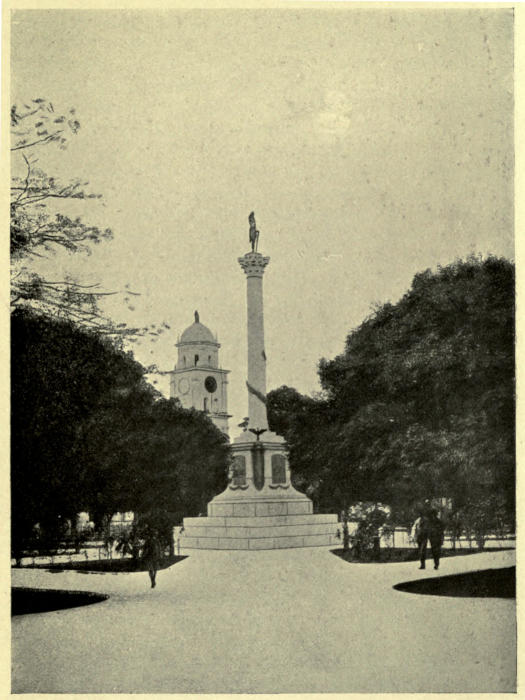
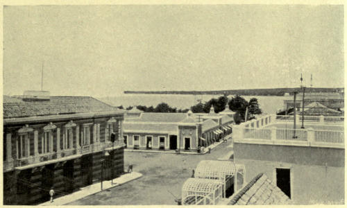
The frontispiece and the illustrations facing pages 78, 88,
98, 108, 128, 138 are taken from “Venezuela,” by N. Veloz-Goiticoa,
by permission of the Bureau of South American
Republics, Washington, U.S.A.
VENEZUELA — CHAPTER I PHYSICAL DESCRIPTION OF THE UNITED STATES OF VENEZUELA
Situation—Area—Population—Main physical divisions—The
Guayana Highlands—Mountains, rivers, and forests—The
Llanos—Selvas—Mesas—Rivers and cienagas—The Delta—Caños—The
Caribbean Hills—Serrania Costanera—Serrania
Interior—Rivers—Segovia Highlands—Drainage—Vegetation—The
Andes—Portuguese chain—Cordillera of Mérida—The
Sierra Nevada—Mountain torrents—Vegetation—Páramos—The
Coastal Plain—Lake of Maracaibo—Coro and Paraguana Lowlands—Climate—“White-water”
and “black-water” rivers—Seasons—Tierra
caliente, templada, and fria—Temperature and
seasons—“St. John’s little summer”—Health.
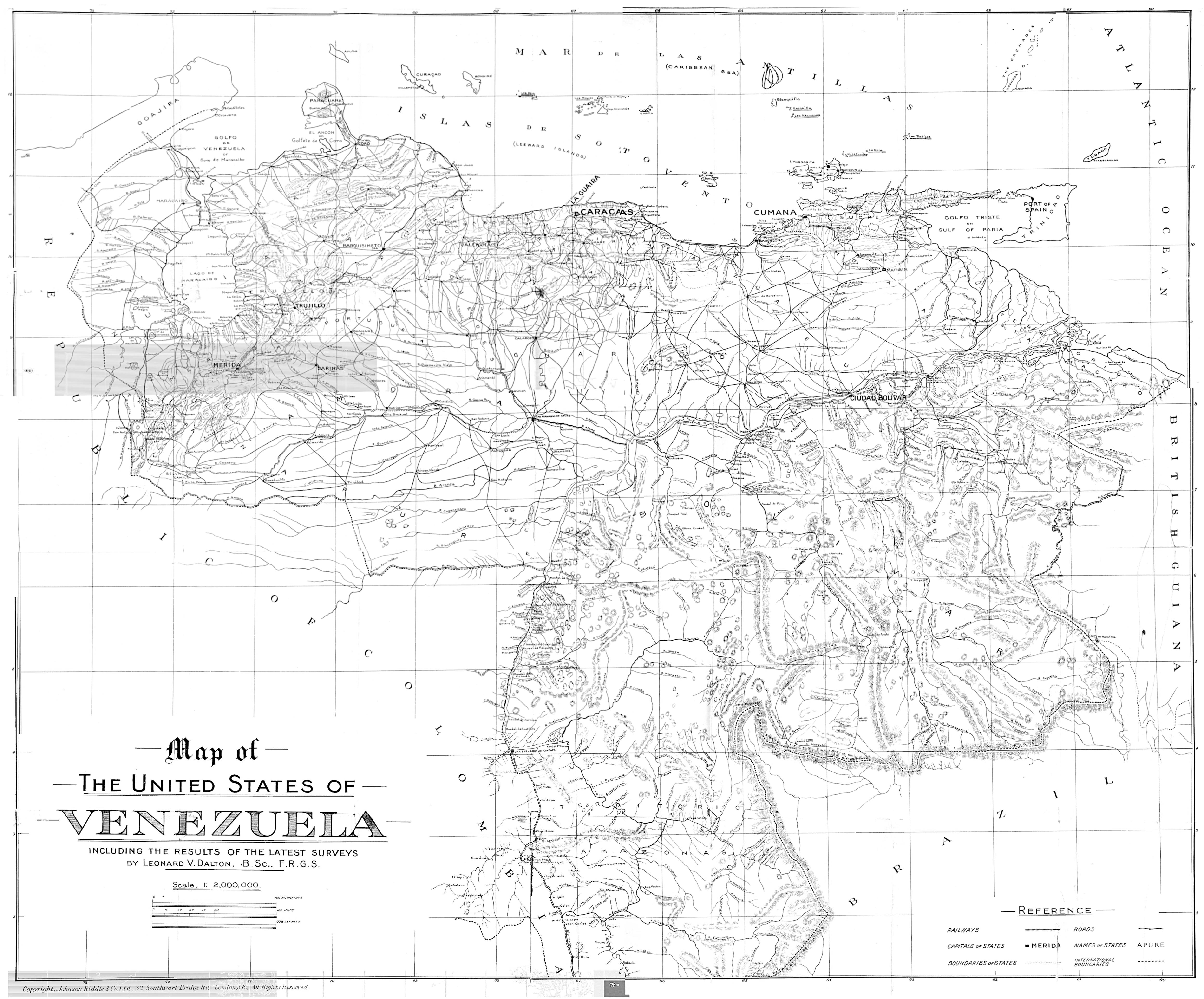
If we take a map of South America on which the
political boundaries are clearly shown, Venezuela will
be observed as a wedge of territory immediately to
the east of the most northerly point of the continent,
separating Colombia from our colony of British
Guiana.
The United States of Venezuela, as this republic
is officially called, lie wholly within the tropical zone,
between latitude 0° 45´ N. and 12° 26´ N. and longitude
59° 35´ W. and 73° 20´ W. (from Greenwich).
The area within these limits is some 1,020,400 square
kilometres, or 394,000 square miles, according to the
Statistical Year Book for 1908, published in Carácas
in 1910. The total population, according to the
same authority, is 2,664,241, these being the figures
of the last census, that of 1891.
Turning to our map once more, it will be seen that
the wedge is not a regular one, but suggests rather
the lower half of a human head, with the Lower
Orinoco as the line of the jaw. The features are
easily observed to separate the territory of the
republic into four main divisions: (1) the Guayana
Highlands, including all the region corresponding to
the part of the head below the jaw-line, i.e., south
and east of the Orinoco; (2) the great central area
of plains or Llanos, bounded on the north and west
by (3) the north-eastern branch of the great Andine
chain, and in the north-west of the country (4) a
smaller low-lying region round the Lake of Maracaibo.
Each of these divisions includes somewhat
varying types of land surface, but has its main
features of uniform character.
As already defined, the Guayana Highlands
include the whole of that vast, more or less
unexplored, tract of Venezuela lying on the right
bank of the Orinoco and round the head-waters of
that river. The area is primarily one huge elevated
plateau about 1,000 feet or more above the sea, and
from this rise a few principal mountain ranges, with
some peaks over 8,000 feet high, while smaller hills
and chains link up the larger systems. The highest
ground is found on the Brazilian frontier, beginning
at Mount Roraima (8,500 feet), where the three
boundaries of Venezuela, British Guiana, and Brazil
meet, and extends thence in the Sierras Pacaraima
and Parima westward and southward to the head-waters
of the Orinoco. From Roraima the Orinoco-Cuyuni
watershed extends northward within
Venezuela, along the Sierras Rincote and Usupamo
and the Highlands of Puedpa, to the
Sierra Piacoa, and thence south-east along the
Sierra Imataca to the British limits again. The
Sierra Maigualida forms the watershed between the
Caura and the Ventuari.
The whole area, which amounts to some 204,600
square miles, is well watered by the upper Orinoco
and the Ventuari, with the other great tributaries,
the Cuchivero, Caura, Aro, Caroni, and their affluents.
Large as these rivers are, they are so broken by
rapids that travel along them is only possible for
much of their length in small portable craft, and
even then the passage is fraught with danger. Save
for the districts in the immediate neighbourhood of
the Orinoco, and scattered areas elsewhere, the whole
region is thickly covered with forests of valuable
timber, containing rubber, tonka-beans, brazil-nuts,
copaiba, and all the varied natural produce of the
South American tropics.
The great plains or Llanos of the Orinoco extend
from the banks of the Meta in a broad arc parallel
to the course of the Orinoco along its left bank.
Westward they are bounded by the Cordillera of
Mérida, and northward by the Cordillera of Carácas
and the hills of Sucre, but between these ranges, at
Barcelona, they virtually reach the sea for a short
distance. To the east they merge into the low-lying
tract of the Orinoco Delta. The total area
of the Llanos proper is in the neighbourhood of
108,300 square miles, so that we have in these two
thinly populated tracts about 80 per cent. of the
territory of the republic.
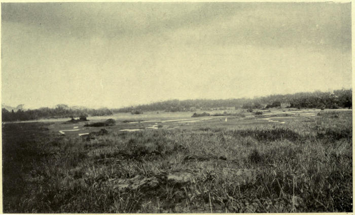
Vast areas of the Llanos remain, for all practical
purposes, still unexplored, and their general character
can only be inferred from that of the regions bordering
on the “roads.” The typical areas are wide
grass plains, often stretching to the horizon on all
sides without a break, but generally interrupted by
little groups of palms and small trees, especially near
the banks of the rivers. At some four or five points
near the northern edge there are great forests or
selvas, relics possibly of an earlier, more extensive
woodland.
The elevation of the Llanos ranges up to 650 feet,
and more than this in the mesas of the central region,
these being gravel-capped plateaux, of varying extent,
beginning in the west with the Mesa de Santa Clara,
northward of Caicara, and extending thence in a
continuous series eastward and northward to form
the watershed between the Orinoco and the Unare-Aragua
basin, which drains into the Caribbean Sea
west of Barcelona. The lowest part of the Llanos
is situated westward of this chain of tablelands, in
the valley of the Portuguesa, the lower part of which
has large tracts less than 300 feet above sea-level.
East of the Mesa de Guanipa the ground falls comparatively
rapidly to the Delta.
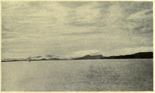
PENINSULA OF PARIA FROM TRINIDAD.
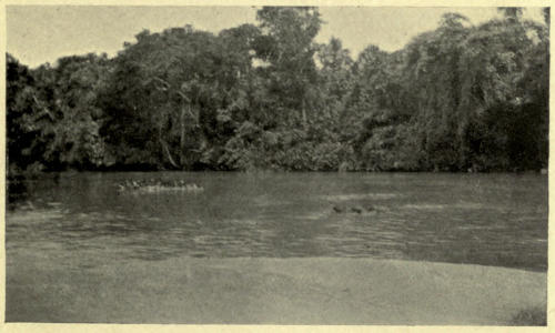
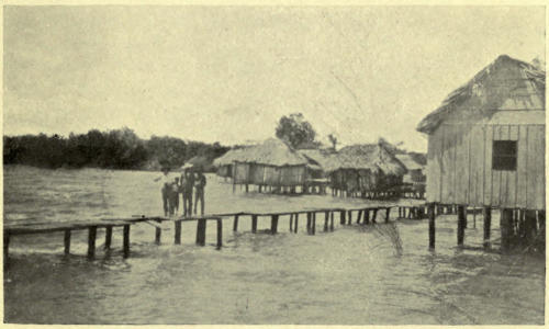
IN THE DELTA.
While severe drought is experienced over much of
the Llano region in summer, the heavy rains, particularly
in the western districts, produce floods over
the low-lying plains, the mesas being dry at all times.
The whole area is traversed by numerous streams
and rivers, which rise either on the southern slopes
of the Cordillera or in the mesas. North of the Meta,
in addition to the large number of smaller streams
which here and there broaden out into marshy lakes or
cienagas, we have the navigable rivers Arauca (the
main waterway to eastern Colombia) and Apure, flowing
from the Andes to the Orinoco in an easterly
direction. The Apure receives many tributaries on
its left bank from the Venezuelan Andes, most important
of which are the Portuguesa, rising in the
plains of the same name south of Barquisimeto and
joining the Apure at San Fernando, and the Guárico,
whose mouth is east of the same town, flowing from
south of Carácas through the State to which it gives
its name, and receiving from the east the waters of
the Orituco, whose source is less than thirty miles
from the coast in longitude 66°. Of the Orinoco
tributaries from the north beyond the Apure the most
important is the Manapire, all the streams east of
this rising in the mesas and having but short courses.
The greater part of the eastern Llanos drains northward
by the Unare and Aragua into the Caribbean
Sea. A few large rivers rise on the east of the mesas,
but flow for short distances only through the plains,
emptying, not into the Orinoco itself but the caños
of the Delta. This last-mentioned region of inundated
forest, savannah and mangrove swamp, occupies
about 11,500 square miles, bringing the total area
of the central plains up to 119,800 square miles.
The third great tract, the north-eastern spur of
the Andes, divides itself naturally into three parts—the
Caribbean Hills, along the shores of the sea
of the same name; the Segovia Highlands, linking
the former to the higher mountains of western
Venezuela; and the Cordillera of Mérida, or the
Venezuelan Andes. The total area occupied by these
mountain and hill tracts is about 41,800 square miles.
The Caribbean Hills give to the Venezuelan coast
its splendid and almost unique aspect, for, save for
the interruption near Barcelona, the range extends
without much decrease in average height from west
of longitude 68° to the east end of the peninsula
of Paria, less than 62° west of Greenwich. Two
main lines of elevation are plainly discernible in the
Carácas region, known as the Serrania Costanera
and the Serrania Interior; they continue throughout
the range, but are less distinct in the Cumaná Hills.
The greatest elevation of the outer line is reached
near Carácas itself, a considerable area west of the
city rising to over 6,500 feet, while to the east are
the famous peaks of La Silla (de Carácas) and
Naiguatá (8,620 feet and 9,100 feet respectively).
In the inner range the greatest elevation is round
Mount Turimquiri, south of Cumaná; the eastern
portion of the coast range, in the peninsulas of Araya
and Paria, does not rise above 3,200 feet. On the
northern side the complex is drained only by mountain
torrents falling rapidly throughout their short
courses to the sea, while on the south are the head-waters
of the Orinoco tributaries. Between the
two ranges, however, we have longitudinal valleys
with rivers of more or less importance—the Aragua,
flowing westwards from Carácas into the lake of
Valencia or Tacarigua, which overflows into the Paito,
a tributary of the Portuguesa; and the Tuy, with its
affluent the Guaire, flowing eastwards to the sea south
of Cape Codera. In the Cumaná Hills we have the
Manzanares and other smaller streams emptying their
waters into the Gulf of Cariaco, and on the east the
Lake of Putucual, though small, is similar in situation
to that of Valencia, and its overflow forms the
River San Juan, which empties into the Gulf of Paria,
forming virtually part of the Orinoco drainage. The
lower slopes of all these ranges, and the valleys,
are clothed with rich forests, excepting the dry,
barren coasts near Carácas, while the heights are
bare, save for grass and a few small temperate trees.
Between the western extremity of the Caribbean
Hills and the northern spurs of the Venezuelan Andes
there is an elevated region, which, though subject
to variations of level, possesses the main features of
a tableland, and this type of surface extends in a
broad belt northward through the States of Lara
and Falcón. Their main extent is in the State of
Lara, whose capital, Barquisimeto, had as its original
name, before any territorial limits were defined round
it, Nueva Segovia; it seems appropriate, therefore,
to distinguish this area as the Segovia Highlands.
The level of most of the area so designated
ranges from 1,500 to 3,500 feet, but the plateau
type is best developed in the Barquisimeto region,
the dry, barren plains of which, with their cactus
vegetation, suggest by their general features the dry
bed of an ancient lake, in whose waters the small
scattered hills formed islands, while the Andine
spurs to the south and the Sierra de Aroa and
similar mountain masses north of Barquisimeto, constituted
its limits. Beyond the latter, and north of
the Tocuyo River, while the larger part of the area
maintains its more or less uniform elevation, three
well-defined ranges rise from the plateau, in the
Cordilleras of Baragua, Agua Negra, and San Luis;
the last named is the largest, and extends for 110
miles parallel to the Coro coast, overlooking the
Gulf of Venezuela. Practically the whole of this
region is drained by the Tocuyo and its tributaries,
the other rivers rising merely on its outer edges
and falling direct to the sea; from this generalisation
should be excepted a small area round Barquisimeto,
in the catchment area of the river of the
same name, which contributes its waters to the volume
of the Portuguesa, and so enters the Orinoco. The
Tocuyo, whose principal affluents are the Carora and
the Baragua on its left bank, rises in the Andes and
flows for some 330 miles in a northerly direction,
changing to easterly in the lower river, before it
empties itself into the Caribbean. While the southern
part of this area is barren, all the lower slopes of
the northern hills are forest clad and fertile, with
llanos in the Carora Valley and grass-covered
summits above.
To the south we have the Venezuelan Andes,
stretching for some 300 miles south-westward to the
Colombian frontier, and forming the highest land in
the whole country.
There are two main divisions of this mountain
group, the Portuguesa chain south of Barquisimeto,
and the Cordillera of Mérida constituting the more
important and higher part. The Portuguesa chain
reaches its greatest elevation (13,100 feet) in the
south near the sources of the Tocuyo, the northern
portion rising only to about 5,000 feet. A slight
break in the mass is caused by the valley of the
Boconó, beyond which the Cordillera of Mérida
begins with peaks of nearly 13,000 feet on the north,
rising to their maximum in the centre, where the
summits of the Sierra Nevada of Mérida have an
elevation of about 16,400 feet, and the top of the
highest of all, La Columna, is 16,423 feet above
sea-level. Southwards the elevations decrease again,
until on the borders of Colombia the watershed
is less than 5,000 feet above the sea. The streams
of this chain, with its steep outer flanks so characteristic
of the Andes, naturally belong for the most
part to the catchment area of the Orinoco or the
Maracaibo Lake, but there is a succession of longitudinal
valleys within the chain which may be considered
as pertaining more particularly to the Andes.
The chief of these rivers are the Motatán, which,
rising north of Mérida, flows northwards through
Trujillo to the Lake of Maracaibo; the Chama, whose
sources are in the same snows that supply the
Motatán, though the stream flows southward past
Mérida, bending then sharply northward to reach the
south shore of the lake opposite the mouth of the
Motatán; and the Torbes, flowing south-westward
by San Cristobal, and turning there to the east to
fall into the Uribante, a tributary of the Apure.
Every type of vegetation occurs within this Andine
tract, varying according to the geology of the ground
and its elevation. At some points there are fertile
valleys with tropical flora, others with temperate
cereals; sometimes bare mountain slopes and hot
gorges supporting only cactus and acacia, and little
of these; sometimes grass-clad slopes and summits,
with the peculiar heather-like and resinous plants
of the “páramos,” and, lastly, the eternal snows
of the peaks of the Sierra Nevada.
North of the mountain region of Venezuela lies
what may be considered as the coastal plain, including
the alluvial area of the Lake of Maracaibo,
the Coro and Paraguana lowlands, and such few
tracts of flat ground as may be found along the
coast, with the numerous islands in the Caribbean
which belong to Venezuela. The area of this division
may be estimated as about 27,800 square miles.
The lake has many points of similarity to the Delta,
both in hydrography and general character. The
southern part has innumerable rivers comparable to
the caños, with open lagoons and swamps, bordered
by dense forests more or less inundated in the rains.
On the east and west shores to the north there are
stretches of higher ground between the swamps, and
frequent grass plains like the Llanos; the western
side is bounded by the Sierra de Perija, forming
the frontier of Colombia. Chief of the rivers
traversing these plains are the Motatán and Chama,
already mentioned as rising in the Andes, the
Escalante, and the Catatumbo; the mouths of all
are of a deltaic character, and all are navigable to
a greater or lesser extent. The largest and most
important is the Catatumbo, which, with its great
tributary, the Zulia, rises in Colombia.
The Coro and Paraguana lowlands form a stretch
of open, sandy, more or less barren and low hills,
extending from the neighbourhood of the port of
Maracaibo along the coast to Coro, and into the
Paraguana peninsula; with them may be grouped the
islands, which are similar in character, except Margarita,
whose mountains resemble those of the Caribbean
chain, though the open, cactus-covered lower
ground is a repetition of the western coast (and
Curaçao).
The climate of the 394,000 square miles naturally
varies greatly according to latitude, elevation, and
vegetation. The Guayana region, here also, stands
by itself, both from its southern position and comparatively
uniform elevation, so that over a wide area
the temperature and rainfall are more or less the
same. Naturally in those parts of Guayana where
mountain ridges rise above the general level of the
plateau the temperature is lower than the average,
but these must constitute a small part of the whole.
There is a marked difference in the meteorological
conditions in the various river-valleys of the Orinoco
basin, where the “white-water”—i.e., the swiftly flowing
but muddy streams, with rocky beds—are always
accompanied by a clear sky overhead, and mosquitoes
and crocodiles abound; on the “black water”—the
deep and slow rivers—the sky is continually clouded,
but the air is free from mosquitoes. The Orinoco
represents the former type, the Rio Negro the latter.
The rainy season in Guayana begins in April and
lasts till November; the remaining four months are
fairly dry.
The better known region of the north is generally
considered as divided, qua climate, into three regions,
in common with tropical South America generally—that
is to say, the hot, temperate, and cold zones.
The hot zone or Tierra caliente is generally considered
as ranging from sea-level to an elevation of
1,915 feet, where the mean annual temperature varies
from 74° to 91° Fahr. The intermediate or
temperate zone, the Tierra templada, lies between
1,915 and 7,030 feet above sea-level, and within
those limits the mean annual temperature may fall as
low as, or even lower than, 60° Fahr. The Tierra
fria, or cold zone, including the highest peak of
Venezuela, 16,423 feet, has mean annual temperatures
ranging from 60° to below zero.
The Tierra caliente includes (in addition to the
greater part of Guayana) the Llanos, the coastal
plains, and the region of the Lake of Maracaibo, the
lower slopes and part of the central valleys of the
mountains, part of the Segovia Highlands, and the
Caribbean islands. The higher ground naturally has
a climate varying with elevation, but the typical
hot country, the Llanos are the warmest, the islands
the coolest. On the Llanos the central, northern,
and eastern regions are cooler than the southern and
western, the highest mean annual temperature being
recorded in San Fernando de Apure. Over this area
the rainfall is heavy, and the wet season lasts from
April to November. Maracaibo has the highest
temperature of the cities of the coastal region, and,
while the rains in the greater part of the area last
through the same months as in Guayana and the
Llanos, the area round the lake is comparatively free
from rain until August and September, when the
heaviest falls are recorded. The Segovia highlands
and the islands alike have a lower mean temperature
and rainfall than the remainder of the zone, the
position of the one region, behind the coastal range
which has precipitated the moisture of the easterly
winds, being paralleled by the distance of the islands
from these heights in the opposite direction.
The Tierra templada includes the greater part of
the inhabited region of the hills, in which the climate
necessarily varies greatly according to situation, the
bottoms of some of the Andine valleys within the
zone being more oppressive than parts of the low
countries.
In the eastern part of the Caribbean Hills the
rains last during the same months as in the Llanos,
but in the Andes, particularly to the south, the
seasons vary, and it is generally considered that there
are two rainy seasons; the first light rains from
April to June, separated by “St. John’s little summer”
(El Veranito de San Juan) from the later heavy rains
which last from August to November; this arrangement
applies rather to the eastern side of the watershed,
the western side having an increasing similarity
in seasons to the Llanos as one descends towards
those plains.
Only the higher peaks and ridges of the Caribbean
Hills are included in the Tierra fria, but between
Tocuyo and the Colombian frontier the greater part
of the area is situated above 7,030 feet. The prevalent
strong winds and the sparse vegetation of
the upper areas render them too unattractive to have
become extensively colonised, but the products of
the temperate zone grow readily in the lower parts
below the timber-limit. Only the peaks of the Sierra
Nevada are permanently snow-covered, the line
having, it is said, retreated upwards of late years.
The snow is apparently more abundant in the
hotter months of the year, when the clouds which
are dropping rain on the plain hide the peaks
for many hours of the day, and then, lifting suddenly,
show them white with snow far below the normal
point, which is about 14,700 feet above sea-level.
A very short period of exposure to the sun’s rays
restores the mountains to their usual aspect.
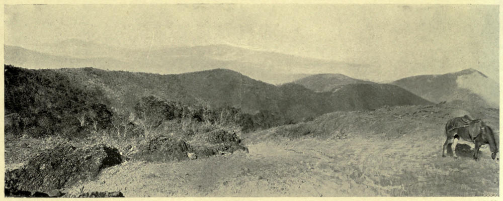
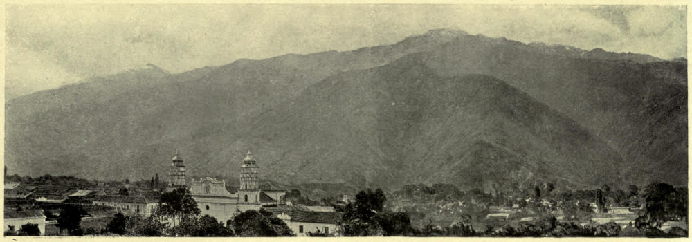
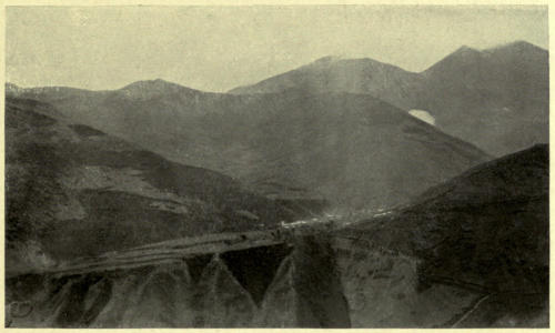
PANORAMA OF THE ANDES FROM NORTH OF CARACHE.
From the point of view of health, Venezuela must
be looked upon as holding a good record for a
country in its latitude, where malaria is to be expected
to prevail. The death-rate for the whole
republic in 1908 is given in the Anuario Estadístico
as 25·1 per 1,000, and of the 56,903 deaths
in that year, about one-third were infants under four
years of age, while malaria (paludismo) accounts for
8,239. Tuberculosis and gastric and nervous diseases
are the most prevalent causes of death. Yellow
fever, once so prevalent, is now rare, thanks to improved
sanitary conditions. The Delta region and
the lower parts of the Guayana valley are the most
unhealthy from a general point of view, while the
death-rate of the cities shows that the Llanos are
by far the healthiest district, with the Andes next,
followed by the Caribbean Hills. In some of the
low-lying coast towns, where mangrove swamps
abound in the neighbourhood, the death-rate is high,
but as a general rule the northern coast, with its
dry atmosphere and sea breezes, while hot, appears
to be markedly healthy.
CHAPTER II THE GEOLOGICAL HISTORY OF VENEZUELA
Ancient land of Guayana—Comparison with Scottish Highlands—Gneisses,
schists, and granite—Dykes—Roraima Series—Strange
peaks—The Caribbean Series—“All that glitters is not gold”—La
Galera—Segovia Group—Natural castles—Capacho Limestone—The
Golden Hill—Cerro de Oro Series—Formation
of mountains—Early outlet of Orinoco—Cumaná Series—Shoals
and islands—Llano gravels—Cubagua beds—Igneous rocks—Earthquakes—Hot
springs—A natural kettle—Coal—Iron—Gold—Copper—Lead—Petroleum
and asphalt—Sulphur—Salt—Urao—Ornamental
stones—Wealth in minerals.
A certain interest, often described as spurious but
none the less common, generally attaches to the
ancient for the sake of its antiquity, and we may,
hope, therefore, that the story of the rocks of Venezuela
will appeal even to non-geological readers.
The Guayana Highlands appear not only to be
formed of the oldest rocks in Venezuela, but from
such scanty study as has been made of parts of the
region, to represent one of the most ancient land-surfaces
in the world. Different as they are in
appearance, they offer many analogies with the north-western
highlands of Scotland from a geological point
of view; and here it is known that the processes of
building-up and breaking-down have preserved for
us glimpses of a land which stood, as it now stands,
long ages ago when living organisms, if there were
any, had not reached such a stage in their development
as to leave their traces in the deposits of the
time.
The great elevated platform from which rise the
peaks and mountain chains of Guayana appears
everywhere to be composed of similar rocks, gneisses,
hornblende schists, and granites, all containing evidence
of great antiquity in geological time. This
Guayana complex, as it may be called, has been
considered by geologists as more or less equivalent
in age to the Lewisian gneiss of Scotland, and therefore
one of the oldest members of the Archæan
system.
What may have been the original condition of the
rocks it is impossible now to say, but one of the
agencies which has brought them to their present
form has left its traces in the form of “dykes” of
quartz-porphyries and felsite, which were once forced
in a molten condition into crevices and joints of the
then less solid deposits.
After the cooling of these intrusions and wearing
down of the whole mass by atmospheric influences,
the movements of the earth’s crust produced a
shallow sea or series of lakes over what is now
Guayana, and in these waters a series of beds of
red and white sandstones, coarse conglomerate, and
red shale were laid down to a thickness of about
2,000 feet. Later the area was again elevated into
dry land, the sediments were consolidated, and again
veins or dykes of basalt, dolerite, and similar dark,
heavy rocks in a molten condition forced themselves
into the fractures of gneisses and sandstones alike.
These sandstones are here named the Roraima Series,
from their occurrence in that mountain, and they
now remain as isolated peaks or chains of hills all
over Guayana, which, since that far-off period when
the series was first consolidated, seems to have been
always dry land.
The points at which the Roraima beds have been
left as upstanding masses of horizontally stratified
material, in place of being completely denuded from
the ancient foundation of gneiss, appear to have been
determined in many cases by the presence of exceptional
accumulations of molten igneous rock,
which has hardened and remained as a cap to protect
the softer sandstones below from the effects of atmospheric
weathering. Where this has been the case
the strange vertical-sided, flat-topped mountains of
Guayana are the result.
While in all probability northern Venezuela has
no rocks quite so ancient as those of Guayana, the
geological history of this part of the country has
been much more eventful, and the number of earthquakes
suggest that even yet the form of the earth’s
crust in this region is undergoing comparatively
violent changes.
As is commonly the case, to find the oldest rocks
we have to search the hills, and because the masses
of gneiss, silvery mica-schist, marble, and so on,
which form the highest parts of much of the mountain
region, were first studied by Mr. G. P. Wall
in the Caribbean Hills in 1860, he named the whole
the Caribbean Series. The beds which make up
the series may have been deposited at a period corresponding
to that of the ancient Silurian rocks of
Wales, but it seems very possible that they are older
in some parts than in others. They form the central
region of the Venezuelan Andes, where there is a
core of granite which probably cooled at a date
subsequent to the consolidation of the gneiss and
schists. The silvery mica-flakes of the latter are
very often mistaken by the inhabitants for gold or
silver ores, and the author had more than one pretty
but valueless specimen offered for sale, with its
locality to be revealed as a secret of great worth!
The same rocks extend all the way along the coastal
range across the Boca del Draco into Trinidad, and
northward in Margarita the mountains are formed
of similar gneisses and schists. In the Llanos north
of El Baúl there is a peculiar elevated plateau known
as La Galera, from which rise many hills of gneiss
and granitic rock, but these may perhaps be an outlying
island of the Guayana complex.
After the deposits of the Caribbean Series had
been consolidated and elevated into dry land, but
before they had been thrown into high mountains
such as they form to-day, perhaps at the same time
that the granite of the Sierra Nevada of Mérida was
being pushed up under them in a molten condition,
the seas around were receiving deposits of quartz
sand, mud, and lime, which were later consolidated
to form a series of red and yellow sandstones, shales,
slates, and black bituminous limestones, which now
outcrop along the Sierras, and chiefly in the Segovia
Highlands, suggesting for the whole the name
Segovia Group. The animals which inhabited the
seas of those times left their shells and remains in
the rocks, and the forms (Ammonites, Inoceramus,
&c.) which have been found by various travellers
show that these deposits were formed at a period
approximately corresponding to that of the lowest
parts of our chalk or of the Cretaceous System
generally.
Here and there throughout the mountains of
northern Venezuela, the traveller is sure to be struck
by the sight of great cliffs and castle-like masses
of limestone rock, which add greatly to the effect
of the scenery where they occur. From their position
it is clear that these were originally parts of a more
or less continuous accumulation of lime in a deep,
still sea, after more turbulent waters had deposited
the Segovia Group. The German traveller Dr.
Sievers called this limestone the Capacho Limestone,
from Capacho in Táchira. The fossils are similar to
those of the period of the higher parts of the chalk.
After the deposition of the Capacho Limestone
the earth’s crust, which had in this region remained
tranquil for a considerable period, again underwent
some changes, and in the new shallower sea thus
formed sand and mud, with some lime, were alternately
laid down. The resulting sandstones, shales,
and limestones were named by Dr. Sievers the Cerro
de Oro Series, from a hill formed of these rocks
in Táchira, and called Cerro de Oro, or Golden
Hill, because the very abundant iron pyrites in
it were mistaken for the precious metal. Many
fossils have been found in the group, and from
these it seems that in Venezuela, instead of the break
between Cretaceous and Tertiary which we have in
England, there was a continuous series of deposits,
so that at the base we have chalk fossils, and higher
up Eocene forms, the general character of the animal
life changing gradually from one to the other.
With the consolidation of the Cerro de Oro beds
we have a new period of disturbance, in which the
mountain chains of northern Venezuela began to be
formed as we know them to-day, and the waters of
the Orinoco began to flow into the Atlantic more or
less by the present mouth of the river. Alongside
the newly formed hills, or islands as they would then
be, sandstones and shales were deposited to a considerable
thickness. They are found outcropping now
along the coast and under the Llanos, as well as
round the Lake of Maracaibo. The first fossils from
them were collected by Mr. G. P. Wall from Cumaná,
and it seems fitting to distinguish the whole as the
Cumaná Series.
After the deposition of the Cumaná Series, and
the crust movements which led to the consolidation
and folding of these rocks, the physical features of
Venezuela must have been very much what they are
to-day, save that many of the smaller islands and
parts of the coast were still submerged as shoals,
whilst the Llanos seem to have been a great swampy
or submerged plain, with deep water in parts, over
which the Orinoco sediments gradually accumulated
in the form of current-bedded sands and clays surmounted
by gravels, which we may term the Llano
deposits. At the same time, along the coast and on
the shoals shell-beds were being formed, and can
now be seen at Cabo Blanco, west of La Guaira,
and similar places, while practically the whole
surface of the Island of Cubagua is formed of them,
suggesting the name Cubagua Beds. About this
period some volcanic rocks were thrust up and cooled
both in the Peninsula of Paraguana and near San
Casimiro, south of Carácas. In the mountains great
masses of gravels containing huge boulders and some
Megatherium and other bones were being piled up by
the rivers. Last of all we have the still-accumulating
recent alluvium of the modern streams, attaining its
widest extent in the Delta and round the Lake of
Maracaibo.
No volcanoes, active or recently extinct, are known
in Venezuela, but the country has, like most of South
America, been continually subject to earthquake
shocks of greater or less intensity. Some of these
are historic, but of the many others recorded not
a few had far-reaching effects on the population.
The first important tremor noticed after the discovery
and settlement of the shores of the Caribbean
was that of 1530, which shook the city of Nueva
Cadiz on the Island of Cubagua and destroyed the
fortress of Cumaná, thus checking for some time
the colonisation of the mainland in this region.
Thirteen years later New Cadiz was visited again
by earthquake and hurricane, and so disastrous were
the results that from that day to the present Cubagua
has been, what it was before the arrival of the
Spaniards, a desert island. The many shocks experienced
in the course of the seventeenth and eighteenth
centuries seem to have been generally unaccompanied
by much loss of life or property, but this period
of comparative quiescence was followed by one of
the historical examples of severe earthquake early
in the nineteenth century. In March, 1812, a shock
destroyed great parts of Carácas, La Guaira, Barquisimeto,
Mérida, and other towns, and in the capital
alone ten thousand people were killed. The great
earthquake which, on August 13, 1868, made itself
felt all over South America, so much affected some
of the Venezuelan rivers that their waters over-flowed
the banks, and even remained for a short
time in new channels. In 1894 Mérida and other
towns in the Andes suffered much damage, houses
and churches being shaken down; the destruction
was in some cases extraordinarily complete. Since
that time only slight tremors have been felt.
The internal heat in the north-eastern spur of the
Andes, which traverses Venezuela, manifests itself at
many points in the form of hot springs. One, containing
much sulphur, is found at Las Trincheras,
between Valencia and Puerto Cabello. The temperature
of this spring varies, but in 1852 it was found
by Karsten to be only a few degrees below the
boiling point of water; in general, however, it does
not exceed 195° F. or 17° below boiling point. Wall
found one south of Carúpano actually boiling. All
along the flanks of the coastal Cordillera there are
mineral springs, generally at fairly high temperatures,
and many more are known throughout the
Andes. Nearly all these springs have been used in
the treatment of various diseases, though none has
achieved especial popularity.
While hot springs may be interesting to the
visitor, they are hardly valuable assets to a country
such as Venezuela, but this part of the world has
always, and with much justice, held the reputation
of being rich in minerals. There is coal of fairly
good quality in more than one of the Cretaceous and
Tertiary groups of strata, near Barcelona, Tocuyo,
Coro, and Maracaibo, as well as in the Andes, but
the often-associated iron is only found in large quantities
in the Guayana gneiss south of the Orinoco
Delta.
Gold, that great lure for the early European
ventures to the west, may be said to occur in almost
every State of Venezuela, but it has only been worked
with profit in Guayana, even though samples of a
quartz-reef near Carúpano are said to have assayed
7 oz. to the ton. When Sir Robert Dudley visited
the coast of the Gulf of Paria in 1595, he heard of
a goldmine near Orocoa (Uracoa), on the eastern
side of the Llanos, which may mean that the gravels
are occasionally auriferous, but unfortunately he
failed to reach the place. Placer workings are the
chief source of the precious metal in the Guasipati
goldfields in Guayana, but the reefs from which it is
derived have been discovered and worked at odd
times. In British Guiana, where the conditions are
similar, Mr. Harrison says that the gold is generally
found along the later intrusive dykes, the smallest
dykes being the richest, while most gold is found
where a basalt intrusion crosses one of the older ones.
The ores of copper are fairly common in the
northern Cordillera, and the mines of Aroa in Yaracuy
have been worked for many years. Here the pyrites
veins occur in the Capacho Limestone, not far from
where it has been invaded by a mass of granite.
In the Andes it seems to occur in the more ancient
rocks, as near Seboruco in Táchira, and Bailadores
in Mérida. A mine near Pao seems to be in
Cretaceous rocks.
Many other metallic ores occur at various points,
notably galena in the Andes, but one of the most
common minerals of northern Venezuela is petroleum,
known in its desiccated form as “Bermudez asphalt”
over half the world. Boring for the original mineral
oil has only recently been undertaken. Sulphur is
one of the less valuable minerals which occur in
considerable quantities, but the so-called salt-mines
are not strictly mines at all, and are described in
Chapter XVI. Humboldt had heard of the strange
mineral lake near Lagunillas, which contains a large
proportion of urao or sesqui-carbonate of soda, a
mineral not usually found in nature, and here
apparently supplied from springs rising in the Segovia
rocks. It is used locally for mixture with tobacco
juice to make a chewing mixture called chimo, but
there have been projects to obtain the salt in large
quantities for the manufacture of caustic soda.
In addition to those already mentioned, all the
following minerals or ornamental stones have been
found in one part or another of Venezuela, viz.,
marble, kaolin, gypsum, calcium phosphate, opal,
onyx, jasper, quartz, felspar, talc, mica, staurolite,
asbestos, and ores of antimony, silver, and tin.
The minerals of Venezuela have merely been mentioned
casually in this place, an account of the extent
to which they have been exploited being deferred
to the chapter on the general development of the
country. It is evident, however, when one considers
their number and the extent of their distribution,
that the geological changes which have played
their part in the building up of the physical features
of the country have left Venezuela in possession of
splendid assets in this respect.
CHAPTER III THE PLANTS AND ANIMALS OF VENEZUELA
The glamour of the South American forests—Hidden treasures—Temples
of Nature—“A dim religious light”—Bejucales—Forest
giants—Brazil nuts—Tonka-beans—Rubber—Quinine—Arctic
and tropic forms—The Llanos—Tierra caliente—Natural hothouses—Colour
and coolness—Páramo plants—Monkeys—An
old friend—Cannibalism—Vampires and bats—“Tigers” and
“lions”—“Handsome is as handsome doesn’t”—Wild horses—Dolphins—Prickly
mice—The “water-hog”—Sloths—Birds—Many-coloured
varieties—Umbrella-bird—“Cock-of-the-rock”—Toucans—Cuckoos—Humming-birds—“Who
are you?”—Oil-birds—Parrots
and macaws—Eagles and vultures—A
national disgrace—Game-birds—Snakes—Lizards—From the
Orinoco to a city dinner—A cup-tie crowd—Ferocious fish—When
is a mosquito not a mosquito?—Agricultural ants—Gigantic
spiders—Ticks—A pugnacious crustacean—A rich
field.
Most of us, if possessed of imaginative faculties,
have been impressed in our youth by the thought of
those vast virgin forests of South America, inhabited,
as we often used to think, only by huge boa-constrictors
and anacondas which lived to an immense
age and continued to grow throughout their lifetime;
and even in later years, when experience at first
or second hand has taught us that the supposed silent
forest of the tropics is generally noisy with the chattering
of monkeys and birds or the perpetual hum
and chirp of insects, and is often far from a desirable
place on account of these last, the glamour of the
vastness and fertility of these great untrodden temples
of nature remains with us.
More than half of Venezuela is covered by forest,
and, indeed, comes within the forest area of South
America; what botanical treasures and zoological
curiosities may yet be discovered, when some explorer
is found to succeed Humboldt and Schomburgk, are
not to be guessed at, and it is not our purpose to
give a scientific account of what has been done
towards classifying and enumerating the many plants
and animals already known to live in Venezuela,
but to briefly describe what is most interesting and
important to the general reader who may be interested
in the country as a whole.
Richest in quantity, and probably in variety, of
vegetable life is the little-known land of Guayana,
with its vast forests, hot climate, and heavy rainfall.
Within it the plants range from the alpine
shrubs and reindeer moss of some of the higher
plateaux and hills to the bamboos and orchids of
the river banks. The simile which compares the
tropical forest to those darkened lofty cathedrals of
Europe has been often used, and is, perhaps, somewhat
trite, but its aptness is incontrovertible. The
huge timber-trees grow fairly close together, and
their spreading tops, fifty, eighty, or a hundred feet
from the ground, with the abundant hanging lianes
and flowering creepers, keep all but a feeble light
from the ground, whence it comes that the under-growth
is usually sparse or absent, and progress on
foot is comparatively easy. Sometimes, however,
there are stretches of bejucal, full of tangled ground
creepers, and it may take a day to cut a path for
one mile through such growth as this.
Of all the forest giants of Guayana, Schomburgk
considered the mora the most magnificent; the
average diameter of the trunk is about three feet,
and it seldom branches at less than forty feet from
the ground. The dark-red, fine-grained wood is said
to be excellent for shipbuilding purposes. Mahogany
or caoba, the palo de arco, whose wood is very
like mahogany in colour, and a big tree called in
Venezuela rosewood, which it resembles, are among
the timber trees of the region known to us in Europe.
The huge ceibas, with their buttress-like roots, have
a soft, easily worked wood, excellent for the dug-out
canoes of the Indians, and the equally large mucurutu
or cannon-ball tree furnishes a beautiful but hard
and fine-grained timber. Unfortunately, the very fertility
of the soil becomes a drawback in the exploitation
of these timber resources, for all trees grow
with equal freedom, and the particular kind for which
the lumber-man is searching may only be found at
rare intervals; on a large scale, when all the valuable
woods are utilised, this difficulty would, to some
extent, disappear.
There are two fruit-trees whose products are well
known in European markets, and though these grow
all over Guayana, they are particularly abundant in
certain regions. The Brazil nut was first described
by Humboldt, but since his time it has become a
common article of merchandise in Europe; the tree
which bears it is itself large, and the fruit, with its
fifteen or twenty nuts, is tremendously heavy, and
generally breaks in falling from the tree when ripe,
not infrequently cracking the shells inside, when the
birds and monkeys are able to enjoy the oily kernel;
otherwise the exterior usually proves too hard. The
other fruit we have referred to is the sarrapia, or
tonka-bean, not so well known to the general public
of to-day as formerly, though extensively used in
perfumery. The trees grow in greatest abundance
and excellence, according to André, in the Caura
and Cuchivero valleys. The gums and resins of
Guayana include the balatá, copaiba-balsam, and
rubber-producing trees, the latter chiefly varieties of
Hevea, while cinchona or quinine with innumerable
creepers and trees possessed of medicinal or toxic
properties are found everywhere. The 2,450 species
of plants referred to by Schomburgk have since been
added to, and it is obvious that in such an assembly
there must be many of value, as yet undiscovered and
unused.
The vegetation of the higher exposed peaks and
plateaux is quite different from that of the forests,
and here Schomburgk found such an alpine, or rather
Arctic, form as reindeer-moss, associated with semi-tropical
rock-orchids and aloes.
The forest plants and trees of Guayana also
flourish in the Delta region and in the forests bordering
the Llanos of Maturín, but the vegetation of
northern Venezuela is generally very different from
that of the south.
The great green or brown plain of the Llanos is
often beautified by small golden, white, and pink
flowers, and sedges and irises make up much of
the small vegetation. Here and there the beautiful
“royal” palm, with its banded stem and graceful
crown, the moriche, or one of the other kinds, forms
clumps to break the monotony, and along the small
streams are patches of chaparro bushes, cashew-nuts,
locusts, and so forth. The banks of the rivers often
support denser groves of ceibas, crotons, guamos,
&c.; the last-named bears a pod covered with short,
velvety hair, within which, around the beans (about
the size of our broad beans), is a cool, juicy, very
refreshing pulp, not unlike that of the young cocoa-pod.
Along the banks of the streams in front of
the trees are masses of reeds and semi-aquatic
grasses, which effectually conceal the higher vegetation
from a traveller in a canoe at water-level.
IN THE UPPER TEMPERATE ZONE: THE CHAMA VALLEY.
As might be expected, when we enter the region
of the Cordilleras, we find very different types of
vegetation in the various zones. The tierra caliente
has generally a heavy rainfall, and then supports
thick forest, but along the coast there are barren
stretches with only cactus, acacia, croton, and similar
plants, picturesque, but hardly beautiful. The mangroves
and their associated forms line the shore in a
belt of varying width, but behind follow, according to
the climate and soil, lowland forests or plains and
hills covered with cactus of all shapes and sizes,
some being so large that the woody stems are used
locally in building.
In the tierra caliente we have the plantations of
cacao, sugar, bananas, plantains, maize, and cassava,
which produce the staple foods of the inhabitants, and
the highly profitable coconuts, if not cultivated, are
at least encouraged and exploited. In addition, there
are the many valuable products of the forests, chief
of which are the dye-woods and tanning barks, including
logwood, dividive, mangrove, indigo, and
many others. A good deal of valuable timber grows
in parts of the forest, the chief woods exported being
mahogany and “cedar.”
As we rise into the cooler regions, we find, naturally,
a mixture of the hot-country plants and those
of the mountains; particularly is this so in the case
of cultivated kinds. One may see in the same valley,
within a short distance of one another, bananas, potatoes,
sugar-cane, wheat, yuca or cassava, peas, maize,
cotton, cocoa, and coffee, all flourishing, and a single
orchard may contain guavas and apples, peaches and
oranges, papayas and quinces, not to mention many
other fruits; the garden adjoining will have a
mixture of roses, carnations, violets, and dahlias with
bougainvilleas, dragon’s blood, magnolias, and other
tropical flowers. Strawberries, mint, bulrushes,
nasturtiums, and other of our garden plants have been
successfully naturalised in these mountain regions
within 10° of the equator.
The higher part of the tierra templada exhibits
the greatest variety of plants peculiar to this zone.
As one travels along the mountain roads, in addition
to new kinds of palms, one sees screw-pines and
beautiful tree-ferns, splendid white rock-orchids and
purple parasitic varieties, red and white rhododendrons
and heaths, cranberries, blackberries, ivy,
passion-flowers, yews, quinine-trees, aloes of all
kinds, small bamboos, silver-ferns, and all manner
of beautiful flowering shrubs and plants, for it is
here and not in the hotter tropical regions that we
have the greatest variety of colour and the most
beautiful floral scenery.
Nor is the tierra fria of the Cordilleras without
its beauty and interest to the botanist. The small
woods of the temperate zone gradually die out,
and towards the snow-line we have the alpine grasses,
heaths, and lichens of the páramos, amongst which
are scattered those peculiar white or yellow, thick-leaved,
aloe-shaped plants which, strangely enough,
have lumps of resin clinging to their roots, and seem
in this respect to supply the place of the pines and
firs which are not found in Venezuela.
There is at least one animal found in the forests
of Guayana which is familiar even to the untravelled
Cockney, namely, the prehensile-tailed capuchin
monkey or sapajou, of which several species are
known in Venezuela, while they are the most common
tame kind brought to Europe. Humboldt’s woolly
monkey, which is nearly allied, is dark grey, the
capuchin being generally reddish; its flesh is said
to be excellent eating for those who feel no qualms
at nearing the verge of cannibalism. Many other
kinds are found in the forests, including the black
thumbless spider-monkeys, but the variegated spider-monkey,
of which the first specimen brought alive to
England came from the Upper Caura in 1870, is a
gorgeous beast, with black back, white cheeks, a band
of bright reddish-yellow across the forehead, and
yellow under-surface to body and limbs. The banded
douroucouli also occurs in southern Venezuela, and
Mr. Bates has described how, on the banks of the
Amazon, a person passing by a tree in which a
number of them are concealed may be startled
by the apparition of a number of little striped faces
crowding a hole in the trunk. Their ears are very
small. The graceful little squirrel-monkeys, with
dark fur shot with gold, the titi, reddish-black, with
a white spot on the chest, the white-headed and
other sakis, and the abundant and very noisy howlers
are all denizens of the Guayana forests. Nor must
we omit to mention the pretty little marmosets, which
are often kept as pets.
Bats, and their objectionable cousins, the vampires,
are abundant in Venezuela, but the true blood-sucking
vampire does not seem to be very common.
There are, of course, no tigers or lions, properly
so called, in the New World, but the names have
been usurped by similar beasts, the jaguar and the
puma. The tan-coloured fur of the former, with
its large rosette-like spots, is very beautiful, and
quite equals that of the tiger in large specimens,
while for agility it more than rivals its Asiatic
relative, being credited with climbing trees and living
there in times of severe flood, to the great danger
and annoyance of the usual inhabitants, the monkeys.
The tawny puma is also said to chase the monkeys
in the tree-tops, even in ordinary times. The other
large cats of Venezuela include the ocelot, jaguarondi,
and margay, and there is the one fox-like “Azara’s”
dog.
The peculiar-looking “spectacled bear” is found
up in the Andes, and the kinkajou represents the
raccoon tribe, while the weasels include the tayra
and grison, and their relative, the handsome but most
objectionable skunk, occasionally pollutes the atmosphere
with his presence. The big Brazilian otter,
with chocolate-brown fur, is found in the rivers of
the Llanos.
Amongst the hoofed animals, the red Brazilian
and Ecuador brockets represent the deer, and there
are two species of vaquira or peccary, in addition
to the now acclimatised European pig. Horses and
donkeys live in a semi-wild state on the Llanos,
though their nearest relative native to the country
is the tapir or danta, a very different beast in appearance.
The nailless manati of the Orinoco mouth is fairly
common, and higher up the river there is a fresh-water
dolphin: the author observed a fish-like beast
in the Lake of Maracaibo, which may be the same
species, though out in the salt water of the Caribbean
the common dolphin is found, as well as the
cachalot, and another species of whale is said to
have been seen there.
The rodents include a number of species of great
scientific interest, but for the ordinary individual one
rat or shrew is much like another, and the squirrels,
mice, rabbits, hedgehogs, and allied animals are very
similar to those of Europe. One of the mice has
flattened spines mingled with the fur, and the coypu
or perro de agua has a very harsh coat, though it
is rather like a beaver in appearance and habits,
while some near relatives of smaller size have the
same peculiar flattened spines on the back. The
peculiar Brazilian tree-porcupine is a Guayana
species. The gracefully formed aguti or acure is
common in the Venezuelan forests, and its near
relative, the aguchi, is found there with the lappa
or paca, the flesh of which is excellent eating. The
big “water-hog,” chiguire or capybara, familiar to
Zoo visitors, occurs in Guayana and elsewhere.
There are several sloths common in the low-lying
parts of the Guayana forests and similar regions of
northern Venezuela, and the great-maned ant-eater or
“ant-bear,” with the lesser ant-eater, is as often
seen in Venezuela as in any part of South America,
while Guayana is the centre of the small district in
which the peculiar two-toed ant-eater is found. The
cachicamos or armadillos are much esteemed as food
in the forest districts.
The marsupials are represented by the rabipelados
or opossums and the perrito de agua or water-opossum.
The birds, being more commonly seen, are perhaps
of greater interest than the mammals, and certainly
many of the Venezuelan birds are beautiful, though,
as frequently happens, what they gain in plumage
they lose in song, and few have even a pleasant
note.
Beautifully coloured jays, the peculiar cassiques,
with their hanging nests, starlings, and the many
violet, scarlet, and other tanagers, with some very
pretty members of the finch tribe, are all fairly
abundant in Venezuela. Greenlets, some of the allied
waxwings, and thrushes of various kinds, with the
equally familiar wrens, are particularly abundant, nor
does the cosmopolitan swallow absent himself from
this part of the world. The numerous family of the
American flycatchers has fifty representatives in
Venezuela, and the allied ant-birds constitute one of
the exceptions to the rule, in possessing a pleasant
warbling note. The chatterers include some of the
most notable birds of Venezuela, and we may specially
notice the strange-looking umbrella-bird which
extends into the Amazon territory, known from
its note as the fife-bird; the variegated bell-bird,
which makes a noise like the ringing of a bell; the
gay manikins, whose colour include blue, crimson,
orange, and yellow, mingled with sober blacks,
browns, and greens; the nearly allied cock-of-the-rock
is one of the most beautiful birds of Guayana,
orange-red being the principal colour in its plumage,
while its helmet-like crest adds to its grandeur; the
hen is a uniform reddish-brown. The wood-hewers
are more of interest from their habits than the beauty
of their plumage.
The beautiful green jacamars, the puff-birds, and
the bright-coloured woodpeckers are found all over
Venezuela in the forests, but their relatives the toucans
are among the most peculiar of the feathered tribe.
With their enormous beaks and gaudy plumage they
are easily recognised when seen, and can make a
terrible din if a number of them collected together
are disturbed, the individual cry being short and unmelodious.
Several cuckoos are found in Venezuela,
some having more or less dull plumage and being
rare, while others with brighter feathers are
gregarious. With the trogons, however, we come
to the near relatives of the beautiful quezal, all
medium-sized birds, with the characteristic metallic
blue or green back and yellow or red breasts. The
tiny, though equally beautiful, humming-birds are
common sights in the forest, but a sharp eye is
needed to detect them in their rapid flight through
the dim light; some of the Venezuelan forms are
large, however, notably the king humming-bird of
Guayana; and the crested coquettes, though smaller,
are still large enough to make their golden-green
plumage conspicuous. The birds which perhaps most
force themselves, not by sight but by sound, upon
the notice of travellers are the night-jars; the “who
are you?” is as well known in Trinidad as in
Venezuela. The great wood night-jar of Guayana has
a very peculiar mournful cry, particularly uncanny
when heard in the moonlight. The kingfisher-like
motmots have one representative in Venezuela, but
the other member of the group, which includes all
the preceding birds, constitute a family by itself.
This is the oil-bird or guacharo, famous from Humboldt’s
description of the cave of Caripe in which
they were first found. The young birds are covered
with thick masses of yellow fat, for which they are
killed in large numbers by the local peasantry. They
live in caves wherever they are found and only come
out to feed at dusk.
Other birds which are sure to be observed even by
the least ornithological traveller are the parrots and
macaws which fly in flocks from tree to tree of the
forest, uttering their discordant cries. The macaws
have blue and red or yellow plumage, but the parrots
and parraquets are all wholly or mainly of a green
hue. The several owls are naturally seldom seen,
and, in the author’s experience, rarely heard.
There are no less than thirty-two species of falcons
or eagles known from Venezuela, and of these many
are particularly handsome, such as the swallow-tailed
kite and the harpy eagle of Guayana. Their loathsome
carrion-eating cousins, the vultures, have four
representatives.
In the rivers and caños of the lowlands there are
abundant water-birds, and the identified species
include a darter, two pelicans, several herons or
garzas, the indiscriminate slaughter of which in the
breeding season for egret plumes has been one of
the disgraces of Venezuela, as well as storks and
ibises. Among the most beautiful birds of these
districts are the rosy white or scarlet flamingoes,
huge flocks of which are sometimes seen rising from
the water’s edge at the approach of a boat or
canoe. There are also seven Venezuelan species
of duck.
The various pigeons and doves possess no very
notable characteristics, and one or two of the
American quails are found in the Andes. Other
game-birds include the fine-crested curassows of
Guayana, the nearly allied guans, and the pheasant-like
hoatzin. There are several rails, and the finfeet
are represented. The sun bittern is very common on
the Orinoco. There are members of the following
groups: the trumpeters (tamed in Brazil to protect
poultry), plovers, terns, petrels, grebes, and, lastly,
seven species of the flightless tinamous.
Descending lower in the scale, we come to the
animals which are, or used to be, most often
associated in the mind with the forests of South
America. The snakes are very numerous, but only
a minority are poisonous. Of the latter the beautiful
but deadly coral-snake is not very common, but a
rattlesnake and the formidable “bushmaster” are
often seen. Of the non-poisonous variety the water-loving
boas and tigres or anacondas are mainly confined
to the Delta and the banks of the Guayana
rivers. The cazadora (one of the colubers) and the
Brazilian wood-snake or sipo, with its beautiful
coloration, are common; the blind or velvet snake
is often found in the enclosures of dwellings.
One of the lizards, the amphisbæna, is known
in the country as the double-headed snake, and is
popularly supposed to be poisonous, but there are
many species of the pretty and more typical forms,
especially in the dry regions, while the edible iguana
is common in the forests. There are eleven species
of crocodiles, of which the caiman infests all the
larger rivers and caños. The Chelonidæ include only
two land tortoises, but there are several turtles in
the seas and rivers, and representatives of this family
from the Gulf of Paria often figure on the menus
of City companies.
There are some six genera of frogs and toads
to represent the Amphibians, and the evening croaking
of the various species of the former on the Llanos
is very characteristic of those regions; one, in particular,
emits a sound like a human shout, and a
number of them give the impression of a crowd at
a football match.
CLOUD-DRIFTS IN THE ANDES.
TORBES VALLEY AND THE COLOMBIAN HILLS.
Fish abound in rivers, lakes, and seas, but, considering
their number, remarkably little is known
about them. Some are regarded as poisonous, and
others are certainly dangerous, such as the small
but ferocious caribe of the Llano rivers, which is
particularly feared by bathers, as an attack from a
shoal results in numbers of severe, often fatal,
wounds. The temblador or electric eel is very
abundant in the western Llanos, and is as dangerous
in its way as the caribe.
The insects are too numerous for more than casual
reference, but it may be noted that the mosquito of
the Spaniards is a small and very annoying sandfly;
the mosquito as we know it is, and always has been,
called zancudo de noche by the Spanish-speaking
inhabitants of Venezuela. The gorgeous butterflies
and the emerald lights of the fireflies are in a
measure a compensation for the discomforts caused
by their relatives, but of the less attractive forms, the
most interesting are the hunting ants, which swarm
through houses at times devouring all refuse, and
the parasol ants, which make with the leaves they
carry hot-beds, as it were, for the fungus upon which
they feed.
One of the most unpleasant of the lower forms of
life in the forests is the araña mono or big spider of
Guayana, which sometimes measures more than six
inches across; it is found in the remote parts of the
forest, and its bites cause severe fever. The
better-known tarantula, though less dangerous, can
inflict severe bites. The extremely poisonous
scorpions and the garrapatas or ticks must be seen
or felt to be appreciated.
We may leave the lower forms of life to more
technical works, but the amusing “calling-crab” deserves
special mention. With his one enormous paw
of pincers the male if disturbed will sit upon the
mud or sand and apparently challenge all the world
to “come on” in a most amusing fashion.
A host of interesting birds, beasts, and plants have
already been found in Venezuela, and it still presents
an almost virgin field for the botanist and zoologist,
to whom the technical literature given in the bibliography
will prove of more use than this necessarily
brief sketch.
CHAPTER IV VENEZUELA UNDER SPANISH RULE AND BEFORE
Pre-Columbian times—No great empire—Primitive Venezuelans—Picture
rocks—Invasions—The Guatavitas and the legend of
El Dorado—Amalivaca—An Inca prince?—Ancient roads—The
discovery of Tierra Firme, 1498—Alonso de Ojeda—The
name Venezuela—A great geographical fraud—Discovery of
the treasures of the west—Arrival of the conquistadores—The
slave trade—Treacheries of the Cubagua colonists—Gonzalez
de Ocampo—Las Casas—First cities of the New World—Settlement
of Coro—The Welsers—Alfinger—Ingratitude of
Charles V.—New Andalusia—Exploration of the Orinoco—Cruelties
of Alfinger—Exploration of the Llanos—First Bishop
of Venezuela—Destruction of New Cadiz—Faxardo and the
Carácas—Cities of Western Venezuela—The rebellion of Aguirre—Foundation
of Carácas—Pimentel moves his capital to the
new city—Capture of Carácas by English buccaneers—Inaccuracies
of Spanish historians—Explorations of Berrio in Guayana—Raleigh
and El Dorado—Attempts to civilise the Indians—Missions—University
of Carácas—Guipuzcoana Company—Revolution
of Gual and España—Miranda—The last Captain-General—The
Junta—Appeals to England—The Declaration of
Independence.
The advanced civilisations of early Peru and Mexico
have left us, despite the vicious destruction of everything
“heathen” by the “Christian” conquistadores,
in possession of sufficient documents of one kind
or another to glean a fairly complete and consecutive
story of those countries in pre-Columbian times, as
we may term that period before the discovery of
the New World by Columbus. It is otherwise in
Venezuela; here there seems to have been no
advanced civilisation; and the conquistadores were
as incapable of noticing or recording details of the
social organisation and international relations of the
savage aborigines as of appreciating the knowledge
and skill of Incas or Aztecs; hence we have to
depend mainly, if not entirely, on the information
gathered with difficulty from buried ruins, tombs,
and sepulchre-caves. Dr. G. Marcano has been one
of the chief workers in this direction, and his systematic
and painstaking work may one day give us a
fairly complete picture of Venezuela before the
Spaniards.
In the remote past, long (though we do not know
how long) before the arrival of the white men from
the east, the land appears to have been sparsely
peopled by semi-nomadic, primitive tribes of a long-headed
race, whose social organisation was limited
to a grouping in temporary villages, while in the arts
they had advanced as far as the making of rude
earthenware, and perhaps the use of curiously shaped
stones for personal adornment. They buried their
dead in caves, either natural or artificial, placing
them in a sitting posture in palm-leaf frails or
earthenware urns, accompanied by small pieces of
pottery and other household matters. The names
of “tribes” in Guayana appear to be far too
numerous to be really distinct races, and it is
probable that they represent merely the more permanent
associations of villages or groups of villages
with slight differences of dialect. In Humboldt’s
time there were traditions of the internecine warfare
of these “tribes,” and it is possible that in
times of strife they were guilty of cannibalism,
though in later days authentic occurrences of the
eating of human flesh were very rare, if existent
at all.
Throughout Guayana there are crude rock inscriptions
of comparatively ancient date, apparently representing
an early attempt at picture-writing, and it
is said that some of the shy and reticent Indian tribes
appear to know the meaning of these. As yet no
one has obtained any satisfactory clue to the purpose
of these rocas pintadas.
We have said that these long-headed peoples occupied
the land in the remote past, though their
descendants were to be found in parts of Venezuela
in comparatively recent times, and tribes of mixed
race still bear witness to their existence. Many years
before the Spanish conquest, however, there was a
great influx of the more normal short-headed peoples,
divided into more or less civilised communities, and
possessed of some proficiency in the arts, with beliefs
which were, in some respects, an advance upon the
Nature-worship of the earlier inhabitants.
These last were soon compelled to withdraw into
the mountain fastnesses, or the equally inaccessible
forests of the south, while their conquerors settled
in the Caribbean Hills and the lower valleys of the
Andes, where at some points excavations have revealed
something of their customs. Though greatly
inferior to the ruling nations of Peru and Mexico,
these races must still be looked upon as intermediate
between them and the savages already
referred to.
The Guatavitas of the plateau of Bogotá, whose
great religious festival probably gave rise to the
legend of El Dorado and his golden city of Manoa,
may be taken as representing their higher development.
The Guatavita chief, according to Acosta,
used on the occasion of this annual festival to smear
his body with turpentine preparatory to rolling in
gold-dust; then, proceeding on a barge to the centre
of their sacred lake, he would cast into it gold ornaments,
emeralds, and other valuables, finally plunging
into the waters himself, an action which was the
signal for shouts of applause from the worshippers
on the banks.[1]
Whether the Incas ever really held any communication
with these lowland peoples it is impossible
at present to say, but perhaps the legend of Amalivaca,
who, the Indians say, visited them and began
to teach them to write, finally sailing away to the
east with a promise to return, may be based upon
an actual visit of a Peruvian leader, who left on an
exploratory voyage to the east, from which he never
returned, at least to these shores. It is strange that
there was in Humboldt’s time on the Llanos between
Barinas and the River Apure some twenty miles of
well-made road, elevated about fifteen feet above
the frequently flooded plains, the remains of a causeway
from the mountains made long before Spanish
times, and apparently the work of some nation far
more advanced in the arts than any living close at
hand.
We emerge from these regions of conjecture into
the definite historical period rather more than five
years after the first discovery of the islands of the
New Continent by Columbus, when the great explorer,
on his third westward journey, coasted along
the south side of the Peninsula of Paria on July 31,
1498. He did not land there, but his son tells us
that from the ships they could see men on the shore
dressed in vari-coloured turbans and loincloths.
When he entered the Gulf of Paria, he had expected
to be able to pass out on the west side, believing
the peninsula to be an island; realising his error,
he turned back and entered the Caribbean through
the Boca del Draco, “giving thanks to God who
delivered him from so many troubles and dangers,
still showing him new countries full of peaceful
people, and great wealth.” On his way across to
Hispaniola (Santo Domingo), he passed by an island
which he named Margarita, knowing nothing, as it
seems, of the rich pearl fisheries which later rendered
the name so appropriate.
Great enthusiasm was naturally kindled in Spain
by the news of the discovery of a mainland (Tierra
Firme) west of the islands, and it was decided to
send a special exploratory expedition. Hence we
have Alonso de Ojeda setting sail in 1499, and
landing several times on what is now the Peninsula
of Paria, though he knew it by the native name of
Maracapana. The region generally he designated
Nueva Andalusia. Encouraged by what he had seen,
he sailed on westwards as far as Cabo de la Vela
(now in Colombia), and entered the Lake of Maracaibo
or Coquibacoa. Here there were at that time,
as now, Indian pile-dwellings on the shores of the
lake, which so far reminded Ojeda of Venice or
Venezia, that he gave to the region the name of
Little Venice, or Venezuela.
Thus we have the mainland of the New World or
the Indies first sighted by Columbus and partly examined
and named by Ojeda, but we may here turn
aside from the story of Venezuela for a moment to
see how, by a great and successful geographical
fraud, the whole of the continent came to be called
America.
There was on Ojeda’s ship a Florentine merchant
by name Amerigo Vespucci, who appeared to have
contented himself on this voyage with gazing from
the deck at the shores of the new countries. After
returning to Europe, he developed sufficient zeal to
make a voyage on his own account to Brazil, and
wrote a clever joint account of both voyages, in
which he represented himself as a leader in the first
expedition which effected a landing on the mainland
of the New World. This suggestio falsi, if it
deserves no harsher term, led Martin Hylacomylus in
his “Cosmographia,” published in 1509, to say of
the discovery of the different parts of the globe:
“Alia quarta pars per Americū Vesputium ...
inuenta est: qua non video cur quis iure vetet ab
Americo inventatore ... Amerigen quasi Americi
terram, siue Americam dicendam.”[2] Thus it comes
that a third of the land of the globe bears the name
of a man who had no claim to be considered as of
any particular importance on the ship which bore the
first Spanish explorers who set foot in Venezuela.
Meanwhile, close behind Ojeda there was travelling
an expedition including Pedro Alonso Niño, Luis
Guerra, and Christobal Guerra, who visited Margarita
and the adjacent islands of Cubagua, where they
had some intercourse with the natives and obtained
from them by barter a number of pearls. Next
they touched the Cumanagoto coast, not far from
where Barcelona now stands, and sailed from there
to the Coro district. Here again they were well
received by the natives, and exchanged European
trinkets with them for gold and pearls. They continued
their voyage as far as the Goajira Peninsula,
but found the people there of a fierce and menacing
aspect, so they returned to Spain, bearing news of
the wealth of the West.
Had those natives only kept their pearls and
golden trinkets from the sight of these first genuine
explorers, the history of Venezuela might have been
very different. The white men who next visited
Venezuela were little, if anything, more than rapacious
brigands, consumed with a lust for gain, before
which any shreds of morality or good feeling they
may once have possessed went for nothing.
In the year 1500 some fifty adventurers, sailing
from Hispaniola, established a settlement on Cubagua
for the pearl fisheries, and soon a horde of nondescripts
from all the countries of Europe flocked to
this source of easily won treasure, which under their
uncontrolled and extravagant exploitation began to
fail rapidly. With appetites whetted, these spoilt
children of fortune turned to look for other means
of acquiring wealth, always provided these did not
entail any honest toil, and from this time begins
the long black record of Spanish cruelties in the
Indies, with the fabricated excuses of cannibalism
and ferocity among the Indians.
To appreciate the position we must recall the infamous
decree of Charles V. of Spain, which permitted
the Europeans in the Indies to capture and
enslave the natives who in any way opposed the
“colonisation” of the new countries, or who practised
cannibalism. The Indians being found most reprehensibly
innocent of either of these crimes, the
Cubaguans pronounced their very presence an
evidence of opposition, and further assumed that they
must all be cannibals. Carefully avoiding the possibility
of arousing the wrath of the fine and stalwart
Guaiquerias of Margarita, who lived in uncomfortable
proximity to their town, they took steps to
enslave some of the more remote Indians of the
mainland.
While the world, the flesh, and the devil had been
having things to themselves on Cubagua, the Church
had been entering upon the new field of missionary
work on the mainland, and three Franciscan monks
settled on the Cumaná coast in 1513, while some
Dominicans established a little community at Manjar,
near Píritu. At both places the monks were on the
most friendly terms with the natives, on whom, at
that date, their influence was wholly for good.
The Franciscans of Cumaná received one day a
visit from a few of the adventurers of Cubagua, who
had previously, for obvious reasons, ignored the
existence of the missionaries. Notwithstanding, they
were hospitably treated, and entertained as well as
might be by the monks and their Indian friends for
several days; then the most catholic and Christian
conquistadores revealed themselves in their true
colours. The cacique of the district (christened Don
Alonso by the friars) was invited with his family
to dine on board; he accepted, unsuspecting, and
found himself, his wife and children, captives on a
ship making sail for Santo Domingo. At sight of
this treachery, the Indians naturally seized the monks
as partly responsible, but acceded to their request
that before taking summary vengeance they should
allow time for a messenger to go to Hispaniola and
return with the cacique in safety; for this purpose
four months was granted. But justice in Santo
Domingo was non-existent, and legal decisions bought
and sold. The pleas of the friars and their superiors
in the island were of no avail, and at the termination
of the stipulated period the monks of Cumaná were
put to death by the mourning Indians. The region
remained abandoned by Spaniards till 1518, when
a new Franciscan community was established.
THE CHAMA VALLEY ABOVE MÉRIDA.
MOUNTAIN STREAM BETWEEN CUMANACOA AND CUMANÁ.
In 1520 the Dominicans of Chichirivichi, near
Barcelona, also fell victims to Spanish treachery;
the Indians had previously recognised their innocence
of any possible complicity in the Cumaná affair, but
their turn came on this wise. One of the Cubagua
colonists, Alonso de Ojeda, said to have been the unworthy
father of the author of the name Venezuela,
crossed to Chichirivichi, and was well received
by friars and Indians alike. Being, like most of
his confrères, neither a gentleman himself nor able
to recognise one when he met him, he insulted one
of his hosts, the cacique of Maraguey, by asking
whether any of his people ate human flesh; the
chief replied with some feeling that they did not,
and withdrew, recognising the motive of the question,
as seeking the sanction under the codicia to enslave
all cannibals. Ojeda departed, we may believe unregretted,
and sailed along the coast to Maracapana,
where he was well received by the cacique
(christened Gil Gonzalez). Ojeda was, or pretended to
be, short of corn, and accordingly Gonzalez gave him
guides for ten or twelve miles inland to enable him
to buy maize from the Tageres Indians, while these
lent him fifty men to carry the grain to Maracapana.
By way of return for the various favours received,
Ojeda’s men fell on the porters as they rested in
the market-place and carried them off to the caravel.
On this occasion retribution fell, in part at least,
on the heads of those who deserved it, for Ojeda
landed again farther down the coast, where Gil
Gonzalez met and killed him with six of his fellow-scoundrels.
Unfortunately, the reception accorded to
their countrymen by the friars of Chichirivichi made
them appear privy to the plot against the Indians,
and they, too, fell victims to the vengeance of
Maraguey.
The Audiencia Real of Hispaniola, by way of
brazening out the crimes of the Cubaguans, now dispatched
Gonzalez de Ocampo with an armed force
to settle the country. The leader of the expedition
appears to have been temperate and wise in his dealings,
and succeeded in establishing peace, founding
a city where Cumaná now stands under the name
of Nueva Toledo (1520). Shortly afterwards,
Bartolomé de las Casas, a noble figure in the history
of the period, reached these shores, and discovering
for himself the true history of what had been
described as unprovoked attacks by the Indians, suggested
that a fortress should be built opposite New
Toledo, with a garrison under such control that it
should protect the Indians from the lawless gangs of
Cubagua, and keep in check any unprovoked manifestation
of hostility on the part of the natives
towards well-intentioned Spaniards. As might be
expected, the Cubaguans were extremely hostile to
such a project, and so hampered Las Casas that he
resolved to return to Hispaniola and thence to Spain,
to lay before the authorities a true account of the
condition of affairs in the west.
Francisco de Soto was left in charge of affairs in
New Toledo, and no sooner was the good influence
of Las Casas withdrawn than he recommenced the
slave traffic, which had been the cause of all the
previous trouble, and now resulted in the destruction
of the new city after the massacre of inhabitants
and missionaries and an invasion of Cubagua
by the Indians of the mainland. A second semi-military
expedition from Hispaniola in 1521, under
the leadership of Jacome Castellon, built the castle
of Araya in spite of the Cubaguans, and founded the
city of la gloriosa Santa Ines de Nueva Córdoba,
the modern Cumaná. The fortress was reduced to
ruins by an earthquake in 1530.
In the meantime, orders had been received from
Spain to name the already existing city on Cubagua,
Nueva Cadiz, and three years later, in 1524, La
Asunción was founded on the island of Margarita,
while in 1527 the inhabitants of New Cadiz received
the right to elect annually an alcalde, the Emperor
giving 500 pesos for rebuilding the church there.
Thus we have three cities founded in Venezuela
territory within the first twenty-five years of the
sixteenth century.
With the year 1527 the history of Venezuela as
a colony, or rather a group of colonies, under Spanish
dominion, may be said to commence. We have
already seen a form of government established in
Cubagua, which for a time appears to have existed
more or less irregularly apart from the other
provinces into which Venezuela, with Trinidad, was
shortly divided, namely, Nueva Andalusia in the east,
Venezuela or Coro in the west, and Trinidad and
the Orinoco in the south.
Attracted by the reports of the first expedition,
various merchants and adventurers had settled in
the Coro country, and lived on good terms with
the Caiquetia nation of Indians. Now, however, some
of these colonists, losing taste for a civilised life,
made attempts to commence the nefarious trade which
was at that time disgracing all the countries of the
Old World in Africa and America. Having learned
wisdom from the disasters in Nueva Andalusia, the
audience of Santo Domingo dispatched a splendid
man in Juan de Ampies to nip the evil in the bud;
as a first step he founded the city of Santa Ana de
Coro on that Saint’s day in 1527, and in his administration
sought steadily to foster the spirit of amity
between the Caiquetias (under their cacique
Manaure) and the Europeans. His good work was
soon, however, destined to be ignored and frustrated
by the selfish policy of the King of Spain.
Charles V. had at various times raised heavy loans
from the Welser, the bankers of Augsburg, and now
in part payment he handed over to them the administration
and exploitation of the newly-acquired
province of Venezuela. Ambrosius Alfinger was appointed
first Governor of Coro, with jurisdiction over
all the country between the Gulf of Coquibacoa and
the western end of the Peninsula of Paria. He
arrived at the seat of his government with three
hundred Spaniards, many of them of noble blood,
and fifty German miners, and found Juan de Ampies
too patriotic to raise difficulties on account of the
ingratitude of a worthless king. The man who had
founded Coro and started administration on sound
lines spent the remainder of his days in retirement
in Santo Domingo, though at a later date the barren
island of Curaçao was given to him as some return
for his services.
The following year saw Nueva Andalusia constituted
a definite province, under Don Diego de
Ordaz as first Governor, who was given authority
to explore and conquer all the territory to the south.
Sedeño was appointed Governor of Trinidad, but as
yet the Orinoco region was ignored or by implication
included in New Andalusia, and it was therefore
Ordaz who, upon his arrival, journeyed up the
Orinoco as far as the rapids of Carichana, near the
mouth of the Meta, where he heard stories of the
gold and emeralds to be found in the country whence
that river flowed. The success of the voyage proved
his death, however, for Sedeño was jealous of his
fame and in league with Matienza, then commander-in-chief
in Cubagua, managed to poison Ordaz in
Nueva Cadiz on his return.
In the west Alfinger undertook a long journey
of discovery towards what is now Colombia, and in
his greed for gold and precious stones committed
all manner of atrocities on the Indians who had
none, or who refused to be robbed. Making a permanent
camp in the country to the west of the Lake
of Maracaibo, after founding the city of that name in
1529, he sent a party of Spaniards and Germans to
Coro for fresh supplies and reinforcements. The
party lost themselves in the forest-clad mountains
at the south end of the lake, and in their privations
some of the members turned cannibals, killing and
eating their Indian servants. Apparently the taste
for human flesh, once acquired, was not easily overcome,
for the survivors, when given food by some
Indians on the banks of the Chama, fell upon their
benefactors and devoured them! The few that
reached Coro found that Alfinger had been killed
in his camp in 1531, and his expedition had accomplished
nothing beyond outraging the Indians.
Georg von Speyer (Jorge de Spira) was the next
Governor, appointed in 1533, and with him came
Alonso de Pacheco, and ancestors of many of the
modern Venezuelan families. Before his death, in
1540, von Speyer and his equally energetic lieutenant,
Nicolaus Federmann, carried out extensive journeys
in western and southern Venezuela, and the former
reached the banks of the Guaviare, which were never
again visited by Europeans until the middle of the
nineteenth century. In the meantime Coro was made
the seat of a bishopric, and Don Rodrigo de Bastidas
arrived as first occupant of the see in 1536. The
Bishop acted as interim Governor after Speyer’s
death until the new Governor, Philip von Huten
(Felipe de Urre), arrived in 1541. The latter also
made extensive journeys into the Llanos in search of
El Dorado, but was killed in 1545 by Juan de Carvajal,
the founder of Nuestra Señora de la Concepción
de el Tocuyo. With his death the rule of the Welsers
practically came to an end, though the King of Spain
only finally removed all claim to power on their part
in 1558. Their energy in exploration is indisputable,
but their dominion was marked throughout by cruelty
and extravagance.
In Nueva Andalusia the new Governor after Ordaz,
Gerónimo Ortal, and after him Sedeño, Governor of
Trinidad, were also exploring the Llanos and endeavouring
to settle that region, but the previous evil
deeds of the Cubaguans had made the task very
difficult, if not impossible. Before long these received
a just reward for their crimes, in a succession of
natural catastrophes, which ultimately drove the
remnant from the island. In 1530 an earthquake
shook the town and destroyed many buildings, not
without loss of life, and in 1543 earthquake and
hurricane together wrought so much havoc to life
and property that only a few lingered on, persisting
in the slave trade, for which New Cadiz was notorious,
until at last the population decreased to nil in 1550;
even the exact site of the city is now unknown. One
important man appears on the scene from Margarita,
about 1555, in Francisco Faxardo, the son of a
Spaniard of noble birth who had wedded a princess
of the Guaiquerias. Crossing to the coasts of the
Carácas, he established friendly relations with the
Teques and other Indians, and in 1560 built the Villa
de San Francisco, approximately where the capital
of Venezuela now stands, together with the Villa
de El Collado (Pablo Collado being the Governor
in Coro), afterwards Caraballeda, about eight miles
east of La Guaira.
Under the Spanish Governors who succeeded the
Welsers, the already evident tendency to leave the
barren plains of Coro for the more fruitful territory
to the east and south became more marked.
Mérida had been founded in 1542, Borburata (Puerto
Cabello) in 1549, Nueva Segovia (Barquisimeto) in
1552, and Nueva Valencia, on the shores of Lake
Tacarigua, in 1555, with Trujillo in 1556, while
the mines of San Felipe and Nirgua had been known
and worked for some years.
In 1561 occurred the rebellion of the mad
“traitor” Lope de Aguirre. After journeying down
the Amazon from Peru, he sailed up to Margarita, and
there robbed the treasury. With his booty he crossed
to Borburata, sacked the port, and climbed the
mountain road to Valencia, from which town he wrote
his famous letter to Philip II. In this he upbraided
the monarch for his lack of practical interest in the
colonists’ welfare, in lands won by Spaniards for
his father, while the latter lived at his ease in Castile;
the officials and priests sent out to guide them sought,
he said, only their own ends. The monkish historian
Oviedo y Baños, incensed by the reference to the
laziness of the Churchmen, calls him aquel bruto
(“that brute”), but it is probable that most of his
complaints were fully justified, though he was hardly
fitted to found a new and better order of things.
He marched on Barquisimeto and took it, and,
hearing that the Governor was approaching with
troops from the direction of Tocuyo, wrote him a
letter, the humour of which can best be appreciated
after reading the early writers’ accounts of the
poltroonery of Pablo Collado, for which he was subsequently
deposed by the Audience of Santo
Domingo.
The letter opens: “Muy magnífico Señor,—Entre
otros papeles que de V. md. en este Pueblo se han
hallado, estaba una carta suya a mi dirigida, con
mas ofrecimientos, y preambulos, que Estrellas ay en
el Cielo.”[3]
These offers he rejects because, he says, he has
thrown off his allegiance to Spain and therefore needs
no pardon for rebellion; then he closes with the
sarcastic farewell:—
“Nuestro Señor la muy magnifica persona de V.
md. guarde,
The Governor wept with vexation on reading this
epistle, and, after the manner of men of his stamp,
said what he would do to Aguirre, were they able to
fight the matter out in single combat. Meanwhile the
troops surprised and took the town from the rebel,
who fled towards San Felipe. He met his daughter
there, and killed her to save her from the disgrace
she might expect as the child of “the traitor.”
Oviedo y Baños declaims at length against the
murder as the crowning act of cruelty of his life,
but while he was undoubtedly guilty during his
career of many acts of wild savagery, this final deed
seems to an unbiased mind to be creditable rather
than otherwise. Be that as it may, he was captured
and killed, and his body was quartered and thrown
to the dogs on the various roads leading away from
Barquisimeto.
Whether as a result of Aguirre’s protest or no,
it is impossible to say, but in 1564 Philip II. took
steps to adequately reward one man who had worked
to develop his Caribbean colonies, in conferring upon
Faxardo the title of Don, and offering him the
governorship of the lands he had been so instrumental
in opening to commerce. Unfortunately,
before the messenger arrived, Faxardo had been
treacherously killed by Cobos, alcalde of Cumaná,
who was jealous of his exploits in the west.
The work of this first traveller in the Carácas was
not entirely lost, however, for three years later, during
the governorship of Don Diego Ponce de Leon,
Diego de Losada, a native of Tocuyo, travelled across
through Villa Rica (Nirgua) to the Llanos, where
his efforts, in spite of many battles with the Indians,
were directed rather towards settlement than conquest.
Returned to the Villa de San Francisco (of
Faxardo), he founded there—presumably in the latter
part of 1567, though, strangely enough, the exact
date is not recorded—the city of Santiago de Leon
de Carácas. As he had on his travels adopted San
Sebastian as his patron and protector against the
poisoned arrows of the Indians, that saint’s day has
been celebrated in a special manner in Carácas since
its foundation.
Ten years later Don Juan Pimentel, the newly
appointed Governor, moved his seat from Coro to
Carácas, and that city has remained since, with one
short break, the capital of Venezuela. For some
years at this time there seems to have been no
Governor of Nueva Andalusia, and a captain of considerable
energy and tact, named Garcia-Gonzalez,
was dispatched by Pimentel to settle the countries
near the boundaries of the two provinces.
Carácas is splendidly situated for defence, the
steep range of the coast making a natural 5,000-foot
rampart against invaders from the sea. It was taken
once, however, and the story of its capture has, for
some reason, been wrongly described by nearly every
writer on Venezuela, though Kingsley’s reference in
“Westward Ho!” avoids the current inaccuracies.
Generally it is briefly stated that Drake, or El Draque,
took the city at the beginning of June, 1595; but
Sir Francis was then in England preparing for what
proved to be his last voyage, during which he died
at sea off Porto Bello in Panama, a place confused
by an American writer on Venezuela with Puerto
Cabello. The true account may be read in Hakluyt’s
“Voyages” as it was given by one of the members of
the party.
Briefly, Captain (afterwards Sir Amyas) Preston
and Captain Sommers, after putting Cumaná to
ransom, landed on the Carácas coast and captured
a small fort, presumably near Naiguatá. Finding
the Governor of the fort asleep in the forest, they
learned that the inhabitants of Carácas had heard
of the arrival of the corsairs, and were preparing
to meet them on the main road over the mountains
from La Guaira. The fugitive, whose name is given
as Villalpando, was induced to act as guide along the
“Indian Way” to the city, which Preston entered
on May 29th, after a difficult journey through forests
and over mountains. The only Spaniard found in
the place was an old gentleman, Don Alonso Andrea
de Ledesma, who gallantly tried to repel the invaders
single-handed. The Englishmen had orders to spare
him for his chivalry, but his refusal to accept defeat
led to his death, and he was interred with honour by
his foes. Meanwhile messengers were carrying the
news to the troops in the pass on the La Guaira
road, who returned to find such valuables as they
had left in the city gone with the invaders by the
supposedly unknown Indian way. Preston continued
his way to Coro, found nothing there and burned the
town, and finally returned to England on September
10, 1595.
Here we must go back for a year or two to follow
the course of events in the east and south. In 1591
Don Antonio de Berrio y Oruña was appointed
Governor of Trinidad and the Orinoco, and very
shortly after his arrival he gave evidence of his
energetic spirit by crossing to the mainland and
founding there the city of San Thomé de la Guayana,
east of the mouth of the Caroni, where the castle of
Guayana Vieja stands to this day.[5] In 1595 Sir
Walter Raleigh first visited these regions of Guayana
or Guiana, described so fully in his famous book.
On his way he took Berrio prisoner in Trinidad,
but afterwards released him.
BARQUISIMETO.
Both men, clever and energetic as they were,
rapidly became fascinated by the stories of Manoa,
the city of El Dorado, which were being handed
on from one narrator to another, and losing nothing,
by repetition; the fabled wealth of the Golden Inca
was eventually the cause of the death of both. In
1615 Berrio led an expedition southward from San
Thomé, but he at length returned unsuccessful, with
only thirty of his three hundred men, and himself died
of fever shortly afterwards. His son, Don Fernando
de Berrio, took charge temporarily, but was soon
removed to Santa Fé de Bogotá, as Viceroy of the
New Kingdom of Granada, into which Venezuela was
now incorporated.
Raleigh’s final expedition in 1618 captured the
fortress of San Thomé, but this and other encounters
with the Spanish colonists, who, owing to a misunderstanding,
appear to have commenced the
attacks, led to his execution by the poltroon
James I. to appease the wrath of Spain. Thus
the fable of Manoa remained alive for two centuries
more till finally exposed by Humboldt.
The province of Venezuela by this time was completely
conquered, but New Andalusia, or Cumaná,
which again had a Governor of its own, still continued
to be the scene of strife; and Vides, as Governor,
did not improve matters by his encouragement of
the slave trade. At length, in 1652, the suggestion
of one Francisco Rodriguez Liete to the bishops of
Puerto Rico, made four years previously, was adopted,
and, all military operations against the Indians were
forbidden, with a view to carrying out organised
attempts to civilise them through the missions, and
in 1656 a station was again founded at Barcelona
by Franciscan monks. As an indication of the
success of these new methods it may be observed
that within 150 years (before 1799) the Franciscans
founded 38 towns with 25,000 Indian inhabitants,
while the previous equal period of aggression and
oppression had effected no settlement of a lasting
nature. In 1686 missions were established round
Cumaná and south of the Delta by the Capuchins,
while the Jesuits undertook to civilise the Orinoco.
The latter were obliged on account of ill-health to
abandon their first stations within a very short time,
but returned again in 1725 to meet with increased
success. The inhuman cruelty which their creed
allowed some of them to practise towards the pagan
Indians undid much of the good they may have at
first accomplished, and in the nineteenth century their
missions became deserted, with one or two exceptions,
while the last of the missionaries after the
revolution seem to have been as licentious and lazy
as their predecessors had been cruel and energetic.
The founding of the University of Carácas by
Philip V. in 1721 seemed to promise development
of the colony on sound lines, but three years later
a monopoly of trade was granted to the Compañía
Guipuzcoana, a step which probably did more than
any other single act to bring about disaffection
towards Spain. The province was separated from
New Granada in 1731, when the whole of what is
now Venezuela (with the exception of the Maracaibo
region, incorporated in 1777) was included in a new
Capitania-General of that name. The first Captain-General
was Colonel Don Sebastian Garcia de la
Torre.
As a result of the evident discontent among the
colonists the privileges of the Guipuzcoana Company
were taken away from them in 1778, but the disregard
by the mother country of Venezuela’s best
interests could not be atoned for by a negative act
only, and nineteen years later, in 1797, occurred the
first definite attempt at revolt. Under the influence
of the French Revolution, some of the colonists
banded themselves together with the purpose of forming
an independent Republic of Venezuela; the
leading spirits appear to have been Don Manuel Gual
and Don José Maria España, but one of the other
leaders in his zeal to multiply adherents disclosed
the schemes to his barber, who straightway communicated
the fact to the authorities, Carbonell being
Captain-General. Six of the leaders were hanged,
drawn, and quartered, many having voluntarily given
themselves up as their best hope of safety. Gual
and España fled, but the latter, returning from
Trinidad in 1799 to visit his wife in La Guaira,
was captured, executed, and his body mutilated by
order of the new Captain-General, Manuel Guevara
Vasconcelos.
The revolution of Gual and España thus being
ended, nothing of special note occurred in Venezuela
for six years, but in the meantime a Venezuelan, Don
Francisco Miranda, who had relations in Europe and
had travelled in many lands, fighting in the American
War of Independence, and for France in the wars
with Prussia in 1792-5, was conferring with Pitt in
England. From the British statesman he obtained
promises of help, but finally got practical assistance
in America, and at last invaded the colony at Ocumare
oh March 25, 1806. Vasconcelos had been warned
of his arrival, and repulsed him without difficulty;
Miranda retired to Trinidad, but continued to work
for his purpose there, and made an unsuccessful
landing in Coro some five months later. His resources
were exhausted, however, and he finally
returned to Trinidad and thence to Europe.
In the following year Vasconcelos died, and the
interim Captain, Juan de las Casas, recognised Prince
Murat as regent in place of Charles IV., the Prince’s
commissioners reaching La Guaira in July, 1808.
The colonists, however, compelled him to swear
allegiance to Prince Ferdinand as Ferdinand VII.,
then captive in Bayonne. In May of the following
year Vicente Emparan arrived as new Captain-General,
appointed by the Supreme Junta of Spain,
but finding the people unwilling to acknowledge that
authority, he was easily led by Madariaga, a Chilian,
then canon of the cathedral of Carácas, to appeal to
them as to whether they wished him to carry out
his duties as Governor. It is said that Emparan
came out on a balcony to put the question to the
crowd, and Madariaga, behind him, signed to them
to reply to him in the negative, “No lo queremos”
(“We do not wish it”), in answer to which Emparan
said, “Yo tampoco quiero mandar” (“Nor do I
wish to command”), and so retired from the
captaincy, which he was the last to fill. He was
finally deposed by a local Junta formed to act in
the name of Ferdinand VII. on April 19, 1810.
While this new Government had sworn allegiance
to the rightful occupant of the throne of Spain, it
was inevitable, in view of the disturbed state of that
country and the insecurity of the reigning dynasty,
that sooner or later the colonies would break away
completely. The Junta sent Simon Bolivar to
England to appeal for protection and to ask the
Government to urge Spain to avoid war with the
colonists. Our statesmen, however, were not then
able to resist the temptation to secure the utmost
from Venezuela in return for such passive assistance
as they might render, even to the point of asking
for a monopoly of trade, and negotiations fell
through. Spain declared Venezuela under blockade
conditionally, and appointed Miyares, Governor of
Maracaibo, to be Captain-General, an office which
he never filled.
Later Miranda returned from Europe, being sent
by Bolivar, and was refused a landing by the Junta,
in view of his avowed republican principles. The
people of La Guaira, however, insisted on his landing
and brought him ashore.
In 1811 forty-four deputies were elected by the
seven provinces which recognised the Junta (Carácas,
Barinas, Barcelona, Cumaná, Margarita, Mérida, and
Trujillo), and they met on March 2nd. The names
of the first Congress of Venezuela (as it subsequently
became) included, besides Miranda, the Marquis del
Toro, Martin Tovar, Fernando de Peñalver, and many
gentlemen of rank and standing in the colony.
Miranda was elected President of the Junta, and
the combined effect of the inaction of Miyares, a
man of more vanity than talent, and such incidents
as the massacre of persons of republican inclinations
by royalists in Cabruta on April 2nd, led
finally to the Declaration of Independence by the
deputies on July 5, 1811.
The seven provinces were declared to be a confederation
of free, sovereign, and independent States,
governed in accordance with the will of the inhabitants,
and thus ended, in name at least, the long
period of Spain’s misrule. From this time onward,
whatever has been the internal policy of the country,
the inhabitants, in theory if not in fact, have had the
government they chose for themselves.
CHAPTER V THE REPUBLIC, 1811-1911
Local character of revolution—Declaration of a Constitution—Centralised
government—Troubles of the young republic—The
Church and the patriots—Miranda—Dictatorship and downfall—Drastic
measures of Monteverde—Youth and parentage of
Simon Bolivar—The guerra a muerte—Dictatorship of Bolivar—Monteverde
murders four prisoners—The Mestizos—Massacre of
Spaniards—Murmurings—Retirement of Bolivar—Royalist
victories and reinforcements—Morillo’s barbarities—Return of
Bolivar to Venezuela—Indecisive campaign—Renewed discontent—Bolivar
withdraws to Haiti, but returns—Mariño’s
insubordination—Massacre of Barcelona—Campaign in the
Llanos—Arrival of the British Legion—Congress of Angostura—The
march to Bogotá—The republic of Great Colombia—Change
of allegiance of the Mestizos—Armistice of Trujillo—Negotiations
with Spain—Recommencement of hostilities—Battle
of Carabobo—End of Spanish power in Venezuela—Position
of Venezuela in Colombia—Separatist movement—Death
of Bolivar—Páez first President of Venezuela—Vargas—Folly
of Mariño—Progress of the country—Public honours to
Bolivar—Recognition of republic by France and Spain—Commerce
and prosperity of the country—Tyranny of Tadeo
Monágas—Gregorio Monágas—Abolition of slavery—Revolution
of Julian Castro—Capital temporarily removed to
Valencia—Federalists and Centralists—Falcón—Convenio de
Coche—Federal Constitution—Guzman Blanco—Development
under his government—Revolution of Crespo—British Guiana
boundary dispute—Cipriano Castro—The Matos revolution—Coup
d’état of General Gomez—Centenary celebrations—Present
prospects.
Even though subsequent events proved that the
Declaration of July 5, 1811, marked in reality
the beginning of the independence of Venezuela, that
end was far from being attained as yet. The revolution
itself had begun, not amongst the people but
with a few of the more intelligent and patriotic
members of the aristocracy of the country; and
even the open breach with Spain found popular
feeling about equally divided, or, if anything, on
the side of Spain and the royalists. While the
movement had thus little staying power within
the colony, there were many foreign sympathisers,
notable amongst whom was William Burke, an Irish
Catholic.
The Declaration of Independence was followed
almost immediately by disturbances in Los Teques
and Valencia, instigated mainly by colonists from the
Canary Islands; but though the provinces of Coro,
Maracaibo, and Guayana held aloof, the leaders of
the Revolution were sufficiently strong to declare a
Constitution on December 21, 1811.
One of the main features of this first Constitution
was the power given to the Central Government to
revise the Constitutions of the provinces. The
national power was divided under three heads—Legislative,
Executive, and Judicial. The Legislature
was to consist of two Chambers—one of Representatives,
the other of Senators, the first to be
elected by popular vote, the second by the Provincial
Governments; the qualifications for membership of
the Lower Chamber were: to be over twenty-one
years of age, five years a citizen, and a property-owner;
the Senators were to be over thirty years of
age, ten years citizens, and to possess 6,000 pesos.
A National Guard was provided, to be controlled by
the Legislature. The Executive was vested in a Junta
of three persons, who were to have been in Venezuela
on July 5th or to be natives of the “Colombian
Continent” (i.e., South America); they held office
for four years. Judicial power was exercised by a
Supreme Court, subaltern Courts, and inferior
tribunals, under control of Congress. The royalists
who had been responsible for the risings in Valencia
were pardoned and released.
In 1812 the troubles of the young republic began.
Early in the year Don Domingo de Monteverde
landed in Coro and marched inland, capturing Siquisique
and Carora, finally directing his steps towards
Carácas via Barquisimeto and San Carlos. On Holy
Thursday (March 26th), while thousands were
gathered in the churches, a terrible earthquake
destroyed Carácas, La Guaira, San Felipe, Barquisimeto,
Tocuyo, and Mérida; in Carácas alone 10,000
people were killed. The ecclesiastics, recognising
their interests to be largely bound up with the royalist
cause, attributed these disasters to the wrath of
Heaven at the revolution, and one who preached in
this strain in Carácas is said to have been threatened
with death by Bolivar, who exclaimed, “If Nature
opposes us we will fight her and make her obey
us!” For his antagonism to the new régime the
Archbishop of Carácas was expelled and Madariaga
put in charge in his place. An expedition to
Guayana had been planned, but was abandoned after
the earthquake, when Miranda was made Dictator
by Congress. The royalist leader Monteverde
reached La Victoria in June, and some four weeks
later, for obscure and, it was widely suggested, discreditable
pecuniary reasons, Miranda, with 4,000
men, capitulated to the Spanish force of 3,000 on
July 25th. Monteverde sent him to Puerto Rico,
but for which Bolivar and others would have shot
him as a traitor at the first opportunity. He finally
died in prison in Spain in 1816.
Had Monteverde shown more discretion and mercy
this reverse of the patriots would probably have had
far more lasting results, but he speedily showed himself
treacherous, and, in direct violation of the terms
agreed upon with Miranda, he sent eight of the
revolutionary leaders, including Madariaga, to Spain.
He imprisoned 1,500 more, and, refusing to apply
any part of the new Spanish Constitution to Venezuela,
proclaimed martial law; as a result, war to
the death was declared by the patriots in the
following year.
The Simon Bolivar who has been referred to above
was the direct descendant, six generations removed,
from Simon de Bolivar, a Biscayan of noble rank
who reached Venezuela in 1588. This man entered
the service of his adopted land immediately upon
his arrival, for he was the special commissioner
dispatched in 1589 by the then Governor to Spain
to urge the need of reforms and to obtain permission
for the initiation of projects calculated to open up
and settle the country. The Simon Bolivar of the
revolution was born on July 24, 1783, in Carácas;
he went to the Court of Madrid as a youth, and there
acquitted himself well, but, shortly after his return
to his native country in 1802, lost his young wife.
Possibly this bereavement helped to harden his
character, and so to acquire for him that reputation
for cruelty and obstinacy which marred the early
history of his work as liberator of his native country
and of half of South America.
The young soldier found himself in Cúcuta (southward
of the Lake of Maracaibo) early in 1813, and
was instructed by the revolutionary Government in
Santa Fé de Bogotá to proceed with the conflict, but
to wage war against armed Spaniards only. On
June 8th he declared a war of vengeance to the
death against Spain in Mérida, and marching northwards,
won victories at Niquitao, Los Horcones, and
Taguanes, finally reaching and taking Carácas.
Meanwhile, Juan Bautista Arismendi had taken the
Island of Margarita; and Mariño, Bermudez, Piar
and Sucre took Maturín and Cumaná in August,
leaving only Coro, Maracaibo, Guayana, part of
Barinas, and the plaza of Puerto Cabello in the
hands of the royalists.
Following these successes, Bolivar was made
Dictator, with legislative and executive powers, and
arrangements were made for the formation of a
Congress similar to that of New Granada. Later
in the year the Dictator marched on Puerto Cabello,
where his proposal for an exchange of prisoners met
with an offer of two Spaniards for one Venezuelan,
with the exception of one Jalon, whom Monteverde
refused to release; at the same time the Spanish
leader killed four of the prisoners. Reinforcements
reached him from Cadiz about this time, but they
were defeated by the patriots, who later in the year
gained other victories over Ceballos.
Early in 1814 Monteverde was compelled by his
officers to give up his command and retire to the
Antilles; but to counterbalance this, just after the
meeting of the popular assembly in Carácas came the
rising of the Mestizos, or half-breeds of the Llanos,
under Tomas Boves, on behalf of the royalists, a
new factor which delayed the settlement of the
struggle for years. After Boves’s victory over the
patriots at La Puerta, when another force was
advancing on Ocumare, Bolivar was guilty of the
barbarity of massacring all the Spaniards in Puerto
Cabello. After several battles, the total results of
which were indecisive, Boves finally defeated Bolivar
and Mariño by sheer force of numbers in the Aragua
valley and forced them to fly to Carácas. On
July 6th Bolivar evacuated the town, and with its
inhabitants retreated to Barcelona overland, where
upon the royalists and llaneros entered it two days
later and Boves claimed the supreme power in
Venezuela, although this had been vested by the
Spanish Government in Cajil. Murmurings against
Bolivar now made themselves heard, and Ribas and
others of his generals wished to assassinate him in
revenge for their defeats; he was, however, permitted
to retire in safety to the Antilles. Later Boves
occupied Cumaná with massacre and defeated the
patriot leaders in Urica, sending his lieutenant,
Morales, to Maturín. Meanwhile, after the restoration
of Ferdinand VII., an expedition of 15,000 men
was sent from Spain under Morillo; with the
capitulation to him of Margarita early in 1815 the
outlook for the republic was black indeed.
STATUE IN PLAZA BOLIVAR: CARÁCAS.
Once again the barbarities of the new Spanish
leader acted as a goad to the jaded spirits of the
patriots, for after breaking his promises of amnesty
in Margarita he proceeded to show no mercy to any
patriot families met with in Carácas or on his way
to New Granada, where also his barbarous conduct
brought him an unenviable notoriety. Bolivar had
recaptured Santa Fé with the remnant of the Venezuelan
patriot army, but the beginning of 1816 found
him in Jamaica planning his great campaign, with
a view to forming fifteen independent republics in
South America, including the Great Colombia, which
afterwards became for a short time a reality.
With a view to the fulfilment of these dreams he
secured help in Haiti, and later in the year reached
Margarita. His associates included MacGregor and
Ducoudray-Holstein, Crossing to Carúpano, he sent
Mariño to Guaira, Piar to Maturín, and with
Anzoátegui and other leaders he himself marched
to Ocumare; here, however, he was cut off by
royalist forces, and, retreating, joined Zaraza and
Monágas with their guerilla troops in the Llanos,
and finally with Piar defeated the royalists in the
battle of El Juncal, near Barcelona. The net result
of the campaign in the earlier part of the year was,
however, adverse, and when, after joining Bermudez
in Bonaire, he crossed again to Paria, he was
threatened with death by the newly arrived leader
and Mariño. As a result he returned to Haiti on
August 22nd, but came back later in the year at the
request of Piar and other generals.
Early in 1817 Mariño and Bermudez again came
to an agreement with Bolivar, but when he and
Arismendi were defeated at Clarines, on their way
to Carácas, Mariño again became subordinate, and,
to his lasting disgrace, left General Freites without
support in Barcelona, where he and 300 refugees
were massacred in the Casa Fuerte on April 7th by
the royalists. Shortly after these events a Congress
was formed in Cariaco, by which Bolivar was made
one of the Executive, but Mariño Commander-in-Chief;
the latter was at this time in Margarita,
which was now first named Nueva Esparta.
Meanwhile, Bolivar had moved southward to
Guayana, and a fresh invasion of royalists soon
drove the other leaders in Cariaco to join him there.
After a victory at San Felix by Piar the prisoners
and monks were massacred, but by whose orders
could not be definitely ascertained. The city of
Angostura was evacuated by the Spanish on
July 17th, and Guayana Vieja on August 3rd.
During the succeeding months Páez was fighting with
Morillo in the plains of Barinas; Mariño, by the
intervention of Sucre, finally acknowledged Bolivar
as commander-in-chief, and Piar, for insubordination
and ostensibly also for the massacre of San Felix,
was condemned by court-martial. On September 3rd
an order was issued for the sequestration of royalist
property to pay for the war, and in November Bolivar
left Angostura for Calabozo. After one reverse he
retired into the province of Barinas, where Páez
joined him; and finally, early in 1818, he defeated
Morillo at Calabozo, though Páez was in April
forced back on San Fernando de Apure with a
few men.
With insubordination and murmurings among his
own generals, decreased troops and depleted treasure,
and without the encouragement of decisive victories
to make good these deficiencies, the outlook for
Bolivar and for the cause in which he was fighting
might well have disheartened him at this time. In
March, however, Colonel Daniel O’Leary had arrived
with the troops raised by Colonel Wilson in London,
consisting largely of veterans of the Napoleonic wars.
These tried soldiers, afterwards known as the British
Legion, were destined to play an all-important part in
the liberation of Venezuela, and Bolivar soon recognised
their value, spending the time till December
in distributing these new forces to the best advantage.
Elections were arranged in the autumn, and on
February 15, 1819, Congress was installed in Angostura.
Bolivar took the British Constitution as his
model, with the substitute of an elected president
for an hereditary king, and was himself proclaimed
provisional holder of the office. The hereditary form
of the Senate was, however, soon given up.
The early part of the year was spent in local
marchings and counter-marchings, but in June
Bolivar set out, accompanied by Colonel James Rook
and the British Legion, on his famous march to
New Granada. Pushing through swamps and forests
and marching over interminable plains, they met and
defeated the advance guard of the enemy in the
defile of Paya. The first week in July found them
crossing the Páramo of Pisva on the road to Bogotá,
where many men perished from the cold. The rest
of the month saw them victorious in many battles,
in which the British Legion and the llaneros made
themselves conspicuous. With 2,000 patriots
Bolivar defeated 3,000 royalists in the battle of
Boyacá on August 7th, taking many prisoners. On
reaching Bogotá he made Santander vice-president
of New Granada and left the prisoners in his charge,
a confidence which the latter abused by shooting
the most prominent, on pretext of an attempted
escape. In the meantime there was the normal disaffection
in the east, where Arismendi had been made
vice-president, in the place of Zea, in Angostura.
On hearing of Bolivar’s successes, he immediately
wanted to resign; Bolivar, however, ignored his
attempted insubordination, and made him commander-in-chief
in the east.
On December 17, 1819, Bolivar formally inaugurated
the Great Colombian republic, consisting of
the three Departments of Venezuela, Cundinamarca,
and Quito. A new capital with the name of Bolivar
was to be built near the boundary of Cundinamarca
and Venezuela, and the first united Congress
was to assemble in Rosario de Cúcuta. Although
this Declaration was not formally ratified for two
years in Quito, 1820 marks the close of the first
period of Venezuela’s independence, from the Declaration
of July 5, 1811, to its inclusion in the Great
Colombia, a part of which it remained till 1830.
With the commencement of the second period we
come to an entirely new condition of affairs. While
Spain was desirous of attempting a reconciliation
with the northern colony, she did not realise that
the Mestizos, and therefore the population of Venezuela
generally, were now in favour of independence,
and after their period of successful fighting, were
not willing to accept less than a recognition of their
freedom in some part, at least, of the territory. While
the attitude of the Spanish authorities was thus foolishly
lacking in appreciation of all that had happened
in the last ten years, their general in command in
Venezuela, Morillo, showed himself most conciliatory
and even magnanimous. On November 25th, owing
to his efforts, the armistice of Trujillo was declared.
On the following day came the “regularisation” of
the campaign, by which it was determined that hostilities
should not recommence till April 28th of the
next year, and on the 27th of the month the opposing
leaders met in the little village of Santa Ana, north
of Trujillo.
By the beginning of 1821 Bolivar had returned
to Bogotá, and there he nominated a plenipotentiary
to carry on negotiations with Spain, claiming for his
part recognition of the absolute independence, either
of Colombia with its three divisions or of the part
of the territory which had now been liberated. He
authorised the republic’s representative, however, to
give up the recognition of Quito, if necessary, but
either that or Panama was to be included. Finally,
the republic asserted its willingness to enter into
an alliance with Spain, but its unalterable opposition
to union or to the rule of any European
sovereign.
Spain, in spite of this clear statement of the case
of the republic, persisted in regarding the revolution
as a mere insurrection, and the first negotiations
broke down. Meanwhile, in January, the province of
Maracaibo had declared itself independent and part
of Colombia. Later, one of Bolivar’s generals occupied
the town of Gibraltar, on the Lake of Maracaibo,
an act of zeal on his part which was
nevertheless a violation of the terms of the armistice
of Trujillo. Bolivar wished to submit this matter
to arbitration, but before anything had been arranged
the date for resumption of hostilities came round,
and the last stage of the struggle began.
The royalists, at this time held the province of
Cumaná, and Carácas between the towns of Unare
and Guanare, and at both ends of the region they
were attacked simultaneously. They succeeded in
driving Bermudez out of the capital, but Bolivar
was in Tinaquillo, not far to the west, with 6,500
men, his generals being Páez, in command of the
Bravos de Apure and Británico battalions; Cedeño,
with one brigade of the La Guardia, and the
Tiradores, Boyacá and Vargas battalions; Playa,
with the other brigade of the La Guardia, a regiment
of English Rifles, the Granaderos, and Vencedores
de Boyacá; and Anzoátegui, with one cavalry
regiment under a Llanero leader. Mariño was
Bolivar’s chief-of-staff.
On June 24, 1821, the Spanish leader, La Torre,
occupied the plain of Carabobo with 5,000 men (six
columns of infantry and three of cavalry). The
patriot army, in order to reach them, had to follow
a narrow mountain path over the Alto de Buenavista,
under the fire of the royalists, and Páez was dispatched
on a flanking movement to the right. Meanwhile
Bolivar, having descended this exposed path,
had to defile a second time to cross a small stream
between the two hills. The enemy descended to
dispute his passage, which was effected under cover
of a hot fire from the infantry on both sides. The
Apure battalion crossed first and were nearly driven
back, but the British crossed just in time to allow
them to re-form, while the Tiradores speedily came
over to their assistance, the hollow square formed
by our countrymen having held the ground at the
critical moment of the day. By this time the cavalry
were across and the field was won, for the Spanish
troops were unable to withstand the attack of the
llaneros, once these were in their natural element in
the open plains. La Torre and Morales made good
their escape, owing to the gallant stand made by
the first Valencey battalion, while of the patriots,
Bolivar wrote that only 200 were killed or wounded.
La Torre fled to Puerto Cabello, and Bolivar marched
on to Carácas.
Casual fighting continued for two years more, but
the power of Spain was finally broken at Carabobo,
and the last royalist adherents capitulated in Puerto
Cabello on October 8, 1823.
In the meantime the Constitution of Great
Colombia had been adopted by the Congress of
Cúcuta in August, 1821, but before long Venezuela
found her position in the Union far from satisfactory.
The discontent found voice in the municipality of
Valencia in 1826, Páez being one of the leaders
of the separatists. Bolivar arrived in Puerto Cabello
from the west in 1827, having previously written to
Páez, whose loyalty to his old chief made him bow
to his opinion. This, however, would not suffice to
make up for the bad state of agricultural industries
and of the country generally, and the murmurings
broke out afresh. In 1828 Bolivar was given dictatorial
power by the Congress of Colombia, while on
the other hand plots were formed by the malcontents
to assassinate him. In the following year,
during Colombia’s squabbles with Peru, Carácas and
Valencia repudiated Bolivar, and on January 13,
1830, Páez declared Venezuela independent of
Colombia.
The last Colombian Congress met in the “conference
of Cúcuta,” and Bolivar finally retired from
power on March 1st. Valencia even demanded his
expulsion. The sentimental attempt, carried through
in spite of practical opposition, to form so large a
single State of three groups of settlements, separated
by wide areas without roads or other means of communication,
seems but another instance of the frequent
inability of a gallant soldier to play a worthy
part in the politics of the land he has served. It
was, nevertheless, a melancholy period of the history
of Venezuela when the liberator of half of South
America, as well as of his own land, was left to
retire broken-hearted to Santa Marta in New
Granada, where he died of phthisis on December 17,
1830, and was buried in the little church of the
town.
But though Bolivar was unhonoured in his death,
the main object to which he had devoted his life
was attained, and, as we shall see, after twelve years
his services were duly recognised by the country and
town which gave him birth. The next period of
Venezuelan history lasts to 1864, during which the
centralist Constitution was in force, to be changed
afterwards to the federal type which exists to-day.
One of his generals, Monágas, still remained loyal
to Bolivar’s views, and for some years continued
his efforts to persuade the powers that were in
Venezuela to join themselves again with Colombia.
In April, 1831, however, the new Congress assembled
and formally elected General José Antonio Páez as
President of the republic; an embassy was dispatched
to Bogotá, and Carácas was declared the
capital on May 25th. Early in the following year
their independence was formally recognised by
Colombia, and measures were taken to provide for
the efficient administration of the country, which was
divided into three districts, the Oriente, Centro, and
Occidente, the supreme courts of each being at
Cumaná, Valencia, and Maracaibo respectively.
The third Venezuelan Congress met in January,
1833, and proceeded to incorporate the wandering
soldiers of the revolution into a regular army, and
to arrange the division of the public debt and other
agreements with Colombia and Ecuador.
At the end of 1834 there were four candidates
for the presidency, of whom Doctor José Maria
Vargas was elected in 1835; a good omen for the
country, inasmuch as Vargas was a scholar, not a
soldier, and his claim to the confidence of his country
rested on more solid grounds than those of his
military opponents. He was only prevailed upon
with difficulty to stand, or to act when elected, but
displayed a praiseworthy loftiness of motive while
in office. Mariño, however, showed his shallow and
selfish nature once more in raising discontent
amongst those who considered that might should
triumph over right rather than the reverse; Vargas
resigned early in 1836, and for the rest of this
presidential term the vice-president carried out the
duties of the office.
In 1839 Páez was again elected President, and
in that year did much to increase the prosperity of
the country and to raise its position in South America.
The cart-road from La Guaira to Carácas was
opened, and another commenced between Puerto
Cabello and Valencia. The liberty of the press was
so far increased that A. L. Guzman was able to
start the journal El Venezolano in opposition to the
existing Government, and in support of the Federal
ideal of the newly formed Liberal party, the
Centralists being known as the Oligarca. In the
following year a colonisation scheme was put forward,
and a national college for girls opened, while
an attempt was made to found a national bank in
1841. This year also saw authority given to the
executive to take measures for the education and
civilisation of the aborigines, and to put in hand
the standard works on the geography and history
of Venezuela by Codazzi and Baralt.
In 1842, the last year of Páez’s second presidency,
the gradually increasing appreciation of
Bolivar’s services to his country culminated on
April 30th in a decree of public honours to the
“Libertador,” as he was now styled, and burial in
state in Carácas. The Venezuelan boats Constitucion
and Carácas, H.M.S. Albatross, the Dutch warship
La Venus, and the French frigate Circe, accordingly
left La Guaira, bearing a deputation of influential
men, including Vargas, and reached Santa Marta on
November 16th. The people of Nueva Granada
recognised willingly the prior claims of Carácas, as
Bolivar’s birthplace, and his body was borne back
on the Constitucion. A permanent triumphal arch
had been erected in his honour at the foot of El
Calvario, and the remains were laid to rest in the
chapel of the Holy Trinity in Carácas Cathedral,
being transferred later to the Pantheon.
General Carlos Soublette was elected President in
1843, in which year France formally recognised the
republic, while Spain followed in March, 1845. A
further honour was done to the Liberator by renaming
Angostura Ciudad Bolivar on May 31, 1845.
The foreign trade of Venezuela had tripled since
1830, the debt had been reduced from 9,372,448.44
pesos to 2,085,595.72 pesos, and General Urdaneta
was in London, endeavouring to raise a loan to enable
the Government to free the slaves. The country
was, therefore, in a fair way of prosperity, but opposition
to the centralist form of government was not
decreasing. It would seem, notwithstanding, that
under wise rulers this grievance could have been
redressed without the first of that series of revolutions
which, beginning not many years later, made
Venezuela a byword in the latter half of the nineteenth
century.
In 1847 General José Tadeo Monágas was elected
President, and commenced his period of office by
sentencing Guzman, the editor of El Venezolano, to
death, subsequently commuting the penalty to banishment.
For this act of tyranny he was censured by
Congress in the following year, and retaliated by
dissolving the Assembly with armed force, not without
bloodshed. As a not unnatural result, Páez
attempted to start an insurrection against him in
Calabozo, but was forced to fly to Colombia, and a
similar rising in Maracaibo died out. The death
penalty for political offences was abolished by Congress,
but Páez, on landing in Coro in an attempt to
continue his revolt, was overpowered and capitulated;
he broke his terms, however, and was imprisoned
in the fortress of Cumaná.
THE UNIVERSITY: CARÁCAS.
By the end of 1850 Tadeo Monágas, having
acquired power as a member of the Oligarca,
avowed himself a Liberal at the end of his presidency.
General José Gregorio Monágas was elected
to succeed him, a man of whom Tejera says that
he was affable in temper, of a generous spirit, and
capable of noble actions. In 1854 he promulgated
the decree abolishing slavery within Venezuelan territory,
March 24th.
The year 1855 saw J. T. Monágas re-elected.
In this term the country was divided into provinces
identical with the States of to-day, though in some
cases the names differed. In 1857 it was reported
that Guayana had been sold by the President, and
this rumour, with his repeated abuses of power, led
to the revolution of Valencia under General Julian
Castro, Governor of Carabobo, March 5, 1858.
This was the first serious internal dissension in
Venezuela, but here we have only the revolt of the
people against a tyrant, not the attempt of an
individual to make himself master of the country
on selfish grounds. Taking as their motto Union
de los partidos, y olvido de lo pasado, the revolutionaries
forced Monágas to take refuge in the French
Legation, Julian Castro being acclaimed Provisional
President. Unfortunately, despite the motto, one of
his earliest acts was to imprison Monágas, in direct
violation of the promises given to the French and
British Legations, which led to an imbroglio with the
two countries.
Meanwhile the seat of government was removed to
Valencia, though Carácas again became the capital
after a few weeks, when, following the success of
Julian Castro’s rising, he being a Conservative, the
Liberals, with Zamora and Falcón as leaders, landed
in Coro on July 24th. Castro was shortly afterwards
captured and imprisoned, but the Conservatives
proclaimed Pedro Gual President, with Manuel
Felipe Tovar as Vice-President. Battles were fought
between the Centralists and Federalists in the streets
of Carácas, and at Santa Ines and San Carlos, but
finally Falcón was defeated on March 17, 1860,
and Tovar elected as constitutional President.
Throughout 1861, however, Páez was actively working
against him, and finally, in 1862, was declared
dictator.
In 1863, after a conference between the dictator’s
secretary and General Guzman Blanco, leader of the
Federals of the Centro, the “convenio de Coche”
allowed the National Assembly to nominate Falcón
President and Guzman Blanco Vice-President, while
Páez left for the United States. After the elections
public works of some magnitude were authorised and
a £1,500,000 European loan. Finally, on March 28,
1864, the new Federal Constitution was adopted,
whereby the United States of Venezuela came into
being, consisting of twenty sovereign States, with
a Federal two-chamber Legislature, an Executive of
President and six ministers, and judicial power in
the hands of a high Federal court holding jurisdiction
in international affairs. The death penalty was
abolished, with imprisonment for debt, the rights of
meeting and of a free press were established, and
in other respects the Constitution took the general
form which it has to-day.
At the close of Falcón’s presidency the Centralists
again attempted forcibly to gain power under the
leadership of the changeable J. T. Monágas, by whom
Carácas was occupied in June. He died in
November, and J. R. Monágas was chosen provisional
President in 1869. The Federalists meanwhile
were endeavouring to regain their position by
force of arms, with the result that Monágas was
never elected, and on April 27, 1870, Guzman Blanco
was able to call together a Congress which nominated
him provisional President. Owing to continued
disturbances he was only formally elected towards
the end of 1872. In 1874 an Act was passed
reducing the presidential period from four years to
two, and Francisco Linares Alcantara was elected
in 1877, but the fatal series of individual revolutions
now begins with Gregorio Cedeño, by whom Carácas
was occupied in February, 1879.
Guzman Blanco was immediately recalled from
Europe and hailed as Director Supremo de la
Revindicacion Nacional, being made provisional
President by the new Congress, and formally elected
in 1880, and again in 1882, doing much to advance
the reputation of his country during these years.
General Joaquin Crespo, a llanero, who had been
Minister of War since 1870, succeeded him for the
period 1884-6, but in the latter year Guzman Blanco,
again President, was dispatched by Congress to
Europe as plenipotentiary. Doctor Rojas Paul and
R. A. Palacio successively occupied the presidential
chair till 1892, by which time Venezuela’s trade had
reached an amount never touched before or since, and
the country was generally in a prosperous condition.
Despite the advance made by Venezuela during the
period from 1880 to 1892, throughout which Guzman
Blanco was either actually or virtually President, his
rule was at times unduly autocratic, and his affection
for statues of himself and for high-sounding titles,
such as “El Ilustre Americano,” seems strange in
a man with so great business ability both on behalf
of his country and himself. In time he might have
raised Venezuela to a position comparable to that
of Mexico under Diaz, but as it was the less attractive
and dignified side of his character began, for the
time being, to undermine the affection and esteem
in which he had been held by his countrymen, and
a desire for a change of control became general.
It is hardly necessary to add that the Venezuelans of
to-day remember only the beneficent aspects of his
periods of office.
Unfortunately, the example of Cedeño, and the
successful internal revolutions of earlier days, had
not been forgotten, and now Crespo secured his re-election
by force, his first act being to restore the
presidential period to four years. In 1898 he was
succeeded by José Andrade, formerly Venezuelan
Minister at Washington, and though his period of
office was short it was important as marking the
settlement of a dispute which, after lasting for over
sixty years, nearly led to a rupture between this
country and the United States.
From the early days of the independence of
Venezuela continual protests had been made by the
representatives of the republic against the alleged
encroachments of residents and officials from British
Guiana. Briefly, the contentions raised by the two
parties were: on the part of Venezuela, that the
Dutch, to whom we were successors, had only claimed
jurisdiction on the east side of the Essequibo River;
on the part of Great Britain, that the Dutch had in
1759 and 1769 put forward the claim that their
territory included, not merely the Essequibo River
but the whole of the basin drained by that river and
its tributaries. This claim was never rebutted by
the authorities in Madrid.
So the dispute dragged on, the British Government
refusing to consent to arbitration of the boundary
unless it was previously agreed by Venezuela that
such parts of the Essequibo Valley as had been effectively
occupied by British colonists were recognised
as their territory. In April, 1895, the arrest by the
Venezuelan authorities of two inspectors of the
British Guiana Police on the Cuyuni River brought
matters to a crisis. The inspectors were soon released,
but Crespo appealed to Washington for protection
against any claim for indemnity. President
Cleveland took up the cause of Venezuela on the
ground that any action by Great Britain would constitute
an infringement of the Monroe Doctrine, and
in December, 1895, sent his two famous messages to
Congress, in which he declared that any forcible
action by this country would constitute a casus belli
with the United States. For a time great excitement
prevailed in Carácas, associations being formed for
the boycott of British goods and for national defence.
Fortunately, wiser counsels prevailed on both sides
and diplomatic relations were resumed in 1897, the
matter being submitted to arbitration, and finally
settled by the award of the tribunal of Paris on
October 3, 1899.
Hardly had this long-standing and vexatious
external dispute been cleared up when the prosperity
of Venezuela was once again threatened by internal
dissension. Cipriano Castro, a Tachiran, had in May
declared his intention of avenging a real or intended
slight received from the Government, and, after
marching through the Andes at the head of the so-called
Ejercito Restaurador, fighting several successful
battles on the way, he entered Carácas late in
October. The executive power, which he immediately
assumed, was only confirmed by an Asamblea Constituyente
in February, 1901.
In March of that year a new Constitution was
decreed, whereby the presidential period was extended
to six years, and Castro was duly elected to
the office. In 1902 the “Matos” revolution broke
out, under the general of that name; this appears to
have been a genuine popular revolt, and almost
proved successful when in the autumn of the year a
tactical mistake on the part of the revolutionists left
Castro master of the country.
No attempt was made to compensate foreigners
for the damage to property suffered by them during
these various revolutions, and in view of the accumulation
of claims the powers chiefly concerned—Great
Britain, Germany, and Italy—declared a
blockade of the ports of Venezuela in January,
1903, which had the desired effect of persuading
Castro’s Government to agree to the arbitration of
the various claims by third parties. Though the
allied Powers demanded that their claims should be
settled first, the counter-demand of Venezuela, that
all the Powers, peaceful and otherwise, should be
treated alike, was upheld by the Hague Tribunal,
and protocols with all the countries were signed
within a few months.
A second change of the Constitution was decreed
in April, 1904, whereby it was made possible for
Castro to be again declared provisional President,
and in June of the following year he was elected for
the term 1905-11, with General Gomez again as
one of the Vice-Presidents, the other being José
Antonio Velutini.
Once securely possessed of the presidency,
Castro’s rule became that of a Dictator, and
though his strength of purpose might well have made
him a national hero had he been animated by love
of country, his selfish abuse of power rendered his
period of office a time of retrogression throughout
the republic. Vicious reprisals for real or fancied
slights and equally capricious distribution of rewards
to those who obeyed his behests, while they produced
as much satisfaction as discontent amongst
individuals, left the thoughtful man with a feeling
of insecurity which was fatal to any real advance in
commercial or general prosperity. An equally whimsical
expenditure of money on public works of
questionable utility tended only to aggravate the
dissatisfaction amongst the wiser heads of the
community.
When, after nearly five years of despotism, he
started for Europe in 1909, leaving, it was said, secret
instructions to assassinate General Gomez, of whose
popularity he was jealous, the discontent found vent
in a general acclamation of the latter’s coup d’état,
whereby he secured his safety, the admiration of the
soldiery, and the presidential power, without deliberately
shedding Venezuelan blood, A new Constitution
was promulgated in November, 1909,
reverting in general to the form of 1864, and in
April, 1910, the elections established General Juan
Vicente Gomez as Constitutional President for the
current term.
Since that time the centenary of the independence
of the republic has been celebrated in Carácas,
at which period the ex-Dictator’s carefully planned
attempt to occupy the country was frustrated by the
seizure of his ships as piratical vessels in Haiti. The
new President has shown himself eager to promote
the welfare of the country and to encourage commerce,
Consuls have been appointed to stations where,
since the time of Guzman Blanco, there have been
none; the application of foreign capital to the
development of the resources of the country has been
encouraged, with due regard to the rights of the
inhabitants; and, more than all, the spirit of the
country at large, wearied with the fifty revolutions
of the last eighty years, is opposed to further civil
strife, and inclined to maintain that internal peace
the benefits of which are already being enjoyed.
CHAPTER VI MODERN VENEZUELA
Boundaries—Frontier with Brazil—Colombia—British Guiana—Internal
subdivision—States and territories with their capitals—Density
of population—Constitution—Departments of the
executive—Jefes Civiles—Legislature—Senators and deputies—Administration
of Justice—Laws relating to foreigners—Marriage—Public
health—Philanthropic institutions—Education—Coinage—Multiplicity
of terms—Towns—Typical houses—Furniture—Hospitality—Food—Clothing—Army
and Navy—Insignia—Busto
de Bolivar—The Press.
The United States of Venezuela, as constituted
to-day, are bounded on the north by the Caribbean
Sea, on the south by the United States of Brazil, on
the east by the Gulf of Paria, the Atlantic Ocean,
and British Guiana, on the west by the republic
of Colombia.
The boundary between Brazil and Venezuela was
determined by a Joint Commission in 1880 as
follows: From Mount Roraima, south and west along
the watershed of the Sierra Pacaraima, to Cerro
Mashiati, thence southwards along the Sierra Parima,
and the Sierras de Curupira, Tapira Peco, and Imeri
to the bifurcation of the Rivers Baria and Cauapury
on the Rio Negro.
The Colombia-Venezuelan frontier was submitted
to arbitration in 1891, and the King of Spain made
the award thus: From Los Mogotes or Los Frailes
islands to the highest point of the Oca Mountain
separating the Valley of Upar, the province of Mairacaibo,
and Rio del Hacha, thence along the watershed
of the sierras of Perija and Motilones to the source
of the Rio de Oro. Thence across the Rivers Catatumbo,
Sardinata, and Tarra to the mouth of the La
Grita on the Rio Zulia; from that point along the
previously recognised line to the junction of the
Quebrada de Don Pedro with the Táchira, and up
that river to its source. Thence across the range
and Páramo of Tama to the River Oira; down this
to its junction with the Sarare, and along the latter,
through the Laguna de Desparramadero, to the junction
with the Arauca, down that river to a point
equidistant from Arauca and the meridian of the
junction of the Masparro and Apure. Thence in a
straight line to Antiguo Apostadero, and down the
Meta to the Orinoco. Then down the mid-stream of
the Orinoco, reserving a right of way for Venezuelans
on the left bank between Atures and the Maipures
rapids to the mouth of the Guaviare, up the latter
to the junction with the Atabapo; then up this to
a point 36 kilometres west of Pimichin, and so across
to the Guainia (or Rio Negro), following this down
to Cocuhy.
The British Guiana boundary was submitted to
arbitration in 1897, and the Paris tribunal, in 1899,
awarded as follows: From the coast at Punta Playa
in a straight line to the junction of the Barima and
Mururuma; thence along mid-stream of the latter
to its source. From this point to the junction of
the Rio Haiowa and the Amacura, and along mid-stream
of the latter to its source in the Sierra
Imataca. Then south-west along the spur to the
main range of the sierra opposite the source of the
Barima; then along the watershed south-east to the
source of the Acarabisi and down it to the Cuyuni,
westward along this river to its junction with the
Wenamu (Venamo) and up the latter to its most
westerly course. Thence in a straight line to the
summit of Mount Roraima.
The political divisions of the country established
in 1856 were adopted, with some slight changes, in
the Constitution of November, 1909, when General
Gomez assumed the presidency. The divisions for
which these were substituted were less convenient for
administrative purposes, but were in general form
the same—that is to say, States divided into districts,
a Federal District and Territories. There are now
twenty States with their own Legislatures, the Federal
District of Carácas under the Central Government,
and two Territories. The population of these is given
in Appendix A.
The Federal District includes the country round
Carácas, and the coastal region between Naiguatá
and Cabo Blanco, with the islands to the north. The
States are distributed as follows:—
Zulia (capital, Maracaibo), includes all the lake
region; Táchira (capital, San Cristobal), Mérida,
and Trujillo are the Andine States; Lara (capital,
Barquisimeto), Falcón (Coro), and Yaracuy (San
Felipe) include the Segovia highlands and the coastal
regions in front; Carabobo (Valencia), Aragua (La
Victoria), Miranda (Ocumare), and Sucre (Cumaná)
are in the Caribbean hills; Nueva Esparta includes
Margarita and the other islands immediately to the
north and east (capital, Asunción); Monágas
(Maturín), Anzoátegui (Barcelona), Guárico (Calabozo),
Cojedes (San Carlos), Portuguesa (Guanare),
Zamora (Barinas), and Apure (San Fernando) are
wholly or mainly Llano States; and nearly half the
territory south of the Orinoco is comprised within
the State of Bolivar and governed from the city of
the same name. The Delta-Amacuro Territory includes
the delta proper and the similar region to
the south of it; its capital is Tucupita, on the Caño
Macareo: the Amazonas Territory, with its capital
on the Orinoco at San Fernando de Atabapo, includes
the Upper Orinoco basin and the adjacent districts,
an enormous, almost unknown area.
THE FEDERAL PALACE: CARÁCAS.
The density of the population in the country as a
whole (according to the Anuario Estadístico, 1910,
census of 1891) is 2·27 per square kilometre, or
5·88 to the square mile. Some idea of the meaning
of these figures may be gathered from a comparison
of the population of Monágas, where there are 6·68
inhabitants to the square mile, over an area almost
equal to that of Belgium, with that of the latter
country, Monágas having 74,500 inhabitants and
Belgium nearly 7,500,000. The Federal district
stands highest, with 151·94 to the square mile; and,
making due allowance for the greater density of the
population in the higher lands, the figures decrease
in proportion to the distance from this centre. Thus
the coast States adjoining the Federal districts, with
the island of Margarita, are the most thickly populated,
the Segovia highlands, Andine States, and
region of Paria next, with the northern lowlands and
the Llanos, having a density of population approximately
equal to that of the whole country, while
the Guayana region and the Delta territory range as
low as 0·41 to the square mile. It should be remembered,
however, that no exact figures are available
for the nomadic tribes who people the remoter
districts of Venezuela.
The Constitution of the Republic is modelled upon
that of the United States of America; the President,
elected by a college of fourteen members of Congress
for a term of four years, is the head of the nation;
under him are the three great departments of the
administration—executive, legislative, and judicial,
these being again regarded as National, Federal, and
Municipal, according to their powers. Each State of
the Union has its own Legislature and President, who
is a Federal officer, while the territories are governed
directly by the national Executive.
The national Executive exercises its functions
through the following departments: Ministry of the
Interior, for Home Affairs; Ministry of Hacienda
(Finance); Ministry of War and Marine; Ministry
of Fomento (National Development, Agriculture,
Commerce, and Industry); Public Works Department;
Ministry of Education; the special province
of each being sufficiently indicated by the name.
There is also a Government Council of ten
members appointed to advise the President, who has
his State Secretary and Chaplain; the presiding
officer of this Council takes charge during the
absence, or in case of the death, of the President.
The executives of the State Governments are similarly
constituted, but here both President and Government
Councillors are Federal officers, while the District
Jefaturas Civiles are also supported at Federal
charges. It should be explained that there are Jefes
Civiles (Commissioners of Police and Chief Magistrates)
for each district, while under these as
municipal officers are the Jefes Civiles of rural
districts and towns (municipios).
The legislative power is vested in the National and
State Legislatures and the Municipal Councils. The
Congress of the United States of Venezuela consists
of two Chambers—one of Senators and the other of
Deputies. The Deputies (1 to 35,000 of the population,
or portion of this number greater than half)
are elected by the citizens of each State and serve
a term of four years; they must be Venezuelan by
birth and over twenty-one years of age. Two
Senators are elected by each State Legislative
Assembly, and they also remain in office for four
years; the Constitution requires all to be Venezuelan
by birth and over thirty years of age. In case of
dispute a joint session is provided for, and Bills
finally sanctioned by both Chambers become law,
and are thereupon communicated to the President as
head of the Executive for publication in the Gaceta
Oficial and administration by his officers.
Justice is administered by the Corte Federal y de
Casacion, whose members are appointed by Congress,
and by lower courts and tribunals throughout the
country; the territorial judges are national functionaries,
but judicial powers in the State are wielded
by Federal officers, while the municipal courts are
the same throughout the country.
The law prohibits foreigners from taking any part
in politics, but in other matters they have equal
rights with Venezuelans, as regards personal liberty,
free correspondence, safety of life and limb, &c.
There are three principal general codes—civil,
criminal, and commercial, the last named including
special regulations for foreign companies. A new
revised mining code was sanctioned on June 29, 1910.
The laws make marriage a civil contract with or
without a religious ceremony, but in the country
districts the people seem to prefer no ceremony at
all to one not conducted by a priest; and as the
latter are few and their fees often exorbitant, it
results that more than two-thirds of the births in
any year are (most unjustly) recorded as illegitimate.
While sanitation and hygiene have not as yet
received sufficient attention to reduce the death rate
in what appears to be a naturally healthy country
to its possible level (see p. 36), a large number
of officials are employed in the departments of public
health, and the authorities are now in possession of
data which have made them thoroughly alive to the
needs of the country in this particular. Arrangements
have already been made with a British firm
for an up-to-date system of sanitation of the capital.
There were, in 1908, 52 philanthropic institutions in
the republic under Government control, consisting
of the following: 27 hospitals, 2 leper asylums,
2 lunatic asylums, 9 homes for blind and aged
persons, and 12 orphanages. The number of inmates
at the close of that year was 3,244, but, as might be
expected, the remoter regions of the country are
absolutely unprovided for, and many parts of the
central and western regions are as yet without
establishments for public assistance.
In a similar manner provision is made, more or
less adequately, for education in the central area,
and, in fact, throughout the old province of Venezuela;
but outside this the number of establishments
decreases to nil in the Amazonas territory, while in
the 40,000 square miles of the Delta there are only
2 municipal schools. There are in the republic 1,404
elementary schools with 48,869 pupils, 102 institutions
for secondary education with 2,189 pupils;
and for higher and technical education there are 31
institutions with 2,441 students, including 2 Universities
(Carácas and Mérida), 1 school of engineering,
6 seminaries of philosophy and divinity, 8 schools
of fine arts, and 14 of arts and crafts. Of all these
establishments rather less than nine-tenths are supported
by public money, though more than half of
the secondary schools are private. The proportion
of males to females is in general about as 10 is to 8;
but there is no provision for women in the Universities,
and save for the schools of fine arts the proportion
of females to males in the higher departments
is below the average for all classes of instruction.
The currency of Venezuela is established upon a
gold standard, with the result that there is none of the
depreciated coinage which constitutes one of the
curses of the neighbouring State of Colombia. The
monetary unit is the bolivar, equivalent to the French
franc, the London rate of exchange being generally
25.25; this is divided into 100 centimos, and the
system is therefore in theory extremely simple; since,
however, there is in practice a multiplicity of terms
and coins, it is a matter of time for the visiting
foreigner to become sufficiently familiar with both
to carry on business with promptitude and confidence.
The coins issued by the Government of Venezuela are
of gold, silver, and nickel, in the following values:
gold, 100 bolivars, 25 bolivars, and 20 bolivars;
silver, 5, 2½, and 2 bolivars, 1, ½, ¼, and ⅕ bolivar,
the limit of legal payments in silver being restricted
to sums under 50 bolivars; nickel, 12½ centimos and
5 centimos, with which sums may be paid not exceeding
20 bolivars. The three principal banks, i.e.,
the Banco de Venezuela, Banco Carácas, and Banco
de Maracaibo, have the right at present to issue notes,
but these, though current at par in the region where
the banks are situated, are often refused in more
remote districts. The following gold coins are also
current in practice; American gold pieces of 20,
10, and 5 dollars, the dollar being reckoned as
5 bolivars; old Spanish onzas; and those issued by
different Latin-American States both before and after
secession from Spain, at the nominal value of
80 bolivars, but in both cases there is a premium on
gold coin which renders the 20-dollar piece worth
104 bolivars and the onza 82 bolivars. Finally, the
English sovereign is readily accepted in Carácas, the
premium varying from 4 to 10 per cent. according
to circumstances.
As an outcome of this condition of affairs the
ordinary traveller in Venezuela has, for the purpose
of petty commerce, to be acquainted with three
methods of reckoning. In La Guaira and Carácas
and other towns affected by commerce with the
United States and the West Indies dollars and
centavos represent respectively 5 bolivars and
5 centimos, and English-speaking Venezuelans
always use American monetary terms; in the towns,
however, the bolivar is often voluntarily used as the
unit in speaking, and will always be so used on
request. In the country the old Spanish nomenclature
is everywhere employed, having the real as
the unit, equivalent to 25 centimos, with its subdivisions
the medio (12½ centimos) and the cuartillo
(6¼ centimos). In Maracaibo and the Andine States,
for large sums, the onza is employed as a unit,
or more commonly the morrocota (20-dollar gold
piece). Finally, in commerce on a large scale and
for all accounts, pesos and centavos are employed,
representing respectively 4 bolivars and 4 centimos;
there are no coins corresponding to these sums, and
in writing the dollar sign is used, a practice bound
to lead to some confusion when the sign is occasionally
used in the correct way. Thus, a tradesman
will present a bill for $12.50—i.e., 12½ pesos
or 50 bolivars, the proper market price for the article
supplied, and will receive from a new-comer (who
may think the figure dear, but remembers that he
is buying goods imported under a heavy tariff) the
sum of $12½, which gives an unscrupulous seller an
extra profit of 12.50 bolivars. Throughout the
country, however, people know the Venezuelan terms,
and can be asked to explain any account, verbal or
otherwise, in bolivars or centimos.
The metric system is in general use throughout the
civilised parts of the country.
As in all Spanish and most American cities, the
towns of Venezuela are regularly laid out, with a
plaza or square as centre, from which roads diverge
towards the four cardinal points. Round the plaza
are generally the Government offices, the church, and
other principal buildings or private houses; the
ground within the square is either occupied by
gardens or trees or (in the smaller towns and
villages) is grass-covered. Away from the centre
the streets show little sign of arrangement in the
buildings, old Spanish houses of imposing design
standing out here and there, conspicuous among the
smaller, more modern edifices.
The doors of the houses open directly on to the
pavement, if there is one, and a wall with a few
windows, and sometimes none, is all that meets the
eye of the passer-by. Inside, however, in all the
older and better-built modern residences the short
passage opens into a patio, generally full of palms,
trees, and flowers, and having a fountain in the centre.
Round the patio there is a covered veranda with
doors opening into living-rooms and bedrooms on
the different sides. From beautiful and elegant courts
like this there is every grade to the bare yard, with
perhaps only one or two banana-plants. At the back
are the kitchens, and in general a second patio, without
trees or shrubs, and having stalls for the horses
or mules on one side; there are generally several
pigs and numerous chickens running about here.
In the country places the furniture of the houses
is very simple: a few chairs, some or all of which
may be home-made and of hide stretched over
wooden frames of all shapes, tables, and one or two
stands for glasses, &c., complete the inventory for
the ordinary rooms; pictures are rare and not infrequently
are limited to lithograph calendars and
coloured advertisements received from the more
advanced business houses.
The stranger is not as a rule invited to join the
family circle, but if he is admitted, on account of
introductions from mutual friends, he will find the
traditions of Spanish hospitality carried out to the
full, and all that the house affords is at his disposal.
The elaborate lace edging of the linen, particularly
of the pillow-cases, is another characteristic shared
in common with other Spanish peoples.
Maize forms the staple grain of the country, though
in the east especially cassava is an equally important
foodstuff, and sometimes entirely replaces corn, for
a large proportion of the people. The maize flour
is generally made with water into cakes (arepa),
rather like curling-stones in shape, about 4 inches
in diameter, which are lightly baked and brought
to the table warm: a variation of these, generally
considered somewhat of a luxury, are known as
bollas, which are sausage-shaped rolls of fine maize
flour. In the Andes dark-coloured bread (pan de
trigo) of native wheat flour is generally eaten, and
in every large town white bread made from imported
flour can be had. The cassava root has its poisonous
juices extracted in a long straw tube which contracts
in diameter as it is extended in length, thus providing
the necessary pressure; the dry material is
ground to the consistency of oatmeal, and made into
large flat cakes, which, when baked, are often
two feet across and extremely hard. The broken
cake as placed on the table is often soaked in water
to soften it. Cassava bread, like arepa, is of more
than one quality, according to the fineness to which
the material is ground.
In the coast regions carne seca (dried beef) forms
an important item in general diet, while carne de
chivo (goat’s flesh) is a staple in Coro. Fresh meat
is of course the rule in the towns, and fowls are
everywhere abundant; the sancoche de gallina, a
kind of rich stew made of chicken with herbs and
oil, is very good if properly prepared. For other
articles of diet, yams and frijoles (beans) are the
commonest vegetables, with potatoes in the Andes,
while fruit preserves and similar sweets are found
everywhere. Last, but not least, the cheeses of the
Llanos and foothills (of which queso de mano is
perhaps the best) and the ubiquitous papelon (brown
unrefined sugar) are an important item in the country
fare.
OVEN: LA RAYA.
AN ANDINE POSADA: LA RAYA.
A refreshing and sustaining drink known as
guarapo also consists of raw sugar and water, and
this with the aguardiente, distilled from the fermented
syrup, and coffee are to be seen everywhere.
Cacao is less common, but is naturally largely drunk
in the neighbourhood of the plantations. A light
beer is made at the Carácas and Maracaibo breweries,
and there is a multitude of sweet non-alcoholic drinks
manufactured from fruits.
The meals are in general as follows: Café, coffee,
with or without solid food, on first rising; almuerzo,
like the déjeuner of Europe, at midday; and comida
or dinner, at sunset. As far as order and number of
meals are concerned, Carácas is like the rest of
the country, but the remarks above made relative
to food apply in the main only to the provinces.
As for food, so for clothing, Carácas and the
large towns need no special mention, since the imported
weaving material here is mainly European
or American. The country towns, however, frequently
depend, not only for workmanship but also
for materials, on the products of the country. The
poorer people wear simple white or blue garments,
with broad-brimmed straw hats, and generally go
barefoot or wear leather sandals (alpargatas). Everywhere,
however, both men and women turn out on
feast days in their finest and gaudiest apparel.
A country protected as regards great world powers
by the Monroe Doctrine and their own international
jealousy, and surrounded by States where the density
of population is even less than in its own underpeopled
lands, has naturally no need of great and expensive
establishments for national defence, and the army
and navy are merely of a size sufficient for the settlement
of possible petty disputes with neighbours. The
land force consists of 5,632 officers and men, and
the navy employs only 457 combatants. These figures
represent men under national control only, though
there are also a small number of militiamen and
Federal Guards distributed through the States, paid
by the Ministry of War and Marine. This department
controls also the pilots and lighthouses round the
coast, and is responsible for the execution of the
surveys for the military maps of Venezuela. The
total expenditure in all branches for 1908-9 was
Bs. 9,113,534.86, or about £361,000.
The insignia of the republic, as adopted in 1836
and modified by decree of July 29, 1863, consist of
a flag and coat of arms. The flag is a tricolour
of yellow, blue, and red, in equal bands, one above the
other in the order mentioned, and having in the blue
seven white stars, representing the seven original
provinces of Venezuela, grouped in a circle of six
round the seventh. The shield has three quarterings;
the right red with a sheaf of corn, as many ears being
indicated as there are States; the left yellow, with
a group of arms and flags, crowned with a laurel
as a token of triumph; the third, occupying the
whole of the bottom part of the shield, is blue, and
bears a white horse rampant, symbolising independence
and liberty. Above the shield there are two
horns of plenty, and below an olive-branch and a
palm-leaf, tied with blue and yellow ribbons, which
are inscribed Dios y Federación in the centre, 5 de
julio de 1811 and Independencia on the left; and the
date of the Constitution of the United States of Venezuela
(13 de Abril 1864) and Libertad on the right.
There is one decoration in Venezuela, given to
prominent men in the country and, in its lower classes,
to foreigners whom the nation delights to honour. This
is the Busto de Bolivar, the medal showing the head
of the liberator and the ribbon the national colours.
There are in all 237 periodicals published in the
country, including, besides the official gazettes of the
capitals, one or more of general interest in every
State, and a considerable number devoted to
scientific, literary, masonic, and other special subjects.
The State of Lara had in 1908, according to the
Venezuelan Year-Book, the largest number of
periodical publications in the Union.
CHAPTER VII THE ABORIGINES
The Goajiros—Lake dwellings—Appearance—Territory—Villages—Government—Burial
customs—Religion—Medicine-men—The
Caribs—A fine race—Cannibalism—Headless man of the
Caura—The Amazons—Industries—Religion—Marriage customs—The
aborigines of Guayana—Tavera-Acosta on languages—The
Warraus—Appearance—Houses—Food—Clothing—Marriage
customs—Birth—Death—Religion—Treatment of sick—The
Banibas—Appearance—Customs—Religion—Celebration of
puberty of girls—Marriage customs—The Arawaks—Religion—Early
missions amongst Indians—Wanted, a twentieth-century
apostle.
The aboriginal inhabitants of Venezuela preserve
their habits and racial customs unchanged only in
two regions of the republic, namely, along the
north-west frontier and in the vast forests of
Guayana. Elsewhere, a few families remain in the
less accessible and more barren regions, but the
“Indians” have been in general absorbed by intermarriage
into the Spanish-speaking Venezuela nation,
slowly emerging from the mixture of races which
have at various times occupied the territory.
A powerful tribe occupy the mountains and forests
along the Colombian frontier, and these are generally
known as the Goajiros. Some of their villages are
on the shores of Lake Maracaibo, as at Sinamaica,
and are of the pile-dwelling type which first gave
rise to the name of the country; most of the tribe,
however, live as an independent nation within recognised
boundaries.
Both men and women may be seen in Maracaibo
on market days, clothed then in the white or blue
garments which all keep for contact with civilisation.
In their own villages they wear a less elaborate
costume. The men are well built, light and agile,
with keen and intelligent faces, but the women have
the amorphous figures and dull, heavy faces which
come of centuries of slavery and drudgery for their
menkind. Apparently they are ethnologically a
branch of the great Carib group of which we shall
have more to say later. As might be surmised
from the fact of their independence, the
Goajiros are vigorous and warlike, and incidentally
excellent horsemen.
Their territory extends from Rio Hacha, in
Colombia, down into the Goajira peninsula, and
across the Venezuelan border to within eight or ten
miles of Sinamaica. The boundary is guarded by
military pickets, and most of their trading is done
on the frontier, merchants travelling to this point
from all sides.
They live in small villages made up of round
thatched houses, which at a distance look like so
many ant-hills; the floor inside is strewn with grass,
and on this the women and children work and sleep;
the men spend much of their time in hammocks
slung from the rafters. They are more fond of
fighting than of working, but in civilised regions
they are peaceable, and make excellent boatmen,
while from their secluded homes they go out hunting
and fishing, and are famous for the horses and mules
which they breed. Their fields are tended by the
womenfolk or by the slaves taken from neighbouring
tribes in battle, and are of exceptionally large size,
sown with yuca or manioc, potatoes and maize; they
have banana plantations, but apparently have never
cultivated cocoa or coffee.
In their homes the less wealthy members of the
tribe wear the guayuco, or small apron, of different
patterns, common to all the Venezuelan Indians, but
some have good cloth clothing, trousers and jacket,
with embroidered white shawls or blankets for the
men and long mantles or knee-high tunics for
the women. Nearly all the men carry firearms of
modern patterns.
Each village has its cacique or headman, but they
acknowledge the suzerainty of a temporal chief or
king living in Tunja, and a supreme spiritual prince
or pope in Iraca. Like the ancient Incas, who
possibly influenced them and helped to make them
what they are, they worship the sun, but little is
known of their modes of worship or religious
festivals.
If one of the tribe dies at home his body is buried
in his cattle-pen, or where he may have been most
frequently found in his lifetime, his clothing and
weapons being interred with him for use in the happy
hunting grounds to which he is shortly to depart.
Their belief is, however, that for about twenty-four
hours after death the spirit remains near its dwelling,
and therefore they keep up a kind of lyke-wake all
day, not to mourn for the departed but to wish him
good hunting and to speed him on his way to the
next world. At sunset his spirit departs, no more
to return.
Along with their sun-worship is a belief in a good
and evil principle in Nature, residing in the spirits
of the wood, streams, rain, thunder, and so forth.
Probably this represents the original animism of the
nation before their contact with the Incas. From
this animism arises the custom of exorcising evil
spirits from the bodies of the sick. The sufferer
is shielded by a curtain from the rest of the hut,
and the medicine-man, clothed in a long white
mantle or blanket, first massages the patient till both
perspire freely, then flagellates himself till the blood
flows, and finally, casting a powder into the fire,
which sends up clouds of blue smoke, dances himself
into convulsions, until from sheer exhaustion he sinks
to the ground, covered with the white mantle; the
fire is allowed to die down, and the sick man and
his doctor are left alone in the darkness and silence.
As we have said, these Goajiros appear to be a
family of the Carib group, but while they remain
where they were at the time of the conquest, their
relations eastward have been driven southwards or
absorbed by the white races, just as they themselves
at an earlier date drove back the aborigines, who
now, with them, people the forests of Guayana.
The Caribs probably spoke more than one dialect
when they first invaded the mainland from the islands
of the Caribbean, but now the number of the tribes
and languages considered by Señor Tavera-Acosta to
belong to the group is about thirty, including the following:
Caribe, Tamanaco, Otomak, Maquiritare or
Uayungomo (also spelt Guayungomo and Waiomgomo.
In every case for names beginning with U there is
the alternative spelling with the unsounded Spanish G,
and B and V are interchangeable), Maco or Macapure,
Cuacua or Mapoyo, Taparita, Uiquire or
Uiquiare, Pauare, Pareca, Uayamara, Cadupinapo,
Curasicana, Yabarana, Arecuna, Macusi, Uaica, and
others of minor importance.
The members of these tribes were those who, like
the Goajiros, fought most stoutly for their independence
when they saw it menaced by the conquistadores.
These patriots, superior in many respects,
as we have seen, to their foes, were characterised
by the European invaders as cannibals, vicious and
degraded, and the Jesuits later, in their holy zeal
for souls (conquista espiritual) were no less harsh
in their judgments on those who naturally resented
the separation of parents from children and husband
from wife and the general atrocities of the self-styled
Christians who thus endeavoured to forcibly convert
them.
In reality they were then, what they still are where
unspoilt by “civilisation,” a fine race physically,
brave and intelligent, possessing, no doubt, the vices
of savagery, but also its virtues. The charges of
cannibalism brought by the European exploiters of
the New World (who had the vices of civilisation
and barbarism combined, without the virtues of
either) were either entirely baseless, or due to the
ignorance which mistook the limbs of monkeys, which
the Indians were always accustomed to eat, for those
of men. As we have seen (Chapter IV.), the only
substantiated cases of cannibalism occurred among
the conquistadores themselves.
As an instance of the unintentional perversion of
facts, it is interesting to recall the sixteenth and
seventeenth century fables of the headless men of
the Caura, the Ewaipanomo. The banks of the Caura
are, in point of fact, inhabited by the Uayungomo
branch of the Caribs, a name sufficiently like to be
possibly the same. Whether that be so or no, a
perusal of Raleigh’s and other original accounts gives
the impression that some member of one of the
shorter aboriginal tribes told the white men, by signs,
that in the direction of the Caura were men whose
shoulders were above their heads (i.e., the heads
of the speakers). I put this forward as a plausible
hypothesis for the origin of the fable, which may
not commend itself to all, but may be compared
with that advanced by various writers to explain the
legend of the Amazon communities of this region.
The story of manless villages and tribes was told
(and doubtless is still told) to nearly all travellers
in Guayana and Brazil, and it has been suggested
that the statements are founded upon actual attempts
at emancipation on the part of small groups of
women intelligent enough to realise the light esteem
in which they were held in the social organisation of
the Indians, and their worthiness of better treatment.
These banded themselves together in free villages
in remote parts of the forest, were seen at times by,
or perhaps fought with, members of the normal tribes,
and so gave rise to a legend of a nation of warlike
independent women living somewhere, but no man
knew where.
To return to the Caribs, we find these peoples
at the present day inhabiting the forests along the
banks of the Caroni, Parana, and Caura almost entirely,
and particular regions on the Upper Orinoco
and its tributaries, notably the Ventuari. They are
still among the best formed and most intelligent
natives of Venezuela, and retain in their native haunts
the many industries by which they long ago learned
to support themselves upon the produce of the forest
lands.
These industries include cultivation of corn and
manioc, the manufacture of fibres from the moriche-palm
for cloth, of simple earthenware, often decorated
with hieroglyphics in colour, of pigments for this
and for painting their bodies in wartime. Their
arrows are often poisoned with curare, the concentrated
and congealed sap of the mavacure creeper,
sometimes also with the extracted juice of the
poisonous manioc. From the pith of the moriche-palm
they obtain a kind of sago-meal, and this,
with maize flour, bitter and sweet manioc or cassava-bread,
and fish-paste or meat from their hunting
expeditions, forms their staple diet. Their canoes
are of bark or dug out of the solid trunk with the
aid of stone or flint hatchets or fire. For hunting
and war they had in early times good bows and
arrows, spears of hard, heavy wood, shields of plaited
creepers covered with hides of manati, tapir, or
jaguar. Nor were they without musical (?) instruments,
of which the maracas or rattles of small
dried calabashes are used all over Venezuela in the
country districts to-day.
Their religious beliefs appear to be, generally
speaking, those of the Goajiros without the sun-worship,
and birth, marriage, and death customs are
much alike amongst all the tribes, whether Carib or
no. The only difference here is that, in place of
the usual marriage by consent without any religious
ceremony, at the time of their conquest of the mainland,
they adopted in part a marriage by capture,
which has otherwise never been their custom.
The principal tribes of the aborigines of Guayana
are thus enumerated, with their distribution and
general characteristics, by Tavera Acosta, the spelling
of the names being changed in some cases.
(1) The Warraus or Guaraunos (see note, p. 122)
of the Delta; dull, unintelligent, and dirty.
(2) Arawaks, south of the Delta; intelligent,
gentle, and exceptionally cleanly.
(3) Banibas, a branch of the Quichua nation living
on the Guainia or Rio Negro and Atabapo; intelligent,
gentle, and of a sedentary mode of life, excellent
boatmen and hammock-makers.
(4) Guahibos or Uajibas, on the Vichada; dirty.
(5) Barias, on the Baria, Casiquiare, and Rio
Negro; good workers and boatmen.
(6) Yaviteras, at Yavita; like the Barias.
(7) Piaroas, including the Maipures and Atures;
living on the Sipapo, Cataniapo and Mataveni; timid
and agricultural.
(8) Puinabi or Guaipunavi, on the Inirida; intelligent,
but fierce.
(9) Caruzana or Marapizanos; on the Guainia,
and neighbouring rivers, cultivators of manioc.
(10) Wareca or Guareca, at San Miguel and
Baltazar; intelligent and industrious.
(11) Piapocos and Salibas, on the Guaviare, &c.;
agricultural.
(12) Guaharibos, round the head-waters of the
Orinoco; savage.
(13, 14, and 15) Guaicas, Pasimonabis, and
Mandawaks, on the Casiquiare, &c.; agricultural.
(16) Yaruros.
Of these the Piaroas, Guarecas, Piapocos and Salibas,
Pasimonabis, and Mandawaks are becoming extinct
or are leaving Venezuela for neighbouring
countries. It may be noted that many place-names,
such as Guárico, Achaguas, Apure, Mucuchíes, are
those of extinct tribes or of branches of those given
above.
Tavera-Acosta finds the languages spoken by these
people divisible into three main groups, but some
appear to have an admixture of Parian or Carib
words. It is interesting to note his statement that
the common Chinese root chi abounds in all the
dialects of Guayana, and the system of counting is
Mongolian. In addition, he states that the languages
show some Malayan affinities.
The most numerous tribes appear to be the
Warraus or Guaraunos, the Banibas (a branch of
the ancient Quichua stock of the Rio Negro), and
the Arawaks; these last, however, are chiefly to
be found in British Guiana.
The Warraus occupy the Delta of the Orinoco, and
extend into the lowlands of British Guiana, having
everywhere retained their racial characters to an unusual
extent. Their language appears to be akin
to the Carib group on the one hand and the Arawak
on the other, while the people themselves have at
times been considered as an offshoot of the Carib
nation.
They are dark copper in colour, well set up, and
strong, though not as a rule tall, and with low foreheads,
long and fine black hair, and the usual high
cheek-bones and wide nostrils of the South American
“Indians.” Where they have not come into contact
with civilisation they are particularly shy and reticent,
but they soon lose this character, and some are said
to show considerable aptitude as workmen.
Living as they do mainly in the Delta, their houses
are of necessity near water and are raised from the
ground as a protection against floods, being sometimes,
it is said, even placed on platforms in trees.
The roof is supported in the middle by two vertical
posts and a ridge pole, and is composed of palm-leaves,
supported at the corners by stakes. The sides
of this simple hut consist of light palm-leaf curtains,
and the floor is of palm-planks. The hammocks are
slung on the ridge pole, and the bows and arrows of
the occupants fixed in the roof, while their household
furniture, consisting of home-made earthenware pots,
calabashes of various sizes, &c., lie promiscuously
about the floor. Some of the Warraus are nomadic
and live in canoes, but the majority are grouped
in villages of these huts, with captains responsible
to the Venezuelan local government authorities.
The staple diet of these people is manioc and
sago, with chicha (a mixture of manioc meal and
water). For clothing they dispense with everything
in their homes, except the buja or guayuco, a tiny
apron of palm-fibre or ordinary cloth, held in position
by a belt of palm-fibre or hair. That worn by women
is triangular, and often ornamented with feathers or
pearls. Among the whites the men always wear
a long strip of blue cloth, one end of which passes
round the waist, the other over the shoulder, hanging
down in front; the women have a kind of long-sleeveless
gown. For ornament they wear necklaces
of pearls, or more frequently of red, blue, and white
beads, and tight bracelets and bangles of hair or
curagua (palm-fibre); some pierce ears, nose, and
lower lips for the insertion of pieces of reed, feathers,
or berries on fête days. The characteristic dull red
paint on their bodies is intended to act as a preventive
against mosquitoes, and it is made by boiling the
powdered bark and wood of a creeper in turtle or
alligator fat. All hair is removed from the body by
the simple but painful process of pulling each one
out with a split reed.
Marriage, as is usual among savage races, takes
place at a very early age, the husband being often
only fourteen, the wife ten or twelve years of age.
Polygamy is common, but not universal; where a
chief or rich man has several wives the first, or the
earliest to become a mother, takes charge of the
establishment during the absence of the owner on
his hunting or fishing expeditions. The girls are
sometimes betrothed at the age of five or six years,
living in the house of the future husband from that
time on.
At birth the mother is left in a separate house
alone, where all food that she may need is placed
for her, though she remains unvisited by any of her
companions throughout the day; meanwhile the
father remains in his hammock for several days,
apparently owing to a belief that some evil may
befall the child; there he receives the congratulations
of the villagers, who bring him presents of
the best game caught on their expeditions. This
male child-bed or couvade is common to many of
the Indian tribes.
The dead are mourned with elaborate ceremony—shouting,
weeping, and slow, monotonous music; the
nearest relatives of the defunct cut their hair. The
body is placed in leaves and tied up in the hammock
used by the owner during life, and then placed in
a hollow tree-trunk or in his canoe. This rude coffin
is then generally placed on a small support, consisting
of bamboo trestles, and so left in the deserted
house of the dead man.
LA GUAIRA HARBOUR.
The beliefs of the Warraus have been somewhat
modified by contact with foreigners, and perhaps on
this account they speak, according to Plassard, of
one Supreme Being, the Gébu, superior to all the
lesser spirits of plenty, famine, fire, and all phenomena
of Nature. Earthquakes are looked upon as
good signs, indicating the presence of a healthy,
invigorating spirit in the earth; a belief not so
strange when it is remembered that in the alluvial
plains where the Warraus live earthquakes have
seldom been sufficiently violent to do harm.
The religious rites of the communities are presided
over by the Wicidatu, like the piache, a mixture
of priest and medicine-man. Their worship includes
invocations against disease and famine, and prayers
for good hunting. To Gébu and the lesser spirits
they offer the first-fruits of their harvest, vegetable
and animal alike, at the one great festival of the
year, for which elaborate preparations are made. All
the previous day is spent in preparing provisions,
and at dawn on the feast day, their bodies decorated
with lines in blue and red, they surround the house
of the wicidatu. The priest shortly comes forth, a
crown of feathers on his head, and holding a pair
of maracas. Shaking these, he leads the crowd to
the rancho, or hut, set apart for the offerings, and
there, sitting on the trunk of a tree, smokes and
chants (accompanying himself with the maracas) to
Gébu, in whose name he presently takes the offerings.
After this he holds a maraca in the air at the length
of his arm, shaking it, and after a time bringing
it down to his mouth. Then, in a disguised voice,
supposed to be that of Gébu, he asks why he is
called; in reply the wicidatu salutes and offers the
first-fruits, which are accepted. This acceptance is
the signal for a general chant of the assembly recounting
their petitions, which Gébu, speaking as
before through the priest, promises to consider.
Finally, the priest alone sings a song of farewell, and
Gébu returns to his heaven. The ceremonies over,
the wicidatu takes the best of the food and drink,
and the remainder provides refreshment during the
dancing and revels which occupy the rest of the day.
In addition to conducting this public worship the
wicidatu acts as doctor in times of sickness, making
use of certain simples and invocations to the spirits
of the disease. Religious ceremonies are performed
round the hut by night, and the medicine-man enters
with a cigar of tobacco and herbs and blows the
smoke on to the abdomen and chest of the patient.
After the fumigation he is left alone for some time,
until the wicidatu returns, dances and prostrates himself
round the hut, performs the fumigation once
more, and finally retires, leaving the sick man to
recover or die, according to the manner in which
the spirit has been affected by the supplications.
Not only are the Banibas probably the most
numerous of the many tribes of the hinterland of
Guayana, but they are considered by Tavera-Acosta
to be the most advanced of them all. A description,
therefore, of their principal customs may be taken
as a sufficient indication of the tendency of the beliefs
and practices of other aborigines of the interior.
The Banibas are found chiefly along the Guainia
and the Atabapo Rivers, their villages extending into
Brazil and Colombia. They are said to be intelligent
and peaceable, of a sedentary mode of life, excellent
boatmen and hammock-makers. Tavera-Acosta,
adopting the view that they are a branch of
the ancient Quichua nation, gives d’Orbigny’s description
of the latter thus: “The head is oblong, nose
long, slightly aquiline, eyes horizontal, profile almost
European, though the cheek-bones are higher. They
are serious, somewhat melancholy, industrious, with
an intelligent expression, but reserved. Neither red
nor copper in colour, but bronze. The foot is small,
but instep rather high.”
Their villages are composed of round conical huts,
built of poles covered with palm-leaves, each hut
containing twenty or thirty of the same family. All
the work is done by the young men and women, the
elders living a life of absolute idleness; the men
hunt and collect the rubber and other produce of the
forest, travelling about in canoes; the women attend
to the household duties, fish, and sow the small fields
with maize and manioc. The hammocks made by
the Banibas are especially noted, some being beautifully
interwoven with feathers; the best have been
known to fetch as much as £40.
Their staple foods are maize flour, manioc meal, and
the cakes of arepa or cassava made therefrom; the
meal they preserve by treating it with a preparation
of bitter yuca, known as murujui; fish, smoked and
dried tapir meat, and small game vary their diet,
and in default of other beverages they drink yucuta,
the chicha of the Warraus.
Their religious beliefs and customs have been considerably
affected by the presence in the region of
Jesuits and other missionaries from an early period
in the Spanish occupation; hence Roman scapularies
and pagan fetiches are found side by side, and their
form of worship, as well as their faith, is a similar
mixture of pagan and heathen dogmas.
Their customs as regards birth, sickness, and
death are sufficiently similar to the rest of the
aborigines to render description unnecessary, but the
marriage ceremony is bound up with the celebration
of the pubescence of the girls, which is extraordinarily
barbarous in view of the high standard of their morals
and general character.
When a maiden of the tribe attains the age of
puberty her mother communicates the fact to the
elders of the village, and her daughter is shut up
alone in a hut, where she is expected to lie in a
hammock, eating and drinking only a little manioc
and water. Notice being given, the eligible youths
of the community apply to her father for the girl,
who is promised to him who shall bring as a present
the best piece of curare, the finest hammock, or
certain kinds of fish or game. The bridegroom
having been thus selected, the girl’s seclusion is over.
She is led forth, with eyes bandaged and head covered
with a kind of bonnet, to a stake in the centre of
the village, where the elders tie up and beat the
unfortunate damsel with whips of cord or fish-skin,
sometimes studded with sharp stones; the proceedings
are accompanied by the blowing of conches.
The two senior elders then advance inside the
revolving circle and command the supposed demon
in the girl to leave her and enter the stake to which
she is tied, and presently, at a given signal, the
flagellation ceases. The girl, often fainting from
pain and weakness, is released and taken away to
a distance; her wounds are washed and soothing
herbs applied, while the youngest elder present is
dispatched to advise the bridegroom that his future
wife has been freed from the demon and is to be
found in such and such a place. Then he goes from
house to house shouting, “Come and burn the demon
which would have taken possession of such and such
a girl!”
Meanwhile the bridegroom has found the bride and
taken her to his father’s house, and the rest of the
population is collected round the stake, which is surrounded
with faggots; the women, wearing fringed
belts and holding one another by the waist, dance
round in a ring execrating the demon; the men shout
and sing and drink strong liquors prepared previously
by the girl’s parents. The bridegroom, having left
the bride with his mother, approaches with a torch
to fire the pile, and apostrophises the demon, telling
him that the girl he wished to harm is now his wife,
paid for with curare (or whatever the present may
have been), and finally, in token of their vengeance,
he lights the faggots to the sound of a fearful din
from the conches, tambourines, and maracas. All
the people dance up to the fire and back again, the
men lined up on one side, the women on the other,
finally circling round till everything is consumed.
In this way the safety of the bride from evil influences
is secured, and she is recognised henceforth as
the wife of her purchaser.
Sir Everard im Thurn described the Arawaks, of
whom there are many families, as one of the most
advanced groups in British Guiana, whence they
extend into Venezuela. They build the cleanest and
best houses, sometimes square and sometimes round,
especially on the savannahs. Their standard of
morality is high, and their religious belief, where untouched
by those of the colonists, is a pure animism.
He notes, however, that they use one general term
very frequently in apostrophising a heavy rain, severe
thunderstorm, or other unpleasant display of the
powers of the air, without any definite idea of one
being. This term, Oenicidu, he suggests, represents
an approach to recognition of a single force
behind all the phenomena of Nature, which might
grow into a belief in a Supreme Spirit. Those who
wish to know the folklore of these and neighbouring
peoples should turn to Sir Everard’s book on the
Indians of Guiana.
We have already seen that, while the early Romish
missionaries in the north of Venezuela did much good
in civilising and settling the Indians there, who have
since become amalgamated with the Castilian element,
in Guiana the atrocities perpetrated by the Jesuits
far outweighed any good effect produced by the
lessons of industry inculcated in the mission settlements.
It is not surprising, therefore, in view of
the early opposition of some of even the better
ecclesiastics to the republic, that foreign priests and
monks of all denominations were prohibited from
entering the republic. There has been absolute freedom
for all beliefs within the country since 1854,
however, and the State contributes to the support of
the Catholic churches throughout the land, while
reserving the right to make all ecclesiastical appointments
and to admit or reject papal bulls as it sees fit.
These remarks are made here in partial explanation
of the absence of any recent attempts on the
part of any branch of the Christian Church to convert
or civilise the natives of Guayana. There is little
inducement for the 409 priests who serve the 547
churches of the country to penetrate the unattractive
regions of Guayana, and no Protestant missionaries
have been found willing to sacrifice their nationality
in order to take up the work. Yet these Indians are
fine material for a sincere apostle to work upon, and
were they given an incentive to use their time well,
the talents of the best among them might soon lessen
the distance between that visionary prosperous future
of Guayana and the present day, when both land and
inhabitants are standing still amid the progress of
the world.
CHAPTER VIII THE STATES OF THE “CENTRO”
La Guaira—Heat—Port works—The Brighton of Venezuela—Sugar
plantations—Streets and botiquins—Guarapo—La Guaira-Carácas
Railway—A great engineering feat—Carácas—Climate—Population—Streets—Buildings—The
Salón Elíptico—El Calvario—El
Paraiso—“La India”—Water-supply—Trams and telephones—Lighting—Industries—The
Guaire Valley—Coffee—Miranda—Ocumare
del Tuy—Petare—Central Railway—Vegetable snow—Carenero
Railway—Rio Chico—Los Teques—Great Venezuelan
Railway—La Victoria—Sixteen-fold wheatfields—Maracay—Grazing
lands—Cheese—President Gomez’s country house—Villa
de Cura—An epitome of the State—Lake of Valencia—Cotton—Carabobo—Valencia—Cotton-mills—Montalbán—Deserted
vineyards—Wild rubber—Puerto Cabello Railway—The
port—Meat syndicate—Club—Ocumare de la Costa—What is
bad for man may be good for cocoa—Mineral resources.
For obvious reasons the central region of Venezuela,
round about the capital, is that most frequently
visited by Europeans, and generally even those
travellers who, at the call of science, commerce, or
pleasure, penetrate to other parts of the country
first come into contact with it at La Guaira, the chief
port of the republic.
The first settlement in the neighbourhood was
established some eight miles to the westward, and
was known as Caraballeda, the present town being
founded in 1588, shortly after the seat of government
was removed from Coro to Carácas. Standing as it
does on a narrow strip of more or less level land,
at the foot of the cordillera which here rises from
the water’s edge to the height of about 5,000 feet,
and extending up the precipitous slopes of the bare
mountain, the town is terribly hot at times. In
early days the roadstead must have been very unsafe,
for the swell running on this coast at all seasons
prevents secure anchorage outside the harbour.
The existing port works belong to an English
company, and cost £980,000 to complete; and even
so, the rise and fall from the swell is merely reduced,
not neutralised. The contract for the La Guaira
harbour was given to Messrs. Punchard & Co., who
decided, in view of the fact that the roadstead was
open to the waves to north and east only, that a
straight east and west breakwater would prove most
effective. The length of this was to be 2,050 feet,
and the design allowed for the enclosure of 90 acres
of water of an average depth of 30 feet, 3,100 feet
of quays, and 18 acres of reclaimed land. There
are seldom severe wind-storms, and the strong swell
with the resulting huge waves which break upon the
coast were the principal difficulties to be met. Unfortunately,
as we have said, the movement is not
entirely kept back by the breakwater. The work
was commenced in December, 1885, but the first
breakwater was destroyed by a particularly heavy
swell in December, 1887; the second was commenced
in July, 1888, and finally completed, more or
less as it stands to-day, in July, 1891.
A railway runs through the town from the suburb
of Maiquetia, about a mile and a half westwards,
to the fashionable watering-place of Macuto, three
miles in the opposite direction. Here there is an
esplanade, gardens, and sea-baths, and as the coast,
in contrast to La Guaira, faces the direction of the
prevalent winds, climatic conditions are pleasant. In
the season this Brighton of Venezuela is full of
visitors.
Through La Guaira passes out the greater part of
the produce of the “Centro,” and much from other
parts of the country, the principal exports being
coffee, cacao, cotton, hides, gold, rubber, pearls,
feathers (egrets’), and alpargatas (sandals). There
are factories turning out cigars, cigarettes, hats,
boots, and other articles for home consumption; and
at La Guaira the French cable enters the sea. Near
Punta Caraballeda there is the big Juan Diaz sugar-mill
of Messrs. Boulton, surrounded by bright green
cane plantations; but save coconut-palms, little of
value grows along the greater part of this coast
near the shore.
The narrow street behind the quay is chiefly occupied
by botiquins, some with abundant tropical and
temperate fruits of which cooling refrescos can be
made, with green milk-coconuts and barrels of diluted
guarapo (sugar syrup) at a centimo a tumbler—not
the pleasantest to an unaccustomed palate but probably
the most effective of Venezuelan thirst-quenchers.
After the hot sun on the quay the little tables under
the trees look particularly inviting, though it is only
fair to say that the unkempt appearance of this small
fore street is more likely to strike the new-comer
than the more pleasant matters.
Communication with the capital is carried on by
rail and road, the former carrying the express freight,
though the loaded donkeys and mules leaving Maiquetia
before sunrise show that the railway is not
without competition. The road is well engineered,
and is about twenty-five miles in length; the unmacadamised
surface is, however, little used for
wheel-traffic. In a straight line Carácas is about
eight miles from La Guaira, but stands 3,000 feet
above the port, and is separated from it by a mountain
range 5,000 feet high, over which climbs the
old Spanish paved road.
The British-built and owned La Guaira-Carácas
railway accomplishes the climb in about 23 miles,
the ruling gradient being 1 in 27 to the head of the
pass at 3,200 feet, whence it descends 200 feet to
the city. The chief feature of the line is the small
radius of the curves, some of which are so sharp
that it has been said that the guard at the rear of
the train can whisper to the driver. For much of
the distance there is a splendid view over the
Caribbean, and as the line climbs higher up into
the gorge the train is often only a few feet from the
edge of precipices, with a vertical drop in some
cases of over a thousand feet. De Lesseps said
that there was only one dangerous part of the line,
but that that extended from La Guaira to Carácas.
The whole is a fine piece of engineering, and, notwithstanding
the theoretical risks, there has never
been an accident to a passenger train, thanks to the
energetic management and splendid system of
vigilantes, or watchmen, ever on the lookout for
landslips as well as for faults in the permanent way.
Carácas stands on the north bank of the River
Guaire, on the inner slope of the coastal cordillera.
The northern part of the city is thus higher than the
southern. Founded in 1567 by Diego de Losada,
its equable climate at the elevation of 3,000 feet
and the fertile valley in which it lay soon attracted
the Government away from Coro, on the hot, barren
plains near the Gulf of Venezuela. The minimum
temperature recorded in an average year may be
as low as 48° F. (this, of course, at night), but,
in general, days and nights are mild, and only in
the middle of the year is the air uncomfortably warm
at any time of the day. The population was
estimated as 90,000 in 1904, and suburbs bring the
total to over 100,000. It would be obviously unfair
to institute a comparison between a city of this size
and any of the better known capitals of Spanish-American
republics, but, considered purely on its
own merits, the capital of Venezuela has much to
commend it, and undoubtedly exerts a peculiar
fascination over most of those who visit it.
PLAZA BOLIVAR: VALENCIA.
The streets are narrow, though the one-storey
buildings make this hardly noticeable, and are paved
in the outer parts of the city with cobbles, in the
centre with cement. Though most of the private or
business houses have one storey only, this does not
apply to the public edifices, and the distribution of
these is as casual as in London. As is usual, the
principal square or plaza occupies the centre of the
town, and round it are grouped the cathedral, Federal
Government offices, Palace of Justice, Archbishop’s
palace, the Casa Amarilla (containing the archives),
the G.P.O., and the principal hotel (the Klindt) of
the city. The centre of the plaza gardens is occupied
by an equestrian statue of Bolivar in bronze. The
Capitol is south-west of the Plaza Bolivar, and is
a large building in semi-Moorish style, divided by a
central patio into two main portions. The southern
part is occupied by the two Chambers of the Legislature,
while the northern houses the Executive. Part
of the Executive Palace, as it is called, is occupied
by the Salón Elíptico, containing portraits of famous
patriots and statesmen of Venezuela, conspicuous
among the dark-haired Spanish or Venezuelan types
being the Irishman O’Leary. The dome is decorated
with a picture of the battle of Carabobo, and the
roofs of the wings with representations of those of
Pinchincha and Boyacá, while to the east is a large
picture of the Congress of Angostura. The offices
of the various departments are on the first floor.
Among the remaining buildings of note we may mention
the University, an imitation-freestone gothic
structure south of the Capitol, the Municipal Theatre,
the Pantheon, and the presidential residence (Miraflores).
On the hill of El Calvario west of the city is the
Observatory and the Independencia Park, from which
a fine view of the city can be had in the afternoon.
On the south of the Guaire, which is crossed by two
bridges, is the Paraiso drive, with the villas of some
of the wealthier residents. Here the society of
Carácas drives just before sunset, and we may note,
in passing, that the cabs (generally hooded victorias
or small landaus) are remarkably cheap and good.
One carries a walking-stick when driving to con
the coachman, a tap on the right arm meaning a
turn in that direction, a poke in the middle of the
back “stop,” and so on. Not far from the plaza
on the one hand and the Municipal Theatre on the
other is the restaurant “La India,” where the youth
of Carácas indulge in cakes and ale in the mornings,
and chocolate (which is excellent), or less innocuous
liquids after the theatre. Tea, or at least afternoon
tea, is uncommon in Carácas as yet, though a growing
British colony may change matters in that respect.
An enumeration of the plazas and monuments could
be of little service, and still less a list of the various
hospitals and charitable institutions, of which there
are many. On the practical side, however, it is
worth noting that Carácas has two public slaughterhouses
in different parts of the city.
The water supply is mainly derived from the River
Macarao, about fifteen miles west of the town, whence
it is brought by an aqueduct to El Calvario and
there filtered; there are also reservoirs for the north
of the city, deriving their supply from the streams of
the Silla de Carácas. There is an excellent service
of trams and telephones, both started and controlled
by Britishers, and the electric supply for the former
as well as for lighting the city is derived from the
falls of El Encantado and Los Naranjos, on the
Guaire below Carácas. A new plant is shortly to be
erected at Mamo. The city also boasts a brewery,
foundry, and factories for furniture-making,
cigarettes, matches, &c. The remarks made in
reference to the trade of La Guaira apply equally
to the capital, for practically all the merchandise
of the one passes first through the other.
The bottom of the Guaire Valley near Carácas constitutes
economically the most important part of the
Federal district, for the inner slope of the Cordillera
here supports only small forest or grass, while the
more accessible parts of the seaward flank are barren
and useless. The sugar plantations of Juan Diaz
have already been mentioned, but in the neighbourhood
of Carácas there are, or were, many of these,
even though the climate is sufficiently cool to have
allowed the cultivation of wheat in earlier days, when
the Spaniards found it, as might the Venezuelans, less
costly than importation. There are fine coffee
plantations also in the neighbourhood of Carácas, and
the elevation would point to this as one of the best
coffee districts of the country; indeed, the yield
obtained on some haciendas here is said to have
been as much as twenty pounds to the tree.
East and south of the Federal District lies the
State of Miranda, including all the hills to Cape
Codera and the edge of the Llanos as far as Uchire.
The capital is Ocumare del Tuy, though this is not
the largest town. Its name at the time of its foundation
in 1692 was Sabana de Ocumare, but its
proximity to the River Tuy led to the adoption of
the present name as a distinction from Ocumare de
la Costa. Coffee is grown on the hills in the neighbourhood,
with cacao lower down, and sugar and
beans in the valleys. The importance of the town
is rather political than commercial at present, though
the Central Railway may some time reach it and
make a centre for the traffic from the Llanos, which
lie southward.
Petare was the largest town in Miranda at the
last census, having then a population of nearly 7,000.
It was founded on the Guaire, some seven miles east
of Carácas, in 1704, and is a locally important manufacturing
town, turning out principally alpargatas,
cigarettes, and starch, the last named made from
yuca or manioc.
This town was the first terminus of the Central
Railway of Venezuela, which was projected by
Guzman Blanco to travel south-eastward from
Carácas down the Guaire to its junction with the
Tuy, then up the larger river westwards and down
the Aragua to Valencia. At present it has only
reached Santa Lucia, rather more than thirty miles
from Carácas, and the direct German line has done
away with the necessity of carrying it through to
Valencia. The prosperous nature of the country
under Guzman Blanco made the enterprise extremely
promising, but the long series of revolutions and
counter-revolutions since his day have kept the
freight down to a minimum. Better days may be
in store for the line, however, when the owners of
the rich coffee, cocoa, and sugar lands which it
taps rise to their opportunities, and an extension to
Ocumare should bring it an ever-increasing amount
of traffic in the produce of the Llanos.
All the way along the Valley of the Guaire the
hills are, in the season, white with the coffee-bloom,
and the small patches of yuca, maize, and bananas
may yet become big and profitable plantations.
Beyond Santa Lucia the Guaire joins the Tuy, and
here, in a broad, flat-bottomed valley full of sugar
and cacao, stands Santa Teresa.
If we follow down the fertile valley of the Tuy
we come at length to the barren, sandy stretch along
the coast and its fringe of mangroves, where we
encounter the second railway (a rather primitive
affair) in the State.
The line crosses the river at right angles, and
connects the port of Carenero with the little town
of Higuerote, a few miles to the south, and with the
flourishing manufacturing town of Rio Chico, south
of the Tuy; beyond them it is continued to Guapo,
on the way to the Llanos of Guárico. Rio Chico is
therefore about twenty-four miles by rail from its
port, even though the open sea is but four miles
away. Here we are down at sea-level, and the mean
annual temperature is 82° F. Its position at the
edge of the rich alluvium of the Tuy brings it large
quantities of coffee, cocoa, beans, and maize, which
are easily transmitted by rail to Carenero, and thence
conveyed in little schooners or steamers to La Guaira
for use in the country or for export. More important
to its welfare are the cattle of the Llanos, whose
hides are similarly passed on through Carenero to La
Guaira, while the carcasses provide the raw material
for the manufacture of soap and candles, which,
with the making of alpargatas, constitutes the chief
industry of the town.
Returning to Santa Teresa, we can traverse the
plantations to Ocumare, the capital, and beyond to
Cúa, named after a famous Indian cacique. Beyond
this there are no towns of importance east of the
State boundary, but a road over the watershed leads
to Los Teques, at the head of the Guaire. This
stands at a considerably greater altitude than
Carácas, and is chiefly of importance to-day as a
health resort, though when Faxardo first visited the
Indians after whom the place is named, in the sixteenth
century, he was attracted by the copper-mines
of the district, now no longer worked.
Los Teques is the first town of importance on
the Great Venezuelan Railway (a German line) west
of Carácas, but it is the last in the State of Miranda.
The train climbs up a picturesque gorge to Los
Teques, then passes through a tunnel, and begins
to cross by equally picturesque loops and zigzags
the head of the Tuy, finally dropping down into
the fertile valley of Aragua, from which the next
State takes its name. The western terminus of the
line is Valencia, but the first large town reached is
La Victoria (much beloved of ex-President Castro),
the capital of Aragua.
All along the line are evidences of the agriculture
and sylvan wealth of the land, in coffee and sugar-plantations,
and patches of forest of valuable timber.
La Victoria is a well-built, handsome town. It was
founded in 1593 and had a population of over 14,000
at the last census. The barracks form an imposing
block of buildings, and there are factories on a small
scale for cigarettes, paper, sandals, boots and shoes,
and candles. The tobacco and wood for the two
first come from plantations and forests close at hand,
and the considerable traffic from the Llanos, as well
as the pasture-lands of the Aragua Valley farther
west, supply the raw materials for the other articles.
There is a mill here also which uses the cotton of
the drier parts of the valley, near the Lake of
Valencia. The railway, both before and after La
Victoria, passes many cane plantations with small
refineries and distilleries, turning out the raw sugar
and spirit which constitute an important part of the
trade of the town. A good deal of wheat used to
be grown here, the fields producing as much as
3,000 pounds to the acre, a sixteen-fold return, which
would surely pay well to-day, when the heavy duty
on imported flour (about 1d. per lb.) is considered.
Maracay, also on the railway, near the east end
of the Lake of Valencia, is in a splendid farming
and stock-breeding country. There are rich grazing
lands planted with pará grass, forest for timber, and
coffee, sugar, indigo of excellent quality, and tobacco,
as well as cotton, can be grown in the vicinity.
The dairies of Maracay produce a famous cream-cheese,
known by the name of the town throughout
Venezuela, and the hogs of Maracay are very different
from the skinny animals generally seen in the tropics.
President Gomez has a ranch here, to which he retires
whenever allowed a respite from cares of State.
South of Maracay at a distance of about fifteen
miles is the main pass across the Serrania Interior
to the Llanos, and in this pass stands the important
town of Villa de Cura, founded in 1730. It is a
well-built town, standing between two rivers flowing
in opposite directions; the valley itself is dry compared
to that of Aragua, but has many big cattle-ranches,
so that here, as at Maracay, cheese and hides
form the principal articles of commerce. Since it
derives a certain amount of profit from the cacao
and coffee of the mills near by, it forms in itself
an epitome of the wealth of the State of Aragua,
which, with its fertile valleys, combines the products
of the hills and forests with those of the neighbouring
Llanos.
The beautiful Lake of Valencia, with its many
islands, lies partly in Aragua and partly in the neighbouring
State of Carabobo. The dry, sandy shores are
mainly utilised for cotton-growing, an industry which,
like many others in Venezuela, has never received
the attention which it deserves, because an ample
return on capital can be had in a multitude of
enterprises for a minimum expenditure of labour
and forethought.
In Carabobo we begin to leave the more densely
populated region of the Centro, and find something
of the wildness of virgin territory away from the
towns. Thus we have timber and dye-woods and
uncultivated rubber exported as well as the products
of the pastoral and agricultural industries.
The capital of the State is Valencia, once greater
and more important than it is now, much of the
produce of Aragua which formerly passed through
the city being carried eastward by the Great Venezuelan
Railway, while the Bolivar Railway now
carries direct to and from Barquisimeto goods which
in earlier days came in and passed out through
Valencia. The industry of the inhabitants has saved
the place from absolute decay, and the population at
the last census was over 54,000.
As we have already seen, Valencia is connected
with the capital by rail, and there is a cart-road for
slow traffic, while the Telephone Company has a line
as far as Puerto Cabello, passing through Valencia.
For its internal comfort, the city has a good supply
of water brought by aqueduct from the hills, tramways,
electric light, hotels, and plazas. The public
buildings include the State Capitol and Municipal
Theatre, and there is a column in the Plaza Bolivar
commemorating the battle on the campo from which
the State takes its name. The large cotton-mills
testify to an attempt to develop the resources of the
neighbourhood; flour-mills and cigarette-factories
deal with some of the produce of the fertile valleys
to the west. Coffee, sugar, alcohol, live beasts and
hides, with other agricultural products, all find their
way to the markets of Valencia; nor should the
marble quarries of the hills be forgotten, since the
country may one day use more of its own ornamental
stones in place of importing them over the high
tariff wall.
Twenty-three miles westward from Valencia (which
by the way, is unusually hot for its elevation) is the
town of Montalbán, higher up in the hills, with a
population of nearly 9,000. It was named after
Montalbán in Aragon, and rejoices in a mean annual
temperature of 73°F. On the fertile river banks
the Montalbanians used once to grow excellent
grapes, as well as wheat and indigo of fine quality.
With the introduction of coffee in 1813, it was found
more profitable to devote the land to that, and the
cultivation of the fruit, for which it was formerly
famous, has died out.
The river-valleys and mountain-slopes of Carabobo
are often forest-covered, and wild rubber is sufficiently
common to be collected. From all the
western region of the State the produce of field and
farm is brought by road to Valencia, and thence, if
intended for export, sent down the English railway
to Puerto Cabello.
This line was begun during the construction of
that from La Guaira to Carácas, but presented in
some respects a less difficult task, since the highest
point to which it must rise to cross the watershed
of the coastal cordillera is only 1,950 feet above
the sea. The original scheme of ordinary traction
was changed to include a short piece of 8 per cent.
grade with a rack engine, working on a cogged
centre rail, the rest of the descent is then easily
accomplished.
Puerto Cabello has one of the best harbours in
Venezuela, which possesses the additional merit of
being entirely natural. The name is a witness to
the excellence of the shelter, since the Spaniards
changed Borburata to Cabello in token of the fact
that in calm waters of the harbour a ship would be
held with a hair (Sp. Cabello). On the outer side
are the red iron-roofed buildings of the Venezuela
Naval Dockyard, next door to the fortress, the submarine
dungeons of which have too often been
occupied by innocent men, both in colonial and republican
times. Through Puerto Cabello is exported
most of the produce of Carabobo, Yaracuy, and the
Llano States of Cojedes and Portuguesa, with some
from Lara, Trujillo, and Mérida. The new buildings
of the Venezuela Meat Syndicate are near the station,
an enterprise which seems likely, when once fairly
started, to give Puerto Cabello an increasing importance,
in addition to encouraging improvement in
stock-farming. The various members of the staff
make up a small English colony, who are largely
responsible for the presence of English papers in the
waterside club, a pleasant place to spend the sultry
evenings.
Round about the port there are numbers of
attractive villas and plantations, but the most fruitful
land is in the neighbourhood of Ocumare, some
twenty miles eastward along the coast. The town
is situated near the mouth of a deep valley, and,
but for the sea breezes, would be unbearably hot.
As it is, the climate which would, untempered, be
so unpleasant for men, is excellent for cocoa, and
that of Ocumare has a deserved fame. From the
higher lands behind come cattle and cereals to swell
the trade of the town, whose population has increased
greatly since the last census.
The agricultural resources of the “Centro” have
received, as we have seen, a moderate share of attention,
and if they are not developed to anything approaching
a full extent, the region is nevertheless
one in which less remains to be done than elsewhere
in the republic. There are said to be “mines” of
all manner of metals unworked as yet, particularly
in the west, but without months of work by a mining
engineer it would be impossible to verify such a statement.
At present all that can be said is that it
may be true, and perhaps some day the copper, silver,
iron, and gold of the Centro will be established
realities, and not mere words in “accusations” of
territory for mining purposes.
MARACAIBO BAY.
SAN TIMOTEO: LAKE OF MARACAIBO.
CHAPTER IX ZULIA
The Lake of Coquibacoa in the sixteenth century and now—Wealth
and importance of the State—Area and population—Waterways—Forests—Mineral
wealth—Savannahs—Maracaibo—Harbour
and dredging schemes—Cojoro—Wharves and warehouses of
Maracaibo—Exports—Population—German colony—Buildings—Industries—Tramways—Coches—Lake
steamers—Ancient
craft—The comedy of the bar—Railways—Communication with
Colombia—Altagracia—Santa Rita—A western Gibraltar—An
eventful history—San Carlos de Zulia—Sinamaica—Vegetable
milk—Timber—Copaiba—Fisheries—The “Maracaibo lights.”
When Alonso de Ojeda, first of all Europeans,
entered what was then the Lake of Coquibacoa, he
was chiefly struck by the unusual appearance of the
Indian huts, built on platforms over the shallow
waters, and were it possible for any one to-day to
cruise round the “lake” without observing the port
of Maracaibo, he might come away with the impression
that the greater part of the State of Zulia has
not changed since the sixteenth century. Strangely
enough, this impression would not be far from the
truth as regards the extent of cultivation and settlement,
and yet, thanks to the great fertility of the
soil in these steaming lowlands, and to the commercial
importance of the capital, the State of Zulia is
already one of the most important and wealthy in
the Union of Venezuela.
The area within its boundaries amounts to some
23,000 square miles, the greater part of which is
inhabited (if we except the concentrated populations
of Maracaibo and the Goajira territory) by about
56,000 souls. Even if we take the total population
the density is but 6·4 to the square mile, in a State
whose resources might support with ease ten times
that number, while its death-rate is one of the lowest
in the republic.
Among the most valuable assets of the State are
its abundant waterways. Not only is the central
part occupied by a brackish-water lake on which
small goletas or schooners and steamers can ply,
but through the level plains around flow innumerable
rivers, most of which are navigable for the greater
part of their length. The forests which cover much
of the area are at once a benefit and a hindrance to
progress, the valuable timber and natural products
to be found there being only in part a compensation
for the obstacle they present to the increase of the
much more valuable cultivated fruits. It would be
a matter for regret were the forests to be indiscriminately
cut down, but the absence of clearings
is not due to any prudential reasons of this sort.
While the other resources of Zulia have received
more or less attention, its mines, for one reason or
another, have never been developed. Yet indications
of petroleum or asphalt and outcrops of coal are
to be met with all round the lake. The salinas near
Maracaibo are not mines in the normal sense of the
word, but in so far as their product is a mineral,
it may be said that this is an exception to the rule,
the salt of Zulia being well known in the Andes
and Colombia.
The savannahs which here and there break the
forest on both sides of the lake, and especially on
the lower slopes of the Serrania del Empalado to
the east, provide pasturage for many head of cattle,
and in the north goat-farming is extensively
carried on.
The port through which all these products are, or
might be, transmitted to the outside world was first
founded by Alfinger in 1529, but the original town
fell into decay, and the present city dates back
to 1571, when Don Alonso Pacheco founded it as
Nueva Zamora; as usual, the Indian name soon
ousted the Spanish title. To-day it is the second
port of the republic, and has a larger export trade
than La Guaira.
The beautiful bay, with its wharves and smooth
roadstead, makes a splendid harbour, but the difficult
navigation of the mouth of the lake presents a
hindrance ever increasing in magnitude with the silting
up of the bar. Schemes have been advanced
for dredging one of the four channels and so providing
a permanent entrance for the kind of steamer
which at present reaches Maracaibo. The alternative
idea of utilising the fine natural harbour of Cojoro
on the Gulf of Venezuela and connecting this with
the capital by means of a railway, appears much
more satisfactory, since in this way the increasing
volume of exports from Zulia and the Andes could
be brought to a port capable of accommodating the
largest of ocean-going steamers. The length of this
line would be some 100 miles.
The foreign trade of Maracaibo is at present
carried by the National boat Venezuela or by the
boats of the American Red D Line, which in many
cases transfer them to other lines in Curaçao; the
greater part of the exported produce is carried by
sailing-boats. The wharves and warehouses are
under public control, and there is a fixed scale of
charges from 65 centimos per 100 kilos. for exported
goods to B12.0 for imported goods destined
for merchants in Maracaibo or in transit to Colombia.
The last-named trade is very considerable, as all
the foreign goods consumed in the province of
Santander enter through Maracaibo. The chief
exports are coffee, cocoa, quinine, copaiba-balsam,
dye-woods, sugar, and hides.
If one ignores the fact that the great majority
of the streets of Maracaibo are as Nature made them,
it is possible to admire the extent of the city and
flourishing aspect of the port, but on a hot afternoon
(and this is worse than La Guaira for heat)
the dusty walk or drive to one’s hotel does not add
to the pleasure of the first experience of the place.
The city had a population of 34,740 at the last
census, but there must now be nearly half as many
again living in the capital.
There are no Anglo-Saxons at present in Maracaibo,
the larger business houses being entirely
managed, though not always owned, by Germans,
from all of whom, including the British Vice-Consul,
Mr. Schröder, our party met with the greatest kindness.
The town being built for use rather than
ornament, there are no public buildings of particularly
striking appearance. The Legislative and
Municipal Palaces in the Plaza Bolivar and the spired
church of the Immaculate Conception are among the
most noticeable buildings. There are hospitals and
two clubs, and the Teatro and Plaza Baralt, with
many statues, keep in memory the name of one of
Maracaibo’s most famous citizens, who wrote the first
comprehensive history of Venezuela.
Factories for candles, soap, hats, boots, tanneries,
and saw-mills are among the more prominent industries
of Maracaibo, whose products command a sale
in Colombia as well as in Venezuela.
The town has a well-equipped electric light plant,
a tramway to the south of the town, which is shortly
to be electrified, another out to the Bella Vista suburb,
worked by steam, a more or less efficient water
supply, and restaurants, shops, and other means of
administration to the public comfort, not to mention
coches equal to those of Carácas. The chief needs
of the city are really efficient water supply, paving
and drainage systems; with these it ought to be,
though hot, one of the healthiest cities of the
republic; as it is, the death-rate is high.
From Maracaibo steamers and sailing craft of all
kinds travel to points of the lake shore, and in some
cases far up the larger rivers to the ports of the
Andine States and Colombia. The steamers plying
on the lake include some venerable hulks, whose
passage through the water is accompanied by painful
groans and sobs from the ancient engines; one of
those which still makes the trip to Encontrados, on
the Catatumbo, is mentioned by Dr. Sievers as working
when he visited the region in 1884. The charges
for freight and passengers are in inverse proportion
to the efficiency of the boats.
There are two main lines of steamers from the
capital, one travelling along the western side of the
lake and then up the Catatumbo to Encontrados, the
port of Táchira; the other crossing diagonally to
La Ceiba, where the railway from Motatán in Trujillo
reaches the shore. A smaller boat travels round the
southern end of the lake, connecting the mouth of the
Catatumbo and La Ceiba with Santa Barbara on
the Escalante, where a railway was once built part of
the way to Mérida. There is a bar at the mouth
of the Catatumbo, and in consequence of this the
smaller steamer is always there awaiting the arrival
of the large boat from Maracaibo. If there is much
cargo, some of it is transhipped outside the bar and
reloaded when the lightened vessel has successfully
navigated the shallow water. Often a whole day is
wasted over this performance, and one cannot help
thinking that if the dredging of a channel would be
more expensive it would at least be less ludicrous.
Of the railways mentioned in connection with the
lines of steamers, that from La Ceiba is wholly in
the State of Trujillo, but the others traverse a considerable
extent of the forests of Zulia before entering
the Andine States. The metre-gauge line from
Santa Barbara was originally intended to reach
Mérida by way of the Chama Valley, but it only
reached El Vigia, on that river, and has now fallen
into disrepair. The Encontrados line or Gran Ferrocarril
del Táchira, also a Venezuelan concern, has
a 1·07-metre track, and is intended ultimately to
reach San Cristobal; passing as it does through
great stretches of virgin forest on the banks of the
Zulia, it has already done much to open up this
country to cultivation, and ends at present in the
coffee-bearing foothills of the Andes. From Encontrados
a line of small steamers carries merchandise
on up the Zulia River to the Colombian port of
Villamizar.
While the majority of settlements round the lake
consist of a few palm-leaf huts, or houses on piles
in the ancient fashion of the Indians, there are several
towns of more or less importance. Altagracia, immediately
opposite Maracaibo on the eastern shore, is
the largest of these, and has a considerable importance
on account of the agricultural products of its
surroundings, with a fleet of fishing-boats, whose
catches are sold in the town and thence shipped into
the interior. Santa Rita, not far to the south, is in
the midst of a fine goat-farming district, and the
coco-palms along the lake shores are cultivated with
great profit.
At the extreme south-east corner of the lake there
is a hamlet which bears a famous name, and has itself
been of note in Venezuelan history. This is Gibraltar,
founded by Gonzalo Piña Lidueña, afterwards
Governor of the province, in 1597. It is said
that during the night when he camped at this spot
there was a total eclipse of the moon, reminding
him of a bivouac at Gibraltar in Spain, where he
had last seen the phenomenon; as a result he named
the new settlement after the famous rock. The fertile
lands around were so excellent for cacao and tobacco
that the place soon became important, and substantial
buildings were erected to accommodate the increasing
population. Before long it was sacked and reduced
to ruins by the Motilones Indians, but in 1666 was
again so flourishing that the pirate Henry Morgan
considered it worth taking, and the town, which had
again grown up in 1678, was sacked a third time by
Gramont. From one cause and another, chiefly the
disturbances during the revolution against Spain, the
place became deserted, and now only a few huts
amid the ruins of the old stone buildings mark the
site of the city, while the cacao and tobacco plantations
have, through neglect, lost their prestige or
been swallowed up by forest.
San Carlos de Zulia, on the Escalante, is important
by virtue of the through traffic from the
haciendas in the interior to the shores of the lake,
but it is not attractive, being, like the port of Encontrados,
an insanitary, unhealthy, riverside village
rather than a town.
North of the cultivated lands on the west shore
near Maracaibo, opposite the entrance of the lake,
we have open, dry lands where the salt-pans are to
be found, and on a lagoon in these plains stands
Sinamaica, interesting for the Goajiro population,
who preserve their primitive customs alongside the
civilisation of the town.
In the forests south-west of the capital occurs the
peculiar arbol de leche, whose sap can be used in
every way like cow’s milk, though it is slightly
thicker. Here and elsewhere the woods are full of
valuable timber (mahogany, ebony, lignum-vitæ) and
of useful creepers and trees like that which furnishes
the copaiba-balsam. These represent to a great
extent the undeveloped resources of the State, and
side by side with them must be considered the many
varieties of fishes inhabiting the waters of the gulf
and lake, only a few of which are caught at the
present time.
No account of the Zulian region could omit a reference
to the famous “Maracaibo lights,” or farol de
Maracaibo, the flash of which can be seen far out
at sea and is used by mariners out of range of any
of the lighthouses. This vivid and continuous
lightning is to be seen nightly over the south end
of the lake, and is generally described as visible
over the mouth of the Catatumbo. The flashes seem,
however, rather to extend all along the line of the
mountains, which rise a few miles from the lake to
a height of fourteen or fifteen thousand feet. A
possible explanation seems to be the following: As
the atmosphere over the bare mountains cools rapidly
at sunset the heavily-charged hot air of the basin-like
depression of Maracaibo rises, so that masses of
air at different potentials meet at a great height and
emit huge sparks visible for hundreds of miles.
Whether this be so or not, it is a fact that the flashes
are visible nightly from sunset until sunrise, with
little variation in brilliance.
CHAPTER X THE ANDINE STATES Táchira, Mérida, and Trujillo
Access—Roads versus railways—Mineral wealth—Maracaibo
coffee—Forests—San Cristobal—Water supply—Industries—Roads—Rubio—Táchira
Petroleum Company—San Antonio—Lobatera—Colón—Interrupted
communications—Pregonero—El
Cobre—Old mines—La Grita—Seboruco copper—Mérida—The
Bishop and the Bible—Eternal snows—Earthquakes—Electric
light—Road schemes—Gold and silver—Lagunillas—Urao—Wayside
hospitality—Puente Real—Primitive modes
of transport—Las Laderas—The Mucuties Valley—Tovar—Mucuchíes—The
highest town in Venezuela—The páramos—Timotes—Trujillo—Valera—Water
supply—La Ceiba Railway—Betijoque
and Escuque—Boconó—Santa Ana—Carache—Unknown
regions—Possibilities of the Andes.
Were I asked which of all the regions of Venezuela
I thought the most attractive and interesting to the
general traveller, I should have little hesitation in
replying, “The Andes.” The three mountain States
constitute a territory where, along with an appreciable
extent of development, there is a complete
absence of the commonplace both in the country and
its people. The deep valleys and gorges and snow-clad
peaks, with towns and cities perched on
mountain-sides and gravel plateaux, might be
paralleled elsewhere in South America but not in
this republic, and though the inhabitants of the
towns have often travelled in America and Europe on
modern steamers and trains, to reach their homes they
have, like their less aspiring countrymen, to jog on
mule-back for many leagues over rough mountain
paths which lead them frequently along precipices and
through all but unfordable rivers, and are marked by
crosses commemorating the violent deaths of previous
travellers. It is a region where, a few miles from
the towns, are great stretches of unknown uplands
and forest-clad slopes, unexplored territory side by
side with the habitation of some of the most
industrious communities of the republic.
The Andes may be reached from the north via
the Bolivar Railway and from Maracaibo either by
way of La Ceiba, whence the railway brings the
traveller into the foothills of Trujillo at the north
end, or by Encontrados, when he enters Táchira, the
most southerly of the trio of States. There is a fourth
route along the disused railway from Santa Barbara,
on the Escalante, up the valley of the Chama and
so into Mérida, but this is best avoided by those who
do not hanker after unnecessary discomforts and the
less pleasant type of adventure. Within the Andes
proper everything is carried on mules, and on the
narrow paths one has continually to pass or be
passed by trains of laden beasts, bearing the produce
of the hills and valleys or the imported wares of
Europe and America.
Over the swiftest and deepest rivers there are
generally bridges, but a stream flooded by heavy
rain may hold one up for a week or more, and where
the track is along the sides of precipitous ravines
wash-outs and landslides are often serious obstacles.
Despite the industry of the inhabitants, the primitive
character of the roads in the Andes is a great
hindrance to adequate development of the country,
and when one hears of machinery for use in Mérida
taking a year to get there from the terminus of the
La Ceiba Railway one wonders that the prominence of
the Andinos in politics has not secured for their
States some beginning of a system of adequate roads
suitable for wheel traffic. Railways have been projected,
but the cost of building these in virgin country
generally renders the freights so high that they do
little or nothing for development. Roads may appeal
less to the imagination than the more modern means
of communication, but there can be little doubt that
the often despised road in a country like Venezuela
would for a time be a better investment for public,
if not for private, capital.
A STREET IN LA GRITA.
PUENTE REAL: GORGE OF THE CHAMA.
The mineral wealth of the Andes is as yet practically
untouched, yet copper and silver are known
to occur in Táchira and Mérida; gold is said to have
been found in the latter, and coal and petroleum
occur in all three States.
The Andine States include some of the best coffee-lands
in the republic, and Maracaibo coffee, as it is
called, enjoys great favour in the United States. In
the warmer regions good cocoa can be grown, while
wheat is common in the upper temperate zones.
Tobacco also flourishes in Mérida and Trujillo.
The forests of the mountain-flanks add to the
botanic wealth of the region mahogany, ebony,
lignum-vitæ, quinine, dividive, and many other
valuable products hardly exploited as yet.
For population and revenue Trujillo stands first of
the Andine States, Táchira second, and Mérida,
though the largest in area, third. For convenience
of description we will consider them in geographical
order, beginning from the south.
The capital of Táchira is San Cristobal, founded
on the left bank of the River Torbes by Juan Maldonado
in 1561. Although, in approaching the town,
the traveller who does not trace his route on a map
would consider himself still on the Maracaibo side
of the watershed, the waters of the Torbes flow round
the mountains behind the town to join the Uribante,
a sub-tributary of the Orinoco. The main watershed
of the Venezuelan Andes at this point is probably
less than 4,000 feet above the sea, and San Cristobal
is well situated in respect of through traffic from the
western Llanos to Zulia or Colombia. Despite its
political importance, therefore, its aspect is in the
main that of a busy commercial town situated in a
fruitful valley.
As in all the Andine towns, the question of water
supply is settled with comparative ease by leading
water down from a spring or stream above and allowing
this to follow stone channels in the centre of the
cobbled streets, while side channels behind and under
the houses provide continuously flushed drains emptying
into the river. The system is not always as well
or elaborately worked as in San Cristobal, but in
essentials it is the same throughout the region. In
addition to its through trade the town has several
flourishing industries, not least of which is the manufacture
of vermicelli, or fideos, used extensively, if
not perpetually, in the soups of this part of the
country; the beasts and stock products from the
Llanos provide in addition raw materials for making
candles and soap, as well as for the tanneries in the
neighbourhood.
From San Cristobal roads lead to San Antonio on
the Colombian frontier; to the Llanos down the
Torbes and Quinimari valleys; to Uracá, the terminus
of the Táchira Railway; and to Mérida.
San Cristobal being built on the slope of a steep
range of hills, with a river flowing in a semicircle
in front, it is impossible to leave the town on any
of the main routes without crossing water, somewhat
of a difficulty when unbridged streams are flooded.
On the road which leads to Colombia, however, there
is a bridge over the Torbes, which enables communications
to be maintained at all seasons.
Fifteen miles down the valley to the south is the
flourishing little town of Rubio, surrounded by some
of the biggest and best coffee estates in the country,
fitted with modern plant for handling the beans.
Coal and, it is said, silver are to be found near by,
and the Táchira Petroleum Company, a local affair,
has produced and sold small quantities of illuminating
oil in the neighbourhood for many years.
A good deal of the produce of these parts is
shipped through Colombia in bond to avoid the
additional, and often difficult, length of road to Uracá.
San Antonio is the frontier town on the River
Táchira, both river and State taking their name from
a frontier Indian tribe; here is the terminus of the
English railway which runs through Cúcuta to Puerto
Villamizar. Once cocoa, coffee, and indigo were
the chief products of the neighbourhood, but now,
with the growth of Cúcuta and San Cristobal, it
has been found more profitable to use the lands for
grazing or for sugar.
The other main export route from the capital of
Táchira passes through the small towns of Lobatera
and Colón to Uracá, the terminus of the Táchira
Railway leading to Encontrados in Zulia. Lobatera
itself is something over 3,000 feet above the sea,
on the Maracaibo side of the watershed, up to which
the white road zigzags behind the town. Its productions
are said to have decreased of late years,
but I have pleasant recollections of the agreeable
impression produced by these clean and apparently
prosperous towns of Táchira, on first arriving there
from the lowlands of Zulia, with their miserable huts
and muddy, insanitary villages. People, housing, and
food alike seemed vastly improved. Colón is the
half-way house for arrivals from Uracá, and as a
result has several hoteles. It is a neat, well-built
little town, the surrounding hills and plateaux
being chiefly devoted to stock-farming. Some ten
miles to the north is the railway terminus in the
small town of Uracá, on the edge of the hot lands
and very damp in consequence, the mists banking
up in the narrow valley nightly; coffee and cocoa
seem to be the chief products of the neighbourhood.
Both the Encontrados road and that to Mérida
pass through the little town of Táriba, about three
miles east of San Cristobal, on the north bank of
the Torbes. There are no bridges here over the
stream, and as a result in time of floods would-be
travellers are penned up in San Cristobal, for on
both roads one must ford the stream below the town,
and on the way to Mérida, a second ford is necessary
immediately above; at the latter there is a foot
bridge, and when the Torbes is in flood the mules
are fairly hauled across the stream on a rope; the
strong currents would otherwise carry them down
over the rocks. It is interesting to watch and follow
a man who knows these fords as he pricks his way
along through the shallows, but they are a great
hindrance to traffic.
Up the Torbes Valley and across the páramo of El
Zumbador (8,000 feet), a day’s ride brings one to
La Grita (I shall have to refer to páramos again
later on). Near the watershed a road branches
off to the east to Pregonero, capital of the Uribante
district, in a valley whose products range from potatoes
and wheat at the top to coffee and sugar at
the bottom; out on the plains, too, there are big
cattle-ranches whence comes much of the meat consumed
in the Andine towns. The district needs roads
for its development, and at present is rather an isolated,
unvisited region.
Vargas or El Cobre is a pleasant little village
on the northern or western side of the pass, and its
alternative name is said to refer to mines of copper
in the hills near by worked by the Spaniards, who
made the bells of the little church from the metal.
Forty miles is the estimated distance from Táriba
to La Grita, but the road is sufficiently good to
make it seem shorter, and the view up the valley,
with mountains rising tier upon tier into the clouds,
is superb. The town was founded in 1576, on a
gravel mesa or tableland, necessitated a steep climb
before actually entering the town. Its position makes
it peculiarly subject to earthquake shocks, but in
spite of this the old churches and Government buildings
are still standing. The many stores are an
indication of the importance of La Grita as a market
town, and on Sunday one finds the streets full of
countrymen in charge of mules laden with the wheat,
wool, tobacco, and cotton of the surrounding country.
At 6,000 feet above the sea, the town has the reputation
of being one of the healthiest in Venezuela,
and certainly the apples, apricots, and peaches in
the patios, with roses and violets beneath them, are
a pleasant sight to the man from the north, who has
found the “luscious fruits” and gorgeous flowers
of the tropics a snare and delusion. A few miles
down the river towards Uracá is Seboruco, with its
copper-mines, soon, it is said, to be worked again.
Not far above the town is the Pass of Portachuelo,
which marks the boundary with Mérida, the central
of the three Andine States.
Mérida is the mountain State par excellence of
Venezuela, including within its boundaries the highest
peaks and some of the hottest valleys in the country.
With this variety of climate it is natural that the
range of products should be wide, but bad roads
and resulting high cost of transport have kept the
country largely undeveloped.
The capital was founded in 1542 under the lengthy
appellation of Santiago de los Caballeros de Mérida,
and it has long been the seat of the Bishop of the
Andes. A colporteur having recently been found in
the diocese selling Bibles, the energetic occupant of
the see promptly excommunicated him and all who
had purchased the forbidden books; his zeal, however,
seems merely to have rendered more marked
the indifference of the male portion of the population
to public religion of any kind.
The city is built on a high plateau like that of
La Grita between the Rivers Mucujun and Chama,
and towering above it to the east is the white-topped
Sierra Nevada, while a lower but equally steep range
bounds the valley to the west. The snow on the
Sierras is said to have been retreating of recent
years, but there are still perpetual snow-fields and
glaciers round the summits, the permanent line being
now at about 15,000 feet. The city has often
suffered severe damage from earthquakes, but new
buildings have always quickly taken the place of
those destroyed. Partly, probably, on account of
the humidity of the atmosphere of the valley, Mérida
has a somewhat deserted look with its grass-grown
streets, yet there are looms turning out cotton and
woollen cloth, and it is an important market centre
for the coffee, wheat, and sugar from the various
zones in its neighbourhood.
The torrent of the Chama immediately above
Mérida has been requisitioned to supply power for
an electric lighting system in the city. The turbines
were brought at great trouble and expense over the
mountain track from La Ceiba, the journey occupying
about a year, but in view of the determination which
carried through such an enterprise, it is to be regretted
that the results are not more impressive.
Strings of three or four bulbs each across the street
at regular intervals might provide an efficient light,
but as a matter of fact they do not, the total number
of lamps being far in excess of the capabilities of
the present turbine installation, though much below
the available water-power. As a result, while one
may have the electric light in the house, it is better
to resort to the homely candle for reading or writing
after sunset.
What is chiefly needed for Mérida to-day is a
good road to connect it with the lake, across which
all the produce of the region has to travel to the
sea. Long ago the project was formed of building
a railway along the Chama Valley to connect with
Santa Barbara on the Escalante, but the engineering
difficulties in the gorges would probably prevent the
carrying out of any such scheme just yet; a second
idea, which has never received much attention, was to
carry a line up the Mucujun, and so over the pass of
the outer range of the Cordillera to Bobures, on the
lake, a feasible scheme enough, though at the present
stage a road would better supply the need of the
place.
There have, from time to time, been reports of
mines in the Sierra, but the best authenticated occurrence
is that of gold and silver, near Estanques, on
the main road to the lowlands; these deposits have
never been worked, as far as I could ascertain. The
chief assets of the district are at present the fertile
lands of the Chama and tributary valleys. Down
the former, on the way to Ejido, about seven miles
from the capital, the road passes all the way through
coffee and cacao plantations, with some open pasture-lands;
beyond Ejido the valley becomes more and
more barren towards Lagunillas, famed for its
mineral lake, containing large quantities of urao or
trona. The view over this little town to the snow-clad
peaks above Mérida is very fine in the early
morning, but the place seems to have little commerce.
I must not omit mention of a pleasant incident
which occurred near Lagunillas, showing the
hospitable temper of the Andinos. We asked at a
wayside store (empty of goods) if we might buy some
of the oranges growing profusely in their garden.
“With great pleasure,” said the proprietor, and
brought us chairs that we might dismount and rest.
Presently came plates of oranges cut up into a salad,
a very welcome dish in these hot valleys. “And the
charge?” we asked. “Nada, señores.” Nor would
our kind hosts accept a centimo. We knew they
would not have eaten the fruit themselves, but the
spirit of hospitality was the same.
Two or three miles below Lagunillas is one of the
worst bits of road in the Andes, and yet it is on
the main route to the south. First, a descent down
a steep zigzag brings one to a picturesque wooden
bridge over the torrent of the Chama, giving the
name to the group of houses near by of Puente Real.
Not many years ago travellers and their baggage
were taken over the stream in a sort of breeches-buoy,
while their mules were dragged through the
swift current below, and often only landed with difficulty
far down on the opposite bank; the bridge is
at least an advance on this primitive mode of transit.
The bottom of the bare steep-sided ravine is hot
and dusty, and on the far side, after a mile or two,
the road begins to follow the nearly vertical side,
finally narrowing down to a mere path, with a precipice
into the torrent below. This lasts for some four
or five miles, and the whole stretch takes its name
from the most unpleasant part of all, Las Laderas,
or “the steeps,” just before the San Pablo tributary
enters from the south. Here the height of the
road above the stream gradually increases, until at
length the descent to the side valley is accomplished
in a short distance by what is practically a staircase
of loose rock, buttressed with logs, while there is
a sheer drop on the offside into the foaming torrent
beneath; not a pleasant place on a dry day, and
almost impassable on a wet one. Once at the bottom,
the rest of the way, until more open valleys are
reached, is a precipice road, generally, but not
always, wide enough for two mules to pass.
Beyond Estanques the main valley narrows down
to a gorge, but the road climbs over the hills to the
side, and at length descends past a tile and brick
making yard to the hot valley of the Mucuties with
its cacao plantations. A picturesque bridge across
the river leads to the parting of the roads, one going
up the Mucuties to Tovar, the other down the Chama
Valley to El Vigia, and so to the Zulia plains.
Tovar forms a local market-centre for the produce
of the cocoa and coffee plantations of the valley,
but beyond it Bailadores marks the downward limit
of the wheatfields which make the top of the
Mucuties ravine almost like a European landscape
in time of harvest.
Northward of Mérida, the Chama Valley has some
coffee plantations, but the road soon leaves these,
and at Mucuchíes, the highest town in Venezuela
(10,000 feet), we are in the region of pasture-land
and potatoes, even wheat being absent in these high
altitudes. There are a few scattered houses above
Mucuchíes, one of which is a small inn known as Los
Apartaderos, the best stopping-place to ensure a calm
crossing of the pass next day, the winds rising normally
towards midday.
These high exposed passes are known in Venezuela
as páramos, a word as to whose precise
meaning some doubt appears to exist, though
Humboldt’s definition as “all passes above 1,800-2,200
Toises above the sea, where inclement rough
weather prevails,” seems to cover the present use of
the word. The páramo of Mucuchíes or Timotes
over which passes the main road between Mérida
and Trujillo is the highest in the Venezuelan Andes,
the big wooden cross at the summit being about
14,500 feet above the sea. In the rainy season,
owing to the dense mass of clouds on the pass, it
is often deep in snow, and woe betide the unlucky
traveller whose mule becomes paramada then!
The verb derived from the generic name of these
high passes is often applied jokingly to an individual
who has merely got wet through and is cold and
uncomfortable.
At Timotes, the first town on the north side of
the pass, the tropical plants begin again to make
their appearance, but the valley is chiefly occupied
by grazing land, as far, at least, as the boundary of
Trujillo.
The most northerly State of the trio is far more
temperate in its general aspect than Mérida, though
in Trujillo also there are páramos as well as tropical
lowlands. The chief products are coffee and sugar,
and while Mérida has its metallic ores, the most
notable minerals here are coal and petroleum.
The capital dates back to 1556, and has been the
scene of many notable events in the history of
Venezuela, while its commercial prosperity tempted
Gramont to march from La Ceiba and sack the town
in 1678. It stands in a valley alone, surrounded by
coffee plantations and canefields, which provide the
principal articles of commerce in its markets. As
is the case with San Cristobal, a ford on the main
road to its port makes communications uncertain,
although there is a second but difficult track over
the hills which can be used in emergencies; either
route means about twenty-five miles to Motatán and
the same distance on a branch road to Valera, an
important town on the road to Mérida.
THE SIERRA NEVADA AND CATHEDRAL OF MÉRIDA.
Although Trujillo is the capital of the State and
Motatán the present terminus of the La Ceiba Railway,
it is in Valera that most of the important commerce
of the State is carried on, a fact due, on the
one hand, to the more advantageous position of the
town in regard to the fertile valley of the foothills,
on the other, to its age in comparison with
Motatán, regarded as only the temporary terminus.
Sugar and coffee estates, bearing evidence of
prosperity in their appearance, occupy the valley
in which the town of Valera lies, and the produce
of these, as well as that from the regions around,
passes through the hands of the merchants of the
place on its way to Maracaibo. There are some hot
springs near by, but so far Valera has acquired no
fame as a health resort. There is a good water
supply from mountain streams far up the valley,
brought to the town through cisterns and mains,
arranged by its energetic citizen Señor Antonio
Braschi, who, like many of the prospering merchants
and professional men of Trujillo, Zulia, and Mérida,
claims Italy as his mother country.
The La Ceiba Railway was built with the aid of
Venezuelan capital, and is controlled by a local board
of directors, though the actual construction of the
line was carried out by French engineers. It is
proposed to replace the wooden bridges by those
of iron and to effect other improvements in the
permanent way which will tend to avoid the occasional
stoppages of the past.
Not far to the west of Valera are the towns of
Betijoque and Escuque, both of considerable antiquity,
situated in richly fertile valleys; near the former
there are well-known oil-springs, so far not exploited,
while the coffee of Escuque is of specially
fine quality.
From the streets of Trujillo the hills can be
followed with the eye to a pass, of threatening
appearance when covered with heavy clouds, far to
the south-east the Páramo de la Cristalina. Over
this lies the way to Boconó, one of the most picturesquely
situated towns in Venezuela in its fertile
valley, which produces at different altitudes sugar,
coffee, and wheat.
Following the road northward from Trujillo, down
the valley and then up the cuestas (sharply zigzag
roads up steep ascents), we come to Santa Ana, or
Santana, a place famous in the history of the revolution
as the meeting-place of Bolivar and Morillo after
the declaration of the armistice. A column outside
the town commemorates the event. It has little
attraction to-day, save as a half-way house to
Carache, being a small village situated on a cold
and misty limestone ridge between two deep valleys.
Carache, beyond it, is near the north-east boundary
of the State, and near also to the northern end of the
Andine region proper. The dry valley in which the
well-built little town stands seems fit to support only
goats, a few cattle, and some cotton, but the hills
and valleys round grow wheat, sugar, and coffee,
giving business to more than one merchant in the
town. From the bare hills behind the town a glimpse
may often be obtained through the clouds of the
Lake of Maracaibo far below the west, while over
the clouds to the south are the peaks of the Cordillera,
a splendid prospect on a suitable day.
North-west of Carache is an almost unexplored
area, extending down the flanks of the Sierra del
Empalado to the lake shore, one day, perhaps, to
be visited and developed, but as yet hardly known
save to those who cut dividive in the forests.
There must be great possibilities for such a region
as that of the Andes, where much territory remains
unexplored, while it includes, as it were, all the
climates of the globe. Many plants have already
been acclimatised, and of those whose cultivation is
already carried on on a larger scale much more might
be made; the coffee and cocoa of the moister tropical
valleys, the wheat of the open higher zones, the
possible cotton of the Chama, Carache, and other
valleys are among their number. The possible
culture of fruits of all kinds for which a demand
might be expected in Venezuela generally as the
country develops, and the less permanent resources
of mines and forests, make an increasing prosperity
for the Andine States almost assured, but adequate
and permanent means of transport are required before
they can be developed to their full extent. The
long mule-trains on the mountain roads are picturesque,
but roads fit for wheel traffic would leave
these where desirable and yet provide the means of
quicker and cheaper transit for the produce of the
fertile valleys of the Cordillera.
CHAPTER XI LARA, YARACUY, AND FALCÓN
The original Venezuela—Ancient cities—Communications—Barquisimeto—Fortified
stores—Productions—The Bolivar Railway—Duaca—Aroa
copper-mines—A precarious house-site—In the
mine—Bats and cockroaches—“El Purgatorio”—Blue and green
stalactites—San Felipe—The Yaracuy Valley—Nirgua—Yaritagua—Tocuyo—The
“coach” to Barquisimeto—Quíbor—Minas—Carora—An
ill-advised scheme—Siquisique—Steamboats on
the Tocuyo—San Luis—Coro—The first cathedral of South
America—Goat-farms—Fibre—La Vela—Capatárida tobacco—Curaçao—A
fragment of Holland—A mixed language—Trade—Sanitation—The
islands.
The three States whose boundaries include to-day
the Segovia Highlands and the Coro Lowlands represent
the greater part of the original province of
Venezuela, as known to the Welser Governors. The
region is for the most part high, with no exceptional
peaks, and therefore may be considered as an elevated
plateau, separated from the sea by a belt of plains.
In Yaracuy there are fertile valleys, as well as in
the northern part of Lara and the south of Falcón;
in Lara, too, round Carora, we have llanos for cattle-grazing,
and Barquisimeto receives much wheat from
the surrounding country. The Coro plains are mostly
dry and barren, covered with cactus, which nourishes
thousands of goats.
The towns and cities of this region are, almost
without exception, of sixteenth-century foundation,
and include, therefore, the majority of the earliest
settlements in Venezuela. Despite the fact that a
railway connects Barquisimeto with the coast, communication
with much of Lara is only carried out by
primitive means. A projected branch line to San
Felipe, capital of Yaracuy, will further open up that
fertile valley, and the products of northern Falcón
are mainly shipped through La Vela and Curaçao.
Both upland and lowland plains are very suitable for
wheel traffic, and natural carreteras there contrast
favourably with the bridle paths of the hills, though
little labour has been expended upon them.
Barquisimeto was founded in 1552, at the northern
edge of the plain, which extends thence to Tocuyo,
in appearance like the dry bed of an ancient lake.
As the centre for the produce of the northern Andes,
as well as Lara, the town has a busy aspect, busier
even than Maracaibo. In the recent troublous years
the conflicting parties seem to have met in and around
Barquisimeto, and as a result one is struck by the
heavy iron doors, often pitted with bullet marks, of
the big commercial houses, which were thus at times
turned into fortresses. The plains and valleys of
Lara sent to the markets of Barquisimeto their wheat,
coffee, cocoa, beans, sugar, and sugar-spirit, while
the aloes of this region furnish not only cocui (a
spirit distilled from cocuiza) but also fibre for the
manufacture of sacks, bridles, and hammocks, for
which the town is celebrated.
The British built and owned Bolivar Railway connects
Barquisimeto with its port of Tucacas, and
a steamer of the Company carries goods and
passengers thence to Puerto Cabello, Tucacas being
only an internal port without a custom-house. The
gauge of the line is only two feet, but a considerable
amount of traffic is carried. Leaving the open and dry
plains of Barquisimeto, it climbs through scrub (probably
excellent cotton land) to Duaca, and then begins
the ascent of the humid coastal slope, along a valley
full of coffee, sugar, and cacao plantations, but little
cultivation has been carried on away from the line,
the country on either side being as wild and as
unknown as any in Venezuela. Near Tucacas the
swampy forest gives place to open sandy plains, as
on much of the northern coast of Venezuela.
Below Duaca, a well-built and picturesque but
apparently sleepy little town, the railway enters the
State of Yaracuy, and so continues to beyond the
important junction of El Hacha, where the Barquisimeto
line joins that from the copper-mines of Aroa.
Originally the line was built from Tucacas to Aroa,
the El Hacha-Barquisimeto extension being known
as the South-Western of Venezuela; now both are
united, and El Hacha to Aroa is regarded as a
branch line.
The copper-mines of Aroa have been known from
early colonial days, and even in 1800 some ore was
exported. The greatest output was recorded after
the concern was conceded to an English Company
in 1880, and in 1891 (the maximum year) 38,341
tons of ore, with a smaller quantity of 25 per cent.
regulus, was shipped from Tucacas. Three years
later the production began to decrease greatly, and
smelting-works and mines alike fall into disuse. They
have now been reopened by an English syndicate,
and, under Mr. Scrutton’s energetic management,
have already commenced to pay well. In the
eighties the mines of Aroa sent to Swansea so much
ore and regulus that in the statistics they ranged
next to Chile.
The mines, or the entrances to them, are in a
beautiful limestone gorge, full of the blue and green
tinted pebbles and boulders which led the pioneers
to search for the source of the mineral. On the left
bank there are some cottages situated under an overhanging
rock which would give a nervous inmate
qualms, but presumably here as elsewhere familiarity
breeds contempt. The manager’s and other white
houses up the valley look charming with their girdles
of orange-trees, bananas, and papayas.
Wash-outs in the gorge sometimes cause considerable
damage, and at the time of our visit the mine
was temporarily closed owing to the disablement of
the centrifugal pumps buried under the debris brought
down by exceptionally heavy rains; four inches in
an hour was, I think, the fall during part of the
downpour, which also carried away or buried big
pieces of the Bolivar Railway.
As one walks through the galleries with a little
acetylene lamp clouds of bats brush past, and the
floor is alive, where dry, with cockroaches. The
most recently opened parts develop a very high
temperature owing to the oxidation of the copper
pyrites, and in “El Purgatorio,” as it is called, one
finds it difficult to breathe for a moment until a
slight effort of will forces the lungs to take in the
hot air. In many of the older workings there are
quantities of beautiful stalactites and stalagmites in
all shades of blue and green. Unfortunately, the
copper-salts which colour them also make them
brittle, and it would be difficult to bring one away
without injury. After these the ore looks very black
and dingy, though the freshly broken surface glitters
brightly enough.
Near the edge of the forest on the Bolivar Railway
is the station of Palma Sola, whence a branch
is now being surveyed across the Aroa and up the
Yaracuy Valley to San Felipe, a great boon to the
agricultural interests of the State. There is a road
from the town to Puerto Cabello, along which the
merchandise now travels, but it is often impassable
in the rains; the comparatively easy task of engineering
a railway here to connect with the nearer port of
Tucacas will probably enable it to be carried out
profitably at the same time that it provides a cheap
and rapid mode of transit for the coffee, cocoa, and
hides of these rich agricultural and pastoral valleys.
In the State of Yaracuy, but south of the watershed
at the western extremity of the coastal cordillera,
lies Nirgua, founded in 1628 in the picturesque
alluvial plain of the Buria. Copper-mines have
been known and worked here from very early times,
but I believe they are quiescent now; there are also,
it is said, deposits of sulphur in the neighbourhood.
The fertile plains and the surrounding hills send to the
markets of Nirgua coffee, cocoa, beans, sugar, alcohol,
cotton, and wheat, a goodly list for one small town.
Twenty miles away from Nirgua to the west in
a straight line, though very much more by existing
roads, is Yaritagua, the only other town of note
in Yaracuy, connected by road with Barquisimeto.
This is a good place for tobacco, and cigarettes used
to be manufactured in considerable quantities from
the local leaf; also it has its share of the ubiquitous
coffee and sugar.
A natural cart-road enables the produce of
Yaritagua to be shipped through Barquisimeto, the
route passing by the small town of Cabudare. A
similar road connects Barquisimeto with Tocuyo
rather more than forty miles to the south-west.
Though the population of Tocuyo to-day is scarcely
two-thirds that of Barquisimeto, it is the older town of
the two, being founded by Carvajal in 1545. Its substantial,
well-built houses bear witness to its former
importance, and even now there is a continual stream
of carts passing along the road to the capital, bearing
not only coffee, sugar, and cocoa, which grow in
the plantations of the valley near the town, but also
wheat and temperate fruits from the hills. There
are extensive potreros in the district, too, for raising
sheep as well as cattle. The club building is a
fine old mansion, comparable to any in Carácas, with
a large patio and broad veranda.
The “road” to Barquisimeto is merely a casual
track over the sand and gravel plains, but it serves
its purpose, and one may make the journey in a
strange vehicle, rather like a stage-coach in shape
when seen from a distance, though without any outside
seats, for the very good and sufficient reason
that the apparently solid sides and top are of oilcloth
and can be rolled up if desired. In leaving
Tocuyo, el Señor cochero tells us we must be
ready to start at 4 a.m., reserving to himself the
right to turn up at two or five as may suit him best.
This brings us to Quíbor, a little town, whose chief
trade is in the temperate fruits (quinces, &c.) of the
Sanare Hills, at about eight, and we leave again
after midday, arriving dusty and sore at Barquisimeto
by 5.30.
There are reported minas of metal and coal
round about Tocuyo, and the latter certainly exists,
though, like the less authentic minerals, it has never
been worked.
If, in place of travelling to the capital of the
State, we followed down the river from which Tocuyo
takes its name, we should shortly find the cactus-covered
hills replaced on the left bank by grass
plains, the llanos of Carora, in the middle of which
the town of the same name was founded in 1572.
Like most of these more ancient towns of Venezuela,
it contains many substantial buildings, and it is the
market centre for the grazing lands surrounding it,
where sheep as well as cattle are raised. From more
remote districts come goats on the one hand, coffee
and cane on the other, these last from the fertile
valleys to the west. There are said to be outcrops of
coal near by, a by no means improbable occurrence.
A whim of ex-President Castro’s led to the
expenditure of a considerable sum on the surveying
and construction of a cart-road over the Sierra
Empalada to San Timoteo, on the Lake of Maracaibo.
It was manifestly impossible that such a
scheme could succeed, involving, as it did, the use
of a hundred miles of road over a range of hills
instead of some sixty miles across the level to the
Bolivar Railway terminus at Barquisimeto; at the
present time much of the road has fallen into disuse,
the remainder forming a standing monument to
misplaced energy.
In addition to the level road to Barquisimeto there
is another which in some fifty miles brings us to
Siquisique, the head of possible steam navigation on
the Tocuyo River. Up to this point steamers were
run for a short time, but the undeveloped country
on either bank was not brought under cultivation
as a result, and the produce of the rest failed to make
the venture pay. Once again, want of population
and of incentives to labour have proved the main
drawbacks in a feasible project. The hills both north
and south of the lower river produce, and are capable
of producing more, wheat, coffee, and cocoa; downstream
there are virgin forests of valuable timber,
and on the north bank indications of petroleum over
a wide area almost uninhabited and unexplored.
From Siquisique several roads cross the hills on
the borders of Lara and Falcón to the towns of the
latter. Only one town of any importance (San Luis)
is situated in the hills, but about half the area of
the State is accounted for by grass-clad hills and
fertile valleys, the remainder being the better known
coastal plain, with its dry climate and cactus vegetation,
a repetition of the Barquisimeto plateau.
Coro, now only the capital of a State, but once the
capital of the whole province, is situated on the
plains at the base of the peculiarly shaped peninsula
of Paraguana. Next to Cumaná it is the oldest
town in South America, and has frequently been the
landing-place for troops both in the revolution against
Spain and in the course of domestic quarrels. The
old church, known as the Iglesia Matriz, is interesting
as the first cathedral of the New World, but,
like the rest of the town, it has fallen upon evil days.
The flesh and hides of goats are the chief articles
of commerce in Coro. Bred at little cost on the
cactus plains, they give returns said to be enormous.
I heard of one owner of a ranch along the coast
who, in the course of two or three years’ breeding
of and trading in goats, accumulates sufficient wealth
to travel extensively in Europe, returning when his
money is gone to repeat the process. The coalmines
and salinas of the region count for little in comparison
with this simple form of stock-farming, but
there are extensive coal deposits in the foothills
of the Cordillera de San Luis, whose valleys produce
maize, coffee, cocoa, and arrowroot, chiefly for
local consumption. The greater part of the foothills
is forest-covered, and the timber and vegetable
products of these will continually add to the revenues
of the State in the future. Last, but not least, the
coastal plain near Coro is admirably situated for
the cultivation of cocuiza and other aloes, and
attempts are now being made to manufacture fibre
equal in quality to that of Mexico. Already Coro
makes sacks and hammocks from cocuiza, in addition
to soap and cigarettes, the only other industries of
the place. All the produce exported passes along
the seven-mile railway to the harbour of La Vela,
not to be confused with the cape of the same name
far to the west in Colombia.
Capatárida, a small town on the coast some thirty
miles west of Coro, is chiefly famed for the excellent
quality of the tobacco grown in the valley south of
the town. The plains of Falcón and the peninsula
of Paraguana are, however, chiefly devoted to goat-farming,
the character of the country being almost
identical with that of Curaçao, and most of the other
coastal islands.
WILLEMSTAD: CURAÇAO.
THE HARBOUR: WILLEMSTAD.
Curaçao is, of course, Dutch territory, but the
relations of the island with Venezuela are very close—too
close, in fact, from the point of view of the
Government. The legitimate and registered trade
between the two is small, but an enormous amount
of smuggling is carried on, while Willemstad has
more than once proved a convenient base for intending
revolutionaries.
The town is a strange mixture both in people and
language, and in character a strong contrast to
those of the Venezuelan coast. If one is up betimes
on board, watching for the entrance to the harbour,
one wonders if it is not really a confused dream
of Flushing and a desert island, so much does the
port resemble a homely Dutch town transported
bodily into the heat of the West Indies, and set down
on a barren rock. When the steamer has entered
the harbour, and the pontoon bridge has swung back
behind her, one can hardly believe that the land
of mañana and dolce far niente is only a few miles
away across the sea.
Harbour police, in plain but good blue uniforms
and helmets, in place of dirty white ducks adorned
with much gold braid, pronounce us, after some conversation
in very guttural Spanish, fit and proper
persons to enter her Majesty’s colony of Curaçao, and
we go on shore to examine this fragment of Holland.
The very cleanliness of the town seems the cause
of the only discomfort experienced as one lands, for
the dry soil will not support avenues of trees, and
the glare from the white stone pavements and walls
is almost painful. The names over the shops are
sometimes Dutch, sometimes Portuguese and Spanish,
often combinations of these, while the people who
fill the streets are largely negroes of a strong, healthy
type, talking a language which sounds like Dutch
as far as accent is concerned, but on fuller acquaintance
develops a likeness to Spanish. Those who
know it say that all languages contribute to genuine
Curaçao, and I am almost certain that I heard a
Russian word used by one dusky Dutch subject. The
notice on the end of the bridge tells us alternately
to “Langzaam rijden” and “Kore poko poko,” the
latter being the genuine Curaçao “as she is wrote,”
practically Spanish spelt phonetically.
On the east side of the harbour are the Government
buildings, Post Office, &c., together with the large
business houses and the Dutch Reformed Church.
As it was August when I visited the island, most
of the comfortable-looking mansions were empty, the
owners being away on home visits.
The prosperity of Willemstad, it is evident, does
not depend upon natural products, of which there
are none; even the oranges with which the famous
liqueur was made are not grown in Curaçao now,
but the building of small sloops and supplies for
these, with the custom of visitors who come to buy
in a free-trade market and avoid the all but prohibitive
prices behind Venezuela’s tariff wall, provide
work for the numerous warehouses, not to mention
the illicit trade with the mainland. The official
returns show straw hats as the most considerable
export, although formerly a fair amount of guano
and phosphate of lime was shipped away. With a
water supply dependent upon casual rains and a few
shallow wells, there can be no drainage system, but
the dryness of the climate and the stringent sanitary
regulations combine to give Curaçao absolute freedom
from epidemics and a deserved reputation as a
health resort.
The smaller islands of the Las Aves, Los Roques,
and other groups used, like Curaçao, to export a
considerable quantity of guano, and phosphate produced
by atmospheric action from coral limestones
under the guano. Now, however, the few small
settlements are mere fishing villages, whose catch is
sold on the mainland.
CHAPTER XII IN THE “ORIENTE”
Restricted use of term “Oriente”—Margarita—Asunción—Porlamar
and Pampatar—Macanao—A primitive population—The priests,
the comet, and the people—Cubagua—Pearl fisheries—Coche—Cumaná—Las
Casas—A diving feat—Petroleum and salt—Fruit—The
Manzanares—Cumanacoa—In the hills—San Antonio
and its church—The Guacharo cave—Humboldt—Virgin territory—Punceres—Oil-springs—The
Bermudez asphalt lake—Carúpano—“Ron
blanco”—Sulphur and gold—Rio Caribe—Peninsula
of Paria—Cristobal Colón—An ambitious project—The
Delta—the Golfo Triste—Pedernales—Asphalt and outlaws—In
the caños—Tucupita—Barrancas—Imataca iron-mines—Canadian
capital for Venezuela—Guayana Vieja.
As the term “Oriente” is used to-day in Venezuela,
it includes the cities of Barcelona, Maturín and
Ciudad Bolivar, with their surrounding districts, but
since these are more fitly considered in succeeding
chapters, the use of the word is restricted here to
the eastern part of the Caribbean Hills, the Island
of Margarita, and the Delta of the Orinoco.
The “Oriente” thus includes those parts, not only
of Venezuela but of the New Continent, which were
first visited by Europeans. The names of the Boca
del Draco (between the peninsula of Paria and
Trinidad) and of Margarita were given by Columbus;
Cubagua supported the first settlement of
adventurers, and the shores westward of Cumaná
were visited by Alonso de Ojeda on his first voyage.
Margarita lies some twenty miles north of the
mainland, with the islands of Cubagua and Coche
between. It is practically two islands joined by a
sandspit, the two halves being equally rugged and
mountainous; the western is known as Macanao,
and contains but few inhabitants, the towns being
all in the eastern half or Margarita proper.
With the surrounding smaller islands it constitutes
the State of Nueva Esparta. The capital, Asunción,
founded in 1524, is in a sheltered valley at the
eastern end of the island. A ruined fort above the
town, ruins of substantial houses, grass-grown streets
and a general atmosphere of decay make the town
somewhat depressing. To the south-east are the ports
of Pampatar and Porlamar, the former the most
important, since to this come European liners, but
Porlamar has the larger population. The bay of
Porlamar is generally full of small fishing-smacks
and pearling vessels, which carry on two of the chief
industries of the island, though from Pampatar, with
the pearls, they export also tiles, hats of straw and
of a kind of velvet known as pelo guamo, hammocks,
and embroidery.
The western half of Margarita is dry and barren
for the most part, with small, scrubby vegetation,
but here and there one finds grass-covered glades
and more fertile soil; the inhabitants are chiefly
fishermen, living in great poverty, with poor diet,
yet contented and at the same time amazingly
ignorant of the outside world. Who may be
president in Carácas matters little to them, and European
countries and cities are unknown. Probably
fibre could be grown here with advantage, but the
only land industry appears to be the farming of
goats or cattle. Some of the outlying homesteads
are conducted on patriarchal lines, and the families
of the owners are occasionally enormous. Many of
the people seem to be direct descendants of the
ancient Guaiquerias, of strangely Mongolian appearance.
In Porlamar one may arrange for a passage in
one of the little sloops or schooners to any of the
other islands of the State, and it is as well to be
prepared for a drenching if it is necessary to sail
against the wind. Porlamar is a triste little town
with about 3,500 inhabitants. We had the good (or
ill) fortune to be there on the night when this planet
passed through the tail of Halley’s comet, which for
some time previous had been a magnificent sight in
the early morning. The priest had given out that
the earth was to be destroyed by the comet at 2 a.m.
prompt unless perhaps repentance, signified by devotion
to mother-Church, was sufficiently general to
avert disaster. As a result all the evening the
churches, brilliantly lighted by myriads of candles,
were crammed with devotees who professed and doubtless
felt penitence for past misdeeds, if thereby they
might prevent the threatened destruction or secure
safety for themselves. Two o’clock came and passed,
but, the night being cloudy, there was no sign of
the comet, and the crowd flocked to the club and
the botiquins to make up for lost time. It was in
vain for the priests to tell them that the comet would
come back if they persisted in their evil ways: the
churches have remained as empty as they were before
the months of the comet.
After this digression we may glance at Cubagua,
the once famous pearl island, now perhaps on the
eve of obtaining a new importance as a source of
petroleum. There are springs of mineral oil along
the northern shore, a tiny fishing village at the south-west
corner, one small patch of cultivation with a
single hut near the centre of the island, and a small
cattle-ranch at the eastern end, and that is all—not
a visible trace on all its barren surface of the once
great city of New Cadiz. The eastern end is the
most pleasant to-day, supporting more vegetation
than the rest, and it is here, I was told, that diligent
search and delving will reveal relics of the fifteenth-century
settlement. Nothing seems to have been
done in the way of archæological exploration, and
even the old coat-of-arms graven in stone was picked
up by chance on the shore to be lost again (apparently)
in Carácas. It was displayed at the Bolivar
Centenary Exhibition in 1883, and lay neglected in
the patio of the building in 1891.
The west end of the island has a fine bay, with
deep water, sheltered from the constant east wind, so
that it is hard to see for what reason the city was
founded at the other extremity; harder still, perhaps,
to understand why it was founded at all on a barren
island where practically every drop of water had
to be brought from Margarita or from the Rio
Manzanares at Cumaná. Its end came after its
partial destruction by earthquake and hurricane in
1543, with the subsequent decrease in the output
of the pearl fisheries, already spoilt by the extravagant
and careless exploitation of the Spaniards, who
soon paid more attention to those of the neighbouring
island of Coche. It was infamous during its
existence for the cruelties of its slave market, where
the captive Indians of the mainland were branded
with the initial letter of the city, and even after
its final abandonment the memory of that fatal “C”
rankled in the minds of the unfortunate Caribs and
Chaymas.
Now, however, barring the heat in the valleys
and to leeward of the cliffs of its treeless surface,
the island is pleasant enough, and the clear shallows
with their safe bathing-places are a compensation for
the midday heat, while in the rock-pools the squids,
water-snakes, and many-coloured shells of the
tropical seas are a continual source of delight (to the
eye); often, too, one may see the giant rays splashing
in the strait between the island and Margarita, like
huge pieces of armour-plate leaping from the water.
Coche still possesses a town in San Pedro de
Coche, whose population live partly by their fisheries,
but chiefly by the exploitation of the white
salt of their salinas, almost the finest in Venezuela.
Separated from Cubagua and Coche by only a
few miles of shallow water is the peninsula of Araya,
behind which lies the Gulf of Cariaco, a long east
and west arm of the sea. At the entrance on the
south side is Cumaná, capital of the State, which,
since the chief city was the birthplace of José de
Sucre, of revolutionary fame, is now called after
him, while the actual port of Cumaná is known as
Puerto Sucre. The town was founded in 1520, and
has a special interest in that it owed much in its
early years to the labours of Bartolomé de las Casas.
It has more than once suffered severely from earthquakes,
and these earth tremors have, at times,
played a considerable part in its history.
The town is connected with the port by about half
a mile of dusty road across the sand-flats, and alongside
runs a tramway, the motive power for which is
supplied by mules; projects for utilising steam-engines
have been formed but have never materialised,
though an efficient service ought to pay. To
the east the Gulf of Cariaco stretches away for about
fifty miles, with a mean width of six or seven. At
the eastern end its waters are covered with wild
fowl of all kinds, and the local peasants catch them
for their plumage by diving under the birds and
drowning them, a feat necessitating a considerable
development of fish-like qualities.
At the western end of the peninsula of Araya is
the site of the old castle of Araya, built at the
suggestion of Las Casas for the preservation of peace
between the Cubaguans and the Caribs; here, too,
are the extensive salinas, and on the south side there
are oil-springs, indicating deposits whose value and
extent have still to be investigated. The product of
the salt-pans is, both in quality and quantity, second
only to that of Coche, and amounts to some 6,000
tons in the year.
The neighbourhood of Cumaná, along the banks
of its river, the Manzanares, is famous for fruits of
all kinds, principally pineapples, grapes, and
mangoes; the less fertile hills look like cotton
country, but none is grown, or very little. The chief
exports of Puerto Sucre are coffee, tobacco, sugar,
beans, and hides, brought from the interior.
This produce is carried on mule-back along the
mountain roads of Sucre. The main route from the
interior follows the Manzanares for most of its course,
but the last few leagues lie over a steep ridge, a
shorter but more troublesome route than that along
the river, were the latter properly looked after. The
upper valley of the Manzanares has some beautiful
pieces of scenery as the gorge is followed through
the limestone hills; until Cumanacoa is reached,
however, fifty miles from Cumaná, there is no cultivation
in the valley, and little possibility of it, and
the coastal region generally seems only fit for cotton
or fibre cultivation.
Round Cumanacoa there are fertile hillsides and
rich alluvial flats, chiefly devoted to coffee and sugar
or beans. When the town was founded by Domingo
Arias in 1717, he named it San Baltazar de las
Arias, but as in the case of Cumaná, the old Italian
name of the district has ousted the later Spanish
one. Above Cumanacoa the valley narrows down
into a gorge running up into the mountain-mass on
the borders of Sucre and Monágas, the watershed
forming the boundary between the two States. On
the high, open grass-lands there is pasturage for
many more sheep and cattle than one sees at present,
and the change in climate from the hot, damp
valleys is very pleasant, though somewhat sudden.
Some twenty-five miles southward of Cumanacoa
is the town of San Antonio, in Humboldt’s time a
flourishing mission with a massive stone church built
entirely by the Indians; the church, with its beautifully
bright frescoes, is still standing, but sadly in
want of repair, and one of the towers is cracked
and overgrown at the base. Four or five miles to
the south-east lies the Caripe valley, famous for
its tobacco, and for the Guacharo cavern so well
described by Humboldt.
From his account a good idea may be gained of
the beauty of the approach and the impressiveness
of this hole in the limestone. He describes how, as
he and Bonpland, with their friends and guides from
the Mission Caripe, travelled up the valley, they were
unable to see the mouth of the cave even at 400
paces distant, their way lying under an overhanging
cliff, with the stream almost in a crevasse below
them; then, turning a corner, they were suddenly in
full view of the opening, 80 feet wide and 72 feet
high, with stalactites and stalagmites within and
huge trees above, while the aspect was different from
anything of the kind in Europe on account of the
luxuriant tropical vegetation all about. As they
walked through the cave it was often necessary to
step into the stream, which was only 2 feet deep,
while overhead the Guacharos,[6] from which the cave
has its name, were uttering their raucous cries. In
the broader part of the cave the Indians were accustomed
to venture at one season of the year to catch
the young birds for their fat, which they used in
cooking in the mission, but beyond they would hardly
go, believing the spirits of their departed ancestors
to be there. At the limit of Humboldt’s exploration
in this narrower part he found an underground waterfall,
which marks the visible source of the Rio
Caripe.
Thirty miles from San Antonio, at Aragua de
Maturín, the edge of the hills is reached and the
Llanos begin, but to the north-east there lies a stretch
of little-known territory, chiefly forest-clad hills,
capable of supporting millions of cacao-trees when a
growing population shall settle there. Near Punceres
there are oil-springs, and at other points in the region
indications of petroleum are known, which may one
day lead to the development of this rich and well-situated
stretch of country, for at the east end is
the old Puerto San Juan of colonial days, with a
depth of water in the caño of the same name sufficient
for steam or sailing craft of considerable size.
At present most of the produce of all the northern
part of Monágas, as well as of Sucre, passes out over
the hills to the Caribbean.
An exception to the above must be made in the
case of the asphalt from the Bermudez Lake, which
is shipped across to Trinidad. This has been worked
for many years by an American company, and is
almost as well known as the famous Pitch Lake of
Trinidad. It was once thought that the quantity
of asphalt visible was much greater here, but fuller
investigation showed that though a larger area was
covered the thickness of the deposit was very much
less than in Trinidad. Over 32,000 tons were
exported in the fiscal year 1909-10.
The principal port of the Oriente is Carúpano,
on the north coast, midway between the two
peninsulas of Paria and Araya. The town, seen
from a steamer, seems to be as much huddled up at
the foot of the mountains as La Guaira, but in a
similar way it extends up the valleys of two streams
which here reach the sea. Its position thus makes
it hot, though it is sufficiently open to the sea breezes
to be healthy. A white zigzag line up the slope
behind the town represents the road, down which
comes the cocoa of the hills and valleys of Sucre,
for which Carúpano is famous, as well as cotton,
sugar, timber, and alcohol. This last is a spirit of
exceptional purity, and the “white rum” of Carúpano
is famed throughout the country. The hills about
the town also support aloes, of the fibre of which
ropes are manufactured in the town, and near by
there are potteries. It is an important place, then,
with its population of some 11,000, in spite of the
fact that the steamers which visit it have to lie in
an open roadstead sheltered only by a promontory to
the east from the prevalent winds. Sulphur is found
near by, and, it is said, auriferous quartz of high
quality, but the minerals have never been systematically
worked.
PUERTO CRISTOBAL COLÓN.
A few miles east of Carúpano is the small port of
Rio Caribe, where the roadstead is not sufficiently
sheltered to allow steamers to lie; small sailing
craft carry away the local produce, which consists
principally of cacao. Beyond Rio Caribe is the
peninsula of Paria, a beautifully wooded mountain
mass rising sheer from the water’s edge and separated
only by a narrow strait, with numerous islands, from
Trinidad. The northern side of the peninsula is
practically uninhabited, but the coast facing the Gulf
of Paria has several settlements, chiefly occupied in
cultivating cacao or cutting timber; their produce
is shipped across to Trinidad.
Cristobal Colón is the most easterly port of Venezuela,
and its position at the eastern end of the
peninsula of Paria, opposite to the Delta of the
Orinoco, led Castro to suppose that a small expenditure
of public money would lead to a diversion of all
the freight now passing via Port-of-Spain to Ciudad
Bolivar, from Trinidad to Venezuela—an ill-founded
hope, however, as events proved, for the roadstead
is very poor, open to a continual heavy swell coming
in through the Bocas, which could only be overcome
by extensive harbour-works, the cost of which is
entirely unwarranted by the circumstances of the
case. The wharves and warehouses erected represent,
therefore, a sacrifice of public zeal to a private
whim as reprehensible as the construction of the
Carora and San Timoteo road.
The trade with Southern Venezuela is normally
carried on through Port-of-Spain, goods being there
transferred to the Orinoco steamer Delta, which
crosses the Gulf of Paria to the Caño Macareo, up
which lies the normal route to Ciudad Bolivar.
Columbus named the Gulf of Paria “Golfo Triste,”
and when one has left the beautiful hills and islands
on the north side behind it certainly wears a very
gloomy aspect, particularly on a cloudy day.
Near the mouths of the Orinoco the water becomes
muddy and musky, full of floating masses of water-hyacinth
or dead timber, while away on the horizon
one can see a dark band of mangroves marking
the beginning of the swampy Delta territory.
Pedernales is the only settlement on the coast of
the Delta proper—a gloomy, unhealthy-looking spot,
though the islands on which the houses are built are
more solid than the surrounding swamps. For the
new town one lands at a stone causeway leading
across the black mud to a single row of houses,
one of which has a flagstaff indicating it as the seat
of authority. Crabs crawl on the slime and mud all
around, and the black patches of natural asphalt
along the main street and foreshore offer no contrast
to the dirty pools which necessitate a wary eye and
foot in walking. The ruins of the German asphalt
and oil refinery a mile or so away add to the desolate
effect, and the greeting from outlaws from Trinidad,
broken-down whites, and villainous-looking negroes
make one even more ready to leave this fever-stricken
spot, where the floors of the houses are flooded by
frequent downpours in the rainy season. The inhabitants
exist chiefly by cutting and exporting
mangrove-stems for dyeing and tanning purposes;
the asphalt industry seems to be quiescent.
Up the caño the scene is one of great beauty, in
the varying foliage of the high green banks, whose
inundated forest is hidden by the mass of creepers,
bamboos, &c., which come down to the water’s
edge; beyond only the tops of the high trees
can be seen, though sometimes behind a bank
of reeds or water-hyacinths, looking in the
distance like well-kept turf, the forest itself can
be seen. The masses of floating hyacinth, as
they float down the stream, the muddy water, and
the alligators on the banks here and there, with the
macaws, flamingoes, and parrots above and around
us, complete the picture. Here and there through the
creepers there is a narrow archway cut by the
Guaraunos, who live behind in huts raised above
the swampy ground, and eat, drink, and clothe themselves
with the products of the Moriche palm, besides
making their roofs of its fronds.
Higher up there is unflooded forest and open
country, where the savannahs bear rich grass for
thousands of herds of cattle, and on the banks
scattered groups of a few houses mark partly civilised
settlements. A fine cacao ranch is passed on the
right bank not far below Tucupita, the capital of
the Delta-Amacuro Territory, a dismal, unhealthy-looking
place, though with some signs of commercial
life in the number of goletas in front, not to mention
steam craft.
Soon after Tucupita the mountains of Guayana
come in sight far to the south, and an hour or so
brings us to Barrancas, the lowest port on the
Orinoco proper, whose grass-grown streets and broad
laguna behind the settlement do not suggest health.
Here the character of the navigation changes, and
one begins that journey, so finely described by
Humboldt, up the thousands of miles of waterways,
which will conduct the traveller, if he wishes it,
through to the Amazon, and even by devious routes
to the Plate.
The Delta territory southward of the main stream
consists, in part at least, of hilly country, and here
on the flanks of the Sierra Imataca there are rich
deposits of iron ore, soon to be worked by a Canadian
company by whom the rights have recently been
acquired. To aid in the work the company has the
right to establish a port (Nueva Angostura) with
a custom-house on the Caño Corosimo, in order to
avoid the long journey up to Ciudad Bolivar and
back.
A few miles above Barrancas, on the south bank of
the river, is the castle of San Thomé, now known as
Guayana Vieja or Los Castillos, where Raleigh had
several encounters with the Spaniards on his last
fatal expedition. There are only a few houses round
the citadel to-day, and the place possesses no
importance.
CHAPTER XIII THE LLANOS Monágas, Anzoátegui, Guárico, Cojedes, Portuguesa, Zamora, and Apure
The great plains—An ocean without water—Bancos and mesas—Drought
and flood—A living floor—Streams which flow upwards—Heat—Cattle
and horses—Imported butter—Methods
of milking—Civil wars—Future prospects—A mean annual
temperature of 91° F.—Barcelona—History—The massacre of the
Casa Fuerte—Survivors—Guanta—Coal of Naricual—Aragua de
Barcelona—Maturín—Low death-rate—Caño Colorado—Bongos—Athletic
boatmen—Casitas—Travelling on the Llanos—an
hato—Areo—An ancient cotton-press—The men of Urica—Churches
and wayside shrines—A gruesome monument—Calabozo—Barbacoas—Ortiz—Zaraza
and Camaguan—San Carlos—Barinas—Guanare—Past
prosperity and future prospects.
The llanos of northern South America form one
of the remarkable great plains of the world. They
stretch from the Orinoco Delta in the east right to
the Cordillera of the Andes in the west.
The foothills and highlands on the south side of
the coastal range limit them in the north, and where
the continuity of the mountain chain is broken, near
Barcelona, they reach the coast itself.
The Orinoco constitutes their southern boundary as
far west as its junction with the Apure. Beyond
this point the course of the Orinoco is from south
to north instead of from west to east, and out west
of this the great plains stretch away to the south
far beyond the southern boundary of Venezuela. In
fact, formerly the settlers in the Venezuelan llanos,
who knew of the Argentine pampas and their cattle
industry away somewhere to the south of them, but
had vague notions of geography and no knowledge
of the high country in central South America, believed
that the llanos went right away south to Patagonia.
The stretches of plain from the south of Cumaná,
Barcelona, and Carácas down to the Orinoco are
called the llanos of Cumaná, Barcelona, and Carácas
respectively, while the extreme west corner is known
as the llanos of Barinas.
Near the northern and western limits of this great
plain there is a gradual passage from the foothills
and the adjoining broken country to the plain, but
once away in the interior the flatness of the llanos
is remarkable. There are neither the undulations
of rolling prairie-lands nor the sandhills and ridges
of the desert. The mountains can, of course, be
seen for a considerable distance, and to fully realise
the curious effect of the llanos it is necessary to be
out of sight of them.
In some places nothing, not even a tree, can be
seen in any direction but the flat plain, covered with
short grass; the traveller has the illusion of being
on the ocean stretching in every direction to the
horizon, and it is very easy to get lost if he leaves
a beaten track.
The llanos are not, however, absolutely level; there
are flat banks of slight elevation (a few feet) called
bancos, only to be observed at their edges, and extending
for miles, and also mesas, convexities gently,
almost imperceptibly, rising to a very moderate
height, and yet sufficiently important to form water
divides.
A glance at the map shows that in the llanos south
of Carácas the streams flow right across Venezuela,
from the hills to the Orinoco or its tributaries, and,
in fact, the whole of the western llanos are very
gently inclined to the south-east, but in the eastern
part of the llanos south of Cumaná we see a water
divide, the Rivers Tigre and Guanipa flowing eastwards
to the Delta, and farther west a number of
rivers flowing into the Orinoco, while north of the
divide various streams, the Aragua, the Unare, and
others, empty themselves into the sea west of
Barcelona, this being due, not to a range of hills
but to the convexity of the plains, the mesas of
Tigre, Guanipa, &c.
It is hard to understand that lack of water is
one of the difficulties besetting the traveller on the
llanos when one sees the network of streams indicated
on the maps. In the wet season there is of
course plenty of water, but in the dry season most
of these tributary streams cease to flow. Those which
take their rise in the hilly country have, indeed,
some water in their upper courses all the time, while
in their lower part water from the main streams, the
Orinoco, the Apure, the Portuguesa, and others, is
able to back a good way up, on account of their very
gentle fall, but their middle courses run quite dry,
pools remaining here and there in the hollows. The
water in these gets somewhat foul, but by digging
in the sand in their neighbourhood sweeter water
may be obtained. The River Guárico, which partly
dries up in this way, is said formerly to have flowed
all the year round. It takes its rise near Lake
Tacarigua (Lake of Valencia), and perhaps the diminution
of its water supply is due to the same cause
as the shrinking of that lake, the cutting down of
forest and the cultivation of land near its source.
In the wet season many of the streams overflow and
flood wide areas, the cattle having to take refuge
on slightly higher tracts. When the waters again
retire many alligators and water-snakes bury themselves
in the mud, and one hears of people being
startled by sudden upheavals of the ground, followed
by the emergence of some disturbed monster. In
one case a traveller settled for a night in a hut
which had been flooded the previous season, and
the barking of the dogs awoke a huge alligator,
who heaved up the floor, made a dash at the dogs,
and then fled into the open.
Referring once again to the fact of the water in
the main streams backing up the tributaries, so very
slight is the inclination of the western plains, and
so small the fall of its streams, that swelling of
the Orinoco, or wind pressure, will force the water
to flow up the tributaries, whirlpools forming where
the opposing currents meet.
Humboldt states that under these conditions many
natives firmly believed that in travelling up these
streams in their canoes they were really descending
for a considerable distance.
Apart from the change of season from wet to dry,
the great factor in the climate of the llanos is
the trade wind, which blows across from the east to
the west. The sandy ground, thinly covered with
grass, becomes very hot in the daytime and heats
the air near it. In the east the trade wind, arriving
fresh from the sea, lessens this effect, and makes the
air pleasant, but as it sweeps across the hundreds
of miles of burning soil it becomes itself heated,
and as it gets farther west adds to the discomfort,
instead of correcting it.
In fact, the western llanos are very hot, and
although there is a twelve-hours night in which
to cool, there is so much heat to be radiated off from
the earth that when dawn, the coolest moment,
arrives very little diminution of temperature has been
attained, and the heating process begins again.
The llanos, then, are neither prairie nor desert,
but hold rather an intermediate position, varying
towards one or the other according to the season.
Various grasses suitable for feeding live stock grow
here, and there are some trees, notably varieties of
mimosas, one with sensitive leaves (dormideras) very
good for cattle. There are also palms, notably the
Corypa palms, or palmas de Cobija, with hard wood,
which are good for building huts, their leaves being
used for the roof, and the Moriche palm (Mauritia
flexuosa), which, as already noticed, furnishes nearly
all the necessities of life to the Guarauno Indians
of the Delta.
The llanos originally contained deer, the river
swine or capybara (chiguire), and the jaguar, also
wild ducks and geese. In 1548 Cristobal Rodriguez
started sending cattle into the plains to multiply. In
Humboldt’s time the live stock were estimated at
1,200,000 oxen, 180,000 horses, and 90,000 mules.
Wars and diseases have at different times interrupted
their increase. Horses, asses, and mules were
abundant and cheap up to 1843, when a pestilence
destroyed nearly all the wild ones, the loss being
estimated at between six and seven million beasts.
The cattle are believed to have decreased
between the years 1863-73 from 5,000,000 to
1,400,000, but by 1888 were estimated at 8,500,000
again.
Cattle-breeding should be a great and important
industry for Venezuela, and it is to be hoped that
it will be put on a better footing before long. An
up-to-date factory for killing and chilling meat has
been established at Puerto Cabello, and the first shipment
took place in 1910.
One of the chief difficulties this industry has to
contend with is the loss of condition the cattle sustain
on their journeys to the port from distant ranches.
There are, however, plenty of outlets from the llanos,
for the southern part, the Orinoco, and for the west,
central, and eastern parts, Puerto Cabello, Barcelona,
and Caño Colorado, the port of Maturín.
Most of the cattle in the llanos are in a half-wild
state. It is rather melancholy to find that in country
towns surrounded by vast areas of pasture-land milk
and butter are often difficult to procure; in fact, a
lot of imported butter is used. The calves generally
get all the milk, and the cows are so unused to being
milked for the benefit of mankind that it is necessary
to bring the calf and tie it to the mother’s leg and
allow it to begin the operation before the milkmen
can do anything, the cow apparently being deluded
into the idea that she is feeding the calf all the time.
The farmers and llaneros in most parts seem surprised
to hear that milking can be done in any other way.
This pastoral industry, like the others, has suffered
from many causes, but the chief has been political
unrest and internal wars. There is little doubt that
if the country once settles down, as it now bids fair
to do, and a feeling of security is established, the
farmers will show more energy and increase their
knowledge of their art, and in time the physical
conditions of the vast plains may, nay, will, be
gradually improved. Irrigation and the planting of
trees, protecting them when young from the cattle,
will bring this about. One would think that this
process should be begun in the east and gradually
worked westward. In the east the climate is
pleasanter, and the prevailing east wind cool (not
having passed over a hot, arid land surface), and
as each strip of country is improved it would render
easier the amelioration of the area immediately to
the west of it. But all this requires capital, work,
and patience, and men will not be found to undertake
it as long as they have reason to fear that civil
wars will prevent them enjoying the fruits of their
labour.
RUINED CHURCH: BARCELONA.
CASA FUERTE: BARCELONA.
The general physical description of the llanos
applies to all the States named in the heading to this
chapter. A glance at the map shows that the first
six, Monágas to Zamora, actually constitute the east
to west extension of the great plain, whilst Apure
forms the beginning of the southerly extension, which,
as already pointed out, stretches far beyond the
boundaries of Venezuela.
The chief towns of the eastern llanos are Maturín,
in Monágas, Barcelona and Aragua de Barcelona, in
Anzoátegui. The northern part of these two States
includes some of the highlands south of the Cumaná
range, pleasant pastoral country with a good climate.
The central part of the llanos is very hot, and arid
in the dry season. Calabozo, in Guárico, and San
Fernando de Apure are the two hottest places in
the country, the latter having a mean annual
temperature of 91°.
In the extreme west, as the Cordillera is approached,
the heat diminishes, and the typical llano
is often replaced by well-wooded country. The chief
towns here are San Carlos, in Cojedes, Guanare, in
Portuguesa, and Barinas, in Zamora, the last-named
town not being much hotter than Maturín.
The town of Nueva Barcelona was founded in
1637 by Juan Urpin, at a spot some two leagues
distant from its present site.
In 1671, in order to terminate the frequent quarrels
between its inhabitants and those of a neighbouring
settlement, Cumanagoto, the Governor, Angelo, united
the two populations at the spot where Barcelona now
stands. This shifting of towns and villages at the
order of a Governor, or even a priest, was not uncommon
in the colony in the early days.
Towards the end of the eighteenth century
Barcelona grew considerably in importance. There
was a large and growing demand in the Antilles,
especially in Cuba, for meat to feed the slaves on
the plantations and for horses and mules. The
journey from the River Plate in sailing-ships was
a very long one, and the Cuba merchants preferred
to get their goods from the north coast. Barcelona’s
position at the point where the llanos extend right
to the coast, and where consequently there are no
mountains to cross, gave her a big advantage over
Cumaná and other seaports, and her trade and
population grew rapidly. From 1790 to 1800 her
population grew from 10,000 to 16,000. But it was
in adversity that Barcelona was to become famous,
and in 1817 she gained a crown of martyrdom,
becoming the scene of one of the most tragic events
in the history of South American independence.
Bolivar, after several encounters with the royalists
in February, had left Barcelona to beat up recruits.
The Captain-General, Juan de Aldama, having failed
to intercept him, turned eastward to the doomed city,
where he was joined by some troops from Cumaná
and by some vessels of the fleet, which provided him
with guns. A devoted band, consisting chiefly of
Venezuelans, with some Colombians and a few
foreigners, in all 600-700 fighting men, and some
300 civilians, women, and children, determined to
resist to the last, and prepared to defend the convent
of San Francisco, better known to history as the Casa
Fuerte, which stands in an open space in the town.
Aldama’s sharpshooters having cleared the town,
he invested the convent, placing ordnance on two
sides of it and stationing troops on the far sides
to prevent the escape of the garrison. He then
invited the patriots to capitulate, promising to spare
their lives, but they refused, and at dawn of
April 10th he began the bombardment.
The Casa Fuerte was not strong enough to withstand
his artillery, and at two in the afternoon a
large breach had been effected. The royalists
charged from cover across the open space round
the convent, and a desperate fight ensued, the
Venezuelans selling their lives very dearly. The walls
of the room in which the last of the patriots died are
still standing, and the stones are deeply scored all
over from the blows of the weapons of men fighting
in a confined space.
Aldama states in his official report to the King
that he invited the garrison to capitulate before the
bombardment, with a view to avoiding any unnecessary
bloodshed and to demonstrate his Majesty’s
clemency, but any humane intentions seem to have
deserted the royalists during the day, for, not content
with annihilating the combatants, who disdained
to ask for quarter, nearly all the women and children
were outraged and murdered. It is even said that
Aldama gave orders to have the sick in the hospital
butchered, but the officer to whom this task was
deputed would not carry out his instructions. A
few individuals escaped, fighting as they went.
The military and civil Governors of Barcelona,
General Pedro Maria Freites and Colonel Francisco
Esteban Rivas, were taken wounded and prisoners
to Carácas, and there shot on April 17th.
In connection with the centenary celebrations this
year, 1911, an interesting little booklet has been
written by the historian M. L. Rosales, and officially
published by the President of Anzoátegui, General
A. Rolando, giving the accounts of the affair by
Aldama on the one hand and by General D. F.
O’Leary on the other.
Most of the victims’ names are lost, but the
historian has collected some seventy-seven, six of
whom were priests and eighteen women. Among them
we may note one Carlos Chamberlain, of Jamaica,
a colonel in the Republican Army, and his mother,
Doña Eulalia. Another lady, Doña Juana de Jesus
Rojas, died of seven bayonet wounds, while the last
on the list is a little girl, Dolores Rodriguez, only
four months old, who had a hand cut off, but survived
and died in Carácas as lately as 1898.
Barcelona is a town of good appearance, with
fairly well paved streets, and many houses of more
than one storey, which show that there is not the
same dread of earthquakes as at Cumaná. There
are three fine churches and a well-equipped
theatre. The sea near the town is shallow and has
many shoals of sand, and is therefore unsuited to
vessels of any size. Guanta, some 19 kilometres
to the east, has an excellent natural harbour, and
is now the port of Barcelona, connected with the
city by a railway, which runs also to the coalmines
at Naricual and Capiricual, another 19 kilometres
distant. These furnish a useful bright burning coal
of a later geological period than the British coal
which is used on the railway and supplied to the
Venezuelan steamers which ply from the Orinoco to
the ports on the north coast. Briquettes are also
manufactured with the coal and pitch brought from
the north-east coast and Trinidad. The Barcelonians
conduct the railway, the coalmine, and the briquette
factory themselves, and are rather proud of their
“home industries,” since in Venezuela most modern
enterprises are conducted by foreigners.
The imports are mixed goods, chiefly from the
United States and Holland, while the exports are
mainly beasts, hides, horns, and coffee.
Aragua de Barcelona is better placed than Barcelona
itself as a trade centre, and is growing in
importance, becoming a serious rival to the older
town. It is chiefly concerned with the cattle industry,
but the inhabitants also make hammocks and various
textile goods.
Maturín, the capital of Monágas, stands in the
N.E. corner of the llanos, on the River Guarapiche,
and from its situation it is likely, to grow considerably,
in importance as the country develops. At first
sight it does not produce a particularly favourable
impression. The streets are not paved, but in front
of the houses run narrow raised sidewalks often two
feet or more above the roadway. It improves, however,
on further acquaintance. There is not the air
of decay and diminished importance which is badly
evident in some parts of the country; the inhabitants
are cheerful and sociable, and inclined to progress,
and a fair amount of business appears to pass
through the town.
There is probably no part of the llanos pleasanter
than the country round Maturín. The grassy plain
is well supplied with streams, which have generally
cut their channels fairly deep, and are well wooded
along their banks, and the climate is pleasant even
for Europeans.
The death-rate, although there is no sanitation,
is very low, under 12 per 1,000, or less than half
the average rate for the republic, and lower than
that of London.
Most of the trade of this part of the country
is carried by schooners, which come from the sea
up the Caño San Juan, to the point where the Rivers
San Juan and Guarapiche join. Here there is an
old guardship, where some Customs officials are
stationed. The San Juan leads to Guanoco, where the
Bermudez Asphalt Company carry on their business.
A few miles up the Guarapiche stands the village of
Caño Colorado, the headquarters of the Customs. The
jungle is dense on both banks of the river, but on
one side a narrow clearing has been made, just
sufficient for a row of small houses, with a little
back garden to each. Maturín is about thirty miles
from here across country, but much farther by river.
From the point at which the schooners stop the
trade with Maturín is carried in bongos, which are
propelled, like punts, by long poles. Planks are
fixed on the two sides of the boats, and the crews,
standing on these, plant their poles firmly, and then
walk towards the stern. When they can go no
farther, they pull out the poles and run towards
the bows. The river is narrow and very swift, so
that coming down stream is very easy, but going up
so much way is lost between the strokes, that the
men, when they pull up their poles, have to rush
forward again as fast as they can. It takes three
days to get from Caño Colorado up to Maturín like
this, and the men are able to work almost continually
during the day. Once out of sight of the houses, they
generally strip completely, only throwing on some
light covering on reaching one of the few settlements
on the river. The exercise develops every muscle
of the body and limbs, and the men engaged in it
are as fine a set of athletes as any artist or anatomist
could wish to see. Although the river is so wild,
and human habitations so few and far apart, this
scene is quite lively at intervals as groups of these
bongos come along, and “man overboard,” a frequent
event, is always the cause of much merriment.
The country round Maturín is dotted here and
there with villages, as well as with isolated cottages.
The larger cattle-owners often live in the towns
but have here and there small houses for their employees.
A typical casita is simplicity itself. Upright
posts, tree-trunks with their branches trimmed
off, are planted firmly in the ground, six feet or more
apart, and cross-pieces are tied to them, at a height
of about eight feet. The rafters of the roof, lighter
poles, are also tied on, and palm-leaves form a most
efficient thatch, throwing off the heaviest rain, and
lasting for years. At one end of this roofed
enclosure a small space is rendered more private,
to serve as the retiring-room of the inhabitants. A
few light trunks or branches are tied horizontally
across the uprights, about a foot apart, and either
palm-leaves are tied to these, the bedroom walls,
in fact, being thatched like the roof, or a more solid
mud wall is constructed on the wooden framework.
The soil itself is the floor. The traveller seeking
a night’s shelter slings his hammock to some of the
uprights in the outer room, having no walls around
him, but a roof over his head. A small fire is kept
going in a corner of the outer room for cooking
purposes. In the simpler cases very little furniture
is required: a log or two to sit on; a few bowls
of different sizes made of gourds cut in half, serving
as cups or plates; an iron pot on the fire; an
upright log, stuck in the ground with a bowl-shaped
hollow at the top serves as a sort of mortar, in
which maize, &c., may be ground; and another somewhat
similar device, with a wooden lever for crushing
sugar-cane, the juice running out below into the
gourd placed to receive it.
It is easy to set up a home of this sort; the
site once selected, the materials for house and furniture
are always at hand, and the whole thing can
be done in a few days.
The traveller, of course, always carries his own
hammock, rolled up tight in a sausage-shaped bag
carried across the saddle, either before or behind
the rider. On arrival at one of these homesteads
he can almost invariably count on a civil reception,
and without further preliminaries slings his hammock,
which then serves him as chair as well as bed.
Sometimes he may chance on a spot where food
is scarce at the moment, but generally the good
people will find something for him. A sancoche
made of a fowl stewed in its own juices, cassava
in thin cakes, sprinkled with a few drops of
water to soften it, some beans, and some roast
plantains (cooking bananas) form a menu which,
even if it does not appeal to an epicure, proves
both tasty and satisfying after a long day in the
saddle. Houses of this type are generally inhabited
by one family only, who are looking after the flocks
and herds of some wealthy owner or are in a very
small way of business themselves.
A more animated scene is presented by the hato
of a regular farmer, a proprietor living on the
premises, employing several hands and working with
them. Here we may expect to see a solid house
of several rooms, with mud walls and an earth floor.
If the farmer is a person of substance and taste,
his bedroom may be furnished with an up-to-date
bedstead, and a wardrobe or chest of drawers, and
a few chairs, while the chief living-room probably
has a rough table and a few chairs also. In the
living-rooms the mud or clay of the walls is broken
here and there about six feet above the ground,
giving glimpses of the wooden framework inside the
wall. This is, however, not due to accidental damage
or neglect, for at night strangers, or some of the
farm hands, sleep in these living-rooms, and passing
their hammock-ropes through these holes, attach
them to the wooden posts inside.
Round about the house, or near it, is an enclosed
stockyard, built, like the houses, of upright posts,
with horizontal poles attached to them. In the
middle of this yard is an upright post, to which the
beasts requiring any sort of operation are secured
one at a time. There are, perhaps, other similar
enclosures, some covered with palm thatch, in which
any part of the stock may be kept separate if desired.
These yards are also used at times for the accommodation
of travelling herds, especially if the farm be
on or near the recognised route to some market
town or port. The drovers pay the farmer a small
rental, generally based on the number of cattle they
have, and secure them for the night, thus preventing
them from straying about the plains and ensuring
an early start in the morning.
Near the house, in a roofed shed, is the bakery;
there we may find a small fireplace with clay walls,
the top of which is formed by a circular iron plate
about three feet in diameter, the whole being about
the height of an ordinary table. On this the cassava-bread
is baked. The flour, duly prepared and freed
from superfluous water, is thinly spread on the iron
and rapidly baked, the finished loaf being a large
circular disc very hard and brittle, and thinner than
our ordinary milk biscuits.
The cattle may be seen dotted about the plain,
and near to the homesteads a few horses are grazing,
tethered so that they may be at hand when wanted.
There is none of the continuous work, laborious cultivation
of the soil, constant attention to the live stock,
&c., which we are accustomed to connect with farming
at home. The farm hands spend a good deal of
their time loafing about, chatting, smoking, and playing
their guitars and maracas. At other times there
is plenty of bustle and activity; they rush for their
horses and gallop off to collect the cattle, or such
of them as may be required, and drive them into
the enclosure, where they are lassooed one at a time,
and milked, or fastened to the post in the middle to
be branded, or have hurts attended to, as the case
may be. The amount of comfort to be found in
these farms, and the amount of skill and energy displayed
in their exploitation varies a good deal from
place to place, depending mainly, after all, on the
tastes and character of the owner, but partly on
circumstances. In many cases absolute slackness and
indifference prevail, the cattle are almost entirely
left to shift for themselves, and the human beings
are content to exist miserably rather than bestir themselves.
There are some estates, again, where the
owner is a wealthy, educated, and perhaps a travelled
man, which are managed on far better lines than
the average.
Maturín has a creditable record from the War of
Independence, a Spanish army having been twice
repulsed, and finally almost completely destroyed
there. At Areo, a day and a half west of Maturín,
there is in the open space by the church a huge
wooden screw press, like a giant letterpress, which
the inhabitants say was used by the Spaniards to
press cotton. At Urica, farther west, the inhabitants
are somewhat interesting. They have the
reputation of having been of a brave and warlike
disposition from the earliest times, and fought desperately
in the War of Independence. There is something
in their appearance, and a general suggestion
of freedom and independence in their manner, in
their very gait, which can scarcely fail to strike
the traveller, even if he be unacquainted with their
history.
At the little village of Curataquiche, near Barcelona,
are the ruins of the Mission of St. Joseph;
the walls of one end of the church, and a bit of the
adjoining enclosure, very solidly built in stone, are
all that remain of a once important mission. The
church bells have been preserved, and are hung to
a large wooden trestle on the village green.
Most of these towns and villages possess churches,
but resident priests are rarely to be found. The
inhabitants generally meet on Sundays and hold some
sort of service among themselves, but can only hear
Mass when a travelling priest comes their way. At
either end of a village, at the side of the track, a
plain wooden cross is generally erected, and often
in its neighbourhood will be found a small shrine
about which are hung various little objects placed
there by pious hands as thankofferings for answers
to prayers. These shrines generally contain a cross
with the instruments of crucifixion, the ladder, nails,
hammer, crown of thorns, spear shaft with sponge,
dice, &c., but without the figure of Christ. They
are often illuminated with a little flickering light at
night. To the west of Barcelona there is one on
the spot where a man was killed. It contains his
skull, which is lit up from inside at night, producing
a somewhat weird effect.
MESA OF ESNOJAQUE: TRUJILLO.
MÉRIDA: LOOKING SOUTH FROM UNIVERSITY.
Calabozo, the chief town in the State of Guárico,
and the seat of a bishopric, founded in 1730 by
the Guipuzcoana Company, is a town of some importance
to-day. There is a good grazing country round
it, and it has a trade in cattle, mules, hides, cheese,
and other things. It is a hot place, but has not
the reputation of being unhealthy. Its communications
are liable to be cut off by floods in the wet
season. It has always been specially noted in the
records of travellers for the electric eels which
abound in its neighbourhood. Humboldt, when visiting
Calabozo, offered a fair price for a number of
these creatures. Horses were cheap at that time,
and some of the inhabitants obtained the desired
specimens by driving a number of horses into a pond
infested with them, and prevented their escape by
surrounding the pond armed with sticks. When the
gymnoti had exhausted their energies on the unfortunate
horses, they were able to secure them without
risk. Several of the horses died, either directly from
the attacks of the eels or, more probably, from
drowning during the temporary paralysis caused by
the electric shocks.
Among the other principal towns in Guárico is
Barbacoas, pleasantly situated in a raised plain east
of the Guárico, with woods to the north of it and a
fertile plain to the south.
At Ortiz, founded by the cacique of that name,
Bolivar was nearly killed on April 16, 1818. This
town and Guayabal, which was founded by the
Capuchins in 1758, were both burnt by the Spaniards
during the war.
Zaraza, on the River Unare, and Camaguan, on the
Portuguesa, are also of some importance; the latter
was built by the Capuchins in the seventeenth
century. Inundations from the Portuguesa, the
Apure, and the Apurito have formed a considerable
lake near Camaguan, which appears to be permanent;
the Rivers Unare and Apurito are navigable to the
neighbourhood of these towns in the wet season.
In the State of Cojedes, the town of San Carlos
was formerly a flourishing place, but has now a
very reduced population, and many formerly fine
buildings are going into decay. The same sad state
of things obtains at Barinas, on the River San
Domingo, in the State of Zamora; its neighbourhood
was formerly a famous tobacco district.
Barinas is at the extremity in this direction of the
telegraph service of Venezuela. Near it, at Pedraza,
are some ruins, traces of an earlier Indian civilisation.
In the State of Portuguesa the chief town is
Guanare, founded in 1593 by Francisco de Leon.
Besides the usual cattle and live-stock industries,
coffee and cocoa are grown in the neighbourhood.
The western part of the country was settled by the
Spaniards earlier than the east, but about the towns
of the western llanos there appears to be a melancholy
air of past prosperity and of arrested development.
They have suffered much from wars and
political troubles, also from cattle plagues. Their
inhabitants now depend chiefly on their cattle, mules,
hides, &c.; in some places coffee, cocoa, and tobacco
are grown, and there are a few simple manufactures,
hammocks, straw hats, earthenware goods, sugar,
cheese, &c., being the chief.
Nevertheless, the western llanos undoubtedly
possess great resources and convenient outlets. To
the north they can communicate with Barquisimeto,
Puerto Cabello, and other towns, whilst the streams
on which they are situated are all tributaries of
the Orinoco, or of its main feeders, thus putting them
into communication with Ciudad Bolivar. If good
government continues, and capital is attracted, there
must come to this great territory a degree of prosperity
far greater than it has enjoyed in the past, or
than its present inhabitants probably even dream of.
CHAPTER XIV THE CITY AND STATE OF BOLIVAR
An enormous area—How to reach it—Ciudad Bolivar—Climate—San
Felix—Falls of the Caroni—Trade of San Felix—Quality of
“roads”—Upata—Guasipati—Balatá industry—Extravagant exploitation—Former
importance—The goldfields—El Callao—The
discovery—Callao Bis—Big dividends—The common pursuit—Venamo
Valley—High freights—Poor quality of labour—Unsystematic
working—Goldfields of Venezuela, Ltd.—Savannahs—Stock-farming—Sugar—Old
settlements—An ancient
bridge—Tumeremo and the balatá forests—Killing the goose
that lays the golden eggs—The Caroni—An opportunity for
a pioneer—Up the Orinoco—The “Gates of Hell”—The Caura—Rice
and tonka-beans—Lajas—Rubber of the Nichare—Falls
of Pará—André’s journeys—Mountains of the upper
Caura—The Waiomgomos—Reticence regarding names—Ticks—Caicara—The
Cuchivero—Savannahs and sarrapiales—Sarsaparilla—Climate
of the Orinoco Valley.
Less than two miles up-stream from the ancient
citadel of Guayana Vieja, the boundary of the Delta
territory crosses the Orinoco, and the right bank of
the river becomes the northern limit of the State
of Bolivar under the Constitution of 1909. This
State includes a vast unexplored region, in addition
to the gold-producing district bordering on British
Guiana, and occupies in all 238,000 square kilometres,
or 90,440 square miles, mainly covered with
virgin forest.
The capital of this huge State is the city of Angostura,
named in 1846 Ciudad Bolivar, in honour of
the Libertador. Its intercourse with the outside
world is carried on solely through Port-of-Spain,
in Trinidad, from which shallow-draught river
steamers run over in about two days, once a week
in the busy season, when the rubber, balatá, and
other forest products from the interior are being
exported in largest quantities, and once every ten
days at other times; from the city smaller steamers
ply up the Orinoco and the Apure to the borders of
Colombia.
Founded in 1764 by the then Governor of the
Orinoco province, Don Joaquin Moreno de Mendoza,
on the slope of a granite hill overlooking the river,
the new city received the name of San Thomé de la
Nueva Guayana, as opposed to Guayana Vieja down
the river. Later the name changed, naturally, to
Angostura, from the fact that the river at this point
narrows down to 800 metres, a physical feature which
accentuates the rise of the Orinoco to such an extent
that in the rains the water-level rises some 40 feet,
flooding the lower parts of the city. There is a
gradual descent from the fort and cathedral behind
the town, with the cemetery again behind them, to
the waterside, where there is a good road along the
river-front, having the principal private houses and
the large stores, many of which are owned by German
firms; elsewhere there are scattered mansions dating
back to colonial times, with massive walls as protection
from the heat. The granite on which the
city is built seems to absorb the heat throughout
the day, and the radiation after sunset renders the
atmosphere unusually oppressive for a town in so
fine a position. The mean annual temperature
is 86·6° F.
Ciudad Bolivar is the official port of entry, not
only for the hinterland of Guayana but also for the
eastern gold-mining region, the port of which is
in reality passed on the way up the river, and is
known as San Felix or Puerto Tablas, a few miles
eastward of the mouth and falls of the Caroni. A
special permit is occasionally granted for passengers
to land at this point without first visiting Bolivar,
but normally all passengers and goods perform the
eight-hours journey between San Felix and Bolivar
twice over, in order to pass through the custom-house
at the latter.
The falls of Caroni, near Las Tablas, have been
made famous by many travellers since the days of
Raleigh, who was struck with the magnificent spectacle
of their huge body of water descending a sheer
60 feet over black polished granite to join the greater
river of which it is a tributary, after its hundreds
of miles of comparatively quiet travel from the slopes
of the Sierra Pacaraima, on the borders of Brazil.
East of Caroni lie the two most populous districts
of Bolivar, those of Piar and Roscio, containing
numerous towns and fairly well provided with roads.
The district of Heres has in the aggregate a larger
population than either of the more easterly divisions,
but over two-thirds of the whole of this is accounted
for by the congregation of souls in the capital, so
that from a general point of view the goldfield area
is the most densely populated of all, and included
22,392 of the total of 55,744 in the State at the
census of 1891.
San Felix receives its second name of Las Tablas
from the elevated plateau behind the town, over which
the road climbs to the interior. It is a busy little
town, though small, with an hotel, a few stores,
telegraph office, and custom-house; the last is rather
a coastguard-station, as we have seen that all duties
are collected in Bolivar. There is a British consular
agent in the port. With the enormous possibilities
of the water-power present in the Caroni falls, it
seems strange that the place has not developed ere
this into a flourishing and important city, instead of
the small terminus town that it remains. As it is,
the size of the place is no criterion of its commercial
standing, for all the imports and exports of the two
eastern districts pass through San Felix, and the
freight paid there amounts alone to £200,000
annually. Merchandise proceeds southwards on ox-wagons
and mule-carts, which carry in cotton goods
and hardware and bring back balatá and hides, with
the small amount of gold at present produced. The
215 kilometres to Guasipati may take any time from
ten days to two months for the wheel traffic, according
to the kind used and the season of the year, for
the “road” is exceedingly primitive. Bridges are
rare, and the route is a mere track cut through the
forest or winding over sandy plains, without any
attempts at surveying, metalling, or draining, so that
deep mud-holes are frequently formed, wherein the
wagons may stick for two or three days before they
are hauled out with block and tackle. In these circumstances
it is not surprising that the ordinary
traveller hires a mule for the journey from San Felix,
and so covers the distance to Guasipati in about
twenty-five hours’ actual riding.
The road to Guasipati passes through Upata, the
capital of the Piar district, which is about ten and
a half hours distant from Las Tablas. After one
and a half hours across sandy, open ground, with
stunted trees, the edge of the forest is reached, and
the road continues through this for some seven hours
more, beyond which two hours’ riding across open
savannah is required to reach Upata. This is a
small agricultural town with a population of less
than 3,000, forming a market for the neighbouring
villages and haciendas, and possessing a hotel, telegraph
office, and a few shops.
After Upata the main road to Guasipati crosses the
Orinoco-Cuyuni watershed, and winding all the way
across open savannahs on which are grazing large
herds of cattle, with villages here and there, finally
enters the capital of the Roscio district, about fifteen
hours’ continuous riding from Upata. Needless to
say, the journey from San Felix is not necessarily one
of two long stages, and those who do not mind
putting up with the discomforts of small posadas
may take four or five days over the journey.
In 1891 Guasipati had a population of over 3,000,
and was then and subsequently the centre of the
balatá industry, large quantities of the gum being
obtained from the neighbouring forests. Unfortunately,
the local operators adopted the extravagant
and lazy habit of cutting down the trees in place of
tapping them, and the source of supply has consequently
retreated into the forests away from the town.
For this and other reasons, notably the decreased
activity in the goldfields, Guasipati has of late years
decreased in size, but it is still the district capital,
with the chief courts and registry offices, and
possesses a fine plaza and church, hotel, telegraph
office, and numerous stores.
While the botanical and zoological resources of
the region have proved, as is usual, more satisfactory
in the long run than mineral wealth, the principal
attraction and chief source of revenue was originally,
and to some extent still is, the gold of the El Callao
region to the south of Guasipati. The town of that
name lies some twenty-five kilometres, or three hours’
ride, from Guasipati, on the right bank of the River
Yuruari. The town is built on and around the site
of the famous mine of the same name, which is said
to have been worked by Indians in very early times.
The hills above the town are covered with dense
tropical vegetation, the second growth which has
replaced the former forests, whose trees supplied the
fuel used in working the mines. The commencement
of recent work and the discovery of the various
alluvial and reef deposits is attributed to more than
one source, but the most probable story is that which
follows:—
The Spanish monks had a station at Tupuquen, on
the left bank of the river some four miles above
El Callao, and prospectors from this settlement followed
up the rich alluvial valley of a small tributary
known as the Mocupia, founding there the settlement
of Caratal, where there are still many prospecting
shafts working free gold from a depth of about
20 feet, with the ruins of various mills erected at a
later date, during the boom of the early eighties,
including that of the notorious Callao Bis. From
Caratal the prospectors spread over the surrounding
country and found numerous rich deposits, the chief
being El Callao, about two miles from Caratal. In
1842 a Brazilian named Pedro Ayares visited Tupuquen,
and recorded the existence of auriferous sands
in the river, but primitive washings were not established
there till 1849, when good returns were
obtained. After many years of prospecting and
handwork the El Callao company was formed, and
a mill was erected, yielding the following results:—
Year.
Tons crushed.
Gold produced.
Average per Ton.
Oz.
Oz.
1871
315
3,219·60
6·25
1874
3,963
17,187·68
4·33
1876
12,419
42,542·05
3·42
1878
9,673
49,638·88
5·13
1881
24,978
72,254·62
2·89
1884
30,936
177,055·16
5·72
1886
73,708
118,040·20
2·45
1889
57,301
52,971·35
0·91
1892
52,910
31,945·27
0·60
paying in dividends, from 1871 to 1892, 48,332,200
francs, or £1,933,288. Since that time little of
importance has been done, and at the present time
the mine is practically shut down, after having been
involved in endless lawsuits.
That there is good reason to suppose that the
region contains vast mineral wealth can hardly be
denied, in view of the widespread indications of gold,
so general that it is almost a daily occurrence to
see men, women, and boys setting out with pan,
pick, and shovel, carried on a donkey’s back, to try
their fortune at some fresh alluvial discovery. A
big rush of men took place to the Venamo Valley, on
the borders of Guiana, in December of last year,
and the field there is now being opened up, some
sixty or seventy miles southward of Callao, and accessible
by water only. One of the chief drawbacks to
development of any part of the district is the high
cost of transport—the freight from San Felix by
ox-cart is 9 cents per lb., or over £30 per ton—and
this is followed by a scarcity of labour, which is
almost entirely derived from West Indian coloured
settlers and immigrants, often of a very low type,
so that it is necessary to pay B6.00 per day for the
lowest class of unintelligent manual labour, and up
to B16.00 for skilled (i.e., indifferent fitters’) work.
These difficulties may, and doubtless will, be overcome
in time; but the country moves forward slowly,
if at all, and the early attempts at working the mines
appear to have been too careless and unsystematic
to offer much encouragement to immigration of a
good class of settler. Mills were put up on any rich
strike, and when that was worked out the company
died, without any attempt to find any other sources
of ore. Among many companies that have been thus
floated from time to time may be mentioned the
Nacupai, Chili, Potosi, Union, Victory, and Choco.
Practically the only mine now worked regularly is
the Goldfields of Venezuela, which has absorbed many
of the old companies and employs modern methods
under the direction of a superintendent of many
years’ experience of the peculiarities of the country.
Outside the forest-clad hills of the auriferous territory
there are immense stretches of savannah, which
are divided up into ranches, and have been found
excellent for cattle-breeding, though as yet the horses
raised there are of very indifferent quality; the
stocks are small, however, and much extension is
possible in the industry, which is hardly so important
at the present time as the cultivation of sugar. Many
plantations and mills are to be found in the eastern
districts of Bolivar, and the large quantities of rum
and papelon (raw sugar) produced give a good
return, the local demand for these commodities being
considerable.
There are still some ruins, and in some cases
modern villages, to mark the sites of the old Spanish
settlements, among which may be mentioned Tupuquen,
Carapo, Sicapra, and Cura; the last named
must once have been a place of considerable importance,
as near by are traces of a bridge over the
Yuruari, the only one on record, and of a brick and
tile factory. It is said to have been the port for
small trading boats coming up the Essequibo and
the Cuyuni from Dutch Guiana; the old Dutch bells
found near by are adduced as evidence in support
of this statement. The place is now entirely
abandoned and in ruins.
Some six hours’ ride south of El Callao is the
town of Tumeremo, which is rapidly coming to the
fore as the centre of the balatá industry. At present
it is near the forests, which are of enormous extent;
but the system of wholesale destruction of the trees
still prevails, and it is to be feared that the history
of Guasipati will be repeated here, and that the
industry will perish by a suicide’s death at no very
distant date.
CARRYING THE TILES ON OX-BACK; NEAR TOVAR.
Famous as are the falls of the Caroni, the upper
course and tributaries of this great river are practically
unknown. For some fifty miles from its
mouth, until the savannahs finally give place to forest,
villages may be found on the sites of the old
Capuchin Missions. The chief tributary is the
Paragua, but this and the minor affluents are alike
known chiefly from the casual information of the
Indians who inhabit the forests along the banks.
Yet there may be extensive savannahs in the
uplands, and the geology of Guayana would lead one
to expect to find gold, while the forests undoubtedly
contain great wealth of timber and vegetable products,
all waiting to reward the industry of the
pioneer bold enough to take his lot in these remote
regions.
Above Bolivar the Orinoco has a tranquil course
for some distance between llanos on the north and
granite hills and savannahs on the south. Above
Moitaco, however, there is a sharp S bend, with
many islands, where the current gradually increases
in strength as one approaches the Puerto or Boca del
Infierno (Gates of Hell), where the whole stream
rushes through a narrow gorge with such force as
to occasionally drive back the river steamers. Beyond
this to the mouth of the Caura the main river, though
full of rocks, is wide and the current less rapid.
Like most of the Guayana tributaries of the Lower
Orinoco, for the last forty or fifty miles before it
joins the main river the Caura flows through wide
savannahs, broken here and there by wooded hills,
and by the belts of trees along the river banks.
In these more fertile belts clearings have been made
at a few spots, with one or two miserable huts, whose
occupants cultivate the sugar, rice, bananas, manioc,
sweet potatoes, and yams of these tiny plantations.
Higher up the forests begin, and, as far as is
known, the upper valley of the Caura is all forest,
with very few savannahs. In these forests the tonka-bean
(sarrapia) grows to perfection, and the collecting
of these, and of a certain amount of
copaiba-balsam and cedar-wood, constitutes the
chief industry of the Caura settlements. Of late
years the tonka-bean has gone down in value, and
the inhabitants have turned their attention more to
rice-farming, for which the Caura lowlands are well
fitted. Most of the produce is used locally, but a
small surplus is shipped to Ciudad Bolivar.
The dense forests are not absolutely unbroken,
however, for here and there are bare open spaces of
flat granite rock, known as lajas; it is to these
that the foresters come often to crush and dry the
tonka-beans. Up the Nichare, a western tributary
of the Caura above the Raudales of Mura, there is
said to be much rubber of good quality, but it
remains practically untouched for want of population
in the region.
Some 130 miles up the Caura from its mouth are
the falls or rapids of Pará, with a total descent of
apparently about 200 feet, according to André, the
author of the only reliable account of the Upper
Caura. Some day, as he suggests, the falls may
provide power for saw-mills and a town whose prosperity
is founded upon the natural wealth of the
surrounding forest; at present all is wild, and almost
unknown. There is a portage over the falls, by
way of an island in the middle, and then begins the
Merevari, as the Caura above Pará is called.
The two chief tributaries on the west bank are
the Nichare, already mentioned, and the Erewato,
above Pará, once colonised by the early missionaries
and afterwards the line of a short cut to the
Upper Orinoco; now the valley is unknown to
Europeans.
Two days’ journey in canoes above the big rapids is
the gorge of Ayaima, where the great stream is forced
to rush through a channel 30 feet wide, between
walls of granite. Above this the flat-topped, steep-sided
peak of Achaba, and beyond it those of Arichi
to the west and Améha to the east, may be seen.
On his adventurous journey André reached the last
of these, where he experienced one of the severe
thunderstorms of the region, interpreted by the
Waiomgomos as the angry voice of the spirits of
the mountain.
These Waiomgomos are found in their original
haunts round the head-waters of the Caura, and there
they are said to go about with faces and bodies
painted bright red, wearing only the guayuco or buja.
It is strange that they are very reluctant to give
their Indian names to outsiders, and always on
approaching the bounds of civilisation adopt a
Spanish name.
The forests and savannahs of the Lower Caura,
like most of the districts near the Orinoco, are frightfully
infested with bush-ticks, mosquitoes, and sandflies;
higher in the hills these pests decrease, but
they effectually prevent absolute enjoyment of an
exploring trip where they are found.
Beyond the Caura’s mouth the main river is devoid
of special interest to Caicara, where it comes sweeping
round a hill, leaving a fine backwater behind as
a safe anchorage for boats—the reason of the former
importance of the town, now, alas! only a village
of mud and wattle huts. Its commerce is confined
to rice, tonka-beans, and hides, the latter from the
savannahs which stretch away southwards in all
directions to the hills.
The Cuchivero, which enters the Orinoco fifteen
miles east of Caicara, is, in part at least, far better
known than the Caura, and, though smaller, is
a more important river at the present time, since
the savannahs of the Cuchivaro support many
cattle, and there are hatos here and there as
far as the Raudal Seriapo. These savannahs
are of guinea-grass, broken here and there by
chaparral, moriche-palms, or morros—i.e., small
rocky hills covered with trees, amongst which the
Dipteryx odorata is common, giving to the wooded
mounds the name of sarrapiales.
The waters of the Guaniamo, a tributary of the
Cuchivero, are said to be noticeably affected by the
quantity of sarsaparilla on the river’s banks, and
the whole upper valley of the Cuchivero is rich in
rubber, copaiba, quinine, mahogany, “cedar,” and
other valuable forest products. According to Major
Paterson, traces of gold, cinnabar, and silver are
found in the hills. In the distant south are the
typical mushroom peaks of Guayana, showing that
here also the geology is similar to that of the goldfield
area, and the minerals may therefore also be
alike.
It is not pleasant travelling in the Cuchivero
forests, Major Paterson tells us. The trees grow
over loose rock, and the crevices under the tangled
roots may often cause nasty falls; and there are
the ubiquitous mosquitoes and sandflies, to make
matters worse. But higher up the insects become
fewer, and from the occasional savannahs or lajas
splendid views may be obtained of the hill ranges
to the south, between the Caura and the Ventuari.
The Indians of these forests are presumably the
Piaroas, said to be a peaceable, mild race.
The climate of all the lower Orinoco Valley is far
from pleasant in the rains, but in the dry season,
which lasts from October to March, an easterly breeze
blows both morning and afternoon, the sweltering
interval during the lull at midday serving only to
accentuate the pleasant comparative coolness of the
rest. The nights then are often chilly, owing to
the heavy dews.
CHAPTER XV THE AMAZONAS TERRITORY
Area—General character—San Fernando de Atabapo—The upper
Orinoco—Communication with outside world—Atures and
Maipures rapids—Humboldt’s description—The Compañía
Anónima de Navegacion Fluvial y Costanera—General Chalbaud—Railway
projects—The Piaroas—Curare—Savannahs—Rubber—Brazil-nuts—Wild
cocoa—Mineral wealth—Water-power—Rubber
prospectors—Method of working—Esmeralda—The
place of flies—Mt. Duida—Gold possibilities—The Raudal de
los Guaharibos—The limit of exploration—The Ventuari—An
old Spanish road—A midnight massacre—Stock-raising lands—The
Maquiritare—Trading with gold-dust—The Casiquiare
bifurcation—Life of the natives—Eau de Cologne in the wilds—The
Guainia and Rio Negro—Maroa—Cucuhy—The Atabapo—Lack
of population—Education—Colonisation—General prospects.
On the right bank of the Orinoco above the confluence
of the Meta and below that of the Atabapo,
and south-eastward of this on both banks of the
main river, lies the great but little known Territorio
Amazonas, extending over the ill-defined watershed
into the Rio Negro, and, therefore, the Amazon,
basin. The area included in the territory amounts
to some 281,700 square kilometres or 101,400 square
miles, and of this vast region practically nothing
is known, save the character of the banks of the
larger rivers and of such parts of the hills and forests
as may have been traversed by the few explorers who
have entered the hinterland of the Guayanas.
On the northern and eastern borders the general
character of the region is like that of the greater
part of the State of Bolivar, the boundary to the
north being more or less arbitrary, in part at least.
The Brazilian frontier follows the watershed of the
Sierra Parima in its northern part, but near the
Rio Negro this line also ceases to be determined
by any clearly marked natural features.
The capital of this huge and almost unknown area
is San Fernando de Atabapo, little more than a village
from the point of view of population, which amounted
to only 388 in 1891, but still the largest centre
in the region. It is situated at the junction of the
Atabapo and Orinoco, the land on which it stands
being practically an island on account of the channel
connecting the two rivers behind the settlement; the
Inirida and Guaviare enter the Atabapo opposite the
town, the contrast between the white waters of the
Guaviare, the black, clear stream of the Atabapo, and
the muddy Orinoco being very noticeable. The capital
is the seat of the Governor and a Judge of First
Instance and minor officials, who constitute an
appreciable fraction of the population.
The upper Orinoco basin includes some of the
best known, as well as some of the least explored
districts in the whole territory. The old mission
station of Esmeralda (longitude 65° 40´ W., latitude
3° 11´ N.) marks the limit of any attempt at
civilisation on the upper Orinoco, and beyond this
point our knowledge of the country is very scant
indeed. Below this point the river and forests and
savannahs near its bank are comparatively well
known, from the number of travellers and small
rubber prospectors, as far as San Fernando, and
below this again little exploration has been carried
out away from the river, which, nevertheless, is the
main line of communication with Pericos, below the
Atures Rapids, whence steamers run down the lower
Orinoco to Ciudad Bolivar, and so afford communication
with the outside world.
The Atures Rapids, the biggest on the Orinoco,
form at present an effectual barrier to through communication
by steamer, between the upper and lower
river, a difficulty formerly obviated by the construction
of a now disused cart-road from Pericos to
Salvajitos, above the rapids, a distance of 14 kilometres.
But though the rapids have thus barred the
advance of civilisation, their great beauty and the
possibility that one day they may afford the power for
an electric railway along the line of the old cart-road
beyond compensate for any such disadvantage.
Humboldt thus describes the Maipures and Atures
Rapids in his “Ansichten der Natur.” They are,
he says, “to be regarded as a countless number of
small cascades succeeding each other like steps. The
Raudal (as the Spanish term this kind of cataract)
is formed by an archipelago of islands and rocks,
which so contract the bed of the river that its natural
width of more than 8,500 feet is often reduced to a
channel scarcely navigable to the extent of 20 feet.
At the present day the eastern side is far less accessible
and far more dangerous than the western.
“... It was with surprise I found, by barometrical
measurements, that the entire fall of the
Raudal (of Maipures) scarcely amounted to more
than 30 or 32 feet.... I say with surprise, for
I hence discovered that the tremendous roar and
wild dashing of the stream arose from the contraction
of its bed by numerous rocks and islands, and the
counter-currents produced by the form and position
of the masses of rock.
“... The beholder enjoys a most striking and
wonderful prospect. A foaming surface, several miles
in length, intersected with iron-black masses of rock
projecting like battlemented ruins from the waters,
is seen at one view. Every islet and every rock is
adorned with luxuriant forest trees. A perpetual mist
hovers over the watery mirror, and the summits of the
lofty palms pierce through the crowd of vapoury spray.
When the rays of the glowing evening sun are refracted
in the humid atmosphere, an exquisite optical
illusion is produced. Coloured bows appear, vanish,
and reappear, while the ethereal picture dances, like an
ignis fatuus, with every motion of the sportive breeze.
“... A canal might be opened between the
Cameji and the Toparo ... which would become
a navigable arm of the Orinoco, and supersede the
old and dangerous bed of the river.
“The Raudal of Atures is exactly similar to that
of Maipures, like which, it consists of a cluster of
islands between which the river forces itself a passage
extending from 18,000 to 24,000 feet.
“... rocks, like dykes, connected one island
with another. At one time the water shoots over
these dykes, at another it falls into their cavities with
a deafening hollow sound. In some places considerable
portions of the bed of the river are perfectly
dry, in consequence of the stream having opened
for itself a subterranean passage. In this solitude
the golden-coloured rock manakin builds its nest.”
The contract recently entered into with General
R. D. Chalbaud, the President of the Compañía
Anónima de Navegacion Fluvial y Costanera de
Venezuela, stipulates for a railway worked by steam
or electricity to provide a land connection between
a service of upper Orinoco steamers above the
Maipures Rapids and the lower Orinoco steamers
already plying below those of Atures; the time may
not be far distant, therefore, when these beautiful
falls will also add to the sum of the world’s happiness
by assisting in opening up a vast extent of territory
rich in agricultural and mineral products, which
hitherto they themselves have been largely instrumental
in closing.
From the right bank of the Orinoco in the region
of the rapids along the Sipapo and Cataniapo tributaries
to the hills forming the watershed between
that river and the Ventuari, and beyond these, is the
unknown territory of the Piaroa Indians, whose sacred
mountain of Sipapo is visible from the Orinoco banks.
The name Piaroa appears to be a general term
including those branches of families of the Maipures,
Atures, &c., which were formerly considered to be
separate tribes. Tavera-Acosta describes them as
a timid people, devoted to agriculture, and they are
said to be very light in colour. They frequently
come down to the town of Atures to exchange their
curare, cotton, cassava, plantains, and game for
general merchandise and tools; and their curare is
held in high esteem for its purity and high quality
by the other tribes.
Of an unexplored country such as that of the Piaroas
little or nothing can be said definitely with regard
to the products, but the observations of travellers
as to the country along the river banks and the
circumstantial accounts of the remainder derived from
some of the inhabitants point to this region as one
rich in all manner of resources.
Near the Orinoco and at intervals throughout the
region there are grass plains, or savannahs, which
may some day, like those elsewhere in Guayana,
support many thousand head of cattle. In the forests
which surround these savannahs there are quantities
of untouched rubber-trees (Hevea guianensis and H.
Brasilensis). Though near the rivers, the wild rubber
has been exploited to some small extent, not always
wisely, the output of the district is very far below
what it might be, apart from the possibility of plantation
rubber, the lack of development being due,
as throughout the Orinoco region, to lack of population.
Practically all the available hands work at the
collection of rubber, but a few trees of Bertholettia
excelsa, the Brazil-nut, have been planted near
San Fernando, and the enormous quantities of wild
nuts which at present lie on the ground and rot will
doubtless one day be systematically collected and
exported; to mention only one other of the many
forest products, there are, along the Orinoco below
San Fernando, many natural cacao patches (Theobroma
cacao), as yet untouched and undeveloped.
It is hardly necessary to speak of the valuable timber-trees
of which the forests are largely composed, and
the quantity of natural vegetable products of the
region is as yet only to be surmised from the casual
specimens brought in by natives or travellers.
Nor is there lack of mineral resources; the lajas
which so often occur both in the savannahs and as
bare patches in the midst of the forest frequently
show indications of metallic ores, and below Pericos,
on the Orinoca, copper is said to be visible in the
river banks. The Indians frequently show specimens
of ores, iron, manganese, copper, and even gold,
the localities of which they are not unnaturally unwilling
to reveal until there is some prospect of
development of the “mine.”
Finally, the big falls on the Cataniapo and Sipapo
and other tributaries of the Orinoco, with the rapids
of the main river, promise a supply of power in the
Piaroa territory sufficient for all probable demands
for many years to come.
The 75 kilometres of open water between the
Atures and Maipures Rapids is navigable for steamers
during the greater part of the year, but the upper
of the two great “raudales” proves a bar again
to through communication with the upper Orinoco
and its tributaries. Above Maipures, however, there
is no serious hindrance to navigation, even through
to the Amazon basin by way of the Casiquiare bifurcation.
CROSSING THE TORBES IN FLOOD.
Some twenty miles above Maipures the Orinoco
receives the large volume of water drained by the
River Vichada from the llanos of the San Martin
territory of Colombia, and a little over one hundred
miles from Maipures the Guaviare and Atabapo discharge
their waters side by side into the main stream.
From the mouth of the Guaviare up to Esmeralda is
probably the best known portion of the upper valley,
since it is here that the majority of small rubber
prospectors have obtained small fortunes after a short
period of hard and rough labour in the insect-infested
forests. The same causes as those referred to above
in the lower parts of the Orinoco have here also prevented
more systematic and continuous exploitation;
those who have ventured to brave the discomforts
and dangers of the forest have almost invariably
retired with their gains to taste such pleasures of
civilisation as the towns of the Lower Orinoco and
neighbouring regions afford; thus the scanty population
remains stationary, and previously, from want
either of sufficient interest or opportunity, capital has
never attempted to introduce colonists or to develop
the resources of the region with such labour as can
be had.
The picadores de goma have thus only seen the
forests along the river for a few kilometres on either
bank, and the remoter parts of the region are as little
known as any other part of the territory of the
Amazons. The rubber collectors enter the forest in
the month of October, the season lasting from then
to February or March, and parcel out the forest
among themselves, each man taking an area including
some five hundred trees or more. He then proceeds
to cut an estrada through the forest along a tortuous
course, so arranged that about half the rubber-trees
lie on either side. He will begin to traverse this
path at sunrise and tap the trees of either group on
alternate days, the latex being carried back to the river
late in the day and put to smoke in huts by the river.
Each day he may collect eight or ten gallons of sap,
and so twelve or fifteen hundredweight in the season,
in addition to inferior gums derived from the creepers
which hang everywhere from the large forest trees.
The rubber and other valuable trees, including the
wild cacao and brazil-nuts, seem to become less
scattered above Maipures, and this is doubtless an
additional reason for the greater extent of exploitation
in this more remote district, while it should also
be remembered that the Casiquiare affords a highway
for the bold and industrious Banibas and other
Indians of the Rio Negro basin to the rubber-producing
forests, which afford better returns than those
in their immediate neighbourhood.
About forty miles above the mouth of the Guaviare,
where the Orinoco again changes the direction of
its course from parallel to meridian, the Delta and
mouth of the great Ventuari tributary is encountered
and beyond this the course is in a south-easterly
direction and so continues as far as the source. The
famous Casiquiare bifurcation is about 150 miles
above the mouth of the Ventuari; and Esmeralda, the
highest point of attempted permanent civilisation on
the Orinoco, is some twenty miles beyond.
Esmeralda was, even in Humboldt’s time, a
flourishing mission, but has been now for many years
little more than a name, the houses being reduced
to two or three huts. The name is derived from
the quantity of fragments of chloritic and colourless
quartz which lie scattered about the grass plains
on which the mission was established. All travellers
bear witness to the beauty of the position, with the
peak of Duida visible beyond the forest to the north-east;
but they also agree in considering Esmeralda
the worst place for the tiny sandflies (mosquitoes
of the Spaniards), which are the great plague of
the Upper Orinoco.
Duida appears to be one of the peaks of the
vertical-sided tableland type usual in Guayana,
belonging to a range of mountains extending into the
Piaroa territory, though broken at many points by
river valleys, including that of the Ventuari. Though
similarity of form cannot always be regarded as
indicating identity of composition, the fact that such
observations as have been made point to the floor
of the whole elevated plateau of Guayana, here as
elsewhere, being made of the same granite as that
of the Roraima Hills and the Callao goldfields. It
seems justifiable to suppose that all these peculiar
mountains are of the same probably pre-Cambrian
sediments, and it may be that Mount Duida and the
range of which it is part will be found to be pierced
by the dykes and sills which elsewhere in the
Guayanas are often found to be accompanied by
gold and other ores.
Beyond Esmeralda several travellers, from the time
of Don Francisco de Bobadilla downwards, have
reached the Raudal de los Guaharibos, but all have
been compelled to turn back from those rapids, on
account of the ferocity of the Indians of that name.
Only one traveller claimed to have been more
fortunate than the rest and to have reached the source
of the great river. The Guaharibo Rapids are situated
some 120 miles up-stream from Esmeralda.
The Ventuari is the largest Venezuelan tributary
of the Upper Orinoco, yet the three hundred miles or
so of its course are practically unknown to Europeans.
As far as its valley has been explored, alternating
forests and savannahs have been found. Across these
in colonial times there was once a track uniting
Esmeralda directly with the Lower Orinoco by way
of the Caura; the route lay up the Padamo and then
across the head-waters of the Ventuari to the source
of the Erewato, a tributary of the Caura. Along
this road there was a chain of forts, but the cruelties
of the soldiers at last led the Indians to unite for
their examination, and Humboldt tells us that every
man in the fifty-league-long chain of forts was slain
one night in 1776. The Indians told him that by
this road it was ten days from Esmeralda to the
headquarters of the Ventuari, and two days thence to
the mouth of the Erewato.
Some of the upland savannahs which this road
crossed must be excellently situated both for occupation
by Europeans and for stock-raising, but the
region is naturally very difficult of access at present,
lying as it does in the very back of the hinterland of
the Guayana. These districts are occupied by the
Maquiritare, near relatives of, if not identical with,
the Waiomgomo of the Caura. Their territory produces
rubber and timber as well as gold. Auriferous
quartz is said to have been seen by casual traders
up the Ventuari, and the inhabitants collect the
precious metal, storing it in jars, with which, by
devious waterways and many portages, they travel
across to British Guiana to trade for rifles of a
quality unobtainable in southern Venezuela.
Separated by a narrow ridge from the Ventuari
is the upper valley of the Merevari (Caura), a practically
unknown region, scantily peopled by the
Waiomgomo, and apparently possessing no particular
attractions from a commercial point of view.
On the south side of the main river we have one
of the most notable instances of a natural phenomenon
peculiar to the elevated inland plain of South
America in the celebrated bifurcation of the Casiquiare,
some twenty miles below Esmeralda. The
watershed between the Orinoco and the Rio Negro
is here very ill defined, and near the bifurcation a
line of slight elevation on the southern bank of the
former river is all that exists to separate the two
great drainage systems. At the head of the Casiquiare
the elevation is sufficiently reduced to allow
some part of the water of the Orinoco to overflow
into the southern drainage area, and so affords a
through waterway to the whole of the Amazon Valley.
On the eastern side of the Brazo, as it is called,
there are numerous tributaries, whose upper courses
are absolutely unknown, save from the casual reports
of wandering Indians. The main stream and its
affluents alike flow through great forests, and the
immediate neighbourhood of the Casiquiare being
level, the valley is damp and abounds in small lakes
and swamps.
There is abundant rubber in the forests, but the
life of the inhabitants of the small settlements, which
are mainly supported by this industry, is a miserable
one. They live chiefly on cassava, accompanied by
much alcohol in one form or another, from champagne
to raw sugar spirit; if other beverages fail, they
have even fallen back on eau-de-Cologne, brought
from Pará or Ciudad Bolivar and, one would have
imagined, too expensive a luxury to be imbibed in
quantity.
The Casiquiare discharges its waters into the
Guainia, or more correctly, the two streams join to
form the Rio Negro, the river being known by that
name below the junction. The highest village of
importance on the Guainia is Maroa, the seat of
government of the Rio Negro district. The Guainia
being a clear, deep (i.e., black) stream, with a cloudless
sky overhead and no mosquitoes, Maroa enjoys
a good climate. Its inhabitants cultivate an
excellent quality of manioc and manufacture hammocks.
The forests of the Guainia and Rio Negro are
comparatively little known, though some rubber is
collected along the banks. The old settlement of
San Carlos, on the Rio Negro, is now abandoned, and
beyond this there are no Venezuelan villages before
the hill known as the Cerro del Cucuhy, which marks
the Brazilian frontier, and beyond lies the military
station of Cucuhy, occupied by soldiers of the latter
republic.
Although, as we have seen, it is possible to travel
by water from the Orinoco to the Amazon, the more
direct route up the Atabapo and across the
“Isthmus” of Pimichin to the Guainia is generally
used by the Indians and traders.
Above San Fernando there are no towns on the
banks of the Atabapo, though many native villages.
To the south-east of the capital is the wide savannah
of Santa Barbara, capable of supporting a vast
number of cattle. Farther south the banks are forest-covered,
and when the head of navigation is reached
at Yavita the route across to Pimichin lies between
giant trees, which have attracted the attention of
many travellers. The watershed here between the
two rivers has no great elevation, and it would be
possible to excavate a canal and so provide a far
shorter waterway between the two great river
systems. Whether such a project will ever seem to
be justified is another matter.
The great hindrance to progress over the whole
of the Amazons territory is at present lack of population,
for with less than two persons to the square
mile it is impossible to do much towards developing
the country. Apart from their natural lack of
enthusiasm, the Indians have for over a century been
neglected as far as education is concerned, and
whether judicious action in this direction on the part
of the Government would be possible or profitable
one cannot say. The general tendency of the
authorities is rather towards colonisation by
Europeans, with due regard to the protection of
the Indians. However its development may
eventually come about, there is no doubt of the
great possibilities of the territory, pastoral, agricultural,
and mineral resources being alike abundant
and untried.
CHAPTER XVI THE DEVELOPMENT OF VENEZUELA
Commerce—Early history—Pearls and gold—The Guipuzcoana
Company—The republic—Years of struggle—Separation from
Colombia—Guzman Blanco—British, American, and German
trade—Opportunities—Currency—Banking—Banco de Venezuela—Banco
Carácas—Banco de Maracaibo—National Debt—Natural
resources—Large returns on capital—Coal—Iron—Salt—Asphalt
and petroleum—Sulphur—Copper—Gold—The Llanos—Stock-raising—Possibilities
of the industry—The Venezuelan
Meat Products Syndicate—Agriculture—Coffee—Cocoa—Sugar—Tobacco—Cotton—Rubber—Tonka-beans,
balatá, sernambi
and copaiba—Fisheries—Pearls—Industries—Chocolate—Cotton-mills—Tanning—Matches,
glass, and paper—Cigarettes
and beer—Arts and sciences—Academy of History—Universities—Surveys.
The gradual advance of Venezuela into a position
of real importance in the commonwealth of nations
can hardly be considered to have commenced till
the country took approximately its present political
boundaries and organisation, since before that time
the movement in commercial dealings with the outside
world had been fitful and very retrogressive.
The casual coincidence of some of the colonial
and republican provinces prior to 1830 is, however,
a sufficient excuse for a brief review of the course
of such development as took place between the discovery
of South America and the final severance of
Venezuela from Colombia.
As has been seen in the sketches of the early history
of Venezuela, the pearl fisheries of the Caribbean
Islands were the lure which first attracted a band
of settlers who, however unworthy of the title of
pioneers or merchants, were nevertheless the first
traffickers who carried the produce of the New World
to Europe. The value of the pearls exported in the
early years of the sixteenth century appears to have
been very great, and equal to, if not in excess of,
all the produce and merchandise shipped annually
from the colony of Venezuela in the closing years of
Spanish rule. After the destruction of the pearl
fisheries by the reckless and extravagant exploitation
of the conquistadores, the value of the exports
varied according to the quantity of gold and precious
metals extorted from the Indians, and little trading
was carried on.
As the easily accessible stores of gold decreased,
the Court of Spain sought to acquire gain in a not
entirely new fashion from the colonists by selling
them to the Compañía Guipuzcoana in 1728, which,
at first but a chartered company with special privileges,
soon obtained a monopoly, and became by its
extortions the cause of the first attempt at revolt
on the part of the captaincy-general. At length their
rights were abrogated in 1778, and the commerce
of the colony was at liberty again to develop in a
normal fashion; though the continued arbitrary opening
and closing of the ports to foreign nations could
not but render any advance very fitful. In 1796
the imports into Venezuela during one of the “open”
periods reached a total of over £600,000, and in
1810 the increasing quantity of tropical produce
transmitted to the East was nearly one million pounds
in value.
Though, under the republic, the commerce of the
country has greatly increased, the twenty years following
the Declaration of Independence were a
period of great industrial depression. For the first
ten years or so the war with Spain practically put a
stop to ordinary trade with foreign countries; during
the joint administration of the three provinces of
Venezuela, New Granada, and Ecuador in the Great
Colombia of Bolivar, Venezuela suffered in all departments
of her life, until at last the union was severed
in 1830, and from that date it is possible to compare
the progress of Venezuelan commerce with that of
other nations; for convenience this has been expressed
in a diagram, the solid line corresponding to
exports and the dotted line to imports. The zenith of
Venezuela’s prosperity in the seventy years was
reached during the Presidency of Guzman Blanco, the
figures for the present day being far below these.
The excess and growing excess in value of exports
over imports is natural in a country rich, as Venezuela
is, in easily won agricultural and mineral
resources but poor as yet in manufactures and shipping;
and that this is so may be readily seen from
the detailed table of exports and imports for 1909-1910
given in Appendix B.
FOREIGN TRADE OF VENEZUELA, 1830-1910.
Solid line = Exports. Dotted line = Imports.
As may be seen from the tables in Appendix B,
the largest exporter to Venezuela at the present time
is the United States, with Great Britain second and
Germany third. It is only within the last two or
three years that the United States have advanced to
this position of superiority in the trade of the republic,
Great Britain having previously held the lead.
There is little need to inquire into the cause of this
influx of American goods, when in travelling through
even remote parts of the country one meets with
travellers exhibiting and praising American inventions
and manufactures such as are calculated to appeal
to the Venezuelan public, and this in spite of the
fact that at the present time the American, as such,
apart from his personal attractiveness or otherwise,
is not persona grata in the country. The big stores,
with branches in most of the more important towns,
are mainly in the hands of Germans, but the goods
sold are largely British and American. More than
one of them attributed their possession of this trade
to the fact that they are willing to live in the country
and work there for a far smaller return at present
than the British trader; but the day of small things
is not to be despised, and in view of the expansion
of trade and the amelioration of the standard of
living evident at the present time in Venezuela, there
is a great opportunity for British merchants to adopt
the persevering tactics of the German, and to some
extent the pushfulness of the American, not only
to increase the sale of their products already shipped
in large quantities into Venezuela, but to do the selling
themselves.
The chief medium of exchange has been continuously
since 1812 the coinage of the republic, which
was at first issued after the Declaration of Independence
from the old royal mint at Carácas, but
for many years all the best known European moneys
of the higher denominations were accepted at a fixed
rate. In 1848 the franc was for a short time adopted
as the unit, followed by the Venezolano (1854), and
in 1879 the bolivar, equivalent to a franc, was first
suggested, but only finally standardised in 1891,
since which time it has remained the unit.
Banks were first established in the early eighties,
but the big commercial houses, both before and since
that time, have carried on a good deal of banking
business. The recognised banking institutions of the
country are three in number, all being permitted to
issue notes pending the establishment of a long-mooted
National Bank.
The Banco de Venezuela has a nominal capital of
B 12,000,000, of which three-quarters is paid up.
A charter was first granted by the Government to a
group of Venezuelan merchants and capitalists on
March 24, 1882, to form a Banco Commercial,
but in 1903 it became, and has since remained,
national as well as commercial. In August, 1890,
the bank was reconstructed as the Banco de Venezuela,
with a capital of B 8,000,000, the charter to
hold good for fifty years; it underwent a second
reconstruction in 1899, since which date the nominal
capital has been B 12,000,000, divided into 600
shares of B 20,000 each, in the hands of 276 shareholders.
The note issue is B 2,000,000, and the
reserve fund at the end of 1908 was B 1,200,000.
The dividend declared that year was equal to 8 per
cent. on the total capital. The bank has its headquarters
in Carácas, with fourteen agencies in the
towns of the republic.
The Banco Carácas was incorporated on August
23, 1890, the charter holding good for forty years.
The nominal capital is B 6,000,000, divided into
600 shares of B 10,000 each, and there are now
137 shareholders. The note issue is B 801,000, the
reserve fund at the end of 1908 being B 579,483,
while the dividend declared in that year was equivalent
to 3·9 per cent. on the capital. The bank is
wholly devoted to commercial business, and has its
headquarters in Carácas, with various agencies
throughout the republic.
The Banco de Maracaibo received a thirty-one-years
charter on May 11, 1882, and was incorporated
with a capital of B 1,250,000, of which
three-quarters has been paid up. The 3,750 shares
are held by 161 persons, who received in 1908 a
dividend of 9 per cent. on the total capital; at the
end of that year the reserve fund was B 125,000,
while the note issue was B 1,895,000. The headquarters
of the bank are in Maracaibo, and there are
various agencies in the western States of the republic.
The National Debt of Venezuela dates in the first
place from a few years after the Declaration of Independence,
but until 1830 it was, of course, included
with that of New Granada and Ecuador in the Great
Colombia. At that date the various internal floating
debts on the custom-houses were consolidated at 5
per cent. and a further consolidation was authorised
in 1840. In 1845 a further arrangement was made
under the treaty with Spain for the payment of
indemnity to Spanish subjects whose property had
been confiscated by the republic. Later loans have
been raised for certain public works, &c., bringing
the total internal debt in 1909 to over two and a
half million pounds.
The external debt has a more eventful history,
and dates from 1820, when the first moneys were
borrowed by Colombia in London. £547,783 was
the amount raised, the interest payable being at 8
per cent. if paid in London and 10 per cent. if
paid in Colombia. At the division of Colombia in
1830 the total debt had increased to £9,806,406,
of which £3,180,456 was for arrears of interest;
the new republic was adjudged responsible in 1834
for £2,794,826, being £1,888,396 of the original
debt, with £906,430 arrears. In 1840 an attempt
was made to put matters on a regular footing by
the issue of bonds for the outstanding capital debt,
bearing interest for the first seven years at 2 per
cent., with a subsequent increase to 6 per cent.
at the rate of ¼ per cent. annually. Deferred bonds
were issued for the arrears bearing interest at 1 per
cent. for the first year with a ¼ per cent. annual
increment up to 5 per cent. The total value of bonds
issued was £2,007,159, the interest being paid regularly
until 1847, when internal troubles prevented
the payment of the October dividend.
After a period of chaos, a further arrangement
was made in 1859 by which the earlier ordinary
bonds were to be exchanged for others paying 2½
per cent. for the first year, and 3 per cent. subsequently,
while similar bonds were to be issued for
the arrears on both ordinary and deferred stock.
The deferred stock was to be exchanged for 1½ per
cent. bonds. Finally the bondholders agreed to
accept 3 per cent. stock for the arrears of interest
from 1840 to 1847, with a 2 per cent. cash payment
in September, 1860.
In 1862 a £1,000,000 loan was arranged through
Baring Brothers, in London, the issue to be at 63
per cent., the bonds to bear interest at 6 per cent.
with 2 per cent. annual redemption. The security
was 55 per cent. of the La Guaira and Puerto Cabello
import duties; two years later a further loan on
the same terms was issued through the General
Finance and Credit Company of London, the issue
price being 60 per cent.
In 1880 the bonds and loans since 1859 were converted
into a new consolidated debt of £2,750,000
at 3 per cent. By resolution of August 5, 1887,
the diplomatic debt (to France and Spain) was added
to the National Debt, and these two branches of the
external debt were duly recognised in 1889, the
diplomatic claims of about £200,000 being paid
interest at the rate of 13 per cent. Internal disturbances
prevented the payment of interest in 1892
and 1893, but otherwise the amounts were regularly
forthcoming.
In 1896 a further loan of £2,000,000 was
authorised for the payment of the guaranteed interest
to certain railways, and for acquiring and completing
other lines. This loan, issued by the Diskonto
Gesellschaft in Berlin at 80 per cent., bears interest
at 5 per cent., but the requisite sum was not paid by
Venezuela either for this or other debts in 1897,
and only partial payments were made down to
August, 1901, when they ceased altogether.
In 1903 payments were resumed, and between that
year and 1907 the amounts awarded to the three
favoured nations after the 1903 blockade were paid
off, while the sums due to other nations were reduced
before 1910 from B 21,000,000 to B 13,000,000.
In 1905 also the old English 3 per cent. debt
and the 1896 loan were united under the name
of the Three Per Cent. Diplomatic Debt. Between
1906 and 1910 over B 33,000,000 of debt were
paid off, the total at the beginning of that year
being B 207,995,052.72 or £8,111,807. At the
close of the year this had been further reduced
to B 197,807,477.83, or £7,714,490. Nearly
£400,000 was thus paid off in the first year of
General Gomez’s presidency.
The natural resources of the country have received
little attention hitherto, in comparison with the
abundance and extent of the opportunities for investment
of capital. The desultory attempts at development
have in many cases met with extraordinary
success, the best known instance being that of the
Callao goldmine, while the return obtained for
capital has been very high both for Venezuelans and
foreigners; the failure of at first successful enterprises
or the failure of others from the commencement
has in nearly every case been due to lack of
foresight, careless management, inadequate or inflated
capital.
The republic has been best known to miners as a
producer of the rarer metals and minerals, but the
more satisfactory, if less showy, resources are not
wanting, though some, such as the fine building and
ornamental stones, have been absolutely neglected.
In many parts of the Caribbean Hills the Segovia
Highlands, the Andes, as well as the Maracaibo and
Coro lowlands, deposits of coal are known to exist,
and have been worked in a perfunctory manner in
various regions. There are minas de carbon de
piedra west of Maracaibo, where the coal appears
to be of very good quality; and similar seams have
been extracted near Coro by shallow workings. The
most extensive coalmines are those of Naricual,
some fifteen miles eastward of Barcelona.
The ores of the other great staple mineral, iron,
are vaguely referred to in descriptions of various
imperfectly known parts of the country, but the only
deposit which has hitherto attracted the interest of
capitalists is that of Imataca on the foothills of the
range of the same name in the Delta-Amacuro
territory, on the banks of the Caño Corosimo. The
veins are said to be numerous and extensive, and
700 tons were shipped to Baltimore in 1901, when
the ore was examined and described as magnetic with
60 to 70 per cent. of iron. The main deposit is
known as Imataca, but neighbouring minas bear
the names of Tequendama, El Salvador, Nicaragua,
La Magdalena, El Encantado, Costa Rica, and
Yucatan; a concession for the whole of the known
ferriferous area was granted on August 14th of last
year (1911) to the Canadian-Venezuelan Ore Company,
Limited, of Halifax, N.S.
Salt is, perhaps, the most profitable source of
mineral wealth, in view of the Government monopoly,
only certain persons being licensed to mine or otherwise
obtain it. One of the richest sources is the salina
of Araya, discovered by Niño in 1499, where there
is an extensive surface deposit of pure sodium
chloride; the majority of these salinas are situated
on the dry, treeless stretches formed by ancient
marine deposits, from which the salt is obtained by
digging pits, these being filled with water in such a
way as to dissolve out the salt of the surrounding
sands and clays, and then evaporated to dryness in
the sun. Several thousands of tons are obtained
annually in this way near Maracaibo, on the Island
of Coche, while some is also produced near Barcelona.
The Coche salt is said to be the whitest and
finest, but much of the inferior yellow variety is
consumed in the Andine States.
THE “PITCH” LAKE, TRINIDAD.
Venezuela has long been known as a source of
asphalt, and there are indications of the existence
of the parent mineral, petroleum, all over the
northern and western States. A few desultory and
ill-advised attempts have been made to develop the
petroleum resources in such places as Pedernales, in
the Delta, and other localities near the coast; but
the only satisfactory work has been carried out by
the Venezuelan Compañía de Petroleo del Táchira,
in the southern part of the State of that name, where
for some years the oil was raised in shallow wells,
refined, and sold in the neighbourhood for illuminating
purposes. The more easily worked and
discovered asphalt deposits have been mined both on
Pedernales Island and the mainland near the Gulf of
Paria, where the Bermudez asphalt “lake” is found
near the Guanoco River; the area covered by the
black, pitch-like residue of petroleum here is said to
be considerably larger than the famous “pitch lake”
of Trinidad, but the thickness of the deposit is less.
The total amount exported in 1908 amounted to
37,588 metric tons, most of which was from the
Bermudez property, Pedernales having only been exploited
by a German company for a short time about
ten years ago.
The only other non-metallic mineral which has
been developed in any way appears to be sulphur,
which occurs in considerable quantities near Carúpano,
some eighteen kilometres from the port, in
the mountains. A German company was formed in
1903 with a capital of 2,000,000 marks to work the
deposit.
Copper ores are believed to exist at many places
in the mountains of Venezuela, and the mines of
Seboruco, Bailadores, and other places, both in the
Andes and the Caribbean Hills, were worked formerly
with profit. A rich deposit has recently been opened
up near Pao, in the north part of the State of
Cojedes, but the chief development of this resource
of the country has taken place at Aroa, in the State
of Yaracuy. Here extensive plant was set up some
twenty years ago by a British company, and large
quantities of regulus were shipped from Tucacas,
the maximum being 38,341 tons in 1891. This
earlier work came to an end, however, owing to the
fall in prices, and the mines have only recently been
reopened, when on a small capital they have
made very large returns under the able management
of Mr. Scrutton; the amount of ore exported in 1908
was 3,334 metric tons, and in 1909-10 4,950 metric
tons, valued at about £7,000.
Gold has always since the Conquest been one of
the principal attractions offered by Venezuela to
prospectors and some few capitalists, and it must
be acknowledged that the evidence of the various
attempts proves that gold in great quantities exists
in the Callao region, where the majority of the mines
have been located. Lack of experience and carelessness
among the managers of the earlier concerns
have led to shutting down of mine after mine, when
once the more accessible parts of the vein have
been exhausted, or it has been lost by faulting.
Among the earlier mines the El Callao was perhaps
the most famous, but at all times the mining industry
in this remote region has been hampered by the cost
and difficulty of transport, a drawback only to be
removed by the construction by the Government
either of proper macadamised roads or of railways,
preferably the former to begin with. In spite of
the various difficulties, however, the quantity of
gold exported from Ciudad Bolivar in 1908-9
was 385·774 kilograms, and in 1909-10, 601·974
kilograms.
No visitor to Venezuela who penetrates far enough
into the country to catch a glimpse of the Llanos
can fail to be impressed with the possibilities of
the country in stock-raising and exporting, and yet
this great area of pasturage supports, in proportion
to its extent, a mere handful of cattle and horses.
The quality of the grass of the Llanos may be inferior
to that of the Argentine Pampas, but even
such a defect, if existent, may be improved in time,
and so far no pedigree stock have ever been introduced,
nor has the industry ever been seriously
handled.
In 1804, according to Depons, there were
1,470,000 cattle, horses, and mules on the Llanos,
and by 1812 the total number had increased to
4,500,000; but during the wars of independence,
owing to the depredations by the opposing armies,
the number was greatly decreased, and in 1839 was
still only a little over 2,000,000. In the meantime,
however, the excellent qualities of the Barquisimeto
tableland and the Coro and Maracaibo lowlands for
breeding goats had been discovered, and the export
of goats’ horns and hides has been continuously an
important item in the trade of Western Venezuela.
In 1888 the number of heads of stock on the Llanos
had increased to 8,500,000, and at that period many
were exported to the other States and islands of
America, a few even to the United States. Ten years
later revolutions and counter-revolutions had
decreased the number to 2,000,000.
The export trade in live stock has never attained
very great dimensions, and in 1909-10 the value was
£40,374, while the always more important item of
hides, horns, and hoofs of cattle and goats was valued
at over £320,000. The establishment of the Venezuelan
Meat Products Syndicate works for shipping
frozen meat from Puerto Cabello should do much
to encourage an industry as yet in its infancy and
yet of incalculable interest to the country, once
properly developed.
As is the case with other resources, of the many
agricultural products of Venezuela only a minority
have been energetically developed, in some degree
on account of lack of population to collect the natural
fruits in such prolific regions as Guayana, but also
on account of failure to appreciate the natural advantage
of the many climates to be found within the
northern part of the country, where may be grown,
not only the rare fruits of the tropics but the, to
many, more pleasant fruits and flowers of the cooler
zones.
The three cultivated plants which have multiplied
sufficiently to form the basis of considerable industries
are coffee, cacao, and sugar-cane. Of these
coffee was first introduced from the West Indian
Islands towards the end of the eighteenth century,
and the plantations now cover much of the cultivated
land of the northern hills. The bushes grow anywhere
between elevations of 500 and 2,000 metres,
but the region immediately below the 1,000 metre
line is found to be the best; and at this elevation
flourishing plantations are to be found in the central
part of the Coastal Cordillera, and in the Andes; the
Carabobo and Segovia coffees are not so good, however,
as those grown elsewhere. The plants are
set from 1,600 to 1,900 to the hectare, each when
matured producing ¼ to ½ lb. annually, or 400 to
950 lbs. per hectare, the life of each bush being
taken as about fifty years. The value of the
coffee exported in the year 1909-10 was nearly
£1,500,000.
Cacao is indigenous to Venezuela, and the wild
trees abound in the forests of Guayana. Before
the advent of Europeans it is believed that no cultivation
of cacao was carried on, but the plantations
of Venezuela produce some 8,000 tons annually at the
present time, of which some is renowned above all
other cocoa of the world. The chief cocoa districts
are the neighbourhood of Carácas, parts of the
Orinoco Delta, and the Maracaibo Lake region. In
the financial year 1909-10 the total exports were
valued at about £700,000.
Sugar can be grown anywhere in Northern Venezuela,
except on the Llanos and in the higher
mountains, or where, as near Barquisimeto or Coro,
the atmosphere is too dry. In addition to the native
or Creole sugar, there are three varieties from the
East known as Otahiti, Batavia, and Selangor cane.
From the juice of these sugars crude (papelon) and
refined (azucar), with alcohol (aguardiente) and rum
are manufactured, the greater part of the crop being
utilised in distilleries. Most of the sugar comes
from the Maracaibo and Carácas districts, but the
product is for the most part consumed in the
country, as are the million or so bottles of alcohol.
The exports for 1909-10 amounted to £20,000.
Tobacco can be grown all through the foothills
of the Cordilleras, but the only important centres
are the upland valleys south of Cumaná, in the east,
and near Capatárida, in the State of Falcón; the
latter is said to be the best, and considerable quantities
of the leaf are sent to Havana. Cotton also
grows wild along the dry northern coast, and has
been cultivated to some extent, particularly after the
American Civil War; at the close of the last century
the exports amounted to 450 tons, but in 1909-10
only 63 tons were shipped, the greater part of the
native product being used in the Valencia mills. Of
the remaining agricultural produce most is consumed
in the country, the principal plants being maize,
manioc (of which some is exported), and (in the
Andes) wheat.
Of the wild products rubber has been known to
occur in Guayana since 1758, and the latter has been
collected since 1860 in a desultory manner by individual
prospectors; some is also produced in the
forests of Zulia, but the largest quantity passes
through Ciudad Bolivar, which exported some
440,000 lbs. of caoutchouc in 1909-10, valued at
over £116,000. The tonka-beans, balatá-gum (see
p. 215), sernambi, and copaiba-balsam of Guayana
are also collected and exported, to say nothing of
the many valuable timbers, with which little is done
as yet, while coconuts have their place among the
minor agricultural products of the country.
The fisheries of Venezuela, if these can be considered
as existent, are of very slight importance,
and even the pearling-grounds have comparatively
little value. These are more or less controlled by
the Government, and unlimited concessions have been
granted to companies from time to time, a system
not calculated to secure the greatest possible length
of life for this national asset. The value of the
stones exported in 1909-10 was about £21,000.
As we have seen, the industries of Venezuela are
in their infancy, and have as yet no international
importance, and apparently little for the country
itself, in spite of the enormous protective duties on
all kinds of manufactures. Chocolate of good quality
is made in Carácas, some 45,000 lbs. being turned
out by “La India,” but the high-priced imported
article is more sought after.
Cotton goods are manufactured in Valencia, drills,
flannelette, canvas, &c., being the principal varieties,
largely made of the local produce. In spite of the
great grazing-grounds of Venezuela very little butter
is made in the country, and the inhabitants seem
here also to prefer the inferior but much more expensive
imported (tinned) variety. An important
industry throughout Northern Venezuela is that of
tanning, dividive and mangrove bark being the principal
materials used; the leather is used chiefly for
boots and saddles.
Matches are a Government monopoly, and are
manufactured in Carácas. The glass industry,
heavily protected though it is, does not seem to have
acquired any great importance since its inception
in 1906, though paper (chiefly of inferior quality)
has been manufactured since 1897.
The two most profitable local industries are the
cigarette factories and breweries; the former, a
heavily protected monopoly, exists in many parts of
the republic, though the largest output is from the
Federal District. The Cervecería Nacional was
established in Carácas in 1894, with a capital of
B 600,000, increased in 1901 to B 2,500,000; it has
flourished continuously, and bought up the smaller
rival breweries of Valencia and Puerto Cabello.
There is also a brewery in Maracaibo, and very
little beer is imported into Venezuela.
It is, perhaps, early yet to look for development
in the arts or sciences in Venezuela, but there have
been one or two painters of note; and of a vast
output of flowery writing some is worthy of the name
of literature. In this connection the Academy and
the Academy of History, with the museum and library
in Carácas, deserve honourable mention.
There are two Universities, as we have seen, that
of Carácas dating from 1725, that of Mérida from
1810; in both the best faculties are those of medicine
and law, few of the many “doctors” in the
country having any knowledge of other branches.
Although after the separation from Colombia steps
were taken to have a survey made of the republic,
the first preliminary studies of Codazzi have remained
till very recently all that have been done. Since
1907, however, there has been a Commission, under
the control of the War Department, which is slowly
collecting material for a map of the whole country,
but so far only a small area has been completed.
CHAPTER XVII COMMUNICATIONS AND TRANSPORT
Lack of adequate means—Postal service—A small but growing system—Methods of carriage—Unusual
uses of mailbags—Telegraphs—Telephones—Railways—Bolivar Railway—Later
lines—Tramways—Abundant water-power—“Roads”—Carreteras—Bridle-paths—P.W.D.—Waterways—Less
than they seem—Importance—The Orinoco—Ports—Shipping—Steamship
lines.
Those who know something of Venezuela away from
the few ports and towns generally visited by
Europeans will doubtless consider the title of this
chapter a misnomer. Indeed, it is the lack of
adequate means of communication between the
different parts of the republic which hinders more
than any single cause its progress and development.
Revolutions and internal dissensions have been the
immediate trouble, but these, if not caused, are at
least fostered, by the absence of better roads than
bridle-paths and of more permanent lines of communication
than single telegraph wires; though in
justice it must be said that in times of peace the
last-named service is far ahead of the other branches.
Venezuela is included in the Postal Union, though
owing partly to the custom of “farming” the stamps,
the cost of transmission of letters in the interior is
twopence-halfpenny and from Venezuela to foreign
countries fivepence.
The Post Office is considered as a branch of the
Ministry of National Development, and employed 358
officials in 1909. The G.P.O. in Carácas is well
administered, and from this the quality of the service
ranges through the principal offices of each State
to the two hundred rural offices scattered up and
down the more frequented parts of the republic. More
and more money is being spent annually in an
endeavour to make the service thoroughly efficient,
and in 1908-9 the expenditure under this head was
B 848,444, or £33,602. In 1908 the number of
interior postal packets carried was about 4,500,000,
2,750,000 letters were received from, or dispatched
to, foreign countries, with 18,500 parcels; the
number of letters dispatched abroad was rather
smaller. The comparison between 4,500,000 and
4,500,000,000, the number of letters handled by our
own Post Office some years back, makes the Venezuelan
service seem insignificant, but at least it exists
and is capable of expansion to an efficient system
of communication throughout the country.
In the Centro the mails are, of course, carried
by train between the big towns, and the deliveries
are fairly punctual, while the service to the seaports
is sufficiently good; elsewhere, however, the mail-trains
of mules wander casually along the “roads,”
the postbags often forming only an insignificant part
of the loads; in more outlying parts still the mails
are carried on foot. On one occasion the author
with a friend was guided along about thirty miles
of obscure track by the “postman” (aged sixteen),
who had one U.S.A. mailbag, which during part
of the journey was occupied jointly by the letters
and tins of sardines and other provisions for the
long tramp; the letters did not appear to suffer
greatly, but this familiar use of a mailbag of a
foreign Government seemed somewhat unorthodox,
even though it be less so than the application of
the striped remains to sail-patching, many of the
small sloops and goletas being wafted on their way
by means of fragments of mailbags, generally Uncle
Sam’s.
But though the postal service outside the principal
towns and most populous districts is very primitive,
the telegraph service, with its cheap rates, is well
managed and efficient.
The first telegraph line in the country was that
between La Guaira and Carácas, opened in 1856;
in 1909 there were 7,839 kilometres of wires in the
country and 179 offices, with a staff of 800 men.
In the financial year 1908-9 the cost of the service
was B 2,041,385, or £80,847, and 394,792 messages
were sent in 1908, at a total charge of B 936,657
(£36,429); more than half of these were official.
In addition to the Government lines there are a
few private wires along the railways, and telegraphic
communication with the outside world is carried on
by means of the French cable, which runs from La
Guaira to Curaçao.
Such telephone lines as exist are mainly in the
hands of private companies or individuals, and only
10 of the 120 lines existing are owned by the State.
The British Telephone Company in Carácas has a
very efficient exchange there and trunk lines to the
chief towns of the Centro, and also a telephone
service in Ciudad Bolivar.
Means of transport are in much the same condition
as lines of communication—that is to say, there
is in existence the nucleus of a complete system;
but “the end is not yet,” and to-day one must be
prepared for anything in travelling over wide areas
in Venezuela.
In and around Carácas, and between most of the
large towns of the Centro, one may travel with
as much ease and comfort as in parts of Europe,
and better than on a certain line running out of
London, but beyond, though there may be in some
directions roads on which carts can be used, one is
more often reduced to the means of locomotion of
sixteenth-century England. Outside the Centro
there are a few comparatively short lines, which can
hardly be regarded as forming part of the railway
system of Venezuela, though they may one day
become part of it.
There are in all eleven railways in the country,
but one has practically ceased to exist, and it is
a long time since any train ran on it. The total
number of passengers carried in 1908 was 413,000,
and nearly 184,000 tons of freight.
Of the eleven lines the oldest, strangely enough,
is not in the Centro, though, being connected with
the main system by steamer, it may be considered as
part of it. This is the Bolivar Railway, which commenced
in 1873 as a line from Tucacas to the copper-mines
of Aroa, and was subsequently extended to
Barquisimeto. It has a 24-inch gauge, and its
present length is 176·5 kilometres. The La Ceiba
line was authorised in 1880, and has a ·91-metre
gauge, with a present length of 81·5 kilometres;
the same year saw the commencement of the La
Guaira-Carácas Line, already described in an earlier
chapter. Two years later a 1·07-metre line was
commenced from the port of Guanta to Barcelona
and the Naricual coalmines. In 1884 the Maiquetia-Macuto
street railway was built to afford easy
communication with the chief watering-place of
Venezuela; it has the same gauge (·91-metre) as
the Carácas line and is 8 kilometres in length. The
railway from Carenero to Rio Chico was commenced
in 1884, and is now 50 kilometres long, but, like the
La Ceiba line, this is not part of the central system.
The Central Railway, originally planned in 1885 to
connect Carácas and Valencia by a circuitous route,
never accomplished that end, and merely affords a
means of communication between Carácas and the
towns of Miranda, and is now 42 kilometres in length,
with a gauge of 1·07 metre. The Puerto Cabello
and Valencia line was commenced in the same year
and is 54 kilometres long, while the Gran Ferrocarril
de Venezuela, the German line, was contracted for
in 1888, and at one and the same time obviated
the extension of the Central, as originally planned,
and completed the nucleus railway system of Central
Venezuela as it exists to-day. It has a total length of
179 kilometres. The short line connecting Coro and
La Vela was built in 1893, and is, like the Táchira
line, commenced at the same time, owned in the
country; the latter has a length to-day of
114·5 kilometres and is of the standard Venezuelan
gauge, 1·07 metre. The Santa Barbara-El Vigia
line was the last to be commenced (1896), but it
has already fallen into disrepair, and of the 60 kilometres
little, if any, remains in usable condition.
In Carácas a system of electric tramways not only
provides rapid transit from one part of the city to
the other but also runs out southwards to the suburb
of El Valle. There are also lines of varying motive
power and efficiency in Valencia, Puerto Cabello,
Maracaibo, Ciudad Bolivar, Barquisimeto, Carúpano,
and Cumaná. In view of the quantity of available
water-power in the mountain districts of Venezuela,
one imagines that electric traction will one day be
very widely used, but, like many of the possibilities
of Venezuela, this lies almost entirely in the future.
Descending to the less rapid methods of travelling
by road, we find the whole country is in much the
same condition as England or Western Europe four
hundred years ago, for, with the exception of some
ten carreteras of very indifferent quality, the roads
of Venezuela are bridle-paths, and occasionally hardly
worthy even of that title.
COUNTRY COACH: BARQUISIMETO.
ON THE BOLIVAR RAILWAY.
Such cart-roads as there are have to some extent
been engineered, but none are macadamised. The
best is that from La Guaira to Carácas, 35·4 kilometres
long, but even this is little used by wheel
traffic. One of the longest is the high-road from
Carácas to Valencia, 168 kilometres, but this is exceeded
by that connecting San Felix, on the Orinoco,
with Guasipati, which has a length of 219 kilometres,
with a 25-kilometre extension to Callao; the whole
road is in a fearfully bad state in the rains,
however, as to which matter enough has been said in
Chapter XIV. From Carácas another main road goes
eastward 70 kilometres down the Guaire valley
to Santa Lucia, and yet another south-east to Charallave,
47 kilometres away. From Valencia, also, cart-roads
radiate to Puerto Cabello (70 kilometres), to
Nirgua (90 kilometres), to Güigüe for Villa de Cura
(34 kilometres), and to San Carlos (99 kilometres).
There are also cart-roads under construction from
Puerto Cabello to San Felipe, between Uracá and
San Cristobal, and one or two in other parts of the
Andes.
Among the bridle-paths there are a few with
cobble-paved surfaces, dating back to early colonial
times, but these have fallen into disrepair, and in
Guayana they have been disused for so long that
their whereabouts is often unknown, save where the
Indian trails cross or follow a bit of the old paving
here and there. For the rest the way is generally
passable, but sometimes up to the animal’s belly in
mud; here there are bridges over the mountain
torrents, there none; the deeper streams may have
ferries, but to be held up by an extra heavy fall of
rain is no uncommon event. The Government spent
nearly £80,000 on the Public Works Department in
1908-9, but since not all even of this small sum is
devoted to actual road-making or other improvements,
it will be seen that things are being only gradually
improved; and it may be long yet before the asphalt
and rock of the country are applied to the betterment
of the uninspiring yet all-important roadways, at
once one of the simplest and one of the most
efficient methods of developing the nation’s natural
resources.
The waterways of Venezuela, numerous and general
as they appear on the map, are singularly disappointing
on closer investigation. The great Orinoco is
a fine natural highway, it is true, as far as Pericos,
some 600 miles from the mouth, but here the river is
broken by the rapids of Atures and beyond by those
of Maipures, and it is impossible for large boats to
pass through to the upper river. The Apure, Arauca,
and Meta are, of course, useful means of communication
with the Colombian border regions and the south-western
Llanos, but the numerous tributaries on the
north side are generally too variable in depth for
permanent traffic, and those on the south, as we
have seen, are broken up by rapids for practically
their whole length.
On the other hand, if we take the positive value of
the river highways, rather than their actual extent as
compared with the number of streams indicated on
a map, we can see that they are of considerable importance;
the rivers of Guayana and of the eastern
Llanos may be of little use for large boats, but the
Orinoco forms a great central artery, from which
roads, and perhaps eventually railways, can diverge
to the limits of the basin. Some of the Llano tributaries,
too, are navigable for steamers, and thus the
State of Apure is now kept in communication with
the outside world—all this without speaking of the
great advantage accruing to the State of Zulia from
its central lake, with its many tributary navigable
rivers, along which large boats can travel throughout
the greater part of the State, and on to the
boundaries of those of the Andes, as well as into
the neighbouring republic of Colombia. Along most
of these natural and easily utilised lines of communication
there are already services of steamers—nothing
very advanced, but still a beginning.
There are twelve ports with custom-houses for
trade and communication with the outside world, but
that number includes the new one of Imataca, on
the Caño Corosimo, in the Delta territory, established
August 14, 1911. Puerto Cabello ranks first
for number of vessels, La Guaira second, and Carúpano
third; all, except Caño Colorado, have regular
wharves, adequate custom-houses, &c. The total
number of vessels received in the year 1909 was
645, with an aggregate tonnage of 937,689, of which
two-thirds were steam-propelled. It is interesting
to compare the standing of the various countries in
tonnage of steamships, as given in the following
table:—
Nationality.
Tonnage.
Number of Vessels.
Dutch
212,375
151
United States of America
155,269
85
British
149,565
67
French
149,114
36
German
106,257
53
Italian
71,760
21
Spanish
43,785
13
Norwegian
30,978
42
Venezuelan
10,651
158
Swedish
4,808
7
Russian
2,346
7
Danish
778
3
Colombian
3
2
Thus Holland is far ahead in point of numbers,
though by no means first in trade, while France comes
above Germany, even though the imports from the
latter are much greater. The small number of
Spanish vessels speaks eloquently as to the fitness
of Spain to retain her South American colonies by
force after her decline.
Finally, for communication with the outside world,
these are the following chief lines and the ports they
run to:—
Nationality.
Line.
Ports.
Dutch
Koninglijke W. I. Mail
Amsterdam to Carúpano, Cumaná, Guanta, La Guaira, Puerto Cabello, and Curaçao
U.S.A.
Red “D”
New York to La Guaira, Puerto Cabello, Curaçao, and Maracaibo
British
R.M.S.P.
Puerto Cabello to Southampton (when so announced)
British
Harrison
Liverpool to La Guaira and Puerto Cabello
British
Leyland
The same
French
Cie. Gén. Transatlantique.
Bordeaux to Carúpano, Pampatar, La Guaira, and Puerto Cabello
German
Hamburg-Amerika.
Hamburg to Cumaná (Puerto Sucre), Pampatar, Guanta, La Guaira, and Puerto Cabello
Italian
La Veloce
Genova to La Guaira and Puerto Cabello
Spanish
Cia. Transatlantica Española
Barcelona to La Guaira and Puerto Cabello
Venezuelan
“Nacional”
Maracaibo, via all ports except Cristobal Colón, and Caño Colorado, to Ciudad Bolivar
The most usual route from England is of course
via Trinidad, travelling to Port-of-Spain by the
R.M.S.P. and on by Dutch, French, or other line to
La Guaira; the Red “D” route, via New York, may
be quicker, if other services do not suit, but it is
less pleasant, owing to the longer time spent in
northern (and stormy) latitudes.
CHAPTER XVIII THE FUTURE OF VENEZUELA
A great opportunity—The Panama Canal—The Llanos—Petroleum-fields—Liquid
fuel—Position of Venezuela—Guayana—Possibilities—Colonisation—Government—The military-political
class—The disgrace of labour—Better conditions—Vargas—The
“Matos” revolution—General Gomez—Hopes to be realised—Honesty
and justice—Development—Roads—Railways—Education—Consular
service—Great Britain’s trade with Venezuela—A
poor third—British capital—The people’s responsibility—An
opportunity.
What will be the condition of Venezuela twenty or
thirty years hence? The question is one to which no
exact answer can be given, for it involves the consideration
of so many, variable factors. We may,
however, safely say that in that period there will be
either no advance or a very great one; in the latter
case, the country may well rival Argentine in world-importance.
The resources to some of which increased prosperity
will be due have already been described in
the body of this volume, but we can here pass in
review the chief national assets, and glance also
at the methods which will have to be adopted to
secure the right atmosphere for the full development
of the country.
In doing this, we must take into account one external
event which may be expected to occur within
the next two years, namely, the opening of the Panama
Canal, for it will give Venezuela an opportunity such
as she has never before had of developing her foreign
trade by leaps and bounds. Many of her products
are common to other countries equally well situated
for taking advantage of the increasing shipping
facilities afforded by the “Ditch,” but two of her
undeveloped assets in respect of which she enjoys
exceptional conditions are found in the great natural
grazing-grounds and the subterranean stores of
petroleum; the latter are as yet untried, but assuming
that they fulfil their promise, Venezuela can
supply equally well to the Pacific and the Atlantic
food and fuel—i.e., not luxuries but necessities.
The area of the Llanos has been estimated as
over 100,000 square miles, so that Venezuela has
here a space large enough to support a vast herd
of cattle. Their markets, it is true, will still lie
rather in the populous countries of Europe than in
any of those brought nearer by the canal; but increased
shipping facilities should encourage the
improvement of stock and the development of the
industry along lines which will make the country of
real international importance, for it must be remembered
that Venezuela is a week nearer to Europe
than the other great meat-exporting country of the
South, Argentina.
The oil resources of Venezuela do not possess any
unique qualities either from a strategic or a topographical
point of view; in other words, their
product is not the nearest to the line of steam-traffic
to the Isthmus, nor are the fields so situated
in the country that they could be worked with greater
ease than, for instance, those of Trinidad or Peru.
We must digress for a moment to notice more
fully the importance of a strategic position, from the
point of view of commerce, not of war. It is a
well-known fact that one of the greatest hindrances
to a more general adoption of liquid fuel, apart
from the question of permanence of supplies, is the
absence of regular oiling-stations, so that steamers
burning petroleum are handicapped as to freedom
of movement in a way in which coal-burning boats
are not.
Now let us glance once more at Venezuela’s
position, from the point of view of strategic position;
the topography of the country and the present means
of communication will probably render it more easy
to develop these oil-fields than those of the neighbouring
republic of Colombia, though the latter lie
nearer to the canal-zone; if this be so, Venezuela
and Trinidad may be considered together as the
largest area of oil-producing country situated in such
proximity to the canal as to make it possible for
vessels to replenish their stores of fuel conveniently.
Whether the oil is taken on board in Trinidad, at
one of the Venezuelan ports, or at Colón, the advantageous
position of the fields is equally clear for
European boats, which would then, on this sea-route,
be in a position almost analogous to the oil-burning
boats between Japan and San Francisco, where they
are in the Californian fuel-oil region.
There seems reason to suppose that Venezuela has
extensive areas producing oil of the type requisite,
and therefore her future importance depends largely
upon the energy with which she discovers or
encourages others to discover where and how the
mineral can be most profitably won.
Nor must the possibilities of Guayana be ignored
in this general summary, for a considerable proportion
of some of the larger exports given in
Appendix B is shipped through Ciudad Bolivar;
these are mainly, of course, forest products and gold,
but there are great possibilities of increased output
of both these, with the development of more permanent
agricultural and pastoral resources in the
woods and savannahs of southern Venezuela. The
introduction of industrial colonists has, as we have
seen, been planned already, and much may come
of the wise prosecution of such a scheme.
Under these three heads we have the undeveloped
resources of Venezuela, but there remains a long
list of products exported, some of which already
aggregate a considerable value, while others are
capable of great increase. There is no necessity to
deal with these various products in detail here, since
a glance at the table in Appendix B will show their
relative importance. The question remains, What is
needed that Venezuela’s trade may be free to expand
and may be assisted in that expansion by those in
authority?
First and foremost, there is the character of the
Government itself to be considered. Venezuela, like
most of the rest of Latin America, has suffered much
at the hands of a military-political class, whose one
method of acquiring and retaining power has been
that of force; while, once installed in the places of
authority, the members of that class have devoted
most of their time to acquiring wealth and power for
themselves, and little or none to the task for which
they have been “elected” (in theory) by the people.
To such an extent were the doctrines of this class
general that it had been found impossible to persuade
good men and true to take control of the
national finance, those fitted to do so knowing well
that any attempts at reform on their part would at
once be thwarted by their self-seeking colleagues in
the Ministry, to whom adequate public control of
expenditure would be abhorrent.
Nor can the republic be blamed for the existence
of this class, whose traditions are merely a slightly
exaggerated copy, of those of the early Spanish aristocratic
colonists, who deemed it derogatory to work,
but thought it no shame to exist upon the forced
labour of others; with the break-up of slavery conditions,
which occurred before their actual abolition,
these men and their descendants, often not of pure
Spanish blood, preferred political intrigues and the
leadership of revolutions to honest work, and until
recent years this caste has held the government in
the majority of the Latin-American republics. The
belief in the disgrace of labour is not common to
any age or any country among men of a certain type,
but the class who hold these views have held more
power and have been more numerous in South
America than in Europe, unless we go back some
three or four hundred years to the days when
“gentlemen” were supposed to live like the lilies
of the field, with an occasional fight at other people’s
expense to relieve the monotony of existence.
Early in the history of Venezuela’s independence
an abortive attempt was made, in the election of
Doctor Vargas to the presidency, to counteract the
evil influence of the military politicians of the revolution,
but Mariño and his friends, whose names
should surely be reviled by every true patriot in Venezuela,
made the succeeding chaos inevitable, and
it may be doubted if the spirit which revealed itself
in the election of Vargas in 1834 attained such
prominence again until the time of the Matos revolution,
which was an attempt (in 1902) of the
people of Venezuela to do away with the military
power by defeating it on its own ground. That
revolt failed, but it is noteworthy that the supporters
of the present régime were prominent among its
leaders.
Whether with the growing dislike for military
dictatorships there has come the equally necessary
love of justice and straight dealing, and real hatred
of political jobbery, time alone will show. High
hopes have been fostered by the speeches of General
Gomez for the greater stability and responsibility
of the Governments of the republic, and it remains
for the people of Venezuela to see that these hopes
are realised. Just and honest government is the first
need of the country; given those conditions, its development
should, indeed must, be rapid.
Such a Government should divert the revenue of
the country from the private pockets, into which too
much of it has hitherto gone, to such beneficent
ends as the improvement of ways of communication,
the cause of popular education, and the establishment
of an efficient consular service abroad.
Real roads, with macadam surface, would cause
modern methods of transport to supersede the antique
pack-mule method, and railways would follow without
direct Government intervention. A system of free
popular education is in existence, on paper, but in
reality the overwhelming majority of Venezuelans are
as yet absolutely illiterate; yet the individuals are
far from dull, and increased learning will doubtless,
ere long, leave no chance of return for the rule of
inefficiency and disorder. The consular service is
already being improved, and it is to be hoped that
the effect on foreign commerce will soon be felt
for good.
From a geographical point of view Great Britain
should be more interested in Venezuela than in any
other South American republic. Not only is it almost
the nearest part of that continent to our shores, but
in British Guiana, Trinidad, Tobago, and Barbados,
to say nothing of other West Indian islands, we are
her next-door neighbours. In spite of these facts
the amount of British capital in Venezuela is
only some £8,000,000 sterling as compared with
£44,000,000 in Uruguay; we are a very poor third
in the list of her customers, the next highest, France,
buying four times as much as ourselves, and the
United States nearly six times. As far as the amount
of capital invested is concerned, the comparative
stability of the various countries may be urged as a
reason, but there seems no reason why we should not
foster trade in Venezuela by purchasing more of
those of her many products which we need, and since
a large proportion of these would be shipped through
Trinidad, it might be urged that we should thereby
strengthen one of the islands of the Empire.
The future of Venezuela depends primarily on her
own people, who will have to rouse themselves to
develop in a conscientious and painstaking manner
the many resources of their country; but it is certain
that in the task which lies before them they will
need and obtain the assistance of foreign capital and
advice, and in this, if British enterprise is alive to
a great opportunity, we, as a nation, should bear
no small part.
APPENDICES
APPENDIX A POPULATION OF STATES AND DISTRICTS UNDER THE CONSTITUTION OF 1909 ACCORDING TO THE CENSUS OF 1891
APPENDIX B TRADE OF VENEZUELA, 1909-10 — IMPORTS (BY CLASSES). — IMPORTS (BY COUNTRIES). [9] — EXPORTS (BY PRODUCTS). — IMPORTS (CLASSES AND COUNTRIES). — EXPORTS (BY PRODUCTS AND PORTS. VALUE IN £ AT 25·25).
(Compiled from the Estadística Mercantil y Marítima, Carácas)
[1] This lake has recently been drained by an English syndicate,
who have already found some evidence which tends to show that
the story is substantially correct.
[2] “Another fourth part was discovered ... by Amerigo Vespucci:
wherefore I do not see why it should not be justly permissible to
name it after Amerigo the discoverer ... Amerigē, the land of
Americus, or America.”
[3] “Most magnificent Sir,—Among other papers of your
worship’s found in this city, there was a letter addressed to me,
with more offers and preambles than there are stars in the sky.”
[4] “Our Lord protect the most magnificent person of your
worship,
“Your servant,
“Lope de Aguirre.”
[5] As usual, the second part of the original title was the name, or
supposed name, of the local Indians.
[6] The word Guacharo connotes crying or lamenting in Spanish.
[7] Includes the municipality of Independencia. SeeZulia.
[8] Does not include the municipality of Independencia. SeeMérida.
[9] Omitting coal and coined gold, the totals for the four
leading countries are as follows: U.S.A., £585,953; Great Britain,
£581,559; Germany, £420,868; Holland, £152,501.
[10] Includes coined gold, £317 from Holland; £143,700 from U.S.A.
[13] Includes postage stamps, for which allowance should be made
under “Public Services.”
[14] Created in 1906 and increased by conversion of other branches
in 1907.
[15] Great Britain, Italy, and Germany were paid in full before 1908;
Belgium, France, Mexico, United States, Spain, Holland, Sweden,
and Norway are still creditors.
A BIBLIOGRAPHY OF WORKS RELATING TO VENEZUELA — I. GENERAL — II. GEOGRAPHICAL. — III. GEOLOGICAL. — IV. BOTANICAL AND ZOOLOGICAL. — V. HISTORICAL. — VI. ETHNOLOGICAL — VII. CARÁCAS AND THE “CENTRO.” — VIII. ZULIA. — IX. THE ANDES. — X. FALCÓN, &c. — XI. THE “ORIENTE.” — XII. THE LLANOS. — XIII. BOLIVAR CITY AND STATE. — XIV. THE TERRITORIO AMAZONAS. — XV. RESOURCES, COMMERCIAL DEVELOPMENT, COMMUNICATIONS, &c.
1. Appun, C. F. Unter den Tropen. Bd. i. Jena, 1871.
2. Bénard, C. Le Vénézuéla. Pp. 106, map. Bordeaux,
1897.
3. Bolet-Peraza, N. The Republic of Venezuela. 8vo.
Boston, 1892 (reprinted from New England Mag.).
4. Bolivar, G. de. Venezuela. Journ. Manchester Geogr.
Soc., vol. xxv, pp. 18-31 [1909].
5. Brown, G. M. L. Three old Ports on the Spanish Main.
Nat. Geogr. Mag., vol. xvii, pp. 622-38 [1906].
6. Bruycker, P. de. Le Vénézuéla. Bull. Soc. Géogr.
Anvers, t. x, pp. 303-31 [1885].
7. Bürger, O. Reisen eines Naturforschers in tröpischen
Südamerika. Pp. vi, 395, 8vo. Leipzig, 1900.
8. Caseneuve, P. de and François. Les États-Unis de
Vénézuéla. Map. Paris, 1888.
9. Chaffanjon, J. Vénézuéla et Colombie. Bull. Soc.
Géogr. Comm. Paris, t. xiii, pp. 431-42 [1890-1].
10. Chaper, ⸺. La Côte Nord du Vénézuéla. Arch. Miss.
Sci. Litt. Paris, sér. 3, t. xiv, pp. 337-43 [1888].
11. Creveaux, J. Voyages dans l’Amérique du Sud. Paris,
1883.
12. Curtis, W. E. Venezuela: her Government, People,
and Boundary. Nat. Geogr. Mag., vol. vii, pp. 42-58,
map [1896].
13. ⸺. Venezuela: a Land where it’s always Summer.
Pp. 315, map, 8vo. New York and London, 1896.
14. Dance, C. D. Four Years in Venezuela. London, 1876.
15. Dauxion-Lavaysse, J. F. A Statistical, Commercial, and
Political Description of Venezuela, Trinidad, Margarita,
and Tobago. London, 1820.
16. Dawson, T. C. The South American Republics. 2 vols.
London, 1904.
39. Scruggs, W. L. The Colombian and Venezuelan
Republics. 8vo. Boston, 1905.
40. Sievers, W. Venezuela. Mitt. Geogr. Ges. Hamburg,
1885-6, pp. 134-48.
41. ⸺. Census von Venezuela. Ibid., pp. 316-26.
42. ⸺. Zur Kenntniss Venezuelas. Globus, bd. lii, pp.
134-7, 149-52 [1887].
43. ⸺. Zweite Reise in Venezuela in den Jahren 1892-3.
Map, 1: 1,000,000. Mitt. Geogr. Ges. Hamburg, bd.
xii, pp. 328 [1896].
44. Spence, J. M. The Land of Bolivar. 2 vols., 8vo.
London, 1878.
45. Tallenay, J. de. Souvenirs de Vénézuéla. 12 mo.
Paris, 1884.
46. Tejera, M. Venezuela pintoresca e ilustrada. 8vo.
Paris, 1875.
47. ⸺. Venezuela en la exposicion de Paris en 1878.
8vo. Paris, 1878.
48. Ten Kate, H. Travels in Guiana and Venezuela. Rev.
Col. Internat. Amsterdam, t. ii, pp. 527-40 [1886].
49. Veloz-Goiticoa, N. Les États-Unis de Vénézuéla. Bull.
Soc. Géogr. Comm. Bordeaux, t. xiv, pp. 33-9
[1891].
50. ⸺. Venezuela. Pp. 608, map, 8vo. Washington,
1904.
51. Villavicencio, R. La Republica de Vénézuéla bajo el
punto de vista de la Geografia y Topografia médicas
y de la Demografia. Pp. 137, 8vo. Carácas, 1880.
52. Vincent, L. Notice sur les États-Unis de Vénézuéla.
Bull. Soc. Géogr. Comm. Bordeaux, t. xiii, pp. 57-69,
89-109 [1890].
53. Wappäus, J. E. Die Republiken von Süd Amerika.
Göttingen, 1843.
54. Anon. Letters written from Colombia during a Journey
from Carácas to Bogotá. Pp. 208, map. London,
1824.
55. ⸺. Tropical Information: a Treatise on the History,
Climate, Soil, Productions, &c. of Venezuela. 12mo.
London, 1846.
56. ⸺. Appun’s Wanderungen durch Venezuela. Ausland,
vol. xliv, pp. 817-21 [1871].
57. ⸺. Notice politique, statistique, commerciale, &c., sur
les États-Unis du Vénézuéla. Map, 12mo. Paris,
1889.
58. ⸺. Die Vereinigten Staaten von Venezuela. Deutsch.
Rundschau, bd. xi, pp. 459-63, map [1889].
59. ⸺. Venezuela: Laws regulating Immigration and
Public Lands. Washington, 1895.
60. ⸺. Venezuela: Short Sketch of its History, Geography
and Industries. Scottish Geogr. Mag., vol. xii,
pp. 184-95 [1896].
61. ⸺. Official History of the Discussion between Venezuela
and Great Britain on their Guiana Boundaries.
Atlanta, Ga., 1896.
62. ⸺. Notes on Venezuela. Scottish Geogr. Mag., vol. xix,
pp. 97, 98, map [1903].
63. Official Publications, 1. Annual Reports of the Ministers
of State to the National Congress.
64. ⸺. 2. Messages of the President of the Republic to
the National Congress.
65. ⸺. 3. Codigos de Venezuela.
66. ⸺. 4. Recopilacion de leyes y decretos de Venezuela.
67. ⸺. 5. Venezuela: Ministerio de Relaciones. World’s
Colombian Exposition at Chicago. The United
States of Venezuela in 1903. Pp. 149, map, 8vo. New
York, 1903.
68. Anon. 6. Ministerio de Fomento. Direccion general de
Estadística. Estadística mercantil de Venezuela y
Anuario Estadístico.
69. ⸺. 7. Reports of the Council of the Corporation of
Foreign Bondholders (annual). London.
70. ⸺. 8. British Foreign Office Consular Reports,
Annual Series (Venezuela, Carácas, &c.).
71. Aguerrevere, F., &c. Trabajos del Cuerpo de Ingenieros
encargado del levantamiento del Plano Militar de
Venezuela. 4to. Carácas, 1908.
72. Berthelot, S. Sur les travaux géographiques et statistiques
exécutés dans toute l’étendue du territoire du
Vénézuéla par M. le colonel Codazzi. Bull. Soc.
Géogr. Paris, sér. 2, t. xiv, pp. 161-78 [1840].
73. Bianconi, F. Carte des États-Unis de Vénézuéla.
1: 3,400,000. Rev. Franç., t. viii, pp. 413-19
[1888].
74. Boussingault, ⸺. Rapport sur les travaux géographiques
et statistiques exécutés dans la république de
Vénézuéla, d’aprés les ordres du Congres par M. le
colonel Codazzi. Compt. Rend., t. xii, pp. 462-79
[1841].
75. Codazzi, A. Atlas fisico y politico de la Republica de
Venezuela. Pp. 8, 33 maps, &c. Carácas, 1840.
76. ⸺. Rapport sur les travaux géographiques, &c., dans
le Vénézuéla. 4to. Paris, 1841.
77. ⸺. Résumen de la Geografia de Vénézuéla. Pp. 648.
Paris, 1841.
78. Ernst, A. Demarkation der Venezuelanisch-brasilianischen
Grenzlinie. Zeitschr. Ges. Erdk., Berlin,
bd. xxi, pp. 167-72 [1886].
79. Hondius, H. Venezuela cum parte Australi Novæ
Andalusiæ. 1630.
80. Humboldt, F. H. A. v. Geognostische Skizze von Süd-america.
Ann. Phys., t. xvi, pp. 394-449 [1804].
81. Huot, V. Nouveaux travaux topographiques au Vénézuéla.
Bull. Soc. Géogr. Paris, t. xvii, pp. 458-60
[1908].
82. Jahn, A. Contribuciones a la geografia fisica de Venezuela.
I. Observaciones al Plano Militar de la
Republica. Carácas, 1907.
83. ⸺. Contribuciones a la Hidrogafia del Orinoco y Rio
Negro. Map, 1: 1,000,000. Carácas, 1907.
84. Level, A. A. Nomenclator de Venezuela, contentivo de
su censo en orden alfabetico. T. 2, 8vo. Carácas, 1883.
85. Oltmann, ⸺. Don José de Ituriaga’s astronomische
Beobachtungen am Nieder-Orinoco.... 1754 bis
1758. Abh. K. Akad. Wiss. Berlin, bd. ii, pp. 115-27
[1830].
95. Ahrensburg, H. Erdbeben in Carácas. Mitt. Géogr.
Ges. Jena, bd. xix, pp. 56-8 [1901].
96. Attwood, G. A Contribution to South American Geology.
Quart. Journ. Geol. Soc., vol. xxxv, pp. 582-590,
map [1879].
97. Bendrat, T. A. Geologic and Petrographic Notes on
the Regions about Caicara, Venezuela. Amer.
Journ. Sci., ser. 4, vol. xxxi, pp. 443-52 [1911].
98. Bonssingault,—. Les Sources Thermales de la Chaîne
du littoral du Vénézuéla, Compt. Rend., t. xci, pp.
836-41 [1880].
99. Buch, L. v. Von Aptychus, und über die Anden von
Venezuela. Zeitschr. deutsch. geol. Ges., bd. ii, pp.
339-44, pl. x [1850].
100. Cortese, E. Escursioni geologiche al Venezuela. Boll.
Soc. Geol. Ital., vol. xx, pp. 447-69 [1901].
101. Drevermann, Fr. Ueber Untersilur in Venezuela.
N. Jahrb., 1904, vol. i, pp. 91-3, pl. [1904].
102. Foster, C. Le Neve. On the Caratal Goldfield. Quart.
Journ. Geol. Soc., vol. xxv, pp. 336-43 [1869].
103. Gerhardt, K. Beitrag zur Kenntniss der Kreideformation
in Venezuela und Peru. N. Jahrb.,
Beilage-Band xi, pp. 65-117 [1897].
104. Humboldt, F. H. A. v. Esquisse d’un Tableau Géologique
de l’Amérique méridionale. Journ. Phys.,
t. liii, pp. 30-59 [1801].
105. ⸺. Account of the Earthquake which destroyed the
Town of Carácas on the 26th March, 1812. Edinb.
Phil. Journ., vol. i, pp. 272-80 [1819].
106. Karsten, H. [Letter from Puerto Cabello on the
Geology of Western Venezuela.] Ber. Acad. Wiss.
Berlin, 1849, pp. 197-200.
107. ⸺. [On Neocomian Rocks near Trujillo.] Ibid., pp.
370-6.
108. ⸺. [Tertiary and Cretaceous in Cumaná and Barcelona.]
Zeitschr. deutsch. geol. Ges., bd. ii, pp. 86-8
[1850].
109. ⸺. Beitrag zur Kenntniss der Gesteine des nördlichen
Venezuela. Ibid., pp. 345-61.
110. ⸺. Ueber die geognostische Verhältnisse des nördlichen
Venezuela. Archiv. Min. Geogn., bd. xxiv, pp.
440-79 [1851].
111. ⸺. Geognostische Bemerkungen über die Umgebungen
von Maracaibo und über die Nordküste
von Neu Granada. Ibid., bd. xxv, pp. 567-73
[1853].
112. Karsten, H. Reise-notizen über die Provinz Cumaná
in Venezuela. Westermann’s Monatshefte, 1859.
113. ⸺. Die geognostische Beschaffenheit der Gebirge
der Provinz Carácas. Zeitschr. deutsch. geol. Ges.,
bd. xiv, pp. 282-7 [1862].
114. ⸺. Geologie de l’ancienne Colombie Bolivarienne.
Pp. 62, map, 4to. Berlin, 1886.
115. Lorié, J. Fossile Mollusken von Curaçao, Aruba und
der Küste von Venezuela. Samml. geol. Reichs-Mus.
Leyden, sér. 2, bd. i, pp. 111-49, [1887].
116. Salomon, W. Ueber angebliches Untersilur in Venezuela.
Monatsb. deutsch. geol. Ges., 1909, pp. 193.
[Shows that specimens described by Drevermann
(No. 101) were bought in U.S.A. and not from
Venezuela.]
117. Sievers, W. Das Erdbeben vom 26 März, 1812, an den
Nordküste Südamerikas. Mitt. Geogr. Ges. Hamburg,
pp. 265-71.
118. ⸺. Reiseberichte aus Venezuela. Ibid., pp. 272-87;
1885-6, pp. 1-133.
119. ⸺. Venezuela. Pp. viii, 359. Hamburg, 1888.
120. ⸺. Karten zur physikalischen Geographie von Venezuela.
Petermann’s Mitt., bd. xlii, pp. 149-55, 197-201,
3 maps, 1: 3,000,000 [1896].
121. ⸺. Das Erdbeben in Venezuela von 26 Okt., 1900.
Jahrb. Veroffnet. Geogr. Ver. Bonn, 1905, pp. 35-50.
122. Stevens, R. P. [Geology and Mineralogy of Venezuela.]
Proc. Ac. Nat. Sci. Philadelphia, 1868, pp. 303,
304.
123. Tate, R. Notes on the Geology of Guyana, in Venezuela.
Quart. Journ. Geol. Soc., vol. xxv, pp. 343-50 [1869].
127. Braun, A. Uebersicht der Characeen aus Colombien
und Guyana. Monatsb. k. preuss. Akad. Wiss., 1858,
pp. 354-67.
128. Dozy, F. Prodromus floræ bryologicæ Surinamensis.
Accedit pugillus specierum novarum floræ bryologicæ
Venezuelanæ. Pp. 54. Düsseldorf, 1854.
129. Ernst, A. On the Medicinal Plants of Carácas, Venezuela,
and their Venezuelan Names. Journ. Botany,
vol. iii, pp. 143-50, 277-84, 306-22 [1865].
130. ⸺. Plants growing in the Streets of Carácas. Ibid.,
pp. 322, 323 [1865].
131. ⸺. Formas caracteristicas de la flora Venezolana.
Las palmas. El Porvenir, vol. i, no. 6; vol. ii, no. 7;
vol. iii, no. 8 [1866].
132. ⸺. List of Venezuelan Woods, with their Venezuelan
Names and Specific Gravity. Journ. Botany, vol.
iv, pp. 359, 360 [1866].
133. ⸺. On the Plants cultivated or naturalised in the
Valley of Carácas, and their Vernacular Names.
Ibid., vol. v, pp. 264-75, 287-90 [1867].
134. ⸺. On the Plants common to the Southern United
States and Venezuela. Ibid., pp. 290-6 [1867].
135. ⸺. Los Helechos de la Flora Caracasana. Vargasia,
1868-9, pp. 100-103.
136. ⸺. Plantas interesantes de la Flora Caracasana.
Ibid., pp. 178-94.
137. ⸺. Verzeichniss der auf den venezuelanischen Inselgruppe
Los Roques im Sept., 1871, beobachteten
Pflanzen. Botan. Zeit., bd. xxx, pp. 539-41 [1872].
158. Loefling, P. Reise nach den spanischen Ländern in
Europa und America in den Jahren 1751 bis 1756.
Pp. 406. Berlin and Stralsund, 1766.
159. Loriol, P. de. Note sur quelques espéces nouvelles
appartenant à la classe des Echinoderms. Mém.
Soc. Phys. Hist. Genève, t. xxiv, pp. 659-73 [1876].
160. Maury, P. Enumération des plantes du Haut-Orénoque
récoltées par Mm. J. Chaffanjon et A. Gaillard.
Journ. Botanique, t. iii, pp. 129, 157, 196, 209, 260,
166 [1889].
161. Patouillard, N. and A. Gaillard. Champignons du
Vénézuéla et principalement de la région du
Haut-Orénoque, récoltées en 1887 par M. A. Gaillard.
Bull. Soc. Mycol. France, t. iii, pp. 7-46, 92-129
[1887].
162. Ritter, C. Ein Blick auf die Vegetation der Cordilleren
in Venezuela (über 12-13° N. Br.) aus handschriftlichen
Mittheilungen der Herrn. Berg. Monatsb. Ges.
Erdk. Berlin, sér. 2, bd. viii, pp. 152-6 [1851].
163. Acosta, Joaquin. Compendio historico del descubrimiento
y colonizacion de la Nueva Granada en el
siglo decimo sexto. 8vo. Paris, 1848.
164. Alcala, A. P. de. Consectario de la ciudad de Cumaná.
1790.
165. Altoguirre y Duvale, A. de. Relaciones geograficas de
la Gobernacion de Venezuela (1767-8) con prologo
y notas. Madrid, 1908.
166. Anglerius, Petrus Martyr. De rebus oceanicis et novo
orbe decades tres. Basiliæ, 1516 etc. Coloniæ,
1574. [Many editions and translations.]
167. Austin, J. B. Venezuela’s Territorial Claims. Bull.
Geogr. Club Philadelphia, vol. ii, pp. 1-19 [1896].
168. Baker, M. The Anglo-Venezuelan Boundary Dispute.
Nat. Geogr. Mag., vol. xi, pp. 129-44, map [1900].
169. Baralt, R. M. and R. Diaz. Résumen de la Historia de
Venezuela. Tt. ii. Pp. 398, 370. Paris, 1841.
170. Benzoni, G. La historia del mondo nuevo. 8vo.
Venice, 1565.
171. Berthelot, S. Analyse du premier volume de l’Histoire
du Vénézuéla. Bull. Soc. Géogr. Paris, sér. 2, t. xv,
pp. 319-29 [1841].
172. Blanco, E. Venezuela heroica; cuadros historicos.
8vo. Carácas, 1881.
173. Briceño, Manuel. Los Ilustres. Paginas para la Historia
de Venezuela. Pp. 239, 8vo. Bogotá, 1884.
174. Barney, J. A Chronological History of the Discoveries
in the South Sea or Pacific Ocean. 5 vols. 4to.
London, 1803-17.
175. Casas, B. de las. Brevissima relacion de la destruycion
de las Indias.... 4to. Seville, 1552.
176. Cassani, J. Historia de la Provincia de la Compañía
de Jesus del Nuevo Reyno de Granada. Fol.
Madrid, 1741.
177. Castellanos, J. de. Elegias de Varones ilustres de
Indias. Madrid, 1589.
178. Caulin, A. Historia coro-graphica, natural y evangelica
de la Nueva Andalusia. Provincias de Cumaná,
Guayana y Vertiente del Rio Orinoco. Pp. 482,
map. Madrid, 1779, and 8vo. Carácas, 1841.
179. Colón, Cristobal. Relaciones y cartas de.... In Biblioteca
Classica, t. clxiv. Madrid, 1892.
180. Daly, C. P. Is the Monroe Doctrine involved in the
Controversy between Venezuela and Great Britain?
New York, 1896.
181. Davie, R. The Victorious Voyage of Captaine Amyas
Preston, now Knight, and Captaine George Sommers
to the West India, begun in March, 1595. In
Hakluyt’s Principal Navigations ... Hakluyt Society
edition, 1904, vol. x, pp. 213-26.
182. Diaz, J. D. Recuerdos sobre la rebelion de Carácas.
4to. Madrid, 1829.
183. Ducoudray-Holstein, H. L. V. Historia de Bolivar ...
2 t., 8vo. Paris, 1831.
184. Dudley, R. [Voyage to Trinidad and the Coast of
Paria.] Hakluyt’s Principal Navigations, 1600, vol.
iii, pp. 574-8.
185. Esteller, A. Catecismo de historia de Venezuela, desde
su descubrimiento hasta la muerte del Libertador.
8vo. Carácas, 1886, &c.
186. Fernandez de Oviedo y Valdes, G. La historia general
de los Indias. Fo. Seville, 1535.
187. Figueiras, G. Une première occupation allemande au
Vénézuéla (xviᵉ siècle). Questions Diplom. et Col.,
t. xv, pp. 240-4 [1903].
188. Flinter, G. D. The History of the Revolution of Carácas ... with
a Description of the Llaneros or people of
the Plains of South America. 8vo. London, 1819.
192. Guinan, F. G. Historia del Gobierno del Doctor J. P.
Rojas Paul ... 1888 à 1890. Pp. 560. 8vo.
Valencia, 1891.
193. Gumilla, J. El Orinoco illustrado y defendido. 4to.
Madrid, 1745.
194. Hassert, K. Die Welserzüge in Venezuela. Beiträge
Kolonial-politik, bd. iii, pp. 297-317 [1902].
195. Heilprin, A. Notes on the Schomburgk Line and the
Guayana Boundary. Bull. Géogr. Club Philadelphia,
vol. ii, pp. 20-30, map [1896].
196. Herrera Tordesillas, A. de. Descripcion de los Indias
Occidentales. 8 Dec. Fo. Madrid, 1601-15.
197. Hippisley, G. A Narrative of the Expedition to the
Rivers Orinoco and Apure. Pp. 653. London, 1819.
198. Humbert, J. La première occupation allemande du
Vénézuéla au xviᵉ siècle, période dite des Welser
(1528-56). Journ. Soc. Americanistes, Paris, t. i,
no. 3 [1904]. SeeVincent, L.
199. Hylacomylus, M. Cosmographiæ Introductio ... Insuper
quatuor Americi Vespucci navigationes. 4to.
St. Dié, Lorraine, 1507.
200. Keymis, L. A Relation of the second Voyage to
Guiana, performed and written in the Year 1596.
4to. London, 1596.
201. Klöden, K. v. Die Welser in Augsburg als Besitzer von
Venezuela und die von ihnen veranlassten Expeditionen
der Deutscher dahin. Zeitschr. Allgem.
Erdk. Berlin, bd. v, pp. 433-55 [1855].
202. Laet, J. de. Nieuvve Wereldt ofte Beschrijvinghe van
West-Indien.... Pp. 510, maps, fo. Leyden, 1625.
Other editions in Latin. Fo. Leyden, 1633, &c.
203. Lameda, L. and M. Landaeta Rosales. Historia militar
y politica del general Joaquin Crespo. 2 vols. Pp.
xcii, 528; xlii, 528. 4to. Carácas, 1897.
204. Landaeta Rosales, M. Gobiernos de Venezuela desde
1810 hasta 1905. Pp. 115, 8vo. Carácas, 1905.
205. Lopez de Gomara, F. La Istoria de las Indias, y
Conquista de Mexico. 2 parts. Fo. Zaragoza,
1552.
206. MacNutt, F. A. Bartholomew de las Casas: his Life,
his Apostolate, and his Writings.... 8vo. New
York and London, 1909.
207. Mendoza, L. Torres de. Coleccion de Documentos
ineditos ... del archivo de Indias. 8vo. Madrid,
1864.
208. Olavarria, D. A. Estudios historico-politicos, 1810 à
1889. Pp. 289, 8vo. Valencia, 1894.
209. Oviedo y Baños, J. de. Historia de la conquista, y
poblacion de la provincia de Venezuela. Pt. I.
Pp. 380, fo. Madrid, 1723.
212. Raleigh, W. The Discoverie of the large, rich and bewtiful
Empyre of Guiana, with a relation of the great
and Golden Citie of Manoa (which the Spaniards
call El Dorado). Pp. 112, 4to. London, 1596.
213. Rivero, J. Historia de las Misiones de las Llanos de
Casanare y los rios Orinoco y Meta, escrita en el
año de 1736. 8vo. Bogotá, 1883.
214. Robinson, J. H. Journal of an Expedition 1,400 miles
up the Orinoco and 300 up the Arauca. Pp. 397.
London, 1822. [An absurd title, the total length of
the Orinoco being about 850 miles, and the portion
below the mouth of the Arauca only 360.—L.V.D.]
215. Rodway, J. The West Indies and the Spanish Main
(Story of the Nations Series). London, 1896.
216. Rojas, A. Estudios indigenas. Contribuciones a la
historia antiqua de Venezuela. 8vo. Carácas,
1888.
217. ⸺. Primeras paginas de un libro de leyendas historicas
de Venezuela. 8vo. Carácas. 1888.
218. ⸺. Historia Patria. Leyendas historicas de Venezuela.
8vo. Carácas, 1890.
219. ⸺. Do. Estudios historicos. Origenes Venezolanos.
8vo. Carácas, 1891.
220. Scruggs, W. L. British Aggressions in Venezuela.
Atlanta, Ga. Map. 1895.
221. Simon, Pedro. Primera Parte de las Noticias historiales
de las Conquistas de tierra firme en las
Indias Occidentales. Pp. 671, fo. Cuenca, 1627.
222. Steinen, K. v. den. Ausgrabungen am Valenciasee.
Globus, bd. lxxxvi, pp. 101-8 [1904].
223. Strickland, J. Documents and Maps on the Boundary
Question between Venezuela and British Guayana
from the Capuchin Archives in Rome. London,
1896.
224. Tavera-Acosta, B. Anales de Guayana, vol. i. Ciudad
Bolivar, 1905.
225. Tejera, F. Manual de Historia de Venezuela. Ed. iii.
Pp. 291. Carácas, 1895.
226. Tejera, M. Compendio de la Historia de Venezuela.
12mo. Paris, 1875.
227. Tello Mendoza, R. Viaje del General Cipriano Castro
... al Centro, sur y Oriente de Venezuela en Abril
y Mayo de 1905. Pp. 427, 4to. Carácas, 1905.
232. Vincent, L. and J. Humbert. Le Vénézuéla; période
des Welser (1528-46). Bull. Soc. Géogr. Comm. Bordeaux,
t. xx, pp. 444-57 [1897]: t. xxi, pp. 7-12
[1898].
233. Weinhold, M. Ueber Nicolaus Federmann’s Reise in
Venezuela, 1524-31. 3 Jahresb. Ver. Erdk. Dresden,
1867, Appendix, pp. 91-112, maps.
234. Yanes, F. J. Historia de Venezuela. 1840.
235. Anon.Cartas edificantes de la Compañía de Jesus, t.
xvi., p. 92 [1757].
236. ⸺. Documentos para los anales de Venezuela desde
el movimiento separatista de la Union Colombiana
hasta nuestros días. Carácas, 1889.
237. ⸺. The United States of Venezuela in 1893.
(World’s Columbian Exposition at Chicago.) Pp.
149, map, 8vo. New York, 1893.
238. ⸺. Brief submitted by Venezuela to the Commission
appointed to investigate and report upon the
true Divisional Line between the Republic of
Venezuela and British Guiana. Pp. 28. Washington.
239. ⸺. U. S. Commission on Boundary between Venezuela
and British Guiana. Documents, &c. 8 vols.
Washington, 1897.
240. Appun, K. F. Die Goajira-Indianer. Ausland, 1868,
pp. 1220-22.
241. Breton, R. Dictionnaire Caraibe-Français. Tt. 2., 4to.
Auxerre, 1665-6.
242. ⸺. Grammaire Caraibe. 8vo. Ibid., 1667.
243. Brinton, D. G. The Dwarf Tribe of the Upper Amazon.
Washington, 1898.
244. Calcaño, J. El Castellano en Venezuela. Estudio
Crítica. 8vo. Carácas, 1897.
245. Costambert, E. Coup d’Œil sur les productions et sur
les peuplades géophages et les autres populations
des bords de l’Orénoque. Bull. Soc. Géogr. Paris,
sér. 5. t. i, pp. 205-20 [1861].
246. D’Orbigny, A. L’homme Américain (de l’Amérique
méridionale). Tt. 2. Paris, 1839.
247. Du Pouget, J. F. A. L’Amérique préhistorique. 8vo.
Paris, 1883.
248. Engel, F. Pfahlbauten in Venezuela. Ausland, 1865,
pp. 254-8.
249. ⸺. Die Goajiros. Ibid., pp. 798-802, 834-9.
250. ⸺. Volksbilder aus Venezuela. Ibid., 1867, pp. 11-14.
251. Ernst, A. Anthropological Remarks on the Population
of Venezuela. Mem. Anthrop. Soc., vol. iii, pp. 274-87
[1870].
252. ⸺. Ueber die Reste der Ureinwohner in den
Gebirgen von Mérida. Zeitschr. Ethnol., vol. xvii,
p. 190 [1885].
253. Garcia, G. Origen de los Indios de el Nuevo Mundo,
e Indias occidentales. Pp. 525. Valencia, 1607.
254. Goering, A. A Visit to the Guajiro Indians of Maracaibo.
Illustr. Travels H. W. Bates, vol. ii, pp. 19-21
[1869].
256. ⸺. Bei den Chaymas-Indianern von Caripe. Mitt.
Ver. Erdk. Halle, 1879, pp. 40-48.
257. Hervas y Panduro, L. Catalogo de las lenguas de
las naciones conocidas.... 6 vols. 4to. Madrid,
1800-1805.
258. Level, A. A. Informe sobre el estado actual de los
Distritos de reducción de indigenas Alto Orinoco,
Central y Bajo Orinoco. Carácas, 1850.
259. Lopez Borreguero, R. Los Indios Caribes. 2 vols.
16mo. Madrid, 1875.
260. Lugo, B. de. Gramatica en la lengua general del
Nuevo Reyno, llamado Mosca. 8vo. Madrid, 1619.
261. Marcano, G. Ethnographie précolombienne de Vénézuéla.
[Valleys of Aragua and Carácas and Atures
district.] Mém. Soc. Athrop. Paris, sér. 2, t. iv, pp.
1-86, 99-218 [1889-93].
262. Marcano, G. Ethnographie précolombienne du Vénézuéla.
Bull. Soc. Anthrop. Paris, sér 4, t. i, pp. 857-65,
883-95 [1890].
263. ⸺. Ethnographie précolombienne du Vénézuéla.
Ibid., t. ii, pp. 238-54 [1891].
264. Morisot, ⸺. Notes ethnographiques recueillies dans le
bassin de l’Orénoque. Bull. Soc. Anthrop. Lyon, t.
viii, pp. 115-20 [1890].
271. Andral, —. Trade of Carácas District for the Year
1899. Foreign Office Cons. Rep., Ann. Ser., No. 2466
[1900].
272. Appun, C. F. and L. Martin. Beobachtungen auf ihrer
Reise nach Venezuela im December, 1848, und
Januar, 1849. Monatsb. Ges. Erdk. Berlin, ser. 2,
bd. vi, pp. 123-30 [1849].
273. Blume, —. Die Verhältnisse von Venezuela und die
dortige deutsche Colonie Tovar nach neueren handschriftlichen
Mitteilungen und eigner Erfahrung.
Monatsb. Ges. Erdk. Berlin, ser. 2, bd. x, pp. 111-27
[1853].
274. Curtis, W. E. C. The Capitals of Spanish America.
8vo. New York, 1888.
275. Engel, F. Die Küste von Carácas. Zeitschr. Ges. Erdk.
Berlin, bd. iv, pp. 404-29 [1869].
276. ⸺. Carácas, die Hauptstadt von Venezuela. Globus,
bd. xv, pp. 210-12, 234-6 [1869].
277. Ernst, A. Das Thal von Carácas in Venezuela. Globus,
bd. xx, pp. 25-9, 43-6, 56-9 [1871].
278. ⸺. Die Witterungsverhältnisse der Thäler von
Carácas. Zeitschr. Ges. Erdk. Berlin, bd. vii, pp.
248-58, map [1872].
279. Fendler, A. [Meteorology of Colonia Tovar.] Smithson
Rep., 1857, pp. 178-282 [1858].
280. Fitzgerald, H. D. Valencia (Vénézuéla). Bull Soc. Géogr.Comm. Bordeaux, t. ii, pp. 417-24 [1879].
281. Galli, A. Del Discoprimiento di un Nuovo Baco da
Seta nelle vicinanze di Carácas. Boll. Consol. Firenze,
t. v, pt. 2, pp. 343-8 [1868-9].
282. Goering, A. [Puerto Cabello to Valencia.] Globus,
bd. xiv, pp. 281-3 [1868].
283. Gronen, D. Puerto Cabello. Deutsche Rundschau, bd. ix,
pp. 123-6 [1887].
284. Herzog, A. Eine Besteigung der Silla de Carácas.
Globus, bd. lvi, pp. 277-81 [1889].
285. Hesse-Wartegg, E. v. Beobachtungen über den See
von Tacarigua im nördlichen Venezuela. Petermann’s
Mitt., bd. xxxiv, pp. 321-31, map, 1: 420,000
[1888].
286. Kiesselbach, W. Von Bremen nach Carácas und der
deutschen Niederlassung Tovar in Venezuela.
Globus, bd. ix, pp. 276-9 [1866].
310. Ahrenburg, H. Die Perlenfischerei auf der Insel
Margarita. Mem. Geogr. Ges. Jena, bd. xxv, pp.
37-9 [1907].
311. Beebe, Mary B. and C. W. Our Search for a Wilderness.
London, 1910.
312. Erbach-Erbach, E. Graf zu. Im Delta des Orinoko.
Jahresb. ix u. x Württemberg Ver. Handelsgeographie,
pp. 50-66 [1892].
313. Ernst, A. Bemerkungen über das Delta des Orinoco
und die Guaraunen. Globus, bd. xvii, pp. 316-18
[1870].
314. Fostin, E. Une plaine de bitume au Vénézuéla. Compt.
Rend. Soc. Geogr. Paris, 1895, pp. 221-4.
315. Goering, A. Ausflug nach den neuen Guacharo-höhlen
in der Venezolanischen Provinz Cumaná. Globus,
bd. xiii, pp. 161-7 [1868].
316. Hirzel, H. Erdöl und Asphalt auf der Inseln Pedernales,
Pesquero und del Plata in Venezuela. Chem.
Rev. Fett. Harz. Ind., bd. x, pp. 275-7 [1903].
317. Humboldt, P. H. A. v. Account of the Great Cavern
of the Guacharo. Edinb. Phil. Journ., vol. iii,
pp. 83-92 [1820].
318. Level, A. A. Esbozos de Venezuela. I. Margarita.
Carácas, 1881.
319. Sievers, W. Ein Schlammvulkan, Hervidero, in der
Llanos von Maturín. Deutsche Rundschau Geogr.,
bd. xx, pp. 394-8 [1898].
320. Wall, G. P. On the Geology of a Part of Venezuela and
Trinidad. Quart. Journ. Geol. Soc., vol. xvi, pp.
460-70 [1860].
321. Anon. Recollections of Cumaná. Orient. Herald, vol.
xv, pp. 495-501 [1827].
322. ⸺. Wanderungen an der Küste Venezuela’s.
Ausland, 1865, pp. 745-51.
323. Bingham, H. The Journal of an Expedition across
Venezuela and Colombia. 8vo. New Haven and
London, 1909.
324. Carvajal, J. de. Relacion del descubrimiento del Rio
Apure hasta su ingreso en el Orinoco.... MSS.
Printed Leon, 1892.
325. Cortes de Madariaga, J. Diario y observaciones ...
en su regreso de Santafé a Carácas. 8vo. Carácas,
1832.
326. Gagliardi, —. Le condizioni delle colonie italiane nel
Venezuela e la miniera di Naricual. Bol. Soc. Geogr.
Ital., sér. 4, t. vii, pp. 1251-3 [1906].
327. Humboldt, F. H. A. v. Ansichten der Natur....
16mo. Stuttgart and Tübingen, 1826.
328. Páez, R. Travels and Adventures in South and Central
America. Life on the Llanos. 8vo. New York,
1868.
329. Anon. Die Landschaft am Apurestrom in Venezuela.
Globus, bd. v, pp. 244-7 [1864].
335. Campbell, W. H. By the Cuyooni to the Orinoco in
1857. “Timehri,” Demerara, vol. ii, pp. 133-58
[1883]. See No. 354, infra.
336. Du Marais, —. Renseignements sur l’Orénoque. Ann.
Hydrogr. Paris, t. xiii, p. 127 [1857].
337. Eckermann, —. Orinoco Fahrten. Ann. Hydrographie,
bd. xxxi, pp. 166-72 [1903].
338. Elliot, C. Proposed Exploration of the River Orinoco,
&c. Proc. R. G. S., vol. i, pp. 251-5 [1856-7].
339. Ernst, A. Die Goldregion des venezuelanischen
Guayana. Globus, bd. xvi, pp. 124-6, 137, 138 [1869].
340. Fernandez-Duro, C. Rios de Venezuela y de Colombia.
Relaciones ineditas (Antonio de la Torre, &c.).
Bol. Soc. Geogr. Madrid, t. xxviii, pp. 76-174 [1890];
t. xxix, pp. 161-219 [1890].
341. Foster, C. Le Neve. A Journey up the Orinoco to the
Caratal Goldfield—Raleigh’s “El Dorado.” Illustr.
Trav. H. W. Bates, vol. i, pp. 257-63, 297-302, 335-8,
376-8, map [1869].
342. Galli, G. Sulle Miniere Aurifere delia Guayana. Bol.
Consol. Firenze, t. vi, pt. 2, pp. 24-35 [1870].
343. Gumilla, P. J. Histoire naturelle, civile et géographique
de l’Orénoque. 3 vols., 12mo. Avignon, 1758.
344. Lemos, — de. Trade of Ciudad Bolivar for the Year
1899. For. Off. Cons. Rep., Ann. Ser., No. 2388 [1900]
and others.
345. Morisse, L. Excursion dans l’Eldorado (El Callao). 4
maps. Paris, 1904.
346. Paquet, N. L’Or en Guyane Vénézuélien. 8vo. Paris,
1904.
347. Passarge, S. Reise im venezolanischer Guiana. Mitth.
Geogr. Ges. Hamburg, bd. xix, pp. 253-5 [1903].
348. ⸺. Reise im Gebiet des Orinoko. Mitt. Ver. Erdk.
Leipzig, 1903, pp. 33-6.
349. Passarge, S. Bericht über eine Reise in venezolanischer
Guyana. Zeitschr. Ges. Erdk. Berlin, 1903, pp. 5-43,
map, 1: 300,000. [Astronomical work by W. M. S.
Selwyn.]
350. Paterson, S. In the Wilds of Venezuela. Scottish
Geogr. Mag., vol. xiv, pp. 591-9 [1898].
351. ⸺. In the Valley of the Orinoco. Geogr. Journ., vol.
xiii, pp. 39-50, map [1899].
352. Wears, W. G. Prospects of Gold Mining in Venezuela.
Plan. 8vo. London, 1888 [2 editions].
353. Anon. Journal of a Trip from San Thomé de Angostura,
in Spanish Guayana, to the Capuchin Missions of
the Caroni. Quart. Journ. Sci., vol. viii, pp. 260-87;
vol. ix, pp. 1-32 [1820].
354. ⸺. Die Expedition der Herren Dr. Blair, Holmer
und Campbell nach den Goldwäschen von Caratal
in Venezuela, im Spätsommer 1857. Zeitschr. Ges.
Erdk. Berlin, n.f., bd. iv, pp. 365-78. Map [1858].
355. Chaffanjon, J. Le Bassin de l’Orénoque. Gazette
Géogr. Paris, t. ii, pp. 201-4 [1885].
356. ⸺. Das Becken des Orinoco. Ausland, bd. lix, pp.
323-7 [1886].
357. ⸺. L’Orénoque et ses Sources. Bull. Soc. Géogr.
Comm. Bordeaux, t. x, pp. 682-8 [1887].
358. ⸺. Exploration du bassin de l’Orénoque. Compt.
Rend. Soc. Géogr. Paris, 1887, pp. 97-100.
359. ⸺. Mon dernier Voyage au Vénézuéla. Bull. Soc.
Géogr. Comm. Paris, t. x, pp. 9-20 [1887-8].
360. ⸺. Un Voyage au Vénézuéla. Bull. Soc. Géogr. &
Mus. Comm. St. Nazaire, t. iv, pp. 13-25 [1888].
361. ⸺. Le Bassin de l’Orénoque. Rev. Géogr. Internat.
Paris, t. xiii, pp. 64, 133-5 [1888].
362. ⸺. Voyage à travers les Llanos du Caura, et aux
sources de l’Orénoque. Jour. du Monde, t. lvi,
pp. 305-84. Sketch map [1888].
363. ⸺. Voyage au sources de l’Orénoque. Bull. Union
Géogr. Nord. France, t. ix, pp. 97-147 [1888].
364. ⸺. L’Orénoque et le Caura. 2 maps. Paris, 1889.
365. Hübner, G. Reise in das Quellgebiet des Orinoco.
Deutsche Rundschau Géogr., bd. xx, pp. 14-20, 55-65
[1897].
366. Humboldt, F. H. A. v. Note sur la communication qui
existe entre l’Orénoque et la rivière des Amazonas.
Journ. École Poly., t. iv, pp. 65-8. Map [1810].
367. ⸺. Ueber die Verbindung zwischen dem Orinoco
und Amazonen fluss. Zach’s Monatl. Correspondenz,
bd. xxvi, pp. 230-35 [1812].
368. Michelena y Rojas, F. Exploracion Official por la
primera vez desde el Norte de la America del sur
siempre par Rios.... Map. 8vo. Brussels, 1867.
369. Montolieu, F. L’Ynirida. Bull Soc. Géogr. Paris, sér.
6, t. xix, pp. 289-301 [1880].
370. Morisse, L. Le Caoutchouc du Haut-Orénoque. Arch.
Miss, Sci. Litt. Paris, sér. 4, t. i, pp. 177-200
[1891].
371. Rusby, H. H. Concerning Exploration upon the
Orinoco. Alum. Journ. Coll. Pharm. N.Y., vol. iii,
pp. 185-91 [1896].
372. Schomburgk, R. H. Journey from Fort San Joaquim,
on the Rio Branco, to Roraima, and thence by the
Rivers Parima and Merevari to Esmeralda on the
Orinoco in 1838-9. Journ. R. Geogr. Soc., vol. x,
pp. 191-247 [1841].
373. ⸺. Journey from Esmeralda on the Orinoco to San
Carlos and Moura on the Rio Negro.... Ibid.,
pp. 248-67 [1841].
374. Stradelli, E. [Expedition up the Orinoco.] Boll. Soc.
Géogr. Ital., ser. 2, t. xii, pp. 354-6, 500 [1887].
375. ⸺. Nell’ alto Orinoco. Ibid., ser. 3, t. i, pp. 715-44,
832-54. Map [1888].
376. Tavera-Acosta, B. Rio Negro. Pp. 149. 8vo. Ciudad
Bolivar, 1906.
377. Anon. Robert Schomburgk und seine Reise in Guyana,
am Orinoco, &c. Globus, bd. xiv, pp. 151-4, 186-9
[1868].
378. ⸺. J. Chaffanjon’s Reisen im Gebiete des Orinoko
und Caura. Globus, bd. lvi, pp. 70-74, 88, 99, 195,
212, 231 [1889].
379. Berthelot, S. Notice sur les nouveaux établissements
agricoles fondés au Vénézuéla. Bull. Soc. Géogr.
Paris, sér. 2, t. xviii, pp. 37-55 [1842].
380. Briceño, M. de. La gran cuestion fiscal de Venezuela....
Reforma del sistema aduanero. 8vo. Carácas, 1864.
381. Carruthers. J. The Trincheras Steep Incline on the
Puerto Cabello and Valencia Railway, Venezuela.
Proc. Inst. Civ. Eng., vol. xcvi, pp. 120-30 [1888-9].
382. Church, G. E. The Venezuela Central Railway and its
Sources of Traffic. 8vo. London, 1888.
389. Magliano, R. L’Industrie delle Miniere e del Caffe nel
Venezuela. Bol. Ministr. Afari Esteri, 1891, vol. ii,
pp. 357-60 [1891].
390. Navarro, E. Venezuela. Ferrocarriles, comercio y
navegacion. Rev. Géogr. Col. y Mercantil, t. iv, pp.
182-219 [1907].
391. Oppel, A. Die wirtschaftliche Verhältnisse von Venezuela.
Globus, bd. lvii, pp. 171-4 [1890].
392. Palacio, R. M. El Progreso de Venezuela. 8vo.
Carácas, 1877.
393. Plümacher, E. H. Petroleum Deposits in Venezuela.
Rep. Comm. Rel. U.S., 1880, pp. 11-16.
394. ⸺. Petroleum Development in Venezuela. Rep.
Cons. U.S., vol. xxi, pp. 556, 557 [1887].
395. Plümacher, E. H. Asphalt and Petroleum Deposits in
Venezuela. Ibid., vol. xxvi, pp. 487-91 [1888].
396. Punchard, W. C. and J. L. Houston. La Guaira Harbour
Works. Proc. Inst. Civ. Eng., vol. cxv, pp.
332-42 [1893-4].
397. Quievreux, H. La pêche des perles au Vénézuéla. Rev.
Maritime, t. cxlvi, pp. 444-8 [1900].
398. Richardson, C. On the Nature and origin of Asphalt.
Journ. Soc. Chem. Ind., vol. xvii, pp. 13-32 [1898].
399. ⸺. The Modern Asphalt Pavement. New York, 1905
and 1908.
400. Rizzetto, R. Un episodio della Emigrazione Italiana nel
Venezuela. Boll. Soc. Géogr. Ital., t. ii, pp. 141-56 [1886].
401. Rojas, A. and M. V. Diaz. Apuntes para el repertorio
de plantas utiles de Venezuela. 8vo. Carácas, 1866.
402. Ruiz, P. M. Anuario Estadístico de Venezuela, 1908.
Pp. lxxx, 495. Carácas, 1910.
403. Schottky, A. Die Kupfererze der Districtes von Aroa,
Venezuela. Pp. 36. Breslau, 1877.
404. ⸺. Ueber die Kupfererze des Minen-Districtes von
Aroa in Venezuela. 55 Jahresber. Schles. Ges.
Kultur, pp. 45, 46 [1878].
405. Sievers, W. Die wirtschaftliche Bedeutung Venezuela’s
und die deutschen Interessen daselbst. Die Natur,
bd. li, pp. 61-4 [1902].
406. Vincent, L. and J. Humbert. L’instruction publique au
Vénézuéla. Bull. Soc. Géogr. Comm. Bordeaux, t. xx,
pp. 241-6, 381-9, 422-30 [1897].
407. Anon. The London Venezuelan Guyana Mutual Emigration
Society. Prospectus, with Code of Laws,
etc., in the Settlement and Colony of Pattisonville.
12mo. London, 1869.
408. ⸺. Petroleum in Venezuela. London Iron Trades
Exchange, vol. xxviii, p. 397 [1880].
409. ⸺. Les Sources du Pétrole de Vénézuéla. Ann.
Industr., t. xix, p. 393 [1887].
410. ⸺. The Asphalt Deposits of Venezuela. Eng. Min.
Journ., vol. lxxi, p. 303 [1901].
411. ⸺. Der Bermudez Asphalt-streit. Asphalt Teerind.
Zeit., bd. v, pp. 287, 288 [1905].