Travels in the footsteps of Bruce in Algeria and Tunis by Robert Lambert Playfair
Whole book · 41 sections
TRAVELS IN THE FOOTSTEPS OF BRUCE IN ALGERIA AND TUNIS
TRAVELS IN THE FOOTSTEPS OF BRUCE
Plate I.
J. LEITCH &
Co. Sc.
TOMBEAU DE LA CHRÉTIENNE, OR TOMB OF JUBA
II.
FAC-SIMILE OF A WATER COLOR DRAWING BY
BRUCE.
ILLUSTRATED BY FACSIMILES
OF HIS ORIGINAL DRAWINGS
BY LIEUT.-COLONEL R.
L. PLAYFAIR H.B.M. CONSUL-GENERAL IN
ALGERIA
LONDON C. KEGAN PAUL & CO., 1 PATERNOSTER
SQUARE 1877
(The rights of translation
and of reproduction are reserved)
Dear Lady Thurlow,
May I dedicate to you the following pages,
written to illustrate the earliest travels of your ancestor, James
Bruce; and to make known a portion of that priceless collection of
drawings, too long shut up in the muniment room of Kinnaird, which
you have so kindly and so unreservedly placed at my disposal?
Although you are the sole heiress
of the illustrious traveller, all the world are co-heirs with you
in his fame and in the result of his explorations; and they will
tender to you their sincerest thanks for restoring to them so
important a part of their heritage.
Start from Algiers on Second
Expedition — Earl of Kingston undertakes Photographic Department —
Arrival at Tunis — Sebkha es-Sedjouni — Mohammedia — Aqueduct of
Carthage — Oudena — Zaghouan
Visit to the Bey and General
Kheir-ed-din — Difficulties attending Travel in Tunis — Improvement
in the Government of the Country — Commencement of Bruce’s Journey
by the Medjerda — Our Start for Susa by Sea — Susa
I must explain briefly how
I came to travel in the footsteps of Bruce, and to illustrate the
first works of this great father of African travel.
Many years of my life have been passed in and about the
countries which he first opened out to geographical knowledge.
When, therefore, I found myself at Algiers as Bruce’s successor in
office, after the lapse of a century, my interest in him was
redoubled. I read the unsatisfactory account of his Barbary
explorations, prefixed to the first volume of his travels, with the
greatest regret that it was not more detailed, and I resolved to
ascertain whether some hitherto unpublished matter might not exist,
tending to throw greater light on the subject.
I searched the records of the Consulate in vain; not a document
of his time remained; all had been destroyed by fire before the
French conquest. At the Record Office in London a series of his
reports exists, containing many interesting details of the State of
Algiers. They are bound up with Arabic documents relative to
treaties of great historical value; but, naturally enough, there is
not a word regarding his explorations, which only commenced after
he had resigned his public duties in August 1765.
I then bethought me that Lady Thurlow, daughter of the late Lord
Elgin, was great-great-granddaughter of the traveller, and heiress
of Kinnaird. I applied to her, and was overjoyed to find that she
possessed immense stores of his manuscripts, drawings, and
collections. Lord Thurlow selected from amongst these everything
relative to the first journey Bruce made in Africa before
proceeding to Abyssinia, and these he most kindly placed at my
disposal for publication, if I thought the subject sufficiently
interesting. I went to Lord Thurlow’s, fully prepared to find much
valuable matter, but I had no conception that a treasure of such
magnitude and importance awaited me. I do not intend to allude to
the great mass of drawings irrelevant to my present subject; what
especially interested me was a collection of more than a hundred
sheets, some having designs on both sides, completely
illustrating all the
principal subjects of archæological interest in North Africa from
Algiers to the Pentapolis, and executed in a style which an
architectural artist of the present day could hardly excel.
Mr. Bruce frequently exhibited these drawings during his
lifetime, and alluded to the desire he entertained of publishing a
work on the antiquities of Africa. Ornamental title-pages for the
various parts of this work actually exist, but he appears never to
have commenced the letterpress necessary to illustrate the
drawings. It is possible that the manner in which his book of
travels had been received induced him to abandon the subject in
disgust, but it is more probable that the enormous expense of
engraving the drawings, estimated at from 3,000l. to
5,000l., rendered the project too costly to be
realised.
After his death the increasing taste for the arts and the more
general patronage of publications of that nature induced his son to
think of making arrangements regarding such a work, but his designs
were interrupted by his own death in 1810.
Major Cumming Bruce more than once entered into negotiations
with the trustees of the British Museum for the transfer of the
whole collection to the nation, but no arrangement satisfactory to
both parties could be arrived at, and for the past thirty years
they have remained unseen by the present generation, and almost
forgotten, in the possession of the Bruce family.
With some of the monuments I was perfectly familiar, and I could
judge of their extreme fidelity; others I found to be priceless
records of structures which no longer exist; but the remainder,
especially those situated in the Regency of Tunis, I could not
identify at all, and I immediately formed the determination to
follow him in his wanderings as far as it was possible for me to do
so, and to ascertain the actual condition of those remarkable
ruins, which the depredations of time and of barbarians have not
been able to destroy.
To have followed in his footsteps exactly in the same order in
which he made the journey would, for many reasons, have been
inconvenient; and to have accompanied him throughout the whole
extent of his explorations in the districts of the Djerid, Tripoli,
and the Cyrenaica was more than I could accomplish. I determined,
however, to visit every ruin in Algeria and Tunis which he had
illustrated, and so to plan my route as to include all that was
most picturesque and instructive in a country hardly at all known
to the modern traveller.
No traveller has ever had to contend against a greater amount of
ill-deserved obloquy than Bruce. There is hardly an act of his life
or a statement in his writings that has not been questioned or
received with incredulity; and yet, the more the countries in which
he journeyed have been explored, the more his astonishing
accuracy and
truthfulness have been recognised. I well remember, now nearly
thirty years ago, meeting the brothers d’Abbadie at Cairo, on their
return from a residence of many years in Abyssinia. I was on terms
of intimacy with two of them, and our conversation naturally turned
a good deal on Bruce’s travels. They assured me that, though they
had occasion to consult his work as a daily text-book, they had
never discovered a misstatement, and hardly even an error of any
considerable importance in it.
It is not to be supposed that these drawings should have escaped
criticism, and some people have even expressed grave doubts as to
their having been, in any considerable degree, executed by Bruce
himself.
On this point he ought to be allowed to state his own case, and
I subjoin all the passages I have found in his MSS. bearing on the
subject.
I had all my life applied unweariedly, perhaps with more love
than talent, to drawing, the practice of mathematics, and
especially that part necessary to astronomy.
· · · · · · ·
By the experiments I had made at Pæstum, and still later at an
aqueduct about four-score miles from Algiers, where were the ruins
of Jol or Cæsarea, the capital of the younger Juba and Cleopatra, I
had found the immense time it would take a single hand to design
the whole parts of any ancient fabric of ornamental architecture,
so as to do it and the public justice. All the members of the
Tuscan were plain, easily measured, and as easily drawn, but by the
account I had from Shaw, and the inscriptions copied, and one
awkward representation of three temples which he actually gives in
his work, I found all here were ruins of architecture in the best
time of Trajan, Hadrian, and the Antonines.
The description he gives of Jibbel Aures, Jemme, Hydra, and
Spaitla sufficiently shows this. I found that without a number of
assistants it was impossible even to do tolerable justice to such a
multitude of objects, of greater consideration for taste,
materials, and number than those at Rome, where all the orders of
architecture, Composite, Corinthian, and Ionic, were to be found in
their most perfect state. But where was that assistance to be
obtained? and what encouragement was it in my power to give? that
would induce a number of men of merit to dedicate so much of their
time to the dangers of such an undertaking, unknown ways, sickly
climates, and dangerous journeys. That I might not, however, be
wanting to myself, I applied to Mr. Byres, Mr. Lumsden, and several
other intelligent gentlemen then in Rome; several students were
spoken to, but none would venture. A M. Chalgrin, a Frenchman,
engaged himself, was terrified, and then drew back.
All the assistance I could get was a young man, a Bolognese,
called Luigi, surnamed Balugani, which signifies short-sighted.
This was very feeble help; but being of good disposition, in
twenty-two months which he stayed with me at Algiers, by close
application and direction he had greatly improved himself in what I
chiefly wished him to apply to, foliage and ornaments in
sculpture.
Assisted by him alone, the voyage to Africa and Asia was
performed. He contracted an incurable distemper in Palestine, and
died after a long sickness, after I entered Ethiopia, having
suffered constant ill-health from the time he left Sidon. I had
drawing instruments a
prodigious quantity of pencils, India ink, and colours. To these
was added an instrument upon constructing whose parts great care
was taken by Messrs. Nairne and Blunt, opposite to the Royal
Exchange, under my constant direction and inspection; this was a
large camera obscura,[1] upon whose specula great attention and
pains had been shown, and many improvements and conveniences were
added, which was all enclosed in a case representing a huge folio
book, about four feet long and ten inches thick.
This, attentively used, and placed with taste and judgment,
forwarded the work of drawing in a manner not easily conceivable;
in a moment it fixed the proportion of every part to what size you
pleased; it gave you in clear weather the sharpest, truest, and
most beautiful projection of shade; every break that was in the
building was truly represented upon the paper, every vignette, that
nature had hung upon the summit or edges of the cornice, gave hints
that could not be mistaken where the artist could place others with
equal or superior advantage. It is true there were inconveniences
in those lines at a distance from the focus, but those errors were
mechanical and known, and easily redressed. A small one of these,
an imperfect instrument, made at Rome, the young man Luigi had
brought with him to Algiers, which afterwards served in good stead
in saving my more excellent one.
I shall just name the quantity of work
done.
First, thirteen large views of Palmyra, upon the
largest imperial paper, the drawings twenty-two inches high, two of
the same of Baalbec.[2]
A magnificent Corinthian arch and temple at
Tipasa.[5]
Two views of a fine triumphal arch at Hydra, where
are the Welled Sidi Boogannim, Dr. Shaw’s lion eaters, as bad to
him as my raw beef to me.
Spaitla or Sufetula, vide Dr. Shaw, page
201, two Corinthian temples, one Composite temple; three views of
these and one of a triumphal arch which serves as an approach to
them.
Jibbel Aures, Aurasius Mons, a very fine
ornamented building,[6] use unknown.
El Jemme, or Tisdrus, view of the
amphitheatre there.
Taggou-zaina, the ancient Diana Veteranorum,
triumphal arch of the Corinthian order there.[7]
Timgad olim Thamugadi, magnificent temple
of white marble of the Corinthian order, though highly finished,
and a triumphal arch with great particularities in
architecture.
Medrashem, tomb of Syphax.
Jol,
Cæsarea, magnificent aqueduct of three rows of arches.
Cirta, Syphax’s capital, view of the aqueduct and
cascade there.
Muctar, two triumphal arches of the Corinthian
order.
Tripoli in Africa, a four-faced triumphal arch of
white marble, the most ornamented of any building in the world; in
parts of its details the most beautiful, never before known.
Assuras, triumphal arch and temple.
Ptolometa, old Ionic temple, the only one I know
existing, built by Ptolemy Philadelphus, where my travels in Africa
ended.
In order to conceive the number of pieces that each elevation or
view was accompanied by, you may compute six to each elevation.
All these buildings, besides one or two perspective views, have
geometrical elevations, and sections, with the whole detail of
their ornaments and parts, all measured with the most indefatigable
industry and strictest regard to truth. These sketches are most of
them still by me, and you may still see how far every one was
advanced in the desert.
I have now but one word to say as to what happened upon my
coming home.
· · · · · · ·
When I carried my views of Palmyra to the King, he was
exceedingly struck and pleased with them, and going to the window
with the Prince of Mecklenburgh Strelitz, the Queen remained with
me at the drawings, and I was a good deal surprised at her asking
if I had not had help? I answered, ‘Undoubtedly, every help that I
could get to make them worthy of the King’—yet I had desired Dr.
Hunter to describe every part of my voyage and performance, and he
told me he had done so.
· · · · · · ·
I will not be so hard as to expect that any one man shall be an
excellent sky painter, an admirable figurist, a landscape, tree and
water painter, a painter of ruined picturesque architecture, of
ornaments and foliage, and of straight lines. Claude Lorraine was
never capable of this, Clarisso cannot; Bartolozzi is not, and
Cypriani far from being able; Mr. Robert Strange is capable of no
part of it. I will give them leave to take all the help that they
can get, and I will choose three drawings in the King’s collection
and two of my own, and defy them to produce the equal in the term
of two years.
Mr. Robert Strange, now Sir Robert Strange, knows well I have
been at least an indifferent draughtsman in ruined architecture
near these forty years, for about that time he himself recommended
me my second drawing master, poor Bonneau, then teaching Lady
Louisa Greville, daughter of my Lord Brock, afterwards Lord
Warwick. Till then I had only been used to drawing military
architecture; and with a ruler and compass I have ever since mostly
drawn; I wish to make every part of my work as perfect as possible.
You and Dr. Douglas will both testify how willingly I seek, and
thankfully and openly I embrace every assistance. This I think
doing justice to the public and to posterity, from whom, after ten
days’ abuse from people that I despise, I shall receive the
commendation or blame that appears ex facie of my
work.
The famous Piranese, the best draughtsman of broken architecture
that I know, is of another opinion; that perfection in every part
he disdains; his figures are just untouched and done with little, as he calls it;
he knows he is no figurist, and therefore, in place of that
agreeable ornament to design, he has placed figures in convulsions
upon the points of stones and of rocks, with long legs and arms,
and no bodies, but monstrous heads, and liker demons of another
world than inhabitants of this. This the connoisseurs call freedom
in design, masterly manner, and indeed it is so; it is freedom,
just as great an one taken with the public as it would be for an
individual in private life to walk in company with a long beard,
nightgown and slippers.
The two great requisites in travelling are to see well and
record faithfully what we have seen. I hope I may have succeeded in
the first, but I am very certain I have done so in the last.
Thus, then, we see that according to Bruce’s own account the
drawings were made by himself, with the aid of the camera obscura,
and with such assistance as he could obtain from his young artist,
Luigi Balugani. That they were done on the spot admits of no doubt
whatever. During our late expedition my companion, the Earl of
Kingston, took most successful photographs of every building drawn
by Bruce throughout Tunis, with the single exception of Hydra; and
though time, and the more destructive hand of man, have dealt
hardly with some of the ancient monuments, others are almost
unchanged, and a comparison of the original drawing and the
photograph must satisfy the most sceptical on this point.
One of the most striking instances of accuracy of detail is in
the case of the triumphal arch giving access to the Hieron of the
three temples at Spaitla (Plate XIV.). In the
attic of this building the first course of stones is entire; in the
second only four stones are represented as remaining; two of these
are in place, and two others have fallen on their sides, and are
projecting beyond the surface of the façade. In our photograph
these four stones now occupy exactly the same position as in
Bruce’s sketch.
The drawings themselves furnish abundant proof, that two people
worked simultaneously at delineating the ruins. Nearly every
monument is drawn in duplicate, but no two sketches are ever from
the same point of view. In some instances the difference of angle
is very slight, as if the two companions had chosen positions
sufficiently close to be able to converse together. A glance at the
itinerary (page 21) will
show that they never remained long enough in one place for either
of them to have repeated his view of the object designed. Most of
the measurements are written in Italian, as if Bruce had taken the
actual dimensions and called them out to Balugani, who had recorded
them. At the same time Bruce wrote Italian with as much facility as
English, and many remarks in the former language occur in his own
handwriting.
Sometimes, instead of only two copies of the same monument,
there are several; but the same difference is always
observable.
One of these
sketches, or sets of sketches, is done with the most perfect
accuracy and good taste. Generally there is no attempt at
accessories of any kind, but where such are inevitable they are
always true to nature. The other, as far as its architecture is
concerned, is also accurate, but it is marred by the introduction
of grotesque figures and impossible landscapes, such as it was the
custom of that age to consider, and which Bruce himself has
described, as ‘that agreeable ornament to design.’ My impression is
that the former are the production of Bruce himself, the latter
perhaps in part his sketches, but finished up and ‘agreeably
ornamented’ by Luigi Balugani.
There is still a third class of illustrations, finished
architectural drawings done to scale; plans, sections, and
elevations, with elaborate details of sculpture, columnation,
&c. These could manifestly have been done better at home than
abroad, and they are executed so beautifully, and with such a
profound knowledge of architectural design that it is difficult to
believe that they are the unaided work of Bruce himself. They were
done during the retirement of the traveller at Kinnaird with a view
to his intended publication, and it is just possible that he may
have been aided by a professional draughtsman. It may be in
allusion to this that he wrote to his friend the Hon. Daines
Barrington, ‘You and Dr. Douglas will both testify how willingly I
seek, and thankfully and openly I embrace, every assistance. This I
think doing justice to the public and to posterity.’
These drawings were exhibited to the Institute of British
Architects by Major Cumming Bruce, M.P., in 1837, and the following
letter was addressed to him by Mr. Donaldson, their honorary
secretary, under date May 17, 1837:—
‘By a special resolution passed at the ordinary meeting, held on
Monday last, I am directed to convey to you the grateful
acknowledgments of the members for the rich treat with which you
favoured them on that occasion, by laying before them the highly
interesting series of drawings prepared by Bruce, the traveller, in
illustration of the antiquities existing in Northern Africa. The
members were struck with that profusion of important edifices which
embellished the provinces of the Romans; and they admired the
perseverance and skill which enabled Bruce to procure such minute
and highly wrought details of these monuments.
‘The members hope that these documents may ere long be
published, and thus add another to the long list of obligations
which not only this country, but all Europe, owes to his spirit of
enterprise and research. These drawings prove that he added the
acquirements of the naturalist, the geographer, and the
philosopher, to those of the antiquarian, the scholar, and the
artist.’
They were also shown at the Graphic Society about the same
period, and the following is an extract from their proceedings,
dated May 10.
‘Distinguished as
Bruce is for his researches in Abyssinia, these drawings furnish
ground for an honourable and lasting reputation from a very
distinct source. It has been said among some to whom their
existence was known that they were not Bruce’s, but the work of a
young Italian artist named Balugani, who was sent to him by
Lumsden, the author of “Roman Antiquities.”
‘But among the drawings shown at the Graphic Society were some
of Pæstum made by Bruce when he was alone, prior to his visit to
Africa, where Balugani first joined him. The execution of these
prove the same hand as appears in the greater part, and best,
of those of the African cities,’—that is, according to my
theory, of all those which were not ‘agreeably ornamented’ by
Balugani.
They were submitted to several other eminent archæologists and
architects of the day; amongst others to Mr. C. M. Cockerell, who,
writing under date June 9, 1837, thus alludes to them:—
‘In an antiquarian point of view I consider them of the utmost
importance . . . in a practical point of view they offer to the
professor of architecture many motives of composition and ornament
entirely new; and if not equal to the choicest remains of Greece
are, perhaps, of more frequent use, and on both these grounds it is
exceedingly to be regretted that they have been so long withheld
from the public.’
Mr. W. Hamilton, the celebrated archæologist and diplomatist,
who was one of the founders and first presidents of the Royal
Geographical Society, and to whom we are indebted for the discovery
of the Rosetta stone on board a French transport, writing on the
same date, thus expresses himself: ‘They are indeed most
interesting documents of his ability, fidelity, and perseverance. .
. . I was particularly struck by his correct selection, amongst the
many monuments he saw, of those only which were of a good time, and
certainly they give a most favourable notion of the state of the
arts under the first two centuries of the Roman Empire. We must
not, of course, look to that quarter of the world for genuine
specimens of Greek art, but these drawings afford the most
convincing proofs that taste and judgment prevailed in these
distant and flourishing colonies to at least as late a period as
they did in Rome itself.’
No man is a better judge of architectural drawings than my
esteemed friend Monsieur César Daly. I submitted two of them only
for his inspection, and these by no means the most remarkable of
the series—the Triumphal Arch and the Capitol of Timegad, which we
had visited together. His opinion is worthy of being recorded:—‘The
architectural conscience of Bruce exceeds that of most of the best
architectural draughtsmen of his time, which nevertheless was rich
in talent of this nature. You may remember with what care I myself
designed the triumphal arch at Timegad. I intended to publish this
drawing of a monument now accessible to everyone, and having, as director of the
Revue générale de l’Architecture, a reputation to keep up,
my conscience as an artist was most particularly stimulated. Well,
I have compared Bruce’s design with mine, and I repeat that I am
much struck with his extreme exactness and the great
conscientiousness of the man, so rigorous towards himself,
regarding the design of a monument which in all probability none of
his contemporaries would ever be called upon to verify.
‘During the thirty-five years that I have directed the Revue
d’Architecture, that I have visited exhibitions of
architecture, inspected the portfolios of architects, &c.,
&c., I have seen so much inexactness, which has inspired me
with the most profound disgust, that I give, or rather I offer with
eagerness, the tribute of my sympathy and respect wherever I find
talent joined to honesty. I admired Bruce as a brave and
intelligent traveller; now I love him as a serious and honest
artist. I thank you once more. You will certainly find a means of
publishing these treasures; they belong to science; they honour
England in Bruce, and will serve most happily to teach us that
which existed here and there in our Algeria, and which
unfortunately exists no longer, or only in a state of
débris.’
Bruce makes frequent allusion to drawings of his being ‘in the
King’s collection,’ and in one place he remarks: ‘They composed
three large volumes folio, two of which I presented to the King;
one, not being then finished, remains in my custody to this
day.’
These two volumes of drawings were exhibited by Her Majesty the
Queen, through Mr. Woodward, the late Librarian at Windsor, to the
Society of Antiquaries of London, on March 27, 1862.[8] I
have not had an opportunity of inspecting these, and I am not aware
of what the contents of the volumes in question may be: it is to be
hoped that they contain drawings of the interesting monuments of
which no sketches sufficiently finished to admit of reproduction
exist in the Kinnaird collection, namely, the Amphitheatre of
El-Djem and the Triumphal Arch of Diana Veteranorum.
All the relics and documents of this traveller have been
preserved with scrupulous care; but I cannot resist expressing an
opinion that his drawings, of which the Barbary sketches form only
a portion, should not be allowed to remain in any private hands,
but should be religiously enshrined in our national collection.
To reproduce the entire series would be a work of great
magnitude and expense; nor is it necessary, either from an
architectural or an archæological point of view. In Bruce’s own
days they could only have been published by the costly process
of engraving.
Photographic processes have now greatly facilitated the publication
of such drawings, and permit us to lay them before the public as
actual fac-similes.
In making my selection, I have as a rule preferred such drawings
as I believe to have been done by Bruce himself on the spot; but I
have included some of the more finished sketches to show the share
that Balugani had in them, and specimens of those that I believe to
have been subsequently executed in Scotland.
A few words are still necessary as to the manuscripts, which the
traveller has left, and which are of the most fragmentary and
unsatisfactory description.
They consist of the following documents:—
1. A carefully-written autobiography,
intended for the Hon. Daines Barrington, Bruce’s intimate friend,
after the publication of his travels. It is fantastically, perhaps
conceitedly, entitled, ‘Memoirs of One Unknown.’ It alludes with
some asperity to the reception his book met with, and professes
great contempt of the doubts thrown on his veracity. It extends to
about 86 pages of long folio, and bears date April 14, 1788.
2. A rough note-book of Arab manufacture, in which entries were
evidently made from day to day immediately after each halt. On the
first page is this memorandum:—
If I should die in this voyage, these notes are not to be
published, as they are memoranda only for myself, and
unintelligible, and designed to be so, to anybody else.
This contains a record of his journey from November 5, 1765,
till December 30 in the same year. At the end are a few rough
details of architecture, and copies of inscriptions.
3. A few sheets of native paper, as if torn out of a note-book
similar to, but not exactly the same size as the preceding,
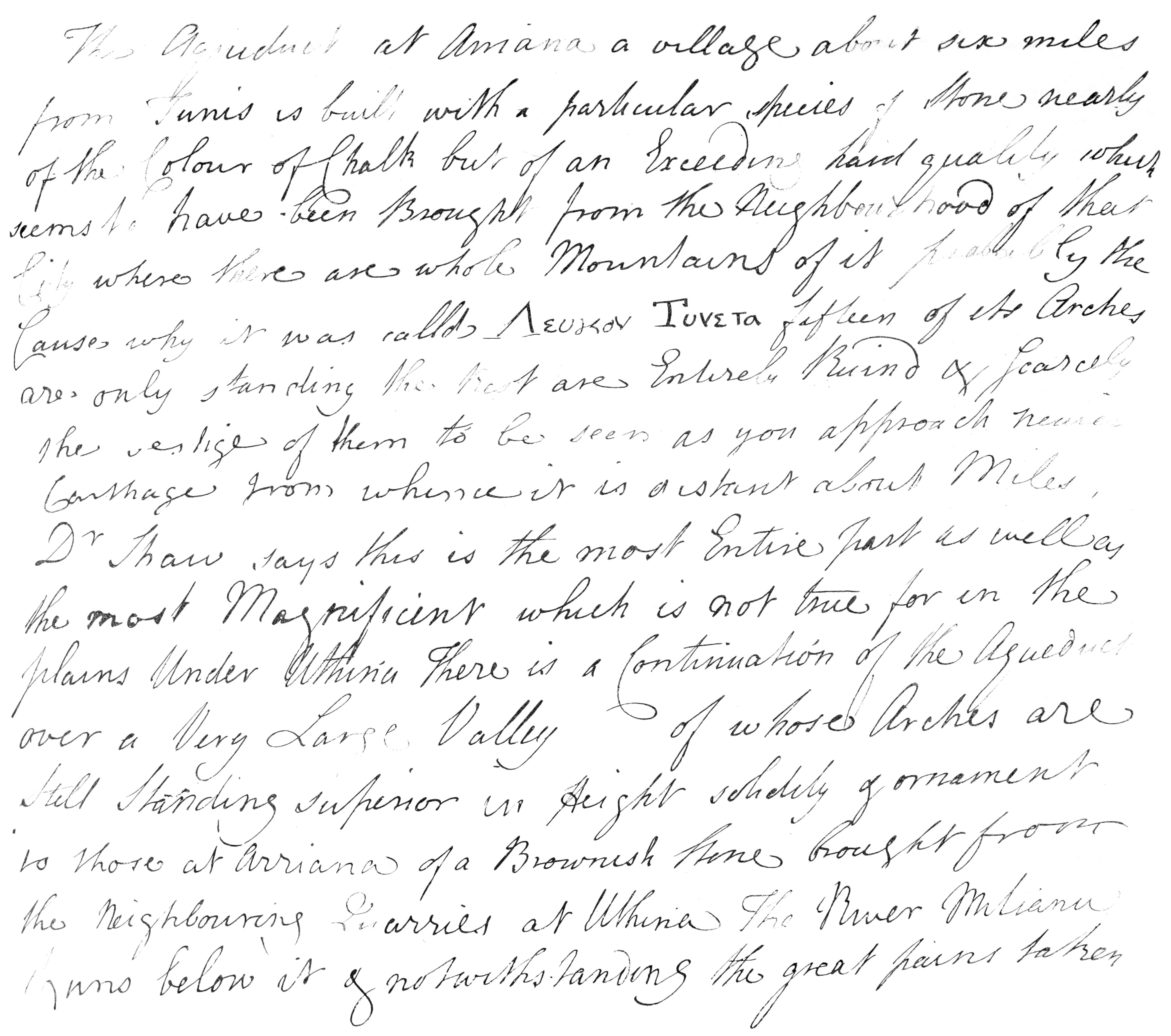
containing a note on the Aqueduct at Arriana, and the records of
his journey from December 29, 1765, till his arrival at Gabes about
the middle of the following month. It is marked No. 7, which is
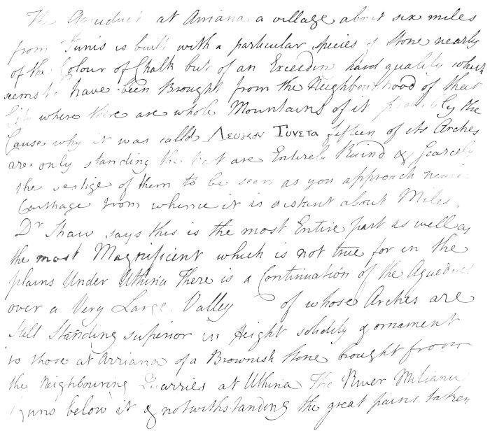
erased, and No. 3 substituted. A fac-simile is given of one page of
this manuscript (Plate XXV.).
4. A note-book, 12mo., of Arab paper, marked No. 2, containing
notes on the Pentapolis, and of his subsequent journey in Syria and
the Red Sea.
5. A similar book, marked No. 6, containing notes on the
Pentapolis.
6. A volume containing, as its name indicates, ‘Basso-relievos,
Statues, and Inscriptions, 1765.’
7. Draft of original letter, in Bruce’s handwriting, to Mr.
Wood, author of the work on ‘Baalbec and Palmyra,’ dated Tunis,
April 2, 1766, published in Vol. I. of ‘Bruce’s Travels,’ Appendix
No. XXIII.
8. A note on
‘Tripoly in Africa,’ certainly not written by Bruce.
9. An autograph memoir on the Island of Tabarca.
10. An autograph memoir on Tunis and Djerba, the island of the
Lotophagi.
11. An original letter, dated London, June 16, 1775, to Mr.
Seton (of Touch?), giving an account of his adventure with the Arab
chief at Lambessa. This has been published in Major Cumming Bruce’s
pamphlet, 1837.
In addition to these manuscripts and drawings, Bruce brought a
very interesting collection of antiquities from North Africa,
consisting of fragments of sculpture and inscriptions, including
part of the frieze of the Temple of Hercules at Kef, a number of
medals and coins, a small bronze statue of Mercury, and an
exquisite bronze vase, which forms the design on the cover of this
work. It has four faces, two of nymphs and two of satyrs, very
beautifully executed, of a date probably not later than the second
century. These are all in the possession of Lord Thurlow.
There is little doubt that Bruce transcribed his rough notes,
and added many particulars, then fresh in his memory, which he did
not think it necessary to record in his daily journal. This
occurred during his residence at the island of Djerba. Probably
this manuscript was not included amongst the books and drawings
which he forwarded from Tripoli in Africa to Smyrna, or those which
he despatched at Bengazi to Tripoli in Syria, in which case they
would certainly have been lost during the shipwreck at Bengazi. His
pocket-book was saved there, and may be the manuscript
which I have numbered 2, into which 3 would naturally fit, but
almost everything else he possessed was lost, especially
A book with many drawings, and a copy of M. de la Caille’s
Ephemerides, having a great many manuscript marginal notes.
In addition to illustrating Bruce’s travels, I have had another
object in view—to furnish an advanced hand-book of travel
to those who, like myself, dislike diligence routes and French
auberges, and revel in the delightful liberty of life on horseback
and under canvas. I hope they will find many such suggestions as to
routes here, as I should have been glad of myself, though they must
not expect to be treated with the same amount of hospitality.
And here I think I ought, in justice to myself, to acknowledge
the authorship of ‘Murray’s Handbook to Algeria.’ I have
endeavoured, as far as possible, to avoid any allusion to the
districts therein described; but this was not always possible, and
passages will, no doubt, be found, which, but for this avowal,
might lay me open to the charge of obtaining my information from a
popular work in everybody’s hands.
Every word of these manuscripts relating to his Barbary journey
I have embodied in my
text, either in the order in which I visited the places, or, where
I was unable to do so, as a continuous narrative in his own
words.
I have elsewhere acknowledged my deep obligations to Monsieur
César Daly, with whom I had the pleasure of making the first part
of my journey. I would also record how much I am indebted to
Professor Donaldson, the Nestor of British architects, who, ever
since he signed the letter to Major Cumming Bruce, before quoted,
in 1837, has felt the deepest interest in Bruce’s work; he greatly
aided me in making the best possible selection of the drawings for
publication, and in many other respects he has given me the benefit
of his great professional knowledge and experience.
I cannot conclude these introductory remarks without allusion to
a letter which has reached me since the manuscript was in the
publishers’ hands, and which has to me almost the solemnity of a
voice from beyond the tomb. Mrs. Whitely Dundas, of Clifton, after
stating that she had seen in the papers a paragraph to the effect
that I had recently been instrumental in erecting a stained-glass
window and memorial brass in the church at Algiers to Bruce, and
that I was occupied on a work to illustrate his travels in this
country, adds: ‘I can well imagine, even after the lapse of so many
years, how proud and gratified my mother would have been could she
have lived to see this day. She was Bruce’s only daughter, and died
before her father’s fame and veracity were fully established.’
If what has been to me so great a labour of love shall have the
effect of adding one leaf to the well-earned laurel-wreath of my
favourite hero, I shall be amply repaid. My work has had no other
object, although I have thought it advisable to combine the result
of my own journeys with his, and thus to give the subject a wider
interest, and make it useful for travellers in little-known parts
of Algeria and Tunis.
However badly my share of the work may be performed, Bruce’s
merits can hardly fail to ensure its success. Never was a trite old
saying more aptly applied than that adopted by his biographer, and
which I have engraved on his monument at Algiers: ‘Magna est
veritas et prævalebit.’
[2]In searching for Bruce’s Barbary drawings in
Her Majesty’s Library at Windsor Castle, eighteen drawings of
Palmyra and Baalbec were discovered; they bore no names or
signature, and the authorship was unknown to the librarian until I
identified them.
The circumstances which
induced Bruce to accept the post of Consul-General at Algiers are
contained in the following extracts from his autobiography:—
My Lord Halifax, in many conversations, laughed at me for my
intention of returning to Scotland. He said, the way of rising in
this King’s reign was by enterprise and discovery; that all Africa,
though just at our door, was yet unexplored; that every page of
Doctor Shaw, a writer of undoubted credit, spoke of some
magnificent ruins which he had seen in the kingdoms of Tunis and
Algiers; that now was the age to recover these remains of
architecture and add them to the King’s collection.
Fortune seemed to enter into this scheme. At the very instant,
Mr. Aspinwall, very cruelly and ignominiously treated by the Dey of
Algiers, had resigned his consulship, and Mr. Ford, a merchant,
formerly the Dey’s acquaintance, was named in his place. Mr. Ford
was appointed, and, dying a few days afterwards, the consulship
became vacant. Lord Halifax pressed me to accept this, as
containing all sorts of conveniences for making the proposed
expedition. The appointment was a handsome one, the salary was
900l. a year, and a promise was added that a vice-consul
of my own appointment would be allowed to keep my place while on
the discovery, and that, if I made wide excursions into Africa, and
any considerable additions to the King’s collection, my former
conditions of being made a baronet were to be preserved, and either
a pension if I chose to retire, or my rank and advancement in the
diplomatique line, preserved to me on my return.
Many conversations passed about the then unknown and despaired
of fountains of the Nile; but this was considered as an enterprise
above the power of extraordinary men, presumption to think it was
within the reach of an untried ordinary man like me, but agreed on
all hands that he that should achieve it, if he was a Briton,
should not in this age despair of any reward.
In passing through Holland, I had collected all the printed
books in the Arabic language, and at the time when I was to go to
Algiers I was as good an Arabian as these books and dictionaries
and this manner of study could make me.
Thus prepared, I set out for Italy through France, and though it
was in time of war, and some strong objections had been made to
particular passports solicited by our Government from the French
Secretary of State, Monsieur de Choiseul most obligingly waived all
such exceptions with regard to me, and most politely assured me
that those difficulties did not in any shape regard me, but that I
was at perfect liberty to pass through or remain in France with
those that accompanied me, without limiting their number, as short or as
long a time as should be agreeable to me.
On my arrival at Rome, I received orders to proceed to Naples,
there to await His Majesty’s further commands.
While waiting at Naples for instructions to proceed to his post,
Bruce visited Pæstum, the ruins of which were then but little
known, and at the suggestion of Sir James Gray, the British
Ambassador, made accurate drawings of those ruins, and conceived
the idea of illustrating the history of that city from its various
coins of different periods. This idea, which he was the first to
originate, he executed with great learning and ingenuity. On
proceeding to Africa, he entrusted these drawings to Sir Robert
Strange, for the purpose of having them engraved; but, from
circumstances which have never been explained, copies of them were
surreptitiously obtained, and, on his return from Abyssinia, he
found that his work had been pirated and published under another
name. In his autograph memoir he expresses himself strongly on this
subject, but his chief complaint is
That the bunglers did not know how to avail themselves of the
materials for the history of Pæstum which, by whatever means, had
fallen into their hands.
To resume, however, Bruce’s own narrative:—
The Government was so kind as to send the ‘Montreal’ frigate to
carry me to Algiers.
I pursued my plan, studied hard, was become now a good
Orientalist in general. I speedily spoke the Arabic fluently; among
the natives and among the servants I exercised myself every day. I
was also an adept in Geer, or Ethiopic, as far as Ludolph and
Memmers and the few books I had could make me, but these were as
yet very few.
It happened at St. Philip’s in Minorca, as it always, I believe,
happens, that when a fortress is surrendered to an enemy, the
papers, plans, and documents found therein are to be delivered up
to the captors. The French, when they took Minorca, had found in
that fortress a multitude of blank Mediterranean passes, a number
of these being always lodged for common demand with the Secretary
of the Governor of Minorca and Gibraltar. The French, upon finding
these, had countersigned them, and sold them to Sardinians,
Genoese, Neapolitans, and Spaniards, who navigated under their
authority with English colours. They had not even taken the
precaution of putting an English supercargo on board, so that
English colours were found everywhere, with not a man on board but
the enemies of Algiers.
This Regency soon were informed of this in all its circumstances
by the French and Swedish Consuls residing in Algiers; they could
not read, their only trial of the passport was by a countercheck
delivered them by the Consul. When they applied this to these false
passports they all checked and agreed; when the ships were,
notwithstanding, brought into Algiers, the English Consul detected
the fraud, disowned the signature, and the ship was made a legal
prize.
This secret, however obvious to everyone skilled in business of
that kind, was inscrutable to pirates who knew no other rule but
the check; the cruisers were on the point of mutinying; had I not been on good terms
with the whole Regency, as well as with the common soldiers and
merchants, I should have been burned in my house, or condemned to
draw the stone cart in irons, as a short time before I had had the
mortification to see the French Consul and all his nation do.
The event here alluded to is an extraordinary example of the
terrorism which prevailed in Algiers at that epoch, and of the
indignities to which even representatives of the most powerful
nations were subjected, without provoking more than a passing
remonstrance. The story is recorded in the private memorials of the
Congrégation de la Mission, which have been obligingly placed at my
disposal by the Superior-General in Paris. Well may he remark: ‘Nos
confrères ont beaucoup travaillé et beaucoup souffert sur cette
terre d’Afrique, où les Chrétiens avaient été si longtemps
persécutés; maintenant la croix a heureusement triomphé, et puisque
vous avez étudié l’histoire de ce pays, vous pouvez voir combien il
a gagné à être délivré de la domination Mahométane.’
A French vessel had, through some mistake, fired upon an
Algerian galliot, which made a prize of it, and brought it into the
harbour of Algiers. Monsieur Vallière, the French Consul, went on
the following day to request the Dey to restore the boat and its
equipage, assuring his Highness that if the latter had been guilty
of any infringement of the conventions between the two countries
they would be severely punished in France. The Dey answered him
that the French were only good at chicanery; they were liars, the
greatest enemies of the country, and no better than spies of the
Spaniards; he knew how to right himself, and would hear nothing
more from the Consul, who might retire.
The Consul did retire, in company with his chancellor. In less
than an hour he was again called to the palace, and, without
further explanation, he was heavily chained, as were also the Vicar
Apostolic, two other missionaries, the chancellor, the secretary,
the Consul’s servants, and the crews of the four boats then in
harbour, in all fifty-three persons. Every morning they were sent
out to the hardest and most degrading labour, and exposed to the
insults and jeers of the populace; harnessed two and two to stone
carts and heavily ironed, they were compelled to drag their weary
burden twice every day from the quarries at several miles’ distance
to where the masons were at work, after which, though worn out with
fatigue, the good priests’ first care was to console their
fellow-captives, and to conduct public prayer in the Bagnio.
Our treaties, made and renewed by captains of men-of-war, from
time to time, who know no more of the interest of their country in
the Mediterranean than I know of directing a line-of-battle,
afforded no sort of remedy for this grievance, which was new,
because Port Mahon falling into the hands of the enemy was a new
event not to be foreseen.
These treaties
were growing worse every day; they were a monstrous heap of
confusion not understood either by the Turkish or the British
Government. I wrote home repeated letters explanatory of the
mischief and the causes of it. I either got no answers at all, or
short ones, that showed me they did not attend to the subject. We
were on the very eve of having all our Mediterranean and Straits
trade carried into the Barbary ports as prizes, when letters were
said to be expeded (sic) by the Secretary of State—I think
the Duke of Grafton or Lord Shelburne—desiring the Governor of
Mahon and Gibraltar (for Mahon was now restored to the English) to
recall all these old irregular passports signed by the French, and
in their place to issue what was called passavants, under
the hand and seal of the Governor of those fortresses, importing
the ship bearer thereof to be British property, and that this
should serve as a passport during a limited time, after which new
checks and new passports were to be issued by the Admiralty for the
ships then in the Mediterranean and the Barbary cruisers that
visited them. But no intimation was sent to the Consuls of this,
nor was such passavant to be found in the treaty, nor did any new
checks or passports come for a long time from the Admiralty.
In the meantime the Algerine cruisers were more exasperated than
before; they had still no way of knowing an enemy from a friend but
by the check the Consul gave them, and that had been declared as no
longer of use, as covering fraud, and was issued no more.
· · · · · · ·
All Algiers was in arms, and to excuse our Government was
impossible; they never did know Barbary politics in my time.
· · · · · · ·
British Consuls in the Straits, or in the Barbary States, are
generally men that have failed in their own mercantile affairs;
they are afraid to write the true situation of things to a
Secretary of State, because they fear hurting their interest at
Algiers and losing their posts at home. Government have for some
years been afraid of Algiers, or so complaisant as to recal the
British Consul upon a complaint they do not like him, and often for
having done his duty.
I was no merchant, and afraid of neither; I had stated the thing
as it was constantly, and one day when a few of these pirates had
come home in disappointment at meeting nothing but what was covered
by these passavants, crossing me in the street, one of them, drunk,
I suppose, fired a large horse pistol directly in my face at the
distance of sixteen yards. It was loaded with slugs, one of which
cut the loop where my hat was buttoned, another cut the skin of my
eyelid, and a third wounded me slightly in the left arm. Government
seized the unhappy beast and would have put him to death, had I not
saved him by the trouble of some application and interest, and even
a little expense.
It was no vain boast on the part of Bruce that his intercession
had saved this man’s life. Monsieur Laugier de Tassy, in his
‘Histoire du Royaume d’Alger,’ published at Amsterdam in 1727,
gives the following account of what happened to another unhappy
wretch who had insulted a British Consul, and there is little doubt
that if Barbary justice had been left to take its course this man
would have fared no better.
‘In 1716 Mr.
Thomas Thompson, British Consul, going to the Assembly Rooms of the
ship captains, met on the pier a young Moor, who, it is generally
believed, was drunk. The pier is very narrow, and much rain having
fallen, the passage was by no means easy. The Moor would not make
way for the Consul, but began to quarrel and even pushed him. The
Consul asked him whether he wished to throw him off the pier,
adding that he thought it rather impertinent of him not to turn
aside. The Moor answered that it was well for a Christian to wish
to pass before him, and at the same time seized the Consul, boxed
his ears, tripped him over, threw him on the ground and placed his
knee on his stomach. The Captain of the Port, having witnessed this
scene from a distance, came forward and threatened the Moor, who
thought it better not to wait for him and ran away. The Captain
took the Consul to the house where the captains met, to console him
and to repair the disorder he was in. The Admiral expressed his
regret at what had happened. He told him he would report the matter
to the Dey, and the Moor would soon be punished for his crime. The
Admiral had great regard for the family of this young man, for his
father was a friend of his and an honest merchant. When, therefore,
he had laid the whole affair before the Dey, he begged him not to
condemn the man to death, as he deserved, as he belonged to a
respectable family, and that drink, to which he had been tempted by
libertines, had been the cause of his crime. The Dey answered that
he deserved to be hanged, but that out of regard for him he would
be pardoned. As an example, however, and for the sake of the
insulted Consul, it was necessary to punish the wretch; the Dey
therefore asked the Admiral to choose the kind of punishment he
liked. The Admiral chose the bastinado, and the Dey said to him,
“Out of regard for thee I will spare him.” The Consul soon after
arrived. The Dey, seeing him, said, “Consul, I am doing what you
desire. I am sorry for what has happened to you, but you shall have
justice; remain there.” He gave orders at the same time to the
Moorish Bach-Chaouch to bring the accused before him. As
he had not hidden himself, he was soon found and brought before the
Dey, who, in great anger, said to him, “Wretch, what hast thou
done?”—“I have beaten a Christian, a dog who wanted to be more than
myself, and who insulted me.” The Dey, enraged at his arrogance,
said, “Is it true that you have treated the British Consul in such
and such a way?”—“Yes, my Lord,” he answered. “Is it worth sending
for me for such a trifle?” Then the Dey, furious, cried out, “That
is enough,” and pronounced sentence, which was that he should
receive 2,200 stripes. This was done at once, in the presence of
the Consul. He received 100 blows on the soles of the feet, so that
his feet were taken off as far as the ankles, or held on by so
little that Mehemed Effendi Khasnadar drew his knife and cut the
skin by which they hung. As further blows would have caused death, and as the Dey was
anxious that he should suffer well before such a thing happened, he
gave orders to conduct him to prison, so that he might regain
strength. The following day, at nine in the morning, the Dey sent
for the British Consul, and also for the prisoner, who there and
then received the remaining 1,200 blows on his back, which was so
cut up that he lost both speech and breath. But, as he was not yet
dead, the Dey ordered him to be taken back to prison, and to be
shut up there alone, and without help. This was done, and the poor
wretch was suffered to die of pain, hunger, and thirst.’
To resume however Bruce’s narrative:—
This dispassionate behaviour reconciled all the soldiery to me,
already well-inclined to a man as to personal friendship. I gave
Government a long detail of the situation of their affairs, without
fear or disguise; I begged them to send out a man of some knowledge
and dignity in business, who with me might go through the treaties,
renew them, and make them intelligible, who might bring out new
Mediterranean passes, a thing to be done in a very short time,
after which I was satisfied that things would be settled on a
peaceable and permanent footing. I claimed the King’s promise to be
allowed to appoint a man, who had nothing to do but to sign the
passports, while I made the excursions into Africa, which were the
object of my voyage, for which I was fully prepared, and wished to
defer no longer.
I received an answer that His Majesty commanded me to stay, till
an Ambassador should be sent, to explain and settle the matter and
the disputes with the Dey of Algiers. At the same time it said,
slightly enough, that it undoubtedly was the King’s wish I might
continue at Algiers; but since I did not choose it, His Majesty was
resolved, that these places should not be sinecures, and therefore
another Consul would be sent over, unless I certified my resolution
to stay in course.
This mandate, which was a direct breach of the faith of
Government, filled me with indignation.
· · · · · · ·
A relative of my own, a Captain C———,[9] son
to the Secretary of the Admiralty, a man that I knew much better
than those that sent him, came as the King’s representative to
Algiers, and brought with him a city attorney,[10]
that had somehow or other connected himself by marriage with the
family of Egerton, as Consul.
None of them understood a word of the language, none of them a
word of sense; they quarrelled from the beginning, and the
Ambassador privately engaged the Dey to send the Consul home again
by the end of the year, when he would bring out another and new
presents from the King.
· · · · · · ·
The Dey[11] continued my fast friend; he furnished me with
all the necessary letters to his provinces. I told him I was going
for some necessaries to Mahon. I should then go down the coast by
Bona, to Tunis. I should then come back to Constantine and return
again to Tunis by the foot of Mount Atlas.
He assured me of
every mark of friendship and protection, which he kept through the
whole course of the voyage.
The Ambassador, in the Phœnix, man-of-war, and I in a
small Mahonese barque, sailed together from Algiers for
Mahon.[12]
In the night we were overtaken by a violent storm of wind, which
lasted all the next day, broke our mainsail yard, and did us other
considerable damage. We saw no more of the Phœnix; she had
held her wind, which though violent was fair, and arrived at
Gibraltar.
I put into Quarantine Island in Mahon, and announced my arrival
there and the reason of it to General Townshend, desiring it might
be entered in some book, where the authentic evidence of day and
date might be referred to. Every sort of politeness was shown me by
that officer, who ordered immediately to give me pratique. Having
nothing to do in Mahon, I refused it, and set sail for Tunis.
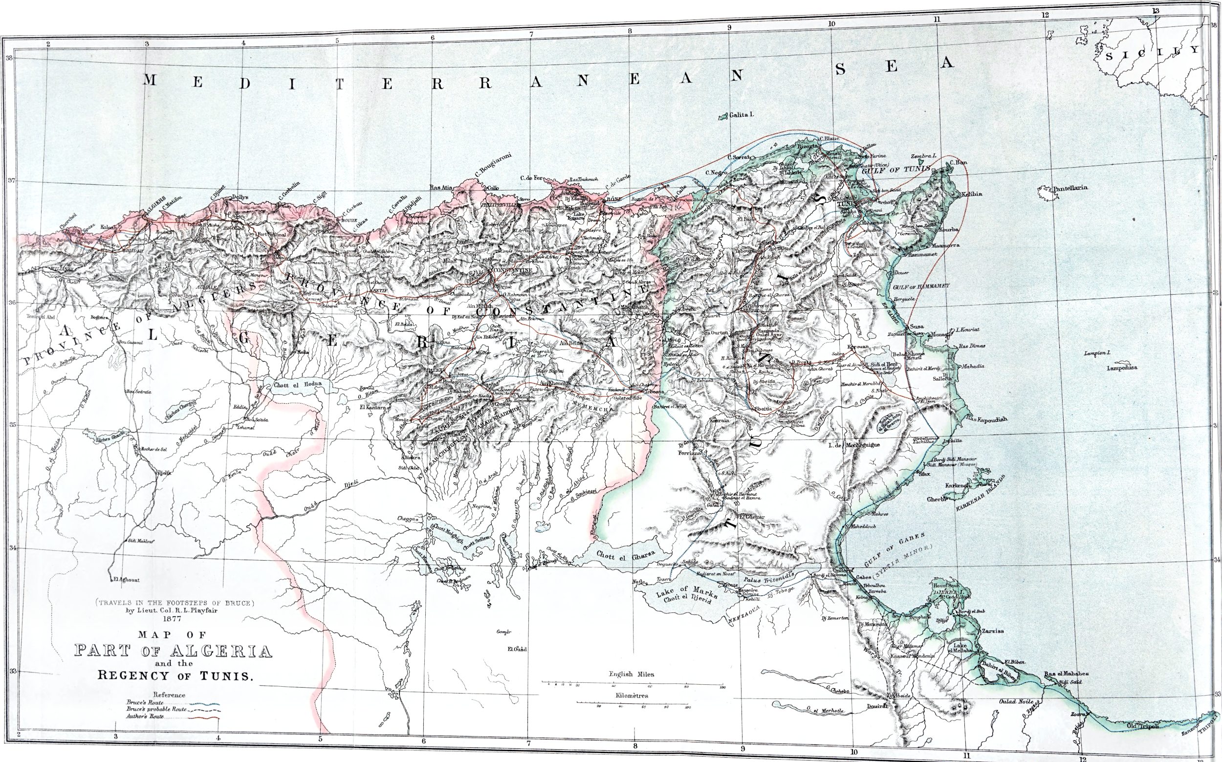
As the first portion of Bruce’s journey is not given in the
order in which he made it, I subjoin the dates of the various
stages, as nearly as they can be made out.
1765.
About August 19, left Algiers.
Middle of October, left Tunis for Medjez-el-Bab, Dougga, and
Kef.
November 5, left Kef.
„ 6 to 9,
Zanfour, Mukther.
„ 10, Oulad
Ayar.
„ 11, Sbiba—Oulad
Hassan.
„ 12 to 14,
Sbaitla.
„ 15, six miles
north of Sbaitla.
„ 16,
Zeghalma.
„ 17, Djebel
Hannech.
„ 18, Mountains
of Zeghalma.
„ 19-20,
Hydera.
„ 21 to 23,
Tebessa.
„ 24, Mountains
of Hannencha, fourteen miles from Tebessa.
„ 25, Oulad Aissa
at Bucowash.
„ 26, passed
Miskiana and ‘entered eastern province of Algiers.’
„ 27, eight miles
E. of Sidi Bou-geise.
„ 28, Sigus.
„ 29, Boo
Marzook.
„ 30,
Constantine.
December 2, five miles south of Constantine.
„ 3, Ain
Fisgeeah.
„ 4,
Tattubt.
„ 5, encamped at
Smala of the Bey, nine miles from Tattubt.
[12]Bruce’s passport for Tunis, signed by his
successor, Robert Kirke, is dated August 19, 1765.
CHAPTER II.
Julia Cæsarea.
There is no written account
remaining of Bruce’s explorations to the west of Algiers, and the
only allusion to them is the fact that he first used his camera
obscura in delineating the Kubr-er-Rumiah, or Tombeau de
la Chrétienne, as it is now called.
The illustrations he has left of Julia Cæsarea, which,
doubtless, he visited while still Consul-General at Algiers, are as
follows:
1. A perspective view in water-colours and
distemper of the Kubr-er-Rumiah, or Tomb of Juba II. No
architectural details are shown, as the débris around the
base had not then been cleared away.
2. Finished drawing to scale, in Indian ink, of restored plan,
and elevation of Tomb.
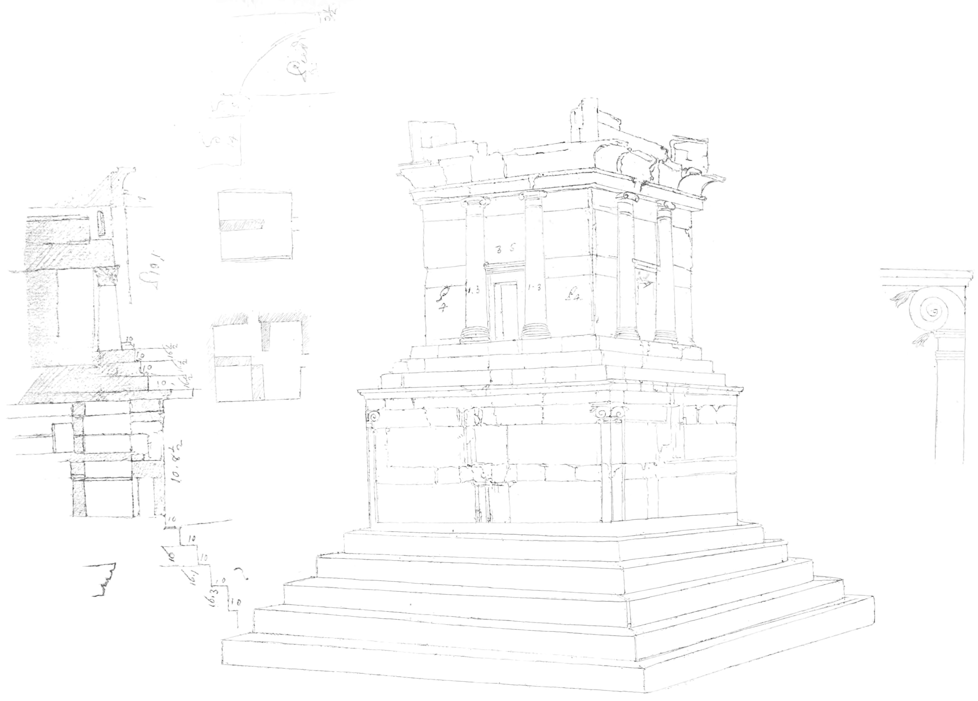
3. Perspective view in water-colours of the same building, taken
from the S.E. In the foreground are architectural fragments,
including Ionic capitals, frusta of columns, and portion of
entablature. [Plate I.]
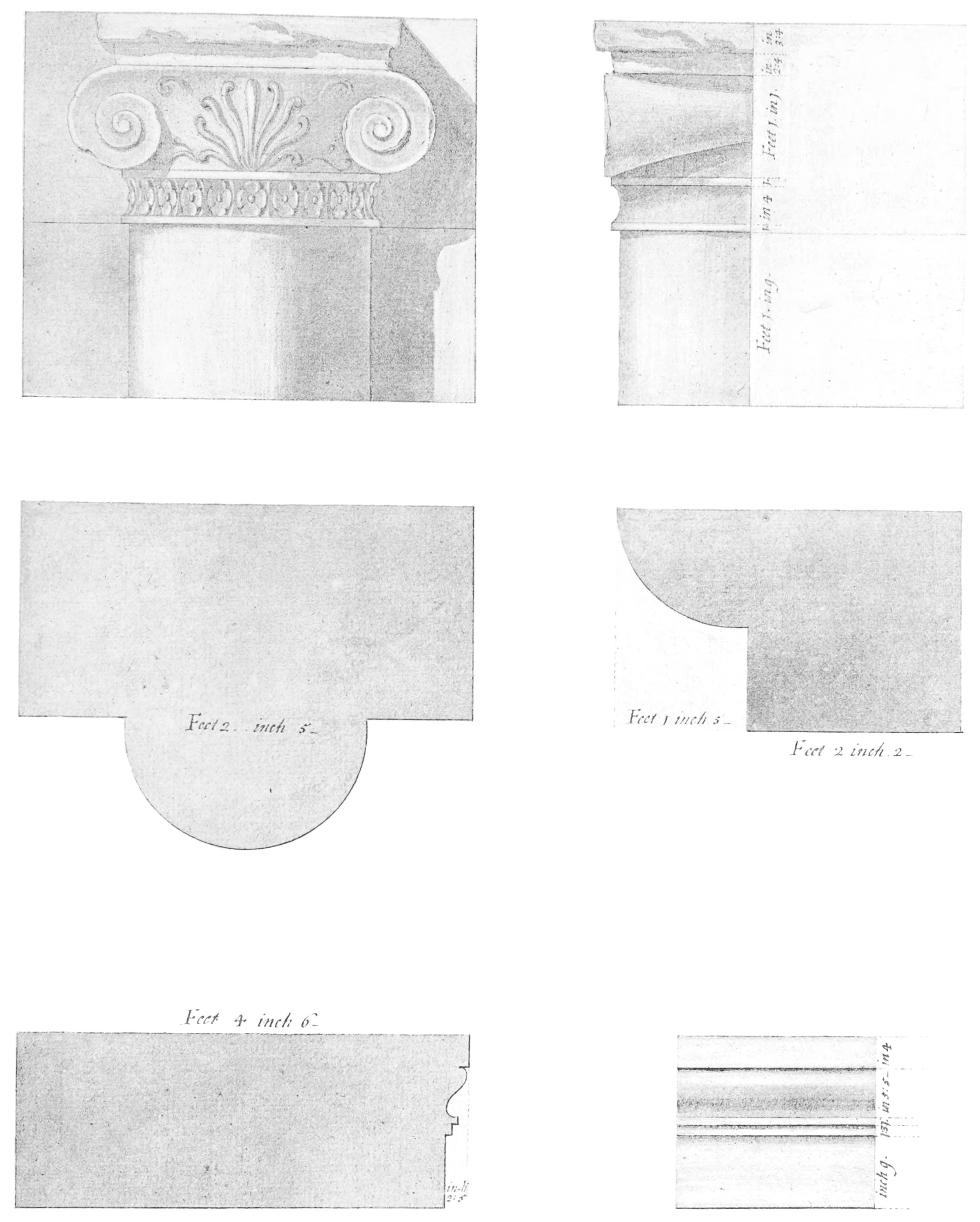
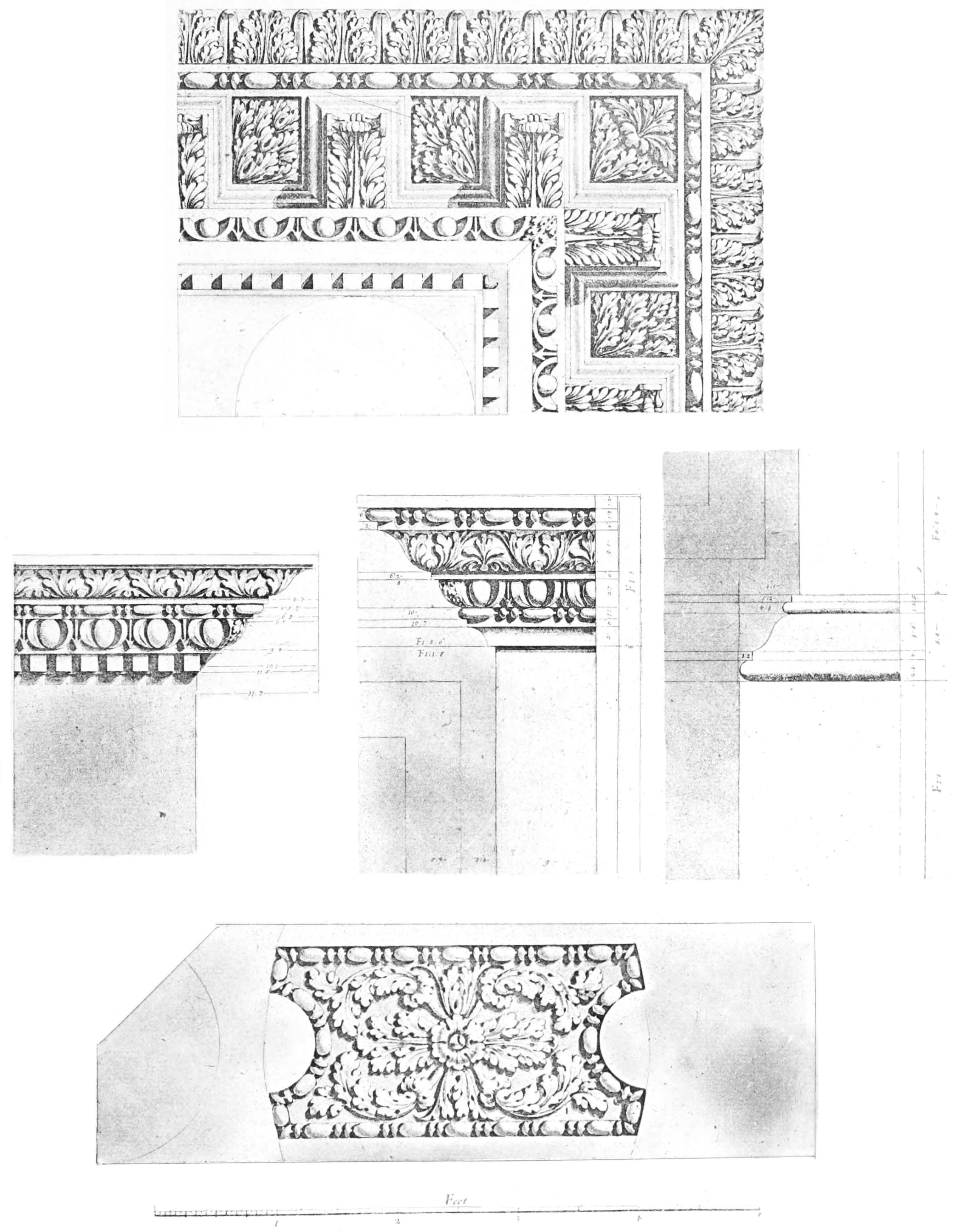
4. Finished drawing to scale, in Indian ink, of front and side
elevation of capitals of Ionic order; plan of columns. Elevation
and section of architrave. [Plate II.]
5. Duplicate of 2; dimensions not figured.
6. Duplicate of 4.
7. Pencil drawings of coins: six coins of Ptolemy, one of Juba
II.
8. Pencil drawings of coins: eight coins of Juba, four of Juba
and Cleopatra Selene, one of Cleopatra Selene.
9. Pencil sketch of Tomb, very similar to 3.
10. Perspective view of Aqueduct of Cherchel. [Plate III.]
11. A view of the same, in distemper.
12. Elevation and section of the same to scale.
13 to 15. Three ornamental titles of proposed work.
The site of the
ancient city of Jol, subsequently Julia Cæsarea, is marked by the
modern town of Cherchel, about 72 miles west of Algiers.
After the surrender of Jugurtha to Marius by his son-in-law and
ally, Bocchus King of Numidia, the latter reunited to his own
kingdom the provinces, which extended from Saldae, the modern
Bougie, to Molocath, the modern river Molouia, on the confines of
Morocco. At his death, about 91 B.C., he
left the western portion of his dominions to Bogud, and the newly
annexed portions to his second son Bocchus.
Fifty years later we find these two divisions of Mauritania
still existing, and governed by kings bearing the same names as
before, but with this difference, that it was Bogud who was King of
Eastern Mauritania, and Bocchus who governed the western portion or
Tingitana.[13]
The former of these took part with Cæsar in the war, which
terminated in the defeat of the Pompeian army at Thapsus, and the
suicide of Juba I. King of Numidia. The infant son of that monarch
was taken to Rome, where he graced the triumph of the great
dictator; a part of the forfeited kingdom was given to Bogud, and
subsequently the western province was added by Augustus, during the
reign of his son Bocchus III. That prince reigned five years over
the two Mauritanias, his capital being Jol, and died B.C. 33.
In the meantime the young Juba had been carefully educated at
Rome, where he attained a high literary reputation, being
frequently cited by Pliny, who describes him as more memorable for
his erudition than for the crown he wore, glorious as it was.
Plutarch also calls him the greatest historian amongst kings.
All his works have disappeared, though a long list of them has
survived; they treated of a great diversity of subjects, including
history, antiquities, arts, science, grammar and geography.
In the year 26 B.C. Augustus, desiring
to give to the people of the late monarch a sovereign of their own
race, fixed upon this son of Juba, and restored to him the western
portion of his father’s dominions, trusting to his thorough Roman
education to secure his submission, and on the prestige of his race
and name to win the affections of the Numidian races, and to hasten
their fusion with the conquering nation.
He removed his capital to the ancient Phœnician city of Jol, to
which he gave the name of Julia Cæsarea.
He died in A.D. 19, leaving a son,
Ptolemy, the last independent prince of Mauritania, who was far
from sharing the high qualities of his father.
His reign was
characterised by debauchery and misgovernment, and the Mauritanians
were not slow to rise in revolt, under the leadership of
Tacfarinas. This war lasted for seven years, shortly after which
Tiberius died, and was succeeded by Caligula, who summoned Ptolemy
to Rome, and, after having received him with great honour, caused
him to be killed, as he thought that the splendour of his attire
excited unduly the attention of the spectators. It is more likely
that he desired to appropriate the wealth that Ptolemy was known to
have accumulated. This murder was followed by a serious revolution
in Mauritania, which lasted several years.
The Tombeau de la Chrétienne figured by Bruce is well known to
all visitors to Algiers. It is one of three somewhat similar
edifices, one of which is found in each province of Algeria, the
other two being the Medrassen, or Tomb of the Numidian Kings in
Constantine, and El-Djedar in Oran.
This, however, is the only one mentioned by any ancient author.
Pomponius Mela, in his work ‘De Situ Orbis,’ written about the
middle of the first century, after the death of Juba II., but
before the murder of his son Ptolemy, mentions both Cæsarea
(Cherchel) and Icosium (Algiers), and states that beyond the former
is the monumentum commune regiæ gentis.
This at once decides the nature of the building, which, though
intended to be seen far and near, is yet entirely concealed from
view at Cherchel by the mountain of Chennoua, the presumption being
that the king would not care to have constantly within sight of his
royal residence, the tomb which he had caused to be constructed for
himself.
The resemblance to the Medrassen, or Tomb of the Numidian Kings,
from whom Juba was descended, is another presumption that it was
erected by him in imitation of his ancestral mausoleum.
Bruce’s illustration (Plate I.) of this
monument is the only inaccurate one in the whole series. Until long
after his time the podium was so encumbered with débris
that it was impossible to make out the architectural details, and
he has represented this portion of the edifice rather as what he
imagined it to be than as it actually existed.
Juba II. married Cleopatra Selene, daughter of the celebrated
Egyptian queen by Marc Antony, and there is every probability that
this monument served only as his tomb, and that of his wife, who
died before him. It is hardly likely that the remains of his son
Ptolemy, the last of his race, could have been transferred from
Rome to Africa.
The tomb must have been violated at a very early period in the
search for hidden
treasure. A careful examination of the accumulated earth and dust
within revealed traces of successive races, who had visited the
place, some of whom had even made it a place of residence, but none
whatever of the bodies for whose reception it had been erected.
It is called by the Arabs Kubr er-Roumiah, tomb of the
Roman, or rather Christian woman, the word Roumi (fem.
Roumiah) being used commonly by Arabs all over the East to
designate strangers of Christian origin.
Various explanations are given of this name. Marmol mentions a
tradition, that under it were interred the mortal remains of the
beautiful daughter of Count Julian, over the story of whose
misfortunes the muse of Southey has shed so strong an interest.
Shaw[14] states that amongst the Turks it was known by
the name Maltapasy, or Treasure of the Sugar Loaf; and the belief,
that it covered some great accumulation of riches, has exposed it
to attacks, by which it has been much ruined, and before which a
less solid structure would have altogether disappeared. Marmol
adds:
‘In the year 1555 Solharraes[15] attempted to pull it down,
hoping to find some treasure in it; but when they lifted up the
stones there came a sort of black poisonous wasps from under them,
which caused immediate death wherever they stinged, and upon that
Barbarossa dropped his design.’
Many other legends and traditions are connected with it, which
it would be out of place here to reproduce.
The Tombeau de la Chrétienne is built on a hill forming part of
the Sahel range, 756 feet above the level of the sea, covered with
a brushwood of lentisk and tree heath, situated nearly midway
between Tipasa and Koleah, and to the west of Algiers.
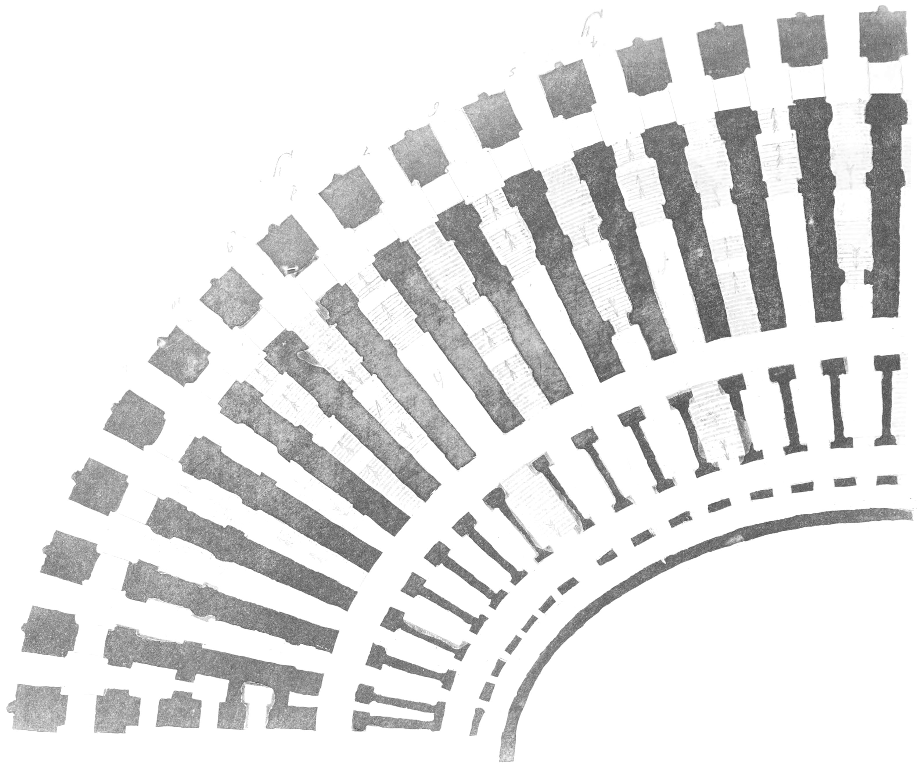
It is a circular, or rather polygonal, building, originally
about 131 feet in height; the actual height at present is 100 ft. 8
in., of which the cylindrical portion is 36 ft. 6 in., and the
pyramid 64 ft. 2 in. The base is 198 feet in diameter, and forms an
encircling podium, or zone, of a decorative character, presenting a
vertical wall, ornamented with sixty engaged Ionic columns, 2 ft. 5
in. in diameter, surmounted by a frieze or cornice of simple form.
The capitals of the columns have entirely disappeared, but they are
represented in Bruce’s drawings as having very small volutes, most
of the space between which is occupied by a honeysuckle flower.
There are two tendrils, one on each side of the flower, but growing
out of the surface of the capital, and not continuous with the
flower. The necking between the capital and the shaft is composed of a succession of
four small petalled flowers, flatly applied, contained between an
upper and a lower fillet.
The series of the colonnade has at the cardinal points four
false doors, the four panels of which, producing what may have been
taken to represent a cross, probably contributed to fix the
appellation of Christian to it.
Above the cornice rise a series of thirty-three steps, which
gradually decrease in circular area, giving the building the
appearance of a truncated cone.
The whole monument is placed on a low platform 210 feet square,
the sides of which are tangents to the circular base.
During the Emperor Napoleon’s last visit to Africa he charged
the well-known Algerian scholar, M. Berbrugger, and M. MacCarthy,
the late and present directors of the library and museum, to
explore this tomb, which had never been penetrated in modern times,
spite of the attempt of Salah Rais, in 1555, and the efforts of
Baba Mohammed in the end of the eighteenth century, to batter it
down by means of artillery.
SKETCH SHOWING THE CROSS ON THE FALSE
DOORS.
In May, 1866, a hole was drilled by an Artesian sound, which
gave indications of an interior cavity, and shortly afterwards an
opening was made from the exterior to the interior passage.
Entering by this, both the central chamber and the regular door
were easily found.
Below the false door, to the E., is a smaller one, giving access
to a vaulted chamber, to the right of which was the door of the
principal gallery. Above this are rudely sculptured the figures of
a lion and a lioness.
From this passage a large gallery, about 6 ft. 7 in. in breadth,
by 7 ft. 5 in. in height, is entered by a flight of steps. Along it
are niches in the wall, intended to hold lamps. Its total length is
483 feet. This winds round in a spiral direction, gradually approaching the
centre, where are two sepulchral vaulted chambers, one 12 ft. 4 in.
by 9 ft. 3 in., and the other 12 ft. 4 in. by 9 ft. 7 in.,
separated from each other by a short passage, and shut off from the
winding passage by stone doors, consisting of a single slab capable
of being moved up and down by levers like a portcullis.
Julia Cæsarea itself, corresponding to the charming little
French town of Cherchel, is situated further on, at a distance of
71 miles from Algiers, and twenty from the nearest station,
El-Afroun.
Close to the twenty-second kilometric stone, counting from where
the Cherchel road branches off from the main one to Miliana at
Bou-Rekika, and at a distance of between six and seven miles from
Cherchel, is the subject of Bruce’s second illustration (Plate III.), part of the aqueduct which led the waters
of the Oued el-Hachem, and the copious springs of Djebel Chennoua
into Julia Cæsarea. This consisted of two converging branches,
following the contour of the hills as open channels or traversing
projecting spurs by means of galleries. In only two places was it
necessary to carry the water over valleys on arches; the first was
at the place here illustrated, and the second about three miles
further on, at the junction of the two branches, where the united
waters were carried over the valley of the Oued Billah on a single
series of arches, of which five are still entire.
Many piers of the others remain, and the high road now passes
between two of them.
Bruce has, as usual, left no names or indication of locality on
his drawings of this structure, but its condition at the present
day is hardly different from what it was a century ago. And amongst
his MSS. I discovered a small scrap of paper containing a
memorandum in pencil, which would have removed all doubts on the
subject, had any existed.
‘Shershell arches. View is that of the
east side. River Hashem. Shenoa on the east. The mountain of Beni
Habeeb that seen through the broken arch.’
At this spot a small stream winds through
a deep and narrow valley. The aqueduct is carried over this on a
triple series of arches, nearly all of which are still entire, with
the exception of the gap exhibited in the illustration.
The lower and middle series consisted each of seven arches, of
which five are complete, and the upper one had sixteen, of which
thirteen remain.
The construction of the building cannot compare with that of the
great aqueduct of Carthage; the arches are irregular in form, where
irregularity does not appear to have been necessary. The masonry is
of cut stone only as far as the spring of the middle arches, above which it is of
rubble; all the superstructure above the bottom of the specus has
disappeared, but at the south end there still remains a circular
basin, intended, no doubt, to break the fall of the water, which
descended at a steep incline, and to collect the stones and other
substances which might be washed down by it, and thus allow only a
stream of clear water to flow over into the duct beyond.
Plate III.
J. LEITCH
&. Co. Sc.
AQUEDUCT OF JULIA CAESARIA (CHERCHEL)
FAC-SIMILE OF FINISHED INDIAN INK DRAWING BY
BRUCE (AND BALUGANI?)
HENRY S. KING Co. LONDON.
The dimensions given by Bruce of this aqueduct are as
follows:—
Ft.
in.
lines.
Height to keystone of lower arch
39
9
0
Thickness of keystone
2
6
0
Height to keystone of middle arch
34
0
0
Thickness of keystone
1
9
0
Thence to keystone of upper arch
38
9
0
Above intrados of upper arch
5
9
0
Total height
116
6
4
Breadth of first pier
11
7
2
Breadth of first arch
11
5
0
Breadth of second and third piers
14
8
0
Interval between them
19
6
4
Thickness of pier of first series
14
7
3
Cherchel is easily reached in one day from Algiers by railway
and omnibus, and is well worthy of a visit. It is pleasantly
situated on the sea coast in a very picturesque plateau west of the
Oued Billah, and between the mountains of the Beni Manasser and the
sea. Ruins of former magnificence exist in every direction, and
wherever excavations are made, columns and fragments of
architectural details are found in abundance; unfortunately, little
or no regard has been paid to the preservation of the numerous
remains which existed even as late as the French conquest. Most of
the portable objects of interest have been removed to museums
elsewhere, and nearly all the monuments have been destroyed for the
sake of their stones. The large amphitheatre outside the gate to
the east still retains its outline, but the bottom is encumbered
with twelve or fifteen feet of débris, and is at present a
ploughed field; the steps, excepting in one small corner, have
disappeared, and every block of cut stone has been removed. The
theatre or hippodrome near the barracks is now a mere depression in
the ground, though in 1840 it was in a nearly perfect state of
preservation, and was surrounded by a portico supported by columns
of granite and marble, to which access was obtained by a
magnificent flight of steps. Here it is said that St. Arcadius
suffered martyrdom by being cut in pieces. Magnificent baths
existed both in the vicinity of the amphitheatre, where is now the
Champs de Mars, and on the opposite side of the town
overlooking the port. Even as late as my first visit to Cherchel a curious old fort
existed on the public place, built, as an inscription in the museum
testifies, by the Caïd Mahmoud bin Fares Ez-zaki, under the
government and by order of The Emir who executes the orders of
God, who fights in the ways of God, Aroudj, the son of Yakoob, in
the year of the Hejira 924. This was built out of older Roman
materials found on the spot by the celebrated corsair Baba Aroudj,
surnamed by Europeans Barbarossa.
Numerous columns of black diorite and the brèche of
Djebel Chennoua lie scattered about the place, as well as
magnificent fragments of what must once have been a white marble
temple of singular beauty. In the museum a great variety of
fragments are collected, many of which probably belonged to the
same building, together with broken statues, tumulary and other
inscriptions, capitals and bases of columns, amphoræ, etc., and in
one corner, amongst a heap of rubbish, are some precious specimens
illustrating curious facts connected with the state of industrial
arts during the time of the Romans. For instance, a small section
of a leaden pipe shows us that such implements were then made by
rolling up a sheet of the metal, folding over the edges, and
running molten lead along the joint. An ingot of the same metal
exists, as perfect as when it left the foundry, with the maker’s
name in basso relievo. There is a boat’s anchor much
corroded, but still perfect in shape, a sundial of curious design,
and, most interesting of all, the lower half of a seated Egyptian
divinity, in black basalt, with a hieroglyphic inscription. This
was found in the bed of the harbour, and may have been sent as a
present to the fair Cleopatra, from her native land.
One of the most interesting buildings in the town is the
Military Hospital, once a Mohammedan mosque, supported on 89
columns of diorite, surmounted by capitals brought from other
buildings, without regard to size or style. The bases are embedded
in the ground, it having been found necessary to raise the floor,
in order to protect the building from damp. The mosque, which was
of immense size, has been divided by partition walls to make four
separate wards.
From an antiquarian point of view, there is no place in the
province of Algiers so interesting as Cherchel and its
neighbourhood, and however reckless has been the destruction of the
precious architectural treasures which it contained, abundance
still remains to testify to the splendour of the capital of
Mauritania Cæsariensis.
START FOR BONE — VISIT THE FOREST OF EDOUGH AND
MINES OF AIN BARBAR.
My first expedition in the
footsteps of Bruce commenced at Bone early in April 1875, and was
devoted to that part of his route which lay within the French
colony of Algeria. I was accompanied by a few very valued friends,
and I trust that the retrospect of the two months we spent together
may prove as pleasant to them as it does to me. One of them was
Monsieur César Daly, Architect to the French Government, the
learned and accomplished founder of the ‘Revue Générale de
l’Architecture et des Travaux Publiques,’ a distinguished veteran
in his own department of art, whose voluminous works are almost as
highly appreciated in England as they are in France. His thorough
knowledge of the subject enabled us to appreciate the Roman ruins
we visited in a manner that without such a companion would have
been impossible; and I cannot sufficiently thank him for the great
aid and encouragement he has continued to give me in the
preparation of this work.
Bone is too well known to all the tourists who visit Algeria to
require any description; they visit the ruins of Hippo or Hippone,
rendered sacred by memories of St. Augustine, and make various
other pleasant little excursions round about; very few, however,
make the most interesting one of all, the ascent of Djebel Edough,
the Mons Papua, where took place some of the most important events
in the history of North Africa.
When the Vandal King Genseric laid siege to Hippone, during the
year in which St. Augustine died, the inhabitants of this mountain
witnessed from their natural fastnesses the extinction of Roman
power in Africa. A century later Belisarius reconquered the
country, and Gilimer, the last of the Vandal monarchs fleeing
before him, took refuge in these mountains, whence before his
surrender he sent the well-known message to his conqueror,
requesting that he might be supplied with a lyre, a loaf of bread,
and a sponge. On being questioned as to the meaning of this strange
request, his messenger replied that his master wished once more to
taste the food of civilised people, from which he had been so long
debarred, to sing to the accompaniment of the lyre an ode to his great
misfortune, and with the sponge to wipe away his tears.
In the neighbouring port of Hippo was captured the great
treasure of the Vandals: ‘Silver weighing many thousand talents,
and a huge mass of royal furniture (Genserick having sacked the
palace at Rome), amongst which were some monuments of the Jewes
brought to Rome by Titus after the destruction of Jerusalem.
Subsequently, at the triumph of Belisarius in Constantinople, a Jew
espying the same, standing by one of the emperor’s familiar
friends—“It is not good,” quoth he, “to bring these monuments into
the palace, for they cannot continue but where Solomon first put
them. Hence it is that Genserick sacked the palace in Rome, and now
Belisarius that of the Vandals.” The emperor, hearing this, sent
them to the Christian church in Jerusalem.’[16]
For several years after the French occupation of Bone, Edough
maintained a sort of independence; its inhabitants avoided all
intercourse with the conquerors, and abstained from all acts of
aggression.
In 1841, however, a Marabout, who lived near the Cap-de-Fer,
imagined that Providence had called him to become the liberator of
his country, and, as then was always the case, the moment a fanatic
began to preach the Jehad or holy war, he was surrounded
by a host of followers as ignorant and fanatic as himself.
Several acts of hostility and brigandage were perpetrated, which
could no longer be tolerated, and a force was sent to pacify
Edough, under the command of General Baraguay d’Hilliers. Three
columns ascended the mountain simultaneously, from Constantine,
Philippeville and Bone, and compelled the tribes to recognise the
authority of the French. For a time, however, the Marabout Si
Zerdoud continued at liberty, and urged his followers to
resistance. The advancing columns drove the hostile Arabs on to a
small promontory occupied by the Koubba of Sidi Akesh, between
Cap-de-Fer and Ras Takoush, when, seeing that all further
resistance was hopeless, they demanded aman. This was at
once accorded; but while the negotiations were going on, a shot
from the thicket behind wounded an orderly of the General, who
immediately gave the order for a general massacre. Many of the
Arabs threw themselves into the sea and were drowned, the rest were
slaughtered without pity.
Si Zerdoud escaped at the time, but was captured shortly
afterwards, and was immediately shot.[17]
My principal object in ascending Edough was to visit the
copper-mine of Ain Barbar, which had lately been acquired by an
English company. The road is not absolutely impracticable for carriages, as
carts descend daily with timber and ore and mount with supplies;
but it is exceedingly rough, and after bad weather must be quite
impracticable. By far the best plan is to go on horseback, and we
had no difficulty in hiring excellent little animals at a moderate
rate in Bone. The road ascends the southern side of the mountain,
which is at first rather bare and covered with tufts of
diss grass, but very soon cork oaks begin to appear, and
long before reaching the culminating point the road traverses a
thick forest of these trees and deciduous oak (Quercus
Mirbeckii).
On the top of the hill, 3,294 feet above the level of the sea,
is the village of Bugeaud, created in 1843 and named after the
well-known Maréchal. It is situated in a clearing, from which there
is a magnificent panoramic view of the sea on one side, and of the
bay and plain of Bone on the other, bounded by the mountains of the
Beni Saleh.
The winter at Bugeaud is severe, but in summer it has quite an
European climate: and it will, no doubt, one day become a favourite
sanitarium for the good people of Bone, who cannot all manage to
get away to France during the hottest months. A few villas have
already been built in the village and in its vicinity. After having
traversed Algeria in every direction, I have seen no place to be
compared with it as a summer residence. The distance is only eight
miles from Bone, and the road, excellent for horse travellers,
could be made fit for carriages at no great expense, especially
during the summer months, when even the mud of winter attains the
consistency of stone.
About a mile further on is the village of Edough, composed
almost entirely of buildings connected with the cork establishment
of Messrs. Lecoq and Berthom, who have a concession of 8,000
hectares of forest land. There is a clean and comfortable
auberge here, where we had an excellent breakfast on our
return.
Instead of continuing along the high road we turned off to the
right, and followed a path, which has been made in connection with
the aqueduct, that conveys the waters of the Fontaine des Princes
to Bone. At the head of the valley is a charming retreat, where
breakfast had been prepared for us by our friends at Ain Barbar. In
this elevated spot the leaves had not yet begun to sprout in the
beginning of April, but so many evergreen trees were mixed with the
deciduous oak that we were in the densest shade. The sirocco can
never find its way here; if we disbelieved the people who said so,
we had only to look at the trees themselves, covered with moss and
polypodium, and to the great variety of ferns which lined the
roadside and peeped out of mossy nooks and springs. Truly it is a
princely spring, and deserves such a name on its own merits; but
the Orleans Princes once picnicked here before the days of the Second Empire,
and the fact has been perpetuated in their honour.
An abundant and perennial stream flows down this valley, part of
which has been diverted and carried in iron pipes for the supply of
Bone. The ancient city of Hippo was supplied from the same source,
and the Roman bridge still exists which carried the water across
the ravine. It is close to where we stopped, and is covered with
ferns and wild flowers, and a venerable oak tree grows from the
very centre of it. The under-shrub here consists chiefly of
tree-heath, myrtle, and arbutus; the wild cherries almost attain
the size of forest trees, while the ground is a perfect carpet of
flowers and creepers.
At about thirteen miles from Bone, all this beautiful verdure
disappeared and was replaced by blackened stumps, and the
weird-looking skeletons of what had once been trees. This is the
result of the fatal conflagration of 1873, which created such havoc
here, and in almost all the forests of Algeria. The fire commenced
in the month of April after an unusually strong sirocco; and in a
few hours the City of Bone was surrounded by a belt of flame thirty
miles deep, which reached almost to its gates. Many lives were
lost, but happily the village of Bugeaud escaped. The destruction
to the forest has been very great, almost incalculable, when we
consider that the prosperity of Algeria depends entirely on its
rain-fall, and that every acre of clearing exercises some influence
on the climate.
I am quite satisfied, that the great difference in point of
fertility between Algeria and Tunis is owing to the almost utter
destruction of forests in the latter country. I shall endeavour to
prove this when the time comes for me to follow Bruce’s footsteps
there. Fortunately many of the trees were only scorched and not
entirely destroyed; they are beginning to sprout again, and the
under-shrub will soon be as thick as ever. After passing this
gloomy belt the character of the scenery changes; Aleppo pines
begin to mingle with the oaks, the road takes a turn to the west,
running parallel to the sea, and soon the burnt portion of the
forest is shut out from view.
The first impression that naturally occurs to the traveller here
is, that, though the whole country is an alternation of forest land
and grassy slopes, there is not a sign of habitation; yet it is
impossible to conceive a locality better suited for colonisation,
especially for the growth of vines, which, I believe, are destined,
at no very distant period, to become the staple production of
Algeria. Wherever the experiment has been tried, the result has
been remunerative, and the wine of excellent quality.
The mines of Ain Barbar are situated at about 25 miles from
Bone. The right of working the mineral over an area of 1,300
hectares has been purchased by the Anglo-Algerian Mineral
Company from the original concessionaires, and, so far as
I can learn, the
enterprise promises to be remunerative. The principal mineral is
sulphide of copper, or copper pyrites, containing on an average 12
per cent. of pure metal, together with sulphide of zinc or blende,
containing as much as 40 per cent. Small quantities of
argentiferous lead ore have also been found. A large village is
springing up at this spot; it is extremely healthy and tolerably
cool in summer, being situated at an elevation of 1,460 feet above
the sea.
There is a bridle-path by which a traveller can descend to the
French iron mines of Ain Mokra, and so by railway to Bone; but the
road through the forest is so beautiful that he will generally be
only too glad to return by the way he came. A few lions still
remain in the neighbourhood, and have been seen within a mile or
two of Bone; panthers are more common, but the numbers of both are
decreasing very sensibly every year.
We spent two days with our kind hosts at the mines, and it
required no small amount of determination to resist their schemes
for our detention, but we had a long journey before us, which must
be done before the heats of summer set in, and we could not afford
to linger at all the pleasant places on our way.
FOOTNOTES:
[16]Procop., Wars of the Vandals,
trans. Sir Henry Holcroft, book ii. c. vi.
BONE TO GUELMA — RUINS OF ANNOUNA — HAMMAM MESKOUTIN
— ROKNIA — CAVE OF DJEBEL THAYA— MAHADJIBA — THE SOUMAH.
We left Bone on April 13,
for Guelma. It is no part of my plan to take the reader over beaten
paths and well-known ground—the guide-books will tell him all he
wants to know regarding these—but I cannot resist asking him to
accompany me in several excursions we made in parts of the country
quite unknown to the English traveller, and of which he will find
no trace in ‘Murray.’
Our first resting-place was Guelma, and here I must acknowledge
with gratitude the extreme kindness I have ever received from
General Chanzy, Governor-General of Algeria, during my numerous
wanderings in the colony. His letters of recommendation to the
civil and military authorities have always ensured me a most
distinguished reception, and have enabled me to visit places, which
would have been very difficult of access to the simple traveller. I
have described Guelma on a former occasion;[18]
the only object of interest, which I had not noticed before and
which M. Daly seized upon with delight, was a Roman tombstone in
the square facing the hotel. It was that of a young man twenty-five
years of age, who too confidently hoped that his wife would have
rested beside him. The work is rude in point of art, but extremely
beautiful in conception. It is a monolith of rose-coloured marble,
square in plan, consisting of a pedestal with cornice, plinth and
base, supporting a crowning part rising on the same plan,
terminating in an architectural feature which has now disappeared.
On the principal façade the top piece bears a circular wreath
enclosing two portrait busts, in relief, that of the man only being
completed, the features of the woman are not chiselled. The plinth
has a garland suspended from the cornice, below which the surface
is divided vertically for two inscriptions; that of the man only is
filled up.
Diis Manibus
Sacrum.
Fl. Nævilla Vixit
Annis viginti novem diebus quindecim.
On the left side
of the plinth is a folding door just shutting, symbolical of the
terrestrial home which is being closed for ever. Above the cornice
on the same side is another one opening, representing the life to
come. This is confirmed by the opposite side, which bears on the
plinth the figure of a winged child with reversed flambeau, while
above it is a cock crowing, to represent the opening day. The cock
is standing on a figure resembling a loop; it may possibly be
intended for a serpent, the emblem of immortality.
At Guelma, the commandant-superior kindly provided us with tents
and spahis for our intended explorations; but before commencing
these, we visited the hot springs of Hammam Meskoutin, which none
of my companions had seen. We also paid a visit to the ruins of
Tibilis, which, though easily accessible from Guelma, are rarely
visited by the tourist. They are close to the village of Ain Amara,
on the highway between Guelma and Constantine.
Just after passing the 87th kilometric stone, a narrow path to
the left descends a steep ravine, in which flows the Oued Announa,
and mounts to the plateau on which stood the Roman city of Tibilis.
The distance in a direct line is not more than three quarters of a
mile from Ain Amara—by the road it is about a mile and a half.
The ruins stand on an open platform scarped on all sides except
the S.W., where it joins the lower counterforts of Ras el-Akba. The
view in the opposite direction looking eastward towards Guelma is
extremely fine, and these two considerations, capability of
defence, and a picturesque situation, appear here, as everywhere
else in Algeria, to have determined the selection of the site. The
ruins are worthy of a visit, though by no means in the best style
of Roman art. They consist of a triumphal arch of the Corinthian
order, with a single opening; on each side are two pilasters, the
capital of one only exists; in front of these were disengaged
columns, which have entirely disappeared, as also the whole of the
entablature.
There are the remains also of what appears to have been another
triumphal arch or one of the city gates, with two openings of equal
size. The piers, which supported the arches, had a double
Corinthian fluted pilaster embracing each angle, or eight pilasters
to each pier. There is a Christian basilica, probably of the
Byzantine period, and several other buildings of greater or less
importance, fragments of the city walls, and frusta of columns
lying about in every direction.
Announa was first described by Peyssonnel, who says:—
‘The numerous ruins in cut stone still remaining, show that it
must have been a large and beautiful city; four gates similar to
those of Paris, though smaller, still remain. They are detached
works with pilasters of the order Corinthian-Ionic. Two of these
are double, like that of St. Bernard at Paris. Towards the mountain
are the ruins of a
church, above the door is a cross pattée with an A and a P
under the limbs of the cross. There are also great fragments of
columns, of which some are four or five feet in diameter, and 30 or
40 feet long, others smaller.’[19] Shaw also mentions Announa
by name, but there is no reason to believe that he ever actually
visited it.
No important inscription has ever, as far as I am aware, been
found here, by which the age of this city may be determined; but,
to judge from those hereafter mentioned as existing in the entrance
to the cave of Djebel Thaya, the third century was probably the
culminating period of its prosperity. Few of the monuments are at
all likely to have been built at a period anterior to this
date.
There is a little wayside inn at Ste. Cécile, the junction of
the Oued Bou-Hamdan and Oued Cherf, near which the road to Hammam
Meskoutin branches off. On a previous visit to this place, I
witnessed a rather curious experiment in vivisection. Our party had
come unexpectedly upon the good people, and found that they had
absolutely nothing to give us for supper, not even the usual
standing dishes of omelette and sausages. I asked the hostess if,
living so close to two rivers, she never had fish; her countenance
cleared up at once, and she said that if we cared for the fish of
the country, we might have as many as we pleased in ten minutes.
She sent her son, with a casting-net, to the river, and he soon
returned with a magnificent basketful of barbel, some weighing
nearly half a pound. No time was to be lost—we were starving—so our
hostess at once emptied the fish into a tub, cut them open, cleaned
and brushed out their inside with a little broom made of twigs, and
threw them into another tub of clean water. To our astonishment,
the fish swam about as if no such liberties had been taken with
their interiors, and so continued to swim about, until
subsequently transferred to the frying-pan! If my story is
discredited, I shall have the satisfaction of knowing that Shaw
shared the same fate when talking of his lion-eaters, and Bruce’s
raw beef was long considered an impudent fiction.
We slept at the hot springs of Hammam Meskoutin on the night of
the 14th April, and on the following day made an excursion on
horseback to Roknia, a distance of about six miles.
Here, on the west side of Djebel Debagh, is an immense
necropolis of megalithic tombs, generally of the same type, rough
stones placed in an upright position, enclosing the actual grave,
and covered with a large flat slab. We excavated a number, and
found them to contain human remains and cups of pottery. Not far
off are 300 or 400 caves, some quite natural, others excavated by
the hand of man, which have evidently served as residences for the
living as well as tombs for the dead. A few fragments of a bronze bracelet were found
in one and a bronze ring in another. In the present state of
Algerian archæology it is impossible to fix with any precision the
age of these dolmens. Notwithstanding the interesting memoirs and
researches of General Faidherbe, MM. Bourguignat, Berbrugger,
Féraud, Bertherand and Bourjot, we have insufficient data for
coming to any definite conclusion; one thing is certain, that if
they were commenced in prehistoric times they were continued down
to a late period of the Roman occupation. M. Ph. Thomas found in
one of the dolmens of Sigus a vase unmistakably of Roman origin,
containing a quantity of black mould, amongst which was a coin of
Domitian; his bust was crowned and surrounded by a long Latin
inscription, recording his titles of Augustus and Germanicus, and
his elevation for the fourteenth time to the consular dignity. M.
Letourneux is also said to have found in the Aures Mountains
megalithic monuments, some of the stones of which were evidently
the remains of Roman edifices.
On the 16th April we started for Djebel Thaya, which is about
sixteen miles distant. Shortly after leaving the baths, the road
crosses the Bou Hamdan, and passes amongst the hills to the left of
that river, following a north-westerly direction. Many beautiful
views are obtained, especially that from the crest of a spur of
Thaya; on the right is a sterile hill called El-Gharar, on the left
the lofty and fertile mountain of the Beni Ibrahim, on the top of
which is a conspicuous conical rock called Hadjar
eth-Theldj, or stone of ice. At last, after a short descent,
we crossed the Oued El-Khoorshif, and came in sight of the entrance
to the cave, high up in the face of a mass of rock rising abruptly
to our left.
We found that three tents had been pitched for our
accommodation, and that the Sheikh of the district, Tahar ben
el-Fitisi, with a number of Arabs, was waiting to receive us. It
was too late to do anything that night, so we contented ourselves
with examining the entrance and walking about the neighbourhood,
which was most picturesque. The cold was intense, and, though we
piled all available garments upon our beds, we seemed to get no
warmer. It did not occur to us till afterwards that, as we used
canteen beds, which consist only of a single sheet of canvas,
stretched on poles, we should have put some of our wraps below us;
one side of our bodies was protected by a thick layer of covering,
the other had no protection whatever, save the canvas.
Early next morning we commenced our exploration; our party
consisted of three ladies and two gentlemen. I dare not venture to
describe the costume adopted by the former; it was thoroughly well
adapted for the purpose, but, to say the least, it was unusual. M.
Daly and I put on some old rags, which we intended to throw away
afterwards. All of us had Spanish rope espadrillas instead
of shoes, and miners’
lamps in our hands. We had a large number of Arab guides to attend
us, each of whom carried a lighted candle in his hand, and an
abundant reserve in case of need.
The opening of the cave is on the north-west side of the
mountain, which is composed of a compact limestone. The
entrance-passage is spacious, being in no place less than ten feet
in height; the exterior portion opens out like a hall, well
lighted, dry, and adorned with beautiful tufts of ivy-leaved and
other ferns. On the sides are carved numerous Roman inscriptions,
so much effaced by time as to be hardly legible. M. Bourguignat,
who was one of the first to explore this cave, has published an
elaborate, but rather fanciful description of it.[20]
He counted fifty-three inscriptions on the left, eight on the
right, and three on the roof. Nearly all begin with the letters
B.A.S.; one, better preserved than the
others, has the words BACICI. AVG. SAC.,
from which it is inferred that this cavern is dedicated to the god
Bacax; it is further gathered from the inscriptions, that every
year the magistrates of Tibilis (Announa) came, with much
ceremony, on a pilgrimage to Thaya, to offer a sacrifice to the god
of the cavern. The inscriptions contain the names of consuls who
were elected under the Emperors Caracalla and Geta, A.D. 211, and from this date they are mentioned up to
A.D. 268. The following is one of
them:—
BACCACI .
AVG. SAC.
GENTIANO
. ET . BASS
O.
COS. VII.
Id.MAIAs
C.
IVLIVS . FRONTO
NIANVS .
ET . Modes
tinVS . PRvdES
MAgg. THIB.
which may thus be rendered: ‘In the year of the
Consuls Gentianus and Bassus (A.D. 211),
the 7th of the Ides of May, Caius Julius Frontinianus and
Modestinus, Magistrates of Thibilis, offered sacrifice to the
august Bacax.’ One is commemorative of two brothers, who strayed
into the cavern and were lost there, an accident which might very
easily happen at the present day, and which probably would happen
to anyone entering without experienced Arab guides. The god Bacax
is unknown to history; probably he was one of the local deities
adopted by the Romans.
On leaving the passage containing the inscriptions, the cave
descends at an angle of not less than 45 degrees; the ground is
covered with a thick layer of loose stones, which roll down with
alarming velocity at almost every step made in advance. Great care
should be taken to keep well to the right hand, as on the left
there is an abyss
which has never been explored, but which must be of great depth,
and nearly vertical. This is the most alarming part of the whole
descent, and one lady of the party found herself unable to face it,
and returned. The two others were made of sterner stuff, and proved
themselves the best acrobats of the party.
From the foot of this ramp the cave extends, with many accidents
of level, to nearly three quarters of a mile in length and a
thousand feet in vertical depth. The descent is difficult, and even
dangerous throughout, as deep holes occur at numerous places, in
which an unwary explorer might easily be engulfed. Sometimes we had
to drop down steep precipices, by the aid of projecting
stalagmites, at others to slide down muddy gradients, now to creep
through small holes and narrow passages, and again to wade through
pools of liquid mud. We traversed vast halls, intricate labyrinths,
passages, and chambers of every size and form. Groves of
stalactites and stalagmites adorn the sides, while the lofty vaults
are hung with the most exquisite fret-work, like the roof of a
Gothic cathedral. The finest of all is the great domed chamber, at
the bottom, which gives to the cave its Arab name, Ghar
el-Djamäa (Cave of the Mosque); it is an immense, nearly
circular, cavity, with domed roof; from the ground rise magnificent
stalagmites, like the trunks of palm trees, and in the centre is a
huge block of stone, which M. Bourguignat imagines to have been an
altar to Bacax. It may have been so; we certainly observed marks of
fire and fragments of blackened Roman pottery upon it, but it must
have been a matter of no small difficulty to convey animals for
sacrifice to it.
One of the most exquisite spots in the cave was a long, narrow
passage, which, our guides assured us, they had never observed
before. It was not convenient to enter, as we had to creep on our
hands and knees in water, and could in no place sit upright, but
the effect was very beautiful; the walls were of dazzling
whiteness, and the floor a series of cells, like a honeycomb,
filled with beautifully pure water. We christened this hall ‘Salle
Cobden,’ after our companions. I inscribed the name with the smoke
of my lamp, on the roof, and I record the fact in order that future
generations may know the meaning of the inscription, and not puzzle
themselves as much over it as we did over Bacax.
We had an abundant supply of blue lights and red fire, and one
of the grandest effects was produced by sending Arabs with these to
illuminate distant caves and galleries, while we remained in the
darkness of some central hall.
A comparatively small portion of the cave has been explored. The
Arabs say that there is no end to it. We spent more than
five hours there, and I am sure that we did not see half its
beauties. When we did emerge into the light of day, I leave the
reader to imagine our condition; I certainly shall not venture to
describe it. Luckily
there was abundance of hot water awaiting us, and gradually we
returned to our normal condition.
In visiting this cave a few precautions are absolutely
necessary.
1. The traveller should provide himself
with a tent.
2. He should never attempt to penetrate without Arab guides.
3. He should have an abundant supply of candles, matches, and
blue lights, or magnesium wire.
4. He should have canvas shoes with hempen soles to prevent
himself from slipping, and he should only wear such clothes as he
is content to abandon afterwards.
We made up our mind to proceed to
Constantine on horseback, by an unfrequented path; so we sent back
our tents from Djebel Thaya, and determined to content ourselves
with such accommodation as we could find on the way.
We started on the morning of April 18. The road passed through a
great variety of scenery—cork forests, fertile valleys, wide
stretches of pasture land, everywhere well watered. Some of the
streams are as beautiful as if they had been transported from a
Highland glen.
At about 10 miles from Thaya, we passed an Arab market, Souk
el-Arbäa, where a fair is held every Wednesday. There are a
few buildings, generally unoccupied save on market day.
At Tarafana, some distance further on, is a remarkable isolated
mass of rock, fifty or sixty feet high, on the right of the road;
on the west side of it are the remains of a building of large cut
stones, either of Roman construction or more probably erected by
the Byzantines out of older material. Its position in the centre of
this fertile valley clearly enough indicates that it must have been
a military post. On a rising ground to the left of the road,
opposite to it, are a few large dolmens, which, unfortunately, our
time would not allow us to excavate.
Shortly after this we entered a long plain and saw, far off in
the distance, the village of El-Aria, which we hoped to reach that
night. We felt very tired, not having yet got habituated to
marching, and longed to know exactly how many weary miles we still
had to travel. Two human beings alone appeared in sight, and they
were mere specks in the distance, and might be Arabs, who had no
idea whatever of distance or time; as they approached they assumed
the very pleasant forms of a well-to-do farmer, out for an evening
ride accompanied by his young daughter. He counselled us not to
attempt to go any farther that night, but to accompany him to his
farm of El-Khanaba, which was close at hand. We needed no second
invitation, and I am sure that none of us will ever think of M. and
Mme. A——— and their fair young daughter without the most pleasant
reminiscence of the night we spent under their hospitable roof.
He took us all over his farm and showed us some interesting
ruins, which proved that it must have been an important
agricultural establishment in the time of the Romans. The
foundations of a handsome villa still exist, mill-stones and
immense amphoræ have been dug up, and a perfect mine of cut stones,
which have been utilised in constructing the modern farm
buildings.
Next morning, April 19, our host and his daughter insisted on
accompanying us some distance on our way; poor girl, it was such a
boon to her to meet a party of English ladies, that she could not
contemplate bidding them adieu without a little moistening of the
eyes. She had no neighbour within many miles, and, but for the fact
of her being a good horsewoman, must have felt it very lonely,
living so far from other Europeans.
They advised us strongly to visit some interesting Roman remains
at no great distance, which but for them we should have missed,
Mahadjiba, or Kasr-el-Mahdjouba, the Castle of the Female
Recluse and the Seniore of the Itinerary of Antoninus.
The position of this city or stronghold was admirably chosen
from a strategic point of view, being built on an isolated hill,
the top of which is a rough triangle rising abruptly from the plain
and sloping backwards towards its base in a series of terraces.
In front of it is an extensive stretch of rich corn and pasture
land, reaching as far as Constantine, while behind it on the South
is a narrow pass in the Fedj-bou-Ghareb, a remarkable scarped hill
of compact limestone, giving access to the plain of the Amer
Cheraga and Oued Zenati, in which are situated 83,000 out of the
100,000 hectares of land so lavishly granted to the Société
Generale Algérienne by the late Emperor.
Thus this position completely commanded the ancient highway
between Cirta and Kalama, as it now commands the Arab road between
Constantine and Guelma.
The whole hill is covered with the remains of buildings
constructed of huge blocks of cut stone; some of the walls are
entire to above the level of the first-floor, the holes for the
reception of the joists being distinctly visible. The principal and
best-preserved edifice is the tower, from which the ruins derive
their Arab name, an elegant and massive building, which perhaps
formed the citadel of the place. It consists of a rectangular inner
keep about 30 ft. by 18, and 40 high, complete as far as the
cornice. It was divided in ground plan into two portions,
communicating with a door which was about half the whole interior
width; there were probably also two or more stories. This was
surrounded on three sides by an outer wall four feet thick, forming
a spacious enclosure, the whole being a part of the general system
of defence. The fourth side of the tower, towards the body of the place,
was not thus surrounded; a simple prolongation of its face
completed the enceinte. The walls of the tower are pierced with
narrow apertures, like modern loop-holes for musketry, while the
outer wall has larger ones, resembling embrasures for
artillery.
Two different styles of masonry are observable in the outer
walls of this building, the stones in both being identical. The
lower courses are accurately and closely joined, the upper ones
much more loosely put together. This would indicate that, like many
other Roman strongholds, Seniore was more or less destroyed by the
Vandals, or suffered to fall into decay during their occupation,
and restored by Belisarius or his successor Solomon. Every building
in the place seems to have been built with a view to defence. All
have the same loopholes, and many of them have what appears to have
been a species of portcullis.
This was formed by two immense upright blocks of stone,
a, a, having an exterior and interior groove. In
the former large flat stones were dovetailed, c, and it is
probable that some of these were habitually left out, and only put
into position during an actual siege; the lowest one generally
exists at present in its proper place. In times of peace, bars of
wood, b, one above the other, let into the inner grooves,
formed a more temporary barrier.
At the base of the hill below the citadel is an arch of cut
stone, giving access to a subterranean passage, whence flowed a
stream of water. This is now choked up, and the water has forced
itself a passage through the débris about a hundred yards
further down, where it has created a little oasis of trees, the
only ones as far as the eye can reach. Here, again, the destruction
of forests has been taking place. Shaw, alluding to it, says,
‘There is a large tower at this place, besides a fountain of
excellent water, and good pasturage, but the forests all about it
are so frequented with wild beasts that the Girfah will
rarely sit down in the neighbourhood of it.’[21]
M. Renier gives ten inscriptions found here, but none of them of
any great importance,[22] and illustrations of the ruins have been
made both by Ravoisier and De la Marre.[23]
On the hill to the left are several dolmens and cromlechs mixed
up with the remains of Roman tombs and modern Arab graves.
On the opposite side of the valley is seen El-Aria, or, more
correctly, El-Haria, the goal of our journey yesterday, twenty-five
miles from the cave, and nineteen from Constantine. A caravanserail was built there
when the road between Guelma and Constantine passed by it; now the
direction is changed, and the building had been abandoned. At the
time of our journey a village was in process of construction; it is
intended to contain sixteen homesteads, to be occupied by colonists
having means sufficient to build their own houses. Each family has
received a gratuitous concession of ninety acres of land, but they
complained loudly that their allotments were generally in three
different positions remote from each other. The Mairie, schools,
and other public offices, were to be in the old caravanserail.
After leaving Mahadjiba we went in a south-westerly direction
towards El-Khroub, for the purpose of visiting another remarkable
ruin, which is only two miles from it, and nine-and-a-half from
Constantine, but which is hardly ever visited by English
travellers. It is called by the Arabs Es-Soumah, the minaret, a
term which they habitually employ to designate any ancient
mausoleum or tower-like monument.
This beautiful edifice, the history of which is quite unknown,
is in the purest Doric style, and probably dates from the first
century. It is built on a mound near the eastern boundary of the
territory of Cirta, as has been proved by the discovery of a stone
bearing the inscription A.P.C. (ager publicus
Cirtensium),[24] and close to the high road between that
city and Kalama on the one hand, and Lambessa on the other. Its
object was either to serve as the mausoleum of some distinguished
person or to commemorate a great victory.
The building as it now exists is composed of three principal
parts, a square base, of nearly 10 feet high, surmounted by three
gradients, each 20 inches in height. Above these gradients rises a
plinth of 3 ft. 7 in., crowned by a splendid cornice, of a bold and
firm, yet refined, character, measuring 26 inches in height. At
this level a course of stones, 20 inches high, retired from the
cornice by 12 inches on all sides, extends like a pavement over the
upper surface of the monument, and serves as a footing to four
square pillars that occupy each angle, leaving a distance outside
of nearly a yard on the two exterior faces. The courses of stone in
the pillars are 2 ft. high, and 5 ft. 8 in. on each side. Prominent
round bucklers decorate the outward faces of each of these
pillars.
Unfortunately, at this point the monument has been thrown to the
ground, and it is amongst the ruins that a search must be made for
the completion and restoration of the buildings. No doubt,
earthquakes contributed greatly to its destruction, but there is
abundant evidence that the hand of man was not foreign to the work.
Part of the material is scattered in every direction, but it is
principally on the north side that it lies heaped up to the level
of the floor. We found beautiful capitals of the Doric order, frusta of columns
without fluting of any description, soffits decorated with
geometric forms, small entablatures, evidently belonging to the
interior of the ruined part of the building, and fragments of the
superior cornice. No doubt, the square pillars supported columns
crowned with a pediment of some sort, and leaving between them an
open vista to expose to view and protect some notable object, such
as a statue or a sarcophagus.
The whole building is formed of beautifully cut stone, joined
with great perfection. No trace of mortar can be perceived.
The ground around it has risen in the course of ages nearly to
the level of the base, but in 1861 the south and part of the east
side were cleared of débris,[25]
and a vain attempt made to penetrate to the interior. The problem
of its origin still remains unsolved; but a careful search amongst
the accumulated ruins on the north side would, doubtless, be richly
rewarded.
No detailed description, so far as I am aware, has been
published of this monument, but excellent illustrations, and a
proposed restoration of it, are given by M. Ravoisier.[26]
From the Soumah we continued our ride to Constantine, where we
arrived just as it was getting dark, and here, for the first time,
we found ourselves on the track of Bruce.
[26]Ravoisier, Expl. Scien. de l’Alg., Beaux
Arts, vol. i. p. 75, pl. 61-64.
CHAPTER V.
CONSTANTINE.
The remarkable situation of
the city of Constantine has pointed it out from the earliest times
as an important fortress, and as one of the natural capitals of a
country which has been the scene of perpetual wars and
revolutions.
It formerly bore the name of Cirta or Kirta, a
word which in the Numidian dialect signified an isolated rock.
It was the capital of Syphax, who according to Livy possessed a
splendid palace here; of Masinissa and Micipsa, the last of whom,
as stated by Strabo, adorned it with many fine buildings, and it
was the scene of some of the most stirring events of the second and
third Punic wars. Here the fair Sophonisba, wife of Syphax, was
taken by Masinissa, who himself married her, and on her being
claimed by Scipio, as the prisoner of the State, he sent her a cup
of poison, which she instantly drank, merely remarking that she
would have died with more honour had she not wedded at her
funeral.
It was erected into a colony by Julius Cæsar, under the
government of Sallust, to recompense the partisans of Publius
Sittius Nucerinus, who had rendered him important services, and was
called Cirta Sittianorum or Cirta Julia till the
fourth century, when it received the name of Constantina, which it
ever afterwards retained.
Owing partly to its natural strength, and partly to the fact of
its bishop being a Donatist, it escaped destruction when Genseric
and his Vandals overran the country; and Belisarius, when he drove
out the barbarians, found the Roman buildings still intact.
After the Arab invasion, in the 7th century, it fell into decay,
and during the successive sieges which it had to withstand, and the
centuries of Arab and Turkish misrule which succeeded, its ancient
monuments were destroyed; but it was not till after the French
occupation that these entirely disappeared, to make room for
inevitable ‘municipal improvements.’
Constantine
occupies the summit of a plateau of rock, nearly quadrilateral in
shape, the faces corresponding to the cardinal points, and its
surface sloping from north to south. Its sides rise perpendicularly
nearly 1,000 feet from the bed of the river Roumel, the ancient
Ampsaga, which surrounds it on the north and east, and it is
connected on the west side only, by an isthmus, with the
mainland.
The deep ravine through which the river flows varies in breadth
from about 200 feet on the south-east side to nearly double that
distance opposite the Kasbah, and it is spanned on the north-east
side by four natural arches of rock, about 200 feet above the
stream, one of which served as the foundation for the bridge of
El-Kantara. Four other bridges spanned it in the time of the
Romans, of which the traces are still visible, but the most
important, and the only one remaining in modern times, was that
just mentioned.
An excellent description of this arch has been left by El-Bekri,
the Arab geographer of the eleventh century, who says:—
‘This bridge is of a remarkable structure,
its height above the level of the water being about 100 cubits; it
is one of the remains of Roman architecture; it is composed of five
upper and lower arches, which span the valley. Three of these,
namely those to the west, have two storeys, as we have said; they
are intended for the passage of water, while the upper ones form a
communication between the two sides of the ravine. Regarding the
others, they abut against the mountain. These arches are supported
by piers, which break the violence of the torrent, and are pierced
at their summit by small openings. When there are extraordinary
floods, which sometimes take place, the water which rises above the
top of the piers escapes by means of these orifices. This is, we
repeat, one of the most remarkable buildings ever seen.’[27]
Peyssonnel, who visited it in 1724, describes it as ‘a very fine
structure, with three rows of arcades, and a height of about 250
feet, but rather narrow, having fallen.’
Shaw thus describes the bridge in
1728:—‘The gate towards the S.E. is in the same fashion and design,
though much smaller, and lyeth open to the bridge that I have
mentioned to have been built over this part of the valley. The
bridge was a masterpiece of its kind, having had the gallery and
the columns of the arches adorned with cornishes and festoons,
axe-heads and garlands; the key-stones likewise of the arches are
charged with caducei and other figures. Betwixt the two
principal arches we see, in strong relief, well executed, the
figure of a lady treading upon two elephants, with a large escallop
shell for her canopy. The elephants, turned towards each
other, twist their
trunks together; and the lady, who appears dressed in her hair,
with a close-bodied garment like the riding-habit of our times,
raiseth up her petticoats with her right hand, and looks scornfully
upon the city.’[28]
Plate IV.
J. LEITCH
&. Co. Sc.
EL-KANTARA OF CONSTANTINE IN 1765
BEFORE ITS RECONSTRUCTION BY SALAH BEY, IN
1792
FAC-SIMILE OF INDIAN INK DRAWING BY
BRUCE.
HENRY S. KING Co. LONDON.
This curious piece of sculpture is still visible in the
foundations of the old bridge, though time has worn out the look of
scorn in the good lady’s face.
Bruce was the next traveller who describes it, and his is the
most interesting of all, because it is pictorial. He has left two
drawings—one (Pl. IV.), a beautiful and artistic
sketch in Indian ink, which I have chosen for reproduction, and the
other, a highly-finished drawing with figures by Balugani,
intended, no doubt, for presentation to the King. He says:—
The view of it is in the King’s collection; a band of robbers,
the figures which adorn it, is a composition from
imagination, all the rest is perfectly real.
There can be no doubt whatever of the extreme accuracy of
Bruce’s drawings when unadorned by Balugani. This one,
therefore, has an exceptional interest, as it shows the condition
of the bridge before its restoration by Salah Bey; it is the only
sketch extant of the ancient structure.
In 1792, Salah Bey caused it to be restored by Don Bartolomeo,
an architect from Port Mahon, in the Balearic Islands, who rebuilt
the upper part, the two lower arches and the three piers which
sustained them being in a perfectly sound condition.
He commenced to obtain his stone from Mahon, but that proving
too costly, he made use of such as he found on the plateau of
Mansourah, and especially of the triumphal arch, which the Arabs
called Kasr el-Ghoula, the fortress of the Ogress, a name
familiar to every reader of ‘The Thousand and One Nights.’
Admirably executed illustrations of the bridge thus restored, as
it existed after the conquest of Constantine, are given by MM.
Ravoisier and De la Marre.[29]
A curious document was found by Monsieur Feraud amongst the
papers of the family of Kadi Si Moustafa ben Djelloul, one of whose
ancestors was secretary to Salah Bey, relative to the restoration
of the bridge by Don Bartolomeo.[30] The translation is as
follows:—
‘The Christian who came to Constantine,
with workmen of his nation, to construct the bridge formerly called
El-Mechebka, and situated at the gate of
El-Kantara, told His Highness Salah Bey, who repeated it
to us, that the date of the construction of the ancient bridge,
carved on the stone in ancient characters, was the 335th year
of the era of Our
Lord Jesus, on whom be prayer and peace! From the time of Our Lord
Jesus to the present date, the end of Djemad eth-Thani, 1206
(February, A.D. 1792), 1792 years have
passed, according to the calculation which has been made to us.
‘Written this Friday, the 20th of Djemad eth-Thani, 1206, the
very day on which we have heard this statement.’
If this be correct, it must have been
Constantine the Great who caused this bridge to be built, two years
before his death, and one before his partition of the Empire.
On the 18th of March, 1857, only 65 years after it was rebuilt,
at half-past seven A.M., one of the upper
piers of the bridge, that nearest the town, gave way, carrying with
it the two arches which it supported, also 24 yards of the aqueduct
which supplied the city. After this accident it was found necessary
to destroy the bridge altogether, which was done by means of
artillery, on March 30 following. It was replaced by an iron
structure in 1863, under the direction of the Department of
Ponts et Chaussées. It is higher than the old one, and its
axis, instead of passing by the natural vault where the remains of
the Roman bridge are still visible, passes higher up the
ravine.[31]
Bruce arrived at Constantine, from Tebessa, on November 30,
1765. The following is the only record he has left of his
visit:—
I arrived just as the Bey went out to the camp. He had left
orders to have everything ready for my reception. We were lodged in
his own palace, and treated with the utmost magnificence, as well
as the greatest attention, and six chosen Moorish horsemen, well
acquainted with the language and the country, for the language is
in many places difficult, appointed to accompany me wherever I
intended to go.
It is situated on a rock, everywhere surrounded by a dreadful
precipice, except on the south, where is the principal gate. The
river Rummel runs below, in a very rocky channel, and near the
bridge passes under an arch of natural rock, as it afterwards does
through two others, the highest of which is about 120 feet high. A
little to the westward of this the Rummel falls in a large cascade
of above 100 feet, under the precipice on which stands the citadel,
which is on the north side of the town, from whence they
precipitate criminals, and is in height 434½ feet.
Dr. Shaw is much mistaken in the description of Cirta. The ports
of the town are in a very bad state, so is Cassir Goulah, all of
the time of Constantine. The aqueduct is very inconsiderable, and
of no height, and was never otherwise, the water from Physgeah
being chiefly carried along the mountains.
I made a drawing of the precipice on which the town stands, and
whence a torrent falls.
This, unfortunately, is not extant.
The Kasr
el-Ghoula here alluded to was thus described by Shaw:—
‘Among the ruins to the S.W. of the
bridge, upon the narrow strip of land just now described, is the
Cassir Goulah, or Castle (as they interpret it) of the
Giant, consisting of three arches, the middlemost whereof is
the most spacious. All the mouldings and friezes are curiously
embellished with the figures of flowers, battle-axes, and other
ornaments. The Corinthian pilasters erected on each side of the
grand arch, are pannelled like the side-posts of the gates of the
city, in a gusto, as far as I have observed, peculiar to
Cirta; but the pillars of the stone order, which supported the
pediment, are broken down and defaced.’[32]
This was also described by Peyssonnel, who
says: ‘On the other side of the ravine is a small plain on a level
with the town, where is a triumphal arch in a very good state of
preservation. It is formed of three large gates; that in the middle
is 25 feet wide; the others are proportionally smaller. After this
arch a great wall is seen, which sustained some considerable
building.’[33]
When Constantine was taken by the French, the remains of this
building were discovered on the plateau of Mansourah, overlooking
the ravine. They consisted of several foundations in cut stone, and
two fragments of cornice of an elegant and severe design,[34]
but these have all disappeared. The French have done great things
for Algeria, and the world owes them a deep debt of gratitude for
having converted a nest of pirates and robbers into one of the most
charming countries in the Mediterranean: but it is devoutly to be
wished that they would do a little more for archæology, or rather
establish a strict conservancy of all their venerable ruins, which
otherwise will soon disappear everywhere as completely and as
unnecessarily as they have done at Cherchel and Constantine.
FOOTNOTES:
[27]Ravoisier, Expl. Sc. de l’Alg., Beaux
Arts, i. p. 10.
[34]Ravoisier, Exp. Sc. de l’Alg., Beaux
Arts, i. p. 10.
CHAPTER VI.
BRUCE’S ROUTE TO LAMBESSA — ZANA OR DIANA
VETERANORUM — THE MEDRASSEN — BRUCE ARRIVES AT THE AURES — CURIOUS
MEETING WITH A CHIEF OF THOSE MOUNTAINS.
We proceeded towards Batna
by the diligence. I will therefore follow Bruce’s route in
preference to my own.
On December 2, 1765, left Constantina late, and travelled only
about 5 miles. The 3rd, arrived at Physgeah, a fountain whence
issues a large stream, and where there are still a few slight
traces of former works.
The Ain Fesgiah here mentioned is 60 kilometres, or 37½
miles, on the road to Batna, and its waters have lately been
re-conducted to Constantine for the supply of that city.
All this day passed along the ruins of a Roman causeway, which
was probably the road to Lambessa.
The journey to-day was between hills all cultivated; and, near
Physgeah, passed through the plain, bounded on each side by the
high rocky mountains Niffen Sur and Geryon.
This is the territory of the ancient Makhzin tribe of
Zemoul, situated between Djebel Gerioun on the east and another
mountain to the south-west, the highest point of which is, from its
peculiar shape, called by the natives Enf-en-neser, or the
Eagle’s Beak.
The 4th, arrived at Tattubt, 5 miles; where there remains
nothing but the ruins of a modern building.
Tattubt is also in the tribe of Zemoul, not far from the lakes.
From the Roman remains here were obtained the columns used to build
the Mosque of Souk el-Ghazel, now the Cathedral of
Constantine.[35]
The 5th, encamped at the Smellie (Smala) of the Bey, 9
miles.
The 6th, arrived at Taggou Zainah, 16 miles from Tattubt, due
west. It is situated at the foot of Jebbel Mustowah, whose
Gellah or fortress lies immediately south of it. The
inhabitants of Taggou Zainah and the mountain Mustowah are the
Haract, a clan that pays no tribute or obedience to the Bey, and not the Welled
Abdenore, as Dr. Shaw says, these last lying to the westward.
A small river runs immediately below Zainah on the northwards,
over which are the large plains of Tattubt, bounded on the south by
Jebbel Auress, and on the north by the high mountain Niffen Sur
(Enf-en-neser), Geryoun, and Ziganeah.
The 7th, designed one triumphal arch and left the other, it
being in a bad state; no other buildings on foot, or any remains of
the amphitheatre mentioned by Shaw. Zainah is the Diana of the
Itinerary, and Taggou is but the continuation of it to the
eastward, along the riverside, which does not divide Taggou from
Zainah, as Dr. Shaw says, but runs parallel to them from east to
west.
The mountain Mustowah above mentioned is a very well known hill
near Batna, which has the form of a table or martello tower, whence
its name of Geläa, or fortress. It was here that the
insurgents, who attacked Batna in 1871, established their
head-quarters.
The Haract or Haracta, is a powerful tribe of Berber
origin, still speaking the Chawi language and inhabiting the great
plains around Ain Beida; they are beginning to abandon nomad life
and to settle down to the cultivation of the soil. Like most of the
Chawi branch of the Berber race, they are lax Mohammedans, but
fanatically attached to their religious confraternities, or
Khouans, particularly to that of Sidi Mohammed ben
Abd-er-Rahman bou Koberain. The Abdenore, as Bruce calls
them, or the Oulad Abd-en-Noor, is one of the largest tribes in the
province of Constantine. They now occupy the high plateau between
Constantine and Setif. Under the Turkish Government they extended
much further south, and at one time actually occupied the plain of
Zana, as mentioned by Shaw.
Taggou-Zainah is, as Bruce shows, only the combination of two
names, Taggou and Zana. The latter is the ordinary modern name of
the district, and is evidently a corruption of the word Diana. The
Itinerary of Antonine simply calls this city Diana. In the tables
of Peutinger it is called Diana Veteranorum, and beside the name is
the figure of a temple dedicated to Diana, the remains of which are
still visible.[36]
The site of this city was found by Peyssonnel, in 1725, who thus
described it:[37]—
‘The 14th, we arrived at the camp of the Bey, situated near to
Izana. Izana is the ancient Diana. It was situated at the foot of a
great mountain, now called Arquet,[38] near a beautiful spring .
. . the situation is fine, and the city must have been
considerable. Two triumphal arches still remain; one faces the
east, and has a single gate with four small Corinthian columns. The
other is at a little distance, and has also a single gate, but
grander and more superb, with two great columns of the
Corinthian order. The
gate is about 25 feet wide and 38 high, and with the cornice and a
great inscription above it, about 50 feet, all in good taste.
‘The inscription is:—
IMP. CAES. M. AVRELIO SEVERO . . .
FELICI
AVG. PONT. MAX. TRIB. POTEST. COS.
DESIGN. . . .
PROVIDENTISSIMO ET SANCTISSIMO
PRINCIPI . ET ANTONINO
NOBILISSIMO CAESARI PRINCIPI
JVENTVTIS DIANENSIVM
EX DECRETO . D.D. P.P.
‘These gates are detached works, four feet thick, and well
preserved. Beside them is a large building quite destroyed; it was
square, and at the four corners was a pavilion or square bastion.
This must have been a very fine palace.
‘There are other ruins which do not deserve much notice.’
Of this inscription a very small fragment now remains, so that
the above rendering of Peysonnel cannot be verified. M. Léon Renier
states that it is very incorrect, and suggests the following
re-construction, based on his own researches:—
‘Imperatori Caesari Marco Opellio Severo Macrino Pio Felici
Augusto, pontifici maximo, tribuniciae potestatis, consuli
designato, patri patriae, proconsuli, providentissimo et
sanctissimo principi, et Marco Opellio Antonino Diadumiano,
nobilissimo Caesari Principi Juventutis, Respublica Dianensium ex
decreto decurionum.’[39]
This, if correct, would show that the building was erected in
the reign of Macrinus, A.D. 217-218.
Two other inscriptions were copied by Bruce, but he does not
record the exact spots where he observed them:—
. . . . ES M AVR
. . . . ES L AVR
. ADRIANI . . . .
. ANTE C . . . .
MERCVRIO
AUG. SACRVM
M. AVRE . VS Q FIL . . .
PAP. AEMILIANVS Q . . . .
AEDIL II VIRV. STA . . . VM
QUAM . OB HONOR . M . .
VIRATVS EX V. MIL. N.
. . . . . . EST POSVIT
POL . CITVS . . . . .
INLATIS REIP LEGI . IMIS
HONORVM SVORVM.
Of this last
inscription M. Renier supplies two additional lines, and gives the
following rendering. It was found on an altar, the lower part of
which was probably buried when Bruce saw it.
‘Mercurio Augusto sacrum. Marcus
Aurelius, Quinti filius, Papiria tribu, Aemilianus quaestor,
aedilis, duumvirum, statuam, quam, ob honorem duumviratus, ex
sestertium quinque milibus nummum pollicitus est, posuit, inlatis
rei publicae legitimis honorum suorum summis et at fori straturam
cubis decem, idemque dedicavit.’[40]
As appears from its name, Diana was
inhabited, and probably founded, by a colony of veterans of the
Third Legion. This remark, that the town is situated at the foot of
Djebel Mestowa, which has always served as a centre of resistance
under the Berbers, Turks, and French, favours the impression that
it was the same under the Romans. This, no doubt, also induced the
Byzantines to build a fortress there, 230 feet square, the walls of
which are still standing.
Diana existed in A.D. 160, as is proved
by a dedication to Antoninus Pius in the last year of his reign. It
had the title of Municipium, and, according to Morcelli,[41]
was several times favoured by the munificence of the Emperor.
Fidentius, a Donatist bishop of Diana, assisted at the Council
of Carthage in 411.
It appears not to have been destroyed, like Lambessa and
Timegad, for at the period of the Arab conquest it was the capital
of the region. Moula Ahmed[42] thus mentions it:—
‘When Sidi Okba had conquered the people
of Lambessa, he asked which was the strongest city in the country.
They replied that it was Diana, where there was a king, chief of
the Christians of Zab, a country containing 360 bourgades,
having each an Emir. El-Yakoubi says that Adanaa was the
largest city in the Western Zab. Okba there encountered the people
of the country, and a great battle ensued. The Mohammedans
triumphed over the Christians, of whom the greatest part were
destroyed, and their power ceased in the province.’
Diana disappeared as a city in the tenth
century. El-Bekri,[43] who places it at two days’ journey from
Tobna, states that it was ruined in 935, by Ali ben Hamdoun
El-Andalousi, governor of Zab, and the faithful servant of the
Fatemites. The inhabitants had probably taken part in the great
religious and political insurrection which began in the Aures, and
of which Abou-Yezid was the promoter.
El-Bekri also states that the Haoura, who dwelt near Magra,
having carried off
the women of Diana, the inhabitants pursued the ravishers and
killed a great number and delivered their women. The battle took
place on the banks of a river, which took the name of
Oued-en-Nissa (the river of women).
The principal Roman ruins at Diana are the two triumphal
arches—of which the finer was drawn by Bruce, though unhappily his
sketch is no longer extant in the Kinnaird Collection—the remains
of a temple of Diana and a Christian basilica. The ruins of an
aqueduct which brought the waters of Ain Sultan to the city are
still visible for about nine miles.
From this point Bruce directed his course towards the Medrassen,
spending the night of December 7 only eight miles distant from
Diana. We descended from the diligence at Ain Yakoob at four
A.M. on April 24, and hired mules to
convey us thither. There is a road-side inn at Ain Yakoob, kept by
a Maltese, and there is usually very little difficulty in obtaining
beasts, though the Arabs, seeing travellers entirely at their
mercy, without any French authorities to control them, know how to
charge accordingly. The distance is less than six miles.
Shaw, in describing this building, says: ‘Five leagues to the
east of Tagou-Zainah, upon the northern skirts of Jibbel Auress, we
have a very remarkable sepulchral monument, situated between two
eminences. It goes by the name of Medrashem, or Mail
Cashem (‘the treasure of Cashem’), being nearly of
the same fashion with the Kubber Romeah, but differeth in being
larger and in having the cornish of the base supported with
Tuscan-like pilasters. The Arabs imagine, as they do with regard to
other large piles, that an immense treasure lieth buried beneath
it, and have therefore made the like attempts as at the Kubber
Romeah to lay it open.’[44]
Bruce dismisses the subject of the Medrassen with very few
remarks, although he has left a drawing and a plan of it, the
former of which is here given (Plate V.)
The 8th, arrived at Medaghashem, or Mad
Cashem, at two o’clock, 12 miles, and finished the design that
night. The entrance is to the east; it is situated in a plain about
two miles square, between two mountains, Azim and Boaref, and has
to the east a view of an extensive lake, and by the south-east side
passes the remains of a public road, which is probably that from
Cirta to Lambese, of which we found traces between Constantina and
Physgeah.
This remarkable monument, very similar to the Tombeau de la
Chrétienne near Algiers, was situated on the high road between
Theveste and Diana Veteranorum. The form is that of a truncated
cone, placed on a cylindrical base 193 feet in diameter; the total
height is 60 feet. The lower portion, which forms a vertical
encircling zone or ring, is ornamented by 60 engaged columns, of
which not one half are now perfect. The upper part, or roof,
gradually diminishes, by a series of steps, each 22 inches in height, and 38 in
breadth. The columns are stunted, much broader at the base than at
the top, the height being about four times the lower diameter. They
rest on three steps, which serve as base both to the monument and
to the columns. The capitals are Doric, and above them is an
entablature with a large, bold cavetto, as if of Egyptian origin.
Commandant Foy,[45] probably following the description of
Shaw, calls them of the Tuscan order; Colonel Brunon,[46]
criticising the former, remarks that the capitals belong rather to
the genre Egyptien than to the Tuscan order, the truth
being that they are neither one nor the other, but purely Greek.
Greece and Egypt seem to have inspired the ornamentation, while the
tumulus suggested the monument itself, as it did the
Tombeau de la Chrétienne, Etruscan tombs and the Pyramids of Egypt.
The actual conical part has lost its apex, if it ever had one. The
exterior masonry is remarkably fine, the stones being of great
size, well cut, the joints not more in some places than the
thickness of a knife and each stone joined to its neighbour by a
massive clamp, probably of iron set in lead, the search for which
has greatly contributed to the destruction of the building.
Unfortunately the interior masonry was of a much inferior kind, and
an extensive subsidence of it has caused a dislocation of the outer
coating.
Plate V.
J. LEITCH
&. Co. Sc.
THE MEDRASSEN OR TOMB OF THE NUMIDIAN
KINGS
FAC-SIMILE OF FINISHED INDIAN INK DRAWING BY
BRUCE (AND BALUGANI?)
HENRY S. KING Co. LONDON.
Various attempts have been made to penetrate it, but till quite
recently without success. Salah Bey endeavoured to force an
entrance by means of artillery. General Carbuccia commenced to
explore it in 1849, and discovered the passage leading to the
sepulchral chamber; but, owing to the roof having fallen in, he was
unable to penetrate further. Commandant Foy resumed its exploration
with no better success; Monsieur le Garde du Génie Bauchetet failed
likewise in 1866; but being again sent in 1873, with more ample
means, he succeeded in clearing away the débris and
penetrating to the central chamber, which he ascertained to be 10
feet 3 inches long by 4 feet 7 inches broad. Nothing of any
interest was found inside, but clear evidence was obtained that it
had been opened at some former period, and that an attempt had been
made to destroy the building by means of fire; great quantities of
charcoal and lime (the latter the calcined stone of which it is
built) were discovered, and the fire having communicated to the
woodwork which supported the roof of the passage, the
superincumbent masonry had fallen in and obstructed the entrance.
The masonry in the passage and chamber is very inferior to that of
the Tombeau de la Chrétienne, and it differs from the latter by the
passage going straight to the centre instead of in a spiral
direction.
Numerous tumuli, also of a circular form, were discovered
around, together with the traces of a bastioned enclosure, proving
the place to have been an immense necropolis, subsequently used as a fortress,
of which the Medrassen was simply the principal tomb.
There have been many speculations as to the meaning of the word
and the destination of the building, which is not mentioned by any
classical author. There can, however, be little doubt that the word
Medrassen, as it is usually written, or
Madghassen,[47] which is the more correct orthography, is
the plural of the Berber word Madghes, the patronymic
designation of an ancient family from which Masinissa was
descended. Ibn Khaldoun says that Madghes was the son of Berr Ibn
Kais; he bore the name of El-Abter, and was the father of the
Berbers-Botr.[48] The name still exists in that of the tribe
inhabiting the vicinity, the Haracta-Mader, and in that of
a stream, the Oued Mader.
It is much more probable that this was the tomb of the Numidian
kings—perhaps of Masinissa—than that of Syphax, to whom it has been
referred, whose capital was at Siga, near the Tafna, and who only
occupied Cirta for a short period. This would lead us to assign the
date of B.C. 150 as about that of its
construction, a supposition amply supported by the style of the
architecture.
Here it may be well, before proceeding with my own route, to
continue Bruce’s narrative of his.
Alluding to the Aures, he says:—
This mountain is of a very considerable height but inferior to
Atlas, beautifully covered to the top with thick woods of cedar; on
the top are fine plains and plentiful pastures; about 14 miles from
Meda Cashem we encamped at the Shek of Auress’s dowar. His name is
Mahomed, and Beni Momnein[49] are his people on the
plain and Lashash[50]; formerly he commanded all Auress till
his father was slain by Morad Beni Manesseh,[51]
who now has taken the greatest part; Lashash, Welled Abdi, Boozenah
and Marfah are dependants of Mahomed, and were at war with the
Amamrah, Haract, Welled Sheela and several other clans, so that it
was with great danger we passed on towards Tezzoute.
Here I met, to my great astonishment, a tribe, who, if I cannot
say they were fair like English, were of a shade lighter than that
of the inhabitants of any country to the southward of Britain.
Their hair also was red and their eyes blue. They are a strong and
independent people, and it required address to approach them with
safety.
Each of the tribe, in the middle between the eyes, has a Greek
cross marked with antimony. They are Kabyles. Though living in
tribes, they have among the mountains huts built with mud and
straw, which they call Dashkras, whereas the Arabs live in tents on
the plains.
I imagine these to
be a remnant of the Vandals. Procopius mentions a defeat of an army
of this nation here after a desperate resistance, a remnant of
which may be supposed to have maintained themselves in these
mountains. They with great pleasure confessed their ancestors had
been Christians, and seemed to rejoice much more in that relation
than in any connection with the Moors, with whom they live in
perpetual war. They pay no taxes to the Bey, but live in constant
defiance of him.
It happened that one of these tribes had its dwelling upon a
pointed rock (probably the Tamar of Procopius) just over the ruins
of Lambessa. As we approached then these ruins, the nine soldiers
of the Bey began to murmur for fear of the Neardie[52]
(so they call this sturdy tribe, who had often beat the Bey); and
matters had come the length of an absolute refusal to follow, when
we alighted at an encampment of Arabs three hours’ journey from
Lambessa. I was fatigued with hunting and the heat of the day, and
having pitched my tent, lay down to sleep, when I heard a dispute
between my servants and an Arab who was wanting to come into the
tent to speak to me. As everything is of consequence to be attended
to in these countries, I got up and brought the Arab into my tent.
He was an old man of a mean appearance. He asked me what countryman
I was, and if I spoke Italian. I answered that I was an Englishman,
had been all over Italy and spoke Italian perfectly; and I was very
much surprised to hear him ask me in very good Italian if I had
ever been to Nice, or knew General Paterson. Having satisfied him
that I knew the General, and what near neighbours and intimate
friends our families were, he leaped up and embraced me with great
joy and sincerity, calling General Paterson his father. He told me
that he had been taken by the Sardinian galleys and at first ill
used, but that by the interposition of General Paterson he had been
exempted from all hardships and confinement, and treated with great
humanity, tenderness and confidence; that he had also assisted him
in his redemption. There was no end of his thanks and gratitude. He
brought his wives and daughters into my tent, the greatest of all
marks of veneration amongst the Arabs. He feasted us magnificently
and seemed only at a loss he could do no more. The Arabs, who from
the door of the tent had heard their chief speak an unknown
language, and show such marks of respect to a stranger and a
Christian, the object of their aversion, came all into the tent;
and after a very adroit explanation given by the old man, all of
them made me the most fervent offers of service as the friend of
the deliverer of their chief. It was now time to enter into a
discourse about the Neardie, the fears of my companions and my
resolution to see Lambessa at all hazards. They laughed heartily at
the fears of the Bey’s horsemen, which however they confessed to be
well founded, and seemed to think little of the journey itself.
‘You shall do,’ said the old man, ‘in this case, what no wise man
will do in general; you shall leave your old friends for your new;
you shall leave the Bey’s soldiers to eat and drink here, and I
will conduct you to Lambessa. If any harm falls on you in my
company, let the soldiers witness against me to their master.’
I made no scruple to follow his directions, and on the next
morning we entered the dark, rocky, wooded defiles which lead to
Lambessa, full of lions, tigers[53] and men more savage than
these animals.
We stayed three
days at Lambessa without molestation and returned to the tents of
our Arab conductor. To this accident is owing my having made one of
the most accurate drawings ever seen on paper[54]
as well as the knowledge of many historical circumstances. He
attended us two days’ journey on our return, and embracing me at
parting, said to me in Arabic, ‘God is a free Agent in judgment. He
saves whom He pleases, and condemns whom He pleases; if so we may,
though of different religions, meet in Paradise. To me it seems
impossible that God the Great and Merciful should make men like
General Paterson and you for damnation.’
[49]The section of Beni Moumen or
Moumeneen still exists in the Aures.
[50]The tribe of El-Ashash still
exists, its chief is the well-known Bou-Dhiaf.
[51]The family of Beni Merad long
governed in the Aures; they were subsequently expelled and now
inhabit Guerfa between Ain Beida and Guelma.
[52]I cannot at all identify this tribe; the
name is unknown in the country at the present day, and I should be
inclined to think that Bruce meant the Oulad Abdi, who
occupy the principal part of the Aures, but for the fact that he
subsequently mentions them as the Welled Abdi.
[53]Perhaps panthers are here meant, there being
no tigers in Africa.
[54]This is not extant in the Kinnaird
collection.
CHAPTER VII.
OUR ARRIVAL AT BATNA — HISTORY AND DESCRIPTION OF
THE AURES MOUNTAINS.
After having spent some
hours at the Medrassen, we continued our way to Batna. The first
part of the route was across country for about five miles, after
which we rejoined the high road at the Hôtel du Tournant, about six
and a quarter miles from Batna. The Governor-General had been good
enough to send special recommendations in our favour to the
Commandant of that station, General Dastugue, and as chance would
have it, General Chanzy was himself on a tour of inspection, and
expected to arrive at Batna about the same time as ourselves. We
were in a sorry plight, having spent the previous night in the
diligence; we were mounted on Arab mules and pack-saddles, and
altogether presented a miserably travel-stained appearance. Judge
of our horror at having thus to run the gauntlet of all the
officials who had come out to meet the Governor-General: the
Commandant himself with a brilliant staff, all the judicial
authorities in their robes, the Maire and Municipal Council,
streets of little boys and girls bearing flowers and banners, and
ready to sing a pæan of praise to His Excellency. And, worst of
all, we were stopped by General Dastugue in the midst of all this
glory; he had recognised us even in our rags and dirt, and wished
us to understand that as soon as his official duties were over, he
would do all in his power to facilitate our journey, a promise
which he far more than fulfilled.
We remained at Batna till the 27th April, and were most
hospitably entertained by the General. He sent letters of
recommendation in advance to all the chiefs of the Aures, caused
good mules to be brought in for ourselves, and supplied us with
tents and mules from the train for our baggage. No one could have
taken more pains to ensure the success of our journey, and it was
with the deepest regret that we heard shortly after our return to
Algiers, that his health had broken down, and that he had returned
to France with but little hope of being able to resume active
service in Africa. Before, however, commencing a narrative of our
journey, the reader will be glad to know something of this country,
which, as far as I am aware, has never been explored by an English
traveller, and is comparatively little known even to the French.
Bruce never actually
penetrated into these mountains: he merely skirted their northern
slopes.
English tourists, who flock every season to Biskra, cannot fail
to see and to admire their distant outline; everyone goes to
Lambessa; a few may visit Timegad and Tebessa, all on Bruce’s
route; but with these exceptions the country is as little known as
it was a century ago.
The geographical term Aures comprises at the present
day that mass of mountains stretching between the route from Batna
to Biskra on the west and the Oued el-Arab on the east. It does not
extend further north than Batna, or so far south as Biskra. The
greatest length from east to west is 75 miles, and from north to
south 44; Ptolemy places here his Audon; Procopius and other
geographers speak of it as Aurasion, or Mons Aurasius, but it does
not appear that they included under these names the entire range,
but rather isolated peaks, like the Djebel Aures, which actually
exists as a single peak near Khenchla. To the south of Audon
Ptolemy traces a long chain of mountains, which he calls Thambes,
and which, with Mampsurus (the modern Dj. Mahmel), would
about include the district known as the Aures Mountains at the
present day.
Procopius describes it in the following terms: ‘This mountain,
the greatest that we know, is situated at thirteen days’ journey
from Carthage. Its circuit is three long days’ journey. One can
only ascend by steep paths and wild solitudes, but on the summit is
an immense plain, watered by springs, giving rise to rivers, and
covered with a prodigious quantity of orchards; the grain and fruit
are double the size of those in other parts of Africa.’
The general configuration of the Aures is a series of mountain
ranges, running with more or less continuity from N.E. to S.W. They
are roughly parallel to each other, and in the valleys between them
flow considerable rivers.
On the north side, they have only moderate slopes, which convey
its waters into the Chotts of the neighbouring plateau. These
streams are few in number and of no great volume; the great body of
the drainage is from the southern side, where the rivers, after a
long and fertilising course, pour their waters into the great
marshy basin of Melghigh. The most important of these watercourses
are the Oued el-Kantara just outside the range, and the Oueds Abdi
and el-Abiad, which flow through it. To the east of these, the
rivers assume a more directly southern course.
The inhabitants of this country are called Chawi
(plural, Chawia), from the Semitic root cha, a
sheep. They are emphatically shepherds, as well as agriculturists,
having few or no cattle, but immense flocks of sheep and goats.
They form a branch of the great Berber nation, which has
occupied the north of
Africa, from Egypt to the Atlantic, since pre-historic times. The
Kabyles form another branch. Both speak slightly different dialects
of the same language, but the former, shut up in their mountain
fastnesses, hardly yet known to the world beyond and rarely leaving
their native country, have remained less mixed with foreign
elements, at least since the period of the Arab conquest.
These remarks apply particularly to the Chawia of the Aures: the
race itself has a much wider geographical distribution, and in the
same manner that there are tribes of Kabyles out of Kabylia, so
there are tribes of Chawia in the plains and high plateaux all
round the Aures, which, from contact with the nomad Arabs settled
in their vicinity, have lost much of their distinctive
character.
Comparatively little is known of the history of the Berbers
before the Roman occupation of North Africa, which followed the
long and bloody wars in the second century before Christ. For some
time after that, the government of the country still remained in
the hands of the native races, and it was not till A.D. 40 that Numidia became finally reduced to the
condition of a Roman province.
The accuracy of the description given of them by Ibn Khaldoun,
in the fourteenth century, may be verified in a thousand
particulars at the present day.
‘From the most ancient times,’ he says, ‘the west country was
peopled by this race. They construct their houses either with stone
and mud, with reeds and brushwood, or with cloths made of
horse-hair or camel’s wool. Those who possess a certain degree of
power and govern the others, adopt a nomad life, and wander about
with their flocks in search of pasturage. But they never quit the
Tell to enter into the vast plains of the desert.
‘They gain their living by rearing sheep and cattle, and reserve
their horses for riding and for the propagation of the species. A
part of the nomad Berbers breed camels also, thus following an
occupation which is ordinarily that of the Arab. The poorer Berbers
live off the produce of their fields and flocks; but the higher
classes, those who live as nomads, wander over the country with
their camels, and lance in hand are as much engaged in robbing
strangers as in tending their flocks.
‘Their raiment and almost all their effects are of wool, and
they clothe themselves in striped garments, one end of which is
thrown over the left shoulder.’[55]
The origin of the Berber name, according to the same author, is
as follows:—
‘When Ifrikos, son of Kais, son of Saifi, one of the Himyarite
kings or Tobbas of Yemen, invaded North Africa, to which country he
gave his name, he was astonished at the strange idioms spoken by
the inhabitants, and exclaimed, “What a
berbera
yours is!” The word berbera signifies a mixture of
unintelligible cries, and the name of Berber was ever
afterwards applied to designate them.’[56]
He further adds that the Berbers of the Aures had previous to this
embraced Judaism;[57] certainly, during the domination of the
Romans they resigned themselves to the profession of the Christian
faith, and submitted to their conquerors, paying without much
resistance the heavy taxes imposed upon them. The enormous amount
and the magnificent character of the Roman ruins still existing in
and around the Aures show how extensive their occupation of the
country was. All the fertile plains and valleys must have been
appropriated by them, and their hands being as prompt to suppress
insurrection as to uphold military discipline, the native races
were, no doubt, either entirely assimilated to their conquerors, or
driven to mountains and deserts, where even the Roman power was
unfelt.
The Vandal invasion, which swept all this away, never penetrated
into the Aures, and for a brief period the Berber princes were
again permitted to rule their country in peace and quietness. The
last Vandal king was Gilimer, and it was in his reign (A.D. 533) that Justinian sent a powerful army under
Belisarius to invade Africa. The secretary of that general was
Procopius, who has left us a most valuable account of the wars of
the Byzantines against the Vandals. In less than six months
Belisarius conquered the whole country from Carthage to the
Atlantic, and either drove the Vandals out, or forced them to
retreat to the mountains, especially the Aures, where their
conquerors did not at first dare to follow them.
Belisarius then returned to Constantinople with the captive king
in his train, leaving his wisest and most valiant general, the
eunuch Solomon, to supply his place. The Berbers soon raised the
standard of revolt, and the most formidable chief he had to contend
against was Iabdas,[58] who occupied the Aures Mountains. Thither
Solomon followed and signally defeated him, compelling him to flee
into Mauritania. The conquerors ravaged the country all round the
Aures, but they carefully restored the strong places, such as
Thamugas, Baghaia, and Theveste. Risings amongst the native races
however still continued; and, after a short and brilliant career,
Solomon was utterly defeated, and lost his life under the walls of
Theveste (the modern Tebessa).
From this moment the power of the Latin race began rapidly to
decay. The remnants of the Roman and Byzantine colonies either
concentrated themselves in the neighbourhood of a few strongly
fortified positions, or retreated to the almost inaccessible
mountains now known as Kabylia and the Aures.
At this
conjuncture a new conquering power appeared on the scene.
Mohammedanism began to extend its conquests beyond Arabia, and when
those wonderful expeditions under Abdulla ibn Saad, Moawia ibn
el-Hodeidj and Okba ibn Nafa overran the whole of North Africa,
they met with but little resistance from the Berbers, who had
suffered so cruelly from one set of foreign invaders after another;
they regarded the Arabs rather as liberators than conquerors, and
willingly embraced the religion of El-Islam and recognised the
authority of the Khalifa. These new masters, however, proved even
more tyrannical than the old ones, and soon the flames of revolt
spread all over the country.
The government of the Berbers was at this time exercised by
Koceila, son of Lemezm, who had originally been a Christian, but
who had become a Mohammedan during the first Arab invasion, and had
returned to his ancient faith under the government of Abou
el-Mohadjer. He rallied all the disaffected Berbers to his
standard, but he was completely defeated by Abou el-Mohadjer, taken
prisoner at Tlemçen and only escaped death by again making a
profession of Islamism.
Okba ibn Nafa, who had returned to Africa to replace Abou
el-Mohadjer, undertook the conquest of the Moghreb. He penetrated
as far as the Atlantic, and received the submission of Count
Julian, who governed Tingitana for the Goths of Spain. He retained
Koceila in close captivity in his camp and treated him with the
utmost indignity. He repossessed himself of the strong places, such
as Baghai and Lambessa, and deposed all the Berber princes from
their governments. On one occasion however, having sent the greater
part of his army to Kerouan, and kept but a small detachment with
himself, the tribe of Koceila, with whom their chief had always
been in secret communication, profiting by his temporary weakness,
fell upon him at Tahouda near Biskra, and killed both him and all
his followers.[59]
Koceila fixed his residence at Kerouan, and governed the Berbers
and Arabs with great justice and moderation during five years; but
in the 67th year of the Hejira (A.D.
686-7) he was defeated by Zoheir ibn Keis el-Belowi, who had been
sent by the Khalifa Abd-el-Melek to avenge the death of Okba, and
was slain with a vast number of his followers. The remainder of the
Berbers fled for security to their strong places and to the
mountains.[60]
The Aures was at this time governed by a princess whose name was
Dihya, daughter of Tabita, but who is more generally known by the
appellation of El-Kahina, the sorceress; according to Ibn
Khaldoun,[61] she professed the religion of the Jews, and her
ordinary place of residence was at El-Baghai. By this time Zoheir
had been killed and
Hassan bin Näaman was sent against her. He was signally defeated
and pursued by the victorious Kahina as far as the borders of
Tripoli. During five years she continued to reign, with as much
justice and clemency as her predecessor; but she was subsequently
overcome, and she together with her principal nobles fell
gloriously in battle, overwhelmed by the superior power of her Arab
conquerors.
The very means which she took to arrest the progress of her
enemies predisposed the minds of her people against her, and
contributed to her downfall. She destroyed all the towns and farms
in which the Arabs could obtain shelter, and burnt those
magnificent forests, which made the whole country between Tripoli
and Tangier one continuous garden. This would naturally have been
put down as an exaggeration or mere tradition, but for the chain of
Roman ruins still existing to prove how richly cultivated and how
densely peopled the country once was, much of which is now all but
desert.
The story of El-Kahina is just such a one as the Arabs love to
build their romances on. A local tradition is recorded by
Commandant de Bosredon.[62] This part of the country
was formerly under the rule of a great chief called Aures, whose
wife’s name was Khenchla. This powerful family had several castles,
the ruins of which are still existing at Daharet-Foua,
Bahiret-Sebkha and Khenchla, his usual place of
residence. The daughter of Aures, known generally by her pseudonym
of El-Kahina, was a person of great beauty and high intelligence.
She had received a brilliant education under the direction of her
father, and one corresponding to the distinguished rank she
occupied. When of age to be married, her father left her free to
select her own husband. Amongst the numerous aspirants for her
hand, El-Kahina chose Berzegan, whose name is perpetuated in the
great ruins situated to the south of the Ma el-Abiad. The marriage
act was drawn out, but Aures died before the ceremony could be
accomplished.
The successor of Aures was one of those whose addresses
El-Kahina had rejected, and who on this account meditated a project
of vengeance. Being a man of an evil nature, he abused his power to
commit the most infamous actions. Amongst other customs, he
introduced one formerly claimed by feudal lords in Europe, and as
El-Kahina refused to submit to this indignity, she delayed for some
time her marriage. At last, heartsore at seeing the whole nation
victims of this unworthy prince, she determined to effect the
liberation of her country. She invited some of the bravest youths
of her family and acquaintance to a banquet, at the termination of
which she made known to them her projects, which met with universal
approbation. She then
made the necessary preparations for her marriage, and according to
the recently established custom, she proceeded with her companions
to the residence of the sovereign. She penetrated alone into his
apartments, and having in vain endeavoured to divert him from his
evil way, she plunged a poignard in his heart, and was hailed as
his successor.
Thus we have seen one invasion after another sweep over the
country, and always with the same effect—the conquerors, after a
short lapse of time, became in their turn the conquered, and were
driven for safety to the mountains.
Ibn Khaldoun remarked of the Berbers, that they held the first
place amongst nations for bravery and promptness to defend their
guests, for fidelity to their engagements, patience in adversity,
hospitality and many other great qualities.[63]
This reputation, no doubt, induced the persecuted Latins, and
even the Vandals, to seek the shelter of these peaceful retreats,
where they soon became assimilated to the aboriginal Berber race.
The result is, that these northern nations have left on the Chawia
the imprint of their physical and moral character in a way that
fourteen centuries have not been able to obliterate.
The features, language, and customs of these people bear
unmistakable testimony to their classic origin. All the old writers
who visited the outskirts of the country, describe in glowing terms
the beauty of its women. Morgan, in his interesting history of
Algeria, dated 1728, remarks: ‘What numbers have I seen,
particularly females, who, for well-featured countenances, fair
curling locks, and wholesome ruddy looks, might not vie with, or
even be envied by, the proudest European dames.’ Shaw, who wrote a
few years later, observes that they have quite a different mien and
aspect from their neighbours, ‘for their complexions are so far
from being swarthy that they are fair and ruddy, and their hair,
which amongst other Kabyles is of a dark colour, is with them of a
deep yellow.’
Bruce, as we have seen, bears testimony to the same fact, and it
was unanimously our opinion that in no country within our knowledge
is the average of female beauty so high as in the Aures Mountains.
It is true that, owing to hard labour from earliest childhood, and
constant exposure to the sun, they become old before their time,
and even in infancy their skin becomes of a dark brown colour; but
the classic regularity of features, which nothing can mar,
occasionally combined with light hair and blue eyes, marks in an
unmistakable manner their European origin. Their language is full
of Latin words, and in their daily life they retain customs
undoubtedly derived from their Christian ancestry.
They observe the
25th of December as a feast, under the name of Moolid (the
birth), and keep three days’ festival at spring time and harvest; a
garden they call orto (hortus), an elm olm
(ulmus), and the ordinary New Year’s salutation is Bouiné
(bonus annus). They use the solar instead of the Mohammedan lunar
year, and the names of their months are the same as our own.
Yenar
Maio
Istenbar
Fourar
Yunia
Aktobar
Mars
Yuliez
Ounbar
Yebrer
Ghusht
Jenbar
For years after Algeria had become a French colony the tribes of
the Aures refused to enter into any relations with the conquerors;
their country was a safe refuge for all the malcontents of other
districts, and amongst others, the ex-Bey of Constantine and the
Khalifa of the Emir Abd-el-Kader retreated to these fastnesses, and
kept up a constant agitation, which threatened the security of the
great military road between Constantine and the desert. This became
quite insupportable, and as soon as the insurrectionary movements
in Algiers, which terminated in the defeat of Bou Mäaza at Ain
Kebira, had been somewhat appeased, General Bedeau, who had been
appointed Military Commander on the departure of the Duc d’Aumale,
resolved to penetrate these difficult mountains, and force the
tribes to acknowledge French authority.
The expedition left Batna on May 1, 1845, and proceeded
eastward. The Chawia opposed it in great numbers, but they were
quite unable to resist European arms and discipline. In three days
the troops had reached Medina, a central position in the country,
where a depôt of provisions was established. They then penetrated
the country of the Oulad Abdi, defeated them in a smart combat at
Aidoussa, and forced them to come to terms. The other tribes,
dismayed at the rapidity and success of this attack, abandoned all
resistance, agreed to accept chiefs appointed by the French, and
consented to pay the war contribution imposed upon them. The column
then traversed the Aures Mountains in every direction, and expelled
the foreign recalcitrants who had fled there for safety, and since
that time the tranquillity of the country has never been
disturbed.
One can hardly ride a mile in the Aures Mountains without
meeting Roman remains of considerable importance, such as the
foundations of forts, agricultural establishments, tombs, &c.,
built in the most substantial manner of huge blocks of well-cut
stone, all testifying to the high state of civilisation which
existed wherever this great people founded colonies.
But it is not so
much within the massif of the Aures itself as on its
northern slopes, and on the plains at their base, that those
splendid cities existed, the ruins of which now excite the wonder
and admiration of modern travellers.
Commencing from Lambessa, a complete chain of these cities
extended as far as Tebessa, their order from west to east being as
follows: Lambæsis, Verecunda, Thamugas, Mascula, Baghaia, and
Theveste. Thence, turning towards the south, the chain of military
establishments, and towns of a less important character, continue
to encircle the mountains, reaching as far as the desert and
remounting to the original starting point.
START FOR THE AURES — LAMBESSA — EL-ARBÄA —
MENÄA.
We started for our
excursion in the Aures Mountains on April 27. Our object was not to
go by a direct route from Batna to Tebessa, but to obtain a general
knowledge of the country, and to combine all that was best worth
seeing from an archæological and a scenic point of view. We were,
of course, in perfect ignorance of the country, but our good friend
General Dastugue had so carefully traced our route in conjunction
with some of the principal chiefs that we never had occasion to
deviate from it, and so great was the hospitality we received, both
from French officials and the Kaids of the districts, that we were
never permitted to provide ourselves with a repast during all the
period of our wanderings. Wherever we stopped for breakfast, and to
pass the night, a sumptuous dhiffa awaited us. Not only
were we supplied with every conceivable Arab delicacy, but the
neighbouring station of Batna had been ransacked to supply us with
unnecessary luxuries. Champagne, Bordeaux, pâtés de foie
gras and even chairs and tables, were waiting us at every
halting-place; considering all these things, and that our hosts
were as perfect specimens of Berber nobility as it is possible to
imagine, and looked, indeed, as if they had been thawed out of
marble statues of Roman emperors in the British Museum, it is
little wonder that our reminiscences of that journey are amongst
the most pleasant of our lives.
From Batna we followed the high road to Lambessa, the ruins of
which are too well known to require any detailed description.
Nevertheless, as this place is amongst those illustrated by Bruce,
I cannot pass it by without notice. First I quote his remarks on
the place:—
As this is the Mons Audus of Ptolemy, here too must be fixed his
Lambesa,[64] or Lambæsitanorum Colonia, which, by a hundred
Latin inscriptions remaining on the spot, it is attested to have
been. It is now called Tezzoute; the ruins of the city are very
extensive. There are seven of the gates still standing, and great
pieces of the walls solidly built with square masonry without lime. The buildings
remaining are of very different ages, from Adrian to Aurelian, nay,
even to Maximin. One building only, supported by columns of the
Corinthian order, was in good taste. What its use was I know not.
The drawing of this is in the King’s collection. It was certainly
designed for some military purpose, by the size of its gates—I
should suspect, a stable for elephants, or a repository for
catapulta, or other large military machines, though there are no
traces left upon the walls indicating either.[65]
Upon the keystone of the arch of the principal gate there is a
basso-relievo of the standard of a legion, and upon it an
inscription ‘Legio tertia Augusta,’ which legion we know from
history was quartered here. Dr. Shaw[66]
says that there is here a neat round Corinthian temple called Cubb
el Arrousa, the cupola or dome of the bride, or spouse. Such a
building does exist, but it is by no means of a good taste, nor of
the Corinthian order; but of a long disproportioned Doric of the
time of Aurelian, and does not merit the attention of any
architect. Dr. Shaw never was as far south as Jibbel Aurez, so
could only say this from report.
The temple dedicated to Æsculapius turned out a very indifferent
Doric. There was none of the others remaining except what he calls
an oblong chamber, which is in bad taste likewise. The entire
Tezzoute is on all sides surrounded by mountains covered with
cedar, unless on the east, where there is only bare rock; two small
but very clear streams run through it, but as there is a small
aqueduct from the neighbouring mountain to the west, and as there
are no traces of masonry along the banks of the stream . . .
.[67] I suspect that they are part of the stream
which formerly ran through the aqueduct, which now being broken
down they have formed these channels.
Lambese, Lambæsis, or Lambæsitanorum Colonia, is mentioned in
the Itinerary of Antonine,[68] in the Tables of
Peutinger, by Ptolemy,[69] St. Augustine[70]
and St. Cyprian.[71]
It was one of the most important cities in the interior of
Numidia, belonging to the Massylii, and was in Roman times the
head-quarters of the Third Legion, Augusta, which was stationed
here for nearly three centuries, and was the only one located in
Africa. It was the great military centre from which columns were
despatched to maintain order or to suppress insurrection. It
covered, or protected, the whole of Northern Numidia, and permitted
Roman colonisation to attain a degree of importance unequalled in
any other province of North Africa.
At present very few ruins remain to bear witness to its former
magnificence, and these are by no means in the best style of art.
Indeed, it is impossible to avoid the conclusion that, valuable as
the place undoubtedly was as a military position, the importance of
its public buildings has been greatly exaggerated.
The principal ruin here, and the only one figured by Bruce, is
that called the Prætorium. He made a finished drawing, which he
states to be in the collection of the King; the only one in the Kinnaird
collection is a rough pencil outline, with sketches of
architectural details and memoranda of measurements. This is the
less to be regretted, as photographs of it are in the hands of
every traveller who visits Lambessa.
It is a large rectangular edifice, 92 feet long, 66 broad and 49
high. The principal façade to the south had a splendid peristyle,
having massive Ionic columns in front, which corresponded with
Corinthian pilasters engaged in the walls. This extended only to
half the height of the wall, leaving a second storey externally,
but there is no trace of this in the inside, which is undivided in
height. The other sides also are decorated with detached columns,
corresponding to the pilasters of the lower storey, the cornice
turning round and forming the entablature. On the north side there
are three detached columns on each side of the principal entrance,
between which and the smaller doors is a niche to contain statuary.
All the keystones are sculptured, but not very artistically. That
over the principal gate bears a basso-relievo of a standard, with
the inscription ‘Legio tertia Augusta.’ The interior forms a vast
hall; on each side there is one large and two smaller doors, and
above the central and larger ones another arched opening, used
probably as a window. The walls are strengthened interiorly with
pilasters, on which are engaged columns; still it appears doubtful
whether the building ever was covered otherwise than by a
velarium.
The interior has now been converted into a museum, wherein are
collected various objects of antiquity which have been discovered
in the vicinity; the best of these, however, have been sent to the
museum of the Louvre at Paris.
Close to the Prætorium is a small triumphal arch tolerably
entire, but of an exceedingly depraved style of art; there are two
niches on each side, but without any archivoltes.
The Temple of Æsculapius, mentioned by Bruce, is at some little
distance west of the Prætorium: only one of its columns now remains
in place. An inscription stated that this temple was constructed by
order of Marcus Aurelius, and was dedicated to Æsculapius and to
Health.
At Lambessa we turned to the right, and entered the mountains
south of the village. After a short ride through a forest of
evergreen oak we reached the plateau on the top of Djebel Asker,
nearly 6,000 feet above the level of the sea; even at this advanced
season there were patches of snow, and during the winter the Pass
must frequently be impracticable. At the further side of this is a
remarkable gorge, like a huge barrier, in which an opening gives
access to the richly wooded valley of Ti-Farasain. At the bottom
flows a large stream, and under the shade of some fine old trees by its banks we halted
to take our midday meal. It was indeed a lovely spot, but we found
so many such that our stock of adjectives soon became exhausted.
The time occupied in riding to this place from Batna was four
hours, exclusive of our delay at Lambessa.
Beyond this the oak forests continue for some distance, with
occasional clearings, in which are seen the foundations of Roman
buildings, with here and there a few tumulary inscriptions. At
Ez-Zikak the cedars commence, at an elevation of 5,300 feet, and
cover an immense tract of mountain. They have remained hitherto
almost untouched, and might supply an unlimited quantity of timber
for use at Batna. The forest greatly requires thinning, the mature
trees being too crowded; but one sees with regret here, as indeed
almost everywhere in Algeria, the total absence of young trees;
they appear now-a-days to be destroyed by the sheep and goats as
soon as the seed germinates. It is a difficult question to decide,
whether to protect the young trees by prohibiting the natives from
introducing sheep and goats into the forests, or to protect the
people who, in a country where there is so little space for
agriculture, can hardly live without their flocks, and who have
been a pastoral race from the earliest ages.
After quitting the region of forests the road passes over a
rather sterile plateau; on the left is a remarkable chain of naked
limestone rocks called Djebel Berd, the Cold Mountain; on the right
the distant hills are thickly wooded, but the intermediate country
is treeless. Pasturage however is good and there are patches of
cultivation; at the end of April the corn was not more than two or
three inches high. After passing this the road descends rapidly,
and, winding amongst small hills and valleys, soon reaches the bed
of the river on which El-Arbäa is situated.
It was almost dark when we arrived, but we had just light enough
to descend the difficult path which gives access to the village.
The military train mules, however, were less accustomed to mountain
travelling than our native beasts, and lingered far behind. We were
welcomed by the notables of the village, and conducted to a plateau
a little above the bank of the stream, large enough to contain two
or three tents. One or two Arab tents had been pitched for our
accommodation, and carpeted in the most tempting manner; but alas!
we soon found out the one great scourge of this lovely country,
though its best protection against the intrusion of inquisitive
tourists—the armies of fleas by which each village is defended. To
sleep there was impossible; it was getting late, and still we saw
nothing of our baggage, and we feared that the unfortunate
tringlots who had charge of it would never find their way
unaided. The Sheikh however was equal to the occasion; he
despatched forty or fifty of his people with flambeaux of diss grass to search
for the missing attendants, who but for this assistance, would
never have reached us that night. A light repast was all we cared
for, but a more substantial one, with the usual sheep roasted
whole, was provided for our attendants. I recommend anyone who
retains enough of his pristine innocence still to like sweets to
try a dinner of walnuts dipped in honey and washed down by huge
bowls of fresh milk.
It is difficult, without the aid of the pencil, to give any idea
of this extraordinary village, and one hardly knows whether most to
admire its strange and picturesque aspect, or the skill with which
the position has been chosen and improved for purposes of
defence.
A deep and narrow ravine runs north-east and south-west, through
which flows a small river. On the right bank the hill rises almost
perpendicularly to a height of about 700 feet. It is principally
blue marl, and as is frequently the case with this formation, the
sky line is deeply cut and serrated in the most fantastic manner,
contrasting strangely with the level crests of the adjacent hills.
The strata have been upheaved into an almost vertical position, so
that in some places the face of the hill resembles parallel lines
of walls, as at the Portes-de-fer; in others it is scored and
perforated, exhibiting the most beautiful effects of light and
shadow.
From the terrace on which our tents were pitched a mound rises
towards the middle of the cliff. This has been formed by the
detritus of the rocks above, and on this the village is built. The
houses rise one above another in a series of steps, the roof of one
being on a level with the floor of that above it, and actually
forms a terrace to it, or part of the public road. All the houses
in the Aures are built of small stones and mud, the walls being
strengthened by longitudinal layers of timber inserted in the
masonry every few courses. The roofs are of Thuya wood rafters,
supported at intervals by posts and post plates, and covered with a
thick cement of mud and chopped straw, which becomes nearly as hard
as stone.
The flocks live on terms of the greatest harmony with the
owners, and seem to occupy the better portion of their houses. It
is very pleasant to see them returning in the evening from their
pasture over the rustic bridge which crosses the river, and winding
up amongst the steep lanes which separate the houses, led by the
young girls of the family, nearly always of singular beauty and
never veiled.
In the morning before starting we went through many of the
houses, where we were objects of far greater curiosity to the
villagers than they were to us. They may have seen officers of the
Bureau Arabe or stray French travellers, but I doubt whether any
European ladies had been there before.
On the 28th we started for Menäa shortly after sunrise. The
distance is about 16
miles and occupied us five hours of actual travel. We crossed
Djebel Tirmis to the south-east, by an elevated pass 5,760 feet
above the sea, connecting the valleys of El-Erbäa and Bou Zeina. On
each side are the remains of a Roman tower, built to defend this
important position. The valley of Bou Zeina is richly cultivated at
the bottom wherever the ground is capable of irrigation by the
stream, but the upper parts of the hills are bare and stony. After
passing the village of Murkäa on the left bank the character of the
valley began to change; the limestone strata, which had been
running parallel to our route like paved Roman roads, give place to
white marble of dazzling brightness, cropping up among the red
rocks which lie between; soon the ground becomes almost entirely
white, which gives its name to the next village, El-Beidha, on the
left of the road. A very short distance beyond is Takoost,
pronounced Tagoost, a more important village, where we
stopped for a short time, and were entertained to an excellent
breakfast by the Khalifa. The ladies of the household did not
appear openly, but they were very glad indeed to receive us in
their private apartments, and had no objection to allow their
comely faces to be seen even by male visitors.
This part of the country is of singular interest from a
geological point of view. The high bare mountains to the north-west
are stratified like the most beautifully striated agate; behind the
village the rock resembles a pavement of huge cubical blocks of
stone laid at an angle of forty-five degrees. Many have been
detached from their setting, and have rolled down to the village.
The deception was so perfect that at first sight we mistook it for
Roman masonry of an unusually massive character.
The cultivation round all these villages is very similar, small
square patches of corn-land forming perfectly level terraces,
irrigated by canals derived from the river which flows along the
bottom of the valley. They rise one above another as high as the
water can be made to reach them, and are dotted over with, or
sometimes bordered by fruit trees, which grow in great abundance
and variety. We noticed apples, pears, peaches, apricots, figs,
walnuts, and generally all the fruits of temperate countries, and
such tropical ones as can stand the cold of winter, like the
pomegranate. After passing Tagoost the road crosses the Bou Zeina,
here called the Oued el-Ahmar, or Red River, from the prevailing
colour of the hills on its left bank, and winds up the chain of
mountains separating it from the Oued Abdi. The road is very wild
and picturesque, and is bordered on the right by a steep precipice,
sometimes a thousand feet in vertical descent. The rock is a
conglomerate, or pudding-stone, of large water-worn pebbles,
cemented together by a calcareous paste.
Shortly after crossing the summit of this hill the village of
Menäa appeared in sight, and in a very short time we found
ourselves under the hospitable roof of Si Mohammed bin Abbas, the Kaid of the Aures. It
is by no means as an empty term of compliment that I style him
hospitable; he is a very grand specimen of Arab nobility, his
ancestors being from Morocco, and not of Chawi descent. Every day
he is said to feed 200 people, and he even keeps a French cook, the
better to entertain the few Europeans who pass through his country.
He has many houses in various parts of the Aures. That at Menäa is
his principal one, and is almost a small village, containing
apartments for himself and family, rooms for his dependants, a
Zaouia, within which the family are interred, and spacious and
comfortable rooms for the reception of guests. He had gone to Batna
to meet the Governor-General, but his son, a noble-looking young
fellow of about twenty, did the honours of his house with the most
perfect grace. Our table was luxuriously supplied, even with choice
wines, and in the evening an exhibition of dancing girls was got up
for our entertainment. The Arabs seemed to enjoy it mightily and
praised the principal performer as the most celebrated dancer in
the country, but I don’t think we appreciated it as we ought, and
found the monotony of the cadence, and the constant repetition of
the same step, very wearisome.
Menäa is picturesquely situated on the slope of a low hill at
the confluence of the Bou Zeina and the Oued Abdi. The streets are
extremely filthy, but every year this manure is carefully
collected, and employed in cultivation. There are no Roman remains
of any interest, but fragments of sculpture and tombstones are
found in abundance, generally built into the angles of the houses,
while frusta of columns have been hollowed out into coffee mortars,
and stone coffins utilised as drinking troughs.
The land about Menäa is highly cultivated in small fields,
perfectly level, to admit of irrigation. They are arranged in
terraces, which, according to tradition, have existed since the
Roman epoch. Certainly, if they were constructed then, they have
been kept in admirable repair by this industrious people. Land
fetches a high price, and as much as 15,000 francs per hectare, or
240l. an acre, has been paid for ground capable of easy
irrigation. Date trees begin to appear here and add a very pleasing
feature to the landscape; the fruit, however, rarely ripens, and is
never good.
Near this village, and indeed at every other in the Aures, are
the remains of watch-towers used in former times as posts of
observation; now that the French occupation has ensured the
tranquillity of the country these have been allowed to fall into
picturesque decay.
ASCENT OF THE OUED ABDI — MINES OF TAGHIT — ARRIVAL
AT OUED TAGA.
April 29.—To-day we commenced our ascent
of the Oued Abdi on the right bank of the stream.[72]
The scenery was very grand; above the road towered the bleak and
arid mountains over which we had passed the day before; on the left
bank, behind the first chain of hills, is the elevated range of
Djebel Lazarak, of which the two most prominent peaks are named
Ti-Keshwain. At about a mile and a quarter from Menäa are the
remains of an old Berber town called Es-Sook, or the
market, built after the Roman period, and said at one time to
have had great commercial dealings with Tunis, whence its name. A
short distance beyond, the valley becomes constricted to a very
narrow pass, guarded by an old tower occupying a commanding
position, with quite the aspect of a castle on the Rhine. This is
the boundary of the Oulad Abdi in this direction; immediately
beyond it the valley widens out again, and the ground becomes more
fertile and better cultivated. It would be impossible for the most
civilised nation to turn their land to better account than this
rude and secluded people. They rarely leave their own villages, and
hardly ever the district in which they were born. I met a sheikh at
one village who had occupied his present office for twenty-five
years, and in all that time he had only been five times to Batna
and never anywhere else. All along the route and generally
throughout the Aures we observed small piles of stone, often only
two or three in number, placed from distance to distance on the
hill sides or on the level ground; these mark the places which the
owner wishes to reserve as pasturage for his own use, and his
rights so designated are scrupulously respected. The road passes
several villages on either bank of the river, all picturesquely
situated high up on the bank, built of stone like El-Arbäa and
generally with a quaint and very conspicuous minaret. The bed of
the river is broad, although, owing to so much water being consumed in irrigation,
it generally contains but little during the summer season; in
winter it is a wide and impetuous torrent.
We stopped for breakfast at Nowader Ahmama, about 7½ miles from
Menäa. The Kaid’s son had sent on the French cook to make
preparations, and he had himself accompanied us, so we had only to
take the good things provided for us and be thankful.
Instead of continuing to ascend the river we made a détour, so
as to visit the mercury mines of Taghit, for which an English
company was then in treaty. We struck off the course of the river
in a south-easterly direction, through scenery closely resembling
what is seen at the Portes-de-fer, on the route between Algiers and
Constantine. The rocks, through which the Oued Taghit forces its
way, are of sandstone alternating with argillaceous schist; the
strata are contorted in a remarkable manner and sometimes upheaved
to a vertical position. In many places the softer strata have been
worn away by the action of water, leaving the harder rocks standing
upright in the voids thus caused; this gives to the hills a most
extraordinary appearance, which cannot better be described than by
comparing them to the side-scenes of a theatre. After passing
through about two miles of this wild scenery, the valley opens out,
cultivation again commences, and soon the small village of Taghit
is reached.
The mines are situated quite close to the village and have long
been known to the natives, who used to work them for the sake of
the lead, throwing the more valuable cinnabar on one side as
useless. This ore is said to be exceedingly rich, more so than that
of Mexico or of El-Maden in Spain. I saw specimens, which contained
30 per cent. of pure mercury, and the average is said to be 6 per
cent., which would make the value of the ore about 50l. a
ton. The galena also is rich, but whether it could be worked to
advantage in such a remote district is doubtful, at least until the
means of communication are improved.
At Taghit is the tomb of Sidi bel-Khair, the great Saint of the
Oulad Abdi; the height of the village is 4,350 feet above the sea.
Here, again, we got an excellent repast, prepared by our friend’s
cook, with abundance of Bordeaux and Champagne, and we were joined
by the superintendent of the mine, an engineer from the school of
St. Etienne, who most obligingly showed us all over his works.
April 30.—From the mines the Oued Abdi had to be
regained, and the shortest though not the easiest way was over a
pass in a steep mountain called Tizi-Zijan, about 5,780 feet above
the sea, from which an admirable idea is obtained of the successive
chains of mountains forming the Aures range. The descent to Theniet
el-Abid on the left bank of the river was so steep, that we could
hardly keep our saddles on the mules’ backs; they were perpetually slipping
over their heads, and we found that the simplest and most
expeditious plan was to walk.
Here we rested during the mid-day heat, and as usual found that
our friend the cook had started some hours before us, and had
prepared one of those marvellous breakfasts for which he had become
so celebrated; he was most solicitous for our comfort, and never
served a meal without begging us to ask for anything more that we
might require, as his master never would pardon him if we had any
want ungratified in his territory.
We passed several other villages after leaving this place, one
of which was Bou Gharara, which had lately been destroyed by an
inundation, but which was then being rebuilt in a very superior
style a little further from the river, and passing this came to
El-Bali, where we encamped for the night. Our day’s journey was
only 12½ miles, and occupied four hours.
El-Bali is on the left bank of the river, directly opposite to
Djebel Mahmel, the ancient Mampsurus, the second highest peak in
Algeria, only 23 feet lower than Djebel Chellia. The village itself
is nearly 5,000 feet above the sea. We strolled about before
dinner, purchasing native ornaments and admiring the beauty of the
women and children. One dear little child, daughter of the Sheikh,
quite attached herself to our party, and accompanied us to the
tents; she took with the utmost solemnity, and in the most
dignified manner, all the sweets and little presents we gave her;
but nothing would induce her to taste anything; she would hardly
even speak to us, but she devoured us with her eyes, and cried when
she had to go away.
The women of the Aures, as I have said, never veil or conceal
their faces; their dress is very similar to that of the Arab of the
south; the colours chosen generally two shades of blue or other
subdued tints. They disfigure themselves very much by wearing
enormous circular rings on the upper edge of their ears, which seem
as if they would tear that organ off the head; indeed, some such
effect is not unfrequently produced, and to guard against it they
support their ears by strings tied to the upper part of the
head-dress. They also wear numerous and massive bracelets and
anklets of elegant design, similar to those used by the Kabyles,
and their garments seem to be held together by large brooches, or
pins with immense heads, of the pattern which we style ‘the Maid of
Norway’ pin. I am sorry to say that these unsophisticated mountain
maidens knew perfectly well how to sell us, as massive silver,
ornaments which we subsequently discovered to be made of lead, with
a very thin coating of the more precious metal.
The young lads of the village are as sturdy little fellows as
one could meet anywhere, with clean and muscular limbs, of bold and
independent carriage, and with none of that shrinking timidity, which makes the
children of an Arab village retreat behind the shelter of their
dogs at the approach of a Roumi.
The inevitable dhiffa was, of course, awaiting us here;
we had always to get through two daily; there was a strong family
resemblance between them all, the staple dishes being the same, a
sheep roasted whole, and piles of couscousou, washed down
by beakers of milk; but the little additions, petits
plats, and European delicacies such as wine, &c., depended
on the amount of civilisation of our host for the time being. The
roasted sheep is a dish worthy of introduction into the most
civilised society; the animal is skinned and cleaned within a few
moments of his death; a stake six feet long is passed through his
body, entering at the mouth, and a large fire having been prepared
beforehand and allowed to subside into a state of hot embers
without flame, the animal is laid across it, supported on two
posts, constantly turned round, and basted with butter till
sufficiently cooked; it is then served up by the stake being stuck
upright in the earth, or supported transversely on big stones; and
then it is consumed with the aid only of Nature’s knives and forks.
It requires some little education to know exactly where to search
for the best morsels, but our hosts were always courteous enough to
tear these off and present them to us.
Couscousou well prepared is by no means a dish to be
despised; the raw material is simply the semolina of hard wheat,
the grains of which are large, carefully sifted from the flour, and
prepared in a peculiar manner by the ladies of the household, who
roll it about and turn it over with their hands in large wooden
dishes. When this has to be cooked it is placed in a small earthen
dish pierced with holes, on the top of another in which a soup of
meat and vegetables is prepared. The steam causes the grain to
swell and soften, without rendering it sodden. When the
couscousou is sufficiently cooked it is placed in a large
flat dish, the soup highly seasoned with red pepper, and thus
called mergäa, is poured over it, the meat or fowls and
vegetables, if any are procurable, are placed on the top, perhaps
with a morsel of butter; and thus prepared, in the tent of an Arab
of rank and means, it is as palatable a dish as a hungry traveller
need ever desire to have set before him. Sometimes, instead of the
meat and soup, sugar or honey, raisins and milk are substituted.
The only thing I can suggest as better than either of them is both
in succession.
When the guests have finished their repast, the dishes are
passed on to the higher retainers, and so on to the various ranks
and classes till nothing remains.
On the morning of May 1, we left El-Bali for the Oued Taga; we
had to cross the river at the village, above which the valley opens
out to a wide stretch of corn-land. The difference between the
state of the crops in different parts of the Aures is very
remarkable; it is no unusual thing to see the harvest taking place
at the lowest part of
the Oued Abdi, the corn green at Menäa, less and less advanced as
one ascends, and ploughing going on at some of the highest places.
When we were at Menäa the corn was in the ear, and here it had
barely germinated.
Gigantic thuyas (Callitris quadrivalvis) and junipers
(Juniperus macrocarpa) are met with here. We saw some whose
trunks were more than 3 feet in diameter.
The last village we met with was Oulad Azooz, on the right bank,
near some rather extensive foundations of Roman buildings.
All along our course we had frequently passed through some
villages and in front of others; and although we could not remain
long enough to alight from our mules, the Sheikhs never failed to
come out arrayed in their official scarlet bernouses to welcome us,
and bid us God-speed. I cannot call to mind a sulky look, or an
unamiable action during all the time we travelled in these
mountains.
Shortly after passing the last village, we saw the principal
source of the Oued Abdi in a defile which turns the east flank of
Djebel Mahmel. The bottom of the pass has an altitude of 5,837 feet
above the sea. Its name is Theniet er-Ressas, or pass of
lead, from its extreme cold in winter, which is supposed to
kill as surely as lead. It is quite impassable during several
months in the year, but when we visited it there were only a few
patches of snow visible on Mahmel, which rises above it.
After crossing this and several other valleys, which radiate
from the extremity of Mahmel, we came to the luxuriant and
well-watered plain of Laradam, 5,188 feet above the sea. It
contains about 3,500 acres of land capable of irrigation, and is
surrounded on all sides by sterile hills covered with huge blocks
of stone. The road winds up one of these, and from a pass at its
summit, called Theniet Ain-esh-Shair (pass of the spring of
barley), we had our first view of Djebel Chellia, now as bare
of snow as Mahmel. The valley of Taga is seen on the left
stretching far away towards Timegad. On the top of the mountain we
noticed two gigantic frusta of Roman columns, 4½ feet in diameter
and nearly as much in height. They were probably cut on the spot
and intended to be transported elsewhere.
In the valley below is a handsome stone house belonging to the
Kaid of the Aures, who had been vicariously our host since we
arrived at Menäa. It is fitted up with every comfort—much more, I
believe, out of consideration for his friends than for his own use.
We not only found him at Taga, but General Dastugue and his staff
also, and Si Bou-Dhiaf, the Kaid of Timegad, into whose territories
we were about to enter. We spent a delightful day here in company
with those good friends, narrating our experiences in the Aures,
and planning excursions to the desert with the General next autumn,
which alas! could never be realised.
Taga is 3,800 feet
above the sea, and has always a pleasant climate, even in summer;
it is only an easy morning’s ride from Batna, and it is quite
practicable in fine weather to do the journey by carriage in four
hours. We observed here a fine stone coffin, used as a drinking
trough, and numerous foundations attesting the extent of Roman
occupation in this direction. At Chouchat er-Ramel, to the
south-west and close to the Bordj, are a considerable number of
megalithic tombs similar to those of Foum Kosentina, which will
presently be described.
FOOTNOTES:
[72]It is supposed that the Oulad Abdi are
descendants of Iabdas, the opponent of Solomon, and that on this
account they were originally named Children of Iabdas.
CHAPTER X.
TIMEGAD.
On the morning of May 2
there was a general break-up. General Dastugue and Si Mohammed bin
Abbas started on a tour of inspection in one direction and we,
under the guidance of Si Bou-Dhiaf, proceeded towards Timegad.
Our new host is, perhaps, the best known of all the chiefs of
the Aures, owing to the proximity of his principal residence to
Batna. He worthily bears his ancestral name of Bou-Dhiaf,
father of guests. His hospitality is unbounded, and he has
a very cunning taste in Bordeaux—a little Mohammedan peccadillo,
which we certainly were not called on to condemn. He is of a very
ancient family, and, probably not without reason, boasts of his
Roman descent. It is one of his ancestors to whom Peyssonnel[73]
alludes under the name of Sistera (Si-Sedira).
His official title is Kaid of the Oulad Daood, or of Touaba. The
ride from Oued Taga to Timegad is quite a short one of about three
hours, through a fertile country covered with Roman remains; the
direct distance from Batna is not more than thirteen miles. We
found our camp pitched in the very centre of the ruined city, which
enabled us to devote every hour of our stay there to its
examination. Our host remained continually with us, and we found
him a most intelligent and genial companion.
Before proceeding with my own observations respecting this most
interesting place, I will quote what Bruce says on the
subject:—
Left Tezzoute December 11, and encamped at a Dowar about eight
miles S.E. of it.
The 12th, in the morning, arrived at Timegad, about seven miles
from the Dowar and fifteen from Tezzoute, situated on the south end
of the valley, which is a little further bounded by Jebbel
Magjibah, the mountain of the Weled Abdi, who have here alone
twenty-three villages.
It has been a small town, but full of elegant buildings.
Designed the triumphal arch, and lay that night near the town in
a Dowar of Lushash.
The 13th, designed
the large Corinthian temple. The arch lies N.E. from it. The ruins
of the amphitheatre N.W. Between the arch and amphitheatre are the
remains of a temple, only a piece of side wall standing. Copied two
inscriptions here.
A short time since two statues of finest Parian marble were
found here, just under the pedestal on which the last inscription
was. They appeared to have been Antoninus Pius and Faustina, the
first in a habit of peace, but entirely mutilated. The bust of the
Empress was entire, and of an exquisite beauty, which I did
therefore design, and after interred in the hole which I had made
to discover the long inscription of Martialanus.[74]
Eight more pedestals were standing in their places, and probably
the statues buried near them. By digging out one of these I found
the pavement of the temple twenty-eight inches under the surface.
It consisted of pavement of white and blue marble, cut in square
tiles (slabs) of about ten inches every way, and half (an inch)
thick. By several large pieces of calcined marble found here
buried, I suppose one of the instruments employed in this temple’s
destruction was fire. The heads, arms, and legs of these statues
were broken off and burnt for lime. They were quite entire when
first found.
The ancient city of Thamugas was situated at the intersection of
six Roman roads. Two went through Lambæsis in the direction of
Sitifis, a third to Diana Veteranorum (the modern Zana), two more
to Theveste (Tebessa) by Mascula (Ain Khenchla), and a sixth
northwards to Cirta (Constantine).
It appears to have been of greater importance than Lambæsis; its
population was as great, if not greater, to judge by the size of
its public buildings, especially the theatre and the area covered
by its remains, while its architecture is undoubtedly older and
purer. There is nothing at Lambessa to equal the triumphal arch
here.
The explanation of this probably is that Lambæsis was the great
military station of the country, and that Thamugas was rather the
centre of commercial and agricultural activity.
It is mentioned by Ptolemy under the name of Thanutada; in the
Itinerary of Antoninus as Tamugadi, and it occurs in various
inscriptions as Thamugas. It is elsewhere described as Colonia
Marciana Trajana Thamugas, and Colonia Ulpia Thamugas, and on an
inscription still in perfect preservation near the forum there is
an allusion to the thirtieth legion, Ulpia, and a celebration of
the victories of Trajan over the Parthians.
From this M. Léon Renier concludes, that the Emperor wishing to
recompense the veterans of the thirtieth legion, Ulpia Victrix, for
their participation in the war against the Parthians, established
them at Timegad, not only as being a vast and fertile country, but
a position of great military importance, from which they might be
able to suppress the turbulence of the neighbouring
mountaineers.
It is mentioned in the Acts of Saint Mammarius,[75]
and in the Theodosian Code.[76] It subsequently became the
great focus of religious agitation during the fourth century. Its bishop, Optatus, was
considered as the head of the Donatists; he attached himself to the
fortunes of Count Gildon in his revolt against the Emperor
Honorius. By means of his soldiery, the Bishop was enabled to
exercise great cruelty against the Catholics of his neighbourhood,
until in 398 he was involved in his patron’s ruin, and died in
prison. St. Augustine, who often alludes to Gildon, says that
during ten years Africa trembled under his yoke. Amongst its
bishops were Novatus, who assisted at the Council of Carthage in
255; Sextus, who lived in 320; Faustinianus, who was present at the
Conference of Carthage in 411, and Secundus, who was exiled by
Huneric in 484.[77]
When Solomon arrived for the first time in the Aures in 535 he
found the city ruined, so that we may assume its destruction to
have taken place between these dates. He restored the citadel at
least, in the same style as the other fortresses throughout the
country; the proof of this is evident, but the other public
buildings bear no trace of a restoration posterior to their
original construction. At the time of the Arab invasion it was a
Christian city, as in 646, under the government of Gregory, a
Christian church was built, the ruins of which still exist.
The ruins occupy a large and undulating plain cut into two
portions by a watercourse, which has evidently been considerably
deepened by winter torrents since the destruction of the city. Some
of its course has been embanked, and perhaps covered over to admit
of easy communication between the two portions of the city; perhaps
also irrigational works existed to divert its waters to the gardens
round about.
This stream runs nearly north and south, eventually turning
towards the east. On the west side are numerous ruins of buildings,
but the only one of importance is the Basilica above mentioned. It
is a square building with a circular apse at the east end. It is
divided into a nave and two aisles by columns of rose-coloured
marble, three on each side, the centre of which only is free; the
others are engaged in the walls right and left of the apse and
entrance. Over the lintel of the door was inscribed in white
marble
IN TEMPORIBUS
CONSTANTINI IMPERATORIS FL. GREGORIO PATRICIO IOANNES DUX
The principal buildings are situated on the right or east bank
of the ravine. They consist of a Byzantine fortress, theatre,
forum, triumphal arch, a large temple, and innumerable other
buildings too much ruined to admit of absolute identification.
The first of these was originally of Roman construction. The
regular and careful masonry of that people can be recognised in
some few places. A posterior restoration by the Byzantines can also be easily
identified, as they invariably employed the cut stones of the
former buildings, without much regard to perfect adaptation, using
also tombstones, and any other material that came most easily to
hand. The third restoration is of a very inferior character, the
stones being small, irregular, and very loosely put together. The
general plan of the enclosure and a great part of the walls are
still entire. It is a large quadrangle, about 120 yards by 98,
flanked on each side by salient towers three in number. That on the
eastern side is not in the middle, and is much more salient than
those at the angles. In the part of this tower facing the interior
may be seen the remains of a circular brick dome, the crown of
which has disappeared, and in its place there is a rude attempt to
complete it by means of loosely piled stones. Some remnants of
columns are seen in the interior court belonging to a small
building, perhaps a church. With the exception of this fortress the
city does not appear to have been fortified; no traces of
circumvallation can be observed.
The theatre was cut in the abrupt northern flank of a hill, the
opposite side of which gradually slopes towards the south. This
monument was of considerable dimensions, and as the materials
employed were not of a costly nature, we are led to suppose that it
was intended for the accommodation of a large population.
Nevertheless the building was executed in a substantial manner, the
walls being generally of solid rubble masonry faced with cut stones
of considerable dimensions. In the interior, where the masonry may
have been covered with cement or other material, the angles were
made sharp by brickwork. Although the columns found on the spot are
all in stone of an inferior description, they are numerous; on the
stage may be counted the remains of fourteen.
The building which, with great probability, has been styled the
forum, consists of a long colonnade running parallel to an
extensive and beautiful valley, bounded by picturesque hills, the
general direction of which is from E. to W. Walking under the shade
of this colonnade, the inhabitants must have enjoyed one of the
most charming views which it is possible to imagine. The back part
was formed of a continuous wall, against which were constructed
ranges of small buildings, which were probably shops, separated
here and there by openings giving access to the body of the forum.
Towards the S. extremity of the colonnade, which was of great
length, another range of columns runs at right angles to it, and
probably formed a second side to the forum; further south are to be
seen, still erect, several columns belonging to a building
advancing into the valley. Other buildings, particularly on the
northern side and touching the colonnade, are highly
interesting.
Great numbers of inscriptions lie scattered about in this
neighbourhood, commemorative of historical events: such as the Parthian
War; of Roman Emperors and of distinguished soldiers and citizens,
with which the forum seems to have been filled; many of these are
broken and mutilated, but some are in a perfect state of
preservation.
Amongst others there are two fine pedestals of white marble of
octagonal shape, bearing identical inscriptions; one is broken, but
the other is quite entire and measures five feet in height, each
face being from twelve to twenty inches wide. This inscription is
the one mentioned by Bruce as that of Marcellianus; it runs as
follows:—
The words LEG III have been chiselled
out and again engraved on a lower level than the rest of the
inscription.
This forum is the building described by Bruce as ‘the remains of
a temple, only a piece of side wall now standing.’ The passage in
his diary regarding the interment of the statue deserves the
attention of future explorers. I only regret that his manuscripts
were not in my possession prior to our visit. I have a distinct
recollection of seeing the mutilated remains of a statue on the
spot, which may have been that of Antoninus, and it is very
probable that the bust of Faustina may still be where Bruce buried
it.
While this work was going through the press, I have had the
pleasure to receive
part of the report of Professor Masqueray on his recent
explorations at Timegad.[81] He has had the good
fortune to discover in an Arab house at Enchir Terfas, on the left
bank of the Oued Soutz, about 1,500 metres distant from this part
of the ruins, several interesting fragments of inscriptions, which
throw great light upon several already published by M. Renier, and
one in a single block, which though incomplete, is highly
valuable.
ANTONINISARMATI
ODI FRATRIS DIVI ANTONINI NEPOTIS DIVI
HADRIANI PRONEPOTIS DIVI TRAIAN
L SEPTIMI SEVERI PII PERTINACIS AVG
ARABICI ADIABENICI PARTHICI MAXIM
ET IMP CAES IMP CAES SEPTIMI SEVERI PII
PERTINACIS AVG ARABICI ADI
FIL DIVI M ANTONINI PII GERMANICI
SARMATICI NEPOT DIVI ANTONINI PRO
EDIN RVAE ADNEPOTTRIBVNIC POTEST BIS PROCONSA
IMP CAES L SEPTIMI SEVERI PII PERTINACIS
ARABICI ADIABENICI PAR
IMP CAES M AVRELI ANTONINI AVG
PATRCOL ET SÆVINIO PROCVLO TRIBLATI
CLAVIO CVRATOR RPDDPP
This is a dedication to Septimius Severus, Caracalla, and Geta,
of A.D. 199, the date of the second
nomination of Caracalla to the Tribunal power. When the memory of
Geta was abolished, his name was erased and other titles of
Caracalla inserted. There is no doubt that these stones were taken
to their present position from the forum.
M. Masqueray has also disinterred two very remarkable
inscriptions, containing lists of the magistrates of Thamugas,
placed according to their ranks, and amongst others the names of
the curator and the three perpetual flamens who presided over the
restoration of the Capitol, which took place in the reign of
Valentinianus and Valens, between 364 and 367.
Towards the north-west of the town, nearly in the axis of the
colonnade of the forum from which at all events it formed a
striking view, exists the triumphal arch forming the subject of one
of Bruce’s illustrations (Plate VI.), and which
is one of the most important monuments of the kind in Algeria. It
consists of three openings, the central one thirteen feet eight
inches wide and the side ones seven feet two inches; above the
latter are square niches for statues. The monument is of the
Corinthian order; each front is decorated by four fluted columns
nineteen feet six inches high, occupying the angles and the spaces
between the arches. To each column corresponds a pilaster, both
raised on a common pedestal.
Plate VI.
J. LEITCH
&. Co. Sc.
ARCH OF THE GODS AT THAMUGAS (TIMEGAD)
FAC-SIMILE OF INDIAN INK DRAWING BY
BRUCE.
HENRY S. KING Co. LONDON.
The entablature connects all the columns and pilasters together,
and was itself surmounted by an attic, with an entablature, a
portion of the architrave of which now alone remains. Over the two
lateral arches and the square niches and supported by the two
columns are two curved pediments, the cornices of which, as also
the main cornice
profile round, are set back over the columns, an arrangement not
unfrequent in the colonies of the Empire. The attic, intended no
doubt to receive the dedicatory inscription and perhaps also to
support sculpture, appears to have extended over the whole top of
the building. None of the original inscription remains in place,
but fragments have been found below and near the forum, on which
the following words have been read:—
IMP. CAESAR
NERVAE ᵥ F ᵥ NERVA ᵥ TRAIA . . . .
. . . . GERMANI . . . VS ᵥ PO . . . . .
. . . . TRIB ᵥ PO . . . . . . S ᵥ III ᵥ P
. . . . CO
. . . . C . . . ANAM ᵥ TR . . . . ANAM ᵥ
TI . . .
. . . . DI PER LEG
III AV . . .
. . . . . . . NATIM . . . . GALLVS ᵥ LEG
AVG. PRO . . . . . . .
D.
M. Léon Renier restores this as follows:—
Imperator Caesar
divi
Nervae filius Nerva
Trajanus
Augustus Germanicus
Pontifex maximus
Imperator III.
tribunicia Potestate IIII. consul III.
Pater patriae coloniam
The two façades are identical in feature and each is in itself
perfectly symmetrical, except that the capitals of the two middle
columns on the southern façade, instead of having the angle of the
abacus supported by volutes, have eagles in their place. The square
niches have had each their separate entablature, and columns
supported by sculptured brackets; all the arches have
archivoltes.
The mass of the monument is of sandstone, but the columns,
capitals and bases of the pilasters, brackets and entablature are
entirely of white marble, as was also the crowning of the attic;
the sides of the attics were certainly covered by slabs, most
probably of the same material. The débris from the
entablature and the upper part of the building has fallen round the
base of the monument, burying it as far as the imposts of the lower
arches.
M. Masqueray has found amongst the ruins of the Byzantine
Citadel an inscription which proves that this building was called
the arch of the Gods, ARCVM PANTHEVM, and that it was customary to
ornament it with statues, some of which may probably still exist
amongst the stones and soil with which the base is encumbered.
IMP. CAES. M. AVRELIO. AN
TONINO PIO FELICE. AVG
M. POMPEVIS. PVNTINVS. SVE
PL. PP. OB. HONOREM. FLAMONI
SVPER. LEGITIMA. ET. STA
TVAM. MARTIS. AD. AR
CVM. PANTHEVM. SVM.
The next important building is the Capitol or Temple of Jupiter,
of which very little now remains, but that little coupled with
Bruce’s beautiful sketch of it shows that it must have been a very
splendid edifice (Plate VII.)
A large peristyle existed before it, to which access was gained
by a flight of six or eight steps. None of the columns are now
erect; but splendid fragments, nearly six feet in diameter, lie
scattered about. Five are represented as still standing in Bruce’s
time, supporting a small portion of the entablature; they were of
the Corinthian order, and fluted.
The foundations and part of the superstructure of the principal
façade or entrance to the cella are still in place; this was most
powerfully constructed and measures nearly six feet in thickness,
the stones varying from three to five feet in length from two to
three feet in breadth and twenty inches in height. An attic base,
in blue limestone, lying on the spot measures six feet in breadth
at its plinth. The most massive parts were built of rubble, encased
in cut stone masonry composed of blocks of great size.
An inscription was here found on four stones, surrounded by a
moulding, of which the following is a copy, completed by M. Léon
Renier.
Pro magnificentia saeculi
dominorum nostrorum Valentiniani et Valentis,
semper Augustorum et perpetuorum, porticus
capitolii, seriae vetustatis absumptus et usque ad ima fundamenta
conlapsus, novo opere perfectus, exornatusque dedicavit
Publilius Caeionius Caecina Albinus, vir clarissimus,
consularis, curantibus Aelio Juliano iterum rei publicae
curatore, Flavio Aquilino flamine
perpetuo, Antonio Petroniano flamine
perpetuo Antonio Januiariano flamine
perpetuo.[83]
The palm-trees to the right of the picture
have beyond all doubt been added by Balugani, to increase the
effect of the pictures. No palm-trees exist within many miles of
this place, and it is impossible to believe that the simple beauty
of the architecture here depicted, and these distorted and
misplaced trees could have been executed by the same hand.
Plate VII.
J. LEITCH
&. Co. Sc.
CAPITOL, THAMUGAS (TIMEGAD)
FAC-SIMILE OF INDIAN INK DRAWING BY BRUCE
(AND BALUGANI?)
On May 3 we left Timegad,
not without considerable regret that we could not afford to spend a
longer time there. We would fain have made some excavations, as
there is no more promising field for antiquarian research in
Algeria, but the season was advancing, and we were compelled to
move onwards. We crossed the Oued Taga and the unusually rich and
well-watered plain of Firis, the west side of which is bounded by
the Oued Foum Kosentina, River of the Gorge of
Constantine. This is formed by two streams, the Seba Rekoud
and the Oued el-Ahmer, which have worn for themselves deep
channels, the precipitous banks of which are in some places five or
six hundred feet high. A remarkable tongue of land is enclosed
between them, which, probably on account of a certain general
resemblance to the plateau on which the city of Constantine is
situated, has been named Ktäa Kosentina, and the river
Oued Foum Kosentina.
The numerous Roman remains all over the plain of Firis prove
that no part of the Aures was more thoroughly colonised by this
great people. Lower down the plain, the river formed by the
junction of the Oued Taga and the Foum Kosentina, takes the name of
Oued Rabooäa, on which are the Bordj and flour-mill of our friend
Si Bou Dhiaf. The latter is of French construction, and brings him
in a very considerable revenue. The native mills are of the rudest
construction, and are rapidly falling into disuse wherever a
European one has been erected.
The whole of this district is of the deepest interest to the
student of pre-historic archæology. The hills on the west and south
of Firis, Djebel Kharouba and Djebel Bou Dreicen are high, barren
of undergrowth but well covered with small trees, especially the
Betoum, or Pistachia Atlantica. The rock crops out
in every direction, and is a sandstone with a very laminated
stratification, capable of being easily detached in large slabs of
no great thickness.
These hills are
covered with countless numbers of the most interesting megalithic
remains. Their variety is considerable, but the most ordinary type
is that of a low circular structure, nearly level with the earth at
the upper part of its base, and varying in height according to the
slope of the hill on the opposite side, from three to eight feet,
and containing from four to eight courses of rough dry masonry.
The walls are generally about six feet in thickness, the tombs
from sixteen to thirty-three feet in diameter, containing a central
chamber of irregular form covered by a large slab of stone. A very
small number of these have been opened, but such as have been
examined were found to contain human bones, and the body appears to
have been doubled up by the disarticulation of the femur, so that
the feet touched the skull. A few vessels of rude pottery have been
found.
In some places the monuments are close together, in others they
are separated by a number of tombs of the ordinary dolmenic type,
as if the latter were intended for people of less consideration
than those for whom the circular ones were constructed.
Below the south slope of Djebel Kharouba on the Oued el-Ahmer,
or Red River, so called from the peculiar tint of the
earth on its banks, is the village of Oum el-Ashera, or Mother
of Ten, where we passed the night. The distance from Timegad
is only nine-and-a-half miles, and occupied three hours.
It is a small and unimportant place, of the usual construction,
situated at the mouth of a narrow gorge through which the stream
breaks into the plain, but to the east of it is a pleasant turfy
plateau, which seems as if it had been made by nature expressly as
a camping-ground for those who may come to explore the
neighbourhood.
On May 4 our journey also was a short but rather adventurous
one. We purposed proceeding only as far as El-Wadhaha, a distance
of seven-and-a-half miles, the most convenient place whence to
ascend Djebel Chellia. The route was unusually mountainous, a
constant succession of thickly wooded hills and valleys. When we
left the weather was fine though somewhat showery, but we had not
been many minutes on the road before the rain began to descend in
torrents. The streams increased so rapidly that retreat was
hopeless, and we were never sure that we should be able to continue
our road. Si Bou Dhiaf who still accompanied us urged us onwards,
but our beasts could not increase their pace. We floundered bravely
through mud and water till we reached our halting-place, where
fortunately the tents had been sent in advance, and pitched before
the storm began. A fire was immediately lighted, not of little
pieces of wood but with whole trees, so fierce and blazing, that
it dried us even as
we stood around it in the rain. All the evening it continued to
pour and it was nightfall before our baggage arrived, and we could
obtain a change of clothing. The Government mules are not well
adapted for difficult mountain travelling. Being shod they are much
more inclined to slip on bad stony roads than the native animals,
and they have not the same marvellous instinct for picking their
steps. There never was an animal so unjustly calumniated as a mule.
I know none more sagacious, except perhaps the donkey. A horse may
be forced to face anything, he has no self-reliance and trusts
entirely to the superior intelligence of his rider; but no power on
earth will force an Arab donkey or mule to take a single step in
advance against its own conviction, and his instincts as to the
safety of a road are always superior to his rider’s opinions. We
went over some very difficult roads, but none of our animals left
to his own sagacity ever came to grief.
El-Wadhaha is merely a place where the Chawia are in the habit
of encamping. There is no village near and the only reason for
selecting it is, that there is abundance of wood and water
procurable, and it is a convenient place for commencing the ascent
of Chellia, which we did early on the following morning.
Fortunately the storm of the previous day had passed by, and the
day was bright and cool.
Djebel Chellia is the highest peak in Algeria, but, rising as it
does from very high ground, it is not nearly so imposing as
Djurdjura. There was not a trace of pathway visible, but it was
very easy and pleasant riding over its grassy slopes, bare of trees
but carpeted with the most exquisite wild flowers, amongst which
were yellow tulips, blue pansies, and forget-me-nots, and a lovely
little white flower resembling a daisy. We saw many which we had
never observed elsewhere, and we deeply regretted every hour of the
journey that Dr. Hooker, who had originally intended to join the
party, had been prevented from accompanying us.
Nearer the summit we passed through woods and clumps of cedars,
in which there were more dead than living trees, some still erect,
others torn up by their roots, bearing testimony to the violence of
the storms which prevail here in winter. There was no great
quantity of snow remaining; in sheltered places we saw banks four
feet in depth, and the highest point was covered with it. This is
accounted for by the previous rainy season having commenced late:
very little snow fell before February, and it is only that of
November and December which gets sufficiently frozen to last well
into summer. We found the ascent by no means difficult, and hardly
ever dismounted from our mules till within a few hundred yards of
the top; but, had it been hedged about by all manner of dangers and
difficulties, the beauty of the ride up and the glorious panorama
from the top would have repaid us for them all.
It might almost be
thought that Virgil, if he ever visited Africa at all, had this
particular peak in view, when alluding to—
Atlas, whose head with piny forests
crowned,
Is beaten by the wind, with foggy vapours
bound,
Snows hide his shoulders; from beneath
his chin
The founts of rolling streams their run
begin![84]
The highest point of the small range, which goes by the name of
Djebel Chellia, is 7,611 feet above the sea—only twenty-three feet
higher than Djebel Mahmel, and sixty-nine more than the highest
peak of Djurdjura. On the summit is a rude hut and stone enclosure,
the marabout of Sidi Mohammed Kultoom, who used to make this his
residence whenever it was possible to remain there; the Chawia
still make pilgrimages to it and offer sacrifices of sheep at the
shrine of the holy man. We left a record of our visit in a bottle
on the summit, carefully secured to a stone; but I fear it stands a
great risk of being removed, not for the value of the autograph,
but rather for that of the precious vessel in which it was
enclosed. Empty bottles are not so common in the Aures as they are
elsewhere. An addition to our party was waiting for us at the top;
this was the limit of Bou Dhiaf’s command, and he had here to hand
us over to Si Mustafa, the Kaid of Bou Hammama, who with his
Khalifa both in their official scarlet bernouses, had come to
welcome us and conduct us to where we were to spend the night.
The view from the summit is most extensive. In the foreground is
the massif of the Aures itself, containing numerous
ranges, generally richly wooded, some scarped and precipitous,
others striated like agate by the upheaval of the oolitic strata of
which they are composed, while on one or two the tops have been
worn away between the strata, leaving the latter like huge lines of
defence guarding the summits. Beyond this from north to east the
hills between Constantine and Ain Beida bound the horizon, and the
Sebkhas or salt lakes are distinctly seen in the middle distance.
Behind the hills to the south, glimpses are obtained of the Sahara,
while the north-west is bounded by the mountains behind Batna.
The slopes of the mountain exposed to the north and west, the
prevailing direction whence come the wind, rain and snow of winter,
are richly clothed with forest almost to their base. The southern
slopes, exposed to the hot wind of the desert, are much more
arid.
We descended the opposite side of the mountain through the
valley of Tizou-ghaghin, in which a stream rises near the top and
encircles the western slope, till it is met by the Oued el-Khezoum,
descending from another portion of the summit. It would be difficult to find a
more charming ride, at first through a forest of cedar with here
and there an old gnarled yew, but both these trees are slowly
disappearing. The highest parts of the range are perfectly bare,
though an occasional whitened stump shows that even they were once
wooded; lower down dead trees are still erect, and the ground is
covered with others that have fallen, or have been torn up by the
roots. These become more and more mixed with living trees as the
traveller descends, till the dense forests on the lower slope are
reached.
But even here destruction is doing its work, principally owing
to numerous communities of hairy processional caterpillars, which
spin a web-like nest on the higher branches destroying all
vegetable life as their ravages descend.
After leaving the region of cedars the lower parts of the
mountain present new features of grandeur and interest. Ilex,
pistachia and juniper begin to appear, and soon the road passes
through a dense forest of Aleppo pines, which for picturesque
beauty can hardly be surpassed in any part of the country.
Eventually we entered the well-watered plain of Melagou, and
turning eastward found ourselves at the small village of Bou
Hammama.
We had sent our camp on by an easier route, so everything was
ready for our reception, the usual dhifa was cooked and
only waiting to be eaten. Si Mustafa is quite a different type from
Bou Dhiaf, and we remarked that the meeting between them on the top
of Chellia was not very cordial. He is not a man of ancient family,
nor in fact is he in any way connected with the Aures. His
ancestors were Turks and he has risen through military service
elsewhere to a high position, which ended in his being appointed by
the French, Kaid of Bou Hammama. The district appears a fine one,
but the village itself is the poorest we have yet seen, and is only
occupied during a certain portion of the year. At other times the
inhabitants live in tents, following their flocks wherever pasture
is most abundant. To-day we rode about twenty-two miles, which
occupied us six hours and a half.
On May 6 we started for Ain Meimoun, a distance of nineteen
miles. After crossing the plain of Melagou the road enters an
undulating plain, and for some distance is comparatively
uninteresting. At last it passes into the long and fertile valley
of Noughis, one continuous stretch of corn and meadow land. Its
general direction is from west to east. It is bounded on the north
by low hills and on the south by a lofty range, clothed to its
summit with forests of oak below and cedars above. These mountains,
facing as they do the north, from which point all the rain of
winter comes, retain their mantle of snow till late in spring. Thus
the numerous springs and streams are well supplied, and continue to
flow even in summer.
There is no doubt that during the Roman occupation this valley
was as carefully
terraced and watered as the Oued Abdi is now; traces of retaining
walls are still visible, though none of the massive foundations so
common elsewhere are to be seen. After a long ride through a
country which seems to weary the traveller by its monotonous
richness, the culminating point is reached and the streams, which
have hitherto flowed towards the west, now run in a contrary
direction. In the middle of the narrow pass forming the watershed,
called Cherf-Noughis, is a mound on which are the remains of what
was no doubt a military post, intended to command it. The view from
this spot is very beautiful. To the west is the long plain from
which we had just passed, bounded by the ever-narrowing hills on
either side, till the vista is shut in by the distant peak of
Chellia. To the east in the valley of Tasgeen is a total change of
scenery. Every trace of monotony has disappeared; the green pasture
land mixing with the darker tints of the forest give both softness
and grandeur to the landscape, while in the distance, instead of
the mountain scenery of the Aures, the view is bounded by the
Sebkhas, or salt lakes of the Nememcha and the plain
beyond. The road still continues along the north side of the plain,
winding amongst the most exquisite forest scenery till it reaches
Ain Meimoun.
Here we were met by Si Ismael, the Kaid of Khenchla, quite a
different type from any we had seen before. He is a young and
handsome Lieutenant of Spahis, belonging to one of the best
families in the province of Oran. He speaks French with perfect
fluency, and both frequents and seems to enjoy European
society.
This place takes its name from a beautiful and copious spring
situated just on the edge of the forest, and at the top of a rich
clearing, which it serves to irrigate. There is no village here,
but both a civil and a military establishment for preparing cedar
timber. The former sends the wood for sale to Batna, Constantine
and elsewhere; the latter supplies the public works in process of
construction at Ain Khenchla, to which place there is a road
practicable for carts. No more pleasant spot could be found for a
halt. The traveller might fancy himself in one of the finest parts
of Switzerland, but with a new and delightful sensation added, the
scent of the freshly sawn cedar with which the air is embalmed. If
he is a sportsman he may chance to get a shot at a lion. This is
perhaps the only part of the Aures where they still exist. We met a
brother of the far-famed Chassaing working at the timber-yard. He
told us that he had himself killed seven, and that his brother had
bagged between fifty and sixty before his death, and that, though
they are exceedingly rare now, two had been heard during the
previous night.
These grand old cedar forests are the glory of Algeria.
Influences which it is difficult to control are causing their
gradual disappearance, and there was a time when the reckless
extravagance with which the timber was consumed threatened to
consummate the evil
even in our own time. But greater order has now been introduced
into the administration. Wise laws have been framed to prevent the
destruction of forests, and we hope that we may never have to
lament the disappearance of this noble tree in the words of
Shakespeare when he describes the fall of Warwick—
Thus yields the cedar to the axe’s
edge,
Whose arm gave shelter to the princely
eagle,
Under whose shade the ramping lion
slept,
Whose top-branch overpeered Jove’s
spreading tree
And kept low shrubs from winter’s
powerful wind.
‘Henry VI.’ Part III. act v. scene
2.
This was the last night we spent actually in the Aures
Mountains. We now entered the plains which skirt their northern
base.
AIN KHENCHLA — ACROSS THE PLAINS OF THE NEMEMCHA TO
TEBESSA.
From Ain Meimoun to Ain
Khenchla is 17½ miles, which occupied us five hours. We carefully
avoided the carriage road, and took the more enjoyable one through
the forests with which the hills are covered. Here and there we
came to an open space generally full of Roman remains, but we saw
none of especial interest.
About half way is an elevated plateau, called El-Kaläa, or
El-Geläa as it is more frequently pronounced, the
fortress, from which there is a most commanding view of the
extensive plain below, and the distant hills, as far as
Constantine. In the foreground is one of the Sebkhas, bordered by a
crystalline belt of salt and sand, contrasting strongly with the
brilliant vegetation around.
Between four and five miles from Khenchla is the Oued el-Hamma,
a beautiful stream, passing at the foot of Djebel Serdsum. A spring
of almost boiling water issues from a mass of Roman masonry and
flows into the main stream, producing at the junction a most
agreeable temperature for hot baths: lower down are the ruins of
piscinæ, and a few yards off traces of many Roman buildings of the
usual solid construction, showing that this was a favourite
watering-place of the inhabitants of Mascula. On nearing the modern
village, the spring from which it derives its name is passed in a
garden of fine old fig-trees. Near it an ancient reservoir was
discovered, 82 feet long by 33 broad and 6 deep, which has been
restored by the Engineer Department and now forms a handsome public
fountain.
The identity of Ain Khenchla with the ancient Mascula admits of
no doubt, its distance from known points would prove the fact, even
had not an inscription been found recording that, about
A.D. 370, Publius Cæcina Albinus rebuilt
the town which before had been destroyed.
This interesting inscription has thus been restored:
Pro splendore felicium sæculorum dominorum nostrorum
Valentiniani et Valentis semper Augustorum . . . atæ . . . ve . . .
. omni Masculæ . . . . a fundamentis construxit (atque dedicavit) Publilius Caeionius
Caecina Albinus vir clarissimus consularis sexfasculis provinciæ
Numidiæ Constantinæ.[85]
Mascula is more famous in ecclesiastical than in profane
history. Several of its inhabitants are celebrated in Roman
Martyrology, especially Archinimus who was condemned to death by
Genseric. Its Bishop Clarus attended the Council of Carthage in
A.D. 255. Another, Donatus, yielded to the
persecutions of Florus pro-consul of the district, and revealed the
place where the holy books had been concealed. He was the first of
the recreant bishops who was interrogated by Secundus Tigisitanus
on the subject, before the Council of Cirta in 305. Another bishop,
Januarius, was exiled by Huneric in 494, and a second of the same
name assisted at the Council of Carthage in 525.
The value of Mascula as a strategic position, situated as it is
in a wide and fertile plain just beyond the northern slopes of the
Aures Mountains, has always been recognised. It is probably here
that Solomon placed his camp during his second expedition, and
there is reason to believe that it is the Malich, the
scene of one of the battles of Sidi Okba.
After the first Arab invasion it was still inhabited. El-Adouani
thus alludes to it: ‘At the foot of the Mountains of Amamra there
are three cities, Baghai, Khenchla, and Guessas, inhabited by
Christians, each one surrounded by vast gardens irrigated by the
waters descending from Djebel Mahmel.’[86]
Khenchla has now been created a European centre of colonisation,
chief place of a circle, with a Commandant Supérieur, Bureau Arabe
and a small garrison. Colonists have been attracted to the spot not
only by its fine climate, resembling very much that of Provence,
but by concessions of from 60 to 100 acres of land given by the
State. The great fertility of the soil, its proximity to vast
forests and the mineral riches of its mountains, ought to secure
the prosperity of this fine though distant settlement. To these
advantages may be added its position midway between Batna and
Tebessa, and in close proximity to the openings of the various
valleys traversing the Aures. It was made the centre for supplying
the armies of General Herbillon in 1847, and of General St. Arnaud
in 1850, in their expedition against the Nememchas.
We had been overtaken by heavy rain soon after passing Oued
el-Hamma, and on our arrival at Khenchla, whither our baggage had
preceded us, we were dismayed to see the tents standing in a lake
of mud and water. To sleep there was impossible. Fortunately we
were once more in civilisation, and found an excellent auberge,
in which we passed
the night most comfortably. The station was in a great state of
excitement, owing to a visit which was hourly expected from the
Bishop of Constantine. The bad state of the roads had evidently
detained him, and I believe it was dark before His Grandeur
arrived. On the following morning the Commandant showed us all over
the station and the various public buildings which he has
constructed by means of the troops under his command.
He has had the good sense to build all the inscriptions and
fragments of sculpture, which he has found, into the walls of the
military cercle; the only way of preserving them on the
spot, and preventing their being carried off by sacrilegious
relic-hunters. He assisted us to procure fresh mules for our
baggage and horses for our own use, and generally to arrange for
our journey to Tebessa. Here we dismissed the Government mules we
had brought from Batna and their attendant tringlots. We
were quite sorry to part from the latter; they were the best
natured and most helpful fellows possible, always ready to serve us
in a thousand ways; never grumbling at any hardships or
difficulties that they had to encounter.
Bruce’s route must have passed very close to this place; the
only record, however, for our guidance is a memorandum:—
The 13th [December, 1765], encamped at four miles from Baggai,
continued our course towards the S.E. of Aures.
The present road from Ain Khenchla to Ain Beida, on which there
is a regular line of omnibuses, passes close to the ruins of Kasr
Baghai, the ancient Bagaia; a city which had already attained
considerable importance during the Imperial era, as is proved by
numerous inscriptions. During the time of St. Augustine it was one
of the African cities in which Christianity had attained the most
progress. Several councils were held here; but religious
dissensions soon began to produce their destructive effect; the
Donatists burnt the Basilica and committed the sacred books to the
flames.[87] Solomon was charged by Justinian to
re-establish order in Africa. One of his captains, Gantharis, sent
to operate in Mount Aures, established his camp at Bagaia;
Procopius says that it was then in ruins. It is probable that the
Byzantines then built or restored the immense fortification, the
trace of which is still entire. It consists of an irregular
quadrilateral figure, the sides varying in length from 770 to 1,227
feet, with round towers at three of the angles, and a square one at
the fourth. The wall is further strengthened at irregular distances
by square salient towers. On the N.W. side is a second enclosure or
citadel; near the W. angle are the remains of a Mohammedan mosque,
decorated with ancient columns still standing.
Instead of following the diligence route, we determined to
continue our course
straight to Tebessa, over the immense plains forming the summer
pasture grounds of the great Berber tribe of Nememcha. The whole
country is covered with Roman remains, showing that in former times
the land was much more susceptible of cultivation than it is at
present. This is attributable in a great measure to the total
disappearance of the forests which once covered it. We were
especially struck at the frequent occurrence of buildings used for
the manufacture of olive oil, in districts where not a tree is to
be seen for miles around. Vines were no doubt extensively
cultivated, but we only saw one in all our journey, and that was an
extremely old plant, which according to Arab tradition has existed
since the Roman era.
At about seven miles from Khenchla is a beautiful clear spring,
issuing from a Roman wall, and surrounded by ruins of important
buildings; it is called Tazou-garet. At Ain Bedjen, fourteen miles
further on, is another spring, and here we halted for the night
(May 8). We congratulated ourselves on having exchanged our mules
for horses; the former are invaluable in the mountains, but their
pace is extremely fatiguing over a long plain, the tedium of which
can only be alleviated by an occasional gallop.
On the 9th we breakfasted at Ain Kemellel, seven miles from our
last halting-place; this is another clear stream flowing amongst
Roman ruins; it is absolutely devoid of shade, but an Arab tent had
been pitched for our accommodation, in which we rested an hour or
two during the hottest part of the day.
It was late in the evening before we reached Oglet-ed-dib, about
twenty miles from Ain Bedjen and ten west of Djebel Tasbent. The
Smala of the Kaid of the district happened to be here; he himself
was absent, but he was represented by his brother. This was the
only occasion during our journey on which we met with an ungracious
reception, but that even was only for a moment; the Kaid’s brother
subsequently gave us the usual dhiffa, and himself
accompanied us to Tebessa. Tasbent is a bold, flat-topped mountain,
an excellent point to steer by in these interminable plains. Near
its northern slope is a Roman mausoleum in a good state of
preservation. It consists of two stories; the upper one was shut in
by a wall in the direction of the north-west, from which bad
weather usually comes, and open towards the east, with two free
columns forming a niche for the reception of a statue. It was
probably the tomb of a Romanised Numidian; it bears the following
inscription:—
DIS
MANIBVS
AVMASGARIS . MAGARSAE FILIO
TASCVRI FLAVI FAVSII FILIA
CONI . . . . ET III COCCLIVS
SIVIRVS
PIISSIMO PATRI VIX. ANNIS LXXX
H.S.E.
As usual with
such tombs, it goes by the name of Es-Souma, the minaret.
About a mile further on are the remains of a Roman post, supposed
to be the ancient Tymphes. It is called by the Arabs Kasr el-Kasir,
and a fragment of an inscription was found here bearing the
legend
RESPVBL . T . . . .
Shortly after passing this the road enters very beautiful
mountain scenery; the hills are clothed with oak and Aleppo pine,
with here and there a wild almond tree. At the foot of the eastern
slope is a spring, Ain el-Amba, which has been led into a
drinking-fountain, and from this place, indeed from the crest of
the hill above it, there is a good trace of a road commenced by the
French but not finished, as far as Tebessa.
The distance from Ain Khenchla to Tebessa is 57 miles, which we
did in three days. It is a most unsatisfactory journey to make, and
I should recommend anyone following in our footsteps to go by
diligence viâ Ain Beida in preference.
FOOTNOTES:
[85]Marchand, Ann. Soc. Arch. Const.
vol. x. p. 167; Ragot, l.c. vol. xvi. p. 207.
[86]See a translation of Kitab el-Adouani, by M.
Ch. Feraud, in Ann. Soc. Arch. Const. vol. xii. p. 1.
The last of the Roman
cities on the northern slopes of the Aures was Theveste, the modern
Tebessa. Bruce has erroneously identified it as Tipasa,
which is certainly the modern Tifesh, much further to the
north. He visited it on two occasions, in going to and returning
from Constantine. His remarks are very concise; they are as
follows:—
November 21, 1765. Arrived at Tipasa, which is situated in a
plain about eight miles broad from E. to W., surrounded on every
side by bare mountains, except on the N., by which lies the road to
Constantina. The plain is cultivated, and is the property of the
Hanneisha.
Here is a most extensive scene of ruins. There is a large temple
and a four-faced triumphal arch of the Corinthian order in the very
best taste, the drawings of which are now in the collection of the
King.
The Hanencha is a once powerful confederation, which governed an
immense extent of country along the frontier of Tunis from La Calle
to the desert. The name is derived from that of the first Arab
chief Hanach ben Abdulla es-Sanani, a native of Sanäa in Arabia
Felix. Their principal stronghold, Geläat-es-Senan, also bears the
name of his birthplace. Since the French conquest this tribe has
lost its former greatness, but a Kaid of the Hanencha still exists
at Souk Ahras, and governs a fraction of the old tribal
territory.
The subsequent entry is—
December 16, at Tebessa, the ruins extend about five miles east
of the town; nothing now existing but a castle of modern date,
built of old materials, and the remains of an area of a temple near
the river.
This is evidently intended to be supplementary to his former
note; he means that nothing remained to the east of the
town, save the ruins of a Byzantine fortress, and what he
believed to have been the area of a temple, but which has since
been excavated, and proves to be a great basilica.
His
illustrations consist of three sheets—
1. An Indian-ink perspective view of the Temple of
Jupiter, roughly but boldly executed (Plate
VIII.)
2. One double sheet containing a pencil sketch of
the triumphal arch of Caracalla, with details and measurements
(Plate IX.)
3. An Indian-ink perspective view of one face only
of the same building.
Theveste must have been a very important town of Numidia, but it
is only mentioned by later writers, and not alluded to by Strabo,
Pliny or Sallust. It was probably founded immediately after the
Jewish War, A.D. 71. And M. Léon Renier
thinks that an inscription found in the forum, and containing the
letters[88]
. . . . NO AVG
. . . . P.P COS. V
AVG . . . . . .
must have been in honour of Vespasian, and his son
Titus. If it did exist at this period, it was probably a purely
military post.
It very speedily rose into importance on account of its
situation at the junction of the roads to Carthage, Cirta, Hippone,
Lambessa and Tacape (mod. Gabes). It was probably also an
entrepôt for the commerce of Central Africa, as well as
for the produce of the country.
Christianity was introduced into Carthage about A.D. 150, and Theveste was probably one of the first
places to follow the example of the African metropolis. Four
bishops are recorded as having ruled over the church here, of whom
the first assisted at the Council of Carthage, presided over by St.
Cyprian. Their names are-
A.D.
Lucius
255
Romulus
349
Urbicus
411
Felix
484
St. Maximilian and St. Crispin suffered martyrdom at Theveste,
the former under the pro-consulate of Dion, the latter under
Diocletian. St. Optatus records that a Donatist council assembled
here in A.D. 350.[89]
The commencement of the second century was its period of
greatest splendour, and it is from this time that we must date the
construction of its finest monuments. It must have fallen into ruin
during the Vandal occupation, and disappeared from history until restored by the
Byzantine armies. Solomon was the second founder of Theveste, which
he fortified, as he did many other cities in various parts of
Africa. He enclosed it within ramparts and towers, the trace of
which exists to the present day, while the citadel is as imposing
as when built thirteen centuries ago. Here it was that Solomon
himself was slain, after having for four years bravely withstood
the constant insurrections which followed the departure of
Belisarius from Africa.
A Byzantine inscription, built into one of the openings of the
triumphal arch, has thus been completed by M. Renier:—
This is the only inscription found in Africa making any direct
allusion to the expulsion of the Vandals. Then came the Arab
invasion, which destroyed the last trace of Greek supremacy, and
converted Mauritania and Numidia to the religion of El-Islam.
During the Mohammedan domination Tebessa partook of the
vicissitudes of the dynasties, which at various times held the
district, and finally submitted to a French column under General
Randon in 1842, although it was not until 1851 that it was
permanently occupied.
Tebessa is built in one of the most advantageous positions which
it is possible to conceive, about eleven miles from the Tunisian
frontier. It is situated to the north of the mountains of Bou
Rouman, which enclose the basin of the Oued Chabrou, an affluent of
the Oued Meskiana. It has an abundant water supply and is
surrounded by most beautiful gardens. In front is an immense plain
watered by numerous streams flowing into the Oued Chabrou, which
winds along the bottom of the valley.
The modern town is contained within the walls of the Byzantine
citadel, which however occupies but a small portion of the ancient
city. Its high walls flanked with towers are still in a tolerably
good state of preservation, and are evidently built of still older
materials.[91]
The French have
repaired the walls of Solomon’s citadel, now the outer line of
fortification, and have added a modern Kasba containing barracks
and other subsidiary military buildings, which latter serves as the
present citadel.
It is almost square in form, the perimeter being about 1,170
yards in extent; the walls are built of large cut stones, and it is
strengthened by fourteen square towers, four of which are at the
angles, and the rest irregularly distributed between them. The
height of the walls varies from sixteen to thirty-three feet, that
of the towers from thirty to forty, and the thickness of the
masonry from six to eight feet. It has three gates, the Bab
el-Kedim, or old gate, formed by the arch of Caracalla; the
Bab el-Djedid, or new gate, sometimes called that of
Solomon; and the Bab el-Kasba, or gate of the citadel,
which forms the entrance to the new quarter occupied by the
troops.
The Temple of Jupiter (Plate VIII.), situated
within the present enceinte, is of the Corinthian order,
forty-five feet nine inches long, including the pronaos, by
twenty-six feet three inches broad. The material of the main
building is compact limestone. Each side is strengthened by four
pilasters, and in front is the portico supported by six monolithic
columns of marble, four of which are in front. It is raised on a
basement or podium twelve feet high, in which are three vaults now
filled up, and access to the temple is attained by a handsome
flight of cut stone steps.
The entablature is not of a regular form, the architrave and
frieze forming one height; over the columns and pilasters are
panels ornamented by bucranes or ox skulls. The
intermediate spaces are occupied by panels highly sculptured. This
is immediately crowned by the cornice, above which is a highly
ornamented attic, now about equal in height to the entablature. No
doubt, it had a cornice, which has disappeared. In the panels
between the bucranes are eagles holding thunderbolts, on
either side of which are serpents and branches with trilobate
leaves. On the attic, the vertical panels over the columns and
pilasters have trophies of armour, and the oblong ones alternately
garlands and double horns of plenty.
The attic on the front has no sculpture, and this was doubtless
intended to receive marble slabs with a dedicatory inscription. The
soffits between the columns are everywhere richly decorated, and
between the two central columns is the head of Jupiter Tonans. It
was originally surrounded by an enclosure wall, the gate of which
now actually serves as the front door of the mosque opposite.
This building has been put to many uses since the French
occupation; at first it was a soap manufactory; then the Bureau
du Génie; subsequently a prison, and a canteen: and finally it
was converted into the parish church, a dome being added, a bell
perched on the top, and the interior supplied with ecclesiastical
fittings in the worst style of the génie militaire.
Happily the dome fell in, and the building is now unused for any
purpose; it is greatly to be desired that the hideous modern
additions may be removed, and the temple restored to its original
beauty.
Plate VIII.
J. LEITCH
&. Co. Sc.
TEMPLE OF JUPITER AT THEBESTE (TEBESSA)
FAC-SIMILE OF INDIAN INK DRAWING BY
BRUCE.
HENRY S. KING Co. LONDON.
The triumphal arch of Caracalla is a really magnificent monument
of the description called quadrifrons, each face
representing an ordinary single arch of triumph. The only other
known specimens of the kind are the arch of Janus Quadrifrons, at
Rome, much inferior to this both in size and beauty, and the great
arch at Tripoli, which forms the subject of the finest of Bruce’s
illustrations. There is also an Imperial medal in existence
containing a similar arch, dedicated to Domitian. This monument is
built of large blocks of cut stone. A pair of Corinthian monolithic
disengaged columns flank each arch, behind which are pilasters.
Each column stands upon its own pedestal, and not, as is usually
the case in African monuments, upon one common to each pair of
columns.
The soffits supported by these, and also the central ceiling,
were richly decorated. The entablature is composed of a highly
ornate architrave, with rounded leaves at the angles, above which
is a cornice. There is also a lofty frieze, as though for the
reception of an inscription, and this also is surmounted by a
cornice.
Above the north façade is a small building, intended as a niche
to contain a bust or statue; the semicircular base is still in
place. It is fronted by two isolated columns, with corresponding
pilasters on the right and left of the niche. The whole is covered
with a flat roof, with a plain architrave and cornice on the
outside. Another was probably built on the south side; indeed, but
for the inscription on the inside, one would be tempted to believe
that there must have been one above each façade. The head of a
bust, evidently belonging to this niche, and supposed to be that of
Septimius Severus, was found in the neighbourhood, and is now
preserved in the Engineers’ office at Constantine.
From the inscriptions on the interior we learn the history of
the building. There was a rich family of Tebessa represented by
three brothers, Cornelius Fortunatus, Cornelius Quintus, and
Cornelius Egrilianus. The last of these commanded the 14th legion,
Gemina, and died leaving all his property to his two brothers on
certain conditions.
The first was that they should erect a triumphal arch surmounted
by two tetrastyles, enclosing statues of the two Augusti. In the
forum also were to be placed statues of the divine Severus and of
the goddess Minerva. 250,000 sesterces were to be expended on these
works. A further sum of 250,000 sesterces was to be devoted to
affording gratuitous baths to the inhabitants in the public
thermæ; and lastly 170 lbs. of silver and 14 lbs. of gold
were to be deposited in the Capitol for a purpose which is not clear from the
inscription. The following is a restoration of this interesting
record proposed by M. Léon Renier:—
On the opposite side, namely the right hand on leaving the town,
is a tabular statement, very much defaced, but of which the heading
is quite distinct:
Dies Gymnasiorum ex
testamento Cornelii
Egriliani.
On each façade, above the arch, was a tablet containing a
dedicatory inscription. The western one was in honour of Julia
Domna, wife of the Emperor Septimius Severus, and mother of the two
Emperors Caracalla and Geta.
The key of the arch below is decorated with an eagle holding
thunderbolts, supporting a medallion out of which rises a female
bust, wearing a high mural crown, typical, perhaps, of Julia Domna
herself or of Rome.
Plate IX.
J. LEITCH
&. Co. Sc.
QUADRIFRONTAL ARCH OF CARACALLA AT THEVESTE
(TEBESSA)
FAC SIMILE OF INDIAN INK SKETCH BY
BRUCE.
HENRY S. KING Co. LONDON.
Septimius
Severus died in A.D. 211, and the two
Augusti mentioned in the testament were evidently Caracalla and
Geta. Caracalla murdered his brother in 212, consequently the date
of the testament is fixed between those two years, though the
execution of the work may have been a little later. The east façade
bears a dedication to Septimius Severus himself. It has a medallion
similar to the W. front, of a warrior in armour, resting on a head
of the Medusa, representing probably Septimius Severus himself, and
the terror which his countenance was supposed to inspire. It runs
as follows:—
The southern inscription is illegible; it is believed to have
been in honour of Caracalla; and the northern one is wanting and,
if ever executed at all, was probably in honour of Geta to complete
the series. The two other medallions are obliterated.
The partial destruction of this arch may date from the fifth
century, when the city was deserted by its inhabitants and sacked
by the Numidians; but its preservation at all was undoubtedly due
to Solomon having so traced the walls of the citadel as to adopt it
as the principal entrance gate.
One of the most interesting ruins in Algeria is that of the
great basilica of Theveste; this was so much buried in its own
débris during Bruce’s visit, that he was unaware of its
existence, and alludes to it as the area of a temple. It is
situated about 600 yards N.E. of the modern town, and consists of a
vast edifice, 213 feet long by 72 broad, enclosed within a wall 588
feet long by 127 broad, strengthened at intervals by square towers,
only two of which remain.
The principal entrance to the enclosure is to the S.W. The arch
is quite entire, but the numerous subsidiary buildings in the court
are razed to the ground, except where they seem to form actually
part of the main structure.
The masonry throughout is of immense blocks of stone, carefully
cut and adjusted almost without the use of mortar; nevertheless it
bears unmistakable evidence of having been constructed at various
epochs. The original building, however, was evidently the Roman
basilica, pretty exactly as Vitruvius describes it with a nave and
two aisles, the further end being furnished with a semicircular
apse.
The reader need hardly be reminded that the ancient Basilica was
a court of justice; the prætor or principal judge was seated in the
apse, with assessors on either side. A railing separated this from the
nave, and according to Vitruvius, the lateral aisles were
surmounted by galleries looking into the nave. This peculiar form
was so perfectly adapted for Christian worship that it was at once
adopted by the Western Church. The bishop took the place of the
præetor in cathedrâ, and his subordinates in the hierarchy
those of the assessors. The altar, like the pedestal and statue of
the god among the ancients, was situated before him, separating him
from the congregation collected in the nave and aisles; the gallery
above the latter became the clerestory, and the open court in front
the narthex, in which the unbaptised remained during the
performance of religious ceremonies.
The access to this building is by a flight of thirteen steps of
unequal width, the greater number of which are destroyed, leading
into the peristyle by three doors, a large one in the middle and a
smaller one on each side. This court must have been most imposing.
It was surrounded by an arcade, each side supported by four
columns, between which were pedestals, probably destined for
statues; the central portion was open to the sky, and in it was an
elevated basin or fountain, the whole resembling very much in
design the court of a Moorish house of the present day.
From the right or east wall of this were doors leading into two
small chambers, one of which was the baptistery, the font being
still tolerably perfect in the centre of the floor. The other
chamber is of irregular shape, having been added to at a subsequent
period.
Beyond this comes the main body of the building, entered by
three doors. It is separated by ranges of double columns into nave
and two aisles. These columns are of grey granite, white marble,
and blue limestone; they are broken for the most part into numerous
fragments; the shafts of some are entire, as are most of the
capitals, and the bases of all remain in their original position.
These show that there was a double range; a large shaft with a
square base, and a smaller one with a round base touching it,
towards the aisles; the one no doubt supported the roof of the
nave, the other that over the aisles.
It is easy to recognise the period of the Pagan Emperors; a
later epoch, with a certain amount of Christian art, and ultimately
a period of absolute decadence, probably the last time that
Christians worked in this country. The first is marked by
Corinthian columns, the capitals of which are in the most correct
form, and the shafts of polished marble and granite, and of a
beauty which would only have been marred by fluting. The second is
represented by fragments of fluted and spiral columns, the capitals
of which were richly decorated with foliage; and lastly, there are
rough productions in stone, out of all keeping with the rest of the
building, the capitals of which bear grotesque representations of
fishes, perhaps used as the symbol of Christ.
At the extreme
north end is an apse, raised above the level of the nave, with
three steps on which to mount to it. On either side is a square
chamber, corresponding to the termination of the aisles. From the
first to the fourth pillars on each side, and again across from the
fourth on one side to the fourth on the other, are grooves to
receive a railing, showing that this part was divided off with the
apse to form, perhaps, at first the prætor’s court, and
subsequently the sacrarium; in the centre of this space is an
oblong vault, or cavity. The whole of the floor is covered with
tesselated pavements of very elegant designs and admirable
execution. These are almost perfect in condition, and have been
judiciously covered over with a layer of earth to protect them from
injury.
Descending from the east side aisle by a flight of about
thirteen steps is a chapel of the form of a trefoil inscribed
within a square.
From the north and south apses are communications with small
lateral chambers right and left, and from the south one there is
access through a small ante-room to a sepulchral chamber beyond;
the front of each apse was arched, the arches supported on each
side by columns of green marble.
In the centre of the square contained between them was what
appears to be the foundation of an altar; the walls were covered,
for a part at least of their height, with a mosaic of the richest
marbles, porphyry, and serpentine, so disposed as to form either
pictorial designs or geometric patterns, while the ceiling was a
mosaic of glass, quantities of tesseræ, both coloured and gilt,
having been found amongst the débris.
This building was probably an addition, subsequent to the
erection of the main body of the basilica. It is also certain that
it must have replaced a still older structure, as traces of
tesselated pavement were found four feet below the actual
floor.
A large sarcophagus of marble, with Christian figures rudely
sculptured, was found at the bottom of the stairs.
In the sepulchral chamber above mentioned was found a tesselated
pavement, containing four inscriptions recording the interment of
individuals beneath them. One is that of Palladius, Bishop of
Idicra, near Cirta (Constantine), who died here on his return from
the Council of Carthage, under Huneric, in A.D. 484. This inscription was headed by a cross,
having in the lower right hand angle the letter Omega. It
is curious to observe that the corresponding one on the left hand
does not contain the Alpha, as is usually the case. It has
been said that this was owing to the fact of the bishop having died
out of his own diocese. The tomb was opened, thus destroying the
inscription, but the bishop’s skeleton was found perfectly
preserved after fourteen centuries. It rested on a bed of laurel
leaves, and its brown hair was undecayed. These venerable remains
are preserved in the church of Tebessa, or rather in the curé’s
house, which serves as such.
Another tomb was
opened, that of Marcella, and in it were found perfectly preserved
bones, and light hair. The inscription was also necessarily
destroyed, but the others (three in number) were allowed to remain
intact.
There were various buildings, probably cells or shops, outside
and against the main structure, and the whole was surrounded by a
strong wall, flanked at intervals with towers, like a vast
fortified convent. This it doubtless was during the later years of
its existence, but unfortunately its history is entirely unknown,
and its original destination, or at least the destination of the
older portion of it, must remain a matter of conjecture.
From a careful study of the architecture of this building
however, the grand simplicity of its design and the richness of its
materials, it is difficult to believe that the earlier portions of
it could have been built after the introduction of Christianity
into Theveste, when art was already in its decadence. The
presumption is strong, that it could not have been commenced later
than the end of the first, or beginning of the second century; this
would make it older than almost any of the Roman monuments of
Algeria, as it certainly was superior to most of them in elegance
and simplicity, though less florid in decoration.
There are many other Roman ruins of interest in the circle of
Tebessa, and on Djebel Mestiri, west of the town, and extending as
far as Djebel Youkous, are a number of megalithic tombs of a
circular form. They are about 100 in number, situated in a single
line, the right of which rests on the ruins of a Byzantine tower.
The largest is about eleven feet three inches high, and from twelve
to thirty feet in diameter. They differ from those of Foum
Kosentina by being built in successive and gradually decreasing
courses, without any single covering stone; they rather resemble
the Medrassen and the tombs in its vicinity.
We left Tebessa for Constantine on May 12, by diligence,
following pretty much the same route as that taken by Bruce—whose
notes are as follows:—
November 24, 1765.—Passed Ain Shabrou this day. Lay the
night of the 24th (fourteen miles) in the mountains without
inhabitants, the Hanneisha having fled the country as being in
rebellion, and afraid of the Bey of Constantine. They were then in
the Sahara, south of Gaffsa. Killed a wild boar of extraordinary
size at Ain Shabrou, which served us for meat.
The 25th, arrived at the encampment of the Welled Esa, at
Bucowash, where we met the Kaid of Tibberq (?), about twenty-four
miles.
There crossed the river Miskiana, on the 26th, and continuing
through one of the most beautiful and best cultivated countries in
the world, I entered the Eastern province of Algiers now called
Constantina, anciently the Mauritania Cæsariensis, whose capital
Constantina was the ancient capital of Syphax.
The 27th and 28th, to the east of Sidi Bougeise, a high mountain
about twenty miles.
The 28th, at Ziganiah, about eighteen miles. The 29th, at
Boomarzook, about ten miles from Constantina, where we arrived
November 30 (see ante, p. 50).
The Ain Shabrou or Chabrou mentioned here is a
large spring on the left of the present road, about six and a
quarter miles from Tebessa, near which are the ruins of the Roman
city Ad Mercuriam. A little to the west of it is Ain Youkous, more
correctly Okes, وكيس or Bou
Okes, from the Latin word Aquæ. This stream rises in
a beautiful cave in the mountains; it is of great depth, and has
often served as an impregnable retreat to the Arabs in time of war.
The Welled Esa, or Oulad Aissa, is a collective name given
to the tribes in the circle of Ain Beida, including the Haracta. In
the time of the Turks these formed a great command called the
Kaidat of the Aouassi, or descendants of Aissa. Ain Beida did not
of course exist in Bruce’s time; it is entirely a French town, the
chief place of the Haractas.
This route is especially interesting, as showing that the
frontiers of Algeria in Bruce’s time were actually west of Tebessa
and of the Miskiana, both of which belonged to Tunis.
Ziganiah is the Roman Sigus, twenty-four miles from
Constantine. This was an ancient and celebrated city, memorable as
the residence during various epochs of several Numidian kings. The
destruction of this place appears to have been very violent, and
little remains save the foundations of a few buildings and a
considerable necropolis, not only of Roman, but of the so-called
pre-historic tombs, dolmens, cromlechs, and menhirs. At Bou-Merzoug
also there is an immense number of these megalithic remains, which
were first explored by Mr. Christy and M. Féraud in 1863.[95]
We returned to Constantine on May 13, and here my explorations
in the footsteps of Bruce may be said to have ended for the season.
All that remained to be done was to return to Algiers; but, instead
of doing so by railway and steamer, or by diligence, I determined
to adopt a more interesting and less known route, on which I will
ask the reader to accompany me.
We left Constantine on May
15, and as the route between that place and Bordj bou Areredj is
totally uninteresting, and is described in all the guide books, we
took our places in the diligence, spent the 16th at Setif, and
arrived at Bordj bou Areredj on May 17.
From this place two routes are practicable to Fort National. The
easiest and most direct is by Beni Mansour and the Col de Tirourda;
but by far the most picturesque is that by Geläa, Akbou and the Col
de Chellata.
Through the courtesy of the Commandant Supérieur we were enabled
to hire mules at the very moderate rate of five francs a day; he
also supplied us with two tents, furnished us with spahis, and
announced our intended arrival all along the road. Tents are quite
indispensable if the traveller cares for his own comfort in the
slightest degree, as although the Kabyle houses in the territory of
the Beni Abbas are clean and well built, those in the circle of
Fort National are beyond description filthy and full of vermin.
From Bordj bou Areredj we proceeded to Bordj Medjana, a ride of
about two hours through a rich and highly cultivated country. This
was the Castellum Medianum of the Romans, and the hereditary
residence of the Bach-Agha el-Mokrani, whose family played an
important part during three centuries in the affairs of Algeria.
Their history is full of great deeds, and their name stands first
in the list of feudal chiefs, who ruled the country before the
French conquest.
After the disastrous insurrection of 1871,[96]
of which El-Mokrani was the principal leader, the Bordj was
destroyed, and the whole of his vast property confiscated to the
State.
A village, to contain seventy homesteads, is in process of
construction. Each concession contains 100 acres of excellent land,
in addition to a village and garden lot.
The Bordj, built
by the Bach-Agha, under the direction of French engineers,
consisted of a bastioned enclosure within which was his residence.
This will be repaired, and will constitute a place of refuge for
the colonists in case of necessity, and will contain the church,
school, and other communal buildings. A beautiful spring issues
from some Roman remains below the fort, and forms almost the only
water supply of the village.
We pitched our tents close to this spring, and early on May 19
resumed our journey. The road still continued in a north-westerly
direction, over rich plains, and eventually amongst picturesque
mountain scenery; the valleys are everywhere highly cultivated, and
the hills furnish excellent pasturage for sheep. After a ride of
two hours and three-quarters we reached Theniet el-Khamis, a small
village of stone huts, formerly the property of Mokrani, situated
in a pass forming the limit between the Medjana and Kabylia.
Immediately afterwards the scenery becomes more wild; Kabyle
villages are seen crowning the crests of the hills; the land is
more carefully cultivated, and every thread of water carefully
employed for irrigational purposes. After a ride of four hours and
a half we reached the fort or blockhouse of Boni.
Here we found M. Marchal, the interpreter of Akbou, awaiting us.
He had been sent on by M. de Beaumont, the Commandant Supérieur, to
arrange for our journey through his command, and we had every
reason to congratulate ourselves on the good fortune which procured
for us so pleasant and intelligent a companion.
The Bordj of Boni contains a suite of rooms and stabling, for
the accommodation of such public functionaries as may have occasion
to visit the district. It was built after the last insurrection,
and forms a most convenient halting-place for the traveller, who,
though he cannot claim admittance, is sure to be hospitably
received. There is an excellent spring below the mound, and the
views of the Djurdjura range from the summit are very grand.
The Sheikh of Boni had also come to conduct us to Geläa, where
he resides. He is quite of the Bou-Dhiaf type—a genial and pleasant
host, who feasted us royally.
From this to Geläa is a ride of not more than an hour and a
half, through what is, perhaps, the most magnificent mountain
scenery in Algeria. The road winds up and down steep hills in a
most tortuous manner, sometimes passing over the intervening
ridges, and at others encircling their sides. On the right hand is
a deep abyss, beyond which is a mass of hills and valleys, clothed
to their summits with verdure, resembling a tempestuous sea
suddenly arrested and turned into rock. On the left the view is
more extensive; the foreground is as wild, while range after range
of mountains succeed each other in ever-changing variety of form
and colour, till the extreme distance is shut in by the majestic
snow-capped ridge of Djurdjura. No other peak can ever depose this from its
place as the monarch of Algerian mountains. Chellia and Mahmel, in
the Aurès, may be higher, but they rise from more elevated ground,
and thus lose much of their grandeur, while for beauty of outline
and richness of tints the Djurdjura range, seen from the south,
with the Oued es-Sahel at its foot, is superior to them both.
Kaläa—or Geläa, as it is here pronounced, meaning a fortress in
Arabic—is one of the most picturesquely situated villages in
Kabylia. It is built on the extreme end of a mountain, more than
3,000 feet above the sea, surrounded on three sides by precipitous
ravines, through one of which flows a tributary of the Oued Sellam.
The cliffs descend in a succession of perpendicular scarps,
separated from each other by narrow terraces, so as to be quite
inaccessible. The fourth side, where the hill rises behind the
village, can only be reached by a narrow winding path, which a few
resolute men might defend against an army.
In former times this was a city of refuge for such as wished to
escape the justice or vengeance of the Turks, who never succeeded
in reducing its inhabitants to their sway.
Its proximity to the Biban, or Portes de Fer, itself a
strong position, enabled the Beni Abbas to command that pass, and
consequently the route between Algiers and Constantine, and they
were in a position to exact a tribute from the Turks as the price
of keeping open this communication.
The village of Geläa is divided into two portions, each ruled
over by a Sheikh independent of the other. The lower portion
belongs to the Oulad Aissa, and the upper to the Oulad Hamadoosh.
It is the principal place of the Beni Abbas, a once powerful
confederation, extending north and south from beyond the Oued
es-Sahel to Boni, and east and west from the river of Geläa to the
Oued Maghir. The villages in this district are well built, of
stone, roofed with tiles, and very often they have small
enclosures, or gardens, attached, while the interiors are finished
off with great neatness, and even some rude idea of decorative
art.
The inhabitants of Geläa have little or no arable land, but they
are famous for the manufacture of bernouses. They make a
considerable quantity of olive oil, and are renowned merchants,
purchasing the carpets and haiks of the south, and selling them at
the markets of Constantine and other great towns. Between the two
villages are a number of small springs, quite dry in summer, so
that for several months in the year the water supply of each
village has to be brought from the valley below.
In the upper village is an ancient mosque, with some good
wood-carving over the door; in the cemetery attached is buried the
celebrated Bach-Agha el-Mokrani. His body was brought here after
the battle of Oued Souflat, where he was killed. It is much to be regretted that
his tomb should be quite unmarked. The Commandant Supérieur of
Aumale, Colonel Trumelet, has had the happy idea of marking the
spot where he fell by a stone bearing this inscription:—‘Ici tomba,
mortellement frappé par les balles du 4ème de Zouaves,
le 5 Mai 1871, le Bach-Agha de la Medjana, El-Hadj Mohammed ben
el-Hadj Ahmed el-Mokrani, chef de l’insurrection.’
The connection of the Mokrani family with Geläa dates from the
sixteenth century, when one of their ancestors, Ben Abd-er-Rahman,
established a little principality here after the expulsion of the
Spaniards from Bougie. The last of these princes was murdered by
his subjects in A.D. 1600.
Mokrani owned several houses in Geläa, and his brother was at
one time Kaid of the Beni Abbas.
There is a large guest-chamber in the upper village belonging to
our friend who had entertained us at Boni, but we were only
permitted to see it. We were conducted to the house of the other
Sheikh—of the Oulad Aissa—and installed there as honoured guests.
If the first Sheikh resembled our jovial host at Timegad, this one
might be compared to the more refined and imperial-looking Kaid of
the Oulad Abdi. He received us with the most perfect grace, and
with a cordiality which made us instantly feel at home. The Kabyles
are renowned for hospitality, but very few are celebrated for their
cuisine. A traveller must have been difficult indeed to please had
he not been satisfied with the excellent fare provided by our host.
It is not the custom here for the women to appear before strangers,
but the ladies of our party visited them in their apartments, and
were surprised to find a little girl who had been taught by the
Sisters at Bone, and who spoke French with perfect facility. The
delight of the poor child at finding ladies to whom she could speak
in French would have been ludicrous had it not been so touching.
She would hardly allow them out of her sight; she insisted on
sharing their bed-room, and kept them awake all night with her
chattering, and, to crown all, she stained their hands and nails
with henna—an operation which in their ignorance they permitted,
and which had the startling effect of producing an indelible stain
of a bright orange colour, which adorned them for several months
after their return to civilised life.
M. Daly became quite enthusiastic about the decoration of the
doors in our host’s house, which he copied with most minute
accuracy. The designs were quaint but not inelegant, and the
colours harmonious, being only red and black.
One of the most interesting sights of Geläa is the extraordinary
method employed for storing grain—in enormous baskets of alpha
grass, fourteen or fifteen feet high, and ten feet in diameter at
the thickest parts, resembling gigantic bottles with the necks
knocked off. These are raised about a foot off the ground, and four
or five of them are
placed side by side in a room. In these vessels, called
Zaräa, a reserve supply of corn has been known to keep
perfectly good for fifty years. The family of Mokrani were in the
habit of keeping their corn in this way on account of the
exceptionally good climate of the village, but the stories which
have obtained currency of the immense treasures concealed by them
here are pure inventions. In troublous times, before the French
conquest, such may have been the case, but for many years before
the insurrection the treasures of Mokrani had vanished into debts.
Somewhat similar grain-baskets, but of a much smaller size, were
observed by M. Pricot de Ste. Marie in the island of Djerba; and
amongst the Ouerghemma, in the Regency of Tunis, they were in the
form of pears, four-and-a-half feet high, and they preserved the
grain perfectly, though exposed to the full inclemency of the
weather.[97]
There is a direct route from this village to Akbou, but we
preferred to make a détour in order to see Ighil Ali, the
most considerable village in the Beni Abbas.
We started on the morning of May 21, and after passing through
the village we descended a path so steep and difficult as hardly to
be practicable for mules. On reaching the bottom of the hill,
however, it improves, and soon the high road between Bordj bou
Areredj and the Oued es-Sahel is reached. The scenery is still
remarkably grand, but less green than before reaching Geläa. The
ground is poor, schistose, and only adapted for the cultivation of
fig and olive trees, which constitute the principal riches of the
country. About halfway is the village of Zeina, the only one we
actually passed, though we saw many crowning the heights
around.
After about four hours’ riding we reached Ighil Ali; in fact,
there are three villages placed so close together as to form but
one—Ighil Ali, Tizairt, and Azrou.
The last crowns the hill to the west, while the two others at
its foot are separated by an inclined plane, in which is situated
the Medressa. It was one of the favourite ideas of Napoleon III. to
educate the Arab and Kabyle races in the French language and ideas.
Numerous educational establishments were organised with this view,
at Algiers, Constantine, Fort National and elsewhere, nearly all of
which collapsed with the Empire. Amongst others, a college was
established here at which Kabyle youths were taught both Arabic and
French. The buildings are still kept in repair, but unused; we
occupied them during the day. We remained here instead of putting
up at the less comfortable house of the Sheikh; dhifas
however were sent in great profusion, and a very cordial reception
given to us.
These villages are much better built and more picturesque than
most others in Kabylia; many of them have two stories, some even
three. The walls are decorated with arches and quaint holes for
ventilation, and not a few have arched colonnades. The general appearance of the
whole, sloping upwards in a pyramidal form, is not at all unlike
many Italian villages. They used to be celebrated for the
manufacture of arms, but as that is now a forbidden industry, they
have extended their manufacture of bernouses, silver ornaments,
etc.; and one of them, Tizairt, is celebrated for its wood-carving.
The objects most usually manufactured are maces, not unlike those
of Gog and Magog, spoons and trinkets connected by chains cut out
of a single piece of wood.
We visited our host, the Sheikh of Tizairt, who has a large and
commodious pile of buildings; also the ex-Sheikh, who has built
himself a very large house in the French style, and furnished it
with chairs and tables, and as many bottles of good things to drink
as a buvette at a railway station. He was very anxious
that we should recommend him to the authorities, in order that he
might be reinstated in his position; but we stopped him at once
with the observation that we were guests of Government, as it were,
and it would ill become us to interfere with matters which did not
concern us. Similar requests were frequently made, but always
answered in the same sense.
On the 22nd we set out for Akbou. After leaving Tizairt the road
descends rapidly, passing numerous picturesquely-situated Kabyle
villages, and enters the Oued es-Sahel, a little below the ruins of
Bordj Tazmalt, a fort destroyed during the last insurrection. Here
it is proposed to build a village, to which will be attached 6,700
acres of land; each concessionaire will have a village
lot, a garden and a patch of olive trees, and two lots of
cultivable land, aggregating 80 acres; 1,247 acres are divided into
seven farms, and 1,030 are reserved as communal land.
We here entered the great valley called Oued es-Sahel, or
river of the coast—known to the ancients by the name of
Nasava, or Nasabath—which commences near Aumale, and terminates in
the Gulf of Bougie. Like most of the rivers of Algeria, it changes
its name according to the territory it traverses; thus it is
successively called Oued Akbou, Oued Soumam, Oued Beni Mesaoud,
Oued el-Kebir, and Oued es-Sahel. Its average width is about forty
yards, but in some places it is as much as two hundred.
After traversing the rich plain of the Beni Melekeuch, covered
with corn and olive trees, we pass on our right hand the celebrated
Mound of Akbou, and soon reach the village itself.
Akbou is the ancient Ausum, and is the country of the well-known
Si Mohammed bin Ali Cherif, who rendered great service to France,
and was decorated with the Legion of Honour and created Bach-Agha
of Chellata. Having unfortunately allowed himself to be drawn into
the insurrection of 1871, he was tried and convicted at Constantine, but subsequently
received a free pardon from Marshal de MacMahon, President of the
Republic, who better than any man living knew the value of his
former services.
A new village has been founded here, to which a vain attempt has
been made to attach the name of Metz; it is admirably situated on
an elevated mound to the north of the high road, with a charming
view looking both up and down the valley. About thirty houses of a
superior description were finished at the time of our visit, and
the land allotted to the colonists appears to be of an unusually
good quality. The great drawback is the want of water, which has to
be brought in an open channel a distance of seven or eight miles;
this is liable to be deranged by storms, and could easily be cut
off by an enemy.
Close to it is the old Bordj of Ben Ali Cherif, purchased by the
State before the insurrection, and now used as a residence for the
officers of the Bureau Arabe. There are two auberges here,
one in the village and the other on the high road below it.
On the opposite side of the river is a ridge of steep hills
close to its right bank, called Geldaman, the western point of
which has been separated from the rest by the river, and now forms
an isolated mamelon in the middle of the plain called the
Piton d’Akbou, which is seen from a great distance on both
sides. On a small platform at the west side of this hill, and about
100 feet above its base, is a remarkable Roman mausoleum, still in
an excellent state of preservation. It consists of a pyramid
surmounting a cubical base, three sides of which are decorated with
false windows, whilst the fourth had a door, no longer in its
place, but also probably of stone. The pivot was of immense size,
the hole to receive it being nearly six inches in diameter. The
whole structure is raised on four steps, reduced to three on the
east side by the slope of the hill. The interior, which is thirteen
feet square, has a wagon vault roof, constructed, like all the rest
of the building, of finely-cut stone. Three of the sides interiorly
are decorated by double arches, once no doubt supported on columns.
On the fourth side, the door being a little larger than the false
windows, there is one larger arch, and a smaller one on each side.
The windows outwardly occupy the position of the interior columns.
Of the superior pyramid five courses still remain in place. Above
the door was an inscription in white marble, fragments of which
still exist in the corners of the panel made to receive it. The
execution of the monument is admirable, but the style is
debased.
We did not remain at the village of Akbou, but pushed on a few
miles further to Azib esh-Sheikh, the charming residence of my
friend and near neighbour at Algiers, Ben Ali Cherif. The house is
large and comfortable; of the interior, of course, I can say
nothing, but outside there is a row of guest-chambers, clean
and spacious; and
in the ravine below, on the banks of a considerable stream, is a
beautiful garden of flowers and fruit trees, in which is a pavilion
shaded from every ray of sun, and furnished in the most luxurious
manner. He is the only Arab I ever met in the interior of the
colony who took any interest in horticulture, or seemed to care for
the cultivation of fruit. He has a European gardener in his
service, and there are few gardens, even at Algiers, so beautifully
kept, and none so plentifully irrigated. In addition to this, he
has been most successful in introducing a better system of
cultivation on his estate, and has constructed a European olive oil
mill, which is most remunerative.
We spent part of May 22 and 23 at this delightful retreat, and
having engaged fresh mules, and obtained spahis acquainted with the
country from the Commandant de Beaumont, and recommendations to the
Kabyle chiefs on the road, we commenced the ascent of the Djurdjura
range, through a rich and highly cultivated country, abounding in
fig, olive and ash trees. The two first are the riches of the
country, the last (Fraxinus Australis) is also of great
utility, as its leaves afford excellent food for sheep and goats in
summer and autumn when the grass fails.
At two hours’ distance is the village of Chellata, the chief
place in the country of Illoula, and the ancestral home of Ben Ali
Cherif. There is a large Zaouia here for the education of Kabyle
youth—one of the most renowned in North Africa—kept up at his
expense; and in the inclosure in front of it are interred the
members of his family. To visit such a holy place as this in Tunis
or Morocco would be impossible; in Algeria the Mohammedans no
longer dare to exclude Christians from their mosques, but it
requires very little penetration to see that their presence is most
distasteful to them. This we particularly observed at Chellata.
Beyond this the place is of no interest, and, like all other
villages in the Kabylia of Djurdjura, it is extremely filthy, a
marked contrast to the scrupulous cleanliness of those on the other
side of the Oued es-Sahel.
We pitched our tents on a grassy slope, well clear of the
village and its evil odours, and were on our mules before daybreak
on the following morning, hoping to see the sunrise from the
summit. It took us an hour to reach the Col de Chellata,
one of the passes leading from the Oued es-Sahel, across the
Djurdjura range, between the peaks of Tili-jouen on the left, and
Tizi-bart (5,670 feet) on the right. From the top of the former,
which we ascended, there is an unequalled view, in some respects
finer than that from Chellia, inasmuch as the foreground possesses
greater boldness and variety of outline.
Commencing from the west, there is a splendid view of the whole
crest of the Djurdjura range, with its two most conspicuous peaks,
Azrou-n-Tehour (5,980 feet) and Tamgout Lalla Khadidja (7,542). These
are crowned by Welis or Saints’ tombs, favourite places of
pilgrimage with the Kabyles; indeed, the latter is esteemed hardly
less venerable than the Holy Cities of Mecca and Medina, and a
pilgrimage to it certainly more meritorious than one to Kerouan.
Beyond these, to the north, are the country of the Beni Illilten,
Fort National, and the sea in the extreme distance. More than fifty
villages can be counted in this direction. On the opposite side of
the pass are Babor, Ta-Babor, crowned with their forests of cedar
and pinsapo, and the mountains of the Beni Abbas complete the
panorama, while the ever-present mamelon of Akbou, surrounded by a
great stretch of level ground, thickly covered with olive groves,
occupies the foreground to the south. The effects of light and
shade at sunrise can never be forgotten. I have travelled through
Algeria in every direction, and in most of the Regency of Tunis as
well, but I know of nothing so grand as the view from the Col de
Chellata and the short ride between Boni and Geläa.
After passing through this defile the road descends rapidly
towards the Tifilkouth or river of the Beni Illilten by a steep and
difficult road, but one of exquisite beauty. The whole country is
cultivated with as much care as a garden. The road is completely
overshadowed by magnificent ash trees, while the banks on either
hand are covered with ferns, broom, wild roses, and flowers of
every colour. A clear cool stream flows at the bottom, overshadowed
with magnificent wild cherry trees. We stopped here for breakfast,
and it required all my authority as leader of the expedition to
force my followers to mount their mules and leave this fairy dell.
The road ascends the opposite bank, passes the village of
Tifilkouth, and winds through the most delightfully shady lanes and
orchards, mounting and descending almost perpendicular precipices,
crossing rapid streams, but always passing from one scene of
loveliness to another, till after a ride of two hours from the
stream where we breakfasted, or five hours from Chellata, we
reached the village of Soumar. The only spot sufficiently level to
accommodate our tents was the village cemetery, and here we pitched
them, and passed a very pleasant night, undisturbed by the shades
of those who rested beneath us.
The head man, or Amin el Oumina, as usual, entertained
us with true Berber hospitality, and would fain have had us to
lodge in his own house; but, much as we liked our Kabyle friends,
and ready as we always were to see their inner life and manners, we
could not brave the hosts of fleas with which they are
surrounded.
Soumar is situated in the country of the Beni Teourigh, close
under Tirourda, at the head of the long stretch of valleys abutting
on that mountain. Leaving this, a ride of fifteen minutes brought
us to the high road which is being constructed from Fort National to the Oued es-Sahel
by the Col de Tirourda, and close to a house which has been erected
by the Engineer Department for its employés. The distance hence to
the fort is nineteen miles.
The scenery now changed somewhat—it never ceases to be
exceedingly grand—and the view of the Djurdjura range improves as
it is seen in full front, instead of foreshortened from one
end.
But alas! we are once more within the influence of what we have
so successfully avoided during the last two months—high roads and
guide-books. The admirably engineered, but bare and shadeless road,
with its regular curves and gentle gradients, becomes intolerable
after the wild and shady lanes and natural scenery in which we have
travelled so long; and it is not without a feeling of relief that
we reach Fort National, thence to proceed by the prosaic but
convenient diligence to Algiers. We made one last protest against
civilisation; instead of passing the night in the auberge
at the fort, we pitched our tents on the historic battle-field of
Icherridhen, and only arrived at the village next morning in time
to catch the diligence.
START FROM ALGIERS ON SECOND EXPEDITION — EARL OF
KINGSTON UNDERTAKES PHOTOGRAPHIC DEPARTMENT — ARRIVAL AT TUNIS —
SEBKHA ES-SEDJOUNI — MOHAMMEDIA — AQUEDUCT OF CARTHAGE — OUDENA —
ZAGHOUAN.
My second expedition in the
footsteps of Bruce was made in the spring of 1876, and on this
occasion I confined my explorations to the Regency of Tunis. I was
accompanied by only one companion, the Earl of Kingston, who
undertook to make photographs of all the buildings which Bruce had
figured, so as to enable a careful comparison of each to be made at
leisure, for the drawings themselves were too precious to be
trusted on so hazardous a journey. He succeeded beyond our most
sanguine expectation—there are naturally degrees of excellence
amongst them, but we had not to deplore a single failure. It was a
very anxious subject during the whole course of our journey; the
plates were all dry, so the result could not be known till our
return to Algiers. There were a thousand dangers and difficulties
to be overcome—dangers from clouds of fine penetrating dust,
dangers from the tendency that our baggage always had to slip off
in the middle of a river, too much light on one occasion, not
enough on another. My companion devoted himself to his plates like
a mother to her firstborn child, and the result was, that after six
weeks’ continuous travelling over a country containing almost every
possible element of difficulty and danger (from a photographic
point of view), not a plate was broken, and not a picture appeared
too much or insufficiently exposed. I regret that I cannot publish
as many of them as I could desire, but the aim of my journey was to
illustrate Bruce, and even his drawings are far too numerous for
reproduction. I must gladly acknowledge that Lord Kingston’s camera
ensured the success of the expedition, and certainly his
companionship contributed greatly to the pleasure of it.
We debated anxiously whether we should commence our journey from
the Algerian side of the frontier line or proceed direct to Tunis;
but the difficulty of obtaining horses, mules, and escort, at
places remote from the capital, decided us on adopting the latter course. We proceeded
to Tunis by the Valery steamer, and arrived there on March
26. Personal allusions in works of travel are generally better
omitted, but I hope my esteemed colleague, Mr. Wood, will pardon me
if I take this opportunity of acknowledging with gratitude the more
than friendly reception we met with from himself and his family,
the readiness and solicitude with which he forwarded our views and
helped us in our preparations, and the warm hearts, as open as
their house, which make the Consulate at Tunis not only the centre
of social life, but a haven of rest to all who are in difficulty or
trouble.
To describe Carthage or Tunis would be to tell a thrice-told
tale. My hero passed over both with commendable brevity, and I will
do no more than quote his words regarding them:—
We passed ancient Carthage, of which little remains but the
cisterns, the aqueduct and a magnificent flight of steps up to the
Temple of Æsculapius, and arrived at Tunis. In rowing over the Bay
you see a great number of pillars and buildings yet on foot, so
that the sea has been concerned in the destruction of Carthage.
Tunis is twelve miles distant from this; it is a large and
flourishing city. The people are more civilised than in
Algiers,[98] and the government milder, but the climate is
very far from being so good; Tunis is low, hot, damp and destitute
of good water, with which Algiers is supplied from a thousand
springs.
The only drawing which he has left of Carthage is a rough
pen-and-ink sketch of the interior of the great reservoirs.
We determined to make two excursions from Tunis before setting
out on our journey into the remote interior—the first to Zaghouan,
where is one of the springs which supplied ancient Carthage, and
the other to Bizerta; both these can be done in carriages, and this
enabled me for a little while to enjoy the society of a brother,
whose health would not enable him to make a long journey on
horseback. It also happened that His Highness the Bey was absent
for a time from his usual place of residence, and we could not
possibly set out on our journey without presenting our respects to
him, and obtaining the necessary letters of recommendation.
We left Tunis early on the morning of March 29, by the Bab
el-Djizira, or gate of the island, by a road which has been cut
through an Arab cemetery, surrounding the shrine of Sidi Ali ben
Ahsan. The heights above are crowned by two very picturesque forts,
which are prominent objects in the landscape from every point of
view round Tunis. The ground being somewhat undulating, the great
salt marsh or lake, called Sebkha es-Sedjoumi, which extends to
five miles to the south-west of the town, is concealed from sight
till we approach its southern extremity. During the winter months this contains a
considerable body of water, but in summer it becomes little more
than a fetid marsh, with a broad efflorescence of salt around its
margin.
Kingston spent several hours yesterday in shooting around this
lake, and reports that snipe, plover, and other wading birds are
most abundant.
As we approached the Mohammedia we observed, lying in the middle
of the road, a very fine cippus of white marble, which had recently
been found at Ain Segal, and was being conveyed to Tunis by order
of General Kheir-ed-din. It was so heavy that the caratoni
on which it was placed broke down. On our return it had
disappeared, and as the inscription is probably unpublished I was
glad to have copied it, though very hurriedly, on the outward
journey. Its dimensions were 4 ft. 7 in. long, 23 inches broad, and
25 deep.
. VIIIAI HORTENSIA. . .
. VRDINIAE . ANTONIAE
. . YMAE . FLAM. PERP . .
. . . E VNIVERSAE . EI . .
. OMARI. HSVBAEDIAN.
I SIDVAMEI FREQVEN.
VNIVERSOS CIVES SVO
. IBERALITATEM
I. D. D. D.
At eleven miles from Tunis is the Mohammedia, an immense ruined
palace, or rather a mass of palaces, built by Ahmed Bey, who died
in 1855, at an expense of many millions of piastres, and decorated
with great magnificence, but which since his death has been allowed
to go to ruin. It has served as an inexhaustible mine for materials
with which to build and adorn other palaces; its marble columns
have disappeared, its walls have been stripped of their covering of
tiles, the roofs have nearly all fallen in, and it is impossible to
imagine a more perfect picture of desolation than is presented by
this modern ruin. Probably, when the present Bey dies, his
successor will choose a new residence, and the Kasr Saeed will fall
into decay as this palace has done. The aqueduct from Zaghouan
passes through one of the courts of the palace, but it is here low,
and by no means a striking object. We observed in one of the
dependencies a cippus similar to the one before described, but
without any trace of inscription. It was while excavating the
foundations of one of the buildings here that the two inscriptions
now preserved in the Church of the Capuchins at Tunis were found.
These have been frequently reproduced; one contains the names of
three bishops, but without designating their sees, the other that
of a sub-deacon of the African Church.[99]
Shortly after
leaving the Mohammedia the ruins of the ancient aqueduct come in
sight, and at a distance of about fourteen miles from Tunis the
road crosses the Oued Melian, the Catada of Ptolemy. Here is seen,
in all its surpassing beauty, one of the greatest works the Romans
ever executed in North Africa, the aqueduct conveying the waters of
Zaghouan and Djougar to Carthage.[100]
During all the time that Carthage remained an independent State
the inhabitants seem to have contented themselves with rain-water
caught, and stored in reservoirs, both from the roofs of houses and
from paved squares and streets. Thirty years after the destruction
of this city by Scipio it was rebuilt by a colony under Caius
Gracchus, but it was not till the reign of the Emperor Hadrian
(A.D. 117 to 138) that the inhabitants,
having recovered their ancient wealth, and having suffered from
several consecutive years of drought, represented their miserable
condition to the Emperor, who himself visited the city and resolved
to convey to it the magnificent springs of Zeugitanus Mons, the
modern Zaghouan. This, however, was not sufficient for the supply
of the city, and after the death of Hadrian another fine spring at
Mons Zuccharus, the present Djebel Djougar, was led into the
original aqueduct—probably in the reign of Septimius Severus, as a
medal was found at Carthage with his figure on the reverse, and on
the obverse, Astarte seated on a lion beside a spring issuing from
a rock.
It was certainly destroyed by Gilimer, the last of the Vandal
kings, when endeavouring to reconquer Carthage, and again restored
by Belisarius, the lieutenant of Justinian. On the expulsion of the
Byzantines it was once more cut off, and restored by their Arab
conquerors, and finally destroyed by the Spaniards during their
siege of Tunis. It was reserved for the present Bey, Sidi Saduk,
once more to restore this ancient work, and to bring the pure and
abundant springs which formerly supplied Carthage into the modern
city of Tunis.
M. Collin, a French engineer, planned and executed this work. Of
course, the advanced state of hydraulic science at the present day
rendered it unnecessary to make use of the ancient arches. The
aqueduct originally consisted, for a great part of its course, of a
covered masonry channel, running sometimes quite underground,
sometimes on the surface. This was comparatively uninjured by time,
and served, with little repair, for the modern work. Where the old
aqueduct passed high over the surface of the country, iron pipes
and syphons have been substituted.
The contract price was 7,800,000fr., but the work certainly cost
the Bey nearly 13,000,000fr.; and, useful as it certainly is, there
is no doubt that it was the commencement of his financial
difficulties.
Plate X.
J. LEITCH
&. Co. Sc.
AQUEDUCT OF CARTHAGE
FAC SIMILE OF FINISHED DRAWING IN INDIAN INK
BY BRUCE (AND BALUGANI?)
HENRY S. KING Co. LONDON.
The original
aqueduct started from two springs, those of Zaghouan and Djougar;
and to within sixteen miles of the present city of Tunis—namely, to
the south side of the plain of the Catada—it simply followed the
general slope of the ground without being raised on arches. From
this point, right across that plain—a distance of three Roman, or
two-and-a-half English miles—with slight intermissions, owing to
the rise in the ground, and so on to the terminal reservoir at the
modern village of Mäalika, it was carried over a superb series of
arches—sometimes, indeed, over a double tier. The total length of
the aqueduct was sixty-one Roman miles, or 98,897 yards, including
the branch from Mons Zuccharus, which measured twenty-two miles, or
36,803 yards; and it was estimated to have conveyed 32,000,000
litres (upwards of 7,000,000 gallons) of water a day, or eighty-one
gallons per second, for the supply of Carthage and the intermediate
country.
The greatest difference is perceptible in the style of
construction, owing to the frequent restorations which have taken
place. The oldest and most beautiful portions are of finely-cut
stone, each course having a height of twenty inches; the stones are
bossed, with a squared channel worked at the joints, and the
voussoirs are single stones reaching quite to the bottom of the
specus, in which there exist, at intervals all along its course,
circular manholes, both to admit air and to permit the repair and
cleansing of the channel.
Here and there on the faces of the piers may be seen stones
projecting from the surface, which it was the custom of the Romans
to leave, in order to support the scaffolding used in reparation.
The impost of each arch is a course of masonry of the same height
as the other courses, but rounded to a semicircular profile, and
projecting half its diameter from the face of the pier; it is, in
other words, a bead roll. The voussoirs are stepped on the
extrados. The cut-stone masonry never extends higher than two
courses above the voussoirs, the remaining height being of rubble
masonry or concrete.
A great part of the aqueduct, however, is built in a far less
solid manner—of concrete blocks or of small irregular stones. The
arches were still of cut masonry, but much inferior in execution,
and there was a considerable space between the top of the extrados
and the bottom of the specus. The mere fact of masonry of this
character being used, pisé in fact, by no means proves it
to be of modern origin, as Pliny informs us that this description
of masonry was much in use amongst the ancient Carthaginians.[101] In some places a threatened danger had been
guarded against by the erection of rough and massive counterforts.
Along the plain of the Oued Melian, in a length of nearly two
miles, we counted 344 arches still entire.
The aqueduct
passed the river on a double series of arches. These were all
destroyed in order to make use of their foundations for the modern
bridge which now carries the water across, and serves at the same
time as a viaduct. One cannot but deplore that such a miserable
economy was effected at so great a price. We dare hardly vent our
feelings of indignation at the wholesale destruction of antiquities
daily carried on by the Arabs, after such an act of needless
Vandalism.
From this point to Carthage, along the plains of the Mohammedia,
the Manouba and Ariana,[102] the ancient aqueduct is
completely ruined. It is not clear when Bruce visited this
locality, probably during the ‘some weeks excursion of no moment’
which followed his first return from the south. He thus describes
the aqueduct:—
There is a magnificent aqueduct, still in a great many places
entire. The beginning of this ruin is at Arriana, a village about
six miles from Tunis. It is built of a particular species of stone,
nearly of the colour of chalk, but of an exceeding hard quality,
which seems to have been brought from the neighbourhood of that
city, where there are whole mountains of it, probably the cause why
it was called Λευκὸν Τύνετα. Fifteen of its arches only
are standing; the rest are entirely ruined, and scarcely a vestige
of them to be seen as you approach nearer Carthage.
Dr. Shaw states that this is the most entire part, as well as
the most magnificent, which is not true, for in the plains under
Uthina there is a continuation of the aqueduct over a very large
valley . . . .[103] of whose arches are still standing,
superior in height, solidity, and ornament to those at Arriana, of
a brownish stone, brought from the neighbouring quarries at Uthina.
The river Miliana runs below it, and notwithstanding the great
pains taken to secure it [the river] has at length undermined the
foundation, and brought down two of the largest and most beautiful
rows of arches, which were built across it.
Bruce’s illustrations of this work are:
1. A perspective view of five bays of the aqueduct, probably
from the plain of Ariana, where it has been entirely destroyed to
supply building material for the modern city of Tunis (Pl. X.)
2. A drawing in Indian ink to scale, of elevation of an arch and
a half of the above. Also a section and an enlarged drawing of four
of the stones.
The dimensions marked on this are:
Ft.
in.
lines.
Total height
69
11
2
Height to top of impost
45
11
6
Height of arch
7
8
5½
Height above arch
16
2
6½
Breadth of pier
11
8
5
Thickness of pier at base
16
4
1
Space between piers
15
5
3
Leaving the Oued
Melian the road follows the line of aqueduct, but our object being
to visit the ruins of Oudena before proceeding to Zaghouan, we kept
rather to the east of the usual track and arrived there after a
drive which occupied us about three hours and a half.
The ancient city of Uthina is mentioned by Ptolemy[104] and Pliny;[105] and in the tables of
Peutinger it is indicated, evidently by a typographical error, as
Uthica. In Morcelli’s ‘Africa Christiana,’[106] a city of Utina, or Uthina, is mentioned as
situated on the Bagradas, which in spite of this error is no doubt
the same, celebrated, he says, not only in the records of the
Church, but in the works of profane writers. Its bishop, Felix,
attended the Council of Carthage in A.D.
258; another, Lampadius, went to the Council of Arles in
A.D. 314; Isaac assisted at Carthage in
411; and Felicissimus was its bishop during the Vandal invasion,
when the place was probably destroyed by Genseric.
The present condition of the ruins proves it to have been a
place of very considerable importance; they cover an area of
several miles, and it must certainly have contained a very large
population.
Pelissier[107] imagines this to have been the Tricamaron
where Belisarius overcame Gilimer, and where all the hoarded
treasure of the Vandals and the piratical spoil of Genseric fell
into the hands of the Byzantines. The position of that city has
never been satisfactorily determined; all that we know of it is,
that it was 140 stadia from Carthage, and on the banks of a river
which never dried, but so small that the natives attached no name
to it. They must have had very different customs then to what
prevail at the present day, as there is hardly a stream in the
country that does not bear at least three names, in different parts
of its course. In fact, in a country like this, where most of the
rivers are dry during a portion of the year, it is not so much the
water itself as its bed to which a name is attached, and that
varies with the locality in which it occurs; thus a stream passing
Sbeitla and Sbiba is called in part of its course the River of
Sbeitla, and further down the River of Sbiba.
The central and highest point in the city was crowned by a
citadel covering an area of about sixty-six yards long and
thirty-three wide. The entrance-gate was on the north-west front,
facing the amphitheatre. The walls were of great thickness and
constructed of large blocks of cut stone.
The upper terrace was surrounded by a parapet; below were
several chambers with strong vaulted roofs, still nearly entire.
The largest of these measures sixty-six feet long by thirty-three
wide. The vaults are supported on square piers, with a very bold
and massive cornice, each stone being twenty-four inches in
breadth, thirty in
height, and three feet in depth. On the northern side is a large
arch twenty-three feet in diameter, loosely filled up with squared
stones. From the centre of this a passage about three feet in width
runs perpendicular to it, and after a distance of about sixteen
feet the passage bifurcates to the right and left, and descends at
an angle of 45° till it reaches a vast subterranean apartment,
which encircles the whole building, and was no doubt intended to
serve as a reservoir. The descent is very difficult, owing to the
accumulation of débris; but the chamber appears to have
been about fifteen or twenty feet high, and nearly the same width,
occupying three sides of a square, of which the passages
before-mentioned formed the fourth side. We found some human bones
and fragments of old pottery, but time did not permit of our making
a thorough exploration of it.
To the north-west of this building is a very perfect
amphitheatre, with an elliptical arena; the major axis is about
seventy-seven yards in length, and the minor one fifty-five. Four
principal entrances led into it, and these, together with many of
the upper arches, are still in a very perfect condition. No doubt,
in the construction of this, advantage was taken of a natural
depression on the top of a mamelon in which it is sunk.
Behind this monument, towards the north, may be seen a small
bridge of three arches, spanning the bed of a watercourse.
To the south-west of the citadel are the remains of a theatre,
and to the south-east of it two very magnificent reservoirs, the
northern one intended to contain rain-water, but that to the south
was supplied from a well at some little distance, between which and
the reservoir are the remains of a solidly constructed
aqueduct.
Perhaps the most remarkable of the ruins is one due east of the
citadel; it must have been a building of immense size, but it is
impossible from its present appearance to form any conjecture as to
its original destination. The walls, which were built of rubble
masonry, of great thickness, have been rent asunder into huge
masses, too large to have been moved by any mere mechanical power
likely to have been employed, and yet they lie scattered about,
without any apparent order, in every direction. In the midst of
these huge masses, confusedly hurled together, we observed a small
opening, through which it was just possible to crawl, giving
entrance to a series of reservoirs of immense height and size,
separated by partitions, yet connected together by arched passages.
The cistern by which we entered was about thirteen feet square,
beyond it were two larger ones, 79 feet long by 13 broad. There
were at least six others, deserving of a much closer examination
than we had time to give to them. Semicircular recesses were made
in the walls here and there to enable the water to be drawn easily
from above. The masonry throughout was quite perfect, not a
trace visible of
any great convulsion of nature, which alone, one would think, could
have effected the ruin of the superincumbent building.
Twenty minutes more brought us from Oudena to the southern end
of the plain spanned by the aqueduct, where is a domed building,
from which the syphon of the modern aqueduct starts; this is
sixteen miles from Tunis, and twenty-and-a-half from Zaghouan.
From this spot we continued our journey through an undulating
country overgrown with brushwood, and after a few miles arrived at
the ruins of a Roman post, called by the Arabs Bab Khalid, the
ancient name of which is unknown.[108] The gate, or small
triumphal arch, which gives its name to the place, and which was
entire when Guérin visited it in 1860, has now fallen; one half
however remains upright. There are numerous cisterns and
foundations of buildings scattered about, but nothing of much
interest. At thirty-three miles from Tunis is the spot called
Magaran, where the two sources from Zaghouan and Djougar unite, and
are conveyed in a single stream to Tunis, as they formerly were to
Carthage.
The former source will be described hereafter; the latter, Ain
Djougar, is situated twenty-three miles further to the west, close
to the village of Bent Saida, which occupies the site of the
ancient Zucchara Civitas. Like the other, this one also issued from
a monumental fountain, now in a very bad state of preservation, but
when visited by Shaw the frieze of the building still existed, and
bore the following inscription—[109]
. . . . . RORISII TOTIVSQVE DIVINAE
DOMVS
EIVS CIVITAS ZVCCHARA FECIT ET
DEDICAVIT.
At Magaran there is a very neat house, surrounded by a garden,
occupied by the French employé in charge of the waterworks, and
close to it an establishment, also belonging to a Frenchman, for
the collection of alpha grass, which grows abundantly on Djebel
Zaghouan.
Continuing our route from this spot, which is thirty-three miles
from Tunis, and four from the village of Zaghouan, we reached the
latter place in about an hour, having travelled thirty-seven miles
in eight hours, or at the rate of 4⅝ miles per hour.
Here we were hospitably received by the Khalifa, Si Hamoud Wuled
Fadhel, who lodged us in the Dar el-Bey, and very kindly attended
to all our wants. We had taken the precaution to obtain an
amra, or recommendation, from the Bey of Tunis, without
which it is quite impossible to travel in this country.
The Dar el-Bey
is a large and by no means handsome building, used for the
reception of guests, but it affords what alone travellers require—a
complete shelter, and a few rude beds on which they can pass the
night. We found it perfectly free from vermin of all sorts.
After the first destruction of Zaghouan it was rebuilt by a
colony of Andalusian Moors from Spain; but, notwithstanding its
exceptionally favourable position and the abundance of its water
supply, it appears to be falling into decay, half the houses are
ruined, and there is no appearance of any modern construction going
on. Yet the land in the wide plain below it appears everywhere
capable of being cultivated; when cleared it seems to yield
satisfactory results, but a large proportion is still covered with
lentisk scrub. The olive woods around are very extensive, and ought
to be a source of great riches; but the trees are all old, and
there is no evidence of the formation of new plantations.
The principal industry of Zaghouan for many generations has been
the dyeing of the red caps worn in all Mohammedan countries
throughout the basin of the Mediterranean, and here called
chachias. In Turkey such a cap is called fez, and
in Egypt tarboosh. This is the only place in the Regency
where the operation has ever been performed, and the secret is
carefully preserved, and descends from father to son.
Many fragments of Roman masonry still remain about the town, and
frusta of columns are built into the angles of houses, but its
vicinity to Tunis has made it a sort of happy hunting-ground for
antiquaries and tourists, and most of the inscriptions have been
carried away as soon as they have been published by a
traveller.
The Zeugitana regio gave its name to the province of
Africa proper, or Zeugitana, and formed the boundary between it and
the more southern one of Byzacium. A town of Zeugis is mentioned by
Aethicus,[110] and Mons Zeugitanus by Solinus. The modern
town of Zaghouan, no doubt, occupies the same site as the ancient
one, the crest of a spur proceeding from the north-east side of the
mountain bearing the same name.
The only ruin of any importance is the entrance-gate, called Bab
el-Goos,[111] which, no doubt, served the same purpose to
the ancient city.
Bruce has made two illustrations of this.
1. A rough pencil perspective sketch, on
which the measurements are marked.
2. A finished Indian-ink drawing to scale,
with ground plan, details of mouldings of impost and base, and of the keystone.
The dimensions on this drawing are—
Ft.
in.
lines.
Height of moulding on base of pier
0
11
0
From top of moulding to bottom of impost
13
3
0
Thickness of impost
0
11
6
Thickness of stones—from 19 to 20 inches.
Width of gate
13
8
0
Thickness of pier
6
9
0
This monument is in a very ruined condition; the attic, if it
ever existed, and the entablature had disappeared before Bruce’s
visit. The arch is simple, without archivolt; the impost, which was
bold and salient, probably encircled the building. Round-headed
niches were sunk in the piers below the impost; only that on the
left hand on entering now remains. No order decorated its
façade.
On the keystone of the arch is the sculptured representation of
a ram’s head, with an immense pair of horns, above which is a
wreath inclosing the word
AVXI
LIO
surmounted by a figure resembling a mason’s level,
the angle being a right one.
Shaw is of opinion that the ram’s head indicates that the city
was under the immediate protection and influence of Jupiter
Ammon.[112]
Tortis cornibus Ammon.
Lucan, l. ix. p. 519.
At some period after Bruce’s visit, as he does not indicate it,
the Arabs have filled up the doorway with a smaller ogival arch,
which has contributed to strengthen the ancient one and ensure its
preservation. Perhaps it was intended for this purpose; if so, they
were more careful in those days than they are now, as not the
slightest care is taken to preserve any of the Roman remains
throughout the Regency.
The great interest of the place to the traveller is its vicinity
to the springs from which the aqueduct is supplied; the distance is
about a mile and a half, and there are two paths, one of which the
traveller would do well to take in going and the other in
returning. The first passes to the south of the delicious valley
which runs east and west behind the town, and close to the spring
Ain Ayat, which is the cause of its fertility; the other
follows its northern border between it and the hill on which the
shrine of Sidi Hashlaf is built. This valley is richly cultivated,
and produces great
quantities of fruit trees; the waters of Ain Ayat are also used to
turn a few flour-mills.
The great source however, which flows into the aqueduct, issues
from a spot a little further on, where are situated the remains of
a charming Roman temple, known to the natives by the name of
El-Kasbah, or the fortress.
Bruce, in his notes, dismisses this very unjustly with the
following remark:—
We found a temple immediately over the fountain, which carried
the water in the aqueduct to Carthage; it was very simple, and
conveyed little pleasure or instruction.
He did not even make a finished sketch of it; there is a rough
pencil outline on one sheet, and on another an equally rough plan
with measurements, and a number of architectural details, but
neither are capable of reproduction as illustrations.
The building is, in fact, extremely elegant, and in its original
condition must have been one of the most charming retreats which it
is possible to imagine. It is situated at the gorge of a narrow and
precipitous ravine descending from Djebel Zaghouan, but at a very
considerable elevation above the plain at its foot.
It consists of a paved area of a semicircular form, but with the
two exterior limbs produced in straight lines as tangents. Round
the perimeter was a raised colonnade, and at the end, in the middle
of the circular portion, was a rectangular cella, which is still
tolerably entire. The walls of this latter building are of rubble
masonry, but at the extremity there is a niche lined with cut
stone, surmounting what may either have been the base of a statue
of an emperor or an altar to a divinity. I am inclined to the
former hypothesis, as the mutilated trunk of such a statue, in
white marble and of colossal size, is actually lying on the ground
outside. Above the door are the remains of a beautiful architrave,
which doubtless was surmounted by a pediment. To the right and left
of this proceeded a lateral gallery, 13 ft. 9 in. broad. The
posterior wall was of finely-cut stone, with thirteen square
pilasters on each side, between every alternate pair of which a
round-headed niche for statuary was sunk in the thickness of the
wall. Towards the interior, a Corinthian column corresponded to
each of the pilasters, but these have long since been removed, and
now decorate the Djamäa el-Kebir, or principal mosque of Zaghouan.
Fragments of richly sculptured entablature lie scattered around,
and attest the original magnificence of the structure.
Each end of this colonnade was terminated by a handsome
monumental gateway, crowned by an entablature, one side of which is
still in very perfect condition; both appear to have been so at the
time of Bruce’s visit. These gateways were intended for
architectural effect and not as exits, as they abutted on the
perpendicular face of the wall below them. From the lower surface
of the area on either side, a flight of fifteen steps conducted to a basin or
nymphæum, shaped like a heart in cards, but with a rounded instead
of a pointed apex; in this the spring rose, and was conducted into
the aqueduct. The spring is no longer visible, being led into the
modern aqueduct before it emerges from the ground.
The colonnade was roofed by one general half-cylindrical vault
in the direction of the length of the building, intersected by
twelve other transversely directed cylindrical vaults rising from
the pilasters in the walls, and the columns in front. A cornice of
a bold outline ran all round, serving as impost to the vaults and
ornamental doorways, and as capitals to the pilasters. A great
portion of the vaults supported by the walls still remain, to show
the nature of the construction.
The rear of the wall was strengthened exteriorly by a coating of
immense blocks of cut stone to protect it from any rush of water
which might flow from the ravine above after heavy rain. There is
also a communication from the colonnade to the exterior by means of
a small square-headed door in the posterior wall.
A magnificent view is obtained by mounting the hill immediately
south of the town, crossing the valley watered by the Ain Ayat. The
contrast between the past and present, even of the most modern
times, is very striking. Almost every alternate house is in ruins,
and the population, which M. Guérin states to have been 2,900 in
1860, has now diminished to little more than 700. We particularly
noticed the urbanity and good humour of the people of Zaghouan.
Wherever we went, alone or in company with Arabs, everyone we met
had a pleasant word and smile for us, and even the little urchins
seemed pleased to leave their favourite game of okkaf, the
same as our English hockey, and accompany us in our strolls,
without being in the slightest degree obtrusive, or seeming to
expect a donation of kharoubs.
We returned to Tunis on March 31, the drive occupying seven
hours and a quarter, including an hour for breakfast at the
Mohammedia.
ES-SABALA — THE MEDJERDA — DRAGONS OF THE ATLAS —
BIZERTA — IMMENSE LAND-LOCKED HARBOUR — FISH IN LAKE — DJEBEL
ISHKUL — WILD BUFFALOES.
As we had still two days to
spare after our return from Zaghouan before we could have an
audience with the Bey, we determined to utilise them by a visit to
Bizerta. The distance is about the same as our last excursion, and
though this journey also can be made in carriages, the road is
extremely bad, and after much rain must be quite impracticable.
We left Tunis by the Bab el-Khadhera, passed under the Spanish
aqueduct behind the Bardo, the ancient palace of the Beys, and the
Kasr Saeed, the present sovereign’s favourite residence, and soon
entered a vast olive wood. The trees are extremely ancient,
contorted in every possible manner, and seemed actually to have
been turned inside out, and cut up into fantastic fretwork. At
eight miles from Tunis is a wayside fountain and Arab coffee-shop,
called Es-Sabala, near a palace built by the celebrated Saheb
et-Tabäa, under Hamouda Pacha, now the property of General
Kheir-ed-din. This is the only place in all the Regency of Tunis
where we ever saw a plantation of young olive or any other trees,
and I examined them with peculiar interest, as I felt sure
beforehand that in this country, as in Algeria, the principal cause
of its decadence was the destruction of its ancient forests.
Beyond this commences a long alluvial plain, which, broken up by
several low ranges of hills, extends to the very gates of Bizerta;
it is of great fertility, and tolerably well cultivated.
About six miles and a half beyond Es-Sabala, the Medjerda is
crossed by a bridge which was built about twenty-five years ago, on
the site of an old Roman one. It is a solid structure of seven
arches, with a niche between each pair, pierced so as to admit the
passage of water when the floods are high. The original structure
was entire when Peyssonnel visited it in 1724; it was a tolerably
good one, he says, but the arches were badly constructed.[113] This river rises in the beautiful valley of
Khamisa, in
Algeria, amongst the ruins of Thubursicum Numidarum,[114] and traverses some of the richest parts of
Tunis, districts rendered celebrated by many of the most stirring
events in Roman history. It is none other than the far-famed
Bagradas, on the banks of which took place the combat between the
army of Attilius Regulus and the monstrous serpent, 225 years
before Christ. Pliny repeats the fable as one well known in his
day. They besieged it, says he, with ballista and implements of
war, as one would have done to a city. It was 120 feet long, and
its skin and jaws were preserved in a temple at Rome until the
Numantine war.[115]
The tradition of such animals appears to have lingered long in
the country. Leo Africanus says that ‘the Caves of the Atlas
contain many huge and monstrous dragons, which are heavy and of a
slow motion, because the midst of their body is grosse, but their
necks and tails are slender. They are most venemous creatures,
insomuch that whosoever is bitten or touched by them, his flesh
presently waxeth soft, neither can he by any means escape death.’
Marmol’s account of these marvellous animals is even more amusing.
He also says that they are very numerous in the caverns of the
great Atlas; their bite and touch are mortal, but they are so heavy
and so badly made that they can hardly move, for their body is very
thick about the stomach, and the rest slender. They have the head
and wings of a bird, the tail and skin of a serpent, the feet of a
wolf; they are spotted with divers colours, and they have not
strength to lift their eyelids. This pleasant animal is called by
the Arabs Taybin, and is supposed to result from the amours of a
female wolf and a male eagle.[116] The word Taybin
is evidently Thäaban, the ordinary Arabic word for a
serpent; and it is quite possible that, as wolves and bears have
become extinct in the country, so there may have been larger
species of serpents, like the python or the boa, which no longer
exist.
The Medjerda has greatly changed its course within the limits of
history; indeed, it is constantly cutting through the banks of
alluvion, and depositing the débris elsewhere. Even at
this season a considerable body of water enters the sea, but it is
a mere thread in comparison to the width of its bed after continued
rain. A passing shower will sometimes suffice to produce a torrent
capable of washing away sheep and cattle, and even travellers.
The plain on the right bank of the river at this place goes by
the name of Outa el-Kebir, or the large plain; that on the left is
Outa es-Segheir, or the smaller one, while the crossing itself is
called El-Fonduk, from an inn on its bank, more dirty and repulsive
than such places generally are.
At seventeen
miles from Tunis a second and smaller bridge is passed, spanning a
watercourse running along the southern base of Djebel Zana. From
this point the road to Bou-Shater, the ancient Utica, branches off.
We saw it in the distance, and thought of the unnecessary
self-sacrifice of Cato, but had not time to visit it. Bruce,
however, did so. He says—
I went to visit Utica, out of respect to the memory of Cato,
without having sanguine expectations of meeting anything remarkable
there; and accordingly I found nothing memorable but its name. It
may be said that nothing remains of Utica but a heap of rubbish and
small stones; without the city, the trenches and approaches of the
ancient besiegers are still very perfect.
Beyond Djebel Zana is another wide plain, called Bahirah
Gournata, in the middle of which is a well. To the right is seen
Ghar el-Melah, or Porto Farino, formerly an important naval station
and arsenal, now neglected and almost in ruins. While we stopped to
prepare our breakfast here, Lord Kingston strolled into a
neighbouring swamp, and soon returned with several brace of snipe.
We did not require them on this occasion, but many a good dinner
did his gun find us afterwards, when we would otherwise have been
reduced to hard-boiled eggs, or the remarkably tough and stringy
animals which are in the habit of producing them.
The hill which bounds the north side of this plain is Djebel
Tella; at its foot is a small stream; and from its summit the first
view is obtained of the sea and the Lake of Bizerta, along the
eastern bank of which the road now runs. At thirty-two and a half
miles from Tunis is Menzel-Djemil, well named the beautiful
resting-place, despite of the filth with which it is
surrounded. The narrow neck of land, which here separates the lake
from the sea, is a perfect garden covered with plantations of fruit
and olive trees and fields of corn.
Bizerta itself is thirty-six miles from Tunis. Its name is a
corruption of the Arab one, Benzerte, which is as evidently derived
from its ancient one, Hippo Zarytus, or Hippo Diarrhytus, the
adjunct being necessary to distinguish this city from its neighbour
Hippo Regius, the modern Bone.
It was an ancient Tyrian colony, and was fortified and provided
with a new harbour by Agathocles in the fourth century before
Christ. It was subsequently raised to the rank of a Roman colony,
as is testified by an inscription built into the wall of Bordj Sidi
Bou Hadid, containing the ancient name of the place.
COL. IVLIAE . HIPP. DIARR.
El-Bekri mentions that this place was conquered in A.H. 41 (A.D. 661-2) by
Moaouia ibn el-Hodaidj. Abd el-Melek ibn Merouan, who accompanied
him in this
expedition, having been separated from the main body of the army,
obtained shelter in the house of a native woman. When he became
Khalifa, he wrote to his lieutenant in Ifrikia to take care of this
woman and all her family—an order which was of course carried
out.[117]
Marmol says that, although the city contained only 4,000
inhabitants, they frequently revolted against the Kings of Tunis
and the Lords of Constantine, which was often the cause of their
ruin. When Kheir-ed-din took possession of Tunis, they were the
first to recognise him, and when he was expelled they killed the
governor whom Mulai Hassan had sent with a garrison, and received a
Turkish garrison into their fort. Mulai Hassan attacked the place
by land, while Andrea Doria co-operated with him by sea, and so the
place was taken by assault—‘et le Roy chastia rigoureusement les
habitans qui s’estoient revoltez trois fois et qui n’avoient jamais
gardé la foy ni par amour ni par crainte.’[118]
It can hardly be said that Bizerta is in a very flourishing
condition; still, the presence of a hundred and fifty Europeans
amongst its population of five or six thousand souls gives a
certain amount of life and commercial activity to it, which no
purely Mohammedan city appears to possess. There is no hotel of any
kind in the place, and the few Europeans who visit it are dependent
on the hospitality of their consuls. We were most cordially
received by Signor Spizzichino, who is, as was his father before
him, Vice-Consul of the United States. He also acts as Consular
Agent of Great Britain, though he does not actually hold a
commission as such.
The situation of the town is extremely picturesque, being built
on each side of the canal which connects the lake with the sea, and
on an island in the middle of it, principally occupied by Europeans
and joined to the mainland on either side by substantial bridges.
The town is entirely surrounded by walls, the entrance to the canal
being protected by what in former times would have been considered
formidable defences. That on the west is the Kasbah or citadel, and
contains a number of residences both of private individuals and of
public functionaries; on the opposite side is the fort of Sidi
el-Houni, containing the shrine of that holy man. Between these the
canal is embanked. The foundations are, no doubt, ancient, though
the superstructure is modern. The west wall is produced as a
breakwater, but it is very ruinous, and has evidently projected
much further into the sea than it does at present. Its length is
not sufficient to prevent the sand being drifted in by the
north-west winds, whereby the canal has been so much filled up as
to render it practicable only for light fishing-boats. Near the
gate of the Kasbah may be seen the chain formerly used to
protect the
entrance. To the west of the town is an isolated fort, called Bordj
Sidi Salim, built on a rocky promontory jutting out into the
sea.
The only antiquities now remaining, besides the usual frusta of
columns lying about and built into the corners of the street, are
the two inscriptions recorded by M. Guerin,[119] one a remarkably fine milliary column in the
warehouse of Hadj Mohammed Sfaxi, Janissary of the American
Consulate, bearing the name of M. Aurelius Antoninus Pius
(A.D. 161-180), and the other, which has
already been mentioned, built high up in the wall of the Bordj Sidi
Bou Hadid, and turned upside down, recording the ancient name of
the place.
The important feature of Bizerta, however, is its lake, now
called Tinja, formerly Hipponitis Pallus, which in the hands of a
European Power might become one of the finest harbours and one of
the most important strategical positions in the
Mediterranean.[120] Its length from east to west is about
eight geographical miles, and its width five and a half; the
channel, which connects it with the sea, is at its N.E. angle and
is about four miles long and half a mile broad; but the shallow
portion which passes through the town is less than a mile in
length, with a depth of from two to ten feet. Beyond, it widens
out, and has a depth equal to that of the lake, from five to seven
fathoms. A comparatively slight expenditure would be required to
convert this lake into a perfectly landlocked harbour, containing
fifty square miles of anchorage for the largest vessels afloat. At
present the anchorage off the entrance is very insecure; vessels
are compelled to remain in the open roadstead, and at a
considerable distance from the town; there is no shelter from the
prevailing bad weather, and if shipwrecks are rare, it is simply
because the place is avoided by large vessels.
The lake teems with fish, which produce a yearly revenue of
180,000 piastres, or 4,500l., to the State. They are
caught both by nets and in weirs of reeds erected at the narrowest
portion of the straits, and are then carried on donkeys to Tunis
for sale. They are not only most abundant, of excellent quality,
very different from the mud-tainted produce of the Tunis lake, but
of great variety. The inhabitants of Bizerta say that there are
twelve principal kinds, one of which comes into season each month.
This is by no means a modern idea; it is mentioned by El-Edrisi,
who says: ‘When the month has expired, the species which
corresponds to it disappears, and is replaced by a new one, and so
on till the end of the year and every year.’[121] El-Bekri also mentions this succession of
fishes, and adds a curious account of the manner in
which any
particular species is caught: ‘When the merchants come to buy fish,
they indicate the kind and the exact number they require. The
fisherman then takes a living female of the desired species, lets
it loose in the lake, and follows it with his net; he is thus able
to take almost the exact number he requires, and hardly ever makes
a mistake.’[122]
A favourite means of catching the larger kind is for a man to
station himself at the prow of a boat under one of the arches of
the bridge, with a ten-pronged grane in his hand and a vessel of
oil beside him. From time to time he sprinkles a few drops of oil
on the surface to calm its ripples and enable him to see the larger
fish passing, and these he spears with great dexterity. Wild fowl
of all kinds are numerous on the lake, and for quail and snipe its
banks are a sportsman’s paradise.
To the S.W. of this lake is another nearly as large, but with a
depth of from two to eight feet only. It is the ancient Sisara, now
called the Gharat Djebel Ishkul, or lake of Mount Ishkul, a
remarkable hill of 1,740 feet high, situated at its southern
extremity, the Kirna Mons of Ptolemy. This, no doubt, was
originally an island, as it is now only separated from the mainland
by a stretch of marshy ground. The water is almost sweet in winter,
when a considerable body is poured into it by the Oued Djoumin or
river of Mater, but in summer, when the level sinks, the overflow
from the salt lake pours into it by the Oued Tinga, a tortuous
canal which connects the two, and then its waters are not potable.
The water is generally very turbid, owing to the washing of the
clay banks on its margin, and the muddy streams flowing in from the
plains of Mater. This lake also abounds in fish, principally barbel
and alose (clupea finta), which are held in no esteem by the
natives.
Lieut. Spratt observes: ‘Fresh-water shell-fish are rare in this
lake, but I procured a species of unio from one of the
streams flowing into it. In some of the clay banks along the north
and east shores are abundance of marine fossils, principally a
carduum, which, by the wasting of the cliffs, are washed
along the shore, the sands of which in consequence present the
singular appearance of a sea beach encircling a freshwater lake;
and, until I discovered the localities whence they were derived, I
was led to suppose that they had been living inhabitants of this
lake at no very distant period of time, when, of course, the waters
were salt, and the scarcity of fresh-water shells leant to the idea
of its recent conversion from a salt to a fresh lake. The Oued
Tinga is navigable for boats of not more than two feet draught. Its
general depth is six feet, and its breadth 25 yards, but at the
entrance to the lake of Djebel Ishkul there are shallows with a
very rapid current, against which our boat had great difficulty in contending. Above
the shallows there is a ferry, opposite the marabout of Sidi Ali
Hassan, which is completely enveloped by a small grove of trees.
This spot appears also to have been the site of an ancient town of
some importance, as there are considerable remains on both sides of
the ferry.’[123]
The vicinity abounds in game, and on Djebel Ishkul itself there
are a number of wild buffaloes, introduced by a former Bey, which
are very strictly preserved.
At the eastern base of Djebel Ishkul there are several mineral
springs, which are held in great repute amongst the natives, who
bathe in small pools, made by hollowing out the sand, and in these
the water bubbles up from the ground. The temperature is about 110°
Fahr.
The people about Bizerta seem to affect an exaggeration of the
tight and ungraceful costumes with which the Tunisians disfigure
themselves; and in addition they have adopted a peculiarly
fashioned jacket of white wool with a hood, which they usually wear
over the head, leaving the sleeves to dangle unused at the
sides.
FOOTNOTES:
[113]Peyssonnel, ap. Dureau de la Malle, i. p.
232.
[120]This lake was surveyed by H.M.S.
Beacon in 1845, and an excellent memoir on it published by
Lieutenant (now Admiral) Spratt in the Journal of the Royal
Geographical Society, xvi. 1846, p. 251.
VISIT TO THE BEY AND GENERAL KHEIR-ED-DIN —
DIFFICULTIES ATTENDING TRAVEL IN TUNIS — IMPROVEMENT IN THE
GOVERNMENT OF THE COUNTRY — COMMENCEMENT OF BRUCE’S JOURNEY BY THE
MEDJERDA — OUR START FOR SUSA BY SEA — SUSA.
Early on the forenoon of
April 4 we went to present our respects to the Bey, who received us
at the Kasr Säid, or happy palace. This is just beyond the Bardo,
and is his favourite place of residence during the winter months.
It belonged originally to one of his brothers-in-law, who, having
got mixed up with the insurrection of 1867, disappeared and had his
property confiscated. Now Es-Saduk Bey has considerably added to
and adorned it; but though a comfortable and spacious residence, it
has no architectural pretensions as a Moorish palace. Our interview
was a most pleasant one. His Highness was very gracious, and seemed
pleased to be able to converse with me without the intervention of
an interpreter. A little later I paid a visit to the Wuzir, or
chief minister, General Kheir-ed-din, at his palace at Manouba, a
short distance beyond the Bardo. His Excellency gave us letters of
introduction from the Bey, and special recommendations from
himself, addressed to all the Government officials throughout the
districts in which we were likely to travel, and placed four
mounted men at our disposal, two Hanbas and two Spahis, to
accompany us wherever we might feel disposed to go.
The great difficulty and unpleasantness of travelling in Tunis
is, that without such orders it is impossible to get on at all; no
one will exercise any hospitality to a traveller, or will even aid
him to purchase such provisions for himself and forage for his
horses as may be absolutely necessary. With an order from the Bey,
the officials feel bound to supply his wants and those of his
attendants, but it is often done with ill-concealed reluctance,
most unpleasant to witness. If the traveller, like myself, occupies
a public position, all offers of payment are rejected, and if, to
satisfy his own scruples, he makes a liberal present on his
departure, he is almost sure to do so to the wrong person, who has
had no share in furnishing the supplies. Thus the
passage of a party
like ours is a serious tax on some one, wherever they pass the
night. In most cases this falls on the Government of the Bey, as
the officials who exercise hospitality in his name obtain a
corresponding remission of taxation; but it is extremely unpleasant
to feel that a journey, made at great expense to the traveller, is
also a heavy burthen to others—a double charge which he is quite
powerless to prevent. Should the traveller have no such official
character, he will be fleeced unmercifully in every direction, and
even at an extortionate price he will often be unable to obtain
what he requires. No very great evils result from this, simply
because the amount is mitigated by the extreme rarity of travellers
in these regions; but in time, as the interesting Roman remains
scattered broadcast over the land become better known, they cannot
fail to attract tourists, who have tried Switzerland and the
Carpathians, and are satiated with the beaten paths of travel in
Europe and the East.
I cannot refrain from expressing the great obligation under
which I feel myself to his Highness the Bey, and to his minister,
General Kheir-ed-din, for the great attention and hospitality we
received throughout the Tunisian dominions, and I bear willing
evidence to the extraordinary change, which has come over the
country since the accession of the latter to power. Before that
event the testimony of the few Europeans who have travelled in the
country is unanimous, the roads were infested with robbers, tribes
were at variance with each other, the husbandman sowed without any
certitude that he would reap the fruit of his labour, and the
exactions of the governing classes were the most insupportable of
all. Wherever we went we heard the Wuzir’s name mentioned with
affection and esteem by all good men, and as the terror of
evil-doers. We can certainly testify that throughout all our
wanderings we found the roads as safe as the streets of Tunis; we
were shown places where a very few years ago the traveller could
only pass with a strong escort and at the peril of his life, but
nowhere were we molested; on the contrary, the hospitality shown to
us was even burthensome, not from any love of us, but because the
mighty Wuzir would be offended if a British official were not
entertained with becoming distinction.
General Kheir-ed-din informed me that he contemplated the
creation of a museum of antiquities and Tunisian industrial
products, and he begged me to examine some of the former which he
had in his own garden, and others which were stowed away in lumber
rooms at the Dar el-Bey, or Palace of Tunis, and at the Souk
el-Djidid opposite to it. I found many fragments of interest, both
of sculpture and of Punic and Latin inscriptions, but no attempt at
classification, and unfortunately very few of them marked with the
name of the localities where they were found. Amongst others is the white marble
sarcophagus which M. Guérin[124] describes as having been
found at the Mohammedia, and of which he gives the inscription.
There are also four large blocks of stone, with deep bold
characters, the first three of which have evidently formed part of
the same inscription. They were brought from Bou Radeh, the ancient
Oppidum Araditanum:—
1
. . . I.MAXIM . . .
M.COLVMNI . . . .
. . . . E MAVREL . . .
2
. . . . AIAN
ONES FEC
3
TRAIANI PARTH
VICTORIS VNAC. . . .
T. OB DEDICATIONI
4
RIANI . NEP. DIV
S. EIVSDEM. F.VRI
. IN.FORO. POSVIT
There is also a tombstone, very rudely carved, and
only interesting as being one of the very few inscriptions found at
Oudena:—
MARCVS
AVRELIVS
FELIX PIVS
VIXIT ANOS
XXII.
There are several more, but they have no particular interest,
the locality where they were found not being recorded.
I found it impossible, for various reasons, to follow the line
of march adopted by Bruce, who went direct from Tunis to the
Medjerda. He thus describes the commencement of his journey:
I delivered my letters from the Bey [of Algiers] and obtained
permission to visit the country in whatever direction I should
please. I took with me a French renegade of the name of Osman,
recommended by Monsieur Barthélemy de Saizieu, Consul of France to
that State. With Osman I took ten spahis or horse-soldiers, well
armed with firelocks and pistols; excellent horsemen, and, as far
as I could ever discern upon the few occasions that presented, as
eminent for cowardice at least as they were for horsemanship.
This was not the case with Osman, who was brave, but he needed a
sharp look-out that he did not often embroil us where there was
access to women or wine. Besides these I had ten servants, two of
whom were Irish, who having deserted from the Spanish regiments in
Oran and being British-born, though slaves as being Spanish
soldiers, were given to me at parting by the Dey of Algiers. The
coast along which I had sailed was part of Numidia and Africa
proper, and there I met with no ruins. I resolved now to distribute
my inland journey through the kingdoms of Algiers and Tunis. I
began my journey by land, the middle of September 1765, by Keff to
Constantina.
As we had made
up our minds to proceed to Susa by sea, and commence our journey
thence, we sent our escort on in advance, and took our passage in
one of the coasting steamers of the Rubatino Company. We arrived at
Susa on April 6, and were most cordially received by our
vice-consul there, Mr. Dupuis, with whose family we spent a most
agreeable day, and from whom we received much assistance in our
arrangements for hiring horses and mules. It may assist future
travellers to know what arrangements we made in this respect. A
Maltese furnished all our animals, two horses and five mules; for
these three men were supplied, and we agreed to pay ten piastres,
or five shillings per diem, for each animal, and to furnish their
food, though we were not to be considered responsible for that of
the drivers.
Susa is the ancient Hadrumetum, capital of the province of
Byzacium mentioned by Sallust[125] as having been a
Phœnician colony more ancient than Carthage. Trajan made it a Roman
colony. It is often mentioned in the Punic and civil wars, and,
like many other cities, it was destroyed by the Vandals and
restored by Justinian.
After Okba had built the city of Kerouan, he remained at Susa
during a considerable period. Subsequently, when the Turks took up
the profitable trade of piracy, this became one of their favourite
haunts, whence they made predatory excursions to the coasts of
Italy.
In 1537, Charles V. sent a naval expedition from Sicily against
the place, which refused to submit to his protégé Mulai
Hassan. The command was given to the Marquis of Terra Nova, but
after a vigorous assault he was obliged to retire and leave victory
in the hands of his enemies. In 1539 another expedition was sent,
commanded by Andrea Doria, with better success, but no sooner had
he left than it revolted again, and welcomed the celebrated pirate
Dragut within its walls.[126]
In all the frequent dissensions between the Arabs and Turks the
importance of Susa as a strategic post was so great that its
possession was generally the key to supreme power. The town is
situated on a gentle slope rising from the sea, and presents a most
picturesque appearance from a vessel in the harbour. It is
surrounded by a crenelated wall, strengthened at intervals by
square towers and bastions. In the interior these walls have arched
recesses, which serve as shops and storehouses. At the summit is
the kasbah, which it requires a special order from the Kaimakam to
visit. The view from the terrace is very fine, but the building
itself is entirely devoid of interest. It contains apartments, used
by the military governor of the district, or Muchir, whose usual
residence is Monastir, and the whole is well kept, the doors
quaintly decorated in distemper, and the usual signs of
dilapidation rather less prominent than in similar buildings
elsewhere. Three gates give entrance to the town, the Bab el-Bahr, or Sea Gate,
Bab el-Gharbi, or Western Gate, and Bab el-Djidid, or New Gate, the
last of which was constructed only a few years ago. These are all
rigorously shut soon after sunset.
The modern port is simply an open roadstead, very slightly
protected by a curve in the coast towards the north, where was the
ancient harbour, between the Quarantine Fort and Ras el-Bordj. It
is said that the remains of masonry breakwaters can still be seen
when the water is clear. But the accumulation of sand has rendered
the water too shallow to permit vessels to make use of it. A great
part of the ancient harbour is, in fact, now dry land.
The principal objects of interest in the town are:—
The Kasr er-Ribat, a square building flanked by seven
round bastions, with a high tower built on a square base. It is
constructed of large cut stones, and there is every reason to
suppose that it was once either a Roman or Byzantine fortress. It
subsequently became a sort of monastery, occupied by devotees, and
perhaps also a barrack for soldiers. The name is evidently derived
from the root rabata, to bind, either to religion or to
military service. El-Bekri mentions it under the name of Mahres
er-Ribat.
There is also an extremely curious Byzantine basilica, now
turned into a coffee-shop, and called by the Arabs Kahwat
el-Koubba, or Café of the Dome. It is a small building, square
in plan up to about eight feet from the ground, thence rising
cylindrically for about the same distance, the whole surmounted by
a curious fluted dome. The cylindrical portion has four large and
four smaller arched niches, with very bold cornices, springing from
semicircular pilasters between them. The walls are, however, so
thickly encrusted with whitewash that the architectural details are
considerably obscured. A good view of the exterior of the building
is obtained by mounting to the top of the Morestan, or
public hospital, just opposite; the dome is decorated exteriorly by
a ridge and furrow fluting, converging at the apex.
There is also a curious old building, either of Roman or
Byzantine construction, now used as an oil mill. It consists of a
central dome, supported on four arches, three of which give access
to narrow chambers, the entrance being in the fourth; beyond the
left-hand chamber, on entering, are two parallel vaulted
apartments, extending the whole length of the building. The piers
of the arches have originally been ornamented with columns, and the
ceiling appears to have been decorated with tiles or mosaics.
In the Bab el-Gharbi, or Western Gate, a marble
sarcophagus has been built into the wall, and now serves as a
drinking fountain. The inscription is given by Guérin,[127] but at the present day it is quite
illegible.
There is also a
large reservoir, about sixty feet broad and a hundred long, with a
vaulted roof supported on twelve square pillars. The Arabs declare
that the arches were originally supported on marble columns, but
that doubts were entertained of their solidity, and that they were
consequently encased in masonry. If this is true, it proves that
the vaulting is of modern construction, as there is no instance in
Africa of a Roman vault or arch supported on columns. The reservoir
is certainly ancient, but the pillars have a most un-Roman
appearance. The only other antiquity of much interest that we
observed was a handsome fragment of sculpture in alto
relievo, lately found on the site of a house belonging to M.
Yoones, a Jewish merchant. It is of life size, and represents a
chariot being drawn probably by two horses; on the side of the
chariot is a triton blowing a horn. In it is standing a man
entirely clad in a toga, and holding in his left hand what appears,
by the knob at the end, to be a sceptre. Unfortunately, all in
front of the horses’ haunches and above the man’s neck is broken
off, but the chariot is entire. To the right is seated on a bank
another person whose head also is destroyed, but who, from the
trace of long hair and beard remaining, and from the fact of his
hands being tied behind his back, is probably a captive. He has a
waist-cloth, and a mantle over his shoulders fastened in front by a
brooch; the breast and arms are naked and exquisitely sculptured,
every muscle in the arms and chest being anatomically accurate.
Another fragment of a horse, and several pieces of cornice and
architrave, were found on the same spot, which was evidently the
site of some important building.
The schools, like the mosques, are considered sacred from the
intrusion of Christians, but we were able to see the interior of
several from the road. The walls were covered with very beautiful
hangings of appliqué work on coloured cloth and velvet,
similar to what are frequently seen on saints’ tombs in Algeria.
The women have a costume different to what I have observed
elsewhere; they are entirely muffled up in black, like sisters of
charity.
The town has a prosperous appearance, the houses being well
built, and as a rule less dilapidated than usual. The population is
about 8,000, of whom 1,000 are Europeans and 2,000 Jews. A very
considerable part of the trade is in the hands of Maltese, who are
here, as everywhere else in North Africa, the most industrious and
frugal, and about the best-behaved class of the population. They
almost monopolise the carrying trade, with their
karatonis, or light carts on two wheels, to which one good
serviceable horse or mule is usually harnessed. They also keep
horses and carriages for hire at all the principal towns, which are
unusually well supplied in this respect. The march of events has
forced the Tunisians to abate a good deal of their intolerance, but
people are still alive who remember the time when driving in a
carriage with four wheels was the exclusive privilege of the Bey,
all others, consuls included, being forced to content themselves
with two-wheeled vehicles.
It has long been the custom to employ carts as a means of
transport in Tunis. Bruce received a present of one from the wife
of the Bey, ‘exactly like those of the bakers in England;’ this he
found exceedingly useful for the transport of his instruments, and
at times, for the feeblest of his attendants. Our Maltese friend
was anxious that we should take karatonis for our baggage
instead of mules, but I was too old a traveller to listen to his
suggestions; they do well enough on the plains, but amongst the
mountains they could not advance a mile.
DEPARTURE FROM SUSA — ES-SAHEL — EFFECTS OF THE
DISFORESTING OF TUNIS — OLIVE-TREES — EL-DJEM.
On the 7th of April we left
Susa in a carriage, having sent our horses and mules on in advance
the night before. The journey occupied us ten hours, but the roads
were very heavy, owing to a smart shower of rain which had just
fallen; under favourable circumstances, the journey ought to have
been done in eight hours.
We left by the Bab el-Bahr, and, crossing the Mohammedan
cemetery, passed the Bab el-Djidid and the Bab el-Gharbi, and
thence took a southern direction. At a distance of three miles is
Zaouiat Susa, a poor little village, situated in the midst of a
rich plain covered with olive-trees; beyond, on both sides of the
road, are Roman ruins, but of no interest. At fifteen miles is
Menzel, the only convenient resting-place between Susa and El-Djem.
The wayside fountain here is the only water on the road. Beyond
this the olive-trees cease, and the traveller enters a wide and
treeless plain, part of the district called Es-Sahel, or coast
region, extremely fertile when an unusual quantity of rain has
fallen, but at other times almost uncultivated, and apparently
hardly susceptible of cultivation.
We subsequently journeyed for many days in this region;
everywhere we found extensive traces of Roman occupation—vast Roman
cities as well as isolated posts, proving beyond doubt that it was
at one time capable of supporting a dense population. The entire
Regency of Tunis must, during the Roman occupation, have contained
little short of twenty million inhabitants, while now, the most
favourable estimate places the population at not more than a
million and a half. Day after day, in traversing these arid and
treeless plains, intersected by watercourses in which no water
flows, the soil covered with sand and stones incapable of
supporting vegetable life, we pondered over the causes which had
turned a region once so fertile almost into a desert. The causes,
indeed, are not difficult to find: they are written by the hand of
nature on every hill we traversed, and confirmed by the daily
actions of the
inhabitants themselves. We know that at one time the country was
covered with forests. I myself have travelled for days over plains
where not a tree exists, and yet where ruins of Roman oil mills
were frequently met with. Ibn Khaldoun, in his history of the
Berbers, says: ‘El-Kahina caused all the villages and farms
throughout the country to be destroyed, so that the vast region
between Tripoli and Tangiers, which had the appearance of an
immense thicket, under the shade of which rose a multitude of
villages touching each other, now offered no other aspect than that
of ruins.’[128] Even in modern days the same destruction of
forests has been continued, if not wantonly or for purposes of
defence, as in the time of the early Arab conquerors, still as
surely, by the carelessness of their descendants, who never
hesitate to set fire to a wood to improve the pasturage, or to cut
down a tree when timber is required, but who never dream of
planting another, or even of protecting those which spring up
spontaneously, from being destroyed by their flocks and herds.
In Bruce’s notes, written 110 years ago, frequent allusion is
made to forests through which he passed, where not a tree is now to
be seen, and this is a work of destruction which must go on with
ever accelerating rapidity year after year.
Nothing is more certain than that forests and tracts of
brushwood not only prevent the evaporation of moisture by
protecting the surface of the earth from the sun’s rays, but they
serve to retain the light clouds which otherwise would be
dissipated, until they attain sufficient consistence to descend in
rain or refreshing mists. A hillside deprived of the forest whose
foliage acted as a huge parasol to the ground, and whose roots
served to retain the vegetable soil which was formed by its decay,
very soon loses the power of generating vegetable life at all. The
rich mould gets washed by winter rains into the valleys; in the
summer months the sand is blown down on the top of this; succeeding
rains carry down stones and gravel, till very soon all the most
fertile portions of the soil disappear, leaving a residuum which is
only capable of supporting vegetation when it becomes fertilised by
an exceptional amount of moisture, which as time progresses must
become rarer and rarer, like the efforts of the spendthrift to live
off income, and spending every year a portion of his capital.
In several places, where deep cuttings had been made by winter
torrents, I distinctly observed layers of alluvion several feet
below the surface, underlying strata of water-worn stones and
barren sand.
Still, in years when rain is very abundant, heavy crops are
produced in some places. Mr. Wood, in a late commercial report,
mentions single stalks of barley producing 80 and 120 ears, or
2,000 and 3,000 separate grains.
What the date is
to the Sahara, the olive is to the Sahel; it thrives almost
everywhere, and seems to content itself with the most brackish
water, or even without any except that which falls from heaven
during the winter months. All along the coast there are fine
plantations, containing glorious old trees, but there is not the
least sign of a young one being planted, or of anyone attempting to
increase the size of the grove bequeathed to him by his ancestors.
During all my travels in Tunis I only saw one solitary exception to
this, in the plantation of General Kheir-ed-din before alluded
to.
There need practically be no limit to the cultivation of the
olive-tree in Tunis; the Sahel is its favourite region, but the
mountains of the Tell are covered with wild trees of great size and
beauty, and there is reason to believe that they would, if grafted,
yield more abundantly than in the Sahel, in the same manner that
the olive-trees of Kabylia in Algeria are more productive than
those of the districts lower down.
The oil made in Tunis is inferior to that of Italy, and even to
that now made in Algeria, but this is owing, not to any want of
excellence in the fruit, but to the primitive manner in which it is
manufactured, and to the want of cleanliness in subsequently
storing it, in which no progress has been made during many
centuries.
On our arrival at El-Djem we pitched our new tent, one of
Edgington’s, for the first time, and were delighted with the ease
with which it was put up, and with the great amount of
accommodation it contained. I thought often of the dear friends at
home who had sent it out to me; it proved an inestimable comfort
during all our wanderings; but were I to make the journey again, I
should be disposed to go without any tent at all, and with a much
smaller amount of luggage than we took with us. It is rare that the
traveller cannot find an Arab tent, an old ruin, or shelter of some
kind at night, and the convenience of travelling lightly is so
great as to outweigh all considerations of comfort.
At El-Djem, for instance, there was a fonduk, or
caravanserail, in which a large party could find shelter; the
accommodation is, of course, very simple, and the fleas abundant,
but these are details which should not affect the traveller’s
equanimity. The one great desideratum should be to reduce the
number of baggage animals to the smallest possible number. We had
sometimes to modify our journey, and to avoid places where there
were interesting ruins, owing to the impossibility of obtaining
sufficient barley for our horses.
There is nothing of interest at El-Djem, save its amphitheatre,
which may be said to be all that remains to mark the site of the
ancient city of Thysdrus, or Thysdritana Colonia. The modern
village is built entirely from its ruins, and all that is visible of the city
itself are a few foundations and tombs, towards the north-west.
This city is first mentioned in history by Hirtius.[129] After the defeat of Scipio at Thapsus it
submitted to Cæsar, who condemned it to a fine of corn,
proportionate to its small importance.[130] It is also mentioned by Pliny, by Ptolemy and
in the tables of Peutinger. It was here that the pro-consul Gordian
first set up the standard of rebellion against Maximin, and was
proclaimed Emperor in A.D. 238, in his
80th year. He did not long live to enjoy his exalted dignity; he
was defeated in battle by Capellianus, procurator of Numidia; his
son was slain, and he perished by his own hands after having worn
the purple for less than two months. Shaw thinks that the
amphitheatre may have been founded by him in gratitude, and states
that in one of the medals of the younger Gordian there is the
representation of an amphitheatre, not hitherto accounted for by
the medalists;[131] but the medal here alluded to is most
probably one of Gordian III., bearing on one side the Coliseum at
Rome, which was restored in his reign, with the inscription
Munificentia Gordiani Aug.
The solidity of the masonry and the vast size of this building
have induced the Arabs at various periods of their history to
convert it into a fortress; it has frequently been besieged, and on
each occasion, no doubt, to the great destruction of the fabric.
The first instance on record is during the wars of the early Arab
conquerors. After El-Kahina had defeated Hassan ibn Näaman, and
driven him as far as Tripoli, the latter received considerable
reinforcements from Egypt, and again set out for the conquest of
Ifrikia, about 693. El-Kahina intrenched herself in the
amphitheatre, where she sustained a long siege before being
compelled to evacuate it. The name of Kasr el-Kahina—the
palace, or fortress, of the sorceress—attached itself to the
building for many ages after this event.
Bruce made careful preparations to illustrate this monument at
his leisure, but none of the drawings in Lady Thurlow’s possession
are completed—they are, in fact, mere rough working sketches. He
says:—
The sections, elevations, and plans, with the whole detail of
its parts, are in the King’s Collection.
The Kinnaird collection, however, contains only:—
1. A very faint drawing in pencil of
exterior of amphitheatre on its major axis: the details of the
lower storey have not been filled in.
2. Pencil sketch
of interior on major axis.
3. Pencil sketch of interior on minor axis, showing the extent
of the breach which then existed.
4. Pencil sketch, tinted in Indian ink, of general plan, covered
with notes and dimensions.
5. Drawing in pencil and Indian ink of one quarter of plan of
the lowest stages of amphitheatre, showing podium of arena and
staircases [Pl. XI.]
6. Drawing in pencil and Indian ink of one quarter of plan of
one of the upper stages of the amphitheatre.
7. Careful drawing to scale in pencil of general section,
numerous notes, and dimensions on the face, and sketches of parts
of the plan on the back.
8. Another rougher sketch in pencil.
9. Rough sketch in ink of section with elevation.
10. Drawing in pencil of section of external wall, with
dimensions figured thereon.
The only one of these drawings sufficiently completed to admit
of reproduction is the general ground plan, which is of great
interest [Pl. XI.] Many sketches of the building
itself have been published, generally very inaccurate; but no
subsequent traveller ever took sufficiently precise measurements to
permit the construction of a ground plan. I have added, by
permission of an esteemed friend (Dr. Ritchie, of Belfast), two
autotypes [Pl. XII. and XIII.] of photographs taken by his son, the late Mr.
Frank Ritchie. One represents a general view of the exterior of the
edifice, and the other the interior of the lower corridor. It was
almost the last act of his life to take these photographs. ‘Sit
tibi terra levis!’
This edifice offers the same exterior divisions as the principal
monuments of a similar kind built elsewhere by the Romans, three
outside open galleries, or arcades, rising one above another,
crowned by a fourth storey with windows. But at El-Djem the
architect seems to have tried to surpass, in some respects, the
magnificence of existing structures. In the Coliseum at Rome the
lower storey is decorated with a Doric half-engaged order, the
second with an Ionic, and the third with a Corinthian. The fourth
storey was pierced by windows like this one, but pilasters alone
are employed, so that the general aspect is that of three storeys,
gradually increasing in magnificence as they rise, crowned by a
high attic, which supported the masts destined to receive the ropes
of the velum. In many other amphitheatres the Doric order is alone
employed. But here, at El-Djem, the orders of the first and third
galleries are Corinthian; the middle one is composite; the fourth
was probably Corinthian also, if it ever was completed.
Plate XI.
J. LEITCH
&. Co. Sc.
AMPHITHEATRE OF THYSDRUS (EL DJEM)
PLAN OF LOWER STOREY
FAC-SIMILE OF ORIGINAL DRAWING BY BRUCE IN
PENCIL AND INDIAN INK.
The windows of
the fourth storey of the Coliseum are square-headed, as was
generally the case in monuments of this kind; but at El-Djem the
heads of the windows are neither straight nor semicircular, but
segmental, and they are built as true arches, with voussoirs. They
are placed at every third interpilaster.
The study of these African monuments would be very interesting
to one who would undertake to write the history of arch and vault
building. Specimens are frequently met with amongst these ruins,
showing that problems had been solved at a very early date in
Africa, which many stereotomists suppose to have been known only
for a few centuries.
Each of the three lower storeys possessed sixty-four columns and
arches, and at each extremity was a grand entrance, but the west
one is included in the breach made by Mohammed Bey in 1697, to
prevent the building being again used as a fortress. Since then the
work of destruction has gone on rapidly, and now fully one-third of
the whole of the perimeter is destroyed.
The interior of the amphitheatre has suffered much more than the
exterior, doubtless from the fact that it has so often served as a
fortress, and partly from the material having been taken to block
up the lower galleries, and to build the modern village. Almost all
the steps have disappeared, although these are shown in Bruce’s
sections as rising in a great bank or incline, and with but one
slight break, from the arena to the third storey, and again between
the top of this third storey and the face of the attic. El-Bekri
mentions this disposition of seats; he says, ‘The height is 24
toises; all the interior is disposed in steps from bottom to
top.’[132]
Bruce’s remarks regarding El-Djem are very brief, but they cause
the utmost regret that his finished drawings, and especially the
subterranean plan of the building, should not be forthcoming.
I turned again to the north-west, and came to Tisdrus, as it was
anciently called—now El-Gemme—where there is a large and spacious
amphitheatre, perfect, as to the desolation of time, had not
Mahomet Bey blown up four arches of it from the foundation, that it
might not serve as a fortress to the rebel Arabs. The sections,
elevations, and plans, with the whole detail of its parts, are in
the King’s Collection. I have still a subterraneous horizontal
section to add to it, an entrance to which I forced open in my
journey along the coast to Tripoli, and an explanation[133] of all its parts, when I shall have time and a
little assistance, but its sketch is perfectly completed already.
This was made so as to be filled up with water by means of a sluice
and aqueduct, which are still entire. The water rose up in the
arena through a large square hole, faced with hewn stone in the
middle, when there was occasion for water games or naumachiæ.
Dr. Shaw
imagines that this was intended to contain the pillars that
supported the velum, which protected the spectators from the
influence of the sun. It might have served for both purposes, but
it seems to be too large for the latter; though I confess, the more
I have considered the size and construction of these amphitheatres,
the less I have been able to form an idea concerning this velum, or
the manner in which it served the people, how it was secured, and
how it was removed.[134] This was the last ancient building I
visited in the kingdom of Tunis, and I believe I may confidently
say that there is not, either in the territory of Algiers or Tunis,
a fragment of good taste of which I have not brought a drawing to
Britain.
There is an interesting tradition regarding the subterraneous
gallery recorded by El-Bekri,[135] who says that El-Kahina,
the celebrated chieftainess of the Aures, having been besieged in
this amphitheatre, which she had converted into a fortress, caused
a passage to be excavated in the rock as far as Sallecta, large
enough to permit several horsemen in line to pass along. By this
means she obtained supplies of provisions, and everything she
required.
The Sheikh et-Tidjani also says that when El-Djem was
subsequently attacked by Yehia ibn Ishak el-Mayorki, Prince of the
Balearic Islands, about the six hundredth year of the Hedjira, he
was soon compelled to raise the siege after a most ignominious
manner. The defenders, to show how well they were supplied with
provisions, threw down fresh fish at their besiegers, which they
had obtained by means of the subterranean passage to
Sallecta.[136] These traditions linger amongst the people of
El-Djem to the present day. Careful excavations in the basement of
this structure could hardly fail to be richly rewarded.
It is by no means certain that this amphitheatre ever was
completed. If we may judge from Bruce’s sketches, as well as the
actual condition of the monument, it is doubtful whether the attic
ever was decorated with pillars, though undoubtedly some of the
pedestals of this order were placed in position. Some of the
ornamental details also are in an unfinished condition. The
keystones of the arches of the lowest order were probably all
intended to be sculptured, as in the amphitheatre of Capua; but
they are still in their original rough condition, with the
exception of two, one of which bears the head of a human being, and
the other that of a lion. Still, neither of these facts actually
proves that the amphitheatre remained uncompleted; in many similar
buildings it was never intended to finish all the details with
minute care, and even in the Coliseum some of the capitals are but
roughly sketched out.
The outside gallery on the ground floor, where most perfect, has
been utilised by
the Arabs as store-rooms for their corn and forage; some of the
arches are converted into shops, and there is evidence that the
upper galleries also have at some time or other been converted into
dwellings, holes in the masonry for the reception of joists being
visible in every direction.
Several inscriptions have been found here; the most important
has been preserved in the enclosure of the Chapel of St. Louis at
Carthage, and has been often quoted: the name of the town is twice
mentioned in it, once as Thysdrus, and again as Thysdritana
Colonia.[137]
A number of rude Arabic or Cufic inscriptions, accompanied by
representations of swords and daggers, have been scratched on the
exterior wall above the principal entrance, and one, which is
certainly of Berber origin, may date from the era of El-Kahina.
I am not aware of any sculpture now existing which has been
found at this place. Desfontaines purchased a small head of Diana
in white marble during his visit in 1784, and he mentions a report
current that several fine statues had formerly been carried off by
English travellers.[138]
The stone of which the amphitheatre is built was obtained from
Sallecta on the sea-coast: the Sallecti of the tables of Peutinger
and the Syllectum of Procopius, the first resting-place of
Belisarius in his march from Caput Vada to Carthage. The natives
assured me that between this place and El-Djem the remains of the
ancient paved road can easily be traced. The stone itself is of the
youngest geological formation (Pliocene age), belonging to the
raised coast-beaches found at from 200 to 600 feet above the
present level of the Mediterranean. It is a somewhat fine-grained
marine shell-limestone, with an admixture of siliceous sand full of
fossil shells of considerable size, such as Pectunculus and
Carduum, but no microscopic forms of shells are visible
amongst the fine grains of shell-sand which make up the rock. Such
a material is worked with the utmost facility; indeed, it may be
cut with an axe, but it is not susceptible of being dressed with
the same precision as more compact stone. The consequence is that
the masonry is far inferior to the finest specimens of Roman work
in Africa. Mortar has been plentifully used between the joints, and
the stones are neither as large nor as closely fitted as usual; the
average dimensions are—length, 37⅜ inches, and height of courses,
19⅝ inches.
Another feature of the construction of this building, never seen
in others of the best period of Roman art, is the manner in which
the appearance of nearly all the stones has been spoilt by
triangular lewis holes being cut in their
exterior faces, for the purpose of raising them into position.
This gives the masonry a very slovenly appearance. The dimensions
given by Bruce are:
Ft.
In.
Length of entire structure on major axis
488
0
„ „ minor
axis
400
0
Length of arena, major axis
213
0
„ „ minor
axis
172
0
Depth of foundations
32
11
Height of first stage to impost of arch
21
11
„ „ above
impost
15
2
Height of second stage to impost
21
11
„ „ above
impost
16
4
Approximate total height of building, including foundation
183
7
It is interesting to compare this amphitheatre with some of the
best known existing ones in Europe. The table here quoted is given
by M. Pelet in his description of the amphitheatre of Nîmes. I
assume the accuracy of his dimensions regarding other
buildings—those of El-Djem are by no means correct, but that is not
wonderful, as accurate information on the subject was not easily
obtainable.
[133]This still exists, written in Italian, by
Balugani. It is useless, however, without the lettered drawings to
which it refers.
[134]This problem has been thoroughly solved
since Bruce’s time. In the amphitheatre of Nîmes the method of
supporting the masts is perfectly apparent.
[138]Desfontaines, ap. Dur. de la Malle, ii. p.
119.
CHAPTER XIX.
EL-DJEM TO KEROUAN.
The serious part of our
journey may be said to have commenced at El-Djem. So far we had
been on highways, accessible to tourists without any special
permission, and practicable for carriages. My brother returned to
Susa in the calèche, and we mounted our horses and, till our entry
into French territory, never again saw a Christian face, with the
exception of a telegraphic clerk at El-Baja.
Our party consisted of Lord Kingston and myself, an escort of
four mounted soldiers, two of whom were Hanbas and two Spahis; a
useless old Maltese servant, horses for ourselves, five mules for
our baggage, and three attendants. One of these last, who had been
a great traveller, and had visited Mecca and Medina, usually went
by the honorific title he had thus obtained—El-Hadj. He was the
life and soul of the party, and in all our troubles and
difficulties cries of Ya Hadj! resounded from every
direction. I never met a better servant, and I tried hard to induce
him to accompany me to Algiers; but he said, ‘Susa is my native
place; I have neither father, mother, nor wife, but four little
brothers and sisters, who have only me to support them, so I must
stay and take care of them.’ May they be a comfort to your old age,
Ya Hadj!
The Hanbas look upon themselves as more nearly approaching
regular cavalry than the Spahis; exteriorly they are distinguished
by a prevalence of blue instead of red in their uniform, but both
are equally badly mounted, and armed with old and obsolete flint
firelocks, or any other weapons they may choose to provide. Neither
get any regular pay, but are remunerated by whatever they can
squeeze out of the people amongst whom their duty takes them for
the moment. The regular rate of pay they expect from travellers is
five piastres, or 2s. 6d. a day, and as much more
as they can get, by way of Ahsan or present at the end of
the journey.
April 9.—We started about seven o’clock. Our people
were not well up to striking and packing the tent, and distributing
the various loads; and there was a good deal of preliminary discussion, and
much subsequent readjustment, to be gone through; but in the end it
was tolerably well done. We worked as hard as the muleteers but our
escort were far too superior beings to pull a strap, or tie a rope,
or degrade themselves with any menial occupation. Our original
intention had been to proceed due west from El-Djem, but we were
assured on all hands that it was impossible. The country was
without resources of any kind, and the only practicable route was
by Kerouan.
We had not intended to visit the holy city—it was out of the
track of Bruce, and had little connection with Roman archæology;
but it is undoubtedly a most interesting place, and we were well
pleased to have an opportunity of seeing it.
At about 7½ miles from El-Djem we passed the three Koubbas of
Sidi Naser and his two sons, situated in a fertile and somewhat
wooded depression. Except the gardens of this oasis, surrounded by
cactus, and containing a few olive-trees, there was absolutely
nothing to break the monotony of the day’s march. Four miles
further on, and about eleven from El-Djem, is Akalat Heneshia, a
small douar located near two wells of very brackish water. At 14½
miles is Henchir Merabba, a douar of the Souessi, where we found it
necessary to pass the night. We could not reach Kerouan that day,
and there is no intermediate place where we could hope to find
provisions. But were any to be found here? Apparently not, for no
sooner was our intention announced to the Arabs of the douar than
yells and shrieks of remonstrance resounded from every direction.
They swore by the life of the Prophet, and by our own heads, that
there was not a grain of barley remaining in the country; they had
still a few grains of wheat left, but if we took that for our
animals their wives and children would die of starvation. Fowls and
eggs had become quite a tradition in the country, and they were not
really sure whether they could offer us a handful of dry
couscoussou. Our escort were quite equal to the emergency. We were
about to protest that nothing was further from our intentions than
to inconvenience them in any way, and that we were quite ready to
pay for anything they might supply to us; but they calmly told us
to stand aside, and not to interfere. The Bey’s letter was
produced, a good many expletives were exchanged, and our
unalterable determination was announced to spend the night there,
and to spend it comfortably. When our hosts saw us dismount and
commence to unload our animals, they became assured that further
remonstrance was useless, and very soon two black tents were
pitched for our accommodation, barley and grass were brought for
the horses, and an abundant dinner provided for the men. We very
soon got on excellent terms, by the never-failing expedient of
showing them our arms, compasses, &c., and when I subsequently
asked them why they had created such a disturbance, they replied
that such was the
way of the Arabs—they would rather have our room than our company,
but as we were here, we were very welcome. They have some show of
reason for their objection to entertain travellers, as the
Government Hanbas and Spahis pillage the people unmercifully, and I
fear that our efforts to prevent them were not always successful.
We determined however to provide our own dinner. A judicious
combination of preserved meats and vegetables, to make a sort of
solid soup, was put on the fire to cook. We were so hungry that we
could hardly refrain ourselves till it was ready, but at last the
supreme moment arrived, when, to our horror, we discovered that it
had apparently been cooked in a strong solution of Epsom salts. In
fact, the water of this place is so bitter as to be unpotable for a
stranger; this is owing to the vicinity of the salt lake, or
Gharra, of Sidi El-Henni, a few miles to the east—the
water of which percolates into the wells—and to the large amount of
nitre contained in the soil. So we had to do without our dinner,
and even the traveller’s greatest solace, a cup of tea, and I am
afraid that we were by no means in an amiable frame of mind when we
went to bed.
April 10.—We started this morning at five o’clock, the
features of the country being the same as since our departure from
Susa—an interminable plain, in which here and there small patches
of cultivation, and a few rare olive-trees, seemed to indicate the
vicinity of inhabitants, but few or none were to be seen; they had
probably migrated elsewhere for the cool season, and would return
in summer to their now abandoned encampments, marked out with
hedges of prickly pears. The cactus is a blessed plant for the
Arabs; it not only affords an impenetrable barrier for the
protection of the douar, but an abundant supply of delicious fruit
without the disagreeable necessity of having to cultivate it.
Everywhere off the high road—if so the beaten track between
Kerouan and Sfax may be called—the ground is perforated with rat
and jerboa holes, which make riding sometimes rather dangerous.
Swarms of beetles cover the ground, and seem to constitute the
principal food of these rodents. It is the most amusing thing in
the world to see these scarabæi rolling along, with their hind
legs, a huge ball ten times as big as their bodies, in the centre
of which their eggs have been deposited.
At 17½ miles from El-Djem we crossed the Oued Sherita, a salt
stream which flows into the Sebkha from the south-west. At Bir
Sedof (twenty-seven miles) are one or two wells of fairly good
water, where we stopped to rest a few moments, and to water our
beasts. Up to this point the road had been skirting the south-west
shore of the Sebkha Sidi El-Henni, or lake of Kerouan, whence all
the salt in the country is obtained. Soon after passing these wells
it crosses a dried-up bay of the lake, on the opposite shore of
which is another spring, called Aioun el-Hedjeb. The water here would be better
than any other on the road, were care taken to preserve its purity,
but it is permitted to flow unrestrained over a bog of black fœtid
mud, caused by the passage of flocks and herds, and the decay of
vegetable as well as animal matter. Even thus it is much prized by
the few people in the neighbourhood, who have no other supply
within a considerable distance.
A short distance to the south-west are the ruins called Kasr
el-Aioun, Castle of the Springs, supposed by Davis to be
the ancient Terentum.[139] It is evidently a Roman
or Byzantine post, built on the edge of the Sebkha, in order to
command the path across it. The foundations of a few buildings, and
the ruins of a two-storied mausoleum, are all that remain, and
these are of the most ordinary description of rubble masonry.
At forty miles the road crosses the sandy bed of the Oued
Dellai, the lower course of the Oued Merg-el-leil, now like a piece
of the Sahara transported here. It drains the country for many
miles around, and its wide and deep sandy bed absorbs, and
therefore stores up, a great part of the rainfall which would run
to waste over harder and less permeable ground.
Long before reaching this the domes and minarets of Kerouan had
come in sight, but mile after mile of hot dusty ground was
traversed without the city becoming apparently any nearer. Here and
there flocks of camels, either trying to pick up a scanty repast on
this barren plain, or toiling dreamily and patiently along, served
somewhat to break the monotony of the journey; but it was not for
two hours, which seemed to us and to our jaded beasts like six,
after first sighting the town, that we entered the gates of the
Holy City. The whole distance of the route from El-Djem is about
forty-one or forty-two miles.
Next to Mecca and Medina no city is so sacred in the eyes of
Western Mohammedans as Kerouan. The history of its foundation is
given by Ibn-Khaldoun.[140] In the fiftieth year of
the Hedjira (A.D. 670) Moaouia
ibn-Abi-Sofian sent Okba ibn-Nafa to conquer Africa. The latter
proposed to his troops to found a city which might serve him as a
camp, and be a rallying point for Islamism till the end of time. He
conducted them to where Kerouan now is, and which was then covered
with thick and impenetrable forest, the habitation of wild beasts
and noxious reptiles. Having collected round him the eighteen
companions of the prophet who were in his army, he called out in a
loud voice, ‘Serpents and savage beasts, we are the companions of
the blessed prophet, retire! for we intend to establish ourselves
here.’ Whereupon they all retired peaceably, and at the sight of
this miracle many of the Berbers were converted to Islamism; during forty years
from that date not a serpent was seen in Ifrikia. No wonder that
Okba is as much venerated here as St. Patrick is in Ireland.
Okba then planted his lance in the ground, and called out ‘Here
is your Kerouan’ (caravan, or resting-place), thus giving
the name to the new city. He himself traced out the foundation of
the governor’s palace, and of the great mosque, the true position
of the Kibla, or direction of Mecca, which was
miraculously communicated to him by God. In most mosques the Imam,
when leading the public prayers, turns ostentatiously a little on
one side or the other, as if facing Mecca with even greater
exactitude than the building itself; but here he invariably stands
exactly in front of the people, thus recognising the miraculous
correctness of the sacred niche or apse which indicates the
direction of the great sanctuary.
The sacred character of this city has not exempted it from its
full share of war and violence. Even the great mosque has more than
once been almost totally destroyed by the Mohammedans themselves,
but it has never actually been polluted by a Christian invader.
According to Marmol, when Charles V. expelled Kheir-ed-din from
Tunis the people of Kerouan elected the principal Fakih,
or doctor of the mosque, to be their king, and he was reigning, and
helped the Christians with provisions, when the Emperor was
besieging Mehedia. He was actually recognised by the ruler of
Tunis, and a matrimonial alliance was concluded between their
children. In revenge for the aid thus rendered to his enemies, the
Corsair Draguth conspired against him, and, having won over some of
the other Ulemas of the mosque and the people of the town, to his
side, he entered the place at night, made himself master of it, and
slew the king.[141]
Until quite lately, the city was entirely sealed against all who
did not profess the faith of El-Islam, and even now it is only by a
special order of the Bey that a Christian is admitted within its
walls. A Jew dare not even approach it, and it is said, that when
on one occasion the heir presumptive paid a visit to it with a
Jewish retainer in his suite, he was compelled to leave the latter
at a day’s journey outside.
We were most kindly received in the house of the Ferik, Si
M’hamed Merabet, Governor-General of Kerouan and the Djerid, who is
universally admitted to be one of the most upright and
distinguished officers in the service of the Bey, and has been
entrusted with important political missions to France, both under
the governments of Louis Philippe and Napoleon III. He was himself
absent in the south collecting revenue; his next brother, Si
Mohammed, had left the day before our arrival for Tunis; but his two younger
brothers, Si Mahmoud and Si Hamouda, did the honours of his house
with the utmost courtesy and hospitality. As the family to which
these brothers belong is one of hereditary marabouts
(Merabets, or men devoted to religion) each member of it
bears a name derived from the same Arabic radical as that of the
Prophet, hamada, to praise (God).
Here we made the acquaintance of a Frenchman of high education,
who had lately embraced the Mohammedan religion, and who has been
received by the Governor-General quite as one of his family, and
has received a name similar to those of himself and of his
brothers, Si Ahmed. We found him a most intelligent and instructive
companion, and he gave us much information regarding the mosques
that no Christian could obtain by his own means, and which the
Mohammedans are usually too ignorant, or too unobservant, to be
able to supply.
Si Mahmoud sent his principal chaouch and an escort to accompany
us through the town; without this precaution it would be impossible
for a Christian to stir abroad, and even their presence did not
protect us from scowls, and averted looks, and abuse from children,
wherever we passed. This rather spoilt the pleasure of our
promenades, as it impressed us with the idea that our mere presence
was an outrage to the religious feelings even of our hosts, though
courtesy prevented them from showing it. We did not attempt to make
any photographs of the city—we might not have been actually
forbidden to do so, but we felt sure that so unusual a proceeding
would have been displeasing to the people, and might have given
rise to an outburst of fanaticism.
The great mosque was founded by Sidi Okba, but El-Bekri states
that a century later Yezid ibn-Hatem, Governor of Africa,
demolished it all, with the exception of the Mihrab, and rebuilt
it. Ziadat-Ullah, the first emir of the Aghlabite dynasty bearing
that name, demolished it a second time, and once more reconstructed
it.[142]
Exteriorly it has no architectural pretensions, but in the
interior there are nearly 500 marble columns, all derived from
Roman buildings in various parts of the country; of these 256 are
in the internal sanctuary itself, the remainder are in the courts
of the building disposed in fifteen naves. On each side of the
Mihrab are two columns of greater beauty than the rest, and in the
central aisle in front of it are three more on each side, with
smaller ones between, regarding which the Arabs have a superstition
that only those whose salvation is assured are able to pass between
them. Any person in mortal sin, whatever be his stature, however
stout or however thin, would certainly find himself unable to
squeeze through.
The beauty of
the inside is much disfigured by the paint and whitewash which have
been used to adorn it.
There is a curious collection of ancient armour lying uncleaned
and uncared for, but still jealously preserved, in one of its
chambers. Some of the pieces are said to be Roman or Byzantine;
others belonged to the early Mohammedan invaders. If in course of
time Mohammedan fanaticism should ever become sufficiently relaxed
to permit the entrance of Christians to this sanctuary, this armour
will form a most interesting study.
Marmol states that, on account of the peculiar sanctity of this
mosque, it was selected as the burial-place of the kings of
Tunis.[143]
The most exquisite, and indeed almost the only attempt at
exterior ornamentation, amongst the religious edifices of Kerouan,
is the gate of a small mosque next to that of Seyed Hoosain
el-Alani, called the Mosque of the Three Gates, Abou Thelatha
Biban. It must be six or seven hundred years old, and is
decorated with beautiful Cufic inscriptions all along the façade,
which, as its name implies, contains three gateways.
In the Zaouiah of Sidi ben Aissa, that of the well-known
Aissaoui sect, there are public readings every night, and the usual
performances of the votaries, such as glass, cactus and scorpion
eating, every Friday. This mosque contains two magnificent brass
candlesticks, evidently brought by the Moors from Spain, and which
no doubt at one time decorated some Christian cathedral.
Next in sanctity to the great mosque is one outside the city,
within which is interred one of the companions of the Prophet, Aba
Zamata el-Beloui, whence its familiar name, Jamäat
es-Sahebi, Mosque of the Companion. With him are buried three
hairs of the Prophet’s beard, one under the tongue, one on his
right arm, and the third next his heart. This has given rise to the
ridiculous fallacy amongst Europeans that he was one of the
Prophet’s barbers!
The mosques are generally kept in a tolerably good state of
repair, especially the domes and minarets, which present a most
picturesque appearance from a little distance; this illusion is to
a great extent dispelled on closer inspection, as the architecture,
though good in its general effect, is entirely wanting in beauty of
detail, and even the ancient marble columns, with richly carved
capitals, which support nearly every entrance gate, are marred by
thick coats of whitewash. A common ornamentation is a roughly
executed inscription in projecting bricks going round the four
sides of a minaret, generally the ordinary protestation of faith,
La illah ila Ullah, Mohammed er-rasool Ullah—There is no
deity but God; Mohammed is the Messenger of God. The only really
good specimens of Cufic inscriptions, that I saw, were on the
Mosque of the Three Doors before mentioned, and on each side of the
entrance gate called Bab et-Tunis.
The town is by no means dirty for a purely native one, and the
filth appears to be carried away pretty regularly by camels and
deposited outside the walls.
The inhabitants are entirely dependent on the cisterns under
their houses for a supply of water, and in years of drought their
sufferings have been very great. To remedy this three large
reservoirs were built outside the walls, the first, called
Feskia m’ta el-Yeghlib, or reservoir of the Aghlabites, is
circular in shape and 480 paces in circumference. It is in bad
condition, and full of impurities, but it still retains water. The
two others are the Feskia Saeed es-Sahib, and Feskia
Bir el-Bey, both rectangular in form, but utterly ruined and
unserviceable.
The only well in the city is one of very brackish water, called
El-Barota. Tradition says that on the foundation of the city it was
discovered by a sloughi, or Arab greyhound, scratching up
the ground. The pious believe that there is a communication between
this and the holy well of Zemzem at Mecca. A pilgrim once let his
drinking vessel fall into the latter, and on his return to Kerouan
he found it in El-Barota! With the exception of Jamäat el-Bey,
which is of the Hanafi sect, all the other religious establishments
belong to the Maleki or orthodox sect.
The city is full of dervishes, not only the half-witted
creatures of both sexes, whose infirmity is supposed to be a sign
of divine favour, but men of intelligence, who really are animated
by a strong sentiment of religion, and of pure and humble life, who
reckon every day lost till their entrance into the joys of
paradise.
It is extremely difficult to form anything like an accurate
estimate of the population of such a city as this. Mr. Wood, in a
recent commercial report, estimates it at 15,000.[144] M. Pellissier stated it at about 12,000.
Comparing it with Mohammedan cities in Algeria, the population of
which is known, I should be inclined to put it down at considerably
less than 10,000.
It formerly possessed a very considerable trade, and was famous
for the manufacture of carpets and woollen fabrics; now its
industry is almost entirely confined to the manufacture of copper
vessels, saddlery and Arab boots and shoes.
As a rule, the physique of the people is poor, and the
children are unusually rude and ill-bred towards strangers. There
is very little intermarriage between the inhabitants of Kerouan and
the people of other towns; the result in so small a community is an inevitable
tendency to degenerate. Cancer, sore eyes, and maladies depending
on dirt and poverty of blood are very common.
A short distance south of the city is Sabra, the site of Vicus
Augusti, mentioned in the Itinerary of Antonine, from which has
been derived a great part of the ancient materials employed in the
construction of Kerouan, and of the royal residences in the
neighbourhood, which in their turn have disappeared.
On the afternoon of April
11 we left Kerouan, by no means sorry to regain our liberty; for
although we had greatly enjoyed the society of our hosts, it was
impossible not to feel ill at ease in so sacred an atmosphere. I
must add, however, that this was the only place in the Bey’s
dominions where we saw anything like intolerance of Christianity,
and here, considering the venerable traditions attached to the
place, its existence was almost excusable. The heat was most
intense, but one of our hanbas, out of consideration for my
comfort, had provided for my use one of the immense straw hats used
by the Arabs of the South, very similar in form to what we are
accustomed to associate with the rites of a witch’s Sabbath. Its
crown was a truncated cone as big as a sugar-loaf, and the diameter
across the brim was little short of a yard. This is worn over the
turban or head-dress, whatever it may be, and fastened under the
chin with leather straps, when it is desirable to protect the head
from the sun’s rays; at other times it hangs down the back by those
straps which then pass over the neck. In perfectly still weather it
is a great luxury, but when there is the slightest breeze it is
extremely difficult to manage. Our route to-day was in a
south-westerly direction, and after a short ride of 13 miles we
encamped at a douar a little to the north-east of the Koubba of
Sidi Ali bin Salem.
Our hosts at Kerouan had sent a spahi in advance to prepare
everything for our reception, so we found grain for the horses,
and, what we always prized more than anything that could be
offered, abundance of fresh milk for our own use.
At half-past five on the morning of April 12 we continued our
route westwards. At seventeen miles from Kerouan we crossed the
Oued Shershera, an affluent of the Merg-el-leil, both of which are
dry at this place; here we passed to the right bank of the latter
river, and at about twenty-two miles from Kerouan we came to an end
of the weary plain in which we had been travelling ever since
leaving Susa, and entered slightly undulating ground surrounded by
low hills. To us they appeared magnificent mountains, so ready were we to hail
anything with delight, that should break the painful monotony of
the landscape. About a mile beyond is Ain Ghorab, the fountain of
the crow (Aquæ Regiæ?), near which are the ruins of a Roman
position. It is a copious spring near the left bank of the
Merg-el-leil, which has here a considerable body of water; the
Arabs say that it is never dry at this point, though its waters are
absorbed by the thirsty ground a very short distance lower
down.
Two and a half miles further on we passed the remains of another
Roman town; its site is called Dhahar el-Baidha. We noticed no
appearance of inscriptions or ruins of any particular interest.
Near this spot we were met by the brother of the Sheikh Salah,
Khalifa of the Oulad Sendasini, a branch of the Jelas
tribe, pronounced Selas; his own name is Ali Harioush ben
Saidan, and as the great people themselves appear to be always away
somewhere, he had come out to meet us in the name of his brother,
and escort us to our camping-ground at the north end of Djebel
Trozza. Here he had collected a number of the tents of his people
for our especial advantage, and he supplied all our wants with the
most lavish liberality. What words shall I use to express the
delight of those huge bowls of warm milk, awaiting us the moment we
had got out of our saddles? The heat had been overpowering for some
hours, and no fluid in nature could have been so grateful to us.
Our good host was delighted at our enjoyment of it, and repeated
over and over again that, if there was anything else we could
suggest as likely to minister to our comfort, he would have the
country scoured in every direction to procure it. We must indeed
have been hard to please if we had not been satisfied with his
arrangements for our reception. Barley and grass for the horses
were already provided for them, and even a further supply in bags
for the next day’s march. A sheep roasted whole, couscoussou,
butter, eggs and honey, an abundance of dates and excellent fresh
bread, above all a continuous and boundless supply of milk, formed
a feast that even Hatim Tai might have set before his guests. Our
good host was very curious to see all we possessed, and to know
what I was writing in my note-book. I pleased him greatly by
telling him, that I was recording his name and the excellence of
his hospitality for the information of all future generations.
On the north end of Djebel Trozza, about 380 feet above the
level of the plain below, is a remarkable fissure in the limestone
mountain called by the natives El-Hammam, or the bath. It
descends vertically from a spacious recess or cave, to a depth of
about twenty feet, when it widens out into a chamber filled with
hot vapour. We had no means of testing its temperature, and indeed
did not venture to the bottom, but it cannot be much under the
boiling point of water. No water, steam, or fire ever issues from
it, but the vapour rises perpetually and appears to be
merely heated air,
without the addition of any sulphureous gases. The natives have
implicit faith in its remedial effects, and come to it from great
distances for the cure of rheumatism, and other similar affections.
The mountain is comparatively dry and sterile, but it is not
without a considerable number of trees, the principal of which are
wild olive, tamarisk, kharoub and juniper. There appears to be no
water near save what is obtained from the Merg-el-leil, which flows
near it. We saw great numbers of red-legged partridges, and my
companion delighted the Arabs vastly by the facility with which he
shot them on the wing. Our host was a great sportsman himself, but
I fancy he was more accustomed to shoot his prey sitting than
flying.
Alpha grass grows abundantly here, and indeed in many parts of
the country: but this was the only place where we actually saw it
being collected. This valuable plant, the stipa, or
Macrochloa tenacissima, appears destined to be the great
civilising influence in North Africa. Two railways are now being
constructed in Algeria, one by an English capitalist,[145] and several others are projected, with the
sole object of bringing down this precious fibre to the coast.
Tunis cannot compete with Algeria in this respect; still,
considerable quantities are annually exported from Susa, Sfax, and
other ports on the east coast of the Regency.
The plant grows spontaneously in isolated tufts on the most dry
and barren soil; it extends itself in concentric layers, so that
the youngest and best leaves are always outside, and therefore most
easily plucked. At present it is principally employed for the
manufacture of paper, and nearly all our British mills are being
adapted to make use of it; but there appears no limit to the number
and variety of manufactures in which it can be employed, either in
its natural state or in the form of papier mâché. Hats,
mats, brooms, baskets, &c., are made of the dried fibre, while
a paste made from it has been employed by opticians (for
telescopes), manufacturers of artificial limbs, shoemakers,
tailors, house decorators, coopers (for making casks), and it has
even been suggested to employ it in shipbuilding.
With the alpha generally occurs the diss grass (Empelodesmos
tenax), which it greatly resembles, and which is the staple
building material of the country. It makes an excellent and
impermeable thatch, but the fibre appears not to be suited for
papermaking.
Early on the morning of April 13, we started from our
camping-ground. Our host, and the two extra spahis who had been
sent from Kerouan to accompany us, rode with us part of the way, and after a
hard day’s ride of twelve hours, upwards of thirty miles, we
arrived at a douar of the Frashish tribe, some miles west of
Djilma. The route lay along a wide plain, more undulating and
accidenté than that from Kerouan, but almost totally
uncultivated. Many parts of it were covered with brushwood, there
were even groves of olive-trees in some places, and all along the
route at short intervals we observed ruins of Roman stations,
showing how extensive the occupation of the country had once been.
This is the great highway, if such a name may be applied to a mere
track, from Kerouan to the Djerid; and it is quite practicable for
wheeled conveyances, although there are one or two rather difficult
watercourses to be crossed.
We could not remain any time at Djilma; neither provisions for
ourselves nor forage for our animals were to be obtained; so after
a very cursory examination of the ruins we continued our route. The
modern Djilma is the ancient Chilma or Oppidum Chilmanense, which
does not appear to have played an important part in history; if it
did, the record is lost. The ruins are not very interesting, though
they cover a considerable extent of ground. The most important is a
Byzantine fortress, which, as usual, is built of older materials.
There can be no doubt that the modern name is merely a corruption
of the ancient one; nevertheless, the Arabs have a way of their own
of accounting for it. The water of the Oued Sbeitla, as we shall
see further on, disappear in the sand a little south of the ancient
city. A holy man undertook to make them reappear near Djilma, and
on his miracle proving successful all the people flocked to see it,
exclaiming in astonishment, ‘Dja el-ma!’ (the water has
arrived!) There can be no doubt as to the authenticity of this
miracle, as the Oued Djilma has contained an abundant supply of
water ever since!
Our reception by the Frashish was by no means very cordial, but
after the usual amount of wrangling and threatening we got what we
absolutely required, food for our people and horses; our own
provisions we always carried with us. They also gave us some goats’
milk, very highly flavoured by the wormwood and other aromatic
herbs, which constituted their principal food, but by no means
disagreeable in taste.
Early on the morning of the 14th we started for Sbeitla, where
we arrived shortly after noon. The road passed along the crest of a
low range of hills, following the left bank of the watercourse
running between Sbeitla and Djilma, which is here quite dry. The
country is as barren as any we had passed through, but it is
covered with the remains of Roman posts and towns. One of the
latter, now called Meksour Mediouna, about a mile from our
camping-ground, occupies a very large area, and appears to have
been a place of importance. Near it, on the left bank of a
tributary of the
river, are the remains of a wayside fountain, attached to which was
another building, intended, no doubt, to enshrine a statue,
fragments of which, in blue stone, are lying near it. This
district, now so utterly barren and deserted, must have contained a
large and prosperous population. We did not meet a single
individual during our ride of twelve miles. Game is very abundant
here, and my companion shot a fair supply of partridges and a
lesser bustard or poule de Carthage.
FOOTNOTES:
[145]This railway, which leaves the main line at
St. Barbe de Tlelat, twenty-six kilometres from Oran, proceeds
thence to Sidi Bel Abbes. It was opened for traffic on June 10,
1877. It was constructed entirely by Mr. Harding, of Paris, and was
transferred by him to a company only on the completion of the
work.
CHAPTER XXI.
SBEITLA.
The modern name of Sbeitla,
like so many others in Tunis, is simply an Arab corruption of the
ancient one, Sufetula. That, again, is probably a diminutive of
Sufes, the modern Sbiba. Though originally smaller than Sufes, it
soon became a place of very much greater importance. No city in
Africa possessed finer specimens of architecture, and even as late
as the Arab invasion it continued to be one of the most
considerable cities in Byzacene, and the centre whence all the
roads leading through the country radiated. Bruce is of opinion
that the name is derived from the Suffetes, a magistrature in all
countries dependent on Carthage. Sbeitla is the scene of the
romantic account given by several Arab writers, amongst others
En-Nowairi, of the first great and disastrous encounter between
Christianity and Mohammedanism in North Africa. The story is
certainly apocryphal in some of its details, though the main facts
are probably accurate.[146]
In the twenty-seventh year of the Hedgira (A.D. 647) the Khalifa Othman determined to effect the
conquest of Africa, and on the arrival of the Arab army in Egypt a
detachment was sent on to Tripoli.
The Patrician Gregorius, as Theophanes calls him, was at this
time Exarch or governor of Africa. He had been originally appointed
by Heraclius, Emperor of the East, whose father had held the same
office, and who himself had started from Africa on the expedition
which resulted in the overthrow of the Emperor Phocas and his own
elevation to the purple. Gregorius subsequently revolted from the
Byzantine empire, and by the aid of the native Africans made
himself Tyrannus, or independent sovereign of the province. Ibn
Khaldoun says that his authority extended from Tripoli to Tangiers,
and that he made Sbeitla his capital.[147]
The command of
the expedition was given to the brother of the Khalifa, Abdulla ibn
Saad, under whose orders were placed the élite of the Arab
troops, to whom were added 20,000 Egyptians. The number of the
whole force did not certainly exceed 40,000 men. On entering the
country occupied by the Romans the Arab general sent on a
detachment to Tripoli commanded by Ez-Zohri. On their arrival
before the city they found it too strong to be carried by assault,
and they continued their march to Gabes.
A message was sent to Gregorius offering him the usual
conditions—to embrace Islamism or to accept the payment of tribute,
both of which he indignantly refused. The invaders continued their
march till they met the Byzantine army on the plain of
Acouba, situated about a day and a night’s march from
Sbeitla.
The army of Gregorius is said to have numbered 120,000 men, but
this immense multitude was probably composed of naked and
disorderly Moors or Africans, amongst whom the regular bands of the
Empire must have been nearly lost.
For several days the two armies were engaged from dawn of day
till the hour of noon, when fatigue and the excessive heat obliged
them to seek shelter in their respective camps.
The daughter of Gregorius, a maiden of incomparable beauty,
fought by her father’s side; and her hand, with 100,000 dinars, was
offered to whomsoever should slay Abdulla ibn Saad. The latter
retaliated by offering the daughter of Gregorius and 100,000 dinars
to anyone who would slay the Christian prince, her father. The
combatants had been in the habit of discontinuing the battle every
day at noon, but on one occasion, the Mohammedan leader, having
kept a considerable portion of his troops concealed and in reserve,
recommenced the action with these at midday, and utterly defeated
the Christian force. Gregorius and a vast number of his followers
were killed, the camp was pillaged, and the beautiful daughter of
the prince was captured and allotted to Ibn ez-Zobeir, who had
slain her father. Ibn Saad next lay siege to Sbeitla, which was
speedily taken and destroyed. The booty found here was so great
that every horseman got 3,000 dinars and every foot-soldier
1,000!
Even before this time Christianity had begun to decline;
henceforth it almost immediately ceased to exist. Gibbon remarks,
‘The northern coast of Africa is the only land, in which the light
of the Gospel after a long and perfect establishment has been
totally extinguished. The arts, which had been taught by Carthage
and Rome, were involved in the cloud of ignorance, and the
doctrines of Cyprian and Augustine ceased to be studied. Five
hundred episcopal churches were overturned by the hostile fury of
the Donatists, the Vandals and the Moors. The zeal and number of
the clergy declined, and the people, without discipline or
knowledge or hope, submissively sank under the yoke of the Arabian prophet.
Within fifty years from the expulsion of the Greeks, Abdoul Rahman,
Governor of Africa, wrote to the Caliph Abdoul Abbas, the first of
the Abbassides, that the tribute of the infidels was abolished by
their conversion. In the next age, A.D.
837, an extraordinary mission of five bishops was sent from
Alexandria to Cairoan by the Jacobite patriarch to revive the dying
embers of Christianity; but the interposition of a foreign prelate,
an enemy to the Catholics and a stranger to the Latins, supposes
the decay and dissolution of the African hierarchy. In the eleventh
century, A.D. 1053-1076, the unfortunate
priest, who was seated on the ruins of Carthage, implored the
protection of the Vatican; and he bitterly complains that his naked
body had been scourged by the Saracens. Two epistles of Gregory
VII. are destined to soothe the distress of the Catholics and the
pride of a Moorish prince; but the complaint, that three bishops
could not be found to consecrate a brother, announces the speedy
and inevitable ruin of the episcopal order. About the middle of the
twelfth century, the worship of Christ and the succession of
pastors was abolished along the whole coast of Barbary.’[148]
Shaw observes that Sbeitla is situated on a rising ground,
shaded all over with juniper-trees.[149] Bruce says that it is surrounded above by a
wood of white firs, by which he means the Pinus
haleppensis, from which the inhabitants made pitch; and he
remarks that Dr. Shaw has called them juniper-trees by mistake.
Desfontaines, the well-known botanist, visited the place in 1783
and noticed both the Aleppo pine and the Juniperus
macrocarpa.[150] At present not a tree or a bush is to be
seen on the wide plain as far as the eye can range; the inhabitants
have disappeared almost as completely as the pitch they once made;
and the traveller may sleep in peace amongst the ruins, without any
dread of the Oulad Amran—who twice attempted to surprise Bruce’s
camp at night, and whom he described as ‘the greatest robbers and
assassins in the kingdom of Tunis’—or of the lions, who ‘greatly
incommoded’ him, and ‘who came to the door of the tent, and
afterwards fell upon the neighbouring dowar.’
One of the most remarkable features of this part of the country,
and which evidently led to its selection as the site of the ancient
city, is its excellent water-supply. To the north of Sbeitla two
ranges of hills diverge to the north-east and the north-west.
Several streams flowing in a south-easterly direction drain this
district and eventually become the Oued Djilma. One of these is the
Oued Sbeitla, which in the first part of its course flows through a
deep and narrow ravine, but as it emerges into the plain, the soil
of which is extremely absorbent, the water becomes lost in the
sand.
In the
neighbourhood of Sbeitla the bed of the river is of compact
limestone; on either side of it numerous tepid springs are seen
bubbling up from the earth, accompanied by free carbonic acid gas.
These unite into one stream of volume sufficient to supply an
immense city, quite as large as the famous fountain of Zaghouan,
and for more than a mile it thus flows in a clear and beautiful
stream, never dry even in the hottest part of summer.
We observed numbers of small fish, probably barbel, and a large
water-snake of a pale brown colour spotted with yellow; it was
probably not venomous, but, even if it had been, its presence would
not have deterred us from revelling in the delicious coolness of
the stream after our long and arduous journey from Djebel Trozza.
The temperature of this stream is just high enough to make it
slightly warm in winter, but quite sufficiently cool in summer.
Roughly-built aqueducts brought the upper waters of this river
along either bank into the city; that on the left bank crossed by a
bridge of three arches, evidently of comparatively modern
construction. It is of rubble masonry with conical buttresses to
the right and left of the central arch, through which alone the
stream flows, and on both façades of it. The piers of the arch are
strengthened with three upright courses or bonds of cut stone on
each side, evidently from older buildings; in one is a cippus of
white marble containing the following inscription:—
The bridge apparently served both as an aqueduct
and a viaduct.
The existence of this river induced the late Sidi Mustafa ben
Azooz, of Nefta, to endeavour to found a city here about ten years
ago. He sent his son-in-law, Sidi Ahmed bin Abd-el-Melek of
Siliana, to commence the necessary buildings. One very large house
was commenced and even part of it roofed in, but the experiment
proved a failure, no one could be induced to live here; so the
building and the restoration of the aqueduct was abandoned, and
now, save by a few wandering Arabs who come to pasture their flocks
amongst the ruins, and wash their wool at the stream, the country
is uninhabited.
Since the last
Algerian insurrection a douar of Nememchas, who were then
compromised and fear to return to their homes, have fixed their
abode in the vicinity.
Had nothing but failure resulted from the experiment of Sidi
Ahmed, it would have been a matter of small regret, but he drew his
building materials, stone, and lime, in the most wanton manner,
from amongst the ruins.
Squared stones all ready to his hand, and smaller ones to burn
into lime, exist in abundance in every direction, but he seems to
have had a decided preference for all the most exquisite morsels of
sculpture that he could find. The court of the temples is full of
fragments of capitals, cornices, and architraves, every one a gem,
which he has thus ruthlessly broken up, and some of those yet
unbroken have mineholes drilled in them ready for explosion. The
fine paved road leading from the upper triumphal arch, which was
tolerably complete when Guérin visited Sbeitla, is now almost
annihilated; enough only remains to show its original size and
direction. The fragments of slabs, broken up and ready to be
calcined, still remain in heaps on the spot. In one of the walls of
his house is an inscription placed upside-down, in the peculiar
character which marks the Byzantine period. It has been chiselled
over again, so that the first line is hardly legible, and it is
almost impossible, in some cases, to distinguish between the L, I,
and T. It is as follows:—
CRVITOMMVN. . . A . EPC . T
ALFEQVEPOMPEIAEIOCAT
LF . AMEN HOC
DOLORIBVS
LACRIMISQIAVEAMCRIDH
ATNVNCVIDENDOIVCITER.
EIFLEIVMEIGEMIIVSINTECRAI
Bruce has illustrated the three temples, with the monumental
entrance to the inclosure, in ten sheets.
1. An admirable Indian-ink perspective drawing of the triumphal
arch forming the entrance to the inclosure, exhibiting part of the
façades of the composite and left-hand Corinthian temples (Plate XIV.)
2. A similar view of the back of the three temples (Plate XV.)
3. An enlarged finished Indian-ink drawing of back of composite
temple.
4. A similar view of back of left Corinthian temple
(i.e. that on the left hand of spectator, looking through
the arch).
5. A front view of right Corinthian temple, in the same style.
All these are happily without accessories of any kind.
6. A very slight
pencil sketch, showing plan and a few dimensions of the temple
area.
7. Drawing in pencil of plan, and details of entrance
gateway.
8, 9, 10. Pencil details of the composite order. Bruce, in
allusion to these, says:—
[There is] a beautiful and perfect capital of the composite
order, the only entire one which now exists. It is designed in all
its parts, and, with the detail of the rest of the ruin, is a
precious monument of what that order was, now in the collection of
the King. . . . I recommend the study of the composite capital, as
of the Corinthian capital at Dougga, to those who really wish to
know the taste, with which these orders were executed in the time
of the Antonines.
The form and disposition of the ancient city are still perfectly
apparent, and many of the streets can be traced from one side to
the other. There do not appear to have been any defensive works,
properly so-called, although the temple area has been used as a
fortress at a late period of its history, probably at the time of
the Arab conquest.
To the south of the town is a triumphal arch, which Shaw and
several succeeding writers have confounded with that of the temple
area. It appears to have been erected during the reign, or in
memory, of Constantine, A.D. 305-306, as
it bears not only his name but that of Maximian, by whom he was
adopted.
Although it has but one opening, and is of smaller dimensions
than that of the hieron of the three temples, it is in some
respects of a richer composition.
The four columns of the Corinthian order, that decorate its
principal façade, are not fluted, and instead of being half-engaged
were entirely isolated from the walls. All these columns have now
fallen down, and lie in fragments at the base of the monument.
There is a square niche on either side of the gateway between the
pairs of columns. The entablature was surmounted by an attic, the
cornice and base of which are still perfectly recognisable. As is
generally the case in African monuments of a late date, the arch is
without archivolt. The impost turns all round the building and
under the arch, except on the faces of the jambs occupied by the
square niches, which are situated equally above and below the level
of the impost.
On the frieze of that side of the gate which looks towards the
country is the following inscription copied by Bruce:—
DDD . . . N . ER . . VIS . IMP . PE . . .
. . . . . . . . . .
ISTIC . IN . PROVINCIA . SVA . M . TVTOS
. . . . . . . . .
The total length of the monument, according to M. Guérin, is
10·35 mètres, the
opening of the arch 5·70 mètres, and the height to the keystone
about 7 mètres.[152] We did not ourselves verify these
measurements. Bruce has made no drawing of this building.
The most important of the ruins of Sbeitla is the hieron
enclosing three semi-attached temples, the central one being of the
composite order, and that on either side Corinthian; the whole,
however, forms one composition or design. Shaw has given figures of
these temples, which are described by Bruce as ‘in a style much
like what one would expect from an ordinary carpenter or mason,’
and adds the remark that he hopes he has done them more
justice.
This no one will dispute. The two illustrations selected are
done with a conscientiousness and ability, which could not be
surpassed, and they are accompanied by none of the accessories
which disfigure some of his highly finished drawings. It is to be
regretted, however, that he has shown the three temples as an
isolated block of buildings, instead of indicating the manner in
which they were joined to the general enclosure of the sacred
ground. The back wall of the hieron was formed by the rear of the
temples themselves, and a prolongation on each side of the line
thus formed; on this the two side walls abut, while the front side
is opened by a splendid triumphal arch dedicated to Antoninus Pius,
and bearing, as is usual in similar inscriptions, the name of his
adoptive father Hadrian, as well as that of Nerva.
This monument has not in the slightest degree deteriorated since
it was drawn by Bruce. A careful examination of it with the
photograph taken by my companion does not enable me to detect the
slightest difference, except that the broken column to the right of
the arch has now disappeared; even the four stones which remain in
the second course of the attic are now exactly as they were.
It is composed of a large central arch and a small one on either
side. Four unfluted Corinthian columns, with a complete
entablature, envelop these three arches. The impost of the
principal arch goes round the building, but stops short of the
columns, which project beyond it. The heads of the lateral arches
are below this line, and between it and the entablature are
square-headed niches, slightly recessed. The entablature is
complete in three parts, architrave, frieze, and cornice, and was
surmounted by an attic, two courses of which remain, but the
crowning moulding has disappeared.
On the frieze above the principal gate is the following
inscription:—
Above the corresponding arch on the other side was a third
inscription, now quite illegible. This is probably the one recorded
by Shaw,[154] bearing the ancient name of the city, and
which, he says, existed on the architrave of the building. There is
every reason, however, to believe that Shaw never visited Sbeitla
at all, but appropriated the information he received from
Peyssonnel, who gives the same inscription, which he found ‘à côté
d’une des portes de la ville.’
In Shaw’s copy the letters ONIN occur
in the second line, which do not exist in Peyssonnel’s, owing no
doubt to a typographical error on the part of his editor.
Dr. Louis Frank, who copied the same inscription, gives the word
ANTONIN at greater length.[156]
In addition to the principal gate there were large arched
openings on the west and east sides, not placed symmetrically; the
west one being further from the temples themselves than that on the
east. Within the inclosure, and exactly opposite the gate, are the
three temples, which have been very accurately described by Sir
Grenville Temple, and as he was the first to publish anything like
a detailed description of them, I feel that I ought to quote his
own words:—
‘The three temples occupy, or rather form, the north-western
façade (or side) of an enclosed square, or court, measuring two
hundred and forty feet, by two hundred and twenty-nine. The centre
one of these temples is of the composite order, and in length,
including the portico, sixty-one feet nine inches; that of the
cella itself is forty-four feet, leaving seventeen feet
nine inches for the pronaos, which, like those of the others, has
been destroyed; the breadth of this temple is thirty-three feet
nine inches. The
cellæ of the two flank temples measure forty feet eight
inches by thirty; but as the sites of the porticos are much
encumbered with their ruins, I could not well ascertain to what
extent they projected. These outward or flanking temples are both
of the Corinthian order. The roofs have all fallen in, as have also
the porticos and façades. The lateral temples had four columns in
front, and six pilasters along the sides; those of the centre one
being round attached columns, and of the others square; the shafts
of the columns of the centre temple are twenty-three feet three
inches long, by nine feet six inches in circumference, and the
height of the capital is three feet three inches.
‘One of these temples, judging from its ornaments, seems to have
been dedicated to Bacchus. The ornaments of all of them are very
rich and of excellent execution. Whatever inscriptions these
temples may have borne are now buried under the ruins of the
porticos, and the columns and stones were much too large to be
removed, at least with the means at my disposal.’[157]
Plate XIV.
J. LEITCH
&. Co. Sc.
ENTRANCE TO HIERON OF TEMPLES AT SUFFETULA
(SBEITLA)
FAC SIMILE OF INDIAN INK DRAWING BY
BRUCE.
HENRY S. KING Co. LONDON.
Plate XV.
J. LEITCH
&. Co. Sc.
BACK OF TEMPLES AT SUFFETULA (SBEITLA)
FAC-SIMILE OF INDIAN INK DRAWING BY
BRUCE.
HENRY S. KING Co. LONDON.
It may be added that the porticos are raised upon a lofty
stylobate, which runs all round the three temples. The front walls
that connect the central temple to those on either side, and which
rise no higher than the base of the columns, are arched, the
voussoirs being flat at the top; this may possibly indicate the
existence of vaults, which are hid in the débris lying around.
A peculiarity of the central temple is worthy of notice, as
showing the Roman origin of a very common feature in sacred
mediæval architecture. A stone lintel traverses the opening of the
arch, the ends of it forming the first voussoir on either side.
The hieron was paved with magnificent blocks of stone, some of
which are seven feet six inches long by thirty-one-and-a-half
inches broad; below was a foundation, six feet deep, of concrete,
formed of lime, stones and broken pottery.
In its original condition it appears to have had a colonnade or
small apartments round the inside, as is attested not only by the
projecting stones in the masonry, but by the foundations of the
rooms themselves. These had windows or doors leading to the
exterior as well as the interior, square apertures with flat
arches, of which seven can still be traced on the west side,
filled up with masonry.
The dimensions given by Bruce are as follows:—
Ft.
in.
lines.
Length of hieron
238
0
0
Breadth of ditto
195
1
6
Total breadth of entrance gateway
33
0
0
Width of
central arch
10
3
6
„ lateral
arches
5
0
0
Diameter of columns
1
8
0
Depth of gateway
3
3
0
Total height of columns
16
9
0
Within the inclosure, and to the left of the temples, looking
towards them, were two buildings evidently of a later period. One
has a round-headed window opening towards the north, and the other
a semicircular apse; this was probably a Christian basilica. A
number of columns are still standing upright within the inclosure;
these probably belonged to the original structure, but were put in
their present position at some subsequent period. There are two
other buildings outside the enclosure, one on either hand, which
appear also to have been Christian churches. That to the south is
in a very ruinous condition; near it are several fragments of
entablature and inscription of rather a rude character. I could
only make out the words CIVIBVS and . . . LESIVS, and again . . . . . ENDORS and IVAEIVALIM . . . . IVM. The building to
the east of the inclosure is perfect in ground plan; it consists of
a nave twenty-seven paces long by eleven broad, and a semi-circular
apse, the diameter of which is sixteen feet.
The amphitheatre is at the north of the city, bearing nearly due
north from the triumphal arch; it is almost circular in form, but
it is entirely destroyed, and only a depression exists to mark its
site. It probably never was a building of any architectural
merit.
Other important ruins exist, but they sink into insignificance
when compared to those which I have attempted to describe. One is
the cella of a temple of admirable construction, against which has
been built a vaulted apartment, probably the residence of the
Marabout Sidi Ibrahim mentioned by Guérin. We pitched our tent
close to these, which afforded an excellent shelter for our
attendants. Suddenly, about two o’clock P.M., a very violent storm came on, the sky got
completely darkened, as though a total eclipse of the sun were
taking place; beautiful dark violet-coloured clouds came up from
the west, which seemed to be struggling for the mastery with clouds
of fine sand from the east. We saw that heavy rain would soon
follow, so we made haste to strike our tent and remove all our
property to the Marabout’s house. We had no sooner done this than
the rain began to fall in torrents, and continued without
intermission till an early hour next morning. Fortunately, it
cooled the air, which had been oppressively hot for some days past,
and for a short time at least it hardened the soil and made it more
pleasant for riding.
This was the
only place in Tunis where we received no hospitality or even
assistance from the people of the country. One of our spahis had
gone on before us to request the Kaid of the district to arrange
for the usual supply of forage and food. But he absolutely refused
to do so, and but for our good fortune in finding some Algerian
refugees near the spot—who sold us a few chickens and a little
barley, taking good care to be paid in advance—we should have fared
badly; as it was, we were obliged to hasten our departure. Under
other circumstances we would gladly have lingered a little longer
amongst these remarkable ruins. I feel convinced that excavations
judiciously carried out, especially in the hieron of the temples,
would bring to light many objects of archæological interest; but
the stones, which encumber it, are of immense size, and could
hardly be moved without mechanical appliances, and labour would be
difficult to obtain.
FOOTNOTES:
[146]Ibn Khaldoun, Hist. des Berbers,
trad. de Slane, vol. i. p. 316. Cordonne, Hist. d’Afrique sous
la domination des Arabes, vol. i.
[157]Sir Gren. Temple, Excurs. in Med.
ii. p. 235.
CHAPTER XXII.
BRUCE’S JOURNEY FROM SBEITLA TO HYDRA.
Here I must make a
digression to follow Bruce on his route to Hydra, which time did
not permit us actually to visit. The following account is taken
partly from his rough notebook, and partly from the narrative
written on his return from Abyssinia:—
November 16, 1765.—Continued our course near
northwards; decamped at half-past eight. At two o’clock passed the
Wed Hataab as before, near the tents of the Welled Hassan. At night
encamped on the west side of the plain among the Welled Hassan,
called Ghazelma,[158] part of Majerg.[159] This was about three miles south-west of a
steep precipice of reddish stone, called Keff, away about
twenty-two miles from our last lodging.
November 17.—At the ordinary time, between eight and
nine, decamped and continued our course till ten. Passed Keff, away
along the plains filled with tents of the Dreedy and their camels,
after which turned due west, continued our course along a plain, in
the middle of which was a rivulet, so had this day good water. At
night came to an encampment of Welled Seel, under the mountain
Jibbel Henneish, west of the Marabout Sidi Abdel Azeez twenty-six
miles, and due south of Gella Adjmaar.[160]
This was November 18. The mountains were covered with
cedars[161] and fir[162] very thick, the resort
of lions. The plains below partly waste, partly cultivated by the
Ghazelma.
The 19th, arrived at Hydera. Began immediately designing the
triumphal arch, which was finished the day after—the 20th.
Hydera belongs to the Algerines,[163] though it is inhabited by the Welled
Boogannim, Moors of Tunis, whose saint is here buried. By the
instructions of their founder they are obliged to live off lions’
flesh, as far as they can procure it, and in consideration of the
utility of their vow they are not taxed, like the other Arabs, with
payments to the State. The consequence of this life is that they
are excellent and well-armed horsemen, exceedingly bold and
undaunted hunters. It is generally imagined that these
considerations, and that of their situation on the frontier, have
as much influence in procuring them exemption from taxes as the
utility of their vow.
Before Dr. Shaw’s travels first acquired the celebrity that they
have maintained ever since, there was a circumstance that very near
ruined their credit. He had ventured to say, in conversation, that
these Welled Sidi Boogannim were eaters of lions, and this was
considered at Oxford, the university where he had studied, as a
traveller’s licence on the part of the doctor. They thought it a
subversion of the natural order of things that a man should eat a
lion, when it had long passed as almost the peculiar province of
the lion to eat the man. The doctor flinched under the sagacity and
severity of this criticism. He could not deny that the Welled Sidi
Boogannim did eat lions, as he had repeatedly said; but he had not
yet published his travels, and therefore left it out of his
narrative, and only hinted at it in his appendix.
With all submission to that learned university, I will not
dispute the lion’s title to eating men, but since it is not founded
upon patent, no consideration will make me stifle the merits of the
Welled Sidi Boogannim, who have turned the chase upon the enemy. It
is an historical fact, and I will not suffer the public to be
misled by a misrepresentation of it. On the contrary, I do aver, in
the face of these fantastic prejudices, that I have eaten the flesh
of lions—that is, part of three lions—in the tents of the Welled
Sidi Boogannim. The first was a he-lion, tough, and smelling
violently of musk, and had the taste which I imagine old horseflesh
would have. The second was a lioness, which they said had been
barren that year; she had a considerable quantity of fat within
her, and had it not been for the musky smell which the flesh had,
though in a lesser degree than in the former, and for our foolish
prejudices against it, the meat, when broiled, would not have been
very bad. The third was a lion whelp, six or seven months old; it
tasted, on the whole, the worst of the three.
I confess I have no desire of being again served with such a
morsel, but the Arabs, a brutish and ignorant folk, will, I fear,
notwithstanding the disbelief of the University of Oxford continue
to eat lions as long as they exist.
Hydera is about two miles in length, and a quarter in breadth,
along a riverside well watered with springs, likewise a fine
natural cascade, below the castle, which is a modern building.
There is at Thunodronum[164] a triumphal arch, which
Dr. Shaw thinks is more remarkable for its size than for its taste
or execution; but the size is not extraordinary. On the other hand,
both taste and execution are admirable. It is, with all its
parts, in the King’s Collection, and, taking the whole
together, is one of the most beautiful landscapes in black and
white now existing. The distance, as well as the foreground, are
both from nature, and exceedingly well calculated for such
representation.
There are no other antiquities, except four sepulchres, one of
which is in front sustained by four Corinthian pillars, but is in
very bad taste and form. The other is a simple pentagon without
ornament. They are both small, and of no consequence. The mountains
to the south of Hydera are all covered with wood, chiefly pines and
cedars, stored with game. It is about twenty-four miles from the
encampment of Bel Hanneish, and three miles from this last place
are the remains of an ancient city called Sicca, which retains its
name to the present time. From Hydera we continued our route to
Tebessa. The 21st November, arrived there at four. Twenty-two
miles, through deep valleys, between high mountains covered with
firs, which now grow first to the height of timber trees. Saw
ostriches this day for the first time,[165] and a species of red deer,[166] called Edmee.
There are two sheets of drawings of Hydra in the Kinnaird
Collection; the first, a single one, containing a beautifully
executed perspective view in Indian ink (Plate
XVI.), and the second, a double sheet, containing a rough plan
of the same building, and exquisite pencil drawings of details of
architrave of order, enrichments of soffits, capitals, &c.
TRIB. POT. III. IMP. V.
COS. II. PP. PARTHICO . ARA
BICO . ET . PARTHICO . AZIABENICO . DD.
PP.
This fixes the date of the building, A.D. 195.
This monument is ornamented with two monolithic, disengaged
Corinthian columns on each side of the arch, behind which are
square pilasters. They stand on a common pedestal, one-third the
height of the columns, and are surmounted by a very high
entablature, the frieze of which carries the inscription. It is of
unusual height, being three times that of the architrave, and
making the entablature half the height of the columns. There is a
blocking course above the cornice, but no attic proper. The arch is
without archivolt. The impost encircles the building, except that
it stops short at the pilasters.
The following are the dimensions given in the plan:—
[164]Both Shaw and Bruce identified Hydra with
the ancient Thunodronum; but Sir Grenville Temple is
certainly correct. He recognised it as the Ammædara of
Ptolemy, the Admedera of the Itinerary, and the Ad Medera
of the Tables of Peutinger, twenty-five miles north-east of
Tebessa. The word Ammædara has since been found in
inscriptions on the spot.
[165]Ostriches are now no longer found, save in
the Sahara.
[166]Cervus Barbarus, still existing in
the mountains of the Beni Salah in Algeria, where they are called
Bukr el-Wahash, wild cows.
We left Sbeitla early on
April 16; the morning was fresh and delightful, and notwithstanding
the rain of the previous night, there was nothing like mud on the
road, even the watercourses were not running. About half a mile
north of the town is a group of ruins, which Guérin imagines to
have been a temple,[167] from the number of columns of red marble
still standing and lying about. To me it has more the appearance of
a Byzantine fortress; it is built on an eminence commanding the
plain to the north, which Sbeitla itself, situated in a depression,
could not do, and it is evident that older materials have been used
in its construction. A little further off, and on the opposite or
left bank of the river, are the ruins of a temple. Thence to Sbiba
is a distance of nineteen miles; the road lies over a plain bounded
by mountains, similar to what we had traversed since leaving
Trozza, but quite destitute of trees. It is exactly the same route
as was taken by Desfontaines in 1784,[168] who states that for several hours he marched
through a forest of pines and the Phœnician juniper before
descending into the verdant plain in which Sbiba is situated. There
he observed the Turks burning a superb olive-tree of great age
close to the ruins, and the process has, no doubt, been carried on
vigorously ever since, as the forests which he alludes to have
quite disappeared.
Sbiba has been identified with the ancient Sufes, Sufibus, or
Colonia Sufetanæ, mentioned in the Itinerary of Antoninus as xxv
miles north of Sufetula, and the same distance south of Tucca
Terebinthina, the modern Dougga. M. Guérin discovered an
inscription here, placing this beyond all doubt. It commenced with
the words SPLENDIDISSIMVS . ET .
FELICISSIMVS . ORDO . COL. SVFETANAE . and showed further on
that Hercules was the tutelar deity of the city.[169]
St. Augustine, in his Epistle 50, addressed to the elders and
chiefs of this place, makes allusion to the martyrdom of sixty of
its inhabitants for having destroyed the statue or symbol of this
god, ‘quod Christiani signum Herculis confregissent.’
A council was held here in A.D. 524,
when the Bishop Quodvultdeus was displaced in favour of Fulgentius.
Other Bishops are mentioned as having taken part in the councils of
Carthage and in the religious dissensions of the time.[170]
It was probably a lingering memory of this martyrdom which gave
rise to the tradition mentioned by El-Bekri (A.D. 1068): ‘The body of a man is to be seen in a
fissure of a rock. It is known to have been there since before the
conquest of Ifrikia. All the parts of the body, great and small,
have resisted the effects of decomposition and the attacks of wild
animals. It is said that this is the body of one of the disciples
of Jesus. God knows what there is of truth in all this.’[171]
Although it appears to have been a city of some importance, it
was far from attaining the magnificence of its ‘little’ neighbour
Suffetula. The existing ruins are in a state of great dilapidation,
but one can still trace a handsome monumental fountain, baths,
Christian churches, and several buildings constructed with older
Roman materials.
After passing Sbiba, a bright and limpid stream, the Oued
el-Hatab, or river of wood, is crossed. This is mentioned by Bruce,
as is also an affluent of it, ‘the small river Gouseba.’ The
country was then occupied by the Oulad Hassan and by wandering
parties of the great tribe of Drid. We encamped for the night at
Er-Raheia, a douar of the Oulad Mehenna, near the marabout of Sidi
Ali el-Maregheni, a neat-looking koubba, situated in a pleasant
little garden, evidently tended with the greatest care. All along
our route to-day we noticed Roman remains more or less important at
almost every mile.
As usual, the Kaid of the Oulad Mehenna was from home, but his
brother acted for him in his absence; he it was who had refused to
send us any supplies to Sbeitla. As our caravan appeared in sight
he and his secretary came out on horseback to reconnoitre us.
Instead of approaching, he kept at a considerable distance, and
allowed us to pass without any sign of recognition or welcome. Our
spahis were furiously indignant, and asked each other whose dog he
was to offer such an indignity to guests and soldiers of our Lord
the Bey; was he going to treat us at his own douar as he had done
at Sbeitla? At last he approached us, looking exceedingly sulky,
and still without making any salutation. One of the spahis, usually
a very quiet and civil fellow, could stand it no longer; he jumped
off his horse, ran to the Kaid’s brother, and, after some violent
altercation, the two came to blows, and blood would certainly have
flowed had I not rushed between the disputants and separated them.
The chief was livid
with passion at the indignity which had been put upon him before
all his people, and I had much difficulty in smoothing matters over
by severely censuring the spahi for having dared to strike a person
of such importance, and by observing to the aggrieved party, that
this certainly would not have happened, if he had shown us the
commonest civility, due to any stranger whether travelling with the
Bey’s amra or not. He subsequently became more than civil
to us, and wished to give us a dhiffa, but I steadfastly
refused to receive anything at his hands, save barley for the
horses and food for the escort, without which we could not have
continued our journey. We prepared our own dinner somewhat
ostentatiously, which served as a lesson to him, and was certainly
more agreeable to us than any food we should have received from his
tents. I tried all I could to induce him to accept payment for the
grain which he had supplied to us, but he was deaf to our requests,
and even prevented us from giving a present to his retainers.
We started from our camping-ground, at Er-Raheia, about seven
A.M. on April 17. Our friend was ready to
bid us God-speed, and he over and over again begged us to dismiss
anything like ill-feeling from our minds on account of what had
taken place last night; he even implored me to overlook the
behaviour of the spahi, whom I had contemplated sending back to
Tunis, with a letter to the English Consul-General explaining my
reason for dismissing him. I saw what an effort this cost him, so I
could not but meet his advances more than half-way, and he
accompanied us a short distance on our road and left us with
renewed expressions of regret at what had taken place. For the
first few miles our way led through irrigated fields, and
meadow-land traversed by numerous streams of water; our baggage
mules had the greatest difficulty in struggling through, and more
than once their loads slipped. It was a long time before we got
clear of these difficulties, but they were as nothing in comparison
to the delight of abandoning for ever the interminable and
scorching plains in which we had been travelling so long, and
entering fairly into the fertile, well-watered region of the
Tell.
The road ascended the north-west end of Djebel Skarna, at a
place called Kef er-Rai, the shepherd’s rock, and passed
between the Zaouiahs of Sidi Moëlla on the left, and that
of Sidi Abou Dabous on the right, while some distance off to the
west, on the opposite side of the plain, was a third, that of Sidi
Ahmed ez-Zair. These koubbas or marabouts are not only picturesque
objects in the landscape, but very useful to the traveller. They
mark localities in a convenient manner, in a country where the
inhabitants are never long stationary in one place, and to
Mohammedans, at least, they afford a grateful shelter when
overtaken by night or by bad weather.
At first the hill-sides were bare and arid, soon little patches
of cornland began to appear, and when at length we found
ourselves on the top and well into the Hamada of the Oulad Ayar, we
were delighted to see an amount of cultivation and a richness of
soil which we had not met with since our arrival in the
country.
When Sir Grenville Temple passed through this district in
1832[172] the people had just killed three lions, whose
skins they were sending to Tunis. These animals have now almost
entirely disappeared from the Regency. It is said that one is
occasionally to be heard of in the neighbourhood of Kef, but even
that is doubtful; they are certainly extinct everywhere else.
He also met two Mamelukes who had been sent to collect the
duties on tar and pitch, which were made in great quantities in the
neighbourhood. The Aleppo pine has not disappeared as completely as
the lions; and we did see some branches of it at the Kaid’s
encampment, but we never met a tree growing in this part of the
country, and it is probable that in a very short time this also
will disappear.
On the top of this range is a large fertile plateau, about a
thousand feet above the level of the plain below, where we found
the tents of the brother of the Kaid of Oulad Ayar. He insisted on
our resting in his camp, and gave us a delicious repast of
excellent bread, dates and fresh milk. From this place to Mukther,
wherever the soil was not tilled, it was covered with a carpet of
grass, clover and trefoil, as rich as an English meadow, well
watered by streams and springs, a perfect paradise after the dreary
region of the Sahel from which we had just emerged. The climate too
had changed entirely, partly owing to a general change of weather
and partly to the height at which we were. The sky became slightly
overcast, a fresh, cool breeze succeeded to the sirocco which dries
up every mucous membrane in the body and makes life almost a
burden; and our tempers improved and our spirits rose as the glass
fell. This is the highest point in the country round about. The
streams from its north-west slopes flow towards the Medjerda, while
those on the south-east find their way in the direction of the
Chotts, or are lost in the great plain of the Sahel.
About 2½ miles from Mukther we passed a mausoleum which the
natives call Beit el-Hadjar, the stone house. This was
also observed by Bruce, who says:
The 10th November, passed a sepulchral monument about three
miles from Mucter, square, oblong, with pilasters in front and in
the angles, with rude ill-executed Corinthian ornaments. Did not
design it. That night lay in the mountains in the districts of the
Welled Ayar, above which place is their gellah or
fortress.
This fortress is a mountain peak somewhat resembling a castle,
and to which they are in the habit of driving their flocks for
safety in times of danger. The monument has certainly no architectural merits, but
it is constructed in a solid and careful manner of finely-cut
stone.
It is rectangular in plan; on each side are six Corinthian
pilasters, and four on each end, surmounted by a bold and massive
entablature. Within, it is divided into two chambers, each 9 ft. 9
in. broad. The inner or mortuary one is 6 ft. 9 in. long. Several
columbaria exist in the walls. It had two doors; the outer one has
disappeared, but it must have been of a single slab of stone
turning on pivots, the holes for which still exist. Another door in
the partition wall led into an outer chamber 10 ft. long, with
seats in the wall, and lighted by a window. This door is still
lying on the floor; it was decorated with a bas-relief representing
a winged figure holding some large object in his right hand. Above
the aperture of the door half of a wreath of laurel is sculptured
on the wall. The roof was of immense blocks of stone laid across,
one of which still exists in each chamber. This is evidently the
building erroneously laid down in Ste. Marie’s map as ‘Mausolée de
Verrius,’ but the tomb of C. Verrius Rogatus, described by Sir
Grenville Temple,[173] is situated on the opposite side of the
city, near the aqueduct.
The ruins of Roman constructions which we had observed all along
to-day’s route became more frequent as we approached Mukther.
Instead of encamping within the circle of the ruins there, we
proceeded a little further on, and pitched our tent in a charming
dell, full of clear springs and rich grass, and shaded by a grove
of fig-trees, nearly south-west of the koubba of Sidi Ali ben
Omar.
Here, again, the old scene of wrangling took place before we
could get any supplies. The Khalifa of the district told us that
the people were completely poverty-stricken, they had not
wherewithal to nourish a single horse or mule. Sheep were as much a
matter of ancient history as the Roman cities (the hills were
covered with both!), and that if we insisted on camping there, we
must supply our own provisions, and our animals must be satisfied
with the grass which grew on the ground.
I took the head man apart and putting a sum of money in his
hand, told him that we had no desire to be a charge on any one; all
we asked was permission to pay a fair price for what provisions we
might require, and that I would give him whatever more might be due
before leaving. His objections vanished in a moment, and we were in
hopes that at last we had found a means of purchasing honestly what
we required. In an hour, however, he returned with the money in his
hand, saying that it would be a disgrace to our Lord the Bey, if a
Consul were permitted to travel through his country save as a
guest, that everything we required should be supplied, but that
payment was out of
the question. Our spahis had got hold of him in the interim, and,
as usual, they managed to have their own way, which was that we
should rather expend our money in presents than in payments, and
for very obvious reasons.
The grove where we were encamped was full of pigeons and other
birds. My companion, who could never see a pigeon or game-bird
without an irresistible longing to bag it, was on the point of
loading his gun, when the Arab implored us not to shoot them, as
they were in the habit of frequenting the Saint’s tomb, and were
considered as partaking of his sanctity. I need hardly add that we
were delighted to respect this pleasant superstition.
We devoted Tuesday, April
18, to an examination of the ruins of Mukther.
This city has been identified by nearly all the older travellers
as Tucca Terebinthina. Bruce, amongst the number, appears to have
entertained no doubt on the subject. It was M. Guérin[174] who first pointed out that the similarity of
the modern and ancient names, coupled with their recorded distances
from known places, left no doubt that Mukther was the Mactar or
Oppidum Mactaritanus in the list of African bishoprics,[175] and that Tucca Terebinthina was to be sought
for at the modern Dougga, about eleven miles to the south-west,
where considerable ruins exist, but which must not be confounded
with the more important city of the same name, near Teboursouk.
The position of Mukther is admirably chosen; it is built on a
wide and elevated plateau between two water-courses, the Oued
Sabon, or river of soap, on the north, and the Oued Mihran
on the south. The banks of the former are high and precipitous, and
serve as a natural defence on the north-west side of the town. This
has been further fortified by a wall constructed of immense blocks
of stone, placed loosely and irregularly together, resembling more
the retaining wall of a terrace than a regular line of defence.
We commenced our explorations from this side of the ravine,
opposite to the lower triumphal arch. On the north-west face of it
was evidently the necropolis of the city. The hill-side is covered
with tombs. Many contain simply records of the names and ages of
the deceased, others have rudely sculptured figures. One tomb was a
carefully constructed vault of cut stone, near to which was a
handsome cippus, which probably was erected over it before its
violation. One only struck me as sufficiently curious to deserve
copying. It was evidently a family tomb, containing four
inscriptions, the
first of which was the rudest and the most injured by time; but
what rendered it curious was the existence of two hieroglyphical
figures sculptured on the stone in relief before the inscription
was engraved.
On the opposite side of the ravine, and rising directly from its
right bank, is a large triumphal arch, which forms the first of
Bruce’s illustrations. Of this he has left us eight sheets.
1. A rough pencil outline, which has not
pleased him, and which he has subsequently cancelled by a waved
pencil line of obliteration; on the back are numerous architectural
details and memoranda of measurement.
2. Another sheet of similar details and measurements.
3. A beautifully executed perspective view, done on the spot,
showing the actual condition of the monument, without any
foreground or other accessories. (Plate
XVII.)
4. A highly finished Indian-ink drawing, from the same point of
view, decorated (!) with an impossible landscape, probably by
Balugani; instead of the gentle slope of the hill on the other side
of the ravine, bare of trees and destitute of water, there is a
foaming cataract on one side, and an extensive vista of river,
wood, plain and mountain on the other.
5. A highly finished plan and elevation.
6. A highly finished drawing in Indian ink of the Corinthian
order of arch.
7. A highly
finished drawing, representing architectural details of soffits,
cornice, and architrave. (Plate XIX.)
8. A highly finished drawing of soffits of architrave of
order.
This arch is of a richer architectural composition than that of
Trajan, which will presently be described. It has but a single
opening, without archivolt, flanked by two square niches, with
rounded heads, underneath the level of the impost. Four Corinthian
columns corresponding to pilasters enrich both façades. These
existed nearly entire in Bruce’s time, and even M. Guérin mentions
‘un petit vestibule soutenu sur deux colonnes corinthiennes,’[176] but these have now entirely disappeared,
although the stylobates are still in place. The whole entablature
seems as though it had been thrown down since Bruce’s drawing was
made, and the stones all piled up again without much regard to
order. It is more likely, however, that this may be only a general
dislocation of the building, caused by an earthquake. Fragments of
cornice highly decorated may be seen here and there in the
crumbling mass, and the very rich treatment of the impost, which is
in a tolerably good state of preservation, would attest the
magnificence of the building, even if Bruce’s exhaustive designs
did not exist. To show the present condition of this monument, a
photograph taken by my companion, the Earl of Kingston, is also
given (Plate XVIII.)
The two façades are identical; on the ravine side the
foundations are entirely exposed to view, and consist of a mass of
rubble masonry, twelve or thirteen feet in height, between which
and the floor of the arch are three courses of substantial cut
stones, but there is no appearance of this having been connected
with any other structure.
It is difficult to understand that a building of this nature
could have been constructed at the edge of a ravine without there
being an arch of some kind to span the latter. Mr. Davis says that
he observed part of a paved road on the opposite side of the
ravine, from which he infers that a bridge must have existed;[177] but after the most careful search, with his
work in my hands, I was unable to trace any vestige of this.
Probably therefore the ravine, if it existed at all in ancient
times, has been much deepened by the action of water during the
last sixteen hundred winters.
M. Guérin mentions that he discovered amongst the débris, at the
base of the monument, ‘a sculptured Greek cross, which would assign
to this monument a date posterior to the Christian era.’[178]
I recognised this stone without difficulty, and though it is
much obliterated by time, I feel confident that it is actually the
detail of soffit, figured by Bruce in Sheet 7, above mentioned. This is shown on
Plate XIX.; the lowest figure, with all the
details of the acanthus leaves worn off, might easily be taken to
represent a Greek cross.
Unfortunately, no trace of inscription remains, although a
search amongst the débris, which encumbers the base of the inner
façade, might be rewarded by success.
The dimensions of this arch given on the plan and elevation are
as follows:—
Ft.
in.
lines.
Opening of arch
16
11
4
Breadth of pier
13
6
0
Depth of pier
12
6
3
Distance between columns
5
8
4
Diameter of column
2
4
4
Distance between column and pilaster
3
9
0
Height of stylobate
6
5
2
„ base of
column
1
2
4
„ shaft of
column
17
8
6
„ capital
2
3
6
„ entablature
5
3
0
„ attic
11
6
4
„ arch to
keystone
26
0
0
Total height of building
44
9
4
Close to the arch is a group of olive-trees, and a delicious
spring rises from the ground a few yards further off. During the
whole of our ride yesterday we noticed at intervals rocks
consisting of a mass of petrified oyster-shells; here also they
recur, and in the spring I have just mentioned are two frusta of
columns made of this material, which has an excellent effect.
In the ravine below the arch we observed a Lybian tombstone,
containing the representation of a figure with the face mutilated,
holding objects like ears of corn in his hand, and three lines of
inscription below.
From this arch a paved road led towards the south-west, where it
conducted to a large building, on the site of which the tomb of one
of the members of the family of Sidi Ali bin Amer has been built.
Numbers of monolithic columns of limestone lie scattered about, and
one still remains in position. Bruce, in his notes, thus alludes to
this building:—
There were the ruins of a Corinthian temple, surrounded by a
portico, at the south-west end of the town, but it was thus thrown
down lately, as was another smaller one built over a fountain, for
the sake of the lead which joined the stones together.
Here I identified a small fragment of the inscription recorded
by Sir Grenville
Temple,[179] from which he concludes that either this
temple or the neighbouring amphitheatre was built in the reign of
Trajan. The inscription as it now exists is . . . AIANI PAR . . . Sir Grenville
supplies two other letters, TH. As the
name of Trajan here appears in the genitive case, it is more
probable that it was built in the time of Hadrian, and that the
inscription would have been, TRAIANI PARTHICI FILIVS.
Continuing along this road, on the left hand, is a small
amphitheatre constructed of rubble masonry, faced, no doubt, at one
time with cut stones, to judge from the number lying about. It is
of elliptical form, the major axis being about 160 feet, and the
minor one about 114.
A little further off, and to the right, are the remains of a
building which M. Guérin believes to have been a temple of
Diana,[180] he having found the name of that goddess on a
fragment of marble, which had probably formed the base of a statue.
The building is too much ruined to permit any conjecture as to its
destination, and though I searched diligently, I failed to find the
inscription in question.
The road now leads to the triumphal arch of Trajan, which
appears to have stood in the centre of the town facing the south,
and which forms the second of Bruce’s illustrations. There are six
sheets of designs of this monument.
1. A sketch taken upon the ground
apparently, in Indian ink without any landscape. (Plate XX.)
2. A highly finished Indian-ink perspective view with back and
foreground of the usual character, a camp of soldiers, sheep,
cattle, Arabs, &c.
3. A finished Indian-ink plan and elevation to scale.
4. Finished drawing in Indian-ink, to scale, of details of minor
order and its pediment.
5. Finished Indian ink drawing, to scale, of details of major
order.
6. Pencil memoranda of details and measurements.
This building in its proportions and
treatment is very grand and simple. The solid mass of the front is
much higher than it is wide. The principal order is Corinthian,
with a single three-quarters attached column near the angle,
supported on a lofty pedestal or stylobate; it has the usual base
and capital, and the shaft is seven frusta high. The architrave and
frieze over the columns consist of one plain block without any
mouldings, which is not carried along the face. The cornice is the
usual one, handsomely but not elaborately enriched. Three courses
of the attic remained in the time of Bruce; portions of two courses
only are now in place. In the centre of this block is an archway,
having its own peculiar treatment. On each side of the opening is a smaller
semi-engaged Corinthian column, raised on a stylobate equal in
height to that of the major order; the impost of the arch runs all
round the monument, intercepted only by the columns. There is no
impost to the arch-head, which consists only of the radiating
cunei; and the soffit is quite plain. The capitals of the columns
flanking the archway rise somewhat higher than the archway itself,
and are surmounted by an architrave, a lofty plain frieze, on which
is the inscription, and a simple cornice with a pediment above. In
the middle of this there is a square opening, giving access
probably to a chamber over the arch. The whole treatment is
dignified and reserved.
The inscription on the frieze of the minor order has been given
more fully by Bruce than by succeeding travellers, and much more so
than can be deciphered at the present day. It runs thus:—
IMP. CAESAR. DIVI. NERVAE .
F.
TRAIANO . OPTIMO . AVG.
GER.
DACIO . PARTHICO . P.M.
TRIB
POTEST. XX. IMP. XII. COS.
VI
. . . . FAVSTIN . OS. DEDI.
D.D. P.P.
The mention of the twentieth year of the tribunate of Hadrian
fixes the date as the last year of his reign, A.D. 117.
The arch has been built up with loose stones, and has evidently
been surrounded by a wall, to convert it into a fortified
position.
The building has not suffered greatly since Bruce’s time, but it
is buried almost to the level of the impost in débris. As Bruce’s
sketch shows no sign of the loose masonry wall, it is possible that
this may have been constructed by the Arabs; at the same time it is
not improbable that he might purposely have omitted it, as having
no connection with the history of the building.
The dimensions given on the plan and elevation are:—
Ft.
in.
lines.
Width of arch
12
8
6
From side to column of minor order
1
11
0
Diameter of column of minor order
1
7
3
Intercolumnar space
3
3
6
Diameter of column of major order
2
7
0
Thence to end of building
1
5
0
Total depth of building
11
8
0
Height of stylobate
5
3
0
„ base of column
of minor order
0
11
4
„ shaft „ „
13
5
6
„ capital „ „
1
10
6
„ entablature
of column of minor order
3
10
10
„ cornice „ „
1
7
1
„ pediment „ „
4
6
5
„ base of column
of major order
1
5
2
„ shaft „ „
22
0
0
„ capital „ „
2
11
2
„ thence to
cornice„
2
9
6
„ cornice „ „
2
5
3
„ thence to
summit„
3
1
4
Total height of edifice
40
1
0
Plate XX.
J. LEITCH
&. Co. Sc.
ARCH OF TRAJAN AT MACTAR (MUKTHER)
FAC-SIMILE OF INDIAN INK DRAWING BY
BRUCE.
HENRY S. KING Co. LONDON.
To the south-south-west of this is a very large building, which
Sir Grenville Temple and M. Guérin believe to have been a palace or
a church, but which I am inclined to consider public thermæ. There
is a large central hall, twenty paces long by twelve broad, the
north and south ends of which were almost entirely occupied by
immense arches. On each of the other sides were three arched
openings, the central one of which was the largest, giving access
to lateral chambers, now entirely destroyed. Near the north-west
angle is a large well, more than twelve feet in diameter, whence
probably the water supply of the establishment was derived. The
construction was very massive, partly of rubble and partly of
cut-stone masonry. This building, like Trajan’s arch, had been
converted into a fortress by a bastioned wall constructed of old
materials, amongst which I observed two Christian tombstones; one
had a cross inscribed within a circle, the other the monogram of
Christ, with the Alpha and Omega.
About midway between Trajan’s arch and the double-storied
mausoleum was a large and important pile of buildings, which might
well have been a governor’s palace. The construction is of rubble
masonry, but the voussoirs of the arches and some of the facings
are of huge blocks of cut stone. It is much encumbered with débris,
in which it is buried up to the imposts of the arches.
Beyond this is the mausoleum just alluded to; it consists of a
sepulchral chamber containing seventeen carefully cut columbaria.
Above this was an open chamber with a portico in front for
statuary, the whole being surmounted by an elevated pyramid.
Exteriorly the sides are ornamented by Corinthian pilasters. Above
the door was an inscription; this has quite disappeared with the
exception of the dedicatory letters D.M.S., which are of unusual size. Below this was a
sculptured representation, now almost effaced, but from what
remains there can be no doubt that the subject was exactly the same
as that on the mausoleum of Julius Proculus, the procession of a
bull to the sacrificial altar, one probably in common use like the
cross on Christian tombs.
The second
mausoleum, to which I have just alluded, is on the right bank of
the Oued Sabon, near the lower triumphal arch; it was of similar
construction to the other, but has only the lower storey remaining.
Above the door the sculpture is in a very perfect condition, except
that the faces of the persons assisting at the procession have been
obliterated by chisels. Above this, occupying the whole length of
the front side is a long inscription, part of which has been thrown
down and is lying amongst the débris. Both Sir Grenville
Temple[181] and M. Pelissier[182] have given portions of this inscription. M.
Guérin,[183] however, has given as much of it as it is
possible to decipher. It shows that the tomb was erected to
commemorate Julius Proculus, who, ever since his assumption of the
toga virilis, had devoted himself to the study of
elocution, and was much admired by his fellow-citizens.
To the west of Trajan’s arch is an aqueduct of large cut stones.
The piers of the arches are five feet six inches in thickness, and
the intervals between them eleven feet eight inches.
Although the ground between the ruins is so thickly strewn with
loose stones as to render walking a difficult and painful
operation, it was during our visit covered with crops of wheat and
barley. It is difficult to understand how any plough could be got
to work under such circumstances. There was, of course, no attempt
to clear away any of the stones; that would be too much to expect
from an Arab husbandman. Perhaps from their point of view they are
right; land is so abundant and population so scanty, that it pays
them better to sow two acres in a superficial manner than to
cultivate one with greater care and thus produce heavier crops.
MUKTHER TO ZANFOUR — BRUCE’S ROUTE FROM KEF TO
ZANFOUR.
We left Mukther on the
morning of the 19th, not without regret; we would gladly have
devoted a little longer time to these interesting ruins, and we
would fain have attempted to excavate near some of the principal
monuments, but my time was very limited, and we had a certain
amount of reluctance to remain more than one day in any place, as
we could not but feel that our presence was a tax upon the
people.
The first part of the road was very difficult for the mules, but
exceedingly picturesque; the country was fertile and well watered,
and olive plantations numerous.
About six and a half miles from Mukther we reached an elevated
rocky pass, under a peak called Djebel Deir Subah. All along our
route we had observed, as usual, the remains of Roman buildings
even in places where nothing but diss grass now grows.
From this point there was a most extensive view. To the south
Djebel Trozza bounds the horizon, and the ruins of Mukther are seen
in the middle distance; to the north we could plainly see both the
city of Kef and the ruins of Zanfour. Descending from this we
passed Magherawa, the first stone village we had met since leaving
Susa: it is composed of very poor hovels, built on the site of an
ancient town, but its position is delightful. Above it is a fine
spring, which soon widens out into a little stream; the ground is
richly cultivated, and there are numerous fine groves of olive
trees. Here it was that Sir Grenville Temple[184] found the Punic inscription, No. 142, which he
has given in his work, and fragments of rudely-sculptured bas
reliefs of men and animals, but no Roman inscriptions. The
mere fact of these people living in permanent stone villages is
sufficient to prove them descendants rather of the original Berber
races than of their Arab conquerors. Soon the valley widens out
into the plain of Sers, by far the richest and most highly
cultivated that we have hitherto seen; olive groves are numerous,
and stone villages commence to replace the woollen tents of the
nomad Arab.
We stopped to rest for a short time at El-Lahs, a small village
near a magnificent
wood of olive trees. A little before entering it we passed a fine
spring of water, which issues from a cavity of the rock; a number
of Arab girls were washing their clothes in it, and did not appear
particularly averse from seeing or being seen by us; but as soon as
our escort came in sight, veils were brought into use, and the
youngest of them scampered away and hid their faces till we had
gone out of sight. The appearance of Europeans must be rather a
startling event, to be talked of for years afterwards, and to
serve, no doubt, as an epoch in their simple chronology. I only
trust that they did not jump at the conclusion that all Europeans
resembled us; they might well style us, as the Chinese did, ‘red
devils.’ Our faces and hands were scorched and excoriated by
constant exposure to the sun; and our costume, though very
convenient for travelling in Tunis, was rather travel-stained and
would have been thought peculiar in more civilised lands. Modesty
prevents me from making any allusion to my own personal appearance,
but I am bound to admit, that my companion looked about as
disreputable a character as it would be possible to meet even in
the wilds of his native Ireland.
We did not enter the village, but sat down under the shade of
the olive trees on a grassy mound outside, and regaled ourselves
with a bowl of fresh warm milk. Generally it is difficult to obtain
this, save early in the morning, or late in the evening; the milk
is kept in vessels, which are never thoroughly cleansed and which
turn it almost immediately; but the Arabs like it so, and even
prefer it the second day when it has quite curdled.
In the vicinity are some curious ruins, not at all Roman in
appearance, but we could not decide whether they were anterior or
posterior to the Latin epoch. Sir Grenville Temple also noticed
them in these terms: ‘The most remarkable curiosities, however, are
several very ancient constructions scattered about in the fields
round the villages, formed of large unwrought stones or slabs, some
measuring 17 ft. 10 in. in length by 6 ft. 2 in. in breadth, and 1
ft. 8 in. in thickness. With these a number of little chambers are
formed, generally in two rows, divided by a passage resembling in
their plan some of the tombs of the Pharaohs at Biban el-Melook,
near Thebes; that is to say, those which have little chambers on
each side of the entrance gallery. The whole edifice is also roofed
with similar slabs laid flat. I should feel inclined to attribute
their construction to the aboriginal inhabitants before the arrival
of the Phœnicians; probably, they are not tombs but
magalia or houses. Many of them are in such good
preservation as still to be inhabited and used as stables.’[185]
After passing this place, and crossing the Oued Ez-Zerga, and
the Oued Zanfour, we came to the Henchir, which now bears the
latter name.
Bruce was the
first of modern travellers to recognise that Zanfour, and not
Kisser, as Shaw supposed, was the ancient Assuras; he read the name
on the triumphal arch, the inscription of which he has recorded.
Pliny mentions the Oppidum Azuritanum as inhabited by Roman
citizens;[186] it is also cited by Ptolemy,[187] in the Itinerary of Antoninus,[188] and in the tables of Peutinger as Assuræ.
Several bishops of this place are recorded, and one of the epistles
of St. Cyprian was addressed ad episcopum et plebem
Assuritanorum.[189]
The most important of the ruins is the triumphal arch above
mentioned. Bruce has left two drawings of this monument, one a very
elegant sketch in Indian ink, evidently his own work, showing its
actual condition, and exhibiting in the background the accurate
position of the temple on the left, and of the theatre on the
right. The other is a highly-finished Indian-ink drawing of the
same subject, in which the hand of Luigi Balugani is very apparent.
The entablature and one of the columns have been restored, and a
camp of Arab soldiers has been pitched among trees behind it;
numerous figures in fanciful attitudes are scattered about, and a
cart, which must have had some difficulty in crossing the stream,
contains a family party in the foreground. This I have chosen for
reproduction, as, in spite of these embellishments, the drawing is
more accurate, and the Corinthian temple to the left is given in
greater detail. (Plate XXI.)
There are also five other sheets to illustrate this monument.
One contains a slight pencil sketch, on which the dimensions are
given; another is a finished Indian-ink drawing to scale of the
plan and elevation: the other three are beautifully executed plates
of architectural details of various parts of the monument.
This arch has but one opening, decorated with a Corinthian
order, composed of single isolated fluted columns near each angle
of the mass, with unfluted pilasters behind, corresponding to them.
It is in a very ruinous condition, but enough remains to show, even
had these drawings not existed, that the entablature was rich and
complete, and crowned by an attic with cornice and basis. As is
usual in such buildings, the impost turns all round the monument,
without however interfering with the pilasters and columns, and,
which is less common, the arch is decorated with an archivolt.
The dimensions given in the plan and elevation are as
follows:—
Ft.
in.
lines.
Opening of arch
17
5
6
Width of piers (square)
9
2
0
Diameter of
columns
2
1
5
Base of stylobates
2
2
5
Space between column and pilaster
2
6
6
Height of stylobate
6
7
6
„ base of
column
1
1
2
„ shaft
17
11
3
„ capital
2
4
5
„ entablature
5
8
3
„ attic
7
1
6
Total height of ruin
40
11
2
The columns have all fallen down, and lie in fragments around.
Bruce’s sketches show that during his visit the right one on the
north-east side was complete, as was half of the corresponding one
on the opposite side of the opening, but the condition of the
south-west side of the arch is not indicated.
On that portion of the attic above the north-east face was a
long inscription, part of which still remains in situ.
Some of the stones, however, on which it was engraved have been
thrown down and broken; fragments of these still exist amongst the
débris, but the most part have disappeared.
The following is the inscription, as recorded by Bruce:—
IVLIAE . DOMNAE . PIAE . FELICI . AVG.
MATRI . AVG. ET . CASTRORVM . ET . SENATVS.
ET . PATRIAE . VXORI . DIVI . SEVERI .
AVG. PII. COL. IVL. ASSVRAS . DEVOTA . NVMINI .
EORVM. D. D. P.
P.
It was also copied by Sir Grenville Temple,[190] on whose authority, supplemented by his own
observation, it has been produced by Guérin.[191]
The most important words of this inscription, COL. IVL. ASSVRAS, were rendered by Sir
Grenville Temple as OLIVI .
AVSVRA.[192] And Pelissier, accepting this rendering
as accurate, imagined the letters OLIVI to
be an abbreviation of olivifera.[193] M. Guérin has settled, beyond the possibility
of doubt, that the words really are
The beginning, as given by Temple and Guérin, is
DIVO OPTIMO . . . . .
SEVERO.
Bruce’s rendering, besides having been made at a much earlier date
than the others, is also more probably correct,
DIVO . L . . . . TIMIO
SEVERO.
Near this arch is another, but possessing no particular
interest. The arch itself is entire, but no portion of the
entablature remains in place. Its length, according to Guérin, is
10·90 mètres, breadth 2·75 mètres, opening of arch 5·45 mètres, and
height about 10 mètres.[195] We were too busy with
other important matters to have time to verify these
measurements.
Plate XXI.
J. LEITCH
&. Co. Sc.
TRIUMPHAL ARCH AND TEMPLE, ASSURAS
(ZANFOUR)
FAC-SIMILE OF FINISHED INDIAN INK DRAWING BY
BRUCE (AND BALUGANI?)
HENRY S. KING Co. LONDON.
A third arch existed at the other side of the town facing the
W.S.W. This is now almost entirely destroyed, but the dimensions
are recorded by Sir Grenville Temple[196]—
Ft.
in.
Length (of front ?)
36
4
Breadth (of depth?)
9
5
Width (of central archway?)
17
8
From this there may still be observed a paved
street running through the town.
The theatre has been a very remarkable building, constructed of
immense and beautifully cut stones. Its form is indicated by the
arches round the circumference which still exist; two parallel
galleries surrounded the orchestra, and a considerable concentric
portion of the proscenium and postscenium is still entire. We
picked up a small fragment of sculpture amongst the ruins,
representing a serpent coiled up in an attitude of repose, rudely
but boldly executed.
Next in importance to the larger triumphal arch, is the
Corinthian temple shown in both of Bruce’s drawings of the former
building. He has left an excellent sketch of this, and two plates
giving finished Indian-ink drawings of the decorative bands.
On the sketch itself he has added—somewhat unjustly, as it seems
to me—a pencil remark, ‘Bad taste: it will do for a distance to
arch; ornaments bad.’
The monument was more complete in his time than it is now; his
drawing exhibits two entire sides of the cella, as far as the top
of the pilasters, but no fragment either of the entablature or of
the portico. At present the rear wall of the cella remains very
much as it then was, but there is very little indeed existing of
the other sides. On each side were four pilasters, the angular ones
joining on each side; they were crowned with Corinthian capitals,
very richly detailed, and having equally rich mouldings at their
base; but the peculiar features of the building, which exist in no
other one, as far as I am aware, in Africa, are the bands of
sculpture occurring
between the pilasters at about two-thirds of their height above the
plinth. Bruce gives beautifully executed and highly finished
drawings of the six which existed. They are all similar in
composition, but differing in detail; they are bordered by a very
elegant moulding, and contain the usual emblems of the sacerdotal
office, such as the bucrane, or victim’s skull, from which garlands
depend, supported in the centre by candelabra or vases; there are
also introduced the knife, poleaxe, flagon for libations, the
lituus, or augur’s wand, the flamen’s cap of office, the
aspergillium for sprinkling lustral water, and several other
emblems. Similar decoration is very frequent in the friezes of
temples, but such sculptured bands on the walls are by no means
common; the nearest approach to this feature, of which I am aware,
is on the outside wall of the Pantheon at Rome, on each side of the
principal entrance.
The other remains of Assuras are of less importance; they
consist of several tombs and cisterns, private edifices and
defensive works. Two bridges crossed the river, of which the upper
was built of cut stone, that lower down the stream being of rubble
masonry and brick, probably of a much later date.
The situation of this ancient city has been admirably chosen; it
is built on a peninsula of land, surrounded on every side but the
south by two water-courses, with deep and precipitous banks, which
not only constitute a strong natural defence, but supply an
abundance of fresh water.
In front of it stretches the plain of Es-Sers—no doubt, as Bruce
remarks, a corruption of the ancient name Assuras. This basin,
enclosed by hills on every side, contains about 50 square miles of
rich, highly cultivated and irrigable land; but the plateau on
which the city stood was cut off from the plain by the river, and
was itself, or rather is now, perfectly barren.
The Khalifa of the district had sent his brother, Omar bin Amer
el-Ayari, from a great distance to receive and entertain us.
Without such hospitality it is extremely difficult for a traveller
to encamp amongst ancient ruins in this country; they are usually
shunned by the people, and no supplies are procurable within a
radius of several miles. We also received a visit from Si Mohammed
Esh-Shabi, Kaid of a fraction of the Drid tribe, who was encamped
not far off; he was a really grand specimen of the Arab patriarch.
He took quite an intelligent interest in the object of my journey,
and was delighted with the extracts I translated to him from
Bruce’s Diary. There is a considerable divergence between Bruce’s
route and mine at this point; he came from Kef by Zouarin. I
extract all that he says regarding his journey:—
From Dougga I continued the upper road to Keff, formerly called
Sicca Venerea, or Venerea ad Siccam, through the pleasant plains
inhabited by the Welled Yagoube. At Keff there were no antiquities but the
inscriptions, and part of the frieze of the temple of Hercules
carved upon white marble; it probably was situated on the very spot
where we found this, as the columns standing were perpendicular and
equidistant, and in just proportion from the gate.
A portion of this frieze is in the Kinnaird collection; the
following is the inscription, as recorded by Bruce:—
HERCVLI . SACRVM
M . TVTICIVS . PROCVLVS .
PROCVRATOR . AVGVSTI
SVA . PECVNIA . FECIT.
Several other inscriptions were copied by Bruce. Some have since
been published by Guérin and others. The following appears to have
escaped the observation of subsequent travellers:—
. . . . . . . . . . .
POT . . . . . . . . .
FILIO . DOMINI .
NOSTRI
IMP . CAES . P . LICINI .
VALE
RIANI . PII . FELICIS .
AVG
COLONI . COL . IVL .
VENE
RIAE . CIRTAE . NOVAE .
SIC
CAE . DD. PP.
The frieze of the temple of Venus was found and broken to pieces
a very short time before my arrival. It was apparently the history
of her amour with Adonis, and was upon white marble, worked with
the utmost elegance, but the fragments were too inconsiderable to
be able to venture upon a design from them. The Moors between Keff
and Constantina being in rebellion, I turned eastward on November
5.
I passed Lorbus,[197] where are no antiquities; the walls seem
to be modern, built badly out of the ancient materials. Arrived at
Zowarin, about twelve miles, a very large extensive plain, the seat
of the Welled Yagoube, who pay no tribute, but receive payment from
the Bey. At the head of this plain is Welled Toauoun,[198] descendants of Welled Yacoube, but these are
tributary and few in number. Five miles from Zowarin, passing a
mountain through a wood of firs, we came to Zamfoure on the 6th
November; a city in ruins that seems to be about three miles in
circumference. Here we made drawings of a Corinthian temple, and a
triumphal arch, the inscription on which shows it to be the Assuras
and not Kiser,[199] as Dr. Shaw imagines. It is surrounded
on every side but the south by a small river, which has the marks
of having been a very large stream, its banks very high and
perpendicular, and below it is the plain of Surse, as it is still
called, a corruption probably of the ancient Assuras. This plain is
the abode of the Welled Ali. Passing the plain, twelve miles to the
north-east, we come to Jebbel Messouche,[200] on the other side of which, upon an eminence,
is a small mean town, built from the fragments of a larger and ancient one, whose
name is still called Zama,[201] and is probably the
ancient capital of Juba; the small river Siliana runs below it, and
empties itself in the Bagradas. Below are the wide plains of the
Welled Own, where probably was gained the victory, which decided
the fate of the capital.
Our friend Si Mohammed esh-Shabi confirmed in many curious
respects the narrative of Bruce; he was particularly struck with
the mention of the fact that this district was occupied by the
Oulad Ali. His own tribe, that of the Drid, is one of
makhsin, or hereditary soldiery. They wander all over the
country with their flocks and camels, and as a rule possess no
fixed residence and own no land in fee simple; his section of it
however, that of Esh-Sabiah, purchased the territory which they now
inhabit in the plain of Es-Sers, from the Oulad Ali, not very many
years after Bruce’s visit, and the latter tribe has totally
disappeared, at least from this part of the country. Then the ‘wood
of firs,’ through which Bruce passed, was in the mountain of Bou
Seliah; he was well aware that it had been covered at one time with
Aleppo pines; but he assured me that not a single tree now
remained. The Oulad Aoun still remain in their own frontiers, and
as formerly, are exempt from taxation, like the Sidi Bou Ghanim,
the Khomair, and several others, who are not required to pay taxes,
simply because there is every reason to believe, that they would
not consent to do so, and Government is not strong enough to
enforce obedience.
We started from Zanfour at
a quarter to five A.M., and reached
Teboursouk at four P.M., a ride of
thirty-eight miles, too far for one day, especially during such
intense heat as we encountered.
After quitting the plateau of Zanfour we paid a visit to the
tents of our friend Si Mohammed esh-Shabi. The good Sheikh was
quite distressed that we would not spend a day at his encampment,
or even alight to partake of his hospitality; but time was
precious, so we contented ourselves with quaffing a lordly bowl of
milk to his health, and he filled the haversacks of our escort with
dates, bread and fresh cheese, the only luxuries of a portable
nature that he possessed. He accompanied us several miles on our
way, and we parted with, I hope, mutual feelings of goodwill and
regret that our visit had been so short. His encampment did not
materially differ from all other Arab villages, if so they may be
called. It consisted of a circle of black tents, in the centre of
which were the cattle, horses and mules of the family. The
intervals between the tents were filled up with prickly brushwood;
but the great protection of an Arab camp, which makes approach to
it extremely dangerous to a stranger, is the cloud of yelping dogs
which rush out from every direction, and can hardly be pacified by
the utmost efforts of the owner. The tents are made of strips, sewn
together, of black and brown woollen material like sacking, very
open in texture, but perfectly impervious to the rain. The Arab
knows nothing of the exigencies of fashion; he dresses as his
forefathers have done for countless generations, and his tents are
exactly the same as when they were described by Sallust as
‘oblonga, incurvis lateribus tectâ, quasi navium carinæ
sunt.’[202]
We traversed the plain of Es-Sers from north-west to south-east,
over soft springy meadow land, or amongst fields of corn, and
crossing a low range of hills which bounds it, entered a valley
scored in every direction with deep ravines, only just practicable for laden mules,
and so descended into the plain of El-Gharfa. This is drained by a
considerable river, the Oued Tessäa, which lower down becomes the
Oued Khalad. It contains a small quantity of cultivated land, but
much excellent pasturage. A considerable part of it is overgrown
with a thick scrub of lentisk, once a favourite resort of brigands,
but since the accession to power of the present Wuzir, General
Kheir-ed-din, the roads in Tunis have become nearly as secure as
those in Algeria.
The heat all day was insupportable; a strong sirocco, I will not
say blew, but existed, for the worst siroccos are
characterised by an utter absence of air in motion; the atmosphere
is deprived of every particle of moisture, the sky is leaden, the
mucous membranes of the body get parched, dry and incapable of
relief by perspiration; everything one touches is hot and brittle,
and the leaves of a book curl up and expand like those of a fan. It
is no use to rest under the shade of a tree; the heat is not only
in the direct rays of the sun, but everywhere; escape is hopeless
and life is a burden.
About four miles before reaching Teboursouk we passed Ain Edjah,
where is an interesting ruin, sometimes called Bordj Ibrahim, after
a late Kaid of the Drid tribe, who built a stone house here, and
surrounded it with a beautiful orchard of fruit trees.
The ruin was evidently a Roman fort, restored by the Byzantines,
and converted into a fonduk, or wayside inn, by the Arabs. In some
few places the original Roman foundations are still visible. Of the
Byzantine restoration a great part of the wall of circumvallation
remains; it was of a rectangular form, with square towers at the
angles. In one of these the vaults which covered in the rooms on
the ground floor and first storey still exist, as well as the
stairs which conducted to the upper terrace. From the foundation of
the eastern tower issues a beautiful spring, which waters the
orchard below. This is the source of Edjah, which gives its name to
the district. There is no doubt that this name is simply a
corruption of the ancient one, Municipium Agbiensium, or Agbia,
mentioned in the Tables of Peutinger. A short distance beyond, on
the road to Teboursouk, we observed two milliary columns lying half
buried in the earth, with their bases still in place close beside
them. One was too deeply covered to permit us to see the
inscription, and we had no instruments with which to dig it up. The
other was only partly legible, the upper part of the inscription
being much defaced by the action of weather. It has been recorded,
both by Pelissier and Guerin.[203]
After a very
fatiguing journey we reached Teboursouk, and were at once conducted
to the house of the Khalifa. Our host was extremely courteous, but
at first cool and reserved. He gave up one of the rooms in the
ground-floor of his own house for our accommodation, and
appropriated an empty building close by for the use of our
attendants. He sent us our meals from his own kitchen, where
certainly the art of cookery is thoroughly understood, and very
soon, through the instrumentality of his son, a dear little fellow
about four years old, to whom we presented a few trifles, and whose
curiosity was insatiable, the good gentleman thawed considerably
and our intercourse became more friendly and unrestrained.
The modern town is no exception to the general law, which seems
to have doomed all Mohammedan cities to decay. Its situation is
naturally most beautiful, being built on the slope of a hill which
commands a valley of singular fertility, covered with groves of
olives, and orchards of fruit trees; but the houses are
half-ruinous, and the streets in a filthy and neglected
condition.
Teboursouk, the ancient Thibursicum Bure, was so-called to
distinguish the city of the pro-consular province from another of
the same name in Numidia, Thibursicum Numidarum, the modern
Khamisa.
Several bishops of this place are recorded, and one of them is
mentioned by St. Augustine in his book Contra
Cresconium.[204]
It can hardly be said to be now surrounded by a wall, though in
some places the wall built on Roman or Byzantine foundations still
exists. The most interesting part is towards the north, where one
of the ancient city gates still remains entire, though built up and
buried to a great part of its height in débris.
This is curious, as it differs from all the triumphal arches I
have yet seen in North Africa. The piers on each side consist of
two fluted Corinthian pilasters, supporting a complete entablature,
from which the central arch rises. As nothing except the arch
itself now remains, it is impossible to say how this was crowned.
Amongst the stones used in the re-construction of this part of the
walls are many fragments of sculpture and inscriptions. The latter
have frequently been published. One of them contains the ancient
name of the city, THIB.
BVRE, another a record of the reconstruction of its walls by
Thomas, prefect of Africa during the reign of Justinus II. and the
Empress Sophia, A.D. 565 to 578.[205] This Thomas is honourably mentioned by
Carippus Africanus in the first book of his poem, De laudibus
Justini minoris:—
Et Thomas Libyæ nutantis dextera
terræ.
Three others
have been recorded by Bruce, but the precise locality where they
were found is not given.
AEDEM . NOVAM . L. PALATIVS . HONORATV .
. . .
BONIFATIAE VXORIS SVAE XX MIL. N. EX.
T.
MVLTIPLICATA . PECVNIA . EXCOLVIT . ET .
OMNI . REPER.
VRBI ROMAE AETERNAE AVG
RESP. MVNICIPI . SEVERIANI ANTO
NINIANI LIBERI THIBVRSICENSIVM
BVRE
S PRO COS PP
VM PVBLICARVM
The principal water-supply of Teboursouk is derived from a very
fine spring, which issues from a small chamber and flows into a
large square reservoir, both of Roman work. The overflow runs
through a subterranean passage, and waters the gardens to the north
of the town. On the lintel of the door of the chamber from which
the water flows may be traced a few letters, which Guérin gives as
VG. ARA. They are hardly
legible now, but the entire inscription is recorded by
Peyssonnel:—
NEPTVNO . AVG. SACR. PRO . SALVTE . IMP.
CAESARVM.
On the summit of the hill above the town is a koubba, from which
a very fine view is obtained.
From Teboursouk we made an excursion to Dougga, دُقّة, the ancient Thugga, Cives Thuggenses, or, as it
is given in one inscription in the wall of a house near the temple,
Respublica Coloniae Liciniae Septimiae Aureliae Alexandrinae
Thuggensium.
This city must have been of very considerable consequence, to
judge by the extent and magnificence of its remains, which cover an
area of about three square miles; and when its temples and palaces
were standing, and clear of the cactus and brambles that now invade
their remains, it must have been a most striking object in the
landscape. The city was built high up on the hill, which bounds on
the west the extensive valley watered by the Oued Khallad, a
tributary of the Medjerda. A wretched modern hamlet is built
amongst its ruins, and the traveller has to wade through the
accumulated filth of years to visit the various objects of interest
which the village
contains. This, however, occupies but a small extent of the ancient
city; the remainder is overgrown with cactus and briars, or laid
out in delightful groves of olive-trees.
Plate XXII.
J. LEITCH
&. Co. Sc.
TEMPLE OF JUPITER AND MINERVA AT THUGGA
(DOUGGA) SIDE VIEW.
FAC SIMILE OF INDIAN INK DRAWING BY
BRUCE.
HENRY S. KING Co. LONDON.
Plate XXIII.
J. LEITCH
&. Co. Sc.
TEMPLE OF JUPITER AND MINERVA AT THUGGA
(DOUGGA)
FAC SIMILE OF FINISHED INDIAN INK DRAWING BY
BRUCE (AND BALUGANI?)
HENRY S. KING Co. LONDON.
The ancient name probably had the same signification as the
modern word Dougga still bears in the Berber language,
green grass; and, indeed, it would be difficult to find a
more charming position, or one which, from its abundant
water-supply, was more likely to be always verdant, than the
hillside on which the city was built.
The most beautiful of all the ruins here—and, I am tempted to
add, the most exquisite gem of art I have seen in North Africa—is
the temple built from the private resources of two brothers, and
dedicated, as will be seen, to Jupiter and Minerva. Bruce calls
this
One of the most beautiful ruins of a temple in white marble in
the world.
And again he says—
It is, I think, one of the most beautiful pieces of architecture
I ever saw, the richest in ornament, and the most elegant in
execution. I spent fifteen days upon the architecture of that
temple without feeling the smallest disgust, or forming a wish to
finish it.
It is, with all its parts, still unfinished, in my collection.
These beautiful and magnificent remains of ancient taste and
greatness, so easily reached in perfect safety by a ride along the
Bagrada, were at Tunis perfectly unknown. Dr. Shaw has given the
situation of the place without saying one word about anything
curious it contains.
Bruce’s illustrations of this temple consist of nine
sheets:—
1. A perspective view in pencil of the
front of the portico, showing the door of the cella and the apse
beyond.
2. Details and measurements in pencil of capital and base of
column, and of entablature.
3. Rough pencil sketch of plan, with details in ink of various
parts.
4. Perspective view in Indian ink of front; podium in pencil
only. The triumphal arch of Septimius Severus is seen to the
left.
5. Perspective view in Indian ink of the side of portico,
showing the construction of the cella, or the building which has
replaced it (Pl. XXII.)
6. Highly finished drawing in Indian ink, taken from an opposite
point of view to the last, with landscape and figures of the
Balugani type (Pl. XXIII.)
7. Finished Indian-ink plan and elevation, with dimensions.
8. Finished Indian-ink drawing of a capital, details of abacus
and base.
9. Finished drawing in Indian ink of soffit of cornice, six of
the fifteen flowers
for centre of abacus, details of head of doorway of cella, and the
same given in petto.
10. Finished drawing in Indian ink of details of pediment and
podium of temple.
This temple seems to have suffered very little if any injury
during the last century; but it is in a very incomplete condition,
and the portico, the noble entrance-door of the cella, and a small
portion of the wall, are probably all that remain of the original
structure. I am inclined to attribute to a later period, probably
that of the Byzantines, the masonry now existing on the site of the
cella. It is in a style very commonly met with in Africa.
A course of cut stone was laid horizontally, a long cut stone
was erected at intervals of four or five feet on this, and the
interstices filled in with rubble masonry, exactly like the
long and short bond found in Roman and early Saxon work in
Britain. Some excellent specimens of this still exist at
Teboursouk, twenty or thirty feet in height. This explains the
occurrence of so many upright stones in all ruined cities
throughout Africa; the masonry of inferior quality has fallen away,
bringing down the whole of the superstructure, and leaving only the
uprights resting on the foundations. As this part of the building
has a semi-circular apse at its extremity, it is probable that it
was intended for a Byzantine basilica.
To return, however, to the temple. It is a tetrastyle, with a
noble portico, of the Corinthian order. The columns are fluted, and
with one exception, monoliths. The dimensions of the buildings, as
given in Bruce’s plan and elevation, are as follows:—
Ft.
in.
lines.
Width of portico
44
0
0
Depth of portico
24
6
0
Distance between bases of central columns
9
9
0
Distance between bases of first and second columns on each side
of front
9
4
0
From first to second column on each side
8
4
3
From second column to wall of cella
8
9
4
Width of base of staircase
12
5
0
Height of base of column
2
9
6
„ shaft
26
6
0
„ capital
3
9
0
„ architrave
2
7
6
„ frieze
3
3
2
„ cornice
3
0
0
Height of pediment
6
1
0
Apex of pediment to apex of cornice
3
9
0
Height of stairs
5
6
0
Height of door of cella to bottom of lintel
27
0
0
Height of
lintel
2
3
2
Height of cornice
1
5
6
Width of door of cella, clear opening
13
7
0
Diameter of base of column
5
0
0
Diameter of shaft at base
3
5
9
In saying that the ornamentation of this temple was the richest
he ever saw, Bruce was no doubt right, especially if he alluded to
the monuments still retaining a certain purity of style, which he
had met with in Africa; but in Italy the temples of the latter half
of the second century were generally most highly decorated. In the
case of this temple the frieze has an inscription, but otherwise it
is without ornaments of any kind. The architrave is divided, as
usual, into three bands, but the mouldings are simple, without
oves, pearls, or other ornaments. On the other hand, the cornice is
highly decorated, and the pediment is enriched with a grand piece
of sculpture.
Bruce, evidently misled by the occurrence of the letters
NERVAE in the inscription on the frieze,
imagined that these alluded to the Emperor Nerva, and inferred that
the temple had been built by Hadrian, and that the sculpture, which
represented a male figure on the back of an eagle, was
The apotheosis of his benefactor Trajan, by an angel flying with
him to heaven.
Sir Grenville Temple’s supposition, that it was intended to
represent the rape of Ganymede by the eagle of Jupiter, is much
more likely to be correct.[207]
On the frieze of the order is an inscription, now almost
effaced, but which has been recorded by Bruce more fully than by
subsequent travellers. It is as follows:—
The door of the cella is nearly all that remains of that part of
the temple. It consists of three huge stones, a lintel and two
door-posts, the former of which projects a considerable distance
beyond the latter. These are enriched with a moulding on the
exterior edge of the stones, which, instead of mounting in a
straight line from the ground to the top of the lintel, as would
probably have been the case in an earlier period of Roman art,
follows at right angles the course of the projecting portions
of the lintel. A
similar style is often met with in Etruscan architecture, but in
such cases the line of moulding under the projections hardly ever
formed horizontal straight lines and right angles, unless painted
or cut in the inside of tombs.
On this lintel is a second inscription:—
L. MARCVS . SIMPLEX . ET . L. MAR
CIVS . SIMPLEX . REGILLIANVS .
S.P.F.
From these inscriptions it is evident that the temple was built
by two brothers, L. M. Simplex and L. M. Simplex Regillianus, at
their own expense, sua pecunia fecerunt, in honour of
Jupiter and Minerva, during the reign of Marcus Aurelius and his
colleague in the Empire, L. Aurelius Verus, between the years
A.D. 161 and 169.
No strong marks of decadence strike the eye at first sight, but
the antæ at the end of the cella walls are wanting, and perhaps
other signs of decadence would have been apparent in the cella
itself, had it been preserved.
Bruce states that the material of which the temple is built is
white marble. If this is not actually the case, it is a very
compact and crystalline limestone, full of fossil shells, and
susceptible of receiving a high polish; when new it must have been
even more effective than the finest description of marble. I am
inclined to believe that it is none other than the Lumacchella
antica, one of the lost Numidian marbles, of which only two or
three specimens are known to exist, and which at the present moment
is worth something like its weight in gold. A bold and conspicuous
hill was pointed out to us as the spot whence the stone of the
temple was obtained, but it was too remote to be included in our
visit. I leave the solution of this question to some future
traveller.[209]
Altogether this grand monumental fragment is a most interesting
historical specimen of the workmanship and architectural genius
displayed by the Romans in their African possessions.
The inhabitants of Dougga were not ungrateful to these good
citizens for their unusual liberality; they appear to have voted a
statue to one of them at least, the pedestal of which was
discovered by M. Guérin.[210]
The precincts of this temple are in a state of great filth and
neglect. It is surrounded on every side by rude Arab huts, and is
used as a yard for sheep and oxen, the handsome flight of steps leading
to it are partly buried in a thick layer of manure, and we found it
impossible from any point to obtain a view showing the whole
columns from base to capital. Nevertheless my companion made some
excellent photographs of it, which testify in a remarkable manner
to the conscientious accuracy of Bruce’s drawings, when not marred
by the unfortunate accessories of Balugani.
One day at Dougga is quite insufficient. I would recommend
anyone having abundant time at his disposal to encamp for a week
amongst its delightful shady groves.
Unrivalled as this temple is as a work of art there is another
monument of even greater interest, the celebrated mausoleum from
which the Dougga bi-lingual stone was obtained.
Bruce has left a pencil sketch of this in outline merely
(Plate XXIV.); but it is exceptionally
interesting, as the monument itself was almost entirely destroyed
by Sir Thomas Reade, the British Consul-General at Tunis, in
extracting the stone on which the inscription was carved. We met
people on the spot who were present at this sacrilege, and who
described to us the manner in which stone after stone of this,
beyond all question the most interesting, because the only
pre-Roman, monument in the Regency of Tunis, was hurled by levers
and crowbars into the valley below.
Such a proceeding would have been indefensible had the object
been to enrich some great public museum, but destruction so wanton
to secure an object of interest for a private collection cannot be
too strongly reprobated. Half the sum expended in destroying the
mausoleum devoted to making a plaster cast of the inscription would
have sufficed for every purpose, and even if some future traveller
had carried away the precious relic, at least the guilt would not
have been chargeable to the British nation. The deed being done, it
is fortunate that the two slabs containing the inscription were
purchased by the British Museum at the sale of Sir Thomas Reade’s
collection in 1852.
The monument was square in plan, two storeys in height, forming
what might almost be regarded as two distinct tombs superposed one
on the other, the whole surmounted by a graduated pyramidal roof of
receding steps. It is supported on five steps, averaging 16·2
inches in height, with treads 10 inches wide. The lower storey 21
or 22 feet square, and 10 ft. 8½ in. high, with semi-plain and
slightly projecting pilasters or antæ at the angles, surmounted by
Ionic capitals, one volute being on each face, from which spring
two lotus-like flowers, one from above and the other from below. A
plain fascia, surmounted by a few bold simple mouldings, forms
a cornice to the
lower order, 1 ft. 9 in. high, or one-fifth the height of the
pilaster; it runs in an unbroken line along the four faces of the
tomb. A false window appears on three of the sides.
The arrangement of the courses of stone is peculiar. A narrow
square plinth or base, rather less than eleven inches high, from
which the pilasters appear to spring, is carried all round. Above
this is a course four times as high, then a narrow band half as
high again as the base, followed by another high course slightly
lower than that beneath it. Above is a fifth course, half the
height of that immediately beneath it, which contains the capitals
of the pilasters, and formerly bore the inscription. The upper
storey, of which very little now remains, resembled the lower one
in its general divisions and style of construction. It was
supported by three steps, 16½ inches high, with treads 10 inches
wide, and appears to have been a sort of tetrastyle of the Ionic
order, probably with pilasters at the angles, certainly with two
intermediate, attached, fluted columns, 15 inches in diameter on
each front, separated by an interval of 3 ft. 5 in. On the north
and east faces, between these columns, were small doors, closed by
portcullises of stone, giving access to the interior. They had
dressings all round, and the architrave above them was very high.
The construction of this storey is similar to that of the lower
one, consisting of four unequal courses, dividing the height of the
columns into six parts. The entablature in Bruce’s drawing
(Pl. XXIV.) equals one third of the height of
the columns. It is divided into architrave and cornice, the former
consisting of a plain fascia, with narrow but bold mouldings. The
latter has a distinctly Egyptian character, with a high and boldly
projecting cavetto, surmounted by a fillet.
In a more recent view of this tomb, taken by Mr. F. Catherwood
in 1832 with the aid of the camera lucida, for which I am indebted
to Professor Donaldson, there appears an intermediate frieze
between these two features, which would give the very unusual
height of half the column to the entablature.[211]
Above this rose the pyramid, with a large upright block of stone
at each angle as high as three or four of the steps, crowning
classically the tomb underneath. Probably this never rose to an
apex, but was truncated to receive a group of statuary, like the
mausoleum of Halicarnassus. Sir Grenville Temple[212] mentions having dug up at the base, a portion
of a draped figure, and at no great distance a small mutilated
equestrian statue. He also says that on the base of the monument
was a coarsely executed alto-relievo representing a quadriga with a
warrior and the charioteer.
The monument contained two tiers of sepulchral chambers, one in
each storey, divided into cells by vertical walls.
This mausoleum and the Medrassen in Algeria are the only
monuments in North Africa of a pre-Roman origin, and the only
examples remaining of the style employed by the earlier aboriginal
races. The height of the courses, and the capitals of the antæ in
the lower storey, would indicate a Greek origin, as does also the
upper storey, which recalls the Tomb of Theron at Agrigentum, but
the large cavetto of the cornice, and the lotus flowers with which
the volutes of the capitals are ornamented, are identical with the
Egyptian type. The whole is of a purer style than Roman tombs
generally, and excels in this respect every other similar edifice
in North Africa.
The inscription has frequently been published. The first copy of
which we have any record was one made by a Frenchman of the name of
Thomas d’Arcos in 1631, which he delivered to the learned scholar
Isaac Peirese; afterwards it was entirely forgotten until Camillo
Borgia copied it again in the year 1815. This copy became known to
the world through Münter, Humbert and Hamaker. Two other copies
were made by Sir Grenville Temple[213] and Honegger, and
published by Gesenius.[214] The last facsimile was
taken by order of the Duc Albert de Luynes, from an impression of
the stone then in the British Museum, and published in M. Guérin’s
work.[215]
The mausoleum
appears to have been erected in honour of a Numidian, and not of a
Carthaginian, which is supposed to be the reason why the Lybian
version of the inscription is more carefully executed than the
Punic one, and the place of honour, the right side, assigned to it.
The Punic text appears to be the translation of the Lybian
one.[216]
The following translation of it is given by Gesenius:—[217]
Cippus Ma-olami, filii Jophi-sch’at
filii regis
Harb-Schema, filii Schoter-Aram,
filii Abd-Mokarthi
principis, filii Aam, filii Jophi-
sch’at filii regis
Schalgi, filii Carsachal
quum intro abiisset in domum
plenam,
et esset luctus ob memoriam
sapientis,
viri instar adamantis, qui tulit
omnis generis calamitates, quum
esset
viduus matris meæ
[qui erat] fons pellucidus, nomen
purum a facinore. Exstruxit in
pietate filius patri.
There was a second Corinthian temple situated on a plateau
overlooking the valley beneath, from which it must have been a very
imposing object. It is now almost entirely destroyed, but the plan
of the cella is still visible, and many columns are lying scattered
about, as also fragments of the inscription which decorated the
frieze. It seems to have been much more entire when Peyssonnel
visited it in 1724. He says: ‘There are the remains of a temple,
which was an arc open in the middle. It had a great façade of about
100 paces in breadth. The temple was of a semi-circular shape. The
façade was supported by columns, and the columns again supported a
corridor all round the temple. On these columns there had been
large stones inscribed with Roman characters, but we could not
collect enough pieces to make out the sense, as everything was
destroyed and overthrown. In the middle of the temple there had
been an altar raised about six feet and four feet broad. All this
débris indicated a great magnificence and a good taste in
architecture, and a style more beautiful than that of Zawan
(Zaghouan), although of a form very closely resembling
it.’[218]
Plate XXV.
J. LEITCH
&. Co. Sc.
THEATRE AT THUGGA (DOUGGA)
FAC SIMILE OF ROUGH INDIAN INK SKETCH BY
BRUCE.
HENRY S. KING Co. LONDON.
Bruce has left
no sketch of this, but there is an unfinished drawing of the
theatre (Plate XXV.), which has suffered great
dilapidation since his day, and is so thickly overgrown with briars
and high rank weeds that it is difficult to see more than the outer
walls. These are of solid rubble masonry. The sketch of Bruce is
taken looking towards the auditorium, which contains twelve or
thirteen rows of seats, occupying about two-thirds of the
semi-circular area. Numerous columns are seen in the foreground
forming part of the scena.
The other monuments are a triumphal arch of the time of
Septimius Severus, represented in the background of one of Bruce’s
sketches of the great temple, all the upper part of which has since
been destroyed; several large reservoirs, fountains, public
buildings of various kinds, in a greater or less state of ruin;
besides numerous inscriptions which have already been published by
Guérin.
In one of the houses near the temple I discovered a fragment of
the inscription first given by Peyssonnel, and copied, without
acknowledgment, from his manuscript, by Shaw—interesting, as it
records the name of the city in the nominative case. The first two
lines do not now exist.
[IMP. CAES. DIVI. ANTONINI
MARC. AVRELIO . SEVERO . ALEXANDRO]
PONTIFICI . MAXIMO . TRIBVNICI
ET . CASTRORVM . ET . SENATVS . ET .
PA
LIVM LIBERVM . THVGGA.
Bruce has given the following inscriptions:—
. . . NE DIE DEDICATION . . . BL . .
PRAESENTIBVS . . . MILIB . . .
[208]The letters within brackets are not given
in Bruce’s copy.
[209]Since the above was written I have had the
pleasure of meeting Signor Del Monti of Oran, who has recently
discovered, near Kleber, in that province, the quarries whence some
of the most precious marbles, so prized by the Romans, were
obtained. He has been good enough to forward specimens to me, and a
complete collection will be sent to the Paris Exhibition of
1878.
[211]A better reproduction of Catherwood’s
drawing, together with a restoration of the Hieron of Suffetula
(ante, p. 181),
has been given by Professor Donaldson, in a paper read by him on my
recent explorations, before the Royal Institute of British
Architects on the 4th December, 1876.
LEAVE TEBOURSOUK — VALLEY OF LIONS — AIN TUNGA —
TESTOUR.
We left Teboursouk at 6.30
A.M. on April 22. The road led at first
through a magnificent grove of olive-trees, which evidently
constitute the principal wealth of the country. Still, we saw but
few young ones, and I am tempted to believe that the system of
taxing these precious trees conduces to their destruction.
Each one, after the age of ten years, pays an annual tax of half
a piastre, or threepence, without reference to the amount of fruit
it bears, and as trees are rarely productive before fifteen years,
the owner of a new olive grove would have little or no return for
his money during this period, and a certainty of taxation during
the last five years of it. Under these circumstances it is hardly
surprising, that he does not feel called upon to make an
unremunerative investment of his money for the ultimate benefit of
his posterity; he cuts down unproductive trees for the sake of
their timber, but takes no steps to replace them. If some system
could be devised for taxing the produce instead of the tree itself,
the déboisement of the country, which is going on at an
alarming rate, might to a certain extent be arrested.
About a mile beyond the town the road emerges into open ground,
and for a short distance follows the course of the Oued Khalad,
which is crossed and recrossed many times. The alternation of hill
and dale is most picturesque, and the great want in Tunisian
landscape, the absence of wood, is to some extent supplied by the
unusually fine tamarisks which fringe the river’s banks. The water
was low during our visit, but evidently the stream never becomes
actually dry, as it was full of little fish. Quantities of blue
jays and blackbirds added their share of attractions to the
scene.
This is the Oued el-Asood, or valley of lions, of which
Sir Grenville Temple remarks: ‘As the surrounding country abounds
in lions it is not prudent to remain here after sunset. Sixteen of
these animals had been seen together here four evenings
before.’
At seven and a half miles from Teboursouk is Ain Tunga, a
delightful roadside
fountain, near which is a venerable old olive-tree affording an
impenetrable shade. We met here a party of the Oulad Ayar, who had
been to Tunis to sell their produce and were returning to their
homes in the neighbourhood of Mukther; they travelled like the
patriarchs of old with all their belongings about them, houses,
wives, children, cattle and sheep. They were busy washing their
clothes at the spring, an operation which did not tend to increase
its purity. But questions of cleanliness are the last that ever
enter into the consideration of modern Arabs; they think nothing of
drinking the water of a source, which they are in the very act of
polluting, and it is no uncommon thing to see what appears to be a
clean bed of sand covered with water, but if a little of the gravel
is turned over, a layer of black putrescent mud is seen to exist
below it.
Plate XXVI.
J. LEITCH
&. Co. Sc.
THEATRE OF THIGNICA (AIN TUNGA)
FAC-SIMILE OF ROUGH INDIAN INK SKETCH BY
BRUCE.
HENRY S. KING Co. LONDON.
Here are the extensive ruins of the ancient Thignica. Bruce is
absolutely silent regarding his visit to this place; nevertheless
he has left five sheets of drawings illustrative of it:—
1. Perspective pencil sketch of temple;
too faint for reproduction.
2. Very rough pencil sketch, with dimensions, of plan of temple,
details of base of order, echinus and fillet, and of a remarkably
fine soffit. On the back are careful sketches, in Indian ink and
pencil, of other details of the same building.
3. Careful sketches in Indian ink of details of cornice and
soffit. On the back is a drawing in pencil of capital of order.
4. Careful sketches in Indian ink of details of
architecture.
5. Slight perspective sketch in Indian ink of other ruins at Ain
Tunga, including the theatre and arch, but not the Byzantine
fortress. (Plate XXVI.)
The last-mentioned is now the most
conspicuous ruin in the place. Bruce has left no sketch of it;
indeed, throughout all his wanderings he paid no attention whatever
to buildings of this period, which, though by no means
uninteresting from an historical point of view, are absolutely
devoid of any architectural merit.
The exterior walls are in a very perfect condition, as are also
the towers at each angle, but the interior is so choked up with a
rank growth of weeds and scrub, that to examine it is almost an
impossibility. Numerous inscriptions are still to be seen here,
which have been given by Guérin; the most important one, in six
fragments, records the full name of the place, ‘Municipium
Septimium Aurelium Antoninianum . . . . Herculeum Frugiferum
Thignica,’ and commemorates the reconstruction of its market-place
in the time of Alexander Severus and of his mother Julia Mamæa,
A.D. 222-235.[219]
The Corinthian
temple must have been almost as fine as that of Dougga; the portico
is now entirely destroyed, and all that remains are the angles of
the cella. The masonry was of an unusually fine quality, and the
columns were magnificent monoliths. In Bruce’s time the portico was
still entire, with the exception of one angle of the pediment. It
was a tetrastyle closely resembling the Temple of Jupiter and
Minerva at Dougga, but even richer and more ornate in some of its
details; it has not the defect observable in the latter, the want
of antæ; pilasters being distinctly marked in the plan at the end
of the cella walls.
Bruce records on one of the sheets a fragment of inscription
which has been mentioned by subsequent travellers, and which still
exists:—
. . . . MAXIM . . . . . . .
. . . . BLICA MVNIC. . . .
The dimensions marked on the plan are as follows:—
Feet.
Inches.
Width of building
38
0
Depth of portico
25
0
„ „ cella
42
10
Diameter of column
3
1
Three other inscriptions were copied by Bruce; the first has the
remark attached to it, ‘This is now in the Bey’s garden,
Tuburbo.’
There exist also several other remains of less interest: a small
and plainly constructed arch and theatre of rubble masonry, a
Christian basilica, besides traces of various other buildings
scattered about, which are figured in Plate
XXVI.
About four miles
further on we came to Testour. Shortly before reaching the town we
crossed the Oued Siliana, close to its junction with the Medjerda,
at a spot which had once been spanned by a Roman bridge. The ruins
of this were perceptible on either side; it was entire during the
visit of Sir Grenville Temple in 1832, and he mentions having
crossed over it.[221] Beyond we enter the valley of the
Medjerda, whose course, as far as we could see it, was marked by
orchards and fields of corn, more like a bit of English scenery
than is usually met with in Africa.
The modern city is built on the site of the ancient Bisica
Lucana, a city unknown to history, but which may probably be the
Visica mentioned in Morcelli’s ‘Africa Christiana.’[222]
Shaw records an inscription found here, bearing the ancient name
of the place, COL. BISICA
LVCANA,[223] which he probably copied from Peyssonnel, who
says that it existed in the market-place.[224]
There are still many inscriptions scattered about; the most
interesting are two milliary columns, erected during the reign of
Aurelius; one is in the house of a ropemaker, and the other in the
vestibule of the Djamäa el-Kebir. The former indicates a distance
of LXIX and the latter LXXI miles from Carthage. They have been given by
various travellers.[225]
I am not aware whether anything of unusual importance was going
on at the capital during the time that we were travelling in the
interior, but we found, almost invariably, that the head man was
absent at Tunis, and it was his Khalifa, or representative, who
received us. Here the Khalifa also was away, and there was no one
in his place to offer us hospitality; we were not at all sorry to
be thrown on our own resources, as supplies were readily
obtainable, and we were permitted to purchase them in the open
market and to lodge our animals in the public fonduk. The notables
of the village received us on our entry, and informed us that the
shop of the barber had been cleared out for our reception. They
made many excuses for the poorness of the accommodation; every
other place, they assured us, was swarming with fleas, and this was
the only comparatively clean place in Testour. It might have been
so we did not try any other; but we would gladly have compounded
for any number of fleas, if thereby we could have secured exemption
from the attacks of more voracious insects. To add to our other
miseries, it commenced to rain hard almost immediately after our
arrival, and continued without intermission all night; so there we
lay in a miserable cell, 10 feet square, without even attempting to
sleep, making periodical attacks upon the enemy, and oppressed with a horrid
dread that after so much rain we should find the Medjerda too full
to be fordable in the morning.
Testour is a squalid village, whose sole merit is to have wide
and airy streets. The houses are built of a poor sort of rubble,
consisting of half-burnt bricks and small stones, and roofed with
tiles, only too ready to lend themselves to the prevailing
inclination of the place to fall into ruin. Still it is not quite
without remains of former grandeur; the minaret of the great
mosque, though in a very dilapidated condition, is a good specimen
of Moorish architecture, and has been tastefully decorated with
coloured tiles. This was probably the work of the Andalusian Moors,
by whom the village was peopled, on their expulsion from Spain.
Pelissier describes it as badly built, with a population of two
or three thousand inhabitants.[226] Guérin says that it was
in decadence during his visit, and contained two thousand souls,
including a few hundred Jews.[227] Things have gone badly
with it since then, as the population cannot now be more than one
thousand, and the Jews are to be counted by the score instead of
the hundred.
It is situated in an exceptionally favourable position, on the
right bank of the Medjerda, almost dipping into the stream, and on
the great highway between Tunis and Keff, and so on into Algeria.
Its soil is extremely fertile, and its orchards, which fringe both
banks of the river, supply all Tunis with fruit.
If, therefore, we have a right to expect anything like a
prosperous village in the whole country, Testour is the place where
it ought to exist. Long years of misgovernment, of rapacity in high
quarters, of brigandage encouraged for private ends, and of
Mohammedan intolerance for everything like progress and
civilisation, have produced their natural results. No nation can
remain stationary; if it does not progress, it must rapidly
retrograde; and nowhere is the contrast between ancient
magnificence and present decadence more plainly visible than in the
Regency of Tunis.
It was very pleasant here to witness the treatment of a poor
half-witted fellow, evidently the village imbecile. Instead of
being pursued with hoots and jeers, or at best regarded with
indifference or contempt, as might possibly happen in a Christian
country, everyone had a kind word to say to him, most of the
elderly men stopped and kissed him tenderly on the cheek, and all
seemed thoroughly to understand, that exceptional kindness was due
to one, whom God had seen fit to deprive of His most precious
gift.
April 23.—The rain
ceased with the appearance of daylight, and though tired and
unrefreshed from want of sleep, all our miseries were forgotten at
the thought of leaving this unenjoyable place. We sent to have the
state of the river examined by experts, and to our great
contentment it was pronounced fordable, though not without
difficulty, and at a point a little further up the stream; our
horses and mules were ordered round, and to our amazement they came
covered with clotted blood; every animal, including even the horses
of our escort, had been bled in both shoulders to relieve their
fatigue and to fit them for the heavy work still before them. They
presented a most ghastly appearance; no attempt had been made to
remove the blood from their legs, and each limb was decorated with
a tuft of hair, which, with a common pin, had been used to close
the vein after the operation.
I am not veterinarian enough to pronounce an opinion as to the
necessity of this operation, but the Arabs have universal faith in
its efficacy, and I am bound to state that the animals went none
the worse for it, and bore their fatiguing journey in a manner that
daily excited our admiration. The mules seemed absolutely incapable
of fatigue, and our plucky little horses were as fresh after a
march of twenty-five or thirty miles as they were at starting.
The ordinary high road between Testour and El-Badja is along the
right bank of the Medjerda, to Medjez el-Bab, whence it proceeds in
a north-westerly direction. This was the route followed by Bruce,
who thus narrates the commencement of his journey:—
From Tunis we ascended the Bagrada, now called the Medjerda; we
went to Bas el-Bab; found there ruins of indifferent taste;
designed nothing; came to Dougga.
The Bas el-Bab here mentioned is evidently Medjez
el-Bab, which was called by several of the old writers
Basil-Bab, and by Peyssonnel Bebo. Bruce made, as
he says, no finished drawings here, but amongst his sketches is a
rough outline, with details, of the gate, described by
Peyssonnel.
‘One sees still
an ancient gate, made like a triumphal arch, where there remain two
mutilated figures, one of which holds a head in his hands, the
other has them joined together. It has the following
inscription:—
SALVIS . ET . PROPITIIS .
DDD . NNN. GRATIANO
VALENTINIANO . THEODOSIO .
INVICTISSIMIS PRIN
CIPIBVS . DD . PACIS . EX . MORE .
CONDITO . DECRETO.’[228]
We preferred a less easy but a shorter and far more picturesque
route over the mountains, nearly due north in its general
direction, and joining the main road at a point where a bridge has
been commenced over the Oued Zergäa, fifteen miles from
El-Badja.
I am not aware that this route is ever dangerous, but just
before leaving Testour an old Jewess came and with tears in her
eyes implored us to allow her son to make the journey to Badja in
our company; he was taking some donkey saddles, which he had made,
to the market there for sale. Perhaps they might have been tried on
the backs of the wrong animals had he crossed the mountains all
alone.
At first our road lay up the stream, to avoid the ordinary
ferry, which was then impracticable. A Roman bridge had once
spanned the river at this point; its remains may still be seen, and
a new one is imperatively required, as for a great part of the year
the river cannot be crossed in safety.
It was most pleasant to ride amongst the well-kept and highly
cultivated gardens which fringe the river-side; everything
testified to the richness of the soil and the effect of abundant
irrigation. Even the lentisk, which in the shape of tufts of scrub,
covers the whole country, seemed to have changed its nature, and
grew here to the size of forest trees, shading the road with its
dense evergreen foliage.
After crossing the river, which was not done without some risk
to our baggage, we skirted the base of a very picturesque mountain,
Djebel es-Sakhera, whose red scarped sides and serrated peaks make
it a conspicuous landmark for many miles around. On the south flank
of it some Roman ruins were pointed out to us, but the spot was far
out of our road, and time would not permit us to make a closer
inspection of them.
At the foot of the mountain runs a stream, the Oued el-Malah, or
Salt River, frequently dry, but during the winter months full of
water, rendered brackish by the salts with which the soil is
impregnated. To the right of our road are the remains of a stone
building, once the Bordj of the Oulad Ayar before their migration
further south. We
also noticed several miniature zaouias; evidently funds were not
forthcoming for the erection of a regular koubba, so a model of one
had been constructed about three feet high, of mud and stone,
surrounded by a low wall, and here let us hope that the holy man
may sleep as soundly in the bosom of the fertile earth, as under a
more pretentious edifice.
The road, which had been rising rapidly, now culminated in a
wild and picturesque pass over the top of Djebel Kulb-raha
(Heart’s Content). There is an utter absence of trees all
over these hills, but they are covered with a thick growth of
under-shrub, principally of lentisk, jujube, wild olive, cistus,
rosemary and diss grass. From this we descended rapidly to the Oued
Zergäa, and soon found ourselves in the nearest approach to
civilisation we had witnessed since leaving Susa. A calèche and
pair was resting by the side of the high road, the course of which
was marked by telegraph posts!
The road itself would not be considered very good elsewhere, but
it is perfectly practicable for wheeled conveyances, and in fine
weather it is no doubt a fairly good one. The lentisk bushes were
being cut down in great quantities, to be burnt for the sake of the
alkali which their ashes contain, and which, with olive oil, is
used to make the soft black soap of the country.
When we had crossed a rather barren ridge we suddenly found
ourselves in the plain of El-Badja, a continuous stretch of as fine
corn-land as it is possible to see in any country. Not only is the
soil naturally fertile, but the crops seem to be cultivated and
kept clean with the greatest care. Altogether we pronounced it the
best specimen of Arab agriculture we had seen in Tunis.
This town of El-Badja is the chief place of a district, which,
together with the territory of the Bou-Salem and that of Tabarca,
is governed by a Kaid, a fine old Miralai, named Si Ounas
el-Adjaimi. He had taken part in the Crimean War and had evidently
formed many friendships amongst the European officers there. He was
liberal in his ideas, of great intelligence, and a most kind and
courteous host. He lodged us in an excellent suite of apartments on
the ground floor of his house, and sent us our meals from his own
kitchen.
Native cookery throughout Tunis, at least in the houses of the
upper classes, is far superior to anything I have seen in Algeria,
probably because the old and faithful family slaves, who are
usually charged with it, have become extinct in Algeria. Slavery is
abolished in Tunis also, but the institution dies hard, and little
boys and girls of tender age are still to be found in many
families, but whether they have been born there or imported, was a
question which we did not think ourselves called on to resolve.
This city is
mentioned by Sallust under the name of Vacca or Vaga; the latter
was probably the authentic one, as it is found in more than one
inscription still existing. During ancient and mediæval times, it
was renowned for its richness and commerce. Sallust says that it
was a regular resort of Italian merchants, ubi et incolere et
mercari consueverunt Italici generis multi mortales.
It has ever been one of the most important corn markets in
Ifrikia, by which name the northern part of the Regency
has always been called since it was the Provincia Africa of the
Romans.
El-Edrisi (A.D. 1154) says: ‘It is a
beautiful city, built in a plain extremely fertile in corn and
barley, so that there is not in all the Moghreb a city so
important or more rich in cereals.’
El-Bekri calls it the granary of Ifrikia, and says that its soil
is so fertile, its cereals so fine, and its harvests so abundant,
that everything is exceedingly cheap, and that when there is famine
elsewhere, here there is abundance. Every day, he says, 1,000
camels and other beasts of burden carry away corn, but that has no
influence on the price of food, so abundant is it.[229]
El-Badja is situated on the slope of a hill, with a commanding
view of the plain beyond. The selection of the site was, no doubt,
influenced by the existence of a copious spring of fresh water,
which the Romans carefully led to a central position and enclosed
within a vaulted chamber of their usual solid construction; this
exists uninjured to the present day, but the drainage of the town
has been allowed to flow into it and utterly pollute its
waters.
It is impossible to imagine a city more filthy; the fable of
King Augeas, with his stable of 3,000 oxen uncleaned during thirty
years, is actually realised. The inhabitants have large flocks and
herds, which they drive into the town every evening, and from its
streets and houses nothing is ever removed. The old Roman drains
are choked up, so that the rain, instead of washing down the
streets, only dissolves the black abominations with which they are
filled, and makes walking about an impossibility to one who is not
hardened to it. Putrid animal and vegetable matter festering in the
sun poisoned the air, and we did not require to be told that fever
and other preventible diseases were common, especially in the
summer months, and that the mortality is sometimes very great. The
wonder to our mind was that anyone escaped, and that such a state
of things did not bring back the plague, which used to commit such
ravages on the Barbary coast.
The ancient city was surrounded by a wall, flanked by square
towers, and on the
culminating point of the enclosure was situated the citadel. No
doubt, this was originally constructed by the Byzantines; the trace
was adopted by the Arabs; but as the walls were not continued as
the town extended, they soon ceased to surround it, and were
allowed to fall into decay. The only part in a relative state of
preservation is the Kasba, a great part of which seems to me the
original construction of Belisarius or Solomon. Many tombstones and
fragments of sculpture are built into the walls, and several
interesting inscriptions recording the name of the place, which
have already been given by M. Guérin.[230]
The Kasba is a half-ruinous building, on the terrace of which
are mounted a few old pieces of ordnance; the view from it is
splendid, but what most interested us was the prison in the
interior, which, as an exceptional favour, we were permitted to
visit. We entered by a small door, three feet and a half high and
thirteen inches broad, leading into a passage of the same width in
the thickness of the wall.
The door is fastened by a curious and complicated system of
chains and padlocks; it has a grating, at which there is just room
enough for one man at a time to stand and communicate with his
friends outside, but anything like a general rush to get out is
quite impossible. Beyond this passage is a large and lofty hall,
about fifteen paces long and ten wide, with a vaulted roof
supported on two square pillars. It was lighted only by two grated
openings in the roof, which secure, happily, a certain amount of
ventilation, but are in no way protected from the rain. In this
place, on an average, fifty prisoners are always confined, and when
I say that none of these are ever permitted to leave the room for a
moment, and that no attempt is ever made to clean it out, it may
well be imagined that the atmosphere is foul and pestilential
beyond the power of words to describe; the unhappy wretches are
supplied neither with food nor bedding, but are entirely dependent
on their friends outside for subsistence. Woe to the unfortunate,
who has been brought from a great distance, perhaps from failure to
pay his contributions, and whose family are too poor to supply him
with food so far from home. The Arab can subsist and keep in good
condition on a very small modicum of food; he is very willing to
aid others more unfortunate than himself; he cares little for
comfort or personal luxuries, and is always ready to submit with
patience to what he believes to be the will of Providence, so he
probably gets through his period of imprisonment without any very
acute suffering; but twenty-four hours here would turn most
Europeans into raging lunatics.
We observed two interesting and hitherto unpublished
inscriptions high up in one of the pillars. The first was turned
upside down, and the light was very bad, so that it took us a considerable time
to decipher them. The operation was a most sickening one.
They originally formed part of the same inscription, but an
intermediate portion is wanting. The characters in the last line of
each are very much more elongated than the others, closer together,
and exceedingly difficult to read:—
IMP. CAES. . . SEPTIMIS .
.
. . VTIS. IMP.
DESIGNAT.
M. SACERDOTALE . ET. CEA
SS. INTEROGATASVMAMAXARCA
S. II. PP. ET. M. AVRELI.
ANTONIN. I.C.
MVSCEILAM CVM . PRON. AVG .
. EI
RERVM . CVM . PROSP. . . ENDO . RE.
COLONIÆ
TAPEMSVMMDESVOINTVNT
Another fragment of inscription at the entrance of
the prison I believe to be unpublished:—
SVRDIN
NEPTVNO
LISRVFIN
CFOBIN
REMAV
TIFORMF .
TEMINVA
OICVR
In the outer wall of the Djamäa-el-Kebir, or principal mosque,
dedicated to Sidna Aissa (our Lord Jesus), is a remarkably
interesting inscription, which was first noticed by M. Guérin,
proving that this had originally been a Christian basilica, and
that it had been restored and embellished during the reign of the
Emperors Valentinianus and Valens, A.D.
364 to 368. M. Guérin makes a slight mistake in the first line,
which obscures the meaning. Instead of
. . . . . NN VALENT. ET. GA . . .
. .
the penultimate letter should be V; the line would
thus read
[Dominorum]
Nostrorum Valent[iniani] et Va[lentis].
Dyeing is carried on to some extent at El-Badja, but the only
distinctive manufactures of the place are wooden sandals used by
the women, very tastefully carved out of light wood, generally with
an old razor.
In the vicinity of the town is a ruined palace and neglected
garden belonging to the Bey, which, like that at Tunis, is called
the Bardo. This existed as far back as 1724, when Peyssonnel
visited the place.
El-Badja can boast of an excellent bath, which we found most
refreshing after
our long journey. It has also a telegraphic station. The gentleman
in charge of it, M. Ferdinand Gandolphe, is Vice-Consul of France,
and the only European resident in the place. He has been stationed
here for a year, and he assured us that sometimes he almost forgot
how to speak his own language.
The telegraphs throughout Tunis belong to the French Government,
which defrays the entire cost, except that the Bey provides
station-houses, and what transport may be necessary for the
carriage of telegraphic materials. For this he and his superior
officers have the privilege of sending telegrams free throughout
the Regency and to La Calle, but nowhere else.
The Arabic language does not lend itself very easily to
telegraphy; every message must therefore be transmitted in French
or some other European tongue. It may easily be imagined what an
engine of political power this might become in case of need.
We had occasion to send a few telegrams to our friends at
Algiers and Tunis. This is generally a very commonplace operation;
we were hardly prepared to see the official rush out of his den,
shake us warmly by the hand, as if we had been life-long friends,
and volunteer to conduct us all over the place. His existence is a
dreary one, and the presence of European travellers an opportunity
for a little conversation in his own language too precious to be
lost. He was exceedingly civil and attentive to us, and we enjoyed
his society quite as much as he did ours.
The Bey has just granted a concession to the French Company of
Batignolles for the construction of a railway from Tunis to
El-Badja, and so on to the Algerian frontier, following the course
of the Medjerda. This will be joined to the existing line between
Bone and Guelma by a branch passing through Souk Ahras, and it will
probably entail the extension of that line as far as Ain Beida and
Tebessa. This concession was offered in the first instance to an
English company, and, wisely I think, declined by them. No
guarantee of interest has been given, but instead, the Government
of the Bey has conceded the lead mines of Djebba to the company,
together with the buildings and plant which had formerly been
erected for working them.
My original plan had been
to cross the Algerian frontier at El-Kef, and so proceed northwards
to La Calle. But a paragraph in the last commercial report of my
colleague, Mr. Wood, H.M. Agent and Consul-General at Tunis,
induced me to modify my plans.
He says:—‘The Kabyles inhabit the mountains between the Pashalik
of Tripoli and the Regency of Tunis to the south, as well as the
ranges forming the western boundary which divides Tunis from
Algiers. The former are docile and submissive when compared with
the Kabyles of the west, who barely recognise the authority of
Government. These latter are jealous, suspicious, and inhospitable.
They allow no foreigner (not even an Arab) to visit their mountain
fastnesses, which are protected by rugged ascents, and surrounded
by the densest of forests. No approximate estimate can be possibly
arrived at as to their numbers; but we know that they are able to
bring 18,000 fighting men to the battle field.’
This tallied exactly with the information I had received from
all other sources, and in Algeria to cross the frontier near La
Calle was believed to be impossible.
But I had travelled a good deal amongst the Kabyles of Algeria,
both in the Djurdjura range and in the Aures Mountains, and I was
rather incredulous as to their extreme ferocity. At all events, I
determined to make the experiment, and my companion was quite as
eager as I was.
On our arrival at El-Badja we communicated our plans to the
Kaid, who strongly dissuaded us from attempting even to reach
Tabarca by land, but on our declaring that we would only abandon
the idea on his formally assuring us that it was impossible and
refusing us permission to make the attempt, he so far gave in as to
admit that the route from El-Badja to Tabarca might be practicable,
but any idea of penetrating the country of the Khomair must be
dismissed from our minds as an impossibility. We discussed the
question fully over our coffee, M. Gandolphe and the
Miralai entertained
us with a duet recounting the terrible atrocities of which this
ferocious tribe had been guilty; their ignorant and savage nature
was such that the moment they saw a European they fired upon him
without further question, under the impression that he was a wild
beast. Jews had been allowed to pass, but their squalid and filthy
dress so nearly approached that of the Khomair themselves as to
excite no suspicion; in fact, we were rushing upon our doom, and
they washed their hands of the whole transaction. We compromised
matters by accepting the Kaid’s offer of two extra spahis to escort
us, and we telegraphed to beg the French Commandant at La Calle to
send us a boat to Tabarca, in the event of our having to abandon
the idea of reaching his station by land.
We left El-Badja at six o’clock on April 25; the weather had
been unsettled for several days, but the rain had generally fallen
at night only, and as it had poured continuously for the past
twelve hours, we entertained strong hopes that it would clear up on
this occasion also. We packed our luggage with extra care, covered
the mule bearing Kingston’s precious photographic apparatus with a
waterproof sheet, and bade an affectionate farewell to our amiable
host.
The country through which we passed was extremely rich and well
cultivated, and the scenery grander than anything we had yet seen,
but the weather was so bad that it quite spoiled the enjoyment of
our journey; the rain fell in torrents, and the wind was so high
that we could with difficulty keep our seats in passing over some
of the most exposed hill-sides. This was no great hardship for us,
our excellent waterproofs kept out every drop of moisture; but the
poor spahis, with their woollen bernouses were in a far less happy
frame of mind. It is true that these are nearly as impervious to
rain as indiarubber cloaks, but they become very heavy when wet,
and as they have also to serve as bedclothes during the night, it
is a serious matter to have them thoroughly saturated during the
day. They would fain have turned back before we had been out half
an hour; but, as we were determined to advance at all hazards, they
could not but accompany us.
At about 13 miles from El-Badja the mountains approach in front,
and a stream forces its way through a narrow and well-wooded pass
called Khanga Kef et-Toot, or pass of the mulberry tree
hill. The river was very much swollen when we crossed it. I
feel sure that an hour later it must have been unfordable. In the
pass is a hot spring, but it was absorbed into the general torrent,
and we could not distinguish it.
This is the entrance to the district of Nefsa, a region even
more fertile, better cultivated and more thickly peopled than that
we had just passed through; in addition it has the charm of being
well wooded, principally with wild olive trees.
During the whole of this day’s ride we observed no traces of
Roman occupation
nor did the enquiries we made of the Arabs we met elicit any
satisfactory evidence that such exist off the line of our route,
except near the sea coast; they assured us, however, that there
were some remarkable caves in the mountains, most probably those
described by Peyssonnel, who, when visiting the French factory at
Cape Negro, says:—
‘I accompanied the assistants who went hunting in the
territories occupied by an Arab nation called Nevesins
(Nefsaouin, or people of Nefsa), five leagues from Cape
Negro, on the way to Bega. On the road we went to see the holes in
the mountains cut with chisels in the living rock. They have an
entrance of three feet square, and inside the height is five feet,
and about the same length and breadth. It is believed that these
are hermitages of the primitive Christians, but this is not my
opinion, for how could the hermits have been at the expense of
cutting the rocks of this size and regularity?
‘Moreover, these holes are all near towns; close to those of
which I am speaking, we saw the remains of a village; and I
observed other similar ones in the neighbourhood of the ancient
Tabarca. Neither cross nor other emblem of Christianity is found
there. I saw some on the scarped face of the rock at an elevation
of fifteen or twenty feet, one above the other, and it was
impossible to enter the higher ones without a ladder. Some are very
small, others are double, so that at the end of one there is a
second smaller one. In the inside are small niches, similar to
those which I have observed in the mausoleums which I have had the
honour of alluding to,[231] and this makes me
suppose that these holes were meant to receive dead bodies, and
that they were shut up with large square stones.’[232]
There is strong reason for supposing that these are sepulchral
chambers similar to the caves at Roknia, and the subject is one
deserving the attention of a future traveller. There can be little
doubt that the opening of the railway to El-Badja will render this
country more easy of access, and less hazardous than it is at
present.
We had intended spending the night with the Sheikh Abdulla bin
Nasr, chief of the Oulad Nasr, whose douar is on the left or
western bank of the Oued Malah (salt river), but when we
reached the right bank we found it so swollen that we were
reluctantly compelled to abandon the attempt to cross it that
night. Fortunately there was a douar belonging to Sheikh bou Real
(the father of a piastre) at no great distance, and,
seeing our trouble, he offered us the most ungrudging hospitality.
The Arabs of this country do not as a rule inhabit tents; their
abodes are houses with a permanent wooden framework, roofed with
reeds, rushes and straw, with walls of hurdle work, so tightly plaited as to be
tolerably impervious to the wind, and quite so to the rain—two or
three such houses, according to the wealth of the owner, are
surrounded by a low fence of dry thorns, and an aggregation of
several such within one common enclosure constitutes the douar.
Our host was evidently a person of some importance; his house
was forty feet long by twenty broad, divided longitudinally into
two portions. That to the right was raised about eighteen inches
above the other, and constituted the family residence and general
storeroom. Near one end sacks of wheat were piled up to the roof,
forming a partition, behind which the ladies of the family
retreated at night. Outside of this were two or three platforms of
loose planks on wooden trestles, intended as places of refuge from
the main body of the fleas, who usually take possession of the
place; on these we slept in tolerable comfort, thanks to the
priceless discovery we made, that by tucking the trousers inside
the stockings, those disagreeable neighbours are to a great extent
circumvented.
We were rather a numerous company, and the space on which it was
possible to lie was limited, but we were thankful for any shelter,
and when we could not sleep, it was a comforting thing to hear the
wind howling around us, and the rain pattering on the roof, and to
think what our condition would have been, had we been obliged to
pitch our tent on the sodden ground outside. The lower division of
the house served as the stable; generally it was filled with our
host’s own animals, but he hospitably turned these into the yard in
order to accommodate our horses and mules. This arrangement is not
without its advantages and disadvantages; it was not pleasant to
wade through the liquid manure with which it was carpeted; but, on
the other hand, this ‘matter misplaced’ remained there, and could
not flow uphill to our beds.
The ladies of the house were not very well pleased at being
turned out of their ordinary sleeping-place, and were at first
inclined to be sulky; but a little delicate attention to the baby,
who was suffering from whooping cough, and a few presents of money,
sugar and biscuits to themselves, produced the never-failing
result, and they soon became quite devoted to us, and showed their
affection by gifts of eggs, milk and dry brushwood to keep up the
fire.
The Khalifa or substitute of the Kaid of El-Badja happened to be
in the vicinity collecting arrears of revenue. As soon as he heard
of our arrival, he came to pay us a visit, pressed us to return
with him to his tents, which were a mile or two off, and offered to
make us far more comfortable than we could be here; but we had
already unpacked, and the weather was not such as to tempt us
abroad again. So he accepted our excuses, and having caused
abundant supplies of straw and barley to be brought, he remained
with us till our departure.
Next morning we
rejoiced to hear that the river had sunk sufficiently during the
night to be now fordable, but the weather was still bad, and there
was every prospect that, should it commence to rain again, the
torrent would become as bad as ever.
We therefore started very early, taking especial care to see to
the security of our loads, and accompanied by all the men of the
village, by whose aid we were soon landed on the further bank of
the river.
Here we were met by the Sheikh Abdulla, who pressed us most
warmly to spend a day at his douar, but we were obliged to decline,
as our time was limited, and we knew not what difficulties might
still lie before us. He excused himself from accompanying us in
person to Tabarca, as there was a mortal feud between his people
and those of Mekna, further west, and though both professed to be
the dutiful subjects of the Bey, there had been war between
themselves for generations. It was only about a fortnight before,
that a party of each tribe had met on the neutral ground between
them, and one man of Mekna had been killed. He, however, found us a
man belonging to another tribe, who undertook to guide us to the
douar of the Sheikh of Mekna.
At the douar of Sheikh Abdulla commences a tract of country, in
some places 12 miles broad and tapering to a point westward at
Tabarca, called by the natives Belad er-Ramel, country of
sand, or Ramel es-Safra, yellow sand. This has been
engulfed by the sea-sand, which is advancing imperceptibly but
irresistibly in a south-easterly direction, blown by the prevailing
north-west winds from the beach.
There is no uncertain line of demarcation between it and the
rich forest-land beyond; it ends abruptly in a high bank, sometimes
rising like a cliff 30 feet high, sometimes sloping gradually down
a valley, like a glacier, but always advancing and swallowing up
the vegetation in its course. In some places it is absolutely
destitute of any plants; in others broom and tufts of diss grass
occur, while a few peaks higher than the general level, or some
valleys sheltered from the north-west, appear like islands of
verdure in this sea, or oases in this desert, of sand.
It is very interesting to watch the process by which it
advances; this was quite visible even after the heavy rains which
preceded our visit, and which had rendered the surface
comparatively hard. It must be much more marked when the surface is
dry. On placing the eye so that the edge of the sand-hill stands
out in relief against the sky, a distinct haze, caused by minute
particles of sand in motion, is observable, and sand and sky appear
to be shaded off into each other.
The contrast between this scene of desolation and the glorious
forest-land beyond, lightened up with patches of cultivation and
broad grassy slopes, is most striking. After passing the sandy
district, which is neutral ground between the two
hostile tribes, the
road passes through the forest, at a place called Sook et-Toork.
The trees are of considerable size, consisting of wild olive,
evergreen and deciduous oak, aspen and juniper, while the under
shrub is of broom, heath and bracken.
A short ride brought us to the head-quarters of Sheikh Murad,
head of the Mekna tribe (pl. Amakin). This good man was by
no means glad to see us, and did not even offer us a drink of milk,
but after some persuasion he sent his Khalifa to conduct us to
Tabarca, and show us the best means of crossing the river there, if
indeed the operation were possible, which he doubted.
His fears were too well founded: when we reached the right bank
of the Oued el-Kebir, which enters the sea close to the island of
Tabarca, we found it a deep and rapid river, over which no animal,
far less a laden mule, could pass. And although we saw the island
and the Bey’s fort not a mile beyond us, we had no alternative but
to turn round and seek the hospitality of some douar of the dreaded
tribe of Khomair. Our escort looked grave: but as long
experience had taught us that they were extremely brave where there
was no danger, insolent and exacting when they were sure of meeting
with no resistance, but meek as lambs amongst such as set their
master the Bey’s authority at defiance, and were little likely to
brook interference from them, we paid little heed to their
forebodings, and under the guidance of the Khalifa of Mekna, we
went up to one of the largest douars in sight, and claimed
hospitality for the night.
We appeared to be regarded with some distrust, nothing like a
cordial welcome was accorded to us, but the owner of the hut placed
it at our service. It was not more than fifteen feet square,
reeking with foul odours, the ground splashing with liquid manure,
and our party consisted of ten persons besides ourselves. The
family of the host added four or five women and children to the
number, so we felt that it would be quite impossible for all to
spend the night within the building. In spite, therefore, of the
glances of alarm which the proposition elicited from our escort, we
insisted on pitching our own tent in the vicinity. No sooner was
this done, and we had commenced to prepare our dinner of preserved
meat with the aid of a spirit lamp, than a great circle of
wild-looking fellows gathered around us and watched our movements
with wondering gravity. They allowed us to eat our meal without
interruption, which done, we commenced to amuse them by the
exhibition of compasses, barometers, tricks with
pocket-handkerchiefs and string, and my companion, who is an
unerring shot, astonished them by the accuracy of his aim. I do not
think, however, that it was until we produced a pot of jam, and
distributed it to the assembly, that we entirely succeeded in
gaining their affections. Suddenly they all thawed in a most
amusing manner, and we became the best possible friends. They
declared that we
must never leave them; they would give us land and sheep—and as for
wives! the full number of four each was at our disposal on the most
reasonable terms. They at once offered to escort us by land to La
Calle, or to take us to any part of their country we pleased to
visit, and we felt that the pacific conquest of the dreaded Khomair
had been accomplished.
The Oued el-Kebir, which in part of its course is known
as the Oued ez-Zan, or river of oak-trees, is the ancient
Tusca, which formed the boundary between the Roman province of
Africa and Numidia. It continued to be the boundary of the native
states which succeeded the Roman occupation, and eventually between
the pachaliks of Algiers and Tunis. After the French occupation of
Algeria the limit was fixed in its present position, considerably
further west.
In some maps it is also called the Oued Barbar; such a name is
quite unknown at the present day, but it is given, no doubt, on the
authority of Marmol, who accompanied the expedition of Charles V.
to Africa, and having for twenty years followed the standard of
that Emperor, was subsequently taken prisoner, and remained seven
years and eight months in captivity in North Africa. He says:—
‘The Hued-yl-Barbar is another great river, which has its source
in the great Atlas, near the town of Lorbus, in the kingdom of
Tunis, and makes so many turnings and windings in these mountains
that travellers who go from Bone to Tunis pass it twenty-five
times, and during all this course it has neither a bridge nor a
boat. At the end of its course it enters the sea, near the port of
Taburc, at six leagues from the town of Begge’ (El-Badja).[233]
The valley in which it flows is unsurpassed for fertility and
beauty; it is hardly possible to conceive one better suited for
colonisation, or a locality which could more easily be made a
centre of agricultural and industrial prosperity. It is about two
miles wide at Tabarca, and stretches far away among the mountains
to an unknown distance. It is flat, covered with rich crops and
pasture, and dotted throughout its whole extent with fine trees. It
is traversed by three streams; the main one is the Oued el-Kebir,
the ancient Tusca, the eastern one the Oued es-Sahila, and the
western one the Oued el-Ahmer. At present it is perfectly
pestiferous, and the mortality amongst the troops stationed at
Tabarca is alarming, although the men are relieved every two or
three months. Ever since we crossed the Oued Zergäa, on our way to
El-Badja, we had met small groups of fever-stricken wretches who
had formed part of the garrison here, and who were going back to
Tunis to recruit their health. We never failed to get an
affirmative answer when we put the question on passing them, ‘Are
you from Tabarca?’
The reason,
however, is so obvious, and the remedy so simple, that one cannot
help wondering why the natives have never attempted it in their own
interests. The district which I have already described as the
‘Country of Sand’ commences at Tabarca, and forms a range of
sandhills right across the mouth of the valley, except at the one
point where the rivers converge and fall into the sea. The valley
is so flat that there is no natural drainage into the rivers which
traverse it; the consequence is that rain water has no means of
escaping to the sea, the land becomes a swamp, and remains so
during a great portion of the year, till dried up by solar
evaporation. While this operation is being carried on by nature,
the inevitable result, malarious fever, is felt in an unusual
degree.
When any great and sudden epidemic visits the country, it finds
this district thoroughly prepared for its reception. The Abbé
Poiret, who visited Tabarca just after Desfontaines in 1785, gives
a harrowing account of the ravages committed by the plague during
the previous year. Whole tribes were swept away, and the Turkish
garrison perished, with the exception of five or six soldiers; the
island was twice entirely depeopled, and the harvests were lost for
want of labour to gather them in, while flocks of sheep and goats
strayed all over the country without any owners to claim
them.[234]
A few ditches, so cut as to direct the surface waters into the
streams which traverse the plain, would soon remedy this evil, and
convert the valley into what it ought to be, one of the finest and
most salubrious districts in the Regency. It possesses every
condition necessary to ensure prosperity, extensive corn and meadow
land, capable of irrigation in summer; numerous flocks and herds;
an unusually fine race of horses; an inexhaustible supply of the
finest timber, especially oak; cork forests, and, above all,
proximity to the sea, and an easy and secure anchorage, at least
for small vessels.
There can be no doubt that the country is rich in minerals. A
specimen of lead ore was picked up near Tabarca and brought to me.
I submitted it for analysis to the English mining company at Ain
Barbar, from which I have received a report that it contains 72·70
per cent. of lead, and that each ton of mineral contains 150
grammes, or 5 ounces of silver.
M. Peyssonnel (1724) mentions having visited a lead mine in this
neighbourhood on his way from Cape Negro to Badja. He states: ‘We
saw on our road, at about five leagues from Cape Negro, a mine of
lead very abundant. The Moors, who worked it, stated that it had
been opened by the ancient Christians. At the entrance to the quarry was a piece of
marble, with a horse in bas-relief. We stopped at the
place where they melted the lead. They mix the ore with wood in bad
furnaces made with clay, and thus separate the metal very
imperfectly.’[235]
The plain is covered with remains of Roman occupation. We
observed no inscriptions, but Peyssonnel records four
epitaphs[236] which existed in his time, and which are
probably there still, so little has this district been visited by
Europeans during the past century.
FOOTNOTES:
[231]Allusion is here made to a mausoleum at
Suffetula and to one at Toelsen.
Early in the morning of
April 27 we started for Tabarca. The Oued el-Kebir had fallen
several feet during the night, and, though the operation was not an
easy one, we managed to get across in safety, by the aid of a
number of Khomair on foot and on horseback, who went over several
times before us so as to tread down the soft mud in the bed of the
river into something like consistency.
After passing this, a short gallop over soft elastic turf
brought us to the sea-shore facing the island of Tabarca. We found
that the boat we expected had not arrived; the bad weather of the
last few days had not only prevented its reaching, but had
compelled a number of coral boats to take refuge in the anchorage,
so that there was an unusual amount of life and stir about the
little place.
We were informed that on the previous evening an Arab had come
with a letter for me from the Commandant Supérieur of La Calle, but
finding that nothing was known of our intended arrival he had
returned with it, and we were of course quite ignorant of its
contents. We ascertained afterwards that it was to beg us to
proceed by the sea-coast overland so as to avoid as far as possible
the interior of the Khomair country, and saying that he would meet
us and offer us the hospitality of his camp at the frontier. Had we
received this letter, we should doubtless have accepted his
invitation, but we should have lost the most pleasant and
instructive ride in the whole of our wanderings.
I think I have frequently recorded my impression, that some
feature of the landscape was more attractive than any we had seen
before, and in fact this was literally the case. Our route was so
well planned, commencing in the hot and uninteresting plains of the
Sahel, passing through the smiling hills of the Tell, and
culminating in the magnificent mountains of Nefsa and the Khomair,
that each day’s ride was more picturesque than the one before
it.
The island of Tabarca lies close to the shore, the strait by
which it is separated is about a quarter of a mile broad at the
west end, widening to nearly a mile at the eastern extremity. It
has a small harbour, much frequented by coral boats when the
weather is too rough to permit them to pursue their avocations at
sea, and vessels of a larger size sometimes come under the shelter
of the island to the east.
It is about 400 feet high, rising to a peak in the middle, on
which are the picturesque ruins of a mediæval castle. There are no
permanent residents save the Miralai commanding the troops, who
occupies the only habitable room in the castle, and an Italian,
Signor Lancella, who acts as agent of the Bey and supplies the
fishing boats with such provisions as they require.
In ancient times Thabraca was a Roman colony; and after the
defeat of Gildon, under whose yoke Africa had groaned for twelve
years, by his brother Mascezel, the former endeavoured to effect
his escape by sea, but being driven by contrary winds into the
harbour of Tabarca, he was taken prisoner and put an end to his
life by hanging himself, in A.D. 398.
El-Edrisi (1154) speaks of it as a strong maritime place
moderately peopled, and the environs of which are infested by
miserable Arabs, who have no friends, and who protect none. It was
even then a port of refuge much frequented by Spanish vessels
engaged in the coral fishery.
The manner of fishing was exactly the same as at the present
day. He says: ‘They fish by means of implements, to which are
attached numerous bags, made of hemp. These are put in motion, the
threads become entangled in the coral, upon which the fishermen
pull up the instruments and extract the coral in great
abundance.’[237]
In 1535 took place the celebrated expedition of Charles V.
against Tunis. On the conclusion of peace the perpetual right of
fishing for coral was conceded to the Spaniards.
About the same period Jean Dorea, nephew of the celebrated
Andrea Dorea, captured on the coast of Corsica the no less
celebrated Algerian corsair Draguth. On the partition of the spoil
he fell to the share of one of the Lomellini family of Genoa, which
exacted as the price of his ransom the cession of Tabarca. This was
granted by Kheir-ed-din, and confirmed by the Porte.
The Lomellini came to an agreement with Charles V., who
undertook the fortification and defence of the island, and built
the citadel still existing, principally with the stones of the
ancient city on the mainland. The Genoese agreed to pay five per
cent. on all the commerce, which they made. Soon, however, the
Spaniards neglected to keep up the works or pay the garrison, and
the flag of Genoa was substituted for that of Spain, and though the governor was
still named by the latter power, he was obliged to render his
accounts to the Lomellini.
The inhabitants of the mainland owned allegiance neither to the
Bey of Tunis nor to the Dey of Algiers.
Peyssonnel visited it in 1724, when it was occupied by the
Genoese. He describes in detail the fortifications armed with
bronze cannon, bearing the arms of Lomellini, which he says ‘make
the island strong and sure, and in a condition neither to fear the
Turks nor the Arabs of Barbary.’ It was inhabited by Genoese, and
had a garrison of 100 soldiers, 350 coral fishers, 50 porters with
their families, making a total population of 1,500 men.[238]
Near it was the trading station of Cape Negro, which was first
founded by private French merchants. It was subsequently taken by
the Spaniards, was for a short time occupied by the English, but
from 1686 till its destruction it belonged to the French. At first
there was a separate company charged with its concerns, called
La Compagnie du Cap Nègre, but it eventually merged into
the Compagnie d’Afrique, which established its
head-quarters originally at the Bastion de France, in
1609, and moved to La Calle in 1681. The establishment at Cape
Negro consisted of a director or governor, four or five assistants,
a chaplain, doctor and about eighty subordinate employés. The
principal trade consisted of cereals, wax, oil and hides.
Large quantities of wheat were exported to France, especially
when there was a failure of crops in that country, and in
consequence this establishment was regarded as of the greatest
national importance.[239]
In 1728 the Lomellini family ceded the full sovereignty of the
island to one of its members, Jacques de Lomellini, for 200,000
livres, and a branch of coral every year, valued at 50
piastres.
In 1741, during the war which M. Gautier, the Consul of France,
brought about between his country and Tunis, the latter took
possession of the island.
The Consul had incurred the displeasure of the Bey on account of
a scandalous affair in which the former was mixed up, and on the
occasion of a public audience he was openly insulted by the Bey,
who said: ‘I am the friend of your master, but not of bullies like
you—leave my presence!’[240]
While war was impending between France and Tunis, on account of
this outrage, a rumour reached the Bey that the Genoese were in
treaty to cede Tabarca to the French Company, which very naturally
viewed with jealous feelings the possession by any other nation of
so important a trading post between its two factories. He
therefore
determined to take it himself, before it should pass into the hands
of his enemy, and for that purpose despatched a force of eight
vessels to attack it by sea, while his brother Yoonus co-operated
by land.
The Governor of the island was induced to venture on board the
ship of the Tunisian commander, when he was at once arrested, and
this spread such a panic amongst the garrison that they did not
even attempt any serious resistance.
A part of the inhabitants, about 500 in number, effected their
escape to La Calle, and thence proceeded to the island of San
Pietro to the south-west of Sardinia, then uninhabited, where their
descendants exist to the present day under the name of Tabarcini,
and still pursue the coral fishery, as well as aid in loading
vessels arriving at their port of Carloforte for minerals.
The Tunisian historian, Hadj Hamouda ben Abd el-Aziz, says that
900 men, women and children were taken as slaves to Tunis,[241] and their descendants still form an
intermediate population between the Christians from Europe and the
native Mohammedans.
After the capture of the island, Sidi Yoonus caused the
defensive works to be destroyed, with the exception only of the
castle built by Charles V. He also connected the island to the
mainland by means of a causeway,[242] but this has long since
disappeared, though some of the masonry can still be seen under
water when the sea is clear.
After Bruce had left Algiers in 1765, he visited the island and
proposed to the Ministry of the day to obtain possession of it as a
station for the British trade in the Mediterranean. He
remarked:—
As a fortress, Tabarca has these advantages, it is situated
nearly south from the mainland of Italy, the north end of Corsica,
the Bocca de Bonifacio, and the south end of Sardinia, forming
three channels; the two first are the constant stations of
cruisers, to which if the third be joined, a chain is formed across
the Mediterranean, through which the whole Levant trade must pass.
The mountains opposite Tabarca are covered with oak-trees of
immense size, where, I think, the Mediterranean ports might be
easily supplied with timber for construction.
M. Desfontaines, who travelled in Tunis from 1783 to 1786, was
equally desirous, that this island should be taken possession of by
the Government of France, and expressed his conviction that it
would be more useful for his country than Port Mahon was for the
English, and that, were it occupied, France would be able to lay
down the law throughout the Mediterranean, and that England would
be excluded and lose the Levant trade.
On the mainland opposite to the island are several ruins of
European construction, and on the hill above, a modern fort,
occupied by a detachment of troops from Tunis. Traces of Roman
occupation exist in the plain, but no remains of any importance,
and we could hear of no inscriptions.
[242]Desfontaines, ap. Dureau de la Malle, ii.
p. 233.
CHAPTER XXXI.
FROM TABARCA TO LA CALLE.
We made a very short stay
at Tabarca, only just long enough to obtain the assistance of the
Miralai in command to find some trustworthy member of the Khomair
tribe to guide us to La Calle, and by his influence to protect us
on our way. He induced a highly respected sheikh, Si el-Hadj
Hassan, to accompany us, and three of his followers joined us as an
escort. We absolutely declined to allow any of the Government
hanbas or the Kaid of Badja’s spahis to be of the party, as we were
well aware that they were held in small favour, and could render no
assistance in these mountains. Throughout our journey they had
proved a perfect incubus to us, and though it is impossible to
travel in the Bey’s dominion without them, they greatly interfere
with the traveller’s enjoyment, and make him painfully conscious
that, do what he will, unnecessary exactions are being levied on
poor people on his account. In my case this evil was very much
lessened by my being able to communicate directly with the natives,
but a traveller ignorant of Arabic is entirely in their hands and
at their mercy.
There are two roads between Tabarca and La Calle, one by the sea
coast, which the Commandant was anxious for us to follow. It has
the advantage of being short, though difficult for laden mules, and
as it passes through a country almost uninhabited the traveller is
less likely to be interfered with by the Khomair. The other is
through the very heart of their country, much longer, and in every
way more interesting, but it would be quite impossible for a
Christian to traverse it without being assured of protection
beforehand. This was the unknown region we were anxious to explore,
and through which, as far as I am aware, no European has ever
passed.
The tribe of Khomair, as the name is usually pronounced—more
correctly Akhmair in the plural, and Khomairi in
the singular—is one of the largest and most important in the Bey’s
dominions. We could not form any accurate estimate of its number,
but by all accounts it must have at least 20,000 fighting men, if
not more. They are
ready enough to admit the suzerainty of the Bey, and to style him
Saidna, our Lord, so long as their allegiance is confined
to this act, but they steadily refuse to permit any interference on
his part with their internal government, and pay no taxes or
contributions of any kind. On the contrary, their Sheikhs expect to
be subsidised by him, and do actually receive presents of
Kisowa, or raiment, from time to time.
Our guide assured us that the country was overrun at one time by
lions and leopards, and that red deer were very common. Persons
still living have seen all three, but now they are entirely
extinct. This is the more extraordinary, as in the comparatively
civilised districts of Algeria, bordering on the Tunisian frontier,
lions are still found, panthers are common, and the red deer exists
in considerable numbers amongst the forests and mountains of the
Beni Salah.
Peyssonnel, in speaking of the country between La Calle and
Bone, says: ‘As this country is full of lions, tigers,
bears, and other wild animals, the flocks of the Arabs are
often disturbed, and even the Arabs themselves are not safe in
their tents, so that they are obliged to place sentinels, who cry
out during all the night, and cause the dogs to bark, in order to
frighten away these savage and ferocious animals. The lion, the
king of beasts, is not so cruel or so much to be feared as is
supposed. He rarely attacks men, still Arabs are found here who
have fought and killed lions with their knives, after having
received numerous wounds, which these terrible animals have
inflicted with their claws and teeth. On the sea coast, where there
are woods and quantities of wild boars and deer on which
the lions feed, these are less dangerous than in the
mountains.’[243]
The tigers here mentioned are probably panthers, or some other
of the felines found in Algeria. Bears have long been extinct,
although the bones of several species have been found in the cave
of Djebel Thaya, and the Abbé Poiret, a zealous and accurate
naturalist, saw the skin of one brought in during a visit he paid
to Bordj Ali Bey, near La Calle, in 1785.[244] The red deer have quite disappeared from the
coasts, indeed from every part of Algeria and Tunis, except in the
territory of the Beni Salah.
The following interesting remarks on this subject are taken from
the Mémoires of the Archæological Society of Constantine for the
past year:—
‘While Captain Sergent occupied the position of chief of the
Bureau Arabe at Jemmapes, he collected information of the greatest
possible interest on the subject of the recent disappearance of the
bear.
‘At the commencement of this century the bear was found all over
the mountains situated north of Azeba, between the two rivers of
Saf-Saf and Oued el-Kebir. It has gradually disappeared from that
country, until then inhabited, consequent on the migration of the tribes, who
occupied it, elsewhere. The Beni Mahenna have retained the
remembrance of a great number of hunters, who passed their lives in
pursuing the deer and the bear, on the crests, covered with
arbutus, between Djebel ben-Alia and Bou-Kseïba. The most
celebrated of these was Ali En-Nahel, belonging to the tribe of
Oulad Ataï; several others are also cited by name.
‘There are numerous sayings which perpetuate the remembrance of
the bear. Such an one is said to be as rude as a bear, he grumbles
like a bear. Rivers, rocks, springs, and even trees have retained
the name of this animal, such as Oued Deb, Geläat ed-Deb, Ain
ed-Debba, &c. The bear, moreover, is said still to be found in
the mountains of Morocco. From an archæological point of view the
bear also deserves our attention; like all the great animals of
Africa known to the ancients, it figures in the mosaics and on the
earthen lamps preserved in our museums.’
The remarks of Bruce before quoted[245] with reference to the Oulad Sidi Bou Ghanim,
were equally applicable to the Khomair; one of the reasons of their
exemption from taxation was their utility in killing lions. At the
present day they are no longer required to destroy wild animals,
but they readily admit the obligation under which they lie to guard
the frontier in their lord’s interests against all comers, and so
well do they perform this duty, that I am not aware of any
Europeans having been permitted to pass through it but
ourselves.
There is a general opinion that this tribe is of Berber origin.
I am not aware of any direct authority for this hypothesis. There
is, of course, a strong presumption that the original Berber stock
would have lingered in a purer condition in these inhospitable
mountains, than in other parts of the country more liable to be
overrun by the Arab conquerors. The Khomair are tall and stalwart
fellows, with a bold and fearless demeanour, very different to that
of the Arab of the present day; but these are characters which
their wild and active life could hardly fail to engraft on any
stock; they do not claim any affinity with the Kabyles or Chawia,
they speak no other language than Arabic, and we saw no traces
amongst them of light hair, blue eyes, or a fair European
complexion, such as are so frequently met with both in the Aures
Mountains and in the Kabylia of Djurdjura. When pressed to give an
account of their origin, they universally declared themselves to be
of Arab descent, but that their forefathers came from the
Gharab, or West, somewhere in the kingdom of Morocco.
Ibn Khaldoun, in his history of the Berbers,[246] makes no allusion to this tribe, though he
mentions an Arab one, the name of which is somewhat similar in its
European guise, though totally different in Arabic, the
Ghomara inhabiting the mountains of the Riff country. He
derives their name from the root غَمَرَ to
overflow, on
account of the manner in which they, being Arabs, overran the
Berber country. He says that they are broken up into an innumerable
number of branches and families all over the country, and are found
even as far as Tripoli. It is hardly possible that these races can
be identical, for although there are certain letters in the Arabic
language susceptible of transposition, it is unlikely that the خ
kh should ever take the place of غ gh.
Berbers do exist in this valley; we met numbers of the Kabyle
race of Zoaoua (whence the modern word Zouave) whose
ancestors came from the Kabylia of Djurdjura to take military
service under the Government of the Bey; these men were the Swiss
of Africa, and went all over the country, as far even as the
Pentapolis, as mercenary soldiers.
We had spent the previous evening in a most pleasant and
instructive manner amongst our new friends, and were delighted at
the idea of passing through their country to La Calle, and perhaps
of returning on some future occasion to explore it more thoroughly.
As we suspected, the tales of their barbarity and ferocity were
very greatly exaggerated; at the same time, I confess I should not
like to go far into their country without being accompanied by an
influential member of the tribe, who would be responsible for my
safety.
We started from Tabarca at 9·15 a.m., and followed the left bank
of the Oued el-Ahmer (Red River), the most westerly of the
three which drain the valley of the Oued el-Kebir. We proceeded in
a south-westerly direction along a tolerably well-cleared path,
made by the Tunisian Government for the purpose of bringing timber
down to the coast. Even in the driest weather there is always a
considerable body of water in the river, and now it was swollen by
several days’ hard rain. Beautiful rills and mountain streams
descended at every few hundred yards to add their tribute to the
torrent; the banks were in some places clothed with ivy and ferns,
and everywhere densely shaded by handsome trees, ilex, chêne zan
(Quercus Mirbeckii), aspens, and hawthorns of such gigantic
stature as fully to merit the appellation of forest trees; while
the ground was carpeted with a profusion of wild flowers of every
hue—blue pimpernel, centaury, valerian, pink and white cistus,
myrtles, wild roses and yellow broom.
Instead of the koubbas so common in other parts of the country,
the tombs of holy men are here marked by a few stones, broken pots,
and one or two white flags stuck amongst them. The first that we
met was that of Sidi Bou Firnan (My Lord, the father of cork
oaks), who had possessed a number of these useful trees before
his beatitude. As our guide passed his rustic shrine, he stopped a
moment, held his hands open as if they were a book, and muttered a
short prayer. The good Hadj is a holy man himself; he has made the pilgrimage to
Mecca, and is delighted to find that I have been to Arabia, and
have visited Jerusalem and especially Kerouan, next to Mecca and
Medina, the most holy city in the eyes of Western Mohammedans. He
is never tired of telling everyone he meets the marvellous tale,
and of communicating the fact that the English are the most
faithful friends the Sultan has, and are almost Mohammedans
themselves. It is not in the heart of the Khomair country, that one
would try to controvert this theory of his.
After having ridden for about five miles, we crossed the Oued
el-Ahmer, and entered a country called El-Baiadha, now a moor of
tree heath, but once a great forest, as the blackened stumps of
trees, destroyed by fire, attest. Here and there a few Aleppo pines
and junipers are still found, and on the summit of the hill, about
1,100 feet above the sea, and under a gigantic oak, we observed the
first appearance of Roman colonisation in this district. Only a few
cut stones remain, but there could be no doubt regarding their
origin.
We now descended into the valley of the Oulad Sidera, which runs
in a north-easterly direction for a distance of fifteen or twenty
miles. We entered it at about the broadest part, where it had a
width of rather more than a mile. A short distance lower down the
hills converge, forming a narrow gorge called Khangat el-Hadeed, or
the iron pass; but as our route lay in an opposite
direction, we were unable to examine it. Beyond it again appeared
the high peak of Djebel Atatfa, but the hills which bound the
valley itself appear to have no other name than that of the tribe
which inhabits them.
If a poet or a painter wished to depict a valley ‘sacred to
sweet peace,’ he could do no better than take for his model that of
the Oulad Sidera. It is admirably cultivated throughout, and from
every direction beautiful sparkling streams join the river, which
flows along the bottom. The pasturage is rich and succulent, and
the brilliant carmine of some of the clovers contrasted with the
bright yellow of other species, nestling in a carpet of green,
still fresh and wet with the late rains, added a richness to the
landscape, which can nowhere be seen in a more northern
country.
Not only by the river banks, but along the bottom of the hills,
and indeed here and there throughout the whole course of the
valley, are trees of very unusual size. As a rule, the cork oaks in
Africa do not attain the dimensions they do in Spain; yet here we
saw some not less than fifty or sixty feet high, and with trunks
four feet in diameter. I also observed, what I had seen nowhere but
at the Fontaine des Princes in the Forest of Edough, ancient trees
of various kinds, the upper surface of whose branches was covered
with a thick layer of moss, out of which grew masses of polypodium
and other ferns. This is the best possible certificate of climate,
for in a locality
subject to great heat or drought, especially in one exposed to the
sirocco wind, such vegetation could not exist during a single
summer.
The villages throughout the district we traversed were carefully
concealed from observation, and sites have been chosen high up on
the crests of the hills, with the double object, no doubt, of
defence and economy of space. The huts are rude and squalid, built
generally of branches of trees and diss grass, sometimes with a
little plastering of mud. Near the upper end of the valley of the
Oulad Sidera, under the shade of some grand old olive-trees, whose
age it is impossible to conjecture, stand the remains of a Roman
farm. The walls are still in some places fifteen feet high, built
of small hammer-dressed stones, with finely-cut masonry at the
angles, and here and there an upright course of similar stones in
the walls. The building was rectangular, twenty-two paces long by
twenty wide, regular in shape except at one corner, where was
probably the entrance gate. The interior was so thickly overgrown
with briars and weeds that we could detect no remains of
partitions.
We saw other ruins further up, and heard of the existence of
many more, so that there can be no doubt that even these
inaccessible mountains must have been occupied in a serious manner
by the Romans.
Peaceful and smiling as this valley seems, it is occupied by a
sturdy and truculent race, whom one would rather meet as friends
than as foes, and it is the refuge of all the unquiet spirits who
have made the plains of Tunis or the frontiers of Algeria too hot
to hold them. While we were examining the ruins I have just
described, a party of ill-looking fellows kept creeping up to us,
dodging from tree to tree, to escape as much as possible our
observation. No sooner, however, did they see our friend the Hadj,
than they seemed to conclude that all was right; they came forward
at once and saluted him with great respect, kissing the palms of
each others’ hands. Then I overheard a whispered conversation—
‘Who are they?’
‘English travellers going to La Calle.’
‘By the life of the Prophet, are they English?’
‘Certainly, or you would not have seen them with me. This one
has been to Arabia, Jerusalem and Kerouan!’
‘Wallah! has he really?’
‘By the life of your head he has!’
This seemed to satisfy them entirely: we became excellent
friends, and they allowed us to examine their arms and curious
leathern pouches in the most affable manner. Each had a short
straight sword, not much longer than an English drummer-boy’s, with
an old-fashioned flint pistol; and two or three leathern
bags curiously
worked, one containing flint and steel, another powder and ball, a
third a small knife, and some had a larger one to contain
miscellaneous articles. They laughed at our temerity in coming into
their country, through which they assured us that no European had
ever before passed; but as the English were such faithful friends
of the Sultan, and in the habit of visiting holy places like
Kerouan and Jerusalem—in fact, so nearly Mohammedans, we were
welcome, and might go where we pleased. I laughingly asked them
what they would have done had we been French. My friend gave a
broad grin, and passed his forefinger across his throat in reply.
Perhaps they might not have adopted such extreme measures; but it
is quite certain, that there is not a man along the frontier line,
who would permit a Frenchman to advance a step after he was
observed; and even an Englishman would find it impossible to
penetrate from Algeria. The Khomair are very like Arabs everywhere
else when removed from civilisation, wild and fanatical while their
suspicions are aroused, but as tractable as children when these are
allayed. When a traveller can make them laugh, the victory is
gained; hence our success with the pot of jam.
The disturbances in European Turkey had broken out not very long
before our visit, and we were much interested to observe the
eagerness with which they demanded news of ‘the Black Mountain,’
for under that designation they seemed to include all the disturbed
districts; but though they were in a state of great excitement, and
would no doubt have marched without the least hesitation to attack
a body of Christians anywhere near, if thereby they could have
aided in the Holy War, I doubt whether their love of the Sultan, or
their attachment to El-Islam would have carried them the length of
forming a contingent to go to the scene of war in his defence.
We had not a chance of forming an opinion of the fair sex in
this happy valley; every woman, who observed us in the distance,
fled into the woods affrighted at the unwonted spectacle.
About half-past two we arrived at the Oued Froor, a picturesque
mountain stream, which marks the French frontier; we had some
difficulty in getting our baggage animals across—several times
their loads slipped off—and we had to enlist the assistance of some
of the Khomair, whom we saw there, to enable us to cut a way
through the thick brushwood on the Tunisian side. They were most
obliging and willing to help us in our difficulties without the
least expectation of reward. One of them asked our aid in his
trouble—his brother had a wife and baby, the former of whom, on
account of some matrimonial difference, had fled over the frontier,
and would not listen to any proposition of reconciliation. We could
only advise him to
apply to the French authorities, who are ever ready to lend their
willing assistance in such matters.
Their rule on the frontier is extremely just and paternal. The
hatred, with which they are regarded by such tribes as the Oulad
Sidera, is the inevitable result of a well-organised system of
government, coming into such close contact with savages
unrestrained by any power save their own will.
Shortly after crossing the frontier we saw on our left, on the
further side of a steep ravine, an important Roman ruin. Time would
not permit us to inspect it closely, but it appeared to be either a
fortress or a large agricultural establishment. The natives could
not tell me whether it contained any inscribed stones, but they
said that there were representations of rams and other animals
sculptured on the walls. This is called by them El-Kasr, the
palace, and the valley Oued el-Kasr. It is the spot marked on
M. de St. Marie’s map as Ouksir R. R., but the
configuration of the ground, and especially the course of the
river, on this map are altogether incorrect.
The Oued Froor, where we passed it, flows in a south-easterly
direction, but I had no means of ascertaining its ultimate course.
It appeared to be an affluent of some other stream, which probably
joins the Oued Oulad Sidera, and not to flow directly towards the
Mediterranean.
The river of the Oulad Sidera flows in a similar direction, and
is probably an affluent of the Oued el-Kebir in the upper part of
its course.
The French have not shown their usual sagacity in fixing the
boundaries of their colony, or rather I should say a desire to
avoid even the appearance of encroaching on their neighbours, and
perhaps some pressure from other European Powers, has induced them
to abandon much valuable territory, which, if the prescription of
eighteen centuries deserves to be taken into account, undoubtedly
belonged to Algeria.
After the fall of Jugurtha, 106 B.C.,
the country between the east coast of Tunis and the Atlantic was
divided into three provinces, Africa proper, Numidia and
Mauritania. At subsequent periods these were further subdivided,
but two great landmarks remained constant during all the political
and geographical changes of North Africa—the river Tusca,
or Oued el-Kebir, formed the eastern boundary of Numidia, and the
Malua or Molochath, the modern Molouia, the
western one of Mauritania Cæsariensis, dividing it from Tingitana,
the present Empire of Morocco.
These boundaries continued, almost to the period of the French
conquest, to limit the territory owning allegiance to the Dey of
Algiers and the Bey of Constantine. When the present boundary
question had to be settled, the French naturally claimed the line
of the Tusca on the east; the Tunisians as stoutly contended that
La Calle belonged to them; so a compromise was effected fixing Cape
Roux as the limit;
about as unsatisfactory and undefined a frontier line as it is
possible to conceive.
The same thing happened to the west. The French claimed the
ancient line; the Moroccans demanded the Tafna, and, as a
compromise, the Kiss was accepted—a small river which does not run
more than twelve miles along the boundary line. This latter
compromise was the less necessary as the country in dispute was
actually in the military occupation of the French. The consequence
is, that Algeria has no natural frontiers at all, and it has on
either side of it one of the strongest, most warlike and most
turbulent tribes in North Africa, the Khomair to the east and the
Beni Snassen to the west.
Some little distance from where we crossed the frontier, not
perhaps more than two miles in a direct line, though we traversed
very much more ground to reach it, is a douar of Arabs; and a
ruined stone building, called Bordj el-Aïoun, Castle of the
Wells, from which a high road, very rough at first, but
gradually improving, leads through a magnificent forest of cork oak
to the copper mines of Kef Omm-et-Taboul, a large and prosperous
establishment exporting 600,000 francs’ worth of mineral per annum,
situated on the last slope of the mountain, and so past the fine
fresh-water lake of Guerah el-Hout (lake of fish), along
the plain to La Calle, where we arrived, men and beasts both
thoroughly exhausted, at half-past eight at night. Our day’s march,
measured on the map, was not perhaps more than from 28 to 30 miles,
but we must have actually gone over at least 44 miles of ground.
Our horses, which had borne us so bravely all the way from Susa,
here gave in entirely; on the following day they were unable to
move, but the baggage mules were as fresh as ever, and seemed
absolutely incapable of fatigue.
La Calle is the nearest French town to the Tunisian frontier,
and though it has a very small and inconvenient harbour, it is the
headquarters of the coral-fishery, and a place daily rising in
importance. The old town was contained within the present
fortifications, built on a ridge of rocks about 400 yards long,
surrounded by the sea, except on the east side, where a bank of
sand 150 yards in length connects it with the land. A new town has
been built on the mainland, and there is a project for creating a
military port and harbour of refuge at a short distance to the
west. A new and highly profitable branch of trade has sprung up
within the last few years, the salting and preparation of sardines,
which bids fair to become one of the staple industries of Algeria.
But its former history interested us more than its actual
condition. The traveller going from Bone to Tunis usually touches
here for a short time, and it is right that he should know what an
important part it once played in the relations between France and
the Barbary States.
The French
Compagnie d’Afrique was established under Louis XIV. Its principal
factory was at first established at the Bastion de France, and its
object was to fish for coral and to purchase grain; in the latter
pursuit it had as a rival an English company established at La
Calle, but on its failure, the entire trade fell into the hands of
the French, for which privilege, however, they were obliged to pay
very heavy taxes to the Government of Algiers and the Bey of
Constantine. Gradually, as the coral fisheries began to fail, the
Company devoted itself more to commerce, and purchased large
quantities of cereals, wool, leather and wax.
An interesting picture of life at La Calle is given by the Abbé
Poiret, who travelled in Barbary from 1785 to 1786.
When he landed, the country round was being devastated by the
plague, and the comptoir of the French jealously
barricaded its gates to prevent all communication with the
interior. The Arabs, irritated and jealous at seeing the Christians
exempt from a disease which was committing such cruel ravages
amongst themselves, tried by every means in their power to
introduce the contagion. They buried plague-stricken corpses at the
gates of La Calle, and they threw rags saturated with virus over
the walls, and, independently of these secret attacks, a continued
and open state of hostility seemed to prevail. La Calle was
governed by an agent, having the title of governor, with about
fifteen other officers under his direction. The Arabs were excluded
from the place, with the exception of a few who were retained as
hostages, or who were employed in manual labour. The inhabitants
were from three to four hundred, mostly Corsicans and natives of
Provence. Some were employed in the coral fishery; others, with the
name of soldiers, were occupied in guarding the cattle when taken
outside for pasture. Sometimes these same soldiers, in the guise of
carters, were sent to the neighbouring forests to cut wood. Others,
called frégataires, were occupied in loading vessels,
transporting corn, cleaning the port, and similar works, and there
was in addition a staff of bakers, blacksmiths, masons and other
artificers. All these employés were paid, fed and lodged by the
Company, but the fair sex was rigorously excluded. If sometimes the
Governor was permitted to bring his wife, serious troubles were
sure to result, and he was rarely able to keep her there for any
length of time.
The climate was then exceedingly unhealthy. Violent fevers were
of constant occurrence, which carried off their victims in four
days, and the mortality amongst the employés was immense.
These were people of the worst character, as the Company
received indiscriminately all applicants, without asking any
questions. Most of them were convicts who had escaped from justice
in France, men lost through libertinage and debauch, without
principles of religion, or the least sentiment of probity.
At La Calle it was only the worst crimes of which any cognisance
was taken, all
others were allowed to go without punishment, as the Governor had
only the shadow of authority, and it was necessary to humour this
nest of ruffians always ripe for revolt. In addition to the heavy
taxes paid directly to the State, the Company was subjected to
indirect taxation to an enormous extent, and was also subjected to
the most humiliating restrictions. It was compelled to feed all the
Arabs, who chose to present themselves. If an Arab killed a
Christian he was liable to a fine of 300 piastres as blood money,
which was never paid, but in the event of a Christian killing an
Arab, he was forced to pay 500 piastres, which sum was exacted to
the last farthing. The Company was not permitted to appoint its own
interpreters; these were always named by the State, and the only
qualification, that appeared to be required, was sufficient
sagacity to enable him to betray the Christian.
In 1806 Mr. Blanckley, the British Consul-General at Algiers,
contracted with the Dey for the possession of Bone and La Calle,
which latter had been a century and a half in the hands of the
French, whose contract had expired. 50,000 dollars, or
11,000l., was the sum agreed on as an annual rent. This
was actually paid for some years, without any result following,
save that of keeping out the French for a time.[247] La Calle was re-occupied by the French on July
15, 1836, shortly after the capture of Bone.
Here our journey may be said to have terminated; we dismissed
our horses and attendants, bade adieu to our Khomair friends, who
had accompanied us so far, and proceeded in an open boat to Bone,
where we took the steamer to Algiers.
In these two journeys, though I have not actually followed the
route of Bruce, I have visited every place of importance which he
described, and, with the single exception of Hydra, I have examined
and described every ruin which he drew, in Algeria and Tunis.
I could not spare time to follow him in the Belad el-Djerid and
eastward to the Pentapolis. There I must leave him to tell his own
tale, illustrating this as far as I can by the descriptions of more
recent travellers. The temptation to follow him to Tripoli was very
great, but I was reconciled to the impossibility of doing this by
the knowledge that Mr. Edward Rae, who has already earned the
reputation of being an intelligent traveller and an accurate
observer, had just returned from a journey through that country and
the southern parts of Tunis, including Kerouan. I had the pleasure
of making his acquaintance at Tunis, and I have little doubt that
his ‘Country of the Moors,’ which is being published simultaneously
with the present work, will give much valuable information
regarding these little-known regions. It will materially contribute
to elucidate the diary of Bruce, which unfortunately is out of all
proportion, as regards interest, to his admirable architectural
drawings. How different the case would have been, but for that
disastrous shipwreck at Bengazi!
FOOTNOTES:
[243]Peyssonnel, ap. Dureau de la Malle, i. p.
272.
[247]Mrs. Broughton, Six Years in Algiers,
from 1806 to 1812, p. 429.
PART
III.
CHAPTER XXXII.
BRUCE’S ROUTE FROM TEBESSA TO THE DJERID AND BACK TO
TUNIS.
In the third part of
Bruce’s wanderings, from Tebessa southward through the Belad
el-Djerid, and thence to Tripoli and the Pentapolis, I have been
unable to follow personally in his footsteps. I must content myself
with giving the journey in his own words, and trust to the
observations of others to illustrate his rough and fragmentary
notes. It is almost an injury to his reputation to reproduce what
was never intended for publication, notes which, in the event of
his death during the journey, he had particularly requested should
not be published. The reader is requested never to lose sight of
the probability that all his fairly copied manuscripts were lost
during his shipwreck, and that the present narrative is compiled
from the roughest memoranda, letters to his friends, and the
autobiographical sketch which he has left, written years afterwards
in the retirement of Kinnaird, when the particulars of this journey
had been to some extent effaced from his recollection by many years
of more stirring events in Abyssinia.
In the first part of this work, page 103, his arrival for the
second time at Tebessa was recorded on December 16, 1765; he
continues:—
The 17th continued our course towards Ferreanah over the
mountains Tenoucla, on the skirts of which, in the neighbourhood of
Jebbel Usmir, found large strata of petrified oyster-shells. Passed
Tenoucla and lay (18th) on a plain without inhabitants or water,
called Lerneb.[248] From Lerneb arrived the 19th, in the
evening, at Melew, where the Bey of Constantine was encamped with
about 3,000 men.
The 20th, in the morning, set out for Ferreanah, from whence we
were distant about 10 miles. Ferreanah is the ancient Thala[249] taken and destroyed by Metellus in his pursuit
of Jugurtha. I had formed, I know not from what reason, sanguine
expectations of elegant remains here, but in this I was
disappointed. I found nothing but baths of very warm water, without
the town; in these there was a number of fish, above four inches in
length, not unlike gudgeons. Upon trying the heat by the thermometer I
remember to have been much surprised that they could have existed,
or even not been boiled by continuing long in the heat of this
medium. As I marked the degree with a pencil while I was myself
naked in the water, the leaf was wetted accidentally, so I missed
the precise degree I meant to have recorded, and I do not pretend
to supply it from memory. The bath is at the head of the fountain
and the stream runs off to a considerable distance. I think there
were five or six dozen of these fish in the pool. I was told
likewise that they went down into the stream to a certain distance
in the day and returned to the pool, as warmest and deepest water,
at night.
The ruins of the ancient town begin at the mouth of a valley, or
opening of the mountains to the south of that valley, on the west
side of the bed of what appears to have been a river, but which is
now only sand. This part is called Gobul. On the river side is a
well or reservoir paved with cut stone, on which are the marks of
the cord of the bucket, which are so strong as to seem to indicate
that the water was brought from a great depth. The mouth is on a
level with the bed of the river. There are here the traces of a
very large fabric, which by the remaining ornaments, now much
consumed, appears to have been a very elegant Corinthian. There was
no possibility of making out the place, though there seemed to have
been three temples, situated nearly like those of Spaitla. These
ruins extend, with considerable interruption, south-east, till
within a mile of the sanctuary of Sidi Mohamed Teleely, the
building of whose Cubba has probably taken up many of the most
elegant materials.
About two miles south-east of this marabout, there are four
columns on foot which seem to be in their places, about two feet
buried in the earth, forming the four angles of a square, 17 feet
distant, in very bad taste. These are all the remains at this time,
no traces remaining of Dr. Shaw’s.
The situation, in a plain everyway surrounded with mountains,
agrees with the ancient Thala; so does its extent; but Metellus
might have met with water nearer than 50 miles, as there were two
large lakes at Malen, in a very convenient situation, where the Bey
encamped . . .[250] from the history other objections in
Jugurtha’s flight to the desert before he came to Thala.
The 21st, left Ferreanah, continued along the river to the
mountain Sidi Eisa[251] within sight of his sanctuary, no water
or inhabitants.
Next morning descended into a plain, passed Sidi Ali Ben Oune
and still further the Maretba (?), the route of the Tunis camp,
about seven miles east; continued along the plain, where copied the
following inscription on a monument of bad taste.[252]
VRBANILLA MIHI CONIVNX VERECVNDIA PLENA
HIC SITA EST
ROMAE COMES NEGOTIORVM SOCIA PARS
PARSIMONIO FVLTA
BENE GESTIS OMNIBUS CVM IN PATRIAM MECVM
REDIRET
AV MISERAM CARTHAGO MIHI ERIPVIT
SOCIAM
NVLLA SPES VIVENDI MIHI SINE CONIVGE
TALI
ILLA DOMVM SERVARE MEAM ILLA ET CONSILIO
IVVARE
LVCE PRIVATA MISERA QVESCIT IN MARMORE
CLVSA
LVCIVS EGO CONIVNX HIC TE MARMORE
TEXI
ANC NOBIS SORTE DEDIT FATVM CVM
LUCIDAREMVR
The 23rd, came
to Gaffsa, the Capsa of Jugurtha, situated immediately in the
narrow plain between the point of two mountains, a valley to the
south . . . . . the mountains east and west, advantageous positions
for a prince whose strength is horse.[253] The key of the Jereed, the hilly place where
Marius halted, to the south the Jugis Aqua, a plentiful spring in
two basins from one to four feet deep and thirty feet square, in
the middle of the town,[254] another in the
citadel,[255] the water, which is more than lukewarm, runs
in a pretty considerable stream, and is drunk up in watering the
plantations of date trees and gardens among them, on the west side
of which Gaffsa is situated.
Gaffsa is built of clay, but is considerable and much better
than Ferreanah. No antiquities.
The 24th to the 28th, stayed here correcting and perfecting my
designs; the 29th, set out for Tozer.
On the left, or east, Jibbel Orbatt;[256] on the right Jibbel ben Younus to the Dowary,
another mountain, and so on to the frontier of Algiers. Passed
Garbata[257] about four miles; lay that night at a Dowar of
Zowawas, Welled Seedy Abid.
The place where Marius encamped before the taking of Capsa was
to the east, at the foot of the mountain, and answers the
description locum tumulosum, as it agrees in distance.
These hillocks are continued to the brink of the river, after
passing the dry bed of which there is a plain of about 500 yards
broad, and over this, on a small eminence to the west, is situated
Gaffsa.
On the night of the 29th, and all the next day, we were followed
by five of the Nememchah, who had not the courage to attack us, but
on our arrival at El-Hamma, about 22 miles, they fell suddenly upon
some people herding sheep and drove them off in triumph.
We lay here on the 30th; it is a small, mud-walled date village;
five miles further is Tozer. It is the largest of the date towns,
the residence of a Cayd, the chief of all the Jereed. It is the
ancient Tisurus, but nothing now remains of the old town
but three broken columns of cippolino, whose capitals were
Corinthian, but are now consumed entirely. It is the greatest mart
in Barbary for woollen goods, such as haicks, burnooses, baracanes,
&c. Its next commodity is dates, with which it furnishes the
Bedouins throughout the kingdom. 20,000 camels are annually loaded
here with this fruit. Here the caravan arrives from Timbuctoo in .
. .[258] days bringing gold of Tibar and negroes. Here
also did formerly arrive the caravans of the Gaddemsees, but being
plundered and waylaid by the Nememchah, they now direct their
course to Nefzowah.
From Tozer to Wurglah is about ten days with camels; thence to
Tripoli ten days.
The second of January (1766), arrived at El-Hamma or
Tegeuse,[259] another set of villages about six miles east
of Tozer.
Tozer is better situated than any of the date towns, by a number
of springs which break out above a mile west of the town, and
immediately form several considerable streams, which are divided by
the hour amongst the inhabitants as of old; between the palm trees
are gardens of figs, vines, and herbs. In some places, and chiefly
at Tigeuse, the ground between the trees is laid out in small beds,
about five feet long and two broad, sown with wheat, which is here
very scarce and
only brought when the camp comes in November, when the Dreedy and
other clans attend, and bring this in exchange for dates and
manufactures.
The third of January passed the Lowdeah or Palus Tritonides,
about three miles below Tegeuse, the large lake of water called the
Lake of Marks, because in the passage of it there is now a row of
large trunks of palm trees set up to guide travellers in the road
which crosses it.
Dr. Shaw has settled very distinctly the geography of this place
and those about it. It is the Palus Tritonidis,[260] as he justly observes.
This was the most barren and unpleasant of my journeys in
Africa, barren not only from the nature of the soil, but from its
having no remains of antiquity in the whole course of it.
From entering the water to the small island half-way to
Fatnassa, the route is entirely through water, equal in saltness to
the sea, the depth is never above seven inches after passing this.
It is chiefly dry for the other ten miles of the distance to
Fatnassa, but never more than one inch where the water is deepest;
it has a fine gravelly bottom. I measured four hundred feet on each
side of the signals; the breadth nowhere seven miles.
It is nearly east and west; in the west end inclining more
southerly. The mountains of Lowdeah form the north boundary, but it
is plain on all sides on the south and south-west, and extends with
some very considerable interruptions far into the Sahara. Anciently
it was of consequence, much larger, and gave just reason for the
account of a number or succession of lakes, which Dr. Shaw thinks
impossible, from intervention of mountains, erroneously
(sic).
M. Charles Tissot, in a notice about to be published in the
‘Bulletin de la Société de Géographie,’ and quoted by M. Roudaire
in his report,[261] thus describes the Chott el-Djerid: ‘The
vast and profound depression of the Chott el-Djerid is now to a
great extent filled up with recent deposits of sand. The central
portion of the basin appears, however, to contain a considerable
mass of water covered with a saline crust, which has caused the
Arab geographers to compare it, now to a carpet of camphor or
crystal, and again to a sheet of silver, or a mass of metal in
fusion. The thickness of this crust is very variable, and it is
only at certain places that it is sufficiently solid to admit of
travellers trusting themselves to it. The moment that they quit
those passages the crust gives way, and the abyss swallows up its
prey. Even these passages are very dangerous in the rainy season,
when the water covers the saline crust and decreases its
thickness.’
M. Tissot did not observe the trunks of palm trees set up to
mark the path, so often alluded to by Bruce and other old writers;
his guide informed him that they had been carried away by the heavy
rains, and had never been replaced. A few stones had, however, been
placed on the surface at intervals of five or six hundred yards,
which, though actually small, were magnified by the mirage, and
could be seen at a considerable distance.
About the middle is a circular platform, two or three feet above
the level of the Sebkha, to which the names El-Mensof (the
Middle), Bir en-Noosf (Well of the Middle), or Hadjarat en-Noosf
(the Middle Stone), are given; it is also called Djebel
el-Melah (the Mountain of Salt). Here the caravans usually
pass the night, if they are not sure of reaching the opposite shore
before dark.
There are 102 villages of dates here in Nefzowa,[262] but much inferior to those of Tozer. The fruit
is chiefly sent to Europe. The eastern of these are called the
Ghaara, inhabited by the Noile and many others. The panther, or
faadh, and the fennick are natives of this district.
To the southward, Fatnassa is a small, mud-walled town. Telemeen
is the largest of this district; it has a small fort with a cayd,
and the town a sheikh. The fort is in a wood of date trees; it is
of stone, very small, with fifty Moorish foot, or Zowawa, for a
garrison. Few medals.
Arrived here the 4th; staid the 5th; the 6th, set out for
Ebilla,[263] arrived there at noon, being but 6 miles.
The 7th, went hunting to Ghaara, five miles southwards; killed
three wild boars with the lance.
The 8th, hunted likewise; killed one. At night, the house
attacked by banditti, and we were near assassinated; my horse
wounded.
The 10th, we passed the camp of the Henneishah at the foot of
the mountains, to the north near the Thibkah,[264] and about 7 miles to the eastward that of the
Welled Yagoube, who that day were in motion, and encamped at Nisse
y-deep.[265] The next morning they fell upon and robbed the
caravan going from Biscara to Mecca.
The night of the 10th arrived at El Hamma of Gabbs, the Aquæ
Tacapitanæ of antiquity, consisting of three small mud-walled
villages, Sambat, Menzil, and . . .[266] The first we stopped at, and were miserably
lodged. It belongs to the Beni Zeed, a set of banditti of the
neighbouring mountains, whose douars we passed at the foot of a
mountain called Sidi Ben Owne, to the southwards.
There are about fifty hot springs at El-Hamma, all sufficient to
form a considerable rivulet, were they not drunk up. They are of
different degrees of heat, from bloodwarm to boiling hot, as
intense as those at the baths near Baiæ. There are, in many of the
miserable hovels built over the bagnios, remains of their ancient
magnificence, such as bases of columns and pilasters, and large
blocks of white Grecian marble.
One of these springs arises in the castle, a weak ruinous
building, with a garrison of 50 Zowawa or Moorish foot. The Palus
Tritonidis arrives at El-Hamma, the brook of which falls into it to
the north-east [at a distance of] two miles.
The moisture which it furnishes most agreeably and suddenly
changes the desert scene, and covers the adjacent fields with all
kinds of flowers and verdure.
The 11th, changed to the neighbouring town, Menzil, where we
were better lodged.
The 12th, set out from El-Hamma, arrived in three hours and
three quarters at Gabbs; it is about 12 miles, though Dr. Shaw and the
Itinerary made it XVII, through a large
plain full of the seedra or lotus, a shrub not unlike
blackthorn.[267]
Gabbs consists of three villages, as is the custom of the
Jereed, in groves of palms, Menzil, Jaara, and Shineny,[268] the two former constantly at war with each
other.
The river of Gabbs, which runs along the north side of the south
division of Jaara, separates it from a grove of palm trees where is
a house of the Bey, and behind it the town. Menzil is a short mile
to the south-west; in the same direction is the old Gabbs, the
Tacape of the ancients, formerly a very considerable place on the
Lesser Syrtis. Its ruins at present consist of three broken frusts
of granite columns of an oval form, and one square one, which last
is still standing, and seems to have had a statue upon it. The
buildings here seem to be so small in circumference that I rather
imagine this was some considerable temple than the city itself,
which I imagine did extend a mile further to the east, to that
chain of eminences which run north and south, upon which, and
between which, there are traces of ancient buildings. Between these
and the river was probably the port, now choked up by the east and
north-east winds, the violent ones on these coasts.
Digging for building materials four years ago, the inhabitants
of Menzil found a statue as big as life, which, contrary to their
usual practice, they did not break immediately to pieces; but after
it had been an object of contention between them and Jaara, the
latter obtained it and buried it under ground.
Here it continued till some months before I came to Tunis, when,
hearing of it, I did ask it of the Bey, who readily granted it, and
by a special order desired it might be delivered into my hands; but
upon my arrival I found it had been broken to pieces, to repair a
miserable bridge, and only some of the pieces could be gathered,
which were brought on producing the king’s order.
It was of white Greek marble, in a very elegant taste, the hair
before, gathered under a round crown-like ornament, which we see on
the medals of Faustina, from which a veil fell down behind. The
hair on the sides fell down in small curls on the shoulders. It was
in a sitting posture, the two feet appearing from under the robe,
one upon the other, in the attitude like the Agrippina the elder in
the Farnese Gallery; but the pleats in the clothing were larger
than those of the Agrippina.
The whole was in excellent taste. There was also brought me a
piece of a basso relievo, probably belonging to the temple,
likewise a half figure, that of a Neptune or Triton stretching his
hand over a stormy sea, with a dolphin before him; all diligence
was used, but it was impossible to find the other part.
The river is undoubtedly the Triton; it has no connection with
the Palus Tritonidis; it rises in a plain called Chausæ, directly
west, and near the palms it is divided; part continues its course
by Jaara to the sea, part is conducted through the palms, after
which it is again united, and continues its course to the sea, a
small distance from the palms.
The 13th being calm, I observed the flux and reflux of the tide;
the wind was from the S.W.; the tide rose on the bar at the mouth
of the river 37½ inches perpendicular height. 14th, stormy, wind
N.E. 15th, wind continued till 8 o’clock more easterly; fell calm
at midday. The evening we could not measure, having a swell.
The full sea the next evening rose 41 inches perpendicular
height upon the bar; no sea; the wind changed to N.W.; no
swell.
Unfortunately,
Captain Mouchez was unable to make any observations regarding the
tide here during his recent survey, but he remarks that it rises as
high as on any place on the Atlantic coast.
The plantations of Gabbs are laid out in the most advantageous
as well as the most pleasant manner; between the palms the grape is
made to run along cords of hair in festoons. Below, the plats are
laid out in squares, in which is planted the Al-Henna,[269] the chief commodity of this place, a shrub
like the myrtle, which the women use when dried to paint themselves
with. It is packed in large oblong baskets of a caphise weight, and
sells, according to its goodness, from seven to eight and a half
piastres of Tunis (four and a half piastres being seven shillings
English)[270] per hundredweight. This is cut every year and
kept low; the ground around is bordered with roses. Between Menzil
and Jaara is a castle, and under it encamps the Cayd of Amadis.(?)
He has with him 100 spahis of Tunis and Zowawa; he collects the
tribute from all the tribes of the south-east district of this
kingdom, resembles a Bey, and has the greatest command in Tunis
given to a subject. It extends to the frontiers of Tripoli.
Ottoman ben Mengsah was Cayd at this time; he was one of the
descendants of a Portuguese renegade, now called Welled Hassan.
Although considered as Turks, they were always abroad among the
Moors. In the time of Ali Bashaw, whose relations they were,
although in the wars of Younus he strangled eleven of their number
in one night, as well as in the present reign, they were always
employed in great commands among the Moors.
It is in this region, just below the thirty-fourth parallel of
latitude, that M. Roudaire proposes to pierce the Isthmus of Gabes,
which now separates the sea from the region of the Chotts, the
ancient Bay of Triton. Thus he hopes to create an inland sea, and
introduce fertility, commerce and life into the very heart of the
Sahara.
The Governor-General of Algeria sent a mission in 1874 to
examine the region south of Biskra; it was commanded by Captain
Roudaire, and consisted of several eminent African geographers,
amongst whom were Captain Parisot, and M. Henri Duveyrier. M.
Roudaire announces that the basin capable of submersion in Algeria
occupies an area of 150 kilometres long by 40 broad, or upwards of
6,000 square kilometres, comprised between latitude 34° 36′ and 33°
51′ N., and longitude (of Paris) 3° 40′ and 4° 51′ E. In the
middle, the depression below the level of the sea is from 21 to 31
metres. On the north the slope is very gentle, so that there would
only be two metres of water at six kilometres from the shore. None
of the great oases, but at least three of the smaller ones, would
be submerged.
Captain Roudaire was sent in the following year to continue his
investigations in the Regency of Tunis, and he reports that two
other basins there are capable of submersion; namely, that of the
Chott el-Gharsa, the superficies of which is 1,350 square
kilometres, and that of the Chott el-Djerid, which has a surface of
5,000 square kilometres.
Whether the
scheme prove practicable or not, Captain Roudaire has certainly
collected a considerable body of evidence[271] to prove that the basin of the Chotts was in
communication with the Mediterranean as late as the beginning of
the Christian era, and then formed the great bay of Triton; and he
believes that the result of his surveys and levels entirely confirm
this hypothesis. He quotes all the ancient authors who have alluded
to the locality; amongst others, Herodotus, who mentions ‘the river
Triton, which flows into the great lake or gulf of Triton, in which
is the island of Phla.’ Scylax, who wrote his Periplus of the
Mediterranean in the second century before Christ, also alludes to
both river and lake. ‘The entrance to the latter,’ he says, ‘is
narrow, and an islet is visible therein at low tide, and vessels
are often unable to enter.’ Pomponius Mela, two centuries after
Scylax, and Ptolemy, in the second century of the Christian era,
also mention the same natural features.
The Arabs have a tradition that Nefta was at one time a seaport,
and it is said that no later than the end of last century a vessel
of unknown form, probably an ancient galley, was dug up in the sand
there.
Unfortunately, the most eminent authorities do not agree as to
the possibility of the project. Captain Mouchez, of the French
Navy, a very distinguished hydrographer, and a Member of the
Institute, surveyed the coast from Algeria to Tripoli in 1876. He
states that the coast of the Gulf of Gabes is formed by a natural
bulwark 85 mètres high at the sea, and rising to a height of 700 or
800 mètres further inland. If these measurements are correct, and
no breach of continuity exists in this chain of hills, it is
difficult to see how there could ever have been a communication
between the sea and Lake Tritonis, or how a canal can now be cut so
as to unite them.
Three miles S.E. of Gabbs is a small village called Tobulbu,
with a plantation of dates; four miles further in the same
direction another called Zereega. About . . .[272] miles hence, still eastward, inclining to the
south, is Cattan,[273] another; and further is the river
el-Fert,[274] which comes from below the river Matamata. At
the head it is fresh, but receiving some salt springs in its
course, it turns brackish where it falls into the sea.
Zaratt is 18 miles from Gabbs; and from Gerba, which lies S.E.,
as Matamata does . . .[275] and Dimmer . . .[275] S.W. by S., and El-Faggera, behind which is
Jibbel Abeide, due south; over this lies the way to Gaddems,
according to some, eight days’ journey for a camel lightly laden;
that is, from Gabbs to Matamata, 22 miles, or one day; thence to
Jibbel Abeide, two days, or 40 miles; from thence five days, but it
is said by others to be much longer.
The inhabitants
of Matamata live underground in the earth; their houses go down
with a stair about . . .[276] feet; from thence there
is a passage, on each side of which are the chambers. The
inhabitants of Jibbel Abeide are the Dowarets, a clan of about
1,000 fighting men. Their houses are not sunk in the earth, as the
Matamata, but perforated in the rock itself, like the Trogloditæ of
old.
Mela says that they lived in caves, and fed upon serpents; if he
had said fed together with serpents, his observation had been just.
They have such an esteem for snakes as to suffer them to feed
promiscuously with them, and to live continually in their houses,
where they perform the office of cats. These animals are perfectly
inoffensive to their protectors, and suffer themselves to be lifted
up and carried in their hands from place to place. Some are six or
seven feet long; they suffer no one to hurt them or transport them
to any other place. No persuasion or reward could induce them to
let me carry away one of them, it being universally believed that
they are a kind of good angels, whom it would be the highest
impropriety, and of the worst consequence to the community, to
remove from their dwellings.
· · · · · · ·
The Jibbeleah runs in a direction parallel to the coast, which
it approaches as we advance eastward to Zarratt. Matamata is S.E.
of Gabbs. South of that is Toujan; S.E. is a sharp-pointed mountain
called Dimmer; again, continuing the line of Matamata eastwards, is
Feggera, due south from Gerba.
I was now arrived upon the Lesser Syrtis, and continued along
the sea-coast northward to Inshilla without having made any
additions to my observations.
I turned again to the north-west, and came to Tisdrus, as it was
anciently called, now El-Gemme.[277]
This was the last ancient building I visited in the Kingdom of
Tunis, and I believe I may confidently say there is not, either in
the territories of Algiers or Tunis, a fragment of good taste of
which I have not brought a drawing to Britain.
I continued along the coast to Susa, through a fine country
planted with olive trees, and came again to Tunis, not only without
any disagreeable accident, but without any interruption from
sickness or other cause.
During my journey through Tunis, I made frequent inquiries
regarding the custom of keeping tame serpents, and the reply was
invariably the same: ‘No one here keeps them, but the tribes
further south are said to do so.’ I mentioned the subject to M.
Vignard, of Algiers, who has travelled extensively in Africa, and
he assured me that on one occasion when he entered a native hut in
the island of Goree, near Cape Verd, he saw the mistress of the
house sitting on a mat with a tame snake coiled beside her, and he
was informed that it was a very common custom to keep such animals,
in order to kill rats and mice. They even asserted that the young
shepherds took them to the fields with them, and that the tame
serpents watched over them while they slept under the shade of a
tree, lest their masters should be bitten by poisonous snakes.
M. Repin[278] gives a curious account of the manner in which
large quantities of these reptiles are kept in houses built
expressly for the purpose, in the kingdom of Dahomey, and guarded
with the utmost care and veneration, exactly as Bruce describes
them to be by the inhabitants of Djebel Abeide; enough, however,
has been stated to prove that this story is not one of the
traveller’s tales which Bruce was for so long a time accused of
fabricating.
[249]Bruce is at fault here. Feriana is probably
the ancient Thelepte of the Itinerary of Antoninus; Thala has been
identified with a village of the same name ten miles north-east of
Haidra.
[252]This monument is known by the name of
Soumat el-Hamra, the red minaret. The inscription as here
given is corrected by the subsequent rendering of Guérin. See his
work, i. p. 288.
[262]The Sheikh Et-Tidjani gives the following
as the etymology of the word Nefzaoua: ‘It derives its name from
that of a tribe established here since the earliest times, Nefzaoua
ben Akhbar, ben Berber, ben Keis, ben Elias, ben Modhar, ben
Nezar.
‘Goliath, whom David slew, was of the tribe of Nefzaoua. It is
from the Nefzaoua that all the Zenata derive their origin; they
were originally Arabs, but subsequently became Berberised by their
proximity to the Berbers and by intermixture with them.’—Ann.
Arch. Const. xii. p. 150.
[270]The present value of the Tunis piastre is
sixpence.
[271]‘Rapport à M. le Ministre de l’Instruction
Publique sur la Mission des Chotts, étude relative au projet de mer
intérieure, par le Capitaine Roudaire.’ Paris, 1877.
[278]‘Voyage au Dahomey,’ par le Dr. Repin,
Tour du Monde, 1863; 1ère Semestre, p. 71.
CHAPTER XXXIII.
BRUCE’S ROUTE TO DJERBA, TRIPOLI, AND BACK TO
TUNIS.
After some weeks’ excursion
of no moment about Tunis, I again set out the eastern circuit by
Gemme, or Tisdrus, towards Gabbs or Tacapæ, and continued along
that coast till opposite the island of Gerba.
It is situated about half a mile from the land; it is the Meninx
Insula, or island of the Lotophagi, and is a sandy island with
several small villages, producing a few dates which are not good;
labouring under a great scarcity of water; even that which it has
is but indifferent. It has a small castle, not capable of any
defence, subject to the Bey of Tunis.
Dr. Shaw says the fruit he calls the lotus is very common all
along that coast. I wish he had said what was this lotus; to say it
is the fruit most common along that coast is no description, for
there is no sort of fruit whatever, no bush, no tree, nor verdure
of any kind excepting the short grass that borders these countries
before you enter the moving sands of the desert. Dr. Shaw never was
at Gerba, and had taken this particular from some unfaithful
storyteller.[279]
In this island there is a very considerable manufacture of
woollen shawls; the generality of these are coarse and cheap, for
common use, but there are others where the best wool is employed,
and these are of great price and fineness.
They are all sent to Alexandria to be dyed, then returned, and
are the head-dress of the soldiery of the State of Tunis, and
indeed of most other people, unless those who profess law or
religion, who wear them white, and not dyed.
This wool, though employed here in Gerba exclusively, is not the
produce of the island itself. In the mainland, immediately south of
the island, the very numerous clans of noble Arabs, the Wargummah
and Noile inhabit, and pay only a nominal obedience to the Bey,
passing the frontiers as their occasions require. They have factors
in the island entirely at their devotion, and to them they send the
wool, which is dressed, woven, dyed and accounted for to the
proprietors through the hands of these factors.
Here we found that the Bey of Tunis had prepared a house for us,
and sent from his own palace every sort of refreshment that he
could devise, with orders to receive us with every possible honour, and furnish
us with what we required at his expense. Here I stayed a month with
an intention to proceed to Tripoli through the desert, making
fair copies of my minutes[280] and designs, and having
sent back to Tunis two of my spahis who had been wounded, and one
that was afraid to go further.
I sent a letter to Mr. Fraser, the consul at Tripoli, desiring
an escort, as I was now reduced to nine men in all, seven of whom,
though indeed resolute people and well armed, were encumbered with
the mules and camels which carried our tents and provisions; the
other two were an English servant, and a renegado, my dragoman,
who, with myself, were the only three mounted on horses and at
liberty.
No return came from Tripoli, for the Bey being on ill terms with
the Consul, though he promised, he would not send any escort. I and
my servants did indeed most rashly attempt to pass the desert
inhabited only by ruffians and assassins, the Noile, the Wargummah
and many other tribes, at continual war, who pay no sort of
acknowledgment to any sovereign, and where the caravan from Morocco
to Mecca, which we found near Tripoli, had been defeated and
plundered, though they amounted to about 3,000 men.
This enterprise is one of so great a danger that when Younus
Bey, prince of Tunis, fled for his life, when the Algerines had
murdered his grandfather Ali Bey, and taken his father prisoner, he
declared that that passage was the greatest enterprise of his life;
yet he was a prince allowed among the first for bravery even to
rashness, nor did we escape, for the night of the third day we were
attacked by a number of horsemen, and four of our men were killed
on the spot. Providence, the prodigious resolution of our little
company, and the night, saved the remainder, and we arrived at
Tripoli when given over by everybody for lost.
About four days from Tripoli I met the Emir Hadjee, conducting
the caravan of pilgrims from Fez and Sus in Morocco, all across
Africa to Mecca. He is a middle-aged man, uncle to the present
Emperor, of a very uncomely, stupid kind of countenance. His
caravan consisted of about 3,000 men, and, as his people said, from
12,000 to 14,000 camels, part loaded with merchandise, part with
skins of water, flour and other kinds of food for the maintenance
of the Hadjees.
They were a scurvy, disorderly, unarmed pack, and when my
horsemen, though but fifteen in number, came up with them in the
grey of the morning, they showed great signs of trepidation and
were already flying in confusion. When informed who we were, their
fears ceased, and after the usual manner of cowards they became
extremely insolent.
The inhabitants of that district have in no wise improved during
the past century, the very latest account of them we have is given
by Captain Mouchez. In a paper which he read before the
Académie des Sciences, at Paris, on January 8, 1877, he
says that the littoral is extremely dangerous, shelter and ports of
refuge do not exist, and when he landed, even for a few hours, to
take observations, he found himself surrounded by natives, who
exercise the profession of robbery and brigandage on a large
scale.
The coast is composed of sandy downs, which stretch inland as
far as the eye can range, an absolute desert, without trees or
traces of habitation. The beach is strewn with vestiges of wrecks, which have, no
doubt, been pillaged and the crews murdered by the nomades who
frequent the country, and who recognise neither the Government of
Tunis nor the Bey of Tripoli.
‘One day,’ says M. Mouchez, ‘I landed unarmed, with a secretary
and an assistant, and had already fixed my instrument, when a large
number of Bedouins, on horseback and on foot, appearing from behind
the downs, literally fell upon and surrounded us.
‘They first pointed their guns at us to prevent our flight, then
approaching, lay hold of me, searched me, and tried to drag me
away. This I strongly resisted, and at last made them understand
that this violation of the law of nations would be instantly
punished, and that my steamer would carry a complaint to the
Governor of Tripoli. This had its effect, and they allowed us to
go. In the evening we proceeded to Tripoli to claim satisfaction.
This was readily granted by the Governor, who was lately a
professor at the School of Constantinople; he placed at our
disposal a guard of Turkish soldiers, who protected us during our
survey of the coast.
‘I never saw anything so extraordinary as the arms of the
natives who surrounded us,’ continues M. Mouchez. ‘Some of them had
swords apparently of the sixteenth century, beautiful Damascene
blades; one took aim at me with a flint gun of great antiquity. I
was desirous of purchasing one of these arms, but they did not
understand me, and there was no time to be lost in useless talk,
for their attitude was by no means reassuring. The Mussulmans of
the coast bear no goodwill to the French nation, and do not forgive
us the conquest of Algeria.’
At Tripoli we found the Hon. Mr. Frazer, of Lovat, the King’s
Consul; he complained heavily to the Bashaw, who excused himself
poorly.
I am persuaded he would have laid the blame upon Mr. Frazer, if
any accident had befallen us.
I cannot allude to this gentleman without mentioning that he is,
as I hear, recalled upon a complaint of the Bashaw of Tripoli, who,
after many other irregularities, at last confined him to his house.
This grand complaisancy to these Barbary gentlemen, who answer the
complaints for national grievances by personal exceptions against
the Consul, will soon have the effect of making neutral freighters
believe that our flag is insecure and without protection, and will
certainly in the end throw all this caravan into the hands of the
French, who support their Consuls and colours with the utmost
spirit both at Tunis and Tripoli.
His Royal Highness the Duke of York having given orders to
Commodore Harrison to desire, in his name, that all encouragement
and assistance might be given to me in my journeys from each of
these regencies, and that gentleman being soon expected at Tripoli,
I left a letter for him, begging him to obtain of the Bashaw of
Tripoli the same liberty I had in Algiers and Tunis, to visit the
antiquities of the kingdom, after which I returned along the coast
of the Lesser Syrtis down to Cape Bon, the Promontorium Mercurii,
from thence again arrived at Tunis, after an absence of more than
six months constantly encamped.
FOOTNOTES:
[279]Bruce mentions in the previous chapter, p.
270, that he passed through a plain covered with seedra or
lotus. No doubt, the zizyphus lotus is here alluded
to, a shrub common in South Africa, the fruit of which, in a wild
state, is just edible. When cultivated it is somewhat better, and
is sold in Arab markets. This was probably the lotus of
the Lotophagi.
[280]These were probably lost in the shipwreck
hereafter narrated.
CHAPTER XXXIV.
TRIPOLI.
There appears to exist no
detailed record of Bruce’s second journey to Tripoli. He resided at
Tunis till August, 1766, and again set out for Tripoli by Sfax and
Djerba.
There is nothing worth seeing without the walls of Tripoli. In
the town itself immediately above the port, stands a four-faced
triumphal arch of white marble, covered with a profusion of
ornaments, both within and without, even to a fault, if there could
be fault in so much excellence.
Yet notwithstanding its convenient situation and the
commodiousness it presents for measuring and delineations, and that
there are seven consuls of different nations residing at Tripoli,
and a number of private merchants, no information, much less any
drawing of these beautiful remains has been ever given, till that
which I then made.
Tripoli from its ditch and rampart has the appearance of a place
of strength, but it is not so. The entrance of the port is
naturally so bad, and the sands from the desert falling into it
have made it so shallow, as to disqualify it from being a place
either of trade or of war. The country about it is very barren, and
necessaries consequently very dear. Bad government has checked
population or caused emigration elsewhere. The sands of the desert,
no longer imprisoned by the grass or roots that necessarily attend
frequented places, are now become loose and cover most of the
ground fit for cultivation, to the very walls of the town, upon
which they are heaped up, except as I have said, upon the side of
the harbour, where upon any blast of wind, shower after shower
sinks to the bottom and remains never to return.
Here I insert an extract from a paper found amongst Bruce’s
manuscripts, but certainly not in his handwriting, headed, ‘Memo.
on Tripoli in Africa.’
The three cities of Leptis, Sabrata and Oea constituted
anciently a federal union, and the district governed by their
Concilium Annum was styled Lybia Tripolitana.[281] This council was composed of the
representatives of all orders of the people, and through its
president received the commands of the Emperor, and transmitted to
him the representations or complaints of the province. Under the
reign of Valentinian,[282] we read of the
oppression under which they groaned from the tyranny of the Count
Romanus, military governor of Africa, whose protection they had
sought against the attacks of the Austuriani, barbarians of
Getulia, who had laid waste their territory, and killed or carried into
captivity many of their principal citizens. The impunity of his
misgovernment, the venality of the Imperial notary sent to inquire
into the complaints of the Tripolitains, and the public execution
of their president, Ruricius,[283] at Sititi, because he
had presumed to pity the distress of the province, presents a
frightful picture of the evils to which the distant and tributary
possessions of the Romans were exposed under the emperors. As the
overgrown rule of these princes obliged them to depute the
investigation of the wrongs complained of by their subjects to
officers exposed to every influence of corruption, we can scarcely
wonder that those wrongs, often unredressed, occasioned frequent
revolts, which were one great source of the ruin of Africa. The
crimes of Romanus drove the Africans under Firmus the Moor into
rebellion, and for a time the whole province was lost to the
empire. It was restored by the restorer of Britain, Theodosius. The
impunity of the first, and the ignominious death of the second of
these generals, who was publicly beheaded at Carthage, on a vague
suspicion that his name and services were superior to the rank of a
subject, show how dangerous to its possessor was, under those
princes, the union of ability and virtue.
Leptis and Sabrata were ruined by the frequent recurrence of
such commotions, and by the policy of Genseric, King of the
Vandals, which led him to destroy the fortifications of almost all
the African cities, thus leaving them a prey to the Moors.
Procopius[284] tells us that Justinian repeopled the first by
inducing the inhabitants of the neighbouring country to renounce
their idolatry, become Christians and settle in it, and that he
rebuilt the walls, both of it and of Sabrata.
Before the reign of Constans the Second,[285] they had again yielded to the joint attacks of
the barbarians and the moving sands of the deserts, for we find
that the wealth, the inhabitants, and the name of the province had
then gradually centred in the maritime City of Tripolis, built on
the site of Oea, the native country of Apuleius.[286]
The Prefect Gregory, who had perhaps assumed the purple, since
Theophanes brands him with the appellation of tyrant, at this time
ruled the provinces. He was called on to check the progress of the
victorious Saracens, who under Abdallah, the most renowned and
dextrous horseman of Arabia, had crossed the desert from Egypt and
pitched their tents before the walls of Tripoli. The army of the
Caliph Othman did not exceed 40,000 men, and the fortifications of
Tripoli were strong enough to resist its first assaults. That of
Gregory amounted to 120,000 men and compelled the Saracens to
relinquish, for a time, the labours of the siege.
The utter defeat of the Christian army and the triumph of the
Mohammedan invaders has been already narrated.
Marmol, on the authority of Ibn al Ragny, an African historian,
tells us that Tripoli was completely ruined shortly after this
time, and its inhabitants either killed or carried into slavery.
Long after, he adds, the town was rebuilt by the Africans in a
sandy plain, producing palm trees but no corn, as the
ever-encroaching sands of the desert have covered plains of
considerable extent to the north of the town, which were anciently
cultivated.
The ancient Tripoli, he says, stood to the north of the present,
in this cultivated tract; but the situation of the triumphal arch,
which still attests its former magnificence, would seem to disprove
this assertion. The neighbourhood of Numidia and Tunis, and its
being the last place on the coast of consequence between Barbary
and Egypt, have given it a great share of commerce, and the riches
of its merchants have adorned it with splendid mosques, colleges,
and hospitals, with squares and streets better ordered than those
of Tunis. Provisions are, nevertheless, scarce and dear, and the
want of wells obliges it to depend on large cisterns for its supply
of water.
Tripoli was taken by assault in 1510 by the Count Pedro of
Navarre, who ruined it, but it was re-peopled some time after in
the name of the Emperor, who in 1528 gave it, with Malta, to the
Knights of St. John, who had just lost the Island of Rhodes.
In 1551 Canan Basha, General of Soliman, retook it, since which
time the Turks have held a garrison in it, and the town is peopled
with Moors.
Mr. Drummond Hay, Her Majesty’s Consul-General at Tripoli, has
been good enough to forward me the following note on the great
triumphal arch there, thus redeeming the slur which Bruce casts
upon his predecessors:—
‘In the north-east quarter of the town, about a hundred yards
from the Marina Gate, in the street which leads directly from it,
may be seen this ancient and remarkably fine monument. It was
erected by the Consul Scipio Œfritus in the reign of Antoninus
Pius, and afterwards dedicated to Marcus Aurelius and L. Aurelius
Verus, his successors. The form of the monument is that of a
rectangle nearly approaching a square. It is made up of four
circular arches surmounted by a dome, and is quadrifrontal, with
its largest façades to the east and west. The length of these is 41
feet, while the other two, looking north and south, measure little
less than 33 feet. Its height from the ground to the highest
corner-stone is at present 23 feet; but to this must be added over
five feet of mud and stone, which reach to the dome. At the time of
its construction, however, its height was much greater, as the
level of the ground was then lower by many feet. Large quantities
of sand, carried towards it at some subsequent period by the winds,
accumulated round it, burying it to near the middle, in which state
it has since remained. Even the half, or little more, above the
surface, is now not all visible, because house and shop walls, and
rubbish and mortar, conceal much of what remained of the north and
east sides. The whole of this structure is composed of fine marble,
closely put together in beautiful order, but no cement has been
used to fasten the stones together; yet so solid are they that, so
far as the ravages of time are concerned, the pile may be
pronounced quite uninjured. It is a matter of wonder to the
beholder how such enormous stones came to be conveyed from the
quarry, and raised to their proper places, in an age when means of
conveyance were but limited. Travellers have esteemed this building
above any of the most celebrated in Italy, preferring it to the
Temple of Janus, which though of marble, has only a plain roof.
‘The upper part is unfortunately mutilated, having received
considerable damage
from the ignorant curiosity of the Moors. On the outside are
enormous groups of whole-length figures of men and women, forming
allegorical scenes or representing facts in history, and over each
of the four niches on the east and west sides is seen the large
prominent bust of a man. Smaller figures and other bas-reliefs are
dispersed over the rest of the building. The natives, on account of
their religious aversion to images, have knocked off the heads of
the four busts, and otherwise damaged them, as well as the other
figures which have now become indistinct. Those on the north side
are the only ones which have escaped with but little injury,
probably because they were concealed by house walls. The ceiling,
however, is the part which has suffered least; it is ornamented
with beautiful sculpture. Some also of the ornamentation yet
visible on the outside is of the finest description, especially
about one of the corners where vine branches, with bunches of
grapes, are seen woven together.
‘Of several inscriptions only one, partly hidden by a house, is
legible, and, unlike the rest, remains in a perfect state of
preservation; it runs thus—
IMP. CAES. AVRELIO.
ANTONIN. AVG. P. P. ET. IMP. CAES. L. AVRELIO. VERO. ARMENICO. AVG.
SER. S. OEFRITVS. PROCOS. CVM. VTTEDIO. MARCELLO. LEG. SVO.
DEDICAVIT. C. CALPVRNIVS. CELSIVS. CVRATOR. MVNERIS. PVB.
MVNERARIVS. IIVIR. Q.Q. FLAMEN. PERPETVVS. ARCVM. MARMORE. SOLIDO.
FECIT.
‘For a long succession of years the arch,
having had its openings built up, has served the purpose of a
warehouse. Many years ago it fell into the hands of its present
owner, an old Maltese wine merchant, of the name of Giovanni
Cassar, who, after converting it into the principal wine-shop in
the town, again made use of it as a warehouse, and it is now, at
the present day, filled with his casks and boxes. Part of the above
description is taken from “The History of the Barbary States” by
the Rev. Michel Russell, in which book, as well as in Tully’s
“Court of Tripoli,” Blacquiere’s “Letters from the Mediterranean,”
and Captain Lyon’s “Travels in Africa,” will be found references to
the triumphal arch. In both Tully and Lyon are illustrations of the
building.’
Plate XXVII.
J. LEITCH
&. Co. Sc.
QUADRIFRONTAL ARCH AT OEA (TRIPOLI)
FAC-SIMILE OF UNFINISHED INDIAN INK DRAWING
BY BRUCE.
HENRY S. KING Co. LONDON.
Bruce has left us a most exquisite and elaborate series of
drawings of the arch with all its details, of which I have selected
two for illustration (Plates XXVII. and XXVIII.) From these it will be seen that it is an
arcus quadrifrons, of which style of monument the only two
other specimens existing are that of Janus Quadrifrons at Rome and
the arch of Caracalla at Tebessa (Plate IX.) It
has a carriage-way in both directions, one crossing the other; and
when in its original condition, clear of all obstructions, it must
have had a most imposing appearance.
Each archway has subordinate Corinthian pilasters at the angles
surmounted by a regular entablature; the face of the pilaster is
sunk in a panel and enriched with a running ornament. The arch has a regular
archivolt, without keystone, and the spandrils are filled with
winged figures of Victory. The general order of the front is
Corinthian, and the entablature runs unbroken all around. There are
two slightly projecting pilasters on each side of the central
opening, raised on pedestals, which have enriched panels, with a
vase, tripod, or other emblematic object. The outer pilaster has a
panel from base to capital, enriched with running foliage. The
pilaster next the arch is fluted.
The entablature consists of the usual features and divisions,
and is unbroken round the monument. The frieze is carved in its
whole length from the outer to the inner pilasters, but the long
interval between and over the arch itself is left plain for the
inscription.
Between each pair of pilasters is a fine square-headed niche,
two-thirds of the height of the pilaster, surmounted on the east
and west sides by a circular panel containing, in alto-relievo,
busts, probably, of the Emperors to whom the arch is dedicated.
Above these is the frieze as far as the capitals, with two winged
boys carrying a garland (Plate XXVIII.)
The soffit of the archivolt has a panel filled in with carving,
and there are richly sculptured caissons in the general
depth of the arch.
The return faces or sides differ from the principal fronts in
having only pilasters close to the angles, without square niches.
The face of the work between the angle pilaster and the small
pilaster of the archway is filled in with sculptures of figures,
trophies, victors in quadrigæ, and other appropriate ornaments. The
rough structure only of the attic remains, no regular coursed
masonry being perceptible.
[286]Apuleius, probably the most celebrated
original thinker which Africa had ever produced up to his time,
fixed his residence here after quitting his native place, Medaura,
which has also the honour of having given birth to St. Augustine.
His most celebrated work is The Golden Ass, an allegory in
eleven books, one of which contains the beautiful story of Cupid
and Psyche.—R. L. P.
CHAPTER XXXV.
BRUCE’S ROUTE CONTINUED — LEBIDAH — BENGAZI —
TEUCHIRA — PTOLOMETA — SHIPWRECK AT BENGAZI — DEPARTURE FOR
CANEA.
After some stay at Tripoli,
I visited Lebidah, the ancient town of Leptis Magna, three days’
journey from Tripoli, where there are a great extent of ruins, but
all in bad taste; chiefly done in the time of Aurelian—indeed, very
bad.
It is said that in the time of Louis XIV. seven monstrous
columns of granite or marble were carried from this place into
France; the eighth was broken on the way, and lies still on the
shore.
There were then many statues of good taste dug out of the sands,
which were intended to be carried off likewise, but the Government
of Tripoli, following their usual ignorant beastly prejudices,
would not suffer them to be transported, pretending they were
bodies of unfortunate Mussulmans petrified or confined there by
magic; so that the Consul could do no better than bargain privately
for the heads of those statues, which were struck off and shipped
with the columns. All I can say is, that we saw several of very
good taste in this mutilated state, one very beautiful colossal
statue of black marble, with a quiver hung by a belt over his
shoulder, two others something above the ordinary size of a man;
these three of Greek workmanship.
From Tripoli I sent an English servant to Smyrna with my books,
drawings, and supernumerary instruments, retaining only extracts
from such authors as might be necessary for me in the Pentapolis,
or other parts of the Cyrenaicum.
I then crossed the Syrtis Major to Bengazi,[287] the ancient Berenice, built by Ptolemy
Philadelphus, and arrived there in the time of a most dreadful
famine. The inhabitants of the town were dying with hunger for want
of grain; two tribes of Arabs, whose territories surround the town,
and who, when at peace, by their crops, their milk, butter and
flocks, were the sources of its wealth and plenty, were then
accidentally at war through the bad and weak government of the
brother of the Bey of Tripoli, who then commanded at Bengazi.
The two tribes had fought; those farthest from the town and
fewest in number had beaten the most numerous and nearest to Bengazi,
called Welled Abeed, and stripped them of everything, and they had
forced them to fly into the town.
Sketch Map of
BRUCE’S ROUTE INTRIPOLIAND THECYRENAICA.
A number of men, women and children, equal to double of those in
the town, unprovided with every necessary of life, were forced in
among those that were already dying with famine. The streets were
every night strewed with people dead or dying with hunger.
Bengazi was situated upon a promontory, which, having lost
considerably to the sea, is now, where broadest, less than
half-a-mile. Nothing now remains but its port, which, though
dangerous in its entry, is certainly the best anywhere on the coast
of the kingdom of Tripoli. On the north there are still to be seen,
beyond sea-mark, the foundations of several large buildings, of
stones eight or ten feet long and three broad, which by their own
weight, and being bound with strong cement, have preserved their
places notwithstanding the violence of the waves.
Above the port, and below the town to the south-west, are large
lakes of salt water, which formerly probably joined to the water of
the harbour, and enclosed the south side of the town, forming the
peninsula called by the ancients Pseudopenias.
About ten miles to the eastward is the lake Tritonis, with a
small island, where was the Temple of Venus, now Monastier, and to
the northward of this, the lake Zeian or the Beautiful, formerly
called that of the Hesperides, into which a stream rising in a
small hill above it runs into the sea, which has a communication
likewise with the lake, and is the Leithon of Strabo.
About seven miles from Bengazi, to the south-west, is a small
low cape called Teyonis, which, running out considerably to the
north, is that which Strabo says makes the mouth of the Syrtis,
with Cephala or Cape Mesrata.
The country about Bengazi, for several miles, is chiefly sand
and gravel, brought thither from the coast by the violent winds,
but beyond the influence of these, towards the mountains, to the
east and south-east, it is a reddish clay of the same soapy quality
as fuller’s earth; and provided plentiful and frequent rains fall
about November, December and January, their seed-time, nothing can
be more fertile; but these rains have failed for several years, and
now the famine is so great, that people hourly die in the streets,
and many people have been detected, chiefly women, with the heads
and remains of children, murdered and eaten, all but the parts
which were saved for another meal.
There was no staying at Bengazi, the Bey recommended me to a
Sheikh of distant Arabs, where the calamity of famine had only
reached in a smaller degree. We went to Arsinoe and several cities
in the Pentapolis, the works of Ptolemy Philadelphus, which are now
totally obliterated.
We went to Ras Sem, the supposed petrified city,[288] concerning which so many lies have been told.
It is about nine miles south from El-Wadi, between that and
El-Murag, and four days’ smart travelling south, a very little west
of Bengazi; it is not so named either from the supposed fable of
the Gorgon’s head, or from the petrifactions of men, horses,
&c., which have been idly invented and believed, but from a
fountain of mineral water of a greenish colour, so strongly
impregnated with metal that it instantly, upon drinking, discharges
itself by purging and vomiting. The head of a fountain or spring is
called in Arabic Ras el-Ain, so that Ras Sem, the
fountain of poison, is all that is implied in this name.
The only
antiquities here consist of a ruined castle, not of earlier date
probably than the wars of the Vandals, perhaps much later, and
there are no petrifactions but what are common in many other parts
of Africa.
This is all of that immense city which the Tripoli ambassador
made Sir Hans Sloane believe was of considerable extent, with
petrified men and horses, women at the mill and churn, and cats and
mice petrified also. This severe accident has, I suppose, destroyed
the breed, as neither of these animals are to be seen in the
country now.
Only the jerboa, or rat of the Cyrenaicum, is very plentiful
here; our Arabs killed many of them, and eat the hinder part. I
engaged one of them on the journey to kill me several hundreds,
which was very easily done, in time enough to carry them to Bengazi
to deliver them in charge there to my Greek servant, going to
Tripoli, who was to dry and take care of them. I brought these home
for the lining of a cloak, flaying the tails in the manner they do
ermine, happy if we had taken charge of them, and gone home with
them ourselves!
The leffah, or cerastes of the ancients, is also very
common here. It is a horned viper, generally about 16 inches in
length, though often considerably longer. That of which I made a
design in the desert of Barca was 22 inches long. The colour varies
in darkness according to the colour of the earth in which he lives.
It is remarkably supple in the spine, according to the observation
of Lucan,
Spinaque vagæ torquente cerastæ.
Luc. Bell. Civ., l. ix.
Its bite is accounted mortal by the Moors,
especially in summer, and they immediately fly for remedy either to
amputation of the part, deep incisions or actual cautery; however,
application of oil of olives, rubbed over the fire upon the wound,
after an opening was made by a lancet, never failed to obviate any
fatal consequence, even when the poison had occasioned convulsive
vomitings and sickness, by having had time to circulate.
Almost as bad as the cerastes is the Istell,[289] a very venomous Phalangium of the Cyrenaicum;
it dwells chiefly upon shrubs, and builds a nest of moss like a
bird; it is larger than a spider of the largest size in England,
and is of a dark black colour, or rather inclining to blue. The
male is covered with fine down or hair; the female is smooth. When
young they are painted with yellow along the back, with a figure
much resembling the representation of the Silphum upon the medals
of this country. The bite of this animal is in hot weather said to
be attended with death; those who sleep on the ground among the
bushes are generally those that suffer. One bit by this animal had
his tongue in about half-an-hour so swollen as to be incapable of
speech, but had no other mortal symptom. The glands of his throat
were much swelled, and down his shoulder and arm. The bite was in
the neck, which was but little discoloured; he recovered by rubbing
oil upon the wound and places affected, and by repeatedly
swallowing, as much as the swelling of his tongue would permit. He
complained of pain in his veins, and shivered often suddenly, as
before the attack of a fever: he had no remarkable thirst. Many who
recover from the bite of this animal and the leffah
continue lame in the hand or foot, the parts generally affected.
This seemed to me extraordinary, and not easily accounted for,
till, upon examining one who was in these circumstances, I found
that he had, in his
incision into the upper part of the foot, cut the tendons of two of
his toes, which, after long torment and suppuration, remained
useless. This is the case, I suppose, with the others, for they
make no use of outward remedies, and could scarcely believe in or
be brought to use so simple a remedy as oil, though they had seen
its effects, and admired them, not knowing what it was. Those who
have not courage to lay open or cauterise the part, apply to
marabouts for charms, and swallow certain characters, or hang them
on their persons as amulets; such people, if the bite is given in
hot weather, usually die.
At Ras Sem begin the sands, which continue to Ougela, and from
thence, as far as is known, to the banks of the Niger. The sands
are charged or impregnated to a very great degree with salt, the
prevailing mineral in Africa, and from Bengazi to Ougela, and much
beyond, the country is as perfectly level as the ocean.
Ougela is the seat of a Bey dependent upon, and named by
Tripoli. It is in his district, and not, as has been advanced, in
that of Derna, that Ras Sem is situated. Ougela consists of three
villages; the largest, or capital, is Zibeel, the next Zaila, about
16 miles south-west, governed by a Caid; the other is Marad, still
further south-west, but scarcely inhabited, save by those who come
hither to hunt wild cows or beeves, for it is very unwholesome, by
reason of stagnant water and marshes full of canes. These
habitations are surrounded by large plantations of excellent dates,
which are ripe in September, and hither the Arabs of the province
of Bengazi come annually to load their camels with dates, for the
rest of the year.
Ougela is in the way of the caravan from Fezzan to Mecca, with
which come the merchants of Borno and Tombucto, as well as many
other black nations to the south and south-east. Those from
Tombucto are nearly two months upon their journey to Fezzan,
chiefly along the Niger. Ougela is in the direct road from Fezzan
to Cairo. From this to Cairo they are twenty-three days. Each camel
pays one sequin, 8s. 6d. to the Bey of Ougela.
They bring with them manna and gold-dust, some ostrich feathers,
&c., but the trade of Tombucto is of late much decreased or
turned some other way, by reason of war among the Arabs, through
which the merchants have to pass. From Fezzan to Ougela,
twenty-eight days. Seven days east and by north of Ougela is Siwah,
which pays no acknowledgment to Tripoli, but is governed by four
sheikhs of its own; it is situated on a very steep rock, and the
way to the town is by a narrow winding passage, only wide enough
for one person, till you arrive at the top. The water here is very
bad though in great abundance, and this makes the air so bad that
it has always proved fatal to those who attempted to conquer it. It
is eight long days’ journey due south of Derna, and is the place,
which, like Ougela, supplies the Moors of its district, the most
considerable of whom are the Welled Aly, with dates.
All the interior of this vast country is very badly laid down,
both as to latitude and longitude, in the French maps of Rollin,
Delisle and Sanson.
The small islands, or rather rocks, before Derna, are called
Kerse at this present by the Moors, and the desert to the southward
of Bengazi is still called Barca or Barga.
The most distant community known to the southward of Ougela is
Cuffra, that is to say, in the language of the country, the
City of Infidels, so the Arabs call a nation or people of
blacks, which inhabit the desert, seven days’ journey, or about 130
miles due south of Ougela.
These blacks live within a town enclosed with high mud walls;
they are very numerous, but so afraid of fire-arms and horsemen
that any surprised without the city are easily taken. There is here
a large plantation of dates, and the Arabs of Bengazi, the Jowassi,
and Aid Jelleed, who go to buy dates at Ougela, often undertake
this journey, which they perform in seven days, carrying water on
camels, and make slaves of all the blacks they can surprise without
the walls, whom they sell to the Turks to carry to the Levant.
After this they encamp near the water among the palm trees, and
there wait the ripening of the dates, which they likewise gather
without payment, and so return with their booty. These blacks are
dressed in sheep or goat skins, and have for arms, bows and
arrows—the bow made of wild fennel, the arrows made of the branch
of the date tree, about five feet in length, including the head,
which is nine inches.
I found at Bengazi a ship bound to Tripoli in Syria. It was out
of my way, but it was absolutely necessary to send a part of my
baggage, for which I had not occasion, to some place of future
rendezvous, safe from such accidents as were to be expected every
day in Bengazi.
I had formerly sent my books and most of my arms, and many other
articles to Smyrna, and wrote to Mr. Murray, then our Ambassador at
Constantinople, to send my firman of the Porte thither; from thence
my correspondent was to forward it by another opportunity to
Alexandria.
We are obliged in these countries to make use of the first ways
that present, however round-about they are, or we might linger long
for direct opportunities. I sent a reflector, with some other
instruments, and proposed to go myself from Ptolometa to Grenneh,
thence to Derna, through the desert of Libya to Alexandria, and the
caravan of pilgrims from Morocco would probably have joined me at
the latter part of the road.
Ptolometa is placed by the Itinerary forty-six miles from
Bengazi, but is in fact Tochara. It is at the point of the
mountains which, having run nearly north-west and south-east, now
run north-east and south-west. They are of a moderate height,
covered to the top with shrubs, chiefly of a plant called
jiddāry, a species of thorn.
Tochara is entirely ruined, and is close upon the shore, partly
destroyed by the sea, and appears to have had no port; not a piece
of marble nor ornament of sculpture or architecture to be
found.[290] The earth is reddish clay and very fertile.
From hence we continued our way chiefly by the seaside to
Ptolometa.[291]
The plain is about two miles broad, the soil the same, covered
with a species of whitethorn, but nearer Ptolometa it is gravel.
Ptolometa occupies the whole valley, which there is not more than a
mile broad, the breadth of the town from south-east to north-west
not so much. It seems to have been an oblong square; on the
north-east angle is the port, which must have been small, defended
by a small island, and much encroached upon by the sea.
The city, though small, seems to have contained a quantity of
magnificent public buildings, but the whole is thrown down, and the
ornamental parts, except many Corinthian capitals, which lie
dispersed about, carried away and applied to the building of two
modern castles, one a fort, probably for the defence of the port,
the other larger, a little above it. There remain, besides the
building here described, only three columns on foot, all of the
Doric order, one in front a [true] column, the rest square in the
flanks, probably intended as an angular one to a wall which
surrounded the
portico of the court of the Temple. The other two are about 200
yards higher up, nearer the foot of the mountain.
Near the centre of the city is the fabric delineated[292]; it seems to have been the portico of a
temple, but the rest of it is so entirely ruined that no positive
account or plan can be given of it. The front is to the mountains;
before it was a large court with a colonnade, paved with stones as
in causeways, and afterwards covered with rude mosaics. Under these
are large cisterns for the reception of rain water. There are
likewise wells by the seaside, but a little brackish.
These columns will probably not stand long, two being already
undermined by the Arabs in search for lead, which they imagine to
bind the joints of the columns. The same search made them, while we
were yet there, throw down the small fragments of architrave and
cornice yet remaining, and ruin one of the capitals, so that we
left the three naked columns standing without any part of the
entablature upon them.
A copy of Bruce’s sketch is selected for the vignette on the
cover of this work. The building has been so frequently delineated
that it was hardly worth while giving a facsimile of the
drawing.
There is a very large building of the Corinthian order to the
east of this; part of the wall is still remaining.
The columns were of different . . . . . .[293] as in the above Ionic, which seems to have
been a part of it, for the north, which seems to be the vestige of
the temple, behind and immediately connected with it, does not seem
of itself to have merited a portico so large and magnificent as
this; but all is so destroyed that nothing but conjecture can be
alleged either in support or the contrary. What remains could be
recovered are in the King’s Collection, with all the parts that
could be found.[294]
Bruce’s account of Ptolometa is very obscure, and in some places
hardly legible. Pacho, in describing the same ruins, says:—‘The
only ones that have resisted the ravages of time are at some
distance from the sea, and on the last slopes of the mountain. One
of the most important is a Roman barrack, surrounded by a wide
ditch, and having a double enceinte. In the interior
exist, still in perfect preservation, the fireplaces which served
for the domestic use of the soldiers. On the façade of this edifice
are three immense blocks of freestone, on which is a very long
Greek inscription,[295] but so dilapidated, that one of our most
celebrated philologists, M. Letronne, affirms that a complete
rendering of it is, if not impossible, at least very difficult. The
little that it tells us increases our regrets, as it contains a
rescript of Anastasius I., relative to divers subjects of public
administration, and notably to military service. Not far from this
barrack, and almost in the centre of the town, are the remains of a
pronaos, with three columns erect, the sole remains of a Roman
temple, below which
is a great vault, divided into nine corridors, coated with cement,
and certainly intended to serve as a reservoir. Lastly, at the
extreme west of the ruins are two great massive constructions, a
sort of Pylon, sloped in the Egyptian style, which appears to have
formed the entrance to the town.’[296]
Beechey thus alludes to these ruins in his description of the
Cyrenaica and Pentapolis, published in 1828:—
‘The remains marked (a) are the same as those which
Bruce describes as those of an Ionic temple; there is nothing
however, (that we can perceive), in the disposition of what still
exists of their plan to authorise such a conclusion; and we have
considered them the remains of a palace or other residence of more
than ordinary importance. The three remaining columns appear to
have formed part of a colonnade extending itself round the
courtyard, which has already been described as situated above an
extensive range of cisterns; remains of tesselated pavement are
still observable in the court-yard, and the walls which inclose it
are very decided; the columns have been raised on a basement of
several feet in height, as will be seen in the vignette in which
they are represented.
‘Without these, to the northward, are ranges of fallen columns
of much larger dimensions than those we have just mentioned.’
Hamilton also has figured the Ionic columns, which he considers
as dating from a late epoch when not a tradition of true beauty
remained. He stigmatises them as clumsy and badly chiselled, and he
did not see in the whole place any fragments of sculpture or
architecture in a good style of art.[297]
Bruce’s drawing contains only the three columns, without
accessories of any kind. To return to his narrative:—
The Welled Urfa, a clan of no great consequence in force, but
rich in cattle, who occasionally pitch their tents there for the
sake of the grass, if it can be so called, are masters of
Ptolometa. From this neighbourhood, west to Bengazi, by Tochara,
Byrsus, &c., are the Ouagheer, of no great force either. On the
other side of the mountains to the east are Dursha, a thievish
tribe, consisting of about 800 foot and 200 horse. Thieves from
these Moors kept us in alarm all night, but, not having time to
increase their numbers, they proceeded only so far as to attempt to
rob our horses. In the forenoon we decamped about eleven, having
taken our measurements and designs, and took refuge with the
Ouagheer. Great rains having fallen for nine days, the grass in and
about Ptolometa was nearly a foot high, but the corn had not yet
appeared.
In calm weather vessels, chiefly French, have loaded at
Ptolometa both wheat and oats, but this year famine was
everywhere.
This is the only
city of the Cyrenaicum that has any considerable remains of
architecture standing. We finished our drawings on December 30. On
the north-west side of the city are the very large quarries from
which the stone for building the city was taken. We see with
surprise the large blocks which were raised for the architraves and
other principal parts of the building. Large grottos in the form of
houses are cut into these rocks, and on the side of one of them,
among other designs, the amusement of the quarriers, is hewn a
frontispiece of an Ionic temple, touched with considerable spirit
and intelligence, about four feet high.
Here we met a small Greek vessel unloading corn, belonging to an
island not far from Crete; and here we received bad news, that the
Welled Ali, the Arabs that mostly occupy the whole country between
this and Alexandria, were at war amongst themselves, and had
plundered the caravan of Morocco going to Mecca, that great dearth
or famine had been at Derna, and the plague had followed it, that
that town, divided into upper and lower, were at war among
themselves, and that the Welled Habeeb were at war with the Arabs
of Ptolometa, where we now were, and that we could pass no
further.
This torrent of many woes was irresistible; we determined to
stay no longer, but to fly from this inhospitable coast, and thus
save to the public at least the knowledge we had already acquired
for them.
We embarked on board the Greek caique very ill-armed and
accoutred. We sailed by the dawn of day from Ptolometa in as
favourable and pleasant weather as I ever saw at sea. A light and
steady breeze, though not perfectly fair, promised a short and
agreeable voyage, but the wind soon turned so fresh that our vessel
with her large latine sails and without ballast, fell vastly to
leeward; we turned prow upon Bengazi, and not far from shore we
struck upon a rock, which went fairly through the vessel, and she,
as it were, sat down upon it. The wind providentially calmed, but
there was still a great swell at sea.
Two boats were still astern and had not been hoisted in.
M‘Cormack, my Irish servant, had been a sailor on board the
‘Monarch’ before he deserted to the Spanish service; he and the
other, who had likewise been a sailor, presently unlashed the
largest boat and we all three got down into her, followed by a
multitude of people whom we could not hinder, and there was indeed
something bordering on cruelty in preventing poor people from using
the same means that we had done for preserving their lives.
The most that could be done was to get loose from the ship as
soon as possible, and two oars were prepared to row the boat
ashore.
I had stripped myself to an under-waistcoat and linen drawers, a
silk sash or girdle was wrapt round me; a pencil, small pocket-book
and watch were in my breast pocket; two Moorish and two English
servants followed me, the rest wisely abode by the wreck.
The vessel had in it a number of poor people, men, women and
children, flying from famine, who all got over the ship’s side into
the boat likewise—they were too many, it is true, but who was to
hinder them? We were not twice the length of the boat from the
vessel before a wave nearly filled her. I saw our fate was to be
decided by the next wave that was rolling in upon us, and satisfied
that some woman, child, or helpless man would lay hold upon me,
entangle my arms, and weigh me down, I cried to my servants, ‘We
are all lost, follow me if you can swim,’ and I let myself down in
the face of the wave. Whether that or the next swell filled the
boat I know not. I was a good, strong and practised swimmer, in the
flower of life, full of health and exercise, and I suppose at the
time one of the strongest men in the world.
All this,
however, which might have availed me much in deep water, was not
sufficient when I came into the surf. I received a violent blow on
my breast with the eddy wave and reflux; it seemed to be with a
billet of wood, and threw me upon my back and made me swallow a
considerable quantity of water, which almost suffocated me.
I avoided the next by dipping my head and letting the wave go
over. I found myself exceedingly weary and exhausted, but the land
was close at hand.
A large wave floated me up, and I endeavoured, but in vain, to
prevent myself from going back again into the surf. My heart was
strong but my strength was failing, by being involuntarily twisted
about and struck on the face and breast by the surf. After some
further struggle before I gave myself up, I sank in the reflux of
the tide, to see if I found ground, and I touched the sand with my
feet, though the water was still deeper than my head. The strength
of ten men was infused into me by this discovery; I fought
manfully, taking advantage of floating only upon the influx of the
wave, and preserving my struggle to hinder me from coming back. I
was almost insensible, for I had drunk a great deal of water
fetching breath. When I found my hands and knees upon the sand, I
fixed my nails and knees fast, and was no longer carried back by
the reflux. I had perfectly lost my recollection and understanding,
and having crawled so far as to be out of the reach of the tide on
the dry sand, I suppose, fainted, for I was totally insensible.
In this critical situation the Arabs, who live two short miles
from the shore, came down in crowds to plunder the vessel.
One of the boats was thrown ashore, and they had belonging to
them some others. There was yet one with the wreck, which scarcely
appeared with its gunwale above water.
The first thing that wakened me from the semblance of death was
a blow with the butt-end of a lance, shod with iron, on the
juncture of my neck with the back-bone, which gave me violent pain.
It was very providential it was not with the point, for the small,
short waistcoat I had upon me, all in Turkish fashion, made the
Arabs believe I was a Turk. After many kicks, blows and curses they
stript me of the little clothing I had, and left me naked.
The boat had come ashore, another boat had been there, and a
number of these savages had gone aboard to rifle the vessel, which
was full of water, and fast going to pieces; everybody was brought
ashore and all were stript naked as I had been.
After the discipline I had undergone, I had walked or crawled up
among some white sandy hillocks, where I sat down; luckily the
weather was warm, though it promised to be colder as the evening
drew on.
There was great danger to be apprehended if I approached the
tents where the women were, while I was naked, for in this case it
was very probable I would receive another bastinado something worse
than the first.
I was so confused that I could not recollect I could speak to
them in their own language, and now only it came into my mind that
by the gibberish, in imitation of Turkish, the Arab had uttered to
me in mockery, while he was beating and stripping me, he took me
for a Turk, to which, in all probability, my ill usage was
owing.
An old man and a number of young ones came up to me where I was
sitting. I gave them the salute Salam Alicum, to which
none answered but one, a young man, who only repeated ‘Salam
Alicum’ in a tone as if wondering at my impudence. The old man
asked me whether I was a Turk, and what I had to do there? I said I
was no Turk, but a poor Christian physician, a Derwich, that went
about the world seeking to do good for the love of God, and was
flying from famine,
which I had found in that country, and was going to Greece, where I
might get bread. He asked me whether I was not a Candiot or Cretan?
I said I had never been in Crete, but came from Tunis, and was
going there to seek bread, having lost everything in the shipwreck
of that vessel. I said this in so despairing a tone of voice that
there was no doubting left with the Arab that it was true.
A ragged, dirty barrican was immediately thrown over me, and I
was ordered up to the tent, where there was a great spear thrust
through at one end of it, a mark of sovereignty. There I saw the
Sheikh of the clan, who, being in peace with the Bey, after many
such questions as those I have mentioned, offered me a plentiful
supper, of which all my servants partook, none having perished. A
multitude of consultations ensued, of which I freed myself in the
best way I could by alleging all my medicines were lost, in hopes
to engage some of them to seek for my sextant at least, but all to
no purpose; so that after staying two days amongst them, the Sheikh
clothed me anew, gave us all the clothes we had been stripped of,
and camels and a conductor to Bengazi, where we arrived on the
evening of the second day.
Thence I sent a compliment to the Sheikh, and with it a man from
the Bey, entreating that he would use all possible means to fish up
some of my cases, and send me word, assuring him that he would not
miss a handsome reward.
Promises and thanks were returned, but I never heard further of
my instruments. All we recovered from the Arabs was a silver watch
of Ellicot’s, its works taken out and broken to pieces, some
pencils, and a Turkish leather small portfolio, in which was the
sketch of the measure of Ptolometa; my pocket-book too was found,
but my pencils were lost, being in a silver case, and so were all
my astronomical observations since I came from Tunis.
There was lost my sextant and parallactic instrument, one
timepiece, one reflecting telescope, and an acromatic one, a book
with many drawings, a copy of M. de la Caille’s ‘Ephemerides,’
which I very much regretted, having a great many manuscript
marginal notes, the small camera obscura, some guns and pistols, a
blunderbuss and several other articles.
We found at Bengazi a small French sloop, the master of which
had often been at Algiers when I was consul there. I had even, as
he remembered, done him some little service, for which, contrary to
the usage of that sort of folk, he was still very grateful. He had
come there loaded with corn, and was going somewhere up the
Archipelago or towards the Morea; the cargo he had brought was but
a mite compared to the necessities of the place; it only relieved
the soldiers for a time, and many people of all ages and sexes were
still dying daily.
The harbour of Bengazi was full of fish, and we caught a great
quantity of many excellent kinds every day with a small net. We
fished, too, a multitude with the line, enough to have maintained a
larger number of people than our family; we had vinegar and pepper,
and some stores of onions. We had little bread, it is true; but
still our industry kept us very far from starving. I endeavoured to
instruct these wretches; gave them packthread and some coarse
hooks, with which they could have subsisted easily with attention,
and the smallest pains; but they would rather starve in multitudes,
striving to pick up single grains of corn spilt upon the sand from
the bursting of the sacks, or the inattention of the bearers
unloading the vessels, than take pains to watch one hour with the
floating tide for fish, where, after taking one, they were sure to
be masters of multitudes till high water.
The captain of this small vessel lost no time; he had done his
business well, and he was returning for another cargo, yet he offered
me what part of his funds I needed with great frankness.
We sailed with a fair wind and in four or five days’ easy
weather we landed at Canea, a small port on the western end of the
island of Crete, where the French carry on a considerable trade in
oil for their soap manufactories. I found myself ill there after
the bathing I had got at Ptolometa, and not a bit better of the
beating, signs of which I bore long afterwards.
It was one way of curing the whiteness of the skin, at which
they were very much surprised, and though it did not confine me to
the house, or hinder me from visiting that famous island, a violent
pain in my side and down my back had taken away a great deal of my
strength and activity. Sometimes I thought it was a muscular pain
from cold or over-exertion; sometimes I thought it arose from a
violent blow received from a stick while they were stripping me, as
upon a change of weather I have felt it at times to this day.
Here ends Bruce’s narrative of his travels in the Barbary
States; the remainder of his notes have reference to his excursions
in Syria, especially to his visits to Baalbec and Palmyra. The
drawings of Roman remains there are in no way inferior to those I
have attempted to illustrate, but they do not come within the scope
of the present work. These ruins have, moreover, been so fully
described by other writers, and so frequently visited by the modern
traveller, that they do not possess the freshness or interest
attaching to the others, many of which are almost as little known
at the present day as they were before Bruce’s visit a century
ago.
[287]The Cyrenaica comprised the Greek cities of
Barca, Teuchira, Hesperis and Apollonia, the port of Cyrene. Under
the Ptolemies, Hesperis became Berenice, Teuchira was called
Arsinoe, and Barca was entirely eclipsed by its port, which was
raised into a city by the name of Ptolemais. The country was at
that time called the Pentapolis, from its five cities above
mentioned.
[288]See the rumour regarding this petrified
city, reported by Peyssonnel. Peyss., ap. Dur. de la Malle, i. p.
52.
[290]Anciently Teuchira, subsequently Arsinoe,
one of the five cities which composed the Pentapolis. Pacho (1827)
states that the town was surrounded by a wall, forming an irregular
enclosure of about two miles in circumference, flanked with towers
at its angles, probably the fortifications built by Justinian. M.
della Cella, in 1817, described two ruins, one with an inscription
encircled by a garland of laurels, and the other evidently a temple
to Bacchus. See also Beechey, p. 354, et seq., where is a
chart of Teuchira.
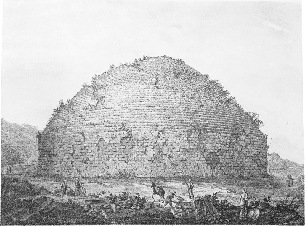
![[Illustration]](https://openoldbooks.sgp1.digitaloceanspaces.com/books/travels-in-the-footsteps-of-bruce-in-algeria-and-tunis-by-robert-lambert-playfai/images/i02.jpg)
![[Decoration]](https://openoldbooks.sgp1.digitaloceanspaces.com/books/travels-in-the-footsteps-of-bruce-in-algeria-and-tunis-by-robert-lambert-playfai/images/decor1.jpg)
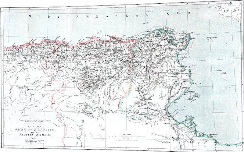
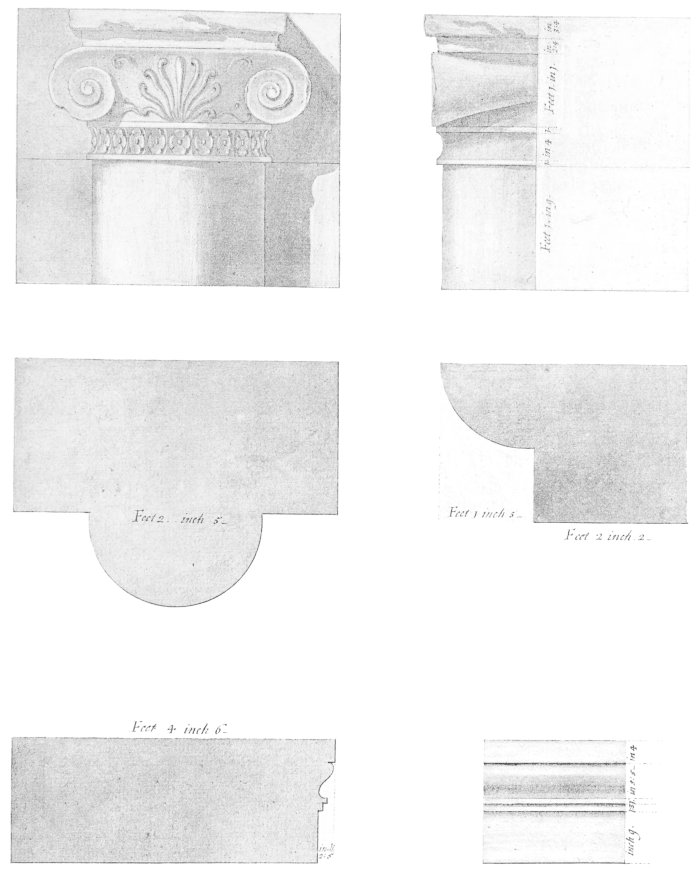
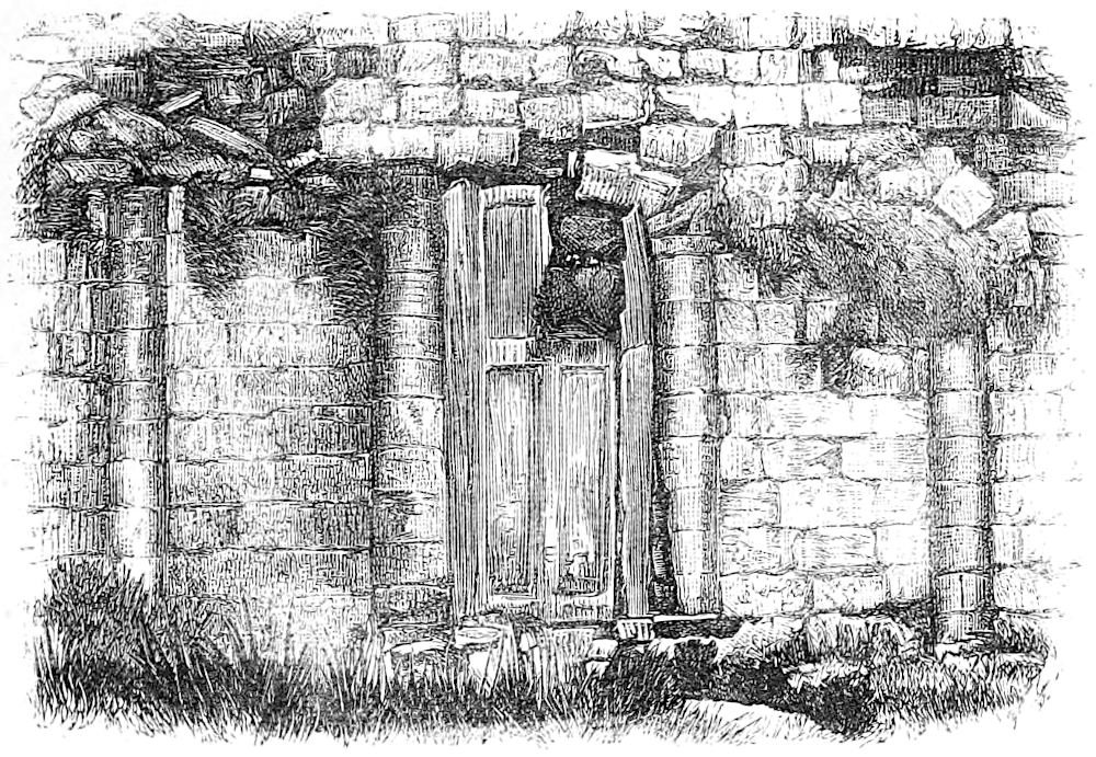
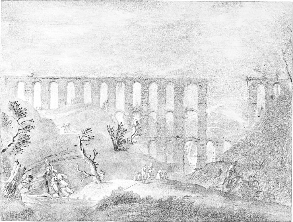
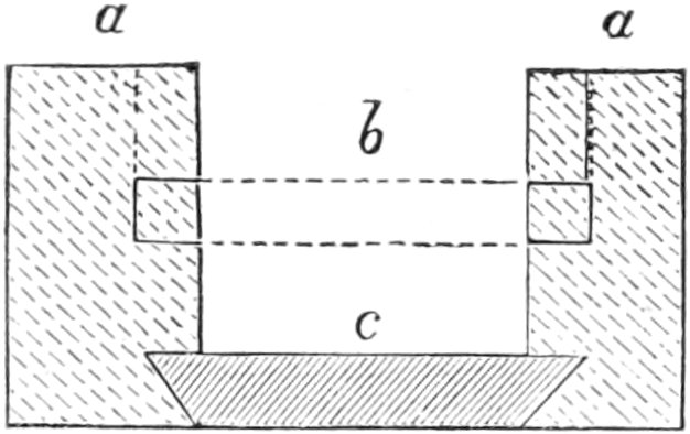
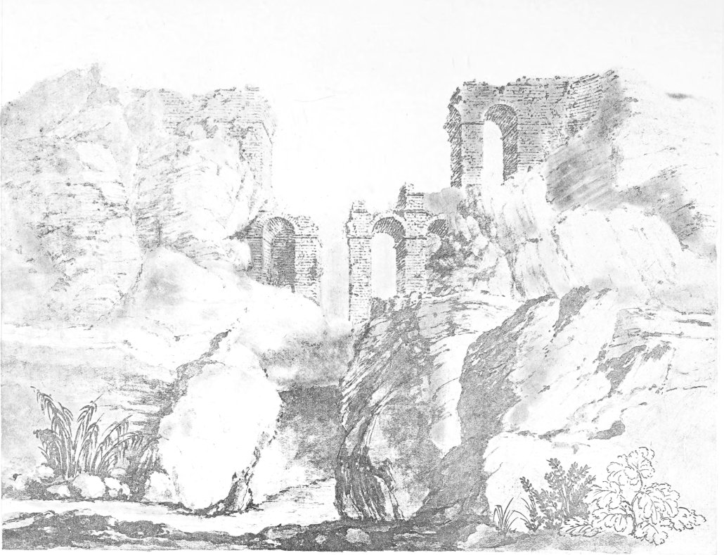
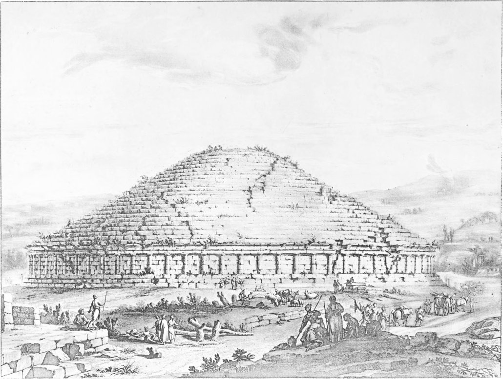

 IC
IC

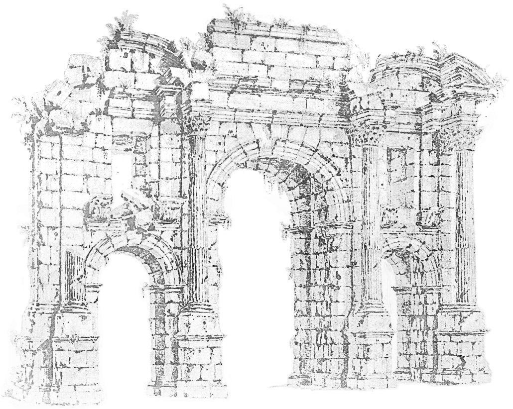
 . . . .
 NATIM . . . . GALLVS ᵥ LEG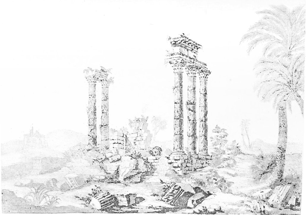
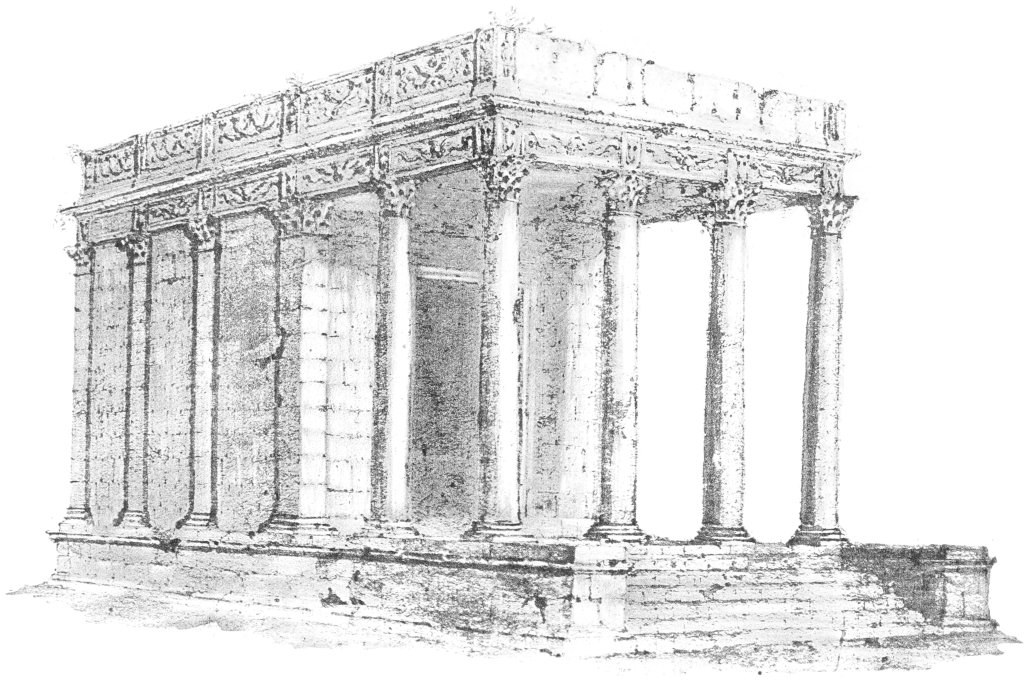
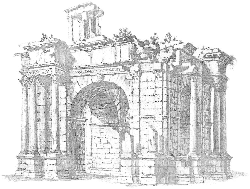
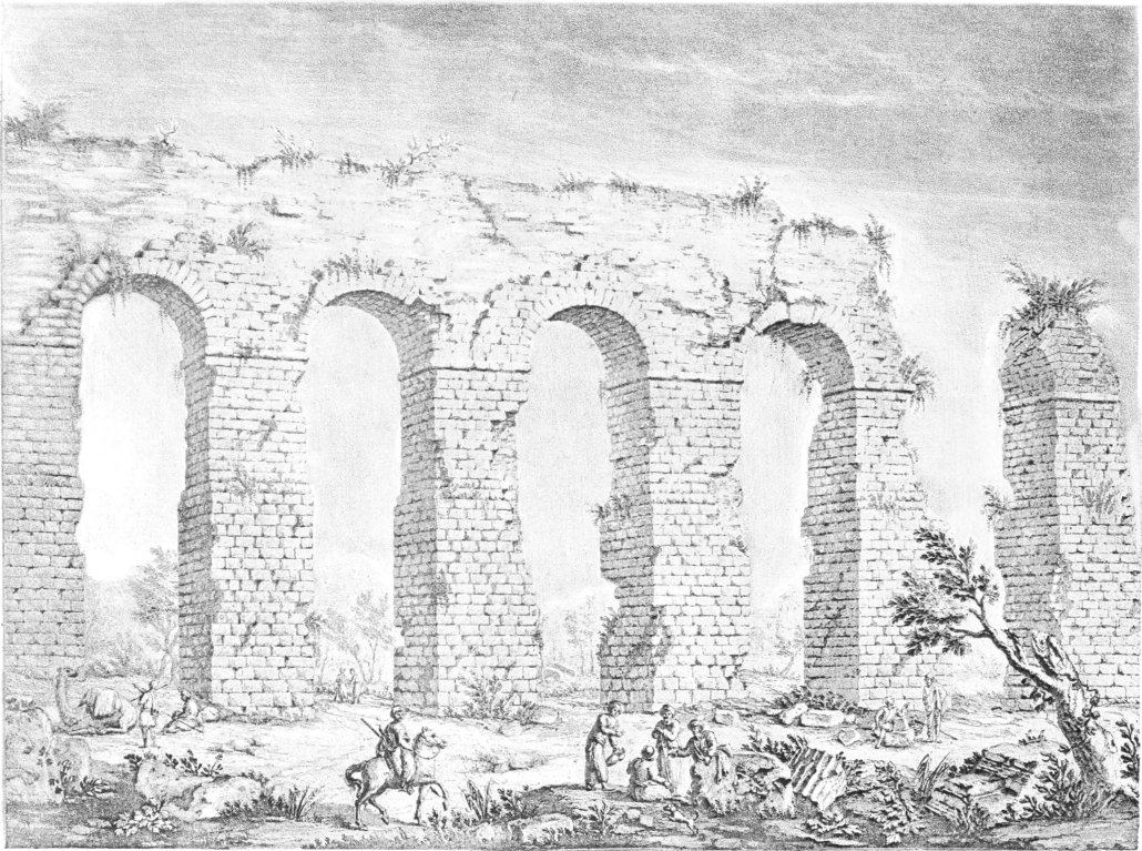
![[D]](https://openoldbooks.sgp1.digitaloceanspaces.com/books/travels-in-the-footsteps-of-bruce-in-algeria-and-tunis-by-robert-lambert-playfai/images/sym07.png) RIANI . NEP. DIV
RIANI . NEP. DIV![[O]](https://openoldbooks.sgp1.digitaloceanspaces.com/books/travels-in-the-footsteps-of-bruce-in-algeria-and-tunis-by-robert-lambert-playfai/images/sym08.png) . IN.FORO. POSVIT
. IN.FORO. POSVIT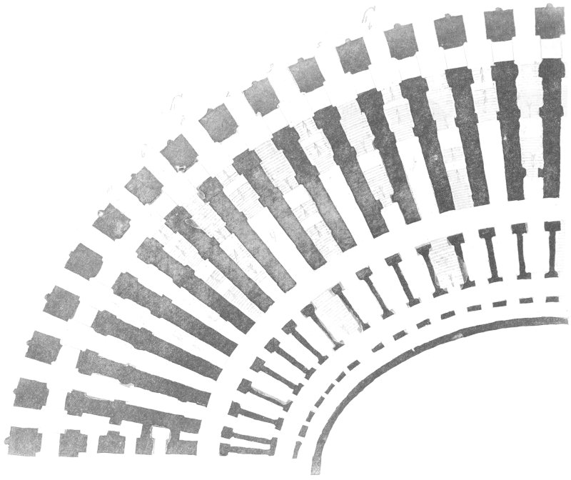
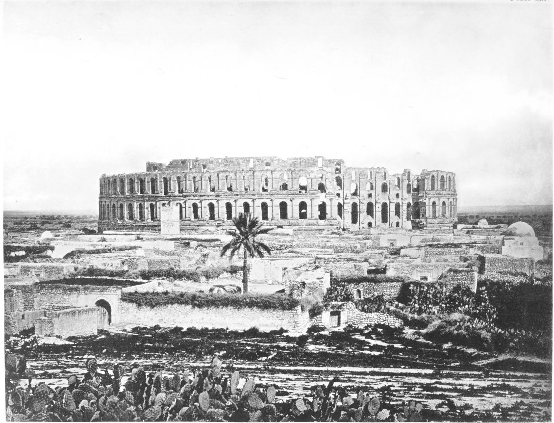
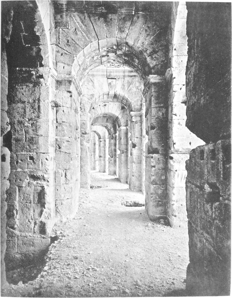
 H
H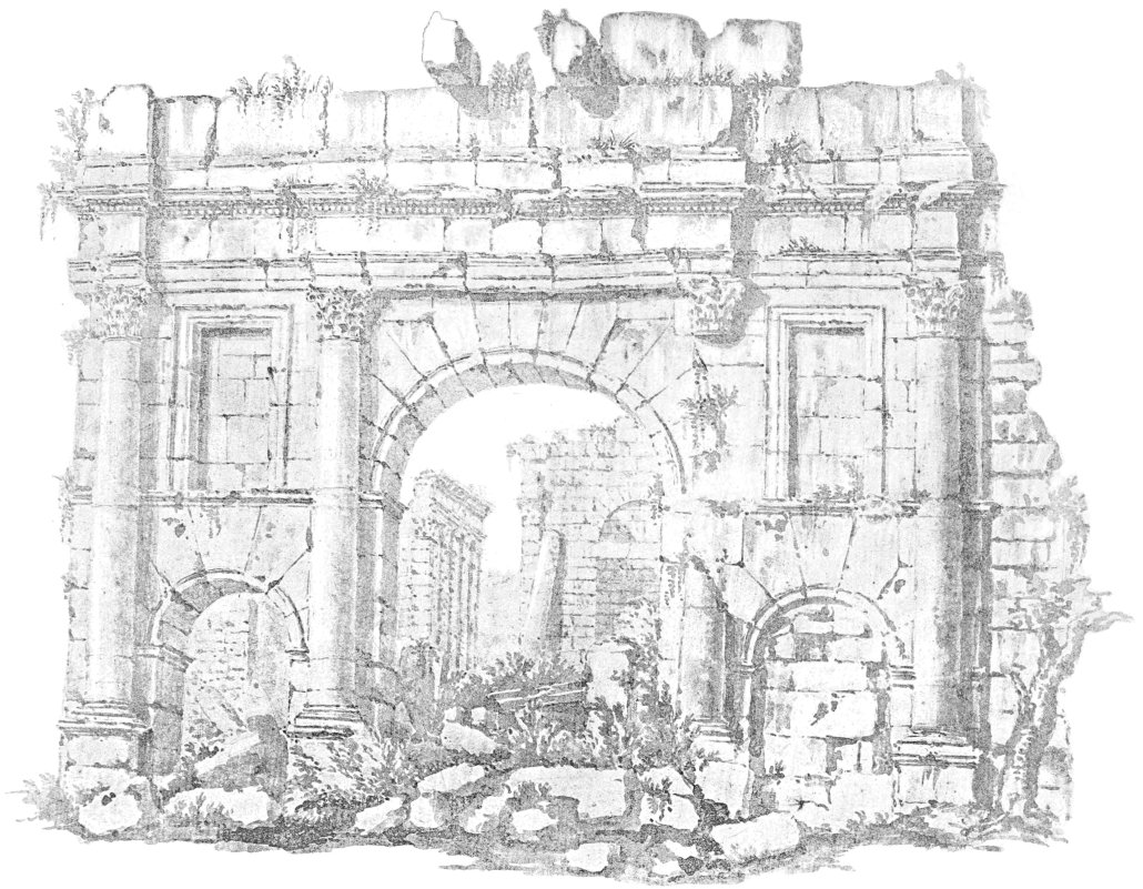
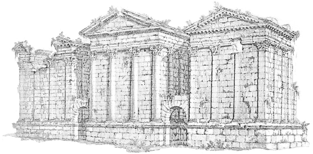
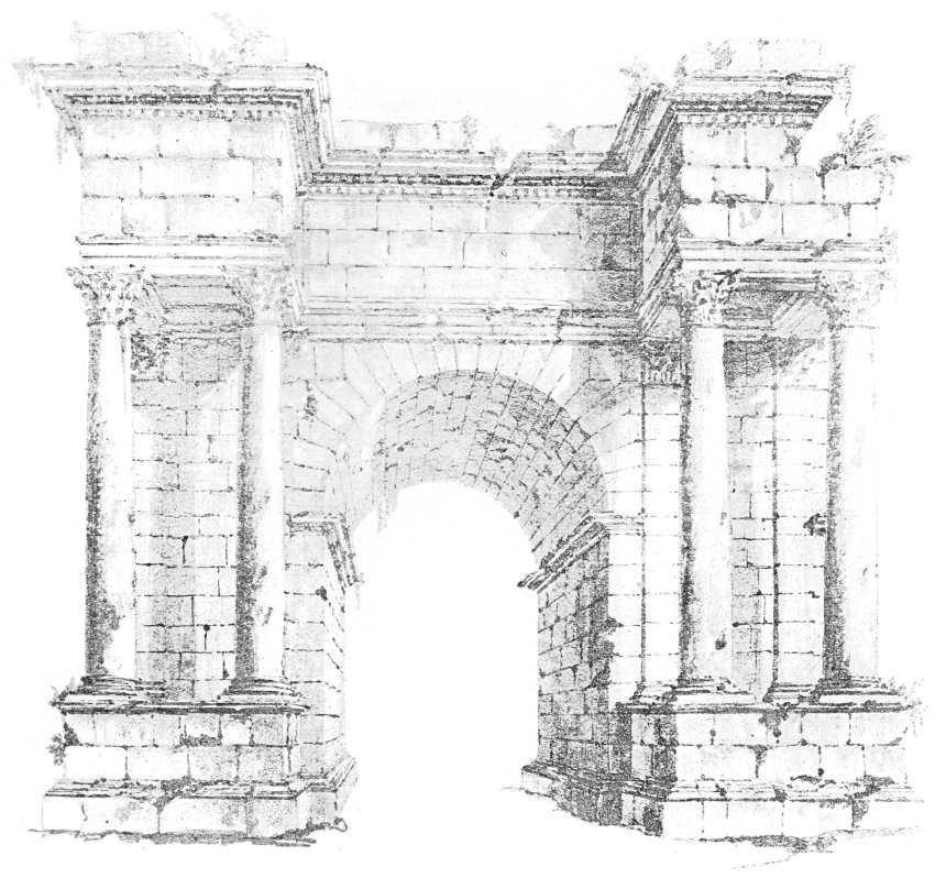
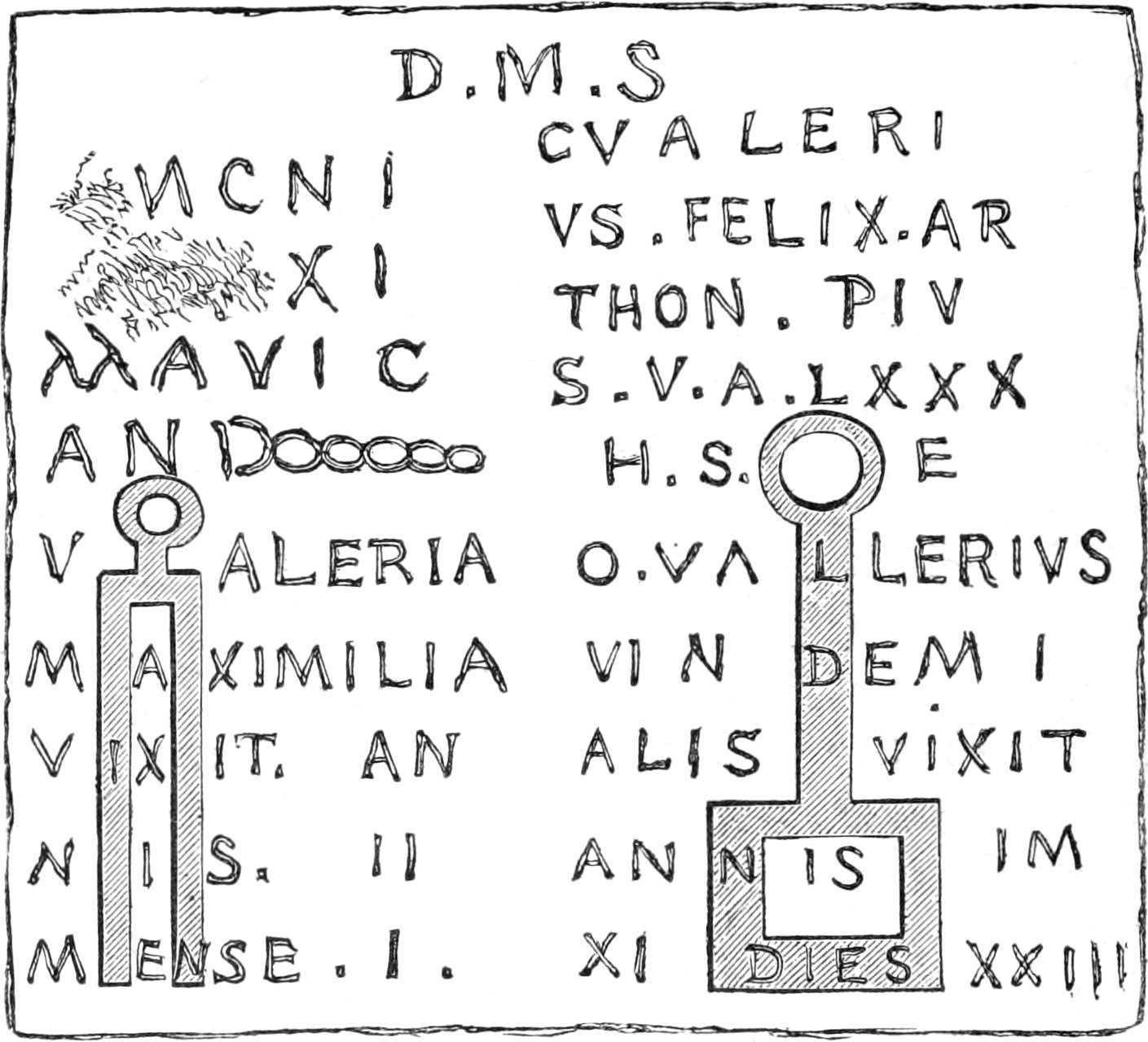
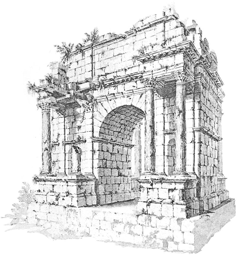
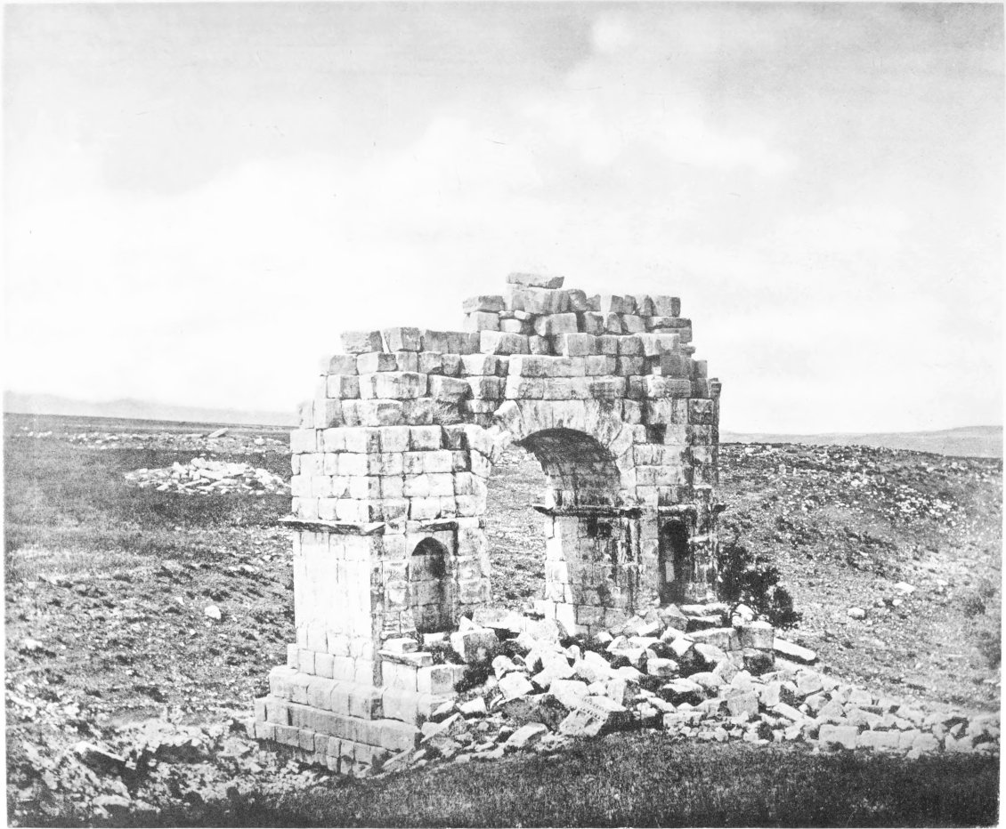
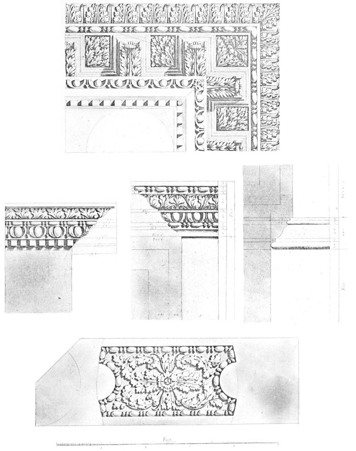
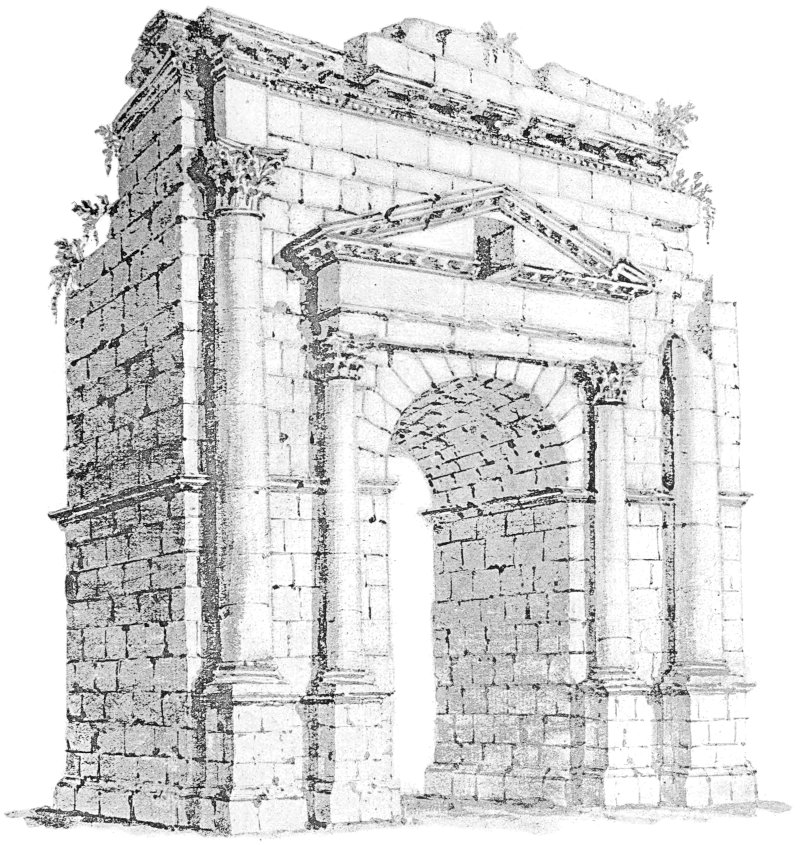
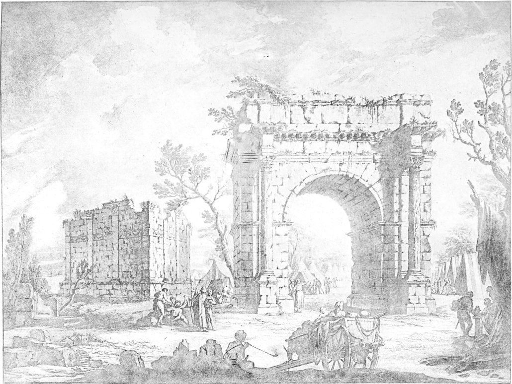
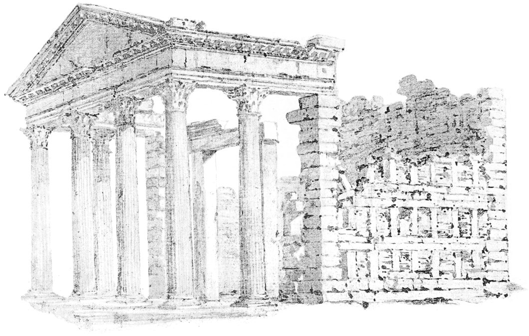
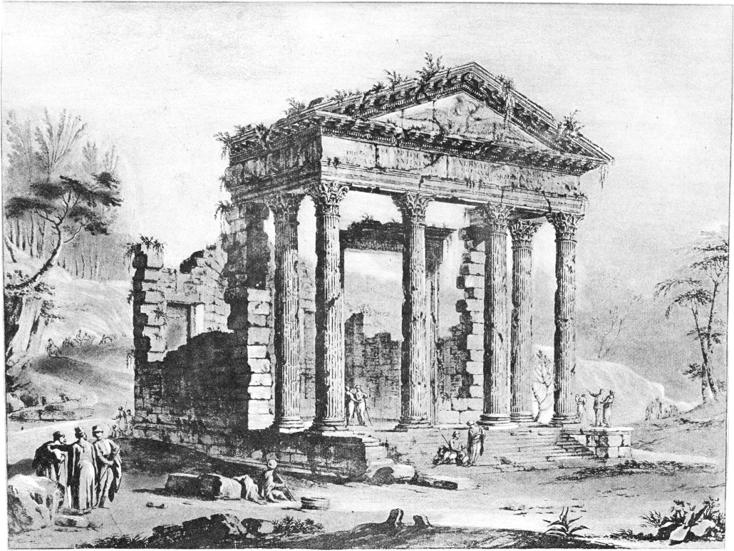
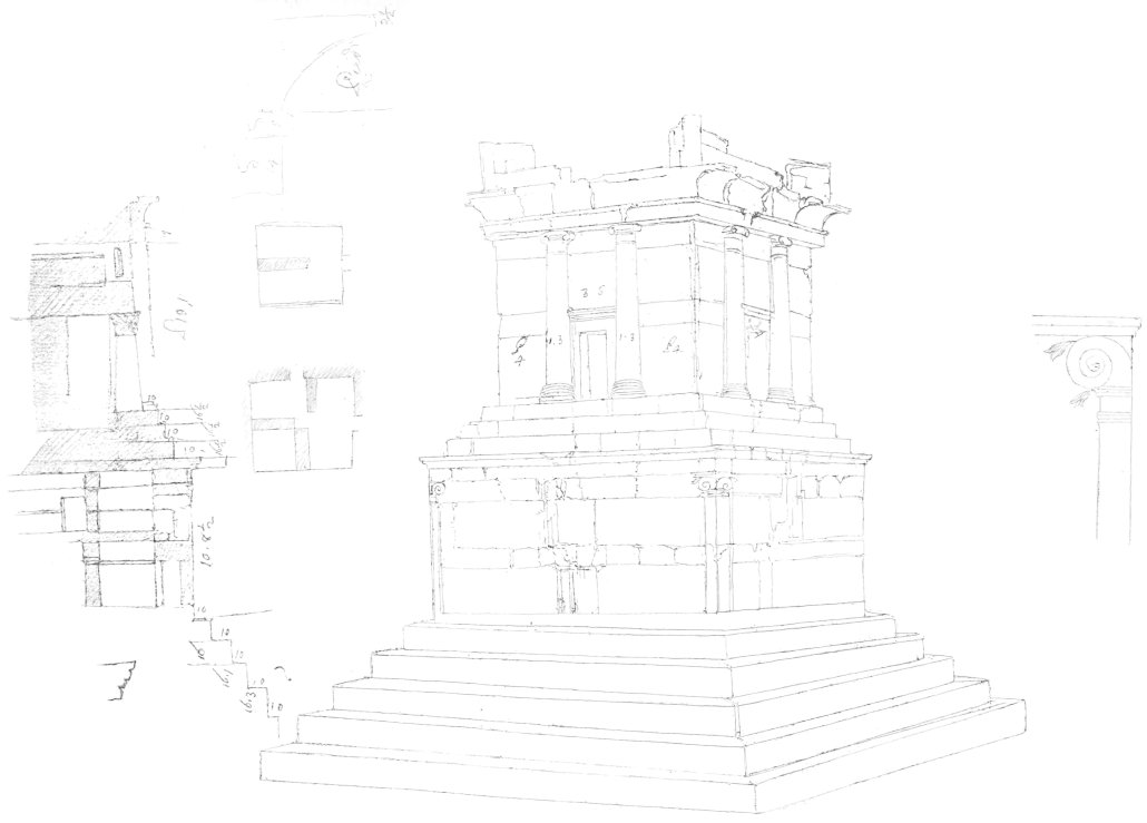
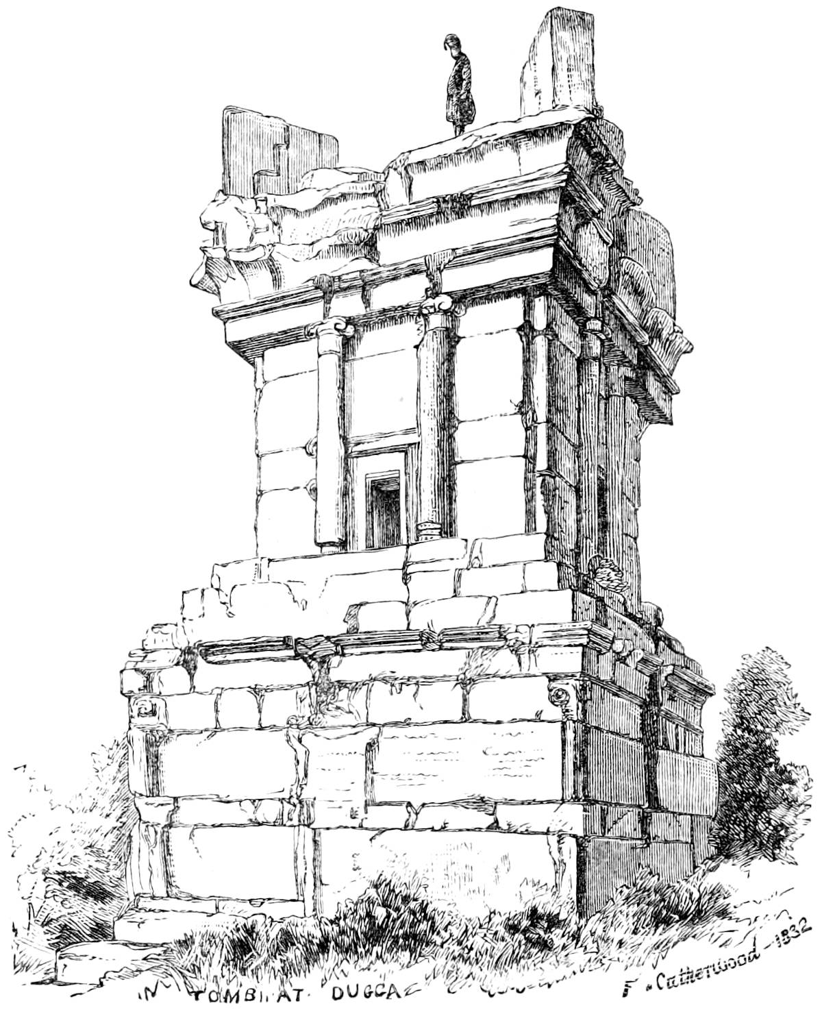
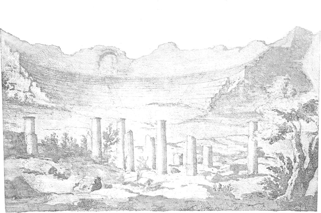
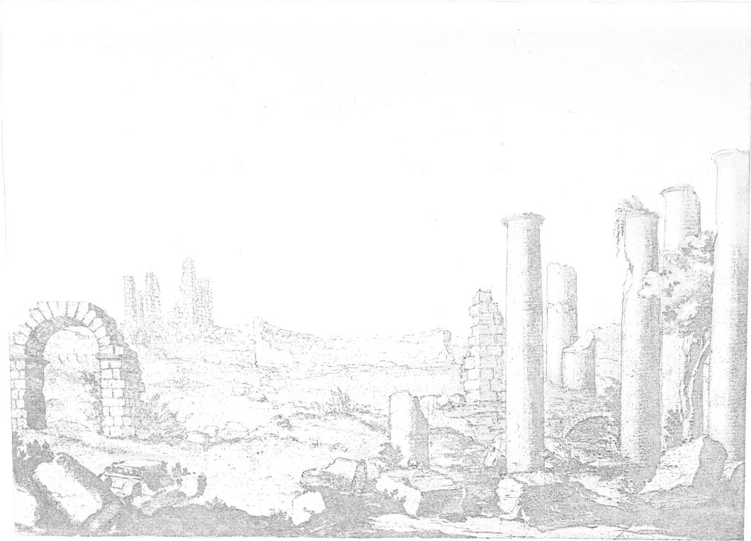
 EA
EA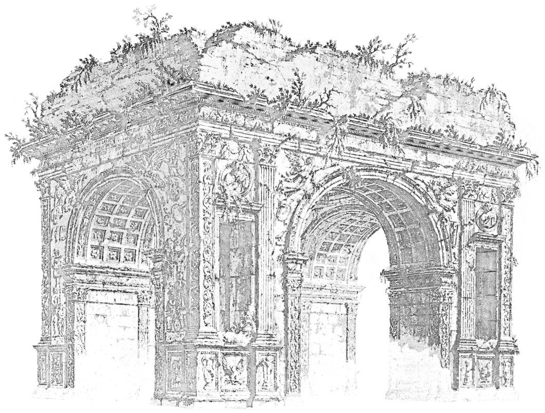
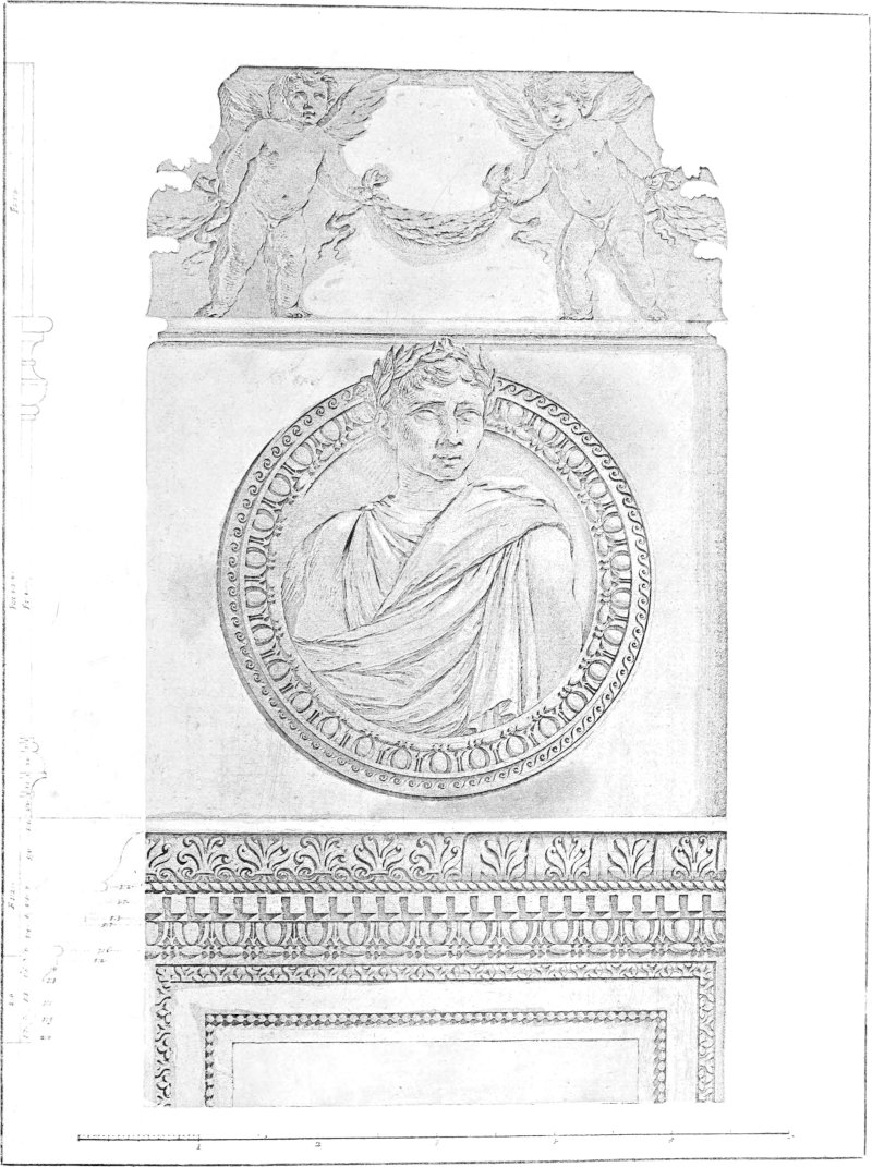
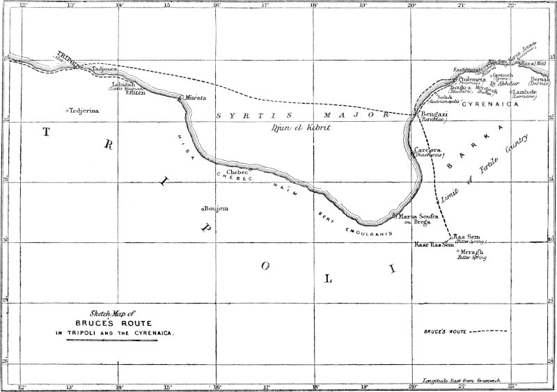
![[Decoration]](https://openoldbooks.sgp1.digitaloceanspaces.com/books/travels-in-the-footsteps-of-bruce-in-algeria-and-tunis-by-robert-lambert-playfai/images/decor2.jpg)