From Damariscotta I went up the valley of the St. Lawrence, and visited
the reservation lands of the Algonquins, Hurons, and other tribes
that had originally held possession of that part of the country. The
most important assemblage of Indians was placed upon a large tract
of land near the banks of the Grand river in Upper Canada. There I
saw, dwelling in their separate villages, the descendants of the once
powerful confederacy of the Iroquois, who had been our faithful allies
in our wars.
Nearly three thousand Indians were gathered together belonging to
the tribes of the Senecas, Onondagas, Mohawks, Cayugas, Oneidas and
Tuscaroras. Some of them had been converted, but many still maintained
their ancient faiths and performed their customary Pagan ceremonies.
It was extraordinary to observe how unavailing had been the influence
of European civilisation in advancing the intellectual capacities of
the tribes. The French missionaries at Lorette, Oka, and St. Régis,
many of whom were well acquainted with the
language of the converts
put under their care, told me that all their efforts were useless, and
that the labours of nearly three centuries were absolutely without any
practical result.
After having passed a few weeks in the vicinity of the lakes, for the
purpose of seeing the condition of various remnants of certain North
American Indian tribes placed upon reservations, I reached the shores
of the Georgian bay, and then proceeded to the port of Marquette in
Michigan.
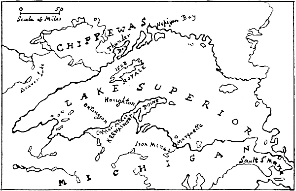
Plan of the Lake Superior Iron and Copper region.
My chief object in landing upon the southern shores of Lake Superior,
was to visit the places where ancient Indian mining operations had
been discovered, in order that I might be, in some degree conversant
with matters relating to the origin of the copper ornaments that had
been found in some of the burial mounds in Ohio. I also wished to make
some excursions into the forests where, amongst the numerous lakes and
rivers, the beavers were still constructing their dams and building
their lodges. I desired to see something of beaver life and work before
the advance of civilisation had removed these forests and beavers away
for ever.
I obtained convenient quarters in the mining village of Ishpeming,
placed in a clearing that had been made in the forest, on the summit of
the hills ten miles from the coast. In the interior, within a few miles
from the settlement were two rivers called the Carp and the Esconauba.
Upon these streams and their connected ponds, the works of the beavers
were numerous. They consisted of lodges, dams, canals, excavations, and
the open spaces in the forests called beaver meadows.
There happened to be an unusually large work constructed across one of
the principal bends of the Carp, which by its action in confining the
waters had created a small lake. As the size and formation of that dam
give a good knowledge of the capacity of the beavers, and their powers
of executing works of considerable magnitude, it will be interesting to
describe it with some detail.
It was two hundred and sixty-two feet in length and nearly six feet
high in the centre, where the water was deep. This height diminished
gradually towards the banks. The average width upon the top was two
feet. The slope outwards was in the direction of the angle which
happened to give the
utmost resisting power. The base was about
fourteen feet wide. The dam was not made in a direct line across the
stream, but had curves which were convex towards the current, and were
placed at the points of the greatest pressure. The slopes were formed
in such a manner that the upper side acted as a barrier against the
water, and the opposite side acted as a supporting buttress.
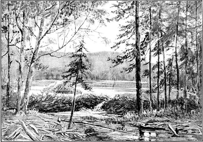
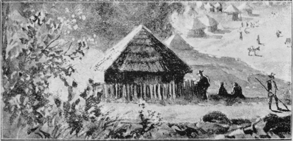
Beaver Dam, Lodge, and Pond, near Ishpeming, Michigan.
The entire construction was evidently made with a correct knowledge
of the strength that was necessary to resist the outward pushing
force that was exerted against it. When an engineering work of this
nature, so great in proportion to the power and intelligence of
its constructors, is examined, and its fitness for the object for
which it has been made and for the duty it has to perform, has been
ascertained, it occurs to the mind to consider whether such operations
are the results of instinct or of some exceptional degree of reasoning
faculties.
Within the pond was the lodge. It was placed near to the bank which by
its curve gave the most shelter. It was shaped like a rounded beehive
and measured nearly eight feet in diameter, and twenty-two feet over
the outer circumference. The exterior was composed of small sticks cut
in nearly equal lengths, and so intertwined, crossed and plastered with
mud as to give great cohesion.
There were three entrances, two of them leading in the direction of the
bank, and one towards the middle of the pond. The former are said to be
used as the approaches to the inner room, and the latter for escape.
All these entrances were below the surface of the water, and ran
upwards into the dwelling room which was a dry comfortable apartment,
the floor being well above the highest water level.
The beavers, when cutting the branches of the trees into the requisite
lengths, seem to have an accurate perception of what is necessary for
the special works that are then in progress. Thus in their lodges,
which are chiefly made for shelter and warmth, the sticks composing
them are small, and when well plastered together with mud make a
good compact residence. The dams which have a different purpose are
differently built, and in these the sticks are often of considerable
size, being sometimes fully six feet long. Some of the cuttings,
however, are small and many of them are like short poles, having a
diameter about the size of a man’s arm.
The methods of forming the foundations of their dams are most
practical, and the manner in which earth, stones, mud, twigs, fibres
and brushwood are combined, not only show marvellous ingenuity, but
prove that beavers work perseveringly together with incessant labour
for long periods of time.
The superstructures are differently made. They are composed of a
framework of sticks placed at various angles inclined upwards. This
open form of disposition appears to be intended to allow the surface
waters to escape to the extent that is necessary to keep the level of
the pond at the uniform height that is desirable.
Although it is usually considered that the intelligence of the beaver
communities is chiefly shown by their ability in raising works of
construction, I was informed by men who were intimately acquainted with
the habits of these animals, that a greater sagacity was displayed
in the methods adopted by them, under especial circumstances, for
maintaining communications between their dwelling places and the woods
from which they obtained their food and building materials.
These rare and singular works of excavation are called beaver canals.
One of these, which was the largest that was known to occur in this
part of Michigan, I examined with the utmost attention. It was an open
trench or channel, about half a mile long, two to three feet wide,
and from one to two feet deep. The bottom was of the same width as
the surface, the sides being perpendicular. It connected a large pond
with the adjacent forest. The canal was sufficiently large to give
room for a beaver to swim in it and push in front of him the cutting
of birchwood that was to be conveyed to the lodge and there stored for
the winter supply of food. The depth was enough for the purpose of
concealment.
I also examined some other canals connecting the ponds with trees,
which were of a different character and much smaller. The Indians were
of opinion that these must have been made exclusively for escape when
the beavers, whilst at work, were suddenly alarmed.
But the most important results of the actions of the beavers are the
alterations made by them in the aspect of the country, in consequence
of their raising the levels of the water and causing large spaces of
land to be subject to overflow. Thus, when the dams are in order and
efficiently maintained, much of the adjoining land, when it lies low,
becomes a swamp and the trees decay and fall. Then if the works are
neglected and the waters follow their usual direction, the lands become
dry and are changed into fertile grass meadows. Some of these meadows
are of considerable extent. Around Ishpeming they supply the fodder
required for the cattle employed at the mines. One of them, which
occupies a large acreage, yields over fifty tons of hay annually.
An explorer who happened to pass through a region of this nature after
it had been deserted by the beavers, would be surprised, when following
the trail through the forest, to find himself entering into one of
these open spaces, which have the appearance of small savannahs, and he
would be unable to understand how such sharply defined inclosures could
have been formed.
Near the borders of the meadows and ponds, several birches were
undergoing the process of being felled. The operations were extremely
curious, and it was evident that the beavers are both careful and
ingenious in the execution of the work.
The trees selected for their purposes are generally about three or
four feet in circumference at the part that is within reach. The trunk
of each tree is, in the first place, gnawed evenly round, until only
a portion of the centre, about two inches in diameter, is left to
maintain it in an upright position. It is then carefully gnawed from
the direction towards which the tree is intended to fall, which is
often a matter of some importance. When it is lying upon the ground,
the bark is stripped and stored for food, the branches are cut into
the requisite lengths and used also partly for winter provision, but
chiefly with regard to what may be wanted for the construction and
repair of the dams and lodges.
Upon returning one afternoon from the River Carp, I found that, by some
inattention, I had left the track and had wandered into the forest. Men
who are accustomed to explore this region had stated that the safest
course to adopt when such an event occurred was to observe the position
of the marks of the weather upon the trunks of the trees. In Michigan,
it held been noticed that these evidences of exposure, consisting of
moss or lichen, were upon the Northern sides, and it was considered
that by watching these indications, a line of direction could be
followed.
It is possible that in places where the trees are much exposed this
system may be useful, but in this case I did not find it so.
The indications of weather were often very faint and difficult to
trace. Where they did clearly exist, they varied so greatly in
their position, that it was impossible to follow a straight line. I
consequently soon gave up the attempt to find the trail by this method.
Night was approaching, and the outlook was becoming grave. In all
directions but one, there was nothing but many miles of dense forest,
which it would be hopeless to attempt to pass through.
The direction which was available had a broad base, being the road
from Ishpeming to Marquette. This I knew must lie between south and
south-west. Consequently if I could follow a line between these points,
it was probable that the road would soon be reached, as its distance
was less than three miles. I had my watch with me, and fortunately,
the sun could be seen occasionally, so it was possible to make that my
guide.
Upon a rough calculation of the true bearing of the approaching
sunset, I found that by keeping the glimmer of the light on the right
hand, and walking steadily forward, the road ought to be reached before
dark. It was, however, anxious work and it was getting late when I
unexpectedly emerged into an open clearing, where a squatter had
temporarily settled. It was with no slight pleasure that I heard the
sounds of life, the lowing of cattle, and the welcome movements of a
busy farmyard.[10]
After concluding my expeditions to the lands and ponds of the beavers,
I went to that part of Michigan where the ancient mining pits and
trenches have been discovered. The earliest knowledge of them was
obtained by an American explorer who, in the year 1847, when seeking
for indications of metal ore, noticed several depressions in the
ground, and saw lying in a heap, near what seemed to be an ancient
excavation, a number of rude stone hammers that he thought had probably
been used by hand.
In the following year another excavation was discovered, and after
clearing this out to a depth of eighteen feet, there was found a
detached mass of copper weighing over six tons which rested upon oak
sleepers, and beneath it there was a vein of copper five feet thick.
There were also several stone hammers, grooved for the purpose of
having handles attached to them, and a copper chisel with a socket for
a wooden handle, a fragment of which although much decayed, was still
in its place. In an adjoining pit at a depth of ten feet, there was
a wooden bowl and some charcoal.[11] In some workings, subsequently
discovered upon Isle Royale and near the end of the Kee-wai-wona
promontory, a number of wooden wedges were seen, together with traces
of extensive trenches.
In consequence of these discoveries further investigations were
made, and a large number of ancient pits were found in the forests,
especially in the districts where are now placed the towns of Ontonagon
and Houghton. It was within a few miles from the latter town, that the
explorers observed the heap of stone hammers, and their attention was
directed to the fact that they had been preceded in the search for
copper by men of some unknown race, who possessed capacities for mining
operations greater than could be attributed to the Chippewas who then
occupied the land.
In order to examine this heap I engaged a man—who knew the mining and
forest region—to guide me to the spot where the hammers still remained.
After crossing the Portage Lake and passing over some low neighbouring
hills, we came to a depression in the ground which looked like an old
ditch or trench. At the side of this ditch, I saw several hundreds of
rounded water-worn stones of various sizes. These had evidently been
chosen on account of the convenience of their shape, for the purpose of
being used for crushing the rocks that contained metal.
A few of the stones appeared to have been partly shaped by hand,
but the majority of them were in their natural form. Several were
perforated by small round holes, caused probably by the action of
water. Some men who happened to be employed at one of the mines in the
neighbourhood, told me that in their opinion they had been made for
thumb holes. They were, however, much too small for such a purpose.
Upon my return to Houghton I met Mr. I. H. Forster, who was the agent
for mines and a Senator for the State. He proposed to accompany me to
the sites of those ancient workings that he had personally inspected.
After passing through a forest of birch and pine trees, we reached an
open space where we saw the evidences of the nature of the operations
that had been executed.
The direction of the trenches could be easily traced, although they
were filled with earth and leaves. Several of the pits had been cleared
out by the men employed at one of the new mines, and it was therefore
possible to go down to the bottom of them and observe the methods of
excavation. The first that I examined was twelve feet deep; from the
base there ran two nearly horizontal galleries or adits, following the
direction of the lode which ran N.W. and S.E. These adits were five
feet wide and extended laterally about six feet. Upon the surface, near
the edge of the pit, was the stump of a basswood tree, six feet in
circumference, and at the opposite edge was the stump of a pine, four
feet in circumference.
The second pit was twenty yards from the first, and had evidently been
sunk in the direction required in order to reach the same lode. It was
ten feet deep. From the base there was one adit following the direction
of the deposit of copper. Close to the edge of this pit was the stump
of a small birch tree. Beyond this were seven other pits, from twenty
to fifty yards apart, and in connection with these, there were several
short trenches from two to four feet wide.
The pits were discovered in 1865. Some animals were being driven along
a track in the forest, when one of them straying from the path, plunged
his feet deep into the ground; this was noticed, and an explorer for
copper examined the place and pushed his stick down it. This led to a
further search, and the hole was found to be an ancient pit. Shafts
were sunk, and the result has been, that, one of the most important
mines in the district was established near the spot.
Upon another occasion I went with Mr. Forster to look at the trenches
and pits that had been found in a more distant part of the forest.
These pits were smaller than those that I had previously seen, but the
trenches were frequently of considerable depth. I measured several that
exceeded six feet deep. These trenches were usually in short lengths,
but one of them was nearly two hundred feet long. Upon making inquiries
amongst the leading men of the various copper mines that have been
placed in the neighbourhood of the earlier workings, I was told that
the practical miners were of opinion that these excavations were of
considerable antiquity. It has, however, been proved by the condition
of the things that were found in the pits that these conjectures are
not well founded.
Near Ontonagon, to the south-west of Portage Lake, a line of trenches
was observed in 1863, and a shaft was sunk in a depression which was
considered to be an old pit. At a depth of nine feet, one of the
workmen drew out upon the point of his pickaxe, a small untanned
leather bag in a good state of preservation. It was noticed that the
mouth of the bag was traversed by a leather string, which was in its
place and could be used for drawing the opening together. The bag was
seven inches wide and eleven inches deep.
Two years afterwards, some men exploring the same part of the forest,
observed a small mound about six feet high. After digging through
it down to the ground, they reached the surface of a pit, which was
carefully excavated by them. At the top there was a deposit of sand;
below that, were many closely pressed layers of decayed leaves. At
the bottom of the pit they saw a birch bark basket, in all respects,
similar to those that are made and used by the modern Chippewas. Near
the basket they also found a bit of beaver or otter skin with the fur
upon it, portions of the jaw of a bear, several pieces of charcoal, a
beating block—fourteen inches square and three inches thick—made out
of a lump of copper conglomerate, some lengths of knotted strips of
buckskin, and a rough bit of wood about three feet long, which the
miners call a digging stick. A collection of these things had been
placed in an office at Houghton, where I saw them. I noticed that the
digging stick was worn and frayed at the end where it had been used,
and that the fur on the beaver skin was still in good condition.
In the same forest country as that where the pits were dug, several
copper spear heads have been picked up. Those examined by me were
unquestionably made by persons skilled in the working of metal.
Several of the members attached to the mission at Sault Ste.
Marie,[12]
in the early part of the eighteenth century, made crosses and ornaments
from copper that was brought to them by Indians, who had found small
lumps of the metal on the surface of the ground. The spear heads may
have been made at the mission house.
After the cession of the Canadas to Great Britain in 1763, an English
Company was formed for the purpose of searching for metal in this
region. The operations were conducted by Mr. Alexander Henry, and it
has been ascertained that for several years he worked near Ontonagon,
and at other places upon the Kee-wai-wona promontory. Judging from the
method in which, at the ancient workings, the lodes of copper have
been traced through dense forests, it is evident that fixed plans of
operations must have been pursued, and I came to the conclusion that
the surveyor who directed them, must have had a competent knowledge of
the use of the compass. It is therefore not unreasonable to assume,
that all the pits and trenches were excavated under the superintendence
of Europeans, at some period later than the sixteenth century.
Several miles to the south of these works I was shown the spot
where the last and decisive battle was fought between the Chippewas
and Iroquois. This battle field, which was on a point of land near
Kee-wai-wona bay, was remarkable because it affords an instance of
the great distances that were sometimes traversed by Indians when
conducting their wars of extermination. The Iroquois whose territories
and villages were upon the southern shores of Lakes Ontario and Erie,
crossed into the Chippewa lands by the way of the channels leading to
Sault Ste. Marie. Therefore, supposing that they followed the most
direct line to the place where the battle was fought, they must have
passed over a distance of not less than six hundred miles.
One of the burial mounds which had been opened, contained a large
skull, a pipe made of dark slate and a stone hatchet. Upon the
top of the mound was a pine tree which measured thirty inches in
circumference. The scattered descendants of the Chippewa tribes dwell
in the districts to the west of Lake Superior, but they occasionally
wander into their original country. I met some of them near the shores
of that great inland sea.
During the time that I was travelling in these iron and copper regions,
I took the opportunity of accompanying the superintendent of one of the
mines to look at the evidences of the action of the glacial drift upon
the surfaces of the hills that had been cleared for the purpose of
executing some preliminary mining operations. Some of these hills were
composed of solid hematite iron and jasper, and yet these hard rocks
were deeply grooved by the pressure that had been exerted against them.
Near Ishpeming there was a low range of hills or knobs, whose formation
was a compact greenstone with wide veins of iron, which had been
subjected to a severe grinding, and was furrowed with grooves two feet
wide and five and a half inches deep. The general direction of this
range was from E.N.E. to W.S.W. and the action of pressure was greatest
where the sides of the hills faced towards the north. The grooves were
about nine hundred feet above the level of Lake Superior. Large erratic
boulders covered the surface of the land. I measured one of them which
was lying exposed in a depression between two conical hills, eight
hundred and fifty feet above the lake. It must have weighed over twenty
tons. The boulders were usually masses of basalt, black or red granite,
porphyry and jasper. Rounded boulders of pure copper are sometimes
found. One of these, of exceptional size, was in the forest, in the
direction of Ontonagon, and was estimated to weigh about eighteen tons.
Near Houghton, Mr. Forster showed me the surface of a hill, four
hundred feet above the lake, which had been made perfectly smooth by
the action of the drift passing over it. At another part where the rock
was exposed we counted fifty-seven grooves over a space of sixty-seven
feet of surface. Judging from the direction of the groovings on the
Kee-wai-wona promontory and the iron hills of Michigan,
the boulders appear to have been carried from Labrador.
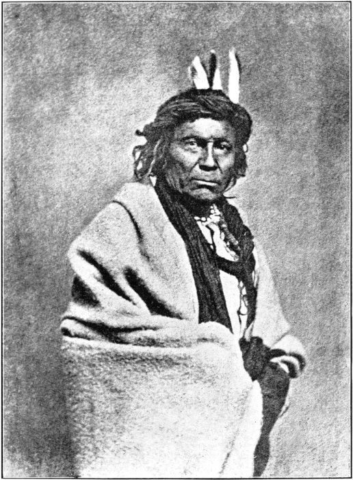
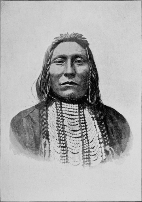
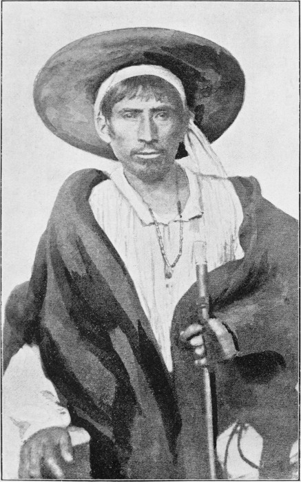
Chippewa Chief.
(west of lake superior.)
The waters and floating icebergs must have swept over this country with
much force for in many places the pressure exerted seems to have been
enormous.
On my way south from this land, which contained so much that attracted
attention, I visited the reservation of the Oneidas, at the spot where
the council fire of that tribe was originally established, near Lake
Ontario. I was received by the hereditary chief of that tribe, who
was named Beech-tree. As he could not speak a word of English, our
conversation was carried on with the assistance of his grandson, who
acted as interpreter. Beech-tree was a large, broad shouldered man,
with a remarkably massive head. If I had met him in the north of China,
I should have taken him for a Manchu Tartar. His hair was very long and
black, and tinged with grey.
He told his grandson to say that he was proud of his unmixed descent
from the ancient chiefs of his nation, which had once been powerful,
and that the land upon which we stood belonged by right to the Oneidas,
and was the place where they held their great councils and decided
upon questions of war or peace. After having made, with assumed
dignity, this brief oration, Beech-tree retired into the interior of
his hut, and I returned to my country cart, which had conveyed me to
his territory, and finally reached the shores of Lake Erie. After
traversing Lakes Huron and Michigan, I proceeded to the banks of the
Ohio river, with the purpose of making expeditions to the works of the
Mound Builders.
Before quitting the Oneida reservation, I made inquiries about a man
named Williams, concerning whom I had heard, when at Boston, a strange
and romantic story. It appears that Williams, whose parentage was
uncertain or unknown, was sent early in the present century from the
Indian village of St. Régis, to act as a missionary among the Oneidas.
Some years later, rumours were spread to the effect that he was the
true Dauphin, the son of Louis XVI. These rumours were stated to be
based upon grounds which warranted a fair degree of belief.
The story as told to me at Oneida was that Williams was supposed to
have been born at St. Régis (a picturesque village reservation on the
South bank of the St. Lawrence, and which, at the time that I saw it,
contained a population of fifteen hundred Iroquois, the majority of
whom were half-breeds).
In early manhood he was sent to a college, trained for missionary work,
and ultimately appointed to preach among the Oneidas. I was informed,
by those who had previously known him, that he was an honest, zealous
missionary, who was quite incapable of attempting any form of imposture.
It however happened (such is the story,) that the Prince de Joinville,
when travelling in America, came to Oneida and saw Williams. It is also
stated that he visited him on a second occasion. After this second
meeting, it was thought by the residents in the neighbourhood, that
Williams was possibly the Dauphin.
A picture of Simon, the gaoler who treated the young prisoner in
the Temple with such incredible brutality, was shown to him, and he
instantly started back with horror, as if recalling some painful
memory. Williams had no recollection of anything about his youth before
the age of fourteen.
In consequence of these apparent corroborations of the local surmises,
it was conjectured that after the execution of Louis XVI., the young
Dauphin was removed from the prison, sent to America and placed in an
Indian family at St. Régis. Williams lived for many years with the
Oneidas, and died at an advanced age. He was described as having been
a man of portly physique, with large features and big hands and feet.
His complexion was rather dark. I think it is probable that he was
descended from half-breed Indian parents.
It will be observed, that, the whole value of the evidence supporting
the theory of his being the Dauphin, depends upon the accuracy
of the
story that he received two visits from the Prince de Joinville. This
statement, if correct, appears however to establish the presumption
that the Royal Family of France, may have had some doubts with regard
to the truth of the report of the death of Louis XVII. in the Temple.
It is certain that a boy, said to have been that young prince, was
buried by the orders of the Commune in an obscure churchyard in the
Faubourg St. Antoine, in the year 1795; but the evidence is scarcely
conclusive upon the subject.
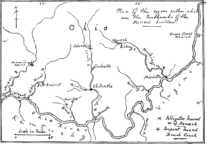
Plan of the region within which are the Earthworks
of the Mound builders.