Salem, Oregon, December 18, 1918.
TO THE HONORABLE STATE HIGHWAY COMMISSION,
S. BENSON, Chairman,
W. L. THOMPSON, Commissioner,
R. A. BOOTH, Commissioner.
Gentlemen:
I have the honor to submit report covering the operations of the Highway
Department for the fiscal years ending November 30, 1917, and November
30, 1918.
In view of the fact that the State Highway Department did not complete
its organization until late in the season of 1917 and due to the further
fact that practically all contracts were awarded after the first day of
July, 1917, it was impossible to place before the State Highway Commission
a report which would be of any particular value to the general public at the
end of the last fiscal year. Therefore, it has been decided to submit the
two fiscal years under one cover in order that the public may have at its
command a statement of public highway expenditures and the accomplishments
of the State Highway Department under the supervision of the
State Highway Commission.
It was considered advisable by the Highway Commission to award
contracts and get work under way as early in 1917 as the necessarily late
organization of the Department would permit. The matter of preparing
estimates and calling for bids was therefore carried out as rapidly as possible,
using the data and surveys of the previous administration as a basis
for estimates.
It is believed that by awarding the contracts during the year 1917,
approximately twenty per cent was saved on all construction for the reason
that the shortage in labor and material did not become serious in the State
of Oregon until late in that season.
I wish to call the attention of the Commission to the law which requires
the State Highway Commission to make county surveys upon the State
highway system within the boundaries of any county making application.
I believe the law to be a good one, inasmuch as it furnishes free to counties
engineering skill which they cannot afford and places at their command an
organization which is in a position to carry out preliminary location and
estimates. The law states that this work shall be charged to the counties
under any future appropriation which may be made to them.
The law limiting the expenditures of the State Highway Department
for engineering and administrative purposes to ten per cent of the total
moneys appropriated for construction, is sufficient for all purposes of the
State Highway Department, as an examination of the tabulated report
will show. However, as there are no separate funds set aside for the county
work as above noted, it has been necessary for this Department to charge
in all such work against our own engineering forces, and when I state to
you that the total sum for strictly county work, as requested by the county
courts, amounts to $137,954.74 in two years, you will see that the Department
is carrying a rather heavy burden which in reality does not belong to it.
So far the Department has been able to carry the burden and still live within
the ten per cent, but at any time the counties increase their construction
and engineering work and request our supervision, this might exceed the
lawful limit which we are allowed. I recommend that this law be made
clearer and that certain funds be set aside for engineering work handled
by the State Highway Department for counties.
In order to anticipate the large amount of construction for 1919, the
State Highway Department has worked a rather large engineering force
throughout the summer of 1918 and will continue it through the winter
of 1918 and 1919. This preliminary work is absolutely necessary in order
to award contracts early in the spring of 1919. The Federal Government
requires very carefully prepared plans and estimates for all future Government
work and this has been anticipated also, and practically every project
has been completed as to engineering features and submitted to the Federal
Government for approval.
Respectfully submitted,
HERBERT NUNN,
State Highway Engineer.
[17]
Report of the
State Highway Engineer
To the
Oregon State Highway Commission
December 1, 1916, to November 30, 1918
During the two-year period covered by this report, conditions have been
unusually unfavorable for highway construction work. Labor and materials
of all kinds have been difficult to secure, wages and prices have been
very high, transportation facilities have been inadequate and many other
conditions have operated to interfere with highway construction. During
the last year public sentiment has been opposed to the prosecution of construction
work and the restrictions imposed by the Federal Government
have prevented the undertaking of any extensive program of road improvement.
For these reasons the Highway Department has not handled nearly
the amount of work that it would have handled under normal conditions,
but nevertheless a great stride has been made in the development of
Oregon’s good roads system, and the Department feels that a fairly good
showing has been made. The actual construction work undertaken and
completed during the two years consists of fifty miles of paving, one
hundred and eleven and eight-tenths miles of macadamizing, one hundred
and thirty-four and five-tenths miles of grading and forty bridges and
large culverts.
In addition to this actual construction work the Department has made
surveys of nine hundred and two miles of State roads and has prepared
designs for forty-two bridges for county authorities.
From December 1, 1916, to November 30, 1918, the State Highway
Department has had available for expenditure a total of $4,271,515.16
of State and County funds. Of this amount $3,597,982.47 has been expended.
These amounts distributed over funds are as follows:
| Funds |
Amounts
Available |
Amounts
Expended |
| State Funds: |
|
|
| |
One-quarter mill tax fund |
$ 546,260.51 |
$ 528,789.99 |
| |
Automobile license fund |
575,000.00 |
281,902.67 |
| |
Six million dollar bond fund |
2,050,045.42 |
2,049,025.47 |
| |
State and Federal Co-operative bond fund |
390,484.44 |
28,539.55 |
| |
|
Total State funds |
$ 3,561,790.37 |
$ 2,888,257.68 |
| County funds |
709,724.79 |
709,724.79 |
| |
Grand total |
$ 4,271,515.16 |
$ 3,597,982.47 |
[18]
A total of fifty miles of pavement was completed by the Department
during the 1917 and 1918 seasons. Had it not been for the entrance of
the United States into the war, this mileage would have been more than
doubled, but with need of paving materials, labor and capital for war uses,
the Commission felt that it must curtail its paving program to the greatest
possible extent. To this end, only three miles of pavement was started
during the 1918 season, whereas under normal conditions the mileage of
new work would have been greatly in excess of the forty-seven miles
undertaken in 1917.
The sections of pavement completed are as follows:
| Clackamas County— |
Miles |
| |
Oregon City to Canby |
7.5 |
| Clatsop County— |
|
| |
Astoria to Svensen |
3.5 |
| Columbia County— |
|
| |
Scappoose to Multnomah County Line |
2.5 |
| Jackson County— |
|
| |
Ashland Hill Section |
0.8 |
| Tillamook County— |
|
| |
Tillamook-Cloverdale Section |
5.0 |
| Umatilla County— |
|
| |
Pendleton to Adams |
10.0 |
| |
Pendleton to State Hospital |
1.0 |
| Washington County— |
|
| |
Multnomah County Line to Yamhill County Line |
12.5 |
| Yamhill County— |
|
| |
Newberg to Washington County Line |
3.2 |
| |
Sheridan east |
4.0 |
| |
|
Total miles paved |
50.0 |
All of the above pavements are sixteen feet in width, and despite the
fact that the prices of material and labor increased greatly during the
period between the inauguration of the six million dollar paving program
and the actual commencement of work, the cost of these paved roads has
been only slightly in excess of $1,000.00 per mile per foot width contemplated
at the time the six million dollar bond issue was voted. The actual
cost of the fifty miles of completed pavement was approximately $872,500.00
which gives a unit cost of $1,090.00 per mile per foot width.
Each of the sections paved is described in full in an article under the
heading of the particular county in which it is located.
One hundred and twelve miles of State roads have been surfaced with
broken stone and gravel macadam. Practically all of this surfacing is
sixteen feet wide; there are, however, a few short stretches of nine-foot
width necessitated by the coming on of wet weather before the full sixteen-foot
width could be completed. The total quantity of broken stone and
gravel placed in these 112 miles of surface was 247,925 cubic yards, an
average of 2,210 cubic yards per mile, which quantity of material per mile
gives an average loose thickness of eight and one-half inches for macadam
sixteen feet wide. The Department’s specifications call for a minimum
thickness of six inches. In many places, however, particularly on the
lower Columbia River work it was found necessary to place as much as
eighteen and twenty-four inches of rock before a satisfactory foundation
could be secured.
The sections upon which broken stone or gravel surfacing was placed
are as follows:
| Clatsop County— |
Miles |
| |
Astoria to Columbia County Line |
24.4 |
| Columbia County— |
|
| |
Clatsop County Line to Goble |
27.2 |
| Deschutes County— |
|
| |
Bend-Lapine Section (cinder macadam) |
12.5 |
| Douglas County— |
|
| |
Divide to Leona |
7.0 |
| Gilliam County— |
|
| |
Condon to Thirty Mile Creek |
6.7 |
| Hood River County— |
|
| |
Cascade Locks to Hood River |
18.0 |
| Jackson County— |
|
| |
Siskiyou Mountain Section |
6.5 |
| Lake County— |
|
| |
Lakeview-Paisley Section |
4.0 |
| Lane County— |
|
| |
Divide-Cottage Grove Section |
1.0 |
| Wheeler County— |
|
| |
Cummins Hill Section |
4.5 |
| |
|
Total miles of macadam surfacing |
111.8 |
A complete description of each of the above sections will be found in
the chapter devoted to the county in which the work was performed.
The grading work of the Highway Department is confined to the
building of those sections of State roads which are so located that the
counties in which they occur are not directly interested in their construction
or which are so expensive that county funds are inadequate for
their construction. The total number of miles graded during the last two-year
period was 134.5 miles, most of which was on the Pacific and
Columbia River highways.
While the grading work was greatly curtailed during 1918 on account
of war conditions, work was continued in those localities where resident
labor was available and where the work interfered in no way with more
essential war industries.
A complete tabulation of the grading jobs is given elsewhere in this
report, and a detailed outline of each is given under the respective county
headings. A few of the more important grading jobs are as follows:
| Miles |
| Grading between Cascade Locks and Hood River in Hood River County |
14.2 |
| Elimination of Roberts Mountain grades in Douglas County |
12.8 |
| Grading of Rice Hill section between Oakland and Yoncalla |
10.4 |
| Elimination of Wolf Creek-Grave Creek grades in Josephine County |
4.9 |
| Reduction of Cummins Hill grade in Wheeler County |
3.5 |
| Grading between Oregon City and New Era in Clackamas county |
4.5 |
The State Highway Department has, during the period covered by
this report, prepared designs for ninety-six bridges and fourteen special
culverts. Of these structures sixty bridges and ten culverts have been
constructed at a total cost to State and Counties of $617,388.09.
The structures paid for out of State funds consist of twenty-two reinforced
concrete bridges, ten wood bridges, and seven culverts. The total
expenditure of State funds for these bridges and culverts was $239,044.85.
[20]
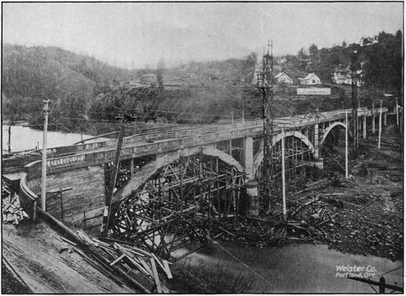
REINFORCED CONCRETE BRIDGE OVER HOOD RIVER, NEARING COMPLETION, ON THE
COLUMBIA
RIVER HIGHWAY AT HOOD RIVER CITY. BUILT IN 1918.
The
structures paid for out of county funds consist of thirteen reinforced
concrete bridges, fourteen wood and steel bridges, and four culverts;
the total cost of these structures being $378,343.24.
Of the structures paid for by the counties, the State Highway Department
supervised the construction for three reinforced concrete bridges,
four steel and wood bridges, and one culvert; the cost of which totaled
$288,743.24.
A complete tabulation of the bridges designed and constructed is given
in another part of this report, and complete descriptions of the more
important structures will be found in the articles devoted to the particular
counties in which the structures are located.
The $250,000.00 intercounty bridge across the Willamette River at Salem
was completed, and has attracted more than local attention. While the
cost of this structure was borne by Marion and Polk Counties the design
and construction engineering were handled by this Department.
The reinforced concrete arch bridge at Hood River, the largest concrete
bridge yet constructed in this State was designed and built under State
supervision, although the County also contributed toward its cost.
Among the proposed bridges of considerable magnitude for which county
officials have requested designs from this Department may be mentioned
the Deschutes and Oregon City. The former will be located between the
present toll bridge and the railroad bridge across the Deschutes River and
will thus obviate the necessity of toll payments. It will consist of a series
of reinforced concrete arches. The Oregon City bridge will replace the old
suspension bridge across the Willamette. Studies are being made and comparisons
of various types of bridges and locations of site are being made.
During the war period, both for patriotic and economic reasons the
employment of steel bridges was discontinued and wooden truss bridges used
instead. Now that the demand for steel for war purposes has subsided,
and there are indications of a decline in the price of structural steel in the
near future, the resumption of use of that material in the construction of
bridges will probably be more general.
The Department is working consistently for the elimination of dangerous
grade crossings. No less than ten grade crossings have been done away with
as far as through traffic on State Roads is concerned, during the past two
years. Most of these eliminations have been brought about by holding roads
on the same side of railway tracks instead of crossing over and back. Two
of the eliminations, however, were brought about by grade separations;
one near Rex in Washington County and another near Ashland in Jackson
County, both of these grade separations being undercrossings.
An agreement was also reached whereby a reinforced concrete overhead
crossing will be constructed to eliminate a very dangerous grade crossing
on the Pacific Highway near Divide, in Lane County. This structure would
have been built in 1918, but on account of the requirements of material for
war purposes, the United States Highway Council ordered the construction
delayed. It will undoubtedly be constructed during the 1919 season.
In 1916, the United States Congress enacted a law making available
$85,000,000.00 of Federal Government moneys for co-operation with the
several States in the construction and improvement of roads. Of this
amount, $75,000,000.00 is appropriated for co-operation on “Post Roads,”
roads over which either rural or star post routes are operated, and $10,000,000.00
is appropriated for co-operation on “Forest Roads,” roads within
or partly within National Forests.
During the five year period prior to July 1, 1921, there will become
available to the State of Oregon from the Government Funds set aside by
this Act the following amounts:
| |
For
Post Roads |
For
Forest Roads |
| July 1, 1916, to July 1, 1917 |
$ 78,687.00 |
$ 127,794.00 |
| July 1, 1917, to July 1, 1918 |
157,375.00 |
127,794.00 |
| July 1, 1918, to July 1, 1919 |
236,062.00 |
127,794.00 |
| July 1, 1919, to July 1, 1920 |
314,749.00 |
127 794.00 |
| July 1, 1920, to July 1, 1921 |
393,437.00 |
127,794.00 |
| |
Totals |
$ 1,180,310.00 |
$ 638,970.00 |
Total amount of government funds apportioned to the State of Oregon
for co-operative work. $1,819,280.00.
With the funds thus apportioned to the State, the Government will
co-operate on approved road projects to not to exceed fifty per cent of
their cost. Therefore, the State, or the State co-operating with the Counties,
must provide amounts at least equal to the amounts set aside by the Federal
Government in order to avail itself of the funds apportioned to it.
In 1917, the State Legislature passed a bill accepting the terms of the
Federal Government’s co-operative offer and authorizing the issue of bonds
to the amount of $1,819,280.00 to provide the funds necessary to match the
Government funds. There is thus available for expenditure on post and
forest roads in the State during the five years prior to July 1, 1921, the
following amounts:
| For Post Road Projects: |
| |
Federal Government Funds |
$ 1,180,310.00 |
|
| |
State Funds |
1,180,310.00 |
|
| $ 2,360,620.00 |
| For Forest Road Projects: |
| |
Federal Government Funds |
$ 638,970.00 |
|
| |
State Funds |
638,970.00 |
|
| |
1,277,940.00 |
| |
|
Total |
|
$ 3,638,560.00 |
For Post Road Projects the plans are prepared, contracts let and work
supervised by the State Highway Department, subject, of course, to approval
and acceptance by the Secretary of Agriculture through the Federal Office
of Public Roads and Rural Engineering. For Forest Road Projects, the
plans are prepared, contracts let and work supervised by the Federal Office
of Public Roads and Rural Engineering acting for the Secretary of Agriculture.
The State Highway Department is, therefore, directly responsible
for the work done on Post Road Projects, whereas on Forest Road Projects
the responsibility rests with the Office of Public Roads and Rural Engineering,
the State Highway Department simply approving the projects and
auditing the claims presented by the Federal Government against the State’s
share of the funds.
It is the policy of the Highway Department to match the Government
Funds with equal amounts from State Funds only, any County Funds
which may be available being used to increase the total amounts available
rather than to reduce the amount of State co-operation. On projects
approved to November 30, 1918, the amount of these additional funds provided
by counties is approximately $325,000.00.
Up to November 30, 1918, fifteen Post Road Projects had been submitted
to the Office of Public Roads for approval. Of these fifteen projects nine
have received approval, three have been rejected as not complying with the
government requirements as regards rural and star route mail service over
them, and three are pending action by the Secretary of Agriculture. The
rejected projects were the Wolf Creek-Grave Creek project in Josephine
county, the Canyonville-Galesville project in Douglas County, and the Myrtle
Creek-Dillard project also in Douglas County. The first and third of these
projects have since been constructed without government co-operation, and
the second is under construction as a “Forest Road.”
Construction is now under way on two Post Road Projects both of which
are in Union County. These are the Elgin-Minam project, estimated to cost
$41,151.00, and the Union-Telocaset project, estimated to cost $30,000.00.
The contracts for the construction of both jobs were let on July 9, 1918, to
Union County, represented by the County Court, the lowest bidder. Subsequent
to the letting, however, the Attorney General gave the opinion that
the County Court had no legal authority to enter into a contract of this
nature, and in order to facilitate matters and prevent delay in construction
the State Highway Commission on September 10, 1918, agreed to take the
work over at the prices bid by the County, the County agreeing to reimburse
the State in case the cost of the work exceeded the bid prices.
The total estimated cost of all projects agreed upon to date is $1,409,993.24
of which $627,496.62 is to be paid by the Federal Government,
$627,496.62 by the State, and $155,000.00 by the Counties interested. On
page 24 is given a tabulation of the Post Road Projects approved, giving the
estimated cost of each project with the respective amounts to be paid by
the State, the Federal Government and the Counties.
The Federal authorities and the State Highway Commission have to date
agreed upon co-operation on fourteen Forest Road Projects. The total estimated
cost of these fourteen projects is $1,246,204.65; $538,231.78 to be
provided by the Government, $538,231.78 by the State, and $169,741.09 by
the Counties.
Construction is already under way on three of the Forest Projects,
namely: the Canyonville-Galesville section of the Pacific Highway in Douglas
County, the Three Rivers Project in Tillamook County, and the Ochoco
Canyon Project in Crook County.
[24]
| Projects |
Project
Number |
Miles and Kind of Work |
Total Cost |
Funds Provided |
By
Government |
By State |
By Counties |
| Baker County: |
|
|
|
|
|
|
| |
Baker-Middle Bridge Section |
10 |
17.0 |
miles—grading |
$ 71,235.45 |
$ 28,117.73 |
$ 28,117.72 |
$ 15,000.00 |
| |
Sag Section of Baker-Cornucopia
Road |
9 |
4.9 |
miles—grading and gravel |
41,926.00 |
17,963.00 |
17,963.00 |
6,000.00 |
| |
Canyon Section of Baker-
Cornucopia Road |
11 |
4.5 |
miles—grading |
22,498.00 |
8,249.00 |
8,249.00 |
6,000.00 |
| Grant County: |
|
|
|
|
|
|
| |
John Day to Fiske Creek Section |
13 |
7.2 |
miles—grading and gravel |
143,817.14 |
71,908.57 |
71,908.57 |
... |
| |
Hall Hill to Prairie City Section |
14 |
2.2 |
miles—grading and gravel |
43,282.47 |
21,641.23 |
21,641.24 |
... |
| Harney County: |
|
|
|
|
|
|
| |
Burns-Crane Project |
15 |
6.0 |
miles—grading and gravel |
48,000.00 |
20,000.00 |
20,000.00 |
8,000.00 |
| Malheur County: |
|
|
|
|
|
|
| |
Project to be selected |
|
|
|
100,000.00 |
40,000.00 |
40,000.00 |
20,000.00 |
| Marion County: |
|
|
|
|
|
|
| |
Salem-Aurora Project |
7 |
18.0 |
miles—grading |
347,232.60 |
173,616.30 |
173,616.30 |
... |
| Union County: |
|
|
|
|
|
|
| |
Elgin-Minam Project |
5 |
9.3 |
miles—grading |
41,151.00 |
20,575.50 |
20,575.50 |
... |
| |
Union-Telocaset Project |
8 |
6.0 |
miles—grading |
30,000.00 |
15,000.00 |
15,000.00 |
... |
| Wasco County: |
|
|
|
|
|
|
| |
The Dalles-Three Mile Creek
Project |
... |
2.0 |
miles—paving |
44,000.00 |
20,000.00 |
20,000.00 |
4,000.00 |
| Wheeler County: |
|
|
|
|
|
|
| |
Fossil-Sarvice Creek Project |
4 |
9.5 |
miles—grading |
36,733.40 |
18,366.70 |
18,366.70 |
... |
| Wheeler and Grant Counties: |
|
|
|
|
|
|
| |
Sarvice Creek-Valades Ranch
Project |
6 |
48.5 |
miles—grading |
400,433.80 |
157,216.90 |
157,216.90 |
86,000.00 |
| Yamhill County: |
|
|
|
|
|
|
| |
Grande Ronde Project |
12 |
2.8 |
miles—grading and gravel |
39,683.38 |
14,841.691 |
4,841.69 |
10,000.00 |
| |
|
Total estimated cost of all Projects |
$ 1,409,993.24 |
|
|
|
| |
|
Federal Government Funds |
|
$ 627,496.62 |
|
|
| |
|
State Funds |
|
|
$ 627,496.62 |
|
| |
|
County Funds |
|
|
|
$ 155,000.00 |
The Canyonville-Galesville section is what is generally known as Cow
Creek Canyon, one of the worst stretches on the Pacific Highway. This
section is 9.7 miles in length, and is to be graded sixteen feet wide; the
estimated total cost being $211,000.00. The work is under contract to John
Hampshire & Co., of Grants Pass.
The Three Rivers Project is 10.35 miles in length and lies between Hebo
and Dolph on the Portland-Tillamook Highway in Tillamook County. The
County of Tillamook, represented by its County Court was the low bidder
on this work, but before the contract was entered into, the Attorney General
ruled that the County Court had no authority to contract work of this
kind. The State Highway Department having available the necessary
equipment and desiring to get this important piece of road work under way,
agreed with the Federal Government to take the work over at the prices
bid by Tillamook County.
A tabulation of Forest Road Projects approved to date and giving the
estimated cost and amounts of County, State and Government Funds is
given below.
| Projects |
Estimated
Total
Cost |
Funds Provided |
By
Government |
By State |
By County |
| Clackamas County: |
|
|
|
|
| |
Zigzag Section of Mt.
Hood Road |
$ 48,000.00 |
$ 24,000.00 |
$ 24,000.00 |
... |
| Crook County: |
|
|
|
|
| |
Ochoco Canyon Project |
52,500.00 |
17,500.00 |
17,500.00 |
17,500.00 |
| Curry County: |
|
|
|
|
| |
Curry-Coos Project |
110,000.00 |
55,000.00 |
55,000.00 |
... |
| Deschutes-Lane Counties: |
|
|
|
|
| |
McKenzie Pass Project |
190,455.00 |
82,078.00 |
82,078.00 |
26,299.00 |
| Douglas County: |
|
|
|
|
| |
Canyonville-Galesville |
211,000.00 |
94,000.00 |
94,000.00 |
23,000.00 |
| |
Tiller Trail Project |
123,603.00 |
48,439.00 |
48,439.00 |
26,725.00 |
| Lake County: |
|
|
|
|
| |
Lapine-Lakeview Project |
79,419.00 |
39,709.50 |
39,709.50 |
... |
| Jackson County: |
|
|
|
|
| |
Medford-Crater Lake
Project |
72,372.00 |
34,436.00 |
34,436.00 |
3,500.00 |
| Josephine County: |
|
|
|
|
| |
Grants Pass-Crescent
City Project |
31,476.00 |
15,738.00 |
15,738.00 |
... |
| Klamath County: |
|
|
|
|
| |
Anna Creek Section of
Crater Lake Road |
6,780.40 |
3,390.20 |
3,390.20 |
... |
| Lane County: |
|
|
|
|
| |
Eugene-Florence Project |
123,951.25 |
41,317.08 |
41.317.08 |
41,317.09 |
| Tillamook County: |
|
|
|
|
| |
Three Rivers Project |
122,000.00 |
50,250.00 |
50,250.00 |
21,500.00 |
| Wallowa County: |
|
|
|
|
| |
Flora-Enterprise Project |
29,648.00 |
12,324.00 |
12,324.00 |
5,000.00 |
| Wheeler County: |
|
|
|
|
| |
Ochoco Canyon Project |
45,000.00 |
20,050.00 |
20,050.00 |
4,900.00 |
| |
|
Total estimated cost
of all Projects |
$ 1,246,204.65 |
|
|
|
| |
|
Federal Govt. Funds |
|
$ 538,231.78 |
|
|
| |
|
State Funds |
|
|
$ 538,231.78 |
|
| |
|
County Funds |
|
|
|
$ 169,741.09 |
[26]
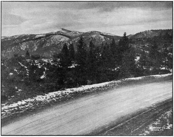
MOUNT ASHLAND FROM THE PACIFIC HIGHWAY IN JACKSON COUNTY.
ELEVATION OF HIGHWAY 4,480 FEET
[27]
The Pacific Highway running from Portland, through Oregon City,
Salem, Albany, Eugene, Roseburg, Grants Pass, Medford and Ashland to the
California line, is probably the most important through highway in the
State. Along it are situated nine of the most important cities of the State.
It traverses the immensely productive valleys of the Willamette, the
Umpqua and the Rogue Rivers. It is the intercommunicating road for nine
of the thirty-five counties of the State, and passes through the county seats
of all but one of the nine. It is the only continuous and direct road along
the Pacific Coast west of the Cascade Mountains, and connecting as it does
the metropoli of the three Pacific Coast States it is the most important
interstate highway in the West. From the standpoint of the tourist, Oregon
would not be on the map if it had no Pacific Highway. It is the road that
makes Oregon accessible to tourists from other states.
Being the most important highway in the State, the Pacific Highway
should be the best highway in the State. To make it the best and at the
same time to bring it up to the standard of the same highway in the adjacent
states of Washington and California is one of the ends toward which the
Highway Commission has been working during the past two years. During
that time 53.3 miles of the very worst stretches of this highway have been
newly graded to trunk highway standards. This grading has eliminated
practically all of those heavy and dangerous grades which have made
Oregon notorious for bad roads and which have kept thousands of auto
tourists from visiting the State. In addition to grading 53.3 miles on the
Pacific Highway, the Highway Commission has put down 8.3 miles of pavement
and 14.5 miles of macadam, the total cost of all of these improvements
being $971,000.00. As a part of the 1919 program, the Highway Commission
has already appropriated for the improvement of the Pacific Highway the
sum of $1,147,000.00, with which it is planned to build 46 miles of pavement
and 38 miles of macadam surface.
The particular sections of the Pacific Highway constructed during 1917
and 1918, together with their mileages and total costs are given below. All
of these sections are completed with the exception of the Canyonville-Galesville
Forest Road Project which is well under way.
| Sections |
Miles |
Total Cost |
| Grading (including bridges)— |
|
|
| |
Oregon City to New Era |
4.0 |
$ 75,000.00 |
| |
Divide to Leona |
7.0 |
50,000.00 |
| |
Yoncalla to Oakland |
10.8 |
101,100.00 |
| |
Myrtle Creek to Dillard |
12.8 |
165,500.00 |
| |
Canyonville to Galesville |
9.7 |
211,000.00 |
| |
Wolf Creek to Grave Creek |
4.9 |
68,300.00 |
| |
Grants Pass to Jackson County Line |
3.3 |
13,000.00 |
| |
Ashland Undercrossing |
.8 |
9,800.00 |
| Macadam— |
|
|
| |
Cottage Grove to Divide |
1.0 |
6,100.00 |
| |
Divide to Leona |
7.0 |
64,000.00 |
| |
Siskiyou to California Line |
6.5 |
56,300.00 |
| Paving— |
|
|
| |
Oregon City to Canby |
7.5 |
135,000.00 |
| |
Ashland Hill Section |
.8 |
15,900.00 |
| |
|
Total cost of improvements completed and under
way on Pacific Highway, 1917-1918 |
... |
$ 971,000.00 |
[28]
The Columbia River Highway is second only to the Pacific Highway as
a commercial necessity in the state of Oregon; furthermore, the Columbia
River Highway is the only connecting link between Eastern and Western
Oregon that can be kept open for vehicular traffic throughout the entire
year.
From a scenic standpoint, the Columbia River Highway has now become
world famous, not only because of its wonderful natural advantages of
location, but because of the high standard of construction. A large part of
this combined commercial and scenic road is now open to traffic and the
coming year will see the elimination of the last almost impassable barrier—the
summit between Hood River and Mosier, a piece of construction 5.8
miles in length which will cost approximately $350,000 for the grading alone.
The Columbia River Highway parallels the Columbia River from the
Pacific Ocean to Umatilla, a distance of 320 miles, thence southeast an
additional 40 miles to Pendleton, where it connects with the Old Oregon
Trail. The Old Oregon Trail continues southeast for a distance of 190
miles, crossing the Idaho-Oregon line at Huntington; making a continuous
highway 550 miles in length.
At this date, the grading of the Columbia River Highway is practically
complete from Astoria to Hood River, a total distance of 174 miles, and
the greater part of it is now either paved or macadamized.
The cost of work completed on the Columbia River Highway between
Astoria and Portland during the period covered by this report, after all
payments are made will be approximately $866,000.00, of which amount
$832,078.35 has been expended to date. The work accomplished consists of
9.4 miles of grading, 51.6 miles of macadamizing, 6 miles of paving, 15 reinforced
concrete bridges and one covered wood draw bridge.
On the upper Columbia River Highway between Hood River and Cascade
Locks, 14.2 miles have been graded, 18 miles gravelled, and a number of
reinforced concrete bridges built, among which is the Hood River bridge at
Hood River, costing $48,000.00. The total cost of the work completed
between Hood River and Cascade Locks will amount to $466,000.00.
The sections improved during this period, with their mileages and costs
are as follows:
| Sections |
Miles |
Total Cost |
| Grading— |
|
|
| |
Cascade Locks to Hood River |
14.2 |
$ 355,000.00 |
| |
Goble to Clatskanie |
8.2 |
78,500.00 |
| |
Astoria to Svensen |
1.2 |
15,000.00 |
| Bridges— |
|
|
| |
Hood River Bridge |
... |
48,000.00 |
| |
Beaver Valley Bridges |
... |
32,000.00 |
| |
John Day River Bridge |
... |
25,000.00 |
| |
Other Bridges |
... |
31,000.00 |
| Paving— |
|
|
| |
Astoria to Svensen |
3.5 |
65,000.00 |
| |
Scappoose to Multnomah County Line |
2.5 |
37,500.00 |
| Macadamizing— |
|
|
| |
Astoria to Svensen |
5.5 |
30,000.00 |
| |
Svensen to Columbia County Line |
18.9 |
215,000.00 |
| |
Clatsop County Line to Goble |
27.2 |
335,000.00 |
| |
Cascade Locks to Hood River |
18.0 |
65,000.00 |
| |
|
Total Expenditures 1917 and 1918 |
... |
$1,332,000.00 |
During 1919, work will be undertaken on the Columbia River Highway
to the amount of $1,400,000.00, comprising 10 miles of pavement, 85 miles of
gravel macadam and 80 miles of grading. This work when completed will
provide a surfaced highway between Astoria and Pendleton.
That the Counties of the State have confidence in the Highway Department
and recognize the ability of the Department to get results is evidenced
by the fact that $709,724.79 of county funds have been voluntarily turned
over to the Department during 1917 and 1918 to be expended under its
supervision.
This, $709,724.79, is the actual amount of money paid out by Counties
on vouchers audited and approved by the Department. In addition to this
a large amount of work has been done by Counties under the supervision of
the Department, for which payment was made direct by the Counties without
being audited by the Highway Department. No record of the total
amount thus expended is available, but it is estimated to be about $200,000.00.
No part of this amount is included in any of the tabulations of
expenditures given in this report. The cost of engineering and supervision
of work handled in this manner, has been paid by the Highway Department
and is included in Table VI of the Financial Report as “Engineering
County Construction.”
For co-operation on Post and Forest Road Projects, a total of $325,000.00
of County Funds have already been pledged. Of this amount $155,000.00
will be expended under State supervision, and $170,000.00 under
Federal Government supervision.
While the major part of the work supervised by the State Highway
Department is handled under the contract system, it has been found to be
good business for the Department to go into competition with contractors
and where satisfactory bids are not received to proceed to handle the work
with State forces.
During 1917 and 1918, the Department handled in this manner the
construction of 45.5 miles of macadam surfacing, 3.0 miles of concrete paving,
and 27.3 miles of grading.
Although war conditions prevailed during the past year and every
possible obstacle had to be surmounted, the work done with State forces
made a creditable showing when compared with cost plus and contract jobs.
Especially is this true of paving work where a comparison of costs with bid
prices show a very substantial saving to the State, as illustrated by the
following table:
| |
Length
in
Miles |
Preliminary
Estimate
of Cost |
Cost
Based on
Lowest Bid
Price |
Actual Cost
With State
Forces |
Saving to
State |
| Sheridan Paving |
2.2 |
$ 42,535.50 |
$ 52,438.00 |
$ 40,065.61 |
$ 12,372.39 |
| Ashland Hill Paving |
.8 |
16,962.00 |
19,858.66 |
15,908.03 |
3,950.63 |
| |
Total |
3.0 |
$ 59,497.50 |
$ 72,296.66 |
$ 55,973.64 |
$ 16,323.02 |
Highway construction by the State Highway Department with its own
forces has its limitation, however, in spite of the fact that it is often possible
to do work at less cost than by contract. The Oregon State Highway Department
is by law and of necessity an engineering organization and, in order
to have the best success in handling construction work, it is necessary to
have a distinct organization.
In the hiring of men for handling such construction, it is necessary for
the State to compete with contractors for the higher priced and more
experienced men, and the contractor is often in a position to offer more
salary than the State. Furthermore, it is necessary for the State to carry
large quantities of expensive equipment which is idle at least a part of the
year, and, in fact, the amount of equipment necessary to handle all of the
State work by force account would represent too large a portion of the
year’s available money for road work.
In handling its construction work direct, however, the Department has
the advantage of not being required to make a profit on the work, neither
has it to pay interest on the necessary moneys to carry payrolls and other
incidentals, neither is there any loss in retained percentage. The State
does not have to carry a construction bond and, in fact, there are many
reasons why a state should handle its construction direct, cheaper than by
contract.
There is much to be said on both sides of the question, but the Department
at this time does not believe that it is justified in attempting to handle
all of the State work, believing that only under certain conditions where the
State does not receive reasonable bids the work should be handled direct.
The State Highway Department has many large construction jobs under
contract at one time, and it is obvious, even to the layman, that an organization
to handle all of this work with State forces is impossible under the
present laws of the State of Oregon, and the Department recommends that
force account be limited to such cases as are mentioned above and work
for which the quantities and cost can not be closely estimated in advance of
construction, such as maintenance work and light grading.
The funds at the disposal of the Highway Department are divided as
follows:
The State Highway Fund provides for one-quarter mill tax on the
assessed valuation of the State. This fund amounted to $219,690.98 in 1917;
$232,151.39 in 1918 and in 1919 will equal $246,883.47. The money available
in this fund provides a sufficient sum for the salaries and expenses of the
State Highway Department, and the cost of maintaining State highways
which have been constructed or improved. It is provided also, that with
the proceeds of this fund, the Commission may enter into co-operative agreements
with any County for the survey, construction, improvement or maintenance
of any State highway upon such basis or contribution as may be
agreed upon. The Bridge Department is maintained out of this fund and
furnishes designs for structures desired by the counties.
The Automobile License Fund. Under the provision of Section 12, Chapter
423, Laws of 1917, the Secretary of State is directed to transfer to an
account under the jurisdiction of the State Highway Commission, the
receipts from the automobile license fees, less the cost of administration.
The law provides that these funds be transferred on April 1 and October 1
of each year. The 1918 receipts from this fund were $425,000.00 and with
the rapid increase of the number of automobiles, it is expected that this
amount will be increased from year to year. The fund provides for the
payment of principal and interest, as the same shall become due, on the
bonded indebtedness of the State of Oregon, contracted for road purposes
under the provisions of the Six Million Dollar Bonding Act and the State
and Federal Road Bonding Act. The unexpended balance may be expended
on such State highway projects as the Commission approves.
This fund is also used for co-operative work in counties where the Six
Million Dollar Fund may not be used and on State Highways not eligible for
improvement under the Post and Forest Road Acts.
The Six Million Dollar Road Bond Fund provides for the issuance of six
million dollars in bonds during the next five years. It provides for the
sale of one million dollars in bonds in 1917; two million dollars in 1918, and
the balance as the Commission may think advisable. The primary purpose
of this act was to provide paving on the main highways of the State, contingent
upon the counties preparing the road bed according to the plans of
the State Highway Engineer.
It also provides funds for the grading of the road bed on the Columbia
River Highway in Clatsop, Columbia and Hood River Counties and on the
Pacific Highway in Jackson County.
At this date a total of $2,190,000 par value of bonds have been sold.
State and Federal Co-operative Road Bonds. Under the Federal Aid
Road Act there is provided for expenditure by the Federal Government
during the next five years, $1,180,310.85 for the construction of Post Roads
in the State of Oregon and there is also available during the same period
the sum of $638,970.00 for the construction of highways within or partly
within the National Forests of the State. The purpose of this Act is to
meet Federal Aid in an equal amount and under this provision a total of
$1,819,280.85 in bonds is authorized to be issued by the Board of Control
and placed in a special fund to be used in carrying out the provisions of this
Act. A total of $400,000.00 par value of these bonds have been sold.
The State Highway Department owns construction and hauling equipment
to the approximate value of $100,000.00. This equipment is too varied
and extensive to be shown in detail in this report. However, it includes six
heavy auto trucks, two light auto trucks, twenty-two touring cars, three
concrete mixers, two gasoline locomotives, three road rollers, one Brown
hoist, one asphalt paving plant, three rock crushers and an extensive supply
of camp equipment, small tools, drills, steel, pipe, etc.
Most of this equipment is in fine working condition and adaptable to
general highway work and has been used during the past year. However,
we have on hand a certain amount of machinery which was bought for
special purposes in former years, and while it has no doubt made a saving
sufficient to justify its original cost, the Department has no more use for
it and it would be advantageous to the Department if this equipment could
be disposed of and the money invested in more necessary machinery. Under
present conditions, the State law makes it necessary to return any money
from the sale of materials, supplies or equipment into the General Fund of
the State, and it is impossible to get this money back into highway funds
without a special act of the Legislature. Despite this fact, however, some
equipment was disposed of during the past year and the money turned into
the General Fund.
If the State Highway Department is to proceed with any considerable
amount of work with State forces, it will be necessary to purchase some
additional equipment so that the work may be prosecuted more economically,
especially is this true of concrete bridge work and general maintenance
work. These are special types of work and special types of equipment are
necessary to handle them properly.
During the past year a great amount of equipment has been rented from
private contractors and in case of short jobs and on special types of work,
this is economical, but on long jobs, it is much more economical to purchase
the necessary machinery as the amount paid out in rentals for a period of
six or eight months is a considerable portion of the purchase price.
During the past season a warehouse was built by the Department for the
purpose of housing construction equipment. This warehouse is located on
State property near the Penitentiary. It is 40 by 80 feet in size and has
railroad facilities.
All idle equipment and left over material is shipped to Salem, for storage,
at the close of the season. There the equipment is overhauled, repaired,
repainted, and placed in readiness for the next season’s work. The warehouse
was built by the Department with day labor.
It will probably be advisable during the coming year to erect two more
units to the warehouse to take care of a larger amount of equipment and
provide for repair shop and garage.
A garage was rented at 660 North Capitol Street, Salem, and an efficient
automobile mechanic was placed in charge. By this means the automobiles
of the Department are kept in good repair, oiled and tires vulcanized.
Facilities are provided also for overhauling and repainting, which effects
a considerable saving.
The work handled in the offices of the State Highway Department is
of four classes, each requiring specialized training, and, in a way, of little
or no relation to each other. For this reason, the office organization consists
of four different offices or departments: the General Office, the
Auditing Department, the Office Engineering Department and the Bridge
Department. The work of these departments is outlined in the following
paragraphs.
General Office.—All business of the Highway Commission and all business
of the Department with the public is transacted through the General
Office. Under the direction of the Secretary of the Commission and the
First Assistant Engineer, this office handles all correspondence, the issuance
of bonds, the execution of contracts, the purchase of supplies and
equipment, and all general office detail.
The seal of the State Highway Commission and the minutes of the
Commission meetings are in the custody of the Secretary. All mail is
received and distributed through the Secretary’s office, and in it filed
all correspondence, legal documents, etc. This office also keeps a record
of all State equipment and takes care of the charging out of rental and
depreciation on same.
The
purchase of office, engineering and construction supplies and equipment
is handled by this department and a considerable saving is realized
by buying in quantities. On all stock supplies, each job is charged with
the amount furnished and similarly rental on our own engineering instruments
and automobiles is charged, so that the cost of each job may be
determined. On construction projects which are furnished with our own
trucks, road rollers, etc., each piece of equipment is rented out to the job
in the same manner. A record is kept of the rental charged on each piece
of equipment so that its value can be determined at any time.
Auditing Department.—This department, working under the supervision
of the Auditor, handles all claims against the Commission, verifies
each one, prepares the vouchers to cover, sends them out to claimants to be
certified, and mails out the warrants when received from the Secretary of
State. All vouchers drawn from the counties for co-operative work or
projects over which the Commission has supervision, are also audited in this
department. In 1917 there were 1,782 State vouchers passed, aggregating
a total of $682,321.98; in 1918, 3,371 were passed, aggregating $2,205,935.70.
In 1917 there were 544 County vouchers totaling $270,162.37, and in 1918,
410 vouchers totaling $439,562.79. A total of all such vouchers for the
biennium aggregating $3,597,982.84.
Employes of the Commission are paid by payroll warrants drawn in
favor of the State Highway Engineer and bank checks issued against the
same. The total number of paychecks issued in 1917 was 2,771, and in
1918 there was a total of 7,350.
It will be noted that in the past two years the Commission has done
considerable work by day labor and the above statement includes all direct
employes. It is desirable to expedite payment of labor claims, especially
to men who quit on short notice. The present law requires that claims be
prepared in voucher form, approved by the Commission for payment and
then sent to the Secretary of State for audit. The warrant when received is
deposited in a bank and a paycheck issued. It is recommended that a
revolving payroll fund be created on which pay checks could be drawn and
sent out immediately as requested. These could later be listed and the
payroll voucher prepared in the usual manner in favor of the State Highway
Engineer. The warrant when received, to be refunded to the payroll fund
which would be kept intact. The State Highway Engineer should furnish a
payroll bond to cover. This fund could also be used for emergency claims
to take advantage of trade discounts and permit the payment of small claims
which it is desired to pay promptly.
In the numerous cases in which the Commission has taken over the work
to do with its own forces, the necessary bookkeeping and detail records for
handling material, supplies and labor payrolls have been carried by this
office. On several force account jobs each invoice and payroll of the contractor
has been carefully checked and verified before being paid.
The record of both State and County funds have been audited by reputable
certified public accountants and found correct.
Mr. G. Ed Ross served in the capacity of Auditor until his resignation
in July, 1918, when his duties were taken over by Roy A. Klein, Assistant
Engineer.
Office Engineering Department.—In the Office Engineering Department
are handled the numerous office details in connection with the engineering
work of the Department. The more important of these duties are the
working up of maps, profiles, specifications and estimates for new projects;
the checking of monthly and final estimates for payments on contract work;
the filing of engineering records of all kinds; the keeping of cost distribution
and the compilation of reports, statistics and other data.
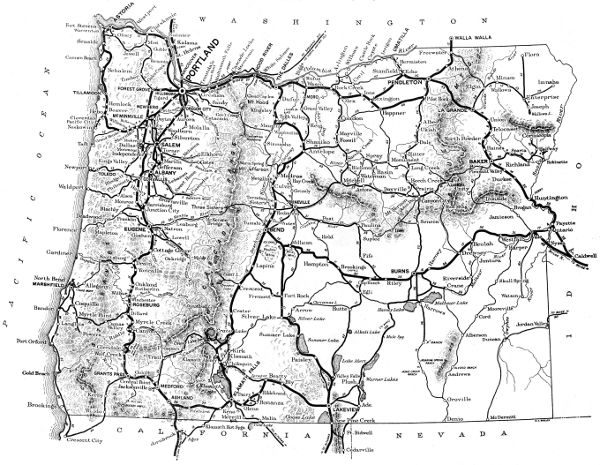
During the past year this department, in addition to its other work,
prepared and had published a road map of the State of Oregon. This map
shows all of the main traveled roads of the State and is believed to be the
most authentic as well as the most complete road map of Oregon yet published.
A small reproduction of the map is contained in this report. Single
copies of a larger size, 13 by 22 inches will be supplied upon application.
Bridge Department.—The Bridge Department prepares designs, plans,
specifications and estimates for all bridges and similar structures. The
inspection and the supervision of construction of bridges is also in charge of
this department.
The laws of the State require that bridge designs be prepared for counties
by the Highway Department, upon the request of County Courts.
Twelve counties have taken advantage of this law during the past two years
and have called upon the Department for designs for a total of thirty-four
bridges and six culverts, and of these structures twenty-seven bridges and
four culverts have been built.
A total of ninety-five bridges and fifteen culverts were designed by the
Bridge Department, of which fifty-nine bridges and eleven culverts have
been constructed.
The keeping of an accurate segregation of expenditures and a detailed
distribution of costs for an organization handling the amount of work and
the character of work handled by the Highway Department is a matter of
the greatest importance. The Highway Department seldom has under way
less than eighty or ninety separate and distinct jobs. These jobs are scattered
all over the State, and few of them are of sufficient size to warrant
the employment of timekeepers on the jobs to keep exact records of expenditures
and costs. The records for all of these jobs must be kept in the main
office where it is impossible for those keeping the records to be personally
familiar with the details of the numerous expenditures made on each of
the many jobs.
To secure proper records of expenditures, therefore, a system of cost
keeping must be used which requires little attention from the engineers and
superintendents in charge of the various jobs, and at the same time gives
sufficient information to those keeping the records in the main office to
enable them to segregate all expenditures so that detailed information as
regards total expenditures, monthly expenditures, expenditures from different
funds, expenditures for different purposes, unit costs, etc., are readily
available at any time, and in such form that all jobs may be combined to
give total expenditures of various kinds, so that the Department is always
Informed as to the financial status of each job and of all jobs.
The system of cost keeping now in use by the Department has been
evolved from a number of other systems in use on work of a similar nature,
and is a system specially devised to meet the requirements of the Department.
For every cent expended by the Highway Department or under its
supervision, there appears in the cost records, entries which give at a glance
the name of the County in which the expenditure is incurred, the name of
the particular job, whether it is an engineering cost or a construction cost,
the particular part of the work involved, the fund from which it is paid,
and a reference to the original invoice or statement upon which the payment
is made. These records are so arranged and so summarized each month
that almost any desired combination of costs is available, such as the totals
for each county, for each job, for each fund, for engineering, for construction,
for surveys, for administration, for construction engineering, etc.
The expenditure tabulations given in various parts of this report, and
especially those in the part devoted to the Financial Report, give a good
idea of the results being obtained with the system in use although they do
not give the detail which is readily available in the records themselves.
The State Highway Department is very proud of its representation in
the Army Service and in recognition of the patriotism of those employes
who have gone to the Front, the Department has maintained a Service Flag
upon which there are now sixty stars. The men represented by these stars
are listed on the following Roll of Honor:
| Name and Company |
Former Position
with Department |
| Abbott, Charles H., 23d Engineers |
Inspector |
| Brown, Merle, Batt. F, 5th Field Artillery |
Chainman |
| Chittick, Ernest |
Chainman |
| Chrisman, William |
Chainman |
| Coats, Solomon |
Chainman |
| Conway, M. A., Navy |
Timekeeper |
| Cook, Harold, Private, S. A. T. C., Willamette University |
Blueprinter |
| Cooley, Lorrin D., Company Mechanic, 11th Co., Coast Artillery |
Chainman |
| Cowgill, W. C. Jr., 1st Provisional Co., 32d Engineers |
Resident Engineer |
| Cutler, Oscar, 472d Engineer Reg. |
Locating Engineer |
| Glass, D. G., 2d Lieut., Co. D, 42d Engineers |
Locating Engineer |
| Grabenhorst, Eugene B., Private, Co. P, 5th Bn., 22d Engineers |
Instrumentman |
| Green, E. R., Private, Co. A, 23d Engineers |
Resident Engineer |
| Greenwood, P. S. |
Transitman |
| Grey, Ulric R., Camp 4-C, Spruce Squadron |
Instrumentman |
| Hale, E. E. |
Chainman |
| Harris, Milton, 2d Lieut. |
Transitman |
| Hodgman, K. E., Captain, Spruce Division, Signal Corps |
Resident Engineer |
| Hyatt, Waldron, 22d Co., 1st Regiment, U. S. Marine Corps |
Instrumentman |
| Ingels, Hollis G., H. Q. Co., 62d Inf. |
Levelman |
| Ingram, R. C., Corporal, Co. L, 23d Engineers |
Draftsman |
| Isakson, C. O., 1st Lieut., 12th Engineers |
Instrumentman |
| Jones, Melville S., Master Engineer, Co. C, 116th Engineers |
Computer |
| Judd, Henry C., 3d Co., Coast Artillery |
Chainman |
| Junken, Fred S., Navy |
Rodman |
| Kelley, C. C., 1st Lieut., Co. E, 2d Bn., 20th Engineers
|
District Engineer |
| Kinsey, Claude, Co. A, 20th Engineers |
Instrumentman |
| Lawrence, Perry, Amb. Co. No. 361 |
Topographer |
| Lytle, K. D., Co. C, 43d Engineers |
Transitman |
| McClintock, John, Hospital Unit, Coast Artillery |
Chainman |
| McClintock, Leon, Hospital Unit, Coast Artillery |
Rodman |
| May, Aloys H. |
Transit Rodman |
| Metzger, Floyd S., Co. C. Q. M. Unit No. 305 |
Timekeeper |
| Miller, E. V. |
Draftsman |
| Miller, Ralph W. E., Corporal, Co. I, 62d Infantry |
Costkeeper |
| Minton, Joseph, Co. M, 162d Infantry |
Rodman |
| Moe, Forrest L., 9th Co. Coast Artillery |
Chainman |
| Moore, Don H., Co. A, 116th Engineers |
Chainman |
| Moore, Merton, Co. A, 116th Engineers |
Chainman |
| Moore, Royal, Co. C, S. A. T. C., U. of California |
Chainman |
| Morgan, Silas B. |
Rodman |
| Murdock, R. B., 2d Lieut., Co. C, 42d Engineers |
District Engineer |
| Murphy, Thomas, Hospital Corps, 40th Division |
Chainman |
| Noble, Chas. S., Y. M. C. A. |
Locating Engineer |
| Nunn, Roy, Sergeant, H. Q. Co., 166th Depot Brig. |
Resident Engineer |
| Oerding, Chas., Engineers |
Chainman |
| Oerding, Harry, Co. A, 20th Engineers |
Chainman |
| Quine, Ralph, Hospital Unit, Coast Artillery |
Chainman |
| Reiter, C. G., 1st Lieut. |
Locating Engineer |
| Rynning, P. B., Co. H, 23d Engineers |
Resident Engineer |
| Schaffenberg, H. |
Chainman |
| Smith, Frederic W., Co. C, Q. M. Unit No. 305 |
Timekeeper |
| Smith, Thos. P. |
Stakeman |
| Stretchberry, Ray, 17th Co., 23d Engineers |
Rodman |
| Sutter, L. R., Co. F, 4th Engineers |
Chainman |
| Tilley, Walker B., Co. K, 18th Railway Engineers |
Instrumentman |
| Welborn, Forrest, Sergeant, 44th Machine Gun Company |
Clerk |
| Wilson, Otis E. |
Inspector |
| Withycombe, Earl, 20th Engineers |
Resident Engineer |
| Vester, Albert |
Chainman |
The classification of employes lost to the Department through enlistment
in the Army is as follows:
| District engineers |
2 |
Timekeepers |
3 |
| Locating engineers |
4 |
Inspectors |
2 |
| Resident engineers |
6 |
Office clerks |
1 |
| Transitmen |
9 |
Blue Printer |
1 |
| Draftsmen |
2 |
Rodmen |
6 |
| Levelmen |
1 |
Chainmen |
20 |
| Computers |
2 |
|
—— |
| Topographers |
1 |
Total number |
60 |
[38]
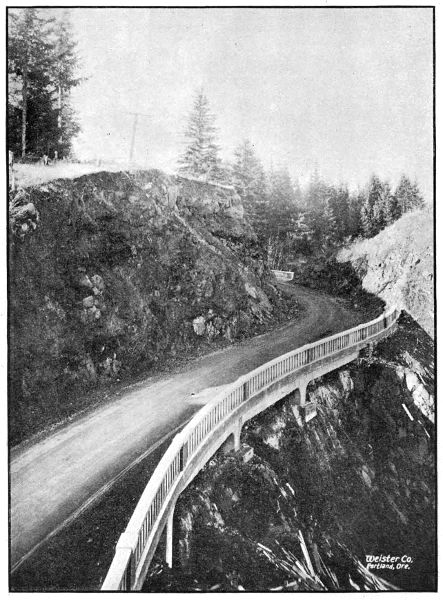
REINFORCED CONCRETE HALF VIADUCT ON THE COLUMBIA RIVER
HIGHWAY
BETWEEN GOBLE AND RAINIER IN COLUMBIA COUNTY,
CONSTRUCTED IN 1918
[39]
Financial Report
Fund Allotments and Expenditures
During the Fiscal Period
December 1, 1916, to November 30, 1918
| Grand Total of Funds Allotted |
$ 4,271,515.16 |
| Grand Total of Expenditures |
3,597,982.47 |
| |
Balance on hand December 1st, 1918 |
$ 673,532.69 |
The details of fund allotments and expenditures are set forth in tables as follows:
| Table I. |
Fund Allotments from all sources. |
| Table II. |
Summary of Fund Allotments and Fund Expenditures. |
| Table III. |
Expenditures Segregated by Counties. |
| Table IV. |
Expenditures Segregated under the Headings of General Administrative, Surveys,
Construction Engineering,
Construction, Equipment and Unclassified. |
| Table V. |
Expenditures for Construction Detailed by Jobs. |
| Table VI. |
Expenditures for Surveys Detailed by Jobs. |
| Table VII. |
Expenditures for Equipment, Bond Interest and Overhead. |
| Table VIII. |
Summary of County Funds Expended by Department. |
[40]
| |
One-Quarter Mill Tax Fund— |
| Balance on hand Dec. 1, 1916 |
$ 94,418.14 |
|
| Turnover January 1, 1917 |
219,690.98 |
|
| Turnover January 1, 1918 |
232,151.39 |
|
| |
|
Total |
|
$ 546,260.51 |
| |
| |
Automobile License Fund— |
| Turnover October 1, 1917 |
$ 150,000.00 |
|
| Turnover April 1, 1918 |
300,000.00 |
|
| Turnover October 1, 1918 |
125,000.00 |
|
| |
|
Total |
|
$ 575,000.00 |
| |
| |
Six Million Dollar Bond Fund— |
| Bond Sale, August 7, 1917 |
$ 471,300.00 |
|
| Accrued Interest |
2,333.33 |
|
| Bond Sale, September 12, 1917 |
472,130.00 |
|
| Accrued Interest |
1,833.33 |
|
| Bond Sale, March 15, 1918 |
455,850.00 |
|
| Accrued Interest |
222.22 |
|
| Bond Sale, July 9, 1918 |
643,770.00 |
|
| Accrued Interest |
2,606.54 |
|
| |
|
Total |
|
$ 2,050,045.42 |
| |
| |
State and Federal Co-operative Bond Fund— |
| Bond Sale, August 18, 1917 |
$ 388,040.00 |
|
| Accrued Interest |
2,844.44 |
|
| Less expenditures by Board of Control |
400.00 |
|
| |
|
Total |
|
$ 390,484.44 |
| |
| |
County Funds— |
| Payments on Vouchers drawn by Department |
709,724.79 |
Grand Total Funds Allotted to Highway Department, December 1,
1916 to November 30, 1918 |
$ 4,271,515.16 |
(For description of the several funds provided for the work of the Highway
Department see pages 30 and 31.)
| Funds |
Allotments |
Expendi-
tures |
Balance
December 1,
1918 |
| One Quarter Mill Tax Fund |
$ 546,260.51 |
$ 528,789.99 |
$ 17,470.52 |
| Automobile License Fund |
575,000.00 |
281,902.67 |
293,097.33 |
| Six Million Dollar Bond Fund |
2,050,045.42 |
2,049,025.47 |
1,019.95 |
State and Federal Co-operative Bond
Fund |
390,484.44 |
28,539.55 |
361,944.89 |
| |
Total State Funds |
$ 3,561,790.37 |
$ 2,888,257.68 |
$ 673,532.69 |
| County Funds |
709,724.79 |
709,724.79 |
... |
| |
Grand Total |
$ 4,271,515.16 |
$ 3,597,982.47 |
$ 673,532.69 |
[41]
| County |
State
Funds |
County
Funds |
Total |
| Baker |
$ 7,578.68 |
... |
$ 7,578.68 |
| Benton |
47.56 |
$ 479.20 |
526.76 |
| Clackamas |
155,861.10 |
43,091.14 |
198,952.24 |
| Clatsop |
344,387.23 |
... |
344,387.23 |
| Columbia |
488,302.15 |
... |
488,302.15 |
| Coos |
16,967.68 |
170,781.83 |
187,749.51 |
| Crook |
3,053.72 |
... |
3,053.72 |
| Curry |
5,629.24 |
... |
5,629.24 |
| Deschutes |
20,716.37 |
... |
20,716.37 |
| Douglas |
159,769.58 |
173,550.18 |
333,320.76 |
| Gilliam |
35,999.48 |
... |
35,999.48 |
| Grant |
7,468.78 |
291.10 |
7,759.88 |
| Harney |
1,873.45 |
... |
1,873.45 |
| Hood River |
433,928.22 |
3,968.49 |
437,896.71 |
| Jackson |
86,619.88 |
... |
86,619.88 |
| Josephine |
77,998.14 |
... |
77,998.14 |
| Klamath |
819.23 |
... |
819.23 |
| Lake |
15,391.67 |
... |
15,391.67 |
| Lane |
14,529.52 |
... |
14,529.52 |
| Lincoln |
2,997.47 |
... |
2,997.47 |
| Linn |
791.07 |
5.00 |
796.07 |
| Malheur |
866.65 |
... |
866.65 |
| Marion |
5,083.59 |
223,794.99 |
228,878.58 |
| Morrow |
10,863.10 |
1,009.44 |
11,872.54 |
| Polk |
802.92 |
17,200.70 |
18,008.62 |
| Sherman |
3,052.14 |
... |
3,052.14 |
| Tillamook |
68,274.29 |
26,009.84 |
94,284.13 |
| Umatilla |
173,942.50 |
3,542.75 |
177,485.25 |
| Union |
32,188.17 |
78.59 |
32,266.76 |
| Wallowa |
765.07 |
... |
765.07 |
| Wasco |
4,313.79 |
19.45 |
4,333.24 |
| Washington |
246,769.05 |
9,395.00 |
256,164.05 |
| Wheeler |
69,214.78 |
18,233.60 |
87,448.38 |
| Yamhill |
124,958.84 |
18,273.49 |
143,232.33 |
|
Total |
$ 2,621,825.11 |
$ 709,724.79 |
$ 3,331,549.90 |
| Classification |
Total |
State
Funds |
County
Funds |
| General Administration and Supervision |
$ 97,621.82 |
$ 97,621.82 |
... |
| Surveys and Engineering County Work |
144,086.67 |
137,954.74 |
$ 6,131.93 |
| Construction Engineering |
127,805.58 |
127,803.08 |
2.50 |
| Construction |
3,059,657.65 |
2,356,067.29 |
703,590.36 |
| Equipment |
86,717.55 |
86,717.55 |
... |
| Unclassified (Interest on Bonds, etc.) |
82,093.20 |
82,093.20 |
... |
| |
Grand Total Expenditures |
$ 3,597,982.47 |
$ 2,888,257.68 |
$ 709,724.79 |
[42]
| JOBS |
TOTALS |
STATE FUNDS |
COUNTY FUNDS |
Construction
Engineering
cost
Included in
preceding
columns |
Estimated
total
cost of
job |
Expended
to date |
State’s
share of
estimated
cost |
Expended
from State
funds
to date |
County’s
share of
estimated
cost |
Expended
from County
funds
to date |
| Clackamas County: |
|
|
|
|
|
|
|
| |
Paving—Oregon City to Canby |
$ 135,000.00 |
$ 102,114.85 |
$ 135,000.00 |
$ 102,114.85 |
$ ... |
$ ... |
$ 2,444.57 |
| |
Grading—Canemah Hill Section |
27,500.00 |
24,037.20 |
2,500.00 |
1,944.67 |
25,000.00 |
22,092.53 |
1,944.67 |
| |
Grading and Rock Crushing—New Era |
66,000.00 |
63,047.79 |
50,240.09 |
47,287.88 |
15,759.91 |
15,759.91 |
3,552.82 |
| |
Grading—Multnomah Co. Line to Oswego |
5,746.80 |
7,746.68 |
507.98 |
507.98 |
5,238.70 |
5,238.70 |
507.98 |
| Clatsop County: |
|
|
|
|
|
|
|
| |
Grading and Paving—Astoria to Svensen |
236,000.00 |
96,955.97 |
236,000.00 |
96,955.97 |
... |
... |
5,906.19 |
| |
Macadamizing—Svensen to Columbia Co. Line |
216,000.00 |
210,079.16 |
216,000.00 |
210,079.16 |
... |
... |
4,443.18 |
| |
John Day River Bridge east of Astoria |
25,000.00 |
21,051.52 |
25,000.00 |
21,051.52 |
... |
... |
734.91 |
| |
Plympton Creek Bridge at Westport |
6,413.19 |
6,413.19 |
6,413.19 |
6,413.19 |
... |
... |
255.08 |
| |
Big Creek Bridge near Knappa |
8,446.70 |
8,446.70 |
8,446.70 |
8,446.70 |
... |
... |
140.99 |
| |
Little Creek Culvert near Knappa |
929.69 |
929.60 |
929.69 |
929.69 |
... |
... |
37.02 |
| |
Miscellaneous charges on work prior to 1917 |
247.94 |
247.94 |
247.94 |
247.94 |
... |
... |
25.00 |
| Columbia County: |
|
|
|
|
|
|
|
| |
Paving—Multnomah Co. Line to Scappoose |
37,652.59 |
37,652.59 |
37,652.59 |
37,652.59 |
... |
... |
1,364.28 |
| |
Macadam—Clatsop Co. Line to Clatskanie |
121,000.00 |
118,922.90 |
121,000.00 |
118,922.90 |
... |
... |
554.62 |
| |
Macadam—Clatskanie to Delena |
142,000.00 |
136,560.40 |
142,000.00 |
136,560.40 |
... |
... |
5,998.96 |
| |
Macadam—Delena to Goble |
49,955.08 |
49,955.08 |
49,955.08 |
49,955.08 |
... |
... |
2,902.35 |
| |
Macadam—Goble Section |
23,000.00 |
21,478.97 |
23,000.00 |
21,478.97 |
... |
... |
548.12 |
| |
Grading—Goble Section |
46,262.64 |
46,262.64 |
46,262.64 |
46,262.64 |
... |
... |
2,925.64 |
| |
Grading—Rainier Hill Section |
6,350.61 |
6,350.61 |
6,350.61 |
6,350.61 |
... |
... |
468.88 |
| |
Grading—Beaver Valley Section |
20,978.22 |
20,978.22 |
20,978.22 |
20,978.22 |
... |
... |
... |
| |
Grading—Deer Island Section |
2,398.10 |
2,398.10 |
2,398.10 |
2,398.10 |
... |
... |
163.30 |
| |
Concrete Viaduct, Cribbing and Masonry Wall,
near Prescott |
9,039.86 |
9,039.86 |
9,039.86 |
9,039.86 |
... |
... |
580.53 |
| |
Beaver Valley Bridges |
32,000.00 |
29,808.58 |
32,000.00 |
29,808.58 |
... |
... |
922.54 |
| |
Scappoose Culvert |
1,834.60 |
1,834.60 |
1,834.60 |
1,834.60 |
... |
... |
... |
| |
Goble Creek Bridge near Goble |
5,907.14 |
5,907.14 |
5,907.14 |
5,907.14 |
... |
... |
77.47 |
| |
Graham Creek Culvert near Clatskanie |
804.49 |
804.49 |
804.49 |
804.49 |
... |
... |
31.98 |
| Coos County: |
|
|
|
|
|
|
|
| |
Coast Highway and Myrtle Point-Coquille Road |
180,235.18 |
180,235.18 |
9,453.35 |
9,453.35 |
170,781.83 |
170,781.83 |
14,612.33 |
| Crook County: |
|
|
|
|
|
|
|
| |
Ochoco Canyon Forest Road Project |
52,500.00 |
3,053.72 |
17,500.00 |
3,053.72 |
17,500.00 |
... |
... |
| |
|
(Federal Government cooperates on this project
to the amount of $17,500.00) |
|
|
|
|
|
|
|
| Deschutes County |
|
|
|
|
|
|
|
| |
Cinder Macadam—Bend to LaPine |
20,183.60 |
20,183.60 |
20,183.60 |
20,183.60 |
... |
... |
... |
| Douglas County: |
|
|
|
|
|
|
|
| |
Grading—Divide to Comstock |
19,146.74 |
19,146.74 |
2,027.30 |
2,027.30 |
17,119.44 |
17,119.44 |
2,029.80 |
| |
Grading and Macadam—Comstock to Leona |
80,000.00 |
79,092.87 |
5,650.28 |
4,743.15 |
74,349.72 |
74,349.72 |
4,766.13 |
| |
Grading—Oakland to Yoncalla |
101,096.12 |
101,096.12 |
17,565.28 |
19,015.10 |
83,530.84 |
82,081.02 |
5,864.31 |
| |
Grading—Myrtle Creek to Dillard |
120,000.00 |
88,376.99 |
120,000.00 |
88,376.99 |
... |
... |
7,499.22 |
| |
Macadamizing—Divide to Comstock |
15,185.09 |
15,185.09 |
15,185.09 |
15,185.09 |
... |
... |
302.09 |
| |
Maintenance—Glendale to Stage Road Pass |
74.65 |
74.65 |
74.65 |
74.65 |
... |
... |
... |
| |
Umpqua River Bridges near Dillard |
45,500.00 |
24,802.85 |
45,500.00 |
24,802.85 |
... |
... |
839.18 |
| Gilliam County: |
|
|
|
|
|
|
|
| |
Macadam—Condon to Thirty Mile Creek |
32,500.00 |
31,096.05 |
32,500.00 |
31,096.05 |
... |
... |
1,292.39 |
| Hood River County: |
|
|
|
|
|
|
|
| |
Grading—Cascade Locks Section |
152,904.85 |
152,904.85 |
152,904.85 |
152,904.85 |
... |
... |
8,744.41 |
| |
Grading—Viento Section |
102,750.00 |
86,933.00 |
102,750.00 |
86,933.00 |
... |
... |
4,513.24 |
| |
Grading—Ruthton Hill Section |
107,000.00 |
90,257.53 |
107,000.00 |
90,257.53 |
... |
... |
4,074.19 |
| |
Macadam—Cascade Locks to Hood River |
68,000.00 |
62,895.48 |
68,000.00 |
62,895.48 |
... |
... |
826.18 |
| |
Hood River Bridge |
48,000.00 |
40,528.29 |
43,968.49 |
36,559.80 |
4,031.51 |
3,968.49 |
1,410.63 |
| Jackson County: |
|
|
|
|
|
|
|
| |
Macadam—Siskiyou to California Line |
56,252.98 |
56,252.98 |
56,252.98 |
56,252.98 |
... |
... |
962.27 |
| |
Ashland Under-crossing |
9,768.88 |
9,768.88 |
9,768.88 |
9,768.88 |
... |
... |
275.21 |
| |
Paving—Ashland Hill Section |
15,908.03 |
15,908.03 |
15,908.03 |
15,908.03 |
... |
... |
630.87 |
| |
Maintenance—Siskiyou Section |
748.34 |
748.34 |
748.34 |
748.34 |
... |
... |
| Josephine County: |
|
|
|
|
|
|
|
| |
Grading—Wolf Creek to Grave Creek |
68,301.53 |
68,301.53 |
68,301.53 |
68,301.53 |
... |
... |
4,872.94 |
| |
Grading—Locust Hill Section |
4,869.97 |
4,869.97 |
4,869.97 |
4,869.97 |
... |
... |
162.88 |
| |
Miscellaneous charges on construction in 1916 |
409.43 |
409.43 |
409.43 |
409.43 |
... |
... |
219.23 |
| Lake County: |
|
|
|
|
|
|
|
| |
Grading and Macadam—Lakeview to Paisley |
15,391.67 |
15,391.67 |
15,391.67 |
15,391.67 |
... |
... |
... |
| Lane County: |
|
|
|
|
|
|
|
| |
Macadam—Divide to Cottage Grove |
6,099.86 |
6,099.86 |
6,099.86 |
6,099.86 |
... |
... |
175.84 |
| |
Construction prior to 1917 |
424.44 |
424.44 |
424.44 |
424.44 |
... |
... |
30.64 |
| Lincoln County: |
|
|
|
|
|
|
|
| |
Grading—Pioneer Mountain Section |
2,054.05 |
2,054.05 |
2,054.05 |
2,054.05 |
... |
... |
... |
| Marion County: |
|
|
|
|
|
|
|
| |
Salem Bridge over Willamette River |
223,902.99 |
223,902.99 |
108.00 |
108.00 |
223,794.99 |
223,794.99 |
265.26 |
| Polk County: |
|
|
|
|
|
|
|
| |
Approach to Salem Bridge |
4,548.10 |
4,548.10 |
... |
... |
4,548.10 |
4,548.10 |
... |
| |
Reinforced Concrete Bridge at Dallas |
10,755.68 |
10,755.68 |
1.25 |
1.25 |
10,754.43 |
10,754.43 |
55.10 |
| |
Reinforced Concrete Bridge between Monmouth
and Dallas |
1,898.17 |
1,898.17 |
... |
... |
1,898.17 |
1,898.17 |
... |
| |
Charges on work prior to 1917 |
418.69 |
418.69 |
418.69 |
418.69 |
... |
... |
15.79 |
| Tillamook County: |
|
|
|
|
|
|
|
| |
Grading and Paving—Tillamook to Hebo |
109,250.00 |
89,213.74 |
74,925.00 |
63,203.90 |
34,325.00 |
26,009.84 |
6,391.47 |
| |
Grading—Three Rivers Forest Road Project |
122,000.00 |
2,076.78 |
50,250.00 |
2,076.78 |
21,500.00 |
... |
... |
| |
|
(The Federal Government cooperates on this
project to the amount of $50,250.00.) |
|
|
|
|
|
|
|
| Umatilla County: |
|
|
|
|
|
|
|
| |
Paving—Wild Horse Creek Section |
162,626.56 |
162,626.56 |
162,626.56 |
162,626.56 |
... |
... |
2,609.88 |
| Union County: |
|
|
|
|
|
|
|
| |
Grading—La Grande to Hot Lake |
5,000.16 |
5,000.16 |
5,000.16 |
5,000.16 |
... |
... |
821.68 |
| |
Grading—Elgin-Minam Post Road Project |
41,151.00 |
3,838.44 |
20,575.50 |
3,838.44 |
... |
... |
377.80 |
| |
|
(The Federal Government cooperates on this
project to the amount of $20,575.50) |
|
|
|
|
|
|
|
| |
Grading—Union-Telocaset Post Road Project |
30,000.00 |
16,642.29 |
15,000.00 |
16,642.29 |
... |
... |
1,183.22 |
| |
|
(The Federal Government cooperates on this
project to the amount of $15,000.00.) |
|
|
|
|
|
|
|
| Washington County: |
|
|
|
|
|
|
|
| |
Grading and Paving—Multnomah Co. Line to Newberg |
332,000.00 |
278,976.93 |
322,605.00 |
269,581.93 |
9,395.00 |
9,395.00 |
9,445.56 |
| |
Onion Flat Trestle near Sherwood |
8,372.22 |
8,372.22 |
8,372.22 |
8,372.22 |
... |
... |
197.87 |
| |
Tualatin River Bridge near Tigardville |
12,968.60 |
12,968.60 |
12,968.60 |
12,968.60 |
... |
... |
... |
| |
Fanno Creek Bridge near Tigard |
1,882.81 |
1,882.81 |
1,882.81 |
1,882.81 |
... |
... |
... |
| Wheeler County: |
|
|
|
|
|
|
|
| |
Grading—Cummins Hill Section |
14,532.35 |
14,532.35 |
7,005.15 |
7,005.15 |
7,527.20 |
7,527.20 |
1,402.73 |
| |
Macadam—Cummins Hill Section |
34,000.00 |
32,465 44 |
34,000.00 |
32,465.44 |
... |
... |
1,313.82 |
| |
Grading—Bridge Creek Section |
24,235.45 |
24,235.45 |
14,235.45 |
14,235.45 |
10,000.00 |
10,000.00 |
635.30 |
| |
Resurfacing between Fossil and Condon |
15,000.00 |
444.88 |
15,000.00 |
444.88 |
... |
... |
... |
| Yamhill County: |
|
|
|
|
|
|
|
| |
Grading Rex to Newberg |
6,153.05 |
6,153.05 |
... |
... |
6,153.05 |
6,153.05 |
... |
| |
Sheridan Paving, 1917 |
38,216.04 |
38,216.04 |
28,216.04 |
28,216.04 |
10,000.00 |
10,000.00 |
1,131.35 |
| |
Sheridan Paving, 1918 |
40,065.61 |
40,065.61 |
37,945.17 |
37,945.17 |
2,120.44 |
2,120.44 |
1,166.85 |
| |
Completion of Sour Grass Cut-off |
5,111.19 |
5,111.19 |
5,111.19 |
5,111.19 |
... |
... |
157.39 |
| |
|
$ 3,795,861.61 |
$ 3,187,463.23 |
$ 2,937,207.78 |
$ 2,483,870.37 |
$ 755,328.33 |
$ 703,592.86 |
$ 127,805.58 |
| |
Estimated
total cost |
Expended
to date |
| State |
$ 2,937,207.78 |
$ 2,483,870.37 |
| County |
755,328.33 |
703,592.86 |
| Federal Government |
103,325.50 |
... |
| |
Totals |
$ 3,795,861.61 |
$ 3,187,463.23 |
[45]
| JOBS |
EXPENDITURES |
| By State |
By County |
Total |
| Baker County |
|
|
|
| |
Survey, Baker-Middle Bridge Section |
$ 2,806.77 |
... |
$ 2,806.77 |
| |
Survey, Middle Bridge-Black Bridge
Section |
2,422.54 |
... |
2,422.54 |
| |
Survey, Canyon Sec. of Baker-Cornucopia
Road |
928.08 |
... |
928.08 |
| |
Survey, Sag Section of Baker-Cornucopia
Road |
719.61 |
... |
719.61 |
| |
Survey Unity to Baker |
645.29 |
... |
645.29 |
| Benton County |
|
|
|
| |
Reconnaissance |
47.56 |
... |
47.56 |
| |
Survey, Corvallis to Polk County Line |
... |
$ 479.20 |
479.20 |
| Clackamas County |
|
|
|
| |
Survey, Zig Zag Creek Forest Road
Project |
427.30 |
... |
427.30 |
| |
Survey, Oswego to Oregon City |
972.85 |
... |
972.85 |
| |
Survey, Oregon City to New Era |
1,429.28 |
... |
1,429.28 |
| |
Survey, Canby to Aurora |
1,176.29 |
... |
1,176.29 |
| Clatsop County |
|
|
|
| |
Reconnaissance, Coast & Col. River
Highways |
471.05 |
... |
471.05 |
| Columbia County |
|
|
|
| |
Reconnaissance, Columbia River Highway |
170.93 |
... |
170.93 |
| |
Survey, Columbia City to Scappoose |
177.04 |
... |
177.04 |
| Coos County |
|
|
|
| |
Survey, Coast Hwy. & Myrtle Point-
Coquille Road |
5,737.58 |
... |
5,737.53 |
| |
Survey, Myrtle Point to Douglas County
Line |
1,456.80 |
... |
1,456.80 |
| Curry County |
|
|
|
| |
Survey, Coast Highway |
5,629.24 |
... |
5,629.24 |
| Deschutes County |
|
|
|
| |
Survey, Harney County Line West Seven
Miles |
532.77 |
... |
532.77 |
| Douglas County |
|
|
|
| |
Survey, Canyon Creek Pass to Johns
Ranch |
197.89 |
... |
197.89 |
| |
Survey, Johns Ranch to Jacques Ranch |
829.03 |
... |
829.03 |
| |
Survey, Brockway to Round Prairie |
280.00 |
... |
280.00 |
| |
Survey, Roseburg to Coos County Line |
2,665.93 |
... |
2,665.93 |
| |
Survey, Canyonville-Galesville Forest
Project |
442.99 |
... |
442.99 |
| |
Miscell. Surveys and Reconnaissance |
808.61 |
... |
808.61 |
| Gilliam County |
|
|
|
| |
Survey, John Day River to Blalock |
3,865.66 |
... |
3,865.66 |
| |
Survey and Engineering County Const.
John Day River to Arlington |
981.27 |
... |
981.27 |
| Grant County |
|
|
|
| |
Survey, Big Basin Section of John Day
Highway |
4,322.92 |
291.10 |
4,614.02 |
| |
Survey, & Engineering County Const. Fisk
Creek to Hall Hill |
1,596.28 |
... |
1,596.28 |
| |
Survey, Hall Hill to Prairie City |
384.19 |
... |
384.19 |
| |
Survey, John Day to Fisk Creek |
1,165.39 |
... |
1,165.39 |
| Harney County |
|
|
|
| |
Survey, Burns to Crane |
922.55 |
... |
922.55 |
| |
Survey, Sage Hen to Burns |
719.74 |
... |
719.74 |
| |
Survey, Deschutes Co. Line East Seven
Miles |
231.16 |
... |
231.16 |
| Hood River County |
|
|
|
| |
Survey, Hood River to Mosier (Two
Routes) |
6,877.56 |
... |
6,877.56 |
| Jackson County |
|
|
|
| |
Survey, Ashland to Klamath Falls |
2,789.87 |
... |
2,789.87 |
| |
Survey, Medford to Crater Lake |
1,151.78 |
... |
1,151.78 |
| Josephine County |
|
|
|
| |
Survey, Wolf Creek to Grave Creek |
1,110.70 |
... |
1,110.70 |
| |
Survey, Grave Creek to Grants Pass |
2,038.11 |
... |
2,038.11 |
| |
Survey, Wolf Creek to Stage Road Pass |
151.33 |
... |
153.33 |
| |
Engineering County Const. Grants Pass
to Jackson County Line |
1,117.07 |
... |
1,117.07 |
| Klamath County |
|
|
|
| |
Reconnaissance, Klamath Falls to Olene |
124.58 |
... |
124.58 |
| |
Survey, Klamath Falls to Chiloquin |
377.21 |
... |
377.21 |
| |
Survey, Chiloquin to Sand Creek |
172.95 |
... |
172.95 |
| |
Survey, Anna Creek Forest Road Project |
144.49 |
... |
144.49 |
| Lane County |
|
|
|
| |
Survey, Goshen to Cottage Grove |
1,051.48 |
... |
1,051.48 |
| |
Survey, Eugene to Florence |
6,555.84 |
... |
6,555.84 |
| |
Survey for Overhead Crossing at Divide |
233.25 |
... |
233.25 |
| Lincoln County |
|
|
|
| |
Surveys for Bridge at Toledo and
Waldport |
293.42 |
... |
293.42 |
| Linn County |
|
|
|
| |
Survey, Albany to Jefferson |
791.07 |
5.00 |
796.07 |
| Malheur County |
|
|
|
| |
Reconnaissance |
93.02 |
... |
93.02 |
| |
Survey, Cow Valley-Brogan Section |
773.63 |
... |
773.63 |
| Marion County |
|
|
|
| |
Survey, Salem-Aurora |
2,463.75 |
... |
2,463.75 |
| |
Survey, Salem-Jefferson |
2,511.84 |
... |
2,511.84 |
| Morrow County |
|
|
|
| |
Survey, Columbia River Highway |
2,546.77 |
1,009.44 |
3,556.01 |
| |
Survey, Oregon-Washington Highway |
6,831.56 |
... |
6,831.56 |
| |
Engineering County Const. Oregon-
Washington Highway |
1,428.47 |
... |
1,428.47 |
| Polk County |
|
|
|
| |
Survey Between Monmouth and Dallas |
115.30 |
... |
115.30 |
| |
Survey Near Eola |
67.43 |
... |
67.43 |
| |
Survey, Independence to Benton County
Line |
220.25 |
... |
220.25 |
| Sherman County |
|
|
|
| |
Survey, Columbia River Highway |
2,995.64 |
... |
2,995.64 |
| Tillamook County |
|
|
|
| |
Survey, Tillamook to Hebo |
807.03 |
... |
807.03 |
| |
Survey, Neskowin to Salmon River |
2,628.59 |
... |
2,628.59 |
| Umatilla County |
|
|
|
| |
Survey, Pendleton to Kamela |
5,624.73 |
1,575.29 |
7,200.02 |
| |
Survey, Pendleton to Umatilla |
3,759.87 |
1,684.76 |
5,444.63 |
| |
Survey, Pendleton to Gilliam Co. Line via
Pilot Rock |
1,793.58 |
282.70 |
2,076.28 |
| |
Engineering County Const., Pendleton to
Poor Farm |
81.26 |
... |
81.26 |
| Union County |
|
|
|
| |
Survey, La Grande to Kamela |
2,737.34 |
78.59 |
2,815.93 |
| |
Survey, La Grande to Minam |
2,834.18 |
... |
2,834.18 |
| |
Survey, Union to Telocaset |
364.64 |
... |
364.64 |
| |
Survey, La Grande to Union |
714.62 |
... |
714.62 |
| Wallowa County |
|
|
|
| |
Survey, Flora-Enterprise Forest Road
Project |
765.07 |
... |
765.07 |
| Wasco County |
|
|
|
| |
Survey, Seuferts to Deschutes River |
1,757.29 |
... |
1,757.29 |
| |
Design Culvert over Three Mile Creek |
|
19.45 |
19.45 |
| Washington County |
|
|
|
| |
Survey, Multnomah Co. Line to Newberg |
2,036.55 |
... |
2,036.55 |
| |
Survey and Engineering County Const.
Beaverton to Gaston |
2,326.94 |
... |
2,326.94 |
| Wheeler County |
|
|
|
| |
Survey, John Day River Highway |
7,492.22 |
706.40 |
8,198.62 |
| |
Survey, Mitchell to Dayville |
5,451.58 |
... |
5,451.58 |
| |
Survey, Fossil to Gilliam County Line |
791.47 |
... |
791.47 |
| |
Survey, Ochoco Canyon Forest Road
Project |
242.26 |
... |
242.26 |
| |
Engineering County Const. Sarvice Creek
Summit Section |
550.51 |
... |
550.51 |
| |
Engineering County Const. Fossil to
Gilliam County Line |
507.20 |
... |
507.20 |
| |
Engineering County Const. Sigfrit Hill
Section |
28.62 |
... |
28.62 |
| Yamhill County |
|
|
|
| |
Survey, McMinnville to Dayton |
655.03 |
... |
655.03 |
| |
Survey, Grand Ronde Section |
2,631.41 |
... |
2,631.41 |
| Miscellaneous |
|
|
|
| |
Reconnaissance Surveys in various
Counties |
1,200.04 |
... |
1,200.04 |
Total expenditure for Surveys and
Engineering County Construction Work |
$ 137,954.74 |
$ 6,131.99 |
$ 144,086.67 |
| Administrative and General Supervision: |
|
| |
General Administrative |
$ 14,706.67 |
| |
State Highway Commissioners |
4,863.11 |
| |
Auditing Department |
14,770.77 |
| |
Purchasing Department |
531.17 |
| |
Office Engineering Department |
9,636.90 |
| |
Bridge Department |
15,054.48 |
| |
Pendleton Office |
10,917.05 |
| |
Roseburg Office |
819.59 |
| |
State Highway Engineer and Assistants |
26,322.08 |
| |
|
Total |
$ 97,621.82 |
| Equipment and Stock: |
|
| |
Equipment (This item represents all expenditures for purchase
and maintenance of heavy equipment
less monthly rentals
charged against jobs) |
$ 78,775.26 |
| |
Stock (This item represents all expenditures for supplies and
materials bought and held for
distribution, less deductions made
as supplies and materials are shipped out and charged to jobs) |
5,721.08 |
| |
Construction of New Warehouse at Salem |
2,221.21 |
| |
|
Total |
$ 86,717.55 |
| Unclassified: |
|
| |
Interest and other costs on bonds |
$ 82,083.05 |
| |
Miscellaneous |
10.15 |
| |
|
Total |
$ 82,093.20 |
[48]
| County |
Amount on
Each Job |
Totals for
Each County |
| Benton County |
|
|
| |
Survey—Independence to Corvallis |
$ 479.20 |
$ 479.20 |
| Clackamas County |
|
|
| |
Grading—New Era to Canemah |
37,852.44 |
... |
| |
Grading—Multnomah County Line to Oswego |
5,238.70 |
43,091.14 |
| Coos County |
|
|
| |
Grading—Coast Highway & Coquille-Myrtle Point Rd. |
160,781.83 |
160,781.83 |
| Douglas County |
|
|
| |
Grading—Divide to Comstock |
17,119.44 |
... |
| |
Grading and Macadam—Comstock to Leona |
74,349.72 |
... |
| |
Grading—Oakland to Yoncalla |
82,081.02 |
173,550.18 |
| Grant County |
|
|
| |
Survey—John Day River Highway |
291.10 |
291.10 |
| Hood River County |
|
|
| |
Hood River Bridge |
3,968.49 |
3,968.49 |
| Linn County |
|
|
| |
Survey—Albany to Jefferson |
5.00 |
5.00 |
| Marion County |
|
|
| |
Salem Bridge |
223,794.99 |
223,794.99 |
| Morrow County |
|
|
| |
Survey of Columbia River Highway |
1,009.44 |
1,009.44 |
| Polk County |
|
|
| |
Approach to Salem Bridge |
4,548.10 |
... |
| |
Dallas Bridge |
10,754.43 |
... |
| |
Bridge between Monmouth and Dallas |
1,898.17 |
17,200.70 |
| Tillamook County |
|
|
| |
Grading & Paving—Tillamook to Cloverdale |
26,009.84 |
26,009.84 |
| Umatilla County |
|
|
| |
Surveys—Pendleton to Echo |
1,684.76 |
... |
| |
Surveys—Pendleton to Pilot Rock |
282.70 |
... |
| |
Surveys—Pendleton to Kamela |
1,575.29 |
3,542.75 |
| Union County |
|
|
| |
Surveys—La Grande to Kamela |
78.59 |
78.59 |
| Wasco County |
|
|
| |
Design for Three Mile Creek Bridge |
19.45 |
19.45 |
| Washington County |
|
|
| |
Grading—Multnomah Co. Line to Newberg |
9,395.00 |
9,395.00 |
| Wheeler County |
|
|
| |
Grading—Cummins Hill Section |
7,527.20 |
... |
| |
Grading—Bridge Creek Section |
10,000.00 |
... |
| |
Surveys—John Day River Highway |
706.40 |
18,233.60 |
| Yamhill County |
|
|
| |
Grading—Rex to Newberg |
6,153.05 |
... |
| |
Sheridan Paving, 1917 |
10,000.00 |
... |
| |
Sheridan Paving, 1918 |
2,120.44 |
18,273.49 |
| Total County Funds Expended by Department |
|
$709,724.79 |
The above tabulated amounts cover only those expenditures made on vouchers
drawn by the Highway Department. The Department has supervised a very large
amount of County construction upon which payment has been made direct by the
County, which payments are not included above.
[50]
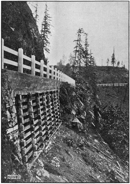
REINFORCED CONCRETE CRIBBING NEAR PRESCOTT ON THE COLUMBIA RIVER
HIGHWAY IN COLUMBIA COUNTY. BUILT IN 1918
[51]
General Tabulated Information
and
Highway Maps
| Table A |
— |
Miles of Highway Construction Completed by the Highway Department during 1917 and 1918. |
| Table B |
— |
Tabulation of Bridge Design and Construction. |
| Table C |
— |
Miles of Location Surveys made by the Department during 1917 and 1918. |
| Table D |
— |
Miles of Different Types of Roads in each County. |
| Table E |
— |
Motor Vehicle Registration by Counties. |
| Table F |
— |
County Bond Issues. |
| Table G |
— |
Tabulation of Contract Prices. |
| Table H |
— |
Yearly Expenditure of State Funds in Counties. |
| Table I |
— |
Mileage Table of Main Traveled Roads. |
| Table J |
— |
Official Designation of State Highways. |
| Table K |
— |
Employes of the State Highway Department. |
| Table L |
— |
Numbers and Mileages of State Highways. |
| Map I. |
— |
Main Traveled Roads of the State. |
| Map II. |
— |
State Highway System. |
[52]
| Jobs |
Concrete
Pavement |
Bitu-
minous
Pavement |
Broken
Stone
Macadam |
Gravel
Macadam |
Grading |
| Clackamas County— |
|
|
|
|
|
| |
Oregon City to Canby |
... |
7.5 |
... |
... |
... |
| |
New Era to Oregon City |
... |
... |
... |
... |
4.5 |
| |
Multnomah County Line to
Oswego |
... |
... |
... |
... |
.2 |
| Clatsop County— |
|
|
|
|
|
| |
Astoria to Svensen |
... |
3.5 |
5.5 |
... |
1.2 |
| |
Svensen to Westport |
... |
... |
17.2 |
1.7 |
... |
| Columbia County— |
|
|
|
|
|
| |
Multnomah County Line-
Scappoose |
... |
2.5 |
... |
... |
... |
| |
Westport to Clatskanie |
... |
... |
8.6 |
... |
... |
| |
Clatskanie to Delena |
... |
... |
9.0 |
... |
... |
| |
Delena to Goble |
... |
... |
7.6 |
... |
... |
| |
Goble Section |
... |
... |
2.0 |
... |
2.0 |
| |
Beaver Valley Section |
... |
... |
... |
... |
4.0 |
| |
Rainier Hill Section |
... |
... |
... |
... |
2.2 |
| Coos County— |
|
|
|
|
|
| |
Marshfield to Curry County
Line |
... |
... |
... |
... |
20.0 |
| |
Coquille to Myrtle Point |
... |
... |
... |
... |
3.0 |
| Deschutes County— |
|
|
|
|
|
| |
Bend to Lapine (cinder
macadam) |
... |
... |
... |
12.5 |
... |
| Douglas County— |
|
|
|
|
|
| |
Myrtle Creek to Dillard |
... |
... |
... |
... |
12.8 |
| |
Oakland to Yoncalla |
... |
... |
... |
... |
10.4 |
| |
Divide to Comstock |
... |
... |
2.4 |
... |
2.4 |
| |
Comstock to Leona |
... |
... |
4.6 |
... |
4.6 |
| Gilliam County— |
|
|
|
|
|
| |
Mayville to Wheeler County
Line |
... |
... |
1.0 |
... |
... |
| |
Condon to Thirty Mile Creek |
... |
... |
5.7 |
... |
... |
| Hood River County— |
|
|
|
|
|
| |
Cascade Locks Section |
... |
... |
... |
... |
8.2 |
| |
Viento Section |
... |
... |
... |
... |
3.6 |
| |
Ruthton Hill Section |
... |
... |
... |
... |
2.4 |
| |
Cascade Locks to Hood River |
... |
... |
... |
18.0 |
... |
| Jackson County— |
|
|
|
|
|
| |
Siskiyou Mountain Section |
... |
... |
6.5 |
... |
... |
| |
Ashland Undercrossing |
... |
... |
... |
... |
.8 |
| |
Ashland Paving |
.8 |
... |
... |
... |
... |
| Josephine County— |
|
|
|
|
|
| |
Wolf Creek to Grave Creek |
... |
... |
... |
... |
4.9 |
| |
Grants Pass-Jackson County
Line |
... |
... |
... |
... |
3.3 |
| Lake County— |
|
|
|
|
|
| |
Lakeview to Paisley |
... |
... |
4.0 |
... |
6.4 |
| Lane County— |
|
|
|
|
|
| |
Divide to Cottage Grove |
... |
... |
1.0 |
... |
... |
| Lincoln County— |
|
|
|
|
|
| |
Pioneer Mountain Section |
... |
... |
... |
... |
1.0 |
| Tillamook County— |
|
|
|
|
|
| |
Tillamook-Cloverdale Paving |
... |
5.0 |
... |
... |
5.0 |
| Umatilla County— |
|
|
|
|
|
| |
Pendleton-Adams Section |
... |
10.0 |
... |
... |
... |
| |
Pendleton-West |
... |
1.0 |
... |
... |
... |
| Union County— |
|
|
|
|
|
| |
Elgin to Minam |
... |
... |
... |
... |
.8 |
| |
Union to Telocaset |
... |
... |
... |
... |
3.0 |
| |
La Grande to Hot Lake |
... |
... |
... |
... |
3.7 |
| Washington County— |
|
|
|
|
|
| |
Multnomah County Line to
Newberg |
... |
12.5 |
... |
... |
12.5 |
| Wheeler County— |
|
|
|
|
|
| |
Cummins Hill Section |
... |
... |
3.5 |
... |
3.5 |
| |
Fossil-Cummins Hill Section |
... |
... |
1.0 |
... |
... |
| |
Bridge Creek Section |
... |
... |
... |
... |
.9 |
| Yamhill County— |
|
|
|
|
|
| |
Sheridan Paving |
4.0 |
... |
... |
... |
4.0 |
| |
Multnomah County Line,
Newberg Paving |
... |
3.2 |
... |
... |
3.2 |
| |
|
Totals |
4.8 |
45.2 |
79.6 |
32.2 |
134.5 |
[54]
| Name of Structure |
Struc-
ture
No. |
Type of Structure |
Total
Length
of
Bridge
and Ap-
proaches
(Feet) |
Width
of
Road-
way
(Feet) |
Loading
(See
Foot-
note) |
TOTAL COST
Actual Cost
if Complete;
Estimated
if Uncompleted |
| Benton: |
|
|
|
|
|
|
|
|
| |
Culvert on West Side Highway, 41⁄2 Mi.
No.
of Corvallis |
207 |
Double 5′ x 5′ R. C. Culvert |
12 |
|
24 |
Heavy |
[1] |
$ 800.00 |
| |
Culvert on West Side Highway, 5 mi. No.
of Corvallis |
208 |
Double 6′ x 8′ R. C. Culvert |
14 |
|
24 |
Heavy |
[1] |
1,300.00 |
| |
Bridge over Mill Race South of Corvallis |
230 |
Reinforced concrete bridge |
85 |
|
20 |
Heavy |
[1] |
7,000.00 |
| Clatsop: |
|
|
|
|
|
|
|
|
| |
Drawbridge over John Day River |
148 |
2-108′ Wood Spans 1-40′ Lift Span |
296 |
|
18 |
Heavy |
[2] |
25,000.00 |
| |
Plympton Creek Bridge at Westport |
185 |
R. C. Thru Span |
60 |
|
20 |
Heavy |
[2] |
6,413.19 |
| |
Big Creek Bridge near Knappa |
186 |
R. C. Bridge |
90 |
|
20 |
Heavy |
[2] |
8,446.70 |
| |
Little Creek Culvert near Knappa |
198 |
6′ x 12′ R. C. Culvert |
14 |
|
24 |
Heavy |
[2] |
929.69 |
| |
Bridge over McDonald’s Log Chute on
Columbia River Hwy. |
214 |
20′ R. C. Bridge |
20 |
|
20 |
Heavy |
[1] |
1,600.00 |
| Columbia: |
|
|
|
|
|
|
|
|
| |
Beaver Creek Bridge No. 1 |
132 |
90′ R. C. Bridge |
90 |
|
20 |
Heavy |
[1] |
5,000.00 |
| |
Beaver Creek Bridge No. 2 |
134 |
70′ R. C. Bridge |
70 |
|
20 |
Heavy |
[1] |
4,300.00 |
| |
Beaver Creek Bridge No. 3 |
136 |
70′ R. C. Bridge |
70 |
|
|
|
|
|
| |
Beaver Creek Bridge No. 4 |
138 |
70′ R. C. Bridge |
70 |
|
|
|
|
|
| |
Beaver Creek Bridge No. 5 |
140 |
60′ R. C. Bridge |
60 |
|
|
|
|
|
| |
Beaver Creek Bridge No. 6 |
142 |
70′ R. C. Bridge |
70 |
|
—20 |
Heavy |
[2] |
32,000.00 |
| |
Beaver Creek Bridge No. 7 |
144 |
60′ R. C. Bridge |
60 |
|
|
|
|
|
| |
Beaver Creek Bridge No. 8 |
146 |
50′ R. C. Bridge |
50 |
|
|
|
|
|
| |
Beaver Creek Bridge No. “A” |
157 |
70′ R. C. Bridge |
70 |
|
|
|
|
|
| |
Beaver Creek Bridge No. “B” |
155 |
105′ R. C. Bridge |
105 |
|
|
|
|
|
| |
Beaver Creek Bridge No. 10 |
150 |
30′ R. C. Bridge |
30 |
|
20 |
Heavy |
[1] |
3,600.00 |
| |
Beaver Creek Bridge No. 11 |
152 |
30′ R. C. Bridge |
30 |
|
20 |
Heavy |
[2] |
3,600.00 |
| |
Culvert near Scappoose on Columbia River
Highway |
188 |
8′ x 10′ R. C. Culvert |
12 |
|
24 |
Heavy |
[2] |
1,834.60 |
| |
Graham Creek Culvert near Clatskanie |
184 |
Double 6′ x 6′ R. C. Box |
14 |
|
24 |
Heavy |
[2] |
804.49 |
| |
Goble Creek Bridge at Goble |
191 |
90′ R. C. Bridge |
90 |
|
20 |
Heavy |
[2] |
5,907.14 |
| |
Half viaduct near Little Jack Falls |
236 |
R. C. Half Viaduct |
75 |
|
20 |
Heavy |
[2] |
2,000.00 |
| Coos: |
|
|
|
|
|
|
|
|
| |
Overhead Railway Crossing at Overland |
110 |
R. C. Viaduct |
114 |
|
18 |
Heavy |
[3] |
10,000.00 |
| |
45′ Wooden Truss |
111 |
Wooden truss |
45 |
|
24 |
Medium |
[3] |
500.00 |
| |
Haynes Slough Bridge |
113 |
40′ Lift (Wood) |
60 |
|
16 |
Medium |
[3] |
4,000.00 |
| |
North Slough Bridge |
114 |
40′ Lift (Wood) |
60 |
|
16 |
Medium |
[3] |
4,000.00 |
| |
Isthmus Slough Bridge |
115 |
80′ Draw Span |
180 |
|
16 |
Medium |
[3] |
12,500.00 |
| |
Larson Slough Bridge |
116 |
40′ Wood Lift and Trestle |
60 |
|
16 |
Medium |
[3] |
4,500.00 |
| |
Powers Bridge |
252 |
2-126′ Wood Spans |
520 |
|
18 |
Medium |
[1] |
12,000.00 |
| |
Bridge at Gravel Ford—No. Fork of
Coquille River |
125 |
126′ Wood Span |
790 |
|
16 |
Medium |
[3] |
8,000.00 |
| Douglas: |
|
|
|
|
|
|
|
|
| |
Pheasant Creek Culvert near Curtin |
187 |
8′ x 8′ R. C. Culvert |
10 |
|
24 |
Heavy |
[2] |
1,804.69 |
| |
Pass Creek Culvert, 1 mi. North of Comstock |
194 |
20′ R. C. Bridge |
20 |
|
20 |
Heavy |
[2] |
2,184.00 |
| |
Umpqua River Bridge South of Dillard |
195 |
2-144′ Wood Spans |
330 |
|
18 |
Heavy |
[2] |
19,000.00 |
| |
Rock Creek Bridge near Anlauf |
196 |
30′ R. C. Bridge |
30 |
|
20 |
Heavy |
[2] |
2,169.70 |
| |
Umpqua River Bridge north of Dillard |
202 |
3-144′ Wood Spans |
480 |
|
18 |
Heavy |
[2] |
26,500.00 |
| |
20′ R. C. Bridge |
216 |
20′ R. C. Bridge |
20 |
|
20 |
Heavy |
[1] |
1,200.00 |
| |
Van Tyne Creek Bridge between Myrtle
Creek and Dillard |
234 |
60′ R. C. Bridge |
60 |
|
20 |
Heavy |
[2] |
3,575.70 |
| |
Viaduct 1 mile North of Myrtle Creek |
245 |
58′ R. C. Viaduct |
58 |
|
20 |
Heavy |
[2] |
2,648.54 |
| |
Viaduct 1 mile North of Myrtle Creek |
246 |
45′ R. C. Viaduct |
45 |
|
20 |
Heavy |
[2] |
2,415.28 |
| |
Pass Creek Culvert 11⁄2 miles North of
Comstock |
190 |
Double 6′ x 7′ R. C. Culvert |
14 |
|
24 |
Heavy |
[2] |
1,380.03 |
| Grant: |
|
|
|
|
|
|
|
|
| |
John Day River Bridge at Monument |
124 |
180′ Wood Span |
450 |
|
16 |
Medium |
[1] |
11,000.00 |
| |
Gulch |
239 |
40′ Wood Span |
40 |
|
18 |
Medium |
[1] |
600.00 |
| |
Gulch |
240 |
40′ Wood Span |
52 |
|
18 |
Medium |
[1] |
700.00 |
| |
Gulch |
241 |
40′ Wood Span |
52 |
|
18 |
Medium |
[1] |
700.00 |
| |
Rock Creek |
242 |
40′ Wood Span |
86 |
|
18 |
Medium |
[1] |
1,700.00 |
| |
John Day River at Goose Rock |
243 |
108′ Wood Span |
150 |
|
18 |
Medium |
[1] |
8,800.00 |
| |
North Fork John Day River |
244 |
144′ Wood Span |
184 |
|
18 |
Medium |
[1] |
11,500.00 |
| |
Holmes Creek |
255 |
40′ Wood Span |
78 |
|
18 |
Medium |
[1] |
1,500.00 |
| |
Rattlesnake Creek |
256 |
40′ Wood Span |
52 |
|
18 |
Medium |
[1] |
1,000.00 |
| |
Dixie Creek Bridge at Prairie City |
282 |
50′ Wood Span |
50 |
|
18 |
Medium |
[2] |
6,000,00 |
| Hood River: |
|
|
|
|
|
|
|
|
| |
East Fork of Hood River |
119 |
140′ R. C. Viaduct |
140 |
|
16 |
Heavy |
[1] |
8,400.00 |
| |
Neal Creek Bridge |
120 |
25′ Bridge, R. C. |
25 |
|
16 |
Heavy |
[3] |
1,000.00 |
| |
Bridge over Hood River at Dee |
121 |
126′ Wooden Span |
126 |
|
16 |
Medium |
[3] |
3,500.00 |
| |
Odell Creek Bridge |
122 |
15′ R. C. Bridge |
15 |
|
18 |
Heavy |
[3] |
600.00 |
| |
Herman Creek Bridge |
159 |
100′ R. C. Bridge |
100 |
|
20 |
Heavy |
[2] |
7,389.06 |
| |
Culvert for Flume Line at Mitchell Point |
162 |
R. C. Culvert |
... |
|
24 |
Heavy |
[2] |
378.44 |
| |
Culvert for Pipe Line at Cascade Locks |
171 |
3′ x 61⁄2′ R. C. Culvert |
8 |
|
24 |
Heavy |
[2] |
642.41 |
| |
Viento Creek Bridge at Viento |
172 |
20′ R. C. Bridge |
20 |
|
20 |
Heavy |
[2] |
1,650.97 |
| |
Gorton Creek Bridge |
173 |
50′ R. C. Bridge |
50 |
|
20 |
Heavy |
[2] |
3,153.90 |
| |
Parham Creek Culvert near Viento |
182 |
4′ x 10′ R. C. Culvert |
12 |
|
24 |
Heavy |
[2] |
965.85 |
| |
Indian Creek |
197 |
Culvert |
10 |
|
... |
... |
[3] |
1,500.00 |
| |
Hood River Bridge at Hood River |
200 |
420′ R. C. Arch and Viaduct |
420 |
|
20 |
Heavy |
[2] |
48,000.00 |
| |
Half Viaduct on Ruthton Hill |
273 |
54′ Half Viaduct |
74 |
|
... |
Heavy |
[2] |
1,563.01 |
| Jackson: |
|
|
|
|
|
|
|
|
| |
Big Applegate near Jacksonville |
147 |
126′ Wood Span, 100′ approach |
226 |
|
16 |
Medium |
[1] |
4,000.00 |
| Josephine: |
|
|
|
|
|
|
|
|
| |
Trestle over Dry Gulch East of Wolf Creek |
210 |
120′ Wood Trestle |
120 |
|
18 |
Medium |
[3] |
1,852.78 |
| |
Coyote Creek Bridge East of Wolf Creek |
211 |
58′ Wood Trestle |
58 |
|
18 |
Medium |
[3] |
811.28 |
| Lane: |
|
|
|
|
|
|
|
|
| |
Overhead Railway Crossing at Divide |
163 |
92′ R. C. Viaduct |
92 |
|
20 |
Heavy |
[1] |
6,500.00 |
| Lincoln: |
|
|
|
|
|
|
|
|
| |
Alsea River, 7 miles above Waldport |
260 |
144′ Wood Span |
258 |
|
18 |
Medium |
[3] |
10,000.00 |
| Linn: |
|
|
|
|
|
|
|
|
| |
Bridge over Mill Race in Lebanon |
274 |
40′ R. C. Bridge |
40 |
|
24 |
Heavy |
[1] |
2,000.00 |
| Marion: |
|
|
|
|
|
|
|
|
| |
Willamette River Bridge at Salem |
123 |
Steel Bridge |
2220 |
|
24 |
(¶) |
[3] |
250,000.00 |
| |
Slough |
253 |
6′ x 7′ R. C. Culvert |
... |
|
... |
Heavy |
[1] |
1,200.00 |
| |
Slough |
254 |
Double 21⁄2′ x 3′ R. C. Culvert |
... |
|
... |
Heavy |
[1] |
500.00 |
| Multnomah: |
|
|
|
|
|
|
|
|
| |
Overhead Crossing—Ore. Elec. Ry. at
Capital Hill |
169 |
106′ Wooden Overcrossing |
106 |
|
20 |
Heavy |
[2] |
800.00 |
| |
Slough |
258 |
60′ Wooden Span |
60 |
|
16 |
Medium |
[2] |
1,000.00 |
| Polk: |
|
|
|
|
|
|
|
|
| |
Mulkey Cut-off near Monmouth |
201 |
40′ Wood trestle |
40 |
|
18 |
Medium |
[1] |
600.00 |
| |
LaCreole Creek in Dallas (not designed by
State) |
231 |
70′ R. C. Arch |
70 |
|
22 |
Heavy |
[3] |
10,755.68 |
| |
R. C. Bridge between Dallas and Monmouth |
233 |
36′ Wood Bridge |
36 |
|
20 |
Heavy |
[3] |
1,898.17 |
| |
Little Luckiamute |
238 |
72′ Wood Span |
130 |
|
18 |
Medium |
[3] |
3,615.00 |
| |
Big Luckiamute, at Montgomery School
(See also Marion County
for Salem Bridge) |
283 |
160′ Suspension Foot Bridge |
160 |
|
4 |
... |
[3] |
500.00 |
| Sherman: |
|
|
|
|
|
|
|
|
| |
John Day River Bridge on Columbia River
Highway |
108 |
2-126′ Wood Deck Spans |
372 |
|
18 |
Heavy |
[1] |
20,000.00 |
| Tillamook: |
|
|
|
|
|
|
|
|
| |
Bridge over North Fork of Nehalem River |
127 |
40′ Lift and 90′ Span |
750 |
|
16 |
Medium |
[2] |
11,000.00 |
| |
Bridge over Beaver Creek, North of Beaver |
153 |
172′ R. C. Bridge |
172 |
|
20 |
Heavy |
[1] |
8,000.00 |
| |
Bridge over Beaver Creek in Beaver |
154 |
120′ R. C. Bridge |
120 |
|
20 |
Heavy |
[2] |
6,000.00 |
| |
Munson Creek Bridge |
160 |
16′ R. C. Bridge |
16 |
|
20 |
Heavy |
[2] |
500.00 |
| Umatilla: |
|
|
|
|
|
|
|
|
| |
Bridge over Washout Gulch near Reith |
229 |
54′ Wood Span |
54 |
|
18 |
Medium |
[1] |
1,500.00 |
| Union: |
|
|
|
|
|
|
|
|
| |
Grand Ronde River Bridge |
174 |
2-126′ Wooden Spans |
270 |
|
16 |
Medium |
[1] |
8,000.00 |
| |
Grand Ronde River Bridge |
175 |
1-162′ Wooden Spans |
200 |
|
16 |
Medium |
[1] |
8,000.00 |
| |
Bridge between La Grande and Hot Lake |
275 |
12′ R. C. Bridge |
12 |
|
24 |
Heavy |
[1] |
1,000.00 |
| |
Bridge between La Grande and Hot Lake |
276 |
10′ R. C. Bridge |
10 |
|
24 |
Heavy |
[1] |
900.00 |
| |
Bridge between La Grande and Hot Lake |
277 |
26′ R. C. Bridge |
26 |
|
20 |
Heavy |
[1] |
2,000.00 |
| |
Bridge between La Grande and Hot Lake |
278 |
18′ R. C. Bridge |
18 |
|
20 |
Heavy |
[1] |
1,500.00 |
| |
Bridge between La Grande and Hot Lake |
279 |
14′ R. C. Bridge |
14 |
|
20 |
Heavy |
[2] |
1,400.00 |
| |
Box Culvert near Hot Lake |
215 |
7′ x 8′ R. C. Box Culvert |
10 |
|
24 |
Heavy |
[2] |
800.00 |
| Wasco: |
|
|
|
|
|
|
|
|
| |
Eight Mile Creek Bridge East of the Dalles |
106 |
60′ R. C. Box Culvert |
60 |
|
20 |
Heavy |
[2] |
3,000.00 |
| |
Three Mile Creek Bridge—East of the
Dalles |
109 |
6′ x 6′ R. C. Culvert |
... |
|
20 |
Heavy |
[2] |
700.00 |
| |
Mosier Creek Bridge at Mosier |
118 |
175′ R. C. Viaduct |
175 |
|
20 |
Heavy |
[2] |
7,000.00 |
| |
Butler Creek Bridge |
128 |
36′ R. C. Bridge |
36 |
|
20 |
Heavy |
[2] |
1,800.00 |
| |
Tygh Creek Bridge near Tygh Valley |
129 |
78′ R. C. Bridge |
78 |
|
20 |
Heavy |
[2] |
5,500.00 |
| |
Rock Creek Bridge |
203 |
45′ R. C. Bridge |
45 |
|
20 |
Heavy |
[1] |
2,700.00 |
| Washington: |
|
|
|
|
|
|
|
|
| |
Onion Flat Trestle between Rex and
Tigardville |
199 |
599′ Wood Trestle |
599 |
|
18 |
Heavy |
[3] |
8,372.22 |
| |
Tualatin River Bridge, 2 mi. So. of
Tigardville |
204 |
144′ Wood Span |
310 |
|
18 |
Heavy |
[3] |
12,968.60 |
| |
Fanno Creek Bridge at Tigard |
264 |
70′ Wood Trestle |
70 |
|
18 |
Heavy |
[3] |
1,882.81 |
| Wheeler: |
|
|
|
|
|
|
|
|
| |
Bridge over Bridge Creek, near Mitchell |
176 |
162′ Wooden Span |
333 |
|
16 |
Medium |
[1] |
10,000.00 |
| |
Bridge over Bridge Creek, 4 mi. West of
Mitchell |
177 |
90′ Wooden Span |
105 |
|
16 |
Medium |
[3] |
6,774.15 |
| |
Bridge over West Branch Creek, near
Mitchell |
178 |
30′ Wooden Span |
30 |
|
16 |
Medium |
[1] |
500.00 |
| |
Bridge at Mitchell |
179 |
162′ Wooden Span |
200 |
|
16 |
Medium |
[1] |
8,000.00 |
| Yamhill: |
|
|
|
|
|
|
|
|
| |
Bridge over Yamhill River—6 mi. West of
Grande Ronde |
262 |
40′ Wooden Span |
97 |
|
18 |
Medium |
[1] |
1,000.00 |
| |
Bridge over Cedar Creek—4 mi. West of
Grande Ronde |
263 |
30′ Wooden Span |
68 |
|
18 |
Medium |
[1] |
800.00 |
| |
|
Total |
|
|
|
|
|
|
|
$ 788,788.09 |
| Designed and Construction Supervised by Highway Department |
$ 527,788.09 |
| Designed by Highway Department and Construction supervised by Counties |
89,600.00 |
| Designed by Highway Department but not yet constructed |
171,400.00 |
| |
Total |
|
$ 788,788.09 |
[58]
| Jobs |
Miles |
| Baker County— |
|
| |
Baker to Middle Bridge |
17.0 |
| |
Canyon Section of Baker-Cornucopia Road |
4.5 |
| |
Sag Section of Baker-Cornucopia Road |
4.9 |
| |
Middle Bridge to Black Bridge |
13.0 |
| Clackamas County— |
|
| |
Canby to Oregon City |
7.5 |
| |
Oregon City to Multnomah County Line |
6.5 |
| |
Aurora to Canby |
5.0 |
| Columbia County— |
|
| |
Columbia City to Scappoose |
11.2 |
| Coos County— |
|
| |
Myrtle Point to Douglas County Line |
24.4 |
| |
Marshfield to Curry County Line |
39.2 |
| |
Coquille to Myrtle Point |
9.0 |
| Curry County— |
|
| |
Coast Highway |
20.0 |
| Douglas County— |
|
| |
Johns Ranch to Jacques Ranch |
7.2 |
| |
Canyon Creek Pass to Johns Place |
2.3 |
| |
Coos County Line to Roseburg |
28.7 |
| Gilliam County— |
|
| |
Columbia River Highway |
34.0 |
| Grant County— |
|
| |
Big Basin Section of John Day River Highway |
23.5 |
| |
John Day to Fisk Creek |
7.4 |
| |
Fisk Creek to Hall Hill |
3.5 |
| |
Hall Hill to Prairie City |
2.2 |
| Harney County— |
|
| |
Burns to Crane |
6.0 |
| Hood River County— |
|
| |
Hood River to Mosier |
7.0 |
| Jackson County— |
|
| |
Ashland to Klamath Falls |
15.6 |
| Josephine County— |
|
| |
Wolf Creek to Grave Creek |
4.0 |
| |
Grants Pass to Grave Creek |
17.2 |
| |
Wolf Creek to Stage Road Pass |
2.4 |
| Klamath County— |
|
| |
Klamath Falls-Chiloquin |
3.3 |
| Lane County— |
|
| |
Goshen to Cottage Grove |
18.2 |
| |
Eugene to Florence |
37.5 |
| |
Divide to Overhead |
1.3 |
| Linn County— |
|
| |
Albany to Jefferson |
7.8 |
| Marion County— |
|
| |
Salem to Aurora |
22.2 |
| |
Salem to Jefferson |
15.5 |
| Morrow County— |
|
| |
Columbia River Highway |
28.6 |
| |
Heppner to Willows |
43.0 |
| |
Heppner to Umatilla County Line |
28.4 |
| Polk County— |
|
| |
Between Monmouth and Dallas |
.7 |
| |
Between Salem and Dallas |
.8 |
| Sherman County— |
|
| |
Columbia River Highway |
14.0 |
| Tillamook County— |
|
| |
Tillamook to Cloverdale |
15.0 |
| |
Neskowin to Salmon River |
8.0 |
| Umatilla County— |
|
| |
Pendleton to Umatilla |
40.6 |
| |
Pendleton to Pilot Rock |
13.9 |
| |
Pilot Rock to Morrow County Line |
18.3 |
| |
Pendleton to Kamela |
26.8 |
| Union County— |
|
| |
Elgin to Minam |
9.4 |
| |
Union to Telocaset |
7.2 |
| |
La Grande to Elgin |
29.1 |
| |
La Grande to Union |
9.4 |
| |
La Grande to Kamela |
22.4 |
| Wasco County— |
|
| |
Seuffert to Deschutes River |
12.5 |
| Washington County— |
|
| |
Multnomah County Line to Newberg |
15.7 |
| |
Beaverton to Hillsboro |
7.6 |
| |
Forest Grove to Gaston |
6.7 |
| Wheeler County— |
|
| |
Sarvice Creek to Grant County Line |
25.5 |
| |
Ochoco Forest to Grant County Line |
50.5 |
| |
Fossil to Gilliam County Line |
4.5 |
| |
Fossil to mouth of Sarvice Creek |
21.0 |
| Yamhill County— |
|
| |
McMinnville to Dayton |
6.7 |
| |
Grande Ronde Section |
6.8 |
| |
|
Total miles of surveys |
902.1 |
(These mileages are only roughly approximate as accurate data is obtainable
in very few counties)
| COUNTIES |
Public
Roads |
Concrete
Pave-
ment |
Asphal-
tic
Concrete |
Plank
Roads |
Broken
Stone |
Gravel
Roads |
Improved
Earth
Roads |
Un-
improved
Earth
Roads |
| Baker |
3,500.0 |
... |
... |
... |
... |
30.0 |
470.0 |
3,000.0 |
| Benton |
550.0 |
... |
... |
... |
10.0 |
200.0 |
200.0 |
140.0 |
| Clackamas |
1,220.0 |
2.0 |
24.0 |
99.0 |
177.0 |
221.0 |
441.0 |
256.0 |
| Clatsop |
310.0 |
4.5 |
25.0 |
26.0 |
94.0 |
19.0 |
141.0 |
... |
| Columbia |
575.0 |
... |
4.5 |
19.0 |
116.5 |
42.0 |
17.0 |
376.0 |
| Coos |
675.0 |
.5 |
1.5 |
51.0 |
16.0 |
86.0 |
86.0 |
434.0 |
| Crook |
1,450.0 |
... |
... |
... |
2.0 |
50.0 |
300.0 |
1,098.0 |
| Curry |
140.0 |
... |
... |
... |
2.0 |
52.0 |
53.0 |
33.0 |
| Deschutes |
1,500.0 |
... |
... |
... |
... |
25.0 |
300.0 |
1,175.0 |
| Douglas |
2,000.0 |
1.0 |
1.0 |
8.0 |
150.0 |
340.0 |
500.0 |
1,000.0 |
| Gilliam |
600.0 |
... |
... |
... |
10.0 |
5.0 |
50.0 |
535.0 |
| Grant |
850.0 |
... |
... |
... |
... |
12.0 |
15.0 |
823.0 |
| Harney |
1,000.0 |
... |
... |
... |
... |
8.0 |
192.0 |
800.0 |
| Hood River |
250.0 |
... |
1.0 |
... |
7.0 |
32.0 |
110.0 |
100.0 |
| Jackson |
750.0 |
8.0 |
10.0 |
... |
12.0 |
20.0 |
300.0 |
400.0 |
| Jefferson |
1,500.0 |
... |
... |
... |
30.0 |
25.0 |
500.0 |
945.0 |
| Josephine |
700.0 |
... |
... |
... |
4.0 |
52.0 |
400.0 |
244.0 |
| Klamath |
1,200.0 |
... |
2.0 |
... |
4.0 |
14.0 |
300.0 |
880.0 |
| Lake |
1,400.0 |
... |
... |
... |
5.0 |
20.0 |
200.0 |
1,175.0 |
| Lane |
1,450.0 |
... |
... |
26.0 |
137.0 |
425.0 |
78.0 |
784.0 |
| Lincoln |
385.0 |
... |
... |
5.0 |
20.0 |
10.0 |
250.0 |
100.0 |
| Linn |
1,900.0 |
... |
... |
... |
70.0 |
530.0 |
500.0 |
800.0 |
| Malheur |
1,800.0 |
... |
... |
... |
... |
25.0 |
200.0 |
1575.0 |
| Marion |
1,300.0 |
... |
8.0 |
... |
123.0 |
272.0 |
300.0 |
597.0 |
| Morrow |
900.0 |
... |
... |
... |
4.0 |
... |
33.0 |
863.0 |
| Multnomah |
500.0 |
12.0 |
77.0 |
3.0 |
125.0 |
136.0 |
120.0 |
27.0 |
| Polk |
1,100.0 |
... |
1.0 |
... |
40.0 |
300.0 |
300.0 |
459.0 |
| Sherman |
500.0 |
... |
... |
... |
... |
4.0 |
90.0 |
406.0 |
| Tillamook |
350.0 |
6.0 |
5.0 |
11.0 |
... |
228.0 |
50.0 |
50.0 |
| Umatilla |
3,000.0 |
... |
11.0 |
... |
30.0 |
30.0 |
644.0 |
2,285.0 |
| Union |
800.0 |
... |
... |
... |
3.0 |
10.0 |
187.0 |
600.0 |
| Wallowa |
1,500.0 |
... |
... |
... |
... |
... |
300.0 |
1,200.0 |
| Wasco |
1,100.0 |
... |
... |
... |
25.0 |
100.0 |
475.0 |
500.0 |
| Washington |
975.0 |
... |
16.0 |
25.0 |
171.0 |
33.0 |
300.0 |
430.0 |
| Wheeler |
950.0 |
... |
... |
... |
5.0 |
... |
5.0 |
940.0 |
| Yamhill |
1,300.0 |
4.0 |
... |
... |
125.0 |
171.0 |
500.0 |
500.0 |
| |
Total |
39,980.0 |
38.0 |
187.0 |
273.0 |
1,518.0 |
3,527.0 |
8,907.0 |
25,530.0 |
[60]
| County |
Total
Number
of
Motor
Vehicles |
Number
Persons
Per
Auto |
County |
Total
Number
of
Motor
Vehicles |
Number
Persons
Per
Auto |
| Baker |
1,409 |
12.8 |
Lane |
2,618 |
12.9 |
| Benton |
1,080 |
9.9 |
Lincoln |
170 |
34.6 |
| Clackamas |
2,299 |
13.0 |
Linn |
2,184 |
10.4 |
| Clatsop |
1,409 |
11.4 |
Malheur |
1,138 |
7.6 |
| Columbia |
632 |
16.8 |
Marion |
3,982 |
10.0 |
| Coos |
1,128 |
15.9 |
Morrow |
670 |
6.5 |
| Crook |
533 |
5.6 |
Multnomah |
20,456 |
11.1 |
| Curry |
135 |
15.1 |
Polk |
1,298 |
10.4 |
| Deschutes |
829 |
5.6 |
Sherman |
737 |
5.8 |
| Douglas |
1,428 |
13.8 |
Tillamook |
843 |
7.4 |
| Gilliam |
520 |
7.1 |
Umatilla |
3,231 |
6.3 |
| Grant |
436 |
12.9 |
Union |
1,609 |
10.1 |
| Harney |
488 |
8.3 |
Wallowa |
811 |
10.3 |
| Hood River |
682 |
11.8 |
Wasco |
1,324 |
12.3 |
| Jackson |
2,431 |
10.6 |
Washington |
2,041 |
10.5 |
| Jefferson |
305 |
5.6 |
Wheeler |
243 |
10.2 |
| Josephine |
743 |
12.9 |
Yamhill |
1,862 |
9.3 |
| Klamath |
1,151 |
7.4 |
|
Total |
63,318 |
10.6 |
| Lake |
463 |
10.0 |
| Total number of passenger vehicles |
|
58,000 |
| Total number of Ford trucks |
2,266 |
|
| Total number of trucks of other makes |
3,052 |
|
| Total number of trucks, all makes |
|
5,318 |
| Total number of motor vehicles of all types and all makes |
|
63,318 |
As proof that the people of Oregon are awake to the value of good
roads, the following list is given of Counties which have voted bond issues
for the development of their road systems:
| County |
Amount of bonds |
Date voted |
| Coos |
$ 362,000.00 |
June |
|
1916 |
| Columbia |
360,000.00 |
Feb. |
|
1914 |
| Clatsop |
400,000.00 |
Nov. |
4, |
1913 |
| Crook |
90,000.00 |
|
|
1918 |
| Douglas |
500,000.00 |
Aug. |
|
1917 |
| Grant |
140,000.00 |
June |
4, |
1917 |
| Hood River |
75,000.00 |
July |
15, |
1914 |
| Jackson |
500,000.00 |
Sept. |
9, |
1913 |
| Multnomah |
1,250,000.00 |
Mar. |
|
1915 |
| Wasco |
260,000.00 |
Nov. |
|
1916 |
| Wheeler |
80,000.00 |
Nov. |
|
1916 |
| |
Total |
$ 4,017,000.00 |
|
Con-
tract
No |
JOB |
CONTRACTOR |
Num-
ber
Miles |
Kind of Work |
Clearing
and
Grubbing
Lump Sum |
EXCAVATION
Cubic Yards |
Over-
haul,
Cu.
Yds.
Per 100′ |
CONCRETE
Cubic Yards |
Rubble
Mason-
ry
Cu. Yds. |
Metal
Re-
inforce-
ment
Pounds |
Plain Concrete
Pipe
Lineal Feet |
REINFORCED
CONCRETE PIPE
Lineal Feet |
CORRUGATED
GALVANIZED IRON PIPE
Lineal Feet |
6-Inch
Porous
Drain
Tile
Lin. Ft. |
Guard
Fence
Lin. Ft. |
Lumber
and
Timber
1,000 Ft.
B. M. |
Asphaltic
Concrete
2 inches
on
RockBase
Sq. Yd. |
MACADAM
Cubic Yards,
(Loose Measure) |
Broken
Stone
Cu. Yd.
(Loose
Meas.) |
Sand
Cu. Yd.
(Loose
Meas.) |
Broken
Stone
Shoulders
Lin. Ft. |
Clay
Filler
Cu. Yd. |
Riprap
Cu. Yd. |
Com-
mon |
Inter-
me-
diate |
Solid
Rock |
Class
A |
Class
B |
Class
C |
12-in. |
18-in. |
12-in. |
18-in. |
24-in. |
30-in. |
36-in. |
12-in. |
18-in. |
24-in. |
30-in. |
36-in. |
Broken
Stone |
Gravel |
Crushed
Gravel |
| 1 |
Cummins Hill |
Elliot Construction Co. |
3.5 |
Grading |
... |
$ .40 |
$ .70 |
$ 1.35 |
... |
... |
... |
... |
$ 10.00 |
... |
... |
... |
... |
... |
... |
... |
... |
[4]$ .40 |
... |
[4]$ 1.00 |
... |
... |
... |
... |
... |
... |
... |
... |
... |
... |
... |
... |
... |
... |
| 2 |
Wild Horse Paving |
Warren Construction Co. |
11.0 |
Paving |
... |
... |
... |
... |
$ .01 |
... |
... |
... |
... |
... |
... |
... |
... |
... |
... |
... |
... |
... |
... |
... |
... |
... |
... |
... |
... |
$ 1.29 |
... |
... |
... |
$ 1.87 |
... |
$ .05 |
$ 1.00 |
... |
| 3 |
Multnomah County Line-Newberg |
Oskar Huber |
15.7 |
Grading and Paving |
$ 1,250.00 |
.34 |
.62 |
1.15 |
... |
... |
... |
$ 8.50 |
... |
... |
... |
... |
$ 1.25 |
$ 1.75 |
$ 2.45 |
... |
$ 4.25 |
... |
... |
... |
... |
... |
$ .15 |
$ .45 |
$ 50.00 |
1.28 |
... |
... |
... |
2.40 |
... |
.06 |
.85 |
$ 2.75 |
| 5 |
Astoria-Svenson |
Warren Construction Co. |
9.0 |
Grading and Paving |
5,610.00 |
.49 |
.75 |
1.20 |
.01 |
... |
... |
8.50 |
... |
... |
... |
... |
1.40 |
2.00 |
2.75 |
... |
4.60 |
... |
... |
... |
... |
... |
... |
... |
... |
1.24 |
... |
... |
... |
2.30 |
... |
.05 |
.88 |
... |
| 6 |
Goble Section |
Warren Construction Co. |
2.0 |
Grading |
2,085.00 |
.45 |
.70 |
1.15 |
.02 |
... |
... |
15.00 |
9.00 |
... |
... |
... |
1.50 |
... |
3.30 |
... |
5.30 |
... |
... |
... |
... |
... |
... |
.57 |
... |
... |
... |
... |
... |
... |
... |
... |
... |
... |
| |
|
|
|
|
|
|
|
|
|
|
|
|
|
|
|
|
|
|
|
|
|
|
|
|
|
|
|
|
|
|
|
|
|
|
|
|
|
|
| 7 |
Rainier Hill |
A. L. Clark |
2.2 |
Grading |
... |
.30 |
.48 |
1.25 |
.03 |
... |
... |
12.00 |
... |
... |
... |
... |
... |
... |
... |
... |
... |
1.00 |
... |
... |
... |
... |
... |
1.50 |
... |
... |
... |
... |
... |
... |
... |
... |
... |
... |
| 8 |
Cascade Locks |
A. D. Kern |
8.2 |
Grading |
Free |
.42 |
.75 |
1.15 |
.03 |
20.00 |
... |
14.00 |
7.00 |
... |
... |
... |
1.75 |
2.25 |
3.00 |
... |
4.75 |
... |
... |
... |
... |
... |
... |
.50 |
... |
... |
... |
... |
... |
... |
... |
... |
... |
... |
| 9 |
Viento Section |
A. D. Kern |
3.6 |
Grading |
Free |
.39 |
.70 |
1.10 |
.03 |
20.00 |
... |
14.00 |
7.00 |
... |
... |
... |
1.75 |
2.25 |
3.00 |
... |
... |
... |
... |
... |
... |
... |
... |
.50 |
... |
... |
... |
... |
... |
... |
... |
... |
... |
... |
| 10 |
Ruthton Hill |
A. D. Kern |
2.4 |
Grading |
Free |
.39 |
.70 |
1.05 |
.03 |
... |
... |
14.00 |
7.00 |
... |
... |
... |
1.75 |
2.25 |
3.00 |
... |
... |
... |
... |
... |
... |
... |
... |
.50 |
... |
... |
... |
... |
... |
... |
... |
... |
... |
... |
| 11 |
Delena-Goble |
Clark & Dibble |
7.6 |
Macadam |
... |
.40 |
.60 |
1.15 |
.02 |
20.00 |
... |
18.00 |
... |
... |
... |
... |
... |
... |
... |
... |
... |
... |
... |
... |
... |
1.30 |
... |
.60 |
... |
... |
2.18 |
... |
... |
... |
... |
... |
1.00 |
... |
| |
|
|
|
|
|
|
|
|
|
|
|
|
|
|
|
|
|
|
|
|
|
|
|
|
|
|
|
|
|
|
|
|
|
|
|
|
|
|
| 12 |
Tillamook Paving |
Oskar Huber |
5.0 |
Grading and Paving |
... |
.60 |
.90 |
... |
.02 |
... |
... |
17.70 |
... |
... |
... |
... |
[4].48 |
[4].78 |
[4]1.16 |
... |
[4]1.80 |
... |
... |
... |
... |
... |
.14 |
... |
... |
1.42 |
... |
... |
... |
2.20 |
... |
.06 |
1.00 |
... |
| 13 |
Multnomah County Line-Scappoose |
Warren Construction Co. |
2.5 |
Paving |
... |
.45 |
.65 |
... |
.02 |
... |
... |
... |
... |
... |
... |
... |
... |
... |
... |
... |
... |
... |
... |
... |
... |
... |
... |
... |
... |
1.17 |
... |
... |
... |
1.90 |
... |
.05 |
.90 |
... |
| 18 |
Oregon City-Canby |
Ore. Hassam Paving Co. |
7.5 |
Paving |
... |
... |
... |
... |
... |
... |
... |
... |
... |
... |
... |
... |
... |
... |
... |
... |
... |
... |
... |
... |
... |
... |
... |
... |
... |
1.26 |
... |
... |
... |
2.37 |
... |
.051⁄2 |
.90 |
... |
| 19 |
Yoncalla-Oakland |
Warren Construction Co. |
10.4 |
Grading |
$ 6,350.00 |
.49 |
.77 |
1.30 |
.02 |
24.00 |
22.00 |
... |
9.00 |
$ .08 |
$ 1.10 |
$ 2.02 |
... |
... |
3.27 |
... |
5.50 |
2.07 |
2.75 |
3.44 |
... |
... |
.20 |
... |
45.00 |
... |
... |
... |
... |
... |
... |
... |
... |
... |
| 20 |
Comstock-Leona |
Hall & Soleim |
4.6 |
Grading & Macadam |
2,247.00 |
.371⁄2 |
.61 |
1.12 |
.021⁄2 |
18.00 |
16.05 |
... |
14.80 |
.12 |
.67 |
1.55 |
... |
... |
2.90 |
... |
5.50 |
1.55 |
2.00 |
3.00 |
... |
... |
... |
... |
32.00 |
... |
4.89 |
... |
... |
... |
$ 1.70 |
... |
.62 |
... |
| |
|
|
|
|
|
|
|
|
|
|
|
|
|
|
|
|
|
|
|
|
|
|
|
|
|
|
|
|
|
|
|
|
|
|
|
|
|
|
| 21 |
Divide-Comstock |
S. S. Schell |
2.4 |
Grading |
2,400.00 |
.45 |
.60 |
1.15 |
.03 |
24.00 |
16.00 |
... |
8.00 |
.08 |
1.00 |
... |
... |
... |
2.50 |
... |
... |
... |
... |
3.25 |
... |
... |
.20 |
... |
20.00 |
... |
... |
... |
... |
... |
... |
... |
... |
... |
| 25 |
Locust Hill |
A. Anderson |
1.0 |
Grading |
125.00 |
.53 |
.63 |
1.20 |
.03 |
... |
... |
20.00 |
... |
... |
1.00 |
1.50 |
... |
... |
... |
... |
... |
... |
... |
... |
... |
... |
.25 |
... |
... |
... |
... |
... |
... |
... |
... |
... |
... |
... |
| 28 |
Wolf Creek-Grave Creek |
American Express Co. |
4.9 |
Grading |
3,500.00 |
.45 |
.45 |
1.25 |
.02 |
22.50 |
... |
18.00 |
... |
.15 |
[4].55 |
[4] .80 |
... |
... |
[4]1.10 |
[4]1.50 |
[4]2.00 |
[4].30 |
[4].40 |
[4].50 |
[4].60 |
[4]$ .75 |
.40 |
.50 |
45.00 |
... |
... |
... |
... |
... |
... |
... |
... |
... |
| 29 |
Myrtle Creek-Dillard |
Calvert & Wolke |
12.8 |
Grading |
3,500.00 |
.35 |
.56 |
1.14 |
.02 |
22.00 |
... |
20.50 |
... |
.10 |
[4].35 |
... |
... |
[4] .60 |
[4]1.05 |
[4]2.00 |
[4]3.00 |
[4].20 |
[4].30 |
[4].40 |
[4].60 |
[4].75 |
.25 |
.55 |
45.00 |
... |
... |
... |
... |
... |
... |
... |
... |
5.00 |
| 32 |
Bridge Creek |
United Construction Co. |
0.9 |
Grading |
... |
.60 |
.75 |
1.40 |
.03 |
34.00 |
... |
31.00 |
12.50 |
... |
... |
... |
... |
... |
... |
... |
... |
[4].73 |
[4].90 |
... |
... |
... |
... |
.85 |
... |
... |
... |
... |
... |
... |
... |
... |
... |
... |
| |
|
|
|
|
|
|
|
|
|
|
|
|
|
|
|
|
|
|
|
|
|
|
|
|
|
|
|
|
|
|
|
|
|
|
|
|
|
|
| 36 |
Canemah-new Era |
Clackamas County Court |
1.8 |
Grading |
500.00 |
.60 |
.80 |
1.25 |
.02 |
15.00 |
... |
12.00 |
1.25 |
... |
... |
... |
... |
1.25 |
... |
... |
... |
4.00 |
... |
... |
... |
... |
.10 |
.35 |
... |
... |
... |
... |
... |
... |
... |
... |
... |
... |
| 64 |
Divide-Comstock Macadam |
S. S. Schell |
2.4 |
Macadam |
... |
... |
... |
... |
... |
... |
... |
... |
... |
... |
... |
... |
... |
... |
... |
... |
... |
... |
... |
... |
... |
... |
... |
... |
... |
... |
3.35 |
... |
... |
... |
... |
... |
.75 |
... |
| 65 |
Union-Telocaset |
State |
6.0 |
Grading |
... |
.40 |
.75 |
1.35 |
.03 |
25.00 |
... |
20.00 |
... |
.08 |
1.25 |
... |
... |
... |
... |
... |
... |
... |
... |
... |
... |
... |
... |
... |
... |
... |
... |
... |
... |
... |
... |
... |
... |
... |
| 66 |
Elgin-Minam |
State |
9.3 |
Grading |
... |
.40 |
.70 |
1.25 |
.03 |
22.00 |
20.00 |
... |
10.00 |
.07 |
... |
... |
... |
... |
... |
... |
... |
... |
1.50 |
2.50 |
4.00 |
... |
... |
... |
... |
... |
... |
... |
... |
... |
... |
... |
... |
... |
| 71 |
Hall Hill-Prairie City |
A. D. Kern |
2.2 |
Grading & Macadam |
... |
.72 |
... |
1.60 |
.05 |
31.00 |
30.00 |
28.00 |
... |
.10 |
... |
... |
... |
... |
... |
... |
... |
... |
1.80 |
2.70 |
... |
... |
... |
... |
... |
... |
... |
$ 3.30 |
$ 3.70 |
... |
... |
... |
.75 |
... |
| |
|
|
|
|
|
|
|
|
|
|
|
|
|
|
|
|
|
|
|
|
|
|
|
|
|
|
|
|
|
|
|
|
|
|
|
|
|
|
| |
Lowest Unit Price |
|
|
|
|
.30 |
.45 |
1.05 |
.01 |
15.00 |
16.05 |
8.50 |
1.25 |
.07 |
.67 |
1.50 |
1.35 |
1.75 |
2.45 |
[4]1.50 |
4.00 |
1.00 |
2.00 |
3.00 |
[4].60 |
[4].75 |
.10 |
.35 |
20.00 |
1.17 |
2.18 |
3.30 |
3.70 |
1.87 |
1.70 |
.05 |
.62 |
2.35 |
| |
Highest Unit Price |
|
|
|
|
.72 |
.90 |
1.60 |
.05 |
34.00 |
30.00 |
31.00 |
14.80 |
.15 |
1.25 |
2.02 |
1.75 |
2.25 |
3.30 |
[4]2.00 |
5.50 |
2.07 |
2.75 |
4.00 |
[4].60 |
[4].75 |
.40 |
1.50 |
50.00 |
1.42 |
4.89 |
3.30 |
3.70 |
2.40 |
1.70 |
.06 |
1.00 |
5.00 |
[61]
| Counties |
1914 |
1915 |
1916 |
1917 |
1918 |
Total |
| Baker |
... |
... |
$ 802.74 |
$ 1,214.01 |
$ 6,364.67 |
$ 8,381.42 |
| Benton |
... |
$ 181.50 |
727.14 |
47.56 |
... |
956.20 |
| Clackamas |
$ 587.74 |
... |
1,013.37 |
12,519.70 |
143,341.40 |
157,462.21 |
| Clatsop |
64,587.44 |
35,110.03 |
20,823.44 |
54,294.83 |
290,092.40 |
464,908.14 |
| Columbia |
13,384.87 |
92,069.72 |
11,143.48 |
76,424.91 |
411,877.24 |
604,900.22 |
| Coos |
... |
... |
375.81 |
16,703.28 |
264.40 |
17,343.49 |
| Crook |
... |
57.17 |
12,052.32 |
... |
3,053.72 |
15,163.21 |
| Curry |
... |
... |
... |
79.91 |
5,549.33 |
5,629.24 |
| Deschutes |
... |
... |
... |
7,244.37 |
13,472.00 |
20,716.37 |
| Douglas |
... |
15,701.12 |
25,188.08 |
8,803.50 |
150,966.08 |
200,658.78 |
| Gilliam |
... |
... |
7.42 |
4,443.52 |
31,555.96 |
36,006.90 |
| Grant |
... |
... |
26.95 |
2,980.16 |
4,488.62 |
7,495.73 |
| Harney |
... |
... |
... |
... |
1,873.45 |
1,873.45 |
| Hood River |
1,077.24 |
47,927.84 |
4,317.17 |
61,326.69 |
372,601.53 |
487,250.47 |
| Jackson |
59,569.82 |
31,954.91 |
25,774.49 |
54,476.20 |
32,143.68 |
203,919.10 |
| Jefferson |
... |
... |
... |
... |
... |
... |
| Josephine |
... |
2,230.81 |
5,590.03 |
5,297.73 |
72,700.41 |
85,818.98 |
| Klamath |
... |
... |
... |
27.75 |
791.48 |
819.23 |
| Lake |
... |
... |
... |
15,215.57 |
176.10 |
15,391.67 |
| Lane |
... |
61.11 |
4,639.07 |
12,247.61 |
2,281.91 |
19,229.70 |
| Lincoln |
... |
11.95 |
12.88 |
2,054.05 |
943.42 |
3,022.30 |
| Linn |
... |
208.81 |
37.32 |
287.67 |
503.40 |
1,037.20 |
| Malheur |
... |
... |
189.61 |
93.02 |
773.63 |
1,056.26 |
| Marion |
414.76 |
79.79 |
712.55 |
479.41 |
4,604.18 |
6,290.69 |
| Morrow |
... |
... |
105.18 |
4,200.72 |
6,662.38 |
10,968.28 |
| Multnomah |
1,068.08 |
107.03 |
... |
... |
... |
1,175.11 |
| Polk |
414.15 |
74.54 |
6,614.53 |
137.78 |
665.14 |
7,906.14 |
| Sherman |
44,523.20 |
993.26 |
188.87 |
48.87 |
3,003.27 |
48,757.47 |
| Tillamook |
... |
116.59 |
1,735.01 |
5,213.34 |
63,060.95 |
70,125.89 |
| Umatilla |
... |
... |
13.49 |
100,608.75 |
73,333.75 |
173,955.99 |
| Union |
... |
... |
42.20 |
5,975.15 |
26,213.02 |
32,230.37 |
| Wallowa |
... |
... |
... |
... |
765.07 |
765.07 |
| Wasco |
... |
134.91 |
10.34 |
286.02 |
4,027.77 |
4,449.04 |
| Washington |
4,998.14 |
14,321.44 |
4,975.48 |
70,139.95 |
176,629.10 |
271,064.11 |
| Wheeler |
... |
... |
5.64 |
13,084.26 |
56,130.52 |
69,220.42 |
| Yamhill |
408.34 |
108.37 |
2,106.03 |
38,714.45 |
86,244.39 |
127,581.58 |
| |
Totals |
$ 191,033.78 |
$ 241,450.90 |
$ 129,230.64 |
$ 574,670.74 |
$ 2,047,154.37 |
$ 3,183,540.43 |
[62]
Showing distances between some of the important towns; for convenience in
obtaining mileage for long trips; to be used in connection with the
official automobile road map on opposite page.
All distances between points west of the Cascade Range and Eastern Oregon
points are via Portland and the Columbia River Highway, unless
otherwise noted.
| |
Portland |
| |
|
Salem |
| |
|
|
Albany |
| |
|
|
|
Eugene |
| |
|
|
|
|
Roseburg |
| |
|
|
|
|
|
Medford |
| |
|
|
|
|
|
|
Pendleton |
| |
|
|
|
|
|
|
|
Baker |
| |
|
|
|
|
|
|
|
|
Bend |
| Portland |
... |
53 |
78 |
126 |
203 |
318 |
240 |
345 |
253 |
| Salem |
53 |
... |
25 |
73 |
150 |
265 |
293 |
398 |
[5]195 |
| Albany |
78 |
25 |
... |
48 |
125 |
240 |
318 |
423 |
[5]170 |
| Corvallis |
89 |
36 |
11 |
40 |
117 |
232 |
329 |
434 |
[5]162 |
| Eugene |
126 |
73 |
48 |
... |
77 |
192 |
366 |
[5]356 |
[5]122 |
| Roseburg |
203 |
150 |
125 |
77 |
... |
115 |
443 |
[5]433 |
[5]199 |
| Grants Pass |
285 |
232 |
207 |
159 |
82 |
33 |
525 |
[5]515 |
[6]265 |
| Medford |
318 |
265 |
240 |
192 |
115 |
... |
484 |
[6]490 |
[6]232 |
| Ashland |
331 |
278 |
253 |
205 |
128 |
13 |
471 |
[6]477 |
[6]219 |
| Ore.-Cal. State Line |
354 |
301 |
276 |
228 |
151 |
36 |
... |
... |
... |
| Crater Lake |
401 |
348 |
323 |
275 |
198 |
83 |
372 |
378 |
120 |
| Klamath Falls |
395 |
342 |
317 |
269 |
192 |
77 |
407 |
413 |
155 |
| Astoria |
107 |
160 |
185 |
233 |
310 |
425 |
347 |
452 |
360 |
| Tillamook |
107 |
91 |
116 |
150 |
227 |
342 |
347 |
452 |
360 |
| Marshfield |
[7]253 |
[7]200 |
[7]175 |
[7]127 |
88 |
190 |
493 |
[5]483 |
[5]249 |
| The Dalles |
91 |
144 |
169 |
217 |
294 |
409 |
149 |
254 |
162 |
| Pendleton |
240 |
293 |
318 |
366 |
443 |
558 |
... |
105 |
252 |
| Walla Walla |
285 |
338 |
363 |
411 |
488 |
603 |
45 |
150 |
297 |
| La Grande |
293 |
346 |
371 |
419 |
496 |
[6]542 |
53 |
52 |
305 |
| Baker |
345 |
398 |
423 |
[5]356 |
[5]433 |
[6]490 |
105 |
... |
258 |
| Huntington |
395 |
448 |
473 |
[5]406 |
[5]483 |
[6]540 |
155 |
50 |
298 |
| Prineville |
244 |
[5]208 |
[5]183 |
[5]135 |
[5]212 |
[6]269 |
226 |
221 |
37 |
| Bend |
253 |
[5]195 |
[5]170 |
[5]122 |
[5]199 |
[6]232 |
252 |
258 |
... |
| Burns |
396 |
[5]338 |
[5]313 |
[5]265 |
[5]342 |
[6]340 |
195 |
169 |
143 |
| Lakeview |
426 |
[5]368 |
[5]343 |
[5]295 |
[6]292 |
[6]177 |
358 |
332 |
173 |
| Canyon City |
317 |
[5]337 |
[5]312 |
[5]264 |
[5]341 |
[6]398 |
122 |
96 |
166 |
See large-size map (1.1 MB.)
This Is Not a Map of the System of State Highways. This map is intended as a guide
to the main traveled, existing, through highways and roads connecting important centers of population. The heavier
weight lines are intended to designate the most generally traveled, through routes, rather than their relative
condition or importance.
[63]
No. 1. Pacific Highway—
From Portland south via Oregon City, Salem, Albany, Eugene, Roseburg,
Grants Pass, Medford and Ashland to the Oregon-California State Line.
No. 2. Columbia River Highway—
From Astoria east via Rainier, Portland, Hood River, The Dalles, Arlington
and Umatilla, to Pendleton.
No. 3. Coast Highway—
From Astoria south via Tillamook, Toledo, Florence, Marshfield, Coquille
and Gold Beach to Oregon-California State Line.
No. 4. The Dalles-California Highway—
From a point on Highway No. 2, at or near The Dalles, south via Shaniko,
Redmond, Bend, LaPine and Klamath Falls to the Oregon-California State Line.
No. 5. The John Day River Highway—
From a point on Highway No. 2, at or near Biggs, southeasterly through
Wasco, Condon, Fossil, Dayville, Prairie City and Vale to the Oregon-Idaho
State Line at Ontario.
No. 6. The Old Oregon Trail—
From a junction with Highway No. 2, at Pendleton, southeasterly through
La Grande, Baker and Huntington to a junction with Highway No. 5 at or
near Ontario.
No. 7. Central Oregon Highway—
From a point on Highway No. 4, at or near Bend, easterly through Millican,
Riley, Burns, Crane and Juntura to a junction with Highway No. 5, at or
near Vale.
No. 8. Oregon-Washington Highway—
From a point on Highway No. 2, at or near Willows, through Ione, Heppner,
Pendleton and Freewater to the Oregon-Washington State Line.
No. 9. Pendleton-John Day Highway—
From a point on Highway No. 8, at or near Pilot Rock south to a junction
with Highway No. 5, at or near John Day.
No. 10. La Grande-Enterprise Highway—
From a point on Highway No. 6, at or near La Grande, through Elgin and
Enterprise to Joseph.
No. 11. Enterprise-Flora Highway—
From a point on Highway No. 10, at or near Enterprise, north to Flora.
No. 12. Baker-Cornucopia Highway—
From a point on Highway No. 6, at or near Baker, east through Middle
Bridge and Halfway to Cornucopia.
No. 13. Baker-Unity Highway—
From a point on Highway No. 6, at or near Baker, southwest to a junction
with Highway No. 5, at or near Unity.
No. 14. Antelope-Mitchell Highway—
From a point on Highway No. 4, at or near Antelope to a junction with
Highway No. 15, at or near Mitchell.
No. 15. McKenzie River Highway—
From a point on Highway No. 1, at or near Eugene, easterly through the
McKenzie Valley and through Sisters, Redmond, Prineville and Mitchell to a
junction with Highway No. 5, at or near Dayville.
No. 16. Albany-Sisters Highway—
From a point on Highway No. 4, at or near Albany, southeasterly to a
junction with Highway No. 15 near Sisters.
No. 17. Bend-Sisters Highway—
From a point on Highway No. 4, at or near Bend, northwesterly to a
junction with Highway No. 15, at or near Sisters.
No. 18. Lakeview-Burns Highway—
From a point on Highway No. 19, near Lakeview, northeasterly to a junction
with Highway No. 7, at or near Burns.
No. 19. LaPine-Lakeview Highway—
From a point on Highway No. 4, at or near LaPine southeasterly through
Fort Rock, Silver Lake, Paisley and Lakeview to the Oregon-California
State Line.
No. 20. Klamath Falls-Lakeview Highway—
From a point on Highway No. 4, at or near Klamath Falls, east to a
junction with Highway No. 19, at or near Lakeview.
No. 21. Ashland-Klamath Falls Highway—
From a point on Highway No. 1 near Ashland, east to a junction with
Highway No. 4, at or near Klamath Falls.
No.22. Medford-Crater Lake Highway—
From a point on Highway No. 1 at Medford, northeasterly, through Trail
and the Rogue River Valley to a junction with Highway No. 24 near Crater
Lake.
No. 23. Klamath-Crater Lake Highway—
From a junction with Highway No. 22 near Crater Lake, southeasterly
to a junction with Highway No. 4, at or near Chiloquin.
No. 24. The Rim Highway—
From a point on Highway No. 22 near Crater Lake, thence around Crater
Lake to the point of beginning.
No. 25. Grants Pass-Crescent City Highway—
From a point on Highway No. 1 at Grants Pass, southwesterly through
Kerby and Waldo to the Oregon-California State Line.
No. 26. Mt. Hood Highway—
From Portland through Gresham and Bull Run around the south and east
sides of Mt. Hood and to a junction with Highway No. 2, at or near Hood River.
No. 27. Clackamas Highway—
From a point on Highway No. 1, at or near Oregon City, northeasterly
to a junction with Highway No. 26, at or near Pleasant Home.
No. 28. The West Side Highway—
From a point on Highway No. 1, at or near Portland, thence south on the
west side of the Willamette River through Newberg, McMinnville, Dallas,
Independence and Corvallis to a junction with Highway No. 1, at or near
Eugene.
No. 29. Forest Grove-McMinnville Highway—
From Portland through Hillsboro, Forest Grove and Carlton to a junction
with Highway No. 28, at or near McMinnville.
No. 30. Salem-Independence Highway—
From a point on Highway No. 1, at Salem, southwesterly to a junction with
Highway No. 28 at Independence.
No. 31. Albany-Corvallis Highway—
From a point on Highway No. 1, at Albany to a junction with Highway
No. 28, at or near Corvallis.
No. 32. Yamhill-Nestucca Highway—
From a point on Highway No. 28, at or near McMinnville, through Sheridan,
Willamina, and Dolph to a junction with Highway No. 3, at or near Hebo.
No. 33. Corvallis-Newport Highway—
From a point on Highway No. 28, at Corvallis westerly to a junction with
Highway No. 3, at or near Toledo.
No. 34. Eugene-Florence Highway—
From a point on Highway No. 1, near Eugene, westerly through Goldson
and Deadwood to a junction with Highway No. 3, near Florence.
No. 35. Coos Bay-Roseburg Highway—
From a point on Highway No. 3, at or near Coquille, easterly up the Middle
Fork of the Coquille River, through Camas Valley and Brockway to a junction
with Highway No. 1, near Dillard.
No. 36. Pendleton-Cold Springs Highway—
From a point on Highway No. 2, at or near Pendleton, northwest to Cold
Springs.
[65]
November 30, 1918
Herbert Nunn, State Highway Engineer
| R. A. Klein, Assistant Engineer |
|
J. E. Nelson, Resident Engineer |
| C. A. Dunn, Assistant Engineer |
|
J. E. Peck, Resident Engineer |
| M. O. Bennett, Division Engineer |
|
R. A. Pratt, Resident Engineer |
| C. H. Whitmore, Division Engineer |
|
W. P. Smith, Resident Engineer |
| J. C. McLeod, Division Engineer |
|
C. E. Carter, Resident Bridge Engineer |
| C. W. Wanzer, District Engineer |
|
J. M. Baker, Supt. of Construction |
| P. M. Hall-Lewis, Asst. Div. Eng’r |
|
C. L. Grutze, Supt. of Construction |
| S. H. Probert, Office Engineer |
|
W. H. Burtis, Foreman of Repair Shop |
| L. W. Metzger, Designing Engineer |
|
W. S. Hodge, Transitman |
| E. A. Skelley, Chief Draftsman |
|
Tom Opedal, Transitman |
| L. C. Elwell, Voucher Clerk |
|
Wm. T. Nelson, Field Draftsman |
| C. L. Turner, Cost Clerk |
|
H. R. Wessell, Field Draftsman |
| M. S. Farwell, Bridge Draftsman |
|
Chas. E. Lytle, Timekeeper |
| C. E. Farnsworth, Office Draftsman |
|
L. N. Russell, Timekeeper |
| Theo. Rowland, Office Draftsman |
|
F. A. Keith, Levelman |
| James Moberg, Office Draftsman |
|
H. W. Lange, Levelman |
| W. C. Crews, Office Draftsman |
|
M. M. Brown, Field Computer |
| R. E. Raley, Office Computer |
|
L. D. Coppock, Field Computer |
| J. C. Tibbits, Clerk |
|
Jack Slavens, Head Chainman |
| L. N. Myers, Clerk |
|
Chas. Collier, Rodman |
| H. M. McDaniel, Clerk |
|
Clyde Leghorn, Rodman |
| C. F. Smith, Clerk |
|
Ora L. Nochols, Rodman |
| Helen Ingrey, Stenographer |
|
M. S. Parker, Rodman |
| Margaret H. Hodge, Stenographer |
|
Katherine Riddle, Rodman |
| Grace Fugate, Stenographer |
|
Orville Widdows, Rodman |
| Gertie Witzel, Stenographer |
|
Fred Busch, Chainman |
| Delia Ferguson, Stenographer |
|
Claire Hopper, Chainman |
| R. H. Baldock, Locating Engineer |
|
J. F. Jones, Chainman |
| R. H. Coppock, Locating Engineer |
|
J. A. Matott, Chainman |
| C. A. Harrington, Locating Engineer |
|
Warren Pearson, Chainman |
| B. H. McNamee, Locating Engineer |
|
Boyd Potter, Chainman |
| J. H. Scott, Locating Engineer |
|
A. H. Rudd, Chainman |
| E. B. Bishop, Resident Engineer |
|
J. J. Sturgill, Chainman |
| H. C. Compton, Resident Engineer |
|
D. E. Tompkins, Chainman |
| M. E. DeWitt, Resident Engineer |
|
E. Wiggins, Chainman |
| F. N. Drinkhall, Resident Engineer |
|
Frank Galdabini, Rock Checker |
| H. B. Fletcher, Resident Engineer |
|
Pete Knudson, Rock Checker |
| H. N. Hackett, Resident Engineer |
|
L. Parker, Rock Checker |
| A. S. Kennedy, Resident Engineer |
|
C. S. Peck, Rock Checker |
[66]
| Highways |
Miles |
| No. |
1 |
Pacific Highway |
352 |
| No. |
2 |
Columbia River Highway |
360 |
| No. |
3 |
Coast Highway |
430 |
| No. |
4 |
The Dalles-California Highway |
342 |
| No. |
5 |
The John Day River Highway |
285 |
| No. |
6 |
The Old Oregon Trail |
190 |
| No. |
7 |
Central Oregon Highway |
270 |
| No. |
8 |
Oregon-Washington Highway |
148 |
| No. |
9 |
Pendleton-John Day Highway |
105 |
| No. |
10 |
La Grande-Enterprise Highway |
68 |
| No. |
11 |
Enterprise-Flora Highway |
35 |
| No. |
12 |
Baker-Cornucopia Highway |
76 |
| No. |
13 |
Baker-Unity Highway |
42 |
| No. |
14 |
Antelope-Mitchell Highway |
43 |
| No. |
15 |
McKenzie River Highway |
229 |
| No. |
16 |
Albany-Sisters Highway |
100 |
| No. |
17 |
Bend-Sisters Highway |
27 |
| No. |
18 |
Lakeview-Burns Highway |
159 |
| No. |
19 |
LaPine-Lakeview Highway |
151 |
| No. |
20 |
Klamath Falls-Lakeview Highway |
100 |
| No. |
21 |
Ashland-Klamath Falls Highway |
51 |
| No. |
22 |
Medford-Crater Lake Highway |
78 |
| No. |
23 |
Klamath-Crater Lake Highway |
14 |
| No. |
24 |
The Rim Highway |
39 |
| No. |
25 |
Grants Pass-Crescent City Highway |
46 |
| No. |
26 |
Mt. Hood Highway |
105 |
| No. |
27 |
Clackamas Highway |
18 |
| No. |
28 |
The West Side Highway |
120 |
| No. |
29 |
Forest Grove-McMinnville Highway |
25 |
| No. |
30 |
Salem-Independence Highway |
12 |
| No. |
31 |
Albany-Corvallis Highway |
11 |
| No. |
32 |
Yamhill-Nestucca Highway |
39 |
| No. |
33 |
Corvallis-Newport Highway |
60 |
| No. |
34 |
Eugene-Florence Highway |
76 |
| No. |
35 |
Coos Bay-Roseburg Highway |
81 |
| No. |
36 |
Pendleton-Cold Springs Highway |
30 |
| |
|
Total mileage State Highways |
4,317 |
[67]
See large-size map (1.4 MB.)
[68]
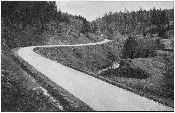
THE PACIFIC HIGHWAY IN PASS CREEK CANYON, DOUGLAS COUNTY.
GRADED AND MACADAMIZED IN 1917 AND 1918
[69]
Description of Work of the
State Highway Department
In the
Counties of the State
1917-1918
Although Baker County is generally well supplied with railroads there
are sections still isolated and much in need of improved transportation
facilities. Some of the most fertile and productive areas of the County are
not served by rail transportation and depend upon roads for communication
with railway points. This situation with the character of the winter season
and soil conditions found here render improved highways of extreme
importance.
Since State and Federal aid have been made available the people of
Baker County are fast coming to a realization of the situation and are
making strenuous efforts to co-operate in highway improvement. No bond
issues have been voted in this County but an example of their enthusiasm
is supplied by the fact that private donations for co-operative improvement
of one road amount to $15,000.00.
State and Federal aid were extended in 1918 and the co-operation has
resulted in plans for improving three sections of the Baker-Cornucopia
Highway. Other roads in the County will receive the consideration of the
Highway Commission during the coming season.
Four sections of the Baker-Cornucopia Highway have been surveyed,
and plans for three of these are nearly complete. Together the four sections
make about thirty-eight miles of location survey. Construction work will
begin on this road early in the coming season.
During 1917 and 1918 the State Highway Department surveyed a greater
part of the Baker-Cornucopia Highway. The policy of giving first attention
to those portions of the road most in need of improvement resulted in the
surveying of four separate sections. These sections are designated as
follows: Baker-Middle Bridge; Love Bridge-Black Bridge; Canyon and
Sag Sections. These surveys were made under the direction of J. O.
Kingsley and W. C. Crews, locating engineers for the State Highway
Department.
The Baker-Middle Bridge section extends from Baker to a point near
Middle Bridge on Lower Powder River. Beginning at Baker the line follows
closely the present main traveled road east for about six miles, thence along
the Palmer road to the present crossing at Ruckles Creek, thence down
Ruckles Creek to a point about two miles south of Keating, thence easterly,
leaving Ruckles Creek, and entering the lower Powder River Valley near
Middle Bridge. This survey is 18.64 miles in length. The plans for this
work are completed.
The Love Bridge-Black Bridge section covers that portion of the route
through the canyon between the Keating and Richland districts. At present
all traffic passes through Sparta and over the mountains to the north of
the Powder River there being no road through the canyon. This survey is
about ten miles long and involves heavy and expensive construction. This
project begins at a point about seven miles east of Keating and ends about
five miles west of Richland. There is a four-mile section of the Baker-Cornucopia
Highway lying between Middle and Love Bridges that has not
been definitely located. No office work has been done for this survey.
What is known as the Canyon Section extends through the canyon east
of Richland. This survey begins at a point 1.5 miles east of Richland and
parallels the Powder River along the north bank for a distance of 4.64
miles. The project ends at the point where the proposed route leaves the
Powder River and leads over the mountains toward Pine Valley. Plans
are almost completed for this project.
The Sag Section is that part of the road leading north from the divide
between Powder River and Pine Valley. This survey which is 4.69 miles
long begins at the divide and ends at a point in the edge of Pine Valley two
miles south of Halfway. The location follows very near the route of the
present road. The office work in connection with this survey is nearing
completion.
The State Highway Commission requested Government aid in the construction
of the Baker-Cornucopia Highway and this request has resulted
in the approval by the Federal Office of Public Roads of three projects on
this highway. These three projects, namely, Baker-Middle Bridge, Canyon
Section and Sag Section have a combined length of 27.97 miles, and the
total estimated cost of these constructions is $94,731.00. Baker County will
co-operate with the State and Government in defraying the cost of this
construction. The following tabulation indicates the amounts and segregations
of funds for each project.
| Appropriated for expenditure in 1919 |
State
Funds |
County
Funds |
Government
Funds |
| Baker-Middle Bridge Section |
$ 13,978.00 |
$ 15,000.00 |
$ 13,978.00 |
| Canyon Section |
8,249.00 |
6,000.00 |
8,249.00 |
| Sag Section |
11,639.00 |
6,000.00 |
11,639.00 |
| |
Totals |
$ 33,866.00 |
$ 27,000.00 |
$ 33,866.00 |
No plans have been made for financing the Love Bridge-Black Bridge
Section which was surveyed in 1917. This is an important section of the
road and will probably receive early attention from the State Highway
Commission.
[71]
During 1917 and 1918, very little work was done by the Highway Department
in Benton County. At the request of the County Court a short
section of the West Side Highway north of Corvallis was staked for grading
to be done by the County, and designs were prepared for three concrete
structures. Two of these were for box culverts for the Pacific Highway
about five miles north of Corvallis. The other was for an 85 foot reinforced
concrete bridge over a mill race south of Corvallis. A short reconnaissance
was made of the Corvallis-Newport road between Blodgett and Eddyville.
For work to be done in Benton County in 1919, the Highway Commission
has set aside $129,500.00. With this amount it is planned to pave the West
Side Highway from Corvallis north to the Polk County Line, approximately
seven miles.
The work under the supervision of the Highway Department in Clackamas
County during 1917 and 1918 has consisted of 4.5 miles of grading
between New Era and Oregon City, 7.5 miles of paving between Oregon City
and Canby, and 0.2 miles of grading between Oswego and the Multnomah
County Line. The first of these jobs was done by the State and County in
co-operation; the second was a strictly State job; and the third was a
County job supervised by the State.
The total expenditure on the work done in Clackamas County was
$198,952.24, of which Clackamas County paid $43,091.14 and the State
$155,861.10.
Between New Era and Oregon City, the Pacific Highway has been
graded on an entirely new location, paralleling the Southern Pacific Railway
along the bank of the Willamette River instead of following the location of
the old road farther back from the river, where the grading is not so
heavy, but where a number of heavy grades are required. In addition to
eliminating these heavy grades, a considerable saving in distance is effected,
and the dangerous crossing under the Southern Pacific tracks at Oregon
City is avoided.
On August 20, 1917, bids were considered by the State Highway Commission
for the grading of two and one-half miles on the Pacific Highway
near New Era. The most satisfactory proposal received was a cost plus
ten per cent proposal submitted by the Warren Construction Company, and
a contract was entered into with that firm on the cost plus ten per cent basis.
This work involved the grading of New Era Hill, just south of New Era,
and some heavy rock excavation from New Era north. After the work had
started, it was decided to pave between Oregon City and Canby, and the
contract for this paving let to the Oregon Hassam Paving Company. The
most feasible place to secure the crushed rock necessary for this paving was
from the rock being excavated under the grading contract with the Warren
Construction Company, and the Highway Department entered into an agreement
with the paving company, whereby the state would crush the rock
from a big cut at New Era, and furnish the crushed rock for the paving upon
certain agreed terms, the crushing to be done under the cost plus contract
with the Warren Construction Company.
On
this basis the work was carried on by the Warren Construction Company
until March 1, 1918, at which time it was deemed advisable by the
Highway Commission to take the work over and complete it with State
forces.
The total cost of the grading and rock crushing was $66,000.00, and the
amount received for the crushed rock furnished for the paving was
$19,850.00. Clackamas County co-operated with the State on this work,
the total amount paid out of County funds being $15,009.91.
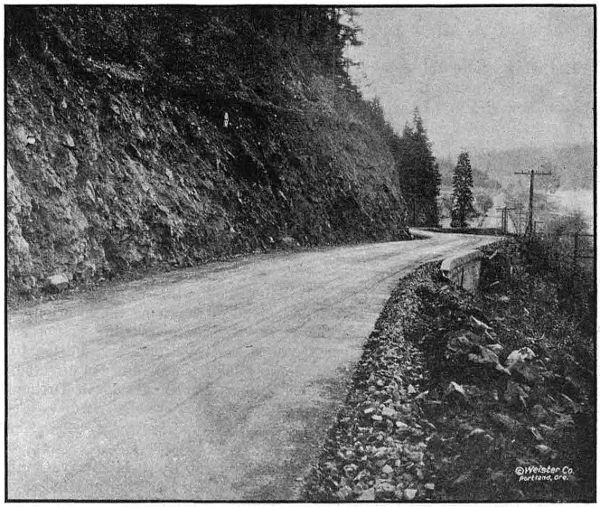
AT THE TOP OF CANEMAH HILL ON THE PACIFIC HIGHWAY IN CLACKAMAS
COUNTY.
GRADED AND PAVED IN 1918
To complete the grading of the Pacific Highway between Oregon City
and Canby preparatory to the paving of this section, Clackamas County
agreed to appropriate $25,000.00 toward the grading between Fly Creek and
Oregon City, known as the Canemah Hill Section. On December 10, 1917,
the Highway Commission received bids for this grading and the lowest bid
having been submitted by Clackamas County, the contract was awarded to
the County. This piece of work was about one and one-half miles in length
and involved some very heavy rock excavation.
There has been expended on this work to date the sum of $24,037.20, of
which amount Clackamas County has paid $22,092.53. The work complete
will cost approximately $27,500.00. Mr. M. E. DeWitt was the resident
engineer in charge.
[73]
| Engineering |
|
$ 1,944.67 |
| Construction— |
|
| |
Clearing and grubbing |
$ 500.00 |
|
| |
Common excavation, 10,231 cu. yds. at 60c |
6,138.60 |
|
| |
Intermediate excavation, 8,689.4 cu. yds. at 80c |
6,951.52 |
|
| |
Solid rock excavation, 7,722.2 cu. yds. at $1.25 |
9,652.75 |
|
| |
12-inch reinforced concrete pipe, 391 lin. ft. at $1.25 |
488.75 |
|
| |
36-inch reinforced concrete pipe, 56 lin. ft. at $4.00 |
224.00 |
|
| |
6-inch porous drain tile, 585 lin. ft. at 10c |
58.50 |
|
| |
Class A concrete, 48 cu. yds. at $15.00 |
720.00 |
|
| |
Class C concrete, 2 cu. yds. at $12.00 |
24.00 |
|
| |
Rubble masonry, 2 cu. yds. at $1.25 |
2.50 |
|
| |
Overhaul per 100 lin. ft., 54,862 cu. yds. at 2c |
1,097.24 |
|
| |
Crushed rock for drain tile, 30 cu. yds. |
46.20 |
|
| |
18-inch concrete pipe in place, 45 lin. ft. |
87.15 |
|
| $ 25,991.21 |
|
| |
Less 15 per cent retained pending completion |
3,898.68 |
|
| |
22,092.53 |
| |
Total expended to November 30, 1918 |
|
$ 24,037.20 |
| |
|
Paid by State—engineering |
|
1,944.67 |
| |
|
Paid by County—construction |
|
22,092.53 |
| |
|
|
Total |
|
$ 24,037.20 |
| This work is estimated to cost complete |
|
$ 27,500.00 |
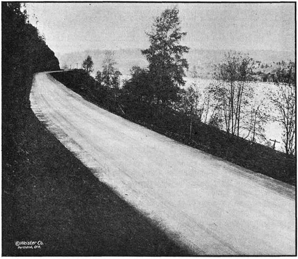
BITUMINOUS PAVEMENT ON THE PACIFIC HIGHWAY SOUTH OF OREGON
CITY IN CLACKAMAS COUNTY. GRADED AND PAVED IN 1918
A contract was awarded on September 4, 1917, to the Oregon Hassam
Paving Company of Portland, for a sixteen-foot bituminous pavement
between Oregon City and Canby, a distance of 7.5 miles.
A considerable part of the crushed rock used in this pavement was
furnished by the Highway Department from a rock point which it was
necessary to remove in connection with the grading just north of New Era.
The paving of this section is practically complete at this date and the
contracting company is to be complimented upon the excellence of its
work. The cost of the work completed will be about $135,000.00 of which
amount $102,114.85 has been paid.
Mr. M. E. DeWitt acted as resident engineer for the Highway Department
on this work.
| Engineering |
|
$ 2,444.57 |
| Construction— |
| |
Standard Bitulithic pavement, 70,170 sq. yds. at
$1.26 |
$ 88,414.20 |
|
| |
Stone Shoulders, 68,208 lin. ft. at .051⁄2 |
3,751.44 |
|
| |
Hauling and placing broken stone furnished by
State, 6,1681⁄4 cu. yds., at $1.18 |
7,278.54 |
|
| |
Broken stone, loose measure, 12,8721⁄4 cu. yds., at
$2.37 |
30,507.23 |
|
| |
Installing wooden headers at railroad crossing |
24.06 |
|
| |
Filling low places after rolling, clearing debris
after forest fire |
59.53 |
|
| |
Excavating spongy place in subgrade and refilling |
67.10 |
|
| |
Loading and hauling to bring outside 2 ft. of
roadbed to grade; no material nearby |
154.14 |
|
| |
Grading 800 feet north from New Era, and
dismantling and loading crusher |
1,726.40 |
|
| |
|
Total due contractor for work done to
November 30, 1918 |
$ 131,982.64 |
|
| |
Less 15 per cent retained pending completion |
19,797.40 |
|
| |
|
|
$ 112,185.24 |
|
| |
Less plant rock and miscellaneous items furnished
by State |
12,514.96 |
|
| |
|
|
|
$ 99,670.28 |
| |
|
Total expended to November 30, 1918 |
|
$ 102,114.85 |
| This work is estimated to cost complete |
$ 135,000.00 |
On April 19, 1918, a contract was awarded by Clackamas County to the
Glemorrie Quarry Company of Oswego for the regrading of a 0.2 mile
section of the West Side Pacific Highway between Oswego and the Multnomah
County Line. At the request of the Clackamas County Court the
engineering supervision of this work was handled by the Highway Department,
Mr. M. E. DeWitt, resident engineer, on work between Oregon City
and Canby, being in charge.
This piece of work eliminated some very bad curves on the old road and
greatly improved the grade. The work was completed on September 4, 1918,
at a total cost of $5,746.68. Of this amount $507.98 was expended by the
State for the engineering. The construction cost of $5,238.70 was paid by
the County.
[75]
| Engineering |
$ 507.98 |
| Construction— |
| |
Clearing and grubbing |
$ 200.00 |
|
| |
Common excavation, 1,167.3 cu. yds. at 75c |
875.47 |
|
| |
Intermediate excavation, 2,127.6 cu. yds. at $1.00 |
2,127.60 |
|
| |
Solid rock excavation, 829.5 cu. yds. at $1.85 |
1,534.58 |
|
| |
12-inch plain concrete pipe, 26 lin. ft. at $1.50 |
39.00 |
|
| |
15-inch plain concrete pipe, 76 lin. ft. at $1.80 |
136.80 |
|
| |
18-inch reinforced concrete pipe, 84 lin. ft. at $2.00 |
168.00 |
|
| |
Class C concrete, 5 cu. yds. at $15.00 |
75.00 |
|
| |
Drainage structures under roadbed to protect
embankment and private water supply |
82.25 |
|
| |
|
|
|
5,238.70 |
| |
|
Total cost |
|
$ 5,746.68 |
| Paid by State |
$ 507.98 |
|
| Paid by County |
5,238.70 |
|
| |
|
Total |
|
$5,746.68 |
The State Highway Department has been requested by the County Court
of Clackamas County to prepare plans and estimates for a bridge over the
Willamette River at Oregon City. This will replace the old suspension
bridge at that place which is too light for the modern traffic conditions in
that vicinity.
Surveys and studies of the site are being conducted at this time. In this
case, as is customary, the State Highway Department will furnish plans
free of cost to the County.
During the period from December 1, 1916, to November 30, 1918, the
State Highway Department expended in Clatsop County the sum of
$344,387.23. The work accomplished consists of 3.5 miles of bituminous
paving, 22.7 miles of broken stone macadam, 1.7 miles of gravel macadam,
1.2 miles of new grading, one covered wood draw bridge, two reinforced
concrete bridges, and 1-6x12 ft. reinforced concrete box culvert, all of
these improvements being on the Columbia River Highway between Astoria
and the Columbia County Line.
On July 20, 1917, the State Highway Department contracted with the
Warren Construction Company for nine miles of paving between Astoria and
Svensen. This contract called for a 16-foot bituminous pavement on a
crushed rock base and with two-foot macadam shoulders. The contract
also included the grading of a section 1.2 miles in length about midway
between Astoria and Svensen, this section being known as the John Day
Cut-off.
Work was started on the grading of the cut-off on August 6, 1917, and
on the erection of the paving plant on August 15. On September 20,
the first batch of hot stuff was placed on the road at the Svensen end. The
work was just nicely started, however, when the rainy season which came
on unusually early, started in and the work had to be discontinued. At this
time the work on the grading of the cut-off was but fifty or sixty per cent
complete, and only one mile of paving had been laid.
[76]
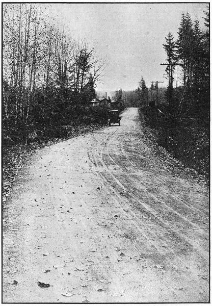
BITUMINOUS PAVING NEAR SVENSON
IN CLATSOP COUNTY ON THE
COLUMBIA RIVER HIGHWAY.
PAVED IN 1917
The following season, the roadbed did not become sufficiently dry to
permit of resumption of work until about the 15th of June, but even at that
late
date the contractors were not able to start work on account of the
shortage in materials and labor resulting from the participation of the
United States in the war, and it was not until July 23 the work was
resumed. Continued shortage of labor and material made progress very
slow particularly on the placing of rock base, and when the 1918 rainy
season came on a total of only 3.5 miles of paving had been completed. The
grading of the John Day Cut-off had been finished, however, and considerable
progress made on the removal of slides and regrading of roadbed.
The paving was discontinued on October 2 but in order to provide a
passable roadbed at as early a date as possible, it was decided to continue
the placing of rock base during the winter months. This work is now in
progress, and it is expected that a rocked surface over the remaining
unpaved distance of 5.5 miles will be secured by about January 1, 1919.
The paving work will be continued again next season, and will undoubtedly
be completed early in the season.
It is estimated that the grading and paving of this section will cost
completed $236,000.00. The total expenditures to November 30, 1918,
amounted to $96,955.97 and there remained unpaid to the contractor for
work done to that date the sum of $15,225.64.
The engineering work was in charge of Mr. J. E. Nelson, during the
1917 season, and in charge of Mr. H. N. Hackett during the 1918 season.
From Westport to Svensen in Clatsop County, 13.55 miles of 16-foot
waterbound macadam, 3.6 miles of 9-foot waterbound macadam and 1.76
miles of gravel was laid. This work was handled by the Warren Construction
Company prior to December 26, 1917, at which time the State Highway
Department took the work over and proceeded with State forces.
On this section the unit costs show a slight advantage in favor of doing
the work with State forces. Conditions were practically the same as on
the Clatskanie-Westport Section in Columbia County—the State paying
higher wages than the contractor, but the contractor having the disadvantage
of more unfavorable weather conditions. The main advantage in
the State doing this work was gained by having better control of the organization
and more direct supervision of the work.
The original intention was to complete all macadam 16-feet wide but the
increased cost of labor, supplies, etc., made it necessary to reduce the
width of the macadam to nine feet so as to complete the full distance with
the money available.
| Item |
Unit |
Quantity |
Cost |
Unit
Cost |
By Warren Construction Co., on cost
plus contract— |
|
|
|
|
| Clearing and grubbing |
Acres |
1 |
$ 112.18 |
$ 112.18 |
| Excavation |
Cu. Yd. |
9,069 |
6,468.95 |
.71 |
| 6-inch by 12-inch pipe |
Foot |
1,519 |
4,472.69 |
2.90 |
| Waterbound macadam |
[8]Cu. Yd. |
13,409 |
53,010.60 |
3.95 |
| Engineering |
... |
... |
971.84 |
... |
| By State Forces— |
|
|
|
|
| Excavation |
Cu. Yd. |
11,512 |
7,540.71 |
.64 |
| 6-inch by 12-inch pipe, laying only |
Foot |
1,760 |
328.80 |
.19 |
| Waterbound macadam |
Cu. Yd. |
34,722 |
134,022.23 |
3.86 |
| Engineering |
... |
... |
1,651.69 |
... |
| |
Total |
... |
... |
$ 208,579.69 |
... |
[78]
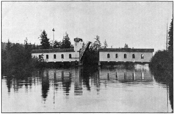
COVERED WOOD DRAWBRIDGE ON THE COLUMBIA RIVER HIGHWAY IN
CLATSOP COUNTY,OVER THE JOHN DAY RIVER
EAST OF ASTORIA.
BUILT IN 1918. LIFT SPAN—40 FEET
[79]
As a part of the improvement of the Columbia River Highway between
Astoria and Svensen, a bridge was constructed over the John Day River
about four miles east of Astoria.
The John Day River is a stream navigable to small boats, so it was
necessary to provide a movable span of 40-foot clear opening. Owing to
the unusually high price of steel it was decided to construct this bridge
of wood. The movable span is of the single leaf bascule type operated by
a windlass. Counter weights are employed to assist the movement of the
span and in order to compensate for the variable pull required to lift the
span at different phases of its movement, the counter weight cables operate
over spiral drums in such manner that their pull is a maximum when the
span is down, and is least when the span is raised, gradually changing
between the two extremes. In order to guard against failure of the operator
to close the gate on the side of the stream opposite the machinery, an
automatic gate was constructed. It closes when the bridge starts to open
and when the bridge closes it swings back out of the way automatically.
The bridge rests on concrete piers carried on piling, and besides the
lift span there are two 90-foot covered wooden spans. The operating
machinery is completely housed in by means of a tower.
The crossing was designed to carry 20-ton trucks and the covered
spans have laminated wood floors with asphaltic wearing surface.
One of the most serious objections raised against covered wooden
bridges is the lack of light. This was overcome in this case, as in other
wooden bridges on primary roads designed by this Department, by whitewashing
the interior and the addition of open windows at panel points.
These are provided with returns, and with the asphaltic wearing surface
on the floors of such bridges prevent moisture coming in contact with the
structural timbers of the bridge.
This bridge was built by the Portland Bridge Company and the total
cost will be about $25,000.00. The payments on the bridge to November
30, 1918, amounted to $21,051.52. Mr. Leigh M. Huggins was resident
engineer in charge of construction.
This bridge is located on the Columbia River Highway near Knappa. It
consists of two forty-five-foot reinforced concrete spans, and was built by
the State Highway Department with State forces at a cost of $8,446.70.
The Plympton Creek Bridge is located on the Columbia River Highway
in the town of Westport. It is a two thirty-foot span structure and was
built by the State Highway Department with State forces at a cost of
$6,413.19.
This is a 6 by 12 reinforced concrete structure and is located on the
Columbia River Highway near Knappa. It was built by the Highway
Department with State forces at a cost of $929.69.
[80]
The State Highway Department expended in Columbia County during
1917 and 1918, the sum of $488,302.15, which is the largest amount expended
in any one county in the state. With this amount the following work was
completed:
| 2.5 |
miles of bituminous paving. |
| 27.2 |
miles of broken stone macadam. |
| 8.2 |
miles of grading. |
| 11 |
reinforced concrete bridges. |
| 2 |
reinforced concrete box culverts. |
All of this work is on the Columbia River, and all but the 2.5 miles of
paving is between the Clatsop County Line and a point about two miles
east of Goble.
A contract was awarded to the Warren Construction Company, August
22, 1917, for 2.5 miles of bitulithic pavement sixteen feet wide on crushed
rock base, with two foot macadam shoulders. The old road bed on this
section was in excellent condition for base for pavement being old macadam
about sixteen feet in width. The grade was followed closely, scarified,
and clean crushed rock spread over the entire surface and rolled. Material
was borrowed along each side to obtain the required twenty-four foot of
roadbed.
A sixteen foot span wooden bridge was replaced by an 8x10 feet reinforced
concrete culvert built by Lindstrom Bros. on the basis of cost
plus ten per cent.
| Class A concrete, 64 cu. yds. at $22.43 |
$ 1,435.64 |
| Reinforcing steel, 2,900 lbs. at 8c |
232.00 |
| |
|
$ 1,667.64 |
| Contractors percentage |
166.96 |
| |
Total Cost |
$ 1,834.60 |
Paving work was started November 5, 1917, and completed December
20, with the exception of about 200 feet of new fill made at the culvert
which was completed in June, 1918.
Engineering work was done by P. W. Marx, under the supervision of
Chas. H. Whitmore, assistant engineer.
| Engineering |
|
$ 1,364.28 |
| Right-of-way attorney fees |
|
35.00 |
| Contract Construction Work as follows: |
|
|
| |
Common excavation, 800 cu. yds. at 45c |
$ 360.00 |
|
| |
Standard Bith. pavement, 24,248.2 sq. yds. at $1.17 |
28,370.39 |
|
| |
Broken stone, loose measure, 3,115.5 cu. yds. at
$1.90 |
5,919.45 |
|
| |
Broken stone shoulders, 26,974 lin. ft. at 5c |
1,348.70 |
|
| |
Force account: |
|
| |
|
34 feet of 12-inch corrugated iron pipe and
120 feet of 6-inch porous drain tile |
254.77 |
|
| |
Total paid to contractor |
|
$ 36,253.31 |
| |
|
Total cost |
|
$ 37,652.59 |
[81]
On the Clatskanie-Westport Section, which extended from Clatskanie
to the Clatsop County Line, the work was handled originally by the
Warren Construction Company, on a cost plus ten per cent. basis. The
State Highway Department took this work over December 26, 1917, and
from that time on the work was handled by this Department. This work
consisted of 8.62 miles of sixteen-foot waterbound macadam.
On this section the costs show that the Warren Construction Company
laid crushed rock slightly cheaper than the State. However, the State
did all the finishing on this section, which is more expensive than laying
the base rock and it was necessary to raise the wages twenty-five per cent.
after the work was taken over by the Department. C. L. Grutze was
resident engineer on this work.
| Item |
Unit |
Quantity |
Total cost |
Unit cost |
By Warren Construction Co. on cost
plus contract— |
|
|
|
|
| Clearing and grubbing |
Acres |
1⁄2 |
$ 49.87 |
$ 99.74 |
| Excavation |
Cu. yd. |
6,200 |
6,820.70 |
1.10 |
| 6-ft. by 12-in. drain pipe |
Foot |
1,085 |
2,752.38 |
2.80 |
| Water-bound macadam |
[9]Cu. yd. |
7,742 |
27,698.87 |
3.59 |
| Engineering |
|
|
497.03 |
|
| By State Forces— |
|
|
|
|
| Excavation |
Cu. yd. |
8,299 |
5,594.75 |
.67 |
| 6-ft. by 12-in. drain pipe (laying) |
Foot |
298 |
21.05 |
.07 |
| Water-bound macadam |
Cu. yd. |
17,977 |
68,168.50 |
3.79 |
| Engineering |
|
|
25.09 |
|
| |
Total cost |
... |
... |
$ 111,628.24 |
... |
The section extending from a point three miles east of Clatskanie
to a point two and one-half miles east of Delena, known as the Clatskanie-Delena
Section, was completed by L. O. Herrold on a basis of cost
plus ten per cent. This work consisted of eleven miles of sixteen foot
waterbound macadam, one and one-tenth miles of nine foot waterbound
macadam and all necessary grading, drainage, etc. The foundation on
part of this section was very poor and 10,233 cubic yards of rubble base
was used in order to make satisfactory foundation for macadam. While
this increased the cost of the macadam, it was the only way in which a
permanent foundation could be secured on this section. P. M. Hall-Lewis
was resident engineer on this work.
| Item |
Cost |
| Engineering |
$ 5,998.96 |
| General construction |
11,759.14 |
| Clearing and grubbing |
892.37 |
| Excavation and embankment |
22,529.95 |
| Drainage structures |
3,596.27 |
| Miscellaneous structures |
1,454.76 |
| Quarrying and crushing |
43,714.47 |
| Placing, rolling, sprinkling, etc. |
46,502.97 |
| Camp construction and operation |
111.51 |
| |
Total |
$ 136,560.40 |
This work includes 25,405 cubic yards of excavation, 22,170 cubic
yards of crushed rock macadam and 10,298 cubic yards of rubble base,
besides numerous small structures, drains, etc.
Clark & Dibble of Rainier contracted with the Highway Department to
construct five and seven-tenths miles of broken stone macadam between
Delena and Goble. The prices at which this work was taken by the
contractors was very low, and the result was that almost from the first
the work was handicapped by lack of proper finances. It became evident
to the Department that the contractor would be unable to complete all
of this work before the winter rains set in, so to facilitate matters and
to provide a passable road for the winter, the Department took over the
part of the work between Rainier and Goble after about $10,000.00 worth
of work had been done on this part by Clark & Dibble. The work of the
Highway Department on this section is described in the article on the
Rainier-Goble macadam.
Clark & Dibble successfully carried to completion the two and one-tenths
miles of macadam west of Rainier. A complete statement of the
costs of the work handled by the contractors is given below.
| Engineering |
|
$ 2,519.50 |
| Construction— |
| |
Common excavation, 938 cu. yds. at 40c |
$ 375.20 |
|
| |
Intermediate excavation, 75 cu. yds. at 60c |
45.00 |
|
| |
Solid rock excavation, 25 cu. yds. at $ 1.15 |
28.75 |
|
| |
Broken stone macadam, 12,911.5 cu. yds. at $ 2.18 |
28,147.07 |
|
| |
12-inch corrugated iron pipe, 420 lin. ft. at $ 1.30 |
546.00 |
|
| |
Clay filler, 1,403 cu. yds. at $ 1.00 |
1,403.00 |
|
| |
Force Account— |
| |
|
Lowering 18-inch corrugated iron culverts |
55.78 |
|
| |
|
Lengthening existing culverts and opening
ditches |
15.62 |
|
| |
|
18-inch corrugated iron pipe, 80 lin. ft. |
235.43 |
|
| |
|
Clearing slides and ditching near Prescott |
2,201.47 |
|
| |
|
Removal of slides |
1,377.22 |
|
| |
|
Side ditches for macadam work |
336.97 |
|
| |
|
Preparation of subgrade for macadam |
330.65 |
|
| |
|
Spreading, sprinkling, and rolling macadam |
27.07 |
|
| |
|
|
35,125.23 |
|
| |
Less credit for 24 days use of State roller at $ 5.00 |
120.00 |
|
| |
Total amount paid to contractor |
|
35,005.23 |
| |
|
Total cost |
$ 37,524.73 |
In Columbia County the State Highway Department laid twenty-four
and one-tenth miles of sixteen foot waterbound macadam and four and
two-tenths miles of nine foot waterbound macadam between Goble and
the Clatsop County Line. Of this the Rainier-Goble Section was taken
over from the contractors, Clark & Dibble, after being partly completed.
This was done in order to facilitate the work and get the road open for
traffic before the rainy season.
While the work done by the State on this section cost more per cubic
yard than the contractor was originally receiving, the actual difference
in cost for the job was not sufficient to justify the Department in allowing
the contractor to proceed with the work which would have entailed leaving
the road closed to traffic for another winter.
[83]
| Item |
Unit |
Amount |
Cost |
Unit
Cost |
| Engineering |
|
|
$ 382.85 |
|
| Intermediate Excavation |
Cu. yds. |
|
1,078.97 |
.72 |
| Quarrying and crushing |
Cu. yds. |
2,555 |
3,828.71 |
1.29 |
| Hauling stone |
Cu. yds. |
2,555 |
3,243.99 |
1.27 |
| Placing and rolling |
Cu. yds. |
2,555 |
2,979.22 |
1.17 |
| Camp construction and operation |
|
|
719.27 |
|
| General construction |
|
|
197.34 |
|
| |
Total |
... |
... |
$ 12,430.35 |
|
A contract was awarded to Warren Construction Company September 4,
1917, for macadamizing the Goble Cut-off on a basis of cost plus ten per cent.
Columbia County has a quarry on the old road about three-fourths
of a mile west of Goble, which was equipped with complete crushing outfit
and arrangements were made by the contractor for the use of this
equipment and all the rock for this job was crushed and hauled from
this quarry.
Work was started March 1, 1918, and completed June 25, 1918.
Engineering work was done by H. C. Compton as resident engineer
under the supervision of Chas. H. Whitmore.
| Construction engineering |
$ 548.12 |
| Excavation and embankment |
137.24 |
| Drainage |
21.11 |
| Quarrying and crushing (6,504 cu. yds. crushed) |
9,627.92 |
| Spreading and rolling (6,504 cu. yds.) |
5,913.53 |
| Hauling (6,504 cu. yds) |
4,371.62 |
| Camp construction and operation |
545.61 |
| Corral construction and operation |
313.82 |
| |
Total cost |
$ 21,478.97 |
A new location of the Columbia River Highway was made from a
point two miles east of Goble to Goble Creek and a new concrete bridge
built over Goble Creek, making a saving in distance of about one-half
mile and doing away with several excessive grades, sharp curves and
narrow roadbed, also a dangerous bridge and trestle across Goble Creek.
A rock cut between Goble and Goble Creek was taken out by the
S. P. & S. Ry. Co. with steam shovels and the material used by them for
riprap, thus making a considerable saving to the State Highway Commission.
The material for the west approach to the new bridge was obtained
by blasting and barring down rock from a dangerous perpendicular cliff
about 1,000 feet west of the bridge, from which large rocks had fallen
onto the highway. To make the highway safe it was necessary to
remove this material and by using it in the bridge approach, did away
with other borrow which would have been necessary. The cliff is about
200 feet high with the highway and S. P. & S. Ry. side by side at the
foot, necessitating very light shots and careful work and was completed
without accident to men or interruption of traffic on the railroad.
[84]
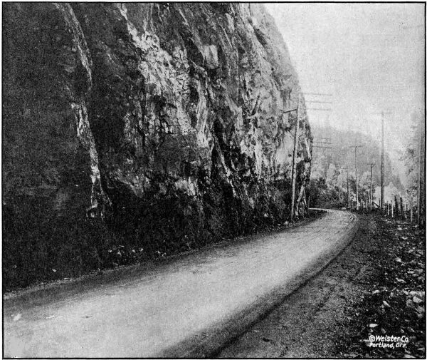
ON THE COLUMBIA RIVER HIGHWAY NEAR GOBLE IN COLUMBIA COUNTY.
GRADED AND
MACADAMIZED IN 1917 AND 1918
[85]
The material for the east approach was obtained by trimming up the
cut left by the railroad company.
A contract for grading the cutoff was awarded to the Warren Construction
Company, August 7, 1917, and work started in July, 1917. From
the east end of the section to Ruben, about one mile in length, the
material was handled by teams. Rock work at Ruben and at Goble was
sub-let to station men. The fill across the flat between Ruben and Goble
was made from side borrow, by using a steam hoisting engine, with boom
and clam shell bucket. This work was done in the fall and winter and
the material was light loam and sand and very wet, and did not pack
very solid in the fill, therefore a strip of rock sixteen feet wide and
one foot in thickness, taken from the rock cuts at either end, was placed
on the fill and rolled thus making a solid base for the crushed rock
macadam.
The engineering work was done by A. F. Pratt, resident engineer and
W. E. Eddy, assistant state highway engineer, until October 1, 1917, when
it was taken over by H. C. Compton, resident engineer, under the supervision
of Chas. H. Whitmore, assistant engineer.
| Engineering |
|
$ 2,925.64 |
| Guarding S. P. & S. Ry. tracks |
|
527.02 |
| Right-of-way damages |
|
73.56 |
| Rental on State Industrial Ry. track furnished contractor |
|
138.00 |
| Payments to contractor for work as follows: |
|
|
| |
Clearing and grubbing |
$ 2,085.00 |
|
| |
Common excavation, 20,106.5 cu. yds. at 45c |
9,047.92 |
|
| |
Intermediate excavation, 3,534.9 cu. yds. at 70c |
2,474.43 |
|
| |
Solid rock excavation, 11,947.2 cu. yds. at $1.15 |
13,739.28 |
|
| |
12-inch reinforced concrete pipe, 560 lin. ft. at $1.50 |
840.00 |
|
| |
24-inch reinforced concrete pipe, 92 lin. ft. at $3.30 |
303.60 |
|
| |
36-inch reinforced concrete pipe, 80 lin. ft. at $5.30 |
424.00 |
|
| |
Overhaul per 100 lin. ft., 18,032 cu. yds. at 2c |
360.64 |
|
| |
Force account— |
|
|
| |
|
Replacing trestle for Warren Packing Co.’s
plant, Goble |
256.00 |
|
| |
|
Borrowing approximately 400 cu. yds. rock to
cover dirt fill |
506.08 |
|
| |
|
Removal of overhanging rock near Goble Creek
bridge |
6,454.32 |
|
| |
|
Widening grade and building fill from Goble
postoffice to Goble Creek bridge |
5,853.31 |
|
| |
|
Cutting off rock point to give safe sight
distance around curve |
47.12 |
|
| |
|
Removal of slide west of Goble Creek |
18.66 |
|
| |
|
Placing 400 feet drain tile in quicksand |
137.01 |
|
| |
|
Placing timber foundation for culvert |
51.05 |
|
| |
Total paid to contractor |
|
$ 42,598.42 |
| Grand total cost |
|
$ 46,262.64 |
On July 30, 1917, a contract was entered into with A. L. Clark of
Rainier for the widening of the Rainier Hill Section, a section two and
two-tenths miles in length, located just west of Rainier. This work was
let under a unit price contract, but the nature of the work was such that
a considerable part of it could not be fairly measured and paid for on a
unit, and on this part the contractor was allowed cost plus ten per cent.
The total cost of this improvement was $6,350.61. A detailed cost statement
follows:
[86]
| Engineering |
|
$ 468.38 |
| Construction— |
|
| |
Common excavation, 1,925 cu. yds. at 30c |
$ 577.50 |
|
| |
Intermediate excavation, 1,071.9 cu. yds. at 48c |
514.51 |
|
| |
Solid rock excavation, 1,039.7 cu. yds. at $1.25 |
1,299.62 |
|
| |
Overhaul per 100 lin. ft., 905 cu. yds. at 3c |
27.15 |
|
| |
12-inch corrugated iron pipe, 228 lin. ft. at $1.00 |
228.00 |
|
| |
Force account— |
|
|
| |
|
Excavation for cribbing and placing rip-rap |
61.93 |
|
| |
|
8-foot extension to 36-inch culvert |
54.63 |
|
|
| |
|
Widening old roadbed, removal of slides and general
improvement work not subject to measurement |
3,082.56 |
|
| |
|
Culvert pipe furnished by State |
36.33 |
| |
|
|
|
5,882.23 |
| Total cost |
|
$ 6,350.61 |
Before the Columbia River Highway through Beaver Creek Canyon
between Delena and Inglis was opened for traffic in July, 1918, in order
to reach Clatskanie from Delena, it was necessary to travel over a narrow,
dangerous, earth and corduroy road, either by way of Maygar and Quincy
or through the hills about eight miles into Clatskanie. Both of these
roads were passable for autos only about three months during the dry
season.
The grading of this section was partly completed by the County under
supervision of Mr. Bowlby, State Highway Engineer in 1914. This section
being a very important link in the Columbia River Highway and no funds
being available from County or State funds during 1915 or 1916, S. Benson
decided to advance the necessary funds to make this section passable.
About four miles of grading was completed between Inglis and Delena,
leaving only the building of bridges to open this section. This work was
later macadamized by the State.
The engineering work was done by A. K. Grondahl.
A bill was passed by the 1917 Legislature refunding to Mr. Benson
$20,978.22 which is a large portion of the amount expended by him.
| Clearing and grubbing |
$ 1,265.80 |
| Grading—labor and teams |
17,124.07 |
| Explosives |
2,275.31 |
| Pipe culverts |
313.04 |
| |
Total |
$ 20,978.22 |
This section of the highway was built along the steep hillside, several
slides having occurred narrowing the roadbed in some places to about
eight feet and making it very dangerous, it was necessary to build several
retaining walls, half viaducts and guard fences.
This was done by Oscar Lindstrom on a basis of cost plus ten per cent.
A half-viaduct seventy-five feet in length was built containing fifty-three
cubic yards of concrete and 4,100 pounds reinforcing steel, with
standard bridge railing for guard fence.
Two hundred and fourteen linear feet of rubble masonry walls were
built on a slope of three-fourths to one, and standard bridge railing
placed on top for guard fence. These walls contain 438 cubic yards of rock.
A reinforced concrete crib forty-one feet long, fifteen feet high and
seven
feet wide was built and filled with large rock. The members were cast
on the dock in Rainier and hauled to the location. A reinforced concrete
slab on solid earth foundation was used for footing, on the required angle
to give the crib a batter of one-fourth to one.
The total cost of the Prescott Hill improvement was $9,039.86.
A ninety-foot reinforced concrete bridge was built over Goble Creek
on the Columbia River Highway about one-half mile east of Goble. This
bridge has a pile foundation which was put in by the Warren Construction
Company on a cost plus basis for $1,583.32. The superstructure was built
by Lindstrom and Fiegeson on a unit price basis. The cost of the structure
complete was $5,907.14.
The engineering work in connection with this work was handled by
H. C. Compton, resident engineer, on the Goble Section, and the inspection
of the placement of steel and pouring of concrete was in charge of L. M.
Huggins.
| Engineering |
|
$ 77.47 |
| Construction— |
| |
Class A concrete, 135 cu. yds. at $18.40 |
$ 2,447.20 |
|
| |
Reinforcing steel, 17,925 lbs. at 71⁄2c |
1,344.38 |
|
| |
Concrete hand rail, 186 lin. ft. at $1.75 |
325.50 |
| |
Construction of cement shed and unloading cement |
129.27 |
|
| |
|
Pile foundation (force account) |
1,583.32 |
|
| |
Total construction cost |
|
5,829.67 |
| |
Grand total cost of bridge |
|
$ 5,907.14 |
For a considerable distance between Rainier and Clatskanie the
Columbia River Highway follows Beaver Creek, crossing the creek in many
places. To replace a number of temporary wooden structures and to
provide bridges at every crossing, the highway department in 1917 and
1918 constructed nine reinforced concrete bridges across this stream.
The spans of these structures vary from thirty to 105 feet, there being
one thirty-foot, one fifty-foot, two sixty-foot, four seventy-foot and one
105-foot spans in all.
The thirty-foot span structure was built by L. O. Herrold of Salem,
on a cost plus ten per cent basis and cost $3,600.00.
The other eight structures were built by L. O. Herrold of Salem, on
a unit price basis, the cost of the eight being $32,000.00.
A double 6x6 foot reinforced concrete box culvert was built on the
Columbia River Highway to provide passage for Graham Creek near
Marshland. This culvert was built with State forces. It contains fifty
cubic yards of concrete and cost $804.49.
A survey was made between Scappoose and McBride a distance of
eleven and two-tenths miles. This survey follows the S. P. & S. Ry. on
the south side the entire distance and is shorter than the present traveled
road by about one mile, and also does away with six grade crossings.
While most of the roadbed will be entirely new work, it will not be of
heavy construction, the country being comparatively flat. Between Scappoose
and St. Helens the material is mostly earth. Between St. Helens
and McBride the material is mostly rock.
[88]
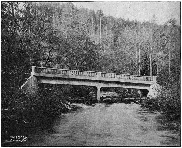
ONE OF NINE REINFORCED CONCRETE BRIDGES IN THE BEAVER CREEK VALLEY, COLUMBIA COUNTY,
ON THE COLUMBIA RIVER HIGHWAY BETWEEN RAINIER AND CLATSKANIE.
ALL BUILT IN
1917 AND 1918
[89]
Two bridges of thirty foot spans or more are needed, also several box
culverts and pipe culverts.
The survey from Scappoose to St. Helens was made by P. W. Marx;
from St. Helens to McBride by H. C. Compton.
The work of the Highway Department in Coos County consisted entirely
in assistance given the County in the making of surveys and the engineering
of construction work done under the County’s bond issue of $362,000.00.
For this purpose $16,967.68 of State funds were expended, and the total
amount of County expenditures audited and vouchered through the Highway
department was $170,781.83. These expenditures were made on
work on the Coast Highway between Marshfield and the Curry County
Line, and on the Coos Bay-Roseburg Highway between Coquille and Myrtle
Point. The engineering work was in charge of R. B. Murdock.
Crook County is one of the districts of Eastern Oregon where the road
program is an expensive one. Prineville now has rail communication with
outside points, and in sections of the County there is found some good
natural roads, but much is wanting in the line of transportation facilities.
Owing to a large portion of the County being mountainous in character,
much of the roads are little else than trails.
Formerly the boundaries of Crook County encircled an area now comprising
several counties. The paring process, caused by the forming of
new counties left Crook County in a peculiar position. The local road
map indicates that the County is divided into two communities with the
dividing line following the rugged country a few miles east of Prineville.
A single road that is a succession of heavy grades and poor alignment,
is the sole medium of traffic communication between the two ends of
the County.
The people of Crook County are fully aware of the importance of
highways. Although local funds will not go far, a remarkable beginning
has been made. A County bond issue of $95,000.00 has been voted for road
construction. The general progressiveness and co-operative spirit existing
throughout the County is shown by the fact that $85,000.00 of the bond
issue is to be expended on one road. Reference is made to the proposed
road up Crooked River from Prineville, connecting the east and west
end of the County.
The State Highway Commission has ordered a location survey made
of the Crooked River Highway between Prineville and the Shorty Davis
Ranch. The length of this line will be about thirty miles, and practically
a water grade can be secured. This work will start easily in 1918.
The immediate purpose of the survey is to gather definite data for
the consideration of the State Highway Commission. The County authorities
have made application for State aid and request early consideration
of the matter.
The State Highway Commission is cooperating in the construction of
the Ochoco Forest Road in Crook County.
The State Highway Commission extended aid to Crook County by
helping to secure Federal aid and by appropriating State funds for the
construction of a nine and seven-tenths mile section of the McKenzie River
Highway between Prineville and Mitchell. This section is adjacent to
the Wheeler County Line and connects up with proposed grading work
in Wheeler County.
Construction work is in progress under the direction of the United
States Office of Public Roads. The cost of this work will be defrayed by
co-operative funds from the State, County and Government. The total
estimated cost is $52,500.00.
The following statement shows the appropriations made for this work:
| Total estimated cost of work |
$ 52,500.00 |
| Appropriated by State |
17,500.00 |
| Appropriated by Government |
17,500.00 |
| Appropriated by County |
17,500.00 |
The most important highway in this County is, of course, the Coast
Highway, which affords an outlet to California on the south and Coos Bay
on the north. Between the Coos County Line and Port Orford the route of
the Coast Highway lies along the foot of the mountains and on a comparatively
level plain and, except in a few cases at river crossings, the grades
of the present road are not excessive. The alignment could be improved but
is satisfactory for the present. A gravel surfacing on this section makes it
passable the whole year round.
South of Port Orford the topography of the County changes. The slopes
are steep; in many cases reaching forty degrees, and are badly broken up.
This section is also subject to slides of which there is abundant evidence of
recent activity. The drainage being at right angles to the coast must be
crossed by the highway requiring considerable rise and fall in the grade line.
A survey from Port Orford south was commenced in December of 1917.
A line was located and staked ready for construction between Port Orford
and Hubbard Creek, eliminating steep grades and sharp curves on the
present road. A close preliminary line was run between Hubbard Creek and
Mussel Creek (Arizona Inn), a thorough study made of the conditions and
the following route recommended, which eliminates the excessive grades and
high summit of 1,100 feet of the present road. The location lies between
elevation 100 and 400, dropping into and crossing drainage as it is met,
following close to the beach until Brush Creek is reached, then following
up Brush Creek on the east side of Humbug Mountain until an intersection
with the present road is reached, straightening out present road for about
one mile, then following the coast between elevation 200 and 400, dropping
into Mussel Creek.
The controlling points on this route are the slides which must be headed
to secure a stable roadbed. A twelve-foot roadbed has been proposed for
this project, with maximum six per cent grades and the construction even
for this narrow width is heavy as it will be necessary to bench out the
entire
width of the roadbed on solid ground, the slopes being too steep for fill to
catch. Considerable bridging is required and a gravel surface provided
throughout the entire length to insure an all year road, so the cost of even
this narrow roadbed will be high.
A beach route located about ten feet above high tide has been proposed,
and, while this has the advantage of shorter distance and no rise and fall,
this route is not believed to be feasible because the underlying rock is soft
and disintegrates readily and is eroded by tidal action to a considerable
extent. The numerous slides at this elevation would also make construction
on this location inadvisable for a permanent road.
A reconnaissance was made between Mussel Creek and Gold Beach.
After leaving Mussel Creek, considerable development work is required to
attain standard grade, and but a small portion of the present road could be
used. Passing Euchre Creek, there will be utilized along Cedar Creek a new
section of road about eight miles in length which has been recently graded
by the County. If widened and the alignment corrected in a few locations,
this would afford a direct route to the Rogue River where a ferry runs
regularly. Between the river crossing and Gold Beach there is a fair road
requiring only straightening out and widening.
A large portion of the total area of Curry County is in the forest reserve
making the taxable area relatively small. For this reason and in view of
the heavy cost of construction, aid is asked by the County from State and
Federal sources. The most needed improvement is the section between Port
Orford and Brush Creek. In view of the increasing probability of the Coast
Military Highway by the Federal Government, which would be a great benefit
to this County as well as to the State in general, it is desired to construct
such sections as are undertaken on the correct location and standard grades,
so that future widening and surfacing only will be necessary to bring it to
the high standards which will undoubtedly be maintained on this military
highway.
It has been proposed by the Commission to co-operate with the Forest
Service in a joint Forest Aid Project in Coos and Curry Counties, each contributing
$50,000.00, the Forest money to be spent in northern Coos County
and the State money, between Port Orford and Brush Creek. Curry County
has offered to co-operate with County tax funds. It is hoped that this project
can be carried out during the 1919 season.
During the year 1917, an appropriation was made by the Highway
Commission for the construction of cinder macadam between Bend and
Lapine. This work was advertised and, proposals were received on
August 7, 1917. As the bids submitted at that time were not considered
favorable, all were rejected, and the work was undertaken under the
supervision of the County Court.
This section, which had been graded under a previous administration,
passes through a flat, pine district, with a surface formation of volcanic
ash, which is a very poor road material, roads without surfacing becoming
practically impassable during the summer season.
As no rock or gravel was available for macadamizing, scoria or volcanic
cinder was used, of which material there is an inexhaustible supply along
the right-of-way. This scoria is very light, weighing about 1,700 pounds
per cubic yard. It, however, has made an excellent macadam, and because
of its lightness can be handled and placed cheaper than either rock or
gravel. The results are as favorable as if the best pit-run gravel could
have been had.
A total of 18,300 cubic yards of cinder macadam was placed on this
section and twelve and five-tenths miles of completed surface was secured.
The total cost was $20,183.60, giving a unit cost of approximately $1,600.00
per mile, which is proof of the economy of this type of construction where
volcanic cinder is obtainable.
In September and October, 1918, the State Highway Commission made
a location survey on the section of the Bend-Burns Highway between
Rolyat, in Deschutes County and the One Hundred Mile Road, in Harney
County. The object of the survey at this time is to secure a more direct
route and to avoid the bad section of the present road through the Glass
Buttes district. The length of this survey is seventeen and one-tenth miles
and it materially shortens the distance, as compared with the present road
between the terminal points mentioned.
Fifteen and six-tenths miles of this line are in Deschutes County and
one and five-tenths miles in Harney County. The northeast corner of
Lake County is touched by the survey but only for a short distance. The
definite limits are not shown as the County Lines could not be found and
it was deemed not advisable to go to the cost of reestablishing the lines
for the purpose of the survey. The new location leads in an easterly
direction from Rolyat and continues to the north of the present road.
The plans for this survey will be made up in the near future. H. B.
Wright was the locating engineer in charge.
As a result of the liberal co-operation of Douglas County, a very large
amount of work has been done during 1917 and 1918 on the Pacific Highway
across that County. From a $500,000.00 bond issue the County set aside
$200,000.00 for the improvement of the Pacific Highway north of Roseburg,
with the understanding that the Highway Department would expend an
equal amount on the same highway south of Roseburg. In accordance with
this arrangement, it was agreed that the County would grade 10.4 miles
between Yoncalla and Oakland, grade and macadamize 4.6 miles between
Comstock and Leona, and grade 2.4 miles between Comstock and the Lane
County Line; and that the State would grade 12.8 miles between Myrtle
Creek and Dillard and macadamize 2.4 miles between Comstock and the
Lane County Line. It was further agreed that if the County would cooperate
with the State and Federal Government to the amount of $23,000.00
on the Canyonville-Galesville Forest Road Project, this amount would be
considered a part of the $200,000.00 to be provided by the County in connection
with the general scheme of improvement outlined.
All of the work contemplated in this co-operative agreement has been
carried to completion, and when final payments have been made the total
expenditure by the State will be approximately $205,000.00 and by the
County $175,000.00.
The Canyonville-Galesville Forest Road Project referred to above involves
the grading of a 9.7 mile section over Canyon Creek Pass, and it will
eliminate one of the very worst stretches on the Pacific Highway between
Portland and the California Line. This is estimated to cost $211,000.00, of
which the County will pay $23,000.00, the State $94,000.00 and the Federal
Government $94,000.00.
In summary, the improvement work on the Pacific Highway in Douglas
County during 1917 and 1918, including the work now under way, consisted
of 39.9 miles of grading and 7.0 miles of macadamizing.
The expenditures on the individual sections by the County, State and
Federal Government when final payments are completed, will be approximately
as follows:
| Sections |
By
State |
By
County |
By
Federal
Govt. |
Total |
Lane County Line-Comstock
Grading |
$ 2,027.30 |
$ 17,119.44 |
... |
$ 19,146.74 |
Lane County Line-Comstock
Macadam |
15,185.09 |
... |
... |
15,185.09 |
Comstock-Leona Grading and
Macadam |
5,650.28 |
74,349.72 |
... |
80,000.00 |
| Oakland-Yoncalla Grading |
17,565.28 |
83,530.84 |
... |
101,096.12 |
| Myrtle Creek-Dillard Grading |
120,000.00 |
... |
... |
120,000.00 |
| Canyonville-Galesville Grading |
94,000.00 |
23,000.00 |
94,000.00 |
211,000.00 |
| Umpqua River Bridges |
45,500.00 |
... |
... |
45,500.00 |
| |
Total |
$ 299,927.95 |
$ 198,000.00 |
$ 94,000.00 |
$ 591,927.95 |
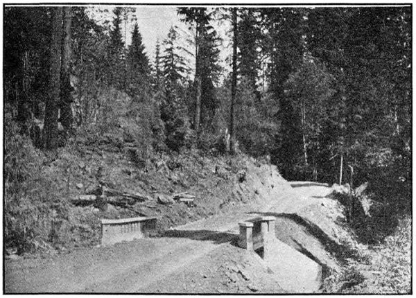
BRIDGE ON PASS CREEK—20 FT. SPAN. ON PACIFIC HIGHWAY NEAR
COMSTOCK IN DOUGLAS COUNTY
This section runs through the northern portion of the Pass Creek
Canyon, and has been the dread of tourists heretofore. It has always been
a hard road to travel under summer conditions and absolutely impassable
in winter, even for horse-drawn conveyances.
The contract for this improvement involved 2.4 miles of grading and was
awarded to S. S. Schell of Oakland, Oregon on September 5, 1917. The bulk
of the grading was done that fall and the job was completed in the spring of
1918. The road bed was graded to a width of 24 feet with 5 per cent
maximum grades and easy curves. In addition to the grading, the contract
included two drainage structures over Pass Creek, one a double 6x6 reinforced
concrete box culvert and the other a 20-foot reinforced concrete
bridge. All construction charges were paid by Douglas County. Engineering
charges were paid by the State.
Mr. E. B. Bishop was the Resident Engineer in charge on this section.
| Engineering |
$ 2,029.80 |
| Construction— |
|
| |
Clearing and Grubbing |
$2,400.00 |
|
| |
Common Excavation, 11,688 cu. yds. at 45c. |
5,259.60 |
|
| |
Intermediate Excavation, 6,085 cu. yds. at 60c. |
3,651.00 |
|
| |
Solid Rock Excavation, 1,016 cu. yds. at $1.15 |
1,168.40 |
|
| |
Overhaul per 100 ft., 7,220 cu. yds. at 3c. |
216.60 |
|
| |
12-inch Plain Concrete Pipe, 134 lin. ft. at $1.00 |
134.00 |
|
| |
24-inch Reinforced Concrete pipe, 160 lin. ft. at $2.50 |
400.00 |
|
| |
6-inch Porous Drain Tile, 591 lin. ft. at 20c. |
118.20 |
|
| |
Class A Concrete, 120.46 c. y. at $24.00 |
2,891.04 |
|
| |
Class B Concrete, 11.62 c. y. at $16.00 |
185.92 |
|
| |
Metal Reinforcement, 7,625 lbs. at 8c. |
609.84 |
|
| |
Repairing Timber Bridge |
26.34 |
|
| |
Laying 315.5 lin. ft. of Drain Tile and Backfilling |
56.00 |
|
| |
|
Total paid to Contractor |
|
17,116.94 |
| |
|
Total Cost |
|
$ 19,146.74 |
| |
|
|
Paid by County |
17,119.44 |
|
| |
|
|
Paid by State |
$ 2,027.30 |
|
| |
|
|
|
Total |
19,146.74 |
|
On August 6, 1918, a contract was awarded to S. S. Schell for macadamizing
the above newly graded section in Pass Creek Canyon, by the State
Highway Commission, same to be a standard three course broken stone,
water bound surface. This work was carried through in a very able manner
on the part of the Contractor and completed November 16, 1918. This surfacing
makes an all year road, of one of the worst pieces of road in the
State. The entire cost of this work was paid by the State.
| Engineering |
|
$ 302.09 |
| Advertisements for bids |
|
66.90 |
| Construction— |
|
|
| |
Broken Stone Macadam, 4,354 cu. yds. at $3.35 |
$ 14,585.90 |
|
| |
Earth Filler, 150 cu. yds. at 75c. |
112.50 |
|
| |
Removing Slides |
117.70 |
|
| Total Paid to Contractor |
|
14,816.10 |
| Total Cost |
|
$ 15,185.09 |
This section is through the south end of Pass Creek Canyon, beginning
approximately a mile and a half south of Comstock and extending to a
point a half mile north of Leona, being 4.6 miles in length. The contract
was a joint contract signed by the County Court and State Highway Commission
and was awarded to Hall & Soleim of Eugene on September 5,
1917. Work covered by the contract was for grading and macadamizing,
culverts and bridges.
Due to shortage of labor, poor shipments on macadam rock, and financial
difficulties, the contractors were obliged to ask the State Highway Commission
to take over the work. On August 20, 1918, after a conference with
the County Court and the Contractor’s Surety Company, this was done. The
work was completed November 30, 1918. The construction details under the
State supervision were handled by a State construction engineer, representing
the Contractors and Surety Company, and the engineering details by the
resident engineer on the work—the latter rendering regular monthly estimates
of work done on the unit contract prices, of the original contract.
This work complete will cost approximately $80,000.00 of which the
County will pay $74,349.72 and the State $5,650.28.
The construction of this section was in charge of E. B. Bishop, resident
engineer, and F. E. LaPointe, construction superintendent.
This work extends from the Calapooya River Bridge at Oakland to a
point two miles south of Yoncalla, a total distance of 10.4 miles. A contract
for clearing, grading and culverts was awarded the Warren Construction
Company, September 5, 1917, being the last of three contracts signed jointly
by the County Court and State Highway Commission.
This work was completed July 25, 1918, and is an excellent piece of
standard construction 24 feet in width. It eliminates the old excessive
grade over Rice Hill, and some bad sections just north of Oakland—there
being now no grades over 5 per cent.
On the completion of the grading the State Highway Commission
requested permission Of the Capital Issues Committee to sell bonds, part of
which were to cover the rocking of this unit to make it passable for winter.
This request was refused on the ground that it was not a necessary war
measure. The road will therefore not be passable this winter, but it is
expected that the section will be macadamized during the 1919 season.
Mr. Robert A. Pratt was resident engineer in charge of the construction.
| Engineering |
|
|
$ 5,864.31 |
| Construction— |
|
| |
Clearing and Grubbing |
|
$ 6,350.00 |
|
| |
Common Excavation, 45,563 cu. yds. at 49c |
|
22,325.87 |
|
| |
Intermediate Excavation, 37,544 cu. yds. at 77c |
|
28,908.88 |
|
| |
Solid Rock Excavation, 17,976 cu. yds. at $1.30 |
|
23,368.80 |
|
| |
Overhaul per 100 lin. ft., 61,580 cu. yds. at 2c |
|
1,231.60 |
|
| |
12-inch Plain Concrete Pipe, 2,463 lin. ft. at $1.10 |
|
2,709.30 |
|
| |
18-inch Corrugated Galvanized Iron Pipe, 742 lin. ft.
at $2.75 |
|
2,040.50 |
|
| |
24-inch Corrugated Galvanized Iron Pipe, 108 lin. ft.
at $3.44 |
|
371.52 |
|
| |
6-inch Porous Drain Tile, 1,055 lin. ft. at 20c |
|
211.00 |
|
| |
Class A Concrete, 146.5 cu. yds. at $24.00 |
|
3,516.00 |
|
| |
Class B Concrete, 102.2 cu. yds. at $22.00 |
|
2,248.40 |
|
| |
Metal Reinforcement, 9,057 lbs. at 8c |
|
724.56 |
|
| |
Lumber, 3,545 F. B. M. at $45.00 |
|
159.52 |
|
| |
Extra work on culverts, drain ditches, rock back filling |
|
174.48 |
|
| |
Hauling and Placing rip-rap for embankments,
approximately 350 cu. yds. |
|
203.97 |
|
| |
Lowering water pipe crossing |
|
13.64 |
|
| |
Rebuilding right of way fence |
|
170.50 |
|
| |
Grubbing for borrow pit |
|
21.12 |
|
| |
Extra clearing and grubbing account of line change |
|
74.82 |
|
| |
Gasoline furnished State |
|
9.19 |
|
| |
32-ft. by 36-in. Corrugated Iron Pipe (Hauling and
Placing) |
|
28.09 |
|
| |
68-ft. by 36-in. Corrugated Iron Pipe in place |
|
370.04 |
|
| |
|
Total paid to contractor |
|
|
|
$ 95,231.80 |
| |
|
Total cost |
|
|
|
$ 101,096.11 |
| |
|
|
Paid by State |
|
$ 19,015.09 |
|
|
| |
|
|
Paid by County |
|
82,081.02 |
|
|
| |
|
|
|
Total |
|
$ 101,096.11 |
|
|
[96]
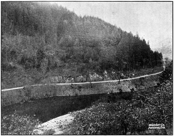
ALONG THE UMPQUA RIVER NORTH OF MYRTLE CREEK IN DOUGLAS COUNTY. GRADED IN
1917 AND 1918
[97]
On November 27, 1917, a contract was awarded to Calvert & Wolke of
Grants Pass (now known as the Grants Pass Construction Company, James
Logan, President), for the clearing, grading, culverts and concrete bridges
on a section of 12.8 miles between Myrtle Creek and the junction of the
Pacific Highway with the Roseburg-Coos Bay Highway, one mile and a half
north of Dillard. This construction eliminates the well but unfavorably
known Roberts Mountain grade just south of Roseburg, on which several
lives have been lost and also, seven grade crossings of the Southern Pacific
Railway. It will be a water grade highway along the beautiful Umpqua
River.
The road will not be open to the public until the completion of two bridges
over the Umpqua, which are now under construction and which are expected
to be completed about January 1, 1919. It is expected that this entire section
will be macadamized during the 1919 season.
Mr. F. N. Drinkhall is resident engineer in charge of the grading on this
section.
| Engineering |
|
$ 7,499.22 |
| Culvert Pipe furnished by State |
|
4,109.70 |
| Construction— |
| |
Clearing and Grubbing, 97% completed |
$ 3,395.00 |
|
| |
Common Excavation, 49,146 cu. yds. at 35c |
17,201.10 |
|
| |
Intermediate Excavation, 42,951 cu. yds. at 56c |
24,052.56 |
|
| |
Solid Rock Excavation, 23,859 cu. yds. at $1.14 |
27,199.26 |
|
| |
Overhaul, per 100 lin. ft., 6,614 cu. yds. at 2c |
132.28 |
|
| |
12-inch Plain Concrete Pipe, 1,798 lin. ft. at 35c |
629.30 |
|
| |
18-inch Corrugated Galvanized Iron Pipe, 556 lin. ft.
at 30c |
166.80 |
|
| |
24-inch Corrugated Galvanized Iron Pipe, 284 lin. ft.
at 40c |
113.60 |
|
| |
36-inch Corrugated Galvanized Iron Pipe, 246 lin. ft.
at 75c |
184.50 |
|
| |
6-inch Porous Drain Tile, 5,054 lin. ft. at 25c |
1,263.50 |
|
| |
Class A Concrete, 471.92 cu. yds. at $22.00 |
10,382.24 |
|
| |
Class C Concrete, 25 cu. yds. at $20.50 |
512.50 |
|
| |
Metal Reinforcement, 37,747 lbs. at 10c |
3,774.70 |
|
| |
Lumber and Timber, 17,058 F. B. M. at $45.00 |
767.61 |
|
| |
Rough Dry Walls (approx.) (Force Account) 122 cu. yds. |
106.41 |
|
| |
Clearing outside R. O. W. (Force Account) |
112.96 |
|
| |
Back-filling over drain tile with gravel |
321.06 |
|
| |
Total Amount Earned by Contractor to Nov. 30, 1918 |
90,315.38 |
|
| |
15 per cent retained until completion of contract |
13,547.31 |
|
| |
Total paid contractor to Nov. 30, 1918 |
|
76,768.07 |
| Total Amount expended to November 30, 1918 |
|
$ 88,376.99 |
[98]
This bridge consists of 3-144 foot covered wooden Howe Truss spans
on concrete piers. The spans are continuous, thus forming a roof over 430
feet long. Open windows are constructed at panel points to light the spans
and make a more artistic appearance, lack of light and unsightly appearance
having been the chief objections to covered wooden bridges. This bridge
being on the Pacific Highway, was designed for heavy traffic loading. A
laminated wood floor system is used and provision is made for an asphaltic
wearing surface although a three inch wooden decking is used temporarily.
This type of bridge is regarded as being very durable, and under conditions
of the past year or two, very economical. The structure complete
will cost approximately $26,500.00. Mr. A. S. Kennedy was resident engineer
for this bridge as well as the one two and one-half miles south of Dillard.
The construction is being handled by the Portland Bridge Company.
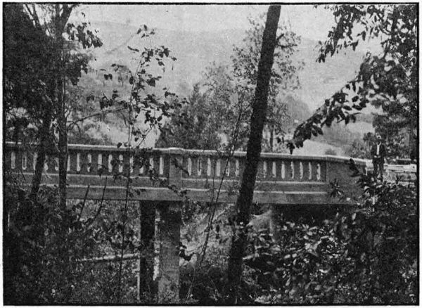
VAN TYNE CREEK VIADUCT NORTH OF MYRTLE CREEK IN DOUGLAS
COUNTY. BUILT IN 1918
This bridge is similar to the one described above, except that there are
two 144-foot spans instead of three. The cost of construction will be
approximately $19,000.00. It is being built under a contract with the
Portland Bridge Company.
This is a 60-foot reinforced concrete viaduct on the Pacific Highway near
Dole, north of Myrtle Creek. It was constructed by the Grants Pass Construction
Company, under their grading contract for the section between
Myrtle Creek and Dillard. The total cost of the structure was $3,575.70.
[99]
These structures, two in number, were constructed within a few hundred
feet of each other on the Pacific Highway between Myrtle Creek and
Dillard and span crevices in the face of a rock bluff. They are of reinforced
concrete construction of the through girder type and of spans of
45 feet and 58 feet respectively. The 45 foot structure cost complete
$2,415.28, and the 58 foot structure cost $2,648.54. Both were built by the
Grants Pass Construction Company under their contract for grading between
Myrtle Creek and Dillard.
The bridge over the Umpqua River at Myrtle Creek being inadequate for
modern traffic a survey has been made for a new structure. As contemplated,
the new bridge will eliminate a grade crossing that now exists at one
end of the present bridge.
Under a co-operative agreement between Douglas County, the State and
the Federal Government, a 9.7 mile section of the Pacific Highway between
Canyonville and Galesville is being constructed. This project will eliminate
the heavy grades and dangerous curves through what has been erroneously
called Cow Creek Canyon. This section has heretofore been one of the very
worst on the entire highway, and its improvement is of great importance.
The work is under contract to John Hampshire & Co. of Grants Pass.
The supervision of the work is in the hands of the Federal Office of Public
Roads. It is estimated that the project complete will cost $211,000.00, of
which the County will pay $23,000.00, the State $94,000.00 and the Federal
Government $94,000.00.
During April and May 1917, a preliminary survey was made from the
Coos-Douglas County Line eastward to a connection with the new Pacific
Highway location between Roseburg and Dillard. Some construction on
this line was contemplated in the spring of 1918, but was postponed until the
close of the war. Location surveys were in charge of Mr. C. C. Kelley,
locating engineer. The length of the survey is 28.7 miles.
This survey was made in July 1917, and is on the Pacific Highway
between Glendale and Canyonville. The survey was 7.2 miles in length and
was made by Mr. C. C. Kelley, locating engineer.
This survey consisted of the location of a 2.3 mile section of the Pacific
Highway from Canyon Creek Pass to Johns Ranch in Cow Creek Valley.
It was made by C. C. Kelley, locating engineer, in August, 1917, and the
section is now being constructed as a part of the Canyonville-Galesville
Forest Road Project.
[100]
Gilliam County presents an interesting situation from the viewpoint
of highways. Besides the Columbia River Highway the County is traversed
by the John Day Highway, one of the important routes of Eastern Oregon.
This large mileage of State highways along with the fact that there are
many large agricultural communities to be served, renders important and
necessary an extensive road building program.
THE JOHN DAY RIVER HIGHWAY SOUTH OF CONDON IN GILLIAM COUNTY
MACADAMIZED IN 1917
The people of Gilliam County have long realized the value of good
roads. Although continuous effort has been put forth, expensive construction
and limited funds have resulted in only a beginning. County
authorities have always shown a keen interest in the plans for state co-operation,
regardless of whether Gilliam County was to be benefitted directly
or whether improvements were to be made in the neighboring counties.
The State Highway Commission has always recognized the urgency of
building the Columbia River Highway, and in addition has from the
beginning realized the necessity of an improved road leading inland from
Condon.
During 1918 the State Highway Commission made a location survey
of the Columbia River Highway between John Day River and Arlington,
and a reconnaissance survey has been made from Arlington east to the
Morrow County Line.
Since August 1917 the State Highway Commission has expended
$28,673.43 for macadamizing the John Day Highway between Condon
and Thirty Mile Creek. In addition $9,000.00 of State funds has been set
aside for maintaining and resurfacing this section during the coming
winter.
Gilliam
County Court and the road district in the north end of the
County through heroic efforts have raised $60,000.00 for grading the
Columbia River Highway between Arlington and Blalock, a distance of
eight and sixty-eight one-hundredths miles. This work is to be started
at once and rushed during the winter season. The State Highway Department
will supply engineering supervision.
In August 1917 a contract was let by the State Highway Department
to Warren Construction Company of Portland for macadamizing a five
and seven-tenths mile section of the John Day Highway between Condon
and Thirty Mile Creek. The contractor was paid on the basis of cost plus
ten per cent for labor and plus five per cent for materials.
Rock was quarried and crushed at two different points on the job
and trucks and teams were used for hauling. The old road was scarified
and re-dressed prior to laying the macadam. A dry macadam six inches
thick was laid over the five and seven-tenths miles. The average width
of the surface is about fourteen feet.
The State paid the entire cost of this work amounting to $28,673.43
and it is thought that about $1,500.00 per mile will be required for maintenance
and re-dressing during the next few months.
C. A. Harrington was resident engineer and inspector for the Department
on this work.
At the completion of the state work on the Cummins Hill macadam,
Gilliam County deemed it advisable to avail themselves of the opportunity
to utilize the installed equipment and organization for macadamizing
the John Day Highway between Mayville and Wheeler County Line, one
mile south. Accordingly they graded and laid macadam for this distance
thereby connecting Mayville up with the Wheeler County macadam. Gilliam
County paid the full cost of this work amounting to about $6,500.00
for both grading and macadam.
The engineering and inspection was done by the State Department with
George Hibbet in charge.
A location survey of the Columbia River Highway was made by the
State Highway Department during 1918. Beginning at the John Day
River near its mouth the line follows up the Columbia River paralleling the
O.-W. R. & N. Railway and ends at Arlington. The total length of the
survey is twenty-three and ninety-six one-hundredths miles. The plans for
the eight and sixty-eight one-hundredths miles section from Arlington
to Blalock have been completed but there are revisions to be made in the
remainder of the line owing to right-of-way encroachments upon the railroad
property.
This survey was made under the direction of C. A. Harrington and
B. H. McNamee, locating engineers for the State Department.
Grant County lies in the mountainous section of the State and its
limits on three sides, north, east and south follow water sheds. The
general slope of the lands and direction of the drainage is toward the
west but even here the country is of such rugged character that no natural
passageways are found to relieve the isolated condition. The roads in
all directions are very rough and of little economic value to the County.
The narrow gauge railway leading from Baker to Prairie City serves
the whole County for both passenger and freight traffic.
It is readily seen that the call for improved roads for these settlements
is an urgent one. To meet the demands for transportation facilities the
County has made a very creditable showing towards financing highway
improvements. In November 1916 a bond issue was voted providing
$140,000.00. The mileage is so great however, and the construction so heavy
and expensive, that County funds available for permanent work are altogether
inadequate.
Grant County was among the first to apply for State and Federal aid
and its call did not go unheeded. The State Highway Commission drew
heavily upon its first apportionments of Post Road Funds in order to
provide a connecting road between Spray and Dayville through the Big
Basin and Picture Gorge. The co-operative plans provide also for the
improvement of the John Day-Prairie City sections.
Two sections of the John Day Highway in this County aggregating
thirty-one and thirty-one hundredths miles in length have been definitely
established by location surveys, an additional location is to be made in the
near future. In November the State Highway Commission received bids for
the grading and macadamizing of that section of the John Day Highway
between Hall Hill and Prairie City. The cost of this work is to be defrayed
by State and Government funds in equal amounts.
Funds have been set aside by the Commission for the matching of
Federal and County funds in the construction of the John Day Highway
between the Grant-Wheeler County Line and Dayville. This is a portion
of Post Road Project No. 6 extending from the mouth of Sarvice Creek,
Wheeler County to Valades Ranch, Grant County. The project covers a
total of forty-eight and ninety-five hundredths miles, twenty-three and
forty-five hundredths miles of which are in Grant County. The appropriations
for the improvement are apportioned as follows: Grant County,
$50,000.00; State, $93,871.20; Government, $93,871.19. Total estimated
cost, $237,742.39.
The Department has also appropriated funds for the grading and
macadamizing of that section between the town of John Day and Fisk
Creek, seven and four-tenths miles east of the town. The total estimated
cost of the work is $145,051.50, which amount is to be supplied in equal
amounts by the State and Government. The improvement from John Day
to Prairie City is listed for early completion owing to an urgent request
from the War Department to keep the road in condition for hauling
chrome ore.
The following summary shows State and Federal aid to be extended
Grant County during the next season.
| Appropriated for expenditures in 1919 |
State
Funds |
County
Funds |
Govern-
ment
Funds |
Total |
| Hall Hill to Prairie City |
$ 19,493.95 |
... |
$ 19,493.95 |
$ 38,987.90 |
Wheeler County Line to Valades
Ranch |
93,871.20 |
$ 50,000.00 |
93,871.19 |
237,742.39 |
| John Day to Fisk Creek |
72,525.75 |
... |
72,525.75 |
145,051.50 |
[103]
In July of this season the Grant County Court turned over to the State
Departments funds for the improvement of certain sections between John
Day and Prairie City. The Hall Hill Section, three and five-tenths miles
in length, received first attention as it was much in need of repair. The
grading is almost completed and gravel macadam is laid on two and
twenty-four hundredths miles. There has been expended on this work up
to November 30, $39,000.00, and approximately $11,000.00 will be required
for completion of the same. County funds will be supplied to finish this
section. State forces and local labor are being employed on this work
under the direct supervision of C. A. Harrington, resident engineer for
the Department. In addition to the grading and macadamizing this work
involves the construction of a 100-foot span bridge over the John Day
River.
Excavation—5,300 cu. yds. solid rock; 4,100 cu. yds. intermediate; 10,300 cu. yds.
common.
Pipe—70 lin. ft. 18-inch; 150 lin. ft. 24-inch; 120 lin. ft. 9-inch.
In 1917 a location survey was made from the Grant-Wheeler County
Lines east of Spray to Valades Ranch, five miles west of Dayville. The
line crosses the North Fork of the John Day River at Kimberly’s Ranch
and follows up the Big Basin Valley along the east bank of the John
Day River. A crossing is made near the upper end of Big Basin and
the line follows the west bank of the river through Picture Gorge Canyon.
On leaving Picture Gorge the line enters the John Day Valley, and continues
on the west side of the river to Valades Ranch where the project ends.
Valades Ranch is five miles west of Dayville. This is a portion of the
Sarvice Creek-Valades Ranch Post Road Project and the Grant County
section is twenty-three and forty-five hundredths miles in length. This survey
was made under the direction of R. H. Coppock, locating engineer.
In 1918 a location survey was made from the town of John Day to
Prairie City. The line follows the south limit of the valley east from John
Day for eight and five-tenths miles and crosses the river to the north side
of the valley at the bridge site on the present road. It continues thence
along the north side of the valley to Prairie City. The length of this
survey is twelve and seventy-four hundredths miles.
C. A. Harrington and R. H. Coppock were the locating engineers on
this section. The office work for this survey is finished and plans are
complete.
(Same as for Wheeler county)
The State Highway Department has submitted to the Government for
the purpose of securing Post Road aid, that section of the John Day
Highway
between John Day and Fisk Creek. This project is five and seventy-two
hundredth miles in length and the total estimated cost is $145,051.50.
The co-operation is to be on the basis of fifty per cent of the cost from
each the State and Government.
Assurance has been received that the project will receive the support
of the Government and it is expected that construction work will begin
in the near future.
The Office of Public Roads has approved the application for Post Road
aid on the John Day Highway between Hall Hill and Prairie City. The
length of this project is two and fourteen hundredths miles. The total estimated
cost is approximately $39,000.00. The road is to be graded and
surfaced with gravel macadam. This improvement involves also the
construction of a fifty foot span bridge near Prairie City. The apportionment
of the costs provide for the payment of $19,500.00 by each the State
and Government.
Bids were received for this work on November 27 and a contract for
the construction was later awarded Kern & Co. of Portland, Oregon.
Work will begin in a short time and the bid price for this improvement
was $38,987.90.
Roads in Harney County are few in number, but the combined mileage
of these few is enormous. Fortunately a large portion of the County roads
are good most of the year, but during the winter season communication by
the valley roads is usually extremely difficult.
Highways are of extreme importance in this County owing to the
scarcity of railroads. The value of improved highways is fully appreciated
by the people and a very creditable beginning has been made on the roads in
the vicinity of Burns. However, County funds are entirely inadequate for
the carrying out of a road building scheme of any magnitude.
The State Highway Commission extended aid in 1918 to the amount of
$20,000 which appropriation calls for a like amount from the Federal Government.
The County joins in the co-operative work to the amount of
$8,000.00. This makes a total of $48,000.00 for a beginning. Present plans
provide that work shall start early in 1919.
Additional support was secured from the State in the forms of surveys.
Approximately nineteen miles of the Central Oregon Highway within
Harney County was surveyed in 1918.
During 1918 the State Highway Commission surveyed a six mile section
of the Central Oregon Highway leading east from Burns and past the
Government experimental farm. This project begins one and one-half miles
east of Burns and ends two miles east of the experimental farm. The plans
for this survey are practically completed. This survey was made under the
direction of H. B. Wright, locating engineer.
[105]
This is also a section of the Central Oregon Highway and is ten and
thirty-nine hundredths miles in length. The line begins near Sage Hen
Creek and parallels the present road into Burns, with a considerable saving
in distance. This survey was made at the request of the County authorities
in order that some improvements they have planned may be placed upon
a permanent location. H. B. Wright was locating engineer on this survey.
This is a portion of the survey between Rolyat in Deschutes County and
One Hundred Mile Road in Harney County. Fifteen and six-tenths miles
are in Deschutes County and fifteen in Harney County. This survey was
made at the request of the Counties in order that local funds may be
expended on a permanent location. The present road through Glass Butte
section between Rolyat and One Hundred Mile Road is in poor material and
much longer than necessary. Local plans provide for the opening of the
new road as soon as practicable. H. B. Wright, locating engineer for the
State Department directed the surveying of this line.
In April, 1918, the State Highway Department made a reconnaissance
survey over the route from Burns to Vale. All possible routes were covered
in the survey and reported upon fully to the State Highway Engineer and
the Commission. The investigation resulted in the establishing of the route
from Burns direct to Crane and down the Malheur River through River Side,
Juntura, Harper and Vale. This survey was made by M. O. Bennett,
division engineer for the State Highway Department.
[106]
That section of the Columbia River Highway from the Multnomah County
Line to Hood River passes through the narrowest part of the Columbia
River Gorge through the Cascade Range. The steep river banks rise directly
up from the water’s edge for a large part of the distance, so the space for
both railroad and highway is necessarily restricted. At many points, the
right of way of the railroad and highway is contiguous and construction
under these conditions involved extremely heavy work which added materially
to the cost.
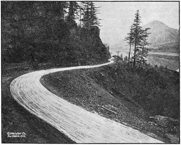
THE COLUMBIA RIVER HIGHWAY WEST OF LINDSAY IN HOOD RIVER
COUNTY
Previous to 1915, there was no road through the County, but from the
proceeds of a bond issue of $75,000, the County built on State standards a
roadway to connect the uncompleted portions. In 1915, the State built
about one mile, including the Mitchell Point Tunnel, one of the many scenic
features of the Columbia River Highway. One mile of pavement adjoining
the Multnomah County pavement was built in 1916 by Mr. S. Benson.
There remained about fourteen miles which require improvement, and
on August 7, 1917, contracts were awarded to A. D. Kern for grading of these
remaining sections to bring to standard grade and alignment. This improvement
eliminated Ruthton Hill, with its narrow, steep grades, three railroad
crossings, a narrow, steep grade near Wyeth and the improvement through
the village of Cascade Locks to the end of the pavement. The work was
divided as follows: Cascade Locks Section, 8.2 miles; Viento Section, 3.6
miles; Ruthton Hill Section, 4.2 miles. These contracts were completed
in September, 1918. Due to the close proximity to the railroad tracks, the
work required extreme care and watchfulness but was accomplished without
accident and without delays to railroad traffic. The costs of construction
for each of the three sections follows:
| Engineering |
|
|
$ 8,744.41 |
| Construction—General— |
|
|
|
| |
Common Excavation, 60,660 cu. yds. at 42c |
|
$ 25,477.20 |
|
| |
Intermediate Excavation, 50,645 cu. yds. at 75c |
|
37,983.75 |
|
| |
Solid Rock Excavation, 44,500 cu. yds. at $1.15 |
|
51,175.00 |
|
| |
Overhaul, per 100 lin. ft., 133,229 cu. yds. at 3c |
|
3,996.87 |
|
| |
12-inch Reinforced Concrete Pipe, 1,102 lin. ft. at $1.75 |
|
1,928.50 |
|
| |
18-inch Reinforced Concrete Pipe, 140 lin. ft. at $2.25 |
|
315.00 |
|
| |
24-inch Reinforced Concrete Pipe, 284 lin. ft. at $3.00 |
|
852.00 |
|
| |
30-inch Reinforced Concrete Pipe. 72 lin. ft. at $4.25 |
|
306.00 |
|
| |
Class A Concrete, 80.86 cu. yds. at $20.00 |
|
1,617.20 |
|
| |
Class C Concrete, 32.43 cu. yds. at $14.00 |
|
454.02 |
|
| |
Placing Reinforcing Steel, 3,197 lbs. at .001⁄2 |
|
15.99 |
|
| |
Catch Basins, 9 at $25.00 |
|
225.00 |
|
| |
Extra Clearing and Grubbing, 5.79 acres at $200.00 |
|
1,158.00 |
|
| |
Extra Clearing, 4.13 acres at $100.00 |
|
413.00 |
|
| |
Herman Creek Bridge— |
|
|
|
| |
|
Class A Concrete, 137.61 cu. yds. at $20.00 |
$ 2,752.20 |
|
|
| |
|
Class C Concrete, 3.57 cu. yds. at $14.00 |
49.98 |
|
|
| |
|
Reinforcing Steel (Placing) 23,000 lbs
at
.001⁄2 |
115.00 |
|
|
| |
|
Reinforcing Steel furnished by State |
1,394.32 |
|
|
| |
|
Removing old bridge and constructing
temporary bridge |
426.00 |
|
|
| |
|
Wet excavation for piers |
664.86 |
|
|
| |
|
Concrete toe wall to protect fill |
1,547.98 |
|
|
| |
|
Railing |
438.72 |
|
|
| |
|
|
Total cost of Herman Creek Bridge |
|
7,389.06 |
|
| |
Gorton Creek Bridge— |
|
|
|
| |
|
Excavation for piers |
$ 483.44 |
|
|
| |
|
Class A Concrete, 90.85 cu. yds. at $20.00 |
1,817.00 |
|
|
| |
|
Placing Reinforcing Steel, 7,378 lbs.
at
.001⁄2 |
36.89 |
|
|
| |
|
Reinforcing Steel furnished by State |
447.27 |
|
|
| |
|
Railing |
224.29 |
|
|
| |
|
Rip-rap |
145.01 |
|
|
| |
|
|
Total cost of Gorton Creek Bridge |
|
3,153.90 |
|
| Force Account Work as Follows— |
|
|
|
| |
Construction and Removal of temporary bridge over
Dry Creek |
|
15.78 |
|
| |
Removing Slide from O.-W. R. R. & N. Tracks |
|
95.59 |
|
| |
Gravel Surfacing—End of Pavement to Cascade Locks |
|
2,418.55 |
|
| |
Railing for Viento Creek Bridge |
|
106.11 |
|
| |
Excavating in water and placing Corrugated Iron Pipe |
|
57.92 |
|
| |
Excavation and placing drain tile in wet cuts |
|
150.63 |
|
| |
Excavation and placing box drain for form crossing |
|
10.44 |
|
| |
Riprap on slope to keep fill off O.-W. R. R. & N. Right
of Way |
|
177.29 |
|
| |
Water pipe and private road crossing |
|
40.16 |
|
| |
Sinking test holes in gravel pit at Cascade Locks |
|
24.93 |
|
| |
Road crossing for Herman Creek Ranger Station |
|
167.38 |
|
| |
Hauling dirt to cover boulders |
|
264.40 |
|
| |
Placing concrete pipe |
|
59.03 |
|
| |
Flagmen guarding track (Contractor’s force) |
|
1,234.83 |
|
| Miscellaneous Construction Items Paid Direct by State— |
|
|
|
| |
Replacing Fence |
|
18.75 |
|
| |
Reinforcing Steel for Concrete Culverts |
|
193.77 |
|
| |
Concrete Pipe furnished by State |
|
71.50 |
|
| |
Moving Building in Cascade Locks |
|
1,400.00 |
|
| |
Guarding O.-W. R. R. & N. Tracks (Ry. Co. Force) |
|
1,343.69 |
|
| |
Guarding Western Union Telegraph Line |
|
498.01 |
|
| |
|
Total Construction Cost |
|
|
$ 144,809.25 |
| |
|
Grand Total Cost of Job |
|
|
153,553.66 |
| |
|
Deduction for Rental of State Cars and Track |
|
|
648.81 |
| |
|
|
Total Cash Expenditure |
|
|
$ 152,904.85 |
[108]
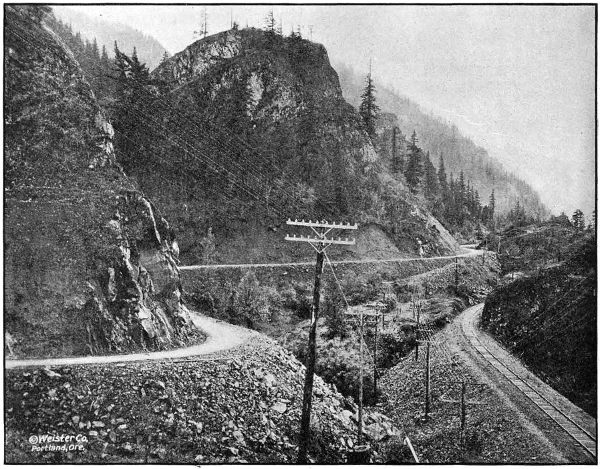
THE COLUMBIA RIVER HIGHWAY NEAR VIENTO IN HOOD RIVER COUNTY. GRADED AND GRAVELED
IN 1917 AND 1918
[109]
| Engineering |
|
|
$ 4,513.24 |
| Guarding O.-W. R. R. & N. Tracks |
|
|
976.47 |
| Guarding Western Union Telegraph Lines |
|
|
184.64 |
| Diverting Flume Lines |
|
|
936.37 |
| Reinforcing Steel Furnished by State |
|
|
257.79 |
| Contract Work as follows: |
|
|
|
| |
Common Excavation, 9,480.4 cu. yds. at 39c |
|
$ 3,697.35 |
|
| |
Intermediate Excavation, 32,654.9 cu. yds. at 70c |
|
22,858.43 |
|
| |
Solid Rock Excavation, 54,031.9 cu. yds. at $1.10 |
|
59,435.09 |
|
| |
Overhaul, per 100 lin. ft., 82,711 cu. yds. at 3c |
|
2,481.33 |
|
| |
12-inch Reinforced Concrete Pipe, 622 lin. ft. at $1.75 |
|
1088.50 |
|
| |
18-inch Reinforced Concrete Pipe, 304 lin. ft. at $2.25 |
|
684.00 |
|
| |
Class A Concrete, 62 cu. yds. at $20.00 |
|
1,240.00 |
|
| |
Class C Concrete, 20.8 cu. yds. at $14.00 |
|
291.20 |
|
| |
Placing Reinforcing Steel, 3,928 lbs. at .001⁄2 |
|
19.64 |
|
| |
Rubble Masonry, 12 cu. yds. at $7.00 |
|
84.00 |
|
| |
Catch Basins, one at $25.00 |
|
25.00 |
|
| |
Gravel Backfill in Rock cut (Force Account) |
|
181.77 |
|
| |
Repairing Lindsay Creek Bridge (Force Account) |
|
149.92 |
|
| |
Private Road Approach (Force Account) |
|
168.30 |
|
| |
Clearing Rock from Mitchell Point Tunnel (Force Acc′t) |
|
93.94 |
|
| Viento Creek Bridge— |
|
|
|
| |
Class A Concrete, 62.7 cu. yds. at $20.00 |
$ 1,254.00 |
|
|
| |
Placing Reinforcing Steel, 3,800 lbs. at .001⁄2 |
19.00 |
|
|
| |
Excavation for Footings (Force Account) |
128.27 |
|
|
| |
Material furnished by State |
249.70 |
|
|
| |
|
Total Cost of Viento Creek Bridge |
|
1,650.97 |
|
| Total Cost to November 30, 1918 |
|
|
$ 101,017.95 |
| 15 per cent Retained of Total Amt. ($93,899.74) Earned by Contractors |
|
|
14,084.96 |
| Total Paid Amount to November 30, 1918 |
|
|
$ 86,932.99 |
| Engineering |
|
$ 4,074.19 |
| Material furnished by State for Concrete Half Viaduct |
|
200.50 |
| Guarding O.-W. R. R. & N. Tracks |
|
804.57 |
| Contract Construction Work as follows: |
|
|
| |
Common Excavation, 2,669.5 cu. yds. at 39c |
$ 1,041.10 |
|
| |
Intermediate Excavation, 17,109.4 cu. yds. at 70c |
11,976.58 |
|
| |
Solid Rock Excavation, 79,213.3 cu. yds. at $1.05 |
83,173.96 |
|
| |
Overhaul per 100 lin. ft., 19,500 cu. yds. at 3c |
585.00 |
|
| |
12-inch Reinforced Concrete Pipe, 536 lin. ft. at $1.75 |
938.00 |
|
| |
18-inch Reinforced Concrete Pipe, 140 lin. ft. at $2.25 |
315.00 |
|
| |
Class C Concrete, 15.4 cu. yds. at $14.00 |
215.60 |
|
| |
Rubble Masonry, 30 cu. yds. at $7.00 |
210.00 |
| |
Force Account— |
|
| |
|
Connecting road with Morton |
285.50 |
|
| |
|
Covering sharp rocks with clay |
106.48 |
|
| |
|
Reinforced Concrete Viaduct at Ruthton Hill |
1,362.51 |
|
| |
|
|
$ 100,209.73 |
|
| |
|
Less 15 per cent retained pending completion of
contract |
15,031.46 |
|
| |
|
Total payments to contractor to Nov. 30, 1918 |
|
$ 85,178.27 |
| Total expended to November 30, 1918 |
|
$ 90,257.53 |
On July 4, 1918, a contract was awarded to A. D. Kern of eighteen miles
of gravel surfacing between Hood River and the Multnomah County Line on
the basis of cost plus fifteen per cent on labor and supplies and twelve and
one-half per cent on equipment; provided, that no percentage should be
paid on any cost over $50,000. This work also includes the building of
shoulders on the one mile of pavement built by S. Benson in 1916 adjacent
to the Multnomah County Line. The gravel for this work was taken from
pits at Cascade Locks, Herman, Sonny and Hood River, was loaded by
steam shovels, screened at two of the pits and hauled by auto trucks. As
a result there is now a gravel surface between Hood River and Cascade
Locks. A total of 23,396 cubic yards was placed upon the road at an
average cost of $2.88 per cubic yard which represents total cost of excavating,
screening, hauling, spreading and rolling.
[110]
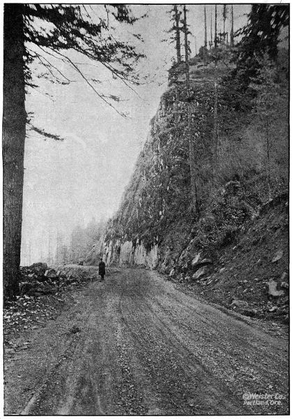
ON THE COLUMBIA RIVER HIGHWAY
IN HOOD RIVER COUNTY TWO MILES
EAST OF CASCADE LOCKS.
GRADED AND GRAVELED IN 1917 AND 1918
[111]
The largest concrete bridge so far designed and constructed by the State
Highway Department is that spanning Hood River near the city of Hood
River. It consists of three arch spans 95 feet, center to center of piers, 110
feet of reinforced concrete approach on the Hood River side and a short
approach on the opposite side.
As in other arch work of similar magnitude studied by the Department,
it was found economical to support the arch superstructures on ribs instead
of using rings extending clear across the roadway, and the open spandrel
idea was carried out.
The concrete viaduct approach on the west side crosses three railroad
tracks which govern the height of the bridge. In order to minimize this
height through concrete girders were used, the girders projecting above
rather than below the roadway slab.
The total cost of the structure complete will be about $48,000.00, of which
Hood River County will contribute $8,000.00. The bridge was built under
contract by Parker & Banfield. Mr. C. E. Carter was resident engineer on
the work.
This is a ninety-foot reinforced concrete viaduct on the Columbia River
Highway near Cascade Locks. This structure was built by A. D. Kern in
connection with the grading contract on the Cascade Locks section. The
cost complete was $7,389.06.
This is a 50-foot reinforced concrete bridge at Wyeth on the Columbia
River Highway. It was built by A. D. Kern under the grading contract for
the Cascade Locks Section. The total cost was $3,153.90.
Contemplating construction of the Columbia River Highway between
Hood River and Mosier to eliminate the high summit, narrow road bed, and
excessive grades between these points the Department made very thorough
surveys for this important project.
A survey had previously been made developing distance up the Hood
River Valley and reaching a summit of 1,107 feet with a corresponding additional
length required on the Mosier end, making a total distance of 10.7
miles.
Because of its length and high summit a lower route was considered and
a survey was made adjacent to the railroad, using a portion of the old
abandoned railroad grade, but involving extremely heavy construction at
certain points where the line skirts the high bluffs. The summit on this
route was only 160 feet and its length 5.8 miles. However, the railroad
company was contemplating a revision in the alignment of their tracks on
this section, as well as the construction of a second track, which would still
further lessen the space available for a highway. Also taking into consideration
the difficult nature of the work and the uncertain cost due to track
protection in blasting operations and the limited conditions under which
the work must lie done to avoid interference with the railroad traffic, this
route was revised in favor of a route further away from the tracks up on
the side-hill. The summit reached is 522 feet and the length of this line is
6.3 miles, which includes a development of 5 per cent grade at each end and
provides for a 24 foot roadbed.
This adopted route is very scenic and affords a splendid view of the
Washington shore, as well as a view up and down the river. The construction
is very heavy, being located on steep side-hill slopes and at one point
involves a tunnel 200 feet long. This project is divided by the County line,
making 4.0 miles in Hood River County and 2.2 miles in Wasco County.
This project will be placed upon the 1919 program.
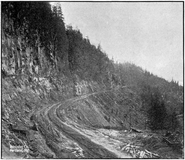
HEAVY GRADING ON RUTHTON HILL IN HOOD RIVER COUNTY.
CONSTRUCTED IN 1917 AND 1918
The Highway Department expended in Jackson County during 1917 and
1918 the sum of $86,619.88. The work accomplished with this amount
consists of six and five-tenths miles of 16-foot crushed rock macadam in
the Siskiyou Mountains, an undergrade crossing with the Southern Pacific
Railway just north of Ashland, and 4,200 lineal feet of grading and paving
north of Ashland. A survey has also been started on the Ashland-Klamath
Falls Road about fifteen miles of which was completed before weather conditions
made it necessary to discontinue field work until spring.
On account of a contemplated undergrade crossing with the Southern
Pacific Railway, a stretch of 4,200 feet on the Pacific Highway just north
of Ashland was left unpaved between Ashland and Medford when the
balance of the distance between those points was paved in 1914. In 1917
arrangement was made between the County and Railway Company for the
construction of this undercrossing and the State Highway Commission set
aside funds to cover the cost of the 4,200 feet of grading in connection
therewith.
The Installation of the undercrossing structure was handled by the
Southern Pacific Railway Company. The grading was handled by the
County grading forces under the supervision of the Highway Department.
Mr. F. H. Walker acted as resident engineer. The grading was commenced
on January 7, 1918, and completed August 1, 1918. The total cost of the
grading was $9,768.88, and was paid entirely from State funds.
| Industrial insurance |
$ 156.27 |
| Grading, labor, teams, material, etc. |
8,928.19 |
| Explosives |
102.08 |
| Concrete drainage structures |
14.70 |
| Pipe culverts |
287.03 |
| Irrigation flume diversions |
5.40 |
| |
Total |
$ 9,493.67 |
| Engineering |
275.21 |
| |
Total cost |
$ 9,768.88 |
Bids were called for on August 6, 1918, for the paving of the Ashland
Hill Section, but as no satisfactory bids were received the work was
undertaken by the Highway Department with State forces. This section of
paving is 4,200 feet in length, and the type of pavement laid is a 16-foot
concrete, 51⁄2 inches
thick at the sides and 61⁄2 inches thick at the center.
The mixture was a 1 : 2 : 31⁄2, and a ratio of 5.6 gallons of water per sack of
cement was used.
The average haul on material was 1.2 miles and hauling was done by
means of trucks. The cement was shipped to the job prior to the beginning
of construction and stored at convenient locations near the work.
A sixteen cubic foot Koehring mixer equipped with boom and bucket
was used for mixing the aggregate. The pavement, after being struck off,
was finished by the roller and belt method. The pavement first being
rolled from two to four times depending on the condition of the concrete
and later belted with eight and ten inch belts. The eight inch belt being
used first. A very satisfactory surface was obtained in this manner.
[114]
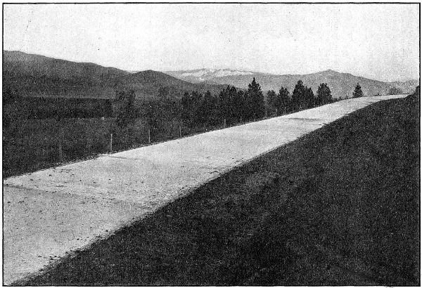
CONCRETE PAVEMENT ON ASHLAND HILL IN JACKSON COUNTY, ON THE PACIFIC HIGHWAY
NORTH OF ASHLAND.
GRADED AND PAVED IN 1918
Continuous
forms were used on this work and 1⁄4x4 inch elastite joints
were placed at 30 foot intervals, leaving approximately two inches of concrete
above the elastite and giving the pavement the appearance of monolithic
construction. It was found that a better riding pavement could be
produced in this way as the inequalities at joints were eliminated and we
believe that the use of this pavement will justify the adoption of this type
on future work.
Gravel and crushed rock shoulders two feet wide were built on this
section and the pavement was not covered while curing as the weather
was cool and damp. However, the pavement was kept wet by sprinkling
when necessary.
The crusher and roller on this work were furnished by Jackson County
free of charge.
Mr. J. M. Baker was superintendent of construction on this work.
4,200 feet 16′ Concrete Pavement
Built in 1918
Quan-
tity |
Item |
Total
Cost |
Unit
Cost |
| 7682 |
sq. yds.—1 : 2 : 31⁄2 Concrete Pavement Average
Thickness 6″ |
$ 14,117.56 |
$ 1.84 |
| 400 |
cu. yds.—Crushed Gravel in Shoulders |
1,000.00 |
2.50 |
| 1000 |
pounds—Reinf. Steel |
70.00 |
.07 |
| 2240 |
lin. ft.—Expansion Joints |
89.60 |
.04 |
| |
|
Total Cost of Construction |
$ 15,277.16 |
|
| |
|
Engineering |
630.87 |
|
| |
|
Grand Total Cost |
$ 15,908.03 |
|
During the 1917 season, 61⁄2 miles of broken stone macadam was constructed
on the Pacific Highway in the Siskiyou Mountains. This macadam
is sixteen feet in width, and extends from the California State Line to
Siskiyou. It was constructed with State forces under the supervision of L.
L. Clarke, construction superintendent. A total of 17,780 cubic yards of
rock were crushed and placed on the road. The cost of the work complete
was $56,252.98.
On August 25, 1918, a location survey was started between Ashland and
Klamath Falls. After a careful reconnaissance of the low passes, the route
via Green Springs Mountain was chosen, as against the Dead Indian Summit,
500 feet higher.
Surveys were continued until November 30, when they were discontinued
for the winter months. The present road is in such poor condition, that
maintaining a locating party at work during the winter would be very
expensive.
During the short time the party was in the field, 15.6 miles of location
were staked, a six per cent grade from the summit of Green Springs
Mountain toward Ashland being obtained, whereas the present road has
many stretches over 20 per cent. Also, over a section between the Green
Springs Summit and Jenny Creek, 9 miles to the south, a location has
been obtained that will give for the greater distance, very cheap construction
and the lightest of grades. This will be appreciated by all who have
traveled the present rocky road with its series of bad grades.
[116]
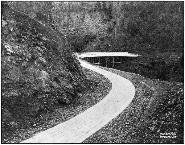
ON THE PACIFIC HIGHWAY SOUTH OF WOLF CREEK IN JOSEPHINE COUNTY. CONSTRUCTED IN
1917 AND 1918
This
road is a very vital one to the Rogue River and Klamath Valleys.
At present it is only passable during summer months for auto traffic,
while a road built on standard line and grades would soon make it an
all year highway.
There will be an enormous exchange of commodities between the two
valleys when the road is constructed. It will make a three hour auto trip
between Ashland and Klamath Falls, which now takes 81⁄2 hours by train
via Weed, California.
The location will be resumed in the spring, and continued to Klamath
Falls. Surveys have been in charge of Mr. J. H. Scott, locating engineer.
Jefferson is the only county in Eastern Oregon that has not applied for
State aid in some form. This County has been included in the State’s
general Post Road scheme and doubtless will receive early attention from
the State Highway Commission.
The State Highway Commission has ordered a reconnaissance survey
made from Kingsley and Tygh Valley in Wasco County south through the
Warm Springs Indian Reservation into Jefferson County along the west
side of the Deschutes River. This investigation will be made during the
coming spring.
The County is traversed by The Dalles-California Highway which will
be a very important road. The Antelope-Mitchell Highway also passes
through the northeast corner of the County.
During the two year period covered by this report, a very marked
improvement has been made in the Pacific Highway across Josephine
County. During this time 8.2 miles, or more than one-quarter of the total
mileage of this highway in the County, were completed on standard grades
and alignment, eliminating some of the heaviest and most dangerous grades
between Portland and the California Line. The work done by the State
consisted of the grading of a 4.9 mile section between Wolf Creek and
Grave Creek in the northern part of the County, and the grading of a one
mile section, known as the Locust Hill Section, about three miles south of
Grants Pass. The work done by the County consisted of 2.3 miles of grading
between Locust Hill and the Jackson County Line. This County work was
contracted under State Highway Department specifications and was engineered
by the Department engineers.
In addition to this construction work, location surveys were made
over 23.6 miles of the Pacific Highway, completing the location across the
County. These surveys were made in three sections: One from Wolf
Creek to Grave Creek; one from Grants Pass to Grave Creek; and one from
Wolf Creek to Stage Road Pass.
The total amount of money expended by the State in Josephine County
during the fiscal years 1917 and 1918 was $77,998.14, and the amount
expended by Josephine County under State supervision was approximately
$8,500.00. Some considerable amount of work was also done by the
County in grading just south of Grants Pass. While this work was not
under State supervision, it was on the State survey and is standard as
regards grade, alignment, cross-section, etc.
[118]
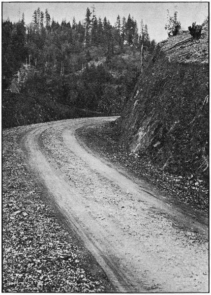
ON THE WOLF CREEK-GRAVE CREEK SECTION OF THE PACIFIC HIGHWAY
IN JOSEPHINE COUNTY. GRADED IN 1918
[119]
To eliminate four very heavy grades on the Pacific Highway between
Wolf Creek and Grave Creek in Northern Josephine County, the Highway
Commission appropriated funds for the grading of a 4.9 mile section
between those points. The contract for the work was awarded to the
American Exploration and Construction Company of Grants Pass on
November 6, 1917. This construction was practically all on steep side-hills,
and as only a small part of the material to be moved was hard rock,
the job was an ideal one for steam shovel operation and over fifty per cent
of the total yardage was moved by this method. The work was handled
by the contractors in a very creditable manner, and an excellent roadbed
was secured.
The grading was completed on October 20, 1918. The width of roadbed
is 20 feet and the maximum grade is 5 per cent. Mr. J. E. Nelson was in
charge of the work as resident engineer.
It is expected that this section will be macadamized during the 1919
season.
| Engineering |
|
$ 4,872.94 |
| Culvert Pipe furnished by State |
|
3,846.45 |
| Payments to Contractor for Work as follows: |
|
|
| |
Clearing and Grubbing |
$ 3,500.00 |
|
| |
Common Excavation, 29,426 cu. yds. at .45 |
13,241.70 |
|
| |
Intermediate Excavation, 21,258 cu. yds. at .45 |
9,566.10 |
|
| |
Solid Rock Excavation, 21,558 cu. yds. at $1.25 |
26,947.50 |
|
| |
Overhaul, per 100 lin. ft., 6,767 cu. yds. at .02 |
135.34 |
|
| |
12″ Concrete Pipe, 1,077 lin. ft. at .55 |
592.35 |
|
| |
18″ Corr. Galv. Iron Pipe, 581.5 lin. ft. at .40 |
232.60 |
|
| |
24″ Corr. Galv. Iron Pipe, 162.5 lin. ft. at .50 |
81.25 |
|
| |
30″ Corr. Galv. Iron Pipe, 127.5 lin. ft. at .60 |
76.50 |
|
| |
36″ Corr. Galv. Iron Pipe, 166.5 lin. ft. at .75 |
124.87 |
|
| |
Class “A” Concrete, 44.67 cu. yds. at $22.50 |
1,005.07 |
|
| |
Class “C” Concrete, 66.72 cu. yds. at $18.00 |
1,200.96 |
|
| |
6″ Porous Drain Tile, 400 lin. ft. at .40 |
160.00 |
|
| |
Trestle Timber, 45,968 f. b. m., at $45.00 |
2,068.56 |
|
| |
Metal Reinforcement, 2,506 lbs. at .15 |
375.90 |
|
| |
Extra Clearing, 1.75 acres at $100.00 |
175.00 |
|
| |
Painting Railings on Coyote Creek and Dry Gulch
Bridges (Force Account) |
74.94 |
|
| |
Gravel Backfilling for Drain Tile (Force Account) |
23.50 |
|
| |
Culvert Pipe furnished by State |
3,846.45 |
|
| |
|
Total Paid to Contractors |
|
59,582.14 |
| |
|
Total Cost of Work |
|
$ 68,301.53 |
To complete the grading of the Pacific Highway between Grants Pass
and Rogue River, the Highway Commission set aside funds for the construction
of the Locust Hill Section, a section one mile in length located about
three miles south of Grants Pass. The contract for this work was awarded
to Albert Anderson & Co. of Grants Pass, and the construction was completed
about June 1, 1918.
The necessary engineering supervision of this work was given by Mr.
J. E. Nelson, resident engineer of the Wolf Creek-Grave Creek Section.
[120]
| Engineering |
|
$ 162.88 |
| Construction: |
|
|
| |
Clearing and Grubbing |
$ 125.00 |
|
| |
Common Excavation, 692 cu. yds. at .53 |
366.76 |
|
| |
Intermediate Excavation, 2,552 cu. yds. at .63 |
1,607.76 |
|
| |
Solid Rock Excavation, 1,954 cu. yds. at $1.20 |
2,344.80 |
|
| |
Overhaul per 100 lin. ft., 3,159 cu. yds. at .03 |
94.77 |
|
| |
12″ Plain Conc. Pipe, 168 lin. ft. at $1.00 |
168.00 |
|
| |
|
|
|
4,707.09 |
| |
|
Total Cost |
|
$ 4,869.97 |
In the Spring of 1917, the County Court of Josephine County requested
the Highway Department to engineer for them the construction of 2.3
miles of grading on the Pacific Highway between Locust Hill and the
Jackson County Line. Plans and specifications were prepared for this
work by the Highway Department and it was let by the County Court in
two units: one to Albert Anderson & Co., of Grants Pass; the other to
S. S. Schell of Oakland, Oregon.
The construction engineering was handled by the State Highway Department
under resident engineer H. C. Compton. The work was completed
in September, 1917, the total cost to the County being approximately
$8,500.00.
The final estimate to Albert Anderson & Co., was as follows:
| Clearing, lump sum bid |
$ 800.00 |
| Common Excavation, 3,887.1 cu. yds. at .43 |
1,671.45 |
| Intermediate Excavation, 3,931.3 cu. yds. at .63 |
2,476.72 |
| Solid Rock Excavation, 650.0 cu. yds. at $1.15 |
747.50 |
| 12″ Plain Concrete Pipe, 320 lin. ft. at .90 |
288.00 |
| 18″ Plain Concrete Pipe, 78 lin. ft. at $1.45 |
113.10 |
| 24″ Plain Concrete Pipe, 56 lin. ft. at $2.10 |
117.60 |
| Class “C” Concrete, 14.94 cu. yds. at $14.50 |
216.63 |
| 6″ Drain Tile, 100 lin. ft. at .22 |
22.00 |
| Run-of-bank Gravel, 6 cu. yds. at $1.35 |
8.10 |
| Overhaul, per 100 lin. ft., 730 cu. yds. at .02 |
14.60 |
| |
Total |
$ 6,475.70 |
The old county road between Wolf Creek and Grave Creek on the
Pacific Highway in Northern Josephine County, passed over two summits
about 250 feet above the valley levels of Grave and Wolf Creeks, giving
four long, heavy grades, in some places the grade being as high as 25 per
cent. These two summits were about one mile apart, and the nature of the
ground was such that support could be had for a practically level grade
between the two.
With a view to locating this level grade between the summits and
developing five per cent grades down the sides, a preliminary survey was
made in October and November, 1916, under the direction of Mr. S. H.
Probert. This survey was worked up in the office during January and
February, 1917, and in July, 1917, the projected location was staked on
the ground by Mr. C. C. Kelley, locating engineer.
The
length of the survey was 4.9 miles, the terminal points being about
three-quarters of a mile east of Wolf Creek Post Office and about three-quarters
of a mile west of the Grave Creek Bridge.
The construction of this section, which was undertaken in the fall of
1917, is described in another article in this report.
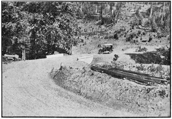
ON THE WOLF CREEK-GRAVE CREEK SECTION OF THE PACIFIC HIGHWAY
IN JOSEPHINE COUNTY. GRADED IN 1918
This survey begins about three-quarters of a mile south of the Wolf
Creek Post Office and follows, in a general way, the present county roads
into the town of Wolf Creek and from Wolf Creek to a point about two
miles south of Stage Road Pass. At this point it connects with a survey
made by the Highway Department in 1915, and which is the location survey
for a five per cent grade down from State Road Pass, which pass is on
the line between Douglas and Josephine Counties.
The length of the survey from east of Wolf Creek to the connection
with the previous survey is 2.5 miles. It was made in July, 1917, under the
direction of Mr. C. C. Kelley, locating engineer.
To complete the location of the Pacific Highway across Josephine
County, a survey was made in 1917 between Grants Pass and Grave Creek.
This survey follows, in a general way, the present road between those
points, deviating from it only where improvements in alignment or grade
can be secured. The most important feature of this location is that it is
on a five per cent grade over the Sexton Mountain Summit. The total
length of the survey is 17.2 miles. Mr. C. C. Kelley was in charge of the
work as locating engineer.
[122]
In Klamath County the work of the Highway Commission to date has
been limited to surveys.
A careful reconnaissance has been made from Klamath Falls to Bend,
Klamath Falls to Olene, and Klamath Falls to Ashland. Funds were
limited for more extensive surveys during 1918, but the location from Ashland
to Klamath Falls (see Jackson County report) was started and will
be continued to Klamath Falls in 1919.
A short section between the Klamath Falls City Limits, through Pelican
City to a connection with the existing road to Bend was located by the
Highway Department in August, 1918, and stakes set for 7,500 feet of
grading. This section has since been graded and covered with a cinder
surface by the County.
State surveys in this section were in charge of J. H. Scott, locating
engineer.
In 1917 the State Highway Commission appropriated funds to assist
the County with the grading and macadamizing of a section of the Lakeview-Paisley
Road through Crooked Creek Canyon. This work was handled
by the County, and the total amount of State funds expended was
$15,391.67. The work done consisted of 6.4 miles of grading and 4.0 miles
of rock surfacing.
In 1917 State aid was given to Lane County in the amount of $6,099.86.
This money was used in macadamizing the Pacific Highway between
Latham and Divide. The work was handled by County forces under the
supervision of H. W. Libby, county roadmaster.
For the elimination of the dangerous grade crossing of the Pacific Highway
with the Southern Pacific Railway at Divide, the Highway Department
made surveys and prepared plans for an overhead crossing at that point.
The Public Service Commission of Oregon ordered that this overhead crossing
be built, forty per cent of the cost to be paid by the Railway Company,
thirty per cent by the State and thirty per cent by the County.
Bids were received for the construction of the structure and approach
fills on September 10, 1918, but before work was begun, the United States
Highways Council ordered that construction be delayed until after the war
on account of the shortage in steel and cement. Work will, therefore, not
be undertaken until the 1919 season.
The structure designed for this overcrossing is a three span reinforced
concrete viaduct, providing clearance for the double tracking of the railway.
The cost of the structure and the approach fills is estimated to be
$19,500.00. In connection with this, about 1.3 miles of new grade must be
built to connect with the present road, no part of the cost of which will be
shared by the Railway Company. This grading is estimated to cost
$9,000.00. As soon as the grading is completed, it will be macadamized by
the Highway Commission.
[123]
In June, 1917, a survey was made from Goshen to a connection with the
Pacific Highway south of Cottage Grove. This survey is on the east side
of the Southern Pacific Railway from Goshen to Creswell, crosses the
railway at grade at that point, and continues on the west side all the way
to Cottage Grove, closely following the Southern Pacific alignment the
entire distance. The total length of the survey was 18.2 miles. Mr. C. C.
Kelley was the locating engineer in charge.
In 1917, the State Highway Commission extended State aid to Lincoln
County in the grading of a one mile section of the Corvallis-Newport Road.
This section is in the vicinity of Pioneer Mountain, and is known as the
Pioneer Mountain section. The grading was handled by County forces and
the total amount of State funds expended was $2,054.05.
In May, 1918, surveys were made by the Department for two large bridges
in Lincoln County. One of these was for a bridge over Alsea River near
Waldport and the other was for a bridge across the Yaquina River at
Toledo. At the present time the only means of crossing the streams at these
points is by ferry.
For the Alsea River Crossing a 264 foot bridge has been designed and
is now under construction by Curtis Gardner, Bridge Contractor. This
bridge consists of one 144 foot medium traffic wood span and 120 feet of
wood trestle. The total cost of the structure will be approximately
$10,000.00. The construction is under the supervision of the Highway
Department, but is being paid for by Lincoln County.
The design has not yet been prepared for the bridge at Toledo, but the
total length of the bridge will be about 3,000 feet.
In June, 1918, a survey was made between Neskowin in Tillamook
County and Salmon River in Lincoln County. This survey was of a preliminary
nature and was made to determine the feasibility of a road
between these points. It was found that a five per cent grade could be
obtained, but that owing to the extremely rugged nature of the country,
a road of standard width and on a standard alignment would be so
expensive as to be impracticable at this time.
The total length of the survey was eight miles. Mr. J. H. Scott was in
charge of the work as locating engineer.
A survey of the Pacific Highway between the Marion County Line
(Santiam River) and Albany, was made in December, 1917, and a definite
route between these two points adopted. In a general way the located route
follows the present road. Near the Jefferson end, however, the new
location
cuts across the property of E. M. Miller, paralleling the Southern
Pacific tracks with a net saving of 1,600 feet in distance over that of the
present road. Near Miller Station the line again leaves the old road,
eliminating four dangerous right angle turns by cutting diagonally across.
The new location also provides for the elimination of the present grade
crossing on the W. E. Fisher property by means of an overhead crossing
just north of the grade crossing.
For the first one-half mile south of the Santiam River Bridge it will
be necessary to materially raise the grade of the present road as it is
considerably below high water, and therefore subject to overflow. It will
also be necessary to construct a few low bridges on this section to provide
waterways for flood waters.
It is expected that the Albany-Jefferson Section will be graded and
paved during the 1919 season.
Malheur County is an important highway center. It is most favorably
situated with respects to highways in Eastern Oregon, in that it serves
as a common junction point for the Old Oregon Trail, John Day Highway
and Central Oregon Highway. A fourth highway will enter the County
from Nevada leading from Winnemucca north through Jordan Valley.
Malheur County is fairly well equipped for road work and has already
made a most creditable showing. All the people are good roads boosters,
having learned the value and necessity of improved roads. This was proven
by their voting a $20,000.00 bond issue at the recent election. The purpose
of this fund is to meet the State and Federal appropriation of $80,000.00.
In area, Malheur County is an empire in itself. The natural result is
an extra large mileage of roads, and many of them run through mountainous
districts. To improve only the main highways in Malheur County
is a huge undertaking.
The State Highway Commission fully realizes the inability of most of
the counties in Eastern Oregon to cope with the situation and has determined
to extend aid in every manner possible. That State aid may be
substantial and a benefit to all the counties, the Commission is making an
urgent call for more State funds.
In Malheur County near Brogan a 9.85 mile section of the John Day
Highway has been surveyed by the State Highway Department. The Commission
has set aside $20,000.00 for the construction of this road and an
equal amount is requested from the Government. The County has appropriated
$13,958.00 for the purpose of co-operating in this construction.
State funds to the amount of $20,000.00 have been set aside for the
improvement of a 6.76 mile section of the Central Oregon Highway. This
section extends from Vale 6.76 miles west to Burrell’s Ranch. The Government
is requested to share in the cost in amount equal to the sum given
by the State. The County’s share in this project will be $14,420.00.
The following statement shows the amounts appropriated for expenditure
in 1919:
| Section |
State
Funds |
County
Funds |
Government
Funds |
Totals |
| Cow Valley-Brogan Section |
$ 20,000.00 |
$ 13,958.00 |
$ 20,000.00 |
$ 53,958.00 |
| Burrell-Vale Section |
20,000.00 |
14,420.00 |
20,000.00 |
54,420.00 |
Both of the above mentioned sections are Post Road Projects. Negotiations
with the U. S. Public Roads Office are under way for the grading
of the Cow Valley-Brogan Road, and the Burrell-Vale Project will be submitted
within a short time. It is hoped construction will begin early in
1919.
During October and November, 1918, the State Highway Commission
made a location survey of a 9.85 mile section of the John Day Highway
between Cow Valley and Brogan. The line follows in the direction of the
present road, but marked departures from the location were made in several
places. Plans for this work are about fifty per cent complete. R. H. Coppock,
locating engineer for the State Department, was in charge of this
work.
A survey is in progress on the section of the Central Oregon Highway
between Burrell’s Ranch and Vale. This line will follow along near what
is called the Post Hill road, and will be about seven miles in length. Immediately
upon completion of the field work, the plans will be rushed in order
that early action may be taken by the U. S. Office of Public Roads. The
State Commission’s 1919 construction program includes this section.
The survey is in charge of R. H. Coppock, locating engineer.
During April, 1918, a reconnaissance survey was made by M. O. Bennett,
division engineer, for the Department, over the routes between Burns and
Vale for the purpose of establishing a definite route for the Central Oregon
Highway. This investigation resulted in the choice of the river route by
the State Highway Commission. The route as selected goes direct from
Burns to Crane, thence down the Malheur River through Riverside, Juntura
and Harper to Vale.
In November, 1918, a reconnaissance survey was made by the State
Department for the purpose of establishing the most feasible route between
Jordan Valley and Vale and Ontario. This report has not yet been submitted
to the Commission, but the findings seem to favor the Sucker Creek
Route. This survey was made by Manche O. Bennett, division engineer.
One of the first paving projects to come up for consideration by the
State Highway Commission was that of the Pacific Highway between
Salem and Aurora in Marion County. Upon investigating this project, it
was found that rural mail was carried over practically the entire distance
between Salem and Aurora. This fact made the improvement of this road
subject to Federal Aid, and as very few sections of State Roads west of
the Cascade Mountains will qualify for Federal Aid, it was considered
advisable to use some of the Federal money available to the State in the
improvement of this section.
[126]
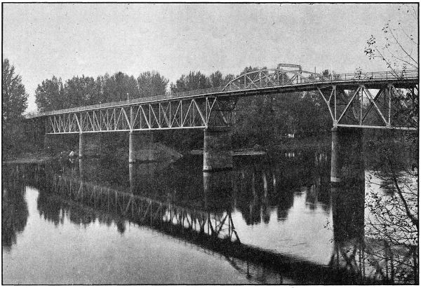
INTERCOUNTY BRIDGE OVER THE WILLAMETTE AT SALEM.
BUILT BY MARION AND POLK COUNTIES IN 1917 AND 1918.
COST $250,000.00. TOTAL LENGTH 2,220 FEET.
With a view to securing the approval of this project by the Federal
Office of Public Roads, and to undertaking the construction during
the
1918 season, the necessary surveys were made in January and February,
1918, and the plans submitted to the Office of Public Roads in March, 1918.
The final approvement by the Government was received June 15, 1918, and
on June 25 proposals for the construction were received and opened. The
lowest bid received was from Warren Construction Company, Portland,
Oregon, but as it was in excess of the State Highway Engineer’s estimate,
and in excess of the available funds, all bids were rejected.
The work would have then been started by the Highway Department
with State forces, but it was just at this time that the shortage of labor,
materials, transportation facilities, etc., became serious, and the Federal
Government called for curtailment of road construction, and the Highway
Commission was forced to order the discontinuance of preparation for this
paving, as well as for all other proposed work in the State.
Now, that Peace is in sight, there is every reason to believe that the
Highway Commission will order that construction begin on the Salem-Aurora
Paving at the very earliest date, and its completion may be looked
for during the 1919 season.
This paving is to be sixteen feet wide with a two-foot rock shoulder on
each side. The type will depend upon the bids received. The paving will
start about four miles north of the city limits of Salem and extend to the
Marion-Clackamas County Line, just north of Aurora, the total length
being eighteen miles. It is estimated that this work will cost $360,000.00.
The new bridge over the Willamette River at Salem, designed and built
under the supervision of the State Highway Department, is one of the largest
strictly highway bridges erected in the United States in 1918. This structure
has a total length of 2,220 feet, and consists of 352 feet of reinforced
concrete approach on the Marion County end, six steel spans over the river
aggregating 885 lineal feet, and 780 feet of high class pile trestle approach
on the Polk County end.
To provide for the river navigation, the U. S. Engineers required a minimum
horizontal clearance normal to the channel of 120 feet and a vertical
clearance of at least sixty-six feet above low water, in case a high level type
of bridge were adopted. After careful study it was decided to construct a
high level bridge of the deck type, and to carry the pony channel span on
cantilevers projecting from the adjoining spans, giving an arch effect over
the channel. By this type of construction, a clear distance of about 145
feet between channel piers was obtained.
To minimize the cost of fabrication and erection of steel, four spans
were made practically the same. The east span was necessarily shorter
than the typical ones, since otherwise it would place the channel opening
too far across the river. This span is not so deep as the adjoining one, and
the difference in height is made up by means of a rocker under the small
span, which, of course, also serves the purpose of movable shoes. The
channel span rests on cast steel rockers on one end, which are carried by
a shelf on the cantilever panel. The opposite end of the span was pin
connected.
Previous to the design of the bridge, wash borings were made, which
indicated in a general way that the bed of the stream was composed of a
few feet of gravel, underlaid with sand for a considerable depth. It was
accordingly decided to carry the foundations down below the probable
point of future scour, and carry the loads entirely upon piling. The two
channel piers were sunk about thirty-five feet below low water.
The west approach is carried on fir piling treated in an open vat with
carbolineum to a temperature of about 220 degrees F.
Lumber being comparatively cheap, the entire roadway deck of the
bridge and wooden approach is composed of fir, three by seven inches and
twenty-six feet long on edge, spiked together, thus projecting a foot outside
the curb on either side, the roadway being twenty-four feet between curbs.
An asphaltic wearing surface three and one-half inches thick effectively
waterproofs the wood, and the small interstices between the pieces will
allow sufficient circulation of air to preclude any possibility of attack of
dry rot. The ends of the floor members were painted with hot carbolineum,
as were also the wooden members contiguous to openings in the floor
occasioned by expansion joints between spans.
The two five-foot concrete sidewalks are carried on brackets beyond the
trusses. The curbs serve as reinforced concrete beams to carry half the
sidewalk load to the trusses, there being small concrete struts extending
up from the top of the top chords at panel and midpanel points. Between
the bottom of the curb and the top of the wooden floor is a three-quarter-inch
cushion of “Sarco.” Since the bridge is on a grade, it was necessary
to precast this in sheets the width of the curb. When the material hardened,
it was rolled up in convenient lengths and placed. It will thus be
possible in the future to renew the wooden floor with comparatively little
difficulty, although it is believed that the wood floor base, protected as it
is now, should last at least fifty years.
On account of the rather extreme length for pony trusses of the channel
span, 123 feet between end pins, it was decided to tie the trusses together,
and this was accomplished by means of two arched lattice struts placed
each twenty feet and six inches from the center of the span.
A final coat of battleship gray paint was applied to the steel work, and
has evoked considerable favorable comment, being an innovation from the
black paint commonly used in this part of the country.
The bridge was built by the Coast Bridge Company and Robert Wakefield
of Portland. The cost of the structure complete was $250,000.00, of
which Marion County paid approximately $200,000.00 and Polk County
$50,000.00.
The engineering cost for the work is remarkably low. It includes surveys,
borings, inspection of cement and steel fabrications, resident engineer’s
salary, cost of design, blue prints and supplies and stenographic
work, and amounts to $4,600.00, or about one and eight-tenths per cent
of the total cost.
A reconnaissance between the city limits of Salem and the Linn County
Line (Santiam River) just south of Jefferson, was made in the spring of
1918, and the following facts developed, as regards the comparison of three
possible routes between these points:
| Via Turner and Marion: |
| |
Length, 22.5 miles. |
| |
Railroad grade crossings, 5 with main line of Southern Pacific. |
| |
Bridges, 9. |
| |
Overflow, long stretches. |
| |
Light grades—very little rise and fall. |
| Via Liberty and Ankeny Hill: |
| |
Length, 18.6 miles. |
| |
No railroad crossings. |
| |
Bridges, small. |
| |
Undulating steep grades—heavy work to cut to 5 per cent or extensive alignment changes
involving added distance. |
| |
New right of way required through valuable orchard property. |
| |
Present road macadamized or graveled entire length. |
| Jackson Hill Route: |
| |
Length, 17 miles. |
| |
No railroad crossings. |
| |
Bridges, small. |
| |
Five per cent grades. |
| |
Good alignment. Low summit obtained by alignment change going to the east of Jackson Hill, involving
two miles of new construction. |
| |
Right of way required—unimproved except in one instance. |
| |
Direct route. |
| |
Present road macadamized or graveled except for five miles. |
A detailed survey was made over this so-called Jackson Hill route, and
its advantages caused the Highway Commission to adopt it as the route of
the Pacific Highway between these points. It is estimated the cost will be
$109,000.00 to complete the subgrade, and it is expected this project will be
commenced in 1919.
In Morrow County there are found all classes of conditions affecting
roads and highway improvement. In some parts of the County there are
good natural roads, while in other sections they are extremely poor. As
in most other Eastern Oregon Counties, Morrow County has to wrestle with
the problem of maintaining a large road mileage with a constant shortage
of road funds. Highways are of extreme importance, as there are large
agricultural communities that have no railway connections.
During the past two years the highway movement in Morrow County
has experienced a wonderful growth. County authorities have broken the
bonds of established custom, and have made a most creditable beginning in
highway improvement. Although they have been supported by special road
taxes, in most of the districts the available funds are far from adequate.
The State Highway Commission early realized the importance of good
roads in this County, and took steps to extend the State aid through the
Post Road Fund. The plans failed when the U. S. Office of Public Roads
found it impossible to co-operate on the projects in question. This failure
was due to nonfulfillment of post road requirements. Additional State aid
was extended through the provisions of the $6,000,000.00 fund, but the execution
of these plans were delayed by war conditions. This fund is still
available, and the State Highway Commission will begin work as soon as
conditions will permit.
Morrow County has received favorable consideration from the Highway
Commission in the matter of surveys, it being the only county in Eastern
Oregon in which the total mileage of State roads has been surveyed. Those
surveys cover the Columbia River Highway in the north end of the County,
and the Oregon-Washington Highway via Heppner, Ione and Lexington.
The Columbia River Highway was first surveyed under the direction
of M. O. Bennett, and later additional work was done by Oscar Cutler.
This survey was 13.85 miles in length. R. H. Baldock was locating engineer
on the Oregon-Washington Highway survey, which has a total length
of 66.1 miles.
During 1918 Morrow County graded 2.26 miles of standard road adjacent
to the town of Heppner. A 1.82-mile section begins at the west city
limits of Heppner and extends down Willow Creek on the State survey.
Another section extends from the east city limits up Hinton Creek for a
distance of .44 miles.
The County paid the total cost of this improvement which required
$5,689.19. The State Department supplied the engineering supervision for
this work through R. H. Baldock, resident engineer.
Following is a statement of construction quantities:
| HEPPNER EAST |
| Common Excavation, 1,190 cu. yds. at. 43 |
$ 502.53 |
| Culverts |
216.35 |
| |
Total |
718.88 |
| |
| HEPPNER WEST |
| Common Excavation, 850 cu. yds. at .48 |
$ 407.01 |
| Intermediate Excavation, 2,150 cu. yds. at $1.11 |
2,385.30 |
| Culverts |
2,178.00 |
| |
Total |
$ 4,970.31 |
The 3.22-mile section of the Oregon-Washington Highway known as the
Jones Hill Grade, lies about ten miles east of Heppner, and extends over
the divide between Hinton and Butler Creeks. The State location involved
the construction of an entirely new road. This improvement was paid for
in full by the County, the total cost being $25,050.26.
R. H. Baldock, resident engineer for the State Highway Department,
was the engineer in charge.
Construction quantities are shown in the following statement:
| Rock Excavation, 6,200 cu. yds. at $3.98 |
$ 18,504.26 |
| Common Excavation, 7,300 cu. yds. at .59 |
4,350.00 |
| Culverts |
2,200.00 |
| |
Total cost |
$ 25,054.26 |
After grading the 1.82-mile section of the Oregon-Washington Highway
west of Heppner, and .44 miles east, Morrow County proceeded to surface
with a standard waterbound macadam. This work was done on a force
account basis by the United Contracting Co. and Warren Construction Co.
The work was completed and opened to traffic in July, 1918.
The 2.26 miles of macadam cost the County a total of $19,280.35. A
total of 4,208 cubic yards of rock was placed, making the unit cost $4.56 per
cubic yard. Crushed trap rock was secured from a quarry near the city
limits, and suitable binder material was found near at hand. The engineer
in charge was R. H. Baldock of the State Department.
[131]
Although the assessed valuation of Multnomah County is more than
thirty-five per cent of the total assessed valuation of the entire State, this
County has renounced all claim to any share of the State Funds available
for road purposes, and will construct and maintain in a high state of
improvement, at its own expense, all State Roads within its boundaries.
This liberal attitude of the people of Multnomah County is to be commended,
and it makes available for expenditure in counties outside of
Multnomah County, a much greater amount of money than would otherwise
be the case.
The roads of Multnomah County represent some of the heaviest grading
construction, some of the best improved and some of the most scenic highways
to be found anywhere in the world. The Upper Columbia River Highway
is by many considered the most scenic highway in the United States,
and attracts a multitude of tourists annually.
An interesting tabulation of the amounts expended by Multnomah
County in the construction of the Columbia River Highway, both above
and below Portland, is appended:
| Section |
Miles |
Pavement |
Grading |
Bridges |
Total |
Sandy Road to
Troutdale |
10.29 |
$ 183,001.41 |
$ 5,000.00 |
$ 14,845.33 |
$ 202,846.74 |
Sandy Cut-off to Auto
Club Bridge |
2.47 |
47,506.74 |
94,389.04 |
... |
141,895.78 |
Columbia River Highway
to County Line |
26.68 |
495,507.75 |
601,012.13 |
169,586.71 |
1,266,106.59 |
| |
Totals |
39.44 |
$ 726,015.90 |
$ 700,401.17 |
$ 184,432.04 |
$ 1,610,849.11 |
| Total Construction Cost |
$ 1,610,849.11 |
| Engineering |
72,004.95 |
| |
Grand Total |
$ 1,682,854.06 |
| Building |
$ 68,314.36 |
| Retaining Walls and Pavement |
30,833.69 |
| |
Total |
$ 99,148.05 |
| |
1915 |
1916 |
1917 |
1918 |
Totals |
| Regrade and Macadam |
... |
$ 35,330.82 |
$ 16,444.10 |
... |
$ 51,774.92 |
| Hard Surface |
$ 80,944.11 |
4,111.79 |
200,047.81 |
41,393.37 |
326,497.08 |
| Shoulders |
... |
5,081.80 |
... |
... |
5,031.80 |
| Drainage |
... |
... |
5,022.19 |
... |
5,022.19 |
| Bridges |
... |
28,591.39 |
14,203.21 |
... |
42,794.60 |
Right of Way and
Miscellaneous |
... |
... |
2,538.06 |
... |
2,538.06 |
Engineering,
Superintendence
and Overhead |
3,500.00 |
3,400.00 |
16,667.87 |
2,000.00 |
25,567.87 |
| |
Total |
$ 84,444.11 |
$ 76,465.80 |
$ 254,933.24 |
$ 43,393.37 |
$ 459,226.52 |
[132]
| Pavement |
$ 326,497.08 |
| Bridges |
42,794.60 |
| Grading |
64,366.97 |
| Engineering and Overhead |
25,567.87 |
| |
Grand Total |
$ 459,226.52 |
The work of the State Highway Department in Polk County during
1917 and 1918 has been confined chiefly to the design and the supervision
of construction of bridges. In addition to the design and supervision of the
Salem Bridge which is partly within Polk County, and which is described
in detail in an article in the chapter devoted to Marion County, the Department
has handled, at the request of the Polk County Court, the following
bridge work, all of which has been paid for by the County.
Between Monmouth and Dallas a 37 foot reinforced concrete bridge was
built over a slough on the Mulkey Cut-off. This bridge complete cost
$1,898.17.
The Hollingshead Bridge over the Little Luckiamute River south of
Dallas is a 72 foot covered wooden span on concrete piers. This bridge was
built at a cost of $3,615.00.
A 160 foot suspension foot-bridge was built over the Big Luckiamute
River at a cost of $500.00, to accommodate school children attending the
Montgomery School.
The LaCreole Creek Bridge in Dallas is a reinforced concrete arch structure
seventy feet long. This bridge was not designed by the Highway
Department, but the Department supervised its construction. It is a very
pretty structure with sidewalks and lighting fixtures. It was built at a
cost of $10,755.68.
Sherman County is so situated with respect to the State Highway
System, that its boundaries include a comparatively small mileage of State
roads. This however, is no indication of the value improved roads will be
in the County. The situation is of both state wide and local importance.
This County is found with many miles of good natural road. In addition
they have graded a large mileage and in some localities unusual attention
is given to road maintenance. The County is fairly well equipped for
road work and have plans for quite an extensive program.
State aid in Sherman County thus far has been confined to highway
surveying, but the State Highway Commission has definite plans for extending
aid in the construction of the Deschutes and John Day River Bridges
and the grading of the Columbia River Highway. It is expected this work
will start early the coming season.
Various attempts have been made by Sherman, Wasco County and the
State to raise funds for the construction of the Deschutes River Bridge on
the Columbia River Highway. Success crowned these efforts recently
when a final agreement was reached between the three.
The total estimated cost of this bridge is between $70,000.00 and
$75,000.00. The State Department plans call for a reinforced concrete
structure about 600 feet in length.
Sherman County has pledged $25,000 towards defraying the cost of the
bridge providing funds are raised for completing same. This condition has
been met by the State Highway Commission and negotiations are already
underway for securing right-of-way. In this connection it is pertinent to
state that Wasco County also has appropriated $25,000.00 for co-operation in
this work. The State’s share of the cost will be approximately $25,000.00,
according to the present estimate.
During 1918 the State Department made a location survey of the
Columbia River Highway between the Deschutes and John Day Rivers.
The line follows the river canyon through Sherman, Biggs and Rufus. The
length of this survey is 14.66 miles. The field work only has been completed
on this survey and construction plans will be made up soon. C. S.
Noble was the locating engineer for the Department.
This inter-county bridge will be located on the Columbia River Highway
across the John Day River, below McDonald, and will obviate the necessity
for the toll ferry at McDonald.
As designed, the crossing calls for 2-123 foot wooden deck spans on
concrete piers and about 120 feet of high class wooden approach and 100
feet of fill. The cost, which is estimated to be $20,000.00, will be borne by
Sherman and Gilliam Counties, and the State, and it is probable that construction
work will start next spring.
A contract was awarded on August 7, 1917, to Oskar Huber of Portland
for the grading and paving of a five mile section extending south from the
end of the paving then in place about three miles south of Tillamook City.
The old road which this paving was to follow in a general way contained
many sharp curves and had a roadbed not eighteen feet wide on the average.
On this was a light surfacing of gravel and rock macadam about
twelve feet in width. The roadbed was widened to a twenty-four foot width,
all excessively sharp curves were eliminated, and all wooden culverts,
trestles, and bridges were replaced with modern concrete structures, and
the decking on two steel bridges renewed and paved.
As there is available in this vicinity no ledge rock, it was found necessary
to haul and crush large boulders from the creek bed to provide the
necessary rock for the base and mixture. Some sand was obtained locally,
but most of it had to be shipped in from Portland and hauled to the work
from Tillamook.
The job was completed by December 15th of this year, and on account
of the unusually bad conditions faced by the contractor as regards labor
and materials, Mr. Huber is to be commended for the prompt completion of
the work as well as for the excellence of construction.
By an arrangement between the County and the Highway Commission
the County pays for all grading in connection with this improvement and
also for twenty-five per cent of the cost of the paving. The total cost of
the grading and paving complete is $109,250.00 of which the County will
pay $34,325.00 and the State $74,925.00.
Mr. C. W. Wanzer was in charge of this work as resident engineer.
| Engineering |
|
$ 6,391.47 |
| Contract Construction Work as follows— |
|
|
| |
Common Excavation, 10,835.3 Cu. Yds. at 60c |
$ 6,501.18 |
|
| |
Intermediate Excavation, 1,959.5 Cu. Yds. at 90c |
1,763.55 |
|
| |
Overhaul, per 100 Lin. ft., 6,314.8 Cu. Yds. at 2c |
126.30 |
|
| |
12-inch Reinf. Conc. Pipe (Placing only) 84 Lin. ft. at 48c |
40.32 |
|
| |
18-inch Reinf. Conc. Pipe (Placing only) 607 Lin. ft.
at 78c |
473.46 |
|
| |
24-inch Reinf. Conc. Pipe (Placing only) 384 Lin. ft.
at $1.16 |
445.44 |
|
| |
36-inch Reinf. Conc. Pipe (Placing only) 64 Lin. ft.
at $1.80 |
115.20 |
|
| |
Clearing and Grubbing (Force Account) |
543.75 |
|
| |
Moving Fences (Force Account) |
4.00 |
|
| |
Standard Bitulithic Pavement, 47,555.5 Sq. Yds. at $1.42 |
67,528.81 |
|
| |
Broken Stone Loose measure, 8,840 Cu. Yds. at $2.20 |
19,448.00 |
|
| |
Crushed Stone Shoulders, 7,466 Lin. ft. at 6c |
447.96 |
|
| |
|
Total Amount Earned by Contractors to Nov. 30,
1918 |
97,437.97 |
|
| |
|
Less 15% retained pending completion |
14,615.69 |
|
| Total Payments to Contractor to November 30, 1918 |
|
82,822.28 |
| Total Expenditure to November 30, 1918 |
|
89,213.75 |
| |
Paid by State |
63,203.90 |
|
| |
Paid by County |
26,009.85 |
|
| |
|
|
Total |
$ 89,213.75 |
|
A Federal Aid Forest Road Project is now under construction between
Hebo and Dolph in Tillamook County. This project is 10.3 miles in length,
includes grading and nine foot rock surfacing, and is estimated to cost
$122,000.00 of which $21,500.00 will be paid by the County, $50,250.00 by
the State, and $50,250.00 by the Federal Government.
This work is handled under the supervision of Federal Office of Public
Roads. The contract was awarded to the Tillamook County Court, but the
State’s Attorney General ruled that the Court had no authority which would
allow them to contract to do work of this nature. To facilitate matters
the Highway Commission took the contract over from the County, and the
work is now in progress, the Highway Department acting as contractors
and being paid for the work at the unit prices originally bid by Tillamook
County.
It was so late in the year when this work was taken over by the State
that little work can be done until the 1919 season. Work is in progress,
however, on camp construction, clearing, and such other portions of the
work as can be done during the winter months.
Mr. J. M. Baker is superintendent of construction on this work.
[135]
On the Tillamook-Cloverdale road a preliminary survey has been completed
from Tillamook to Hebo, a distance of 18 miles, and of this about
nine miles have been located. This is a very important section as it is the
most direct route from the Willamette Valley to the beaches of Tillamook
County, and is not served with a railroad. The engineer in charge of this
work was Mr. C. A. Dunn.
The highway problem of Umatilla County is of greater magnitude than
it would seem to be at first consideration. The fact that the County is
well supplied with rail transportation only renders the demand for highways
more urgent. Soil conditions are generally unfavorable for good natural
roads although gravel deposits suitable for highway construction are found
in most localities.
The County has made constant efforts towards an improved system of
roads, but with 3,000 miles of county roads to care for and with considerable
bridge work in the program, the available funds are found to be entirely
inadequate. The main roads or trunk highways through the County have
had the benefit of a large percentage of local funds but owing to a large
mileage and character of improvement necessary, there remains a great deal
yet to be done.
When the State of Oregon voted to expend $6,000,000.00 in surfacing roads
constructed by the counties, Umatilla County was among the first to take
advantage of the State aid. The State Highway Commission extended
additional aid through the Post Road Fund, but these plans were later cancelled
owing to requirements of the U. S. Office of Public Roads.
The State Highway Department has surveyed the Old Oregon Trail for
the entire distance across the County and 42.2 miles of the Oregon-Washington
Highway have been surveyed. In addition a considerable mileage
of reconnaissance surveys have been made preliminary to definite location.
In 1917 and 1918 the State Highway Department expended $162,625.56
in constructing eleven miles of pavement near Pendleton. The cost of
maintenance on this road has been divided equally between the State
and County.
Funds were set aside by the State Highway Commission in 1917 to
macadamize the 40 mile section of Old Oregon Trail from Pendleton west to
the Morrow County line. War conditions caused a postponement of this
improvement. The funds are still intact and work will proceed as soon as
conditions will permit. Following are statements showing amounts of
State funds expended in Umatilla County and funds appropriated to be
expended in 1919.
Expended in 1917 and 1918 for paving on Wild Horse Road and
Pendleton-Reith Section |
$ 162,626.56 |
Appropriated to be expended in 1919 on macadamizing Old Oregon
Trail from
Pendleton to Morrow County line near Umatilla |
180,000.00 |
The State Highway Commission on June 29, 1917, let a contract to the
Warren Construction Company for paving a ten mile section of the Wild
Horse Road northeast of Pendleton and one mile of the Old Oregon Trail
leading west from Pendleton. The pavement laid was bitulithic and the
subgrade was an old macadam road built by the County. The macadam
road was of insufficient width for supporting a 16 foot pavement, which
condition required widening of the grade, re-ditching and the placing of
extra crushed rock for base.
The widening of the road bed was done with County funds expended
under the direction of the State Highway Department. The work of
widening the grade cost the County, $9,975.00 for the 11 miles.
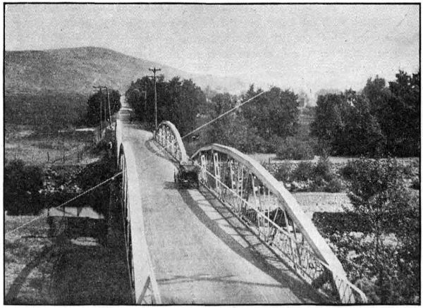
ON THE PAVED ROAD BETWEEN PENDLETON AND ADAMS IN UMATILLA
COUNTY. PAVED IN 1917
Paving work begun in July, 1917, and an excellent pavement of the
standard two-inch bitulithic type was secured, with a six inch crushed
rock base. The total cost of this work was $162,626.56 or $14,784.22 per mile.
M. O. Bennett was the engineer in charge and Chas. Noble was the inspector
on this work. Following is a detailed cost statement:
| Standard Bitulithic Pavement, 103,543.79 sq. yds. at $1.29 |
$ 133,571.49 |
| Broken Stone loose measure. 10,994.8 cu. yds. at $1.87 |
20,560.28 |
| Crushed stone. 115,600 lin. ft. at 5c |
5,780.00 |
| Extra work on road approaches |
104.91 |
| |
|
$ 160,016.68 |
| Engineering and Inspection |
2,609.88 |
| |
Total |
$ 162,626.56 |
When plans were made in 1917 for the Wild Horse paving. 16 feet was
the width decided upon. Upon investigation it was found this would require
widening of the old road bed from one foot to five feet, re-ditching for a
large part of the 10 miles and the replacing of several culverts.
This
work was done under the direction of the State Highway Department
and the entire cost was defrayed from County funds. The total cost
to the County was $9,975.00. Oscar Cutler of the State Highway Department
was resident engineer in charge.
Upon the completion of the survey by the State Highway Department of
the section of the Oregon-Washington Highway between Pendleton and
Pilot Rock, the Umatilla County Court started grading. Where the construction
is light the road grader was used to great advantage. Through
the aid of the Division Office of the State Department new right-of-way
was secured in some places and the alignment of the road naturally
improved.
During September and October, 1918, the section between Pendleton and
the County Poor Farm was graded and macadamized on a six per cent
development over Grave Yard Hill. This work, both grading and macadamizing
is of excellent character and will soon be opened to traffic. W. C.
Crews, engineer for the State Department made the relocation on this section
and was resident engineer during construction. The following is a
statement showing quantities and total and unit costs:
| Item and quantity |
Total
cost |
Unit
cost |
| Excavation, 4,795 cu. yds |
$ 3,164.70 |
$ .66 |
| Gravel, 2,000 cu. yds |
2,600.00 |
1.30 |
| Concrete Bridge |
1,600.00 |
|
| |
Total cost |
$ 7,364.70 |
An additional four miles from the County Poor Farm south was graveled
by the County with an expenditure of $2,000.00.
During 1917 and 1918 the State Highway Department made a location
survey over the entire east and west route across Umatilla County, excepting
the six mile section between Pendleton and the Indian Agency. On this
six miles a base line survey only was made.
The section of this road between the Morrow County Line and Pendleton
is a part of the Columbia River Highway and has a total length of 40.5
miles. It passes through Umatilla, Hermiston, Stanfield, Echo and Reith.
From Pendleton east the road is known as the Old Oregon Trail.
The survey in the east end of the County begins at the Umatilla Indian
Agency, follows the general direction of the present road up Cabbage Hill,
passes through Meacham and ends at the Union County Line near Kamela.
A five per cent grade was secured on the Cabbage Hill climb. The total
length of this section is 26.8 miles. R. H. Baldock and Oscar Cutler were
the locating engineers on this work. The plans for this survey are practically
complete.
The State survey of the Oregon and Washington Highway extends from
the end of the pavement ten miles northeast of Pendleton, through Pendleton,
and Pilot Rock to the Morrow County Line west of Butter Creek. This
survey was made in 1917 and a section south of Pendleton was relocated in
1918. The total length of this line is 42.2 miles. R. H. Baldock and Oscar
Cutler were the locating engineers on this work and the revision was made
under the direction of W. C. Crews.
[138]
In the matter of highway improvement Union County has shown considerable
progress. Substantial road building machinery is owned by the County
in units sufficient to allow work to proceed simultaneously in various sections
of the County. It is noticeable however that most of their work has
been done (and justifiably so) on local and feeder roads rather than on
trunk highways. Local funds and equipment are inadequate to make all
the improvements needed when the mountainous sections of the main roads
are considered.
As in other counties the State Highway Commission easily recognized
the necessity and importance of co-operation and accordingly in 1917 plans
were laid and steps taken to extend State and Federal Aid.
During 1917 and 1918 a total of 83.54 miles of survey was made on the
two principal roads of the County. 45.26 miles on the Old Oregon Trail
and 38.28 miles on the La Grande-Joseph Highway.
Agreements were signed by the Secretary of Agriculture providing for
co-operation with the State on equal basis, for the grading of a six mile
section between Union and Telocaset and a 9.37 mile section between Elgin
and Minam. The respective amounts expended on each of these projects to
the date of this report, November 30, 1918, are: $16,642.29 and $3,838.44.
State funds amounting to $5,000.00 have been expended for grading in cooperation
with the County on the La Grande-Hot Lake Section. This road
is 7.95 miles in length and involves the opening of a new road for the entire
distance. The State Highway Commission has set aside funds for graveling
this section preparatory to surfacing. The completion of these three projects
will require approximately $66,737.06 from the State, $35,575.50 from the
Federal Government, and $3,000 from the County.
The following summary shows for each project amounts expended to
date and funds set aside to be expended during 1919:
| EXPENDED IN 1917 AND 1918 |
| |
State
Funds |
County
Funds |
Govern-
ment
Funds |
Total |
| Union Telocaset |
$ 16,642.29 |
... |
... |
$ 16,642.29 |
| Elgin-Minam |
3,838.44 |
... |
... |
3,838.44 |
| La Grande-Hot Lake |
5,000.00 |
$ 3,000.00 |
... |
8,000.00 |
| |
Total |
$ 25,480.73 |
$ 3,000.00 |
... |
$ 28,480.73 |
| |
| APPROPRIATED FOR EXPENDITURE IN 1919 |
| |
State
Funds |
County
Funds |
Govern-
ment
Funds |
Total |
| Union Telocaset |
... |
... |
$ 15,000.00 |
$ 15,000.00 |
| Elgin-Minam |
$ 16,737.06 |
... |
20,575.50 |
37,312.56 |
| La Grande-Hot Lake |
50,000.00 |
$ 3,000.00 |
... |
53,000.00 |
| |
Total |
$ 66,737.06 |
$ 3,000.00 |
$ 35,575.50 |
$ 105,312.56 |
[139]
The absence of figures in the column headed “County funds” in the
above tabulation is explained by the fact that Union County, in the matter
of co-operation, has agreed to expend certain sums on other roads than those
mentioned in the table. The County’s appropriation for the improvement of
the La Grande-Kamela section of the Old Oregon Trail is $40,000.00 and
$10,000.00 additional has been stipulated for use in improving the Elgin-Willow
Creek Section of the La Grande-Joseph Highway. The County has
also provided funds for the completion of the grading between La Grande
and Hot Lake.
In August, 1918, the State Highway Commission called for bids on the
grading of a six mile section between Union and Telocaset. The Union
County Court was the successful bidder and the Commission awarded the
contract but it later developed that the County could not legally hold the
position of contractor in doing State work. As the other bids were unsatisfactory
the situation resulted in the State taking over the work and doing
it with the State forces, and by November 30, the project was about 60%
complete. The total estimated cost of this work is $30,000.00 and $16,642.29
has been expended to date. Mr. R. A. Pratt is resident engineer in charge.
The State Highway Commission opened bids on the grading of a 9.37
mile section between Elgin and Minam Hill. In the letting of this work
they experienced the same difficulty as with the Union-Telocaset work.
(See report on the Union-Telocaset grading). The subsequent action of the
State Highway Commission in taking the contract over to be done by State
forces resulted in work starting in August, 1918. Owing to weather and soil
conditions work on this section has closed down for the winter. The amount
expended is $3,838.44 and the total estimated cost is $41,151.00. Mr. R. A.
Pratt, resident engineer for the State Highway Department was in charge
of this work and Mr. C. A. Dunn was superintendent.
In November, 1917, the State Highway Department appropriated
$5,000.00 to co-operate on the grading of that section of the Old Oregon Trail
between Hot Lake and La Grande. Grading work started within the month
and two miles were graded when work was closed for the winter.
This work was continued during the present season and up to November
30, about five miles of grade had been completed. In addition to the
$5,000.00 of State money the County has expended about $3,000.00. It will
require about $3,000.00 to complete the grading and an additional $5,500.00
for bridges. The bridge plans call for concrete structures.
The State Highway Department has made a location survey of 45.26
miles of the Old Oregon Trail in Union County. The survey begins at the
Union-Umatilla County Line near Kamela and continues through La Grande,
Hot Lake and Union and ends at Telocaset. Office plans are complete for
most of this work. Locating engineer D. D. Glass made the survey from
La Grande to Telocaset and R. H. Baldock, locating engineer, was in charge
of the work between Kamela and La Grande.
[140]
In 1917 a final location survey was made from La Grande to Minam, a
distance of 38.28 miles. D. G. Glass, locating engineer for the State
Department, was in charge of the crews. Beginning at La Grande the line
runs through Island City, and Elgin and ends at Minam at the confluence
of the Minam and Wallowa Rivers. Plans for this work are practically
complete. The location from Island City to Elgin is to be reconsidered
with the view of making some changes in the route.
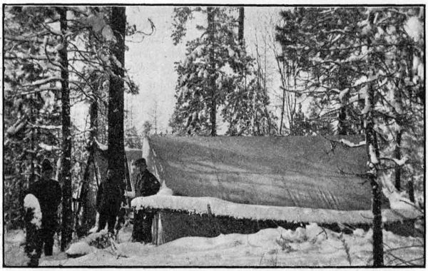
A SURVEY CAMP IN EASTERN OREGON
A co-operative agreement between the State and Government provides
for the construction of a portion of the Old Oregon Trail between Union and
Telocaset. This section, six miles in length, begins at Union and follows up
Pyles Canyon near the location of the present road to a point 1.5 miles
north of Telocaset.
The total estimated cost of this project is $30,000.00 making $15,000.00
to be paid by each the State and Government. Union County joins in the
co-operation of the work, in case the total cost exceeds the amount stipulated
in the Federal agreement. If the total cost should exceed the estimate
given in the project agreement, the County agrees to pay the full amount of
such cost.
Work was started on this section August, 1918, and $20,575.50 had been
expended to November 30. R. A. Pratt is resident engineer for the Department.
The work is being done by the State forces under the supervision of
C. A. Dunn, assistant engineer.
[141]
The State Highway Commission secured an agreement with the U. S.
Office of Public Roads providing for the construction of a 9.37 mile section
of the La Grande-Joseph Highway. The survey for this improvement begins
at Elgin and follows east in the direction of the present road to the top of
Minam Hill.
It is estimated that this work will cost $41,151.00 or $20,575.50 for each
the State and Government. In case the cost of this work exceeds the
estimate shown in the project agreement, the County agrees to pay such
cost. In this manner Union County is co-operating in this improvement.
Work opened up here in August under the supervision of C. A. Dunn,
assistant engineer, for the Department. State forces are employed on
force account basis. The expenditures to November 30 amount to $3,838.44,
and the project is about 10% completed. R. A. Pratt is resident engineer
for the State Department.
Wallowa County’s road problem is entirely local in character as this
district is not touched by a trunk road of the State system. Some very good
natural roads are found in this district, while others are very bad. The
latter designation applies more especially to some of the mountain roads,
which are extremely narrow and very dangerous.
The La Grande-Joseph Highway is very important locally, since it is the
only road connecting the valley with outside points. The people in general
are very much interested in highway possibilities, but the County funds have
proven inadequate to make much of a showing towards permanent work.
Most of the available County funds are required for maintenance of the
existing roads, many of which extend through mountainous areas. Additional
State aid is much needed if any substantial improvements are
hoped for.
A general reconnaissance survey was made in October, 1918, by the State
Highway Department from Elgin to Joseph. The purpose was to gather
general information for the use of the State Highway Commission. This
survey was made by M. O. Bennett, division engineer for Eastern Oregon.
During this visit the matter of Post Road Aid was taken up with the
County authorities. It was understood that the County would make application
at once, but it appears that no further action was taken.
The State Highway Commission has extended aid to Wallowa County by
co-operating on the Flora-Enterprise Forest Road and also helped to secure
Government aid on the same project. The County made an appropriation
to help in the construction of this road. Work is in progress on this road
under the direction of the U. S. Office of Public Roads. The following
statement shows the estimate cost and segregation of funds:
| State appropriation |
$ 12,324.00 |
| Federal appropriation |
12,324.00 |
| County appropriation |
5,000.00 |
| |
Total estimated cost |
$ 29,648.00 |
[142]
An appropriation has been made, by the State Highway Department,
from the Post Road Fund for co-operation in the paving of a two mile section
of The Dalles-California Highway between the east city limits of The
Dalles and Three Mile Creek.
A project statement has been prepared, requesting $14,830.00 from the
U. S. Office of Public Roads. The State will supply a like amount and
Wasco County $4,000.00. This makes a total of $33,660.00 which is the
estimated cost of the project.
The present gravel road will serve as a base for the pavement which is
to be 16 feet wide. The improvement will include re-ditching of the road
bed and the installation of culvert pipe in several places.
It is planned that work will start early in 1910.
The section of The Dalles-California Highway in Wasco County between
Pine Hollow, near Dufur, and Kingsley is designated by the State Highway
Commission as a Post Road. This section is 4.0 miles long and follows near
the line of the present road. The project begins at the road forks 21⁄4
miles south of Dufur and ends at a point on the present road 11⁄2 miles
north of Kingsley.
The plans provide for the grading of the road bed, the estimated cost of
which is $14,500. The State and Government are each requested to appropriate
$2,500.00 and the County will expend $9,500.00. It is expected this
work will be done in 1919.
The State Highway Commission has designated as a Post Road a three
mile section of The Dalles-California Highway immediately north of
Antelope. This is known as the Antelope Grade Section. The new road will
be a 6% grade along near the present road.
The total estimated cost of grading to standard width and properly
draining is $30,000.00; and the funds are to be provided as follows: State
$2,500.00; Government, $2,500.00; and Wasco County, $25,000.00.
It is hoped this work will start early in 1919.
A survey was made in April, 1918, for the Columbia River Highway
between Seufert and the Deschutes River, along the river for the purpose
of comparison with a previous survey over the hill, conforming closely to
the present road.
This route, which was subsequently adopted, has a summit of 210 feet
against 780 feet on the hill route, and a length of 12.8 miles, a saving of 2.7
miles in distance. Between The Dalles and Seufert about two miles was
graded to standard width and grade in 1917. The proposed route follows
close to the railroad, which is crossed near Big Eddy on a proposed overhead
bridge and utilizes the old State Portage Railroad roadbed, as well
as the already graded bank of the Government canal. Near Celilo, another
overhead crossing of the O.-W. R. R. & N. Co. tracks is proposed, and from
this point to the Deschutes River the highway is located between the Oregon
Trunk Railroad and the O.-W. R. R. & N. Co., using about two miles of
abandoned railroad roadbed.
This improvement requires only very light construction, except for short
distances, and it is believed it can be kept free from drifting blow sand by
the use of sand fences, as the Portage Railroad is used where the sand is
the worst, and this was kept open with very little maintenance. With a
smooth roadbed, and with nothing to cause drifting, it is thought that the
maintenance on this account will be negligible.
The route is attractive, as it makes available at close range the Locks
at Big Eddy, the Celilo Canal, and the magnificent Celilo Falls. The estimated
cost of this project is $142,500.00. It is proposed to include this
project in the 1919 program.
Among the bridges expected to be built in the near future is the proposed
reinforced concrete arch bridge over the Deschutes river at Miller,
about a mile above the river’s mouth. This will be a State and Inter-county
structure, and will connect Sherman and Gilliam Counties on the Columbia
River Highway, and will be located a few hundred feet below the present
old wooden toll bridge which it will replace.
The design, which is practically completed, contemplates seven arch
spans aggregating 580 feet in length with a filled approach at either end.
The estimated cost of the bridge is $75,000.00.
During 1917 and 1918, the State Highway Department in co-operation
with Washington County has completed the grading, bridging and paving
of the West Side Highway across that County. This work has involved
the grading and paving of 12.5 miles and the construction of three bridges
and one undergrade railway crossing. On this work, when final payments
are complete, the State will have expended $292,000.00 and the County will
have expended $10,000.00.
In addition to this construction, the Department has made surveys
between Beaverton and Hillsboro and between Forest Grove and Gaston,
and has furnished the County engineering services in connection with the
grading of these two sections.
The pavement on the West Side State Highway between the Multnomah
County Line and Newberg is 15.7 miles in length, of which 12.5 miles is in
Washington County and 3.2 miles in Yamhill County. This pavement is a
two-inch standard bitulithic surface on a crushed rock base. It is sixteen
feet wide with a two-foot macadam shoulder on each side. The grading in
Washington County and the paving in both Washington and Yamhill
Counties was done by Oskar Huber of Portland under a contract awarded
him on July 30, 1917. The work was started in August, 1917, and was
completed in October, 1918.
[144]
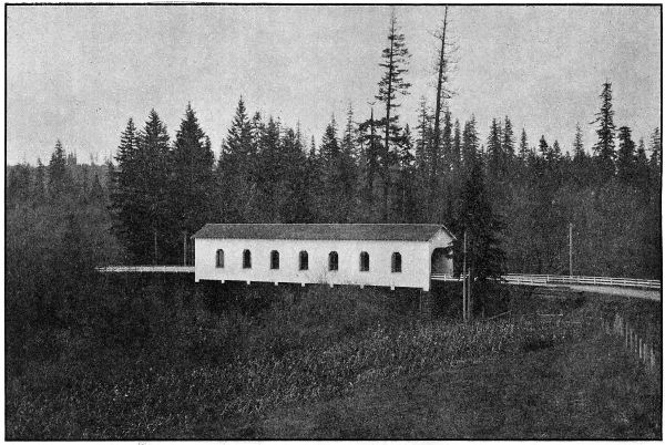
COVERED WOOD BRIDGE OVER THE TUALATIN RIVER ON THE WEST SIDE HIGHWAY
IN WASHINGTON COUNTY
BUILT IN 1918
The grading in Washington County will cost complete approximately
$39,699.85 of which Washington County has paid $9,395.00. The part of
the paving within Washington County will cost complete $234,750.00 all of
which is paid for from State Funds.
| Engineering |
|
$ 9,445.56 |
| Right-of-Way Costs |
|
49.98 |
| Construction: |
|
|
| |
Crushed Stone Shoulders, 163,663.4 lin. ft. @ .06 |
$ 9,819.80 |
|
| |
Standard Bitulithic Pavement, 149,764.4 Sq. Yds. @
$1.28 |
191,698.43 |
|
| |
Broken Stone, Loose Measure, 34,885.75 Cu. Yds.
at $2.40 |
83,725.80 |
|
| |
Clearing and Grubbing |
1,250.00 |
|
| |
Common Excavation, 46,773.9 Cu. Yds. @ .34 |
15,903.13 |
|
| |
Intermediate Excavation, 9,224.4 Cu. Yds. @ .62 |
5,719.13 |
|
| |
Solid Rock Excavation, 385 Cu. Yds. @ $1.15 |
442.75 |
|
| |
Overhaul per 100 Lin. Ft., 172,279.2 Cu. Yds. @ .01 |
1,722.79 |
|
| |
12-inch Reinf. Conc. Pipe, 1,568 Lin. Ft. @ $1.25 |
1,960.00 |
|
| |
24-inch Reinf. Conc. Pipe, 52 Lin. Ft. @ $2.45 |
127.40 |
|
| |
36-inch Reinf. Conc. Pipe, 96 Lin. Ft. @ $4.25 |
408.00 |
|
| |
6-inch Porous Drain Tile, 7,191 Lin. Ft. @ .15 |
1,078.65 |
|
| |
Rip-Rap, 32 Cu. Yds @ $2.75 |
88.00 |
|
| Force Account: |
|
|
| |
Lowering and lengthening existing culverts |
1,081.67 |
|
| |
Replacing bridge approach at Tualatin River |
50.27 |
|
| |
Special wide ditches alongside road near Four
Corners |
814.50 |
|
| |
Back-fill and planking at Onion Flat Trestle |
405.94 |
|
| |
Tearing down old trestles at Onion Flat |
55.33 |
|
| |
Replacing private water supply crossing |
13.31 |
|
| |
Rebuilding Right of Way Fences |
70.85 |
|
| |
Grading at Middleton R. R. Crossing |
1,970.47 |
|
| |
Blind Drains |
189.68 |
|
| |
New 30-foot Culvert |
223.60 |
|
| |
New 42-foot Culvert and special fill over it |
468.26 |
|
| |
Drain Tiling, back-filled with rock |
582.09 |
|
| |
|
Total amount earned by Contractor to Nov.
30, 1918 |
$ 319,869.85 |
|
| Less amount retained pending completion of contract |
50,388.46 |
|
| |
|
Total paid contractor to November 30, 1918 |
|
269,481.39 |
| Total expended to November 30, 1918 |
|
$ 278,976.93 |
This crossing consists of a laminated wood deck on heavy stringers
supported by a series of creosoted pile bents. It is on the West Side Highway
about four miles southwest of Tigard and is designed for heavy traffic
loading.
An asphaltic wearing surface prevents moisture coming in contact with
the wooden floor and with the treated piling tends to give the maximum
length of life to the main members of the structure. This bridge is 600
feet long and cost complete $8,372.22.
The Fanno Creek bridge at Tigard on the West Side Highway consists
of a superstructure similar to the Onion Flat bridge, carried on wood bents
on concrete foundations. A sidewalk was built on one side to accommodate
pedestrians. The bridge is 70 feet long and cost $1,882.81.
[146]
The bridge consists of a covered Howe truss wooden bridge of 144 foot
span and 166 lineal feet of pile trestle approach.
Like the others constructed by the State on main highways, this bridge
is of heavy traffic design, and the bridge and approaches have laminated
wood floors with asphaltic wearing surfaces. Windows are provided at
panel points to provide light and to add to the appearance of the structure.
Cost $12,968.60.
A grade separation was made on the West Side Highway near Votaw,
wherein a wooden trestle was constructed to carry the Southern Pacific
line above the roadway. The structure was designed and built under the
supervision of the railroad’s engineering department.
Final settlement has not yet been made with the Railway Company, but
it is estimated that the State’s share of the cost of this structure will be
$4,000.00. The balance of the cost will be paid by the Railway Company,
no share of the cost being borne by the County.
A location survey was started January 1, 1918, from the West City
limits of Beaverton and completed to the city limits of Hillsboro, a distance
of 7.7 miles. The alignment parallels the Southern Pacific Railway on the
north side of the tracks and eliminates four grade crossings. The entire
section was graded by Washington County during the 1918 season.
A survey was made from Forest Grove to Gaston, a distance of approximately
6 miles. The alignment follows the existing road with the exception
of a change at Dilley to eliminate two railroad crossings.
Considerable grading was done between Dilley and Gaston, reducing the
grade to five per cent.
Mr. C. G. Reiter, County Surveyor of Washington County, was employed
as locating engineer for the State, and also supervised the grading in both
of the above sections.
Wheeler County, being without either rail or water transportation
facilities, is entirely dependent upon its roads for communication with
outside points, as well as between points within the County. All of the large
amount of agricultural products of the county must be transported for
long distances over roads and highways, and likewise, all manufactured
articles and other supplies from points without the County must be brought
in over them. For that reason, good roads are of the utmost importance
to all of Wheeler County, which fact is fully recognized by the Wheeler
County people.
Every effort is being made by the County to build up and improve its
road system, but the funds available within the County are entirely inadequate.
In November, 1916, bonds were voted to the amount of $80,000.00,
the maximum allowed the County under the State laws, but this amount
is
hardly enough to make a beginning on the necessary road construction in
the county, as Wheeler County is rough and mountainous, and road construction
is therefore heavy and expensive.
The State Highway Commission realizing the importance of the construction
of roads in this County, and the impossibility of the financing of
their construction by the County alone, early determined to assist to the
greatest possible extent.
Surveys have been made by the Department over all but two miles of
the two most important cross-county roads, the John Day River Highway
and the McKenzie River Highway. During 1917 and 1918 the State Highway
Department expended the sum of $46,997.79, cooperating with the County
in the construction of 4.2 miles of grading and macadamizing between
Fossil and the Gilliam County Line. State aid was also granted the County
to the amount of $14,235.45 for the construction of nine-tenths of a mile,
known as the Bridge Creek Section, on the McKenzie River Highway just
west of Mitchell, the total cost of which was $24,235.45.
For the construction of 25.5 miles on the John Day River Highway
between the mouth of Sarvice Creek and the Grant County Line, the
Highway Department has set aside the sum of $63,345.70 to be added to
63,345.70 of Federal Post Road Funds and $36,000.00 of county funds to
provide the total amount of $162,691.40 which the project is estimated
to cost.
The Department has further been instrumental in securing Federal Aid
for the construction of a Forest Road Project 5.5 miles in length between
Mitchell and the Crook County Line, known as the Ochoco Canyon Project.
On this project the State will expend $20,050.00, the Federal Government,
$20,050.00 and the County, $4,900.00, $45,000.00 in all.
In summary, State Aid and Federal Government Aid extended to
Wheeler County during 1917 and 1918 and set aside to be expended in 1919
and 1920, are as follows:
| |
State
Funds |
County
Funds |
Federal
Govt.
Funds |
Total |
| Expended in 1917 and 1918— |
|
|
|
|
| On grading Cummings Hill Sec. |
$ 7,004.85 |
$ 7,527.50 |
... |
$ 14,532.35 |
On macadamizing Cummings Hill
Section |
32,465.44 |
... |
... |
32,465.44 |
| On grading Bridge Creek Sec. |
14,235.45 |
10,000.00 |
... |
24,235.45 |
| |
Total |
$ 53,705.74 |
$ 17,527.50 |
... |
$ 71,233.24 |
| |
|
|
|
|
Appropriated for Expenditure in
1919 and 1920— |
|
|
|
|
On Sarvis Creek-Grant County
Line Section |
$ 63,345.70 |
$ 36,000.00 |
$ 63,345.70 |
$ 162,691.40 |
| On Ochoco Canyon Section |
20,050.00 |
4,900.00 |
20,050.00 |
45,000.00 |
| |
Total |
$ 83,395.70 |
$ 40,900.00 |
$ 83,395.70 |
$ 207,691.40 |
On June 19th 1917, a contract was let to the Elliott Contracting Co.
of Portland, Oregon, for the construction of 3.5 miles of grade between the
foot of Cummings Hill, north of Fossil, and the Gilliam County line. This
construction was a five per cent development to eliminate the heavy grades
and narrow roadbed of the former road. Work was commenced on July
6th, 1917, and completed on October 5th, 1917. The work of the contracting
firm was very satisfactory, and an excellent piece of grading was secured.
The Engineer in charge for the Highway Department was Mr. B. H.
McNamee.
The total cost of the work was $14,532.35, of which the State paid
$7,004.85 and Wheeler County $7,527.50. The detailed cost statement follows:
| Engineering |
|
$ 1,423.30 |
| Construction: |
|
| |
Common Excavation, 11,397 cu. yds. @ .40 |
$ 4,558.80 |
|
| |
Intermediate Excavation, 6,017.4 cu. yds. @ .70 |
4,212.18 |
|
| |
Solid Rock Excavation, 2,816.5 cu. yds. @ 1.35 |
3,802.27 |
|
| |
12-inch Corr. Iron Pipe, 682 Lin. ft. @ .40 |
272.80 |
|
| |
24-inch Corr. Iron Pipe, 40 Lin. ft. @ 1.00 |
40.00 |
|
| |
Rubble Masonry, 22.3 cu. yds @ 10.00 |
223.00 |
|
| |
|
|
13,109.05 |
| |
|
|
$ 14,532.35 |
The grading of a nine-tenth mile section in Bridge Creek Canyon was
contracted to the United Contracting Co. of Portland, Oregon, on November
27th, 1917. This section is on the McKenzie River Highway about four
miles west of Mitchell. In addition to the grading, the contract involved
the construction of a ninety foot bridge over Bridge Creek.
The work was started on February 15th, 1918 and completed on June
20th, 1918. The engineering was in charge of Mr. R. H. Coppock.
The total cost of the work was $24,235.45 of which the State paid
$14,235.45 and Wheeler County $10,000. The detailed cost statement
follows:
| Engineering |
|
|
$ 635.30 |
| Construction: |
|
|
|
| |
Common Excavation, 3935.6 cu. yds. @ .60 |
|
$ 2,361.42 |
|
| |
Intermediate Excavation, 549.4 cu. yds. @ .75 |
|
412.05 |
|
| |
Solid Rock Excavation, 9837.6 cu. yds. @ 1.40 |
|
13,772.64 |
|
| |
Overhaul per 100 lin. ft., 363 cu. yds. @ .03 |
|
10.89 |
|
| |
12-inch Corr. Iron Pipe, 20 lin. ft. @ .73 |
|
14.60 |
|
| |
15-inch Corr. Iron Pipe, 108 lin. ft. @ .83 |
|
89.64 |
|
| |
21-inch Corr. Iron Pipe, 60 lin. ft. @ 1.00 |
|
60.00 |
|
| |
Rubble Masonry, 1.58 cu. yd. @ 12.50 |
|
19.75 |
|
| |
Guard fence, 100 lin. ft. @ .85 |
|
85.00 |
|
| |
1 90-foot Bridge & approaches: |
|
|
|
| |
|
Superstructure and trestle (Lump sum) |
$ 5,100.00 |
|
|
| |
|
Class “A” Concrete in piers, 49.24 cu.
yds. @ $34.00 |
1,674.16 |
|
|
| |
|
|
|
$ 6,774.16 |
|
| |
|
|
|
|
$ 23,600.15 |
| |
|
|
|
|
$ 24,235.45 |
On August 7th, 1917, no satisfactory unit price bid having been received,
the State Highway Department entered into a “cost plus” contract
with the Warren Construction Company of Portland, Oregon, to macadamize
with broken stone the Cummins Hill Section between Fossil and the
Gilliam County line, on the John Day River Highway. The rock for this
work was crushed on the job, and the macadam surface was constructed
sixteen feet wide with a compacted thickness of six inches.
Payment to contractor was made on the basis of actual cost plus a
percentage of 10 per cent on labor and five per cent on materials.
To November 30th, 1918, the State had expended $32,465.44 on this work,
and it is estimated that there are bills outstanding against it to the amount
of $1,500.00.
In addition to the 3.4 miles of grading done by the State on Cummins
Hill the County continued the grading at the foot of the hill for a distance
of 0.7 miles, making a total of 4.2 miles. The full section has been macadamized,
giving Wheeler County 4.2 miles of standard macadam road.
During the 1918 season, the County has graded under State supervision,
a one and seven tenths mile section about nine miles southeast of
Fossil on the John Day River Highway. This section is known as the
Butte Creek Summit Section. The construction was paid for entirely by
the County. Engineering supervision was furnished by the State Highway
Department, the engineer in charge of the work being Mr. B. H. McNamee.
The total amount expended by the County, prior to November 30th, on
this work was approximately $30,000.00, and the quantities of construction
completed to this date were as follows:
| Common Excavation |
8,000 cu. yds |
| Rock Excavation |
12,000 cu. yds. |
| Pipe, 12-inch |
234 lin. ft. |
| Pipe, 20-inch |
72 lin. ft. |
| Pipe, 16-inch |
100 lin. ft. |
| Clearing |
8 acres |
During April and May, 1918, Wheeler County graded, under the direction
of the State Highway Department, a section of the John Day Highway
between Cummins Hill and Fossil. This grade was .7 of a mile in length
and joined up with the Cummins Hill grading. This improvement cost
the County approximately $4,000.00. Geo. Hibbert was inspector and
transitman in charge for the State Department.
With the exception of a two mile section immediately West of Fossil,
the entire John Day River Highway through Wheeler County is covered
by location survey made during the past two years. The total length of
survey on this highway is 41.5 miles. For all but about twelve miles,
of this total, the detailed plans are practically complete. The survey of
this highway has been in charge of B. H. McNamee.
The State Highway Department has completed a survey of the McKenzie
River Highway in Wheeler County from the boundary of the Ochoco National
Forest west of Mitchell to the Grant County Line near Dayville, a
total distance of 48 miles. This survey was made by Locating Engineer
R. H. Coppock. The plans are complete except for the eight miles west
from the Grant County line.
From the west end of this survey at Ochoco Forest boundary, the Federal
Office of Public Roads has made a survey to the Crook County line,
so the survey of the McKenzie River Highway is complete all of the way
through Wheeler County.
In 1917, pursuant to a request from the County Court, a section of Highway
No. 14 between Mitchell and Antelope was surveyed. This survey
begins at the point on the Mitchell-Prineville survey about four miles west
of Mitchell and extends 1.4 miles down Bridge Creek to where connection
is made with the present road. This survey was made by R. H. Coppock,
locating engineer.
Application has been made to, and approved, by the Federal Office of
Public Roads for Post Road co-operation on a 48.5 miles section of the
John Day River Highway in Wheeler and Grant Counties. 25.5 miles of
this project are in Wheeler County and 23 miles in Grant County. The
total estimated cost of the project is $400,433.79, and the funds are to be
provided as follows: State $157,216.90, Government $157,216.89; Wheeler
County $36,000.00 and Grant County $50,000.00.
The survey for this project parallels the John Day River on the north
bank, through Wheeler County and extends from the mouth of Sarvice
Creek in Wheeler County to Valades Ranch about four miles West of
Dayville in Grant County. In Grant County a crossing is made to the
west bank near the upper end of the Big Basin.
It is expected that construction will be commenced on the Sarvice
Creek-Valades Ranch Project early in 1919.
A Federal Aid Co-operative Agreement has been entered into between
the State, the Federal Government, and Wheeler County for the grading of
a 5.5 mile section on the McKenzie River Highway. This section is known
as the Ochoco Canyon Section and extends from the Crook County line to
a point about 16 miles west of Mitchell.
This work is estimated to cost $45,000.00 of which the State will pay
$20,050.00, Wheeler County $4,900.00, and the Federal Government $20,050.00.
It is expected that this section will be built during the 1919 season.
In Yamhill County the State Highway Department has co-operated
with the County in the grading and paving of 3.2 miles between Rex and
Newberg and of 4 miles between Sheridan and McMinnville. The total
expenditure on this work amounts to $147,000.00 of which the County has
paid $18,273.49.
An effort has been made to secure Federal Aid in the construction of
a section of the Portland-Tillamook Highway from Grande Ronde west.
With this in view, the necessary surveys have been made, and it is expected
that Federal Aid will be secured so that the construction may be undertaken
during the 1919 season.
In 1917 the Highway Department constructed with its own forces and
equipment 1.8 miles of concrete pavement from Sheridan east on the Sheridan-McMinnville
Road. This pavement was 16 feet wide, 61⁄2 inches thick
at the center and 51⁄2 inches thick at the edges. The mix used was a
1 : 11⁄2 : 3.
In connection with the paving there was a considerable amount of
grading, the total expenditure for grading, culverts, etc., being $5,651.70.
The cost of the 1.8 miles of paving was $31,432.99, the unit cost being $1.82
per cubic yard.
Yamhill County co-operated in the payment for this work to the amount
of $10,000.00. A complete statement of the costs on this work is given
below.
| Quantity |
Item |
|
Cost |
Unit
Cost |
| 2498 cu. yds. Common Excavation |
} |
|
|
| 652 cu. yds. Intermediate Excavation |
$ 4,442.85 |
$ .906 |
| 1750 cu. yds. Solid Rock Excavation |
|
|
| 182 lin. ft. 12-inch Culvert Pipe |
|
283.90 |
1.56 |
| 118 lin. ft. 18-inch Culvert Pipe |
|
276.00 |
2.34 |
| 44 lin. ft. 24-inch Culvert Pipe |
|
134.20 |
3.05 |
| 290 lin. ft. 6-inch Porous Drain Tile |
|
52.25 |
.18 |
| 25 cu. yds. Class “C” Concrete |
|
462.50 |
18.50 |
| 17,150 sq. yds. Concrete Pavement |
|
31,198.87 |
1.82 |
| 5050 lin. ft. Expansion Joints |
|
234.12 |
.046 |
| Total Construction Cost |
|
$ 37,084.69 |
|
| Engineering |
|
1,131.35 |
|
| Grand Total Cost |
|
$ 38,216.04 |
|
| |
|
|
|
|
| Paid by State |
|
$ 28,216.04 |
|
| Paid by County |
|
10,000.00 |
|
| Total |
|
$ 38,216.04 |
|
Early in 1918, Yamhill County requested that the concrete pavement
laid in 1917 be continued to a total length of four miles, and offered to
pay for all grading necessary in connection therewith. This request was
granted by the Highway Commission and in the early spring, construction
was started on the additional 2.2 miles.
The type of pavement laid on this section was the same as that laid in
1917, except that crushed rock aggregate was used instead of gravel, and
the mix was reduced to 1 : 2 : 31⁄2.
[152]
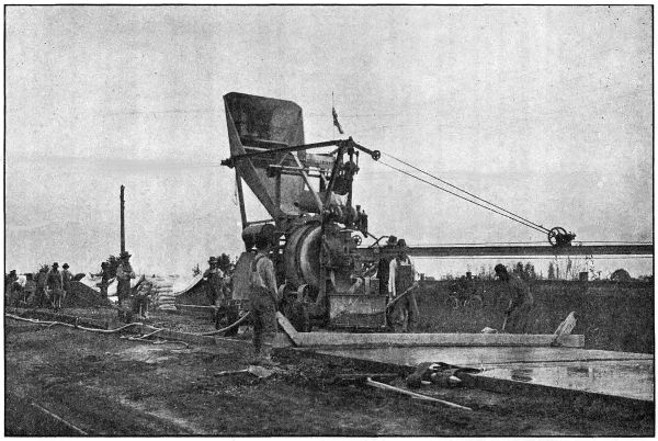
STATE OWNED PAVING PLANT IN OPERATION NEAR SHERIDAN IN YAMHILL COUNTY. ON THE YAMHILL NESTUCCA
HIGHWAY
The coarse aggregate consisted of crushed stone ranging from 1⁄4 inch
to 21⁄2 inches. For the fine aggregate, both Columbia River and Willamette
River sand was used. The stone was crushed from a quarry operated by
the State on Deer Creek which was near the center of the job and consisted
of an altered basalt of rather coarse texture. The quality of this stone
is
not equal to the true basalt; but tests made by the Oregon Agricultural
College showed that it was of good quality. The average haul on this
material was .6 of a mile.
Crushing was begun early in March and 1200 cubic yards of material
stored in a stock pile which was rehandled later by means of an automatic
loader purchased by the State Highway Department for this class of work.
The output of the crusher was insufficient to keep the mixer running and
by means of this stock pile it was possible to keep the material coming
on to the road steadily and finish the job in a minimum length of time
and with the least inconvenience to traffic.
In this connection the experience on this job shows the advisability of
using a stock pile of material to draw from in case of emergencies. When
this is done the work is allowed to go ahead steadily, although a breakdown
at the crusher may occur. The saving made by a steady run more
than offsets the cost of rehandling the material, which is done very reasonably
by the use of machinery.
The sand was shipped to Ballston and Sheridan by railroad, approximately
equal amounts being shipped to both places and was so divided as
to get a minimum length of haul on this material. The average haul was
3.5 miles. At Ballston the sand was unloaded from the cars into bunkers,
which dumped directly into trucks, while at Sheridan no bunkers were
available and the material was unloaded on the ground and rehandled by
means of an automatic loader. No delay was caused by car shortage as
we used our stock pile at Sheridan in emergencies. All the material was
hauled and handled by means of trucks, two of which belonged to the
State Highway Department, others working on a yardage basis.
The pavement, after being struck off, was finished by the roller and
belt method; being rolled from two to four times, according to the condition
of the concrete and later belted with eight and ten inch belts. The
eight inch belt being used first. By using this method of finishing, we
were able to eliminate the use of skilled labor, which showed a material
saving in the finishing item, and at the same time secured a very satisfactory
surface.
As soon as sufficiently hardened, the pavement was covered with earth
from the roadside and kept moist for at least one week while curing. The
earth covering was later removed by means of an ordinary road grader,
when ready to be opened for traffic, the elastite joints being trimmed at the
same operation.
A short stretch of pavement was left out at Deer Creek to allow a fill
to settle during the winter rains. In conformity with our general practice,
sufficient crushed rock was left on the job to complete this stretch and
make repairs.
Elastite joints were placed every thirty feet and extended the entire
width and depth of the pavement. Continuous forms were used on a
portion of this pavement and were found to be much superior to the ordinary
type, and the Department has adopted the continuous form for
future work. These forms are made by using two pieces of form lumber
11⁄2
inches by 51⁄2 inches nailed together. The joints are lapped one-half
the length of the stick. The finished form is 3x51⁄2 inches and is easily
placed on either tangents or sharp curves.
The concrete was mixed with a sixteen cubic foot Koehring Mixer
equipped with bucket and boom. The plant is owned by the Department.
The
grading was paid for by Yamhill County and the crusher, roller,
grader, and scarifier were also furnished by them free of charge. Earth
shoulders were built along the pavement by means of road grader.
Mr. J. M. Baker was Superintendent of Construction on this work.
| Quantity and Item |
Total
Cost |
Unit
Cost |
| Grading |
$ 1,853.07 |
|
19,566 sq. yds., 1 : 2 : 31⁄2
concrete pavement
Average thickness 6 inches |
36,378.01 |
$ 1.86 |
| 6,192 lin. ft., Expansion Joints |
247.68 |
.04 |
| 140 cu. yds., Broken Stone Macadam |
420.00 |
3.00 |
| Total Cost of Construction |
$ 38,898.76 |
|
| Engineering |
1,166.85 |
|
| |
Grand Total Cost |
$ 40,065.61 |
|
| 5099 bbls. Cement used on this work at a cost of $13,299.00 F. O. B. Work. |
| 15 yds. of Sand and 120 yds. broken stone left stored on job. |
A complete description of the paving of the 15.7 mile section of the
West Side Highway between the Multnomah County Line and Newberg is
given in the Chapter devoted to Washington County. It should be mentioned
here, however, that 3.2 miles of this pavement is within Yamhill
County, and was built by the State at a cost of $57,500.00. The construction
of the subgrade was paid for by Yamhill County, part of it having been
done by County forces and the balance of it by the paving contractor under
a cost plus 10 per cent agreement with the County. For the work done
under this agreement, the contractor was paid $6,153.05.
A survey was made in the spring of 1918 between Grande Ronde and the
Bee Ranch at the east end of the Sour Grass road improved in 1916. This
is an important link about 61⁄2 miles in length on the Yamhill-Nestucca
Highway, connecting as it does the cities of McMinnville, Willamina,
Sheridan and Tillamook. In addition it will afford a short and direct
route between the hay and grain fields of the Willamette Valley and the
dairy ranches of the coast. Further, this highway is used by hundreds
of autoists in summer enroute to the Tillamook beaches.
From the fact that only 21⁄2 miles of this section are in service as a
postal route, Federal Aid could be applied for only on that section and cooperation
has been requested as follows: United States Government $15,000;
State of Oregon $15,000; Yamhill County $10,000. For the remaining
four miles, Yamhill County has appropriated $5,000 from the 1919 funds.
It is estimated that the total cost of the remaining section will be
$50,000 and it is expected that the work will be done in 1919. The entire
project as proposed will be graded 24 feet wide, conforming to the State
standards as to alignment and grade and surfaced with macadam 12 feet
in width, thus closing the gap and affording a road between Portland and
Tillamook which will be open the entire year.
Transcriber’s notes:
- Several obvious typographical and lay-out errors have been corrected.
- Inconsistencies in the original have been left as they were: geographical names in the tables are often spelled differently
from those in the text, table lay-out is often inconsistent, several words are used spaced, hyphenated and/or non-hyphenated,
both per cent. and per cent are used, etc.
- In the Table of Contents, pages that have no page number in the original have been listed as —.
- Page 154, under table COST STATEMENT: 15 yds. of sand should probably be 15 cu. yds. of sand; ditto
for rock.
- Table B, page 56: the (¶) symbol is not explained in the original document.
- Table G: lowest price mentioned for riprap is $ 2.35 (last row), lowest price in column riprap is $ 2.75.