Part II.
HOW THE MOUNTAINS WERE MADE.
These changes in the heavens, though slow, produce
Like change on sea and land.
Milton
Probably every mountain climber, resting for
a brief space on a loose boulder, or seeking the
shade of some overhanging piece of rock,
has often asked himself, "How were all
these rocks made?" The question must occur
again and again to any intelligent person on
visiting a mountain for the first time, or even
on seeing a mountain-range in the distance.
He may well ask his companions how these
great ramparts of the earth were built up. But
unless he possesses some knowledge of the science
of geology, which tells of the manifold changes
which in former ages have taken place on the
earth, or unless, in the absence of such knowledge,
he chance to meet with a geologist, his
question probably remains unanswered. Such
questions, however, can be very satisfactorily
answered,—thanks to the labours of zealous
seekers after truth, who have given the best
part of their lives to studying the rocks which
are found everywhere on the surface of the
earth, and the changes they undergo. Geology
is a truly English science; and Englishmen
may well cherish gratefully the memories of its
pioneers,—Hutton, Playfair, Lyell, and others,
who have made the way so clear for future
explorers.
The story of the hills as written on their own
rocky tablets and on the very boulders lying
loose on their sloping sides, and interpreted by
geologists, is a long one; for it takes us far back
into the dim ages of the past, and like the
fashionable novel, may be divided into three
parts, or volumes. To those who follow the
stony science it is quite as fascinating as a modern
romance, and a great deal more wonderful,
thus illustrating the force of the old saying,
"Truth is stranger than fiction."
The three parts of our story may be best
expressed by the three following inquiries:
-
I. How were the materials of which mountains are
built up brought together and made into hard rock?
- II. How were they raised up into the elevated positions
in which we now find them?
- III. How were they carved out into all their wonderful
and beautiful features of crag and precipice,
peaks and passes?
A mountain group, with its central peak or
spire, its long ridges, steep walls, towers, buttresses,
dark hollows, and carved pinnacles
standing out against the sky, has well been
compared to a great and stately building such
as a cathedral or a temple. Mountains are
indeed "a great and noble architecture, giving
first shelter, comfort, and rest, but covered
also with mighty sculpture and painted legend;"
and to many they are Nature's shrines, where
men may offer their humble praises and prayers
to the great Architect who reared them for His
children. We have introduced this illustration
because it will help us in our inquiry. Suppose
we were standing in front of some great cathedral,
such as Milan, with all its marble pinnacles,
or Notre Dame, with its stately towers, or the
minsters of York or Durham in our own country,
and trying to picture to ourselves how it was
built. No one has lived long enough to watch
the completion of one of these great buildings;
but for all that, we know pretty well how it was
made, even by watching the builder's operations
for a short time, or by following, as we often
may, the various stages in the construction of a
small house. So it is with Nature's work. We
cannot, in our little lives, witness the rearing of
a great mountain-chain, or even the carving of a
single hill; but we can observe for ourselves the
slow and continuous operations which in the
course of thousands and thousands of years
produce such stupendous results. We may learn
how the building operations are conducted,
though the final results will only be manifested
in the far-distant future.
But to return to our cathedral. If we try to
picture to ourselves the long years during which
it was covered with scaffolding and surrounded
by a busy army of workers, we shall soon perceive
that the operations may be broadly divided
into three heads. First, we must inquire how
the separate stones of which it is composed were
brought together into one place, and we shall at
once picture to ourselves groups of men working
in stone-quarries,—perhaps a long way off,—busy
with their crowbars and hammers, breaking
off large blocks of stone, and following the natural
divisions of the rock that their rough labour may
be lessened; for all rocks will split more easily
along certain lines than along others. Sometimes
it is easier to follow the "bedding," or
natural layers in which the rock was formed; at
other times the "joints," or cracks subsequently
formed as the rocky materials hardened and contracted
in bulk, afford easier lines for the workmen
to follow. Others are busily engaged in
placing the stony blocks on trollies drawn by
horses, that they may be borne along the roads
leading from the quarry to the site of the future
cathedral. And so, taking a bird's-eye view, we
seem to see horses and carts slowly moving on
from many a distant quarry, but all converging
like the branches of a river to one main channel,
and finally depositing their burdens in the stone-yard
where the masons are at work. Perhaps
bricks are partly employed, in which case we can
easily picture to ourselves the brickyards, where
some are digging out the soft clay, others moulding
it into bricks with wooden moulds, while
others again lay them down in rows on the
ground to dry, before they are baked in the
ovens. And when the bricks are ready for
use, the same means of transportation are employed;
and cart-loads of them are borne along
the country roads until they so reach their
destination.
Now, all this may be summed up in the one
word "transportation;" and we shall presently
inquire how the rocky matter of which the
mountains are built was transported.
Secondly. We have to inquire how the bricks
and stones were raised up. The analogy is not
quite perfect in this case; for the mountains were
raised up en bloc, not bit by bit and stone by
stone, as in the case of the cathedral. Still they
have been raised somehow. Analogies are seldom
complete in every detail; but for all that,
our illustration serves well enough, and will help
us in following the various processes of mountain
building. In these days, the raising of the
stones is mostly effected by steam-power applied
to big cranes and pulleys. In old days they
used cranes and pulleys, but the ropes were
pulled by hand-power. In either case the
work proceeds slowly; and we can easily picture
to ourselves the daily raising of the stones
of which the cathedral is composed. "What
were the forces at work which slowly raised
the mountains?" This question we will endeavour
to answer later on (see next chapter).
This work may be included in the one word,
"elevation."
And lastly. We must inquire how the carving
of the stately building was effected, how its
pinnacles received their shape, and how all those
lovely details received their final forms; how
the intricate traceries of its windows were made,
and the statues carved which adorn its solemn
portals. This question is easily answered, for
we are all more or less familiar with what
goes on in a stone-mason's yard. Under those
wooden sheds we see a number of skilled labourers
at work, busy with their chisels and mallets,
cutting out, according to the patterns made
from the architect's detailed drawings, the portions
of tracery for windows, or the finials,
crockets, and other features of the future
building. In another part of the yard may
be seen the stone-cutters, working in pairs and
slowly pulling backwards and forwards those
long saws which, with the help of water
and sand, in time cut through the biggest
blocks. All this work then may be summed
up under the one word, "ornamentation," for it
includes the cutting and carving of the stone.
Our three lines of inquiry may now be
summed up in these three words, which are
easily remembered:—
- Transportation,
- Elevation,
- Ornamentation.
Taking the first of these subjects for consideration
in the present chapter, we have
now to inquire into the nature of the materials
of which mountains are composed and the
means by which they have been brought together
and compacted into hard rock.
First, with regard to the nature of the materials
which Mother Earth uses to build her
rocky ramparts: they are the same as the
ordinary rocks of which the earth's crust is
composed; and the greater part of them have
been formed by the action of water. These
are the ordinary "stratified" rocks, which in
one form or another meet us almost everywhere,
and may be said to be aqueous deposits,
or sediments formed in seas and inland
lakes. They are always arranged in layers,
known to geologists as "strata," because they
have been gently laid down, or strewn (Latin,
stratum), at the bottom of some large body of
water. There were pauses in the deposition
of the materials, during which each layer had
time to harden a little before the next one
was formed. This accounts for the stratification.
In this way great deposits of sandstone,
clay, and limestone, with their numerous
varieties, have been in the course of ages
gradually piled up, till they have attained to
enormous thickness, which at first sight seem
almost incredible; but the bed of the seas
in which they formed was probably undergoing
a slow sinking process that kept pace
with the growth of these deposits, otherwise
the sea might have been more or less
filled up.
And these processes are still going on. In
fact, it is entirely by watching what goes on
now that geologists are able to explain what
took place a very long time ago when there
were no human beings on the earth to record
the events that took place. And so we argue
from the present to the past, from the known
to the unknown. In other words, geology is
based upon physical geography, which tells
us of the changes now in progress on the
earth. Thus, sandstone, as frequently met
with in different parts of Great Britain, and
largely used for building purposes, such as the
familiar old red sandstone[20] of South Wales,
Hereford, and the north of England and different
parts of Scotland, was once soft sand
in no way at all different from the sand of
the seashore at the present day, or of the
sandy bed of the North Sea. In process of
time it became hardened, and acquired its
characteristic red colour, which is due to oxide
of iron. In some places numerous fossil
fishes have been discovered in this interesting
formation, so intimately associated with the
name of Hugh Miller, who first thoroughly
explored it; these and other remains entombed
therein tell us of the strange forms of life
which flourished on the earth during that very
old-fashioned period of the world's history;
and by putting together all kinds of evidences
derived from the rock itself, geologists
are able to form a very good idea of the
way in which this rock-deposit was accumulated,
always, however, basing their conclusions
on a thorough knowledge of what goes
on at the present day in seas, rivers, and inland
lakes.
In the great series of stratified rocks forming
what is commonly called the crust of the
earth (an unfortunate term which has survived
from the time when the interior of the
earth was generally believed to be in a fiery
molten condition, and covered by a thin coating
of solid rock at the surface), there are
besides the sandstones, of which we have just
spoken, great deposits of dark-coloured clays,
shales, and slates. All these can be accounted
for by the geologist. They are simply different
states of what was once soft mud.
The slates tell us that they have been subjected
to very severe pressure, which squeezed
their particles till they were elongated and
all arranged in one direction, and this is the
reason why they split up into thin sheets.
Others, again, represent vast deposits of carbonate
of lime, thousands of feet thick and
now occupying hundreds of square miles of
the earth's surface. Limestone rocks are as
abundant in our own country as the sandstones,
shales, or slates. The chalk of which
the North and South Downs are composed is
a familiar example. It is seen again forming
Salisbury Plain, in Hampshire and the Isle
of Wight, and then it may be traced running
up the country in a long band through the
counties of Oxford, Cambridge, Lincoln, until
it reaches the coast at Flamborough Head in
Yorkshire. Then we have the Bath Oölites
so much used in building, for they form
an admirable "freestone" that can be easily
carved and cut in any direction (hence the
term "freestone"); and lastly, the great
mountain limestone so well developed in South
Wales, Yorkshire, and the Lake country. All
these were slowly built up at the bottom of
the seas which existed in past ages; great
beds of gravel formed at the mouths of rivers,
and long banks of pebbles and rounded stones
collected on the shore of primeval seas, and
were ground against each other as now by
the action of the waves, until all their corners
were rubbed off. Pebble-beds, called by
geologists conglomerates, are met with among
the stratified rocks; and their story is easily
read by studying what takes place at the
present day on our seashores.
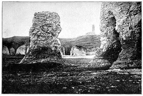
CHALK ROCKS, FLAMBOROUGH HEAD. From a Photograph by G. W. Wilson.
Now, the sandstones, clays, gravels, and pebble-beds
all represent, as will presently be explained,
so much material worn away from
the surface of the land and swept into the
ocean (or in some cases into inland seas and
lakes) by streams and rivers, which are the
great transporting agents of the world. Hence
such deposits of débris, supplied by the constant
wear and tear of all rocks exposed to
the atmosphere, are truly sedimentary and
have a purely mechanical origin. But it is
not so with the limestones. The latter were
never transported, but grew at the bottom of
the sea in very wonderful ways. They have
nothing to do with the wear and tear of the
land to which the others owe their existence,
but represent vast quantities of carbonate of
lime extracted from sea water. Sea water
contains a certain amount of this substance
in a dissolved state, or "in solution," as a
chemist would say; and the way in which
this is extracted by the agency of various
creatures, such as coral polypes and little microscopic
creatures that build their shells of
carbonate of lime, of great beauty, forms one
of the most interesting subjects presented to
the student of physical geography. Hence,
since limestone can only be accounted for by
the agency of living organisms,[21] it is rightly
termed an organic deposit, and the others are
said to be mechanical deposits. But both are
called "aqueous rocks," because they are
formed under water. It is important to distinguish
clearly between these two very different
methods of rock-formation.
But although water plays such a very important
part in the making of the common rocks
around us, yet there are others which have
quite a different origin,—rocks which have
come up from below the surface of the earth
in a heated and molten condition, such as the
lavas that flow from volcanoes in active eruptions
and the showers of ashes and fine volcanic
dust which often attend such eruptions (see chap.
viii., pp. 271-272). Some highly heated rocks,
though they never rise to the surface to form
lava-flows, are forced up with overwhelming
pressure from below, and wedge themselves into
the sedimentary rocks that overlie them, thus
forming what are known as volcanic dykes, and
intrusive masses or sheets of once molten rock.
In this category we include such rocks as basalt,
felstone, pitchstone, and other rocks of fiery
origin that have flowed from volcanoes as lava,
as well as those like granite, which have cooled
and become solid below the surface, and are
Plutonic, or deep-seated, igneous rocks. Granite
may be exposed to the surface of the earth when
the rocks which once overlaid it have been worn
away or "denuded." It is frequently seen in
the central regions of mountain-chains, where a
vast amount of erosion has been effected. Thus
we see that heat has played its part in the making
of rocks; and for this reason such rocks as
we have just mentioned are called igneous. Fire
and water are therefore very important geological
agents; but we should say heat rather than
fire, because the latter word might convey a
false impression. No rocks can be burned except
coal, which may be considered rather as
a mineral deposit than as a rock. Some rocks
may be heated, and undergo many and various
changes in their mineral composition; but they
are not capable of combustion.
So far, then, we have learned that the rocks
exposed to view on the surface of the earth
may be divided into two classes; that is, aqueous
and igneous. There is yet a third class, which,
though of aqueous origin, has in course of time
suffered considerable from the internal heat
of the earth and the enormous pressure due to
the weight of overlying rocks. Such rocks
have been greatly changed from their original
condition, both in appearance and in mineral
composition, and are said to be "metamorphic,"
a word which implies change. Thus chalk, or
other limestone rock, has been metamorphosed
into marble; shales and slates into various
kinds of "schists,"[22] such as mica-schist, and
even into gneiss, which closely resembles
granite. And it is quite possible that even
granite may in some cases be the result of
the melting and consolidation under great pressure
of certain familiar stratified rocks. It is
quite conceivable that slate might be converted
into granite, for their chemical composition is
similar, only the minerals of which it is composed
would require to be rearranged and
grouped into new compounds. This would
seem quite possible; but at present we have no
direct proof of such a change having taken
place. Even igneous rocks are found in some
places to have suffered very considerable change.
In some inland seas, like the Caspian Sea,
deposits of rock salt and gypsum may be formed
by chemical precipitation, owing to evaporation
from the surface.
The various kinds of rock known to geologists
may be conveniently arranged as follows:
| |
{ |
I. Sedimentary. |
{ |
Clay, shale, slate, etc.
Sandstones.
Conglomerates. |
Rocks of
aqueous
origin. |
II. Organic. |
{ |
Limestones.
Flint.
Coal. |
| |
III. Chemical. |
{ |
Rock salt.
Gypsum, etc. |
Rocks of
igneous origin. |
{ |
I. Volcanic |
{ |
Lavas.
Volcanic ashes, etc. |
| II. Plutonic |
{ |
Basalt.
Granite. |
Metamorphic rocks
of aqueous and
igneous origin. |
|
|
{ |
Marbles.
Various kinds of schists.
Gneiss, etc. |
So far we have only attempted to state very
briefly the different kinds of rocks, and to point
out that they were formed in various ways.
We must now consider the question of rock-making
more closely, and see what we can learn
about the wonderful ways in which rocks are
made; and it may be instructive to glance at
the conflicting opinions on this subject which
learned men held not very long ago.
At the end of the last century a great controversy
took place on the question of the origin
of rocks, and the learned men of the day were
divided into two parties. One of these parties,
following the teaching of Werner, professor of
mining at Freyburg, who inspired great enthusiasm
among his disciples, declared that all rocks
were formed by the agency of water. This was
a very sweeping and of course rash conclusion.
But whenever they examined rocks, they found
so many clear evidences of the action of water
that a powerful impression of the importance
of this agency was naturally made on their
minds. They found rocks uniformly arranged
in great layers which extended for long distances,
and containing the remains of animals
which must undoubtedly have lived in the seas
or estuaries. These layers were further divided
into smaller layers, such as clearly were formed
by the slow settling down of sand and mud.
Others again contained gravels and rounded
pebbles, testifying in no uncertain way to the
action of water. Even the little grains of sand
are obviously water-worn. This teaching was
quite sound so long as they confined their attention
to clays, sandstones, and limestones; but
when they came to basalt and granite, a blind
adherence to the views of their master caused
them to shut their eyes to the clear evidences
of the action of heat, presented by such rocks.
The crystalline structure of such rocks; their
irregular arrangement, often so different from
the uniform disposition of the stratified rocks
(although it must be admitted that ancient lava-flows
often lie very evenly between aqueous
rocks), and the way in which they burst through
overlying rocks, thus proving their former
molten condition; the signs of alteration exhibited
in the aqueous rocks into which they
intruded themselves (changes which are obviously
due to the action of heat),—these and
other evidences were entirely overlooked, and
Werner declared that basalt had been found as
a sediment under water.
This school of geologists, believing so strongly
in the all-powerful influence of Father Neptune,
received the not inappropriate title of
"Neptunists."
On the other hand, the party who happened
to be in districts where granite, basalt, and such
igneous rocks abounded were equally impressed
with the importance of the powerful agency of
heat. To them nearly every rock they met with
seemed to show some signs of its action. And
since Pluto was the classical deity of the lower
regions, and the earth shows evidences in places
of greater heat below the surface, this party received
the title of "Plutonists;" and so the battle
raged hotly for some time between the Neptunists,
with their claims for cold water, and the
fiery Plutonists of the rival school of Edinburgh,
with their subterranean heat. Fire and water
are never likely to agree; and they did not do so
in this case. But now that the battle is over,
and both sides are found to have been partly
right and partly wrong,—though the Neptunists
have the advantage,—we can afford to
smile at the fierceness of the contest, and
wonder how it was that each side thought
they were so entirely in the right.
Let us now consider the aqueous rocks, and
see if we can gain a clear idea of the ways in
which they were formed; and first, we will
take those of a purely sedimentary origin,—the
sandstones, pebble-beds, gravels, and clays.
These, as the reader has already probably
guessed, have all been transported by means
of streams and rivers, and settled down quietly
in seas at the mouths of rivers or in inland
lakes. There is no trace of the action of heat
in the forming of these rocks, though they
often show signs of having suffered more or
less change from contact with highly heated
igneous rocks of later date which forcibly intruded
themselves from below; and if the
change thus effected were considerable, we
should call the rocks so altered metamorphic.
But we are now dealing with their original
state and how they were made; and of that
there is no possible doubt whatever. So for the
time being we may call ourselves Neptunists.
Streams and rivers are the great transporting
agents whereby the never-failing supply of débris
from the waste of the land is unceasingly
brought down from the mountains and hills,
through the broad valleys and along the great
plains, until finally it is flung into the sea. The
sea is the workshop where all the sedimentary
rocks are slowly manufactured from the raw
material brought to it by the rivers. But for
the present we must confine our attention to
the question of transport. Referring back to
our illustration of the cathedral, we may say
that streams and rivers play the part of cart
and horses. They bring the materials down
from the quarry to the scene of action,—the
workshop where they are wanted. The quarries,
in this case, may be said to be almost
everywhere. For wherever rocks and soil are
exposed to the action of wind and weather,
there is certain to be more or less decay and
crumbling away. But it is among the hills and
in the higher parts of the mountains that the
forces of destruction are most active. How this
is brought about will be discussed in the seventh
chapter, on the carving of the hills. The frequent
slopes covered with loose stones are
sufficient evidence of the continual destruction
that takes place in these regions.
The transporting powers of rivers are truly
prodigious. Looking at a stream or river after
heavy rain, we see its waters heavily laden with
mud and sand; but it is difficult to realise from
a casual glance the vast amount of material
that is thus brought down to lower levels. If
we could trace the sediment to its source, we
must seek it among the rocks of mountains far
away. Step by step we may trace it up along
the higher courses of the river, then along
mountain streams rushing over their rocky
beds, tumbling in cascades over broken rocks,
or leaping in waterfalls over higher projections
of rock, until we come to the deep furrows on
the sides of mountains along which loose fragments
of rock come tumbling down with the
cascades of water that run along these steep
channels after heavy rain, leaving at the base
of the mountain great fan-shaped heaps of
stones.
"Oft both slope and hill are torn
Where wintry torrents down have borne,
And heaped upon the cumbered land
Its wreck of gravel, rocks, and sand."
These accumulations are gradually carried
away by the larger mountain streams, which
in hurrying them along cause a vast amount
of wear and tear; so that their corners are worn
off, and they get further and further reduced in
size, becoming mere round pebbles lining the
bed of the stream, and finally by the time they
reach the large slow-moving rivers of the plains
are mainly reduced to tiny specks of mud or
grains of sand. So then the rivers and streams
not only transport sediment, but they manufacture
it as they go along. And thus they may
be considered as great grinding-mills, where
large pieces of stone go in at one end, and
only fine sand and mud come out at the
other.
The amount of land débris thus transported
depends partly on the carrying power of rivers,
which varies with the seasons and the annual
rainfall; partly on the size of the area drained
by a river; and again, partly on the nature of
the rocks of which that area is composed.
A stream, moving along at the rate of about
half a mile (880 yards) an hour, which is a slow,
rate, can carry along ordinary sandy soil suspended
in a cloud-like fashion in the water;
when moving at the rate of two thirds of a mile
(about 1,173 yards) an hour, it can roll fine
gravel along its bed; but when the rate increases
to a yard in a second, or a little more than two
miles an hour, it can sweep along angular stones
as large as an egg. But streams often flow much
faster than this, and so do rivers when swollen
by heavy rain.
A rapid torrent often flows at the rate of
eighteen or twenty miles an hour, and then
we may hear the stones rattling against each
other as they are irresistibly rolled onward;
and during very heavy floods, huge masses of
rock as large as a house have been known
to be moved.
These are the two principal ways in which
streams and rivers act as transporting agents:
they carry the finer materials in a suspended state
(though partly drifting it along their beds); and
they push the coarser materials, such as gravel,
bodily along. But there is one other way in
which they carry on the important work of
transportation, which, being unseen, might easily
escape our notice. Every spring is busily employed
in bringing up to the surface mineral
substances which the water has dissolved out of
the underground rocks. This invisible material
finds its way, as the springs do, to the rivers, and
so finally is brought into that great reservoir, the
sea. Rain and river water also dissolve a certain
amount of mineral matter from rocks lying on
the surface of the earth. Now, the material
which is most easily dissolved is carbonate of
lime. Hence if you take a small quantity of
spring or river water and boil it until the whole
is evaporated, you will find that it leaves behind
a certain amount of deposit. This, when analysed
by the chemist, proves to be chiefly carbonate
of lime; but it also contains minute
quantities of other minerals, such as common
salt, potash, soda, oxide of iron, and silica, or
flint. All these and other minerals are found
to be present in sea water.
The waters of some of the great rivers of the
world have been carefully examined at different
times, in order to form some idea of the amount
of solid matter which they contain, both dissolved
and suspended; and the results are extremely
important and interesting, for they enable us to
form definite conclusions with regard to their
capacity for transport. This subject has been
investigated with great skill by eminent men of
science. The problem is a very complicated one;
but it is easy to see that if we know roughly the
number of gallons of water annually discharged
into the sea by a big river, and the average
amount of solid matter contained in such a gallon
of water, we have the means of calculating,
by a simple process of multiplication, the amount
of solid matter annually brought down to the
sea by that river. But we must also add the
amount of sand, gravel, and stones pushed along
its bed. This may be roughly estimated and
allowed for. These are some of the results:
The amount of solid matter discharged every
year by that great river, the Mississippi, if piled
up on a single square mile of the bed of the sea,—say,
in the Gulf of Mexico, where that river
discharges itself,—would make a great square-shaped
pile 268 feet high. But the Gulf Stream,
sweeping through this gulf, carries the materials
for many and many a mile away; so that in
course of time it gradually sinks and spreads itself
as a fine film or layer over part of the great
Atlantic Ocean. The mud brought down by
the great river Amazon spreads so far into the
Atlantic Ocean as to discolour the water even
at a distance of three hundred miles. The
Ganges and the Brahmapootra, flowing into the
Bay of Bengal, discharge every year into that
part of the Indian Ocean 6,368,000,000 cubic
feet of solid matter. This material would in
one year raise a space of fifteen square miles
one foot in height. The weight of mud, etc.,
that these rivers bring down is sixty times
that of the Great Pyramid of Egypt, or about
six million tons.
Or, to put the matter in another way, if
a fleet of more than eighty "Indiamen," each
with a cargo of fourteen hundred tons of solid
matter, sailed down every hour, night and day,
for four months, and discharged their burdens
into the waters of the Indian Ocean, they
would only do what the mighty Ganges does
quietly and easily in the four months of the
flood season.
It is probable that even the Thames, a small
river compared to those just mentioned, manages
to bring down, in one way or another, fourteen
million cubic feet of solid matter. These few
figures may suffice to give the reader some idea
of the enormous amount of rock-forming materials
brought down to the seas at the present
day.
Of course they are spread out far and wide by
the numerous ocean currents, some of which
flow for hundreds of miles; and so the bed of the
sea can only be very slowly raised by their accumulation.
Still the geologist can allow plenty
of time, for there is no doubt that the world is
immensely old; and if we allow thousands of
years, we may easily comprehend that deposits
of very considerable thickness may in this way
accumulate on the floors of the oceans. Also
the coasts of continents and islands suffer
continual wear and tear at the hands of
sea waves; and thus the supply of sediment
is increased.
When the geologist comes to study the great
rock-masses—hundreds, and even thousands, of
feet in thickness—of which mountain-ranges are
composed, he finds all those kinds of rock which
we have just been considering,—sandstones,
shales (or hardened clays), pebble-beds, and limestones,—and
endeavours to picture to himself
their gradual growth in the ways we have described.
In so doing, he is driven to the conclusion
that many thousands of years must have
been occupied in their construction.
We must now say a few words about those
other aqueous rocks which have an organic origin,
of which limestone is the chief. It is indeed
a startling conclusion that deposits of great
thickness, and ranging for very many miles over
the earth's surface, have been slowly built up
through the agency of marine animals extracting
carbonate of lime from the sea. Yet such is
undoubtedly the case. Of this important process
of rock-building coral reefs are the most
familiar example. The great barrier reef along
the northeast coast of Australia is about 1,250
miles long, from ten to ninety miles in width,
and rises at its seaward edge from depths which
in some places certainly exceed eighteen hundred
feet. It may be likened to a great submarine
wall. Now, all this solid masonry is the work
of humble coral polypes (not "insects"), building
up their own internal framework or skeleton
by extracting carbonate of lime from sea water.
Then the breakers dashing against coral reefs
produce, by their grinding action, a great deal of
fine "coral-sand" and calcareous mud, which
covers the surrounding bed of the sea for many
miles.
Now, geologists find that some limestone formations
met with in the stratified rocks have
certainly been formed in this way; for example,
certain parts of the great "mountain limestone."
This is proved by the fossil corals it contains,
and by tracing the old coral reefs; but it is also
largely formed by the remains of other graceful
calcareous creatures known as encrinites, or
"sea-lilies," with long branching arms that
waved in the clear water. Such creatures still
exist in some deeper parts of the sea, and look
more like plants than animals. In former ages
they existed in great abundance, and so played
an important part as rock-formers,—for their
stems, branches, and all are made of little plates
of carbonate of lime, beautifully fitting together
like the separate bones, or vertebræ, composing
the backbone of a fish; and when the creatures
died, these little plates no longer held together,
but were scattered on the floor of the sea-bed.
Shell-fish abounded too, and their shelly remains
accumulated into regular shell-beds in
some places. But at times mud and sand
would come and cover over all these organic
deposits.
But of all rocks that have an organic origin,
chalk is the most interesting. Geologists were
for a long time puzzled to know how this rock
could have been formed; but some soundings
made in the Atlantic Ocean previous to the
laying of the first Atlantic cable led to a very
important discovery, which at once threw a
flood of light on the question. Samples of the
mud lying on the bed of this ocean at considerable
distances from the European and American
coasts, and at depths varying from one thousand
to three thousand fathoms, were brought
up by sounding apparatus.
Little was it thought that the dull grey ooze
covering a large part of the Atlantic bed would
bring a message from the depths of the sea, and
furnish the answer to a great geological problem.
Yet such was the case; for under the microscope
this mud was seen to be chiefly composed
of very minute and very beautiful shells, now
known as foraminifera, and much prized by
microscopists. These tiny shells are found at or
near the surface of the sea; and after the death
of the creatures that inhabit them (which are
only lumps of protoplasm with no organs of
any kind), the shells slowly sink down to the
bed of the ocean. Now, these creatures multiply
at so inconceivable a rate that a continuous
shower of dead shells seems to be taking place,
and the result is the slow accumulation over
vast areas of the Atlantic and Pacific oceans of
a great deposit of calcareous ooze, which if raised
above the sea-level would harden into a rock
very similar to chalk.
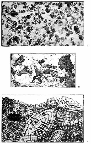
Microphotographs illustrating Rock Formation.
I. Foraminifera. II. Section of Granite. III. Nummulitic Limestone.
But this process only takes place in the
deeper parts of our seas, far removed from land,
where the supply of land-derived materials fails,—for
even the finest mud supplied by rivers
probably all settles down before travelling two
or three hundred miles from its native shores.
Thus we learn that when one agency fails,
Nature makes use of another to take up the
important work of rock-building. How the
other rocks which we mentioned in our list
were formed,—such as granite, basalt, and the
metamorphic rocks,—we must explain in a
future chapter dealing with volcanoes and their
work.
The notion that the ground is naturally steadfast is an error,—an
error which arises from the incapacity of our senses to appreciate
any but the most palpable, and at the same time most
exceptional, of its movements. The idea of terra firma belongs
with the ancient belief that the earth was the centre of the universe.
It is, indeed, by their mobility that the continents survive
the increasing assaults of the ocean waves, and the continuous
down-wearing which the rivers and glaciers bring about.—Professor
Shaler.
We have found out the quarries which supplied
the rocky framework of mountains, and have
learned how the work of transporting these
vast quantities of stone was accomplished by
the agency of ever-flowing glaciers, rivers, and
streams.
We must now consider the second stage of
the work, and inquire how the mountains
were raised up. Referring back to our illustration
of the cathedral (see pages 143-147), it will
be remembered that this work was included under
the head of Elevation. But perhaps some one
might ask: "How do you know that the
mountains have been elevated or upheaved?
Is it not enough to suppose that they owe
their height entirely to the fact that they are
composed of harder rock, and so have been more
successful in resisting the universal decay and
destruction?" Now, such an objection contains
a good deal of truth, for mountains are formed
of hard rocks; but at the same time we know
that the agents of denudation are more active
among them than on the plains below, so that,
in the higher mountain regions at least, the
work of demolition may actually proceed faster
than it does on low ground.
Mountains are higher than the rest of the
world, not merely because they are built of
more lasting material, but also because they
have been uplifted for thousands of feet above
the level of the sea; and the evidence of their
upheaval is so plain as to be entirely beyond
doubt.
Let us inquire into the nature of this evidence.
We have seen that the rocks of which mountains
are composed were for the most part
formed at the bottom of the sea. When the
geologist finds, as he frequently does, buried in
mountain rocks the fossil remains of creatures
that must have lived in the sea (and often very
similar to those living there now), he is compelled
to think of the gigantic upheavals that
must have taken place before those remains
could arrive at their present elevated position.
Numerous examples might be given; but we
will only mention three. In the Alps marine
fossils have been detected at a height of 10,000
feet above sea-level, in the Himalayas at a
height of 16,500 feet, and in the Rocky Mountains
at a height of 11,000 feet.
Again we must take it for granted that all the
stratified or sedimentary rocks (see pages 148-149)
with some trivial exceptions, such as beds
of shingle and conglomerates, have been formed
in horizontal layers. This is one of the simple
axioms of geology to which every one must
assent.
Now, if we find in various parts of the continents,
and especially among the mountains,
such strata sloping or "dipping" in various
directions, sometimes only slightly, but sometimes
very steeply,—nay, even standing up on
end,—the conclusion that they have been upheaved
and pushed or squeezed into these various
positions by some subsequent process is
irresistible. But this is not all; for in every
mountain region we find that the rocks have
been crumpled, twisted, and folded in a most
marvellous manner. Solid sheets of limestone
may be seen, as it were, to writhe from the base
to the summit of a mountain; yet they present
everywhere their truncated ends to the air, and
from their incompleteness it is easy to see what
a vast amount of material has been worn away,
leaving, as it were, mere fragments behind. The
whole geological aspect of the Alps (for example)
is suggestive of intense commotion; and they remain
a marvellous monument of stupendous
earth-throes, followed by prolonged and gigantic
denudation (see diagrams, chap. ix., p. 307).
There are certain features found in all mountain-chains
which must be carefully borne in
mind, especially when we are considering the
explanations that have been suggested with regard
to their upheaval. These may be briefly
stated as follows:—
- 1. Mountain-chains tend to run in straight or gently
curving lines.
- 2. Their breadth is small compared to their length,
and their height smaller still.
-
3. They rise sharply and are clearly marked off
from the country on either side.
- 4. They form the backbones of continents.
- 5. The rocks of which they are composed have been
greatly disturbed, folded, and contorted.
- 6. There is often a band of crystalline rocks
(granite, gneiss, etc.) running along the centre of
a high range.
- 7. They are connected with lines of volcanoes.
- 8. They are frequently affected by earthquakes.
Having arrived at the conclusion that the
mountains show evident signs of upheaval, let
us proceed to inquire whether any movements,
either upward or downward, are taking place
now on the earth, or can be proved to have
done so within comparatively recent times.
On this question there is ample evidence at
our disposal.
More than one hundred and thirty years ago,
Celsius, the Swedish astronomer, was aware,
from the unanimous testimony of the inhabitants
of the sea-coasts, that the Gulf of Bothnia
was constantly diminishing both in depth and
extent. He resorted to measurements in order
to prove (as he thought) that the waters of
the Baltic were changing their level. This
was a mistaken idea; and we now understand
that the level of the sea does not change,
except under the influence of the daily rise
and fall of the tide, which is easily allowed for.
However, that was the idea then; and it survived
for some time. But if the sea-level were
continually sinking, the water, which, owing to
the influence of gravitation, must always remain
horizontal, would equally retreat all round the
Scandinavian peninsula and on all our seashores.
But this is not the case. Again, it would be impossible
on this theory to explain the curious
fact that in some parts of the world the sea is
gaining on the land, while in other places it is
as surely retreating; for we cannot believe that
in one part the sea-level is rising, while in another
(not far off in some cases) it is sinking.
No body of water could behave in this irregular
fashion; and the sea could not possibly be rising
and falling at the same time.
Hence we may take it for granted that any
change that we may notice in the relative level
of land and sea must be due to upward or downward
movements in the land.
But to return to Celsius. Old men pointed
out to him various points on the coast, over
which during their childhood the sea was wont
to flow, and besides, showed him the water-lines
which the waves had once traced out farther inland.
And besides this, the names of places which
implied a position on the shore, former harbours
or ports now abandoned and situated inland,
the remains of boats found far from the sea, and
lastly, the written records and popular songs,
left no doubt that the sea had retreated; and it
seemed both to themselves and to the astronomer
that the waters were sinking. In the year 1730
Celsius, after comparing all the evidence he had
collected, announced that the Baltic had sunk
three feet, four inches, every hundred years. In
the course of the following year, in company
with Linnæus, the naturalist, he made a mark at
the base of a rock in the island of Leoffgrund,
not far from Jelfe, and thirteen years afterwards
was able to prove, as he thought, that
the waters were still subsiding at the same rate,
or a little faster. In reality, he had proved,
not that the sea was sinking, but that the
land was rising.
Similar observations show that nearly the
whole of Scandinavia is slowly rising out of
the sea. At the northern end of the Gulf of
Bothnia the land is emerging at the rate of five
feet, three inches, in a century; but by the side
of the Aland Isles it only rises three and one
quarter feet in the same time. South of this
archipelago it rises still more slowly; and farther
down, the line of shore does not alter as
compared with the level of the sea.
But it is a curious fact that the extreme
southern end of this peninsula is subsiding, as
proved by the forests that have been submerged.
Several streets of some towns there have already
disappeared, and the coast has lost on the average
a belt of land thirty-two yards in breadth.
The upward movement of the Scandinavian
peninsula must have been going on for a long
time, if we assume that it was always at the
same rate as at present; for we find beds of seashells
of living species at heights of six or seven
hundred feet above the level of the sea. Great
dead branches of a certain pink coral, found in
the sea at a depth of over one hundred and fifty
to three hundred fathoms, are now seen in water
only ten or fifteen fathoms deep. It must have
been killed as it was brought up into the upper
and warmer layers of water. This is striking
testimony.
The pine woods too, which clothe the hills, are
continually being upheaved towards the lower
limit of snow, and are gradually withering
away in the cooler atmosphere; and wide belts
of forest are composed of nothing but dead
trees, although some of them have stood for
centuries.
Geologists have proved that the Baltic Sea
formerly communicated by a wide channel with
the North Sea, the deepest depressions of which
are now occupied by lakes in the southern part of
Sweden; for considerable heaps of oyster-shells
are now found in several places on the heights
commanding these great lakes. Then we have
in Denmark the celebrated "kitchen-middens,"
heaps of rubbish also largely composed of oyster-shells
which the inhabitants, in the "Stone Age,"
collected from the bottoms of the neighbouring
bays. At the present day the waters of the Baltic,
into which rivers bring large quantities of
fresh water, do not contain enough salt for oysters
to grow there; but the oyster-shells prove
that the Baltic Sea and these inland lakes were
once as salt as the North Sea is now. This can
only be explained by supposing that the Baltic
was not so shut in then as it is in these days.
The bed of the old wide channel has risen, and
what once was sea is now land.
Again, it is very probable that the great lakes
and innumerable sheets of water which fill all
the granite basins of Finland have taken the
place of an arm of the sea which once united the
waters of the Baltic to those of the great Polar
Ocean. And so there must have been upheaval
here as well.
The old sea-beaches, now above the level of the
highest tides, that are found in many parts of
the Scandinavian, Scottish, and other coasts, furnish
plain evidence of upheaval.
At the present day, between the lines of high
tide and low tide, the sea is constantly engaged
in producing sand and shingle, spreading them
out upon the beach, mingling them with the remains
of shells and other marine animals, and
sometimes piling them up, sometimes sweeping
them away. In this way a beach often resembles
a terrace. When the land is upheaved
rapidly enough to carry up this line of beach-deposits
before they are washed away by the
waves, they form a flat terrace, or what is known
as a "raised beach." The old high-water mark
is then inland; its sea-worn caves become in
time coated with ferns and mosses; the old
beach forms an admirable platform on which
meadows, fields, villages, and towns spring
up; and the sea goes on forming a new beach
below and beyond the margin of the old
one.
The Scottish coast-line, on both sides, is
fringed with raised beaches, sometimes four
or five occurring above each other, at heights
of from twenty-five to seventy-five feet above
the present high-water mark. Each of these
lines of terrace marks a former lower level
at which the land stood with regard to the
sea; and the spaces between them represent
the amount of each successive rise of the land.
Each terrace was formed during a pause, or
interval, in the upward movement, during
which the waves had time to make a terrace,
whereas, while the land kept on rising, they
had no time to do so. Thus we learn that
the upheaval of the country was interrupted
by considerable pauses.
Sometimes old ports and harbours furnish
evidence of upheaval. Thus, the former Roman
port of Alaterva (Cramond) in Scotland,
the quays of which are still visible, is now
situated at some distance from the sea, and the
ground on which it stands has risen at least
twenty-four feet. In other places the scattered
débris shows that the coast has risen twenty-six
feet. And by a remarkable coincidence,
the ancient wall of Antoninus, which in the
time of the Romans stretched from sea to sea,
and served as a barrier against the Picts,
comes to an end at a point twenty-six feet
above the level of high tides. In the estuary
of the Clyde there are deposits of mud, containing
rude canoes and other relics of human
workmanship, several feet above the present
high-water mark.
Raised beaches are found on many parts
of the coast of Great Britain. Excellent examples
occur on the coasts of Devon and
Cornwall. On the sides of the mountainous
fiords of Norway similar terraces are found
up to more than six hundred feet above the
sea; and as some of these rise to a greater
height at a distance of fifty miles inland, it
seems that there was a greater upward movement
towards the interior of Norway than on
the coasts.
There is a celebrated raised beach on the
side of a mountain in North Wales, known
as Moel Tryfaen, where the writer gathered a
number of marine shells at a height of 1,357
feet.
But Scandinavia and Great Britain are not
the only parts of Europe where an upward
movement has taken place, for the islands of
Nova Zembla and Spitzbergen show evidence
of the same kind; and the coast of Siberia, for
six hundred miles to the east of the river
Lena, has also been upraised. On the banks
of the Dwina and the Vega, 250 miles to the
south of the White Sea, Murchison found beds
of sand and mud with shells similar to those
which inhabit the neighbouring seas, so well
preserved that they had not lost their colours.
Again, the ground of the Siberian toundras
is to a large extent covered with a thin coating
of sand and fine clay, exactly similar to
that which is now deposited on the shores of
the Frozen Ocean. In this clay, the remains
of the mammoth, or woolly elephant, now
extinct, are preserved in great numbers.
Parts of Northern Greenland have also risen;
while at the southern end of this frozen land
a downward movement is still taking place.
The best-known example of these slow movements
within historic times is the so-called
Temple of Serapis in the Bay of Baie, near
Naples. The ruins of this building, which was
probably a Roman bath, consist of a square
floor paved with marble, showing that it
possessed a magnificent central court. This
court, when perfect, was covered with a roof
supported by forty-six fine columns, some of
marble, others of granite. There is still a
hot spring behind, from which water was conducted
through a marble channel. All the columns
but three were nearly buried in the soil
which covered the whole court, when the ruins
were first discovered. Now, each of the three
marble columns that are still standing shows
clear evidence of having been depressed below
the sea-level, for they all exhibit a circular
row of little holes bored by a certain marine
shell-fish, known as Lithodomus dactylus, at a
height of twelve feet from the floor; each row
is about eight feet broad. The shells may still
be seen inside the little pear-shaped holes which
the shell-fish bored for themselves; and the same
shell-fish still live in the waters of the Mediterranean
and bore holes in the limestone rocks.
It is therefore quite clear that these columns
must have been under water to a depth
of twenty feet or so, and also that they must
have remained under water for some considerable
time, during which the shell-fish made
these borings. Then an upheaval took place
whereby the whole building was elevated to
its present level. But underneath the present
floor, at a depth of five feet, were discovered
the remains of an older floor. This probably
belonged to an earlier building which had in
like manner been depressed below sea-level.
We thus learn that the land in this spot had
been sinking for a long time, and that at
some subsequent time it rose. The fallen columns
suggest the idea that they were thrown
down by earthquakes. At the present time
the land here is again sinking at the rate of
one inch in three or four years.
But the first example of upheaval within
comparatively recent times, and one which is instructive
as throwing some light on the subject
of the present chapter,—namely, the upheaval
of mountain-chains,—is to be found along the
western mountainous coast of South America.
Here we have the magnificent ranges of the
Andes running along the whole length of this
continent. The illustrious Charles Darwin,
during his famous trip in the "Beagle," discovered
numerous raised beaches along this
coast, and at once perceived their importance
to the geologist. The terraces are not quite
horizontal, but rise towards the south. On
the frontier of Bolivia, they are seen at
heights of from sixty-five to eighty feet above
sea-level; but nearer the higher mass of the
Chilian Andes they are found at one thousand
feet, and near Valparaiso, in Chili, at thirteen
hundred feet above the sea. Darwin also discovered
that some of the upheavals thus indicated
took place during the human period;
for he found in one of the terraces opposite
Callao, in Peru, at a height of eighty feet,
shells with bones of birds, ears of wheat,
plaited reeds, and cotton thread, showing that
men had lived on the terrace. These relics
of human industry are exactly similar to
those that are found in the huacas, or burial-places,
of the ancient Peruvians. There
can be no doubt that the island of San Lorenzo,
and probably the whole of the coast
in its neighbourhood, have risen eighty feet
or more since the Red Man inhabited the
country.
Callao probably forms the northern limit of
the long strip of coast that has been upheaved,
and the island of Chiloe the southern limit; but
even thus the region of elevation has a length
from north to south of about 2,480 miles.
We noticed in the case of Scandinavia that
the upward movement is greater in the interior
of the mountain-range than at or near the coast;
and it is interesting to find that the same difference
has been observed in the case of the Andes.
The upheaving force, whatever its nature, acts
with more energy under the Chilian Andes than
under the rocks of the adjacent coast.
In New Zealand we have also evidences of
upheaval; and if we trace out on the map a long
line from the Friendly Isles and Fiji, through
the Eastern Archipelago, and then on through
the Philippine Islands, and finally to Japan
and the Kurile Islands, we shall find scattered
regions of elevation all along this great line,
which is probably a mountain-chain, partly
submerged, and along which numerous active
volcanoes are situated.
Putting together all the evidence that has
been gathered on this subject, of which only a
very small part is here given, we are warranted
in concluding that taking the world generally,
regions where active volcanoes exist are generally
regions where upheaval is taking place.
There is also a very interesting connection between
mountain-chains and lines of volcanic
action. From this it seems to follow, if lines of
volcanic action are also lines of upheaval, that
mountain-chains are undergoing upheaval at the
present time. This is a conclusion in favour of
which a good deal may be said. It is certainly
true in the cases of the Scandinavian range, and
also of a very large part of the Andes, to which
we have already referred. The Highlands of
Scotland and Scandinavia form the northern
end of an old line of volcanic action running
down the Atlantic Ocean through the Azores,
Madeira, Cape Verde Islands, Ascension, St.
Helena, right down to Tristan d'Acunha.
In many other parts of the world we have
evidences from submerged forests, the positions
of certain landmarks with regard to the
sea, and in some cases submerged towns, that
movements of a downward nature are taking
place.
It is important to distinguish from these evidences
the changes that take place where the
waves of the sea are rapidly washing away the
coast-line. Putting aside these cases, however,
it has been clearly proved that in many regions
a slow sinking of the land is going on.
The eastern side of South America has not
been so thoroughly observed as its western side;
but there is still good reason to believe that a
large part of this coast is sinking. So it appears
that a see-saw movement is affecting
South America, and that while one side is going
up, the other is going down; and it is interesting
to observe other examples of the same
thing,—such as are afforded by Greenland
and Norway.
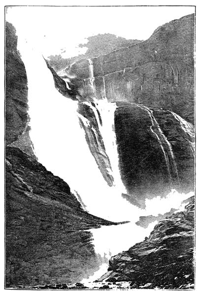
THE SKAEGGDALFORS, NORWAY.
From a Photograph by J. Valentine.
Again, while part of Labrador is rising, parts
of the eastern coast of North America, as far
down as Florida, are slowly sinking. Thus
along the New England coast between New
York and Maine, and again along the Gulf of
St. Lawrence, we find numerous submerged
forests with quantities of trees standing upright
with their roots in old forest-beds, but with the
tops of their stumps some feet below the level
of high tide. In the case of New Jersey the
subsidence is probably taking place at the rate
of two feet in a hundred years.
Before passing on to consider upward movements
of a more rapid nature, such as are frequently
caused by earthquakes, we may pause
for a few moments to consider certain very
slight, but nevertheless very interesting little
movements, such as slight pulsations and tremors,
which have been observed to take place in the
earth's crust (as it is called), and which of late
years have been carefully studied.
Professor Milne, a great authority on earthquakes,
has noticed slight swayings of the earth,
which though occupying a short time—from a
few seconds to a few hours—are still too slow
to produce a shock of any kind. These he calls
"earth pulsations." They have been observed
by means of delicate spirit-levels, the bubbles of
which move with very slight changes of level at
either end of the instrument. At present only
a few experiments of this kind have been made;
but they tell us that the surface of the earth
(which is apparently so firm and immovable) is
subject to slight but frequent oscillations. Some
think that they depend upon changes in the
weight of the atmosphere. If this is so, the
balance between the forces at work below the
earth's surface and those that operate on its
surface must be very easily disturbed. Still we
cannot see that this is a serious objection; on
the contrary, there is much reason to think that
any slight extra weight on the surface, such as
might be caused by an increase of the pressure
of the atmosphere, and still more by the accumulation
of vast sedimentary deposits on the
floor of the ocean, may be quite sufficient to
cause a movement to take place. Moreover, Mr.
G. H. Darwin has shown that the earth's crust
daily heaves up and down under the attraction
of the moon in the same kind of way that the
ocean does; so that we must give up all idea
of the solid earth being fixed and immovable,
and must look upon it as a flexible body, like a
ball of india-rubber (see chap. ix., pp. 314-315).
Slight movements of rather a different kind
have been noticed, to which the name of
"earth-tremors" has been given. These are
very slight jarrings or quiverings of the earth,
too slight to be observed by our unaided senses,
but rendered visible by means of very delicate
pendulums and other contrivances. Now wherever
such observations have been made it has
been discovered that the earth is constantly
quivering as if it were a lump of jelly. In
Italy, where this subject has been very carefully
studied, the tremors that are continually going
on are found to vary considerably in strength;
for instance, when the weather is very disturbed
and unsettled, the movements of the pendulum
are often much greater. Again, before an earthquake
the instrument shows that the tremors
are more frequent and violent.
Another way of observing these curious
little movements is by burying microphones in
the ground. The microphone is a little instrument
invented of late years which is capable
of enormously magnifying the very slightest
sounds, such as our ears will not detect. By
its means one can hear, as some one said, "the
tramp of a fly's foot," if he will be so obliging
as to walk over it. It has thus been proved in
Italy that the earth sends forth a confused
medley of sounds caused by little crackings and
snappings in the rocks below our feet.
In this way it will be possible to predict a
serious earthquake, because it will give warning
some days before, by the increase of the
little tremors and sounds; and it is to be hoped
that by this simple means human lives may
be saved.
Now, these disturbances are of precisely the
same nature as earthquakes,—in fact, we may
call them microscopic earthquakes. To the
geologist they are of great interest, as they
seem to afford some little insight into the difficult
question of the upheaval of mountains,
and to show us something of the constant working
of those wonderful forces below the surface
of the earth by means of which continents are
raised up out of the sea, and mountain-chains
are elevated thousands of feet. It is probable
that both are due to the working of the same
forces, and are accomplished by the same
machinery.
We now pass on to consider those more violent
movements of the solid land known as earthquakes.
This kind of disturbance is such as
might be produced by a sudden shock or
blow given below the ground, from which
waves travel in all directions. First comes a
rumbling noise like the roar of distant artillery;
then come the earthquake waves one after another,
causing the ground to rise and fall as a
ship does on the waves of the sea; the ground
is frequently rent asunder, so that chasms are
formed, into which in some cases men and
animals have been hurled alive. In the case
of a very violent earthquake the waves travel
long distances. Thus the great earthquake by
which Lisbon was destroyed in the year 1755
disturbed the waters of Loch Lomond in Scotland.
In this fearful catastrophe sixty thousand
human beings perished. If the disturbance takes
place near the sea, great sea waves are formed,
which cause fearful destruction to life and property.
This happened in the case of the Lisbon
earthquake; and in the year 1868, when Ecuador
and Peru were visited by a fearful earthquake,
a great sea wave swept over the port of Arica,
and in a few minutes every vessel in the
harbour was either driven ashore or wrecked,
and a man-of-war was swept inland for a
quarter of a mile.
Earthquakes bring about many changes on
the surface of the earth. For example, on
mountain-slopes forests are shattered, and
large masses of soil and débris are shaken
loose from the rock on which they rested, and
hurled into the valleys; streams are thus
choked up, and sometimes lakes formed, either
by the damming up of a river or by the
subsidence of the ground.
It is frequently found after an earthquake
that the level of the ground has been permanently
altered; and this effect of earthquakes
is important in connection with the
subject we are now considering,—namely, how
mountains are upheaved. Sometimes, it is
true, the movement is a downward one; but
more generally it takes place in an upward
direction. As an example of this, we may
mention the Chilian earthquake of 1835,
which was very violent, and destroyed several
towns on that coast, from Copiapo to Chile. It
was afterwards found that the land in the Bay
of Conception had been raised four or five feet.
At the island of Santa Maria, to the southwest
of this bay, the land was raised eight feet, and
in one part ten feet; for beds of dead mussels
were seen at that height above high water, and a
considerable rocky flat that formerly was covered
by the sea now became dry land. It was also
proved by means of soundings that the sea round
the island was shallower by about nine feet.
Now the question arises, "How are earthquakes
caused?" Various suggestions have been
made; but it is pretty clear that all earthquakes
are not produced in the same way. For instance,
volcanic eruptions are frequently attended by
earthquakes. Violent shocks of this nature
generally precede and accompany a great eruption,
as is frequently the case before an eruption
of Mount Vesuvius.
Steam plays a very important part in all
volcanic eruptions; and these earthquakes are
probably caused by great quantities of pent-up
steam at a high pressure struggling to escape.
It is also possible that when molten rock is
forcibly injected into the crevices and joints
of overlying rocks earthquake shocks may be
produced by the concussion. The old Roman
poet and philosopher, Lucretius, endeavoured
to solve this problem, and concluded that "the
shakings of the surface of the globe are occasioned
by the falling in of enormous caverns
which time has succeeded in destroying." But
though the explanation might possibly apply
to a few cases of small earthquakes, it is not
a satisfactory one, for it is not at all likely
that many large cavities exist below the earth's
surface, because the great weight of the overlying
rock would inevitably crush them in.
We have already pointed out that earthquakes
frequently happen in mountainous regions;
and this fact alone suggests that perhaps
the same causes which upheave mountains may
have something to do with earthquakes. But
there are other reasons for believing that the
same force which causes earthquakes also upheaves
mountain-chains. The reader will remember
the case of the Chilian earthquake that
raised part of the Andes a few feet in height.
Now, it is quite clear that the rocks of which
mountains are composed have suffered a great
deal of disturbance. We have only to look
at the crumbled and contorted strata to see
that they have been forced into all kinds of positions,
sometimes standing bolt upright (see diagrams,
chap. ix., p. 307). And as we cannot
believe, for many reasons, that these movements
were of a very sudden or violent kind,
we must consider that they took place slowly
on the whole; but besides being folded and
twisted, the rocks of mountains frequently exhibit
clear signs of having been split and
cracked. The fractures are of all sizes, from
an inch or more up to hundreds or even thousands
of feet. They tell us plainly that the
rocks were once slowly bent, and that after a
certain amount of bending had taken place, the
strain put upon them became greater than they
could bear, and consequently they snapped and
split along certain lines. This is just what
might be expected. For instance, ice on a pond
will bend a good deal, but only up to a certain
amount; after that, it cracks in long lines with
a remarkably sharp and smooth fracture. But
suppose the pressure came from below instead
of from above, as when a number of people are
skating on a pond. Should we not see the ice
forced up in some places, so that some sheets
stood up above the others after sliding past
their broken edges? This is just what the
rocks in different places have frequently done.
After a fracture has taken place the rock on
one side has slid up over the other, and the
two surfaces made by the fracture—like two
long walls—are no longer seen at the same
level. One has been pushed up, while the other
has gone down (see diagram of the ranges of
the Great Basin, chap. viii., p. 273).
Now, it is almost impossible to conceive of
these tremendous fractures taking place in the
rocks below our feet without causing sudden
jars or shocks. Here, then, we seem to have a
clue to the problem. Even if the movements
took place only a few inches or a few feet at
a time, that does not spoil our theory, but rather
favours it; for in that case the upheaval of a
mountain-chain will have taken a very long
time (which is almost certain), and may have
been accomplished bit by bit. Hundreds and
thousands of earthquake shocks, some slight,
and others severe, may have attended the
upheaval of a mountain-range.
This explanation is accepted by many authorities.
It does not exactly imply that mountains
were upheaved by earthquakes; but it means
that the same forces that elevate continents,
heaving them up out of the sea into ridges and
very low arches, have been at work to crumple
and fold their rocks in some places into stupendous
folds, such as we now find form part of
the general structure of mountains; and that
in so doing they caused fearful strains, too great
for the rocks to bear, so that they split over
and over again, and in so doing produced jars
and shocks that must have been very similar
to, if not identical with, earthquake shocks as
we know them at the present day.
Such an explanation is in striking harmony
with what we have already learned about the
operations of Nature. It was from the long-continued
operation of rain and rivers that the
materials now forming mountains were transported
to the seas in which they were slowly
formed. It was also by the ordinary operations
of frost, heat and cold, snow and ice,
streams, rain, and rivers that the mountains received
their present shapes (see chapters v. and
vii.). And now we learn that the gigantic work
of upheaval took place in a tolerably quiet and
uniform manner,—with perhaps only an occasional
catastrophe of a more violent kind,
but still according to the same law of uniformity
which is the very basis of modern geology, and
by means of which so much can be explained.
We could give other proofs of the gradual
elevation of mountains if they were wanted.
But at least enough has been said to give the
reader a glimpse into the methods employed
by geologists in endeavouring to explain how
mountains were upheaved; and to show that
it is only by a careful study of all that is taking
place now on the earth that we can ever hope
to solve the difficult questions that present themselves
to all who study those stony records on
which the earth has written for our enlightenment
the chapters of her ancient history.
In conclusion, it may be asked what is the
nature of the force that accomplishes all this
titanic work of upheaval. Although the question
has been much discussed, and some very
ingenious suggestions brought forward, we cannot
say that any of them are entirely satisfactory.
But we know that the earth is a cooling
body which loses so much heat every year; and
it may be that the shrinking that takes place
as it cools, by leaving the crust of the earth in
some places unsupported, causes it to settle
down, to adapt itself to a smaller surface below,
and in so doing it would inevitably throw itself
into a series of folds, or wrinkles, like those
on the skin of a dried apple. Many think
that mountain-ranges may be explained in
this way.
And surely the mountain fadeth away,
And the rock is removed out of its place,
The waters wear away the stones:
The overflowings thereof wash away the dust of the earth.
Job xiv. 18.
The mighty fortresses of the earth, which seem
so imperishable, so majestic in their strength,
and have from time immemorial received their
title of "the everlasting hills," are nevertheless
undergoing constant change and decay. They
cannot abide for ever. Those waste leagues
around their feet are loaded with the wrecks of
what once belonged to them; they are witnesses
to the victory of the hostile forces that are for
ever contending with them, and pledges of a
final triumph. To those who will read their
story, mountains stand like old dismantled castles,
mere wrecks of ruined masonry, that have
nearly crumbled away, telling us of a time when
all their separate peaks and crags were one solid
mass, perhaps an elevated smooth plateau untouched
by the rude hand of time.
Let us now inquire how the work of destruction
is accomplished. Referring back to our illustration
of the cathedral, given in chap. v., pp.
143-147, the question we have now to consider is,
how the mountains were carved out into all these
wonderful features of crag and precipice, peak
and pass, which are such a source of delight to
all who care for scenery. This work we included
in the one word "ornamentation." What,
then, are the tools which Nature uses in this
work of carving out the hills? What are her
axes and hammers, her chisels and saws?
This question, like many others, must be answered
by observing what takes place at the
present day. It is scarcely necessary to say that
mountains and mountain-ranges are not simply
the result of upheaval, though they have been
upheaved. If that were so, they would probably
appear as long smooth, monotonous ridges, with
no separate mountain masses, no peaks, no
glens or valleys; in some cases they might appear
as simply elevated and smooth plateaux.
Such mountains, if we may so call them, would
be almost as uninteresting as the roof of a
gabled house down which the rain finds its
way in one smooth continuous sheet.
Mountains, reaching as they do into the higher
regions of the atmosphere, where the winds
blow more fiercely than on the plains below,
storms rage more violently, and the extremes of
heat and cold are more severe,—in fact, where
every process of change and decay seems quickened,—suffer
continually at the hands of the
elements.
"Death must be upon the hills, and the cruelty of
the tempests smite them, and the thorn and the briar
spring up upon them; but they so smite as to bring
their rocks into the fairest forms, and so spring as to
make the very desert blossom as the rose."[23]
Nature never leaves them alone, never gives
them a brief armistice in the long war that she
wages against them. She is a relentless enemy,
ever on the move, and ever varying her methods
of attack. Now she assails them openly with
her storm-clouds, and pelts them furiously with
driving rain; now we hear the thunder of her
artillery, as she pierces their crests with strange
electric darts of fire; now she secretly undermines
their sides with her hidden sources of
water, till whole villages are destroyed by some
fearful fall of overhanging rocks (see chapter
iii., pages 96-101). Her winds and gentle
breezes are for ever at work on their surfaces,
causing them to crumble into dust much in
the same way as iron turns to rust.
Again, she heats them by day and then chills
them suddenly at night, under the cold starry
sky, so that they crack under the strain of expanding
and contracting. Now she splits them
with her ice-wedges; now she furrows their sides
with the dashing torrents and running streams;
and yet again she wears them gently down with
her glaciers, and carries away their débris—the
token of her triumph—on those icy streams, as
conquering armies carry the spoils in procession.
This is, briefly, her mode of warfare; these
are some of her tools, wind, rain, frost, snow,
heat and cold, streams, rivers, and glaciers. Lightning
does occasionally break off portions of a
cliff or a mountain-peak; but compared to the
others, this agent is not very important.
Let us first inquire into the effects produced
by the atmosphere. The air around us is composed
mainly of two well-known gases; namely,
oxygen and nitrogen. There is also a small
proportion (about one in ten thousand) of carbonic
acid gas; a variable quantity of water-vapour,
and in the neighbourhood of towns,
traces of other noxious gases, such as sulphurous
acid and chlorine.
Now, the nitrogen plays a very unimportant
part, as it merely serves to dilute the powerful
gas, oxygen, which has such important life-sustaining
properties. We live by breathing oxygen;
so do all animals; and the more pure air
we can contrive to get into our lungs, the better.
But undiluted oxygen would be too strong for
us, and so its strength is diminished by being
mixed with four parts of nitrogen; that is to
say, the air only contains about one fifth by
volume, or bulk, of oxygen and four fifths of
nitrogen.
Now, oxygen, being always ready to combine
chemically with some other element, is a great
agent of change and decay. It attacks all the
metals except gold and platinum. Iron, we all
know, oxidises, or rusts, only too quickly; but
copper, lead, silver, and other metals are more or
less attacked by it. So it is with all the rocks
exposed at or near the surface of the earth.
Oxygen will, if it can, pick out something to
combine with and so bring about chemical
changes which lead to decay. But a much more
powerful agent is the carbonic acid gas in the
atmosphere; although there is so little of it,
there is enough to play a very important part
in causing rocks to crumble away, and in some
cases to dissolve them entirely. The supply of
this gas is continually being renewed, for all
living animals breathe out carbonic acid, and
plants give it out by night. Under the influence
of sunlight plants give out oxygen, so
that gas is supplied to the air by day.
Both oxygen and carbonic acid gas are dissolved
by rain as it falls through the air; and so
we cannot separate the effects of the dry air by
itself from those of rain and mist, which are
more important agents. The action of rain is
partly mechanical, partly chemical, for it not
only beats against them, but it dissolves out certain
mineral substances that they contain.
All rocks are mixtures of two or more kinds
of minerals, the particles of each being often
invisible to the naked eye. Thus granites are
essentially mixtures of felspar, quartz, and mica;
ordinary volcanic rocks ("trap-rocks") of felspar
and augite; sandstones consist mainly of particles
of silica; limestones of carbonate of lime;
shales and slates of silicate of alumina, the principal
substance in clay. These grains are usually
joined together by a cement of some mineral
differing more or less from the other particles.
Lime is found in many of the rocks as the cement
that binds their particles together; while oxide
of iron and silica serve this purpose in many
other instances. Now, if the lime or iron or
silica is dissolved by water, the rock must tend
to crumble away. Any old building shows more
or less manifold signs of such decay, and this
process is called "weathering." All this applies
merely to the surfaces of rocks; and if there
were no other forces at work, their rate of decay
would be very slow.
But there are other forces at work. In the
first place, sudden changes of temperature have a
destructive influence. If the sun shines brightly
by day, the rocks—especially in higher mountain
regions—are considerably expanded by the
heat they receive; and if a hot day is followed
by a clear sky at night, the free radiation of
heat into space (see chap. ii., p. 39) causes them to
become very cold, and in cooling down they contract.
In this way an internal strain is set up
which is often greater than they can bear, and
so they split and crack. Thus small pieces of
rock are detached from a mountain-side. An
Alpine traveller told the writer that one night
when sleeping on a mountain-side, he heard
stones rattling down at frequent intervals. Livingstone
records in his journal that when in the
desert he frequently heard stones splitting at
night with a report like that of a pistol. But
sometimes the expansion by day is sufficient to
cause fragments of rock to be broken off.
Frost, however, is responsible for a vast amount
of destruction among rocks. When water freezes,
it expands with tremendous force; and this is the
reason why water-pipes so frequently burst during
a frost, though we don't find it out until
the thaw comes,—followed by long plumbers'
bills. Rocks, being traversed in several directions
by cracks, allow the water to get into
them, and this in freezing acts like a very powerful
wedge; and so the rocks on the higher
parts of the mountains are continually being
split up by Nature's ice-wedge.
The amount of rock broken up in this way
every year is enormous. Stone walls and buildings
often suffer greatly from this cause during
a long frost, especially if the stone be of a more
than usually porous kind, that can take up a
good deal of rain water.
Where trees, shrubs, etc., grow on rocks, the
roots find their way into its natural divisions,
widened by the action of rain soaking down into
them; and as they grow, they slowly widen them,
and in time portions are actually detached in
this manner. Moreover, the roots and rootlets
guide the rain water down into the cracks, or
joints, as they are called. Even the ivy that
creeps over old ruined walls has a decidedly
destructive effect.
At the base of every steep mountain may be
seen heaps of loose angular stones; sometimes
these are covered with soil, and form long slopes
on which trees and shrubs grow. Every one of
the numerous little gullies that furrow the mountain-sides
has at its lower end a similar little
heap of stones. Sometimes a valley among the
mountains seems half choked with rocky fragments;
and if these were all removed, the valley
would be deeper than it is. In some hot countries,
where the streams only flow in winter,
this is especially the case; for example, every
valley, or "wady," in the region of Mount Sinai
and Mount Horeb is more or less choked up with
boulders and stones of every size, because the
stones come down faster than they can be carried
away.
But the main work of carving out the hills
and mountains of the world is done by streams,
rivers, and glaciers; and so we now pass on to
consider how they perform their tasks. Water
by itself, even when flowing fast, would be powerless
to carve gorges and valleys in the solid
rock; but the stones which torrents and streams
carry along give them a marvellous grinding
power, for with such material a stream continually
wears away its rocky bed. Moreover, the
stones themselves are all the while being rubbed
down by each other, until finally they are ground
down to fine sand and mud, which help in the
work of erosion.
Every mountain stream or torrent runs in
a ravine or valley of some sort; and any traveller
who will take the trouble to watch what
goes on there may easily convince himself
that the ravine, gorge, or valley has been
carved out by the stream, aided by the atmospheric
influences to which we have already
alluded.
But perhaps some may be inclined to look
upon the ravine as a chasm produced by some
violent disturbance from below, whereby the
rocks were rent asunder, and that the stream
somehow found its way into the rent. A little
inquiry will dispel this idea. In the first place,
such catastrophes are quite unknown at the
present day; and as we have more than once
pointed out, the geologist's method is to apply
a knowledge of processes now in operation to
the phenomena of the rocks, in order to read
their history. Secondly, no conclusion can be
accepted which is not supported strongly by
evidence.
If such a rending of the rocks had taken
place, there would assuredly be some evidence
of the fact. We should expect to find a great
crack running all along the bed of the stream;
but of this there is no sign. Go down in any
weather when the stream is low, and look at the
rocks over which it flows, and you will search
in vain for such evidence. Instead of being
broken, the rocks extend continually across.
You would also expect to find the strata "dipping,"
or sloping away from the stream on
each side, if they had been rent by such an
upheaval; but here again we are met by a
total want of evidence. Thirdly, a crack might
be expected to run along more or less evenly
in one direction. But look at the ravine, follow
it up for some miles, and you will see that
it winds along in a very devious course, not in
a straight line.
For these reasons, then, we must conclude that
the ravine or valley has been carved out by the
stream; but perhaps the most convincing arguments
are afforded by the furrows and miniature
ravines so frequently met with on the sides of
all mountains; and it is impossible to examine
these without concluding that they have
in every case been cut out of the solid rock by
the little rapid torrents that run along them
after heavy rain. If we are fortunate enough
to see them on a thoroughly rainy day, we
may derive much instruction from watching
the little torrents at work as they run down
the mountain-side, here and there dashing
over the rocks in little cascades, and bringing
down to the base of the hill much of the
débris that forms higher up. In this way
Nature gives us an "object lesson," and seems
to say: "Watch me at work here, and learn
from such little operations how I work on a
larger scale, and carve out my ravines and
big valleys. Only give me plenty of time,
and I can accomplish much greater feats than
this."
The question of time is no longer disputed;
and all geologists are willing to grant almost
unlimited time, at least periods of time that
seem to us unlimited. Most streams have been
flowing for thousands of years; and when once
we grant that, we find no difficulty in believing
that all valleys are the work of rain and rivers.
Surely no one would argue that the furrows on
a mountain-side are all rents which have been
widened by the action of water; for if they
were rents, each must have been caused by
some disturbance of the rocks composing the
mountain, and we should of course be able to
see the cracks for ourselves, and to find that
the rocks had in some way been disturbed
and rent open.
Even the rain which falls on the road in a
heavy shower teaches the same simple but
important lesson, as it runs off into the gutters
on each side; and we may often find the
road furrowed by little miniature rivers, that
carve out for themselves tiny valleys as they
run off into the gutter, bringing with them
much débris in the form of mud and sand.
Sometimes a stream encounters in its course
a layer of rock that is harder than the rock underlying
it. In this case the softer rock is worn
away faster, and the hard layer forms a kind of
ridge at a higher level; the result is a waterfall.
Waterfalls are frequently found in mountain
streams. In this case, it is easy to trace
the ridge of harder rock running unbroken
across the path of the stream, showing clearly
that it has not been rent in any way. First
it showed merely as a kind of step, but gradually
the force of the falling water told with
greater effect on the softer rock below, wearing
it away more rapidly than that above,
and so the depth of the waterfall went on increasing
year by year; and at the same time
the hard layer was slowly worn away until
the stream sawed its way through.
Some river valleys are steep and narrow;
others are broad, with gently sloping sides.
A careful study of the different valleys in any
large country such as Great Britain, shows
that their forms vary according to the nature
of the rocks through which rivers flow. Where
hard rocks abound, the valleys are steep and
narrow; where soft rocks occur, the valleys
are broad and low. This is only what might
be expected, for hard rocks are not easily worn
away; a river must cut its way through them,
leaving cliffs on either side that cannot be
wasted away by rain. But in a district where
clay or soft sandstone occurs, the rain, as it
finds its way to the valley, will wash them
away and give a smooth gentle slope to the
sides of the valley.
It is very instructive to notice how the
scenery of any district depends on the nature
of its prevailing rocks. Hard rocks give
bold scenery with steep hills and rocky defiles;
while soft rocks make the landscape comparatively
flat and tame, though often very
beautiful in its way, especially where a rich
soil abounds, so that we see pleasant woods,
rich pasture-land, and heavy crops in the
fields.
Compare, for instance, the scenery of Kent
or Surrey with that of the Lake District or
the west of Yorkshire. The difference is due
chiefly to the fact that in Kent and Surrey
we have rocks that succumb more easily to
the action of rain and rivers, and consequently
are worn away more rapidly than the harder
rocks in the north country. Geologists have
a word to express the effects of this wear
and tear; namely, "denudation," which means
a stripping off, or laying bare.
In Kent and Surrey the agents of denudation
(rain and rivers, aided by the effects of the
air, of heat and cold, and so on) wear away
the whole surface of the county in a tolerably
even and uniform manner, because there
are no hard rocks for them to contend with.
In this case rain washes away the sides of
the valleys faster than the river can carve its
bed, consequently the valleys are shallow compared
to their width. And so the streams
have broad valleys, while the hills are smooth
and gently rounded. Chalk, clay, and soft
sandstone abound there. The two latter rocks
are washed away with comparative ease, and
the chalk is dissolved; whereas in the Lake
District we have very much harder and older
rocks, that require to be split up and broken
by the action of frost, while every stream
carves out for itself a steep valley, and great
masses of hard rock stand out as bold hills
or mountains, that seem to defy all the agents
of denudation. Here the opposite is the case,
and the valleys are deepened faster than they
are widened. But for all that, a vast amount
of solid rock has been removed from the surface
there, of which the mountains are, as it
were, but fragments that have escaped the general
destruction. Moreover, the rocks in this
region have been greatly disturbed and crumpled
since they were first formed, and thereby
thrown into various shapes that give certain
peculiar structures more or less capable of
resisting denudation.
Very effective illustrations of the power of
rain by itself are afforded by the "earth
pillars" of the Tyrol, and "cañons" of Colorado.
The material of which they consist
is called conglomerate, because it is composed
of stones and large blocks of rock with
stiff earth or clay between. All the taller
ones have a big stone on the top which protects
the softer material below from being
washed away by heavy rains; and it is easily
perceived that each pillar owes its existence
to the stone on the top, which prevents the
soft materials below it from being washed
away. When, after a time, the weathering of
the soft strata diminishes the support of the
capping boulders, these at last topple over,
and the pillar, thus left unprotected, becomes
an easy prey to the rain, and is rapidly washed
away. Some of the pillars are over a hundred
feet in height. But it is only in places
where heavy rains fall that these interesting
monuments of denudation are to be seen.
By way of contrast we may turn now to a
district in which very little rain falls, but
where the streams have a considerable slope,
and so can wear away, or erode, their valleys
much faster than rain and frost, etc., can
bring down the rocks of which the sides are
composed.
The river Colorado of the West, which runs
from the Rocky Mountains to the Gulf of
California, flows for nearly three hundred miles
at the bottom of a profound chasm, or cañon,
being hemmed in by vertical walls which in
some places are more than a mile in depth.
The tributary streams flowing into the river
run through smaller ravines forming side
cañons; and there is no doubt that these wonderful
chasms have been, in the course of
ages, slowly carved out by the river Colorado
and its numerous tributary streams. Sometimes
the walls of the cañon are not more
than fifty yards apart, and in height they vary
from three thousand to six thousand feet.
Far above the level of the highest floods
patches of gravel are found here and there
on the sides, which must have been left there
by the river when it had not cut its way so
far down. These cañons afford striking testimony
to the erosive power of running water,
of which they are the most wonderful illustration
in the world.
But water, even when in the form of ice,
has more or less power to wear away solid
rock; and the glaciers that we see in Switzerland,
Norway, and other countries must slightly
deepen the rocky valleys down which they flow.
Let us see how this can be accomplished.
The snow that falls in the High Alps, impelled
by the weight of fresh layers of snow
overlying it, and by the slope of the mountain-sides,
gradually creeps down into the valleys.
Owing to the pressure thus put upon it, and
partly to the melting power of the sun's rays,
it assumes the form of ice; and glaciers are
composed of solid ice. The downward motion
is so slow that a glacier appears quite stationary;
and it is only by putting in stakes and
watching them change their positions that it
can be shown to be moving.
In all respects except speed, glaciers flow
like rivers, for ice is a viscous body, behaving
partly like a fluid and yet partly like a solid
substance; but it will not endure a sharp
bend without snapping. Hence, a glacier in
traversing a valley frequently gets split. The
cracks thus formed widen by degrees until
they expand into chasms, or "crevasses." Like
rivers, glaciers transport a large amount of
rocky matter to lower levels, and at the
same time wear away and deepen their rocky
channels.
Let us see how they do this twofold work of
transportation and erosion. In the first place, a
large amount of débris falls onto the sides of a
glacier from the peaks, precipices, and mountain-side
along which it flows. Some stones, however,
fall down crevasses, and so reach the bottom,
where they become cemented in the ice. In
this way they are slowly carried down over the
rocky floor of the valley, until at last they reach
the end of the glacier, where in the warmer air
the ice melts just as fast as it creeps down; and
there they will be left to form a heap of stones,
sand, and mud.
Large blocks of stone, quite different from the
rocks on which they lie, are very numerous, and
are called "erratics," since they are evidently
wanderers from a distance. Sometimes such
blocks can be proved to have been brought
many miles from their home among the higher
peaks. The long lines of stones and mud seen
on the sides of a glacier are called "moraines,"
and at the end of every glacier we find
a big heap known as a "terminal moraine."
But the stones of which they are composed are
probably not to be entirely accounted for in this
way. Can we not conceive that the weight and
pressure of a descending glacier may be sufficient
to break off many protruding portions of the
rocky bed over which it flows, and then to drag
them along with it? This seems reasonable.
Let us therefore consider the materials of which
moraines are composed to be derived partly from
the rocks beneath and partly from those above
the glacier. But whatever their origin, such
materials must inevitably find their way to the
end of the glacier and be added to the big heap
there. The work of transportation is then taken
up by the stream which always flows from the
end of a glacier. Such streams are in summer-time
laden with fine sediment, which gives them
a milky and turbid appearance.
Thus a glacier wears away the rocks over
which it flows; rock fragments become embedded
in the ice, and these are the tools with
which a glacier does its work. It must be
granted that the downward movement of a
great mass of ice is irresistible, and consequently
that as the moving glacier slowly
creeps along, it must inevitably cause the stones
which it thus holds to grind over the surface of
the rock. It is easy to imagine the effects of
this grinding action. If sand-paper, rubbed for
a minute or two over wood, wears down and
smooths its surface, what must be the result of
all these stones, together with sand and mud,
grinding over the rocky bed?
The answer to this question is found in examining
the rocks over which glaciers once
flowed. Now, the Swiss glaciers once extended
far beyond their present limits; and the rocks in
the lower parts of their present valleys, now
free from ice, show unmistakable signs of having
been considerably worn down. The corners
and angles of projecting pieces of rock have
been worn away until the once rugged outline
has become wavy and round, so much so as to
produce more or less resemblance to the backs of
sheep lying down. Hence the name roches moutonnées,
by which rocks of this shape are known.
They frequently retain on their surface peculiar
markings, such as long scratches and grooves
which must have been made as the old glacier,
with its embedded angular fragments of rock,
slowly ground over their surfaces. Such markings
are called "striæ." But besides these glacial
records graven on the rocks, we have other
evidence, in the form of great moraines in some
of the valleys of Switzerland, and especially at
those places where side valleys open out into a
main valley. Any one may learn by a little
observation to recognise these peculiar heaps of
stones, mud, and sand, deposited long ago by the
old glaciers of Switzerland.
It will be perceived that the evidence for the
erosive power of glaciers is of two kinds,—first,
there is the testimony of the smoothed and
striated rocks, which is very convincing; secondly,
the equally strong proofs from the moraines,
both great and small. These old rubbish
heaps give us a very fair idea of the amount of
wear and tear that goes on under a glacier, for
there we see the rock fragments that tumbled
down the mountain-side onto the surface of the
glacier (together with those which the glacier
tore off its rocky bed), all considerably smoothed,
worn down, and striated. But a still better idea
of the work done is afforded by the gravel, mud,
and sand in which these stones are embedded.
All this finer material must have been the result
of wear and tear. This kind of action may well
be compared to what takes place on a grindstone
as one sharpens an axe on it. The water poured
on the stone soon becomes muddy, owing to the
presence of countless little grains of sand worn
off the grindstone. But a good deal of the mud
thus formed is carried away by the little stream
that runs out from the end of every glacier; so
that there is more formed than we see in the
moraine.
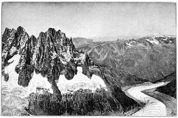
THE MER DE GLACE AND MONT BUET. From a Photograph by Mr. Donkin.
We have already alluded in former chapters
to the "Ice Age" in Britain, when great glaciers
covered all our high mountains, and descended
far and wide over the plains. Now, the evidence
for the former existence of these glaciers is of
the same kind as that which we have just described.
In Wales and Scotland we may soon
learn to recognise the roches moutonnées, the old
moraine heaps, and the erratic boulders brought
down by these old glaciers. Besides these proofs,
there is also the evidence of the arctic plants now
flourishing in the highlands (see chapter iv.,
pages 123-124).
There can be no doubt, then, that glaciers have
an erosive action, and therefore must be regarded
as agents of denudation. But it is important
to bear in mind that their powers in this
direction are limited; for it is manifest that a
mountain stream is a much more powerful agent,
and will deepen its little valley much more
rapidly, than a cumbrous, slow-moving glacier,
advancing at the rate of a few inches a day. It
has been found by careful measurements that
the Mer de Glace of Chamouni moves during
summer and autumn at the average daily rate of
twenty to twenty-seven inches in the centre, and
thirteen to nineteen and one half inches near the
side, where friction somewhat impedes its course.
This seems very slow compared to the rapid
movement of a mountain stream; but then, a
glacier partly makes up for this by its great
weight.
In considering a glacier as an agent of erosion,
we must not forget that probably a good deal of
water circulates beneath glaciers. If this is so,
the water must have a considerable share in producing
the effects to which we have already
alluded. It would be extremely rash to conclude,
as some students of glaciers have done,
that valleys can be carved out entirely by glaciers;
and we must be content with believing that they
have been somewhat deepened by ice-action,
and their features more or less altered, but no
more. The valleys of Switzerland, of Wales,
and Scotland, were probably all in existence before
the period of the "Ice Age," having been
carved out by streams in the usual way; but the
glaciers, as it were, put the final touches and
smoothed their surfaces.
Having learned how the three agents of denudation—namely,
rain, rivers, and glaciers—accomplish
their work, let us now take a wider view
of the subject and consider the results of their
united efforts both in the present and in the
past.
We have already alluded to the enormous
amount of solid matter brought down to the
sea every year by rivers (see chap. v., pp. 166-168),
and we pointed out that all this represents
so much débris swept off the land through
which the rivers flow; also that it comes
down in three ways, one part being suspended
in the water as fine mud, another part being
pushed along the river-bed as gravel, etc.,
while a third part is the carbonate of lime
and other mineral matter in a dissolved state,
and therefore invisible.
Now, it is quite plain that rain and rivers, in
sweeping away so much solid matter from the
surface of the land, must tend in the course of
time to lower its general level; and it therefore
seems to follow that after the lapse of ages any
given continent or large island might be entirely
washed away, or in other words, reduced to the
level of the sea. This would certainly happen
were it not that the lands of the world seem
to be slowly rising, so that the denudation going
on at the surface appears to be counterbalanced
by continued upheaval.
But, supposing no upheaval took place, how
long would it take for rain and rivers to wear
away a whole continent? Let us see if there is
any way of answering this difficult question, for
if it can be even partially solved, it will help us
to realise the enormous length of time that must
have been required to bring about the results of
denudation that we see all around us.
Although the calculations that have been
made on this subject are very complicated, yet
the principle on which they are based is quite
simple. For an answer to our question we
must go to the rivers again, and measure the
work they do in transporting solid matter
down to the sea. Let us take the Mississippi as
a typical big river, for it has been more carefully
studied than any other, and it drains a very
extensive area, embracing many varieties of
climate, rock, and soil. As the result of many
observations carried on continuously at different
parts of the river for months together, the
engineers who conducted the investigation found
that the annual discharge of water by this river
is about nineteen thousand millions of cubic feet,
and that on the average the amount of sediment
it contains is about a 1/1500th part by weight.
But besides the matter in suspension, they observed
that a large amount of sand, gravel, and
stones is being constantly pushed along the bottom
of the river. This they estimated at over
seven hundred and fifty millions of cubic feet.
They also calculated that the Mississippi brings
down every year more than eight hundred thousand
million pounds of mud. Putting the two
together, they found (as before stated) that the
amount of solid matter thus transported down
to the Gulf of Mexico may be represented by a
layer 268 feet high, covering a space of one
square mile; that is, without allowing for what
is brought down dissolved in the water, which
may be neglected in order to prevent any
exaggeration.
Now, it is quite clear that all this débris must
have come from the immense area that is drained
by the Mississippi. It could not have been supplied
by any rivers except those that are its tributaries.
And so if we can find out what is the
extent of this area, it is not difficult to calculate
how much its general surface must have been
lowered, or in other words, how much must have
been worn away from it in order to supply all
the material. This area is reckoned at 1,147,000
square miles; and a very simple calculation
tells us that the general surface would thus
be lowered to the extent of 1/6000th part of a
foot. That of course means that one foot
would be worn away in six thousand years. On
high ground and among mountains the rate
of denudation would of course be much greater;
but we are now dealing with an average for
the whole surface.
The next thing we require to finish this
calculation is the average or mean height of
the American continent. This was reckoned
by the celebrated Humboldt at 748 feet. Now
if we may assume that all this continent is being
worn down at the same rate of one foot in six
thousand years (which is a reasonable assumption),
we find, by a simple process of multiplication,
that it would require about four and a
half millions of years for rain and rivers to
wash it all away until its surface was all at the
sea-level (with perhaps a few little islands
projecting here and there as relics of its vast
denudation). This is a very interesting result;
and if the above measurements are reliable,
they afford us some idea of the rate at which
denudation takes place at the present time.
By a similar process it has been calculated the
British Isles might be levelled in about five and
a half millions of years. Geologists do not pretend
to have solved this problem accurately;
that is impossible with our present knowledge.
But even as rough estimates these results are
very valuable, especially when we come to study
the structure of the land in different countries,
and to find out therefrom, by actual measurement,
how much solid rock has been removed.
We will now give some examples of this; but
perhaps a simple illustration will make our
meaning clearer.
Suppose we picked up an old pair of boots, and
found the soles worn away in the centre. It
would be easy to find out how much had been
worn away over the holes by simply measuring
the thickness of leather at the sides, where we
will suppose that they were protected by strong
nails. Geologists apply a very similar kind of
method in order to find out how much rock has
been removed from a certain region of the
earth. One of the simplest cases of this kind
is that of the area known as the Weald of Kent,
Surrey, and Sussex (see illustration, Fig. 1).
A great deal of denudation has taken place
here, because there is ample evidence to prove
that the great "formation" known as the Chalk
(now seen in the North and South Downs) once
stretched right across; and below this came
the lower greensand and Weald clay. They
spread over this area in a low arch of which we
now only see the ruins.
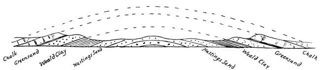
Fig. 1. SECTION ACROSS THE WEALD OF KENT AND SURREY.

Fig. 2. THE HIGHLANDS OF SCOTLAND ON A TRUE SCALE (after Geikie).
The dotted lines in the figure show us their
former extent; but the vertical height is exaggerated,
for otherwise the hills would scarcely
be seen.
These lines simply follow out the curves
taken by the strata at each end of the denuded
arch, and therefore rightly indicate its former
height. By making such a drawing on a true
scale, geologists can easily measure the former
height of the surface of this old arch, or "anticline,"
of chalk, greensand, and other strata,
just as an architect might restore the outlines
of an old traceried window from a few portions
left at the sides.
This very useful and instructive method is
much employed in drawing sections through
mountain-chains, in order to gain some idea
of the amount of denudation which they have
suffered.
Let us see how much has been removed from
the present surface of the Weald. First there
is the chalk, which we may put down at six hundred
feet at least; then there is the lower greensand,
say, eight hundred feet; and below that,
and forming the lowest ground in the Weald, is
the Weald clay, which is one thousand feet
thick, and being softer, was more rapidly borne
away. Along the centre runs a ridge of Hastings
sand, forming higher ground on account
of its greater hardness, but this formation is
not much denuded. However, adding together
the thicknesses of the others, we arrive at the
conclusion that about twenty-four hundred feet
of chalk and other strata has been removed
from the present surface of the Weald. And all
this denudation has probably been effected by
rain and rivers, for it is very doubtful whether
the sea had any share in this work.
But in other parts of our own country we
find proofs of denudation on a much grander
scale than this; for example, in North Wales
there are rocks now lying exposed at the surface
which are of a very much greater antiquity
than any that may be seen in the Wealden area,
belonging to the very ancient periods known as
the Cambrian and Silurian. These have evidently
been exposed for a much longer time
to the action of denuding forces; and the Welsh
hills, as we now see them, are but fragments
of what they once were. After carefully mapping
out the rocks in the neighbourhood of
Snowdon, noting their thickness, the directions
in which they slope, or "dip," so that the structure
of this region might be ascertained, as in
the case of the Weald, it was found, on drawing
sections of the rocks there, and putting in dotted
lines to continue the curves and slopes of the
strata as known at or near the surface, that
from fifteen thousand to twenty thousand feet
of solid rock must have been removed (see diagrams,
chapter ix., p. 307). Applying the same
method to the Lake District, it has been calculated
that the amount of denudation which
that beautiful country has suffered may be represented
by twenty-six thousand feet. Turning
to the other side of the Atlantic, we find the
American geologists estimate that a thickness
of five miles has been removed from a large
part of the Appalachian chain of mountains
(near their east coast), and that at least one
mile has been eroded from the entire region
between the Rocky and Wahsatch Mountains
(see chapter ix.).
In conclusion, we must bear in mind that
mountains, in spite of the enormous erosion they
have suffered, are more capable of resisting the
ever active agents of denudation than the softer
rocks that form the plains and lowlands, and
consequently stand out in bold relief from other
features of the earth's surface. This truth has
been beautifully expressed in the following
passage:—
" ... In order to bring the world into the form
which it now bears, it was not mere sculpture that
was needed; the mountains could not stand for a day
unless they were formed of materials altogether different
from those which constitute the lower hills and
the surfaces of the valleys. A harder substance had
to be prepared for every mountain-chain, yet not so
hard but that it might be capable of crumbling down
into earth, fit to nourish the Alpine forest and the
Alpine flowers; not so hard but that in the midst of
the utmost majesty of its enthroned strength there
should be seen on it the seal of death, and the writing
of the same sentence that had gone forth against the
human frame, 'Dust thou art and unto dust thou shalt
return.' And with this perishable substance the most
majestic forms were to be framed that were consistent
with the safety of man, and the peak was to be lifted
and the cliff rent as high and as steeply as was possible,
in order yet to permit the shepherd to feed his
flocks upon the slope, and the cottage to nestle beneath
their shadow."[24]
'Tis said Enceladus' huge frame,
Heart-stricken by the avenging flame,
Is prisoned here, and underneath
Gasps through each vent his sulphurous breath;
And still as his tired side shifts round,
Trinacia echoes to the sound
Through all its length, while clouds of smoke
The living soul of ether choke.
Virgil: Æneid iii.
In some parts of the world we meet with mountains
of a very different kind from any we have
yet considered,—mountains that are known at
times to send forth fiery streams of glowing
lava, and to emit with terrific force great clouds
of steam. Such mountains have long been
known, in popular but unscientific language, as
"burning mountains,"[25]—a term which is unfortunate,
because they do not burn in the proper
sense of the word, like candles or gas-jets.
They are better known as volcanoes. There
are about three hundred and fifty known active
volcanoes; and if we include all mountains that
once were in that state, the number is about one
thousand.
Such mountains are connected in a curious way
with those upheaved ridges of the world known
as mountain-chains (see chap. vi., p. 191). And
not only are many mountains more or less penetrated
and intersected by rocks of an igneous
origin (see chap. v., p. 155), but some have been
largely formed by the action of old volcanoes.
In fact, there are hills in Great Britain and
parts of Europe, in America, and other countries,
that once were actual volcanoes (see page 277).
We must briefly consider these strange mountains
so different from others, and see what we can
find out about them. Let us first inquire how a
volcano is made, then consider what a volcano
does; that is, we must view it as a geological
agent that has a certain definite part to play in
the economy of the world. And lastly, we may
glance at some of the old volcanoes, and see what
they were doing in those long ages of the world
during which the great series of the stratified
rocks were formed,—which rocks are, as it were,
the book in which the earth has written her
autobiography.
In old days volcanoes were regarded with
superstitious awe; and any investigation of
their actions would have been considered rash
and impious in the highest degree. Mount Etna,
as Virgil tells us, was supposed to mark the spot
where the angry gods had buried Enceladus,
one of the rebellious giants. Volcano, a certain
"burning mountain" in the Lipa Islands, was
likewise called the forge, or workshop, of Vulcan
(or Volcan), the god of fire. And so it comes
about that all "burning mountains" take their
name from this one Mediterranean island, and
at the same time tell us of the mythological
origin of the word. It has been said that words
are "fossil thoughts;" and we have here an old
and very much fossilised thought,—a kind of
thought long since extinct among civilised
peoples, and one which is never likely to come
to life again.
A volcanic mountain consists of alternating
sheets of lava and volcanic ashes, mantling
over each other in an irregular way, and all
sloping away from the centre. In the centre
is a pit or chimney, widening out towards the
top so as to resemble a funnel or cup; hence
the name "crater," which means a cup. In
the centre of this crater a very small cone
("minor cone") is frequently found; and it
is interesting to find that many of the moon's
volcanic craters possess these "minor cones."
A number of cracks or fissures intersect the
volcano. These frequently spread out from
the centre of the mountain in all directions,
like the spokes of a wheel. They generally
get filled with lava that wells up from below,
thus forming "dykes," which may be regarded
as so many sheets of igneous rock, such as
basalt, that have forced their way while still
liquid in among the layers of lava and ashes.
The word "ash" is used by geologists in a special
sense; and volcanic ash is not, as might
be supposed, a deposit of cinders, but mostly
of dust of various degrees of fineness, and
sometimes it is very fine indeed. Pieces of
pumice-stone may be embedded in a layer
of volcanic ash, and sometimes great blocks
of stone that have been shot out of the volcano
as from a big gun, but these only form
a small part of the layer. Dykes strengthen
the mountain, and tend to hold it together
when violently shaken during an eruption.
The shape and steepness of a volcano depend
on the nature of the materials ejected.
The finer the volcanic ash, the steeper and
more conical is the mountain. The building
up of a volcano may be fairly illustrated by
the little cone of sand formed in an hourglass
as the sand-grains fall. These settle
down at a certain slope, or angle, at which
they can remain, instead of falling down to
the bottom, as they do directly this slope is
exceeded. Some volcanoes are built up almost
entirely of volcanic ash and its embedded
blocks. Vesuvius, Teneriffe, Jorullo, in Mexico,
and Cotopaxi, in the Andes, are examples
of steep volcanic cones built up in this
way. Others, less steep and more irregular
in shape, are chiefly formed of successive
lava-flows. Little minor cones are frequently
formed on the side of a volcano; and these
during an eruption give rise to small outbursts
of their own. They are easily accounted
for by the dykes which are mentioned
just now; for when molten rock forces its
way through fissures, it sometimes finds an
outlet at the surface, and being full of steam,
as soda-water is full of gas, it gives rise to
an eruption. The great opening in the centre
of a volcano, with its molten lava, is like a
very big dyke that has reached the surface
and so succeeded in producing an eruption.
The opening of a soda-water bottle not infrequently
illustrates a volcanic eruption; for
when the pent-up carbonic acid cannot escape
fast enough, it forces out some of the water,
even when the bottle is held upright.
Every volcano has been built up on a platform
of ordinary stratified rocks; and at some
period after these had been laid down in
water and raised up into dry land, molten
rock found its way through them, and so the
volcano was built up by successive eruptions
during many years. It is probable that earthquake
shocks, preceding the first eruption,
cracked up these strata, and so made a way
for the lava to come up.
The main point we wish to emphasize is
that volcanoes are never formed by upheaval.
In this way they differ from all other mountains.
They have not been made by the heaving
up of strata, but have been gradually
piled up, something like rubbish heaps that
accumulate in the Thames barges as the dustmen
empty their carts into them, only in the
case of volcanoes the "rubbish" comes from
below. It is not necessary to suppose that
the reservoir down below, from which the molten
rock is supplied, exists at any very great
depth below the original land surface on
which the volcano grows up.
The old "upheaval theory" of volcanoes,
once advocated by certain authorities, instead
of being based on actual evidence or on reasoning
from facts, was a mere guess. Moreover,
if the explanation we have given should
not be sufficiently convincing, there is good
proof furnished by the case of a small volcano
near Vesuvius, the building of which
was actually witnessed. It is called Monte
Nuovo, or the New Mountain. It is a little
cone 430 feet high, on the bank of Lake
Averno, with a crater more than a mile and a
half wide at the base. It was almost entirely
formed during a single night in the year
1538, A. D. We have two accounts of the
eruption to which it owes its existence; and
each writer says distinctly that the mountain
was formed by the falling of stones and
ashes.
One witness says,—
"Stones and ashes were thrown up with a noise
like the discharge of great artillery, in quantities
which seemed as if they would cover the whole
earth; and in four days their fall had formed a
mountain in the valley between Monte Barbaro and
Lake Averno, of not less than three miles in circumference,
and almost as high as Monte Barbaro
itself,—a thing incredible to those who have not
seen it, that in so short a time so considerable a
mountain should have been formed."
Another says,—
"Some of the stones were larger than an ox.
The mud (ashes mixed with water) was at first
very liquid, then less so, and in such quantities
that with the help of the afore-mentioned stones a
montain was raised one thousand paces in height."
(The writer's astonishment led him greatly to
exaggerate the height.)
These accounts are important as showing how
in a much longer time a big volcano may be
built up. From such small operations we learn
how Nature works on a large scale. The great
volcano in Mexico known as Jorullo was probably
built up in a very similar way. There is
a tradition among the natives that it was made
in two or three days; but we can hardly believe
that. Volcanoes, as they get older, tend to grow
taller and bigger; but every now and then a
large portion may be blown away by some
great eruption, and they have, as it were, to
begin again.
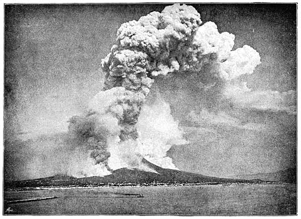
THE ERUPTION OF VESUVIUS IN 1872. From an Instantaneous Photograph.
Let us now consider volcanoes as geological
agents, and see what they do. A volcanic eruption
may be described in a general way as follows:
Its advent is heralded by earthquakes
affecting the mountain and the whole country
round; loud underground explosions are heard,
resembling the fire of distant artillery. The
vibrations are chiefly transmitted through the
ground; the mountain seems convulsed by internal
throes, due, no doubt, to the efforts of
the imprisoned steam and liquid rock to find an
opening. These signs are accompanied by the
drying up of wells and disappearance of springs,
since the water finds its way down new cracks
in the rocks, caused by the frequent shocks and
quiverings. When at last an opening has been
made, the eruption begins,—generally with one
tremendous burst that shakes the whole mountain
down to its foundations. After this, frequent
explosions follow with great rapidity and
increasing violence, generally from the crater.
These are indicated by the globular masses of
steam which are to be seen rising up in a tall
column like that which issues from the funnel
of a locomotive. But sometimes the whole
mountain seems to be more or less engaged
in giving out steam, and thus to be partly
enveloped in it. This is illustrated by our engraving
from an instantaneous photograph of
Vesuvius in eruption in the year 1872. The
steam and other gases, in their violent ascent,
hurl up into the air a great deal of solid rock
from the sides of the central opening, after first
blowing out the stones which previously stopped
up the orifice.
Blocks of stone falling down meet with others
coming up; and so a tremendous pounding action
takes place, the result of which is that great
quantities of volcanic dust and ashes are produced,
generally of extreme fineness. Winds
and ocean currents transport these light materials
for long distances. The observations made
during the famous and fruitful voyage of
H. M. S. "Challenger" showed that fine volcanic
dust is carried by wind and marine currents
to almost all parts of the oceans. The
darkness so frequently mentioned in accounts
of eruptions—sometimes at a very great distance
from the volcano—is entirely caused by
clouds of volcanic dust hiding the light of the
sun. Perhaps the best example of this is the
case of the eruption of Krakatoa (in the Strait
of Sunda, between Sumatra and Java) in 1883.
Its explosions were heard in all directions for
two thousand miles, and a perceptible layer of
volcanic dust fell at all places within one thousand
miles; while the finest dust and vapour,
shot up fifteen or twenty miles high, were spread
all over the globe, causing, while still suspended
in the atmosphere, the peculiar red sunsets
noticed in all parts of the world for some
months after the eruption.
Again, those very curious deposits of "red
clay" found in the very deepest parts of the
Pacific and Atlantic oceans (at depths of about
four thousand fathoms, or twenty-four thousand
feet) have been shown to be chiefly composed
of volcanic dust, their red colour being due to
oxidised iron.
But there is another way in which a good
deal of fine volcanic dust is made; and it is
this: the lava is so full of steam intimately
mixed up with it that the steam, in its violent
effort to escape, often blows the lava into mere
dust.
Another interesting phenomenon may be thus
described: Portions of liquid, or half liquid,
lava are caught up by the steam and hurled into
the air. These assume a more or less round
form, and are known as "bombs." At a distance
they give rise to the appearance of flames.
And here we may remark that the flaring,
coloured pictures of Etna or Vesuvius in eruption,
which frequently may be seen, are by no
means correct. The huge flames shooting up
into the air are quite imaginary, but are probably
suggested by the glare and bright reflection
from glowing molten lava down in the crater.
So great is the force of the pent-up steam
trying to escape that it frequently blows a large
part of the volcano bodily away; and in some
cases a whole mountain has been blown to
pieces.
Finally, torrents of rain follow and accompany
an eruption,—a result which clearly follows
from the condensation of large volumes of steam
expanding and rising up into the higher and
cooler layers of the atmosphere. Vast quantities
of volcanic ash are caught up by the rain,
and in this way very large quantities of mud
are washed down the sides of the mountain.
Sometimes the mud-flows are on a large
scale, and descending with great force, bury
a whole town. It was mostly in this way
that the ancient cities of Herculaneum and
Pompeii were buried by the great eruption
of Vesuvius in the year 79 A. D., in which
the elder Pliny lost his life. The discoveries
made during excavations at Pompeii are of
very great interest as illustrating old Roman
life. The Italians give the name lava d'acqua,
or water-lava, to flows of this kind, and
they are greatly dreaded on account of their
great rapidity. An ordinary lava-stream creeps
slowly along, so that people have time to get
out of the way; but in the case of mud-flows
there is often no time to escape. No lava-stream
has ever reached Pompeii since it was
first built, although the foundations of the
town stand upon an old lava-flood. Herculaneum
is nearer to Vesuvius, and has at times
been visited by lava-streams. Mud-lavas, ashes,
and lava-streams have accumulated over this
city to a depth of over seventy feet.
Lava-streams vary greatly in size; in some
cases the lava, escaping from craters, comes to
rest before reaching the base of the slopes of
the volcano; in other cases a lava-flow not
only reaches the plains below, but extends for
many miles over the surrounding country.
Hence lava-streams are important geological
agents. Let us look at some famous instances.
The most stupendous flow on record was that
which took place from Skaptar Jökull in
Iceland, in the year 1783. In this case a
number of streams issued from the volcano,
flooding the country far and wide, filling up
river gorges which were in some cases six
hundred feet deep and two hundred and fifty
feet broad, and advancing into the alluvial
plains in lakes of molten rock twelve to fifteen
miles wide and one hundred feet deep.
Two currents of lava which flowed in nearly opposite
directions spread out with varying thickness
according to the nature of the ground for
forty and fifty miles respectively. Had this
great eruption taken place in the south of
England, all the country from the neighbourhood
of London to that of Gloucester might
have been covered by a flood of basalt of considerable
thickness.
Sometimes, when the lava can only escape
at a point low down on the mountain, a fountain
of molten rock will spout high into the
air. This has happened on Vesuvius and Etna.
But in an eruption of Mauna Loa, in the Sandwich
Islands, an unbroken fountain of lava,
from two hundred to seven hundred feet high
and one thousand feet broad, burst out at the
base of the mountain; and again in April,
1888, the same thing happened on a still
grander scale. In this case four fiery fountains
continued to play for several weeks,
sometimes throwing the glowing lava to a
height of one thousand feet in the air. Surely
there can be no more wonderful or awful
sight than this in the world.
The volcanoes of Hawaii, the principal island
in the Sandwich Islands, often send forth lava-streams
covering an area of over one hundred
square miles to a depth of one hundred
feet or more; but they are discharged quite
quietly, like water welling out of a spring.
Repeated flows of this kind, however, have in
the course of ages built up a great flat cone
six miles high from the floor of the ocean, to
form this lofty island, which is larger than
Surrey; and it is calculated that the great
volcanic mountain must contain enough material
to cover the whole of the United States
with a layer of rock fifty feet deep.
But it is not only on the surface of the
land that volcanic eruptions take place; for in
some cases the outbreak of a submarine eruption
has been witnessed, and it is highly probable
that in past geological ages many large
eruptions of this nature have taken place. In
the year 1783, an eruption took place about
thirty miles off the west coast of Iceland.
An island was built up from which glowing
vapour and smoke came forth; but in a year
or less the waves had washed everything
away, leaving only a submerged reef. The
island of Santorin, in the Greek Archipelago,
is a partly submerged volcano.
But in some cases enormous outpourings of
lava have taken place, not from volcanoes, but
from openings of the ground here and there,
and more usually from long fissures or cracks
in the rocks lying at the surface. In many
cases so much lava has quietly welled out in
this way that the old features of the landscape
have been completely buried up, and
wide plains and plateaux formed over them.
Sir A. Geikie says,—
"Some of the most remarkable examples of this
type of volcanic structure occur in western North
America. Among these that of the Snake River
plain in Idaho may be briefly described.
"Surrounded on the north and east by lofty mountains,
it stretches westward as an apparently boundless
desert of sand and bare sheets of black basalt.
A few streams descending into the plain from the
hills are soon swallowed up and lost. The Snake
River, however, flows across it, and has cut out
of its lava bed a series of picturesque gorges and
rapids.
"The extent of country which has been flooded with
basalt in this and adjoining regions of Oregon and
Washington has not yet been accurately surveyed,
but has been estimated to cover a larger area than
France and Great Britain combined. Looked at
from any point on its surface, one of these lava
plains appears as a vast level surface, like that of a
lake bottom. This uniformity has been produced
either by the lava rolling over a plain or lake bottom,
or by the complete effacement of an original, undulating
contour of the ground under hundreds of feet
of lava in successive sheets. The lava, rolling up
to the base of the mountains, has followed the
sinuosities of their margin, as the waters of a lake
follow its promontories and bays."
A few further examples of mud-lavas may
be mentioned here. Cotopaxi, a great volcano
in Ecuador, South America, with a height
of 17,900 feet, reaches so high into the atmosphere
that the higher parts are capped
with snow. In June, 1877, a great eruption
took place, during which the melting of snow
and ice gave rise to torrents of mud and
water, which rushed down the steep sides of
the mountain, so that large blocks of ice were
hurried along. The villages around to a distance
of about seventy miles were buried
under a deposit of mud, mixed with blocks of
lava, ashes, pieces of wood, etc.
Sometimes a volcano discharges large quantities
of mud directly from the crater. In this
case the mud is not manufactured by the
volcano itself, but finds its way through fissures
and cracks from the bed of the neighbouring
sea or rivers to the crater. Thus, in
the year 1691, Imbaburu, one of the Andes of
Quito, sent out floods of mud containing dead
fish, the decay of which caused fever in the
neighbourhood. In the same way the volcanoes
of Java have often buried large tracts
of fertile country under a covering of volcanic
mud, thus causing great devastation.
Vast quantities of dust are produced, as
already explained, by the pounding action that
takes place during an eruption, as portions
of rock in falling down meet others that are
being hurled into the air. Striking instances
of this have occurred not far from Great
Britain. Thus in the year 1783, during an
eruption of Skaptar Jökull, so great was the
amount of dust thus created that the atmosphere
in Iceland was loaded with it for
several months. Carried by winds, it even
reached the northern parts of Scotland, and
in Caithness so much of it fell that the crops
were destroyed. This is remarkable, considering
that the distance was six hundred miles.
Even in Holland and Norway there are traces
of this great shower of dust from the Icelandic
volcano.
During the fearful eruption of Tomboro, a
volcano in the island of Sumbawa, in the
Eastern Archipelago, in 1815, the abundance
of ashes and dust ejected caused darkness
at midday at Java, three hundred miles away,
and even there the ground was covered to
a depth of several inches. In Sumbawa itself
the part of the island joining the mountain
was entirely desolated, and all the houses
destroyed, together with twelve thousand inhabitants.
Trees and herbage were overwhelmed
with pumice and volcanic dust. The
floating pumice on the sea around formed a
layer two feet, six inches thick, through which
vessels forced their way with difficulty. From
such facts as these it is clear that if in past
ages volcanoes have been so powerfully active as
they are now, we should expect to find lava-flows,
dykes, and great deposits of volcanic ash
deposited in water among the stratified rocks;
and such is the case. Many large masses of
rock familiar to the geologist, and often forming
parts of existing mountains, are to be accounted
for either as great lava-flows, or dykes that
have forced their way in among the strata, or
as extensive deposits of volcanic ash.
But perhaps the reader would like to know
what the inside of a volcanic crater is like during
an eruption. Let us, then, take a peep
into that fearful crater of Kilauea, in the Sandwich
Islands. For this purpose we cannot
do better than follow Miss Bird's admirable
description of her adventurous expedition to
this crater:—
"The abyss, which really is at a height of four
thousand feet, on the flank of Mauna Loa, has the
appearance of a pit on a rolling plain. But such a
pit! It is quite nine miles in circumference, and at
its lowest area—which not long ago fell about three
hundred feet, just as ice on a pond falls when the
water below is withdrawn—covers six square miles.
The depth of the crater varies from eight hundred to
one thousand feet, according as the molten sea below
is at flood or ebb. Signs of volcanic activity are
present more or less throughout its whole depth, and
for some distance round its margin, in the form of
steam-cracks, jets of sulphurous vapour, blowing
cones, accumulating deposits of acicular crystals of
sulphur, etc., and the pit itself is constantly rent and
shaken by earthquakes. Grand eruptions occurred
with circumstances of indescribable terror and dignity;
but Kilauea does not limit its activity to these
outbursts, but has exhibited its marvellous phenomena
through all known time in a lake or lakes on the
southern part of the crater three miles from this side.
"This lake—the Hale-mau-mau, or 'House of
Everlasting Fire,' of the Hawaiian mythology, the
abode of the dreaded goddess Pele—is approachable
with safety, except during an eruption. The
spectacle, however, varies almost daily; and at times
the level of the lava in the pit within a pit is so low,
and the suffocating gases are evolved in such enormous
quantities, that travellers are unable to see anything.
There had been no news from it for a week;
and as nothing was to be seen but a very faint bluish
vapour hanging round its margin, the prospect was not
encouraging.... After more than an hour of very
difficult climbing, we reached the lowest level of the
crater, pretty nearly a mile across, presenting from
above the appearance of a sea at rest; but on crossing
it, we found it to be an expanse of waves and convolutions
of ashy-coloured lava, with huge cracks filled
up with black iridescent rolls of lava only a few
weeks old. Parts of it are very rough and ridgy,
jammed together like field-ice, or compacted by rolls
of lava, which may have swelled up from beneath;
but the largest part of the area presents the appearance
of huge coiled hawsers, the ropy formation of
the lava rendering the illusion almost perfect. These
are riven by deep cracks, which emit hot sulphurous
vapours....
"As we ascended, the flow became hotter under our
feet, as well as more porous and glistening. It was
so hot that a shower of rain hissed as it fell upon it.
The crust became increasingly insecure, and necessitated
our walking in single file with the guide in
front, to test the security of the footing. I fell through
several times, and always into holes full of sulphurous
steam so malignantly acid that my strong dogskin
gloves were burned through as I raised myself on
my hands.
"We had followed the lava-flow for thirty miles up to
the crater's brink, and now we had toiled over recent
lava for three hours, and by all calculation were close
to the pit; yet there was no smoke or sign of fire,
and I felt sure that the volcano had died out for once
for our special disappointment....
"Suddenly, just above, and in front of us, gory drops
were tossed in the air, and springing forwards we
stood on the brink of Hale-mau-mau, which was about
thirty-five feet below us. I think we all screamed. I
know we all wept; but we were speechless, for a new
glory and terror had been added to the earth. It is
the most unutterable of wonderful things. The words
of common speech are quite useless. It is unimaginable,
indescribable; a sight to remember for ever; a
sight which at once took possession of every faculty
of sense and soul, removing one altogether out of
the range of ordinary life. Here was the real 'bottomless
pit,' 'the fire which is not quenched,'
'the place of Hell,' 'the lake which burneth with
fire and brimstone,' 'the everlasting burnings,' 'the
fiery sea whose waves are never weary.'[26] There were
groanings, rumblings, and detonations, rushings,
hissings, splashings, and the crashing sound of
breakers on the coast; but it was the surging of fiery
waves upon a fiery shore. But what can I write?
Such words as jets, fountains, waves, spray, convey
some idea of order and regularity, but here there was
none. The inner lake, while we stood there, formed
a sort of crater within itself; the whole lava sea rose
about three feet; a blowing cone about eight feet high
was formed; it was never the same two minutes
together. And what we saw had no existence a
month ago, and probably will be changed in every
essential feature a month hence.... The prominent
object was fire in motion; but the surface of the double
lake was continually skimming over for a second or
two with a cooled crust of a lustrous grey-white, like
frosted silver, broken by jagged cracks of a bright
rose-colour. The movement was nearly always from
the sides to the centre; but the movement of the centre
itself appeared independent, and always took a
southerly direction. Before each outburst of agitation
there was much hissing and throbbing, internal roaring,
as of imprisoned gases. Now it seemed furious,
demoniacal, as if no power on earth could bind it,
then playful and sportive, then for a second languid,
but only because it was accumulating fresh force....
Sometimes the whole lake ... took the form of
mighty waves, and surging heavily against the partial
barrier with a sound like the Pacific surf, lashed, tore,
covered it, and threw itself over it in clots of living
fire. It was all confusion, commotion, forces, terror,
glory, majesty, mystery, and even beauty. And the
colour, 'eye hath not seen' it! Molten metal hath
not that crimson gleam, nor blood that living light."[27]
Continued observation of volcanoes, together
with evidence derived from history, teaches that
there are different stages of volcanic action.
There are three pretty well-marked phases.
First, the state of permanent eruption; this
is not a dangerous state, because the steam keeps
escaping all the time: the safety-valve is at
work, and all goes smoothly. The second state
is one of moderate activity, with more or less
violent eruptions at brief intervals; this is
rather dangerous, because at times the safety-valve
does not work.
And thirdly, we have paroxysms of intense
energy, alternating with long periods of repose
sometimes lasting for centuries. These eruptions
are extremely violent, and cause widespread
destruction; the safety-valve has got
jammed, and so the boiler bursts.
No volcano has been so carefully watched
for a long time as Vesuvius. Its history illustrates
the phases we have just mentioned. The
first recorded eruption is that of A. D. 79, a very
severe one of the violent type, by which Herculaneum,
Pompeii, and Stabiæ were buried.
We have an interesting account by the younger
Pliny. Before this great eruption took place,
Vesuvius had been in a state of repose for eight
hundred years, and if we may judge from the
Greek and Roman writings, was not even suspected
of being a volcano. Then followed an
interval of rest until the reign of Severus, the
second eruption taking place in the year 203.
In the year 472, says Procopius, all Europe
was covered more or less with volcanic ashes.
Other eruptions followed at intervals, but there
was complete repose for two centuries; that is,
until the year 1306. In 1500 it was again
active, then quiet again for one hundred and
thirty years. In 1631 there took place another
terrific outburst. After this many eruptions
followed, and they have been frequent ever
since. Vesuvius is therefore now in the second
stage of moderate activity.
But geologists can take a wider view than
this. They can sum up the history of a volcanic
region of the earth; and the result is
somewhat as follows: Volcanoes, like living
creatures, go through different periods or
phases, corresponding roughly to youth, middle
age, old age, and finally decay. The invasion
of any particular area of the earth's surface by
the volcanic forces is heralded by underground
shocks, or earthquakes. A little later on cracks
are formed, as indicated by the rise of saline
and hot springs, and the issuing of carbonic
acid and other gases at the surface of the earth.
As the underground activity becomes greater,
the temperature of the springs and emitted
gases increases; and at last a visible rent is
formed, exposing highly heated and glowing
rock below. From the fissure thus formed, the
gas and vapours imprisoned in the molten rocks
escape with such violence as to disperse the
latter in the form of pumice and volcanic ash,
or to cause them to pour out as lava-streams.
The action generally becomes confined to one
or more points along the line of action (which
is a line of fissures and cracks). In this way a
chain of volcanoes is formed, which may become
the seat of volcanic action for a long time.
When the volcanic energies have become
somewhat exhausted, so that they cannot raise
up the lava and expel it from the volcanic crater,
nor rend the sides of the volcano and cause
minor cones to grow up on their flanks, small
cones may be formed at a lower level in the
plains around the great central chain. These
likewise are fed from fissures.
Later on, as the heated rock below cools
down, the fissures are sealed up by lava that has
become solid; and then the volcanoes fall, as it
were, into the "sere and yellow leaf," and remain
in a peaceful, quiet state befitting their
old age.
After this they begin to suffer from long exposure
to the atmospheric influences of decay,
and rain and rivers wash them away more or
less completely.
But still the presence of heated rocky matter
at no great depth below is proved by the outbursts
of gases and vapours, the forming of
geysers and ordinary hot springs. Gradually,
however, even these signs of heat below disappear;
and the cycle of volcanic phases is at an
end. Such a series of changes may require millions
of years; but by the study of volcanoes in
every stage of their growth and decline it is
possible thus to sketch out an outline of their
history.
It must be confessed that in the present state
of scientific knowledge no full and complete
explanation of volcanic action is possible. Geologists
and others are as yet but feeling their
way cautiously towards the light which, perhaps
before long, will illumine the dark recesses
of this mysterious subject. Many theories and
ideas have been put forward, but in the opinion
of the writer the most promising explanation is
one that may be briefly expressed as follows:
There are below the crust of the earth large
masses of highly heated rock that are kept solid
by the enormous pressure of the overlying rocks,
or otherwise they would melt,—for it is a
known fact that pressure tends to prevent the
melting of a solid body. But when earth-movements
taking place within the earth's crust—such
as the upheaving of mountain-chains—take
off some of the weight, the balance between
internal heat and the pressure from above is no
longer maintained; and so these highly heated
rocks run off into the liquid state, and finding
their way to the surface through the fissures
mentioned above, give rise to volcanic action.
There is much to be said in favour of this view.
It rightly connects volcanic action with movements
of upheaval, with mountain-chains and
lines of weakness in the earth's crust.
There is very good reason to believe that the
earth was once in a highly heated state, and has
been slowly cooling down for ages. The increase
of temperature observed in penetrating mines
tells us that it still retains below the surface some
of its old heat. We need not therefore be surprised
at the existence of heated masses of rock
down below, or seek, as some have done, an entirely
different source for the origin of volcanic
heat than that which remains from the earth's
once molten condition. It would take too long
to state the reasons on which this idea of the
former state of our planet is based, and moreover,
it would bring us into the region of astronomy,
with which we are not concerned at
present.
In various parts of Great Britain and Ireland
we meet with old volcanic rocks,—lavas, intrusive
dykes, and sheets of basalt, etc., together
with vast deposits of volcanic ash, which, sinking
into the old neighbouring seas, became stratified,
or arranged in layers like the ordinary sedimentary
rocks. In some cases we see embedded
in these layers the very "bombs" that were
thrown out by the old volcanoes (see page 253).
And besides these purely volcanic rocks, we often
meet in these areas with great bosses of granite,
which must have been in some way connected
with the old volcanoes, and probably were in
many cases the source from which much of the
volcanic rock was derived. But more than this,
in a few instances we have the site of the old
volcano itself marked out by a kind of pipe, or
"neck," now filled with some of its volcanic
débris in the shape of coarse, rounded fragments
(see page 277).
During a very ancient period, known to geologists
as the Silurian Period, great lava-flows
took place from volcanoes situated where North
and South Wales and the Lake District now
are; and by their eruptions a vast amount of
volcanic ash was made, which fell into the sea
and slowly sank to the bottom, so that the shell-fish
living there were buried in the strata thus
formed, and may now be seen in a fossilised
condition.

Fig. 1. THE RANGES OF THE GREAT BASIN, WESTERN STATES OF NORTH AMERICA, SHOWING A SERIES OF
GREAT FRACTURES AND TILTED MASSES OF ROCK.

Fig. 2. SECTION THROUGH SNOWDON.
Thus Snowdon, Cader Idris, the Arans, Arenig
Mountain, and others, are very largely
made up of these ancient volcanic materials.
The writer has picked up specimens of fossil
shell-fish near the summit of Snowdon from a
bed of fine volcanic ash that forms the summit.
Fig. 2 represents a section through Snowdon,
from which it will be seen that we have first a
few sedimentary strata, S, then a great lava-flow,
L; and that volcanic ashes accumulated
on the top of this, of which A A are patches
still left. B is an intrusive dyke of a basaltic
rock that forced its way through afterwards.
Again, in the Lake District there is a well-known
volcanic series of stratified rocks of the
same age, consisting mostly of lavas and ashes,
the total thickness of which is about twelve
thousand feet (known as the "Green Slates and
Porphyries"), so that a large part of some of
the mountains there have also been built up
by volcanic action; but no traces of the old
volcanoes remain.
Going farther north we find abundant proof
that volcanic action on a prodigious scale took
place in Scotland during the very ancient period
of the Old Red Sandstone, with which the name
of Hugh Miller will always be associated. In
Central Scotland we see lava-flows and strata
formed of volcanic ash, with a thickness of
more than six thousand feet, fragments of
which, having escaped the destructive agents
of denudation, now form important chains of
hills, such as the Pentland, Ochil, and Sidlaw
ranges. Nor was the volcanic action confined
to this region. In the district of the Cheviot
Hills similar volcanic rocks are to be seen.
But here again the old volcanoes have long
since been swept away, leaving us only portions
of their outpourings buried in the hills.
There can be no doubt that the present area
of the Grampian Hills was once the site of a
considerable number of volcanoes, only at a
much higher level than their present surface,
elevated though that is to the region of the
clouds; but in this case subsequent denudation
has been so enormous that the old mountain
surface has been planed away until all
we can now see is a series of separate patches
of granite, that were once in a fused and
highly heated state far below the surface, and
formed part of the subterranean reservoirs
from which the volcanoes derived their great
supplies of lava and steam. It is indeed difficult
to imagine the enormous amount of denudation
which has taken place in the Highlands
of Scotland, and to realise that the magnificent
range of the Cairngorms, for instance, has
been for ages worn down until now they are but
a remnant of what they once were.
In this region we see the once boiling and
seething masses of rock which fed the old volcanoes,
now no longer endowed with life-like
power by the force of steam, but lying
in deathlike cold and stiffness, with their
beautiful crystals of mica and felspar sparkling
in the sun. The volcanic fires have died
out; but the traces of their work are unmistakable,
among which we must not forget to
reckon the beautiful minerals made by the
action of heated water upon the surrounding
rocks.
The beautiful cairngorm stones are still
sometimes found on the mountain from which
they take their name, and in all volcanic regions
minerals are plentiful.
The well-known hill called Arthur's Seat,
close to Edinburgh, marks the site of an old
volcano. The "neck," or central opening, may
be seen at the top of the hill, but choked up
with volcanic rocks and débris. The crater has
long since disappeared, but Salisbury Craigs
and St. Leonard's Craigs are formed of a great
sheet of basalt that intruded itself among the
stratified rocks that had been formed there,
and so belong really to a great intrusive dyke.
In the Castle Rock we see the same basalt
again.
During a much later age, known as the Miocene
Period (see chap. x., p. 324), enormous outpourings
of lava took place in Western Europe,
covering hundreds of square miles. Of these
the most important is that which occupies a
large part of the northeast of Ireland, and extends
in patches through the Inner Hebrides and
the Faröe Islands into Iceland. These eruptive
rocks, unlike those above referred to, must have
poured out at the surface, and have taken the
form of successive sheets, such as we now see in
the terraced plateaux of Skye, Eigg, Canna,
Muck, Mull, and Morven. These, then, are
patches of what once formed a great plain of
basalt. During later times this volcanic platform
has been so greatly cut up by the agents of
denudation that it has been reduced to mere
scattered fragments; thousands of feet of basalt
have been worn away from it; deep and wide
valleys have been carved out of it; and in many
cases it has been almost entirely stripped off
from the wide areas it once covered. Where,
as in the Isle of Eigg, the lava has been
piled up in successive sheets, with some layers
of volcanic ash between, the latter has been
worn away rather faster than the hard layers
of basalt, and each lava-flow is clearly marked
by a terrace. These volcanic eruptions have
thus had a great influence in moulding the
scenery of this region. In Ireland the old
basalts are well seen at the Giant's Causeway,
and on the Scottish coast we see them again at
the well-known Fingal's cave at Staffa. This
island, like the others, is just a patch of the old
lava-streams.
Its curious six-sided columns illustrate a fact
with regard to the subsequent cooling of lava-flows.
Some internal forces, analogous to that
which regulates the shapes of crystals, have
caused it to crack along three sets of lines, so
placed with regard to each other as to produce
six-sided columns.
In Ireland the basalts attain a thickness of
nine hundred feet; in Mull they are about
three thousand feet thick. It has been clearly
proved that Mull is the site of one of the old
volcanoes of this period, but very few others
have as yet been detected. Perhaps the eruptions
took place mainly from large fissures,
instead of from volcanic cones, for it is known
that the ground below the lava-sheets has
been rent by earthquakes into innumerable fissures,
into which the basalt was injected from
below.
In this way a vast number of "dykes" were
formed. These have been traced by hundreds
eastwards from this region across Scotland, and
even the north of England. In this case the
molten rock was struggling to get through the
overlying rocks and escape at the surface;
but apparently it did not succeed in so doing,
for we do not find lava-flows to the east and
south. These basalt dykes are found as far
south as Yorkshire, and can be traced over
an area of one hundred thousand square
miles.
It is thus evident that in the Miocene Period
a great and extensive mass of molten basalt
was underlying a large part of the British
Isles, and probably the weight of the thick
rocks overlying it was sufficient to prevent its
escape to the surface. If it had succeeded in
so escaping and overflowing, how different the
scenery of much of Scotland and Northern
England might have been!
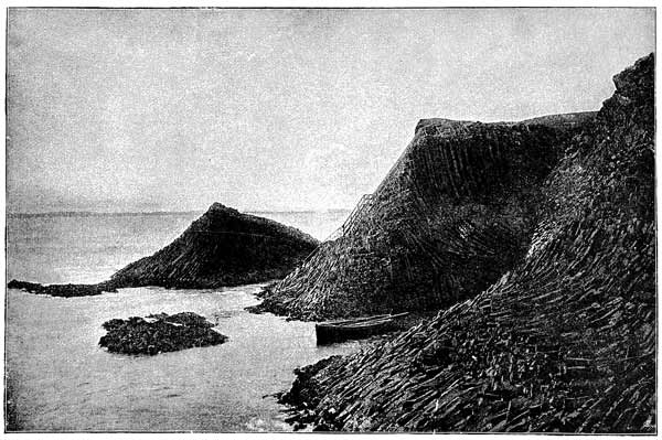
COLUMNAR BASALT AT CLAMSHELL CAVE, STAFFA. From a Photograph by J. Valentine.
The splendour falls on castle walls
And snowy summits old in story;
The long light shakes across the lakes,
And the wild cataract leaps in glory.
Blow, bugle, blow, set the wild echoes flying;
Blow, bugle; answer, echoes, dying, dying, dying.
Tennyson.
The dying splendours of the sun slowly
sinking and entering the "gates of the West"
may well serve as a fitting emblem of the
mountains in their beautiful old age, awaiting
in silent and calm dignity the time when
they also must be brought low, and sink in
the waters of the ocean, as the sun appears
daily to do. Yes, they too have their day.
They too had their rising, when mighty forces
brought them up out of their watery bed.
Many of them have passed their hey-day of
youth, and their midday; while others, far advanced
in old age, are nearing the end of their
course.
But as the sun rises once more over eastern
seas to begin another day, so will the substance
of the mountains be again heaved up
after a long, long rest under the sea, and
here and there will rise up from the plains
to form the lofty mountain-ranges of a distant
future.
Everywhere we read the same story, the
same circle of changes. The Alpine peak that
proudly rears its head to the clouds must surely
be brought low, and finally come back to the
same ocean from which those clouds arose. It
is in this way that the balance between land
and water is preserved. In passing through
such a great circle of changes, the mountains
assume various forms and shapes which are
determined by:—
- 1. Their different ages and states of decay.
- 2. The different kinds of rocks of which they are
composed, and especially by their "joints," or natural
divisions.
- 3. The different positions into which these rocky
layers have been squeezed, pushed, and crumpled by
those stupendous forces of upheaval of which we
spoke in chapter vi.
Let us therefore glance at some of these
external forms, and then look at the internal
structure of mountains.
In so doing we shall find that we have yet
a good deal more to learn about mountains
and how they were made; and also we
shall then be in a better position to realise
not only how very much denudation they
have suffered, but also how greatly they have
been disturbed since their rocks were first
made.
Every one who knows mountains must have
observed how some are smooth and rounded,
others sharp and jagged, with peaks and pinnacles
standing out clearly against the sky;
some square and massive, with steep walls
forming precipices; others again spread out
widely at their base, but the sloping sides
end in a sharp point at the top, giving to the
mountain the appearance of a cone. Their
diversities of shape are so endless that we cannot
attempt to describe them all.
First, with regard to the general features of
mountains. Looked at broadly, a mountain-range
is not a mere line of hills or mountains
rising straight up from a plain on each side,
such as school-boys often draw in their maps;
very far from it. Take the Rocky Mountains,
for instance. "It has been truly said of the
Rocky Mountains that the word 'range' does
not express it at all. It is a whole country
populous with mountains. It is as if an ocean
of molten granite had been caught by instant
petrifaction when its billows were rolling
heaven high."[28]
It has often been observed by mountain
climbers that when they get to the top of a
high mountain, and take a bird's-eye view of
the country, all the mountain-tops seem to
reach to about the same height, so that a line
joining them would be almost level. For this
reason, perhaps, writers so often compare them
to the waves of an ocean. This feature is
very conspicuous in the case of the Scotch
Highlands.
Sir A. Geikie has well described what he
saw from the top of Ben Nevis:—
"Much has been said and written about the wild,
tumbled sea of the Highland Hills. But as he sits on
his high perch, does it not strike the observer that
there is after all a wonderful orderliness, and even
monotony, in the waves of that wide sea? And when
he has followed their undulations from north to south,
all round the horizon, does it not seem to him that
these mountain-tops and ridges tend somehow to rise
to a general level; that, in short, there is not only on
the great scale a marked similarity of contour about
them, but a still more definite uniformity of average
height? To many who have contented themselves
with the bottom of the glen, and have looked with awe
at the array of peaks and crags overhead, this statement
will doubtless appear incredible. But let any
one get fairly up to the summits and look along them,
and he will not fail to see that the statement is nevertheless
true. From the top of Ben Nevis this feature
is impressively seen. Along the sky-line, the wide sweep
of summits undulates up to a common level, varied
here by a cone and there by the line of some strath or
glen, but yet wonderfully persistent round the whole
panorama. If, as sometimes happens in these airy
regions, a bank of cloud with a level under-surface
should descend upon the mountains, it will be seen to
touch summit after summit, the long line of the cloud
defining, like a great parallel ruler, the long level line
of the ridges below. I have seen this feature brought
out with picturesque vividness over the mountains of
Knoydart and Glen Garry. Wreaths of filmy mist
had been hovering in the upper air during the forenoon.
Towards evening, under the influence of a cool breeze
from the north, they gathered together into one long
band that stretched for several miles straight as the
sky-line of the distant sea, touching merely the higher
summits and giving a horizon by which the general
uniformity of level among the hills could be signally
tested. Once or twice in a season one may be fortunate
enough to get on the mountains above such a
stratum of mist, which then seems to fill up the irregularities
of the general platform of hill-tops, and to
stretch out as a white phantom sea, from which the
highest eminences rise up as little islets into the clear
air of the morning.... Still more striking is the example
furnished by the great central mass of the
Grampians, comprising the Cairngorm Mountains and
the great corries and precipices round the head of
the Dee. This tract of rugged ground, when looked
at from a distance, is found to present the character
of a high, undulating plateau."[29]
This long level line of the Highland mountain-tops
may be seen very well from the lower
country outside; for example, from the isles of
Skye and Eigg, where one may see the panorama
between the heights of Applecross and
the Point of Ardnamurchan showing very
clearly the traces of the old table-land.
How are we to explain this curious fact, so
opposed to our first impressions of a mountain
region? It is quite clear that the old plateau
thus marked out cannot be caused by the arrangement
or position of the rocks of which
the Highlands are composed. If these rocks
were found to be lying pretty evenly in flat
layers, or strata, undisturbed by great earth-movements,
we could readily understand that
they would form a plateau. But the reverse is
the case: the rocks are everywhere thrown
into folds, and frequently greatly displaced by
"faults;" yet these important geological features
have little or no connection with the
external aspect of the country. It is therefore
useless to look to internal structure for an
explanation. We must look outside, and consider
what has been for ages and ages taking
place here.
As already pointed out, an enormous amount
of solid rock has been removed from this region—thousands
and thousands of feet. It was long
ago planed down by the action of water, so that a
table-land once existed of which the tops of the
present mountains are isolated fragments. No
other conclusion is possible. To the geologist
every hill and valley throughout the whole
length and breadth of the Highlands bears
striking testimony to this enormous erosion.
The explanation we are seeking may therefore
be summed up in one word, "denudation." The
valleys that now intersect the table-land have
been carved out of it. If we could in imagination
put back again onto the present surface
what has been removed, we should have a
mental picture of the Highlands as a wide,
undulating table-land; and this rolling plain
would suggest the bottom of the sea. The long
flat surfaces of the Highland ridges, cut across
the edges of inclined or even upright strata,
are the fragments of a former base-line of
erosion; that is, they represent the general
submarine level to which the Highlands were
reduced after exposure to the action of "rain
and rivers," and finally of the sea. As the sea
gradually spread over it, it planed down everything
that had not been previously worn away,
and so reduced the whole surface to one general
level like the sea-bed of the present day. But
it is not necessary to suppose that the whole
region was under water at the same time, and
it is probable that there were separate inland
seas or lakes. In these the rocks of the Old
Red Sandstone were formed; and they in their
turn have suffered so much denudation that only
patches and long strips of them are left on the
borders of the Highlands.
Before we speak of individual mountains and
their shapes, it is important to bear in mind
another fact about mountain-chains; namely,
that they are very low in proportion to their
breadth and length. The great heights reached
by some mountains produce such a powerful impression
on our senses that we hardly realise
how very insignificant they really are. It is
only by drawing them on a true scale that we
can realise this. The surface of the earth is so
vast that even the highest mountains are in proportion
but as the little roughnesses on the skin
of an orange. Fig. 2 (see chap, vii., p. 236) represents
a section through the Highlands, drawn
on the same scale for height as for length.
What has been said about the Highland plateau
applies equally well to many other mountain-ranges.
Mr. Ruskin observed something
rather similar in the Alps. He says,—
"The longer I stayed in the Alps, and the more
closely I examined them, the more I was struck by
the one broad fact of there being a vast Alpine plateau,
or mass of elevated land, upon which nearly all the
highest peaks stood like children set upon a table,
removed, in most cases, far back from the edge of the
plateau, as if for fear of their falling; ... and for the
most part the great peaks are not allowed to come to
the edge of it, but remain like the keeps of castles,
withdrawn, surrounded league beyond league by comparatively
level fields of mountains, over which the
lapping sheets of glaciers writhe and flow, foaming
about the feet of the dark central crests like the surf
of an enormous sea-breaker hurled over a rounded
rock and islanding some fragment of it in the midst.
And the result of this arrangement is a kind of
division of the whole of Switzerland into an upper
and a lower mountain world,—the lower world consisting
of rich valleys, bordered by steep but easily
accessible, wooded banks of mountain, more or less
divided by ravines, through which glimpses are
caught of the higher Alps; the upper world, reached
after the first steep banks of three thousand or four
thousand feet in height have been surmounted, consisting
of comparatively level but most desolate tracts
of moor and rock, half covered by glacier, and stretching
to the feet of the true pinnacles of the chain."
He then points out the wisdom of this arrangement,
and shows how it protects the
inhabitants from falling blocks and avalanches;
and moreover, the masses of snow, if cast down
at once into the warmer air, would melt too
fast and cause furious inundations.
All the various kinds of rocks are differently
affected by the atmospheric influences of decay,
and so present different external appearances and
shapes, so that after a little experience the geologist
can recognize the presence of certain rocks
by the kind of scenery they produce; and this
knowledge is often of great use in helping him
to unravel the geological structure of a difficult
region. Thus granite, crystalline schists, slates,
sandstones, and limestones, all "weather" in
their own ways, and moreover split up differently,
because their joints and other natural
lines of division run in different ways.
Thus granite is jointed very regularly, some
of the joints running straight down and others
running horizontally, so that the rain and atmosphere
seize on these lines and widen them
very considerably; and thus the granite is weathered
out either in tall upright columns, like
those seen at Land's End, or else into great
square-shaped blocks with their corners rounded
off, presenting the appearance of a number of
knapsacks lying one over the other. In this
way we can account for the well-known "Tors"
of Devonshire, and the "Rocking Stones."
Granite weathers rapidly along its joints, and
its surfaces crumble away more rapidly than
might be expected, considering how hard a rock
it is; but the felspar which is its chief mineral
constituent is readily decomposed by rain
water, which acts chemically upon it. The
deposits of China clay in Devonshire are the
result of the decomposition and washing away
of the granite of Dartmoor.
Granite mountains are generally rounded and
"bossy," breaking now and then into cliffs, the
faces of which are riven by huge joints, and
present a very different appearance from those
composed of crystalline schists with their sharp
crests and peaks. Ben Nevis and the Cairngorms
are partly composed of granite.
Gneiss is a rock composed of the same minerals
as granite; namely, mica, quartz, and
felspar. And yet mountains composed of this
rock have quite a different aspect, and sometimes,
as in the Alps, produce very sharp and
jagged pinnacles. The reason of this is that
gneiss splits in a different way from granite, because
its minerals are arranged in layers, and so
it is more like a crystalline schist.
Mica-schist is another rock very abundant in
mountain regions. This rock is composed of
quartz and mica arranged in wavy layers. The
mica, which is very conspicuous, lies in thin
plates, sometimes so dovetailed into each other
as to form long continuous layers separating it
from those of the quartz; and it readily splits
along the layers of mica. This mineral is easily
recognised by its bright, shiny surface. There
are, however, two varieties,—one of a light
colour and the other black.
Mica-schist and gneiss are often found in
the same region, and are the materials of
which most of the highest peaks in Europe
are composed. We find them abounding in
the district of Mont Blanc; and all the
monarch's attendant aiguilles, with the splintered
ridges enclosing the great snowfields
in the heart of the chain, consist mostly of
these two rocks. The Matterhorn, Weisshorn,
Monte Viso, the Grand Paradis, the Aiguille
Verte and Aiguille du Dru are examples of
the wonderful forms produced by the breaking
up and decay of these two rocks.
The different varieties of slate split in a
very marked way. Slates are often associated
with the schists, and exert their influence
in modifying the scenery.
Limestone ranges, though less striking in
the outlines of their crests than those composed
of slates and crystalline schists, and
not reaching to such heights, are nevertheless
not at all inferior in the grandeur of their
cliffs, which frequently extend for miles along
the side of a valley in vast terraces, whose
precipitous walls are often absolutely inaccessible.
The beauty of limestone mountains
is often enhanced by the rich pastures and
forests which clothe their lower slopes. The
dolomitic limestone of the Italian Tyrol, being
gashed by enormous vertical joints and at
the same time having been formed in rather
thin layers which break up into small blocks,
produces some very striking scenery. But wild
as these mountainous ridges may be, their
forms can never be confounded with those
of the crystalline schists; for however sharp
their pinnacles may appear at first sight,
careful examination will always show that
their outline is that of ruined masonry,
suggesting crumbling battlements and tottering
turrets, and not the curving, flame-like
crests and splintered peaks of the crystalline
schists.[30]
It has already been explained that all sedimentary
rocks have been formed under water
in layers or strata, and it must be obvious
that the stratification of such rocks has an
important influence on scenery; and very much
depends on whether the strata have been left
undisturbed, with perhaps just a slight slope,
or whether they have been folded and crumpled;
for the position of the strata, or "bedding,"
as it is called,—whether flat, inclined,
vertical, or contorted,—largely determines the
nature of the surface. Undoubtedly the most
characteristic scenery formed by stratified rocks
is to be seen in those places where the "bedding"
is horizontal, or nearly so, and the
strata are massive. A mountain constructed of
such materials appears as a colossal pyramid,
the level lines of stratification looking like
great courses of masonry. The joints that cut
across the strata allow it to be cleft into great
blocks and deep chasms; so that, as in the case
of the dolomitic limestone above mentioned, we
find a resemblance to ruined buildings.
We cannot find a better example of this in
our own country than the mountains of sandstone
and conglomerate (of the Cambrian age)
that here and there lie on the great platform
of old gneiss in the west of Sutherland and
Ross. Sir A. Geikie says,—
"The bleak, bare gneiss, with its monotonous undulations,
tarns, and bogs, is surmounted by groups of
cones, which for individuality of form and independence
of position better deserve to be called mountains
than most of the eminences to which that name
is given in Scotland. These huge pyramids, rising to
heights of between two thousand and four thousand
feet, consist of dark red strata, so little inclined that
their edges can be traced by the eye in long, level
bars on the steeper hillsides and precipices, like lines
of masonry. Here and there the hand of time has
rent them into deep rifts, from which long 'screes'
(slopes of loose stones) descend into the plains below,
as stones are detached from the shivered walls of an
ancient battlement. Down their sides, which have in
places the steepness of a bastion, vegetation finds but
scanty room along the projecting ledges of the sandstone
beds, where the heath and grass and wildflowers
cluster over the rock in straggling lines and
tufts of green; and yet, though nearly as bare as the
gneiss below them, these lofty mountains are far from
presenting the same aspect of barrenness. The prevailing
colour of their component strata gives them a
warm red hue, which even at noon contrasts strongly
with the grey of the platform of older rock....
These huge isolated cones are among the most striking
memorials of denudation anywhere to be seen in
the British Isles. Quinag, Canisp, Suilven, Coulmore,
and the hills of Coygoch, Dundonald, Loch Maree,
and Torridon are merely detached patches of a formation
not less than seven thousand or eight thousand
feet thick, which once spread over the northwest of
Scotland. The spaces between them were once occupied
by the same dull red sandstone; the horizontal
stratification of one hill, indeed, is plainly continuous
with that of the others, though deep and wide valleys,
or miles of low moorland, may now lie between.
While the valleys have been worn down through the
sandstone, these strange pyramidal mountains that
form so singular a feature in the landscapes of the
northwest highlands have been left standing, like
lonely sea-stacks, as monuments of long ages of
waste."[31]
Again, the vast table-lands of the Colorado
region illustrate on a truly magnificent scale,
to which there is no parallel in the Old
World, the effects of atmospheric erosion on
undisturbed and nearly level strata. Here we
find valleys and river gorges deeper and longer
than any others in the world; great winding
lines of escarpment, like ranges of sea cliffs;
terraced slopes rising at various levels; huge
buttresses and solitary monuments, standing
like islands out of the plains; and lastly,
great mountain masses carved out into the
most striking and picturesque shapes, yet with
their lines of "bedding" clearly marked out.
On the other hand, where, as is almost always
the case in mountain-ranges, the stratified
rocks have been folded, crumpled, twisted, and
fractured by great "faults," we find a very
different result. In these cases the rocks have
generally been very much altered by the action
of heat. For here we find crystalline schists,
gneiss, granite, and other rocks in the formation
of which heat has played an important
part; and very often the igneous rocks have
forced their way through those of sedimentary
origin and altered them into what are called
metamorphic rocks (see chapter v., page 156).
Thus they have lost much of their original
character and structure.
The repeated uplifts and subsidences of the
earth's crust, by which the continents of the
world have been raised up out of the sea to
form dry land, have, broadly speaking, thrown
the rocky strata into a series of wave-like
undulations. In some extensive regions these
undulations are so broad and low that the
curvature is quite imperceptible, and the
strata appear to lie in horizontal layers, or
to slope very slightly in a certain direction.
This is, in a general way, the position of
the strata of which plains and plateaux are
composed.
But in the longer and comparatively narrow
mountain regions that traverse each of the
great continents, forming, as it were, backbones
to them, the undulations are very much more
frequent, narrower, and higher. Sometimes the
rocks have been thrown into huge open waves,
or the folds are closely crowded together, so
that the strata stand on their ends, or are even
completely overturned, and thus their proper
order of succession is reversed, and the older
ones actually lie on the top of the newer
ones.
As we approach a great mountain-chain we
observe many minor ridges and smaller chains
running roughly parallel with it, and, as it
were, foreshadowing the great folds met with
in the centre of the chain and among its
highest peaks. These small folds become
sharper and closer the nearer we get to the
main chain, and evidently were formed by
the same movements that uplifted the higher
ranges beyond; but the force was not so
great. Thus we find the great Alpine chain
flanked to the north by the smaller ranges of
the Jura Mountains; and on the south, side of
the Himalayas we find similar smaller ranges
of hills.
Ruskin thus describes his impression of the
Jura ranges, which he very aptly compares
with a swell on the sea far away from a storm,
the storm being represented by the wild sea of
Alpine mountains:—
"Among the hours of his life to which the writer
looks back with peculiar gratitude, as having been
marked with more than ordinary fulness of joy or
clearness of teaching, is one passed, now some years
ago, near time of sunset, among the masses of pine
forest which skirt the course of the Ain, above the
village of Champagnole, in the Jura. It is a spot
which has all the solemnity, with none of the savageness,
of the Alps; where there is a sense of a great
power beginning to be manifested in the earth, and of
a deep and majestic concord in the rise of the long
low lines of piny hills,—the first utterance of those
mighty mountain symphonies, soon to be more loudly
lifted and wildly broken along the battlements of the
Alps. But their strength is as yet restrained; and
the far-reaching ridges of pastoral mountain succeed
each other, like the long and sighing swell which
moves over quiet waters from some far-off stormy
sea.
"And there is a deep tenderness pervading that
vast monotony. The destructive forces and the stern
expression of the central ranges are alike withdrawn.
No frost-ploughed, dust-encumbered paths of ancient
glacier fret the soft Jura pastures; no splintered
heaps of ruin break the fair ranks of her forests; no
pale, defiled, or furious rivers rend their rude and
changeful ways among her rocks. Patiently, eddy by
eddy, the clear green streams wind along their well-known
beds; and under the dark quietness of the undisturbed
pines there spring up, year by year, such
company of joyful flowers as I know not the like
among all the blessings of the earth."
Long faults, or fractures, where the strata
have been first bent and then broken, and afterwards
have been forced up or have slid down
hundreds or even thousands of feet, are very
numerous in mountain-ranges; and by suddenly
bringing quite a different set of rocks to the
surface, these faults cause considerable difficulty
to the geologist, as he goes over the ground
and endeavours to trace the positions of the
different rocks.
In these vast folds it sometimes happens
that portions of older (and lower) strata are
caught up and so embedded among those of
newer rocks. It will therefore be readily perceived
that to unravel the geological structure
of a great mountain-chain is no easy task.
We need not then be surprised if in some cases
the arrangement of the rocks of mountains is
not thoroughly understood. The wonder is,
when we think of the numerous difficulties
which the geologist encounters,—the arduous
ascents, the precipices, glaciers, snowfields obscuring
the rocks from his view, the overlying
soil of the lower parts, and the steep crests
and dangerous ridges that separate the snowfields,—that
so much has already been discovered
in this difficult branch of geology.
However, the general arrangement of the
rocks of which many mountain-chains are composed
has been satisfactorily made out in not a
few cases. Let us look into some of these
and see what has been discovered.
You will remember the structure of the
Weald, described in chap. vii., pp. 235-238, and
how we showed that a great low arch of chalk
strata has been entirely removed over that area,
so that at the present time only its ends are seen
forming the escarpments of the North and South
Downs. This area, then, is now a great open
valley, or rather a gently undulating plain enclosed
by low chalk hills. Now, an arch of this
kind is called an "anticline," and it might have
been expected that it would have remained more
or less unbroken to the present day. Why, then,
has it suffered destruction?
In the first place, chalk is a soft rock, and one
that rain water can dissolve; but more than that,
its arch-like structure was against it, and its
chance of preservation was decidedly small. In
architecture the arch is the most firm and stable
structure that can be made; but not so with
strata, and this is the reason. Such an arch was
not made of separate blocks, closely fitting and
firmly cemented together; on the contrary, the
arch was stretched and heaved up from below.
It therefore must have been more or less cracked
up; for rocks are apt to split when bent, although
when deeply buried under a great thickness of
overlying rocks, they will bend very considerably
without snapping. But this was not the case
here. And so the forces of denudation set to
work upon an already somewhat broken mass of
rock. Try to picture to yourself this old low
arch of chalk as it was when it first appeared as
dry land. Probably some of it had already
been planed away by the waves of the sea, and
what was left was by no means well calculated to
withstand the action of the agents of denudation.
If you look back to the figure, you will see the
dotted lines showing the former outline of this
anticline, or arch, and you perceive at once that
the strata must have been sloping outwards
away from the middle. Now, this one fact
greatly influenced its fate, for an anticline
cannot be regarded as a strong or stable arrangement
of strata. It is easy to see why; suppose
a little portion were cut away on one side at its
base by some stream. It is clear that a kind of
overhanging cliff would be left, and blocks of
chalk would sooner or later come rolling down
into the valley of the little stream. When these
had fallen, they would leave an inclined plane
down which others would follow; and this would
continue to take place until the top of the arch
was reached. The same reasoning applies to the
other side. It is very seldom that arches, or
anticlines, can last for a long time. The outward
slope of the strata and their broken condition
are against them.
But when the rocks dip inwards, to form a
kind of trough or basin, it is just the opposite.
Such basins are known as "synclines;" and a
structure of this kind can be shown to be much
more stable and permanent than an anticline.
The strata, instead of being stretched out and
cracked open, have been squeezed together.
It is very important to bear this in mind,
and to remember how differently anticlines and
synclines are affected; for this simple rule is
illustrated over and over again in mountain-ranges:—
Anticlines, being unstable, are worn away until
they become valleys.
Synclines, being stable, are left and frequently
form mountains.
Now look at the section through the Appalachian
chain (see Fig. 1), and you will see that
each hill is a syncline, and the valleys between
them are anticlines. This happens so frequently
that almost every range of mountains
furnishes examples; but as every rule has its
exceptions, so this one has, and we may find
an example in the case of the Jura Mountains
outside the Alps.
It will be seen from the section that the ridges
are formed by anticlines, and the valleys by synclines.
But on looking a little more closely, we
see that the tops of the former have suffered a
considerable amount of erosion (as indicated by
the dotted lines). Now, the reason why they
have not been completely worn down into valleys
is that these rocks were once covered by
others overlying them, so that this outer covering
of rocks had first to be removed before they
could be attacked by rain and rivers. These
wave-like ridges of the Jura are being slowly
worn down; and the time must come when they
will be carved out into valleys, while the synclines
between them will stand out as hills. It
is simply a question of time. But many mountain-chains
have a far more complicated structure
than that of the Appalachians, and consist
of violently crumpled and folded strata (see
section of Mont Blanc, Fig. 3).
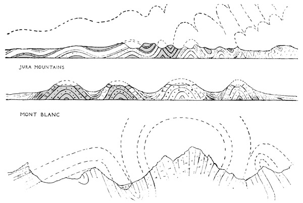
SECTIONS OF MOUNTAIN-RANGES, SHOWING THEIR STRUCTURE AND THE AMOUNT OF ROCK WORN AWAY.
It might naturally be asked how such sections
are made, considering that we cannot cut
through mountains in order to find out their
structure; but Nature cuts them up for us,
gashing their sides with ravines and valleys
carved out by streams and rivers, and in steep
cliffs and precipices we find great natural sections
that serve our purpose almost equally well.
Sometimes, however, we get considerable help
from quarries and railway-cuttings.
Take, for example, one of the synclinal folds
in the Appalachian chain. Its structure is
ascertained somewhat as follows. Suppose you
began to ascend the hill, armed with a good
map, a pocket-compass, a clinometer,—a little
instrument for measuring the angles at which
strata dip or slope,—and with a bag on your
back for specimens of rocks and fossils. At
the base of the hill you might notice at starting
a certain layer of rock—say a limestone—exposed
by the side of the stream. It will be so
many feet thick, and will contain such-and-such
fossils, by means of which you can identify it;
and it will dip into the interior of the hill at
a certain angle, as measured by the clinometer.
As you rise higher, this rock may be succeeded
by sandstone of a certain thickness, and likewise
dipping into the hill; and so with the
other rocks that follow, until you reach the
summit.
By the time you have reached the top of the
hill, you know the nature of all the rocks up
that side, and the way they dip; and all your
observations are carefully recorded in a notebook.
Then you begin to descend on the other
side, and in so doing you find the same set of
rocks coming out at the surface all in the same
order; only this order is now reversed, because
you are following them downwards instead of
upwards. Of course they are hidden in many
places by soil and loose stones; but that does
not matter, because at other places they are exposed
to view, especially along ravines, carved
out of the mountain-side. Also rocks "weather"
so differently that they can often be distinguished
even at a distance.
In this kind of way you can find out the
structure of a mountain, and draw a section of
it when you get home, by following out and
completing the curves of the strata as indicated
at or near the surface; and you find they fit in
nicely together.
Fig. 3 (see page 307) represents what is
believed to be the general arrangement of the
rocks of Mont Blanc. The section is greatly
simplified, because many minor folds and all
the faults, or dislocations, are omitted. Now,
in this case we have an example of what
is known as the "fan-structure." It will be
seen at once that the folds have been considerably
squeezed together; and the big fold in the
centre indicated by dotted lines has been so
much compressed in the lower part—that is,
in what is now Mont Blanc—that its sides
were brought near to each other until they
actually sloped inwards instead of outwards.
You may easily imitate this structure by
taking a sheet of paper, laying it on the table,
and then, putting one hand on each side of it,
cause it to rise up in a central fold by pressing
your hands towards each other. Notice carefully
what happens. First, you get a low arch,
or anticline, like that of the Weald. Then as
you press it more, the upward fold becomes
sharper and narrower; then continue pressing
it, and you will find the fold bulging out at the
top, but narrowing in below until you get this
fan-structure.
This is just what has happened in the case of
the Alps. A tremendous lateral pressure applied
to the rocks heaved them up and down into great
and small folds, and in some places, as in Mont
Blanc, fan-structure was produced. Imagine
the top of the fan removed, and you get what
looks like a syncline, but is really the lower part
of a very much compressed anticline.
Now, it is believed that all mountain-ranges
have been enormously squeezed by lateral pressure;
and the little experiment with the sheet of
paper furnishes a good illustration of what has
happened. A table-cloth lying on a smooth
table will serve equally well. You can easily
push it into a series of folds; notice how they
come nearer as you continue pushing. You see
also that in this way you get long narrow
ridges with valleys between. These represent
the original anticlines and synclines of mountain-ranges,
which in course of time are carved
out, as explained above, until the synclines
become hills and the anticlines valleys.
Every mountain-chain must originally have
had long ridges like these, which in some cases
determined the original directions of the streams
and valleys; and it is easy to see now why
mountain-chains are long and narrow, why their
strata have been so greatly folded, and why
we get in every mountain-chain long ranges
of hills roughly parallel with each other (see
chapter vi., pages 177-178).
The reason why granite, gneiss, and crystalline
schists are frequently found in the central
and highest peaks of mountain-ranges is that we
have the oldest and lowest rocks exposed to the
surface, on account of the enormous amount of
denudation that has taken place. There may
be great masses of granite underlying all mountain-chains;
but it is only exposed to view when
a very great deal of overlying rock has been
removed.
It was thought at one time that granite was
the oldest of all rocks, and that mountain-chains
had been upheaved by masses of granite pushing
them up from below; but we know now
that both these ideas are mistaken. Some
granites are certainly old geologically, but others
are of later date; and it is certain that granite
was not the upheaving agent, but more likely it
followed the overlying rocks as they were
heaved up by lateral pressure, because the upward
bending of the rocks would tend to relieve
the enormous pressure down below, and so the
granite would rise up.
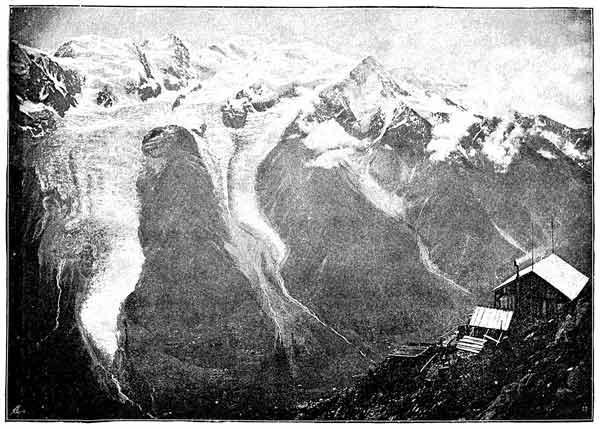
MONT BLANC. SNOWFIELDS, GLACIERS. AND STREAMS.
We now pass on to a very different example,
where mountains are the result of huge fractures
and displacements; namely, the numerous
and nearly parallel ranges of the Great Basin, of
Western Arizona, and Northern Mexico. The
region between the Sierra Nevada and the
Wahsatch Mountains, extending from Idaho to
Mexico, is composed of very gently folded rocks
deeply buried in places by extensive outflows of
lava.
Now, in this case the earth-movements caused
great cracks, or splits, doubtless attended by
fearful earthquakes. We find here a series of
nearly parallel fractures, hundreds of miles long,
and fifteen to thirty miles apart. These traverse
the entire region, dividing the rocks into
long narrow blocks. There is evidence to show
that the whole region was once much more elevated
than it is now, and has subsided thousands
of feet. During the subsidence along
these lines of fracture, or faults, the blocks
were tilted sideways; and the uptilted blocks,
carved by denudation, form the isolated ranges
of this very interesting region (see illustration,
chap. viii., p. 273, Fig. 1). The faults are indicated
by arrows pointing downwards; and the
dotted lines indicate the erosion of the uptilted
blocks.
But this must be regarded as a very exceptional
case, for we do not know of any other
mountain-range formed quite in the same way.
Why the strata, although only slightly bent,
should have snapped so violently in this case,
while in other mountain-ranges they have suffered
much more bending without so much
fracture and displacement, we cannot tell, but
can only suggest that possibly it was because
they were not buried up under an enormous
thickness of overlying rocks, which would exert
an enormous downward pressure, and so tend
to prevent fracturing.
There are many other deeply interesting questions
with regard to the upheaval of mountains
which at present cannot be answered.
We have already learned to alter our preconceived
ideas about the stability and immovable
nature of the earth's crust, and have seen that
it is in reality most unstable, and is undergoing
continual movements, both great and small.
But here we have an equally startling discovery,
which quite upsets all our former ideas of
the hard and unyielding nature of the rocks
composing the earth's crust; for we find that
not only can they be bent into innumerable
folds and little puckerings, but that in some
cases they have been drawn out and squeezed
as if they were so much soft putty. The imagination
almost fails to grasp such facts as these.
Of late years geologists in Switzerland and in
Great Britain have discovered that in some
parts of mountains rocks have been enormously
distorted and crushed, so that they have
assumed very different states from those in
which they were made, and curious mineral
changes have taken place under the influence
of this crushing.
In the very complicated region of the Northwest
Highlands of Sutherland and Ross, the
structure of which has only lately been explained,
some wonderful discoveries of this
nature have been made. Certain of the crystalline
schists found there have been formed by
the crushing down and rearrangement of older
rocks that once presented a very different appearance.
In this district, where the rocks have
been squeezed by enormous lateral pressure, the
dislocations sometimes have assumed the form of
inclined or undulating planes, the rocks above
which have been actually pushed over those below,
and in some cases the horizontal displacement
amounts to many miles.
Not only have the rocks been ruptured, and
older, deep-seated masses been torn up and
driven bodily over younger strata (that once
were above them), but there has been at the
same time such an amount of internal shearing
as to crush the rocks into a finely divided material,
and to give rise to a streaky arrangement
of the broken particles, closely resembling the
flow-structure of a lava. In the crushed material
new minerals have been sometimes so
developed as to produce a true schist.[32]
O Earth, what changes hast thou seen!
Tennyson.
It might naturally be asked at what period
in the world's primeval or geological history
some particular mountain-range was upheaved;
whether it is younger or older than another
one perhaps not very far away; and again,
whether the mountain-chains of the world
have been uplifted all at once, or whether
the process of elevation was prolonged and
gradual?
Questions such as these are deeply interesting,
and present to the geologist some of the
most fascinating problems to be met with in the
whole range of this science. And though at
first sight they might seem hopelessly beyond
our reach, yet even here the prospect is by
no means unpromising; and it is quite possible
to show that they can be answered to some
extent. Here we shall find our illustration of
the cathedral (see chapter v., pages 143-147)
holds good once more.
It is perhaps hardly necessary to explain
that by looking at a Gothic cathedral one can
say at what period or periods it was built.
Perhaps it has a Norman nave, with great pillars
and rounded arches. Then the chancel
might be Early English, with pointed windows
and deep mouldings, and other features that
serve to mark the style of the building, and
therefore its date,—because different styles
prevailed at different periods. Other parts
might contain work easily recognised as belonging
to the "Perpendicular" period.
Now, as there have been periods in the
history of architecture and art, so there have
been periods in the history of our earth.
What these periods were, and how we have
learned to recognise them, we must first very
briefly describe.[33]
There are two simple rules by which the
age of an ordinary sedimentary rock may be
ascertained. This is fixed (1) By its position
with regard to others; (2) By the nature of its
embedded animal or vegetable remains, known
as fossils.
These rules may easily be illustrated by a
reference to the methods of the antiquary. For
instance, suppose you were going to build a
house, and the foundations had just been dug
out; you might on examining them find several
old layers of soil, showing that the site or neighbourhood
had been formerly occupied. You
might find in one layer stone implements, in
another Roman or early British pottery, and yet
again portions of brick or stonework, together
with tools or articles of domestic use, belonging,
say, to the time of Queen Elizabeth. Now, which
of these layers would be the oldest? It is quite
clear that the lowest layers must have been there
the longest, because the others accumulated on
the top of them.
The explorations made of late years under
Jerusalem have led to the interesting discovery
that the modern city is built up on the remains
of thirteen former cities of Jerusalem, all of
which have been destroyed in one way or another.
Here, again, it is quite clear that the
oldest layer of débris must be that which lies at
the bottom, and the newest will be the one on
the top.
Again, you know that the "Stone Age" in
Britain came before the Roman occupation.
Those old stone implements were made by a
barbarous race, who knew very little of agriculture
or the arts of civilisation. Then in succeeding
centuries various arts were introduced, many
relics of which are found buried in the soil; and
hence, since different styles of art and architecture
prevailed at different periods, the works of
art or industry embedded in any old layers of
soil serve to fix the date of those layers.
These layers of soil and débris correspond to
the layers or strata of the sedimentary rocks, in
which the different chapters of the world's history
are recorded. Geology is only another kind
of history; and the same principles which guide
the archæologist searching buried cities also
guide the geologist in reading the stony record.
As the illustrious Hutton said, "The ruins of
an older world are visible in the present state of
our planet." The successive layers of ruin in
this case are to be seen in the great series of the
stratified rocks; and we may lay it down as an
axiom that the lowest strata are the oldest, unless
by some subsequent disturbance the order
should have been reversed, which, fortunately,
is a rare occurrence, though examples are to
be found in some mountain-chains with violent
foldings.
But it often happens that neither the strata
which should come above nor those that lie below
can be seen. Then our second rule comes
in: We can determine the age of the rock in
question by its fossils. The reason of this has
perhaps already been guessed by the reader. It
is that as different kinds of plants and animals
have prevailed at different periods of the world's
history, so there have been "styles," or fashions,
in creation, as well as in art. At one geological
period certain curious types of fishes flourished
which are now almost extinct, only a few old-fashioned
survivals being found in one or
two out-of-the-way places. At another period
certain types of reptiles flourished vigorously,
and were the leaders in their day; but they
have altogether vanished and become extinct.
So one type after another has appeared on the
scene, played its humble part in the great
drama of life; and then—"exit!" another
takes its place.
In the oldest and lowest of the series of rocks
we find no certain trace of life at all. In the
next series we find only lowly creatures, such
as shell-fish, corals, and crab-like animals that
have no backbone. In a higher group of rocks
fishes appear for the first time. Later on, we
come across the remains of amphibious creatures
for the first time. Then follows (after a long
unrecorded interval) an era when reptiles and
birds existed in great numbers. After another
long interval we come to strata containing many
and diverse remains of mammals or quadrupeds.
So we have an "Age of Fishes," an "Age of
Reptiles," and an "Age of Mammals." Some
tribes of these creatures died out, but others lived
on to the present day. Thus we see that there
has been a continuous progress in life as the world
grew older, for higher types kept coming in.
To the geologist fossils are of the greatest
possible use, since they help him to determine
the age of a particular set of strata, for certain
kinds of fossils belong to certain rocks, and to
them only.
But the classification of the stratified rocks
has been carried farther than this. Practical
geologists, working in the field, use fossils as their
chief guide in working out the subdivisions of a
group of rocks, for certain genera and species of
old plants and animals are found to belong to
certain small groups of strata. In this way a
definite order of succession has been established
once for all; and, except in the case of inverted
strata already alluded to, this order is invariably
found to hold good.
This great discovery of the order of succession
of the British stratified rocks, established by
their fossil contents, is due to William Smith,
the father of English geology. After exploring
the whole of England, he published in 1815 a
geological map, the result of his extraordinary
labours. Before then people had no idea of a
definite and regular succession of rocks extending
over the country, capable of being recognised
to some extent by the nature of the rocks themselves,—whether
sandstones, clays, or limestones,
etc., but chiefly by their own fossils.
They thought the different kinds of rocks were
scattered promiscuously up and down the face of
the country; but now we know that they do
not show themselves in this haphazard way, but
have definite relations to each other, like the
many volumes of one large book.
By combining the two principles referred to
above, geologists have arranged the great series
of British stratified rocks into certain groups,
each indicating a long period of time. First, they
are roughly divided into three large groups, marking
the three great eras into which geological
time is divided. Secondly, these eras are further
divided into certain periods. These periods
are again divided into epochs, indicated by local
divisions of their rocks. In this way we have
something like a historical table. Omitting the
small epochs of time, this table is as follows,
in descending order:—
| Table of the British Stratified Rocks. |
| Era. |
Period. |
Prevailing Type. |
Cainozoic
or
Tertiary |
{ |
Recent.
Pleistocene,
or
Quaternary.
Pliocene.
Miocene.
Eocene. |
Mammals. |
Mesozoic,
or
Secondary. |
{ |
Cretaceous.
Neocomian.
Jurassic.
Triassic.
Permian. |
Reptiles |
Palæozoic,
or
Primary. |
{ |
Carboniferous.
Devonian, and
Old Red Sandstone.
Silurian.
Cambrian.
Archæan,[34]
or
Pew-Cambrian. |
Fishes.
Creatures without
a backbone
(invertebrates). |
The total thickness of all these rocks has
been estimated at about one hundred thousand
feet, or not far from twenty miles. These
names have been given partly from the region
in which the rocks occur, partly from the nature
of the rocks themselves, and partly for other
reasons. Thus the Old Red Sandstone is so
called, because it generally, though not always,
appears as a dark red sandstone. But the
Silurian rocks, which we find in North Wales,
receive their name from the Silures, an ancient
Welsh tribe; the Cambrian rocks take theirs
from Cambria, the old name for North Wales.
The Cretaceous rocks are partly composed of
chalk, for which the Latin word is creta; and
so on. The terms "Palæozoic," "Mesozoic,"
and "Cainozoic" mean "ancient life," "middle
life," and "recent or new life," thus indicating
that as time went on the various types of life
that flourished on the earth became less old-fashioned,
and more like those prevailing at
the present time. These used to be called
"Primary," "Secondary," and "Tertiary;" but
the terms were unfortunate, because the primary
rocks, as then known, were not the first,
or oldest. We have therefore included the
Archæan rocks, since discovered, in this
primary group. Only one fossil has been
found in these rocks, and that is a doubtful
one; hence they are sometimes called "Azoic,"
that is, "without life." The Mesozoic rocks are,
as it were, the records of the "middle ages" in
the world's history; while the Palæozoic take
us back to a truly primeval time.
We have now learned how the geological
age of any group of rocks may be determined.
Thus, if a series of rocks of unknown age can
be shown to rest on undoubtedly Silurian rocks
in one place, and in another place to be overlaid
or covered by undoubtedly Carboniferous rocks,
they will probably belong to the Old Red Sandstone
Period. If afterwards we find that they
contain some of the well-known fossils of that
period, the question of their age is settled at
once. But we want more evidence than this.
Suppose, now, we find somewhere on the flanks
of a mountain-range a series of Permian and
Triassic rocks, resting almost horizontally on
disturbed and folded Carboniferous strata. Does
not that at once prove that the upheaval took
place before the Permian Period? Clearly it
does, because the Permian rocks have evidently
not been disturbed thereby. So now we can fix
the date of our range of hills; namely, after the
Carboniferous Period and before the Permian
Period.
It is by such reasoning that the age of our
Pennine range of hills, extending from the north
of England into Derbyshire, has been fixed; for
the Permian and Triassic strata lie undisturbed
on the upheaved arch of Carboniferous rocks of
which this chain is composed. Its structure is
that of a broken and much denuded anticline,
which stands up to form a line of hills only because
the Carboniferous limestone is so much
harder than the "coal measures," or coal-bearing
rocks, on each side of it, that it has not been
worn away so fast. In time, this great anticline
will be entirely worn away like that of the
Weald. It is called the Great Mountain Limestone,
because it so often rises up to form high
ground. The Mendip Hills in Somersetshire are
of about the same date, and they too are largely
composed of this great limestone formation.
Of course, a certain amount of up and down
movement took place after the hills were upheaved,
otherwise the Permian and Triassic
rocks could not have been deposited on their
sides; but these movements were slight and of
a more general kind than those by which strata
are thrown into folds.
The main upheaval, by which the rocks now
forming the Highlands of Scotland were lifted
up and contorted, took place after the Lower
Silurian Period, and before that of the Old Red
Sandstone; and there is clear evidence that even
before the latter period they had not only been
greatly altered, or "metamorphosed," by subterranean
heat, but that they had suffered enormous
denudation. And the work of carving out
these mountains has gone on ever since; for
even in Old Red Sandstone times they were
probably not entirely covered by water. The
Highland Mountains are therefore older than
the Pennine range.
Geologically Scotland belongs in great part
to Scandinavia; and the long line of Scandinavian
Mountains is a continuation of the
Highlands, and so is of the same age.
Mountain-chains and hill-ranges have been
upheaved at various geological periods; and
some are very old, while others are much
younger.
Turning to the southeast of England, we find
the ranges of chalk hills forming the North and
South Downs (see page 237). As explained
previously, these owe their existence to the upheaval
and subsequent denudation of the low
arch, or anticline, of the Weald. They are
called "escarpments," because they are like
lines of cliffs that are being gradually cut
back. Now, it is clear that these hills are
much newer than either of those we have
just considered. Look at the table on page
324, and you will see that the Cretaceous rocks
(chalk, etc.) belong to the Mesozoic era. The
chalk was the last rock formed during the
Cretaceous Period.
So the Wealden arch must have been heaved
up after the chalk was formed; that is, ages
and ages later than the date of the Pennine
range or the Scotch Highlands. From other
evidences it has been shown that this anticline
was heaved up in the early part of the
Cainozoic Era, perhaps during the Miocene
Period.
Let us now take the case of the Alps. And
here we have an instructive example of a great
mountain system formed by repeated movements
during a long succession of geological periods.
We cannot say that they were entirely raised up
at any one time in the world's past history. In
the centre of this great range we find a series of
igneous and metamorphic rocks, such as granite,
gneiss, and crystalline schists. Some of these
may belong to the very oldest period,—namely,
the Archæan; others are probably Palæozoic and
Cainozoic deposits greatly altered by heat and
pressure.
The ground from Savoy to Austria began to
be an area of disturbance and upheaval towards
the close of the Palæozoic Era, if not before; so
that crystalline schists and Carboniferous strata
were raised up to form elevated land around
which Permian conglomerates and shingle-beds
were formed,—as on the seashore at the present
day.
During the early part of the Mesozoic Era
local fractures and certain up and down movements
occurred. After this there was a long
period of subsidence, during which a series of
strata known as Oölites and Cretaceous were
deposited on the floor of an old sea.
Towards the close of this long era, a fresh
upheaval took place along the present line of
the Alps,—an upheaval that was prolonged into
the Eocene Period. It was during this latter
period that a very extensive formation known
as the "Nummulitic limestone" was formed in
a sea that covered a large part of Europe and
Asia. We have already referred (see chap. v.,
pp. 169-171) to the way in which limestones
have been formed. Nummulites are little shells
that were formed by tiny shell-fish.
But after this, the greatest upheaval and disturbance
took place,—an upheaval to which the
Alps as we now see them are chiefly due. By
this means the older Cainozoic strata, once lying
horizontally on the floor of the sea, were raised
up, together with older rocks, to form dry
land, and not only raised up, but crumpled,
dislocated, and in some cases turned upside
down.
So intense was the compression to which the
Eocene rocks were subjected that they were converted
into a hard and even crystalline state.
It seems almost incredible that these highly
altered rocks which look so ancient are of the
same date as our London clay and the soft
Eocene deposits of the south of England; but
in our country the movement that raised up
those strata was of the most feeble and gentle
kind compared to the violent disturbances that
took place in Switzerland.
And here we may point out that the Alps are
only a portion of a vast chain of mountains
stretching right across Europe and Asia in a
general east and west direction, beginning with
the Pyrenees and passing through the Alps, the
Carpathians, the Caucasus, and the range of Elbruz
to the Hindoo-Koosh and the high plateau
of Pamir, called "the roof of the world," which
stands like a huge fortress, fifteen thousand feet
high. Thence it passes to the still higher tracts
of Thibet, great plains exceeding in height the
highest summits of the Alps, being enclosed between
the lofty ramparts of the Himalayas on
the south and the Kuen-Lun Mountains on the
north; and thence the mountain wall is prolonged
in the Yuen-Ling, In-Shan, Khin-Gan, and
other ranges till it finally passes to the Pacific
Ocean at Behring's Strait.
All these ranges are, as it were, the backbone
of the great continental plateau of the Old
World, and doubtless are chiefly due to those
earth-movements by means of which the Alps
were upheaved. The last grand movement,
which raised the Mont Blanc range, was probably
rather later, and seems to have taken
place as late as the Pliocene Period.
At the present day no great movements are
taking place in the Alps; but now and then
earthquakes visit this region, and serve to remind
us that the process of mountain-making
is still slowly going on.
Probably there have been times in the history
of all these mountain-ranges when movements
took place of a more violent and convulsive
kind than anything with which we
are familiar at the present day; and the age
we live in may be one of comparative repose.
This is of course somewhat a matter of speculation;
and we only allude to it because there
has been a tendency on the part of some to
carry the theory of uniformity in all geological
operations much farther than Hutton
or Lyell ever intended. But at the same time
there is no need to go back to the old teaching
of sudden catastrophes and violent revolutions.
We only wish to avoid either of these two
extremes and to take a safe middle course.
How rapidly some of these great earth-movements
took place it is impossible at present
to say; but in several cases it can be shown
that they were quite slow, as indicated by
the testimony of the rivers. Thus, the rise of
the great Uintah Mountains of the Western
States was so slow and gradual that the Green
River, which flowed across the site of the
range, so far from being turned aside as they
rose up, has actually been able to deepen its
cañon as fast as the mountains were upheaved.
So that the two processes, as it were, kept pace
with each other, and the river went on cutting
out its gorges at the same time that the ground
over which it flowed was gently upheaved; and
as the land rose the river flowed faster, and
therefore acquired more power to cut and deepen
its channel. This is a valuable piece of evidence;
but in this case we have only a few big
broad folds, instead of the violent folding seen
in the Alps. However, certain Pliocene strata
lying on the southern flanks of the Himalayas
show that the rivers still run in the same lines
as they occupied before the last great upheaval
took place.
We have seen how the substance of the mountains
was slowly manufactured by means of such
quiet and gentle operations as may be witnessed
at the present day; how the rivers of old
brought down their burdens as they do now, and
flung them into the sea; how the sea spread
them out very slowly and compacted them into
level layers, to form, in process of time, the hard
rocky framework of the plateaux, hills, and
mountains of the world; how vast marine
accumulations were also slowly manufactured
through the agency of countless generations of
humble organisms, subtracting carbonate of
lime from sea water to form the limestones of
future ages; how by slow earth-movements
these marine deposits were reared up into dry
land; how they have frequently been penetrated
by molten rocky matter from below,
which occasionally forced its way up to the
surface and gave rise to various volcanic eruptions,
by means of which the sedimentary rocks
were often considerably baked and hardened,
and new fissures filled up with valuable metallic
ores and precious stones; how lava-flows and
great deposits of volcanic ash were mingled
with these sedimentary rocks.
Then we endeavoured to follow the history of
these rocky layers after their upheaval, and learn
how they are affected by the ceaseless operations
of rain and rivers and other agents of destruction,
so that finally the upheaved ridges of the
lands are carved out into all those wonderful
features of crag and pinnacle and precipice that
give the mountains their present shapes and
outlines. All this we were able to account for,
without the aid of any imaginary or unnatural
causes.
And, lastly, we have seen that even where
such causes might seem at first almost indispensable,—when
mountains tell us of mighty
internal forces crumpling, folding, and fracturing
their rocky framework,—yet even there we
can account for what we see without supposing
them to have been torn and tossed about by
any very violent convulsions.
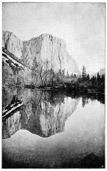
MOUNTAIN IN THE YOSEMITE VALLEY.
Although the question of the cause, or causes,
of earth-movements, whereby continents are
upheaved, and the contorting, folding, and
crumpling of the rocks of mountains produced,
is not at present thoroughly explained, it may
perhaps be worth our while to consider briefly
some of the views that have been put forward
on this difficult subject. The words "upheaval"
and "elevation," in reference to movements
of the earth's surface, are somewhat misleading,
but are used for want of better terms. They
would seem to imply that the force which
produced mountains was a kind of upward
push; whereas, in most cases, and perhaps in
all, the force, whatever it was, did not act in
an upward direction. So it should be understood
that we employ these terms only to
indicate that the rocks have somehow been
carried up to a higher level, and not as suggesting
how the force acted by which they
were raised.
It seems pretty clear that in the case of
mountain-chains, at least, the force acted in
a horizontal direction, as a kind of side-thrust.
This we endeavoured to illustrate in chapter
ix. by means of a simple experiment with
a sheet of paper; and it was shown how folds
similar to those of which Mont Blanc is composed
could be imitated by simply pressing
the sides of a sheet of paper inwards with
one's two hands as it lies on a table. Such
lateral pressure, it is thought by many, must be
caused by the shrinking of the lower and hotter
parts of the earth's crust as they cool, leaving
the outer crust unsupported, so that it gradually
settles down onto a smaller surface below, and
in so doing must inevitably be wrinkled and
throw itself into a series of folds (see chapter
vi., page 204).
The interior of the earth is hotter than the
outside; and since there is good reason to think
that the whole earth was once upon a time in a
highly heated and perhaps half molten condition,
we are compelled to believe that it always
has been, and still is, a cooling globe. Now,
almost all known substances are found to contract
more or less on cooling; and so if the
materials of which the earth is mainly composed
are at all similar in their nature and properties
to those which we find on its surface, it follows
that the earth must be contracting at the
same time that it is cooling, just as a red-hot
poker will contract on being taken out of the
fire.
Moreover, we find that hot bodies contract
faster than those that are merely warm, so that
a red-hot poker contracts more during the first
few minutes after it is taken out of the fire than
it does after it has passed the red-hot stage.
Hence it is easy to see that the interior portions
of the earth, which are hotter, must be contracting
at a greater rate than its external parts, for
they evidently have very little heat to lose.
This may seem rather puzzling to the reader at
first; for it might be argued that the heat from
below must pass through the external layers, or
crust, as it is often called. But it should be remembered
that this is not the only way in which
the earth loses heat. Think of the vast amount
of heat given out from the earth every year by
volcanic eruptions, and you will see at once that
much of the cooling takes place in this way,
and not as a direct flow of heat from the interior,
as in the case of the poker. A single big
lava-stream flowing out from a volcano, and
cooling on the surface of the earth, represents
so much heat lost forever; and so do the clouds
of steam emitted during every eruption; so,
again, do even the hot springs that are continually
bringing up warm water. If, then, the
lower portions of the earth are slowly contracting,
they must tend to leave the outer portions
of the crust unsupported, so that they would be
compelled by their own enormous weight to
settle down. Now, we know that something
like this happens in coal mines; and as long
passages are hollowed out below, the ground
begins to "creep," or slowly sink. Think what
would be the effect of a slow sinking of any
portion of the earth down towards the centre;
it would inevitably be curved up and down into
numerous folds, as it endeavoured to get itself
onto a smaller space, much in the same way
that a table-cloth, when thrown onto a table
in a kind of arch, settles down in a series of
waves, or folds. And this, it is thought, is
the way in which it happens that the pressure
comes, as we said just now, sideways, instead of
from below upwards. It is on this theory that
many geologists account for the enormous side-pressure
to which rocks have in many cases
been subjected.
The evidences of such pressure are many. In
some cases fossils have been thereby pulled out
of shape and appear considerably distorted; in
others, even hard quartz pebbles have been considerably
elongated (see chap. ix., pp. 315-316).
Then again, we have the little crumplings of all
sizes so frequently seen in mica-schists. And
lastly, the peculiar property that slates possess
of splitting up into thin sheets is found to be
due to the same cause; namely, lateral pressure.
Slates were originally formed of soft dark mud,
and on being subsequently squeezed, by earth-movements,
have assumed a structure known as
"cleavage," whereby their tiny mud-particles
were elongated, and all assumed the same direction,
thus giving to the rock this peculiar property
of splitting. It can be proved that the
pressure came in a direction opposite to that of
the planes of cleavage; and it is found that the
direction of the cleavage corresponds in a general
way with the direction, or trend, of a mountain-chain
which is composed partly of slates, as
in North Wales. And this discovery helps and
harmonises with what we have already said
about the cause of the folds in mountain-chains,
for the same force, acting sideways, produced the
cleavage and the folding, etc.
It has been already stated that in a large
number of cases a mountain-range has a central
axis, or band, of granite or other crystalline
rock. This led some people to suppose that
the granite had been driven up from below,
and in so doing had thrust up the overlying
rocks seen on either flank of the chain; in
other words, they believed granite to have been
the upheaving agent. And even now we often
find unscientific writers speaking of the volcanic
forces of upheaval.
Having very little idea of the true structure
of mountains, they believed them to consist of
a kind of core, or axis, of this igneous rock,
with sedimentary rocks sloping away from it
on each side. This was a very simple theory
of mountain-chains, but unfortunately it will
not bear examination. It takes no notice of
the folding which is so characteristic of mountain
strata, and is quite out of agreement
with the facts of the case; so it must be
buried among the archives of the past. Mountain-chains
are now known to have a much
more complicated structure than this,—thanks
to the labours of many subsequent observers.
That illustrious astronomer, the late Sir
John Herschel, threw out a bold suggestion
on this subject, which in the light of recent
discoveries with regard to the delicate adjustment
between the internal and external forces
affecting the earth's surface, is worthy of careful
consideration. His idea was that the mere
weight of a thick mass of sediment resting
on any portion of the earth's crust might
cause a certain amount of sinking; and that
this would cause portions on either side to
swell up. It is certain that as great deposits
of sedimentary materials accumulate on the floor
of an ocean, that floor slowly sinks, otherwise
the sea would become choked up, and dry land
would take its place. Now, it is found that
every great mountain-chain consists of many
thousands of feet of strata thus formed; and
more than this: it turns out that a greater
thickness of such materials has been formed in
regions where we now see mountain-chains than
in those continental regions that lie farther
away from them. This is an important fact,
which was not known in Sir John Herschel's
time. One striking example may be mentioned
here. In the complicated region of the Appalachian
chain the strata are estimated to have a
total thickness of eight miles; while in Indiana,
where the same strata are nearly horizontal,
they are less than one mile thick. Hence it
is not impossible that in the mere accumulation,
through long periods of time, of vast
masses of strata many thousands of feet
thick, we may find a potent cause of earth-movements.
The marginal regions of oceans, where most
deposition takes place, seem to undergo slow
subsidence, while the continents seem in most
places to be as slowly rising. Modern geologists
are inclined to think that as denudation wears
down a continental surface, removing from it a
great quantity of solid rocky matter (see chap. v.,
pp. 161-163), the pressure below is somewhat
lessened, or in other words, so much weight is
taken off; but that, on the other hand, as this
extra amount of material accumulates on the
bed of a neighbouring ocean the pressure is increased
by a corresponding amount, and so the
balance between internal and external forces is
upset, and movements consequently take place.
We have already seen that the external parts of
the earth are much more subject to movements
than might have been expected; and for our
part, we are willing to believe that in this simple
way upheaving forces might be called into
play sufficient to account for even the elevation
of mountain-chains. For suppose a great mass
of strata to continue sinking as they were
formed, for long periods of time; what seems to
follow? The downward movement would go
on until a time would come when the strata, in
endeavouring to settle down at a lower level,
would (as by the contraction theory above explained)
be forced to fold themselves into ridges,
and in this way long strips of them might even
be elevated into mountain-ranges.
Another ingenious idea was suggested by the
late Mr. Scrope, whose work on volcanoes is
well known. His idea was that when a large
amount of sedimentary material has accumulated
on any large area of the bed of the ocean, it
somewhat checks the flow of heat from within,
and therefore the temperature of the rocks
forming part of the earth's crust below will be
increased, much in the same manner as a glove
checks the escape of heat from the hand and
keeps it warm. The consequence of this would
be expansion; and as such expansion would be
chiefly in a horizontal direction, the area
would bulge upwards and cause elevation of
the strata resting on it. But there are
several difficulties which this theory fails to
explain.
And lastly, Professor Le Conte, holding that
the contraction theory is unsatisfactory, accounts
for earth-movements of all kinds by supposing
that some internal parts of the earth cool
and contract faster than others. Those parts
that cool fastest, according to this theory, are
those that underlie the oceanic basins or troughs;
while the continental areas, not cooling so rapidly,
are left standing up in relief. This theory,
which does not seem very satisfactory, is based
upon the idea that some parts of the earth's interior
may be capable of conducting heat faster
than others. We know that some substances,
like iron, are good conductors of heat, while
others are bad conductors; and it is therefore
conceivable that heat may be flowing faster
along some parts of the earth than along others;
and if so, there would be differences in the rate
of contraction.
There are various theories with regard to
the nature of the earth's interior. One of
these already referred to, but now antiquated,
supposes our planet to consist of a thin, solid
crust lying on a molten interior, so that the
world would be something like an egg with
its thin shell and liquid, or semi-liquid, interior.
Now, there are grave reasons for refusing
to accept this idea. In the first place,
a certain slow movement of the earth known
as "precession," because it causes the precession
of the equinoctial points on the earth's
orbit, could not possibly take place as it does
if the earth's interior were in this loose and
molten condition. That is a matter decided
by mathematical calculation, on which we will
not dwell further. Secondly, we obtain some
very valuable evidence on this abstruse subject
from the well-known daily phenomenon
of the tides, caused, as the reader is probably
aware, by the attractions of the sun and
moon; but much more by the moon, because
she is nearer, and so exerts a greater pull on
the ocean as each part of the world is brought
directly under her by the earth's daily rotation
on its axis. The waters of our oceans
rise up twice each day as they get in a line
with the moon, and then begin to fall again.
Thus we get that daily ebb and flow seen on
our shores. Now, it has been clearly proved
by Sir William Thomson, and others, that if
any considerable portion of the interior of the
earth were in a fluid condition, it too would
rise and fall every day as the ocean does.
So we should in that case have a tide below
the earth as well as on its surface, and the
one would tend to neutralise the other, and
the ocean tide ought to appear less than it
actually is. Even if the earth's crust were
made of solid steel, and several hundreds of
miles thick, it would yield so much to the
enormous pulls exerted by both the sun and
moon that it would simply carry the waters
of the ocean up and down with it, and we
should therefore see no appreciable rise and
fall of the water relatively to the land. As
a matter of fact, there is a very slight tide
in the solid earth below our feet, but so
slight that it does not practically affect the
tide which we see every day in the ocean.
But we wish to show that were the interior
of the earth in anything approaching, to a
fluid or molten condition, the phenomena of
the tides would be very different from what
they actually are.
All geologists are therefore agreed that we
must consider our earth as a more or less
solid body, and not as being something like
an india-rubber ball filled with water.
The only question is whether it is entirely
solid throughout. Some authorities consider
this to be the case. But others venture to
think that while the great mass of the globe
is solid, there may be a thin liquid layer
lying somewhere below the surface. Sir William
Thomson calculates that there must
be a solid crust at least two thousand or
twenty-five hundred miles thick (the diameter
of the earth is about eight thousand
miles) and that the mass of the earth "is
on the whole more rigid certainly than a
continuous solid globe of glass of the same
diameter."
One other question with regard to the
earth's interior may be mentioned in conclusion.
Astronomers have calculated the weight
of our planet, and the result is curious; for
it turns out to be at least twice as heavy as
the heaviest rocks that are found on or near
the surface. It is about five and a half
times as heavy as a globe of water of the
same size would be, whereas most rocks with
which we are acquainted are about two and
a half, or at most three times heavier than
water. This fact seems to open out curious
consequences; for instance, it is quite possible
that metals (which are of course much
heavier than water) may exist in the earth's
interior in considerable quantities. The imagination
at once conjures up vast quantities
of gold and silver. What is the source
of the gold and silver, and other metals found
in mineral veins? This question cannot as
yet be fully answered. Very small quantities
of various metals have been detected in sea-water;
and so some geologists look upon the
sea as the source from which metals came.
But it is possible that they were introduced
from below,—perhaps by the action of steam
and highly heated water during periods of volcanic
activity,—and that their source is far
down below in the depths of the earth.
But perhaps we have already wandered too
far into the regions of speculation.
Such are some of the interesting problems
suggested by the study of mountains, and
they add no small charm to the science of
geology.
And as we leave the mountains behind us,
refreshed by their bracing air, and strengthened
for another season of toil and labour by
a brief sojourn among their peaks and passes,
we come away with a renewed sense of the
almost unlimited power of the unhasting operations
of Nature, and the wisdom and
beneficence of the Great Architect of the
Universe, who made and planned those snowcapped
temples as symbols of His strength,
who was working millions of years ago as
He is working to-day, and to whom a thousand
years are as one day.