TO THE INDIES WESTWARD—THE SPANISH ROUTE—COLUMBUS AND
MAGELLAN
While the Portuguese had, with slow persistency, devoted nearly a
century to carrying out Prince Henry's idea of reaching the Indies
by the eastward route, a bold yet simple idea had seized upon a
Genoese sailor, which was intended to achieve the same purpose by
sailing westward. The ancients, as we have seen, had recognised
the rotundity of the earth, and Eratosthenes had even recognised
the possibility of reaching India by sailing westward. Certain
traditions of the Greeks and the Irish had placed mysterious islands
far out to the west in the Atlantic, and the great philosopher
Plato had imagined a country named Atlantis, far out in the Indian
Ocean, where men were provided with all the gifts of nature. These
views of the ancients came once more to the attention of the learned,
owing to the invention of printing and the revival of learning,
when the Greek masterpieces began to be made accessible in Latin,
chiefly by fugitive Greeks from Constantinople, which had been
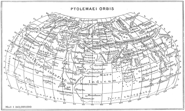
taken by the Turks in 1453. Ptolemy's geography was
Page 110
printed at Rome in 1462, and with maps in 1478. But even without
the maps the calculation which he had made of the length of the
known world tended to shorten the distance between Portugal and
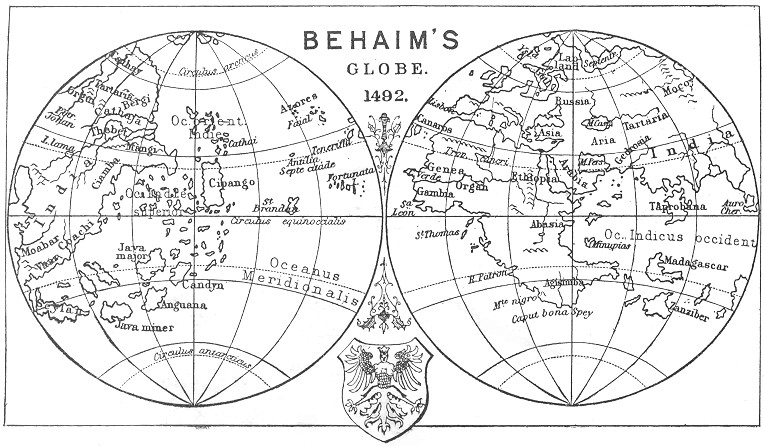
Farther India by 2500 miles. Since his time the travels of Marco
Polo had added to the knowledge of Europe the vast extent of Cathay
and the distant islands of Zipangu (Japan), which would again reduce
the distance by another 1500 miles. As the Greek geographers had
somewhat under-estimated the whole circuit of the globe, it would
thus seem that Zipangu was not more than 4000 miles to the west
of Portugal. As the Azores were considered to be much farther off
from the coast than they really were, it might easily seem, to an
enthusiastic mind, that Farther India might be reached when 3000
miles of the ocean had been traversed.
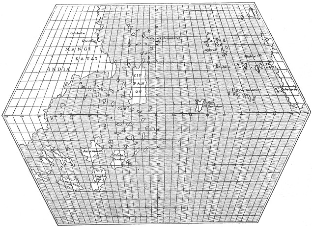
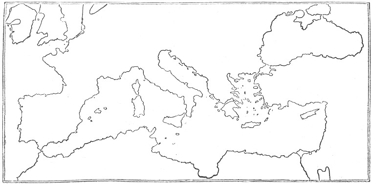
TOSCANELLI'S MAP (restored)
This was the notion that seized the mind of Christopher Columbus,
born at Genoa in 1446, of humble parentage, his father being a
weaver. He seems to have obtained sufficient knowledge to enable
him to study the works of the learned, and of the ancients in Latin
translations. But in his early years he devoted his attention to
obtaining a practical acquaintance with seamanship. In his day, as
we have seen, Portugal was the centre of geographical knowledge,
and he and his brother Bartolomeo, after many voyages north and
south, settled at last in Lisbon—his brother as a map-maker,
and himself as a practical seaman. This was about the year 1473,
and shortly afterwards he married
Page 112
Felipa Moñiz, daughter of Bartolomeo Perestrello, an Italian
in the service of the King of Portugal, and for some time Governor
of Madeira.
Now it chanced just at this time that there was a rumour in Portugal
that a certain Italian philosopher, named Toscanelli, had put forth
views as to the possibility of a westward voyage to Cathay, or
China, and the Portuguese king had, through a monk named Martinez,
applied to Toscanelli to know his views, which were given in a letter
dated 25th June 1474. It would appear that, quite independently,
Columbus had heard the rumour, and applied to Toscanelli, for in
the latter's reply he, like a good business man, shortened his
answer by giving a copy of the letter he had recently written to
Martinez. What was more important and more useful, Toscanelli sent
a map showing in hours (or degrees) the probable distance between
Spain and Cathay westward. By adding the information given by Marco
Polo to the incorrect views of Ptolemy about the breadth of the
inhabited world, Toscanelli reduced the distance from the Azores to
52°, or 3120 miles. Columbus always expressed his indebtedness
to Toscanelli's map for his guidance, and, as we shall see, depended
upon it very closely, both in steering, and in estimating the distance
to be traversed. Unfortunately this map has been lost, but from
a list of geographical positions, with latitude and longitude,
founded upon it, modern geographers have been able to restore it
in some detail, and a simplified
Page 113
sketch of it may be here inserted, as perhaps the most important
document in Columbus's career.
Certainly, whether he had the idea of reaching the Indies by a
westward voyage before or not, he adopted Toscanelli's views with
enthusiasm, and devoted his whole life henceforth to trying to
carry them into operation.
He gathered together all the information he could get about the
fabled islands of the Atlantic—the Island of St. Brandan, where
that Irish saint found happy mortals; and the Island of Antilla,
imagined by others, with its seven cities. He gathered together all
the gossip he could hear—of mysterious corpses cast ashore
on the Canaries, and resembling no race of men known to Europe;
of huge canes, found on the shores of the same islands, evidently
carved by man's skill. Curiously enough, these pieces of evidence
were logically rather against the existence of a westward route to
the Indies than not, since they indicated an unknown race, but,
to an enthusiastic mind like Columbus's, anything helped to confirm
him in his fixed idea, and besides, he could always reply that
these material signs were from the unknown island of Zipangu, which
Marco Polo had described as at some distance from the shores of
Cathay.
He first approached, as was natural, the King of Portugal, in whose
land he was living, and whose traditional policy was directed to
maritime exploration. But the Portuguese had for half a century been
pursuing another method of reaching India, and were not inclined to
Page 114
take up the novel idea of a stranger, which would traverse their
long-continued policy of coasting down Africa. A hearing, however,
was given to him, but the report was unfavourable, and Columbus had
to turn his eyes elsewhere. There is a tradition that the Portuguese
monarch and his advisers thought rather more of Columbus's ideas
at first; and attempted secretly to put them into execution; but
the pilot to whom they entrusted the proposed voyage lost heart
as soon as he lost sight of land, and returned with an adverse
verdict on the scheme. It is not known whether Columbus heard of
this mean attempt to forestall him, but we find him in 1487 being
assisted by the Spanish Court, and from that time for the next
five years he was occupied in attempting to induce the Catholic
monarchs of Spain, Ferdinand and Isabella, to allow him to try his
novel plan of reaching the Indies. The final operations in expelling
the Moors from Spain just then engrossed all their attention and
all their capital, and Columbus was reduced to despair, and was
about to give up all hopes of succeeding in Spain, when one of
the great financiers, a converted Jew named Luis de Santaguel,
offered to find means for the voyage, and Columbus was recalled.
On the 19th April 1492 articles were signed, by which Columbus
received from the Spanish monarchs the titles of Admiral and Viceroy
of all the lands he might discover, as well as one-tenth of all
the tribute to be derived from them; and on Friday the 3rd August,
Page 116
of the same year, he set sail in three vessels, entitled the Santa
Maria (the flagship), the Pinta, and the Nina.
He started from the port of Palos, first for the Canary Islands.
These he left on the 6th September, and steered due west. On the
13th of that month, Columbus observed that the needle of the compass
pointed due north, and thus drew attention to the variability of
the compass. By the 21st September his men became mutinous and
tried to force him to return. He induced them to continue, and
four days afterwards the cry of "Land! land!" was heard, which
kept up their spirits for several days, till, on the 1st October,
large numbers of birds were seen. By that time Columbus had reckoned
that he had gone some 710 leagues from the Canaries, and if Zipangu
were in the position that Tostanelli's map gave it, he ought to
have been in its neighbourhood. It was reckoned in those days that
a ship on an average could make four knots an hour, dead reckoning,
which would give about 100 miles a day, so that Columbus might
reckon on passing over the 3100 miles which he thought intervened
between the Azores and Japan in about thirty-three days. All through
the early days of October his courage was kept up by various signs
of the nearness of land—birds and branches—while on
the 11th October, at sunset, they sounded, and found bottom; and
at ten o'clock, Columbus, sitting in the stern of his vessel, saw
a light, the first sure sign of land after thirty-five days, and
in near enough
Page 117
approximation to Columbus's reckoning to confirm him in the impression
that he was approaching the mysterious land of Zipangu. Next morning
they landed on an island, called by the natives Guanahain, and by
Columbus San Salvador. This has been identified as Watling Island.
His first inquiry was as to the origin of the little plates of gold
which he saw in the ears of the natives. They replied that they
came from the West—another confirmation of his impression.
Steering westward, they arrived at Cuba, and afterwards at Hayti
(St. Domingo). Here, however, the Santa Maria sank, and
Columbus determined to return, to bring the good news, after leaving
some of his men in a fort at Hayti. The return journey was made in
the Nina in even shorter time to the Azores, but afterwards
severe storms arose, and it was not till the 15th March 1493 that he
reached Palos, after an absence of seven and a half months, during
which everybody thought that he and his ships had disappeared.
He was naturally received with great enthusiasm by the Spaniards,
and after a solemn entry at Barcelona he presented to Ferdinand
and Isabella the store of gold and curiosities carried by some
of the natives of the islands he had visited. They immediately
set about fitting out a much larger fleet of seven vessels, which
started from Cadiz, 25th September 1493. He took a more southerly
course, but again reached the islands now known as the West Indies.
On visiting Hayti he found the fort destroyed, and no traces of
the men he had left
Page 118
there. It is needless for our purposes to go through the miserable
squabbles which occurred on this and his subsequent voyages, which
resulted in Columbus's return to Spain in chains and disgrace.
It is only necessary for us to say that in his third voyage, in
1498, he touched on Trinidad, and saw the coast of South America,
which he supposed to be the region of the Terrestrial Paradise.
This was placed by the mediæval maps at the extreme east of
the Old World. Only on his fourth voyage, in 1502, did he actually
touch the mainland, coasting along the shores of Central America
in the neighbourhood of Panama. After many disappointments, he
died, 20th May 1506, at Valladolid, believing, as far as we can
judge, to the day of his death, that what he had discovered was
what he set out to seek—a westward route to the Indies, though
his proud epitaph indicates the contrary:—
| A Castilla y á Leon |
| To Castille and to Leon |
| Nuevo mondo dió Colon. |
| A NEW WORLD gave Colon.[1] |
To this day his error is enshrined in the name we give to the Windward
and Antilles Islands—West Indies: in other words, the Indies
reached by the westward route. If they had been the Indies at all,
they would have been the most easterly of them.
Even if Columbus had discovered a new route to Farther India, he
could not, as we have seen, claim the merit of having originated
Page 119
the idea, which, even in detail, he had taken from Toscanelli.
But his claim is even a greater one. He it was who first dared
to traverse unknown seas without coasting along the land, and his
example was the immediate cause of all the remarkable discoveries
that followed his earlier voyages. As we have seen, both Vasco da
Gama and Cabral immediately after departed from the slow coasting
route, and were by that means enabled to carry out to the full
the ideas of Prince Henry; but whereas, by the Portuguese method
of coasting, it had taken nearly a century to reach the Cape of
Good Hope, within thirty years of Columbus's first venture the
whole globe had been circumnavigated.
The first aim of his successors was to ascertain more clearly what it
was that Columbus had discovered. Immediately after Columbus's third,
voyage, in 1498, and after the news of Vasco da Gama's successful
passage to the Indies had made it necessary to discover some strait
leading from the "West Indies" to India itself, a Spanish gentleman,
named Hojeda, fitted out an expedition at his own expense, with
an Italian pilot on board, named Amerigo Vespucci, and tried once
more to find a strait to India near Trinidad. They were, of course,
unsuccessful, but they coasted along and landed on the north coast
of South America, which, from certain resemblances, they termed
Little Venice (Venezuela). Next year, as we have seen, Cabral,
in following Vasco da Gama, hit upon Brazil, which turned out to
be within the Portuguese
Page 120
"sphere of influence," as determined by the line of demarcation.
But, three months previous to Cabral's touching upon Brazil, one of
Columbus's companions on his first voyage, Vincenta Yanez Pinzon,
had touched on the coast of Brazil, eight degrees south of the
line, and from there had worked northward, seeking for a passage
which would lead west to the Indies. He discovered the mouth of
the Amazon, but, losing two of his vessels, returned to Palos,
which he reached in September 1500.
This discovery of an unknown and unsuspected continent so far south
of the line created great interest, and shortly after Cabral's
return Amerigo Vespucci was sent out in 1501 by the King of Portugal
as pilot of a fleet which should explore the new land discovered
by Cabral and claim it for the Crown of Portugal. His instructions
were to ascertain how much of it was within the line of demarcation.
Vespucci reached the Brazilian coast at Cape St. Roque, and then
explored it very thoroughly right down to the river La Plata, which
was too far west to come within the Portuguese sphere. Amerigo
and his companions struck out south-eastward till they reached
the island of St. Georgia, 1200 miles east of Cape Horn, where
the cold and the floating ice drove them back, and they returned
to Lisbon, after having gone farthest south up to their time.
This voyage of Amerigo threw a new light upon the nature of the
discovery made by Columbus. Whereas he had thought he had discovered
Page 121
a route to India and had touched upon Farther India, Amerigo and his
companions had shown that there was a hitherto unsuspected land
intervening between Columbus's discoveries and the long-desired Spice
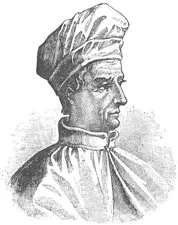
AMERIGO VESPUCCI.
Islands of Farther India. Amerigo, in describing his discoveries,
ventured so far as to suggest that they constituted a New World;
and a German professor, named Martin
Page 122
Waldseemüller, who wrote an introduction to Cosmography in
1506, which included an account of Amerigo's discoveries, suggested
that this New World should be called after him, AMERICA, after the
analogy of Asia, Africa, and Europe. For a long time the continent
which we now know as South America was called simply the New World,
and was supposed to be joined on to the east coast of Asia. The
name America was sometimes applied to it—not altogether
inappropriately, since it was Amerigo's voyage which definitely
settled that really new lands had been discovered by the western
route; and when it was further ascertained that this new land was
joined, not to Asia, but to another continent as large as itself,
the two new lands were distinguished as North and South America.
It was, at any rate, clear from Amerigo's discovery that the westward
route to the Spice Islands would have to be through or round this
New World discovered by him, and a Portuguese noble, named Fernao
Magelhaens, was destined to discover the practicability of this
route. He had served his native country under Almeida and Albuquerque
in the East Indies, and was present at the capture of Malacca in
1511, and from that port was despatched by Albuquerque with three
ships to visit the far-famed Spice Islands. They visited Amboyna
and Banda, and learned enough of the abundance and cheapness of
the spices of the islands to recognise their importance; but under
the direction of Albuquerque, who only sent them
Page 123
out on an exploring expedition, they returned to him, leaving behind
them, however, one of Magelhaens' greatest friends, Francisco Serrao,
who settled in Ternate and from time to time sent glowing accounts of
the Moluccas to his friend Magelhaens. He in the meantime returned
to Portugal, and was employed on an expedition to Morocco. He was
not, however, well treated by the Portuguese monarch, and determined
to leave his service for that of Charles V., though he made it
a condition of his entering his service that he should make no
discoveries within the boundaries of the King of Portugal, and do
nothing prejudicial to his interests.
This was in the year 1517, and two years elapsed before Magelhaens
started on his celebrated voyage. He had represented to the Emperor
that he was convinced that a strait existed which would lead into
the Indian Ocean, past the New World of Amerigo, and that the Spice
Islands were beyond the line of demarcation and within the Spanish
sphere of influence. There is some evidence that Spanish merchant
vessels, trading secretly to obtain Brazil wood, had already caught
sight of the strait afterwards named after Magelhaens, and certainly
such a strait is represented upon Schoner's globes dated 1515 and
1520—earlier than Magelhaens' discovery. The Portuguese were
fully aware of the dangers threatened to their monopoly of the spice
trade—which by this time had been firmly established—owing
to the presence of Serrao in Ternate, and did all in their power
to dissuade Charles from
Page 124
sending out the threatened expedition, pointing out that they would
consider it an unfriendly act if such an expedition were permitted
to start. Notwithstanding this the Emperor persisted in the project,
and on Tuesday, 20th September 1519, a fleet of five vessels, the
Trinidad, St. Antonio, Concepcion, Victoria, and St.
Jago, manned by a heterogeneous collection of Spaniards, Portuguese,
Basques, Genoese, Sicilians, French, Flemings, Germans, Greeks,
Neapolitans, Corfiotes, Negroes, Malays, and a single Englishman
(Master Andrew of Bristol), started from Seville upon perhaps the
most important voyage of discovery ever made. So great was the
antipathy between Spanish and Portuguese that disaffection broke
out almost from the start, and after the mouth of the La Plata
had been carefully explored, to ascertain whether this was not
really the beginning of a passage through the New World, a mutiny
broke out on the 2nd April 1520, in Port St. Julian, where it had
been determined to winter; for of course by this time the sailors
had become aware that the time of the seasons was reversed in the
Southern Hemisphere. Magelhaens showed great firmness and skill in
dealing with the mutiny; its chief leaders were either executed or
marooned, and on the 18th October he resumed his voyage. Meanwhile
the habits and customs of the natives had been observed—their
huge height and uncouth foot-coverings, for which Magelhaens gave
them the name of Patagonians. Within three days they had arrived
at the entrance of
Page 125
the passage which still bears Magelhaens' name. By this time one of
the ships, the St Jago, had been lost, and it was with only
four of his vessels—the Trinidad, the Victoria, the
Concepcion. and the St. Antonio—that, Magelhaens
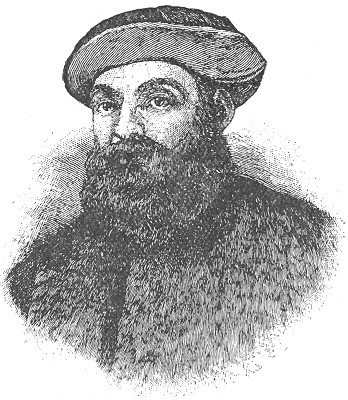
FERDINAND MAGELLAN.
began his passage. There are many twists and divisions in the strait,
and on arriving at one of the partings, Magelhaens despatched the
St. Antonio to explore it, while he proceeded with the other
three ships along the more direct route. The pilot of the St.
Antonio
Page 126
had been one of the mutineers, and persuaded the crew to seize this
opportunity to turn back altogether; so that when Magelhaens arrived
at the appointed place of junction, no news could be ascertained of
the missing vessel; it went straight back to Portugal. Magelhaens
determined to continue his search, even, he said, if it came to
eating the leather thongs of the sails. It had taken him thirty-eight
days to get through the Straits, and for four months afterwards
Magelhaens continued his course through the ocean, which, from
its calmness, he called Pacific; taking a north-westerly course,
and thus, by a curious chance, only hitting upon a couple of small
uninhabited islands throughout their whole voyage, through a sea
which we now know to be dotted by innumerable inhabited islands.
On the 6th March 1520 they had sighted the Ladrones, and obtained
much-needed provisions. Scurvy had broken out in its severest form,
and the only Englishman on the ships died at the Ladrones. From
there they went on to the islands now known as the Philippines,
one of the kings of which greeted them very favourably. As a reward
Magelhaens undertook one of his local quarrels, and fell in an
unequal fight at Mactan, 27th April 1521. The three vessels continued
their course for the Moluccas, but the Concepcion proved
so unseaworthy that they had to beach and burn her. They reached
Borneo, and here Juan Sebastian del Cano was appointed captain
of the Victoria.
At last, on the 6th November 1521, they
Page 127
reached the goal of their journey, and anchored at Tidor, one of the
Moluccas. They traded on very advantageous terms with the natives,
and filled their holds with the spices and nutmegs for which they had
journeyed so far; but when they attempted to resume their journey
homeward, it was found that the Trinidad was too unseaworthy
to proceed at once, and it was decided that the Victoria
should start so as to get the east monsoon. This she did, and after
the usual journey round the Cape of Good Hope, arrived off the
Mole of Seville on Monday the 8th September 1522—three years
all but twelve days from the date of their departure from Spain.
Of the two hundred and seventy men who had started with the fleet,
only eighteen returned in the Victoria. According to the
ship's reckoning they had arrived on Sunday the 7th, and for some
time it was a puzzle to account for the day thus lost.
Meanwhile the Trinidad, which had been left behind at the
Moluccas, had attempted to sail back to Panama, and reached as
far north as 43°, somewhere about longitude 175° W. Here
provisions failed them, and they had to return to the Moluccas, where
they were seized, practically as pirates, by a fleet of Portuguese
vessels sent specially to prevent interference by the Spaniards
with the Portuguese monopoly of the spice trade. The crew of the
Trinidad were seized and made prisoners, and ultimately only
four of them reached Spain again, after many adventures. Thirteen
others, who had landed at the Cape de Verde Islands
Page 128
from the Victoria, may also be included among the survivors
of the fleet, so that a total number of thirty-five out of two
hundred and seventy sums up the number of the first circumnavigators
of the globe.
The importance of this voyage was unique when regarded from the
point of view of geographical discovery. It decisively clinched
the matter with regard to the existence of an entirely New World
independent from Asia. In particular, the backward voyage of the
Trinidad (which has rarely been noticed) had shown that
there was a wide expanse of ocean north of the line and east of
Asia, whilst the previous voyage had shown the enormous extent
of sea south of the line. After the circumnavigation of the
Victoria it was clear to cosmographers that the world was
much larger than had been imagined by the ancients; or rather,
perhaps one may say that Asia was smaller than had been thought
by the mediæval writers. The dogged persistence shown by
Magelhaens in carrying out his idea, which turned out to be a perfectly
justifiable one, raises him from this point of view to a greater
height than Columbus, whose month's voyage brought him exactly
where he thought he would find land according to Toscanelli's map.
After Magelhaens, as will be seen, the whole coast lines of the
world were roughly known, except for the Arctic Circle and for
Australia.
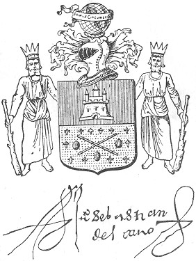
The Emperor was naturally delighted with the result of the voyage.
He granted Del Cano a pension, and a coat of arms commemorating
Page 129
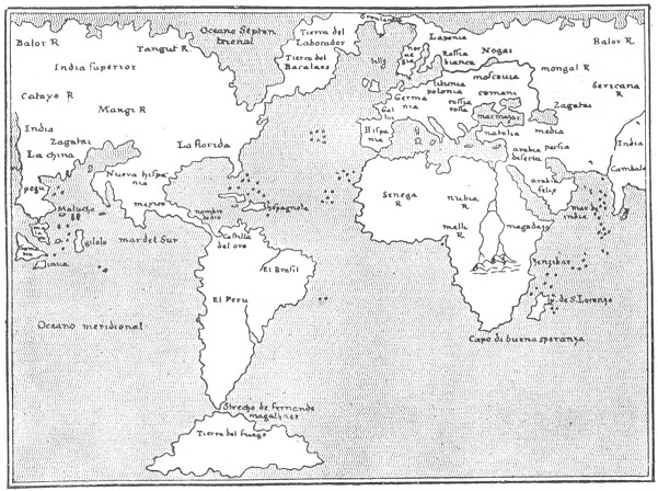
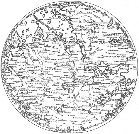
THE WORLD ACCORDING TO PTOLEMY OF 1548.
his services. The terms of the grant are very significant: or,
two cinnamon sticks saltire proper, three nutmegs and twelve
Page 130
cloves, a chief gules, a castle or; crest, a globe,
bearing the motto, "Primus circumdedisti me" (thou wert the first
to go round me); supporters, two Malay kings crowned, holding
in the exterior hand a spice branch proper. The castle, of course,
refers to Castile, but the rest of the blazon indicates the importance
attributed to the voyage as resting mainly upon the visit to the
Spice Islands. As we have already seen, however, the Portuguese
recovered their position in the Moluccas immediately after the
departure of the Victoria, and seven years later Charles
V. gave up any claims he might possess through Magelhaens' visit.
But for a long time afterwards the Spaniards still cast longing
eyes upon the Spice Islands, and the Fuggers, the great bankers
of Augsburg, who financed the Spanish monarch, for a long time
attempted to get possession of Peru, with the scarcely disguised
object of making it a "jumping-place" from which to make a fresh
attempt at obtaining possession of the Moluccas. A modern parallel
will doubtless occur to the reader.
There are thus three stages to be distinguished in the successive
discovery and delimitation of the New World:—
(i.) At first Columbus imagined that he had actually reached Zipangu
or Japan, and achieved the object of his voyage.
(ii.) Then Amerigo Vespucci, by coasting down South America, ascertained
that there was a huge unknown land intervening even
Page 131
between Columbus' discoveries and the long-desired Spice Islands.
(iii.) Magelhaens clinches this view by traversing the Southern
Pacific for thousands of miles before reaching the Moluccas.
There is still a fourth stage by which it was gradually discovered
that the North-west of America was not joined on to Asia, but this
stage was only gradually reached and finally determined by the
voyages of Behring and Cook.
[Authorities: Justin Winsor, Christopher Columbus,
1894; Guillemard, Ferdinand Magellan, 1894.]