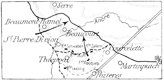
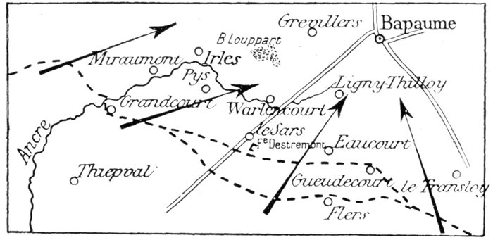
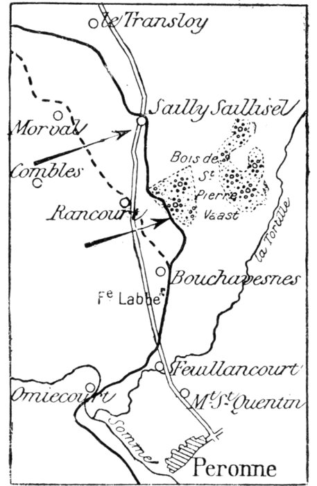
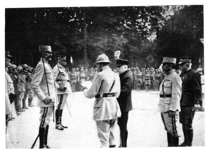
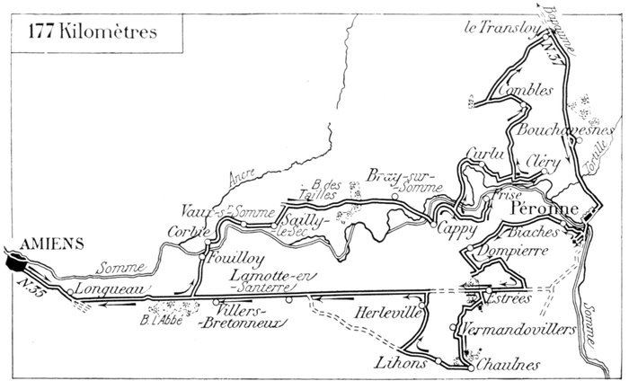
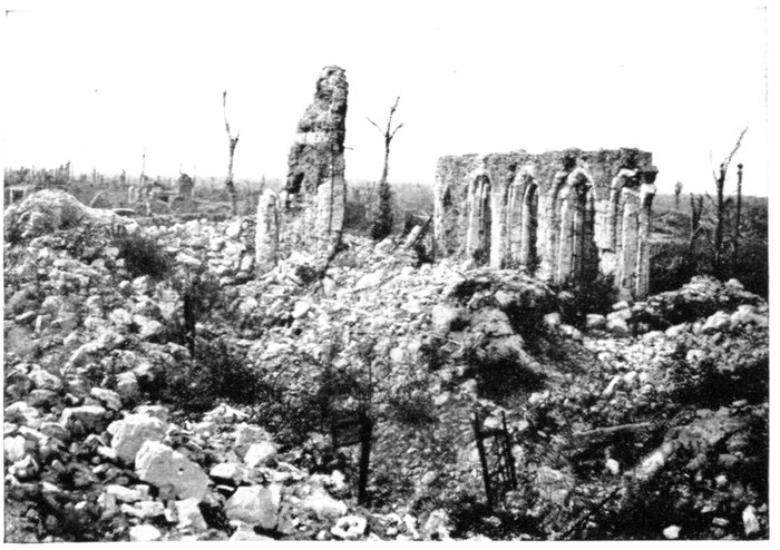
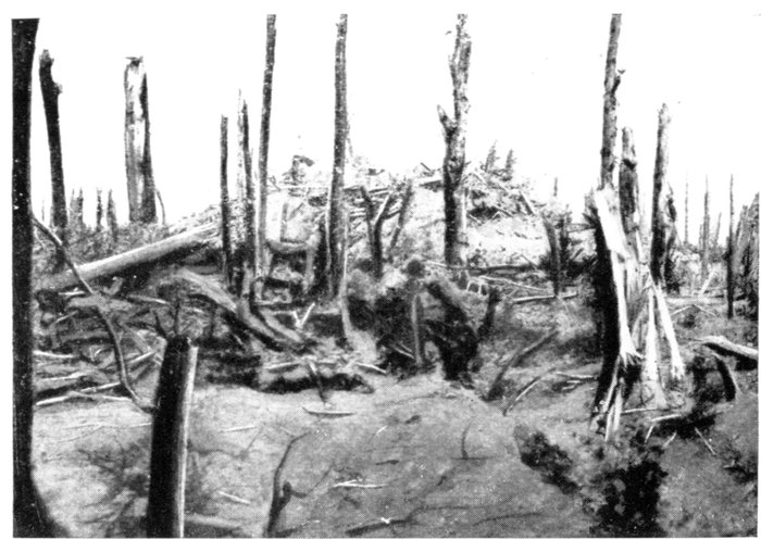
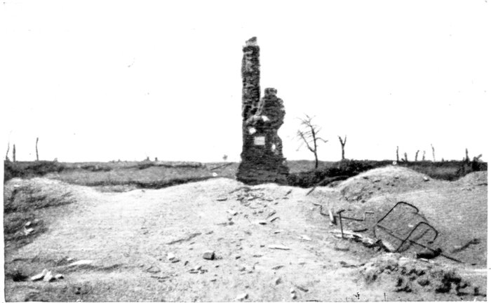
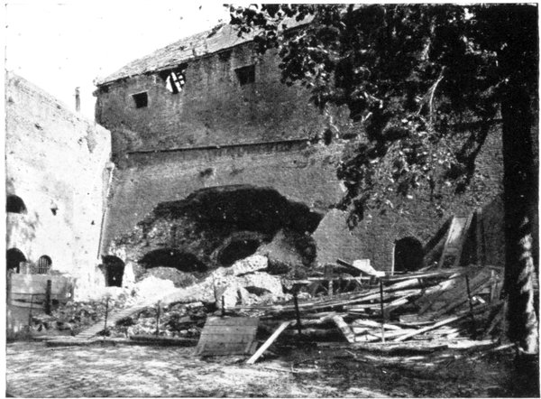
Leave Amiens by the Rue Jules Barmi (continuation of the Rue de Noyon),
then, after passing the station, by the Chaussée Périgord and N. 35.
After passing through Longueau, the road forms a double fork. Take the left-hand
road in both cases. At Petit Blangy there is an important Australian
cemetery on the left. After twice crossing the railway the road enters Abbé Wood.
On leaving the road, at the foot of a descent (15 km. from Amiens), take the
Corbie road on the left, via Fouilloy.
There is a fine 16th-18th century church at Corbie. Restored in the 19th
century, it is the remains of a famous abbey. The town suffered severely
from the bombardments.
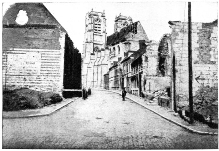
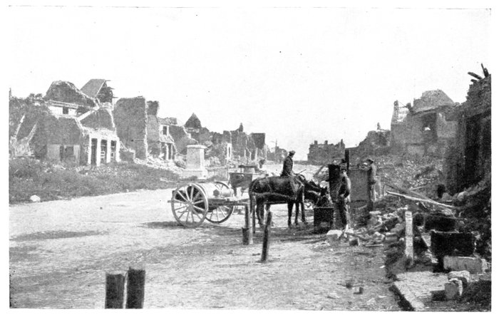
CORBIE.
RUE HERSANT
AND THE
CHURCH.
Take the Rue Faidherbe as far as a house with brick turrets, where turn to
the right into the Rue Victor Hugo.
Beyond Corbie, the road follows the marshy valley of the Somme to Vaux-sur-Somme.
On leaving this village there is a British-American graveyard on the right,
by the side of the parish cemetery.
The road next passes through Sailly-le-Sec, whose church is in ruins. At
the end of the village take the road on the left, then at the wayside cross, that on the
right up Hill 108, past two British cemeteries. 2 km. beyond Sailly-le-Sec, the
Corbie-Bray road (G.C. 1) is joined, which take on the right, past a large British
cemetery on the right.
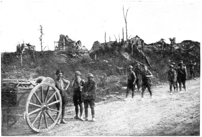
Having crossed Tailles Wood (notice the gun-emplacements) G.C. 1
descends alongside a quarry which sheltered a large German ammunition
dump (photo below). 2 km. beyond the quarry, the village of Bray-sur-Somme
is reached.
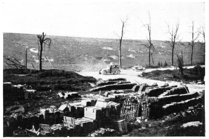
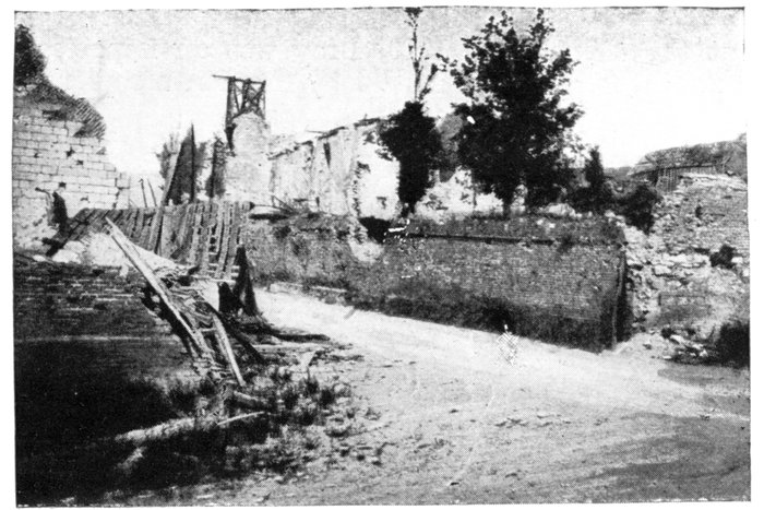
NEAR TAILLES WOOD. GERMAN AMMUNITION DUMP.
Bray-sur-Somme
Throughout the offensive of 1916, Bray was an important revictualling
centre, and as such, frequently bombed by German aeroplanes. Troops and
convoys were constantly passing through.
In 1918, the Germans, having driven back the British beyond the old front
line of 1914-1916, occupied Bray on March 26, six days after launching their
offensive. Immediately progressing beyond the town, they advanced along
the Somme to the vicinity of Sailly-le-Sec, where the front line became fixed
at the end of March.
The Franco-British offensive of August 8, the objective of which was to
reduce the Amiens Salient, cleared the Somme Valley as far as the outskirts of
Bray, where the Germans resisted strongly.
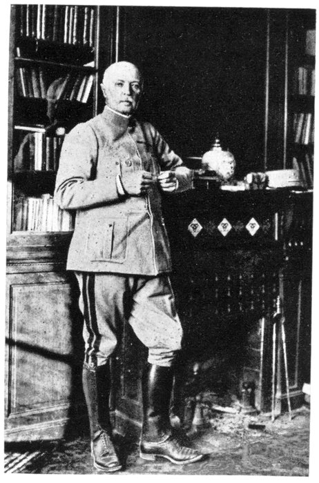
However, on August 22, General Rawlinson's Army, in a fresh effort,
succeeded in carrying Hill 107—an observation-post which dominated the
country to the north-east. On the night of the 23rd, Australian troops, slipping
along the river, entered Bray and captured a large number of prisoners.
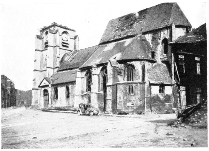
BRAY-SUR-SOMME.
CHURCH AND
PLACE DE LA
LIBERTÉ.
The town which, until 1918, had practically escaped damage, suffered
severely in the subsequent bombardments, and was moreover thoroughly
pillaged by the German troops during their occupation. In this they complied
with the instructions of the High Command, who ordered all the churches and
chapels in the region of the Somme to be carefully searched, not excepting the
"altars, confessionals and other parts of the church, access to which is reserved
by ecclesiastical rules to the priests only." In pursuance of this decree, dated
May 20, 1918, the church of Bray-sur-Somme was despoiled of its furnishings.
A magistrate-member of the Enquiry Commission, visiting the church a few
days after the Germans had left, reported: "A large number of bottles were
lying on the floor. The baptismal font was fouled with urine. The door
of the Holy of Holies, which bore traces of having been forced, was twisted
and the iron-work torn off."
The church itself (Hist. Mon.), dated from the 13th and 15th centuries. It
was greatly damaged by the bombardments. The spire collapsed, the façade
was pierced with numerous shell-holes, while the timber work and roofing were
partly destroyed.
The church is reached by the Rue des Massacres.
After visiting the church, proceed to the bottom of the square, where, on the
right, turn to the left into the Rue de Cappy. Pass a Merovingian cemetery,
then follow the marshy Valley of the Somme to Cappy (3 km. from Bray).
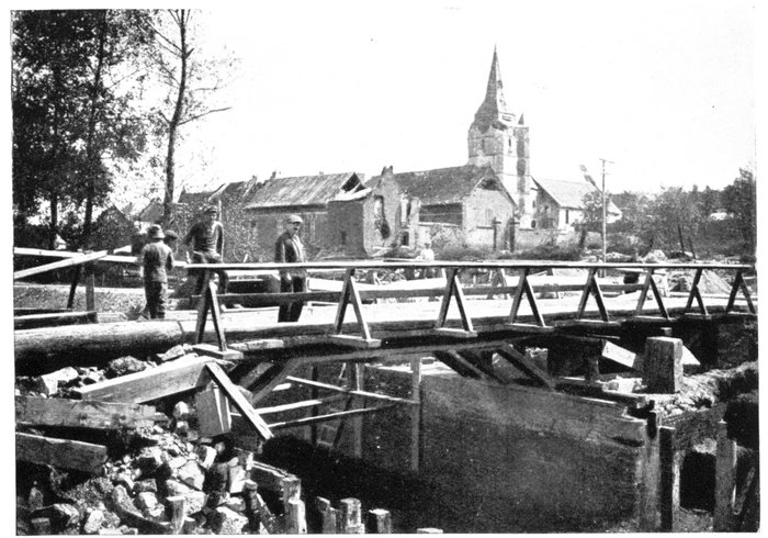
CAPPY. THE VILLAGE AND BRIDGE OVER THE CANAL.
Cappy, lost on March 26, 1918, was reconquered exactly five months
later by the British. The Germans had a dump in the village for all the
sacred articles stolen in the district. This depôt was installed in the yard
of the billet occupied by the "officer in charge of the booty," opposite a
building which, according to a notice posted up by the Germans, was the
meeting-place of the "detachments for the collection of the booty." The
sudden arrival of the British did not leave them time to carry away the
booty, which included three bells, a quantity of metallic objects, chandeliers,
candlesticks, crucifixes, and "six greatly damaged ecclesiastical ornaments."
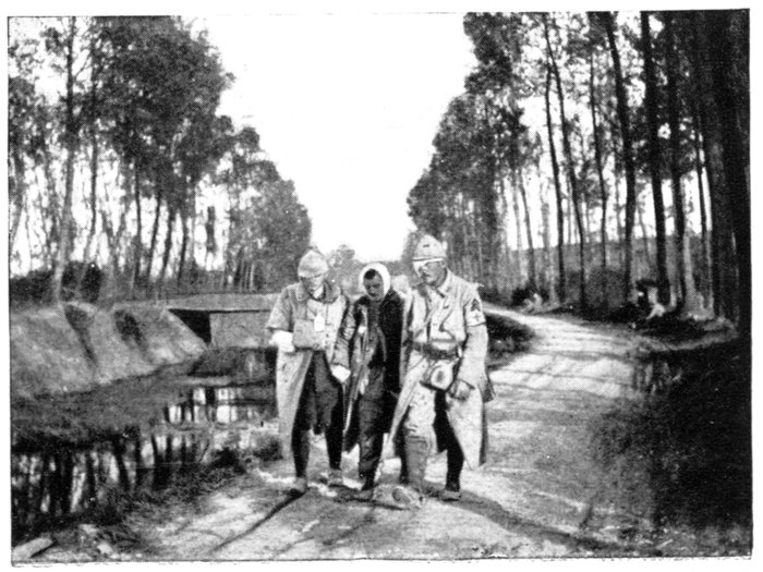
THE CANAL
NEAR THE LOCK.
WOUNDED ON
THEIR WAY TO
THE DRESSING-STATION.
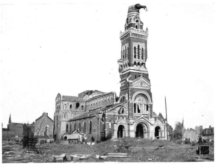
The church has a massive fourteenth century fortified belfry, the upper
story of which comprises four watch-towers resting on the corner abutments.
Two of these towers were destroyed by the bombardment.
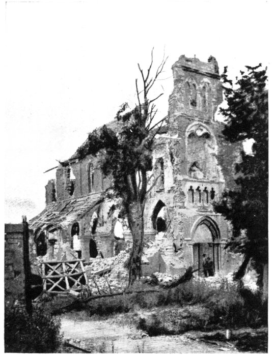
FRISE CHURCH
IN JULY, 1916
(see pp. 71-72).
Near the Church, take the road which runs parallel to the Somme canal. On
leaving Cappy there is a large Franco-British cemetery on the left.
Eclusier (3 km. beyond Cappy) is next reached; it is the principal portion
of the "commune" of Vaux-Eclusier. Vaux, which forms the other portion
of it, lies on the northern bank.
On July 1, 1916, the French first lines, passing through the eastern
outskirts of Vaux-Eclusier, barred the Valley of the Somme with a continuous
line of small posts established in the middle of marshes, thus connecting
the organisations on solid ground on the northern bank with those of the
southern bank.
There is a French military cemetery on the right, before entering Eclusier.
In spite of numerous bombardments, Eclusier has retained the appearance
of a village. Most of the damage is repairable.
It was only in January, 1916, that Vaux-Eclusier became the last village
occupied by the French in the Valley of the Somme. Previous to that date
the advanced lines ran beyond the village of Frise, 2 km. further to the east.
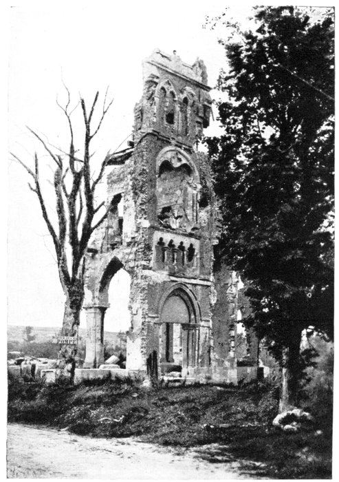
FRISE CHURCH
IN SEPTEMBER,
1917 (see pp.
70-72).
To reach Frise, keep straight along the Somme Canal.
Standing on a picturesque site dominated by a hill on the north, the
village lies on the left bank of the Somme, opposite the marshes, at the end
of a large bend in the river. This bend measures 7 km. round, whereas the
isthmus which separates the two arms of the river, opposite Frise, is scarcely
1 km. in width. These conditions made it very difficult to defend the village,
which was accordingly used only as an advance-post. The Germans attempted
to capture the place on several occasions by local surprise-attacks and mining.
In January, 1916, a powerful attack with large forces succeeded, after a
violent bombardment, in occupying the position, but the Germans were
unable to debouch from it.
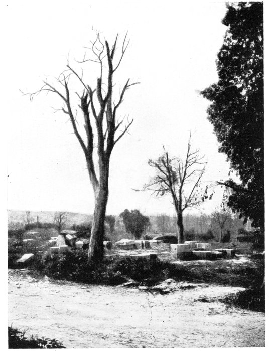
FRISE CHURCH
in 1919 (see pp.
40-42).
Only the two
trees are left.
The French retook Frise on the morning of July 2, 1916. In the course
of a brilliant attack, the successive lines of trenches which defended the
southern and eastern parts of the village, were carried, and the latter was
evacuated by the Germans at noon. Giving the enemy no time to reform,
the French followed up their success by attacking the German second
line, and before nightfall carried that part of Méréaucourt Wood which
lies to the east, on a crest about 340 feet high, overlooking the Valley of
the Somme.
Frise was completely destroyed. Here and there fragments of walls
and half-burnt beams mark the site of the old houses. Some of the
inhabitants have returned and are being housed in huts erected in the
Place de l'Eglise.
The large modern church has disappeared, the tottering ruins having been
pulled down.
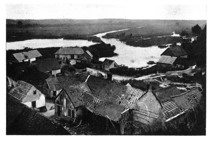
VAUX VILLAGE AND THE VALLEY OF THE SOMME.
On leaving Frise, return to Eclusier by the same road. Beyond the church
take the road on the right which crosses first the canal, then the marshes by means
of three bridges. At the fork, take the right-hand road to Vaux.
There is a fine view of the River Somme and the marshes, including part
of the battlefield of July 1, 1916. In the valley, walled in by high chalky
cliffs, the Somme, bordered with high poplar-trees, follows its winding course
among marshes and peat-bogs, intersected with patches of rushes and reed-grass.
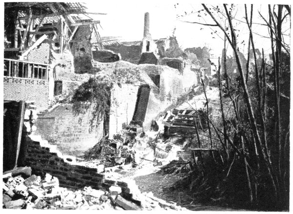
The half-hidden ruins of Frise are on the right. On the left fragments
of walls are all that remain of Fargny Mill and the buildings which surrounded
it. The French first line ran close by on July, 1, 1916 (photo, p. 74).
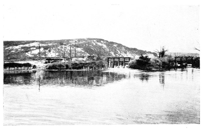
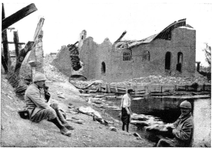
FARGNY MILL
DAM AND THE
"GENDARME'S
HAT."
In 1919 the
mill had
disappeared.
Behind, the edge of a once wooded ravine, the chalky substratum of which,
laid bare by shell-fire, was christened "Gendarme's Hat" by the Poilus,
formed the Germans' first line. Further away, in the hollow of the valley,
appear the ruins of Curlu village.
The road runs alongside the Somme. At the site of Fargny Mill go round
the "Gendarme's Hat"—from which the attack of July 1, 1916, debouched—to
reach Curlu.
Curlu had been transformed into a stronghold by the Germans.
THE "GENDARME'S HAT," JULY, 1916.
Debouching from Fargny Mill, on the morning of July 1, a regiment of
the French 20th Corps carried all the German advance-positions with great
dash, notably the "Gendarme's Hat." However, at the outskirts of Curlu,
further advance was stayed by machine-gun fire, making fresh artillery
preparation necessary, which destroyed most of the houses. Rushing again
to the assault in the evening, the French, in a few minutes, drove the
Bavarians from all their positions, and the enemy's numerous attempts
during the night and throughout the next day to regain a footing in the
village broke down before the French barrage fire.
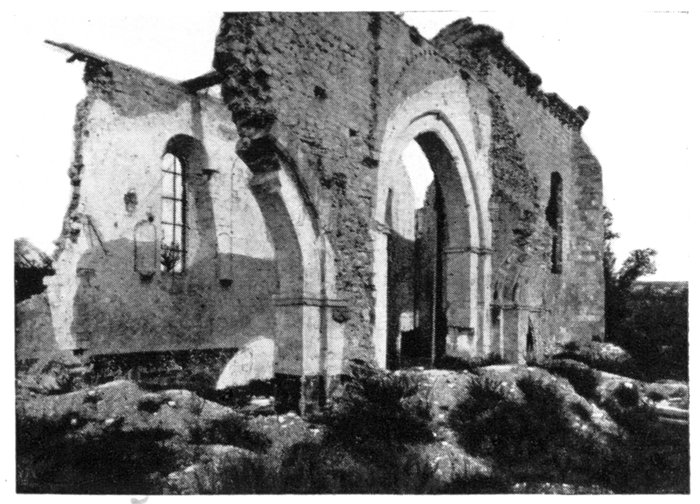
CURLU CHURCH.
Fragment of
13th century
wall—all that
is left of the
village.
The day after the capture of Curlu, the French resumed their advance,
and soon reached the village of Hem, which they carried on July 5, after
fierce fighting lasting the whole day.
The road follows the line of the advance, from Fargny Mill to Hem. At
Curlu leave the church on the left. Numerous shelters, graves and cemeteries
are seen along the road, which passes near Hem-Monacu (2 km. beyond
Curlu); a few broken walls, 300 yards to the right of the road, are all that
remain of the village (photo below).
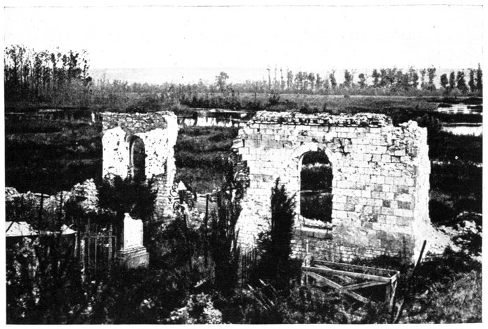
HEM-MONACU. RUINS OF THE CHURCH.
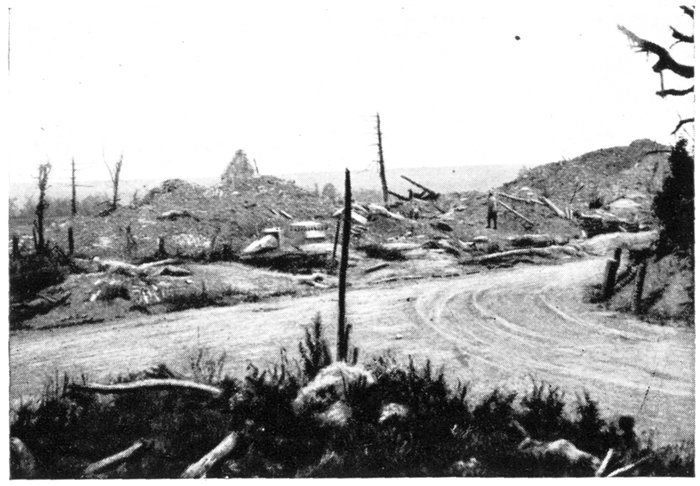
CLERY
CHURCH
AND
VILLAGE.
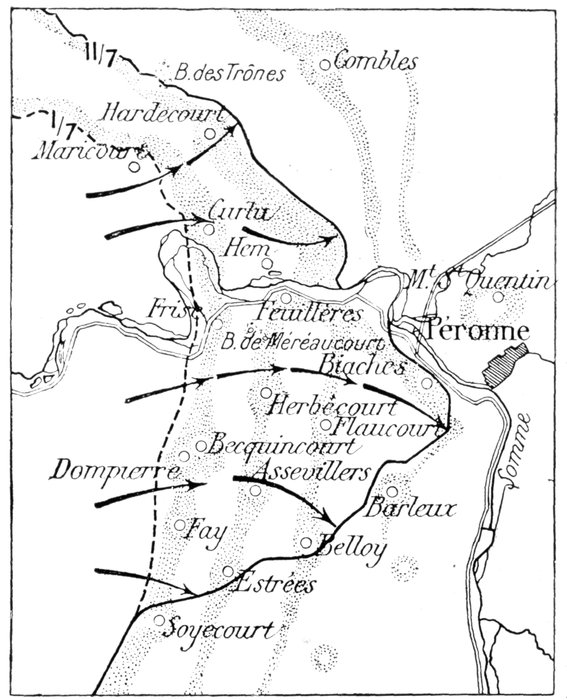
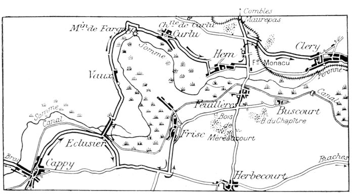
The French were held to the east of Hem (see sketch-map, p. 71), by the
strong defences around the village. These positions consisted of: a wood full
of barbed-wire entanglements, situated to the north, near the station of the
Albert-Péronne light railway; to the north-east, other strongly organised
small woods and a quarry.
Further to the east, on the Combles-Feuillères road (G.C. 146), Monacu
Farm—a veritable fortress with numerous strong-points—was connected
with other defences which had been organised in the slag-heaps of the
phosphate of lime works belonging to the St. Gobain Glass Manufactory.
These defences extended as far as the Somme marshes, where the long reeds
hid the numerous machine-guns.
The French carried all these centres of resistance at the end of July and
beginning of August, and kept them in spite of fierce German counter-attacks,
some of which lasted thirty-six hours. At Monacu Farm the German
efforts assumed a particularly violent character. The French artillery, posted
on the top of the cliffs, enfiladed the attacking waves, which were each time
forced to fall back in disorder with very heavy losses, without being able
to reach the French lines.
These successful operations, while enabling the French to secure the whole
second line of the German defences, also gave them an outlet, on the north,
into Combles Valley—the long, dry and sinuous ravine along which runs the
Albert-Péronne light railway. On the south, they also commanded the
bridges and roads leading to Feuillères, on the left bank of the Somme.
The bridges were immediately rebuilt, and direct communication ensured
between the troops engaged north and south of the river.
Three kilometres from Curlu, take the Feuillères-Maurepas road (G.C. 146)
on the left, to Hem Wood (500 yards further on). Here take the G.C. 213, on
the right, to Cléry-sur-Somme—an important village on the north of a bend
in the river. Fine view of the Somme, towards Péronne.
In the Middle-Ages, Cléry was a fortified town commanding the valley of
the Somme. Here the Dukes of Créquy, then lords of the district, built a
fortified castle in front of the river marshes, to which the family device:
"Nul s'y frotte" ("Meddle not with me") was given. Before the war some
fourteenth century vestiges of the castle were still to be seen.
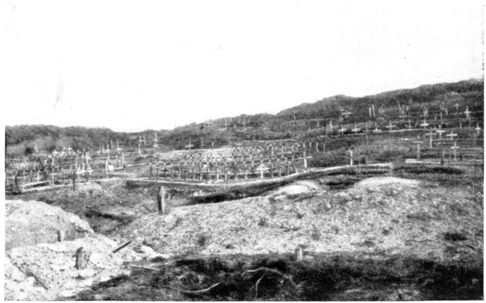
CLERY.
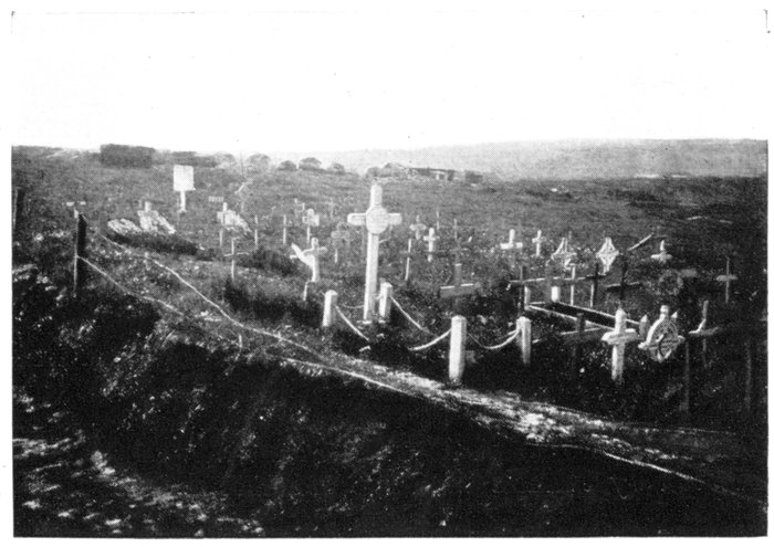
CEMETERY
IN
MADAME
WOOD.
In fortifying Cléry, the Germans took full advantage of its favourable
position; powerful defences were made in the outskirts of the village, and in
the surrounding woods and ravines, while many of the houses were transformed
into centres of resistance. However, in spite of the strength of its
defences, Cléry was entirely carried in a single assault on September 3, 1916,
after a terrific bombardment which the German communiqués qualified as
"ferocious."
The success was an important one, as Cléry commanded the various roads
leading to Maurepas, Combles and Bouchavesnes on the north, another road
on the east leading to Feuillancourt and some bridges across the Somme.
The capture of the hamlet of Omiécourt at the other end of the bridges,
two days after that of Cléry, enabled the French to connect up their positions
north of the Somme with those on the left bank of the river. The Germans
counter-attacked in force several times, but were unable to retake the position,
in spite of very heavy losses.
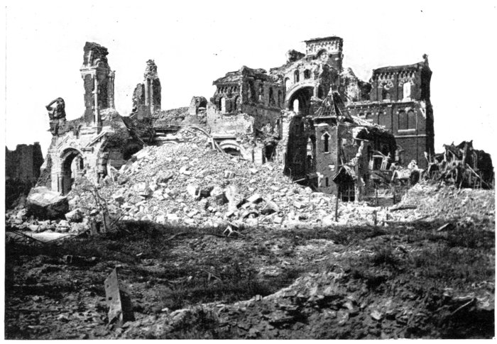
Cléry was completely destroyed; only a few broken walls and shattered
roofs remain, and even these few traces of the formerly prosperous village
are crumbling away and disappearing. A few unrecognisable fragments of
ruins, standing amid an accumulation of stones and rubbish, are all that is
left of the fifteenth century church.
There are numerous soldiers' graves in the village, and also many military
defence-works.
To the east of Cléry the turbid waters of the Somme spread themselves
out, forming immense marshes, intersected by a labyrinth-like network of
channels. The French advance was directed from this side in 1916, while
on the east they were likewise blocked by the Mont-Saint-Quentin Hill, which
rises nearly 200 feet above the Somme Valley, from Cléry to Péronne, and
which the Germans, by powerful defences, had converted into a second
"Warlencourt Ridge." Although within sight of Péronne, scarcely three
miles distant, the French could get no farther. Cléry, on the right bank of
the Somme, was the nearest village to Péronne conquered by the French in
1916.
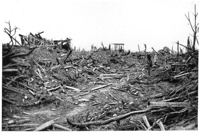
MAUREPAS VILLAGE—COMPLETELY RAZED.
In March, 1918, no important engagements were fought on the old Somme
battlefields. On March 24 the Germans crossed the Somme, south of Péronne,
and forced the Tortille line north of the town. Overwhelmed and in danger
of being surrounded, the British had to fall back hurriedly, under the
protection of rear-guards, who were unable to check the enemy's advance.
In the following month of August the valley of the Somme was cleared
of the enemy almost without firing a shot. In accordance with Marshal
Foch's general plan, the British attack of August 21 was limited to the
north of the Somme. The Germans had just been driven back, south of the
river, from the district of Montdidier to the outskirts of Roye, as a result
of the Franco-British offensive of August 8. The Allied plan provided for
the withdrawal of the enemy's right wing from the banks of the Ancre to
Bapaume, thereby necessitating the immediate evacuation of the whole
bend in the Somme by their centre, and this is what actually happened.
As soon as Bapaume was invested, the Germans hastily retreated, and whereas,
on August 28, the British were still hanging on to the western outskirts of
Curlu, on the morning of the 29th they were in Hem, and in the evening
of the same day had progressed beyond Cléry.
On leaving Cléry, return by the same road to Hem Wood, where take the
Feuillères-Maurepas road (G.C. 146), on the right towards Maurepas. The
road runs alongside Hem Wood (cut to pieces), crosses a ravine in which ran the
Albert-Péronne railway, and then rises towards a crest from which starts, on
the left, a road (500 yards from the fork) leading to Maurepas (completely
destroyed).
The Germans strongly fortified the village of Maurepas which protected
Combles from the south-west and formed the junction of six roads coming
from all directions. It was an agglomeration of large farms, each of which
possessed a meadow surrounded with trees. These farms had to be carried
almost one at a time, and the advance was therefore very slow.
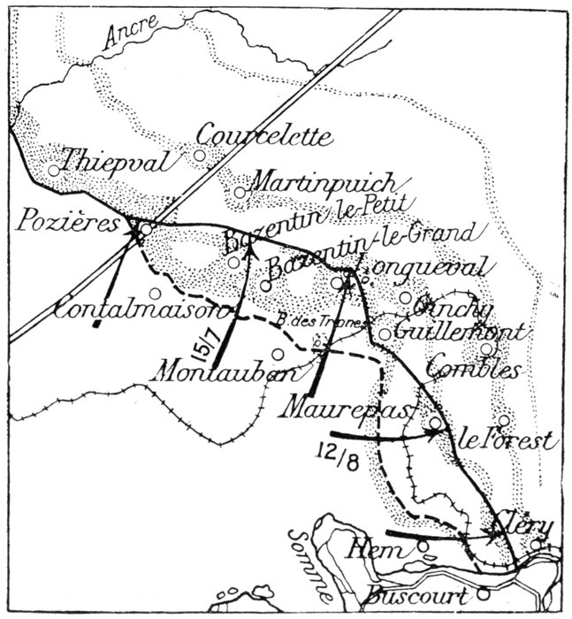
The first assault against the village was launched on August 12 by troops
coming from Hardecourt-aux-Bois; only the southern and western parts
of the village—including the fortified cemetery and the church—could be
carried. The northern part fell a few days later. Finally, on August 24,
the last centres of resistance—notably the houses alongside of the roads
leading to Combles and to Forest—were captured.
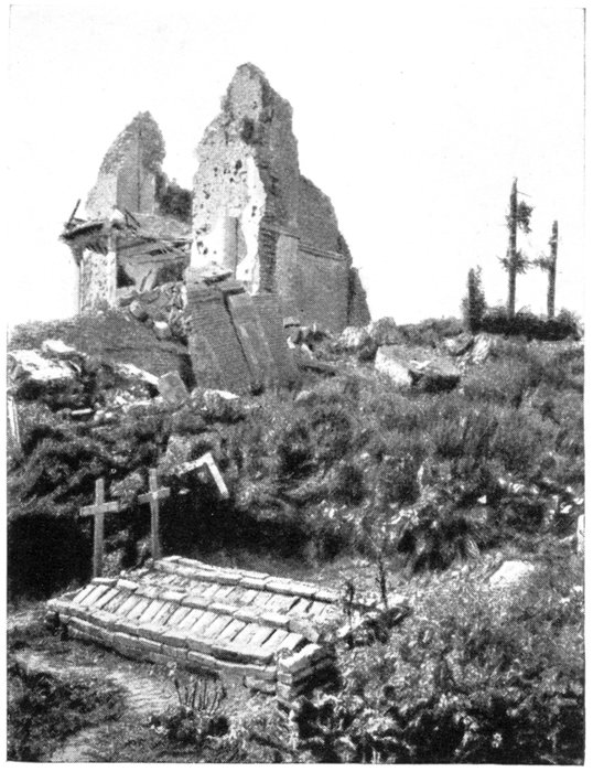
In the village, near a cross, take the road to Combles, on the right, crossing
the north-west part of the village. The site of the church is on the right, while
on the left is a small German redoubt (photo below), from which there is a
line view of Hardecourt-aux-Bois.
Hardecourt, which cannot be reached by road, stood at the junction-point
of the French and British forces during the offensives which aimed at
the investment of Combles. It had been captured in less than three hours
by the French on July 8, 1916, together with the eminence which protects
it on the north. A few scattered ruins are all that remain to-day of the
village.
The road runs straight from Maurepas to Combles (3 km.).
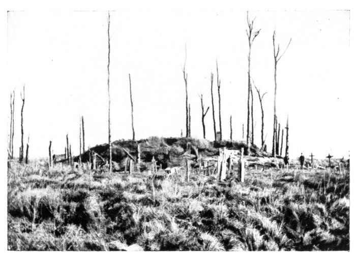
MAUREPAS.
GRAVES
AROUND
A GERMAN
REDOUBT.
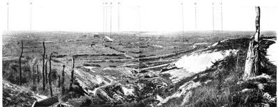
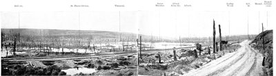
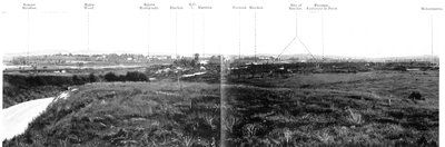
PANORAMIC VIEW OF COMBLES AND THE SURROUNDING COUNTRY.
A.—Trônes Wood; B.—Guillemont; C.—Ruins of Church; D.—Entrance to the Underground Shelters; E.—Combles-Guillemont road; F.—Bouleaux Wood; G.—Quarry used as howitzer
emplacement; H.—Morval; I.—Combles. Morval road; J.—Maurepas-Combles road.
Investment and Capture of Combles by the Franco-British Troops
in September, 1916
Combles formed the last redoubt in the German defences until September,
1916.
Nature had made the position an exceedingly strong one. Enclosed at
the bottom of a small valley and completely surrounded by a girdle of hills,
Combles was out of reach of the artillery. For two and a half years the
Germans had been fortifying this position, building formidable entrenchments
and extensive subterranean defences in and around the village.
The systematic conquest by the Allies during the first half of September,
1916, of the whole region, including the villages of Forest, Maurepas, Guillemont
and Ginchy, had brought about the fall of the whole of the defences
of the stronghold, on the south and west.
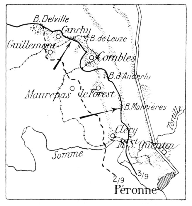
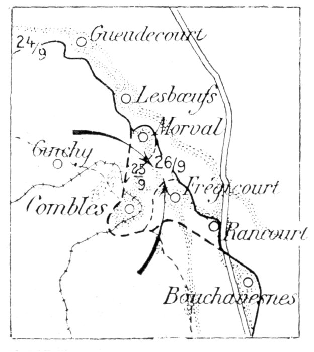
A fresh Franco-British attack was launched on September 25, after a
terrific bombardment, with the object of encircling the fortress, by the capture
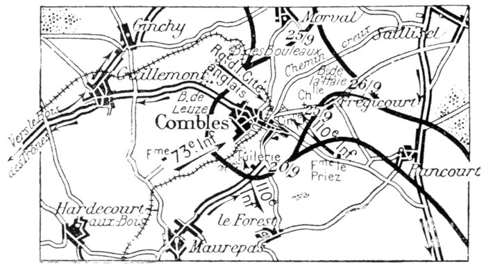
of the strong points which still protected it on the east and north (see sketch-map,
p. 81).
On the south-east, the French, starting from their trenches in the old
German positions of Le Priez Farm—a powerful redoubt protected by six
lines of defences which they had carried by assault on September 14—captured
the hamlet of Frégicourt. On the east, they carried Rancourt village, and
all intermediary positions between these two points, advancing as far as the
north-western corner of St. Pierre-Vaast Wood.
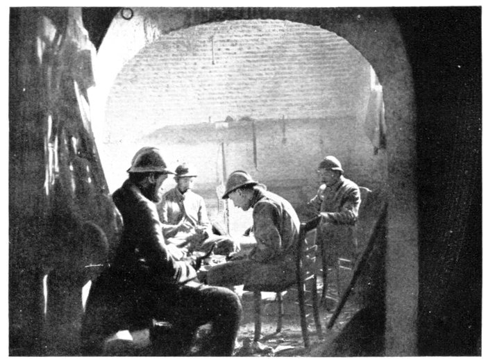
ONE OF THE ENTRANCES TO THE UNDERGROUND
SHELTERS OF LAMOTTE CHÂTEAU.
(Stretcher-bearers taking a meal.)
On the north, the British took the fortified villages of Morval and Lesbœufs,
and nearly joined hands with the French.
The Germans had now only one line of communication with their rear,
consisting of a hollow road which, winding towards Sailly-Saillisel to the
north-east, through La Haie Wood, was under the fire of the Franco-British
artillery. The Germans therefore decided to evacuate their positions, but
the Allies did not give them time to withdraw in good order. On the morning
of September 26 they attacked again, the objective being this time the
defences of the village itself. Their junction was to be the centre of the
village and "London" the pass-word. The plan of attack was carried out
to the letter. The French 110th Infantry Regiment, debouching from the
south-east, carried all that part of Combles lying east and south of the
railway, including the cemetery and railway-station. The 73rd Infantry
Regiment captured and consolidated the western part of the village, in spite
of stubborn resistance. The City of London Regiment cleared the north-western
portion of the village.
The streets and the road leading to Sailly-Saillisel, along which the
Germans retreated, were filled with their dead; 1,200 prisoners and important
quantities of material and supplies, both food and ammunition, were captured.
Lying partly at the bottom of the valley and rising partly in tiers on
the slopes of the surrounding hills, Combles (1,150 inhabitants, mostly
engaged in silk and wool weaving) had suffered less from this fierce fighting
than might have been expected. Although damaged (shattered walls, disjointed
timber-work and tile-less roofs) many of its houses were still standing
at the end of 1916. The village had, however, been thoroughly pillaged by
the Germans, and traces of their long occupation were everywhere to be
seen, including concrete shelters, strong-points, for machine-guns, underground
passages, chambers, etc.
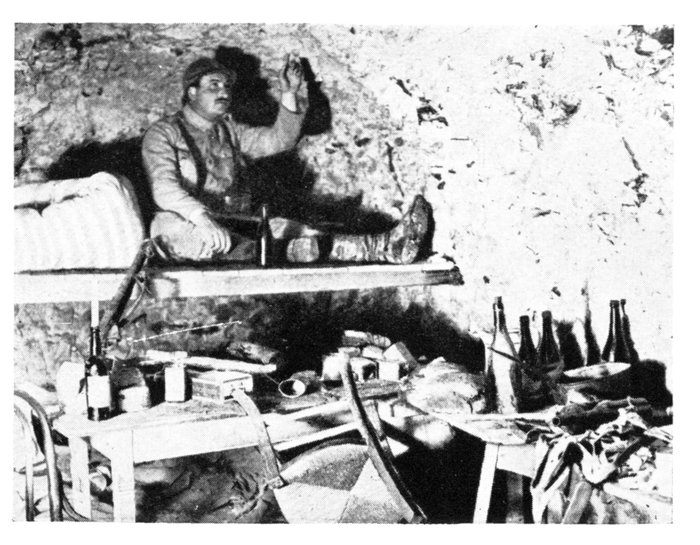
IN THE UNDERGROUND SHELTERS OF LAMOTTE CHÂTEAU.
(German Officers' room.)
The tunnels, excavated out of the solid rock under the Lamotte Castle,
which already existed before the war, were the most important of these
subterranean organisations. The Germans utilised them as posts of commandment,
dressing-stations, mustering-places, etc. They were large enough
to shelter several companies at a time and sufficiently deep to be proof against
the heaviest projectiles. There were separate entrances and exits, ventilating
shafts, electric light, etc., and they were comfortably fitted up. Beds were
installed in the walls, and there were tables, chairs, armchairs, tapestries,
etc.—all stolen from the houses in the village.
Combles in 1918
In 1918, the British attacked the Combles positions, only after the fall of
Bapaume. Gen. Rawlinson's Army remained till August 29, 1918—when
Bapaume was taken—on the line reached on the 26th, which ran west of Ginchy,
Guillemont and Hardecourt-aux-Bois. Resuming their advance on the 29th
and pressing hard upon the heels of the retreating enemy, they carried these
three villages the same day, then Maurepas, and finally Combles itself,
advancing beyond in the evening.
The ruin of the village was completed during these operations.
Very few houses retained their four walls and roofs. Of the Town Hall a
piece of broken wall only remains. The church was almost entirely destroyed,
only a few fragments of the façade remain standing amid a heap of stones
and rubbish.
On reaching Combles turn to the left and cross the village as far as the ruined
church, opposite which is the entrance to the underground passages and
chambers of Lamotte Castle.
The church stands at the junction of two roads. Take the right-hand one
(G.C. 20) which rises towards Guillemont village, built on the top of a hill
(altitude 462 feet). The road runs between two small woods—Bouleaux
Wood (on the right) and Leuze Wood (on the left)—both cut to pieces by
the shells.
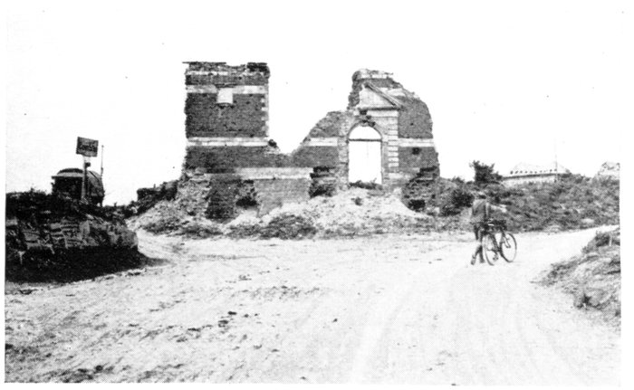
COMBLES CHURCH.
On the right: Guillemont road; on the left: impassable road
to Hardecourt.
Bouleaux Wood was carried by the British on September 15, 1916. The
attack coinciding with a German counter-attack, gave rise to an exceedingly
violent encounter. After capturing an important redoubt, east of the wood,
the British gradually outflanked the enemy on the wings, and pressing hard
from all sides, forcing them to retreat one kilometre northwards at the end
of the day.
Leuze Wood was also carried by assault.
The village of Guillemont (2 km. beyond Combles) is next reached.
Guillemont (razed to the ground) was entirely captured by the British on
September 3, 1916. No trace whatever remains of the houses, the sites of
which are now indistinguishable from the surrounding fields. The whole
area was devastated and is now overrun with rank vegetation. After its
capture it was strewn with wreckage of all kinds—stones, bricks, beams,
agricultural implements, and household furniture from the shattered farms
and houses. The fine modern church, Gothic in style, which stood in the
centre of the village, has entirely disappeared.
1 km. 500 beyond Guillemont is Trônes Wood, to reach which, take the
Montauban road (G.C. 64) on the left at the fork of the village.
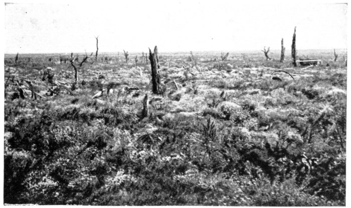
GUILLEMONT. SITE OF THE DESTROYED VILLAGE.
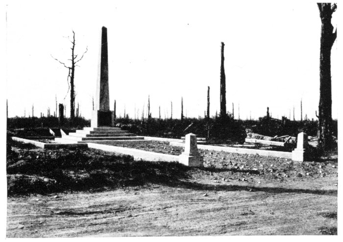
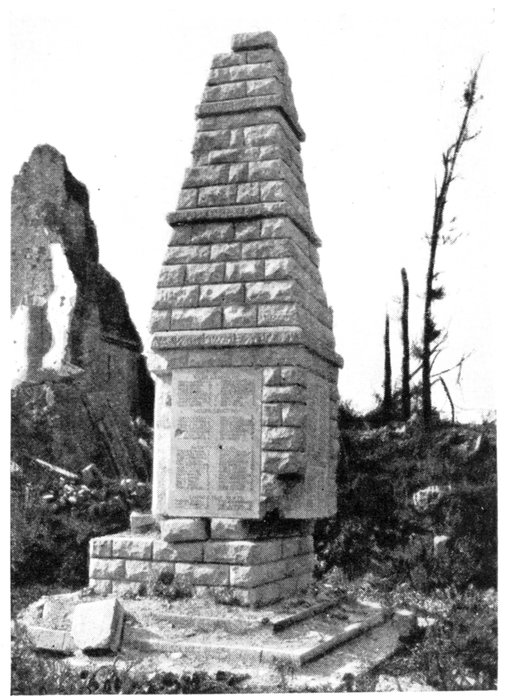
MONUMENT TO THE DEAD OF THE BRITISH 18TH DIVISION.
Trônes Wood was the scene of much desperate fighting between the
British and the Germans during the first fortnight of July, 1916.
The struggle was almost incessant from July 8 to July 14, the wood
changing hands seven times (the Germans say they lost and retook it eighteen
times running). On both sides the greatest bravery was displayed, despite
terrible losses. British progress was long stayed by a concrete blockhouse
(still existent) in the middle of the wood, from which, through slits in the
walls, enemy machine-guns rained death unceasingly on the assaulting
columns.
A battalion of the Royal West Kents remained forty-eight hours cut off
in a corner of the wood to the north-east, and repulsed many furious assaults
without loss of ground.
The trees were hacked to pieces by the shells. Among the stumps may
be seen trenches, shelters, blockhouses and small forts. In the middle, to
the right of the road, is a pyramid erected to the memory of the officers and
men of the British 18th Division, killed in 1916-1918 in the Battle of the
Somme (photo above).
At the end of the wood, near a rail track on the right, and fifty yards
from the road, is a concrete blockhouse (photo below).
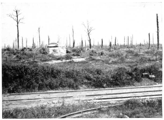
TRÔNES WOOD. MACHINE-GUN BLOCKHOUSE.
Return by the same road to the fork at Guillemont, and take the road on
the left (leaving that going to Combles on the right). 50 yards farther on, take the
road to Ginchy on the right. This little village (1 km. from Guillemont) lies
on the western slope of the high "Ancien Télégraphe," plateau formerly
chosen by Chappe as a telegraph post.
Situated at the crossing of six roads, Ginchy defended Combles (4 km. to
the south-east) on the north-west. Partly conquered on September 3, 1916,
Ginchy was only completely occupied by the British on September 9, after a
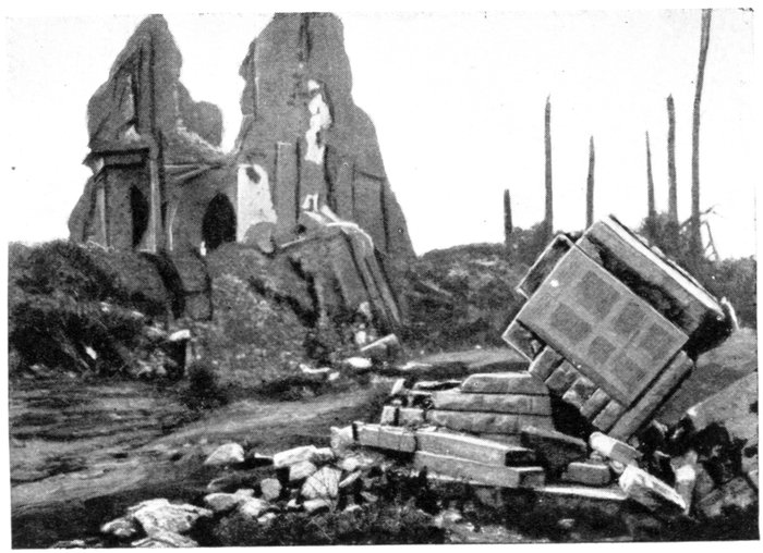
terrible struggle lasting three days, in the ruins of the village (entirely
destroyed). The Irish troops (Connaught, Leinster and Munster Regiments)
particularly distinguished themselves.
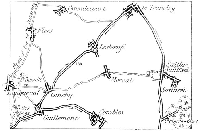
Follow the road through Ginchy, leaving on the left the roads to Longueval
(passable) and Flers, and, on the right, the road to Morval. There is a British
cemetery in Ginchy, on the left. Keep straight on to Lesbœufs.
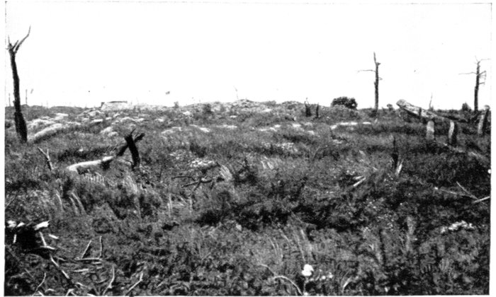
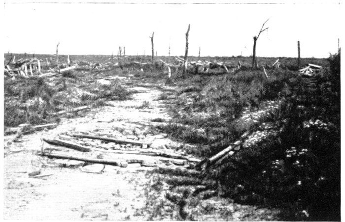
GINCHY. WHERE THE CHURCH USED TO STAND.
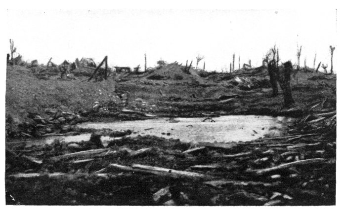
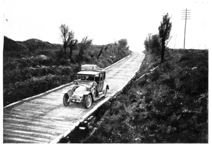
Beyond Ginchy, the road is made of logs for several kilometres (photo above).
It crosses a shell-torn plateau (Hill 154), on which numerous graves convey an
idea of the violence of the struggle. In May, 1919, a large German material
and ammunition dump, also a rail-track, were still to be seen there.
There is a German cemetery on the left, this side of Lesbœufs.
Lesbœufs village, next reached, was entirely destroyed; only a few shell-torn
trees and (on the right) a mound of stones and rubbish (the church)
remain.
Cross the village and keep straight onto Le Transloy, noticing the numerous
graves on the right and left.
Of this important village only a few broken walls remain.
After crossing the village N. 37 is picked up; 100 yards farther on, the ruins
of a large sugar factory are seen on the left.
Take N. 37 on the right to Péronne, passing through Sailly-Saillisel, 4 km.
beyond Transloy.
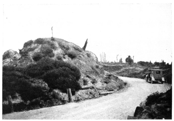
LE TRANSLOY. SITE AND RUINS OF CHURCH.
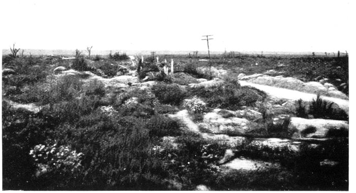
SAILLY-SAILLISEL.
As seen when looking towards Péronne.
The Capture of Sailly-Saillisel by the French
(October-November, 1916.)
Having taken Combles, the French hastened to consolidate their gains by
carrying the height of Sailly-Saillisel (in October, 1916)—the last of the hills
from which the Germans dominated the hollow of Combles. On this hill
(altitude, 455-488 ft.) stood an extensive village formed by two agglomerations—Sailly,
grouped around the Bapaume-Péronne road (N. 37) and
Saillisel, built to the south-east and along G.C. 184.
Daily progress by means of grenade fighting having enabled the French
gradually to encircle Sailly-Saillisel from the north-west to south-west during
the first half of October, an attack was then launched against the defences
proper of the village. This attack developed into one of the hardest and
bloodiest battles in the whole of the Somme offensive, which, begun on
October 15, lasted till November 11, 1916.
Sailly was captured first (October 15), the French attacking the defences
of the castle, park and old church which flanked Sailly on the west. After
desperate fighting, the Germans were forced to retreat. Following up their
success, the French pursued the retreating enemy into their second lines and
entered the village, reducing the fortified houses one by one, and occupying
the whole of the village west of the Bapaume-Péronne road. By nightfall,
the central cross-roads of Sailly was reached. On the 16th, a new block of
houses was carried. On the 17th, the Germans counter-attacked furiously
several times in force, and succeeded in regaining a footing in the defences lost
the day before, to which they clung desperately. The capture of the village
was only completed on the 18th, when the French consolidated their gains by
carrying the ridges which dominate Sailly from the west and north.
The honour of taking Sailly fell to the 152nd Infantry Regiment of the
Vosges, already famous by the capture, in Alsace, of the village of Steinbach
and the Hartmannsweillerkopf. For eight days, this gallant unit "fully
maintained its gains, in spite of the most intense bombardment, and as many
as three violent counter-attacks daily" (Order of the Day of December 4, 1916,
being the third Citation "à l'ordre de l'Armée" of this regiment).
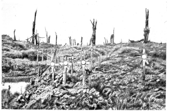
GRAVES IN
THE PARK
OF SAILLY-SAILLISEL
CHÂTEAU
The battle was soon resumed with the same violence for the possession of
Saillisel. At the end of October, the French reached the church—about
200 yards from the first houses of the hamlet—and continued to advance on
the following days, occupying Saillisel almost entirely on November 5.
They were, however, unable to maintain themselves there, and the
Germans, after extremely violent fighting, reoccupied the ruins of the hamlet.
Saillisel was finally and totally conquered on November 11-12. A party of
German machine-gunners in a block of houses refused to surrender, and had
to be overpowered with bombs.
Sailly-Saillisel must be added to the long list of the villages which have
totally vanished. The old castle is now a shapeless mass of ruins. The park
was so badly cut up by the shells that there remain practically no vestiges
of the trenches and fortifications which the Germans had accumulated there.
All the trees were more or less shattered, and rank vegetation now overruns
the whole place. Groups of graves scattered here and there, recall the
terrible battles which were fought there.
Of the church, only the bases of a few pillars remain. The graves in the
churchyard were torn open by the bombardments, and the village was almost
entirely levelled.
To visit Saillisel, take, opposite a large pool, a road—at right angles to N. 37—which
runs past the ruins of the church: follow it as far as the cross-roads. The
sight is impressive, on account of the large number of French graves and
shell-holes; some of the latter are of enormous size.
Return to and follow N. 37 to Rancourt (3 km.). The road crosses Hill 148,
whence there is an extensive view, which explains why the Germans clung so
stubbornly to this ground.
On the left of the road, at this point, lies Saint-Pierre-Vaast Wood, a visit to
which is both impressive and interesting. Access to it is gained by a road which
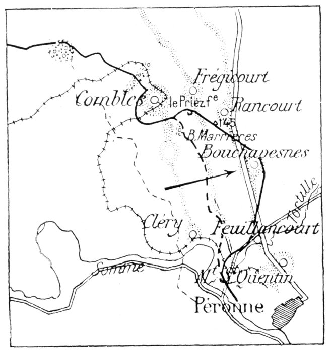
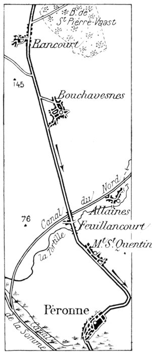
branches off N. 37 at the entrance to Rancourt (see sketch-map, p. 90).
St. Pierre-Vaast Wood
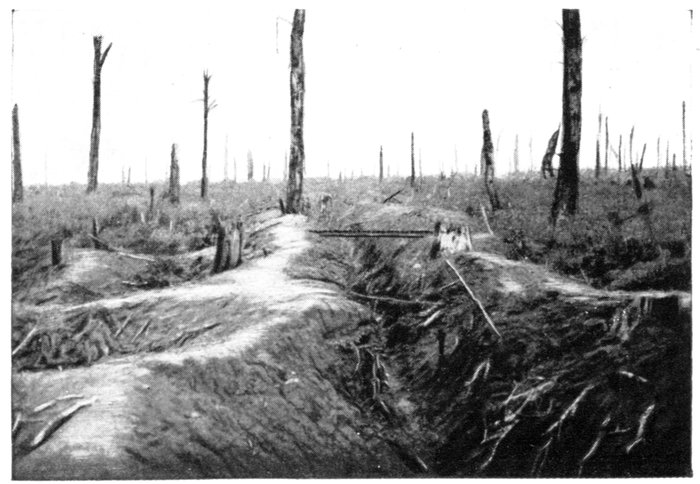
St. Pierre-Vaast Wood, of which nothing remains but shattered, burnt
tree-stumps, was the most important vestige of the immense Arrouaise
Forest that covered the whole of this region in the Middle-Ages.
From November, 1916, till March, 1917, this wood was often mentioned in
the French and, later, in the British communiqués. The Germans had
powerfully entrenched themselves there, and it was here that they had their
reserves and artillery. In the thickets was a maze of trenches and fortified
redoubts, surrounded by minor defence-works of all kinds.
The French partly occupied the wood at the
beginning of November, but violent counter-attacks
by three enemy army corps forced them
to evacuate the conquered ground. Driven back
to the western edge of the wood, they were
subsequently unable, in spite of renewed efforts,
to get beyond it. Throughout the whole
winter of 1916-17, the front line remained
fixed in front of this wood, which, transformed
into an immense stronghold, protected Péronne
from the north. This sector, occupied by the
British, was never quiet. Grenade fighting
from trench to trench was incessant, whilst
the artillery gradually annihilated all the
defences and levelled the wood almost entirely.
Finally, on March 16, 1917, at the beginning of
the German retreat on the Somme, the British
captured the whole wood, without encountering
serious resistance.
After visiting the wood, return to N. 37, and
go on to Rancourt. This village (entirely
destroyed, photo, p. 91) was carried by the
French on September 25, 1916, in the course of
their turning movement which preceded the
capture of Combles.
On leaving Rancourt, N. 37 crosses Hill 145,
where, on the right, the Combles—Guillemont—Montauban—Albert
road begins (passable).
This area is thickly strewn with graves.
N. 37 next descends to the beginning of the road to Bouchavesnes, the site
of which is seen 300 yards to the left.
The conquest of Bouchavesnes was a stirring episode in the battle of the
Somme.
On September 12, 1916, a French detachment, composed of Alpine Chasseurs
and infantry, carried the position within two hours, after an intense
artillery preparation. In spite of a most stubborn resistance, all the entrenchments
and strong points among the ruins of the houses were carried one after
the other, in a single rush. 400 men, the only survivors of the two German
battalions which held the village, were taken prisoners; 10 guns and 40
machine-guns were likewise captured.
The success was so complete and crushing that for a short time there was
a gap in the German front line. Scattered units hastily got together were
thrown into the breach where, crouching in the shell-holes, they resisted
desperately with rifle and machine-gun, and held their ground for a whole day,
without any reserve support.
On March 24, 1918, the German columns forced the line of the Tortille
stream and entered Bouchavesnes, thereby bringing about the fall of Péronne—outflanked
from the north—and the retreat of the British towards the Ancre.
The village was reconquered on September 1 following, after sharp fighting.
After passing by Bouchavesnes, N. 37 ascends another crest (see fortified
quarry on the left), from the top of which there is a magnificent panorama:
on the left, the Valley of the Tortille (a small tributary of the Somme); in the
valley, the Northern Canal and Village of Allaines; opposite, the Mont-St.-Quentin;
on the right, the Valley of the Somme.
The portion of the National road which is now followed was the scene
of furious, bloody fighting in 1916. In their attempt to outflank Péronne, the
French encountered strong German forces which stubbornly held their
ground. Traces of the desperate fighting are seen all along the way: stumps
of shattered trees, mine-craters and shell-holes in the fields, soldiers'
graves, etc.
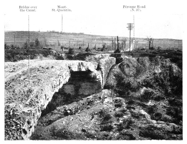
NEAR PÉRONNE. RUINS OF BRIDGE OVER THE CANAL DU NORD, ON THE N. 37.
Cross the Northern Canal by temporary bridge.
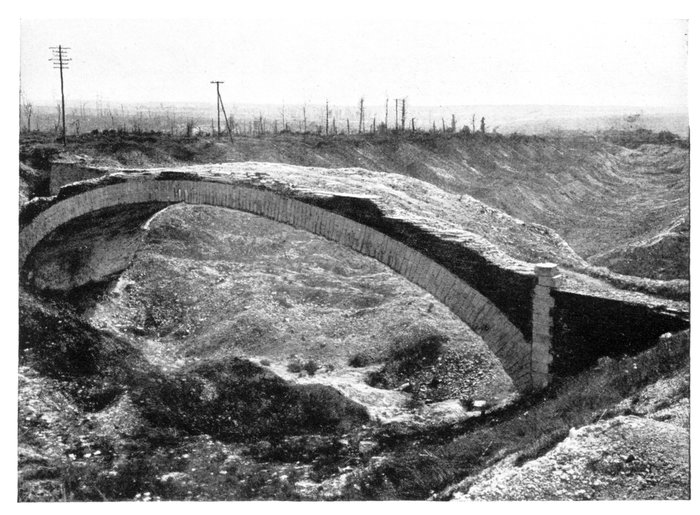
THE CANAL DU NORD FORMED A BITTERLY DISPUTED LINE
OF RESISTANCE.
This canal, which connects the Somme with the rivers of northern France,
was not quite finished when the war broke out. Its bed was excavated, but
not yet filled with water, so that it formed a ready-made line of resistance.
The Germans were unable to hold it in 1916, and the British were likewise
driven from it by the German thrust in 1918.
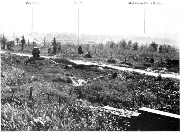
WHAT THE GERMANS SAW FROM THEIR OBSERVATION-POST ON THE
MONT-ST.-QUENTIN.
Immediately beyond the canal, the small, ruined village of Feuillancourt is
crossed. On September 12, 1916, the French gained a footing on Hill 76,
west of the village. This was the nearest position to Péronne reached in 1916,
to the north of the town.
Follow N. 37 to Mont-St.-Quentin.
Mont-Saint-Quentin
Built along the National road, 2 km. north of Péronne, on a hill having
an altitude of 325-390 ft., the village of Mont-St.-Quentin possessed, until
the Revolution, an important abbey, which was founded in the early Middle
Ages.
The hill, now famous, rises in front of Péronne, and forms the immediate
defence of the town. The Germans had, prior to the Franco-British offensive
of 1916, posted their heavy artillery there and built powerful entrenchments.
From 1914 to 1917 the German pioneers consolidated the position.
The hill was pierced from all sides by subterranean timber-propped galleries,
some leading to immense and comfortable shelters, others to numerous
invisible observation-posts, so placed as to command an extensive view in
all directions.
A large number of camouflaged heavy guns were posted on the slopes of
the hill, the neighbouring observation-posts ensuring great accuracy of fire.
Trenches had been dug all about, in the chalky soil. At the foot of the
slopes, two first-lines completely surrounded the hill, and two similar lines
ran round half-way up. Communication-trenches zig-zagged transversely,
connecting the various lines of main trenches, while the intervening empty
spaces were covered with deep entanglements of barbed wire and chevaux-de-frise.
Lines of barbed wire protected the winding communicating trenches.
At the corners, at regular intervals, concrete observation and special posts,
all strongly fortified, were built for the machine-gunners and sharp-shooters.
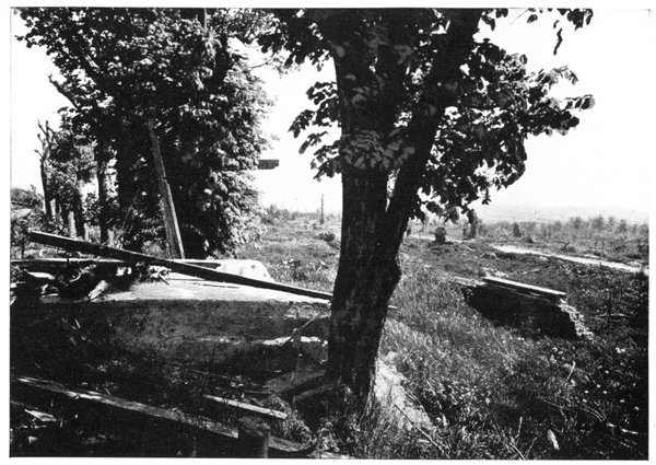
GERMAN OBSERVATION-POST ON MONT-ST.-QUENTIN (IN THE CHÂTEAU PARK).
Péronne and Maisonnette Hill are in the background.
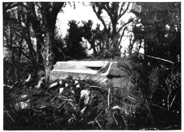
SPY-HOLE OF THE OBSERVATION-POST.
The village itself was powerfully fortified. An intricate system of trenches
entirely covered the place, the castle forming the main strong-point. A
maze of communication trenches and entrenchments ran throughout the
park. A concrete observation-post on the terrace, near the enclosing wall,
hidden among the lime-trees, commanded a view of the whole battlefield
north and south of the Valley of the Somme. A subterranean shelter beneath
this observation-post connected the defences of the castle with those in the
cellars of the village houses.
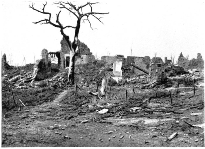
MONT-ST.-QUENTIN.
RUINED
HOUSES.
These powerful entrenchments have almost completely disappeared.
Before evacuating the position in March, 1917, the Germans mined the defence-works
of the hill, blocking up the entrance to the underground passages.
They also set fire to the timber props which supported the roof and walls
of the galleries and shelters; an immense fire was thus lighted inside the
hill, which, for several days, had the appearance of a volcano in eruption.
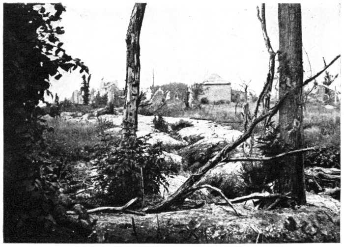
MONT-ST.-QUENTIN.
GERMAN
DEFENCES.
Whilst in 1917 the Germans voluntarily evacuated Mont-Saint-Quentin,
they were driven from it by main force in 1918. During the night of August 30,
Australian units, slipping through the brushwood and barbed-wire entanglements
which covered the steep slopes of the hill, succeeded in reaching the
top, and quickly bombed the surprised garrison into submission, about a
third of the defenders being taken prisoners. In spite of fierce counter-attacks,
the Australians held their ground the next day. Several assaulting
waves, composed of soldiers from the Prussian Guard, were successively
launched against the hurriedly consolidated positions, but were each time
mowed down by artillery barrages.
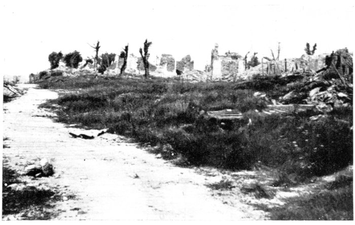
MONT-ST.-QUENTIN.
VILLAGE IN
RUINS.
Of the village of Mont-Saint-Quentin, nothing remains but the basements
of the houses, with here and there bits of broken walls, tottering beams and
heaps of rubbish. The church, a favourite pilgrimage, in memory of the former
abbey, was totally destroyed, as was also the castle.
The ruins of the castle, and a German observation-post of concrete, with
underground passages and shelters, are at the entrance to the village, on the
left, about 50 yards from N. 37.
There is a fine panoramic view over the Somme Valley and Péronne.
On leaving Mont-Saint-Quentin, N. 37 descends to Péronne. Enter the
town by the Faubourg de Bretagne.
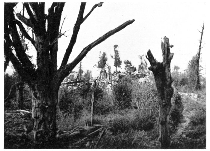
MONT-ST.-QUENTIN.
RUINS OF
THE
CHÂTEAU.
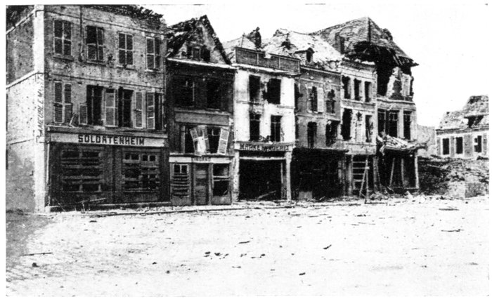
GERMAN
SIGNS IN
THE
GRANDE
PLACE.
Péronne, a sub-prefecture of the "Département" of the Somme, was one
of the centres of the sugar and hosiery industries in France, with a pre-war
population of about 5,000 inhabitants.
Built at the junction of the Rivers Somme and Cologne, which form a
picturesque girdle of marshes and ponds before the walls of the town, Péronne
was formerly a fortified city. Its brick ramparts and moats were being
dismantled when the late war broke out.
Origin and Chief Historical Events
Péronne, whose origin goes back to a Merovingian villa built there in the
seventh century, became, in the Middle-Ages, an important fortified city,
under the rule of the Counts de Vermandois. One of them kept Charles-le-Simple
imprisoned there until his death (929). Philippe I. annexed Péronne
to the Crown lands, but in 1435 Charles VII. gave the city to Philippe-le-Bon,
Duke of Burgundy. In 1483, during the rebellion of the Liégois, Louis XI.,
who was then the guest of Charles-le-Téméraire, was kept a prisoner in the
castle and compelled to sign a humiliating treaty—called the Péronne Peace—which
he afterwards refused to fulfil.
In 1536, the Spaniards, under the leadership of the Prince of Orange,
besieged the town for thirty consecutive days, but thanks to the bravery of
the inhabitants, and the heroism of a woman named Catherine de Poix, or
Marie Fouché, who was the soul of the resistance (photo, p. 104), Péronne was
saved.
The "Holy League," which marked the commencement of the Religious
Wars, was founded at Péronne in 1577 by the nobility and clergy.
In 1870-71, the Germans besieged the town for thirteen days (December 28
to January 9), and subjected it to a violent bombardment, which caused considerable
damage, though insignificant in comparison with the depredations
of the late war. The church, especially the belfry, was greatly damaged,
part of it collapsing, and a number of houses were either burnt or destroyed.
During the occupation the enemy committed no excesses.
Péronne—whose arms bear the following device, "Urbs nescia vinci"
(the undefeated city)—was decorated in 1913 for its gallant conduct in 1536
and 1870-1871.
Péronne during the Great War
In 1914, during their rapid advance on Paris, the Germans entered Péronne
(August 28), but were driven out on September 15. They reoccupied the
town ten days later (September 24), and remained there until March 17, 1917.
A year later (March 25, 1918) the British were compelled to evacuate the
town, outflanked as they were from the north and south by the ever-increasing
numbers of the German columns marching on Amiens. They re-entered the
town on September 1, after a series of very fierce engagements which lasted
the whole day.
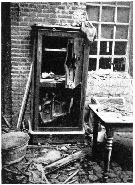
SAFE DYNAMITED BY THE GERMANS.
Péronne was totally destroyed,
partly by the Franco-British
artillery, but especially by the
systematic destructions on the part
of the Germans.
Before retreating in 1917, the
Germans set fire to or blew up a
large number of houses. Special
detachments in charge of the destructions
made large rents in the
masonry-work, before firing the
mines, to ensure total destruction.
The fighting in 1918 completed
the ruin of the city, which will
have to be entirely rebuilt. A few
name-plates on the broken walls,
and broken shop-signs alone made
it possible to identify the heaps of
ruins which lined the streets.
The streets leading from the
castle to the southern part of
Péronne, and thence to the suburb of Paris (completely ruined), were
devastated. The long Rue Saint-Fursy, especially, was almost entirely
destroyed.
To the east of the town, the railway-station—connected with Péronne
by an embankment across the marshes of the Somme—has retained a portion
of its shell-torn frame-work, but the bridges across the marshes, as well as the
railway-bridge, were broken.
The cemetery (about 1 km. 800 beyond the town) was devastated. Many
graves were desecrated, and trenches dug among the violated sepulchres.
A battery of artillery was even posted on the site of ancient vaults. These
profanations did not prevent the Germans from burying their dead in a corner
of the cemetery, or erecting funeral monuments to their memory.
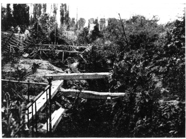
PÉRONNE. TRENCH IN CEMETERY.
Everywhere pillage preceded destruction. The houses, whose walls (more
or less damaged) still remain standing, were completely emptied. The doors,
partition-walls, windows and wood-work were taken out and burnt. All the
safes, including those of the Banque de France, were broken open. All
articles of any value were carried away, and the rest destroyed. In 1917,
mattresses ripped open, battered perambulators and cradles, broken furniture,
dislocated pianos, even books and family photographs, torn to pieces,
were found among the ruins. In the gardens, the fruit-trees were either cut
down or hacked at their roots.
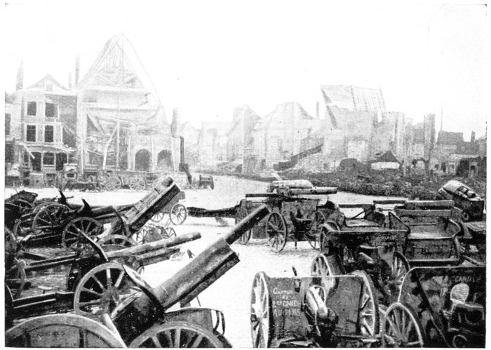
PÉRONNE IN 1918. THE GRANDE PLACE. CAPTURED GERMAN GUNS.
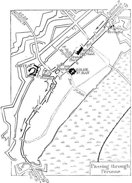
On reaching the town by N. 37, cross the Faubourg de Bretagne, the roadway
of which was, in places, destroyed by mines. In 1917 this suburb had
suffered less than the other parts of the town. Many of the houses could
easily have been repaired, had they not sustained in 1918 new and much more
important damage.
At the end of the suburb stands the Bretagne Gate, built of brick and
stone. This interesting specimen of late sixteenth century military architecture—although
the vaulting bears the date of 1602—is preceded by another
eighteenth century gate, and surrounded by remains of the old fortifications.
Although struck by shells several times, and rather severely damaged,
its vital structure is still standing (photos, p. 101).
Follow the Avenue Danicourt, which leads to the Rue Saint-Sauveur.
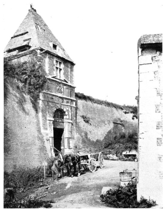
BRETAGNE GATE. EXTERIOR FAÇADE.
The Rue Saint-Sauveur and the Grande Place which prolongs it, formed
the centre of the town, and there the finest shops were to be found. This
part of the town was the most completely destroyed of all.
Some half-burnt, dilapidated house-fronts without roofs are still standing;
the other buildings were destroyed by fire or explosions. The adjacent
streets are in the same pitiable condition.
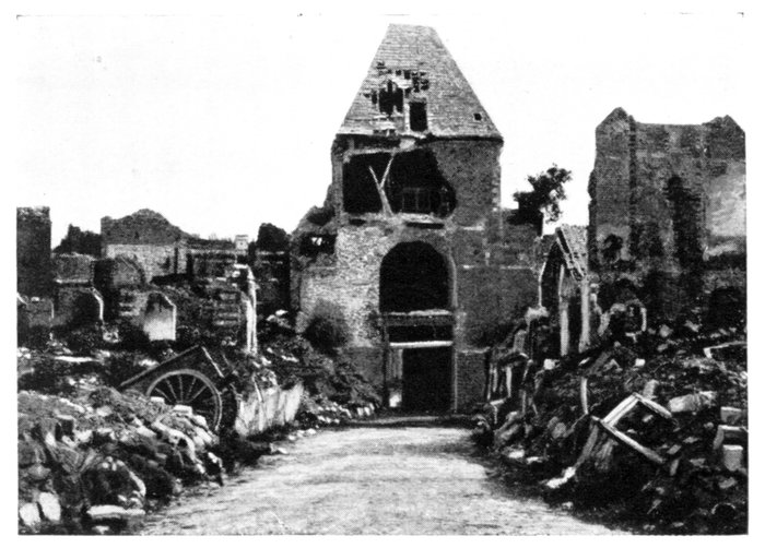
BRETAGNE GATE. INTERIOR FAÇADE.
The Grande Place and Hôtel-de-Ville
The Hôtel-de-Ville, in which the Museum was installed, was built in the
sixteenth century, but was restored and enlarged in the eighteenth century.
Of its Renaissance west front, facing the Grande Place, only the lower
part—in ruins—remains, forming a porch with balcony (photos, p. 103).
The carved salamanders which ornamented it were smashed with blows
from hammers.
Two of the arcades of the porch collapsed in 1918 (see second photo on
p. 103).
The Louis XVI. south front, facing the Rue Saint-Sauveur, was less
damaged (photo below).
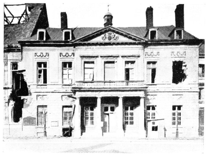
PÉRONNE. THE HÔTEL-DE-VILLE.
The front facing the Rue Saint-Sauveur.
The roof and the modern belfry which surmounted the building were
blown up in 1917. An unexploded bomb with connecting wires was found
in the broken frame-work, fixed to a beam. Before evacuating the town,
the Germans fixed a large wooden board on the west front, bearing the following
inscription: Nicht ärger, nur wundern (Don't be angry, only admire).
The roof fell in, breaking the ceiling of the rooms in which the Museum
and Library were installed. Some statues were decapitated, and other
works of art mutilated. Books, manuscripts, documents and municipal
records were destroyed by the rain which fell through the gaping ceilings.
However, the most valuable works in the Museum were saved, as they had
been carried off to Germany. A few famous paintings may be mentioned,
including, "The Attack of the Railway Station at Strying," an episode in
the battle of Forbach (Alphonse Neuville), another by the same artist,
"Hunting in St. Pierre-Vaast Wood," in which De Neuville is shown surrounded
by the notables of Péronne; and a painting attributed to Breughel
Junior, representing a Conference at the house of an attorney, at Cambrai;
objects connected with the local history, an important collection of numismatics,
and Gallic, Gallo-Roman and Merovingian antiquities were among
the collection.
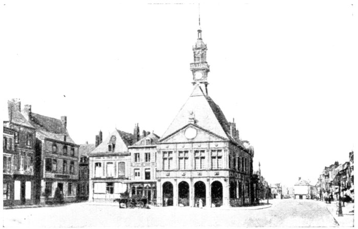
PÉRONNE. THE HÔTEL-DE-VILLE BEFORE THE WAR.
The Renaissance Façade overlooking the Grande Place, and modern
Belfry. On the right: The Rue Saint-Sauveur.
Before the war an old fifteenth century house with statues stood in the
Grande Place, at the corner of the Rue du Vert Muguet, near the Hôtel-de-Ville.
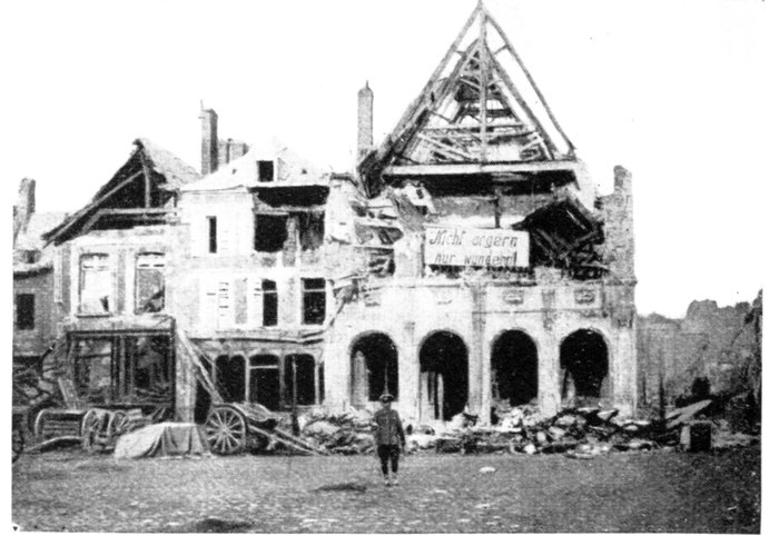
PÉRONNE. THE HÔTEL-DE-VILLE IN 1917.
Note the German inscription on the ruined building which the enemy
had deliberately blown up. (See text.)
In the Place du Marché-aux-Herbes which adjoins the Grande Place
stood a statue of Catherine de Poix, known as Marie Fouché, the heroine of
the siege of 1536. This statue—like that of General Faidherbe at Bapaume—was
stolen by the Germans during the first occupation of the town. When
the 1st Warwickshire Regiment entered Péronne on March 17, 1917, they
found a grotesque dummy figure on the pedestal (photo, p. 105).
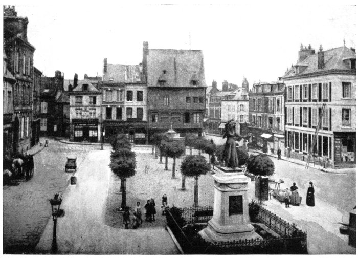
PÉRONNE. THE PLACE DU MARCHÉ-AUX-HERBES BEFORE THE WAR.
In the background, on the right: Rue St. Fursy and the old house seen in the photograph
on p. 75. In the background: Statue of Catherine de Poix, heroine of the Siege of 1536.
At the end of the Place, near the entrance to the Rue St. Fursy, a late
fifteenth century wood-panelled house (photo, p. 105), ornamented with curious
statues of saints and bishops, was burnt down.
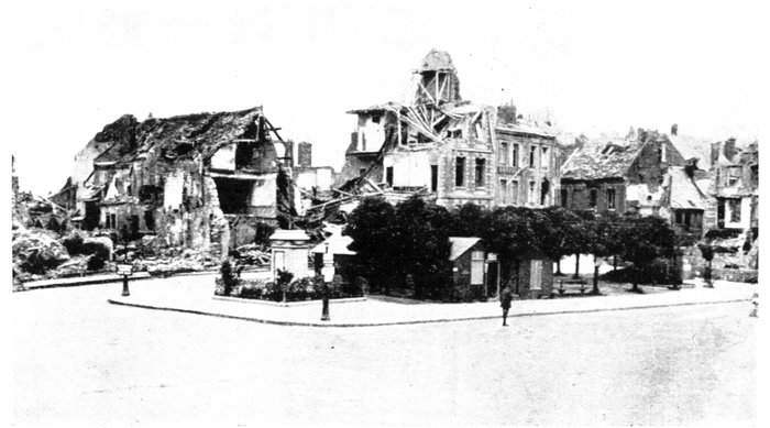
THE PLACE DU MARCHÉ-AUX-HERBES IN 1919.
In the foreground: Pedestal of Statue (see above) carried off by the Germans.
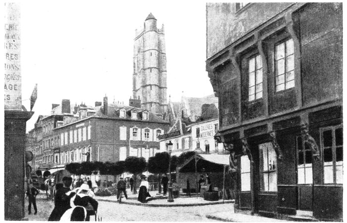
PÉRONNE. THE PLACE DU MARCHÉ-AUX-HERBES BEFORE THE WAR.
Seen from the Rue St. Fursy. The 15th Century wooden house on the right, in the foreground,
was burnt down. In the background: Church of St. Jean.
There is a fine charcoal drawing of it by Alphonse de Neuville in the
Museum.
On the other side of the Grande Place, at the entrance to the Rue St. Jean,
stands the St. Jean Church (Hist. Mon.), in fifteenth century flamboyant
style, with three naves terminated by a rectangular apse, to-day in ruins.
The Church of St. Jean
Of the St. Jean Church only the gaping, crumbling walls of the main front
remain. The northern front collapsed entirely.
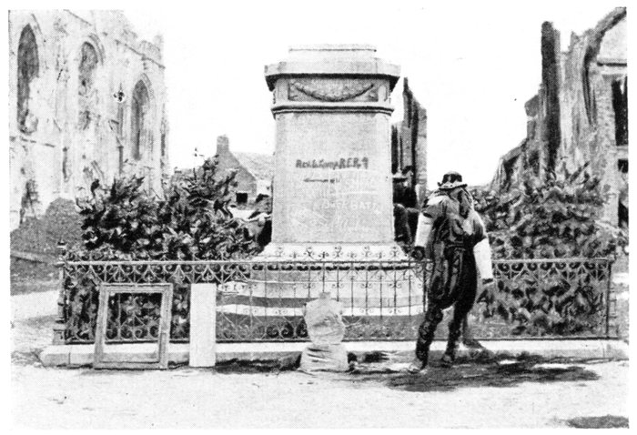
PEDESTAL OF THE STOLEN STATUE OF CATHERINE
DE POIX (see p. 104).
On the left: Part of the ruins of the St. Jean Church.
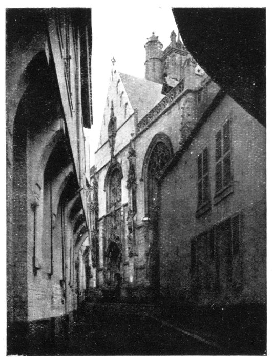
PÉRONNE. THE FAÇADE OF ST. JEAN
CHURCH, BEFORE THE WAR.
The sixteenth century square tower, flanked by a round turret (photo
above) has vanished.
The western portal with its three doors, decorated with fine fifteenth
century carvings, was greatly mutilated (photo below).
The roof, frame-work, and interior vaulting, which was ornamented with
very fine pendentives, collapsed.
Some of the pillars fell down, and most of the dislocated arches have
gradually crumbled away under the action of the weather.
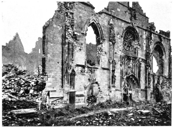
THE FAÇADE OF ST. JEAN CHURCH IN 1919.
The grand organ was greatly damaged; all the pipes were removed and sent
to Germany. On the other hand, the seventeenth century, multi-coloured
marble reredos of the high and Virgin altars were not severely damaged.
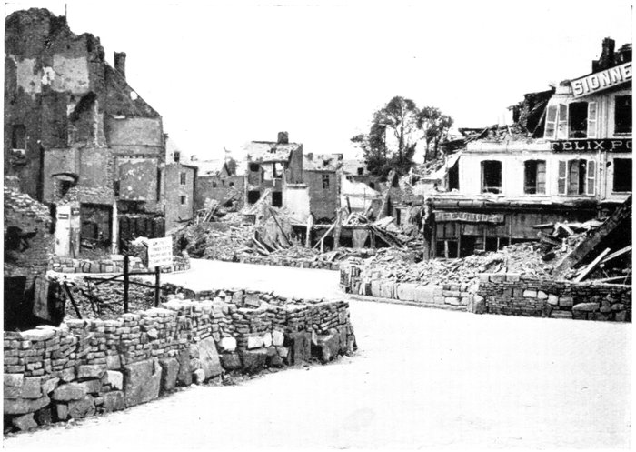
PÉRONNE. THE PLACE DU MARCHÉ-AUX-HERBES, AND THE RUE ST. GEORGES.
In the background: One of the towers of the Château (see below.)
The Rue Saint-Georges, at the south-west end of the Place, leads to the
Château.
The four large sandstone towers with conical roofs, which faced the town,
used to form part of the enceinte of Péronne.
One of the towers was destroyed; the other three are still standing, although
in a greatly damaged condition.
The pointed door between the middle towers was mutilated.
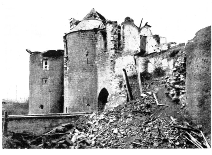
PÉRONNE. THE FAÇADE OF THE CHÂTEAU AT THE END
OF THE WAR.
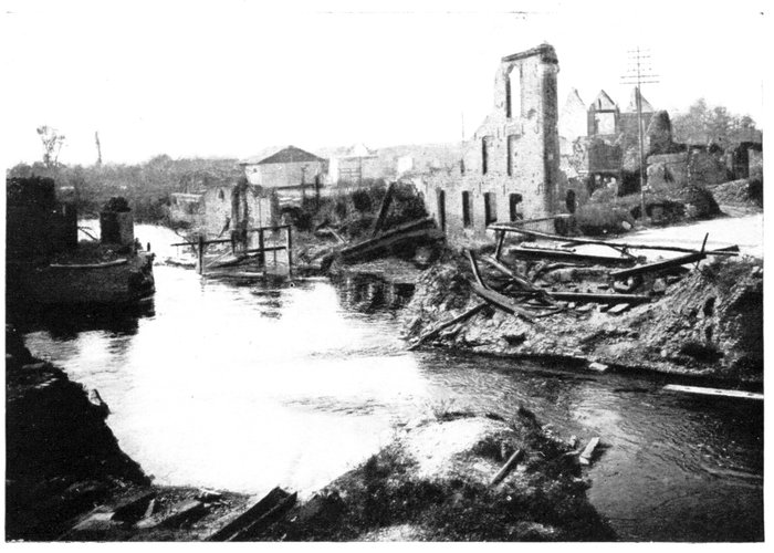
THE DESTROYED BRIDGE ON THE OLD RAMPARTS.
On the right is the end of the Rue St. Fursy.
The other parts of the castle, posterior to the Middle-Ages, were either
burnt or destroyed by explosions.
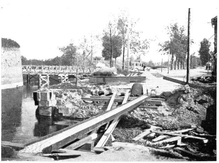
THE OLD RAMPARTS IN THE FAUBOURG DE PARIS.
In the foreground: The destroyed bridge: In the background: The temporary bridge: On the
right: The N. 17 going towards Villers-Carbonnel.
Return to the Place du Marché aux Herbes and take on the right the Rue St.
Fursy, which, after crossing the bridges over the old ramparts, leads to the Faubourg
de Paris.
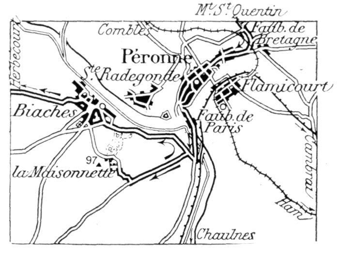
At the end of the Faubourg de Paris, take the road to Biaches (G.C. 1)
on the right of N. 17; then, 100 yards from N. 17, on the left, the G.C. 79,
which climbs the slopes of a hill dominating the valley.
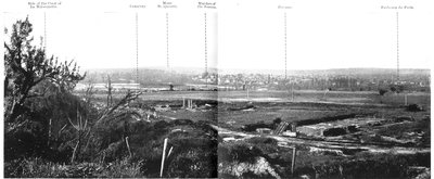
Follow this road for about 1 km., when the top will be reached, from
which there is a fine panoramic view of the valley of the Somme, Péronne and
Mont-Saint-Quentin (photo, pp. 110-111).
Take on foot the path which starts from there, and leads to the ruins of
La Maisonnette Château, about 250 yards from the road.
La Maisonnette
The estate of La Maisonnette occupied the summit of a limestone eminence
which dominates the battlefield south of the Somme (highest point, 320 feet).
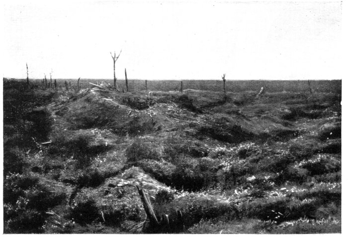
THE BATTLEFIELD AT LA MAISONNETTE.
In 1870, the German batteries shelled Péronne from this hill. In 1916,
they were determined to hold it at all costs, knowing by experience that the
town would soon be untenable with French artillery posted there.
The fighting which took place for the possession of La Maisonnette was of
the bloodiest, and made the ruins of the place famous.
The estate comprised a modern château and a park, a second residence
close by, about a dozen houses in the vicinity, and some fine trees and orchards.
All the houses, thickets and woods—including Blaise Wood, to the north—had
been strongly fortified. A maze of entrenchments covered the whole
park. A second continuous line of trenches ran round the castle. Loop-holes
had been made in the ivy-covered walls of the château. At the corners, and at
intervals, in the foundations of the castle, machine-guns were posted. The
outbuildings of the estate were similarly fortified. The cellars, some 50 feet
deep, were turned into armoured shelters, capable of successfully withstanding
the most violent bombardments, and connected with one another and
with the defence-works of Blaise Wood by a subterranean passage, which
enabled the Germans either to fall back unseen towards the canal or
approach for counter-attacks.
However, this did not prevent a French Colonial Regiment from carrying
the whole position in an hour and a half on July 9. The cellars were cleared
out with grenades, and the Germans, unable to withstand the impetuous charge
of the "Marsouins," surrendered in large numbers. The fiercest fighting took
place at Blaise Wood, the defence works of which connected La Maisonnette
with Biaches. At this point a German detachment in serried ranks raised their
rifles in sign of surrender. As the French advanced to disarm them, the
German ranks opened, a hidden machine-gun fired on the French, killing
two officers and about fifty soldiers. The French retired, but the lost ground
was won back the same day.
On July 15, the Germans counter-attacked furiously, and attempted by
means of liquid fire and asphyxiating grenades to slip into La Maisonnette
through Blaise Wood. They succeeded in gaining a footing in the northern
part of the wood, but were driven out the next day.
On the 17th, six successive assaults were made by the enemy on La Maisonnette
hill, but each time the Germans were repulsed with sanguinary losses.
Renewing their attacks, they finally succeeded, first, in gaining a footing
in the outskirts of Blaise Wood, and, later, with the help of liquid fire, in penetrating
further into the French first lines, where they established themselves
in the ruins of the farm.
But, in spite of all their efforts, they were unable to establish themselves
securely on Hill 97, to the west of the estate, which dominates the whole valley
of the Somme, before and beyond Péronne.
Throughout the winter of 1916-17 constant bombardments, grenade fighting
from trench to trench, local attacks with alternating success and failure, made
the position on the crest untenable to both sides. Finally, on March 17, 1917,
Maisonnette Hill was entirely captured by the Allies, and the Germans fell
back on the Hindenburg line, abandoning without striking a blow the few
trenches which they had managed to keep on the left bank of the Somme and
which they had until then so fiercely defended.
The British, who, early in 1917, had taken over this sector from the French,
entered the village, now completely destroyed. The pretty Maisonnette
Château had been reduced to a shapeless mass of ruins, while the beautiful
park in which it stood was so devastated as to be unrecognisable. The orchards
were destroyed, the woods hacked to pieces by shell-fire. Only a portion of
the organisations which surrounded the Maisonnette position, and those which
connected the hill with Biaches, had withstood the bombardments.
The picture of desolation which met the British soldiers' eyes from the top
of Hill 97 was such as no cataclysm could have caused. Nothing was to be
seen but devastated lands, destroyed villages and felled trees, while beyond
the inundations which had been spread over the Somme marshes, the smoke
could be seen rising from the ruins of Péronne, set on fire by the Germans.
Return by the same road to G.C. 1, which take on the left. Follow the Somme for
a short distance to the ruins of Biaches. This small village formerly nestled
in the bottom of a verdant nook near the Canal of the Somme, less than 1 km.
from the ancient ramparts of Péronne, and separated from it only by the marshes
and the wide and sinuous river.
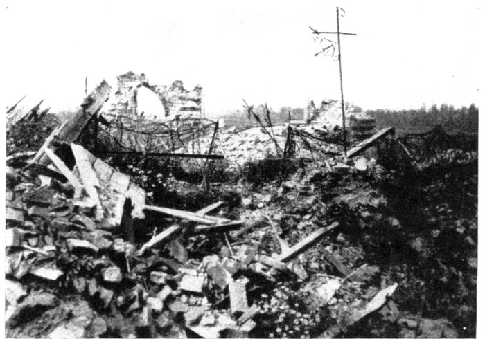
BIACHES CHURCH AS THE WAR LEFT IT.
In the background: The Marshes of the Somme; On the right, behind
the trees: The beginning of Péronne.
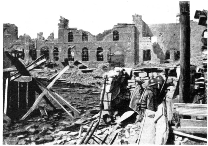
BIACHES. THE SUGAR REFINERY IN 1916.
The Fighting at Biaches
The fighting at Biaches, like that at La Maisonnette, gave rise to some of
the most famous episodes in the Offensive south of the Somme.
The French advance had been so rapid that as early as July 8 General
Fayolle's troops, having broken through the German front to a depth of 8
kilometres, occupied the outskirts of Biaches. The next day, after an intense
bombardment, the system of trenches which protected the outskirts of the
village was carried in a few minutes.
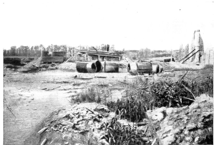
BIACHES. THE SUGAR REFINERY IN 1919.
Seen from the same view-point.
A desperate struggle which lasted all day took place in the village, where
every street and crossing was protected by defence-works. Machine-guns
were posted in all the houses, while buildings like the town-hall, sugar
refinery, railway-station, etc., had been turned into powerful centres of
resistance.
A block of houses to the south-east resisted till the evening, when it was
reduced. At the entrance to the village, close to the Herbécourt road, a strong
point, passed in the course of the advance, was still in enemy hands.
This position, which subsequently acquired fame under the official
name of Herbécourt Redoubt, enabled its occupants to take the French in the
rear, and rendered the occupation of the village very difficult and uncertain.
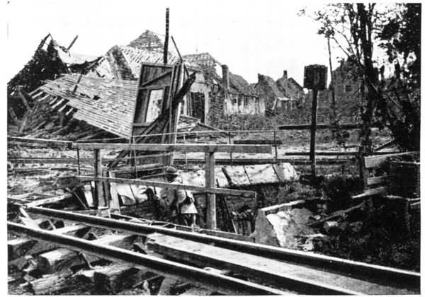
BIACHES. DEFENCE-WORKS IN THE PLACE DE LA MAIRIE (1916).
It was absolutely necessary to carry it. Frontal attacks were stopped
short by a murderous machine-gun fire; a concentration of fire with trench-mortars
gave no better results. Finally, in the afternoon of July 10, a captain
and eight men, with "extraordinary daring," crept up to and entered the
redoubt. The garrison, which still numbered 112 men and 2 officers, lost
their presence of mind and surrendered without offering any resistance.
The loss of Biaches, which formed the last advanced defences of Péronne,
was a particularly hard blow for the Germans, who attempted, on several
occasions to reconquer the position by fierce counter-attacks.
On July 15, a terrific bombardment was opened on the village. The ruined
houses collapsed, fires broke out, and most of the shelters, including those
under the cellars, were smashed in. The attack followed in the evening.
Leaving Péronne by the Faubourg de Paris, the Germans, favoured by fog,
slipped along the banks of the canal and reached the French first lines, which
they attacked with liquid fire.
One section, surrounded with flames, gave way. Taking advantage of
this, the enemy slipped into the village and, after a violent engagement,
conquered the greater part of it, only to be driven out again the next day
by a counter-attack, during which the French won back all the lost ground.
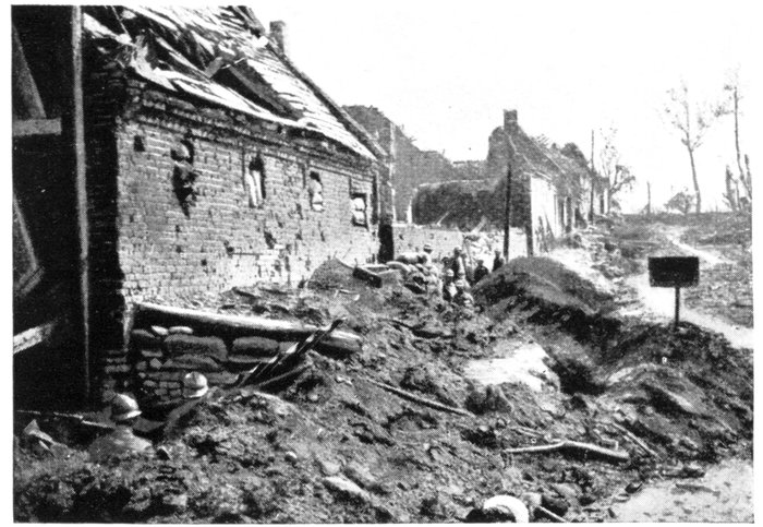
BIACHES. THE PLACE DE LA MAIRIE IN 1916.
In the evening of July 17, the enemy made another powerful effort. Supported
by heavy batteries posted above Péronne on Mont-Saint-Quentin Hill,
which kept up an uninterrupted fire, the Germans again entered Biaches and
captured it. The struggle continued throughout the next day in the ruins of
the village with varying fortune, and it was only on the 19th that the enemy
were definitely driven out.
Further counter-attacks were launched afterwards, but met with no
better success. From July 17, 1916, till March, 1917, the French and, later, the
British maintained their lines intact in front of Péronne, on the edge of the
Somme Marshes.
On leaving Biaches, G.C. 1 rises towards Herbécourt. Looking back,
there is a very fine view of Biaches, Péronne and the valley (Panorama,
pp. 116-117).
3 km. 500 beyond Biaches, leave, on the left, the village of Flaucourt (completely
destroyed), which was carried by storm on July 3, 1916. Herbécourt
is 1 km. 500 farther on.
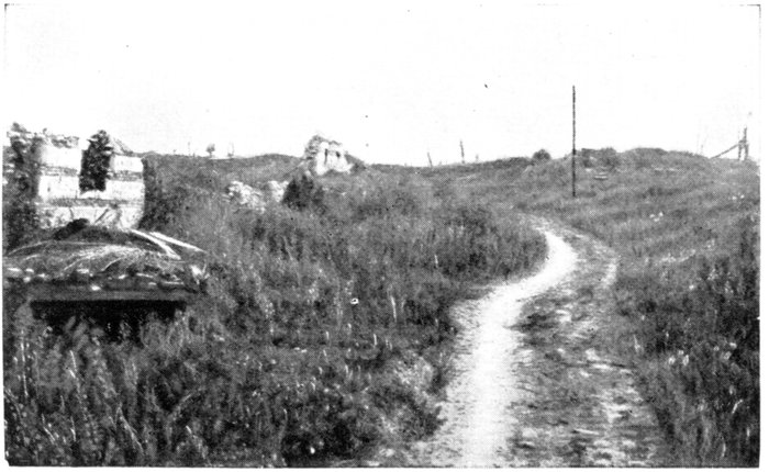
BIACHES. THE PLACE DE LA MAIRIE IN 1919.
At the entrance to the village, on the left, is a large German cemetery,
and on the right a house (almost intact) in which a German dressing-station
was installed. German frescoes may still be seen on the walls (photo, p. 117).
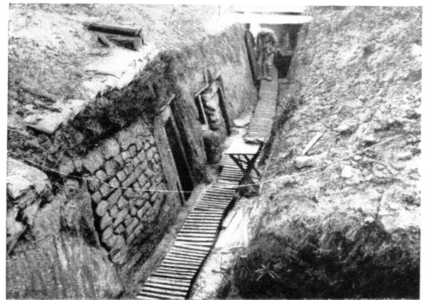
TRENCH ON THE HERBÉCOURT PLATEAU.
After capturing Dompierre on July 1, 1916, the French advanced so rapidly
on Herbécourt that the Germans were unable to make use of the numerous
defence-works which had been accumulated between the two villages. The
hill overlooking Herbécourt was carried in a few minutes, and on July 2, the
village itself was entirely conquered.
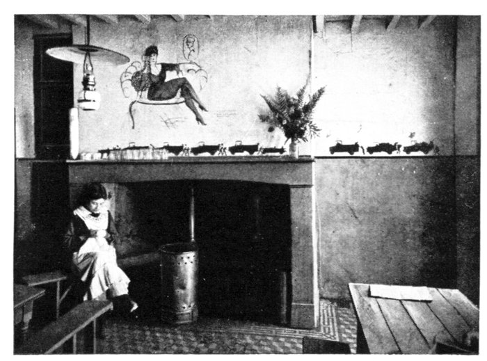
HERBÉCOURT. HOUSE, PRACTICALLY UNDAMAGED,
DECORATED BY THE GERMANS WITH FRESCOES.
It was used as a dressing-station.
The French had thus advanced about 4 km. in depth, and the German second
line of resistance was broken into in front of Péronne (6 km. to the east), i.e.,
at its weakest point.
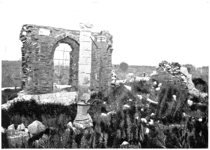
HERBÉCOURT. RUINS OF THE CHURCH.
Herbécourt commands a crossing of roads which branch off in various
directions. Rapid communication with the south of the plateau was now possible
by the road leading to the village of Assevillers (carried on July 3) on the one
hand, and with the Somme valley by the road which ends at the bridges and
highway of Feuillères (also captured on July 3).
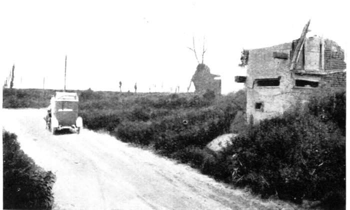
ON LEAVING HERBÉCOURT—GERMAN BLOCKHOUSE AT
THE CORNER OF THE ROADS TO CAPPY (on the right)
AND DOMPIERRE (on the left).
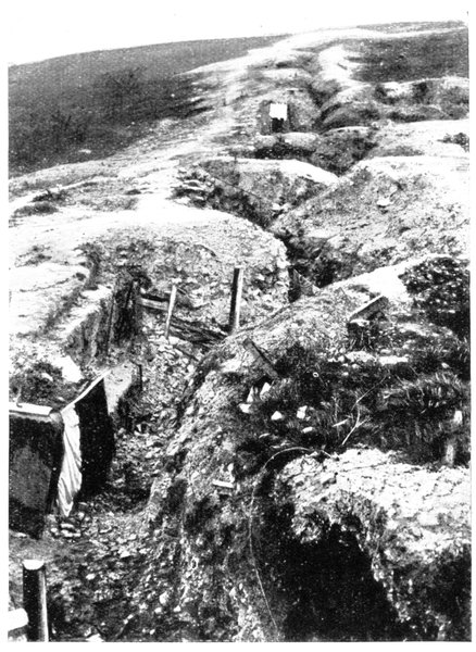
GERMAN TRENCHES ON THE HERBÉCOURT PLATEAU.
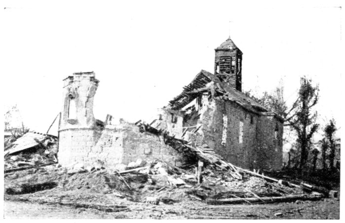
FEUILLÈRES CHURCH AND VILLAGE (not in Itinerary).
On the canal between Frise and Biaches, they were violently
bombarded in 1916.
The brick and rubble houses of Herbécourt stood at this cross-roads.
Nothing remains of them now, except a few walls, beams and fragments of
the timber frameworks of the battered farm-houses.
The façade, steeple and roofing of the church were destroyed. Only a few
battered fragments of the sides, walls, and choir are still standing.
Leave Herbécourt by the G.C. 71. A blockhouse for machine-guns is seen on
the left, near the last ruins.
The road runs across a bare plateau, then passes through the destroyed hamlet
of Becquincourt, after which Dompierre is reached.
Dompierre was the central point in the zone of attack on July 1, 1916. It
was carried on the first day, after a brilliant assault, together with the
neighbouring hamlet of Becquincourt and Bussus farm, to the south. The
German system of defence-works comprised three successive lines of trenches
connected with one another by communication trenches, and reinforced with
redoubts and concrete shelters for machine-guns. Here were to be found the
"Gatz" trench, and the "Misery" and "Thirst" communication-trenches.
The bombardment which preceded the attack was terrific, the whole area
being upturned by the shells; not a single square yard of the ground was
left intact.
The village was not spared by the bombardments; most of the houses
were reduced to shapeless heaps of bricks and broken beams. The site of the
church is marked by a heap of white stones, higher than the others.
After passing through Dompierre, take the road to Fay, on the left.
The ruined sugar-refinery of Dompierre is on the right, 200 yards
farther on (photos, p. 121).
The Dompierre Sugar Refinery was within the French first lines, but the
village itself, although close by, was still in enemy hands. The Germans
attacked the refinery for two years, without being able to capture it. It was,
however, cut to pieces by the shells. The brick walls crumbled away, but the
steel frame-work resisted. Numbers of twisted and rusty pipes, iron plates,
cocks and vats, all disjointed, broken, and out of shape, are still to be seen.
Quite close to, at a crossroad, stands a calvary which is now famous.
The ground all around was churned up by the shells; only one hit the calvary,
carrying away an arm of Christ. The cross remained intact, and supported
the mutilated statue to the last.
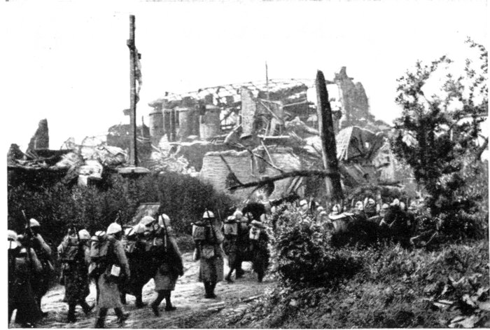
DOMPIERRE. THE SUGAR REFINERY IN 1916.
Pass through Fay, 2 km. 500 farther on.
In the neighbouring sector of Dompierre, mine explosions succeeded one
another almost incessantly at Fay, during the trench warfare period, especially
in 1915-1916; the official communiqués often mentioned this fighting as
being extremely violent.
The French and German trenches ran along the western outskirts of the
village and were protected by very powerful defence-works, difficult to
approach in the open. Recourse was, therefore, to mines.
The Somme offensive put an end to these sanguinary engagements, which
had brought about no great change in the French or German positions.
Fay, completely razed, was carried on July 1.
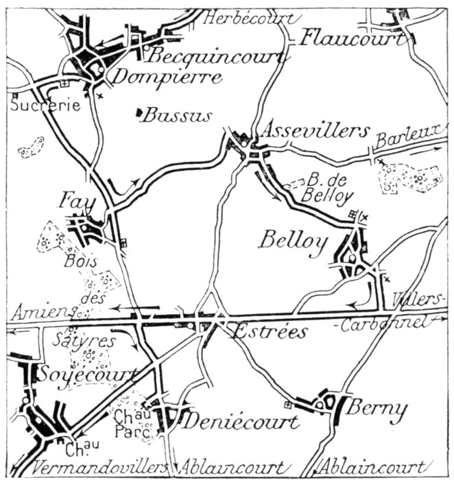
Among the ruins, the road turns at right-angles to the left (leave the Estrées
road to the right). 3 km. beyond Fay, Assevillers, built on a hill and entirely
destroyed, is reached.
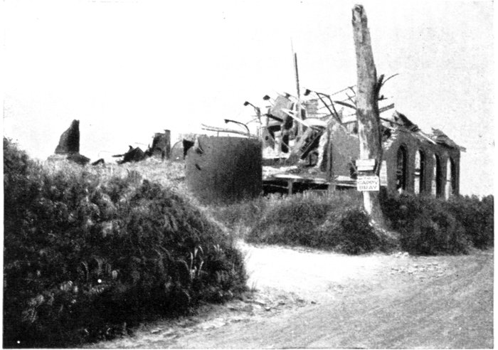
DOMPIERRE. THE SUGAR REFINERY IN 1919.
On the left: Road to Faucancourt; On the right: Road to Chuignes.
Pass through Assevillers, turning to the right, on entering. On leaving, take
the road to Belloy-en-Santerre, on the right.
Before reaching Belloy, the road descends into a hollow (see defence-works
and shelters), and skirts Belloy Wood, the trees of which were cut to pieces
by shell-fire. The wood lies on an eminence, from the top of which are seen
the ruins of a castle. Fine view towards Biaches.
Capture of Belloy-en-Santerre
Debouching from Assevillers (carried on July 3, 1916) and progressing
north of Estrées, a number of French units reached the outskirts of Belloy-en-Santerre
on July 4; this village was powerfully fortified and formed an
important strong-point in the German second line defences.
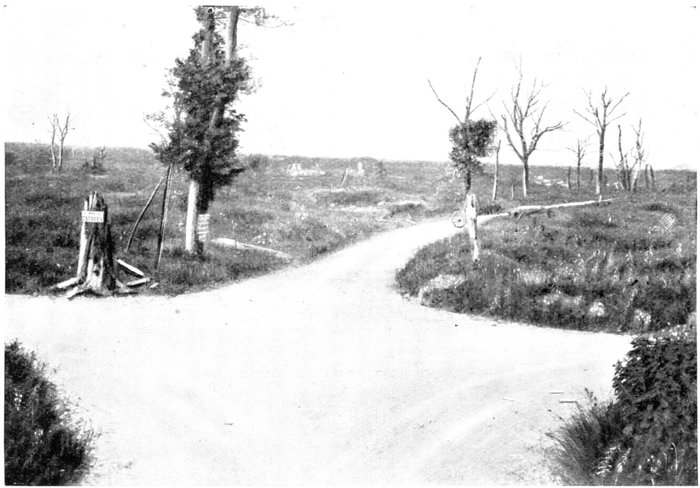
FAY VILLAGE, AS THE WAR LEFT IT, SEEN FROM THE ASSEVILLERS ROAD (Itinerary).
On the left: Road to Estrées; In front: Road from Dompierre.
That famous regiment, the Foreign Legion, whose flag is decorated with
the Legion d'Honneur, and whose innumerable exploits have won for it
many mentions in the Orders of the Army, was ordered on July 4, at 6 p.m.,
to carry the position immediately at the point of the bayonet.
Deployed in battle formation, they charged across a flat meadow 900 yards
broad. When 300 yards from their objective, machine-guns hidden in the
path from Estrées to Belloy were suddenly unmasked, and a deadly fire mowed
down the French ranks. The 9th and 11th Companies sustained particularly
heavy losses, all the officers falling. One of these companies reached the
objective under the command of the mess corporal. Belloy was captured
and 750 Germans were taken prisoners.
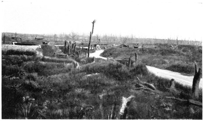
BELLOY-EN-SANTERRE, SEEN FROM THE SITE OF THE CHURCH.
In the middle: Road from Assevillers; At the back: Belloy Wood.
The enemy immediately launched counter-attack upon counter-attack.
Terrible fighting went on throughout the night. In the early morning, the
Germans regained a footing in Belloy, and entered the park of the Castle,
where three sections of the Legion were surrounded.
A second-lieutenant received orders to restore the situation with the
remnants of a company. Posting his men along the Belloy-Barleux road
(G.C. 79), he cut the line of retreat of the Germans, who had entered the park.
The latter endeavoured to break through, with a detachment of disarmed
prisoners in their midst.
The lieutenant shouted to the prisoners to lie down, then ordered his men
to fire on the standing Germans. The latter surrendered, with the exception
of a handful who attempted to carry away a wounded French officer. The
newly-released prisoners, although unarmed, dashed to the rescue of the
commander and brought him back in triumph.
Belloy was almost entirely reconquered, and when in the evening a new
counter-attack was launched, their assaulting waves were literally mowed
down.
The terrific bombardments which took place before and after the capture
of Belloy-en-Santerre entirely annihilated the village.
The road at Belloy passes by a large French cemetery and, a little further
on, the ruins of the church. Take a newly-made road leading to the Amiens-St.
Quentin road. Turn to the right, towards Estrées (3 km.) and pass (on the
right), a British then a large French cemetery. Estrées is next reached.
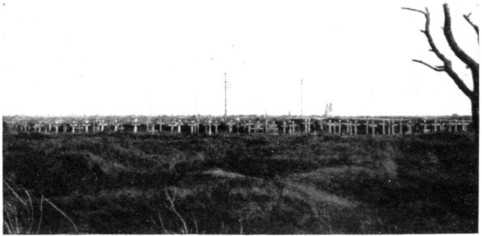
MILITARY CEMETERY TO THE EAST OF ESTRÉES.
Estrées
This village was built along the wide road (an old Roman causeway)
which runs from Amiens to Vermand, and thence to Saint-Quentin (G.C. 201).
This absolutely straight road formed the separation line between the Chaulnes
sector and the Somme battlefield properly so-called, where the Franco-British
attack began on July 1, 1916, and which extended along both banks
of the Somme, as far as the small river Ancre.
Estrées was one of the points where the fighting, begun on July 1, was
most violent.
The French, whose first-lines at the time ran east of Foucourt, carried
the advance trenches which covered Estrées, along the Amiens—St.-Quentin
road, after most desperate fighting, and finally gained a footing in the village.
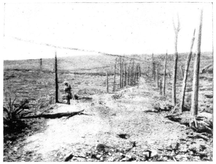
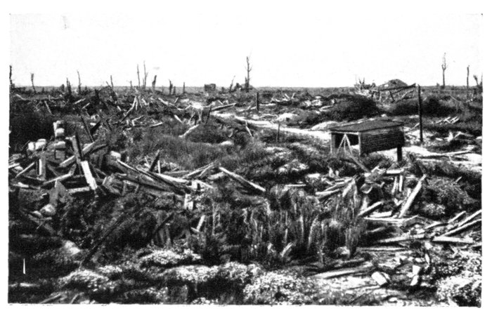
The photograph opposite shows the condition of the road after its capture
by the French; the causeway had disappeared and, on the shell-torn ground
there were hardly any traces left of the German trenches which had everywhere
fallen in.
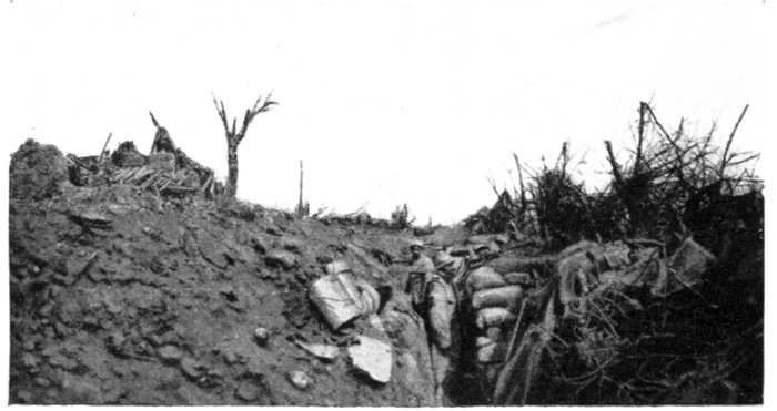
ESTRÉES. SITE OF THE CEMETERY IN AUGUST, 1916.
Estrées village had to be captured house by house. On the evening of
July 4, after three days' fighting, the Germans held only the eastern part of
the village. For the next twenty days, about 200 of them hung on desperately
to it, holding back the assailants with machine-guns posted in the cellars,
which fired through the narrow vent-holes. To overcome this resistance,
which prevented all advance north or south, it was necessary to sacrifice
these houses, and for six consecutive hours 9-in., 11-in., and 15-in. shells
pounded this small area. Only fifteen survivors were found in the ruined
foundations; the rest of the German garrison had been wiped out.
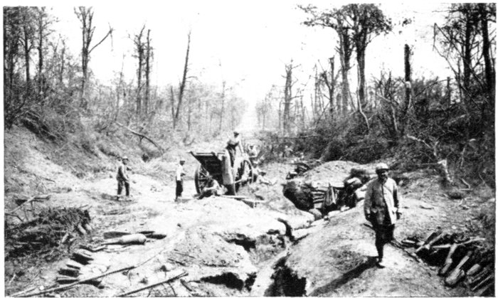
THE AMIENS ST. QUENTIN ROAD IN SATYRES WOOD,
WEST OF ESTRÉES (1916).
This terrible struggle utterly destroyed the village. Its site and the
surrounding land form a chaotic waste; all traces of the former landmarks
have disappeared.
Keep along G.C. 201, towards Amiens. The remains of Satyres Wood are
in a hollow of the road, about 1 km. beyond Estrées.
Satyres Wood
The remains of this once fine wood extend from this point of the road to
the village of Fay, 1,500 yards to the right. From 1914 to 1916 it formed part
of the German first-line defence-works, and was covered with entrenchments
of all kinds.
On July 1, 1916, the French carried the whole wood, promptly re-organised
the defence-works, and used them against their former occupants.
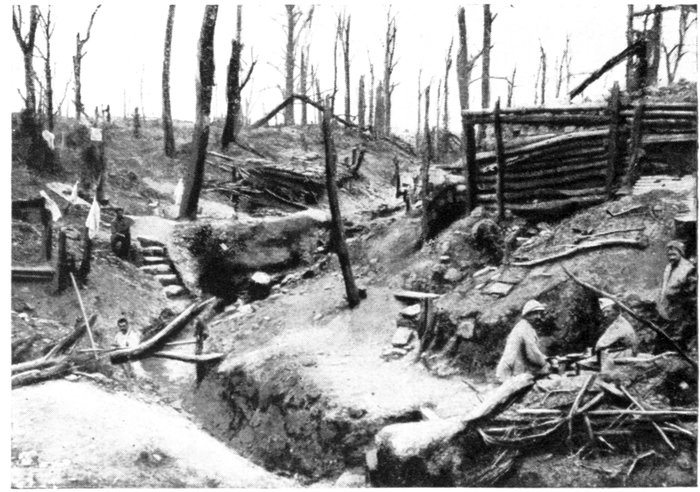
A CORNER OF SATYRES WOOD.
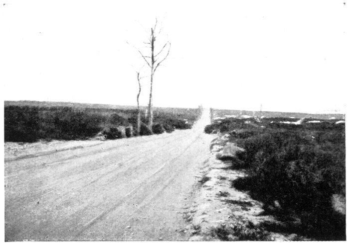
SATYRES WOOD.
The German Post of Commandment seen in the photograph below,
is under this road.
Numerous cottages and shelters hidden by the trees were used as billets
by the enemy troops in this sector. The officers occupied a special quarter.
A large signboard with the inscription, "Durchgang nur für Offiziere," interdicted
its access to the common soldiers. All the shelters were spacious and
comfortably furnished with beds, tables, armchairs, hangings, chandeliers,
and even pianos—all taken from the neighbouring villages. Some of the
cottages were decorated outside, and sometimes bore inscriptions like the
following, carved on the door of a post of commandment:—
"Macht Joffre auch ein böses Gesicht
Hier treffen uns seine Granaten nicht."
(Joffre may roll his eyes: his shells cannot reach us here.)
Tho French soldiers called this wood "Satyres Wood," as they found
women's clothing in various places.
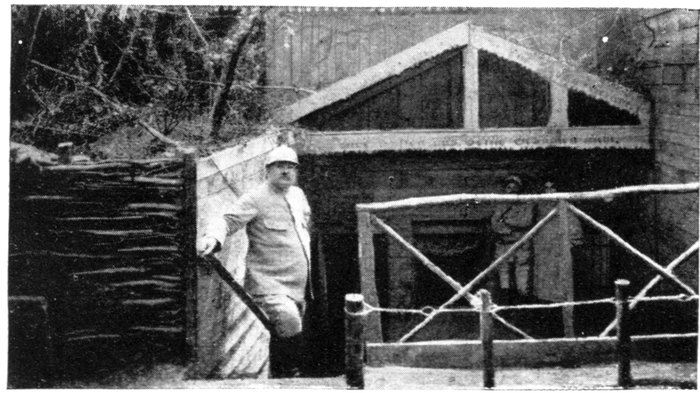
SATYRES WOOD. GERMAN POST OF COMMANDMENT
UNDER THE ROAD (see above).
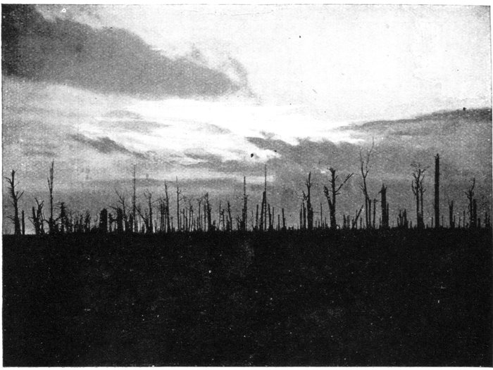
DENIÉCOURT WOOD AT SUNSET.
Return to the entrance to Estrées, and take the road on the right to Deniécourt.
On entering the village, take on foot the small road on the right to the ruins of
Deniécourt Château, situated in a devastated park.
Deniécourt village lies about 2 km. (by road) east of Soyécourt. Across
the fields, the distance is shorter, and it was covered in a single rush on the
day Soyécourt was captured, after which the advance was stayed. The
second German line ran through Deniécourt, which was fortified accordingly.
The most important defence-works were those around the château, which
latter formed the key of the whole position. Deep shelters had been made
under the château itself and also in the surrounding park. The whole formed
an inextricable maze of trenches, fortified works, machine-gun posts, traps
and barbed-wire entanglements, which had to be reduced by shell-fire. The
castle was razed to the ground, the defences in the park destroyed and the
ground levelled.
On the day of attack, the fighting was none the less desperate in the
neighbourhood, and afterwards inside the village. The French advance was
several times held by furious counter-attacks, and it was only on September 18
that the whole position could be surrounded and carried, after several days of
bitter fighting. Of Deniécourt village, château and park, not a stone or a
tree remained.
Return to the car and take the road already followed (G.C. 164) back to the
fork (300 yards north of the village), then the road to Soyécourt (G.C. 79),
on the left. At the entrance to Soyécourt the ruins of a château—of which
only the base of one tower remains—will be seen on the left.
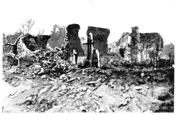
SOYÉCOURT CHURCH IN 1916.
For nearly two years the French first lines ran close to the western outskirts
of this village, which lies at the bottom of a ravine. On several occasions
the communiqués mentioned sharp fighting around here, which was, however,
merely of local importance.
It was only on September 4, 1916, that decisive fighting took place here,
when the French, after a long and terrific bombardment, carried the village
in a single rush, and progressed beyond it in the direction of Deniécourt.
Leaving Soyécourt, keep along G.C. 79 to Vermandovillers (2 km.).
On September 4, 1916, the village was attacked from the east and north.
Progress was slow, and marked by fierce fighting from house to house. Vermandovillers
was only captured in its entirety on September 17.
At the fork in the village, take the left-hand road (G.C. 143) to Chaulnes.
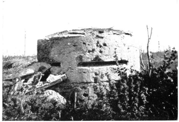
CHAULNES
WOOD.
GERMAN
BLOCKHOUSE.
Chaulnes
Chaulnes Wood is crossed 1 km. this side of Chaulnes. Violent attacks
were delivered by the French in the vicinity of this wood. The large number
of soldiers' graves along both sides of the road form an impressive sight.
Several hundred yards beyond the fork formed in the road by the junction with
G.C. 206 coming from Lihons, turn to the left,
and enter Chaulnes in front of the ruins of
the large eighteenth century church. A few
fragments of crumbling walls are all that
remain (photos, p. 130).
Chaulnes, the chief town of one of the
"cantons" in the "Département" of the
Somme, was situated at the junction of several railroads. In 1914, the
Germans turned the place into a fortress, and made it the chief strong-point
of their system of defence-works south of the Somme. Traces of the
powerful fortifications—the first lines of which were only carried in 1916—may
still be seen along and near G.C. 206, amidst the churned-up ground.
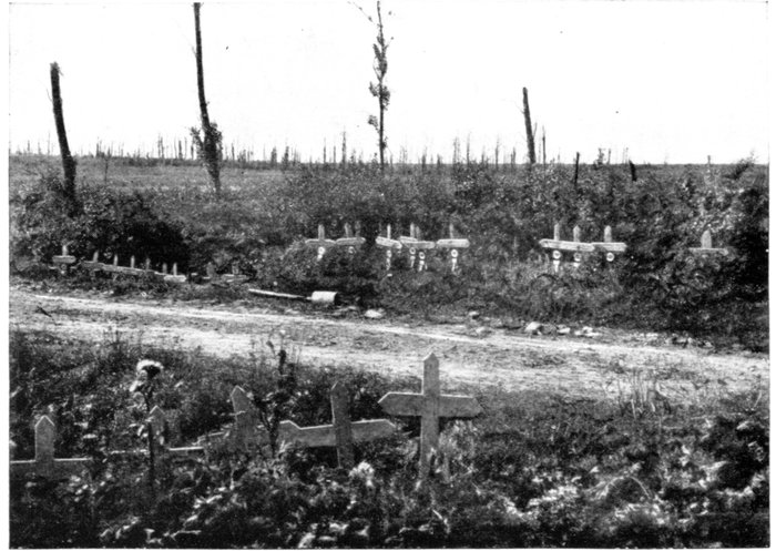
CHAULNES
WOOD.
FRENCH
MILITARY
GRAVES.
The village was flanked on the north and north-west by dense woods,
which were entirely destroyed by the bombardments. These woods were
full of fortified works, trenches and posts for machine-guns, protected by
wire entanglements.
On September 4, 1916, the French reached the outskirts of these woods,
but failed in their attempts to carry them entirely. The Germans maintained
themselves there till March, 1917, on positions sufficiently strong to allow
them to hold Chaulnes, this village being outflanked everywhere else.
Chaulnes was occupied only when the Germans fell back upon the
Hindenburg Line. The British having relieved the French troops during the
winter of 1916, from the Somme to the Avre, entered the place almost without
striking a blow on March 18, 1917.
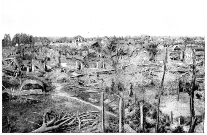
CHAULNES. GENERAL VIEW OF THE TOWN.
The Germans recaptured Chaulnes in March, 1918. On August 8 of the
same year—their front having been pierced before Amiens—they were forced
to evacuate the Montdidier "pocket" and to retreat to the outskirts of
Chaulnes. They reoccupied their positions of the trench warfare period, and
the remains of their ancient defence-works were still strong enough to enable
them to hold up the British pursuit. The town was only carried on August 28,
after being surrounded.
Chaulnes was razed to the ground. The low brick-and-rubble houses
which lined the wide straight streets sheltered a population of about 1,250
inhabitants. Very few of them escaped total destruction.
Return along the same road by which Chaulnes was entered and follow it to
the junction of G.C. 143 with G.C. 206, at the exit of the town. The ruins of the
château are seen on the left, near the fork.
This sumptuous château was built in the seventeenth century by the
de Luynes family, for whose benefit Chaulnes was raised to the rank of a
duchy-peerage in 1621. Madame de Sévigné stayed there in 1689, and
extolled its magnificence and grandeur. It was surrounded by a vast park,
which she compared to that of Versailles.
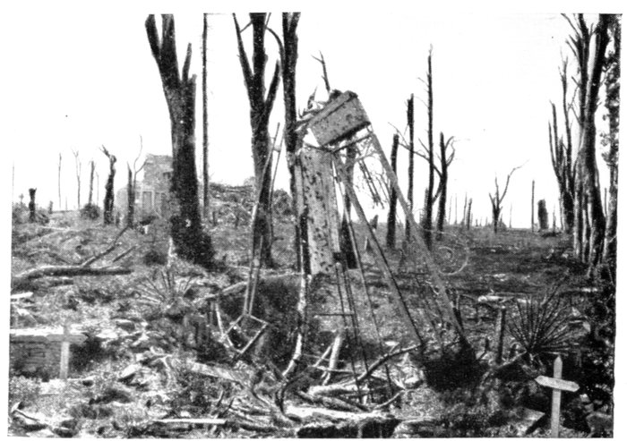
CHAULNES. THE CHÂTEAU PARK.
In the foreground: Fragment of the entrance gate between the
graves of two German officers.
The outbuildings were still standing when the late war broke out; to-day
they form a shapeless accumulation of débris. The park was entirely cut
up with German entrenchments, of which only a few concrete machine-gun
posts and underground shelters with concrete entrances remain. The fine
old trees of the park were reduced by the shells to mutilated stumps.
Near the entrance-gate of the château is a powerful system of defence-works,
consisting of a machine-gun blockhouse and inter-communicating underground
shelters, the entrances to which may be seen near the side of the road.
After visiting the château, keep along G.C. 206, towards Lihons.
Skirt the southern end of Chaulnes Wood, near which, on either side of the
road, are two powerful concrete blockhouses and other German defence-works.
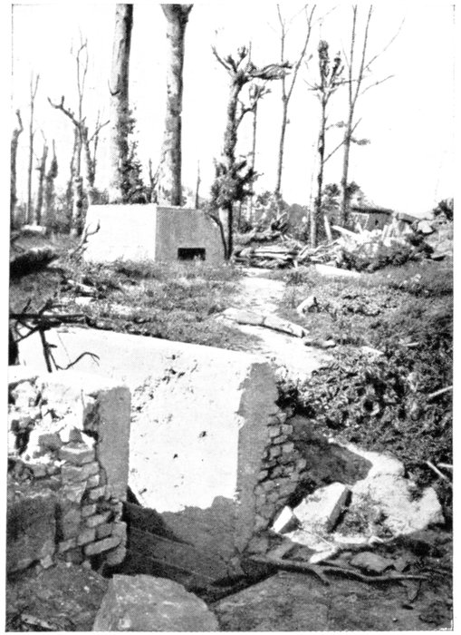
ENTRANCE TO GERMAN SHELTER AND
BLOCKHOUSE IN THE CHÂTEAU PARK.
Lihons (3 km. beyond Chaulnes) is
next reached.
Lying at an important junction
of several roads, Lihons was already
in enemy hands when the front-line
trenches were made.
Starting from Rosières-en-Santerre
at the end of October, 1914, the
French first reached and carried
Lihons after a series of fierce engagements,
then progressed beyond it, in
the direction of Chaulnes (only 3 km.
distant). For more than a month
the Germans counter-attacked
almost daily, in an endeavour to
reconquer the lost trenches, but were
each time repulsed.
Exasperated by their failure,
they then bombarded the town
without respite, and when the Allied
Offensive of 1916 began this shelling
was further intensified.
Lihons, a small country town, the streets of which—bordered with low
houses—ran in all directions from a large, central square, was quickly reduced
to ruins. The houses fell down one after the other, and the church suffered
irreparable damage.
The church was one of considerable interest. The choir, transept and
lower part of the tower, built at the intersection of the transept, were finely
proportioned and dated from the thirteenth century. The other parts of the
building were fifteenth century.
In July, 1916, the church had already lost its tower, roof and vaulting, but
the outside walls, the pillars separating the three naves and the three gables
of the main façade were still standing. Three months later nothing was left
but fragments of broken walls, amidst a shapeless accumulation of débris
(photos, p. 133).
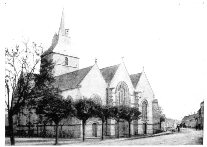
LIHONS CHURCH BEFORE THE WAR.
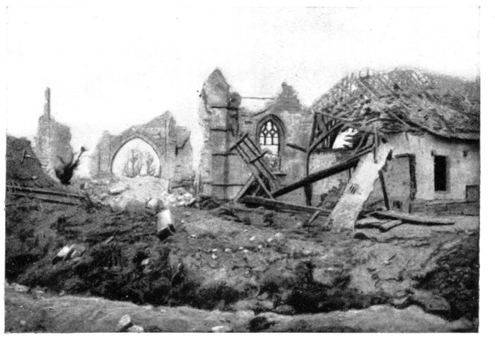
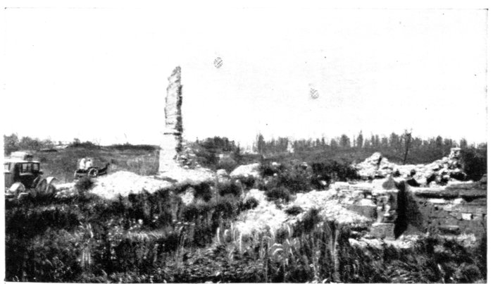
LIHONS CHURCH IN 1919.
On the left: The road to Vermandovillers.
Further fighting took place in the ruins of Lihons in 1918. On August 8,
British troops, starting from the region of Villers-Bretonneux—Hangard,
reached Lihons on the 10th. Preceded by light tanks, armoured cars and
cavalry patrols, the Australians immediately entered the village, drove out
the enemy and captured a complete Divisional staff. It was in vain that the
Germans launched numerous counter-attacks in an endeavour to recapture
the village and clear the approaches to Chaulnes, where they attempted to
establish their lines of resistance. They could only delay the British advance
for a few days.
At Lihons, leave the Vermandovillers road (G.C. 79) on the right and take
that on the left. Turn to the right, in the village, leave the church on the right,
and take the Vauvillers road (G.C. 206) on the left.
At the fork, about 500 yards beyond Lihons, leave the left-hand road to Rosières,
and take that on the right (still G.C. 206). This road skirts a small wood, on the
right, in which are many graves and gun-emplacements. The village of
Rosières-en-Santerre comes into view, on the left.
At the crossing of several roads, 3 km. beyond Lihons, take the newly-made
road on the right to Herleville. The large French "Camp des Chasseurs"
cemetery (photo below) is on the left, about 1 km. this side of the village
of Herleville (completely devastated), which is next reached.
At the entrance to the village, a "calvary" is passed, of which nothing
remains but the stumps of four large trees. Keep straight on through the
ruined village to the G.C. 201 (main road from Amiens to Péronne), 1 km.
beyond it. Turn to the left and return direct to Amiens via Lamotte-en-Santerre
and Villers-Bretonneux, both of which villages were badly
damaged during the fighting of 1918.
A short distance before Longueau, G.C. 201 joins N. 35, which take to the
right. Amiens is entered by the Chaussée Périgord.
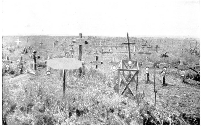
THE CAMP DES CHASSEURS CEMETERY.