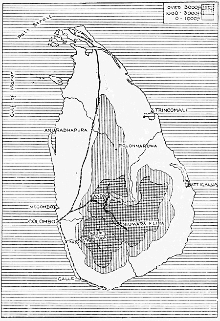
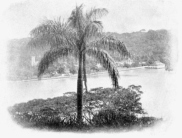
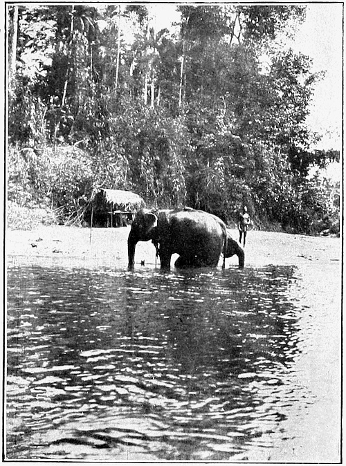
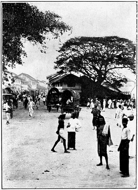
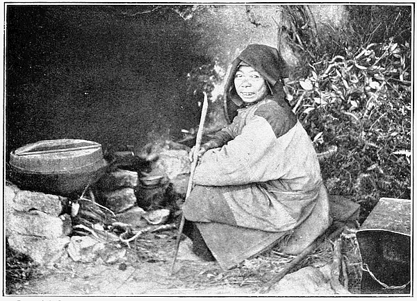
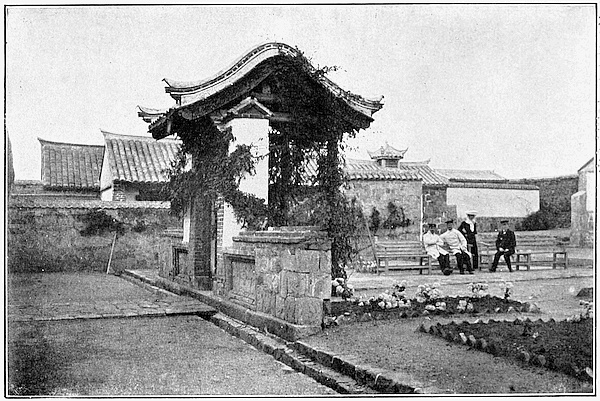
We now leave Ceylon, cross the eastern arm of the Indian
Ocean, and turn southward through the Straits of Malacca.
We shall find ourselves in a new world, among
people very different from those that we have met in
the earlier part of our voyage. The key to the understanding
of the whole region is Singapore, a century
ago an unimportant island, though even then a few far-seeing
people realized its magnificent possibilities. The
Dutch, at that time the chief commercial Power in the
Malay Archipelago, were preparing to seize the island
when they were anticipated by Sir Stamford Raffles,
the East India Company’s representative at Bencoolen
in Sumatra. He was the true founder of the modern
city, and it does right to perpetuate his name in its streets
and public buildings.
We may consider Singapore, on its little island, to be 1
the capital of the whole region of British Malaya. Of
what does British Malaya consist? In the first place,
in addition to Singapore, there are the British Possessions
on the western side of the Malay Peninsula. In the
north we have the island of Penang, with Province
Wellesley on the mainland opposite; further south,
but grouped with Penang for administrative purposes,
are the Dindings and the island of Pangkor; further
south still is the territory of Malacca.
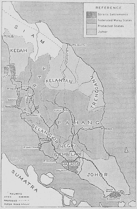
Malay Peninsula: Political.
The total area of these small fragments is a little over
1,200 square miles, or less than that of the county of
Kent; but outside them the whole of the southern part
of the peninsula, a country about the size of England,
is under British Protection. In the extreme south,
opposite the island of Singapore, is the Malay state of
Johor. In the middle is a group of four states, Perak,
Selangor, Negri Sembilan and Pahang, which were
federated in 1895 and are now known as the Federated
Malay States. On the northern boundary are Kelantan,
Trengganu, Kedah and the little state of Perlis; these
by agreement with Siam, in 1909, were transferred from
Siamese suzerainty to the protection of Britain. The
Governor of Singapore is High Commissioner for the
protected Malay States, and under him there are British
residents, advisers or agents in all the States, supplemented
in the Federated Malay States by a large staff of
British officers.
In addition to the territory in the Peninsula, the Straits 2
Settlements now include various scattered and distant
islands which have been attached at different times to
the Colony. These are Labuan, off the coast of Borneo,
with the Cocos or Keeling Islands and Christmas Island,
both in the Indian Ocean. The Cocos, about 700 miles 3
southwest of Java, are on the route of steamers sailing from
Colombo to Western Australia, and possess a submarine
telegraph station. They are a mere group of coral atolls,
with a population of a few hundreds, engaged chiefly
in preparing copra from the coconuts with which these
atolls abound. They are still ruled, under the Government
of the Straits Settlements, by the head of the Scotch family,
Ross by name, by which they were first colonized. Christmas
Island, about as large as Jersey, lies some 200 miles
south of Java; it was not inhabited until a little over
twenty years ago, when it was settled from the Cocos.
The attraction here lies in the valuable deposits of phosphate,
though there is also some good timber in the dense
forest which clothes the slopes of the mountain. The
population, of about a thousand, consists mainly of
Chinese miners. Here we see the harbour of Flying-Fish 4
Cove, on the north coast, where there is good anchorage
and a break in the steep cliffs which form the coastline; 5
and here again is one of the quarries. The island
is a great contrast to the low-lying Cocos banks, with
their groves of palms.
In Borneo there is no strictly British territory other than
the island of Labuan; but the State of Sarawak, whose ruler
is an Englishman, and the remains of the old Sultanate
of Brunei, are under British protection, while the British
North Borneo Company holds its territory under a charter
from the Crown.
The political relations of all these islands and territories
are in charge of the hard-worked Governor of the 6
Straits Settlements, whose home we see in Singapore.
From the time of its cession to us, in 1824, by the
local ruler on the mainland, Singapore rapidly outdistanced
the older settlements of Malacca and Penang;
until, in 1867, after a period of dependence on India,
the whole region started a separate existence as a Crown
Colony, under the name of the Straits Settlements, with
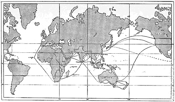
Singapore as the capital. The reason for the rapid
development of this obscure island is evident on the (2)
map. It commands the Straits of Malacca and the
southern entrance of the China Sea; the only alternative
is the Strait of Sunda, beyond the Equator, five
hundred miles to the southward. It is the halfway
house between India and China, and its position at a
corner makes it the junction point of all the routes connecting
the Indian Ocean with the Pacific. It is also
the natural collecting and distributing centre for much
of the local trade of the Malay region. As a consequence,
an island less than twice the size of the Isle of Wight,
and with no resources of its own worth mentioning, has
become the site of one of the greatest seaports in the
world.
Singapore is not only a junction of trade routes and
a strongly garrisoned naval base, it is also a meeting
point of different races. The population is a strange
mixture of Chinese, Malays and Indians, with a handful
of Europeans controlling the whole mass. The Chinese,
in numbers, industry and wealth, have been the most
important factor in the growth of the whole region,
and their influence increases every year. The Malays
approach them in numbers, but lag far behind in
intelligence and capacity for work; while the Indian
element, mainly Tamil coolies as in Ceylon, is much
smaller.
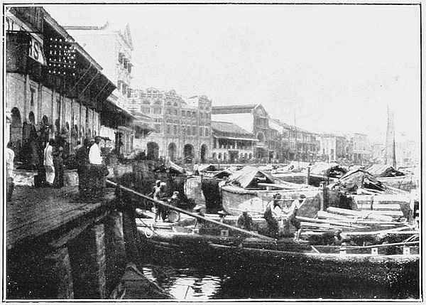
The town of Singapore stands on the south side of
the island facing the open sea, and the Old Port is not
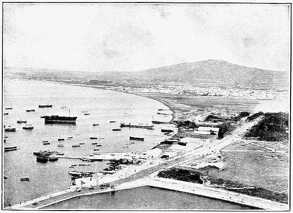
well adapted to the needs of modern commerce; large 7
vessels, as we see in this picture, must anchor off shore
in the roadstead and unload into barges. The coast,
where it has not been reclaimed, is low and marshy,
and the old wharves bear a look of neglect and decay. 8
But west of the Tanjong Pagar dock, now Government
property, is Keppel Harbour, a narrow deep-water channel,
protected on the seaward side by two small islands.
Large steamers can moor at the Tanjong Pagar wharves
to take in coal or merchandise, and here we find the
mail boats, British, French, German and others; while
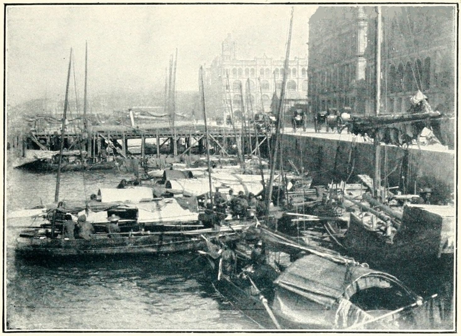
the old harbour and the mouth of the little Singapore
river are crowded with Chinese boats and boatmen,
and with barges bringing goods from the steamers in 9
the roadstead. Here we have a view of a corner of the
wharves in the river.
Let us land and make our way towards the town. 10
Commercial Square and Raffles Square, with their shops
and business offices, are quite English in appearance,
except for the waiting rickshas and the dress of the 11
natives. Then we see the cathedral and the cricket
ground, which lies on part of the reclaimed foreshore,
with the Raffles monument in the middle. In another
direction are Chinese shops and a Chinese open-air theatre
with the crowd gathered round it in spite of the rain.
They are used to rain in Singapore. We pass a Chinese
temple, and more shops, and then on the outskirts of
the town we may light on the suburban villa of a wealthy 12
Chinese merchant, standing in its own beautiful grounds.
The Chinese are proud of their gardens, and the owner
willingly shows us round. Here is a lake in the garden 13
with the magnificent Victoria Regia water-lily growing
in it. Everywhere in Singapore the architecture and
the people of the East and West are blended in a strange
mixture.
In the hilly country, outside the city, there is nothing
of very special interest for us. As we are close to the
Equator and have heat all the year round, with a heavy
rainfall, almost any tropical product can be grown on
the island; the Chinese make a speciality of the cultivation
of pineapples, which are tinned and exported. 14
Here we have a scene in the factory. We need not
explore the country, but a visit to the botanical gardens
will not be a waste of time, as it will tell us a great deal
about the Malay region in general. In one corner of the 15
gardens is a large collection of palms; we have seen
already what an important place the trees of this group
have in the life of the tropics, and we shall meet them
often again. Of even greater interest, perhaps, from
the European point of view, is rubber. Here we find
the Government conducting experiments to discover
the kind of trees most suited to the various districts,
and the best methods of cultivation and preparation;
we shall see some of the results of these experiments
on the mainland of the Peninsula which we are now going
to visit.
Copyright.]
[See page 79.
Singapore: The River.
Copyright.]
[See page 85.
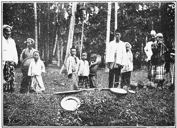
Malays on Plantation.
Copyright.]
[See page 87.
Palace of the Sultan of Kelantan.
We touched at Singapore first as it is by far the most
important of the Settlements: the oldest is Malacca,
which in the time of the Portuguese and Dutch occupation
held the position which Singapore holds to-day.
Under modern conditions it has declined in importance
and ranks below both Singapore and Penang, though
the railway and the rubber industry are now giving new 16
life to this old-world settlement. Here is a glimpse of
the river and here a street in the town; it is picturesque 17
enough, but we miss the life and bustle which we have
seen at Singapore.
The island of Penang, together with the strip of the
mainland opposite, was leased by us from the Sultan
of Kedah, over a hundred years ago, at a time when the
rest of the coast was more or less under the influence
of the Dutch. The rent is still paid regularly to the
Sultan for the time being. In 1824, we came to an
agreement with the Dutch who withdrew all claim to
the Straits, while we left them undisturbed in the island
region further south. This withdrawal of the Dutch,
and the possession of Singapore, gave us the entire
control of the Straits of Malacca. Since that time there
have been some small additions to the area of British
territory, but our chief work has been to bring the native
States within our Sphere of Influence. The result in
the last century, as we have already seen, was the formation
of the Federated Malay States, governed by their
native rulers with the advice and assistance of British
officials. A British Civil Service, with native and Indian
police, and a regiment of Indian soldiers, under British
officers, assist in the work of administering the Federation.
It is an interesting experiment, crowned by complete
success, in the application of Western ideas and methods
of organization to a semi-civilized people; and a
similar system is gradually being introduced into the
other Protected States. Here is a group of these native 18
rulers and British officials, representing the two sides
of the combined administration.
Though we read a great deal about piracy and misrule
in the old days, we must not think of the natives of
Malaya as wholly given over to barbarism. The States,
just as in India, had their own form of government and
social organization, long before they came under our
influence. They had their courts, palaces and public 19
buildings. The palace of the Sultan of Selangor, which
we see here, reminds us strongly of some of the magnificent
buildings in India. Side by side with it a British 20
Residency in the neighbouring State of Pahang seems
an insignificant hut; but the hut represents efficiency
in administration, while the Sikh sentry who guards it
stands for the law and order which we have introduced.
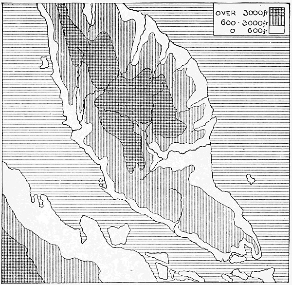
Malay Peninsula: Physical.
The past development and future prospects of the 21
Peninsula can only be understood in the light of its
geography. It has a great length of coastline, so that
no part is very far from the sea, while access to the coast
is easy on the west. But a mountain chain, stretching
continuously from north to south, though nearer the
west coast than the east, forms a difficult barrier between
the States on either side, except in Johor, where it spreads
out and becomes lower. The rainfall is heavy all the
year round and the temperature rather like that of the
palm house at Kew Gardens. As a result of these conditions,
forty years ago the whole region of the lowland
was a great jungle, with the Malay inhabitants living
in scattered villages and clearings along the streams
which offered the only means of movement. Before we 22
came there were no roads except the forest tracks such
as we see here, formed by wild animals and used mainly
by hunters. Now there are good roads all over the
western side of the Peninsula, with rest-houses at intervals,
maintained by Government for the benefit of travellers.
These roads connect the towns of the interior
with the sea or with the lower reaches of the rivers where
they are navigable for large boats; while a trunk road
now runs over the mountains, linking the railway in
Selangor with Kuala Lipis on the Pahang river. Here 23
we have a scene on this road, with the old native bullock
cart and the modern motor-car side by side. We can
imagine that travel will be slow in these carts; and so
it is; but off the road all movement whatever is impossible.
Besides the roads there is now the completed
trunk railway, running from Johor Bharu, where it (1)
connects by steam ferry with the short line in Singapore
island, right along the west of the Peninsula to the coast
opposite Penang. The railway, like the roads, has
branches connecting with ports on the coast, and on the
east side a line is being pushed forward into the State of
Pahang; this will ultimately pass through Kelantan
and connect with the Siamese system. About half-way
along the trunk line, in the State of Selangor, is Kuala
Lumpur, the administrative centre of the Federated States.
When road and rail are not available, our sole resource
is the water, which has always been a vital element in
Malay life. We may travel in canoes of various kinds,
and for long journeys we may hire a roomy houseboat, 24
such as we see here on the Pahang river. If no
boats are to be had, we may build a raft of bamboo and 25
on it drift down stream. Our journey will not be without
excitement, as there may be rapids to be negotiated,
and we must be careful where we bathe, as there are 26
crocodiles in plenty. Near the river mouths and along
the coast we find sailing boats, often of the junk type,
which remind us of China; and the larger ports have
their coasting steamers, owned in some cases by Chinese
capitalists in Singapore.
Malaya, with its warmth, ample rainfall and many
streams, is naturally the land of the rice swamp and
coconut palm. As we travel southwards from Penang,
the rice fields stretch monotonously mile after mile over
the flat lands between the railway and the sea. These 27
great levels do not make good pictures, but here is one
of them. The native in the foreground is beckoning
eastern fashion, with the hand pointed downwards. The
ditch beside him is an irrigation channel. The water
is impounded in rough reservoirs on the valley slopes
and allowed to flow down to these channels; sometimes,
too, it is raised from a lower level by a primitive water
wheel, with bamboo tubes fixed on its rim as buckets.
Experience has made the native skilful in irrigation
work of this kind.
The rice field, the coconut palm and the river provide
the Malay with an easy living, supplemented in the past
by the proceeds of occasional piracy. He was not likely
to be industrious so long as his property was liable to
be seized at any moment by his rulers or their deputies.
The Malay, as we find him all over the East India Islands,
will hunt, fish, sail a boat or fight with considerable
energy and skill, but he takes ordinary life in an easy
fashion. He has no desire for the business of money-making
and prefers to live in his simple fashion in his
own homestead or kampong. Let us look at some of 28
these native houses. They are all raised above the
ground on piles, and usually have a kind of verandah 29
on one side; the interior is dark, as the native is not
fond of windows. We notice the bamboo and the coconut
palm near every house and shall probably come on the
stream not very far away. This is the real Malaya:
the aspect of the towns is very different. Here we find
streets of houses and shops, but these are largely given 30
up to the natives of India or China, as we may guess from
the signboards in the picture before us. Here, on the 31
other hand, we see the typical Malay, in his national
costume, the bright coloured sarong or petticoat which 32
is worn both by men and women, with a light jacket of
some kind to complete the dress. The Malays are Mohammedans,
though not perhaps of a very rigid type. Here 33
we see the new mosque at Kuala Lumpur, fit to stand
side by side with a palace; but the simple thatched or tiled 34
buildings which we find everywhere in the villages seem
to agree better with our pictures of ordinary Malay life.
Though the Malay is largely occupied in agriculture,
yet he has taken only a small share in the most important
of recent movements, the artificial cultivation of rubber.
All along the railway, outside the rice swamps, we find
our view shut in by the tall trees of the forest. Here 35
is a glimpse where the forest has been thinned out a
little, and here again is a corner of the jungle showing 36
the dense growth of fern and creeper. The constant
rainfall and high temperature which give us the jungle
have been found to be well suited to the growth of the
Brazilian rubber tree. So here and there from the train
we catch sight of a great clearing, with perhaps the young 37
rubber trees growing amid the roots and fallen trunks
of the older forest. Or again we pass a plantation in a 38
more advanced stage; and if we pay the planter a
visit we may see the coolies tapping the trees by slicing 39
the bark, and collecting the milky latex which when
coagulated and smoked becomes rubber as we know it.
The planter is English, perhaps from Ceylon; the coolies 40
who cluster round the bungalow to receive their pay
are probably Tamils from India, since the Malay, though
useful in the rough work of clearing to which he is
accustomed, does not take readily to the steady work of
cultivation.
Clearing, planting and growing the trees is a slow process,
and the progress of Malaya would have been far
from rapid if it had been based on agriculture alone.
The money needed for roads and railways came from
another source. When we intervened, we found the
Chinese coolie already in occupation, and a considerable
traffic in Chinese-owned vessels along the coast to Singapore.
The cause of this traffic was tin. Tin ore is everywhere
in the Peninsula, though it is mined chiefly in the
alluvial areas at the foot of the hills. Some of the mining
is still very primitive and is carried on by groups of
Chinese who work with little capital but manage to
make a profit none the less. But in many places modern
machinery has been introduced; the steam pump has
replaced the chain and bucket of the Chinese, while
hydraulic sluicing and other up-to-date methods of 41
mining are becoming common. We often come on a
whole valley, looking like a huge quarry, turned upside 42
down and desolated in the search for tin. Everywhere
we notice the busy Chinese coolie, in his curious
sun hat, and in the distance we may catch sight of the
barracks where he lives. The ore is dug out and washed,
and then for the most part sent to Singapore to be smelted
and reduced to the shape in which it reaches our own
country. Nearly half the world’s supply of tin comes
from this narrow strip of country; and we may say that
Malaya has been built up on tin, though now rubber
is rapidly overtaking it in value. The two together
constitute over nine-tenths of the total exports of the
Federated States and provide a large revenue for the
Government to spend on improvements.
The miner and artisan is nearly always a Chinese, so
that at the present time the Chinese in the Federated
States actually outnumber the natives. If we add the
Indian coolies to the Chinese, we find that out of a total
population of about a million, three-fifths are of foreign
origin. This is how tin and rubber are translated into
terms of population. Outside the Federated States we
do not find the same proportions in the population, though
the geographical conditions are of much the same kind.
There is the same rice cultivation in the coast plains;
the same plantations of coconuts and rubber, though on
a smaller scale.
Trengganu has a considerable textile industry, while
Kelantan exports sarongs to the neighbouring states.
Tin also is everywhere, and some gold; while Europeans
are already mining, prospecting and planting. The population
of Kelantan is almost entirely Malay, and the
native element is stronger than the Chinese all down the
east coast. The whole region is rather more primitive 43
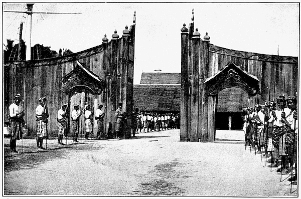
than the west side; the palace of the Sultan of Kelantan,
with its curious wooden palisade and guard of spearmen,
looks distinctly old-fashioned.
In short, eastern Malaya has been rather out of the
world in the past. The coast is difficult of access; the
river mouths are blocked with sandbars, and there is a
continuous line of surf in the months when the Northeast
Monsoon is blowing. It lies, too, out of the main track
of shipping; so that we have a great contrast to the sheltered
waters of the Straits of Malacca, and it is only
natural that the country behind should be slower to
develop.
The most backward part is naturally the pathless
jungle on the mountains of the interior, which is still 44
given up to wild game and to the Sakai, naked savages
living in rough forest-shelters and armed with the blowpipe
and poisoned dart. These represent the lowest
grade among the people of the Peninsula. But development
has begun in the east and the result will be
a change in the face of the country such as we have
seen in the west, brought about by the Chinese and
Indians of the mine and plantation, aided by European
and Chinese capital, and working under sound
administration.
When we turn northwards from Singapore, on the way (2)
to China, we are entering a vast enclosed sea, cut off
from the main Pacific by a string of islands almost continuous
for fifteen hundred miles. In the northern part
of this barrier there are a few narrow passages; in the
south the sea is shut in by the unbroken barrier of the
coast of Borneo. Some idea of the size of Borneo, which
is the largest island in the Malay Archipelago, can be
obtained if we compare it with our own islands, mapped 45
on the same scale. We shall find that Borneo can contain
not only the lands of the British Islands but a large
part of the surrounding seas and channels as well. The
south and southeastern part of this great island belongs
to Holland, so that our visit will be limited to the northern
end; but even in this corner we find a country as
large as Ireland.
After a voyage of seven hundred miles across the
southern end of this enclosed sea, we are approaching the
small island of Labuan, which lies across the mouth of
a broad inlet in the larger island. In the latter part of
our voyage we have sighted land to the southeast, but
this is not our destination, as it is not British territory,
though as regards foreign relations under our protection.
This land is the native state of Sarawak, which is ruled
autocratically by an Englishman, Sir Charles Brooke.
The origin of this State is one of the romances of the
Pacific. Seventy years ago James Brooke, uncle of the
present ruler, made a voyage through the South China
Sea. He was specially attracted by Borneo and saw
that it might be wealthy and prosperous if only it could
be reclaimed from the misgovernment and barbarism
of its native rulers. The chance soon came to put his
theories to the test. Sarawak, then nominally part of the
Sultanate of Brunei, was in a state of rebellion, owing
to the misrule of a local chief. Brooke, with the crew
of his yacht, helped the Rajah Muda, Hassim, uncle of
the Sultan of Brunei, to restore order; and as a reward
was made governor of Sarawak, in 1841. Thus the
younger son of an Indian Civil Servant became in a
moment an Eastern Potentate. Once established, Sir
James Brooke, or Rajah Brooke as he is better known
to history, not only kept good order in his own district
but joined with the British navy in the suppression
of piracy in the neighbouring seas. As Brunei decayed,
Sarawak grew stronger. Its territory was enlarged from
time to time and its prosperity has proved the benefit
derived by the native inhabitants from strong and firm
control.
An island rather larger than Guernsey, Labuan is the
only British territory, as opposed to a Protectorate,
which we shall find in this region. Rounding a headland
we turn northwards into a broad and deep inlet, and come
to anchor opposite a small town of white houses with
red roofs and a background of low hills; this is Victoria,
the capital and only town. We may have time to travel
by the light railway to the coal mines at the other end
of the island, but we shall find nothing else to detain us,
as the country is mostly occupied by swamps and decayed
villages. The harbour and the coal: these two things
explain why Labuan is now a British Possession. Though
it had been, for a short time in the eighteenth century,
a station of the East India Company, it was unoccupied
and seemingly of little value when we acquired it from
the Sultan of Brunei in 1846; but we looked to its position
on the flank of the great route to China, with its
excellent harbour and supplies of coal. It was thought
by some that the island would become a smaller Singapore,
a port of call for shipping and a collecting centre
for the whole mainland of Borneo. Labuan started
with great expectations; its history has been a series
of disappointments. The coal business failed from the first,
while the transit trade did not develop, and the reason is
not far to seek. In spite of the great natural resources of
Borneo, there could be no progress in trade until piracy
and head-hunting had been suppressed and some form
of settled government introduced. Now that this has
been accomplished and the country is prospering and
developing, the mainland has its own seaports from
which the goods are shipped direct to Singapore or Hongkong,
so that Labuan derives no benefit.
Politically Labuan has had a varied career. In 1848,
it was made a Crown Colony, Sir James Brooke being
the first Governor; later it was handed over to the North
Borneo Company to administer for a time; and since
1907 it has been annexed to the Straits Settlements.
It has been eclipsed completely by its greater neighbour.
If we cross the wide bay between the island and the
mainland, we shall get a glimpse of past history, and better
appreciate the reason for the failure of Labuan.
At the southeast corner of the bay we enter the Brunei
river. The forest comes right down to the river bank,
and the trees appear to be growing in the water, with a
tangle of interlaced roots showing above the surface;
we are passing a swamp of mangroves, or bakau, as the
natives call the tree. Then the land begins to rise in
low hills covered still with forest, and the mangrove
gives way to the coconut palm. We pass native canoes
with their double rows of paddles, and here and there
on the bank a group of native houses among the palms.
Finally we round a sharp bend in the river and come 46
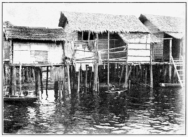
upon the old native town of Brunei. It is a kind of
eastern Venice, with its houses built on piles driven into 47
the mud, and its streets all waterways. Here is one of
these streets. In Brunei, as all over Borneo, the bamboo,
the palm and the creeping rattan provide the builder
with material free of charge for posts, flooring, roofs and
lashings—for the houses are tied, not nailed together.
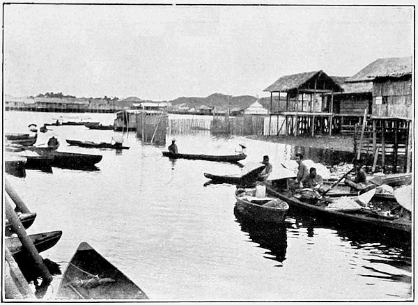
There is fish in abundance in the river, and we pass a 48
fleet of market boats, with women in large sun hats,
bringing the catch for sale in the town; while in the
forest all round there is fruit to be had for the picking.
Nature has supplied the Malay with most of his necessaries
at his very door.
Brunei has distinctly an air of decay. Centuries
ago it was a large city, the capital of a kingdom. It gave
its name to the whole island and its rulers extended
their sway across the neighbouring seas. Early voyagers
from Europe seem to have been much impressed
by its barbaric magnificence. Now, all that remains
of a past empire is a small corner of territory, with little
trade or revenue, and ruled in name only by a petty chief.
Most of the territory shown on the old maps has been
ceded to the British North Borneo Company or to Sarawak.
One local industry of some importance Brunei still possesses;
this is the working of brass, particularly of brass
gongs, which still pass as a kind of currency in the interior. 49
We can visit a whole village of brassworkers, on a creek
close by, and see them working in the open air with primitive
bellows made of bamboo, and producing castings of
old-fashioned design. This is merely a survival; internal
decay and attacks from outside have left Brunei only a
shadow of its former power. The trade with China
and the Malay Archipelago, which contributed to its
former power, was destroyed by the attacks of the
fierce pirates from the islands to the north; and British
influence came too late to save the kingdom from its own
internal weakness; though, under the guidance of British
officials, and by the help of British capital, the fragment
which remains seems likely to recover some of its
prosperity.
Let us turn from Borneo of the past to Borneo of the
future. We are going to make a voyage round the territory
of the British North Borneo Company. Our trip
will be limited to the coast districts, as much of the
interior is difficult to reach and indeed not yet explored.
First let us see what the map can tell us about the country
as a whole.
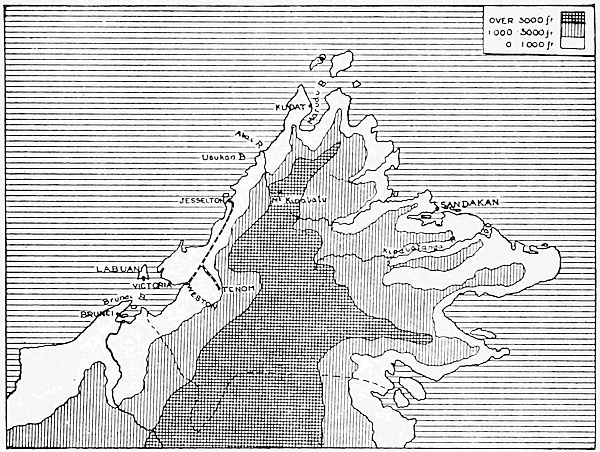
British North Borneo.
The Company’s territory is in the form of a rough 50
quadrilateral, with a coastline irregular and deeply indented
by the sea. Inland, but nearer to the west coast
than the east, stretches a long backbone of mountains;
so that the rivers on the east side are longer and the lowlands
broader and flatter than on the west. The Equator
cuts Borneo almost in the middle, and the whole island is
truly tropical, though there are great differences between
the highlands and the lowlands. The lowlands are hot
all the year round, though the temperature is modified by
the rain and dense vegetation and the nearness of the sea;
so that the climate does not show the extremes of heat
and the great variation which we find in the dry region of
Northwest India, much further away from the Equator.
Again, there are not two strongly marked wet and dry
seasons; rain falls more or less in every month of the
year, though spring and autumn are as a rule the wettest
seasons. A total annual fall of from ninety to two hundred
inches reminds us of the wetter parts of India and
the Malay Peninsula, and combined with unvarying heat
does not suggest a climate particularly adapted to occupation
by the white man. In spite of this drawback the
country is in course of development by British capital
and under British direction. As an estate it is increasing
in value every year. We will now try to see something of
its products and people.
Seventy or eighty miles north of Labuan we enter
another great bay, with a small island at the entrance;
the bay and island of Gaya. On the south side of this
bay is the town of Jesselton, the western capital of the
Territory and the terminus of the only existing railway.
Behind the town is hilly country, and as we approach we
may see in the distance, so far as clouds permit, the great
bulk of Mount Kinabalu, the highest part of the long
mountain chain of the interior. At Jesselton we find
European sports in progress and a mixed crowd is gathered:
natives of the coast region, largely of Malay blood, Sikhs
and Pathans of the Constabulary, with a few Chinese and
the white officials. In the town are the Malay houses
built over the water, and near them a row of Chinese 51
shops; on the slopes above we see the barracks, with the
Constabulary at drill, and a few European residences,
with Government House overlooking all. At Jesselton we
have a picture in little of the conditions of the coast
districts.
Before exploring inland we will borrow the Government
launch for a short trip up the coast to Usikaan Bay. 52
Here is a fine portrait of our skipper. He is a typical coastman;
his mother a native of Brunei, his father from
Sarawak. He is a Mohammedan, like most of the coastmen,
and is full of the lore and legend of the island. We
land at a little pier and enter a shed, which is the Custom
House. There is no sign of inhabitants, as the building is
used only when the local steamer calls to collect the up-country
produce. We have come here to look at the
scenery, not the people, so we climb the hill above the
bay, from which we can look down on the Abai river,
flowing out beyond the next headland. It is a typical
Borneo river. On both banks is the usual tropical swamp,
and all around us is tropical vegetation. Here we can 53
see the wonderful Pitcher Plant of these regions, though
the finest specimens are to be found further inland towards
Mount Kinabalu. Turning away from the sea we have a 54
view of the long ridge of Kinabalu, with the upper part of
the Abai river in the foreground. From this outlook we
can gain a very fair idea of the character of tropical
Borneo.
So far we have kept to the outer edge of the island; the
railway from Jesselton will carry us inland, though not
very far, as it runs on the whole parallel to the coast.
The inland terminus of the line is at Tenom, east of Brunei
Bay and behind the coast range of mountains. Here, too,
native sports are in progress, but they are a much more
important business than at Jesselton; they are announced
months beforehand and provide a common meeting-place
for the many native tribes of the interior. The contests
are also especially fitted to the tastes and occupations of
the natives, so that we may learn much from them. The 55
raft race is one of the most popular, as the rivers are the
only means of traffic in the interior and the natives are
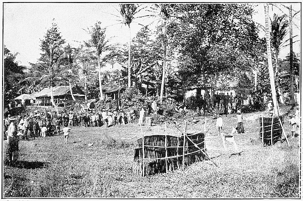
skilled in handling every form of river craft. Even more 56
interesting to us is the shooting match with the sumpitan,
the long blowpipe with poisoned darts which in this region
takes the place of the bow and arrow. Here we find this
formidable weapon put to a harmless use in shooting at
the running deer; it is a kind of native Bisley. The
crowds of spectators show us every type of native face 57
and dress. Here is a group of Muruts with sumpitans,
and here are some visitors, Sea Dyaks from Sarawak, 58
whose name is associated with piracy and head-hunting.
The Muruts seem to be the aborigines of this part of the
interior; they are unlike the coast people in appearance
and they are pagans, not Mohammedans; but they share
with the Sea Dyaks their liking for head-hunting, and
would soon revive the practice were British control
removed.
In the neighbourhood of the railway we begin to find
evidence of the progress of Borneo. One of the most
successful crops is tobacco. Before it can be planted there
is much work to be done. The jungle must first be
attacked and rough roads driven through with ditches at
the side for drainage in the heavy rains. Here we see the 59
work of clearing in progress. Then wide spaces must be
prepared for planting, and at length we get our crop. 60
The leaves are then picked by coolies and carried
in curious baskets to the drying and fermenting sheds
for further treatment before they become the tobacco
leaf of commerce.
We will now return to Jesselton and resume our voyage.
A short way up the coast we leave the steamer and take
to a boat; we are going up a small river to attend a tanu
or local market, in order to see something more of
native life. We call on the District Officer at his house
and accompany him in his barge of state to the market. 61
Here a crowd of natives waits for the hoisting of a little
flag, the signal that they may begin their bargaining.
They have brought down the produce of the interior,
resins, gums and tobacco, to sell to the Chinese dealers;
in return their favourite purchase is brass. There is
also a great buying and selling of fish and fruit. Here 62
we see a native woman of the hill tribes carrying a large
crate and wearing great coils of brass wire round her waist.
The husband stands by and looks on, as is usual here, where
the women do most of the heavy work.
Once more we board the steamer, and after touching
at Kudat, a fine harbour in the great bay at the north end
of the island, turn southward towards Sandakan, the
capital of the Territory, where we shall end our voyage.
On the deck of the little vessel is a crowd of Chinese
coolies. The Chinese are the real workers on all the coasts
of North Borneo, just as we found them in the Malay 63
Peninsula. We reach Sandakan, which stands on a
splendid bay running fifteen miles up into the land. The
entrance is only two miles wide, so that the bay is almost
landlocked. Down at the water’s edge is the native
town, with many of the houses built on piles; here too is
the Chinese quarter, and scattered about further up a
wooded slope are the houses of the Europeans. All round
the sides of the harbour are smaller native villages.
Sandakan will probably in the future become an important
commercial seaport, especially in view of its
position on the route between Australia and China. It
already boasts a shipbuilding and engineering yard, and a
cutch factory which sends its products for tanning all over
the world. Here also we may notice timber being floated
down in great rafts for export, especially to China. Not
far away up the river is one of the oldest rubber estates
on the island. Borneo produces many kinds of plants
giving rubber or gutta, but it has been found that the
Para rubber tree of Brazil grows well, and there is a
great future for its cultivation here as in the Malay
Peninsula.
Copyright.]
[See page 95.
Sumpitan Match.
Copyright.]
[See page 91.
Market Boats, Brunei.
Copyright.]
[See page 91.
A Street in Brunei.
The East India Company made many attempts to
establish factories in Borneo and the neighbouring islands;
but all came to nothing, so that the early history
does not concern us here. One trace of former conditions
remained in the nineteenth century, in the claims of
Holland in the south of the island and of Spain in the
north. These claims were revived at the time of our occupation
and were not finally settled until the late eighties
of the nineteenth century. The modern history of the
region begins with the acquisition, by an American syndicate,
of certain concessions in the north from the Sultans
of Brunei and Sulu. Their rights were taken over ultimately
by a British company which obtained a charter from
the Crown, in 1881, under the title of the British North
Borneo Company. The charter was a revival of the old
plan for opening up new countries without the direct intervention
or responsibility of the home Government. It was
followed by other charters for African companies; but of
these only one survives, and the North Borneo Company is
at the present day the oldest remaining representative of
the system. So we have a large piece of territory under
British Protection but controlled by a private company.
The Company does not trade, but confines itself to
administration, and is supported like any other Government
by duties and taxes of various kinds. It is largely
independent, though the British Government can interfere
if necessary in vital matters.
Malaya and Borneo are tropical estates and can only be
developed by special methods. In dealing with these
estates we have given considerable space to the subject
of administration, since without order and security it is
impossible to utilize those natural resources with which
our geography is concerned. These resources include the
minerals and the whole range of tropical products, together
with the available human material, the Chinese or
Indian labourer and the native Malay. Foreign capital,
British or Chinese, under British direction provides the
driving force for progress. In the different parts of the
Malay Peninsula and in North Borneo we have various
types of administration and various stages of progress;
but over the whole area there is a general similarity of
conditions which marks it off both from the Indian
Ocean and from the Chinese group which is the object
of our next visit.