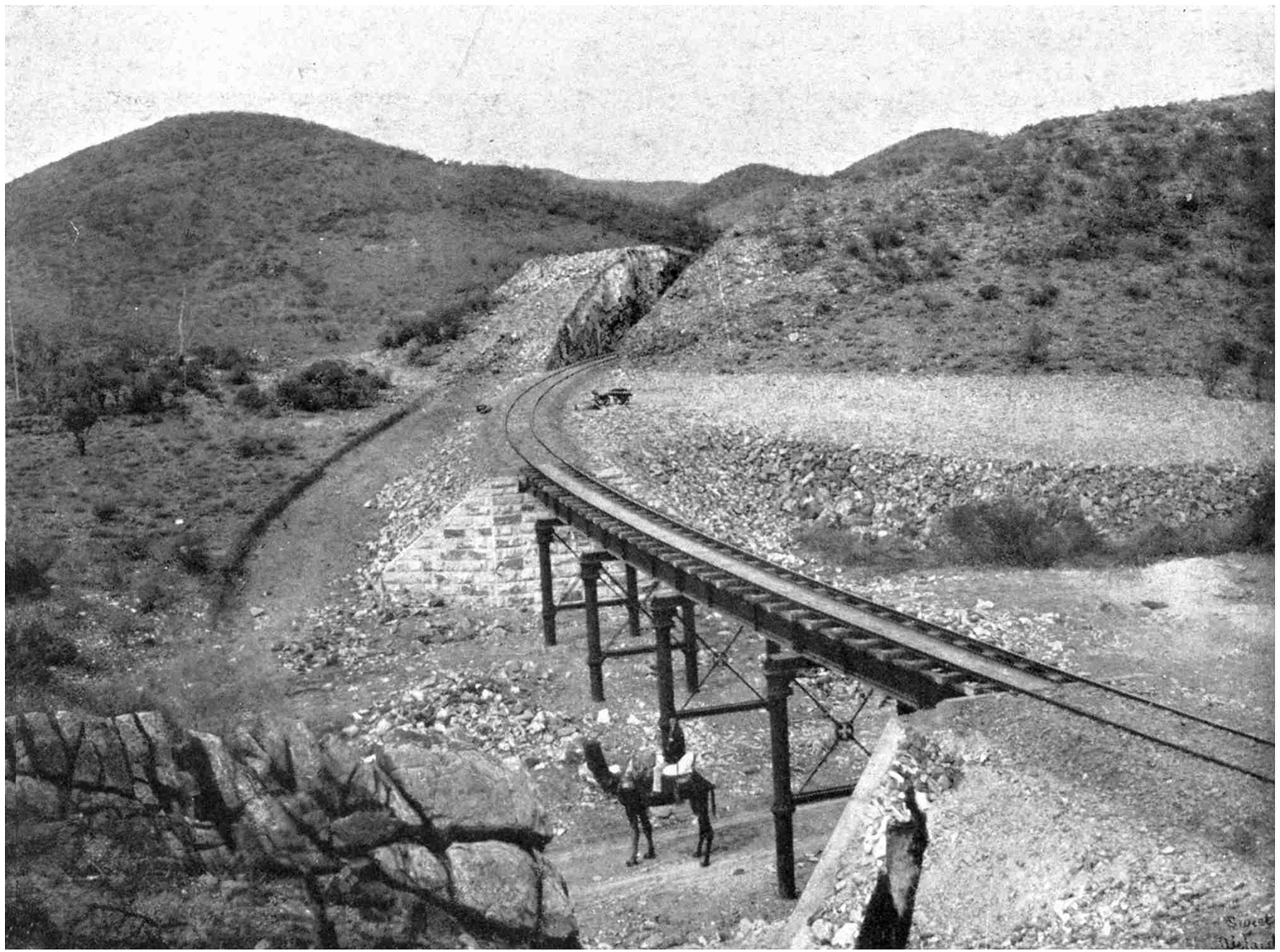
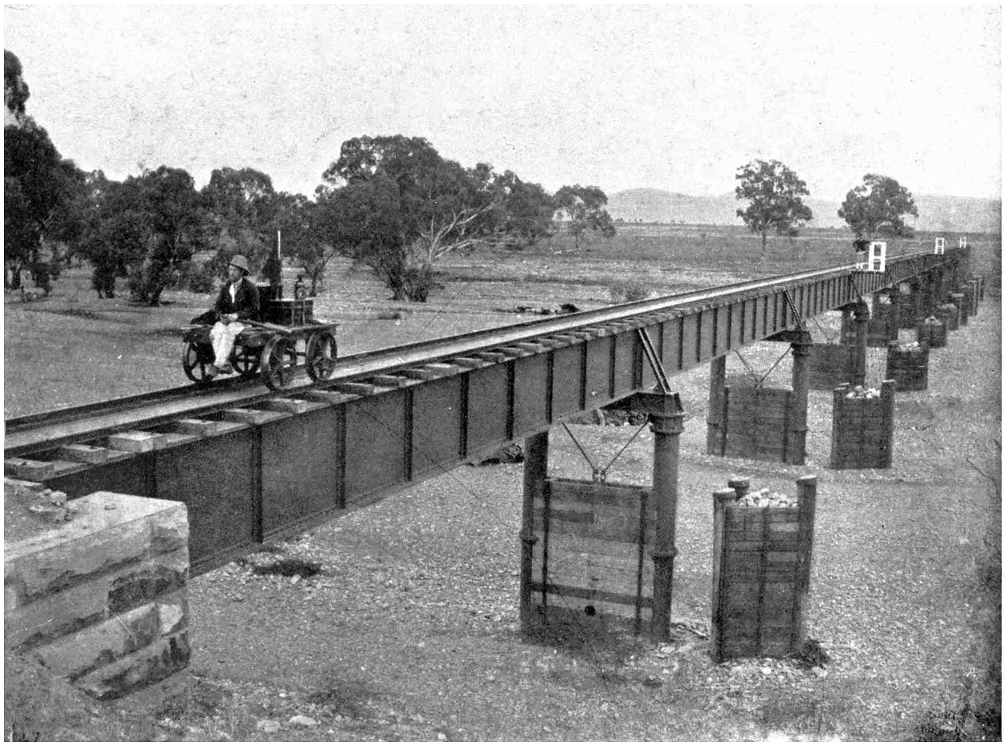
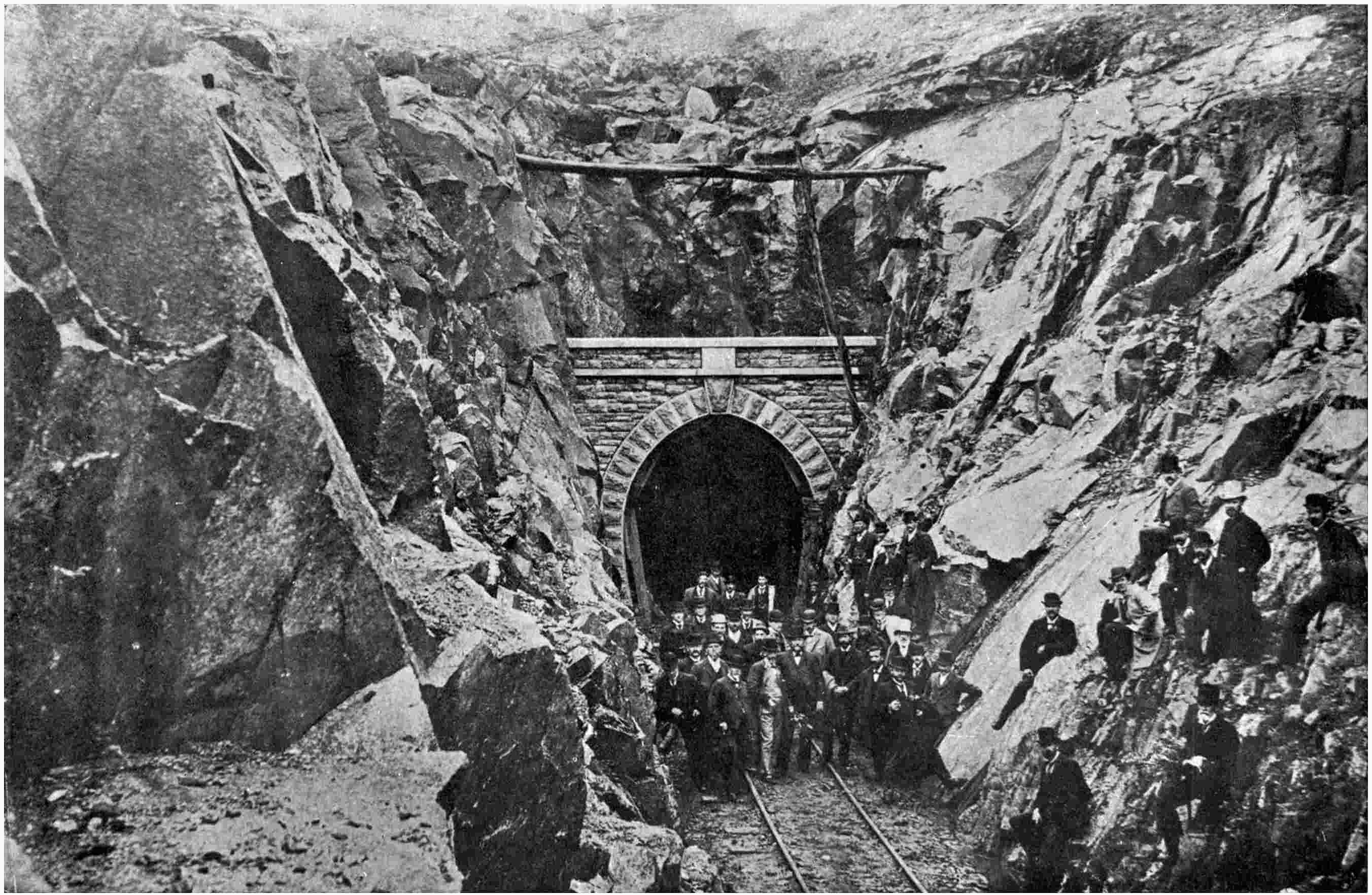
Larger versions of most illustrations may be seen by right-clicking them
and selecting an option to view them separately, or by double-tapping and/or
stretching them.
Cover created by Transcriber
and placed into the Public Domain.
[Frontispiece
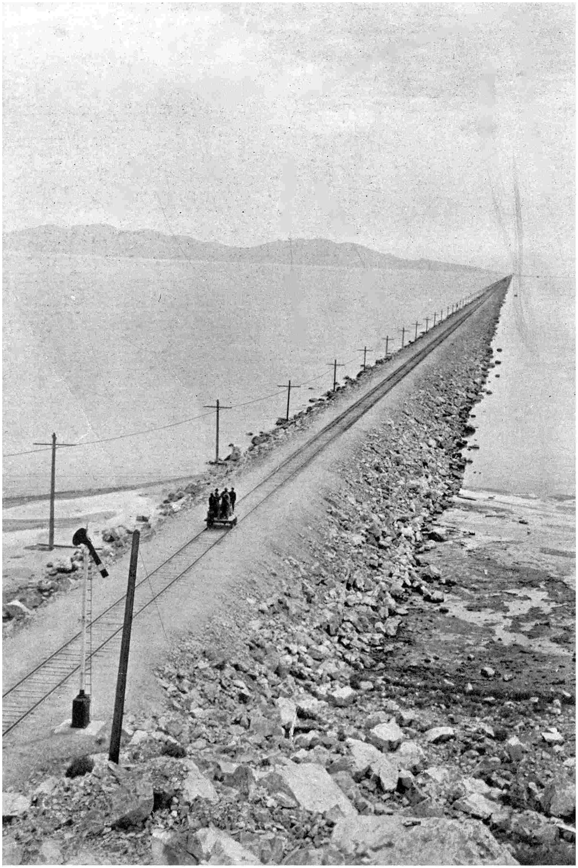
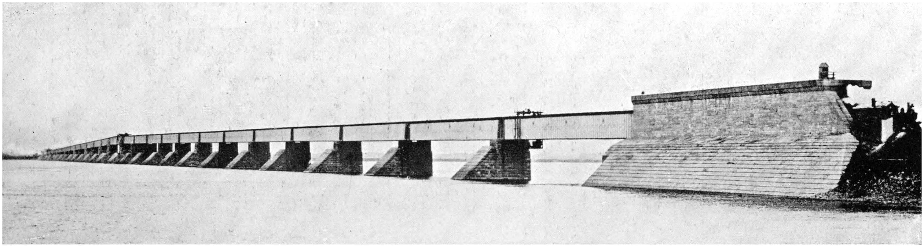
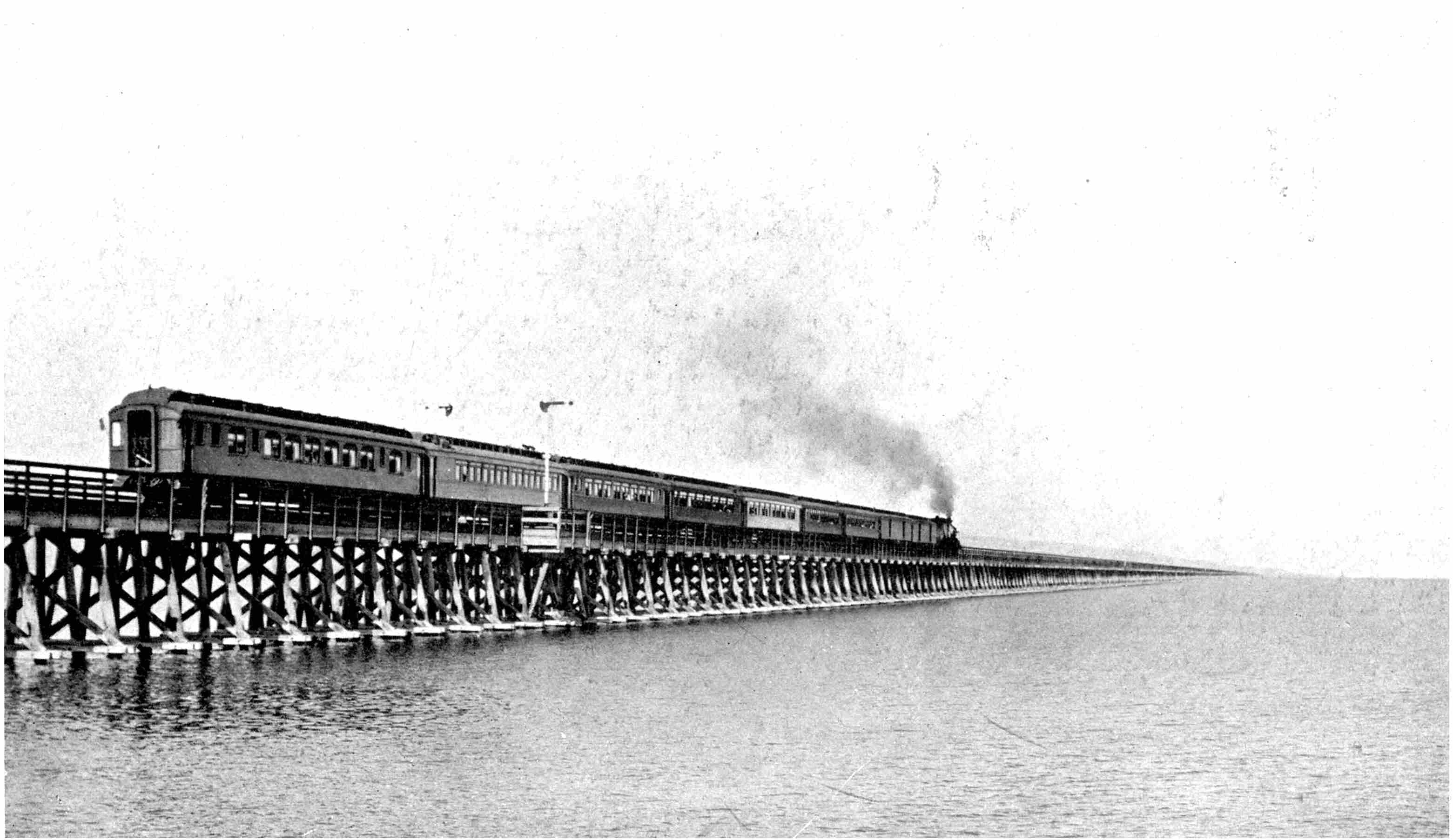
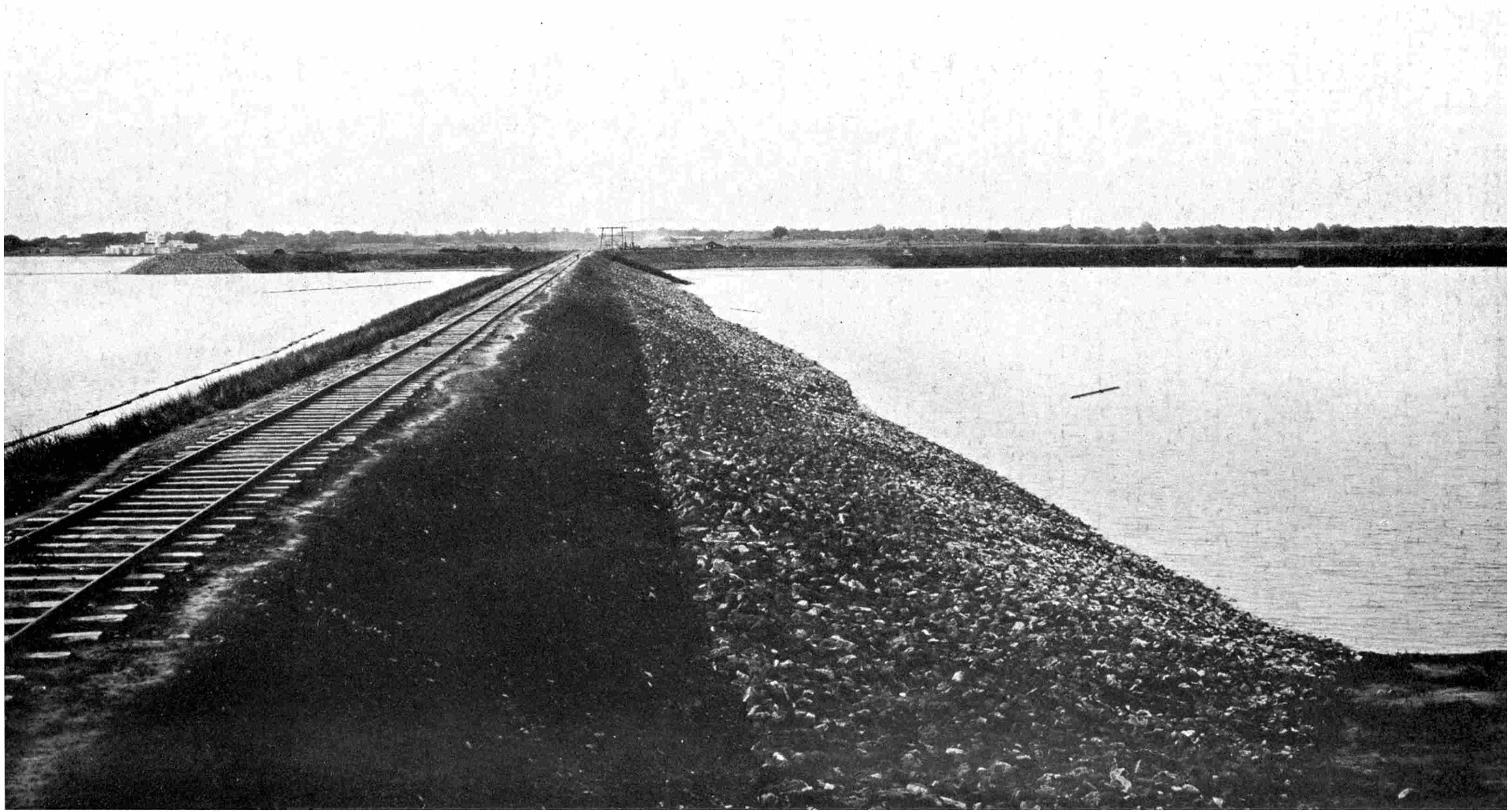
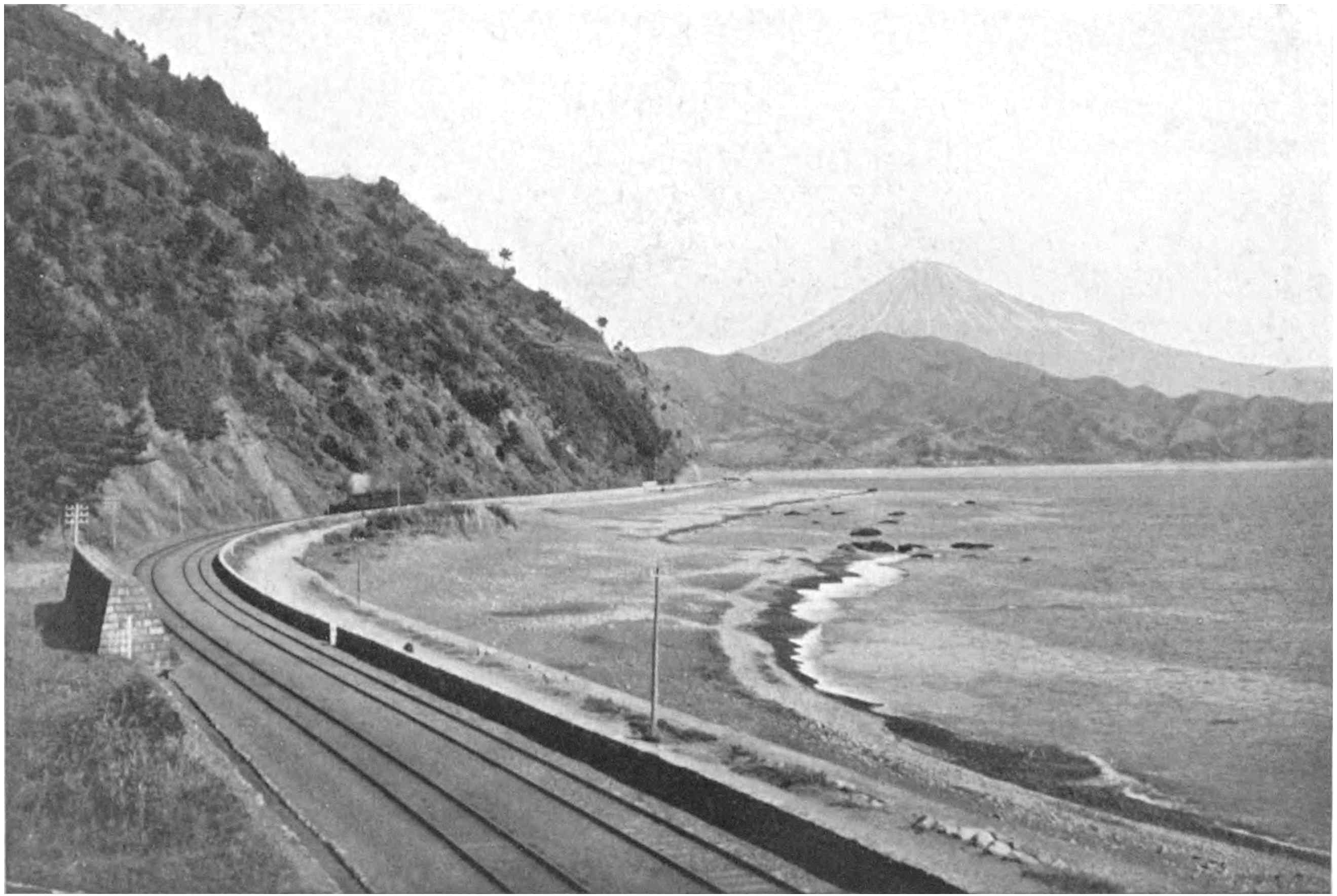
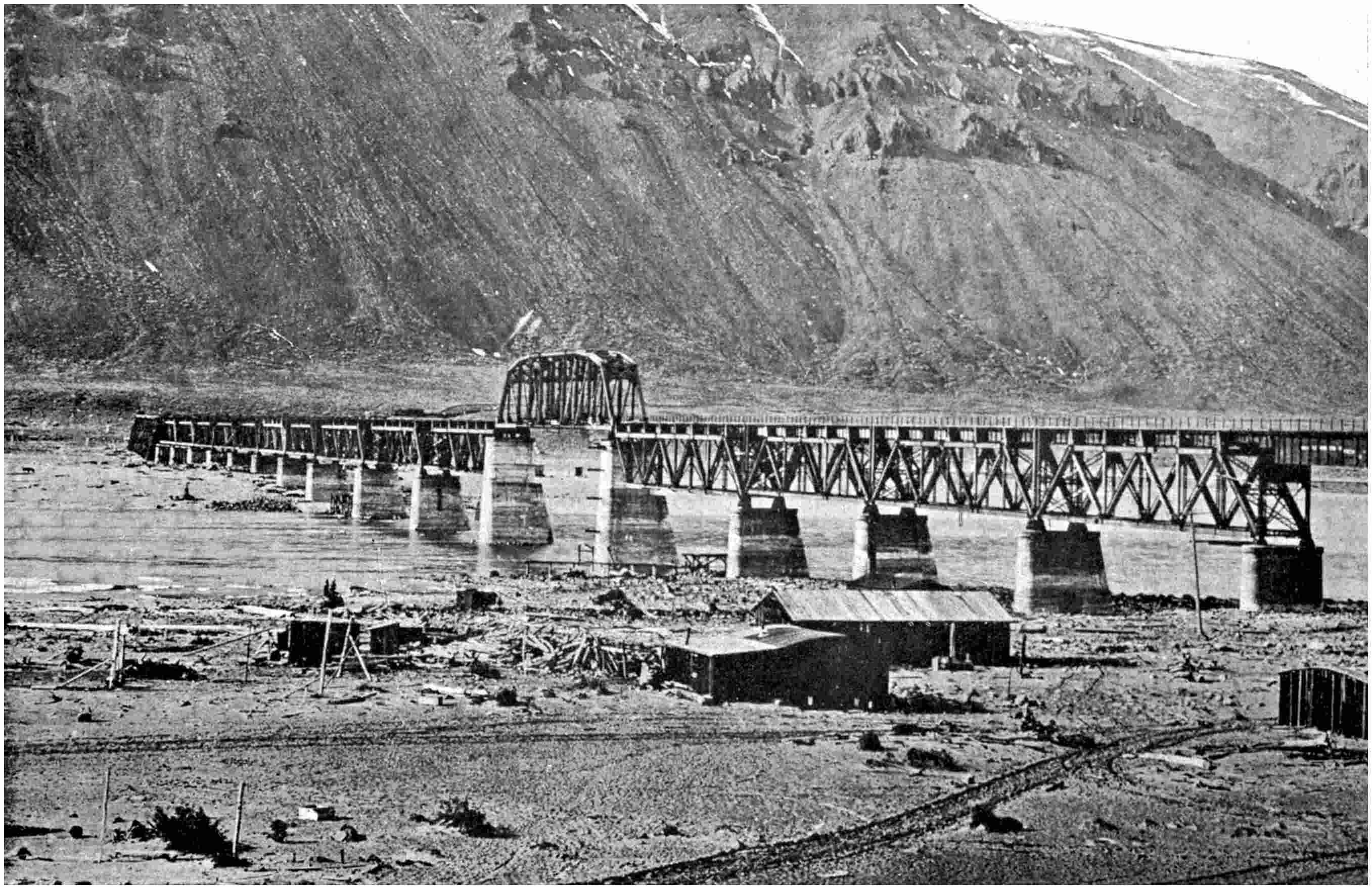
WHERE THE UNION PACIFIC RAILWAY STRIKES ACROSS SALT LAKE
The “cut off” across the water is 27 miles in length, of which 15 miles
are represented by solid earth embankment.
CONQUESTS OF SCIENCE
THE RAILWAY CONQUEST
OF THE WORLD
BY FREDERICK A. TALBOT
AUTHOR OF
“THE NEW GARDEN OF CANADA,” “THE MAKING OF A GREAT CANADIAN RAILWAY,” &C.
ILLUSTRATED
PHILADELPHIA J. B. LIPPINCOTT COMPANY LONDON: WILLIAM HEINEMANN
Copyright London 1911 by William Heinemann
PREFACE
There is the unfathomable fascination of romance connected
with the construction of great railways, though
little is known of the beginning and the growth of the
great trunk roads of the world; of the heavy tax which
their construction imposed upon the ingenuity, skill and
resource of their builders. Speeding along swiftly in a
luxurious Pullman car over a road-bed as smooth as an
asphalt pavement conveys no impression of the perils and
dangers faced or of the infinite labour expended in the
making of that steel highway. To-day the earth is girdled
with some 700,000 miles of railways, and there are few
countries in which the locomotive has not made its
appearance.
This volume has been written with the express purpose
of telling in a popular manner this story of romance. It
is obviously impossible to deal with every great railway
undertaking in the compass of a single volume; but those
described may safely be considered representative, and
they are the largest and most interesting enterprises
between the two poles.
In the writing of this volume I have been assisted
by innumerable friends who have been identified closely
with the introduction of Stephenson’s invention into
fresh fields of conquest. I am indebted especially to
the following gentlemen: Messrs. Norman B. Dickson,
M.INST.C.E.; A. M. Cleland, the Northern Pacific Railway
Company; the late J. C. Meredith, chief engineer,
the Florida East Coast Railway; A. L. Lawley; R. R.
Gales, M.INST.C.E.; H. E. Gwyther, chief engineer,
the Leopoldina Railway Company, Ltd.; Francis B.
Clarke, president of the Spokane, Portland and Seattle
Railway; William Hood, chief engineer, the Southern
Pacific Company; F. A. Miller, the Chicago, Milwaukee
and Puget Sound Railway; the I. R. Austrian Railway
Ministry; W. Weston, the Denver, North-western and
Pacific Railway Company; the Pennsylvania Steel Company;
W. T. Robson, the Canadian Pacific Railway
Company; the Cleveland Bridge and Engineering Company,
and Frederic Coleman of Darlington; the Swiss
Federal Railways; H. R. Charlton, the Grand Trunk
Railway Company of Canada; the chief engineer, the New
Zealand Government Railways; the Peruvian Corporation;
the chief engineers of the New South Wales, South
Australia and West Australia Government Railways; the
Minister of Ways of Communication of the Russian
Empire; the Trans-Andine Railway Company; the chief
engineer, the Imperial Japanese Government Railways;
J. J. Gywn, chief engineer, and S. K. Hooper, the Denver
and Rio Grande Railway; G. J. Ray, chief engineer, the
Delaware, Lackawanna and Western Railroad; Virgil G.
Bogue, vice-president and chief engineer, the Western
Pacific Railway Company; and S. J. Ellison of the Great
Northern Railway, U.S.A.
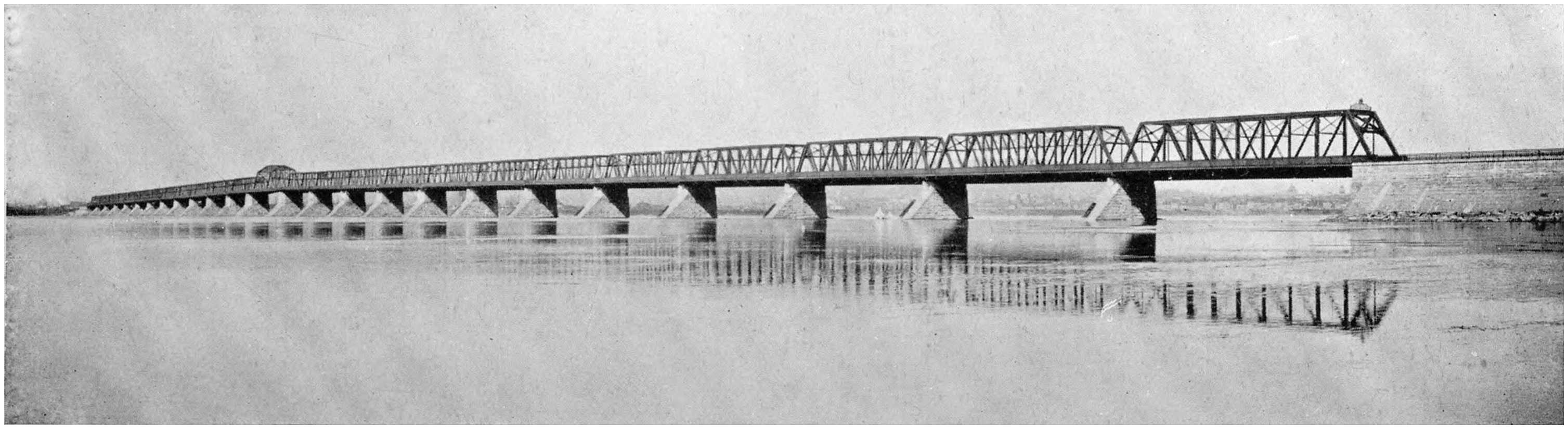
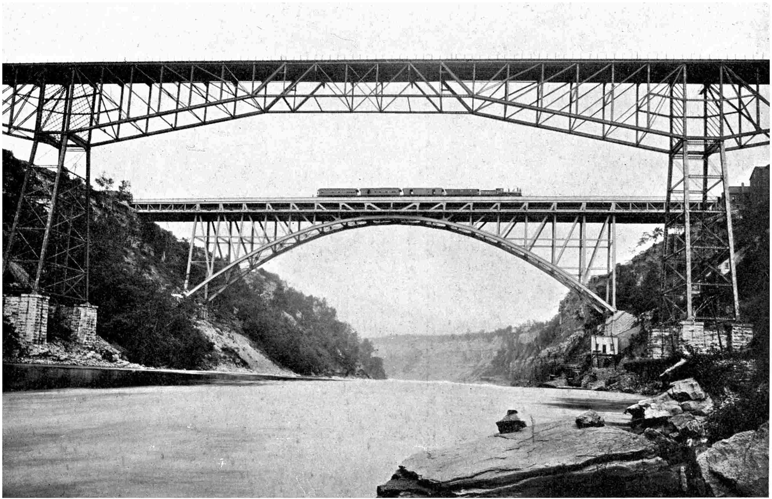
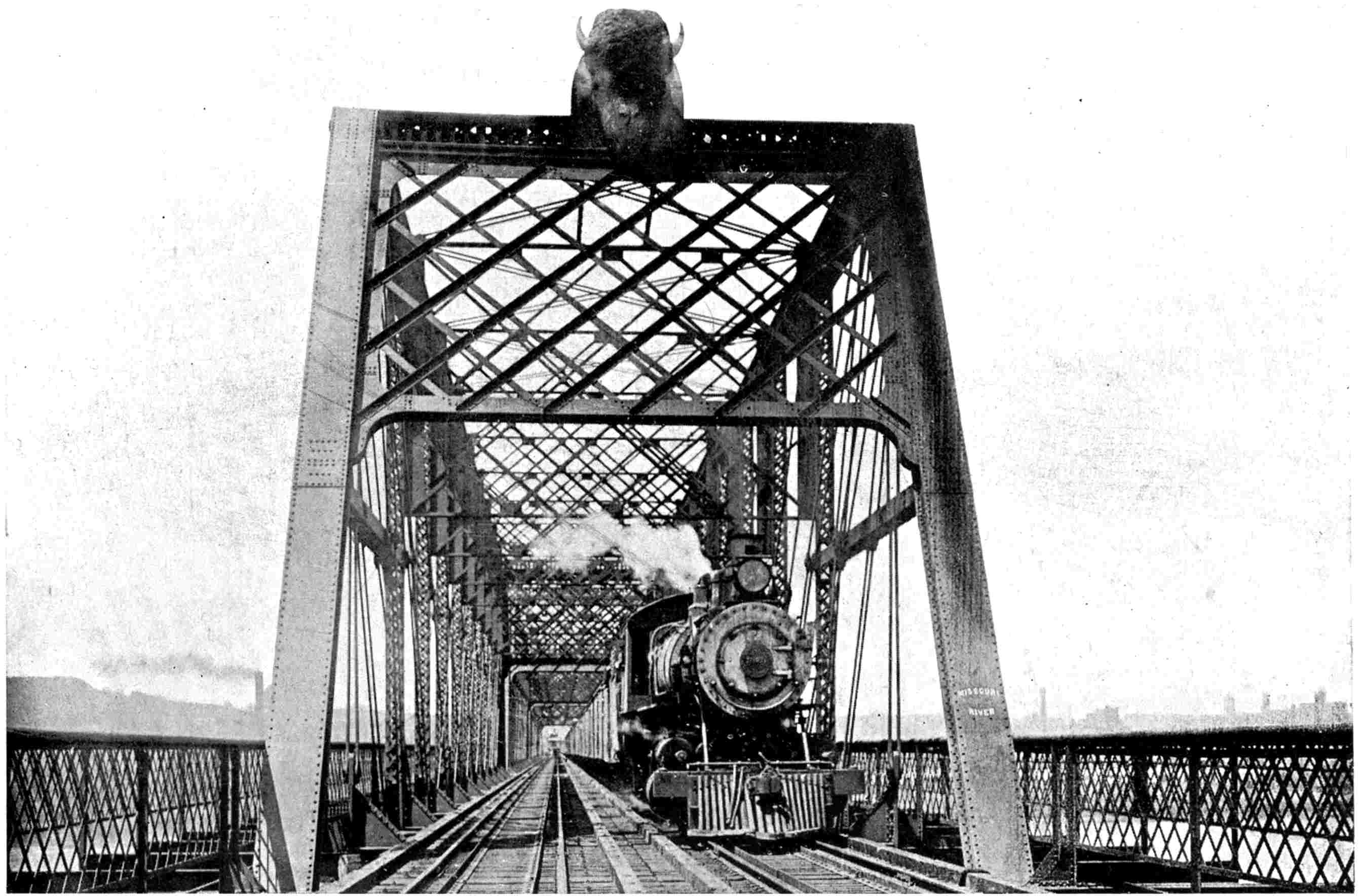
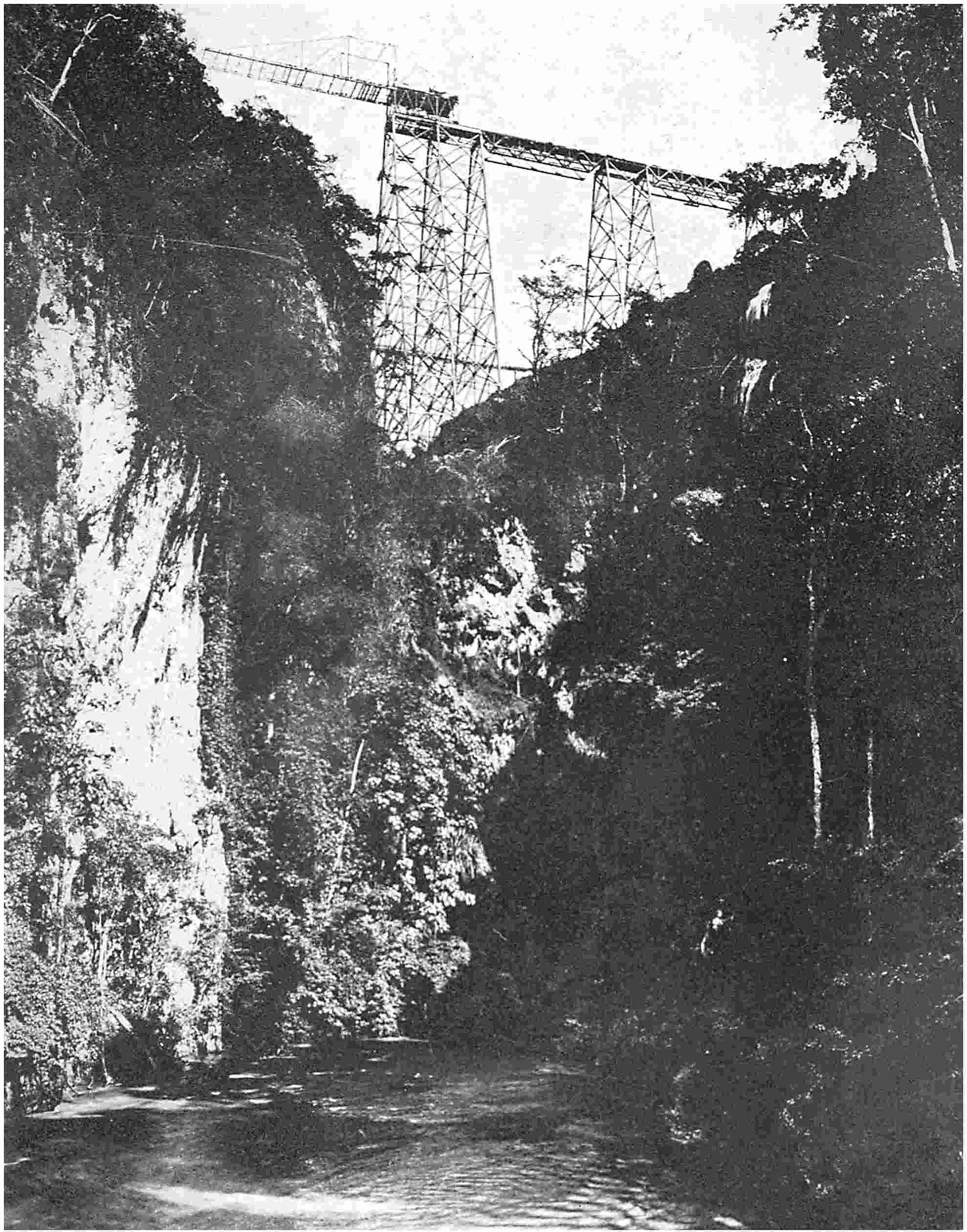
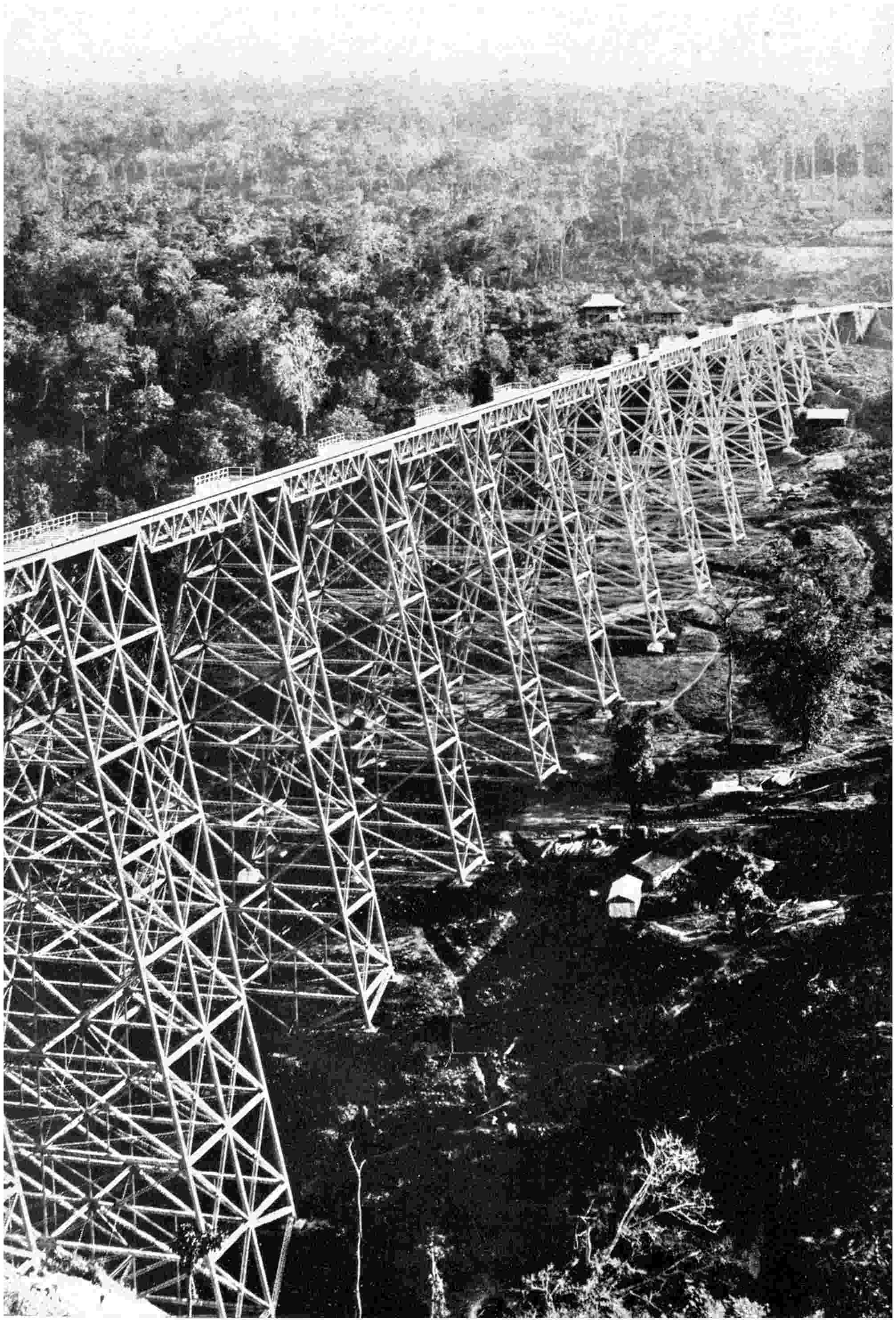
The massive bridge of the Union Pacific Railway over the Missouri River at Council Bluffs, from which point the first railway across the United States was commenced
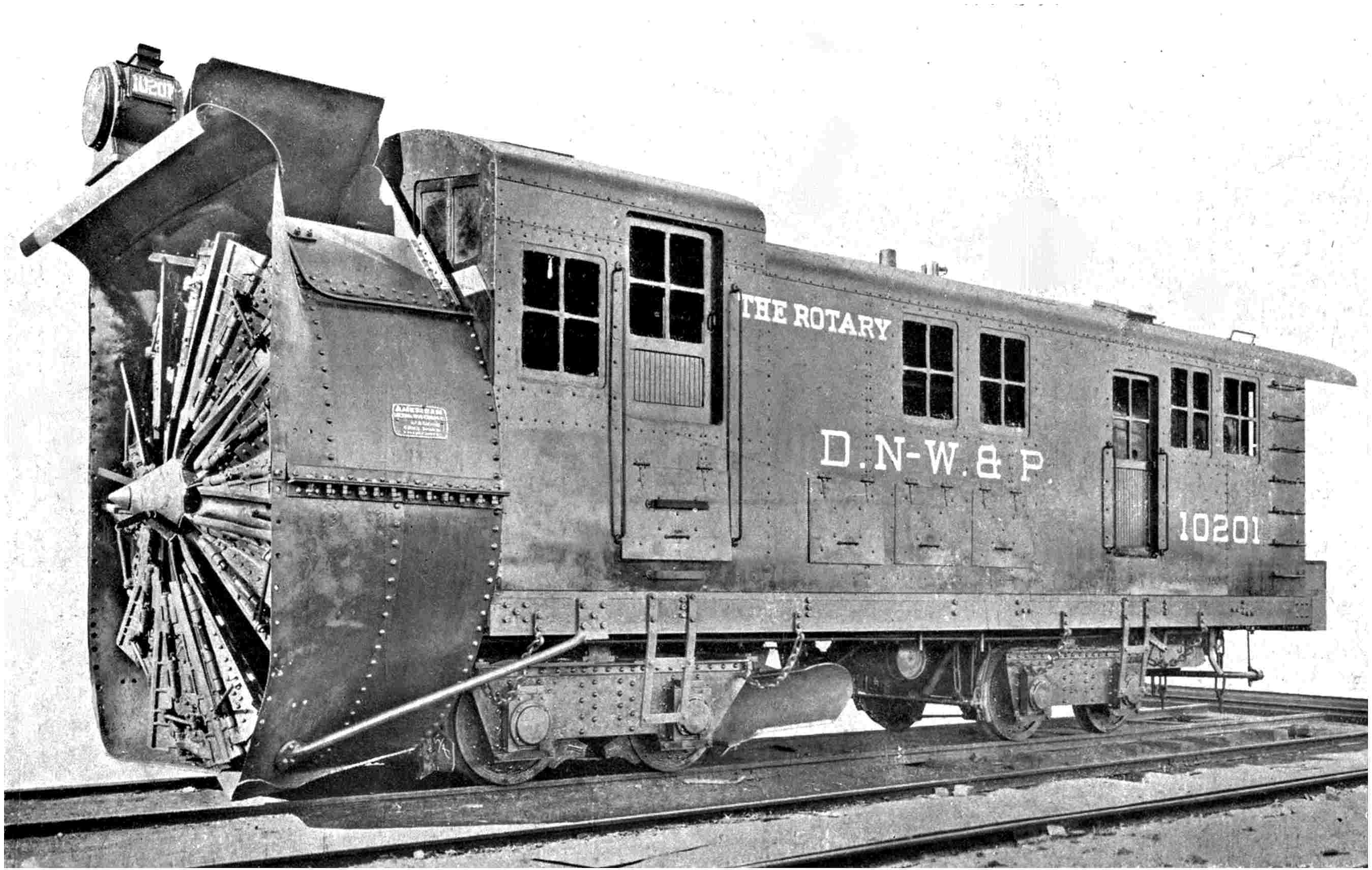
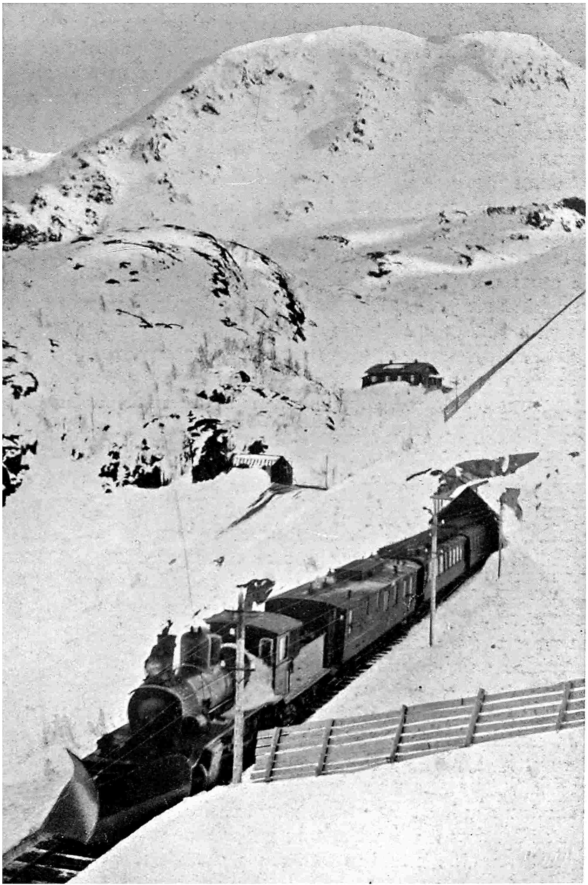
The gigantic snowplough, the largest yet built, which keeps the higher levels of the “Moffatt” line through the Rocky Mountains free from the heavy falls of snow
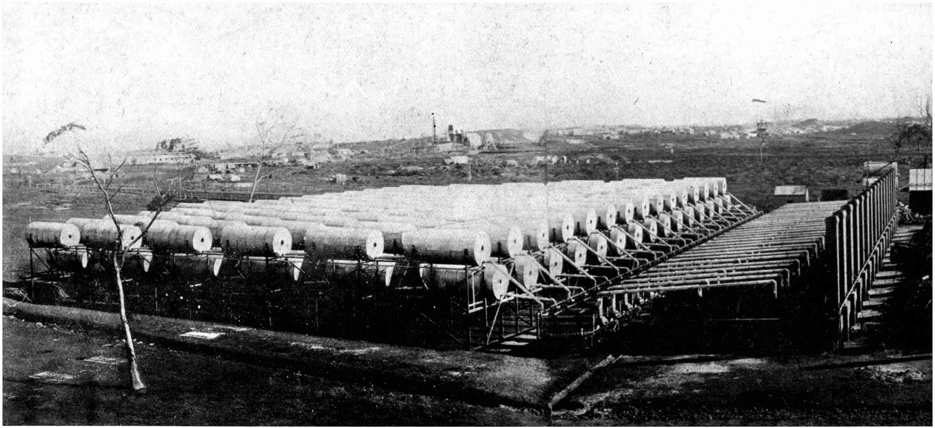
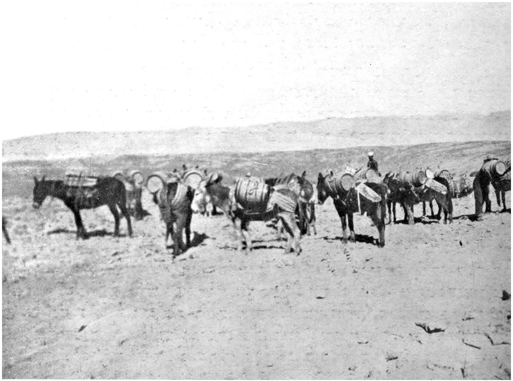
The dearth of suitable water was the serious problem in the early days of the Coolgardie gold-fields. As the railway could not haul supplies from the coast, this novel condensing plant was erected
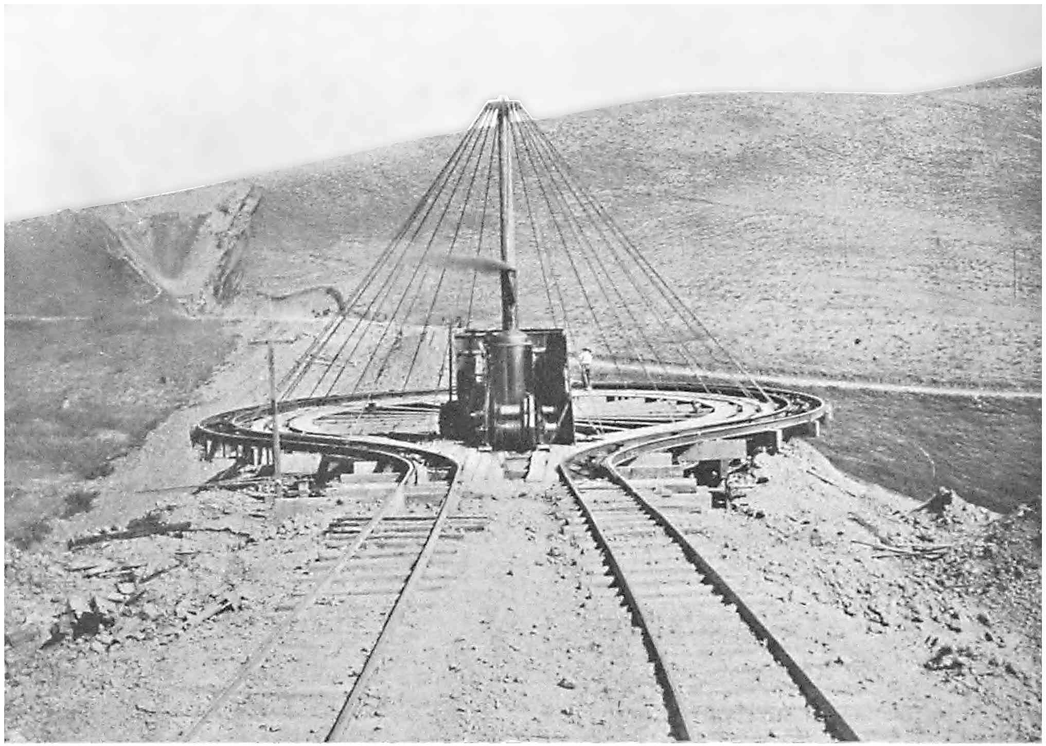
The “switchback” by means of which the Great Northern Railway of the United States negotiated the Cascade Mountains before the boring of the Cascade Tunnel
“One’s experience is varied from camping out in tents
at fifty degrees below zero, to spending a large amount of
time in the wilderness, when provisions are very short and
one has to depend upon fish for food.”
This was the description of the task of discovering a
path for the iron road through a new country, as related
to me by the late John E. Schwitzer, one of the most
brilliant railway engineers that Canada has produced, and
one who had climbed the ladder of success from the humble
capacity of rodman at a few shillings per week, to the
position of chief engineer of the Canadian Pacific Railway,
within the short space of twenty-two years. From his
unique experience he was fitted to speak with authority,
and his statement sums up the life of a surveyor in a
nutshell.
So far as the loneliness and the need to fish for food
are concerned I can speak from experience. This article
of diet is plentiful, but its monotony palls very quickly,
while at times one longs for the excitement of the city. But
once this feeling has been lived down one would not
exchange the virgin country, with its invigorating air and
life of exciting adventure, for a smoke-begrimed stifling
centre of activity for any consideration.
In Great Britain, owing to its completely settled condition,
the difficulties incidental to this class of work do
not exist. The wrestles with heat, sun-baked desert, ice-bound
forest and extreme cold have never been experienced
in connection with the driving forward of the ribbon of
steel in these islands. There is an utter lack of that
thrilling romantic interest and adventure associated with
similar work in an unknown country, where the surveyor
is not merely a surveyor, but an explorer as well. In any
of the four continents beyond Europe he fulfils an important
mission. He is the advance-guard of civilisation. He
spies out the country for the greatest settling force that
has yet been devised, and although the work more often
than not is extremely perilous, he revels in the dangers.
One must be prepared to face any emergency: be ready
to fulfil any duty. One may be buried for months amidst
the strongholds of ice-capped mountains, isolated upon the
sweltering desolate expanses of broiling deserts, imprisoned
in the hearts of yawning ravines, or immersed amid reeking
dismal swamps, cut off by hundreds of miles from the
nearest town or settlement. Then Nature is the surveyor’s
sole companion, and in her silent company herculean and
heroic tasks often have to be fulfilled, of which the world
at large never gleans an inkling.
The surveyor is the personification of happy-go-luckiness.
He pursues his path doggedly, laughs at obstacles,
no matter how forbidding they may be, and accomplishes
glorious deeds unsung. Often his sudden death through
accident, disease or misadventure goes unmourned beyond
the limits of his own camp. Yet an everlasting and omnipotent
monument to his memory is raised—the thin thread
of steel which annihilates time and space.
These men show a devotion to their calling which it is
impossible to fathom. They brave perils beyond conception
and face death in a hundred different forms. It
may be a slip on a treacherous foothold at the brink of
a yawning gulch, the upset of a frail bark in a swiftly
rushing rapid, a land- or rock-slide, an avalanche, or a
tree snapping under the fury of the storm which hurries
them to their doom. In silence they suffer the torments
of thirst, the pangs of hunger, physical exhaustion, frostbite,
snow-blindness, disease, the hostility of mankind and
a thousand other dangers. When they have emerged from
the ordeal they laugh at their experiences, and consider
them no more fearsome than those confronting the ordinary
city dweller as he walks along a crowded thoroughfare.
As one travels over the railway through Mexico, interest
is aroused by four primitive little wooden crosses beside
the track. It is a small God’s acre in an undulating
expanse. The probability is that it would miss the eye
unless one were bent on its discovery. Yet those four
monuments tell a silent story of grim adventure. The
Mexican Central was being driven through a hostile
country, and the Indians were being forced back relentlessly
by its influence. They were sullen but not subdued.
A little squad of four surveyors were busily engaged in
pegging out the path for the line. They were deep in the
intricacies of their task. Suddenly there was a savage
blood-curdling whoop. A horde of Indians, in the full
panoply of war-paint and feathers, were bearing down
upon them on mischief bent. The engineers discarded
their instruments hurriedly and grabbed their rifles. They
were outnumbered hopelessly, but undaunted, they kept
blazing away, picking off their foes with that stubbornness
born of despair. There were no thoughts of surrender to
the implacable enemy. Nor could they hope for aid; they
were too far distant from their base. One by one they
fell, and when at last their comrades came up, their
mutilated corpses were the sole evidences of that forlorn
struggle. To-day those four wooden crosses serve to recall
that grim episode. Such dramatic incidents unfortunately
were only too frequent in the early days of railway building
upon the American continent, though they were far from
being peculiar to the New World. They have been, and
still are, repeated occasionally in connection with such
enterprises in other parts of the globe.
It was only a year or two ago that one of the most
ferocious acts of savage barbarity, such as is difficult to
parallel in the annals of railway engineering, was perpetrated
in South America. Only the fringe of that vast
territory has been opened up by the iron horse. The
greater part is more unknown to-day than the land around
the North Pole.
A small party of engineers set off up country to map out
a projected extension. They plunged boldly into the
depths of the primeval forest. But they never returned.
What happened when they disappeared within the tangled
labyrinth of trees no one knows. The time slipped by, and
their comrades outside, fretting at their prolonged absence,
grew so alarmed that a relief party was organised. The
worst was dreaded, for the hostility of the natives to the
locomotive was known only too well. The relief party
advanced warily, weapons in hand, ready for the slightest
sign of fight. However, they were safe from molestation,
but had not ventured far into the tangled jungle before
they solved the mystery, and were able to reconstruct a
tragic adventure only too realistically.
The steps of the surveying engineers had been dogged
silently and relentlessly by the remorseless savages.
When the former had gained a point sufficiently remote
from the belt of civilisation, they were laid low by poisoned
arrows. The relief-party accounted for every engineer, but
one and all were beyond human succour. They were
found in a gruesome row, poised upside down, with stakes
driven lengthwise through their bodies and heads into the
ground. They had been pinned down with no more compunction
than the school-boy secures his etymological prize
to a piece of cardboard.
A few years ago British North Borneo was the scene of
a similar disaster. It had been decided to drive a railway
from coast to coast, and a party set out on the reconnaissance,
as the first step in a new railway undertaking
is called. The path lay through the dense forest which
had never been penetrated by the white man, and where
the dreaded Head Hunters held undisputed sway. The
prospect was forbidding in the extreme, but it did not
dismay the engineers who plunged fearlessly into the bush.
As the crow flies their journey was only one of some 150
miles, but the thick vegetation concealed difficulties
innumerable.
That survey was doomed to failure. The party was
overwhelmed by the Dyaks and massacred, with the
exception of three native porters who succeeded in making
good their escape. After experiencing terrible privations,
this trio regained civilisation and communicated the sad
tidings of the calamity. For years that stretch of forest
defied conquest. Finally another attempt was made to
traverse the jungle, and on this occasion no interference to
progress was offered. The surveyors gained the opposite
coast in about six months, being called upon to fight only
one enemy—disease. It was a desperate plunge, for the
party had to hack and hew its way foot by foot through
the matted scrub and trees.
These afford instances of the hostility of mankind which
fortunately to-day are encountered but seldom. It is the
hostility of Nature which is feared more greatly now. Yet
the work possesses a fascinating glamour. The existence
of difficulty only spurs the determined to further effort.
Railway surveying in the effort to roll back the map in
a new country offers the young man all the adventure in
life that can be desired. As one surveyor who had spent
more years than he could remember in the wilds between
China and Peru remarked to me, “If it is not the natural
difficulties or the hostility of the natives which lend variety
to the work, the chances are a hundred to one that a
revolution will fill the gap, especially in China or the
South Americas.”
At times the work is exasperating. Perhaps the surveyor
who has been imprisoned for months on end in an inhospitable
country has been driven to his wits’ end to find a
practicable location which is immune from the many
disturbances of Nature. By dint of supreme effort finally
he discovers a route which he congratulates himself to be
absolutely safe, only to receive a rude awakening. In the
survey of a new line through the Rockies, the mountains
barring the engineer’s path had achieved an unenviable
reputation, owing to the frequency and severity of the
avalanches that tore down their steep slopes every spring.
The surveyor reconnoitred that mountain chain from end
to end, observed every path that the slides had been known
to take, searched local records and questioned aged inhabitants
to make himself acquainted thoroughly with the
conditions.
At last he concluded that he had elaborated a path for
the railway which was beyond the destructive efforts of the
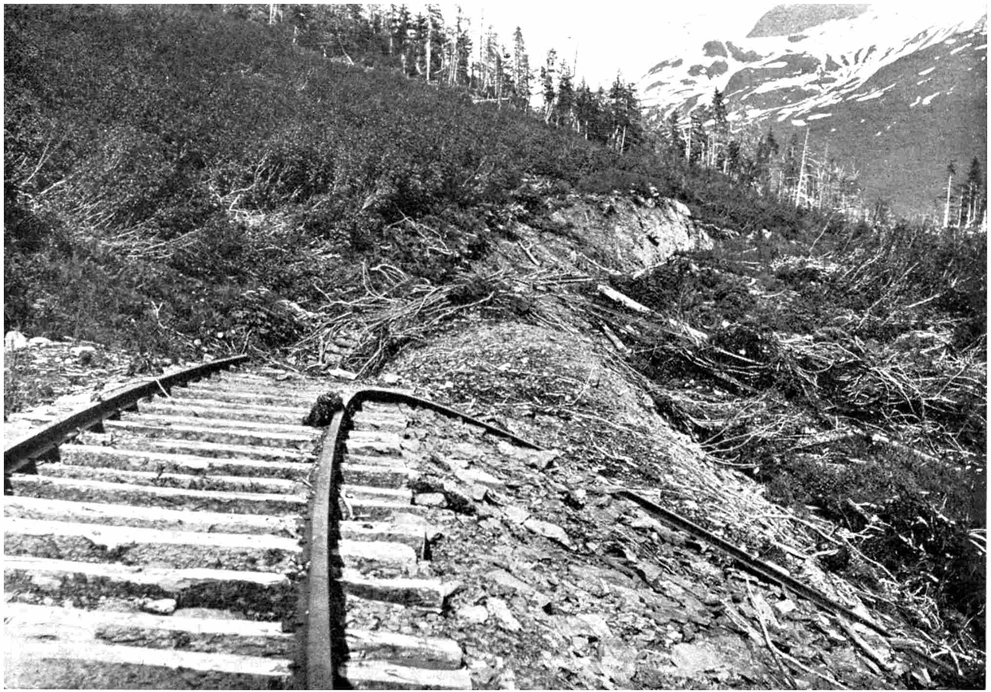
periodical visitations and work was commenced. Yet in
the first spring, while the construction train was crawling
along with a load of excavated spoil from the mountain-side,
the slipping snow departed from its accustomed path,
and in its descent caught the unlucky train, threw it into
the gulch some distance below, ripped up the metals,
buried the grade beneath thousands of tons of debris,
and obliterated every vestige of the work.
The surveyor must be a man not to be daunted very
easily in his enterprise, not to be cast down by heart-breaking
failures, and who has the capacity to gather
tangible assistance from apparently insignificant trifles.
The search for a rift through a frowning mountain wall
often is galling in its hopelessness. When the first
Canadian trans-continental line was being forced towards
the Pacific coast, the crossing of the Rocky, Selkirk and
Gold ranges puzzled the surveyors acutely. Walter
Moberly, a surveyor to the manner born, was deputed to
complete the conquest of the Gold or Columbia Range.
The obvious path to follow was along the bank of the
mighty Columbia River, and this was taken by Moberly.
Yet the Gold Range had to be threaded somewhere and
somehow, though it appeared to defy penetration. He
spent months wandering up and down the river, enduring
hardships indescribable, seeking for the slightest breach
through that terrible wall, wide enough to carry a pair of
metals, but no gateway could he find.
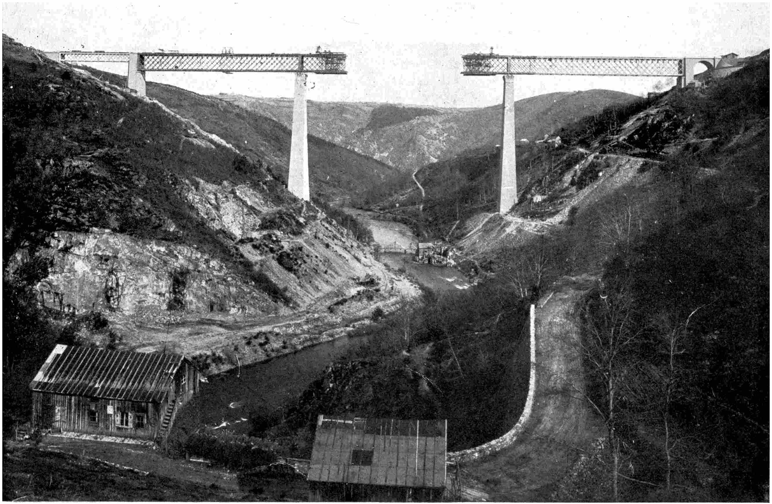
BUILDING THE LOFTIEST BRIDGE IN THE WORLD
The Fades Viaduct spanning the Sioule River in France, 1,526 feet long. The two masonry towers are each
304 feet in height. The central span, 472 feet in length, was built out from each tower.
The railway line in the centre of the bridge is 440 feet above the river.
Weary and sick at heart at the fruitlessness of his
endeavours, he was one day returning despondently to
camp. He was compelled well-nigh to admit failure.
Suddenly he espied an eagle wheeling over his head. He
followed its movements somewhat nonchalantly, until he
saw it make directly for the Columbia mountains. Then
his heart gave a thump! Would the bird rise and clear
their lofty summits or would it sweep through a rift?
Following its flight through the air, he saw the bird give
a majestic dip downwards towards the chain. He turned
the head of his jaded horse, and digging his spurs into its
flanks, sped in the wake of the bird. Onward it flew as
straight as an arrow towards a projecting crest, where it
made a sharp turn and was lost to sight.
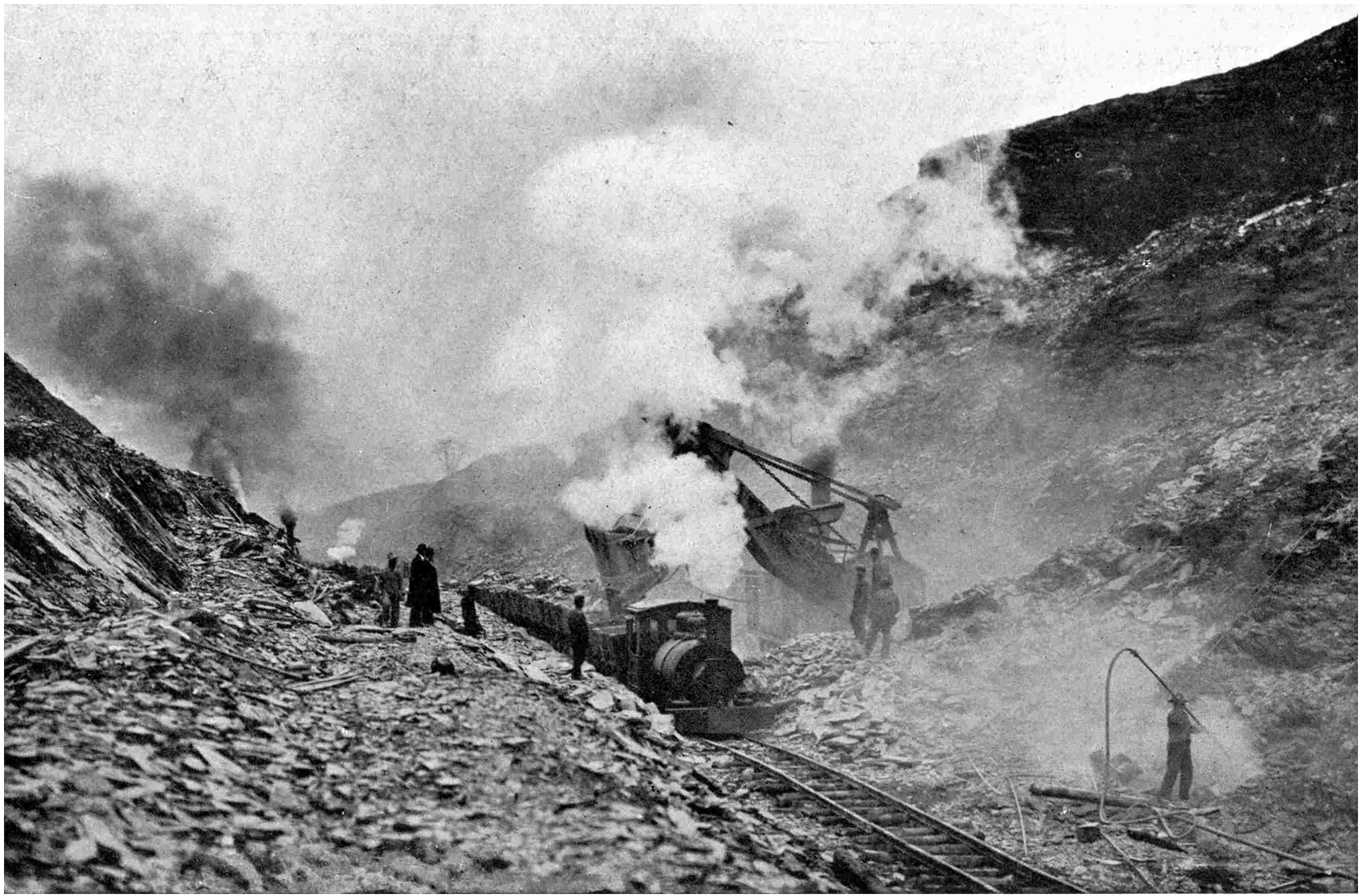
DRIVING A CUTTING 100 FEET DEEP BY THE AID OF DYNAMITE AND STEAM
SHOVELS THROUGH SLATE ON THE DELAWARE, LACKAWANNA AND WESTERN RAILWAY, U.S.A.
Moberly galloped madly forward with his eyes glued to
that crag. He never turned his head, fearing his sight
might play him false, and was oblivious to stumbles and
lurches as his steed fell over logs and slipped among
boulders in its mad career. He swung round the crest,
and there before his eyes the peaks were rolled back on
either side, leaving a broad canyon, and of such a character
that Nature appeared to have fashioned it expressly for the
advance of the steel highway. The Columbia range was
conquered. It was by pure accident that it had been found,
but it was an accident which culminated a prolonged
industrious quest. Indebted to his success to the monarch
of the air Moberly christened the break in the rocky wall
“Eagle Pass,” and it is through that gulch to-day that
the Canadian Pacific makes its way to the western sea.
As one sweeps between the massive ice-crowned teeth of
the mountains one may see the site of the oldest cabin in
the mountains, where the indefatigable Moberly passed the
winter of 1871–2 completing the preliminary surveys for
the line among the fastnesses of the Columbia Mountains.
The task of planning the location through such broken
country is attended with the gravest dangers, relieved
with exciting adventures. At places among the peaks a
foothold on terra firma for the manipulation of the survey
instruments is impossible. Then massive tree-logs are
lowered into the gulch a few feet above the raging foam
of a wicked mountain torrent, and along this slender
staging the surveyor has to crawl to carry out his task.
Life often hangs upon the veritable thread. It may be
that logs cannot be thrown over the cliff face. Then the
surveyor has to don a leathern waist-belt fitted with a heavy
swivel to which a rope is attached. In this way he is
swung over the edge of a cliff to operate his level and
transit along the face of a precipice where no foothold
exists. Sometimes it becomes imperative to have recourse
to dynamite to blast out a ledge along which to advance.
Many a promising young engineer has gone to his last
account in work of such a desperate character. In the
survey of what is now the Denver and Rio Grande through
one of Colorado’s yawning canyons, a young assistant had
to be lowered in this manner. Half-a-dozen labourers
grasped the end of the rope and steadied the surveyor in
his descent over the perilous edge. From the brink to
the bottom of the canyon was a matter of 200 feet or
so straight down. In a few seconds the young fellow
was dangling betwixt earth and sky, steadying his descent
as best he could down the face of the cliff.
Suddenly there was a cry of alarm! The rope-man
nearest the cliff edge noticed that the rope was bearing
upon a piece of rock the edge of which was as keen as
that of a razor. The rope had been sawn almost in two.
Lowering stopped. The two men rushed forward to grasp
the rope below the point of pending rupture to ease the
strain. But they were too late. There was a slight tremor,
the last strand snapped, and before the rope-men realised
the situation as the end hung limply in their hands, the
cry of the lost engineer as he tumbled through the air was
echoed from the depths of the canyon.
Life in the field is indisputably hard and exacting, and
the task is often aggravated by the scarcity, or monotony,
of the food. This condition of affairs, however, is incomparably
better to-day than it was thirty years ago. The
surveyors are tended more thoughtfully than they were
then, and the perfection of food-preserving science has
enabled a camp now to be provisioned with tasty comestibles
which formerly were unknown. Pork, beans and
bannock—a substitute for bread made from flour and bacon
fat with a little baking-powder—constituted the staple
articles of diet, varied with fish from the streams, game
from the forests and wild fruits. The bread was often
musty, for immersion time after time in a torrent and
storage upon damp ground did not improve the flavour of
the flour by any means. The pork or bacon often was
rancid, while the cook was invariably an execrable exponent
of the culinary art, and his bannock played sad havoc with
the digestive organs of the human body. Little wonder
that the men, under such conditions, sought to secure
additions to the menu from the rivers by methods decidedly
unsportsmanlike, but the “end justified the means”; or
delighted in bear steaks and venison.
Extreme altitudes such as have to be attained in order
to cross the Andes undermine the strongest constitutions
and render the surveyor’s work increasingly difficult.
Struggling, crawling and slipping among crags and loose
rocks inflicting cuts and bruises is arduous work indeed,
but when the human frame is racked by the tortures of
sorochté, or mountain sickness, the surveyor’s plight is to
be pitied in very truth. In such climes the cold and winds
are pitiless, the movements of the thermometer between
midnight and noon are enormous, the fluctuation in some
cases being as much as a hundred degrees in the course of
twelve hours. In the middle of the day the heat is well-nigh
unbearable, and the surveyor gladly discards his
outer clothing. At night he finds it no simple matter to
keep warm, for the mercury descends to a very low level
and frost prevails. The winds too are so cutting and penetrating
that it requires elaborate and special clothing after
dark to keep warm.
Now and again a situation develops which relieves the
monotony of the daily round of struggle against the forces
of Nature. South America is pre-eminently the home of
these humorous incidents. The concession for the construction
of a railway through one of the tropical republics
had been granted, and no time was lost in pushing forward
with the preliminary surveys. But when the men with
the transit and level reached a certain city they were surprised
to meet with unveiled opposition. The municipal
authorities point-blankly refused to permit the surveyors
to carry out their work in the precincts of the city. Seeing
that the latter was to benefit mostly from the steel link,
the attitude was somewhat inexplicable at first sight. A
little reflection, however, upon the South American
methods of transacting business convinced the surveyor
that bribery was the root of the trouble. He reported the
interruption to his superiors, whose representatives hurried
to the city to fathom the reason for the unexpected opposition.
It was as the surveyor had surmised. The civic
authorities would permit the iron horse to enter the city
if the concessionaries would make a handsome contribution
to the municipal improvement fund—explained the
mayor. “Well, how much do you want?” remarked the
concessionaries, who inwardly had not overlooked this
contingency. The mayor could not say off-hand, and
accordingly several delays occurred until this vital consideration
was arranged. As a result of the prolonged
parleys the concessionaries undertook to deliver a certain
sum of money to the city.
The bullion was dispatched forthwith and reached the
city the night before payment was due, so as to prevent the
authorities to withdraw from the bargain on the plea that
the concessionaries were dilatory. But law and order were
not enforced very strongly, and the surveyor, with his
companions, entertained certain qualms. Accordingly they
decided to mount guard over the building in which they
were passing the night in case of eventualities, at the same
time securing a goodly supply of arms and ammunition.
As the first streaks of dawn lighted the scene the guard
thought he descried the forms of men creeping along the
ground in the gloom. Silently he roused his companions,
and with firearms cocked they waited developments. Not
a sign of movement was displayed among the inmates,
and the robbers silently forced an entrance through the
windows and door. Once inside the building they were
greeted with a warm fusillade of lead, and in accordance
with the characteristics of their ilk, they did not stop to
reply, but beat as hurried retreat as they could under the
assistance of bullets, leaving some of their number hors de
combat. When day broke the besieged party examined the
fruits of their marksmanship, and to their intense surprise
discovered that the dead included the mayor of the city,
and one or two of his companions who had carried out the
negotiations for the contribution to the improvement fund,
and who had been so remarkably solicitous concerning the
city’s welfare!
It will be realised that the surveyor who undertakes the
plotting of the line through a new country must be a man
of illimitable resource and capacity, and at the same time
ready to meet any development. It must be confessed,
however, that the work, from its adventurous aspect,
appeals strongly to the young engineer anxious to get
away from monotonous routine.
CHAPTER II THE ROMANCE OF CONSTRUCTION
Though the task of deciding the path for the railway
teems with excitement, adventure and privation, the battle
with Nature commences in grim earnest when the constructional
engineer arrives on the scene. On paper it
seems a simple task to follow the location as indicated by
an unbroken row of wooden stakes, but to carry the
surveyors’ work to completion, and to comply with requirements
as to grades and curves, often proves a heart-rending
undertaking. No matter how formidable any
obstruction may appear, it is the work of the builder to
beat it down; to overcome it by some means or other with
the minimum of expense. He must be baulked by nothing.
Such a task demands a man of illimitable resource and
infinite ingenuity, conversant with every phase of civil
engineering. At the same time he must possess the happy
faculty of being able to organise great armies of men of
all nationalities, and in such a manner that he can get the
utmost out of them. This is a searching difficulty. The
camp of to-day upon a large railway undertaking is a heterogeneous
mass of humanity; the confusion of tongues at
the Tower of Babel could not have been more embarrassing.
I have lived among the camps of Canada and the
United States, and among a hundred men it has been no
uncommon circumstance to find representatives of a dozen
different tongues. The control of such men is rendered
all the more complex for the reason that in the majority of
cases they have little or no knowledge of any language
but their own. It is not until they have been in one
another’s company for several weeks that inter-conversation
becomes possible. In addition to this drawback there are
always the peculiar troubles incidental to racial and
religious prejudices confronting the commander-in-chief,
and at times he is hard pressed to preserve order and
authority.
This trouble is not experienced to any great degree in
connection with railway building operations in Great
Britain, but abroad the initial difficulties of this character
are exasperating to a superlative degree, more especially
where reliance has to be made upon native labour. The
workmen have to be educated into the use of labour- and
time-saving implements. This is no easy matter. The
native entertains strong opinions concerning his own
ability, and the conversion from the primitive to the
up-to-date scientific has to be effected gradually and unconsciously,
a task which demands considerable tact and
patience. A great amount of time must be expended necessarily
in the early days to drill such raw material, but
perseverance and an equable temper are the only virtues.
In Mexico the railway pioneers found it almost hopeless
to impress upon the pæons, as the navvies are called, that
to carry ballast in a basket slung upon the back was not
to be compared in speed and efficiency with conveyance by
small trucks pushed along a tramroad. It was only by
carrying out the work themselves in this more modern
manner that the engineers could teach them the superior
advantage of this method, with its sparing of effort and
fatigue. In fact, the only way one can convert the raw
native to ideas entirely foreign to his own custom is to
show him how he can save himself trouble. Then he will
adopt the idea with alacrity.
Now and again, however, the white man, despite his
ingenuity in the devising of time-and labour-saving
appliances, has to bow to the inevitable. For instance,
in India the Hindoos toil at such a low daily wage that
in many phases of work the wonders of mechanical
invention cannot compare with their crude efforts in cheapness.
It comes as a heavy blow to the engineer’s pride
to realise that he must abandon his elaborate plant and
that the native holds the balance between failure and
success.
Again, in the South Americas the laissez-faire attitude
of the inhabitants galls him to the quick. In the southern
part of the New World the policy is “Never do to-day
what can be done to-morrow,” and the native acts up to
the very letter of the aphorism. Religious festivals, each
of which is regarded as a holiday, occur with the most
tantalizing frequency. It is no uncommon circumstance
for two or three such orgies—they scarcely can be described
as anything else—to occur in a week, and the labourer
is a commendable zealot in the observance of the religious
feasts. The engineer may fret and fume at the delay, but
unless he is in a position to recruit outside labour he
must tolerate the frequent interruptions in the work with
the best grace he can muster. In the mountainous regions
of South America the native knows only too well that he
holds an unassailable advantage, for he is accustomed
to the rarefied atmosphere encountered in the extreme
altitudes, whereas it plays sad havoc with the strongest
constitutions of Europeans.
Strange to say, one of the most conscientious workmen
in railway building, as in other fields of industrial
endeavour, is the Chinaman. From a cursory point of
view this appears inexplicable, but it must be borne in
mind that a Celestial’s word is his bond. Johnny will
haggle and argue for hours over a bargain, but when he
finally accepts the terms he will fulfil the contract to the
letter, even should he ascertain before he has completed
the task that it involves him in a personal loss. I have
seen these men pick up their tools as the clock struck the
hour for commencing the daily task, plod along quietly
and continually until the hour of cessation, and give an
indisputably good return for their daily wage. Can the
same be said of the workmen of any other nationality? I
am afraid not. In fact, the steadiness of the Chinaman has
become so famous and has proved so reliable that it is
safe to say that many of the biggest railways of the day
never would have been completed but for his aid. It
enabled the first trans-continental line to be carried across
the United States to link New York with San Francisco;
through Oriental labour the Canadian Pacific was consummated,
and many another great undertaking of a like
nature could tell a similar story.
The same spirit prevails when the scene of activity is
removed to China itself. The Celestial may entertain
quaint ideas concerning the iron road and its scope of
utility. He may slave hard to-day laying the track, merely
to pull it up again on the morrow on the plea that it is
disturbing the spirits of his ancestors. But nevertheless
he completes his part of the bargain in the first instance.
Strikes are unknown and disputes never arise unless the
employer declines to stand by his side of the contract.
China is permeated through and through with secret
societies or Guilds—Trade Unions, if you like—to one
or other of which every Celestial belongs. The white
engineer when he first arrives in the country finds it very
difficult to make headway, but in reality he is on probation
in the eyes of the Orientals. They are watching closely
his methods, fathoming his code of honour, his capacity
for handling men—in fact, are investigating him just as
closely as if he were under a microscope. Once he has
established his reputation and has inspired confidence, he
need entertain no further apprehensions concerning trouble.
Yet the Celestials have their own peculiar and effective
way of settling disputes among themselves. The engineer
in need of a few thousand men negotiates for brawn and
muscle through a middle-man or labour contractor. The
engineer concludes his bargain with this worthy, and the
latter makes his own terms with the men. He recruits
the navvies at a certain wage, which he takes care to
leave him a wide margin of profit. Occasionally he will
be too grasping and will resort to sweating tactics. When
the labourers find this out trouble looms ahead. The men
report the matter to their Guilds, who take the avaricious
middle-man in hand and make him disgorge some of his
ill-gotten gains. If he refuses, well, one day the contractor
is missing, and never is seen again by the engineer. No
questions are asked and no explanations for his disappearance
are offered. He has settled his account with the
Guilds to his own personal disadvantage. The engineer,
however, knows nothing about the dissatisfaction until he
observes the absence of the contractor, for the work
meantime continues its daily round undisturbed.
Although labour is a vital consideration, it is but one
cog in the complex machine by means of which the iron
road is driven forward through a new country. Without
tools the efforts of the navvy would count for naught, and
as time has rolled by inventive effort and engineering skill
have contrived more and more wonderful devices to enable
the epoch-making work to be fulfilled in the shortest space
of time. There is the steam shovel, which will remove
two and a half cubic yards of miscellaneous rubble with
every swing of its ponderous arm; the grader, whereby
the soil is ploughed up and displaced by an endless chain
of buckets into capacious wagons for removal; the drag
shovel, a huge scoop attached to the end of a chain which
is pulled along the ground from a stationary point by steam
power, becoming charged with material in its progress, and
thus fashioning the cutting; the monitor, whereby tons of
gravel are washed down the mountain-side under the disintegrating
force of a powerful jet of water similar to a
fireman’s hose; and a host of other wonderful implements,
all devised for the express purpose of expediting the work
in hand. Gunpowder and dynamite are invaluable handmaids,
and to-day are used with an astonishing prodigality.
Indeed, when the advance is through rock their services are
indispensable. Crags, cliffs and even whole hills are blown
away bodily by their agency, and the cost often runs into
thousands of pounds, miniature volcanoes being produced
by the upheavals.
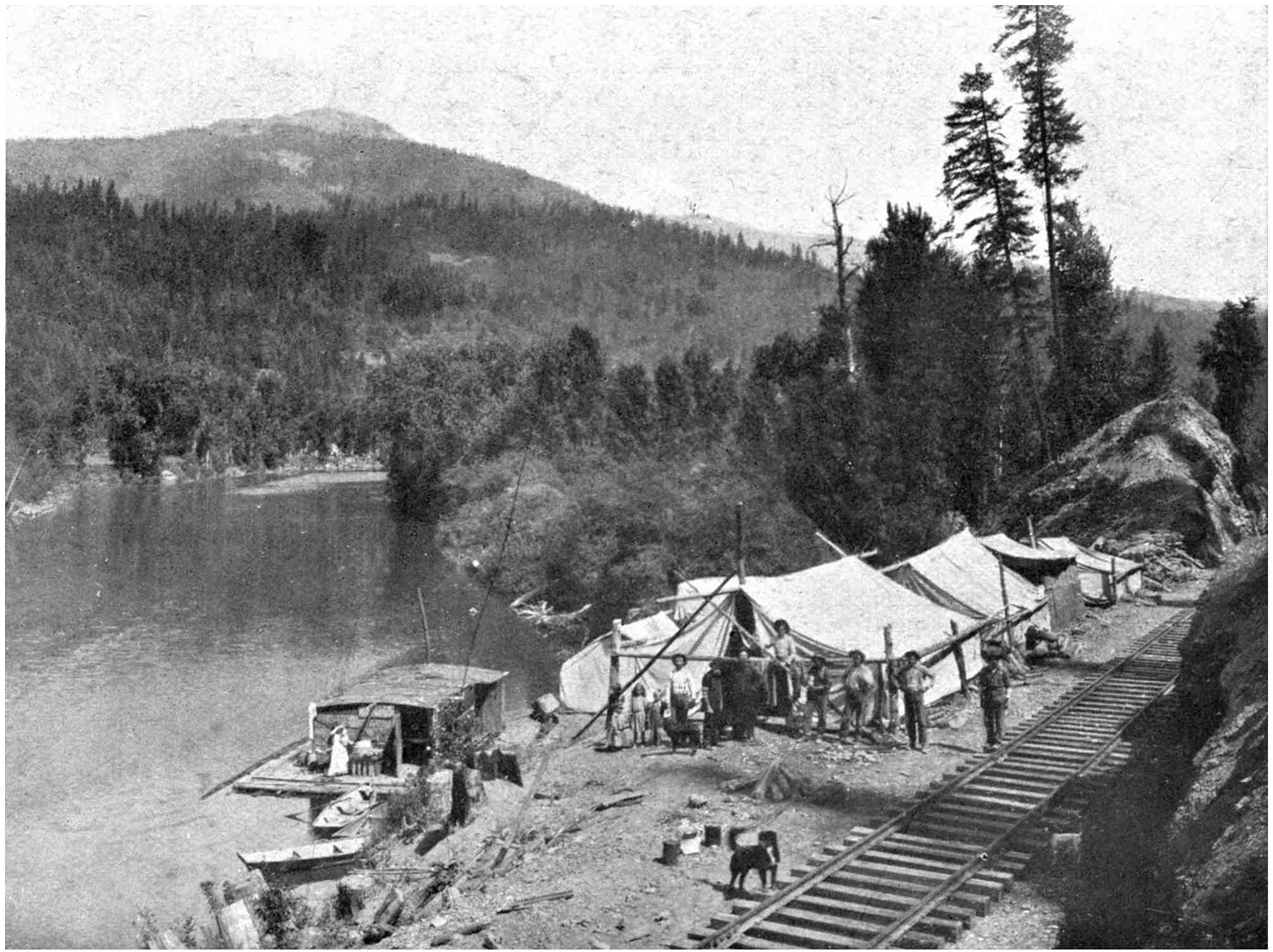
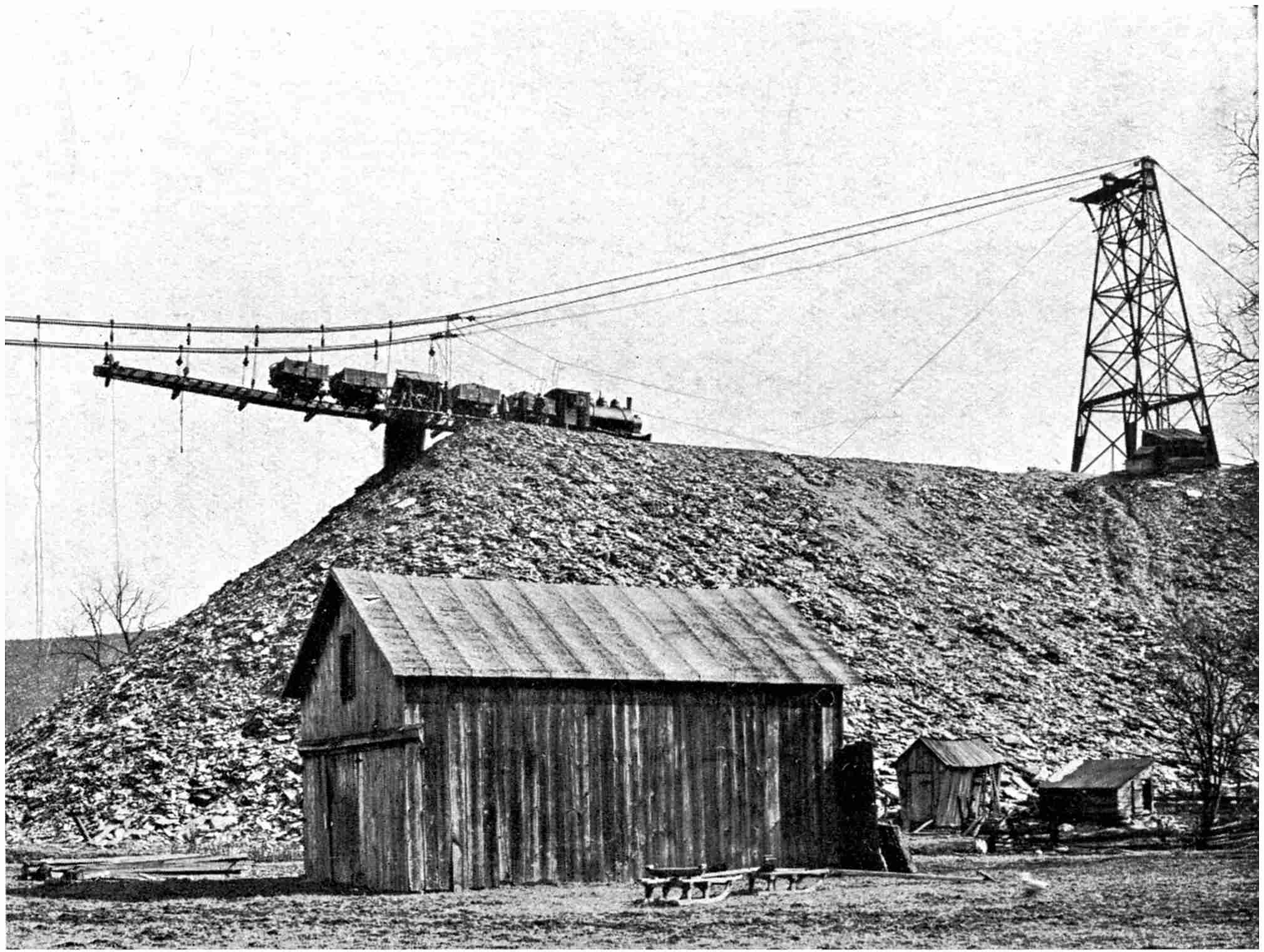
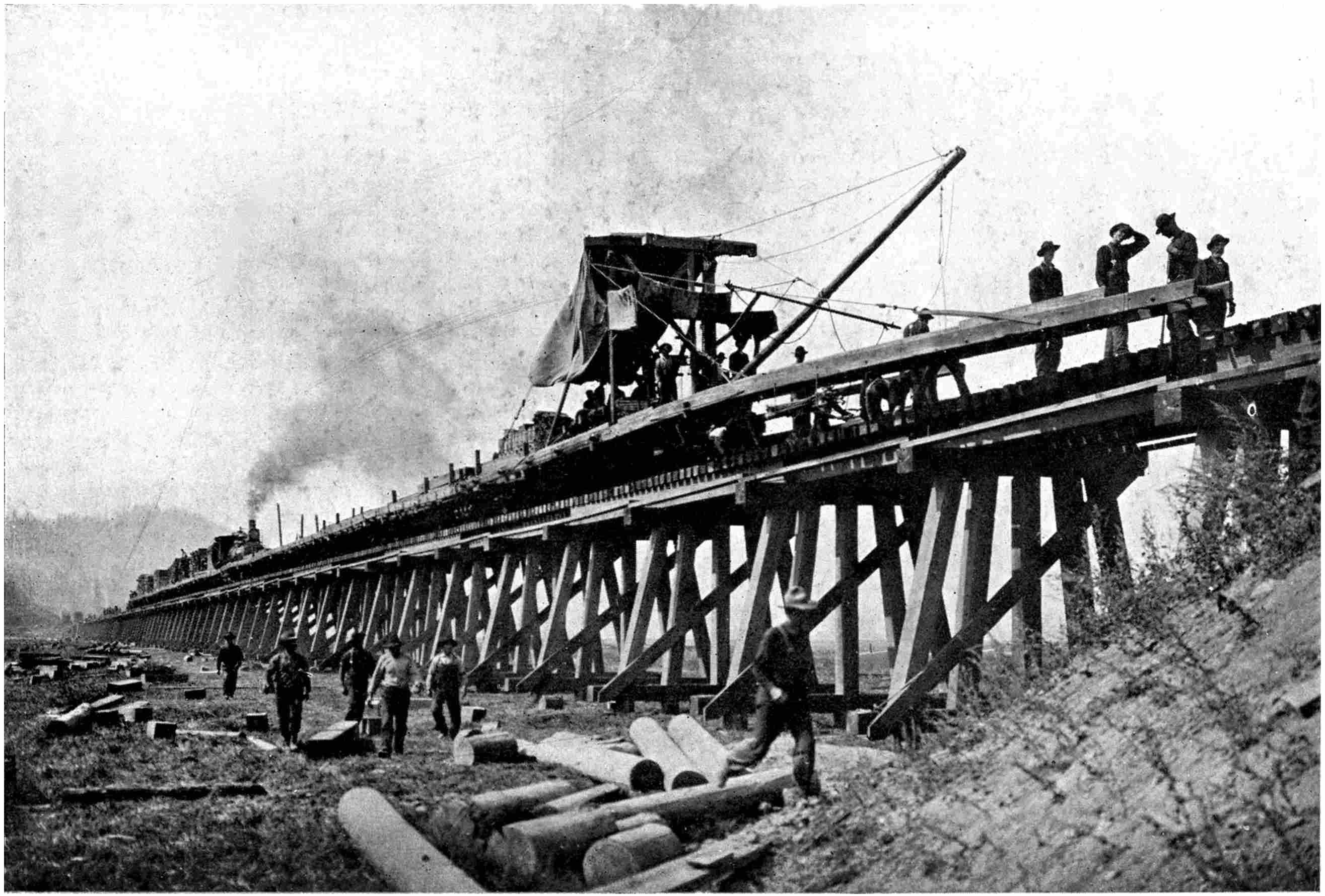
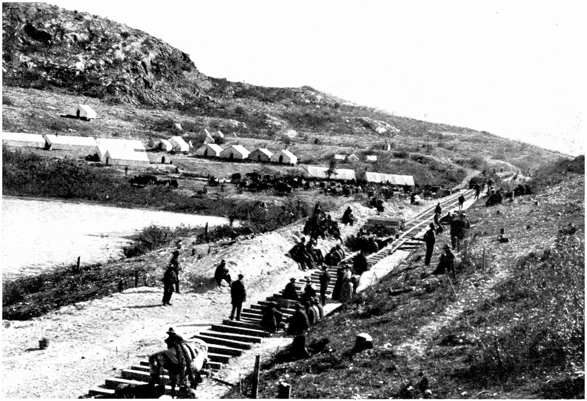
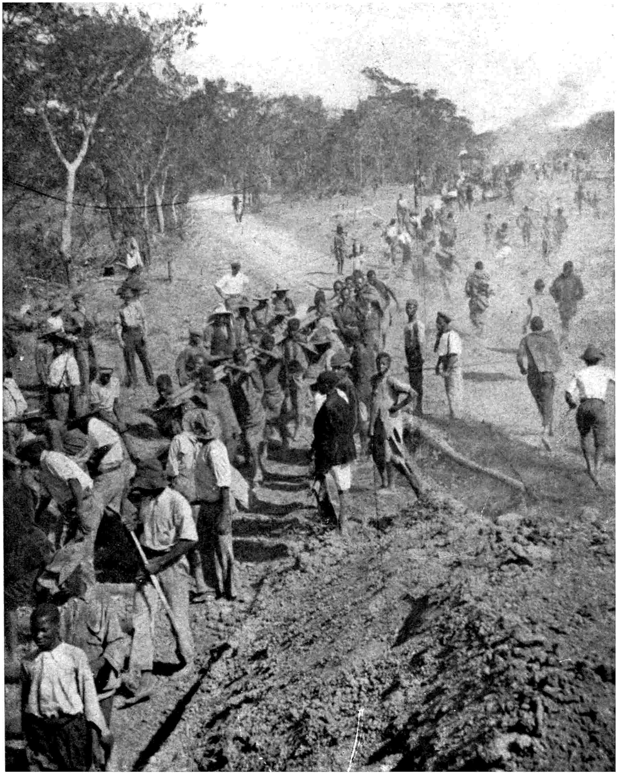
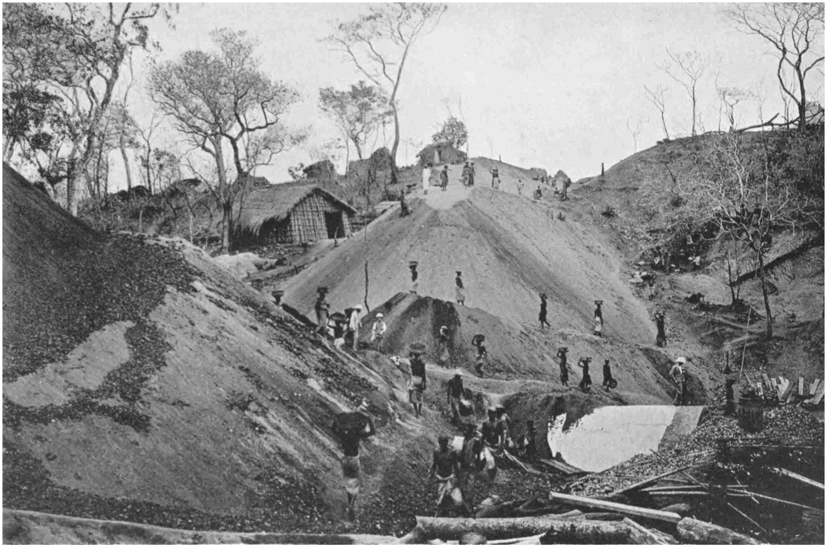
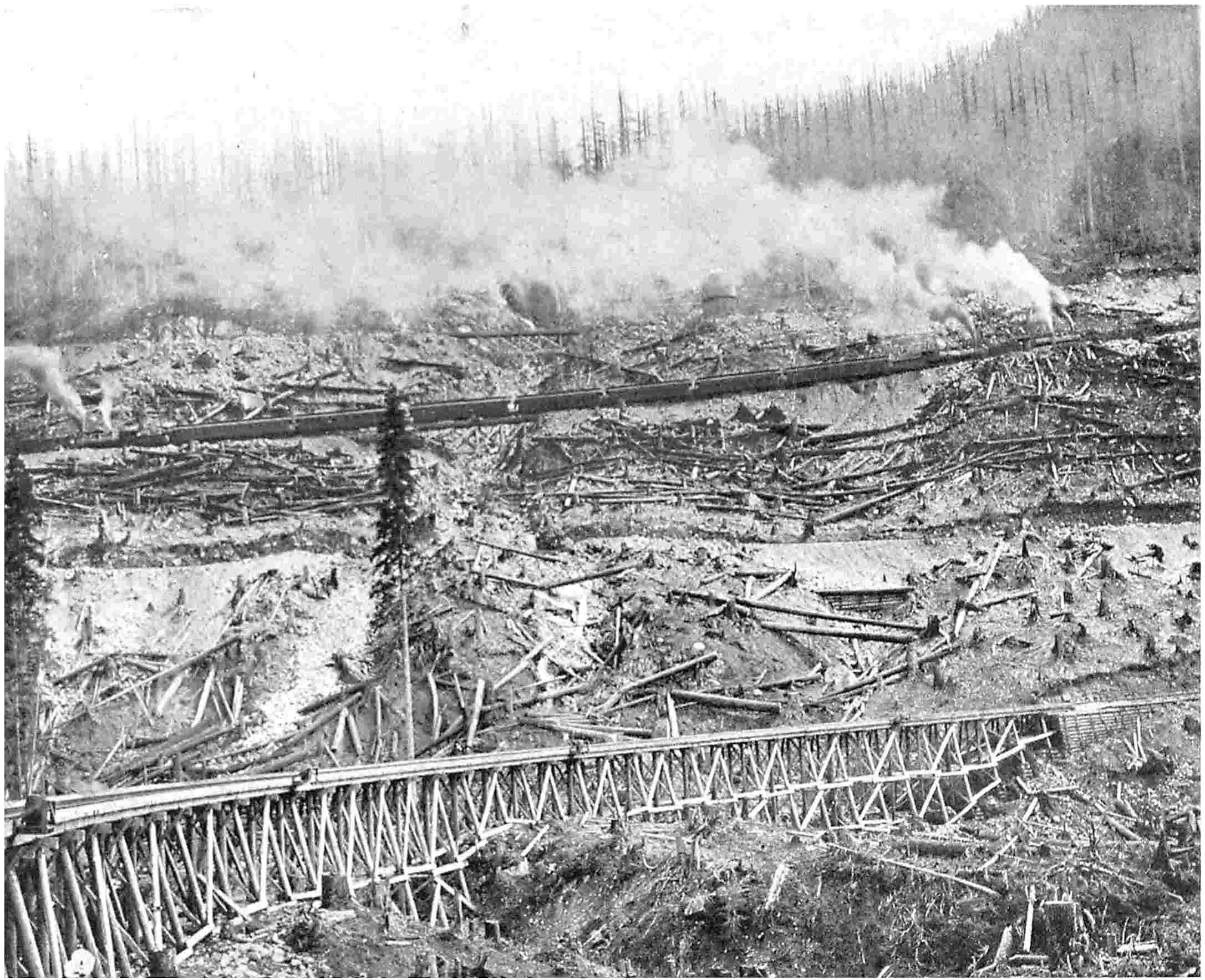
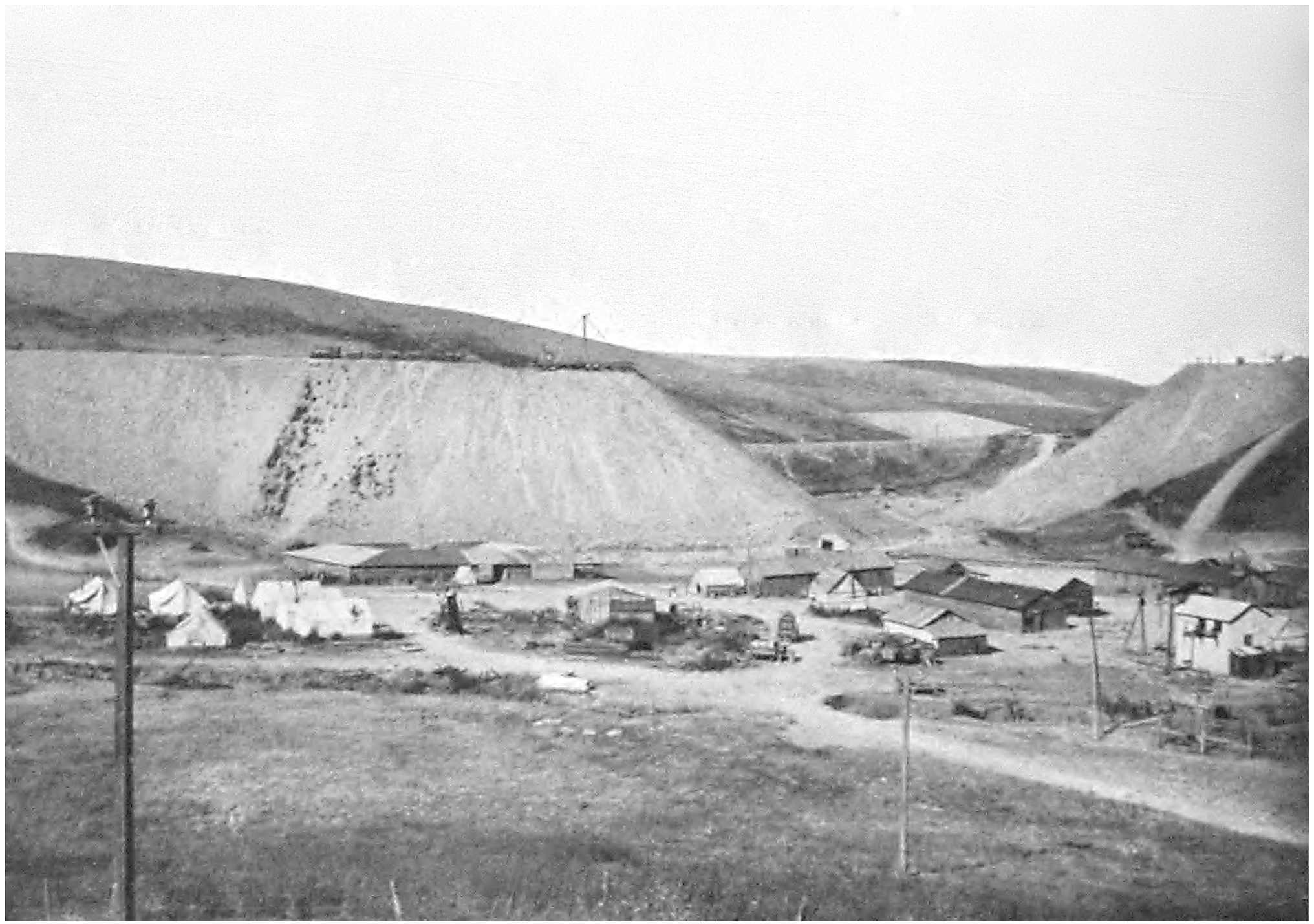
A RAILWAY CONSTRUCTION CAMP AMONG THE MOUNTAINS
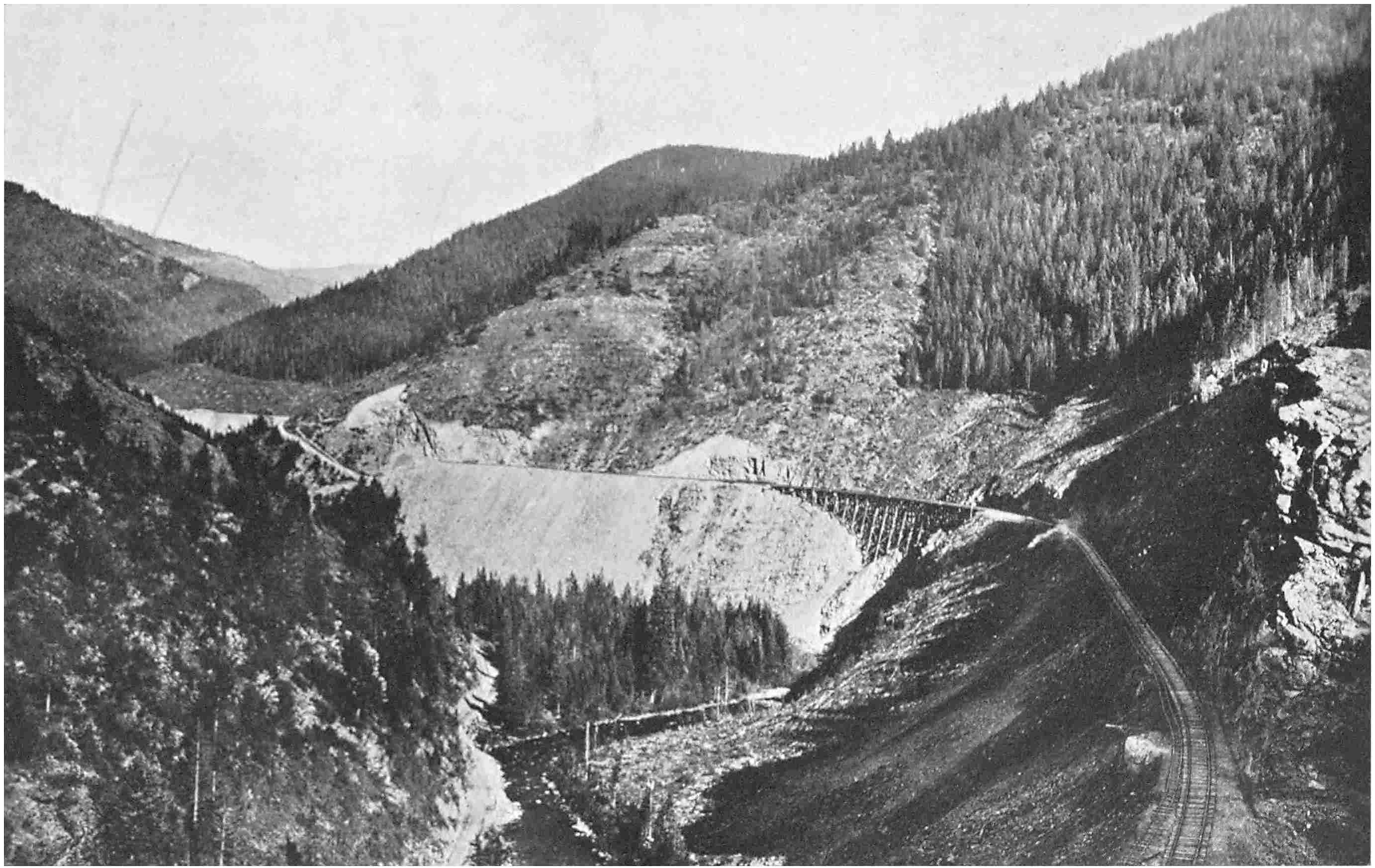
BUILDING A HIGH BANK ON THE DELAWARE,
LACKAWANNA AND WESTERN RAILWAY, U.S.A., BY MODERN METHODS
An overhead cableway was stretched across the depression, from which a swinging
line was suspended, and on which the trucks were backed to be emptied.
Those who have travelled over many remarkable railway
systems in various parts of the world where striking
evidences of the engineer’s skill are apparent upon a liberal
scale, have pointed to the absence of any such evidences
of activity in these islands—“The Home of the Railway.”
But this to a certain degree is inevitable. The engineer
was not faced with such physical conditions when he
essayed to gridiron this country as confronted him in the
Americas or Asia. There are no towering ranges of
eternally snow-wreathed mountains to overcome, no wildly
boiling wide rivers to span, no yawning canyons to thread
or stretches of sterile desert to traverse. Yet when Stephenson
and his contemporaries sought to achieve the railway
conquest of Great Britain they encountered many obstacles
which to them, with their crude appliances, were every whit
as stupendous as those which rear up before the engineer
to-day, although he is equipped with an extensive assortment
of heavy artillery to assist him in his contest against
the forces of Nature. Moreover, some of the expedients
which Stephenson evolved to overcome a difficult situation
are practised to-day merely because the intervening eighty
years have not provided any better solution of a problem
of a similar character.
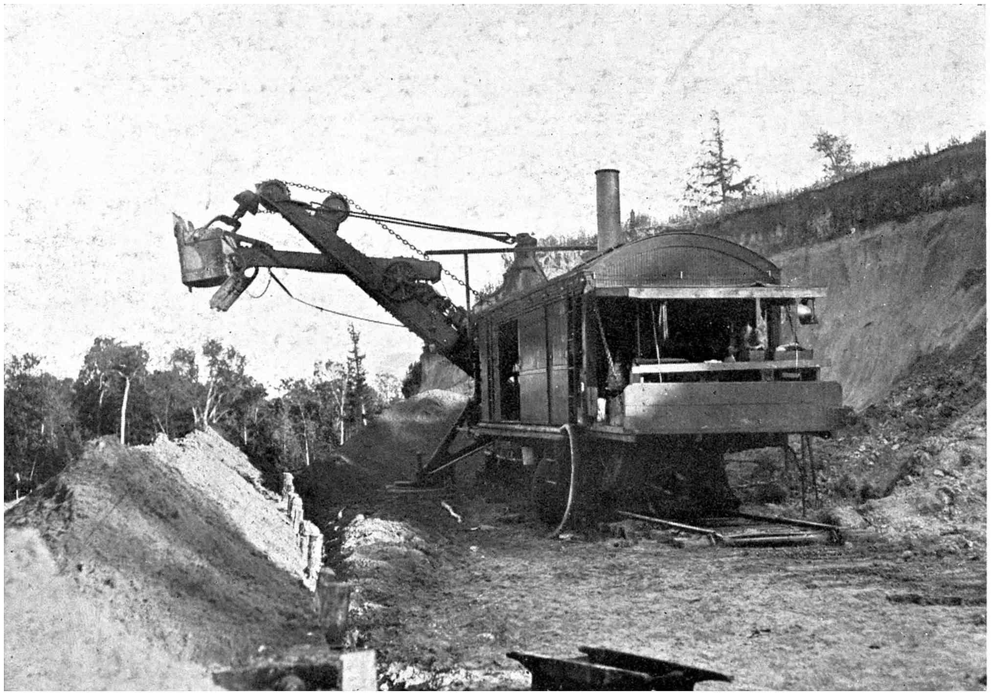
THE HUGE STEAM SHOVEL WHICH TAKES SOME 3 TONS
OF SPOIL WITH EVERY BITE
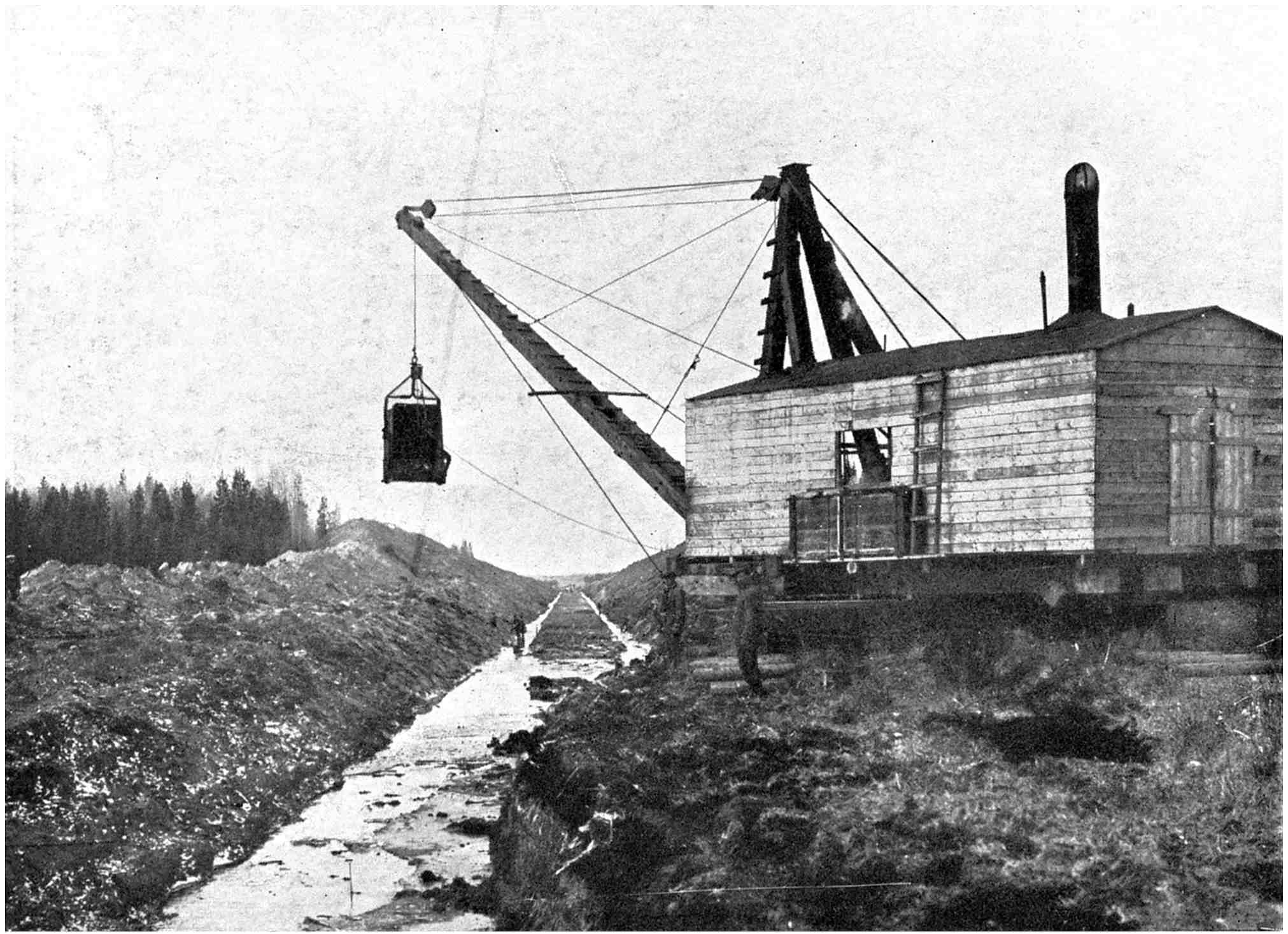
THE DRAG-LINE SHOVEL WHICH
SCOOPS UP THE EARTH IN THE CUTTING AS IT IS PULLED ALONG
THE RAILWAY BUILDERS’ HEAVY ARTILLERY
Every one has read how Stephenson was for a time
nonplussed by the treacherous bog Chat Moss, across
which now speed the expresses of the London & North-Western
railway. It is the largest stretch of swamp in
the country, and many wiseacres prophesied that there
Stephenson would meet his Waterloo when he essayed to
carry the Manchester & Liverpool railway over its
unstable surface. Yet Stephenson plodded along unconcerned
and achieved success in a novel manner. He laid
branches of trees and hedge cuttings upon the surface of
the bog, and upon the softest patches pressed hurdles intertwined
with heather into service. Upon this network he
laid a layer of rock and gravel, which caused the foundation
to sink somewhat into the morass. This formed the permanent
way, and its peculiar character provoked more
than one scornful criticism. But its stability confounded
the critics.
To-day in foreign countries where huge stretches of
swamp bar the progress of the iron road the self-same
principle is adopted, and it is known as “corduroying”
or “cross-waying.” In the northern States, Canada and
Siberia—the latter country and Canada especially—the
“muskeg,” or “tundra,” as this treacherous land is called,
often stretches for miles. One can sound it sedulously to
a great depth, and then will fail to touch the bottom. The
soddened decayed vegetable matter merely fills a large
depression which cannot be drained. The builders waste
no time attempting to build up a solid earthen embankment
resting on the submerged solid floor of the bog.
They fashion a huge mattress of trees. Large trunks are
laid horizontally and longitudinally to the track. Upon
these are laid transversely two or three layers of shorter
logs, the whole being secured together firmly. A topmost
layer of branches forming a kind of thatching completes
the structure.
At times these mattresses assume respectable proportions.
I have stood beside some almost as thick as a man
is tall, and they constituted quite formidable pieces of
work. When the corduroy is completed a layer of rock is
applied, and upon this is dumped the gravel and other
material forming the embankment. Under the weight thus
superimposed the mattress sinks deeply into the morass
and rests firmly. The earthen ridge is continued to the
requisite height; the whole of the embankment for the
track rests upon the fabrication of tree-trunks. Yet the
whole is just as solid as if resting upon granite. One
might remark that it appears an indifferent foundation
upon which to pile up a mass of earth weighing several
hundred tons, and that in a short time the wood, under
decomposition and collapse, would precipitate a subsidence.
But as a matter of fact, the corduroy grows
stronger with every passing day. The wood immersed in
the viscous liquid and preserved from all contact with the
atmosphere becomes waterlogged, until at last it assumes
the character of bog-oak and is practically indestructible.
Stephenson was called upon to cope with another
critical situation upon the same railway. The great tunnel
at Kilsby was in course of construction, but work had
not proceeded very far when the contractors struck a large
pocket of water and quicksand. They combated this
adversary for several months, and then, unable to make
any appreciable headway, threw up the contract. Efforts
were made to induce other firms to accept the task, but in
vain. At last Stephenson was called upon to rescue the
undertaking from failure. The outlook was far from
promising, for the shaft was being sunk through material
which the engineer always regards askance—a shale—while
the fault in which reposed a large volume of water
and sand was of large proportions. Stephenson concluded
that the best way to cope with the problem was to pump
out the water first, and accordingly he rigged up an
elaborate plant capable of handling 1,800 gallons per
minute, and this was kept going day and night. Even
then, however, it was only by superhuman effort that the
water was kept down. One day after Stephenson had
been on the scene about six months, the water got the
upper hand and flooded the tunnel to such a depth that
the men and materials had to be floated in on rafts.
This undertaking, however, served to demonstrate to
those anxious to participate in railway-building speculations
how estimated expenses for definite work might be
sent astray seriously, and how formidable and ubiquitous
was the unexpected factor in such work. The original
contractor offered to complete the burrow, 7,169 feet in
length, under the Kilsby Ridge for some £90,000. By
the time the last brick of the lining had been laid and
the tunnel was ready for use over £300,000 had been
expended.
The attempt to pierce this tunnel at that time, however,
was a far more difficult enterprise than it would be to-day.
The engineers had not the powerful marvellous appliances
such as serve the contractor’s purposes now. Electric
energy was unknown, the hydraulic shield for driving
tunnels had yet to be invented, the steam shovel had not
been thought of—in short, the contractor was handicapped
on every side by the crude character of his tools. Some
of these appliances which the modern railway-builder uses
are little short of wonderful, both in time- and labour-saving
qualities, and the majority have been born of
necessity.
For instance, in the early railway days on the American
continent too much time would have been occupied in
building lofty earthen embankments among the mountains.
Accordingly the rifts and gullies were spanned by timber
trestles. But the woodwork was perishable, and there was
always the risk of fire demolishing the structure and precipitating
disaster to a passing train. The obvious remedy
was to replace the wood by metal, but the expense was a
deterrent factor.
One day a workman on one of the mountain sections
suggested that the woodwork should be left intact, but
buried beneath a mass of earth. The suggestion was
received with ridicule because, as the divisional engineer
pointed out, several thousand men and several hundred
trucks and dozens of locomotives would be required to
handle the material, while the time the task would occupy
was incalculable. The workman listened to the criticisms,
and then interposed with the quiet comment that he did not
suggest using any trains and trucks, and that a few dozen
men would be ample to complete the work. The divisional
engineer was somewhat astonished, and at first thought
the man had taken leave of his senses. Then the workman
revealed his intentions. He would not resort to steam
shovels or any other device of that character. He had
observed minutely and tested the power of a jet of water,
and consequently had conceived an idea to wash down
masses of gravel by means of very powerful jets of water.
There was no need even to rig up a steam engine and
pump to supply the requisite force to the water flying from
the nozzle. High up on the mountain-side was a creek.
A dam could be thrown across this torrent at little cost,
and the pent-up water could be led down to the working
site below through piping, and the pressure thus secured
by gravitation would be more than ample for the purpose.
The gravel as washed out of the hillside would be directed
into wooden conduits and led to points around the trestles,
where it would be discharged to build up the embankment.
It was a simple means of overcoming a perplexing difficulty.
The divisional engineer was so impressed with its
feasibility that he secured the requisite permission for the
workman to put his suggestion into practical form. The
creek was dammed by throwing trees from bank to bank,
and from the little pond thus formed the water was led
several hundred feet down the mountain-side through pipes
to the large nozzles. A small network of timber conduits
were fashioned to convey the displaced gravel to the feet
of the timber trestle.
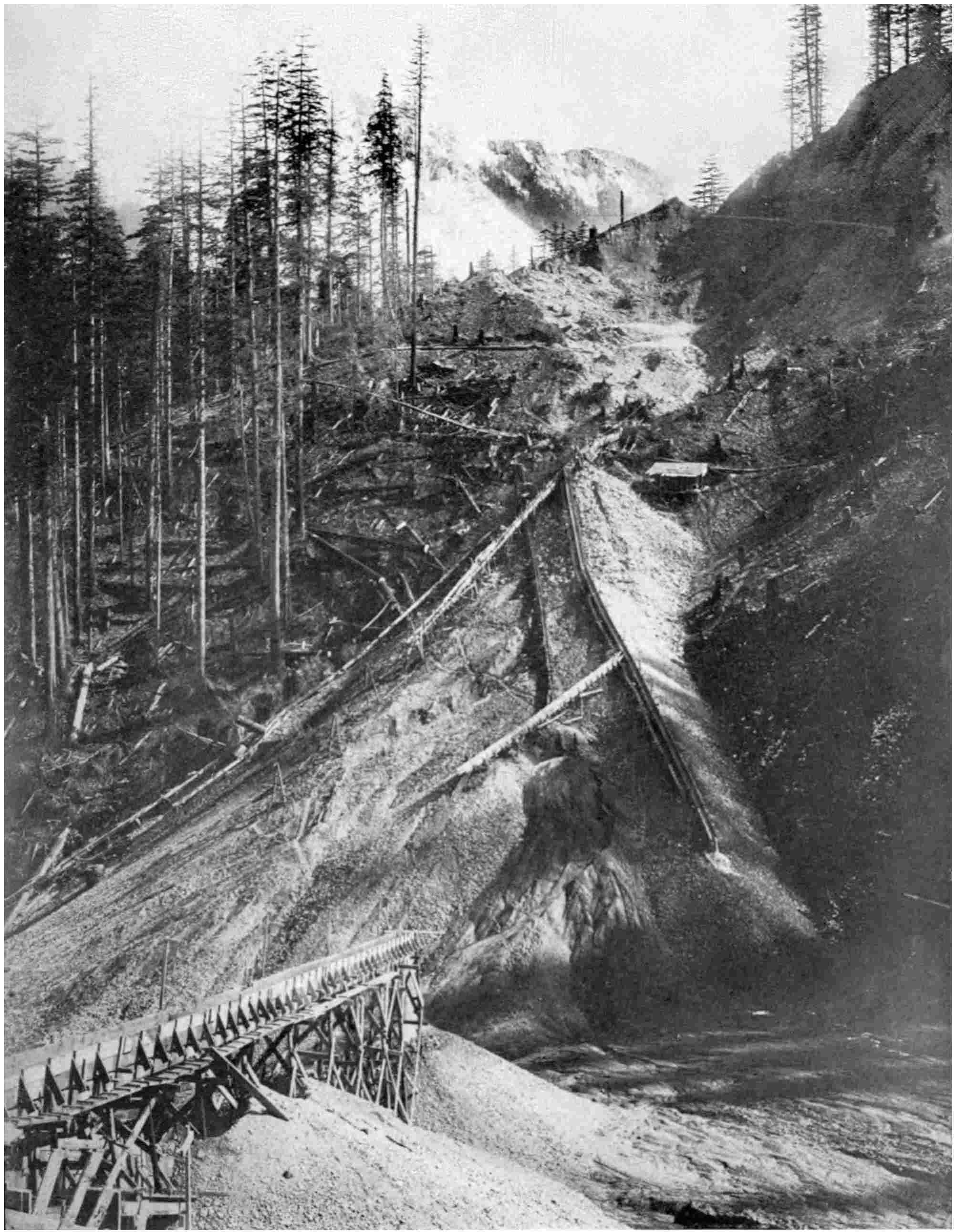
In a short time work was commenced, and as the jets
of water struck against the solid face of the mountain,
the soft earth and gravel were washed out at tremendous
speed. Heavy streams of mud poured down the conduits.
The hill disappeared like magic under the scouring action
of the harnessed water, to reappear in a symmetrically-shaped
ridge around the woodwork, which grew rapidly in
height until the level of the railway was gained. The
embankment thus formed was found to be as solid and
stable as if built by dumping, and the whole task was
accomplished in a few weeks. While the work was in
progress the chief engineer and his lieutenant visited the
spot and watched the building of the embankment by
hydraulic sluicing with intense interest. Its complete
success in this initial experiment secured its adoption, and
in a short space of time, where the conditions permitted,
all the trestles among the mountains were buried beneath
a ridge of earth built up by a jet of water.
While I was being shown some of the most impressive
pieces of railway engineering among the Cascades, my
cicerone, an English engineer and railway-builder, after
describing the features whereby the Great Northern railway
is taken down to the coast, remarked, “I wonder what
Brunel would have done among these mountains? I guess
he would have revelled in the difficulties they offered.”
There is no doubt that the great engineer would have
found the ascent of the steep slopes and the crossing of
the great gulches an extensive field for the exercise of his
genius. His work among the vales of Cornwall and along
the rugged seashore of Wicklow, Ireland, indicate this fact
only too plainly. In these two districts are to be found
the nearest approaches to spectacular work that these
islands can afford. True there are no wonderful loops and
great terraces winding up and down mountain-sides, but
there is the daring and lofty spanning of yawning valleys,
and the driving of a narrow pathway along steep rocky
slopes.
For something like half a century Brunel’s spidery timber
viaducts of Cornwall constituted one of the sights of that
county. The location, with its grades and curves, as
carried through Cornwall, has been assailed by many
critics, but it must be remembered that when Brunel penetrated
the English Riviera, railway operation was very
different from what it is to-day. Engines and train loads
were light, while money was by no means plentiful. The
engineer was compelled to achieve his object at the most
moderate cost, but the very fact that he was hampered in
this connection served to influence him in the accomplishment
of monumental work. His timber viaducts were
remarkable for the novel character of their design and
their extent. In the course of sixty miles he had to span
no less than thirty-four valleys in this manner, the aggregate
length of the wooden structures being about four
miles. The engineer adopted timber as a constructional
material because it was cheaper than iron, and American
oak was used extensively. Some were of great height,
the St. Pinnock viaduct, for instance, carrying the train
153 feet above the bottom of the valley, while others
attained great lengths, the Landore viaduct measuring
1,760 feet from end to end.
These evidences of Brunel’s work, however, are disappearing
under the exigencies of to-day. Timber is
being replaced by steel and granite to meet the increased
weights and speeds of trains. The location through the
county also is undergoing revision, the sharp curves introduced
by Brunel being eased or eliminated, while the
grades are being flattened. Consequently in a few years
the name of Brunel in Cornwall will be naught but a
memory. Fortunately other evidences of his handiwork
abound on this system notably in the Saltash, Chepstow
and Maidenhead bridges, as well as the Box and Foxwood
tunnels.
In Ireland, however, a far more daring expression of his
skill is offered. This is the stretch of line along the seashore
between Bray and Wicklow, which now forms part
of the Dublin & South-Eastern railway. This was the
first stretch of iron road to be opened in the Emerald Isle,
the original one and three-quarter miles being operated in
the first instance by the system of atmospheric propulsion,
whereby the train was hauled along the metals by suction.
When it was decided to connect Wicklow with Bray,
the trying character of the country lying between the two
points, and especially of Bray Head, demanded a masterhand
to effect the location and to carry the building operations
through to success. It was a matter of sixteen miles,
but they proved perhaps the most trying sixteen miles of
railway construction ever attempted in this country. It
was stated that Bray Head would defy conquest, for it
was approachable only through very rocky country, and
it is quite possible that the gloomy outlook was responsible
for tempting Brunel to achieve something bold and
striking. There was no need to have carried the line in
this direction, a fact which is realised to-day, for by making
a detour inland an easier location could have been found,
and the present generation would not have been called
upon to pour out heavy sums of money to keep their line
intact. Brunel’s vanity has cost the railway company
several thousands of pounds since the line was opened. It
is only by superhuman effort that the railway is not
devoured by the sea, over £40,000, or $200,000, having
been expended in defence works over this sixteen miles of
line during a period of ten years alone.
Apart from this unsatisfactory feature the line is a constant
source of anxiety. A little to the south of Bray is
Bramstone tunnel and a wild ravine. This gulch attracted
the engineer. Instead of avoiding it, he bridged it with a
wooden viaduct 300 feet long by 75 feet high. Before it
was quite completed it was destroyed in a single night,
the demolished timbers being carried out to sea. A few
years later, while a train was crossing, the engine left the
metals and precipitated a sensational accident. Investigation
revealed the fact that it was due to the action of the
waves, which, battering against the piers of the viaduct,
had so vibrated the structure as to throw the rails out
of gauge.
Thereupon it was decided to abandon the viaduct and
drive the line directly through the rocky promontory. The
traveller still can see traces of the original route in the
decaying approaches to the gap formerly conquered by a
timber trestle.
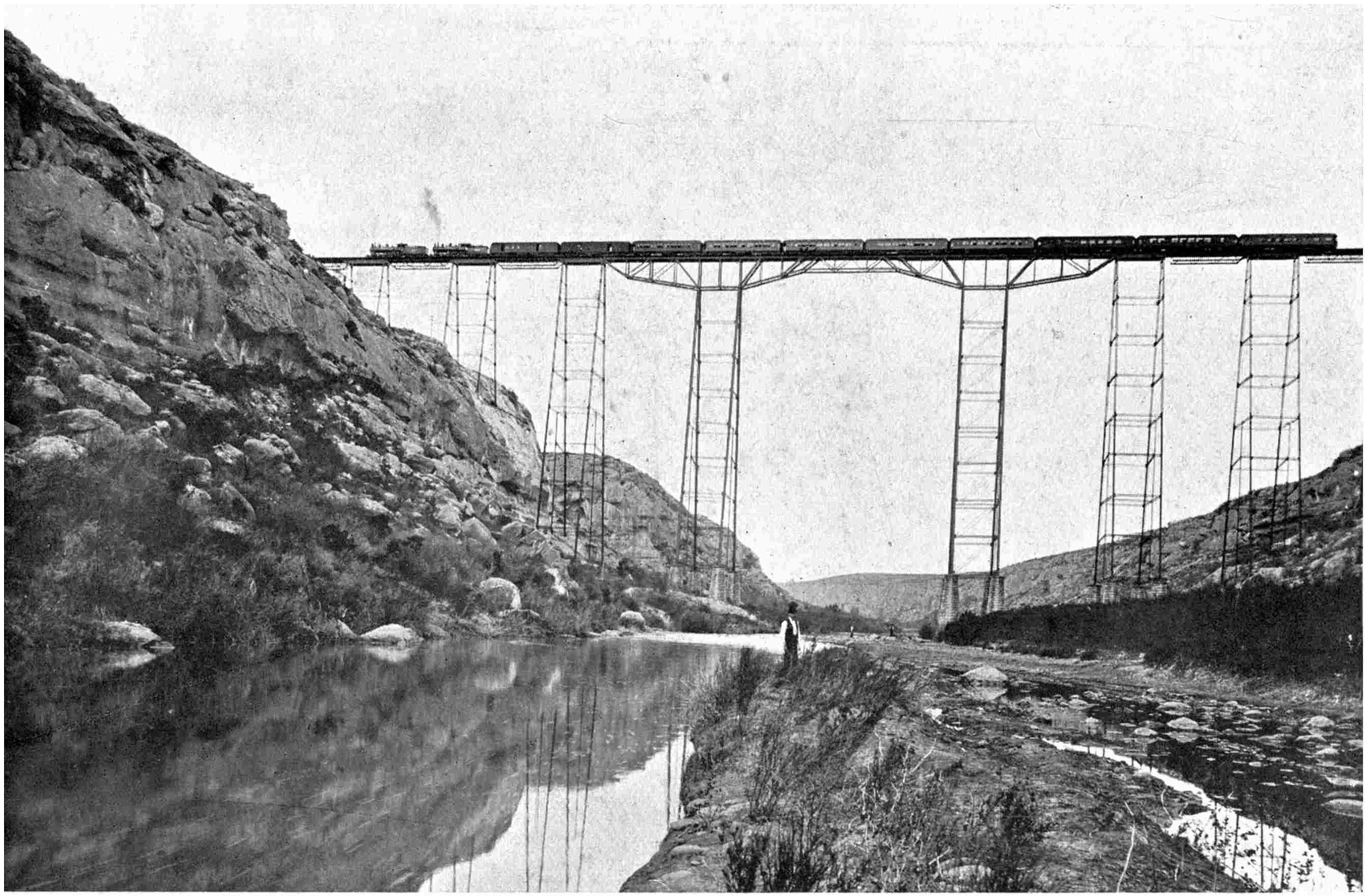
Brack, photo]
THE PECOS VIADUCT ON THE “SUNSET” RAILWAY, THE HIGHEST STRUCTURE IN THE
UNITED STATES, THE TRACK BEING 321 FEET ABOVE THE WATER BELOW
Still it was a grim fight with Nature for every foot of
the way. A mere ledge suffices to carry the track, and
this gallery is often at a level of seventy feet above the
sea beneath. Here and there the line is enclosed by a roof
recalling the snow-sheds of the Selkirks or Cascades, to
protect the rails from stones bouncing down the cliffs.
Curiously enough, the method in which Brunei drove his
line along this forbidding wild shore recalls the staggering
feats accomplished in the American mountains, and indeed
a journey over this railway will provide a thrill in miniature
such as results from a toil through the mountain backbone
of the New World. The dislodgment of massive boulders
and landslides are so frequent that flagmen have to be
retained to keep a vigilant eye on the track and to warn
passing trains. At places long walls have been erected
high on the hillside to arrest the descent of the movements
of loose rock on the one hand, while on the other the cliff
face has been cut into terraces to break the force of the
waves, and together with retaining walls and groynes, seek
to counteract the insidious erosion of the sea.
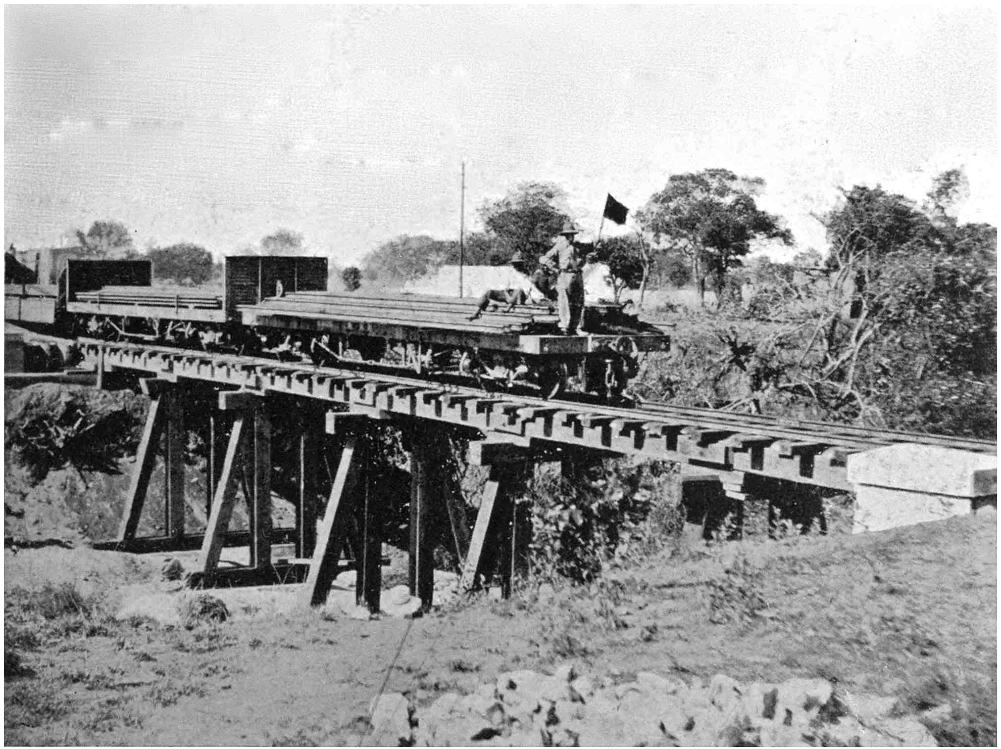
THE TRACK LAYER, WHEREBY THE METALS ARE LAID AT A SPEED OF 3 OR 4 MILES
A DAY, CROSSING A HEAVY TIMBER TRESTLE
When Bray Head has been passed the physical character
of the country changes with startling suddenness from
jagged rock to clay. Here the engineer was brought to
fierce grips with his adversary. The clay is honeycombed on
all sides with springs, and there is a constant war between
the engineer and Nature for supremacy. Building the line
was exacting indeed, but the puzzles which had to be
unravelled then are equalled by those attending the preservation
of the road. The battle was waged relentlessly
for some years, but the sea won; the engineers were compelled
to re-lay their track some distance inland.
The shareholders in the railway are paying dearly for
Brunel’s colossal error. Indeed, it is a poor return for
an outlay of over £400,000, or $2,000,000, which were
sunk in this sixteen miles of line. It may be wonderful
engineering, but it is not business. The railway company
are anxious to abandon this location and to rebuild the
line along the route it should have followed in the first
instance. At the present such a result is not financially
possible, but its realisation is merely a question of time.
One inspiriting phase of the railway-builder’s work is
the race against time, and in the fulfilment of such a task
many an astonishing performance has been achieved.
When one of the great American railways was pushing
its way to the Pacific coast, it required a tunnel to be
driven for two miles through the Cascades. It was a
daring piece of work, and the railway company, after
considering the scheme, decided that it could be accomplished
cheaper and more quickly under contract than by
direct labour. Upon the advice of their surveyors they set
the time for its completion at twenty-eight months. Considering
the remote situation of the work the feat was considered
absolutely impracticable, and no recognised contractor
could be prevailed upon to incur the risk.
The company, however, was convinced that some daring
spirit existed who could, and would, fulfil their requirements,
so they advertised for tenders. When these were
perused it was found that one man was willing to meet
the time-limit and at a price far below competitors. His
bid was accepted. That man was Bennett, and he lost no
time in setting his carefully-laid plans in motion.
He was over three thousand miles from the country in
which the tunnel was to be driven, yet before the ink on
the contract was dry he had wired to his assistant on the
Pacific coast to hurry forward all requisite appliances,
while he himself purchased an elaborate plant of the most
modern type to be shipped to the railway point nearest
the site. From this station he had to transport every ounce
of material for a distance of eighty-two miles through the
roughest and most broken mountainous country it is
possible to conceive.
There was no road, so he had to blaze one through the
deadfall and littered rock, fording creeks and streams and
toiling through viscous mud. The wagons sank above the
axles, and had to be hauled through the muskeg by block
and tackle. In this way, by sheer physical effort, he gained
the mountain which was to be pierced. It took him a
solid six months to get his forces and artillery to the spot,
leaving him scarcely twenty-two months in which to hew
the passage through the solid rock.
So pressing was time that he never permitted an hour’s
cessation day or night. An agent on the coast recruited
men by the score and dispatched them up country in large
corps. As they arrived they were divided into six-hour
shifts on either side of the mountain, and in this way toil
was continued unbrokenly throughout the whole twenty-four
hours. When he had settled down to work in grim
earnest wages were absorbing money at the rate of nearly
£2,000, or $10,000, per week.
Preliminary to embarking upon the contract he had
prepared careful calculations showing him how much rock
it was requisite to remove every day to effect completion
in time, and he made up his mind to hold to this table
by hook or by crook. A tunnel face is not a spot where
much leeway can be made up, for only a certain number of
men can be crowded upon its limited area. But he met
this disadvantage by spurring the drillers to superhuman
effort by the offer of an attractive bonus. In this way he
was able to maintain the advance he had calculated per
day until the heart of the mountain was gained, when
owing to the extreme hardness of the rock the men could
not help falling behind the scheduled progress. Now
and again, however, when they encountered a softer stretch
of material they were able to make up lost time.
The months sped by; the contracted time for completion
loomed nearer and nearer. Determined not to be beaten,
Bennett urged his drillers harder and harder, offering
fancy wages for additional effort. The strain wore him
almost to a skeleton; he scarcely slept, so haunted was he
by the determination to fulfil his side of the bargain.
Checking and rechecking of the finished work convinced
him that the opposing parties could not be far apart in
the heart of the Cascades.
One morning the men on one side paused momentarily
in their drilling. They could hear the faint muffled chink,
chink of drills. It was the party advancing from the west.
With a loud cheer, answered by a ghostly sepulchral
hurrah, both parties bent to their tasks with redoubled
energy. Before long a gaping hole was revealed in
the heading. The two forces had met—the tunnel was
pierced. Without hesitation they set to widening the
breach out to its appointed dimensions, and at last, with
a sigh of relief, threw down their tools. The tunnel was
finished practically, and there were seven days or so to
spare.
In another instance a railway company required a bridge
to be opened within a certain period. Its accomplishment
on time meant the accretion of a large sum of money to
the treasury, and accordingly a bounty of some £5,000,
or $25,000, was offered to the firm building the bridge.
The latter in turn offered a portion to the men responsible
for the actual work. Under the incentive of this offer the
riveters and erectors strove might and main. The odds
were against them hopelessly, but general co-operation
enabled the work to go forward with great speed. By
maintaining this high pressure the huge fabric assumed its
definite shape in quick time, and the last rivet was driven
home with a resounding cheer a few minutes before the
expiration of the stipulated time.
Yet railway construction has its farcical side, especially
in America. Conflicting interests often clash, and then
lively times ensue. In Canada it has been no unusual sight
to see an existing railway rush a large gang of workmen
to a point threatened with invasion by a rival. Their
presence ostensibly is to improve the line in possession,
but in reality the men are drafted there to thwart the competitive
enterprise. This is the “fighting gang,” and it
is rightly named, because the opposing forces often meet
and a free fight results.
When these tactics are waged by opposing railway
magnates the struggle is often bitter and long drawn out.
It was so when J. J. Hill and Harriman came to close
grips in Oregon. The former great railway-builder decided
to carry a line down to the coast along the bank of the
Columbia River. Harriman construed this act as an
invasion of his preserves, and spared no effort to defeat
the “Grand Old Railway-Builder of the West,” as J. J. Hill
is called popularly. Directly Hill’s proposals became
known, Harriman, to secure his legal status, revived a
defunct project known as the “Wallula Pacific railway,”
which had been incorporated so many years before, and
yet had accomplished so little, as to be forgotten. Hill
was coming down the north bank of the Columbia, and
suddenly Harriman discovered that his moribund project
was to follow the same course. The result was that two
rival constructional forces appeared on the scene, one
bent on building a line, and the other determined to prevent
its realisation. A hail of rock rained from one camp to the
other, and the grade was demolished as rapidly as
fashioned. One day the Hill navvies were in possession,
the next, through being outnumbered, they were driven out
and the Harriman army held the position, only to evacuate
it when the former reappeared with reinforcements. No
blood was spilt, but it came perilously near it when a navvy
on one side threw a piece of rock harder against an opposing
workman than the latter appreciated. Injuries were
numerous, and one day the aspect became so threatening
that a pitched battle appeared certain. At times, however,
the battle became Gilbertian. The rivals merely played
catchball with pieces of rock, tossing the missiles at one
another with considerable banter and amid a rain of jokes.
For eighteen months this state of affairs prevailed, and
then the courts deciding against Harriman, he was forced
to retire from the scene. Directly he did so, his gangs
of navvies walked over to the opposite camp, because from
their point of view Hill’s money was just as good as that
of Harriman. It was immaterial to them for which side
they worked, so long as they were paid for it. The result
was that the two gangs which had been engaged in more
or less deadly strife, now worked harmoniously side by
side to carry the Hill line into Portland. Such tactics as
these, however, come somewhat as an interlude to the grim
tussle with Nature which is the railway-builder’s invariable
lot.
CHAPTER III THE BORING OF THE GOTTHARD TUNNEL
The little country of Switzerland, as is well known, is
a tumbled mass of snow-clad mountain ranges. On the
Italian frontier, however, this natural barrier becomes more
rugged and defiant, some of the peaks towering 10,000 feet
or higher into the clouds. For centuries this frontier chain
so successfully walled in the Helvetians that they could
not pass into Italy without making a wearisome detour.
Travelling from one country to the other before George
Stephenson demonstrated the possibilities of the steam
engine running on rails, therefore, was a journey not to
be lightly undertaken, for it occupied weeks. An effort
to ease this situation was made so far back as the thirteenth
century by the blazing of a footpath over the St. Gotthard,
but it was a mere dangerous and dizzy trail. Little
wonder, therefore, that it was not favoured by other than
the more adventurous.
It was not until about a century ago that the first
vehicle lumbered over this rugged hump. Then the
demand for closer communication between the two countries
prompted the ambitious Helvetians to embark upon a
costly and momentous enterprise—the building of a postroad
over the mountain. They cut a roadway 18½ feet
wide, with an average grade of 10 per cent. to a height of
6,936 feet up the flanks of this snow-topped giant, with its
deep rifts, rushing rivers, and faced the terrors of the
avalanche. It is a striking piece of work, for at places the
road clings, limpet-like, to perpendicular walls, describes
sharp twists and turns sudden corners. Although the
people could ill afford the expense of the undertaking, they
carried it to completion, confident that untold benefit would
accrue from its provision.
They were right in their surmise. That mountain road
changed completely the direction of the stream of traffic
flowing between Switzerland and Italy. The novelty of
the route, the magnificent panoramas unfolded from every
foot of its length, appealed to the tourist and traveller and
they bravely essayed the “pass.” To-day that mountain
road is trodden but seldom. It has fallen into desuetude;
the railway has killed its utility.
So soon as the iron horse invaded the little country it
was sought to carry it into Italy via the St. Gotthard; not
over the mountain crest, but through its base. Every
engineer nursed the ambition to overcome that frowning
knot with the steel highway. For years brilliant minds
lived, dreamt, and died obsessed with this one great idea.
Even in 1846, when the first railway was opened from
Baden to Zurich, preparations were made to carry the line
onward through the mountain chain. To the Swiss people,
boring through a mountain for nine miles or so appeared
no more difficult than burrowing through a hillock for as
many yards. It was only a question of time and expense.
An “Alpine tunnel fever” set in with terrible malignancy,
and there was fierce rivalry and jealousy created
between the various railway companies, cantons and towns
as to who should have the honour of completing this remarkable
link. Fortunately the Government itself preserved
a cool head, turned a deaf ear to entreaties, refused
concessions, and discouraged any possible hope of financial
aid. The last-named factor proved the greatest stumbling-block,
but there is no doubt that if the money could have
been obtained for such an enterprise an attempt to tunnel
the Alps would have been made in the ’fifties.
Though the ambition was scotched it was not killed by
any means, for a few years later the same scheme was
revived and more keenly discussed than ever. The French
and Italian nations resuscitated the project by co-operating
in the effort to pierce the Col de Fréjus, popularly known
as the Mont Cenis tunnel. The first stroke of the pick-axe
upon this momentous enterprise was made in August,
1857, and the two chief engineers, Grattoni and Sommeiller,
pledged themselves to complete the task with the assistance
of the French and Italian governments. In the face of the
most terrible difficulties that could be conceived, equipped
with tools which appear puny and futile in comparison
with those used for such work to-day, they cut, blasted, and
excavated their way through 7½ miles of dense rock. Boring
from either end, the rock-hogs broke down the last wall of
rock on Christmas Day, 1870, and in September of the
following year a shorter and more direct route between the
two countries was opened to traffic.
The progress of this tunnel was watched with the closest
interest by the Helvetians. This piercing of an Alpine
mountain was something new in railway engineering. The
wiseacres croaked that it would never be completed; that
Nature would spring some sudden surprise upon the
engineers in the depths of the mountain which would arrest
the whole enterprise. But as the two headings slowly but
surely approached one another, and the engineers broke
down their obstacles as they arose with commendable
pluck and determination, the sceptics became silenced.
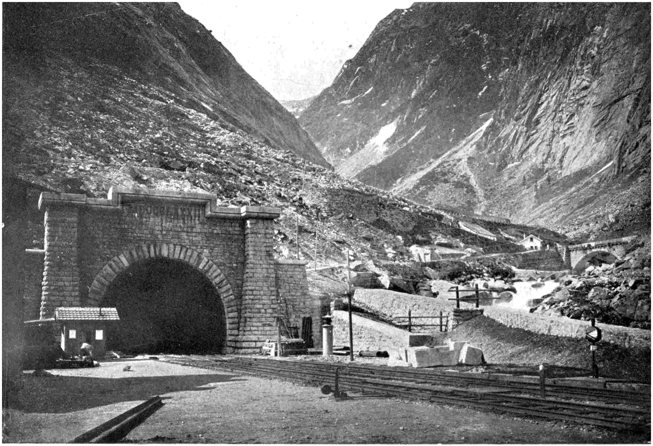
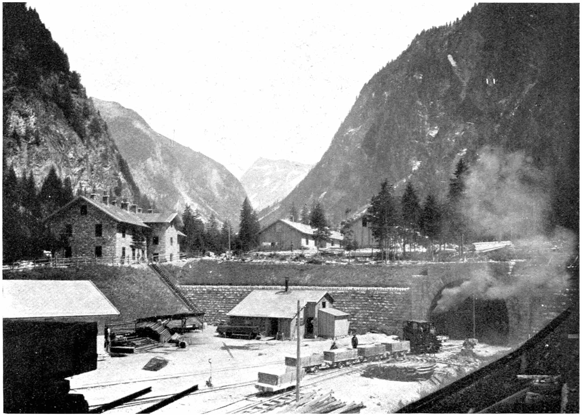
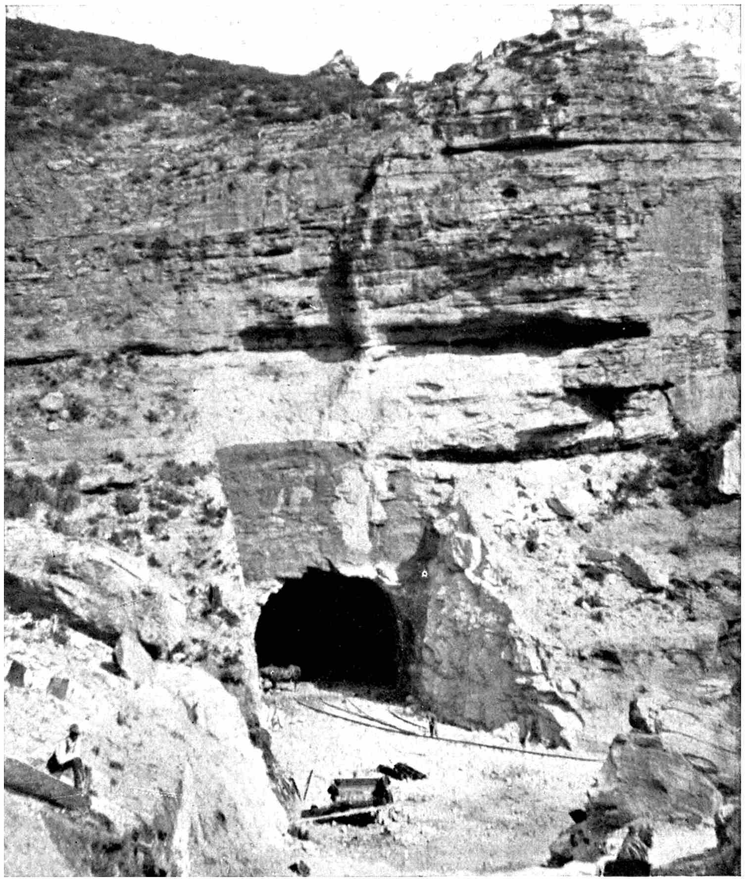
THE GÖSCHENEN ENTRANCE TO THE ST. GOTTHARD TUNNEL
Work was commenced at this point on June 4, 1872. The huge task was completed and the line opened
for traffic on May 22, 1882.
The pride of the Swiss was wounded. If the French and
Italians could accomplish such a herculean and apparently
impossible task, why was a similar idea beyond their
powers? The “conquest of the Alps” broke out with
renewed vigour. It became more than a personal issue;
it blossomed into one of economic, political and commercial
importance. Consequently, before the Cenis Tunnel was
opened for traffic, the preliminary arrangements for burrowing
through the St. Gotthard had assumed concrete
shape. But it had been a wearisome enterprise. The promoters
had to battle against intrigue and jealousies innumerable
on the part of private individuals, companies
seeking for the same concession, towns and departmental
governments. But the project became one of even more
than national importance; it became an international question.
The provision of such a route would bring northern
Europe into closer touch with Italy and her ports on the
Mediterranean. That fact was realised, and when the
company incorporated to carry out the work announced
that the task was far too risky for private resources, the
governments of the countries most intimately interested in
the fulfilment of the project promised tangible assistance
in the form of substantial subventions.
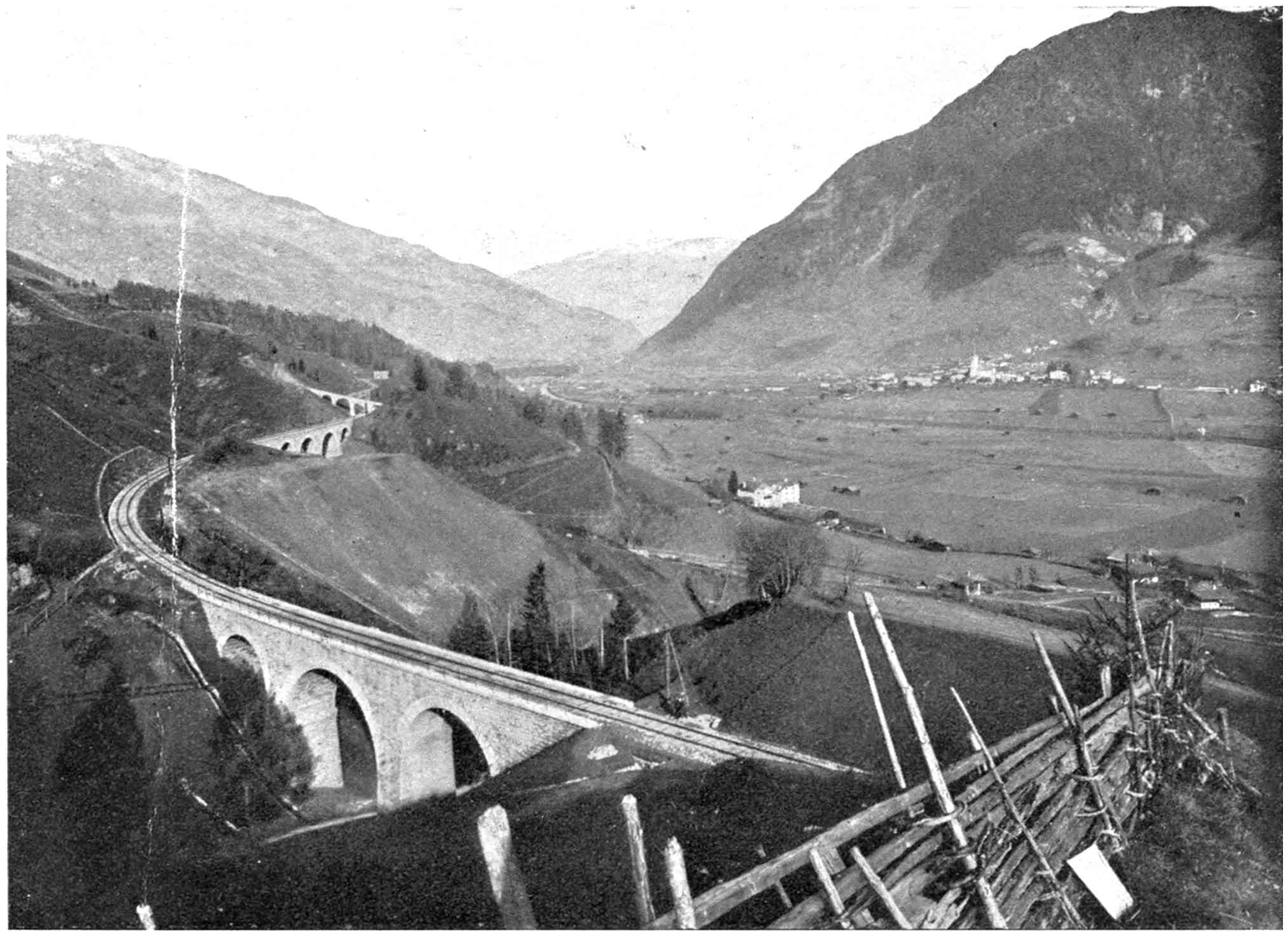
THE WONDERFUL WASSEN LOOP ON THE ST. GOTTHARD RAILWAY, SHOWING
THREE TIERS OF TRACK
The path of the tunnel through the heart of the mountain
was plotted by Mr. M. O. Gelpke, C.E., and this in
itself was a great achievement. Fifteen stations were scattered
over the mountain slopes for the manipulation of the
survey instruments, and many of these were situated unavoidably
in positions very difficult, and often impossible,
of access. Borings were made to ascertain the rock strata
which would have to be pierced by Professor Fritsch of
Frankfort, and from the result of these essential investigations
it was computed that the work, including the necessary
railway line on either side of the great tunnel, could
be completed for a sum of £7,480,000, or $37,400,000. The
money was raised by guarantees of £1,800,000 ($9,000,000)
from Italy, £800,000 ($4,000,000) from both Germany and
Switzerland, and by the issue of shares and mortgage
bonds to the extent of £2,720,000, or $13,600,000. As a
further contribution to the task, the Swiss Government
undertook to supervise actual construction.
The financial arrangements completed, the company had
to search for a man to bore the tunnel. For this purpose
tenders were sought for the whole contract. The terms of
the latter were severe, as were also the technical conditions.
The tunnel was to carry a double track, to have a height
of 19.68 feet to the crown of the arch, and a maximum
width of 26.24 feet, with a minimum width of 24.93 feet.
The tunnel was to be quite straight, with the exception of
a slight curve at the southern end, where, for a distance of
474 feet from the entrance, a curve of 984 feet radius was to
be introduced to gain Airolo station. The rise from the
northern entrance was to be about 1 in 172 to the summit
level 3,781 feet above the sea, followed by a drop of 1 in
1000 to the southern end. These gradients falling on
either side from the centre were necessary for drainage,
and were estimated to be just sufficient to ensure the water
flowing to the portals.
Seven tenders were submitted for the enterprise, the
lowest being that of L. Favre, a well-known engineer of
Geneva, who had completed many notable railway works
in Europe. He undertook to complete the tunnel for
£2,000,000 ($10,000,000) within eight years. His nearest
competitor, an Italian company, wanted twenty-five per cent.
more, but would not guarantee completion within less than
nine years. Monsieur Favre was supported by a body of
influential capitalists, and the contract was awarded to him.
Having sanctioned the project, the Government was
determined that it should be completed, and resolved that
the engineer should be held to his self-appointed time limit.
The penalty it stipulated was exacting. For every day
over the ninth year Favre was to forfeit £200, or $1000,
for six months, and then double that penalty per day
until completion. A year was thus allowed over and above
what he demanded to cope with any unforeseen contingencies
that might arise during the progress of the task.
Similarly, M. Favre was to receive a premium of £200, or
$1000, a day for every day he was in advance of the
stipulated period. His Italian competitor, while agreeable
to the forfeit, stipulated that it should not be enforced until
after the eleventh year, which terms the authorities refused
to entertain. To ensure securing the forfeit money should
the engineer be late, Favre was compelled to deposit a sum
of £320,000 ($1,600,000) with the Government before a
stone was moved.
No undertaking of such a magnitude as this tunnel,
although protected adequately by severe restrictions, ever
has been carried out in the face of so many vicissitudes; no
engineer ever has been so harassed as was M. Favre. From
the moment the tender was signed and sealed troubles commenced,
some incidental to the task, others purposely
thrown in his way by jealous outside interests. In the
first place, the Government undertook, according to the
terms of the contract, to have the approaches to the tunnel
completed so that he could commence operations without
delay. This was not done. Further opposition was then
encountered from another and unexpected quarter, which
assumed such proportions as to jeopardise the whole
scheme. Italy, having contributed about a sixth of the
cost, and who therefore had an important voice in the
matter, demanded that half the work should be granted
to the Italian engineers who had been engaged upon the
Mont Cenis tunnel. This was a bitter question, and it
took M. Favre two weary months to adjust it.
These hindrances at last settled satisfactorily, work was
commenced on the northern side of the Alps at Göschenen
on June 4, 1872, and at Airolo, the southern portal, on
July 2 of the following year. The preliminary preparations
were of a gigantic character. Though M. Favre had
sublet the constructional contract for the tunnel itself, he
was primarily responsible and nursed it as the engineer-in-chief.
Huge plants had to be installed at either end for
supplying the various demands for power for a thousand-and-one
purposes. At the northern end water turbines
were laid down, driven from the river Reuss, a head of
water of 279 feet being available. At the Airolo end a
similar installation was established and operated under a
water head of 541 feet from the Tremola. Subsequently,
it was found that this latter supply was inadequate. But
M. Favre was a man of infinite resource. He promptly
built a viaduct 12,000 feet in length, tapping the Tessin
River, and thus overcame the water power difficulty.
Small towns sprang up at either end around the respective
portals to house the machinery, the workmen, and
innumerable other details.
As tunnel-boring operations upon such a scale as this
were in their infancy, this engineer-in-chief perforcedly
had to break a great deal of new ground; to carry out considerable
pioneer work. Hitherto, the usual tools at the
service of the excavators were the pick-axe, shovel, chisel,
and sledge-hammer; but such implements as these in a
work of this magnitude were akin to forging a mighty
crank shaft with a blacksmith’s hammer. New forces had
to be created. The Mont Cenis had demonstrated this
fact, and in the course of its realisation a new tool appeared.
This was the mechanical percussion rock drill,
operated by compressed air at a pressure of 112 pounds and
upwards per square inch. To furnish the requisite energy
to the tools elaborate air-compressing plants had to be laid
down. These were designed by Professor Colladon, and
they were capable of compressing 1,596 cubic yards of air
to a pressure of eight atmospheres every minute, the power
being stored in huge cylindrical reservoirs, not unlike
mammoth steam boilers, from which the conduits extending
to the working faces on either side were charged.
The scene in the tunnel was impressive in the extreme. At
the working face a little gallery was bored, about eight feet
wide by the same in height, at the roof of the tunnel. The
drilling machines were mounted on travelling carriages,
with their perforating chisels jutting ugly and business-like
from the front. With the pent-up force of eight atmospheres
behind them, they rapped against the solid rock
and slowly but surely made a perforation. At frequent
intervals there was a slight stop, the chisel point was withdrawn
and a jet of water, drawn from a tender hauled up in
the rear, was directed into the hole, when the chisel
instantly resumed its monotonous round. At intervals, a
chisel, with its cutting edge blunted from continual hammering
at the iron-like mass, was taken out, thrown on one
side, and another inserted in its place, to continue the
attack on the rock. Progress was laboriously slow, or comparatively
rapid, according to the nature of the material
encountered. When the rock was of a granitic nature,
then advance was only at the rate of an inch or two per
hour; on the other hand, when soft, clayey material was
tapped, then the chisels bored their way at the rate of as
many feet in the same time.
THE COMPRESSED AIR LOCOMOTIVE WHICH HAULED WORKMEN AND
ROCK BLASTED FROM THE MOUNTAIN IN THE CUTTING
OF THE LOETSCHBERG TUNNEL
WHAT THE WORKING FACE IN THE HEART OF THE MOUNTAIN IS LIKE
The gang and drills cutting the path for the line through the Loetschberg
Tunnel recently completed.
BORING A GREAT ALPINE TUNNEL
Photo by E. Goetz, Lucerne]
THE LOFTY AMSTEG BRIDGE, 184 FEET HIGH, SPANNING THE
MADERAN VALLEY ON THE ST. GOTTHARD RAILWAY
Three men attended to each machine, and by means of
levers and wheels the height of a drill could be adjusted
to a nicety. Movement was difficult, for the space was
cramped. In the murky gloom the outlines of the men
could be faintly discerned. The fitful glimmer of the oil-lamp
which each carried—electric lighting had still to be
invented—fell upon their semi-nude bodies and swarthy
faces. The streaming perspiration mingling with the
grime and dust, which strayed over their skin in fantastic
streaks, gave the men a fiendish appearance. The temperature
was that of an oven. As the men drew nearer
and nearer to the heart of old Gotthard, the heat rose until
the men laboured in an atmosphere of 90° or more. The
only sounds were those of the hammering of the drills as
they bored into the rock, and the hissing of the escaping
air after it had completed its allotted task in operating the
chisels.
At long intervals there came a heavy silence. The holes
had been bored to the requisite depth. The machine was
drawn far back into the boring. Explosives were slipped
into the holes and tamped home. From a safe distance the
charges were fired. A dull, smothered roar, a rending and
crumbling, and another gap was torn in the bowels of this
monarch of the Alps. The excavators hurried forward,
cleared away the tumbled debris, and brought the lumbering
drill carriage up to the fresh working surface.
Day in and day out, week after week, month by month,
this round continued. It was monotonous, and the work
was hard. The stifling atmosphere and the conditions told
severely on the physique of the workmen. Congestion of
the brain, irregular action of the heart, anæmia, or one of
numerous other obscure maladies, was the reward for their
labour. Their faces assumed a deathly pallor; working in
cramped positions gave them an unsightly stoop, and
deprived their legs of movement, so they tottered rather
than walked as they returned from the scene of their toil
at the end of the shift.
The pay was wretched, ranging from half-a-crown to
five shillings (from 60 to 125 cents) per day of eight hours,
out of which they had to board themselves! Needless to
say, but few Englishmen or western Europeans figured
on the pay-roll, for none would accept such starvation pay
for such terrible work. The labourers were Italians for
the most part, and yet nearly one and all, by subsisting on
miserable food, consisting for the most part of a kind of
meal porridge, cheap and yet limited in quantity, saved
a part of their earnings and sent it home to their needy
families in sunny Italy. The average number of men
employed was about 4000, half at either end, but at times
it ran up to as high as 7000. The mountain claimed 310
lives, killed by accident alone, and 877 injured, before it
was conquered; but, considering the conditions, it is
remarkable that the casualty roll was not heavier.
In the wake of the small heading gallery came the other
gangs. These rigged up the timber and other supports
to the roof and excavated the small opening to the full
dimensions of the tunnel. Last of all came the masons,
setting the masonry lining, from 18 to 30 inches thick,
in position, for the tunnel is lined throughout. In passing
through the granite rock there was but little fear of a
collapse of the roof, but in the treacherous clay advance
had to be made warily, and heavy timbering resorted to,
in order to prevent the soft soil caving in and burying all
in its sticky embrace.
The material for the headings and lining, as well as the
workmen and tools, were carried to and fro upon a small
railway, the locomotives of which were driven by compressed
air—steam was impracticable, because it would have
fouled the workings; while on the short distance between
the inner end of the railway and the working face haulage
was done by horses. The privations suffered by the
navvies was only equalled by those experienced by the
animals, the mortality of which ran up to as high as
twenty-five per cent. of the number employed.
Water was a constant menace, and at times retarded
progress seriously. On the south side it was particularly
troublesome. Time after time the drills or detonating
charges would tap one of these subterranean streams,
and the water would pour out in a cascade. These rivulets
were of varying volume, but in one stretch, where the rock
was extremely friable, it was considered too dangerous to
use the mechanical drilling machine, so the men had to
cut their way forward by hand. In so doing they released
a vast underground pocket of water, which rushed out at
the rate of over 3000 gallons per minute. At one spot it
was only by superhuman effort that headway was made,
for the men were half submerged in these torrential outbursts,
escape from which was only possible by penetrating
farther into the mountain.
In 1876 another terrible calamity overtook Louis Favre.
It was discovered suddenly that the railway, far from
costing the estimated sum, would approximate over
£11,500,000, or $57,500,000. Somebody had blundered,
and badly too. A deficit of over £4,000,000, or $20,000,000,
appeared certain. What was to be done? The development
of such a contingency never could have happened at
a more inopportune moment. Times were hard; money
was scarce; financial crashes loomed in every quarter of the
Continent; and, to make matters worse, war was raging.
Never in the history of engineering had such an extraordinary
and unaccountable mistake been made in the
estimates.
The discovery came as a thunderclap. The stock of the
company ran down like a thermometer plunged into ice.
Those who had supported the enterprise in the face of
hostile criticism began to doubt the wisdom of their
optimism. A gloom settled everywhere. It appeared as
if the gigantic achievement would become numbered among
the great unpaid; would be another contribution to those
unfinished enterprises characterised as follies.
But Monsieur Favre kept going. There was the daily
penalty staring him in the face if he did not finish within
time. Any prolonged delay spelled ruin to him and to
those who had financed his task. To make matters worse,
the Swiss departments who had the most to gain from the
completion of the railway steadfastly refused to extend the
slightest assistance.
Matters reached a crisis. Either the money must be
found, or that already spent must lie buried in the mountain.
An International Conference was called to consider
the situation, where, as prominent cities and railways who
hoped to reap something from the completion of the tunnel
promised support, Germany, Switzerland and Italy agreed
to increase their subventions. Much of the projected work
originally contemplated was postponed indefinitely in order
to reduce the first cost.
This readjustment of the financial situation enabled work
to be resumed energetically. But Favre was harassed
sorely still. Payments for work became irregular, and
every possible obstacle that could be placed in his way
was forced to the front by intriguing opponents. Efforts
were made even to create a rupture between him and the
International Society, but Favre’s unflagging perseverance
and determination resisted all such machinations, and he
plodded along resolutely.
However, these worries and his feverish anxiety to
succeed in his enterprise told upon his health. He never
lived to see his great achievement completed. On July 19,
1879, while inspecting the progress of the work at the
headings, he was seized with an apoplectic fit, to which he
succumbed in a few hours. Literally in harness, this
guiding spirit and clever engineer passed beyond the veil
when the tunnel, the crowning effort of his life, was rapidly
approaching completion.
His mantle fell upon his right-hand assistant, M. Hellwag,
an accomplished German engineer, and he pushed
forward the scheme with an energy characteristic of his late
chief. But friction again rose. Swiss engineers were
jealous of this appointment, and at last in sheer disgust
the new engineer-in-chief threw up the work. He was
hounded from his post, despite the fact that on another
section of the railway he had overcome ingeniously the
negotiation of sharp ascents within short distances, which
otherwise appeared impossible, by the invention of a spiral
tunnel, wherein the railway burrows into the mountain
side, describes therein a complete circle, and emerges again
immediately above the portal by which it entered.
On Saturday, the 27th of February, 1880, while the workmen
on the Göschenen side were tearing the vitals out of
the peak, they were surprised to find large masses of rock
falling about their ears without any effort on their part.
They stopped. The situation seemed uncanny. They
listened intently, and then heard the familiar sound of a
muffled roar, indicating blasting in the heading. The
workmen on the Airolo side were upon them. Terrified
lest the next concussion might bury them beneath a mass
of rock, they hurriedly retreated and waited. Presently
one espied the point of a chisel ploughing through the
rock towards him. He grasped its extremity, but as
quickly dropped it, for it was so hot that it burned his hand.
Frantically these men rapped upon the last remaining wall
of rock to inform their comrades on the other side that they
were through. With lightning-like rapidity the news
flashed through the Göschenen workings that the men from
the Airolo side might be seen at any minute, and that the
task of eight weary years was consummated practically.
As quickly the news flashed from Göschenen to the
Airolo portal to cease work, since it was decided that the
last blast tearing away the final thickness of rock should
be the occasion of great jubilation. The whole country was
excited. Officials hurried to the scene, and the countryside
from far and near flocked to the two mouths of the tunnel.
There was no sleep for any one in the constructional camps
that Saturday night. The men were in a perfect state of
frenzy. In the darkness the preparations for the culminating
move were hurried forward. It was arranged that as
the men on the Airolo heading had first pierced the last
partition of rock, they should have the honour of blowing
the gap which would afford access from one side of the
mountain chain to the other through its base.
At seven o’clock on the Sunday morning a train started
from each end laden with invited guests to witness the final
operation. Amid many huzzas they disappeared into the
dark, yawning mouths of the great bore. When each party
reached the heading the machines were already at work.
Only a foot of rock stood between those who had journeyed
up from Airolo and the others who had travelled from
Göschenen. The distinction of making the breach a thousand
feet under the village of Andermatt nestling in the
sunshine on the mountain slopes, and with the little lake
of Sella 3000 feet above one’s head, was given to two Piedmontese
workmen, Neccaraviglia and Chisso, who had
toiled in the Cenis, and afterwards in the Gotthard, since its
very commencement. The last charges were rammed home,
and at 11.45 on the Sunday morning eight rumbling detonations
heralded the piercing of St. Gotthard. Ere the
smoke had cleared away the men sprang forward. There
was the final breach, about three feet in diameter. Engineer
Bossi sprang through the gap, and emotionally embraced
his confrere on the other side, followed by his workmen,
who shook hands with their comrades. It was a strange
scene in the depths of the Alps, and the wild vivas of those
assembled, to the memory of Louis Favre, reverberated
weirdly down the shaft on either side.
The excavations of the works to the full dimensions and
the lining up of the last section proceeded with great
rapidity, and on May 22, 1882, amid great festivity, the
tunnel was declared open. It had taken ten years to complete,
but had Favre been left to his own devices, and had he
not been exposed to financial harassing and intrigue, and
had not his successor Hellwag been driven from his post,
it would have been finished in the time the engineer contemplated.
At that time Favre’s skill, pluck and unflagging
devotion to his task were not appreciated, but
recognition of his genius was afterwards extended by the
erection of a monument to his memory at the Airolo
entrance to the tunnel. It is safe to assert that it was due
to his enterprise and grim determination in the face of
adversity that the St. Gotthard tunnel became an accomplished
fact, and resulted in the reduction of the journey
between Northern Europe and Italy by thirty-six hours.
In addition to the tunnel, 172 miles of line had to be
built to connect the Swiss with the Italian railway systems.
From the body of this frowning clump 31,800,000 cubic
feet of rock were torn by means of 2,200,000 pounds of
dynamite.
The remaining sections of the railway named after the
tunnel abound in interesting features from the technical
point of view, the most notable, possibly, being the remarkable
spiral tunnels to which reference has been made,
and the successful application of which in this instance has
been reproduced upon other railways where similar conditions
prevail. The best examples, possibly, are those by
which the Biaschina gorge is negotiated, since here there
are two of these tunnels side by side, the railway almost
describing a figure 8 in corkscrewing from one level to the
other. Exclusive of the Gotthard, there are no less than
76 tunnels and galleries, aggregating 29 miles, as well as
1,384 other structures, 324 being bridges and viaducts over
39 feet in length. In one stretch of 7 miles, in skirting
the south-eastern arm of the Lake of Lucerne, the railway
passes through 9 tunnels, ranging from a mere 85-feet
burrow to others 6,512 feet in length. Among the Gotthard
fastnesses the railway work becomes bolder, the
bridges are lofty, while the line zigzags in a remarkable
manner. It is a case of tunnel, cut and bridge all the way.
Up to 1880, when the railway was finished practically,
constructional work provided regular employment for
10,757 men.
So rapidly did the volume of traffic upon the railway
swell, however, that it became extremely difficult to handle
it, as there was only a single line, except in the tunnel and
at one or two other points. The provision of another track
became imperative, and in 1886 it was commenced. This
was not a simple matter, as the new work had to be carried
out without interrupting traffic in any way—that is, so far
as the main through service was concerned. With the
exception of the Gotthard and four smaller tunnels, all the
other structures had to be excavated out to carry the second
pair of metals, while, similarly, all bridges had to be
increased in width. In order to finish the work as rapidly
as possible, the task was divided up into a number of small,
separate contracts, each covering a few miles. Vehicles
for the conveyance of constructional material were provided
and supplies were hauled free of charge by the
railway, while explosives for blasting were sold at cost
price.
The most difficult works were carried out by the company
itself by its own engineers and labour. In this comprehensive
widening system over 100,000 cubic yards of rock
which had been excavated from the St. Gotthard and
dumped in the vicinity of Airolo were reclaimed, to be used
in the building of embankments, revetments and retaining
walls. The tunnel widening was carried out almost exclusively
at night and on Sundays, since the smoke from
passing trains would have impeded such work during the
day. The quickest methods of widening were adopted,
and in the approach to the Bristen tunnel an excellent
expression of this is afforded. Instead of trimming back
the mountain-side to provide space for the second pair of
rails, a gallery was built projecting from the mountain and
supported on heavy masonry pillars, giving the appearance
of a colonnade.
In the handling of unavoidable night trains an elaborate
protection system was adopted in connection with the
tunnels, to prevent disaster to the trains themselves or to
the working gangs. No trains were permitted to enter a
tunnel until assurance had been made doubly sure that
there was no constructional train standing on the only line
to court collision, and that the workmen were safe. Each
working squad was covered amply by electric and other
signalling devices. Similarly, all metallic structures that
required moving were handled on Sundays, when traffic
was at its lowest ebb, between the scheduled movements
of passing trains, so that the latter might not be delayed.
It was estimated that this work would occupy nine years,
but in reality it was accomplished in five and a half years,
and the total cost of widening the whole mileage to a double
line was only £500,000, or $2,500,000.
CHAPTER IV THE RAILWAY INVASION OF CANADA
The news of the victory of Stephenson’s “Rocket” in
the historic railway locomotive contest at Rainhill on the
Liverpool & Manchester railway in 1829 scarcely had
filtered round the world, when the idea of transporting
passengers and merchandise by steam power along two
parallel rails occupied the earnest attention of enterprising
spirits in Canada. They realised that the new method of
locomotion was certain to play an important part in the
opening up of British North America. As a result of
deliberations, a small body of prominent business men
in Montreal applied for a charter to construct a railway
from La Prairie to St. John’s in the province of Quebec,
which was granted in 1832 under the seal of William IV.
It was an unpretentious enterprise, for the projected line
was only some fourteen miles in length. It was named
the Champlain & St. Lawrence railway, the idea being to
link Lake Champlain, whence New York could be reached
by water, with the St. Lawrence. The first section of the
line was opened in 1836, though it was not operated by
steam. The rails were of wood, and the vehicles were
hauled by horses. This system obtained for only one year,
however. The first winter sufficed to demonstrate to those
concerned with the enterprise that such primitive methods
were far from satisfactory. Consequently the “wooden
flanges,” as the rails constituting the track were called,
were torn up to make way for iron rails, and the steamengine
took the place of the animal motor.
A year or two later the objective of the promoters was
attained. Lake Champlain was brought into communication
with the St. Lawrence at Montreal by a railway some
fifty miles in length, the inland sheet of water being
tapped at Rouses’s Point at the head of the lake in United
States territory. It is stated that Jay Gould, who afterwards
became one of the greatest railway-builders and
magnates in the United States, gained his first insight of
the construction of railways upon this line, by being associated
with the location survey. From this humble beginning
was woven the huge railway network of Canada,
which now gridirons the country in all directions, and
aggregates some 25,000 miles.
Other projects were formulated in rapid succession for
a comprehensive invasion of the eastern corner of the
country. Foremost among these was the Grand Trunk
Railway Company, conceived in 1852, to build a trunk
road between the Atlantic seaboard and the Great Lakes,
which at that time was practically the western commercial
limit of the Dominion. It was an English enterprise, and,
moreover, was strongly imperial from the sentimental point
of view, for it was planned to thread Canadian territory
entirely.
The famous firm of railway constructional engineers,
Messrs. Peto, Betts & Brassey, fresh from their triumphs
on the Continent, were willing to carry out the work. They
had an extensive accumulation of plant lying idle, and at
the time were seeking for fresh worlds to conquer. Canada
presented just the opportunity they desired, and they were
ready to provide all the railways that Canada would require
for some years to come. The faith in this firm of constructional
engineers was so great that British financiers
were open to provide any amount of money that might be
required.
The negotiations were prolonged, as rival interests
opposed the scheme vehemently. The preliminaries passed
through many vicissitudes, but the compact between the
English financiers and the Canadian authorities was
ratified and sealed, at last, for the construction of a main
line between Montreal and Hamilton, a distance of about
373 miles, which the Provincial Government undertook to
finance to the extent of £3,000, or $15,000, per mile.
Hamilton was selected as the western terminal point
because therefrom another line extended to the Lakes, while
a railway was creeping up from Portland on the Atlantic
coast to Montreal. By the construction of this central
section, 964 miles of through continuous railway would be
provided for the benefit of the population.
But the undertaking proved to be one of the most difficult
that the engineers, despite their wide and varied experience,
had been called upon to fulfil up to this time. The country
traversed was very sparsely populated, the forests were
dense, and in winter, under the combined adversities of
snow, ice, and intense cold, the situation was terrible.
Labour was scarce, wages were high, and material was
found to be expensive. In the end it was found that the
average cost per mile approximated £8,000, or $40,000, so
that to link Montreal with Toronto entailed an expenditure
of £2,664,000, or $13,320,000. Moreover, it was one of
the largest contracts that the engineers ever had carried
out, while the physical conditions harassed them to such
an extent that when they balanced up their books they
found they had incurred a loss of about £1,000,000, or
$5,000,000. The wide gauge of five feet six inches was
adopted, and this factor developed into as keen a bone of
dissension in Canada as it did in Great Britain, and as in
the latter country it was finally abolished, so in Canada it
was abandoned in favour of the standard gauge of four feet
eight and a half inches, though the conversion cost the
Grand Trunk railway a matter of £1,000,000 ($5,000,000).
NO. 2, “THE TORONTO,” THE FIRST RAILWAY ENGINE BUILT IN
CANADA BY JAMES GOOD IN 1853
Photo by courtesy of Pennsylvania Steel Co.]
THE NIAGARA CANTILEVER RAILWAY BRIDGE UNDER CONSTRUCTION
It was built round the suspension highway bridge so as not to interrupt
communication between the two banks.
Yet in building this line the contractors set up an
engineering monument which for years ranked as the
“eighth wonder of the world.” Montreal was on the north
bank of the St. Lawrence, while the link connecting the
metropolis with the Atlantic seaboard followed the southern
bank of the river. The two sections of line were interrupted
by the rolling waterway, which at this point is
nearly two miles wide. The spanning of this gap, so as to
bring Montreal into direct railway touch with the coast,
had been one of the great obstacles to the incorporation
of the railway in the first instance, but Messrs. Peto, Betts
& Brassey undertook to forge this link. At that time it was
so formidable an undertaking as to be thought absolutely
incapable of realisation. Indeed, when a suggestion for
bridging the St. Lawrence at this point was advanced for
the first time, it was laughed to scorn.
“THE EIGHTH WONDER OF THE WORLD”
The wonderful tubular bridge, 6,592 feet long, built by Ross and Stephenson across the St. Lawrence River to carry the
Grand Trunk Railway into Montreal.
THE BRIDGE AS RECONSTRUCTED
The continuous tube carrying a single track was converted into an open truss girder bridge to take two sets of
metals, tramway line, road and pavement.
However, its construction constituted a vital part of the
contract. Accordingly, the contractors lost no time in
attacking the undertaking when they secured a foothold in
the Dominion. The river was surveyed minutely up and
down for a considerable distance, while detailed soundings
were made to discover the extent and nature of the foundations
requisite for the piers. After infinite labour a suitable
site was discovered, and a great measure of credit for the
location is due to Alexander M. Ross, who was one of the
engineers to the undertaking, George Stephenson acting
as consulting engineer. Ross carried carefully prepared
and detailed plans of the structure he had formulated to
his coadjutator in England, and Stephenson admitted,
when first submitted to his notice, that “the idea was
certainly startling.” However, he complimented Ross
upon his daring, and as the latter engineer had won his
spurs in England before he departed to Canada on behalf
of the group of capitalists financing the Grand Trunk
railway, his work received greater consideration from the
eminent engineer than might have been the case otherwise.
The result was that when Stephenson went to Canada to
consider the subject on the spot he concurred with Ross
in the general scheme, and the design was elaborated
conjointly.
When the location was settled definitely, the project was
assailed vigorously by bridge designers in America, but
this animosity was inflamed from the fact that they had
prepared alternative proposals for bridging the waterway
at a different spot. The rival engineers emphasised the
danger from ice, and commented strongly upon the risk,
in fact serious danger, arising from this cause, to the full
brunt of which Stephenson’s bridge would be submitted.
Some critics even went so far as to state that the structure
never would be completed, or if so, would come down
under the first packing of the ice. Stephenson, however,
treated his American detractors with contempt, and, to the
mind of the latter worthies, appeared to fly deliberately in
the face of Fate by concurring with Ross’s recommendations.
That was nearly sixty years ago, but the piers have
given no sign of collapsing yet.
The resident engineer and superintendent of the constructional
work, Mr. James Hodges, realising the monumental
character of the undertaking—for it was a larger
bridge-building scheme than ever had been attempted up
to this time—spent many hours together wrestling with
difficulties as they developed, for the unexpected confronted
them at every turn. The ice was one of their
greatest perplexities, because during the winter the river
is frozen so solidly that it will support the weight of a
train, and, indeed, a track has been laid across the waterway
in winter to maintain communication between the two
banks. When the ice broke up, the floes became jammed
and piled against the temporary works around the piers in
an inextricable mass to such an extent that it demanded
unremitting vigilance to guard against a collapse of the
dams under the enormous pressure exerted upon them.
The depth of the river and the current were two other
factors which had to be taken into serious consideration,
for some of the piers are sunk in twenty-two feet of water,
while the velocity of the current is about seven miles an
hour. The working season was very short, averaging
about twenty-six weeks during the year, and during this
period every available man had to be crowded on to the
work. When construction was in full swing, between
2000 and 3000 men found employment.
Photo by permission of the Pennsylvania Steel Co.]
THE MAGNIFICENT SINGLE SPAN BRIDGE ACROSS THE NIAGARA RIVER BELOW THE FALLS
Length of span, 550 feet; height above 226 feet.
The bridge consisted of a huge rectangular tube,
similar to that spanning the Menai Straits, carrying a
single track. From end to end it measured 6,592 feet by
16 feet wide, 18 feet in height, and weighed 9,044 tons. It
was divided into 25 spans, 24 of which were of 242 feet
each, while one was of 330 feet. The piers were built
massively in masonry, the stone being obtained from
quarries in convenient proximity. The ironwork was prepared
in England, each piece being marked carefully for
its position in the structure. The bridge had a gradual
slope upwards from either bank to the centre, where the
height from the bed of the river to the top of the tube was
108 feet. For its erection 2,250,000 feet of timber were
required in connection with the temporary work, the piers
and abutments demanded the use of some 3,000,000 feet
of masonry, and 2,500,000 rivets were used to secure the
component parts of the ironwork together. In addition to
the bridge proper, some 2,500 feet of approaches on either
side had to be fashioned, so that the total length of the
work was 9,144 feet. The contracted price for the structure
was £1,400,000, or $7,000,000, but it was completed for
£100,000 ($500,000) less. Of this total the masonry and
temporary work absorbed,£800,000, or $4,000,000, and the
ironwork £400,000 ($2,000,000).
A VIEW OF THE IRON TUBE, 2,290 FEET IN LENGTH AND
23 FEET IN DIAMETER
THE 2000 H.P. ELECTRIC LOCOMOTIVES
HAULING THE “INTERNATIONAL LIMITED” THROUGH THE TUBE
The “link that binds Two Great Nations,” the St. Clair Tunnel, under the St. Clair River.
While the work was in progress the railway company
found increasing traffic, as the sections of completed line
were opened, so emphasised the urgency of securing
through communication across the river that the contractors
were approached, and a bonus of £60,000 ($300,000) was
offered to them if they would complete the work a year
earlier than was stipulated in the contract. The engineers
redoubled their efforts, and on December 17, 1859, the
great bridge was opened, though the official ceremony took
place five months later, when King Edward VII, then
Prince of Wales, opened the Victoria Bridge, as it was
christened, in the name of Queen Victoria, during his visit
to the Dominion.
Stephenson died before his great work was completed.
For a quarter of a century or more it constituted one of the
sights of the North American continent. As the country
became more settled and the volume of traffic flowing to
and fro across the river increased, the railway experienced
a very great difficulty in handling it over a single line.
At last the inadequacy reached such a point that some
improvement was imperative. A second bridge would have
been too costly, and after considerable reflection it was
decided to replace the tubular bridge by one of larger
dimensions.
A minute examination of the existing structure was
made, and it speaks volumes for the work of Stephenson
and Ross, as well as of the contractors, that the bridge
appeared as sound and as fit for another century or more
as it did on the day it was first opened. The piers had
been built so solidly that they did not show the slightest
trace of the terrible buffetings and pressure to which they
had been subjected by the ice during some fifty winters.
Consequently it was decided to remove the tubular
structure and to erect in its place an open truss bridge,
66 feet 8 inches wide, carrying a double track, a roadway
for an electric tram-line, space for vehicular traffic, and a
pavement for pedestrians. The engineers designing the
new structure came to the conclusion that the striking
stability and condition of the masonry piers would carry
the new bridge with but slight alteration. As a result of
this conclusion it was decided to erect the new structure
around the old bridge, cutting away the latter span by
span, so that there was no interruption to the train service.
This appeared to be a simple expedient, but when the
engineers commenced operations on Stephenson’s handiwork
they found that it was built of far tougher material
than they had expected. The rivets defied withdrawal, so
excellently had they been driven home, and one of the
engineers showed me one of these securing pieces, which
he had preserved as a memento of British handiwork of
some seventy years ago. As a matter of fact, as he related,
it was far easier to build the new structure than it was to
destroy the old, and the cutting away of the old tubular
bridge span by span was found to be an exceedingly
laborious task.
However, it was achieved, and there was not the slightest
interruption in the traffic, which testifies to the skill and
care with which the engineers laid their plans. Nor was it
attended by any untoward incident, though what might
have proved a terrible accident was averted very narrowly
during reconstruction, as was related to me by one of the
engineers. It was Sunday morning, and they were rebuilding
the central part of the bridge. Special men had been
stationed at each approach to the bridge, and elaborate
instructions had been drawn up for controlling the passage
of trains by flag-signalling. Sunday was selected for the
most difficult portions of the work, as on that day the
trains were few and far between.
On this Sunday morning the work had advanced so
satisfactorily that the old tubular span had been removed,
and there was a wide gap in the continuity of the ironwork
carrying the metals, showing the murky river swinging
along at a merry pace below. Everything was ready for
completing the new span, when one of the engineers,
happening to glance shorewards, observed a train entering
the bridge and coming along at a brisk speed. Something
had gone wrong; the flagman had misunderstood instructions
or had given a wrong signal. The train was speeding
to its doom, for there was the yawning gulf. But the
engineer never lost his presence of mind. Realising the
situation, he threw down his instruments, and ran along
the track towards the advancing train waving his arms
frantically and yelling like one bereft. The engine-driver,
unlike the majority of his ilk on an American railway,
concluded that something must be amiss, and applied his
brakes sharply, pulling up a short distance from the brink
of the abyss. It was a narrow escape; had the engineer
hesitated a minute, disaster swift and sudden would have
overwhelmed that train.
When the new bridge, with its 22,000 tons of steel, was
completed for traffic it was renamed, but as the reconstruction
coincided with the Jubilee of Queen Victoria’s reign,
the revision comprised merely the perpetuation of that
auspicious event, and to-day the structure is known as the
Victoria Jubilee Bridge. From first to last the structure
has cost £1,800,000 ($9,000,000), of which reconstruction
absorbed about £400,000 ($2,000,000).
As the Grand Trunk increased in importance, subsidiary
and tributary railways were absorbed. Nor was the original
idea of a trunk line overlooked. This end was achieved by
pushing towards Chicago, the busy centre of the Middle
States. Continuity of rail in this case, however, was interrupted
by the St. Clair River, the narrow strait which
connects Lakes Huron and Ontario. In the early days
communication was maintained by means of ferry-boats,
which handled complete trains, but as the river is extremely
erratic, with strong currents varying in velocity according
to the direction of the wind, and is congested with shipping,
the ferry service possessed many shortcomings.
When the strait was obstructed with floating ice, the
situation became far more serious.
Accordingly, in order to remove these disabilities, a
bold solution was elaborated in the form of a tunnel
beneath the waterway connecting Sarnia on the Canadian
with Port Huron on the United States side of the St. Clair
River. It certainly was an audacious remedy for a perplexing
problem. The river is 46 feet deep and is nearly
half-a-mile wide, so that the tunnel had to be planned at
a great depth. However, no better alternative could be
offered, for a bridge was quite out of the question, so in
1886 the St. Clair Tunnel Company was formed as a subsidiary
undertaking of the railway, to complete a subaqueous
link of communication, with Mr. Joseph Hobson
as chief engineer.
As the topography of the land on either side is tolerably
flat, the question of the approaches had to be settled, and
a heavy grade at either end could not be avoided. Technical
difficulties were encountered at the very start. A trial
shaft was sunk on the Canadian side to a depth of 98 feet,
while another shaft on the American side was carried
down to 92 feet. The preliminary shafts were elliptical
in shape, measuring 4 feet by 8 feet in diameters.
When the requisite depths were obtained, galleries were
driven at right angles beneath the river. These efforts
proving satisfactory, it was decided to build the complete
tunnel from either bank from shafts, as in the case of the
Blackwall tunnel. The shafts were each 23 feet in diameter,
and they were so built that there was a circular ring, the
lower face of which carried a knife-edge digging into the
ground. The soil was excavated from beneath this knife-edge,
and as the brick-wall lining of the shaft was built
upon the upper surface of the knife-ring, it was considered
that the superimposed weight would drive the knife downwards
as the earth beneath was removed.
But these carefully-laid schemes and anticipations went
astray. Exasperating failures and mishaps occurred, and
at last the engineer changed his plans; the shaft method
was abandoned. Instead, he decided to drive the tunnel
from either end through the approaches. For this purpose
the plant and machinery were removed inland from the
shafts for a distance of 1,900 feet on the Canadian, and
1,800 feet on the American bank respectively. Two huge
cuttings were driven downhill until the tunnel level was
gained, when the burrow beneath the river was commenced.
The tunnel itself consists of a circular iron tube or pipe of
sufficient diameter to carry a single track. It is 19 feet
10 inches in diameter, is built up of cast-iron rings, and
weighs complete 56,000,000 pounds, or about 25,450 tons.
Boring was effected from either end by means of the
hydraulic shield, and in less than three years the task was
finished.
The length of tunnel beneath the water is 2,290 feet,
while that under dry land represents another 3,748 feet,
making a total length of 6,932 feet. To this must be added
5,580 feet of approaches, which brings the total extent of
the work to nearly 12,000 feet, or 2¼ miles. It cost
£540,000, or $2,700,000, and has always ranked as a
noteworthy achievement in this particular branch of
engineering.
Owing to the steepness of the approaches on either side
special locomotives had to be built to handle the traffic
through this artery. They were powerful creations of the
railway engine designer, and when they appeared were
the largest steam locomotives in the world. They could
haul a train weighing 760 tons, though at times the pace
was slow.
But traffic between the United States and Canada increased
by leaps and bounds, owing to the provision of
this tunnel, with the result that in a very few years the
railway authorities found that the tube was quite overtaxed.
A solemn conclave was held as to the best ways
and means of meeting this development. The track could
not be doubled; so the question was how to increase the
existing hauling capacity of a single engine. Steam could
not meet the question, so was ruled out of court. Then an
engineer suggested electrification, and advanced a report
to show how the weight of each train might be increased
by nearly 25 per cent. with quicker working, and consequently
would facilitate the passage of a greater number
of trains in a given time.
This engineer, Mr. Bion Arnold, was authorised to
proceed with his scheme and to complete his plans for the
electrification of the tunnel. He did so, and as a result a
specification was drawn up requiring the haulage of a train
weighing 1000 tons over the 2¼ miles in 15 minutes, with
a maximum speed of 25 miles and a minimum speed of
10 miles per hour respectively. When the plans were
made known it was realised that the project comprised the
most ambitious electrical undertaking that ever had been
attempted up to that time in railway operations, especially
as it was insisted that the electrical system should be of a
type which constituted its first application to heavy steam
railway working. This is what is known as the single-phase
alternating current system with overhead conductor.
The invitation for tenders was awaited with keen anticipation
throughout the world, as it was conceded to offer a
unique opportunity to the electrical engineer. Consequently
keen competition was evinced to secure the honour
of carrying out such a remarkable undertaking. The contract
was secured by the Westinghouse Electric & Manufacturing
Company, and was carried to a successful
conclusion at a cost of £100,000 ($500,000). The locomotives
now used on this service are among the most
powerful in the world. They weigh 135 tons, and develop
about 2000 horse-power, which enables them to haul a
1000-ton train up the heavy approach grades at a minimum
speed of 10 miles per hour. Moreover, since electricity
was adopted, the tunnel has been kept free from the dense
clouds of smoke and steam which originally converted the
tube into a veritable inferno, and, what is far more important
from the railway company’s point of view, the electrical
system is able to meet three times the volume of
traffic that exists to-day, so that there is ample provision
for the future. As it is, the 2¼ miles of line beneath the
teeming St. Clair River is the heaviest electrically worked
section of railway in the world.
Another link with the United States, however, was
incumbent to bring the manufacturing centres around
Buffalo into closer communication with the Dominion.
Yet there was only one point where this link could be
provided—across the gorge through which the Niagara
River, after tumbling over the lofty cliff, seethes and boils
on its way to Lake Ontario. A suspension bridge met the
exigencies of highway traffic for some years, but here again
improvement was demanded. Accordingly, a new bridge
was planned, and this constitutes one of the most graceful
structures spanning that fearful rift.
The old bridge fulfilled its services faithfully for forty
years, and when demolished was found to be possessed of
several years of life. The new bridge is a splendid work,
and its close proximity to the Falls offers a striking comparison
between the handiwork of Nature and that of the
engineer. The bridge leaps across the gorge in a single
span, and when one is speeding over the structure in the
train, one is at an elevation of 226 feet above the raging
waters below. The span is of no less than 550 feet, and
the ends are secured to massive anchorages sunk into the
face of the cliffs. It is wrought throughout of steel, and
is approached from either side over a single truss span
115 feet long, giving a total length of 780 feet.
But the bridge serves a dual purpose. The upper level
or deck, 30 feet in width, carries two tracks for the railway’s
need, but below this is another deck, 57 feet wide, which
has a central carriage-way flanked on either hand by a
broad pavement, so that the bridge provides vehicular and
pedestrian accommodation between the opposite banks.
In order to provide this improved connection between the
two nations, a sum of about £100,000 ($500,000) had to be
expended. The improved facilities it offered so appealed
to the public on both shores that they celebrated its opening
in 1897 by a three days’ carnival.
As time sped by, the Grand Trunk railway gradually
but surely swallowed its competitors, until at last it was
left in undisputed possession of the Province of Ontario,
from the railway point of view. To-day it has over 8000
miles of intricate steel ribbon stretched between the Great
Lakes and the Atlantic coast, while between Montreal and
Chicago the fastest trains in the Dominion hurtle to and
fro over a double track 840½ miles in length, which is
the longest continuous stretch of double track under one
management in the world, and upon which some exhilarating
speeds are attained.
When the British capitalists committed themselves to an
expenditure of over £9,000,000, or $45,000,000, for the
construction of less than 500 miles of line through virgin
territory, it is doubtful whether in their rosiest dreams
they ever anticipated that it would grow into a huge
organisation aggregating a third of the railway mileage
of British North America within sixty years.
Development is still being maintained; new territories
are being conquered. A new long and sinuous arm, 3,556
miles from end to end, is being stretched out from the
Atlantic to the Pacific Ocean, to bring the eastern into
direct touch with the western seaboard. The whole has
grown from the insignificant little wooden road that was
laid between La Prairie and St. John’s in the Province of
Quebec eighty years ago.
CHAPTER V THE FIRST TRANS-CONTINENTAL ACROSS THE UNITED STATES
“There were difficulties from end to end: from high and
steep mountains; from snows; from deserts where there was
a scarcity of water, and from gorges and flats where there
was an excess; difficulties from cold and heat; from a
scarcity of timber and from obstructions of rock; difficulties
in keeping a large force on a long line; from Indians; and
from want of labour.”
This was the terse story related to the United States
Congress by Collis P. Huntington, one of the moving
spirits of what, at that time, was a tremendous undertaking—the
construction of the first railway across North America
whereby the Atlantic was linked with the Pacific by a bond
of steel. But that concise statement concealed one of the
most romantic stories in the history of railway engineering:
of grim battles every hour either against the hostile
forces of nature or of mankind.
It was in 1863 that the first sod was turned in the construction
of the first line which was destined to bring San
Francisco within 120 hours’ journey of New York, and
which changed completely the whole stream of traffic flowing
round one-half of the northern hemisphere. But for
some years before the spade was driven into the earth to
signal the commencement of this enterprise, the idea had
been contemplated and discussed in a more or less academic
manner. It was such a vast scheme, the commercial possibilities
of success appeared so slender that the most daring
financiers of that day shrank from fathering it. Capitalists
concluded that they might just as well pour their money
down a well as to sink it in such a project as this.
The public, however, regarded the idea from a totally
different standpoint. East wanted to shake hands with the
west over the mighty mountains and vast plains. To pass
from New York to San Francisco, or in the reverse direction,
in those days was a perilous journey. One either had
to make a protracted and dangerous voyage down one side
of the American continent, round Cape Horn, and pass up
the opposite coast-line for some 10,000 miles; to brave the
peril of traversing the fever-ridden Central American Isthmus;
or to embark upon an overland journey of some 3,000
miles through country where long stretches of parched,
waterless desert gave way to lofty, snow-capped mountains,
with the Indians in open warfare.
When California seethed in the famous Gold Rush, and
adventurers flocked to this magnetic hub from all parts of
the world, the absence of a connecting link was experienced
to an acute degree. The gold-fever-stricken pioneers had
to gain their objective as best they could, and with the best
means of locomotion they could afford. In a single year
100,000 gold-seekers trailed across the continent.
The traffic produced by the discovery of gold set Collis
P. Huntington thinking. Here was a heavy volume of
traffic slipping through the fingers. Why should it not be
handled by a railway? This was his argument, and as he
was a dreamer of commercial conquest, though not in an
idle manner, he decided to remedy the deficiency. Looking
into the future, he saw that a line not only would meet the
immediate demands born of the gold rush, but that it would
develop into a great highway between Europe and the
East, as well as the Antipodes. He discussed the idea with
kindred spirits, Leland Stanford and Thomas C. Durant,
and they became enthused with the project. But the question
was how to obtain the money requisite for construction?
To appeal to the public was useless, and no assistance
could be anticipated from the financial world. So
they approached the Government, and their endeavours
proved so successful that the country decided to subsidise
the undertaking.
When the Government’s sympathy had been secured in
a practical manner, the next step was to discover an
engineer who could superintend the survey and conduct
constructional operations. The country did not possess
many Stephensons, and the work in contemplation was of
such an unprecedented character that no ordinary engineer
would prove equal to the task. Happily, however, there
was in San Francisco a railway engineering genius whose
ability was being wasted for lack of opportunity. This
man was Theodore D. Judah. He was a born engineer,
and his skill in railway engineering had achieved a peculiar
distinction up and down the Pacific coast. This work was
his sole hobby, and the greater the difficulties to be overcome,
the more enthusiastically and determinedly he threw
himself into the task. His efforts in this direction were so
strenuous that he was regarded generally as a crank, and
his great dreams of railway conquest provided a continual
source of amusement. He was always diving into the
mountains, reconnoitring the passes with a view to their
suitability for carrying the steel highway, and openly
admitting that his greatest ambition in life was to be given
the chance to lift the metals over the gaunt Sierras frowning
upon the Pacific coast, and to drop them on to the
plains rolling eastwards from the opposite slopes.
On one occasion he resigned his position upon a new
railway line that was being built around San Francisco,
and, unaccompanied, forced his way through the rocky
barrier, making a mental note of the configuration of the
country as he proceeded in case of something turning up,
laboured across Nevada’s dreary wastes of alkali, skirted
Salt Lake, and at last gained the Missouri. As a result of
his frequent peregrinations among the mountains, his eye
became trained expertly in spying out the suitability of
the country for the iron road, and he became known under
the sobriquet of “The Railway Pathfinder.” It was a
picturesque nickname, but it was one which described his
personality to the full. That his wanderings were not in
vain is proved by the fact that nearly every pass through
the mountains which he stated to be adapted to carry a
railway has been pressed into this service since, in order to
gain the Pacific coast.
Indeed the pioneer trans-continental railway owes its
birth to Judah. For years he had advocated the project,
and emphasised its practicability. When Huntington and
his colleagues were ready to commence operations they sent
for Judah, convinced that he was the very man for whom
they were searching, to plot the path for the line and to take
command of the forces in the field. The Railway Pathfinder,
realising that the ambition of his life was within
reach at last, hurried eastwards. There was a short consultation
which sufficed to prove to the promoters that
Judah was the man to carry the enterprise to success, and
there and then he was placed in supreme control of the construction.
The difficulties among the mountains were what
the promoters feared the most, but the pathfinder regarded
them so lightly that their apprehensions vanished. He had
spent so many months among their silent fastnesses that
he knew the range through and through. His plans were
daring and feasible, his reasoning lucid, and his enthusiasm
infectious. In order that the directing hand in the field
might not be trammelled or harassed by business or administration
details, a special emissary was deputed to
attend to these secondary but vital essentials, so that Judah
might be able to concentrate his energies and ability
entirely to plotting and pushing the line forwards.
THE MASSIVE BRIDGE OF THE UNION PACIFIC RAILWAY OVER THE MISSOURI RIVER
AT COUNCIL BLUFFS, FROM WHICH POINT THE FIRST RAILWAY
ACROSS THE UNITED STATES WAS COMMENCED
According to the arrangement with the Government, the
railway was to commence from the eastern bank of the
Missouri River at Council Bluffs. The selection of the
eastern bank as the starting-point involved the erection of
a huge bridge as the first step in the undertaking. Such
an idea appears somewhat curious at first sight, as one
would have thought, naturally, that the western bank would
have been selected as the obvious eastern terminal. But
the Government recognised one point. The railways were
spreading their tentacles slowly but surely from the Atlantic
coast towards the Missouri River. When they gained its
banks a break in the through rail communication would
develop, as the eastern railways were in their infancy, and
far too poor to undertake the construction of an expensive
bridge across this wide waterway to link up with the
line stretching to San Francisco.
THE TIMBER TRESTLE ACROSS SALT LAKE, BY MEANS OF WHICH THE UNION PACIFIC SAVES 57 MILES
There are 12 miles of woodwork, for which 2,824,700 lineal feet of timber was required. The track is 19 feet above the water.
Construction was commenced from both ends of the line.
San Francisco was the Pacific terminal, but as the Golden
Gate was connected already with Sacramento, the capital
some miles inland, the latter place was the point to which
the constructional forces were dispatched. The arm driven
eastwards from the Pacific was known as the Union Pacific
railway, while that forced westwards from Council Bluffs
was designated as the Central Pacific. The two arms were
to meet about half-way across the continent.
Judah hurried to California and was soon in the turmoil
of his task. The great difficulty on this section was in
regard to the supply of the constructional material. Everything
had to be sent round by water via the most southerly
point of the continent, and as this was a voyage occupying
several weeks, extreme care had to be observed to send
forward supplies in a steady, constant stream, so that no
delays might arise from lack of material. But storms
raged, while the negotiation of Cape Horn is a difficult
feat at the best of times. The boats were caught in the
terrible embrace of wind and wave, and, upon emerging
from the conflict, struggled, battered and torn, into the
nearest port for repairs. Despite these heavy drawbacks,
which no human foresight could determine or avoid, practically
no dearth of supplies ever was experienced at the
railhead among the mountains. In fact, Judah prosecuted
his task so vigorously that before many months had passed
the first railway conquest of the Sierras, considered
invulnerable for so long, was announced far and wide.
How was it accomplished? The pathfinder followed
the easiest path open to him. Distances between points
might have been shortened, but time was money. The
builders had urged this emphatically upon Judah, so that
opportunity to indulge in stupendous engineering feats was
denied him. Yet the very conditions which were imposed
enabled the pathfinder to display some master-strokes of
genius unconsciously. So long as a natural path for the
metals was available, he followed it. If his advance were
disputed by an obstacle he either removed or ran round it.
The hump was levelled and the depression was filled.
The rivers were followed so far as practicable along their
puzzling meanderings. He lifted the track several thousand
feet towards the clouds to gain the railway summit
of the range, and then dropped over the other side. In
one place among the snow-clad peaks he had to hew a
narrow shelf out of the solid rocky mass to wind round the
huge shoulder of a mountain. The wall of rock sheered up
on one side to a dizzy height; on the other way it dropped
for over a thousand feet into the river surging below.
The San Francisco division teemed with complex and
highly troublesome perplexities, but one and all arose from
the resistance of Nature. Yet they were slight in comparison
with those which the engineers experienced as they
pushed forwards from the Missouri River. Here it was the
hostility of man which harassed them. The Indians,
driven from the eastern States by the march of civilisation,
resisted its further approach into their domain. Fierce
opposition was anticipated, but the results proved far more
serious than the most gloomy forebodings. At every turn
the savages swept down upon the little band toiling in the
solitude of the wilderness, and these organised onslaughts
became fiercer and fiercer as the base of operations was
left farther and farther to the rear. For every spike that
was driven, clinching a rail to its wooden cushion beneath,
an arrow sped from an Indian bow, to be answered by the
sharp crack of a rifle from the railway building forces.
History does not record how many navvies fell victims
to the noiseless weapon of the savages, or how many
Indians entered the Happy Hunting Ground by way of a
bullet. Yet the total of lives would outnumber the spikes
driven to secure the metals for the 1,800 miles between the
Missouri River and the Golden Horn.
A conclave with the Red Men was urgent before the
engineers stirred from the bank of the Missouri. Council
Bluffs is a famous spot in the history of the New World,
because here the Indians were wont for centuries to meet to
settle tribal disputes. It was here that Collis P. Huntington
and his colleagues met the Red Men to discuss the
terms and treaty for the acquisition of the necessary land
to found the city of Omaha.
At that day the nearest point to which the railway had
advanced towards the river from the east was Des Moines.
The first locomotive required for constructional purposes
upon the Central Pacific, and which weighed some 60 tons,
had to be hauled across country on the deck of a trolley
by teams of horses. When the trans-continental railway
was taken in hand, however, the eastern railways were
pushed forward with great speed to reach Council Bluffs,
in order to carry the thousands of tons of supplies of every
description requisite for building purposes.
The scarcity of one commodity was felt severely. In
this country one may travel for miles and not see a single
tree. This hit the railway hard. Every baulk of timber,
whether it was required for a fire, a shack, or a sleeper, had
to be brought over enormous distances. By the time a
sleeper was laid it often cost as much as $2.50, or ten
shillings!
The route between east and west is popularly known as
the “Overland Route.” How it received this name is a
little story in itself. Among those who arrived at San
Francisco in the glorious days of ’47 to make money out
of the gold-rush was a Dutchman, whose topsy-turvy
English was characteristic of a foreigner possessing only
an imperfect acquaintance with our tongue. He opened
a saloon, which became a most popular resort. Whenever
a stranger entered the rendezvous, Boniface’s curiosity was
aroused. The new arrival was asked inevitably by which
of the three routes he had gained the Golden Gate. “Did
you come the Horn around, the Isthmus across, or the
land over?” the Dutchman inquired. “The land-over”
signifying the wagon-trail across the States, so appealed to
the fancy of the railway-builders that they always referred
to the trans-continental as “the land-over route,” which in
course of time became twisted into the more correct
designation under which it is known to this day.
The level character of the country west of the Missouri
River lent itself favourably to rapid construction, as well
as easy alignment. At one place it was found possible
to lay the track as straight as an arrow for 41 miles.
The grade grew quickly, and the rails advanced in a continuous
black-grey line across the prairie with striking
rapidity, when the Indians refrained from endeavouring
to arrest its progress. However, the raids of the Red Men
became so devastating eventually that it appeared as if
work must be brought to a standstill.
At the critical moment another man appeared on the
scene, and his efforts contributed very materially to the
completion of the line. This was Major Frank J. North,
one of the most daring frontiersmen that those troublous
times with the Indians produced in America. He was
Fenimore Cooper’s mythical “Pathfinder” in the flesh,
and he came to be just as greatly feared by the Red Men.
When the railway engineers failed to make headway
against the Indians, he offered his services, which, needless
to say, were accepted gladly. From that moment the
protection of the grade became his one object in life, and
his capture became the one absorbing ambition of the
Indians. He had roamed the plains for years, leading a
rough-and-ready frontier life, had become familiarised
with the Indians, their habits, customs and ways; could
anticipate their every movement and knew how to counteract
their subterfuges. He was versed thoroughly in their ways
of warfare, was a born fighter, and was possessed of
indomitable energy and pluck.
In order to protect the railway-builders he raised four
companies of friendly Pawnee Indians. With these trusty
scouts he would creep out stealthily at night from the constructional
camp, make his way with impunity to the tepees
of the Cheyennes or Sioux, and ascertain their projected
operations. Sometimes he would surprise an Indian camp,
and scatter the inmates who were on the warpath to the
four winds. His marauding expeditions became so audacious
that the natives were compelled to withdraw a respectable
distance from the grade. He became so universally
detested among the foe that the mention of North’s name
was sufficient to provoke the most dismal howls of execration
and vicious snarls of vengeance.
At times he was absent so many days from the railhead
camp that the engineers wondered gravely whether or not
he had met an untimely end. Then when they were on the
point of giving up hope of seeing him again, he would
trot unconcernedly into camp, with his Pawnee shadows,
as if returning from a hunt, but his general appearance
and self-satisfied air told the navvies that he “had been at
the Indians again.” He provoked the hostile Red Men to
such an extreme pitch that they turned out in tremendous
force sworn to his capture or death. Four times a pitched
battle was fought, with tremendous losses; four times the
Indians drew off, leaving North flushed with victory. At
last the enemy became so disheartened that it withdrew,
retreated for miles from the line, and there was a sullen
interval in the conflict.
North, however, was not to be lulled into a false sense of
security. He divined that some ulterior move was projected.
So it proved. The Indians, instead of concentrating
their energies upon the destruction of the forces at the
railhead, decided to attack the long line of communication
at various points, to surprise and destroy the supply trains.
A guerilla war broke out, and this baffled North, for he
could not bring them to a pitched battle.
The Indians clung like limpets to the grade, and woe
betide any stragglers who fell into their hands, for they
were cruelly tortured and put to death. Time after time,
as the supply train was puffing along slowly, the plain on
either side suddenly would reveal hordes of ferocious
savages, who had crept through the tall grass unobserved
to within a few feet of the track. The men on the train
secured any shelter possible behind the transported goods,
and blazed away furiously. Brisk skirmishes and opportunities
to display marksmanship occurred nearly every
day to relieve the tedium of swinging hammer, pick-axe
and shovel. Major North happened to be attacked in this
way one day, though the enemy were unaware of his
presence. But they were so dismayed at the spirited reception
that they received that they broke and fled, with North
in pursuit. He chased them for hours, and inflicted such
losses that the tribe surrendered. A few days later a large
number of the vanquished enlisted under the railway-builder’s
banner, assisted in the building of the grade, and
became law-abiding citizens.
There was one point which was a tempting prize to the
Cheyennes. This was a depot 372 miles west of Omaha.
Its safety was entrusted to North’s friendly Indians, and
they proved too watchful to enable a raid to be made with
success. The Cheyennes were determined to secure its
capture, and, quietly gathering reinforcements, one day
made a supreme attempt to rush it with a thousand men.
It was a desperate battle that ensued, but the defenders,
being entrenched, secured the advantage, and after fighting
desperately for several hours were left in possession of the
hundreds of tons of supplies.
These tactics had to be pursued for some 500 miles, but
the engineers in time became wearied at the daily round
of working and fighting. Besides, they were approaching
the Rocky Mountains, where the physical difficulties would
be so great as to demand their entire concentration in order
to lift the metals over an obstacle 8000 feet above the sea.
It was realised, also, that the broken slopes would give the
Indians every advantage to prosecute their guerrilla warfare
to distinct advantage. The outlook was so depressing that
a halt was called. The situation was urged upon the
Government, and, as a result, General Grant decided to
interview the Indians in person, with a view to placating
them. He made a hazardous and exciting journey along
the railway to the heart of the enemy’s country. There,
with pow-wow and peace-pipe, an honourable treaty was
drawn up; the Indians promised to abandon their opposition,
and to permit the railway to go forward.
Another difficulty the builders had to battle against was
the scarcity of labour. The Californian Gold Fields were
too magnetising to cause the men to stay long on the grade.
They preferred to woo the fickle goddess of fortune in a
scramble for the yellow metal, to a steady, daily round of
toil at a regular wage. As a last resource the sheet-anchor
of the railway-builder had to be called in—the Chinaman.
The Orientals stuck to the work, and under their efforts
the line progressed with greater speed than had been possible
before their advent. At one time the rails were laid
so speedily that the teams could not bring up supplies fast
enough to meet the needs of the graders and track-layers.
The permanent way was crude. It was a pioneer line in
very truth. The earth was thrown up roughly, the sleepers
were dumped on its crown, and the rails were hastily spiked
to their bed. The line was little better than what one sees
hastily improvised for the transportation of spoil on large
engineering works. It writhed and twisted among obstructions
in a fantastic manner, for the engineers, having
neither funds nor time at their disposal, merely ran round
or over humps, whichever method was the quicker. Speed
and comfort were negligible considerations. The line, once
communication with the coast was established, could be
overhauled and strengthened later at leisure. Consequently,
travelling was rough, the oscillation was severe,
and the danger of derailment always existent. It was these
conditions that prompted a phlegmatic Englishman, who
essayed the journey shortly after the line was opened, to
remark that “the train travelled more smoothly when it was
off the rails!”
Some idea of the speed with which work was prosecuted,
the innumerable drawbacks notwithstanding, may be
gathered from the fact that the whole 1,800 miles of line
were built and opened to traffic within six years from the
turning of the first spadeful of earth at Sacramento. For
the greater part of this distance the monthly average was
50 miles—truly a magnificent feat. In order to maintain
this high pressure, 25,000 men and 5000 cattle teams were
required, and the total cost of the work was $115,000,000,
or, roughly, £23,000,000.
The dawn of the year 1869 saw the two advancing arms
racing towards the Great Salt Lake. The Central Pacific,
upon encountering this inland sea, debouched to the north
and plunged into the broken Promontory Range. Here,
at an altitude of 5000 feet, the two arms met, and, amid the
wild huzzas of over a thousand people, the last gap was
closed, and golden spikes were driven into a sleeper of
polished laurel by Leland Stanford and Thomas Durant,
the presidents of the respective divisions, to admit the
passage of a train, waiting close by with steam up, to pass
from the Central to the Union Pacific Railway. The
precise point at which the opposing armies met is indicated
by a board standing beside the track, the inscription on
which runs—
LAST SPIKE,
COMPLETING FIRST
TRANS-CONTINENTAL RAILROAD
DRIVEN AT THIS POINT,
MAY 10, 1869.
The occasion was one of great rejoicing, especially
among the citizens of San Francisco. The town went mad
with excitement. The festivities commenced two days
before the golden spike was driven, and was continued for
two days afterwards. Literature contributed its quota to
the commemoration of the historic event in the form of a
poem from Bret Harte.
In crossing the prairie stretches the railway constructional
forces were indebted appreciably for their support
to the buffalo, which roamed the plains in tens of thousands.
The slaughter of this animal was tremendous to
provide fresh meat for the camps, and hides for the clothing
of the workmen against the blasts and severe cold of winter.
Their existence was providential, especially when the
Indians succeeded in capturing and destroying the supply
trains bringing up provisions. Water often was a serious
problem. For stretches of over a hundred miles at a time
not a drop could be obtained from the parched land, and
specially-built cars had to be pressed into service to
transport this indispensable commodity.
Some idea of the solitude of the country may be gathered
from the fact that during a continuous 600 miles not a
single white man or homestead was seen. Before the line
was completed a pony express plied between Sacramento
and Salt Lake City, and the journey under normal conditions
occupied three and a half days. To-day the distance
is covered in about one-third of the time.
In the course of a few years the traffic on the Overland
Route assumed such proportions as to be beyond the
capacity of the ill-laid track. The grades were too heavy
and the curves too sharp, while rails and bridges were
too light. Extensive reconstruction was taken in hand.
Banks were abolished, curves were straightened, bridges
were rebuilt, the permanent way was re-ballasted, short
sections were cut out here, or introduced there, to reduce
the mileage—in short, the whole line was rebuilt practically
at an expenditure of millions to bring the great highway
up to the model of present-day practice.
One of the most important of these improvement works
was that known as the Lucin Cut-off. This was a daring
piece of engineering forced upon the railway by rival lines,
which, possessing easier grades and a better-alignment,
could haul heavier loads at a speed beyond the capacity of
the pioneer road. This adverse factor was experienced
very severely around the north end of Salt Lake, where
the line plunges into the rugged and broken Promontory
Range, to overcome which such heavy grades had to be
introduced as to reduce the speed of trains to a crawl of
12 miles per hour.
At first it appeared impracticable to ease this situation,
but the chief engineer was called in and urged to find a
means of extricating the company from the predicament.
After several months’ survey around this sheet of water
he prepared plans which he submitted to his directors.
They were extremely audacious. He suggested the abandonment
of 373 miles of the old line completely, as it was
beyond improvement. In its place he proposed 326 miles
of new track, which not only showed a saving of 57 miles
in distance, but gave no ruling grade exceeding 21.12 feet
per mile. At one point he was baulked by the configuration
of the country in the Pequop range, where a grade of
74 feet to the mile was found unavoidable. Moreover, he
showed a saving of over half-a-mile in vertical height, the
climb on the westward run being cut down from 4,550 feet
to 1,535 feet, and on the eastward journey from 4,456½ feet
to 1,444 feet.
The salient feature of the scheme, however, challenged
particular attention. Instead of running around Salt Lake
he advocated a route across it, giving a line as direct as the
bird flies from shore to shore, supported on earthen embankments
where such could be erected, and in other places
upon a timber viaduct. Some idea of what this scheme
represented may be gathered from the construction of a
bridge from Dover to Calais—a project that has been
promulgated—for the distance was about the same.
The engineer was prompted in his belief as to the practicability
of the suggestion from his personal investigations.
Popular fancy had clothed this stretch of salt water
in many legends, one of which was that its depths were
unfathomable. This fallacy was scattered to the winds
when soundings were taken, for the water was found to be
comparatively shallow at the point it was contemplated to
cross the lake. Collis P. Huntington hesitated from embarking
upon the scheme when it was first unfolded, partly
on account of its estimated cost, but more because of its
unusual character.
However, when E. H. Harriman secured the control of
the line, he entertained no qualms. His engineer said it
was feasible, so it must be done to avoid that laborious
haul over the hills to the north. Work commenced forthwith,
and was pursued with great vigour. When the bank
of the lake was gained, the engineer pushed the earthen
embankment as far into the water as he could, so as to
reduce the extent of the trestling. The distance from shore
to shore was 27 miles, but as he took advantage of a
peninsula which juts well into the water from the north
bank, four miles of the line were built on dry land.
To commence the embankment from the water’s edge an
ingenious expedient was adopted. Heavy planks loaded
with weighty bags of sand were floated out on the proposed
location, and upon this novel permanent way the temporary
rails for the ballast cars were laid, and the spoil dumped
into the lake until the embankment appeared above water-level.
Then the section of floating track was pushed still
farther ahead, and the same cycle of operations repeated
until the limit of the earthwork was gained. As the embankment
grew in height the light rails were replaced by
a heavier type, over which rumbled cars carrying 40 tons
of ballast apiece, and which was pitched pell-mell into the
water on either side. The embankment was then left for
a while to permit settling to take place. In time it became
as solid as a jetty.
The trestle section proved the most trying, not so much
on account of the technical questions involved, but owing
to the difficulty in obtaining timber. The wood had to be
brought hundreds of miles from the forests of Texas and
the north-west. Extensive stretches of trees were purchased
and saw-mills were erected to cut the logs to the desired
dimensions on the spot. Upon arrival at Salt Lake the
wood was dumped into the water, large log booms being
formed, so that the material might become seasoned
thoroughly.
Work was delayed considerably by the lack of supplies
of timber, from storms which swept this inland sea, and
which at times wrought considerable damage. At one or
two places, although careful soundings were taken, the lake
bed proved fickle. When the pile-drivers were set to work,
banging the massive uprights into the solid earth, progress
would be painfully slow for a time, and then suddenly the
pile would descend with uncanny rapidity. The cause was
discovered readily. The lake bed is covered with a thick
crust of salt and soda deposits, the accumulation of
centuries, packed so hard as to give the semblance of being
solid rock when sounded. Yet it was only a shell or crust
covering unstable soil below. Driving the piles broke up
this rind, and then a solid foundation could not be found.
Attempts to remedy this state of affairs were made by
pitching rock into the water to provide a solid floor to support
the timber uprights. This method proved so slow and
expensive that the engineer devised another solution of the
difficulty. He ran out a light trestle and dumped rubble
overboard around its foundations until the woodwork was
buried completely, and a solid earthen embankment was
produced to carry the rails.
The actual extent of timber trestling aggregates 12
miles, and this erection spans the lake practically at its
narrowest central part. Some of the pile-drivers were
carried on floating pontoons, while others were mounted
on the track above, the permanent way being pushed
forward as rapidly as the timber work was completed.
Owing to the depth of the water, some of the upright
members are as much as 110 feet in length. They are
disposed in rows of five at right angles to the track, and
connected by massive longitudinal members, on which
is laid three-inch planking, superimposed with a layer
of ballast. It was while building the timber work that
the greatest depth of water was reached—from 30 to 34
feet.
The trestle was erected with striking rapidity, the record
being the completion of no less than 5,317 feet of track in
six working days. Had it been possible to bring the timber
up more quickly, a greater length of line could have been
laid in the time. At rail-level the viaduct is 16 feet
in width, and the track is so smooth and solid that the
“Overland Limited” can hurtle along at full speed
without producing the slightest vibration.
By the time the viaduct was completed, 38,256 piles had
been used. This represented no less than 2,824,700 lineal
feet of timber which had been torn from the forests. If
these logs had been placed end to end they would have
formed a continuous line for nearly 535 miles.
So straight did the engineer plot and build the Lucin
Cut-off, that even if he had complied with Euclid’s definition
of a straight line, it would have been necessary only
to have deducted 1,708 feet from the 102.91 miles of track
which he laid. In addition, he abolished 3,919 degrees of
curves. To understand what this means it is only necessary
to remember that each degree represents a segment of the
circle. By dividing the above total by 360, the number
of degrees to the circle, a result of 11.88 circles is obtained.
In other words, on the old route between Lucin and Ogden,
the train not only traversed the distance between the two
points, but described nearly 12 circles as well. For 36
miles the track is dead level and for another 30 miles the
rise is so slight that one has to walk half-a-mile to rise his
own height. By the time the task was completed a round
£1,000,000, or $5,000,000, had been expended. It appears
a huge outlay to reduce working expenses and to increase
revenue, but it affords a striking illustration of the boldness
of guiding railway spirits in America.
CHAPTER VI THE LONGEST “TOY” RAILWAY
The Principality is a land of many surprises to the
visitor, for it possesses innumerable attractions. Yet it
is doubtful whether any feature arouses more interest in
North Wales than the strange little railway which runs
from Portmadoc for a distance of 13¼ miles among the
mountains. Certain it is that no tourist would think of
omitting a journey over what is known colloquially as the
Festiniog “Toy” Railway, for it is one of the great sights
of North Wales.
For several years it held a unique position among
the great systems of the world as the narrowest gauge
line in operation. The metals are laid only 23¼ inches
apart—less than half the distance between the rails
forming the roads of the greater proportion of steel
highways bounding the globe—and yet it has a traffic
which many a more important railway would have just
cause to envy. Visitors disembarking from the London
& North-Western express at Portmadoc, and seeing the
diminutive engine and trucks drawn up alongside on their
own road and completely dwarfed by the towering rolling-stock
of the standard-gauge line, cannot repress a smile,
for the engines, cars, trucks and wagons are no larger
than are used upon the larger-sized model railways devised
to-day for the amusement and education of the young.
Yet it is a complete pocket edition of the familiar railway,
and its capacity is amazing. The engine provokes
interest, for it is no taller than an average-sized person. Its
coupled wheels are only 28 inches in diameter, while the
cylinders measure but 8¼ inches in diameter and have a
stroke of only 13 inches. The cars and wagons are on
the same scale, and the first impression of the diminutive
iron horse awakens doubts as to whether it is safe to trust
oneself to its care. But see that self-same engine busy at
work hauling a train of 7 passenger coaches, a guard’s
van, 10 goods wagons and 100 or more empty slate
trucks, stretching out for a length of 1,200 feet and representing
a total load of 110 tons, out of Portmadoc, bound
for the quarries, and disdain gives way to complete
admiration.
The locomotive “Little Wonder,” despite its age, for it
dates back from 1869, completely justifies its appellation,
for it handles the above load on the steepest grades with
ease, and attains a speed of 30 miles an hour where
the physical conditions are suited to fast travelling. The
work it has to fulfil is not to be despised by any means,
for the country through which the line extends is amongst
the most rugged in the country. In the course of the
thirteen and a quarter miles it has to overcome a difference
of 700 feet in altitude, which means a pull against the collar
for the whole way from Portmadoc, though the gradients
are of varying severity. Yet even the easiest climb is
1 in 186, while the steepest rise is 1 in 68.6; with a bank
of no less than 1 in 36 on one of the spur lines. The
curves likewise are startling in their sharpness and frequency,
and at times when the engine is loaded to its
utmost capacity the train may be seen writhing like a
gigantic black snake along three curves at the same time.
The permanent way was originally laid in 1839, the
enterprise having been carried out for the conveyance of
slate from the quarries to Portmadoc. On the downward
journey the laden trucks travelled by gravity, the empties
being hauled back by horses. In the late ’fifties, however,
the chief engineer, Mr. C. E. Spooner, realising the far-reaching
advantages arising from the use of power, suggested
that the tramway should be converted into a railway,
and in 1863 his suggestion was adopted. In the early days
travelling was exciting, for the bridges and tunnels were
so low that the engine-driver, stoker and other officials
on the line had to duck their heads when they reached
these obstacles, since to stand upright in one of the vehicles
was certain to court a violent end by collision with these
structures. These, however, have been altered so that one
need entertain no more apprehension concerning safety on
this line than when travelling upon a standard-gauge road.
Visitors, realising the fact that by its means they could be
conveyed comfortably to some of the wildest and most
beautiful corners of the Principality, sought its transportation
assistance, and in 1864 passengers were first
carried as an experiment, but free of charge. The Board
of Trade did not decline to sanction its operation in the
interests of the public, but possibly somewhat dubious of
the wisdom of their action, hedged in the privilege with
certain restrictions, the most important of which was
limitation of speed. When, however, it was proved that
there was no danger in travelling over this two-foot line
at 30 miles an hour this latter ban was removed.
The line possesses several features of technical interest,
and being a single track, is operated upon the staff system,
with every device to secure absolute safety in operation
in the form of signalling and telegraphing facilities.
Moreover, travelling is comfortable, for although the gauge
is less than two feet, the cars, designed by the engineer,
are built on the bogie principle and have seating accommodation
for fifty passengers. A trip over the line
certainly constitutes an experience.
The complete success which attended the conversion of
this railway from equine- to steam-power in 1864 stimulated
the wider adoption of the narrow-gauge system, though
as a rule this term is somewhat elastic, inasmuch as it
signifies that such a railway has a gauge less than the
standard width of 4 feet 8½ inches, and is particularly
associated with the 39 inch or 42 inch gauge. Still several
“two-foot” lines were laid down, especially in France and
India, so that the Festiniog experiment has proved a very
profitable “toy” to more countries than one. In fact,
not far distant from the pioneer toy railway is another—the
North Wales Narrow Gauge railway—which connects
Dinas, near Carnarvon, with Snowdon Station.
These railway systems, however, are of short length,
and when one remembers the broken character of the
country which they serve, their raison d’être is obvious.
But the application of the idea to a trunk line 360 miles
in length appears quite impracticable. Yet it has been
accomplished, and its realisation has opened up a corner
of Africa which formerly was almost impassable, and
which, but for its fulfilment, would have left the country
traversed in the hands of hostile natives.
This “toy” railway upon a large scale is the Otavi Line,
which connects Tsumeb, buried 368 miles in the heart of
the wilderness of German South-West Africa, with the
coast at Swapkomund. To-day it ranks as the longest
narrowest gauge line in the world, the metals, as in the
case of the Festiniog railway, being laid only 600
millimetres, or approximately two feet apart.
In the late ’eighties prospecting parties who had heard
of the mineral wealth lying dormant in this inhospitable
and inaccessible country, set out to ascertain whether
rumour could be verified to a sufficient extent to ensure
the riches of the rocks being exploited commercially. They
suffered great privations and hardships in their toil across
the waterless veldt, but when they gained the Otavi country
they found that their journey was more than repaid by
enormous discoveries of copper. They collected detailed
information concerning the extent of these deposits, and
when they returned to Europe it was decided to develop
the new “Copperado” without further delay.
However, there was one critical point. How could the
mineral, after being mined, be transported to the coast
for shipment. The intervening country was among the
most sterile to be found in the continent south of the
Sahara. The mining companies concerned at once suggested
a railway as the only solution of the problem.
But they realised very readily, from the reports of their
emissaries who had ventured to Otavi, that such an undertaking
was beset with difficulties innumerable, while the
construction of a line upon the standard gauge would
prove ruinously expensive. In order to secure extrication
from their plight the companies approached the firm of
Arthur Koppel of Berlin. The latter company dispatched
a corps of its own surveyors to the country to spy out
the desert between the coast and the mines, in order to
find the best location and to report generally upon the
engineering features of the scheme.
When the surveyors returned to civilisation they unhesitatingly
recommended a light narrow-gauge railway,
such as they had built in several parts of the world where
similar conditions prevailed. They advocated the 600 millimetre
or two-foot gauge because it not only would meet
all traffic requirements for many years to come, but its
initial cost would be so much cheaper, and it could be
built so much more quickly than a wider or standard
gauge. The recommendation was debated at great length,
and after discussing the relative estimated capital and
operating costs of lines of different gauges, the overwhelming
advantages presented by the “toy-line” gauge were
found to outweigh any arguments that could be raised
against it. The mining companies merely demanded the
line as a link between the copper country and the coast
for their own purposes. The country lying between the
coast and the mines held out no attractions for any
economic development, so that all the requisitions likely
to be made by the mining companies could be met
adequately by such a railway. Consequently the recommendation
of the engineers was accepted, and they were
entrusted with the completion of the undertaking.
BUILDING THE OTAVI LINE THROUGH THE GERMAN SOUTH-WEST AFRICAN BUSH
Hereros, Ovambos and Italians working side by side.
When the mining companies expressed their decision
they did not anticipate the extraordinary traffic which the
railway would be called upon to fulfil a little later. These
were duties which not only taxed the capacity of the
diminutive railway to a supreme degree, but were of a
character which justified the confidence of the engineers
and practically saved the colony to the German
Empire.
THE PASSAGE OF THE FIRST TRAIN, GAILY DECORATED FOR THE OCCASION,
OVER THE “TOY-LIKE” OTAVI RAILWAY
This reproduction of the Festiniog toy railway was
commenced without loss of time. In 1903 constructional
engineers with a boat-load of constructional material were
dispatched to South Africa, and the grade was commenced
from Swakopmund, at a point 40 feet above the sea-level,
the location extending in a north-easterly direction to
Otavi, 300 miles distant in the interior.
The first sod was turned in October, and the constructional
engineers bent to their task with great zest.
But scarcely had they got into their stride when the Hereros
rebellion broke out. This was an unexpected development,
and as the natives had been recruited in large numbers
to build the permanent way, the engineers were faced with
a grave situation. At the first signs of the insurrection
the greater majority of the natives threw down their tools
and stampeded from the line to their towns and villages
to take up arms. The Governor of the colony strove to
arrest this wholesale desertion by recourse to drastic
measures—he seized as many men working on the grade
as he could and placed them safely under lock and key.
The result was that the little band of white engineers was
left with scarcely a navvy to assist them.
However, they struggled on as best they could, but
progress was painfully slow. At first the insurrection
was belittled—regarded as a flash in the pan—and the
engineers anticipated confidently the early return of their
workmen. But these illusions were dispelled rudely when
it became realised at last that the country was up in arms
from end to end. There was only one way out of the
desperate situation, and that was to import labour from
Europe. Such a step upset the preliminary estimates for
the undertaking to a pronounced degree, for the native
labour had been taken into the calculation when framing
the cost of the work. To bring white labour from Europe
increased the capital outlay very appreciably. However,
there was no alternative, and accordingly an Italian
contractor arrived on the scene with a small army of 300
Italians, and work resumed its former busy aspect.
However, peace did not reign for long. The Italian
workmen saw that they held the advantage over the
engineers, that there was no competitive labour, and accordingly
they struck for higher pay. The engineers, caught
on the horns of a dilemma, had to surrender, and the
Italians picked up their tools. Then another cause of
dissatisfaction manifested itself. The workmen concluded
that they were being driven too hard, so they declined to
perform a full day’s labour. They held the whip-hand
and emphasised its potency so frequently, and the friction
between employers and employed became so keen, that it
appeared more than once as if the contract would have
to be suspended until the rebellion was quelled.
While these disputes and continual bickerings were at
their height further complication was provoked. The
German military authorities, finding the subjugation of
the Hereros a far heavier task than they had anticipated,
wished to penetrate into the heart of the country so as to
strike a supreme blow upon the enemy’s stronghold. They
had their own line extending from Swakopmund to
Windhuk, but owing to its heavy grades and light construction
it had broken down completely under the strain
of the heavy military traffic. The authorities strove to
alleviate this situation by utilising bullock-carts to transport
troops and commissariat up-country, but this alternative
failed lamentably. This service was so slow, and
the absence of water by the wayside was felt to a serious
degree. In their extremity the German Government
appealed to the engineers of the Otavi line. They besought
them to spare no effort to drive the railway forward
speedily, first to Ouguati, 109¾ miles from the coast, and
then to Omaruru, 145 miles beyond the former point.
As an inducement the builders were offered a heavy
premium.
The engineers agreed to meet official demands, and to
expedite the constructional work a further army of 750
Italians and 500 Ovambo coolies was sent to reinforce the
forces on the grade. To tempt the Italian workmen to
strive their utmost they offered a fixed minimum wage as
an incentive. However, it was not long before trouble
arose once more. The new arrivals fraternised with their
compatriots already on the scene, and learned how the
engineers had been forced to pay higher and higher wages
by recourse to strikes. The Italians came to the conclusion
that concerted action would be highly successful because
several weeks would elapse before their places could be
taken by other imported labour, while they regarded the
Ovambo coolies, who proved industrious workmen, with
supreme contempt. Every conceivable obstacle was thrown
in the way of the engineers. Work was stopped upon the
slightest provocation, and apparent grievances were aired
with monotonous frequency.
When at last they were placated and the workmen did
settle down to their tasks they proceeded in a lackadaisical
manner, and the day’s work was only a quarter of what
might have been accomplished. Under ordinary circumstances
each Italian could have coped with 10 cubic yards
of earthwork per day, but they handled only about 2¾
cubic yards! This rendered them distinctly inferior to
the Ovambos, who, though not comparable with the
Europeans from the physical point of view, plodded along
steadily, and handled on the average from 3½ to 4 cubic
yards per day. The Italians had no complaint concerning
their scale of payment, for they received from 5s. to 10s.—$1.25
to $2.00—per day, while the coolies, who did twice
the work, received but 2s. 6d. or 60 cents a day, together
with food and housing accommodation.
One day matters reached a climax. The white workmen
struck in a body, and declined to move a hand unless they
received another increase in wages. The engineers, who
had been groaning under the extortionate demands of the
blackmailing Italians for several weeks past, now took a
firm stand. They declined point-blank to entertain the
proposal. Moreover, they commenced to take the law into
their own hands and to adopt stern measures. Several of
the leading recalcitrants were straightway dismissed for
breach of contract. This situation lasted for eight weeks,
and at times the outlook became extremely threatening,
for the Italians chafed under the unexpected opposition
they had encountered. Suddenly the dispute collapsed and
the Italians sullenly returned to their work.
Coupled with this distressing condition of affairs at the
railhead, the engineers experienced grave difficulties at
Swakopmund. They could not get the constructional and
other material unloaded from their ships. This harbour is
notoriously a bad one, and being congested with military
traffic, method and order had given way to complete chaos.
Weeks elapsed before an incoming ship could discharge
its cargo for the railway, and then the engineers only
secured their requirements by building a special mole
because the anchorage was silting up with sand.
In the spring of 1905 matters took a more hopeful turn.
The sullen Italians were spurred on by the granting of
premiums, and under this inducement more rapid progress
was effected. The white workmen were forced to their
tasks by the appearance of severe competition. Many of
the Hereros grew tired of fighting and surrendered to the
authorities. When asked if they would be content to work
upon the railway they accepted the offer with alacrity, and
the Italians saw that they were in serious danger of being
displaced entirely. The fair treatment that was meted out
to the natives who had surrendered became noised far and
wide through the country, with the result that large
numbers of Hereros, who had grasped the hopelessness
of their opposition, made their way to the railhead and
threw down their arms and offered to take up the pick
and shovel. It was a curious sight, for here were large
numbers of the natives, against whom war was being
waged, voluntarily assisting in the advance of the very
force that was being driven forward to bring about the
complete subjugation of their race. Curious to relate,
moreover, the engineers found that their former implacable
foes, when properly treated, developed into splendid conscientious
workmen, and far easier to control than the
much-vaunted white labour.
After leaving the coast the railway makes practically a
continuous and steady climb to a maximum height of some
5,218 feet in the course of its 360 miles. Notwithstanding
this extreme difference in altitude, it was found possible
to keep the banks easy, the sharpest gradient being 1 in
50. The country traversed is most inhospitable, the first
145 miles being through a wild desert, and wide stretches
of scrub-covered country broken with kopjes. Extensive
bridging was found necessary to carry the track across
gullies and rivulets, there being in all 110 of these
structures. They are built throughout of steel, the deckplate
girder type being the most generally favoured, and
the most important work of this class has a length of 333
feet, built up in five spans. The curves were kept as easy
as possible, the standard radius being about 500 feet.
Here and there, however, owing to the cramped conditions
of the route open to the track, it was found requisite to
reduce the radius to some 270 feet in order to avoid heavy
and expensive cutting through rocks and hills.
Some idea of the extent to which the engineers were
delayed by their repeated differences with the Italian
workmen may be gathered from the fact that although
23 months were occupied in carrying the rails from
Swakopmund to Omaruru, a matter of 145 miles, the
second section, from the latter point to Tsumeb, the present
terminus, a matter of 215 miles, required but another year.
When the railway was rushed onwards from Omaruru,
although the country to be crossed was somewhat easier
from the physical point of view, and lent itself to more
rapid construction, acceleration was attributable in the
main to the ample supply of labour available and absence
of trouble with the workmen engaged.
Another grave difficulty against which the builders had
to struggle was water. In fact, it might be said that the
scarcity of this commodity was more perplexing than those
governing the labour, strikes notwithstanding. It was not
merely securing sufficient supplies for the workmen’s
needs, but also for constructional purposes, such as for
the locomotive boilers, mixing of concrete for masonry,
and so forth. On the first section every pint of drinking
water had to be brought up from the base on the coast
to the railhead, and as this advanced the difficulties
concerned with its transportation increased. In some
instances bullock-carts were the only vehicles that could
be pressed into service for its conveyance over 30 or 40
miles. Throughout the first 85 miles from Swakopmund
to Usakos not a drop could be drawn from the earth.
Innumerable borings in search of the liquid were made
alongside the line as it progressed, but they were rewarded
with no material success. Occasionally small quantities
were found, but it was too brackish and quite unfit for
drinking purposes. When Usakos was gained the situation
was eased somewhat by a local discovery, but the
water had to be softened before it could be used by the
engines, and accordingly a plant for treating the water in
this manner had to be brought up country and erected.
This, however, was useless for domestic purposes, and
when the line was pushed on from Omaruru, special water
trains had to be run for the convenience of the workmen.
Huge tanks were laden on the cars and were carried from
the coast to the railhead, the journey occupying several
hours. The trouble and expense involved in connection
with this vital requisite influenced the cost and time
occupied in building the line very unfavourably, so much
so indeed, that the preliminary estimates of the cost were
exceeded very markedly.
This question has not been solved satisfactorily yet, and
it will remain to puzzle the administration of the line until
some conveniently-situated subterranean water supply is
tapped on the barren veldt. The load of every train has
to be increased by a special tank-tender coupled behind
the engine containing 2,200 gallons of water, which represents
so much unremunerative load.
The rolling-stock is quite in keeping with this diminutive
railway. The tiny engines have driving-wheels 24 inches
in diameter, while the cylinders have a diameter of 12
inches and a stroke of 17¾ inches. Yet they can haul a
load of 100 tons at a speed of 25 miles an hour on the
level and at 9½ miles an hour on the steepest banks of 1
in 50.
This appears to be a mere crawl in comparison with the
speeds with which we are familiar on the standard railways.
But when one recalls the manner in which this little “toy”
line has changed conditions of travel in a lonely corner
of the African continent, and the former rate of progress
possible by bullock-cart, even 9½ miles an hour appears
to be an amazing speed. Before the iron horse appeared
in German South-West Africa, to travel from Swakopmund
to Omaruru, a mere 145 miles, was a heroic achievement,
entailing a laborious slow tramp through lonely
sterile wastes of boulders and scrub. A pace of 7 or 10
miles a day was considered fast travelling, and one who
covered the journey in a fortnight was considered to have
driven hard. To-day the same distance can be reeled off
in about 12 hours.
CHAPTER VII THE WONDERS OF THE TYROL
Probably there is no country in Europe wherein are
compressed so many and such varied marvels of engineering
executed in connection with the building of the iron
road as in Austria. As is well known, the country is
a sea of towering rugged mountains, with steep slopes,
knotted by crags and scarred by deep gullies, intersected
by broad sylvan valleys.
Such topographical conditions impose a severe tax upon
the skill and resources of the engineer. Consequently this
territory has been the scene of many grim grapples with
Nature—some in which the odds have been overwhelmingly
against the engineers, and in which success has been
achieved only by dogged perseverance. Conspicuous in
this direction are the wonderful tunnels.
It was the successful piercing of the Mont Cenis and
St. Gotthard tunnels that first spurred the Austrian
engineers to work of this character. Their first attempt,
the boring of the Arlberg, was such a conspicuous success
that they did not hesitate afterwards to have recourse to
such methods when all other means appeared impracticable.
To-day the country can point to four huge Alpine
tunnels which stand among the foremost achievements of
their class in the world. Such ways and means for forcing
the iron road from one point to another are highly expensive,
but in each instance the ends have justified the means.
By their provision, points only a few miles apart as the
crow flies, and which with surface railways could have been
connected only by wearying, devious routes, have been
brought into close communication.
When the Arlberg chain was taken in hand, the preliminary
surveys showed that it would approximate seven
miles in length, and that about the centre of the tunnel a
solid mass of rock, 1,600 feet in thickness, would extend
from the roof and track to the storm-swept mountain pass
overhead.
At this time the two previous projects of this character
had proved so costly, had occupied such a long time, and
had entailed the grappling with technical difficulties such
as never had been encountered before, that the idea of
tunnelling the Arlberg was entertained with mixed feelings.
But Julius Lott, the engineer-in-chief, was not to be dissuaded
from his enterprise. He maintained that it could
be accomplished far more quickly and cheaply than had
been the Cenis or Gotthard works. True, it was not to be
quite so long as either of the latter undertakings, but
similar difficulties, if not others more perplexing, might
lurk buried there in the heart of the crest. The engineer
was urged in his decision by the perfection of a new boring
implement which had been evolved during the final stages
of the Gotthard tunnel. Although the circumstances there
did not enable the new invention to demonstrate its possibilities
to the full, yet what had been done sufficed to show
that the new tool was destined to revolutionise the methods
adopted in such huge boring operations.
This was the Brandt rock-drill, a wonderful appliance
which in one stroke displaced incalculable manual labour.
The tool is operated by water pressure, and the drill
ploughs its way into the rock under a rotary movement
in much the same manner as an auger forces its way
through a piece of wood. The water pressure brought to
bear upon the drill is tremendous, ranging from 1,400 to
1,680 pounds per square inch, and even the hardest rock
scarcely can resist its attack.
But, as may be supposed, at times the hard texture of
the rock played sad havoc with the cutting edge of the
drill. Occasionally three or four drills were put out of
service with every yard of advance, and even then progress
was painfully slow. When, however, soft rock was encountered
the tool cleaved its way through very rapidly, the
cutter biting half-an-inch or more into the material with
every revolution. Then it was found possible to speed up
the rotations to as many as seven or eight per minute, with
proportionate increase of life for the cutting edge.
Precisely what this Brandt drill signified to the engineers
in connection with this tunnel may be gathered from the
fact that from the time drilling commenced, in 1880, only
four years elapsed before communication was established
between Bluden on the one and Innsbruck on the other
side of the range. In this short period a passage 26 feet
high by 23 feet wide was cut through solid rock for a
distance of 6⅜ miles at a total cost of £1,500,000, or
$7,500,000. In comparison with the two previous enterprises
of the same character this was a magnificent achievement.
The Cenis tunnel, 7½ miles in length, occupied
some 13 years to complete, while some 8 years were required
to drive 9¼ miles through the St. Gotthard. This was an
achievement of which those engaged in the task were justly
proud. Indeed, the Austrians hold a unique position in
the rapidity with which they can drive these gigantic undertakings
through the most formidable mountain chains.
The section of railway upon which this tunnel is situated
sorely tried the ingenuity of the engineers up to the
Paznaun valley. The line clings to the mountain-side,
which is broken up by precipitous crags, and these either
had to be pierced or blasted right away to provide a path
for the railway. Gushing torrents pour madly down these
slopes, and had to be spanned by noble and lofty viaducts
or bridges. At some places the boiling waters are deflected
from their bed into an artificial channel built of concrete;
at others there are massive retaining walls to prevent the
waterways from breaking bounds and sweeping the embankment
away. One wide gorge is bridged by a single
iron span 393 feet 8 inches in length. This is the Trisanna
viaduct, below which the glacial brook tumbles over the
boulders at a depth of some 262 feet. Elaborate precautions
also had to be adopted to protect the line from the ravages
of avalanches and landslides.
Years before the Arlberg line was contemplated, however,
some distinctly noteworthy achievements in engineering
had been placed on record by the establishment of
railway communication between Vienna and Trieste on
the Adriatic Sea. Certainly the line did not follow the
shortest route between these two points, but it must be
borne in mind that it was undertaken in the early ’forties,
when Great Britain, “the home of the railway,” only
possessed some 840 miles of line, and railway engineering
was quite in its infancy. It is little wonder, therefore,
that the engineers of the project in this wild corner of
Europe followed a circuitous path, to avoid fearsome
obstacles as far as practicable. They resorted to sharp
curves and heavy banks, and the line doubled and redoubled
in the most amazing manner. Bridges and tunnels
were introduced very freely, some of the viaducts spanning
deep clefts on the mountain flanks being very lofty.
By the most direct route of this system the journey from
the Austrian capital to Trieste occupies nine hours. In
that journey, comparatively no longer than that entailed
in speeding over the greater distance separating London
from Edinburgh, one passes through four distinct expanses
of scenery. Vienna nestles in a broad valley flanked on all
sides by the towering snow-topped Alps. The line, upon
leaving the capital, first traverses the undulating foot-hills,
then wends its way through the mountains to gain the
richly wooded, verdant and beautiful country of Styria,
and finally passes over a vast stretch of wilderness to
descend abruptly to the coast.
In forging this link in the railway chain the engineers
had to overcome the Semmering range, which is amongst
the most tumbled in the whole of the Austrian Alps. How
did they do it? By following the natural facilities open to
them: a ledge here, a gallery there; passing from this
slope to that by a viaduct or bridge; zigzagging up the
mountain slopes; tunnelling through rocky eminences;
following winding paths for miles merely to gain points
only a mile or two apart in a straight line. No doubt if that
line were built to-day it would have its length cut in half,
for railway engineering has advanced by leaps and bounds
since 1848, when this pioneer project was taken in hand.
In carrying their scheme to fulfilment these early
engineers unconsciously achieved one notable distinction:
they built the first mountain railway. What matter if
banks did assume a rise of 132 feet or so per mile, and the
line did wander in apparent aimlessness among the peaks?
Speed then was not the vital consideration it is to-day,
while traffic was comparatively light, so that the haulage
facilities were not taxed severely.
This mountain climb on the main line occurs between
Gloggnitz and Murzzuschlag, the famous winter sporting
centre in the Tyrol. The mountain crest is 4,577 feet above
the sea-level, but the railway does not rise to that height;
its summit is at 2,940 feet in the middle of a tunnel three-quarters
of a mile in length beneath the Semmering Pass.
But to gain that altitude from either side of the mountain
entailed prodigious work. Pick, shovel, and gunpowder
made heavy cuttings through projecting spurs, raised lofty
embankments, filled gaping fissures, and cleaved galleries
out of the solid rock. The two points on either side of
the mountain are only fourteen miles apart in a straight
line; by the railway it is more than twice the distance, the
outstanding features which were necessary to render the
undertaking un fait accompli being fifteen tunnels, and a
score of viaducts and bridges. To construct the thirty
miles over the Semmering cost a round £2,000,000, or
$10,000,000, in money, and occupied between three and
four years to complete.
THE WORKMEN CUTTING AND BLASTING A NARROW PATH ON THE
STEEP MOUNTAIN SLOPES FOR THE KARAWANKEN RAILWAY
With the march of time, however, the traffic over this
railway increased, hand in hand with the expansion of
Trieste, to such an extent that it proved inadequate. A
more direct route between the capital and the port, as well
as accelerated communication with the great centres of
Europe, was demanded by the commercial community.
This agitation became so insistent that at last the government
was compelled to move, and the engineer of the
Imperial Railways was commissioned to survey the country
for the purpose of devising some scheme which would
satisfy the public outcry.
THE MASSIVE STEEL BRIDGE WHICH CARRIES THE RAILWAY ACROSS THE DRAVE RIVER TO APPROACH
THE TUNNEL THROUGH THE KARAWANKEN RANGE IN THE BACKGROUND.
THE NORTHERN ENTRANCE TO THE KARAWANKEN TUNNEL.
Five miles in length, through the Karawanken mountain chain.
This was no easy task. Innumerable knots of mountains
break up the country between Vienna and the Adriatic,
and they are compressed so tightly together that the narrow
valleys between offered but slight assistance towards the
solution of the problem. Then, again, those three well-known
mountain ranges, the Tauern, Karawanken, and
Julian Alps, stood right in the way, disputing any possibly
shorter route than that already in existence.
The prospect before the surveyors was not very promising.
However, they braved the elements among the inhospitable
peaks, suffered extreme privations and fatigue as
they toiled up and down the rugged, wild mountain slopes
with their instruments, for month after month. At last
they succeeded in formulating a project which was submitted
to Parliament. In this it was proposed to make
avail of any favourable stretches of existing railways which
intersected the valleys in all directions, and to connect them
together, so that in the end a tolerably direct route might
be obtained. At any rate this proposal would reduce the
journey between the Adriatic and Munich by at least eleven
hours. The scheme was divided into four broad sections.
It was discussed thoroughly in Parliament, but in the end
it was decided to carry out in the first instance the most
essential parts of the project, because embarkation upon
the undertakings as set forth by the engineers would have
entailed the expenditure of a gigantic sum of money. Even
that which was sanctioned represented a total financial
commitment of about £30,000,000, or $150,000,000, for
211¼ miles of line.
The accepted enterprise was memorable because it
entailed the piercing of three mountain ranges by tunnels
5¼, 5, and 4 miles in length respectively. Of the total
mileage only 41¼ miles were to be level! The remaining
170 miles represented banks, with grades running as high
as 132 feet to the mile.
The project as sanctioned was divided into three sections
for constructional purposes. The first section is that known
as the Pyrhn railway, which connects the main line between
Vienna and Switzerland via the Arlberg tunnel at Linz.
From this point a short branch line ran directly southwards
through the Krems valley to Klaus, having been built for
tourist purposes. It was decided to overhaul this spur to
bring it into conformity with the conditions of a main line,
and to build the new line onwards from Klaus.
From Auspoint, which is at an altitude of 1,563 feet, the
line makes one continual climb, climb, to the Selzthal
terminus, nearly 40 miles distant. The average rise ranges
from 70 to 132 feet per mile to overcome the Pyrhn Pass,
beneath which a tunnel nearly 3 miles in length was bored.
This tunnel, however, is only one of many, for there are
numerous short burrows through shoulders and crags.
Nor are the bridges a whit less majestic. The Steyr River
is crossed by a lofty single masonry arch, and again lower
down by an iron suspension structure, while the Teichl is
spanned by a single-span lattice steel bridge. The loftiness
of these structures is an outstanding characteristic.
The rivers at the points in question have cut their beds at
a great depth below the banks which constitute the railway
level. Swerving bends are also conspicuous, for the railway
continually swings from one side of the valley to the other.
The construction of the Pyrhn railway, however, was
simple in comparison with the other links of this chain of
communication. At Klagenfurt, south-east of Vienna,
commences the Karawanken railway, so named because
it pierces the difficult mountain range of that name. The
stretch is only 19 miles in length, but the country proved
to be so broken that only 4 miles of level track could be
introduced, and those in the vicinity of the stations!
Throughout the remaining 15 miles the railway is really
a gigantic switchback.
The line hugs the hill-sides, and has to make the rough
descent of the broken Hollenburger in order to gain the
level of the Drave River, to pass between the Stattnitz on
the northern and the Karawanken chains on the southern
side of the depression. The mountain-side is steep and
broken in the extreme. In all directions gullies extended,
where the soft earth had been washed away by the violence
of the snow freshets. These had to be filled in with solid,
heavy embankments, the debris for which was torn from
deep cuttings through projecting humps of rock. Some of
the gaps were too wide and deep to be overcome in this
summary manner, and had to be bridged. The Hollenburger
viaduct stands out prominently among works of
this kind. From end to end it measures 262½ feet in
length, and in the centre the rift is 92 feet below the level
of the rails. The mountains sheer up precipitously on the
one, and the beautiful valley of the Rosenbach falls away
on the other, side of the track.
Gaining the river-bank, the line sweeps across the waterway
by a majestic lofty iron bridge 656 feet in length.
Gaining the opposite bank, it plunges among the well-wooded
slopes of the Karawanken belt of mountains, effecting
a good climb up and down towards the Rosenbach
valley, which is crossed by means of a long viaduct, consisting
of four arched masonry spans each 24 feet and three
steel spans of 177 feet apiece, at a height of 170 feet.
The ascent is heavy, as the objective is the northern
entrance to the Karawanken tunnel, which burrows through
the range for a distance of five miles. The piercing of this
subterranean passage excited considerable attention. The
Austrian engineers who had achieved such a triumph in
the rapid boring of the Arlberg upheld their reputation as
accomplished masters in this phase of railway-building,
notwithstanding the fact that the rocky mass was found to
be of such unstable character that the tunnel had to be
lined from end to end.
The task was taken in hand shortly after the Austrian
Government sanctioned these railways in 1901. Boring
was carried out simultaneously from each end. The ground
around each portal was quickly cleared, and when the work
was in full swing 6000 men found employment. The first
step was to secure power to furnish the energy to operate
the variety of mechanical appliances that were necessary
to dislodge and transport the rock, as well as to dispel the
Cimmerian gloom in the heart of the mountain. There was
a small waterfall six miles from the proposed southern
mouth of the tunnel, with a drop of 35 feet, and capable of
furnishing some 900 horse-power. This picturesque Alpine
cascade was harnessed and compelled to drive turbines and
dynamos to generate electricity, which was transmitted by
overhead wires for six miles to the boring works at the
tunnel entrance. Here the current was pressed into a
multitude of services, not the least important of which was
the driving of the huge fans, whereby a great volume of
clean, pure, cool air was swept in a steady stream through
the shaft to strike against the wall of rock upon which the
drillers were concentrating their energies, displacing the
atmosphere contaminated by the fumes of the dynamite
blasting, grime and dust. Moreover, the temperature,
which rapidly rose as the heart of the mountain was penetrated,
was tempered pleasantly by the incoming currents,
so that the fatigue of toiling in the blackness and confined
space was reduced.
THE TAUERN RAILWAY, SHOWING WINDING CHARACTER OF THE LINE
THE ENTRANCE TO THE TAUERN TUNNEL,
Five and a quarter miles in length, which occupied five years to bore through the range
RAILWAY BUILDING IN THE TYROL
On the northern side of the tunnel similar arrangements
were laid down. In this instance, however, the electricity,
obtained by harnessing two small waterfalls, had to operate
wonderful electric drills which were used at this end for
boring into the rock—on the southern side hydraulic and
pneumatic drills were employed. The working face in the
tunnel was illuminated brilliantly by electric light, so that
the drillers laboured under conditions vastly dissimilar to
those which prevailed when the first Alpine tunnel was
driven. As the top of the tunnel was cut out the roof was
shored up with heavy timbering, and hard on the tracks
of the excavators came the stonemasons, cutting, trimming,
and setting the masonry lining into position. The
work was so planned that the actual progress per day
should be thirteen lineal feet, and although at times the
calculations were somewhat upset by something unforeseen
being encountered, yet, taken on the whole, the average
was well maintained. Commenced in June 1902, the mountain
chain was pierced and ready for the double line of rails
by November 1905, so that the work had been carried out
very smartly indeed.
ONE OF THE HUGE LOOPS ON THE TAUERN RAILWAY
Showing heavy character of earth cutting and masonry work.
Emerging from the tunnel, the line once more becomes
a single track, and issues into the Wurzner Save valley,
the descent continuing until Assling, the terminus of the
Karawanken railway, is reached, this point being 151 feet
below the southern mouth of the tunnel. Here a connection
is formed with the next link in the chain, this being the
“Wochenier” section, which runs to the shores of the
Adriatic at Trieste.
But before the latter terminal is gained another mountain
mass has to be penetrated—the Julian Alps. It is a meandering
line in very truth, for the configuration of the
country prevented more than short pieces of straight track
being sandwiched here and there between sweeping curves,
elaborate winds, stiff ascents and descents—in fact, the
longest piece of straight line is only of 6,600 feet in the
first 55 miles. In running from Assling to the seaboard
28 tunnels are threaded, exclusive of the Wochenier, which
is 4 miles long, 15 bridges and 30 viaducts are crossed,
while the cuttings and embankments are innumerable. The
railway traverses some of the most romantic and wildest
scenery in the whole Alpine chain, especially as it
approaches the southernmost clump of these mountains.
On this section the engineers accomplished an unparalleled
engineering feat. The narrow Isonzo gorge had to
be crossed, and it was effected by throwing a single span
from one bank to the other, a matter of 733 feet. This is
the longest single-arch masonry bridge in the world, and
the rail-level is 120 feet above the level of the water. As
the coast is approached the windings of the line become
more tortuous, while the bridging, owing to the numerous
rivers, is terrific. When at last Opcina tunnel is penetrated,
the Adriatic is seen spread out in a vast panorama
1000 feet below.
To descend the mountain slopes with an easy grade for
a distance of ten miles was a stiff problem. In order to do
so the engineers had to carry the track in the form of
elaborate saw-like loops. Heavy gradients could not be
avoided, and this part of the line is one of the steepest and
most trying to the locomotives.
Though these sections of the railway had proved difficult
to carry out, it was the Tauern link in the chain that tried
the energy and ingenuity of the engineers to the supreme
degree, for on this stretch of railway the mighty Tauern
group of mountains had to be negotiated. Surveys showed
that to pierce this clump involved the boring of a tunnel
for a distance of five miles at least. They proved the
hardest five miles in the whole undertaking; the piercing
of the Karawanken and Wochenier tunnels sank into insignificance
by comparison, for this knot of the Alps was
found to be formed of much sterner rock. Granite gneiss,
one of the hardest substances against which it is possible
to bring the edge of a drill, made progress provokingly
slow. At times, when the hand drills had to be used, an
advance of two feet in the course of twenty-four hours was
considered excellent. The Brandt hydraulic drills, however,
with the enormous energy behind them, made the
task somewhat lighter, for they moved through the hardest
rock at a rate of about seventeen feet every day, with
occasional spurts of a foot per hour.
In this undertaking, however, many misfortunes served
to delay progress. The task had barely commenced, when
a flood destroyed part of the works at the northern end.
The river whose water had been harnessed had been
deviated from its accustomed path, because it flowed over
the roof of the tunnel. As the engineers had no desire to
invite an inundation by tapping the bed of the river waterway,
they had provided it with a new channel. Heavy
snows and rains, however, so swelled the volume of the
diverted river that it broke through its artificial bonds to
resume its original course. The result was that, owing to
the crust of earth between the old bed and the roof of the
tunnel being so thin, the water crashed through, and
poured into the tunnel in an immense cascade.
The men abandoned everything hurriedly, and rushed
madly for their lives from the incoming avalanche of water.
For days the tunnel was absolutely inaccessible. Not content
with flooding the workings, the impetuous torrent
completed its devastation by sweeping away many of the
supports to the line conveying the water to the drills under
a pressure of 1,500 pounds per square inch, leaving the
slender conduit of this great force hanging in graceful
festoons in mid-air. Some of these gaps were as much as
260 feet in width, and had a break in the pipe occurred
widespread damage would have been caused. But the
engineers set to work, and reconstructed the temporary
dam that had thus been torn roughly away and rebuilt the
river’s new channel. At the same time they adopted such
precautions as would preclude the possibility of the waterway
again inundating the tunnel in times of the most
severe floods.
Such incidents, however, are inherent to works of this
character. The inundation was but one means adopted by
Nature to thwart the advance of the iron road. Work had
scarcely been resumed, when another disaster occurred.
The drills were whirring merrily against the rock face in
the tunnel, and the drillers were light-heartedly conversing
with one another as they fed the boring giant in its rock-penetrating
task. Suddenly there was a cry of alarm.
Water was trickling rapidly from a bore-hole; it rapidly
increased in volume. The drillers hurriedly withdrew their
tools and backed down the cavern. There was a roar, and
a limpid stream burst from the rock face. The drillers
stampeded; they had tapped a subterranean spring, and it
was now rushing forth with fiendish violence. The
engineers hastened to the front. Such a contingency had
been expected, for such incidents are inseparable from
tunnelling tasks of this magnitude. The rushing stream
was turned into one of the conduits at the side to carry it
to the tunnel mouth, where it expended its energy harmlessly
by tumbling wildly among the rocks. When pockets
of water and springs are tapped in this manner, the question
is to control the water so encountered in such a manner
that it does not interfere with the drilling work or flood
the workings. As a matter of fact, when the Simplon
tunnel was in progress these underground springs were
harnessed and compelled to perform useful work; they were
thrown against the rock face to keep down the internal
temperature.
Work continued incessantly day and night; but it was
hard and exhausting the farther the men advanced. The
drills scarcely could bite into the rock, as it was so tough.
At one time the question became so acute that the engineers
brought up the electric drills used in the Karawanken undertaking
in order to see if matters could not be expedited,
but they failed to make as much headway as the hydraulic
tools. Another handicapping factor was the heat, which
rose very rapidly, and although it did not attain that degree
experienced in the boring of the Simplon, yet it caused
considerable fatigue among the workmen engaged in such
a confined space. The elaborate ventilating system sufficed
to keep the air as sweet and cool as possible, but it did not
solve the problem completely. The workmen, cramped as
they were in the confined space—the area available for
manipulating the tools only measured a few feet in each
direction—often betrayed painful signs of physical distress.
But at last there was a wild cheer, which echoed and
re-echoed through the caverns to the tunnel’s mouths.
Those outside realised that something untoward had
occurred, and in a few seconds the news came through the
gloomy depths that the drills had pierced the last 72
inches of rock separating the two headings, and that
the Tauern was conquered. That was on July 21, 1907,
some five years after the first boulder was torn from the
mountain-side. Once this last barrier was broken down
the finishing touches were soon applied, and the double
track laid from end to end.
Though the Tauern tunnel constitutes the outstanding
features on the section stretching from Schwarzach St.
Veit to Villach, there are innumerable other subsidiary
works which in themselves are of importance. One of
more than passing interest is a clever piece of construction
in order to overcome a difference of 2,975 feet in level
between the Tauern tunnel and Ober Villach by means of
a huge “S” loop four and a half miles in length.
The fulfilment of this undertaking constitutes one of the
most remarkable railway engineering feats in Europe.
Certainly it ranks among the most expensive enterprises
that ever have been attempted west of the Urals. To the
travelling and commercial community its value is incalculable,
for Munich, which was formerly a tedious journey
of twenty-three hours from Trieste, is now within twelve
hours’ run, while the other great centres of Europe have
been brought proportionately nearer the Adriatic by this
new and more direct route.
CHAPTER VIII THE RECLAMATION OF ALASKA
Until a few years ago the popular conception of Alaska
was a vast country sealed against the efforts of civilisation
by impenetrable barriers of snow and ice, presenting such
a dismal outlook as to daunt the most intrepid spirits.
But to-day quite a different impression prevails. Alaska
is considered a coming country, although it rests on either
side of the invisible line denoting the Arctic circle. It is
a vast mineral storehouse, the lofty mountains containing
rich deposits of all the valuable minerals of commerce,
while the dales nestling among the peaks have been found
to be of wonderful fertility and capable of producing a
wealth of agricultural produce. One might regard the
possibility of raising wheat and hay in that northern clime
as a mere phantasy, but I have seen cereals and hay cut
in those valleys which compare very favourably in quality
with the similar products grown in the great agricultural
belts of the United States and Canada.
The fact is that the interior, far from being locked the
whole year round in a temperature hovering around, or
many degrees below, zero, has extremes of heat and cold.
In the winter the snow envelops the ground to a depth of
several feet, and the mercury descends to 40 or 50 degrees
below zero, but in the summer the thermometer registers
temperatures of 80 and 90 degrees. While the winter
grips the country for nearly two-thirds of the year, the
summer barely lasts 100 days. But what a summer it is!
The sun shines from a cloudless sky the whole time, and
for some twenty hours throughout the day. Consequently
it is possible to sow and to harvest the crops within 80
days.
Along the coast extremely cold weather scarcely ever is
experienced. The conditions, in fact, are very similar to
those prevailing in Scandinavia. The coast-line of the
latter country is bathed by the warm waters of the Gulf
Stream: the coast-line of Alaska is swept by the warm
breezes of the Japanese chinook wind blowing off the
Pacific.
Yet popular fallacy resulted in the country being
regarded as a closed book, and the possibility of a railway
ever securing sufficient traffic to justify its existence was
ridiculed to scorn twenty years ago. But the past two
decades have witnessed strange developments. The railway
engineer has penetrated the country, and to-day there is a
scene of great activity to connect the remarkable discoveries
of metals among the mountains with convenient points
of shipment along the coast.
It was the discovery of gold, and the subsequent rush
to the “Klondike,” that brought about the unlocking of
Alaska, and which was responsible for bringing a country
of 591,000 square miles within the purview of the railway-builder.
A rude collection of timber shacks and tents
sprung up like mushrooms on a little indent on the seashore,
and to-day is a healthy, prosperous town and port—Skaguay.
From this point the daring spirits infected
with the “yellow fever” pushed inland over the gaunt,
snow-clad mountains to the “fields,” enduring privations
untold and experiences that make the blood run cold in
order to gain the new Eldorado. The trail was blazed with
the bleached bones of animals and pioneers eager to be
first on the spot. Of roads there were none—there was
not even a rough path. Those early seekers had to tread
one with their own feet.
No sooner had the first reports concerning the discoveries
of gold at Dawson trickled through, to be substantiated
by subsequent investigations, than the possibility of building
a railway from the coast to the gold-fields, in order to
lift the men over the most difficult and hazardous part of
the journey, was discussed. Indeed, among one of the
earliest bands which trailed across the Chilkoot Pass in a
thick black line were one or two surveyors spying out the
general characteristics of the country. Less than two years
after the excitement first flared up the plans for a line
112 miles in length, extending practically through unknown
country, had been prepared. One end of the line rested
on the seashore at Skaguay, while the other reposed at
White Horse, near Lake Lebarge, where communication
was effected with the wonderful inland waterway of the
country, the river Yukon. It was not a long railway in
comparison with other great systems of the world, but it
was a highly ambitious enterprise, for it was destined to
lift man and freight over the most terrible part of the
country, the coast range which had been the grave of
scores of fortune-hunters.
The prime mover in this undertaking was an accomplished
engineer who is quite at home in such inhospitable
territory. He was sanguine of its financial success, but
when he approached American financiers for support he
was laughed to scorn. But this man was not to be cast
down so easily. Foiled in his efforts to enlist the practical
sympathy of his own countrymen, he came to London and
sought British assistance, for in the matter of railway
pioneering the British financier is probably the greatest
plunger. He required roughly £1,000,000, or $5,000,000,
and what was more, he secured it. The firmness and
boldness with which the capitalists of London supported
what was regarded as a hare-brained scheme astonished
the American financial world. The ultimate success of
the enterprise, however, was even more surprising to them,
and they more than regretted their refusal to support the
undertaking when it was originally laid before them. One
eminent authority belaboured his compatriots soundly for
their lack of foresight and initiative, and aptly remarked,
“As long as the British know how to grasp the trade of
the world, when and where it is most profitable, they have
no immediate cause to worry about German and American
competition.”
Armed with the requisite cash resources, the projector
lost no time. He hurried back to Alaska and commenced
his attack upon the towering mountain chain. His arrival
in “shack-town” with an efficient staff and materials signalised
the transition of Skaguay from a tumbledown, disreputable
collection of shanties into an important, well-built
port.
The engineer realised only too well that he had a desperate
task confronting him. The maps and reports of the
territory he intended to traverse were found to be absolutely
unreliable. He discarded the whole lot and advised his
own survey expeditions to prepare their own cartographical
guides. Five surveys were run, and five alternate routes
for the line between the coast and White Horse were
completed before selection was made definitely.
Then the rock and earth commenced to fly. There was
a call for 5000 men. Skaguay was the starting-point,
the first spadeful of earth being turned near the water’s
edge. A narrow gauge—three feet—was adopted as being
more economical to build, while from the traffic point of
view it was considered to be more than adequate. As the
small gangs of men armed with pick-axes and shovels
advanced up the main street of the town in embryo,
defining the grade, the enthusiasm knew no bounds. It
was an occasion for a frantic outburst of revelry. The
conquest of the dreaded White Pass had commenced: the
most northerly railway on the American continent was
under way; and the time was not far distant when the
miners would be able to pass from coast to gold-fields with
no more danger or discomfort than attends one who travels
from London to Scotland or from New York to Chicago.
For the first five miles the going was easy, as the line
was plotted through practically level country with only a
slight ascent in order to strike the mountains at a convenient
point. Two months after the first sod was turned
down by the waterside this section was completed and
opened for traffic, an event which was not permitted to
pass by without another outbreak of jubilation.
The feature that most astonished the inhabitants, however,
was the vigour with which the presiding genius
pushed his enterprise forward. The gold rush was at its
height, and hundreds of new arrivals poured into Skaguay
from every arriving boat. One and all were bound for the
diggings, and they proceeded as far as possible over the
railway, to continue a wearisome toil afoot from the railhead.
To these men the completion of the line meant
more than one can realise from a distance. That plod over
the mountain crest through a pass which is so steep that
it appeared to lean back was heroic.
As the engineer penetrated the mountains his task
became more exacting, perilous, and the pace of the
advance eased up appreciably. There was no dearth of
labour, for new arrivals, not having the wherewithal to
gain the gold region, or others who, having ventured
there to meet only with misfortune and ill-luck, were only
too glad to seize the opportunity to earn a good day’s
pay on the building of the White Pass & Yukon railway,
as it is called.
THE FIRST HOUR’S WORK: NAVVIES PREPARING THE GRADE ALONG
THE MAIN STREET OF SKAGUAY
Photos, Draper, Skaguay]
BY RAILWAY TO THE KLONDIKE—THE WHITE PASS AND
YUKON LINE UNDER CONSTRUCTION
Laying the metals at the head of Lake Bennett, showing construction camp.
The engineer decided to keep his grades as easy as
possible, but during the course of 15 miles through the
mountains he found very quickly that this was no easy
matter. He had to gain the summit of the pass, an
altitude of 2,888 feet, in this distance, and it was found
quite hopeless without a climb of 1 in 15. Much of
the country lying in his path never had been trodden
by man. Below the snow-line it was covered thickly with
virgin forest, tangled undergrowth and dead-fall piled up
to a tremendous height, through which the men had to
axe their way at a snail’s pace. Above the line where
timber ceased to thrive cliffs rose up sheer, with their faces
so polished by the Arctic gales and weather as to be as slippery
as ice and affording no foothold whatever. In order
that the workmen might gain a purchase for the wielding
of their tools, huge logs were slung down from convenient
heights, held in position by massive chains attached to
iron dogs driven into the rock, and on this flimsy foothold
the men were compelled to prosecute their tasks as best
they could.
THE DISMAL TRACT OF SWAMP AND RIVER THROUGH WHICH THE
ALASKAN CENTRAL RAILWAY MAKES ITS WAY
One of the most complex difficulties was in regard to
the bringing up of provisions and stores for the men, and
the requisite material for the railway. The base of supplies
was over 1000 miles away, every ounce of necessities having
to be brought up by water from Seattle or Vancouver.
The little army was cut off entirely from the outside world,
news of which could be gleaned only when a boat called
at Skaguay. The absence of telegraphic communication
was a deficiency which was felt the most sorely. The post,
intermittent and uncertain, as there was no regular service,
was the sole vehicle of communication. Consequently
extreme care had to be observed to preserve a continuous
stream of the material required. The omission of this or
that entailed a delay of anything from ten days upwards.
At one point a lofty granite tooth 70 feet wide and
20 feet thick sheered up in front of the engineer to a
height of 120 feet. He neither attempted to go round nor
through the obstacle. He brought up a squad of expert
drillers, and soon they were engaged in honeycombing
the base of the cliff with deep holes. Charges of explosives
were rammed home, and when detonated the whole crag,
a crumbling mass of rock, rattled down into the ravine.
The pedestal of this cliff was then smoothed off, and
thereon the sleepers and metals were laid.
By dint of prodigious effort, continued without intermission
both day and night the whole week through,
without even a respite for Sundays, the engineer succeeded
in carrying the railway forward for a distance of 40
miles and over the summit of the pass in a single season.
Such an achievement in the face of the abnormal difficulties
encountered, in such a short space of time, was
indeed memorable.
Satisfied with this result, the engineer called a halt.
His men were in dire need of rest, and as there was no
object in exposing them unduly to the rigours of the
terrible winter now that the back of the task had been
broken, constructional work was suspended for a few
months. But it was not a period of complete inactivity.
He had planned his work for the following summer, and
during the winter months he pressed the snow-covered
country into service for the erection of his constructional
camps, the disposition of building material, provisions
and stores at convenient points over a long distance ahead.
One cannot help admiring the perspicacity of the man
identified with this peculiar enterprise. When he sought
financial assistance to further his scheme he argued that
directly the railway had negotiated the summit, remunerative
traffic would develop. So it proved. Confident in
these anticipations, the guiding hand had ordered considerable
rolling-stock to be hurried to Skaguay while his
graders were forcing their way to the summit, and when
the pass was overcome a service was inaugurated.
Yet it is doubtful if the engineer scarcely expected the
results that were experienced. The adequacy of his rolling-stock
over the first 40 miles was tested to breaking point.
The pack-trail over the pass was abandoned as quickly
as a candle is extinguished by a gust of wind when the
first train was announced. The miners braved the
elements, pitiless cold and dazzling snow, no longer. From
the railway to-day one can still see decaying evidences of
a bygone bustle and activity attending the trek of the
first prospectors and pioneers to the Klondike in the falling
shacks and huts scattered along the trail, which before the
advent of the iron horse were centres of life and revelry,
but which to-day are wrapped in forlorn desolation.
Scarcely a person enters or even passes their doors
now.
So soon as the winter broke, the engineer brought his
forces to the front once more. The line skirts Lake
Bennett. White Horse, on the head waters of the Yukon,
some 72 miles ahead, was the objective, and the engineer
was determined to reach that inland terminus that
season by hook or by crook. As the line skirts Lake
Bennett, and this sheet of water is navigable, he decided
to use it temporarily until White Horse was reached, the
railway consequently being resumed from the head of the
lake. This was a justifiable course, inasmuch as the building
of the line along the waterside would have occupied
considerable time owing to physical characteristics, while
it was imperative that White Horse should be reached
without delay.
The coming of spring saw the graders regirding themselves
for another wrestle with the rock and gravel. Before
they had gone very far the edge of a lake was gained.
Its banks were precipitous and did not lend themselves to
a feasible track. An ingenious solution of the problem was
essayed. The engineer decided to lower the level of this
sheet of water by some 14 feet and to build his grade
on a shelf which surveys showed there would be exposed.
To this end he cut a small outlet. But as the vent was
driven through soft soil and totally inadequate to resist
the pent-up force of the escaping water, the latter widened
the breach into such a deep and wide channel that the
lake was lowered by no less than 70 feet! This result
opened up a new difficulty, escape from which was only
practicable by the erection of two large bridges spanning
the rift left by the receding waters. As a result, the line
does not run round the lake as planned originally, but
cuts directly across its bed.
When at last the metals were laid into White Horse
and the Yukon River was gained, the engineer retraced
his footsteps to push ahead with the last link around Lake
Bennett, so that through rail connection between the coast
and the Yukon River might be possible that year. This
was a heavy piece of work owing to the indentation of the
lake-shore and the number of crags that dropped into the
water. But by blasting away the faces of the promontories
to fashion a narrow gallery upon which to lay the track,
and by dumping the rock shivered by the explosives into
the bays to form embankments, an easy alignment was
secured.
Although the railway overcomes mountains running up
to a height of 7000 feet, only one tunnel was found to
be necessary. Curves are numerous and sharp, so that
the line describes a sinuous route among the peaks.
Although on the ascent of the mountains from a point
5 miles out of Skaguay grades of 1 in 25 were found
unavoidable to gain the summit, the descent on the
opposite side is much easier, for the difference in level
of the White Pass summit and White Horse summit,
91 miles beyond, is only 808 feet. However, the line
between these two levels is built for the most part on
forced grades.
Bearing in mind the character of the country traversed,
where lofty peaks and steep precipices alternate with deep
gorges and wide clefts, it is obvious that such a railway
as this could not be completed without recourse to heavy
bridging. In all there are 11,450 lineal feet of such structures.
There are seven steel bridges, one of which, just
before the summit is gained, is 400 feet in length, with
the centre 215 feet above the bottom of the gorge.
Taken on the whole, labour was not so difficult a problem
in Alaska then as it is to-day, despite the remote
situation of the constructional work, for reasons already
explained. The enterprise found employment for about
35,000 men, and it speaks volumes for the care exercised
in regard to their comfort and welfare, that only 35
men met their deaths through accident and disease, notwithstanding
the high pressure with which work was maintained.
The men for the most part were far more intelligent
than those generally identified with such work.
To illustrate the extreme fascination that gold exercises
over these prospector-navvies, one incident is worth relating.
The men were driving the grade with great zest,
quite contented with their lot, because the majority had
tasted the bitterness of ill-luck at the Klondike. One day
news trickled into the camp of the discovery of a new goldstrike
not far distant in British Columbia. It galvanised
the labourers like electricity, awoke all slumbering
ambitions and re-erected all the castles in the air which
Dawson had dispelled so ruthlessly. A solid phalanx of
1,500 men threw down their tools and clamoured round
the pay-office of the engineers for their wages due to them
forthwith. Not having received any premonitory warning
of this development, the engineer inquired what was the
matter, thinking that possibly a “strike” was being nursed.
As the wages were paid the men stampeded off to see if
Fortune could be wooed any more easily at Atlin than she
could be won at Klondike.
As the railway was pushed through hurriedly while the
Klondike gold fever was at its height, some of the work
was of a temporary character, but once the communication
was established the whole line was overhauled. Timber
trestles and bridges were replaced by heavier substantial
metallic structures, and the earthworks were strengthened.
To-day the road compares with any to be found on the
continent. The service is daily, except Sundays, and the
line is patrolled regularly for boulders or avalanches which
may have crashed down the mountain-sides, to come to
rest on the track, and which form fearsome obstructions
to a train. In winter it is kept open by means of the
rotary snow-ploughs. This is no easy task, for the blizzards
among mountains of the north are ferocious in
their severity. Drifting snow often fills the cuttings to a
depth of 35 feet or so. Two locomotives harnessed to
one of these snow-clearers generally contrive to force a
clean open passage through the fleecy mass, however.
It may be pointed out that this railway possesses the
largest type of narrow-gauge engines in the world, the
engine and tender in working order turning the scale at
106 tons. Travel from our point of view appears somewhat
expensive, since it averages 1s. or 25 cents per mile.
The total cost of constructing and building the railway
amounted to £850,000, or $4,250,000. The most expensive
section was that from Skaguay to the White Pass summit,
this first twenty miles involving an expenditure of
£400,000, or $2,000,000. In the first season after completion,
however, its gross receipts were £800,000, or
$4,000,000, 25 per cent. of which was absorbed by working
expense.
One outcome of the remarkable success attending the
pioneer Alaskan railway was the embarkation upon another
undertaking in the same country, this time under United
States auspices. This, however, was a far more ambitious
scheme. It involved the building of a standard-gauge
road from Seward, in Resurrection Bay, some miles north
of Skaguay, to the town of Fairbanks, 463 miles inland,
the idea being not only to bring the latter point into touch
with the coast, but also to tap rich coal deposits and vast
forests of lumber. Unfortunately this project has not been
attended with that success which marked the White Pass
& Yukon line. After 54 miles were completed its finances
became so entangled as to require the offices of a receiver
to straighten matters out.
However, it must be explained that several unforeseen
circumstances contributed to this chequered career over
which the engineers had no control. Such calamities as
floods, arising from the melting snows swelling the glacial
rivers, landslides and avalanches wrought widespread
damage time after time. Moreover, constructional work
was not quite so straightforward as on the road more to
the south, for progress was arrested repeatedly by the
necessity of carrying out heavier work than the surveys
contemplated.
Seward is situate on a flat, and the line was driven
through a convenient river valley from this point into
the mountains. The absence of any roads or even trails
rendered investigation of the country fringing the proposed
route precarious and trying because large stretches of
swamp occupied the valleys, while the mountains were
torn and broken, rising up steeply on either side.
THE WONDERFUL HORSESHOE TIMBER TRESTLE 1,240 FEET LONG, VARYING FROM 40 TO
90 FEET HIGH, ON THE CENTRAL ALASKAN RAILWAY
Over 1,000,000 lineal feet of timber was used in its construction.
The line was to conform in every particular to a first-class
trunk system, with a maximum grade of only 1
in 50, with few and easy curves. That was the idea on
paper, but it proved a terrible task to attempt to reduce
theory to practice. Directly the base of operations at
Seward was left, the engineers found the country in its
primeval condition, the ground being covered with a tall,
dense, dank grass between five and six feet in height,
and tangled thick forests. Clearing alone was a tedious
job, and the prevalence of bog rendered movement slow
and exasperating.
A WASH-OUT CAUSED BY THE PLACER RIVER IN FLOOD
Showing-the extensive damage inflicted upon the embankment.
THE OBLITERATION OF THE LINE BY A LANDSLIDE
Over 1,200 feet of track was torn up and carried 2000 feet down the mountain-side.
TWO VISITATIONS OF NATURE WHICH OVERWHELM THE
CENTRAL ALASKAN RAILWAY PERIODICALLY.
As a rule it is mountains which offer a deterring barrier
to the engineer, but in this instance it was the valleys
which presented the most searching difficulties. The
practical route for the line lay through the Placer River
Valley, and the negotiation of this depression in order
to preserve the grade and alignment was beset with innumerable
perplexities. After leaving the coast the railway
has to climb gradually until it gains and crosses the
summit of the watershed at an altitude of 1,050 feet and
45 miles out of Seward. Then comes a sharp drop
for 3 miles, followed by a more rapid descent for 200
feet or so. In times gone by a huge glacier filled this
valley. At the head the ravine narrows sharply and leads
into a canyon, where the rocky wall rises up on either
hand almost perpendicularly to a height of some 700 feet.
This rift is about three-quarters of a mile in length, and
opens into another valley at the foot of a large glacier
which leads to a bay on the coast known as Turnagain
Arm. So sharp is the descent that in the course of 22
miles some 900 feet has to be overcome.
The drop from the summit at the 48th mile-post out of
Seward for a distance of 6 miles puzzled the engineers
sorely. Six surveys had to be run through this short
canyon, and even then a grade of less than double the
1 in 50 was found impracticable. The configuration of
the rift did not permit official requirements to be carried
out with economy. Even the grade twice that demanded
was found unattainable without six tunnels and seven large
curves.
The survey was a perilous undertaking owing to the
extreme steepness of the cliff-sides and the vegetation
clinging to the rocky face. The rodmen working with
the survey parties had to be slung in mid-air from ropes
to enable the requisite calculations to be made.
The difficulties of the survey were surpassed by those
of construction. The very first tunnel brought this home
with startling vividity. It is 700 feet in length, and is
almost entirely on a curve of about 400 feet radius burrowing
through a projecting hump of the main chain. In
order to gain the tunnel a broad sweep of the same radius
as that of the tunnel curve had to be made, and the two
works together form two-thirds of a circle. But one portal
of the tunnel opens out on the brink of a precipice, the
mountain-side falling away abruptly at that point. So in
order to carry the line forward a huge artificial work had
to be carried out. This is a timber trestle which constitutes
one of the most outstanding features of the line.
From end to end it measures 1,240 feet in length, while
it varies in height from 40 to 90 feet, some of the outside
members being no less that 120 feet in length. Over
1,000,000 feet of timber was used in its construction.
As a matter of fact, the extent of timber trestling upon
this railway cannot fail to impress the visitor. In the
valleys the line is laid almost entirely upon a wooden
grade, owing to the absence of stable solid ground upon
which to raise embankments, while the rivers are spanned
by steel bridges ranging in span from 80 to 100 feet
in the clear. As the rivers rise and fall considerably
according to the season, the abutments had to be set well
back from the low channel, and, moreover, had to be
protected heavily by piling to withstand the severe scouring
that takes place when the waterways are in flood and they
rush along with the speed of a cataract.
More than 50 per cent. of the work through the canyon
is tunnelling, which aggregates 2,800 feet out of 4,800 feet.
There was no other way of overcoming the abrupt cliff-sides,
and but for the rifts and clefts in their flanks its
extent would have been greater. This was the work which
occupied so much time and consumed so much money,
for the rock was found to be intensely hard. Steam drilling
was attempted at first, but the temperature within the
borings rose so high as to become intolerable. Therefore
this plant had to be discarded in favour of compressed
air drills. With their aid a hole 21 feet in height, by 14
and 16 feet in width, to carry a single track, was hewn
and blasted out.
The installation of the power plant to operate the drills
was a pretty problem. It could not be set up on the same
side of the canyon as the borings were being made, so
had to be rigged up at a convenient point on the opposite
wall near the upper end of the gorge, the power being
transmitted through piping. In order to carry the latter
across the gulch a temporary suspension bridge 130 feet
long was erected, and as it was also employed for the
purpose of conveying materials and men from one cliff
to the other, was made heavier than otherwise.
In addition to perforating the shoulders of the mountains,
deep clefts in the mountain faces had to be spanned
or masses of obstructing rock had to be blown out of the
way. In one instance there was a couloir which required
a 90-foot span bridge to cross from one side to the
other, while in another case 300 feet of solid rock, aggregating
over 50,000 tons of rock, had to be torn down to
enable the grade to proceed from one tunnel to the other.
About thirteen months were required to carry the line
through this stretch of 4,800 feet.
The struggles with the rock were equalled by the wrestles
with Nature in the valleys. These are to all intents and
purposes beds of rivers whose boundaries are the bases
of the mountains on either side. As a result, the whole
of the depression is practically a swamp, with the river
cutting a tortuous path apparently through the centre.
The word “apparently” is used because what is the main
channel of the river to-day will be semi-dry land probably
next year, because in the flood season, when the rivers are
fed by melting snows, to speed along with fiendish
velocity, they are just as likely as not to cut out an
entirely new path through the soft soil. If the railway
embankment bars its passage the whole obstruction is
swept away. Hundreds of feet of completed line have been
demolished in this manner. If the rushing river is unable
to break through the embankment it swirls around the
obstruction, rapidly undermining the foundations, with the
result that a bad cave-in ensues, which is in every way
as bad as a clean wash-out, except that perhaps the railway
metals and sleepers can be retrieved.
Even the mountain-sides, solid though they appear,
are not free from Nature’s playful antics. When the
spring sun comes round and melts heavy masses of snow
on the higher levels there is trouble looming below. The
snow slips on the crest. Gathering impetus with every
succeeding foot in its descent, the avalanche picks up
boulders, trees and other debris, to hurl them with terrific
force against the handiwork of man, wiping it completely
out of existence. One slide caught the unfortunate railway
in this manner, tore up 1,200 feet of permanent way, and
threw it, a twisted mass of iron and splintered timber, a
third of a mile away.
Considering the overwhelming odds against which the
engineer was pitted, it is not surprising that work was
brought to a standstill. The situation was summed up
very graphically by one of the engineers whom I met.
“If Nature would only leave us alone once we have built
the line, we should not care what kind of fight she put up
against us to delay our advance. But all the money which
could be devoted to new construction is devoured in
rebuilding track which is either washed away or buried.”
CHAPTER IX THE HOLY RAILWAY TO MECCA
While the majority of railways are constructed to meet
the exigencies of commerce, and occasionally from considerations
of military strategy, there is one striking instance
of a line being built expressly for religious purposes.
This is the Hedjaz railway, which stretches its sinuous,
glittering arm of steel from Damascus for nearly 1000
miles southwards through the inhospitable deserts of
Palestine and Arabia to Mecca and Medina, the sacred
cities of the Moslem faith. The railway was built entirely
by Mahommedans for Mahommedans, every penny required
for the scheme being subscribed by the members of
this vast sect.
Every member of the Faithful cherishes one ambition in
life—to make the “Hadj,” or Sacred Journey to the cradle
and shrine of the Prophet. A few years ago this was an
undertaking from which all but those blinded by religious
fervour shrank. The journey had to be completed afoot,
by camel or caravan, according to the financial status of the
pilgrim; but whatever method of transit was favoured, the
self-same dangers prevailed, though obviously they were
experienced most severely by those who were compelled to
have recourse to Shanks’ Pony.
The route extended through practically uninhabited,
sterile plains, upon which the sun beat down mercilessly,
and the heat overhead was only equalled by that reflected
from the glaring sand, which blistered the feet and imparted
a fiery, maddening thirst. Food and water had to
be carried by the pilgrim, because no sustenance could be
obtained by the wayside. Even the welcome oases, with
their refreshing, cooling rills and pools of water beneath
the shade of the palms, are few and far between.
To the dangers of hunger, thirst and physical exhaustion
there had to be included those from the attacks of the
marauding Bedouins, who hung on the sides of the overland
route, ever on the look-out to despoil the traveller.
These brigands were most daring and ferocious in their
depredations. They robbed the pilgrim of all he possessed,
and if his poverty resulted in a meagre reward for
their attack, they bludgeoned him mercilessly for not being
better provided with this world’s goods, and left him
bleeding and dying in the sun.
Every year hundreds of pilgrims paid the penalty for
their zeal. They set out from Damascus on their mission
of duty and faith never to return. So powerless was the
Ottoman Government that these relentless nomads pursued
their life of brigandage and preying on the pilgrims
unchecked and without fear of punishment.
The Hedjaz railway was conceived in order to remove
these perils and privations. When the Sultan published
the details of his idea it was hailed with unalloyed enthusiasm
by every Mahommedan throughout the world, and
one and all contributed towards the furtherance of the
scheme.
The fulfilment of this enterprise will always rank as a
magnificent achievement in the romance of railway
engineering; the methods by which the numerous obstacles
were broken down as they arose contribute fascinating
incidents to a thrilling story. When it is remembered
that approximately 1000 miles of metals had to be laid
through some of the most sterile and difficult country
on the globe; that some 4000 bridges, viaducts and tunnels
had to be built to span rushing rivers, yawning chasms,
and to penetrate precipitous bluffs; that sudden drops
had to be made from highlands to valleys, and equally
steep ascents from depressions to plateaus, then a faint
idea of the formidable character of the undertaking may
be gathered.
Photo, Helladjian]
A STRIKING PIECE OF RAILWAY BUILDING IN THE YARMUK GORGE
The railway track is hewn out of the cliff, swings round the head of the gorge and reappears on the opposite side.
For months the constructional engineers were buried in
the midst of the biting, scorching and driving sand, quite
isolated from the outside world, the clang of the tools
being the only sound breaking a silence so intense that it
could be felt. Occasionally the news filtered through that
the implacable nomads roaming the sweltering plains had
swooped down upon the camps and that a desperate hand-to-hand
struggle had been waged. Minute details were
not vouchsafed, for such incidents became so frequent as
to become monotonous.
A BIRD’S-EYE VIEW OF A CHASM IN PALESTINE, THROUGH WHICH
THE LINE FOLLOWS A WINDING PATH ON THE LEFT
Photos, Helladjian]
A MASONRY BRIDGE ON THE HOLY RAILWAY, SHOWING SOLIDITY OF
CONSTRUCTION AND MOUNTAINOUS CHARACTER OF THE COUNTRY
Yet the authorities scarcely anticipated that these
marauders would wage such a relentless war against the
advance of the railway as did eventually come to pass.
Yet it was not surprising. The Bedouins realised that the
completion of the railway would bring their life of pillage
and murder to an end, and accordingly they challenged
every foot of its advance. Sometimes they won, massacred
the encampment, and destroyed the line for some distance;
at others they lost and were routed right and left. The
story of the Mahdi’s opposition to the British penetration of
Egypt was repeated in Palestine and Arabia, only, if anything,
with more determined fury. The soldiers worked
with their arms beside them, and protected by a line of
guards thrown out some distance around the railhead.
The military commandant was given a free hand to keep
back the savage tribes in such a manner as he considered
expedient, in order to permit the engineers to lay the metals
as fast as possible, and without fear of being molested.
When the work was inaugurated the Turkish Government
appointed a strong man to the command of the protective
troops. It was a responsible and dangerous position, for
the authorities recognised from bitter experience the implacable
fury of these tribesmen when fully roused. Field-Marshal
Kaisim Pasha was appointed to the military
directorship, and he proved the right man in the right
place. His reputation and grim determination to subdue
lawlessness were well known to the bandits, and the
Government hoped that his appointment to the protection
of the enterprise would strike terror into the hearts of the
Bedouins. But far from it. It appeared to urge them
to greater daring, and they hung on his flanks relentlessly,
cutting off stragglers ruthlessly, and keeping him constantly
on the alert. The Field-Marshal was kept in a
state of perpetual anxiety, because he never knew upon
which side or where he would be attacked next. Brushes
were almost of daily occurrence, and the success of one side
or the other fluctuated like a barometer.
Once the nomads caught Kaisim Pasha at a heavy disadvantage.
The navvies and engineers were busy at work
as usual on the permanent way, with the military outpost
thrown well out on all sides. Suddenly there was a savage,
heart-rending yell, and the desert became alive with the
swarthy, active and powerful, infuriated bandits. In an
irresistible wave they swept down upon the railhead. The
outposts stood their ground, but they were overwhelmed
in the rush. The Field-Marshal hurriedly called one and
all to arms. The navvies threw down their hammers, pick-axes,
shovels, and other tools, grabbed their rifles, and
supported the soldiers. But there was no stemming that
savage, rushing horde. The tribesmen fanatically threw
themselves upon the position, and to such advantage that
the commander was compelled to retire, leaving 100 dead
upon the field.
Construction was arrested completely for a time. The
bandits, inspired with their initial success, hung about, and
at the slightest attempt at a sally, concentrated and bore
down, driving the soldiers back. The situation became so
critical that Kaisim Pasha determined to teach the nomads
a severe lesson once and for all. He hurriedly sent home
for reinforcements, together with ten battalions of artillery,
which were despatched post-haste to his assistance.
When his forces were strengthened sufficiently he issued
forth, and in turn caught the nomads by surprise. The
soldiers, who had been chafing under the reverse they had
suffered and their prolonged inability to revenge their
fallen comrades, seized the opportunity and carried home
the attack with spirited energy. For a time the bandits
stood their ground, offering a stubborn resistance. The
artillery shelled them out of their entrenchments, and the
modern machine-guns and magazine rifles so swept them
down when they ventured into the open, that at last they
broke their ranks and fled in disorder. The Turks pursued
and scattered their enemy to the four winds. The Bedouin
losses were tremendous, and their ranks were cut up so
completely, and their organisation was so crushed, that no
further concerted action was taken to dispute the advance
of the line to Mecca. Occasionally raids were made upon
stations and completed sections, but such attacks were
found to be attributable to independent, irresponsible units.
Comparative tranquillity prevailed until the last division
connecting the sacred cities with the Red Sea was taken in
hand, and then one day the tribesmen made another raid,
wiping out the whole of the constructional forces.
When the line was commenced, H. Meissner Pasha, the
enterprising German engineer selected to carry out the
scheme, was given simply the two terminals of the line—Damascus
and Mecca—roughly 1000 miles apart, and instructed
to connect them by rail as best he could. It is to
Meissner Pasha, therefore, that the full credit of carrying
the line to success must be extended, for upon his shoulders
fell the brunt of the work. He had to plot its path, had
to be at the railhead to evolve a solution for a problem as
it arose, and had to force his way through, over, or around
obstacles as they confronted him. In this task he displayed
considerable ingenuity and resource, while he appeared to
be possessed of tireless energy. The handling of huge
corps of men of varying nationalities—Turks, Montenegrins,
Greeks, Cretans, Bedouins, and so on—was no
simple matter in itself, but he possessed the happy faculty
of infusing all who worked under him with his own enthusiasm
and ambition to get the line completed in the shortest
possible time. In addition to these duties of an essentially
technical character, he had to attend to every want of his
workmen. Every drop of water, every ounce of food, of
stores, provisions, fuel and so forth had to be hauled over
enormous distances, and in the depths of the desert the
work of maintaining these supplies became stupendous.
Owing to his splendid organisation, however, his most
advanced outposts never once ran short of any of the
necessaries of life.
The monumental features of Meissner Pasha’s constructional
ingenuity, however, are illustrated in the remarkable
series of tunnels, bridges, loops and windings by which
the railway is carried through the Yarmuk valley in Palestine
between the Jordan and Deraa, and the negotiation of
the escarpment south of Ma’an, where the line, after climbing
the plateau to a height of 3,700 feet above sea-level,
drops suddenly into a yawning ravine.
Damascus was selected as the starting-point for the railway,
and the gauge of the line extending northwards from
this terminus was adopted. Consequently, when the
various intermediate links in the railway chain of northern
Asia Minor are connected up, it will be possible to run from
Constantinople to the sacred cities without change of
carriage. The route selected by the engineer is practically
the shortest possible between the two opposite points, and
runs roughly parallel with the famous centuries-old caravan
route.
Photo, Helladjian]
A HEAVY STEEL BRIDGE IN COURSE OF ERECTION BETWEEN HAIFA AND DERAA, THE BRANCH
FROM THE MAIN SACRED LINE TO THE SHORES OF THE MEDITERRANEAN SEA
It was felt, however, although Damascus should be the
nominal northern terminus, that it would be more advantageous
from all points of view to connect the railway with
the Mediterranean Sea, so as to secure an independent outlet,
and one more convenient for the handling of the constructional
material than Beirut. The port selected for
this purpose was Haifa, on the Bay of Acre. This sea
branch runs inland broadly at right angles with the main
line for a distance of about 100 miles, the junction being
at Deraa. In building this section, however, many abstruse
problems had to be unravelled, especially in the desolate
valley of the Yarmuk. Here the line runs along narrow
ledges cut in the mountain-side, plunges through massive
shoulders, compasses precipitous bluffs, winds from one
side of the gorge to the other, and crosses deep chasms by
means of heavy masonry and metal bridges. In this stretch
the River Jordan is crossed by a noble stone bridge of five
arches—the only railway bridge across this sacred river—some
distance below its flow from the Sea of Galilee.
Photo, Helladjian]
THE ENGINEERING WONDER OF THE HEDJAZ RAILWAY—THE SUDDEN DESCENT
INTO “THE DEVIL’S BELLY”
The substantial character of this railway is a feature that
most impresses the visitor. The bridges and viaducts are
permanent structures wrought in stone or steel. Ample
supplies of the former material were found in the mountain-sides.
The steel structures are of massive and lofty proportions,
and for the most part are supported upon heavy
masonry piers carried deeply down into the beds of the
rivers, so that the possibility of the foundations being
undermined by the scouring action of the swiftly-rushing
waters is eliminated.
In traversing Palestine, the railway follows practically a
straight line from Deraa to Ma’an, some 250 miles to the
south, and runs roughly parallel with the River Jordan,
which is some miles to the west, while on the east stretches
the vast Stoney Plain to the valleys of the Tigris and
Euphrates. Taken on the whole, these 250 miles were completed
very rapidly, as there were no adverse physical
difficulties to be overcome.
It was after leaving Ma’an to penetrate the wild and but
little-known Hedjaz Peninsula that the engineer’s bitterest
struggle for mastery over Nature began. It was as if the
mythical Genii of the Lamp, resenting the unlocking of the
door to their kingdom, combined in their efforts to baffle
the railway engineer. Owing to the rugged character of
the country the changes in level are frequent and heavy,
varying from 200 or 300 feet below, to nearly 4000 feet
above, the level of the Red Sea. There are few main lines
in any part of the world that rise and fall so extensively
and continuously.
Fortunately, in forcing the band of steel through this
wild country, the engineer was able to proceed where he
liked. It is simply a vast, silent waste of sand, with the
rocks and mountains jutting their heads to the sky as the
island eyries of the sea fowl rise from the sea. A deviation
of a few hundred feet to the east or west of the air-line to
avoid a saucer-like depression, with its heavy gradients,
was quite immaterial. Yet even with these advantages it
was not possible always to avoid sharp curves and counter-curves,
heavy embankments, or the blasting of deep cuttings
through large clumps of rocks.
The engineer carried his line south of Ma’an steadily
upwards along the longitudinal ridge of a plateau, until at
last he gained an altitude of 3,700 feet. Then the bank
dropped sheer into a picturesque wild chasm known as
Batn-el-Ghoul, or “the Devil’s Belly.”
The line reached the brink of the precipice. From there
it had to be carried to the bed of the ravine which inclines
to Tabuk, the next important point on the railway. But
how was that gorge to be entered? how could the lower
level be gained? A detour so as to avoid the escarpment
was impossible, as the ridge stretched for miles on either
hand.
Meissner Pasha hurried to the railhead. He surveyed
every foot of ground in the vicinity, at one time clinging
tenaciously to a crag; at another being swung over a cliff
by a rope; then perched on a jagged pinnacle eagerly
searching for some solution of his difficulty. He traversed
the pilgrim road, which is but a mere trail dropping into
the valley in a series of steep steps, time after time. The
railway could not be carried parallel with the caravan road—that
was perfectly obvious. The line of the overland
route, which had for so long been a reliable guide, now
deserted him. But the engineer refused to be daunted, and
after prolonged reconnoitring he finally evolved a remarkable
project, which proved a highly successful solution.
Photo, Helladjian]
THE RAILWAY IN THE DOMAIN OF THE GENII
The line is to the right. The fantastic shapes of the Arabian mountains are revealed in a striking manner.
A railway camp in the foreground.
As he could not carry the line straight down into the
valley, he devised a kind of spiral, in which the railway
effects what may be best described as a “corkscrew” down
the cliff face. From the brink of the ravine it makes a
gentle fall, the line clinging to the precipices on a
gallery cut for the purpose. After descending for
some distance, it suddenly describes a sharp curve and
winds back again. Then comes another loop and another
redouble, this meandering being continued until the bed
of the ravine is gained. It is an ingenious piece of work,
and will rank always as one of the most prominent wonders
of the railway, as well as a monument to the engineer’s
ingenuity.
Photo, Helladjian]
THE LONELY PATH OF THE PILGRIM’S LINE THROUGH THE SILENT, ROCKY
AND SANDY WASTES OF ARABIA
Its realisation, however, involved a tremendous struggle.
The mountain-sides are scarred and carved by the elements
into most fantastic shapes, with ugly, projecting spurs.
These had to be blasted away, narrow ledges or shelves in
the cliff-face widened or cut to carry the metallic path, deep
rifts filled in or spanned, and isolated peaks, lifting their
jagged nose into the sky like gaunt sentinels, avoided.
This ravine is a striking and curious specimen of the
handiwork of Nature. There is not a vestige of vegetation,
and all life is extinct. The masses of rock, turned into
grotesque shapes by the lathe of Nature, stand out sharply
and boldly defined against the sky-line, owing to the clearness
of the atmosphere. They have a peculiar beauty,
their weird charm being accentuated by the vivid contrasting
colourings of the various geological strata standing
out in distinct lines. Looking down from the brink of the
gorge, in the glare of the noonday sun or the soft light of
the sunrise or sunset, the floor of the valley resembles a
huge Persian carpet, with its intense multitudinous hues.
There is a sudden change from this natural Oriental
splendour of Nature after the ravine is left, for the railway
passes over a dreary, sweltering plain until Tabuk, the
half-way house between Damascus and Mecca, is gained.
Then comes another steady climb through similar country
until the summit level of the whole line is gained—3,750
feet above sea-level, which point also records the high-water
mark of the difficulties that had to be overcome.
The 587th mile-post at Medina Saleh indicates the most
southerly point to which the Infidel is permitted to travel
over this railway. Even Meissner Pasha and his staff of
engineers who were not in the ranks of the Faithful did
not proceed farther towards Mecca. It was felt that Mahommedans,
and Mahommedans alone, should have the glory
of carrying the metals into the Sacred City. It was also
feared that the presence of infidels in the vicinity of the
scene of the Prophet’s nativity, despite their mission, possibly
might inflame religious prejudices. Consequently,
Meissner Pasha handed over the reins to his first lieutenant,
Muktar Bey, the accomplished Turkish engineer who had
assisted him loyally in the operations up to this point.
Similarly, all but Mahommedan workmen were withdrawn
from the railhead. The Ottoman engineer, fired with his
former chief’s enthusiasm and energy, pushed forward at
tip-top pressure, and the blast of the railway-whistle was
heard among the mosques and palms of the Sacred City for
the first time early in August, 1908.
The railway is up-to-date in every respect. The carriages
are of the corridor type, and the pilgrim who has suffered
the rigours of the wearisome overland journey can appreciate
the luxury, ease and comfort of the Pullman car.
The locomotives are also powerful creations of the engine-builder’s
craft. Owing to the difficulties attending the
supply of water and fuel along the line, the engines are
equipped with abnormal facilities in this direction, the
largest and most powerful types carrying 4000 gallons of
water. The stations are substantial in character, being
built of stone, so as to offer defiance to Arabs, who cannot
stifle the desire to raid now and again. At Damascus
extensive works, covering an area of 13,000 square feet,
have been laid down for carrying out repairs to engines
and rolling-stock, the workshops being fitted with the most
up-to-date time- and labour-saving machinery.
When Medina was brought into touch with Damascus,
and the widespread advantages presented by the railway
became appreciated, it was decided to push the line to
Mecca, 300 miles distant. Muktar Bey was detailed to
control these operations, and, establishing a subsidiary base
at Medina, he proceeded with the extension without delay.
Unfortunately, on this final division the native tribes broke
into hostility once more, and resumed their brigand tactics
with renewed courage. On one occasion they completely
overwhelmed the constructional camp, massacred all the
workmen, and delayed construction until troops could be
brought up to force their withdrawal to a safe distance.
Considering the magnitude of this scheme, its completion
for about £3,000,000 ($15,000,000), or approximately
£3000 ($15,000) per mile, is strikingly cheap. This
low cost, however, is explicable from the fact that the
Turkish military played a very important part in its construction,
as many as 5000 soldiers being concentrated on
the task at one time. The masonry work, steel bridges and
general earthworks were undertaken by labour recruited
from all parts, only one bridge and one heavy cutting
being built by the troops, who for the most part were
occupied in applying the finishing touches to the permanent
way and platelaying.
CHAPTER X THE HIGHEST LINE IN THE WORLD
While Europe offers the most graphic illustrations of
the engineer’s skill and ingenuity in overcoming rugged
mountains by tunnelling through their bases, one must go
to South America to discover the extraordinary methods
he has adopted to negotiate similar obstructions by traversing
their lofty crests. It seems somewhat strange, at first
sight, that the “land of to-morrow” should have been the
scene of such demonstrations of genius, but when the
incalculable mineral wealth buried in the Andes is recalled,
much of this surprise disappears.
The majority of the great mountain chains of the world
appear puny in comparison with the mighty serrated backbone
of the southern half of the American continent, which
runs from the equator southwards to tumble abruptly into
the sea at Cape Horn. Mont Blanc and other famous hoary
European monarchs are insignificant beside Aconcagua
and many other snow-clad peaks beetling to the skies in
its vicinity. The Cordilleras present a compressed phalanx
of pinnacles running in a fairly straight, even, and narrow
line. As the equator is approached the needle points taper
to bluntly rounded and rolling heads, but the general conformation
is the same. The result is that the slopes are
very steep, and to carry a railway through the mass entails
tortuous winding among the cones, with steep gradients
and tunnels through massive obstructions of rock. The
cliffs of the Andes are probably unequalled in mountain
topography for steepness and height, the flanks in places
dropping down plumb for several thousand feet.
There is another peculiar characteristic which severely
taxes the skill of the engineer. The range thrusts itself
skywards very closely to the Pacific seaboard, so that the
climb commences directly the coast is left, and the
maximum heights have to be gained within comparatively
short distances. For instance, in the case of the Oroya
line, which is the railway wonder of the world, the traveller
landing at Callao, in order to reach Oroya, 138 miles
inland, has to toil 15,865 feet towards the clouds in the
course of 107 miles—one of the highest points at which
the piston of a railway engine throbs.
This South American line is not an ordinary mountain
railway: it is an audacious marvel of engineering science.
Nor does it merely offer facilities for sight-seeing among
the impressive Cordilleras, but acts as a traffic highway
between the coast and the mines on the high inland plateau.
As might be supposed, the difficulties which the
engineers had to break down were numerous and stupendous.
Moreover, the work was extremely costly. In the
case of the Oroya road it averaged about £60,000, or
$300,000, per mile, and altogether £8,500,000 ($42,500,000)
were sunk in the enterprise—more than the total cost of
the St. Gotthard railway, with its famous tunnel and 172
miles of track.
The first attempt to subjugate this range by the iron
road was made in the ’sixties by a daring Philadelphia
engineer, Henry Meiggs. His idea was ambitious in the
extreme. He proposed to start from Callao, lift the metals
over the crests of the mountains, drop down the other side
on to the highlands, and to push across the plateau until
he gained a point on the mighty Amazon which could be
reached by steamer from the Atlantic. By this means the
Pacific seaports of South America would be brought into
closer touch with the markets of the Old World, avoiding
the protracted and hazardous journey round Cape Horn.
That the idea was never carried to success was one of the
sorry tricks of Fate. Internecine strife and wars with
neighbouring states sapped the financial strength of Peru
to such an extent that there was not enough money to
complete this grand scheme. Possibly some day the steel
thread will be picked up again at Oroya and forced to its
original objective.
For the first 107 miles this railway makes a continual
ascent; there is not a single foot of downhill in the whole
distance. Work was commenced in 1870, and was pushed
forward so energetically that in the course of twelve months
Meiggs had completed 20 miles of the line, and had the
earthworks well advanced as far as Chosica, some 33 miles
out of Callao. In order to ease his task as much as possible,
the engineer decided to follow the Rimac River into
the mountains. But as the innermost recesses of the Cordilleras
are gained, the river narrows considerably, until it
plunges merely through a slender defile, the walls of the
peaks dropping down precipitously into the water. The
result was that the engineer found it very difficult to find
a natural lane for his metals, so he had to hew and blast
galleries, to swing first from one bank to the other, in
order to seize the slightest foothold.
He had plunged 47 miles into the mountains and had
gained an altitude of about one mile, when he was brought
to a dead stop. The mountain along which he had
crawled laboriously broke off abruptly. Further advance
was impossible. To have cut a tunnel would have been a
herculean task, and as the mountain wall dropped straight
down below, and towered to a dizzy height above him, he
found himself in a quandary. A few feet immediately
above him, however, he espied a ledge running parallel
with that on which he had laid his track. He resolved to
gain that upper gallery, but the crucial question was,
How?
Then he hit upon a brilliant idea. It was something
new and untried in railway engineering, but as he had
already tested all existing methods to gain the point at
which he now stood, there was no alternative but to devise
new ways and means of overcoming perplexing situations
as they arose, despite the apparent novelty of the solutions.
He resolved to lift the track from the lower to the upper
ledge by a “V-switch.”
MEIGGS’ MASTERPIECE—THE V-SWITCH, BY MEANS OF WHICH THE RAILWAY
IS LIFTED FROM ONE LEVEL TO ANOTHER, SHOWING
TURNTABLE AND METHOD OF OPERATION
THE INFIERNILLO BRIDGE
It is approached at either end through a tunnel, and owing to the precipitous cliffs the men
had to be slung out from the sides in rope loops and cradles to set the steel.
A HORSESHOE CURVE IN A TUNNEL
The train enters the lower mouth, describes a semicircular turn in the heart of the mountain,
and emerges from the upper portal.
The embankment on the outside of the track at the point
he had gained was levelled off, and a small turntable was
erected. From the latter two short lines were laid down at
an angle to the track in the form of a widely opened “V,”
with the turntable at the apex. The main line cuts across
the top of the “V,” forming a triangle, and continues a
short distance beyond. The manner in which the train is
lifted from the one level to the other is as follows. The
engine pulls it up the lower line on to the section crossing
the top of the V, and in such a way as to be between its
two angular limbs. The engine is uncoupled, and runs
down one leg of the V on to the turntable, which is then
swung round until the engine faces the other arm of the V,
up which it passes until it gains the main line. It is now
at the rear of the train which it was pulling a few minutes
before. The engine is coupled up, and the train is pushed
backwards until it is over the switch connecting with the
upper level. It then proceeds forward in the usual manner.
In reality it makes a zigzag course up the mountain-side.
This ingenious means of overcoming such a difficulty
was tried first at San Bartholomé, and proved so very
economical and simple a solution of a grave difficulty that
it was freely introduced by the inventor whenever similar
conditions were encountered. True, the process of uncoupling
and recoupling the engine occasions a little
delay, but the switch was cheaper and quite as effective
as a loop, even if the latter could have been built, for it
was found possible to lay the turntable between two tiers
of metals on a gradient not exceeding 1 in 25. Altogether
there are 22 of these switches on the system. The majority
of them are of the simple type as we have described above,
but in some cases there is a double zigzag when the difference
in level was extreme, and did not permit of the connecting
bank line being raised at an easy grade. The
adoption of the “Meiggs V-switch,” as it is popularly
called, saved the engineer thousands of pounds.
In one case the switch is set in a very precarious situation,
for the climbing line winds along a perilous ledge
blasted out of the solid flank of the peak, and the traveller’s
heart thumps every time the train lurches as he looks down
upon the curling river far, far below on the one, and the
mountain wall combing some 2000 feet above him on the
other, hand. The Oroya line has been described as a
railway of sensations, and it is an apt description. During
the process of “V-ing” a train the voyager has ample
opportunity to contemplate his peculiar situation at leisure.
“Highly ingenious and simple,” was the verdict of the
railway world when they realised Meiggs’ handiwork.
“But what is going to happen if a descending train runs
away at one of these switches? Will it make a bee-line
for the bottom of the canyon through the air, or pile up
against the dead-stop?”
Meiggs, however, did not anticipate trains running
amok in this manner, but he guarded against any such
contingency, because brakes sometimes will fail to act on
a descending grade. Consequently, at the end of each line
in a V-switch he provided a substantial bank of earth.
This was a fortunate precaution. Some years ago a train,
in proceeding from the upper to the lower level, did run
away on the falling bank. It crashed into the solid embankment
at the dead-end, and came to a stop in an
ungainly, heterogeneous mass of twisted ironwork and
splintered wood. Nobody was hurt, the debris was
removed, and the runaway engine was recovered, overhauled,
replaced in service, and is running to-day, little
the worse for its misadventure.
Owing to the peaks of the Cordilleras being separated
from one another by yawning ravines, extensive bridging
became imperative. Some are short, insignificant spans;
others are lofty, spidery structures, which were completed
at the expenditure of many human lives from disease and
accident. As a matter of fact, the railway earned an
unsavoury reputation owing to the high mortality that
attended its realisation.
The Verrugas bridge was the greatest offender in this
respect. It was the greatest undertaking of its type on the
line. It is 575 feet in length, and cleaves the air 225 feet
above the bed of the ravine. There are bigger and loftier
bridges in other parts of the world, but few have been so
troublesome to erect. At the time it was undertaken it was
the most remarkable structure of its kind, and by the time
it was completed £12,600, or $63,000, had been expended.
It lies at an altitude of 5,839 feet, and was carried on three
masonry piers, the centre and main support being built up
from the bed of the gorge. This pier measured 50 feet
square at the base, and was of solid masonry, thus forming
a substantial plinth for the slender iron superstructure.
All the component parts of this bridge had to be kept
within certain limits of dimension and weight, to enable
them to be hauled up from the coast and set in position on
the site. Large gangs of workmen were crowded upon the
work, because, until this bridge was set in position, material
could not be transported to the other side of the gorge for
the continuation of the grade.
But the task was dogged by ill-luck. Work was in full
swing, when a mysterious and malignant disease broke
out. So furiously did it rage that the men were swept off
like flies. There was no means of checking its ravages.
It became known far and wide as the “Verrugas fever.”
It resisted diagnosis and treatment, but there was no denying
its deadliness. As a result labour gave the district a
wide berth. It struck down natives and white men indiscriminately.
Just how many men succumbed to the attacks
of this epidemic probably never will be known. Men contracted
the malady, died, and were buried all within the
space of a few hours after reaching the site; indeed, it is
chronicled that one man fell a victim after crossing the
bridge only once.
This mysterious and terrible scourge threatened to stop
the whole enterprise, though Meiggs spared no effort and
money to bring about its completion. The most attractive
inducements were held out to workmen to come up and
risk their lives, but only the more adventurous, fascinated
by the high wages, dared to face death in an uncanny
form. It was mainly through the efforts of such happy-go-lucky
spirits that the gorge was spanned ultimately.
Meiggs himself appeared to bear a charmed life, for he
haunted the fated gorge day and night. But the awful
experience seriously undermined his health, his constitution
was wrecked, and he was changed into an old man.
Still he clung tenaciously to his enterprise. The gorge
crossed, he found himself among the wildest fastnesses of
the Andes. The mountains became steeper, the intervening
gulches deeper and more difficult to cross. Landslides
were of such frequent occurrence that they might well have
struck terror into his heart. Yet he fought his way forward.
Blasting became heavier and heavier, wide sweeping
curves more frequent, the ascent steeper and steeper,
and tunnelling through projecting spurs more frequent.
In these upper reaches the trains play a gigantic game
of hide-and-seek, darting in and out among the labyrinth
of tunnels. In a distance of 50 miles he had to drive his
path through no less than 57 of these obstructions, while
altogether there are 65 tunnels in the 138 miles of the
railway’s length. The line doubles and redoubles upon
itself in the most bewildering manner in order to gain
points on the mountain-sides. In the course of 11 miles
between Matucana and Tamboraque this scaling by means
of the zigzag was exceedingly heavy. Standing at the
latter station and looking down, one can see tier after tier
of the gleaming metals, until they are lost to sight far
below.
THE FIRST VERRUGAS VIADUCT, WHICH WAS DESTROYED BY A CLOUDBURST AND ROCK-SLIDE
Men died like flies while building this bridge, owing to the outbreak of an obscure disease known as “Verrugas fever.”
Five miles beyond Tamboraque another remarkable
achievement had to be accomplished. The line tunnels a
peak, to emerge upon the brink of a drop into the river
below as straight as a brick wall. On the opposite side
is another towering pinnacle. To span the gulf a heavy
bridge was necessary. It is called Infiernillo Bridge, and
never was a name more fittingly bestowed. Its erection
by false work or scaffolding was out of the question, as in
this region not a tree exists. It had to be built out from
the sides, the men being suspended in cradles and loops
dangling from ropes attached to brackets driven into the
solid rock above. The builders found swinging the tools
from such crazy footholds to be perilous in the extreme,
but there were no other means by which the bridge could
be erected. It is a frail link between two dark yawning
mouths in opposite towering crests, and the traveller as he
rattles across scarcely can quell a shudder.
THE HIGHEST TUNNEL IN THE WORLD UNDER CONSTRUCTION
The Galera tunnel, 3,855 feet in length and 15,665 feet above the level of the Pacific Ocean,
on the Oroya railway.
So energetically did Meiggs pursue his self-appointed
task that in six years he had carried the line 88½ miles into
the Andes, and had gained an altitude of 12,215½ feet. All
the men that he could possibly procure were pressed into
service; at one time the railway gave employment to 8000
labourers. The amount of blasting necessary to prepare
the road-bed for this single line of standard track was enormous,
something like 500,000 pounds of explosives being
used every month. The strain inseparable from such an
enterprise told its tale at last upon the bold engineer,
whose iron constitution could not withstand the anxieties
and worries of the Verrugas fever, and the exposure to a
rarefied atmosphere, without receiving an indelible mark.
The first signs of a complete breakdown appeared as the
railway was approaching Chicla, and when this point was
gained in 1877 he succumbed.
The removal of the guiding spirit brought the whole
undertaking to a stop. Meiggs had completed two-thirds
of the undertaking, and had broken the back of the difficulties.
For fourteen years not another foot of line was
graded. At last the Peruvian Corporation of London,
which had taken over the railway, settled a contract for its
completion with William Thorndike, who also hailed from
Philadelphia.
The new engineer carried the line a further 3,450 feet
above the sea, following the surveys of Meiggs, and then
became confronted with his greatest obstacle—the piercing
of the summit crest. Thorndike had to hew his way
through the bosom of a pinnacle for over 3,855 feet at an
altitude at which such work never had been attempted
before. The trying character of the situation was augmented
by the rarity of the atmosphere, and the fact that
he had to force his way through the region of the terrible
mountain sickness, with a low prevailing temperature such
as is encountered in the region of eternal snow and ice.
Such conditions retarded the boring of the Galera tunnel,
as it is called, more than the stern resistance of the rock.
The workmen invariably fell victims to the sickness, though
the undertaking was not accompanied with the heavy mortality
that characterised the building of the Verrugas
bridge far below. Mountain drilling, blasting, excavating,
and the removal of the heavy spoil proved exacting and
fatiguing, and a man could work only for a few hours at
a stretch. By skilful organisation and careful husbanding
of his forces, however, the engineer succeeded in
forcing the metal track through the mountain at record
speed.
The Galera tunnel is the crowning point of a magnificent
achievement. In the centre you stand on the Great Divide
of the South Americas, nearly 16,000 feet above the ocean.
When a bucket of water is upset, one half of the liquid runs
eastward towards the Atlantic, while the other flows westward
to the Pacific. Oroya is 31½ miles distant from the
eastern portal of the tunnel on the great inland plateau of
the continent, and only a little less than 3,500 feet below it.
On this section construction was very rapid, as there were
no untoward difficulties to be overcome.
A BRITISH LOCOMOTIVE IN THE REALM OF PERPETUAL ANDEAN SNOW, 15,865 FEET ABOVE SEA-LEVEL,
ON THE OROYA RAILWAY
About the same time as the Oroya railway was commenced
another great line was undertaken some miles to
the south. In this instance the port of Mollendo was the
Pacific terminus, the inland objective being Puno, on the
shores of Lake Titicaca, that remarkable inland sea nestling
among the crests of the Alps some 14,660 feet above
the Pacific. The total length of this line is 332 miles, and
it divides with the Antofagasta railway to the south the
traffic between La Paz and the seaboard. Though it does
not compare with the Oroya or Central railway of Peru
as an engineering achievement, yet it possesses certain
individual characteristics, the tumbled mountain country
experienced farther north giving way to open expanses of
bleak, dismal desert.
LOOKING THROUGH THE TUNNELS ON THE OROYA RAILWAY
An exhilarating coast at 45 miles an hour for 107 miles can be made from Galera tunnel
to Callao upon the small hand-car shown in the photograph.
This line in its ascent of the Andes skirts the base of
that most majestic of mountains, the smoking El Misti,
whose snow-topped crater rises like a grim sentinel far
above the other visible points of the mountain chain.
Here the mountains are nobler and wider apart, so that
one can grasp better their magnificent proportions, while
their flanks are not so scarred, and there is an absence of
those fearsome, yawning ravines. In making the ascent
the line describes broad sweeping curves to avoid projecting
peaks, and throughout the whole distance there is a
notable relief from the zigzags and switches so frequent
on the sister line.
On this road, however, the moving sand threatened to
be an implacable enemy. In the higher altitudes the sand
is piled up into quaint little cones ranging from ten to
twenty feet in height, and from the distance their incalculable
number and regular lines present the appearance
of a vast army of men grimed and covered with the dust,
which illusion becomes emphasised when they are seen
moving across the plains in a steady, rhythmic manner
under the influence of the wind. When the railway was
built it was anticipated that elaborate precautions would
be requisite to keep the track clear of this encumbrance,
but it was found that the trains could plough their way
through the mass with little difficulty.
In the higher levels the sand gives way to a country of
broken rock—a land absolutely void of any sign of life.
This monotonous waste continues to the shores of the lake,
where the dank water-grass and limpid water offer a welcome
relief to the aridity experienced for so many hours.
This railway was constructed with remarkable rapidity for
the Land of Paradoxes, as the whole 332 miles were built
in five years, and thus the isolated waters of Titicaca were
linked with the Pacific by the iron road.
Not only was this railway much cheaper to construct
than the Central or Oroya line, but its maintenance is not
so harassing as the former system. The engineers of the
Oroya road are engaged in a constant war with the
elements. The landslide is the most relentless foe that
has to be combated. A big slip on a slope, an avalanche
of snow, huge boulders, and miscellaneous debris rattle
down the mountain-sides with terrific fury, blotting out
the track and sweeping bridges away in their mad career.
The Verrugas bridge was dogged by ill-fortune after its
completion, for in one of these visitations the whole structure
was demolished through the main central pier being
knocked away. The tangled and twisted metal was left
rusting in the ravine, for the bridge-builders’ art had
advanced considerably since the old bridge was designed,
and in reconstruction it was found possible to span the
gorge on the cantilever principle without the central support.
All the other bridges on the railway are being
rebuilt gradually on these lines, and when this task is
completed the engineer will have one danger the less to
fear—the collapse of the slender link of communication
across the gulches.
One can enjoy a most exhilarating experience on this
railway. This is the descent from Galera tunnel to Callao
on a small hand-car. It is a glorious coast downhill for
no less than 107 miles. One rushes down inclines, swings
round curves, threads tunnels, and whisks across gorges
at the exhilarating speed of 45 miles an hour. It is a
unique sensation—one of the many marvels associated with
this remarkable railway, which is not merely a striking
evidence of civilisation, but a perpetual monument to the
7000 lives devoted to its construction.
CHAPTER XI CECIL RHODES’ DREAM—FROM THE CAPE TO CAIRO I.— Northwards from Cape Town
Few phrases have become so familiar to the ear as from
the “Cape to Cairo.” It is a phrase that has made history,
though perhaps not so rapidly as its creator anticipated.
When Cecil Rhodes first cast his eyes from north to south,
and conceived the idea of binding the two extreme points
of the African continent together, there is no indication
that he experienced great difficulty in finding a title for his
undertaking. There was Cairo in the north, and Cape
Town in the south. He aspired to join the two by rail.
Consequently, from the “Cape to Cairo” was obvious.
Probably the alliteration caught his fancy, and conveyed
his complete thought so forcibly in three words, and in a
manner that could not fail to impress the public, that it
inadvertently flew through his mind.
When the materialisation of this vision commenced, the
general knowledge of the interior of the continent had not
been widened very appreciably since the travels of Livingstone
and Stanley. It was “Dark” in the truest sense of
the word, and conquest either by the mysteries of peace
or the arts of war was necessary before the steel rail could
be driven either northward or southward. However, it was
determined to carry the idea to fulfilment—the question of
the penetration of the hostile country could be taken in
hand when the railway was within measurable distance of
its borders so far as Rhodes was concerned, while in the
north the English Government had decided to settle terms
with the Mahdi.
There was one benefit accruing from the empire-builder’s
dream—he gave the engineers of South Africa elbow-room
in which to display their ability within certain limits. It
might be said that he inaugurated a new railway-construction
policy so far as South Africa was concerned. The
railway-builders had an extensive territory to cover, and
they appeared to cherish the belief that the best means by
which this conquest could be achieved was upon the most
expensive lines possible. Thus, for instance, the railway
network in Natal, the Transvaal and Orange Free State
cost about £15,000, or $75,000, per mile, and those of Cape
Colony about £10,000, or $50,000, per mile—sums out of
all proportion to the railway needs of the time, and which
served to commit the countries to a heavy capital outlay
and interest charges. When Cecil Rhodes outlined his
project he set himself to a limit of about £5,000, or $25,000,
per mile.
Such a line was a pioneer road in the fullest sense of the
word, but it would suffice to meet the demands of the
country for many years to come, and could be improved
as circumstances demanded. The time will come, doubtless,
when a standard-gauge road from the waters of the
Mediterranean to the southern end of the continent will
become imperative, but a few decades will have to pass
before the line of 3 feet 6 inches gauge becomes inadequate.
The Cape to Cairo is remarkable in many respects: in
fact, it might be described as a string of record-breaking
feats in railway engineering. In the first place it was the
first trans-continental road ever to be driven longitudinally
through a continent—the coast to coast lines in other parts
of the world cut across the continent from east to west.
When completed it will be the longest continuous trunk
iron road ever built. In its length are comprised both the
highest and longest bridges in Africa, in its realisation the
highest speed in track-laying has been recorded, and it has
been driven steadily forward under conditions such as
never have attended the realisation of any comparative
project—war, plague and famine.
When the scheme was commenced the railways of the
southern colony had penetrated 647 miles up-country from
Cape Town to the diamond mines at Kimberley. Consequently,
Diamondopolis was selected as the starting-point
for the northward advance, through the hinterland now
known as Rhodesia. The first rail out of Kimberley was
laid in 1889, and by October, 1894, it had gained Mafeking,
223 miles beyond.
While this part of the work was under way the colonisation
of Mashonaland had proceeded, and had progressed
so favourably that the railway’s advance became an urgent
necessity, especially as the Matabele under Lobengula
were giving signs of trouble, and it was essential that the
latter should be subdued. So in 1896 the dull, grey snake
resumed its tortuous crawl to the north. Further trouble
was experienced at this juncture, and retarded operations to
a material degree. The deadly rinderpest broke out, and
swept off the settlers’ cattle like flies. Transport was paralysed,
and the engineers were called upon to perform a
superhuman task to pour supplies and material forward.
As animals were unavailable, traction engines had to be
brought up-country to ply between the point where the
locomotive stopped and the construction camps strung out
ahead.
However, Rhodes decided that the rails must reach
Buluwayo before the end of 1897. Seeing that 492 miles
divided the railhead from the latter point, this was no mean
order; but Messrs. Pauling & Co., the contractors, promised
that his wishes should be fulfilled. Large forces
of natives were whipped up, and by superhuman effort the
apparently impossible was achieved, the 492 miles of
metals being laid in 500 working days.
As might be supposed from the low cost of the line
(£4,500 or $22,500, per mile), the engineering work was
not of an elaborate character. Rapidity of construction,
combined with low cost, were the two governing considerations
that had to be borne in mind, for the sooner railway
transportation was provided, the earlier settlement would
take place. The terms governing construction demanded
that the line should be of such a character as “would be
capable of effectually conveying traffic at a speed of twelve
miles an hour on completion, and that grades and curves
were not to be sharper and heavier than generally prevailed
upon a line of this gauge.” Ballasting was only to be used
on such portions of the line as was necessary to ensure the
safe running of the trains during the rainy season.
In laying the road very little regard was paid to formation,
and wherever the surface of the ground was even it
was followed, the steel sleepers being packed with the
minimum of ballast to give a moderately smooth running
top. The shallower streams and rivers were not bridged,
but the railway was carried across over a ford. If the water
rose above the track a few inches, a thrilling spectacle was
offered when a train crossed. It would creep carefully
down the bank and crash full tilt into the water, sending
up a column of spray which entirely obliterated the front
of the engine from view. Later, the line was overhauled
and brought into conformity with modern requirements,
bridges of steel being introduced to span all obstructions
of this character. Timber was impossible, owing to the
ravages of white ants, though creosoted wood was found to
offer a substitute for the metal for a short period, and was
adopted sparingly.
Buluwayo lies at an altitude of 4,400 feet, and from this
point the line falls steadily until it gains the Gwaai River,
1,200 feet lower. Crossing this waterway, the line makes
a straight cut across the flat, sandy and wooded country
for 71 miles as the crow flies, to enter the Wankie coalfield.
In this district the surface run could not be continued,
and consequently heavy cuttings and embankments had to
be carried out over a distance of 59 miles.
Beyond the Wankie coal territory, and 282 miles north
of Buluwayo, the line ran up against the first serious
physical difficulty, but one of such proportions as to make
amends on the part of Nature for the easiness of the grading
hitherto. This was the Victoria Falls on the Zambesi
River, and the location of the line compelled a crossing of
this magnificent waterway just below the cataract, where
the water, after tumbling over the ledge, is forced through
a deep, narrow gorge 400 feet in depth.
The situation demanded the consummation of some
monumental piece of work. The Niagara gorge had been
bridged, but the task of spanning that chasm was mere
child’s play in comparison with that confronting the
engineers below the Victoria Falls. The cliffs are sheer
practically, for the canyon through which the water rushes
for some 20 miles is but a fissure in the earth’s crust.
The surveys, which were carried out with great difficulty,
showed that the break would have to be bridged in a single
span about 500 feet in length from brink to brink, with the
rails over 420 feet above low water. For purposes of comparison,
it may be mentioned that, although the structure
of the same type thrown across the Niagara gorge to carry
the Grand Trunk railway from Canadian to American
soil has a main span 50 feet wider, while the bridge itself
is almost twice as long, the rails are laid only a little more
than half the height above the water—226, as compared
with 420 feet.
One early difficulty was the establishment of communication
with the opposite bank, to avoid a long detour of about
ten miles in order to cross the river. First, in order to
bring the camps perched on each cliff closer together, a
telephone wire was thrown across the ravine. This frail
connection was completed in an ingenious manner. A
thin string was tied to the stick of a rocket which was fired
across the gorge. The opposite party secured the stick
and end of the stout twine, and by its means hauled across
a thicker length of string, which in turn was followed by
one still stouter, with which the telephone wire was hauled
across. In this way the opposite camps were brought as
closely into touch with one another as if they were side by
side on the same bank. Previously, attempts had been
made to fly a string across by means of a kite, but the
upward rush of eddying air from the vortex of the water
caused the kite to become the sport of the wind and to play
sorry pranks, without gaining the opposite bank. The
complete success of the rocket caused a similar cycle of
operations to be repeated, only in this case, instead of hauling
a telephone wire across the gorge, a marked wire was
handled, the idea being to measure accurately the width
of the gap, a spring balance being introduced at one end
to compute the extent of the “sag” of the wire for the
purposes of calculations.
The result of these investigations served to countercheck
the surveys, which were found to be strikingly correct, and
the design of the bridge was taken in hand immediately
by Mr. G. A. Hobson.
Actual construction was commenced without delay, the
task being undertaken by the Cleveland Engineering &
Bridge Building Company of Darlington, who, by the successful
completion of this task, once more emphasised the
predominance of the British bridge-building engineer. The
main span is a graceful curve of steel springing from the
cliff-face on either side, the latter being excavated for the
purpose of securing the foundations. As construction was
possible only on the cantilever principle from either side,
facilities had to be provided for the transportation of
material as it was brought up by the railway, from the
south to the opposite cliff, and for this purpose an overhead
cableway was slung across the gorge. This vehicle of
transport was employed not only for the building of the
bridge, but also for the conveyance of other necessities for
the railway, as the latter was pushed ahead from the north
bank while the bridge was being erected. Workmen were
also slung across the gorge by this means in a little cage,
and occasionally visitors who were anxious to experience
a new sensation made the trip at a cost of 10s., or $2.50 per
head.
Photo by courtesy of Cleveland Engineering & Bridge-Building Co., Darlington]
THE GREATEST BRIDGE IN THE WORLD
The steel link springing in a single span of 500 feet from one cliff to the other over the Zambesi River
just below the Victoria Falls. The trains pass across the gorge 420 feet above low water.
Observe the net which was suspended below to catch falling tools and workmen.
One feature of the undertaking was the extreme care
taken to protect the workmen from certain death in the
river below if they slipped from their precarious perches
in mid-air. A heavy, strong net was slung across the
chasm beneath the actual working point to catch “boys
and tools should they inadvertently drop.” The two ribs
of steel were pushed outwards from either bank, and finally
met in the centre, where the final bolts, securing first the
two sections of the bottom members together, were slipped
in without any untoward incident. At the point where the
maze of steel springs from the cliff-face the bridge measures
105 feet from the bottom to the top member, while at the
crown of the arch the depth is 15 feet. The width at the
rail-level is 30 feet, while the bottom curved steel ribs, at
the point where they are secured to the rock, are about 54
feet apart.
SETTING UP THE WORLD’S RAILWAY BUILDING RECORD IN AFRICA
Natives laying 5¾ miles of track in 10 hours, on the Cape to Cairo Railway.
Notwithstanding the difficulties, attending the erection
of such a massive bridge upon such a site, construction was
carried out so rapidly that the first train was enabled to
cross the structure within about eighteen months of work
being commenced. The celerity with which this task was
completed was striking, bearing in mind that native labour
was employed for the most part, under the supervision of
English foremen and engineers.
At the time it was built it ranked as the loftiest bridge
in the world, but it has been deposed since from that
premier position by the wonderful Fades viaduct which
spans the Sioule River in the French province of Puy de
Dôme, where the train crosses the water at a height of
434½ feet.
By the time the Victoria bridge was able to permit trains
to pass from bank to bank, the end of steel had been
hurried towards Kalomo, the capital of North-Western
Rhodesia, 1,733 miles from Cape Town. On this section
another remarkable record was established. The engineer,
Sir Charles Metcalfe, Bart., was in the field on one of his
periodical visits, and was accompanied by an interested
French engineer, who had built railways in French West
Africa. The latter was greatly interested in the progress
of the Cape to Cairo line, but observing the methods of the
native workmen, ventured to ask how many miles of track
could be laid per day.
“Well, what do you think we can lay?” asked Sir
Charles Metcalfe.
“Oh, I don’t think you can lay more than half-a-mile.
That seems to me a fair estimate,” remarked the French
railway-builder.
The English engineer had a brief conversation with his
lieutenant in charge of the rail-laying operations, and the
latter in a few brief words galvanised the whole of the crew
into electric movement. In twenty minutes the track had
advanced a quarter of a mile before the astonished French
engineer’s eyes. He scarcely could credit what he had
seen, and left the spot with a high regard for the English
engineer’s organisation and methods of handling the
natives to be able to wrest such a spurt at a moment’s
notice.
This incident impressed Sir Charles Metcalfe, and, after
a chat with the English overseers, foremen and engineers
surveying the placing of the 33-feet lengths of steel
upon the ground, it was decided to make an experiment
just to see what could be accomplished under an
emergency with native labour. The black men were marshalled
up for a full day’s work, and were urged to let
themselves go, the desire of establishing a record being
communicated to the more enterprising spirits. The
natives love a contest, and they girdled into the work with
astonishing zest. They did not seem to tire, and they
spurned the heat. The result was that when the ten hours’
labour was completed for the day the steel had crept forward
no less that 5¾ miles—a world’s record. Yet everything
proceeded so smoothly that it appeared, from the stranger’s
point of view, as if work were being carried out at the
normal rate of a mile a day.
This result, with native labour, was remarkable. The
engineers in charge of the wonderful track-layer used in
America point to the speed with which the metals can be
laid with its aid. Yet it comes somewhat as a shock to
their pride to learn that their best performances of 3 to 4½
miles a day can be exceeded by unskilled black men, with
no tools whatever.
From Kalomo the engineers pushed north-eastwards to
Broken Hill, 280 miles beyond. In this stretch, however,
another obstacle had to be overcome. This was the Kafue
River, which is the most important tributary to the Zambesi
River, and indeed forms one leg of this great waterway.
The great width of the Kafue River, 1,300 feet, called for a
lengthy bridge. Although the waters are shallow during
the dry season, the average depth being 9 feet, in the wet
season, however, the river rises to 17 feet or so. It is a
comparatively sluggish waterway, the speed of the current
being about 3 miles an hour.
Mr. G. A. Hobson was responsible for the design of this
bridge also, and he decided that a light structure, divided
into 13 spans each of 100 feet, would meet the case.
The actual construction was carried out by Mr. A. L.
Lawley as supervising engineer on behalf of the railway-builders.
The bridge is of the lattice girder type, the trains
running through the bridge. The whole of the steel-work
was prepared in England, shipped to Cape Town, and then
transported 2000 miles up country by railway to a yard
improvised on the river bank, where the ribs of steel were
assembled to form the spans. In addition, a pontoon, likewise
of steel, was sent up in pieces in a similar manner,
assembled on the bank and launched. This pontoon was
utilised to float the spans into position, and also to convey
material across the river to enable the grade to be pushed
ahead while the waterway was being spanned. The
pontoon was pulled from bank to bank by means of an
endless wire cable, driven by a steam engine.
The spans are supported on masonry piers, each 18 feet
wide by 8 feet thick. Mr. Lawley found the river-bed to
be composed of rock and gravel, which gave a first-class
foundation, and favoured the expeditious erection of the
piers. Consequently he concluded, if the piers were pushed
forward at low water, that it would be possible to set the
steel-work directly the river once more gained flood-level,
and arrangements to this end were carried out. Timber
coffer-dams were built around the sites for the piers, and
by the aid of pumps the interior was kept clear of water to
permit the workmen to achieve their stone-setting task
within under the most favourable conditions.
While the piers were progressing other gangs of natives
were hard at work in the improvised shipyard riveting the
steel-work together. Each span measured 100 feet long,
14 feet in width, 20 feet in height, and weighed 56 tons.
The pontoon itself measured 95 feet long by 45 feet wide.
Work continued so favourably that by the time the
masonry work on the piers was completed the spans had
been assembled, and all was ready for transhipping them
from the yard to their respective positions on the piers.
Novel means for transporting the weighty and bulky masses
of steel were adopted. The pontoon was brought endwise
against the river bank and made fast. A length of railway
track was laid from end to end along the deck of the
pontoon, and was brought against the ends of another short
track running down the river bank, thereby making a continuous
length of railway line. As the completed spans
were ranged side by side in the yard at right angles to the
river, they had to be hauled sideways for some distance.
Rails were laid under each end of the spans at right angles
to the railway and were well greased so as to become a kind
of “ways” such as are used to launch a vessel. Gangs of
natives tugged at the span to haul it broadside until it
rested on the railway line, which also was lubricated. Then
two locomotives were brought up to the rear end of the
span, and by sheer steam force pushed it down the bank
railway on to the pontoon, where it rested fairly and
squarely, and overhanging equally each end of the pontoon,
which was five feet shorter than the span.
The pontoon was then released from its moorings and
was hauled out into the stream by means of the endless
cable, until it came centrally between the two piers on
which the span was to be placed. From each pier a hawser
was passed to stanchions on either end of the pontoon.
The endless cable was slackened, and the pontoon, with its
novel cargo, was permitted to drift slowly down-stream
towards the space between the two piers, being guided in
its course by manipulation of one or the other of the two
hawsers. In this manner the craft was steered delicately
into position and was made fast. The actual transference
of the span from the pontoon to the masonry bed was
carried out by hydraulic jacks, which lifted the whole mass
of steel. When the jacks were released, the ends of the
span rested firmly on the two piers. By hauling on to the
endless cable the pontoon now was drawn clear of the
bridge to return for another load.
This novel method proved so completely successful that
the 13 spans were transferred from the bank and set
in position within the short space of 8 days!—half the
time the engineer had computed as being requisite for the
operation. The whole undertaking was accomplished in
record time, bearing in mind the peculiar conditions prevailing
in the heart of Africa, and the use of native labour;
for, from the time the first move towards the erection of
the piers was made, to the setting of the last span, only
five months elapsed. The total cost of this mass of steel,
weighing 728 tons and stretching in an unbroken line for
1,300 feet across the river, was £50,000, or $250,000.
When Broken Hill was gained, 2,013 miles from Cape
Town, construction was brought to a stop. The mastermind
had passed away some time before, and the colleague
who had assisted Rhodes when other financial magnates
turned a deaf ear to the project, had also joined the great
majority. By the time Broken Hill was gained, £8,000,000
(or $40,000,000) had been sunk in the enterprise. For
months the stack of 2000 tons of steel for the resumption
northwards remained untouched, through lack of funds,
though Mr. Alfred Beit had left £1,500,000 (or $7,500,000)
towards the continuation of the work. Then the mineral
wealth around Katanga in the Congo Free State, which
was under exploitation, demanded transportation to the
coast. Accordingly, the line was pushed on to the border
of the adjacent country. Rhodes’ objective was Kituta, at
the southern end of Lake Tanganyika, 450 miles north of
Broken Hill, which point marks the limit of British sway
in South Africa, a distance of about 2,700 miles by rail
from Cape Town.
When Rhodes’ vision presented the railway stretching
in an unbroken thread from north to south, the knowledge
of the country lying between the Zambesi and the Nile
was somewhat scanty. As the scheme progressed it became
known that Lake Tanganyika was hemmed in by precipitous
mountains, where railway-building would soar to
an enormous figure per mile. On the other hand, the lake
is a splendid sheet of water, offering excellent navigation
throughout its length of 400 miles. Therefore, there should
be no reason why the example of the Russian Government,
in regard to the use of ferry steamers on Lake Baikal,
should not be emulated to transport trains intact from
Kituta at the southern, to Usamburu at the northern, end
of Lake Tanganyika.
Ninety miles north of Usamburu is Lake Kivu, and the
dividing neck of land offers no great difficulties to construction
beyond a gradual rise of 2000 feet. Reaching Lake
Kivu, which is also surrounded by lofty ridges, the railway
would once more take to the water for some 60 miles.
Continuing northwards, there is another stretch of rising
country to be crossed, where the track would be lifted to its
greatest height, or summit level, between Cape Town and
Cairo, to gain the head of Lake Edward, which is 75 miles
in length. Owing to the flat character of the country
around this sheet of water lending itself to cheap railway
construction, probably it would be found preferable to keep
to the land, especially as the country is healthy, thickly
populated, and offers great promise of becoming wealthy
under commercial development.
But the line, after leaving Lake Kivu, has to pass through
Belgian territory, and as this location is inevitable unless
it were decided to swing somewhat to the east to pass
through German East Africa, an easier route has been
offered through the Congo. The railway has been taken
from Broken Hill to Elizabethville. The Belgian authorities
are anxious that it should be extended from that point
to Bukana on the Congo River. Boats could be used
between this point and Congolo, where communication by
rail would extend to Kindu, to be followed by another
stretch of river as far as Ponthierville. The existing railway
to Stanleyville would then be pressed into service, and
from the last-named point the line would debouch to the
north-east to gain the Albert Nyanza, and there link up
with the railway that has been driven southwards from
Cairo.
CHAPTER XII CECIL RHODES’ DREAM—FROM THE CAPE TO CAIRO II.— Southwards from Cairo.
While the southern arm of the great line has been
pushed on energetically northwards from Cape Town, the
northern limb has descended almost as rapidly down the
Valley of the Nile to the great interior, so that the heart
of the continent is being eaten into spiritedly from both
ends. The two branches have been built under totally
different auspices. Whereas the southern section was
carried out by private enterprise, the northern division is
the work of Government effort.
In the north the railway has made history rapidly, and
its conquest has been of a complex character. It placed
a unique weapon in the hands of the Government, and
it wrested a vast track of Africa, aggregating 950,000
square miles, from barbarity and religious fanaticism in
the form of Mahdism.
Owing to the impoverished condition of the country, the
railway in Egypt has experienced a very chequered career.
It commenced its pacific invasion promisingly enough,
but it was found to be a highly expensive settling influence
for a land whose coffers had been depleted almost to the
extent of emptiness.
The early lines, when laid, were neglected, and consequently
fell into a sorry condition. The majority of
people who had regard for their lives and limbs preferred
other vehicles of transport. Everything in connection
with the iron road was conducted in a haphazard manner.
Trains started without any one having the faintest idea
as to where they were going or what time they would
reach some destination. Lord Cromer relates that when
he first went to the Land of the Pharaohs all the lines
were single track. No staff or block system of any kind
was in vogue, and there were no signals. A train started
from a station on the off-chance that another train was
not coming in the opposite direction. Needless to say,
as he tersely remarks, “he avoided those lines.”
In the Sudan matters were even worse. The Khedive
embarked upon a laudable enterprise when he decided to
carry the iron highway southwards from Wadi Haifa.
Khartoum was the objective, but nearly half a century
passed before the iron horse appeared at the latter point,
for when the Khedive’s railway got so far as Sarras,
33 miles south, funds became exhausted and the scheme
was abandoned. Another attempt was made in 1885–6, on
the occasion of the Nile Expedition, to resuscitate the
scheme, and by great effort another 53 miles were tacked
on from Sarras to Akasha. The life of the second section
was short, for when the British forces retired the track was
pulled up by the dervishes, and Sarras reverted to its
position as the southern terminus.
When Lord Kitchener was deputed to crush the Mahdi
for once and for all, he found 1,200 miles of sandy desert
between him in the north and the seat of the fanatic’s power.
The river was available for the movement of troops as in the
previous campaign, but the latter had emphasised the disadvantages
of that highway through hostile territory. He
foresaw that only one agency would enable him to accomplish
the desired end, and that was the railway. Among
his officers was a Canadian engineer, Sir Percy Girouard,
and he discussed the possibility of building a line across
the desert to span that inhospitable gap in order to pour
his troops against the Mahdi forces. The engineer realised
the situation and undertook to carry the line southwards
from Wadi Haifa.
The task was commenced in 1896, and railway construction
was pushed forward with such spirited energy
that Kerma, at the head of the cataracts, was gained in
a short time. No great engineering difficulties were offered
because the desert is tolerably level, and the sand provided
a good foundation for the steel sleepers, or ties, with the
minimum of ballasting. The greater question was to maintain
the steady supply of requisite material southwards
from Alexandria. Yet an average speed of two miles per
day was maintained, the rails being laid for the most
part by natives, assisted by both British and Egyptians,
under the military engineers.
The objective was Abu Hamed, where the Nile describes
a big elbow, and at that time this point was in the hands
of the enemy. Its capture, however, by the Anglo-Egyptian
troops resulted in a speeding-up in constructional
work on the advancing railway, and the 80 miles of
line into this town were laid in about two months. Clinging
to the east bank of the river, it was driven southwards
to Atbara, where a halt was called, and where the headquarters
were established for the Omdurman campaign.
Curiously enough, although the railway has reached the
capital of the Sudan, Atbara has not yet lost its importance
from the railway point of view, being the administration
centre for the whole Sudan Government railway system.
At this place the Nile is swelled by the waters of the
Atbara River, which flows in from the east. While the
campaign was in progress communication between the
opposite banks was maintained by means of a wooden
bridge. As the river, however, is tempestuous when in
flood, during which period it rises to a high level, a more
permanent structure was demanded for the iron horse.
The width of the waterway called for the erection of over
1000 feet of steel bridging. When the advance of the
railhead was determined, it was decided to rush the railway
across the river before it once more rose in flood. Tenders
were invited, only to be received with dismay, because it
was found that the structure required was of such an
elaborate character that no English firm would undertake
to complete it within two years.
CONSTRUCTION TRAIN ON THE WAY TO THE RAILHEAD
CROSSING A TEMPORARY TIMBER BRIDGE
Photos by courtesy of A. L. Lawley, Esq.]
THE LONGEST BRIDGE IN AFRICA, 1,300 FEET IN LENGTH,
ACROSS THE KAFUE RIVER
THE CAPE TO CAIRO RAILWAY
This upset official calculations severely, and accordingly
fresh tenders for a simpler type of bridge were
called. The task was thrown open to the world, and
celerity of construction was the primordial condition.
The British firms re-tendered, but to their disgust they
were beaten hopelessly both in regard to the cost of the
structure and the time in which it could be erected by the
American engineers. The result was that the contract
went to a Philadelphia firm. Five weeks after the receipt
of the order the steel-work left New York, and within a
further few weeks communication across the river was
provided by 7 spans of steel, each 147 feet long, resting
on cast-iron cylinders.
THE “HANGING BRIDGE,” ONE OF THE RAILWAY
ENGINEERING WONDERS OF THE DENVER AND RIO GRANDE, IN THE
ROYAL GORGE OF COLORADO
The most remarkable feature about this contract was
the public outcry that ensued. British methods were held
up in comparison with American hustle, much to the
disparity of the former. British builders were assailed as
lethargic, wedded to obsolete methods, and consequently
had suffered the penalty of such conservatism by being
beaten in a most hollow manner. The same critics, however,
failed to shriek so loudly in acclamation a year later
in appreciation of a British firm which accomplished a
feat which even startled the Americans. This was in
connection with a bridge of five spans, each 105 feet long,
which was turned out of a Midland shop to replace the
structure which had been destroyed by the Boers across
the Tugela River in Natal. Both British and American
engineers were invited to tender, and the American firms,
despite their wonderful organisation, hustling methods, and
their remarkable facilities for accomplishing quick work,
were dismayed to find that they had been beaten by their
British rivals as hollow as the latter had been vanquished
some months before. The successful firm rolled 100 tons
of steel, had it inspected, tested and passed by the Natal
Government engineer in eight hours. It had undertaken
to deliver the first span within six weeks of the receipt
of the order—as a matter of fact, it was completed within
nineteen days. The Americans themselves admitted that
the British performance was wonderful, and that complete
revenge had been taken for the Atbara contract.
As the railway pushed its way towards Khartoum, the
ranks of the labourers were swelled by large numbers of
dervishes, who had grown disheartened at the result of
their resistance to the British advance on the northern
borders of the Mahdi’s stronghold, had realised the impotency
of their efforts, and consequently had decided
to throw in their lot on the railway. The increased labour
enabled the work to be prosecuted even more energetically,
though a certain amount of time was lost in drilling
this raw material into the mysteries of wielding the white
man’s tools.
When the dervishes first saw the locomotive they marvelled.
Steam was beyond their comprehension. They
believed stoutly that the engine’s boiler was packed with
animals, and when the driver blew his whistle many fled
in complete terror. To them the agonising shriek of the
animal on wheels was more terrifying than the hail of lead
from a Maxim gun. Indeed, it is reported that one chief,
when he saw a locomotive puffing along slowly and
laboriously with its load of cars, went so far as to assail
the British officers for their callous cruelty in making so
small a beast pull such a heavy, long load!
The Atbara bridge, after fulfilling all requirements for
eleven years, had to be reconstructed. It was not found
strong enough to withstand the heavy loads of to-day, for
on the Sudan railway weights, lengths and speeds of trains
have increased strikingly during a decade. When overhaul
became imperative, an English firm secured the commission
to rebuild the American structure, and to-day there
is nothing left of the bridge which provoked such acrimonious
discussion at the time of its erection. Owing to the
elaborate nature of the building operations a temporary
bridge had to be thrown across the river to carry the railway
traffic.
When Khartoum was gained another pause was unavoidable
owing to the necessity to cross the Blue Nile in order
to continue southwards to Sennar. This arm of the great
Egyptian river is fickle, for in times of flood it rushes
along at some 11 miles an hour. The contract for
carrying the railway to the opposite bank was secured
by the firm entrusted with the overhauling of the Atbara
bridge, and it is a noble work of its class. The river
being navigable, facilities had to be provided to permit
vessels to pass up and down. This end was met by introducing
an electrically operated rolling lift span working
like a drawbridge. To enable railway construction to
be carried on while the river was being negotiated a
temporary timber bridge was thrown across the waterway.
While this was in progress the power of the waters rushing
through this tributary when in flood was emphasised in
no uncertain manner. A considerable quantity of scaffolding
intended for the support of the steel bridge during
erection was torn up and hurried down-stream.
When Sennar was gained, a deviation directly eastward
was made in order to gain El Obeid, which is the centre
of the gum trade, one of the most prosperous and expanding
industries of the Upper Sudan. Owing to its more
convenient situation on the main river, Omdurman always
has been the market for this article, the supplies being
conveyed across country by camel caravan. It is generally
considered that now El Obeid has been gained by the
railway, that the decadence of Omdurman is certain, but
though this may be inevitable up to a point, the town is
always bound to command a certain position of importance
inasmuch as it is the centre of a considerable pilgrim
traffic.
On the advance to El Obeid the bridging of the White
Nile had to be carried out, and here again British engineering
triumphed, for the contract was awarded to the builders
of the Khartoum bridge. This firm, with these two Nile
bridges and the Victoria Bridge across the Zambesi, may
be said to have imprinted their name indelibly in Africa
in connection with bridge-engineering. The point of crossing
is Goz Abu Guma, and owing to the erratic character
of the White Nile its design occupied considerable deliberation.
This river is sluggish both in time of flood and in
the dry season. Indeed, it might be described as a huge
ditch. When low the water occupies a channel about
1,500 feet in width, but in the wet season it sprawls across
the country for a matter of three miles or so.
It was decided, however, that the bridging of the normal
channel would suffice, the line being carried over the part
subject to periodical inundation upon well-built embankments.
The over-water structure comprises 9 steel spans
each 146 feet in length, and one swing-bridge span 245½
feet in length to permit navigation up- and down-river,
because the Sudan Development & Exploration Company
maintain a steamship service between Khartoum and Gondoroko,
the head of navigation on the Nile, 1,081 miles
from Gordon’s city. The spans are 6 feet above the level
of High Nile, and are supported on masonry piers sunk in
steel caissons, or cylinders, under the agency of compressed
air, to a depth ranging between 30 to 50 feet below low
water.
Although the iron link has stretched beyond Khartoum
to the south, Alexandria and Cairo are not in through
railway communication with the capital of Sudan, 1,480
miles away. The Egyptian railways have their most
southerly outpost at Shellal, just below Assuan, which
is about 24 hours’ journey from the Mediterranean seaboard
by the White de luxe express. The terminal of
the Sudan system is at Haifa, just south of the border
between the two countries. The river Nile constitutes the
artery of communication between these two railway points,
the steamer occupying about 40 hours. This break in
the iron chain possesses distinct drawbacks, the most
serious of which is transhipment between steamer and
railway. The expense and inconvenience of this route,
with its breaking bulk, reacted severely upon the Upper
Sudan, and accordingly the latter Government decided to
secure an independent outlet to the coast. There was
only one means of accomplishing this end, and that
was to strike eastwards across country to gain the Red
Sea.
This was not a simple enterprise, especially under conditions
which did not lend themselves to the expenditure
of a large sum of money. An easy graded line was
imperative, and the surveyors had to search diligently for
such a route, because a range of hills breaks away from
the northern edge of the Abyssinian plateau, to run parallel
with the coast-line of the Red Sea to the Gulf of Suez.
Investigations along the coast resulted in Suakin, 305 miles
distant from Atbara, being selected as the sea terminus,
and the surveyors succeeded in securing a location giving
no banks heavier than one per cent., and with no curves
of a sharper radius than 1,155 feet.
As the constructional engineers were confronted with
some heavy work shortly after leaving Suakin, in order
to overcome the coast range, building was commenced
from both ends of the line simultaneously. This procedure,
however, did not prove entirely satisfactory, owing to the
cost and delay in bringing material down from Alexandria
to Atbara, so when the engineers at the Suakin end had
subjugated their obstacle and the material could be landed
easily from vessels and hurried to the railhead, operations
were suspended from Atbara. The remoteness of Suakin,
however, produced individual handicaps, the greatest of
which was in regard to labour. The scattered natives were
given employment, but as they were unfamiliar with the
tools and methods they did not prove successful, and large
numbers of Egyptians who had toiled on the other lines
were shipped to the Red Sea terminus. They were housed
in military tents, and a stranger happening suddenly upon
a railway camp might have been pardoned for labouring
under the impression that he had alighted upon an invading
army under canvas, because the tents were pitched
in such regular rows as to indicate military occupation.
The mountains occasioned some little anxiety owing to
the damage that was caused by wash-outs due to the heavy
rain, but these were soon mastered. This abundance of
water later on gave place to extreme scarcity, for when the
constructional forces had penetrated the heart of the desert,
this commodity was found only with great difficulty and by
infinite labour.
Despite these drawbacks, however, the 305 miles of line
were laid and opened for traffic within the short space of
14 months, which testifies to the high standard of the
constructional organisation and the energy with which
the undertaking was pushed forward. The significance of
this branch from the Nile to the sea was revealed instantly,
but unfortunately it was realised that the terminal point
on the coast left much to be desired. Further investigation
revealed a better site for a harbour 50 miles north of
Suakin, and this point, now known as Port Sudan, is the
terminus of the line, the harbour being equipped with
modern facilities for handling traffic between ship and
railway. The new port is connected by rail with Suakin,
however, which is being retained as an outlet.
The railway will creep gradually southwards along the
bank of the White Nile in all probability, but in the meantime
the river will constitute the artery of communication.
The waterway abounds with sand-bars and other obstructions
to navigation which provide very little depth of water
in some places, but the Sudan Development & Exploration
Company have met this situation by the utilisation of
steamers which draw extremely little water and are able
to pass through the shallows in perfect safety. The Sudan
Government also maintains a steamship connection between
Khartoum and Gondoroko. This water link is about
1000 miles in length, and the round trip occupies about
23 days. A few years ago the possibility of being able
to proceed so far up the river under steam was feared to
be impracticable, owing to the dense masses of floating
tangled masses of vegetation, or “sudd,” which blocked the
river. But this has been broken up and a clear fairway
is maintained. As a result, Uganda now has an outlet
to the Mediterranean which can be developed considerably
as the northern extremities of that country are opened up.
Unfortunately, beyond Gondoroko the river cannot be
used, because for about 100 miles—from Rejaf to Dufile—there
is a continuous chain of rapids. These two points
therefore will be connected by railway probably. When
Dufile is gained the river can be used once more so far
as Lake Albert Nyanza, where the line from Cape Town
would be met, although there is a belief that the Sudan
Government intends to push the railway to a far more
southern point.
It will be seen that although Rhodes’ great scheme was
for a continuous steel road from north to south, this idea
has had to be modified in order to meet unexpected conditions,
which at the time of the railway’s inception were
not apparent. In reality one will travel from the “Cape
to Cairo” over a combined rail and water route longitudinally
through the continent. At the present moment one
can cover the whole journey by rail and water, except
for a distance of about 600 miles, and this gap is being
closed rapidly. As the settlement of the country along
the line of communication becomes effected, and the heavy
drawbacks incidental to transhipment become more and
more emphasised, there is no doubt but that the water
route will be superseded gradually by the railway, so that
in time the original idea will be consummated, and trains
will pass right through from the Cape to Cairo over a
continuous path of steel some 6000 miles in length.
CHAPTER XIII GRIDIRONING THE ROCKY MOUNTAINS
If one consults a map of the North American continent,
it will be observed that the rolling plains, stretching westwards
from the shores of the Great Lakes, are fringed on
their western edge by a massive, tumbled and lofty wall—the
Rocky Mountains. This is the backbone of the New
World, stretching from Mexico in the south to far-away
Alaska in the north, on the slopes of which rise the mighty
rivers to flow east and west to swell the waters of the
Atlantic and the Pacific. Their successful conquest by the
iron horse on its way from coast to coast contributes some
of the most thrilling incidents to railway history.
If the map is consulted closely it will be seen that this
range assumes its most broken character in the State of
Colorado. Here Nature became unduly playful in her
process of moulding, and left her handiwork in a badly-finished
condition. Beetling peaks crowned with eternal
snow are separated by yawning ravines—mere cracks in
the earth’s crust—where the walls are half-a-mile or more
in height, and through which rivers foam and tear along
tumultuously. Yet the dishevelled mass of rock is intersected
by steel threads which comprise the respective
systems of the famous Denver & Rio Grande, and the
Chicago & North-Western railways, the latter being known
popularly as the “Moffatt” road, after its originator.
To grasp some idea of the exceptionally mountainous
character of Colorado, a comparison with Switzerland may
not be amiss. This State is so vast that the playground
of Europe might be stowed within its borders six times
over, and then there would be several hundred square
miles to spare. Among the Alps the number of peaks
which jut their pinnacles over 13,000 feet towards the clouds
may be counted on the fingers of the hands; on the other
hand, in Colorado there are no less than 120 such monarchs,
35 of which rise to an altitude of more than 14,000 feet.
In other words, there are compressed about ten times as
many lofty summits in the 193,925 square miles comprising
this State as are to be found scattered throughout
the whole of Europe.
The village having the loftiest situation in Europe is
Avers Platz in Switzerland, which nestles among the
Swiss Alps at an altitude of 7,500 feet above the sea, while
the highest inhabited point is the Hospice of St. Bernard,
at 8,200 feet. Contrast either of these with the flourishing
town of Leadville, whose 15,000 inhabitants move, live
and have their being at an elevation of 10,200 feet above
the ocean. Yet this does not mark the uppermost limit
of civilisation among these rocky fastnesses, because there
are several prosperous mining camps at 13,000 feet or
more.
The highest artery of traffic in Europe is the wonderful
Stelvio road which enables the Tyrol to be crossed at an
altitude of 9,042 feet. This is a zigzagging highway for
vehicular and pedestrian traffic. In Colorado, the Denver
& Rio Grande railway crosses the backbone of the continent
through three passes, each over 10,000 feet above
the sea, while at Ibex the station platform is at an altitude
of 11,522 feet. On the Moffatt road, in order to overcome
the range, the metals are lifted still higher at the Rollins
Pass—to 11,600 feet, or nearly 2¼ miles above the Atlantic.
Incalculable mineral wealth lies buried in the hearts of
these peaks, and it was the discovery of this rich storehouse
of Nature that led to the opening up of the country by the
iron road. There was a gold rush in 1859, followed by a
silver strike, and Leadville was one of the first towns to
spring into existence in the wild scramble for sudden
wealth. Though this locality nestles in the range some
70 miles distant, the pioneer miners braved perils and
privations untold to gain this hub, and the town sprang
up as if by magic. But the isolation of the situation, and
the lack of transportation facilities soon became manifest
to an acute degree. Every ounce of material had to be
carried to and fro from the outside world by wagon, mule-pack,
or manual effort, involving an exhausting, slow and
expensive journey through deep gulches and over broken
mountain trails.
The cry for a railway was raised, but it was difficult to
find pockets sufficiently deep or capitalists so plucky as to
finance such an undertaking. However, constant agitation
maintained for years bore its fruit. A small company
was formed, and the Pueblo & Arkansas railway was
commenced. The promoters shrank somewhat from the
project, fearing that construction would run into such a
prohibitive figure as to bring ruination in its wake, so they
resolved to spend the minimum amount of money on the
scheme. To this end they decided to follow the easiest
route available, and suggested the course of the Arkansas
River from Pueblo into the mountains, and then at a convenient
point to strike into the range to make the ascent
to Leadville. Yet those half-hearted financiers had visionary
dreams, and were spurred on by a certain amount of
ambition. They did not intend to come to a dead-end at
Leadville, but once they had gained the higher level, to
push right across the Continental Divide to Salt Lake
City, and thence to the Pacific Coast. Some thirty years
passed by, however, before the latter part of the project
was completed.
Though the course along the Arkansas River was selected
as the cheapest and easiest route, the preliminary surveys
sufficed to demonstrate that even that location would offer
difficulties out of the ordinary. The 9½ miles run through
the Royal Gorge, one of the natural wonders of North
America, promised a heavy struggle. This defile at places
is 2,700 feet deep, and the walls rise up so perpendicularly
as to defy the slightest foothold to a chamois, let alone a
railway. The bottom of the gulch was found to be occupied
by the turbulent waters of the river, which in times
of flood lapped the base of the mountain wall on either
side, though at normal level a narrow shelf was exposed
at the foot of one cliff.
The engineer responsible for the building of the line,
Mr. A. A. Robinson, decided to seize that shelf. It could
be made just wide enough to carry the line and no more,
while it could be raised sufficiently to escape the ravages
of high water. The river was kept within bounds by a
wall of rough, heavy masonry carried to a point well above
the highest watermark, and on this the track was laid upon
a bed of rock ballast hewn from the mountain slopes.
However, when the eastern portal of the ravine was
gained a serious obstacle loomed up. The ledge which
the engineer had pressed into service up to this point disappeared
abruptly into the water, and did not reappear for
some distance beyond. The two sides of the canyon,
towering up to nearly 3000 feet, come closer together,
leaving only a narrow vent barely 30 feet wide. As a
result the river channel is constricted, and the water
thunders over the boulders through the wedge-shaped defile
with the velocity of a cataract.
The engineer was brought to a full-stop. How was he
to span that gap? The character of the torrent absolutely
prevented any possibility of sinking piers in the waterway
to carry a bridge across the breach in the ledge. Nor could
a path be carved out of the mountain-side to carry the line
around the obstacle, because the maximum gradient had
been attained already on either approach to the gap.
As Mr. Robinson related, the first solution that occurred
to his mind was to tunnel the shoulder, and thus to avoid
the difficulty completely. But the bogey of expense stood
in his way. There were scarcely sufficient funds available
to build a surface line, and, under these circumstances,
tunnelling was quite out of the question. Moreover, it
would have required considerable time, and the public
was clamouring wildly for the completion of the line.
He haunted the gorge for days, and spent much midnight
oil in the hope of discovering some simple, quick
and cheap means of solving the problem. But the quest
seemed hopeless. Then suddenly it occurred to him that,
as he could not hope for assistance from the river-bed, why
not force the walls of the ravine to his aid? In short, why
not sling a bridge from the cliff faces on either hand?
Thereupon he evolved a plan to throw heavy iron girders
in the manner of rafters across the gulch, to anchor their
ends to the solid rock, and then to suspend the bridge
carrying the metals from this structure in such a way that
one side abutted against the wall. The more he pondered,
the more convinced he became of its practicability, despite
the fact that it was something entirely new to railway
engineering.
Being intimately acquainted with the late Mr. C. Shaler
Smith, who at that time was one of the foremost consulting
bridge-engineers in the country, he communicated his plans
to him. The consulting engineer was interested, and
arranged to accompany the designer to the site to judge
the feasibility of the scheme at first hand, and after acquainting
himself with the prevailing conditions. As a
result of this investigation, Mr. Smith concurred in the
method of spanning the gap, and there and then the
arrangements for carrying out the work were commenced.
It was realised that the task was somewhat delicate, and
Mr. Robinson accordingly entrusted the preliminary operations
to Mr. J. O. Osgood, who was appointed Division
Engineer on this section of the railway. Mr. Osgood
carried out the whole of the surveys for his chief personally
to facilitate the accurate design and details of the whole
structure.
THE RAILWAY TWO MILES ABOVE THE SEA
The Denver and Rio Grande at the summit of Marshall Pass. The sinuous route of the line
may be followed for miles.
The surveyor related to me that when he first entered the
canyon no one had ever traversed the gorge at that point,
except on the ice, for the simple reason that it was impassable.
Nor could one get across by clambering along
the rock face where the line was to go, as it was too steep.
The situation was first reconnoitred from all practicable
points of vantage. Then, in order to complete the essential
preliminary work, he caused a narrow pathway—nothing
more than a ledge, from 12 to 18 inches in width—to be
hewn in the cliff above the site, from which he made his
final surveys.
A “DOUBLE-HEADER,” CLIMBING THE CLIFF OF ANIMAS CANYON ON THE DENVER AND
RIO GRANDE RAILWAY
The cutting of this path in itself was a tedious task,
and gave some idea of the labour that would have been
involved in tunnelling the rock. This narrow shelf, however,
proved of inestimable value in handling the heavy
overhead members of metal and setting them into position.
The dimensions and weight of the latter had to be kept as
low as possible to facilitate handling under the peculiarly
cramped conditions. Actual erection was exciting and
hazardous. The men had to be lowered by ropes and had
to ply their tools while swinging in mid-air or when clinging
to precarious footholds. However, the cumbrous overhead
pieces were successfully set in position, the ends were
bolted to brackets sunk deeply into the cliff faces, and from
these girders the track floor was suspended, the ends resting
on the solid edges of the rocky ledge, while one side was
bedded against the wall.
Such is the story, as communicated to me by the engineers,
of the origin and erection of what ranks as an
unparalleled novelty in engineering. The “Hanging
Bridge” was built in the Royal Gorge nearly 30 years
ago, and although the first structure has been replaced by
one of larger and heavier dimensions to accommodate
weightier trains, the fundamental principle is precisely the
same as conceived by Mr. Robinson.
Yet the “Hanging Bridge” is but one of many engineering
wonders to be found on this railway. Go where one
will over its 1,800 miles of track among the Rockies, and
some striking and daring work confronts one at every turn.
Here the railway threads its way through a winding abyss,
there it passes over the crown of a towering peak, or toils
laboriously up the side of a sheering cliff. No two miles
are alike. In all it traverses five yawning canyons, each
possessing a strange individuality, and crosses the mountain
backbone by which the continent is split in twain
by three different passes. Level sections are practically
unknown. It is one continuous up-hill pull up the one,
with a long coast down-hill with steam shut off, on the
other, side—a switchback upon a stupendous scale.
Let us take the route over the Marshall Pass. At
Poncha, on the Atlantic side, the line is at an altitude of
7,480 feet. The summit is six miles away by the iron
road, but in that distance the train has to climb steadily at
211 feet to the mile over an extremely meandering route.
The mountains become wilder and more broken as the
summit is approached. The engineer took advantage of
every natural facility that opened up to him. In turn the
rail crawls along ledges cut in the mountain flanks, over
lofty embankments, spidery trestles, doubling and redoubling
upon itself in the most amazing manner. The
occasional presence of snow-sheds draws attention to the
fact that the metals are above the snow-line, and the many
terrible dangers to which the track is exposed from
avalanches and landslides.
Two huge engines are required to negotiate the heavy
ascent, and at last, when the top is attained, the train is
276 feet in excess of two miles above the Atlantic on the
eastern, and the Pacific on the western side, respectively.
The tortuous path of the iron road is revealed below in a
graphic manner. It may be seen in no less than four
separate terraces, rising in steps one above the other, the
lowest being almost invisible, connected by huge loops,
until it finally winds away and is lost in the dim haze of
the horizon. The descent is a replica of the ascent—the
same gradient prevailing, viz. 211 feet to the mile. No
steam power whatever is needed to drive the train. It is
travel by mere gravitation alone, held in check by the
powerful air-brakes.
Yet the railway is crossing the Divide at another point
some miles to the north rises twice to an altitude exceeding
10,000 feet. This is on the extension of the original line
from Pueblo to Leadville, where, after leaving the mining
town, there is a tedious climb to Fremont Pass, where the
track is laid 11,330 feet above the sea. A few miles to one
side the line attains its maximum altitude, with 11,522 feet,
at Ibex station, on a short branch road. After negotiating
the Pass there is a sharp descent to Leadville junction,
where another locomotive has to be hitched on to haul the
train up a bank, rising 211 feet to the mile, to the summit
of Tennessee Pass, lying at 10,240 feet, the highest point
being gained in a tunnel, one mile in length, bored through
the mountain peak.
On the southern section of the system the line passes
through some of the wildest and most impressive country
it is possible to conceive, and time after time the constructional
engineer was puzzled sorely as to the best route for
the road. It overcomes the Divide through the Cumbres
Pass. On the up-hill pull the railway skirts a towering
mountain spur, making a detour of four miles to circumvent
the obstacle, and then bursts suddenly into a strange
country. Strange monoliths rear up on all sides their
fantastically wind- and weather-carved sides, glistening
weirdly in the sunlight. The line swings round these
grotesque evidences of Nature’s handiwork in a sharp bend
known appropriately as “Phantom Curve,” and then disappears
into the depths of the Toltec tunnel, which is
carved through solid granitic rock for some 600 feet. The
peculiarity of this work is that it is carried through the
crest, and not the base of the peak, for the opposite portal
of the tunnel stands on the brink of a precipice which drops
plumb a quarter of a mile into the valley.
This gulf is spanned by a solid masonry bridge almost
as wonderful as the Hanging Bridge. It recalls a swallow’s
nest built under the eaves of a roof, for it is thrown
across the gap to the opposite mountain ledge in the form
of a balcony. Sudden emergence from the inky blackness
of the mountain’s heart to this frail-looking link with the
frowning wall opposite, and the depth of the fissure is
decidedly startling. If the Eiffel Tower were planted in
this gorge it would be dwarfed into insignificance, for its
topmost platform would be over 500 feet below the railway
track. To throw the bridge across this rift the men had
to be slung out from derricks, manipulating their trowels
from an unsteady platform—the snap of a rope, a missed
footing, and certain death on the splintering crags below
awaited the unlucky.
It is upon this same section that one traverses the wonderful
Ophir Loop, by means of which the Divide at Dallas
is negotiated. The towering Ophir mountain stands
directly in the path of the line. A detour was impossible;
the mountain had to be ascended, but in so doing the
engineer imposed a fearful task upon the locomotives.
The rise is 4 per cent. In other words, for every 25 feet
the train advances, it has to rise 12 inches. The line skirts
the base of the mountain, describes a sharp semicircular
curve, and then runs directly backwards, the track being
parallel with that a few feet below. The Stelvio road over
the Alps is a wonderful zigzag climb, but it does not
double and re-double more than this ascent up Ophir
mountain. Terrace after terrace of track is left below,
extending through cutting, over embankment and high
trestles, until the top is gained.
CROSSING THE CONTINENTAL “DIVIDE” ON THE “MOFFATT” ROAD
The train has climbed from the track at the bottom of the picture to the top of the cliff.
Though the ascent and descent of the passes are impressive,
they are equalled in their daring by the winding
through the rugged canyons bathed in everlasting shadows
cast by the mountains. The Royal Gorge is only one out
of five that are threaded. The others are equally awe-inspiring,
but each has a totally different aspect. There
is Animas canyon. The name of the gorge is musical—“Rio
de las animas perdidas,” and trips readily off the
tongue, but the Spaniards were adept in christening
Nature’s wonders. “The River of Lost Souls” is melancholy,
but how strikingly suitable! The whole bed of the
canyon is occupied by the river. There was no convenient
shelf by the water’s side to carry the track. The walls rise
vertically on either side, and the foam of the water as it
tumbles through the gulch is scattered high on either wall.
The engineer, deprived of a natural pathway, cut one for
himself. And it does not cling to the river’s side. It
is high up on one wall, and was blasted foot by foot out
of the solid rock. At one point it is 1000 feet above the
water, and the grade is necessarily steep as the river-bed
rises very abruptly towards its upper end, where the line
emerges but a few feet above the water.
Photo, C. L. McClure, Denver]
THE MOFFATT RAILWAY PLAYING “HIDE-AND-SEEK” AMONG THE TUNNELS IN GORE CANYON
When the pioneer engineers laid this remarkable railway
the exigencies of the present were their sole concern. As
years rolled by the narrow gauge proved a handicap, so
it was converted to the 4 feet 8½ inches gauge. But as
there was still a considerable amount of narrow-gauge
traffic, the line is adapted for both classes of working,
there being three rails laid, so that it is as easily available
for the narrow- as the standard-gauge vehicles. Then the
necessity arose for doubling the track to give an up-and-down
main line through Eagle River canyon. The surveys
soon convinced the engineer that it was absolutely impracticable
to parallel the original line, as the earthworks
along the tortuous river could not be widened to carry the
second pair of metals. Consequently, they had to be laid
on the opposite side of the water, at a cost of £20,000, or
$100,000, per mile for 5 miles. The result is that now the
river has a canal appearance, its limits being bounded on
either side by solid masonry.
A few years ago a well-known banker and prominent
citizen of the city of Denver, the late David H. M. Moffatt,
the Silver King, created a sensation by suggesting that the
time was opportune to give the important trade centre in
which he resided more direct communication with the
Pacific coast. He pointed out that before setting directly
westwards, one had either to travel 107 miles to the north
to join the Union Pacific, or 110 miles south-east to Pueblo.
Why should not this mileage be saved and the journey
accelerated by following the bird’s course towards Salt
Lake City?
Notwithstanding the severely broken character of the
Rockies, he decided to drive his railway almost in an air-line.
The surveyors pointed out that approximately 75
per cent. of the track could be laid along river banks threading
the mountains where grades and curves could be kept
tolerably easy. The greatest and costliest features of the
scheme was the double toil over the Great Divide.
The mountain ramparts practically lock Denver in upon
its western side, and the railway makes a direct plunge
into the mass. The South Boulder canyon affords the
causeway for the railway through the first clump. Certainly
the gorge is well named, for its sides are ragged in
the extreme, precipitous, and strewn with ugly, projecting
masses of rock.
Being unhampered financially, the engineers were enjoined
to carry their work out upon the most solid lines.
Timber trestling across clefts on the hill-side was to be
avoided; the line was to be carried well above the river,
and in such a manner that easy alignment was secured.
This involved keeping well into the side of the mountains,
only to meet obstacles in the form of massive humps of rock
projecting from the slopes. They could not be blasted
away—the only solution was tunnelling. Consequently,
the train plays a game of hide-and-seek as it darts in and
out a chain of tunnels. In the course of 13 miles there are
no less than 30 tunnels through these spurs, ranging from
73 to 1,720 feet in length, and aggregating 16,000 feet in
all. It was the constant recurrence of these tunnels that
provoked a querulous traveller to ask why the engineers
did not “tunnel the range the same as they do in the Alps
and have done with it?”
In order to fulfil the demand of the “Silver King,” heavy
excavation was inevitable. The rock thus removed was
put to useful account to fill crevices and rifts to avoid
trestling. It was expensive construction, but at the same
time it ensured an excellent permanent way—permanent
in the fullest sense of the word.
Photo by courtesy of American Locomotive Co.]
THE GIGANTIC SNOWPLOUGH, THE LARGEST YET BUILT, WHICH KEEPS THE HIGHER LEVELS OF THE
“MOFFATT” LINE THROUGH THE ROCKY MOUNTAINS FREE FROM THE HEAVY FALLS OF SNOW
When Boulder River canyon was threaded the rise to
the Continental Divide commenced. The precise point at
which this should be effected demanded repeated surveying,
and some time passed before the engineers found the
shortest and easiest path through the range. This was by
means of a tunnel through the summit. A heavy piece
of work was advocated—2½ miles in length—but as considerable
time would be required for its completion, it was
decided to take the metals right over the crests, with a
temporary line of 28 miles, in order to proceed with the
grade and to open up the country beyond, leaving the
boring of the tunnel till a later date. Consequently, the
track was carried through Rollins Pass, 11,600 feet above
the level of the sea, through a world of perpetual snow.
Cutting out the “Great Zigzag” on the New South Wales Government Railway.
To lift the line over that summit proved a tremendous
task: it involved the laying out of tremendous curves and
wide, sweeping loops. When built, it was quite as difficult
to keep open during the winter months, when the Rockies
are swept with terrific blizzards, which bury the steel highway
deeply beneath hills of snow. Yet arrangements were
completed to meet this emergency. A rotary snow-plough,
the biggest and most powerful of its type that ever had
been designed, was acquired. With this huge machine
the snow-gangs were out from morning to night, but they
kept that narrow channel of communication clear, though
it was almost a hopeless task at times.
While the railway was being pushed on from the western
side of the range, the boring of the tunnel was taken in
hand. It was urgent, for it reduced the summit, 2,200
feet below Rollins Pass, the portals of the tunnel being
9,930 feet above the sea on either side, rising therefrom
at 1 in 400 to the tunnel’s centre line.
Although the tunnel takes the bulk of the traffic both
summer and winter, the route over Rollins Pass has not
been abandoned entirely. The excursion traffic mounts to
the 11,600 feet, for from that tremendous altitude the panorama
of glistening snow and glacier caps is magnificent.
What such a summit means may be grasped better, perhaps,
by comparison with the maximum altitudes attained
on British railways. The Scottish Highlands railway
rises to 1,484 feet above sea-level between Dalwhinnie and
Dalnaspiel, while the Great Western climbs to 1,373 feet at
Princeton, Dartmoor. Such altitudes are trivial beside the
dizzy summits attained on the American continent. Yet
the tunnel under the Rollins Pass brought its own benefits.
By its provision the town of Vasquez on the western slopes
of the Divide was brought 25 miles nearer Denver, the
distance being 81 miles by the temporary line over the
Pass, and only 56 miles via the tunnel. Such reductions
of distances, with easing of grades, count materially in
questions of traffic nowadays.
CHAPTER XIV THE IRON HORSE IN AUSTRALASIA I
Probably owing to its somewhat remote geographical
situation in relation to the busy centres of the northern
hemisphere but a hazy conception prevails of the great
activity that has been, and still is being, maintained in
regard to railway conquests in the far southern continent.
Although large expanses of its territory still rank as terra
incognita, the iron horse is tearing the veil from the
unknown with amazing rapidity; it is fulfilling the dual
role of exploring and colonising force simultaneously.
Several imposing feats of engineering have been consummated
in the task of wresting the interior stretches of
the country from oblivion.
As is well known, the island continent is divided into
five States, and each has worked out its own salvation by
means of an independent railway system, though the
practice has been the same in each instance. The early
lines were laid through the fringe of settled territory along
the coast, and some time passed before the rails ventured
inland. As the agricultural, forest and mineralogical
wealth of the country became known, however, and
attracted large flocks of settlers, the map was rolled back
by the railway in the various states. Up to the year
1870 railway expansion developed very leisurely. Then
there came a sudden awakening. Railway development
went forward with a tremendous rush, and this feverish
expansion has been maintained steadily ever since.
The fact, however, that there was no general plan of
campaign has in a certain measure produced confusion.
Each State had to consider its individual purse and to
calculate carefully how much it could afford in the work
of railway colonisation. The result is that there is a sad
lack of uniformity among the gauges. Indeed, Australia
is worse in this respect to-day than was the United States
thirty years ago. In the latter country three gauges
struggled hard for supremacy, viz. the narrow 3 feet
6 inches gauge, the standard gauge of 4 feet 8½ inches,
and the wide gauge of 5 feet 6 inches. In Australia the
gauges vary from 2 feet 6 inches to 5 feet 3 inches. For
instance, New South Wales is threaded entirely by the
standard gauge of the world—4 feet 8½ inches—for some
4000 miles. Its neighbour to the south, Victoria, favours
both the gauge of 5 feet 3 inches and that of 2 feet
6 inches; its western neighbour, Western Australia, has
the wide gauge and the intermediate gauge of 3 feet
6 inches; Queensland adopted this gauge also. With such
a variegated system each State becomes isolated so far
as through railway communication is concerned; change
of carriage at the borders is inevitable. This disadvantage
is experienced emphatically when it comes to the transportation
of merchandise.
The locomotive made its debut in Australia in 1885, in
which year the first length of railway from Sydney to
Paramatta in the oldest colony was opened. From that
small beginning extension did not proceed very rapidly,
for while the population of New South Wales remained
small and scattered, the outlook from the financial point
of view was not promising. Consequently the network
only extended over 473 miles 20 years later. Since 1875,
however, the iron tentacles have grown with tremendous
speed, no less than 2,995 miles of track having been laid
in the course of 32 years.
In the early days, while money was scarce, the cost of
construction had to be kept down very severely. The
coast of New South Wales is hemmed in by a high
mountain range, set from 20 to 70 miles back from the
water’s edge. This barrier forms the rim of a tableland
some 200 miles in width, extending from the extreme
northern to the southern border of the State, and runs
roughly parallel with the shore. Consequently it was
obvious that whatever direction the railways might take
to tap inland territory, the mountains had to be crossed.
The State railway system is divided into three divisions,
the main northern, southern and western lines respectively,
and the range accordingly is crossed at three points.
The first subjugation of this rugged, frowning barrier
was brought about by the urgent necessity to connect
Bathurst with the coast at Sydney. Years before gold
had been discovered on the highlands a flourishing little
community had sprung up and had founded a promising
town. But the inhabitants felt their isolation keenly, and
they petitioned the Government relentlessly for railway
communication. At that time the line had gained a
point known as Penrith, about 22 miles from Sydney,
lying at the foot of the mountains, and heavy expensive
work confronted the engineers anxious to proceed farther
inland. Moreover, owing to the steepness with which
the edge of the plateau rim dropped into the valley, it
was realised that the metals would have to be lifted quickly
to a great height. As the engineer was handicapped by
financial stringency he was compelled to resort to heroic
measures.
He set to work and succeeded in reducing the costliness
of the earthwork by adopting grades of 1 in 33,
introducing what is known as a “zigzag.” The track,
instead of climbing the bank continuously in terraces,
with curves connecting the successive tiers, makes a
diagonal cut up the cliff face to a dead-end. From this
point another stretch of line cuts similarly up the flank, to
terminate in another dead-end, to lead to another diagonal
rise, and so on until the upper desired level is gained.
Meiggs introduced a similar system when he built the
Oroya railway to overcome the Andes, and in the days
the “zigzag” was carried out it was considered the only
means of solving the situation with the minimum of
expense. The grades on the “zigzag” were as heavy as
1 in 30, but their introduction served to lift the track to
the summit of the tableland 3,500 feet above sea-level at
a distance of 28 miles from the capital.
Some twenty years ago this “Small Zigzag,” as it was
called to distinguish it from the similar and more imposing
work of the same class on the opposite side of the range,
was cut out. A direct descent was provided by driving a
tunnel through the spur which the zigzag followed, and
the curves were eased. The re-alignment cost about
£50,000, or $250,000, but the interest on this capital
expenditure is less than the saving in the expense of
working the trains over this section.
Gaining the top of the spur, the railway continues a
gentle ascent until it notches an altitude of 3,658 feet, when
the descent of the western slope commences. The Lithgow
valley is the objective, and the precipice tumbles down
suddenly for 600 feet. To carry the line down the mountain-side
appeared impossible, and when the engineer-in-chief,
the late Mr. John Whitton, surveyed the scene, to
say that he was perturbed fails to express his thoughts
adequately. He could overcome the descent fairly easily
if he were permitted to carry out tunnelling operations,
whereby he would secure both easy grades and curves.
But he was overruled. Tunnelling was considered too
expensive and could not be countenanced; in fact, the
whole conquest of the mountains provoked a long-drawn-out
and bitter controversy.
The general attitude towards railways, and the slight
knowledge concerning their construction and operation in
those early days, is afforded from the engineer-in-chief’s
struggle with the Governor-General for permission to
follow his own inclinations, which, as he pointed out,
might entail heavy initial expenditure, but would pay in
the long run. When the scheme was unfolded and the
engineer admitted that the work, however accomplished,
must prove costly, the Governor-General pointed out that
a highroad had been built over the mountains for pedestrian
and wagon traffic. Consequently he suggested that
this channel should be used, that the lines should be laid
in the middle of the road, and that the trains should be
hauled by horses! The engineer had considerable difficulty,
and had to resort to prolonged communications and
lengthy explanations, to impress upon the official mind
that the locomotive was the best means of hauling trains.
He became so insistent, and persecuted his demands so
relentlessly that the Governor-General, probably sick at
heart over the whole thing, gave way at last to the
engineer’s importunities, but stipulated that the constructional
cost should not exceed £20,000, or $100,000, per
mile.
By imposing this financial drag the official possibly
thought that he had discomfited the engineer. But this
was by no means the case. Certainly it ruled tunnelling
out of consideration as a means of overcoming difficulty,
but it only served to stimulate the engineer-in-chief to
something more startling. As he could not make his way
from the summit to the lower level by the direct route he
decided to saw his way down the precipice. The rocky
wall rose up for about 470 feet so steeply as to defy a
mountain goat to secure a foothold. The surveyors had
to be lowered from the top by means of ropes and chains
to carry out their tasks with the transit and level to plot
the path for the line. Here and there were wide, deep
V-shaped rifts breaking the profile of the precipice.
Massive arches in masonry were thrown across these
obstructions, and a path was cut in the side of the cliff
to carry the track.
The line struck along the face for about a mile, descending
steadily 1 in 42 feet. It then came to a dead-end.
Another mile of track with the same falling grade wound
backward to terminate in a second dead-end, and lower
down came another mile of descent in the reverse direction
to gain the valley. It required 3 miles of line to carry
the track downwards 600 feet. When one stood at the
top of the “Great Zigzag” one saw the three tiers of track
sawing the slope, to disappear finally in the depths of the
valley. The engine in the descent pulled the train down
the top side of the serrated road to the dead-end, pushed
it backwards along the second gallery to the second dead-end,
and finally hauled it to enter the depression.
The “Great Zigzag” for years stood as a striking monument
to the ingenuity responsible for the work, for it is
even more daring than Meiggs’ famous V-switches. As
time passed and the railway traffic of the State increased,
the heaviness of the grades, the sharpness of the curves
and the time occupied in negotiating the zigzag, reacted
more and more adversely upon the economical operation
of the line. Moreover, it constituted a serious menace to
safety, although fortunately it never was the scene of an
accident. Still, a proposal for its abolition was advanced
so far back as 1885, although it was realised that heavy
and costly reconstruction was the only alternative.
The proposed deviation was discussed more or less for
several years, but was deferred from motives of expense.
But when the traffic had gained the respectable proportions
of some 2,585,000 tons in 1908, it was recognised that the
inevitable could be postponed no longer. It was pointed
out that if there were no zigzag the number of goods
trains using this part of the line could be cut down by
over 30 per cent., since a single locomotive would be
able to handle a heavier load and longer train than was
possible at that time, while so far as passenger traffic was
concerned, no less than 686 hours could be saved every
year, and operating expenses could be reduced 50 per
cent, upon this division.
BEFORE THE EXPLOSIONTHE BLAST
THE CLIFF-FACE DISLODGEDTHE CLIFF-FACE BROKEN UP
A HUGE BLAST
35,000 tons of rock were dislodged by 10,125 lb. of explosives.
Accordingly the deviation was commenced. The surveys
for the new line had been prepared by Mr. Henry Deane,
M.INST.C.E., while engineer-in-chief for railway construction.
He proposed a series of tunnels built on a
gradient of 1 in 90 running through a number of spurs
projecting from the main range, and although these
were intercepted by gulches the latter could be filled with
the rock excavated from the tunnel borings. The line
in many places hugs steep precipices where the land falls
away vertically for a distance of 1000 feet or so into the
Kinambla Valley.
THE PUTTAPA GAP BRIDGE, 200 FEET IN LENGTH
THE HOOKINA CREEK BRIDGE
In the summer the watercourse is dry. Note the measures adopted to protect the piers
from the force of the flood waters.
TWO VIEWS ON THE SOUTH AUSTRALIAN
GOVERNMENT RAILWAYS
The task was commenced in July 1908 under the
guidance of Mr. James Fraser, M.INST.C.E., the engineer-in-chief
for existing lines, to whom I am indebted for this
information, and in a short time 1000 men were engaged
in boring the tunnels and making the deep, heavy cuts
through the sandstone rock. All tunnels were attacked
simultaneously, and the blasting assumed heavy proportions.
In one case a shaft was sunk practically to formation-level.
When completed it was charged with about
10,000 pounds of blasting powder and 125 pounds of
gelignite. It was fired electrically, and the splitting force
of the explosives dislodged 35,000 tons of rock. In another
case 1000 pounds of blasting powder were tamped home
in the face of a cliff, and 10,000 tons of rock were shivered
to be used for embanking purposes.
In order to rush the work through at tip-top speed,
special arrangements were made to facilitate the handling
of the necessary supplies and men, as well as the operation
of the tools. As the new line passed 350 feet below the
old line, connection between the two at this crossing was
effected by means of a funicular railway with a grade of
1 in 1.87. The material was brought by rail to the upper
end of this temporary line, and from a special siding was
dispatched direct on to the works. A small electric
generating station was set up, and wires for the transmission
of current for power and lighting were strung
along the route from end to end to compress the air to
drive the rock drills, for the motors actuating the ventilating
fans and also the water-pumps.
The scheme as originally planned provided for the
building of 6 miles 858 yards of new double track, which
represented a saving of 22 yards upon the line that was
being displaced, though the curves and grades were easier.
It was estimated that the earthworks would involve the
handling of 466,000 cubic yards apart from the tunnel
borings. Eleven tunnels were planned, representing a
total length of 2,991 yards, but during the work it was
decided to cut out one tunnel as the rock was found to
be shattered. Consequently it was converted into an open
cutting, the sides of which are 132 feet high. Some idea
of the speed with which the task was pushed forward may
be gauged from the fact that in 11 months 410,000 cubic
yards of excavation were completed, 1¼ miles of permanent
way were laid with a single line, and 1,430 yards of the
tunnelling were completed. The total cost of the work
was estimated at £256,000, or $1,280,000. Its recent
completion, although it relegates an imposing engineering
achievement to the limbo of things that were, has resulted
in the creation of another achievement equally as notable.
In building the north coast line which connects Sydney
with the Queensland border, a feat of a totally different
character from the zigzag was completed. This is the
massive bridge, 3000 feet in length, which carries the
track across the Hawkesbury River, 36 miles distant
from the capital. It is divided into seven spans, each
of which measures 416 feet in length, supported on
substantial masonry piers.
The erection of this structure, which still ranks as the
largest work of its type in Australia, occasioned considerable
difficulty, both in regard to the piers and the setting
of the steel-work into position. Indeed, it is doubtful
as to which section of the work provoked the greater
anxiety. The difficulty with the piers was the great
depth to which the engineers had to descend to secure
a foundation, because in mid-stream the 40 feet of
water flows over a bed of mud ranging up to 120 feet in
thickness.
The only practicable means by which this essential subaqueous
work could be carried out was by sinking a huge
steel cylinder filled with concrete. The bottom section of
this huge tub, or caisson, as it is called, was closed, and
after it was completed on shore it was towed out to the
site where the pier was to be erected and sunk by the
introduction of the concrete. The under side of the caisson
was fitted with a knife edge, by means of which it could
cut its way through the soft soil, the driving force for this
purpose being the weight of the superimposed concrete.
The mud over the area representing the superficies of the
cylinder bottom was removed from the inside to enable the
mass to settle down. The steel shell was built up continually
from the water-level in rings, until a solid foundation
was gained. When this was reached and deemed
satisfactory the spaces through which the spoil from below
had been withdrawn were likewise filled with concrete, so
that the contents of the cylinder really form a huge pillar
of concrete homogeneous from end to end.
The conditions prevailing also compelled each span to
be completed near the bank upon a pontoon, the steel-work
being supported upon a heavy scaffolding. The pontoon
was somewhat shorter than the span of steel which projected
an equal distance over either end of the former.
When all was ready, and when the tide was approaching
its highest point, the pontoon, with its ungainly load, was
towed and was warped gently between two adjacent piers,
in such a way that the ends of the span were brought into
their relative positions upon the masonry. The pontoon
was then made fast, and the actual settling of the steel-work
was left to the movement of the tide. As the river
fell, carrying the pontoon with it, the span descended
until in due course the ends rested on the masonry. The
water still falling, the scaffolding presently dropped below
the steel-work, leaving the latter clear in position. Finally,
when the tide had fallen still more, the pontoon was cast
off and drawn away, leaving the two piers connected by
the steel.
Such methods demand extreme care, unerring judgment,
and a readiness to meet any emergency on the part of
the engineers. The American bridge-builders who carried
out this undertaking had several exciting incidents. The
most thrilling and anxious was when one of the pontoons
got out of control with its precious freight and became
stranded on the bank, where it had to remain in a dangerous
listing condition until the tide rose again, to enable
it to be floated off and towed to its destination.
In comparison with the New South Wales railways, the
lines of the other States lack outstanding features, yet
their work has been attended with peculiar difficulties. In
South Australia, where settlement has not proceeded so
rapidly as in the adjacent State, the policy is to build the
lines with the minimum of cost to meet the demands for
cheap railways to connect communities scattered over a
large area. That this is a remunerative practice is borne
out by results. Although the wide gauge of 5 feet 3
inches is adopted on what may be called the trunk lines
extending from Adelaide to the eastern border, to effect
junction with the Victorian railways, thereby securing
through railway communication between Adelaide and
Melbourne without change of carriage, the greater part
of the railway system is the narrow gauge of 3½ feet.
The railway thus acts as a pioneering campaigner in
the fullest sense of the word, and in this way it has been
possible to push the iron road towards the heart of the
rich inland country so far as Oodnadatta. Queensland is
practising the same principle, three lines having been
forced slowly towards the eastern boundary of that State
in three roughly parallel lines from three different points
on the coast—though the latter in turn are connected.
In due course the inland ends of these lines will be joined
up, and there will be a complete circle from which spurs
can be driven to meet development.
Railway construction in South Australia is noticeable
because of the cheapness with which it is carried out in
the first place, with an accompanying economy in maintenance.
The whole of the work is effected for the most part
by the Government department, small contracts for construction
only being let on rare occasions. This policy,
combined with the application of every modern appliance
which can establish reason for its utilisation, has been
eminently satisfactory from every point of view.
At the present time the tendency is to anticipate the
settler, and thus, by the provision of transportation facilities,
to attract the farmer into the district. The reverse
is generally the method adopted—the farmer establishes
himself on the land, and then when there is an agitation
for transport the railway is advanced. In this State, however,
the railway creates the situation, and in this manner
a large area of good agricultural land has been opened up
for cultivation. This is the policy which Mr. James J.
Hill followed in the western United States, and its soundness
in the course of time is demonstrated conclusively
from the enormous traffic which flows over his systems.
In order that this pioneering may not saddle the South
Australian Government with an unremunerative heavy
debt, the line in the first instance is of the lightest possible
description. As the country traversed develops and more
traffic accrues to the road, rendering improvement advisable,
the track is overhauled and relaid with heavier
metals, the lighter rails being shipped to another point
to enable the pioneering process to be continued.
This is an elastic system eminently adapted to such a
country as South Australia, which is still in its infancy,
and where the demand for railway communication is confined
almost entirely to agricultural requirements and to
the transportation of farming produce, especially in the
more remote up-country districts.
CHAPTER XV THE IRON HORSE IN AUSTRALASIA II
Whereas the Southern Australian and Queensland railways
are called upon to meet the demands of agriculture,
the roads of Western Australia, on the other hand, have
been laid out to satisfy the extensive mining movements
along the western shore of the island continent. The
engineers, however, have not been called upon to face
particularly stern grapples with Nature, owing to the
country traversed being, for the most part, of a give-and-take
character, and to there being an entire absence of high
mountains and wide, rushing rivers. There is only one
chain of hills of any magnitude that has to be crossed by
the lines. This is the Darling range, which runs parallel
with the coast from near Geraldton to the southern extremity
of the country.
In order to gain the gold-fields around Coolgardie, as
well as the eastern and southern stretches of the State, the
difficulties confronting the engineer in connection with this
low ridge were not so great as those prevailing in New
South Wales. For instance, only one tunnel, 1,096 feet in
length, has had to be bored. Indeed, the engineer seized
the opportunity to build the line cheaply to such an extent
that the lowest watermark in this respect, bearing in mind
the configuration of the country, may be said to have been
attained. True, the grades and curvature are heavy, the
former running up to as high as 1 in 50 (2 per cent.),
while the curves are of 266 feet radius. Some of the most
difficult spurs in this range are traversed by the line which
taps the extensive coal-fields in the Collie district—the bulk
of the coal used in the State is obtained here—where sharp
curves of 176 feet radius, and banks rising 1 in 40, have
been introduced.
The first railway built in Western Australia was a short
line from the coast to Northampton. This was completed
in 1879. In those early days the finances of the country
were at a very low ebb, and the engineer was forced to carry
his track through the hilly country with the minimum of
earthwork. The result was that curves so sharp as 88 feet
radius were adopted.
The Upper Darling Range railway also deserves more
than passing notice. It leaves Midland junction at the foot
of the hills, and 10 miles from Perth. The precipitous
character of the spurs so puzzled the engineer that he was
driven to imitate the method of extrication from a difficulty
of this description practised in New South Wales. He had
to “zigzag” the line up the face of the bluff. Another
feature of interest is on the spur from the eastern railway,
known as the Smith’s Mill branch. A deep cut had to be
driven through a hill, which the excavators, when they set
to work, found to be a solid mass of pipe-clay!
Though the engineering trials on the railways in this
State may not compare in calibre with those in other
countries, there is one other difficulty which is far more
significant from the railway’s point of view. I refer to the
question of water supply. On the coast, where the rainfall
varies between 15 and 40 inches per annum, this does not
occasion any apprehension, but rain becomes scarcer and
scarcer as the great interior deserts are approached. This
condition prevails along a belt 150 miles or so wide, extending
from Albany to Geraldton. When the discovery
of gold at Coolgardie, some twenty years ago, sent a wave
of excitement round the world, the miners and others who
rushed to the El Dorado suffered terribly from the dearth
of this indispensable commodity, and when the mines were
set to work it hampered operations to a very pronounced
degree. In the gold country the rainfall does not exceed
six inches per annum, and consequently water had to be
husbanded carefully.
The mining activity, however, brought about a remarkable
expansion in the iron road, which pushed inland for
nearly 600 miles. Then the water question became one of
vital importance, because the locomotives required copious
and frequent drinks to slake their tremendous thirsts. To
bring this article up from the coast was costly. The scanty
rainfall was collected so far as possible by impounding,
but the water thus secured was found to be useless for the
railway’s purposes. It became so heavily charged with
deleterious substances, as it flowed over a salt-impregnated
soil, that it set up heavy incrustation in the boilers.
This was a serious drawback, because it reduced the life
of the engine’s internal organs very materially, and militated
against the iron horse’s efficiency. To remedy this
state of affairs, the earthen dams constructed at various
points along the route, which formed small reservoirs,
were supplemented by condensing plants. The most
notable installation of this description was completed at
Coolgardie. This plant was designed primarily to utilise
the salt water from the adjacent mines. The Coolgardie
condenser was capable of supplying about 60,000 gallons
of fresh water per day, at a cost of 37s. 6d., or say $9 per
1000 gallons, and to furnish this requirement entailed an
expenditure of £15,000, or $75,000, on the apparatus. A
large distilling apparatus was set up also at Geraldton to
supply the Northern railway running into the Murchison
gold-fields, where the water question was also a serious
factor.
THE ENTRANCE TO THE TUNNEL, 1,096 FEET LONG, THROUGH THE DARLING RANGE
This is the only tunnel on the West Australian Government Railways.
While this palliative met the situation up to a certain
point, it was far from satisfactory. Consequently, a few
years ago a huge project was evolved to supply the Coolgardie
gold-fields with unlimited quantities of excellent
water. A large dam was thrown across a rift on the western
slope of the Darling range about 20 miles from Perth,
whereby 4,600,000,000 gallons of water are banked up.
The water is dispatched from this reservoir to the gold-fields
350 miles away through a pipe 30 inches in diameter,
which is sufficient to ensure the inhabitants in the gold
country receiving a steady and continuous supply of
5,000,000 gallons per day. At intervals along the line
large intermediate tanks are provided, together with pumping
plants. As the pipe-line runs alongside, and the
pumping stations are situate beside the railway, the latter
can now secure ample supplies of pure water, so that the
Eastern Gold-fields railway is concerned no longer with
troubles in this direction.
THE DEARTH OF SUITABLE WATER WAS THE SERIOUS PROBLEM IN THE EARLY DAYS OF THE
COOLGARDIE GOLDFIELDS. AS THE RAILWAY COULD NOT HAUL SUPPLIES FROM
THE COAST, THIS NOVEL CONDENSING PLANT WAS ERECTED
The above photograph shows one-half of the installation. In this way 60,000 gallons of fresh water were supplied
per day at a cost of 37s. 6d., or $9, per 1000 gallons.
Great activity is being displayed now in opening up the
country in suitable districts alongside the main line, where
fruit-growing can be practised with distinct success. These
agricultural roads are built lightly in the first instance to
reduce capital outlay, the average cost being about £1,200,
or $6,000, per mile, but these lines will be replaced by
heavier metals as the land becomes settled.
The Western Australian railways now extend for about
2,500 miles through the State, and, in addition, private
enterprise is represented by the Midland Railway Company,
which runs from a point 10 miles out of Perth
northwards for 276 miles to Walkaway, whence Geraldton
is reached by a Government line. In addition, there are
numerous short roads belonging to companies working the
resources of the country, especially of timber, but one and
all have adopted the narrow 3½ feet gauge so as to secure
uniformity and intercommunication. Bearing in mind the
undulating and easy nature of the country, railway constructional
costs have not been heavy. On the trunk lines
outside the Darling range the cost has varied from £3,000
to £4,000—$15,000 to $20,000—per mile, according to the
distance from the coast. The heaviest expenditure was
incurred in traversing the Darling Mountains, where the
expenditure ranged between £4,000 and £7,500—$20,000
and $37,500—per mile.
During the past few years the question of building an
Australian trans-continental railway has been brought to
the fore, the idea being to link up the railways on the
eastern, with those on the western, sides of the continent.
Such a railway would be of far-reaching strategical importance,
and Lord Kitchener, during his visit to the
Antipodes, urged its necessity. The proposal comprises
the connection of Kalgoorlie in the Coolgardie district with
Fort Augusta in the neighbouring State of South Australia,
whence Adelaide, Melbourne, Sydney and Rockhampton on
the Queensland coast could be reached by rail from Perth.
To complete such a scheme would entail the crossing of
the edge of the Victoria desert, but as the physical character
of the country does not offer any great difficulties, it
is estimated that the 1,070 miles of line could be built for
£5,000,000, or $25,000,000.
When the States were federated, Western Australia,
feeling that it was cut off from its sister States, concluded
that if it co-operated to form a homogeneous commonwealth,
the construction of a trans-continental highway
would follow as a matter of course. This anticipation
caused the western state to throw in its lot with the other
territories. Western Australia for a long time previous
had cherished the idea of connecting itself physically with
the east by means of the iron road, but it was not financially
in the position to undertake the project unaided. Still it
authorised one of its engineers, Mr. John Muir, to run
through the country it was intended to traverse, and to
report generally upon the feasibility of the scheme.
The journey undertaken by this engineer gives an interesting
sidelight as to the task of surveying a new road in
Australia, especially in the lesser-known hinterland. Mr.
Muir organised a small party, with camels as the vehicles
of transport. The beasts numbered twelve in all, five being
utilised for riding purposes and the remainder as pack-animals,
carrying the restricted requirements for the little
party. They set out from the most easterly point to which
the Western Australian railways had penetrated in the
requisite direction. Leaving the gold-field country, they
entered the great Victoria Desert. Water was the one
difficulty they apprehended, for they knew from the experiences
of various explorers in this arid belt that this commodity
could be found only here and there. The camels,
consequently, were restricted to short rations—one drink
every five days, the party carrying sufficient of the liquid
to meet its own needs during the intervals. The animals
evidently did not appreciate these strict regulations, because
the party, whenever they left a water-hole, had the greatest
difficulty in persuading the camels to continue the journey,
and even when they did resume the trail the beasts frequently
stopped to turn their heads longingly in the
direction of the last water station.
This small party covered 1000 miles, collecting valuable
data, which, upon return, was investigated searchingly and
compared with the information that other travellers had
gathered when piercing the country at different times. As
a result a comprehensive scheme was drawn up, and the
possibilities of such through communication were revealed
in no uncertain manner.
Some years later the Commonwealth sanctioned the completion
of a more exhaustive survey, Mr. H. Deane,
M.INST.C.E., formerly engineer-in-chief to the New South
Wales railways, being placed in charge of the whole undertaking.
The enterprise was divided into two sections, the
Federal Government undertaking to complete the task from
Coolgardie to the eastern frontier of Western Australia,
while South Australia decided to complete the work so far
as it affected its own territory. Mr. John Muir, who had
been through the country previously for the Western
Australian Government, was selected by the chief engineer
as first lieutenant on the former division, and he enrolled
four other surveyors.
For this task no less than 91 camels were acquired. Of
this total 36 animals were deputed to haul three team-wagons,
a like number were subdivided into three strings
of pack-animals, three carried stakes for locating the line,
while the others were used for various purposes. An
important task was the distribution of stores to the extent
of 18 tons along the route for the survey party, together
with ample supplies of water for both man and beast, the
water stations being spaced at intervals of 7 miles.
To plot the route the chief surveyor set out ahead of the
main party. He ran the line by the aid of a compass, and
checked his work by means of stellar observations. The
last camel in his train was required to haul a heavy bullock-chain,
the free extremity of which was knotted, and as this
dragged over the ground it left a trail which could be
picked up and followed easily by the main party following
in the rear. The latter measured the distance by chains and
took levels at frequent points, and these were checked
constantly. This survey party moved forward at the rate
of 6 miles per day, and it covered the Western Australian
section of 455 miles in 89 days.
The South Australian Government engineers experienced
greater difficulty in completing their part of the work, for
on their section, extending over 608 miles, the scarcity of
water was felt acutely. They were caught by the intensely
hot summer, which dried up all available founts of supply
speedily, and consequently the men and the 80 camels
could not advance very rapidly, their daily movement
averaging about 3 miles. In due course they gained the
inter-state boundary and picked up the last stake indicating
the route left by the party which had advanced westwards
from Kalgoorlie.
A sum of £20,000, or $100,000, was expended upon
this preliminary work. In addition to location, other valuable
details were secured, the most important of which was
in regard to the economic possibilities of the territory
traversed. Far from much of the country being sterile, as
previous reports had indicated, it was ascertained that,
under proper scientific farming, it could be brought to a
high standard of fertility and productiveness. There is
one long doubtful stretch of 107 miles through a waterless
plain, but if it were possible to adopt irrigation, there are
great hopes that this country might be found excellent for
grazing purposes.
The standard gauge was advocated for the trans-continental
highway, and it was pointed out that if this connection
were forged, not only would the line prove of
distinct military value, but that it would possess great
commercial attractions as well. For instance, there is a
considerable and increasing trade between the Coolgardie
gold-fields country and the eastern States, which has to
be carried out by steamer at present, involving a long,
tedious journey, whereas by rail the two centres would be
brought within direct and accelerated connection of one
another. Another feature was emphasised also, and that
was the great saving in time possible by dispatching the
European mails and passenger traffic overland from east to
west, instead of by sea as at present.
The Commonwealth appears resolved to carry the scheme
to fulfilment, especially in view of Lord Kitchener’s strong
advocacy of the project, and when this is accomplished
passengers landing at Fremantle will be able to travel by
rail so far as Rockhampton in Queensland, a distance of
3,800 miles. Owing to the varying gauges in Australia,
such a journey would involve no less than five changes of
carriages at least, and this is the one great disadvantage
connected with the scheme.
In order to observe railway engineering in its most
spectacular form in the Antipodes one must cross the Tasman
Sea into New Zealand. The England of the South
is provided with a backbone of lofty and extremely broken
ridges. Indeed, the advance of the railway-builder through
this country has been beset with abnormal obstacles which
recall the conquests of the Rocky and Cascade mountains in
North America. The most outstanding feature on the
whole network of railways operated by the Government is
the amazing number of bridges, the cost of which must
represent a huge sum. In the early days chasms and
gorges which the railway was forced to cross were spanned
by wooden structures, but these have since been replaced
by substantial and often lofty steel structures. Whenever
the engineer has essayed to leave the coast on either side of
the island, the mountains have reared up to dispute his
advance, and it has been only by dint of great effort that
the metals have been carried over these great barriers.
At the present time the country has one gigantic project
in hand which is without a parallel south of the Equator.
This is the Otira tunnel, which is being driven for 5½ miles
under the gorge of the same name. This great work occurs
on the line which is destined to connect Christchurch on the
east, with Greymouth on the west, coast of the South Island.
The two points are separated by the Southern Alps, many
peaks of which jut 12,000 feet into the clouds. This undertaking
was commenced by private enterprise, but when
35 miles of the line had been completed, the physical difficulties
to be overcome were found to be so great that the
company shrank from attempting the apparently impossible,
and accordingly the ambitious idea was abandoned.
The result was that the Government took the railway over
and determined to penetrate the mountain chain at all
hazards. The Otira tunnel, though the most notable
feature, is but one of many notable works, for the bridges
and smaller tunnels compel just as much attention. To
give some idea of their frequency and character it may be
mentioned that, in a short length of 9 miles, there are 4
high steel viaducts, one of which carries the rails 236 feet
above the floor of the gorge, and no less than 17 short
tunnels, the longest of which is about 2000 feet, while
there is scarcely a mile of level line! The grades on this
railway in some cases are very severe, that through the
Otira tunnel itself being 2 per cent., or 1 in 50.
HOW THE WESTERN AUSTRALIAN EASTERN RAILWAY CUTS THROUGH
THE DARLING RANGE
From the earliest days one dream had occupied the attention
of, all concerned in New Zealand’s welfare and
progress. This was a trunk railway from Wellington to
Auckland. The fact that only some 450 miles separated
the two cities by a feasible route was hammered home vehemently
by enthusiasts, but it was some time before the
requisite courage and determination to effect the connection
could be summed up. Pessimists pointed out the great
mountains and deep, wide gorges that would have to be
conquered, and the enormous expenditure their subjugation
by the steel highway would entail. To-day, however,
the North Island Trunk railway connects the two points,
but it proved a prodigious undertaking, calling for the
display of remarkable ingenuity.
THE LEOPOLDINA RAILWAY IS A MAZE OF CURVES, TWISTS AND BENDS, OWING TO THE
RUGGED CHARACTER OF THE COUNTRY TRAVERSED
This photograph shows a sharp loop.
The early surveyors pointed out that Mount Ruapehu
would demand much hard and heavy thinking on the part
of the engineers. So it proved. The railway skirts the
base of this peak, but has to make a stiff ascent in a short
distance. The engineer did not resort to a zigzag to overcome
the difficulty, but profited from the example of Hellwag
on the St. Gotthard, who had to extricate that line
from a similar tight corner. Recourse was made to a
spiral. The result is that the railway emerges from a
tunnel burrowed through a crest, and shortly after sweeps
round in a graceful curve to cross the tunnel through the
same obstruction; the railway overcomes the steep ascent
by means of a stretch of corkscrew track.
Near the base of the same mountain there is a deep
gorge over which the line was forced to pass. From the
point at which the track gained the brink it was about 800
feet to the opposite cliff edge, and the precipice delved down
to nearly 300 feet. This is the famous Makatote Gorge,
and the engineer decided to spring across the gap.
The contract was secured by Messrs. J. & A. Anderson
of Christchurch, and they lost no time in attacking the
task. When they appeared on the scene there was no road
to the site of the viaduct, and the railway was still 20 miles
distant, so the prospect was not inviting. The sides of the
mountain were covered with dense primeval jungle-like
bush, which had to be hacked back to permit of investigations
of the situation, and six months passed before the
wagon road for the purposes of the railway was driven
through the district. This constituted the only channel
over which the requisite steel material could be transported.
The constructional engineers concluded that the best
means of meeting the situation was to erect a workshop on
the spot where the necessary steel-work could be prepared.
Electricity was generated to operate the various tools
demanded. The rainfall averaged about 96 inches per
year, and at times the insignificant stream flowing through
the V-shaped fissure was nothing but a foaming torrent,
sweeping everything away in its mad rush.
The constructional engineers were faced with the erection
of one tower springing from the bank of the waterway
beneath to a height of 270 feet, while other towers of 249,
208, 175 and 110 feet in height respectively were demanded.
The spans were of equal length, viz. 100 feet, flanked on
either side by approaches, and the undertaking called for
the use of about 1000 tons of steel.
The foundations comprise concrete pedestals which were
sunk into the ground, and these carry steel towers somewhat
after the American pattern, giving lightness, with
rigidity and strength. Every piece of steel was riveted to
its neighbour by means of pneumatic tools, which not only
expedited the task of securing the sections together, but
eliminated the possibility of accidents arising from the
swinging of sledge-hammers, especially at the greatest
heights. The spans of steel connecting each tower with its
neighbour were erected from the rail level, without recourse
to false-work. Owing to the many and careful precautionary
methods adopted, the erecting work was carried
through without the slightest hitch or the loss of a single
life. When the task was completed the strength of the
constructional engineers’ handiwork was tested thoroughly
by a train of the heaviest locomotives used upon the New
Zealand railway being run across the bridge at varying
speeds, until the maximum attained in practice was reached.
The Makatote Viaduct stands as one of the finest pieces of
its work of this type that ever has been completed in the
Antipodes.
Another striking engineering achievement was the building
of the Central Otago railway which runs from Dunedin
to the interior of Otago. The line not only threads knots
of mountains, but also spans numerous rifts. Indeed, so
much bridging became necessary that the railway has
become known as “The Bridge Line.” In completing this
road nearly every type of structure known to the engineer
was adopted. The largest structure is the Wingatui Viaduct,
where the rail is carried about 146 feet above the floor
of a broken, winding gorge on a creation of steel comprising
three spans, each measuring 196 feet in length, and five
smaller spans, each of 66 feet, supported on pyramidal
steel towers. Another work of a similar character is the
Flat Creek Viaduct, where the rail runs across the rift
about 100 feet above its deepest part in six spans of 66 feet
each. These mountain creeks, it may be pointed out, are
simply masses of rocky boulders in the dry season, but
when they are called upon to carry away the accumulation
of water, they are nothing but torrents tearing along with
fiendish turbulence, and bearing down considerable quantities
of heavy stones, against the batterings of which the
erections of the engineer would be futile were they not
carried out upon the most substantial lines. In contrast
to the permanent metallic structures is the Waian timber
trestle on the South Island main trunk line, which measures
no less than 613 feet from end to end. Verily, New Zealand
may be described as the land of the bridge-builder in
excelsis, owing to such varied opportunities to demonstrate
his skill.
CHAPTER XVI ACROSS SIBERIA BY RAIL
The success with which San Francisco was brought
within two or three weeks of Europe by means of the
Union and Central Pacific railways prompted far-seeing
individuals to aspire for a similar acceleration of travel
around the other half of the northern hemisphere. This
could be done by driving the iron road straight across
Europe and Asia, and it was pointed out, in support of
the scheme, that the industrial and commercial centres of
western Europe would be brought within about a fortnight’s
journey of China.
The construction of a railway across Siberia was discussed
for over half a century. In 1851 Count Mouraviev-Amoursky,
the Governor-General of Eastern Siberia, suggested
that he should be brought into more immediate
touch with the heart of the Russian Empire. He suggested
that first a highroad should be built across the
continent, upon which the iron rails should be laid later,
thus converting the channel of vehicular and pedestrian
traffic into a railway.
It was a brilliant idea, but like many other great schemes
suffered from being premature. However, as Siberia
developed, the building of independent railway lines in
various parts of the country, to be connected together by
short links, thereby forming a chain of railways stretching
from the Baltic to the Pacific Ocean, was mooted
frequently. The Government viewed the recommendations
sympathetically, but nothing definite was arranged.
In 1869 the administrative authorities scattered throughout
Asiatic Russia became so energetic in their demands
for improved communication with western Europe that the
Government entertained seriously the bonding of the
empire. The question arose, however, as to the most
advantageous location. What direction should it follow
in order to serve the most promising interests from an
economic point of view? This was a problem that
demanded searching investigation, but meanwhile the
railway commenced to move eastwards, the existing system
of Russia in Europe being driven more and more towards
the Ural Mountains. By 1888 the railhead was within
easy reach of the eastern frontier of Europe, having gained
Zlatoost.
A halt was called at this juncture. The outposts of
steel were three in number, Orenburg, Tioumen on the
Asiatic side of the Urals and connected with Ekaterinburg,
and Zlatoost. A decision was necessary to determine
which of these three railheads should be the jumping-off
point for the long toil through Siberia. Three surveys
were made, and as a result of prolonged consideration of
the advantages and disadvantages of the respective routes
from every point of view, among the most important of
which was the question of cost, Zlatoost was selected as
the most favourable starting-point. From that point the
location was by way of Tcheliabinsk-Kourgan-Petropavlovsk-Omsk-Tomsk-Krasnoiarsk
to Nijneoudinsk, as
this offered the shortest length of line, traversed the most
densely populated and most fertile country, and at the
same time could be built far cheaper than either of the
alternative routes.
It was recognised that the line would entail the expenditure
of a huge sum of money, no matter how cheaply it
was constructed, and that there could be no hope of any
return upon the investment for many years to come owing
to the unsettled character of the country. Accordingly it
was decided to avoid all pretentious engineering exploits—in
fact, to build the line upon pioneer principles. A
five-foot gauge was adopted to harmonise with European
Russia, and in order to cut the cost of construction down
to the lowest possible figure the lightest material was
employed, the rails, for instance, only weighing 54 pounds
per yard. It was realised that the paramount condition
was to open up the land and its resources without delay,
and to overhaul the line as traffic increased, thereby
bringing it gradually into conformity with the generally
accepted standards of a modern railway.
As the project was of such far-reaching significance to
the Russian Empire it was resolved that it should be
carried out as a national undertaking. Every ounce of
material required was to be fashioned in Russian workshops—there
was only one important departure from this
decision, and that was the construction of the huge ice-breaking
ferries on Lake Baikal, which, being beyond the
capacity of the Russian builders, were designed and constructed
at the Elswick works of Sir W. G. Armstrong,
Whitworth & Company, Limited—and that it should be
built by Russian labour under Russian engineers with
Russian money. It was an Imperial enterprise from end
to end.
To govern the work of construction a national committee
was established, composed of interested ministers,
under the presidency of the Grand Duke Heritier, the
present Tsar, who upon his ascent to the throne retained
his seat upon this commission. Indeed, the Emperor has
displayed the greatest interest in this undertaking from
its inception, and, in fact, inaugurated the work by laying
the stone commemorating the turning of the first sod at
Vladivostok on May 18, 1891, during his visit to the
East.
Owing to the gigantic character of the work it was
divided into several distinct sections comprised as
follows—
MILES
1.
The Western Siberian Railway from Tcheliabinsk to Obi
885·14
2.
The Central Siberian Railway from Obi to Irkutsk, subdivided into two parts, the first from Obi to Krasnoiarsk, and the second from Krasnoiarsk to Irkutsk
1143·75
3.
The Baikal Railway from Irkutsk to Myssovaia
192
4.
The Trans-Baikal Railway from Myssovaia to Stretensk
690·4
5.
The Amur Railway from Stretensk to Khabarovsk
1383·75
6.
The Ossouri Railway from Khabarovsk to Vladivostok
476·8
This was the manner in which the 4,771 miles of line constituting
the link between the Urals and the eastern seaboard
of the Pacific was split up. The difficulties that were likely
to be encountered were realised only too well. Though great
engineering achievements were not to be permitted from lack
of funds, it was recognised that in certain places heavy
initial expenditure could not be avoided. The rivers which
flow northwards to the Arctic sea, and thus cut across
the direction of the railway at right angles, were to be
feared the most, owing to their great widths, velocity, and
the ice-packs with which they were obstructed during the
early spring. Here metal only could be employed, and
as the waterways to be crossed were numerous, it was
seen that the expenditure under this heading would have
to be enormous. There was another factor which had to
be taken into consideration. These waterways during the
summer season are the great highroads of communication
through the country, and consequently it was imperative
that the rails should be carried at a sufficient height above
the waterways as to offer no obstruction to steamboat
navigation.
As a matter of fact, it may be conceded that the huge
bridges across such rivers as the Irtych, Obi and Yenisei
constitute the outstanding features of the work. They
were built massively, and although their erection in many
cases taxed the skill of the engineers to a superlative
degree, owing to the difficult conditions prevailing, their
successful completion is a striking tribute to the men
responsible for their consummation. The fact that these
waterways were frozen during the winter, harassed the
engineers in one, while it was a distinct boon in another,
direction. Rails could be laid upon the ice, over which
the construction trains could proceed from bank to bank,
hauling the requisite supplies and provisions for the workmen,
whereas in the summer such work had to be effected
by ferries and boats demanding transhipment at the
banks, whereby considerable time was lost, as well as
incurring the liability of damage to the material handled.
Work was commenced on the various sections as soon as
it was possible to gather the requisite material and men
on the spot. Owing to the extreme difficulty attending
access to the middle parts of the country, these sections
were not taken in hand until some two or three years after
the earth and rock had commenced to fly at the extreme
ends. As already mentioned, construction actually commenced
first at Vladivostok, but some months later, on
July 7, 1892, the engineers commenced to drive the steel
highway eastwards from the European terminus at Tcheliabinsk,
to which point the line had been carried forward
from Zlatoost.
The country entered after the Urals were left behind
was the fringe of a vast steppe covered with tall bush,
which continues until the Obi is gained. Then the character
of the country changes with startling suddenness,
desert giving way to dense forests, where heavy clearing
was necessary to secure the right-of-way. The timber,
however, was of slight use for building purposes, and this
deficiency, together with that of stone, proved a serious
drawback. Timber had to be hauled from long distances
and pressed into service for spanning the smaller waterways,
creeks and streams, there being over 260 temporary
structures of this type upon this division. Difficulty was
also experienced in securing material for ballasting the
line, and in some instances it was necessary to haul the
material for this purpose 20 miles across country.
Four large steel bridges had to be erected in order to
carry the railway across the Tobol, Ichime, Irtych and
Obi rivers, all of which are navigable. The last two
waterways demanded the heaviest pieces of work of this
character, the Irtych bridge being about 2,130 feet in
length, divided into six spans, each of about 354½ feet.
That over the Obi measures some 2,650 feet from end to
end, built up of seven spans, three of which are of 594½
feet, and four of 291½ feet respectively.
The rigours of the climate were felt severely. The
summer is short and hot, while the winter is long and
intensely cold, the temperature ranging between -5 and
-13 degrees, while at times the mercury was found to
descend to -40 degrees. Moreover, the steppe is swept
by terrific winds, and the conditions told heavily upon
the labourers working in such an exposed situation. In
summer, after making allowances for wet and fête days,
only about 120 days were left for operations, and consequently
it was essential to continue work during the
winter as far as practicable. The sparsely-populated
character of the country militated against the engineers,
and the labour for the most part had to be brought from
Europe, for the peasants were unaccustomed to navvy
work. The scarcity of water was another adverse factor,
that found in the more sterile reaches being brackish and
unfit for consumption. To meet this contingency water
had to be brought over long distances for the workmen,
while in places artesian wells were sunk which relieved
the situation slightly. Under these conditions the completion
of the 885 miles of line comprised in this section
within four years was an excellent piece of work.
The Central Siberian railway, as it ran through two
diametrically different stretches of country—plain and
mountainous respectively—was subdivided into two
divisions. The first section, stretching from the banks of
the Obi, where it connected with the Western Siberian
railway, was taken in hand in May 1893, and the work
was pushed forward so vigorously that it was completed
in advance of the scheduled time. Trains from St. Petersburg
could not run over this section, however, until two
years later, as the struggles of the engineers upon the
mountains, in the second moiety, demanded the utilisation
of the first section for the handling of their supplies and
material. The broken country proved to be exceedingly
troublesome. Moreover, a large number of wide waterways
had to be crossed, such as the Yenisei, where a
magnificent bridge 2,856 feet in length had to be erected.
It is a massive structure, and at present constitutes the
largest and heaviest work of its description in Siberia.
The traveller as he rolls over the iron road cannot resist
contrasting the solidity and permanent appearance of these
noble bridges with the temporary character of the line in
other places. The difference is so great as to be incongruous.
Yet it was in accordance with the original plans.
The earthworks and permanent way can be replaced at
leisure, but the bridges, and the reputation of the rivers
they span, led the authorities to decide that in these
instances first cost should be last cost. When the whole
railway is brought up to the standard of the bridge-work,
it will be comparable in solidity and travelling comfort
with the leading lines of other countries.
Rapidity in laying the track on the first section was due
to the fact that the line traversed an undulating plain
where heavy works were not demanded. The climate for
the most part was found to be analogous with that prevailing
in Western Siberia, the mean temperature in
summer hovering about 70 degrees, to fall to about -7.6
degrees in winter. In order that the workmen during the
latter season might not be interrupted in their tasks of
fashioning the stone-work for the bridges, special workshops
were provided, heated with steam and stoves, and
similar shelters were built over the sites of erection on
the ice, where the workmen were enabled to lay the
masonry in comfort. At the same time these measures
permitted the cement to dry slowly instead of being frozen,
only to fall to pieces with the approach of spring.
As the engineers pushed farther and farther away from
the European frontier, the country was found to be more
and more thinly settled. Along the line of the Central
Siberian railway the average population was one person
per square mile, and the majority of these people were
colonists who had emigrated from European Russia to
practise agriculture in the East, and they were settled for
the most part along the postal road to Tomsk.
Under such conditions labour had to be brought from
several hundreds of miles to the rear. Huge depots had
to be established to house provisions and large camps
formed for the employees. Furthermore, thousands of
horses and hundreds of wagons were required in addition
to sleighs. Roads had to be cut for the passage of these
vehicles, and at various points stores of provisions and
other necessaries had to be stored in deep pits dug in the
ground, and covered with heavy tree-trunks to secure
protection against bears and other marauders.
The penetration of the dark and matted primeval forests
was terrible. The ground was swampy, and in order to
facilitate the advance of vehicles the soft soil had to be
rendered firmer by tree-trunks laid down to form a kind
of timber road. The men engaged in this essential undertaking
suffered extreme privations, not only bodily, but
mentally as well. The terrible solitude preyed upon their
minds, while the rainfall and entire absence of the rudiments
of comfort told upon their constitutions.
In order to facilitate the transportation of the provisions
and material from European Russia to the main depots
along the line, the great waterways were utilised to the
fullest extent. Boats of all descriptions took on these
stores at convenient points near the Urals, such as
Tioumen, and by traversing the various tributaries of the
mighty Obi were able to gain numerous points along the
location, where they discharged their cargoes. Thence
the goods were dispatched to the scattered depots and
camps by road.
When Irkutsk was gained, the first serious troubles
arising from the mountains confronted the engineers.
The survey showed that the line here would have to
describe a huge detour to round the southern extremity
of Lake Baikal, a sheet of water as large as England.
The country was broken up to an extreme degree, and
among other works of a heavy nature involved was a
tunnel nearly 12,500 feet long through the Zyrkousounsk
mountain chain, which towers to a height of 12,000 feet
above sea-level. But the tunnel was only one obstacle
which would have to be overcome, for heavy cuttings
through rock and big fills to cross depressions were indicated
on all sides. Some idea of the outlook was afforded
from the estimated cost of this 182 miles of line which
was ciphered at £2,700,000, or $13,500,000. As, after
compassing the lake, the line swung sharply north-eastwards
to gain Myssovaia, practically opposite the point on
the west bank, a bold temporary expedient was suggested.
This was the installation of a large vessel combining
the features of an ice-breaker and ferry, which
should carry the trains intact across the lake, a distance
of about 45 miles. By this means construction from the
eastern bank could be hastened, leaving the line around
the end of the sheet of water to be built at leisure at a
subsequent date.
The construction of this vessel was entrusted to Sir
W. G. Armstrong, Whitworth & Co., Limited, who had
undertaken the ice-breaker Ermak which had proved such
a unique success in the Baltic Sea. It measures 280 feet
in length and has a displacement of 4,200 tons. It is
propelled by twin screws driven by triple expansion
engines developing 3,750 horse-power. A third screw
is placed in the front, which not only serves to assist propulsion,
but also to crush the ice, the vessel, as it were,
cutting its own channel.
Rails are laid upon the deck of this steamer so that the
train, when it comes to the water’s edge on one bank,
proceeds under its own power on to the steamer, and upon
reaching the opposite bank of the lake runs on to dry
land. In addition, there is accommodation for a large
number of passengers.
The vessel was built on the Tyne and then dismantled,
every part being numbered to show its relative position.
It was shipped to St. Petersburg, and from that point
dispatched to Krasnoiarsk. Here on the shores of Lake
Baikal the parts were reassembled and the vessel was
launched. This ship-building operation was no mean feat
in itself, bearing in mind the remote situation of the lake
and the complete absence of those thousand-and-one
facilities which are to be found in a shipyard on the
Tyne.
The vessel proved a complete success, and the authorities
were so gratified at this solution of a difficult problem
that they secured a second ice-breaker, together with a
floating dock where these craft could be repaired and overhauled
as occasion demanded, together with sufficient
equipment for such work. The total expenditure upon
this trans-Baikal marine work alone amounted to
£684,190, or $3,420,950.
The line around the shore of the lake, however, has
been completed, providing through continuous railway
communication across Siberia. Passengers can still enjoy
the lake trip if they desire or are in a hurry, as the
steamers are still in service, not only for this special
purpose, but also to serve various other points along the
shores of Lake Baikal, thereby bringing a great territory
within easy reach of the railway.
The forging of the link around the lake, however, proved
the most difficult part of the whole undertaking. Bridges
across yawning deep gulches had to be introduced freely
and projecting spurs had to be tunnelled. Heavy gradients
and sharp curves could not be avoided owing to the configuration
of the country, and at many places the work
is extremely daring. Despite the difficulties with which
the engineer had to grapple, this trying section was completed
two years before the anticipated date, a result in
the main due to the energy and initiative of one man—Prince
Khilkoff.
This scion of one of the oldest and most noble families
in Russia was an extraordinary man, and probably the
most famous railway engineer that Russia has produced.
His career was as extraordinary as his character. When
a young man he determined to see things for himself.
For several months he worked at a bench in Liverpool
in order to become familiar with the trade of a mechanic.
Then when one of the early trans-continental railways
was being driven across the United States, he proceeded
to that country and joined the navvying gangs at the
railhead, becoming acquainted in turn with the difficulties
of penetrating the mountains, railway-building and a thousand-and-one
other details pertaining to such operations
in a new country of a diversified character. In this way
he gained valuable first-hand knowledge from practical
experience. Afterwards he turned his attention to the
operating side, serving first as stoker and then as driver.
Still climbing the ladder, he became traction manager and
was responsible for the running of the line. Few men
ever have gained such an all-round knowledge of the
intricate art of controlling a railway as did Prince Michael
Ivanovitch Khilkoff, and one of his most treasured possessions
was an old certificate of character that was given
to him by his superior when he severed his connection
with an American railway, in order to facilitate his securing
another post.
The knowledge he thus acquired stood him in valuable
stead when he returned to Russia, where the development
of various means of communication throughout the empire
was in a state of transition. On account of his wide and
varied experience he was appointed to the directorship
and control of various railways, and soon brought them
to a high state of efficiency. He achieved the topmost
rung of the ladder when he was appointed minister of all
the roads, canals, rivers and railways of the empire.
The Trans-Siberian road thus came under his control,
and he set to work energetically upon the completion of
this tremendous enterprise. His influence was demonstrated
on every hand. Lackadaisical methods made way
for strict business routine, and in a short time the whole
organisation was running with the precision of a clock.
His subordinates when in a quandary never hesitated from
seeking his advice and assistance, which were granted
always with sympathetic interest; and when the obstacle
assumed more than normal proportions he did not attempt
its negotiation from an arm-chair thousands of miles away,
but hurried to the spot to study it at first-hand, and to
recommend and assist himself in the breaking down of
the difficulty. He had become so saturated with American
railway methods that he travelled up and down the line
continuously; no detail, no matter how slight, missed his
eye. At the time the Circum-Baikal line was in progress
he scarcely ever left the railhead, as it was just one of
those complex and exasperating fights with Nature in
which he revelled. At seventy-five he was as active and
as keen as ever, and it was a distinct misfortune for Russia
that he was struck down by a paralytic stroke from which
he never recovered. Still, he left a host of recommendations
for the improvement of the Trans-Siberian and other
railways, including the double tracking of the great trans-continental
steel way, which are now being fulfilled.
When Lake Baikal was crossed, the engineers experienced
a grim struggle for supremacy through every foot
of the way. There is an up-hill pull from the shore of
the lake over the Yablonovoi range, where the railway
attains its highest point on the continent, viz. 3,412 feet
above sea-level, and then makes a descent to gain the
valley of the Amur. The country traversed is of a varied
character, and was found to be tightly in the grip of
frost, for the winter is terribly severe. The land, in fact,
may be described as eternally frozen, for in summer,
although the temperature rises to about 62 degrees,
it does not thaw the ground to a depth of more than 7
feet below the surface. In the forested parts where the
branches shut out the genial rays of the sun, ice is found
at about 20 inches below the surface in midsummer.
Under these circumstances advance was trying. The
top-soil was as hard as rock, and could not be displaced
except by dynamite, so that in the deep cuttings in mid-summer
it was just as arduous to cut a way through the
frozen loam as through the solid rock. The rivers, although
they flow with a fierce velocity, freeze up quickly, and the
ice assumes a great depth—a train can cross on the
congealed surface with perfect safety.
In this country, strange to say, it was found to be easier
to work during the winter, notwithstanding the extreme
cold, than during the summer, for a higher rate of advance
could be maintained when the country was frost-bound.
There is an almost total absence of snow, but, on the other
hand, during the summer the rainfall is tremendous. The
wet season lasts continuously for nearly two months—from
the middle of June to the middle of August. The downpour
is so terrific that floods are precipitated on every hand,
and the resultant situation, as may be surmised, is of the
most miserable character. In 1897 the effect of this deluge
was experienced to an abnormal degree, for several villages
were overwhelmed, and widespread misery was inflicted
among the peasants. The railway did not escape, for large
stretches of line were washed away and large quantities of
material were lost.
The scarcity of labour was felt very severely. Sufficient
men could not be recruited locally, and to import navvies
from Europe was hopeless. To meet this contingency the
Administration authorities sanctioned the employment of
exiles, while criminals were requisitioned to build the grade
under a military guard. Though recourse to prison labour
has been often advocated for railway construction, this is
one of the rare instances where it has been brought into
actual application through absolute force of circumstances.
Assistance was rendered by Chinese labourers, and though
at first they proved indifferent in the manipulation of tools,
their assistance ultimately proved invaluable, as the
majority developed into expert workmen.
As in other parts of the country, the inhabitants were
favoured so far as possible in regard to the acquisition of
horses, which were necessary for teaming and haulage
work generally, in a district where steam traction engines
were quite out of the question. The camps were provided
also, so far as practicable, with local produce. In this
territory, however, a serious situation was precipitated.
The harvest failed, and the peasants were faced with starvation.
Then the dreaded disease known locally as “Siberia”
ravaged the country. It is a plague analogous to the
rinderpest of South Africa, and has wrought tremendous
havoc throughout the eastern corner of the Russian Empire,
its effects being experienced along the shores of the Pacific.
In 1898, this calamity assumed such proportions that work
had to be brought to a standstill for lack of transportation
facilities. The Government attempted to alleviate the
situation by organising a special veterinary service to study
the plague on the spot, with a view to elaborating some
palliative measures. In order to meet the local deficiency
the engineers were compelled to dispatch emissaries into
Mongolia to purchase the hardy beasts of burden peculiar
to that country. Large herds were acquired in this manner
and were driven several hundred miles to the grade.
By means of this section the railway was carried so far
east as Stretensk, from which point the line was to be continued
to Khabarovsk. A modification in the arrangements,
however, took place. Under the original scheme
the line was to traverse Russian territory entirely, although
Manchuria thrust its border so far to the north as to demand
a wide detour in order to gain Vladivostok. At last, however,
it became possible to carry the railway into Manchuria,
and as a link was being built across this country,
affording a short-cut to the seaboard, the Amur railway
was abandoned, a short length being built to the Chinese
frontier to connect with the Eastern Chinese railways
instead.
The result is that the extreme eastern end of the line
comes to a dead-end at Khabarovsk, and in itself is far from
being remunerative. At the time the engineers appeared
on the scene the territory had not been explored, signs of
settlement were very few and far between, there were no
roads, and the population was composed mostly of exiles
and prisoners deported from Europe. Construction had to
be carried out almost exclusively by convicts, assisted by
the military, Chinese and Corean labour. The climate
being extremely humid in summer, the work during that
period proved terribly exacting, and the difficulties were
enhanced by the ravages of the cattle plague. All material,
being manufactured in European Russia, had to be brought
to the extreme eastern end by water, either via the Suez
Canal or the Cape of Good Hope, and consequently delays
were frequent and often serious for both grade and
men.
The primeval forest was terrible to penetrate owing to the
huge trees, which, although they provided ample material
for constructional purposes, demanded considerable effort
and time for their removal from the right-of-way. As the
conquest of Manchuria commenced while this work was in
progress, and a shorter cut to Vladivostok was being provided,
a spur was driven westwards from Nikolsk to the
Chinese frontier to meet the Manchurian railway.
Owing to the rearrangement of the railway chess-board
in the East in consequence of the Russo-Japanese war, it
is quite possible that the Trans-Siberian railway will be
completed as originally planned—that is, through Russian
territory entirely, by the completion of the Amur railway
from Stretensk to Khabarovsk.
The total cost of the through main line as now in operation
was approximately £33,000,000, or $165,000,000.
When the various other works incidental to the scheme,
such as the connections with the Chinese frontier, are
included, the total approaches the enormous figure of
£40,000,000, or $200,000,000. This merely represents the
building of the track itself between Kotlass in European
Russia—now considered a part of the scheme—and Vladivostok,
without a single railway car, wagon or engine. As
originally designed, the capacity of the line was fixed at
three trains each way per day, but the lightness of the construction
did not permit this being maintained when the
railway was subjected to great pressure, such as attended
the transport of troops to the East.
The overhaul of the line was commenced immediately,
and the question of doubling the track taken into serious
consideration. This latter work is now in progress, and it
is estimated that this task alone will represent a prodigious
expenditure.
The effect of the railway upon the movement of traffic
around the northern hemisphere became manifested immediately.
There were two ways in which China and the
East generally could be gained from Europe. One route
was by steamer all the way via the Suez Canal, the second
was by way of the Atlantic, across America by rail, and by
steamship across the Pacific. But the Trans-Siberian route
was far and away the shortest and quickest, and as the
campaign of overhaul is proceeding, acceleration is taking
place. Now it is possible to reach Shanghai from London
within 16 days, and one can encircle the northern half of
the world in less than 40 days.
The extreme precautions observed to preserve communication
on the line are noteworthy. The whole railway is
divided into sections, each measuring 1,174 yards in length.
Each station is provided with a cottage housing the station-master,
his family and the employees. Some 4000 of these
officials are scattered along the route between the Ural
Mountains and the city of Tomsk. The men have a
common uniform, which is rather of a military appearance,
and it is no uncommon experience to hear passengers
unfamiliar with this feature remark that the line is guarded
from end to end by soldiers. As a matter of fact, it is just
the same as if the various employees of our railways, such
as porters, signalmen, guards, ticket-collectors, and so
forth, were attired in khaki.
CHAPTER XVII THE LEOPOLDINA RAILWAY
South America has constituted a happy hunting-ground
for the railway engineer determined to carry out his conquest
with steam and steel in the face of all opposition on
the part of Nature. The famous Oroya line is described
in another part of this volume, but on the eastern side of
the continent is another railway which is equally as remarkable,
and which constitutes one of the most interesting
engineering achievements in this particular field of endeavour
south of the Equator. Indeed, in many respects
it ranks as one of the most interesting lines in the world.
This is the Leopoldina railway, which, with its hub resting
on the Atlantic seaboard, has its tentacles spreading
through the provinces of Rio, Minaes and Espirito Santo
to the extent of some 1,500 or more miles. In reality it is
a combination of many units. In the ’sixties of the nineteenth
century, Brazil resolved to criss-cross its territory
with steel, and short lengths of line were laid on all sides.
But the finances of the country became so strained from
internal troubles and the decline in the price of coffee that
money could not be spared to build or to operate railways
successfully. An English company was organised, therefore,
to take over a number of these individual roads, and
they were combined into a homogeneous whole to form
the Leopoldina system.
When the Englishmen entered into possession they
found a sorry state of things. The finances were in a
hopelessly involved tangle, and months elapsed before they
were straightened out. The tracks likewise were in a pitiable
condition of decay. They had been built cheaply, and
had suffered severely from the innumerable enemies to railways
in a tropical country. Lack of funds had militated
against repairs being carried out upon a comprehensive or
thorough scale, with the result that the whole system presented
a patched and dilapidated appearance.
However, no time was lost in placing the undertaking
upon a firm footing. Within two months of the acquisition
of the railways a large staff of men for both the
administration and engineering sides of the enterprise were
dispatched to South America, with Mr. F. W. Barrow as
general manager and Mr. Norman B. Dickson, M.INST.C.E.,
as engineer-in-chief. The engineer was commanded to overhaul
the whole network, to reconstruct it if necessary, so
that the lines might be capable of meeting the exigencies
of the traffic awaiting creation from the development of the
country.
At that time Rio de Janeiro was an insalubrious city—in
fact, it was almost a graveyard for Englishmen. Mr.
Dickson found this out in a very short space of time. The
company lost three accountants and a number of British
assistants under the malignant scourge that prevailed—yellow
fever. Since those days Rio de Janeiro has made
great strides and has undergone extensive improvement.
The city has been rebuilt, and has been provided with a
complete sanitation system, to bring it into line with the
other great ports of the world. But in those days it was
absolutely untenantable from the white man’s point of view,
and the railway authorities were compelled to provide
accommodation for their imported staff in a healthy spot
outside the city, where the men underwent what might be
described as a process of acclimatisation lasting over
eighteen months.
The first few years were strenuous to the engineer-in-chief.
He was confronted with a formidable task on all
sides. The line is of metre, or 39.3 inches, gauge throughout,
and had been built in a somewhat flimsy and haphazard
manner. The majority of the bridges and culverts
had been erected of timber, the greater part of which either
had reached, or were approaching closely, the span of life.
These had to be replaced by permanent structures in
masonry or steel. The track, too, had to be overhauled
from end to end, reballasted, provided with new sleepers
and rails, and at frequent points where it was in an exposed
position, and liable to suffer from the peculiar visitations
which wreak such widespread destruction in that country,
had to be strengthened and protected by heavy retaining
walls and revetments of masonry.
Yet the Brazilian engineers had attempted a daring
engineering work in the first instance. The configuration
of Brazil is somewhat peculiar. A few miles from the
coast, and running roughly parallel with the water-line, is
a rugged range of mountains dividing the low-lying stretch
of shore from the fertile highlands in the interior. The
mountain ridge is not regular, but is badly broken up,
forming, as it were, a succession of walls placed one behind
the other. In order to gain the interior, and owing to the
abrupt nature of the ascent, the line has to climb sharply,
at the same time winding in and out among the clumps of
mountains in a bewildering manner. In fact, the differences
in level are so sudden that the track could be lifted
only by means of resort to the rack rail, and other devices
such as are adopted in Switzerland to ascend the steep
mountain slopes.
For instance, after leaving the coast, the first ridge is met
within 30 miles, and in the course of 5 miles the line has
to rise some 3000 feet. This involved the use of grades
varying from 15 to 18 per cent.—from 1 in 6⅔ to 1 in 5-5/9—and
when first laid down the line was worked upon the
Riggenbach system.
It is worth while to recall that it was on the low-level part
of this section to Petropolis that the iron horse made its
first appearance in South America. The short length of
line, representing about 13 or 14 miles, between Maua
and Raiz da Serra was the first stretch of railway to be
laid and used on the continent south of the Equator.
A STEEP BANK SHOWING THE CENTRAL RACK RAIL
TRAIN ON THE RACK SECTION OF THE PETROPOLIS DIVISION, SHOWING
THE CURIOUS TYPE OF LOCOMOTIVE ADOPTED
HOW THE LEOPOLDINA RAILWAY OVERCOMES HEAVY GRADES
On another part of the system—the line running inland
from Nictheroy, on the eastern side of the bay of Rio de
Janeiro—the Brazilian engineers were compelled to overcome
one of the most searching problems in railway
engineering in the world. After traversing forty miles of
the level country, the mountain ridge barred their way.
They realised that it could be surmounted only by some
exceptional system, and the local authorities seized a unique
opportunity. The Mont Cenis tunnel, connecting Italy and
France, had been bored successfully, and this new steel
highway through the heart of the range displaced the construction
railway operating on the Fell system which had
been laid over the crest of the Cenis range. The Brazilian
engineers thereupon approached the Swiss authorities for
the purchase of this abandoned stretch of mountain line,
and their offer was accepted. Thereupon the Mont Cenis
“Fell” railway was torn up, transported to South America,
and pressed into service to help the Brazilian engineers
over the obstacle that confronted them.
REBUILDING A BRIDGE ON THE LEOPOLDINA RAILWAY
The masonry structure had to be built beside the original iron structure so as not to disturb traffic.
The solution proved completely successful, and the
engines fulfilled their task upon the eight per cent. grades
with perfect satisfaction for several years. Then the Baldwin
Company, of Philadelphia, undertook to eliminate the
special locomotives required on the “Fell” system, and to
convert the railway to adhesion working. Recalling the
fact that for every twelve and a half feet of advance one
makes a vertical rise of twelve inches, such a conversion
appears remarkably daring, but the experiment justified the
transformation, for the adhesion locomotives, notwithstanding
the extreme severity of the gradient and the sharpness
of the curves, which have a minimum radius of seventy-five
feet, have accomplished the work formerly completed by
the “Fell” locomotives with equal success. The result is
that this represents the steepest length of line upon a trunk
railway to be worked by adhesion traction in the world.
The locomotives weigh forty tons, and they are capable
of hauling a train weighing forty-five tons on the drawbar
up this bank. In comparison with such climbs the
“Big Hill” which worried the Canadian Pacific railway
engineers for so many years, appears insignificant. The
disadvantage of the grade on the latter system was the
frequency with which trains ran away down the declivity
to enter one or other of the switches or catch-points, which
deflected the train or locomotive from the main track and
piled it against a bank of earth. Such accidents on the
“Big Hill” were nothing to what have occurred on the
Leopoldina line. The great difficulty is not in regard to
ascending the grade with a load, although there is a possibility
of the engine failing to take the hill, and to let its
driving wheels spin round idly on the metals without
forging a foot ahead. The traffic destined for the interior
is comparatively light. The heaviest loads are brought
from the highlands to the coast, and consequently the
question is to hold the train in check as it descends.
Ordinary braking is useless, as, although the wheels may
be locked, the whole train is liable to toboggan down the
metal slide almost as furiously as if the wheels were running
freely. The situation has been met by firstly reversing
the engines and letting a small amount of steam into
the cylinders sufficient to act as a break, and by retaining
the centre rail of the Fell system and to grip it by means
of a strong scissors brake. Inasmuch as the engineers are
extremely careful when descending the hill, runaways are
few and far between.
A FLOOD ON THE LINE
The track is submerged by the torrential rainfall.
A DERAILMENT CAUSED BY THE TRAIN COLLIDING WITH A COW!
CURIOUS TROUBLES EXPERIENCED ON THE
LEOPOLDINA RAILWAY
Now and again, however, a train gets out of control,
especially when the rails are wet and slippery. To meet
this condition of affairs the driver, of course, makes liberal
use of sand, but here again the fates are against him, for
owing to the sharp curves it is no easy matter to induce
the sand falling from the engine’s sand-boxes to drop on
the face of, and not between or outside, the rails. When
a train does get out of hand on the descent the driver has
to trust to luck to gain the bottom of the bank in safety,
or to regain control of his charge. Sometimes he succeeds
and sometimes he fails. In the latter case derailment
generally ensues, with more or less disastrous results. Mr.
Dickson had a narrow escape from this danger himself one
day. He was carrying out his periodical inspection of the
line from his special carriage coupled to a locomotive. In
coming down the bank something went wrong, and the
train got away. The engineer-in-chief admits that he
had an uncomfortably anxious few minutes. He felt the
train gather speed, and suffered violent oscillation as the
train swung round the bends. Just as he was wondering
what would be the end, there was a jump and a crash.
The engine had left the track, rolled over, and his car
was astride the overturned locomotive. He crawled out of
the wreck, badly shaken and bruised, but otherwise little
the worse for his adventure, though the unfortunate driver
was killed.
AN INTERESTING ENGINEERING ACHIEVEMENT
This 160-feet bridge span had to be erected and pulled into position over rollers.
BRIDGE OVER THE PARAHYBUNA RIVER, SHOWING HEIGHT OF RIVER IN FLOOD
AND FORCE OF WATER SURGING ROUND THE PIERS
THE LEOPOLDINA RAILWAY IN BRAZIL
In order to negotiate the third mountain range another
solution of the difficulty was adopted. The precipice was
so steep that the engineers could not introduce the loops
requisite to carry the line continuously from one level to
the other. So they had recourse to the switch-back, wherein
the line runs down-hill for a short distance to a dead-end.
This brings the engine of the descending train to the rear,
and by giving the latter a slight push it is sent down
another similar switch-back to another dead-end, where the
engine is brought once more to the front of the train. In
this manner, alternately pulling and pushing, the train
gains the bottom or top of the level of the line, according
to the direction in which it is travelling. In reality it is
a zigzag, similar in character to that which was used for
so many years upon the New South Wales railways, as
described elsewhere.
Although on the eastern side of the continent the
engineer is spared the ravages of snow and avalanches,
he suffers from other disturbing elements which perhaps
are more to be dreaded. These are floods, wash-outs and
landslides. The rainfall in this territory averages between
90 and 100 inches during the year, and when the rainstorms
break the downfall is tremendous. The rivers are
converted into roaring cataracts, huge cavities are torn in
the flanks of the mountains, and enormous quantities of
debris are released. Should the line be in the way of such
a visitation it suffers severely. It is no uncommon circumstance
for a huge gap to be cut in the railway, showing
where the tearing water or descending mass of earth has
crashed through the track, sweeping everything before it.
Nothing can withstand the force of these onslaughts, and
although heavy retaining walls of masonry may serve to
check their fury, they are not completely successful. The
result is that when the rains are expending their violence,
the engineer-in-chief is prepared for some heavy repairing
work, for possibly 100,000 tons or more of earthen
embankment may be demolished.
Then the engineer hurriedly completes a new survey,
and replaces the track around the scene of the accident,
because reconstruction, as a rule, is more economical and
quicker than attempting to repair the injury inflicted.
This, at times, and in a cramped valley, is no easy task,
for the curvature has to be borne in mind. Consequently
the destruction often precipitates a pretty engineering
problem, extrication from which depends upon the
engineer’s resources and ingenious ability entirely. There
is no doubt that the control of a South American railway,
where such conditions as these prevail, imposes a supreme
task upon a man’s capacity. Wash-outs and landslips
will find the engineer out more quickly than any other
emergency, because he is called upon to keep the track
going at all hazards, and when a breach does occur,
his own enterprise and initiative alone determine the
length of the period of interruption to traffic. On such a
line as the Leopoldina railway this is a serious factor,
because there is a constant heavy volume of produce,
especially coffee, maize, tobacco and sugar, pouring
towards the coast. During a recent year floods, wash-outs
and landslides cost the railway no less than, £24,500, or
$122,500. This was a year of abnormal disaster in this
direction, but the item generally approximates between
£12,000 and £14,000, or $60,000 and $70,000, in the course
of the twelve months.
THE BRIDGE OVER THE PARAHYBUNA RIVER AT CAMPOS UNDER CONSTRUCTION
THE PARAHYBUNA RIVER BRIDGE COMPLETED. TOTAL LENGTH 1,113½ FEET
The crossing of this waterway by the Leopoldina Railway created a riot in Campos.
The replacement of the decrepit bridges occasioned Mr.
Dickson no little perplexity, but this work became all the
more urgent, as the original structures could not withstand
the heavier locomotives and trains that were introduced by
the British company. One of the most difficult undertakings
of this character was the erection of a massive
masonry arch bridge in three spans upon the rack system
of the Petropolis branch. Each span is of 50 feet, and the
work was complicated by being on a curve of 80 metres,
or about 266 feet radius. It had to replace a trestle bridge,
and reconstruction had to progress without interfering with
traffic. Another notable piece of work which he completed
successfully was the erection of a single steel girder bridge
of 160 feet span across the Parahybuna River. Owing to
the velocity of the current and the great depth of water,
false-work was quite out of the question, so the steel-work
had to be erected on shore, rolled out, and launched into
position, being held in check by cables, which proved a
trying ordeal owing to the current. When brought into
position between the abutments, the steel-work was lifted
by means of jacks, the temporary nose was dismantled, and
the span lowered until it rested in the desired position upon
its supports.
THE ROCKBOUND SHORE OF LAKE SUPERIOR SEVERELY TAXED THE ENGINEERS IN
THE BUILDING OF THE CANADIAN PACIFIC RAILWAY
At places, construction averaged as much as £70,000, or $350,000, per mile.
Occasionally the advance of the railway has been resented
by the inhabitants. For instance, when it was decided to
carry the railway across the Parahybuna River at Campos,
the populace of the latter town considered it an unwarranted
intrusion. They were urged that the railway bridge would
cause their trade on the waterway to shrink to infinitesimal
proportions. Thereupon the inhabitants raided the railway,
and zealously set to work to destroy everything
destined for the bridge. The situation looked ugly, but the
authorities took stern measures and quelled the riot, though
not before damage to the extent of £40,000, or $200,000,
had been wrought.
This bridge is one of the most important upon the whole
system. From end to end it measures 1,113½ feet, divided
into six through truss spans supported upon five pairs of
piers in the waterway.
This outbreak of hostility, however, was quite exceptional.
In the interior the natives have welcomed the railway
rather than attempted to arrest its progress. This
feeling has taken an unusual turn at places where the
communities have presented the land for the right-of-way,
and in other cases have built stations at their own expense.
Since the railway has been under British control the expansion
of the country has proceeded rapidly, and the exploitation
of the soil has proved highly profitable. The railway
maintains an active progressive policy, throwing out spur
lines wherever the local conditions promise an equitable
return, to encourage development. These branches are
not built upon pioneer principles, but are equal in every
respect to the trunk roads.
The amount of earthwork incurred in the construction
is enormous. Ninety per cent. of the mileage of the line
is carried out upon the sides of the hills, necessitating cuttings
sufficiently deep and wide to carry the track. The
location for the most part is along the banks of the rivers,
inasmuch as these offer the easiest channels to penetrate
the mountain ridges. As these waterways describe extremely
meandering courses, the railway is a maze of twists
and turns. In fact, the line might be described, after it
leaves the flats along the coast, as a continuous succession
of curves and reverse curves, more often than not, without
an intervening stretch of tangent, or straight, length of
track. As a result fantastic “S” windings, horse-shoe
bends, and figure-eight loops abound, though the minimum
curve is of 266 feet radius.
Despite its remarkable serpentine character, however,
the Brazilian engineers displayed marked ability in the
original location, bearing in mind the state of railway
engineering at the date these lines were undertaken. When
Mr. Dickson appeared on the scene to straighten out the
railway, the natives constituted his sole labour, and he
found that the Brazilian engineers were adapted eminently
to the work of surveying and locating, being possessed of
a specially good eye for a railway line through difficult
country. The labour, too, in general, was found to be of
a high standard. The Chinaman is generally regarded as
the best navvy, but according to this engineer who has
had experience in railway construction in all parts of the
world, his preference is overwhelmingly in favour of the
Brazilian Portugee. He takes a pride in his work, is conscientious,
and performs his task thoroughly. These traits
stood the engineer-in-chief in good stead in his work of
overhaul, for it enabled him to produce a line which, from
the point of excellence and solidity, would be difficult to
rival in more advanced countries. In the upkeep of the
line the same characteristics are observable. The men are
tidy, keep the track in excellent condition, and leave little
cause for complaint in regard to the maintenance of the
railway buildings, taking pride in their individual sections.
They have proved first-class engine-drivers, displaying
every care, for on a railway of this character, bristling
with sharp curves and steep banks, accidents are liable to
be caused from the slightest miscalculation. When disasters
have occurred, it has been found that the causes
have been quite beyond the men’s control.
Under British management the railway has been rescued
completely from its former moribund condition, greater
stretches of fertile country have been brought under cultivation,
and a general air of prosperity has been imparted to
the territory which it serves. From the financial point of
view the investment has proved a complete success, with
the result that the Leopoldina railway to-day offers a most
powerful example of the beneficial influences of English
management among the railways of South America.
CHAPTER XVIII THE FIRST CANADIAN TRANS-CONTINENTAL RAILWAY
As the railway expansion of Canada developed by leaps
and bounds, ambitious spirits contemplated larger and
larger conquests, culminating in a desire to build a link
of steel right across the country from coast to coast. This
feeling was natural. On the Atlantic seaboard, settlement
advanced at a rapid rate in the Lower Provinces and
forced its way steadily inland. On the Pacific side, civilisation
firmly planted in British Columbia spread towards
the Rocky Mountains. These two colonising forces, working
in the same country, were as wide apart as if at the
Poles, for the intervening plains stretching from the Great
Lakes to the Rockies were considered useless.
British Columbia felt this isolation keenly. All traffic
had to be carried round the southern extremity of the
American continent. To travel from London to Vancouver
in the ’fifties was an heroic undertaking, involving
a journey more than half-way round the globe. Some of
the trade, however, was maintained overland. For instance,
the provisions for the Hudson’s Bay post at
Vancouver were dispatched from Montreal over a trail
some 3000 miles in length. But it was a tremendous task,
occupying several weeks. The pack train left Montreal in
May, and the water route was followed so far as practicable
to Fort Garry, where Winnipeg now stands. Here
the rivers were abandoned in favour of horses, mules
and wagons which trekked slowly across the prairies—the
voyageurs living on the buffalo which roamed the
plains in their thousands—threaded the terrible mountain
rifts, and dropped down to the coast, reaching Vancouver
about the end of September. The trail was ill-defined and
the journey bristled with exciting incidents and adventures.
The disadvantages of this means of communication
between the opposite sides of the continent were realised
only too fully, so when the railway had become established
in Eastern Canada and had demonstrated its tremendous
possibilities, an iron link across the Dominion was
advocated strenuously. But the vastness of the undertaking
was deemed to be beyond the possibilities of the
country; the cost was contemplated to be so huge that
capitalists would not venture to commit themselves to the
fulfilment of such a project. One of the advocates of the
enterprise suggested that it should be built by convict-labour
in order to reduce the expense of construction, and
curiously enough he suggested that the line should be
carried through the Kicking Horse Pass, through which
the Canadian Pacific makes its way to the Pacific
to-day.
It was in 1851 that the idea of a trans-continental railway
first crystallised into a tangible project; but as it eclipsed
in conception anything attempted in railway building up
to that time, there was considerable timidity in launching
out upon a line some 3000 miles in length. So matters
drifted until the first trans-continental railway was thrown
across the United States, and San Francisco was brought
within a few days’ travel of New York. The agitation
then broke out anew for a trans-Canadian line, and Sir
Hugh Allan approached the Government with a definite
scheme. However, he failed to enlist the practical assistance
of financiers, and so the theme ranked as a perennial
topic of discussion until the ratification of a project supported
by the Government in 1881.
It is doubtful in the history of British North America
whether any project of avowed benefit to the community
has experienced such vicissitudes as the first trans-Canadian
railway. It wrecked ministries, brought about
the political extinction of more than one promising member
of Parliament, provoked heated agitation, and involved
the abortive expenditure of large sums of money.
The Government, however, decided to help private
initiative sufficiently daring to attempt the undertaking in a
liberal manner. In the first place a subsidy of £5,000,000,
or $25,000,000, was granted to aid construction; the
Government undertook to build 713 miles with its own
resources, and made a free gift of 25,000,000 acres of land
fringing its route. At that time the land was worthless,
so its bestowal was not of immediate value, but to-day it
represents an asset of incalculable value, and gives the
company a sheet anchor of tremendous strength.
In the end the Government went very much farther.
It made a free gift of the line it had constructed, which
was worth at the very least,£7,000,000, or $35,000,000.
While construction was in progress there was urgent need
for further money. Financiers refused to provide funds,
and as a result the Government stepped in and advanced
a loan of £6,000,000—$30,000,000—which action was so
bitterly criticised at the time that the Ministry was urged
to wipe off the debt once and for all by making it a gift,
for all the prospect there was of it ever being repaid. But
the loan was redeemed, partly by an issue of stock, and
partly by the Government buying back some 7,000,000 of
the 25,000,000 acres which it had given to the company in
the first place at 6 shillings per acre, representing to all
intents and purposes a further gift of some,£2,000,000,
or $10,000,000. Probably no railway undertaking has ever
been treated with such prodigal liberality in the history
of the iron horse; but at the time it was warranted fully,
bearing in mind the magnitude of the scheme and the
tremendous difficulties which confronted the company at
every turn.
THE “GAP,” THE EASTERN ENTRANCE OF THE CANADIAN PACIFIC RAILWAY
TO THE ROCKY MOUNTAINS
When construction commenced in grim earnest the
builders found that the critics had not erred on the side
of under-estimation in regard to the character of the difficulties
to be overcome. The thin band of steel was driven
through country of which practically nothing was known;
where every succeeding mile revealed something unexpected.
For instance, in following the shore of Lake
Superior it was one desperate grapple with Nature for
every yard. Mountains dropped sheer into the lake, and
their humps were divided by stretches of wicked muskeg,
the Indian name for swamp, where in many cases the
bottom defied being discovered, and where thousands of
tons of rock were swallowed up without showing any
gratifying result.
WHERE THE “BIG HILL” WAS CUT OUT ON THE CANADIAN PACIFIC RAILWAY,
BETWEEN HECTOR AND FIELD
To secure easier gradients, over 8 miles of new line were built. The new track is shown at left.
To-day it is possible, from wider knowledge, to criticise
the company upon their selection of this route, but at the
time it was taken in hand there was no alternative. For
a solid 100 miles along the shores of Lake Superior the
work assumed a spectacular aspect. The high rocky
cliffs either had to be tunnelled, blasted right out of the
way, or deep long cuts had to be driven through the solid
obstruction.
In those days the camps did not enjoy the comforts that
are possible now. The food was of the coarsest description—in
fact, often it was nauseous. Yet it was the best
that could be secured under the circumstances. I met one
of the men who had helped to drive the grade along the
shore of Lake Superior, and he described the interest and
curiosity that was provoked by the arrival of the first tin
of condensed milk. To them, milk was a luxury indeed,
and they as much anticipated its association with their
tea or coffee as they would have entertained the possibility
of receiving a glass of champagne. The tin of milk was
produced, and when the first recipient had read the story
of the label it was handed round to every man in turn.
They scarcely could conceive the possibility of being able
to preserve such a perishable product in a tin, and they
refrained from investigating the contents. At last, one of
the more daring spirits took out his ponderous pocket- or
jack-knife and plunged it into the lid. Tipping the vessel
slightly, he watched the contents exude in a thin viscous
stream on to his finger. Hesitatingly he tasted it, and the
intense satisfaction with which he smacked his lips showed
that it was a tasty article at all events, although it might
be rank poison for aught they knew. All in turn submitted
the commodity to this preliminary test, and there
was a unanimous exclamation as to its palatable qualities.
Very little of that tin of condensed milk was employed for
its avowed purpose: the majority of the men preferred to
enjoy it in its raw condition, as it was something entirely
new to their frontier table. As a result the greater part
of the coffee and tea was drunk that morning in its black
state, relieved with sugar only, as the contents of the tin
disappeared in a far from orthodox manner.
The resistance which the rock offered was heart-rending.
The men, by superhuman effort, could make their way forward
only a few feet per day. Under these circumstances
the task swallowed money as remorselessly as the muskeg
absorbed dumped rock. Results proved that the construction
of the line along this shore for about 100 miles
was as expensive as threading the mountains, and in one
instance the price mounted to as high as £140,000, or
$700,000, per mile, rendering it easily one of the most
costly stretches of road ever constructed.
But though the fight offered by the rock was stern, that
presented by the muskeg was every whit as bad, though
it was of a different character. The great danger against
which the company had to contend was the creeping of
the rails. The spongy nature of the soil over which the
track was laid caused a movement of the metals under
the weight of a passing train. It was just as if the rails
had been laid on a mass of resilient india-rubber. The
lines would move to one side or the other and often widen
out sufficiently to permit a train to drop between them. It
was observed that as a train passed the elastic soil rose
and fell in a series of little waves, often attaining a height
of six inches, while the engineers could see the rails
moving under the passing of the train. It was quite
out of the question to spike the rails firmly to the sleepers,
since the movement was so great that the metals would
have forced themselves from their foundation. As it was,
the gangers had to overhaul the stretch of track crossing
the muskeg once every week. The engineer strove
valiantly to overcome the eccentric movement of the rails,
and only succeeded by dint of great effort in rendering it
perfectly safe. But in this work he had to use sleepers
measuring 12 feet in length, instead of those of standard
dimensions of 8 feet.
Then trouble arose with the contractors in regard to the
cost of excavation. Naturally the expenditure under this
heading varied according to the character of the material
encountered, for obviously gravel, clay, and loam were
far easier and cheaper to remove than rock, and this latter
varied in its workability according to its geological formation.
In one case this dispute became a bitter bone of
contention between the company and the contractors.
Upon the completion of the work the former came to the
conclusion that it had been charged an excessive sum for
the work, and upon consideration of the returns of the
earth removed were convinced that an erroneous return
had been made. Amicable adjustment of the difference
proving fruitless, recourse had to be made to the courts,
and the authorities ordered the cutting to be re-measured
so as to determine the quantity of soil removed. In one
instance the contractors were forced to return a sum of
about £60,000, or $300,000, and many other firms of constructional
engineers had to make repayments. It was
not a question of fraud, but purely misinterpretation of
the character of the soil handled; yet it served to promote
inharmonious working between the company and its
contractors.
On the prairie, constructional effort was not taxed to a
supreme degree except in regard to water. This was
found to be scarce in many parts, and is even so to-day.
The country threaded is a continuation of the arid stretches
of North Dakota and Montana, and where the land can
only be brought to a state of remunerative productivity
by recourse to irrigation. Science, however, has discounted
the deficiency of nature, and to-day this dry belt is as
generously supplied with water as those more favoured
with ample natural resources farther north, though of
course the settler is compelled to pay his quota to the
expense of irrigation in the form of a higher price for the
land.
It was when the mountains were met, however, that the
real troubles of the company commenced. The battle
against the rocky bluffs round Lake Superior was as mere
child’s play to what was encountered when the mountain
barrier was entered. The Government had surveyed a
route through the mountains, and its choice had fallen
upon the Yellowhead Pass, the lowest summit in the
range, which is only 3,723 feet above the level of the ocean.
It was the obvious portal through the mountains to the
coast, but the company decided to thread the chain farther
to the south. This decision aroused considerable criticism,
and the Government only relented by stipulating that if
the Rockies were penetrated at any other point it should
be at least 100 miles north of the International Boundary.
When the project was consummated it was stipulated that
grades should not exceed 1 in 52.8 feet, and the Yellowhead
fulfilled this requirement strictly to the letter.
However, the Government’s requirements being fulfilled,
the line was forced through the range by way of the
Kicking Horse Pass, a high road used by the couriers du
bois for some years previously. But it proved a trying
piece of work. The river is a boiling stream and difficult
of approach. The mountains rear up on all sides, and in
order to force their way forward the engineers had to resort
to herculean efforts, spanning tumultuous streams and
carving narrow winding ledges on the sides of the mountains.
Moreover, it is a heavy up-hill pull for mile after
mile, until at last the summit is gained at an altitude of
5,329 feet. To gain this point the line winds in a bewildering
manner, but the vistas of mountain scenery that are
unfolded are difficult to parallel out of Switzerland.
HOW THE CANADIAN PACIFIC LINE CREEPS ROUND TOWERING
PRECIPICES ALONG THE FRASER RIVER
When this part of the work was taken in hand the
original arrangements comprised tunnelling beneath a
glacier and through the hump of Mount Stephen, but as
there was loud clamouring for the completion of the line,
this undertaking, which would have involved a great
length of time, and which would have proved exceedingly
costly, was abandoned for the time being in favour of a
“temporary line.” That deviation, however, fulfilled its
temporary requirements for a prolonged period—a matter
of some thirty years to be precise—and only recently has
been improved.
IN THREADING THE FRASER RIVER CANYON THE ENGINEERS WERE COMPELLED TO HUG THE
WATERWAY, THOUGH IT INVOLVED THE BORING OF NUMEROUS SHORT TUNNELS
In making the deviation serious delays were experienced.
A rocky obstacle stood in the way and tunnelling was commenced,
but this work had to be abandoned owing to the
collapse of the burrow, and a sharp curve and heavy bank
introduced. The result was that it was found impossible
to comply with the Government’s requirements concerning
the maximum gradient, because in order to descend from
Hector to Field, a distance of about 10 miles, a difference
of 1,143 feet had to be overcome. This introduced a grade
adverse to eastbound traffic of 237 feet to the mile, and
it proved a heavy stumbling-block against the economical
operation of the line for many years, and one which
increased in severity with every succeeding year.
Yet the conquest of the Rockies was a marvellous piece
of engineering, especially on three miles of this bank, which
was so steep as to earn the name of the “Big Hill,” for it
rose 12 inches in every 22 feet, and was one of the stiffest
pieces of road to be worked by adhesion that ever had
been laid down on a railway. It was so steep as to be
dangerous, a fact testified by the number of safety switches,
or “catch points,” that were introduced. The man in
charge of one of these points, observing an engine coming
down-hill, did not know whether it had run away or not
until the engine-driver whistled a signal which conveyed
the information that he desired the switch to be set to the
main line, for normally it was left open and a runaway
at that point would have been turned into the bank, to end
its mad career in a wreck. Now and again engines did
run away, and the “Big Hill” has witnessed many exciting
escapes among the engine-drivers and train gangs. To
grasp the significance of this engine “pull,” one required
to see the “Limited” steaming from the Pacific to the
Atlantic. It got to the bottom of the hill, and there three
other engines were attached to the train to push it up the
ever-dropping metals for over three miles, while the clouds
of smoke and live cinders belched into the air, and the
terrible roar of the engines straining at the load testified
to the tremendous effort that was required to get a speed
of five miles an hour on the train. It was this feature that
led a humorist to remark that the Canadian Pacific railway
never had any occasion to ballast the track on the
“Big Hill.” The engines performed this operation spontaneously
and automatically in their labour, and to far
better effect than would have been possible by ordinary
means.
Considerable excitement was experienced in its construction.
According to some of the men whom I met,
and who had been connected with the grading through
the Kicking Horse Pass, the ballast trains failed time
after time to secure a grip on the metals, and with their
driving-wheels spinning round madly in the forward direction
they skidded backwards down-hill. Now and again
there would be a nasty smash, in which engine and the
ballast cars were mixed up in an inextricable heap. It is
reported even that on one occasion, while the snow-plough
was out clearing the drift on the “Hill,” the driver of the
locomotive lost the plough, and did not discover the fact
until he had gained the top, although he was pushing
the snow-clearing apparatus! It was so difficult to keep
the wheel gripping the rails that he did not notice the
difference in the resistance when the snow-plough went
over one side.
From the Government’s strict point of view the Canadian
Pacific was not completed until about two years ago,
although trains have been running between the Atlantic
and Pacific for some thirty years. The authorities pointed
out that the grade was an essential part of the contract,
and yet, in order to pass through the Kicking Horse Pass,
the company had exceeded that grade to a very considerable
extent. Consequently eight miles of line was non-existent
so far as the Government was concerned, and it
declined to contribute any subsidy to that short length of
the railway. Two years ago compliance was made with
the Government’s agreement. The route through the
Kicking Horse Pass was re-aligned. This piece of work
was carried out by the late J. E. Schwitzer, and from its
daring nature it will always stand as a monument to his
engineering ability. He cut out the “Big Hill” entirely.
Where previously a bank rising 1 in 22¼ existed for 4.1
miles, he provided a stretch of line double the length and
of one-half the gradient, so that the engines only have to
overcome a climb of 1 in 45½.
In order to ease the grade the line swings from one side
of the narrow valley to the other. Travelling westwards
it disappears into the flank of Cathedral Mountain, describing
a curve in the tunnel to emerge into the valley about
40 feet below the point where it enters the mountain side.
It then strikes across the valley to enter the slopes of
Wapata Mountain, where another tunnel on a curve
like a corkscrew lowers the level of the line for another
40 feet. Once more it crosses the valley, the meanderings
being so bewildering as to form a perfect maze. It recalls
the wonderful spiral tunnel-work on the St. Gotthard
railway where a similar difficulty had to be overcome, and,
indeed, the conquest of the Kicking Horse Pass in this
manner was based evidently upon the great work in
Switzerland. Still, it marks the first application of this
ingenious solution of a trying problem to the American
continent.
To bring the Kicking Horse Pass section of the line
within the recognition of the Government, however,
entailed the expenditure of some,£300,000, or $1,500,000,
and found employment for about 1000 men for twenty
months. Train-load after train-load of dynamite was
brought up in order to enable the path to be hewn through
the mountain flanks, and by the time the task was completed
over 1,500,000 pounds of explosives had been used—something
like,£50,000, or $250,000, had vanished
literally in smoke to tear down the rock. But the outlay
will be recouped well. Where four engines were required
formerly two now suffice to handle a 700-ton train, and
they can rattle through the Pass at a steady 25 miles an
hour, whereas previously a bare six miles could be notched.
Emerging from the Rockies the engineers were confronted
by another towering obstacle—the Selkirks. This
range was to be dreaded more than the barrier just left
behind, for there was a trail through the Rockies to guide
the engineers, whereas the Selkirks had never been
threaded. The Indians and Hudson’s Bay voyageurs,
after emerging from the Rockies, turned sharply south to
follow the Columbia River.
The first task, therefore, was to discover a rift through
the Selkirks through which the metals might be carried.
It was shorter to go through the mountains than to go
round them if any pass could be found to exist. Major
Albert B. Rogers, an American engineer, accordingly
saddled his horse and with a supply of provisions set off
to search for a “Pass.” He wandered up and down the
range without success for week after week, and then, just
as he was despairing of success, his eye alighted on a
narrow breach between two serried lines of snow-clad
peaks. He spurred forward, traversing territory on which
the feet of neither white nor red man had been planted,
climbing and toiling arduously among the crags, until at
last he gained an altitude of 4,351 feet, from which the
opposite sides of the range sloped down once more to the
Columbia River Valley.
THE STEEL ARCH BRIDGE ACROSS STONEY CREEK IN THE SELKIRK MOUNTAINS
This graceful structure replaced a wooden bridge supported on timber towers 200 feet in height.
Rogers’ Pass, as this defile through the Selkirks was
named in honour of the discoverer, was followed. It did
not offer any great difficulties from the grading point of
view. The greatest enemy was snow and avalanche. The
snowfall among these mountains is the heaviest along the
line, while the avalanches are of terrible frequency. Consequently
the absorbing question was how to keep the line
intact after once it had been laid. It was impossible to
avoid the defined paths of the snow movements entirely,
and in these cases huge sheds had to be erected to carry
the avalanche harmlessly over the track to expend its
violence in the gulch below. The extent of snow-shedding
through the Selkirks is amazing, and it has proved terribly
costly.
THE RAILWAY TRAVERSING THE TUMBLED THOMPSON RIVER CANYON
When the engineers attacked this country, as the laying
of the track was the paramount requirement it was pushed
forward with all speed during the short summer, and
parties of men equipped with meteorological instruments,
and vehicles for movement during winter, and supplies of
stores, were left at different points to study the snow question,
so as to collect data for the situation of the snow-sheds.
There was no difficulty in determining this latter point, for
the avalanches appeared to rain down upon the track from
all sides. The question was not so much where to introduce
the sheds, but where they could be omitted. It
appeared as if the line would have to be carried almost
continuously through a wooden tunnel to ensure its safety.
That the snow-fiend is no mean enemy was brought
home forcibly some three years ago. While a snow, train
was climbing up the western slope, clearing away the
accumulated mass of snow and debris deposited by a slide
upon the track, another avalanche swept down upon the
little band working so desperately to cut a path for the
mail. Over 100 men were on the train when the terror of
the mountains struck them and swept the whole into the
gulch below, the locomotives and plough weighing over
50 tons being bowled over and over like an india-rubber
ball as they were hurtled down the steep slopes. Over
fifty lives were lost in that catastrophe, and it was but one
of many which have happened since the Selkirks were first
gridironed by the railway.
But snow-shedding, while securing the safety of the
line, has its drawbacks. If a structure is made too lengthy
it becomes filled with suffocating smoke which obscures
all signals, and deadens all sounds. In summer another
danger exists. The district threaded is one ravaged
heavily by forest fires, and the danger from this enemy
was only too vividly apparent. At this juncture Mr. W. C.
Van Horne came to the rescue of the engineers, as he had
done on many previous occasions, to extricate them from
their difficulty. He suggested that the maximum length
of a single shed should be 3000 feet, and where the conditions
demanded a long continuous length of this protection,
that it should be broken up into units with wide,
clear intervals of open line between.
To prevent these “breaks” becoming filled with debris
he resorted to an ingenious expedient. Up on the mountain
side he built what is known as a “split fence.” This
is a triangular erection, with the apex pointing towards
the mountain top, of heavy massive construction and
filled and banked with masonry. The descending slide
strikes this obstruction, becomes split in twain, one half
is deflected so as to roll over the roof of the snow-shed on
one side, and the other half caused to glance off in a
similar manner on the other side. If one of these constructions
did not secure the desired end, then another was
planted above it higher up the mountain side. The success
of this system has been remarkable, and it has enabled
the company to reduce the lengths of the sheds very
appreciably.
Shortly after the line was opened the protective handiwork
of the engineers was subjected to trying tests. The
winter of 1886–7 was one of excessive severity even for the
Selkirks. In less than a week 8½ feet of snow fell, and
the blizzard raged continuously for three weeks. Slides
were of daily occurrence, the silence of the mountains
being broken by the continuous roar of the avalanche.
The snowfall on the summits exceeded 35 feet, and the white
mantle was piled upon the roofs of the sheds to a depth of
50 feet. The slides were of terrific fury, some rattling
down the slopes with such force and speed as to rebound
300 feet or so up the opposite mountain side. Thousands
of tons of rock, some pieces as large as a small villa, were
caught up in their frantic rushes, while tall, thick trees
were snapped off like matches and tossed about like straws.
Yet with one exception the sheds withstood the terrible
bombardments to which they were subjected. The solitary
case had the roof torn off completely to be thrown well
above the track on the mountain side.
Mud-slides were another visitation which had to be
respected, for time after time a cutting had to be cleared
of a viscous mass which had slipped into the excavation.
These movements are produced by a kind of sand, which,
when it becomes saturated with water, slips and slides in
all directions in an amazing manner, carrying everything
with it. In winter, when under the grip of frost, the soil
looks perfectly safe and stable, but when the weather
breaks innumerable springs come to life, and in a short time
the whole mass commences to move like a lava stream.
In addition to resorting to extreme protective measures
against the avalanche where these could not be avoided,
some magnificent pieces of bridge-work were carried out
at other points to avoid them. In the first instance several
were erected in wood to save time, to be replaced by
permanent metal structures at a later date. In many cases,
however, iron, and in others masonry, had to be adopted
in the first instance.
There was one gully which perplexed the engineers
sorely. It was just a cleft in the perpendicular mountain
cliff. The engineers called it the “Jaws of Death,” and
the name was appropriate. They had to cross this couloir,
and a temporary timber bridge was built by dint of
tremendous effort. The engineers congratulated themselves
upon their success, but their gratification was short-lived.
A constructional train ventured to cross and the
structure collapsed under its weight. Here was a dilemma.
Work was brought to a standstill and there was grave
deliberation. Mr. Van Horne heard of the accident, and
hurried to the front. He surveyed the gully, and there and
then decided to throw an arched masonry bridge across the
breach. It was built, and what was more to the point, it
stood; the constructional gangs could get forward.
At Stoney Creek there was another trouble of a like
nature. The V-shaped ravine was deep and wide, and it
was recognised that something different from what had
been done in bridge-building up to this point was
imperative. Two wooden towers were built on either side
to a height of 200 feet, and these supported a single span
of 172 feet over the gulch, which was carried out in wood
also. From end to end the bridge measured 490 feet, and
for years it ranked as the highest wooden bridge on the
continent. The timber structure, however, has long since
made way for a noble arched steel bridge springing from
the rocky sides of the gulch, and it constitutes one of the
most graceful bridges on the whole of the system.
The descent from the Selkirk summit involved the
execution of some startling pieces of engineering to gain
the banks of the Illecillewaet River. The line makes its
way down the mountain side in a series of steps or terraces
connected at the ends by sharp loops, doubling and
redoubling on itself to overcome a difference of 600 feet in
altitude in the most extraordinary manner. The train is
first running eastwards, disappears round the corner and
then is making its way in the opposite direction a few
feet below, to round another curve and once more steams
eastwards, this alternate running backwards and forwards
continuing until the valley of the Illecillewaet River is
gained, by which time the train has travelled over
6 miles of metals to make an actual advance of only
2 miles.
Issuing from the Selkirks, another barrier, the Gold
Range, had to be traversed, but this was a comparatively
easy matter, as the Eagle Pass is a natural causeway
among the peaks for the iron road, although its discovery
taxed Walter Moberly to an extreme degree, as is narrated
in another chapter. In this pass the engineers, driving
the line from the east, met the forces advancing from the
west. They shook hands at a point known as Craigellachie,
where the connection between the two arms was
made—where the “golden spike” was driven home—and
the Pacific seaboard was brought into touch with the
Atlantic through Canadian territory.
THE CISCO CANTILEVER BRIDGE CARRYING THE CANADIAN PACIFIC
RAILWAY ACROSS THE FRASER RIVER
The bridge leads to a tunnel driven through the precipitous wall of the canyon.
THE KEY WEST “LIMITED” PASSING OVER LONG KEY VIADUCT AT FULL SPEED
The Pacific end of the line was taken in hand by the
Government, and it must be conceded that they had most
difficult work to accomplish, for they had to force their
way through the Fraser and Thompson River canyons,
producing the heaviest 300 continuous miles of engineering
on the whole line. They had to fight for every inch
of the way through these ravines, as the bottom is entirely
occupied by the water. The line is laid on a gallery
carved in the cliff-face 200 feet above the waters boiling
beneath, in a succession of cuts and tunnels, with some
fine examples of bridging, of which the cantilever structure
across the Fraser River of 300 feet span was the second of
its character to be built on the American continent. This
link cost about £2,000,000, or $10,000,000, to build, representing
about £16,000, or $80,000, per mile purely for
the formation of the grade ready to receive the metals.
Considering the magnitude of this undertaking and the
fact that the railway extended through extremely diversified
country from level plain to tumbled lofty mountains, construction
at the rate of some five hundred miles per annum
was a magnificent achievement. For the greater part of
the distance it traversed country where the white man was
not in occupation, and where several years were certain
to pass before it yielded any economic value capable of
producing traffic to the railway. The enterprise was
jeopardised seriously by the financial panic in the United
States, and the Northern Pacific railway crisis, which misfortunes
did not augur well for the success of another
trans-continental railway. When it was finished, the
inquiry as to why it had been built through an absolute
wilderness from end to end was raised on all sides. The
present day supplies the answer to that criticism to a complete
degree. From the day of its completion the Dominion
went forward with a rush, and it cannot be denied that the
province of British Columbia played an important part in
the development of the country when it insisted, as a return
for its entrance into the federation of the provinces, that a
railway should be built across the continent to link the
east with the west within ten years.
CHAPTER XIX A RAILWAY OVER THE SEA
The Florida express was speeding southwards over the
railway which skirts the coast of Florida for mile after mile.
Among the passengers was Mr. Henry Flagler, one of
America’s captains of industry and finance. He was
gazing out idly to sea. On the horizon were streams of
vessels steaming northwards and southwards in two long
flung-out lines. They were units in the great coastal
service of steamships which ply incessantly up and down
this long stretch of coast between New York, the West
Indies and the ports dotted along the shore line of the
Gulf of Mexico.
At that time the island of Cuba was undergoing a wonderful
change. Its vast resources were being exploited by
men of initiative and energy from the two sides of the
Atlantic, and the steamship traffic between the island and
the mainland was advancing by leaps and bounds.
The financier was cogitating deeply. His thoughts had
strayed to the subject of this development, and the fresh
impetus it would receive when the Isthmus of Panama was
at last pierced and vessels could float through the neck of
the continent from the Atlantic to the Pacific. He was the
controlling force of the railway over which he was then
travelling, and he was weighing the question as to whether
new sources of revenue could not be tapped for this system.
The southernmost point reached by the Florida East Coast
railway was Miami, and though it was a rising town, he
saw that its future was limited, because it formed, as it
were, a dead-end to the line.
As a result of his ruminations he decided to make a bold
bid for the Cuban trade—to deflect traffic from the decks
and holds of the passing steamers. A hundred miles or
so south of Miami was one of the most strategical commercial
ports of the country—the outpost of the United
States—where more than 50 per cent. of the vessels
trading up and down the coast make a call. Moreover, it
was the point nearest to the island of Cuba, Havana being
scarcely 60 miles away. Yet Key West was completely
isolated; there was not a single stretch of steel binding it
to the intricate railway network of the country.
The magnate decided to forge this missing link in the
railway chain; to bring Key West into direct touch with
New York, Chicago, San Francisco, or any other town on
the continent. From his point of view he could see no
obstacle to the realisation of such a scheme beyond the
capital cost of the undertaking.
When he returned to New York he summoned his surveyor,
to whom he unfolded his idea, and to seek his
opinion concerning the technical aspect of the proposition.
Mr. Flagler’s proposal was to carry the line southwards
from Miami to the extremity of the country lying at the
outermost end of a chain of coral reefs, and from that point
to transport trains intact on the deck of large ferry-boats to
Havana, where they could be pushed on to the tracks of
the Cuban system. Transhipment of passengers and the
breaking bulk of freight between the great centres of the
United States and the island would be obviated, while the
time that would be saved on the passage was considerable,
and, indeed, sufficiently attractive to tempt one to embark
upon the enterprise.
The engineer admitted that the scheme was alluring, but
pointed out that for some 30 miles south of Miami the
line would have to be pushed through one of the worst
stretches of country in the United States, “The Everglades”,
emerging from which heavy bridging would be
required to link the chain of islands together.
However, the engineer was dispatched southwards with
a corps of surveyors to investigate the practicability of the
scheme on the spot. They lived for months in the inhospitable
bog beyond Miami, and steamed to and fro among
the islets with their transit and level, plotting out the most
economical and easiest route, sounding the water depths
around the coral reefs to determine the extent and cost of
bridging, and the best means of crossing these breaches
in the reef.
Then the surveyor returned to New York and sought the
railway magnate. The engineer had a complete roll of
drawings and a mass of calculations and figures. He
related the fruits of his labours, pointed out the route that
he suggested should be followed, and hinted that, although
the railway could be built, the cost would be tremendous—would
involve the expenditure of millions.
The financier, however, was not perturbed in the least
by the cost. The project received his sanction, and a few
days later the engineer departed to commence operations.
Little time was lost upon the essential preparations, and
soon the grade was forcing its way out of Miami towards
the most southerly point of the United States.
News concerning the enterprise, which up to this point
had been nursed in secrecy, now leaked out. The activity
around Miami pointed to something unusual being under
contemplation. When the object of the extension became
known the financial magnate became the butt of widespread
ridicule. His ambitious project was christened “Flagler’s
Folly”, under which name the railway has since been
known colloquially.
“Well, there is one thing for which travellers will bless
me when they travel by rail over the Keys,” the moving
spirit humorously replied to his detractors: “they will
never be troubled with dust.”
From Miami southwards so far as the eye can reach
stretches a dismal tract of swamp where miasma reigns
supreme. The Everglades lie below the level of the
Atlantic Ocean, and the latter is only prevented from grasping
the enormous waterlogged expanse within its ravenous
maw by a slender wall of rock which runs right along the
coast. But though this barrier resists the incursion of the
ocean, at the same time it prevents the imprisoned water
on the other side from effecting an escape. The result is
that stagnant water, varying from a few inches to several
feet in depth, according to the season, spreads over the
whole of the depression. It is a huge bog and nothing
more, with dank, dense vegetation growing riotously in all
directions, forming an ideal home for the alligator, which
here is found in large numbers. Some 30 miles of this
uninviting marsh confronted the engineers, and until
scientific effort discovers some means of reclaiming the
country fringing the railway from eternal water, it must
remain unproductive.
The engineers found this bog difficult to penetrate.
Drainage was impossible, and the raising of an embankment,
with the ordinary type of implements at command,
was out of the question, because it was impossible to secure
a solid foundation for their manipulation. For a few miles
south of Miami a rocky ridge thrust its hump above the
level of the marsh, and as its situation was convenient it
was followed to the uttermost limit.
When the builders were compelled to plunge boldly into
the marsh they were beset with difficulties innumerable.
Mr. Flagler had realised from the outset, after meditating
upon the plans and reports of the surveyors, that the only
practicable means of seeing his scheme carried to fruition
was by means of direct labour under his own engineers,
instead of by contract. Consequently, he secured the
services of the most capable engineers available, while
labour was recruited from all sides. Fortunately, no difficulty
was experienced in this direction, because the offer
of good wages, with everything found, was considered by
the workmen to be an equitable compensation for the risk
of malaria.
The engineer-in-chief, the late J. O. Meredith, who died
in harness amid the scene of his labours, resorted to highly
ingenious methods to overcome the fever-ridden swamp.
Not only did the conditions demand that a heavy, solid
earthen embankment should be built, with its level well
above the highest watermark, but that the ridge of earth
should be prevented from spreading at the base under the
superimposed weight of a heavy train, and from the
insidious attacks of soaking water.
Owing to the absence of rock and gravel in the immediate
vicinity, it appeared as if the engineer would have to haul
trainloads of material for this purpose from long distances,
and at great expense, to be dumped into the unstable mass.
But he decided otherwise. He conceived a far more rapid,
simple and inexpensive means of building the embankment.
Two large, square, shallow-draught dredgers were built,
with large grabs rising and falling from the upper end of
a projecting diagonal wooden girder or jib. These were
towed to a point known as Land’s End. Here, on either
side of the strip of land forming the right-of-way for the
iron horse, and whereon the embankment was to be raised,
an excavation was made. Each cut was 30 inches deep and
just wide enough to float the vessel comfortably.
The grabs were then brought into play, and with each
swing they withdrew a huge mouthful of the waterlogged
soil, swung it round, and ejected it upon the grade. The
grabs were heavy and powerful; their teeth crunched
through roots and decayed vegetable matter relentlessly.
It will be seen that, as a result, each dredger dug a canal
for itself as it advanced on either side of the grade, forming
two parallel paths, with a belt of dry land between. Now
and again their advance was disputed. Just below the
water lurked a large rock which defied removal by the
terrible teeth, and yet projected too near the surface to
enable the dredger to float over.
Then the engineer gave another demonstration of his
ingenuity. Instead of wasting time in blasting away the
rock, he threw a temporary dam across the ditch behind the
dredger, forming a kind of lock. Water was pumped from
the fellow ditch to raise the level of the water a sufficient
degree to enable the dredger to float over the obstruction.
BUILDING THE GRADE. THE DREDGER CUTTING ITS
OWN PATH AND DUMPING REMOVED SPOIL IN CENTRE TO FORM THE
EMBANKMENT FOR THE TRACK
Photos, Hill]
THE EMBANKMENT COMPLETED, WITH THE CANALS DUG BY THE
DREDGERS ON EITHER SIDE
The only difficulty experienced in this manner of handling
the marsh was that the marl torn out by the grabs and
deposited upon the right-of-way was so saturated after its
immersion for centuries that it dried very slowly, and
delays were frequent and heavy in consequence. One
layer of the dump had to be left exposed for a considerable
time before the next could be added. But the method of
building the embankment proved so eminently successful
and efficient, that a new move was made to meet the
necessity for allowing the excavated soil time to dry. Four
additional dredgers were built, two for each canal, and these
were set to work at intervals one behind the other. The
foremost dredger laid the foundations of the embankment,
the second raised it a further height some days later, and
after another interval of time, the third dredger contributed
its quota to the constructional work. In this way the task
was expedited very materially. In some places the bog
was found to be covered with mangrove trees, the roots of
which spread like a thick net through the soil. The consequence
was that the grabs tore up a large proportion of
roots associated with the soil, and the former had to be used
for embanking purposes, as it could not be separated from
the inorganic matter. But this fibrous substance dried very
quickly, and was so highly combustible that it had to be
covered with a thick layer of broken stone to protect it from
fire, and also to ensure solidity by packing tightly.
HOW THE EMBANKMENT WAS BUILT ON THE KEYS
The dredged material was pumped through the pipe line to fall between wooden
fences to form the grade.
Photos, Hill]
HOW THE REINFORCED CONCRETE ARCHES WERE BUILT
WITHIN WOODEN MOULDS
BUILDING THE “OVER-SEA” RAILWAY
The completed track has a somewhat novel appearance.
There is the ridge of earth, flanked on either side by a
broad ditch, cut by the dredgers and running as equidistantly
from one another as if drawn with a parallel ruler.
These side canals, however, serve to drain the permanent
way to a certain extent.
When the railway-builders made their way through this
inhospitable region they did not meet a vestige of civilisation
for over 30 miles. Then they came across pathetic
evidences of attempts at reclamation here and there in the
form of tumbling homes and isolated parties of half-starved
negroes, vainly endeavouring to extract some sort of
subsistence from the bog.
But it is when the railway emerges from the Everglades
that the most wonderful part of the undertaking is seen.
A chain of some 30 verdant islands, composed of coral
limestone, stretches out in a graceful curve for about 109
miles, to disappear finally into the depths of the Gulf of
Mexico at Key West. These reefs are separated by channels
of open sea, of varying widths. These interruptions to the
continuity of dry land are spanned by massive arched
viaducts wrought in masonry. Where the line traverses
the islands themselves the permanent way either is carried
on embankments or through deep cuts. The expensive
bridging has been reduced to the minimum, however, for
in some cases where the water is shallow the islands are
linked together by a massive solid earthen embankment.
This section of the railway may be said to be amphibious
in the full sense of the word. In fact, at one point the passenger
in the train is carried beyond the sight of land.
The engineer had to build his structure sufficiently strong
and solid as to combat the forces of wind and wave, and at
a level beyond the reach of the spray. When it is remembered
that the railway runs through a territory where
tropical storms of terrific fury prevail, and where cyclones
are continually wreaking widespread damage, some idea
of the character of the work requisite to withstand the
buffetings of these abnormal visitations may be gathered.
These climatic disadvantages were brought forcibly
before the moving spirit in the enterprise at the time of its
conception, and accordingly he demanded that the bridge-work
should be built as strongly as engineering science
could make it. No expense was to be spared, for the
financier was determined that no apprehensions as to safety
should be permitted to lurk in the mind of the timid
traveller.
The engineer took him at his word. The depth of water
in which the viaducts are built ranges from 10 to 15 feet
and more, while the rails are laid 31 feet above low water.
At some places the channel is wide enough to float a large
steamship. The viaducts have been carried out in ferro-concrete,
wherein the masonry is strengthened by means
of iron rods, freely intersecting, which serve to bind the
whole mass into a solid, homogeneous whole, so that the
viaduct from end to end becomes practically a single,
monolithic structure.
To enable the subaqueous portions of the piers to be built,
coffer-dams were erected around the sites, the space within
being emptied and kept clear of water by means of powerful
pumps. By this means the workmen were enabled to carry
out their task of securing the fabric to the solid rock on the
dry coral sea-bed. Where the water ran up to a depth of
30 feet, and the situation was exposed to the full fury of
gales and of the Atlantic, caissons were sunk for the
purpose of constructing the piers to above water-level, the
men working in compressed air. The material for constructional
purposes was prepared on large, well-equipped
floating plants anchored near by. The timber moulds to
form the shape of the arches were fashioned and bolted
together on dry land, and towed out to sea by tugs to the
point of erection and there set in position.
Some of these series of arches on the amphibious section
of the railway are only a few hundred feet in length; others
measure as many thousands of feet from end to end. For
instance, between Long and Grassy Keys—the islands are
known as “keys”—the over-sea viaduct is 2 miles from end
to end.
The viaduct work was confined to the deepest parts of
each channel, being approached from either end over a substantial
earthen embankment. Some idea of how this expedient
saved the costly task of bridge-building may be
obtained from the fact that whereas the distance by the
line between Grassy and Long Keys is 29,544 feet—5.6
miles—the approach embankments aggregate 19,100 feet of
this total, the long, symmetrical line of arches totalling
10,444 feet. In the case of the gap between two other keys
the water is closed by an embankment 21,800 feet in length.
In another instance the earthen structure stretches for
11,950 feet to connect Upper and Lower Matecumbe, but
inasmuch as this channel is used by vessels, the navigable
channel is spanned by a drawbridge 120 feet in length to
permit vessels to pass between the Atlantic and the Gulf
of Mexico. In the first 78 miles of track running out to sea
from the mainland no less than 14 miles represent bridge-work,
the remaining 64 miles being carried out on embankments
across the islands and shallow straits, or by timber
trestling.
On the islands, grading was not accompanied by any
great difficulties. The Keys are for the most part somewhat
low-lying, and a certain amount of excavation and filling
was required. The latter work was expedited by building
a crude trestle down the centre of the right-of-way, on
which was laid a large pipe communicating with dredgers,
and through this conduit was pumped sand, mud and
gravel in a continuous stream to form the grade to the
required height, the slopes on either side afterwards being
flanked with a thick layer of large stones. Direct labour
was employed on this section of the undertaking also, and
for the most part the ordinary wheelbarrow, pick and shovel
supplemented the efforts of the dredger and pipe line. As
the Keys are of coralline limestone, an excellent material for
ballasting the line was readily available.
When a point known as Bahia Honda was gained, the
engineer-in-chief resorted to more expeditious practice. Ten
huge mechanical excavators, each capable of doing every
day the work of from 50 to 100 men, were brought into
action. They devoured the spoil to throw up the embankment
at such a speed that one could see the grade’s daily
growth. It was a tedious operation to get these excavators
to the scene of action, because they had to dig their own
way through the soil to the right-of-way, a task which
occupied from one to four months, according to the
situation of their respective stations.
One of the gravest difficulties in connection with the
whole undertaking was that experienced in provisioning the
3000 or 4000 men scattered at various points, feverishly
toiling to fulfil the realisation of the financier’s dream,
together with the requisite material. Every drop of water,
either for human requirements or machinery, had to be
transported in huge tanks from a distance of 100 miles.
The engineer-in-chief pluckily attempted to cut down this
haulage distance one-half by establishing a water station
at a creek 50 miles nearer the front. But he reckoned
without Nature:
They had just got the plant going when a wind sprang
up and prevented the boats, specially acquired to transport
the water from the station to the nearest point on the railway,
from approaching within a mile or so of the shore.
Hurried arrangements had to be made to draw temporary
supplies from Miami once more. A week or two later the
wind veered round and blew just as furiously in the opposite
direction, with the same result. This experience
sufficed to prove that no reliance could be placed upon the
new water station, so it was abandoned.
Similarly, all the broken rock for the concrete had to be
brought from the quarries at Miami, and with the cement
was stacked in huge heaps at Knight’s Key, which constituted
the supply depot. The scattered situations of some
of the constructional gangs taxed the efforts of the commissariat
to a straining-point. In many cases the supply
boats, in order to get to their destination, only perhaps a
mile distant as the bird flies, had to follow a circuitous
route of eight or ten miles to get there.
When it was seen that Mr. Flagler was serious in his
intentions, and that the first stretch of viaduct was completed
successfully, it was maintained that “Flagler’s
Folly,” though a wonder of engineering, never could hope
to pay its way. Time alone can prove or disprove this contention,
but it is worth while to observe that, as each section
of the line has been completed, strenuous efforts to develop
the country penetrated thereby have been made. The
Florida East Coast railway serves an essentially pleasure
country—the Riviera of America. Yet, as the line plunged
southwards, hotels sprang up at various sylvan spots, and
they rapidly assumed positions of importance. The only
barren stretch is the Everglades. The commercial conquest
of this useless expanse must come later inevitably,
and indeed energetic measures to this end are in active
progress.
CHAPTER XX THE LAND OF REMARKABLE RAILWAY BRIDGES
In order to describe fully the complete conquest which
the iron horse has accomplished in British India, volumes
would be required. In that country the steel highway has
been driven forward in the face of prodigious difficulties
of every description; the story is an exciting romance.
But the features which impress the traveller most strongly
are the bridges. Some compel more than passing interest
because of their great length, such as the Sone bridge, on
the East Indian railway, which consists of 93 spans,
giving the structure a total length of 10,952 feet, making
it one of the longest bridges in the world; or the Godavari
over the river of the same name on the Madras North-East
line, 9,066 feet in length; others because of their height,
as, for instance, the Gokteik Viaduct in Burma, 325 feet
high; or the Dhorabhave Viaduct, 178 feet above the
stream; while here and there attention is challenged because
of the massive proportions of the structure or its unusual
design, as, for instance, the Jubilee Bridge across the river
Hooghly at Naihati, or the Lansdowne Bridge across the
Indus at Sukkur, the main span of which is 790 feet
clear.
It may be safe to assert that no country has offered the
bridge-builder such striking opportunities to display his
ability or enterprise as the Indian Empire. The Americans
point to the great width of their waterways, and the huge
structures which leap across the Mississippi, Missouri or
Columbia rivers, but, compared beside the erections which
carry the railway across the Indian waterways, they appear
puny.
The Indian rivers are famous for their great width, and
the extent to which they break up the country through
which they make their tortuous ways to the sea. The
result is that when the engineer is called upon to cross from
bank to bank, especially in connection with the more important
waterways, he is faced with some teasing and
complex problems, to solve which demands often considerable
ingenuity and the expenditure of much racking cogitation.
These rivers are bad friends to the engineer at the
best of times, but when lashed into fury and swelled to
flood they almost defy mastery.
The flood is the bugbear of the bridge-builder. One
never knows what the enraged water is going to do next.
Sir Bradford Leslie, K.C.I.E., M.INST.C.E., who probably has
been associated with more great engineering achievements
of this character in India than any other living engineer,
can recall thrilling moments innumerable. For instance,
when he was carrying the Jubilee Bridge across the river
Hooghly, the water carried away one of the caissons which
he was about to launch for one of the piers. He thought
it had been lashed safely into position by means of chains,
preparatory to sinking, but the Hooghly “bore” quickly
undeceived him. The Hooghly bore is an ugly customer,
for at times it attains a height of 7 feet, and travels
up-stream for 70 miles in four hours. This rapidly-moving
bank of liquid struck the unlucky caisson, although the
latter was of respectable dimensions and weight, snapped
the mooring chains as if they were pack-thread, and carried
the cylinder away as if it were a small butter-tub. The
engineer had a lively chase up-stream after his work, and
finally secured it stranded in an awkward position about
half-a-mile above its site.
Immediately arrangements were hurried forward to
salvage the caisson. After a day and a half’s continuous
hard toil it was recovered and anchored alongside the bank
until the next propitious moment arrived for it to be towed
out into the stream and sunk into position.
In the early days the engineers in their bridge-building
operations suffered the maximum width of a river to dictate
what the length of such a structure should be. Seeing that
the normal channels of many of these waterways are narrow
in comparison with what they attain under flood, this
rendered bridge-work exceedingly expensive and intricate.
It is no uncommon circumstance for a waterway, when
swollen by the rains of the wet season, to spread out for
a width of three miles or more. It becomes practically
insatiable, the soft earth forming the banks falling a ready
victim to the powerful eroding action of the scurrying
water. The result is worse than that brought about by
the scouring of the River Mississippi, which devours huge
masses of land continually on either bank. When the
Indian river falls, unsightly stretches of undulating sandbanks
are revealed, riven by little back channels and small
lagoons, which present a general aspect of desolation.
Under such circumstances, bridging from bank to bank is
a somewhat vague undertaking, for the simple reason that
it is difficult to decide what are the limits of the waterway,
because erosion continues until the water reaches material
which defies this action.
The engineer has met this situation now in an ingenious
manner. He determines the channel of the river and keeps
it within bounds by means of an artificial wall or training-bund,
which is carried parallel with the navigable channel,
the flow of water through the space between the inner side
of the wall and the shore being obstructed by a solid embankment
which carries the track. This system was employed
first by Mr. J. B. Bell to carry the North-Western
State railway across the Chenab River at Sher Shah, and
proved so eminently successful that it has come into general
favour.
THE TRAINING-BUND OR WALL TO NARROW THE GANGES BY 3000 FEET FOR THE CURZON
BRIDGE, SHOWING RAILWAY APPROACH
One of the latest and most interesting, as well as largest
undertakings of this class, is that in connection with the
Curzon railway bridge over the Ganges at Allahabad, for
the Allahabad-Fyzerbad railway. At this point the river
flows between high banks of hard clay about 3 miles
apart, and so resistant is this earth to scouring action that
erosion has been brought to cessation practically. The
width of the waterway, however, is about 1¼ miles, and
when it was decided to span the river, a great length of
steel appeared inevitable.
ERECTING THE PIERS FOR THE CURZON BRIDGE
The training-bund is to be seen in the background.
The engineer-in-chief for the work, Mr. Robert R. Gales,
M.INST.C.E., however, decided to cut down the length of
the bridge-work to 3000 feet. The project was examined at
great length, owing to the fact that the difference in the
level of the river during the dry and flood seasons is not
less than 31 feet, as the Ganges receives the waters of the
Jumna about 7 miles above the site selected for the crossing.
Careful investigations, however, pointed to the fact
that the accumulated waters could be directed safely
through a channel some 3000 feet wide, and accordingly
the erection of the training-bund was taken in hand on the
left bank. It measures some 4000 feet in length from end
to end, and the top is 5 feet above the flood-level of the
river. The up-stream arm measures 3,300 feet in length,
and the extremity ends in a sharp curve to mitigate the
effects of scouring. Viewed from the bank, the work
resembles a huge letter “L,” with the bottom arm pointing
up-stream, and the tail overhanging for about 700 feet, while
the upright member forms the embankment connecting
the training-wall to the shore, and leads the railway track
to the bridge.
The training-wall is built up of sandy soil, with stone
pitched on the face exposed to the action of the river. At
the top it is about 20 feet in width, and carries a wide-gauge
railway track from end to end, so that should the floods tear
a gap in the embankment, the injury can be repaired
immediately by dumping spoil into the breach from railway
wagons.
Erection had to be hurried forward, as the season available
for operations was so short. In view of the fact that
the erection of the wall entailed the handling of some
50,000,000 cubic yards of earth, some idea of the magnitude
of the task may be gathered. It was split up into a
number of contracts, and when the operations were in full
swing no less than 7000 coolies found employment.
While this work was in progress the bridge itself was
pushed forward. The length of metal is 3000 feet, divided
into 15 spans, each of 200 feet, carried upon masonry
piers. The bridge was called upon to meet requirements
not only for railway traffic but for pedestrians and vehicles
as well. A single line of 5 feet 6 inches gauge suffices for
the former, which is carried upon the bottom deck, while
the upper deck meets the second requisition, being 23 feet
wide and about 60 feet above the level of the waterway
when in flood.
The undertaking was pushed forward with such energy
that it was completed in three seasons. The saving in outlay
resulting from constricting the river channel, and
thereby reducing the length of steel-work, represented no
less than £100,000, or $500,000. This offers a convincing
illustration as to the ingenious manner in which the bridge
engineer in India has succeeded in reducing the costs of
spanning the noble waterways of the country.
In a far-away corner of the same country, Upper
Burma, may be seen another interesting example of the
bridge-builder’s craft, carried out under particularly exacting
conditions in a forbidding country. This is the Gokteik
Viaduct, which carries the metre-gauge single track of the
Burma Railway Company across the gorge of the same
name. This structure was completed by the Pennsylvania
Steel Company, of Steelton, Pennsylvania, and the award
of the contract was criticised severely in Great Britain.
But the Government wanted the valley spanned in the
shortest possible space of time and at a moderate price.
When the tenders invited from all parts of the world were
opened, it was found that the British firms had been outclassed
by their American rivals in both these essential
factors.
The location of the railway across this gorge was beset
with peculiar difficulties. The question of the approach
was trying to decide to the best advantage, and in fact so
many surveys were made that one of the American engineers
remarked “that he could not see the side of the cliff
for survey pegs.”
THE TRAINING-BUND UNDER CONSTRUCTION BY NATIVE LABOUR. AT THE EXTREME
RIGHT A PIER IS BEING BUILT FOR THE BRIDGE
GENERAL VIEW OF THE PIER-BUILDING OPERATIONS FOR THE CURZON BRIDGE ACROSS THE GANGES AT ALLAHABAD
The bridge is 3000 feet long. Temporary line at right.
The gorge itself is also somewhat strange; in fact, it is
a curious wonder of Nature. The Chungzoune River flows
through the rift, but out of sight, its course being through
a natural tunnel, into which it disappears suddenly at a
depth of 500 feet. When the line was first surveyed it was
in accordance with a low viaduct, the approach thereto
being over a suggested section of rack railway working on
the Abt system, with grades of 1 in 12½. This was subsequently
abandoned, and the surveyor was called upon to
find a fresh location so as to eliminate the rack railway,
and to give grades not exceeding 1 in 25, so as to permit
the line to be worked by adhesion. This decision raised
the height of the towers by 70 feet and increased its length
to 1,350 feet. Even this did not meet with approval, for
after prolonged deliberation a third location was demanded,
to give an easier line yet. In this last survey the gradients
were flattened to 1 in 40, with an attendant increase in the
height of the structure as well as of its length. It was
found impossible to improve upon the viaduct itself, so
further surveys were carried out to improve the approaches,
reducing their length and introducing curves at either end
of the viaduct.
At last finality was reached, and the contract was secured
by the American bridge-builders on April 28, 1899. They
lost no time in hurrying forward the preparation of the
steel. Three months later a special train of 45 cars, laden
with 977 tons, left Steelton on the 201-miles run to New
York, where a specially chartered steamer was in waiting
to receive this steel cargo. The vessel left the American
port on a journey of over 10,000 miles to Rangoon, where
the freight was transferred to the small trucks of the railway
and sent on the up-country journey of 460 miles to the
Gokteik gorge. No less than three steamers were required
to transport the 4,308 tons of steel, together with some 200
tons of requisite tackle for erection, and 35 American
bridge-erectors.
When the Americans arrived on the scene they were
treated to their first experience of Indian weather. The
rain fell in torrents; the roads were converted into rushing
streams, and the low-lying stretches of land into lakes.
This was something new to the Americans, and they chafed
at being compelled to sit down to wait until the weather
moderated. To make matters worse, the line was knocked
about severely by the rain, no less than thirteen wash-outs
occurring between the coast and the gorge. In one place
a locomotive got caught. It could not advance and could
not retreat, owing to breaches in the railway on either side,
so quietly settled down to rest in the waterlogged embankment,
and finally slipped into a field of rice, to the intense
disgust of the owner.
The result was that the port became congested with the
steel and tackle awaiting dispatch up-country. The railway
company repaired the wash-outs with all possible speed, and
directly the line was opened the material poured towards
Gokteik in a ceaseless stream. In fact, the American engineers
were somewhat perplexed by the speed with which
the material was sent up, and they had a spirited task in
sorting out the pieces of steel as they arrived. The work
proceeded so feverishly that the empty trains could not be
backed out of the shunting-yard with sufficient alacrity to
admit incoming loads. The bridge-builders extended
assistance in a novel manner. Shunting was abandoned.
The large steam derricks picked up the empty cars bodily
off the one track, whipped them round, and deposited them
upon a siding, from which the engines pulled them out
as best they could.
Photo by permission of Pennsylvania Steel Co.]
THE GOKTEIK VIADUCT UNDER CONSTRUCTION
The railway track is 825 feet above the level of the Chungzoune River, which
flows through a tunnel beneath the bridge.
The railway company provided the builders with a special
railway down the side of the cliff, as the approach was not
completed. This was a huge switch-back, where the trains
ran from side to side, first forwards and then backwards.
The descent of the precipice in this manner treated the
bridge-builders to an exciting ride, which somewhat unnerved
them at first, as it was far and away too thrilling
to be pleasant. A cableway was also stretched across the
gulch, and this was used for transporting material from
point to point. In fact, two locomotives were dismantled
and sent across this rope in pieces to be re-erected on the
opposite side.
Photo by permission of Pennsylvania Steel Co.]
VIEW OF THE GOKTEIK VIADUCT
There are eighteen steel towers—the highest brings the rails 325 feet above the floor of the
gorge—supporting 2,260 feet of bridging.
When the bridge-builders arrived they found that Mr.
G. Deuchars, the engineer-in-chief to the railway, had
completed the whole of the preparations. The concrete
pedestals for the steel towers stretched across the floor of
the ridge in two unbroken lines over the top of the natural
bridge through which the Chungzoune River makes its subterranean
way. All that the bridge-builders had to do was
to set the steel.
The viaduct was built upon the overhanging principle,
in accordance with the American practice, by means of a
traveller. This was a cumbersome piece of apparatus
weighing 100 tons, with a long arm which reached out over
the gorge from tower to tower. To the native this appliance
was a source of infinite wonder. When it was
pushed out to its fullest extent, and the long arm appeared
certain to lose its balance and to topple into the ravine, they
looked on with awe; and when the Americans flew in the
face of Providence, as they thought, by venturing to the
outermost point to carry out their work, they shuddered.
In fact, they never became accustomed to that traveller.
Why it did not capsize exceeded their comprehension.
The American workmen were assisted in their operations
by 350 natives brought from other parts of the country, and
who were accustomed somewhat to bridge-building. Once
work was brought into swing, it went forward with a rush,
the steel towers springing up from their pedestals to a
height of 200 feet or so within two or three days. The men
toiled 9¾ hours every day, and there was not a halt except
when the monsoon blew and it was well-nigh impossible
to secure a foothold in exposed positions, or when the
torrential rainfall prevailed.
The white men found the heat particularly trying and
exhausting. Those perched 200 or 300 feet in the air, and
fully exposed to the sun and a temperature of 120 degrees,
secured a little welcome shade under an awning that was
stretched over the apparatus. They wore the lightest of
clothing, while white pith helmets served to offer some
protection from sunstroke.
The total length of the work is 2,260 feet, and it is built
up to 10 spans, each measuring 120 feet, and 7 spans
of 60 feet apiece. The girders forming the deck are supported
on steel towers spaced 40 feet apart. The height
of the rails at the highest pier is 325 feet above the floor
of the gorge, and 825 feet above the Chungzoune stream.
No less than 232,868 separate pieces of steel had to be
handled on the site, and the natives had to drive 200,000
rivets to secure the fabric together.
Owing to the remote point at which work was being
carried out—10,000 miles by sea from home—an elaborate
cable code was drawn up, each integral part of the viaduct,
as well as details of the erecting plant, having a distinctive
word. In addition, there were special words for the purpose
of reporting the progress of the erection to headquarters.
Every week the chief engineer cabled home a
full progress report at a cost of 5s., or $1.25, per word.
The men were provided with a well-equipped medicine
chest, and a complete photographic outfit constituted an
important part of the organisation, photographs being
dispatched to Steelton regularly to supplement the cabled
and written report on the progress of the undertaking.
Only one man was lost in the enterprise, and this was
attributable to fever produced from indulgence in alcoholic
liquor. No other fatality was recorded either among the
natives or Americans, and no serious accident marred
the work, which, bearing in mind its magnitude and
character, was highly satisfactory.
The actual erection occupied nine months, work being
continued uninterruptedly through the wet season, when,
fortunately, the greater part of the annual 150 to 200 inches
of rain fell during the night. Although the viaduct is
24½ feet wide across the top, which is sufficient to carry a
double track, only one road is laid at present. The bridge
also enables pedestrians to cross from one side of the chasm
to the other, refuge platforms being provided at frequent
intervals to enable those afoot to escape being run down by
passing trains. Upon completion, the structure was subjected
to severe tests spread over a period of two months,
and these proving satisfactory, the structure was accepted
by the railway authorities. The mammoth steel traveller
weighing 100 tons, and which had played such an important
part in the rapid erection of the viaduct, was
demolished and sold for scrap.
By the provision of this viaduct at the selected height
the track is led to a natural ledge on the opposite cliff-face.
While the viaduct was under construction the railhead was
pushed forward, the material for the grade being transported
across the valley by the overhead cable. By the
time trains were able to cross the structure, the end of steel
had reached a point some 35 miles beyond.
Although the viaduct is not so lofty as other structures
of its class in other parts of the world, yet it occupies a
position of distinct importance. Moreover, it constitutes
one of the finest expressions of this class of American work
that has ever been fulfilled.
CHAPTER XXI WHERE THE SNOW-PLOUGH WORKS IN SUMMER
The Scandinavian peninsula has been the battle-ground
of many titanic struggles on behalf of the railway. In this
country the iron horse has forced its way to the most
northerly point in the world where the shriek of a locomotive
whistle may be heard. This is Ofoten, a port on
the Atlantic seaboard of Norway, beyond the 68th parallel,
and well into the Arctic circle, where the famous iron mines
of Gellivare in Sweden find a western point for shipping
the ore.
It was in Sweden that steel was pressed into service for
the first time in connection with the erection of bridges
by the late Major C. Adelsköld, R.E., and Member of the
Academy of Sciences. This was so far back as 1866, and
the daring engineer designed, superintended the preparation
of the metal, and also the erection of the bridge. The
claim of being the first steel bridge has been advanced on
behalf of other structures in different parts of the world,
but the records are against all such statements, for they
were anticipated by a decade at least in a convincing,
practical manner.
Major Adelsköld’s bridge is highly interesting, not only
from the historical point of view, but because of its unusual
design, and the methods adopted in its erection. Through
the courtesy of Madam Gustafva Adelsköld, I am enabled
to give the following particulars of its evolution and
construction.
The bridge was designed to carry the Uddevalla-Wenersborg-Herljunga
railway across the Huvudnas Falls, just
above the Tröllhätten Falls. At this point the Göta River
forces its way through a gorge 137½ feet wide, just above
a fall over a lofty ledge of rock. The depth and velocity
of the water prevented any intermediate pier being erected
in the waterway, so in order to span the gap it was necessary
to lift the girders bodily to set them into position. To
enable this end to be achieved it was imperative that the
main girders should be as light as possible. An iron
girder, which was the metal in exclusive vogue at that
time for this work, 153 feet in length by 12 inches wide, of
the requisite strength, would have weighed over 700 tons,
and to have handled such a weight would have demanded
expensive and elaborate erecting tackle.
Major Adelsköld consequently rejected iron as the structural
material in favour of light steel girders. Once these
were set he anticipated no further hindrance to completing
the structure as a “suspension bridge.” Up to this time
steel girders never had been employed in such work, and
the engineer, when he revealed his intentions, was urged
by experts and fellow-craftsmen not to use “such a brittle
and untrustworthy material” for so long a span.
Major Adelsköld, however, was convinced of the soundness
of his proposal, and consequently continued his efforts
in the face of spirited opposition. The bridge was built at
Bergsund, and the dimensions were calculated for a strain
of 8 tons per square inch, though the metal was tested to
twice that stress before being set in position. The total
weight was only 50 tons.
From the engineering point of view the design is considered
somewhat novel, for it bears no resemblance to the
general conception of a suspension bridge. It is an inverted
structure of this class. The upper members act
merely as struts to keep apart the ends of the chains below,
which really carry the load through the medium of the
triangular members.
The method by which the structure was erected was quite
as interesting as the design of the bridge itself. The
girders were brought to the western bank of the river. To
swing them into position a derrick was rigged up on either
bank so as to overhang the water. The outer ends of these
masts, which measured 60 feet in length, were fitted with
heavy pulleys, over which ropes were passed and carried
from capstans installed for hauling purposes. The pulley
ropes on the eastern bank were pulled across the waterway
and secured to one end of the girder, while the western
bank pulley ropes were secured to the other end of the steel
member, which measured 153 feet in length. In this way
the girder was lifted, swung over the water, and lowered
into position. The event was regarded as so unusual that
crowds of people from Gothenburg and Tröllhätten
assembled on the banks to witness the setting of the steel
on February 8, 1866.
Owing to the roar of the waters, the engineer could not
make his voice heard, so orders were communicated across
the river in Morse code by hand-signalling. The first
girder was lifted and set in position in thirty minutes, while
the second was handled in half that time. Once the girders
were set it was an easy matter to complete the remainder
of the structure.
It may be interesting to relate that the total cost of setting
the main girders, together with the hire of the tackle
borrowed from a Gothenburg shipbuilding-yard, and including
the wages of the men assisting in the task, was
only £25, or $125. At that time Major Adelsköld’s feat
was regarded as an audacious stroke of engineering, but
to-day steel is the exclusive material employed in the
erection of bridges.
Railway-building in these twin countries has been attended
always with grave difficulties, owing to the rugged
nature of the country and the extreme hardness of the
rock. When the sea is left, and the interior plateau is
gained, the full brunt of the Arctic weather is experienced,
and it is of a character to deter the most intrepid engineer.
One of the most momentous enterprises that has been
carried to fulfilment in this northern country is the trans-Norwegian
railway, whereby Christiania is brought into
direct communication with the Atlantic seaboard at Bergen.
Owing to the prodigious difficulties involved, however, it
occupied some thirty years to carry the scheme through,
although the line is only 306 miles in length.
TRAIN EMERGING FROM REINUNGA TUNNEL, 5,217 FEET LONG, IN DISTANCE,
SHOWING SNOWSCOOP-PLOUGH ON LOCOMOTIVE
WHERE THE SNOWPLOUGH WORKS IN SUMMER
MYRDAL STATION, SHOWING ENTRANCE TO GRAVEHALS TUNNEL,
17,420 FEET IN LENGTH
MYRDAL STATION IN WINTER, SHOWING DEPTH OF SNOWFALL
THE BERGEN RAILWAY
In 1870, commercial interests petitioned for the establishment
of a shorter route between the east coast and the Norwegian
capital. Surveyors, therefore, were deputed to investigate
the interior and to ascertain the practicability of
building such a railway. After infinite labour the engineers
reported favourably upon the project, but pointed
out that the work would be unprecedentedly arduous, and
would be highly expensive.
For five years the scheme lay dormant, but in 1875 the
Government decided to commence the enterprise, with a
section of line 67½ miles long, connecting the seaboard at
Bergen with Vossevangen. In deference to views prevailing
at the time, however, the narrow- or metre-gauge was
adopted, and in 1883 it was opened for traffic.
Although no further headway was made with the continuation
of the main scheme, it was not abandoned by any
means. A mountain barrier, the Dovrejelf range, barred
the way to the interior. Its penetration was recognised as
one demanding great skill, for the peaks are precipitous,
with sides dropping into valleys so narrow as to be mere
defiles on the sea side of the chain. Apart from these
physical handicaps, however, the rain- and snow-falls upon
the highest levels were found to be tremendous, and it was
essential that elaborate examination should be made concerning
these adverse influences before the location was
decided definitely.
A cautious policy was practised. No attempt to proceed
beyond Vossevangen was made until the mountain wall had
been searched through and through. No less than twelve
alternative routes were prepared and submitted to the
Government. These demonstrated the conclusive fact that
no route could offer avoidance of the snow and rain. The
question was to follow a location, if possible, where these
drawbacks were emphasised to the least degree. For this
purpose several meteorological stations were established
among the mountains and on the plateau to gather exhaustive
data by daily observations.
The outcome was the production of some decidedly startling
facts, even to those who were convinced of the
extremely inclement conditions prevailing inland. The
observers had been instructed to record particularly the
maximum fall of snow during twenty-four hours, the depth
of the snow among the mountains during the winter, and
the effect of the winds which swept the plateau mercilessly
during the latter season. It was found that snow fell every
month during the year at Fjeldberg, even June, July and
August not being free from such visitations, while at
another point the snowfall in winter aggregated no less
than 11 feet. At no point along the projected location of
the line was a depth of less than 8 feet recorded, while the
general average was from 10 feet to 14 feet.
The winds were found to drive the dry, fleecy flakes before
them like dust, to pile up huge drifts in sheltered places,
running up to 161 feet deep. Some of these drifts remained
throughout the summer, and were found to be of respectable
proportions. The sum of these reports presaged the fact
that, when the line was completed, the question of maintaining
it free from snow-blocks would demand superhuman
effort.
At last the Government decided to proceed with the
undertaking. The advantages and disadvantages of the
various locations had been weighed diligently, and promoted
the decision to adopt the Gravehals route. The
authorities regarded this location with misgiving in the
first instance, because it involved the piercing of a tunnel
17,420 feet in length, at an elevation of 2,818 feet. Funds
were voted to build the next section from Vossevangen to
Taugevand, a distance of 47 miles. In this distance the
line was to be lifted a matter of 4000 feet to the highest
point to be attained between the Atlantic seaboard and
Christiania.
The route selected comprised the boring of no less than
12 tunnels, making in the aggregate not less than 11¼
miles, of which the Gravehals tunnel represented over 3
miles. While this difficult section was being prosecuted,
the Government resolved to come to a definite conclusion
as to the route the railway should follow after attaining the
summit at Taugevand, so as to enable operations to be
continued without delay when the latter point was reached.
The exposed position of the Gravehals tunnel rendered
the work exhausting to the men. As the timber line is
about 2000 feet below, the mountain-sides are quite bare,
and there is no protection against the elements whatever.
The work is the longest of its kind in Northern Europe,
and has proved probably one of the most exacting to construct.
It extends through granite which was found to be
exceedingly tough, so that boring was unavoidably slow,
especially at times when everything appeared to be pitted
against the contractors.
The firm who accepted the contract undertook to complete
the work for £158,400, or $792,000, which was considered
to be a very low price. It was attacked from both
ends, and mechanical boring was adopted. Convenient
water power was harnessed to drive the Brandt rock drills,
which worked under a pressure of some 1,200 pounds per
square inch. Boring proceeded somewhat slowly, more so,
in fact, than the contractors had anticipated; but this was
due to the extreme hardness of the rock encountered, while
the work was handicapped by delays which the contractors
could not have controlled. In the first place labour proved
scarce and expensive. The men working on the coast,
although experienced in drilling and blasting rock, could
not be persuaded to proceed up-country to practise their
skill. The situation was too remote, and the elements were
too bitter, and seeing that extensive railway construction
was proceeding at the same time in other and more congenial
parts of the country, there was no cogent reason why
the men should hie to an inhospitable locality for work.
The tunnel-borers, however, were spared the tribulations
which have assailed their colleagues in other parts of
Europe. Faults in the rock strata were very few and far
between, while subterranean streams and pockets of
viscous mud did not overwhelm them. The temperature
within the boring, moreover, never rose to an intolerable
point, the maximum recorded being 52° Fahrenheit. This
was in striking contrast to the conditions on the Gotthard,
Cenis, Simplon, and other central European tunnels, where
the mercury rose at times to the vicinity of 90 degrees.
Yet the workers in the Gravehals tunnel experienced
their own peculiar dangers and exasperating misadventures.
The climatic conditions were the most trying, and many
men abandoned their tasks after a short experience in this
bleak situation, for work at a lower level. This monotony
was varied one day by an avalanche, which crashed down
the mountain-side, smashed into the power-house and
carried away some of the machinery. Work had to be suspended
for some six weeks while the damage thus caused
was repaired. At another time work could not be carried
forward because no water was available, and about two
months of enforced idleness had to be endured until the
turbines could be set going once more.
On the same section is another heavy piece of work of
this character, the Reinunga tunnel, extending for 5,217
feet through a massive mountain shoulder. Here the
country is extremely wild, and the location of the line
taxed the plotters supremely. The track crawls along a
narrow ledge for some distance, poised nearly 500 feet
above the highroad. The situation is precarious, for landslides
and avalanches are of frequent occurrence, while
detached boulders rattle down the slopes at times and
threaten the railway with extinction. Fortunately, as the
metals are laid on a gallery of solid rock hewn in the
mountain-side, the extent of the damage inflicted by these
visitations is limited to the permanent way, though the
presence of these untoward obstacles, and the result of their
impact with the metals, may interrupt communication for a
short time.
A VIEW ON THE BERGEN RAILWAY IN WINTER, SHOWING SCREENS TO PROTECT LINE
FROM DRIFTING SNOW, AND SNOWSHEDS
Seeing that a difference in level of over 4,100 feet has to
be overcome in the 47 miles between Vossevangen and
Taugevand, it is a teasing up-hill pull all the way. The
grades are very abrupt at places, and impose a severe tax
upon the locomotives. The passenger, however, has one
compensation for slowness in travel. Some of the grandest
scenery to be seen on the European continent is unfolded
to the train as it glides in and out among the mountain
rifts, and consequently, from the tourist point of view, the
route possesses illimitable attractions, inasmuch as it offers
facilities to gain some of the most beautiful parts of the
country, which hitherto have been unapproachable, except
in the face of an arduous and tedious journey by primitive
means of conveyance.
After crossing the summit level the railway commences
an easy descent, for the inland plateau is gently undulating,
and the valleys being wider, the surveyors were
assisted appreciably in their task of discovering an easy
location. The downward run continues until Bromma, 205
miles west of Bergen, is gained at an altitude of some 450
feet. Then comes another rise to overcome a low range,
which is accomplished through a tunnel 7,644 feet in
length.
This tunnel proved a more exacting and troublesome
undertaking than either the Gravehals or Reinunga works.
The boring was attempted at first on the time system, but
the advance was so slow and unsatisfactory that this principle
was abandoned. The whole tunnel was then handed
over to a contractor, but he found the rock so hard that a
piece-work system was instituted. In this arrangement the
workmen were stimulated to supreme effort by the offer of
tempting premiums. Issuing from this tunnel, there is
another descent for some miles, when another ridge intervenes,
necessitating a sharp climb of 700 feet, followed by
a smart downward run to Roa, where a junction is effected
with the Norwegian eastern railway system.
Contemporaneously with the building of this line between
Vossevangen and Roa, the original section between Bergen
and Vossevangen had to be overhauled. The metre gauge
was in vogue upon this division, whereas the rest of the
line was being built on the standard gauge to secure uniformity
with the other lines. Accordingly, the narrow-gauge
was replaced by standard-gauge track.
The Bergen-Christiania line ranks as one of the most
striking pieces of railway engineering in Europe, and testifies
to the remarkable skill and dogged perseverance of the
Scandinavians in breaking down tremendous obstacles as
they arose, with complete success. It is no light undertaking
to attempt such an enterprise as this in such a latitude
across a terribly exposed, storm-swept plateau, among
the most sparsely populated regions of Europe, and where
the winter lasts for eight or nine months. The rainfall is
tropical in its severity, while the storms are of terrific fury,
as the workmen found to their cost.
Some idea of the magnitude of the work consummated
by the engineers may be gathered from a few general
details. The line passes through no less than 184 tunnels,
which represent an aggregate length of nearly 24 miles.
To carry the line across depressions which could not be
filled, 14 bridges, ranging from a single-span stone structure
of 60 feet to a metal bridge 566 feet from end to end,
had to be built. Between the two terminal points 55
stations and stopping-places have been provided. In order
to fashion the permanent way the engineers had to excavate
about 35,000,000 cubic feet of earth, and nearly 30,000,000
cubic feet of rock on the highest parts of the mountain
section, this latter task being assisted by the expenditure
of over 1,800,000 pounds of dynamite.
The anticipated task of maintaining communication,
especially on the higher and more exposed sections of the
railway, has been appreciated to the full. To deal with the
snow three powerful rotary ploughs have been acquired,
and one is kept in constant readiness. It is no unusual
circumstance for this equipment to be called out in the
middle of summer to cope with a block in one of the deep
cuttings. The drift is a danger against which especial
attention has to be devoted, for the wind catches up the
fine, dry flakes and whirls them in clouds across the
country. To prevent this being deposited upon the line,
and thus obstructing traffic, timber screens have been
erected beside the line, this defence continuing in an almost
unbroken line for 60 miles between Mjolfjeld and Gjeilo.
The provision of the line, however, is of far-reaching
importance to the commercial interests of Norway. Formerly,
54 hours were required to travel between Christiania
and Bergen, but now, by cutting almost straight across the
peninsula, the journey can be covered in 14 hours. To
forge the link of 215 miles between Vossevangen and Roa,
to complete this undertaking, occupied ten years, and the
£3,333,000, or $16,665,000, expended upon the enterprise
is considered an excellent investment for the country.
CHAPTER XXII FROM BUENOS AIRES TO VALPARAISO OVERLAND
Though Meiggs was denied the glory of having built the
first South American trans-continental railway, yet the idea
has been carried to fruition, but at a point much farther
south than he contemplated. Again, whereas the audacious
Philadelphian engineer proposed only to establish his
Atlantic terminus on the upper reaches of the Amazon, the
completed line runs down to the water’s edge on either
coast, the two opposite ports connected in this manner
being Buenos Aires on the Atlantic, and Valparaiso on
the Pacific, coasts.
The Trans-andine railway itself, which completes this
connection, however, only extends from Mendoza at the foot
of the mountain chain on the Argentine side, to Los Andes
on the Chilian slopes of the range. These two points are
156 miles apart, but the metals had to be lifted 11,500 feet
into the air to bring them together.
When it was decided to connect Mendoza and Los Andes
together in this manner, the first-named town was in direct
touch with the Atlantic Ocean, the Buenos Aires &
Pacific railway having thrown its meshes inland to the foot
of the mountains. This was not a difficult matter, owing
to the flatness of the country, pampas plains for the most
part prevailing. The result is that in the climb from
Buenos Aires to Mendoza only 2,470 feet has to be overcome
in 650 miles. Consequently, the gradients are so
slight as to be practically imperceptible. Indeed, so simple
was construction that it was found possible to lay the metals
in an absolutely straight line for no less than 210 miles—the
longest stretch of “straight” line in the world.
It was in 1886 that the first preliminaries in the actual
construction of this final link in the coast-to-coast railway
was made. The surveys showed the feasibility of the
scheme, though it was pointed out that to climb over the
Andes would entail work of a peculiar character, and that
the cost would be tremendous. The critical point was the
negotiation of the summit itself, for the mountain pass is
at an altitude of 12,796 feet. Though commenced in 1886,
the scheme experienced many changes of fortune which
hindered construction time after time. Financial and
labour troubles were the two most retarding factors. By
1891 only 57½ miles were open to traffic; four years later
only witnessed the passing of the 90th milestone. Such
slow progress was deplorable in comparison with the building
of the Oroya and Mollendo railways.
Then came a delay of four years, but in 1899 work was
resumed and was pushed forward to completion. On the
Chilian side, owing to similar troubles, construction was
possible only in spurts, and even when the financial details
were adjusted satisfactorily, the scarcity of labour remained
a thorny problem.
The surveys showed that the most practical route westwards
from Mendoza was by following the course of the
river of that name right into the mountain range. In this
manner extensive blasting and heavy cutting could be
avoided, except where the mountain-sides dropped abruptly
into the river, and then these would have to be tunnelled.
The constructional engineers followed this location, but
only to run full-tilt into another difficulty which had not
been foreseen. The Mendoza is a South American replica
of China’s ill-fated Hoang-ho. In the low season its placid
waters roll leisurely to the ocean, but when it is swollen by
the melting snows it tears along with fiendish velocity. As
its banks are composed only of the soft alluvium brought
down from the mountains, the foaming waters do not find
this a very difficult obstacle, and accordingly carry it away
in tremendous quantities. As a result, the river is for ever
changing its channel.
To the railway engineers such eccentricities proved
serious factors. They realised speedily that here was a
situation peculiarly exasperating, for long lengths of track
were swept away bodily time after time. It never could be
anticipated where the turbulent water would break its
bounds next. A stretch of permanent way, left safe and
sound in the morning, sometimes was wiped out of existence
before nightfall. All that could be seen of the work
possibly was the rails dipping into the water on one bank
and reappearing on the other, the intervening section
describing a graceful festoon in the depths of the muddy
torrent. At times the waters were more freakish. They
would burst upon the track with such violence as to wrench
the metals apart; then only the jagged, twisted ends jutting
mournfully into the air on either side of the new river
channel were the sole remnants of the track.
The engineers tried innumerable expedients to preserve
the line from these erratic attacks, but without any material
success for some time. At last they decided to provide the
river with an artificial embankment, and to lay the track
well back from the waterway. Trainloads of huge masses
of stone were brought to the vulnerable points and pitched
at the foot of the embankment, which was raised to a height
well above flood-level. Thousands of tons of stone were
dumped in this manner, and it was found that it afforded
complete protection, because the water could not dislodge
the masonry pitching to eat its way into the soft earth
beneath. The artificial dyke solved the problem of how to
keep the rushing, boisterous Mendoza within bounds.
Avalanches and snowslides were another constant
menace. Their accustomed paths had to be noted carefully
and then studiously given a wide berth. These convulsions
are of impressive severity in the Andes, and the
impetus the slides gain, owing to the steepness and length
of the declivities down which they tumble, imparts terrific
force to them. When a slender railway stands in their
path it is caught up like straw and scattered in all directions.
Possibly the landslides are more to be dreaded
than the movements of the snow. In the Andes the denuding
forces of Nature are exceptionally heavy. Many a
mountain slope which, from a cursory inspection, looks
substantial and solid, upon closer investigation proves to
be merely a thick layer, perhaps many feet in thickness, of
soft detritus. The slightest vibration is sufficient to set the
mass in motion, and it slides slowly and irresistibly downwards.
At some places it was found impossible to avoid
such unstable ground, so the engineers ingeniously cut a
passage through the soft rubble, taking care to reach the
solid mountain flank beneath upon which to build the track,
while the detritus was held back by means of massive
concrete masonry walls.
Under such circumstances it is imperative that the track
should be of the most solid character, if it is designed to
fulfil the conditions of a trunk highway. The road bed is
well built, laid with metals to a metre-gauge, and ballasted
heavily. All earthworks are carried out on liberal lines,
and the bridges are built throughout of steel.
When the main range is gained the line becomes more
devious, the banks are sharper and more numerous, the
short tunnels and the bridges across the rivers more frequent,
for the location caused the line to swing from bank
to bank as being more economical construction than to
blast and carve a way for the line through the solid rock
of the cliffs. At places the rises became so abrupt as to
defy operation by adhesion. Then short lengths of rack
where cog-wheels on the locomotive mesh with a toothed
rail laid between the ordinary rails, and working similar
to a rack and pinion, had to be inserted to enable the train
to climb upwards.
A striking evidence of the distance saved by the railway
is afforded between Mendoza and Upsallata station. As the
crow flies the distance is 40 miles due east; by rail it is
17 miles farther; but by the old mountain road which converges
upon the line at Upsallata it is no less than 100
miles! The latter makes a wide, sweeping detour after
leaving Mendoza in order to avoid the foot-hills, and to
ensure an easy gradient for animal traffic.
The wildest part of the range is encountered when the
Mendoza River is left and the railway enters the Amarillo,
or Yellow Gorge. Incidentally, the line through this rift
was one of the most costly and difficult sections to build.
Las Cuevas, at an altitude of 10,388 feet, was the objective,
and so great is the difference in level within a few miles
that some daring development work had to be carried out.
The first sign of this steep climb is a Meiggs V-switch.
The rack was adopted more extensively, this being introduced
between short stretches of easier grade or sections
of level, so that the railway really ascends in the form of a
series of gigantic steps. The rack is of the three-toothed
type similar to that so familiar on the Swiss mountain
railways.
In winding through the gorge some of the most impressive
vistas of Andine majesty are unfolded. There is
the snow-capped crest of Aconcagua, beetling 23,500 feet to
the sky, Tupungato 21,451 feet, Tolosa 19,000 feet, and
many another white-hooded mountain giant. The Trans-andine
ranks as one of the greatest scenic railways in the
world, for it unlocked the door to what previously was
regarded as one of the most inaccessible sight-seeing
centres on this globe. Already its station at Inca has developed
into a popular mountaineering rendezvous, whence
the ambitious essay to scale the caps of the Cordilleras.
Some idea of the stupendous character of the railway’s
ascent in this region may be gathered from the fact that
in the last 8 miles to Las Cuevas it rises no less than
1,414 feet, and at this latter station the track lies nearly
2 miles above the Atlantic.
Las Cuevas is at the foot of the summit ridge which is
pierced by the tunnel carrying the railway into Chile. This
part of the work proved the most trying, for it involved
wrestling with innumerable difficulties of great magnitude
and peculiar character, such as are experienced very seldom
in tunnelling operations. Though the range is not pierced
at such an altitude as by the famous Galera tunnel in the
country next door, yet it is three times as long.
The engineers had to drill, blast and excavate their way
through the rock of the ridge for 10,000 feet—nearly two
miles—and at times the obstacles that loomed up suddenly
proved extremely perplexing. The completion of this work
delayed the opening of the railway considerably, for
calculations and anticipations were upset rudely when
excavation commenced.
Some time passed before the precise design of the tunnel
could be settled. At first it was decided to describe a spiral
in the peak so as to accommodate the level of the Argentine
division with that of the Chile section of the line. The
tunnel was to be driven from either end by the engineers
of the respective railways, which were two distinct undertakings.
The two armies were to meet at mid-tunnel immediately
beneath the famous statue of Christo Redentor,
commemorating the treaty of peace between Argentina and
Chile, which stands upon the boundary line of the two
countries in the pass above.
On the Argentine side the camps for the tunnel works
were established at Las Cuevas, about 1½ miles below the
portal. When boring was commenced the engineers’ advance
was threatened. The depth of the loose, friable earth
eroded from the peaks above, which had accumulated
during the flight of centuries, proved much greater than
was supposed. This entailed most elaborate timbering to
prevent the roof caving in and burying the excavators. As
all lumber had to be brought up from Mendoza, for this
desolate region is far above the timber line, heavy delays
arose pending the arrival of the wood. Then they had to
move forward warily foot by foot, as the detritus proved
treacherous to handle. The engineers ploughed their way
through this material for 300 feet, and felt relieved when
at last they struck solid rock, which they rightly thought
was the main body of the mountain. Elaborate arrangements
were made to drive ahead more rapidly, but when
the mass had been penetrated for nearly 200 feet the
engineers received another rude shock. The rock was
false. What they had fondly thought to be the mountain
itself was merely a huge crag which had become detached
and had slipped down bodily.
Here was a critical dilemma. The work was far too risky
for aught but expert tunnel-builders—engineers who had
made a speciality of such undertakings, and who were possessed
of competent ability and facilities to cope successfully
with any contingency likely to develop. As a result of
careful deliberations it was decided to hand the whole
tunnel—lock, stock and barrel, from end to end—to one
firm. Selection fell upon the British engineers, Messrs.
C. H. Walker & Company, who rescued the famous
Severn tunnel from flood, and successfully completed it in
the face of unheard-of difficulties.
These engineers at once attacked the problem boldly. It
was found that the false rock on the Argentine side extended
for no less than 1,670 feet, so that it must have been
a most violent shiver of Nature, indeed, which let loose
that mountain spur. The situation, however, was grasped
so completely that within two years the range was pierced.
Yet it was not so much the engineering difficulties that
this firm feared when they essayed the task, but the altitude
at which it had to be accomplished. Again, there were
difficulties incidental to transport, and the situations of the
workings so far from any base. These were very great.
It must be remembered that during the winter months—that
is, from April to October—the tunnel workings and
camps were cut off practically from the outside world. To
plan one’s arrangements during the short summer so that
when isolated there was no lack of material, food for the
workmen, housing accommodation, as well as provision
made for a thousand-and-one other details which were
bound to arise, demanded considerable foresight, for work
had to be maintained as steadily during the winter snows
as under the summer sun.
It is not every workman who will volunteer, or is physically
capable, to brave the dangers attending the wielding
of pick, shovel, wheelbarrow and explosives in the rarefied
atmosphere and the adverse climatic conditions prevailing
in winter among the highest altitudes of the Andes. The
cold is intense, the snowfall is tremendous, and the winds
rage with terrific fury. The frozen snow and ice are driven
like sand in all directions, and with such force that they
cut like a knife, and penetrate every crevice.
Labour, indeed, proved a wearisome difficulty. Chilians
figured most prominently among the workmen, and they
proved to be very good labourers. There were a few
Italians among them, with Englishmen occupying the
controlling positions. At each end of the tunnel elaborate
hospitals were erected replete with competent medical attention,
for in addition to accidents there were the innumerable
maladies provoked by the reduced atmospheric
pressure which, unless skilfully tended in the incipient
stages, are apt to develop very serious symptoms. Pneumonia
was the chief cause of illness, attributable to insufficient
clothing and care on the part of the Chilians.
But after all is said and done, work at such an altitude
is terribly exhausting under the most favourable conditions.
On the Chilian side the constructional work was more
imposing in character. It is only 46 miles from the Pacific
portal of the tunnel to Los Andes, where junction is effected
with the State railway systems. In this short distance
there is a difference of some 8000 feet in levels, and the
drop in the first 7 miles from the tunnel mouth is no
less than 3,150 feet. The engineers were hard pushed to
devise ways and means to lay the track so that it could be
operated by the usual railway methods. Heavy grades,
ranging from 6 to 8 per cent., could not be avoided to
communicate each successive gallery carrying the metals
along the mountain sides. The rack had to be resorted
to freely, and the result is that the line describes a remarkable
zigzag course, strikingly recalling the wonderful
Stelvio road in the Tyrol.
At one point there is a very impressive piece of engineering.
The line winds along the hill-side high up on the
bank of the rushing Aconcagua River, disappears into a
tunnel through a spur, and then emerges at the other side
on the brink of a narrow chasm—the Soldier’s Leap. This
is a mere wedge-shaped fissure in the rock, but a few feet
in width, and through which the river tumbles over 200
feet below. A narrow bridge carries the line across the
rift to a narrow ledge blasted out of the opposite cliff-face
where the mountains overhang the water.
The resources of the engineers will be taxed to a supreme
degree in order to keep the line clear from snow during the
winter. In fact, it was asserted freely that for about six
months in the year the upper levels of the line would be
well-nigh impassable. The engineers on the spot, however,
have risen to the occasion. They have studied the
massive hills of snow which, lashed into furious whirl-storms
by the hurricane winds, sweep rapidly and irresistibly
forward, often burying the railway to a depth of
30 feet or more. A powerful rotary plough was placed
in service to tackle this obstacle, and although found highly
successful in the places where the line was open, it could
not be utilised in the deep cuttings. Special situations
demand special methods. So the engineers set to work to
devise their own means of combating Boreas in his wildest
fury. They evolved a push-plough of a special wedge-shape
pattern which can attack a 16-foot drift and cut a
channel clean through it with ease. The trouble is not so
much the snow, but the large masses of rock which are
rolled down the mountain sides, and lurk in the white mass.
When a rotary strikes one of these formidable boulders
when running at full speed, the auger-like rotating
mechanism is smashed to pieces, and the whole apparatus
is thrown out of action. With the special push-plough,
however, no such disaster is to be feared. The nose of
the apparatus glides over the concealed obstruction without
suffering any damage whatever, and the boulder can be
removed by manual labour, as a skilled gang of snow-clearers
are attached to every snow-plough train.
A new line is approaching completion among the Andes
which compels attention, even in South America, the land
of railway wonders. This is the new main line which is
to connect La Paz, the capital of Bolivia, with the coast.
Hitherto, in order to gain the metropolis of the interior
land-locked State, one has had to embark upon a circuitous
journey either via the Antofagasta railway and its connections,
or by means of the Peruvian Southern railway
from Mollendo, by way of Lake Titicaca and Puno.
The new line starts from the coast at Arica and follows
as straight a line to La Paz as the configuration of the
country permits. The outstanding feature of this enterprise
is the extreme altitude at which it lies for the greater
part of its length, this ranging between 12,000 and 14,000
feet above the Pacific. Another fact is that the summit is
not overcome by a tunnel, but the line passes right over
the crests. The line measures 292 miles in length, and the
sudden rise from the coast into the mountain country is
effected by means of the toothed rail or rack system, the
aggregate length of which is no less than 40 miles.
Some idea of the conditions that confronted the railway-builders
was afforded in the course of the surveys. In
many places the engineers had to blast a trail out of the
hard, solid rock with dynamite in order to advance. There
are about 70 tunnels, though none are very long, for the
most part piercing shoulders and spurs of the main range
which could not be compassed or removed. At places very
heavy bridging is essential, the spanning of one gorge in
particular having presented a pretty problem. This ravine
is 150 feet in width, and is crossed in a single span 150
feet above the raging river.
Here, again, the extreme rarefaction of the atmosphere
is a serious disadvantage against which the engineers
have had to contend, while the fluctuations in temperature
are extremely great. A difference of 113 degrees in the
course of a day is by no means uncommon. At noon the
thermometer will stand at 100, by nightfall it has dropped
to 0.13 degrees. Such a rise and fall are tremendous,
for at Greenwich, it may be pointed out, the same daily
fluctuation averages about 17 degrees.
Again, in the highest altitudes through which the line
threads its way, water boils at 180 degrees, as compared with
212 degrees on the coast. In order to enable the workmen to
prepare their food in such exposed, lofty situations, special
vessels have had to be devised to prevent the water boiling
over, for this result ensues long before the food is cooked
properly, and the loss of water, even of only a pint, in such
parched regions is a serious matter. In some places the
country is as arid as the Sahara, and the water has had to
be transported over great distances in barrels slung on
the backs of mules. Large packs of these animals have
been pressed into service for this work only. Similarly,
the building material has had to be carried from the coast
to the constructional camps strung out along the proposed
route, by means of this ship of the Andes.
The work was carried out from both ends simultaneously,
one tentacle being thrown out from the junction with the
Bolivian State railways westwards, and the other eastwards
from the coast. The cost of providing the capital of Bolivia
with this direct outlet to the Pacific approximates
£3,000,000, or $15,000,000. Bearing in mind the high
cost of the other Andean railways, this last conquest of the
South American mountain backbone may be considered
low.
CHAPTER XXIII A LITTLE-KNOWN CENTRAL AFRICAN RAILWAY
Buried in the heart of Central Africa, with one border
skirting the most southern of the chain of Great African
Lakes which nestle in the huge depressions of the continent,
is a small, little-known British colony. This corner
of the empire is Nyasaland, a tongue of promising territory
which thrusts itself southward into Portuguese East
Africa.
Though the wealth of this little territory, measuring 550
miles in length, and varying from 80 to 90 miles in width,
is incalculable, exploitation of the resources has been handicapped
by the complete absence of transportation facilities.
The early pioneers and civilising influences visiting the
country were impressed with the outlook, and sought to
attract settlers. The more hardened and adventurous
accepted the invitation, and, finding the country in every
way as described, devoted their energies to the cultivation
of coffee, which held out most promising inducements.
The physical configuration of the country, providing a
diversity of hill and dale and ample watering facilities,
served to bring about a certain movement towards settlement.
Roads were driven in all directions, and, indeed,
the internal communication to-day leaves little to be desired.
But the country suffered severely from being cut off from
the world at large. There is only one channel by which
the country can be entered, and that is from Chinde on the
coast, via the Zambesi River until the mouth of the Shiré
River is gained, this latter waterway being followed so far
as Port Herald. The distance is about 210 miles, and the
stern-wheel, shallow-draught steamboats occupy from 4 to
6 days on the journey according to the state of the rivers.
For about three months in the year the Shiré River can be
navigated for a further 40 miles to Chinde, and occasionally
Chikwawa, 310 miles from the coast, can be reached
by water.
In the early days a hope was entertained that it would
be possible to travel by water from the coast to Lake
Nyasa, but this is impossible, as the Murchison Falls,
which connect the Upper and Lower Shiré rivers, are an
insurmountable obstacle. Had this navigation been possible,
the country would have been provided with an excellent
artery of communication, and would have brought
Blantyre, the capital, into direct touch with the coast. As
a matter of fact, however, the normal head of navigation on
the Shiré River is Villa Bocage, in Portuguese territory,
just above the point where the waterway joins the Zambesi.
In order to remedy this grave disability, which was
hindering the expansion of the country to an acute degree,
the British Central Africa Company decided to provide a
main line of railway between Blantyre and Port Herald.
The opportunities were unique, as transport was difficult
and costly, while it was pointed out, also, that by means of
the iron road the slave-trade around Lake Nyasa could
be broken up effectively. Sir Bradford Leslie, K.C.I.E.,
M.INST.C.E., the eminent engineer whose bridge-building
and other works are scattered throughout the Indian
Empire, was approached to extend his valuable assistance
and skill in the prosecution of the undertaking. The
scheme was not ambitious so far as railways are concerned,
but there were many peculiar difficulties which had to be
overcome. The line promoted was only 114 miles in
length, but in that distance a difference of 3,700 feet in
levels had to be overcome. The broken character of the
country proved that some heavy work would be necessary,
for the deep, wide rifts in the mountain sides, though dry
in summer, are raging torrents when the wet season breaks.
RAILWAY BUILDING IN NYASALAND, CENTRAL AFRICA
Natives erecting an embankment. The natives, both men and women, transported the material
in baskets carried on their heads.
Sir Bradford Leslie, being interested in the extinction of
the slave-trade, gladly co-operated in the scheme, and
although he did not visit the country to inspect the outlook
on the spot, he prepared estimates from data of the physical
conditions extended, upon the basis of his Indian work.
A TYPICAL BRIDGE ON THE NYASALAND RAILWAY
Everything for construction had to be exported from England.
THE NOVEL LIFT BRIDGE OVER THE SHIRÉ RIVER AT CHIROMO
The span is lifted by winches worked by natives.
THE RAILWAY INVASION OF CENTRAL AFRICA
It was intended, in the first instance, that Chiromo should
be the base for constructional operations, the primary idea
being to connect Blantyre with the river at this point. This
represented the building of about 84 miles of line, and promised
to remove the isolation and inaccessibility of the
capital. At this time a cart road was the sole means of
communication, and when this could not be used everything
had to be carried on the heads of native porters, while passengers
had to travel to and fro by “machilla,” a kind of
hammock slung from a pole.
But access to Chiromo was found to be so unreliable,
owing to the shallow depth of water in the river and the
numerous sandbanks upon which the vessels became
stranded, that it had to be abandoned as a base. A further
30 miles of line had to be added to the project, to enable
it to be carried northwards from Port Herald. The contractors
found themselves hampered at every turn, and it
is probable that no railway was ever constructed under
such peculiar and exasperating difficulties. Railways, as
a rule, have been carried from a base on the coast, where
supplies could be landed without very great difficulty, but
in this instance this was quite impossible. Then, again,
the work was being carried out at an extreme distance from
home, and an elaborate organisation was requisite to keep
the forces in the field supplied with every little necessity.
When the line was commenced the country was in a
very primeval condition. Skilled labour was quite non-existent,
and unskilled labour was very scarce. This
problem was accentuated by the fact that Nyasaland was
being drained of its resources in this respect by agents
from the Transvaal, who had received permission to recruit
negro labour in this country. The railway authorities
endeavoured to meet this situation by importing coolies
from India for the purpose of construction, but this action
was sternly forbidden by the Government authorities.
The effort to provide the country with the very communication
it needed so sorely to bring about its settlement,
furthermore, was hampered in another direction. The
Government authorities in London insisted that the railway
should be built according to the standard of the Rhodesian
railways, notwithstanding the fact that Rhodesia was in
a very much more advanced position economically, whereas
Nyasaland had not reached the moulding stage. This
was a somewhat inexplicable attitude to assume, and was
of a nature that might have jeopardised private enterprise
in this field of endeavour. However, the engineers and
builders accepted the terms and the work proceeded.
Under this arrangement the 3 feet 6 inches gauge was
adopted as on the Rhodesian railways, so that in the dim
future, when the two systems are connected, through running
will be possible. The rails weigh 41¼ pounds per
yard, and as timber is devoured by white ants and boring
beetles, it could not be used in any form. Consequently,
steel sleepers, or ties, had to be adopted.
Everything required in connection with the undertaking
had to be shipped from England; the country did not assist
the builders one little bit. Not an ounce of coal could be
obtained locally, there was no lime, and bricks could not be
made to assist in the erection of the piers. The country
is even deficient in a good quality of stone suited to building
purposes, so masonry work was equally out of the question.
The only alternative was the utilisation of concrete.
The Portland cement for this purpose, by the time it gained
Port Herald, cost between five and six times the price for
which it could be bought in England—in other words, the
expense of carriage was from four to five times the value
of the article. This applied to other material beyond
cement. In fact, the transportation to such a remote district
was a heavy item. The articles were dispatched to
Beira, where they were transhipped into coasting steamers,
and five hours later were landed at Chinde, where they were
loaded upon the shallow-draught river boats and conveyed
to Port Herald.
THE IRON HORSE IN CENTRAL AFRICA
Arrival of the passenger train at Port Herald on the Nyasaland Railway. Beira on the coast is reached
from this point by steamer via the Shiré and Zambesi rivers.
The line follows a northerly course after leaving the
southern terminus, and roughly clings to the bank of the
river so far as Chiromo. Here it swings across the waterway
over a bridge about 420 feet in length, to gain the
valley of the Ruo River. This bridge is the outstanding
feature of the railway, on account of its interesting lifting
span, which is of novel and unusual design. When the
railway was plotted the Government stipulated that there
should be no interference with navigation on the river,
although the waterway, as a highway of traffic, has fallen
practically into desuetude since the railway was constructed.
However, official requirements had to be met, and these
demanded an opening 100 feet wide, and giving a clearance
of 30 feet in height at high water. The ordinary type of
draw or swing bridge, to satisfy this requisition, was quite
out of the question, because the need to open the bridge is
very rarely experienced, and when the demand does arise,
the time occupied in the operation is of minor importance.
Heavy expenditure under this heading, therefore, was not
justifiable.
THE BASCULES BEING LOWERED BY CABLES AND WINCHES
FROM EITHER CLIFF-FACE
THE BASCULES LOWERED, SHOWING THE FRENCH ENGINEERS
AT CENTRE MAKING THE CONNECTION
ERECTING THE BASCULES FOR THE FAUX-NAMITI BRIDGE
ON THE YUNNAN RAILWAY
Moreover, as native labour was to superintend the work
of opening and closing the bridge, the simplest arrangement
possible was essential, and, furthermore, had to be
capable of hand manipulation. The designing engineers,
Sir Douglas Fox & Partners, and Sir Charles Metcalfe,
Bart., evolved an ingenious solution. On the top of two
adjacent piers carrying the span in its normal position, a
tower was erected on either side of the opening, with two
simple, single, vertical racks on either tower. At the top
of each tower a platform extending the width of the bridge
was provided, together with a large sprocket wheel at either
end. A chain passed over each sprocket wheel, one end
being attached to a corner of the bridge, and the other to
a heavy counterweight.
To open the bridge, all that the natives have to do is to
wind a winch which rotates the sprocket wheel, and as the
counterweight descends the whole span rises vertically and
horizontally, being guided in its movement by the rack
on each tower. The counterweight is the full width of the
bridge, and when the span has been lifted to its fullest
extent the counterbalance weight lies across the track, to
form a high barrier to any one attempting to cross the
bridge when the span is open.
It will be seen that the bridge acts on the principle of
a sash window, where the sash weight counterbalances the
weight of the moving portion, and in lifting only the
friction of the moving parts has to be overcome. To guard
against disaster from tampering or misuse, the bridge,
when either raised or lowered, is locked. To lower the
bridge it is only necessary to reverse the winding direction
of the winch. The span of steel moved in this manner
weighs 55 tons, and the whole operation of opening and
closing occupies about half-an-hour, eight men under a
native superintendent sufficing for the movement of the
winches. It is an unusual type of lifting bridge, but it is
doubtful whether a simpler and cheaper means of meeting
the situation could have been devised, while the maintenance
expenses—a vital consideration in such a remote
country—are reduced to insignificance.
About 12 miles out of Chiromo the railway commences
a heavy climb, as it has to gain a summit level of 4000 feet
to reach the plateau. The ascent is through very tumbled
country. The ruling grade is 1 in 44, and the minimum
curve is of 363 feet radius. As the valley winds amazingly,
the line is a continuation of curves winding round crags
and bluffs. Here and there the mountain sides are torn
by wide clefts that have had to be spanned by bridges,
which are supported on steel towers, carried on pedestals
or plinths built of concrete. One of the largest bridges
of this class is that across the M’Swadzi River, which is
290 feet long.
The Ruo valley is left after the 64th mile is passed, and
the line makes a difficult and tortuous ascent along the
Tuchili River for nearly 10 miles, when it swings over to
the Luchenza River, which is followed until the summit
level is gained, 109 miles out of Port Herald. In the next
5 miles a descent of 500 feet has to be made to gain Blantyre.
This is the present terminus of the railway, though
an extension has been projected northwards to Fort Johnston
at the head of Lake Nyasa, and another limb southwards
from Port Herald for 60 miles to the Portuguese
town, Villa Bocage, the head of navigation on the Shiré
River.
In the course of the 114 miles there is at present only
one intermediate station with an existing township, at
Chiromo. Three other stations have been provided, however,
in the anticipation that settlements will spring up
and blossom into towns as the country opens up.
Construction was sadly delayed by the difficulties in
regard to labour. The native proved an indifferent workman,
the maxim being to accomplish as little work in a day
as possible. Then, when the rainy season—lasting about
three months—set in, the whole of the working force
migrated from the grade in a body to cultivate patches of
land, and were not seen again until the weather changed.
The climate played sad havoc with the Europeans who
ventured to the scene of operations to superintend native
effort, and the mortality from tropical diseases among the
whites was very heavy. In order to protect what European
labour is required in the repair shops and the administration
offices, the headquarters have been established at
Limbi, five miles from Blantyre, where the full benefit of
the elevation is gained, this point being at an altitude of
4000 feet above the sea, and one of the most healthy parts
of the country.
An amusing story is related by Sir Bradford Leslie in
connection with the construction of the railway. Prior to
the commencement of this undertaking labour in the
country was rewarded in cloth—there was no money currency,
and in fact the natives knew nothing about coinage
or its value. However, when the line was commenced, the
Government insisted that the natives should not be remunerated
in kind, but in cash. Wages were paid once
a month, and the natives immediately were urged by
Hindoo traders to transfer the money for cloth. The latter
played upon the native’s ignorance of money to distinct
personal advantage, but the natives had to pay dearly for
their goods. Moreover, they came to the conclusion that
the textiles they received in exchange for their cash were
inferior in quality to that given to them in direct settlement
of work done. Consequently, they assailed the engineer
and complained that his money was bad, in support of
which contention they displayed the small quantity of indifferent
material they received in exchange for their wages.
They certainly did not evince a very marked appreciation
for the railway company’s system of paying for labour in
sterling.
Although the undertaking cost more than had been estimated,
the results justified fully the expenditure, for the
railway, in point of construction, compares very favourably
with other lines of a similar character on the continent.
The engineer in charge of the work, Mr. A. G. Pears,
overcame his unique difficulties in a highly satisfactory
manner, and its completion in about seven years is a
striking tribute to his organisation and methods, while
the unceasing expansion of the country supports the
initiative of those who fathered the enterprise.
CHAPTER XXIV THE INVASION OF THE FAR EAST I.— Early Days in China
There has been much discussion during recent years
concerning the remarkable awakening of China in every
ramification of progress and industry, but without a doubt
the most wonderful manifestation of this movement has
been in regard to railways. In 1870, when the United
Kingdom was criss-crossed with no less than 15,537 miles
of the iron road, and the United States was threaded with
52,922 miles of railway, the huge tract of Asiatic territory
known as the Chinese Empire, of sufficient area to absorb
easily both the United States and the British Isles, and
outnumbering the combined population of the two latter
nations by more than 6 to 1, did not possess 100 yards of
the steel highway.
This remarkable state of affairs was not due to lack of
enterprise or initiative on the part of far-seeing financiers
and engineers. It was attributable directly to one influence—Fung
Shui, an unfathomable and insurmountable difficulty—which
thwarted every attempt to bring the great
nation on the eastern borders of the Pacific Ocean into line
with other countries. The Flowery Land is ridden with
mystery, superstition, and a religious fanaticism. These
offered an insurmountable barrier to development in any
form. The balance between the “White Tiger” and the
“Azure Dragon,” two inscrutable forces, had to be maintained
at all costs, and unless every member of the Celestial
community strove to maintain this equipoise, the fates in
store for him were beyond comprehension.
An effort to break through the influence of Fung Shui
was made in 1875 by a group of Englishmen. The firm of
Messrs. Jardine, Matheson & Company, who have large
interests in China, desired to connect Shanghai to Woosung
with 12 miles of railway, and they secured the
services of the late Mr. G. J. Morrison, an accomplished
engineer, to carry the project to fulfilment. Great difficulty
was experienced in securing the requisite permission
to proceed, because the Chinese entertained a deep-rooted
objection to the invasion of their country by the foreigner.
However, the application proved successful and the line was
built.
The opening of this short road was received with acclamation
by the lower classes in close proximity to the line.
They experienced a peculiar delight in travelling in the
carriages drawn by the steam horse, and all was proceeding
merrily. The opposition of the Chinese to the new-fangled
idea had been overcome, argued the promoters of the
enterprise, and they looked forward to further railway
expansion. But they did not reckon with the offended
opposition and ignorant vested interests, as represented by
influential land-owners and high personages. The wrath of
the gods was anticipated in no uncertain manner, but as this
did not appear to have vent spontaneously, the opponents
resorted to ingenious methods to achieve their desires.
They induced a soldier to throw himself before an approaching
train, under the promise of a payment of $100
to his family. The latter, possibly entertaining the belief
that the presence of his body stretched across the metals
might arrest the progress of the train, or at least throw it
off the track, without inflicting injury upon himself, submitted
to the ordeal, with the inevitable result. He was
killed. Instantly the intriguers published this circumstance
as an instance of the intense displeasure of the gods,
and the countryside rose up with one voice, calling for the
destruction of the innovation.
The agitation startled the Government. An inquiry was
held upon the suicide, and the unanimous verdict was that
the line was unsafe. It was condemned forthwith. The
Government even went farther under public pressure. It
purchased the railway, lock, stock and barrel, at cost price,
and turned it over to the enraged populace to do with it
according to their inclinations. The frenzied fanatics tore
the track up piecemeal, threw the rolling stock out of the
country, and, to propitiate the gods, erected a temple to
the Queen of Heaven upon the site selected as the terminus
in Shanghai. The promoters of the ill-starred enterprise
retrieved as much of the discarded remains of the line as
possible, and transported them to the island of Formosa
for another undertaking. Such was the inglorious end
that befell the first attempt to introduce Stephenson’s
invention into the land of the Celestial.
Curiously enough, among those most prominent in the
opposition to this movement was Li-Hung-Chang, subsequently
China’s foremost and most enlightened statesman.
He had spared no effort to prevent the construction of the
first railway, and when it was completed he left no stone
unturned to bring about its demolition. Shortly afterwards,
however, he became converted to the new method
of locomotion. Among those few enterprising and enlightened
Chinese gentlemen who realised the widespread
advantages accruing from the adoption of railways in
other parts of the world, and who foresaw its possibilities
in his native land, was General Tong-King-Sing. He
had followed the Shanghai-Woosung experiment with deep
interest. Undeterred by the fate which had overwhelmed
the effort of Messrs. Jardine, Matheson & Company, he
decided to build another line, but he took care first to win
the most powerful opponent to such a movement to his
side. The General was identified with a steamship company
which required cheap coal. Li-Hung-Chang, then
Viceroy of Chichli, was interested in some collieries at
Tongshan, some 30 miles inland from the nearest port at
Pehtang.
The General approached the Viceroy, and the two, with
the aid of some other influential friends, decided to exploit
the deposits. But the question arose as to how the coal
could be carried cheaply to the coast. General Tong-King-Sing
maintained that there was no means of transportation
which could compete with the railway, and he skilfully
won the Viceroy round to his side. In this manner the
Viceroy was converted from an implacable enemy to a
strenuous advocate of railways. They approached the
Government for the requisite permission, and the latter,
impressed possibly by the great men associated with the
enterprise, sanctioned the project. The preliminary
arrangements were hurried forward, an Englishman, Mr.
C. W. Kinder, who might be described as the Father of
the Railway in China, being enlisted as engineer-in-chief.
Before actual constructional work was commenced, however,
the Government—no doubt owing to pressure—repented
of its action and withdrew its approbation. As a
result the company were forced to build a canal, which was
completed for some miles, but the head of this waterway
was some 7 miles from the coal-pits. From the end of the
canal to the port, the Government authorised the construction
of a tramroad, but it stipulated that mules should be
employed exclusively for the haulage of the trucks. The
company was forced to make the most of this indifferent
bargain, and so the coal was transported from the collieries
to the port under very adverse circumstances.
These slow methods, however, did not appeal to the
engineer, and secretly he decided to effect an improvement.
He fashioned a locomotive from the best materials he could
command, a portable engine which was used at the mines
being mounted on a truck in such a way as to secure self-propulsion.
This was used for haulage between the
collieries and the head of the canal. As no ill results
attended its use, the Government finally approved of its
utilisation. Shortly afterwards the line as a railway was
extended to Tientsin, and opened for traffic in October,
1888. Subsequently the railhead was pushed onwards to
Shan-Hai-Kuan. From the small 7-mile road upon which
the enterprising engineer surreptitiously placed a fearsome-looking
locomotive the railway has spread its tentacles
throughout the Chinese Empire, the original road has been
extended, and has effected connection with other systems,
giving communication in the north with Mukden, Harbin
and the Trans-Siberian railway.
The original road is intensely British, both in its character
and operation. It was built on the English model,
and differed greatly from the usual class of pioneer railway.
The gradients are easy and the curves are of wide radius.
At one point the location of the line ran through two private
cemeteries, but as the graves of the ancestors could not be
disturbed under any considerations whatever, the line had
to make a wide swerve to avoid this obstruction.
All the materials for the railway were obtained from
Great Britain, and the solidity of the construction is an
outstanding feature. Every bridge is carried out either in
steel, concrete, brick or stone, whichever was found to be
the most economical. This feature somewhat surprised
American engineers, who are accustomed to less durable
work in the initial stages, especially as it did not appear
justifiable in such a fickle country as China. The latter
were also astonished at the low price at which the requisite
materials were landed in the country, and the fact that
mechanical appliances could not compete with coolie labour
in point of cheapness. As a matter of fact, the country
traversed at that time was exceedingly poor, the inhabitants
experiencing a terrible struggle to eke out a pitiable existence.
Indeed, around Tongshan, at the time the railway
made its appearance, it was estimated that over 50,000
natives died of starvation in two months. When the iron
horse invaded this territory a change for the better set in,
inasmuch as it offered a ready and inexpensive means of
conveying the produce from the land to market.
One piece of engineering skill has always ranked as a
distinct wonder in the neighbourhood. This is the bridge
over the Lan-ho, 2,170 feet in length, in which there are
5 spans each of 200 feet. It was designed by the late Sir
Benjamin Baker, and aroused interest because of its unusual
design, which was condemned severely by American
engineers. This famous bridge-builder, however, was by
no means content to abide by hide-bound rules and regulations,
and though in this structure he departed from the
orthodox very decidedly, he forced his detractors to admit
that the bridge was absolutely safe, and was able to meet
any traffic that it was likely to be called upon to bear.
Another feature compels attention. Just before reaching
Shan-Hai-Kuan, the line strikes across a valley about a
mile in width. Here there is a bridge having an opening
of some 1000 feet, through which a narrow stream makes
its way. Originally the track was carried about 10 feet above
the floor of the valley, but the very next wet season caused
the small stream to swell into a wide, foaming torrent,
rising to 16 feet above high watermark, and it swept over the
embankment like a mill-race. When the waters subsided,
the engineers, instead of overhauling their earthworks,
lowered the track to the bottom of the valley, so that no
obstruction should be offered to future floods, while the
road-bed was protected by a paving extending for 50 feet
on either side, with bushes planted on the superimposed
earth. This expedient was found to meet the situation
completely and to protect the track from destruction by the
flood-waters, which fall quickly after attaining their highest
level.
In the early days the trains constituted a source of
infinite amusement. They were what are known as
“mixed” trains; i. e. they carried both passengers and
freight. The passenger coaches were of varying classes,
the Chinese travelling in long, open trucks, with tarpaulins
to protect them from inclement weather. The natives
appeared to enjoy this experience highly, especially when
the train attained its maximum speed of about 25 miles an
hour, which they admitted was quicker travelling than by
an animal-drawn cart. The whole 100 miles were covered
in about 5½ hours, including stops, some of which, at intermediate
points, were of long duration. At these points,
however, the time was whiled away by watching the antics
of the Chinese travellers, who were sorely perturbed lest
the steam horse might start before its scheduled time.
This initial trunk line played an important educational part
in the railway expansion of China, and the cost of travelling
was cut down to the lowest figure. The first-class fare for
the whole distance was 5s. 5d., or $1.30 for 100 miles,
which, in comparison with the scale prevailing in other
parts of the world for similar accommodation, was absurdly
cheap. The Chinese at first regarded the railway with
childish delight, those who could afford the expense
travelling to and fro for the mere pleasure of travelling.
Consequently, it is not surprising that the railway soon
established itself in popular favour. Indeed, resentment
from the earliest days had proceeded only from the upper
classes; the peasants hailed it with unfeigned pleasure.
Accordingly, as railway expansion set in, any opposition
that was encountered was fostered by ignorant, affected,
wealthy interests. After Li-Hung-Chang became a staunch
friend of the new means of travel, he established his own
ways of dealing with opposition, which were peculiarly
Chinese. On one railway which he supported, traffic was
interrupted frequently by displaced rails and sleepers.
When he, in his official capacity, sought to ascertain the
reason for such disturbance, he was informed that it was
due to the spirits, who resented its intrusion. He made no
reply to this ingenuous reply, but hinted that if he caught
the spirits interfering with the line, it would go hard with
them. Needless to say, no further trouble was experienced
on that line in regard to breaks in the track.
Within the past few years several momentous railway
undertakings have been carried to successful conclusion,
and to-day there is feverish activity in covering the empire
with the iron thread on every hand. Foremost among these
enterprises are the Shanghai-Nanking, the Pekin-Kalgan,
and the Canton-Kowloon lines. Railways, indeed, are
being driven through the country by various interests and
nations, including British, United States, Belgian, French,
Portuguese and German. In fact, there is spirited competition
among the various powers to bring about the
complete conquest of the Celestial Kingdom by the iron
road.
Although the initial venture in regard to introducing the
railway into China had been so disastrous, Messrs. Jardine,
Matheson & Company were by no means deterred. They
waited a favourable opportunity before repeating their
experiment. It came twenty-three years after their first ill-starred
adventure, for in 1898 they received permission to
connect Pekin with Nanking by rail, a distance of some
200 miles, together with other enterprises of a similar
character. This railway was undertaken by a group of
financiers known as the British & Chinese Corporation, and
they carried the first part of the scheme through to success.
The arrangement was drawn up that this line should coincide
in every particular with a typical first-class European
railway, and this has been secured to the strict letter of the
agreement. Indeed, it stands as the finest-built line in
China. It proved an expensive undertaking, due in a
great measure to the solidity of the constructional work,
but the policy has been well repaid. The railway serves
a wealthy district, where the possibilities of expansion are
extensive, for the territory is rich in all resources.
Curiously enough, this line includes the stretch of 12
miles between Shanghai and Woosung which it was attempted
to connect by the iron road in 1875, and which
the natives tore up and destroyed in an unceremonious
manner. The promoters of that enterprise may be said
to have achieved a sweet revenge, especially as “Fung
Shui” does not appear to have been perturbed by the
second attempt to set the Tiger and Dragon at variance.
This line is what is known as a “fast road”; that is,
owing to its comparatively easy alignment, there being
several stretches of straight road, while the track is well
ballasted, it is favourable to high speeds. Indeed, on the
opening day, the special train which travelled over the line
with privileged guests covered the 193 miles in 5½ hours,
notwithstanding that on the last 25 miles the speed had to
be dropped to a maximum of 25 miles per hour, as the road
had not been ballasted thoroughly. On some portions of
the line the train notched a speed of 57 miles an hour, and
apparently was appreciated greatly by the Chinese guests.
CHAPTER XXV THE INVASION OF THE FAR EAST II.— Modern Developments in China and Japan
The Chinese, once they were awakened to the possibilities
of the railway, were not content to permit their country
to be covered with foreign-built lines. They decided to
become active participators in the movement—in other
words, they acquired all the knowledge they could, and
then undertook constructional engineering. Their aptitude
for this work finds an excellent expression in the Pekin-Kalgan
railway, 125 miles in length. This road was built
throughout by Chinese effort, the engineer-in-chief being
His Excellency Chang-Tien-Yow, who is to-day the foremost
Chinese engineer in this field in China. He was
educated in the United States, where he acquired valuable
knowledge concerning this branch of engineering, and
completed his training under Mr. Kinder, the builder of
the oldest railway in the Celestial Kingdom.
The road is excellently built, and the engineer displayed
his ingenuity in coping with the problem of carrying the
line through the Nankow Pass. This pass guards the
entrance of the main road through the Great Wall, and to
overcome the obstruction a gradient of 1 in 30 had to be
introduced for a distance of 13 miles. At the foot of the
pass three Mallet locomotives of British construction are
maintained, and they crawl to the summit of the pass, at
an altitude of about 1,500 feet, in two hours—a speed of
about 6½ miles an hour.
The alignment of the railway up this pass is noteworthy.
The road clings for the most part to the side of the mountains,
crossing deep rifts and wide clefts, as well as cutting
through spurs and humps and compassing massive crags.
Four tunnels were found to be unavoidable, one, 3,580 feet
in length, burrowing 200 feet beneath the Great Wall.
When the summit is gained, the railway enters a flat
plateau, the only difficulty here, as on the flats around
Pekin, being the preservation of the road from the attacks
of floods. That this is no slight factor is proved from the
fact that in the vicinity of Pekin a wash-out which overwhelmed
the line cost no less than, £32,000, or $160,000, to
repair. The completion of the work, however, offers convincing
testimony that the Chinese, under competent supervision,
are perfectly capable of building railways without
the aid of foreigners, and that no fault can be found with
their work so far as solidity and durability are concerned.
For centuries the Chinese have been famed for their
prowess in matters pertaining to civil engineering. At
times this skill pursues a quaint course, but probably the
most extraordinary illustration was in connection with the
Shanghai-Nangchow-Ningpo railway. By an imperial
edict a Chinese official was appointed as engineer-in-chief.
At one point it was necessary to throw a bridge across
a river. How it was to be accomplished passed the comprehension
of the engineer. But he evolved a solution
which, to say the least, would be difficult to equal in
originality. He built the bridge on dry land, on one bank
of the river. When this was completed satisfactorily, he
diverted the waterway, so that the river ran beneath the
bridge through a new, specially-built channel, and the old
one was filled up! In another instance, where a similar
situation presented itself, a pier in the centre of the waterway
became necessary. The river ran swiftly and the water
was deep. The engineer knew nothing about coffer-dams,
caissons, or other methods which the foreign engineer
would have adopted. As the men could not work on dry
land to build the bridge, he proceeded to provide them with
this requisition. Hundreds of tons of spoil were dumped
into the river at the point where the pier was to be erected
until an island was formed, and on this the necessary
constructional work was carried out.
Possibly the greatest and one of the most important lines,
however, is the Pekin-Hankow railway, which is 760
miles in length, and which eventually will be an important
link in the great road that is under construction,
whereby through communication will be provided from
Kowloon via Canton, Hankow, Pekin, Mukden and Harbin
to the Trans-Siberian railway. This line was carried out
with Belgian and French money for the most part, and
£5,000,000, or $25,000,000, was sunk in the enterprise.
The undertaking was commenced in 1900, but the Boxer
Rebellion interfered seriously with its progress. The
insurrectionists expended their full fury upon the railway,
and inflicted damage to the value of nearly £1,000,000, or
$5,000,000, which, however, was paid over by the Government
as compensation. It has been built cheaply, and
does not compare, in point of solidity, with the English-built
lines. At the same time, however, there are some
outstanding engineering achievements. The most important
is the bridge across the Yellow River, which consists
of 102 spans, giving a total length of nearly 2 miles.
It proved a particularly trying structure to erect, owing to
the treacherous character of the river-bed, while the scouring
action of the water, which is particularly severe,
demanded elaborate protective works around the bottom of
the piers. After various schemes were tried and had
proved futile, large mattresses of brushwood interwoven
with rushes were fashioned, and laid around the feet of
the piers, hundreds of tons of heavy pieces of stone being
dumped on these to keep them in position. This has been
found more or less successful to prevent the soft silt from
being washed away, and to protect the supports to the
bridge from being undermined. The structure, however, is
scarcely strong enough for heavy traffic, and consequently
trains upon arrival at the ends of the bridge have the large
locomotives uncoupled, and are drawn across the river by
special light engines retained for the purpose.
One of the most important lines from the commercial
point of view, however, is the Canton-Kowloon railway
stretching from Kowloon, in British territory, to the busy
centre of Canton, and thence continued northward to
Hankow to provide connection with the other great systems
of the country, and also with Europe by means of the
Trans-Siberian railway. This project has passed through
many vicissitudes. The British & Chinese Corporation
received official sanction to build a road between Canton
and Kowloon as far back as 1898, but the project became
shelved. An American syndicate, which had secured the
concession to connect Canton with Hankow, asserted that
they had secured rights to carry the line from the former
point to the coast. Such action would have dealt a serious
blow to British commercial supremacy, and the money was
subscribed to buy out the American concession, which in
the meantime had been sold to a Belgian syndicate, and
regained.
The section between Kowloon and Canton, 100 miles in
length, was divided. The Hong-Kong Government was
held responsible for the 23 miles through British territory,
while the balance of the line through Chinese territory was
carried out by the Chinese Government.
The English section proved tremendously difficult. The
country traversed was exceedingly rough and mountainous.
The difficulties encountered proved so abnormal that the
cost of the undertaking has exceeded the original estimates
by nearly 150 per cent. Some idea of the arduous character
of the work may be gathered from the fact that nearly
2½ out of the 23 miles in British territory are represented
by tunnels. The most arduous enterprise of this class was
the Beacon Hill tunnel, 7000 feet in length, driven through
the heart of the mountain ridge that rises up 3 miles
from the coast. The tunnel is perfectly straight, and
ranks as the largest work of its type in the Chinese Empire.
It is driven through a depth of disintegrated granite on
either approach, where heavy timbering became necessary
until the solid rock was gained. Water was encountered
and gave considerable trouble. At first labour was a
serious problem, as the natives could not be induced to
toil underground, and coolies had to be imported from
India. After the work was well started, Chinese labourers,
who had been working on the South African gold-fields
and had returned home, were available, and proved highly
useful workmen, especially when the wrestle commenced
with the hard, solid rock.
The tunnelling task, however, was equalled by the work
in the cuts and on the fills. Some of the cuttings are of
enormous depth, and the engineers have had to guard
against the danger of heavy landslides, which, with wash-outs,
are two of the greatest menaces to the railway in
China. Heavy earthworks were required, because the line
follows roughly the coast-line, which is serrated, and to
preserve alignment it was necessary to strike straight across
these indentations where the water in many places proved
to be very deep. The treacherous character of the sea-bed,
which for the most part is a silt, demanded the provision
of massive foundations upon which to raise the
grade, and months were expended while a huge fleet of
junks dumped hundreds of tons of rock into the water.
Occasionally the work as completed was washed out by
heavy rains, while now and again the typhoon left evidences
of its wrath. A noticeable feature in the grading
was the amount of work performed by women, who had
recourse to their native basket slung on a pole for the
conveyance of excavated earth to the fills.
The railway, however, has been built upon the most
solid lines, and although its cost has proved so high, the
money appears to have been expended to advantage. The
traffic, although not so extensive as it will be, is increasing
promisingly, and there is no doubt that when Hankow is
reached a heavy volume of business will flow over this
highway. The Chinese are proceeding with their section,
and it is anticipated that not many years will elapse before
the two points are connected.
The French engineers are erecting monuments to their
railway engineering skill in the Flowery Land, the province
of Yun-nan being the centre of their activity. The Yun-nan
railway experienced a very chequered career through
its early stages, for in endeavouring to connect the French
possession of Lao-Chay with Yun-nan-Sen, the capital of
the province, they had to break down enormous obstacles.
The country is exceedingly mountainous, the height of the
ridges being paralleled by the depth and precipitous nature
of the gorges. Still the heavy and extensive bridging
necessary proved no deterrent to the French bridge-builders,
who are masters in this art, as the many
remarkable structures in France testify conclusively.
The one factor to be feared seriously was the climate.
This corner of China is one of the most unsalubrious in
the whole empire. Even the natives cannot withstand it,
and their ranks are decimated heavily by tropical diseases.
The labour question was one of everlasting perplexity, and
the promoters of the enterprise found that skilled workmen,
even of north China, evinced no desire to contribute to a
distinguishing feat amid such miasmatic surroundings.
The absence of transport facilities hit the undertaking
sorely, and the engineers were compelled to make the best
avail they could of the existing vehicles of conveyance—mules
and the heads of natives.
The most difficult section of the line was in the valley
of the Namiti. Here it was a stern fight for supremacy
with physical obstacles for mile after mile. The weight
and dimensions of every article had to be restricted within
severe limits to facilitate handling and carriage by the
primitive systems extant, and when the question comprised
the component parts of steel bridges, the problem demanded
searching deliberation. It was found, however, that the
mules could handle weights up to about 600 pounds, and
that the natives could struggle along with loads varying
between 200 and 300 pounds, but neither man nor beast
could cope with anything exceeding 7 feet in length.
THE FAUX-NAMITI BRIDGE COMPLETED
The structure, 220 feet long, spans a wedge-shaped fissure and is 350 feet above the water.
The bridge is approached on either side through a tunnel.
RAILWAY BUILDING IN CHINA
Such handicaps would appear to militate against the
achievement of any startling engineering performances.
Yet, as a matter of fact, the French engineers displayed a
striking instance of their remarkable ingenuity and capacity
to meet awkward situations. The Namiti gorge disputed
the progress of the line. It is a deep, wide, V-shaped
fissure, one side dropping down perpendicularly for several
hundred feet. The line pierced its way through one bluff,
and had to jump across the rift to enter the opposite wall
of rock. It was a matter of 200 feet across, and the rail-level
had to be carried 300 feet above the river below.
THE LINE SKIRTING THE SEASHORE NEAR OKITSU, TOKAIDO, ON THE
JAPANESE GOVERNMENT RAILWAYS
The situation demanded a novel solution. Erection by
false-work was out of the question, as also was a cantilever
bridge; and, again, the question of transporting the
material to the site had to be borne in mind. Monsieur
Georges Bodin, the presiding engineer of the Parisian
Société de Construction des Batignolles, however, rose to
the occasion, and evolved an unusual type of bridge, and
at the same time elaborated a novel method of carrying
out its erection.
The bridge consists of two essential parts forming leaves,
or bascules. When set in position they have the appearance
of a widely-opened, inverted V. To carry out the task of
erection, first a shelf was excavated in each cliff-face at the
requisite height to carry the anchorages below the tunnel-mouths
overlooking the gap. The top members of each
bascule were riveted up, laid vertically flat against, and
fixed firmly to, the cliff-faces. From this foundation each
bascule was completed.
While the mantling of the steel-work was progressing,
other gangs were busy at work cutting out large niches in
the cliff-face, some height above the tunnel portals, and
on these platforms powerful winches were erected. Each
of these carried heavy chains measuring 900 feet in length.
The transport of this essential piece of tackle was interesting.
Large gangs of coolies were disposed in Indian file
7 feet apart, and the chains were trailed over their shoulders
like a gigantic serpent. In this way they wound around
crags, climbed steep bluffs and threaded narrow defiles for
some 13 miles. These chains were passed around the
winches and the outer ends were attached to the upper
points of the bascules.
When each bascule was completed it was pinned firmly
to its anchorage, the lashings securing each leaf of steel
to the rock face were knocked away, and the two arms were
held merely by the chains. Gangs of coolies were stationed
at each winch under the supervision of a French engineer,
and at the word of command the chains were slowly paid
out, causing the bascules to heel over towards one another.
Care had to be exercised that the lowering proceeded evenly
from either side until the two arms met at a point. Workmen
then swarmed up the arm on either side and rapidly
drove in the pins and rivets which secured the two leaves
firmly in position. The whole task of lowering and securing
took only four hours, which was a noteworthy achievement.
Two short steel towers were now erected on the haunches,
or central part of each bascule, to support the steel deck of
the bridge, the members of which were brought up to the
mouth of the tunnel and launched by being pulled out over
rollers. With the spanning of the Namiti gorge, the
most difficult part of the railway line was completed.
When the enterprise was undertaken it was computed that
the railway could be completed for £3,840,000, or
$19,200,000, but by the time this gorge was spanned a
revision in the estimates showed that the cost would
approach £6,620,000, or $33,100,000.
In Japan, the strides in railway development within a
comparatively few years have been quite as notable as in
China. In the former country, however, the conversion
from primitive means of communication to steam locomotion
commenced at an earlier date, and was attended
with greater success. As in China, the railway invasion
of Japan was fathered by an Englishman, Mr. H. N. Lay,
who visited Tokio as a guest of the then British Minister,
the late Sir Harry Parkes, in 1869. He approached the
Government and stated that he was prepared to furnish
the funds necessary to commence the railway conquest of
the country.
He made his offer at a peculiarly appropriate moment.
The military regency which had ruled the country for so
many centuries had drawn to a close, and the new Government
welcomed the proposal. Foremost among the supporters
of the project were the present Count Okuma and
the late Prince Ito. Mr. Lay undertook to raise a loan of;
£1,000,000, or $5,000,000, and this was accepted, while
Mr. Lay was entrusted with the carrying out of the
scheme. The promoter of the enterprise secured the
services of Mr. E. Morell as engineer-in-chief, and in 1870
the work commenced. But friction arose between the
English capitalist and the Government, who did not
approve of the financier’s methods. The agreement was
nullified, and the Oriental Bank was established to carry
out the undertaking, Mr. Morell being retained in his
engineering capacity.
He set to work in grim earnest. The question of gauge
had to be settled first. This vital detail was threshed out
in all its bearings, a gauge of 3½ feet was selected, and the
building of the first line between Tokio and Yokohama—a
distance of 18 miles—commenced. Once the fashioning
of the grade began, other schemes were put forward.
Among them was a line from Kobe to Osaka, a distance of
20 miles, which was put in hand, while an extension of the
latter line to Otsu was surveyed. The first railway in the
country was opened on October 14, 1872, amid elaborate
festivities, in the presence of the Emperor. Within six
years of Mr. Morell’s arrival, no less than 70 miles of line
had been laid and opened. This was a highly satisfactory
and energetic start for a young country, and the success of
the experiment spurred the Government to more ambitious
schemes. These, however, were doomed to temporary
derangement owing to internal troubles, and the rebellion
in South Japan in 1877, which drained the imperial exchequer
to such a degree that no funds were available for
railway-building operations.
Among these early enterprises was a trans-insular railway
to connect the Pacific coast of the island with the
shores of the Sea of Japan, with ferry-steamers on Lake
Biwa to connect the inland break in the railways due to
that sheet of water. By this time the Japanese engineers
considered themselves competent to build railways, for they
had proved apt pupils under Mr. Morell’s training. Native
talent found its first opportunity on the Kioto-Otsu undertaking.
This was a peculiarly difficult enterprise, but the
Japanese engineers rose to the occasion, though English
engineers were retained to advise them and to design the
bridges. On this line tunnelling had to be carried out, and
this was the first occasion on which the Japanese engineers
were faced with this work in their own country. Still they
succeeded in complying with the original plans to perfect
satisfaction, and had the pleasure of learning, when the
road was opened in 1880, that the cost of construction was
less than the estimates.
The completion of this undertaking marked the decadence
of the foreign engineer in railway-building in Japan.
Native engineers were found to be capable of fulfilling the
difficult position of assistants, and consequently only a
few British engineers were retained in the capacity of
advisers or consultants.
Private enterprise also entered the field, and numerous
schemes were sanctioned. The first of these was the
Nippon Railway Company, organised through the instrumentality
of the late Prince Iwakura, a strong advocate of
railway expansion, mainly for the purpose of assisting the
peers to secure a profitable investment. It took several
years of ardent campaigning to enlist the sympathy of the
latter in such a project, but at last they fell victims to the
Prince’s persuasion, and the Nippon Railway Company
was born.
THE MOST STRIKING EXAMPLE OF JAPANESE RAILWAY ENGINEERING
The conquest of the Usui Pass, showing heavy tunnelling and the rack
rail in the centre of the track.
This company projected the building of no less than
510 miles of railway. The two greatest contributions to
this scheme were the Tokio-Takasaki railway, on which the
Government guaranteed a profit of 8 per cent. for ten years,
and the Tokio-Sendai section, guaranteed similarly for
fifteen years. Numerous other private companies followed,
many of which received liberal Government subsidies. But
while private initiative was displaying considerable energy,
the Government railway enterprise slackened, and threatened
to collapse, until Prince Yamagata proposed that trunk
lines should be laid along all the main routes of the
country, when the movement received a fresh impetus.
Thus in 1883 there was renewed national activity in construction,
and although many of these undertakings were
beset with difficulties of a physical character, they were
pushed through to completion.
TWO RAILWAYS RACING TO THE PACIFIC COAST THROUGH THE DESCHUTES RIVER CANYON
The Hill line describes a horseshoe curve on one side of the river, following the waterway.
The Harriman line, on the opposite side of the river, tunnels through the projecting tongue of rock.
One of the most notable of these early achievements
was the Takasaki-Naoyetsu line, which was commenced
originally to facilitate the transportation of constructional
material for another road. The engineers were baulked
by the Usui Pass, and this gap was left open, the two
sections on either side of the range being opened for
traffic in 1887. The intervening division was undertaken
subsequently, being deferred from time to time in the hope
that an easier location than had been plotted would be
found. Though the engineers searched the mountains
diligently, they failed to secure any improvement free from
heavy work, and at last the mountain division was taken
in hand. The grades were so steep, however, that the
rack had to be introduced, the Abt system being selected.
The engineers found this section particularly trying, as
they had to drive no less than 26 tunnels through mountain
spurs in a distance of 7 miles, while the deep clefts in
the mountain’s flanks called for massive masonry bridges.
This work, however, was completed in 1893, and it served
to provide through communication between Tokio and
Naoyetsu.
It is doubtful whether the iron road ever has made such
a phenomenal growth in other parts of the world within
a short time as has characterised its development in the
East. In China there was not a mile of line in 1877. To-day
over 10,000 miles of railways have been built, are under
construction, or are projected. In Japan the network has
grown from 18 miles in 1872, to 5,141 miles at the
end of the 1910 fiscal year, of which total 4,634 miles
belong to the State, and 597 to private companies, while
the former at that date had 2,790 miles in hand, and private
enterprise about 160 miles.
CHAPTER XXVI THE CONQUEST OF THE CASCADE MOUNTAINS
Although the first trans-continental railway across the
North American continent tapped San Francisco, this was
not the route that was advocated in the first instance.
Public fancy was inclined rather to the suggestion that the
Pacific should be gained more to the north, at the estuary
of the Columbia River. This feeling was fostered, no
doubt, because that country loomed more prominently in
the popular eye, as a result of the famous expedition of
Lewis and Clark during the years 1804–6, wherein they
trailed across the unknown corner of the continent and
gained the Pacific via the Columbia River. The operations
of the Hudson Bay Trading Company and its
numerous rivals also had served to familiarise the public
with this great territory.
It is strange to observe how, directly Stephenson had
demonstrated the possibilities of the steam locomotive,
imaginative minds drew pictures of stupendous railway-building
achievements across great continents, broken
up by unscaled mountains and unfathomed broad rivers,
as if the building of a track for the iron horse was the
same as a child building toy houses with wooden bricks.
As a result the North American continent became criss-crossed
in all directions by railways—on paper—and it
was a good thing for the country at the time that these
schemes never got any farther than that stage.
Since Huntington succeeded in his first great effort, the
country has been spanned by a round dozen lines. Four
systems, however, stand out pre-eminently. These are the
Northern Pacific and the Great Northern, two lines which,
in the first instance, were built after the pioneer manner,
and the Western Pacific, and the Milwaukee, St. Paul, and
Puget Sound roads respectively, which were constructed
upon experience gained in connection with the earlier lines,
and therefore in accordance with modern ideas.
The Northern Pacific undertaking suffered strange
vicissitudes. It was suggested, discussed and anticipated
for years before it was ever taken in hand. It was a born
engineer and practical railway-builder who drove the
scheme finally to a definite conclusion. This was Edwin
F. Johnson, and his words carried weight because of his
great engineering reputation and the soundness of his
views. He waged the agitation so relentlessly that the
Government at last embarked upon a unique enterprise.
A series of expeditions were inaugurated, known as the
Pacific Railway Surveys, and the men for this task were
drawn from every department of the public service. Their
task was to report upon the practicability of threading the
great mountain barriers to reach the western sea. The
results of their efforts were set out in some thirteen large
volumes, and they constitute possibly the most exhaustive
work ever carried out in regard to the plotting of railways
through a country. But, like the majority of such Government
outbursts, they represent so much wasted money:
they were so valuable that they became forgotten. The
surveyors and railway-builders of to-day prefer to work out
their own destinies.
Then came the Civil War, and that ruled any railway-building
enterprise under the ægis of the Government
completely out of court. But Johnson was not to be dissuaded
from his enterprise. He laid his scheme before
many prominent railway men in the country, and they
decided to carry out the work. Johnson was deputed to act
as chief engineer, and was urged to locate the line.
In 1870 the task of laying some 2,500 miles of track was
commenced. The mouth of the Columbia River was
selected as the outlet on the Pacific Ocean. Work was
commenced simultaneously from both ends, the eastern
terminal being near Lake Superior. By 1873 the line had
reached the Missouri River on the east, and here a pause
had to be called to erect a massive steel bridge, 1,400 feet
long, 50 feet above the river, which absorbed £200,000, or
$1,000,000.
When the first stretch of prairie line was completed, it
was used only in the summer months. There was not
enough traffic to pay for the coal burned in the locomotives
during the winter, in the estimation of the administration,
while they feared the expense and losses that would be
inflicted by the terrible blizzards and snowstorms which
rage in this country. Consequently, after the crops had
been garnered and conveyed to market, all the engines,
trucks and cars were withdrawn from service upon a great
length of line, which was abandoned practically until
spring came round.
This state of affairs continued until the Indians rose up
against American law and order, wiped out several men,
and precipitated a general reign of terror. The Government,
in order to pour troops into the disaffected territory,
requested the working of the railway during the winter
of 1876–7, which proved to be one of the most severe in
history. Yet the line suffered less from snow than the
systems in the eastern States, and, moreover, possibilities
of traffic were discovered which hitherto had been considered
non-existent. Needless to say, the railway never
has been closed during the winter since.
Before the railway had proceeded half-way across the
continent, the need for overhauling and relaying the first
part of the track was felt. A higher standard of construction
was therefore laid down for all the new work. Moreover,
in order that the line should be completed within the
shortest time possible, it was split into large sections, and
the grade was driven east and west from several points
simultaneously.
THE “SWITCHBACK” BY MEANS OF WHICH THE GREAT NORTHERN RAILWAY OF
THE UNITED STATES NEGOTIATED THE CASCADE MOUNTAINS BEFORE
THE BORING OF THE CASCADE TUNNEL
The mountains proved a severe stumbling-block and
precipitated great delay. The country was so broken that
lofty timber trestles had to be erected to be filled in with
earth at a later date. Then two large tunnels had to be
bored to carry the track through the Rockies, one, the
Bozeman tunnel, being 3,610 feet long, and the other, the
Mullan tunnel, 3,857 feet from end to end. Yet construction
proceeded so successfully that the links were joined
up on September 3, 1883, the last spike being driven in
Hellgate Canyon, Montana. The spike used for this
auspicious event was the very first that had been driven in
connection with the line when it was commenced years
before.
BUILDING A STEEL TRESTLE ACROSS A RIFT
The traveller is setting a girder 75 feet long, and weighing 20 tons, into position.
The railway has passed through many financial tribulations.
On two occasions the intermediary of a receiver
has been found necessary. It was hit by a panic in its
very earliest days, and it failed ten years after completion,
the second breakdown precipitating one of the worst
financial scares in the history of the States. From the
ashes, however, a new company was reconstructed, a
bolder and more enterprising body of men gripped the
reins, the system was pulled to pieces from end to end and
rebuilt. To-day it is not only one of the finest railways
in America, but one of the most popular and successful as
well.
Running parallel with the Northern Pacific across the
continent, but some miles nearer the international
boundary, is another great artery of steel which has
become a great transportation force in the United States.
This is the Great Northern, likewise built through the
energy of one man, Mr. James J. Hill, the empire-builder
of the Great American west. Mr. Hill is a born railway
magnate, and when he shook the dust of his native land—Canada—from
his feet, it was merely because the Dominion
at that time offered him no scope for his energies and
initiative.
His life is one romance; a prolonged conquest with the
unknown country, with the railway as his weapon, and
with which he has overcome tremendous obstacles. The
Great Northern was driven slowly across the country from
the Great Lakes. Advance was risky, as the country traversed
failed to promise an ounce of produce; but whenever
the organiser saw that development in the country ahead
was likely to take place, he drove the line forward. His
motto was that “the railway must be a pioneer, leaving the
settler to be brought in afterwards.” He lost no opportunity
to gain revenue. For instance, when the mineral
wealth of Montana attracted widespread attention, he made
a journey to Butte. He found that it was costing the
mines £3 8s.—$17—per ton to ship their copper to Omaha.
He pondered on the subject, and suddenly announced his
intention to carry his railway into Butte. He did so, and
the first stroke he consummated was to transport the metal
to the same eastern point at £1 13s., or $8, per ton—about
50 per cent. below the previous rate.
The desolate character of the plains of Montana, and the
towering heights of the Rocky Mountains which stood
right in the way of the line, were far from being attractive
from the financial point of view. Yet he was convinced
that traffic could be created, and was fortunate in infusing
his colleagues with his enthusiasm. But if the railway’s
future was precarious, that of the settler was much more so.
For some miles the line ran through territory inhabited
by the Indian, and which the Red Man stubbornly persisted
in maintaining was his property. The result was
that the white man could only live on sufferance. If he
stopped too long while passing through the country he
was told to move on. Mr. Hill relates an amusing instance
of Red determination to seize the main chance at the settler’s
expense. “When the settlers drove their cattle across
Indian country in order to gain the railway, the Indians
exacted a toll of 50 cents, or 2s. for the privilege of driving
the cattle across three miles of their territory! They even
wanted an additional amount per head—I don’t remember
what it was—for the water they drank while crossing the
Missouri River!”
Among the Rockies the engineer met with a spirited
resistance, and the result is that the railway describes a
tortuous course as it climbs up the one, and drops down
the other, side. At places one may stand on the edge of
a cliff where the track has been cut, and watch it following
the spur for miles, steadily falling meanwhile to the head
of the valley, where it describes a sweeping curve to wind
back along the face of the cliff on the opposite side of the
depression. Straight across it is, perhaps, not more than
a mile or so, but the long detour of several miles was
necessary to avoid a heavier climb. The fight for the
grade is emphasised in watching an approaching train
coming up the hill. It rounds the bluff on the opposite
side of the valley, two ponderous 170-ton locomotives
pulling and straining amid clouds of smoke and steam.
Their joint labour produces a speed of about 15 miles an
hour, and the roar created by the steam in harness is heard
distinctly across the ravine. One follows the train on its
winding course, for it is fully in sight the whole time as
it swings round the curve at the end of the valley, and
presently rushes by one with a terrible roar. Some twelve
minutes have passed since the train first came into sight.
Among the Cascades the spectacle is more impressive.
Travelling westwards, the train pauses at the mountain’s
summit, and an electric locomotive is attached to haul the
cars through the Cascade tunnel, a bore as straight as an
arrow through the mass of rock for three miles. In ten
minutes the train regains daylight, and the electric locomotive
makes way for a ponderous 170-ton vibrating mass
of steel and steam for the downward descent. When the
railway was first opened, the crest of the range was overcome
by a big switch-back, but it did not meet with official
satisfaction, so it was abandoned in favour of the tunnel
driven through the crest.
Directly the engine-driver releases the air-brake the train
commences to move. The descent is at the rate of 116 feet
to the mile, and, as may be conceived, no steaming is
required to give the train momentum down the banks—it
travels by gravity alone, held in check by the powerful air-brake.
The train plunges into a line of snowsheds, and
when it emerges, two tracks at different levels may be seen,
and in the far distance, on the opposite side of the valley,
is the black band of steel writhing among the crags to pass
from sight round a distant shoulder. The train swings
down the uppermost gallery, crosses a lofty trestle set
over a rift on a curve, dives into a tunnel wherein a horse-shoe
loop is completed, so that when it issues from the
other portal the train speeds along the second track in the
opposite direction. Then it makes another twist to swing
to the opposite mountain slope. Looking back from the
lowest level, the line can be seen cutting three ugly gashes
among the trees clothing the mountain flanks.
The construction of this series of loops was exciting, and
dangerous to the navvies, as one of their number related
to me. Excavation was carried out on the two levels
simultaneously, but those on the lower terrace had to
maintain a vigilant eye and a keen ear. Huge ballast
cars were hauled on to the upper gallery loaded with debris,
and they shot this over the side to build up the grade.
The result was that the men below were subjected to a
heavy, intermittent bombardment, for massive pieces of
rock were among the spoil. These, given a start down-hill,
bounced from point to point with terrific force, until
they crashed into the depths of the canyon. The men had
to dodge these missiles as best they could. Sometimes
they were lucky; at others they were not, and many a man
received a nasty wound, a jarring blow, or a broken limb
from a piece of rock in flight. Accidents from this cause
were numerous, and fatalities were not infrequent.
When the Western Pacific was projected it was decided
to profit from the mistakes made on the early lines in the
first instance. Grades in particular were to be kept down,
especially among the mountains, where a maximum rise
of 1 in 100 was only to be allowed. This line completes
the original idea in connection with the Denver & Rio
Grande line by giving the latter an outlet from Salt Lake
City to the Pacific at San Francisco.
BUILDING THE BIGGEST EMBANKMENT ON RECORD BY HYDRAULIC SLUICING
The railway is 725 miles in length, and it was split into
three sections for constructional purposes. The first extended
from Salt Lake City to Oroville at the Pacific foot
of the Sierras main range, the second from the latter point
to Oakland on the coast, while the third was a trying short
section right down to the water’s edge, at San Francisco
from Oakland. Building was carried out on the three
divisions simultaneously. Remarkable enterprise was displayed
by the liberal resort to any new time- and labour-saving
methods and implements. In the San Diablo
Range the path of the track was interrupted by a depression
123 feet deep and 1,120 feet wide. That hollow had
to be filled to preserve the grade. To expedite the task, an
ingenious tool was devised. This was an electric scraper,
and the idea was to pull this down the side of the mountain,
thereby removing several tons of earth at a time, and
to shoot it into the gulch. But the scraper did not come
up to expectations. Breakdowns were so frequent that at
last it was dismantled in disgust and thrown on one side
to rust. Then another ingenious idea was tested. This
was called a “merry-go-round,” something very similar
to a roundabout. It comprised a revolving table overhanging
the edge of the dump or embankment. A track was
laid on the circumference of this turntable forming a loop.
The laden trucks were run round this curve and their
contents were shot overboard at the point desired, the
empties continuing round the loop to the track to return
to be refilled. The advantage of this arrangement was that
the spoil could be discharged just where it was wanted
much more quickly and easily than by the ordinary method,
where the cars are pushed to the edge of the temporary
track, emptied and then pulled back. As the bank grew
outwards across the valley, the merry-go-round was pushed
forwards, so that it always stood on the brink of the
earthwork.
THE “MERRY-GO-ROUND” DEVISED TO EXPEDITE RAISING AN
EMBANKMENT 120 FEET HIGH
A LOFTY EMBANKMENT IN COURSE OF CONSTRUCTION. IN THE CENTRE
IT IS 120 FEET HIGH. CONSTRUCTION CAMP IN FOREGROUND
A NOVEL EXAMPLE OF THE RAILWAY BUILDERS’ INGENUITY
Among the mountains some magnificent work was accomplished.
As the directing engineer remarked to the
writer, it was a stiff problem to descend the western flanks
of the Sierras with a 1 per cent. grade. The line crosses
the mountains 2000 feet lower than the Central Pacific, and
one advantage is that there are no snowsheds anywhere.
When one sees how rigorously the maximum grade has
been guarded one marvels. The mountains are negotiated
through Feather River Canyon, which is a duplicate of the
Kicking Horse Pass that carries the Canadian Pacific
main line down to the coast. The canyon is entered at
Oroville, and for almost 100 miles the line rises steadily
at 52 feet per mile, following the river until it at last gains
an altitude of 4,817 feet. But hugging the river causes
the line to meander very tortuously, for the waterway
zigzags like the teeth of a saw.
Moreover, Feather River is a fearsome waterway. In
its calmest moods it rushes along swiftly, but when swollen
by the melting snows and countless mountain brooks it
thunders and boils like a whirlpool. To escape the fury
of the waters the track had to be laid well up the mountain-side,
and where a fork of the river is crossed, a massive
metal bridge had to be built for the reason advanced by the
engineer that “Nothing but steel could be used with safety
when the river is in full flood.”
Curiously enough, although Feather River Canyon had
never before been selected as a passage-way through the
mountains for the iron road, it was favoured by the Indian
as being the easiest passage through the Sierras. Theodore
Judah had noticed its advantages for the first trans-continental.
But the Red Man’s trail was along the opposite
bank to that preferred by the railway. At first sight it
would appear as though the surveyors might have profited
advantageously from the sagacity of the aborigines, but
they declined to do so for a striking reason. The locaters
had to pay due respect to the snowfall and the paths of
avalanches. In such a gorge the former may be only a
few inches on one, and as many feet on the other side,
and the dangers from slides are proportionate. Such conditions
prevail in this canyon. The bank selected by the
engineers is exposed to the sun throughout the day, and
the snowfall is very slight, whereas on the other and
shaded bank it is very severe.
In ascending the canyon, very heavy development work
had to be carried out. At one point a huge loop had to be
described on the mountain-side, and the summit negotiated
by a long tunnel beneath the Beckwourth Pass. The latter
acts as a funnel or shaft for the warm “Chinook” winds,
which, entering the pass, melt the snow almost as soon as
it falls. Consequently, on this section snow is an insignificant
enemy, and does not strike such terror into the
hearts of the railway authorities as, say, on the Canadian
Pacific, or the Overland route. The records at Beckwourth
give the maximum depth of snow as 24 inches, so that
Boreas will be kept within bounds very easily by an
ordinary snow-plough. By placing the track well below
the snow-line, and with the assistance of the kindly
Japanese warm wind, the heavy expense of snowsheds has
been avoided.
This is no mean saving either, for in many cases the
cost of building these protective sheds has been more per
mile than the railway itself sheltered within. On one line
the average cost of this protection is £15,000 per mile,
and it is necessary for 40 miles!
On the eastern sides of the mountains the railway runs
into the ill-famed Humboldt River territory, which has
proved a thorn in the sides of many railway-builders.
This fine waterway at times bursts its bonds, floods the
country, and finally follows a new course. In order to
avoid any troubles from this cause, the line was kept well
clear of the district, though it involved many artificial
works such as bridges, embankments and tunnels, while
the river is crossed 24 times in 185 miles.
Between the foothills of the Sierras and Salt Lake City
two other mountain ranges had to be overcome—the
Pequop and Torano chains respectively. A tunnel solves
the first, and a striking piece of development work compasses
the second. This is a horse-shoe curve 5 miles in
length, which rises gently eastwards at the prescribed
maximum grade. Had the engineers cut straight across
as the crow flies, miles would have been saved, but the
banks would have been three times as heavy. The eastern
point of this horse-shoe brings the railway to the fringe
of the Salt Lake desert, a rolling waste of salt and borax
in which lies the inland sea of the same name, and whose
waters in the distant past lapped the foothills of the Torano
range. The rail strikes across the desert in a bee-line for
43 miles, the permanent way being as level as a billiard-table,
with the rails resting on a solid mass of salt, 8 feet
or more in thickness. This marked the first attempt to
cross this dismal expanse by railway. Many a traveller
essaying the perilous journey as a shorter cut to the
country beyond has been overwhelmed by thirst or the
intolerable heat, to lie down to his last rest, his bones
afterwards being found bleaching in the glare of Old Sol,
beating down from a cloudless sky.
One notable feature of this road is the tunnels. There
are 42 in all, aggregating over 45,000 feet in length, while
there are 40 steel bridges totalling a length of 9,261 feet.
In one division among the Sierras, extending for a distance
of 75 miles up the Feather River Canyon, grading ran into
£20,000, or $100,000, per mile. Altogether some 40,000,000
cubic yards of earth were handled to form the grade. The
contractors had to spend £20,000, or $100,000, alone to cut
a wagon-road in order to transport supplies to their camps
along the grade.
Contemporaneously with the construction of the Western
Pacific railway, a third line—the Chicago, Milwaukee &
Puget Sound—was being pressed across the continent for
the purpose of bringing Chicago and the Atlantic seaboard
into direct touch with the Pacific ports of Seattle and
Tacoma on Puget Sound.
BUILDING THE CHICAGO, MILWAUKEE AND PUGET SOUND RAILWAY THROUGH THE
BITTER ROOT MOUNTAINS
This great artery sprang from very humble beginnings.
In 1865 there was a short stretch of line in the State of
Minnesota which, under energetic and wise expansion,
threw its tentacles in all directions, until by 1908 it had
grown into a huge system known as the Chicago, Milwaukee
& St. Paul railway, possessing 7,451 miles of
track. How it came to launch out upon this long reach
to the Pacific is an interesting story, typical of railway
development in the North American continent.
The eastern division of the parent system served an
absolutely treeless country, though the land was among
the finest imaginable for agriculture. The railway required
plentiful supplies of timber, not only for its own
needs, but also for those of the settlers scattered along its
roads. Every foot of wood had to be cut in the far north-west
lumber territory, and had to be hauled for hundreds
of miles over a rival railway before it entered the territory
served by the Chicago, Milwaukee & St. Paul railway.
Considering the enormous consumption of this commodity,
the money paid over every year to the rival railway in
freight charges represented a respectable figure.
CARRYING THE CHICAGO, MILWAUKEE AND PUGET SOUND RAILWAY ACROSS THE COLUMBIA RIVER
Showing the huge steel bridge necessary to carry the track over the waterway.
Thereupon it was decided to tap the forests and to secure
an outlet on the Pacific Coast at the same time. Although
it was estimated that the 1,400 miles of track necessary for
the purpose would cost about £20,000,000, or $100,000,000,
it was calculated that the saving in freight charges for
hauling timber would defray the greater part of the interest
on this capital.
Work was commenced in 1906: on April 1, 1909, the
last rail was laid, and the golden spike was driven home
into its sleeper, with no more ceremony than if a mere
siding had been completed, instead of a new trans-continental
line, conforming with all up-to-date requirements
as to grade, curvature and general standard of work.
The completion of such a project within three years was
truly an epoch-making achievement, and, as might be
supposed, a long string of record-breaking feats accompanied
its realisation. In 36 months £17,000,000, or
$85,000,000, were expended in the boring of tunnels, the
erection of 20 miles of bridges, cuts and fills to fashion a
new steel highway, and to pave it with 200,000 tons of
rails. Some days the mechanical track-layer, with its load
of sleepers and rails, advanced so rapidly that 5 miles of
track were laid between sunrise and sunset.
Curiously enough, this new line was commenced from
the banks of the same river as signalled the commencement
of the first railway to the Pacific—the Missouri River—but
at Mowbridge, a point some miles to the north. At
the very commencement heavy expense was incurred in the
building of a huge bridge across the waterway, which alone
absorbed £400,000, or $2,000,000. It crosses North Dakota
and Montana, where it was no uncommon circumstance to
encounter isolated homesteads, the owners of which had
to travel 150 miles to post a letter—a duty which, under
the circumstances, was performed about once in 6 or 12
months.
In Montana the line drops into the valley of the Yellowstone
River to cling to its banks. While the river winds
in and out in an amazing manner, the railway follows
practically a straight line through the valley, and for 117
miles it is one of the fastest stretches of track in the whole
continent, there being an imperceptible rise. On paper it
seems but a simple task to build such a piece of straight,
level track, but in this instance it proved very expensive,
for the river is crossed about once in every mile, there
being 115 bridges in the 117 miles.
After leaving the Yellowstone River the work became
more difficult, for three ranges of mountains had to be
overcome. The battle with Nature, which had been fought
by the Southern, Western, Northern Pacific and Great
Northern railways respectively, had to be waged again.
At times the preservation of an easy grade proved a
very knotty problem. The end was achieved only by
prodigious earthworks, frequent tunnelling, as well as
lofty trestling across the ravines. The curves were kept
very easy, galleries being cut in the projecting humps to
enable the line to follow the contour of the mountain
sides, while the summits were conquered by driving tunnels
through their crests at as low an altitude as practicable.
The most noteworthy tunnel is the St. Paul Pass, and
here a striking record was set up, the mountain being
pierced at a greater speed than has been achieved in any
previous undertakings of this character. It was bored from
both ends simultaneously, and although it was solid, hard
rock for practically the whole of its length, an average
advance of some 540 feet per month was maintained, the
highest rate of progress being reached with a monthly
progress of 732 feet.
Among the Cascades the tremendous ravines separating
one peak from another taxed the ingenuity of the engineers
sorely. It was practically what in railway parlance is
described as “cut-and-fill” all the way; that is, the digging
of deep cuttings here, and the raising of lofty embankments
there. The cuts through the shoulders of some of these
monarchs became quite respectable defiles in themselves by
the time the steam shovels had retired from the scene. And
the cuts were equalled in their magnitude by the “fills.”
One, “Topographers’ Gulch,” is exceptionably notable.
The track creeps through a deep cutting on either side to
the edge of the mountain, the sides of which drop away
in a steep slope to a depth of 282 feet. At track level the
gulch was 800 feet across. A viaduct was at first suggested
to span the gap, but it was found that the approaches were
unsuitable to such a solution of the problem.
The engineer resolved to make a daring effort. He
would not bridge the gulf; he would not go round it; but
he would fill it up! There was plenty of material on the
spot for the purpose. The question was the quickest way
of accomplishing this end. When it is remembered that
a twenty-storey building could have been dropped into
that ravine, and that its roof then would have been only
level with the proposed permanent way, it will be seen
that it was a big fill indeed. How was it done? Why,
by means of water jets—hydraulic sluicing—being directed
against the mountain-side, dislodging the earth and speeding
it down conduits into the depression. Little did the
western railway foreman anticipate, when he first suggested
washing down a hill to fill a rift by means of a hose as
already described, that his much-ridiculed proposition ever
would be called upon to fill up a chasm like this.
A powerful pumping-plant was set up, hundreds of feet
of hose were laid down, and fitted with huge, powerful
nozzles. Gigantic and powerful streams of water were
thrown against the mountain face, and the debris thus
dislodged was diverted into flumes, or wooden troughs,
which emptied themselves into the valley. Before a yard
of debris was tossed into that abyss, £12,000, or $60,000,
had been spent. When the full blast of water was brought
to bear on the face of the hill the gravel rushed down into
the depression like lava pouring from a volcano in eruption.
The water jets literally moved a hill into the ravine. In
the course of a few weeks a neck of solid earth stretched
across the abyss, affording a path for the railway.
The crossing of the Columbia River was another heavy
undertaking, exceeding in character the bridge across the
Missouri. At this point the river is wide, with the
navigable channel in the centre, but there is a heavy rise
and fall of the water according to the season, the feet of
the mountains on either side being lapped when the river
is in flood. The peculiar conditions necessitated a high
structure, with massive stone piers supporting the steel-work.
Sixteen wide spans were required. The task was
carried out by the railway companies’ own bridge-engineering
staff, in which class of work they are specialists and
peculiarly fitted to such huge enterprises.
Such is the story of the Railway Rush across the United
States to the Pacific. Yet the public clamours for further
lines. The facilities extended already to travel from the
Atlantic to the Pacific seaboards in less than four days have
served only to cause the public to emulate “Oliver Twist”
and to ask for more.
Punctuation, hyphenation, and spelling were made
consistent when a predominant preference was found
in the original book; otherwise they were not changed.
Simple typographical errors were corrected; unbalanced
quotation marks were remedied when the change was
obvious, and otherwise left unbalanced.
Illustrations in this eBook have been positioned
between paragraphs and outside quotations. In versions
of this eBook that support hyperlinks, the page
references in the List of Illustrations lead to the
corresponding illustrations.
The index was not checked for proper alphabetization
or correct page references. Inconsistent appearance
of page ranges was not changed.
Page 64: “Golden Horn” was printed that way, but
it refers to the Golden Gate Strait in California;
the Golden Horn is in Turkey.
Page 65: “’47” was printed that way, but gold was
discovered at Sutter’s Mill in January, 1848.