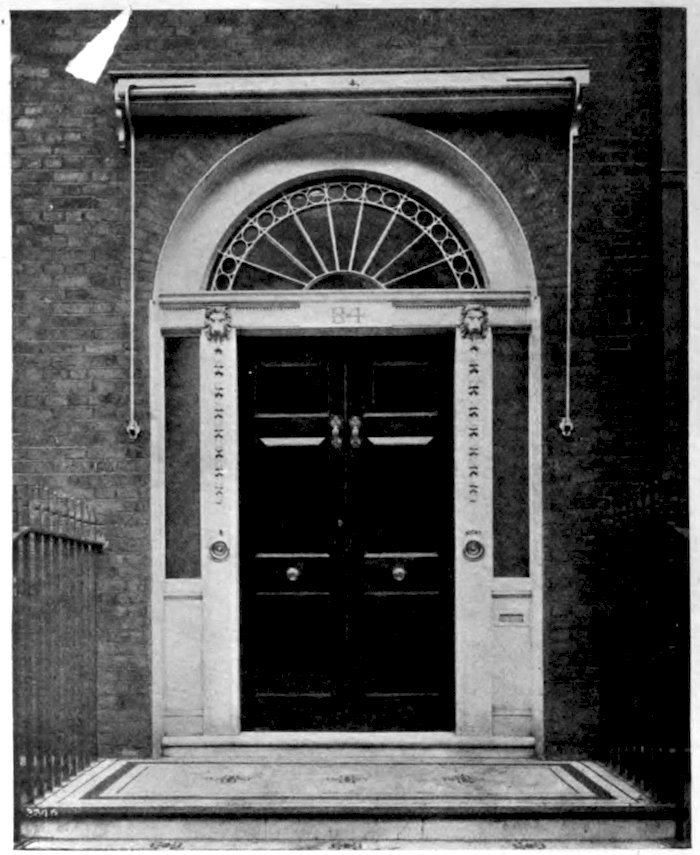
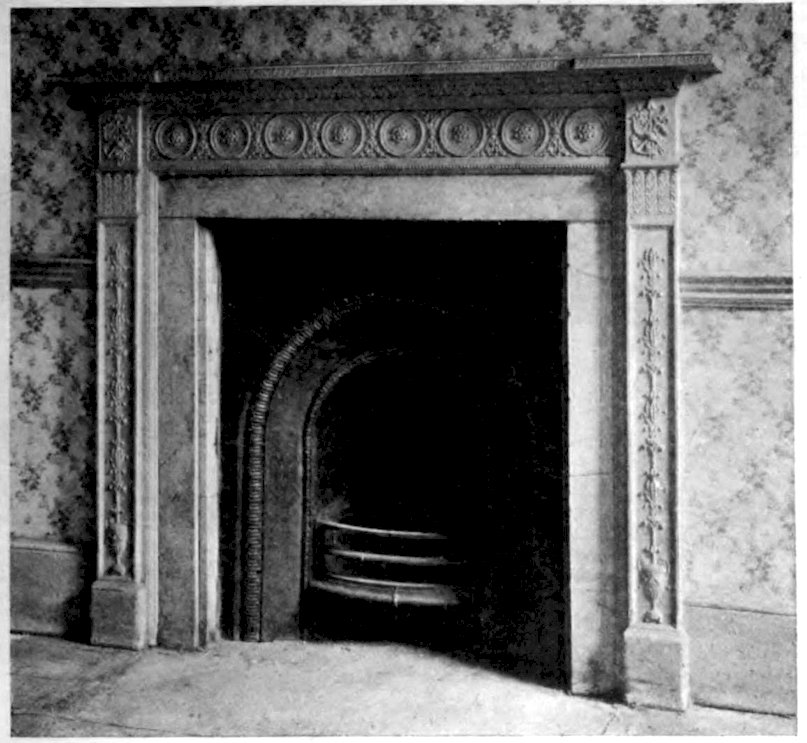
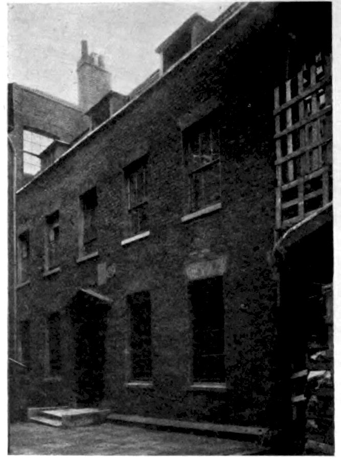
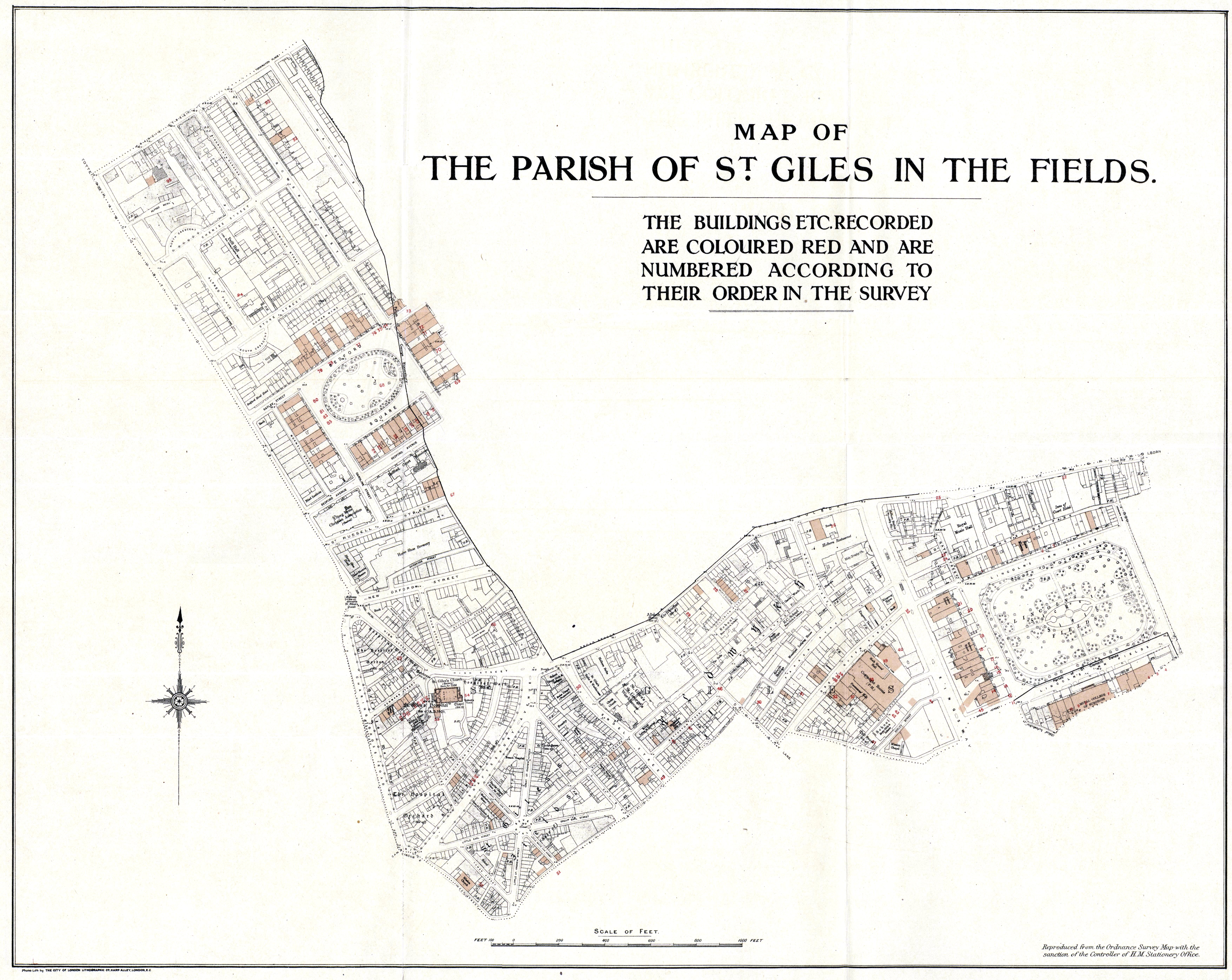
LONDON COUNTY COUNCIL SURVEY OF LONDON ISSUED BY THE JOINT PUBLISHING COMMITTEE REPRESENTING THE LONDON COUNTY COUNCIL AND THE COMMITTEE FOR THE SURVEY OF THE MEMORIALS OF GREATER LONDON UNDER THE GENERAL EDITORSHIP OF SIR LAURENCE GOMME ( for the Council ) PHILIP NORMAN ( for the Survey Committee ) VOLUME V. THE PARISH OF ST. GILES-IN-THE-FIELDS (Part II.)
Transcriber’s Note:
New original cover art included with this eBook is granted to the public domain.
i
PUBLISHED BY THE LONDON COUNTY COUNCIL, SPRING GARDENS, LONDON
1914
iiiTHE PARISH OF ST. GILES-IN-THE-FIELDS
(PART II.), BEING THE FIFTH
VOLUME OF THE SURVEY OF
LONDON, WITH DRAWINGS, ILLUSTRATIONS
AND ARCHITECTURAL
DESCRIPTIONS, BY W. EDWARD RILEY,
ARCHITECT TO THE COUNCIL.
EDITED, WITH HISTORICAL NOTES,
BY SIR LAURENCE GOMME, CLERK
OF THE COUNCIL.
JOINT PUBLISHING COMMITTEE REPRESENTING THE LONDON COUNTY COUNCIL AND THE COMMITTEE FOR THE SURVEY OF THE MEMORIALS OF GREATER LONDON. — MEMBERS OF THE SURVEY COMMITTEE DURING THE PERIOD OF THE WORK. — The former Presidents of the Committee were — — President. — Honorary Members and Subscribers. — Active Members.
iv
Chairman.
E. L. MEINERTZHAGEN.
Members appointed by the Council.
GRANVILLE-SMITH, R. W.
JOHNSON, W. C.
MEINERTZHAGEN, E. L.
TAYLOR, ANDREW T.
Members appointed by the Survey Committee.
GODFREY, WALTER H.
LOVELL, PERCY.
NORMAN, PHILIP.
v
The late LORD LEIGHTON, P.R.A.
The late Rt. Hon. and Rt. Rev. Dr. CREIGHTON, LORD BISHOP OF LONDON.
The Rt. Hon. EARL CURZON OF KEDLESTON, G.C.S.I., G.C.I.E., F.R.S.
The Rt. Hon. Lord Aberdare.
The Board of Agriculture.
C. E. Allen.
Mrs. J. W. Allen.
Sir Robert Allison.
The Society of Antiquaries.
William Sumner Appleton.
The Architectural Association.
The Society of Architects.
The Royal Institute of British Architects.
The Athenæum.
John Avery.
Samuel P. Avery.
E. Burrell Baggallay.
E. J. Barron.
B. T. Batsford.
Boylston A. Beal.
Henry Forbes Bigelow.
Mrs. Percy Bigland.
Arthur L. Bilham.
Harry W. Birks.
The Birmingham Central Library.
The Bishopsgate Institute.
John Briggs.
E. W. Brooks.
A. Herve Browning.
Alfred Burr.
Mrs. Cadic.
The Worshipful Company of Carpenters.
Miss A. G. E. Carthew.
W. J. Checkley.
Cyril S. Cobb.
E. C. Colquhoun.
The Columbia University Library.
The Constitutional Club.
William W. Cordingley.
The Rt. Hon. Lord Courtney of Penwith, P.C.
Walter Crane.
The Rt. Hon. the Earl Of Crawford, F.S.A.
The Croydon Public Library.
G. J. Crosbie Dawson.
George H. Duckworth.
The Board of Education.
The Rt. Hon. the Earl Ferrers.
Mrs. Charles Fewster.
Owen Fleming.
Mrs. Wickham Flower.
Miss Forbes.
Sir George Frampton, R.A., F.S.A.
Miss Agnes Garrett.
Sir Rickman Godlee.
Goldsmiths’ Library, University of London.
A. Gray, K.C.
Miss I. I. Greaves.
Maj.-Gen. Sir Coleridge Grove, K.C.B.
The Guildhall Library.
Richard Waldon Hale.
Edwin T. Hall, F.R.I.B.A.
Mrs. Henry Hankey.
Ambrose Heal.
David Hills.
S. J. G. Hoare.
R. R. Hodgson.
V. T. Hodgson.
J. J. Holdsworth.
Charles H. Hopwood, F.S.A.
E. J. Horniman.
Miss Huth.
Mrs. Alfred Huth.
Edward Huth.
Douglas Illingworth.
Mrs. Illingworth Illingworth.
Miss Edith F. Inderwick.
The Rt. Hon. the Viscount Iveagh, K.P., G.C.V.O., F.R.S.
Edward Tyrrell Jaques.
Gilbert Jenkins.
Philip M. Johnston, F.R.I.B.A., F.S.A.
Miss Caroline A. Jones.
C. H. F. Kindermann.
C. L. Kingsford.
Sir Hugh Lane.
Miss E. M. Lang.
G. C. Lawson.
Sir W. H. Lever, Bt., M.P.
H. W. Lewer.
Owen C. Little.
The London Library.
Dr. G. B. Longstaff.
Mary, Countess of Lovelace.
W. L. Lucas.
Justin Huntly Mccarthy.
William McGregor.
The Manchester Central Library.
viC. O. Masters.
Miss B. A. Meinertzhagen.
The Metropolitan Public Gardens Association.
G. Vaughan Morgan.
John Murray, F.R.I.B.A.
The New York Public Library.
Allan Nickinson.
F. H. Norman.
R. C. Norman.
Mrs. Robert Norman.
The Rev. J. P. Noyes.
Vere L. Oliver.
The Oxford and Cambridge Club.
F. W. Peters.
Mrs. W. Wilton Phipps.
F. W. Platt.
D’Arcy Power, F.R.C.S.
Sir E. J. Poynter, P.R.A., F.S.A.
F. W. Procter.
The Public Record Office.
Mrs. F. L. W. Richardson.
Colin E. Reader.
The Reform Club.
Sir Joseph Savory.
Sion College.
Mrs. Vernon Smith.
A. G. Snelgrove.
W. J. Songhurst.
H. C. Sotheran.
Walter L. Spiers.
F. B. Spooner.
The Rt. Hon. Lord Alexander Thynne.
A. G. Warren.
The Library of Congress, Washington.
Mrs. Westlake.
Mrs. Wharrie.
J. Barrington White.
Miss M. J. Wilde.
Dr. George C. Williamson.
Walter Withall.
John E. Yerbury.
Keith D. Young, F.R.I.B.A.
C. R. Ashbee.
Oswald Barron, F.S.A.
A. H. Blake.
W. W. Braines.
A. E. Bullock, A.R.I.B.A.
G. H. Chettle.
A. W. Clapham, F.S.A.
George Clinch, F.G.S., F.S.A., Scot.
A. O. Collard, F.R.I.B.A.
F. T. Dear.
William Doddington.
H. W. Fincham.
Matt. Garbutt.
Walter H. Godfrey.
Mrs. Ernest Godman.
T. Frank Green, A.R.I.B.A.
Edwin Gunn, A.R.I.B.A.
Osborn C. Hills, F.R.I.B.A.
E. W. Hudson.
T. Gordon Jackson, Licentiate R.I.B.A.
Max Judge.
P. K. Kipps, A.R.I.B.A.
Gilbert H. Lovegrove.
Ernest A. Mann, Licentiate R.I.B.A.
E. T. Marriott, M.A.
Cecil G. McDowell.
W. Monk, R.E.
Sydney Newcombe.
E. C. Nisbet.
Robert Pearsall.
A. Wyatt Papworth, A.R.I.B.A.
Francis W. Reader.
Ernest Railton.
John Ravenshaw.
Francis R. Taylor, Licentiate R.I.B.A.
George Trotman.
Miss E. M. B. Warren.
W. A. Webb, A.R.I.B.A.
A. P. Wire.
W. Wonnacott, A.R.I.B.A.
E. L. Wratten, A.R.I.B.A.
Edward Yates.
W. P. Young.
Philip Norman, F.S.A., LL.D., Editor of the Committee.
E. L. Meinertzhagen, J.P., Treasurer of the Committee.
Percy Lovell, B.A., A.R.I.B.A.,
Secretary of the Committee, 27, Abingdon Street, Westminster, S.W.
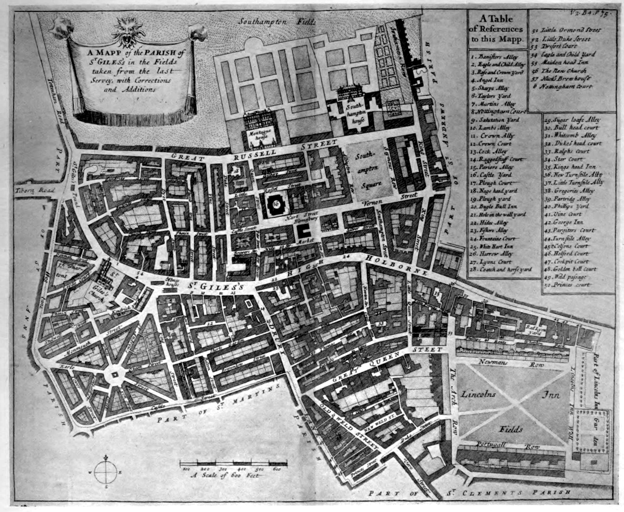
Extract from Map by Hollar of the area now forming the West Central District of London, showing the neighbourhood of St. Giles-in-the-Fields circ. 1658.
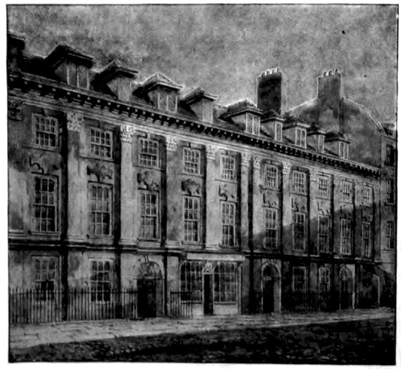
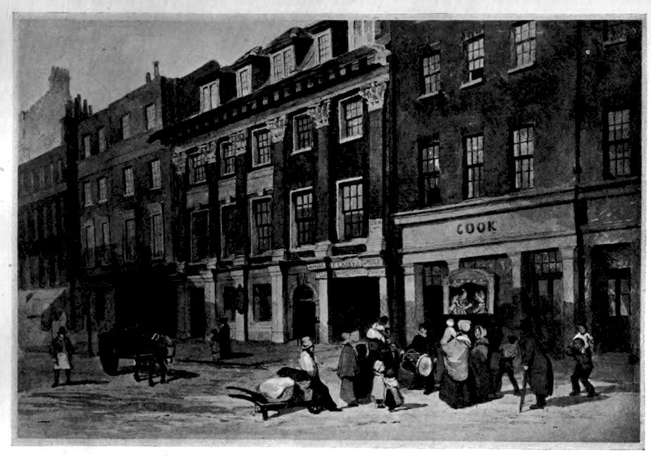
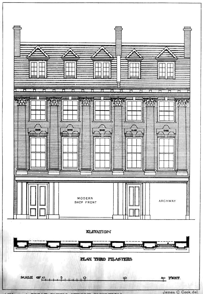
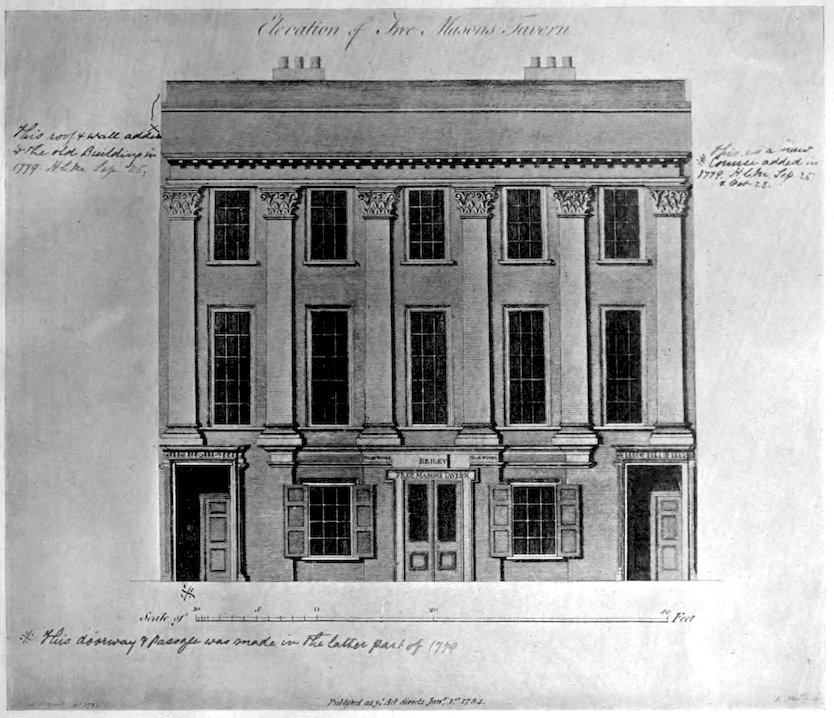
Nos. 55 and 56, Great Queen Street, Elevation. Reproduced by kind permission of B. T. Batsford, Ltd., from Later Renaissance Architecture in England by John Belcher and Mervyn E. Macartney.
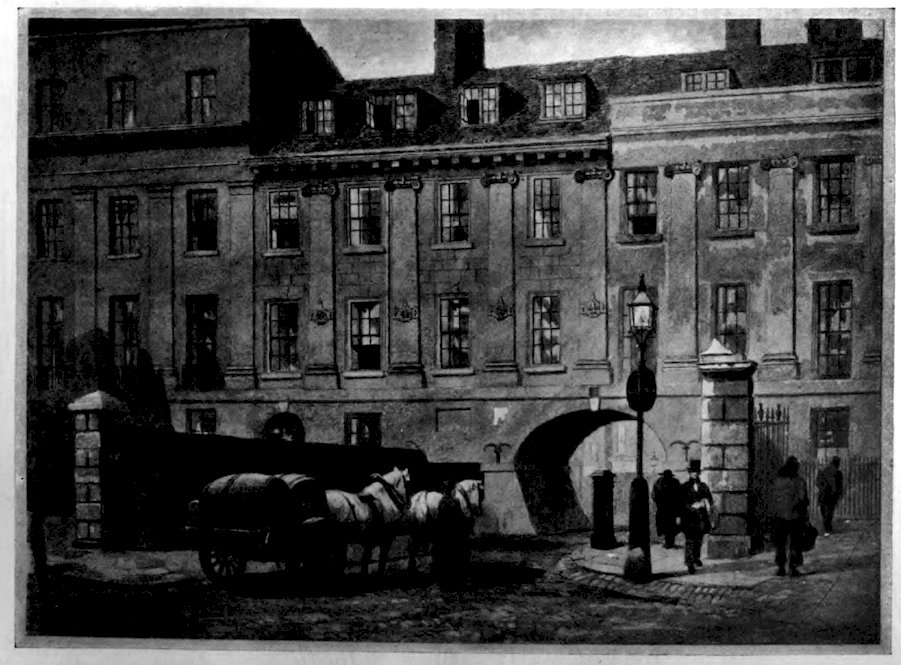
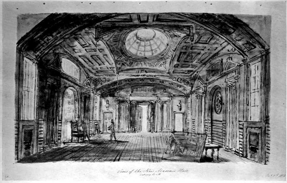
Freemasons’ Hall, “View of the new Masonic Hall, looking South,” from an original pen sketch design by Sir J. Soane, 1828, preserved in the Soane Museum
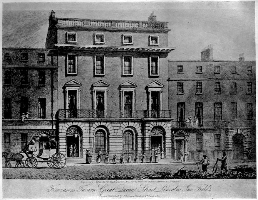
Nos. 55–58, Great Queen Street. Sketch by J. Nash (1840), reproduced from The Growth of the English House, by J. Alfred Gotch, by kind permission of B. T. Batsford, Ltd.
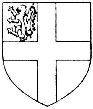
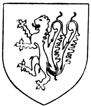
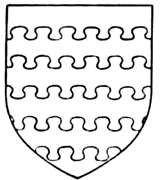
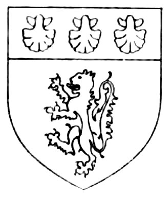
Or, a cross Gules, in the dexter canton a lion rampant Sable.
2.
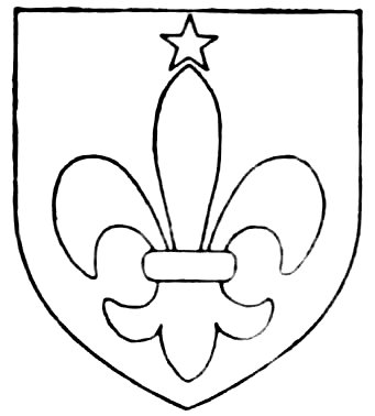
DIGBY
Azure, a fleur-de-lis Argent, with a molet for difference.
3.
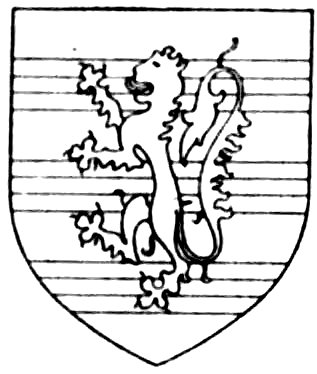
FAIRFAX
Argent, three bars gemelles Gules, surmounted by a lion rampant Sable.
4.
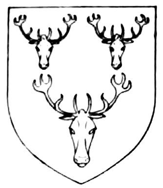
CAVENDISH
Sable, three bucks’ heads caboched Argent.
xiv5.
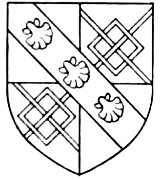
SPENCER
Quarterly Argent and Gules, in the 2nd and 3rd quarters a fret Or, over all, on a bend Sable, three escallops of the 1st.
6.
GREY
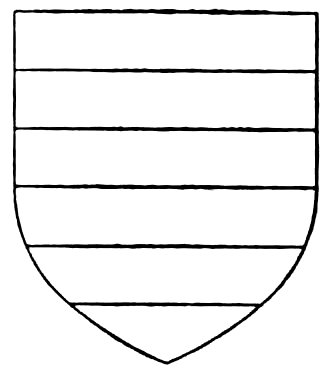
Barry of six Argent and Azure.
7.
BROWNE
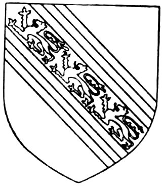
Sable, three lions passant in bend between two double cotisses Argent.
8.
ELIZABETH, COUNTESS RIVERS.
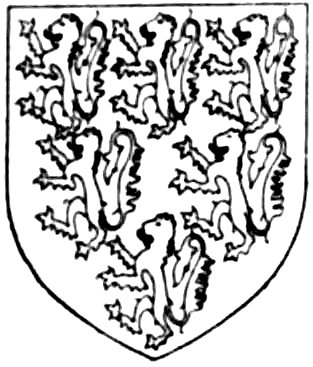
Argent, six lions rampant, three, two and one, Sable.
9.
O’BRIEN
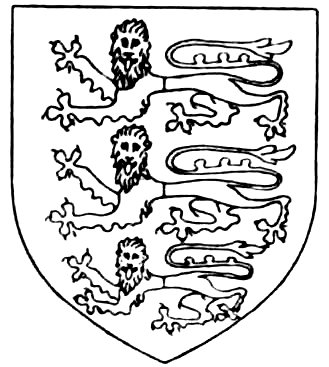
Gules, three lions passant guardant in pale per pale Or and Argent.
10.
FREDERICK NASSAU DE ZUYLESTEIN, EARL OF ROCHFORD.
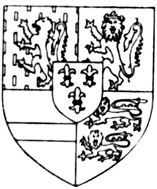
Quarterly, 1st, Azure semée of billets Or, a lion rampant of the 2nd for Nassau; 2nd, Or a lion rampant guardant Gules, ducally crowned Azure for Dietz; 3rd, Gules, a fesse Argent for Vianden; 4th, Gules, two lions passant guardant in pale Or for Catznellogen; over all, in an escutcheon Gules three zules Argent, two and one, for Zuylestein.
11.
SHEFFIELD
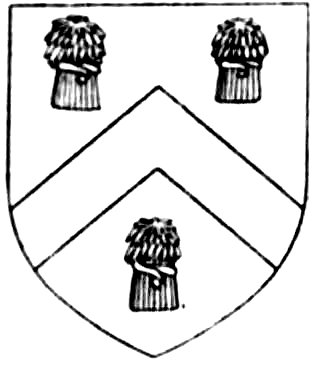
Argent, a chevron between three garbs Gules.
12.
BURNET
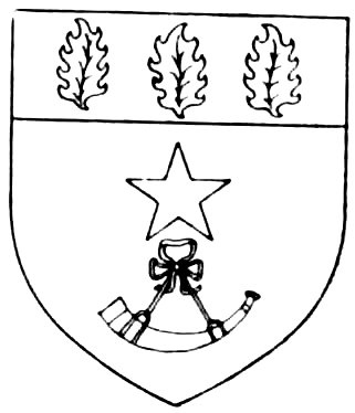
Argent, three holly leaves in chief Vert, and a hunting horn in base Sable, garnished and stringed Gules, with a molet Azure in the fess point for difference.
13.
CONWAY
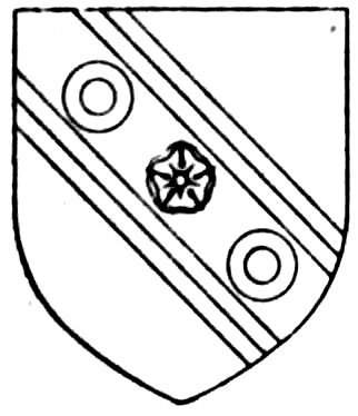
Sable, on a bend cotised Argent, a rose between two amulets Gules.
14.
FINCH
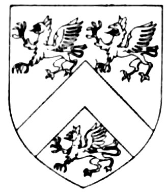
Argent, a chevron between three griffins passant Sable.
15.
NORTH
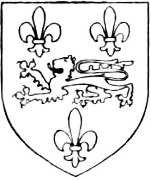
Azure, a lion passant Or, between three fleurs-de-lis Argent.
16.
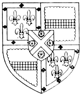
ESMÉ STUART, SEIGNEUR D’AUBIGNY, DUKE OF LENNOX.
Quarterly, 1st and 4th Azure, three fleurs-de-lis Or within a bordure Gules charged with seven buckles of the second, for Aubigny; 2nd and 3rd, Or, a fess chequy Azure and Argent within a bordure Gules engrailed for Stuart of Darnley; over all on an escutcheon Argent a saltire Gules between four roses of the same, for Lennox.
17.
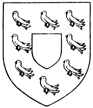
BROWNLOW
Or, an escutcheon, with an orle of eight martlets Sable.
18.
DUDLEY
Or, a lion rampant Azure, double queued Vert.
19.
BLOUNT
Barry nebulée of six Or and Sable.
20.
RUSSELL
Argent, a lion rampant Gules, on a chief Sable three escallops of the first.
PREFACE.
xv
The present volume—the fifth in the Survey of London—completes
the record of the Parish of St. Giles-in-the-Fields. As in
the case of the other volumes issued, the important part of the
book, from the survey point of view, is to be found in the photographs
and drawings, to which the letterpress is strictly subservient, but which
form only a portion of the actual collection in the hands of the Council.
Nevertheless, considerable attention has been devoted to history, the
more particularly because existing books on the parish, notably, Parton’s
Hospital and Parish of St. Giles-in-the-Fields and Blott’s Blemundsbury,
are incomplete, and in many cases actually misleading. An attempt has
been made to retrace the history of each plot of land to the time before
the erection of buildings, that is, practically to the reign of Elizabeth.
No doubt, had time permitted, it would have been possible to do this
adequately in many instances where the investigation has had to remain
incomplete, though it is doubtful whether in all cases the necessary records
are in existence.
The materials for the history have been gathered from diverse
sources, and the lists of occupiers of the various houses dealt with have
been obtained principally from the parish and sewer ratebooks, supplemented
by the Hearth Tax Rolls and information given in deeds. The
four Hearth Tax Rolls used were described in the previous volume[1] dealing
with St. Giles. The sewer ratebooks have not proved of so great assistance
in supplementing the parish books (which begin only in 1730) as was the
case in the previous volume, since, with the important exception of
those containing Lincoln’s Inn Fields and Great Queen Street, there are
very few relating to this parish which date from the 17th century.
It is desired to take this opportunity of thanking those owners and
occupiers of houses who have kindly granted permission to the Council
to make surveys of the interior of their premises, and take photographs for
reproduction in this volume. The thanks of the Council are especially due
to His Grace the Duke of Bedford, K.G., for information most willingly
imparted with reference to those premises which are in the Manor of
Bloomsbury, and to the Holborn Metropolitan Borough Council for the
facilities given to the Council’s officers for the examination of the parish
ratebooks and other records.
I gladly repeat the acknowledgment, made in Vol. III. of this
series, of the great assistance rendered in connection with the preparation
of this volume by Mr. W. W. Braines, B.A. (Lond.), the officer
in charge of the Records, Publications and Museums Branch of my
department.
LAURENCE GOMME.
County Hall,
Spring Gardens, S.W.
13th March, 1914.
THE PARISH OF ST. GILES-IN-THE-FIELDS
PART II.
BOUNDARY OF THE PARISH OF ST. GILES-IN-THE-FIELDS.
1
The earliest mention of the parish boundary of St. Giles-in-the-Fields
occurs in a decree of 1222, terminating the dispute between
the Abbey of Westminster and the See of London respecting the
ecclesiastical franchise of the conventual church of St. Peter. According
to this the boundary of the Parish of St. Margaret, Westminster, began
at the watercourse of Tyburn and stretched towards London as far as the
garden of the Hospital of St. Giles, “thence as the way beyond the same
garden extends as far as the boundaries dividing Marshland and the parish
of St. Giles.”[2] This is pretty clear evidence that in those early days the
southern portion of the western boundary of St. Giles passed along the
thoroughfare bounding the Precinct and Marshland on the west, thus
agreeing precisely with the limits at the present day.
Although, however, there does not seem to have been any change
in that comparatively small part of the parish boundary, in many other
respects the limits of the parish have undergone serious modification.
The first considerable alteration took place in 1731, when the Parish of St.
George, Bloomsbury, was formed out of the old parish, and made to include
all that part which lay to the north of High Holborn and east of Dyot
Street and of a line drawn northwards from the latter’s termination in
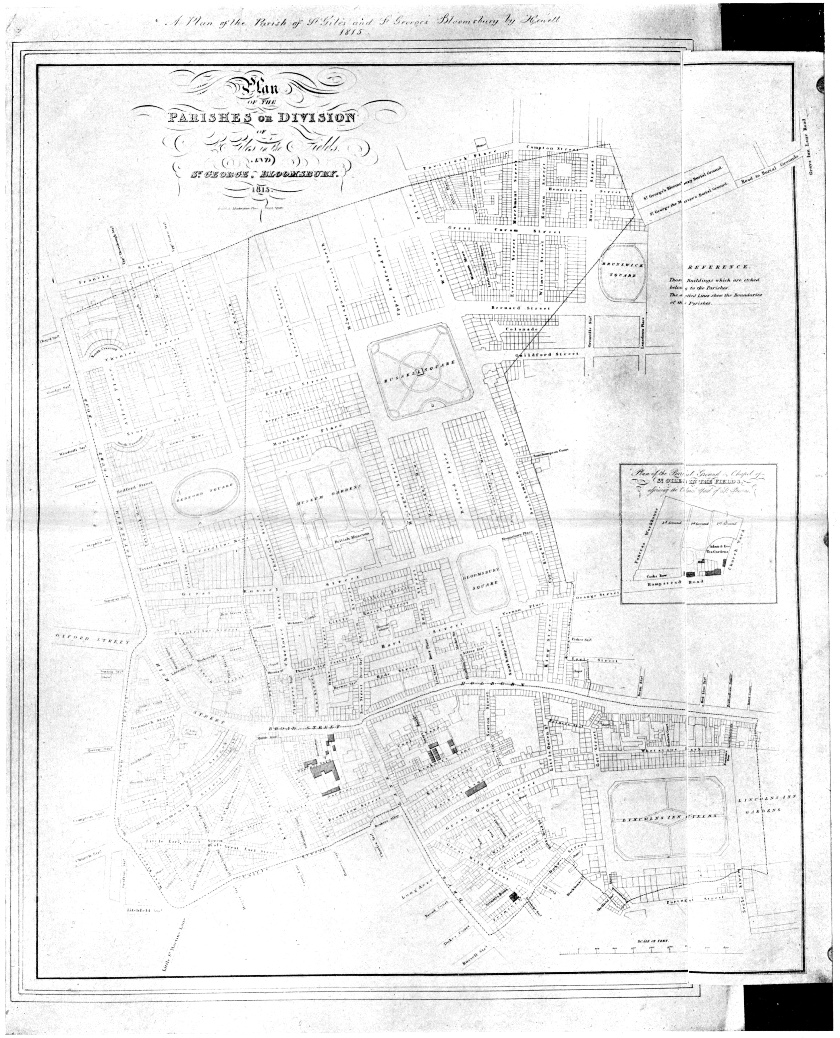
Great Russell Street (see Plate 6). This northward line was afterwards
slightly modified. Again, quite recently, the parish was further curtailed
as a result of Orders made under the London Government Act, 1899.
The south side of Lincoln’s Inn Fields, and the area lying between Wild
Street and Drury Lane, were thereby taken from St. Giles, a give-and-take
line was adopted between the west side of Lincoln’s Inn Fields and the
junction of Kemble Street and Wild Street, and certain small additions
to the parish were made at Francis Street on the north and Broker’s Alley
on the south.
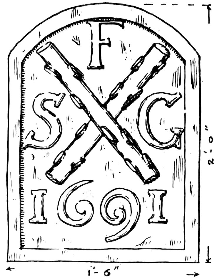
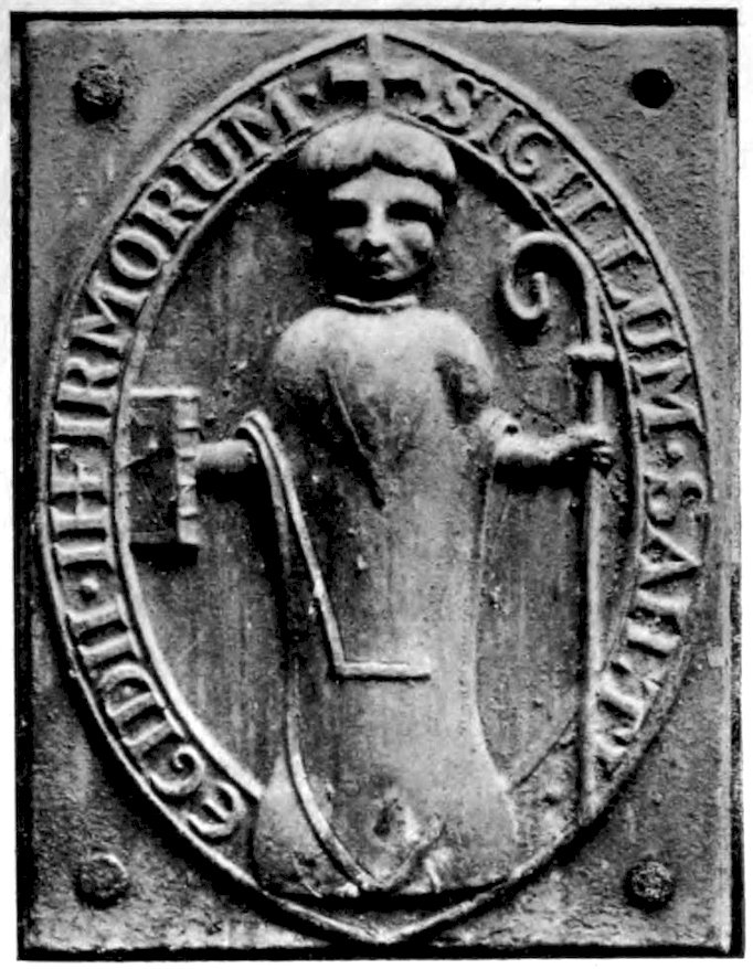
The stone tablet, illustrated on the next page, is a relic of the old
boundary line of the parish. It was built into the wall of No. 2, Sheffield
Street, which premises were demolished in 1903 in connection with the
formation of Kingsway. The stone was preserved by the London
County Council and has been lent to the London Museum.
2The boundary between the parishes of St. Giles-in-the-Fields
and St. George, Bloomsbury, cuts through Bedford Square in such a way
that although the greater part of the square is in the former, all the houses
on the east side and a few on the south side are in the parish of St. George.
As it was felt that there were advantages in dealing with the square as a
whole, it was decided that, as had been done in the case of Lincoln’s Inn
Fields,[3] the entire square should be treated in one volume.
XXII.—HIGH HOLBORN FROM THE PARISH BOUNDARY TO LITTLE TURNSTILE.
3
The whole of the space between the parish boundary and Great
Turnstile was occupied by houses at least as early as, and probably long
before, the reign of Henry VIII. In 1545, Edward Stockwood sold to
Thomas Dyxson, 5 messuages and 5 gardens in the parishes of St. Andrew,
Holborn, and St. Giles-in-the-Fields,[4] and when, in the following year,
Dyxson transferred the property to Richard Clyff, the western and eastern
boundaries are described[5] as the tenement of John Coke and the inn called
The Antelope, respectively. In the course of the next century, the five
houses seem to have been divided or rebuilt as seven houses, four of which
were in St. Giles, the remaining three being in St. Andrew’s.[6]
Between the westernmost of these and Great Turnstile there were,
in 1545, three houses in the possession of John Coke.[7] These had belonged
to the Priory of St. John of Jerusalem before the dissolution of that
monastery.[8]
Great Turnstile is mentioned as early as 1522, under the name
“Turngatlane”[9]; it was also known as “Turnpiklane.”[10] It is quite
certain that in 1545 no houses had been built along the sides of Great
Turnstile, and none probably were erected there until many years later.
The earliest records so far obtained of such houses on the eastern and
western sides of the lane are dated respectively 1632 and 1630[11], and
probably these dates are not far removed from the actual time of building.
Reference was made in a previous volume[12] to the ten houses
belonging to the Priory of St. John of Jerusalem, which, in the reign of
Henry VIII., occupied the frontage of High Holborn, between Great Turnstile
and certain property belonging to the Hospital of St. Giles, and it was
4then suggested that their western limit practically corresponded with the
boundary between Cup Field and Purse Field. Definite proof of this has
not been obtained, but it will be shown that the St. John’s property must
have extended to within a little of this, thus occupying the site of about
thirty numbers. Obviously, the houses must have been very scattered.
It is also possible that certain buildings were in existence further to the
west, towards Little Turnstile, as early as the reign of Edward II.,[13] and
certainly the whole of this part of the frontage to High Holborn was
covered in the early part of Elizabeth’s reign.
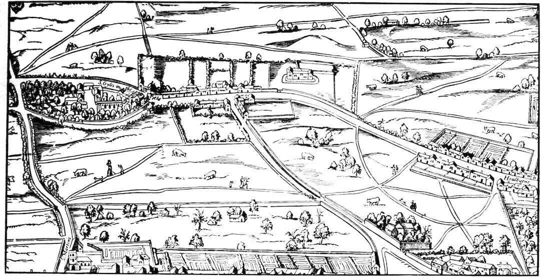
Agas’s map (Plate 1) shows a single line of buildings extending
between the two turnstiles, but this is not an adequate representation
of the state of affairs in the closing years of the sixteenth century.
In order to describe this, so far as the records which have come to light in
the course of the investigation for this volume will allow, it will be necessary
to go into some detail, but as the point has never before been dealt
with, it has been thought desirable to do so. Although the results in some
cases fall short of certainty, it is hoped that thereby an idea may be gained
of the somewhat complex system of houses, gardens and orchards that
existed between High Holborn and the site of Whetstone Park. The
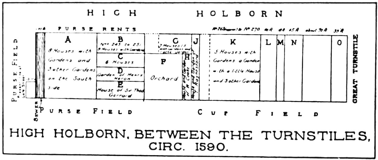
accompanying plan will render the description of the properties more
easy to follow. It should be understood that the plan is quite a rough
one, and intended merely to give a general idea of the situation about the
year 1590. The discovery of further records would, no doubt, modify it
in certain details.
HIGH HOLBORN, BETWEEN THE TURNSTILES, CIRC. 1590.
Where now is the entrance to Little Turnstile, there then existed an
open ditch or sewer. In the Survey of Crown Lands[14] taken in 1650, reference is
made to a certain property “scituate and adjoyninge to Lincolnes Inn Fields
alias Pursefeild,” being 214 feet long from Purse Field south, to Mr. Lane’s
5houses on the north, and 22 feet wide, which ground was “heertofore a
ditch or comon sewer and filled upp to bee part of the Pursefeild.” Lane’s
houses were on the projecting north side of Little Turnstile, and the sewer
lay 21 feet to the east of the present line of Gate Street.[15]
In 1560, Lord and Lady Mountjoy sold[16] to Thomas Doughty and
Henry Heron “syxtene meses, mesuages or tenementes adioyninge nere
together ... scytuate and being in Holborne,” called by the name of
Purse Rents, together with six additional gardens. From the inquisition[17]
held on the death of Doughty in 1568 it appears that he held eight of the
houses and three of the gardens.
Eight years later (1576) Thomas Doughty, junior, sold[18] that part
of the property to “Buckharte Cranighe,[19] doctor of physyke.” In the same
year Queen Elizabeth granted[20] to John Farnham, one of her gentlemen
pensioners, the whole of the combined Doughty and Heron property,
increased on the Heron side by two houses, five cottages, three stables and
an orchard, none of which are mentioned in the previous deeds. Farnham
immediately sold the property afresh to Doughty[21] and Heron.[22] The
latter in 1589 sold to [23]Rowland Watson and Thomas Owen, nine houses,
which, by the names of the occupiers, can be identified as nine of the ten
sold by Farnham, and which are stated to contain in length together on the
street side 35½ yards. In 1669 the same property, then consisting of seven
houses, was sold[24] by William Watson to Emmanuel College, Cambridge,
and is obviously to be identified with the six houses in High Holborn leased
by the college in 1800,[25] and described as Nos. 246 to 251, High Holborn.
The length of the Holborn frontage of Nos. 246 to 251 accords well with the
dimension required (35½ yards), and the identification of these houses with
the property sold by Heron to Watson (B on accompanying plan) may be
regarded as fairly certain.
In 1592 Heron sold a further portion of his property[26], the purchaser
6this time being Anne Carew.[27] This consisted of (i.) six messuages (C on
plan) abutting north upon the lands and tenements of Master Watson (i.e. B),
and south upon Heron’s garden; (ii.) a messuage in the occupation of Sir
Thomas Gerrard,[28] abutting north on Heron’s garden and south on “the
White Hart feilde”, (i.e., Purse Field, which was held with The White Hart);
(iii.) the said garden and an orchard[29] lying together and containing three
roods, the garden adjoining west on “the lands late Burcharde Crainck,”
and the orchard towards the east, abutting on the messuage and garden of
William Cook; and (iv.) the messuage and garden of Cook (H on plan)
abutting south on Cup Field, on the north on a tenement of Mistress Buck,
widow, and east on a garden late of Thomas Raynesford. In the light of
(iii.) it is now possible to assign the Doughty property (afterwards Burrard
Cranigh) to position A.
Plots A to F are thus roughly settled, but before leaving them it
is necessary to trace further the history of F until its development by
building. On the death of Anne Carew the property seems to have
passed[30] to her son George, afterwards Baron Carew of Clopton and Earl
of Totnes, and by him to have been bequeathed to Peter Apsley,
grandson of his brother Peter. In 1640, John Apsley sold[31] to Daniel
Thelwall and William Byerly, together with other adjacent property,
a messuage with an orchard containing half an acre, “scituate
over against the said messuage and extending from the way or
path there to the feild side,” all formerly in the occupation of John
Waldron. Of this William Whetstone held a lease, which he had obtained
certainly before 1646[32], and in 1653 reference is made[33] to “all the newe
buildings thereon erected.” It is most probable, therefore, that this was the
scene of the building operations described in the Earl of Dorset’s report
to the Privy Council on 11th December, 1636, when he complained that
“one William Whetstone,” having lately erected five brick houses in
7Lincoln’s Inn Fields, without proper permission, had “for the better
countenanceing of himselfe therein, and for the finishinge and mayntayneing
the said buildings, counterfeited his Lopps hand, as also the hand of his
Secre, frameing a false lycence,” etc. It having been decided that this was “a
presumption of a high nature, and a fraud and offence not fitt to be passed
by wthout exemplary punishment,” instructions were given for the demolition
of the houses,[34] but it is not known whether this was actually done.
At any rate, Whetstone succeeded in stamping his name on the new
thoroughfare which parted the property in High Holborn from that in the
adjoining fields, though the western part was at first known as Phillips
Rents. The Phillips in question was perhaps the John Phillips mentioned
in a document[35] of 1672, as having lately been in occupation of a piece of land
in the rear of Purse Rents, “being southward upon a way [i.e., Whetstone
Park] leading from Partridge Alley towarde Great Queene Street.”
Notice must now be taken of another property of Heron, “parcell
of the lands of the late dissolved Hospital of St. John of Jerusalem.” In
1586 he sold to John Buck[36] eight houses (seven with gardens attached)
and one garden plot, the first house being described as “all that messuage or
tenement with a garden and backsyde, now in the tenure, farme or occupacion
of one Thomas Raynesford or his assignes.” The position of Raynesford’s
messuage and garden is obviously J (see above) and as H is distinctly
stated to be bounded on the north by a tenement of Mistress Buck,[37] the
Buck property may be assigned to position G.
In October 1583, Heron had sold[38] to Anne Carew five houses with
gardens, a garden with a little house, and three other gardens. The only
information given as to the position of the property is that it was situated
in St. Giles-in-the-Fields. It is, however, possible to locate it approximately.
In 1634, Peter Apsley sold[39] to Sir John Banks, the attorney general,
“all that messuage or tenement with appurtenances, scituate in High Holborne,
in St. Giles, together with the court or yard lying on the south part of
the said messuage, and the garden beyond the said court, extending to the
feildes lying on the south of the said messuage, as the same is enclosed with
a brick wall, and as the said premises were lately heretofore in the occupation
of Sir John Cowper, Knt. and Bart. deceased, and formerly in the
occupation of Sir Anthony Asheley, Knt. and Bart. deceased.” In 1661
Sir Ralph Banks sold[40] the house to William Goldsborough, and in 1716
Edward Goldsborough assigned[41] the remainder of a lease of 500 years
8granted in January, 1692, by Grace and Robert Goldsborough in respect of
premises described as “all that messuage, tenement or inn, with appurtenances,
scituate in High Holborne in St. Giles-in-the-Fields, known by
the name of The George, together with a courtyard or backside lying on the
south part thereof, and the peice of vacant ground or garden beyond the
said court and belonging to the said messuage and extending to a certain
street or place there called Whetstones Park, lying on the south side of the
said messuage or inn.” There can be little doubt that the premises are
identical with those described in the deed of 1634, and it may therefore
be assumed that the Carew property included the site of The George, which
a reference to Horwood’s Map of 1819 will show is now occupied by the
eastern portion (No. 270) of the Inns of Court Hotel.
This identification is confirmed by the following. Sir Ralph Banks
owned two other houses, one behind the other, adjoining Goldsborough’s
house on the east, and these Goldsborough bought at the same time as he
purchased his own house. In 1663, he sold them to Edmond Newcombe,
and in the indenture[42] embodying the transaction they are described as
being 40 feet broad and 160 feet long, and bounded on the east by “the
house in which Firman now dwelleth.” In June, 1716, a mortgage was
effected by Prescott Pennyston and Thomasin, his wife, of two messuages
in High Holborn, adjoining the inn called The Unicorn. Thomasin was
the daughter and heir of Elizabeth Hollinghurst, formerly Tompson, cousin
and devisee of William Firmin. Now Unicorn Yard occupied a position
corresponding approximately to the western half of the present No. 274 (the
position is well shown on Horwood’s Map, though the numbering does not
quite accord with that of the present day), and distant about 58 feet from
No. 270. Assuming the two houses to be one behind the other, as was the
case in Newcombe’s property, this leaves the 40 feet required for Newcombe’s
house, and 18 feet for Firmin’s house, corresponding almost exactly
with the old No. 274 shown by Horwood. The Carew property may therefore
be assigned definitely to position K with a fixed eastern limit at No. 270.
It has not proved possible to determine its frontage towards the west,
and perhaps it did not extend as far as Raynesford’s house (J). It is,
however, known that it included a tavern called The Three Feathers.[43]
It seems a reasonable assumption that this was in the neighbourhood of
Feathers Court, shown in Horwood’s Map as occupying much the same
position as the present Holborn Place, but entering High Holborn somewhat
further east. The Three Feathers would therefore correspond approximately
to the present No. 263.
The adjoining properties (L and M) have already been referred to. The
house (M) next to The Unicorn was in Elizabeth’s reign in the possession of
John Miller, and in 1607 was described as “all that messuage, cottage,
9tenement or house with a forge,” in High Holborn, “reaching to a certeyne
pasture adjoyninge to Lincolnes Inne on the south syde,” and bounded
on the west by the house and land of John Thornton.[44] Beatrice Thornton,
widow, is shown in the Subsidy Rolls as far back as 1588 as resident at
or near this spot, and this circumstance is undoubtedly to be connected
with the name of Thornton’s Alley, which was hereabouts.[45]
The premises (N), which in the early part of the seventeenth century
comprised a single inn, The Unicorn, had in 1574 been purchased by Francis
Johnson from John and Margaret Cowper, as three messuages and three
gardens,[46] and are described in 1626[47] as having been “now longe since
converted into one messuage or inn commonly called The Unicorne.”
Apparently its use as an inn was of recent date, for in the description of
(M), dated 1607, the eastern boundary of that property is said to be “a
tenement in the occupation of John Larchin, baker,” and in 1629, when the
premises had been re-divided into two, one is said to be[48] “now in the tenure
of Mary Larchin, widdowe, and is now used by her as a common inne, and
is called by the name or signe of The Unycorne.” The dimensions of the
premises are given as 45 feet wide on the north, 40 feet on the south on
Lincoln’s Inn Fields, and 156 feet long.
No records of the time of Elizabeth relating to property between
The Unicorn and the house at the corner of Great Turnstile have, so far,
been discovered. The latter (O), having a frontage to High Holborn of
39 feet, was certainly at the time in the possession of the same John Miller[49]
who held the property (M).
XXIII-XXIV.—Nos. 3 and 4, GATE STREET. — Ground landlord. — General description and date of structure. — Condition of repair. — Biographical notes. — In the Council’s collection are:—
10
The ground landlord of No. 3 is the London County Council.
The area lying between Great Queen Street, Little Queen Street
and Gate Street (the east to west portion of which street was formerly
known as Princes Street) was originally a portion of Purse Field, the early
history of which has already been detailed.[50]
On 27th May, 1639, William Newton sold to John Fortescue[51] “all
that peece or parcell of ground, being part of Pursefeild and the pightells,
designed for two messuages to be built thereon by the said John
Fortescue, the foundations whereof be now laid.” The ground is described
as measuring 50 feet 3 inches from north to south, and 127 feet from east
to west. Between the ground and Princes Street (“a way leading upon a
backgate of an Inn lately called The Falcon and Greyhound”) lay the
houses (or their sites) of Lewis Richard and John Giffard, and a slip of
ground afterwards bought by Arthur Newman, having widths of 25 feet,
25 feet and 8½ feet respectively[52]. From these measurements it can be
shown that the ground sold to Fortescue was the site of what afterwards
became Nos. 3 and 4, Gate Street. The indenture contained, in common
with those relating to Richard’s and Giffard’s houses, a provision “that
there doth and soe perpetually shall lye open from the front of the said
messuage eastward, three score foote of assize, wherein there shall be noe
building erected or builded by the said William Newton, his heirs ... or
any other person or persons whatsoever, it being the principall motive of
the said John Fortescue to purchase the estate and interest aforesaid, to
have the said 60 foote in front to lye open for an open place from the front
of the building, except 11 foote to be inclosed in before the house, and that
there shal be noe buildinges erected at the south-east end of the said open
place by the space of 30 foote, to take away the prospect of the greate
fielde, otherwise than a fence wall, whether he, the said William Newton
or his assignes, keepe the same in his or their owne hands, or doth or doe
depart with it to any other.” It was also agreed “that there shall not at
any tyme or tymes hereafter be erected or built any manner of building
11whatsoever” in the gardens of any of the four messuages[53] in question.
These conditions, as will be seen, have been more than observed.
From the above it is clear that the foundations of the two houses
had already been laid by 27th May, 1639, and the premises were accordingly
probably completed by the end of the year. No exact date can be assigned
to the rebuilding of the houses, but it seems probable that this took place
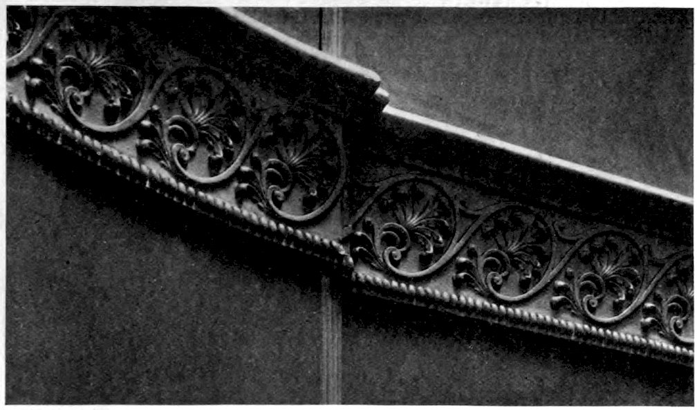
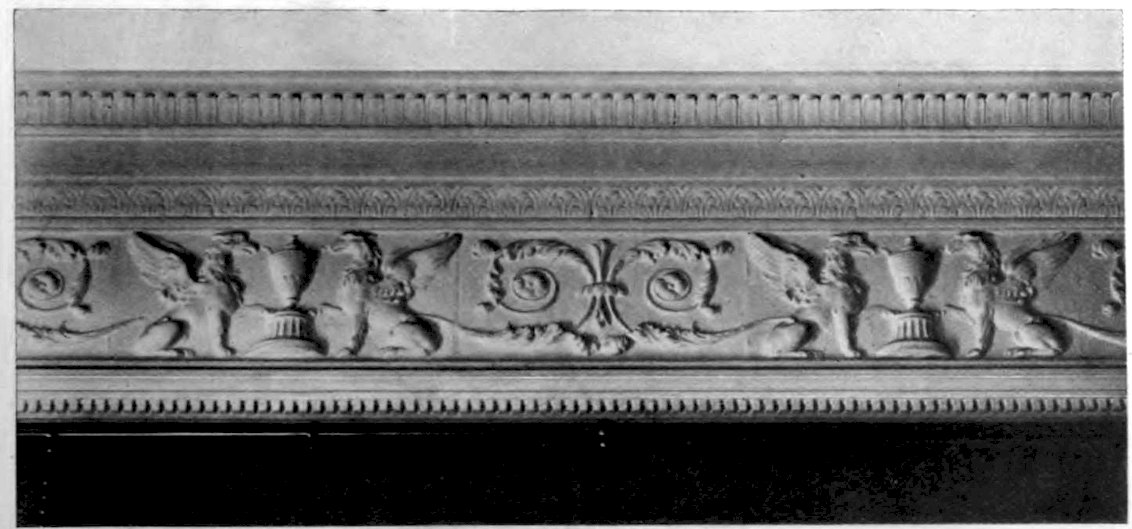
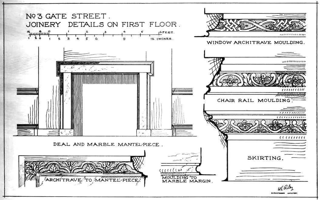
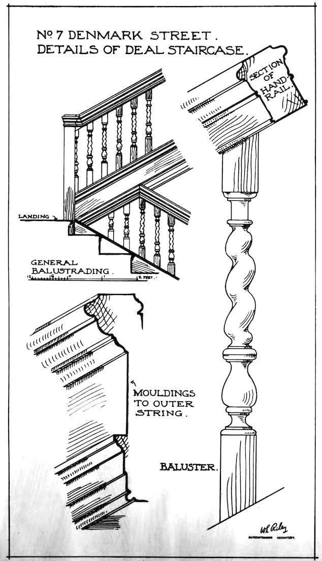
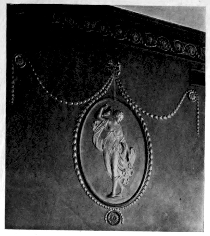
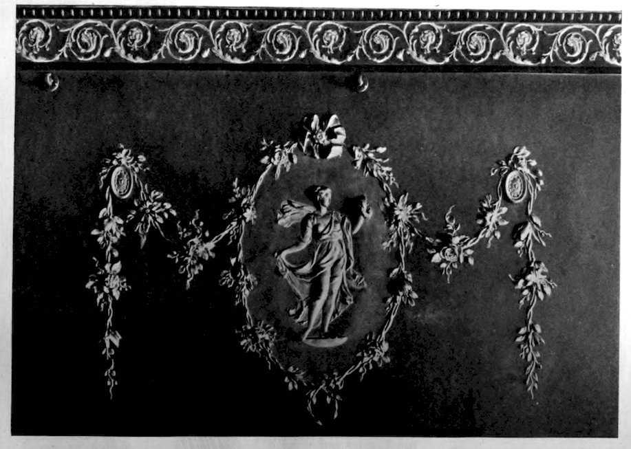
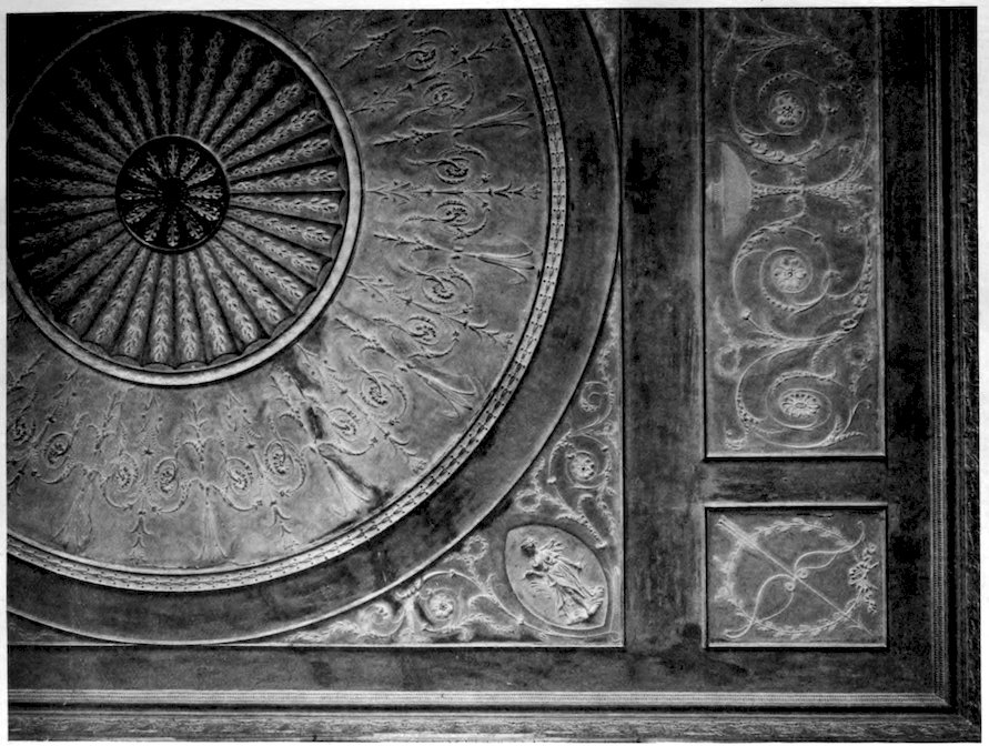
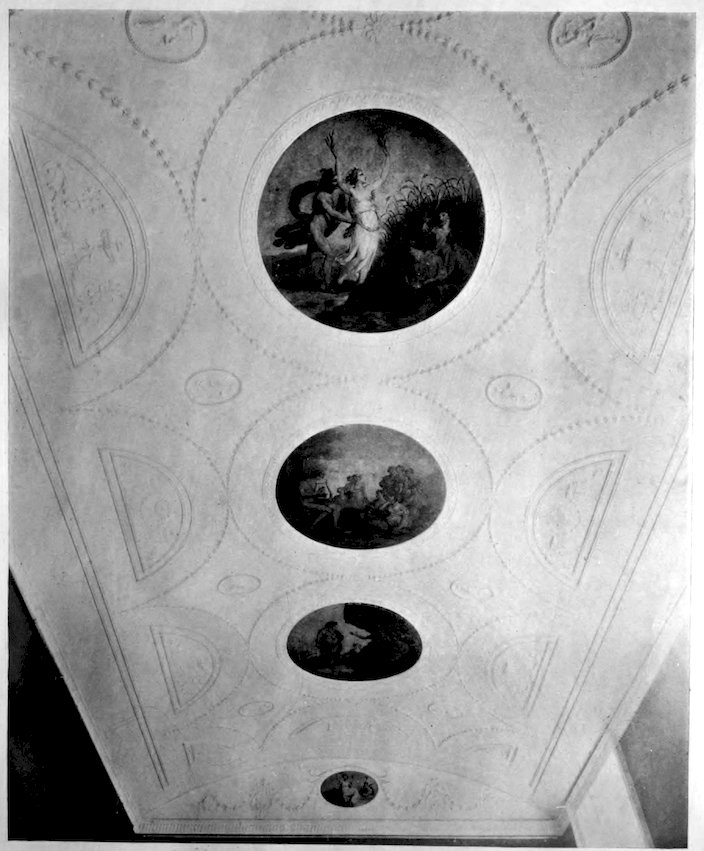
about the middle of the 18th century. The carved mouldings of the joinery
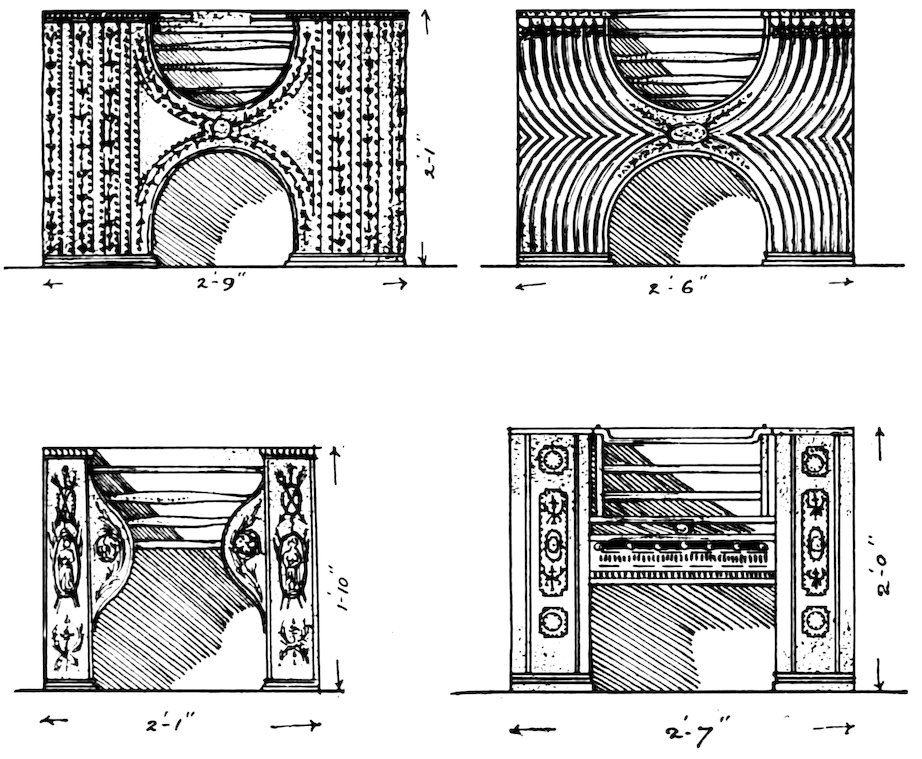
on the first floor of No. 3 are interesting, and details are given in Plate 7.
No. 4 was demolished about 1905. No. 3 has been much cut about, and is now
used as a workshop.
The occupants of these two houses[54], up to the year 1800, so far as it has been
possible to ascertain them, were as follows:—
Sir Thomas Twisden, second son of Sir William Twisden, was born at East
Peckham in 1602. In 1617 he was admitted to the Inner Temple, and called to the
Bar in 1626. Although a staunch royalist, he prospered during the Commonwealth,
and in 1653 was made serjeant at law. At the Restoration he was confirmed in this
12dignity, advanced to a puisne judgeship in the King’s Bench, and knighted. In 1664
he was created a baronet. He died in 1683.
Thomas Povey was the son of Justinian Povey, auditor of the exchequer and
accountant general to Anne of Denmark. At the outbreak of the civil war he at first
joined neither party, and published a treatise called The Moderator: expecting sudden
Peace or certaine Ruine. In 1647, however, he entered the Long Parliament, and was
subsequently appointed a member of the council for the colonies. At the Restoration
he was taken into favour, and many lucrative appointments were bestowed on him.
The dates of his birth and death are unknown. His residence in Gate Street, then
known as Lincoln’s Inn Fields, seems to date from the latter part of 1658 or the very
commencement of 1659. A letter from him is extant written from Lincoln’s Inn
Fields, dated 9th February, 1658–9, while one dated 20th July, 1658 is written from
“Graies Inn.”[56] Apparently he took the house on the occasion of his marriage, as
in an undated letter, after mentioning certain family bereavements, he proceeds:
“I was [thus] driven to meditat on a settlement of myself; and did therefore
accept of such an oportunitie, as it pleased God about that time to offer mee,
of adventuringe upon marriage, wch I have donn upon such grounds as you have all
waies heretofore proposed to myself, my wife being a widdowe, about my own yeares,
never having had a child; of a fortune capable of giving a reasonable assistance to mine,
and of a humour privat and retired. Soe that I am now become a settled person
in a house of my own in Lincolnes Inn Fields.”[57] His house was famous, and both
Evelyn and Pepys have, in their diaries, left a description of it. The former thus
records a visit paid by him on 1st July, 1664. “Went to see Mr. Povey’s elegant house
in Lincoln’s Inn Fields, where the perspective in his court, painted by Streeter, is
indeed excellent, with the vases in imitation of porphyry, and fountains; the inlaying
of his closet; above all, his pretty cellar and ranging of his wine-bottles.” Pepys
had been there a few weeks before, and under date of 29–30th May, 1664, writes:
“Thence with Mr. Povy home to dinner; where extraordinary cheer. And after
dinner up and down to see his house. And in a word, methinks, for his perspective
upon his wall in his garden, and the springs rising up with the perspective in the little
closet; his room floored above with woods of several colours, like but above the best
cabinetwork I ever saw; his grotto and vault, with his bottles of wine, and a well
therein to keep them cool; his furniture of all sorts; his bath at the top of his house,
good pictures, and his manner of eating and drinking; do surpass all that ever I did
see of one man in all my life.”
Charles Catton, the elder, was born in Norwich in 1728. He was apprenticed
to a London coach painter, and attained eminence, not only in this branch of the
profession, but as a painter of landscapes, cattle and subject pictures. He was
appointed the king’s coach painter, and was one of the foundation members of the
Royal Academy. He died in Judd Place, in 1798.
For a number of years (1776–1781) his son, Charles Catton, the younger, is shown
in the Royal Academy Catalogues as residing at his father’s house in Gate Street.
He was born in London in 1756, and acquired a certain reputation as a scene-painter
and topographical draughtsman. He died in the United States in 1819.
Exterior of No. 3 and cross to the memory of Mr. Booker, 1837 (photograph).
[58]Joinery details on first floor of No. 3 (measured drawing).
The Ship Tavern, Gate Street—exterior, showing Little Turnstile (photograph).
Twyford Buildings—View of court in 1906 (photograph).
XXV.—HIGH HOLBORN, BETWEEN LITTLE TURNSTILE AND KINGSWAY.
13
In 1592 a Commission on Incroached Lands reported[59] the existence
of certain property in St. Giles, held without any grant, state, or demise from
the sovereign. On 29th August, 1609, James I. granted the whole of
this to Robert Angell and John Walker. As the point is of importance,
the description of the premises included in the grant is here given in
some detail.[60]
“All that one messuage of ours with appurtenances in the tenure
of Thomas Greene, and one cottage with appurtenances, with garden, in
the tenure of Thomas Roberts, situated in the parish of St. Giles-in-the-Fields ... and all those four cottages with appurtenances lying and
being on the south side of the public way leading from the said town
called St. Giles-in-the-Fields towards Holborne ... and all those small
cottages built within the small pightell called Pale Pingle, lying and being
within the parish of St. Giles opposite the aforesaid cottages, namely, on
the north side of the royal way between the town of St. Giles aforesaid ... and Holborne.”
In 1650 a survey[61] was made of certain property “late belonginge
to Charles Stuart, late king of England,” and included therein were a
number of premises, which extended along the south side of High Holborn
for a distance of 234½ feet eastwards from Little Queen Street, and the
easternmost house of which was The Falcon.
To the reversion in fee farm of this property a Mr. Gibbert laid
claim, basing his pretensions on the identification of the property with
certain of that included in the grant of James I. above referred to, and the
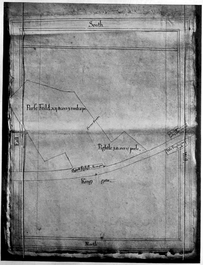
surveyors reviewed at length his title, annexing a “plott of ye ground”
(Plate 2). The conclusion to which they came was, that it was “clere
and aparent” that Green’s messuage and Roberts’ cottage and garden,
together with the four cottages opposite the Pale Pingle, were the tenements
granted to Gibbert, and that these were “at the least 40tie pole” distant
from the houses which he claimed. “Soe yt his clayme in those aforesaid
houses is very unreasonable, false, imperfect and untrue. And wee, whose
names are heerunto subscribed, shall (if Gibbert should bee so uncivell or
shameles heereafter to lay clayme to them before yor honors) make it clerely
appeare to the contrary if at any tyme required.”
In spite of this emphatic condemnation of the unfortunate Mr.
Gibbert, there can be no doubt that the surveyors were wrong. They
14seem entirely to have overlooked the possibility that the houses of Green
and Roberts were not adjacent to the four cottages opposite the Pale Pingle;
in fact, a perusal of the royal grant is sufficient to make it reasonably
certain that they were quite distinct. The matter is, however, capable of
definite proof.
A fortnight after the grant by James I., Angell and Walker conveyed
the whole of the property to Richard Reade and Henry Huddleston,[62] and
they in turn, on 23rd November, 1610, sold it to John Lee.[63] In the
indenture accompanying this sale the two first mentioned houses are described
as “all that messuage or tenement with appurtenances, late in the
tenure of one Thomas Greene ... now called the signe of The Falcon, also
one messuage or tenement or cottage there late in the tenure of one Thomas
Roberts.”
It is quite clear therefore that Gibbert was right in his
contention, and that the premises extending from Little Queen Street
up to and including The Falcon had had their origin in the house of
Green and the cottage of Roberts, which had first been officially noticed
in 1592. There is also evidence (see below) that the land included in the
grant reached as far east as Little Turnstile.
With the above information it is possible to date the interesting
plan (Plate 2) appended by the surveyors to their report. It will be
apparent that this has almost exclusive reference to the property granted to
Angell and Walker in 1609. Thus, there are shown the four cottages by
the White Hart, opposite the Pale Pingle, the Pale Pingle itself, and the
land extending from Little Turnstile to Little Queen Street, including
Green’s premises, the only building which in the royal grant is dignified
with the name of “house.” It is therefore suggested with confidence that
the plan in question is a copy of the one appended to the grant of 1609.
With this assumption the title “Queene streete,” given to the still unformed
thoroughfare entering Purse Field is in entire accord.[64]
Immediately after or shortly before Lee’s purchase, additional
buildings were erected, for on 11th December, 1610, he and Nicholas
Hawley sold The Falcon to William Woodward,[65] “with all yards, wayes,
waste groundes, stables and appurtenances,” excepting, however, from
the sale “four little houses, cottages or tenements latelie builded on the
west side of the Falcon yarde.” Moreover, in 1612–13, the same vendors
sold to William Lane, junior, one messuage, two cottages, two gardens,
and a rood of land with appurtenances in the parish of St. Giles.[66] As in
1661 the property immediately to the west of Little Turnstile is described
15as “now or late” in the possession of Mistress Lane,[67] it is practically
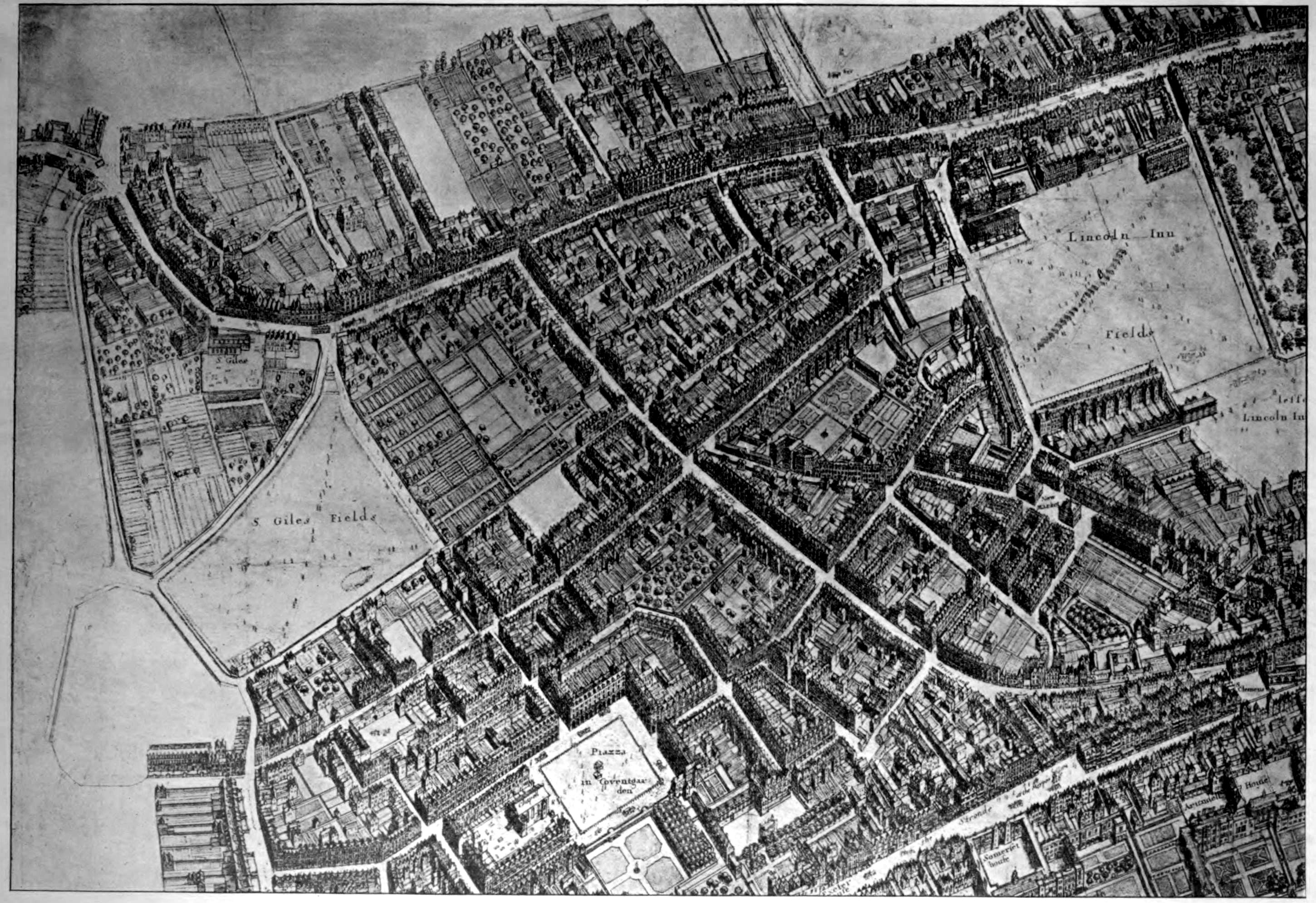
certain that the land sold in 1612 was identical therewith, and Hollar’s
plan of 1658 (Plate 3), which shows the area fully built on, indicates the
development which had taken place in the course of the half century.
Building on the remaining portion of the land had also greatly increased.[68]
The survey of 1650 contains a detailed description of the
property, giving much interesting information as to the building materials,
arrangement of the rooms, outhouses, etc. The following is a list of the
premises. In most cases there were garrets in addition to the storeys
mentioned.
The Falcon (2 storeys), and a house (3 storeys) in the rear. Frontage
15 feet. (Present No. 233.)
A house of three storeys. Frontage 33 feet. (Present No. 232
and site of New Turnstile.)
The King’s Head Inn (3 storeys), with an addition (2 storeys), a gateway,
a smith’s shop with room, stables, sadler’s house, tenement of 2 storeys,
shed and coachhouses, houses of office. Frontage 54 feet. (Present
Nos. 229–231.)
Two small tenements lying in front of The King’s Head (3 storeys), a
house (3 storeys), with small back addition. Frontage 19 feet.
A house (3 storeys), a garden with coach house and stable. Frontage
26 feet. (The site of these last two houses is now occupied by the Holborn
Station of the Piccadilly tube railway.)
The Gate Tavern (3 storeys.) Special mention is made of the
“very faire and spacious dyneinge room, 38 feet in length,” on the first
floor. A bowling alley and gardens were in the rear. Frontage 38 feet.
The site is occupied partly by the Holborn station and partly by Kingsway.
A house of 3 storeys, with a garden containing a small tenement of
2 storeys. Frontage 16 feet.
A similar house, with a garden containing a “small decayed
tenement.” Frontage 16 feet.
A tenement of 2 storeys, with a shop on the ground floor, a back
addition of 2 storeys. In the garden behind were two small tenements of
2 storeys. Frontage 17½ feet. The site of the three last mentioned houses
is now covered by Kingsway.
It will be seen from the above that New Turnstile was not included
in the original scheme for building. It is not shown in Morden and Lea’s
Map of 1682, nor in the map accompanying Hatton’s New Guide to London
of 1708, but appears in the sewer rate book for 1723.
XXVI.—No. 211, HIGH HOLBORN (Demolished). — General description and date of structure. — In the Council’s collection is:—
16
It is very difficult to say when the south side of High Holborn,
between the sites of Kingsway and the Holborn Public Library, was first
built upon. Perhaps, even in Elizabeth’s reign, there were some scattered
buildings here, but certainly nothing like a continuous line of houses. There
seem to have been no building operations on a large scale, until after the
acquisition of the lease of Purse Field by Sir Charles Cornwallis, in 1613.[69]
Cornwallis sub-leased certain portions of the Holborn frontage, extending
south to the site of Parker Street, and on these portions houses had been
erected before 1650. No records of the sub-leases have been found, but
a part at least of the frontage to Holborn had been sub-leased before 1634.
Two years previously Charles I. had confirmed a grant, made by his father
to Trinity College, of six markets and twelve fairs for the building of their
hall. The college sold to Henry Darell two markets and three fairs, and in
August, 1634, the latter petitioned to be allowed to set these up in St.
Giles on His Majesty’s inheritance.[70] This was granted on 15th December,
1634, a writ of Ad Quod Damnum issued, and on 10th March, 1634–5, an
inquisition by a jury was held, from which it appears that the proposal
was to hold the markets and fairs “in locis vocatis le pightells et Pursfeild.”[71]
The project aroused keen opposition on the part of the Corporation
of the City of London,[72] and in spite of its revival in 1637,[73] was
eventually abandoned.
It is possible to identify the site of the proposed market, inasmuch
as in 1650 the frontage to Holborn between Little Queen Street and Newton
Street consisted of two “ranges” of buildings known as Shenton’s tenements
and Dayrell’s buildings, and it is clear that the latter represent
Henry Darell’s proposed market. Darell no doubt had already obtained
his lease before applying for a grant for a market, but no houses would
have been erected until after the failure of his scheme. It is known[74]
that one of his plots were let on a building lease on 23rd November, 1639.
The erection of buildings on this part of the Holborn frontage may therefore
be assigned provisionally to the year 1640.
Shenton’s tenements consisted of six houses in High Holborn and
five in Little Queen Street, extending 100 feet along the former and 115½
feet along the latter thoroughfare. Their site is therefore wholly covered
by the Holborn Restaurant.
17The largest house, then in occupation of Mrs. Shenton herself,
was the next but one to the corner, and is described in the survey of 1650
as “all that tenement built as aforesaid[75] ... consistinge of one kitchen,
one hall, and one small larder, and adjoyninge one backside and one garden,
with severall necessary houses therein built and standinge. And above
stayres in the first story, one dyneinge roome with a balcony there, and one
chamber and a closett there. And above stayres in the second story, two
chambers with a closett there and two handsome garret roomes over the
same.”
Dayrell’s buildings consisted of twelve houses in High Holborn,
and five in Newton Street, and covered an area of 186 feet by 122 feet.
They were, on the whole, much superior to Shenton’s tenements.
The westernmost and largest house is described as “All yt spacious
brick buildinge ... built with brick in a comely shape and very
reguler, and consistinge of 5 stepps in ascent leadinge into an entry
leadinge into a faire hall and parlour wth sellers underneath the same,
divided very comodiously into a kitchen, a buttery and a larder. And
above staires in the first story a very faire dyneinge roome well floored,
seeled and lighted wth a belcony there on the streete side alsoe, wth said
roome is very well adorned and set fourth wth a faire chimney peice and
frames all of black marble, and on the same floore backwards one other faire
chamber. And in the second story two faire chambers and a closett in one
of them. And in the 3rd story two more faire chambers and a closett
there, and over the same two faire garretes. Alsoe adjoyninge to the same
one garden.”
The houses appear to have been of different sizes, for their rentals varied
greatly, and this, combined with the fact that in subsequent rebuilding
nine houses took the place of the original twelve in High Holborn, makes
it impossible to identify the house which originally occupied the site of
No. 211.
The house was perhaps rebuilt in the latter part of the 17th century.[76]
A further rebuilding (perhaps the third) seems to have taken place in 1815,
when the premises were re-leased by the Crown.[77]
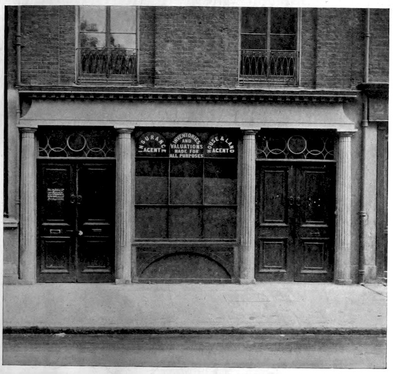
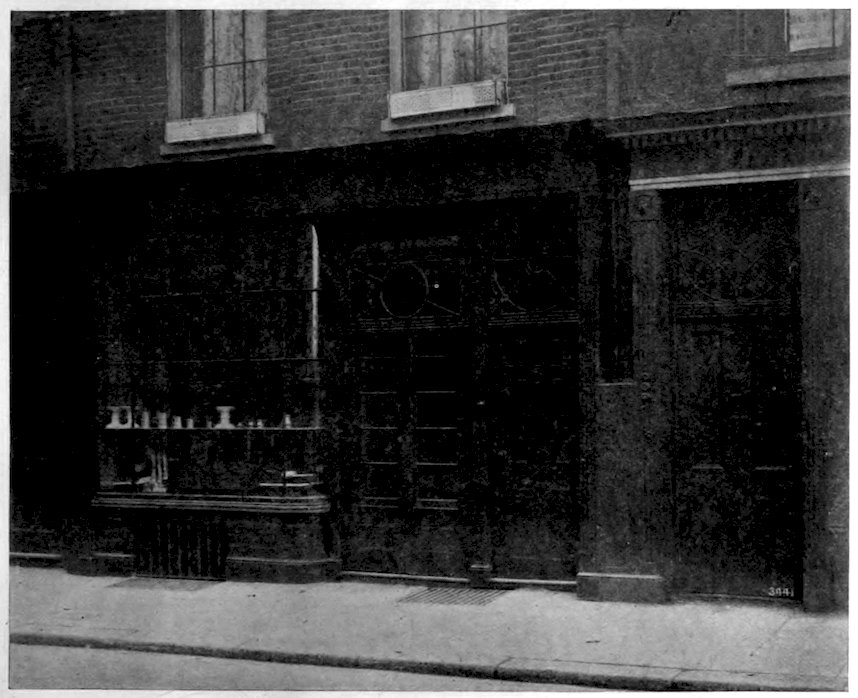
Plate 8 shows an interesting shop front. The ornamental iron
guards to the first floor windows are good specimens of wrought iron
work.
XXVII.—SMART’S BUILDINGS AND GOLDSMITH STREET. — The Council’s collection contains:—
18
At the time of the survey of 1650 Newton Street (i.e., the old Newton
Street, north of the stream which crossed it where Macklin Street now
joins, and separated it from Cross Lane), was fully built, and the remaining
frontage of Purse Field to Holborn, between Newton Street and the site of
the Holborn Public Library, was apparently occupied by nine houses, held
by Thomas Farmer and Henry Alsopp, to whom Francis Cornwallis had
assigned his lease so far as concerned that part of the field.
The yard, formerly Green Dragon Yard, at the side of the
Holborn Public Library, marks the site of the ancient stream which
formed the western boundary of Purse Field. The stream seems to have
remained open in this part of its course until about 1650, as a deed
dated 7th November in that year,[79] in view of the fact that Thomas
Vaughan and his wife Elinor “are to be att greate cost and charges in
the arching or otherwise covering over the sewer or wydraught under
mencioned, by meanes whereof the inhabitants there adjacent shall not
be annoyed as formerly they were thereby, as for divers other good
considerations them hereunto moving,” provides that the said sewer “as
the same is now severed, sett out and fenced, scituate ... on the
backside of a messuage of the said Thomas Vaughan commonly called ...
by the name or signe of The Greene Dragon” shall be demised to the
Vaughans.
The land immediately to the west of the yard in question originally
formed part of Rose Field, and was probably developed at the same time
as the rest of that estate. In 1650, William Short, the owner of Rose Field,
in conjunction with John De La Chambre, sold to Thomas Grover 4
messuages, 12 cottages, 12 gardens and one rood of land with appurtenances,
in St. Giles.[80] The precise position of this property is not mentioned,
but there does not seem to be much doubt that the premises are identical
with, or a portion of, those which Grover sold to Edmond Medlicott in
1666,[81] and which consisted of 16 houses in Holborn, including the “messuage
commonly known by the name or signe of The Harrow,” and also the
“lane or alley called Wild boare Alley alias Harrow Alley, with all the
severall messuages, tenements, edifices and void peice or plot of ground in
the said alley.” The property is said to front upon Holborn on the north,
and to have for its eastern boundary a way or passage leading from Holborn
to the house and garden of Mr. Braithwait. The dimensions are given as:
19“In depth from north to south at the west end, one hundred fourscore and
ten foote, and throughout the whole range and pile of buildings besides
from north to south fower score and seven foote, and in breadth from east
to west sixty and three foote.” The last figure is certainly wrong, for even
if half of the sixteen houses in Holborn were lying behind the rest (as indeed
was probably the case) this would only admit of an average frontage of
8 feet to a house. A probable emendation is “six score and three” which
gives a 15 feet frontage to each house.
The land behind these premises, reached by the path along, and afterwards
over, the stream, was leased by William Short in 1632 to Jeremiah
Turpin for the remainder (20 years) of a term of 36 years,[82] and then consisted
of garden ground upon which Turpin had recently built a house.
It seems most probable that this[83] is the place referred to in the petition,[84]
dated 17th June, 1630, of the inhabitants of High Holborn, calling attention
to the fact that there was a dangerous and noisome passage between High
Holborn and St. Giles Fields, by reason of a dead mud wall and certain old
“housing,” which lately stood close to the same, where divers people had
been murdered and robbed, and praying for leave for building to be erected
thereon. In their report[85] on this petition, the Earls of Dorset and Carlisle
refer to it as “concerning the building of Jeremy Turpin,” and recommend
the granting of leave to build.
It may therefore be concluded that the house was built between
1630 and 1632. A full description[86] of the property as it was in 1640 is
extant, and is interesting as giving an idea of the private gardens of that
time. Reference is made, among other things, to the arbour formed of eight
pine trees, the “sessamore” tree under the parlour window, 13 cherry
trees against the brick wall on the east of the garden, 14 more round the
grass plot, rows of gooseberry bushes, rose trees and “curran trees,” another
arbour “set round about with sweete brier,” more cherry trees, pear, quince,
plum and apple trees, a box plot planted with French and English flowers,
six rosemary trees, one “apricock” tree and a mulberry tree.
The ground on which Smart’s Buildings and Goldsmith Street were
erected at one time formed part of Bear Croft or Bear Close, so called,
no doubt, because it was used as pasture land in connection with The
Bear inn, on the south side of Broad Street, St. Giles.[87]
At about 1570 there were, immediately to the south of the White Hart
property at the corner of Drury Lane, eight houses. The three most
northerly abutted on the east upon “a close of grounde called the Bere
20Close, late belonging to Robert Wise, gentilman”[88]; while the five others,
with the close itself (of 2½ acres) are described as “adjoynynge to the
Quenes highe waye ... leadinge from Strande ... to thest end of the
said towne of Saint Giles on the west parte, and abuttinge upon the close
nowe our said soveraigne ladye the Quenes Majesties, called the Rose
feilde, on thest and south partes, and abuttinge upon the messuage or
tenemente nowe or late in the tenure of one William Braynsgrave,[89] and
the tenement called The White Harte, late in the tenure ... of one
Matthewe Bucke, and nowe in that of one Richarde Cockshoote, and the
Quenes highe waye leadinge from Holborne towardes the est end of the
said towne of Saint Gyles on the north part.”[90]
The boundary line between Bear Close and Rose Field is nowhere
described. It is known, however,[91] that Rose Field reached as far north as
the line bounding the rear of the buildings in Macklin Street, and there is
reason to believe that this line marks the actual division between the two
fields. As regards the eastern boundary a line starting from High Holborn
between No. 191 and No. 192[92] and running along the western side of the
southerly spur of Goldsmith Street, seems to fulfil all the conditions. It is
not known what was the depth of the eight houses and gardens fringing
Bear Close on the west, but allowing 60 feet, the area of Bear Close, defined
as above, amounts to two acres. It is hardly possible, therefore, to limit
its boundaries any further. It seems probable that the quadrangle shown
in Agas’s map (Plate 1) at the north-east corner of Drury Lane was Bear
Close, and it will be observed that, according to the map, the houses
south of The White Hart stretched along the whole of the Drury Lane
frontage of the close.
Bear Close formed a part of that portion of the property of the
Hospital of St. Giles which, after the dissolution, came into the hands of
Katherine Legh, afterwards Lady Mountjoy. With the five southernmost
of the houses separating Bear Close from Drury Lane, and other
property, it was purchased of the Mountjoys by George Harrison,
from whom by various stages it came into the possession of James
Mascall.[90] The latter died on 11th May, 1585,[93] leaving the whole of his
property to his wife, Anne, who subsequently married John Vavasour.
From her the whole of the property above mentioned[94] seems to have
21come into the hands of Olive Godman, younger daughter of James and
Anne. A portion of this, including “all the ground or land lying on the
backside of [certain] messuages towards the east, contayning two acres,
now or late in the occupation of ... Thomas Burrage” was settled on
her daughter, Frances, on the marriage of the latter with Francis Gerard in
1634.[95] There seems little doubt that the land in question was Bear Close.
It was apparently soon after this that the close was laid out for
building, the planning taking the form of a cross, the long and cross beams
being represented respectively by the present Goldsmith Street and Smart’s
Buildings. The former street was, up to 1883, known as The Coal Yard, in
consequence it is said, “of the place being used for the storage of fuel.”[96]
The tale has a somewhat suspicious look. The fact, too, that “Mr. Francis
Gerard,” the owner of Bear Close, and “Bassitt Cole, Esq.,” are found
living in two adjoining houses in Drury Lane close by in 1646 rather suggests
that “Cole Yard” is so called because of the name of its builder.[97]
The date at which Bear Close seems to have been built upon
favours the above suggestion. The Hearth Tax Roll for 1666 gives 41
names which are apparently to be referred to Coal Yard, while Hollar’s
Plan of 1658 shows the area by no means covered. The Subsidy Roll for
1646 gives only five names definitely in respect of “Cole Yard,” but there
are 15 more which probably must be assigned thereto.
At some time before 1666 the eight houses fronting Drury Lane
had given way to the present number of twelve. In the case of the
four northernmost, this happened shortly after 1636, when a building
lease of the sites of the houses was granted to Richard Brett.[98]
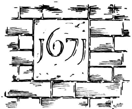
Built in the brick wall of an 18th-century
tenement (No. 27, Goldsmith Street) was a stone
tablet, dated 1671. The premises have lately
been demolished, and at present the site is
vacant.
Smart’s Buildings is a comparatively
modern name for that part of Coal Yard which
runs north into High Holborn. Hatton’s New
View of London (1708) does not mention Smart’s
Buildings, but refers to “Cole Yard” as “on the N.E. side of Drury
Lane, near St. Giles’s, a passage into High Holbourn in 2 places”; Strype
22(1720) states that “the Coal Yard ... hath a turning passage into
Holborn”; and Rocque’s Map of 1746 definitely names it “Cole Yard.”
In a deed of 1756[99] it is referred to as “the passage leading into the
Coal Yard called Smart’s Buildings.” Which of the three Smarts, grandfather,
father and son (William, Lewis and John), mentioned in the same
deed, it was who gave his name to the street, there is nothing to show.
No record of the purchase of the property by any person of the name
has, so far, been discovered, but the deed of 1756 certainly suggests that
the ownership of the houses on the eastern side of the passage originated
with William, who is, moreover, described as “carpenter,”[100] and in that
case would date from the beginning of the 18th century.
[101]No. 27, Goldsmith Street. Stone tablet in front wall (drawing).
Smart’s Buildings. General view of exterior (photograph).
XXVIII-XXIX. Nos. 181 and 172, HIGH HOLBORN (Demolished). — General description and date of structure. — In the Council’s collection are:—
23
The land at the eastern corner of Drury Lane and High Holborn
may perhaps be, either wholly or in part, identified with certain land held
of the Hospital of St. Giles by William Christmas in the reign of Henry III.
“with the houses and appurtenances thereon, situate at the Cross by
Aldewych.”[102] Aldewych was Drury Lane,[103] and the Cross by Aldewych
would almost certainly be situated at the junction of the two roads. The
identification of the western corner as the site of Christmas’s land
seems to be excluded by the fact that this was occupied by property of
John de Cruce,[104] who was certainly a contemporary of William Christmas.[105]
It is possible that the land in question was situated on the north side of
Broad Street, but as it is known that Christmas owned land on the south
side of the way, some of which may even possibly be the actual land referred
to, the identification suggested above seems reasonable. Whether in
Christmas’s time there was at this spot an inn, the forerunner of the later
White Hart, is unknown.[106] Blott’s suggestion that the sign of the White
Hart was adopted in honour of Richard II., whose badge it was, even if
correct, does not necessitate the assumption that no inn was there
24before that king’s reign (1377–1399). The sign might possibly have been
changed in Richard’s honour.
The first mention of The White Hart does not, however, occur until
a century and a half later. In 1537 Henry VIII. effected an exchange of
property with the Master of Burton Lazars, as a result of which there
passed into the royal hands “one messuage called The Whyte Harte, and
eighteen acres of pasture [Purse Field] to the same messuage belonging.”[107]
In 1524 “Katherine Smyth alias Katherine Clerke” was living in The
White Hart.[108] She was apparently succeeded as tenant by William Hosyer,[109]
but there is no evidence whether he actually resided in the inn.[110]
In 1567 the occupant of the inn is said to be Matthew Buck, and in 1582
it was Richard Cockshott.[111] In 1623 Hugh Jones is mentioned as barber
and victualler, at Holborn end, next Drury Lane.[112] The survey of Crown
Lands taken in 1650 describes the premises as follows:—
“All that inn, messuage or tenement commonly called ... The
White Harte scituate ... in St. Gyles in the feildes ... consistinge of
one small hall, one parlour and one kitchen, one larder and a seller underneath
the same, and above stayres in the same range, and over the gatehouse,
9 chambers. Alsoe over against the said halle and parlour is now
settinge upp one bricke buildinge consistinge of 6 roomes, alsoe one stable
strongly built with brick and fflemish walle, contayninge 44 feete in length
and 37 feete in breadth, lofted over and covered with Dutch tyle; and two
other stables next adjoyninge, built as aforesaid, and 2 tenements or
dwelling houses over the same. Alsoe one large yard contayninge 110 feete
in length and in breadth 46 feete. Now in the occupation of one Anthony
Ives, and is worth per annum
£38.
“All yt tenement adjoyninge to ye north side of the abovesaid
house, being a corner shopp, consisting of one seller and a faire shopp
25over the same; alsoe one kitchin, and above stayres two chambers. Nowe
in the occupation of Richard Raynbowe, a grocer, and is worth per annum
£12.”
It would seem that at the time of the transfer of The White Hart to
Henry VIII. there were no buildings to the east of the inn. The fact that
no such premises are mentioned in connection with the exchange is not,
indeed, conclusive, and it is more to the point to observe that no mention
of the buildings is contained in any of the grants of the property, during
the 16th century, which have been examined. Moreover, on 13th
November, 1592, a certificate was returned by the Commission for Incroached
Lands, etc.,[113] to the effect that four cottages, with appurtenances,
on the south side of the highway leading from St. Giles towards Holborn,
opposite certain small cottages built on the Pale Pingle,[114] were possessed
without any grant, state or demise from the sovereign. Plate 2 shows
the cottages in question, occupying the site of the buildings to the east of
The White Hart.
It may be taken therefore that these four cottages were the earliest
buildings on the site, and that they were erected probably not long before
1592, when their existence was first officially noticed.
By 1650 they had grown to a long range of buildings. In that
year they were described as follows:—
“All that range of buildinge adjoyninge to thaforesaid inn called
The White Hart, abuttinge on the high way on the north, with two
tenements on the south side of The White Hart, lyenge uppon the way leadinge
into Drury Lane, all which said buildings are now divided into xxj
severall habitacions in the occupation of severall tenants, and are worth
per annum £24.”
The whole property, including The White Hart, the courtyards and
gardens, is said to “contayne in length from Drury Lane downe to the
first [tenement] 96 feete, and in breadth 76 feete; the other length backward
from the stables to the lower side of the garden 125 feete and 93 feete
in breadth, bounded with the highway leadinge from St. Gyles into Holburne
on the north and Drury Lane on the west.” The entire site therefore
had a length of 221 feet, and a width of 76 feet along Drury Lane,
increasing to 93 feet behind the inn. Allowing for the subsequent widening
of High Holborn at this point, it is clear that the area is represented at
the present day by the sites of the houses from the corner as far as and
including No. 181, High Holborn, while the southern boundary runs to the
north of Nos. 190–191, Drury Lane, then turns to the south a little beyond
the eastern boundary of those premises, and thence runs in a slightly curved
line as far as the eastern boundary of No. 181, High Holborn.[115]
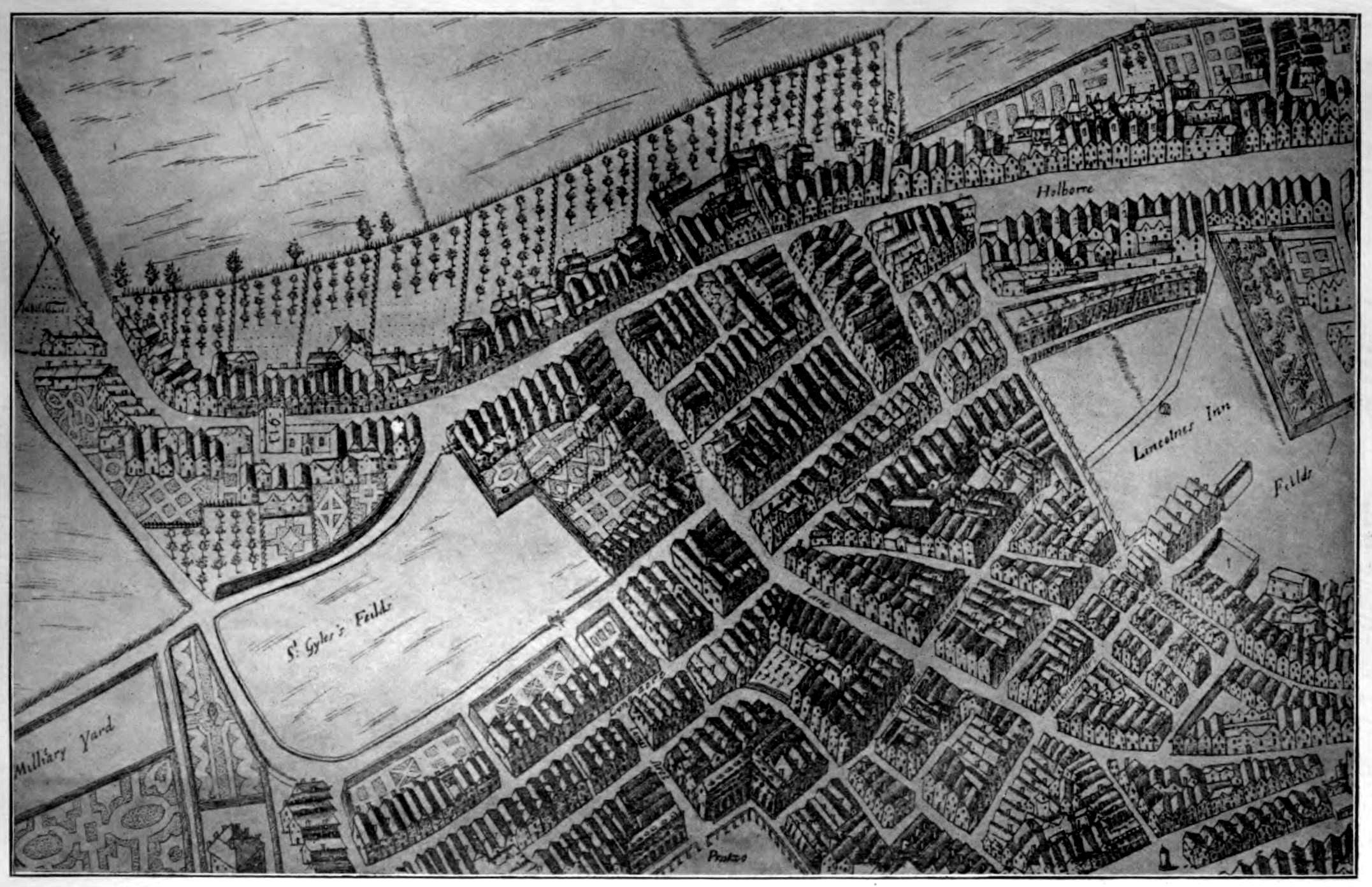
26A reference to the map in Strype’s edition of Stow (Plate 5) will show
that in the 18th century both High Holborn and Drury Lane were very
narrow at this spot. Moreover, in course of time, the large courtyard of the
inn became used as a public way, and grew crowded with small tenements.
In 1807 the leases of the property expired, and an arrangement was come
to between the Vestry of St. Giles and the Crown, by which the latter and
its lessees gave up sufficient land to enable the frontage line both to High
Holborn and Drury Lane to be amended, with the result that the west end
of the former and the north end of the latter were widened by 15 feet and
7 feet respectively. On its part the Vestry consented to the stopping up
of White Hart yard and the building thereon of the Crown lessees’ new
premises.[116]
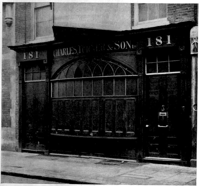
Two of the houses, Nos. 181 and 172, erected in accordance with the
arrangement, are illustrated in this volume.
Plate 9 shows the distinctive early 19th-century shop front, which
was attached to No. 181. The design embodied a large, slightly bowed
window with segmental head, flanked by two doorways. The window was
fitted with small panes of glass, having bars forming interlacing segmental
panes above the transom. The doors were of quiet and refined design,
with excellently treated side posts, having brackets, carved with acanthus
ornament, supporting the entablature. The whole exhibits a distinctly
Greek feeling.
Another interesting early 19th-century shop front existed at No.
172, and is illustrated on Plate 10. The door to the house and that to the
shop adjoined one another in this case, and were slightly recessed. The
rounded angles to the window added interest to the design. The general
treatment, though simple, possessed much distinction.
XXX.—SITE OF ROSE FIELD (MACKLIN STREET, SHELTON STREET, NEWTON STREET (PART), AND PARKER STREET (PART)). — The Council’s collection contains:—
27
Macklin Street (formerly Lewknor’s Lane), Shelton Street (formerly
St. Thomas’s Street, afterwards King Street), the lower end of
Newton Street (formerly much narrower and known as Cross Street) and
the greater portion of Parker Street, have all been formed on the site of
Rose Field, a pasture of a reputed area of six acres, attached to The Rose inn.
From particulars given in various deeds it is clear that the field’s
western and eastern boundaries respectively were Drury Lane and the
stream[118] dividing it from Purse Field, and that its southern boundary ran
50 feet to the south of Parker Street. As regards its northern boundary,
however, there is some uncertainty. The facts, so far as they have been
ascertained, are as follows.
The houses on the north side of Macklin Street were entirely in
Rose Field, as also were three houses in Drury Lane, north of Macklin
Street,[119] and the line bounding the rear of the Macklin Street property
certainly coincides, at least for a portion of its length, with the boundary
of that part of Rose Field leased to Thomas Burton.[120] It may therefore be
regarded as certain that at least for a portion of its length this line represents
the northern boundary of Rose Field. Probably this is true as regards its
whole length as far as Goldsmith Street, which seems to be the point at
which it turned northwards.[121]
The first reference to Rose Field (though not under that name) which
has been found, occurs in the deed concerning the exchange which Henry
VIII., in 1537, effected with the Hospital of Burton Lazars. According
to this, part of the property transferred to the Crown consisted of “one
messuage, called The Rose, and one pasture to the same messuage belonging.”
In the following year the king leased the inn and pasture to George
28Sutton and Ralph Martin.[122] In 1566 the property was leased to John
Walgrave for 21 years as from Michaelmas, 1574; in 1580 to George Buck
for 21 years, as from Michaelmas, 1595; and on 27th October, 1597, was,
together with other property, granted by Elizabeth in perpetuity to Robert
Bowes and Robert Milner, at a rent of £3 6s. 8d. Two days afterwards
Milner sold it to James White, of London, silk weaver, and on 19th
January, 1599–1600, the latter in turn parted with it to William Short.[123]
Half a century later, William Short the younger took advantage of the
sale of the Fee Farm Rents during the Commonwealth to redeem his
rent for £29 12s. 6d.[124]
Before continuing the history of Rose Field, it may not be out of
place to consider where The Rose inn, from which the field derived its name,
was situated.
Parton[125] quotes a deed, dated 1667, referring to the sale by Edward
Tooke to Luke Miller, of two tenements, situated in Lewknor’s Lane,
“which said two tenements doe abutt on the tenement formerly known
by the sign of The Rose, late in the tenure of Walter Gibbons,” and draws
the inference that the inn was “on the south side of Holborn, not far eastward
from The White Hart.” It is, however, doubtful if “the tenement
formerly known by the sign of The Rose” was The Rose of Rose Field; for
when, ten years previously, William Short had sold to Edward Tooke the
first 21 houses on the north side of Lewknor’s Lane, which must have
included the two tenements subsequently sold by Tooke to Miller, Walter
Gibbons was in occupation of the twelfth house. It is therefore most
probable that The Rose in question was a house in Lewknor’s Lane, and
not The Rose of Rose Field at all.
As a matter of fact, the latter is almost certainly to be identified
with the inn of that name situated on the north side of Broad Street. In
1670 this inn was in possession of Sarah Hooper, widow of William Hooper,
and the latter’s son Benjamin, and is described in a deed[126], dated 2nd
November in that year, as “all that messuage or tenement and brewhouse,
with appurtenances, called The Rose, and all stables, maulting roomes,
yardes, backsides, etc.” On 26th March, 1723–4, Benjamin Hooper
granted[127] “all that messuage or tenement and brewhouse, with the appurtenances,
called The Rose Brewhouse, scituate in St. Giles-in-the-Fields, now
29or late in the tenure of Samuel Hellier, Anthony Elmes, and Charles Hall,
some or one of them, and all stables, malting houses, yards, backsides,
ways, passages, etc.,” to his two daughters, Jane Edmonds and Sarah Mee.
The sewer ratebook for 1718 shows “Mr. Anthony Elmes” at a house in
Broad Street close to Bow Street (now Museum Street) corner,[128] and thus
the site of The Rose can be roughly identified.[129]
The necessary connection between the Hoopers and William Short,
who owned The Rose of Rose Field, seems to be supplied by an entry in the
Feet of Fines, dated 1640, concerning a purchase from the latter by William
Hooper of a messuage and one stable with appurtenances in St. Giles-in-the-Fields.[130]
To return now to the history of Rose Field. William Short does not
appear to have taken any steps to develop the property for 15 years. On
28th July, 1615, however, he leased to Walter Burton the southern portion of
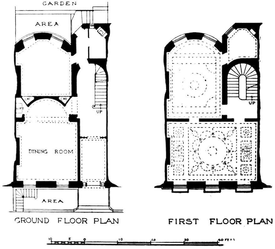
the field.[131] From particulars obtained from a number of deeds it is known
that the ground in question extended 50 feet on either side of Parker Street,
i.e., from the southern boundary of the field as far north as the site of the
garden afterwards in the occupation of John Fotherly.[132] Whether the
lease actually included the site of the garden, it is not possible to say with
certainty.
On 5th December, 1615, Short leased to Thomas Burton the portion
to the north of the garden, “the said parcell ... being mencioned in the
said indenture to abutt east on the lands of Sir Charles Cornwallis, Knt.
[i.e., Purse Field], west upon Drury Lane aforesaid, north upon the common
sewer[133] which then divided the same from other lands of the said William
30Short then also in the occupation of the said Thomas Burton,[134] and south
upon the lands of the said William Short lately demised to the said Walter
Burton; and therein mencioned to conteyne in breadth from north to south
on the west end that did abutt on Drury Lane 233 feete, and at the east end
thereof in breadth from north to south 80 feete, and in length from east
to west, viz., from the Cornwallis lands on the east to Drury Lane on the
west 719 feete.”[135]
The earliest mention of Lewknor’s Lane which has been discovered
is in an entry in the Privy Council Register[136] for 27th January, 1633–4,
dealing with the case of Richard Harris, the owner of four houses “in
Lewkner’s Lane, backside of Drury Lane.” Harris explained that he
obtained the houses by purchase, and that they had been built six years.
This takes the date of at least some of the houses in the street back to
1627 or 1628, and the fact that the street is not mentioned in the Subsidy
Roll for the latter year makes it probable that these four houses were
among the first built.
The usual reason given for the name of the street (afterwards
corrupted to Lutenor, Newtenor) is that it was formed on the site of the
house and grounds of Sir Lewis Lewknor. It is known that Lewknor
was living in Drury Lane in 1620 and 1623[137] and the position of his name
in the Subsidy Roll for the latter year points to his house having been
in about the position suggested.[138] There is no evidence, however, that
the house was built before 1615, when the land was leased to Burton, and
it does not seem likely, therefore, that it would be pulled down by 1628.
The name of the street was subsequently changed to Charles Street,
and again altered to Macklin Street in 1878.
Shelton Street does not date back so far as the remaining streets
formed on Rose Field. As late as 1665,[139] when Lewknor’s Lane and Parker’s
Lane had long been laid out, the houses on the north side of the latter were
31described as reaching to the garden “now or late” in the occupation of
John Fotherly. In a deed of 1650[140] the garden is said to be “now in the
occupation of the Lady Vere,” and a short time before it had been in
the tenure of Sir John Cotton.[141] The street was formed before 1682, it
being shown in Morden and Lea’s Map of that date, and was at first
known as St. Thomas’s Street. In 1765 the name was changed to King
Street, probably out of compliment to Joseph King, who took a lease of a
large portion of the property in the street about that date.[142] Formerly
in the flank wall of No. 166, Drury Lane, was a stone tablet bearing the
inscription “King Street. 1765.” In 1877 the street received the name of
Shelton Street, and, with the carrying out of the Shelton Street housing
scheme by the London County Council was almost entirely swept out
of existence between 1889 and 1892.
The earliest reference to Parker Street (formerly Parker’s Lane)
so far discovered, belongs to February,[143] 1620, when mention was made
of “a way or passage of twenty feet broad, lately marked out by the said
Walter Burton, leading from Drury Lane to and through the ground of the
said Sir Charles Cornwallis, knight, towards Holborn.”[144] The “marking
out” of Parker Street took place therefore between July, 1615, and February,
1620. There seems great probability that the street owed its name, as
suggested by Parton,[145] to Philip Parker, who certainly had a share in building
32the houses there.[146] That he actually held ground in the neighbourhood
of Parker Street is evident from the terms of Burton’s lease to Edlyn of
1620, when, in granting his own interest in the land on the south side of
Parker Street for a space of 520 feet westwards from the Rose Field
boundary, he adds: “and the said Thomas Burton grants to Edmund
Edlyn all the interest, right, claim or demand which he hath or ought to
have in and to that piece of ground holden by Philip Parker.” In the
Subsidy Rolls for 1620–21 and 1618–9, Philip Parker is shown as residing in
Drury Lane, perhaps the house (the third on the east side, north of Parker
Street) where William Parker was living in 1646.[147]
[148] No. 166, Drury Lane. Stone tablet (drawing).
XXXI.—No. 18, PARKER STREET. — Ground Landlord. — General description and date of structure. — Condition of repair. — The Council’s collection contains:—
33
Name unobtained.
No. 18, Parker Street seems to have been rebuilt in 1774.[149]
Plate 11 shows a typical ground floor front of an 18th-century
tenement in this parish. The window was probably provided with stout
shuttering for protection.
The house is in fair repair.
[150]No. 18, Parker Street. Exterior of ground floor (photograph).
No. 58, Parker Street. Exterior showing timber bay window (photograph).
XXXII.—GREAT QUEEN STREET (General.)
34
The eastern part of Great Queen Street was formed upon Purse
Field, but the western and larger portion, together with Wild Street and
Kemble Street, occupies the site of the field known in Elizabethan times as
Aldwych Close. The boundaries of this close, which had a reputed
area of eight acres, were in the year 1567 described[151] as “the close nowe
the quenes majesties called Dalcona Close[152] on the easte parte, ... the
lane leading frome the Strond towardes the towne of Saynt Gyles aforesaid
of the west parte, ... the close of Sir Willm. Hollys and the gardyn
belonginge to Drurye House of the southe parte, and the close nowe the
Quenes Majesties called the Rosefelde on the north parte.” Of these
boundaries the northern is represented by the line dividing the houses
on the south side of Parker Street from those on the north side of Great
Queen Street,[153] and the eastern by the line of the court between Nos. 6 and
7, Great Queen Street, continued to meet Sardinia Place,[154] while the southern
corresponds with the old parish boundary.
Aldwych Close was included in that part of the property of the
Hospital of St. Giles which eventually came into the hands of Lord Mountjoy,
through his wife, Katherine, daughter of Sir Thomas Legh.[155] On
20th January, 1566–7, it was purchased of the Mountjoys by Richard Holford,
who was at the time actually in occupation of the field.[151] Holford
died on 12th January, 1569–70, leaving the property to his son Henry, then
aged 20,[156] during whose ownership the field began to be cut up for building.
In 1600 only two houses were in existence on the close.[157] At about this time
Holford began to mark out the close and let portions on lease for building.
There is no complete record of these leases, but the largest transaction
35of the kind was effected on 28th April, 1607, when Holford granted to
Walter Burton, who has already been mentioned in connection with the
development of Rose Field, a lease, for 51 years from the previous
Christmas, of “that peece or parcell of grounde latlie taken out of
the north side of the close of the said Henry Holford called Oldwych
Close ... as the same ys severed and divided ffrom the residue of the
same close with a pale latelie erected, and all that mesuage or tenemente
latelie erected uppon a parte of the said peece or parcell off ground by
one Henry Seagood, and nowe in the occupacion of the said Henry
Seagood, and alsoe twoe other mesuages or teñts with the gardens, backsides,
and garden plottes to the same adioyninge or belongeinge in the
tenure or occupacion of Humfrey Grey or his assignees scituate on the
west parte of Oldwych Close aforesaid, and lately alsoe enclosed out
of the said close.... And alsoe all that other peece or parcell of ground
which was then agreed and staked out to be enclosed of and from the
west side of the said close ... next adioyninge unto Drewrie Lane....
By the name of three mesuages and three acres of pasture with the
appurtenances.”[158]
The three messuages in question can easily be identified. Henry
Seagood’s house occupied the site of Nos. 36–37, Great Queen Street,[159]
and the houses of Humphrey Grey (which no doubt were the two
houses in existence in 1600) are identified later[160] as The White Horse, in
Drury Lane, opposite Long Acre, and another house (divided between
1635 and 1658 into two houses) adjoining it on the north. The “three
acres of pasture” was the remaining portion of the triangular piece of
ground now bounded by Drury Lane, Wild Street and Kemble Street.[161]
From the foregoing it will be evident that by the year 1607 there
were the merest beginnings of building on the Drury Lane frontage
of the close. The first two streets to be formed were those now
known as Kemble Street and Great Queen Street, the former being
probably an old public way leading across Aldwych Close and Purse Field
to Holborn, the route of which was afterwards marked by the archway
on the west side of Lincoln’s Inn Fields, and the latter being in its
origin a royal private way through the fields,[162] used as the route to
36Theobalds, in Hertfordshire, James I.’s favourite residence. Kingsgate
Street (formerly existing nearly opposite the northern termination of Kingsway),
where there were two gates[163] into the fields on either side of Holborn
(see Plate 2), and Theobald’s Road mark the continuation of the
royal way. There was also at first probably a gate[164] at the street’s
western entrance,[165] which was very narrow, and the first mention we
have of the street seems to refer to this. In a petition to the Earl of Salisbury,
undated, but evidently belonging to the period 1605–1612,[166] the
“inhabitantes of the dwellinges at the newe gate neere Drewry Lane”
state that they have petitioned the Queen (obviously Anne of Denmark,
the consort of James I.) “to gyve a name unto that place,” and have
been referred to him; they therefore request him to give it a name on
her behalf.
It seems reasonable to conclude that it was as the result of this
application that the name “Queen Street” (or “Queen’s Street”)[167] was
given to the thoroughfare. Blott, indeed, states this as a fact, but no
entry in confirmation has been found in the Domestic State Papers.
Assuming, therefore, that the petition above mentioned had reference
to this street, and having regard to the probability, amounting to practical
certainty, that the plan of Purse Field reproduced in Plate 2 dates
from 1609,[168] it follows that the title “Queen Street” must have been given
during the period 1605–1609. The name “Great Queen Street” used
37to distinguish it from “Little Queen Street” does not seem to have been
in common use until about 1670.[169]
The earliest buildings erected in Great Queen Street were, contrary
to the usual statements made in the matter,[170] on the north side of the
street. The dates at which this took place cannot, unfortunately, be
determined with certainty. Clanricarde House was in existence in 1604.[171]
Henry Seagood’s house (occupying the site of Nos. 36–37) was built before
April, 1607.[172] The site of Nos. 38–45, which in 1597 contained only a
forge, was built on by May, 1612.[173] The site of Nos. 7–13 was leased
for building purposes to Thomas Burton on 7th May, 1611. These facts,
fragmentary though they are, seem to point to the north side of the
street, so far as it was situated in Aldwych Close, being built during the
period 1603–1612.[174] In this connection it is interesting to note the statement
made, on unknown authority, by Dobie,[175] that the house on the
south side of the street in which Lord Herbert of Cherbury died[176] was “one
of the fifteen built in the third year of James I. (1603).” The third year
of James I. was actually 1605–6, but it is quite certain that no houses
were built on the south side of Great Queen Street for over thirty years
afterwards. The date seems, however, to fit in well with the facts
concerning the north side of the street.
XXXIII.—No. 2, GREAT QUEEN STREET (Demolished). — General description and date of structure. — Biographical notes. — In the Council’s collection are:—
38
The eastern portion of Great Queen Street, comprising the sites of
Nos. 1 to 6 on the north side, and of all the houses above No. 69 on the
south side, was formed on Purse Field.
On 30th July, 1638, Newton leased to William Sandfield a portion
of the ground, on which at some time subsequently, but before January,
1640, a house was built. On 29th March, 1642, the property is described[177]
as a plot of ground having a breadth of 26 feet at the north end, and 25
feet at the south, and a length of 76 feet on the east side, and 81 feet
on the west; “scituate at the east end of Queene Street, on the north
side of it, between the highway there leading to the Kinges Gate on the east,
a certen lane called Parker’s Lane on the north, and the King’s highway
leading into Queene Street on the south.” This is easily identifiable with
the site of No. 1, Great Queen Street, and other property in the rear.
On 14th January, 1639–40, Newton sold to Francis Thriscrosse[178] a
plot of ground having a breadth of 23 feet 4 inches at the north end, and
22½ feet at the south, and a length of 81 feet on the east side and 86 feet on
the west, “and abutteth east upon a peece of ground and the house thereon
built let to William Sandfeild,” Parker’s Lane on the north, and the King’s
highway on the south. On this plot a house had been erected, representing
No. 2, Great Queen Street. Similarly it may be proved that the site of
No. 3 had been built on by Richard Webb by August, 1639.[179] As regards
Nos. 4 to 6, no sufficiently early deeds have come to light to enable the date
of building to be ascertained, but it is probable that all were built about the
same time.
It would seem that these six houses were superior to most of the others
erected on the north side of the street. Such is certainly the impression
derived from Hollar’s Plan of 1658 (Plate 3). Moreover, Bagford, after
alluding to the stateliness and magnificence of the houses on the south side,
goes on to say: “At ye other side of ye way, near Little Queen Street,
they began after ye same manner with flower de lices on ye wall, but went
no further.”[180]
The original buildings on the site of Nos. 1 and 2 were pulled down
about 1735, for a deed dated 7th February in that year, referring to the
39site, describes it as “all that toft, peice or parcell of ground, scituate in
Great Queen Street on the north side of the same street, and extending
itself from Queen Street to Parker’s Lane, together with the old ruinous
messuage or tenement and the coach house, stable, and other erections and
buildings thereupon standing.”[181] Moreover in the sewer ratebook for 1734,
there is a note against the house: “Pulled down and rebuilt.”
The second building on the site of No. 2 was demolished in connection
with the formation of Kingsway. The front had little architectural
merit, judging from a water colour drawing by T. H. Shepherd, dated
1851, now in the Crace Collection.[182]
The interior had a notable mahogany staircase (Plates 12 and 13)
of six flights, the four lower ones having carved brackets, while the upper
part had straight strings more simply treated.
The beautiful balustrade and decorative details were preserved by
the London County Council when the house was pulled down, and have
been lent to and exhibited at the London Museum.
The indications as to who exactly were the occupants of particular houses on the
north side of Great Queen Street during the 17th century are not always very clear,
and the following list of persons occupying No. 2 is perhaps occasionally during the
period named open to suspicion:—
Sir Martin Lumley, of Bardfield Magna, Essex, son of Sir Martin Lumley or
Lomley, Lord Mayor of London (1623–4), was born about 1596. He was sheriff of
Essex, 1639–40; and was M.P. for that county in the Long Parliament, from February
1641, until secluded in December, 1648. He was created a Baronet on 8th January,
1641, being knighted at Whitehall on the day following. He died about 1651.[184]
[185]Mahogany staircase, ground to second floor, and second to third floor
(measured drawing).
XXXIV.–XXXVI.—Nos. 26 to 28, GREAT QUEEN STREET. — Ground landlord. — General description and date of structure. — Condition of repair. — The Council’s collection contains:—
40
The names of the ground landlords of Nos. 27 and 28 have not been
obtained.
The date of erection of the original houses on the sites of Nos. 26
to 35 is uncertain. The Subsidy Roll for 1628–9, however, among its few
(12) entries relating to Queen Street, contains the names of three persons[186]
who are known to have lived in this row, and that for 1620–21 contains
one;[187] it is therefore fairly certain that the houses on the site of Nos. 26 to
35 were already in existence by the latter date.
The ground on which they stood had, it is known, been let on building
lease for a term expiring at Christmas, 1657, and it seems more than
likely that the lease in question was that granted to Walter Burton
on 28th April, 1607. It will be noticed[188] that a part of that grant
comprised a piece of ground taken out of the north side of the close,
and Henry Seagood’s messuage erected on a part of that piece. Now Seagood’s
house occupied the site of Nos. 36–37[189], and the piece of ground
alluded to above certainly did not extend to the west of Seagood’s house,
as that property (the site of Nos. 38 to 45) had already been disposed of
by Holford. It seems, therefore, probable that it included the ground to
the east of the house, thus taking in the site of Nos. 26 to 35.
The earliest description of the property which has been found is
dated 30th May 1661,[190] where, evidently repeating the account given in
the lease of 1636 (when it was let for 51 years as from 27th December,
411657) it is referred to as “all those severall messuages or tenements ...
with their appurtenances, scituate, lying and being on the north side of ...
Queene Street ... now or late in the several tenures of [here 13 names
are given]; abutting upon a messuage or tenement now or late in the
tenure ... of John Sparkes, his assigne or assignes, on the east, and on a
messuage or tenement, now or late in the tenure of one Henry Seagood,
his assigne or assignes, on the west part, and the said Queene Street on
the south ...; all which said messuages ... conteyne in length from
east to west 180 feet ... and in breadth from north to south 60 feet.”
It is clear from the entries in the ratebooks that the original houses on
the sites of Nos. 27 and 28 were pulled down between 1723 and 1734, a
period which agrees perfectly with the evidence of the dates on the cisterns
mentioned below.
The present houses have three floors in addition to a basement and
an attic storey. The fronts are treated in brickwork. No. 27 contains an
ornamental cast lead cistern (Plate 15) dated 1733, and in No. 26 is a cistern
of somewhat similar design, bearing the initials B.B. and the date 1725.
On the latter house is a cast lead rain-water head illustrated on Plate 15.
The only external features of interest are the two doorcases, side by
side, which are of deal with Roman Doric pilasters, block entablatures
and pediments. The doorways are recessed, and have elliptical arches,
enclosing fanlights, as shown by the measured drawing (Plate 14).
The staircase of No. 27 has the original carved brackets.
That of No. 28 is modern.
DEAL STAIR BRACKET TO OUTER STRING TO No. 27 GT. QUEEN ST.
No. 26 has been demolished. Nos. 27 and 28
are in good repair.
[191]Entrance doorcases to Nos. 27 and 28 (measured drawing).
Entrance doorcases to Nos. 27 and 28 (photograph).
[191]Ornamental cast lead cistern, No. 27 (measured drawing).
[191]Ornamental cast lead cistern, No. 26 (measured drawing).
[191]Cast lead rain-water head, No. 26 (with others) (measured drawing).
XXXVII.—Nos. 55 and 56, GREAT QUEEN STREET. — Ground landlords. — General description and date of structure. — Condition of repair. — Biographical Notes. — In the Council’s collection are:—
42
The United Grand Lodge of Antient Free and Accepted Masons
of England.
The largest of the three sections into which Aldwych Close was
divided, when roads were formed thereon, was that lying to the south of
Great Queen Street, and east of Wild Street. In 1618[192] Henry Holford
leased to John Ittery the southern portion of this section, and on 13th
August, 1629, Richard Holford sold the remainder to Sir William Cawley
and George Strode in trust for Sir Edward Stradling and Sir Kenelm
Digby.[193] A wall was erected parallel to Great Queen Street, and distant
from it 197 feet, dividing Stradling’s part from Digby’s. The later history
of Stradling’s portion, lying to the south of the dividing wall, is dealt
with later.[194] Here we are concerned with that in the ownership of Sir
Kenelm Digby, forming the site of the houses and gardens on the south
side of Great Queen Street as far as Aldwych Close extended. The ground in
question (including that purchased by Sir Edward Stradling) is described on
13th August, 1629, as “late in the tenure of Richard Brett and John Parker,”[195]
and a petition of the inhabitants of the district, dated[196] 1st September,
1629, states that Parker and Brett had “divers times attempted to build
on a little close called Old Witch, which has always lain open, free to
all persons to walk therein, and sweet and wholesome for the King and his
servants to pass towards Theobalds.” It is further alleged that Parker and
Brett had been imprisoned for these attempts, “but now they have pulled
down the bridges and stiles, and carried great store of bricks thither, and
give forth threatening speeches that they will go forward.” The petitioners
asked that the proposed buildings might be stopped, and expressed their
willingness to take a lease of the close and plant trees.
43Parker and Brett seem in this latest instance to have been merely
acting for Sir Kenelm Digby, for the report[197] of the Commissioners for
Buildings, made only nine days later, definitely mentions the latter as
the person desirous of building. The Commissioners expressed themselves
as adverse to Digby’s proposal, which for a time dropped.
On 27th March, 1630, both Digby and Stradling petitioned for a
licence for each “to build a house with stables and coach houses in Old
Witch Close.” The Attorney-General was instructed to draw the licence,
but although Stradling in due course built his mansion[198], there is no evidence
that Digby ever availed himself of the permission.
The ground seems to have been used as a garden[199] until 1635. On
13th April in that year Digby sold it to William Newton for building purposes.
No licence to Newton to build can be traced, but on 7th May, 1636,
one was granted to Sir Robert Dalyell,[200] who probably assigned it to Newton.
From that document[201] it appears that the intention was to build “14 faire
dwelling houses or tenementes to conteyne in front one with another neere
40 (fortie) feete a peice fitt for the habitacon of able men.” Permission to
build that number of houses “to front only towardes Queene’s Streete”
was granted, as well as “twelve coach howses and stables in some remote
part of the said ground,” all to be built of brick or stone, “according to the
true intent and meaning of our Proclamations in that behalfe published.”
Signature of William Newton.
Newton seems to have taken care that the houses erected on that
part of Great Queen Street which was on the site of Purse Field should
conform generally to the style of those built in accordance with the above-mentioned
licence on the site of Aldwych Close[202]. The houses as a whole
occupied 13 ground plots, having a total frontage of about 628 feet, and a
depth of 200 feet. Their general character was the same throughout;
the main cornices and front roofs were continuous, but the pilasters were so
arranged as to indicate the separate buildings without the usual expedient
44of placing a pilaster partly on one plot and partly on another.[203] On the
middle house was placed a statue of Charles I.’s Queen, Henrietta Maria.
It has already been noticed[204] that Newton a few years later adorned the
central house in Lincoln’s Inn Fields with a crowned female bust, and
there can be no doubt that this was also in honour of the Queen.
Various statements have been made as to the designer of the houses
on the south side of Great Queen Street. Horace Walpole, in his Anecdotes
of Painting[205] writes as follows: “Vertue says that Mr. Mills, one of the
four surveyors appointed after the fire of London, built the large houses in
Queen Street, Lincoln’s Inn Fields, but this must be a mistake, as we have
seen in the preceding volume that Gerbier, a contemporary, and rival,
ascribed them to Webb.” It is known[206] that Peter Mills built the original
houses on the site of Nos. 66 to 68, Great Queen Street, but there is no
evidence that he had any hand in the erection of other houses on the south
side of the street.
The reference concerning Gerbier [1591?–1667], to which Walpole
alludes as occurring in his previous volume, seems to be the following:
“He [Gerbier] ridicules the heads of lions, which are creeping through the
pilasters on the houses in Great Queen Street built by Webb, the scholar
of Inigo Jones.” If this ascription could be found in any of Gerbier’s
works it would be very valuable evidence, but it has not been discovered,
and the passage relating to the pilasters contains no mention of Webb.[207]
Bagford [1650–1716], writing somewhat later, says:[208] “He [Inigo
Jones] built Queen Street, also designed at first for a square, and as reported
at ye charge of ye Jesuits; in ye middle whereof was left a niche for ye
statue of Henrietta Maria, and this was ye first uniform street and ye
houses are stately and magnificent.... These buildings were ye designes
of ye Ld. Arundell, who was ye first that introduced brick building into
England (I mean for private houses).”
45That some architect was commissioned by Newton to design the
façade, and possibly the principal internal features, is most probable;
but the above evidence is unfortunately not sufficient to enable him to be
identified.
Hollar’s careful engraving (Plate 3) shows the long straight roof of the
road frontage, but the rear elevations show that the roofs were varied for
individual houses and were treated with gables. Whoever was the designer
of the façade to Great Queen Street, he was probably employed by Newton
as architect for the houses built on the west side of Lincoln’s Inn Fields
three years afterwards. These show a distinct advance in design, being
treated as a single symmetrical composition, with a central feature composed
of three houses of increased height, the side wings being of equal
lengths.[209]
The beautiful drawings by J. W. Archer[210] reproduced on Plate 16
exemplify the similarity of the two designs to a very marked degree, the
only important difference in detail being that in Great Queen Street the
Corinthian order was employed, in Lincoln’s Inn Fields the Ionic.
A description of the exterior of the only remaining fragment of the
Great Queen Street houses, Nos. 55 and 56, will suffice for the whole. The
front is constructed mostly of brick, the ground storey having originally
formed a simple base for the Corinthian order of pilasters. These embrace
the height of the first and second stories, the bases and capitals being of
stone, the ornament of the latter boldly carved, and the volutes and abacus
spreading to an unusual extent. (Plates 18 and 19.)
The pilasters were ornamented, if, as seems probable, it is to these
houses that Gerbier referred when, writing about 25 years after their
erection, he criticised certain “incongruities” perpetrated by those
pretending knowledge in ornaments “by placing between windows pilasters
through whose bodies lions are represented to creep; as those in Queen
Street without any necessity, or ground for the placing lions so ill.”[211] These
lions were probably of stucco, and affixed to the pilasters in a position
46similar to that of the ornaments of the Tudor rose and fleur de lis on the
houses in Lincoln’s Inn Fields, and those at the eastern end of the north
side of Great Queen Street.[212] Walpole,[213] writing in 1763, continued the
ridicule of these offending ornaments, but by 1783 they must have been
removed, for the engraving by Bottomley of the Freemasons’ Tavern
(Plate 22) does not show them, nor can they now be traced on the brickwork
of the pilasters.
Between the first and second floor windows is introduced a slightly
projecting ornamental device in brickwork, of somewhat Jacobean character,
which on the façade of the houses in Lincoln’s Inn Fields was represented
by a band, formerly seen at No. 2, Portsmouth Street. The same
feature is also shown in the Wilton House picture of Lincoln’s Inn Fields.[214]
Above the capitals the entablature has been much restored, and its
former beauty correspondingly diminished. The architrave appears to
have been of wood, with three fascias (Plate 19), and crowning this is the
bed mould of the cornice, which has large wooden modillions, shaped and
enriched with acanthus leaves.
The modillions support a cyma and fascia with panelled soffit, the
cyma forming the front of a leaden gutter.
Surmounting the cornice was the high pitched roof, shown by
Hollar, with hipped dormer windows, of one and two lights alternating.
Though none of them retain the whole of their original construction, the
two on the right of the illustration may possibly be in their original form.
The present Nos. 55 and 56 represent one half of what must have
been the largest of the houses.[215] This was the mansion of which one of
the earliest occupiers was the Earl of St. Albans (Marquess of Clanricarde).
The house may be identified in two ways. (1) The frontages of the
house of the Earl of St. Albans, and of the three houses to the east, are
stated to be 88[216], 44, 44 and 88 feet respectively, and the last mentioned
house is said to be bounded on the east by a gateway, which, from the
description, was obviously Middle Yard. The western boundary of the
four houses in question may thus be shown to correspond with the western
side of New Yard, i.e., the western boundary of No. 55. (2) On 23rd
January and 8th February, 1639–40, Newton sold certain plots of ground,
containing frontages of 41 and 45½ feet, having a depth of 190 feet, and
47after 120 feet diminishing in width from 83 to 60 feet. These plots are
stated to be bounded on the east by the dwelling house and garden of the
Earl of St. Albans. From the shape of the property disclosed by the
above figures, and the actual frontages given, there can be no doubt that
the houses afterwards erected thereon occupied the sites of the present
Nos. 51 to 54.[217] The house of the Earl of St. Albans was therefore No. 55
and upwards.
The house was already in existence in January, 1637–8,[218] and as the
licence for building had only been obtained in May, 1636, the erection
of the house may, with practical certainty, be assigned to the year 1637.
In the 1638 deed it is described as “all that one new erected
double messuage or tenement with appurtenances, scituate in Queenes
Streete ... contayninge in front towardes Queenes Streete aforesaid
88 feet ... and sydinge eastwards upon the house in the tenure of the
Lord Leiger Embassador of Spayne, together with a gardyn plott lyinge
on the back side of the said messuage and adjoyninge thereunto.”
The original mansion therefore occupied the site of the present Nos.
55 and 56, and adjoining property in New Yard, together with that of
the western block of the present Freemasons’ Buildings.
The first division of the house took place in, or shortly after, 1684.
In that year Lord Belasyse purchased the property, and at the date of
his will, five years later, the house had for some time been in double
occupation.
The division had, however, not been carried out in a very thorough
fashion. In 1718 it was stated that “there are severall roomes, chambers and
other apartments ... which interfere or mix within each other very inconvenient
for separate familyes to inhabit therein severally and apart
from each other.” In that year, therefore, an arrangement[219] was made
whereby “the kitchen under a roome heretofore called ... Mr. Stonor’s
dressing-roome,[220] the larder backwardes next the garden under part of a
room ... called Mr. Stonor’s bedchamber ... which were then
both used and enjoyed with the house in possession of ... Henry Browne ... were to be added to the inheritance of the house of the said Thos.
Stonor in exchange” for “the cellar under the foreparlour next Queen
Street, and the uppermost room or garrett over the said parlour, the
lesser cellar adjoyning to that last before mentioned cellar and the room
48backwards next the garden up two pair of stairs over the back parlour,
and upper with drawing roome,” structurally part of Browne’s house, but
occupied as part of Stonor’s.
Other alterations took place in 1732–3, when the western half was
divided, and probably portions of the present party wall, to the east of No.
56, date from this and the earlier period.
During the last century many further alterations and partial rebuildings
were carried out. Shortly before 1816, the extensive grounds in the
rear were utilised for buildings, for in a deed[221] of that year reference is made
to “all those stables, coach houses and workshops and premises erected ... in New Yard ... and which before the erecting of the said ...
stables, coach houses, shops and other premises, was a garden ground.”
Subsequently the external west wall was rebuilt, and the south-western
premises, extending over the entrance to the yard (see Plate 17)
were erected.
The eastern half of the original mansion seems to have been demolished
between 1840 and 1846, for J. Nash, in a sketch made in the
former year, gives the
complete elevation,
whereas Archer in 1846
(Plate 16) shows a
commonplace building
on the site of the
eastern half.
Nos. 55–58, GREAT QUEEN STREET IN 1840.
Having regard to
the many alterations
which the premises
have undergone, it is
not surprising that
very little of the
first building is
left. Of the original
walls remaining, that
to the street is the
most important.
Several of the chimney
breasts, and parts
of the walls to which
they are attached, are
also original work, but
it is extremely doubtful if any of the external walls at the rear is
coeval with the erection of the house. This will account for the fact
that Evelyn’s “long gallery”[222] no longer exists.
49The notable feature of No. 55 internally is the staircase. Although
the treads and risers are modern, the deal balustrading between the ground
and first floors may date from the erection of the house in 1637, or from
its re-occupation by the Digby family after the Restoration, i.e., before
1664 (see p. 52). The staircase extends from the ground to the first
floor. It is constructed of straight strings, moulded and carved;
the centre moulding has a band of laurel leaves and berries alternating
with oak leaves, acorns and oak apples, while the upper member
is enriched with acanthus. The three newels are square. The
one at the ground floor level rests on the 19th-century floor, and
has a simple capping of mouldings similar to those on the handrail.
The newel at the half landing is of similar design to that below and
receives the strings of both flights. The newel at the first floor level has a
modern capping, but carries the original pendant below, the enrichment
taking the form of the open flower of a waterlily. The balusters are
turned as ornamental pillars, their capitals being floriated together with
the vase-like swellings included in their bases. Two of the base members
are also carved. The handrail of the lower flight is notched and fitted to
the string of the upper, the mouldings continue along the string downwards
to the newel, and a triangular panel fills the spandril space beneath
instead of diminishing balusters.
The simple character of the elliptical archway at the end of the passage
leading from the street to the staircase may be noted.
On the second floor of No. 56, is a deal balustrade (Plate 21),
which doubtless formed part of the original staircase landing, but has
now been adapted to protect an opening in the floor. The detail is very
similar to that of the staircase formerly at No. 52, Lincoln’s Inn Fields,[223]
which was erected shortly after this date.
The panelling of the room at the end of the ground floor passage is
apparently contemporary with the erection of the house.
The present front room on the second floor was at first two separate
apartments. Near the end of the 17th or early in the 18th century, a wide
opening was formed in the partition, the original door and doorway, and
part of the surrounding wall being, however, left. Probably at the same
time, the little lobby and powder closet were formed. The latter has a
small opening in its southern wall.
The small staircase in front of the opening leading to the attics
appears to have been erected about 1732–3, as also the portion of the staircases
leading from the second to the first floors, and a short length of
balustrading (Plate 21) at the first floor level.
The front room on the ground floor was dismantled early in the
19th century and nothing of interest is left.
The premises are in good repair.
50
The indenture[224] relating to the sale of the freehold by Newton on 26th
October, 1639, to Sir Henry Compton, Sir Lewis Dive and Thos. Brewer, refers
to the house as “late in the tenure of the Rt. Hon. Thomas, Lord Arundell, Baron of
Warder, now deceased.”
Thomas Arundell, first Baron Arundell of Wardour, was born in 1560. He
greatly distinguished himself in the wars against the Turks in Hungary, and for his
valour, was, in 1590, created Count of the Holy Roman Empire. He was raised to
the English peerage by James I. in 1605, and died in 1639.
In the sale mentioned above, Compton, Dive and Brewer were acting on behalf
of the Marquess of Clanricarde, and the latter is referred to as actually in occupation
of the house in January, 1639–40.[225]
De Burgh.
Ulick De Burgh, Marquess of Clanricarde, Earl of St. Albans, was born “in
Clanricarde House, Great Queen Street, Lincoln’s Inn Fields, London”[226] in 1604.
The exact position of this house is not known, but it must have been on the north
side of the street, as the south was not built on for many years afterwards. From
his father he inherited, together with the viscounty of Galway, vast estates and an
enormous influence in the south of Ireland. He sat in the Short Parliament, and
accompanied the King in his expedition against the Scots in 1640. His occupation
of the house on the south side was brief, for in September, 1641, he disposed of the
property to the Earl of Bristol.[227] In the summer of the latter year[228] he had taken
up his residence in Ireland. During the troublous times that followed the
outbreak of the Irish rebellion in that year, Clanricarde played a prominent
part. Although many of his relatives joined the Irish Confederation, he alone
among the Irish Roman Catholic nobility remained loyal to the king, kept Galway,
of which he was governor, neutral, and made “his houses and towns a refuge, nay
even a hospital, for the distressed English.”[229] When the Viceroy, Ormonde, quitted
Ireland in 1650, Clanricarde was appointed his deputy, but his efforts against the
parliamentary forces were rendered fruitless by the distrust with which he was regarded
by many of the Irish royalists. In 1652 he received Charles’s permission to make
the best terms possible with the parliamentarians, and articles were accordingly
concluded, by virtue of which he was able in the same year to withdraw from Ireland.
Though expressly excepted by statute from pardon for life and estate, he was enabled,
by permits renewed from time to time, to retire for the remainder of his life to his
seat at Summerhill, Kent, where he died in 1657. Though he was the object of
bitter denunciation by the native Irish faction, he has earned the commendation
of Hallam as being “perhaps the most unsullied character in the annals of Ireland.”[230]
John Digby, first Earl of Bristol, who followed Clanricarde in the occupation
of the house in Great Queen Street, was the son of Sir George Digby, of Coleshill,
Warwickshire, and was born in 1580. He gained the favour of James I. and was
knighted in 1607. Four years later he was sent as ambassador to Madrid, and from
that time until 1624 was frequently employed on diplomatic missions of first-rate
importance. In 1618 he was raised to the peerage, and in 1622 was created Earl
51of Bristol. In the following year, while engaged at Madrid in connection with a
project for the marriage of the Infanta Maria and Prince Charles, he managed to
offend bitterly both the latter and Buckingham, who had come to Spain on a surprise
visit. In 1624 he came home and found himself in disgrace. For the first few
years of Charles’s reign, he continued to be an object of the king’s resentment and
spent several months in the Tower. After 1628 he took no part in politics until the
war against the Scots in 1639. He was the leader of the Great Council held at York
in 1640. Though he came forward in the Long Parliament as a reformer of the
government, yet when it became necessary to take up a definite side in the civil strife
he threw in his lot with the king. He was with him at Oxford for some time
after the battle of Edgehill, removing thence to Sherborne, and subsequently, in
1644, to Exeter. On the capitulation of that city to Fairfax in 1646, he was given
a pass to go beyond the seas. He died in Paris in 1653, and by his will[231] bequeathed
to his second son, John, his house in Queen Street. This house had formed his residence
at the most from September, 1641, to some time before the battle of Edgehill
in October, 1642. By the parliament he was regarded with peculiar abhorrence, due
partly, no doubt, to the acts of his uncontrollable son, and in August, 1644, an ordinance
was passed providing inter alia that “the house of John, Earl of Bristol ... in
Queen Street ... with the gardens, stables, edifices and buildings thereunto belonging,
with their appurtenances, heretofore the mansion house of the said Earl of
Bristoll,” should be granted to Lady Brooke for her life, and after her decease to
her youngest son, Fulke Greville.
Digby.
There is, however, no evidence that Lady Brooke[232] ever lived there, and the
next record that has been found as to the occupation of Bristol House is contained
in a deed[233] of 1654, by which Antony Wither purchased from the “Trustees for the
Sale of Estates forfeited for Treason, all that messuage or tenement ... situate
in the parish of St. Giles-in-the-Fields ... in a streete there called Queene Streete ... late in the tenure or occupation of Thomas, Lord Fayrfax, and now or late
in the tenure ... of Sir William Paston, Knt., ... which said premises ... are
mentioned to have bin late parcell of the possessions of John, Earle of Bristoll ...
whose estate hath bin and is thereby declared and adjudged to be justly forfeited
by him for his treason against the Parliament and people of England.”
Thomas Fairfax, third Baron Fairfax, was the son of Ferdinando, second Lord
Fairfax, and was born at Denton, in Yorkshire, on 17th January, 1612. He served
in the Low Countries under Sir Horace Vere, whose daughter he afterwards married.
He held a command during the first Scotch war, and was knighted by the king in
January, 1640. On the outbreak of the Civil War he took up arms on behalf of the
Parliament and gained great distinction. In 1645, consequent upon the compulsory
retirement of officers who were members of either house (his father among others),
he was appointed to the chief command of the parliamentary forces. He arrived
in London on 18th February, accompanied by his uncle, Sir William Constable,[234]52and two or three officers, and took up his quarters at “the house in Queen Street,
Lincoln’s Inn, which had been hired for the new general during his stay in London.”[235]
During his absence in the field his house in Queen Street was occupied by his father,
with whom he kept up a constant correspondence.[236] In June, 1645, Fairfax amply
vindicated the Parliament’s choice by his annihilation of the royal army at Naseby,
and on 12th November, 1646, having brought the first portion of the Civil War to a
successful close, he returned to London to receive the thanks of Parliament and of
the City. Accompanied by dense crowds, “he was conducted to his house in Queen
Street, Lincoln’s Inn, amidst deafening cheers and the ringing of bells; and was
received at the door by his wife and his father, the old lord, with his new bride.”[237]
Two days later both houses of Parliament paid a congratulatory visit to Fairfax
in his house in Queen Street. His father died in March, 1648. In the second portion
of the Civil War, which began later on in the same year, Fairfax was at first principally
occupied with the siege of Colchester, and his execution of Lucas and Lisle on the
surrender of that town in July, 1648, though bitterly denounced, seems not to have
been without justification. In the events which led up to the death of Charles in
1649 he seems to have been an unwilling instrument of the army. In 1650 he
resigned the commandership-in-chief, to which he had again been elected, rather
than take part in the attack on Scotland, and during the whole of the remaining
period, until the death of Cromwell, he lived in retirement at Nun Appleton, in
Yorkshire. He took a leading part in bringing about the Restoration, but after that
was successfully accomplished he again retired to Nun Appleton, where he spent the
rest of his days in religious exercises. He died on 16th October, 1665.
Fairfax.
As the house in Great Queen Street had been provided by Parliament for use
as his official residence, his occupation of it probably ceased on his resignation in
June, 1650.
Of Sir William Paston’s residence we have but little record. There is, however,
a letter from him, headed “Queen Street,” and presumably written from this house,
dated 30th January, 1650–51.[238] The deed mentioned above leaves it uncertain whether
he was, in June, 1654, still in occupation of the house.[239] He had been high sheriff
of Norfolk in 1636, was created a baronet in June, 1642, and died in February, 1663.
He was the father of the first Earl of Yarmouth.
At the Restoration the house again came into the hands of the Digby
family. In a deed of 6th January, 1663–4,[240] it is referred to as “now in the
tenure of George, Earl of Bristol, or his assignes,” and in the Hearth Tax Rolls for
1665 and 1666, the Earl of Bristol is shown as in occupation of the house. This
was George, the second Earl, who was born at Madrid, in October, 1612. When
only twelve years old he appeared at the bar of the House of Commons on behalf
of his father, who had been committed to the Tower, and his graceful person, gallant
bearing, and eloquent speech made a great impression. He enjoyed a distinguished
career at Oxford, and afterwards displayed some literary ability in the Letters between
53the Lord George Digby and Sir Kenelm Digby, Knt., concerning Religion, written in
1638–9. He entered Parliament in 1640, where, although at first hostile to the Court,
he afterwards became one of its strongest adherents. He was responsible for the
proposal for the prosecution of the five members, and even suggested that they should
be followed into the City and taken by force. In February, 1642, he was impeached
of high treason and fled to Holland, but soon returned. In September, 1643, he
was appointed one of the secretaries of state, and as one of the king’s chief advisers
did incalculable harm to the royal cause. In October, 1645, he was made lieutenant-general
of the royal forces north of the Trent, and was defeated at Sherburn. The
next few years he spent chiefly in Ireland, whence, on its surrender to the Parliament,
he escaped to the Continent, gaining and losing favour in France, joining Prince Charles
at Bruges and accompanying him to Spain. In 1657 he became a Roman Catholic.
On the Restoration he returned to England. Being debarred from office on account
of his religion, his energy found vent in an unreasoning hostility to Clarendon, in which
he went so far that he provoked the keenest resentment on the part of the king, and
had to remain in concealment for nearly two years. He died at Beaufort House,
Chelsea,[241] in March, 1677, leaving behind him a reputation for brilliant but misdirected
ability.
His residence in Great Queen Street seems to have terminated before 1671,[242]
for under date of 26th May in that year, Evelyn records: “The Earl of Bristol’s
house in Queen Street was taken for the Commissioners of Trade and Plantations,
and furnished with rich hangings of the King’s. It consisted of seven rooms on a
floor, with a long gallery, gardens, etc.... We then took our places at the Board
in the Council Chamber, a very large roome furnished with atlasses, maps, charts,
globes, etc.”[243] Evelyn had only recently (see Diary for 28th February) been appointed
on the Council of Foreign Plantations,[244] and the above entry refers to the first occasion
on which he attended as a member, and gives no clue as to the date on which the house
had been taken for the use of either of the Commissions.[245] On 12th February,
1671–2, Evelyn records the determination of the Council to meet in future at
Whitehall.[246]
54The Hearth Tax Rolls for 1673 and 1675 show the Earl of Devonshire as
then in occupation of the house. He would, indeed, seem to have acquired most
of the interests in the premises by or before July, 1667,[247] and it is quite possible that
his residence extended on both sides of the short occupation by the Boards of Trade
and Plantations.
Cavendish.
William Cavendish, third Earl of Devonshire, was born in 1617. He derived
his education in part from his father’s old tutor, Thomas Hobbes, the philosopher,
in whose company he travelled abroad from 1634 to 1637. At the beginning
of the Civil War he embraced the royalist cause, and on being impeached by Parliament,
refused to submit, and left the country. In 1645 he returned to England,
and on payment of a large fine received a pardon for his former delinquency. During
the remainder of the Commonwealth period he lived in retirement at Latimers,
in Buckinghamshire, and even after the Restoration he resided mainly in the country.
He was one of the original fellows of the Royal Society, and in 1669 was appointed
a commissioner of trade.[248] He died in 1684 at Roehampton.
In June, 1674, the Earl of Devonshire had sold the remainder of the original 99
years’ lease of the house to the Earl of Sunderland,[249] who in the Jury Presentment
Roll for 1683 is shown in occupation of the house. He parted with his interests
in the property in April, 1684, and his occupation may therefore with reasonable
certainty be assigned to the period 1674–84.[250]
Spencer.
Robert Spencer, second Earl of Sunderland, the only son of Henry Spencer,
the first Earl, and “Sacharissa,” was born in 1640, and succeeded to the earldom
only three years later. In 1665 he married Lady Anne Digby, younger daughter
of the second Earl of Bristol. In preparation for his future political career, he now
began paying court to the royal favourites, and in 1671 invited Mdlle. de Keroualle
(afterwards Duchess of Portsmouth) “to his town house in Queen Street, and lost
enormous sums to her at basset.”[251] This can hardly have been Bristol House, for
the facts seem quite inconsistent with Sunderland’s residence there so early as 1671.
More probably it was his mother’s house at the eastern end of Great Queen Street.
From 1671 to 1678 he was employed on several diplomatic errands abroad. In 1679
he became secretary of state for the northern department, but in 1681 incurred
the king’s displeasure, and consequently lost both his secretaryship and his seat on the
Privy Council. Afterwards he regained his place by the influence of the Duchess
of Portsmouth, and on the accession of James II. in 1685 he speedily ingratiated
himself with the new king, who made him Lord President of the Council. While
assiduously cultivating James’s favour, he was also receiving a substantial secret pension
from Louis XIV. for the promotion of French interests, and through his wife’s lover,
Henry Sidney, was furnishing William of Orange with particulars of the most secret
transactions of the English Court. By degrees his position became more and more
difficult and, although in 1687 he had embraced the Roman Catholic faith, not all
55his duplicity could prevent the growing dissatisfaction with which James regarded
what he considered as his lukewarm service, and in 1688 he was dismissed and fled to
Holland. Though excepted from the Act of Indemnity, he was in 1691 permitted
to return to England. He declared himself again a Protestant, and his advice soon
became indispensable to William. His influence gradually grew until in 1697 all
the hatred and jealousy with which he was regarded came to a head, and he resigned
in a panic. The rest of his life he passed in seclusion at Althorp, and he died in
1702. “With the possible exception of Northumberland in Edward VI.’s reign, it is
doubtful whether English history has to show a more crafty and unprincipled
intriguer.”[252]
In the course of 1684 all interests in the house in Great Queen Street were
acquired[253] by John, Lord Belasyse,[254] and the premises were now divided into two,
afterwards respectively Nos. 55–56, and Nos. 57–58. The later history of the latter
will come naturally under the head of the Freemasons’ Hall, a part of which now
occupies the site.
As regards Nos. 55–56, we learn that prior to 1689[255] this portion of the original
mansion had been occupied by the Duke of Norfolk.
Henry Howard, seventh Duke of Norfolk, was born in January, 1655, and succeeded
to the title in January, 1684. He was noted for his staunch Protestantism.
He joined in the invitation to the Prince of Orange, and on the latter’s landing brought
over the eastern counties to his interest. He died at Norfolk House, St. James’s
Square, in 1701. His residence at Nos. 55–56, Great Queen Street must have fallen
in the period 1684–1689.
Subsequently the house was occupied by Thomas Stonor, who had married the Hon.
Isabella Belasyse, to whom her father, Lord Belasyse, had bequeathed this portion
of the original house. Stonor is shown in occupation in 1698, 1700 and 1703. In
1718 the house was sold[256] to Sir Godfrey Kneller, then already in occupation of the
premises.
Sir Godfrey Kneller (originally Gottfried Kniller) was born at Lübeck in 1646,
son of a portrait painter. He was at first intended for the military profession, but
his love for painting proved so strong that his father sent him to Amsterdam to study
under Ferdinand Bol. In 1672 he went to Italy, and soon acquired a considerable
reputation. Afterwards he visited Hamburg, and in 1675 came to England, where
his work attracted the notice of the Duke of Monmouth, by whose influence he was
in 1678 introduced to Charles II. He at once leaped into popularity, and after the
death of Sir Peter Lely in 1680 reigned supreme in the domain of portrait painting.
He acquired great wealth, and, though he lost heavily in the South Sea Bubble,
he left a large fortune. His residence at Nos. 55–56, Great Queen Street seems to
have commenced about 1703,[257] and here he lived until his death in 1723. By his
56will[258] he left to his wife, amongst other property, “all that my messuage or house,
outhouses, stableyards and garden thereunto belonging in Great Queen Street ...
in which I now dwell,” as well as the next door house (Nos. 57–58), which he had also
purchased. He also mentions the “six pictures of mine and my wife’s relations
painted by myself, and now in my great dining room in my said dwelling house in
Great Queen Street, and also the three pictures put up for ornament over the doors
in the said room.”
The well-known interchange of wit between Kneller and Dr. Radcliffe is by
several authors[259] said to have taken place in Great Queen Street. Radcliffe, it appears,
was Kneller’s next door neighbour, and there being great intimacy between them,
Kneller allowed the former to have a door into his garden where he had a fine collection
of flowers. On Radcliffe’s servants picking the flowers, Kneller sent word to the
doctor that he would shut up the door. The latter replied that he might do anything
with it but paint it; whereupon Kneller rejoined that he could take anything
from the doctor but his physic. There is, however, no evidence that Radcliffe ever
lived in Great Queen Street. He settled in Bow Street, Covent Garden in 1684[260];
he was still in Covent Garden in 1706 according to the Catalogue of the College of
Physicians; and the issues of the Catalogue for 1707 onwards show him at Southampton
Square. He died in 1714. Wheatley and Cunningham[261] appear to be right in
assigning the incident to the time when Kneller was living in the Piazza, Covent
Garden.
No records concerning the occupation of the house are available between 1723
and 1730. It would seem, however, that prior to the latter year, the Earl of Bellamont
had been resident there,[262] for the entry in that year consists of the name “Lord
Bellment,” erased, and followed by the name of Robert Holdmay. In 1732 the
house is shown as empty, and on its re-occupation in the following year it was further
divided, as at present, into the two houses Nos. 55 and 56. The names of the residents,
as given on the ratebooks, from that time until 1800 are as follows:—
Bartholomew Dandridge obtained a considerable practice in the reign of George
II. as a painter of portraits; he also painted small conversation-pieces.[265]
Benjamin Wilson was born at Leeds in 1721. His father, Major Wilson, a wealthy
clothier, lost his money while Benjamin was still a youth, and the latter came to
London to earn a living. If his statements are true, the frugality which he exercised
must have been extraordinary. At all events, he managed to save, and obtaining
after a time a position with some little leisure, he resumed the artistic studies
which he had been compelled to renounce. By degrees his perseverance and ability
made him known, and from 1748 to 1750 he was in Ireland executing commissions
for portraits. On his return he settled at No. 56, Great Queen Street. While here
his reputation steadily increased, and 1761 he moved to Nos. 57–58, a larger house.[266]
In 1771 he again removed, this time to Great Russell Street, Bloomsbury.
In 1767 he was appointed painter to the Board of Ordnance. Wilson was
also a student of chemistry, and had a reputation for his knowledge of
electricity, receiving in 1760 the gold medal of the Royal Society for his electrical
experiments. He died at his house in Great Russell Street[267] in 1788.
John Hoole, translator, was born in Moorfields in 1727, the son of a watchmaker
and inventive mechanician. He obtained a position in the accomptant’s office of the
East India Company, and rose to be successively auditor of Indian accompts and
principal auditor. He resigned about the end of 1785. His residence in Great
Queen Street seems to have commenced in 1782, and it lasted to April, 1786, when he
retired to the parsonage at Abinger, Surrey. He died at Dorking in 1803. His
chief works are the translations of Tasso and Ariosto. He also wrote the life of John
Scott of Amwell, which, as it was published in 1785, was probably composed in the
house in Great Queen Street, and three plays.
James Boswell, biographer, son of Alexander Boswell, Lord Auchinleck, was
born in Edinburgh in 1740. In 1760 he first visited London, and in 1762, with
much difficulty, prevailed upon his father to let him return there. On 7th May, 1763,
he was introduced by Davies the actor to Dr. Johnson. From August, 1763, to
February, 1766, he was on the Continent studying law at Utrecht, travelling in
Italy, and consorting with Paoli in Corsica, and returned with his head full of the
latter. The result was the publication in 1768 of An Account of Corsica; the Journal
of a Tour to that Island. He now commenced work in earnest as an advocate at the
Scottish bar, and for some years visited London but seldom. In November, 1769,
he married his cousin, Margaret Montgomery. In 1773 he accompanied Johnson
on the journey which is described in the Journal of a Tour in the Hebrides; the indiscretions
of the narrative produced a rapid sale when it was printed some years
afterwards. In June 1784, he met Johnson for the last time. In 1786 he was called
to the English Bar, and moved to London. In a letter, dated May, 1786, to Mickle,
the translator of the Lusiad, he writes[268] that he has the house of his friend Hoole
(who, as has been seen above, left No. 56, Great Queen Street in April, 1786), and
a later letter,[269] dated 9th February, 1788, to Bishop Percy, is headed “London,
58Great Queen Street, Lincoln’s Inn Fields.” In 1789 he removed to Queen Anne
Street West, and subsequently to No. 122 (formerly 47), Great Portland Street,
where he died in May, 1795. His fame rests upon his biography of Dr. Johnson,
one of the greatest books ever written. There can be no doubt that a portion of
the book was composed in No. 56, Great Queen Street. In 1905 the London County
Council affixed to the house a tablet of blue encaustic ware, commemorative of
Boswell’s residence.[270]
In Wheatley and Cunningham’s London, Past and Present[271] it is stated that after
the occupation of Hoole (whose residence is wrongly identified with that of Worlidge,
see p. 77) the house “was rented by Chippendale, the cabinet-maker, whose furniture
has during the last few years been so eagerly sought after and imitated.” Inasmuch,
however, as Chippendale died in 1779, and Hoole’s residence did not terminate
until 1786, this is impossible. The statement probably originated in the fact that
a person of the same name is shown in the ratebooks as an occupant of this house
(see above). But it is William Chippendale, not Thomas; the period of his occupation
is from 1791 onwards; and he was not a furniture maker, but an attorney.[272]
[273] Ground, first and second floor plans (measured drawing).
Attic floor plan (measured drawing).
Elevation of houses in Great Queen Street by Sir J. Soane, preserved in the
Soane Museum (photograph).
[721] Archway from passageway to staircase in No. 55.
[721] Staircases in Nos. 55 and 56, details (measured drawing).
XXXVIII.—FREEMASONS’ HALL. — Ground landlords. — General description and date of structure. — Condition of repair. — Biographical notes. — Bristol House, Eastern Half. — Rivers House. — House adorned with the Queen’s statue. — Conway House. — The Council’s collection contains:—
59
The United Grand Lodge of Antient Free and Accepted Masons of
England.
The present Freemasons’ Hall and buildings connected therewith
occupy the sites of two original houses and parts of two others. These
were reckoning from west to east: (i.) the eastern half of Bristol House;
(ii.) Rivers House; (iii.) the house on which the statue of the Queen was
placed; (iv.) the western half of Conway House.
The origin of (i.) has already been described.[274] It was, in its turn,
divided into two in 1812 or 1813,[275] and seems to have been demolished
between 1840 and 1846.
(ii.) The house to the east of Bristol House is easily identifiable with
that which is described in a deed[276] dated 31st July, 1641, as abutting on the
west “upon another mesuage of the same building now in the occupacion
of the Earle of St. Albans [i.e., Clanricarde].” The premises had a frontage
of 44 feet upon Queen Street, and the ground extended southward 200 feet or
“neere thereabout” to the garden of Humfrey Weld. The eastern boundary
was “a new messuage where the statue of the Queenes Majestie is
placed.” It is mentioned that the Countess Rivers then had tenure
of the house, which had previously been in the occupation of “the ledger
Embassador of the King of Spaine.” As the house is mentioned as being
in existence and in fact occupied by the Spanish Ambassador on 22nd
January, 1637–8,[277] its erection may be assigned with certainty to the year
1637.
The original house was pulled down in 1739, and on the site two
houses were built fronting Great Queen Street, and a number of others on
the ground behind.[278] In the centre of the Great Queen Street frontage was
60an archway leading to the premises in the rear, and known as Queen’s
Court.[279] Whether this simply reproduced a feature of the old mansion
(there were similar archways on the west side of Bristol House and the east
side of Conway House), or whether it was consequent on the necessity for
communication between the street and the new houses behind, is uncertain.
(iii.) It has been seen above that the next house eastwards was “a
new messuage where the statue of the Queenes Majestie is placed.” This,
therefore, is the house referred to in an indenture[280] of 20 May, 1674, as
“fronting upon the streete called Queene Street, wherein is made a nichy
or place for a statue to be placed in.” The property is said to contain 44 feet
frontage, to extend southwards 200 feet, and to have belonged originally to
Anthony Wither. It may thus be identified with the messuage and
garden in St. Giles-in-the-Fields referred to as having been sold in
1637 by William Newton to Anthony Wyther,[281] so that in this
case also 1637 was the date of erection. The statue of the Queen,
which was gilt, was pulled down in 1651,[282] which accounts for the fact
that the deed of 1674 could only record the existence of a niche, with
no statue. At some time between 1702 and 1709 the premises were
divided, not lengthwise but breadthwise, a passage being formed to lead
from the street to that house which was in the rear. In 1774 the
houses were purchased by the Grand Lodge of Free and Accepted Masons.
(iv.) The fourth house is mentioned in a deed[283] of 20th December,
1641, as “all that capitall messuage or tenement with one yard, one court
and one garden plott, stable, coachhouses and outhouses, as they are now
erected, built and inclosed with brick wall to the same belonging or therewithal
now used or enjoyed, scituate and being in Queene Street ... now
being in the tenure or occupation of Edward, Lord Viscount Conway and
Killultagh which ... conteyneth in front towards Queene Street 88 feet ...
and the said messuage, yard, court and garden plott doe extend from the said
streete backward towards the south unto the garden of Humfrey Weld, Esq.,
199 feet or thereabouts, scituate lying and being between the messuage, yard
and garden plote of Anthony Wither, Esq., now in the tenure ... of the
Lord Awbyney on the west, and the messuage of Peter Mills, bricklayer,
61now in the tenure of the Countess of Essex. And also all those greate
gates and gateway[284] over which some part of Peter Mills messuage is erected,
leading out of Queene Street into the courtyard and garden, with liberty of
way by a dore made or to be made out of the south-east corner of the said
garden in by and through a way and passage of 8 feet in breadth intended
to be made by William Newton over the sewer ... and to lead into ... Princes
Street.”
In 1696 the house was in a dangerous condition, and an Act of
Parliament was obtained authorising its repair and letting on lease for 51
years[285]. The house was still in existence in May, 1743[286]. By November
of the same year, however, it had been demolished, and on its site four
houses, each 22 feet wide, had been erected, or were then in course of
erection on the Great Queen Street frontage.
Having thus dealt with the history of the earlier buildings on the site,
it remains to describe the various processes by which the existing premises
came to be erected. We will therefore return to the purchase, in 1774,
by the Grand Lodge of Free and Accepted Masons, of the house on which
the statue of Queen Henrietta Maria had formerly stood.
This site is now occupied by the eastern half of the main block,
including the Temple. The premises (as shown on the plan and elevation
Plate 22) consisted of a house facing the street and a small house at the
back adjoining the garden, which was probably used subsequently as a
museum. The former was let on a short lease to a Mr. Brooks, paper
stainer, and the latter became the original Freemasons’ Coffee House or
Tavern, a portion being fitted up as offices (with Committee Room) for
the use of the Grand Lodge. The front house was in design similar to Nos.
55 and 56, except that the elevation showed a parapet, added in 1779,
and the front of the ground floor storey had also been considerably altered.
“Notwithstanding the large expenditure in repairs and alterations of
the old premises ... it was found that, as the business increased, they
were ill adapted for tavern purposes; the Grand Lodge therefore, on
the advice of Thomas Sandby, Esq., R.A., Grand Architect, and William
Tyler, Esq., P. G. Steward, another eminent architect, decided to demolish
the old buildings and erect instead a large tavern connected with the Hall,
with suitable accommodation for the Grand Secretary and the meetings
of Lodges and other Societies. This was a serious undertaking in view
of the fact that the Hall was not yet paid for and the amount received for
its use was barely enough for working expenses—still it was, no doubt,
the right thing to do, considering the great age of the structure.”[287]
62The Hall (or Temple) was built in 1775 by Thomas Sandby, and
was opened on 23rd May, 1776. The tavern was built in 1786 by
William Tyler, and a view of the front is preserved in the Grand Lodge
Library (Plate 23).
THE DISASTROUS FIRE AT FREEMASONS’ HALL, GREAT QUEEN STREET—THE SCENE OF THE CONFLAGRATION
The Temple is the only remaining structure of this period. It is
rectangular in shape, 78 feet long, 38 feet wide, and about 58 feet high. It
was designed to represent the interior of a Roman Doric Temple. The
side walls are enriched with pilasters, and the ends with attached columns.
A gallery is placed over the vestibule at the entrance end. It is fitted
with an ornamental balustrade stretching between the columns, which here
rise clear and support the main entablature. Opposite is a small apse
which contains a statue of the Duke of Sussex, executed by E. H. Bailey
in 1839. In the original design a small gallery was placed in either angle
of this end of the Temple, but these were not replaced after the fire
of 1883. Illustrations of the Temple before and after the fire are
preserved in the Grand Lodge Library. The ceiling is flat, with an enriched
modelled ornament somewhat out of keeping with the rest of the design.
It is connected with the cornice of the order by a deep cove pierced with
semi-circular windows, but those originally existing on the east side
have been lately filled in. The decorations are in excellent taste, and
63treated with soft colouring, the mouldings and enrichments being picked
out in gold, the whole generally harmonising with the portraits and other
paintings and panels on the walls.
The vestibule to the Temple (see Plate 28) is paved with mosaic
brought by Mr. W. H. Mordsley from Jerusalem, and laid in position in
1873, the inscription on the floor being as follows:—
“THIS PAVEMENT FORMED OF ANTIQUE TESSERÆ COLLECTED AT
JERUSALEM BY THE W. HENRY MORDSLEY, P.G.D., AND PRESENTED
BY HIM TO THE GRAND LODGE WAS LAID IN THE FOURTH YEAR OF
THE GRAND MASTERSHIP OF H.R.H. ALBERT EDWARD, PRINCE OF
WALES, A.L., 5877.
F. P. COCKERELL, GD. SUPT. OF WORKS.”
In 1815 the two houses comprising the western half of Conway
House were acquired by the aid of Sir John Soane. These were connected
by openings, and used by the Grand Lodge. Shortly afterwards, Soane
commenced the designing of additional premises at the rear of these two
houses. In 1828 building operations were begun, and in the following
year the works were completed. The Grand Lodge in 1832 thanked Sir
John Soane for his completion of the work and for his donation of £500.[288]
Plate 27 is a reproduction of a pen and ink drawing in the Soane
Museum, probably by Soane himself, showing his design for the new Hall
of the Tavern. It is evidently the original sketch for the elaborate water
colour drawing, in the Hogarth Room, executed by either J. M. Gandy,
A.R.A., or C. J. Richardson. This hall did not long exist. In 1863 the
two houses on the site of Rivers House were demolished, together with all
the Tavern and Grand Lodge premises, excepting Sandby’s Temple, and
preparations were made for the erection of a new building after designs by
F. P. Cockerell, son of Professor C. R. Cockerell, R.A. The foundation
stone was laid on 27th April, 1864, and the building was finished in 1866.
The exterior is shown on Plate 24 and the principal features of the interior
not already mentioned, are the staircase (Plate 28) and the first floor
corridor.[289]
In 1899 a western wing on the site of the eastern half of Bristol
House[290] was added, from the designs of Henry L. Florence, to provide more
accommodation for the Grand Lodge, including a Library and Museum.
The most recent alterations and additions to the Tavern were made in 1910,
when these premises were named “The Connaught Rooms.” These works
were carried out by Messrs. Brown and Barrow. Very little of Cockerell’s
work in the Banqueting Hall has been retained.
64
FREEMASONS HALL GREAT QUEEN STREET W.C. PLAN OF FIRST FLOOR BEFORE THE ALTERATIONS IN 1899.
65
The premises are in excellent condition.
After the division of Bristol House into two about 1684, the first four occupants
of the eastern half (Nos. 57–58) were[291] the Earl of Wiltshire, the Earl of Stamford,
Henry, Viscount Montagu, and the Portuguese Envoy.
Charles Powlett, afterwards second Duke of Bolton, second and eldest surviving
son of the first Duke, was born in 1661. During the lifetime of his father he was
known as the Earl of Wiltshire. He accompanied the Prince of Orange on his expedition
in 1688, having a few months previously gone over to Holland, and was one of
the advanced guard who entered Exeter with him. He seems to have stood high in
William’s favour. He succeeded his father in the dukedom in 1699, and was made
Lord-Lieutenant of Ireland in 1717. He continued to occupy a fairly prominent
place about the court until his death in 1722. His residence in Great Queen Street
began in 1684, or a little later, and he was still in occupation of the house on 22nd
April, 1689.[291]
Grey.
Thomas Grey, second Earl of Stamford, born in 1654, was the only son of Thomas
Grey, Lord Grey of Groby. He succeeded his grandfather in the earldom in 1673.
In 1681 he was arrested on a charge of complicity in the Rye House plot, and remained
in the Tower until March, 1686. On the landing of the Prince of Orange he took
up arms in his favour, and afterwards was appointed to numerous official positions,
becoming Lord Lieutenant of Devonshire, Chancellor of the Duchy of Lancaster,
and President of the Board of Trade and Foreign Plantations. On the accession of
Anne, he was dismissed from all his offices, but afterwards regained his position at the
head of the Board of Trade. He died in 1720. His residence in Great Queen Street
must have terminated some time before 1703, at which date “Henry Browne” is
shown in occupation.
Browne.
Henry Browne, fifth Viscount Montagu, was born some time before 1641.[292] He
succeeded his brother Francis in the title in June, 1708. His residence at the house
in Great Queen Street commenced some time, probably not long, before 1703,[293]
and lasted at least until 1715,[294] possibly until his death, which occurred in 1717
at Epsom.[295] He was succeeded in the title by his son, Anthony, who three years later
married Barbara Webb, to whose mother, Lady Barbara Webb, daughter of Lord
Belasyse, the eastern half of Bristol House had come by way of bequest.
After the occupation by Lord Montagu the house was used as the residence
of the Portuguese Envoy.[296] The earliest mention of him as occupying the house
is dated 5th March, 1718–9. How long the Embassy was situated here is uncertain.
66The house is referred to in Sir Godfrey Kneller’s will,[297] dated 27th April, 1723, as “now
in the possession of the Portugal Envoy.” In a codicil, dated 18th July, in the same
year, it is described as “now or late in the occupation of the Portugal Envoy,”
and Kneller states that the premises are much out of repair, and that he proposes
to spend a sum of £200 in works. It would almost seem therefore that the envoy
left the house between April and July, 1723, and some confirmation of this suggestion
is found in the fact that in the Westminster sewer ratebook, dated 18th July, 1723,
the name, not of the Portuguese Envoy, but of Sir Godfrey Kneller, the owner,
appears for the house.
After the departure of the Portuguese Envoy, the house was used for the
purposes of the Great Wardrobe.[298] The parish ratebooks from 1730 (the earliest
extant) until 1748 show “Thos. Dummer, Esq.,” the deputy[299] of John, Duke of
Montagu, keeper of the Great Wardrobe, as in occupation.
The occupants of Nos. 57–58 from the time of the Great Wardrobe were as
follows:—
1750–60.
John Jackson.
1761–71.
Benjamin Wilson.
1771–72.
—— Salvadore.
1772–76.
John Henderson.
1777–82.
Richard Brinsley Sheridan.
1782–90.
A. and E. Boak.
1791–
Boak and Banson.
For particulars as to Benjamin Wilson, see under Nos. 55–56, Great Queen
Street (p. 57).
Richard Brinsley Sheridan, son of Thomas Sheridan, actor and “orthoepist,”
was born in Dublin in 1751. When he was nineteen years of age, his father settled
at Bath. In the winter of 1773, soon after his marriage with Miss Linley, the couple
came to live in London,[300] and Sheridan essayed to earn his living by writing. In
January, 1775, The Rivals appeared, and by the end of the year Sheridan had become
a favourite with playgoers. Next year he became manager and part-proprietor of
Drury Lane Theatre. In 1791–4 the theatre was pulled down and rebuilt, and the
expenditure greatly exceeding the estimate, Sheridan undertook to pay the liabilities
thus incurred. The destruction of the new theatre by fire, however, in 1809, involved
him in financial troubles which continued until his death. As a dramatic
writer he far excelled all his contemporaries. His chief plays were: The Rivals,
St. Patrick’s Day, The Duenna, A Trip to Scarborough, The School for Scandal, The
Critic, Pizarro. From 1780 he was no less prominent in political than in literary
life. In September of that year he entered the House of Commons as member for
Stafford, and soon became noted as an orator. For two periods of short duration
in 1782–3 he was respectively under-secretary for foreign affairs and secretary to
the Treasury, and in 1806–7 was treasurer to the Navy. Among his most noteworthy
oratorical achievements must be placed his speeches in connection with the trial of
Warren Hastings. His last speech in Parliament was made in June, 1812. Soon after
67his entry into Parliament he had become personally acquainted with the Prince of
Wales, and ever after acted as his confidential adviser. Sheridan died in Savile Row
in July, 1816, and was awarded a public funeral in Westminster Abbey.
His occupation of the house in Great Queen Street is shown by the parish ratebooks
to have lasted from 1777 to 1782.[301] The former date is confirmed by a letter
from W. Windham, dated 5th January, 1778, directed to “Ric. Brinsley Sheridan,
Esq.,” at “Queen Street, Lincoln’s Inn Fields.”[302] It is said that on the day
of Garrick’s funeral (1779), after the ceremony was over, Sheridan “spent the remainder
of the day in silence, with a few select friends, at his residence in Great Queen
Street.”[303]
The first occupant of the house immediately to the east of Bristol House, occupying
the site of what were afterwards Nos. 59 and 60, Great Queen Street, was the
Spanish Ambassador, who has been shown above[304] to have been in residence on 22nd
January, 1637–8. A reference to his occupation of the house occurs in the following:
“May 10, 1638. The Spanish Ambassador, the Conde de Oniate, accompanied
with an Irish gentleman of the order of Calatrava, in the Holy Week, came to Denmark
House to do his devotions in the Queen’s Chapel there. He went off thence about
10 o’clock, a dozen torches carried before him by his servants, and some behind him.
He and the Irish gentleman were in the front with their beads in their hands, which
hung at a cross, some English also were among them; so that with their own company
and many who followed after, they appeared a great troop. They walk from
Denmark House down the Strand in great formality, turn into the Covent Garden,
thence to Seignior Con’s house in Long Acre, so to his own house in Queen’s Street.”[305]
Writing to Sir John Pennington from the Earl of Northumberland’s residence [i.e.,
probably next door] on 21st November, 1638, Thomas Smith says: “The Spanish
Ambassador was robbed here last night of all his church plate. The thieves are
not heard of.”[306]
In July, 1641, the Countess Rivers purchased the house, being already in occupation
of the premises.[307] This was Elizabeth, eldest daughter and co-heir of Thomas
Darcy, Baron Darcy of Chich, afterwards created Viscount Colchester and (on 4th
November, 1626) Earl Rivers. She married, in 1602, Sir Thos. Savage, Bt., of Rock
Savage, Chester, who was created Viscount Savage on the same day that his father-in-law
was raised to the earldom. He died in 1635, and in April, 1641, about
68fifteen months after her father’s death, his widow was created Countess Rivers for
life. She died in March, 1651.
Elizabeth, Countess Rivers.
The Subsidy Roll for 1646 contains among the few items relating to the south
side of Great Queen Street, one, “The Lady Savige her house,” which undoubtedly
refers to the Countess Rivers. That she was resident at the house that year appears
from the fact that in April, 1646, she petitioned[308] the House of Lords, stating that
her houses in Suffolk and Essex, with all her personal estate, had been utterly wasted
and destroyed, so that if she and her family were forced to leave their present residence
they must be exposed to a misery not to be expressed. She pointed out that both
she and her servants had taken the negative oath, and therefore she prayed for a
licence for herself and family to remain in her house in Queen Street.
On the Countess’s death the house presumably came into the possession of her
son, the second Earl Rivers. John Savage, born before 1610, succeeded his father
as Viscount Savage in 1635, and his maternal grandfather as Earl Rivers in 1640.
He died in 1654, and was succeeded by his son Thomas, third Earl Rivers, born before
1626.[309] The third Earl’s residence at the house in Great Queen Street was divided
into two periods, the house having apparently been let for some time circ. 1670–80.
That the Savage family were in occupation in 1658 is clear from the terms of a
letter[310] dated 24th September in that year from Sir William Persall:
“Our Queen Street news is ill; my Lady Rivers[311] is in a very ill condition
of health.” The Hearth Tax Rolls for 1665 and 1666[312] give the name of the Earl
in connection with the house, and to this period is apparently to be assigned
the further letter[313] dated 3rd October, in an unknown year, by Sir William Persall,
in the following terms: “Give me leave to render you the history of our Queen Street
family, and the reason of the bill on the door which found at my coming up. They
had intelligence that the constables were to come and present the names of all church
absentees popishly affected;[314] so they consulted in my absence and resolved to set the
bill on the door, and give it out my Lady Rivers was in the country, Sir Francis Petre[315]
in common garden[316] out of the parish, Sir Will. Persall gone to live at his house in
the country, none but servants left; when everyday half-a-dozen coaches come to
visit us, and the baskets of meat as full as ever, and two or three brewers still carrying
in ale and beer; and all for Tom Browne, who, poor man, is already half damn’d
with telling of lies to all that come to inquire of us, as well friends as others. But
they have given us in, as Tom Brown reported that we were all gone except my Lady
Mary,[317] who is but fifteen, and so incapable to take the oath, and yet I hear they have
taken our names again.”
In the Hearth Tax Roll for 1673 Col. Thos. Howard is shown as occupying the
69house. He was succeeded by “Lord Obryant” (Hearth Tax Roll for 1675). This
is undoubtedly Lord O’Brien, afterwards the second Earl of Inchiquin.
O’Brien.
William O’Brien, son of Murrough O’Brien, sixth Baron and first Earl of Inchiquin,
was born about 1638. He was brought up in London at the house of Sir Philip
Perceval, and afterwards saw much military service with his father in France and
Spain. In 1660 they were both captured by an Algerian corsair, and carried into
Algiers, but were subsequently ransomed by the English Government. His residence
in the house in Great Queen Street seems to have begun about November,
1673. Writing to Williamson on the 28th of that month,[318] he says: “I rejoice at
nothing more in my remove to Queen Street than to be able to assure you that besides
a hearty welcome, there is a couple of good rooms at your command.” Again, on
20th February, 1673–4,[319] he writes to Williamson with reference to the latter’s German
voyage, adding that “your poor friends in Queen Street wish you really as well as any of
those that contrive this voyage for you.” A few weeks afterwards he was appointed
captain general of the forces in Africa and governor and vice-admiral of Tangier, a
position which he held for six years. He succeeded his father in the title on 9th September,
1674. On the Revolution he supported William III. and in 1690 was
appointed captain general and governor of Jamaica, where his troubles with the
French and negroes, increased by his want of tact, undoubtedly shortened his life.
He died in January, 1691–2.
The ratebook for 1683 shows the house again in the occupation of Earl Rivers.
He died in 1694 at the house in Great Queen Street.[320]
The Jury Presentment Roll for 1698 shows “Lady Rivers” at the house, but
whether this refers to the widow of the third Earl[321] or the second wife of the fourth
Earl[322] is not known.
In the ratebook for 1700 no name appears against the house, but in those for 1703
and 1709 Earl Rivers is shown in occupation. Richard, the fourth Earl (“Tyburn
Dick”) was handsome, brave, and a most notorious rake. As Lord Colchester (a title he
obtained after his elder brother’s death), he had been the first nobleman to welcome the
Prince of Orange on his landing. During William’s reign he saw a great deal of military
service in Ireland and on the Continent. Being strongly recommended by Marlborough,
he was in 1706 appointed to the command of a force originally intended
for a descent on France, but afterwards diverted to Portugal. Rivers was, however,
superseded within a few weeks after his landing and returned home. He owed much
to Marlborough’s influence, but being unable, in 1709, to induce him to support
his candidature for the position of constable of the Tower, he paid court to the other
side, and the grant to him of the appointment on the recommendation of Harley was
the first sign of the coming fall of the Whigs. High in favour, he was in 1710 sent
on a delicate political mission to Hanover, and in 1711 was created master of the
ordnance. He died in August, 1712, at his house at Ealing Grove.
In his will[323] he left to Mrs. Elizabeth Colleton alias Johnson,[324] “all my mansion
house called Rivers House, scituate in Great Queen Street,” and in the ratebook for
1715 the occupant of the house is given as “Mrs. Eliz. Collington,” with a note
“an ambassador’s house and gone away.”
70The next occupant of the house was apparently William, sixth Baron North.[325]
He was son of Charles, fifth Baron North, who had on his marriage with Catherine,
only daughter of William, Lord Grey of Wark, taken the title of Lord Grey. He
succeeded to the titles in 1691. He served with Marlborough throughout the war
of the Spanish Succession, at the end of which he held the rank of lieutenant-general.
During the latter part of Anne’s reign his Jacobite sympathies became more and
more pronounced. On the accession of the Hanoverian dynasty he therefore became
an object of suspicion, and on 28th September, 1722, was committed to the Tower
for complicity in Atterbury’s plot.[326] He escaped and was re-arrested, but subsequently
was admitted to heavy bail. Shortly afterwards he left the country and never
returned, dying at Madrid in October, 1734. His residence at Rivers House must
have been short, commencing some time between 1715 and 1720, and terminating
either at or before his committal to the Tower in 1722.
In the will of Richard, fourth Earl Rivers, there is mention of “Miss Bessy
Savage,” to whom the Earl left £10,000 on condition that she married with the
consent of Mrs. Colleton. “Bessy” was the Earl’s illegitimate daughter by the
latter, and in August, 1714, when she was fifteen years old, she married “with consent
of her mother”[327] the third Earl of Rochford. As Rivers House is found in her
possession, she evidently obtained it, either by gift or bequest, from her mother, to
whom Lord Rivers had left it.
Frederick Nassau de Zuylestein, Earl of Rochford.
Frederick Nassau de Zuylestein, third Earl of Rochford, was born in 1683, and
succeeded to the title in 1710. His occupation of Rivers House began some time
before 1723, the ratebook for the latter date giving his name in connection with the
house, which continued to be his town residence[328] until the end of his life. He died
on 14th June, 1738, at his house in Great Queen Street,[327] and his wife, with but little
delay, married again,[329] her second husband being the Rev. Philip Carter. Early in
the following year Rivers House was sold[330] and demolished, two houses being erected
on the frontage to Great Queen Street.
The names of the occupiers of these two houses (Nos. 59 and 60) up to 1800
were as follows:—
No. 59.
No. 60.
1743–46.
Mrs. Clive.
1743–46.
Matthew Hone.
1747.
Cath. Clive.
1747–52.
Edw. Borrett.
1748–53.
Eliz. Hill.
1753.
W. G. Freeman.
1754–57.
—— Cheeke.
1754–60.
Joseph Blisset.
711758.
Mrs. Pont.
1760–74.
John Twelves.
1758–62.
Thos. Webb.
1775.
John Cooper.
1763–68.
Augustin Noverre.
1776–79.
Thos. Cooper.
1768–79.
Thos. Vaughan.
1780–81.
—— Plowden.
1779–82.
Miss Savill.
1781–84.
—— Burnett.
1782–84.
—— Hughes.
1784–95.
Miss Ride.
1784–85.
—— Garnault.
1795–99.
Wm. Byrn.
1785–99.
John Hughes.
1799–
John Crace.
1799–
—— Jackson.
The Catherine Clive, who is shown by the ratebooks of 1743 to 1747 as the occupier
of No. 59, Great Queen Street, is almost certainly the famous singer and actress usually
known as Kitty Clive, but apart from Heckethorn’s statement,[331] for which no authority
is quoted, that about the year 1733 she was probably living at No. 56, no evidence to
confirm the fact of her residence in the street has been found. She was born in 1711,
her father, William Raftor, being an Irish lawyer, who supported James II. at the
battle of the Boyne, and afterwards settled in London. Kitty’s lack of refinement and
even of the rudiments of education suggests that her training as a child was neglected,
but the story that while engaged in cleaning the steps of a lodging-house she attracted
the notice of some actors under whose auspices she was introduced to the stage is
open to considerable doubt. Her marriage to George Clive, a barrister, was a mistake,
and the parties agreed to separate. They were living together in 1734 when
Fielding wrote of her in the preface to the Intriguing Chambermaid. “Great
favourite as you ... are with your audience you would be much more so ...
did they see you ... acting in real life the part of the best wife, the best daughter,
the best sister, and the best friend.” She acted generally at Drury Lane, being almost
entirely in Garrick’s company from 1746 until her retirement in 1769. Although she
excelled in comedy and character parts of middle and low life, she occasionally essayed
work of a higher character, as, for instance, when she sang the music of “Delilah”
at the first production in 1742, of Handel’s Samson. On her retirement she withdrew
to a house at Strawberry Hill, which Horace Walpole had given her some years before,[332]
and here she died in 1785. Johnson had a high opinion of her acting, and his opinion
of her as a woman is shown by his remarks to Boswell. “Clive, sir, is a good thing
to sit by; she always understands what you say.... In the sprightliness of
humour I have never seen her equalled.”[333]
Thomas Vaughan, nicknamed “Dapper” by Colman, was a mediocre dramatist
of the latter part of the eighteenth and the beginning of the nineteenth centuries.
One of his chief plays, The Hotel; or the Double Valet, has the preface dated: “Great
Queen Street, 2nd December, 1776.” Vaughan is said to have been the original of
Dangle in Sheridan’s Critic.
It has been seen[334] that the house adjoining Rivers House on the east was built in
1637. Although not certain, it seems very probable that the first occupant was
the Earl of Northumberland. It is known that Northumberland’s house adjoined
Conway House,[335] the next in order to the east from that which is here in question,
but there is no definite evidence as to whether it lay to the east or west of it. It
72would, however, seem that the house to the east was not built until 1640,[336] and as
Northumberland was certainly in residence in Great Queen Street in 1638 it follows,
if the assumption be correct, that his house adjoined Conway House on the west.
Algernon Percy, tenth Earl of Northumberland, was born in London in 1602,
and succeeded to the title in November, 1632. He was much favoured by Charles I.,
who was most anxious to secure his support, and who, as the king himself afterwards
declared, “courted him as his mistress.”[337] He received the Order of the Garter in
1635. In 1636, and again in 1637, he was appointed admiral of the fleet raised by means
of ship money. In March, 1638, he was made Lord High Admiral of England; in July
of the same year he was placed on the committee for Scottish affairs; and in the following
March was appointed general of the forces south of the Trent and a member of
the Council of Regency. He had taken up his residence in Great Queen Street
some time before November, 1638, for, beginning in that month,[338] there are many
letters extant, written by him or on his behalf, headed “Queen Street,” “Earl of
Northumberland’s house in Queen Street,”[339] “My house in Queen Street.”[340] The
last that has been discovered is dated 10th June, 1640.[341] In February of the latter
year he was appointed general of the forces raised for the second Scottish War, but
he fell ill in August and his place was taken by Strafford. Always dissatisfied with
the king’s policy, Northumberland showed himself more and more in sympathy
with Parliament as the conflict drew near, and his position secured to the parliamentary
leaders the control of the navy, his dismissal by the king in June, 1642,
coming too late. From this time until the king’s death, Northumberland conscientiously
acted the role of peacemaker. He strongly opposed the king’s trial and
after its tragic conclusion, held entirely aloof from public affairs. On the Restoration
he was sworn a member of the privy council, and was appointed lord-lieutenant
of Sussex and of Northumberland, but took no part in politics. He died in 1668.
Whichever of the houses on either side of Conway House formed the Earl’s
residence, he had left it before the end of 1641, for according to a deed[342] of 20th
December in that year, the house to the east of Conway House was then in the occupation
of the Countess of Essex, while that on the west, with which we are here concerned,
was occupied by the “Lord Awbyney.”
George Stuart, ninth seigneur D’Aubigny, was the fourth son of Esmé, third Duke
of Lennox. He married Catherine Howard, eldest daughter of the second Earl of
Suffolk.[343] On the outbreak of the Civil War he embraced the royal cause, and was
slain at Edgehill in October, 1642.
The exact period of his residence in the house in Great Queen Street is uncertain.
Assuming that the Earl of Northumberland was the previous occupant,
D’Aubigny must have entered into occupation some time between May, 1640, and
73December, 1641. Some ground for assuming that he had at the latter date quite
recently taken up his residence here may be found in the fact that in a deed dated
31st July, 1641,[344] relating to Rivers House, the premises mentioned as the eastern
boundary are simply referred to as “a new messuage where the statue of the
Queenes Majestie is placed,” without any occupant’s name being given. This detail
is, on the contrary, given in the case of the western boundary of the property,
and it seems likely that the omission in the former case is due to the fact that the
house was then unoccupied. Too much weight, however, cannot be assigned to
the argument.
The next mention of the house is in October 1645, when it was in the occupation
of Colonel Popham.[345] From the following, dated 24th February, 1653, it would
appear that either before 1645, or between then and 1653, Lord Montagu had
acquired an interest in the house. “Upon hearing of Colonel Alexander Popham,
a member of Parliament, concerning the house which he holds from ye Lord
Mountague scituate.... It is ordered that ye said Colonel Popham
doe pay ⅔ of the rent due for ye said house to ye use of ye Commonwealth which is
sequestered for the recusancy of the said Lord Mountague.”[346] Afterwards Lord
Montagu himself resided at the house, the Hearth Tax Rolls for 1665, 1666 and 1673
giving his name in respect of the premises.[347]
Francis Browne, third Viscount Montagu, the only son of Anthony Maria
Montagu, the second Viscount, was born in 1610, and succeeded to the title in October,
1629. He died in November, 1682.[348] The Hearth Tax Roll for 1675 shows Lady
Montagu[349] at the house.
The next occupant whose name is known was “Lord Dilleage,”[350] of whom
nothing can be found.
In two much later documents[351] it is stated that before the division of the
house into two it formed the residence of the Marquess of Normanby, and
the Jury Presentment Roll for 1698 shows the Marquess in occupation of the
house in that year. This was John Sheffield, son of Edmund Sheffield, second Earl
of Mulgrave. He was born in 1648, and succeeded to the earldom ten years later.
He saw both naval and military service during the reign of Charles II., and in 1680
commanded an expedition for the relief of Tangier. With James II. he was in high
74favour. At the Revolution he quietly submitted, but was for several years in opposition
to the court party. In 1693–4 he showed signs of a desire to support the
government, and in May, 1694, was encouraged in his attitude by being created
Marquess of Normanby. Two years later, however, he resumed his policy of
opposition. On the accession of Anne he was at once taken into favour and appointed
Lord Privy Seal. In March, 1703, he was made Duke of Buckingham and Normanby,
and later on was appointed one of the commissioners to arrange the treaty of union with
Scotland. In 1710 he became Lord President of the Council. On the arrival of
George I. he was removed from all his offices. He died in February, 1721, at Buckingham
House, St. James’s Park.
Sheffield.
He was not only a munificent patron of literature, Dryden and Pope particularly
being under obligations to him, but also himself an author. Chief among his writings
were: Essay on Poetry, Essay on Satire, Account of the Revolution. Mention should
also be made of his extraordinary revision of Julius Cæsar, which he broke up into
two plays and rewrote, and into which he introduced love scenes.
The period of his residence at the house in Great Queen Street cannot be exactly
determined. He was not there in 1683, but a letter from him (as Lord Mulgrave)
to Dykevelt, headed “Queen Street,” dated, “March 8th,” and assigned to the
year 1691,[352] affords some evidence towards limiting the date of the beginning of his
occupation. His removal from the house seems to lie between 1698 and 1700, the
ratebook for the latter year having no entry in respect of the house.
In 1702 the house was purchased of William Withers by Robert Lane and Jonathan
Blackwell,[353] apparently on behalf of their brother, Ralph Lane, an eminent Turkey
merchant. Lane divided the house, letting off the portion fronting the street, and
reserving for his own use that in the rear. This he used as his own house[354] until his
death in 1732. By his will,[355] dated 15th June, 1726, he left his “two messuages or
tenements” in Great Queen Street to his wife Elizabeth for her widowhood, and the
reversion to his brothers in trust for his daughters, the Lady Parker[356] and Byzantia.[357] A
codicil of 6th July, 1728, however, revoked this and settled the property on his wife
absolutely.
The widow is shown in the ratebooks as occupying the house from 1733 to 1753
inclusive. She died in March, 1754, leaving[358] her “two freehold messuages scituate
in Great Queen Street ... one of them being in [her] own occupation, and the
other adjoyning thereto, in the occupation of Mr. Hudson,” to her grandson, George
Lane Parker, the younger son of her daughter and the Earl of Macclesfield.
In 1764 Parker sold[359] both of the houses to Philip Carteret Webb, who was
already in occupation of the house in the rear, having, in fact, succeeded Mrs. Lane
in the year in which she died.
Philip Carteret Webb was born about 1700. In 1724 he was admitted attorney-at-law,
and soon acquired a great reputation for knowledge of records and of precedents
of constitutional law. He was employed in connection with the prosecution of the
prisoners taken in the rebellion of 1745, and in that of John Wilkes. For his share in
the latter he incurred great obloquy, culminating in 1764 in a trial for perjury, in
which, however, the jury returned a verdict of “Not guilty.” When in January,
751769, he was charged in the House of Commons with having used the public money
to bribe witnesses against Wilkes, counsel pleaded on his behalf that he was now blind
and of impaired intellect, and the motion against him was defeated. He died in
the following year, leaving[360] all his property to his wife Rhoda.
Webb was a Fellow of the Society of Antiquaries and of the Royal Society. He
had acquired large collections of MSS., coins and medals, marble busts and bronzes.
His widow married, in 1771, Edward Beavor, whose name is found in the ratebooks
in connection with the house from that date until 1774. On 16th November,
in the latter year, the two houses were sold[361] to Trustees for the Freemasons, who have
ever since held the property.
It is now time to return and trace the history of the other of the two portions
into which Lane had divided the house, viz., that part which fronted Great Queen
Street.
Burnet.
The ratebook for 1709 gives “the Bishop of Salisbury” as the name of the
occupant at that time. This must refer to the famous Gilbert Burnet,
who held the see of Salisbury from 1689 until his death in 1715. He was
born in Edinburgh on 18th September, 1643, and having, as a precocious boy,
entered the Marischal College of Aberdeen at the age of ten, he became master
of arts by the time he was fourteen. The next few years were devoted to the
study of divinity and history and to travel. In 1665 he was appointed minister
of Saltoun, but resigned in 1669, when he became professor of divinity at Glasgow
University. He made several visits to London, and in 1674, having incurred the
jealousy of Lauderdale, he resigned his professorship and settled in London. In
1675 he was made chaplain to the Rolls Chapel, the lectureship to St. Clement’s
being added shortly afterwards. In 1676 he took a house in Lincoln’s Inn Fields,
next door to Sir Thomas Littleton, and stayed there apparently for six years.[362]
Littleton at some time between 1675 and 1683 occupied No. 52, Lincoln’s Inn
Fields,[363] and though, in the absence of more definite information, it cannot be
proved that this was the house he was occupying in 1676, it is extremely probable
that this was the case. If so, Burnet’s house was No. 51, as it is known that Nos.
53–4, the house on the other side, was at the same time in the occupation
of the Countess of Bath. After the Rye House plot in 1683 and the
execution of his friend William, Lord Russell, Burnet withdrew to France, and
on his return in 1684 was deprived of his positions. Upon the accession of James
he again withdrew to the Continent, finally accepting an invitation from William
and Mary to settle at the Hague, where he was instrumental in reconciling them.[364]
He accompanied William to England, was responsible for the form in which William’s
Declaration appeared in English,[365] and was rewarded for his services with the Bishopric
of Salisbury. Notwithstanding a subsequent decrease in favour with William, he
was offered in 1698 the position of governor to the young Duke of Gloucester, and
accepted it on conditions which allowed him to attend to the affairs of his diocese.[366]
The most lasting achievement of his later years was the provision for the augmentation
76of poor livings, generally known as Queen Anne’s Bounty, which became law in 1704.
He died on 17th March, 1714–15, and was buried in St. James’, Clerkenwell, having
resided at St. John’s Court in that parish for some years.[367] His chief characteristic was
tolerance, which he continually urged, whether towards Scotch Presbyterians in his early
days, to Roman Catholics at the time of the “popish plot” in 1678, or to non-jurors
and Presbyterians in his own diocese. His chief literary works were:—History of
the Reformation, published between 1679 and 1714; Exposition of the Thirty-nine
Articles, published in 1699; and a History of My Own Time, which was published
posthumously in 1723 and 1734.
The ratebooks for 1715 and 1720 show “Lady Anne Dashwood” at the house.
Apparently this was Anne, daughter of John Smith, of Tudworth, Hants, widow
of Sir Samuel Dashwood, Lord Mayor in 1702–3, who was knighted in July, 1684,
and died in 1705.[368] She died on 16th June, 1721.[369]
In 1723 “Lord Bellomonte” was resident at the house. This was Richard Coote,
fourth Earl Bellamont. He was born in 1683, and succeeded to the earldom in
1708. He was married twice, his second marriage (to Lady Oxenden) taking place
in 1721 at St. Giles-in-the-Fields. On his death in 1766 the earldom became extinct.[370]
Lord Bellamont seems to have removed to Nos. 55–56, Great Queen Street and to
have left there in 1729 or 1730.[371]
From 1730 onwards, until the date of acquisition by the Freemasons, the
occupants of the house were as follows:—
1730–33.
Thos. Iley.
1737.
Earl of Macclesfield.
1740–42.
—— Vanblew.
1746.
Geo. Hudson.
1747–64.
Thos. Hudson.
1765–67.
Thos. Worlidge.
1768–75.
Jas. Ashley.
George Parker, second Earl of Macclesfield, was born in 1697. He married in 1722
Mary Lane,[372] and succeeded to the earldom in 1732, at which time he was resident
in Soho Square.[373] He had a great taste for mathematics, in which he had been instructed
by Abraham de Moivre and William Jones, and, aided by James Bradley,
who afterwards, by his influence, became astronomer-royal, erected about 1739
an astronomical observatory at his residence at Shirburn Castle, Oxfordshire. From
1740 until near his death, he carried out a series of personal astronomical observations.
Macclesfield was the principal author of the measure which brought about the change
of style in 1752, and in consequence incurred great unpopularity among the ignorant,
who imagined that they had been robbed of eleven days. In 1762 he was elected
President of the Royal Society, a position which he held until his death in 1764.
Thomas Hudson was born in Devonshire in 1701. He became a pupil of Jonathan
Richardson, the elder, portrait painter (with whose daughter he made a runaway
match), and on setting up for himself in the same profession, soon attained to great
eminence, though his prosperity faded with the rise of one of his pupils, Joshua
77Reynolds.[374] His residence in Great Queen Street began about 1746,[375] and continued
until about 1764,[376] when he retired to Twickenham[377] where he died in January,
1779.
He was succeeded in his occupation of the house in Great Queen Street by Thomas
Worlidge,[378] painter and etcher. Worlidge was born at Peterborough in 1700. He
came to London about 1740, and settled in the neighbourhood of Covent Garden,
where he remained for the rest of his life, residing at various times in The Piazza,
Bedford Street, King Street, and, finally, Great Queen Street. He first made a
name by his miniature portraits, but eventually concentrated his energies on etching
in the style of Rembrandt. He died at Hammersmith in September, 1766. His name
appears in the ratebook also for 1767, and this is explained by the fact that his widow
“carried on the sale of his etchings at his house in Great Queen Street.”[379] Shortly
afterwards Mrs. Worlidge married a wine and spirit merchant named Ashley,[379] who
had been one of Worlidge’s intimate friends, and in accordance with this is the fact
that in the ratebook for the following year (1768) “James Ashley” is shown at the
house.
In 1774, the premises were occupied for a short time by Mary Robinson (née
Darby), afterwards known as “Perdita,” who had just got married. Perdita’s own
account of the matter is as follows: “On our return to London after ten days’ absence,
a house was hired in Great Queen Street, Lincoln’s Inn Fields. It was a large,
old-fashioned mansion, and stood on the spot where the Freemasons’ Tavern has
since been erected. This house was the property of a lady, an acquaintance of my
mother; the widow of Mr. Worlidge, an artist of considerable celebrity. It was
handsomely furnished, and contained many valuable pictures by various masters.
I resided with my mother; Mr. Robinson continued at the house of Mr. Vernon
and Elderton in Southampton Buildings.”[380]
Mary, who was born at Bristol in 1758, had spent an unhappy childhood, and
had now, when only sixteen, contracted a loveless marriage. At her husband’s request
the nuptials were kept secret, but after four months her mother insisted on their
being made public. After a visit to the west of England and stay of “many days”
78at Bristol, she removed from Great Queen Street to No. 13, Hatton Garden, a house
which had been recently built.[381] Her remarkable beauty caused her to receive many
attentions, and she was neglected by her husband. On his imprisonment for debt,
however, after less than two years’ married life, she shared his confinement, and was
for nearly ten months in the King’s Bench Prison. She then secured an engagement
at Drury Lane, where she made her first appearance in December, 1776, as Juliet.
Her stage career lasted until May, 1780. When taking the part of “Perdita” in a
performance of the Winter’s Tale in December, 1778, she captivated the Prince of
Wales (afterwards George IV.), and after a correspondence in which the writers
signed themselves “Florizel” and “Perdita” she became his mistress for about two
years. He then deserted her, dishonouring his bond for £20,000, payable on his
coming of age. In 1783 she managed to obtain a pension of £500 a year. She never
returned to the stage, but devoted herself to literature. In her own day she was
called the English Sappho, but her reputation in this respect has not endured. She
died, crippled and impoverished, at Englefield Cottage, Surrey, in 1800.
Conway.
The first occupant of the fourth house on the site of the Freemasons’
buildings seems to have been Lord Conway. A deed, dated 20th December, 1641,[382]
mentions Edward, Lord Viscount Conway, as then in occupation, and no doubt
the house is identical with that referred to as Lord Conway’s residence in Queen
Street in a letter dated 31st March, 1639.[383]
Edward, second Viscount Conway and Killultagh, was born in 1594, and succeeded
to the title in February, 1631.[384] Shortly afterwards he was living in Drury Lane.[385]
His residence in Great Queen Street dates from 1638 or the commencement of
1639, but he did not purchase the house until 17th July, 1645.[386]
Conway died at Lyons in 1655[387], and was succeeded by his son Edward, the third
Viscount and first Earl of Conway, born about 1623. He held several important military
appointments, and was for two years, 1681–3, secretary of state for the north department.
He was the author of a work entitled Opuscula Philosophica. He was married
three times, his first wife being Anne, the daughter of Sir Henry Finch. Lady
Conway was a most accomplished woman, her chief study being metaphysical science,
which she carried on with the utmost assiduity in spite of tormenting headaches
which never left her. In later life she adopted the tenets of the Society of Friends.
She died on 23rd February, 1679, while her husband was absent in Ireland, but in
order that he might be enabled to see her features again, Van Helmont, her physician,
preserved the body in spirits of wine and placed it in a coffin with a glass over the
face. The burial finally took place on 17th April, 1679. She was the author of
numerous works, but only one, a philosophical treatise, was printed, and that in
a Latin translation published at Amsterdam in 1690. Conway was created an Earl
in 1679 and died in August, 1683, leaving his estates to his cousin, Popham Seymour,
who assumed the name of Conway.
Up to 1670 the Earl seems to have resided frequently in Great Queen Street.
The Hearth Tax Rolls for 1665 and 1666 show him as occupier, though the former
79contains a note: “Note, Lord Wharton to pay,”[388] and several references to his
residence there occur in the correspondence of the time. Thus on 18th March,
1664–5, he writes to Sir Edward Harley, “Direct to me at my house in Queen Street”;[389]
in June [?], 1665, he informs Sir John Finch: “I am settled in my house in Queen
Street”;[390] a letter to him describes how on the occasion of the Great Fire in 1666,
“your servant in Queen Street put some of your best chairs and fine goods into your
rich coach and sent for my horses to draw them to Kensington, where they now are”;[391]
on 19th October, 1667, his mother writes to him at “Great Queen Street, London”;[392]
in February, 1667–8, he tells Sir J. Finch that he hopes “you will ere long be merry
in my house in Queen Street, which you are to look upon as your own”;[393] and on
4th March, 1668–9, Robert Bransby asks for payment of his bill of £200 “for goods
delivered at your house in Queen Street.”[394] On 25th September, 1669, we learn
that a new (or perhaps rather an additional) resident is expected, Edward Wayte
mentioning in a letter that “the room your lordship wished to have new floored
is going to be occupied by Lord Orrery’s[395] daughter, who is coming with her mother
to England.”[396] The visit evidently took place, for on 4th November, 1669, Conway’s
importunate creditor, Bransby, writes, in connection with the non-payment of his
account, “I beg the delivery of divers goods in the house in Queen Street, which
are being used by some of Lord Orrery’s family, and also of some green serge chairs
lent, which are in your study”;[397] and again on 15th March, 1669–70: “there are
some goods belonging to me in the house in Queen Street, which are in Lord Orrery’s
wearing.”[398] Later in the same year the house seems to have been given up, as Bransby
on 27th September in the course of another pitiful complaint says: “I hear that
you have disposed of your house in Queen Street and sent the furniture to Ragley.”
The Hearth Tax Roll for 1673 shows the house in occupation of “Slingsby,
Esq.,” who was probably the immediate successor of Conway.
In the absence of more definite information Slingsby cannot be identified.
It is just possible that he was Henry Slingsby, the Master of the Mint, and friend
of Evelyn.
In the Hearth Tax Roll for 1675 the house is shown as empty, and in the ratebook
for 1683 the name of the occupier is given as: “Sir Fr. North, Knt., Lord Keeper
of the Great Seal of England.” It is known (see below) that the offices of the Great
Seal were situated in this street in 1677, and there can be no doubt that this
was the house.
It would appear, therefore, that the premises were taken for the purpose of the
offices of the Great Seal some time in the period 1675–77, and consequently during
the time that the seal was in the custody of Finch.
Heneage Finch, first Earl of Nottingham, was born in 1621, the eldest son of
Sir Heneage Finch, recorder of London and speaker in Charles I.’s first parliament.
On leaving Christ Church he joined the Inner Temple, where he acquired a great
80reputation and an extensive practice. On the Restoration he became solicitor-general
and was created a baronet. As the official representative of the court in the House
of Commons, he seems to have given every satisfaction to the king, despite the fact that
on at least one important point (the toleration of dissent) he opposed the royal desire.
He was indeed in such favour that the king, with all the great officers of state, attended
a banquet in his house at the Inner Temple in 1661. In 1670, he became attorney-general
and counsellor to the queen. On the dismissal of Shaftesbury in 1673, he
was made Lord Keeper of the Great Seal, and was raised to the peerage as Baron Finch
of Daventry, and a year afterwards was appointed Lord Chancellor. During his term of
office the well-known burglary took place at the house in Great Queen Street. Under
date of 7th February, 1676–7, Anthony Wood writes: “About one or two in the morning
the Lord Chancellor his mace was stolen out of his house in Queen Street. The seal
lay under his pillow, so the thief missed it. The famous thief that did it was Thomas
Sadler, soon after taken and hanged for it at Tyburn.”[399]
Finch.
As Lord Chancellor, Finch had the unpleasant task of explaining to the House of
Commons how the royal pardon given to Danby in bar of the impeachment bore the
great seal. He was created Earl of Nottingham in 1681 and died in December, 1682.
“The fact that throughout an unceasing official career of more than twenty years,
in a time of passion and intrigue, Finch was never once the subject of parliamentary
attack, nor ever lost the royal confidence, is a remarkable testimony both to his probity
and discretion.”[400] He was the Amri of Dryden’s Absalom and Achitophel.
North.
Francis North, first Baron Guilford, was the third son of Dudley, fourth Baron
North, and was born in 1637. He entered the Middle Temple in 1655, and at once
gave himself up to hard study. He was called to the Bar in 1661, and seems very
early to have acquired practice. His first great case occurred in 1668, when he was
called upon, in the attorney-general’s absence, to argue in the House of Lords for
the King v. Holles and others. He at once sprang into favour and became king’s
counsel. In 1671 he was made solicitor-general and received the honour of knighthood.
In 1673, he succeeded Finch as attorney-general, and in 1675 was appointed
chief justice of the common pleas. On the death of the Earl of Nottingham in 1682
he succeeded him as Lord Keeper, and from that day, his brother Roger says, “he
never (as poor folks say), joyed after it, and he hath often vowed to me that he had
not known a peaceful minute since he touched that cursed seal.”[401] In 1683 he was
raised to the peerage as Baron Guilford. From this time his health began more and
more to fail, and though he continued diligently to perform his duties, he was compelled
81in the summer of 1685 to retire to his seat at Wroxton, Oxfordshire, taking the seal with
him and attended by the officers of the court. Here he died on 5th September, 1685,
and the next day his brothers, accompanied by the officials, took the seal to Windsor,
and delivered it up to the king, who at once entrusted it to Jeffreys.
George Jeffreys, first Baron Jeffreys of Wem, was born in 1648 at Acton in
Denbighshire. He was ambitious to be a great lawyer, and after overcoming with
difficulty his father’s objections, he was admitted to the Inner Temple in 1663. He was
called to the Bar in 1668, and by his wit and convivial habits making friends of the
attorneys practising at the Old Bailey and Hicks’s Hall, he soon gained a good practice.
He was appointed common serjeant of the City of London in 1671. He now began
to plead in Westminster Hall, and by somewhat doubtful means he obtained an
introduction to the court. In 1677 he was made solicitor-general to the Duke of
York, and was knighted, and in 1678 became Recorder of the City. Both as counsel
and recorder he took a prominent part in the prosecutions arising from the Popish
Plot, and as a reward for his services in this direction, and for initiating the movement
of the “abhorrers” against the “petitioners,” who were voicing the popular
demand for the summoning of parliament, he was appointed chief justice of Chester.
The City having complained to the House of Commons of the action of its recorder
in obstructing the citizens in their attempts to have a parliament summoned, the
House passed a resolution requesting the king to remove him from all public offices.
The king took no such action, but Jeffreys submitted to a reprimand on his knees
at the bar of the House, and resigned the recordership, eliciting the remark from
Charles that he was “not parliament proof.”
In 1683, Jeffreys was promoted to be Lord Chief Justice, and was soon a member
of the privy council. Shortly afterwards he tried Algernon Sidney for high treason,
conducting the proceedings with manifest unfairness and convicting the prisoner on
quite illegal grounds. On the accession of James II. in 1685, he was raised to the
peerage, an honour never before conferred upon a chief justice during his tenure of office.
In July, after the battle of Sedgmoor, he was appointed president of the commission
for the western circuit, and on 25th August he opened the commission at
Winchester. This, the “bloody assizes,” was conducted with merciless severity,
but the king was so satisfied that, on Jeffreys calling at Windsor on his return to
London, he was given the custody of the great seal with the title of Lord Chancellor.
During the next three years he vigorously supported the king in his claims to prerogative.
He presided over the ecclesiastical commission, and over the proceedings
against the Universities. Jeffreys thus became identified with the most tyrannical
measures of James II., and therefore, when the king in December, 1688, fled from the
country, he also endeavoured to escape. He disguised himself as a common sailor,
but was recognised, and was only saved from lynching by a company of the train-bands.
He was confined at his own request in the Tower, and here, his health having been
seriously undermined by long continued disease and dissipation, he died in April,
1689. His name has become a by-word of infamy, although there can be little doubt
that he was not entirely as black as he has been painted, and no impartial account
can fail to insist on the traditional picture of him being modified in many respects.
Nevertheless, when every allowance is made, the character of Jeffreys is one of the
most hateful in English history.
On his accepting the Great Seal he also took over the house in Great Queen
Street,[402] but about 1687 he removed to the new mansion, which he had had built
in Westminster overlooking the park.[403]
82For the next few years the history of Conway House is a blank. In 1696 a private
Act[404] was obtained, which, after reciting that there was a mansion house, with stables
and outhouses, in Queen Street, St. Giles, forming portion of the estate belonging
to the Marchioness of Normanby[405] (life tenant) and of the estate belonging to Popham
Seymour alias Conway, and that the house was liable to fall down from want
of repair, gave authority to arrange with a builder to effect the repairs and to let the
house for 51 years at a proper rent.
The work was evidently carried out without delay, for the Jury Presentment
Roll for 1698 has the entry “Dr. Chamberlain for the Land Credit Office,” but little
luck seems to have attended the house during most of its remaining half-century of
existence.
The sewer ratebooks for 1700 and 1703 make no mention of the house. Those for
1715, 1720 and 1723, and the parish ratebooks from their commencement in 1730
until 1734 mention it as “The Land Bank.” The first entry refers to it as “Empty
many years,” and it was still empty in 1720. Certain deeds of later date[406] allude to
the premises as a “large old house or building commonly called or known by the name
of the Land Bank.”[407]
The Land Bank, as known to history, was an institution founded in 1696, for the
purpose of raising a public loan of two millions on the basis of the estimated value
of real property. Its promoter was Dr. Chamberlain, an accoucheur.[408] It is unnecessary
to give here a full account of the scheme, but it may be regarded as certain
that it would never have been supported in Parliament but for the satisfaction felt
by many influential members in dealing a blow at the recently formed Bank of
England.
The evidence given above is decisive as to some connection between the house
and this scheme, but no reference to the former has been found amongst the literature
on the Land Bank.[409] The fact that Dr. Chamberlain was in occupation of the
premises in 1698, two years after the ignominious collapse of the scheme, shows that
the Land Bank still pursued some kind of existence, and, indeed, there is other
evidence that it was surviving in some form in January, 1698.[410]
The above evidence shows that for many years after Dr. Chamberlain’s tenancy
the house lay empty, and not until 1735 is the name of an occupier given. This was
Thomas Galloway, who stayed until 1739. After this, the house again remained
empty, until in 1743 it was pulled down, and its frontage to Great Queen Street
83was occupied by four smaller houses. The residents in the two westernmost of
these (the other two occupied the site of Markmasons’ Hall) were as follows:—
Eastern house.
Western house.
1746–47.
Chas. Green.
1746–49.
Jas. Lacey.
1748–51.
—— Dickenson.
1750–61.
Mrs. Eliz. Morris.
1751.
Jas. Ord.
1761–63.
J. Fanshawe.
1753–57.
Mrs. Barbra Johnson.
1763–83.
Eliz. Pollard.
1758.
W. Westbrook Richardson.
1783–91.
John Opie.
1759–75.
John Johnson.
1791.
— Leverton.
1776–83.
J. Twiney.
1792–
Mallard and Richold.
1783–
Thos. Pope.
John Opie, portrait and historic painter, was born in Cornwall in 1761. Instead
of following his father’s trade as a carpenter, he took up painting and attracted
the notice of Dr. Wolcot (Peter Pindar), who brought him after a while to Exeter,
and in 1780 to London. Here Opie became known as the “Cornish wonder,”
and, indeed, the fact that he, a carpenter’s son in a remote Cornish village, without
any regular instruction or opportunity of studying the work of great painters, should
at the age of nineteen have produced pictures which the most distinguished artists
in the country admired and envied, justified the name. Wolcot’s introductions
were the means of Opie securing many valuable commissions, and his popularity
became enormous. During the spring of 1782, his lodgings in Orange Court, Castle
Street, Leicester Square, were thronged with rank and fashion, and after he had moved
to Great Queen Street in the following year, the street was at times blocked with the
carriages of his sitters. His popularity, however, waned as suddenly as it had risen.
This he had expected, and had striven, and continued to strive, to perfect himself in
his art, and to supply the deficiencies in his education. In 1791, he moved from
Great Queen Street to No. 8, Berners Street. In 1805 he was elected professor of painting
to the Royal Academy, and the lectures which were delivered only a few weeks
before his death form a contribution of permanent value to the literature of art
criticism. He died in April, 1807, and was buried in St. Paul’s.
[411]Vestibule to Temple, showing mosaic paving (photograph).
Interior of Banqueting Hall—Connaught Rooms looking north (photograph).
Three swords in museum (photograph).
XXXIX.—MARKMASONS’ HALL. — Ground landlords. — General description and date of structure. — Condition of repair. — Biographical notes. — In the Council’s collection are:—
84
The United Grand Lodge of Antient Free and Accepted Masons
of England.
The origin of these premises, comprising the two easternmost of
the four houses built in 1743 on the site of Conway House, has already
been described.[412] In 1889 the houses, which had for many years been used
for the purposes of Bacon’s Hotel, were occupied by the Grand Lodge of
Mark Master Masons. The exterior and most of the interior has been
rebuilt or modernised, with the exception of the two rooms on the first
floor facing Great Queen Street, which appear to date from the rebuilding
in 1743. The Board Room, to the east, has a fine carved deal mantelpiece
and overmantel (Plate 29). The mantelpiece has a carved head, representing
Bacchus in the frieze and scrolls at the sides. The overmantel takes the
form of a picture with a carved frame and bold broken pediment over;
the tympanum is filled with a finely carved basket containing flowers and
fruit. The other feature of the room is a decorative ceiling (Plate 30),
having a large central medallion representing children.
The Grand Secretary’s room has also a decorative plaster ceiling
(Plate 31), with four oval medallions containing trees and flowers. The
chimneypiece is a modern replica in wood and plaster of the one already
mentioned.
The premises are in excellent repair.
The residents in the two easternmost of the four houses built on the site of
Conway House in 1743 were as follows:—
Eastern house.
Western house.
1745–47.
John Williams.
1745–51.
John Moreton.
1748–51.
Lily Aynscombe.
1753–58.
Is. Hawkins Browne.
1753–56.
Henry Shiffner.
1759–68.
Mrs. Mary Clarke.
1758–87.
Joseph Pickering.
1768–72.
Ch. Raymond.
1787–91.
—— Leverton.
1772–93.
Joseph Hill.
1791–94.
Wm. Hutchins.
1793–99.
J. Bower.
1795.
—— Savage.
1799–
—— Baines.
1795–
—— Dickenson.
Henry Shiffner, on leaving the house in Great Queen Street, removed to No.
59, Lincoln’s Inn Fields, where he has left permanent traces of his occupation.[413]
The “Leverton” whose name appears in connection with the first and fourth
(see p. 83) of the houses erected on the site of Conway House for the years 1787–91
85and 1791 respectively, was almost certainly Thomas Leverton, the architect.
The Royal Academy Catalogues give the addresses of T. Leverton as follows:
1773–78, 1780–83 (Great Queen Street), 1784–5, 1787 (Charlotte Street, Bedford
Square), 1794 (Great Queen Street), 1797 (Bedford Square). The Catalogue
for 1792 shows “Leverton” (without initial) at 60, Great Queen Street.
Unfortunately, his name does not appear in the Catalogues for the period 1787–91,
and thus direct confirmation of his identity with the occupier of the houses in question
is not possible. It may be added that there is no mention in the ratebook of any “Leverton”
at No. 60 in 1792, and Leverton’s residences in Great Queen Street in the
other years mentioned[414] would seem to have been in lodgings, as no trace of them
can be discovered.
Isaac Hawkins Browne, poet, was born in 1705 at Burton-on-Trent, his father being
vicar of the parish. Although called to the Bar he did not take up his profession
in earnest. He was twice M.P. for the borough of Wenlock. His chief English
works were a poem on Design and Beauty, and an ode entitled A Pipe of
Tobacco, but his principal achievement was a Latin poem De Animi Immortalitate.
He died in 1760. Mrs. Piozzi relates that Dr. Johnson said that Browne was
“of all conversers ... the most delightful with whom I ever was in company;
his talk was at once so elegant, so apparently artless, so pure, and so pleasing, it
seemed a perpetual stream of sentiment, enlivened by gaiety, and sparkling with
images.”[415] Johnson also used Browne as an illustration of the proposition that a
man’s powers were not to be judged by his capacity for public speech: “Isaac
Hawkins Browne, one of the first wits of this country, got into Parliament and never
opened his mouth.”[416]
Browne’s son, also named Isaac Hawkins, must also have been a resident at the
house in Great Queen Street, for he was only eight years old at the time of the
removal of the family thither in 1753. He represented Bridgnorth in Parliament
for twenty-eight years, and though no orator, when he spoke “his established reputation
for superior knowledge and judgment secured to him that attention which
might have been wanting to him on other accounts.”[417] He edited his father’s poems,
and also wrote Essays, Religious and Moral, and Essays on Subjects of Important Inquiry
in Metaphysics, Morals and Religion. He died in 1818.
[418]Ornamental plaster ceiling in Board Room on first floor (photograph).
[418]Carved deal chimneypiece in Board Room (photograph).
[418]Ornamental plaster ceiling in Grand Secretary’s Room, first floor (photograph).
XL.—GREAT QUEEN STREET CHAPEL (Demolished). — General description and date of structure. — Biographical Notes. — No. 67. — No. 68. — In the Council’s collection are:—
86
Before its destruction in 1910 the Wesleyan Chapel in Great Queen
Street occupied the greater portion of the sites of three houses with their
gardens. These were Nos. 66 to 68, intervening between Conway House and
the stream which divided Aldwych Close from Purse Field.
The land on which these three houses were erected was roughly the
shape of a truncated right-angled triangle, the base of which was represented
by Great Queen Street, the perpendicular by the line of Middle
Yard, and the hypotenuse by the course of the stream. The land in
question was leased[419] by Newton to Peter Mills[420], of Christchurch, London,
bricklayer, and it would seem that at that date (15th September, 1639) no
houses had been erected thereon.[421] The building was therefore carried out
probably in 1640; at any rate No. 66 is known to have been occupied in
December, 1641. No information can be gleaned from the ratebooks as
to when the three houses were rebuilt, but at least one (No. 67) seems to
have been still standing at about 1817, when an illustration of it was
included in Parton’s Hospital and Parish of St. Giles-in-the-Fields.
The first reference that has been found to the building of a chapel of
ease for the parish occurs in the Vestry Minutes under the year 1693:[422]
“Ordered, to inquire of the gentry in Lincoln’s Inn Fields, which of them
will take pews in case a chappell should be erected in the neighbourhood
of Lincoln’s Inn Fields, and report to be made to the next Vestry.” It was,
however, left to private enterprise to provide such a building.
In 1706 a Mr. Baguley took a house (apparently No. 67)[423], built a
chapel in the rear, and seems even to have officiated therein, although
not in Priest’s orders. Naturally enough, he soon got into trouble with the
87Rector of St. Giles, who, as Baguley affirmed,[424] induced the vendor of the
house and land to break off his agreement with Baguley, and sell to “one
Burges, a coachmaker.” According, however, to the ratebooks the house
occupied by Burges was No. 68. Between 1720 and 1723 the assessment
of No. 68 also dropped. Whether this implies an extension of the chapel
over a portion of the ground in the rear of that house is uncertain, but it
will be seen that when the chapel comes, as it were, into the light of day,
at the beginning of the 19th century, it covers nearly the whole of the
rear of both houses.
The whole of its early history, however, is shrouded in obscurity,
and no reference to it or to the services held therein has been found
between 1728[425] and its acquisition by the Rev. Thomas Francklyn.
Even the date at which this occurred cannot be definitely stated. The
chapel seems to have been in his hands in February, 1758, for on the 17th
of that month he preached a sermon there, which he published in the same
year.[426] In 1759 his name appears in the parish ratebook in connection
with the chapel.[427] His residence at the house (No. 67) does not seem to
have begun until 1761. On Francklyn’s death in 1784, his executors appear
to have carried on the work of the chapel. On 19th July, 1798, Mrs.
Francklyn’s executors sold to the Society formerly carrying on the West
Street Chapel, Seven Dials, their leasehold interest in the two houses
and the chapel for £3,507 10s.[428]
The chapel was at that time, says Blott,[429] a very homely structure;
it was dark, and, lying below the level of the street, could not easily be kept
clean, and the entrance to it was by a passage through a dwelling house.
The surrounding houses overlooking it were at times a means of annoyance
during service. Negotiations were therefore entered into with the owners
of No. 66, and on 14th March, 1815, a purchase was effected of the whole
of the back part of the premises, bounded by Middle Yard on the one side
and the old chapel on the other, and having a length of 102½ feet and a
breadth of 31 feet.[430] The new chapel was opened on 25th September, 1817.[431]88Alterations were carried out in 1840, when an improved frontage and
new portico were constructed.[432]
The elevation to Great Queen Street (Plate 32) was of brick faced
with stucco, the lower part having a portico of four Greek Ionic columns
the full width of the building, executed in Talacre stone from North Wales.[432]
Above this, in the main wall of the chapel was a three light window with
Corinthian columns and pilasters supporting an entablature, over which
was a semi-circular pediment and tympanum. Crowning the whole was a
bold modillion cornice.
The interior (Plate 33) had a horseshoe gallery supported by Ionic
columns; above the back of the side galleries were other smaller galleries.
Facing the entrance was an apse ornamented with Corinthian columns,
pilasters and entablature carrying an elliptical arch. Covering the whole
area was a flat ornamental ceiling.
There is preserved by the West London Mission a measured drawing
of the elevation of the Chapel to Great Queen Street with the adjacent
buildings by R. Payne, Architect, June 21 (18)56, and an internal view in
perspective drawn with ink and coloured, probably executed by the same
hand and about the same date. Both these drawings agree with the illustrations
taken in 1906, and reproduced in Plates 32 and 33. The premises
were demolished in 1910, and new buildings erected. The room over the
portico was used at first as a day school room, but in 1860 the school was
removed to new premises in the rear.
No. 66.
The first occupant of No. 66, of whom any record has been found, was the
Countess of Essex, who was there in December, 1641.[433] This was Elizabeth, the
daughter of Sir William Paulet, who, in 1631, became the second wife of Robert
Devereux, third Earl of Essex. The marriage turned out very unhappily, and
eventually a separation took place. Subsequently she married Thomas Higgons
(knighted after her death), who survived her. She died in 1656.[434]
The Subsidy Roll for 1646 contains the item: “The Lord Kensington in the
Countes of Essex house.” This was presumably Robert Rich, son of Henry Rich,
first Earl of Holland, the latter having been created Baron Kensington in 1623. The
former in 1673 succeeded his cousin Charles, as fifth Earl of Warwick.
In 1665 and 1666 Magdalen Elliott is shown at the house, and in 1673 Lady
Porter. The entries in the Hearth Tax Rolls, Jury Presentment Rolls and sewer
ratebook from this time until 1700 vary between “Lady Porter,” “Lady Diana
Portland,” and “Lady Ann Porter.” There can be no doubt that they all refer to
the same individual, viz., Lady Diana Porter. She was a daughter of George Goring,
Earl of Norwich, and married (1) Thomas Covert, of Slaugham, Essex, and (2) George
Porter,[435] eldest son of Endymion Porter, royalist and patron of literature. George
Porter served as lieutenant-general in the western royal army, under the command
89of his brother-in-law, Lord Goring. The latter described him as “the best company,
but the worst officer that ever served the king.” Porter died in 1683.
The ratebook for 1703 contains the name “Ralph Lane” crossed out, and
“Wortley” substituted. This seems to point to Lane having recently moved and
“Wortley” taken his place. The “Ralph Lane” in question is no doubt the person of
the same name, who had in the previous year purchased the house to the west of Conway
House (see p. 74). His residence at No. 66 could not have lasted more than about
two years. The “Wortley” of the 1703 ratebook is expanded in the records of 1709
and 1715 to “Wortley Montague, Esq.” and “Sidney Wortley als Montague, Esq.”
This was Sidney, second son of Edward Montagu, first Earl of Sandwich, who married
Anne, daughter and heir of Sir Francis Wortley, Bt., and assumed the surname
of Wortley. His eldest son, Edward Wortley Montagu, married Lady Mary
Pierrepont, the famous Lady Mary Wortley Montagu. Sidney Montagu died in 1727.
After Montagu’s residence the occupiers of No. 66 seem to have been as follows:—
Before 1720 until after 1723.
Martin Wright.
Before 1730.
Elizabeth Perry.
1730–42.
William Aspin.
1743–45.
Dr. John Taylor.
1746.
—— Davis.
1747.
Lilley Smith.
1748.
“Augusti” Arne.
1749–51.
Col. Guy Dickens.
1753–61.
Elizabeth Falconer.
1761–62.
—— Davis.
1762–63.
The Rev. Mr. Francklin.
1763–64.
Miss Faulkner.
1764–83.
—— Davis.
1783–87.
—— Saunders.
1789–94.
Ric. Sadler.
1795–
J. Savage.
“Augusti” Arne is almost certainly Thomas Augustine Arne, the celebrated
composer. He was the son of Thomas Arne, an upholsterer, and was born in 1710.
On leaving school he was placed in a lawyer’s office, but his love of music overcame
all obstacles, and eventually his father was induced to allow him to cultivate his talent
in this respect. His first work, a setting of Addison’s Rosamond, was produced at
Lincoln’s Inn Fields Theatre in 1733. This proving successful, it was quickly followed
by the Opera of Operas and Dido and Æneas. In 1738 he established his reputation
by his music to Comus, and in 1740 he wrote the music to Thomson and Mallet’s
Masque of Alfred, containing Rule Britannia. His later works included the songs
Where the bee sucks, Under the greenwood tree, Blow, blow, thou winter wind, the
oratorios Abel and Judith, and the opera Artaxerxes. In 1769 he set to music the ode by
Garrick, performed at the Shakespeare jubilee at Stratford on Avon. He died in 1778.
No allusions have been found to his residence at No. 66, Great Queen Street.
He is stated to have been living “next door to the Crown in Great Queen Street,”
in 1744[436] but that must refer to a different house. The sewer ratebook for 1734
shows a “Mr. Arne” resident at No. 34, Great Queen Street, but there is no proof
that this was the musician. His residence at No. 215, King’s Road, Chelsea, has
already been mentioned.[437]
Early records of the residents at No. 67 are wanting. The first mention of the
house occurs in the Hearth Tax Roll for 1665, which gives “Lady Thimbleby” as
90the occupier. This was Elizabeth, one of the six daughters of Sir Thomas Savage
and Elizabeth, Countess Rivers (see p. 67). She married Sir John Thimbleby of
Irnham, in Lincolnshire.[438] How long she had been at No. 67 in 1665 is unknown, but
it is permissible to suggest that she was there while her mother was still living three
doors away. It seems likely that during Lady Thimbleby’s stay here, her sister,
Henrietta Maria, who had married Ralph Sheldon, of Beoley,[439] also came to live close
by, for the Jury Presentment Roll for 1683 shows “Ralph Sheldon,” in occupation
of No. 69. Another sister, Anne, who had married Robert Brudenell, afterwards
second Earl of Cardigan, was also only a short distance away, on the south side of
Lincoln’s Inn Fields.[440]
Lady Thimbleby’s residence lasted until between 1700 and 1703, and in the
latter year the name of John Thimbleby appears in respect of the house.
He had left before 1709, when the house is shown as empty. The occupiers after
that date were as follows:—
Thomas Francklin, son of Richard Francklin, a bookseller of Covent Garden,
was born in 1721. He was educated at Westminster School and Trinity College,
Cambridge. For some time he found employment as usher in his old school, and in
1750 he became Greek professor at Cambridge, a position which he held until 1759,
when he was presented to the vicarage of Ware. At the same time he was fulfilling
other clerical duties in London. As early as 1749 he seems to have held a chapel in
Bloomsbury, for in June of that year he performed the marriage ceremony for Garrick
there.[443] By 1758 he had obtained the lectureship at St. Paul’s, Covent Garden, and
was installed in the Great Queen Street Chapel. He was appointed King’s chaplain
in 1767, and ten years later he vacated the living at Ware for the rectory of
Brasted, in Kent. Through the influence of Dr. Johnson and Sir Joshua Reynolds,
he was appointed chaplain to the Royal Academy, and on the death of Goldsmith in
1774 he obtained the professorship of ancient history. His literary output was considerable.
91In 1757 he brought out a periodical paper called The Centinel, which only
lasted two years. He wrote four plays, the most important of which was The Earl
of Warwick. His translations were numerous, those of Sophocles’ tragedies being
long considered the best in the English language. After a laborious life he died in
his house in Great Queen Street[444] in March, 1784. His widow died in 1796.[445]
In the case of No. 68 also, no records of the names of any occupiers exist before
the Hearth Tax Roll for 1665. In that document the occupant’s name is given as
“Sir Willm. Hartupp.” This seems to have been Sir William Hartopp, of Rotherby,
son of Sir Thomas Hartopp, of Burton Lazars. Sir William married Agnes,
daughter of Sir Martin Lister.[446]
The Hearth Tax Roll for 1666 shows the house “Empty,” and that for 1672,
“Empty—Mr. Bradshaw owner.” It seems probable that between these dates
occurred the joint occupancy of Lord Roos and Lady Chaworth, if indeed that can be
referred to this house at all. An item in Lord Roos’s expenditure under date of 25th
February, 1667–8, runs: “Paid Major Seales for Sir William Hartopp for one quarter’s
rent for the house in Queen Street, beginning the 18th October, when his Lordship
had the keyes, at 80li per annum, Lady Ch[aworth] is to pay the next quarter, 20li.”[447]
That Sir William Hartopp’s house in 1667 was the same as that in 1665 is probable,
but unfortunately cannot be considered certain. Assuming, however, that
such is the case, Lord Roos’s occupation is seen to have commenced on 18th October,
1667.
John Manners, third son of the eighth Earl of Rutland, was born in 1638. On
the death of his two elder brothers, he assumed, apparently without right,[448]
the title of Lord Roos.[449] His first marriage, in 1658, to Lady Anne Pierrepoint,
was unhappy, and he was divorced from her by Act of Parliament in 1670. In 1677
he was made Lord Lieutenant of Leicestershire. He succeeded to the earldom in
1679. At the coronation of James II. in 1685 he bore the Queen’s sceptre, but he
does not seem to have been in favour and in 1687 was dismissed from
his lord lieutenancy. He supported William at the Revolution, and was soon
after restored to his office. In 1703 he was created Marquess of Granby
and Duke of Rutland. He died in 1711.
His sister Grace married Patricius Chaworth, third Viscount Chaworth.[450]
Apparently the expenses of the house in Great Queen Street were shared equally
between her and her brother, for numerous items such as the following occur in the
92Accounts of Lord Roos’s Expenditure contained in the Duke of Rutland’s MSS.:—[451]
“1670. April 21. For the repaires of the parish church and maimed soldiers,
etc., this Queene Street house is taxed 5s., whereof Lady Chaworth paying ½, his
lordship ½, comes to 2s. 6d.”
“To the beadle for watching the Queene Street house ending the above said
Christmasse [1671] 4s.; Lady Cha[worth] paying ½, his lordship other ½, comes to 2s.”
“July 3, 1669. The hire of paper windowes last year, 1668, to save the hangings
in the dining roome and drawing roome, the ½ of cost, Lady Cha[worth] payes the
other half, 5s.”
Some indication of the reason that influenced Lady Chaworth in setting up housekeeping
with her brother may be afforded from a letter dated 25th June, 1670, from
Lord Chaworth to his wife, at Lord Roos’s house in Great Queen Street, requesting
her to return to him, and offering to receive her with respect and affection.[452]
In the Hearth Tax Roll for 1673, the house is shown as “Empty.”
Two years later “The Lady Morpeth” is shown in occupation. This was Elizabeth,
dowager lady Berkeley, wife of Edward Howard, Viscount Morpeth, afterwards
second Earl of Carlisle. It was in this same year that her eldest son Charles, afterwards
third earl, was born. Later occupants of the house were:—
Side entrance in Middle Yard, erected 1859–60 (photograph).
Interior from the gallery (photograph).
Interior looking south (photograph).
Interior looking north (photograph).
Fanlight under stairs (photograph).
Staircase (photograph).
Lantern light over staircase (photograph).
Loculi in crypt (photograph).
Two silver chalices dated MDCIIIC, originally presented for use in West
Street Chapel (photograph).
XLI.—SITE OF WELD HOUSE. — In the Council’s Collection is:—
93
The history of that part of Aldwych Close lying within the angle
formed by Great Queen Street and Wild Street has already been traced[455]
up to the division of the greater portion of it between Sir Edward Stradling
and Sir Kenelm Digby in 1629. Eleven years previously, Henry Holford
had leased to John Ittery the extreme southern portion, reaching 100
feet northwards from Sardinia Street, and a trench had been dug separating
Ittery’s portion from that lying to the north. On the transfer of the latter
to Sir W. Calley and Geo. Strode in trust for Stradling and Digby,
Ittery’s portion was included, and added to Stradling’s share. Stradling
without delay began the erection on his portion of “a faire mansion house
with stables and other outhouses.”[456] On 12th December, 1632, the ground,
with the mansion, etc., was sold by Calley and Strode to Stradling, and was
then described as extending south from the partition wall[457] between Digby’s
and Stradling’s portions “together with that parte formerly demised to
the said John Ittery, and then enclosed together with the same, at the
end next Drewry Lane by a square lyne 300 foote, and at the other end next
Lincolne’s Inne Feildes 296 foote.” By 1632 Stradling had also divided his
portion into two by a brick wall, “beginninge at the west end towards
Drewry Lane and extendinge itselfe eastwards towards Lincolne’s Inne
Feildes 144 foote, and then towards the north in length 132 foote, and then
again eastwards towards Lincolne’s Inne Feildes 132 foote, and standinge
distant at the west end thereof from the fore-mentioned partition wall
157 foote, and at the other end next Lincolne’s Inne Feildes 31 foote.”[458]
On 20th December, 1632, Stradling sold that part lying to the north
of this second partition wall, including the house, etc., to George Gage.
The house had not yet been completed, but a provision was subsequently
made that Strode was to finish, before Easter, 1634, “the dwelling house and
buildings now erected or begun to be erected, within and without ... in
all respects, fitt and necessary for one or more dwelling house or houses.”[459]
The date of completion of the house may therefore be ascribed
with probability to the year 1634.
Gage used the house as his own residence, and while “lyeinge sicke
in the said messuage of the sickness whereof he died” made his will on 14th
August, 1638, bequeathing the premises,[460] together with other property,
94to William Darrell and William Bierly to sell for the payment of his
debts. On 25th February, 1639–40, it was purchased by Humphrey Weld
for £2,600.[461]
The portion of Stradling’s property which lay to the south of the
second partition wall, and which extended to the southern limits of Aldwych
Close, Stradling seems to have sold to Dr. Gifford for 500 years
for £400 without right of redemption.[462] In 1649 Andrew Gifford
sold the property for £650 to Weld, who assigned it to his mother, Dame
Frances Weld, in trust. Three years later she re-assigned it to him.
Humphrey Weld thus became possessed of the whole of Aldwych
Close lying to the east of Wild Street, and to the south of the gardens of
the Great Queen Street houses, and he now began to develop the property
by building. A reference to Hollar’s Plan of 1658 (Plate 3) shows that
by that year the whole of the east side of Wild Street, south of Weld House,
and all the north side of Sardinia Street had been covered with houses.[463]
Weld himself stated about 1670, that he had by that time laid out £15,600
in building.[461]
The street which had at least since 1629,[464] and probably since 1618,[465]
led from Great Queen Street to Kemble Street, then Princes Street, seems
for some time to have been without a name. It is referred to in early deeds
as “the back side of Drury Lane,” “a way leading from Princes Street to
Queen Street on the back side of Drury Lane,” etc. In the Subsidy Rolls
up to 1646 inclusive, it is merged in “Cockpit Side.” The earliest instance
of the name Weld Street or Wild Street[466] so far discovered is in a deed of
24th April, 1658,[467] which refers to “the street now called Wild Street, but
heretofore called a way or passage of 40 foote breadth leading from Queenes
Street to Princes Streete.”
How far Weld House was identical with the mansion built by Stradling
and Strode is uncertain. Blott, after mentioning the latter, says:
“Adjoining it, on the south side, were the grounds and premises of Weld
House, Drury Lane, occupied by Lady Frances Weld, widow. In 1657,
95Weld House and Stradling House underwent a complete transformation,
the two houses were united together and became one building, having,
besides extensive additions made to it, a chapel[468] built in the garden; the
front arranged to face Aldwyche Close instead of Drury Lane, and an
approach made to it called Weld Street. This extraordinary enlargement
was not to make the building a residence suitable to the dignity of the
Welds, but rather for State purposes, such as the accommodation of princes
and ambassadors in London.”[469]
Blott gives no authority for his statements, one of which, relating
to the formation of Weld Street, is demonstrably wrong. The statement
that the “extraordinary enlargement” was carried out with a view to
the reception of princes and ambassadors in the building is probably only
an inference from the indisputable fact that ambassadors did afterwards
reside in a portion of the house.[470] Nevertheless the view of the house given
in Hollar’s Plan of 1658 (Plate 3) certainly does suggest the amalgamation
of two distinct houses, and the Subsidy Roll for 1646 shows that at
that date two large residences existed side by side,[471] although of course these
may have been only portions of one very large house.
As early as 1664 the house (or houses) seems to have been split up
among a number of occupants. The entries in the Hearth Tax Rolls for
1664–1674 in respect of this portion of the street (amending the wrong order
of the first roll) are as follows. The numbers in brackets represent the
number of hearths taxed.
Of these neither (A)[473] nor (G)[474] formed part of Weld House, and (B)
is doubtful. (C) and (F) however, certainly did, the former being the
ambassadorial residence (see below) and the latter being mentioned in
a deed of 1673, quoted by Parton[475], as “the wing of the said great house,
late in Mary Saunders’s possession.” The house was therefore at this time
in at least four distinct occupations.[476]
The two chief residences thus formed were evidently the house
occupied by Weld himself and the ambassadorial house, immediately
adjoining on the south. The former was the scene of a wild riot in 1671,
when, Humphrey Weld having attempted to arrest the ringleaders in a
tumult close by, the rabble, in a fury, attacked his house.[477]
97The Portuguese Ambassador seems to have taken up his residence at
Weld House in 1659, for on 9th July in that year he (Francisco de Mello)
wrote from “Wild Street” to William Lenthall, announcing the arrival
of his credentials, and asking for an audience.[478] The extracts from the
Hearth Tax Rolls given above show that he was still there in 1665, gone
in 1666, that the French Ambassador was there in 1673,[479] and the Spanish
Ambassador in 1675. Numerous references to the residence of the last
mentioned occur.[480] On the flight of James II. in December, 1688, the mob
sacked the ambassador’s house.
Shortly afterwards Weld House and the ground belonging to it were
purchased by Isaac Foxcroft, who let out the property on building lease.[481]
The house, or a portion of it, was however, still standing in 1694.[482]
North-east side of Great Wild Street, in 1906, looking south-east (photograph).
XLII.–XLIII.—Nos. 6 and 7, WILD COURT. — The Council’s collection contains:—
98
The Society for the Improvement of the Condition of the
Labouring Classes are the ground landlords of these houses.
The only objects of interest which the premises contain are four
18th-century hob grates, illustrated below.
XLIV.—No. 16, LITTLE WILD STREET (Demolished). — In the Council’s collection are:—
99
Little Wild Street was formed about 1690, for a deed,[484] dated 1st
September in that year, refers to a “toft, peece or parcell of ground, being
parcell of the garden late belonging to Weld House in or near Weld Streete ... abutting towards the south to a new streete or passage of thirty foote
in breadth there made or intended to be made, to lead out of Weld Streete
towards Duke Streete [Sardinia Street] and the arch in Great Lincolne’s
Inn Fields.”
Plate 34 shows the south side of the street in 1906. The tenement
houses were probably some of the original houses erected about 1690, and
their effect is charming.
The name of the street was altered in 1905 to Keeley Street.
On Plate 15 is a drawing showing the frieze of an 18th-century deal
mantelpiece now on loan at the London Museum.
The house has recently been demolished.
[485] Little Wild Street. View in 1906 looking north-east (photograph).
[485] No. 16, Little Wild Street. Frieze, etc., of carved deal mantelpiece (measured
drawing).
Baptist Chapel, Little Wild Street. Exterior before demolition of adjoining
stables (photograph).
Baptist Chapel, Little Wild Street. Exterior after demolition of stables
(photograph).
Baptist Chapel, Little Wild Street. Interior (photograph).
XLV.—No. 1, SARDINIA STREET (Demolished). — The Council’s collection contains:—
100
The land lying to the south of Sardinia Street between Wild Street
and Drury Lane, was leased by Henry Holford to John Ittery on 20th April,
1618, when it was described[486] as “one hundred foote of ground from the
south side of the ... close, called Oldwich Close, as the same then was
marked and measured out north and south in bredth, and extending in
length downe to the ditch there towardes the east, which plott of ground
was then to be forthwith inclosed by the said John Ittery from the residue
of the close.” Before 1629, this ground had been “inclosed with a trench
or ditch on the north side ... and on the west end ... with a mudd
wall.” The southern and eastern boundaries were respectively the lands
of the Earl of Clare and the common sewer. At the latter date what soon
afterwards became known as Duke Street, and was subsequently called
Sardinia Street, was described as “the pathway on the south side thereof,
leading from Princes Streete towardes Holbourne, the said pathway
conteyning in breadth 10 foote.” It may, therefore be taken for granted
that no houses had at that time been built on the north side of Sardinia
Street. In 1652 the land came into the hands of Humphrey Weld[487] who
apparently developed the Duke Street frontage of his property at the same
time as the Wild Street frontage. There is a record of one house in Duke
Street built by Weld “to which hee added a yard or backside” and let on
5th October, 1661, on a 21 years’ lease.[488] Moreover, it will be noticed that
Hollar’s Plan of 1658 (Plate 3) shows the Duke Street frontage fully built.
No. 1 was demolished in 1906, in connection with the formation of
Kingsway and its subsidiary streets, when old Sardinia Street itself was
abolished.
The ground floor treatment of the premises (Plate 11) was typical
of the 18th-century tenement design. The windows were strongly
shuttered to afford protection when required.
A boundary stone of the parish of St. Clement Danes and an iron
tablet of that of St. Giles were attached to the premises, and appear in the
view.
Sardinia Street—View looking west in 1906 (photograph).
Sardinia Place—View looking north from Sardinia Street (1906) (photograph).
Sardinia Place—View looking north from Little Wild Street (1906) (photograph).
XLVI.—SITE OF LENNOX HOUSE.
101
In 1590 William Short, the same who ten years later bought Rose
Field, purchased of John Vavasour two messuages, two gardens and four
acres of land, with appurtenances, in St. Giles.[490] The precise position of
the property is not stated, but from evidence which will be referred to, it
is known that it lay to the west of Drury Lane, and comprised The Greyhound
inn in Broad Street, with land to the south lying on both sides of
what is now Short’s Gardens.
Esmé Stuart, Seigneur D’Aubigny, Duke of Lennox.
A portion of this property he leased,[491] in 1623–4, to Esmé Stuart,
Earl of March (afterwards Duke of Lennox), for a term of 51 years as from
Michaelmas, 1617. It is possible to ascertain within a little the boundaries
of this part of the Short estate. In a deed[492] dated 10th January, 1614–5,
relating to Elm Field, the land lying between Castle Street and Long Acre,
the northern boundary is stated to be “certain closes called by the name of
Marshlands alias Marshlins, and a garden sometime in the tenure of William
Short or his assignes”; and in a later deed,[493] dated 2nd February, 1632–3,
relating to a portion of the same field, the northern boundary, said to be
249 feet distant from Long Acre, is referred to as “a way or back lane
of 20 feet adjoining the garden wall of the Right Honble. the Duchess of
Lenox.”
The distance of the “back lane” from Long Acre corresponds
exactly with that of the present Castle Street, and it is therefore clear that
this was the southern boundary. The property afterwards came into the
possession of the Brownlow family, and an examination of the leases which
were granted in the early part of the 18th century, shows that it reached
as far as Drury Lane on the east and Short’s gardens on the north. On
the west it stretched as far as Marshland.[494]
Whether the house leased to the Earl of March was one of the two
(the other being The Greyhound) purchased by Short in 1590, or a house
quite recently built, there is no evidence to show.
The Earl, in February, 1623–4, succeeded to the dukedom of
Lennox, and on 30th July of the same year he died. His widow[495] continued
to reside at the house. Letters from her, headed “Drury Lane,” and
102dating from 1625 to 1629, are extant,[496] and she also, in 1628, joined with
other “inhabitants adjoining the house of the Countess of Castlehaven,
in Drury Lane,” in a petition to the Privy Council.[497] There is, therefore,
ample evidence that she actually resided at the house.
In 1632 she married James Hamilton, second Earl of Abercorn, and
died on 17th September, 1637, leaving to her husband, in trust for their
son James, “all that my capitall house, scituate in Drury Lane.”[498]
The Earl sold the remainder of the lease[499] to the Duchess’s cousin,
Adrian Scroope, who apparently let the house, as the Subsidy
Roll for 1646 shows the “Earl of Downe” as occupying the premises.[500] In
1647 Sir Gervase Scroope, Adrian’s son, sold the lease to Sir John Brownlow,[499]
who certainly acquired the freehold also, though no record of the
transaction has come to light. Finding the house too large[501] Sir John
divided it in two, and in 1662 Lady Allington[502] was paying a rent of £50
for the smaller of the two residences.[499] Sir John died in November, 1679.
By his will[503] (signed 10th April, 1673) he left to his wife all the plate, jewels,
etc. “which shall be in her closett within or neare our bedd chamber at
London in my house at Drury Lane ... and the household stuffe in the
said house, except all that shall then be in my chamber where the most part
of my bookes and boxes of my evidences are usually kept, and except all
those in the same house that shall then be in the chamber where I use to
dresse myselfe, both which chambers have lights towardes the garden.”
He also left to his wife “that part of my house in Drury Lane which is
now in my own possession for her life if she continue my widowe,” together
with “that house or part of my house wherein the Lady Allington did
heretofore live, ... by which houses I meane yards, gardens and
all grounds therewith used”; and moreover the furniture “of two
roomes in my house in Drury Lane where I use to dresse myself, and
where my evidences and bookes are usually kept.”
Brownlow.
The estate afterwards came into the hands of Sir John Brownlow,
son of his nephew, Sir Richard Brownlow, who at once took steps to develop
103the property, letting plots on building lease for a term of years expiring in
1728. Except in one case, information is not to hand as to the date on
which these leases were granted, but in that instance it is stated to be 21st
May, 1682,[504] a date which may be regarded as approximately that of
the beginning of the development of the interior part of the estate by
building,[505] though at least a part of the frontages to Drury Lane and Castle
Street had been built on before 1658 (see Plate 3).
At the same time (circ. 1682) apparently Lennox House was, either
wholly or in part, demolished. A deed of 1722[506] relates to the assignment
of two leases of a parcel of ground “lately belonging to the capital messuage
or tenement of Sir John Brownlow then in part demolished, scituate in
Drury Lane, in St. Giles, sometime called Lenox House.” The description
is obviously borrowed from the original leases, since reference is also
made to “a new street there then to be built, intended to be called Belton
Street,” which street was certainly in existence in 1683.[507] What is apparently
Lennox House is shown in Morden and Lea’s Map of 1682
as occupying a position in the central portion of the estate, with a wide
approach from Drury Lane, and this is to a certain extent confirmed
by the tradition that the first Lying-In Hospital in Brownlow Street
(occupying the site of the present No. 30) was a portion of the original
building. It is remarkable, however, that no hint of a house in this position
is given either in Hollar’s Plan of 1658 (Plate 3) or in Faithorne’s Map
of the same date (Plate 4).
The name of Brownlow Street was in 1877 altered to Betterton
Street.
XLVII.–XLVIII.—Nos. 24 and 32, BETTERTON STREET. — General description and date of structure. — Condition of repair. — Biographical notes. — In the Council’s collection are:—
104
No. 24, Betterton Street, dating from the 18th century, must at one
time have been a fine residence, but there is now nothing in it to record.
The doorcase is illustrated on Plate 35.
No. 32 also dates from the 18th century. Attached to these
premises is a boldly recessed carved wooden doorcase of interesting design,
illustrated on Plate 36. The interior of the house contains a wood and
compo chimney piece of some interest in the front room of the ground
floor, and one of white marble, relieved with a little carving and red stone
inlay, in the corresponding room on the floor above.
The houses are in fair repair.
The sewer ratebook for 1718 shows “John Bannister” in occupation of No.
32. This was probably John Bannister, the younger, “who came from
an old St. Giles’s family, his father having been a musician, composer and violinist,
and his grandfather one of the parish waits. He himself was in the royal band during
the reigns of Charles II., James II., William and Mary, and Anne, and played first
violin at Drury Lane theatre, when Italian operas were first introduced into England.”[508]
No. 32, Betterton Street—Marble chimneypiece, front room, first floor
(photograph).
XLIX.—No. 25, ENDELL STREET. — Ground landlords. — General description and date of structure. — The Council’s collection contains:—
105
The Trustees of the late John King, Esq.
Plots of land on both sides of Belton Street were leased for building
by Sir John Brownlow, apparently in 1682,[510] and a stone tablet[511] gave the
date of the street’s formation as 1683. The name obviously refers to
the seat of the Brownlow family at Belton in Lincolnshire.
About 1846 the street was widened on the eastern side and renamed
Endell Street, after the Rev. James Endell Tyler, then Rector of St. Giles.
At the expiration of the original leases in 1728, Peter Walter purchased
portions of the Brownlow property, including a house in Belton
Street “in the occupation of Daniel Holme,[512] surgeon, and used by him as
a bagnio.”[513] Holme’s Bagnio was, it appears, the fourth house (inclusive)
from the corner of Castle Street, and is therefore to be identified with the
present No. 25, Endell Street.
At the rear of these premises is an apartment, about 16 feet by 9 feet,
which is known as “Queen Anne’s Bath.” It has a coved ceiling surmounted
by a small lantern, and on each side bull’s eye windows are constructed
in the coved part of the ceiling. The roof is covered with tiles.
The form of the chamber can be seen by Plate 37, which is taken from a
watercolour drawing made by J. W. Archer in 1844. There are some blue
and white tiles still affixed to the walls, but there is insufficient evidence to
enable a definite date to be given to these. The level of the top of the steps
is about 10 feet below the present street pavement. The floor of the bath
is said to be about 18 feet below that level, but it cannot be seen as
the bath is filled with soil and rubbish to an estimated depth of about 8 feet.
The structure is dilapidated and floored over at about 18 inches below
pavement level, and is now used as an iron merchant’s store.
Tradition asserts that the bath was frequented by Queen Anne,[514]
a statement that it is not possible to confirm. The apartment is, however,
very possibly a relic of the old “bagnio.”
L.—NORTH OF SHORT’S GARDENS. — In the Council’s collection are:—
106
The land to the north-east of Short’s Gardens seems also to have
formed part of that acquired by William Short in 1590, for certain premises
which can be identified as occupying a site to the rear of the centre of the
frontage to Drury Lane between Short’s Gardens and Broad Street, are
stated to be bounded on the south by ground of Robert Clifton, “which
ground was heretofore the inheritance of William Short, deceased.”[516] The
fact that the property in Crown Court sold by Thomas Short in 1679[517] was
also bounded on the south by land “late in the possession of Robert Clifton”
shows that the Short property originally extended further westwards.
It stretched, in fact, as far as the eastern boundary of Marshland.[518]
The Subsidy Roll for 1646 gives three names between that of the
Earl of Downe, probably representing Lennox House, and Paviors Alley,
afterwards Ashlin Place. The first is that of “Mr. Edw. Smyth,” who
was taxed 6s. 8d. for land, and 8s. for goods, and was evidently a person
of much more substance than his two neighbours, who figure each at 2s.
for land only. Mr. Smith had caused much concern by his building.
As early as June, 1618, the Privy Council wrote[519] to the justices pointing
out that “there is a faire building now goeing up in Drury Lane, wch
is by credible information erected upon a new foundacion,” that the
“said building is under his Maties eye as he passeth that way, and is
observed as a speciall marke of contempt amongst all the rest,” and
asking for particulars as to the date of the foundation, etc. As a result it
was found that Smith’s new building, which had been assigned him
by William Short,[520] was contrary to the proclamation as going beyond the
old foundations, and converting a stable into a dwelling house,[521] and order
was accordingly given for the demolition of that part,[522] but Smith seems to
have made a successful protest. Eighteen years elapsed, and Smith was
again in trouble. On 20th June, 1636, the Earl of Dorset reported to the
Privy Council that “one Smith hath lately erected an house in or neare
Drury Lane suddenly and for the most part by stealth in the night, not
onely contrary to His Maties proclamation, but after he was commanded
by his Lopp to forbeare to proceed in the building thereof.” Smith was
107thereupon committed to prison until the house should be wholly
demolished.[523]
The north-eastern angle of land formed by Drury Lane and Broad
Street, like the land on the opposite side of the way, is one of the very few
sites which can be identified with certainty in the book of grants to the
Hospital of St. Giles. In some unknown year, but apparently in the reign of
Henry III., John de Cruce demised to Hugh, the smith, “all that his land
situate at the angle or corner formed by the meeting of the two streets,
whereof the one comes from St. Giles and is called St. Giles Street, and the
other goes towards the Thames by the forge of the said Hugh, and is called
Aldewych. And which land begins on the east part of the said corner, and
stretches westwards towards the Hospital of St. Giles; and again beginning
at the said corner or forge, and facing the spring,[524] extends southwards
towards the Thames, in a line with the street called Aldewych, by the garden
of Roger, the son of Alan.”[525] Before Elizabethan times the forge had disappeared,
and the site in question was occupied by The Bear inn, and
property connected therewith.
In 1567 George Harrison purchased[526] from Lord and Lady Mountjoy,
inter alia, the messuage called The Bear, two messuages lying between The
Bear on the east and the tenement of Godfrey Matthew (i.e., The Swan) on
the west, and all other houses, etc., lying between Godfrey Matthew’s tenement
on the west and the Queen’s highway from the Strand to St. Giles
on the east. Harrison sold the property in 1568 to John Walgrave
who in the following year parted with it to Johanna Wise, who subsequently
married James Briscowe, and in 1582[527] the property, including
brewing vessels and other implements belonging to the inn and the brewhouse,
was acquired by James Mascall, brewer, who was then actually in
occupation of The Bear. The property continued in the Mascall family,
and in 1634, according to a deed[528] relating to the marriage portion of Frances
Godman, daughter of Olive Godman (née Mascall) it included (i.) a messuage
sometime in the tenure of John Vavasour and then of Matthew Quire,
(ii.) the messuage, inn or tenement commonly called The Black Bear,
sometime in the tenure of Richard Robins and then of Matthew Quire,
108(iii.) ten messuages in Black Bear Yard, (iv.) a number of other messuages,[529]
and (v.) two gardens to the rear of Black Bear Yard, one of them formerly
in the tenure of John Vavasour, and the other occupied with the inn. Vavasour’s
house, it is known, occupied the site of Ragged Staff Court,[530] which
was situated about 60 feet northwards from Paviors Alley,[531] and as no
mention of it occurs in the sale to Mascall, it may be taken for granted that
it was built either by the latter within the course of the next three years,[532]
or by John Vavasour, who married Mascall’s widow. The first building
on that spot therefore was erected some time between 1582 and 1608.[533]
To the west of The Bear property was The Swan. In 1566 Lord and
Lady Mountjoy sold to Thomas Allen[534] all that messuage or tenement
“sometyme called ... The Swanne,” in the tenure of Geoffrey Matthew,
abutting to the east on The Bear, west on the tenement of Robert Bromeley,
“sometyme called The Grayhounde,” south-west on Matthew’s stables, south
on the Greyhound Close, and north on the Queen’s highway. It has
unfortunately not proved possible to trace the later history of The Swan,
but there can be no doubt that the property is identical with that sold in
1723 by William Gyles to Peniston Lamb and Thos. Hanson,[535] and which
consisted of three houses in the main street with the alley behind, formerly
called Cock alley and then Gyles’ Court, and is described as having a
frontage to the street of 44½ feet and a depth of 114 feet, and bounded on
the south by the brewhouse late Mr. Theedham’s,[536] on the east partly by
messuages and lands in the occupation of Theedham, and on the west by
messuages and lands “heretofore of one Short” (i.e., The Greyhound).
A comparison between the names of the occupiers of the three houses
as given in the deed of 1723, and the entries in various issues of the sewer
ratebook, shows that the houses in question corresponded with the present
Nos. 59 to 61 (formerly 56 to 58).
There does not seem any reason to doubt the identity of The Swan
of the time of Elizabeth with Le Swan on le Hop,[537] demised by the
109Hospital of St. Giles to John de Polton in 1360–61. It was then
described as standing south on land of the said Hospital and north on the
king’s highway. This description certainly does not warrant the statement
of Parton that the inn must “have been situate somewhat eastward from
Drury Lane end, and on the south side of Holborn.”[538]
Immediately to the west of The Swan came The Greyhound. Unfortunately
no description of the inn or the property connected with it
has come down from Elizabethan times. In 1679, however, Thomas Short,
son and heir of Dudley Short, sold the whole to John Pery, and the indenture[539]
embodying the transaction gave a description of the property as it
then existed. It included two houses in the main thoroughfare, both
extending southward to Greyhound Court and one of them being
“commonly called ... or knowne by the name or signe of The Crowne.”
It would seem therefore that The Greyhound had by now been renamed
The Crown, although the court still retained the old name. By 1704 the
court had also been renamed Crown Court.[540] Included in the sale was
a quantity of land in the rear, with buildings, garden ground and other
ground, including the house in Greyhound Court where Thomas Short had
himself lived. The details given, though full, are not sufficient to enable a
plan to be drawn of the property. It certainly included the eastern portion
of the site of St. Giles’s Workhouse,[541] and did not extend as far south as
Short’s Gardens, as it is said to be bounded in that direction by a “peice
of ground commonly called the mulberry garden, late in the possession of
Robert Clifton.”
To the west of The Greyhound, were a number of houses, which in
1567 were sold[542] by Lord and Lady Mountjoy to Henry Ampthill.[543] They
are described as in eleven occupations, adjoining The Greyhound on the east,
the highway on the north, and a close (probably Greyhound Close) on the
south. The western boundary, unfortunately, is not given. The property
was subsequently split up, about half coming into the hands of a family
named Hawkins,[544] and this in 1726 certainly included property on either side
110of Lamb Alley,[545] probably as far as the site of the present No. 45, Broad
Street. How much further the Ampthill property extended is not known.
In 1631 Ann Barber, widow, and her son Thomas, sold[546] to Henry
Lambe a tenement and two acres of land, the said two acres being garden
ground and adjoining on the west “a parcell of ground called Masslings,” on
the south “a parcell of ground in the occupation of one Master Smith,” on
the east a “parcell of ground in the occupation of Mistris Margarett Hamlyn,”
and on the north certain tenements and garden plots in the occupation
of Robert Johnson and others. In 1654 John Lambe sold the property to
Henry Stratton, who in the following year parted with it to Thomas Blythe.[547]
In the indenture accompanying the latter sale, the two acres are stated
to be “a garden or ground late in the occupation of Samuel Bennet,” and
the remainder of the property is described as 10 messuages late in the
tenure of Edmund Lawrence, 4 small messuages also late in Lawrence’s
occupation, a chamber commonly called the Gate House, a messuage called
The Bowl, and a messuage called The Black Lamb. The property had
formerly belonged to William Barber,[548] Ann’s husband. There is nothing
to show how he became possessed of it, but it is possible that the property
is identical with the “one messuage, one garden and two acres of land with
appurtenances” sold by John Vavasour in 1590 to Thomas Young.[549]
The eastern limits of the property above described may be fixed
within a little, as it is known that a portion of it was utilised in the 18th
century for the building of the original workhouse, and is described in a
deed quoted by Parton[550] as bounded on the east by the backs of houses in
Crown Court. It may be regarded therefore as including the site of the
central portion of the present workhouse. The “parcel of ground in the
occupation of one Master Smith” described as the southern boundary, and
referred to in a deed of 1680[551] as the garden and grounds of William Short,
is obviously the strip of ground on the north side of Short’s Gardens, leased
by Short to Edward Smith.[552] The western boundary, “Masslings,” has
been strangely misconstrued. Parton read it as “Noselings,”[553] which he
111regarded as a corruption of “Newlands,”[554] and located the ground on the
east side of Neal Street. Blott copied the error and, in a highly imaginative
paragraph, connected it with Noseley, in Leicestershire.[555] As a matter of
fact, there is not the slightest doubt that “Masslings”[556] is “Marshlands,”
between which the form “Marshlins” appearing in a deed of 1615[557] is
evidently a connecting link.
The boundary between Marshland and The Bowl property is shown
on Plate 39.
By 1680[558] a considerable portion of The Bowl property had been built
on and Bowl Yard had been formed. In the first instance, the latter led by
a narrow passage into Short’s Gardens, but afterwards the entrance was
widened, and the southern part of the thoroughfare was named New Belton
Street, Belton Street proper being distinguished as Old Belton Street. About
1846 both were widened on the east side to form Endell Street, and the still
remaining portion of Bowl Yard at the northern end was swept away. Bowl
Yard obviously derived its name from The Bowl inn, which, together with
The Black Lamb, is mentioned in the deed of 1655, above referred to. The
sign had no doubt reference to the custom mentioned by Stow[559] that
criminals on their way to execution at Tyburn were, at St. Giles’s Hospital,
presented with a great bowl of ale “thereof to drinke at theyr pleasure, as
to be theyr last refreshing in this life.” The inn itself probably fronted
Broad Street, and the brewhouse attached to it was situated behind, on the
west side of Bowl Yard.
Plate 38 shows the west front of The Bowl Brewery in 1846, and the
houses at the northern end of Belton Street.
Nos. 7 and 9, Broad Street. Exterior (photograph).
LI.—SITE OF MARSHLAND (SEVEN DIALS.) — In the Council’s collection are:—
112
Included in the property transferred to Henry VIII. in 1537 was
“one close called Marshland.”[561] In 1594, Queen Elizabeth farmed the
close to Thomas Stydolph, his wife, and his son, Francis, for the life
of the longest liver, and in 1598 she farmed it for the sixty years following
the death of the longest lived of the three to Nicholas Morgan and
Thomas Horne. The latter immediately conveyed their interest to
James White, and subsequently it came into the hands of Sir Francis
Stydolph, who thus held a lease for the length of his own life and
for sixty years afterwards. In 1650, while he was still in possession of
the close, it was surveyed by Commissioners appointed by Parliament[562].
In their report, the close is described as “all yt peice or parcell of pasture
ground comonly called ... Marsh close alias Marshland ... on the
north side of Longe Acre,[563] and ... betwene a way leadinge from Drury
Lane to St. Martin’s Lane on the north;[564] and a way leadinge from St. Gyles
to Knightsbridge, and a way leadinge from Hogg Lane into St. Martin’s
Lane on the west;[565] and Bennet’s Garden[566] and Sir John Bromley[567] and
Mr. Short on the east.” These boundaries are in accord with the plan
showing the design for laying out (Plate 39), and with Faithorne’s Map of
1658 (Plate 4). The extension of Marshland to the east of Neal Street
(formerly King Street) has never been noticed, but the fact is quite clear.
One proof will suffice. On 23rd September, 1728, James Joye sold to
trustees of the charity schools of St. Giles, Cripplegate, property specified
as “part of the Marshlands in St. Giles-in-the-Fields,”[568] and situated
on the east side of King Street. Part of the property has since been thrown
into the public way, but part can still be identified as No. 82, Neal Street,[569]
on the east side.
In 1650 the buildings on the Close were:—
(i.) The Cock and Pye inn, a brick building of two storeys and a
garret, standing on ground 117 feet from north to south, with a breadth
of 48 feet at the north end. This is probably the building shown on
Hollar’s Plan of 1658 (Plate 3), at the southern angle of the close. From
it the close was sometimes known as Cock and Pye Fields.
(ii.) A house with wheelwright’s shop and shed attached, covering
with yards, gardens, etc., 3 roods.
113(iii.) A shed of timber and Flemish wall, with tiled roof, containing
two small dwelling rooms, occupying, with a garden, half an acre.
(iv.) A piece of ground, half an acre in extent, “late converted
into a garden, beinge very well planted wth rootes.”
(v.) Three tenements of timber and Flemish wall, with thatched
roof, on the north side of what was afterwards Castle Street, occupying,
with gardens, etc., half an acre.
(vi.) “All that conduit scituate and adjoyninge to the aforesaid
3 tenements, and standeth on the southest corner of the aforesaid Marsh
Close, consistinge of one roome heirtofore used to convey water to the
Excheqr. Office, but of late not used.”
Sir Francis Stydolph died on 12th March, 1655–6, and his successor,
Sir Richard, at once entered on the remaining 60 years’ term and in 1672
obtained an extension of this for 15 years.[570] Morden and Lea’s Map
of 1682 shows that by that date a considerable amount of building
had taken place on the close, though the details are not clear.[571] This
is probably to be connected with the lease which James Kendricke
obtained for 31 years as from Michaelmas, 1660.[572] In 1693 Thomas Neale,
“intending to improve the said premisses by building”[573], obtained a lease of
the close until 10th March, 1731–2, undertaking to build within two
years sufficient houses to form ground rents amounting to £1,200, the ground
rents to be calculated at from 5s. to 8s. a foot frontage, except in the case
of houses fronting King Street (now Neal Street), Monmouth Street (now
Shaftesbury Avenue), St. Andrew Street and Earl Street, where the amount
was to be from 8s. to 12s. a foot. Building operations were apparently
started immediately,[574] but do not seem to have been completed until
well into the 18th century.[575]
Neale’s plan was one which excited considerable notice at the time,
the streets all radiating from a common centre. Evelyn records in his
Diary under date of 5th October, 1694: “I went to see the building neere
St. Giles’s, where 7 streets make a star from a Doric pillar plac’d in the
middle of a circular area.” From the fact that on the summit of the
column were dials, each facing one of the streets, the district obtained the
name of Seven Dials. The top part of the pillar, however, has only six
faces, a fact which has worried antiquaries. In explanation Mr. W. A.
114Taylor, the Holborn Librarian, has pointed out[576] that the plan (Plate 39)
now at the Holborn Public Library, of the proposed laying out shows only
six streets, Little White Lion Street not being provided for.[577]
The pillar was taken down in July, 1773, on the supposition that a
considerable sum of money was lodged at the base. “But the search was
ineffectual, and the pillar was removed to Sayes Court, Addlestone, with a
view to its erection in the park. This, however, was not done, and it lay
there neglected until the death of Frederica, Duchess of York, in 1820, when
the inhabitants of Weybridge, desiring to commemorate her thirty years’
residence at Oatlands and her active benevolence to the poor of the neighbourhood,
bethought them of the prostrate column, purchased it, placed a
coronet instead of the dials on the summit, and a suitable inscription on
the base, and erected it, August, 1822, on the green. The stone on which
were the dials, not being required, was utilised as the horseblock at a neighbouring
inn, but has been removed and now reposes on the edge of the
green, opposite the column.”[578] Plate 40 shows the column as at present.
Little of architectural interest now remains in the district of Seven
Dials. Plate 41 is a view of Little Earl Street at the present day.
Suspended from No. 56, Castle Street is a wooden key used as a street sign
and trade mark, probably dating from the reign of George III., at which
time the predecessors of the present firm carried
on a locksmith’s business at the premises. The
exterior retains an 18th-century appearance, and
a small Georgian coat of arms remains over the
doorway. The interior has been many times
reconstructed, and does not now contain anything
of architectural interest.
No. 54, Neal Street. Exterior (photograph).
No. 54, Neal Street. Detail of staircase (measured
drawing).
Nos. 54, 56 and 58, Castle Street. Exterior
(photograph).
[579]No. 56, Castle Street. Street sign (photograph).
No. 50, Castle Street. Exterior (photograph).
Nos. 1–6, Little White Lion Street. General
view (photograph).
No. 10, Lumber Court. Exterior of ground
floor (photograph).
[579]Little Earl Street. General view looking east
(photograph).
Little Earl Street. General view and No. 15
(photograph).
No. 15, Little Earl Street. Exterior (photograph).
Nos. 12–16, Great White Lion Street. General view of exteriors (photograph).
LII.—THE CHURCH OF ALL SAINTS, WEST STREET. — General description and date of structure. — In the Council’s collection are:—
115
On 20th February, 1699–1700, John Ardowin obtained a lease
of a plot of Marshland, 73 feet long, by 46 feet deep, abutting south on
West Street and north on Tower Street, “as the same was laid out and
designed for a chapel.”[580] The chapel in question, which was for the use of
the little colony of Huguenots lately settled in the district, was duly built,
and received the title of “La Pyramide de la Tremblade.” The following
inscription, however, which occurs on two chalices in the possession of the
West London Mission, shows that the congregation had for more than
two years had a temporary place of worship on this spot. “Hi duo
Calices dono dati sunt ab Honesto Viro Petro Fenowillet die octavo
Julii MDCIIIC in usum Congregationis Gallicae quae habetur in via
vulgo dicta West Street de Parochia S. Ægidii. Si vero dissolvitur Congregatio
in usum Pauperum venundabuntur.” In 1742 the congregation
removed elsewhere, and in the following year John Wesley took a
seven years’ lease of the building, holding his first service there on
Trinity Sunday, 1743. His house, which stood immediately to the west
of the chapel, was demolished in 1902. The lease of the chapel was renewed
from time to time until Wesley’s death in 1791, after which the premises
116were used for various religious purposes until 1888, when they were purchased
for the use of the Seven Dials Mission.[581]
The exterior is of stock brick with large semi-circular headed windows,
as shown on the previous page.
The interior has three large galleries supported on panelled square
wood pillars. The ceiling and roof are carried by Ionic columns. Over
the bay of the nave next to the chancel is a large square lantern with flat
ceiling; in each side of the lantern are three light windows.
The chancel is the full width of the nave between the galleries.
The end wall had a window, known in Wesley’s time as the “Nicodemus
Window.” It connected with Wesley’s house, and by its means many of
his secret admirers could take part in the service without being observed
by the congregation. It was filled in after Wesley’s death and was not
found again until 1901, when the wall was pulled down and rebuilt.
Vestries with rooms over now occupy the sides of the chancel, but formerly
these were a portion of the church.
The top part of the pulpit, formerly a “three decker,” occupied by
Wesley, is still in use as the reading desk. The present pulpit, of 18th-century
oak, was a gift from the church of St. George, Bloomsbury, and the
white marble font, dated 1810, came from the parish church of St. Giles.
[582]Church of All Saints, West Street. Exterior in 1901 (photograph).
LIII.—SITE OF THE HOSPITAL OF ST. GILES. — The Gatehouse. — Mansion House and Adjacent Buildings. — The Spittle Houses. — Pasture Ground. — The Manor and Possessions of St. Giles’ Hospital.
117
The Hospital of St. Giles-in-the-Fields was founded by Maud,[583]
Henry I.’s Queen, probably in 1117 or 1118.[584] Stow[585] giving, on unknown
authority, the date as “about the yeare 1117,” and the Cottonian MS.
Nero C.V.[586] placing the event in 1118. The number of lepers to be maintained
in the Hospital was stated, in the course of the suit between the
Abbot of St. Mary Graces and the Master of Burton Lazars in the fourth
year of Henry IV.’s reign, to be fourteen,[587] and this is to a certain extent
confirmed by a petition[588] from the brethren of the Hospital, dating from
the end of Edward I.’s reign, which gives the number as “xiij,” apparently
a clerical error. On the other hand, the jury who were sworn to give
evidence at the above-mentioned suit, declared that from time immemorial
it had not been the custom to maintain fourteen, but that sometimes there
had been only three, four or five.
Maud had assigned 60s. rent, issuing from Queenhithe, for the
support of the lepers, and had afterwards granted the ward of the Hospital
to the citizens of London,[589] who appointed two persons to supervise the
Hospital. Certain of the citizens had given rents, etc., amounting to
upwards of £80 a year towards the maintenance of lepers of the City and
suburbs,[590] and an arrangement come to[591] in the reign of Edward III. between
the City and the Warden of the Hospital provided that, apparently in
accordance with the ancient custom, the whole of the fourteen lepers should
be taken from the City and suburbs and presented by the Mayor and
Commonalty, or that if there were not so many within those limits, the
County of Middlesex should be included, and that in the event of further
118gifts to the Hospital by good men of the City, the number of lepers should
be increased in proportion. It will be seen, therefore, that the Hospital of
St. Giles was, in early times, a peculiarly London institution, and very
closely connected with the governing body of the City.
On 4th April, 1299,[592] it was granted to the Hospital of Burton Lazars
in Leicestershire. It thus became a cell to that house, and a member of
the order of St. Lazarus of Jerusalem. Except for a short intermission, it
remained under the control of the house of Burton Lazars until the dissolution
in 1539, but it must long before have ceased to serve its original purpose.
Its constitution during the later period of its existence is obscure, but the
place of the lepers was probably taken by infirm persons, when leprosy
became extinct. The hospital appears to have been governed by a Warden,
who was subordinate to the Master of Burton Lazars.
The Precinct of the Hospital probably included the whole of the
island site now bounded by High Street, Charing Cross Road[593] and Shaftesbury
Avenue; it was entered by a Gatehouse in High Street. The Hospital
church is sufficiently represented by the present parish church, while the
other buildings of the hospital included the Master’s House (subsequently
called the Mansion House) to the west of the church, and the Spittle Houses,
which probably stood in the High Street to the east of the church. There
is no evidence of the internal arrangement of these buildings, with the
exception of the church, which survived till 1623, and will be described
below.
The position of The Gatehouse may be roughly gathered from a
deed of 1618[594], which refers to “all that old decayed building or house
commonly called the Gatehouse, adjoyning next unto one small old tenement
or building set and being att or neare unto or uppon the north-west
corner of the brickwall inclosing the north and west parte of the churchyard.”
A few years after the dissolution in 1539, the property of the Hospital
was divided between Lord Lisle and Katherine Legh[595], when there fell to
the share of the former the mansion place or capital house of the Hospital;
a messuage, part of the Hospital, with orchards and gardens, in the tenure of
119Doctor Borde; and a messuage, part of the Hospital, with orchard and garden,
in the tenure of Master Densyle, formerly of Master Wynter. Lisle
transferred the property to Sir Wymonde Carew, who at his death was
found to be seized of and in “the capital mansion of the Hospital of St.
Giles-in-the-Fields and of and in certain parcels of land with appurtenances
in the parish of St. Giles-in-the-Fields.”[596] Thomas Carew, his son, seems
to have disposed of the whole of the property, and in 1563 the above-mentioned,
described as four messuages, were in the possession of Francis
Downes.
On 10th April, 1566, Robert and Edward Downes sold[597] to John
Graunge “all those messuages, tenements, houses, edyfices, barns, stables,
gardens, orchards, meadows, etc., with the appurtenances, now or late in
the several occupations of the Right Hon. Sir Willyam Herbert, knyght,
now Erell of Pembroke, —— Byrcke, Esq., Johan Wyse, wydowe, Anthony
Vuidele, Thomas More, Henrye Hye, and —— Troughton, —— Wylson, lyng
and being in St. Gyles in the Fieldes.”
There are no records by which the history of these several houses
may be traced, but at the beginning of the 17th century the property,
having then passed into the hands of Robert Lloyd[598] (Floyd, or Flood),
seems chiefly to have comprised five large houses.[599]
On 19th March, 1617–8, Robert Lloyd[600] sold to Isaac Bringhurst the
reversion of a house, formerly in the occupation of Jas. Bristowe and then
in that of Thomas Whitesaunder, situated “nere unto the west end of the ... parish church” and to the south of Sir Edward Cope’s residence,
having an enclosure on its east side 45 feet wide by 17½ and 18 feet, and
gardens and ground on the west side, extending 288½ feet to Hog Lane.
Assuming a depth of from 30 to 40 feet for the house itself, it will be seen
that the premises stretched between the church and Hog Lane for a distance
of about 340 feet, and after making due allowance for the fact that Hog
Lane was much narrower than Charing Cross Road, its modern representative,
it will be apparent that the only possible course taken by the above
mentioned property was along the line of Little Denmark Street, formerly
Lloyd’s Court. Unfortunately the history of the house in question cannot
be definitely traced after 1629[601], but if the site suggested above is correct,
the premises subsequently came into the possession of Elizabeth Saywell
(née Lloyd) who, by will dated 5th January, 1712–3, gave all her real estate
120in St. Giles, after several estates for life, to Benjamin Carter for his life,
and devised a fourth part of her estate to trustees for charitable purposes.
Benjamin Carter on 12th March, 1727, accordingly granted to trustees all
that old capital messuage or tenement wherein Mrs. Saywell had resided,
“which said capital messuage had been pulled down and several messuages,
houses or tenements, had been erected on the ground whereon the said
capital messuage stood situated in a certain place, commonly called
Lloyd’s Court.”[602]
Immediately to the north of the last mentioned house was the
mansion of Sir Edward Cope, described in 1612[603] as “with twoe litle gardens
before on the north side thereof impalled, and a large garden with a pumpe
and a banquetting house on the south side of the same tenement, walled
about with bricke, and a stable and the stable yard adjoyning to the same
garden.”
If the site ascribed to the previous house is correct, Sir Edward Cope’s
mansion must have been identical with that shown in the map in Strype’s
edition of Stow (Plate 5) as “Ld. Wharton’s,” situated between the
houses on the north side of Lloyd’s Court and on the south side of Denmark
Street. In 1652, the house was in the tenure of John Barkstead or his
assigns.[604] Philip, 4th Lord Wharton, was resident in St. Giles in 1677,[605]
probably at this house, and the “garden of Lord Wharton” is in 1687
mentioned[606] as the southern boundary of premises in Denmark Street.
It seems a reasonable suggestion that this house was originally the capitalis
mansio, or master’s house.
The same deed of 1612 mentions(i) a house in the tenure of Tristram
Gibbs, with a stable towards the street on the north side, and a large garden
on the south, “walled on the east side and toward a lane of the south side,”
abutting west on the garden of Frances Varney’s house; and (ii) a house
“now or latelie in the tenure of Alice, the Lady Dudley,” with a paved
court on the north side before the door, a stable on the north side towards
the street, another paved court backwards towards the south, walled with
brick, and a large walled garden on the south side.
The position of Tristram Gibbs’s house can be roughly identified
by the fact that a parcel of ground abutting north on Denmark Street and
south on Lord Wharton’s garden and ground is stated[607] to have been
formerly “part of the garden belonging to the messuage in tenure of Tristram
Gibbs, Esq.” The house was therefore to the north of Lord Wharton’s
house, and its site probably extended over part of Denmark Street.
121The position of Lady Dudley’s house may be roughly ascertained
from the particulars given in the deed of 1618,[608] which mentions the Gatehouse.
Therein reference is made to the site of a certain house formerly
adjoining the north part of the Gatehouse, “conteyninge in length from
the north part to the south part, viz., from the end or corner of
a certain stone wall, being the wall of the house or stable there
of the Lady Dudley unto the south-east corner post or utmost
lymittes of the said Gatehouse 39½ feet, and in breadth att the north end,
viz., from the uttermost side of the said stone wall att the south east corner
thereof to a certen little shed or building there called a coach house of the
said Lady Dudley, 19 feet; and in length from south to north, viz., from
the uttermost lymittes or south-west corner post of the said Gatehouse to
a certen old foundacion of a wall lying neare unto the south side of the said
coache house 28 feet, and in breadth from east to west att the south end and
so throughe all the full length of the said 28 feet of the said soile or ground
28½ feet.” The above is not as clear as it might be, but it certainly shows
that Lady Dudley’s stable was to the north of the Gatehouse, which, as has
been shown, was near the north-west angle of the churchyard. Lady Dudley’s
house, therefore, probably occupied a site to the north of Denmark Street.
The most northerly of the five large houses existing here at the
beginning of the 17th century was the White House. This was, in 1618,
when it was sold by Robert Lloyd to Isaac Bringhurst,[609] in the occupation of
Edmund Verney, and was then described as “all that one messuage or
tenement, with appurtenances, commonly known by the name of the White
House, and one yard, one garden and one long walke, and one stable with
a hay lofte over the same.” In 1631 it was purchased by Lady Dudley,[610]
who three years later transferred[611] it to trustees to be used for the purposes
of a parsonage. At the time a lease of the premises for three lives was held
by Edward Smith, and this was not determined until 1681, when the house
had become “very ruinous and scarcely habitable.”[612] The Rector at once
entered into an agreement with John Boswell, a hatmaker of St. Dunstan’s
West, for rebuilding, and it was arranged that the houses to be erected on
the site should be built “with all materials and scantlings conformable to
the third rate buildings prescribed by the Act of Parliament for rebuilding
the City of London.” The result was presumably Dudley Court, now
Denmark Place.
Among the properties which fell to the portion of Katherine Legh,
after the dissolution of the Hospital were “all those messuages, houses
122and buyldinges, landes and tenements callyd the Spyttell howses, with all
the orchards and gardens thereunto adjoyning.” The only property
situated within the Precinct that can be traced as belonging to Katherine,
consists of (i.) four houses and gardens, immediately to the east of the
churchyard[613] and, between these and what is now Shaftesbury Avenue,
(ii.) a house, garden and orchard.[614] The westernmost house of (i.) was
probably The Angel, which is definitely mentioned as having been transferred
to Katherine, but the remaining houses, etc., almost certainly were
the Spittle houses, with their orchards and gardens. They are shown
distinctly on Agas’s Map (Plate 1).
The whole of the remainder of the Precinct to the south of the
Hospital was, in the days of Elizabeth, pasture ground, and is probably to
be identified with the close lying within the Precinct, commonly called
the Pale Close, which is stated[615] to have formed part of the property
transferred to Lord Lisle. The first specific mention of the ground occurs
in 1564, when the jurors holding the Inquisitionem Post Mortem on Francis
Downes found[616] that he was seized, inter alia, of and in four messuages
and four acres of pasture in the parish of St. Giles-in-the-Fields. Downes,
it is stated, purchased the property from Thomas Carew, son and heir
of Sir Wymonde Carew, to whom it had been sold by Lord Lisle.
The four acres subsequently passed to John Graunge, in
1566, whose son sold them in 1611 to Robert Lloyd (otherwise
called Floyd or Flood). On the latter’s death in 1617, he was found to be
seized of and in a house with a garden on the east side, a barn and garden
on the south of the house, and a stable and two closes of pasture, containing
four acres, adjoining the barn and garden.[617] The next reference to the
ground is in 1622, when it is referred to[618] as “two closes, formerly pasture,
late converted into gardens and purchased ... by Abraham Speckard and
Dorothy his wife.” It next passed to Sir Richard Stydolph, for Charles
Tryon, his grandson, refers in his will,[619] signed 2nd November, 1705, to “a
piece or parcell of ground containing about four acres lying in the parish
of St. Giles-in-the-Fields ... near the church ... on which said ground
123are now standing ... severall houses and other buildings held by
severall leases thereof granted by Sir Richard Stydolphe ... all or
most whereof will in few years expire.” With this fact is undoubtedly to
be connected the licence granted in July, 1671, to Sir Richard Stydolph to
continue building at the back of St. Giles’s church. The licence[620] sets forth
that Stydolph had let ground “on the backside of St. Giles’ Church in the
way to Pickadilly to severall poore men who build hansome and uniforme
houses, some whereof were quite covered and the fundacions of the rest
laid,” before the proclamation prohibiting building on new foundations
had been issued. In due course, “Christopher Wren, Esq.,” viewed the
place and made a report, approving generally of the scheme and suggesting
that it might “tend in some measure to cure the noisomnesse of that part,”
provided that the building was carried out in accordance with a settled
design. On this condition the necessary permission was given, and it was
provided that two copies of the “designe, mapp or charte” should be made,
neither of which, unfortunately, is available at the present day. Stidwell
Street preserved for some time, in garbled form, the name of the owner of
these lands.
Up to within a few years of its dissolution, the Hospital of St. Giles, or rather
that of Burton Lazars, in whose custody it was, owned the greater portion of the
present Parish of St. Giles, together with large estates in other parishes.
On 2nd June, 1536, however, Henry VIII. effected an exchange[621] with the Master
of Burton Lazars, whereby the latter received certain property in Leicestershire and
transferred to the King the undermentioned:—
Manors of Feltham and Heston.
Messuages, etc., in Feltham and Heston.
2 acres of meadow in the Fields of St. Martins.
25 acres of pasture lying in the village of St. Giles.[622]
A messuage called The White Hart, and 18 acres of pasture thereto belonging.
A messuage called The Rose, and a pasture thereto belonging.
A messuage called The Vine.
124
Dudley.
Reserved were the church and rectory of Feltham, and all glebes, tithes, etc.,
belonging thereto.
Of the lands and houses above-mentioned, only the last four were in the parish of
St. Giles, and three of them have already been dealt with. The Vine was on the north
side of High Holborn, and its site, with that of the close behind, is now marked by
Grape Street, formerly Vine Street.
Very shortly afterwards, Sir Thomas Legh, the notorious visitor of the monasteries,
made a determined effort to gain possession of the Hospital of Burton
Lazars,[623] and obtained from Thomas Radclyff, then master, the next advowson of
the Hospital for his life. This was confirmed in March, 1536–7, by Letters
Patent.[624] In 1539 the Hospital was dissolved, and its possessions reverted to
the Crown. Legh, however, for several years continued to hold the property, and
enjoy the profits, spiritual and temporal, until on 6th May, 1544, the King granted
to Sir John Dudley, Viscount Lisle, the Hospital with all its possessions in Leicestershire,
St. Giles-in-the-Fields, and elsewhere. Very naturally, this resulted in
“contencion, varyence and stryfe” being “reysed, stirred and dependyng betweene
the said Viscount Lisle ... and the said Sir Thomas Legh ... of for and aboute
the right, tytle, interest, occupation and possession of the seyd late Hospytall,” and
the Lord Chancellor, Lord Wriothesley, was appointed arbitrator to settle the
matter.
In the course of the same year (1544) Wriothesley gave his award, dividing the
property between the two claimants, but as the arrangement was never completed
it is not necessary to give details here.[625]
It appears that when the award in question was being obtained, Lord Lisle was
absent from the country, “beinge occupied in the parties beyond the see in and
aboute the Kynges Majesties affaires concernynge his warres,” and on his return refused
to carry out the decree, claiming that “the veray trewe and hoole tytle of the seyde
Viscounte of and in the premysses” had not been disclosed. On 24th November,
1545, Sir Thomas Legh died,[626] leaving as his sole heir a daughter, Katherine, aged
five years. His widow, Joan, pressed for the execution of the award, and eventually
on 8th March, 1545–6, a further decree[627] was made modifying the former. In accordance
therewith an indenture[628] was on 24th March drawn up between Lord Lisle and
Dame Joan Legh, providing for the transfer to the latter during her life, with remainder
to Katherine, of the undermentioned property.
125“All those messuages, houses, and buyldinges, landes and tenements callyd the
Spyttell howses, with all the orchards, gardens thereunto adjoyning.”
Lisle retained the property only for a few months, selling it in the same year[634]
(1546) to John Wymond Carew, (afterwards Sir Wymond). Sir Wymond died on
23rd August, 1549, when he was found[635] to be seized of “and in the capital mansion
of the Hospital of St. Giles-in-the-Fields and of and in certain parcels of land with
appurtenances in the parish of St. Giles-in-the-Fields ... in his demesne as of fee.”
In December, 1561, his widow, Dame Martha Carew, gave up, in return for an
annuity, to his son Thomas “all those lands, tenements, rents, hereditaments, etc.,
lieing and being in St. Gyles and Maribone, nere London, late belonging to Burton
126Lazar, which she holds by way of jointure”;[636] and Thomas sold them to Francis
Downes. On the latter’s death in 1564 they were particularised[637] as four messuages,
and four acres of pasture in St. Giles, and 20 acres of pasture in St. Marylebone.
Blount.
Although the manor of St. Giles is not mentioned, it must have been included in
the portion assigned to Katherine Legh, for it is found afterwards in her possession.
Sir Thomas’s widow died on 5th January, 1555–6[638] (having previously remarried[639]),
leaving Katherine in her sixteenth year. Such a desirable prize was not likely to
remain long in the matrimonial market, and a husband was soon found in the person
of Sir James Blount, Lord Mountjoy. Blount’s life seems to have been one of continual
financial worry, and his mortgages and recognisances figure very prominently
in the Close Rolls of the period.[640]
The date of his marriage with Katherine Legh is not known precisely, but it
was certainly within 13 months of the death of her mother.[641] By degrees the greater
portion of Lady Katherine’s inheritance was converted into ready money, and
among other transactions, the manor of St. Giles was on 18th July, 1565, mortgaged
to Robert Browne, citizen and goldsmith of London, and Thomas his son.[642] The
mortgage was never redeemed,[643] and on 20th June, 1579, Thomas Browne parted
with the manor to Thos. Harris, who in turn sold it on 12th February,
1582–3, to John Blomeson. Blomeson retained it for nine years, and on 3rd May,
1592, sold it to “Walter Cope, of the Strand, Esq.,”[644] afterwards Sir Walter
Cope.[645] On his death in 1614, the manor came into the possession of his daughter
and sole heiress, Isabella, who married Sir Henry Rich, and on 2nd April, 1616, it
was sold to Philip Gifford and Thos. Risley, in trust for Henry, third Earl of
Southampton.[646]
Russell.
On the death of the fourth earl in 1668, it became the property of his daughter,
Lady Rachel Russell, from whom it descended to the Dukes of Bedford, who now
hold it.
LIV.—THE CHURCH OF ST. GILES-IN-THE-FIELDS. — First Church. — Second Church. — Third Church. — In the Council’s collection are:— — Old Prints, etc.
127
In a book,[647] now in the possession of the Holborn Metropolitan
Borough Council, containing a number of extracts apparently copied from
an earlier volume, is the copy of a document dated 26th January, 1630–31,
in which it is stated that Queen Maud, about the year 1110, here built a
church “pulchram satis et magnificam,” and called it by the name of
St. Giles-in-the-Fields. It is possible that the statement is merely based
on the fact of the foundation of the hospital, including the church, at about
that date.
Although there is no record of any presentation to the living before
the Hospital was suppressed in 1539, the fact that the parish of St. Giles
was in existence at least as early as 1222[648] necessitates the assumption
that the church was partially used for parochial purposes. After the
suppression of the Hospital the whole fabric became parochial.
The earliest institution that has been found to[649] this church is
dated 20th April, 1547, and was at the presentation of Sir Wymond Carew.
On the next occasion (1571) the privilege was exercised by Queen Elizabeth,
and since that time the patronage has always been in the hands of the
Crown.
Very little information remains as to the architectural character
of the church (whether the original structure or not) at the time of the
dissolution.[650]
Besides the high altar there must have been an altar to the patron
saint, St. Giles. There is also evidence of the existence of a chapel of
St. Michael, for in the 46th year of Henry III. Robert of Portpool bequeathed
certain rents to provide for the maintenance of a chaplain “to celebrate
perpetually divine service in the chapel of St. Michael, within the hospital
church of S. Giles.”[651]
According to an order of the Vestry of 8th August, 1623, there
then existed a nave and a chancel, both with pillars, clerestory walls over,
and aisles on either side.
The Vestry minutes of 21st April, 1617, record the erection of a
steeple with a peal of bells, but from the fact that “casting the bells”
is mentioned as well as the buying of new bells, and from the reference
to it in the following year (9th September, 1618) as “the new steeple,”
it seems probable that something of the kind had existed before. Parton[652]128says that there was in early times a small round bell tower, with a conical
top, at the western end of the church, but his authority for the statement is
very doubtful.
The size of the church, measured within the walls, was 153 feet by
65 feet.[653]
The church was, in the early years of the 17th century, in danger
of falling, as indeed some of it did, causing a void at the upper end of the
chancel “which was stored with Lumber, as the Boards of Coffins and
Deadmen’s Bones.” A screen was erected at the expense of Lady Dudley
“to hide it from the beholders’ eyes, which could not but be troubled at
it.”[654] A further collapse caused the parishioners to decide to erect a new
church. This was begun in 1623 and finished in 1631. The cost of building
amounted to £2,068, all of which, with the exception of £252 borrowed,
was obtained from voluntary offerings. The largest contributor was
Lady Dudley, who gave £250, and, in addition, paid for the paving of the
church and chancel. A small sketch of the church is given by Hollar in
his plan of 1658 (Plate 3), and a lithograph (here reproduced) by G. Scharf
is in Parton’s Hospital and Parish of St. Giles-in-the-Fields.
129Hatton[655] gives the length as 123 feet and the breadth 57 feet. The
church and steeple appear to have been built of rubbed brick[656], surmounted
with battlements, and coped with stone.[656] A western gallery was erected
in 1671, and others to the north and south in 1676–7.
The chancel had a large east window, and one on either side. The
nave had a window over the chancel arch, and a large one at the west end.
There were north and south aisles, which must have been of considerable
height to admit of the galleries which were subsequently added.
They appear to have been of three bays,[657] with two windows in each. All
the windows, except the westernmost one in the north aisle, were glazed
with coloured and painted glass. There were three doors to the church,
one beneath the west window and others under the third window from the
east of the north aisle and the westernmost window of the south aisle.
No window is mentioned by Strype at the west end of the north aisle,
so that it is probable that the tower was attached to the church in this
situation. This had battlements and was provided with a vane.
The interior was well furnished and provided with numerous ornaments,
many of which were the gift of Lady Dudley.[658] Chief among the
latter must be mentioned an elaborate screen of carved oak placed where
one had formerly stood in the old church. This, as stated in a petition
to Parliament in 1640,[659] was “in the figure of a beautifull gate, in which is
carved two large pillars, and three large statues: on the one side is Paul,
with his sword; on the other Barnabas, with his book; and over them
Peter with his keyes. They are all set above with winged cherubims, and
beneath supported by lions.”
The church had a pair of organs with case richly gilded, and the
organ loft was painted with a representation of the Twelve Apostles.
Very costly and handsome rails were provided to guard the altar.
This balustrade extended the full width of the chancel, and stood 7 or 8
feet east of the screen at the top of three steps.
130The altar stood close up to the east wall, with a desk raised upon it
in various degrees of advancement.
The upper end of the church was paved with marble, and six bells
were provided in the steeple.
In 1640 the reformers were very bitterly incensed against the rector
with regard to the fittings in the church, and a petition was presented to
Parliament enumerating the various articles which were considered superstitious
and idolatrous. The result of this action was that most of the
ornaments were sold in 1643, while Lady Dudley was still alive.
After the Restoration the church was repaired and decorated,
and a striking clock and dials added to the tower.
In 1716 the church had a very valuable addition made to its plate
in the form of an engraved gold communion cup, weighing 45 ozs., which
had been purchased pursuant to the will of Thomas Woodville, a parishioner
who died at sea. This valuable chalice, together with the rest of the
sacramental and other plate, was stolen from the vestry room in 1804.
The church was obviously not well constructed, for by 1715 it was
reported to be in a ruinous condition. Under a moderate computation
it appeared that it would cost £3,000 to put it in order. The ground
outside being above the floor of the church, caused the air to be damp
and unwholesome, and proved inconvenient in other ways. In these
circumstances it was thought better to recommend a complete reconstruction
of the church.
The parishioners accordingly petitioned that the church should
be included in the 50 new churches to be built in the cities of London and
Westminster and the suburbs, and the necessary authority for this was
eventually obtained in 1718.[660] Nothing, however, was done until 1729,
when an arrangement was come to whereby the Parish of St. Giles agreed
to make provision for the stipend of the rector of the new parish of St.
George, Bloomsbury, on condition that the Commissioners acting under
the Act of Queen Anne should pay a sum not exceeding £8,000 for the
rebuilding of St. Giles Church. The arrangement was sanctioned by an
Act of Parliament of the same year.[661] By 1731, Henry Flitcroft had
prepared plans and entered into an agreement to begin pulling down by
31st August of that year, and to have the new church completely finished
on or before 25th December, 1733. For this work the architect was to
receive £7,030, but in fact the contract was exceeded by over £1,000,
Flitcroft’s receipt being for £8,436 19s. 6d.[662]
The interior dimensions of the church are as follows: length from
the west wall to the east wall of the chancel, 102 feet; length from
131the west wall of the nave to the east wall of the nave, 74 feet; depth of
the chancel, 8 feet; width of the nave and aisles, 57 feet 6 inches.
The plan is a nave of five bays with side aisles (Plate 43), over which
are galleries, these being connected by a western one in the last bay of the
nave. A shallow sanctuary is placed at the eastern end, and at the west is
the steeple and a vestibule containing the entrances and the staircases to the
galleries and tower.
The general treatment of the exterior of the church (Plates 45 and 47)
is plain in character, but of pleasing effect. The walling is faced with Portland
stone rusticated (chamfered at the joints) to a projecting band marking
the gallery level. Above, the walling is of plain ashlaring with rusticated
quoins. The gallery windows have semi-circular heads with keystones,
moulded architraves and plain impost blocks. The whole is surmounted
by a bold modillion cornice, with blocking course above.
Emphasis is given to the sanctuary by a pediment and by a large
semi-circular-headed window with panels on either side forming a decorative
composition.
The western end has a similar pediment with the tower rising above.
The central entrance doorway lacks emphasis and the importance which
its position seems to require, and is almost the same in design as those
to the vestibules facing north and south, which are relatively unimportant.
On the main frieze below the cornice is the inscription—H. Flitcroft,
Architectus.
Rising immediately behind the western pediment is the steeple
of about 150 feet in height.
Flitcroft’s able design was evidently influenced by that of Gibbs
for the neighbouring church of St. Martin-in-the-Fields, but it lacks the
vigorous character of that noble structure. The banding to the obelisk
above the belfry tends to make this feature appear somewhat overheavy in
comparison with the graceful lantern beneath. The change from square
to octagon at the clock face level is cleverly managed, and will bear
comparison with the same feature at St. Martin’s Church.
The following extract from A Critical Review of the Public Buildings,
Statues and Ornaments in and About London and Westminster made by
Ralph in 1734, is of interest, as it gives an opinion upon the architecture of
this church shortly after its erection:—
“The new church of St. Giles’s is one of the most simple and
elegant of the modern structures: it is rais’d at very little expence,
has very few ornaments, and little beside the propriety of its parts,
and the harmony of the whole, to excite attention, and challenge
applause: yet still it pleases, and justly too; the east end is both
plain and majestick, and there is nothing in the west to object to
but the smallness of the doors, and the poverty of appearance that
must necessarily follow. The steeple is light, airy and genteel,
argues a good deal of genius in the architect, and looks very well
132both in comparison with the body of the church, and when ’tis
consider’d as a building by itself, in a distant prospect.”
Ralph disliked the position of the church, and would have altered
its direction, making what is the east end the main front, and placing it in
such a manner as to have ended the vista of Broad Street.
The interior (Plate 49) is much finer than the exterior would suggest,
and is an excellent example of a well thought-out design. Square panelled
piers rising to the underside of the galleries support Ionic columns with
block entablatures, all of Portland stone (Plate 46). These carry the roof
and ceiling. The ceiling of the nave is barrel-vaulted in form, panelled
and divided into bays by mouldings. The ceilings of the aisle-galleries
(Plates 44 and 51) take the form of a species of groined vaults intersecting
the barrel ceiling of the nave. The whole is covered by a roof of one span.
The treatment of the galleries is more than usually satisfactory,
for the fronts, instead of being housed into the columns—giving the suggestion
of a necessary after addition—rest comfortably upon the piers
supporting the columns, and, if taken away, would mar the proportion
of the columns to their pedestals.
The shallow sanctuary is almost the full width of the nave. It is
ceiled with an ornamental panelled barrel vault following that of the nave,
and the eastern wall is filled by an architectural composition harmonising
with the general treatment of the nave.
On the frieze of the altar piece (Plate 51) is carved a cherub’s head,
and above is a scrolled pediment having in the centre a pelican feeding
her young in the nest.
The lower panels on either side of the altar and of the sanctuary,
are four in number, and enclosed in carved wood frames. Two contain
pictures; that of Moses to the left (Plate 52) and of Aaron to the right
of the altar.
The pulpit is of carved oak with inlay panels. The ironwork to the
choir balustrade is of wrought work, and the old iron bound chest in the
north-west vestibule is of interest.
The organ (Plate 50) is of considerable interest, and Mr. George E.
Dunn, the organist, has been good enough to supply the following information.
The instrument was built by the celebrated Bernard Schmidt
(known as Father Smith) for the second church in 1671, when he was
41 years old. He was known chiefly for the perfection of his diapason
stops—the true organ tone—and those in this organ are among his best
specimens. When the church was rebuilt by Flitcroft he evidently did not
desire to interfere with the organ, and adopted the unusual expedient of
erecting the tower of the new church partially round the organ; consequently
the back and part of two sides are covered by the walling of the
tower. Father Smith’s original specification remained until 1856, when
many of the stops had become decayed after 180 years’ use. Dr. G. C.
Verrinder, the organist at that time, had it restored and enlarged by Messrs.
Gray and Davidson, and further repairs and alterations were made in 1884
133by the same firm, under the instructions of the late Dr. W. Little, the
organist at that date. In 1889–1900 further alterations were made by
Messrs. Henry Jones and Sons, in collaboration with the present organist.
But through all the decay and changes the organ has undergone Father
Smith’s original diapasons in the front organ remain and are still perfect.
The blowing is done by hand, but the well-balanced lever renders this
comparatively easy, while, despite the retention of the old tracker action,
the instrument is quite free from the “rattling” so often found in these
old actions. In front are carved the royal arms of George I.
All the glass to the windows, except a small panel (Plate 52) in the
west window of the south vestibule, is modern. This fragment, which is
probably from the earlier church, represents St. Giles’s tame hind struck
by the arrow.
The majority of the monuments in the church belong to the 19th
century. Those of earlier date are as follows:—
On the north-east wall of the nave is a tablet of white marble, on
a black marble slab, with the following inscription:
H. S. E.
GULIELMUS WATSON EQUES
SOCIETATIS REGALIS APUD LONDINUM,
ET COLLEGII REGALIS MEDICORUM SOCIUS,
REGALI ETIAM ACADEMIÆ MADRITENSI ADSCRIPTUS,
IN UNIVERSITATIBUS HALÆ ET VIRTEMBERGIÆ
MEDICINÆ DOCTOR
HONORIS ERGO ELECTUS
VIR SUI TEMPORIS
SCIENTIÆ INDAGATOR STUDIOSISSIMUS:
ARTIS MEDICÆ ET BOTANICÆ, NECNON PHILOSOPHIÆ NATURALIS,
PRÆCIPUE QUOD AD VIM ELECTRICAM ATTINET
INTER PRIMOS PERITUS.
OBIIT DIE MAII 10. A.D. 1787. ÆTAT. SUÆ 72.
HOC MARMOR NEC SUPERBUM,
NEC QUIDQUAM HABENS ORNATUS:
PRAETER IPSUM EJUS NOMEN,
FILIO PIENTISSIMO LEGANTE,
TESTAMENTI CURATORES
PONI JUSSERUNT.
Above, surmounted by a crest, is placed a coat of arms: (Argent)
on a chevron engrailed (Azure) between three martlets (Sable) as many
crescents (of the first).
On the wall of the north aisle is a white marble tablet to the memory
of John Barnfather, who died on 17th September, 1793, in the 75th year
of his age. A tribute is paid to his strictness and impartiality in the
execution of his duties as a justice of the peace, and to his “mildness
of Temper and benignity of mind” in private life. The tablet is
134surmounted by a mourning female figure, and fixed on an oval slab of
black marble.
A little to the west along the aisle is a tablet of black marble, with
white marble cornice and base, bearing an inscription to the memory of other
members of the same family, viz., Robert Barnfather, who died on 23rd
October, 1741, aged 54, and his wife Mary, who died on 6th December,
1754, aged 67. A long account of the latter’s many good qualities is contributed
by “their most Affectionate Son.”
Still further westward is a tablet with the following inscription:—
NEAR UNTO THIS PLACE LYETH THE BODY OF
ANDREW MARVELL ESQUIRE, A MAN SO ENDOWED BY NATURE
SO IMPROVED BY EDUCATION, STUDY & TRAVELL, SO CONSUMMATED
BY PRACTICE & EXPERIENCE: THAT JOINING THE MOST PECULIAR GRACES
OF WIT & LEARNING WITH A SINGULAR PENETRATION & STRENGTH OF
JUDGMENT, & EXERCISING ALL THESE IN THE WHOLE COURSE OF HIS LIFE
WITH AN UNALTERABLE STEADINESS IN THE WAYS OF VIRTUE, HE BECAME
THE ORNAMENT & EXAMPLE OF HIS AGE; BELOVED BY GOOD MEN, FEAR’D
BY BAD, ADMIR’D BY ALL, THO IMITATED ALASS! BY FEW, & SCARCE FULLY
PARALLELLED BY ANY. BUT A TOMB STONE CAN NEITHER CONTAIN HIS CHARACTER,
NOR IS MARBLE NECESSARY TO TRANSMIT IT TO POSTERITY, IT WILL BE ALWAYS
LEGIBLE IN HIS INIMITABLE WRITINGS. HE SERVED THE TOWN OF KINGSTON
UPON HULL, ABOVE 20 YEARS SUCCESSIVELY IN PARLIAMENT, & THAT WITH SUCH
WISDOM, DEXTERITY, INTEGRITY & COURAGE AS BECOMES A TRUE PATRIOT
HE DYED THE 16. AUGUST 1678 IN THE 58TH. YEAR OF HIS AGE.
SACRED
TO THE MEMORY OF ANDREW MARVELL ESQR. AS A STRENUOUS ASSERTER OF
THE CONSTITUTIONS, LAWS & LIBERTIES OF ENGLAND,
AND OUT OF FAMILY AFFECTION & ADMIRATION OF
THE UNCORRUPT PROBITY OF HIS LIFE & MANNERS
ROBERT NETTLETON OF LONDON MERCHANT HIS GRAND NEPHEW
HATH CAUSED THIS SMALL MEMORIAL OF HIM
TO BE ERECTED IN THE YEAR 1764.
Further is a tablet of white marble, in the form of an ornamental
cartouche, recording the death of John Hawford and Elizabeth his wife,
and their two sons John and William. All four deaths occurred between
December, 1712, and July, 1715.
Next is a tablet to the memory of Thomas Edwards, who died on
9th July, 1781, in the 71st year of his age. The tablet is of white marble,
surmounted by a black cinerary urn, on an oval slab of painted marble.
The inscription records his various bequests for the use of the poor of the
parish, and explains that the monument was erected by his widow not only
as a tribute of gratitude and affection, but with a view to inciting others
“whom God has blessed with Abilities and Success” to follow his example.
Her own death, on 23rd November, 1818, is also mentioned.
135Still in the north aisle, but near the entrance, is a tomb bearing a
white marble recumbent effigy of Lady Frances Kniveton, resting on a
black marble slab above a stone base. This is one of the two memorials
preserved from the second church. The inscription, contained on a white
marble tablet, reads as follows:—
In Memory of the Right Honble. Lady Frances Kniveton, (Wife
of Sr.Gilbert Kniveton,/of Bradley, in the County of Derby Bart.)
lyeth buried in the Chancel of this Church./She was one of the 5 Daughters
& Co-heirs of the Rt. Honble. Sr.Robert Dudley Kt. Duke of the/Empire;
by the Lady Alice his Wife & Dutchess. which Robert. was
Son of the Rt. Honble./Robert Dudley, late Earle of Leicester. & his
Dutchess was Daughter of Sr.Tho: Leigh,/and Aunt to the Rt. Honble.Thos. late Lord Leigh of Stoneleigh, in the County of Warwick./And
the said Honour & Title of Dutchess Dudley, was by Letters Patents of
his late Majesty,/of glorious Memory, King Charles ye 1st allowed;
& since graciously confirmed to her, by his/now Majesty King Charles
ye 2d and She lived & died worthy of that Honour.
Since the rebuilding of this Church this Monument was resett up
by the/Honble.Charles Leighof Leighton, in Bedfordshire: 1738.
At the west end of the north aisle is the stone monument, originally in
the churchyard, of George Chapman, the poet, said to have been
136designed and given by Inigo Jones. The stone on which the inscription
is cut was inserted in 1827.
On the west wall of the nave is an oval tablet of white marble,
recording the gift by the Hon. Robert Bertie, son of the 1st Earl
of Lindsey, of fifty pounds, the
interest of which was to be utilised
in the distribution of bread and
money to the poor of the parish.
On a pillar on the north
side of the nave is the other
memorial which was originally in
the second church. This is to the
memory of Sir Roger L’Estrange.
In the centre of a cartouche
under a coat of arms: (Gules) two
lioncels passant guardant (Argent),
is the inscription:
In the Middle Isle near
this Place lyeth the Body of
SR ROGER L’ESTRANGE
Knt.
Born ye 17th of Decr. 1616
Dyed ye 11th of Decr. 1704
On a pillar on the south side
of the nave is an oval tablet of
white marble, mounted on a black
marble slab, and bearing an
inscription to the memory of the
Rev. Richard Southgate, rector of
Warsop, sub-librarian of the British Museum, and Curate of St. Giles-in-the-Fields,
who died on 21st January, 1795.
Reader
If thou canst = excell him:
It will be well,
If thou canst equal him.
In the south porch are three tablets. The first, which is of marble,
and was formerly affixed to a monument which stood on the north side of
the chancel in the second church[663], reads as follows:—
This Monument was Erected in the Year of Our Lord 1736. by the
Pious Direction of the Honourable/Dame BARBARA WEBB wife of Sr.JOHN WEBB of Canford Magna in the County of Dorset Bart. and the
Honourable/CATHERINE TALBOT wife of the Honourable JOHN TALBOT of
137Longford in the County of Salop Esq. Surviveing/Daughters and Coheirs
of the Right Honourable JOHN Lord BELASYSE Second Son of THOMAS
Lord Viscount/FAUCONBERG, in memory of their most dear Father his
wives and Children./
Who for his Loyalty Prudence and Courage was promoted to Several
Commands of great Trust by their/Majesty’s King Charles the First
and Second (Viz.) Having raised Six Regiments of Horse and Foot in the
late Civil Wars/He commanded a Tertia in his Majesty’s Armies att the
Battles of Edge Hill, Newbury, and Knaseby, ye Seiges of Reading/and
Bristol. Afterwards being made Governour of York and Commander in
Chief of all his Majesty’s Forces in/Yorkshire, He fought the Battle
of Selby with the Lord Fairfax, then being Lieutenant General of ye
Countys of Lincoln,/Nottingham, Darby, and Rutland, and Governour
of Newark. He Valiantly defended that Garrison against the English/and
Scotch Armies, till his Majesty Came in Person to the Scotch Quarters
and Commanded the surrender of it./At which time he also had the honour
of being General of the Kings Horse Guards. in all which Services dureing/the
Wars and other Atchievements, he deported himself with eminent
Courage & Conduct & received many wounds/Sustained Three
Imprisonments in the Tower of London, and after the Happy Restauration
of King CHARLES the second/He was made Lord Lieutenant of the East
Rideing of the County of York, Governour of Hull, General of His Majesty’s/Forces
in Africa, Governour of Tangier, Captain of his Majesty’s Guards
of Gentlemen Pensioners, & First Lord/Commissioner of the Treasury to
King JAMES the Second. He dyed the 10TH day of September 1689. whose
remaines/are deposited in this Vault./
He married to his first wife JANE daughter and Sole Heiress of Sr.ROBERT BOTELER of Woodhall in the/County of Hertford, Knt. by whom
he had Sr.HENRY BELASYSE Knt. of the most Honourable Order of the
Bath/interr’d in this Vault, MARY Viscountess DUNBAR, and FRANCES
both Deceased.
He married to his second Wife ANN Daughter and Coheir to
Sr.ROBERT CRANE of Chilton in ye County/of Suffolk Bart. who also
lyes interr’d here.
He married to his third Wife the Right Honourable the Lady ANN
POWLET Second Daughter of the/Right Noble JOHN Marquiss of Winchester,
sister to CHARLES late Duke of Bolton, and is here interr’d, the/Issue by that
Marriage as above.
The two remaining memorials in the south porch consist of inscribed
marble tablets containing a record (1) of the gift of Richard Holford,
who left the sum of £29 a year, issuing out of three houses in the parish,
to be distributed quarterly amongst the “most aged & necessitated poore
people of the said parish”; and (2) of the gift of John Pearson (died
1707), who bequeathed the sum of £50 a year for 99 years, one half to be
138utilised for the apprenticeship of boys “Sons of poor decay’d Houskeepers,”
and the other half to go to “the 20 Women in the Almeshouses
at ye end of Monmouth Street.
In the north porch is an inscribed marble tablet recording the provision
made by Sir William Cony for the interest on £50 to be utilised in the
distribution of bread to the poor, “that is to say twelve penyworth every
Sunday in every yeare and eight holy dayes in the same yeare.”
Of the tombs in the churchyard only a few bear inscriptions which
can be dated before 1800.
A stone, now placed against the east wall of the churchyard, records
the birth and death of several persons named Hammond, including George
Hammond, died 13th September, 1789; George Aust. Hammond, born
6th May, 1761, died 8th November, 179–; Mrs. P. Hammond, died 11th
June, 1798; and John Hammond (inscription mutilated).
A stone, now placed against the west wall of the churchyard, records
the death of William Harding on 23rd January, 1749, aged 76; and of
his wife, Margaret, on 29th October, 1754, aged 82. On the same stone
have been cut the later names (19th century) of persons named Orme.
By the side of the path running past the east end of the church is
the tomb of Richard Pendrell “Preserver and Conductor to his sacred
Majesty King Charles the Second ... after his escape from Worcester
Fight.” The visible tomb is not the original one, the raising of the
churchyard in the early part of the 19th century[664] having made it
necessary for a new monument to be erected. This stands upon the black
marble top of the older one.
On the plinth at the west end of the church is a stone recording
the death of William Collins on 14th April, 1785, at the age of 27 years.
A lich gate (Plate 53) is placed at the western side of the churchyard,
opposite the entrance to the church. It is of stone, in the Roman Doric
order, and bears the following inscription on the east side of the tympanum:
“This gate formerly stood in High Street, A.D. 1800—John, Lord Bishop of
Chichester, D.D., Rector—W. L. Davies, William Leverton—Churchwardens—was
built in this place A.D. 1865. Anthony W. Thorold, M.A.,
Rector. J. F. Corben, Thomas Willson—Churchwardens.”
The west side of the tympanum contains a carved oak lunette
representing the Resurrection (Plate 54). Other representations of the
same subject are to be seen at St. Mary-at-Hill, in the north-west vestibule
(stone); St. Stephen, Coleman Street, in the vestry (wood), a replica of
which is over the doorway to the churchyard from the street; St. Andrew,
Holborn, in the north wall facing Holborn (stone); and St. Nicholas,
Deptford, on the east wall of the south aisle (oak, now in a glass case).
The carving is probably the work of a wood-carver, named Love.
In 1686, directions were given by the vestry to erect “a substantial
gate out of the wall of the churchyard near the round house.” The
139gateway, which was of brick, was
completed in 1687. It cost, with
the necessary alterations to the churchyard,
£185 14s. 6d., Love’s bill being
£27.[665] In 1800, according to the inscription,
it was rebuilt, this time in
stone, and remained on the north side
of the churchyard until 1865. The
main entrance to the church is still
from a gate in the iron railings, at
about the same spot.
To the south-west of the church,
and now connected by a corridor,
are the church rooms which form the
vestry. The larger room (Plate 55)
is panelled in deal with a wood cornice.
Over the chimneypiece is a list of
rectors of the parish from 1547, and
portraits of rectors hang on the walls.
There is a fine large oak table, dating
from 1701, and on the walls is a cast iron enlargement facsimile of the
old seal of St. Giles’ Hospital.
The Rectors of the Parish up to the year 1800, according to
Hennessy,[666] were as follows:—
[667]Oak panel in the tympanum of the Lich Gate (photograph).
The christening of Joey. View of old church of St. Giles-in-the-Fields.
Heal Collection, Holborn Public Library, No. 320 (engraving).
The outside north-west view of St. Giles’ Church in the Fields, built 1733. H.
Flitcroft, Architect. D. F. Donnowell, Del. A. Walker, Sculp. 16 × 12½, 1753.
(British Museum Crace Collection, Port. 28, No. 118) (engraving).
North-west view of St. Giles’s Church, in the style of T. H. Shepherd,
ink and watercolour, 25½ × 21½. Preserved in the Church Vestry.
“The old entrance gateway to St. Giles’s Church Yard with the bas-relief of the
Resurrection, 1687.” (A water colour drawing by T. H. Shepherd, 1851. 7 × 10.
British Museum Crace Collection. Portfolio 28, No. 122.)
“The new entrance gateway to St. Giles’s Church Yard, introducing the old bas-relief.
W. Leverton, Architect.” (A watercolour drawing by T. H. Shepherd, 1851.
7 in. × 6½ in. British Museum Crace Collection. Portfolio 28, No. 123.)
LV.–LVII.—Nos. 14 to 16, NEW COMPTON STREET. — Ground Landlord. — General description and date of structure. — Condition of repair. — The Council’s collection contains:—
141
— Brinckman, Esq.
The laying out of Stidwell Street on the pasture ground formerly
appertaining to the Hospital has already been referred to.[668]
In 1775–6, concurrently with the rebuilding of a great many of the
houses, the name of the street was changed to New Compton Street, and
the thoroughfare was at the same time extended over what had formerly
been known as Kendricke’s Yard.
In common with many other houses, Nos. 14 to 16, New Compton
Street seem, from the evidence of the rate books, to have been rebuilt in
1776, and it is not possible to equate them with any premises existing before
that date.
Plate 42 shows three interesting 18th-century shop fronts. Nos.
14 and 15 have unfortunately lost the original bow glazing, the outline
of which is indicated by the fascias. No. 16 still retains its original square
bay windows.
The premises are in fair repair.
[669]Nos. 14 to 16, New Compton Street. Shop fronts (photograph).
No. 6, New Compton Street. Shop front (photograph).
LXVIII.–LXIV.—Nos. 4, 5, 6, 7, 9, 10 and 11, DENMARK STREET. — Ground landlords. — General description and date of structure. — Biographical notes. — In the Council’s collection are:—
142
The ground landlord of No. 5 is Archibald Lawrence Langman,
Esq.; of No. 6, Messrs. E. E. Belfour and C. H. Turner; of No. 7, the
Combined Estates Company; and of No. 11, the Rev. R. N. Buckmaster.
From the description which has been given of the sites of the
buildings appurtenant to the Hospital, it would seem that Denmark Street
occupies the site of one or perhaps two of those immediately north of the
Master’s house. The street appears to have been formed a little before
the year 1687. It is not shown in Morden and Lea’s Map of 1682, but is
referred to in a deed of the former year[670] as containing plots unbuilt on.
Its name was apparently given in honour of Prince George of Denmark,
who had in 1683 married the Princess (afterwards Queen) Anne.
Nos. 4, 5, 6, 7, 9 and 10, Denmark Street seem all to be the original
houses erected towards the end of the 17th century, but have been considerably
altered both externally and internally.
No. 4 retains its original deal doorcase with carved consoles; it has a
lion’s head in the centre over the doorway. The staircase has a continuous
newel with winders housed into it.
No. 5 still has its original deal staircase with panelled walls, close
strings and twisted balusters, a detail of which is given on Plate 56.
No. 6 is somewhat similar.
No. 7 has a doorcase somewhat similar to that of No. 4, but with a
pediment (Plate 57). The interior is of interest, as the original staircase
remains (Plate 58). It has close moulded strings, square newels and turned
and twisted balusters.
No. 9 has the original staircase with turned and twisted balusters.
No. 10 has a somewhat similar staircase, but the doorcase shown on
Plate 59 is an 18th-century addition.
No. 11 has been demolished. It was an 18th-century building. The
stone doorhead is shown on Plate 59.
Hidden behind the rear of No. 27, Denmark Street is the old-fashioned
smithy shown on Plate 60. It is not a little surprising to discover an
example of such manual labour surrounded by firms using modern
mechanical labour-saving devices.
Dr. John Purcell, a prominent London physician, who published A Treatise on
Vapours or Hysteric Fits and A Treatise of the Cholick was living at No. 10 in 1730.
He died in the same year.
143The “Rev. Mr. Majendie,” afterwards “Rev. Dr. Majendie,” is shown by the
ratebooks as occupying No. 10 from 1758 to 1771. He was probably John James
Majendie, son of the Bishop of Chester and Bangor. He was the author of several
religious works in English and French, and in 1774 became Canon of Windsor. He
died in 1783.
Denmark Street. View of south side from the east (photograph).
[671]No. 5, Denmark Street. Details of staircase (measured drawing).
To the north of Denmark Place the frontage to High Street seems
to have been fully built on before 1658 (Plate 3). Originally the garden of
the Hospital extended as far as here, for the limits of the parish of St.
Margaret, Westminster, are described in 1222, as stretching along what is
now Oxford Street as far as the Hospital garden.[672] In somewhat later
times the principal feature of this triangular plot was The Crown inn and
brewhouse, which is referred to as early as 1452[673] as “a brewhouse called
The Crowne” with six cottages adjoining. It will be seen, therefore,
that even at that date there were a number of buildings on this plot.
Included in the portion of the Hospital’s property which fell to the share
of Katherine Legh were “one close rent xijs and iiijd by the yere there goinge
oute of a mese called The Crowne, and one chieff rente of vis by yere goyng
oute of a brew house there, nowe so late in the tenure or occupacion of one
Richard Lightfoot.” When next heard of The Crown brewhouse, with a
close of 3 acres[674] and an orchard and garden adjoining, belonged to John
Vavasour, whose son Nicholas in 1615 sold it to William Bowes.[675]
At a spot immediately opposite The Crown at one time stood the
pound, and according to Maitland[676], this was also the situation of the
gallows, between the date of their removal from the Elms in Smithfield
about the year 1413, and their further subsequent removal to Tyburn.
It does not appear, however, that Maitland had any authority for the
statement as to the removal of the gallows from Smithfield. As regards
the further removal to Tyburn, if it ever took place it must have been
before the year 1478, when it is quite certain that the gallows were already
in the position occupied by them for centuries to come, viz., opposite the
southern end of Edgware Road. There is, indeed, a very considerable
probability that this was the case even in Edward I.’s reign,[677] and it seems
improbable that a permanent gallows ever stood in St. Giles at all.[678]
The pound was originally[679] in High Street, St. Giles, just to the
west of where Endell Street now issues, and was removed thence in 1656
to the junction of High Street, Oxford Street and Tottenham Court Road.[680]
LXVI.—SITE OF “THE ROOKERY” (BAINBRIDGE STREET, LAWRENCE STREET, MAYNARD STREET, ARTHUR STREET and BUCKNALL STREET). — Prints, Water Colour Drawings, Etc. :—
145
Included in that part of the Hospital property which fell to Lord
Lisle’s share was “one close lyinge before the greate gate there conteyninge
by estimacion 16 acres, with appurtenances, nowe or late in the occupacion
of Maister Magnus.”[681] From this description Parton had some justification
in assuming that the ground covered the site of Baynbridge Street, Arthur
Street, etc. If this is correct, however, the close must have been split up by
the early part of Elizabeth’s reign, and that part which covered the sites of
the streets in question was, in 1583, in the possession of George Harrison.
On his death in that year it was found[682] that he was seized inter alia of “a
close ... called Le Church Close in the parish of St. Giles, containing by
estimation five acres of pasture.” He also owned 13 messuages with gardens
on the north side of High Street, stretching westward from The Maidenhead,[683]
which he had purchased from Lord Mountjoy,[684] but no record has been
found which might enable the previous owners of Church Close to be traced.
In 1632 John Barbor alias Grigge bought[685] a number of the houses, together
with “all that close of meadow or pasture ... called ... Church
Close alias Williamsfeild ... conteyning 5 acres,” and in 1649 the property
was further transferred to Henry Bainbridge.[686]
Hollar’s Plan of 1658 (Plate 3) shows the commencement of building
on this area, and Parton[687] notes that Bainbridge Street and Buckridge
Street were built on before 1672. These two streets, with Maynard Place
and Dyott Street, obviously took their names from the persons mentioned
in a fine of 1676,[688] from which it seems probable that Maynard, Buckridge
and Dyott were the married names of Bainbridge’s three daughters.
Church Lane and Church Street had obvious reference to Church Close.
146The locality subsequently became one of the most disreputable districts
in London,[689] a state of things which was finally put an end to by driving
New Oxford Street[690] through the midst. At the same time several of the
old streets were abolished, and some of those which remained had their
names altered.
In the collection of water colour drawings by J. W. Archer, preserved at the
British Museum are three of The Rookery, representing:
Entrance from High Street.
Part of The Rookery in 1844.
A cellar in The Rookery.
In the Heal Collection, preserved in the Holborn Public Library, are a series of
views illustrating The Rookery.
LXVII.—Nos. 100, 101 and 102, GREAT RUSSELL STREET. — Ground landlord. — General description and date of structure. — Condition of repair. — Biographical notes. — In the Council’s collection are:—
147
His Grace the Duke of Bedford, K.G.
Northward from the site of The Rookery extends the manor of
Bloomsbury, a full account of which is reserved for the volume dealing
with the parish of St. George, Bloomsbury.
A plan of part of the manor in 1664–5, preserved in the British
Museum and reproduced in Clinch’s Bloomsbury and St. Giles, shows that
the western end of Great Russell Street and the whole of Bedford Square[691]
occupy the sites of two fields called Cowles Field and Cowles Pasture.
In Morden and Lea’s map of 1682, the only buildings shown
on the site of these fields are a few at the southern end of Tottenham
Court Road. Great Russell Street had, however, already been formed,[692]
and houses were in existence on the south side.
Nos. 100 to 102 formed originally one house, which in 1785–6 was
in the occupation of John Sheldon. It would therefore seem that this
was the house referred to by Elmes, who stated[693] that Sir Christopher
Wren designed a fine mansion in this street which was afterwards occupied
by his son, and “more recently by the celebrated surgeon and anatomist,
Mr. Shelden.”
The records of His Grace the Duke of Bedford, however, lend
no countenance whatever to the suggestion that Wren’s son occupied
the house, and indeed show Stephen Wren as residing in a house,
afterwards known as No. 32, on the south side of the street, in 1751, when
he wrote the letters “headed Great Russell Street,” on which Elmes
apparently relied in making his statement. As regards the ascription of the
design of the house to Sir Christopher Wren, the Bedford Estate records
afford no direct evidence.
There is, however, no doubt that these premises were originally
“Thanet House,” the Earl of Thanet having taken a lease of the house
for a term of 62 years from Michaelmas, 1693. It would seem, indeed,
that the Earl was actually in occupation some years previously, if this was
the mansion referred to in the statement that the Earl’s eldest son was born
“at Thanet House in Great Russell Street, on April 29th, 1686.”[694]
After 1787 it was divided into two houses, and is thus shown in the
illustration included in Parton’s Hospital and Parish of St. Giles, a reproduction
of which is given on the next page. A further division took place about 1820.
148Writing in 1823, Elmes says:[695] “Sir Christopher’s noble front, with
its majestic cantaliver cornice, has now been taken down by a speculative
builder, and common Act of Parliament fronts run up.” The present
elevation corresponds to this description, and the interiors of the houses
are without any noteworthy features. It is interesting to note that the
“speculative builder” is shown by the Bedford Estate records to have
been Thomas Cubitt.
G. Scharf. Lithog.
Thanet House. Great Russell Street.
The premises are in good repair.
Thomas Tufton, 6th Earl of Thanet, was born in 1644, and died in 1729.[696] Parton[697]
mentions that the autograph of the Earl, as a vestryman of St. Giles, occurs in
the parish books between the years 1684 and 1690. The death of his eldest son at
“Thanet House in Great Russell Street,” in 1686 has already been referred to.
When the Bloomsbury Rentals of His Grace the Duke of Bedford begin in 1729
they show Sir Thomas Coke, Lord Lovel, in occupation of the house. Sir Thomas
Coke was a son of Edward Coke of Holkham. In 1718 he married Lady Margaret
Tufton, daughter and co-heir of the 6th Earl of Thanet. In 1728 he was raised to
the peerage as Baron Lovel, of Minster Lovel, and in 1744 was created Viscount
Coke, of Holkham, and Earl of Leicester. He died in 1759.
In 1755, on the expiration of the Earl of Thanet’s lease, he had obtained a
reversionary lease of Thanet House, and the Countess of Leicester is shown by the
parish ratebooks in occupation for 1759–60.
149For the years 1760–62 the same books give the name of “John Bristow” in
connection with the premises.
In 1765, until his death in 1767, the Marquess of Tavistock was in occupation.
This was Francis, son of John, fourth Duke of Bedford, by his second wife, Gertrude,
eldest daughter of John, first Earl Gower.
In 1768 Lady Tavistock was still residing at the house, and in 1770 Richard
Heron was the occupier.
In 1771 the house was taken by Lord Apsley, afterwards Earl Bathurst. Henry
Bathurst, second Earl Bathurst, was born in 1714. He was called to the Bar in 1736,
and became King’s counsel ten years after. From 1735 to 1754 he represented Cirencester
in Parliament, and his attachment to the party of the Prince of Wales secured
for him the offices of solicitor-general and attorney-general to the Prince. In 1754
he was appointed judge of the common pleas. In 1770 the great seal was entrusted
to three commissioners, of whom Bathurst was one, and in the following year, to
every one’s surprise, he was created Lord Chancellor and raised to the peerage as
Baron Apsley. In 1775 he succeeded his father in the earldom. He resigned the
seal in 1778, but from 1779 to 1782 was again a member of the ministry as lord president
of the Council. He died at Oakley Grove near Cirencester in 1794. “By a universal
consensus of opinion Earl Bathurst is pronounced to have been the least efficient lord
chancellor of the last century.”[698] His residence at Thanet House lasted until 1778.
In the following year the Bloomsbury Rentals show that the Hon. Topham
Beauclerk was in occupation. Topham Beauclerk, born in 1739, was the only son
of Lord Sydney Beauclerk. A man of wide reading and sprightly conversation, he owes
his fame principally to his great friendship with Dr. Johnson, and the space which he
occupies in the latter’s great biography. He married Lady Diana Spencer, eldest
daughter of the second Duke of Marlborough, formerly wife of Lord Bolingbroke.
Lady Diana was an amateur artist, whose abilities excited the enthusiasm of Horace
Walpole. Beauclerk died at Thanet House on 11th March, 1780, and his library of 30,000
volumes, housed in a building “that reaches half way to Highgate,”[699] was sold by auction
in the following year. Lady Diana survived him for many years, dying in 1808.
In 1905 His Grace the Duke of Bedford affixed at Nos. 101 and 102, Great Russell
Street, a bronze tablet commemorative of the residence of Topham and Lady Diana
Beauclerk.
In 1781 William Murray, first Earl of Mansfield took up his residence at the
house. Particulars of his life have already been given in the previous volume of this
series dealing with St. Giles-in-the-Fields.[700] His occupation of Thanet House dates
from the destruction of his mansion in Bloomsbury Square by the Gordon Rioters
in 1780. At Michaelmas, 1785, he removed to Nos. 57–58, Lincoln’s Inn Fields.
The next occupant was John Sheldon, a distinguished anatomist, whose residence
here was apparently confined to the period 1786–7. He was born in London in 1752.
In due course he was apprenticed to Henry Watson and studied anatomy at the latter’s
private museum in Tottenham Court Road. From 1777 to 1786[701] he maintained a
private theatre at No. 70, Great Queen Street, where he taught and carried on research
work. He died in 1808.
After 1787 the house was divided into two, the residents at which, up to 1800,
were Harvey Christian Combe and Charles Steers.
No. 19, Great Russell Street—View of front (photograph).
[702]“Thanet House,” Great Russell Street—Lithograph by G. Scharf (print).
LVIII.—BEDFORD SQUARE (General). — In the Council’s collection are:—
150
During the period including the latter half of the 17th and the
early years of the 19th century, several large estates were laid out in the
western district of London. The planning of these generally included
several squares, each provided with a central garden for the use only of
the residents living in the surrounding houses.
When the 112 acres composing the Duke of Bedford’s Bloomsbury
estate were developed, over 20 acres were laid out as gardens for the use
of the occupiers of the houses overlooking them.[703] This estate, with its
wide streets and spacious squares, is an excellent example of early town
planning, and affords an illustration of the advantages gained by the
community when a large area such as this is dealt with on generous lines
by the owner.
Bedford Square is about 520 feet long and 320 feet wide between
the houses, and the oval and beautifully wooded garden (Plate 61) measures
375 feet on the major and 255 feet on the minor axis.
The general architectural scheme of the square is interesting. Each
side is separately treated as an entire block of buildings, having a central
feature and wings. The central feature of each side is carried out in stucco,
having pilasters and pediments in the Ionic order, those to the north
and south having five pilasters (Plate 97), and those to the east and west,
four (Plate 89). The western house being smaller, however, has not the
additional walling extending beyond the pilasters.
The houses at the ends of each block have balustrades above the
main cornice, and, generally, the windows are ornamented with iron balconies
at the first floor level.
The round-headed entrance doorways, other than those to the central
houses, are rusticated in Coade’s artificial stone,[704] and enclose a variety of
fanlights, of which a typical example is shown in No. 15 (Plate 80).
No drawing has been found showing the design for the laying out
of Bedford Square, which was carried out between the years 1775 and 1780.
The plots were leased by the Duke to various building owners. One plot
was taken by Thomas Leverton, architect, and 24 by Robert Crews and
William Scott, builders.[703]
These builders acquired many more plots on the estate, and it may
be supposed that, as they at times worked in partnership, the whole of
the buildings in the square and the houses in several of the adjoining
streets were erected by them, partly as a speculation and partly as
builders for other lessees.
151There is much to support the view that Thomas Leverton was the
author of the general scheme and the designer of the houses. He
took up a building lease of No. 13 in 1775, practically at the
beginning of building operations. He was a well-known architect,
who adopted the style of the period as represented by Henry Holland
and the Brothers Adam.[705] His work shows well-balanced composition
and refinement of detail. He employed, moreover, many of the designers
who worked for the Brothers Adam, such as Bonomi, the clever draughtsman
and architect, Angelica Kauffmann and Antonio Zucchi, the Italian
artist. It is also said that he employed Flaxman to execute carving,
and skilled Italian workmen to carry out his beautiful designs for
plaster work on ceilings, several of which are illustrated in this volume.
An example of his work has already been described in the previous
volume dealing with this parish,[706] namely at No. 65, Lincoln’s Inn Fields,
erected in 1772. It will be seen, by examining plates Nos. 86 and
97 in that volume, that these designs show a similar architectural expression
to the houses of this square, and the internal decoration (especially of his
own house, and of No. 44) follows the general character of that in Lincoln’s
Inn Fields.
With regard to the suggestion[707] that the Brothers Adam were the
designers of Bedford Square, it may be said that the only drawings found
appertaining to the square by these celebrated architects are preserved
in the Soane Museum, and represent two ceilings designed for Stainsforth,
Esq., dated 1779. Geo. Stainsforth took up his residence at No. 8,
Bedford Square in that year,[708] but the house had already been in existence
for some time, as it is referred to as the northern boundary of No. 7, on
20th November, 1777.[709] There is no evidence that designs for the ceilings
referred to were actually carried out, as the present ceilings of the house
are plain.
LXIX.—No. 1, BEDFORD SQUARE. [711] — Ground landlord and lessee. — General description and date of structure. — Condition of repair. — Biographical notes. — In the Council’s collection are:—
152
Ground landlord, The Crown; lessee, Weedon Grossmith, Esq.
This house fills a gap between the premises in Bloomsbury Street
(formerly Charlotte Street) and those forming the eastern block of the
square. It is distinctive in its elevation (Plate 63), and has marked
characteristics of a Leverton design. The well-proportioned entrance,
though finished in plaster work, is highly ornamented, the detail being
unusually refined (Plate 64). The introduction of an ornamental panel
above the main cornice of the building gives a graceful balance to the
composition. In passing, it may be noticed that the cornice of No. 2,
although not in alignment with that of this house, is of the same section.
The entrance doorway affords direct access to a hall of uncommonly
beautiful design, extending the full width of the house, and divided by piers
into three bays (Plate 62). The central bay has two recesses, and is ceiled
with a decorative plaster oval dome resting on pendentives and segmental
arches (Plate 66). The right-hand bay has semi-circular ends (Plate
65) flanked by niches, and there is also a niche in the centre of
the side wall, over which is placed a circular plaque. The bay to the left
contains the staircase (Plate 65). This also has semi-circular ends.
The stone steps have shaped soffits, the balustrades being of bronze, of
graceful curvature and tasteful design. The principal rooms have
fine decorative detail to the doors and windows, and rounded internal
angles are given to the walls. The dining room contains a carved wood
mantelpiece (Plate 67) and “Empire” grate; the chimney breast
above being ornamented with an oval plaque surrounded with floral festoons.
The lowest member of the cornice should be noticed, as it is similar to that
in the dining room of No. 13, Leverton’s own house, and is composed of
diminutive Greek Doric pillars suspended by their capitals, a somewhat
unusual form of decoration suggestive of tassels.
The first floor has two rooms, that in the front containing a white
marble chimneypiece. The rear room is the studio. The chimneypiece
is of white marble, very delicately carved with a fine pier glass over. Great
care has been taken with the ornamental plaster frieze (illustrated on the
next page) and ceiling (Plate 68), both of which are of exceptional merit.
The painted panels are said[712] to be by Antonio Zucchi. It is difficult to
dissociate his work from that of Angelica Kauffmann, whom he afterwards
(1781) married, but on close examination it will be noticed that the panels
153reputed to be by the latter in No. 25[713] (Plate 85) are somewhat
different in arrangement and composition.
The studio cornice and ceiling have been repeated in No. 10, even
to the paintings, a fact which points to one controlling influence in the
decorative treatment of these houses.
The premises are in good repair.
According to the ratebooks the first occupier of No. 1 was Sir Lionel Lyde,
who took up his residence here in 1781. In 1791 he was succeeded by Geo. Gosling,
who remained until after the close of the century.
[714]Ground and first floor plans (measured drawing).
[714]Centre portion of ornamental ceiling in entrance hall (photograph).
[714]Chimney breast in rear room on ground floor (photograph).
General view of rear room on first floor (photograph).
Chimneypiece in rear room on first floor (photograph).
[714]Ornamental plaster frieze in rear room on first floor (photograph).
[714]Ornamental plaster ceiling with painted panels in rear room on first floor (photograph).
LXX.—Nos. 6 and 6a, BEDFORD SQUARE. [715] — Ground landlord and lessees. — General description and date of structure. — Condition of repair. — Biographical notes. — In the Council’s collection are:—
154
Ground landlord, The Crown; lessees, William Harris, Esq. (No. 6),
Walter F. Trow, Esq. (No. 6A).
This house was not in existence on 20th November, 1777, as the
lease of No. 7, Bedford Square, granted on that date,[716] mentions as the
southern boundary “ground contracted to be built upon.” It first appears
in the parish ratebooks in 1781.
IRON STAIR BALUSTERS
The house is centrally placed on the east side, and is the largest in the
square (Plate 69). It is now in two occupations, each being given a separate
entrance. The hall has been divided and a few of the earlier openings
closed, but otherwise the premises are, on the whole, as originally erected.
An important feature is the hall
containing a staircase to the first
floor, constructed of stone, with a
balustrade of wrought iron formed
with pairs of simple bars alternating
with an ornamental baluster. There
is an enriched cornice and ceiling
below the first floor landing and this
level is marked on the wall of the hall
by a beautiful band of ornament (illustrated
on the next page). The side
walls above this level are enriched with
plaster mouldings. The end walls are
semi-circular in plan. The ceiling at
the second floor level is an exceptionally
good example of design in plaster
(Plate 70), composed of two decorated
and fluted semi-domes over the end
walls, supporting pendentives which
carry a circular cornice, from which
springs a domical lantern. The front
room on the ground floor has a white
marble inlay chimneypiece. The front
room on the first floor to the south
has a much damaged painted ceiling,
and a fine marble chimneypiece (Plate
71) with Ionic columns and sculptured
panel in the frieze.
155The long room to the front on the same floor in No. 6A has a segmental
ceiling similar to that in No. 10 (Plate 74), but is not decorated. There are
two ornamental plaques in the frieze of the end walls, and the eastern back
room on the second floor contains a white marble chimneypiece with
sculptured figure and festoons.
The premises are in good repair.
The ratebooks show that the first occupant of the house was Lord Loughborough,
whose residence here began in 1781 and lasted until 1798. Particulars of the life
of Alexander Wedderburn, Baron Loughborough, afterwards Earl of Rosslyn, have
already been given in the previous volume dealing with the Parish of St. Giles-in-the-Fields.[717]
In 1798 Loughborough was succeeded in the occupation of the house by Lord
Eldon.
John Scott, first Earl of Eldon, was born at Newcastle-upon-Tyne in 1751. The
son of a coal-factor, he was at first intended for that business, but through the influence
of his brother William (afterwards Lord Stowell), he went to Oxford in 1766, with
a view to taking orders. After his marriage in 1772, he gave up the church and turned
to the law. He became a student at Middle Temple in January, 1773, and was called
to the Bar in 1776. In 1783 he became King’s counsel and was returned to Parliament
as member for the close borough of Weobley, Herefordshire. In Parliament he gave
general support to Pitt and in 1788 was appointed solicitor-general, and was knighted.
He succeeded in 1793 to the attorney-generalship, in which he conducted the vigorous
prosecutions against British sympathisers with French Republicanism, and became
156for the time the best hated man in England. In 1799 he became Lord Chief
Justice of the Court of Common Pleas, and on the formation of Addington’s ministry
in 1801, he was appointed Lord Chancellor. Lord Eldon continued in office
as Chancellor under Pitt (1804–1806), and on the formation of the Portland administration
in 1807, resumed the Great Seal, which he retained for twenty years. His
influence in the Cabinet was supreme, and he was, in all but name, prime minister
of England. His one aim in politics was to keep in office and maintain things as
he found them. In 1821, Lord Eldon was created Viscount Encombe and Earl of
Eldon. He died in London on 13th January, 1838.
[718]Ground and first floor plans (measured drawing).
[718]Detail of plaster decoration of staircase (photograph).
Marble chimneypiece in front room on ground floor (photograph).
General view of rear room on ground floor (photograph).
[718]Marble chimneypiece in front room on first floor (photograph).
Marble chimneypiece in rear room on second floor (photograph).
General view of front room on first floor (No. 6A) (photograph).
No. 8, Bedford Square—
Inner doorway and fanlight (photograph).
Lantern over staircase (photograph).
LXXI.—No. 9, BEDFORD SQUARE. [719] — Ground landlord and lessee. — General description and date of structure. — Condition of repair. — Biographical notes. — In the Council’s collection are:—
157
Ground landlord, The Crown; lessees, executors to the late Mrs.
Edward Clarke.
On 20th November, 1777, a lease[720] was granted, as from Michaelmas,
1775, of “all that parcel of ground, with the messuage thereon erected
on the east side of Bedford Square ... being the second house southward
from the opening opposite Bedford Street [Bayley Street].” The house
was obviously No. 9, which first appears in the parish ratebooks for the
year 1779.
The ground floor front room has a white marble chimneypiece
inlaid with coloured marble, over which, on the chimney breast, is an oval
plaque with a figure subject (Plate 72) and ornamental plaster
decorations.
There are two other plaques (Plate 72) of the same shape, one over
the door of this room and the other on the chimney breast in the rear
room.
Another piece of figure work is placed over the door to the front room
on the first floor, representing Anacreon and Eros.
The two rooms on the first floor have finely ornamented ceilings,
that in the front room being illustrated in Plate 73. The chimneypieces
are chiefly of white marble, the one in the front room having Ionic capitals
and coloured marble shafts, while that in the rear room is inlaid with
coloured marble, and has a sculptured panel in the frieze.
The premises are in good repair.
The ratebooks show that Jas. Langston lived at No. 9 from 1779 to 1797, and
Mrs. Langston is shown in occupation of the house during the remainder of the
century.
[721]Chimneypiece in front room on ground floor (plaque and frieze reproduced)
(photograph).
[721]Plaque over door and frieze in front room on ground floor (photograph).
[721]Plaque on chimney-breast and frieze in rear room on ground floor (photograph).
Alto relievo over entrance to drawing room (photograph).
Marble chimneypiece in rear room on first floor (photograph).
[721]Ornamental plaster ceiling in front room on first floor (photograph).
Ornamental plaster ceiling in rear room on first floor (photograph).
LXXII.—No. 10, BEDFORD SQUARE. [722] — Ground landlord and lessee. — General description and date of structure:— — Condition of repair. — Biographical notes. — In the Council’s collection are:—
158
Ground landlord, The Crown; lessees, The Virol Research
Laboratories, Ltd.
No. 10 was not built by 20th November, 1777, for a lease[723] of No. 9,
granted on that date, refers to the northern boundary as “ground contracted
to be built upon.” It does not find a place in the parish ratebooks
until 1781.
This house is the northernmost of the eastern block. The plan
has been considerably altered, especially on the ground floor.
The alterations made on that floor include the removal of the
partition at the rear of the front room, the formation of a passage to the
modern premises at the rear, the closing of the windows in the rear wall,
159the shifting of the fireplace from the flank to the rear wall, and the construction
of a large bay window in its place. On the first floor a portion of
the external wall has been removed, and a small addition constructed for use
as offices.
Fortunately the beautiful ceilings on this floor have been preserved.
That to the front room is segmental in shape and ornamented with plaster
decorations and three painted circular panels (Plate 74). The frieze and
ceiling of the rear room are similar to those of No. 1, Bedford Square,[724]
even to the painted panels. The paintings are well preserved. The
central panel, reproduced below, should be compared with that illustrated
in Plate 68.
The premises are in good repair.
The names of the occupants of the house during the latter part of the 18th
century are given by the ratebooks as follows:—
1781–83.
—— Lande.
1783–89.
—— Lyde.
1789–90.
Chas. Shaw Lefevre.
1790–97.
John Lefevre.
1797–98.
Chas. Lefevre.
1798–
Henry Davison.
160The “Chas. Shaw Lefevre” and “Chas. Lefevre” shown in the parish ratebooks
as occupying the house in 1789–90 and 1797–98[725] respectively was Charles Shaw,
a barrister, who, on his marriage with Helena, only daughter of John Lefevre (possibly
the occupier in 1790–96), assumed the additional name of Lefevre. His eldest son,
Charles, afterwards Viscount Eversley, was born in 1794, and, therefore, while the
family was not resident here; but the birth of his second son, John George (afterwards
Sir John George Shaw-Lefevre) took place at this house on 24th January, 1797.[726]
John George had a distinguished career as a public official. He had a passion for
acquiring languages, and mastered fourteen. He died in 1879.
[727]Ground and first floor plans (measured drawing).
[727]General view of front room on first floor showing paintings on ceiling
(photograph).
[726]Ornamental plaster ceiling with painted panels in rear room on first floor
(central panel reproduced) (photograph).
LXXIII.—No. 11, BEDFORD SQUARE. [728] — Ground landlord and lessee. — General description and date of structure. — Condition of repair. — Biographical notes. — In the Council’s collection are:—
161
Ground landlord, The Crown; lessee, George Frederick
Hatfield, Esq.
This house (Plate 76) is situated at the south-eastern end of Gower
Street, with its entrance in Montague Place. It has no connection with the
Bedford Square blocks. The boundary between the parishes of St. Giles-in-the-Fields
and St. George, Bloomsbury, passes through the house, and is
indicated by two tablets fixed to the flank wall.
The house has an interesting plan (Plate 75). The small hall is
entered through a semi-octagonal bay, and beyond is the staircase lighted
by a lantern. To the left is the original dining room with a cleverly
screened serving door at the head of the basement stairs. The white
marble and inlay chimneypiece in this room is a fine specimen of carving
(Plate 77).
The room to the right is now used as the dining room. It has
been considerably altered in appearance by a modern partition, but its
original form can be seen by the plan. The eastern side is circular, and
has a casement window affording access to a verandah, which is screened
by the two small rooms on either side. A curious feature to note is that
the northern room impinges upon the first house in Gower Street.
The drawing room on the first floor has a sculptured white marble
chimneypiece, and an enriched frieze and cornice (illustrated below).
The premises are in good repair.
162
The ratebooks show that the occupants of this house before 1800 were as follows:—
1782–84.
Dr. Tye.
1784–86.
Hon. John Cavendish.
1786–
Hon. Henry Cavendish.
Henry Cavendish was the elder son of Lord Charles Cavendish, brother of the
third Duke of Devonshire, and was born in 1731. His only interest in life seems to
have been in natural philosophy, and his manners were characterised by extraordinary
reticence and timidity. His scientific discoveries were remarkable, and his work
was not only exceedingly wide in scope, but marked by extreme accuracy. In 1766
he began a brilliant series of communications to the Royal Society on the chemistry
of gases, containing amongst others his discoveries of the compound nature of water
and the composition of nitric acid. He apparently anticipated Black in the discovery
of latent heat and specific heat; and he will ever be known to fame as the first man
to determine accurately the density of the earth. He died on 10th March, 1810.
Most of his time seems to have been spent at his residence near Clapham Common,
No. 11, Bedford Square serving as a town house. In 1904, the Duke of Bedford
affixed on the latter house a bronze tablet commemorative of Cavendish’s residence.
[729]Ground and first floor plans (measured drawing).
General view of staircase from entrance hall (photograph).
[729]Marble chimneypiece in front room on ground floor (photograph).
Rear room on ground floor (photograph).
Marble chimneypiece in drawing room on first floor (photograph).
[729]Detail of frieze and cornice in drawing room on first floor (photograph).
LXXIV.—No. 13, BEDFORD SQUARE. — Ground landlord and lessee. — General description and date of structure. — Condition of repair. — Biographical notes. — In the Council’s collection are:—
163
Ground landlord, His Grace the Duke of Bedford, K.G.; lessee,
Halsey Ricardo, Esq., F.R.I.B.A.
Thomas Leverton, the architect, took the building lease of these
premises in 1775,[730] and subsequently resided here. The house, however,
is not mentioned in the parish ratebooks until 1781. It has been much
altered by the original staircase having been removed, and a wooden
one substituted, enabling some small rooms to be formed at the front and
rear.
The front room on the ground floor has a white marble chimneypiece
with Ionic columns, having Siena marble shafts. The frieze is omitted
in this case with good effect. The cornice of the room is similar to that
of the ground floor back room of No. 1, being decorated with diminutive
Greek Doric columns, suspended by their capitals, as in No. 1.
The first floor front room has a white marble chimneypiece of
19th-century design, but the ornamental plaster ceiling (Plate 78) is
original. It has painted panels after the manner of Antonio Zucchi or
Angelica Kauffmann, and is probably by the latter artist.
The premises are in good repair.
The occupants of this house during the end of the 18th century were, according
to the ratebooks, as follows:—
1781.
Jas. Richardson.
1782–83.
Richard Walker.
1784–91.
Marchant Tubb.
1791–95.
Mrs. Royal.
1796–
Thos. Leverton.
Thomas Leverton, son of Lancelot Leverton, a builder, was born in 1743 at
Woodford. He became an architect and gradually acquired an extensive practice.
His share in the design of houses in Bedford Square has already been noticed.[731]
Before settling at No. 13, Bedford Square, his chief residences seem to have been
in Great Queen Street and Charlotte Street.[732] He died at the house in Bedford
Square in 1824.
Marble chimneypiece in front room on ground floor (photograph).
[733]Ornamental plaster ceiling with painted panels in front room on first floor
(photograph).
LXXV.—No. 14, BEDFORD SQUARE. — Ground landlord and lessee. — General description and date of structure. — Condition of repair. — Biographical notes. — In the Council’s collection are the following:—
164
Ground landlord, His Grace the Duke of Bedford, K.G.; lessee,
Arthur Rhuvon Guest, Esq.
The front room on the first floor has a well designed plaster ceiling
(Plate 79), the wall frieze being enriched with griffins, of a slightly
different type to those in No. 11. The chimneypiece is of white marble
with a central decorative panel.
The rear room on the same floor has also an ornamental plaster
ceiling of very simple design, and the white marble chimneypiece is inlaid
with Siena marble.
The premises are in good repair.
According to the ratebooks the first occupant of the house was Thos. Hibbart,
who resided there during 1780 and 1781. He was followed by Jas. Bailey from 1782
to 1793, and from the latter year, Sir Alexander Monro was in occupation.
[734]Ornamental plaster ceiling in front room on first floor (photograph).
Marble chimneypiece in front room on first floor (photograph).
Ornamental plaster ceiling in rear room on first floor (photograph).
LXXVI.—No. 15, BEDFORD SQUARE. — Ground landlord and lessee. — General description and date of structure. — Condition of repair. — Biographical notes. — In the Council’s collection are:—
165
Ground landlord, His Grace the Duke of Bedford, K.G.; lessees,
the Associated Board of the Royal Academy of Music and the Royal
College of Music for Local Examinations in Music.
The front doorway (Plate 80), with its decorative leadwork fanlight,
is a typical example of the majority in the square.
The first floor front room has an ornamental plaster ceiling, somewhat
similar to others already noticed. There is an interesting plaster
cornice in the rear room of the same floor, and a carved marble chimney
piece on the second floor.
The premises are in good repair.
The occupants of this house, according to the ratebooks, were as follows:—
Ornamental plaster ceiling in front room on first floor (photograph).
Marble chimneypiece in front room on second floor (photograph).
LXXVII.—No. 18, BEDFORD SQUARE. — Ground landlord and lessee. — General description and date of structure . — Condition of repair. — Biographical notes. — In the Council’s collection is:—
166
Ground landlord, His Grace the Duke of Bedford, K.G.; lessee,
Herbert Sefton-Jones, Esq.
This house forms the eastern half of the central feature on the
north side of the square. Its interior has been considerably altered,
but the original carved white marble chimneypiece shown on Plate 81 still
remains.
The motif of the central panel is similar to that at No. 11, but is
not quite so gracefully expressed. The shelf appears to be a modern substitute,
and out of harmony with the requirements of the design.
The premises are in good repair.
The earliest occupier of this house was, according to the ratebooks, the Rev.
Frederick Hamilton, who resided there from 1784 to 1786. In the latter year he
was succeeded by Thos. Hankey, who remained at the house until after the close of
the century.
[736]Marble chimneypiece in front room on ground floor (photograph).
LXXVIII.—No. 23, BEDFORD SQUARE. — Ground landlord. — General description and date of structure. — Condition of repair. — Biographical notes. — In the Council’s collection are:—
167
His Grace the Duke of Bedford, K.G.
This house was not in existence on 20th November, 1777,[737] and the
first mention of it in the parish ratebooks occurs in 1781. Few of the
decorations in the house are original, the two principal exceptions being
the plaster ceiling of the front room on the first floor, and a fine doorcase
and pair of doors (Plate 82), connecting that room with the one in the rear.
The premises are in good repair.
In 1781 “Jas. Bailey” is shown as the occupier of the house. For the next
few years no name is given, but in 1785 that of Thomas Burn appears and continues
for the remainder of the century.
[738]No. 23, Bedford Square. Doors and doorcase in front room on ground floor
(photograph).
LXXIX.—No. 25, BEDFORD SQUARE. — Ground landlord and lessee. — General description and date of structure. — Condition of repair. — Biographical notes. — The Council’s collection contains:—
168
Ground landlord, His Grace the Duke of Bedford, K.G.; lessee,
the Rev. Lewis Gilbertson, M.A., F.S.A.
On 20th November, 1777, a lease[739] was granted of a plot of ground
with three messuages thereon, on the north side of Bedford Square, being
the eleventh, twelfth and thirteenth houses eastward from Tottenham
Court Road, abutting east upon ground to be built upon, west upon a
messuage in Bedford Street (now Bayley Street), and north upon ground
belonging to the City of London. The dimensions of the plot are said to
be: 99¼ feet on the south, 73 feet on the east, 67½ feet on the west, and
98½ feet on the north, thus corresponding to the sites of Nos. 24 to 27
(four houses) at the present day.
No. 25 is the westernmost house of the northern block included
in the design for the square, the two houses adjoining to the west
169being in harmony with the remaining premises in Bayley Street. The
house is of special interest.
The vestibule is divided from the hall by a screen similar in
architectural character to the front doorcase, and still retains the original
fanlight. The staircase is of stone with a wrought-iron balustrade and
mahogany handrail. Beneath the first floor landing is a moulded plaster
frieze.
The ground floor front room has a fine carved wooden chimneypiece
with jasper lining (Plate 83). On the chimney breast above is
a circular plaque enclosing figure ornament and other decorative plaster
work. The side of the room facing the window is treated as a segmental
alcove, shown on the above plan, with coved ceiling as shown on Plate 83.
The front room on the first floor has carved joinery to the doors and
windows, and the white and coloured marble chimneypiece (Plate 84) is
a good example of the period. The ceiling of this room has a decorative
plaster design with four oval figure plaques.
The rear room on this floor has also good joinery, and a white marble
chimneypiece (Plate 84) with painted panels. The decorative plaster
ceiling (Plate 85) is ornamented with painted panels which, according to
the Rev. Lewis Gilbertson, the occupier, are the work of Angelica
Kauffmann.
The premises are in good repair.
The first occupant of the house was John Boddington, whose residence there
apparently lasted from 1780 to 1786, when he was succeeded by Cuthbert Fisher,
who stayed until 1799. In the latter year Mrs. Bootle took the house.
[740]Ground and first floor plans (measured drawing).
[740]Chimney breast in front room on ground floor (photograph).
[740]Alcove in front room on ground floor (photograph).
General view of front room on first floor (photograph).
Ornamental plaster ceiling in front room on first floor (photograph).
[740]Marble chimneypiece in front room on first floor (photograph).
[740]Marble chimneypiece in rear room on first floor (photograph).
Detail of doorcase in rear room on first floor (photograph).
[740]Ornamental plaster ceiling with painted panels in rear room on first floor
(photograph).
LXXX.—No. 28, BEDFORD SQUARE. — Ground landlord and lessee. — General description and date of structure. — Condition of repair. — Biographical notes. — The Council’s collection contains:—
170
Ground landlord, His Grace the Duke of Bedford, K.G.; lessees,
the Society of Architects.
On 1st November, 1776, a lease was granted[741] of a messuage at the
west end of Bedford Square, “on the south side of a new street called Bedford
Street” (now Bayley Street), having a frontage to the square of 28¾
feet, and a depth of about 143 feet. The premises referred to are obviously
No. 28, the northernmost house of the west block. The house has been
greatly altered, and partly rebuilt. It retains in the ground floor front
room the original white marble chimneypiece shown on Plate 86, with a
sculptured panel in the frieze, which is also shown to a larger scale.
The front room on the first floor contains a decorative plaster ceiling,
and a carved wood and composition chimneypiece, which, though in keeping
with the style of the room, is probably not contemporary with the erection
of the house.
The premises are in good repair.
The house first appears in the ratebook for 1779. Geo. Drake was then the
occupier and he continued to reside there until after 1800.
[742]Marble chimneypiece in front room on ground floor (photograph).
[742]Detail of central panel of marble chimneypiece in front room on ground floor
(photograph).
Wood chimneypiece in front room on first floor (photograph).
LXXXI.—No. 30, BEDFORD SQUARE. — Ground landlord and lessee . — General description and date of structure . — Condition of repair. — Biographical notes. — The Council’s collection contains:—
171
Ground landlord, His Grace the Duke of Bedford, K.G.; lessee,
the Russian Consulate-General.
On 1st November, 1776, a lease was granted[743] as from Michaelmas,
1775, of “all that parcel of ground, with a messuage thereon, on the west
side of Bedford Square, being the third house southward from Bedford
Street,” now Bayley Street.
The front room on the ground floor has a chimneypiece of white
and coloured marble. The frieze is fluted, and contains sculptured figures.
The front room on the first floor has its walls treated as large panels,
and over the two doors are decorative paintings. The chimney piece is of
white marble, and the flutings of the pilasters are inlaid with coloured
marble. The ornamental plaster ceiling (Plate 87) is of very delicate
design. The figures in the oval medallion are modelled on classical lines,
and in their delicacy are suggestive of cameos.
The premises are in good repair.
The occupiers of this house, according to the ratebooks, were:—
1778–79.
Jas. Lee.
1779–93.
Robt. Cooper Lee.
1793–
Wm. Tatnell.
Marble chimneypiece in front room on ground floor (photograph).
[744]Ornamental plaster ceiling in front room on first floor (photograph).
LXXXII.—No. 31, BEDFORD SQUARE. — Ground landlord and lessee. — General description and date of structure. — Condition of repair. — Biographical notes. — In the Council’s collection are:—
172
Ground landlord, His Grace the Duke of Bedford; lessee, Mrs.
Whitehead.
On 1st November, 1776, a lease[745] was also granted of the fourth house
from Bedford Street, on the west side of the square. This was evidently
No. 31.
The screen between the vestibule and hall has an ornamental
fanlight; the stone stairs have wrought-iron scroll balusters and the wood
work generally has enriched mouldings.
The front room on the ground floor contains a white marble chimneypiece,
with Ionic pilasters, and is inlaid with coloured marble.
The rear room on the same floor has a wood and composition
ornamental chimneypiece, with coupled columns at the sides, and a
decorative panel in the frieze.
The ceiling of the front room on the first floor is a remarkable
example of ornamental plaster work. Another of the same design is in
No. 47, and is illustrated on Plate 101.
The rear room on the same floor has a white marble chimneypiece,
with green marble inlay, and a well designed plaster ceiling with four
square panels containing oval plaques forming part of the design (Plate
88). Another of almost similar pattern is in No. 41, Bedford Square.
The premises are in good repair.
The ratebooks give the following names in connection with the house:—
1778–79.
—— Scott.
1779–82.
The “Hon. Baron Perryn.”
1783–89.
Sir Samuel Hanney.
1789–94.
Silvester Douglas.
1794–98.
Geo. L. Newnham.
1798–
Jno. Godfrey.
Sir Richard Perryn, born in 1723, was the son of a merchant of Flint. After an
education at Ruthin grammar school and Queen’s College, Oxford, he took up the
profession of the law, and was called to the Bar in 1747. In 1770 he became vice-chamberlain
of Chester, King’s counsel, and a bencher of the Inner Temple. In
1776 he was appointed baron of the exchequer and was knighted. He retired from
the Bench in 1799, and died in 1803. After leaving Bedford Square he resided at
173No. 59, Lincoln’s Inn Fields, at which house he is shown by the ratebooks for the
years 1784 to 1791.[746]
Sylvester Douglas, Baron Glenbervie, son of John Douglas of Fechil, Aberdeenshire,
was born in 1743. He was educated at the Universities of Aberdeen and Leyden,
and at first proposed to adopt a medical career, but subsequently took up the legal
profession, being called to the Bar in 1776. In 1793 he was appointed King’s counsel,
but shortly afterwards relinquished his legal career and devoted himself to politics, a
decision probably influenced by the fact that he had in 1789 married the daughter
of Lord North, afterwards second Earl of Guildford. In 1794 he became Secretary
to the Lord-Lieutenant of Ireland and was elected a member of the Irish Parliament.
In the same year, he was sworn a member of the English privy council, and in 1795 he
relinquished his secretarial position and was returned to the English Parliament as
member for Fowey. He afterwards represented Midhurst and Plympton Earls.
For some time he had a seat on the board of control, and was from 1797 to 1800 a lord
of the Treasury, a position which he resigned on being appointed Governor of the
Cape of Good Hope, though he never took up the appointment. In the same year
(1800) he was created Baron Glenbervie of Kincardine in the peerage of Ireland. In
1801 he became joint paymaster-general and subsequently held the positions of vice-president
of the Board of Trade, and surveyor-general of woods and forests, with
which latter office, that of surveyor-general of the land revenue was afterwards united.
He died at Cheltenham in 1823.
Marble chimneypiece in front room on first floor (photograph).
Ornamental plaster ceiling in front room on first floor (photograph).
[747]Ornamental plaster ceiling in rear room on first floor (photograph).
LXXXIII.—No. 32, BEDFORD SQUARE. — Ground landlord and lessee. — General description and date of structure. — Condition of repair. — Biographical notes. — The Council’s collection contains:—
174
Ground landlord, His Grace the Duke of Bedford, K.G.; lessee,
Henry Alexander McPherson, Esq.
On 1st November, 1776, a lease[748] was also granted of the fifth house
southward from Bedford Street, on the west side of the square, that is
No. 32.
This house, which is in the centre of the west block, has a front
(Plate 89) of less width than that of the corresponding house on the opposite
side (Nos. 6 and 6A).
The entrance doorway is placed
at the side, and enriched with Greek
Doric attached columns.
The vestibule is divided from
the hall by a screen with a semi-circular
fanlight, and beyond this is
another separating the staircase (Plate
90). The latter has two detached Ionic
columns, each with a block architrave
and frieze, and a cornice spanning
across to the wall. The semi-circular
arch above has the spandrils ornamented
on both faces with decorative
plaster designs, that facing the
entrance being the more interesting.
The staircase is of stone with
spandril treads, having moulded soffits.
The handrail is of mahogany, and the
balustrading of plain wrought iron
bars, excepting that at the ends and
the middle of each flight are ornamental
balusters of scroll design
giving interest to the treatment.
WROUGHT IRON STAIR BALUSTERS
The front room on the ground
floor has an ornamental plaster ceiling
of a more severe type than is met with
generally in the houses of this square.
The back room on the same
floor has also a good decorative plaster ceiling (Plate 92), and a white
marble chimney piece with buff mottled marble lining and panelled
pilasters (Plate 91).
175The front room on the first floor has a chimneypiece of white
marble, and the ceiling an ornamental centre and border.
The rear room contains a white marble chimneypiece with a
sculptured central panel representing Britannia and Commerce. The ceiling
is elaborately treated in ornamental plaster work (Plate 92).
The premises are in good repair.
The occupants of this house, according to the ratebooks, were:
1780–92.
Sir John Skinner.
1792–95.
Jas. Jackson.
1796–99.
Mrs. Jackson.
1799–
Mr. Justice Le Blanc.
Sir Simon Le Blanc was born about 1748, and was called to the Bar in 1773. In
course of time he acquired considerable practice, and in 1787 was called to the degree
of serjeant-at-law. In 1799 he was appointed puisne judge of the King’s bench, and
was knighted. He had a great reputation as a lawyer, and was regarded as an
exceptionally able judge. He died in his house in Bedford Square in 1816[749].
Ornamental plaster ceiling over staircase (photograph).
[750]Detail of wrought iron balustrade to staircase (measured drawing).
Ornamental plaster ceiling in front room on ground floor (photograph).
[750]Detail of chimneypiece in rear room on ground floor (photograph).
[750]Ornamental plaster ceiling in rear room on ground floor (photograph).
Ornamental plaster ceiling in front room on first floor (photograph).
[750]Ornamental plaster ceiling in rear room on first floor (photograph).
Detail of frieze and cornice in rear room on first floor (photograph).
[750]Detail of marble chimneypiece in rear room on first floor (photograph).
No. 34, Bedford Square.
Plaster panel “Summer and Winter” in rear room on first floor (photograph).
No. 35, Bedford Square.
Ground and first floor plans (measured drawing).
Ornamental plaster ceiling in front room on first floor (photograph).
No. 38, Bedford Square.
Ground and first floor plans (measured drawing).
Wood and decorative chimneypiece (photograph).
LXXXIV.—No. 40, BEDFORD SQUARE. — Ground landlord and lessee. — General description and date of structure. — Condition of repair. — Biographical notes. — In the Council’s collection are:—
176
Ground landlord, His Grace the Duke of Bedford, K.G.; lessee,
Mrs. Monico.
On 20th November, 1777, a lease[751] was granted of a parcel of ground,
and a messuage thereon on the south side of Bedford Square, and the east
side of Caroline Street, “being a corner house.” This was obviously No.
40, the house at the western end of the south block.
The front room on the ground floor contains a white marble
chimneypiece of simple design, with inlay panels of Siena marble. Above
is a fine oval plaque (Plate 93), containing figures. The frieze and cornice
to the room appear to be part of the original work.
The front room on the first floor has a plaster ceiling (Plate 94) of
simple and delicate design with circular painted panels in the style of
Antonio Zucchi, or Angelica Kauffmann.
The premises are in good repair.
The earliest occupant of the house seems to have been William Dickey who,
according to the ratebooks, resided there from 1782 to 1791. From 1792 until after
the close of the century, Thomas Green was the occupier.
[752]Chimney-breast in front room on ground floor (plaster plaque illustrated)
(photograph).
[752]Ornamental plaster ceiling with painted panels in front room on first floor
(photograph).
LXXXV.—No. 41, BEDFORD SQUARE. — Ground landlord and lessee. — General description and date of structure. — Condition of repair. — Biographical notes. — The Council’s collection contains:—
177
Ground Landlord, His Grace the Duke of Bedford, K.G.; lessee,
Anthony Hope Hawkins, Esq.
On 20th November, 1777, a lease[753] was granted of the thirteenth
house from Charlotte Street, on the south side of Bedford Square. This is
now No. 41, Bedford Square.
The premises have been considerably modernized, but four chimneypieces
remain, that in the front room on the ground floor being Greek in
character, with panelled pilasters and acanthus capitals. The one in the
rear room on the same floor is treated with three-quarter Ionic columns
carrying the cornice directly over, to which a shelf of later date has been
added.
On the first floor, the chimneypiece in the front room (Plate 95)
has coupled and bracketed pilasters and sculptured frieze. That in the
rear room (Plate 95) is inlaid with mottled green marble. It retains the
original cast-iron grate. The ornamental plaster ceiling in this room has
four oval plaques in square panels. According to Mr. Anthony Hope
Hawkins, the present occupier, it is composed partly of old portions of a
ceiling formerly in No. 30 or No. 31, Bedford Square, the remaining part
being a copy of a ceiling still existing in one of these houses. The ceiling
appears to be a replica of that in the rear room of No. 31 (Plate 88), with
the exception that it is of less width, and consequently the central design,
instead of being circular, is compressed into an oval form.
The premises are in good repair.
According to the ratebooks, Robert Peers took the house in 1782 and remained
there until after the close of the century.
Detail of marble chimneypiece in front room on ground floor (photograph).
Detail of marble chimneypiece in rear room on ground floor (photograph).
[754]Marble chimneypiece in front room on first floor (photograph).
Ornamental plaster ceiling in rear room on first floor (photograph).
[754]Marble chimneypiece in rear room on first floor (photograph).
LXXXVI.—No. 44, BEDFORD SQUARE. — Ground landlord and lessee. — General description and date of structure. — Condition of repair. — Biographical notes. — The Council’s collection contains:—
178
Ground landlord, His Grace the Duke of Bedford, K.G.; lessee,
Philip Morrell, Esq., M.P.
On 20th November, 1777, a lease[755] was granted of the tenth house
westward from Charlotte Street, on the south side of Bedford Square.
This was No. 44, Bedford Square.
The front room on the first floor has a ceiling of good design (Plate
96), and in the room behind the staircase is a small white marble chimneypiece,
carved in low relief, and decorated with inlay of Siena marble.
The premises are in good repair.
The occupiers of this house, according to the ratebooks, were as follows:—
1782–84.
Thos. Hibbert.
1784–94.
T. S. Jackson.
1794–
Henry Gregg.
[756]Ornamental plaster ceiling in front room on first floor (photograph).
LXXXVII.—No. 46, BEDFORD SQUARE. — Ground landlord and lessee. — General description and date of structure. — Condition of repair. — Biographical notes. — The Council’s collection contains:—
179
Ground landlord, His Grace the Duke of Bedford, K.G.; lessees,
Messrs. Royds, Rawstorne and Co.
The lease[757] granted on 20th November, 1777, of No. 45, Bedford
Square, refers to that house’s eastern boundary as “a messuage lately
erected.”
No. 46 forms the western half of the central feature on the
southern side of the square. It will be noticed in the photograph (Plate
97) that an unusual expedient has been adopted by introducing a central
pilaster.
The staircase is of stone, with wrought-iron balustrade of coupled
plain bars, alternating with balusters of scroll work. The handrail is
of mahogany, and the lighting is obtained by an oval-shaped lantern.
The principal doors are of mahogany, with finely marked panels,
and the metal fittings are silver plated.
There are three carved white marble chimneypieces. In the case
of that in the front room on the ground floor (Plate 98), coloured marble is
introduced as a Greek fret in the frieze, and as plain strips at the sides,
and the central panel is carved to represent a Cupid sleeping. That in
the front room on the first floor (Plate 98) has two three-quarter columns
with coloured marble shafts supporting Ionic capitals. The frieze is
finely carved, the central panel representing three Cupids at play. The
chimneypiece in the rear room on the same floor has also good carving
in low relief with a central panel.
The premises are in good repair.
The following are the names of the occupiers of the house during the 18th century,
according to the ratebooks:—
[758]Marble chimneypiece in front room on ground floor (photograph).
[758]Marble chimneypiece in front room on first floor (photograph).
Marble chimneypiece in back room on first floor (photograph).
LXXXVIII.—No. 47, BEDFORD SQUARE. — Ground landlord and lessee. — General description and date of structure. — Condition of repair. — Biographical notes. — The Council’s collection contains:—
180
Ground landlord, His Grace the Duke of Bedford, K.G.; lessee,
Frederick W. Lanchester, Esq.
On 20th November, 1777, a lease[759] was granted of the seventh
house westward from Charlotte Street, on the south side of Bedford
Square. This was No. 47, Bedford Square.
In plan and arrangement this house is similar to No. 46. The
doorway is well shown on Plate 99. A photograph of the ceiling above
the staircase is given on Plate 100. The front room on the first floor
contains a remarkable ceiling, a portion of which is shown on Plate 101.
Another of similar design is in the front room of No. 31. The carved wood
chimneypiece (Plate 100) in the same room has a central panel representing
a sacrifice (bull before an altar).
The premises are in good repair.
The occupants of this house are given by the ratebooks as follows:—
[760]Ornamental plaster ceiling and lantern light over staircase (photograph).
[760]Carved wood chimneypiece in front room on first floor (photograph).
[760]Ornamental plaster ceiling in front room on first floor (photograph).
LXXXIX.—No. 48, BEDFORD SQUARE. — Ground landlord. — General description and date of structure. — Condition of repair. — Biographical notes. — The Council’s collection contains:—
181
His Grace the Duke of Bedford, K.G.
On 16th January, 1777, a lease[761] was granted of the sixth house
westward from Charlotte Street, on the south side of the square. This
was No. 48.
There were formerly four fine marble chimneypieces in this house.
Unfortunately burglars have destroyed three of these by breaking away all
the sculptured portions, and have mutilated the fourth by the removal of
its central panel. This last is situated in the front room on the first floor,
182and is shown on Plate 102. It is of large size, and has three-quarter
attached Ionic columns, mottled buff coloured marble surrounds, and
inlaid flutings in the frieze, and when complete it would appear to have been
an excellent example of the period.
The ceiling in the same room (Plate 103) is in ornamental plaster
work, with small plaques.
The premises are in good repair.
The occupiers of this house, according to the ratebooks, were:—
1782–83.
—— Bevan.
1784–89.
Samuel Gaussen.
1789–
Robt. Parnther.
[762]Ground and first floor plans (measured drawing).
[762]Marble chimneypiece in front room on first floor (photograph).
[762]Ornamental plaster ceiling in front room on first floor (photograph).
XC.—No. 50, BEDFORD SQUARE. — Ground landlord. — General description and date of structure. — Condition of repair. — Biographical notes. — The Council’s collection contains:—
183
His Grace the Duke of Bedford, K.G.
On 16th January, 1777, a lease[763] was granted of the fourth house
westward from Charlotte Street, on the south side of the square. This
was No. 50.
The premises are a good example of the general planning of houses
on this side of the square. The fanlight (Plate 104) to the screen between
the vestibule and hall is characteristic of others in this district.
The staircase is of stone with mahogany handrail and wrought-iron
balustrade of coupled bars, alternating with one of scroll design, as has been
described in other cases. The end of the staircase is semi-circular in plan.
The ceiling is of ornamental plaster work, pierced by a large oval lantern.
The front room on the first floor has a good decorative ceiling.
The rear room on the same floor has an ornamental ceiling with
designs in the angles of the central portion, representing drama, painting,
music, and agriculture.
The premises are in good repair.
The first occupier of the house, according to the ratebooks, was “Mr. Serjt.
Glynn,” who was resident here in 1778. John Glynn was born in Cornwall in 1722.
He entered the legal profession and was called to the Bar in 1748. In 1763 he was
created serjeant-at-law, and the following year Recorder of Exeter. He enjoyed
a great reputation for legal knowledge, which he placed, in many cases gratuitously,
at the disposal of the adherents of Wilkes, in the legal proceedings connected with
the latter’s agitation. In 1768, and again in 1774, he was elected as one of the representatives
of Middlesex in Parliament. In 1772 he was elected Recorder of the
City of London. He died in 1779.
In 1779 William Lushington was at No. 50, Bedford Square, and remained until
1781, when he was succeeded by John Hunter, whose tenancy lasted over the end of the
century.
Ornamental plaster ceiling in front room on first floor (photograph).
Ornamental plaster ceiling in rear room on first floor (photograph).
XCI.—No. 51, BEDFORD SQUARE. [765] — Ground landlord and lessee. — General description and date of structure. — Condition of repair. — Biographical notes. — The Council’s collection contains:—
184
Ground landlord, His Grace the Duke of Bedford, K.G.; lessee,
the French Consulate-General.
On 16th January, 1777, a lease[766] was granted of the third house
westward from Charlotte Street, thus corresponding to No. 51.
In the vestibule of this house is fitted a small chimneypiece with a
sculptured marble panel.
The staircase is
similar to that of No.
50, and the friezes
beneath the ceilings
have moulded plaster
designs.
The front room
on the ground floor
has a white marble
chimneypiece with
Ionic pilasters, the
rear room on the
same floor having
one of simpler design
in the same material.
The chimneypiece of
the front room on
the first floor is also simply treated in white marble, with three-quarter
Ionic columns. The ceiling (Plate 105) is decorated in moulded plaster
work of good design.
The rear room on the same floor has a white marble and green inlay
chimneypiece and a decorative plaster ceiling.
The premises are in good repair.
In 1778 John Boldero was in occupation of the premises. His name appears in the
ratebooks until 1791, when it is replaced by that of Mrs. Boldero.
[767]Sculptured panel of chimneypiece in entrance hall (photograph).
[767]Ornamental plaster ceiling in front room on first floor (photograph).
XCII.–XCIII.—Nos. 68 and 84, GOWER STREET. — Ground landlord and lessees. — General description and date of structure. — Condition of repair. — Biographical notes. — In the Council’s collection are:—
185
Ground landlord, His Grace the Duke of Bedford, K.G. The
lessee of No. 68 is Miss Janet McKerrow.
Gower Street was formed at the same time as Bedford Square,
and many of the houses on the west side as well as some on the east still
present their original fronts.
No. 68, Gower Street, is provided with a bold and simple wood
door case (Plate 106) of excellent proportions, with Roman unfluted Doric
columns and ornamental fanlight. It is a very good example of late
18th-century design.
The door case (Plate 106) to No. 84, Gower Street, was of simple
and tasteful design, well adapted for its purpose, and typical of many
others in the neighbourhood.
No. 68, Gower Street, is in good repair.
No. 84 was demolished in 1907.
The occupants of these two houses during the 18th century were, according
to the ratebooks:
XCIV.—NORTH and SOUTH CRESCENTS and ALFRED PLACE (Demolished). — In the Council’s collection are:—
186
The sites of North and South Crescents and Alfred Place, together
with the corresponding portion of the east side of Tottenham Court Road,
belong to the City of London Corporation, and form a part of the property
of which some of the proceeds are by the Act 4 and 5 William IV., cap. 35
(private), devoted to the upkeep of the City of London School.
For many years before the passing of the Act an annual sum of
£19 10s. had been paid by the Corporation, out of the rents of certain
lands usually called the estates of John Carpenter, towards the education
and clothing of four boys. These estates were popularly identified
with certain properties in Thames Street, Bridge Street, Westcheap and
Houndsditch, and the North and South Crescents area in St. Giles-in-the-Fields.
Unfortunately, no direct connection can be traced between the
last mentioned property and John Carpenter, who died about 1441.
It seems probable, however, that this part of the City estates had a
different origin.
In 1567 Lord and Lady Mountjoy sold to Sir Nicholas Bacon the
tithes of two closes in Bloomsbury, known as the Great Close of Bloomsbury,
containing 45 acres, and Wilkinson’s Close, containing 4 acres,
together with a third close, having an area of 5 acres, and being then or
lately in the tenure of John Hunt.[769] The tithes are mentioned in the account
of the division of the property of St. Giles’s Hospital[770] as falling to the
share of Katherine Legh (afterwards Lady Mountjoy), but no reference
occurs to the third close, which nevertheless was most probably obtained
at the same time. In 1574 an exchange of land was effected between Sir
Nicholas Bacon and Sir Rowland Hayward and other City dignitaries,
whereby the latter acquired the five-acre close in question.[771] The deed
relating to the exchange does not appear to have been enrolled, and consequently
no particulars are available as to the property which was transferred
to Sir Nicholas Bacon.
The earliest record in the possession of the Corporation relating to
the estate in St. Giles is contained in a rental of 1667,[772] “The Rentall
of the Lands and Tenements, sometimes of Mr. John Carpenter, sometimes
Town Clarke of the Citty of London,” and is as follows: “Margaret
the Relict and Executrix of Richard Reede, late Margaret Pennell, for a
Close with the appurtenances cont. by estimacon five acres, more or lease,
and being in the Parish of St. Giles-in-the-Fields to him demised for 61
187years from Lady-day, 1652, at £4.” Two other properties included in
the rental are described as having been taken by the Corporation in
exchange from Sir Nicholas Bacon, but it is unfortunate that no such statement
is made with regard to the 5–acre close, as such would have prevented
any doubt as to its identification. Nevertheless, scarcely any doubt is
possible. The rental of 1667 shows that the John Carpenter estate included
property acquired by way of exchange from Bacon, and the
presumption of the identity of the 5–acre close contained in that exchange
with the 5–acre close leased to Richard Reede in 1652 is practically overwhelming.
Moreover, it is difficult to see with what other land the close
could possibly be identified. It is quite certain that it was not in that part
of the parish of St. Giles which lay to the south of Bloomsbury Manor,
for there was in that direction no 5–acre field, of which the history, as
detailed in this volume, does not preclude the possibility of its being
identified with the close in question. It is moreover fairly obvious that
the close could not have been actually included in the Manor of Bloomsbury,
since it was in the hands of Mountjoy.
We are thus almost bound to identify the latter with the North and
South Crescents estate, which, with one exception (Cantelowe Close), is
the only St. Giles property in the neighbourhood not in the manor of
Bloomsbury.
It may, therefore, be assumed that the connection of the land
with the Carpenter Estate only dates from 1574, and that it was obtained
by the trustees of that estate in exchange for other property.
The land remained unbuilt on until the estate was laid out early
in the 19th century. Although the houses were of no architectural merit,
the plan is by no means uninteresting. It consists of Alfred Place
running parallel with Tottenham Court Road, with a connecting cross
road at either end, crescents being formed in these opposite the north and
south ends of Alfred Place.
It is probable that George Dance, the younger, who was City
Architect at the time, modified his idea for the improvement of the Port of
London in the preparation of this design.[773] The former scheme is embodied
in a coloured engraving[774] by William Daniell, published in 1802.[775]
All the houses have recently been demolished.
North Crescent—General view (photograph).
South Crescent—General view (photograph).
XCV.—HOUSE IN REAR OF No. 196, TOTTENHAM COURT ROAD. — The Council’s collection contains:—
188
The land immediately to the north of the City estate was formerly
a field known as Cantelowe Close. In an inquisition held on 20th May,
1639,[776] it was found that John, Earl of Clare,[777] had died in possession of,
inter alia, a parcel of land in the parish of St. Giles, called “Cantlowe
Close,” containing seven acres.[778] The land seems to have continued in the
Holles family until the death of John Holles, Duke of Newcastle, in 1711,
and then to have passed with most of the latter’s possessions to his nephew,
Thomas Pelham-Holles, afterwards (1715) Duke of Newcastle, for the
plan of the new road from Paddington to Islington which appeared in the
London Magazine for 1756 marked the field to the north of “The City
Lands” as the “Duke of Newcastle’s.” In 1772 the Duke of Newcastle
sold to the Duchess of Bedford and others, trustees for the late Duke,
“all that close or parcell of ground, scituate in the parish of St. Pancras,[779]
commonly called ... Cantelowe Close, containing nine acres and a half
or thereabouts.”[780]
In 1776 the trustees granted to William Mace, carpenter, a lease for
78 years of a portion of the ground “in consideration of the great expense
he hath been at in erecting a farmhouse on part of a field known as Cantelowe
Close, and that he, the said William Mace, shall build proper and
convenient sheds and other outhouses for the accommodation of 40 cows
at the least.”[781] It is therefore clear that the house was built in or shortly
before 1776.
It stood about 150 feet east of Tottenham Court Road. The
exterior (Plate 107) was of stock brickwork, with red brick window heads.
The entrance doorcase was of wood, and above were two tablets showing
that formerly the parish boundary between St. Giles and St. Pancras
passed through the house.
The interior had a decorated wood and composition chimneypiece
(Plate 107) in the north front room on the first floor.
6. Namely, reckoning west to east: (i.) Star; (ii.) unnamed house of John Bishop;
(iii.) Sun and Dolphin; (iv.) Gridiron (easternmost house in St. Giles); (v.) Eagle and
Child; (vi.) Cock and Coffin; (vii.) unnamed house in occupation of Thos. Fisher. (Close
Rolls, (a) 1652, Alexander Goddard, etc., and Philip Cotham; (b) 1652, Alexander Goddard,
etc., and Jonathan Read; (c) 13 Chas. II., Samuel Bishopp and William Rymes).
7. Sale by Robert Harris to John Coke (Land Revenue Enrolments and Grants, vol. 311,
p. 204.)
8. Survey of London, Vol. III. (St. Giles-in-the-Fields, Part I.), p. 3.
10. Grant to Thos. Ellys, 22 Henry VIII (Land Revenue Miscellaneous Books, No. 62);
grant to Thomas Bochier (Patent Roll, 36 Henry VIII. (745)).
11. Lease of 21st July, 8 Chas. I., by Henry Hurlestone to John Allen and Thomas
Clements (Chancery Proceedings, Bridges 5–105,—Suit of John King); Close Roll, 6 Chas. I.
(2853)—Indenture between Wm. Newton and Anthony Bailey and John Johnson.
12. Survey of London, Vol. III. (St. Giles-in-the-Fields, Part I.), pp. 3–4.
13. Certain properties, some of which include houses, are mentioned as extending from
Holborn on the north to Fickett’s Field on the south, but some, at least, of these may have
been to the west of Little Turnstile. The records in question, when dateable, may be
referred to the time of Henry III. or Edward I.
15. It was afterwards occupied by Chamberlain’s Stable (Survey of Crown Lands) and
this formed the eastern boundary of a piece of ground, 21 feet in width “abutting upon the
footeway leading from Master Newman’s building [west portion of north side of Lincoln’s
Inn Fields] to the Little Turnstile on the west,” purchased by John Weston [Whetstone]
from Edmond Gregory in 1661, (Close Roll, 13 Chas. II. (4087).)
19. Burrard Cranigh, M.D., by his will proved 21st November, 1578, left his lands,
etc., in Holborn to be sold to pay his debts and legacies (Somerset House Wills, Langley, 41).
27. Daughter of Sir Nicolas Harvey, and widow of George Carew, dean of Windsor,
who died in June, 1583, and was buried in the church of St. Giles-in-the-Fields (Dictionary
of National Biography).
28. No doubt the same afterwards occupied by Sir William and Lady Segar, and Lord
Bothwell (see plan of 1658 in Black Books of Lincoln’s Inn, Vol, II.) The easternmost portion
of the northern boundary of Purse Field is described as “the late garden wall of Sir William
Seager, Knt.” in the grant of the field to Newton in 1638 (Patent Roll, 13 Charles I. (2775)),
and as “the garden of Bothwell House” in the sale of that part of the field in 1653 (Close
Roll, 1653 (3715))—(Indenture between Humfrey Newton and Arthur Newman).
29. It is no doubt this intermixture of gardens and houses that caused the peculiar
shape of Partridge Alley, seen on the map accompanying Strype’s edition of Stow (Plate 5),
and better still on Hollar’s Plan of 1658 (Plate 3).
30. It is strange, however, that her will (Somerset House Wills, Hayes, 61) bequeathing
her property to her son, Sir George Carew, only mentions “all such leases as are in my
possession, as inter alia Savoy, St. Giles.”
37. On 13th June, 1592, administration of probate was granted to John Buck’s widow,
Margaret Buck. He had, therefore, died quite a short time previously (Arch. London Probate
Acts, II., 88).
43. John Apsley sold the inn in 1639 to Daniel Thelwall, William Bierley and Sir Chas.
Dallison. See Close Roll, 22 Charles I. (3343)—Indenture between Dallison, Thelwall,
Bierley, and George Smithson and George Gentleman.
44. Close Roll, 5 James I. (1910). Indenture between Gregory Miller and Geo. Flower.
45. Parton (Hospital and Parish of St. Giles-in-the-Fields, p. 354) records the fact of the
residence of Sir Anthony Ashley and Sir John Cowper (see above) in Thornton’s Alley.
46. Middlesex Feet of Fines, 16 Elizabeth, Easter.
47. Close Roll, 2 Charles I. (2677). Indenture between Frederick Johnson and Mary
Worliche and Francis Cole.
48. Close Roll, 5 Charles I. (2800). Indenture between Francis Cole and Robert
Offley.
49. See warrant given in Indenture of 9th April, 1630, between Wm. and Joan Newton
and Anthony Bailey and John Johnson. (Close Roll, 6 Charles I. (2853). Newton, the
designer of Lincoln’s Inn Fields, had married the daughter and heir of Gregory Miller,
son of John.)
50. Survey of London, Vol. III. (St. Giles-in-the-Fields, Part I.) pp. 5–6.
52. Close Rolls, 20th July, 1639, between William Newton and Lewis Richard (15
Chas. I. (3191)); 15th March, 1638–9, between Wm. Newton and John Giffard (15 Chas. I.
(3188)); 1st October, 1657, between Humfrey Newton and Arthur Newman (1657 (3945)).
53. The houses to the south of Fortescue’s premises seem to have been built originally
as three houses. The southern boundary of Fortescue’s houses is said to be “a greate house
lately built by the said William Newton.” This, according to the Hearth Tax Rolls, was
the Earl of Northampton’s mansion. Then came “a faire messuage or howse of one Master
Crewe,” and to the south of this, at the corner of Great Queen Street, and having a width
from north to south of 42 feet, was in 1648 a plot of ground on which “Henry Massingberd
intends to erect a house.” (Close Roll, 24 Chas. I. (3411.) Indenture between Humfrey
Newton and Henry Massingberd.) If, however, only one house was built on this plot, it
was divided quite early, as the premises already appear in two occupations in the Hearth
Tax Roll for 1666.
54. One of the two houses was in 1643 in the tenure of Sir John Thimbleby (Close Roll,
18 Chas. I. (3295)—Indenture between John Fortescue and John Pynchon and Wm. Barnard).
55. Moved to No. 1, Lincoln’s Fields, in 1743 (Survey of London, Vol. III.,
p. 24.)
56. British Museum Additional MS., 11,411, ff. 70 and 77.
67. Close Roll, 13 Chas. II. (4084). Indenture between Thos. Newton and Geo. Goodman
and Arthur Newman. William Lane, by his will dated 15th February, 1653–4, left nine
messuages in Holborn to his grandson, who enjoyed two-thirds leaving one-third to his grandmother
Elinor. The premises were rebuilt about 1698–1701. (Chancery Proceedings,
Bridges, 328–31. Suit of Roger Reading, 3rd February, 1703–4.)
68. In 1618 William Taylor was reported to the Privy Council for building a house
“in Fawlcon yard in the upper end of Holborne where none was before.” (Privy Council
Register, No. 29, 493).
69. Survey of London, Vol. III. (St. Giles-in-the-Fields, Part I.), p. 7.
74. Close Roll, 16 Chas. I. (3232)—Indenture between Henry Darrell and Mary Blague.
75. I.e., “very well with brick and covered with tyle.”
76. In the case of Shenton’s tenements, built probably at about the same time, it is
known that rebuilding was carried out before October, 1682. (Chancery Proceedings,
Bridges, 271–13. Suit of Elizabeth Stratton).
77. 3rd Report of H.M. Commissioners of Woods and Forests (1819), App. 2, pp. 38–9.
92. It will be remembered that the houses, including, and for a little distance west of,
No. 198, High Holborn (the Public Library), are on the site of Rose Field (see p. 18).
93. Inquisitiones Post Mortem, Middx., Series II., vol. 208.
94. Together with a moiety of the three northernmost of the 8 houses and of other
property on the north side of High Holborn, acquired by Mascall of Edward Kingston.
95. Close Roll, 11 Chas. I. (3057)—Indenture between Thos. Godman and Olive his
wife and Francis Gerard and Frances his wife.
97. As showing the connection between the Gerard and Cole families attention may
be drawn to the fact that Philip Gerard, successor of Francis Gerard in Drury Lane, and
probably his son, was associated with Salomon Cole in a deed relating to property at King’s
Gate. (Close Roll, 1658—Indenture between Sir Thos. Fisher, Gerard and Cole and John
Plumer).
98. Close Roll, 1655 (3857)—Indenture between Chas. Lovell, etc., and Philip Wetherell.
99. Middlesex Registry Memorials, 1756, II., 325–6—Indenture between John Smart
and John Higgs.
100. Middlesex Registry Memorials, 1717, II., 272.
102. Parton’s Hospital and Parish of St. Giles-in-the-Fields, p. 71.
103. From deeds quoted by Parton (Hospital and Parish of St. Giles) it is evident that in
the 13th century Drury Lane was known as “Aldewych” or “Via de Aldewych.” The name
“Drury Lane,” given later, was no doubt due to the existence of Drury House near the
Strand end of the road. How late “Via de Aldewych” was used there is nothing to show.
In certain deeds of the 17th century (e.g., Close Roll, 24 November, 8 Charles I.—Indenture
between Francis, Lord Russell, and Earl of Bedford and John, Earl of Bristol, etc.) the road
is called “Drury Lane alias Fortescue Lane.” It is just possible that the latter name is
to be connected with Sir John Fortescue, who held the Elm Field (i.e., the land between
Castle Street and Long Acre) in the reign of Henry VI. (Close Roll, 30 Henry VI. (302)—Grant
by John Crouton and Wm. Horn to John and Katherine Nayler); in fact there is
reason for thinking that the “viam regiam ducentem ... a villa Sci. Egidii versus
Bosomysynne modo Johis. Fortescue militis” mentioned in the same deed is actually Drury
Lane. The road seems also to have gone by the name of St. Giles’s Lane in the early part
of the 17th century. (See p. 35n.)
105. They appear together as witnesses in many deeds. Two deeds bearing the name
of William Christmas as witness can be dated with certainty 1257–8 and 1276.
106. Blott’s statement that here “stood the mansion house of the Christmasse family,
with its pasture land and orchard bordering the King’s Highway, Oldborne, the domain reaching
to Ficquet Fields,” goes beyond the evidence, and his imaginative history, based on an identification
of “John of Good Memory,” late chaplain of St. Giles, mentioned in Henry II.’s
Charter (not the original foundation charter, as Blott says), with a John Christmas = John
de Cruce the elder = John de Fonte the elder (all equally hypothetical persons) is absolutely
unjustifiable (Blemundsbury, pp. 333–4).
107. Augmentation Office, Deeds of purchase and exchange, E. 19.
108. The premises, together with a cottage and Purse Field with the pightells, were
farmed to her on 6 June, 1524, by the Master of Burton Lazars, and it is stated that she was
then living there. (Patent Roll, 7 Elizabeth, pt. 3, Grant to Thos. Jordayne.)
109. “Et de liijs iiijd de Willelmo Hosyer pro redditu cujusdam messuagii vocati le
White Harte in Hamelett Sci Egidii et xviij acr’ pasture ac unius parvi clausi vocati Pale
Close.” (Ministers’ Accounts, 2101, Henry VIII.)
110. Uncertainty on this point and on the date of the period of his tenancy unfortunately
stands in the way of accepting the following note as a contribution to the history of The
White Hart. “Will. Hosyer, of St. Giles-in-the-Fields, London—Licence (he having had
his house burnt down 9th Oct. last [1539] and lost all his goods therein to the value of
£200) to collect alms in England and Wales for his relief.” (Patent Roll, 32 Henry VIII. pt. 4.)
111. Close Roll, 9 Eliz. (733)—Indenture between Lord Mountjoy and Geo. Harrison;
and Close Roll, 24 Eliz. (1129)—Indenture between Jas. Briscowe, etc., and Jas. Mascall. Cockshott
was apparently there in 1579, for the piece of ground or garden plot which 12 years
before had been used as “a greate garden belonginge to ... the White Harte,” (Close Roll,
9 Eliz. (742)—Indenture between Lord Mountjoy and Edward Kyngston) was in that year
described as “then or late in the tenure of Richard Cockeshute.” (Close Roll, 21 Eliz. (1058)—Indenture
between Ed. Kyngston and James Mascall.)
112. Parton, Hospital and Parish of St. Giles-in-the-Fields, pp. 131–2.
113. See Land Revenue Enrolments, Book IV., No. 52, p. 120.
114. Situated on the north side of High Holborn, just to the west of the present junction
with New Oxford Street.
115. It will be seen that the present Ye Olde White Hart, No. 191, Drury Lane, is not on
the site either of the old White Hart, or even of the land formerly belonging to it.
116. Parton, Hospital and Parish of St. Giles, p. 238.
118. The course of this stream as shown in the map accompanying Volume III. of the
Survey of London requires a slight modification, as deeds, which have since come to light,
show that to the south of High Holborn it followed exactly the winding red line indicating
the course of the later sewer, and not the straight line there suggested.
119. Close Roll, 1657 (3940).—Indenture between William Short and Edward Tooke.
120. Thomas Burton’s land, which included the site of all the houses in Drury Lane
mentioned in the above deed, had a width along that street of 233 feet. These houses reached
as far south as the house belonging to Mr. Fotherley, on whose garden St. Thomas’s Street
was subsequently formed. (Parton, Hospital and Parish of St. Giles-in-the-Fields, p. 275.)
The distance between the boundary line and the northern side of Shelton Street, the modern
representative of St. Thomas’s Street, is 243 feet, thus allowing a 10 feet extension of the
garden northwards beyond the street.
122. The occupier of The Rose at this time was Richard Taylor. See Petition of Geo.
Sutton complaining of a confederacy between Taylor and “one Thomas Barnett, brewer,”
to whom Taylor had let the premises after Sutton had given him lawful warning to avoid.
(Augmentation Proceedings, 22–25.) The property is described as “one tenement called
The Roose, lieing and being within the said parish of Saint Gyles in the feldes, with one barne
and syxe acres of land, with appurtenances to the same.”
128. The entries in the ratebook, from the corner of Duke Street (now represented by
the first courtyard to the east of Grape Street) to the corner of Bow Street, are as follows:—Jonathan
Dodswell, 2 houses (£20); Samuel Chandler (£20); Nathaniel Chandler (£25);
John Lacost (£25); Mr. Anthony Elmes (£70); Thomas Gwilliam (£20); Alexander
Masters (£16); John Pettit (£10).
129. This rough identification is confirmed by the fact that The Rose can be shown by
comparison of particulars given in various deeds to have been the 8th house westward from
the Pale Pingle, the westernmost limit of which seems to have been opposite the centre of
the frontage of the White Hart property. (See Plate 2).
130. Middlesex Feet of Fines, 16 Chas. I., Trin. Of course, in the absence of more
definite details, there is nothing to prove that this refers to The Rose.
131. Close Roll, 1650 (3542).—Indenture between William Short and Thos. Walker, Peter
Mills and Richd. Horseman.
133. “July 8, 1640. Warrant to the Petty Constables of the parishes of St. Giles-in-the-Fields
and St. Clement’s Danes to give notice to the persons whose names are underwritten
to appear ... before Sir John Hippisley and Sir Henry Spiller to show cause why they
neglect and refuse to cleanse and repair their parts of a common sewer near Lewknor’s lane,
St. Giles-in-the-Fields, which has become a public nuisance.” (Calendar of State Papers,
Domestic, 1640, p. 459). This sewer, which ran about 74 feet north of Lewknor’s lane
(Parton’s Hospital and Parish of St. Giles, p. 101), seems to have originally, as an open ditch,
formed the boundary between Rose Field and Bear Close.
134. Either this means that Short had purchased a portion of Bear Close, or, more probably,
it refers to that portion of Rose Field which bounded Bear Close on the east. This
had before 1650 been sold to Thomas Grover. (Close Roll, 1654 (3813).—Indenture between
William Short and Wm. Atkinson.)
135. Close Roll, 1657 (3940)—Indenture between William Short and Edward Tooke.
137. See letters from him addressed to (a) the Earl of Pembroke, 22nd November, 1620;
(b) Secretary Conway, 23rd November, 1623 (Calendar of State Papers, Domestic, 1619–23,
p. 194, and 1623–5, p. 117).
138. It need hardly be said that Blott’s (Blemundsbury, pp. 357–362) identification of
Lewknor’s house with “Cornwallis House, Drury Lane,” the residence of Sir William Cornwallis,
“adjoining the grounds of the White Hart Inn ... at the Holborn end of Drury Lane”
is a pure fiction. There is no evidence that Sir William Cornwallis ever lived in Drury Lane.
His statement that “it is a long task to trace how the Christmasse estate passed into the
Cornwallis family, who appears to have been the immediate successors to the great inheritance
in Drury Lane,” is delightful, seeing that “the Christmasse estate” was situated at
White Hart corner, and the Cornwallis “inheritance,” which, by the way, was acquired only
in 1613, some years after Sir William Cornwallis’s death, consisted of Purse Field, which
nowhere reached within 500 feet of Drury Lane.
139. Coram Rege Roll, Easter term, 17 Chas. II., No. 469.
140. Close Roll, 1650 (3542).—Indenture between William Short and Thomas Walker,
Peter Mills and Richard Horseman.
141. This is stated in the deed (20 June, 1652) relating to the sale of the property by
George Evelyn (who had married Sir John Cotton’s widow) to John Fotherley (Common
Pleas, Recovery Roll, 1652, Trin., 278), and Cotton’s name is given in respect of the house
in the Subsidy Roll of 1646.
142. See, e.g.—Indenture between Henry Fotherley Whitfield and Joseph King (Middlesex
Registry Memorials, 1766, I., 379) concerning a parcel of ground in “St. Thomas’s Street,
now intended to be called King Street.”
143. Lease dated 23rd February, 1619–20, by Thomas Burton to Edmund Edlyn, quoted
in Blott’s Blemundsbury, pp. 358–9. It should be explained that Walter Burton had sublet
to Thomas Burton a portion of the ground leased to him by William Short.
144. It should be noticed that the eastern portion of Parker Street (beyond the alley
lying to the east of the Kingsway Theatre) is on the site of Purse Field, not of Rose Field.
146. “Philip Parcar, for 5 houses built neare Drury Lane in Parcar’s Lane, to the Star
Chamber.” (Privy Council Register (1633–4), vol. 258, No. 46).
147. Philip Parker is seen in a different role in the following: “Recognisances ... for
the appearance of ... William Hartoppe ... to answer ... for refusinge to ayde
Phillip Parker to search for a seminary priest in the house of John Clarke, of St. Gyles in the
Feildes” (11th April, 1626) (Middlesex Sessions Rolls, III., p. 160).
151. Close Roll, 9 Elizabeth (748)—Indenture, dated 20th January, 1566–7, between
Lord and Lady Mountjoy and Richard Holford.
152. From other documents it is quite obvious that this must be another name for
Purse Field, but the name has not been met with elsewhere.
153. The deeds show that all the western portion of Parker Street, both south and
north sides, was in Rose Field, and all the western part of Great Queen Street was in Aldwych
Close.
154. This was the line of the sewer, or open stream, which formed the western boundary
of Purse Field. In later deeds relating to the central portion of Aldwych Close, the latter
is described as extending to the common sewer on the east side towards Lincoln’s Inn. (See
e.g. Recovery Roll, 1633, 9 Chas. I., Easter (201).)
156. Inquisitiones Post Mortem (Middlesex), 18 Eliz., vol. 174 (32).
157. I.e., according to a deed referred to in the inquisition on Henry Holford (16th June,
1624) (Ibid., 22 Jas. I., vol. 428 (87)). There was also, however, or there had been three
years before, “a little howse, forge or shedd” on what was afterwards the north-west corner
of Great Queen Street (Close Roll, 40 Eliz. (1597)—Demise by Henry Holford to Henry
Foster, Margaret Foster and Henry Warner).
158. Recited in lease of 30th April, 1607, by Walter Burton to Thomas Burton, in
possession of the London County Council.
160. See indentures between Richard Holford and Robert Stratton and Edward Stratton
respectively, dated 28th July, 1635, and 24th April, 1658. (Close Rolls, 11 Chas. I. (3060)
and 1658 (3984)).
161. This triangular piece, and the ground on which the houses on the south side of
Kemble Street are built, both originally being portions of Aldwych Close, have recently
been taken out of the Parish of St. Giles-in-the-Fields.
162. “The private way in Oldwitch Close for the King and Councell to passe through
leading from St. Giles his lane in the feildes east towardes Holborne.” (Close Roll, 22
James I. (2601)—Indenture between Jane and Richard Holford and Jeoffery Prescott.)
163. The two gates are referred to in the petition (ascribed to March, 1632), of the
Surveyor-General of His Majesty’s Ways, who complained that on the day before the King and
Queen went last to Theobalds, he warned Richard Powell, the scavenger for High Holborn, to
cleanse the passage between the two gates in Holborn, where many loads of noisome soil
lay stopping up the way; but Powell neglected to do this, and at the time of the Royal
passage a cart laden with soil stood in the passage blocking the way. (Calendar of State Papers,
Domestic, 1631–3, p. 298.)
164. On 31st October, 1617, a warrant was issued to Thos. Norton, “Surveyor of His
Majesty’s Wayes and Passages,” calling attention to the fact that in spite of the King’s
commands, “sundry persons have gotten and used false keyes for opening the lockes and
gates of His Majesties private passages through the feildes neere the Cittie of London, and
that divers unruly coachmen, carters, and others, have and doe use with great hammers
and other like tools to breake open the said gates.” (Privy Council Register, XXIX., 153.)
This warrant seems almost too late to refer to Great Queen Street, and yet the fact that it
also deals with the steps to be taken against “one Holford and his tennantes” for their
default in allowing “the streete in Drury Lane in his Maties ordinary way” to be very
noisome, seems to point to the Theobalds route. Perhaps the fields north of Holborn
are referred to.
165. The entrance became known as “Hell Gate” or “Devil’s Gap.” The widening
of the street to its present measurements is said to have been carried out in 1765 (Blott’s
Blemundsbury, p. 370).
166. Calendar of State Papers, Domestic, 1611–18, James I., vol. 69 (36). Robert Cecil
was created Earl of Salisbury in May, 1605; he died in May, 1612.
169. In January, 1669–70, references occur to “John Jones, the master of the White Swan
in Queen Street, Drury Lane,” and “John Jones, victualler, at the White Swan in Queen’s
Street” (Historical MSS. Commission, Ho. of Commons Calendar, App. to 8th Rep. I.,
155b, 157a). As late as 8th April, 1677, a letter was addressed to “Don Manuel Fonseca,
Queen Street” (Calendar of State Papers, Domestic, 1677–8, p. 82). On the other hand,
the title Great Queen Street is found in 1667 as the address of Viscount Conway (Ibid.,
1667, p. 535), and occurs even in a passage which must have been written at least fifteen
years earlier (see p. 50).
170. See, e.g. Wheatley and Cunningham’s London, Past and Present, III., p. 135:
“The houses in the first instance were built on the south side only”; Heckethorn’s Lincoln’s
Inn Fields, p. 171; Parton’s Hospital and Parish of St. Giles, p. 133.
173. Lease to Edward Fort of 18th May, 1612, quoted in indenture of 10th February,
1625, between Jane and Richard Holford and Jeoffery Prescott (Close Roll, 22 Jas. I. (2601)).
174. In the absence of deeds relating to the early history of Nos.
14–35, it is impossible
to be more precise. There may, of course, have been gaps in the north side (excluding
Nos. 1–6) even later than 1612. In the Subsidy Rolls of 21 James I. (1623–4) and 4 Charles
I. (1628–9), preserved at the Record Office, thirteen names of occupiers of houses in the
street are given, and the assessment in 1623 for the rebuilding of St. Giles’ Church gives
fifteen housekeepers in the street (Parton, Hospital and Parish of St. Giles, p. 136n). No
adequate idea of the number of houses in the street can, however, be gained from these
facts, for the subsidy rolls certainly do not give all the occupiers, and, as the assessment
was not compulsory, it is improbable that every householder made a contribution.
175. History of ... St. Giles-in-the-Fields and St. George, Bloomsbury, p. 58.
176. No evidence has come to light in the course of the investigations for this volume
whereby Lord Herbert’s house might be identified. In his will, dated 1st August, 1648,
proved 5th October, 1648, he refers more than once to his “house in Queene Streete”.
(Somerset House Wills, Essex, 138).
177. Close Roll, 18 Chas. I. (3295).—Indenture between W. Newton and Francis
Thriscrosse.
181. Indenture, dated 7th February, 1734–5, between John Bigg and Peter Guerin.
(Middlesex Registry Memorials, 1734, V., 85.)
182. British Museum, Crace Colln., Portfolio 28, No. 53.
183. It is possible that in 1646 Sir Martin Lumley was resident at this house, but not
certain. In the Subsidy Roll for that year his name is the first on the north side of the street,
and precedes Sir Thos. Barrington’s, who, it may be proved, lived at No. 3. It may be,
therefore, that Lumley was the occupant of No. 1.
189. It is given (Close Roll, 22 Jas. I. (2601).—Indenture between Jane and Richard
Holford and Jeoffrey Prescott) as the eastern boundary of Prescott’s property, which extended
along the north side of Great Queen Street from Drury Lane, and the length of which is
given as 120 feet. Thus the Prescott property was on the site of the present Nos. 38 to 45.
A deed dated 20 June, 1721, refers to property of which Seagood’s house had formerly formed
the western boundary. This deed gives the names of the occupants of the houses to which
it relates both in 1636 and at that time, and the latter list clearly identifies the property as
Nos. 26 to 35, thus leaving 36 and 37 for Seagood’s house. That this house corresponded to
two numbers is rendered quite certain by a careful comparison of the entries in the series
of Hearth Tax Rolls. In fact, the house is on two occasions taxed for 30 hearths, which
seems an over estimate, as the assessment is afterwards reduced to 24 hearths. Even this
implies a very large house.
190. Close Roll, 13 Chas. II. (3123).—Indenture between Henry Holford and Paul
Williams, etc.
202. The means taken to enforce a uniform design may be gathered from the fact that
the purchaser of certain plots to the west of Nos. 55–56 was required to build three houses
“to front and range towards Queenes Streete ... in the same uniformity, forme and
beauty as the other houses already ... erected by the said William Newton in Queenes
Streete are of.”
203. The evidence for this statement is gathered from the undermentioned illustrations:
No. 51. Sir Robert Strange’s House (Parton’s Hospital and Parish of St. Giles,
p. 250), 3 bays, 4 pilasters. Western portion of third plot 41 feet wide.
209. The reason why Lindsey House is now not in the middle of the west side of the
Fields is that in the original design the west row extended from Gate Street to No. 2,
Portsmouth Street. The building of the houses on the north and south sides of the Fields,
not included in the original design, encroached on both sides of the west row, but the
encroachment on the north being the greater, the axis of the square was thereby moved
further south.
210. British Museum. J. W. Archer Collection. “The house called Queen Anne’s
Wardrobe,” drawn 1846 (No. 55–6, Great Queen Street) and “House of the Sardinia Ambassador,”
drawn 1858 (No. 54, Lincoln’s Inn Fields).
211. “The expert surveyour will repart the windows to the front of a palace, that
they may (besides the affording of sufficient light to the rooms) leave a solid peeres between
them, and to place some pleasing ornament thereon, not prejudicial to the structure, nor too
chargeable for the builder, shunning incongruities, as many (pretending knowledge in
ornaments) have committed, by placing between windows pilasters, through whose bodies
lions are represented to creep; as those in Queen Street without any necessity, or ground
for the placing lions so ill, which are commonly represented but as supporters, either of
weight, or of arms on herauldry.” (Counsel and Advice to All Builders, pp. 13–14.)
214. Survey of London, Vol. III. (St. Giles-in-the-Fields, Part I.), Plate 6.
215. It was assessed for the hearth tax at 40 hearths, while Conway House, although
of the same frontage, was only assessed at 31.
216. The frontage of this house is stated in certain deeds in the London County Council’s
possession (e.g., Indenture of 26th October, 1639, between Wm. Newton and Compton, Dive
and Brewer) to be 98 feet, but in others (e.g., Release by Wm. Newton senr., to
Wm. Newton, junr., dated 22nd January, 1637–8) is given as 88 feet. That the latter is
correct may be regarded as certain from the perfect accord of the total number of feet thus
obtained with the present boundaries.
217. The deeds from which these particulars are taken are (1) Close Roll, 15 Chas. I.
(3196)—Indenture between Wm. Newton and Sir Ralph Freeman; and (2) a deed in the possession
of the Council—Indenture between Newton and Sir Henry Compton, etc. The
former deed, in error, reverses the eastern and western boundaries.
218. A release by deed poll from Wm. Newton the elder to Wm. Newton the younger,
in the possession of the London County Council.
219. Close Roll, 5 Geo. I. (5117)—Indenture dated 16th May, 4 Geo. I., between Sir John
Webb and Thos. Stonor, and Sir Godfrey Kneller, etc.
220. Mr. Stonor inhabited the western half of the original house, now forming Nos.
55 and 56; Mr. Browne was in occupation of the eastern half, afterwards Nos. 57 and 58.
232. She was Catherine, daughter of Francis Russell, Earl of Bedford; her husband,
Robert Greville, second Baron Brooke, distinguished himself as a general of the parliamentary
forces in the Civil War, and was killed at Lichfield in 1643. Fulke Greville, who
was not born until after his father’s death, eventually succeeded to the title, and died in 1710.
234. Sir William Constable was afterwards possibly an occupant of the house, for
on 24th May, 1647, he wrote to the old Lord Fairfax from “Queen Street.” (Hist.
MSS. Comm.; Morrison MSS., Report IX., Part II., App. p. 439.) Constable had married
in 1608, Dorothy, daughter of Thomas, first Lord Fairfax. He contrived with difficulty
to raise a regiment of foot in the Civil War, and greatly distinguished himself in the field.
He was afterwards one of the king’s judges and signed the warrant for his execution. He died
in 1655.
235. C. R. Markham’s The Great Lord Fairfax, p. 191.
237. Ibid., p. 274. The old lord had recently married again. He announced the
fact to his brother in a letter dated “Queen Street, October 20th, 1646.”
238. Hist. MSS. Comm., Pembroke College MSS., Report V., App. p. 487.
239. He was still in the parish (possibly in this house) in 1658, for Parton quotes (Hospital
and Parish of St. Giles, p. 356) an entry in the churchwardens’ accounts for that year: “Pd.
and expended at the sessions, about Sir William Paston’s complaynt, of his being double
rated.”
240. Close Roll, 15 Chas. II. (4143)—Indenture between the Hon. John Digby and Sir
Anthony Morgan and Richard Langhorne.
241. Described in Survey of London, Vol. IV. (Chelsea, Part II.), pp. 18–27.
242. Some time between 1666 and 1675 he removed to No. 51, Lincoln’s Inn Fields
(Survey of London, Vol. III., p. 71).
243. See also North’s account: “The great House in Queen Street was taken for the
use of this Commission. Mr. Henry Slingsby sometime Master of the Mint, was the
Secretary; and they had a formal Board with Green Cloth and standishes, clerks’ good
store, a tall Porter and staff and sitting attendance below, and a huge Luminary at
the Door. And, in Winter Time, when the Board met, as was two or three times a week,
or oftener, all the Rooms were lighted, Coaches at the Door, and great passing in and out,
as if a Council of State in good earnest had been sitting. All cases, Complaints and Deliberations
of Trade were referred to this Commission, and they reported their opinion, whereupon
the King in Council ordered as of course. So that they had the Province of a Committee
of Council; and the whole Privy Council was less charge to the King than this.” (Examen,
p. 461.)
244. The Council of Trade was established on 7th November, 1660, and by patent
dated 1st December in the same year Charles II. also created the Council of Foreign Plantations.
(Haydn’s Book of Dignities, 1894, p. 263.)
245. Slingsby writes on behalf of the Council for Foreign Plantations from Queen Street,
on 27th April, 1671. (Calendar of State Papers, Domestic, 1671, p. 204.)
246. In October, 1672, the Council of Plantations was united to that of Trade (Evelyn,
Diary, 13th October, 1672), and the united Council seems thenceforth to have utilised
a portion of “Villiers House,” the house of the Duchess of Cleveland. (Audit Office,
Declared Accounts, Trade, etc., 2303 (2)).
247. See schedules of deeds appended to Indentures between Thos. Stonor, etc., and Sir
Godfrey Kneller, dated 11th and 12th March, 1717–8 (Close Roll, 5 Geo. I. (5117)).
248. Chancery Warrants (Series II.), Signet Office, 16th April, 1669 (21 Chas. II., 2386).
249. Indenture of 24th June, 1674, between Sir Chas. Harboard and John Hanson,
by direction of the Earl of Devonshire, and the Earl of Sunderland, recited in Indenture
of 12th March, 1717–8, between Thos. Stonor, etc. and Sir Godfrey Kneller (Close Roll, 5
Geo. I. (5117)). Sunderland’s purchase of the Earl of Bristol’s interest in the freehold was
not effected until February, 1683–4 (Deed in possession of the London County Council) just
before his sale of the premises.
250. The fact that the 1675 Hearth Tax Roll shows the Earl of Devonshire at the house
is not conclusive against this, as it is probable, from other considerations, that this particular
roll, though bearing the date 1675, represents the state of affairs in 1674.
253. Freehold and 99 years’ lease in April, subsidiary lease in June.
254. Second son of Thomas, first Lord Fauconberg, a prominent royalist. Died in
1689.
255. Will of Lord Belasyse, quoted in Indenture of 12th March, 1717–8, between Thos.
Stonor, etc., and Sir Godfrey Kneller (Close Roll, 5 Geo. I. (5117)).
256. Indenture of 12th March, 1717–8, between Thos. Stonor, etc., and Sir Godfrey
Kneller (Close Roll, 5 Geo. I. (5117)).
257. The sewer ratebook for 1703 (representing probably the state of things in the
previous year) shows “Thomas Stonor, Esq.” still in occupation; that for 1709 (the next
issue) gives “Sir Godfrey Kneller.” The Dictionary of National Biography says he purchased
the house in 1703, but this is obviously an error. (See above).
263. A deed of 27th November, 1745, shows “Lady Goodyear” and Mr. Charles Leviez
then in occupation. (Midd. Registry Memorials, 1745, III., No. 156).
264. Sir Godfrey Kneller left his Great Queen Street property to his wife for her lifetime,
with reversion to his godson, Godfrey Kneller Huckle, “provided the surname of
Kneller be adopted.” Godfrey Kneller, the younger, died in 1781, and his son, John Kneller,
in 1814.
265. Bryan’s Dictionary of Artists; Walpole’s Anecdotes, p. 702.
266. The Dictionary of National Biography is in error in stating that he added this house
to the other.
267. Redgrave’s Dictionary of Painters and Engravers.
275. “All that messuage ... lately divided into two shops or dwelling houses.”
Indenture, dated 7th October, 1813, between Sophia Kneller and G. J. Kneller and Thos.
Crook. (Middlesex Registry Memorials, 1813, IX., 129.) The ratebook for 1812 shows the
house in single occupation.
276. Close Roll, 17 Chas. I. (3275)—Indenture between Edward, Lord Viscount
Conway, Edw. Burghe, and William Newton and Elizabeth, Countess Rivers.
277. Release and quit claim by Wm. Newton, jnr., in possession of the London County
Council.
278. The house was still standing on 12th February, 1738–9 (see indenture of that date
between Philip Carter and Jas. Mallors, Middlesex Registry Memorials, 1739, I., 450–1),
but by 22nd May in that year it had been demolished, the two houses fronting Great Queen
Street were then in course of erection, and others were intended to be built. The parish
ratebook for 1739 shows the house as “Empty”; that for 1740 gives: “Empty. 12
houses made out of one.”
279. That the archway was exactly in the centre may be proved by the fact that when
the two houses were sold to Jas. Mallors in the year 1742, they were each described as
22 feet in width, including half of the passage into Queen’s Court (Middlesex Registry
Memorials, 1741, IV., 424 and 1742, I., 435).
280. Between Thomas Wither and Thomas Raye (Common Pleas Recovery Roll, 26
Chas. II., Trinity, Rot. 4).
281. Feet of Fines, Middlesex, 13 Chas. I., Trinity.
282. (27th January, 1650–1.) “Col. Berkstead to take care for the pulling down of the
gilt image of the late Queen, and also of the King, the one in Queen Street, and the other
at the upper end of the same street, towards Holborn, and the said images are to be broken
in pieces.” (Calendar of State Papers, Domestic, 1651, p. 25.)
283. Recovery Roll (Common Pleas), 17 Chas. I., Hilary, 236.—Indenture between
William Newton, Philip Willoughby and Edward Mabb and Edward Burghe.
286. See Indenture of 18th May, 16 Geo. II., between Lord Conway and Francis
Paddy (Middlesex Registry Memorials, 1743, I., 334–5).
287. Henry Sadler, Some memorials of the Globe Lodge No. 23 of the Ancient Free and
Accepted Masons of England, p. 11.
288. Documents and drawings preserved in the Soane Museum.
289. Photographs of various modern features, although not coming properly within
the scope of this volume, have been inserted for the purpose of showing the historic continuity
of the buildings on the site of the old Hall.
290. The premises had been purchased in 1880. (Middlesex Registry Memorials, 1880,
962).
291. Indenture of 5th March, 1718–9, between Lord Montagu, etc. (1), William Juxon
and Jas. St. Amond (2), and Sir Godfrey Kneller and Ed. Byng (3), in the possession of the
London County Council.
293. The sewer ratebook for this year shows “Henry Browne” in occupation of the
house, but that for 1700 has the entry “— Webb, Esq.,” referring to the owner.
294. The sewer ratebook for this year shows “Henry, Lord Montague” in occupation.
296. For other houses used for the purpose of the Portuguese Embassy in St. Giles-in-the-Fields,
see p. 97, and Survey of London, Vol. III., pp. 13, 82.
298. The house is referred to later on as “all that messuage, etc., formerly called by the
name of the Great Wardrobe” (Middlesex Registry Memorials, 1811, VI., 104). It will be
noticed that the title “Queen Anne’s Wardrobe” given to the western half of Bristol House
in 1846 (Plate 16) is doubly incorrect. In the first place it is assigned to the wrong
half of Bristol House, and secondly the dates show that it could not possibly have had any
connection with Queen Anne.
299. See copy of deed, dated 11th March, 1708–9, for the appointment of Dummer as
deputy. (Treasury Papers, Cal. 1708–14, CXIII., No. 12.)
300. Shortly before 4th February, 1774, Sheridan took a house in Orchard Street (Sanders’
Life of Sheridan, p. 23).
301. His name in the ratebooks is given as “Richard Sheridan” only, but a deed of 1811,
giving the names of occupants of the house mentions him by his full name: “formerly in
occupation of Benjamin Wilson, painter, afterwards of John Henderson, sometime
since in the possession of Richard Brinsley Sheridan, and now of Ann Boak, milliner.” (Indenture
of 20th June, 1811, between Jno. Kneller, Peter Tahairdin, and Thos. Grove—Middlesex
Registry Memorials, 1811, VI., 104.)
303. F. M. Parsons’ Garrick and His Circle, p. 369. As an example of how false history
comes to be written, it is interesting to note that Mrs. Parsons describes the house as “an
Inigo Jones house, in which five men known to fame: Hudson, the painter; scritch-scratch
Worlidge, the etcher; Hoole, Tasso’s translator, whom Johnson loved; now Sheridan;
and after him, Chippendale, the cabinet maker, successively lived.” None of the other
individuals mentioned lived in the house occupied by Sheridan.
305. Stafford’s Letters (Ed. Wm. Knowler, 1739), II., p. 165
306. Calendar State Papers, Domestic, 1638–9, p. 113.
307. Close Roll, 17 Charles I. (3275). Indenture between Lord Conway, Edw.
Burghe and Wm. Newton and Elizabeth, Countess Rivers.
308. Historical MSS. Commission, House of Lords Calendar, Appendix to VI. Report,
p. 109b.
309. G. E. C[ockayne’s] Peerage. The Dictionary of National Biography states that he
was born in 1628, and was the son of John Savage, a colonel in the royal army.
310. Historical MSS. Commission, Frere MSS., Appendix to 7th Report, p. 531a.
311. Elizabeth Scroope, married to the Earl in 1647.
312. “Lord Rivers denies entrance to survey and payment,” and “Earle Rivers refuseth
to pay.”
313. Historical MSS. Commission, Frere MSS., Appendix to 7th Report, p. 531a.
314. At first a Roman Catholic, the Earl subsequently joined the English Communion.
315. Mary, the second wife of the second Earl, at this time Countess Dowager Rivers,
by her will, proved 25th January, 1657–8 (in which she is described as “of St. Giles”)
left £400 to Sir Francis Petre (Somerset House Wills, Wootton, 5).
324. Daughter of Sir Peter Colleton, and one of the Earl’s numerous mistresses.
325. Sewer ratebook for 1720: “Lord North and Grey.”
326. On 29th September, 1722, the Duchess of Rutland wrote to Lady Gower: “The two
lords went there [to the Tower] last night, Orrery and North and Gray, through their own
want of consideration and indiscretion, ’twas said.” (Hist. MSS. Commission, MSS. of
Duke of Sutherland, Report V., p. 191.)
328. His country residence was St. Osyth’s Priory, Essex.
329. She died on 23rd June, 1746. (Gentleman’s Magazine, 1746, p. 328.)
330. Indenture of 12th February, 1738–9, between “Philip Carter of Tunstal, Suffolk,
clerk, and Bessy, his wife (widow of Frederick late Earl of Rochford, deceased, and now
commonly called Countess Dowager of Rochford), William Henry, Earl of Rochford, eldest
son and heir of the said Frederick by the said Bessy, and Sir John Colleton, of Exmouth,
Bt., brother and heir at law of Elizabeth Colleton alias Johnson, deceased, and James
Mallors”; purporting to be a lease “for a year to vest the possession of and concerning
all that capital messuage or mansion house situate on the south side of Great Queen Street
where the said Frederick did lately dwell, which said messuage or mansion house was heretofore
the house of Richard, Earl Rivers, and then called or known by the name of Rivers
House.” (Middlesex Registry Memorials, 1739, I., 450–1.)
335. “March 31, 1638–9.... Direct your letter to be left with Lord Conway’s maid in
Queen Street, so it will come more speedily to me, since I am very often with the Lord Admiral
[Earl of Northumberland], whose house is next to Lord Conway’s, as I think you know”
(Calendar State Papers, Domestic, 1638–9, p. 630).
337. Clarendon’s History of the Great Rebellion, Book III., par. 228.
338. Letters from Thos. Smith to Sir John Pennington (Calendar of State Papers,
Domestic, for 1638–9, pp. 92, 103, 113, 130).
339. Order of the Committee of the Council of War (Ibid., p. 166.)
340. March 5th, 1638–9. Instructions from the Lord Admiral to Capt. John Mennes
of the Victory (Ibid., p. 537).
341. Letter, headed “Queen Street,” from Northumberland to the deputy lieutenants
of Nottinghamshire (Hist. MSS. Commission, Reports on MSS. in Various Collections,
VII., 295).
342. Recovery Roll (Common Pleas), 17 Chas. I., Hilary (236).
343. After her husband’s death she fell under the displeasure of Parliament, and “endured
a long imprisonment ... and had ... been put to death if she had not made her escape
to Oxford.” (Clarendon’s History of the Great Rebellion, Book XI., par. 222.) She afterwards
(in 1648) married Sir James Livingstone, who became Earl of Newburgh.
344. Close Roll, 17 Chas. I. (3275)—Indenture between Lord Conway, etc., and
Countess Rivers.
345. John Lucas, etc., “say they carried divers pictures, with frames, others without
frames, and some rayles into Mr. Withers House [it will be remembered that Anthony
Withers had purchased the house from Newton in 1637–8] in Queen’s Street, now in the
possession of Col. Popham, the which goods above said these examiners say are the proper
goods of Mr. Withers” (Interregnum Papers, A., 98). Withers was reported as a delinquent
in October, 1645 (Domestic Interregnum Committee for Advance of Money (Order Book), A.,
4 (295)), and was sequestrated in January, 1646 (Interregnum Papers A., 98 (13)).
347. A deed relating to the house, dated 20th May, 1674, refers to it as being “now
or late in the tenure ... of the Right Hon. Francis, Lord Viscount Mountague” (Common
Pleas Recovery Roll, 26 Chas. II., Trinity, vol. 4 (366)).
351. Indenture, 9th May, 1764, between Packington Tomkins (1), the Hon. Geo. Lane
Parker (2) and Philip Carteret Webb (3) (Middlesex Registry Memorials, 1764, II., 491);
indenture 16th November, 1774, between the Rev. Jas. Hallifax, etc., and Trustees
for the Freemasons (Ibid., 1775, II., 122).
352. Historical MSS. Commission, Earl of Denbigh’s MSS. Appendix to 8th Report,
Part I., p. 556b.
356. Mary, his eldest daughter, married (with a dower of £30,000) George, Viscount
Parker, who in 1732 succeeded his father as (second) Earl of Macclesfield.
357. Afterwards married William Cartwright, of Aynho, Northampton.
358. See her will, dated 22nd June, 1753 (Somerset House Wills, Pinfold, 80).
359. Indenture of 9th May, 1764 (Middlesex Registry Memorials, 1764, II., 491).
360. See his will dated 7th February, 1770 (Somerset House Wills, Jenner, 417).
361. Indenture between the Rev. Jas. Hallifax, Ric. Blyke, Edw. Beavor of Farnham
and Rhoda, his wife (lately Rhoda Webb, widow of Philip Carteret Webb, late of Busbridge,
Surrey, deceased) and the Rt. Hon. Robert Edward Lord Petre, Henry Duke of Beaufort,
Henry Duke of Chandos, Washington Earl Ferrers, Viscount Tamworth and Rowland
Holt (Middlesex Registry Memorials, 1775, II., 122).
373. Campbell’s Lives of the Lord Chancellors, IV., p. 560.
374. Wheatley and Cunningham (London Past and Present, III., p. 137), mentioning
his residence, which they wrongly identify with Nos. 55–56, say: “Here on October 18,
1740, the young Joshua Reynolds came to him as a house pupil and remained under his
roof till July, 1743.” Leslie, in his Life of Sir Joshua Reynolds, also states that this occurred
at Hudson’s house in Great Queen Street. The ratebooks, however, show quite clearly
that in 1740–42, “Vanblew,” was in occupation, and that from 1743 to 1745 the house was
empty. The first year in which Hudson is shown as the occupier is 1746. Reynolds’
residence with Hudson, therefore, must have terminated before the latter had moved to the
house in Great Queen Street.
375. The entry “Geo. Hudson” in the issue of the ratebook for this year is probably
a mistake.
376. The Dictionary of National Biography states that Worlidge settled in Great Queen
Street in 1763, and the fact that Hudson’s name appears in the 1764 ratebook is not conclusive
against this. On the other hand, a deed dated 9th May, 1764, mentions the house
as being then in the occupation of Hudson (Middlesex Registry Memorials, 1764, II., 491).
377. The parish ratebook for 1764 shows Hudson still in occupation of the house, but he
had apparently built his house at Twickenham before this. “In 1762 Reynolds dined one
Saturday with his old master, Hudson, at ‘Twitenham,’ where he had built a house in the
meadows” (Leslie’s Life of Sir Joshua Reynolds, I., p. 213).
378. A deed of 16th November, 1774, refers to the house as “formerly in the tenure
of Mr. Hudson, painter, and late in that of Mr. Worlidge” (Middlesex Registry Memorials,
1775, II., 122).
385. Letter, dated 16th May, 1631, from Thomas Case ... to Edward, Viscount
Conway, etc., “at his house in Drury Lane” (Calendar State Papers, Domestic, 1631–3,
p. 45).
386. Recovery Roll, Common Pleas, 21 Chas. I., Mich., rot. x (251).
395. Roger Boyle, Baron Broghill and 1st Earl of Orrery (1621–1679) rendered great
service to the Parliamentarians in Ireland, but afterwards realising that Richard Cromwell’s
cause was hopeless, he combined with Sir Charles Coote to secure Ireland for Charles II.
He was also a dramatist of some repute.
396. Calendar State Papers, Domestic, 1668–9, p. 502.
399. A less known contemporary account is the following: “Wednesday night last
... some mischievous persons to dishonour my Lord Chancellour crept through a window
of his house in Queen Street and stole the mace and the two purses, but by good chance
could not find the seal. There was upon the table a great silver standish, and a thousand
guineyes in a cabinet, as they report, but nothing of them touched, the design being upon
another score than bare robbery” (Letter, dated 8th February, 1676–7, from Edward Smith
to Lord Rous, Historical MSS. Commission, Rutland MSS., XII. Report, App. V., p. 37).
The entry in the Middlesex Sessions Records concerning the event is as follows:
“7 February, 29 Charles II.—True Bill that, at St. Giles-in-the-Fields, Co. Midd., in the
night between 2 a.m. and 3 a.m. of the said day, Thomas Sadler alias Clarke, William Johnson
alias Trueman and Thomas Reneger, all three late of the said parish, laborers, broke burglariously
into the dwelling house of Heneage Lord Finch the Lord Chancellor of the said
Lord the King and then and there stole and carried off a silver mace gilt gold worth one
hundred pounds and two velvet purses imbroydered with gold and silver and sett with
pearles, worth forty pounds, of the goods and chattels of the said Lord the King. Found
‘Guilty,’ all three burglars were sentenced to be ‘hanged.’” (Middlesex Sessions Records,
IV., p. 75).
402. “After we came to London, we were to wait on the Lord Jeffreys, who had
the Seal, to congratulate and offer him all the service we could do, and to receive his
commands touching the house in Queen Street where the Lord Keeper lived, and it was
so proceeded that he took the house” (Roger North’s Autobiography, p. 195).
405. Then resident next door, see pp. 73–4. She was Ursula, widow of Edward Conway,
first Earl of Conway.
406. See e.g., Indenture of lease, dated 18th November, 1743, between Francis Paddey
and Jas. Mallors (Middlesex Registry Memorials, 1743, III., 453).
407. The vestry minutes for 1712 also refer to the house under this title: “That a
proper place for the site of a new parish church, and a house for a minister, would be at
the great house in Great Queen Street, commonly called by the name of the Land Bank”
(Parton’s Hospital and Parish of St. Giles-in-the-Fields, p. 291).
408. He wrote several medical books, as well as a Narrative of the Birth of the Prince of
Wales. He had been summoned to attend the confinement of James II.’s queen, but
was away from London and arrived too late.
409. Subscriptions were to be paid at Mercers’ Hall and Exeter Change (London Gazette,
May 28th–June 1st, 1696), and Dr. Chamberlain’s office was, at any rate, at first in New
Buildings, Lincoln’s Inn (Ibid., June 20th–23rd, 1696).
410. “The trustees of the Land Bank, late at Exeter Change (now removed to the
Three Anchors, over against Salisbury Court in Fleet Street) do give notice, that on the
11th day of February next they will make a dividend to such persons as are Heads of classes
to whom transfers are made” (The Post Boy, January 25th–27th, 1697–8).
414. Confirmation of his residence in Great Queen Street about 1794 is found by the
mention of “Thos. Leverton of Great Queen Street” in a deed of 29th September, 1795
(Middlesex Registry Memorials, 1795, VI., 211).
415. Mrs. Piozzi’s Anecdotes of Dr. Johnson (1786), p. 173.
419. Indenture of 19th July, 1798 (Middlesex Registry Memorials, 1798, III., 185),
referring to the sites of Nos. 67 and 68, recites the lease so far as it concerns those sites. The
recital also refers to other ground dealt with by the lease, and this was almost certainly the
site of No. 66, which it is known was also a Mills house, the eastern boundary of Conway House
being described as “the messuage of Peter Mills, bricklayer, now in the tenure of the
Countess of Essex.” (Recovery Roll (Common Pleas), 17 Chas. I., Hilary (236).)
420. Peter Mills died in 1670, then being resident in Little St. Bartholomew’s.
(Somerset House Wills, Penn, 147.)
421. There is a clause referring to “such messuages and buildings as then were or afterwards
should be erected thereon,” which is quite indefinite, but if there had been any houses
the names of the occupiers would almost certainly have been given. The Finalis Concordia
relating to the transaction does not mention houses, but only half a rood of pasture.
422. Parton’s Hospital and Parish of St. Giles-in-the-Fields, p. 290.
423. The occupier of No. 68 seems to have persisted later than 1709 (see below). Moreover,
the assessable value of No. 67 drops from £40 in 1703 to £25 in 1715 (the next record),
a fact which seems to point to the curtailment of the property due to the erection of the
chapel.
425. On 3rd September, 1728, Thos. Burges sold to Thos. Parnell and Wm. Page certain
houses (one of which was certainly No. 68), and “all that building or chappell, together
with all and singular the pews, seats, gallereyes and other rights and privileges thereunto
belonging.” (Middlesex Registry Memorials, 1728, I., 251).
426. A Sermon preached at Queen Street Chapel and St. Paul’s, Covent Garden, on ... the
day appointed for a general fast.
427. He was certainly in possession on 19th June, 1758, for on that date he mortgaged
the whole of the property to William Ferrand (Middlesex Registry Memorials, 1758, III., 4).
431. “The new Methodist Chapel erected on the south side of Great Queen Street,
Lincoln’s Inn Fields, was opened yesterday morning. It is a spacious, handsome building,
and will accommodate a larger congregation than most of our churches. It has a range of two
galleries on each side. The altar is an appropriate and beautiful piece of architecture.”
(Morning Herald, 26th September, 1817).
435. A much mutilated Hearth Tax Roll, dating apparently from some time between
1666 and 1672, shows “Geo. Porter, Esq.,” residing on the south side of Great Queen Street,
but it cannot be proved that the entry refers to the same house.
441. Probably the “Ashburnham Froude” who is shown in joint occupation with
Burges of No. 68 in 1723 (see p. 92).
442. Francis Const (1751–1839), legal writer. “Wrote some epilogues and prologues,
and numbered among his convivial companions Henderson, John Kemble, Stephen Storace,
Twiss, Porson, Dr. Burney and Sheridan.” (Dic. Nat. Biog.).
443. “Yesterday was married by the Rev. Mr. Francklin at his chapel near Russel Street,
Bloomsbury, David Garrick, Esq., to Eva Maria Violetti.” (General Advertiser, 23rd June,
1749). Fitzgerald (Life of David Garrick, p. 126) wrongly says: “at the church in Russell
Street, Bloomsbury.” The statement of Mrs. Parsons (Garrick and his Circle, p. 143)
that it was “at Dr. Francklin’s Chapel in Queen Street (the modern Museum Street)” is
based on unknown, but possibly quite good, evidence.
445. The Dictionary of National Biography states that her death also took place in Great
Queen Street. It is difficult to reconcile this with the fact that the parish ratebook for
1795 shows that Francis Const took up his residence in the house in the course of that year.
She was, however, certainly resident there on 4 June, 1795, the date of her will.
446. Burke’s Commoners of Great Britain and Ireland, III., p. 402.
447. Historical MSS. Commission, MSS. of Duke of Rutland, IV., p. 545.
448. “The style of Lord Ros of Roos continued to be still used (wrongfully) by the Earls
of Rutland, as, indeed, it was until a much later period, and the well-known divorce of John
Manners ... was granted to him ... under the designation of Lord Roos, to which he
was not entitled.” (G. E. C[ockayne’s] Peerage.)
449. On the death of the sixth Earl of Rutland, the Barony of Ros of Hamlake expired,
and the old Barony of Ros devolved upon his daughter, Katherine, who married George
Villiers, first Duke of Buckingham. She died in or before 1663, and was succeeded in the title
(of Ros) by her son George Villiers, second Duke of Buckingham (Burke’s Peerage and G. E.
C[ockayne’s] Peerage).
450. After his death she married Sir William Langhorn, Bt.
451. Historical MSS. Commission, MSS. of Duke of Rutland, Vol. IV.
457. This ran parallel to Great Queen Street, 197 feet distant therefrom.
458. The above particulars are taken from Recovery Roll, 9 Chas. I. (Easter) (201). Rot.
23.
459. Indenture dated 9th August, 1633, between Geo. Gage and the Lady Alice Dudley
(Close Roll, 10 Chas. I. (2652)).
460. Then (under the indenture of 9th August, 1633, mentioned above) charged with
a rent of £150 a year, during the life of Lady Dudley (Chancery Proceedings, Series II.,
409–73).
461. See Chancery Proceedings, Bridges, 562–24. Suit of Sir Edw. Stradling.
462. Such was the statement made by Weld in answer to the claim advanced by Sir
Edward Stradling, junr., grandson of the other Sir Edward, who, however, suggested that
the transaction was a mortgage containing a proviso for redemption for £416. (Chancery
Proceedings, Bridges, 562–24).
463. Parton (Hospital and Parish of St. Giles-in-the-Fields, p. 138) mentions a tablet
at one end of Wild Street, with an inscription suggesting that the east side of the street was
finished in 1653. This fits in quite well with the above-mentioned facts.
464. It is mentioned as “the way ... leading on the back side of Drury Lane from
Princes Streete to Queene Streete” in Indenture of 13th August, 1629, between Richard
Holford and Sir Edw. Stradling (Close Roll, 5 Chas. I. (2800)).
466. Weld’s own name, though usually spelt with an “e” is also found in the forms:
Wild, Wield, Weild.
467. Indenture between Richard Holford and Edward Stratton (Close Roll, 1658
(3984)).
468. Weld having been ordered to build a wall to prevent back avenues to his chapel,
at his house, was in 1679 accused of having evaded the order by leaving a door in the wall,
“whereby there will be as free access to the chapel as before.” (Historical MSS. Commission,
House of Lords MSS. App. to 11th Report, Part II., p. 127).
470. The lease was not held directly by the ambassadors; see particulars of a mortgage
of Weld House, 20 June, 1665, wherein was reserved a lease made on 10 May, 1678, by Weld
of the ambassador’s house to Augustine Coronell for 10 years at a rent of £300. (Chancery
Proceedings, Bridges, 438–48).
472. “John Corrance ... sheweth that ... Humphry Weld, of Weld Street,
esq., ... built these several messuages, viz. ... and two other messuages scituate in Weld
Street, with two coach houses, stables and hay lofts over, being at the further end of a garden
in his, Humphry’s, possession, and by indenture of 17th May, 1665, demised them to John,
Lord St. John, of Basing, Earle of Wilts and Marquis of Winchester, for twenty yeares, at a
rent of £160; and also one other house in Weld Street, which messuage with the use of a
house of office at the end of a garden of Weld’s called the Back garden, and the use of a pumpe
in a stable yard thereto adjoyning in common with his other tenants by indenture of July
31st, 1671, Weld demised to Thomas Hawker, of St. Giles, gentleman, for 11¼ years at a rent
of £30.” (Chancery Proceedings, Bridges, 465–184).
474. Worsley’s residence was the last house but one in Great Queen Street, and the
premises held by him in Wild Street obviously backed on to his residence.
475. Hospital and Parish of St. Giles-in-the-Fields, p. 248.
476. It is impossible to make the entries in the Hearth Tax Rolls agree with all the particulars
of occupations given by Parton, and copies of the deeds from which he quotes have
not come to light in the course of the investigations for this volume.
477. “Finding them, however, to be too numerous, they ventured to apprehend only
some few that stood outmost, and hurrying them away as fast as they could, by the time they
were well within my gates, the rest made after them, attempted to break open my doors,
fell upon the watchmen, broke their halberts, flung brickbats and stones up against my house,
cried out: ‘This is the grand justice that hangs and quarters us all, and caused Jones and
Wright to be executed the last sessions,’ divided themselves into two parties, sent one to
beset the back lane behind my garden, having information given them that I sent prisoners
out that way to avoid a rescue, and had not the Horse Guards opportunely fell in upon
them, as they lay battering before my house, it had not been in my power to have
prevented a further mischief.” (Letter from Humphrey Weld to the Earl of Craven in
Calendar of State Papers, Domestic, 1671, pp. 241–2).
478. Historical MSS. Commission, Duke of Portland’s MSS., Report XIII., App. 1, 683.
479. He was certainly there in April of that year. “Letter for the French Ambassador
brought by a sea captain enclosed to Humphrey Wield, at his house in Wield Street, London.”
(Calendar of State Papers, Domestic, 1673, p. 166).
480. For example: (i) 10 March 1676–7. Information of William Herriot that “at
Nieuport he met Captains Douglas and Ennys, who desired him to make his address to the
Spanish Ambassador at London, who lived at Wild House.” (Calendar of State Papers,
Domestic, 1677–8, p. 14); (ii.) 29 March, 1679. Lord Clarendon reports that “in Mr.
Weld’s garden in a grotto are 27 chests of goods.... Mr. Bedloe present said they belonged
to Don Pedro de Ronquillio who was present at the search and would not admit to have the
letters perused.” (Historical MSS. Commission, House of Lords MSS., App. to 11th Report,
Part II., pp. 126–7); (iii.) 26 April, 1681. Evelyn records his visit to “Don Pietro
Ronquillio’s, the Spanish Ambassador, at Wild House”; (iv.) 9th September, 1686.
“The Spanish Ambassador made a bonfire at Wild House last night and brought out wine
for the mob, but the rabble overthrew the bonfires, broke the cask of wine and broke the
windows, and pulled down some of the brick wall.” (Historical MSS. Commission, Duke of
Portland’s MSS., III., p. 397).
481. See Petition and Appeal of Ralph Lister, MSS. of House of Lords, New Series, IV.,
pp. 274–5.
482. 21st December, 1693. “The Spanish Ambassador has taken a house in the Old
Spring Garden, where the Duke of Norfolk lately lived, and has, in a manner, fitted up his
chapel. Notice was sent to his Excellency that for some reasons a Romish chapel could not be
permitted within the verge of the Court, so he is removing back to Weld House.” (Calendar
of State Papers, Domestic, 1693, p. 433).
“Weld House is to be Lett, containing 33 Rooms, Garrets and Cellars, with other
suitable conveniences, in Weld Street near L.I. Fields. Enquire at Weld House, or at
Marybone House.” (London Gazette, Sep. 13–17, 1694).
498. Somerset House Wills, Harvey, 6 (Proved 15th January, 1638–9).
499. Lady Elizabeth Cust’s The Brownlows of Belton (Records of the Cust Family Series),
II., p. 61.
500. This is not quite certain, but there does not seem much doubt that the entry refers
to Lennox House.
501. The two portions were subsequently assessed for the Hearth Tax at 26 and 11
hearths respectively. The whole house was therefore comparable in size with Bristol House,
assessed at 40 hearths.
502. The Countess of Dysart writes from “Lady Allington’s house, Drury Lane,” on
22nd August, 1667 (Calendar State Papers, Domestic, 1667, p. 409), and in November, 1668
or 1669, Lord Allington refers to his mother’s house in Drury Lane (Ibid., 1668–9, p. 55).
Lady Allington was succeeded in this house by Lady Ivey (Hearth Tax Roll for 1675).
503. Somerset House Wills, Batt, 136. (Proved, with 39 codicils, 28th June, 1680).
524. It is just possible that a later reference to the spring is to be found in the petition dated
7th July, 1637, of the inhabitants of the Old Town of St. Giles, “complayning of ye stopping
up of a fair large and open well in ye said towne; being of great use and comfort to
ye peters who now find ye want thereof in these times of contagion, ye same being continued to
bee stopped up as aforesaid, by ye now landlord Frauncis Garrett.” (Privy Council Register,
Vol. 48, p. 105).
525. Parton’s Hospital and Parish of St. Giles, p. 114.
527. Close Roll, 24 Eliz. (1129)—Indenture between Jas. Briscowe, Joan his wife and
John Wise and Jas. Mascall.
528. Close Roll, 11 Chas. I. (3057).—Indenture between Thos. and Olive Godman and
Francis and Frances Gerard.
529. Property on the east side of Drury Lane and on the north side of Broad Street is
mixed up with this, and it is not possible entirely to separate them.
530. “... abutting east on a court called Ragged Staffe Court (which court was heretofore
in the possession of John Vavasour.” (Close Roll, 12 William III. (4863)—Indenture
between Mary Rawlinson, etc., cited above).
531. Parton’s statement that the two were identical (Hospital and Parish of St. Giles,
p. 127) is incorrect. The Hearth Tax Rolls mention both, and both are clearly shown in
the map accompanying Strype’s edition of Stow (Plate 5).
532. He died in 1585 (Inquisitiones Post Mortem, Series II., Vol. 208 (173).)
533. John Vavasour’s will (Somerset House Wills, Winderbanck, 65), was proved on
18th June, 1608.
536. On 16th January, 1717–8, Edward Theedham leased to Chas. Hall and Ant. Elmes
The Bear Brewhouse, in St. Giles (Middlesex Registry Memorials, 1717, IV., 263).
537. Ancient tavern signs were nearly always “on the hoop,” which seems to have
originated “in the highly ornamented bush or crown, which latterly was made of hoops
covered with evergreens.” (Larwood and Hotton, History of Signboards, p. 504.)
543. On 27th March, 1573, Henry Amptill and Roger Mascall, brewers, were convicted
of having set at large certain suspected persons, whom William Westone, a “hedborowe”
of St. Giles, had taken in a certain tenement of the said Henry Amptill and had imprisoned.
(Middlesex County Records, Sessions Rolls, I., p. 82).
544. In 1621, John Ampthill was granted leave to alienate 5 messuages, 11 cottages and
4 gardens to Anne, Robert, James and Thomas Foote (Patent Roll, 19 Jas. I. (2263)); in 1614
he sold 3 houses to Richard Windell (Middlesex Feet of Fines, 12 Jas I., Mich.), whose
grandson in 1630 parted with them to Abraham Hawkins (Close Roll, 6 Chas. I. (2823)); and in
1625 he obtained leave to alienate 14 messauges to John and Abraham Hawkins. On the
death of Abraham in 1645, he was still in possession of 14 messuages in St. Giles (Inquisitiones
Post Mortem, 2nd Series, 707 (41).)
545. The Hawkins property seems to have descended to Sir William Dawes, Archbishop
of York, whose mother was Jane Hawkins. By a deed of 1726 (Middlesex Registry Memorials,
1726, IV., 389) Jane Lewis sold the remainder of a lease granted by Sir William, and comprising
inter alia a house which by reference to the ratebooks can be shown to be the second
westwards from Lamb Alley.
548. On 3rd December, 1603, William Barber, of St. Giles, gardener, was convicted, with
others, of throwing filth and dung near the highway in a certain close called “Blumsberrie
fieldes.” (Middlesex County Records, Sessions Rolls, II., p. 4).
561. See p. 123. The Close had a reputed area of 10 acres (See e.g., Rents of Henry
VIII. in London and the Suburbs, 35 Henry VIII. (Rentals and Surveys, General Series), Roll 452).
571. The existence of a “Tower Street” between King Street and White Lion Street is
impossible. A portion of the close was in 1690 used as a laystall (Calendar of State Papers,
Domestic, 1689–90, p. 389).
572. Chancery Proceedings, Bridges, 36–47. Suit of Jas. Kendricke.
573. Chancery Proceedings, Bridges, 614–105. Suit of William Jennens.
574. There are records inter alia of (a) four houses built in Great St. Andrew Street,
between Michaelmas, 1693, and August, 1694 (Middlesex Registry Memorials, 1734, V., 266),
and (b) houses built in Monmouth Street and Little Earl Street in July, 1693, and October,
1694 (Chancery Decree Roll, 1933. Suit of William Lloyd).
575. The leases of many of the houses erected on the south-west of the close do not seem
to have been granted before 1708–9.
576. Notes and Queries, 11th Series, VIII., pp. 182–3.
577. The plan is probably a little later than 1691 (the date assigned to it), for, as has
been shown, Neale did not obtain his lease until 1693.
578. Wheatley and Cunningham’s London Past and Present, III., p. 234.
580. Recited in Indenture of 25th October, 1728, between Jas. Joye (1), Oliver Martin
and Thos. Russell (2) and Rev. Thos. Blackwell (3) (Close Roll, 2 Geo. II. (5364)).
581. Much of the above information is taken from Emily Dibdin’s Seven Dials Mission:
the story of the old Huguenot Church of All Saints, West Street.
583. It should be mentioned, however, that in a petition, probably belonging to the year
1354, the Mayor and Commonalty of London claimed that the Hospital had been founded
by a citizen of London suffering from leprosy. (Calendar of Letterbooks of the City of London,
Letterbook G., p. 27).
584. Parton (History of the Hospital and Parish of St. Giles-in-the-Fields, p. 1) and,
following him, Dugdale (Monasticon VII., p. 635) give the date of the Hospital’s foundation
as 1101. This is certainly wrong. Parton’s authority was an entry in Leland’s Collectanea,
I., p. 418 (2nd edn.), which under the date 1101 mentions several events, (i.) Henry’s marriage
with Maud, (ii.) his appointment of a military guard for his brother Robert who was in
prison, (iii.) Maud’s foundation of the Hospital of St. Giles. The next entry is dated 1109.
The date 1101 is obviously only intended to cover (i.) (which took place strictly speaking in
1100), for Robert was not taken prisoner until the battle of Tinchebray in 1106. The passage
therefore would seem to suggest a date between 1106 and 1109 for the foundation of St. Giles.
585. Survey of London (Kingsford’s edn.), II., p. 90.
587. Parton in his transcription of the document reads “forty” throughout, and has
been copied by everybody. It is, however, clearly “quatuordecim” in all cases.
592. I.e., 27 Edw. I. (Calendar of Patent Rolls, p. 404). It has been generally assumed
that the date was 1354, i.e., 27 Edw. III., no doubt because Parton (Hospital and Parish of
St. Giles, pp. 23, 26) when translating the document relating to the suit between the Abbot
of St. Mary Graces and the Master of Burton Lazars gave the name of the King as Edward
the son of Edward, whereas the reading is clearly “Edward the son of Henry.”
593. It really extended somewhat to the west of the eastern side of the modern road,
which has been formed by widening the ancient Hog Lane.
594. Close Roll, 16 James I. (2384).—Indenture, dated 19 March, 1617–8, between
Robert Lloyd and Isaac Bringhurst.
598. Close Roll, 8 James I. (2066)—Indenture, dated 20th February, 1610–11, between
John Graunge and Robert Lloyd.
599. A sixth was sold in 1622 by John and William Flood to Zachery Bethel, lying to the
south of Sir Edward Fisher’s house, but this seems to have only recently been built on land
taken out of the four acres (see p. 122).
601. The reversion was then sold to Francis Ashburnham (Close Roll, 5 Charles I. (2800)—Indenture,
dated 1st March, 1628–9, between John Stafey and Isaac Bringhurst and The
Worshipful Francis Ashburnham).
602. Endowed Charities (County of London), Vol. III. (1900), p. 348.
603. Close Roll, 10 James I. (2123)—Indenture between Robert Floyd and William Holt
and John Harman.
604. Close Roll, 1652 (3683)—Indenture between John Hooker and Walter Bigg.
605. Letter dated 5th May, 1677, from Philip, Lord Wharton to Sir R. Verney (Historical
MSS. Commission, Verney MSS., App. to VII. Report, p. 469).
606. Parton’s Hospital and Parish of St. Giles-in-the-Fields, p. 117.
612. Chancery Proceedings, Bridges, 455–66.—Suit of John Boswell.
613. The boundaries are given as (E) tenement now in occupation of Nicholas Holden;
(W) churchyard; (N) Kilburn to Holborn Highway; (S) orchard of Nicholas Holden
(Close Roll, 9 Elizabeth (742)—Indenture between Lord Mountjoy and Percival Rowland).
614. The boundaries are given as: (S) highway from St. Giles to Knightsbridge; (W)
a tenement late of Rowland Percival, and a close of John Graunge; (N) highway through
St. Giles to Uxbridge (Close Roll, 11 Elizabeth (797)—Indenture between Lord Mountjoy
and Edward Kyngston).
621. Augmentation Office, Deed of Sale, E. 19. The Master of Burton Lazars apparently
lost by the transaction, but from a letter, dated 1st April, 1535, written by Richard
Layton to Cromwell, it would seem that at one time there was a distinct prospect of his
faring still worse. “I sent for the Master of Burton Lazer as you desired, advertising him of
the King’s pleasure commanding him to be here by Easter eve, and desire you to intercede
for him with the King that he might obtain other lands for his lands of St. Giles’s. He
came, and I have been with him divers times. I have persuaded him to put his sole trust
in you and that he shall not go to the King in anywise before you bring him to His Grace.
He is content to do so. When you wish that I should bring him unto you to make further
declaration to him of the King’s pleasure, let me know.” (Calendar of Letters of Henry
VIII., 26 H. VIII., p. 168).
623. After the Duke of Norfolk had heard that Legh was scheming to get the mastership,
he wrote that Legh was married, adding, “Alas! what pity it were that such a vicious
man should have the governance of that honest house!” (Letters and Papers of Henry VIII.,
XII., i., p. 282).
625. The whole of the above information is obtained from Chancery Decree Roll (1).
626. Abstracts of Inquisitiones Post Mortem relating to the City of London, ed. Geo. S. Fry,
Part I., p. 62. Legh was buried in the old church of St. Leonard, Shoreditch, and an
illustration of his effigy is given in Ellis’s Antiquities of Shoreditch. The following inscription
was underneath (Hatton’s New View of London, 1908):—
629. This was in the parish of Edmonton, now Southgate.
630. On the north side of Broad Street, now in the parish of St. George, Bloomsbury.
631. The Great Close of Bloomsbury and Wilkinson’s Close.
632. I.e., Middle Row (see Close Roll, 12 Elizabeth (832).—Indenture between Lord and
Lady Mountjoy and William Perye), formerly standing just outside Holborn Bars.
633. These were in St. Marylebone. The Inquisition on the death of Sir John Grange
(1611) refers to “a close of land commonly known by the name of Newlondes containing 24
acres, and ... all that parcel of land or lane (“venelle”) near adjoining the aforesaid
close ... situated within the parish of Marylebone.” (Inquisitiones Post Mortem, II. Series,
Vol. 686 (113)).
640. According to the Dictionary of National Biography, he “spent the fortune of his
family in the pursuit of alchemy.”
641. The “Lorde Mountjoye and the Lady Katherine” are mentioned in a mortgage
by the former to John Mery, dated 1st February, 1556–7. (Close Roll, 4 and 5, Philip and
Mary (547)).
643. Considerable doubt seems to have existed on this point. Side by side with assertions
to the contrary, there are plain statements that the mortgage was redeemed (see e.g.,
Chancery Decree Roll, 54, concerning a complaint by Jas. Mascall against Thomas Harrys
and others). Nevertheless it is quite certain that the statement in the text is true, for (1)
the recognisance accompanying the mortgage is not cancelled; (2) Blount’s son Charles
(afterwards Earl of Devonshire) definitely stated that the manor was not redeemed (Chancery
Proceedings, Elizabeth B. 15–52), suit of Charles Blount; (3) the steps by which the manor
descended from the Brownes are known.
644. Close Roll, 21 Eliz. (1059); Common Plea Roll, 25 Eliz., Hilary, 4010; Close Roll,
34 Eliz. (1425). Parton (Hospital and Parish of St. Giles-in-the-Fields, p. 331) bridges over
the gap between Blount and Cope by the supposition that the manor came into the hands
of the last-named in consequence of a mortgage to one “Master Cope, citizen of London.”
But (1) the mortgage is not of the manor of St. Giles, and (2) the proper reading is not “Cope”
but “Rope.”
650. The sketch given by Parton, Hospital and Parish of St. Giles-in-the-Fields, p. 54,
is quite untrustworthy, and is in conflict with the little that is known of the church. He
gives no authority for the sketch save that it was as “preserved in rude delineations of it,
made near the time.”
651. Parton’s Hospital and Parish of St. Giles-in-the-Fields, p. 56.
656. Strype’s edition of Stow, 1720, II., pp. 77ff. The greater portion of what follows is
taken from Strype’s description.
657. See illustrations on map in Strype’s edition of Stow (Plate 5).
658. A list of Lady Dudley’s benefactions comprises the following: “She gave to the
Church of St. Giles, the greatest bell in the steeple; and divers great pieces of massive plate;
paved the chancel with marble, built the fair blue gate at the entrance to the churchyard,
and purchased a fair house of £30 a year value for the perpetual incumbent. She also
gave the hangings for the choir, which cost £80 10s., 2 service books, embroidered in
gold, £5; velvet altar cloth with gold fringe £60; a cambric cloth to lay over it with a deep
bone lace £4 10s.; another fine damask cloth £3; 2 cushions for the altar, richly embroidered
with gold, £10; a Turkey carpet to lay before the altar £6; a long screen to sever the chancel
from the church, richly carved and gilt, £200; a fair organ £100; the organ loft richly
wrought and gilt, and a tablet of the Ten Commandments, the Creed and Lord’s Prayer,
richly adorned, £80; the rails before the altar curiously carved and gilt, £40.” (Calendar
of State Papers, Domestic, 1668–9, p. 176).
659. Parton’s Hospital and Parish of St. Giles-in-the-Fields, pp. 200–1.
677. Tyburn Gallows (published by the London County Council), p. 16.
678. The gallows in St. Giles Fields erected for the execution of Lord Cobham were
obviously put up for that special purpose. There may, of course, have been a manorial gallows,
but no mention of such for St. Giles occurs in the Quo Warranto Rolls.
679. Endowed Charities, County of London, III., p. 350.
680. Parton’s Hospital and Parish of St. Giles, p. 228.
686. Close Roll, 1649 (31). Indenture, dated 20th March, 1648–9, between John Barber
als Grigg and Henry Baynbrigge.
687. Hospital and Parish of St. Giles-in-the-Fields, p. 152.
688. Edmund Buckeridge and Henry Loveday querentes: and Jane Baynbrigge, widow;
William Maynard and Mary, his wife; Nicholas Buckeridge, and Sara, his wife; and Simon
Dyott and Jane, his wife, deforciantes; of 100 messuages, 200 cottages, 40 gardens and 10
acres of land in St. Giles, Mary, Sara and Jane renounce for their heirs. It will be seen that
the property had grown, and it is known that Bainbridge had purchased more (see e.g.,
purchase from Sir John Bramston and others, Middlesex Feet of Fines, 1665, Trinity).
689. “The Rookery,” was a triangular space bounded by Bainbridge, George, and High
Streets; it was one dense mass of houses, through which curved narrow tortuous lanes, from
which again diverged close courts—one great mass, as if the houses had originally been one
block of stone, eaten by slugs into numberless small chambers and connecting passages. The
lanes were thronged with loiterers; and stagnant gutters, and piles of garbage and filth
infested the air. In the windows, wisps of straw, old hats, and lumps of bed-tick or brown
paper, alternated with shivered panes of broken glass, the walls were the colour of bleached
soot, and doors fell from their hinges and worm-eaten posts. Many of the windows
announced, “Lodgings at 3d. a night,” where the wild wanderers from town to town held
their nightly revels.” (Timbs’ Curiosities of London (1867), p. 378.)
775. It was the last of several designs prepared for a Select Committee of the House of
Commons who engaged in deliberating on the improvements to the Port, including
a new London Bridge. The view shows two bridges of six arches each, with a drawbridge
in the centre intended for the passage of ships. Between the bridges flights of steps lead
down to the river. The two large areas beyond the bridges are terminated by crescents.
The Monument stands in the chord of the northern crescent, and a large obelisk in that of
the southern.
776. Inquisitiones Post Mortem, Chas. I. (765), 37.
777. John Holles, first Earl of Clare (1564?–1637).
778. It seems probable that the land in question (which, being partly in St. Giles and
partly in St. Pancras, was described sometimes as in one parish, sometimes in the other) is
identical with the land in St. Pancras sold, together with Clement’s Inn, by Sir William
Hawte to William (afterwards Sir William) Holles, ancestor of the Earls of Clare, in 1532
(Middlesex Feet of Fines, 23 Henry VIII., Hil.).
779. The boundary between St. Giles and St. Pancras used to run through the middle
of the close.