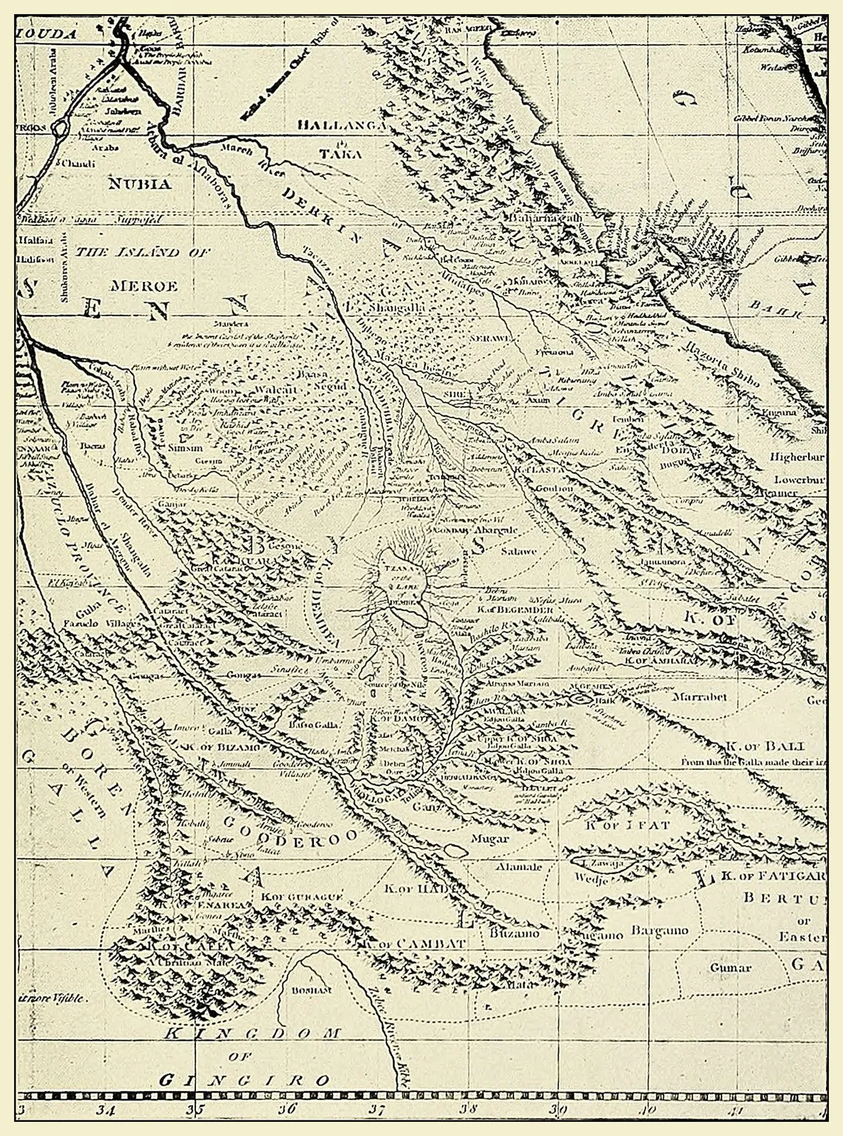
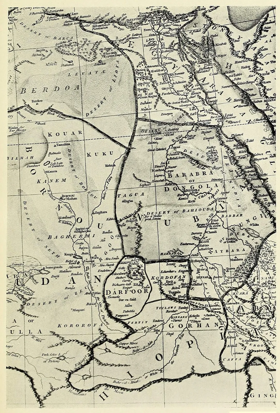
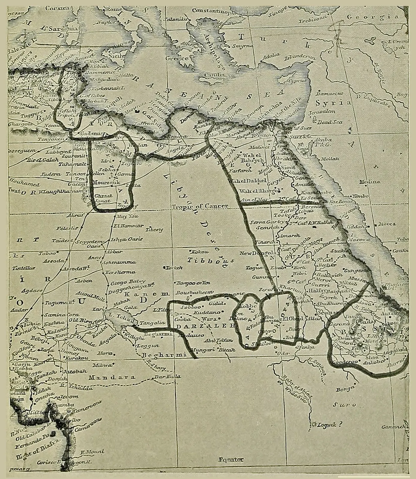
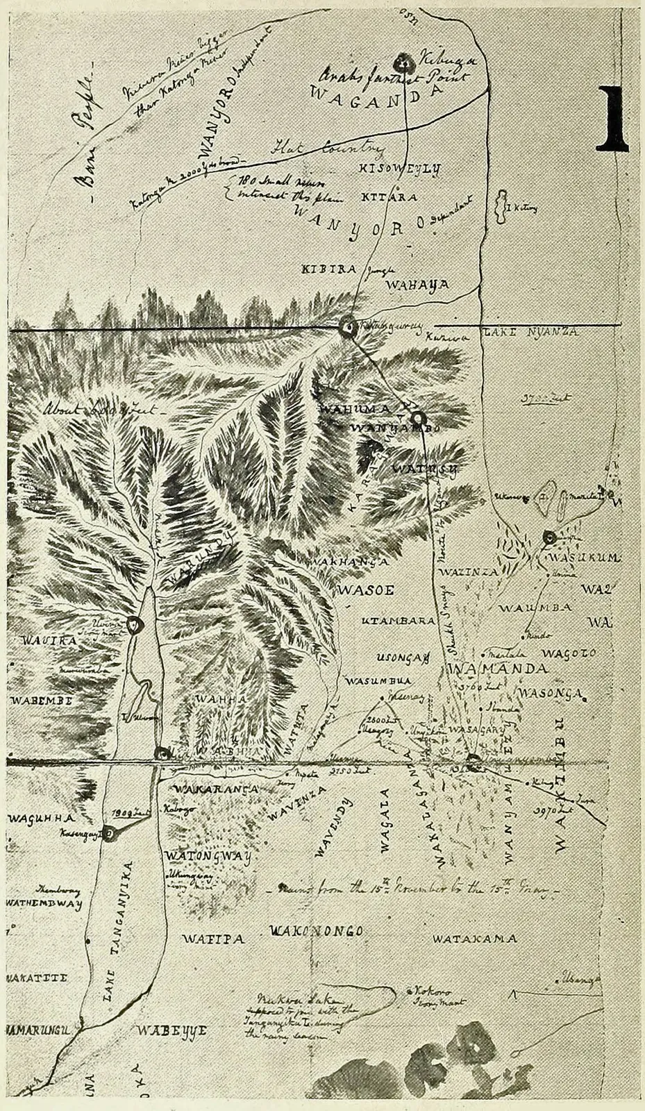
Larger versions of most illustrations may be seen by right-clicking them
and selecting an option to view them separately, or by double-tapping and/or
stretching them. Higher-resolution versions of the maps and some other
detailed illustrations may be seen by clicking Hi Res below them.
THE NILE QUEST A RECORD OF THE EXPLORATION OF THE
NILE AND ITS BASIN
BY
SIR HARRY JOHNSTON, G.C.M.G., K.C.B. (President of the African Society)
WITH ILLUSTRATIONS FROM DRAWINGS AND
PHOTOGRAPHS BY THE AUTHOR AND OTHERS
WITH MAPS BY J. G. BARTHOLOMEW
LONDON ALSTON RIVERS, Limited Arundel Street, W.C.
1906
THE STORY OF EXPLORATION
Probably few of the stories that tell of the
achievements due to the curiosity of humanity
have a wider or more lasting interest than that which
is concerned with the exploration of the lands and
seas, which give feature to the face of the earth. It
is a long story, and would be longer still, if the men
in the remote past had left any record of their wanderings.
Even as it is, in the scanty and perplexing
records left behind them by ancient Egyptians, Phœnicians,
Carthaginians, Hebrews, and even Chinese, the
story begins more than three thousand years ago and,
so far as the pioneer work of exploration is concerned,
may be taken to have practically concluded with the
end of the nineteenth century. It seems, therefore,
an opportune time to recount the leading episodes in
this long record of incessant human effort, in a manner
which will appeal to, and interest, all intelligent
readers.
In the series of volumes, which will be issued under
the general title “The Story of Exploration,” it will
be sought to make the narrative circle round the personality
of the men who had the leading share in
carrying on the adventurous work.
Beginning with the earliest journeys of which we
have any record, the story will be carried down stage
by stage to the present day, and it is believed that,
when complete, it will form what may be called a biographical
history of exploration. While the work of
geographical research in all parts of the globe will be
seriously and adequately treated, the adventures incident
to such research, which add human interest to it,
will have due prominence given to them. In all cases it
will be sought to obtain the co-operation of men who
are recognized as authorities on the particular subjects
with which they deal. Each volume will be profusely
illustrated, the illustrations being selected for their
appropriateness to the text, while every assistance will
be given to the reader by means of carefully executed
maps.
J. SCOTT KELTIE.
PREFATORY NOTE — ACKNOWLEDGMENTS
When the author of this book was composing
his recent work on the Uganda Protectorate,
he was led through the history of its discovery into
the general consideration of Nile exploration, since
it was in the search for the Nile sources that the territories
now forming the Uganda Protectorate were
laid bare to the gaze of the civilised world. But as
anything like a detailed review of the exploration of
the Nile basin by the Caucasian race would have unduly
extended a book dealing more particularly with
Uganda, he gladly took advantage of the suggestion
made by Dr. Scott Keltie (Editor of this series) that
these studies should be applied to the present volume,
which is one of a series on the history of great geographical
discoveries.
It is not for the author to say that his book on
the Nile Quest will prove interesting; but he has
striven to make it as accurate as possible, and he
hopes it may be permanently useful as a faithful
record of the names and achievements of those who
solved the greatest geographical secret, after the discovery
of America, which remained for the Caucasian’s
consideration.
H. H. JOHNSTON.
London, 1903.
The Editor and the Author desire to acknowledge,
with thanks, the loan of photographs, letters, or maps
for the illustration of this book, from Sir John Kirk,
G.C.M.G., Mrs. Murdoch (née Speke), Mr. J. F. Cunningham,
Mr. W. G. Doggett, Mr. Theodore Tinne,
Mr. T. Douglas Murray, Lady Baker, Mr. Oscar Neumann,
Mr. J. E. S. Moore, Major Gwynn, Major Austin,
Mr. J. Thomson, The African Society, Mr. S. Crispin,
and Mr. Warry.
THE NILE QUEST — CHAPTER I THE DAWN OF NILE EXPLORATION
The first men who entered Egypt and travelled
up the valley of the Nile came, almost unquestionably,
from the east, and were part of those radiations
from the central focus of humanity, India. It
is possible that the first men who entered the valley
of the Nile from this direction may have been of
so primitive, simian, and undetermined a type—so
“Neanderthaloid”—as not to belong definitely to
any one of the three main species of humanity. At
that distant time, however (let us say at the end of
the Pleistocene period or beginning of the Quaternary
Epoch), there was undoubtedly a land connection
over the south as well as over the north end of the
Red Sea, joining Arabia to Ethiopia as well as to
Egypt; and across this bridge came many types of
Asiatic mammals, also man,—possibly in the form
of a low Negroid, a type represented to-day (much
changed and modified, of course) by the Congo
Pygmies and South African Bushmen. As regards
the history of humanity, however, the valley of the
Nile has been divided into two very distinct parts.
The southern half of its basin—in common with all
Africa south of the Sahara and the fifteenth degree of
north latitude—was peopled from the east, through
southern Arabia, and by the Negro species in the
main. Egypt proper and the adjoining regions of
Arabia once lay within the domain of the Negroid
Pygmies, but these indigenes were overwhelmed at
a relatively early period by more or less “negrified”
branches of the Caucasian stock coming from the
direction of Syria or from Libya. Before the dawn
of the historical epoch—say nine thousand years ago—an
element in the population of Lower Egypt certainly
showed Bushmen affinities. These steatopygous
Bushmen were perhaps Proto-negroes, who may
have branched off from the Nigritic stock when first
that species reached the Mediterranean regions. This
Bushman element in Egypt was for some time distinct,
prior to the historical period, as the characteristic
type of the servile class. Following on these
dwarfish people came races bearing some slight resemblance
to the Dravidians of India or the Brahuis of
Baluchistan,—a somewhat Australoid stock which
has left traces in Elam and around the shores of the
Persian Gulf. Then came an aquiline type of nearly
pure Caucasian stock, usually known by Egyptologists
as the “Khafra” race. This probably arrived from
Syria or Cyprus. But the men of the northern half of
the Nile basin who fathered the principal, dominating
type of ancient and modern Egyptian emigrated seemingly
from the direction of Galaland, Somaliland, or
Abyssinia. In these countries, or originally perhaps
in southern Arabia, there was formed a handsome race
mainly of Caucasian stock, but which had mingled
somewhat considerably with the Proto-negroes and
Dravidians in Arabia and in northeast Africa, and
so had acquired darker skins, and hair with more or
less tendency to curl. The men of this race, like the
modern Somali or Gala, and the inhabitants of southern
Arabia, grew thin and wedge-shaped beards.
Their lips were full, their noses straight and finely
shaped. Their degenerate descendants continue to
exist with but little altered facial type in the Danākil,
Somali, and Gala of the present day; but in the
northern half of the Nile valley they became in time
the main stock of the Egyptian population. They
also, it would seem, profoundly modified Negro
Africa; for while on the one hand they started out
by a series of race movements and conquests from the
direction of Abyssinia to invade and mould Egypt,
on the other (though more faint-heartedly) they advanced
in a southwesterly direction to influence Negro
Africa. They have formed aristocracies in the countries
round the head-waters of the White Nile. Their
influence on the Negro races has been widespread,
permeating, even though faintly, in a handsome physical
type and remarkable form of language, to Zululand
on the south and perhaps westward across the
continent to the Congo, the Cross River, and the
Atlantic coast. This Hamitic race (as it is called
for want of a better word), which made its first
home—and retains as its last—the highlands of
Abyssinia and the plateaux and arid coastlands of
Afar, Somaliland, and the Gala countries, has been
the mainstay of Ancient Egypt, and also, together
with its not distantly related Libyan brethren, the main
human agent in saving the Negro from slipping back
into the life of the anthropoid ape.
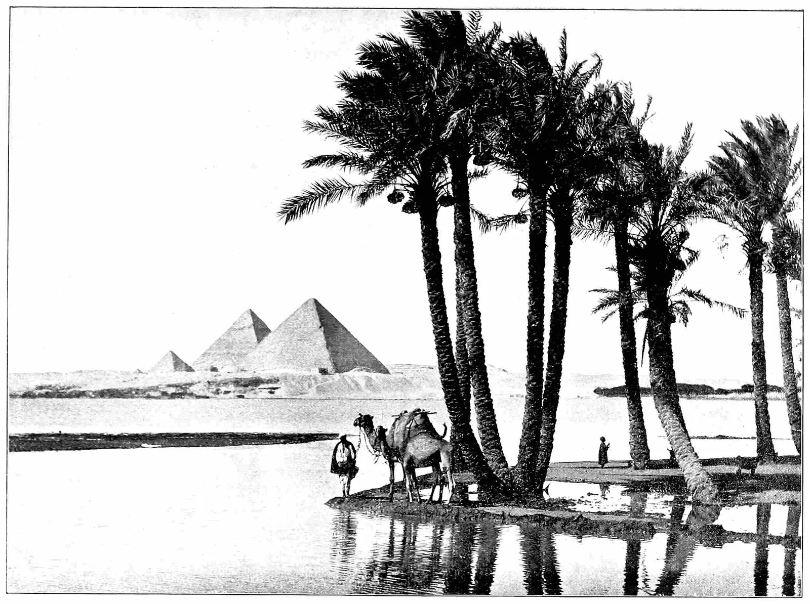
The Nile and the Pyramids.
The valley of the Lower Nile, however, attracted
many invasions from Europe and Asia, and from
Libya (northwest Africa), where the dominant race
was mainly of Iberian stock.1 Dynasties rose and
fell, often coincident with the invasion of Egypt by
one race of conquerors after another. All these races
(with the exception perhaps of the Hittites) belonged
to various types of the Caucasian species. The Hittites
possibly may have introduced a slight element of
the Mongolian. In the earliest historical period Egypt
and the lower valley of the Nile does not seem to have
been markedly severed in its interracial relations from
the far greater portion of the Nile basin which lies to
the south of the fifteenth degree of north latitude.
Egyptians penetrated no doubt without much difficulty
up the Nile valley into and among the Negro tribes
of the Central Sudan and Equatoria. The Ancient
Egyptians may have had—must have had—a certain
proportion of Negro or Negroid in their composition;
beside the drop of Negro blood in their Hamitic
ancestors, they must have absorbed the earlier Negroid
population of their country and have imported and
intermarried with Negro slaves. But they were fully
Caucasian in the vivid interest they took in nature,
and in their desire to depict all the striking forms
of life around them, especially when such forms had
anything of novelty. Prof. Flinders Petrie has, I
believe, recently discovered a vase of immeasurable
antiquity of the “Pre-Dynastic” period in Lower
Egypt which is incised with a delineation of the
Kudu antelope.2 Other and later relics would seem
to show that the Egyptians were acquainted with the
chimpanzee of the Bahr-al-Ghazal regions, the Pygmies
who once inhabited the western part of the Upper
Nile basin, and many forms of the Tropical African
fauna. But after these early historical times there
appears to have come about a severance of relations
between Egypt and the Upper Nile, though an
overland route to the Land of Punt (Somaliland)
either through Abyssinia or to the west of that elevated
region nearly always existed unclosed to traffic.
It is noteworthy that the Ancient Egyptians themselves
do not appear ever to have penetrated up the
main stream of the Nile much above its junction
with the Bahr-al-Ghazal, no doubt owing to the obstruction
of the sudd. Their traders may have travelled
into many parts of the Bahr-al-Ghazal region,
and possibly even westward in the direction of Lake
Chad,—westward, it may be, even across the western
Sudan to the Niger,—yet there is not the slightest
indication of their ever having journeyed up the
main White Nile to the snow-mountains and the equatorial
lakes. But they traded for thousands of years
with the men of Punt (Somaliland) by sea and by
land; and there is evidence to show that the peoples
of Somaliland and Galaland (who had by repeated
prehistoric invasions permeated the Upper Nile basin
and left aristocracies behind them) traded anciently—say,
in pre-Islamic times—southwestward to Lake
Rudolf, and round Lake Rudolf to the present Turkana
country, the neighbourhood of Mount Elgon,
and even to the northeastern shores of the Victoria
Nyanza.
The Ancient Egyptians seem to have known the
main Nile as far as Khartum, and the Blue Nile up
to its source in Lake Tsana. They exercised intermittently
some kind of rule over the northern and
western escarpment of Abyssinia, and are said to have
sent criminals and political exiles to die of cold on
the snowy heights of the Samien range. But they
appear to have displayed little knowledge or curiosity
concerning the ultimate source of the White Nile.
No doubt the vast marshes and obstructions of the
sudd which characterised the course of the Nile above
its confluence with the Bahr-al-Ghazal, the generally
hopeless nature of this country with its utter absence
of anything like high land, of minerals, or of a trading
population, discouraged the practical-minded Egyptians
from pursuing their researches in that direction.
The Nile itself they called Hapi, which was also the
name of the Nile God. It was sometimes spoken of
as Pi Yuma, or “the River.”3 Its valley they called
Atr, Atur, Aur (Modern Coptic = Eiōr).4
Several foreign dynasties ruled over Ancient Egypt,—Arabian
and Libyan,—and for centuries at a
time the energies of Egypt were mainly concentrated
on domestic work under these foreign task-masters
or insurrections to expel the hated rulers.
The original civilisation of Egypt rose rapidly to a
great and wonderful height at a period which may
be as remote, historically, as about seven thousand
years ago. The main source of their civilisation
seems to have been the introduction into the country
of copper implements instead of and in addition to
those of improved stone and flint manufacture. A
wonderful development of pictorial art occurred concurrently
with this brilliant rise in civilisation, and
this early Egyptian art is of a realistic character from
which all subsequent Egyptian pictorial or sculptured
art has been a degeneration. At this time they easily
impressed the Negroes of the south and the Libyans
of the west with their power, and it was no doubt a
matter of ease for Egyptian expeditions to penetrate
into the Sudan from the countries of Abyssinia and
Galaland. Gold and precious or gaudy stones were
sought for in the east and southeast. Ivory, slaves,
gums, perfumes, and strange beasts were obtained
from the south and southwest. But no doubt Ancient
Egyptians in their extensions of political or commercial
influence introduced amongst the Negro tribes the
knowledge of working metals. They also gave to
them all those domestic animals and cultivated plants
now existing in Tropical Africa which are not of a far
later American or Indian origin (that is, introduced
by the Portuguese and Arabs). By instructing the
Negroes in this indirect manner in the arts of civilisation,
and by spreading among them, no doubt, the
use of metal weapons (which were probably as good
as those used by the Egyptians themselves), there
came a time when—to use a term once much employed
by the European pioneer—the black men
became “saucy” and objected to be harried, bullied,
assessed, and exploited by the lordly Egyptian. The
Negro race at this time, too, was becoming infiltrated
by the same splendid stock—the Hamites—as had
so largely composed the ruling population of Egypt.
Here and there, no doubt, Negro tribes submitted
willingly to be governed by Hamitic princes (as has
been the case in Uganda and Unyoro), and, thus
ruled, offered sharp opposition to Egyptian encroachments.
Egyptian interest, therefore, in the sources of
the Nile died away, especially as in the revival of
native Egyptian power and in the expulsion of foreign
dynasties the thoughts of Egypt were all bent on the
conquest and retention of Syria, Asia Minor, and
Cyprus. These lands were more desirable in their
eyes than the appalling wastes of the Sahara, the sun-smitten
Sudan, the cold mountains of Abyssinia, or
the fetid marshes of the Nile Negroes.
Almost older than the civilisation of Egypt was
that of Mesopotamia, the reflex action of which on the
Hamites of western Arabia and Abyssinia and on the
inhabitants of the Nile Delta may have provoked
the civilisation of Egypt. Empires rose, declined,
fell, and were revived in the valleys of the Euphrates
and the Tigris, and their influence over Arabia and
Syria produced in those countries a stirring of commerce
and invention and a desire for distant enterprise.
The Phœnicians, who were originally an Arab
people of the Persian Gulf, forced their way across
the barren wastes of northern Arabia to the coasts
of Syria, leaving behind, however, colonies of bold
navigators at the northern end of the Persian Gulf.
The Phœnicians, by the building of more seaworthy
boats, and probably by the development of sails, soon
traversed the Mediterranean in all directions, passed
out through the Straits of Gibraltar, and even found
their way to Britain long before Julius Cæsar. Their
most noteworthy action in connection with Africa
perhaps was the founding of Utica in 1100 B.C. and
Carthage in 820 B.C., these settlements being made at
no great distance from each other in that projection
of North Africa which constitutes the modern state
of Tunis. The Carthaginian successors of the Phœnicians
carried on the work of discovery along the
north and west coasts of Africa until, in the memorable
voyage of Hanno, they had penetrated as far
south in that direction as the existing colony of Sierra
Leone. The Phœnicians as bold navigators were enlisted
in the service of one of the last Egyptian sovereigns
of a real Egyptian dynasty,—Neku, son of
Psametik I., who succeeded to the throne of Egypt in
611 B.C. Evidently by this time the overland routes
to the regions of the Upper Nile and even to Somaliland
had been closed by hostilities with the Ethiopians
and Negroes. A Phœnician expedition was
directed to sail down the Red Sea and along the coast
to the Land of Punt and the unknown territory beyond.
According to tradition, this expedition sailed
round the whole continent of Africa and passed
through the Straits of Gibraltar into the Mediterranean,
reaching Egypt from that direction.
Egypt, in her several thousand years of history,
had been many times conquered by foreign races or
the leaders of foreign armies, and had sometimes endured
the domination of strangers for five hundred
years at a time, though Egyptian art, tradition, and
religion either survived concurrently alongside the
habits and customs of the less civilised rulers, or
ended by Egyptianising the stranger. But there was
to come a time when the independence of Egypt was
to disappear, when the Egyptian language was to
cease to be dominant, when, in fact, the Egypt of the
Pharaohs and the Pyramids, of the Hieroglyph and
the Mummy, of Ra and Aphis, Osiris, Isis, and Horus
was to disappear—perhaps for ever; for the potent
race that had so long held aloft a brightly-lighted
lamp of civilisation has been so changed and degraded
by the infusion of Persian, Arab, Greek, Italian,
Negro, Circassian, Turkish, French, and Maltese
blood, so often decimated by wars, famines, and diseases,
and renewed with the tainted blood of mercenary
armies, that, though the residuum of the
population may still offer great facial resemblances
to the vanished Egyptian type, the majesty of demeanour,
the brilliant mental endowments of the old
race have gone, and the rulers of Egypt to-day under
the indifferent English are the descendants of Slavs
and Turks, Arabs, Armenians, and Circassians.
A ruler of Egypt, a usurper named Aahmes, had
been raised to the kingship over Egypt by a soldier’s
mutiny. He had legitimised his position by marrying
a granddaughter of Psametik I. Carrying out a
series of successful expeditions, he once more opened a
way to the commerce of Nubia and the Upper Nile.
He intervened in the affairs of Asia Minor to support
a small state there against encroachments by
the Persian conqueror Cyrus. The son of Cyrus the
Great, whom we know as Cambyses, but whose real
name was probably in Persian Kambujiya, resolved
to punish Egypt for this interference. Aahmes, whom
the Greeks called Amasis, died before he could resist
the invasion, and his son, Psametik III., lost his
throne and the independence of Egypt in the battle
of Pelusium. Cambyses became the conqueror, and
was crowned the legitimate King of Egypt. He
seems to have been an erratic and cruel conqueror,
but, like Nero, somewhat fantastically interested in
science and exploration. He sent one great expedition
into the Libyan Desert which was never heard
of again, and is supposed to have perished in the
sand; and he led a great army himself up the Nile
with some vague intention of conquering the Ethiopians.
His soldiers, however, had marched only a
small distance into the desert when their commissariat
failed, and many perished, while others became
cannibals in their mad hunger. This disaster put a
stop to any further efforts on the part of the Persian
Overlords of Egypt. For nearly two hundred years
Persia maintained her hold over Egypt, though for
brief intervals native dynasties arose in this part
and that part and flickered for a time in a state of
semi-independence. Then happened one of the great
events in the history of Egypt and of the development
of Africa,—an event which may be paralleled by the
descent on Egypt of Napoleon Bonaparte two thousand
one hundred and thirty-one years later: Alexander
the Great, continuing his war against the Persian
Empire, attacked that power in Egypt and won the
day. Alexander left in charge in Egypt one of his
generals (who was perhaps also his illegitimate half-brother),
Ptolemy. After his death Ptolemy refused
to acknowledge the claims of Alexander’s posthumous
son, and made himself King of Egypt. He thus
founded a Greek dynasty in that country which lasted
till the advent of the Cæsars and expired in the person
of the world-famed Cleopatra.
CHAPTER II THE GREEKS INTEREST EUROPE IN THE NILE QUESTION
The second division of the Caucasian species
of man (the Iberian being the first) was the
Aryan,—a race of golden-haired, pink and white
complexioned people, with eyes that are blue, gray,
or violet.5 The Aryans first came into Greece as
barbarians and destroyers, but were soon conquered
by the preceding Iberian Mykenæan civilisation, on
which they built up that Hellenic art and knowledge
which are the foundations of European civilisation
at the present day. This Hellenic spirit first made
itself felt in Africa through the Greek colonies of the
Cyrenaica. Greece, when it became conscious of a
world beyond its peninsulas and islands, was strongly
drawn towards Africa. The power of Egypt long
withstood attempts at Greek colonisation, though in
quite early days Hellenic or Hellenised Europeans
were employed by the rulers of Egypt as mercenary
soldiers. Therefore, following the line of least resistance,
Greece planted her first African colonies between
Egypt on the east and the settlements of the
Phœnicians (Carthage) on the west. Due west of
the narrow coast belt of Egypt is a remarkable projection
of North Africa into the Mediterranean,—the
modern Barka, the ancient Cyrenaica. This projection
has been, several times in geological history, a
series of islands in a larger Mediterranean, or it has
grown into a bridge connecting Greece with Africa.
The land now rises to heights of three thousand feet,
and there is a sufficiency of rainfall in ordinary seasons
to nourish a vegetation not much less rich than that of
southern Italy. South of the Cyrenaica lies the Sahara
Desert in its most aggravated form of well-nigh impassable
sand dunes. No Greek expedition that we
know of ever succeeded in crossing the Sahara from
Cyrenaica and reaching the Sudan; but Greek influence
and inquiries were dimly felt in Phazania (Fezzan) to
the southwest, and the existence and prosperity of these
Greek colonies in North Africa aroused the interest
of the Greeks in matters of African exploration. In
about 457 B.C. Herodotus (a native of Halicarnassus,
a Hellenised state in Asia Minor under Persian rule)
visited Egypt, which from 650 B.C. onwards had been
more or less thrown open to Greek enterprise by
Psametik I. Herodotus himself travelled up the Nile
as far as the First Cataract, and collected with some
industry information from Egyptians and travelled
Greeks as to the regions which lay beyond. From
these he learned that the origin of the Nile was unknown,
but that the river might come from the far
west, from the region where we now know Lake Chad
to be; that there was a civilised city of Ethiopians in
the great bend of the Nile at Meroe (Merāwi of to-day),
and that beyond this nothing certain was known
of the Nile course. Aristotle—the great Greek
philosopher, who was born in northern Greece in
384 B.C.—wrote on African discovery and recorded
the news that to the southwest of the Nile were
Pygmy races who frequently warred with the “cranes”
(? ostriches).
In B.C. 276 was born at Cyrene, in North Africa,
Eratosthenes, a Greek geographer, who was made
Librarian at Alexandria. From the information he
collected and collated (supplied, no doubt, by Greek
traders) he, first of all known geographers, sketched
out with fair accuracy the course of the Nile and its
two great Abyssinian affluents as far south as the
modern Khartum. He hinted at the lake sources and
first mentioned the Nubians.
It was the conquest of Egypt from Persian domination
by Alexander the Great which really did more to
extend Greek commerce and civilisation and the use
of the Greek language over eastern Africa and western
Asia than has even been done at a far later date
in other parts of the world for German commerce,
knowledge, and the German language by the unification
of Germany under Bismarck, William I., and
William II. Greek explorers visited the Nile as far
south as the junction of the Astapus (Blue Nile), and
Greek settlements were made on the island of Sokotra,
and possibly at other points near the mouth of the
Red Sea. Greek traders even visited the East African
coast as far as Pangani, opposite Zanzibar. The
Greeks revealed India to Europe, and the commerce
which sprung up there through Greek agencies on the
Persian Gulf and the Red Sea gave unwilling navigators,
in those days before steam force, some acquaintance
with the eastern coast of Africa as far
south as Zanzibar.
Yet the Greeks in all these regions were (as subsequently
happened with the Portuguese) but the followers
of the Arabs and Phœnicians. Some impulse,
kindred in origin, no doubt, to the evolution of the
Phœnicians, had created an ancient civilisation in
southern and western Arabia which perhaps reached
its climax in the lofty, well-watered, and fertile country
of Yaman. Much of southern Arabia, however,
several thousand years ago, was less arid than at the
present day. The rainfall was greater, and the already
civilised inhabitants industriously preserved the
precious water by dams for purposes of irrigation.
This civilisation may be briefly styled Himyaritic or
Sabæan,—perhaps the last name is the more comprehensive.
These Sabæan Arabs of south and southwest
Arabia, separately or in conjunction with their
Phœnician cousins, pursued their search for metals
down the east coast of Africa, along which they made
settlements which are probably the sites of most of the
modern emporiums of commerce on the same coast.
They had reached the mouth of the Zambezi and ascended
that river, and had penetrated as far south as,
let us say, Delagoa Bay. It was perhaps their exploration
of the Zambezi which led them to discover alluvial
gold in the vicinity of that river, though they afterwards
found a shorter route to the gold fields by
way of Sofala. In this way they forestalled by some
twenty-five hundred years modern Rhodesian enterprise,
and gold was worked in the regions to the
south of the Lower Zambezi and a little to the north
of that river by Arabs or people of allied language
and race almost continuously from an approximate
period of three thousand years ago down to the arrival
of the Portuguese at the beginning of the sixteenth
century of this era. In the days before the
appalling religious disunion brought about by the
conflicts between Christianity and Islam there was
no bitter feeling against the European on the part
of the Arab, and Greek adventurers and traders appear
to have penetrated freely up the Nile, and to
have worked cordially with the Sabæan Arabs whom
they found established at various points between India
on the one hand and Zanzibar and the Red Sea on the
other. The Greek colony on the island of Sokotra no
doubt traded industriously with the opposite coast of
Somaliland.
Rome displaced Greece in Egypt in the same way
that Greece had displaced Persia, and that Persia had
closed the five thousand years of fighting between
Libyan, Gala, Arab, and Nubian. In 168 B.C. Rome
extended her protection over Egypt. In 30 B.C. Egypt
became a Roman province. When the Romans really
took over the administration of the land, they too, like
the Galas, Persians, and Greeks before them, and the
French, Turks, and English after them, began to be
interested in the quest for the Nile sources. Each
newly-arrived race of Caucasian conquerors in Egypt
has felt the same interest. But much of the exploring
and recording work under Roman rule was done
by Greeks. Strabo, a native of Amasia in Pontus,
on the southern shore of the Black Sea, who was
born somewhere about 50 B.C., became, when quite
a young man, a geographer of the Roman world.
He accompanied in B.C. 24 Ælius Gallus, the Roman
Governor of Egypt, on a journey up the Nile as far
as Philæ (beyond Assuan and the First Cataract).
Pliny the Elder, writing some fifty years after the
birth of Christ, shows us that just before and just
after that event Greek explorers (mainly from Asia
Minor) had been busy on the Nile above the First
Cataract and perhaps south of Khartum. These were
Bion, Dalion, and Simonides. Aristocreon and Basilis
are also mentioned as authorities on Nile exploration,
but not necessarily explorers themselves. Simonides,
above mentioned, lived for five years in Meroe. Dalion
is thought to have penetrated up the river some distance
beyond Khartum. The “Meroe” which is so
constantly mentioned by Greek and Roman writers
from Herodotus to Ptolemy, was a name given
originally to an important and flourishing city on
the south or left bank of the Nile in Dongola,—the
modern Merāwi. This place was also known
as Napata (Egyptian, Nepet), and was the residence
of Ethiopian (Abyssinian, Gala, Nubian)
kings. Later the name Meroe was also applied to a
place on the right bank of the Nile about one hundred
miles south of that river’s confluence with the
Atbara. This is probably where the Greek Simonides
stayed and beyond which Dalion travelled. Finally,
the term Meroe was applied to the “Island” (peninsula)
formed by the Atbara, the Blue Nile, and the
White Nile, a region formerly of great fertility.
The Emperor Nero, though the Beast of the Apocalypse,
had a certain genial interest in geography. He
despatched—or caused to be despatched—an expedition
under two centurions in about the year 66 A.D.,
to discover, if possible, the source or sources of the
White Nile. Before dealing with Egypt the Romans
had taken over control of the old Greek colonies of
the Cyrenaica and on the coast of Tripoli. This had
led (A.D. 19) to their having extensive relations with
the Berber kingdom of Fezzan, with whom and with
the Tawareq people of Garama to the south they maintained
friendly relations. Through this friendly co-operation
a Roman expedition under Septimus Flaccus
had in the year 50 A.D. (perhaps) reached to some
trans-Saharan place like Bilma. Much later, about
150 A.D., another expedition under Julius Maternus
joined forces with the friendly Berber King of Garama,
and actually travelled to the vicinity of Lake Chad,
or, as some think, to the oasis of Air or Asben farther
to the west. It was a country which they called Agisymba,
and abounded in rhinoceroses. From this expedition
the Romans derived some inkling of the
possibilities, beyond the sandy wastes and sun-smitten
rocks of the Sahara Desert, of a fertile Sudan, populated
with an excellent material for slaves. But a
hundred years earlier they had realised the enormous
difficulties which attended any enterprise (in the days
before camels were used in Africa) across the Sahara
Desert, and this gave them an added desire to follow
up the Nile and ascertain its practicability as a waterway
into Negro Africa.
Nero’s two centurions were passed on by Roman
prefects to friendly Nubian chiefs, one of whom ruled
the principality of Meroe along the main Nile between
Atbara and the Blue Nile confluence. Furnished with
boats which they later exchanged for dug-out canoes,
they appear to have ascended the Nile above Fashoda,
and possibly above the confluence between the Bahr-al-Ghazal
and the Kir or White Nile. At any rate they
got far enough south to come in contact with the Great
Marsh which extends from the vicinity of Fashoda to
the frontiers of the Uganda Protectorate. Their passage
was stopped by the accumulation of water vegetation
which we now know as the “sudd.” Some writers
on ancient geography believe that the two centurions
penetrated as far south as the sixth degree of north
latitude, or the verge of the Bari country. At any rate
they got well into the land of the naked Nile Negroes.
Their discouraging reports seem to have put an end to
any further Roman enterprise in the matter.
Greek traders in Egypt prospered greatly under the
peace imposed by the Roman Empire. Their commerce
with Arabia, East Africa, and India grew to
a wonderful development in the first century after
Christ. About 77 A.D. was published by a Greek of
Alexandria the celebrated “Periplus of the Red Sea,”
a pilot’s manual not unlike the modern Admiralty
“sailing directions.” This “Periplus” shows us that
the Greeks by the middle of the first century knew the
Zanzibar coast very well under the name of Azan or
Azania.
Among these Greek merchants trading with India
was one Diogenes, who, on returning from a voyage
to India in about 50 A.D., landed on the East African
coast at Rhaptum (Pangani or the mouth of the river
Rufu?). Thence, he said, he “travelled inland for a
twenty-five days’ journey, and arrived in the vicinity
of the two great lakes and the snowy range of mountains
whence the Nile draws its twin sources.” As
nothing is recorded about his return journey, it is more
probable that he merely conversed on the coast with
Arab settlers and traders who told him that at a distance
of twenty-five days’ march in the interior began
a series of great lakes from two of which were derived
the twin sources of the White Nile; that farther to
the south of the most western of these two lakes was
a range of mountains of great altitude covered with
snow and ice, and named for their brilliant appearance
of white the Mountains of the Moon. The Nile, he
was told, united its twin head-streams at a point to
the north of these two great lakes, and then flowed
through marshes until it joined the River of Abyssinia
(the Blue Nile), and so reached the regions of
the known.
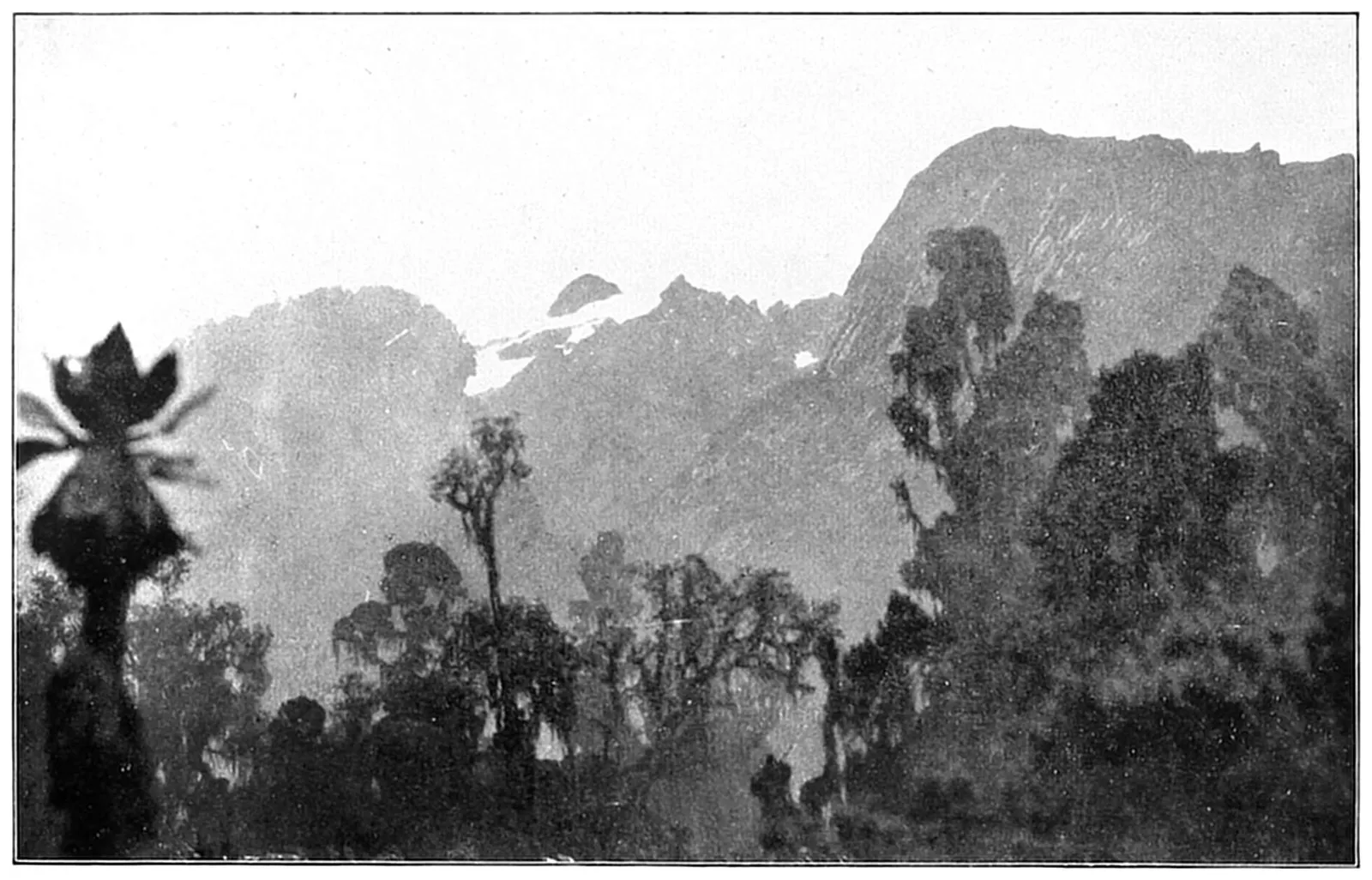
The Mountains of the Moon: a Glimpse on one of Ruwenzori’s highest Peaks.
This story was told by Diogenes to a Syrian geographer
called Marinus of Tyre, who published it in
his geographical works in the first century of the
Christian era. The writings of Marinus of Tyre disappeared,
probably with the dispersal of the Alexandrian
Library, but fortunately for us at the present
day all that portion of them dealing with the sources
of the Nile was quoted almost in extenso by another
geographer, Claudius Ptolemæus, a Greek-Egyptian,
born at Ptolemais in the Delta of the Nile, and resident
at Alexandria (perhaps in connection with the
celebrated Library). Ptolemy (as he is currently and
incorrectly called) wrote in about the year 150 A.D.,
and therefore to Ptolemy is commonly attributed the
first clearly expressed theory as to the main origin of
the White Nile, the twin lakes (Victoria and Albert),
and the great snowy range called the Mountains of
the Moon (Ruwenzori).6 Neither Marinus of Tyre
nor Claudius Ptolemæus was the first person to hint
at this origin of the Nile. Besides Eratosthenes and
Pliny there are indications in various records of the
two centuries before Christ that the idea of the White
Nile issuing from two great lakes and passing through
a vast marshy region before it reached Ethiopia was
vaguely known. The idea had perhaps even reached
the ears of Cambyses and of such of the earlier Ptolemies
as may have cared for geographical speculations.
The bearers of the news would undoubtedly have been
men of the Gala (Abyssinian, Somali, Cushite) race,
who at that distant period of time seem to have freely
penetrated through the lands of the brutish and unarmed
Negroes. No doubt many a Greek adventurer
in passing along the east coast of Africa brought back
tidings similar to those of Diogenes, but his grain fell
among the rocks, and the only definite record of the
existence of this theory as to the Nile’s origin is
the story of Diogenes preserved through the industry
of Marinus of Tyre and Claudius Ptolemæus of
Alexandria.
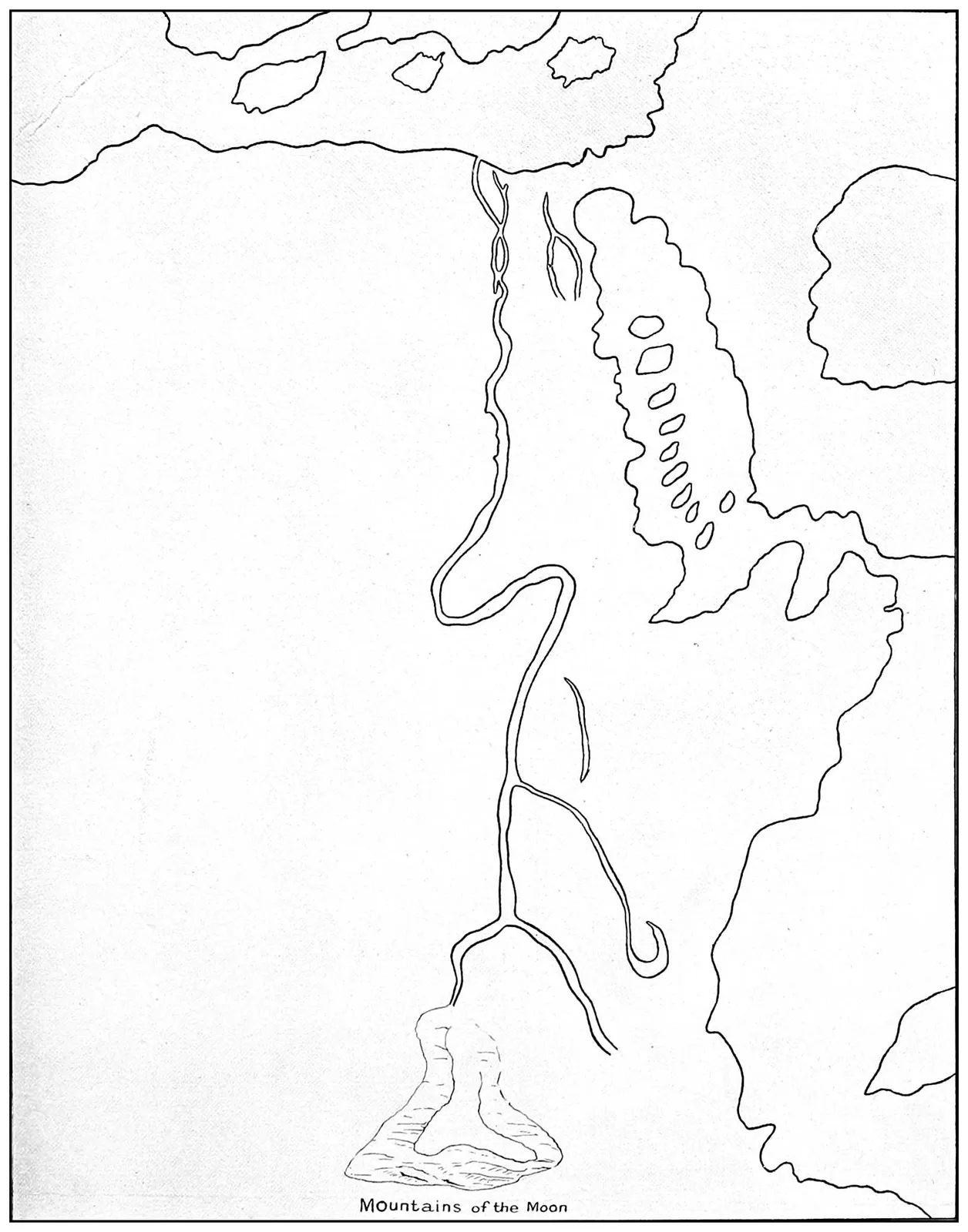
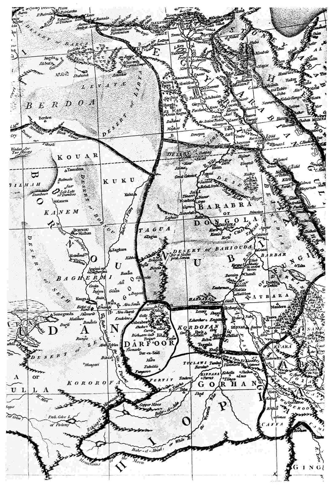
The Course of the Nile, according to Ptolemy.
From the oldest version of Ptolemy’s Map in existence, about 930 A.D., preserved
in Mount Athos Monastery.
The recording of travellers’ tales as to the twin
lake sources of the main Nile stream and the existence
of a great snowy range called the Mountains of
the Moon was not the only contribution made by
Claudius Ptolemæus to Nile geography. The Egyptian
Greek indeed was a geographical giant compared
with any of his predecessors, nor was the height of his
knowledge concerning the geography of Europe, Asia,
and Africa reached and passed until the fifteenth century
of the present era, some twelve hundred years
after his death. The results of the later Crusades, intercourse
with the Arabs, and the journeys of Marco
Polo and other enterprising Venetians had brought
in some cases confirmation of Ptolemy’s theories, had
corrected some of his errors, and had filled up gaps
in his information. But as regards the geography of
Africa more especially, Ptolemy remained ostensibly
the great authority until the end of the fifteenth century,
although, as already mentioned in a footnote,
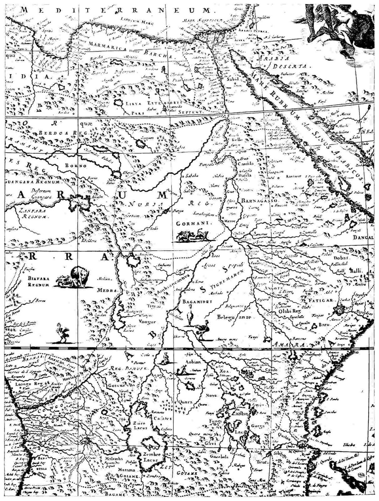
the latest editions of Ptolemy’s maps (the latest ascribed
to Ptolemy was published about 1485) show
that the geographers at the closing part of the fifteenth
century, consciously or unconsciously, touched
up Ptolemy’s work by later information received from
Arabs, Italians, and Turks. Ptolemy discussed with
much detail the whole course of the Nile so far as it
lay to any extent within the regions of the known.
He described the approximate outline of its course
about as far as the present site of Berber, which district
he describes as the Greater Primis, a name
which Sir E. H. Bunbury takes to be identical with
the locality of Primnis7 rumoured by Strabo. Above
this point Ptolemy applies the name of Meroe (so
often attributed to settlements or districts in Dongola)
to that great peninsula which is so nearly enclosed
between the Atbara, the main and the Blue
Niles. Ptolemy indeed, and most writers of earlier
and later days, believed this district to be an actual
island.8 The junction of the Blue and the White
Niles is wrongly placed by Ptolemy in latitude 12°
north, instead of 15° 40′, and from this point southwards
Ptolemy’s proposed latitudes of places on the
White Nile became increasingly incorrect, so that by
him the Nile system was carried a little too far to the
south of the equator. South of the site of modern
Khartum Ptolemy had but little information to go
upon, other than the account of the Centurions’
voyage; but from such suggestions as he could obtain,
together with the story of Diogenes, he guessed that
the twin sources of the White Nile joined their streams
into one river at 2° north latitude. This junction described
with the knowledge of later days would be
equivalent to the exit of the Nile from Lake Albert, the
real latitude of this point being 2° 25′—an uncommonly
good guess on Ptolemy’s part. Ptolemy, however,
imagined nothing quite like Lake Albert, but
thought that the waters coming respectively from the
two great equatorial lakes effected their junction at a
point some two hundred and fifty miles north of the
western lake source (Lake Albert); for he surmises
that this lake lies approximately under the sixth degree
of south latitude (its southernmost extremity is in
1° 10′ north of the equator). His hypothetical Lake
Victoria lies under or extends to the seventh degree
of south latitude, instead of no farther than about
3° 30′ south. Ptolemy, however, was careful to discriminate
between the lake sources of the White
Nile and the lake (Tsana) from which the Blue
Nile issues in the highlands of Abyssinia. This
sheet of water he calls definitely Coloe, and states
that it is the source of the river Astapus (or Blue
Nile). It is thought that Strabo also made allusion
to Lake Tsana under the name of Psebo. It is probable
that both Strabo and Ptolemy heard of this
lake source of the Astapus or Blue Nile from Greek
traders who had penetrated Abyssinia; for, during
the first centuries after Christ, Axum (then called
Auxuma) had become an important trading-centre
which was reached from Adulis (Adulis being a port
on the Red Sea not far from the modern Masawa).
Ptolemy’s location of Lake Tsana, however, like the
equatorial lakes, is too far to the south. His sketch
of the main course of the Atbara (Astaboras) on the
one hand, and of the Blue Nile (Astapus) on the
other, would not be very incorrect, but for the fact
that he makes these streams unite somewhere in the
latitude of Khartum and then separate again, their
northern separation enclosing the island of Meroe.
The Græcicised names of Astapos (Blue Nile) and
Astaboras (Atbara) were recorded before the days
of Ptolemy by Eratosthenes, but were not applied in
the same definite way to the Blue Nile and the Atbara.
Eratosthenes sometimes applies the name of Astapos
to the main stream of the Nile and not specially to
the Blue Nile. He also mentions that the main stream
of the Nile is called Astasobas. It is evident that in
these words we have corruptions of local names, possibly
derived from Nubian, or it may be from Hamitic
languages. Astaboras needs but little identification
with the Atbara. Astapus (Greek = Astapos) is not
clearly recognizable under the modern Abyssinian
name of the Blue Nile,—Abai. The second part of
Astasobas certainly recalls the name Sobat, which
besides being applied by the Sudanese Arabs to the
Baro or Sobat is also sometimes given by them or by
the Nile Negroes to the main course of the White
Nile south of Khartum. Asta may have been some
Ethiopian term meaning “river.”
The present writer is unable to understand why that
able geographer, Mr. E. G. Ravenstein, has doubted
the identification of Ruwenzori with Ptolemy’s Mountains
of the Moon. It must be obvious, when all facts
are considered, that Ruwenzori was the principal germ
of this idea. The Greek traders at Rhapta (Pangani)
no doubt had some idea of the existence of Kilimanjaro,
but it is doubtful whether either the single dome
of Kilimanjaro or the gleaming pinnacle of Kenia
would impress the imagination so strongly as the whole
brilliant range of Ruwenzori’s four or five snow-peaks
and thirty miles of glaciation. On such occasions, as
when this range is visible from a distance, and broadside
on, the dark blue forested slopes merge into the
morning mists of the lowlands, leaving the splendid
phantasmagoria of cream-coloured snow and gray rock
floating in the sky like an exaggerated lunar landscape.
Ptolemy places this range, as he does his lakes, too
far to the south, and associates it more with the
modern country of Unyamwezi than with the region
between the two lakes Albert and Victoria. But
no doubt then, as in Speke’s day, Ruwenzori and
Lake Albert were reached by Greek adventurers, by
Sabæan Arabs, or by natives who served as intermediaries,
by way of the established trade route through
Unyamwezi. This word, which means “the Land of
the Moon,” appears to be rather old for a Bantu place
name: Unyamwezi indeed seems in the history of
Bantu migrations to have played an important part,
and to have been one of those many sub-centres from
which great dispersals of the Bantu races took place.
Indeed the Zulus (who were probably the dreaded
Mazimba or Bazimba spoken of by the Portuguese)
seem to have halted in their cannibal days in Unyamwezi
before they descended on South Africa in the
sixteenth century. Ruwenzori is not, after all, such
a very long journey to the northwest of Unyamwezi,
and it is very possible that the returning travellers,
having stated that they reached the Nile sources and
these wonderful snow-mountains through the Land of
the Moon thus caused this lunar name to be applied
by Ptolemy to the Ruwenzori range.
Though not an explorer, Ptolemy stands (for his
age) in the highest rank of Nile geographers; but
he had to wait something like seventeen hundred and
forty years before Sir Henry Stanley, by his discovery
of the Semliki, the Ruwenzori snow-range, and the
last problems of the Nile sources, did justice to that
remarkable foreshadowing of the main features of
the Nile system due to the genius of the Alexandrian
geographer.
CHAPTER III ABYSSINIANS AND JEWS
The race of the Greek kings who ruled over
Egypt after the death of Alexander the Great
and until 30 B.C., and later, again, the Byzantine
Emperors of Eastern Rome did much to implant Hellenic
civilisation and the use of the Greek language
in Egypt, and their influence extended over Abyssinia,
where the kings of Ethiopian race (Gala dashed with
Arab and Jew) admired and imitated them in much the
same manner as the second Emperor of the French
was admired and imitated by the lesser potentates of
Germany. The history of Abyssinia—if it is to be
written with regard to truth—is still obscure. This
country of lofty mountains and temperate climate is
bordered on the east by the land of Afar, an inhospitable
desert inhabited by fierce Hamites (Danākil).
On the south its mountains are connected by plateaux
and ridges with the highlands of East Africa, but are
separated by much arid and parched country from the
regions of the modern Uganda protectorate. On the
west the mountains of Abyssinia descend in terraces to
the plains of the central Nile. Here the torrid climate
is that of the Sudan, but the country is better watered
by the rivers which rise in Abyssinia, and by a fairly
regular rainfall. On the extreme north the Abyssinian
mountains almost overhang the coast of the Red Sea,
and are no doubt visible in clear weather from the
opposite Arabian shore. The mountains of Yaman
are remarkably similar in many points to those of
Abyssinia, and the people of Yaman when they were
seized with a desire to emigrate in search of fresh homes
were no doubt drawn to this distant land of mountains
just visible in the west. Originally no doubt Abyssinia
was peopled by the same dwarf Bushman race as that
which formed the lowest stratum of all the African
populations. Then a portion of the country came into
the possession of the big black Negroes who still
inhabit its western flanks. These again are superseded
and partially absorbed by the superior race of
the Hamites, the ancestors of the Gala, Somali, and
Ancient Egyptian. This Hamite race of Caucasian
stock with some Negroid intermixture forms the basis
of the Abyssinian population at the present day. But
in the early days of Sabæan enterprise—say four
thousand to three thousand years ago—Abyssinia was
conquered by Sabæan Arabs from Yaman. At many
subsequent periods Abyssinia and Yaman (the Red
Sea acting as no barrier) were governed by the same
dynasty, and when Yaman came under Persian influence
that influence also penetrated Abyssinia. In
this manner Abyssinia early developed a trade with
India, and even served as an emporium for the introduction
of Indian wares into Egypt on the one hand
and the remote parts of eastern equatorial Africa on
the other. The Queen of Saba (Sheba) is no doubt
in many respects a legendary personage, but if she
had any real historical existence she is another instance
of an Arab ruler who governed both Abyssinia
and Yaman. She may or may not have visited Solomon,
but there is no doubt that in the time of that
Jewish king some intercourse was kept up between the
kingdom of Israel in its brief flicker of power and prosperity,
and the coasts of the Red Sea and southern
Arabia. After the smashing up of the Hebrew state
by the Assyrians there are good reasons for assuming
that a number of the dispersed Israelites migrated
to Abyssinia, as no doubt they did to other parts
of the Sabæan Empire. Jewish monotheism always
had a certain fascination (in the days before Christianity
and Islam) for the peoples of Arabia and
of Mauritania. This influence was most felt after
the final destruction of Jerusalem by the Romans and
the subsequent dispersal of the Jews in all directions.
Several princes in southwestern Arabia adopted the
Jewish faith, more or less, and the Jewish settlers in
Abyssinia also appear to have acted as missionaries
in converting the savage, nominally Semitic, partly
Gala rulers of Abyssinia to the principles of the Jewish
faith, into which they wove Jewish legends, such as
the glory and power of Solomon. A similar influence
impressed on the Arab mind the Solomon of the
legends. The real son of David was no doubt an
unimportant Semitic prince who borrowed a little civilisation
from his Phœnician, Egyptian, and Sabæan
neighbours. But the Greek influence emanating from
Egypt displaced for a time the Persian and Jewish
culture in Abyssinia. In the northern parts of that
(then) collection of Arab and Gala kingdoms, Greek
began to be used as a second language, the speech of
the Court itself being a foreign tongue (Ge’ez), derived
from the Himyaritic or some early south Semitic
language.
Auxuma—the modern Auxum—in the kingdom
or province of Tigre (northeastern Abyssinia) and
near the more modern town of Adua, became an
important trade centre, frequented by many Greek
merchants, some of whom seem to have occasionally
returned to their homes in Egypt by way of the
Atbara and the Nile. Others forestalled the Portuguese
by entering into trade relations or actually
undertaking journeys which revealed to them the existence
of Lake Tsana and the upper waters of the
Blue Nile.
Cosmas Indicopleustes, a Byzantine Greek, who
traded with India in the early part of the sixth century
of our era, called at the port of Adulis (near
Masawa) in 520 A.D. He discovered at this place a
monument which contained two separate inscriptions.
The monument was apparently one erected at the
orders of Ptolemy III. (Philadelphus), who reigned
in Egypt from 285 to 247 B.C. This Ptolemy led and
sent expeditions which made a partial conquest of the
coast regions of northern Abyssinia, and added to
the Egyptian Empire of that day a good deal of
what now constitutes the modern Italian colony of
Eritrea.9
On the same monument some four hundred and
seventy years later, in about 127 A.D., a Semitic
Abyssinian king (possibly Ela-Auda) recorded in
turn his own victories and extensions of rule. These
conquests seem to have done much to carry the Abyssinian
(Semitic as distinct from Hamitic) arms as
far south as the ninth degree of north latitude. Other
indications would show that from this time onwards
to about the tenth century A.D. Abyssinian influence
and conquests extended southward intermittently to
the vicinity of Lake Rudolf (the northern end of that
lake). Owing to these conquests, Christianity was
carried as far south as the modern province of Kaffa,
and northwestwards along the course of the Blue Nile
to the site of the modern Khartum; for at one time
Abyssinian suzerainty or rule extended almost to the
verge of Kordofan on the west.10
The introduction of Islam among the Somalis,
among some of the Gala tribes, and all round the north
and west of Abyssinia in the centuries that followed the
eleventh, checked any further spread of Christianity,
and limited—even curtailed—the political aspirations
of Abyssinia. In the sixteenth century a Muhammadan
ruler—Muhammad Granye—arose in the Danākil
country (Tajurra Bay), and practically smashed the
Ethiopian Christian power in Abyssinia, which did
not recover from the ravages of these Muhammadan
(Arab and Somali) armies for a century or more.
Soon after the wars of Muhammad Granye the heathen
Galas11 from the south and southwest entered Abyssinia
in force, and it was a long time before the Semitic
rulers of that country could bring them under control.
The arrival of the Portuguese (to be described in the
next chapter) gave a fillip to the power of the Christian
Semites of Abyssinia, mainly through the introduction
of guns and gunpowder. It is possible,
indeed, that at different times after the commencement
of the Christian era Abyssinian raiders may
have ridden south on their slave, ivory, and cattle-hunting
expeditions as far as the vicinity of Mount
Elgon. At the present day their raiders come almost
to the frontiers of Busoga, for there is no tsetse fly
in all the district between Abyssinia and the Victoria
Nyanza; therefore, as the Abyssinians have possessed
horses for several thousand years, there has been little
to stop their making rapid expeditions into the Land of
the Blacks. In this way they may have raided and
traded as far south as the Victoria Nyanza and as
far west as the White Nile, bringing back with them
for the edification of the Greeks stories of the Great
Lakes and Snow-mountains, and assisting, perhaps, to
distribute over the lands now comprised within the
Uganda Protectorate those remarkable blue Egyptian
beads of unknown antiquity which have been referred
to by the present writer in his book, “The Uganda
Protectorate,” as being some slight indication of
ancient trading relations between the countries of the
Great Lakes and those under the dominion of Egypt.
CHAPTER IV ISLAMITES AND ITALIANS
When Egypt had become part of the Byzantine
dominions, all interest in the Nile sources
had died away, and men’s minds were mainly centred
on religious controversies of greater or less violence.
Greek Christianity penetrated to Abyssinia
and south of Abyssinia to countries not far from
the north end of Lake Rudolf. Most of the Nubian
kingdoms became nominally Christian, and Christianity
was the religion of the people on the Nile banks as
far south as the confluence of the Blue and White
Niles. It is thought by the missionaries of the White
Fathers’ Mission to Uganda that the sign of the
cross and the idea of baptism, with one or two
other practices found in the old heathen religions of
Unyoro and Uganda, may have reached those countries
from Abyssinia. Greek and Arab Christians in
the first six centuries of the Christian era certainly
penetrated to the East African coast, but after the
official adoption of Christianity by the Roman Empire
all mundane knowledge began to decay. Christianity
inspired a contempt for science, and the only ideas
of geography which floated about the world were
connected with the wanderings of propagandists or
pilgrimages to the shrines of saints. Arab enterprise,
moreover, in these sad centuries suffered a curious
eclipse. Far to the south, in Zambezia, no doubt the
invasion of the country by the earlier and later sections
of the Bantu Negroes brought about the destruction
of Sabæan power; and the somewhat degenerate
successors of the Sabæans from the south coast of
Arabia only occupied the coast emporiums dotted
along the littoral from Somaliland to Sofala.
Then came one of the great landmarks of the
world’s history, a movement productive of a little
good and some harm to civilisation. Christianity had
first been organised as a socialistic religion, grafting
on to the beautiful and indisputable precepts of its
Founder the reaction of poor, ignorant, starved, and
enslaved people against the unmoral philosophy, unequal
wealth, and excessive materialism of the time.
It then grew to be a somewhat dismal faith, taking no
heed of the beauty of this world and of mundane
opportunities for happiness; and above all it waged
an active warfare with sexuality, not merely curbing
immorality, but (wisely or unwisely) opposing polygamy
and advocating celibacy. The Arab and the
North African were not ripe for such a faith, and
Judaism had already biassed them against the polytheistic
tendencies of Greek Christianity. Muhammad,
the prophet of western Arabia, founded on a
basis of phallic worship and animistic belief the
third great Semitic religion—Islam. His teaching
was a direct challenge to Christianity, and soon became
iconoclastic in every sense of the word. Though the
Persian, Syrian, and Iberian elements of the Arab
Empire for a time revived and perpetuated in somewhat
grotesque aspect the science of Greece, the art
of Persia, and the lore of India, the Muhammadan
religion sealed most parts of Africa to European and
Christian research. It is true, however, that the conquests
of Islam enabled Arabs to penetrate further
into the interior of tropical Africa than before,
though from the dawn of civilisation they had been
the most constant explorers of the eastern part of
that continent.
The Arabs began to mention names connected with
the Niger and the western Sudan to the geographers
of Italy and Sicily. Under the impulse of Islamic,
Persian, and Arab colonies the east coast of Africa and
the north coast of Madagascar came partially under
Muhammadan rule in the tenth and eleventh centuries,
the Arabs there carrying on almost continuously the
commercial enterprise founded by their predecessors
and brothers, the Phœnicians and Sabæans. Invasion
after invasion crossed from Arabia, and passed over
the lowlands surrounding Abyssinia to the central
Sudan; or higher up, through Egypt, to Mauritania.
But the Arabs who crossed the Nile in the latitudes of
Khartum and Assuan made no attempts to follow the
White Nile, the Blue Nile, or the Bahr-al-Ghazal to
their sources,—left in fact all the Nile basin above the
confluence of the Blue and White rivers absolutely
untouched and unexplored. Egypt itself came under
Arab rule in 640 A.D., and subsequently formed an
independent principality under the Fatimite Khalifs.
The Crusades brought French, Germans, and English,
Aragonese and Flemings to the Delta of the
Nile in more or less disastrous expeditions against
the Saracen power,—a power which was fast becoming
that of the Turk. A curious relic of these
crusading days in the Nile Delta is or was (for
the present writer is not aware if they still exist)
several Spanish (originally Aragonese) monasteries,
which were established with the consent of the Muhammadan
rulers of Egypt in order to mitigate the
woes of Christian captives and to arrange terms for
their release.
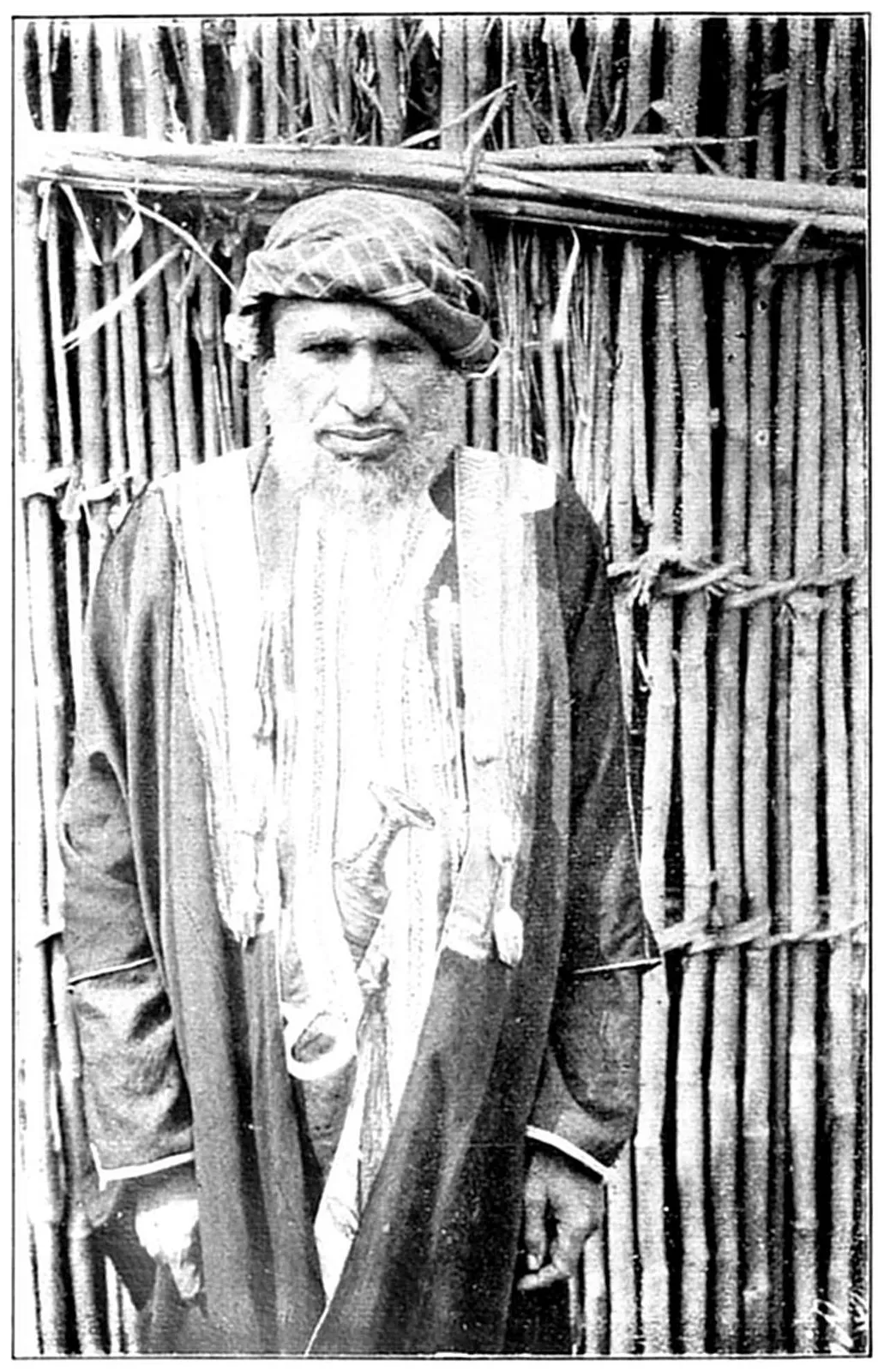
An Arab Trader (Maskati).
Venice, however,—which had somewhat held aloof
from the religious ardour of the Crusades in order
to build up a great commerce with the Muhammadan
East,—Venice became during the fourteenth and fifteenth
centuries the great neutral go-between for the
trade of India, Persia, Egypt, Arabia, and Syria with
the Byzantine Empire and the rest of Europe. Venetians
(in Arab dress, of course) ran less risk than
other Europeans when travelling in Egypt in the
days before the Portuguese discoveries. Through
the Venetians Europe became acquainted with several
strange African beasts which were brought from
the Sudan for public exhibition in Muhammadan
Egypt, and in this way European interest in the
sources of the Nile was occasionally revived. It is
remarkable to reflect that the name of Venice will
probably never die out (as far as etymology is
concerned) in the very heart of Africa. In the
fourteenth and fifteenth centuries, and perhaps later,
Venice manufactured in her arsenals improved types
of guns. She also acted as an intermediary in exchanging
muskets (manufactured elsewhere in Europe)
with the Arabs and Turks, who at that time could not
construct these firearms for themselves. Thus the
Turks and Arabs became accustomed to call any improved
type of musket a “Venetian” (Bunduqi).12
In this way the name of the most beautiful city in
the world has penetrated beyond the explorations of
any European into the very heart of Africa, as it has
also circulated through all the Muhammadan East.
CHAPTER V A SUMMARY OF THE ANCIENTS’ KNOWLEDGE OF THE NILE
The next page in the history of the Nile Quest
is marked by the coming of the Portuguese;
but before we proceed to consider what effect this
movement had on the revelation of Africa to the
knowledge of the Caucasian species, let us sum up
briefly the purport of the foregoing chapters:—
1. The lands through which the Nile flows were
inhabited some ten thousand years ago—let us say
at a guess—by Pygmies in the north, east, and
southwest, and elsewhere by big black Negroes, these
types being offshoots from the original Negro Asiatic
stem.
At some such period as ten thousand years ago
northeast Africa was repeatedly invaded from Arabia
by a branch of the Caucasian race—the Hamites—which
in Arabia had absorbed a certain proportion
of early Negro and Dravidian13 blood. About the
same time in Egypt itself there were invasions of
other Caucasian immigrants; some perhaps of the
Dravidian stock still met with in Baluchistan and
India, and others of Libyan (Iberian, Algerian) race.
There had also been early minglings between the big
black Negroes on the Central Nile and Hamite invaders
which had resulted in further hybrids such as
the Nubians or “Ethiopians.” These Ethiopians constantly
invaded and raided Egypt, thus mingling with
the Caucasian Egyptians, but also at other times
acted as middlemen between civilised Egypt and the
utterly barbarous countries of the Bahr-al-Ghazal and
the Sudan; they brought to Egypt knowledge of
the Pygmies and such of the bigger beasts of Africa
as had become extinct in Egypt before the arrival of
intelligent man. Through these Nubians the Egyptians
occasionally had glimmering ideas as to the
sources of the White Nile.
2. The Egyptians kept up a fairly constant communication
with Abyssinia and Somaliland by sea
and overland. They had a fair knowledge of the
geographical features of Abyssinia and of the origin
and source of the Blue Nile. Moreover, through the
ancestors of the Galas and Somalis they came slightly
into contact with the peoples of Lake Rudolf and the
Victoria Nyanza.
3. The Greeks, who began to travel in Egypt five
hundred years before Christ, expressed some curiosity
about the origin of the Nile, and communicated
this inquiring spirit to the Romans. This resulted
for a time in the knowledge of the White Nile as
far south as Fashoda.
4. The Arabs of western and southern Arabia very
early in the history of civilisation developed a culture
scarcely inferior to that of the Egyptians, and entered
into trading and colonising relations with Abyssinia
and Somaliland, and with the East African coastlands
as far south as the modern Rhodesia. From their
settlements on the Zanzibar coast (such as Mombasa)
they probably journeyed inland on trading expeditions,
or else the natives, who came to trade with
them at the coast, gave them geographical information.
In one or other way they learnt the existence of great
lakes and snow-mountains. These stories the Arabs
passed on to inquiring Greeks as far back as two
thousand years ago; and an account which was an
uncommonly near guess at the truth was given to the
reading world during the first two centuries after the
birth of Christ by writers on geography like Marinus
of Tyre and Claudius Ptolemæus of Alexandria.
5. This was the high-water mark of knowledge
concerning the sources of the White Nile for something
like eighteen hundred years. Information on
the subject in the interval began to grow less rather
than more. The stories of the Nile lakes were,
however, revived after the Arab invasions of northeast
Africa in the twelfth and thirteenth centuries,
and were communicated to the European world of
the Renaissance through the intermediary of the Saracen
writers of Sicily, the theologians of Rome, and
the merchants of Venice.
CHAPTER VI PORTUGAL AND ABYSSINIA
Portugal was created by the crusading spirit.
The King of Castile, who had become the leading
prince in the northern half of Spain, despatched
a young Burgundian adventurer, Count Henry, to advance
on the Douro from Galicia (in the northwest
corner of the Spanish peninsula) and to drive the
Moors into the sea,—either the Atlantic Ocean or the
Straits of Gibraltar. Count Henry drove them at
any rate half-way down that western coastland of
the Spanish peninsula which we now call Portugal.14
Lisbon was only eventually conquered from the
Moors by the help of a large party of English volunteers
who stopped to aid in this struggle with the
Moslem while on their way to a Crusade in the Holy
Land. Steadily, bit by bit, Count Henry and his
successors, the kings of Portugal, drove the Moors
southward into and out of the little province of Algarve,
and then, flushed with continuous success,
crossed the Straits, attacked them in Morocco, and
added a large part of the present Empire of Morocco
to the possessions of the Portuguese Crown.15 These
brilliant successes awoke a great spirit of discovery in
Portugal,—a spirit fomented and encouraged by that
noble and far-sighted man, Prince Henry the Navigator,
who had himself shared in the Morocco wars.
Rapidly the limits of the Portuguese explorations extended.
First they rounded Cape Bojador on the
northwest coast of Africa. Then they reached Sierra
Leone, the gold coast, Benin (where they powerfully
affected native art and industry), the Niger Delta, the
Cameroons, the Congo, Angola, and the Cape of Good
Hope. Once having passed this promontory, whence
they had once retired baffled, their great navigator,
Vasco da Gama, carried on the exploration of the
coasts of Africa eastward and northward to Mombasa
and thence to India. Succeeding vessels explored
the Red Sea, and the expeditions they conveyed attempted
to get into touch with Abyssinia, where, according
to the rumours brought home by crusaders
and Italian merchants from Egypt, there lay a
Christian country ruled by a pious monarch, John
the Priest.16 But before ever Vasco da Gama had
rounded the Cape of Good Hope, the Portuguese,
by contact with the Moors, had heard of Arab settlements
on the East Coast of Africa, and of the insular
character of the great continent. Their government,
therefore, in 1486 despatched on a journey to Egypt,
India, and eastern Africa Pero de Covilhaõ to spy out
the land.
This was a very risky journey in those days when
the jealousy of Venice was added to the fanaticism
of the Moslems. But Pero de Covilhaõ fulfilled his
mission. He visited Egypt, the Red Sea, and India.
He then, on his return journey, touched at many of
the Arab ports on the East African coast. Finally he
disembarked at Masawa, and travelled to Abyssinia,
the first intelligent European to enter that country for
a very long period of time,—the first, in fact, since
the Greek merchants and missionaries who traded and
travelled under the Byzantine Empire. The King of
Abyssinia was so delighted with the advent of this
white man, yet so suspicious of his country’s motives,
that he was detained as an unwilling guest in Abyssinia
for several years, and died when on his way
home. But the Portuguese fleet came to Masawa in
1520 with an embassy which remained in the country
of Abyssinia for six years. In this embassy were
the priests Bermudez and Francisco Alvarez. Alvarez
afterwards (about 1550) wrote an interesting account
of Abyssinia, describing more especially the province
of Tigre, and alluding to the Atbara (there known
as the Takaze) as the main Nile.
Bermudez became for a time the primate or patriarch
of Abyssinia. The Jesuit missionaries, for the
most part Portuguese, strove hard to replace the corrupt
Greek Christianity of the country by the Latin
rite. This action not unnaturally set up against them
a strong body of opponents in the native Abyssinian
priesthood. For a time, however, the civilisation they
introduced, and their trading connection with India,
made a great impression on the king and chieftains
of Ethiopia, until, as will be seen later on, the country
became suspicious of Portuguese intentions, observing
the facility with which parts of East Africa, India,
and the shores of the Persian Gulf had been conquered
and occupied by the Portuguese. But before
this jealousy was to culminate in the expulsion of the
Portuguese from Abyssinia one hundred years later,
the Christian rulers of that country were forced to
appeal to Portugal for help and armed intervention.
As already mentioned in Chapter V., an attack on
Abyssinia had been made by a Muhammadan chieftain
of the Danakil country,—Muhammad Granye,
or Muhammad the Lame. This man was probably
of Somali race, and ruled the country round about
Tajurra Bay,—the French Somaliland of to-day. In
alliance with the Arabs and Turks, he not only created
the Somali kingdom of Adel, but ravaged the greater
part of Abyssinia. His policy was distinctly anti-Christian,
and it is conceivable that he might have
extinguished for ever the Christian Semite rule over
Abyssinia but for the intervention of the Portuguese.
The Emperor David, about 1530, managed to send
emissaries (probably Jesuit priests) to Lisbon to implore
the assistance of the King of Portugal. The
result was that Dom Estevaõ da Gama (son of the
celebrated Vasco17) as Portuguese Admiral entered
the Red Sea with the Portuguese fleet, and landed
at Masawa four hundred Portuguese under the command
of his brother Christophoro da Gama. The
Portuguese brought with them firearms, with which
apparently the Muhammadan invaders of Abyssinia
were at first unprovided. They threw into the
struggle with the Somalis and Arabs all the crusading
ardour with which their ancestors had driven
the Moors out of Portugal. Christophoro da Gama
was a heroic figure, a very paladin. He excited the
admiration of his Somali opponent, who at one stage
of the struggle offered him a safe conduct to the coast
and the means of departing from Abyssinia worth all
the honours of war. Nevertheless, the four hundred
Portuguese inflicted reverse after reverse on the thousands
that followed the banner of Muhammad Granye,
who at that time was practically master even of the
mountainous regions of Abyssinia. Some of the
Portuguese went to the assistance of the fugitive
Emperor of Abyssinia. Those that remained under
Christophoro da Gama, despite the constant defeats
they inflicted on superior numbers, gradually found
themselves isolated and vastly outnumbered. The
Turks had taken alarm at Portuguese successes, and
had sent to Muhammad Granye’s assistance a train
of artillery, while two thousand Arabs with muskets
crossed over from Mokha and joined the Somalis.
Thus reinforced, Muhammad Granye attacked the
Portuguese entrenched camp, which he ultimately
carried, when the unfortunate Christophoro da Gama
had one arm broken and his knee shattered. A few
of the Portuguese escaped and joined the Abyssinians,
but most of them were slaughtered by Muhammad
Granye. Christophoro da Gama, however,
though wounded, managed with ten of his men to
escape on horseback to a forest. Here he was captured
by Muhammad Granye, who, after inflicting
much torture on him, offered, in admiration of his
bravery, to set him at liberty and assist him to return
to India, if only he would abjure Christianity.
The blazing indignation with which he answered this
proposal so enraged Muhammad Granye that he struck
off his head with a sword. The body of Dom Christophoro
was then cut into quarters and his remains
buried in separate places. Ultimately, however, the
bones are supposed to have been gathered together
by Roman Catholic Abyssinians, and some seventy
years later the skull of the martyr was thought to
have been found by Jeronimo Lobo.
Amongst the Portuguese who escaped slaughter at
the hands of Muhammad Granye was Pedro Leon,
who had been body-servant to Christophoro da Gama.
Assisted by the advice of this little band of Portuguese
heroes, the Emperor of Abyssinia at last made
a successful stand against the Muhammadan invader.
In the furious battle which ensued, the Portuguese
directed all their energies against that part of the
Somali army where Muhammad Granye was commanding.
Pedro Leon, filled with a holy rage, singled
out the Somali king from amongst his men, and shot
him through the head with a musket. Muhammad
Granye did not die at once, but managed to escape
for some distance from the battlefield, being always,
however, resolutely followed on horseback by Pedro
Leon. At last Muhammad fell down dead, and Leon,
having satisfied himself of the fact, cut off one of his
ears to prove to the Emperor of Abyssinia that it was
he who had avenged Dom Christophoro. After the
death of their leader the Muhammadan forces melted
away, and Christian Abyssinia slowly recovered from
the greatest crisis in its fortunes prior to the Italian
invasion of 1896.
In 161518 a notable advance in Nile exploration was
made. Father Pedro Paez was shown by the Abyssinians
the sources of the Blue Nile on the Sagada or
Sakala Mountain in the western part of the province
of Gojam. Paez mentions that the river, before it
enters Lake Tsana, is styled the Jemma, a term which
scarcely differs from its name at the present day. He
also alludes to, though he does not describe very carefully,
Lake Tsana.
In 1622 Father Jeronimo Lobo left Lisbon and proceeded
to Goa, whence, after staying for more than
a year, he started for Abyssinia. News had reached
the Portuguese at Goa, from such of the missionaries
as remained in Abyssinia, that the Emperor of that
country had decided to join the Roman Church. A
pressing demand was made for more Portuguese missionaries
to strengthen this conversion, and the missionaries
were advised to enter Ethiopia by way of
the river Nile, through Dongola and Sennar. Unfortunately
the secretary to the missionaries in Abyssinia
mixed up the word Dancala (Dongola) with the
country of the Danakil (on the Red Sea),19 and advised
the Jesuits at Goa to land at Zeila (Somaliland),
and make their way through the Danakil country to
Abyssinia. It was attempted to carry out this unfortunate
advice. The eight missionaries who started
from Goa were to divide into two companies, one
to go to Zeila, and the other to land at Melinda
(Malindi) on the Zanzibar coast, and thence make
their way overland to Abyssinia,—rather a “large
order” at that date (to use modern slang). Those
that went by sea to Zeila were seized by the Turks,
though finally released at the intercession of the Emperor
of Abyssinia, who bribed the Turkish Pasha
with the present of a zebra.20 The other four missionaries,
among whom Lobo was one, were again
divided into two lots. Two of the fathers that were
to attempt entering southern Abyssinia from Somaliland
were duly landed at Zeila. A Muhammadan chieftain
who was styled king of the country (probably in
the neighbourhood of Tajurra Bay) seized these unfortunate
missionaries and threw them into prison.
In spite of the entreaties of the Emperor of Abyssinia,
this Muhammadan chieftain (some relation of
the Muhammad Granye who had been killed by the
Portuguese when he invaded Abyssinia seventy years
previously) finally had the Jesuits beheaded.
Father Lobo and a companion were conveyed by a
Portuguese ship to the island of Lamu on the Zanzibar
coast. Thence with great difficulty they made their
way in a boat along the coast to the mouth of the
Juba River, where they came into contact with the
“Galles,”21 probably the existing Ogadein Somalis.
These boisterous people soon made it apparent to the
missionaries that any journey overland from Kismayu
to Zeila and Abyssinia was an impossibility; so, after
many hardships, they eventually made their way back
to Mombasa and India.
In 162522 Lobo and his companion once more
started for Abyssinia, and this time sailed past Sokotra
Island and Cape Guardafui, and finally landed
at Baylur (Bailul), a port opposite Mokha, on the
coast of the little known Danakil country. Here they
received a very friendly reception, owing to the precautions
taken by the Emperor of Abyssinia; and the
two Portuguese missionaries actually made their way
through the country of the fierce Danakil and across
the salt deserts and blazing steppes of that inhospitable
region, which along the same route has probably
never since been traversed by Europeans. “Our
clothes tattered, and our feet bloody,” they climbed the
Abyssinian mountains, rejoicing at the cool temperature,
running water, and singing birds, and at length
reached the Jesuit settlement of Fremona.23 After undergoing
many risks and dangers owing to the hostility
with which the Abyssinians of Tigre regarded
the Latin Christianity introduced by the Jesuits, Lobo
started for the kingdom of Damot, which is in the
southern part of Abyssinia proper, between the Blue
Nile and Lake Tsana. Prior to his crossing the Blue
Nile, he had paid a ceremonial visit to the Emperor
of Abyssinia. He mentions that the Blue Nile (which
he not unnaturally considers to be the main stream)
is called by the Abyssinians Abavi. This may be an
older form than Abai, and is perhaps a little nearer to
the Hellenised Astapus. The Blue Nile, he found, as
his predecessor Paez had declared, takes its rise on the
declivity of a mountain called Sakala (Sagada), some
distance to the south-southwest of Lake Tsana. The
source of the Blue Nile he describes as follows: “This
spring, or rather these two springs, are two holes,
each about two feet in diameter, a short distance from
each other. One is about five feet and a half in
depth.... The other, which is somewhat less, has
no bottom. We were assured by the inhabitants that
none had ever been found. It is believed here that
these springs are the vents of a great subterranean
lake, and they have this circumstance to favour their
opinion: that the ground is always moist, and so soft
that the water boils up under foot as one walks upon
it. This is more remarkable after rain, for then the
ground yields and sinks so much that I believe it is
chiefly supported by roots of trees that are interwoven
one with another.” Father Lobo declares that the infant
Blue Nile (which bears the name of Jimma) only
enters Lake Tsana24 on the southwest to leave that lake
not far from its entry, turning abruptly to the east and
south. It crosses Lake Tsana only at one end, “with
so violent a rapidity that the waters of the Nile may
be distinguished through all the passage, which is six
leagues.” Fifteen miles from the point where the Nile
leaves Lake Tsana it “forms one of the most beautiful
waterfalls in the world,” under which Father Lobo
rested himself “for the sake of the coolness.” He was
charmed “with the thousand delightful rainbows which
the sunbeams painted on the water in all their shining
and lovely colours. The fall of this mighty stream
from so great a height makes a noise which may be
heard from a considerable distance, and the mist rising
from this fall of water may be seen much further than
the noise can be heard.” Father Lobo notes that at
the cataracts which succeeded this splendid fall there
was a bridge of timber (logs) over which the whole
Abyssinian army had recently passed, but he goes on
to state that the Emperor had since built a bridge of
one arch in the same place, for which purpose masons
were imported from India. This stone bridge was the
first erected in Abyssinia.
Father Lobo makes a truthful observation regarding
the source of the Nile floods, believing them to
arise rather from the excessive rainfall on the high
mountains of Abyssinia than from the melting of the
snows in the summer. He declares, in fact, that he
only saw snow on the Samien and Namera mountains,
and in small quantity.
As to the country of Damot, to the south of Lake
Tsana, in which he was sent to reside for a time, he
expatiates enthusiastically on its beauty, fertility, and
perfect climate. He also describes here—first of all
Europeans—the wild banana, or Ensete, the name of
which he declares means “the tree for hunger,”
though it is difficult to understand, from our subsequent
knowledge of the wild banana and from Father
Lobo’s description, how it can be used as an article of
food, as its fruit is almost inedible, while the leaves
and watery trunk are quite unfit for food.
But Lobo’s residence in Damot was not lengthy, as,
owing to the jealous suspicions of the Abyssinians, he
was sent back to reside with the rest of the Jesuits
in Tigre. Their settlement of Fremona, where some
hundred Portuguese priests and seminarists were established,
was attacked by the Abyssinians. The Portuguese
defended themselves bravely, and for a time
there was a truce. The friendly Emperor of Abyssinia
had died, and the subsidiary chiefs all believed
that Portugal intended to invade and annex Abyssinia.
The prowess of the four hundred Portuguese who in
the preceding century had, as the allies of the Abyssinians,
completely routed the Muhammadan invaders,
made them feel that a few thousand Portuguese warriors
would soon add Abyssinia to the Portuguese Empire.
At this juncture the Portuguese sent a strong
expedition to chastise the Sultan of Tajurra who had
killed the missionaries.
After attempting to flee from Abyssinia and make
their way to the coast of the Red Sea, the whole of the
Portuguese colony of Fremona was handed over to
the Turks at Masawa, and by them sent to Suakin.
They underwent cruel sufferings at the hands of the
Turks, but some of the missionaries, including Father
Lobo, were allowed to ransom themselves, and return
in a ship to India. Here Lobo endeavoured to induce
the Viceroy of Portuguese India to send an expedition
against the Turks of Suakin in order to release the
priests that were left in their hands; but the viceroy
declined to take this step without the consent of the
Portuguese Government. Accordingly Father Lobo
started for Lisbon, was shipwrecked on the coast of
Natal, fell into the hands of the Dutch, but in spite of
his extraordinary hardships, and difficulties wellnigh
insurmountable, actually returned to Portugal; whence
he went to plead at Rome the cause of Latin Christianity
in Abyssinia. The missionaries left in the
hands of the Turks at Suakin were eventually ransomed,
and returned to India. The few Portuguese
missionaries who for one cause or another were left
in Abyssinia were all killed by the Abyssinians.
Giving the falsified results of Portuguese explorations in East Africa.
Portuguese contact with Abyssinia, the Portuguese
conquest of Zanzibar and long occupation of Mombassa
very naturally led to this people acquiring in
their intercourse with Arabs and Abyssinians some
idea of the geography of inner Africa,—ideas which
were added to by the information collected on the
West Coast. Nevertheless, strange to say, they were
less correct in their surmises than Claudius Ptolemæus.
The maps of the Nile and the geography of
inner Africa which they formed on the reports of
their explorers and missionaries were altogether misleading.
Their delineation of the whole interior of
the western half of Africa bears absolutely no correspondence
to actuality in geographical features; moreover,
they were so ignorant of the simplest principles
of hydrography as to make one lake give rise to several
great rivers.25 The only element of truth in all their
guesses at the inner waterways of Africa lay in their
delineation of Abyssinia. They put down with some
likeness to actuality the Blue Nile, and they named
correctly the principal countries that lie to the south
of Abyssinia proper. But this contribution was vitiated
by the exaggerations regarding distances,—exaggerations
perpetrated chiefly by map-makers,—so
that the Blue Nile and its tributaries, and such provinces
as Gojam, Kaffa, Shoa, etc., instead of lying
a considerable distance north of the equator, were
dragged far to the south of the line, and these features
were even made to encroach on the basin of the
Congo. A good idea of the extent of Portuguese
knowledge and fable concerning the geography of
inner Africa may be obtained from a glance at the
celebrated Vatican map of Africa which, from information
derived from the Portuguese and from the
Abyssinian converts, was painted on one of the
panels of a gallery at the Vatican in the seventeenth
century.
Several Portuguese adventurers were despatched in
the sixteenth century across Africa from west to east
to strike the Nile, but they were never heard of any
more. Credit must be given to the Portuguese Jesuits
for amassing much accurate knowledge regarding the
scenery, people, and products of Abyssinia. There is
a wonderfully interesting and very beautiful piece of
tapestry in the Governor’s Palace at Valletta (Malta),
which it is supposed was executed early in the eighteenth
century from the information supplied by the
Portuguese Jesuits. The characteristic fauna and
flora, domestic animals, houses, and natives of Abyssinia
are portrayed in this tapestry with great fidelity
to nature. Later in the eighteenth century Portugal
began to take up with some earnestness the scientific
exploration of such African territories as remained to
her after the revolt and the attacks of the East Coast
Arabs, but these journeys and their results do not
come within the scope of the present volume. Portuguese
influence over Abyssinia had disappeared by the
end of the seventeenth century, and almost all that
remains of it is the name which the civilised world
applies to this country. In the southeastern part of
this powerful African state is the river Hawash, or
Habash, which attempts to reach the Red Sea but
finally expires in the barren sands of the Danakil
country. The name of this river had been applied
by the Arabs to the Semiticised people living north
and west of its course. “Habash, Habshi”26 was
transmuted through the Portuguese speech to Abessi,
Abessim, Abessinia. This in time was further misspelt
in French and English as Abyssinie, Abyssinia.
The Turks had always viewed with a great deal of
jealousy and anger the attempts of Portugal to establish
herself as mistress of the navigation of the Red
Sea, Indian Ocean, Persian Gulf, and Arabian Sea.
Consequently the Turks occupied and held Masawa,
and drove away Europeans in the sixteenth and seventeenth
centuries from easy contact with Abyssinia,
which between 1633 and 1769 was only visited by
one European, a French doctor named Poncet (1698).
Several Abyssinian converts of the Portuguese missionaries
who had become devotedly attached to the
Roman Catholic form of the Christian faith had proceeded
to Italy for further instructions. Indeed, all
through the fifteenth, sixteenth, seventeenth, and eighteenth
centuries Abyssinians constantly journeyed to
Italy. They were able to traverse the Muhammadan
countries of Nubia and Egypt very easily, either disguised
as Copts or affecting to be Muhammadans.
From the ports of Egypt they easily made their way
to Venice or to Naples as traders. Four of these
Christian Abyssinians, one of them known as Gregory,
were established at Rome in the middle of the seventeenth
century.
At Erfurt in Saxony was born, in 1624, the celebrated
Ludolf, whose real name was Hiob Leutholf.
Ludolf at an early age exhibited a remarkable talent
for acquiring languages, and he had a special bent for
the Semitic tongues. Having been entrusted with a
secret mission to Rome by the Swedish Ambassador
at Paris, Leutholf, or Ludolf, encountered in Rome
these four Abyssinians. He spent three years in enthusiastically
studying Amharic, and also the older
liturgical tongue of Ethiopia, the Gez or Ge’ez. By
the help of these Abyssinians he compiled a grammar
of the Amharic, and dictionaries of that tongue and
of the Ge’ez. He also wrote a history of Ethiopia;
but, above all (as far as this book is concerned), he
did important work in elucidating the geography of
the northeastern portion of the Nile basin, and the
information he received from Gregory and the other
Abyssinians he carefully collated with the works of
the Portuguese Jesuits. Although Ludolf never visited
even Egypt, he did a great deal to assist the
map-makers of his time to delineate the course of the
Blue Nile and of the Atbara with its various affluents.
Ludolf passed a good many years of his life in the
diplomatic service of the Duke of Saxe-Gotha. Curiously
enough, he not only visited England repeatedly,
but became an Anglophil, and desired to establish
trading connections between England and Abyssinia.
The troubles consequent on James II.’s reign, and
the jealous opposition of the Coptic Church in Egypt
baulked his scheme, which was much taken up in high
quarters in England, and which might, if it had been
carried out, have strangely anticipated events in northeast
Africa by establishing British influence in Egypt
and Abyssinia at the end of the seventeenth century.
Attracted towards the mystery of the Nile and of
the so-called Christian civilisation of Abyssinia, that
Duke of Saxe-Gotha who had taken Ludolf into
his diplomatic service caused another Saxon, named
Michael Wansleb (born at Erfurt), to learn Amharic
first of all from Ludolf, and then to go to Abyssinia.
Here he was expected to explore, and also to collect
liturgies and other books likely to throw light on the
Abyssinian version of Christianity, which the Duke
believed would be found to be in harmony with
Lutheranism. Wansleb never succeeded in getting
to Abyssinia, but journeyed for some distance up the
Nile and wrote on the subject of Egypt, publishing
also in London, between 1661 and 1671, a number
of Abyssinian liturgies and dissertations on the Amharic
language.
In 1668 the then recently founded Royal Society in
England took up the question of the Portuguese explorations
of the Nile sources, and ordered that the
translation of a Portuguese manuscript by Sir Peter
Wyche should be printed and published. This little
work is described as “A Short Relation of the River
Nile, etc.: Writings by an Eye-witness who lived
many years in the Abyssine Empire.” Sir Peter
Wyche probably did little else than translate and
collate what seemed to him the most interesting extracts
from the works of Paez and Lobo. These
works were seemingly written first of all in Portuguese,
but were never printed in that language. Paez’
manuscript was translated into Latin and published
at Rome in 1652 by the Jesuit Athanasius Kircher.
The Portuguese manuscript of Jeronimo Lobo was
translated at length into English, and published in
London by the Jesuit father F. Balthazar Tellez.
Seemingly, however, this book was issued either in
a Portuguese or a Latin version at Lisbon in 1670.
It was translated into French from the original Portuguese
manuscript by M. Le Grand in the early part
of the eighteenth century, and this translation, with
some additional matter, was rendered into English
and published in London in 1735.
The Royal Society’s paraphrase of which Sir Peter
Wyche was author contains no new matter, but its date
is worthy of remark,—1668. It would seem as though
Sir Peter Wyche had had access to Lobo’s manuscript,
or to the joint works of Lobo and Paez, before
the actual publication of Lobo’s book in 1670. It is
further remarkable as showing the intelligent interest
taken in these geographical questions at that day by
the cultivated classes in England.
CHAPTER VII FRENCH INQUIRIES AND D’ANVILLE’S MAPS
Towards the close of the seventeenth century
Louis XIV. of France had begun to make the
influence of his country widely felt in the Mediterranean,
though before his time Richelieu had cast an
eye over the Levant with the idea of supporting
French commerce. Louis XIV. even entered into an
alliance with Turkey, in which he cut rather a foolish
figure, but which at any rate enabled him to send
Frenchmen to report on the trade of Egypt. It is
stated that the result of these inquiries was a scheme
for the conquering and colonising of Egypt which
was laid before that monarch and remained in the
archives of the French government until it caught
the attention of Napoleon Bonaparte when he rose
to power. Louis XIV. either did not notice the project
or put it aside; but nevertheless, during half of
the seventeenth and the whole of the eighteenth century
Frenchmen were beginning to interest themselves
in the exploration of Egypt, Abyssinia, and the Nile.
When the Portuguese missionaries were irrevocably
expelled from Abyssinia, or were slaughtered in that
country by Abyssinians, or died under the hands of
the Turks of Masawa or Suakin, it was suggested to
the Pope that perhaps French missionaries might prove
more acceptable to Ethiopia. Not a few Roman Catholic
Abyssinians found their way to Rome during the
seventeenth century, where, as we know, they imparted
very valuable information to the learned Saxon philologist
Ludolf. These Ethiopians seem to have conveyed
the idea to the Papal Court that it was not so
much Roman Christianity that was objected to as the
political ambitions of the Portuguese. But later on
in the seventeenth century any missionaries teaching
the Latin rite had become unacceptable to the Abyssinians,
and the project of sending French Capuchins
to take the place of the Portuguese Jesuits came to
nothing. But the Emperor of Abyssinia had one
reason for regretting the expulsion of the Jesuits,—an
expulsion to which he personally was less favourable
than were his powerful vassal chiefs of Tigre and
Amhara,—he had relied on the Portuguese Jesuits
for medical treatment.
At the close of the seventeenth century an agent of
the then ruler of Abyssinia was suffering from stone,
and stood in urgent need of a good surgeon. His
agent in Egypt (Haji Ali) was instructed to inquire
for the services of a European who could operate, and
at first endeavoured to find one amongst the Franciscan
missionaries, who were Italians. But the Consul
of France at Alexandria, hearing of this, resolved to
obtain the post for a French physician, and eventually
Jacques Charles Poncet, a surgeon from the Franche
Comté, was engaged, and it was decided that he should
journey to Abyssinia accompanied by Father Brèvedent,
a French Jesuit. They reached the country of
Sennar in 1699. Soon afterwards Father Brèvedent
died, but Poncet succeeded in reaching Abyssinia, and
afforded medical assistance to the Emperor. But his
arrival in the country, together with the rumour that
he was being followed by French Jesuit priests (who
as a matter of fact were massacred in Egypt), so
aroused the animosities of the Abyssinian clerics that
he was hurried out of the country, and returned to
Europe (Rome) in 1700. Notwithstanding his experiences,
he mixed himself up with the intrigues of an
Abyssinian agent and a priest at Rome for the despatch
of French missionaries to Abyssinia. The Pope was
prudent in the matter, and determined to find out
the truth by a Maronite priest, Gabriel, whom he
despatched from Cairo. Poncet, however, returned
to Egypt in 1703, was joined by a Jesuit, and set
out for Jidda in Arabia, but the mission came to
grief. He quarrelled with the Abyssinian envoy,
Murat, whose pretensions to represent the Abyssinian
government were probably mythical, but who had
accompanied Poncet to Italy. Poncet never succeeded
in returning to Abyssinia, but instead drifted away to
Persia and died at Ispahan.
Louis XIV. now took the matter up, urged to interference
in the affairs of Abyssinia by the French
Consul at Alexandria. He decided to despatch a mission
to Ethiopia to open up diplomatic relations with
the Christian Emperor. Janus de Noir, le Sieur du
Roule, was appointed envoy and placed at the head
of this mission. The consent of the Turkish government
was given to the passage through Egypt. The
expedition left France at the end of 1703, and after
a stormy voyage of four months (!) landed at Alexandria.
Thence it pursued its way to Cairo, and so
on up the Nile and the Blue Nile to the country of
Sennar, a region at that time to a great extent under
Abyssinian political influence. Here the cupidity and
suspicion of the local chieftain were aroused. The
mission was attacked, and M. du Roule was massacred.
The Emperor of Abyssinia expressed perfunctory
regrets, and then, to use a modern phrase,
“the incident was closed,” Abyssinia being in such
an unattackable position as to make any French reprisals
impossible.
Here perhaps may be mentioned a curious attempt
at Nile exploration which in an indirect way was
connected with French enterprise at this period. The
failure of M. du Roule to reach Abyssinia made a
great impression on the mind of a Frenchman named
Joseph le Roux, Count of Desneval. This nobleman
had been in the Danish navy for many years, leaving
that service in 1739 with the rank of Rear Admiral.
All this time he had been giving his attention with
laborious stupidity to the Nile problem, and was convinced
that he “had found the proper key to enter
these regions,” by studying in Denmark the reports
of unsuccessful travellers. Accordingly, in 1739, he
started with his wife for Cairo, accompanied by Lieutenant
Norden, a Dane. None of the party knew a
word of Arabic. The expedition first got into trouble
at Cairo through the haughty manners of the Countess,
who, becoming involved in a street row, slashed
at the people right and left with a pair of scissors.
Count Desneval penetrated some distance into Nubia,
and his lieutenant, Norden, went as far (possibly) as
Berber, which he mentions under its older name of
Ibrim. But the Count was obliged to turn back, and
Norden was imprisoned by the Turkish Governor, and
barely escaped to Egypt with his life. The Count then
resolved on an extraordinary expedition. He decided
to obtain a commission from Spain and start with a
fleet of ships to circumnavigate Africa, enter the Red
Sea, and so proceed to Abyssinia. But becoming involved
in the war which was then raging between
Spain and England, his ship was captured by the
British, and he was sent as a prisoner of war to
Lisbon, where his projects of Nile exploration came
to an end.
The Dutch in the seventeenth century, and some of
the Rhenish geographers of western Germany, had
published remarkable maps of Africa, but with the
exception of the west and south, these maps, in so
far as the Nile basin was concerned, were based on
the information presented to the world by the Portuguese
Jesuits Alvarez, Paez, and Lobo, and on the
interesting information concerning the geography of
Abyssinia collected by the Saxon philologist Ludolf
when communing in Italy with the Abyssinian envoys.
These maps, as already related, did injustice to the
Portuguese by enormously exaggerating the area of
Abyssinia. In fact, Abyssinian geography was extended
by these Dutch interpreters of Portuguese
travel notes far into the south and west of Africa,
so that Abyssinian place names such as Gojam,
Kaffa, Enarea, and the lakes and rivers of Abyssinia
were pushed down to the vicinity of the Zambezi, and
right across the Congo basin. These maps, however,
continued to maintain European interest in African exploration,
while the French consuls in Egypt and early
British travellers in that country began to transmit information
(derived for the most part from Copts and
Circassians) regarding the main course of the Nile.
In 1772 a French cartographer of a much higher
order than had hitherto appeared—D’Anville—published
a notable map of Africa, in which he cleared
away much of the fantastic geography which the
Dutch and Germans had developed from the explorations
of the Portuguese. D’Anville’s map of Africa
marks an important stage in the exploration of the
Nile basin, as it approaches the maps of to-day much
more than any previous chart. The outline of the
African coast is given more correctly than heretofore,
while D’Anville brushes away the exaggerations of
Dutch and Portuguese cartographers, who had gradually
extended the geography of Abyssinia till they
had connected with the Nile all the main rivers of
Africa in an absurd system of natural canalisation.
Jean Baptiste Bourguignon d’Anville was born at
Paris in 1697. From his boyhood he devoted himself
to the study of geography, and met with considerable
encouragement from the learned societies of
Paris and from the Court. D’Anville’s geography of
Abyssinia was mainly based on the information collected
by the Portuguese missionaries and by Ludolf.
The result is so strikingly like the map subsequently
constructed by Bruce as the result of his explorations,
that it shows how very much information had already
been collected by the Portuguese. The last edition of
this map bears the date 1772, a date which is one
year before Bruce could make the result of his explorations
known. Were these dates not certain, it
would almost have seemed as if D’Anville had obtained
access to Bruce’s information and used it in
his geography of Abyssinia. A great mistake in
D’Anville’s map, however, is made in the delineation
of the course of the Nile in its great Dongola
bend. Here the Nile is made to approach the Red
Sea at least a hundred miles nearer than is the case.
There is a fairly correct suggestion of the Bahr-al-Ghazal
(which is named) and the Bahr-al-Arab. The
White Nile above the confluence of the Bahr-al-Ghazal
is indicated more timidly. Its course passes through
a somewhat vague lake, which may be due to a rumour
of Lake Albert. Beyond this lake the sources of the
White Nile are divided, and made to flow from two
lakelets ten degrees north of the equator. To the
south of these ultimate sources is the range of the
Mountains of the Moon.
On D’Anville’s map may be seen for the first time
several modern place and river names connected with
the Nile, such as Shendi (spelled Shanedi) and Bahr-al-Ghazal.
Such other terms as Sennar, the Boran
Gala tribe, and the Shankala Negroes are also given;
but these were first mentioned by the Portuguese and
by the Abyssinian teachers of Ludolf one hundred
years earlier. There is also a hint at the Unyamwezi
country south of the Victoria Nyanza under the name
of Moenemuji, though this also was first mentioned
by the Portuguese.
D’Anville, who followed to some extent the Sicilian
maps of the eleventh century in his delineation of the
Nile and inner Africa, made the opposite mistake to
Ptolemy and the Portuguese. They carried the main
Nile and the geography of Abyssinia many degrees
too far to the south. D’Anville placed the sources
of the Nile and the Bahr-al-Ghazal something like
ten degrees too far to the north. At the same time
his map marked a considerable advance in the correct
delineation of Nile geography as well as in that of
the Niger and the Zambezi.
CHAPTER VIII BRUCE AND THE NILE: SONNINI, BROWNE, AND BONAPARTE
At the beginning of the eighteenth century there
was a decline in Muhammadan fanaticism which
in the preceding centuries had so zealously guarded the
portals of African discovery. This was partly due to
the increase of friendliness and commercial relations
between England and France on the one hand and the
Turkish Empire on the other. Consuls were established
to safeguard the interests of British merchants
in the tributary Turkish states of Barbary and in
Egypt. Another stimulus to friendly relations was
the coffee trade. Coffee had been introduced from
Turkey into Europe in the seventeenth century. By
the beginning of the eighteenth the demand for it in
the civilised countries of northern and central Europe
became so great that British and French ships began
to ply on the Red Sea and in the Levant merely for
the transport of coffee from the ports of southern
Arabia to Suez, and thence (via Alexandria) to
France and England. It became possible for Frenchmen
and Englishmen to travel in Turkish Egypt without
undue risk of maltreatment, especially if they
obtained permission to do so through their consuls.
Almost the first English traveller to start on the
Nile quest in the eighteenth century was Richard
Pococke, a learned divine (Doctor of Laws and Fellow
of the Royal Society), who afterwards became
Bishop of Meath. Pococke was remarkable for his
knowledge of Greek. He travelled a great deal in the
Levant between 1737 and 1740, and made at least two
journeys to Egypt, during which he followed the Nile
up to the First Cataract. At that period the description
of the journey from England to Egypt has a
rather modern sound. The traveller proceeds without
much difficulty overland from Calais to Leghorn,
and from this Tuscan port sails round Sicily to Alexandria,
sometimes to Rosetta.
The book in which Pococke describes his adventures
and researches27 is also in advance of its times,
and in printing and illustrations might well have been
credited to the beginning of the nineteenth century.
Pococke devoted himself mainly to making plans and
drawings of Egyptian monuments, Coptic churches,
and Muhammadan mosques. He collected a great
many Greek inscriptions (amongst others, the interesting
Greek and Latin sentences scratched on the
legs of Memnon), and besides many plans and drawings
of buildings which illustrate his book, are some
excellent pictures of plants characteristic of Egypt.
Especially noteworthy are the botanical drawings of
the branching Hyphæne palm. These etchings would
not be out of place in the most modern work on
Africa. Pococke ascended the Nile to the First Cataract,
then the limit of Turkish rule.
The BranchingHyphænePalm (Hyphæne thebaica).
Taken from interior of Nasr Fort (R. Sobat).
One amusing feature in Pococke’s sumptuous volumes
is the number of dedications to British statesmen
and notabilities of that date. The book in general is
dedicated to the Earl of Pembroke and Montgomery,
“Groom of the Stole to His Majesty George II.” His
careful map of the Nile from the First Cataract to the
Mediterranean is dedicated to Lord Carteret, “First
Secretary to the King.” The map of Cairo and its
environs (a very interesting one with reference to the
modern growth of the city) is inscribed to the Earl of
Stafford. These dedications, however, seem to foreshadow
a growing interest on the part of English
noblemen in the problem of the Nile,—an interest
which, as will now be shown, played such a part in
the expedition of Bruce.
James Bruce was the first of the great group of
notable British explorers who between them in a century
and a half have laid bare to the world nearly
every notable feature in the geography of the Nile
basin. This remarkable Scotchman was born at Kinnaird
House, Stirlingshire, in 1730. He was the son
of a land-owner, and was educated at Harrow. Soon
after leaving school he was put (against his will) into
the wine trade with Spain and northern Portugal. In
this pursuit he visited Galicia and the northwest coast
of the Spanish peninsula. His trade, never very successful,
was interrupted by the war with Spain, which
broke out in 1758. Bruce conceived a plan for landing
a British force at Ferrol, in Galicia, and to prosecute
this idea he obtained an introduction to the Earl
of Halifax, then president of the Board of Trade.
George Montagu Dunk, second Earl of Halifax, was
a widely read man,28 who took an interest in many
subjects, amongst others the mystery of the Nile. He
is a curious link in that chain of persons who have
contributed efforts toward the revelation to the civilised
world of the whole course of this wonderful river.
Lord Halifax brushed aside the scheme for landing a
force at Ferrol as unnecessary and impracticable. But
he began to consult Bruce about the Nile Quest, as
a man who had travelled considerably about Europe
even at that period—his travels having been undertaken
to assuage the grief caused by the loss of his
wife. Bruce took up the matter with energy. Lord
Halifax, therefore, secured for him the appointment of
consul at Algiers, with the idea that this place and post
would enable Bruce to prepare for the exploration of the
Nile by learning Arabic and acquiring information concerning
the interior of Africa. Apparently the consulate
at Algiers in those days was not harassed with
any restrictions regarding residence; indeed, Bruce’s
consular duties appear to have been merely nominal,
for he was only a year at Algiers, and spent it in the
study of Arabic and Turkish.29 In 1763 Bruce started
on a remarkable tour through Tunis and Tripoli, in
which he drew and measured (with the aid of a professional
Italian draughtsman) the wonderful Roman
ruins in those countries. He then extended his journeys
to the islands of Rhodes and Cyprus, and explored
Syria and Palestine. The greater part of the
drawings which he made of buildings in all these
Mediterranean lands are now stored in the British
Museum.
At last, in the summer of 1786, Bruce landed at
Alexandria, accompanied by the Italian artist-assistant,
Balugano. He ascended the Nile as far as Assuan.
Then, crossing the desert to the Red Sea coast, he
took ship and sailed to Jiddah, the port of the Hajaz.
After four months spent on the coast of Arabia, where
apparently he met with no fanaticism, he sailed over
to Masawa, the port of Abyssinia, and from this point
travelled to the then capital, Gondar in Tigre. The
Emperor of Abyssinia received him with great favour,
gave him military rank, and enabled him to reach the
course of the Blue Nile, which Bruce always held to
be the main stream. Striking the Blue Nile in the
country of Gojam near its exit from Lake Tsana, Bruce
crossed the stream by its masonry bridge and travelled
due west of the source of the river in the western
part of Gojam. Bruce fixed with approximate correctness
the latitude of the source of the Blue Nile on
Sagada Mountain, and also the longitude, by observation
of the first satellite of Jupiter. The latitude he
fixed at 10° 55′ 25″, the longitude at 36° 55′ 30″ east
of Greenwich. The present writer is not aware that
any subsequent observations have much upset these
computations of Bruce’s. The latitude of the Blue
Nile source is, therefore, approximately 11° north.
As the Jesuits guessed it at 12°, they were not so
much out in a surmise which, after all, was based on
nothing but vague dead reckoning, and one cannot
sympathise with Bruce when he sneers at them for
their error. Bruce, in fact, was very bitter against
the memory of Paez and Lobo when he learned from
D’Anville that these missionaries had preceded him
as discoverers of the Blue Nile sources. He admits
the genuineness of Paez’ reports, but endeavours to
show that Lobo merely copied Paez’ description, and
did not himself visit the sources of the Blue Nile. In
this contention I think he is unjust. There is certainly
a great deal of correspondence between the accounts
of Paez and Lobo, but Lobo enters into more detail
than Paez, and as, after all, he is describing the same
features, it is hardly surprising that his description
should so closely parallel that of the man who preceded
him by some ten years. As there is no doubt
that Lobo was in the country round about Lake Tsana
in the year 1625 or 1626, it would be surprising if
he had not attempted to see the sources of the famous
river.
Bruce brings out as strongly as the Jesuits the fact
that the river Jimma, which rises on Sagada Mountain,
flows with a strong observable current in a circular
course through the southern part of Lake Tsana.
Lake Tsana, indeed, would seem to be nothing but a
huge volcanic crater which has been filled up by the
Blue Nile. He calculates the approximate altitude of
these sources at forty-eight hundred and seventy feet.
Near the village of Sakala or Sagada is a marsh at
the bottom of the Mountain of Gish. In this marsh
there is a hillock of a circular form a few feet above
the surface of the marsh, a more or less artificial altar
raised by the people to the sources of their Nile. In
the middle of this hillock is a hole, artificially made,
or at least enlarged by the hand of man, and kept clear
of grass or other aquatic plants. The water in it is
perfectly pure and limpid, but has no ebullition or
motion of any kind observable on its surface, though
it overflows into a shallow trench running round the
mound and entering the water in an eastward direction.
The principal fountain of the Blue Nile is only
about three feet across. Ten feet distant from this
first source is another, only eleven inches broad. This
would seem to be the deepest of the three sources, and
the one which was pronounced unsoundable by Lobo.
The water from these fountains is good, tasteless, and
intensely cold.
Following by land the course of the Blue Nile
down stream till he reached the confluence with the
White Nile at the site of Khartum, Bruce then turned
northwards and descended the main Nile to Berber.
From this point he travelled across the Nubian desert
to Korosko, which place he reached with the greatest
difficulty, very many dying from thirst on the way.
Having been obliged to abandon his caravan in the
desert, he started back from Korosko with fresh
camels and guides, and recovered his baggage from
the desert. Bruce’s journeys in Abyssinia and along
the course of the Nile had occupied him nearly three
years, from the middle of 1770 to the beginning of
1773. From Alexandria he made his way to Marseilles
during a brief interval of peace between England
and France. The cultivated Frenchmen of that
day received him with the greatest kindness and
empressement, and he spent some time in Paris conferring
with Buffon and other scientific men. But
in Paris he learned to his great chagrin that he was
not the original discoverer of the source of the (Blue)
Nile. D’Anville, the great map-maker, was able to
prove to him that Lake Tsana and the main course of
the Bahr-al-Azrak had been made known to Europe
by the journeys of the Jesuit priests Paez and Lobo.
Moreover this geographer attempted to convince Bruce
that the Blue Nile was not the main stream, and that
the mystery of the Nile sources remained at least two-thirds
unexplored. It is curious, in fact, to reflect
that D’Anville, by his industrious gathering up of all
floating information, especially from French consuls in
Egypt, was far more correct in his delineation of the
Nile basin than Bruce himself, though D’Anville had
published his map a year before Bruce’s arrival in Paris.
On account of this chagrin, or for other reasons,
Bruce delayed30 the publication of his travels for seventeen
years after his return to England. They were
not published (in five volumes) until 1790. Strange
to say, Bruce’s admirable work, though so truthful31
and convincing as one reads it now, was received with
universal incredulity in Great Britain. Among the
stories selected for special derision was the account
constantly repeated by Bruce of the Abyssinian custom
of bleeding cattle and drinking their blood, and,
still more, of cutting raw flesh off the living animal,
which is then turned out to graze (or at least that is
the flippant rendering of the contemporary critic). As
a matter of fact, these customs had been already reported
by the Jesuits from one to two hundred years
previously, nor is there any reason to suppose that
Bruce departed from the exact truth in describing contemporary
Abyssinian customs. A hundred years later
East African travellers like New, Von der Decken,
Joseph Thomson, and the author of this book, noticed
similar customs as regards blood-drinking on
the part of the Masai and the Bantu races of Kilimanjaro
and Kikuyu. The same writers constantly
make allusion to the love of raw flesh on the part of
most of the East African pastoral races, many of
whom are more or less related to the Galas in blood
(the foundation of the Abyssinian population is Gala).
The actual truth about the cutting of steaks from the
living animal seems to be this. It was sometimes customary
(even if the custom has wholly died out at the
present day) to slaughter a beast by degrees. The
great arteries and the vital parts were avoided, and
the palpitating, hot flesh was cut off strip by strip and
devoured. But in all probability the creature was not
as a general rule expected to live long after part of its
flesh was removed. It was generally finished within
two or three hours. Bruce, if I remember rightly,
only relates one instance where, after two pieces of
flesh had been removed from the buttocks of a cow,
the skin was fastened up over the wound and the
creature was driven on a little further to be finished
on a later occasion. A summarised extract from
Bruce’s travels gives a vivid description of the way
the Abyssinians feasted on raw meat:—
“In the capital, where one is safe from surprise at all
times, or in the country villages, when the rains have
become so constant that the valleys will not bear a horse
to pass them, or that men cannot venture far from home
through fear of being surrounded by sudden showers in
the mountains; in a word, when a man can say he is safe
at home, and the spear and shield are hung up in the hall,
a number of people of the best fashion in the villages, of
both sexes, courtiers in the palaces or citizens in the town,
meet together to dine between twelve and one o’clock.
A long table is set in the middle of a large room, and
benches beside it for a number of guests who are invited.
Tables and benches the Portuguese introduced amongst
them, but bull hides spread upon the ground served them
before, as they now do in the camp and country.
“A cow or bull, one or more, as the company is numerous,
is brought close to the door and its feet strongly
tied. The skin that hangs down under its chin and throat
is cut only so deep as to arrive at the fat, of which it
totally consists, and by the separation of a few small
blood-vessels six or seven drops of blood only fall upon
the ground. They have no stone bench or altar upon
which these cruel assassins lay the animal’s head in this
operation. The author, indeed, begs their pardon for
calling them assassins, as they are not so merciful as to
aim at the life, but, on the contrary, to keep the beast
alive till he is nearly eaten up. Having satisfied the
Mosaic law, according to their conception, by pouring
these six or seven drops upon the ground, two or more
of them fall to work. On the back of the beast, and on
each side of the spine they cut skin deep; then, putting
their fingers between the flesh and the skin, they begin to
strip the hide of the animal half-way down his ribs, and
so on to the buttock, cutting the skin wherever it hinders
them commodiously to strip the poor animal bare. All
the flesh on the buttocks is then cut off, and in solid,
square pieces, without bones, or much effusion of blood;
and the prodigious noise the animal makes is a signal for
the company to sit down to table.
“There are then laid before every guest, instead of
plates, round cakes (if they may be so called) about twice
as big as a pancake, and something thicker and tougher.
It is unleavened bread of a sourish taste, far from being
disagreeable, and very easily digested, made of a grain
called teff. It is of different colours, from black to the
colour of the whitest wheat bread. Three or four of these
cakes are generally put uppermost for the food of the
person opposite to whose feet they are placed. Beneath
these are four or five of ordinary bread and of a blackish
kind. These serve the master to wipe his fingers upon,
and afterwards the servant as bread for his dinner. Two
or three servants then come, each with a square piece of
beef in their bare hands, laying it upon the cakes of teff
placed like dishes down the table, without cloth or anything
else beneath them. By this time all the guests have
knives in their hands, and their men have large crooked
ones, which they put to all sorts of uses during the time
of war. The women have small clasped knives, such as
the worst of the kind made at Birmingham, sold at a
penny each. The company are so ranged that one man
sits between two women; the man with his long knife
cuts a thin piece, which would be thought a good beefsteak
in England, while you see the motion of the fibres
yet perfectly distinct and alive in the flesh. No man in
Abyssinia, of any fashion whatever, feeds himself or
touches his own meat. The women take the steak and
cut it lengthways about the thickness of a little finger, then
crossways into square pieces something smaller than dice.
This they lay upon a piece of the teff bread strongly powdered
with black pepper, or Cayenne pepper, and mineral
salt; they then wrap it up in teff bread like a cartridge.
“In the mean time, the man having put up his knife,
with each hand resting on his neighbour’s knee, his body
stooping, his head low and forward, and mouth open very
like an idiot, he turns to the one whose cartridge is first
ready, who stuffs the whole of it into his mouth, which is
so full that he is in constant danger of being choked.
This is a mark of grandeur. The greater the man would
seem to be the larger piece he takes in his mouth; and the
more noise he makes in chewing it the more polite he is
thought to be. They have indeed a proverb that says,
‘Beggars and thieves only eat small pieces or without
making a noise.’ Having despatched this morsel, which
he does very expeditiously, his next female neighbour
holds another cartridge which goes the same way, and so
on till he has finished. He never drinks till he has finished
eating; and, before he begins, in gratitude to the fair
one that fed him, he makes up two small rolls of the same
kind and form; each of his neighbours open their mouths
at the same time, while with each hand he puts their
portion into their mouths. He then falls to drinking out
of a large handsome horn; the ladies eat till they are
satisfied, and then all drink together. A great deal of
mirth and jokes goes round, very seldom with any mixture
of acrimony or ill-humour.
“During all this time the unfortunate victim at the
door is bleeding indeed, but bleeding little. As long as
they can cut off the flesh from his bones they do not
meddle with the thighs or the parts where the great
arteries are. At last they fall upon the thighs likewise,
and soon afterwards the animal, bleeding to death, becomes
so tough that the cannibals, who have the rest of it
to eat, find it very hard work to separate the flesh from
the bones with their teeth, like dogs.
“In the mean time those within are very much elevated;
love lights all its fires, and everything is permitted
with absolute freedom. There is no coyness, no delays,
no need of appointments or retirement to gratify their
wishes; there are no rooms but one, in which they sacrifice
both to Bacchus and to Venus.”
Bruce’s travels are as well worth reading to-day
as they were in 1790. A somewhat conveniently
abridged edition was published in the same year
(1790) as the five volumes appeared, but all who
are taking up the subject of Abyssinia seriously are
advised to work their way through the original five
volumes. A sumptuously illustrated edition in eight
volumes appeared after the author’s death, in 1805.
Bruce was received with some honour at court on
his return, but was awarded no special distinction.
Dr. Johnson, amongst others, denounced the brilliant
young Scotch traveller as an unscrupulous romancer;
Horace Walpole pronounced his volumes “dull and
dear.” Just as the African Association sprang into
being and directed its efforts toward the rehabilitating
of Bruce’s character as a truthful writer, Bruce
himself died in the most disappointing manner by
falling down the stairs at his house and breaking his
neck. His death was occasioned by over-politeness.
He was rushing from his study to the hall in order
to be able to escort a lady to her carriage.
Bruce was really a great traveller, an accurate observer,
a splendid sportsman,32 and a far-sighted “Imperialist.”
In 1775 he conceived the need of the English
rulers of India controlling the Egyptian route,
and actually obtained from the Turkish authorities
in Egypt a concession for the English on the shores
of the Red Sea.
Portrait of James Bruce.
As has been already mentioned, Bruce had been
accorded a magnificent reception by the scientific men
of France. Buffon especially was incited by Bruce’s
stories to urge the French government in the direction
of Nile exploration. Buffon had become interested
in a young man native to Alsace, Sonnini de
Manoncourt. Sonnini was born at Lunéville in 1751.
He was the son of a Roman court official who had
followed King Stanislas of Poland to his residence in
Lorraine. Sonnini, the younger, who had travelled in
French South America, had conceived the idea of a
journey through Africa from north to south, from the
Gulf of Sidra in Tripoli to the Cape of Good Hope.
This scheme, however, when recommended to the
French Foreign Office official who then had charge of
the French establishments in the Levant, was deemed
impracticable, and Sonnini was invited to restrict his
attempts to a careful exploration of the Nile from
Rosetta southward to the limits of Egyptian rule.
His travels did not extend much beyond Assuan, but
he brought back a great deal of detailed information
about Upper Egypt, its fauna, flora, and the habits
and customs of its population along the banks of the
Nile. Sonnini’s work will always remain a useful
book of reference. For the period at which he
wrote he took a great interest in the question of the
geographical distribution of mammals. He attempted
to collect information regarding the gradual disappearance
from civilised Egypt of the great fauna.
In this he followed the inspiration of Buffon. According
to Sonnini and Buffon, hippopotamuses only
became extinct in the Lower Nile near the Mediterranean
as late as 1658. Two hippopotamuses were
killed at Damietta in 1600 by an Italian surgeon
named Federigo Zeringhi.
* * * * *
Nearly a hundred years before Cecil John Rhodes
was brooding in his studies at Oriel College over
the advance of British South Africa toward the
equatorial regions, that same college at Oxford was
nurturing other dreams of African exploration in
the mind of William George Browne, a Londoner
by birth (1768), who at seventeen became an undergraduate
at Oriel. Browne was fired by reading
Bruce’s “Travels,” and a year after those five volumes
were published, when he was only twenty-three
(1791), he started for Alexandria, which he reached
after a month’s journey from England (not a bad
record for those days). Egypt proper prior to the
descent of the French under Napoleon must have
been fairly free from Muhammadan fanaticism and
distrust of Europeans in the second half of the eighteenth
century. Not a few travellers—French,
Italian, and English—were able to circulate in the
dominions governed by the Mameluks. Browne first
of all visited the oasis of Siwah. He spent a year
and a half on this journey, and examined the whole of
Egypt proper and the peninsula of Sinai. Being at
Assiut in March or April, 1793, he heard of the caravan
which, until quite recently, left that place annually
to travel across the desert to Darfur. Following
the same route, and in a measure attaching himself
to the caravan, he reached Darfur after a journey
of considerable difficulty. Here he found himself
amongst such fanatical Muhammadans that he was
practically a prisoner, and it was only by invoking
the aid and sympathy of the Turkish authorities in
Egypt that he induced the Sultan of Darfur to allow
him to return. Even then he was not allowed to
carry out his project of striking the White Nile from
the direction of Darfur, and thence crossing into
Abyssinia. He was obliged to return along the caravan
route to Assiut. He then continued his travels in
the direction of Syria, and arrived in London in 1798.
After publishing an account of his travels, he again
left England for the Levant. In 1812 he started for
Persia with the intention of exploring Central Asia.
Between Tabriz and Teheran his caravan was attacked
by robbers, and he was killed.
The part of his book which deals with Egypt and
Darfur is excellent, much in advance of his age and
very “modern” in its accuracy, definiteness, and absence
of gushing enthusiasm. Equally remarkable for
the age is the soundness of his orthography in spelling
local names and in transcribing dialects. Browne’s
work still remains an authority on Darfur.
The eighteenth century closed with some advance
in the direction of the Nile Quest. At any rate interest
in the Nile problem had revived in Europe.
The publication at the beginning of the century, in an
English translation from the Portuguese, of the travels
undertaken by the Jesuit Fathers in Abyssinia,—the
fact that an English statesman (Lord Halifax) under
the second George made it possible for Bruce to start
on his great journeys, and, lastly, the creation of the
African Association, testified to the commencement of
this interest in England. In France the question had
been receiving attention from the end of the seventeenth
century, but mainly for political reasons. It
had occurred to Louis XIV. and to the ministers of
his successor that Egypt, so loosely held by the Turk,
would be an admirable base from which to effect the
conquest of India. These ideas were not lost on
Napoleon Bonaparte, and the eighteenth century closes
with the invasion of Egypt by the French, an event
as wonderful to the full and as far-reaching in its results
as the conquest of the same country by the Greeks
under Alexander the Great 2131 years previously.
Alexander’s conquest of Egypt from the Persians, or
rather from the several native Egyptian dynasties who
were ruling under Persian suzerainty, put an end to
the régime of Ancient Egypt and Hellenised the countries
of the Lower Nile and of Abyssinia. The invasion
of Napoleon Bonaparte broke the power of the
Moslem, and prepared the way for the administration
of Egypt by Europeans and Christians. Rome profited
by the exploits of the Macedonians; England has succeeded
to the task which was begun with such amazing
brilliance by Frenchmen.
Giving results of Browne’s journey to Darfur, French exploration of lower Nile,
and much Arab information from Egypt, North Africa, and Senegambia.
CHAPTER IX MUHAMMAD ALI OPENS UP THE WHITE NILE
In 1807 Jacotin published at Paris an “Atlas de
l’Égypte,” which gave a fairly accurate survey
of the Nile from the Delta to Assuan. This Atlas
gave the results of the geographical work done by
the French army of occupation. The splendid volumes
which illustrated the other scientific results of
Napoleon’s venture were not published until the Bourbons
had been restored to the throne of France. They
aroused, however, great interest in the valley of the
Nile, especially by the account they gave of its remarkable
fauna. This interest was felt as much in
England as in France; one of the first English travellers
to explore the Nile (as far as Korosko) after
the close of the Napoleonic war was the Hon. Charles
Leonard Irby, who, with James Mangles (both of
them naval commanders), travelled in Egypt in 1817–1818.
When Egypt had settled down under the iron
rule of Muhammad Ali Pasha, the French, who had
begun to conceive the idea of supporting the power
of that adventurer, and so once more gaining control
over Egypt, began to resume their interest in Nile
exploration. In 1819 a Frenchman named Frederic
Caillaud (of Nantes), who had been in Egypt under
the Napoleonic régime, returned under the patronage
of Louis XVIII. and explored the main Nile as far
south as the present site of Khartum, and gave the
first accurate account of one of the several Meroes,
namely, that ancient Ethiopian capital which is situated
on the right bank of the Nile about one hundred
miles south of the confluence of the Atbara. Caillaud
and his companion Letorzec also accompanied a military
expedition under Ibrahim Pasha. This expedition
(which resulted in the founding of Khartum33
in 1823) explored the Blue Nile for a considerable
distance,—as far as Fazokl. French interest in Nile
exploration was to continue later on more merged in
the service of the Egyptian government. But British
efforts in this direction had not been lacking in the
early part of the nineteenth century. A young Swiss,
John Ludwig Burckhardt, born in French Switzerland
in 1784,34 and a student of two German universities,
came to England in 1806 with a letter of introduction
to Sir Joseph Banks and the African Association.35
This Association accepted his proposals for African
exploration. Burckhardt then set himself to study
first in London and then at Cambridge, and during
his residence in England attempted in the thoroughgoing
Teutonic manner to inure himself to hardships
by exposing himself to cold, fatigue, and hunger in
many fashions. After his three years’ residence in
England he left for Malta, and reached Aleppo in October,
1809. Here he thoroughly mastered Arabic, the
contents of the Koran, and much else that appertained
to the practice of the Muhammadan religion and the
administration of its law. In 1812 he started from
Cairo with the intention of journeying across the
desert to Fezzan, but, changing his plans, followed
the Nile to Korosko, and thence travelled across the
Nubian Desert to Berber and Shendi. From this last
place he travelled to Suakin and to Jiddah. From
Jiddah he made (the first of all European Christians)
the pilgrimage to Mecca. Returning again to Cairo
and preparing once more to start for Fezzan and the
Niger, he was seized with an illness of which he died
at Cairo. His journeys had resulted in the collection
of eight hundred volumes of Oriental manuscripts, all
of which he sent to Cambridge University. All the
works of this brilliant traveller and profound Orientalist
were published after his death.
Blue Nile, Twenty Miles east of Fazokl.
In 1827 Adolphe Linant (Bey), a Belgian, who subsequently
called himself Linant de Bellefonds, took
service under the British African Association,36 ascended
the White Nile (first of all Europeans, so far
as we know, since Dalion the Greek), and reached a
point (Al Ais) nearly one hundred and fifty miles
south of Khartum.
But the next great blow at the Nile mystery was
to be struck by the orders of the Pasha of Egypt.
Muhammad37 Ali was the native of a little Vlach
(Wallach) town or settlement in Albania called Cavalla.
In appearance he might at any time have been
mistaken for a Frenchman of eastern France, a German,
or an Englishman. He was born in 1768, and
was adopted as a son by the Governor of the town,
who, as a reward for his bravery as a soldier, gave
him his daughter in marriage. His three eldest sons,
Ibrahim, Tusun, and Ismail, were born in Albania.
In 1801 he was sent to Egypt with the rank of a
major, rising soon to be colonel. When the French
had evacuated Egypt, the Turks endeavoured to gain
direct control over the country by attacking the power
of the Mameluks or Circassian soldiery who had really
ruled in the name of the Turks. In 1803 the British
evacuated Egypt, and gradually the situation resolved
itself into a struggle for power between the Albanian
soldiery under Muhammad Ali and the Turks. The
Albanians allied themselves at first with the Mameluk
or Circassian party, the former rulers. At length,
after a civil war lasting for two years, the Turkish
government appointed Muhammad Ali to be Governor
of Egypt. In 1807 the British attempted to reoccupy
Egypt, and took possession of Alexandria. This action
temporarily united Muhammad Ali with his enemies,
the Circassian Beys. The British expedition
ended in disaster and withdrawal. At last, by means
of treachery and an appalling massacre, Muhammad
Ali got rid of the Circassian party and became the
undisputed master of Egypt. He then assisted the
Porte to put down the Wahabi revolt in Arabia.
These expeditions resulting in many military successes,
the ambition of Muhammad Ali grew, and
he desired to create for himself a perfectly disciplined
army. To this end he decided to employ his disaffected
troops who were opposed to innovations in discipline
in conquering the Sudan. He commenced with
Nubia, Dongola, and Sennar. From the Sudan were
brought back numbers of the sturdy Negroes, who
were drilled into some kind of disciplined force by
French officers at Assuan. Then came the war with
Turkey, which nearly resulted in Muhammad Ali capturing
Constantinople. But this led to the intervention
of Europe, and the ambition of Muhammad Ali
was confined within the limits of Egypt and the Sudan.
In 1839 the ruler of Egypt despatched the first important
conquering and exploring expedition up the
White Nile. It was accompanied by a French officer,
Thibaut,38 who had become a Muhammadan. This expedition
reached as far south as north latitude 6° 30′.
In 1841 a second expedition, which was accompanied
by two Frenchmen (D’Arnaud and Sabatier), and by
a German, Ferdinand Werne, reached the vicinity of
Gondokoro in north latitude 4° 42′. Werne wrote an
interesting and scientific account of this second expedition.
His map of the White Nile from Khartum to
Gondokoro is a remarkably good piece of work. A
third expedition under the same Turkish commander
(Selim Bimbashi), and accompanied by D’Arnaud,
Sabatier, and Thibaut also reached Gondokoro. All
these expeditions were made in sailing boats, and those
that reached farthest were stopped by the same obstacles,—the
rapids at Gondokoro.
As far back as 1820 steamers had been introduced
onto the Nile between the Delta and the First Cataract,
mainly through French enterprise. Some of
these steamers even plied between Cairo and Korosko.
In 1846 the first steamboat was put together on the
White Nile above Khartum. In 1845 a Frenchman
(Brun-Rollet) ascended the White Nile in a sailing
vessel and founded a trading post in the Kich country.
Ferdinand Werne.
Between 1827 and 1830 a German, Prokesch von
Osten, had made a correct survey of the Nile between
Assuan and Wadi Halfa, and in the later forties
this survey was continued under Baron von Müller
as far south as Ambukol in Dongola. During the
forties great interest concerning the Egyptian Sudan
had arisen in Austria. Austria was not suspected of
political views in the direction of Egypt, and therefore
no doubt Muhammad Ali and his successors were more
disposed to encourage Austrian missionaries than those
of France or England. The Pope created a Bishop
of Khartum in 1849, and Austrian missionaries39 had
founded stations on the White Nile as far distant
as Gondokoro by 1850, in which year Dr. Ignatz
Knoblecher, an Austrian missionary, extended his explorations
a few miles beyond Gondokoro to Mount
Logwek. A little, very little, information was collected
as to the course of the Nile above that seventy miles
of rapids which cuts off the navigation of the river
between Nimule on the south and Gondokoro on the
north. A vague story was collected from the Bari
to the effect that this great river came from a considerable
distance southwards and issued from a lake.
This, no doubt, was a correct hint as to the existence
of Lake Albert Nyanza. But at this point the information
stopped.
In other directions progress had been made in Nile
exploration. Besides the Austrian Roman Catholic
Mission,40 which established stations chiefly in the
Kich and Bari countries on the White or Mountain
Niles, the rapid opening up of the waterways into the
heart of Africa soon attracted pioneers of exploration,
traders, and adventurers of several European
nationalities. Far ahead of the European and the
Turk, however, went the Nubian (the native of
Dongola) and the Arab of Upper Egypt. These
men were the real pioneers of European exploration,
since they served as guides and transport agents to
the Europeans who followed along the routes they
opened up. These Nubians started a far-reaching
trade in slaves, and were guilty of many barbarities.
They made such a deep impression on the minds of
the Negroes in the Nile basin from the Bahr-al-Ghazal
to Uganda that to this day the natives of the Egyptian
Sudan are called “Nubi” or Nubian, even though
they be black Negroes from the equatorial regions.
The Nubian slave-traders laid the foundation of the
Sudanese regiments which were to serve Egypt and
England in subduing and controlling Eastern Equatorial
Africa. As the Mountain Nile (thus the main
stream is called, south of its junction with the Bahr-al-Ghazal)
led through excessively swampy, despairing
countries, and did not reach the habitable land
until it entered the Bari country near the rapids of
Gondokoro, most of the exploring enterprise for fifteen
years, between 1840 and 1860, preferred to follow
the more easily navigable streams which unite to
form the Bahr-al-Ghazal, the great western tributaries
of the Nile.
Among the pioneers in Nile exploration at this stage
was the forerunner of the intelligent tourist, Mr. Andrew
Melly, a member of a Liverpool family, though
born at Geneva. Mr. Melly actually started for Khartum
and the White Nile accompanied by his wife, two
sons, and a daughter. His main object seems to have
been that of natural history collecting. He took insufficient
measures for living with health in a tropical
climate; fever attacked him on his return journey,
and he died near Shendi on his way back from Khartum.
His son George wrote a book in two volumes
describing Khartum and the Nile between that place
and the First Cataract. This book was mainly based
on the father’s journal. The expedition seems to have
been well equipped. The provisions were furnished by
Fortnum and Mason, who even in that early period
(1849–1850) supplied tinned salmon.
The first of the long roll of European martyrs to
African fever in the opening up of the Sudan was
Herr Baumgarten, a Swiss mining engineer, educated
in Austria, who died at Khartum in 1839 after returning
with Muhammad Ali, who at that period had
penetrated as far south as Al Ais, in the Shiluk country.
Brun-Rollet, a Frenchman, was perhaps the first
European trader to establish himself on the White
Nile. He ceased trading, however, in 1850, after having
established posts as far south as the Bari country.
In 1851 the mission station of Gondokoro was
founded by Knoblecher and Vinci of the Austrian
Mission. A short distance beyond Gondokoro, on the
west bank of the Nile, near the modern Belgian station
of Rejaf, is a little stony hill called by the Bari
Logwek. This hill was the extreme point reached by
the third expedition despatched from Khartum at the
orders of Muhammad Ali in 1841, and afterwards by
the Austrian missionary, Knoblecher, in 1848. Here
the White Nile, approached from the north, became unnavigable
owing to the rapids which obstruct the course
of the stream during its thousand-feet fall from Dufile
to Gondokoro. For a long time Logwek (remarkable
as being the first high and stony land which is met
with in ascending the White Nile after the many hundred
miles’ journey through the marshes) formed the
limit of European discovery coming from the north.
About 1843 or 1844 D’Arnaud, one of the Frenchmen
who accompanied the exploring expeditions of
the Egyptian government, published a map of the
White Nile which carried the course of the river as
far south as 4° 42′ north latitude. Towards the end
of the forties further explorations were made from
time to time west of the White Nile by a Frenchman,
De Malzac, who at the time of his death at Khartum,
in 1859 (?), was compiling a work on the Fauna of
the White Nile.
The Whale-Headed Stork (Balæniceps rex).
In 1845 a Welsh41 mining engineer named John
Petherick entered the service of Muhammad Ali, the
Pasha of Egypt. He was employed for some years
in examining the countries of Upper Egypt, the coast
of the Red Sea, and Kordofan for coal and other
minerals, apparently with little or no success. In his
interesting work, “Egypt, the Sudan, and Central
Africa,” he has left us, amongst other things, a remarkably
interesting account of Kordofan at the end
of the forties of the last century, some twenty-five
years after its conquest by the Turks from the mild
rule of Darfur.42 In 1848 Muhammad Ali died, and
Petherick quitted the service of the Egyptian government.
Trade in the Sudan had now ceased to be a
government monopoly, partly owing to the efforts of
the English Consul-General at that time. Petherick
therefore resided at El Obeid in Kordofan for five
years as a trader in gums and other produce. In
1853 he resolved to go in for the ivory trade on the
White Nile and the Bahr-al-Ghazal. This great western
feeder of the Nile was beginning to be opened up
by the Nubian traders already referred to. For six
years Petherick traded for ivory and explored some
of the great rivers which flowed into the Bahr-al-Ghazal,—chiefly
the Jur and the Yalo or Rōl. During
the course of his explorations he was the first
European (unless De Malzac preceded him) to reach
the Nyam-nyam country (Mundo). He made some
remarkable discoveries in natural history,—the splendid
Cobus maria or Mrs. Gray’s Waterbuck, and the
Balæniceps rex or Whale-headed Stork. Petherick’s
skins of the Balæniceps which he gave to the British
Museum in 1859 were the only specimens in that collection
for more than forty years, until they were reinforced
by the first Whale-headed Storks obtained
on the Victoria Nyanza, which were sent home by
the author of this book. Petherick also captured and
brought to Europe a young hippopotamus. [It is interesting
to observe in his first book, “Egypt, the
Sudan,” etc., published in 1859, that the classification
of his bird collections is made by Dr. P. L.
Sclater, then and until recently Secretary to the Zoölogical
Society.] Petherick’s return to Europe with a
recital of such wonders obtained for him considerable
attention. He married in the early part of 1861, and
was invited to take charge of a relief expedition to be
sent up the Nile to meet Captain Speke and Grant,
who were to attempt descending the Nile from its supposed
source at the north end of the Victoria Nyanza.
John Petherick.
During the latter period of Petherick’s experiences
on the Nile (in 1858), he had been appointed consular
agent for the British government at Khartum. In
1861, before starting to return to the Sudan, he was
given the rank of consul. He left England in 1861
with his wife and with an English youth named
Foxcroft, who accompanied him as bird-stuffer and
natural history collector.43 In 1861 he despatched to
Gondokoro, to await the arrival of Speke and Grant,
an expedition under the Turks and Arabs, with boats
full of supplies. Petherick and his wife, accompanied
by Dr. Murie (who had joined them from England)
and by Foxcroft, then spent some years exploring the
western affluents of the Nile which unite in the Bahr-al-Ghazal.
In this way they revisited the Nyam-nyam
country. Petherick seems to have been partly trading
and partly collecting information on the slave-trade
and prosecuting Maltese slave-traders; and these investigations
seem to have rather taken his attention
from one of the objects of his mission, which was to
insure a proper relief to Speke and Grant. How far
he was to blame in the matter it is difficult to determine.
People in England seem to have doubted the
effectiveness of his methods to insure this relief, and
amongst others who thought it necessary to forestall
Petherick was Mr. (afterwards Sir Samuel) Baker,
who, in 1862–1863, got ahead of the Pethericks (then
deciding to go in person to the relief of the explorers),
and actually arrived at Gondokoro in time to afford
much needed assistance to the exhausted travellers.
Speke appears to have considered that Petherick had
not acted up to the assurance he had given to the Royal
Geographical Society, who intrusted him with the expenditure
of the relief fund. This criticism, together
with the bitter animosity aroused by Petherick’s prosecution
of slave-traders and reports on the misgovernment
of Egyptian officials, cost him the confidence of
the Foreign Office, and in 1864 his consulate was abolished.
It was actually alleged by some of his enemies
that he himself carried on a trade in slaves,—an allegation
for which there does not seem to have been the
slightest foundation. In 1865 the Pethericks returned
to England. Petherick’s second book (“Travels in
Central Africa”) was not published until 1869. It
is impossible, after careful observation and a more
than thirty years’ interval, to avoid the impression
that Petherick was treated by his country with some
ingratitude. He did a great deal to increase our
knowledge of the Nile basin and its remarkable
fauna. His collections of beasts, birds, and fishes
enriched the British Museum. He took a number of
astronomical observations in order to fix important
points on the White Nile and in the region of the
Bahr-al-Ghazal. He died in 1882.
In 1840 a French Egyptian official, Clot Bey, engaged
as private secretary a young French doctor of
medicine, Alfred Peney. For something like fifteen
years Dr. Peney carried on official medical work in
Egypt. He was gradually led, however, towards Nile
exploration through his official visits to Khartum, the
Blue Nile, and Kordofan. He was intensely interested
in ethnology and in the study of the Nile Negroes.
French influence in Egypt during the fifties
was in the ascendency. De Lesseps and the various
officials who served France as agents and consuls-general
at Cairo had known how to secure the concession
for the Suez Canal. They became jealous
that France should also secure for her citizens the
glory of having discovered and traced the course and
the sources of the Upper Nile. This blue ribbon of
geographical discovery was already being sought for
by Germans and Englishmen. Dr. Peney especially
was continually urging his superiors in Cairo to organise,
or induce the Viceroy Said to organise, a Nile
research expedition under French auspices. But the
choice by the French agent of a leader for this enterprise
fell most unfortunately. Hanging about Cairo
was a Frenchman of a type not infrequently met with
at Levantine courts during the first eight decades of
the nineteenth century. This was the Count d’Escayrac
de Lauture. Men of this description were either
Royalist refugees, or the sons of such, or they were
Napoleonic noblemen who had got into financial or
social difficulties. D’Escayrac, however, appears to
have been an amiable dilettante, who had some pretensions
to be an Egyptologist. But he was utterly
unsuited to lead an expedition into Central Africa.
He was elderly, vain, pompous, and extravagant. The
viceroy, wishing that the expedition should not be too
exclusively French, ordered d’Escayrac to recruit part
of his personnel in England, Germany, and Switzerland.
This was done, but the expedition never left
Cairo for the Upper Nile. D’Escayrac made himself
perfectly ridiculous by strutting about in a fantastic
uniform, trailing a long sabre. His expensive scientific
instruments were badly packed, and arrived at
Cairo injured. The whole expedition was dissolved,
owing to the bitter dislike which d’Escayrac inspired
among his staff. The only incident in the whole of
Count d’Escayrac’s preparations which shows him to
have been in any way enterprising or intelligent, was
his desire to secure good photographic views of the
Upper Nile and its natives. He had provided the
expedition with the best apparatus which could be
obtained at that period (1856). It is curious to note
that in the criticisms of his plans published at the
time, the critics animadvert more bitterly on the
extravagance of spending one hundred pounds on
photography than on any other supposed mistake in
d’Escayrac’s preparations.
Dr. Albert Peney was to have been medical officer
to the expedition. When it was dissolved, he started
off for the White Nile on his own account, attaching
himself, whenever opportunity offered, to such caravans
as those of Andrea de Bono, the Maltese. Peney
made a remarkably good map (most interesting to
place on record as showing subsequent changes in the
course of the Nile) between Bor and a place which he
calls Nieki, which was situated on the Mountain Nile
very near to the present site of Fort Berkeley. Peney,
hearing rumours of great rivers to the west, crossed
the range of hills which flanks the western bank of the
Mountain Nile in the Bari country, and thus reached
the river Yie or Yeï. This river, as we know now,
flows northwest nearly parallel to the main Mountain
Nile, and joins that river some distance before its
junction with the Bahr-al-Ghazal. But Peney exaggerated
the importance of this stream, and confused
it with the accounts he heard of the many great
rivers that united to form the Bahr-al-Ghazal. On
his map he actually makes the Yie an effluent of the
White Nile, issuing from the main stream not far
from the present post of Nimule, and flowing northwestwards
until it enters the Bahr-al-Ghazal. He
thus transformed the whole region of the Bahr-al-Ghazal
into an enormous island encircled by two
branches of the Nile. Peney further visited the country
to the east of Gondokoro, and was probably the first
explorer to mention the name Latuka. This country
he rightly designates Lotuka. Latuka is the incorrect
version given to the world by Emin Pasha. The Lo
in this word is really the masculine article met with
in so many of the Masai group of languages to which
the tongue of Latuka belongs. The root tuka (which
should be properly spelled and pronounced tukă) is
evidently a racial name widespread among that Negroid
group resulting from an ancient intermixture
of the Gala with the Negro, from which groups the
Latuka, Turkana, Masai, Nandi, and Elgumi descend.44
Dr. Peney died of blackwater fever in July, 1861,
at a point on the Nile near Fort Berkeley. Andrea
de Bono was with him at his death, and records the
characteristics of the disease from which Dr. Peney
died. Since the idea has been started that blackwater
fever is quite a new disease in these regions, it is interesting
to know that from all accounts several of the
earliest European pioneers from 1848 to 1861 appear
to have died of this malady whilst exploring the Upper
Nile.
About the time that Peney was exploring the Mountain
Nile, another Frenchman, Lejean, was surveying
with some correctness the Bahr-al-Ghazal estuary, of
which he published a map in 1862.
Which gives results of Nile exploration up to that date.
Not only Englishmen, Frenchmen, and Germans,
but Italians and Maltese had by this time appeared
as explorers, traders, and naturalists on the White
Nile and its tributaries.45 Some of these came as members
of the Austrian Roman Catholic Mission. Perhaps
out of jealousy of Austria, or with the idea of
spreading North Italian trade and influence, the then
Kingdom of Sardinia appointed Signor Vaudet (apparently
a Piedmontese trader) Sardinian proconsul
at Khartum. Vaudet invited out his two nephews,
the brothers Poncet (one of whom published a book
on the White Nile in 1863). Vaudet was killed by
the Bari tribe near Gondokoro about 1859. This Bari
people, now so much diminished by famine and by the
raids of the Sudanese slave-traders and Dervishes, was
a far more serious bar to the prosecution of exploration
up the Mountain Nile in the direction of the great
lakes than the rapids above Gondokoro. The Bari,
no doubt, were wronged by the Europeans and Nubians,
but they were nevertheless responsible for the
death of not a few European explorers. But for
their determined hostility, there is little doubt that
the earlier French, Italian, German, and English pioneers
would have found their way to Lake Albert
long before its discovery by Baker. Indeed Giovanni
Miani, a Venetian, got as far south as Apuddo,46 if
not farther, in the prosecution of his search for the
rumoured lake. Miani subsequently explored the regions
of the Bahr-al-Ghazal and the headwaters of the
streams rising in the Nyam-nyam country. He it was
who, first of all explorers, brought back those rumours
of a watershed beyond the Nile system, with a great
river (the Welle) flowing to the west.
There seems to have been little, if any, international
jealousy in this wonderful field of exploration between
1840 and 1860. Khartum was the rendezvous, the
principal depot of the Europeans, and throughout all
these years was under a Turkish governor. Life in
Khartum between 1850 and 1860 was by no means
devoid of attractions. Several of the Europeans
who made it their headquarters brought out their
wives with them. Others were married to handsome
Abyssinian women. The houses of Egyptian
style were comfortable and cool. The place swarmed
with strange new beasts and birds; indeed, nearly
every house included a menagerie in one of its
yards. A great slave-market brought before the
eyes of astonished and interested Europeans nearly all
the principal Negro types from as far west as Wadai
and Darfur, from the confines of Abyssinia on the east,
from the lands of the naked Nile Negroes on the south;
stalwart, lighter-coloured, bearded Nyam-nyam cannibals
from the southwest, coal-black Madi, here and
there an Akka Pygmy, thin-shanked Dinka and Shiluk,
sturdy Bongo, and handsome Gala. “There ain’t no
Ten Commandments” might with some justice have
been said of society at Khartum. At any rate it
was much untrammelled as regards the more wearisome
conventions of civilised life. Nobody inquired
if M. Dubois was legally married to Mme. Dubois,
and perhaps the treatment of the doubtful Mme.
Dubois as a respectable married woman by blue-eyed
strait-souled Mrs. Jones ended by Mme. Dubois
becoming legally united to her spouse later on at
Cairo, and finishing the rest of her life as a happy
and perfectly respectable person. The air was full
of wonderment. Improvements made year by year
in firearms resulted in marvellous big-game shooting.
Though there were bad fevers to be got in the Bahr-al-Ghazal,
the climate of Khartum itself was not necessarily
unhealthy. The post seems to have arrived
across the desert on camels at least once a month.
The tyranny, social and administrative, of the British
military officer and his dame was not to come for
many years; the “smart” hotel was absent; provisions
were good, plentiful, and cheap. Those are times that
the African explorer of to-day looks back upon with
something like a sigh.
The River Sobat.
CHAPTER X MISSIONARIES AND SNOW-MOUNTAINS
Down to 1858 all that Europe knew of the Nile
basin was this: The course of the Blue Nile
had been mapped to some extent from its source in
Lake Tsana; and the travels of Rüppell (1830–1831)
(the great German naturalist), of another German,
Joseph Russegger, of the D’Abbadies (the great
French surveyors), of Sir William Cornwallis Harris
(who was sent on a mission to Shoa), Théophile
Le Febvre, Mansfield Parkyns (1840–1845), H.
Dufton, and C. T. Beke had cleared up a good
many blank spaces in the geography of Abyssinia and
of the various affluents of the Nile flowing from
the snow-mountains of that African Afghanistan in
the direction of the Atbara, the Blue Nile, and the
Sobat. The Sobat had been explored for a hundred
miles or so, as far as steamers could penetrate.
The White Nile had been surveyed from Khartum
to the junction of the Bahr-al-Ghazal. South of
that point, under the name of Mountain Nile, it
and some of its branches, such as the Giraffe River,
had also been explored, and the River of the Mountains,
as the Upper White Nile is called by the Arabs,
had been ascended to a little distance south of Gondokoro.
The Bahr-al-Ghazal, the great western feeder
of the Nile, and several of its more important affluents,
such as the Jur, had been made known, and the
existence of the Nyam-nyam cannibal country ascertained.
But the ultimate sources of the Nile stream
were still undiscovered. This problem was now to be
attacked from two very different directions.
In 1829 the Church Missionary Society had resolved
to attempt the evangelisation of Abyssinia,
and sent missionaries to the northern part of that
country. Amongst these missionaries, in 1840, was
a Würtemberg student named Ludwig Krapf, sent
to prospect in northern Abyssinia. But the Abyssinians
eventually resented this missionary enterprise,
and Krapf and some others were expelled from the
country in 1842.
Rev. Dr. L. Ludwig Krapf.
Hearing good accounts of the more genial nature
of the Zanzibar Arabs and of their Maskat ruler,
Krapf journeyed down the East Coast of Africa and
visited the Sayyid of Zanzibar (Majid); he obtained
permission from this Arab viceroy47 to settle at Mombasa
and establish a Christian mission there. Krapf
was soon joined by John Rebman (another Würtemberger).
Both were well-educated men, who had been
trained at Tübingen, at Basle, and in Rebman’s case
at an English missionary college. They acquired a
knowledge of Arabic, and soon added to it an intimate
acquaintance with several African tongues. Their intercourse
with the Arabs and the Negroes at Mombasa
and its vicinity soon opened their ears to remarkable
stories of the unknown interior. Already the Arabs
were pushing farther and farther inland from these
ports on the Zanzibar coast, and some of them had
reached Lake Tanganyika, while they had also heard
rumours of the Victoria Nyanza. The natives further
told the missionaries of the wonderfully high mountains
distant from ten to thirty days’ march from the
coast, the tops of which were covered with “white
stuff.” By 1850, through the agency of the Church
Missionary Society, Rebman and Krapf were able to
report from their own observation the existence of
snow-mountains nearly under the equator, Rebman
having discovered Kilimanjaro in 1848, while in the
following year Krapf not only confirmed this discovery,
but pushed his way far enough inland to catch a
glimpse of Mount Kenya, the distance of which from
the coast he underestimated. The missionaries also
sent to Europe about the same time stories of a great
inland sea. They had gathered up the reports of Lake
Nyasa, Tanganyika, and the Victoria Nyanza, and
had imagined these separate sheets of water to be
only parts of a huge, slug-shaped lake as big as the
Caspian Sea. They also reported the separate existence
of Lake Baringo. These stories they illustrated
by a map (Erhardt and Rebman) published in 1855.
Their stories of snow-mountains in equatorial Africa
only drew down on them for the most part the ridicule
of English geographers, among whom was a
wearisome person, Mr. Desborough Cooley, who published
fine-spun theories based on a fantastic interpretation
of African etymology; but their stories were
believed in France, and they were awarded a medal
by the Paris Geographical Society. They also impressed
an American poet, Bayard Taylor, who in
1855 wrote some stirring lines on Kilimanjaro:—
“Remote, inaccessible, silent, and lone—
Who from the heart of the tropical fervours
Liftest to heaven thine alien snows.”
These stories from the missionaries revived the interest
in Ptolemy’s Geography. The Nile lakes were
once more believed in, especially as the discovery of
Kenya and Kilimanjaro appeared to confirm the stories
of the Mountains of the Moon. This idea indeed was
additionally favoured by the fact that the missionaries
often referred to their hypothetical lake as the Sea
of Unyamwezi, which name they rightly explained
as meaning (we know not why) the “Land of the
Moon.”48
CHAPTER XI BURTON AND SPEKE
Nile exploration from the north had stopped in
1851 at the rapids south of Gondokoro. It
was now felt that the problem should be attacked from
other directions. In 1839 the British government had
formally annexed Aden at the southwestern corner of
Arabia as a coaling station for ships plying between
Suez and India. Aden is opposite the Somali coast,
and has been for many centuries the outpost of civilisation
with which the Somali have traded. It was
impossible to possess Aden long without desiring to
become acquainted with the character of the African
coast across the gulf, especially as Aden depended so
much on Somaliland for its supplies of meat, grain,
and fodder, and the ostrich feathers, ivory, and skins
sold in the Aden bazaars. Aden was, and is still,
under the government of India, and officers of the
Indian army soon found their way across to Somaliland
on authorised or unauthorised surveys. Among
these was Lieutenant Cruttenden, who collected some
new information about the sterile country beyond the
coast. In 1854 a remarkable man came to Aden as
an officer in the Indian garrison,—Lieutenant Richard
Francis Burton, fresh from his wonderful journey as
a pilgrim to Mecca. Burton induced the authorities
to support him in a project for entering inner East
Africa through Somaliland, and thus perhaps striking
at the sources of the Nile. Another explorer in the
bud, Lieutenant John Hanning Speke, reached Aden
soon afterwards, and obtained permission to join Burton’s
expedition.
Whilst waiting for a time thought to be favourable
for travelling southwards into the Ogadein country,
Burton went off alone on a remarkably plucky
journey to the mysterious city of Harrar, to-day a
frontier town of Abyssinia. Harrar, lying to the
south of that Rift valley, which can be traced after
a few interruptions from the Gulf of Tajurra right
down into British and German East Africa, was a
walled city inhabited by a Semitic people, or rather
a people still retaining the use of a Semitic dialect
akin to those of Abyssinia and South Arabia.
Speke did a good deal to increase our knowledge
of the remarkable fauna of Somaliland, but the
Burton-Speke expedition into that country got no
great distance inland, and ended in disaster, owing
to the suspicions of the Somali. The expedition was
attacked close to the seashore at Berbera. One of
the party, Lieutenant Stroyan, was killed. Speke was
severely, and Burton slightly wounded. Speke is of
opinion that much of this disaster was due to the mismanagement
of Burton. He considers that if, when
the expedition was first organised, instead of fussing
about mysterious visits to Harrar and waiting for this
thing and that thing, the whole expedition had started
off boldly for the interior, the Somali would have had
no time to cultivate suspicion, and would have opposed
no resistance. It is quite conceivable that Speke
was right, and that if the expedition had started with
promptitude it might have reached the confines of Shoa
or the Gala country in the direction of modern British
East Africa. As it was, the attack on Burton’s expedition
closed for some thirty years any attempt at
penetrating the mysterious country of the Somali,
with its remarkable mammalian fauna and its as yet
unexplained ruins.49
A Swahili Arab Trader.
Burton’s attention was now drawn to the stories of
the Mombasa missionaries. With some difficulty he
obtained from the Foreign Office, the East India Company,
and the Royal Geographical Society funds to
equip an expedition which should start from the Zanzibar
coast in search of the great lake. As Speke had
lost over five hundred pounds worth of private property
in the disaster which fell on the Somali expedition,
Burton invited him to join this new expedition as his
lieutenant. Burton had been distracted for a time
from this idea by the Crimean War, but when peace
was declared, he obtained the sanction of the Geographical
Society to his plans, and started with Speke
for India to smooth the difficulties placed in his way
by the Indian government. At the very end of 1856
the explorers reached Zanzibar. While the expedition
was being organised at Zanzibar, Burton and
Speke visited Pemba, Mombasa, and the mission station
ten miles in the interior. Fired by the stories
of the snow-mountains and the rumour of the great
lake of Ukerewe,50 Speke proposed that they should
bring their expedition to Mombasa and start for the
lake by way of Kilimanjaro. The Masai, however,
were raiding the country right up to within ten miles
of Mombasa, and in consequence Burton was afraid
to take this route. The explorers visited the mountainous
country of Usambara, which is close to the coast,
and then returned to Zanzibar. The original instructions,
however, of the Royal Geographical Society
(which had found the bulk of the funds) had been:
“The great object of the expedition is to penetrate
inland, from Kilwa or some other place on the East
Coast of Africa, and make the best of its way to
the reputed Lake of Nyasa.” Burton found, however,
that the Arabs of Kilwa were strongly opposed
to white men penetrating the interior in that direction.
He therefore decided to choose the line of least
resistance at Bagamoyo, and go along the now beaten
track of the Arabs to Ujiji. When Burton and Speke
reached Unyamwezi (Kaze) at the close of 1857, they
were received with much kindness and courtesy by the
Zanzibar Arabs established there, especially by Sheikh
Snay, who had been the first Arab to reach Uganda.
Snay promptly cleared up the mystery of the missionaries’
great lake, telling the explorers that it was
three different lakes (Nyasa, Tanganyika, and Victoria)
rolled into one. The Arabs had also heard
through the Banyoro rumours of European vessels
travelling up the White Nile to the Bari country.
Burton was continually prostrated with fever during
this stay in Unyamwezi, so that the command of the
expedition and the solution of its difficulties temporarily
devolved on Speke. The main trouble, as on
all these expeditions, was with the question of transport.
It was very difficult to obtain porters to proceed
in any direction north or west of Unyamwezi.
At last they induced a number of their paid-off men
who had accompanied them through the coast lands
to rejoin and convey the loads as far as Ujiji. In
that way Burton and Speke discovered Lake Tanganyika,
and Speke thought (wrongly) that in the great
tilted plateau which they ascended on the east, and
from which they looked down on the beautiful blue
waters of the lake, he had discovered the Mountains
of the Moon.
After a somewhat half-hearted exploration of the
northern portion of Tanganyika in an Arab dau,
during which they heard and partially verified the fact
that no river flowed out of Tanganyika on the north,
but that the Rusizi flowed into the lake51 in that direction,
they returned to Ujiji, and from this point made
their way back to Kaze in Unyamwezi. Here Burton
again became ill. Speke with some difficulty obtained
from him permission to travel northwards in search
of the Lake of Bukerebe. Burton yielded his consent
reluctantly, and appears to have given but grudging
assistance in the shape of men and guides. Full of
energy, however, Speke gathered together a caravan,
which crossed Unyamwezi and Usukuma, and on the
30th of July, 1858, he saw the Mwanza creek, one
of the southernmost gulfs of the Victoria Nyanza.
The extremity of this he named “Jordans
Nullah.”52 Travelling northwards along this creek,
on August 3d (1858), early in the morning, Speke
saw the open waters of a great lake with a sea horizon
to the north. Much of the horizon was shut in
by great and small islands, but Speke detected through
their interstices the vast extent of open water which
stretched to the north.
He realised to the full the wonder of his discovery,
and the obvious probability that this mighty lake would
prove to be the main headwaters of the White Nile.
Even Speke, however, failed to appreciate then or subsequently
the full extent of the Nyanza’s area. He
only guessed its breadth at over one hundred miles,
and its length from north to south at under two hundred.
Speke inquired from the natives the name of
this freshwater sea, and they replied “Nyanza,” which
in varying forms such as Nyanja, Nyasa, Mwanza,
Kianja, Luanza (according to prefix), is a widespread
Bantu root for a large extent of water,—a river or a
lake. To this term Speke added the name of Victoria
after the Queen of England. The following extract
from his book, “What Led to the Discovery of the
Source of the Nile,” gives his first impressions of the
great lake:—
“The caravan, after quitting Isamiro, began winding
up a long but gradually inclined hill [which, as it bears no
native name, I shall call Somerset] until it reached its
summit, when the vast expanse of the pale blue waters
of the Nyanza burst suddenly upon my gaze. It was
early morning. The distant sea-line of the north horizon
was defined in the calm atmosphere between the north
and the west points of the compass; but even this did not
afford me any idea of the breadth of the lake, as an archipelago
of islands, each consisting of a single hill, rising
to a height two hundred or three hundred feet above
the water, intersected the line of vision to the left; while
on the right the western horn of the Ukerewe Island cut
off any further view of its distant waters to the eastward
of north. A sheet of water—an elbow of the sea, however,
at the base of the low range on which I stood—extended
far away to the eastward, to where, in the
dim horizon, a hummock-like elevation of the mainland
marked what I understood to be the south and east angle
of the lake. The important islands of Ukerewe and
Mzita, distant about twenty or thirty miles, formed the
visible north shore of this firth. The name of the former
of these islands was familiar to us as that by which this
long-sought lake was usually known. It is reported by
the natives to be of no great extent, and though of no
considerable elevation, I could discover several spurs
stretching down to the water’s edge from its central ridge
of hills. The other island, Mzita, is of greater elevation,
of a hog-backed shape, but being more distant its physical
features were not so distinctly visible.
“In consequence of the northern islands of the Bengal
Archipelago before-mentioned obstructing the view, the
western shore of the lake could not be defined: a series
of low hill-tops extended in this direction as far as the
eye could reach; while below me, at no great distance,
was the débouchure of the creek which enters the lake
from the south, and along the banks of which my last
three days’ journey had led me. This view was one
which even in a well-known and explored country would
have arrested the traveller by its peaceful beauty. The
islands, each swelling in a gentle slope to a rounded
summit, clothed with wood between the rugged, angular,
closely-cropping rocks of granite, seemed mirrored in
the calm surface of the lake, on which I here and there
detected a small black speck,—the tiny canoe of some
Muanza fisherman. On the gently shelving plain below
me blue smoke curled among the trees, which here and
there partially concealed villages and hamlets, their brown
thatched roofs contrasting with the emerald-green of the
beautiful aloes, the coral flower-branches of which cluster
in such profusion round the cottages, and form alleys and
hedgerows about the villages as ornamental as any garden
shrub in England. But the pleasure of the mere view
vanished in the presence of those more intense and exciting
emotions which are called up by the consideration
of the commercial and geographical importance of the
prospect before me.
“I no longer felt any doubt that the lake at my feet
gave birth to that interesting river, the source of which
has been the subject of so much speculation, and the
object of so many explorers. The Arabs’ tale was proved
to the letter. This is a far more extensive lake than the
Tanganyika; ‘so broad that you could not see across it,
and so long that nobody knew its length.’ I had now the
pleasure of perceiving that a map I had constructed on
Arab testimony, and sent home to the Royal Geographical
Society before leaving Unyanyembe, was so substantially
correct in its general outlines I had nothing whatever to
alter. Further, as I drew that map after proving their
first statements about the Tanganyika, which were made
before my going there, I have every reason to feel confident
of their veracity relative to their travels north
through Karagwe, and to Kibuga in Uganda.”
From the Original in the possession of the Royal Geographical Society.
Unable to delay longer in his exploration of the
southern shores of the Victoria Nyanza, as he had
promised to rejoin Burton by a certain date, Speke
returned to Kaze in Unyanyembe, to find his companion
vexed at the great discovery which he had
made. Speke did not pursue the argument as to the
Victoria Nyanza being the main source of the Nile.
The two men journeyed together on more or less bad
terms to Zanzibar, where Burton remained to wind up
the affairs of the expedition, Speke returning direct
to England. Here the wonderful news he brought
prompted the Royal Geographical Society to gather
together the funds for a fresh expedition, which was
to enable Speke to make good his discovery of the
lake, and to prove to the satisfaction of the scientific
world that this sheet of water was the ultimate source
of the White Nile.
CHAPTER XII SPEKE AND THE NILE QUEST
John Hanning Speke was born on May 27,
1827, at Orleigh Court, Bideford, North Devon.
His father’s family had its seat in Somersetshire, near
the pretty old town of Ilminster, and was of ancient
descent. The name was spelled L’Espec in Norman
times, and apparently meant a spike or porcupine
quill (the family crest was a porcupine).53 Speke’s
mother was a Miss Hanning of Dillington Park, also
in Somerset. He was one of four sons, and had several
sisters. As his father (Mr. William Speke),
after he came into the family place of Jordans near
Ilminster, had two church livings to dispose of, he
was desirous that two at least of his sons might be
brought up to the Church. John Hanning and Edward
Speke (who was killed at Delhi) declined such
a career, however, and wished to go into the army.
Speke was a restless boy, who detested school, declaring
that a sedentary life made him ill. Whenever
he could escape from his masters, he was always out
in the woods and on the heaths, displaying a great
devotion to natural history and sport.
When only seventeen his mother, who was acquainted
with the Duke of Wellington, obtained for
her two sons, John and Edward, commissions in the
Indian army. The Duke asked to see the boys, and
congratulated their mother on two such fine young
fellows coming forward for service in India. Edward
Speke, as already mentioned, was killed during the
Indian mutiny at the siege of Delhi. John Hanning
Speke himself, between the ages of seventeen and
twenty-two, had seen a good deal of military service
in India, and took part in the last Sikh war,
having been at the battles of Ramnagar, Sedulapur,
Chilianwala, and Guzerat.
In 1849 he first entertained the idea of exploring
equatorial Africa. Prior to this date he had shot a
great deal in India, and subsequently explored southwestern
Tibet. His first interest in Africa lay in the
possibility of amassing magnificent zoölogical collections
to illustrate the fauna of that wide stretch
of country which lay between South Africa and Abyssinia.
He wished to supplement the researches of
Rüppell on the northeast and of Harris, Gordon Cumming,
and others in the far south. Even at that date
Speke desired to land at some point on the East
African coast, and strike across to the Nile, descending
the Nile to Egypt with his zoölogical collections.
John Hanning Speke.
At the age of 17, on first receiving his commission in the Indian Army.
He obtained furlough in the autumn of 1854, and
proceeded to Aden with the intention of landing on the
opposite coast of Somaliland. Arrived at Aden, his
plans met with stubborn opposition from Colonel Sir
James Outram, the Resident, who not only opposed
Speke’s journeys, but even those which were officially
ordered by the Bombay government to be conducted
by Richard Burton. But the Bombay government, in
regard to the latter plan, insisted on Sir James Outram
withdrawing his opposition. Sir James Outram
then attached Speke to this expedition, knowing him
to be a good surveyor. Speke had in fact mapped a
good deal of southwestern Tibet, and was thoroughly
at home with the sextant. The results of this venture
have been described in the preceding chapter. The
Somali expedition led to Speke’s accompanying Burton
in 1857.
Speke returned to England alone on the 8th of
May, 1859. The day after his arrival Sir Roderick
Murchison, President of the Royal Geographical Society,
decided that Speke was to be sent back as soon
as possible to substantiate his discovery of the Victoria
Nyanza, and to ascertain its connection with the
Nile system. But although funds were soon secured
by public subscription, it was deemed advisable by
Speke that the new expedition should not start for
nearly a year. Captain James Augustus Grant, who
had shot with Speke in India, begged leave to accompany
him as his lieutenant.
Burton returned to England in 1859, somewhat chagrined
to hear of the enthusiasm with which Speke’s
discovery of the Victoria Nyanza had been received,—an
enthusiasm which to some extent had put the
revelation of Lake Tanganyika in the shade. Burton
nevertheless was awarded, in 1860, the Gold Medal
of the Royal Geographical Society, and in returning
thanks for this honour, he uttered a handsome acknowledgment
of Speke’s services as surveyor on
this expedition to the great lakes. But the two men
were evidently on bad terms, and though the fault of
their disaccord may have lain with Burton’s conduct,
the world knew of it first through the writings of
Speke in “Blackwood’s Magazine,” and later (in
1864) in the republication of these Blackwood articles
with additions under the title of “What Led to
the Discovery of the Source of the Nile.” In these
works Speke makes certain stinging references to
Burton. So far as an impartial verdict can be arrived
at, Speke in all probability spoke the truth; but
he was perhaps unduly hard on his companion, for
whom he had evidently a great personal dislike and
some degree of contempt. In some respects Speke’s
own education had been defective (at least, we are
told that he was so much of a truant as to receive
but little schooling before going to India). He may,
therefore, have been unable to appreciate to the full
Burton’s undoubted talents. Yet again, in reading
Speke’s books it would occur to no one to say that
he was deficient in education. He had become an admirable
geographer, a keen naturalist; and whether his
writing was or was not without grace of style, it was
certainly pithy and to the point. His great book, the
“Discovery of the Source of the Nile,” is good reading
all through, and strikes one who, like the present
writer, has been over much of the same ground, as
being singularly truthful. It is as good a book as
any that Burton himself ever wrote on Africa, not
excepting even the excellent “Lake Regions.” Speke
was a fine figure of a man,—tall and handsome in
an English style, with blue eyes and a brown beard.
There is no doubt that he impressed the natives favourably
wherever he went as being a man and a
gentleman. Yet there was a little hardness in his
disposition, something pitiless in his criticisms of
Burton. Burton’s own attacks on Speke scarcely appeared
in a public form until four years after Speke
had returned to Africa. They were angry, and somewhat
clumsy, but not so incisive as Speke’s criticisms
of Burton. Burton’s chief revenge lay in endeavouring
for many years to prove that Speke had made no
very great discovery; that his Victoria Nyanza was
not the greatest lake in Africa and the main source
of the Nile, but a network of swamps and lakelets.
Burton hailed with delight Sir Samuel Baker’s description
of the Albert Nyanza as being the ultimate
origin of the White Nile. To meet this view he,
against his own convictions, tried to make the Rusizi
River flow out of the north end of Tanganyika instead
of flowing into that lake, in the hope that Tanganyika
was thus connected with Lake Albert,—a
fact which, if proved, would dwarf the discovery of
the Victoria Nyanza into insignificance. To this end
he published a map, and endeavoured to persuade
every geographer who would listen to him that the
Victoria Nyanza was more than half a myth, and
that its contribution to the Nile waters was insignificant
compared to the supply received from the western
chain of lakes.
Speke’s character was that of many an officer in
the British army. Though his family claimed Norman
descent, his physique was emphatically Anglo-Saxon.
Born almost without fear, he had perhaps too ready
a contempt for others of weaker nerve who could
better weigh the chances of danger and the counsels
of prudence. Speke was a splendid shot, and
accurate in those astronomical observations necessary
to the determination of geographical positions. He
had a good knowledge of Hindustani,54 but not that
great readiness in picking up languages which was
Burton’s forte. Yet he was perfectly honest about
this, as about every talent which he possessed or
lacked. On the other hand, his great dislike of Burton
sometimes made him unjust in denying to his
companion the qualities of mind he really possessed.
Burton’s résumé of ethnological information concerning
the East African tribes from the Zanzibar coast
to Uganda and the shores of Tanganyika is masterly,
and due to the most careful note-taking. It may
not, perhaps, be out of place if I quote a few lines
from a letter written by Sir Samuel Baker to a
correspondent:55—
“Speke comes first as a geographer and African explorer.
He was superior to Burton as a painstaking,
determined traveller, who worked out his object for the
real love of geographical research, without the slightest
jealousy of others.... But Burton excelled Speke in
cleverness and general information, though he was not
so reliable. Speke was a splendid fellow in every way.... Grant
(his companion) was one of the most loyal
and charming creatures in the world. Perfectly unselfish,
he adored Speke, and throughout his life he maintained
an attitude of chivalrous defence of Speke’s reputation.... They
were all friends of mine.”
There is little doubt that Burton, who had displayed
such cool courage on his journey to Mecca, had received
a shock over the Somali attack on his camp in
1854, from which he never wholly recovered. His
proceedings in connection with the Tanganyika journey
were marked by something approaching timidity.
It is probable that had Speke been in command of this
expedition much more would have been done than was
actually accomplished. Feeling this very strongly, and
realising that he had contributed a good deal of his
private funds to the resources of this and the preceding
Somali expedition, Speke considered himself quite
justified in hurrying home with the news of the expedition’s
discoveries, the more so because Burton had
snubbed him for his pains in connection with the Victoria
Nyanza. I do not think it can be said that he
ever treated Burton unfairly, but there was perhaps
in his behaviour a touch of hardness and a lack of
generosity. He heartily disliked Burton, and that was
the reason.
James Augustus Grant.
In James Augustus Grant (as is indicated by the
quotation from Sir Samuel Baker’s letter) Speke had
found a companion after his own heart. Grant was a
handsome Scotchman of the “Iberian” type,—black
hair, dark eyes, dark eyebrows, clear complexion. In
later life the hair and the beard turned white, but
the face remained singularly youthful. Of Grant Sir
Samuel Baker writes: “He was the most unselfish
man I ever met; amiable and gentle to a degree that
might to a stranger denote weakness, but, on the contrary,
no man could be more determined in character
or unrelenting when once he was offended.” Grant,
like Speke, was a sportsman; he was also—in a somewhat
uninstructed way—a zoölogist and a botanist.
The botany of Africa, in fact, was his principal hobby.
He painted cleverly in water-colours, and did more than
anybody else, down to a quite recent date, to put before
our eyes some idea of the beautiful coloration of
African wild flowers. He published at his own expense,
through the Linnæan Society, three volumes
illustrating the more notable features of his botanical
collections. Although most of these flowers were
drawn for him by scientific draughtsmen, his own
sketches supplied the means for an accurate coloration
which could no longer be ascertained from the
dried specimens. In this particular Grant has made
an important contribution to African research.
Before leaving England Speke made arrangements,
through the British consul at Zanzibar, to send on an
instalment of porters and property to Unyamwezi, intending
to follow his old route to the Victoria Nyanza.
The Indian government, which has often done so much
to assist the opening up or the settlement of eastern
Africa, gave to Speke’s expedition fifty carbines and
twenty thousand rounds of ammunition, and lent him
as many surveying instruments as were required. The
government of India also put at his disposal rich presents
(gold watches) for such Arabs as had assisted
him on the former expedition.
Petherick, whose explorations have been treated of
in the previous chapter, had recently arrived in England
from the Upper Nile, and had been promoted to
be British Consul. Speke, before he left England,
made arrangements with Petherick to place boats at
his disposal at Gondokoro, and to send a party of
men in the same direction to collect ivory and to wait
about in the vicinity of Gondokoro in order to assist
him when he should reach that part of the Nile.
Petherick was also invited to ascend the Asua River
(then thought to be a branch of the Nile instead of
an affluent) in case it should be another means of
communication with the Victoria Nyanza. Speke and
Grant journeyed out by way of the Cape, and at Cape
Town stayed for a while with the great Sir George
Grey, who, taking the greatest interest in their undertaking,
induced the Cape government to grant the
sum of three hundred pounds to be spent in buying
baggage mules. With these mules were sent ten Hottentot
mounted police. From Cape Town the expedition
was conveyed on a gunboat to Zanzibar. At
the commencement of October, 1860, Speke’s expedition
was organised, and he started for the interior.
His expedition consisted of one corporal and nine
privates of the Hottentot police; one jemadar and
twenty-five privates of the Baluch soldiery of the
Sultan of Zanzibar; one Arab caravan leader and
seventy-five freed slaves; one kirongozi or guide and
one hundred negro porters; two black valets, who
had both been man-of-war’s men and could speak
Hindustani; Frij, the black cook (also from a man-of-war),
and the invaluable “Bombay,” who was interpreter
and factotum. (The expedition took with it
twelve transport mules and three donkeys, also twenty-two
goats for milk and meat. The Hottentots soon
broke down in health, and took to riding the donkeys,
the mules being loaded with ammunition.) The white
men, as a rule, had to walk. The Hottentots were
sometimes useful as camp cooks, but they suffered
so much from fever as to become a burden to the
expedition.
A Mnyamwezi Porter.
“My first occupation [writes Speke]56 was to map the
country. This is done by timing the rate of march
with a watch, making compass bearings along the road,
or any conspicuous marks,—as, for instance, hills off it,—and
by noting the watershed,—in short, all topographical
objects. On arrival in camp every day came
the ascertaining, by boiling-point thermometer, of the altitude
of the station above the sea-level; of the latitude of
the station by the meridian altitude of a star taken with
a sextant; and of the compass variation by azimuth.
Occasionally there was the fixing of certain crucial stations
at intervals of sixty miles or so, by lunar observations ... for
determining the longitude, by which the
original-timed course can be drawn out with certainty on
the map by proportion.... The rest of my work, besides
sketching and keeping a diary, which was the most
troublesome of all, consisted in making geological and
zoölogical collections. With Captain Grant rested the
botanical collections and thermometrical registers. He
also undertook the photography. The rest of our day
went in breakfasting after the march was over,—a pipe,
to prepare us for rummaging the fields and villages to
discover their contents for scientific purposes,—dinner
close to sunset, and tea and a pipe before turning in at
night.”
Speke noticed in Uzegura deposits of pisolitic limestone
in which marine fossils are observable. He
draws attention to the interesting fact that a limestone
formation occurs with a few breaks almost
continuously from the southwest coast of Portugal,
through North Africa, Egypt, and part of the Somali
country, across Arabia to eastern India.57 In connection
with this it may be mentioned as a point of great
interest that Mr. C. W. Hobley (Sub-Commissioner
in the East Africa Protectorate) discovered deposits
of limestone in the Nyando valley, about forty miles
from the northeast corner of the Victoria Nyanza.
Speke’s expedition travelled on with little trouble
as far as Usagara. The complete harmony which
existed at all times between Speke and Grant contributed
much to the smoothness of the arrangements.
At Usagara, however, they had trouble with one of
their caravan leaders (Baraka). The Hottentots became
increasingly sick and helpless, and Captain Grant
was seriously ill with fever. However, they pushed
on to that East Coast range of terraced mountains
which is nowadays dotted with not a few mission and
government stations. There is charming and fantastic
scenery in these mountains, which rise in parts to
an altitude of seven thousand feet. From Usagara
were sent back some of the Hottentots, a collection
of natural history specimens, and the camera. Speke
had greatly desired to illustrate the scenery of equatorial
Africa by means of photography,—a most serious
undertaking in the sixties. Grant worked the
apparatus, but was rendered so ill by the heat of the
dark tent that Speke decided to abandon photography
and to rely instead on his companion’s drawings.
Ugogo, which is a rolling plateau to the west of
the Usagara range, gave the travellers some trouble.
Here, as elsewhere, there was famine, owing to the
scarcity of water and the incessant raids on the part
of the Masai from the north or the Wahehe from
the south. The Wagogo themselves are a truculent
people, who have given serious annoyance to caravans
during the last hundred years. They speak a Bantu
language, but have very much more the physical
aspect of the Nilotic tribes to the north, being, like
them, very much addicted to nudity.58 On the plains
of Ugogo Grant killed the largest and handsomest
of all the gazelles, which had henceforth borne his
name.59
In Ugogo Speke also records the existence of that
strange archaic type of dog, the Otocyon, a specimen of
which he killed. On the western frontier of Ugogo the
expedition was menaced with serious trouble. The rapacious
native chief made increasing demands on them
for taxes. A number of their porters deserted, and
their Wanyamwezi carriers who had agreed to replace
the missing men were scared away by the threats of
the Wagogo. In addition, the rainy season had come
on, and was unusually heavy, flooding the country in
all directions. The expedition would have come to
grief but for the game shot by its leaders, which kept
the men from starvation. It was only got out of its
difficulties at last by the friendly help of the Arabs
of Unyamwezi, who sent seventy porters to the relief
of the explorers. When Speke reached the borders of
Unyamwezi and took stock of his position, he found
that six of his Hottentots were dead or had been sent
back to the coast in charge of several free porters,
that twenty-five of the Sultan of Zanzibar’s slaves and
ninety-eight of the original Wanyamwezi porters had
deserted, all the mules and donkeys were dead, and
half of his property had been stolen.
Unyamwezi, “the Land of the Moon,” is a remarkable
part of eastern Africa. Practically it consists of
nearly all the land lying between the Victoria Nyanza
on the north and the vicinity of Lake Rukwa on the
south. It is longer (from north to south) than it is
broad. Prior to the German occupation it had ceased
to be a single kingdom, and was divided into a number
of small and mutually hostile states only united
by the common bond of the Kinyamwezi language.
This varies a good deal in dialect, though it has distinctive
features of its own. In Usukuma to the
north it offers more resemblance to the languages of
the Uganda Protectorate; on the south it links on in
some way with the languages of the Nyasa-Tanganyika
plateau. How the country became associated with the
moon is not known; for the most part of it is an
undulating plateau, with occasional rift valleys that
contain salt or fresh water pools. A great part of its
drainage goes towards Tanganyika or Lake Rukwa.
The language of its people is typically Bantu, but they
would seem to be a very mixed race physically. Some
of them have the ugly features of the Congo Pygmies;
others again are strikingly like the Galas and the
Bahima. The bulk of the nation consists of tall and
very muscular Negroes, with thoroughly Negro features.
They are celebrated as porters, being able to
carry burdens twice as heavy as could be offered to
any other carriers. They have also a keen instinct
for trade, and it is supposed that, first of all Bantu
nations of the East African interior, they opened up
communications with the coast. There has been trade
going on between the Zanzibar coast and Unyamwezi
for at least five centuries,—a trade, however, which
has been subject to prolonged interruptions. The
Zanzibar Arabs did not settle in the country until a
hundred years ago.
Conversing with the Arabs of Unyamwezi, Speke
again heard from them of “a wonderful mountain
to the northward of Karagwe60 so high and steep that
no one could ascend it. It was seldom visible, being
up in the clouds, where white matter—snow or hail—fell
on it.” The Arabs also spoke of the other
lake, which was salt and also called Nyanza, but
quite different from the Victoria.61 From the Arabs
Speke also heard of the naked Nile Negroes to the
north and east of Unyoro, and of those of them
(the Lango) who, like the Turkana farther east, wear
their hair in enormous bags down the back. They
told him that Lake Tanganyika was drained by the
Marungu River.62 Some of this knowledge Speke
perverted to fit in with erroneous and preconceived
notions. At this interval of time, however, one is
surprised at the correctness of geographical information
given to Burton, Speke, and Baker by the Arabs.
One is still more surprised that the constant hints as to
the great snow-mountain range of Ruwenzori should
have so often fallen on deaf ears.
In Unyamwezi Speke’s further progress was much
delayed, owing to the difficulty in getting porters.
The country to the east from which he had come was
convulsed with wars between the Arabs and the natives.
In these wars figured, as a bandit leader of
handsome appearance and remarkable adventures, the
celebrated Manwa Sera, a dispossessed Unyamwezi
chief. In the course of these wars Speke’s principal
friends amongst the Arabs were killed or disappeared.
Amongst them was the celebrated Snay, the first Arab
to enter Uganda, and in fact the first non-Negro to
convey the news of the existence of Uganda to the civilised
world. On the northwest trouble was threatened
by the warlike country of Usui, whose chief, Suwarora,
blocked the way to Karagwe by his extortions. To
the west and north also the country was being raided
by the Watuta, a mysterious race of warlike nomads
who were said to be of Zulu origin, and were, according
to all accounts, the furthest extension of the great
Zulu invasion of East Africa, which took place in the
first half of the nineteenth century.
Speke attempted to recruit porters in the northern
parts of Unyamwezi, but without success. He therefore
returned to the headquarters of the Arabs at
Kaze, and from this point sent back the last of the
Hottentots to the coast. Speke, seeing that he could
get no farther without bringing some order into the
country, negotiated a peace between Manwa Sera and
the Arabs. The peace with Manwa Sera broke down.
Finally Speke decided to leave Bombay and Grant behind
in northern Unyamwezi with the loads which it
was impossible to transport. With such porters as he
had he pushed on to the northwest and entered Buzinza,
the first country ruled by Bahima chiefs.63 Speke remarks
rightly that specimens of this Hamitic (Gala)
aristocracy extend from the south shores of the Victoria
Nyanza southwards as far as the Fipa country
and the edges of the Nyasa-Tanganyika Plateau. On
pages 128 to 134 of his book64 Speke gives an excellent
description of the maddening extortions of a
petty African chief. This behaviour on the chief’s
part should be borne in mind when the armchair geographer
is inclined to lay all the blame on the European
and Arab for commencing wars with Negro
tribes.
From February to October Speke had the most
trying experiences which were to await him on
this journey. He travelled backwards and forwards
from Kaze to Uzinza, endeavouring in all possible
ways to get porters to carry him to Usui. In these
journeys he caught a severe cold, the effects of which
lasted for months in a most distressing cough, and
some disease of the chest which he could not diagnose.
His caravans were robbed, though the goods
were sometimes recovered. Several of his Swahili
headmen turned traitors; Bombay alone was faithful.
Grant, when he had recovered from fever, marched
and countermarched. But Speke had fortunately managed
months before to send on word of his coming to
Suwarora, Chief of Usui, who himself was a vassal of
Rumanika, the great Hima ruler of Karagwe. Suwarora
sent an envoy with his mace to invite Speke to
proceed at once to his court. This intervention made
a good impression on the treacherous chief of Buzinza,
Lumeresi. Much of the stolen property was recovered,
and the expedition obtaining a few porters started
for Usui in October, 1861.
Grant was left behind with such of the property as
could not be removed. Speke, when he left Buzinza,
“was a most miserable spectre in appearance, puffing
and blowing at each step he took, with shoulders drooping
and left arm hanging like a dead log, which he
was unable to swing.” At last, after incredible worries
and trouble, occasioned by the demands for “hongo”
(tribute) on the part of every petty chief whose territories
they crossed, they reached the large country of
Usui or Busui at the southwest corner of the Victoria
Nyanza. Usui is “a most convulsed looking country
of well-rounded hills composed of sandstone....
Cattle were numerous, kept by the Wahuma (Bahima),
who would not sell their milk to us because we ate
fowls and a bean called maharagwe.” In Usui the
caravan was incessantly worried at night by the attacks
of thieves until one of these was killed, whereupon
the Basui congratulated the expedition, saying
that the slain man was a wonderful magician. “They
thought us wonderful men, possessed of supernatural
powers.” Suwarora and his fellow-chief Vikora were
most exacting in their demands for hongo. At last,
after heart-breaking delays, they got away out of Suwarora’s
country.
Between Usui and Karagwe was one of those no
man’s lands, which at times are such a relief to the
harassed traveller,—a land in which he can enjoy
the beauty of the landscapes, the excitement of
sport in complete freedom from the harassing attentions
of Negro tribes. In this lovely wilderness
they were greeted by officers sent to their assistance
by Rumanika, who said, “Rumanika has ordered us
to bring you to his palace at once, and wherever you
stop a day, the village officers are instructed to supply
you with food at the King’s expense; for there are
no taxes gathered from strangers in the Kingdom of
Karagwe.” Speke noted the little lake of Urigi, and
learned from the natives that this was the remains of
a much larger sheet of water. They declared, in fact,
that this lake had formerly extended far to the southwards
in the direction of Tanganyika, having been at
one time a considerable gulf of the Victoria Nyanza.
For the first time since leaving the coast they travelled
day after day through beautiful and attractive
scenery, in which rhinoceroses, both “white” and
black, and herds of hartebeest mingled with the
splendid long-horned cattle of the natives. Speke
and Grant shot several square-lipped “white” rhinoceroses.
(Stanley subsequently did the same in this
country of Karagwe. Though it has since been shot
on the Upper Nile, this creature is now becoming
extinct in East Equatorial Africa.) “Leaving the
valley of Uthenja, we rose over the spur of Nyamwara,
and found we had attained the delightful
altitude of five thousand feet. Oh, how we enjoyed
it!—every one feeling so happy at the prospect of
meeting the good king Rumanika. Rumanika the
king and his brother Nyanaji were both of them men
of noble appearance and size.... They had fine
oval faces, large eyes, and high noses, denoting the
best blood of Abyssinia. Having shaken hands in
true English style, which is the peculiar custom of
the men of this country, the ever-smiling Rumanika
begged us to be seated on the ground opposite to
him, and at once wished to know what we thought
of Karagwe, for it had struck him his mountains were
the finest in the world; and the lake, too, did we
not admire it?”
A Hima of Mpororo, near Karagwe.
Speke subsequently went to see the queens and
princesses of this royal family, who, by means of
a milk diet, were kept immoderately fat. Of one
of them he writes: “She could not rise; and so
large were her arms that between the joints the flesh
hung down like large, stuffed puddings. Then in came
their children, all models of the Abyssinian type of
beauty, and as polite in their manners as thoroughbred
gentlemen.”
Rumanika and his brothers received their presents
with a graceful gratitude which was striking after
the ill manners of the Negro chiefs in Unyamwezi
and Usui. Rumanika begged Speke to remain a little
while in his country so that he might send on word
of his coming to the King of Uganda. Speke consented
to do so, and when walking about the vicinity
of the king’s capital, descried the distant cone of
Mfumbiro. This he at once identified with the Mountains
of the Moon and with the story of the snow-capped
peaks. It is curious, seeing how friendly were
all the Bahima, and what facilities were given to him
for travelling about the country of Karagwe, that he
made no attempt to enter Ruanda whilst waiting to go
on to the north, and thus obtain a nearer acquaintance
with the Mountains of the Moon. Had he done so, he
might perchance have caught a glimpse of Ruwenzori.
Grant’s drawing of Mfumbiro and other volcanoes
(since explored by many travellers) is a truthful
one.
In Rumanika’s country Speke discovered the water
tragelaph which now bears his name (Limnotragus spekei).
This creature has the hoofs very much prolonged,
so as to enable it to walk on floating vegetation
and marshy ground. Speke at once discerned
that this creature was closely allied to the water
tragelaph found by Livingstone on Lake Ngami.
Speke’s Tragelaph (Limnotragus spekei).
The existence of this Bahima65 aristocracy in the
countries west and south of the Victoria Nyanza was
not reported for the first time in Speke’s account of
his second journey to the Victoria Nyanza. First of
all, in the early fifties, the Zanzibar Arabs brought
to the coast—either at Mombasa or Zanzibar—accounts
of a race of “white” men who lived on the
Mountains of the Moon. Burton, analysing these
stories at Kaze in Unyamwezi, reduced them to accounts
of Bahima, who were believed to have the
features and complexion of Abyssinians. Speke’s arrival
in Buzinza and Karagwe made us partially acquainted
with the facts. We now know that at some
relatively remote period not less than two thousand
years ago the lands between the Victoria and Albert
Nyanzas were invaded from the northeast by a Caucasian
race allied to the Gala and the Egyptian. These
ancestors of the Bahima mingled to some extent with
the indigenous Negroes, and so somewhat darkened the
colour of their skins and acquired hair more like
the Negro’s wool. This pastoral people brought with
them herds of cattle from the direction of Abyssinia
or Galaland,—cattle with enormous horns, sometimes
over three feet in length. This breed of cattle
is found at the present day in southern and western
Abyssinia. It is also depicted—with other breeds on
the Egyptian monuments. It is supposed to be
allied in origin to the stock which gave rise to the
ordinary humped cattle of India,—the Zebu type.
These oxen with enormous horns—horns which are
not only very long but sometimes very large in girth—are
found westwards as far as the vicinity of Lake
Chad, and in a more degenerate type farther west still,
to the sources of the Niger. It might be thought that
they were also related to the long-horned cattle of
South Africa, but it is sometimes asserted that the long-horned
South African cattle owe their main origin to
the introduction of Spanish breeds by the Portuguese,
the cattle met with by the first Europeans in South
Africa having belonged to the humped zebu type.
The Bahima once founded an empire which stretched
from the northern limits of Unyoro and the Victoria
Nile westward to the Congo Forest and southward
to the coast of Tanganyika. This ancient Empire of
Kitara split up into a number of states governed for
the most part by Hima dynasties, though in Uganda
the native kings became more and more Negro in aspect
through their fathers’ intermarriage with Negro
women. But for the most part friendly relations subsisted
between all the states into which the Empire of
Kitara was subdivided; it was only in more recent
times that the existing blood feud sprang up between
Unyoro and Uganda. The Bahima were reverenced
and admired by the mass of the Negro population as the
descendants of supernatural beings who had brought to
these lands what little civilisation they possessed. Intermarriage
constantly took place between the dynasties
of Buzinza, Usui, Karagwe, Ruanda, Mpororo,
Ankole, Unyoro, and Uganda. This and other causes
for intercommunication gave intelligent chiefs like
Rumanika a considerable grasp of African geography.
These chiefs knew that their world was bounded on
the west by the impenetrable Congo Forest. They
knew all about Tanganyika, the Victoria Nyanza, the
Masai countries, the course of the Nile as far north
as Gondokoro, and even the existence of Lake Rudolf.
Perhaps also they had a glimmering knowledge not
only of the “Turks” on the White Nile (which was
the case), but also of the existence of men like themselves
in Galaland and Abyssinia. Speke and subsequent
travellers found these Hima sovereigns and their
courts very different to the petty Negro states of East
Africa. Besides the recognised king (a member of a
long dynasty), there were regularly established Court
officials and functionaries, and an orderly system of
government. Travellers like Speke were not slow to
appreciate the influence which this Gala invasion of
equatorial Africa had on the Negro types. We now
begin to feel that this Negrified Caucasian has interpenetrated
most parts of Negro Africa between the
Cameroons and Zanzibar, and between the northern
limits of the Sudan and Natal. In the western prolongation
of Africa something like the same infiltration
of a superior race has been brought about by the
Tawareqs of the Sahara. This Libyan race is also of
the Caucasian family, more directly so indeed than the
curly-haired Gala, who, mixing with the Libyan, laid
the foundation of Ancient Egyptian civilisation.
CHAPTER XIII SPEKE IN UGANDA
Speke and Grant both seem to have taken the
shape and existence of the Victoria Nyanza for
granted. No doubt from the highlands of Karagwe
and Buddu they occasionally caught glimpses of the
distant Nyanza; besides which the chiefs and the
Arabs spoke of its existence as a fact which could
be ascertained by one or two days’ journey to the
east. Speke was more concerned himself with losing
no time in getting to the point at which the Nile left
the Victoria Nyanza. He made little or no attempt
to delineate the coast line of that lake with any accuracy,
and as we know, he placed the west coast much
too far to the east, reducing the lake to almost two-thirds
of its actual area. Seeing how near he marched
to the coast in Buddu, it is curious that he got no
sight of the large archipelago of the Sese Islands,66
which can be sighted from a distance of many miles.
There is no indication of these islands on his map.
Apparently he made no attempts to check his computation
of the altitude of the Victoria Nyanza, which
in 1858 he computed at 3740 feet (an estimate not
far off the correct one of 3775 feet). All the other
altitudes taken by his boiling-point thermometer
seem to be too low. His surmise that the Ripon Falls
are only 3308 feet above sea-level is more than four
hundred feet too low; and if his altitudes in northern
Unyamwezi are correct (which I doubt), the waters
of the Victoria Nyanza must be a huge, pent-up
dam which would flood large tracts of German East
Africa.
The Ripon Falls from the West Bank.
Grant had to be left behind in Karagwe, owing
to an ulcerated leg. Speke decided upon going to
Uganda alone, but despatched the head-man of his
caravan, Baraka, with a companion to the north of
Unyoro, providing him with a letter to Petherick.
He himself entered Uganda (first of all Europeans
to do so) on the 16th of January, 1862. He travelled
along the coast country of Buddu, and soon began to
appreciate the beauty of the land.
“I felt inclined to stop here a month, everything was so
very pleasant. The temperature was perfect. The roads,
as indeed they were everywhere, were as broad as our
coach roads, cut through the long grasses, straight over
the hills and down through the woods in the dells,—a
strange contrast to the wretched tracks in all adjacent
countries. The huts were kept so clean and so neat, not
a fault could be found with them; the gardens the same.
Wherever I strolled I saw nothing but richness, and what
ought to be wealth. The whole land was a picture of
quiescent beauty, with a boundless sea in the background.
Looking over the hills, it struck the fancy at once that at
one period the whole land must have been at a uniform
level with their present tops, but that, by the constant
denudation it was subjected to by the frequent rains, it
had been cut down and sloped into those beautiful hills
and dales which now so much please the eye; for there
were none of those quartz dykes I had seen protruding
through the same kind of aqueous formations in Usui
and Karagwe, nor were there any other sorts of volcanic
disturbance to distort the quiet aspect of the scene.”
A View in Uganda.
Speke found an Uganda not much smaller in area
than that Negro kingdom is to-day. It lacked the
large slices of Unyoro which were cut off and added
to Uganda after the commencement of the British
Protectorate, but it probably wielded a political influence
over Busoga on the east and Toro on the
west, since denied to it. The population of this kingdom
in those days was computed at not far under
four millions. Its administrators at the present time
are doubtful if the same kingdom possesses eight hundred
thousand inhabitants. The roads then were as
broad and as well kept as they are now. It is sad to
think that the people were possibly happier. True,
their despotic ruler—whom they regarded with almost
religious veneration—slaughtered and tortured
those who frequented his Court; but the people at large
were little affected by these deeds of cruelty, even if
they did not regard them with that disinterested admiration
which the Negro always accords to a display
of force. Syphilis had wrought but slight ravages
amongst them; indeed, it was a disease of but recent
introduction (coming from the Nile).67 No religious
feuds had begun. The people believed their monarch
to be the mightiest on earth, and themselves to
be the happiest folk, living in a real paradise. For
beauty the land can hardly be matched elsewhere in
Africa. The one indisputable flaw in the climate is
the frequency of dangerous thunderstorms. But for
these reminders of a harsher law the Baganda might
well have looked back on their life under Mutesa
and his predecessors as one of ideal happiness. They
had plenty to eat. Their banana groves provided the
staple of their diet unfailingly. In addition, the rich
soil grew such legumens and cereals as they required.
The rivers, lakes, and marshes swarmed with fish.
Cattle throve. Goats, sheep, and fowls were abundant.
Bark cloth from the fig-trees and carefully
dressed skins provided the clothing they were so
scrupulous to wear; for they shuddered at open indecency,
and yet led the most licentious lives, licentiousness
then paying no penalty in the spread of
malignant diseases. This would be the way in which
the average Muganda might look back on the past.
Of course there was another side to the picture, no
doubt. The paradisaical, unmoral lives of easy indulgence
in their banana groves ill fitted them in the
long run to cope with the attacks of stronger races.
Fate led them under the British ægis after the country
had been brought to something like ruin by ten
years of civil war, and ten years of wretched misgovernment
at the hands of a wicked sovereign. Had
the British Protectorate not been declared, it is futile
to suppose the country could have retained its independence.
It would have been annexed by Germany
or France, have been added to the Congo Free State
or to the Egyptian Sudan.68 If by some miracle it
had escaped any one of these masters, it would have
fallen victim later on to the Abyssinian raiders of
the present day.
Speke found the country governed by a worshipped
despot, Mutesa, who had just succeeded to a throne
which had been in existence for something like four
hundred and fifty years in an unbroken dynasty
originally of Hima origin. This despot was a young
man of agreeable countenance, with somewhat negroid
features but a yellowish-brown skin. He had
the large, liquid eyes characteristic of all the princes
and princesses of this family. He lived in palaces
which, though built of palm trunks, reeds, and grass
were often imposing in appearance, with roofs rising
to fifty feet above the ground. The interior of these
dwellings had a raised floor of mud, hard as cement,
and was divided into compartments by reed screens.
The floor would be strewn with a soft carpet of fine
fragrant grass, on which leopard skins and beautifully
dressed ox-hides were laid down. The towns consisted
mainly of collections of these straw-thatched dwellings
surrounded by large gardens and banana groves, and
fenced off from the outer world by tall reed fences so
plaited as to produce an agreeably variegated aspect.
Speke and his companion, and the Swahili porters
with them, noticed the resemblance offered by this
beautifully “tidy” country of Uganda to the civilised
coast belt of Zanzibar. Negro savagery was far
removed, especially in sanitary matters, where the
arrangements were quite equal to those in force in
England one hundred years ago. The religion of the
country consisted of a worship paid to a large number
of Ba-lubari or spirits, some of which were obviously
ancestral, and others the personification of earth,
air, or water forces.69 The ministers of this religion
were the Ba-mandwa or sorcerer-priests. Originally
these priests were of the Bahima stock. Indeed,
this religion which prevails amongst so many tribes
in western and equatorial Africa seems to have had
(like the Bahima aristocracy) a Hamitic origin, and
to have come originally from the regions east of the
White Nile.
Mutesa’s Court was remarkable for its hierarchy of
officials. The principal minister is now the Katikiro,
but was formerly styled Kamuraviona. He was formerly
the commander-in-chief, though now no longer
associated with such office. Some functions were hereditary,
such as the Pokino or Governor of Buddu;
but these hereditary posts were formerly the recognition
of the existence of feudatory princes. The Kimbugwe
was formerly the guardian of the king’s navel
string and the keeper of his drums. The Mugema was
the commissioner in charge of the royal tombs; Kasuju
was the guardian of the king’s sisters; Mukwenda
was his treasurer; Kauta was the steward of
his kitchen; Seruti his head brewer; and so forth. In
course of time many of these functions were purely
honorary. The system seems to have come, like so
much else of the civilisation of Uganda, from the
Hamitic invaders, and it bears a curious resemblance
to the origin of similar functionaries in the courts of
Europe.
Society also was divided much as it is in our own
world. There were the Royal Family and its collateral
branches, known as Balángira, or princes. The
princesses were called Bambeja. The Baronage was
styled Bakungu. Then there was an upper class of
functionaries known as Batongoli, while the peasants
were classed as Bakopi.
Speke—handsome, manly, kindly, and straightforward—became
an immense favourite with the
volatile tyrant of Uganda, with the queens (for there
were several queens—dowagers, mothers, consorts—at
once in Uganda), with the nobles, and with
the people. “My beard,” he writes, “engrossed the
major part of most conversations; all the Baganda
said they would come out in future with hairy faces.”
The Royal Family of Uganda, he also remarks, gave
orders without knowing how they were to be carried
out, and treated all practical arrangements as trifling
details not worth their attention; so that Speke and his
caravan sometimes found themselves not very well off
for food. The king or the queen-mother had said,
“Let them be fed,” but ministers were not equally
eager to see the royal largesse awarded. The handsome
young king was extremely trying to deal with,
as he put a great many questions and seldom waited
for the answers. His slavish courtiers were constantly
on their bellies, uttering incessant expressions of
“Thank you very much” (“Niyanzi-ge”) for whatever
their chief was pleased to do, say, or show to
them. Not infrequently Speke intervened to save the
lives of queens or pages who for a nothing were condemned
to a cruel execution. On one occasion a picnic
on the shores of the Victoria Nyanza was attended by
the following incident. One of Mutesa’s wives,—
“a most charming creature, and truly one of the best of
the lot, plucked a fruit and offered it to the king, thinking,
doubtless, to please him greatly; but he, like a madman,
flew into a towering passion, said it was the first
time a woman had ever had the impudence to offer him
anything, and ordered the pages to seize, bind, and lead
her off to execution. These words were no sooner uttered
by the king than the whole bevy of pages slipped their
cord turbans from their heads, and rushed like a pack
of cupid beagles upon the fairy queen, who, indignant at
the little urchins daring to touch her majesty, remonstrated
with the king, and tried to beat them off like flies,
but was soon captured, overcome, and dragged away,
crying on the names of the Kamuraviona and ‘Mzungu’
(myself) for help and protection; whilst Lubuga, the
pet sister, and all the other women clasped the king by his
legs, and kneeling, implored forgiveness for their sister.
The more they craved for mercy, the more brutal he became,
till at last he took a heavy stick and began to belabour
the poor victim on the head. Hitherto I had been
extremely careful not to interfere with any of the king’s
acts of arbitrary cruelty, knowing that such interference,
at an early stage, would produce more harm than good.
This last act of barbarism, however, was too much for
my English blood to stand; and as I heard my name,
‘Mzungu,’70 imploringly pronounced, I rushed at the
king, and staying his uplifted arm, demanded from him
the woman’s life. Of course I ran imminent risk of
losing my own in thus thwarting the capricious tyrant;
but his caprice proved the friend of both. The novelty
of interference even made him smile, and the woman was
instantly released.”
Speke had quitted Grant in January, 1862. The
two travellers did not meet again till the end of May
in the same year. Grant had been constantly ill, and
had been unable to make any survey of the lake shore.
It was not till the 7th of July that Speke and Grant
obtained leave to quit the capricious king on their
journey eastwards to the Nile. The day before they
started Speke notes:—
“On the way home one of the king’s favourite women
overtook us, walking, with her hands behind her head, to
execution, crying ‘Nyawo’ in the most pitiful manner.
A man was preceding her, but did not touch her; for she
loved to obey the orders of her king voluntarily, and in
consequence of previous attachment was permitted as a
mark of distinction to walk free. Wondrous world! It
was not ten minutes since we parted from the king,
yet he had found time to transact this bloody piece of
business.”
On the following morning the king replied to
Speke’s farewell remarks “with great feeling and
good taste.” The king followed him with his courtiers
in a procession to his camp, and exhorted the
porters to follow the travellers through fire and water.
“Then, exchanging adieus again, he walked ahead in
gigantic strides up the hill, the pretty favourite of his
harem, Lubuga, beckoning and waving with her little
hands, and crying, ‘Bana! Bana!’71 All showed
a little feeling at the severance. We saw them no
more.”
CHAPTER XIV FROM VICTORIA NYANZA TO ALEXANDRIA
On the 28th of July, 1862, Speke stood by the
side of the Ripon Falls, where the Victoria
Nile leaves the great Nyanza at the head of Napoleon
Gulf. Grant had gone off with a portion of the expedition
on the more direct route to Unyoro. Speke
had reached the Victoria Nile first of all below its exit
from the lake, and describes the scene as follows:—
“It was the very perfection of the effect aimed at in
a highly kept park, with a magnificent stream of from
six to seven hundred yards wide, dotted with islets and
rocks,—the former occupied by fishermen’s huts, the
latter by birds and crocodiles basking in the sun,—flowing
between fine, high grassy banks, with rich trees
and plantains in the background, where herds of topi
and hartebeest could be seen grazing, while the hippopotami
were snorting in the water and bustards and
guineafowl were rising at our feet.”
The Nile at the Isamba Rapids (looking North).
Where Speke first struck it.
Marching up the left bank of the Nile towards
the lake, he thus describes that river at the Isamba
rapids:—
“The water ran deep between its banks, which were
covered with fine grass, soft cloudy acacia, and festoons
of lilac convolvuli, whilst here and there, where the land
had slipped above the rapids, bared spaces of red earth
could be seen, like that of Devonshire; there, too, the
waters, impeded by a natural dam, seemed like a huge
mill pond, sullen and dark, in which two crocodiles, lying
about, were looking out for prey. From the high banks
I looked down upon a line of sloping wooded islets
lying across the stream, which divide its waters, and, by
interrupting them, cause at once both dam and rapids.
The whole was more fairy-like, wild, and romantic than—I
must confess that my thoughts took that shape—anything
I ever saw outside of a theatre. It was exactly
the sort of place, in fact, where, bridged across from one
side-slip to the other, on a moonlight night, brigands
would assemble to enact some dreadful tragedy. Even
the Wangwana (Zanzibaris) seemed spellbound at the
novel beauty of the sight, and no one thought of moving
till hunger warned us that night was setting in, and we
had better look out for lodgings.”
Speke describes the Ripon Falls, where the Nile
leaves the lake, as by far the most interesting sight
he had ever seen in Africa. The falls are stemmed
by rocky islands and crowned by magnificent trees.72
“It was a sight that attracted one to it for hours,—the
roar of the waters, the thousands of passenger-fish, leaping
at the falls with all their might, the Basoga and
Baganda fishermen coming out in boats and taking post
on all the rocks with rod and hook, hippopotami and crocodiles
lying sleepily on the water, the ferry at work above
the falls, and cattle driven down to drink at the margin
of the lake. The scene made, in all, with the pretty nature
of the country,—small hills, grassy-topped, with trees
in the folds, and gardens on the lower slopes,—as interesting
a picture as one could wish to see.”
This was Speke’s furthest point eastward in connection
with Nile discovery. He confesses in his
book that he has missed much by not going through
Busoga to see the northeast corner of the lake. Had
he done so, he might have cleared up at the very beginning
the most disputed portion of that lake’s
geography. At the northeast corner of the Victoria
Nyanza is a long and narrow gulf which we now
term Kavirondo Bay. This gulf figures on Speke’s
map as a semi-independent Lake Baringo. Stanley,
in his circumnavigation, wholly overlooked it, as its
mouth is blocked by islands. Joseph Thompson read
a quarter of the riddle. One-half was guessed by Mr.
C. W. Hobley, and the remaining quarter was cleared
up by an expedition under Commander Whitehouse.
Ripon Falls, from Bugunga, where Speke first
saw them.
These falls of the Nile were named after the Earl
de Grey and Ripon, then President of the Royal
Geographical Society; and the gulf of the Victoria
Nyanza, from which the Nile issued, was called Napoleon
Channel after the then Emperor of the French.
Speke and his party, with their Baganda guides, got
into canoes, and paddled some distance down the Nile
north of the Isamba rapids. But just as they were
nearing Lake Kioga (of whose existence Speke was
ignorant) they passed an important town on the left
bank of the Nile which was an outpost of Unyoro,
under a semi-independent chief. Here the party was
received with the greatest hostility, and obliged to
give up the river route. Speke struck inland to the
waters of the Luajali, which he wrongly believed to
be another outlet of the Victoria Nyanza, and shortly
afterwards met Grant, who was on his return journey
from the capital of Unyoro. After some hesitation
they decided to join forces and march on Unyoro overland.
By this means they entirely lost count of the
course of the Victoria Nile for some distance, and of
the existence of the great lakes Kioga and Kwania.
As they crossed the boundary line and entered Unyoro,
Speke writes:—
“This first march was a picture of all the country to
its capital: an interminable forest of small trees, bush,
and tall grass, with scanty villages, low huts, and dirty-looking
people clad in skins; the plantain, sweet potato,
sesamum, and ulezi (millet) forming the chief edibles,
besides goats and fowls; whilst the cows, which are
reported to be numerous, were kept, as everywhere else
where pasture-lands are good, by the wandering, unsociable
Wahuma, and were seldom seen. No hills, except
a few scattered cones, disturb the level surface of the land,
and no pretty views ever cheer the eye. Uganda is now
entirely left behind; we shall not see its like again; for the
further one leaves the equator, and the rain-attracting
influences of the Mountains of the Moon, vegetation
decreases proportionately with the distance.”
View of Napoleon Gulf, from Jinja.
Speke had sent on, many months in advance, his
head-man, Baraka, to await him in Unyoro, and possibly
to convey letters to Petherick. But for this action
in all probability a peaceful entry into Unyoro
would have been refused, as the Baganda were much
detested there for their predatory raids. Kamurasi,
King of Unyoro, was very nearly as big a scoundrel
and as inhospitable to strangers as his son Kabarega,
who is now residing in the Seychelles Islands. After
innumerable difficulties caused by the caprices of Mutesa
and the jealousies subsisting between the Baganda
and Banyoro, and the fierce suspicions of Kamurasi,
they reached the capital of that monarch who considered
himself to be the legitimate emperor over all
the lands once ruled by the Bahima race. This capital
was situated then on a peninsula between the Kafu
River and the Nile, on what is now the soil of Uganda.
The Kafu River, which is a broad, marshy stream rising
not far from the Albert Nyanza, is the present
boundary between the two kingdoms. Speke wrongly
believed it to be another outlet of the Nile.
For nine days Speke and his companion were kept
waiting before the suspicious king could make up his
mind to see them. From the 9th of September to the
9th of November the whole expedition was detained
at the Court of this greedy tyrant. At his Court they
heard of the existence of a large lake, “Lutanzige,” to
the west,73 and asked permission to go and see it. This
was refused, and thus another opportunity of adding
an important piece of information to Nile discovery
was denied to Speke, who could have travelled to and
from the coast of Lake Albert in three weeks instead
of wasting two months at Kamurasi’s Court. However,
during this long stay Speke managed to send
Bombay with some of Kamurasi’s men down the
Nile and through the Lango and Acholi countries to
Petherick’s outpost. After Bombay’s return with
this cheering news, Speke was more than ever impatient
to get away. Kamurasi attempted to delay the
departure under one pretext or another, no doubt
with the object of bleeding the expedition of more
and more gifts. At last, on the 9th of November,
they descended the Kafu River to its junction with the
Nile, and found themselves on the broad Nile, still
lake-like in extent, owing to the vicinity of Lake
Kioga. In this manner, some travelling by canoe and
some by land, they reached the Karuma Falls, from
which point they left the Nile, marching across the
marshy and then steppe-like countries of the Acholi,
and came first into touch with the influence of Egypt
at Faloro, on the borders of the Madi country. Here
they met a Sudanese named Muhammad Wad-el-Mek,—quite
black, but dressed like an Egyptian and talking
Arabic. Muhammad was in command of some
two hundred Sudanese, who, by their association with
Egypt, were known as Turks by the natives. Muhammad
Wad-el-Mek at first professed to be Petherick’s
employé, and then confessed that he was really
the head-man of a Maltese trader named De Bono.
These were the men that Petherick had arranged
with De Bono were to come into touch with Speke’s
expedition.
Here, however, they met with some disappointment.
Instead of being allowed to proceed directly
to Gondokoro, Muhammad Wad-el-Mek sought to
detain them by alleging that no boats would be
waiting for them at Gondokoro at that season (December).
The usual heart-breaking delays took place.
Speke decided from this point (Faloro) to send back
Kijwiga,—a fairly faithful Unyoro guide, who had
been with him now, one way and the other, about a
year, having originally been sent to greet him in
Uganda. Meantime Muhammad, De Bono’s agent,
went off to the southward with his men to fight one
African chief on behalf of another so as to secure a
large quantity of ivory.
Speke was shocked, during his stay in Unyoro, at
the abominable way in which the “Turks” treated
the inoffensive Madi natives. At last, on the 12th of
January, 1863, Speke, disgusted and hopeless at the
delay, started ahead to a village called Panyoro. He
was followed up by Muhammad’s men, and they arrived
at the Nile near the modern station of Afuddu
(close to the junction of the river Asua and the Nile).
At this place they found a tree with the letters M. I.
inscribed on its bark. This was the remains of an
attempt on the part of the Venetian traveller Miani
to carve his name on a tree so as to give some information
to Speke, who had long been expected in this
direction. At this place there was another halt, which
Speke and Grant employed in killing game, and giving
a great deal of the meat thus acquired to the natives.
On the first of February they started again, Muhammad
having procured porters by the most arbitrary
methods. They followed the Nile down to the confluence
of the Asua River. This stream Speke imagined
to flow out of what we now call Kavirondo Bay. It
is strange that so great a geographer should have had
such elementary notions about hydrography. He gives
the Victoria Nyanza something like four principal outlets,
much as the Portuguese in earlier days provided
lakes in the centre of Africa which fed impartially the
Congo, the Nile, and the Zambezi. Crossing the Asua,
they emerged along the Nile rapids until they arrived
at the verge of the Bari country. One serious attack
was made on them, but was met by the determined
measures taken by Muhammad.
At last, on the 15th of February, 1863, they walked
into Gondokoro. Here their first inquiry was for
Petherick. “A mysterious silence ensued; we were
informed that Mr. De Bono was the man we had to
thank for the assistance we had received in coming
from Madi.” Hurrying down through the ruins of
the abandoned Austrian Mission to the bank of the
river, where a line of vessels was moored, the explorers
suddenly saw Mr. Samuel Baker marching
towards them. “What joy this was I cannot tell.
We could not talk fast enough, so overwhelmed were
we both to meet again.”74
Mr. Samuel Baker had conceived the idea of going
to meet Speke at the head waters of the Nile. He and
his wife (the present Lady Baker) arrived at Khartum,
and there received much information and assistance
from Petherick in the furtherance of their work.
As to Petherick himself, he arrived with his wife also
a few days after Speke reached Gondokoro. Speke
seems to have been rather hard on this man. We
know that Petherick went up the river to Gondokoro
in 1862, expecting to get news of Speke, and not imagining
that he could have lost something like a year
of travel by his delays in Unyamwezi, Uganda, and
Unyoro. Being unable to remain indefinitely at Gondokoro
without news of the travellers, he arranged
with De Bono to send Muhammad and his men in
the direction of Unyoro to found a post where Speke
might be awaited. As we know, these orders were
carried out. Petherick was naturally obliged to think
of his own means of livelihood, for he was an unpaid
consul. He therefore went on an ivory-trading expedition
west of the Mountain Nile, knowing, of
course, that Baker would be awaiting the travellers,
and that runners from the direction of Gondokoro
would keep him advised as to their approach. He
and his wife reached Gondokoro only a few days after
Speke had arrived there. Speke, however, refused
all assistance at their hands, and decided to return to
Khartum on Baker’s dahabiah. Speke’s adverse report
on Petherick, combined with the intrigues of the
Turks, who disliked his opposition to the slave-trade,
practically ruined Petherick, as we have seen in a
previous chapter.
The journey of this wonderful expedition from Gondokoro
down the Nile (Speke mistaking the origin and
course of its affluents as he went along, so that his
map in this respect is very incorrect) was broken at
Khartum, whence the Europeans and Negroes travelled
across the desert to Egypt. Of the hundred-odd
porters who left Zanzibar with this expedition
in 1860, nineteen (including Bombay) reached Cairo
with Speke and Grant, the remainder having deserted,
died, or been sent back from various points. These
survivors were generously treated by Speke, who gave
them an extra year’s pay as a gratuity, and orders for
land and marriage portions on their reaching Zanzibar.
He also provided for their free passage from Suez
to Zanzibar via the Seychelles Islands. Somehow or
other they went on by mistake to Mauritius, where
they were treated most generously by the little colony.
Thence they were sent in safety to Zanzibar. From
this point several of these men subsequently journeyed
with Stanley and other African explorers. Bombay,
“Captain of the Faithful,” died in 1886 (?), having
been in receipt during the last years of his life of a
regular pension from the Royal Geographical Society.
Speke and Grant returned to England in the spring
of 1863. By December in that year Speke had finished
his great book, the “Discovery of the Source of the
Nile.” Speke, soon after his return, was received by
the present king. In the autumn of 1863 he was
given an ovation in the county of Somerset worthy of
his achievements. “Punch” accorded him a cartoon
drawn by Tenniel, but the British government
did nothing for him, unless there can be attributed to
its influence the paltry satisfaction of granting to him
through the Heralds College supporters and an additional
motto to his coat of arms. By this grant his
family is now entitled to add a hippopotamus and a
crocodile as supporters to their shield, a crocodile to
their crest, the flowing Nile to their coat of arms, and
the additional motto, “Honor est a Nilo.”
The last Map issued to Illustrate Speke’s Theories, 1865.
Meantime Burton had become a British consul on
the West Coast of Africa, and was returning to
England in 1864. Speke had published articles in
“Blackwood” and a book which, as already related,
made uncomplimentary references to his former companion.
The two great travellers were invited to meet
at the British Association at Bath in 1864 and discuss
their different views as to the Nile sources; for
Burton, as a tit-for-tat, had published a work in collaboration
with Petherick, in which he sought to
prove that Speke’s discovery of the Victoria Nyanza
was unimportant. Taking advantage of the traveller’s
admission that he had touched but seldom the
shores of this great lake, he denied its existence, and
reduced it to a mere assemblage of pools and swamps.
Speke, before quitting Baker at Gondokoro, had told
him much of the Luta Nzige or Western Lake which
had some connection with the Nile, and Baker (as will
be subsequently set forth) had followed Speke’s indications
with success, and discovered and named the
Albert Nyanza. His exaggeration of the length of
this sheet of water had convinced Burton that Speke
was altogether mistaken, and that he himself was
wrong in having earlier stated that the Rusizi River
flowed into and not out of the north end of Tanganyika.
(Neither Speke nor Burton actually saw the
Rusizi.) Burton therefore turned the Rusizi into an
effluent of Tanganyika, and made it a connection between
that lake and the Albert Nyanza. Had he had
any glimmerings of lakes Kivu, Albert Edward, and
the Semliki, he would no doubt have been still more
certain of his hypothesis. As it was, Speke’s theories
have been shown subsequently to have been very near
the whole truth. The Victoria Nyanza is the main
source of the Nile, though that river finds another
reservoir in the great swampy lakes of Kioga and
Kwania (which again receive much of the drainage
of Mount Elgon), and a most important contribution
from the Albert Nyanza; for this last lake is the receptacle
of all the drainage of the Ruwenzori snow
range. At the time, however, Speke’s theory was not
sufficiently supported by evidence, and was certainly
open to attack, the more so because he had blundered
by giving the Victoria Nyanza so many outlets. The
two great men were to meet and discuss their differences,
and every one knew that underneath a mere
dispute on geographical theories lay deep-seated bitterness
of feeling. It was said that Speke, who hated
quarrelling, and perhaps felt some compunction as to
the frankness of his remarks concerning Burton,
looked forward to this public meeting with great dislike,
the more so as he was a poor and unready public
speaker. But the intended conference was never to
come off; on the 21st of September, 1864, Speke,
whilst out partridge-shooting on his father’s land at
Jordans, near Ilminster, was scrambling over a stile
with his gun at full-cock. It was just one of those
little imprudences that even the wariest of African
travellers commits when he returns to civilisation.
Both barrels of the gun were discharged into his
body, and he died within a few hours. The news
was received by the British Association at Bath just
as the meeting was about to commence, and as Burton
was seated awaiting the arrival of his old comrade.
This terrible event hushed the difference between them.
Burton’s wife, a gifted woman, who sometimes wrote
very good poetry, inscribed some very beautiful lines
to the memory of Speke.
Speke’s Handwriting.
(Letter to Laurence Oliphant.)
We take leave here of one of the greatest of African
explorers, the second greatest only, if Stanley is to
be accounted the first. Only a man of extraordinary
energy, determination, bravery, tact, and of iron constitution
could have struggled through the difficulties
which beset Speke on his route from Zanzibar to the
Victoria Nyanza, and from the Victoria Nyanza to
the navigable Nile. The purport of the expedition
was wellnigh wrecked between Unyamwezi and the
Victoria Nyanza; it ran many risks from the caprices
of Mutesa; several times Kamurasi threatened it with
failure in Unyoro; other dangers awaited it in the
Madi and Bari countries, but it finally resulted in
affording us the main solution of the Nile Quest. As
the outcome of Speke’s journey, the Victoria Nyanza
was placed on the map with some approximate correctness
as to shape and area; the shape and size of
Lake Albert Nyanza were guessed at with extraordinary
accuracy, and the course of the White and Mountain
Nile was foreshadowed with the same amount of
truth as in the case of the Albert Nyanza. The remarkable
Hima aristocracy of equatorial Africa and
the barbaric court of Uganda were revealed to the
world. Speke broke the back of the Nile mystery,
just as Stanley did that of the Congo. It only remained
henceforth to fill up the minor details of the
map.
CHAPTER XV SAMUEL BAKER AND THE ALBERT NYANZA
Samuel White Baker was born in London
on the 8th June, 1821, and was the second
and eventually eldest son of Mr. Samuel Baker,
a city merchant, who possessed large properties
and sugar plantations in Jamaica and Mauritius.
Samuel Baker, the elder, at one time maintained a
small fleet of sailing vessels. He also became one
of the first Directors of the Great Western Railway.
His family and grandfather were mainly settled at
Bristol, and were much connected with the navy in
the eighteenth century. Further back still the Bakers
were members of Parliament and Court officials. They
came originally from London, then became a Kentish
family, then moved to Dorsetshire, then to Bristol,
and finally back again to London. Samuel Baker, the
younger, was a typical English boy. His biographer,
Mr. Douglas Murray, describes him as having been
“of the Saxon type; a noble-looking boy, of very fair
complexion, light hair, and fearless blue eyes.” He
was “enterprising, mischievous, for ever getting into
scrapes, and leading others into them; but he was
never known to tell a lie or do a mean thing.” His
career was very nearly brought to a premature close
when he was twelve years old by an attempt to make
fireworks. He ignited a small heap of gunpowder on
the kitchen table, and caused a terrible explosion, which
blew him to the far end of the room and burnt his
arm severely.
He hated school, and received most of his education
from a private tutor and by a residence at
Frankfurt in Germany. His father attempted to put
him in his London office; and this work, though
excessively irksome, was endured for a time, as he
had early fallen in love with the daughter of a
Gloucestershire rector, whom he married when he
was only twenty-two. Soon after his marriage he
went out to Mauritius with his wife, to attempt the
management of his father’s estates in that island.
But he was restless and dissatisfied with this career;
moreover, his three children, born in three years, all
died. He therefore started for Ceylon, to which island
he was attracted by the stories of big-game shooting.
His interest was excited in the splendid mountain region
of the interior of Ceylon, which presents considerable
areas for European occupations between six
thousand and eight thousand feet in altitude. Here
for nine years he worked at founding an English settlement
of planters, which exists to this day in a
flourishing condition, some of the land-owners being
members of the Baker family. But his wife, who
bore him many children, suffered greatly in health.
In 1855 he returned to England, and wrote a book
on Ceylon. At the end of that year his wife died,
and Baker, after leaving his young children to be
brought up in England, started for Constantinople,
which he reached at the close of the Crimean War.
His idea was to travel in Circassia, and see what advance
in that direction Russia was making towards
India; but he spent several years in a rather objectless
fashion, shooting, fishing, and exploring in Asia
Minor and Turkey in Europe.
In 1859 he settled down as Manager-General of
a British-made railway from the Danube to the
Black Sea. Whilst this railway was being made
he met in Hungary the lady who became his second
wife.75 The railway was completed in 1860, and
Baker once more became restless. Big-game shooting
in Asia Minor—splendid as it seems to have
been at that period, when he could shoot as many
bears, boars, wolves, red deer, and roe deer as he
wished—did not content him; his thoughts turned
towards Africa and the Nile. He arrived at Cairo with
Mrs. Baker in 1861, with the idea of travelling up the
Nile to meet Speke and Grant coming from Zanzibar
via the Victoria Nyanza.
Photo by Maull & Fox.]
Samuel Baker, 1865.
But Baker resolved, before attempting anything so
difficult as the exploration of the White Nile above
Gondokoro, to learn something of African travel and
Sudanese Arabic. He therefore left the main Nile at
Berber and ascended the Atbara River, the last affluent
which the Nile receives on its way to the Mediterranean;76
the first running river encountered by the
traveller ascending the Nile that can be said to flow
through tropical Africa,—the Africa with the typical
Ethiopian fauna and flora.
“After a scorching march of about twenty miles we
arrived at the junction of the Atbara River with the Nile
[writes Baker]; throughout the route the barren sand
stretched to the horizon on the left, while on the right,
within a mile of the Nile, the soil was sufficiently rich to
support a certain amount of vegetation, chiefly dwarf
mimosas and the Asclepia gigantea.... The Atbara
has a curious appearance; in no part was it less than four
hundred yards in width, while in many places this breadth
was much exceeded. The banks were from twenty-five
to thirty feet deep: these had evidently been overflowed
during floods, but at the present time the river was dead,
not only partially dry, but so glaring was the sandy bed
that the reflection of the sun was almost unbearable.
Great numbers of the Dum palm (Hyphæne thebaica)
grew upon the banks.... The only shade there is afforded
by the evergreen Dum palms.... Many pools
were of considerable size and great depth. In flood time
a tremendous torrent sweeps down the course of the
Atbara, and the sudden bends of the river are hollowed
out by the force of the stream to a depth of twenty or
thirty feet below the level of the bed. Accordingly, these
hollows become reservoirs of water when the river is
otherwise exhausted.... These pools are full of life, huge
fish, crocodiles of immense size, turtles, and occasionally
hippopotami.... The animals of the desert gazelles,
hyaenas, and wild asses—are compelled to resort
to these crowded drinking places.... Innumerable
doves, varying in species, throng the trees and seek the
shelter of the Dum palms; thousands of sand grouse
arrive morning and evening to drink and to depart.”
In the pools of the Atbara Baker for the first time
shot hippopotamuses. He also started fishing with a
rod and line, and on one occasion caught an enormous
“turtle.”77
At the end of June they were nearly suffocated with
the heat and dust of the Sudan summer, but they were
to experience the effects of the melting of Abyssinian
snows and of the descent of the tropical rains on that
African Switzerland. On the 24th of June Baker was
lying half asleep on his bed by the margin of the river
when he fancied he heard a rumbling sound like distant
thunder. This roar increased in volume till it
awoke his Arabs, who rushed into the camp shouting,
“The river! The river!”
“We were up in an instant, and my interpreter in a
state of intense confusion exclaimed that the river was
coming down, and that the supposed distant thunder
was the roar of approaching water.... Many of the
people were sleeping on the clean sand of the river’s bed,
and were only just in time to reach the top of the steep
bank before the water was on them in the darkness....
The river had arrived ‘like a thief in the night.’ When
morning broke I stood upon the banks of a noble river,
the wonder of the desert! Yesterday there was a barren
sheet of glaring sand with a fringe of withered bush and
trees upon its borders.... No bush could boast of a
leaf, no tree could throw a shade: crisp gum crackled
upon the stems of the mimosas.... In one night there
was a mysterious change.... An army of water was
hastening to the wasted river, which had become a magnificent
stream some five hundred yards in width and
fifteen to twenty feet in depth. Bamboos and reeds with
trash of all kinds were hurried along the muddy waters....
I realised what had occurred: the rains were falling
and the snows were melting in Abyssinia. These were
the main source of the Nile floods.”
Baker left the Atbara in a land of wild asses and
gazelles, and travelled to Kassala,—a fortress of the
eastern Sudan since rendered famous by the struggle
for its possession between Dervishes and Italians.
Kassala is situated on the right bank of the river
Mareb, which rises close to the Red Sea on the northern
slopes of the Abyssinian plateau. The Mareb
has every intention of reaching the Nile, or rather
the Atbara, and no doubt did so in past epochs; but
at the present time northwards of Kassala it loses
itself in the desert.
“There was an extraordinary change [writes Baker]
in the appearance of the river between Gozerajup and this
spot. There was no longer the vast sandy desert with the
river flowing through its sterile course on a level with the
surface of the country, but after traversing an apparently
perfect flat of forty-five miles of rich alluvial soil, we
suddenly arrived upon the edge of a deep valley, between
five and six miles wide, at the bottom of which, about two
hundred feet below the general level of the country,
flowed the river Atbara. On the opposite side of the
valley, the same vast table-lands continued to the western
horizon.
“We commenced the descent towards the river; the
valley was a succession of gullies and ravines, of landslips
and watercourses; the entire hollow of miles in
width had evidently been the work of the river. How
many ages had the rains and the stream been at work to
scoop out from the flat tableland this deep and broad
valley? Here was the giant labourer that had shovelled
the rich loam upon the delta of lower Egypt! Upon these
vast flats of fertile soil there can be no drainage except
through soakage. The deep valley is therefore the receptacle
not only for the water that oozes from its sides,
but subterranean channels bursting as land-springs from
all parts of the walls of the valley, wash down the more
soluble portions of the earth, and continually waste away
the soil. Landslips occur during the rainy season;
streams of rich mud pour down the valley’s slopes, and
as the river flows beneath in a swollen torrent, the friable
banks topple down into the stream and dissolve. The
Atbara becomes the thickness of pea-soup, as its muddy
waters steadily perform the duty they have fulfilled from
age to age. Thus was the great river at work upon our
arrival on its banks at the bottom of the valley. The Arab
name, ‘Bahr-al-Aswad’ (black river), was well bestowed.
It was the black mother of Egypt, still carrying to her
offspring the nourishment that had formed the Delta.
“At this point of interest the journey had commenced;
the deserts were passed, all was fertility and life; wherever
the sources of the Nile might be, the Atbara was the
parent of Egypt! This was my first impression, to be
proved hereafter.”
Baker gives a fine description of the splendid type
of Arab who is still found in the regions of the
Atbara:—
“He was the most magnificent specimen of an Arab
that I have ever seen. Although upwards of eighty years
of age, he was as erect as a lance, and did not appear more
than between fifty and sixty; he was of Herculean stature,
about six feet three inches high, with immensely
broad shoulders and chest, a remarkably arched nose;
eyes like an eagle, beneath large, shaggy, but perfectly
white eyebrows; a snow-white beard of great thickness
descended below the middle of his breast. He wore a
white turban, and a white cashmere abbai or long robe,
from the throat to the ankles. As a desert patriarch he
was superb, the very perfection of all that the imagination
could paint, if we would personify Abraham at the head
of his people.”
This fine old Sheikh brought ten of his sons, most
of them as tall as himself. He seems to have been
the father of many children,—a fortunate circumstance
for the country, though no doubt nearly all
of his stalwart descendants were extirpated in the
miserable wars following on the Mahdi’s revolt.
Baker ascended the Atbara to its upper waters,
where it is known as the Settit (higher up still as
the Takaze). Here he had magnificent hunting of
big game amongst the Hamran Arabs, whose extraordinary
prowess with the sword he describes most
vividly. They would follow up elephants and hamstring
them with a single blow of their long weapons,
which were like those of the Crusaders. (As a matter
of fact, the generality of the Hamran swords were
manufactured at Sollingen in Germany.) In this land
Baker saw innumerable giraffes, and most of the big
antelopes of Central Africa, including Kudu and Oryx.
The country about the Upper Atbara below the Abyssinian
highlands was exactly like an English park,
though the trees were mainly acacias. Here and there
was a gigantic baobab. In the waters of the river was
found the now well-known Lung-fish, the Protopterus.
From the upper waters of the Atbara and its many
tributaries Baker, skirting the western terraces of
Abyssinia, reached the river Rahad,—an Egyptian
affluent of the Blue Nile which flows nearly parallel
to the river Dinder. These two streams rise
on the western flanks of the Abyssinian tableland, and
enter the Blue Nile about one hundred miles southeast
of Khartum. On his way down this river Baker,
in the country of Galabat, met two German lay missionaries
proceeding to Abyssinia in spite of the objection
expressed to their presence by King Theodore.
“One of these preachers was a blacksmith, whose iron
constitution had entirely given way, and the little
strength that remained he exhausted in endless quotations
of texts from the Bible, which he considered
applicable to every trifling event or expression.”
In June, 1862, the Bakers reached Khartum. After
a long stay at the Pethericks’ house, Baker decided,
as already related, to go in search of Speke. His
wife, the present Lady Baker, accompanied him. As
already related, she was a Hungarian lady of great
beauty, and possessed of extraordinary courage. Her
fame as “the Lady” (Es-sitt) still lingers among the
Nile Negroes.
It has already been shown that Baker succeeded in
being the first European to greet Speke and Grant.
He received from these travellers the legacy to complete
their task of ascertaining definitely the existence
of the western Nile lake (Albert), of which Speke had
heard under the name of Luta Nzige. On the 26th
of March, 1863, the Bakers left Gondokoro on this
errand.
Muhammad Wad-al-Mek, De Bono’s agent, and all
the other Nubian Nile traders, did their very utmost to
prevent Baker returning along Speke’s route through
the Bari country. They incited his Khartum men to
mutiny. Baker, being unable to obtain porters, owing
to the excessive hostility of the slave-traders, employed
the camels he had brought with him from Khartum for
his transport. As the slave-traders had threatened, if
he followed in their footsteps, to raise the natives
about him, he determined to reach the back country of
Lotuka first, and therefore deliberately strewed some
of his goods in the way so as to delay the slave-traders,
who stopped to pick them up. He was outdone
at his own game, for a large caravan of “Turks”
reached the Elliria country nearly as soon as he did.
The leader of this expedition was one Ibrahim. Mrs.
Baker resolved to see what could be done by a direct
appeal to whatever the man might possess of generosity.
The Bakers threatened that if he did them
harm he would probably be hung at Khartum, while
if he assisted them to see this lake, they would see
he was well rewarded. The result was that a truce
was patched up between the slave-traders and Baker’s
small expedition. Nevertheless, a mutiny happened
among Baker’s camel-men in the vicinity of Lotuka.
Some of these men ran away and joined a slave-trading
party, which, however, was massacred by the
Lotuka. Henceforth Baker’s few men stuck to him
faithfully, in terror of what might happen to them
from his evil eye.
Baker journeyed southward through the splendid
Lotuka country,—a land of which we know even
now scarcely more than he told us forty years ago.
The Lotuka people are a splendid race of Negroids,
with a good deal more Gala blood in their veins than
is the case with the Masai, to whom they are closely
allied in language, but who dwell very much farther
to the east and south. Since the days of Baker’s
adventure some of the Lotuka have become Muhammadans,
and they are no longer completely nude in
consequence. Their country is a very mountainous
one, and on the whole well watered. It will probably
play a considerable part in the future of the Uganda
Protectorate. Working steadily south through the
Madi and Acholi countries, the Bakers forded the
Asua, the great southeastern tributary of the Mountain
Nile. Here nearly all their porters deserted,
and as their camels had died in the Madi country,
they were obliged to abandon all loads which were
not absolutely necessary,—such as ammunition, and
presents for Kamurasi.
A Native of Unyoro.
At length they arrived at the Karuma Falls on the
Victoria Nile, and entered Unyoro. Their first reception
in Unyoro was hostile, because Muhammad
Wad-al-Mek had preceded them, and had made the
worst impression by his treatment of the Banyoro.
At first Baker desired to follow the Nile down stream
till it entered the Albert Nyanza, but the Banyoro
would not allow him to do anything of the kind, or
to make any journey off the main road along the
Victoria Nile to Kamurasi’s capital. Contrary to their
anticipations, Kamurasi received the Bakers well; and
this was the more fortunate, as Mr. Baker was very
nearly dead with fever. But Kamurasi soon showed
his evil nature. He refused to allow Baker to proceed
due west to the Albert Nyanza, declaring that
lake was distant a six months’ journey. Ibrahim, the
slave and ivory trader, had purchased all the goods
he required, and had left Unyoro. All Baker’s porters,
except thirteen, had deserted. Finding, however,
there was nothing more to be got out of Baker, Kamurasi
relented, accepted a double-barrelled gun, and sent
off the explorer and his wife with two guides and an
escort of three hundred men. This escort, however,
was soon sent back, owing to their unruly behaviour.
Somehow or other, with such porters as could be
procured from village to village, they managed, in
the teeth of fearful misfortunes, to reach the Albert
Nyanza at a place called Mbakovia, on the southeast
coast. On this journey Mrs. Baker nearly died from
sunstroke, and Baker himself was frightfully ill. But
on the 16th of March, 1864, they had discovered a
great lake “with a boundless sea-horizon to the southwards,”
which they named the Albert Nyanza.
At the time of Baker’s visit no doubt (though he
does not say so) there was a good deal of mist about
this lake,—a common feature. The mist and the
clouds seem to have prevented the travellers from
getting any glimpse of the mass of the Ruwenzori
snow-range which lay not many miles distant from
them to the south. They also believed (though they
were then a day’s journey from the end of the lake)
that there was a boundless sea-horizon to the south.
Their misapprehension of the geography of this lake
has often caused surprise; but apart from a natural
tendency to exaggerate the importance of their
own particular lake, in looking to the southward they
were looking up the broad valley of the Semliki, which
was undoubtedly at one time—at any rate for a distance
of some fifty miles—a southern extension
of the Albert Nyanza. This valley was bordered on
either side by cliff-like mountains—plateau edges—continued
northwards along the coasts of the Albert
Lake. To the west of Lake Albert the plateau tilts
westwards towards the Congo basin. Baker called the
western cliffs and the foothills of Ruwenzori the Blue
Mountains,—a name they might very well continue to
bear, as there is no native designation for these heights,
which separate so abruptly and by only a few miles
the basin of the Congo from the basin of the Nile.
After a short stay at Mbakovia, the Bakers got
into canoes and coasted along the Albert Nyanza to
Magungo, where the lake is entered by the Victoria
Nile. They ascended the Victoria Nile and discovered
the Murchison Falls, “where the river drops in
one leap one hundred and twenty feet into a deep
basin, the edge of which literally swarms with crocodiles.”
On their overland journey in the direction of
the Karuma Falls, their porters again deserted, and
for two months they were stranded, almost at death’s
door, living with difficulty on wild herbs and mouldy
flour; occasionally, but rarely, obtaining fowls from
the natives. Once more they came within the persecution
of Kamurasi, who pestered Baker for his
assistance in a war he was carrying on against his relation,
Fowuka. Whilst Baker was hesitating, the Nile
was crossed by one of De Bono’s caravans of ivory-traders,
who had entered into an alliance with Fowuka.
They were just about to attack Kamurasi’s army (and
with their one hundred and fifty guns would have
easily defeated it) when Baker planted the British
flag in Kamurasi’s camp, and warned De Bono’s soldiers
that the Unyoro king was now under British
protection. Overawed by Baker’s threats, the ivory-traders
withdrew to the north side of the Nile. The
only return that he received from Kamurasi for this
service was that the latter placed every obstacle in
his way to prevent his leaving Unyoro. At the same
time Mutesa of Uganda, having heard of a white
man’s arrival in Unyoro, and imagining that Kamurasi
was stopping his further journey to Uganda,
sent a large army to ravage Unyoro. Kamurasi fled
to some islands in the Nile, and left Baker to shift
for himself, without provisions or beasts of burden,
at the Karuma Falls. From this point he managed
to send messages to Ibrahim, the slave and ivory
trader, and the latter came to his assistance. With
the aid of Ibrahim, the Bakers, who had lost everything
except guns and ammunition, eventually managed
to return to Gondokoro, though they were nearly
killed on the way by the Bari tribe, which had risen
against the slave-raiders. At Gondokoro their troubles
were not ended, for the sudd had begun to form, and
obstructed the passage of the White Nile. Plague
also had broken out in Khartum. But the travellers
fought through all obstacles, any one of which might
have wrecked an expedition conducted by less intrepid
people, and reached Khartum in May, 1865. Here
they remained two months to recuperate, and during
this time they managed to secure the banishment of
one of the slave-traders who had incited the mutiny
of their men at Gondokoro in 1863.
From Khartum they travelled to Berber down the
Nile, and then started on camels to cross the desert
to Suakin. They reached England in the autumn of
1865. By this time perhaps African exploration had
become more interesting to the British government,
for Baker received for his discoveries a well-earned
knighthood,—a distinction which might very well
have been accorded to Speke or to Grant. As a matter
of fact, the only reward given to the last-named
traveller was a C.B., which was awarded, not for his
marvellous “Walk across Africa,” but for the inconspicuous
services which he rendered some years later
in connection with the Abyssinian War.
As the result of the Speke and Baker explorations,
so far as published maps were concerned, our knowledge
of the Nile basin in 1865 was as follows: The
shape and area of the Victoria Nyanza were roughly
indicated, together with the outlet of the Victoria Nile
at the Ripon Falls. The course of the Victoria Nile was
mapped (with a good many blanks) from the Ripon
Falls to the north end of Lake Albert Nyanza. Baker
was able to show that there was a widening of the
Victoria Nile opposite the eastern frontier of Unyoro,
but it was some years later before this widening was
discovered to consist of two large lakes (Kioga and
Kwania). Baker had given an extremely exaggerated
size to the Albert Nyanza. Speke, on the other
hand, had sketched this lake with remarkable accuracy
merely from hearsay. The course of the Nile from
the north end of Lake Albert to its junction with the
Asua River was quite unexplored. The rest of the
course of the Mountain Nile was mapped as far as
its junction with the Bahr-al-Ghazal, but very little
was known about one of its branches, the Giraffe
River. No further researches beyond those made by
the Turks had taken place on the Sobat River.
As for Sir Samuel Baker, we take leave of him
here as one of the great explorers of the Nile. He
returned to the regions of the great lakes in 1869,
having been appointed for four years in charge of an
expedition to subdue and annex to the Egyptian Empire
the equatorial regions of the Nile basin. This
object involved him in incessant fighting in Unyoro,
with the slave-traders between Unyoro and Gondokoro,
and with the Bari. Some of these conflicts
were forced on him; others, it is to be feared, he
precipitated by his determination to enlarge the territories
of the Egyptian Sudan. His time would
seem to have been passed mainly in warfare with one
enemy or another, or in laying very solidly the
foundations of a civilised administration. His stay
in Equatoria resulted in but little addition to our
knowledge of the Nile and its affluents. A good
many of his efforts for the welfare of the country
were thwarted by the Egyptian Governor-General
at Khartum, and after his departure, in 1873, some
of his worst enemies among the slave-traders were
reinstated. This much must always be recorded to
the credit of Sir Samuel Baker’s work on the Upper
Nile: he inspired universal respect among the fair-dealing
natives; he, first of all, broke the back of the
immense slave-trading industry which had sprung up
on the Mountain Nile, in Unyoro, and in the Acholi
countries; throughout these regions the natives can
remember but one great and good administrator before
the present régime, and that is Sir Samuel Baker.
“Gordoom” Pasha is but a name, and represents little
to their minds; Emin they only remembered as an
enthusiastic naturalist, who did but little to check the
rapine and wrong-doing of his Sudanese soldiers; but
“Baker Basha” is, in the remembrance of the old
people, the one heroic White man they have known:
terrible in battle, scrupulously just, at all times kind
and jovial in demeanour amongst friends; a born
ruler over a savage people.
CHAPTER XVI ALEXANDRINE TINNE AND THEODOR VON HEUGLIN
The journeys of Petherick and Miani in the
western Nile basin have already been described.
The very interesting region of the Bahr-al-Ghazal,
however, had been relatively neglected by scientific
explorers down to the beginning of the sixties of
the last century. Petherick’s own map of these regions
was not published till 1869. There were two
obstacles to water travel in this direction: the sudd,
and the terrible fevers which attacked Europeans.
The introduction of steamers on the Upper Nile to
some extent enabled Europeans to force their way
up streams which were not to be penetrated by sailing-vessels.
Quite a rendezvous had been created at
a place called Mashra-ar-Rak, where many great
streams coming from the Nyam-nyam country enter
the Bahr-al-Ghazal, which, as a geographical term,
applied to the western lake-like affluent of the Nile,
may be said to begin its course here.
Alexandrine Tinne.
Miss Tinne, who with her German companions Von
Heuglin and Steudner was to considerably increase
our knowledge of these regions, had already, in 1859
and 1860, ascended the White Nile in sailing-vessels
to near Gondokoro. In 1861 she organised a great
expedition in steamers and boats, which was accompanied
by her mother, her aunt, and, later on, by several
scientific explorers,—such as Baron d’Ablaing,
Theodor von Heuglin, and Dr. Steudner. This expedition
was intended to explore the region of the
Bahr-al-Ghazal, to see how far the Nile basin extended
westward in the direction of Lake Chad, and
also, if possible, to discover a great lake in the very
heart of Africa, of which rumours had been brought
back by Miani and others.78
Alexandrine79 Tinne was the daughter of Philip
Frederic Tinne and Henrietta, Baroness van Steengracht
Capellen. Her father, Philip Tinne, was a
Dutchman, who settled in England during the wars
of the French Revolution, the French invasion of
Holland having brought his family into trouble. The
Tinnes were of remote French Huguenot origin, having
emigrated to Holland from Calais. But further
back still they came from Saxony. A very far back
ancestor went to the Crusades, and distinguished
himself at Rosetta (Egypt) by clambering onto the
Saracen battlements. He received therefrom the
soubriquet of “Tinne” (in Low Dutch, a battlement)
and a coat of arms, still used by the family,
embodying battlements. It is remarkable that Miss
Tinne’s remote ancestor should have sprung into
fame in the thirteenth century at the mouth of the
Nile. Philip Tinne, who emigrated to England at
the end of the eighteenth century, returned to Holland
after Napoleon’s downfall, and married a Dutch
heiress, the daughter of Admiral van Capellen. He
died when his daughter Alexandrine was only five
years old, leaving her the richest heiress in the
Netherlands. It is said that when a young girl she
had a serious love disappointment, and dismissed or
lost her fiancé. To stifle her mental anguish, she undertook
a course of travel;80 and after staying for
some time in the Levant and Egypt, ascended the
Nile in dahabiahs to near Gondokoro. This journey
was followed by the great expedition to the Bahr-al-Ghazal
in 1861. It is said that this expedition was
even provided with European lady’s-maids. Probably
no equally luxurious and well-equipped undertaking
ever started for equatorial Africa. Miss Tinne commenced
her second Nile journey by ascending the main
stream as far as Gondokoro, and then, returning, she
explored a portion of the Sobat River. She set out
once more with the whole party from Khartum in
February, 1863, and entered the Bahr-al-Ghazal. This
was ascended as far as the mouth of the Bahr-al-Hamr.
From this point a journey was then made
overland to the Jur and Kosango rivers, and to the
mountains on the borders of the Nyam-nyam country.
On this exploration the travellers suffered most
severely from fever. Dr. Steudner and the Baroness
van Capellen eventually died of blackwater fever, and
the remainder of the party only managed with the
greatest difficulty to reach Khartum in July, 1864,
where further deaths occurred. The geographical results
of this expedition were not published in full till
1869, though Miss Tinne’s cousin printed some notes
on their expedition at Liverpool in 1864.
On the Jur River: Sudd Blocking the Channel.
After four years spent in various places in Egypt,
Algeria, and Tunis, Miss Tinne started from Tripoli
with a very large caravan to proceed to Lake Chad,
intending afterwards to journey from Lake Chad to
the Upper Nile.
Miss Tinne took with her two Dutch sailors to
assist in the organisation of her caravan, several Algerian
women-servants, and her confidential old Negress,
Saadah, who was originally a slave freed by
Miss Tinne in the Sudan. The Turkish authorities
made no opposition to her journeys, nor do they seem
to have been in any way to blame for the catastrophe
that occurred. Unfortunately, Miss Tinne, in order
to provide for the comfort of her followers as well
as for herself, decided to take with her one or more
iron tanks filled with water, which were carried by
the camels. These tanks attracted much attention
when the expedition halted for a time at Murzuk,
the capital of Fezzan, where Turkish authority was
still maintained. The rumour that they contained
treasure in coin which was to accompany this wonderful
princess into the heart of Africa spread from
the bazaars of Murzuk to the Tawareq of the desert,
ever on the lookout to plunder caravans crossing the
Sahara.
Miss Tinne had taken all reasonable precautions
to secure the friendship of the Tawareq on this
journey. She had sent messages to Ghat, an important
Saharan town, to the chief Ikenukhen, with
presents, and requests for guides. The chief replied
that he would meet her himself at a water place on
the way to Ghat, and send her the guides. These
guides apparently concerted measures with the Arab
and Tawareq camel-drivers of her expedition, and
plans were evidently laid for her murder and the
plunder of her goods.
The expedition had halted at Wadi Aberjong to
await the Tawareq chief Ikenukhen. On the early
morning of the 1st of August Miss Tinne, in
her tent, heard the Arab and Tawareq camel-drivers
disputing about arranging the saddles of the Algerian
women-servants. She called to the Dutch
sailors to stop the noise, which had developed into
a sham fight. The Dutch sailors went amongst the
men to get at their own luggage and take their
rifles. The camel-drivers stopped their sham fight
and endeavoured to prevent the Dutch sailors obtaining
their arms. Miss Tinne, hearing the continued
clamour, came out of her tent to inquire its
meaning. She held up her right hand to command
attention. Suddenly there was a cry of “Strike,” and
a Tawareq made a cut at her with a sabre, which severed
her right hand almost entirely through the wrist,
so that it hung only by tendons of skin. The poor
girl endeavoured to replace it in position, and staggered
back to her tent, where she sat on a box. At
the same moment that the blow was aimed at her one
of the Dutch sailors, Cornelius, was pierced through
the body by a spear. The other, Jacobse, was killed
by a sabre cut cleaving his head. Cornelius, with the
spear passing right through him, ran into the tent and
fell at Miss Tinne’s feet. A man followed him, pinned
him to the ground with another spear, and fired two
pistol shots into his head. Another Tawareq struck
Miss Tinne with a sabre on the nape of the neck,
which cut through the foulard enveloping her head,
and severed the long plait of her hair, but did not cut
through the spine. She fell forward to the ground,
stunned. Two men then tore off most of her clothing,
and, seizing her by the heels, dragged her out of
the tent to a spot a few yards away, where they left
her lying on the sand in the blazing sunshine. Her
poor old Negress, Saadah, followed, and raising her
head, gently rested it on her knee; but the Tawareq
tore her away, and drove her back into the camp.
The unfortunate Alexandrine Tinne lay where she
was left from eight o’clock in the morning to three
o’clock in the afternoon, when death at last ended
her sufferings. At intervals she called piteously
on her people, one by one, to bring her water, but
none were allowed to approach her. One of her
Arab servants was asked afterwards why they behaved
so callously. He replied, “We had no arms,
we were like women: they kept us in the tent, and
threatened to kill us if we came out.”
Her baggage was ransacked by the Arabs and
Tawareq, among whom disputes then arose as to the
allotment of the Algerian waiting-maids and men-servants.
Strange to say, this dispute ended by both
parties agreeing to make no slaves. The servants
were each given a camel and a dollar, and allowed
to return to Murzuk.
The Pasha of Murzuk sent soldiers out to bury the
bodies. They laid a strip of calico about thirty yards
long on the sand, and wound it round Miss Tinne’s
body by rolling it over with sticks, to avoid touching
her. Then they put boards on each side loaded with
stones, and piled sand over all. The two bodies of
the faithful sailors were laid on each side of her.
Men were afterwards sent out to mark the spot, but
the sand of the desert had in the interval been blown
over the place, thus hiding the grave of this beautiful
and talented woman.81
Letter of Miss Tinne to her Nephew John.
Written from Tripoli, 1869.
The leader of not a few exploring parties in Africa
has been alone to blame for disasters to his expedition,
by committing himself or allowing his followers to
commit misdeeds sufficient to justify native hostility.
But wherever Miss Tinne and her expeditions went
in Africa, they left behind them nothing but the
memory of considerate treatment, kindness, and acts
of sumptuous generosity. In all the preparations
which Miss Tinne made for crossing the Sahara, and
so reaching the western limits of the Nile basin, she
showed a desire to conciliate the suspicions of the
people, and paid generously for assistance afforded.
The fierce Berber tribes which range over the Sahara
Desert from North Africa to the neighbourhood of
Lake Chad, almost alone of all African races, have
earned sharp reprisals from Europeans for their innumerable
acts of causeless treachery to explorers. If
ever the French occupy the district of Ghat, as they
will eventually some day, it is to be hoped that they
will bear in mind the massacre of Alexandrine Tinne
and avenge it.
This woman was the romantic figure in Nile exploration.
Young and beautiful,82 remarkably accomplished,
a daring horsewoman, a charming Diana;
mistress of many tongues, including Arabic, and generous
to a fault, it is little wonder that the “Signorina”
(as she was called in the days when most dragomen
were Italian or Maltese) has lingered as a beautiful
and gracious demi-goddess in the remembrance of
such Arabs and Nile Negroes of the Egyptian Sudan
as were not exterminated by the Mahdi’s revolt.
* * * * *
Theodor von Heuglin was a native of Würtemberg.
He was a scientific observer and a naturalist much in
the style of Schweinfurth. His interest in the exploration
of the Nile basin was rather in the direction of
zoölogy and anthropology. He began to travel in
these regions in the fifties of the last century. With
Munzinger, a Swiss (afterwards Munzinger Pasha),
and Dr. Steudner, a German, he explored Kordofan,
and the regions round Khartum. In 1862 Von Heuglin
and Steudner joined Miss Tinne’s Nile expedition,
and as her guest or alone on their own account,
explored the affluents of the Bahr-al-Ghazal and the
main White Nile. After the death of Steudner and
of Miss Tinne’s aunt and mother from blackwater
fever, Heuglin turned away from these regions with
some disgust, and devoted himself henceforth to the
exploration of the healthier regions along the upper
waters of the Blue Nile and of the Atbara. In all
this part of western and northern Abyssinia he made
valuable collections of natural history. Von Heuglin’s
books are of very great interest, and are full of valuable
natural history notes. His writings were published
between 1860 and 1875, generally in Germany.
CHAPTER XVII SCHWEINFURTH AND THE BASIN OF THE BAHR-AL-GHAZAL
As already related down to 1869, but little had
been placed on the map concerning the western
tributaries of the Nile in the region now styled generally
the Bahr-al-Ghazal Province. The Bahr-al-Ghazal
itself is the gathering up of some nine great
rivers. These unite to form a marshy, lake-like
stream, which indeed widens out into a lake of variable
size (Lake No) at its junction with the main
or Mountain Nile. The great breadth of the Bahr-al-Ghazal
is often disguised, and the open water reduced
to a mere thread by an immense floating
vegetable growth which we now know by the name
of sudd. The name “Bahr-al-Ghazal” simply means
a “River of Antelopes,” and is a designation given to
the great western affluent of the Nile by the Sudanese
Arabs. Rumours of this important contribution coming
to the Nile from the west (and the tributary
periodical streams known as the Bahr-al-Arab or
Bahr-al-Hamr extend the Nile basin as far west as
the frontiers of Wadai) reached even the Greek geographers
two thousand years ago, and induced some
of them to believe that the main sources of the Nile
lay far to the west, near where Lake Chad is situated
on the map. Then this was forgotten, and it was not
until Arabs and Nubians had begun to extend their
commerce into the Sudan, when Egypt was under
Turkish rule, that the existence of the Bahr-al-Ghazal
was again mooted. This affluent of the Nile was first
sketched on the map with an approach to definiteness
in 1771, when D’Anville plainly indicates its existence.
In a very truncated form it appears on the maps of
the Nile drawn from the surveys of the Frenchmen
who accompanied the three expeditions sent by Muhammad
Ali to conquer the Sudan between 1839 and
1841. In the forties of the last century Nubian slave-traders
started in numbers to explore these regions,
firstly to purchase ivory, and secondly to acquire slaves.
The strange Nyam-nyam cannibals began to be heard
of at Khartum about 1845. Petherick himself went
in these directions in 1848. He was followed, as has
been related, by Miani the Venetian, and by Miss
Tinne and Von Heuglin. First of all Europeans,
Miani had penetrated so far south up these affluents
of the Bahr-al-Ghazal as to have heard from the
Nyam-nyam people of the existence of the Welle
River, which he reported to Petherick, and through
Petherick to Speke, as a great river flowing steadily
to the west. This was the first hint received of the
southwestern limits of the Nile basin.
But little precise information about the southern
portions of this wonderful region had reached Europe
until the work of Schweinfurth was completed in
1871.
Georg Schweinfurth (1875).
Georg Schweinfurth is a native of Riga in the
Baltic Provinces of Russia. He is consequently of
German extraction. He was born in 1837, and in
the early sixties spent much time in exploring for
botanical purposes Nubia, Upper Egypt, southwestern
Abyssinia, and the regions between these countries
and the Red Sea coast. The tropical luxuriance of
the vegetation in the outlying districts of Abyssinia
attracted him to further journeys towards the equator.
He conceived the idea of visiting the then least known
part of the Nile basin, the Bahr-al-Ghazal province.
For this purpose he obtained ample funds from the
Royal Academy of Science at Berlin. Apart from
the fact that he was a German by descent and speech,
his great explorations of the Nile were due entirely
to German support, and must be considered one of
Germany’s many contributions towards the Nile Quest.
Schweinfurth landed at Suakin in September, 1867.
Before proceeding on his voyage up the White Nile,
he resolved to commence with a preliminary exploration
of the mountains to the south and west of
Suakin between the end of the Nubian Alps and the
beginning of the Abyssinian highlands. This elevated
district lies for the most part within the watershed of
the Atbara’s tributaries, though it also sends down
intermittent torrents to the Red Sea. In the mountains
to the south of Suakin first appears to any
traveller coming from Egypt and the north the characteristic
vegetation of tropical Africa, especially such
types as the dragon trees (Dracænæ) and arborescent
euphorbias. These types begin at an altitude of
about two thousand feet, as at that height they obtain
some moisture, whereas lower down the country is
mostly an arid desert. The Nubian Dracænæ and those
of the slopes of the Abyssinian tableland are relatively
dwarfish (at most some twenty feet high) compared to
the giant forms of these tree-lilies which are met with
in equatorial Africa. Aloes, of course, grow in the
same districts as the euphorbia and the dracæna.
“Found in company with them is a wild, unearthly-looking
plant called the ‘Karaib’ (Bucerosia), of
which the branches are like wings, prickly and jagged
round the edges like a dragon’s back. They produce
clusters of brown flowers as large as one’s fist, which
exhale a noxious and revolting smell, the plants themselves
being swollen with a white and slimy poisonous
juice.” Another item in this harsh vegetation is
the Sanseviera, a plant belonging to the same group
as the aloes, lilies, and dracænas, with isolated,
leathery leaves like sword blades, though sometimes
with rolled edges like a thick, leathery whip. Higher
up, at altitudes of from four thousand to six thousand
feet, the trees are covered with clusters of
Usnea lichen. On the northern spurs of the Abyssinian
highlands is found the wild olive tree, “of low
bushy shape, with box-like foliage.” The wild olive
is found nowhere else in tropical Africa beyond the
Abyssinian region.
All watercourses with a supply of moist soil under
ground just sufficient for a few months’ vegetation
are comprehended within the Arab designation Wadi.
Cheerless through the dry season, after the first rain
their level sand flats are clothed with the most luxuriant
flora; fresh-springing grasses put forth their
pointed leaves and give the sward the appearance of
being dotted with a myriad spikes; then quickly come
the sprouting blades, and the river bed is like a waving
field of corn. Half-way between Singat and Erkowit
Schweinfurth halted at a wady of this character, which
bore the name of Sarrowi. He writes:—
“What a prospect! How gay with its variety of hue,—green,
red and yellow! Nothing could be more pleasant
than the shade of the acacia, nothing more striking
than the abundance of bloom of the Abyssinian aloe,
transforming the dreary sand beds into smiling gardens.
Green were the tabbes-grass and the acacias, yellow and
red were the aloes, and in such crowded masses, that I
was involuntarily reminded of the splendour of the tulip
beds of the Netherlands: but here the garden lay in a
waste of gloomy black stone. One special charm of a
desert journey is that it is full of contrasts, that it brings
close together dearth and plenty, death and life; it opens
the eyes of the traveller to the minutest benefits of nature,
and demonstrates how every enjoyment is allied to a
corresponding deprivation.”
When he reached the Nile, coming from Suakin,
he was received at Berber by an old acquaintance,
M. Lafargue, who was settled in that starting-point
for Suakin as a merchant and French vice-consul.
Lafargue, himself an experienced traveller on the
Upper Nile, received the German explorers with that
hearty hospitality “which many other desert wanderers
have proved besides myself.”
“Sir Samuel Baker [writes Schweinfurth] aptly compares
such receptions to the oasis in the desert. No
necessity for letters of introduction here as with us in
Europe, no hollow forms of speech, exchanging courtesies
which perchance mean the very reverse; no empty
compliment of at best a tedious dinner; but here in the
Egyptian Sudan we are received with free and genial
amiability; all Europeans are fellow-citizens, and everything
is true and hearty. ‘What pleases me the most is
the ease with which you travel in this country; you come,
you go, you return again as though it were a walk.’ Such
were M. Lafargue’s cordial words to me. We parted
well pleased with one another; I shall not see him again.”
About that part of the journey from Berber to
Khartum by way of the Nile Schweinfurth gives a
vivid description. For the first part of the voyage,
as far as Shendi and Matammah, the only considerable
towns in this district, the shore offered nothing
attractive. It reminded him of the Egyptian valley
of the Nile only in two places,—the mouth of the
Atbara, and one spot where the renowned pyramids
of Meroe formed a noble background.
Matammah was then a populous town, but dull and
unenterprising. The buildings, constructed of Nile
earth, were insignificant in themselves, and irregularly
crowded together in a mass like huge ant-hills;
not a single tree afforded shade in the dreary streets,
which were filthy with dirt.
The Nile voyage below Shendi was, however, rich
in the charms of scenery. This was especially applicable
to the views afforded by the river islands. These
islands were so many throughout the whole extent of
the sixth cataract between the island of Marnad and
the lofty mountain-island of Royān, “that no one pretends
to know their precise number, and the sailors
call them in consequence the ninety-nine islands.”
The landscapes on shore afforded the traveller a treat
“which no other river voyage could surpass.” Splendid
groups of acacias, in three varieties, with groves
of ‘holy-thorn,’ overgrown by the hanging foliage of
graceful climbers, made the profusion of islands set
in the surface of the water appear like bright green,
luxuriant, and gay tangles.
“Wildly romantic on the contrary, reminding one of
the Bingerloch on the Rhine, are the narrow straits of
Sablu where the Nile, reduced to a deep mountain stream,
flows between high, bare granite walls that rise to several
hundred feet.
“So much the more surprising appeared the breadth
which the Nile exhibited above this cataract, where it
displays itself in a majesty which it has long lost in
Egypt. Below their confluence, the waters of the Blue
and the White Nile are distinctly visible many miles
apart. It is highly probable that at certain times the level
of the streams might show a difference of several feet;
the proposed establishment of a Nilometer should therefore
take place below the confluence, in order that with
the help of the telegraph accurate intelligence of its
condition might be remitted to Cairo.”
Schweinfurth reached Khartum on the 1st of November,
1868. He left that place in January, 1869,
for the Bahr-al-Ghazal. Of his voyage up the White
Nile he writes:—
“As the morning sun fell upon the low, monotonous
shores of the flowing river, it seemed at times almost as
though it were illuminating the ocean, so vast was the
extent of water where the current ran for any distance
in a straight and unwinding course.... The districts
along the shore mostly retained an unchanging aspect
for miles together. Rarely does some distant mountain
or isolated hill relieve the eye from the wide monotony....
The attention is soon attracted by the astonishing
number of geese and ducks which are seen day after day.
The traveller in these parts is so satiated with them,
fattened and roasted, that the sight creates something
akin to disgust. The number of cattle is prodigious:
far as the eye can reach they are scattered alike on either
shore, whilst, close at hand, they come down to the river-marshes
to get their drink.
“The stream, as wide again as the Nile of Egypt, is
enlivened by the boats belonging to the shepherds, who
row hither and thither to conduct their cattle, their dogs
in the water swimming patiently behind.”
Early on the third day he reached Getina, a considerable
village inhabited by Hassaniah Arabs (long since
wiped out by the Dervishes). Getina was then a favourite
rendezvous of the Nile boats. The flats here
were bright with the luxuriant green of sedges which
in their abundant growth imparted to the banks the
meadow-like character of European river-sides. Thousands
of geese (Chenalopex ægyptiacus), in no degree
disconcerted by the arrival of humans, paced the greensward.
Although in places the right bank was bounded
by sand-banks thirty feet high, the left appeared completely
and interminably flat, and occasionally admitted
the culture of sorghum. “This remarkable difference
which exists between the aspect of the two banks, and
which may be observed for several degrees, is to be
explained by a hydrographical law, which is illustrated
not only here, but likewise in the district of
the Lower Nile. As rivers flow from southerly into
more northern latitudes, their fluid particles are set in
motion with increased velocity, the result of which is
to drive them onwards so as to wash away the eastern
bank, leaving a continual deposit on the west.”
About two hundred miles to the south of Khartum
more signs of Tropical Africa begin to appear. Graceful,
shade-giving acacias (A. spirocarpa) grew on the
river banks, where also were seen great masses of
large-leaved shrubs, many of them covered with the
beautiful blossoms of the Ipomœa convolvulus. Hippopotamuses
were abundant, lions were heard roaring
at night, and the semi-Arab, somewhat Nubian population
was gradually replaced by the naked, black, and
lanky Shiluk Negroes. Great monitor lizards (Varanus)
and snakes rustled in the dry grass, while Cercopithecus
monkeys, crowned cranes, and handsome
red and white waterbuck diversified the aspect of the
river-banks; huge crocodiles lay on the foreshore. In
Negro Nileland Schweinfurth first noticed the ambatch.
This is really a member of the bean tribe (Herminiera
elaphroxylon), which grows in shallow water. Its
leaves resemble those of the acacia, and its blossoms
are bold, pea-like flowers of bright orange.
“The ambatch is distinguished for the unexampled
lightness of its wood, if the fungus-like substance of the
stem deserves such a name at all. It shoots up to fifteen
or twenty feet in height, and at its base generally attains
a thickness of about six inches. The weight of this
fungus-wood is so insignificant that it really suggests
comparison to a feather. Only by taking it into his hands
could anyone believe that it were possible for one man
to lift on his shoulders a raft made large enough to carry
eight people on the water. The plant shoots up with
great rapidity by the quiet places on the shore, and since
it roots merely in the water, whole bushes are easily
broken off by the force of the wind or stream, and settle
themselves afresh in other places. This is the true origin
of the grass-barriers so frequently mentioned as blocking
up the waters of the Upper Nile, and in many places
making navigation utterly impracticable. Other plants
have a share in the formation of these floating islands,
which daily emerge like the Delos of tradition; among
them, in particular, the Vossia grass and the famous
papyrus of antiquity, which at present is nowhere to be
found on the Nile either in Egypt or in Nubia.”
Schweinfurth notices a remarkable extinct volcano
called Defafang, one thousand feet high, which is situated
some five miles from the east bank of the Nile,
in about latitude 10° 50′ north. This extinct volcano
was first discovered by Ferdinand Werne, who collected
specimens of the rocks,—chiefly basaltic lava.
Defafang for a long time was the boundary on that
side of the Nile between the territory of the Negroes
on the south and that of the more or less Arab shepherds
on the north.
Shiluks.
At the village of Kaka, on the east bank of the
White Nile, Schweinfurth observed ruins of a fort
which had once been the headquarters of a renowned
robber chief, Muhammad Kher. This man,
who flourished between 1840 and 1855, was a Nubian,
who gathered round him a number of well-armed
Baggara Arab horsemen. He was one of the first of
the slave-traders to show how, by means of fortified
stations, it was possible to intimidate the Negroes of
the Sudan and bring them into subjection. Muhammed
Kher and his Arabs devastated the country for
hundreds of miles along the banks of the Nile, exterminating
the population in many places. At Kaka
Schweinfurth found himself greeted by a great crowd
of naked Shiluks, who, prompted by curiosity, assembled
on the shore.
“The first sight of a throng of savages suddenly presenting
themselves in their native nudity is one from
which no amount of familiarity can remove the strange
impression; it takes abiding hold upon the memory, and
makes the traveller recall anew the civilisation he has left
behind.... Although these savages are altogether unacquainted
with the refined cosmetics of Europe, they
make use of cosmetics of their own; viz., a coating of
ashes for protection against insects. When the ashes are
prepared from wood they render the body perfectly gray;
when obtained from cow-dung they give a rusty red tint,
the hue of red devils. This colour is only donned by land-owners.
Ashes, dung, and the urine of cows are the indispensable
requisites of the toilet. The item last named
affects the nose of the stranger rather unpleasantly when
he makes use of any of their milk vessels, as, according
to a regular African habit, they are washed with it, probably
to compensate for a lack of salt.... Entirely bare
of clothing, the bodies of the men would not of themselves
be ungraceful, but through the perpetual plastering
over with ashes they assume a thoroughly diabolical
aspect. The movements of their lean bony limbs are so
languid, and their repose so perfect, as not rarely to give
the Shiluks the resemblance of mummies; and whoever
comes as a novice amongst them can hardly resist the
impression that in gazing at these ash-gray forms he is
looking upon mouldering corpses rather than upon living
beings.”
As to the Bahr-al-Ghazal, Schweinfurth opines that
the volume of water brought down by the Gazelle
River to swell the Nile is still an unsolved problem.
“In the contention as to which stream is entitled to
rank as first born among the children of the great
river god, the Bahr-al-Ghazal has apparently a claim
in every way as valid as the Bahr-al-Jabl (Mountain
Nile). In truth, it would seem to stand in the same
relation to the Bahr-al-Jabl as the White Nile does to
the Blue. At the season when the waters are highest
the inundations of the Ghazal spread over a wide territory;
about March, the time of year when they are
lowest, the river settles down in its upper section into a
number of vast pools of nearly stagnant water, whilst
its lower portion runs off into divers narrow and sluggish
channels. These channels, overgrown as they
look with massy vegetation, conceal beneath (either
in their open depths or mingled with the unfathomable
abyss of mud) such volumes of water as to be in
some places nearly unsoundable by moderate lengths
of pole or cord.”
At the commencement of the real Bahr-al-Ghazal,
where that broad lake-like stream is formed by the confluence
of the Dyur (Jur) and other rivers, there was,
before the uprising of the Mahdi and the consequent
devastation of the Sudan, a large trading-station
originally founded by the Nubian, Arab, and Coptic
merchants of Khartum. This was named Mashra-ar-Rak—transcribed,
in the mincing Turkish fashion,
“Meshra-er-Rek.” Here merchants and travellers
generally started on their land journeys into the Nyam-nyam
countries. Miss Tinne had paused a long time
at Mashra-ar-Rak, and it was supposed that there her
expedition had contracted the severe malarial fevers
which eventually caused the death of five out of its
nine Europeans. Mashra-ar-Rak was situated on a
lake-like swelling of the Bahr-al-Ghazal, which expanse
is partly covered by four wooded islands. All the surroundings
of this lake-like estuary are very low and
swampy. In all directions the eyes rest on jungles
of papyrus, with the exception of the few trees on the
islands aforementioned.
A short time before Schweinfurth reached this place
with its dismal record of disease amongst Europeans,
he heard that a French predecessor had died not far
from the Bahr-al-Ghazal. This was Le Saint, a French
naval officer, who had been despatched by the Paris
Geographical Society to make that extended exploration
of the whole of the region of the Bahr-al-Ghazal
which Fate had destined Schweinfurth himself to
accomplish.83
Schweinfurth’s own expedition had to be conducted
in a most economical and unobtrusive fashion. He
made most of his great journeys between the Bahr-al-Ghazal
and the Congo watershed on foot. Remembering
that his expedition was purely scientific, and
was financed by a scientific society, he very wisely
concerned himself with no question of ethics or reform
such as had hitherto caused all English explorers
of these regions to be hindered as much as possible
by Nubians, Arabs, and Turks. He was not there to
undertake crusades, but to make collections. He thus
won and retained the friendship and confidence of men
of all colours, some of them, no doubt, great ruffians,
but all made equally to subserve the interests of science
by affording sympathetic support to one of the greatest
and most genial of African explorers, Georg Schweinfurth.
Schweinfurth was no sympathiser with the
slave-trade and the barbarities to which it gave rise.
“Throughout my wanderings,” he writes, “I was for
ever puzzling out schemes for setting bounds to this
inhuman traffic. On one point (i.e. the abolition of
the slave-trade) all are unanimous,—that from Islam
no help can be expected, and that with Islamism
no pact can be made.” His reports on the behaviour
of the slave-traders did a great deal to bring about the
abolition of this devastation by Gordon Pasha and his
officers some years later.
CHAPTER XVIII SCHWEINFURTH’S ACHIEVEMENTS AND DESCRIPTIONS
Dr. Schweinfurth spent three years exploring
the regions of the Bahr-al-Ghazal, and
returned to Europe in the autumn of 1871. During
the course of his journeys he took no observation of
latitude or longitude, but kept a most accurate dead
reckoning. He laid down with astonishing accuracy
much of the Bahr-al-Ghazal, of the courses of the Rōl,
the Roah and its affluents, the Dogoru and Tondi, the
Jur, Nyenam, Ji, Biri, Kuru, and Dembo tributaries
of the Bahr-al-Ghazal, the upper waters of the Sue and
Yabongo; lastly, he crossed the Nile watershed and
entered that of the Congo, thus discovering the upper
waters of the Welle River and its many affluents.
Here he thought that he had entered the basin of the
Shari River, but, as we know now, he had discovered
the head streams of that most important affluent of the
Congo, the Welle-Ubangi.
Dr. Schweinfurth gave the first true and particular
account of the Congo Pygmies under the name of
Akka, whom he found in the thickly forested region
on the northern limits of the Congo watershed; he
drew our attention to those remarkable “gallery”
forests,84 and to the existence in the Nile basin of
the chimpanzee, the gray parrot,85 and other West
African types. He discovered a slightly civilised
race on this Congo-Nile water-parting—the Mangbettu—speaking
a language which has no known
relations, but leading a life singularly similar to that
of the other semi-civilised Negro states of Unyoro
and Uganda. The Mangbettu and their chiefs exhibit
traces of former intermixture with Hamitic people.
Dr. Schweinfurth also told us much we did not know
before as to the Nyam-nyam,86 the Bongo, and the
Dinka tribes.
Schweinfurth possessed many qualifications for
writing a book on African exploration. He was
a scientific botanist, and knew a great deal of zoölogy.
He had a quick ear for languages, and wrote
down vocabularies of the important dialects. He
collected invaluable notes on ethnology and anthropology.
Although he was unable to do much
photography, he was a skilled draughtsman, and his
beautiful drawings are apt illustrations of his book.
As regards the value of the information he collected,
no such book as Schweinfurth’s had appeared before,
with the exception of Barth’s classical work on the
Western Sudan; but Schweinfurth’s book was far
ahead of Barth’s in the matter of illustrations. These
are as accurate as photographs, and yet much clearer.
More than any previous traveller who had written on
Africa, Schweinfurth is able to bring to our mental
vision the different aspects of vegetation. He describes
the tree-lilies (Dracænæ), with their bouquets
of leaves like bayonets and their short, woody
stems, the Candelabra euphorbias, the coral red aloes,
the dragon-like Bucerosia, the leathery Sanseviera,
and the gigantic clumps of the grass-green Salvadora,
which characterise the northern flanks of
Abyssinia.
“Papyrus, Fifteen Feet High.”
In another place he describes acacia groves on the
right bank of the White Nile above Khartum, with
their enormous white bulbous thorns,87 and their oozy
lumps of amber-coloured gum. He notes the remarkable
fact that little, if any, of the floating vegetation
of the Upper Nile reaches Egypt. He describes the
jungles of papyrus, “fifteen feet high,” the floating
grass barriers and the sudd (which he calls sett); the
suf reeds, the water-ferns, the floating Pistia stratiotes
(like a pale-green lettuce), the duck-weeds, the
beautiful white and blue waterlilies. When he reached
the vicinity of the water-parting between the Nile and
the Congo, he had entered the forest region of West-Central
Africa. This mighty tropical forest has no
great reverence for geographical boundaries, but overlaps
in several places the watershed of the Nile, while
of course it exists in patches in the basins of the Shari,
the Benue, the Niger, and on the coast belt of Upper
and Lower Guinea. Perhaps the most marked feature
of it, the clearest indication of its West African nature,
is the existence of the climbing Calamus
palm, which is never found in typical East Africa.
The wonderful “gallery”88 forests are described as
follows:—
“Trees with immense stems, and of a height surpassing
all that we had elsewhere seen (not even excepting
the palms of Egypt), here stood in masses which seemed
unbounded, except where at intervals some less towering
forms rose gradually higher and higher beneath their
shade. In the innermost recesses of these woods one
would come upon an avenue like the colonnade of an
Egyptian temple, veiled in the leafy shade of a triple
roof above. Seen from without, they had all the appearance
of impenetrable forests, but, traversed within, they
opened into aisles and corridors which were musical with
many a murmuring fount. Hardly anywhere was the
height of these less than seventy feet, and on an average
it was much nearer one hundred; yet, viewed from without,
they very often failed to present anything of that
imposing sight which was always so captivating when
taken from the brinks of the brooks within. In some
places the sinking of the ground along which the gallery-tunnels
ran would be so great that not half the wood
revealed itself at all to the contiguous steppes, while in
that wood (out of sight as it was) many a ‘gallery’ might
still exist.”
Most of these gigantic trees, the size of whose
stems exceeds any European forest growth, belong
to the order of the Sterculiæ, Boswelliæ, Papilionaceæ,
Rosaceæ, or Cæsalpiniæ; to the Ficaceæ, the Artocarpeæ,
the Euphorbiaceæ, and the varied order of
the Rubiaceæ. Amongst the trees of second and
third rank are a few Araliacea, large-leaved figs,
brilliant-flowered Spathodeas, Combretums, and Mussændas,
as well as innumerable other rubiaceous or
papilionaceous plants. There is no lack of thorny
shrubberies; “and the Oncoba, the Phyllanthus, the
Celastrus, and the Acacia ataxacantha, cluster after
cluster, are met with in abundance.” “Thick creepers
climbed from bough to bough, the Modecca being the
most prominent of all; but the Cissus, with its purple
leaf, the Coccinea, the prickly Smilax, the Helmiæ,
and the Dioscoreæ, had all their part to play. Made
up of these, the whole underwood spread out its
ample ramifications, its great twilight made more
complete by the thickness of the substance of the
leaves themselves.”
A Path through the Forest.
Down upon the very ground, again, there were
masses, all but impenetrable, of plants (mainly Zingeberaceæ
or else Arums) growing large gorgeously
painted leaves which contributed to fill up the gaps
left in this mazy labyrinth of foliage. First of all there
were the extensive jungles of the Amomum and the
Costus, rising full fifteen feet high, and of which
the rigid stems (like those of stout reeds) either bar
out the progress of a traveller altogether, or admit
him, if he venture to force his way among them, only
to fall into the sloughs of muddy slime from which
they grow.
“And then there was the marvellous world of ferns,
destitute indeed of stems, but running in their foliage
to some twelve feet high. Boundless in the variety of
the feathery articulations of their fronds, some of them
seemed to perform the graceful part of throwing a veil
over the treasures of the wood; and others lent a charming
contrast to the general uniformity of the leafy scene.
High above these there rose the large, slim-stemmed
Rubiaceæ (Coffeæ), which by regularity of growth and
symmetry of leaf appeared to imitate, and in a measure
to supply the absence of, the arboraceous ferns. Of all
the other ferns the most singular which I observed was
that which I call the elephant’s ear. This I found up in
trees at a height of more than fifty feet, in association
with the Angræcum orchis and the long gray beard of the
hanging Usnea.”
Whenever the stems of the trees failed to be thickly
overgrown by some of these different ferns, they were
rarely wanting in garlands of the crimson-berried
pepper. Far as the eye could reach, it rested solely
upon green which did not admit a gap. The narrow
paths that wound themselves partly through and
partly around the growing thickets were formed by
steps consisting of bare and protruding roots which
retained the light, loose soil together. Mouldering
stems, thickly clad with moss, obstructed the passage
at wellnigh every turn. “The air was no longer that
of the sunny steppe, nor that of the shady grove; it
was stifling as the atmosphere of a palm-house. Its
temperature might vary from 70° to 80° Fahr., but the
air was so overloaded with an oppressive moisture
exhaled by the rank foliage that the traveller could not
feel otherwise than relieved to escape.”
* * * * *
In the second volume of his work Schweinfurth
adds:—
“The cumbrous stems are thickly overgrown with wild
pepper, and the spreading branches are loaded with bead
moss (Usnea) and with that remarkable lichen which resembles
an elephant’s ear. High among the boughs are
the huge dwellings of the tree-termites (white ants).
Some stems already decayed serve as supports for immense
garlands of Mucuna (a bean), and overhung
by impenetrable foliage, form roomy bowers, where
dull obscurity reigns supreme. Such is the home of the
chimpanzee.”
Schweinfurth might have extended his researches
further into the unknown but for a disastrous campfire
in the Dyur country, which destroyed the greater
part of his collections, journals, drawings, and instruments.
Eventually, with such of his collections as
he was able to save from the conflagration, Schweinfurth
turned his steps northward again, and reached
Europe in 1871. He subsequently did much to increase
our knowledge of the botany of Abyssinia
and Arabia, but never resumed the rôle of African
explorer.
Dr. Schweinfurth evidently shared Burton’s
opinions on the subject of the Victoria
Nyanza. Speke’s great discovery may be said to
have reached its low-water mark of depreciation in
the map issued in 1873 to illustrate Schweinfurth’s
book, “The Heart of Africa.” On this map a fairly
correct estimate of the shape and area of the Albert
Nyanza is given, together with some hint of the abrupt
commencement of the Congo watershed west of
Lake Albert. But the mountainous character of Unyoro
is greatly exaggerated, and the area of the great
Victoria Nyanza is taken up by five lakes and lakelets.
Speke was dead, and Grant was tired of asseverating
that the Victoria Nyanza was one huge continuous
sheet of water.
In 1873, just as Dr. Schweinfurth’s book was being
published, Henry Moreton Stanley, an Americanised
Welshman, had returned to London from the discovery
and relief of Dr. Livingstone. Soon after his
return arrived the news of Livingstone’s death. The
sorrow over this loss, and enthusiasm at the half-finished
discoveries on the great mysterious river
which Livingstone believed to be the Nile and everyone
else the Congo, caused the “Daily Telegraph”
and the “New York Herald” to unite in furnishing
funds for a great expedition which should attempt
to clear up many African problems. This expedition
Stanley (who therefrom rose to be the greatest of
African explorers) commanded.
Starting from the coast opposite Zanzibar, whence
so many expeditions had set forth since Maizen89 and
Burton had made the first attempts, Stanley travelled
by the Unyamwezi route to the Victoria Nyanza, the
south shore of which he reached at the end of February,
1875. On the 8th of March in that year Stanley (having
put together a boat which he brought in sections,
and which he named the Lady Alice) started—accompanied
by eleven of his men—on a most adventurous
voyage along the eastern and northern shores of
the lake. He coasted and named the important southeastern
arm of the Victoria Nyanza, which is known
as Speke Gulf. Passing rather hurriedly along the
northeast coast of the lake, he made one great blunder,
in that he overlooked the very narrow entrance to
Kavirondo Bay (which is almost a separate lake),
and created instead a broad northern gulf which he
called Ugowe Bay. Ugowe Bay actually is the native
name of quite a small shallow inlet on the Uyoma
coast. Stanley skirted at some distance the much indented
shores of Busoga, passed through what is now
known as Rosebery Channel, and so on up Murchison
Gulf to the native capital of Uganda, then called Rubaga
(now known as Mengo). Here he had a splendid
reception from Mutesa, and here he met Édouard
Linant de Bellefonds,90 a Belgian in the Egyptian government,
who had been sent by Gordon Pasha to report
on the state of affairs in Uganda.
Mutesa having agreed to send a large fleet of
canoes to transport all Stanley’s expedition to Uganda,
Stanley then resumed his circumnavigation of the
lake, following the western shore. Passing between
the mainland of Karagwe and the little island of
Bumbiri, he was fiercely and unprovokedly attacked
by the natives of that island, who were a savage
people ruled over by light-coloured Bahima chiefs.
Narrowly escaping disaster, he rushed through the
opposing savages, got into the Lady Alice, and
his men paddled off with boards which they tore
up from the bottom of the boat. Having rejoined
his expedition, which he had left at a place called
Kagehi, near to the modern German station of
Muanza, Stanley made one more blunder in his
configuration of the lake (which he was the first to
set right years afterwards). Deceived by a chain
of islands, he curtailed the Victoria Nyanza of its
southwestern gulf, which extension of the lake Stanley
subsequently named after Emin Pasha.
Reinforced by Mutesa’s fleet of canoes, Stanley’s
entire expedition was saved the long march through
the Hima kingdoms to the west of the Victoria Nyanza.
But on his return journey to Uganda he was obliged
to stop and give a severe lesson to the Bumbiri
islanders. These warlike people barred the passage
with their canoes. Stanley had been warned of this
opposition by the natives of Iroba on the mainland.
Stanley seized the king and two chiefs of Iroba as
hostages, who should negotiate a peace between himself
and the king of Bumbiri. These hostages caught
for him the king’s son. At this moment a large reinforcement
of Baganda canoes arrived, and volunteered
to go to Bumbiri and negotiate. But they were attacked,
and driven off with some loss. Stanley, therefore,
was obliged to inflict punishment. On the 4th
of August, 1875, he attacked Bumbiri, and drove its
natives to the interior of the island. The expedition
then pursued its way along the west and north coasts
until they entered Napoleon Gulf and arrived at the
Ripon Falls, where the Nile leaves the lake. Here
they found Mutesa encamped with a large army, engaged
in one of his periodical wars with Unyoro.
Stanley not only ascertained the approximate area
and shape of the Victoria Nyanza, but he was able
to define with some approach to accuracy its principal
islands and archipelagoes. After his journey there
was no longer any doubt as to Speke’s great discovery.
The question was settled once and for ever.
The Victoria Nyanza: Uganda Government Steamer in the Offing.
Leaving Uganda in December, 1875, Stanley accompanied
an expedition sent by Mutesa to the countries
then governed by the Banyoro at the base of
Ruwenzori. Amazing to relate, Stanley was actually
encamped under the Ruwenzori range (called, by the
Baganda, Gambaragara), and yet was unaware of
the importance of his discovery. He guessed that the
mountain in front of him might be from fourteen to
fifteen thousand feet high, and he called it Mount
Edwin Arnold. What is so extraordinary about the
matter is that he relates (as though he disbelieved
them) the stories of the natives to the effect that
white stuff and intense cold characterised the upper
parts of this mountain range, yet he evinced little or
no curiosity to ascertain the truth of these statements.
Of course at the time of his visit all the
thirty miles of snow and glaciers were concealed
under heavy clouds.
From the vicinity of Ruwenzori the party made its
way to Lake Dweru, which Stanley named Beatrice
Gulf. This he learned from the natives was (as it
is) but a loop of a much larger lake. Years afterwards
Stanley was to realise that he had discovered
a portion of Lake Albert Edward. Quitting these
regions of mysterious lakes and mountains, he journeyed
much more prosaically past the volcanoes of
Mfumbiro and the Hima kingdoms of Karagwe to
Lake Tanganyika, which he reached at Ujiji on its
northeast coast. On this portion of the journey Stanley
added a good deal to our information regarding
the ultimate source of the Nile, the Kagera, though
he was somewhat misled by native information, and
perhaps by exaggerated swamps, into the creation of
a non-existing lake, which he called the Alexandra
Nyanza. His subsequent route across Africa from
Tanganyika to the mouth of the Congo does not concern
the present narrative.
One interesting result of Stanley’s explorations of
the Victoria Nyanza, Uganda, and Unyamwezi was
that Mr. (now Sir Edwin) Arnold91 was inspired to
propose a Cape-to-Cairo overland telegraph wire to
pass via the Zambezi, Lakes Nyasa and Tanganyika,
to Uganda and the Egyptian Sudan, thereby forestalling
both Cecil Rhodes and the author of this
book in the advocacy of a continuous line of British
communications between South Africa and Egypt.
It has been mentioned that Stanley’s letter to the
“Daily Telegraph,” summoning missionaries to the
court of Mutesa, decided the fate of Uganda. This
letter met with an immediate response, and in 1876
two parties of English missionaries were sent out by
the Church Missionary Society. The Rev. G. Lichfield,
Mr. C. W. Pearson, and Dr. R. W. Felkin were
despatched by the Nile route. They travelled from
Suakin to Khartum, and thence, by the help of Gordon
Pasha, to the Albert Nyanza and Uganda. The
other half of the missionary party (Lieutenant Shergold
Smith, R.N., the Rev. C. T. Wilson, and, amongst
others, Alexander Mackay, a Scottish engineer) made
the journey by way of Zanzibar and Unyamwezi.
Some of these missionaries were detained at the south
end of the Victoria Nyanza. Lieutenant Shergold
Smith—a man of great promise—journeyed across
the lake in a boat and reached Uganda; but soon after
his return to the south end of the lake he was killed
in an attack made by the natives of Ukerewe (Bukerebe)
on the Arab traders. Leaving Mackay, Lichfield,
and O’Neil in Uganda, C. T. Wilson and R. W.
Felkin decided to return to Europe, taking with them
envoys whom Mutesa wished to send to England. On
their return journey they were greatly troubled by the
sudd, which then—as frequently before and since—practically
blocked the navigation of the main Nile.
They therefore made a very interesting overland journey
through Darfur and Kordofan, and thence back
into Egypt.
CHAPTER XX GORDON AND HIS LIEUTENANTS.—JUNKER AND THE NILE-CONGO WATER-PARTING
In 1874 Colonel Purdy and Colonel Colston (Englishmen)
were despatched by the Egyptian government
respectively into Darfur and Kordofan for
surveying purposes. By their expeditions a good deal
of the country along these half-dry affluents of the
Bahr-al-Arab and the water-parting between the
Shari and the Nile was explored and made known.
Their work was added to in some respects (1875–1876)
by Sidney Ensor, a civil engineer, who surveyed
the route for a railway from Wadi Halfa to
Al Fasher, the capital of Darfur.
The energetic work undertaken by Sir Samuel Baker
of suppressing the slave-trade in the Equatorial Province
of the Egyptian Sudan was carried much further
by the celebrated Charles Gordon, who was destined
to die at Khartum under circumstances conferring
on him lasting fame. Gordon Pasha (as he subsequently
became) had, as it is hardly necessary to state,
been an engineer officer. It was thought that his appointment
to the supreme government of the Egyptian
Sudan (an appointment which Baker had not
held, since he worked with an Egyptian Governor-General
at Khartum) would—as it did—materially
assist the improvement of communications. Gordon
made an interesting survey of the country between
Suakin and Berber on the Nile, and together with
Lieutenants Watson and Chippendall mapped the
main Nile from Khartum to Gondokoro and Lake
Albert. He also caused the circumnavigation of
that lake to be effected.
Soon after Gordon had taken up the work begun by
Sir Samuel Baker, a curious theory had been started
concerning Lake Albert Nyanza. In those days, when
so much personal feeling was very naturally imported
into Nile exploration, and one great explorer vied with
another, theories were often started by A to minimise
the work of B or to exaggerate the results of A’s own
discoveries. It has been already recounted how Burton,
piqued by Speke’s great discovery of the Victoria
Nyanza, which might have fallen to Burton’s own
lot had he been less crippled with fever, subsequently
strove to prove the non-existence of that lake as a
continuous sheet of water. Speke in the most wonderful
manner had not only discovered the Victoria
Nyanza, but had, by the collection of native information
and the deductions he drew therefrom, made, on
the whole, a remarkably accurate forecast of the Nile
system in the region of the equatorial lakes. He had
put Lake Albert on the map, merely from report, in
a shape and position closely in accordance with actuality.
Not, however, being able to visit this lake himself,
he had handed the task over to Sir Samuel Baker,
who had discovered the Albert Nyanza, but had not
been able to ascertain its area and shape. Both Speke
and Baker, however, assumed that the Victoria Nile
entered Lake Albert, and quitted that lake as the main
stream of the White Nile. Neither explorer, however,
nor most that came after them, could state positively
that they had mapped the Victoria Nile along its whole
course from the Ripon Falls to Lake Albert, nor had
they traced the course of the Nile from Lake Albert
northward to Gondokoro. Therefore in the early
seventies some theorist had started the ingenious
idea that Lake Albert belonged either to the system
of the Congo or the Shari, and that its waters drained
away by an unknown river at the south end, or else
by an outlet to the north, which was not the Nile, as
generally assumed, but a river which flowed westward
to the unknown. The discovery about this
time of Lake Kioga further confused notions about
the Nile system, and it was thought that the Victoria
Nile discovered by Speke did not enter Lake Albert,
but in some tortuous way joined the Asua, and so
flowed on past Gondokoro, leaving Lake Albert altogether
out of its system.
The Victoria Nile flowing towards Lake Kioga.
To settle these doubts, Gordon resolved to despatch
Romolo Gessi,92 who was then little more than
a steamer engineer, though, having been the mate of a
Mediterranean steamer, he was able to take astronomical
observations. Gessi was therefore instructed to
circumnavigate Lake Albert. This task he carried out
in 1876. He ascertained positively that the Victoria
Nile entered Lake Albert and left it again, and he
connected his rough survey of the Albertine Nile with
the work which was being carried on up stream from
Gondokoro by two English engineer officers in Gordon’s
employ, Lieutenants Watson93 and Chippendall.
In 1877 Colonel Mason (an American) took advantage
of the first steamer being placed on Lake Albert to
make a survey rather more careful than that of Gessi,
but neither of these explorers ascertained the existence
of the Semliki River or of the snow-range of Ruwenzori,
though it is said that in some of Gessi’s private
letters mention was made of a strange apparition
“like snow-mountains” in the sky, which had appeared
to some of his men at the south end of Lake
Albert,—a remark that attracted no attention at the
time. Gessi also records having seen the mouth of
a large river at the south end of Lake Albert, but it
never seems to have occurred to him that this river
was probably of the greatest geographical interest.
Nevertheless, when Gessi returned to Khartum to
report the result of his Albert Nyanza explorations to
Gordon, the latter exclaimed, “What a pity you are not
an Englishman!” This remark is supposed to have
been made from pique that the two English officers despatched
by Gordon (Watson and Chippendall) had
not arrived in time to accomplish what a Levantine
Italian had successfully performed. Gessi was already
somewhat offended, because he considered that he had
done an excellent piece of work, and he had only
received as a reward a present of a few hundred francs
and the decoration of the Mejidieh, third class. He
therefore flung his fez at Gordon’s feet and tendered
his resignation. He journeyed to Italy, and was received
with great distinction by the Italian Geographical
Society at Rome, who presented him with their
Gold Medal. He resolved, however, to return to work
as an explorer, giving particular attention to anthropological
and zoölogical researches. He engaged two
Austrian-Italians—Giacomo Morch and Riccardo
Buchta—to accompany him. Buchta deserves special
notice, as he was the first careful photographer to visit
the regions of the Upper Nile. His photographs of
the native types and scenery of these countries taken
between 1878 and 1882 are remarkably interesting.
Soon after Gessi’s arrival in Egypt with all his
stores, he was informed that a fire had broken out
at Suez railway station, resulting in the complete
destruction of all his goods, involving a monetary
loss of something like twelve hundred pounds. He
therefore returned to Italy, gave up the idea of
exploring the Bahr-al-Ghazal, and instead resolved
to start for the river Sobat, and work his way from
the upper waters of that stream to the southern
regions of Abyssinia, where two Italians—Cecchi
and Chiarini—were supposed to be wandering.
His second expedition was financed by generous
Italians and by the late King of Italy. He was accompanied
by Dr. Pellegrino Matteucci, who was
subsequently to cross Africa from east to west and
die at the end of his journey.
Ernst Marno, a Viennese, had attempted, in 1870,
to ascend the Blue Nile and then enter the country of
the Galas to the south of it. After penetrating, however,
as far as Fadasi, he was obliged to turn back,
owing to the hostility of the people. The same obstacles
turned back Gessi and his companions, and
the expedition to Kaffa was given up. Returning to
Khartum, Gessi was preparing to attempt the ascent
of the Sobat when Gordon returned to his post, from
which he had been absent, and invited Gessi to re-enter
the service of the Egyptian government. A
serious revolt had occurred in the western part of the
Egyptian Sudan. The great slave-trader, Zubeir, who
had conquered Darfur, had become a danger to the
Egyptian power. By dint of a wily invitation he was
lured to Cairo, and once in Egypt, was prevented by
the Khedive from returning to the Sudan. His son
Suleiman, however, remained in Darfur, and attempted
to rise against the Egyptian government.
His attempt was frustrated by Gordon, who, however,
pardoned him, and appointed him sub-governor
of his country with a handsome salary. But in 1878
Suleiman openly espoused the cause of the Nubian
and Arab slave-traders whose devastations of the
Bahr-al-Ghazal and the White Nile regions had been
sternly suppressed by Baker and Gordon. Putting
himself at the head of these disaffected people, Suleiman
practically subjugated all the vast territory of
the Bahr-al-Ghazal, and proclaimed his independence.
Gessi proceeded with a small force on steamers to
Lado, on the White Nile, where he met Emin Pasha.
From this point he started for the Nyam-nyam country,94
picking up on the way all the soldiers he could
obtain from the various stations of the Sudan government.
He found that Suleiman had proclaimed
himself “Lord of Bahr-al-Ghazal, Rōl, and Makarka.”
At Dem Idris, in the most western part of the Bahr-al-Ghazal
province, the great battle took place.95 The
people of the country were on the side of Gessi and
the Egyptian forces, because of the incessant slave-raiding
of Suleiman and his men. Gessi had entrenched
himself and his small force, which at the
outside amounted to seven thousand men, regulars
and irregulars. He had several pieces of artillery
that fired grape-shot. His entrenchments were assaulted
by Suleiman’s forces, and as the result of this
attack Suleiman lost his flags, much of his ammunition,
and most of his guns, together with several
thousand of his men. Nevertheless, in spite of the
recovery of Egyptian prestige throughout the Sudan,
Suleiman’s power was not yet at an end. He gathered
up more forces, and continued to attack Gessi.
At last reinforcements arrived from the north which
enabled Gessi to take the offensive. He captured
stronghold after stronghold. In the spring of 1879
Suleiman was flying for his life with only a thousand
men. Gessi destroyed almost all the strongholds of the
slavers (some of which had existed for twenty-five
years, and had devastated all the country around) in
the province of Bahr-al-Ghazal.
Gordon Pasha had now come to Gessi’s assistance,
and established himself at Shakka on the Nile. He
also invaded Darfur, reconquered that country, and
prevented reinforcements reaching Suleiman from that
direction. Eventually, after a hundred fights, Gessi
succeeded in tracking Suleiman to his last refuge. At
the time he had no more than two hundred men with
him, whilst Suleiman had eight hundred. Taking the
camp entirely by surprise, he tried a game of bluff,
and sent a messenger to tell Suleiman that he had
surrounded his place with a large force, and that
resistance was hopeless. Suleiman therefore surrendered.
Gessi tried him by court-martial, and had him
shot in November, 1879. This ended the first of the
great rebellions which menaced Anglo-Egyptian authority
in the Sudan. Gessi was made a Pasha for
his services, and Governor of the Bahr-al-Ghazal
province. He slowly brought about peace among the
distracted Negro tribes.
During all the operations undertaken by Gordon
and Gessi a good many additions were made to the
geography of the Bahr-al-Ghazal, the Bahr-al-Arab,
and Darfur. After Gordon’s departure from the
Sudan Gessi found it impossible to work with the
Egyptian Governor-General, Raiūf Pasha. He was
also extremely ill. He therefore decided to return to
Europe, but got no farther than Suez, where he died
in 1881, having uttered several premonitions as to the
possibility of another revolt. As a matter of fact, the
Mahdi, who had just begun to make himself known
as a rebel, did little more than carry on the reaction
against the anti-slave-trading policy of the Anglo-Egyptian
control. All the elements of Suleiman’s
revolt which had been destroyed by the splendid
valour of Gessi and Gordon gathered round the new
leader, and brought about that cataclysm which closed
the area of Nile exploration for fourteen years.
Édouard Linant de Bellefonds, the Belgian official
in Gordon’s employment of whom mention was made
in the previous chapter, and who had met his death
at the hands of the Bari, was avenged by the American
C. Chaillé-Long, who inflicted severe chastisement
on the Bari and allied tribes at and around Gondokoro.
Chaillé-Long was made a colonel by the Egyptian government.
He was despatched by Gordon on a mission
to Uganda to spy out the land; but owing to the intervention
of Sir John Kirk from Zanzibar, the British
government stayed the ambitious Khedive from attempting
to include Uganda in the Egyptian Sudan.
Chaillé-Long added a little to our knowledge of the
Victoria Nile, and gave a more detailed report of Lake
Kioga than had been previously gleaned from the unscientific
journey of Piaggia. He named this lake
“Ibrahim.” Chaillé-Long also travelled to the west
of the Mountain Nile in the Nyam-nyam countries.
His book (“Central Africa: Naked Truths of Naked
People”) is unfortunately marred by much incorrect
information, and by the erroneous spelling of native
names. Mutesa, the ruler of Uganda, is disguised
as “M’tse;” Uganda becomes Ugunda, while preposterous
plurals are invented for the people of Uganda
and Unyoro, who are called the Ugundi, Unyori, etc.
Chaillé-Long’s one practical contribution to Nile exploration
was the definite discovery of Lake Kioga,
which had only been hesitatingly reported by the unlearned
Piaggia.
Ernst Marno, the Viennese, surveyed a good deal of
country west of Lado and the Mountain Nile,—the
valley of the Yei among other rivers. Casati, an
Italian officer, journeyed all over the lands of the
Egyptian Sudan; but as he was an unscientific observer
and lost all his journals in the troubles that
followed on the Mahdi’s revolt, his contributions to
our knowledge of the Nile regions are practically
worthless.
Dr. Gustav Nachtigal, one of the great African
explorers, was born at Eichstadt, near Magdeburg,
in Germany. He was despatched on a mission to
Bornu by the King of Prussia. After years spent
with great advantage to science in the Sahara, round
Lake Chad, and on the Shari River, he passed from
Wadai into the Nile basin in the country of Darfur,
and added somewhat to our geographical knowledge
of this little known part of the Nile basin. Nachtigal
reached Khartum at the end of 1874. Another
German was to contribute his share to the opening
up of the Nile basin. Dr. Wilhelm Junker was
born at Moscow in 1840 of German parents, and
was educated in Germany. He started for Egypt in
1875 with the intention of going to Darfur, but he
spent some time examining the Libyan Desert and the
curious blocked outlet of the Nile in the Fayūm. After
exploring the Atbara as far as Kasala and journeying
thence across country to the Blue Nile, he travelled up
the Sobat River to Nasr (a point at which all exploration
of the Sobat stopped for many years), and then
made his way to the White Nile and the Makarka
(Nyam-nyam) country. His journeys through the
Bahr-al-Ghazal province took him as far south as the
Kibali or Welle River. After a visit to Europe with
his collections and notes, he returned to the Welle and
the Mangbettu country. He explored the Welle and
its tributaries for some distance eastward and westward.
Munza, the celebrated king of the Mangbettu,
about whom Schweinfurth wrote so much, had been
murdered by the Nubian slave-traders, and the country
about the Upper Welle was much disordered.
Junker reached the Nepoko River, which is an affluent
of the Aruwimi. His journeys westward to the
Welle River near its confluence with the Mbomu convinced
him that this mysterious stream, the existence
of which had first been reported by Miani and Potagos
(a Greek trader), was after all the most northern affluent
of the Congo, and not the Upper Shari. Junker’s
journeys were now interrupted by the news of the
Mahdi’s revolt.
Nuēr Village, Sobat River.
Frank Lupton (Bey), a native of Essex, and once
a mate on a small steamer plying between the Red Sea
ports, had entered Gordon’s service, and had become
in time Governor of the Bahr-al-Ghazal province.
Lupton added a good deal to our knowledge regarding
the many affluents of the Bahr-al-Ghazal. He
unhappily fell into the hands of the Dervishes, and
eventually lost his life. Lupton managed to warn
Junker of the outbreak, and the Russo-German
traveller then made his way across country to Lado.
There he stayed until the news arrived of the fall of
Khartum. He then started for Uganda, crossed the
Victoria Nyanza by the help of the English missionaries,
and travelled to Zanzibar by way of Unyamwezi.
Junker brought home with him the invaluable journals
of Emin Pasha. His own two great works on
the Nile basin are full of interesting information concerning
the natives. He added much to our knowledge
of the southern tributaries of the Bahr-al-Ghazal, but
the chief value and glory of his work lay in the Congo
basin and was concerned with the identification of the
Welle-Kibali with the Ubangi. He also discovered the
important northern tributary of the Welle, the Mbomu.
Junker’s observations regarding natural history are not
altogether trustworthy or accurate. His work in this
respect is not to be compared with that of Schweinfurth
or Emin. His books are badly illustrated, the
drawings of beasts and birds being seldom recognisable,
and the pictures of the people quite without any
scientific value.
Two Italian officers, Massari and Matteucci, crossed
the Nile basin just before the uprising of the Dervishes
closed the Sudan to exploration for sixteen
years. They passed through the northern frontier
lands of Abyssinia, descended the White Nile, and
ascended the Bahr-al-Ghazal, entered Darfur and
quitted the Nile basin on the borders of Wadai, which
excessively hostile Muhammadan state they actually
traversed unharmed. From Wadai they reached the
West Coast via Bornu and the Niger, but only to die
respectively in England and Italy soon afterwards.
For daring and courage the journey was a marvel;
for geography it was a nullity.
Photo by Maull & Fox.]
Joseph Thomson and Wilhelm Junker.
When the intensity of the Dervish rule was slackening,
in the early nineties of the last century various
Belgian officers, such as Lieutenant Van Kerckhoven,
passed the Congo basin to the Bahr-al-Arab and the
westernmost tributaries of the Bahr-al-Ghazal, and
threw a little fresh light on the still mysterious hydrography
of the Nile-Shari water-parting. They
pointed the way, however, to Joseph Marchand and
his associates. This gallant band of Frenchmen, in
1897, made their way from the Mbomu River (Congo
basin) down the Jur (Sue) to the Bahr-al-Ghazal
and the White Nile, to face England at Fashoda.
Marchand was accompanied, amongst other European
officers and non-commissioned officers, by Lieutenants
A. H. Dyé and Tanguedec. Tanguedec remained till
1900 on the Mountain Nile near the Bahr-az-Ziraf.
Dyé gave, in 1902, some account of the explorations of
the Bahr-al-Ghazal region undertaken by the Marchand
expedition. The swamps which characterise the northeastern
part of the Bahr-al-Ghazal province render
the definite mapping of the lower courses of its great
rivers extremely difficult. Nevertheless, in the most
systematic way, Marchand and his companions, in
their little steam launch Faidherbe, surveyed the
Sue or Jur (the longest stream flowing into the
Bahr-al-Ghazal estuary), the Bahr-al-Arab, Bahr-al-Hamr,
the Tonj, and Rōl.
The Bahr-al-Ghazal itself, from Mashra-ar-Rak
downwards, was carefully surveyed, and many indications
were found of the changes which have taken
place since the days of its early explorers, though
M. Dyé considers the sketch given by Lejean in 1862
as wonderfully correct in its general outlines.
After describing the ferruginous laterite plateau,
which occupies the whole southern part of the Bahr-al-Ghazal
province, as well as adjoining parts on the
Congo basin, Lieutenant Dyé sketches the transition
from this region, in which the streams flow in steep-sided
valleys to the sea of swamps which lies along
the ninth parallel. It is in about 7° 20′ north that
the first change occurs, the river-banks opening out
and leaving between them an alluvial-flood plain,
grassy and intersected by swamps, through which
the river winds in a tortuous course, much choked
by sand-banks. At the height of the rains this is entirely
flooded. Still lower, the rocky valley sides entirely
disappear, and the clayey banks sink below the
mean water-level, the rivers becoming more and more
narrow, and diminishing in depth until they are finally
lost, each in its own belt of swamp, which forms a sea
of grass, “Um Suf” [fleecy reeds], and papyrus.
Lieutenant Dyé, in his description, divides the estuary
or drainage channel of the Bahr-al-Ghazal below
Mashra-ar-Rak into three sections, each with its particular
characteristics, the general trend of the estuary,
however, below Mashra-ar-Rak being north, then
northeast, and lastly east. The first section near
Mashra-ar-Rak is at times of great width, as at the
expansion known as Lake Ambady or Ambach.
There is much floating vegetation, and the channels
frequently change with the winds. The depth is
nowhere greater than thirteen feet in this section,
which is distinguished as the region of lakes, lagoons,
and reed-beds. In the second section, characterised
by the growth of papyrus, the channel becomes much
narrower, and reaches depths of twenty feet and more,
though the figures given by former travellers seem
somewhat exaggerated. The width becomes greater
again in the last section, the banks of which are, as a
rule, marked by ant-hills covered with brushwood.
Schweinfurth was mistaken in saying that the current
of the Bahr-al-Ghazal is imperceptible, for, except in
expansions and side branches, some movement can
always be traced, and in the narrowest section it
reaches a speed of one mile and a quarter an hour. A
remarkable characteristic of the region is the small
variation of water-level between the seasons, owing
to the impounding of the water in the marshes. The
maximum flood-level occurs on the Bahr-al-Ghazal in
November and December, or two months later than
that on the Sue, and various facts are quoted showing
the slight effect which a rise in the upper courses
of the streams has on the water-level of the swamp
region.
A Sternwheel Steamboat.
Forcing its way up the Jur (Sue) or main affluent of the Bahr-al-Ghazal.
Given their resources and the distance they had to
traverse (from Loango on the West Coast to Fashoda
on the Nile, and afterwards to Abyssinia and Somaliland
via the Congo, Ubangi, Mbomu, Sue, and Bahr-al-Ghazal),
the enemies they had to encounter, the allies
they had to win, the privations they had to endure: the
journey of Marchand and his companions is one of the
most splendid feats in African exploration, and well
deserves the admiration accorded to it in France and
England.
CHAPTER XXI JOSEPH THOMSON, MT. ELGON, AND KAVIRONDO BAY
It will be remembered that a remarkable turn was
given to Nile exploration when between 1849 and
1855 the German missionaries in the employ of the
Church Missionary Society at Mombasa reported their
explorations of inner East Africa,—explorations which
revealed the existence of snow-mountains, and which
gathered reports of great lakes in the interior. The
outcome of these researches on the part of Krapf
and Rebman was the despatch of Speke and Burton in
search of the Nile lakes. We read that only Burton’s
excessive prudence prevented this first expedition to the
lakes from starting inland from Mombasa and following
the trading route right through the Masai country
to the Victoria Nyanza. This was the route followed
by Arab traders as far back as 1850. The terror
caused by the Masai led to great exaggerations of the
dangers of this direct journey. Its chief difficulty lay
in the fact that owing to the ravages of the Masai and
the somewhat waterless character of the intervening
country, there were no inhabitants for a distance of
some two hundred miles between the coast regions on
the east and the fertile lands bordering the Victoria
Nyanza on the west. The missionaries, German and
English, who were settled at or near Mombasa, continued
to collect information from Arab caravans. In
this way news arrived of the existence of the Rift
valley, with its chain of lakes, salt and fresh, and of
some greater lake beyond called “Samburu,” afterwards
known as Lake Rudolf; also of the Nilotic
Negroes in the country of Kavirondo, on the northeast
coast of the Victoria Nyanza. Much of this information
was industriously gathered up by a most
excellent missionary, the late Mr. Wakefield,96 who
sent his notes and theories to an eminent geographer,
E. G. Ravenstein. Mr. Ravenstein prepared this information
for the use of the Royal Geographical
Society, and in about 1880 had gathered together all
that was known from surveys and reports into maps
illustrating Eastern Equatorial Africa.
N.E. Corner of Victoria Nyanza (with Samia Hills in Distance).
Near where Joseph Thomson struck the lake shore at the end of his long march, December, 1883.
As the result of the interest these maps inspired,
the Royal Geographical Society resolved, in 1882, to
despatch on this search for a direct route to the Victoria
Nyanza, Joseph Thomson, a very young and
very brilliant African explorer, who had already performed
a remarkable journey to lakes Nyasa and
Tanganyika. Joseph Thomson left Mombasa in the
spring of 1883, and after several checks and disappointments,
finally crossed Masailand (Dr. Fischer,
a German, had discovered the Rift valley and Lake
Naivasha a year previously), settled at last the existence
of the much exaggerated Lake Baringo, and
finally reached the northeast coast of the Victoria
Nyanza, in Kavirondo Bay, on the borders of Busoga.
So far as Nile exploration was concerned, the chief
immediate result of Joseph Thomson’s remarkable
journey was to draw attention to Stanley’s blunder
about Ugowe Bay. But Thomson himself only made
a step towards the delineation of this gulf; his work
had subsequently to be finished by Mr. C. W. Hobley
and Commander Whitehouse. He discovered Mount
Elgon, however (previously alluded to by Stanley as
Mount Masawa), and was, politically, the forefather
of the Uganda Railway.
Photo by Jamieson & Co.]
Joseph Thomson.
The present writer supplemented Thomson’s work
in the neighbourhood of the snow-mountain Kilimanjaro,
and laid the foundations there of the British
Protectorate of East Africa. Bishop Hannington followed
in an attempt to repeat Thomson’s journey to
the Victoria Nyanza, and thus enter Uganda. The
missionary bishop was murdered on the confines of
Uganda, and his plucky enterprise added nothing to
our geographical knowledge. Then came Count
Samuel Teleki von Szek (a Hungarian) and Lieutenant
von Höhnel (an Austrian naval officer) in
1887. Although the expedition led by these gentlemen
never actually entered the Nile basin, it achieved
the most important results of discovering lakes Rudolf
and Stephanie, and thereby limiting the Nile
basin on the southeast. Ernest Gedge and F. J.
Jackson crossed what is now British East Africa in
1889–1890, and reached Elgon, the Victoria Nyanza,
and Uganda. Dr. Carl Peters made the same
journey in 1890, but did not add to our geographical
knowledge in the basin of the Nile. All these expeditions
were the direct result of Joseph Thomson’s
work.
CHAPTER XXII EMIN PASHA
The remarkable man whose name is given to this
chapter was a German Jew,—Eduard Schnitzer,—born
in Silesia about 1830. Becoming a doctor
of medicine, he gradually drifted to Austria and thence
to Turkey, where he engaged in much medical service
in the suite of high officials. To some extent he
adopted the religion of Islam, and changed his name
to Dr. Emin. Attracted by the mystery of Central
Africa, he found his way to Khartum, and from being
a mere medical practitioner, became a Bey in the service
of the Egyptian government under General Gordon.
He did a great deal to add to our knowledge
of the eastern tributaries of the Bahr-al-Ghazal and
the western tributaries of the Mountain Nile. He
explored the Nile-Congo water-parting, and made
very interesting notes on Unyoro, Uganda, and the
Albert Nyanza. He also added considerably to our
knowledge of the Latuka, Bari, and Acholi countries.
Strange to relate, though he lived so much between
1877 and 1888 on the Albert Nyanza, he never once
sighted the remarkable snow-range of Ruwenzori.
This extraordinary omission may have been due to
the fact that he was very short-sighted. He would,
therefore, not himself have noticed any remarkable
appearance in the sky, and probably the Negroes and
Turks around him were too dull-witted to draw his
attention to the snow-peaks on the rare occasions on
which they were visible. In travelling along the west
coast of Lake Albert Nyanza, however, he discovered
the Semliki River flowing into that lake, and called
it the river Dweru.97 Emin Pasha’s journals and letters,
which were brought to England by Dr. Junker,
were issued as a book in 1888. Regarding this compilation,
it may be classed as one of the few great books
that have ever been written about tropical Africa. It
is full of concise and valuable information on natural
history, anthropology, languages, and geography.98
He gives a very interesting description of the mountainous
country of Lotuka (Latuka), and of the regions
further east.
He had been received by Latome, “an elderly gentleman
of medium height and rather pleasing features,”
who was the ruler of the nude and handsome
Lotuka Negroids:—
“Meantime a motley crowd assembled in the yard,—women
and girls, the former with leather aprons, the
latter entirely nude; men of different districts, all armed
with shields and spears,—the genuine Lotuka people,
recognisable by their slight figures and long faces,—all
nude, and adorned with iron ornaments, ivory rings on
the upper arm, broad copper rings as necklaces, and helmets
of shining brass or copper plates, surmounted by
waving ostrich plumes. Some of them wore caps made
of basket work. After our reception was over, we visited
the summit of the hill, whence a splendid view is obtained,
extending from Mount Loligono in the Bēr country,
northwards over the whole Lokoya range, to the west,
and to the high peaks of the Obbo Mountains, in the
south and southwest, where the horns of Jebel Asal tower
up,—so named on Baker’s map, but called by the Bari
“Ekara,” and by the Lotuka “Chufal,”—then away to
the long lofty ranges of Molong and Killio, the defile
leading to Tarangole, with its hills rising up like sentinels,
and finally the long range of Lafit, which closes the scene
on the northeast,—a typical Alpine landscape.”
The Lotuka people, it might be mentioned, are very
similar in appearance and language to the Elgumi
tribe, which is much farther south, in the vicinity of
Mount Elgon. Both these peoples are nearly related
in origin to the Masai. They should properly be
styled Lotuka.99
Emin Pasha.
Of the Lotuka country Dr. Emin writes:—
“The sky was overclouded when we left Tarangole.
Taking a southeasterly course along Khor Kos,100 through
beautiful park land, we reached the ford in about half an
hour. The khor was here about twenty-two yards broad,
and full of yellowish water, which reached up to our
thighs, and flowed over a sandy, rocky bottom. We had
a pleasant march over a good firm road, across sandy
country covered with open wood, the ground being rather
wet in some places; the predominance of acacias (Acacia
albida, A. mellifera, and A. campylacantha) and Balanites
gave a gray tone to the scenery. Khor Oteng, now
very insignificant, is said to pour such large volumes of
water into Khor Kos101 in the rainy season that the passage
is often rendered impossible for hours. The ford of Khor
Kos is called Chuchur; a splendid forest of doleb palms
(Borassus) yielding an abundance of odorous fruits,
skirts the khor, copses of various other trees intervening.
Large flat blocks of friable granite, with white streaks,
lie across the road that leads direct to the foot of the hill
of Loguren, which is about four hundred feet high. Its
summit is crowned with the dome-shaped huts of the
village bearing the same name.
“Dum Palms (Hyphæne thebaica) grow here, as they
do at the ford of Khor Kos. It appears, therefore, that
the southern limit of this tree runs along the Bahr-al-Jabl
between Bor and Lado, and then advances farther to the
south, no doubt owing to the sandy soil which connects
the Lotuka and Somal districts.102 Picturesque groups of
rocks, inhabited by the restless Hyrax, well-tilled fields,
and here and there small clumps of doleb palms are seen
along the road to Elianga, where, on the edges of the
rocks, numerous clay vessels containing human bones
seem to say ‘Memento mori,’ a rather unnecessary warning
in Central Africa.”
Emin describes the Lotuka villages as being dreadfully
dirty, in contrast to the Bari settlements, which
are always kept scrupulously clean within, though
their environments are filthy. Hundreds of rats and
mice infest the Lotuka huts. These latter are built
upon round substructures about four and one-half
feet high, usually caulked and overlaid with mud. The
huts are surmounted by bell-shaped roofs (sometimes
peaked), which project considerably over the substructures.
A small doorway is left open, about two
and a half feet high, which must, of course, be entered
on all fours. The interior is kept fairly clean,
but is quite dark. The thatch is generally made of
grass; many huts are covered with split leaves of the
Borassus palm, which are more durable and compact,—a
very desirable quality for withstanding tropical
rain. Sheep and goats are the only domestic animals
kept here; the former are long legged and of a superior
breed. The Lotuka do not seem to keep dogs. Agriculture,
as is usual among hunting tribes, is rather neglected,
although the soil is excellent, and the Sudanese
soldiers stationed in Lotuka grew without difficulty
durrah, maize, ground-nuts, and splendid watermelons.
Ostriches are caught when young, and are tamed
in the Lotuka settlements. Sometimes they are
hatched from eggs buried in the sand. Snakes of
many kinds, especially viperine, frequent the Lotuka
villages unmolested by the people, and often making
their way into the huts after the rats. A poisonous
species of Echis is, however, much dreaded.
Okkela in the Lotuka country was a paradise for
a natural history collector like Emin. The belt of
wood round this settlement was full of treasures.
There were many Colobus monkeys, whose white
dorsal mane and tail-tuft gleamed through the dark
foliage, small families of them being led by white-bearded
old males which gazed fearlessly at the
stranger. Close by a brown baboon mother might
be giving her offspring rough lectures on good manners,
which, to judge from the howling, were not
much appreciated; “tall, fox-coloured baboons, white
on the under side,103 were chasing one another along
the tree-tops, and barking and yelping like hoarse
dogs. A small mouse-coloured monkey with a black
face, and quite unknown to me, skulked away through
the thick bush; two varieties of Funambulus squirrels
ran up and down the long tendrils of the creeping
plants, and the graceful Xerus leucumbrinus squirrel
roved about upon the ground. Small cats, ichneumons,
rats, and mice had also found a comfortable
shelter in the woods, and other creatures, quite unknown,
to judge from the description, are said to
haunt it, especially at night.”
Birds were even more numerous and striking.
“Gorgeous blue kingfishers (Halcyon senegalensis and
H. semicærulea) and beautiful bee-eaters (Merops
bullockii and M. albicollis) were perched on the dry
boughs waiting for insects; a large gray cuckoo,
probably a new variety,104 could be heard in the tree-tops,
as also the handsome Cuculus capensis, whose
loud cry the Nile Negroes interpret by the word
lashakong (my gourd), and a charming little falcon
(Nisus sp.) joined them with a sharp chirp, which
the natives call lefit, a happy imitation of its cry.
Snow-white Terpsiphone and brilliant golden cuckoos
(Chalcites cupreus and C. clasii) were swinging in the
green leafy bowers, and cunning barbets (Pogonorhynchus
rolleti, P. diadematus, and P. abyssinicus)
came into sight for a moment, to disappear again
directly like woodpeckers. In the thick copsewood
Bessornis heuglinii flew off at my approach with a
sudden cry of fear, and Cichladusa guttata sang as
loudly, but was not quite so shy. An Aedon warbled
its beautiful song among the thickest briars, and was
accompanied by the tapping of numerous woodpeckers.
I caught Picus nubicus, the rarer P. minutus, and another
kind which I think is new; it closely resembles
P. schoensis, and it is equally handsome.”
Animal life abounded also in the open country of
Lotuka,—a land covered with shrubs, with broad,
grassy clearings and sandy flats. The ground was
strewn with the shells of Achatina zebra; small lizards
and snakes of various kinds—among them the rare
Typhlops—glided over the sand, and larger snakes
hissed frightfully and retreated. A concert of croaking
frogs would arise from the reedy margins of the
half-dry rivers, and on the sandy islands of the Kos
enormous crocodiles were watching the children bathing
close by. Herds of Cobus leucotis105 grazed on the
young grass; large wart hogs issued from holes in the
ground. “They were,” writes Emin, “no despicable
antagonists, for they can make very good use of their
huge tusks. Going further into the bush, I saw the
elegant form of a wild cat stealing off with its tail
in the air, and heard a loud growl from a leopard
which disapproved of my presence. Lions were most
plentiful.”
Raphia Palms by a Central African Stream.
A herd of zebras grazing on the fresh green grass
is a pleasant picture, whether surrounded by their
frolicking young or running away at a thundering
gallop. One does not often meet with the scaly
ant-eater, Manis temmincki, still less with the earth-pig
(Orycteropus æthiopicus), but a fine example of
the latter edentate having fallen into a pitfall, Emin
was able to attest its presence in Nile land.
Emin’s journeys in the region of the Bahr-al-Ghazal
and along the water-parting between the basins of the
Nile and the Congo added greatly to our knowledge
of those countries. The forests in these regions he
described as magnificent “gallery” woods, in which
all the marvels of vegetation unfolded themselves before
the enchanted gaze of the botanist. These forests
border the streams, and exist only near to running
water. The region, however, of immense unbroken
forests, in which one may wander for hours without
seeing a sunbeam, and where one hears the rain beating
upon the summits of the trees without feeling a
drop, commences only a little to the west of the Nyam-nyam
(Zande) country. There is no doubt that much
of the Bahr-al-Ghazal region was originally quite covered
with forests, to judge from the remains of virgin
woods which still exist. The gradual disappearance
of the forest is to be attributed to the comparatively
thick population, the constant removal of villages and
fields, and to the inroads of both axe and fire. Emin
saw the remains of many a gigantic and magnificent
forest-tree lying rotting on the ground, having been
cut down, and given to decay because it spread too
much shade over the crops. After many years of wandering
among these regions, he was inclined to think
that in ancient times the true Central African forest
region, that is, the permanence of evergreen woods
containing westerly species, extended much farther to
the north than it does to-day. Towards the east of the
Nyam-nyam country, as far as the district of Janda,
he observed such West African forms as Artocarpus
and Anthocleista, but he states that the valley of the
Mountain Nile throughout its whole length, as far
south as Lake Albert, is characterised by steppe vegetation,
as is also the entire eastern region of the Nile
basin.
CHAPTER XXIII STANLEY DISCOVERS THE MOUNTAINS OF THE MOON AND LAKE ALBERT EDWARD.—THE END OF EMIN
Two sets of circumstances now hindered further
exploration of the Nile basin,—the revolt of
the Mahdi, with the disasters that followed at Khartum;
and the persecution of the Christians followed by
civil war in Uganda. Emin Pasha was left to govern
Equatoria for four years, cut off from all communication
with Egypt. Dr. Junker, arriving with his collections
and journals in 1886, aroused a great wave
of enthusiasm in England and Germany. Stanley at
once offered to lead a relief expedition to the Equatorial
provinces of the Nile. The great prestige of
this remarkable man made it impossible for any other
candidate to enter the field in England. Many, however,
were in favour of entrusting the expedition to
Thomson, who believed in the practicability of conducting
it by a direct route from Mombasa to Mount
Elgon, and so across to the Nile. Whether he would
have succeeded is a moot question, owing to the fierceness
of the Nile tribes between Elgon and Gondokoro,
and the jealousy and suspicion of Uganda and
Unyoro; for the King of Uganda, having had his
fears aroused as to European aggression, had already
caused Bishop Hannington to be murdered for repeating
Thomson’s journey to Busoga.
Stanley was precluded from following the old
Unyamwezi route, owing to German jealousy. He
decided, therefore, to strike at the Upper Nile by way
of the Congo, and so found himself struggling through
the dense forests of the Congo basin between the navigable
waters of the Aruwimi and the cliffs of Lake
Albert. This wonderful journey, which he took for
the relief of Emin Pasha, resulted in the discovery of
the real Mountains of the Moon [Ruwenzori], the
complete course of the Semliki River, Lake Albert
Edward, and the southwesternmost gulf of the Victoria
Nyanza. Stanley added a great deal to our knowledge
of the Congo Pygmies, who in this direction stray
over into the Nile watershed; but his grand discovery
on this occasion was Ruwenzori. On May 24, 1888,
about five miles from Nsabe, on the grassy mountains
to the southwest of Lake Albert Nyanza,
“while looking to the southeast and meditating upon the
events of the last month, my eyes were directed by a boy
to a mountain said to be covered with salt, and I saw a
peculiar shaped cloud of a most beautiful silver colour,
which assumed the proportions and appearance of a vast
mountain covered with snow. Following its form downward,
I became struck with the deep blue-black colour
of its base, and wondered if it portended another tornado;
then as the sight descended to the gap between the eastern
and western plateaux I became for the first time conscious
that what I gazed upon was not the image or semblance
of a vast mountain, but the solid substance of a real one,
with its summit covered with snow.... It now dawned
upon me that this must be the Ruwenzori, which was said
to be covered with a white metal or substance believed to
be a rock, as reported by Kavali’s two slaves.”
Photo by John Fergus.]
Sir Henry Stanley, G.C.B.
This view was obtained from a distance of seventy
miles,—about the distance of the chief snows of Ruwenzori
from the south end of Lake Albert Nyanza.
The constant haze rising from the Semliki valley no
doubt keeps this mountain usually invisible from the
waters of the lake. It is, therefore, not so surprising
that it was not hitherto seen by the explorers of the
Albert Nyanza, as it is that Stanley himself should
have camped at the very base of this mountain for
some days in 1875, and have been ignorant of its
true character as the highest ground and the most completely
snow-and-glacier-covered range in the whole of
Africa. The name that he has given to it unfortunately
does not completely correspond with the native
pronunciation; it should be Runsororo.
The discovery of this snowy range was soon followed
by the realisation of the Semliki River, another
geographical name of Stanley’s giving which it
is most difficult to trace to any native source. (The
Semliki, in fact, is never called by any native tribe
“Semliki.” It is known as Dweru, Nyanja, Ituri,
Isango, and other Bantu terms indicating lake or
river. When first discovered by Emin Pasha, a short
time before Stanley’s arrival, it was known as the
Dweru.) This stream is really the Albertine Nile.
Its existence had been surmised by Sir Samuel Baker
without much foundation (then) for his theory. Emin
Pasha first noted it in 1884 as a feeder of Lake
Albert. Stanley, in 1889, traced the Semliki up its
course to its point of exit from Lake Albert Edward,
which sheet of water he was the first European to
discover. Albert Edward is connected by a narrow,
winding channel106 on the northeast with a somewhat
extensive, shallow lake, usually known as “Dweru.”107
Dweru was discovered by Stanley in 1875, and
named by him Beatrice Gulf. Stanley now ascertained
that the two lakes were connected. His expedition
crossed the Kafuru, as the connecting stream
is called, and entered the till then unvisited Hima
kingdom of Ankole. Stanley’s guess at the shape of
the Albert Edward was incorrect, and it needed subsequent
expeditions to give us a truer idea of the
form and area of this sheet of water, the eastern
shore of which still remains unsurveyed.
Shores of the Victoria Nyanza, near Emin Pasha Gulf.
Passing through Ankole, Stanley reached the southwestern
extremity of the Victoria Nyanza, which he
named Emin Pasha Gulf. On his journeys of circumnavigation
in 1875, he had been deceived by a
chain of islands into an incorrect limitation of the
area of the Victoria Nyanza in this direction. He
now realised that the lake extends much further to
the southwest than was previously thought by Speke
and himself, and is therefore not of the heart-shape
assigned to it in the earliest maps; it is, in fact,
much longer from north to south than it is broad
from east to west.
The rest of Stanley’s great journey took him out of
the Nile watershed.
But the discoveries which he made in the Albertine
region of the Nile basin whetted the curiosity of
Emin Pasha, who longed to return to these mysterious
regions.
He did so in 1890, as a German official. Accompanied
by Dr. Franz Stuhlmann, a very able explorer,
he directed his steps to these regions of fascinating
interest, the Snow-mountains, and the Great Forest.
In 1891 Dr. Stuhlmann made an ascent of the Ruwenzori
range on its western aspect nearly to the
snow-line. He revealed the existence of its remarkable
Alpine vegetation of giant groundsels and lobelias.
He also attempted to discriminate between the
many different snow-peaks of this lofty range, though
with only partial success, his failure in arriving at
a complete result, like that of subsequent travellers,
being due to the constant presence of clouds. Emin
and Stuhlmann together added a good deal to our
knowledge of the Semliki, and to the clearing up of
geographical points connected with the line of watershed
between the Nile and the Congo systems immediately
west of Lake Albert. Emin Pasha resolved
to return by way of the Congo, and was therefore left
to do so by Stuhlmann, who returned to his duties in
German East Africa. Re-entering the great Congo
forest, and following a northern affluent of the
Ituri-Aruwimi, Emin was captured by one of the
slave-trading, Arabised Manyema who had recently
invaded this region to secure ivory and slaves. As
a German official, Emin (together with other Germans)
had confiscated property belonging to these
Manyema, had released slaves, and had severely punished
slave-raiders. From motives of revenge, therefore,
he was sentenced to death by his captor, and his
throat was cut in his house one day in October, 1892.
Dr. Franz Stuhlmann.
(Deputy Governor of German East Africa.)
CHAPTER XXIV GERMAN EXPLORERS DETERMINE THE SOUTHERN LIMITS OF THE NILE BASIN
The acquisition by Germany of those interior
regions of the Zanzibar coast-line which now
constitute German East Africa led to a considerable
development of exploration in the southernmost regions
of the Nile basin. Prior to 1890 there had
been much discussion as to what was the Nile’s furthest
tributary,—what stream, in fact, was the ultimate
source of the Nile. Stanley’s journeys in search
of Emin Pasha had revealed the existence of the Semliki
and of Lake Albert Edward, and had thus extended
considerably the length of the Albertine Nile
system. Later on Count Götzen had shown by his remarkable
journeys north from Tanganyika that Lake
Kivu (the existence of which had been already reported
by Burton, Speke, and Stanley) was connected
with Tanganyika, and therefore with the Congo. This
put a limit to the Nile basin in that direction, and disposed
for ever of the last vestige of Livingstone’s wild
dream, by which the main course of the Nile would
have risen far south of the equator in what we now
know to be the basin of the Congo, and have flowed
through Lake Albert instead of through the Victoria
Nyanza. Speke had discovered the important Kagera
River (which he called the Kitangule), and Stanley
had extended our knowledge of this, the largest affluent
of the Victoria Nyanza. Stanley had, in fact, in
1875 christened it the Alexandra Nile, but he was
very much misled about its origin and course, and he
made it issue from a hypothetical lake, Akanyaru,108
which has no existence, but which was no doubt in
part an exaggeration of swamps along the course of
the Kagera, and in part a confusion with the rumoured
Lake Kivu.
The Kagera is now acknowledged to be the extreme
head-waters of the Nile. A distinctly observable current
passes across the Victoria Nyanza from the mouth
of the Kagera to the Ripon Falls. In 1891–1893 Dr.
Oscar Baumann, a German official, who had previously
done some good exploring work in West Africa,
made extensive journeys through southern Masailand
and Unyamwezi to the sources of the Kagera River.
This stream (especially in its upper waters, where it
is known as Ruvuvu), was further explored in 1899–1900
by M. Lionel Dècle, a French traveller, who had
done a great deal to increase our knowledge of Central
Africa.109 Dr. Kandt,110 in 1898, and other Germans,
have also put on the map portions of the
Kagera’s course, and our knowledge of this stream has
received contributions from Messrs. Racey, Mundy,
and R. W. Macallister, officials of the Uganda Protectorate.
The Kagera River has two principal sources,
both of them almost within sight of the waters of
Tanganyika. The stream which is usually taken to
be the more important source rises in south latitude
3° in the country of Ruziga, about fifteen miles due
north of the north end of Tanganyika, at an altitude
of about 6,270 feet above sea-level. Some fifty miles
south-southeast of this point, however, there is another
source, which may be taken to be the southernmost
extension of the Nile system. This fountain, in south
latitude 3° 45′, is on the eastern slope of the Utembera
or Kangozi Mountains, only ten miles east of Tanganyika.
The altitude is about 6,300 feet. This would
seem to be the farthest source of the Nile.
A Native of Unyamwezi, from near South Shores of Victoria
Nyanza.
Herr Baumann made another contribution of negative
value to Nile exploration. Stanley and some
other travellers had believed that the southernmost
source of the Nile lay in the country of Unyamwezi,
in certain streams which flowed northward into the
Victoria Nyanza, which they entered under the name
of the river Simiyu or Shimeyu. But in these deductions
they were wrong. Baumann showed that
the river Simiyu was an inconsiderable stream of
short course, and that the waters much further to the
south which had been identified with this river really
flowed northeastwards into a largish salt lake, discovered
by Baumann and called Lake Eyasi. Eyasi
has no outlet. It is situated in a rift valley which
joins the great Rift valley of Masailand. The journeys
of Baumann and of other Germans considerably
curtailed the present extent of the Nile basin in
Unyamwezi. The waters of this somewhat arid tableland,
which apparently is almost below the surface of
the Victoria Nyanza, flow mainly to Tanganyika, to
Lake Rukwa, and to Lake Eyasi and other isolated
pools of the rift valleys.
Photo by J. Thomson.]
Sir Frederic D. Lugard.
CHAPTER XXV GEOGRAPHICAL WORK IN THE UGANDA PROTECTORATE
Stanley’s relief of Emin Pasha led to the
withdrawal of the latter’s government from the
equatorial regions, and after a brief interval of hesitation,
to the foundation of a British Protectorate
over Uganda and the adjoining territories. Preparations
for this Protectorate were made by Captain
(now General Sir Frederic) Lugard, who, in the
course of his settlement of the disturbed country of
Uganda, journeyed round Ruwenzori to Lake Albert
Edward.111 Shortly afterwards (as already related)
Emin Pasha returned to this part of the world accompanied
by Dr. Stuhlmann. Mr. Scott-Elliott, a
Scottish naturalist, came out in 1893–1894 for the purpose
of making natural history collections. He drew
a very neat and truthful little map of the eastern and
southern flanks of Ruwenzori,—a map which until
quite recently has been somewhat overlooked by those
who have compiled charts of this region. Scott-Elliott,
Lugard, Stuhlmann, Grogan, J. E. Moore, Malcolm
Fergusson, and several Belgian officers, such as
the late Lieutenant Meura, were not slow to point out
and correct serious errors on the part of Stanley in
his rough delimitation of Lake Albert Edward. Lake
Dweru or Beatrice Gulf was also redrawn with advantage.
But curiously enough, all these travellers—Stanley
included—omitted to point out that the connection
between Lake Dweru and Lake Albert Edward
was not a broad channel, but a narrow and winding
river between high banks. It was left to the present
writer to make this correction on the map. The
author also, together with Lieutenant Meura, redrew
with greater correctness the upper course of the Semliki
River, and in 1900 added somewhat to our knowledge
of the configuration of the Ruwenzori range.
The expedition of Sir Gerald Portal (especially
through the work of his brother Raymond, who died
after doing excellent service in pacifying Toro) added
to the map of the countries between Ruwenzori on the
west and Kavirondo on the east. In 1895 the late
Colonel Seymour Vandeleur (when only a lieutenant
in the army) made an excellent and systematic survey
of the Kingdom of Uganda and of much of Unyoro.
The wars against the Sudanese mutineers added to our
geographical knowledge of these districts. Colonel
John Evatt and Captain H. Maddox, amongst others,
gave us for the first time something like the true
shape of the marshy lakes of Kioga and Kwania,
which, in some respects, are huge backwaters of the
Victoria Nile. But the great addition to the geography
of the southern extremities of the Nile basin was made
by the expedition under Colonel J. R. L. Macdonald.
This officer had accurately mapped the regions bordering
on the northwest coasts of the Victoria Nyanza
in 1894. About this period also Mr. F. J. Jackson,112
Mr. C. W. Hobley, and Mr. Ernest Gedge were filling
up the map as regards the configuration of the country
along the northeastern watershed of Victoria Nyanza
and the slopes of Mount Elgon. Mount Elgon was
ascended to its highest peak (14,080 feet), for the first
and only time, by Messrs. Jackson and Gedge in 1895.
G. F. Scott-Elliot.
Colonel Macdonald was despatched more with a
political than with a geographical object. He was
to journey through the northeastern part of the British
sphere of interest in East Africa and make for the Nile
about Gondokoro, and so travel with the idea of forestalling
any possible French competitors; whilst General
(Lord) Kitchener should be defeating the Khalifa
at Khartum with a view to recovering all the provinces
of the Egyptian Sudan. But the mutiny of the
Sudanese soldiers in Uganda and other causes threw
great difficulties in the way of Colonel Macdonald’s
expedition. He succeeded however in mapping himself,
and with the aid of such officers on his staff
as Majors Austin, Bright, Hanbury-Tracey, and
others, the regions to the north of Mount Elgon.
He filled up a considerable blank in the map between
what was known east of the Mountain Nile and the
actual coast-line of Lake Rudolf. Colonel Macdonald’s
expedition first brought clearly to our knowledge
the remarkable mountain-ranges of Chemorongi,
Nakwai, Lobor, Lopala, Morongole, Agoro, and
Harogo. He put on the map the upper waters of
the Asua River (an important eastern contributary
of the Mountain Nile) and its larger affluents. His
work and that of the late Captain Welby has enabled
us to define more clearly the separation between the
waters of Lake Rudolf on the east and the Mountain
Nile on the west. Colonel Macdonald discovered
Lake Kirkpatrick on the upper Asua, and mapped
more precisely Lake Salisbury and the northern slopes
and streams of Mount Elgon.
Captain M. S. Wellby had travelled in 1899 round
the east and south shores of Lake Rudolf, and thence
had penetrated westwards through the Turkana and
Karamojo countries to the Nile watershed, where he
discovered two streams flowing north, both of which
he named Ruzi. These he imagined to be the head-waters
of the Sobat. Donaldson Smith and H. H.
Austin showed his theory to be wrong [?]. The Ruzis
probably flow into the rivers draining the Lotuka
highlands and entering the Bahr-az-Ziraf or Giraffe
Nile.
Dr. Donaldson-Smith.
Colonel J. R. L. Macdonald (assisted by Captain
Pringle) had previously (1893), when first employed
in Uganda, made an admirable survey of the British
coasts of the Victoria Nyanza, from Port Victoria
in northern Kavirondo, westwards to the German
frontier at the Kagera River, and for the first time
put on record all or nearly all the islands, bays, inlets,
peninsulas, and rivers of the north and northwest
coasts of the Victoria Nyanza. Here and there his
work in this direction has been added to by Mr.
C. W. Fowler and Commander Whitehouse. Whitehouse,
as already related, was the surveyor who
finally amended Stanley’s error of “Ugowe Bay,” and
gave us for the first time the correct form of the great
northeastern gulf of the Victoria Nyanza (Kavirondo
Bay), together with the shape of the two large islands
which mask its entrance. Commander Whitehouse
also surveyed the east coast of the Victoria Nyanza
down to the German frontier, and added a lot of new
material to the delineation of this eastern coast-line.
In this direction an interesting journey was made from
Lake Naivasha to the coast of Kavirondo Bay by
Major E. Gorges in 1900. Mr. C. W. Hobley, a
Sub-Commissioner in the Uganda Protectorate, contributed
a good deal of information to fill up the blank
places of the map between Kavirondo Bay on the
south and the northwestern flanks of Mount Elgon
on the north. Captain Pringle had already mapped
these countries on the railway survey.
In 1900 Dr. Donaldson-Smith, an American, traversed
the countries which lie between the north end
of Lake Rudolf and the Mountain Nile. He crossed
several dry river-beds, in a region of appalling drought
(extinct tributaries of the Sobat), and then reached the
rivers Oguelokur, Tu, and Kos which flow in a northwesterly
direction towards the Mountain Nile or its
branch, the Giraffe River. The region between the
Giraffe and the Sobat remains to-day the only unexplored
part of the Nile Basin.
In 1900 and 1901 Major C. Delmé Radcliffe made
the first completely accurate survey of the Nile from
Lake Albert to Gondokoro, and put on the map for
the first time many new details concerning the Asua
River and its affluents, besides streams which rise
in the hills of the Acholi and Madi countries and
enter that portion of the Nile between Gondokoro
and Lake Albert.
From the Cape to Cairo was a watchword that, as an
idea, first emanated from the pen of Sir Edwin Arnold
in 1876, and as a phrase took shape in writings by the
author of this book in 1888 and 1890, and as a policy
was finally adopted by Cecil Rhodes in 1892. The first
person to carry this idea into practical execution was
Mr. Ewart Grogan, who (accompanied part of the
way by Mr. Sharp) travelled literally from the Cape
to Cairo via Lake Albert Edward and the Uganda
Protectorate. His contributions to Nile explorations
are referred to in the next chapter. He was followed
in 1900 by Major A. St. Hill Gibbons and later by
M. Lionel Dècle. Between 1898 and 1902 Colonel
E. A. Stanton surveyed the eastern part of the Bahr-al-Ghazal
and the intricate channels of the lower
Mountain Nile.
Cutting the Sudd.
In the year 1900 a very notable achievement took
place. The terrible obstruction of the sudd which
had intermittently blocked the Nile navigation from the
days of Nero’s two centurions (who could hardly force
their way through it in the year 66 A.D.) to our
own times was cut through resolutely by an expedition
under Major Malcolm Peake. The government
of the Egyptian Sudan has for the last two
years continued to clear away this obstacle, and in all
probability it will never be allowed to form again.
In fact, in this direction man will probably do much
to modify the subsequent history of the Nile. Sir
William Garstin has recently explored Lake Tsana and
the Blue Nile as well as the White Mountain Nile as
far as Gondokoro, Lake Albert, and Lake Victoria,
with a view to ascertaining which of the two rivers
contributes the most valuable supply of water for
the irrigation and fertilisation of Egypt. So far,
he has decided for the Blue Nile, a fact which lends
increased importance to the Empire of Abyssinia.113
It may be, however, that with the clearing of the sudd
on the Bahr-al-Ghazal and the Mountain Nile these
branches of the great river may send down increasing
supplies of water to Egypt. In any case the clearing
of the sudd will permit of these waterways being used
for penetrating in all directions into the heart of
Equatorial Africa.
CHAPTER XXVI THE EASTERN BASIN OF THE NILE
We will now turn to the eastern part of the Nile
basin—the first to be explored, the last to be
finished. It has been already related how, alarmed at
the rapid successes of the Portuguese in India, the
Persian Gulf, and East Africa, the Abyssinians resolutely
ejected the Portuguese missionaries from their
country during the seventeenth century, and how the
attempts of Louis XIV. to supplant the Portuguese
by French influence resulted disastrously. Bruce had
broken the spell which rested on this strange country,
so fascinating to Europeans, because while being absolutely
“Africa” it was ruled, and for the most part
inhabited, by more or less Caucasian races, its rulers
having a Semitic history which attached them to the
fountains of civilisation. Our previous review of exploration
in Abyssinia ended with Bruce’s journey, and
with the attempts on the part of French and German
explorers during the early part of the nineteenth century
to enter Abyssinia up the course of the Blue Nile.
Meantime the overland route to the East had been conceived
by Lieutenant Waghorn, the British government
had seized Aden in 1839, and a much greater interest
than heretofore was taken in the navigation of the
Red Sea, which was rapidly becoming the main route
to India. Although Abyssinia then as now had no
acknowledged political control over any part of the
Red Sea littoral, it was early recognised that Abyssinia
was an important factor in the political problems governing
the control of the Red Sea. Even before the
safety of the British route to India became a matter
of urgent importance, we had sought to enter into
direct relations with Abyssinia. In 1805 a British
mission under Lord Valentia and Consul Henry Salt
was sent to conclude an alliance with Abyssinia
and obtain a port on the Danakil coast by means of
which Britain could, if necessary, convey troops to
Abyssinia, and so take a French Egypt in the rear.
The writings of Henry Salt added greatly to our
knowledge of the peoples, languages, and fauna of
Abyssinia and of the Zanzibar coast, but did not
contribute materially to the elucidation of Nile problems.
During the first part of the nineteenth century
Abyssinia was in the throes of civil war caused by
the struggles for supremacy between the ruler of Tigre
(the northern province) and the Ras or Governor of
Amhara (the central province). The Ras of Tigre—Sabagadis—threw
open northern Abyssinia to the
English, cordially inviting missionaries, mechanics, and
explorers to enter his dominions. In this way the
Church Missionary Society’s missions to eastern Africa
started by the despatch of Protestant missionaries
(mostly Germans in the pay of the Society) to Tigre.
On the other hand, the war between Tigre and Amhara
having resulted in the death of both the chiefs, a third
potentate, the ruler of the lofty Samien Mountains,
annexed Tigre, and out of opposition to his predecessor’s
policy invited Frenchmen to develop the
country. Captains Galinier and Ferret accepted the
commission to survey Tigre and Samien by careful
triangulation. This task was accomplished in 1842,
and resulted in the correct mapping of the affluents of
the Atbara. Meantime the British Protestant missionaries
had penetrated into Amhara, while Tigre and
Samien came under French Roman Catholic influence.
In fact, the history of Uganda was given here on a
larger scale. Simultaneously the southern province
of Ethiopia, Shoa, under the enlightened ruler Selasié
had attracted the attention of Europeans. Major
(afterwards Sir William) Harris was sent by the
Indian government in 1841 to conclude a treaty with
Shoa, as it was thought that this country might eventually
extend its influence over Somaliland, and so
come into direct contact with the Indian government
at Aden. This British mission was naturally followed
by a French one, and a French envoy applied to the
Pope for the starting of a Roman Catholic mission
in Shoa.
The work of Monseigneur Massaja, who was despatched
by Pope Pius IX., though it throws much
interesting light on the structure of the Gala language,
hardly comes within the sphere of Nile exploration.
Meantime an adventurer named Kasa had arisen in
Amhara, and had gradually made himself master of
the northern and western provinces of Abyssinia.
He had himself crowned King of Kings of Ethiopia
under the name of Theodore, and then proceeded to
annex the province of Shoa to his dominions.
During the early part of Theodore’s reign the two
brothers d’Abbadie were at work surveying Abyssinia
and collecting invaluable information regarding the
languages, literature, coins, inscriptions, and religions
of that assemblage of Semitic, Hamitic, and Negro
states. Antoine Thomson d’Abbadie and his brother
Arnaud Michel were actually born in Dublin, their
father being French and their mother Irish. They
were however educated in France. Their bent for scientific
exploration was early recognised, for the French
Academy sent the elder of the two on a scientific
mission to Brazil at the age of twenty-five. The
younger d’Abbadie explored Algeria. This leading
his thoughts in the direction of Abyssinia, he proposed
to his brother a joint mission of exploration,
which commenced in 1838 by their landing at Masawa.
Besides carefully surveying the northern and
central provinces of Abyssinia they did work of
special novelty and interest in the south. Until the
journeys of Cecchi and other Italians twenty years ago
the d’Abbadies’ information concerning the countries
lying to the south of Abyssinia represented all that
we knew of Kaffa and Enarea,—names indeed which
had been cited by the Portuguese, but names unsupported
by geographical information. Antoine
d’Abbadie penetrated the furthest into Kaffa. He
collected an immense amount of information regarding
the languages spoken in the vague south and
southwest districts inhabited mainly by races of
Hamitic origin. The d’Abbadies closed their survey
of Abyssinia in 1848, though the younger brother
paid the country another short visit in 1853. They
were in no hurry to give the results of their explorations
to the world; in fact, the “Géographie de
l’Éthiopie” (of which only one volume was published)
did not appear till 1890. Their actual surveys of Abyssinia
were published between the years 1860 and 1873.
Their Ethiopian manuscripts came out also during that
period, but Antoine’s Dictionary of the Amharic tongue
was published no further back than 1881. Their twelve
years’ work in Abyssinia was the greatest contribution
that has ever been made to our knowledge of that
country, but most of their labours do not lie sufficiently
within the field of Nile exploration to admit of an
adequate description in this book. Antoine d’Abbadie
lived to the age of eighty-seven (he died in 1897).
About 1859 he found himself involved in a somewhat
acrid conflict of opinion with another Abyssinian explorer,
Dr. C. T. Beke, who visited Abyssinia in the
forties of the last century. D’Abbadie was naturally
prejudiced in favour of the Blue Nile being the main
Nile, since that river and its southern affluents had been
the special object of his researches during twelve years.
On the other hand, Dr. Beke was hotly in favour of
the White Nile, especially after Speke’s discovery of
the Victoria Nyanza. Dr. Beke was right in his main
contentions, but seems to have thrown unnecessary
aspersions on the genuineness of Antoine d’Abbadie’s
explorations in southern Abyssinia. We now know
d’Abbadie’s work to have been perfectly accurate.
Dr. C. Beke.
Mansfield Parkyns, an Englishman, visited Abyssinia
from 1843 to 1846, wrote interestingly on the country
in confirmation or correction of Bruce’s statements, but
did not add materially to our geographical knowledge,
though his book is still often quoted in regard to habits
and customs now dying out.
Amongst the Protestant missionaries first despatched
to the country by the Church Missionary Society of
London was the celebrated Krapf, already alluded to
in Chapter XI. as the joint discoverer of the East
African snow-mountains. Krapf penetrated far south
into Shoa, and gave considerable information, both
interesting and true, regarding the dwarfish Negro
tribes found to the southwest of the Abyssinian
Empire.
Lij Kasa, who had become King of Kings of
Ethiopia under the name of Theodore III., showed
himself, when he had consolidated his power, very fond
of the English, and encouraged English missionaries
and consuls to go to his court. He seems, however, to
have pursued this policy more with the idea of strengthening
his prestige and improving his kingdom by the
spread of mechanical appliances and the manufacture
of superior arms and ammunition, than from any desire
to encourage missionary work. In the early sixties
he became offended at a supposed slight on the part
of the British government, which left unanswered a
letter addressed to it by Theodore in 1863. His subsequent
proceedings in regard to the imprisonment of
the consul and missionaries eventually brought about
the British expedition of 1868. A force of sixteen
thousand British and Indian soldiers under Sir Charles
Napier (afterwards Lord Napier of Magdala) marched
from Masawa up and along the eastern escarpment of
the Abyssinian plateau, and captured the citadel of
Magdala, which is situated within the basin of the Nile,
close to the northeasternmost tributary of that river.
This expedition was accompanied by Dr. W. T. Blanford,
who compiled a valuable work on the geology and
zoölogy of Abyssinia, which was published in 1870.
For ten years after the withdrawal of the British
expedition, in 1869, little advance was made in our
knowledge of Abyssinian geography. Theodore was
succeeded by another adventurer, also called Kasa,—a
native of Tigre,—who afforded considerable help
to the British. By means of our indirect support he
succeeded in getting himself crowned as Yohannes
(John), King of Kings of Ethiopia. Shoa alone,
where Menelik (the present emperor) was slowly recovering
the power of his father (who had lost the
country to Theodore), was not actually conquered by
the Emperor John; for just as he was starting to
subdue Menelik, he himself was attacked by the Egyptian
army under Munzinger, the Swiss Governor of
Masawa. Munzinger was urging the Khedive’s government
to occupy and annex Abyssinia, and Egypt
had, as a preliminary, seized the Bogos country, the
greater part of which still remains Egyptian. But
in 1875 John inflicted a tremendous defeat on the
Egyptian army near the river Mareb, and in 1876 a
second defeat, still more disastrous to the Egyptian
power. This brought about the intervention of General
Gordon, who, in 1876 and 1879, made two attempts
to come to a friendly understanding with
Abyssinia. His journeys added a little to our knowledge
of the affluents of the Blue Nile and the Atbara.
In 1879 the Earl of Mayo (who subsequently travelled
with the writer of this book in southwest Africa)
made an interesting journey along the Takaze River,
which is the upper waters of the Atbara. His sporting
expedition was followed by that of the brothers
W. and F. L. James (who subsequently explored
Somaliland). The Italians began to take an interest
in Abyssinia at the end of the seventies, but the
first expeditions undertaken by their explorers have
no connection with the Nile basin.
In 1839 or 1840 one of the most important affluents
of the Nile was discovered by the expedition of Turks
and Europeans despatched by Muhammad Ali to
explore the White Nile. This was the Sobat (as it
was named by the Nile Arabs), which enters the White
River under the ninth degree of latitude. The word
Sobat was evidently an ancient Nubian or Ethiopian
term which was in existence two thousand years ago,
when it was applied to the White Nile (Asta Sobas),
in contradistinction to the Blue Nile (Ast’apos). At
the present day the Sobat is known by the name of
Kir114 on its lower portion, and Baro on its upper
course. In subsequent years steamers ascended the
Sobat from the Nile as far as it was navigable,
namely, to a point called Nasr. Johann Maria Schuver,
a Dutch traveller in the seventies of the last
century, and several Europeans in the service of the
Egyptian government, collected a little more information
about the Sobat and its tributaries above Nasr,
but this river long remained one of the unsolved problems
of Nile geography. Schuver did much to explore
the western Gala countries between the Sobat and the
Blue Nile. On some of these journeys he was accompanied
by the Italian explorer Piaggia115 (who had discovered
Lake Kioga on the Victoria Nile). Piaggia,
in endeavouring once more to force his way towards
the Sobat, died at Karkoj, on the Blue Nile, in 1882.
Natives of the Baro (Upper Sobat) skinning Hippopotamus.
The surcease of the Nile exploration which followed
on the Mahdi’s revolt in 1882, closed for a
time the exploration of the Sobat and its affluents.
But one result of this revolt was to urge European
inquirers more and more towards Abyssinia, especially
the southern provinces of that empire. A
French explorer, Jules Borelli, made remarkable journeys
to the south and southwest of Abyssinia at the
close of the eighties of the last century, and, besides
discovering the river Omo, which flows into Lake
Rudolf, he gave much new information regarding
the source of the Sobat. The book which he published
in 1890—“Ethiopie Méridionale”—is one of
the best and most beautifully illustrated works which
have appeared on Africa.
Italy having assumed an unacknowledged protectorate
over Abyssinia, subsidised expedition after expedition,
nominally for scientific research. Among
the best equipped of these undertakings, and the most
fruitful in geographical results, was an expedition
under Vittorio Bottego, L. Vannutelli, and C. Citerni,
which explored the head-waters of the Sobat (Baro,
Akobo, etc.) in the southern Abyssinian highlands,
and also the waters of the Didessa (Dabessa), which
is the southernmost tributary of the Blue Nile.
In 1898 the celebrated Captain (now Colonel) J. B.
Marchand, who had made a most remarkable journey
across the Nyam-nyam country in the western Nile
basin from the Mbomu (a northern affluent of the
Welle-Ubangi), across the Nile watershed to the Sue
River, and down the Sue to the Bahr-al-Ghazal and
Fashoda, left Fashoda116 in consequence of the agreement
between France and Great Britain, and travelled
to Abyssinia more or less along the course of the
Sobat River, thus, first of all Europeans, practically
connecting the southern provinces of Abyssinia with
the White Nile by a direct journey up the valley of
the Sobat or Baro. Marchand’s explorations were
supplemented by those of MM. de Bonchamps and
Michel.
Photo by Pierre Petit & Fils.]
Colonel J. B. Marchand.
These explorers were soon followed in the same
direction by the late Captain M. S. Wellby. Captain
Wellby also made a most interesting journey from
Abyssinia to Lake Rudolf, down the east coast of
Lake Rudolf to Lake Baringo and the Uganda Protectorate,
and then northwest through the Turkana
country, which lies to the west of Lake Rudolf.
Here Captain Wellby found himself on the Nile-Rudolf
water-parting. To the west of the Turkana,
in the Karamojo country, he crossed an important
stream named the Ruzi,117 which was flowing in a general
way northwest. Farther north he encountered
another river also named Ruzi, which might or
might not be the same, but which in doubt he called
Ruzi II. From the second of these Ruzis he eventually
reached the main Sobat. Thenceforth he believed
that in one or other of the Ruzis he had discovered
the southernmost affluent, or perhaps the headwaters
of the Sobat River. His theory, however, was
strongly contested by Major H. H. Austin, who, in
company with Major R. G. T. Bright, travelled over
the greater part of the Sobat system in 1900–1901,
giving us for the first time a fairly accurate survey
of that river, and of its southern affluents, especially
the Pibor-Akobo, which for length of course, though
not in volume, might lay claim to be the main Sobat
River. The Akobo rises in the mountains to the
north of Lake Rudolf, its source being very close to
the stream of the Omo, the principal feeder of Lake
Rudolf. It does receive an affluent from the south,
which is named by Major Austin “Neubari,” but
this stream is at present unexplored in its lower
course. It might turn out to be one of the rivers
named by Captain Wellby “Ruzi.” At the same
time Dr. Donaldson-Smith, who crossed this region
in 1900, does not appear to have encountered running
water where the junction of the Ruzi and the
Neubari should have taken place. Probably the two
Ruzis discovered by Captain Wellby are two different
streams, one of which flows northwestward into
the Nile and the other into the northwest corner of
Lake Rudolf. The countries to the south of Akobo
and northwest of Lake Rudolf are described by the
few travellers who have visited them as being a region
of appalling drought.
Gorge of the River Baro (Upper Sobat).
Mr. Weld Blundell had succeeded the Bonchamps-Michel
expedition as an explorer of the Blue Nile,
and of its interesting southern affluent, the Didessa.
Mr. Blundell made several interesting changes in the
delineation of the course of the Blue Nile westward
of Gojam. Blundell’s work was succeeded by the remarkable
surveys of Major C. W. Gwynn and Lieutenant
L. C. Jackson, who contributed a map of the Blue
Nile from Roseires up stream to the Gubba country,
on the frontiers of Abyssinia. They also threw
a little more light on the course of the Didessa and
Yabus affluents of the Blue Nile, and the upper waters
of the Rahad, which also flows (somewhat intermittently)
into the Blue Nile. From the Rahad they
crossed the tiny stretch of mountainous country (Galabat)
to the Atbara. Here they showed that only a
distance of about five miles of mountains separates
the affluents of the Atbara from the affluents of the
Rahad, which is a tributary of the Blue Nile. But
for this intervening ridge of five miles in breadth,
the systems of the Atbara and the Blue Nile would
(as the ancients and Arabs formerly believed) have
turned the whole country of Sennar into a huge
island, in which form it was represented by most
travellers down to the beginning of the nineteenth
century. Major Gwynn also explored the head-waters
of the river Garre, which is the northernmost
affluent of the Baro-Sobat, and also the Pibor. As
to the country between the Baro or the main upper
Sobat and the Pibor, Major Gwynn describes it as
“a dried-up marsh covered with a thick choking layer
of black ash resulting from the burning of the
grass.” The Nuers, one of the eastern tribes of the
Nilotic Negroes, he describes as a wonderfully fine
race physically, averaging nearly six feet in height.
Of the work of the earliest European pioneer in
western Galaland Major Gwynn gives a generous
estimate:—
“Up to this point (the Lega-Gala country) we had
been traversing a land which had to a certain extent
been explored by Schuver, and his work had, on the
whole, been found to be very accurate in detail, though
in the southern portions of his map a considerable error
in latitude had appeared.... Schuver was much liked
and respected throughout the country, and a great impression
had been produced by his dog, which must have
been a big Newfoundland. (He is still always spoken
of by the Galas as Abu Sari, ‘the Father of the Dog.’)”
Berta Negroes.
On the middle of the Blue Nile, north of the country
of Fazokl, the aboriginal inhabitants are purely
Negro—Berta and Barun. These Negro races were
probably first mentioned by Cailliaud, the French explorer,
and Ferdinand Werne, the German, who travelled
on the Blue Nile between 1829 and 1843.
Major Gwynn describes them as “a very black race,
large, well made, but slothful and stupid to a degree.
Going up to their villages in the hills, one finds them
stretched out, sunning themselves on the rocks, looking
for all the world like great black snails. Funny
little black pigs and stringy fowls share the huts on
equal terms.”
An interesting journey was made by Mr. Oscar T.
Crosby across southern Abyssinia and down the Blue
Nile in 1900. In an article by Mr. Crosby in the
“Geographical Journal” of July, 1900, an interesting
description is given of the deep gorge of the Blue
Nile in the Gomar country of Gojam. The level of
the river at this point is 4,725 feet above sea-level.
The edge of the plateau above the river is 9,650 feet,
and this plateau descends nearly five thousand feet in
a series of abrupt steps or “benches.”
At the beginning of 1900 Mr. Oscar Neumann, a
German, already noted for his explorations of the
eastern part of the Uganda Protectorate, reached
Abyssinia by the now well-trodden route from Zeila
to Harar, and after visiting the Blue Nile in Gojam,
explored the northern part of the Rudolf basin,
and then reached the Galo, which is one of the rivers
that might claim to be the head-waters of the Sobat,
a river rising in those lofty, snow-patched highlands
to the southwest of Enarea. From the Galo, Neumann
crossed to the Akobo, and followed this stream
down to its confluence with the Pibor. At this confluence
he makes the Pibor such an important stream
that it may well be Captain Wellby’s Ruzi. In the
country immediately to the south of Kaffa and on the
water-parting between the systems of the Nile and
Lake Rudolf Mr. Neumann claims to have discovered
Negro races of the Bantu stock. Apparently
he means merely in physical type,—in other words,
Negroes of more or less West African affinities; but
if he or any other traveller should be able to support
this statement by specimens of the language of these
Sheko and Binesho peoples which actually showed
affinities with the Bantu family, he would have
thrown a remarkable new light on the unsolved problem
concerning the source of this interesting family of
African languages. The present writer has been able
to show that Bantu languages of the most archaic type
exist at the present day on the northwest slopes of
Mount Elgon. This is the furthest point to the northeast
to which the Bantu family has been traced.
Thence southwards and westwards it spreads as the
dominating family of languages as far as Cape Colony
and Fernando Po.
A Berta Village in the Matongwe Mountains.
Almost the only large white spot now remaining
unexplored in the Nile basin is the district occupied
by Nilotic Negroes (Dinka, Nuēr, Shiluk), lying between
the Sobat River on the northeast and the main
White Nile on the west and southwest. This region
appears to be a flat country of alternate marsh and
arid steppe, producing few or no great rivers of its
own. On the west it is watered by the affluents of
an important river, vaguely known as the Oguelokur,
some of which (such as the Tu and Kos) rise in those
high mountains of the Lotuka country in the northernmost
parts of the Uganda Protectorate. Mr.
Ewart Grogan, accompanied part of the way by Mr.
Sharp, in 1899 and 1900, made a remarkable journey,
literally from the Cape to Cairo. He travelled from
the north end of Lake Tanganyika by way of lakes
Kivu and Albert Edward to the Albert Nyanza, and
thence down the Nile to the sudd barriers beyond
Bor. After which, taking to the land, he traversed
the unknown country along that branch of the White
Nile called Bahr-az-Ziraf or the Giraffe River. He
discovered another branch of the Mountain Nile
which joins the Bahr-az-Ziraf, and at the junction
of these rivers he notes the entry of a powerful tributary
from the southeast, doubtless the Oguelokur. It
is sometimes supposed that the southernmost of the
Ruzi rivers discovered by Captain Wellby also joins
the Oguelokur, and not the Sobat, though the more
northern Ruzi may be the head-waters of the Pibor.
Some distance to the west of the Pibor is a river
called in Sudanese Arabic “Khor Felus.” This river
was practically discovered by Captain H. H. Wilson
in 1902. Starting southwards from the Sobat, not
far from its confluence with the main Nile, Captain
Wilson followed the Khor Felus up stream for a distance
of some eighty-five miles in a direct line due
south. He describes the country traversed by this
winding river as being flat and uninteresting,—nothing
but a vast grassy plain, with hardly a tree to be
seen. The river or khor was not traced to its source,
which indeed was said by the natives to be the White
Nile itself. If this be true, another branch of the
White Nile would start from near Bor and flow
northeastwards into the Sobat; further, more natural
canals seem to connect the Khor Felus with the Pibor
or the Upper Sobat. If this is the case, then in that
vast plain lying between the Sobat and the Nile, which
was once a portion of the “Lake of Fashoda,” we
have still remains of many old channels of the Nile
which, as the lake drained off to the northwards,
meandered over its drying bed.
The Nile in Egypt.
CHAPTER XXVII CONCLUSION
The Nile quest is practically ended. It may be
safely said that every important branch or affluent
or lake-source of this the longest river in Africa
(very nearly the longest in the world) has been discovered,
named, and partially or completely mapped.
The only portion of the Nile basin which presents any
noticeable blank on the map is the unknown district—some
say of swamp alternating with arid steppe—which
stretches like a tongue of white in our charts
between the tributaries of the Mountain Nile and the
Giraffe on the west, and the affluents of the Sobat on
the east. In all probability whilst these lines are written
and printed this blank is being filled up by industrious
surveyors sent out by the Anglo-Egyptian government
of the Sudan.
Fate has ordained that the entire basin of this river
and its tributaries (with the trifling exceptions of the
upper waters of those which rise within the political
limits of Abyssinia, a portion of the extreme source
of the Nile (the Kagera), of Lake Albert Edward,
and of the Semliki) should come under the political
control of Great Britain. We have, therefore, cast
our ægis over one of the most wonderful regions, in
some respects one of the most productive portions,
of Africa.
On the north there is the oldest country in the
world, so far as history goes,—Egypt, with its ten
millions of Egyptians, Arabs, Europeans, and Nubians;
its cotton and wheat, maize, barley, beans, sugar-cane,
dates, rice, and clover; its petroleum, gold, and
emeralds in the eastern desert, and its alum and soda
in the Libyan wastes; Egypt, with its European or
Mediterranean fauna and flora.
Then comes Nubia, producing little at present but
fierce men of mixed Hamitic, Semitic, and Negro
blood; then the richer countries of Darfur, Kordofan,
Sennar, Bogos, Kasalá, and Galabat. Here there is no
lack of trade goods,—copper, camels, asses, and,
above all, acacia gum. The vegetation in these lands is
no longer that of the Mediterranean. It is African.
On the hills above three thousand feet, appear dracænas
and euphorbias. In the lowlands there are baobabs,
acacias, giant fig-trees, wild-date palms, and the
branching hyphæne. Here begins the great fauna of
Africa,—baboons, elephants, antelopes, lions, zebras,
cheetahs, leopards, spotted hyænas, wild asses, rhinoceroses,
giraffes.
Nubia: a “Washout” on the Sudan Railway.
Farther south comes the influence of the regular
equatorial rains. The steppe gives place to grasslands,
and, above all, to marshes,—hopeless marshes
of papyrus, of Phragmites reeds, of the fleecy
Vossia grass, of the floating Pistia stratiotes, the
amaranth, the water-lily, and the ambatch (a gouty
bean with orange-coloured blossoms). In these
marshes swarm the hippopotamuses and crocodiles,
long banished from Egypt proper. Here strides and
poses the extraordinary Balæniceps rex or Whale-headed
stork. Sacred ibises, spoonbills, stilts, herons,
marabou storks, white storks, black storks, saddle-billed
storks, tantalus storks, Egyptian geese, spur-winged
geese, knobnose geese, ducks of many kinds
frequent this dreary land, that, save to birds, has no
horizon; for everywhere the view is shut in with
walls of reed and rush and amphibious bush. Yet
away beyond the marshes—marshes which are really
hidden lakes and mighty rivers with false banks of
floating vegetation—is a grassy country dotted with
stony hillocks, if one travels far enough from the
river, and inhabited by naked Nile Negroes. These
are tall black men with long, thin shanks, and the
gait and attitudes of wading birds. They are cattle-keepers,
above all, and their vast unseen herds beyond
the marsh lands breed and send forth periodically for
the devastation of Africa those cattle plagues which
recur at intervals of a few years.
Tropical Forest at Entebbe, on the North-west Shores of Victoria Nyanza,
(Now turned into Botanical Gardens.)
To the southwest of Marshland begins an attractive,
even beautiful, park-like country of rolling, grassy
downs, interspersed with fine trees of ample foliage,
with belts of forest along the rivers. Beyond the parklands
rises that tremendous tropical forest which
passes thence uninterruptedly over the water-parting
into the basin of the Congo. This tropical forest, only
to be rivalled in luxuriance by that of the Amazons
in South America, stretches in a crescent curve along
the southwestern edge of the Nile basin to Ruwenzori,
and, with a few interruptions, into Unyoro,
Uganda, and the northern shores of the Victoria Nyanza.
On the plateaux lying to the northeast of the
Victoria Nyanza are other areas of dense forest, but
not always tropical in character,—forests consisting
of great conifers and tree-heaths, which reappear on
the high mountains of Abyssinia.
To the immediate south of the marshy country
appears more parkland on either side of the Mountain
Nile, and in the countries of the Acholi, the Lango,
and the Lotuka. Beyond this parkland is the great
area of marshes between the Victoria Nile and Mount
Elgon. North of Elgon the parkland becomes more
arid. East and west of the Victoria Nyanza are
beautiful and healthy plateaux ranging from six
thousand to ten thousand feet in altitude, and highly
suggestive of Europe and the Cape of Good Hope in
their vegetation.
Between the watershed of Rudolf and that of the
White Nile are many mountains, but as one proceeds
northward in the direction of the Sobat, the country
is increasingly parched and sandy where it is not
stagnant marsh.
Nileland contains within its limits the highest
point of the African continent,—the culminating
peak (whichever it may be) of the Ruwenzori range,
a ridge which presents some thirty miles of snow and
glaciers, and perhaps attains twenty thousand feet in
supreme altitude. South of Ruwenzori, and still
partly within the Nile watershed, is the Mfumbiro
group of volcanoes, two of which possibly exceed
an altitude of thirteen thousand feet. Away to the
northeast of the Victoria Nyanza is the great extinct
volcano of Elgon, over fourteen thousand feet in
height, while the mountains of Abyssinia, where the
Sobat, the Blue Nile and its tributaries, and the Atbara
take their rise, reach in places to altitudes of
sixteen thousand feet, and are capped with patches
of perpetual snow. Nileland, therefore, offers a wonderful
range of climate, temperature, and vegetation.
Its fauna comprises the most interesting, the biggest,
and the handsomest of African beasts. And
its human races include nearly every type of Negro
and Negroid,—Congo Pygmies, Turkana giants,
Masai like Greek athletes and Balega118 like apes,
long-shanked Dinka and Shiluk, short-limbed Lendu,
burly Baganda, handsome Bahima, ugly Berta and
Shangala, bearded Nyam-nyam and womanish Madi;
the clothed, curly-haired Galas and the absolutely
nude Nilotic Negroes. In Egypt are pure Caucasians;
in Nubia and Abyssinia, in the lands between
the Nyanzas, are people of this regal stock variously
mixed with antecedent Negro.
The Nile has been the main route by which in
ancient times the Caucasian invaded Negro Africa,
the once exclusive path by which the white man’s cultivated
plants and domestic animals reached the torrid
lands and dense forests where the Negro, before the
Caucasian touched him, lived in the condition of the
semi-beast. No Negro race cared whence the Nile
came or whither it flowed. Interest in geographical
problems, as it was remarked in the first chapter of this
book, is almost the exclusive heritage of the Caucasian.
This is the human race which for some three thousand
years has felt first a flickering curiosity, latterly
an intense desire, to wrest the secret of the Nile
sources from the heart of Africa. Its aim is accomplished.
The main features of the Nile system are
placed on the maps of civilised men, are known to intelligent
Egyptians, Arabs, Indians, and Abyssinians.
The Nile has been the Caucasian’s first and easiest
way across the desert to Real Africa before the
ocean could be navigated. The Nile basin, moreover,
offered to the more sensitive white man elevated
areas, oases in a land of malarial fever, wherein
he could make some home or settlement, south of the
Tropic of Capricorn, not too dissimilar in climate and
temperature to the lands of temperate Europe and
Asia. From the vantage-ground of Abyssinia, of the
Nandi and Ankole plateaux, of the Mediterranean
Delta of the Nile, the Caucasian may still direct the
education of the Nile Negroes and permeate increasingly
these black and bronze-skinned, woolly-haired
backsliders from human progress with Caucasian
blood, energy, and love of knowledge, till the Nile
Negro himself grows interested in the past history
of Nile discovery.
CHAPTER XXVIII THE GEOGRAPHY OF THE NILE BASIN
Early in the geological history of the globe there
appear to have been rock-foldings, wrinkles in
the earth’s surface in the eastern half of Africa.
Sometimes this puckering of the solid crust manifested
itself simply in longitudinal strips of raised
plateaux of which Abyssinia and the highlands east
of the Victoria Nyanza, north and west of Nyasaland,
are remains. A sharper wrinkle than others
produced the remarkable snowy range of Ruwenzori,
perhaps the greatest altitude of the African continent.
These lofty plateaux and mountain ranges
from Abyssinia on the north to Nyasaland on the
south have no doubt in all times attracted an unusually
heavy rainfall from the moisture-laden clouds
which are blown inland off the Indian Ocean. The
rainfall on the Livingstone Mountains and the Nyasa-Tanganyika
Plateau drains south and east to the Indian
Ocean and west to the basin of the Congo; or
into Tanganyika, which is likewise connected with
the Congo at the present day.119 North of the Tanganyika
system, however,—that is to say, approximately
north of the third degree of south latitude,—the
rainfall flows either towards the Mediterranean
down the valley of the Nile, or else in a north-northeasterly
direction into a string of isolated lakes which
apparently at one time communicated with the Gulf
of Aden at the mouth of the Red Sea. Supervening
on the original wrinkling of the true backbone of
Africa (i.e. the elevated ridge which extends from
the Nubian Alps to the Cape of Good Hope or at any
rate to the Zambezi) came a series of profound volcanic
disturbances, elevating, depressing, cracking,
and rending the eastern side of this ancient continent.
As a rule this volcanic action seems to have
proceeded along nearly parallel curved lines, running
from the latitudes of the Zambezi River in a north-northeasterly
direction. The first and widest of these
faults due to volcanic action was seemingly the sinking
of the ground between Madagascar and East
Africa. A nearly parallel but much narrower rift
valley was also formed up the trough of Lake Nyasa,
northwards120 to the celebrated rift valley which lies
to the east of the Victoria Nyanza, and contains innumerable
lakes, large and small, salt and fresh.
This valley, with some interruptions, extends north
and northeast till it reaches the shores of the Gulf of
Aden.121 Westward again of this East African rift
(which some geologists believe to have been continued
with a northwesterly inflection up the Red Sea
to the valley of the Jordan) is another less clearly-defined
fault, which may have produced the valleys
of the Kafue and of the Luapula, and was then continued
northwards through Tanganyika to the Albert
Nyanza and the valley of the Nile. Various upheavals
and modifications broke up the continuity of
this western rift valley. The drainage of the Kafue
was deflected to the Indian Ocean; that of the Luapula
and its lakes and of Tanganyika to the Congo
basin. North of Lake Kivu,122 however, the drainage
flowed northward into a vast fresh-water inland sea,
which, for want of a better name, we may call the
Lake of Fashoda. A parallel to this great circular,
shallow sheet of water existed not very anciently in
the northern basin of the Congo, and another is to
be seen at the present day in the Victoria Nyanza.
This last is the largest existing lake in Africa. So
far as is known it is shallow compared to such deep
troughs as Tanganyika and Nyasa, and is possibly not
a very ancient sheet of water as geological age may
be reckoned.
Napoleon Gulf, looking South, near the Outlet of the Ripon Falls.
[Note the isolated rocks, the remains of a former barrier and fall.]
The Victoria Nyanza is in origin little but the
widened course of the river Kagera, which flowed
along a curved depression to the eastward of the
Ruwenzori, Ankole, Mpororo, and Mfumbiro highlands.
The Kagera, in fact, at the present day may
be regarded as the extreme source of the Nile. It
rises approximately under the fourth degree of south
latitude, only a few miles from the mountainous
shores of northeast Tanganyika. Many streams descending123
from these Burundi mountains unite to
form the Kagera, which, after a zigzag northerly
course studded with not a few small lakes, turns,
under the first degree of south latitude, abruptly to
the east (with one dip to the south) and enters the
Victoria Nyanza a little to the north of the first degree
of south latitude. The original course of the
stream evidently lay between the Sese Islands (the
remains of high mountains) and the coasts of Buddu
and Uganda, and then through the Rosebery Channel
into the Napoleon Gulf, from which, over the Ripon
Falls, it issues as the acknowledged Nile. Apart
from the Kagera the great Victoria Nyanza receives
few rivers of size or important volume. The only
others worthy to be mentioned are the Nzoia on the
northeast, the Nyando and its affluents, which form
Kavirondo Bay, and four largish rivers which enter
the east coast of the lake. If the bed of the Victoria
Nyanza could be raised by some earth movement
about two hundred and fifty feet, it would be traversed
by a converging network of river channels
uniting with the Kagera and the main stream of the
Nile in what is at present called Napoleon Gulf; and
the geographical appearance of this dried-up lake
would be very similar to the present aspect on the
map of the many branches and affluents of the Nile
and its tributaries which converge (south of Fashoda)
at the junction of the Sobat. The surface area of the
Victoria Nyanza may at one time have been considerably
greater than it is at the present day, and have
covered a good deal of the country of Unyamwezi.
Perhaps at one time it had no outlet. The highlands
forming the eastern spine of the continent and
stretching along the eastern cliffs of the rift valley
from Abyssinia to North Nyasa prevented its overflowing
towards the Indian Ocean; while the Nyasa-Tanganyika
Plateau and the mountains bordering the
Tanganyika rift valley opposed any western escapement.
Therefore the great inland sea created by the
drainage of Unyamwezi, of the Kagera, and the rivers
from the Nandi plateau was forced up against the
ridge of highish land (4,000 feet), forming the existing
countries of Uganda, Busoga, and Kavirondo.
Attacking this ridge at its narrowest diameter, the
pent-up waters of the Victoria Nyanza slowly carved
their way northwards down the gorge now occupied
by the Nile at the Ripon Falls. Nearly all the drainage
of the Uganda-Busoga Plateau runs northward,
and does not fall into the Victoria Nyanza. The tilt
of this plateau is highest round the northern shores
of the Victoria Nyanza (four to five thousand feet),
and falls gradually till it reaches the somewhat low
level (two thousand feet) of the Upper Nile valley.
The escaping waters of the Victoria Nyanza formed
another great lake (Kioga-Kwania) immediately to
the north on the other side of the Uganda ridge. This
lake again drained off eventually to the original (Albertine)
Nile. The site of its former bed is covered
at the present day with vast marshes and with the
straggling, many-armed lake of Kioga-Kwania.
The Birth of the Victoria Nile, at the Ripon Falls.
The Albertine Nile, which some geographers think
was the original main stream of the river, rises under
the name of Ruchuru on the northern slopes of that
great volcanic mass called the Mfumbiro mountains.
These mountains have arisen in recent times in the
middle of a rift valley which, seemingly, included
Lake Kivu. The same fault may also contain the
basin of Tanganyika, but this lies at a much lower
level than Kivu. From Kivu (which no doubt once
drained towards the Nile before the volcanic dam
arose on the north) there would have been a gentle
slope downward and northward (only partially
stemmed by the extraordinary peninsula of Ruwenzori)
to the basin of the Albert Nyanza.
The Ruchuru enters Lake Albert Edward,—creates
that lake, in fact,—and the Albert Edward Nyanza
has a northern gulf or tributary lake known as Dweru,
which receives much of the drainage of Ruwenzori,
and transmits the melted snows of this Central African
Caucasus to the basin of the Albert Edward.
From the north end of Albert Edward the Albertine
Nile issues again under the conventional name of the
Semliki. The Semliki flows round the abrupt western
slopes of Ruwenzori into Lake Albert Nyanza,
from the northern end of which important basin
(which lies at an altitude of 2,100 feet above the sea),
the Mountain Nile, formed by the great twin lakes,
whose existence was remotely known to the ancients,
starts on its career.
On Lake Albert Edward (North-West Coast).
The Victoria Nile enters the north end of Lake
Albert, and its waters leave that lake almost uninfluenced
by their volume; in fact, Lake Albert has
almost become a river, the Albertine Nile, when the
water coming from the Victoria Nyanza enters the
river-like end of the Albert at Magungo and then
abruptly turns with full stream to the north. The
Mountain Nile,124 after leaving Lake Albert, maintains
a broad, lake-like character until it enters the narrow
rift valley north of Nimule in the Madi country.
Along this winding gorge, which exhibits some of
the finest scenery of Africa, the Nile flows over
nearly a hundred miles of cataracts and descends in
all about five hundred feet. At Lado (in about 5°
north latitude), where it slackens and expands, the
altitude of the White or Mountain Nile is about fifteen
hundred feet above sea-level. At the beginning
of this cataract region, north of Nimule, the Nile receives
a lengthy affluent from the southeast. This is
the river Asua, which drains the very mountainous
but slightly arid country west of the Rudolf watershed,
and north of Mount Elgon. The Asua attracted
a great deal of attention in the early days of Nile exploration,
owing to Speke having thought that it was
an additional outlet of the Victoria Nyanza, flowing
from (what is now called) Kavirondo Bay.
North of Lado the Nile enters an exceedingly
marshy region, which is perhaps three hundred miles
from north to south and two hundred miles from
east to west. This area once certainly was the site
of a lake at one time as large or larger than the
Victoria Nyanza. This lake was mostly fed from
the west by seven or eight important streams, which
to-day, with their many tributaries, unite to form
that broad western branch of the Nile known as the
Bahr-al-Ghazal.125
The Bahr-al-Ghazal is little else than a great estuary
which receives contributions from many big rivers.
If, however, one of these is to be selected as the main
stream on account of general consistency of direction,
then the Bahr-al-Arab would be the upper waters of
the Gazelle. The furthest perennial source of this
river is in the country of Dar Fertit, on the verge of
the northernmost limits of the Congo basin, and within
a few days’ journey of the Upper Shari. Other very
doubtful tributaries of the Bahr-al-Arab drain off what
little water is not evaporated in the somewhat arid
country of Darfur. The Bahr-al-Arab is fed by at
least four important rivers, which flow northward
from the Congo water-parting in the Nyam-nyam
countries.
If volume of water is to be considered, then probably
the main stream of the Bahr-al-Ghazal is the Jur
or Dyur, which, in its upper waters, is known as the
Sue or Swe. The Sue-Jur rises in about 4° north
latitude, not many days’ journey to the east of
Mbomu. (The Mbomu is an important tributary of
the Welle-Ubangi, which again is one of the principal
tributaries of the Congo.) There is nearly continuous
steam navigation up the Welle-Ubangi and
the Mbomu to within a few days’ journey of the Nile
basin. It was up this stream (from the Congo) that
Marchand and his intrepid companions travelled in
1897. From the waters of the Mbomu they carried
their little steam-launch overland to the Upper Sue.
They were then able to descend this river for hundreds
of miles to the Bahr-al-Ghazal and the main
Nile. Near Mashra-ar-Rak, at the commencement of
what the Sudanese style the Bahr-al-Ghazal, the Jur
is joined by another important stream called, in its
lower course, the Tonj, which has many tributaries
coming from the vicinity of the Welle. Nearly parallel
with this river to the east are the Roa and the
Rōl (or Yalo), both of which enter the Bahr-al-Ghazal
not far from its confluence with the main
Nile. There is also a river Yei or Ayi, the direction
of which is not fully determined. This river, which
flows nearly parallel with the main Nile, some sixty
miles to the west of Lado, either enters the Rōl and
thus the Bahr-al-Ghazal, or turns into the main Nile
not far from the bifurcation of the Bahr-az-Ziraf.
The Bahr-az-Ziraf is an eastern branch of the
main Nile, which leaves the parental river near Bor
(about latitude 6° 40′ north) and flows very tortuously
northwards, rejoining the White Nile about sixty
miles east of Lake No (Bahr-al-Ghazal). The Ziraf
or Giraffe River has other communicating channels
with the main Nile, and also throws off sluggish
contributions to the Khor Felus,—a western tributary
of the Lower Sobat. The Giraffe River (so named
by the Arabs for the many giraffes once sighted
from its banks) receives from the south an important
stream known (perhaps incorrectly) as the Oguelokur,
which, through its component rivers the Tu
and Kos, drains the northern slopes of the Lotuka
Mountains.
The lower part of the Bahr-al-Ghazal is often lost
in marshes or is widened into lake-like expanses such
as Lake No, at the confluence of the White Nile.
About a hundred miles to the east of this confluence
with the Kir or main White Nile (also called, south
of this point, the Bahr-al-Jabl or Mountain Nile),
there enters a very important affluent from the east,
the Sobat (Baro), which is formed by a number of
streams flowing from the southwestern part of the
Abyssinian Empire and the vicinity of the Lake
Rudolf basin.126 After its confluence with the Sobat
the White Nile flows without any important tributary
for something like three hundred and fifty miles
nearly due north through a country which passes
from a tropical luxuriance of vegetation to the acacias
and thin grass of the steppe region. The influence
of the Sahara Desert, in fact, begins to make
itself felt,—that desert which extends right across
from the Atlantic to the Persian Gulf, interrupted
only by the exceptional mountain regions of Tibesti,
Darfur, Abyssinia, Yaman, and Jabl Akhdar.
At Khartum, in about 15° 40′ north latitude, the
Nile receives its most important affluent, the Abai or
Blue Nile (Bahr-al-Azrak). This river rises on Sagada
Mountain in the Abyssinian province of Gojam,
passes through the south end of Lake Tsana (a piece
of water about the area of Gloucestershire) in the
western part of Central Abyssinia, and, after curving
to the east and south, turns west and north, and
brings to the Nile (it is said) that great increase of
volume in the summer time which causes the annual
flooding of Lower Egypt.
Lengthy as is the course of the White Nile from the
Victoria and Albert Nyanzas to Khartum, and infinitely
greater though the mass of its waters should
be than the volume of the Blue Nile, the stream
of the White River has nevertheless been much attenuated
before it reaches Khartum by the waste of
its volume in the region of vast swamps lying between
Fashoda on the north and Lado on the south, to say
nothing also of a similar waste and evaporation of
water from the deflection of the Victoria Nile into
the backwaters and swamps of Kioga and Kwania.
Another contribution—though a much feebler one in
volume of water—comes from Abyssinia in the shape
of the Atbara, which, in its upper waters, is known
as the Takaze.127 This river, during the dry season,
almost ceases to flow in its lower portion, though it is
flooded during the summer months from the melting
of the snows and the heavy tropical rains on the
northern Abyssinian mountains. The Atbara is considered
by Sir Samuel Baker to contribute the principal
share of the black mud which fertilises Egypt.
After the confluence of the Atbara the Nile receives
no other tributary of running water during the whole
remainder of its course, though in former times of far
greater rainfall it was joined by streams of considerable
volume flowing northeast from Kordofan. The
Nile at Ambukol seems to fall into another rift valley
or series of faults, along which, and over deserts of
sandstone, granite, and limestone, it pursues its way
to the southeastern angle of the Mediterranean Sea.
The great river divides in the extreme lower part of
its course into two main branches, through which,
and a number of other smaller streams and artificial
canals, it pours into the sea the attenuated volume
of water derived from the rainfall of Eastern Equatorial
Africa, much having been already spent in useless
swamps, or evaporated as it passed over a thousand
miles of desert, or diverted by man to fertilise
Lower Egypt.
An interesting feature of the Nile basin, and one
which was known more or less vaguely to the ancient
Egyptians and to the Sabæan Arabs of two thousand
years ago,128 is the existence of snow-mountains
at the head-waters of the two principal rivers of the
Nile system,—the White and the Blue Niles. Ruwenzori129
was probably known to the ancients as the
Mountains of the Moon. It is a mass of mainly
Archæan rock some eighty miles long, which runs
from northeast to southwest between Lake Albert
and Lake Albert Edward. This marvellous range
of snow-peaks and glaciers—a glittering panorama
nearly thirty miles in length—exhibits a greater display
of snow and ice (and that exactly under the
equator) than can be seen anywhere else in the African
continent, and is of far more imposing appearance
than the isolated snow-capped summits of Kenya and
Kilimanjaro (extinct volcanoes). The entire drainage
of the Ruwenzori snows falls into the Albertine
Nile, that is to say, into Lake Edward, or the river
Semliki, which connects that lake with Albert Nyanza.
The other heights crowned with perpetual
snow in the basin of the Nile are the high peaks of
the Samien or Simen range in northern Abyssinia,
and one at least,130 of the south Ethiopian (Kaffa)
highlands. Two of the Samien peaks rise to a little
over fifteen thousand feet in altitude and one (Buahit)
to sixteen thousand feet. They are part of a nearly
circular rim of great heights which surround Lake
Tsana. To the south of Lake Tsana the mountains
rise to heights of eleven, twelve, and fourteen thousand
feet, but have no permanent snow. On the limits
of the Nile basin, near the northeast corner of the
Victoria Nyanza, stands Mount Elgon, a mighty extinct
volcano,—perhaps the largest extinct volcano
in the world. The crater rim of Elgon rises in places
to over fourteen thousand feet in altitude, but no
snow remains there permanently. Elsewhere than
the Nile basin it is probable that permanent snow and
ice are only to be found on the adjacent extinct volcanoes
of Kenya and Kilimanjaro, and on the highest
peaks of the Atlas range far away in the west of
Morocco.131
The lower valley of the Nile, the country which we
know as Egypt, has undergone fluctuations of level
since the beginning of the Tertiary Epoch. In the
secondary ages the last five hundred miles of the
Nile valley lay for a period of immense duration
under the waters of the ocean, where the limestone
deposits were formed. In Eocene times this limestone
bed was slowly raised to the altitude of a tableland
above the Mediterranean, but always cut off
from the direction of the Red Sea by the continuous
range of mountains which we know as the Nubian
Alps. It is possible that the drainage of the Central
African rift valleys and lakes and snow-mountains
may, by the uprising of this tableland, have been severed
from its natural escape to the Mediterranean,
and that the Nile ran to waste in what is now the
Libyan Desert. No doubt the Nile formed lake after
lake, and the overflow from these lakes slowly bored
a passage through the limestone tableland. Then in
Miocene times took place a further rise in the range
of the Nubian Alps and the adjoining land, which
caused fractures to occur in the limestone formation.
Of this the Nile took advantage, though it filled up
the rifts to some extent with its debris. The Nile
cut at one time a very deep bed through the limestone;
but then occurred fluctuations in level, a sinking
of the Nile valley which once more brought the
waters of the Mediterranean far inland, and covered
the channel of the Nile with rubble washed in by the
sea. Previous to this the cracks and folds which had
occurred through the upheaval of the eastern highlands
had evidently caused volcanic disturbances by
the water of the Nile reaching through these cracks
the heated strata below. The volcanic outbursts left
behind beds of basalt through which the persistent
Nile again cut a channel. In the later Tertiary ages
Egypt was a country of abundant rainfall, the very
reverse of the absolute desert of to-day. Heavy rains
carved and scarped the surface of the country and
nourished a luxuriant forest. At this period the
lands lying to the west of Egypt, in what is now
known as the Libyan Desert, were probably a bay of
the Mediterranean.
After the Pliocene Epoch, when man first began
to appear on the scene, there was another lowering
of the level of the Nile valley in Egypt, and the
Mediterranean extended its waters perhaps to the
vicinity of Assiut. At this time the Mediterranean
was almost certainly connected with the Red Sea
across the Isthmus of Suez. The Nile stream was
probably rapid in its descent towards the extended
Mediterranean, and cut a deeper and deeper channel.
Then another rise of the land took place, separating
the Mediterranean from the Red Sea, and
sending back the Mediterranean to something like its
present limits; the upheaval indeed may have made
what is now the Delta of the Nile higher than it is
at the present day, while the river cut its way through
a channel many feet deeper than the existing bed.
Gradually, however, the Lower Nile became more
sluggish as the land near the Mediterranean rose,
and, losing its rapidity, it deposited more and more
thickly the detritus brought down from Equatorial
Africa, Abyssinia, and Nubia, and so raised its bed
to a higher level. It has also enlarged its delta by
the deposit of mud, though the fatuity of its work
in this direction (in the presence of earth waves) is
shown by the fluctuations which have occurred even
within the last three thousand years. Not more than
a thousand years ago Lake Menzaleh was a fertile
and richly cultivated district.
In the Libyan Desert.
Some time after man penetrated into Egypt (probably
from the east) the countries to the west of the
Lower Nile began to rise above the sea, for much of
the Libyan Desert was under the Mediterranean in
the Tertiary Epoch. This retreat of the sea coupled
with other conditions not clearly known to us brought
about a marked change in the climate of Africa north
of the fifteenth degree of north latitude. The aridity
of the Sahara Desert and of Arabia began to exercise
a potent influence over the fate of northern Africa.
Many of the lands, which as late as the human period
were still covered with plentiful vegetation and were
traversable by the apes, the elephants, and the antelopes
of to-day, began to dry up into their present
condition, an aridity which, from all we know, is increasing
and extending. Only Egypt was kept alive
by the beneficent stream which, so abundantly nurtured
by the snow-mountains and equatorial rain-belt
of eastern Africa, survived even its passage of a thousand
miles through the blazing desert, and covered
the narrow ribbon of Upper Egypt and the tassel of
the Delta with an ever fruitful soil of finely triturated
mud.
The Nile has a length of course of some four
thousand miles measured along the windings of the
channel of its main stream,—the Kagera-Victoria-Mountain-White
Nile. It is still doubtful as to
whether the Missouri-Mississippi in North America
is longer than the Nile, and thus the longest river
in length of course in the world. In any case the Nile
has the pre-eminence for actual length of basin,
which, in a straight line measured from the furthest
source of the Kagera to Rosetta on the Mediterranean,
is about 2,490 miles.
The area of the Nile basin is approximately
1,080,000 square miles.132 This falls short of the area
of the Congo basin by some 400,000 square miles.
The volume of water which the Nile pours into the
Mediterranean is trivial compared with the Congo’s
contribution to the ocean; but then the waters of
the equatorial zone in East Africa are evaporated
from the surface of lakes, squandered in swamps,
sucked up by the desert winds, and finally are employed
to irrigate Egypt; so that no comparison
with the output of the Congo would give a fair
idea of the catchment in the Nile basin. This, perhaps
(including the annual contribution to the Nile
lakes), reaches to two-thirds of the volume of water
poured into the Atlantic by the Congo’s single
mouth.
This geographical sketch is intended to place before
the reader the main features in the geography of Nileland.
It is the summing up of the results of exploration
during four or five thousand years. The preceding
chapters deal with the history of the way
in which the Caucasian has laid bare the secrets of
the Nile to the curiosity of the civilised. It is only the
Caucasian race which has cared for geography in the
past,—the Caucasian in all his types as Dravidian,
Hamite, Semite, Iberian, and Aryan. The Mongol
of Asia and America, the Negro of Papua and
Africa has never cared to ascertain whence rivers
flowed and whither, what lands lay beyond the ocean
or the snow-peaks. Some early cross with a Caucasian
race sent the Polynesian cruising about the Pacific
and venturing over the Indian Ocean from Java to
Madagascar; but the more purely Mongoloid brother
in China and Japan did not care to trace the chain of
Aleutian Islands to Alaska and America, or if he did
so by accident, felt the question of no interest, sequence,
or importance. Only the Caucasian, and mainly the
White Caucasian, has worried about the Nile problem.
He has attacked it first from the north (Hamite,
Greek and Roman); then from the northeast
and east (Hamite and Semite, Greek, Portuguese,
and British); once more from the north (Arabs,
Turks, French, British, Germans, Italians); resolutely
from the southeast (British and Germans);
latterly from the southwest (British, Belgians, and
French); and, finally and completely, from the north
and northeast.
APPENDIX I THE ROLL OF FAME OF THOSE WHO STARTED ON THE NILE QUEST IN MODERN DAYS
Name.
Nationality.
Francisco Alvarez
Portuguese.
Pedro Paez
”
Jeronimo Lobo
”
Richard Pococke
British (English).
James Bruce
”(Scottish).
William Browne
”(English).
Johann Ludwig Burckhardt
Swiss.
Frederic Cailliaud
French.
Adolphe Linant de Bellefonds
Belgian.
Prokesch von Osten
German.
Eduard Rüppell
German.
Selim Bimbashi
Turk.
Thibaut
French.
D’Arnaud
”
Ferdinand Werne
German.
Brun-Rollet
French.
Ignatz Knoblecher
Austrian.
Antoine Thomson d’Abbadie
French-Irish.
Arnaud d’Abbadie
””
Mansfield Parkyns
British (English).
Charles T. Beke
””
De Malzac
French.
John Petherick
British (Welsh).
Alfred Peney
French.
Lejean
”
Werner Munzinger
Swiss.
Theodor von Heuglin
German (Würtemberger).
Alexandrine Tinne
Dutch.
JOHN HANNING SPEKE
British (English).
James Augustus Grant
”(Scottish).
Samuel White Baker
”(English).
Florence Baker
Hungarian.
Giovanni Miani
Italian (Venetian).
GEORG SCHWEINFURTH
Russo-German.
Piaggia
Italian.
C. Chaillé-Long
United States.
Édouard Linant de Bellefonds
Belgian.
Charles George Gordon
British (English).
HENRY MORETON STANLEY
British (Welsh).
Wilhelm Junker
Russo-German.
C. T. Wilson
British (English).
R. W. Felkin
”(Scottish).
Romolo Gessi
Italian (Levantine).
C. M. Watson
British (English).
Mason (Bey)
United States.
Johann Maria Schuver
Dutch.
Ernest Marno
Austrian.
Emin (Eduard Schnitzer)
German (Silesia).
Joseph Thomson
British (Scottish).
Frederick Dealtry Lugard
”(English).
Seymour Vandeleur
”(Irish).
G. F. Scott-Elliot
”(Scottish).
Franz Stuhlmann
German.
Oscar Baumann
”
Vittorio Bottego
Italian.
James R. Lennox Macdonald
British (Scottish).
A. H. Dyé
French.
J. B. Marchand
”
De Bonchamps
French.
M. S. Wellby
British (English).
H. H. Austin
””
R. G. T. Bright
””
C. W. Hobley
””
Ewart Grogan
””
J. E. S. Moore
””
Malcolm Fergusson
”(Scottish).
Lionel Dècle
French.
Donaldson Smith
United States.
Malcolm Peake
British (Scottish).
Weld Blundell
”(English).
Benjamin Whitehouse
””
G. W. Gwynn
”(Welsh).
Charles Delmé Radcliffe
”(English).
Oscar Neumann
German.
H. H. Wilson
British (English).
E. A. Stanton
British (English).
William Garstin
British (Irish).
This Roll includes those only who added definitely and
markedly to the map of the Nile basin, not those who travelled
through these countries for other than geographical purposes.
It comprises: 34 British (21 English, 8 Scots, 3 Welsh, and
2 Irish); 10 Germans, 13 French, 4 Italians, 3 Portuguese, 2
Dutch, 2 Belgians, 2 Americans, 2 Swiss, 3 Austro-Hungarians,
1 Turk.
APPENDIX II BIBLIOGRAPHY OF WORKS REFERRED TO OR CONSULTED IN THE COMPILATION OF THIS BOOK — Previous to 1840 — From 1840 to the Present Day — FOOTNOTES
History of Ancient Geography, by Sir E. H. Bunbury. London,
1879.
Le Nord de l’Afrique dans L’Antiquité, by Vivien de St.
Martin (full of valuable and reliable information). Paris,
1863.
Géographie du Moyen Age, by J. Lelewel. (Brussels, 1852.)
Documents sur L’Histoire de l’Afrique Orientale, by
Guillain. (Paris, 1850.)
Géographie Ancienne, by D’Anville (the 1834 edition brought
up to date by Manne). Paris.
Doctrina Ptolemaei, etc., by Berlioux. (Paris, 1871.)
Ptolemy and the Nile, by T. Desborough Cooley. (1854.)
Géographie des Anciens, by P. F. G. Gosselin. Paris, 1798
to 1813.
Various papers by Mr. E. G. Ravenstein in the Proceedings
of the Royal Geographical Society or in the Geographical
Magazine; also privately written MS.
History of Egypt from the Earliest Times, by W. M.
Flinders Petrie (4 vols.). This and the same author’s
article on (Ancient) Egypt in the new edition of the Encyclopædia
Britannica, 1902, are very useful for ascertaining
what information on the knowledge of the Nile and
the Land of Punt was prevalent in Ancient Egypt and at
the time of the Muhammadan invasion of the Nile countries.
History of Egypt, Vol. 1 (1902), by Dr. Wallis Budge.
Ptolemy’s Topography of Eastern Equatorial Africa, by
Dr. Schlichter (Proceedings of the Royal Geographical
Society, September, 1891).
Partition of Africa, by Dr. J. Scott Keltie, Second Edition.
1895.
A Short Relation of the River Nile, etc. Proceedings of
the Royal Society, London, Nov. 1, 1668. (Portuguese
Jesuits’ travels.)
Travels of the Jesuits in Ethiopia, by Bartholomeo Tellez.
1710.
Historia da Africa Oriental Portugueza, por José Joaquim
Lopes de Lima. Lisbon, 1862.
A Voyage to Abyssinia, by Father Jerome Lobo, Portuguese
Jesuit, from the French of Le Grand. London, 1735.
Narrative of the Portuguese Embassy to Abyssinia, 1520–1527.
(Hakluyt Society’s publications, Vol. 44, 1881.)
L’Hydrographie Africaine au Seizième Siècle, d’après les
Premières Explorations portuguaises. (Lisbon, 1878.)
A Description of the East and some other Countries,
Vol. 1 (Egypt), by Richard Pococke, LL.D., F.R.S.
London, 1743.
Travels in Upper and Lower Egypt, by C. S. Sonnini
de Manoncourt (translated by Henry Hunter). London,
1799.
Travels to Discover the Source of the Nile in 1768,
1773, by James Bruce, in 5 vols. Edinburgh, 1790.
(Also an excellent abridgment in 1 vol., published in 1798.)
A Second Edition in 7 vols., 1805, is considered the best
and fullest account of Bruce’s travels, with some of the
errors corrected.
Travels in Africa, Egypt, and Syria, 1792–1798, by William
George Browne. London, 1800. (Darfur, Nubia.)
The Sources of the Nile, by Charles T. Beke. London,
1860.
The Story of Africa, by Dr. Robert Brown, Vols. 2 and 3,
1893, 1894. (A most useful and trustworthy compilation.)
London, Cassel.
Voyage à Meroe, au Fleuve Blanc, etc., by Frederic Cailliaud.
4 vols. Paris, 1826.
A Voyage to Abyssinia, by Henry Salt, 1814.
Journal of Navigation on the Bahr-el-Abiad or the
White Nile, by A. Linant de Bellefonds, 1828. African
Association, London.
Travels in Nubia, by John Louis Buckhardt. London,
1819.
Reisen in Nubien, Kordofan, etc., by Eduard Rüppell. Frankfurt
a. m., 1829.
Premier Voyage à la Recherche des Sources du Bahr-al-Abiad
ou Nil Blanc: Journal de Voyage par Selim Bimbashi.
Bulletin, Société de Géographie. Paris, 1840.
Documents et Observations sur le Cours du Bahr-al-Abiad,
by D’Arnaud Binbachi. Paris, 1843.
Khartum and the Blue and White Niles (Journeys of Andrew
Melly), by George Melly. London, 1851. 2 vols.
Expedition zur Entdeckung der Quellen des Weiszen Nil
(1840, 1841), by Ferdinand Werne. Berlin, 1848.
(With admirable map of the White Nile.)
Journal of the Royal Geographical Society, Vol. 17.
(Brun-Rollet on the Sobat River.)
Annales de Voyage(?), by Andrea de Bono. Paris, July,
1862.
Le Fleuve Blanc, by Jules Poncet. 1863.
Egypt, the Sudan, and Central Africa, etc., by John
Petherick. 1861.
Travels in Central Africa and Exploration of the Western
Nile Tributaries, 2 vols., by Mr. and Mrs. Petherick.
1869.
Die Deutscher Expedition in Ost Africa, 1861–1862, by
Heuglin and Munzinger, in Petermann’s Geographische
Mittheilungen, No. 13.
Heuglin also writes on Miss Tinne’s expedition in the same
periodical, No. 15, 1865, and gives further notes on the
White Nile.
Travels in the Region of the White Nile, by Alexandrine
Tinne. 1869.
Géodésie de l’Éthiopie, by Antoine Thomson d’Abbadie.
Paris, 1890. 1 vol.
Life in Abyssinia, by Mansfield Parkyns. London, 1853.
2 vols.
Geology and Zoölogy of Abyssinia, by W. T. Blanford.
1870.
The Nile Tributaries of Abyssinia, by S. W. Baker. 1867.
Journal of the Royal Geographical Society, Vol. 36, p. 2,
article by S. W. Baker.
Journal of the Royal Geographical Society, Vol. 36, pp.
1 to 18.
The Albert Nyanza, etc., by Sir Samuel Baker, M.A.
1866.
The Albert Nyanza, etc., by Sir Samuel Baker, M.A., New
Edition. 1872.
Travels, Researches, and Missionary Labours, by Dr. J. L.
Krapf. 1860.
What Led to the Discovery of the Nile Sources, by
Captain J. H. Speke. 1864.
The Lake Regions of Central Africa, by R. F. Burton.
1860.
Journal of the Discovery of the Source of the Nile, by
J. H. Speke. 1864.
A Walk across Africa, by J. A. Grant. 1865.
Reise in das Gebiet des Weissen Nil und seine westlichen
Zuflusse, 1862–1864, von M. Theodor von Heuglin.
Leipzig, 1869.
The Heart of Africa, by Georg Schweinfurth. 2 vols. London,
1873.
Reise in Nordost Africa, etc., von M. Theodor von Heuglin.
Brunswick, 1869.
Through the Dark Continent, by H. M. Stanley. 2 vols.
1877.
Uganda and the Egyptian Sudan, by C. T. Wilson and
R. W. Felkin. 1879.
Sir Samuel Baker: a Memoir by T. Douglas Murray and
A. Silva White. London, 1895.
Ismailia, by Sir Samuel W. Baker. London, 1874.
Remarks on a Proposed Line of Telegraph Overland from
Egypt to the Cape of Good Hope, by (Sir) Edwin Arnold,
Colonel J. A. Grant, and others. London, 1876.
Colonel Gordon in Central Africa, 1874–1879, by George
Birkbeck Hill. London, 1881.
Central Africa: Naked Truths of Naked People, by
Colonel C. Chaillé-Long. London, 1876.
Proceedings of the Khédivial Geographical Society of
Cairo, 1860–1882. [Schuver, Marno and other travellers.]
Articles of Mr. E. G. Ravenstein on the researches of the
Rev. C. Wakefield in Proceedings of the Royal Geographical
Society, 1875, 1880.
Through Masailand, by Joseph Thomson. 1885.
Travels in Africa during the Years 1875–1878; 1879–1883;
1882–1886; 1890, 1891, 1892. By Dr. Wilhelm
Junker.
Seven Years in the Sudan, by Romolo Gessi Pasha. London,
1892.
In Darkest Africa, by H. M. Stanley. 2 vols. 1890.
Mit Emin Pasha ins Herz von Africa, by Dr. Franz Stuhlmann.
Berlin, 1894.
Éthiopie Méridionale, by Jules Borelli. Paris, 1890.
A Naturalist’s Wanderings in Mid-Africa, by C. Scott
Elliot. 1894.
Durch Masailand zur Nil Quelle, by Oscar Baumann.
Berlin, 1894.
Journeys to the North of Uganda, by Colonel J. R. L.
Macdonald and Major H. H. Austin in Geographical
Journal of August, 1899.
(Also Blue Books giving reports of Major Macdonald’s
expedition.)
Campaigning on the Upper Nile and Niger, by Seymour
Vandeleur. 1899.
The Cape to Cairo, by E. Grogan and A. Sharp. 1900.
The Mountains of the Moon, by J. E. Moore. 1902.
The Tanganyika Problem, by J. E. Moore. 1902.
Among Swamps and Giants in Equatorial Africa, by H. H.
Austin. 1902.
King Menelik’s Dominions and the Country between Lake
Gallop (Rudolf) and the Nile Valley, by Captain
M. S. Wellby. Geographical Journal for September,
1900. London.
The Story of Africa, Vols. 2, 3, and 4, by Dr. Robert Brown
(1893–1895).
The Uganda Protectorate, by Sir Harry Johnston. 2 vols.
1902.
The Geographical Journal (London) for July and December,
1901; and October, 1902.
The Journal of the African Society (London) 1902,
1903. [Colonel Stanton’s articles.]
1 A superior type of dark-haired white man allied with Circassian and
Persian, and perhaps a direct development from the Dravidian.
2 The Kudu, which is a tragelaph rather than an antelope, exists at
the present day in the eastern part of the Egyptian Sudan, between
Abyssinia and the Nile, and its remains are found fossil in Algeria. It
may therefore have extended even within the historical period to near
the shores of the Mediterranean.
3 This word is the origin of the Arabised Fayūm, a name given to
the remains of a curious Nile reservoir, or backwater-lake, to the west of
the Nile, in the Libyan Desert.
4 The Biblical Yeôr. The Hebrews also called the Nile Shikhor, or
the “Black.” The earliest Greek name for the river and country is
Aiguptos (the origin of “Egypt”). Later the name Neilos (Nile) was
given to the river. This became the later Arab and European Nilus,
Nil, Nile, etc. The origin of the Greek names Aiguptos and Neilos is
unknown, but Neilos may be derived from the Persian word nil = blue.
5 Needless to say, in all cases the iris of these eyes is actually gray;
but the gray almost verges on blue in some instances, while the absence
or presence of a dark rim round the eyes gives or withholds the violet
tinge to the gray.
6 Ptolemy’s original maps have disappeared, and we only know them
through the well-nigh innumerable copies that were made by Greek
monks between 600 and 900 A.D., by Arabs in the Islamic Renaissance,
by Latin monks and pilgrims, by Venetian and Catalan
sailors, and Flemish or German geographers. Latterly many of these
copyists imported into Ptolemy’s maps of the Nile much recent and
modern information.
7 Even to-day the local (unofficial) name of Berber or any of the
districts round Berber is Ibrim.
8 This mistake is hardly surprising, seeing that at Matama, in the
country of Galabat, the most southern affluent of the Atbara approaches
to within five miles of the most eastern affluent of the Blue Nile. See
Chapter XXVI.
9 Ptolemy Philadelphus’ chief inducement to establish stations in
Abyssinia was to procure war elephants. Thus to these Egyptian Greeks
and Ethiopians the African elephant did not appear too intractable.
10 Dongola, the accepted name for the Nubian country north of Kordofan,
appears at one time to have been inhabited by a race speaking a
Hamitic rather than a Nubian language. Dongola (originally Dankala),
or its plural, Danagla, may be etymologically connected with Danākil of
the north Somali coast.
11 Gala and Somali are almost convertible terms. But in this book
Somali is used to indicate that section of the Gala peoples who have
become Muhammadans, and Gala is reserved as a general term for the
whole race or for its non-Islamite tribes.
12 The Arabic and Turkish name for Venice is, or was, Bunduq. This
was a clumsy rendering of the German Venedig, which again was a
corruption of the Latin Veneticum. Although the Arab q (a very
strong k) is almost unpronounceable by most Europeans, it is nevertheless
constantly used by Arabs for translating the k-sound in European
words.
13 By “Dravidian” I mean that very early and little differentiated,
dark-coloured Caucasian of India who is only a few degrees, physically,
above the Australian race.
14 At the time of these exploits Oporto, now the second town of Portugal,
was of little account; the great port at the mouth of the Douro
was called in Latin Portus Calis, or, in the local dialect, Portucal. This
place, being the most important port in the district recovered from the
Moors by Count Henry, gave its name to the little principality which
he founded.
15 Algarve is simply a Portuguese softening of the Arabic words Al
Gharb, the Extreme West or place of sun-setting. At that time Morocco,
across the Straits, was also called Al Gharb for the same reason.
Therefore, after these conquests, the kings of Portugal styled themselves
“Kings of the Algarves, on this side and on the other side of the sea.”
The after-triumphs of the Portuguese in the path of exploration, conquest,
and colonisation were finally summed up in the grandiose titles of
their monarchs, which endure to the present day, and which may well be
allowed to endure with respect, seeing what the world’s knowledge owes
to the Portuguese navigators and conquistadores. The titles run, “Rey
de Portugal e dos Algarves, alem e aquem do Mar na Africa; Senhor da
Guiné e da conquista e da navegaçao d’Ethiopia, Arabia, Persia e India”
(King of Portugal and of the Algarves, on this side and on the other side
of the Sea in Africa; Lord of Guinea, and of the conquest and navigation
of Ethiopia, Arabia, Persia, and India).
17 It may be interesting to some to know that Vasco is a contraction of
Velasco, meaning “hairy,” and was a nickname often given to Portuguese
in early days.
18 In Lobo’s book the date is given as 1613, but Bruce shows with
some likelihood that, according to the native Abyssinian chronicles, the
date of Paez’ visit to the sources of the Blue Nile was probably 1615.
In the Latin version of Paez’ account of his travels, published at Rome
in 1652 by the Jesuit Athanasius Kircher, the date given is the 21st of
April, 1618.
20 Probably, from the description given, Equus grevyi; so that this,
the largest, rarest, and the latest described of all the zebras, was probably
the first example of the striped horse to receive that name at the
hands of the Portuguese, and become known to Europe. The name is
spelt “zevra” in Father Lobo’s account, in some versions “zeura.”
21 The modern term, Gala or Galla, used to denominate that section
of the Hamite people closely akin to the Somalis yet heathen and dwelling
inland, is derived through the Portuguese from an Abyssinian cant
term meaning “wild,” “savage.” It is unrecognized by the “Gallas”
themselves.
22 Father Lobo gives an excellent description of the coasts of the Red
Sea as known to the Portuguese at the beginning of the seventeenth century.
Among other places that are probably mentioned for the first time
is Suakin, which is written “Suaquem.”
23 Fremona, the first and principal seat of the Jesuits, was nine or ten
miles from Axum. It was originally called Maigoga, but the name Fremona
was given to it by the Portuguese Jesuits as being the Abyssinian
version of Frumentius, who was the so-called Apostle of Abyssinia, and
converted the rulers of that country to the Greek Church in the fourth
century.
24 Lake Tsana is usually styled by Lobo and the earlier Portuguese
travellers Dambia (Dembea); but they also give it the name of Sena,
which is obviously the same as Bruce’s version of Tsana.
25 Some of the blame undoubtedly must be laid on the shoulders of
the Dutch and Saxon map-makers, who used and distorted Portuguese
information.
26Habsh, Habshi is the name given to Negroes at the present day in
Hindustani.
27 A Description of the East and some other countries, Vol. I., by
Richard Pococke, LL.D., F. R. S. London, 1743.
28 He filled many posts between 1725 and his death in 1771. He desired
to be made Secretary of State for the West Indies, but George II.
refused. His efforts to foster British trade and colonial expansion
were much appreciated by merchants and colonials, and Halifax, in Nova
Scotia, is named after him.
29 Algeria was then practically a dependency of Turkey, governed by
Turks.
30 Though it is so stated, the delay was apparently caused
by the complete breakdown of Bruce’s health, a breakdown which
obliged him to spend some time at Italian sulphur baths (Poretta).
Bruce, before leaving Sennar and the regions of the Blue Nile, had received
into his system the germ of the Guinea worm. This creature
developed in the usual way. One day when Bruce was reading on a
sofa at Cairo he felt an itching on his leg, and soon afterwards through
the pimple thus raised appeared the head of the worm. Three inches
of this parasite were wound off round a piece of silk, but on the ship
which conveyed Bruce from Alexandria to Marseilles the surgeon
clumsily broke off the portion of the worm extruding from the body.
The remainder of the worm still in the leg caused the most terrible
agony for thirty-five days, which Bruce had to spend in the lazaretto
at Marseilles. Here, however, he received better surgical treatment.
Nevertheless, for some time afterwards his leg gave him considerable
trouble, and apparently, in 1774, he had to visit Italian sulphur baths.
31 All except, perhaps, some of his stories of Nubia and Sennar.
32 It is curious to read of his using a “rifle” in Abyssinia and thereby
astonishing the princes.
33 The name of this notable African city is said to mean, in the local
Arabic, “elephant’s trunk,” as the long spit of sand on which it was
erected was supposed to resemble that feature. Other etymologies are
quoted. Apparently the name was that of a small fishing village of
grass huts which was selected by Ibrahim Pasha as a camp commanding
both the White and Blue Niles and easily defended. Khartum, from
its situation, rapidly became the metropolis of the Sudan. It was taken
and destroyed by the Mahdi in 1885. Its site was reoccupied by Lord
Kitchener’s victorious force in 1898. Khartum has since been rebuilt,
and will probably become one of the greatest cities of Africa.
34 The son of a Swiss soldier in the Swiss corps subsidised by England
in the Napoleonic wars.
35 Afterwards absorbed by the Royal Geographical Society.
36 As this journey was financed by the African Association, it may be
regarded as a British contribution to Nile exploration.
37 The name Muhammad is affectedly pronounced by the Turks Mehemet,
but is of course written by them Muhammad.
38 Afterwards for nearly forty years French consular agent at Khartum.
40 The names of the principal members of this Austrian Roman Catholic
Mission, which finally abandoned its labors about 1862, owing to the
terribly unhealthy climate of the Upper Nile, were Knoblecher, Beltrame,
Morlang, Ueberbacher, Ryllo, and Dorvak. Of their numbers (seventeen
in all) fifteen died of fever or dysentery, and only two returned to Europe.
Beltrame wrote important works in Italian on the Dinka language.
Knoblecher, Ueberbacher, and Morlang collected materials for
the illustration of the Bari language, which were put together by
Mitterrützner.
42 It may be mentioned here that throughout the Sudan, from the
Albert Nyanza to Khartum, the Egyptians, as distinct from their Sudanese
soldiers, are always spoken of as Turki or Turūk. Kordofan, once
the home of the Nubians and of Negro races, was overrun by Arabs for
several centuries, and more than a hundred years ago formed part of the
half-Ethiopian kingdom of Sennar. It was then subdued by the mailed
horsemen of Darfur, and held by them until conquered by the Egyptian
army under Ibrahim Pasha in 1820.
43 Petherick in his last book writes in eulogistic terms of the behaviour
of this mere boy (so far as age went) throughout all the trying experiences
that the Pethericks underwent in their journeys up and down the
White Nile and the rivers of the Bahr-al-Ghazal. It would be interesting
to know what became of Foxcroft after so promising a début in
African travel.
44 Many of these tribes are known to us at the present day by foolish
nicknames. For instance, the Kamasia people, who dwell in the western
part of the Baringo district, really call themselves El Tūkan. Turkana
seems often pronounced Tukana.
45 Amabile, tried and sentenced to imprisonment by Petherick for
slave-trading, and Andrea de Bono, who, though ostensibly an ivory-trader,
was very unscrupulous in his methods. De Bono, however, was
the first European to explore the countries to the east of the Mountain
Nile, i.e., between the main Nile and the basin of Lake Rudolf.
47 Down to about 1860 the Arab ruler over East Africa was the Imam
of Maskat, the sovereign of the principality of Oman on the Persian Gulf.
For more than a hundred years, however, the Imam of Maskat deputed
one of his sons or kinsmen to be Sayyid of Zanzibar.
48 By its own people this country is called Wu-nya-mwezi. Wu- is a
degenerate form of the Bantu bu- prefix, which is often used to indicate a
country. Nya is a particle, meaning “of,” or “concerning,” and mwezi =
the moon. Unyamwezi is, however, so far away from Ruwenzori on the
one hand or Kilimanjaro on the other that it is difficult to associate its
name (which so far as we know has been in existence for about four centuries)
with that of the snow-mountains.
49 Speke and others are of opinion that there was a considerable civilisation
in Somaliland at one time, which completely disappeared after the
Muhammadanising of the country. The Somali (except those of the far
interior) were converted to Islam by Arab immigrants in the fifteenth
century. Prior to this they had been Christian to some extent, a much
degraded type of Christianity having penetrated southwards from Abyssinia.
It is hardly necessary to point out that the Somali and Gala are
practically one people in race and language. Gala is only apparently
a cant term originating in Abyssinia and unknown to the people whom
we call by that name. It is also interesting to note that Speke and other
explorers heard in Somaliland, in the “early fifties,” of the existence of
a great lake far in the interior which was in all probability the Victoria
Nyanza. The present writer has endeavoured to show, in his book on
the Uganda Protectorate, that in ancient times considerable trading intercourse
was kept up between Somaliland and the northeast shores of the
Victoria Nyanza.
50 Victoria Nyanza. Often so called in earlier days by the Arabs,
from Bukerebe, a large island near the south shore.
51 Though Burton subsequently recanted this opinion in order to embarrass
Speke’s theories, and declared that the Rusizi was the outlet of
Tanganyika.
52 After his Somersetshire home, and the Indian word for a creek—ălla.
53 Walter L’Espec, in the reign of Henry I., founded three abbeys,—Kirkham,
Rivaulx, and Warden. In the thirteenth century the L’Especs
altered the spelling of their name to Speke. One Speke lost property
by faithfulness to Charles I.; another got into (and out of) trouble in
the reign of Charles II. by advocating the claims to the succession of the
Duke of Monmouth.
54 In one of his books Speke shows us how Burton and himself managed
to communicate with the natives. Neither of them—not even
Burton—had a sufficient knowledge of Kiswahili during their journey to
Tanganyika to talk direct with their porters. They conversed with
“Bombay,” their Swahili interpreter, in Hindustani. Burton also was
able to speak Arabic with the Arab traders. Both, perhaps, are a little
too inclined to overlook this language difficulty in describing their conversations
with native chiefs. In all cases these must have been carried
on in the following manner: The chief would probably speak in his
native language, which would be translated by somebody else into Swahili,
and this again would be translated by Bombay, or Frij, or some other
interpreter, into Hindustani or English; or, again, Burton’s information
might be rendered by some Arab in Arabic. Direct communications no
doubt were sometimes made by both parties in broken Swahili.
55 Mr. T. Douglas Murray, who afterwards became Baker’s biographer.
This letter was written near the close of Sir Samuel Baker’s
life, on the 22d of August, 1893.
58 Worthy of mention here as being the southernmost extension of
“Nilotic” influence among the East African races.
59Gazella granti, the horns of which are far longer than is the case
with any other gazelle, the animal itself being about the size of a fallow
deer.
60 A Hima state, lying to the west of the Victoria Nyanza.
61 This, of course, was Lake Albert, the waters of which are slightly
brackish. But it is often called the Salt Lake by the Arabs, from the
large deposits of salt on its shores.
62 They meant, of course, the Rukuga, which flows through Marungu.
63 Hima or Huma is the commonest name applied locally to the Gala
aristocracy in East Equatorial Africa.
64 Journal of the Discovery of the Sources of the Nile.
65 Throughout the writings of Burton, Speke, and Stanley, this race is
called Wahuma. The most common term, however, by which they are
known and know themselves is Bahima (hima being the root and Ba-
the plural prefix).
66 This is the more curious because, on page 276 in the “Discovery
of the Source of the Nile,” Speke writes of “a long range of view of the
lake, and of the large island or group of islands called Sese, where the
king of Uganda keeps one of his fleets.”
67 According to the traditions of the natives, syphilis and smallpox
entered Uganda about the same time, and came originally from Unyoro.
Unyoro received these plagues from the first Nubian slave- and ivory-trading
caravans, which were the pioneers of Egyptian rule in the
forties of the last century. Syphilis and smallpox were also brought
by the Zanzibar trading caravans from Unyamwezi not many years later.
68 This, indeed, long before the British Protectorate, Gordon Pasha
meditated, and was only restrained therefrom by the intervention of Sir
John Kirk.
69 It is a question whether all these spirits were not in origin deified
chiefs or medicine-men, who after death were supposed to become controllers
of the lake, of the rain supply, of certain diseases, or of certain
functions. Speke considers that a small element of phallic worship was
mixed up with the old Uganda religion.
71 This word is really a mis-hearing on Speke’s part for Bwana, which,
again, is a corruption of Abuna, the Arab word for “our father.” Bwana
is the respectful term, meaning “master,” which is applied in the Swahili
language to all persons of superior position. It was the name by
which Speke was known throughout his stay in Uganda, though it has
long since been discarded for “Sapiki.”
72 Since, by the unspeakable barbarism of the British Administration,
cut down!
78 This great lake was in reality nothing but the lake-like course of
the Upper Congo. The words for river and lake in almost all African
languages are the same.
79 She usually signed herself Alexine. Her full name was Alexandrina
Petronella Francina Tinne. The name is spelt without an accented e,
and is pronounced as it would be in German.
80 Her nephew, Mr. John Tinne, however, informs the present writer
that his aunt once wrote to him saying that “ever since she was a little
girl doing lessons she had longed to see what there was on the great
blank spot on the map of Africa.”
81 This account of the death of Miss Tinne is derived from information
very kindly supplied to the author by her nephew, Theodore F. S.
Tinne, Esq., of Hawkhurst, Kent.
82 She was only thirty-three at the time of her death.
83 France was dogged with continual ill-luck in her attempts to open
up and explore the Nile basin. Expedition after expedition and explorer
after explorer, despatched directly or indirectly under French auspices,
failed (generally by death from fever) in grasping the great discoveries
which fell to more fortunate Germans and Englishmen.
84 They were, however, first mentioned by Piaggia.
85 Heuglin forestalled him, perhaps, as regards the Gray Parrot.
86 These people do not call themselves by the designation. It is one
applied to them by the Arabs as a nickname, indicating the gusto with
which they eat human flesh. They themselves acknowledge several
names, such as Azande and Makarka.
87 Pierced by the ants so that they become whistles played on by the
wind.
88 First of all revealed to our notice by the Italian explorer, Piaggia,
who succeeded Miani and preceded Dr. Schweinfurth.
89 A gifted French explorer who attempted to forestall other expeditions
in discovering the Central African lakes. He was murdered about
a hundred miles inland from Zanzibar.
90 Younger brother of Adolphe Linant, an early Nile explorer of 1827
and 1828.
91 In a pamphlet written in conjunction with Mr. Kerry Nichols and
Colonel J. A. Grant, published in 1876, by William Clowes.
92 Romolo Gessi was a Levantine Italian, born at Constantinople in
1831, who had gradually drifted into the employment of the Egyptian
government. He became a Pasha after Gordon’s departure from the
Sudan in 1880.
93 Now Colonel Watson, R.E. In 1874–1875 Lieutenant C. M. Watson,
accompanied by Lieutenant Chippendall, made an admirable survey
of the main Nile from Khartum to Gondokoro, and later assisted
Gordon in completing this survey up to Lake Albert.
95 During this struggle Gessi was hard put to it for food, but he
quaintly notes that “Of all our troops only the Makarka and Nyam-nyam
remained healthy, owing to their feeding on human flesh. Directly
after a battle they cut off the feet of the dead, and consumed these, together
with their brains.”
96 Whose encyclopædic work on the Galas will soon be published.
Mr. Wakefield died in 1902.
97 Dweru, like Nyanza, is a very common Bantu word which is applied
equally to lake and river. It simply means “whiteness.” With
different prefixes it becomes Mweru, Jeru, and so forth.
98 In giving extracts from this as from other works of Nile explorers the
present writer often summarises. He also employs sometimes more
modern spelling in scientific nomenclature to avoid puzzling the reader
habituated to the most recent descriptions.
100 This stream, joining others from farther east, enters the Mountain
Nile near the bifurcation of the Giraffe River.—H. H. J.
101 Khor Kos flows into the Oguelokur, and thus into the Bahr-az-Ziraf.
See chap. xxvi.
102 The distribution of the branching Hyphæne Fan palm is very peculiar.
It is found right across the Sahara, south of latitude 25°, to the
vicinity of the Atlantic. It avoids the better watered regions of Nigeria
and the Bahr-al-Ghazal, but on the east extends across Somaliland and
down the coast to Mombasa.—H. H. J.
103 Probably Emin refers to the lanky Cercopithecus patas.
104 Really a plantain-eater—Schizorhis or Gymnoschizorhis.—H. H. J.
106 The Kafuru. This was re-examined by the author of this book.
It is a narrow winding channel passing between high banks. In spite of
the author’s delineation of this feature in his book, “The Uganda Protectorate,”
map-makers still continue to draw it as a lake-like straight arm
connecting the Albert Edward with Dweru.
107 Dweru, as already explained, merely means a white surface or sheet
of water.
108 This word is the name of one of the tributaries of the Kagera.
109 M. Dècle travelled overland from the Cape of Good Hope to the
Victoria Nile in 1892–1894.
110 Dr. Kandt (who first correctly mapped Lake Kivu) traced the
course of the important Nyavarongo and Akanyaru tributaries of the
Kagera. This learned explorer died in 1901.
111 Lugard mapped much of the country between Uganda and Ruwenzori
and discovered Lake Wamala in western Uganda.
112 Mr Jackson’s magnificent zoölogical collections, especially in mammals,
birds, and butterflies, have, with those of Mr. Oscar Neumann,
done much to illustrate the fauna of southern Nileland.
113 It is said that the contribution to the Nile waters from the great
Victoria Nyanza is not more considerable than the maximum discharge
of one of the great canals in Egypt. Much of the volume of the Victoria
Nile is spread out to waste and evaporate in the Kioga-Kwania Lake,
which also receives the heavy rainfall of north and west Elgon.
114 I should again like to point out how frequent amongst Nilotic Negroes
is the word Kir for a big river. This name is frequently applied
to the main Nile, and appears even to crop up again in the Bantu languages
of the Victoria Nyanza, for in Luganda the Nile is also called
Kiira.
115 Piaggia was originally an Italian mechanic, born at Alexandria. He
drifted to the Sudan in 1856, and generally attached himself as a sort of
caravan leader to the traders in the Bahr-al-Ghazal. In this capacity he
explored (quite unscientifically) the Nyam-nyam country in 1863–1865,
and in 1876 he visited Lake Kioga and the Victoria Nile.
116 For various reasons not all Captain Marchand’s officers could be
brought away from the Nile immediately. Lieutenant Tanguedec was
left for some two years entirely isolated on the White Nile near Bor.
117 A name very suggestive of the Bantu languages.
119 This lake is at present one of the unsolved African problems as
regards its history and affinities. Unlike other lakes of Central Africa,
its fauna has marine affinities, and would seem indeed to be actually of
marine origin. It is at the present day connected somewhat intermittently
with the Congo drainage, and therefore with the Atlantic Ocean;
and one assumption to explain the existence of its sponges, shrimps, and
jelly-fishes is that in Jurassic times it was connected with a vast inlet of
the Atlantic Ocean which occupied the northern half of the low-lying
Congo basin. Yet, when a relief map of Africa is looked at, it strikes
one at a glance that Tanganyika lies within the same rift valley as Lakes
Kivu, Albert Edward, Albert Nyanza, and the Albertine Nile. Its southern
end may also have been connected through Lake Rukwa, with the rift
valley of Lake Nyasa. It would be easy to imagine the occurrence of a
recent and slight upheaval which detached this lake from the Nile system
and sent its overflowing waters in the direction of the Congo, but
for the aforementioned marine fauna of its waters. Its history, therefore,
remains at the present moment an unsolved problem.
122 A small and very interesting lake which lies about sixty miles to the
north of Tanganyika, and communicates with that lake by the river
Rusizi.
123 Some rising as far south as Lat. 3° 50′ S. and within ten miles of
Tanganyika.
124 Bahr-al-Jabl, so called by the Turks and early French and German
explorers, because by following it up stream they came at last to mountains
after the thousand miles of marsh between Khartum and Bor.
125 “River of gazelles,” i.e., antelopes, the name given to it by the
Sudanese Arabs from the dense herds of game which were formerly to
be seen on its marshy shores.
126 The Ruzi River, which rises to the west of Lake Rudolf, under the
fourth degree of north latitude, was considered by the late Captain
Wellby to be the southernmost source of the Sobat, but this supposition
has not been verified.
The Ruzi or the two Ruzis probably join the three big streams—the
Oguelokur, Tu, and Kos—which enter the Giraffe River.
127 This name means “the terrible,” from the violence with which it
sweeps down a winding chasm from an altitude of 7,000 feet in Abyssinia
to 2,500 feet in the Nubian plains.
128 Who transmitted the rumour to Greek travellers and merchants
visiting the coasts of the Red Sea and East Africa. These again handed
on the information to Greek and Roman geographers.
130 Wosho Mountain, approximately sixteen thousand feet.
131 Snow may perhaps occasionally lie for a few days on the highest
points of the volcanic Mfumbiro peaks (Sabinzi and Karisimbi), which
are over thirteen thousand feet and lie almost within the limits of the
Nile basin, to the south of Lake Albert Edward; and there may be a
little permanent snow perhaps on the peaks over eleven thousand
feet in height on the southeast of Basutoland in South Africa.
132 A little less perhaps than Dr. A. Bludan’s estimate.
Punctuation, hyphenation, and spelling were made
consistent when a predominant preference was found
in the original book; otherwise they were not changed.
Several words appear multiple times with and without
accent marks. These inconsistencies have not been changed.
Simple typographical errors were corrected; unbalanced
quotation marks were remedied when the change was
obvious, and otherwise left unbalanced.
Illustrations in this eBook have been positioned
between paragraphs and outside quotations. In versions
of this eBook that support hyperlinks, the page
references in the List of Illustrations lead to the
corresponding illustrations.
Page numbers in the List of Illustrations have been adjusted to match
the actual pages on which the illustrations appear in this eBook.
Transcriber added references to two maps at the
end of the List of Illustrations.
Printer’s notes indicating where to insert illustrations
have been removed from this eBook.
Footnotes, originally at the bottoms of the pages that referenced them,
have been collected, sequentially renumbered, and placed near the end of
the book, just before the Index.
The index was not checked for proper alphabetization
or correct page references.