FIRST PORTION: TALGARTH TO ST. DAVID'S—SECOND
PORTION: ST. DAVID'S TO HEREFORD
| Miles. |
| Talgarth (Bronllys) to Brecon |
8 |
¼ |
| Brecon to Llandovery |
20 |
¾ |
| Llandovery to Llanwrda |
4 |
¼ |
| Llanwrda to Pumpsaint |
8 |
|
| Pumpsaint to Lampeter |
8 |
¼ |
| Lampeter to Newcastle |
23 |
|
| Newcastle to Cardigan |
10 |
½ |
| Cardigan to Newport |
12 |
|
| Newport to Fishguard |
6 |
¾ |
| Fishguard to St. David's |
15 |
½ |
To Brecon good road, and thence to Llandovery splendid.
Llandovery to Lampeter.—Very good; to Cardigan, steep hills
at times.
Cardigan to Fishguard.—A succession of steep hills, mostly
1 in 11 or 12; at Fishguard descent and ascent
of 1 in 7, dangerous turns; dangerous hairpin turn
on the hill into Nevern.
Fishguard to St. David's.—Undulating, but good.
Brecon.—Very pleasant town; the Priory Church, a massive
structure, chiefly Early English and Decorated;
fragments of town walls.
Llandovery.—A small and not unpicturesque town; ruins of the
castle.
Llanwrda.—A pretty village in fine mountain scenery.
Lampeter.—A small town famous as a fishing centre. The
college is the chief building.
Newcastle Emlyn.—Small town with beautiful ruins of the
castle.
Cardigan.—A considerable town; the bridge over the Teifi;
the remains of the castle; church not interesting.
Within three miles are—(1) St. Dogmael's Priory
ruins; (2) the beautifully-situated Kilgerran
Castle.
Nevern.—Castle ruins; a very interesting church with early
inscribed crosses.
Newport.—A small fishing town; the castle.
Fishguard.—Goodwick Sands; the harbour; the Pen Caer
Peninsula; fine coast scenery.
St. David's.—A small scattered place, scarcely more than a
village; beautiful cathedral; picturesque ruins of
the palace. Grand coast-line, deeply indented.
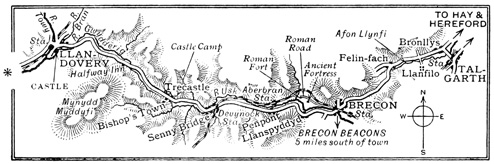
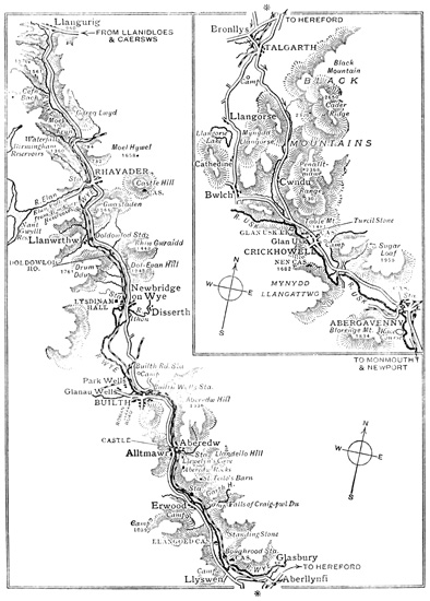
The road from Talgarth to Brecon presents no
special features except those of picturesque hill
and dale, with various streams crossing the road at
intervals.
BRECON
Brecon, the county town of Brecknockshire, lies
upon the River Usk, and was formerly defended
by walls and gates. Of the castle, destroyed as
usual during the Civil War, only a few fragments
near the Castle Hotel have survived, and one
restored section facing the river.
St. Mary's Church has suffered so much from
bad restoration that practically nothing of archæological
interest remains in it.
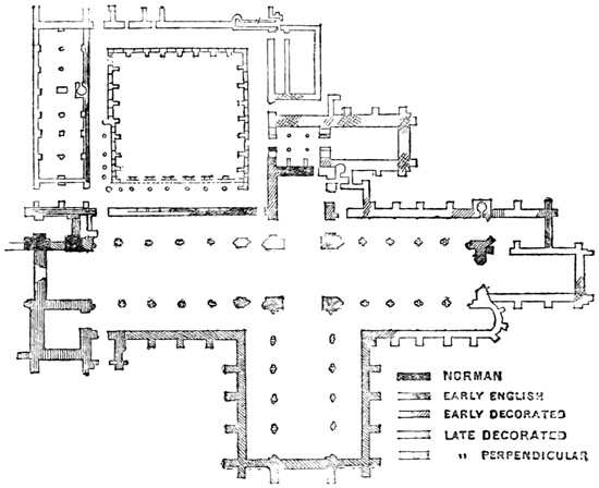
The Priory Church.—This building is only
excelled in Wales by the Cathedrals of St. David's
and Llandaff. It is a massive cruciform structure,
with a central tower, high roof and gables, and an
external aspect almost devoid of ornamentation.
The eastern portions are of Early English work,
and the nave was gradually transformed during
the fourteenth century into a Decorated building,
with great octagonal piers, broad arches, and a lofty
clerestory. The carved Norman font should be
noticed, and also a number of effigies, one dating
from 1359. An interesting feature are the chapels
on either side of the presbytery, called respectively
the Chapel of the Normans and the Chapel of the
Men of Battle, the priory being a cell of Battle
Abbey. The guilds of the town had chapels in
the nave, those of the tailors, weavers, tuckers,
and courvisors, or shoemakers, being at the west
end. The domestic buildings still remain, and
are attached to the southern side of the west end
of the nave; the building has been restored by Sir
Gilbert Scott. The town is a pleasant one by
reason of the many public walks in and about it,
and fine views may be obtained of the well-known
Beacons, some of them approaching 3,000 feet in
height.
The district round Brecon abounds in prehistoric
camps and various remains of the British, Roman,
and Saxon occupations. On the road to Llandovery,
for instance, near Llanspyddyd, there is
a Roman fort, and another of unknown origin
adjoining, with a Roman road passing round them.
Senny Bridge merely consists of a long street of
uninteresting houses. At Trecastle there is an
important mound, at one time crowned with a
fortalice. From the centre of this village there
is a steep ascent. The River Usk accompanies
the road, and appears under various surroundings—now
as a placid stream winding through meadowlands,
and again as a foaming torrent in a deep,
tree-shaded glen. This road through the outliers
of the Beacons abounds in picturesque views of a
well-wooded country, backed by the great swarthy
slopes of the hills, called the Black Mountains,
although the dark brown sandstone of which they
are composed is the same colour as the brown heath
upon them.
LLANDOVERY
Llandovery consists chiefly of two streets, which
converge at the market-place, and a welcome change
is the red wash with which many of the houses are
covered, as a relief from the ubiquitous whitewash
of the rest of Wales.
The Castle.—This has nearly disappeared, and
only two dismantled circular towers, with a curtain
wall between, remain. They may be found standing
on a grassy knoll near the Castle Hotel. The River
Bran is fairly wide at this point, and passes under
a fine bridge.
Upon leaving Llandovery a level crossing has to
be negotiated; the road crosses the River Towy,
and then turns sharply to the left.
Llanwrda is a pretty village situated amid
lovely pastoral scenery, and with a fine prospect
over the valley. The road here turns at right
angles towards the north, and between this point
and the Hafod Bridge Inn, nearly four miles, the
scenery is distinctly and strikingly beautiful. The
small stream, the Dulais, accompanies the route,
passing and repassing under the road. Near
Pumpsaint lies a gold-mine, the Ogofan, and here
the River Cothi, beloved of piscators, comes down
from the mountains on its way to the Towy.
Between Pumpsaint and Lampeter high ground
is crossed, and a portion of the Sarn Helen Roman
road appears near an inn beyond Pont-ar-Twch.
Near Lampeter a village occurs bearing the ominous
name of Rain.
LAMPETER
is one of the best-known fishing centres in Wales,
the River Teifi affording exceedingly good sport.
It is a well-built town, situated in a fertile
valley. The bridge over the stream is said to have
been erected in the time of King Stephen, from
which the town claims the name of Lampeter
Pont Stephen. The chief building is St. David's
College, theological, designed for those who cannot
afford Oxford or Cambridge. To gain the road
for Newcastle Emlyn and Cardigan the river at
Lampeter must be recrossed, and the turning taken
to the right at 'Gwar Gate' Inn. The route
gives a striking view over the valley of the Teifi,
whose extraordinary meanderings and loopings
appear as a huge serpent of silver lying in the
broad landscape. The road for a considerable distance
is of Roman construction—the Sarn Helen,
but even those conquerors of the world could not
conquer Nature in Wales and make their roads
straight.
Llanbyther is a small and prettily-situated
village, with one of the numerous 'Pen-y-Gaer'
camps lying close to the road. The New Quay
Road Station of Llanfihangel-ar-Arth turns off to
the right soon after the Aber-Iar Inn; it is of
a second-class character, but saves a considerable
distance and some hills on the way to Llandyssil.
Llandyssil is a romantically-situated village
upon the banks of the Teifi, which here assume
a rocky character. Its church is dedicated to
St. Tyssul, who lived in the early part of the sixth
century. From Llandyssil the road south of the
river should be taken to Newcastle Emlyn; it has
many awkward turns.
NEWCASTLE EMLYN
is a well-situated town with a long street running
at right angles to the coach-road.
The Castle is a beautifully-placed ruin, with
grand views over the surrounding country. The
position of the fortress for natural defence is most
remarkable, for the Teifi here forms a reversed S,
and in one of the loops so made the ruins are
situated, the moat thus naturally formed being
one of the most remarkable in existence. The
most ancient building upon the site is reputed to
have had a Roman origin; the second was erected
by Sir Rhys ap Thomas (who built Dynevor
Castle) in the time of Henry VII., who frequently
resided here, and from it the town was termed
'New-castle.' The Royalists held it throughout
the Civil War, but after that period it appears to
have lapsed into ruin. Two octagonal towers supporting
an arch give entrance to the ruins.
Three miles out from Newcastle Emlyn is
Cenarth, a most picturesque and pleasantly-situated
little village upon the border between
Carmarthenshire and Pembrokeshire. There is a
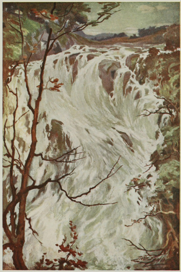
fine salmon-leap close to the hamlet which is worth
seeing. The road thence to Cardigan traverses a
plain, becoming more and more open as the town
is approached, presenting a broad sweep of smiling
woods and pasture.
CARDIGAN
The chief centre of interest in Cardigan is undoubtedly
the bridge over the Teifi. It probably
dates from the Early English Period, and has been
widened. From this point there is a good view up
and down the river, with the castle and church as
prominent features.
The Castle.—The small portion hidden away
in the ivy at the present time affords no clue to
the former size and importance of this stronghold.
It was founded in the time of Henry II. by the
Prince of South Wales, and after a chequered
career was dismantled at the Commonwealth. The
keep is now occupied by private houses.
The Church (key obtained at one of the cottages
in the road).—The tower is a fine one, but so far as
the whole interior is concerned it must be confessed
that all ecclesiological features of interest have been
obliterated by paint, plaster, and incongruous additions.
The chancel arch, of the Perpendicular
period, has a fearful and wonderful 'skew,' which
may or may not have been acquired by age.
The town contains a number of old houses,
nooks, and byways, but they are only moderately
interesting to the artist, who finds his best subjects
by the bridge and along the river, where sailing-boats
and small steamers reveal the picturesque
qualities generally to be found in small ports. One
feature of the town soon attracts attention—namely,
the strong reluctance of the majority of chimneys
in Cardigan to keep to the perpendicular.
St. Dogmael's Priory, less than two miles
from Cardigan, lies upon the left of the estuary.
The remains are of the Early English period, and
are still considerable. Martin de Tours, who came
over with the Conqueror (not St. Martin), was the
founder.
Kilgerran Castle, three miles south of the
town, and easily reached by road, stands upon a
vast bare rock uplifted above the foaming, eddying
stream rushing round its base, through a narrow
channel in the rocks. Many eulogistic statements
have been made concerning this beauty-spot, but
none have overpraised it. The ruins consist of two
towers, with part of a gateway and curtain wall,
together with fragments of massive bastions. It
was erected about 1223, when Marshall, Earl of
Chepstow, subdued the Welsh in these districts.
On leaving for Newport, the long rise of the
road affords, in about two miles, a remarkably fine
view towards the left. With Mynydd Prescelly
for a background, the composition of the foreground
and middle distance by a beautiful vale is
singularly impressive, and this view, with panoramic
changes, accompanies the road to Nevern.
The hills seen in the front have massive rocky
crags penetrating their otherwise smooth outline.
Nevern.—A very dangerous turn in the road
ushers the traveller into this beautiful little village,
embowered in the midst of rich meadows, orchards,
and gardens in a situation which is eminently
picturesque and pleasing. The River Nevern flows
through the village, and an amphitheatre of well-wooded
hills encloses it.
The Castle consists of some slight remains of
a Norman building, apparently of a square plan,
with bastions at the angles.
The Church is one of the largest in the county,
and of very great interest. It is of Early English
architecture, with a Perpendicular recess forming
a chapel upon the south side. In the window-sill
of the south window of this chapel is inserted a
long granite stone, with an Ogham inscription
upon it, together with a slab bearing an excellent
example of an early interlaced cross. The church
stands in a quite ideal sloping churchyard, containing
a stone cross about 13 feet in height, with
Celtic ornamentation and two inscriptions, not yet
satisfactorily deciphered, as far as the writer is
aware. Near the south porch is a menhir with an
inscription.
The Pentre Evan cromlech, one of the finest
known, lies about three miles from Nevern by road,
but less than two as the crow flies. A car may be
taken by a third-class road for the greater part of
the distance, but a local guide is necessary.
NEWPORT
Newport is a small fishing town, and also a seaport,
upon the estuary of the Nevern. It is a quiet
watering-place, the sea-bathing being very good,
while the surrounding country is of enticing interest.
The Castle was built in 1215, and used by
the lords of Cemmaes for their courts. It was
destroyed by Llewelyn, but restored recently by
a descendant of the first baron, but in such strong
contrast to the original Norman architecture that
it is very disappointing externally.
The Church has been built near the castle, and
partakes somewhat of its character, being stern and
massive in its proportions. The interior contains
nothing of particular interest.
A small cromlech lies within a few hundred
yards of the centre of the town, to which any
inhabitant will direct one. Occasional glimpses of
the estuary, with its sands gleaming in the sun, are
obtained from the main streets of the town.
The road between Newport and Fishguard
reveals a wide view of the Prescelly Mountains,
the highest in Pembrokeshire, and a favourite
climb for visitors. A most attractive view of
Goodwick Harbour, now generally known as Fishguard,
is obtained from the road, or, better still,
from one of the steep meadows on either hand.
The great importance of this harbour in connection
with the Atlantic mail and passenger service has
suddenly brought a remote district into prominence.
It is now a familiar sight for the natives to see a
huge liner in this natural harbour take on
passengers and cargo, while a few years ago the
waters of the deep inlet had never been churned
by propellers.
The descent into Fishguard of 1 in 7 must be
taken with extreme caution; at the foot of the
curving descent a bridge crosses the Afon Gwaen,
and from this the road climbs with equal suddenness
and at an equally trying angle. It is a hill
calculated to test to the last fraction of its horsepower
the capacity a car possesses in hill-climbing.
At the top of the ascent the whole bay is spread
out in panoramic fashion, and one can see the
new breakwater, still incomplete, protecting the
anchorage.
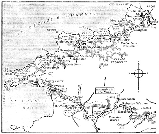
The road from Fishguard to St. David's passes
first across the isthmus of the Pen Caer Peninsula,
whose northern part terminates in Strumble Head.
This district is the happy hunting-ground for the
archæologist, as it literally teems with prehistoric
remains—castles, camps, stone circles, cromlechs,
and menhirs, are encountered almost at every
step. Two miles out of Fishguard the turning to
the right should be taken at a puzzling junction of
roads. At Mathry some cromlechs occur near the
road, and two miles farther on a wayside cross may
be seen. The hills in this neighbourhood generally
have the formation noticed previously at Cardigan—namely
the projection of high tors from their
summits, breaking through otherwise smooth elevations.
Nearing St. David's Head it is obvious that
the face of the landscape is gradually changing:
the hedgerows become less in height, and are often
mere mounds of turf or stone; the few trees met
with are dwarfed and attenuated, and invariably
lean away from the south-west. As St. David's
comes nearer these characteristics become accentuated,
and a barren, wind-swept moorland appears,
almost unrelieved by a single tree.
ST. DAVID'S
The modern town of St. David's has a sad
and desolate air, arising from the number of
abandoned houses to be seen on every hand.
The Cathedral (nave open free on weekdays,
9 to 1 and 2 to 6; a charge of 6d. is made
for admission to the eastern chapels) is in a remarkable
situation at the farther end of the town, and
practically bursts upon the view when the edge
of the deep hollow it occupies is reached. In such
an exposed corner of Britain it is not surprising
that everything should take what shelter it can
find, but to walk through a rather dreary and
wind-swept Welsh village, and to discover a magnificent
cathedral cowering almost out of sight
at one's very feet, is not an everyday occurrence
even with the touring motorist. A score of
abbeys planted in sequestered valleys will come to
the mind of anyone who has explored this island,
but a well-preserved cathedral built in a deep and
narrow hollow in a rocky promontory almost takes
away what little breath the blustering wind has
left to the exploring stranger. To the left is the
old tower gateway, a weather-worn remnant of the
embattled fortifications which once encircled the
monastery. Down below, and approached by a
long and steep flight of stone steps, stands the
church, with the square tower of rather unsatisfactory
outline dominating the nave, transept, and
eastern portions of the buildings. Beyond appears
one of the most beautiful ruins that ever gladdened
the eye—the remains of one of the finest episcopal
palaces to be seen in the British Isles. Near the
church are also grouped ruins of the conventual
buildings, and the whole forms a scene that
indelibly impresses itself upon the memory.
Descending the thirty-nine steps, one reaches the
south porch of the nave. Whatever preconceived
ideas one may hold of the beauty of this part of
the church, the sight of the original far surpasses
them. The beautiful Norman pillars and graceful
arches, ornamented with the most elaborate chevron
and zigzag mouldings of the Transitional period;
the clerestory springing directly from the dwarfed
triforium with which it is incorporated; and the
whole surmounted by a finely-wrought timber
roof, make a picture of the rarest perfection. The
colouring is full of subtle richness, the stonework
being of a soft dove-grey combined with a bluish
tinge. The building dates from 1180, the previous
church having been burnt down by pirates. The
tower fell in 1220, and was rebuilt at different
periods. The choir and transepts are Early
English, but were added to in the Decorated
period. The eastern chapels are Decorated, as
is also the beautiful rood-screen. The ceiling in
the nave dates from c. 1500. Many objects of
interest are contained in the building; the shrines
of St. David and St. Caradoc, the tomb of Edmund
Tudor, father of Henry VII., the monument of
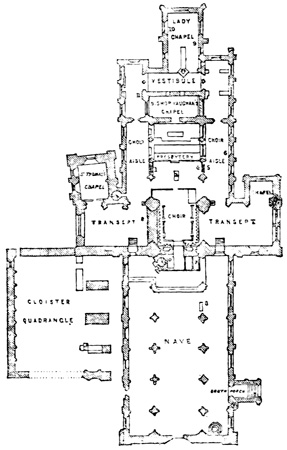
Bishop Gower, the chapel of St. Thomas à Becket,
and the fan tracery of the roof in Bishop Vaughan's
Chapel, are all worthy of careful inspection. Outside
the north wall of the nave gigantic and ill-proportioned
buttresses are seen, built in 1248 to
strengthen the nave, which had suffered from an
earthquake; on the opposite side are the remains
of the cloisters of St. Mary's College, begun in
1362.
The exploration of the ruins of the Bishop's
Palace should on no account be omitted, as the
lower chambers, the row of clerestory arches, the
beautiful doorways, and the general composition
of the whole ruin, are worthy of the closest
attention.
Upon the return to the main street the ancient
cross is seen, no less than 28 feet in height; the
steps were restored by Bishop Thirlwall in 1873.
The coast scenery at St. David's is remarkably
wild, and the subjects for the painter in oils or
water-colours, or for the less ambitious who carry
a sketch-book and a good soft pencil, are full of
particular attractiveness. To those who are without
the desire or capacity to carry away any
permanent impressions of the scenery it will be
enough to lie in a sheltered spot and watch the
white waves burst into columns of spray on the
northern end of Ramsey Island.
| Miles. |
| St. David's to Haverfordwest |
15 |
¾ |
| Haverfordwest to Narberth |
10 |
¼ |
| Narberth to Red Roses |
7 |
|
| Red Roses to Carmarthen |
14 |
¾ |
| Carmarthen to Pontacothi |
6 |
¼ |
| Pontacothi to Llandilo |
8 |
¾ |
| Llandilo to Llangadock |
6 |
¾ |
| Llangadock to Llandovery |
5 |
½ |
| Llandovery to Trecastle |
9 |
|
| Trecastle to Devynock |
3 |
¼ |
| Devynock to Brecon |
8 |
¾ |
| Brecon to Talgarth (Bronllys) |
8 |
¼ |
| Bronllys to Three Cocks Inn |
2 |
½ |
| Three Cocks Inn to Hay |
4 |
¾ |
| Hay to Clifford |
2 |
½ |
| Clifford to Hereford |
18 |
¼ |
St. David's to Haverfordwest.—This road has a fine surface, but
hills are frequent and all dangerous. They range
from 1 in 8 to 1 in 12.
Haverfordwest to Carmarthen.—This also has a good surface,
but the hills are numerous. Near Narberth is a
hill 1 in 9.
Carmarthen to Brecon.—Splendid surface and easy gradients.
Brecon to Hereford.—An excellent road without dangerous
hills.
Hay.—A toll of 9d. must be paid for crossing the river.
Solva.—A village in pretty scenery.
Pointz Castle.—An earthwork.
Roche Castle.—Very conspicuous.
Haverfordwest.—A pleasant town; the castle, now a gaol; St.
Mary's Church, with ancient wooden carving;
the Priory Ruins.
Narberth.—A little town with ruins of its castle.
St. Clears.—A small port.
Carmarthen.—A busy county town; the castle, now the gaol;
the Guildhall; the church; Picton Monument;
interesting market.
Llandilo.—Small town on high ground; Dynevor Castle; Careg
Cennen Castle.
Llandilo to Talgarth.—See Loop 6, Part I.
Hay.—A little town on English border; the castle, an interesting
structure (not open).
Clifford Castle, birthplace of Fair Rosamond.
Whitney.—Beautiful scenery on the Wye; old timbered houses.
Hereford.—The cathedral, Norman to Perpendicular; the Shire
Hall; the castle green; interesting old houses.
The distance from St. David's to Haverfordwest is
sixteen miles, or, as the natives naïvely express it,
'sixteen miles and seventeen hills.' For the switchback
contour, however, one is compensated by the
wide views generally obtained when the tops of the
hills are reached, before plunging downwards into
the next sudden hollow. The same characteristics
of wild moorland and storm-swept down prevail as
noticed upon the road to St. David's, and it is very
interesting to note how gradually the vegetation
develops as the route progresses. About two miles
out the little village of Solva is passed, lying upon
a romantic inlet in this iron-bound coast, and
recalling, to some extent, the fishing village of
Staithes, in Yorkshire. The view over St. Bride's
Bay, with Skomer Island as the farthest point, is
exceedingly fine on a crisp, sunny morning, and
shortly after leaving Solva, Pointz Castle, an
earthwork, appears upon the right hand, at a short
distance from the road. The sharp descent to
Newgate brings one almost within reach of the
salt spray at high tide, and the road runs for a few
hundred yards by the sands of that name, giving a
glimpse of some fine coast scenery. There is an
example here of a 'rolling beach,' an accumulation
of pebbles being washed over and over upon the
flat land beyond. The road now climbs to the
uplands, upon which stands Roche Castle, a conspicuous
landmark for many miles. It was built
in the reign of Henry III., but has later windows
inserted. Garrisoned for the King during the time
of the Civil War, it was captured by the Parliamentarians,
but subsequently retaken. Lord St.
Davids, the present owner, has adapted it for
modern habitation. Its position upon a rocky
scar, in the midst of a treeless plain, is peculiarly
imposing.
As the road approaches Haverfordwest trees of
respectable proportions begin to appear, no longer
leaning towards the north-east.
HAVERFORDWEST
The town of Haverfordwest occupies an important
position among those of South Wales, and is the
centre of commerce for a large district. The streets
are narrow and steep, with sharp turnings, probably
caused by the confinement of the ancient fortifications
which once protected the town. Of these
practically nothing remains but the shell of a
strong castle, now converted into the county gaol,
standing upon a rocky eminence overlooking the
town. Although very impressive when viewed
from a distance or from the River Cleddau in the
town, it hardly repays minute inspection. Gilbert
de Clare, Earl of Pembroke, is said to have built it
about 1120, and it became, with that of Pembroke,
one of the most important fortresses in 'Little
England,' as the southern part of Pembroke was
termed. It was demolished by order of Oliver
Cromwell.
St. Mary's Church is of great interest, the
exterior showing some fantastic gargoyles, and the
nave some fine clustered columns of Early English
work, with a Perpendicular clerestory above. The
ceilings should be noticed, and also the early lancets
at the west end. It is a beautiful church, full of
light, with no gloomy corners. There is an ancient
wooden carving of St. Michael the Archangel and
the Dragon, dating from the fifteenth century.
The Priory Ruins are situated a short distance
from the southern part of the town, and are quite
picturesque. They are the remains of a priory of
Austin Canons erected in the twelfth century.
The very liberal grants of Robert de Hwlffordd,
lord of this town, were confirmed by Edward III.
The remains of the minster are of Early English
work.
The road from Haverfordwest takes a sharp turn
to the right upon leaving the town, and passes over
the railway-lines. An isolated church stands upon
a hill to the right, and soon afterwards the woods
surrounding Picton Castle, two miles away, come
into view. It is one of the most ancient residences
in the kingdom, having been built by a De Picton
in the reign of Rufus. From that time it has been
inhabited by an unbroken line of proprietors, never
deserted, never vacant. The alterations have not
very much affected the baronial style of the building,
and until quite recently it presented the appearance
of a medieval fortress.
At Canaston Bridge the road crosses the eastern
Cleddau, which discharges into Milford Haven,
and here, upon the left, at about a mile, lies the
picturesque ruin of Llawhaden Castle, once a
residence of the Bishops of St. David's. The gateway,
flanked by two demi-bastions, forms a very
effective picture.
Approaching Narberth, the right-hand road
should be taken at Robeston Wathen. Fir-trees
near this point begin to make their appearance,
having been conspicuously absent from St. David's
to this point.
NARBERTH
There is a very steep hill in this town, leading to
the ruins of a Norman castle crowning the summit.
They are picturesquely covered with ivy, but the
remains now apparent are small when compared
with those visible in the eighteenth century. The
roads in the neighbourhood of Narberth are rather
misleading, as so many by-roads enter. Care
should be taken to decipher the sign-boards in many
cases before proceeding. Between Narberth and
St. Clears, for instance, there are three roads at
Tavernspite near an inn, and the centre one should
be taken.
St. Clears is a long and straggling village at
the head of an estuary of the Taff, and vessels of
small tonnage can reach it at high tide. It formerly
possessed a castle and a priory, but both have disappeared.
The town itself is uninteresting. Between
St. Clears and Carmarthen the small hamlet of Banc-y-Felin
is particularly pleasing, with a tributary of
the Taff flowing through it.
CARMARTHEN
Carmarthen, the capital of the shire, stands upon
the site of the Roman Maridunum, and is the point
of convergence of two roads, Via Maritima and Via
Montana. Some parts of the town stand at a considerable
elevation, and present an imposing picture
from a distance. It is an excellent example of an
old Welsh town, retaining a great deal of its
primeval quaintness. Upon market-days, when it
swarms with people from the surrounding districts,
one seldom hears a word of English spoken, and
the busy scenes witnessed in the bustling market
are mainly transacted in the mother-tongue. Upon
entering the town the Picton Monument is seen,
raised in honour of the Peninsula hero, who fell at
Waterloo.
The Church of St. Peter is a large building
chiefly in the Perpendicular style, with a lofty
square tower. The interior has been very carefully
plastered so as to hide everything of interest.
A Roman altar, however, may be seen below the
tower.
Sir Richard Steele, who died in 1729, the friend
of Addison, and the well-known man of letters,
lies buried in this church. In his old age
he came to reside at Llangunnor, near Carmarthen.
The Castle, which at one time made Carmarthen
a place of strength, was demolished by the
Parliamentarians, and the small portion remaining
has been converted into the county gaol. On
leaving Carmarthen the route towards Llandilo
lies upon the Roman road, the Via Montana. It
includes some of the finest scenery in South Wales.
There are two roads running in the valley, with
the railway separating them; the north one is the
more picturesque.
At a loop in the road about ten miles out,
Middleton Hall, lying due south, and erected by
Sir William Paxton, may be recognized by the tall
tower which forms such a conspicuous landmark.
It is known as Paxton's Tower, but was raised
by him in memory of Nelson. Almost directly
afterwards, Dryslwyn Castle comes in sight, a
most picturesque ruin, consisting of one tower and
many fragments of walls. It was besieged in the
time of Edward I., when Lord Stafford and other
leaders lost their lives, in undermining the fortress,
by the sudden collapse of the walls beneath which
they were operating.
On Grongar Hill, a few hundred yards away to
the right, the poet Dyer composed his poem
'Grongar Hill.' The view from the summit is
charming. On the farther side of the valley can
be seen Golden Grove, the residence of Viscount
Emlyn. Dynevor Park and Castle come into
view upon the right front on reaching the neighbourhood
of Llandilo. The ruins stand upon a
lofty mound a short distance from the road, in the
most attractive portion of the park. The first
castle was built in 877, and almost rebuilt in
the time of William the Conqueror. For some
centuries it was the residence of the Princes of
South Wales. Henry VII. granted it to Sir Rhys
ap Thomas, a descendant of the Princes, and
ancestor of the present owner, Lord Dynevor. It
was occupied until 1760. The remains consist of
a round keep and a square tower, commanding
a magnificent prospect. (The ruins are open for
inspection to the bona-fide visitor upon application.)
LLANDILO
Llandilo is a small town perched upon two or
three steep hills to the north of the River Towy,
crossed here by a stone bridge of one span. The
streets are narrow, with the public buildings
grouped together in the centre of the town. The
church was thoroughly rebuilt in 1848, and everything
of interest then disappeared. If a stay can
be arranged at Llandilo, one of the most remarkable
edifices in the kingdom, Careg Cennen, should
be seen. It is a castle almost without a history,
standing upon a rocky height with inaccessible
precipices on three sides, the foremost one over
300 feet in height. Two square towers guard the
sloping ground upon the fourth side, and the
main portion of the castle occupies the summits
of the precipices. The situation is superb and
the scenery delightful. The spirit of romance
is free from any of the handicaps usually suffered
by the historian, for in this castle among the clouds,
in connection with which history is silent (except a
reputed origin in the thirteenth century at the
hands of Rhys of Wales), the wings of imagination
may soar to any height. This is a site awaiting
the novelist in search of a romantic setting for a
story of the Middle Ages. It stands about five
miles to the south-east of Llandilo, overlooking
the Vale of the Towy.
Between Llandilo and Llanwrda a large Roman
camp can be seen lying upon Carn Goch, and at
the inn where the road turns to Llangadock a
large tributary joins the Towy. In a few miles
Llanwrda is reached, and the loop for St. David's
is thus completed. For the road between Llanwrda
and Talgarth, see pp. 143-148.
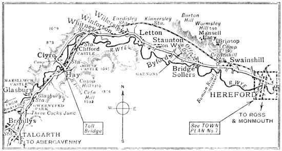
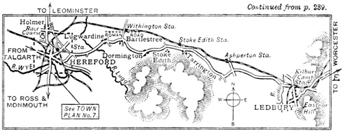
The route from Talgarth to Hay is winding,
and care should be taken to avoid the numerous
roads leading away from the main road, which lies
on the south side of the River Wye, and for a considerable
distance is parallel to the railway.
Glasbury, beyond the Three Cocks, is a small
village much frequented by the fishing fraternity;
a fine prospect of the Black Mountains is obtained,
and the views generally are among the best to be
found in the district.
The entry into Hay is very pretty, with shady
hedgerows and many of the attributes of English
scenery.
HAY
This little town lies upon the borders of England
and Wales, at the junction of the shires of Radnor,
Hereford, and Brecon. The word 'Hay' is allied
to 'hedge,' meaning a boundary. It was at one
time the main entry into Wales from England,
and naturally, from its position, it has seen stirring
times in the past.
The Castle dominates the town, and is easily
reached from the main street; the entrance is at
the back. The architecture now appears to be
a mixture of all kinds, including Tudor, for
numerous additions have been made. A residence
constructed out of the old materials occupies part
of the site. Sir Philip Walwyn is supposed to
have built the first castle in 1090, and at the end
of the twelfth century extensive additions were
made. Henry III. almost rebuilt it, and in 1233
Llewelyn ap Jorweth stormed it. Thirty years
later it was taken twice, and in the time of Glendower
it was burnt. Many other minor happenings
have occurred to lend variety to its existence.
James I. made large additions to the building.
The fortifying walls once enclosing the town have
nearly disappeared. The road upon the town side
traverses the former moat. A view across the
river gives a glimpse of a Roman camp near the
stream, while to the north-west stands Clyro,
reached by a main road, and enclosed by beautiful
woods. A mound of earth and a moat are now
the sole remains of the proud and lordly Clyro
Castle mentioned by Leland.
The ruins of Cusop Castle and Mouse Castle lie
at a short distance from the town, and a favourite
excursion is that to the far-famed Llanthony
Abbey, lying amid romantic wilds some ten miles
to the south.
The route to Whitney crosses the river at Hay,
passes through Clyro, and in two miles affords a
view of Clifford Castle, standing upon a bold
eminence by the side of the river; it was the
birthplace of Jane de Clifford, the Fair Rosamond
of Henry II., and the former residence of the Lords
de Clifford. The scenery in the environment of
these beautiful ruins is most charming. The route
from Hay may be taken in this direction if desired.
(A toll of 9d. has to be paid to cross the river.)
WHITNEY
The village of Whitney is surrounded by a rich
belt of pasture-land interspersed with clumps of
trees, and exceedingly beautiful scenery is to be
found upon the river-banks. There is no ancient
church, for it was washed away in a flood in the
early part of the eighteenth century. The beautiful
views seen at Whitney unfold themselves more and
more as one reaches Letton, Merbach Hill upon
the right, rising high out of the ground like a hog's
back, giving a characteristic touch to the scenery.
At Letton a particularly beautiful group of black-and-white
timbered cottages stand by the side of
the road, and remind one that English soil has
been reached, and that the never-ending monotony
of the Welsh whitewashed cottages has at last
been left behind. At Staunton, on the Wye, a
little Early English church is perched above the
village. On the right there formerly stood a
castle, and near it is Moccas Park, the residence
of Royalty in Saxon times. The present owners
are descended from Richard, the second son of
King John. After passing Byford a portion of
Offa's Dyke occurs upon the left, crossing over
Mansell Hill. Some quaintly-cut yew-trees may
be seen near the Kite's Nest Inn, and just before
entering Hereford, at White Cross, an interesting
cross is noticeable. It was put up in 1347 by
Bishop Charlton to commemorate the disappearance
of the Black Plague, and was restored by
Archdeacon Lord Saye and Sele.
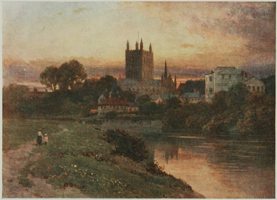
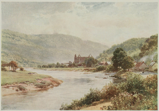
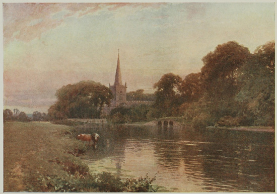
HEREFORD CATHEDRAL FROM THE BANKS OF THE WYE.
It belongs mainly to the Early English period, and is built of a reddish stone.
HEREFORD
is a pleasantly-situated town, but if it were not for
the possession of a cathedral the place would not
offer any particular attractions for visitors beyond
the charming river scenery common to the Wye
Valley.
Hereford became a separate see in 673, and
Putta was the first Bishop. The first church was
rebuilt in a better fashion when the remains of the
murdered Ethelbert were brought to Hereford,
but this pre-Norman structure was burnt by the
Welsh in 1055. In 1079 Robert of Lorraine, the
first Norman Bishop, began the cathedral of which
much exists at the present day, using dark red
sandstone. The choir up to the clerestory, the
arcades of the nave, and the south transept, are
Norman work of this early date.
The beautiful Lady Chapel, and the clerestory
of the choir are Early English. The north and
both the eastern transepts, part of tower, and the
chapter-house, are Decorated. The chantries,
sacristy, and a few other parts, are Perpendicular.
The western tower fell in 1786, and brought down
with it the west front and the first bay of the nave.
This disaster accounts for the modern west front.
Upon entering the nave the Norman bays are
singularly impressive, especially the carved capitals.
The choir is entered through a metal chancel screen;
the stalls are richly carved, and 'the chair of King
Stephen' is preserved in it. Scattered about in
the great building there are probably more
monumental tombs and effigies than in any other
cathedral, and this is especially true with regard
to ecclesiastics. Two notable monuments are
those of Bishop Aquablanca (1245-1268), and the
shrine of St. Thomas of Cantilupe in the north
transept. A famous archæological treasure, the
Mappa Mundi, a map of the world, drawn on one
large sheet of parchment in the thirteenth century
by Richard de Haldingham, is preserved in this
building, and may be seen upon application. The
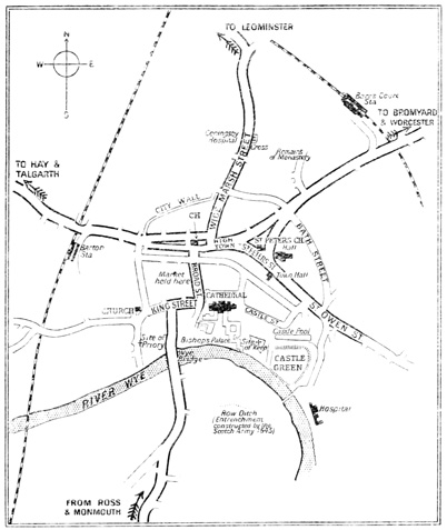
Bishop's Palace is close to the Wye, on the south
side of the cathedral.
The Shire Hall, a Grecian Doric building,
standing in St. Peter's Square, was erected in the
early part of the last century.
The Castle Green is the site of the vanished
Castle of Hereford; it is one of the prettiest
parts of the town. Hereford contains some
interesting houses, and three of them, now used
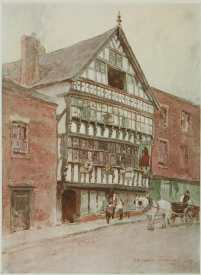
as a bank, may be seen in the High Town. It
was at one time the Butchers' Guildhall, and the
carving upon the outside, as well as the inside, is
extremely ornate.