Larger versions of most illustrations may be seen by right-clicking them
and selecting an option to view them separately, or by double-tapping and/or
stretching them.
New original cover art included with this eBook is granted
to the public domain.
CAMBRIDGE UNIVERSITY PRESS C. F. CLAY, Manager
LONDON: FETTER LANE, E.C. 4
NEW YORK: THE MACMILLAN CO.
BOMBAY, CALCUTTA, MADRAS: MACMILLAN AND CO., Ltd.
TORONTO: THE MACMILLAN CO. OF CANADA, Ltd.
TOKYO: MARUZEN-KABUSHIKI-KAISHA
ALL RIGHTS RESERVED
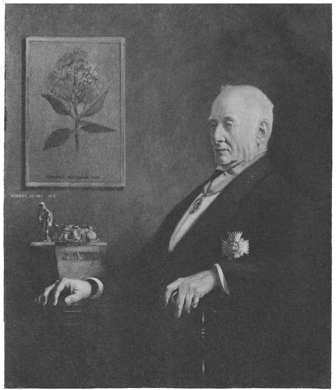
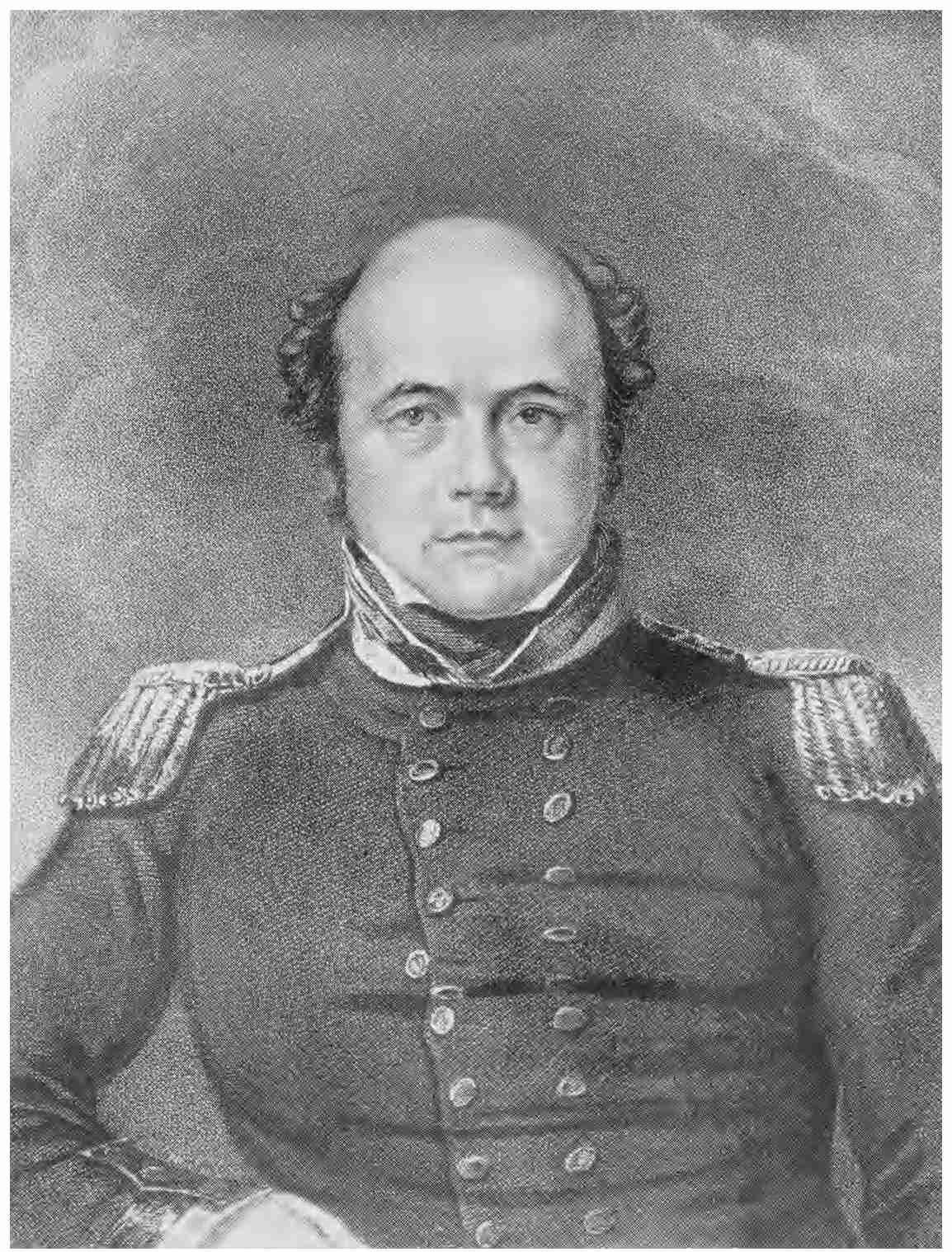
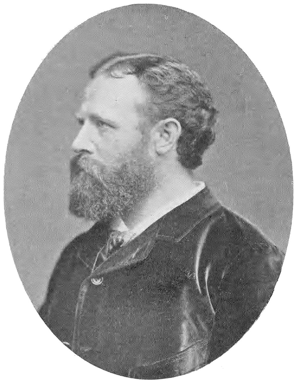
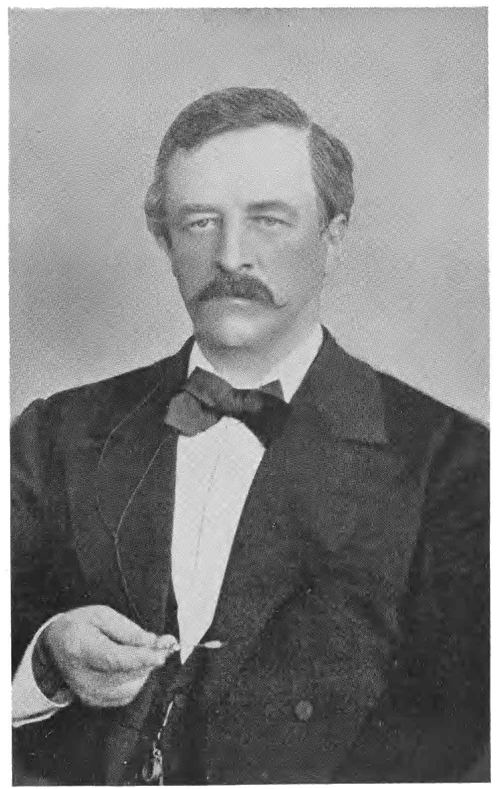
Sir Clements R. Markham, K.C.B., F.R.S.
printed by George Henry, A.R.A.
THE LANDS OF SILENCE
A HISTORY OF ARCTIC
AND ANTARCTIC EXPLORATION
BY
SIR CLEMENTS R. MARKHAM, K.C.B., F.R.S.
CAMBRIDGE
AT THE UNIVERSITY PRESS 1921
PREFACE
Although there were few subjects in which the late Sir
Clements Markham was not interested, it may safely be
said that Polar Exploration stood nearest his heart. Not
many persons had studied the ground as thoroughly as
he; no one was more widely acquainted with its explorers.
I was anxious therefore that his recollections of the
personality and work of the many distinguished Arctic
navigators he had known should not be lost, and some
years ago suggested to him that he should record the story
of the gradual revealing of the Polar regions to our ken.
The idea pleased him, he began his task at once, and when,
in January 1916, the sad accident occurred which brought
his life unexpectedly to a close, the book, though unrevised,
and with one or two chapters unfinished, was nevertheless
in a tolerably complete state.
The author’s death would necessarily have delayed the
appearance of the work, but the prolonging of the war
caused it to be laid aside altogether, and it was not until
the beginning of this year that I took it in hand with the
object of completing it for publication. So numerous are
the works which have been consulted by the author that it
was of course impossible for me to verify his facts and dates
throughout, and the indulgence of the reader is therefore
asked for any errors he may chance to notice. For
Chapters LX and LXI, and a great part of Chapter XXXIV,
which were merely outlined or left unfinished, the present
writer is mainly responsible.
Between Sir Clements and his no less distinguished
cousin, Sir Albert Markham, a life-long friendship existed,
and the latter did not long survive him, dying soon after
he had published his biography. I was fortunate enough,
however, before he passed away, to obtain his kindly aid
in reading the proofs of this volume, which, owing to his
great knowledge of Arctic matters, quite apart from his
own wide personal experiences of Arctic travel, was of no
little value. The writer would desire here to render his
affectionate tribute to the memory of a friend whose
charming personality will long be recalled by all those who
had the privilege of knowing him.
In the revision of Scott’s journeys I have had the invaluable
assistance of Mr Frank Debenham, Fellow of
Gonville and Caius College, geologist to Capt. Scott’s last
expedition, to whom my very grateful thanks are due. To
Mr Edward Heawood, Librarian of the Royal Geographical
Society, the reader is indebted for the helpful chronological
table and bibliography at the end of the volume; and,
finally, I have to thank Mr H. A. Parsons, of the Cambridge
University Press, for his most efficient assistance in compiling
the index.
Acknowledgement is due to Messrs Smith, Elder & Co. and Mr John Murray
for permission to reproduce the illustrations from Scott’s Voyage of the Discovery,
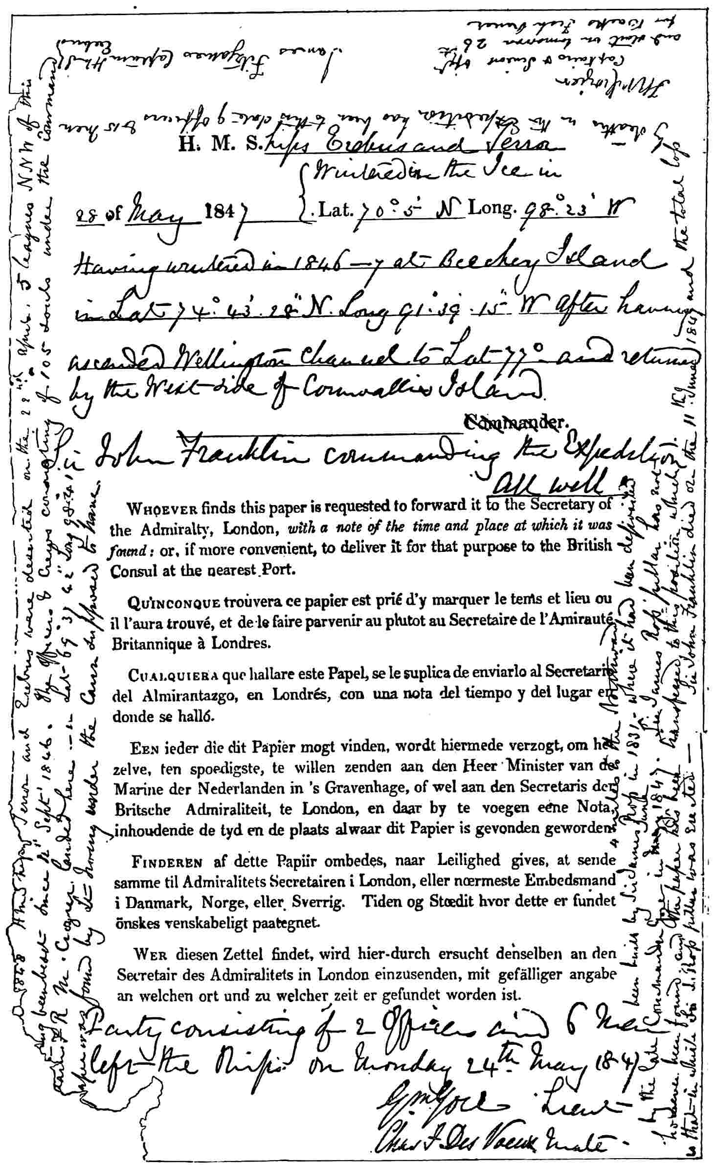
to Mr John Murray for permission to reproduce the facsimile of the Franklin
Expedition Record; also to Mr William Heinemann for leave to use the map in
Mikkelsen’s Lost in the Arctic, to Messrs T. C. & E. C. Jack for the block from
Synge’s A Book of Discovery, and to the Hakluyt Society for the portrait of
Thomas James.
ERRATUM
p. 100, line 4 from bottom: for Sunrise read Sunshine
PART I
CHAPTER I THE ARCTIC REGIONS
The history of the Polar Regions, of those vast
areas, difficult of access, which include millions of square
miles of land and ocean at either extreme of our planet,
is of surpassing interest and importance. It is not only
that we here meet with examples of heroism and devotion
which must entrance mankind for all time. It is not
only that there are dangers to be encountered and
difficulties to be overcome which call forth the best
qualities of our race. These, no doubt, are the main
reasons for the deep interest which polar exploration has
always excited. But there are others of almost equal
importance. These regions offer great scientific problems.
They present wide fields of research in almost all departments
of knowledge. They have in the past yielded vast
wealth, and have been the sources of commercial prosperity
to many communities, and they may be so again. Their
history is a history of noble and persevering effort; extending
over a thousand years in the Arctic where the
work is well-nigh finished, but only just beginning in the
Antarctic regions, where it will have to be completed by
our descendants.
In approaching the subject it is well to have before
our minds the extent of these great areas, the history of
which we would grasp and understand. At the polar
circle, which is 1410 geographical miles from the centre,
they have a periphery of 8460 miles, and each includes
6,000,000 square miles. The Arctic and Antarctic circles
are in 66° 32′ North and South, but these parallels are
merely conventional. It is more convenient, as will be
seen hereafter, to take the Polar regions as beginning
at about the 70th parallel, the Sub-arctic and Sub-antarctic
regions extending from 60° to 70°, a zone in which
the fauna is richer and more varied.
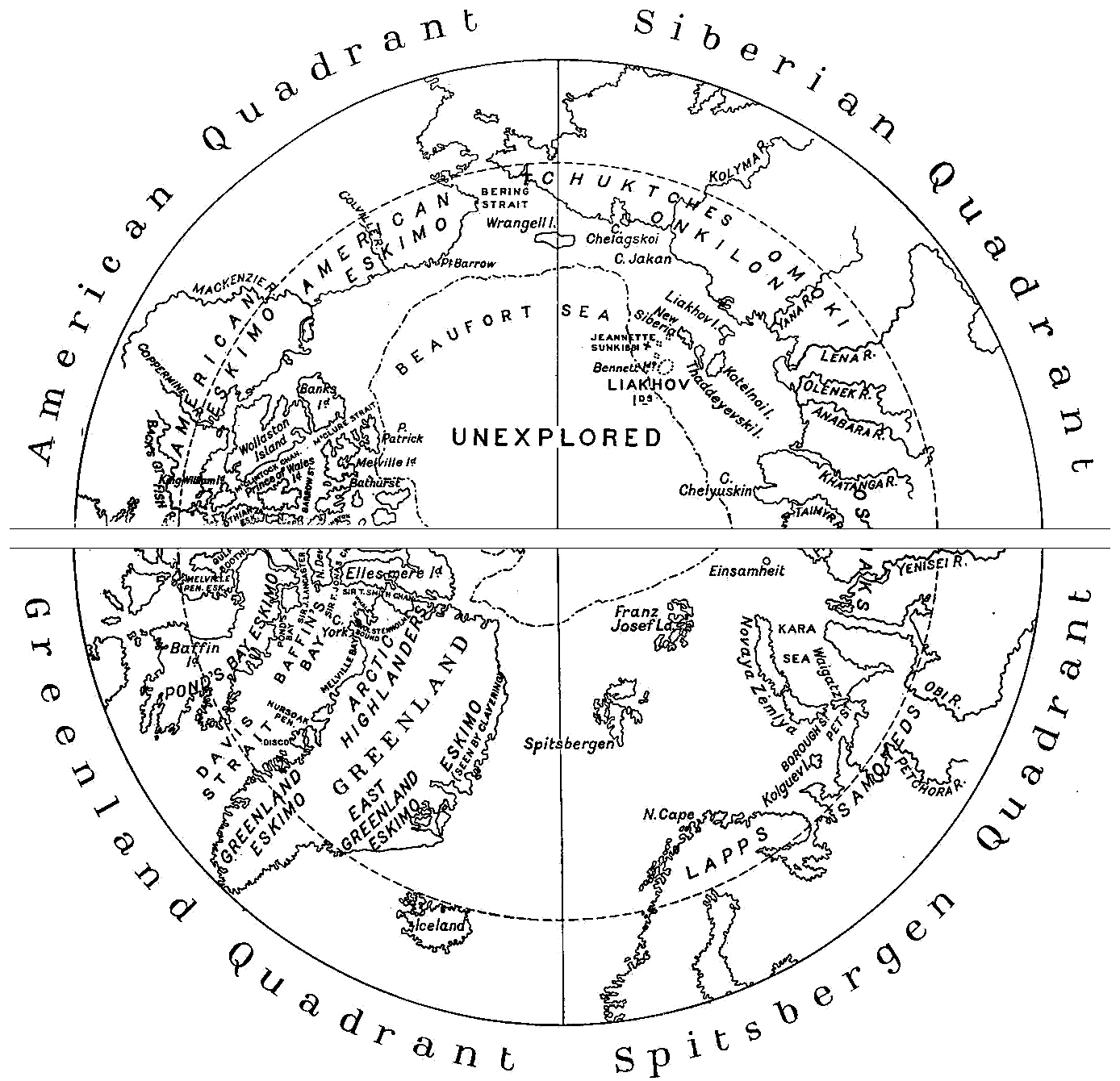
The division of these polar regions into quadrants is
useful because it facilitates geographical description and
impresses the relative positions of the different parts on
the mind. In the Arctic regions a line may be drawn
from the Lofoten Islands to Bering Strait, with another
crossing it from the head of Hudson’s Bay to Cape
Chelyuskin; thus forming four quadrants.
At the present day a fringe of coast lines forming
the northern shores of the three great continents, with
a deep interior polar sea, are the main features of the
Arctic regions, but it was not always so. Looking back
into remote geological periods, we have evidence of
marvellous changes in the Arctic regions since the globe
was a gradually cooling mass of vapour. In this process,
extending over vast ages, the polar regions must have
been, as they are now, cooler than the equatorial regions,
and for the same reason. It was, therefore, in the polar
regions that life first became possible, and here the life
of the Silurian age arose. There is evidence of a continent
in Jurassic and Tertiary (Miocene) times where now there
is a polar ocean of great depth, save where Spitsbergen
and Franz Josef Land exist as the sole remaining fragments
of that continent. There is evidence that forests once
flourished where now nothing higher than the dwarf
willow can exist. There is evidence, too, of tremendous
volcanic eruptions, covering great areas with sheets of
basalt. In contemplating these mighty revolutions, and
the gradual changes through long æons of ages, the
leading fact connected with the polar regions is that
here life first became possible. Here it was first possible
that man could exist. The evidence that the arboreal
vegetation of the miocene period originated round the
north pole appears to be quite conclusive. The exploration
of the Arctic area has disclosed proofs of
wondrous secular changes which no imagination, however
vivid, could surpass. Alike in the far south, as in the
far north, there is food for the imagination—lights thrown
here and there on the history of a marvellous past. Such
speculations are a fitting introduction to a study of the
existing state of things, which has lasted through the
historical period, and probably for ages before the dawn
of history.
American Quadrant
Siberian Quadrant
Greenland Quadrant
Spitsbergen Quadrant
The two halves of the Arctic regions may be called
the Old World or Eastern, and the New World or Western
halves. In the former the water flows in, and in the
latter it flows out, thus causing a great oceanic circulation
not yet fully investigated, but now clearly understood in
its general outline.
In the eastern half of the Arctic regions the warm
current from the Atlantic flows along the coast of Norway
and then bifurcates, one branch going north along the
western side of Spitsbergen, the other continuing along
the Lapland coast and turning up the west coast of
Novaya Zemlya. All the great rivers of Siberia also
empty themselves into this eastern half. Thus there is a
constant tendency, aided by prevailing winds, for the
whole drift from the eastern shores to flow across the
Arctic Ocean to the western side.
On the American or western side the tendency is to
flow outwards, but there is only one outlet, along the
east coast of Greenland. The in-flow is insignificant,
Bering Strait is shallow, and but a small volume of water
finds its way within the Arctic area by that opening.
The flow from all the American rivers, except the
Mackenzie and Colville, is at once checked by land in
front of their mouths. Hence the whole tendency of
aqueous movement is to flow out, while there is only
one means of escape.
The consequence of this general drift outwards, with
but one corresponding outlet, is very remarkable. The
harvests of ice are carried across the Arctic Ocean until
they are brought up by the American coast and islands,
where they are completely stopped. Then the ice
gradually increases from annual snow falls and other
causes until it becomes upwards of a hundred feet in
thickness. There is some movement in the summer, and
a tendency eastward to the north of Ellesmere Island
and Greenland, to join the Greenland current. The other
straits and channels are too shallow for such ice to pass.
In one place alone, between Melville and Banks Islands,
there is a drift of this heavy ice into the Parry Archipelago,
for a distance of 500 miles, but it is then stopped by
King William Island. Otherwise the only outward
current for the heavy polar ice is down the east coast of
Greenland. Even there the great body of ice comes from
the Arctic Ocean itself, and but a small part is due to the
escape of ice that has been pressed upon the western
land. The outward current of Baffin’s Bay only carries
off the ice of one or two years’ growth, which has formed
in the bay itself and in the straits and channels leading
into it. There is thus a vast accumulation along the
outer shores of the western side, and the rising tendency
of Arctic lands no doubt increases the difficulty of escape,
and the consequent secular and unchanging block all
along the western outer shores of the Arctic Ocean.
We may now turn to the quadrants of which mention
has already been made on page 4. On the eastern side the
first quadrant extends from the Greenwich meridian to
90° E., on an arc of the Arctic Circle, with two converging
lines each 1410 miles long. In this quadrant we have
Arctic Norway and Russia to Cape Chelyuskin, and the
Spitsbergen, Franz Josef, and Novaya Zemlya groups of
islands. It may be called the Spitsbergen Quadrant.
The second quadrant on the eastern side includes the
Siberian coast from Cape Chelyuskin to Bering Strait—the
Siberian Quadrant. The third quadrant, being the first
on the western side, includes Greenland, Baffin’s Bay,
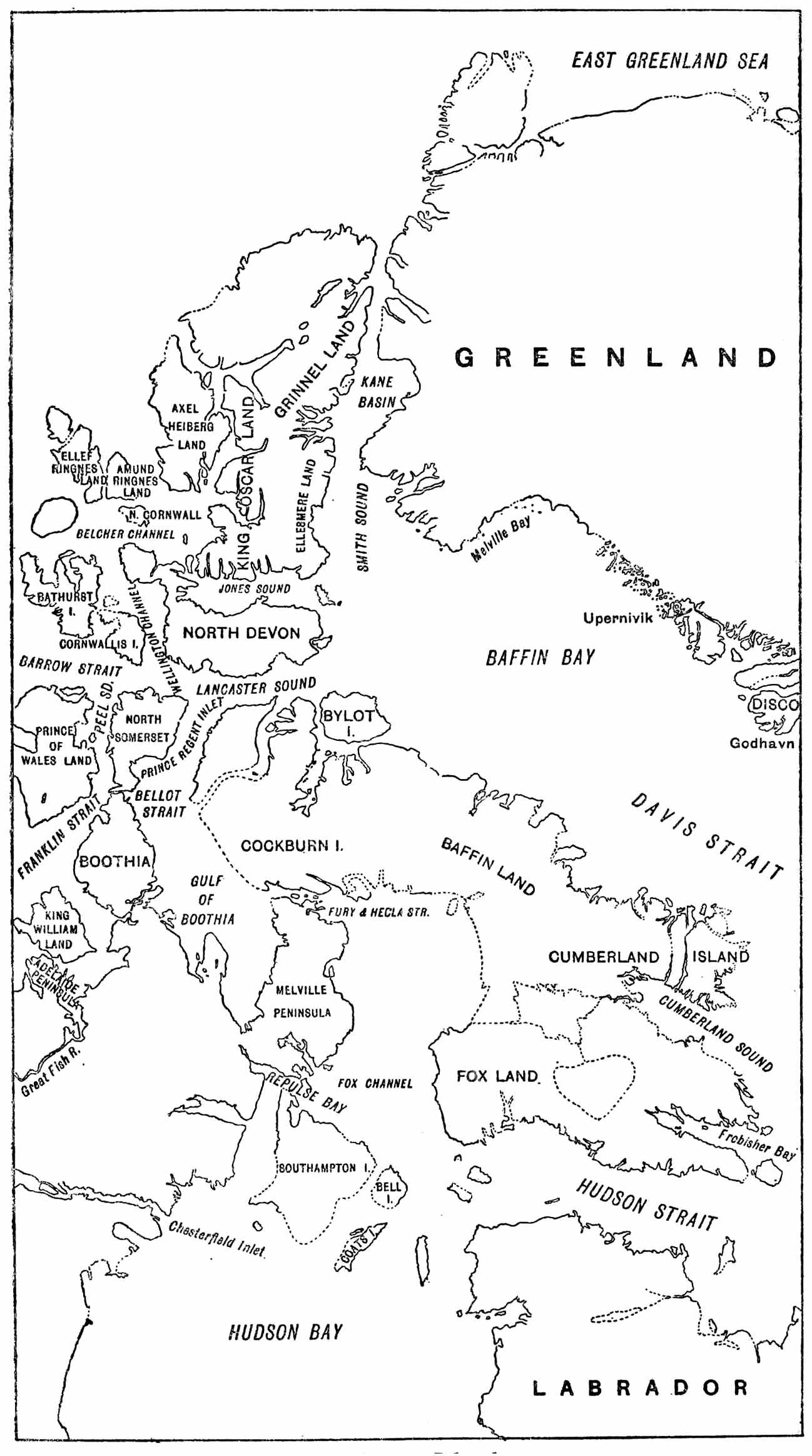
and Baffin, North Devon, and Ellesmere Islands. The
fourth quadrant, being the second on the western side,
contains the northern coast of the American continent,
and the Parry Archipelago. It is the American Quadrant.
It is desirable thus to have before us a general sketch
of the Arctic economy before proceeding to the contemplation
of the achievements of discoverers. We shall
better appreciate their labours, their splendid efforts
extending over centuries, if we know what they did not
know, the results of their combined victories over the
mighty obstacles which Nature placed in their way.
CHAPTER II ICE AND ICEBERGS — Antarctic Ice.
A knowledge of the nomenclature of polar phenomena
is an essential preliminary to the study of the history of
Arctic adventure. We must know the meanings of words
which constantly recur and which form, as it were, the
dialect of our subject. We begin then with the names
for different forms and appearances of polar ice.
It used to be thought that ice could only be formed
in creeks and inlets of the coast. It is now known that
young ice forms on the surface of the open sea, and
thickens into dense masses, where it is not disturbed by
waves. Young ice then is the thin film first formed on
the surface of the sea, when the temperature is sufficiently
low in the autumn. When it becomes rather thicker it
is called bay ice. In a ruffled sea the pieces of bay ice
strike each other on every side, becoming rounded and
having the edges turned up. This is pancake ice.
In a year, under favouring circumstances, the ice
attains a thickness of six feet, in two years of nine feet.
Sometimes masses of ice under-run each other, and the
result is a thickness of 20 to 50 and even 100 feet.
A field is an expanse of ice of such extent that its
termination is not bounded by the horizon. A floe is
the same as a field except that its whole extent can be
seen. Floe bergs, occurring on the northern shores of the
polar ocean, are large masses of sea ice, broken off from
ancient floes of great thickness, and forced upon the
shore. Ground ice is formed on rivers or shallow inlets
while the sea, as a whole, remains unfrozen. Land ice
or the land floe is ice attached to the land.
Field ice varies in thickness from 15 to 20 feet. On its
surface there is a deposit of several feet of snow which
melts in the height of summer, forming numerous fresh-water
pools on the ice. Generally an ice-field is traversed
by long ridges of hummocks, often 40 to 50 feet high,
brought about by the collision of two fields, the irresistible
pressure causing them to rise up.
The term floe is applied to pieces which are from half
a mile to a mile in diameter. Pieces smaller than a floe
are called drift ice. When drift ice is so extensive that
its limits cannot be seen, it is called a pack, when the
pieces do not touch an open pack, when they are pressed
together a close pack. A patch is a collection of drift ice,
the limits of which are visible. A stream is a drifting line
of drift ice. A tongue is a projecting point of ice, under
water. A calf is a mass of loose ice lying under a floe
near its margin, and, when disengaged from that position,
rising with violence to the surface. Brash ice consists of
fragments and nodules, the wreck of other kinds of ice,
and sludge is the term applied to smaller pieces, generally
saturated by the sea.
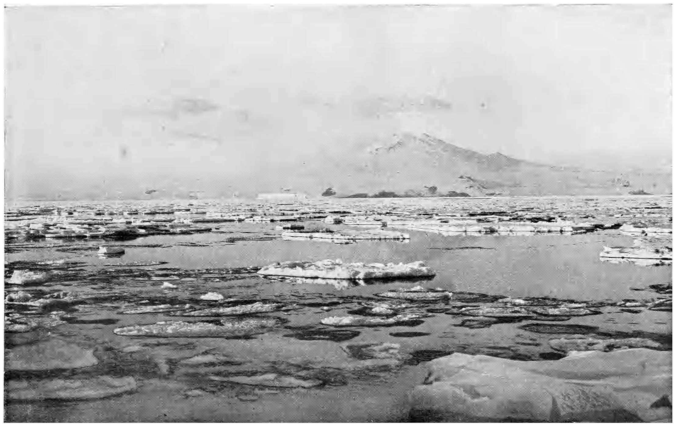
A bright white line on the horizon, seen over an ice-field,
and denoting more ice, is known as the ice-blink.
Over land or large masses of ice it generally has a
yellowish tinge. On the other hand a blue streak on
the horizon, denoting open water, is called a water sky.
A lane or lead is a narrow track of open water between
floes or pack ice. Rotten ice is old ice partially melted,
and in part honeycombed.
When a ship is forcibly pressed by ice floes on both
sides she is said to be nipped, and she is beset when closely
surrounded by ice. To bore is to enter the ice under
press of sail or steam and to force a way through by
separating the masses. Sallying is causing a ship to
roll by making the men run in a body from side to side,
to relieve her from adhesion of young ice.
An ice foot along a coast line is caused by the accumulation
of the autumn snow-fall, as it drifts to the beach,
being met by sea-water with a temperature just below
the freezing point of fresh water. It is at once converted
into ice, forming a solid wall from the bottom of the
sea, constantly maintained. The upper surface of an ice
foot is level with high water mark. The terrace above
this wall, from its edge to the base of the talus, has a
width dependent on the land slope. Thus an ice foot will
not be found either where there are perpendicular cliffs
or low coast lines, but only along sloping high lands
under special conditions.
The most striking features in the polar landscape are
the icebergs, and they are wholly derived from the land,
the large icebergs from Greenland, from Spitsbergen
much smaller ones. To understand their origin and
movements we must turn to the great continental mass
of Greenland. It consists of a vast ice-cap fringed by
a strip of mountainous coast, which is penetrated by deep
fjords and flanked by numerous off-lying rocks and islands.
The area of Greenland is believed to be 512,000 square
miles, of which 320,000 form the inland ice, and 192,000
represent the fringing margin of mountains not permanently
ice-covered. The widest part is 900 miles
across; at Disco in 70° N. it is 480 miles and thence the
two coasts converge until they meet in a point at Cape
Farewell in 59° 49′ N. The length of Greenland is 1400
miles. The Greenland ice-cap is by far the largest in
the northern hemisphere—a continuous covering of snow,
névé1, or ice resting on land, known as the “Inland Ice.”
From it descend glaciers or rivers of solid ice, coming from
their sources in the ice-cap.
The “Inland Ice” of Greenland rises to a height of
8000 feet, and the deep fjords run for 80 or 100 miles
before they end at the foot of walls of ice rising abruptly
from the water. These walls are the terminations of
glaciers from the inland ice, which, constantly throwing
off icebergs, are called discharging glaciers. There are
eight principal discharging glaciers on the west coast of
Greenland2. On the Greenland continent the snow, converted
into ice by pressure, has in the course of ages
filled all the valleys, covered the mountain tops, and
formed a smooth plateau far above them, so that the
thickness of the inland ice is measured by thousands
of feet. The ice walls at the heads of the discharging
glaciers are driven onwards by the force of gravity, the
pressure of the superincumbent mass behind them being
enormous. In some cases the rate of movement is as
much as 28 yards in a day.
A discharging glacier, on reaching the sea, has a
thickness of at least a thousand feet. It continues to
slide along the bottom until it reaches a point where
the depth of the water has sufficient buoyant force to
lift it. Still it continues its course. The action of the
tides gives rise to fissures in the enormous mass, and at
length the foremost part is broken off, and drifts away
as an iceberg. The icebergs are discharged from the
fjords in vast numbers, and are eventually carried by the
current of Baffin’s Bay and Davis Strait into the Atlantic.
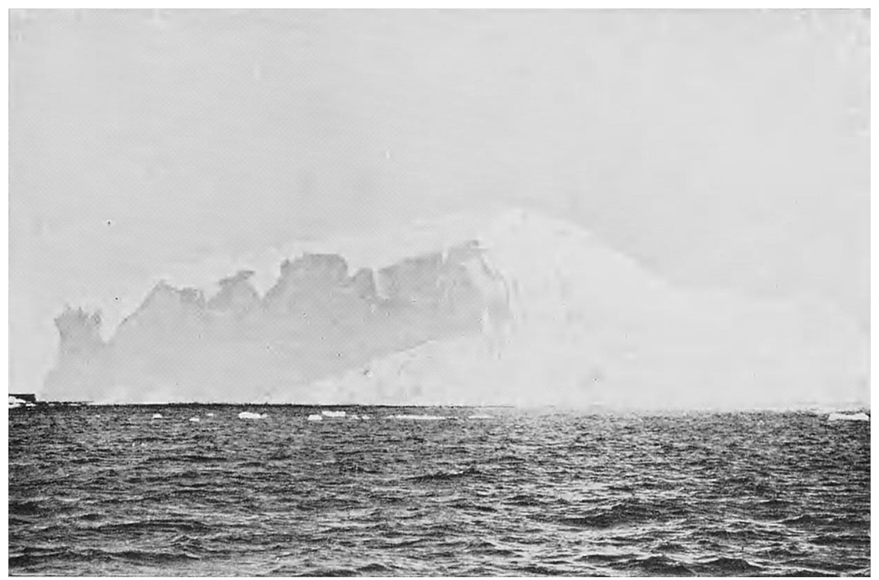
The icebergs are alike the grandest and the most
beautiful features of the Arctic seas. Only one-seventh of
their bulk appears above water, yet they may be hundreds
of yards in circumference, and their peaks reach a height
of 300 ft. A grander sight can scarcely be conceived
than new-born icebergs drifting out from the fjord of
their birthplace. When the icebergs drift well out into
the open sea the weathering and consequent reduction in
size begins. They eventually lose their equilibrium and
capsize. The part that has been long under water
becomes the upper part, and it is now that the bergs
assume their most fantastic shapes. Very often a large
piece breaks off from the parent berg, and falls into the
sea, churning it up into creamy waves. This is called
calving.
The colour of an iceberg is opaque white. Scattered
through the mass, and sometimes visible on the surface,
are strata of deep blue ice, varying in width from one to
several feet. They have an exquisitely lovely effect,
contrasting with the deep white of the rest of the berg.
These blue stripes may be formed by a filling up of the
fissures in the inland ice with water. Such refrigeration
of the water in the fissures may be an important agent
in setting these great mountains of ice in motion.
Sometimes there is a passage right through an iceberg.
But it is when a line of icebergs is refracted on the
horizon that the polar scenery is converted into a
veritable fairy land. Some are raised up into lofty
pillars. Again a whole chain of them will assume the
appearance of a long bridge or aqueduct, and as quickly
change into a succession of beautiful palaces and temples
of dazzling whiteness, metamorphosed by the fantastic
wand of Nature. When the ice breaks up in summer,
the current takes many of the icebergs into the Atlantic.
Effects of Pressure on Antarctic Ice
“Like a scarlet fleece the snowfield spreads
And the icy fount runs free,
And the bergs begin to bow their heads
And plunge and sail in the sea.”
The difference between the two polar areas—the
Arctic an ocean surrounded by continental lands, the
Antarctic a continental land surrounded by oceans—causes
the differences in the character of the ice with
which the sea is laden.
The Antarctic continent is covered with an ice-cap,
which along some coasts is buttressed by ice cliffs
terminating in the sea, and on coasts facing east is
bordered with lofty mountains through which glaciers
have forced their way. Throughout the Antarctic regions
there is evidence of much more extensive glaciation in
former ages. The glaciers are for the most part receding,
although there are proofs that some are still moving
down to the sea. But there are fixed masses of ice on the
sea coast, in the form of cliffs: tongues which could not
have been deposited or fed by existing glaciers. At the
period of maximum glaciation the climate was much
milder, and as the severity of the temperature, due to
less precipitation, increased, there must have been sterile
ice conditions, and consequent retirement of glaciers and
ice-fields. These receding glaciers do not supply bergs;
and as the Antarctic icebergs are by far the largest in
the world, their origin must be from some other source.
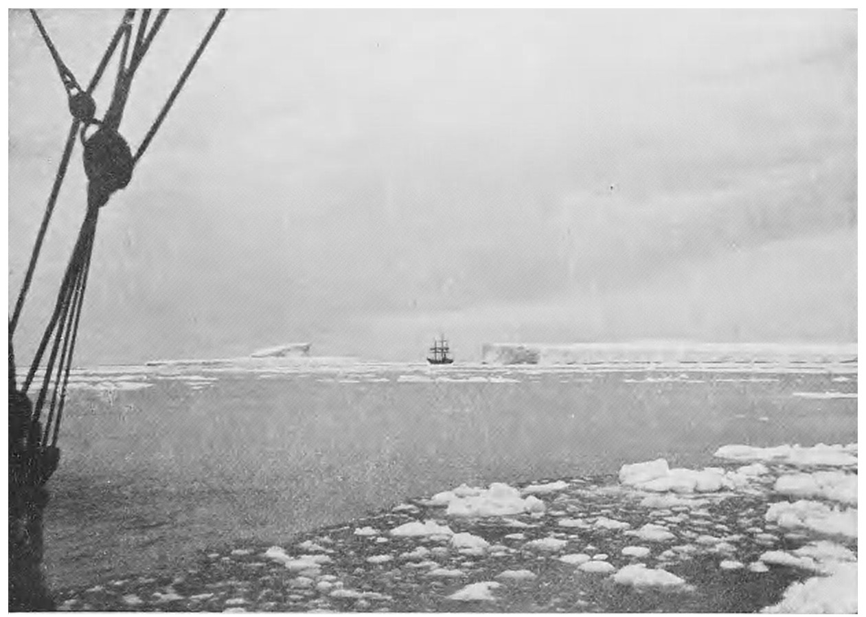
The great ice barrier of Ross fills a vast bay 400 miles
across, and at least 300 miles deep, with soundings of
about 600 ft. There is no reason why other such barriers
should not exist in other parts of the Antarctic regions
as yet unknown. These barriers must be the sources of
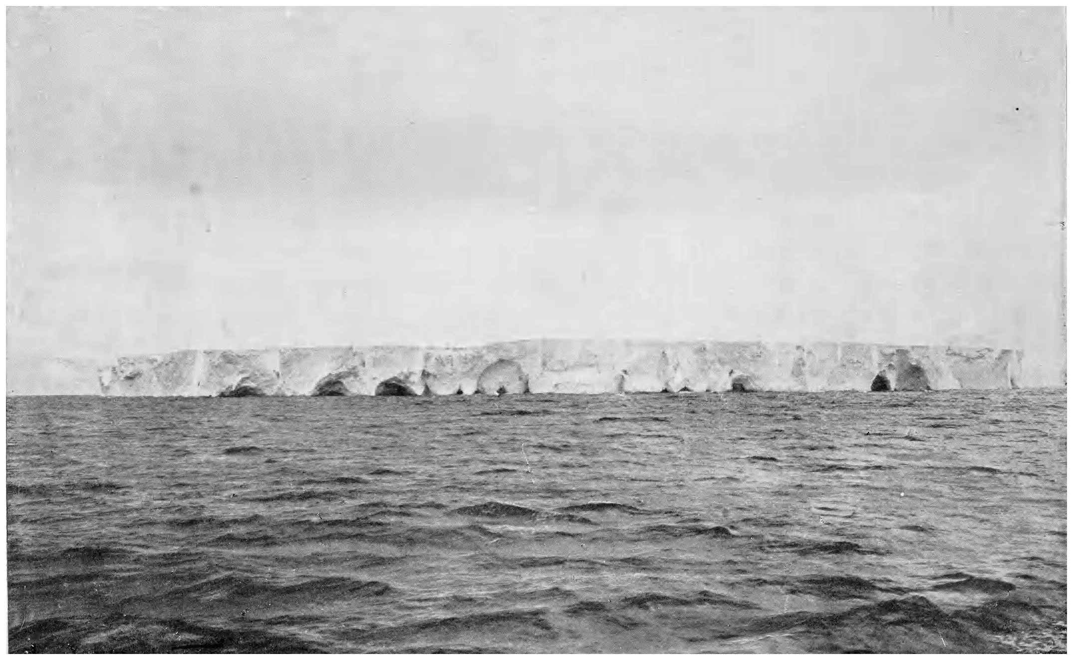
the enormous tabular icebergs which float northward in
such vast numbers. Their height is about 200 ft., and
their length from one or two to as much as twenty miles.
Large floes are not very common, but there is a great
deal of drifting ice, broken off from fixed land ice, which
forms closely packed or sailing ice according to the winds.
In December this pack ice is usually 300 miles across
from 66° to 71° S. in front of the Ross Sea, but it lies
further south in the King George IV Sea of Weddell.
In February the Ross Sea is navigable, and the pack is
scattered.
CHAPTER III TRIBES AROUND THE POLE
Before we begin to follow the achievements of the
great Polar worthies, it seems desirable to take a brief
survey of the dwellers on the threshold of the Arctic
regions; for here are races who have for ages found
homes along the European, Siberian, and American
coasts of the Polar Ocean and in Greenland.
To begin with the Spitsbergen quadrant; the northern
coast of Norway, now known as Finmarken, and the Kola
peninsula face the Polar Sea, but, owing to the warm
current from the south, this coast has its bays and inlets
clear of ice throughout the year. The coast is lined by
numerous islands, several of them of considerable size
to the west of the North Cape, and is indented by deep
fjords. The most northern point of Europe is in 71° 11′.
Inland there is a flat mountain plateau, with a height
of some 1500 feet, consisting of stony desert with a few
patches of reindeer moss, and some morasses. The
plateau is traversed by rivers such as the Tana and the
Alten, which force their way through accumulations of
gravel before reaching the sea. Pine forests have now
receded from the coast to the foot of the gneiss mountains
in the interior, and their place is taken by dwarf birch
near the sea. The Kola peninsula, known to the Russians
as the Murman coast, has high and precipitous granite
cliffs and a line of central hills sending the drainage on
one side to the Murman, and on the other side to the
White Sea.
This is the land of the Lapps, encamped for hunting,
and on the sea coast for fishing in summer. Their
average height is about 5 ft. 1 in., and they have high
cheek-bones, small elongated eyes, wide mouths, little
or no beard, and dark straight hair. Their circular tents
are made of coarse cloth supported by branch poles of
birch and pine. A fire is lighted in the centre, and there
is an opening at the top by which the smoke escapes.
The Lapps are always wandering for food for their
reindeer—moss and birch leaves, and in winter lichen.
One family requires a herd of at least 200 animals. The
Lapps drive their reindeer in sledges, make cheese from
their milk, eat the venison, and make most of their
clothing of the skins. These people can march great
distances with a short quick step and carry very heavy
loads. They live to a considerable age. Their language is
Mongolian, and their religion one of magic and witchcraft,
which inspired some awe in the minds of the Norsemen
who enforced tribute from them.
Eastward from the White Sea the nature of the country
changes, and we enter upon the tundras, a Russian name
for the bare tracts between the forests to the south, and
the shores of the Polar Ocean. The Petchora is the
greatest river of the western tundra, flowing northwards
along the western spurs of the Ural Mountains towards
the gulf of Mezen, where the delta is 120 miles long,
the channels winding in a network round islets and banks
which shift their positions at every thaw. Fifty miles off
the coast lies the island of Kolguev, 50 miles long by 40,
entirely composed of sand and small stones, all its deposits
being referable to oceanic forces; it is, indeed, essentially
a water and ice-formed island.
The region from the White Sea to the Ural Mountains
is inhabited by a race called Samoyeds, brachycephalic
Mongols with a Finnish admixture. Of short stature,
averaging a fraction over 5 feet, they have the short
broad Mongolian face, long oblique eyes, high cheek-bones
and flat noses. Like the Lapps they are dependent for
locomotion, clothes, and food on their herds of reindeer,
and they also have dogs for rounding up the deer. Their
boots, loose tunics, and winter cloaks are of deer-skin,
and the Samoyed hut (choon) is made of birch poles
covered with deer-skin for winter, and with strips of
birch-bark sewn with sinews in summer. Like the Lapps
too, and for the same reason—to drive off mosquitos—they
light their fires inside the choon. The Samoyed sledge,
drawn by three to five reindeer abreast, consists of two
thick runners curved upwards in front, about 9 feet long
and 30 inches wide, with four uprights and cross bars.
These people worship great numbers of wooden idols
grouped round a seven-headed idol of Kesaks. They
come to the settlement of Khabarova, near the narrow
strait which separates the mainland from the island of
Waigatz, during the summer; and they look upon
the latter as the holy island on which they wish to be
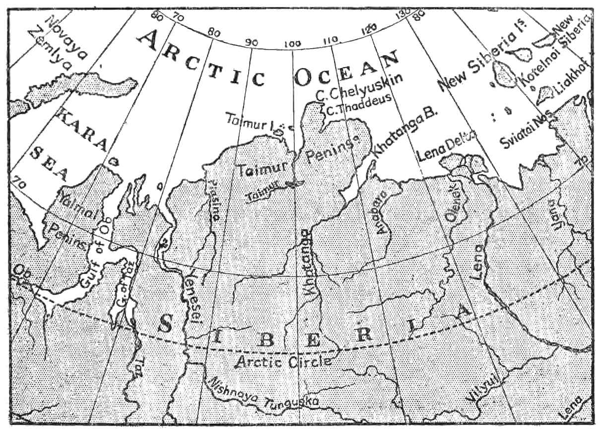
buried.
Eastward of the Samoyed country is the Siberian
coast, extending for 2000 miles of longitude along the
Polar Ocean, a vast tundra traversed by three great
rivers—the Obi and its tributary the Irtish, the Yenisei,
and the Lena. To the east of the Lena there are three
smaller rivers, the Yena, Indigirka, and Kolyma, but all
have their sources far to the south of the Arctic Circle.
Some other streams, merely rising in the tundra, flow into
the Polar Ocean. These are the Piasina, Taimir, Khatanga,
Anabara, and Olenek between the Yenisei and Lena,
and the Alaseia between the Indigirka and Kolyma.
The three great rivers have remarkable width and
volume. The Yenisei is more than three miles wide for
at least a thousand miles, and a mile wide for another
thousand. The 200 miles of delta have a width of 20
miles. The sudden melting of the winter accumulations
of snow gives rise to floods of great magnitude. Vast
harvests of ice are thus annually poured out. The tundra
is generally a slightly rolling plain sloping towards the
rivers, intercepted by deep river valleys with precipitous
sides. The ground is frozen for several hundreds of feet
below the surface, and for eight months, from October
to May, the tundra is a sheet of snow 6 feet thick. In the
summer a wild-looking country appears, full of small
lakes, swamps, and streams, swarming with mosquitos
and frequented by myriads of birds. The sun brings to
life a brilliant Alpine flora, and the tundra has a carpet
of grass and mosses.
The Siberian shores of the Polar Ocean forming the
edge of the tundra are for the most part low and flat,
and Cape Chelyuskin, the northern termination of the
Taimir Peninsula in 77° 36′ N., is a low promontory.
This Siberian tundra is the coldest region in the world.
The earth, alternating in many places with strata of solid
ice, is hard frozen in perpetuity for a depth of several
hundred feet. The mean temperature of January is
-65°, but the interior is much colder than the sea coast,
there being a difference of 20°. At Yakutsk -79° has been
recorded, but the greatest natural cold ever measured
is -93° at Verkhoyansk, in 67° 34′, near the river Lena.
A great part of the Siberian coast is quite uninhabited,
but some hardy tribes extend their wanderings to, and
even have permanent settlements on the shores of the
polar sea. The Samoyeds, with both reindeer and dog-sledges,
extend their wanderings to the Yenisei. The
Ostiaks of the Obi and upper Yenisei rivers, numbering
27,000, are Finnish and have close racial affinities with
the Samoyeds. They possess a fine breed of dogs, but
live chiefly by fishing. The Yuraks of the Yenisei are
a branch of the Samoyeds. The Tunguses and Yakuts
wander further to the east, as far as the Kolyma.
The mysterious Onkilon or Omoki inhabited the river
banks and sea shores of eastern Siberia. “Once there were
more hearths of the Omoki on the shores of the Kolyma
than there are stars in a clear sky.” They were established
in fixed settlements. The remains of their forts, built
of tree trunks, and their tumuli are found, especially
near the banks of the river Indigirka. Nordenskiöld
found the ruins of their house-sites near his winter
quarters, and his excavating operations were rewarded
by finding a stone chisel with a bone handle, slate knives,
bone and slate spear-heads, and a bone spoon. Some
centuries ago there was great pressure from the south,
and the Onkilon, Omoki, and Chelagi appear to have
been driven northwards. The Omoki are said to have
gone away over the frozen ocean, but it is not known
whither. It is thought that they went to the land said
to be visible from Cape Jakan in clear summer weather.
At all events they disappeared.
Their place was taken by the tribe called Chukchis,
who occupy the Siberian coast from Chaun Bay to Cape
Chelagskoi. They are divided into reindeer or inland,
and coast Chukchis, each with about 400 tents representing
a population of 2000. The Chukchi race is the finest on
the Siberian coast, the finest eastward of the White Sea.
They are cleanly compared with the Samoyeds, with a
higher type of head, more intelligent-looking, and with
a reddish-white complexion. They are a hardy and
thriving people, with many children, but indolent when
not forced to exertion by want of food. They live in
large and commodious tents both winter and summer,
which are unlike those of any other tribe. The Chukchi
tents consist of an outer and an inner tent. The outer
one is of seal and walrus skins sewn to each other, and
stretched over wooden ribs bound together by thongs.
The inner tent is covered with reindeer skins and a layer
of moss, and is warmed by oil lamps. The tents are
usually pitched on the necks of land separating the strand
lagoons from the sea. The boats of the Chukchis are of
walrus hide sewn together, and stretched on a frame of
wood or bone. Their dog sledges are very light and
narrow, with runners of bone covered with layers of ice,
and they use shoes for their dogs, to prevent their feet
from being cut by the ice. Their snow-shoes, for the
winter, have a frame of wood crossed by well-stretched
thongs. Expert with lance, bow and arrows, fishing line
and nets, they live on the spoils of the chase, to which
cloudberries are added in favourable seasons, when the
fruit is able to ripen. The Chukchis carve animals and
other figures during the long winter nights, and display
considerable skill and ingenuity in the conversion of all
the means that Nature has placed within their reach to
their own uses. They are brave and independent, intelligent
and well disposed, and on the whole must be
considered to be the finest of the Arctic races.
The dogs used for draught by the Siberian tribes have
much resemblance to the wolf. They have long projecting
noses, sharp upright ears, and long bushy tails curling
over their backs. They vary in colour, and the size of
a good sledge dog is about 2 feet 7 inches in height, and
3 feet in length. In summer they dig deep burrows in
the ground or lie in the water to avoid mosquitos. The
feeding and training of dogs is a special art, but their
natural sagacity is extraordinary.
The homes of the Eskimo along the Arctic coast of
North America present an aspect which differs, in several
respects, from those of the Siberian coast. The American
polar rivers are less numerous and of far less volume
than those of Siberia, and for the tundras of Siberia are
substituted the “barren lands” of North America, which
are essentially different. The first consists of frozen earth
and ice for an immense depth, the second of low granite
and gneiss hills with rounded summits separated by
narrow valleys. Except for limited deposits of imperfect
peat-earth in the valleys, the surface of the “barren lands”
consists of a dry coarse quartzose sand scattered over
with granite boulders. The American Arctic coast is
faced by islands, with narrow straits intervening, except
for 800 miles to Bering Strait where it faces the heavy
ice of the Polar Ocean.
This American coast produces edible berries and roots,
and on the land are musk oxen, reindeer, wolverines,
wolves, foxes, martens, hares, and marmots. Salmon,
with other fish, frequent the rivers, and many wading
birds, besides ptarmigan and willow grouse, ducks, geese,
and guillemots, come to breed. It is a Sub-arctic, not
an Arctic region. The whole coast, for 1700 miles,
affords the means of subsistence.
Here the hardy little Eskimo race has dwelt for long
ages, from the Aleutian peninsula to Hudson’s Bay and
Labrador. Their original position is supposed to have
been the coast near Bering Strait, from Kotzebue Sound
to the Colville river. They have preserved themselves,
for generations, by their great faculty of obtaining subsistence
by the most ingenious contrivances, and through
hereditary skill and perseverance. Their tales and
traditions go back for untold years, and with them have
been transmitted those methods of hunting and fishing
which long practice, through many generations, has
perfected. Living mainly on seals, their southern neighbours,
the Algonquin Indians, gave these coast people
the name of Askikamo or seal-eaters, whence our word
Eskimo, but they call themselves Innuit.
The American coast Eskimos have a dozen winter
settlements, four of which are never altogether abandoned
in the summer. They move about for purposes of
bartering and trading, as well as for hunting and fishing;
but they have permanent settlements, like that at Point
Barrow, with a population of 300 souls in 50 huts. These
Eskimos average a height of 5 feet 4 inches, with square
shoulders, deep chests, and great muscular strength in
the back. The hands are small and thick, and the
lower limbs well proportioned. In walking their tread is
firm and elastic, the step short and quick. Their hair
is black and cut in an even line across the forehead, the
complexion fair enough to make the rosy hue of the
cheeks visible, giving place to a weather-beaten appearance
before middle age. The face is flat and plump with high
cheek-bones, forehead low, nose short and flat, eyes dark,
sloping obliquely. The mouth is prominent and large,
the jaw-bones strong, with firm and regular teeth. The
expression is one of habitual good humour, but marred
by wearing large lip ornaments of stone.
The dress consists of a frock reaching half down the
thighs, with a hood and loose waist-belt, and a tail of
some animal attached to it behind. The breeches are
tied below the knee over long boots. The clothes are
doubled, the inner frock of fawn-skin with the fur inwards,
and the outer of full-grown deer-skin with the hair
outwards. The winter habitations are entered by a
passage 25 feet long, terminating under the floor of the
iglu or hut, which is a square chamber from 12 to 14 feet
by 8 or 10. The walls are of stout plank, and the roof
has a double slope with a square window on one side,
covered with a transparent membrane stretched by two
pieces of whalebone. The oil burner or fireplace is the
most important piece of furniture. It is a flat stone,
hollowed on the upper surface, and placed on two horizontal
pieces of wood fixed in the side of the hut a foot
from the floor. A flame is kept up from whale or seal
oil, by means of wicks made of dry moss. The summer
tents are conical, of deer or seal-skins, on poles slung
together by a stout thong.
In October the sea becomes closed and the men set
nets under the ice for fish, also angling with hook and
line through ice holes. In January they set out in search
of reindeer, hollowing out dwellings in the snow-drifts.
Their hunting employment lasts until April, when they
return home to get ready their boats for whaling. In
summer they are scattered over the country in search
of seals and birds.
These Eskimos are described as cheerful and good-humoured,
quick-tempered but placable, and with strong
conjugal and parental affections. They are shrewd and
observant and some exhibit considerable capacity. Far
to the eastward, in Boothia, the Eskimos live in snow
houses instead of wooden huts. These snow houses are
built of large blocks of snow carefully laid and made in
the shape of a dome with a square hole for light. The
dog sledges of the Boothians are rude, and the runners
made of folded seal-skin carefully coated with ice.
Still further east, in Melville Peninsula at the head
of Hudson’s Bay, the Eskimos average an inch or two
more in height. Instead of lip ornaments, they tattoo
the face, arms, and hands, and as with the Boothians their
winter habitations are snow huts. Besides dog sledges
they have kayaks 25 feet long, with a width of 21 and
depth of 10½ inches, but no umiaks or women’s boats.
Their dog sledges are heavy, with runners of bone scarped
and lashed together. Their weapons are spears, bows
and arrows, and bird darts used with a throwing-stick.
Thus the Eskimos spread themselves over a vast extent
of country, wandering from Bering Strait to Labrador,
a distance of 2000 miles. They adapted themselves to
their environment alike in the construction of their
dwellings and in their contrivances for fishing and
hunting. They are equally at home whether the building
material is plank, drift wood, stone or snow; and with
the same versatility they adapt their weapons and sledges
to the materials within their reach. These Eskimos, by
reason of their vigour and courage, of their shrewdness
and intelligence, have been among the greatest and most
successful wanderers on the face of the earth.
The problem of the peopling of Greenland has been
more difficult to solve. It is now clear that the Eskimos,
as we call them, who established themselves in Greenland,
originally came from the north. We therefore seek for
the evidence of movement of Arctic people. The most
remarkable migration was that of the Onkilon, Omoki,
and other Siberian tribes during a long period of years,
owing apparently to pressure from the south. We are
told that their abandoned yourts may still be seen near
the Indigirka and Cape Chelagskoi. As we have already
said, there is a tradition that they wandered away from
Cape Jakan to the land in sight in the distance, which
we now know to be Wrangell Island, and thence across the
ice to the American continent. Finding the coast already
occupied they went northwards and eastwards seeking
for a home. They must have come in very small parties
and at long intervals, for the desolate country could not
sustain a large migration. Wandering along the coasts
of Banks Island, they came to a region which, owing to
the absence of open water during long intervals, was
unable to support them.
This is one of the most wonderful migrations ever
performed. It is unrecorded. But the long route is
strewn with abundant vestiges of marches, during centuries
perhaps, over the snow and ice, in search of an abiding-place.
Many must have perished. We found relics at
frequent intervals from Melville Island to Baffin’s Bay.
Their appearance and the lichens growing upon them,
justify the conclusion that the movement took place
centuries ago3. The relics consist of stone iglus or winter
huts, circles of stones to keep down summer tents, stone
fox-traps, stone lamps, graves built with stone slabs,
and many articles brought from a distance. Among
these were portions of the bones of whales used to support
the roof of an iglu, other pieces cut into a shape for running
melted snow into a vessel, pieces of the bone runners of
sledges, and a willow switch 2 feet 3 inches long, covered
with lichens4. These vestiges are numerous and continuous
from Melville Island to Wellington Channel.
Then the traces form two branches; one along the coast
of North Devon to Cape Warrender and the north water
of Baffin’s Bay, the other up Wellington Channel and the
western coast of Ellesmere Island, then across the land
to Sir Thomas Smith’s Channel. The most northern
traces are near the 82nd parallel, where the framework
of a wooden sledge, a stone lamp, and a snow scraper of
walrus tusk were found5. Further north, life could not
be supported, and the wanderers wended their way
southward to Greenland. Perhaps a few followed the
musk oxen and reached the east coast.
Thus, we may safely believe, was Greenland first
peopled. A further proof is that they have the word
umingmak (a musk ox), which does not exist in Greenland,
but was met with in the far northern wanderings and
the tradition handed down. Very gradually the Eskimos
worked their way south along the west coast of Greenland.
But they were in the region between Disco Bay and
Holsteinborg in a far-off prehistoric period. There have
been rich finds of implements in North Greenland (68°
to 71°) in deep deposits of great age6. The Eskimo
appeared much later in South Greenland.
The Greenland Eskimo differed very little from his
congener of the North American coast. He was dolichocephalic,
with a short broad face, small slanting eyes,
cheeks broad, prominent, and round, hair straight and
black, and about the same average height. In Greenland
the Eskimos passed the winter in iglus or stone houses,
the floors of which are sunk some feet below the surface
of the ground. In summer they lived in skin tents,
while their property was moved from one hunting
encampment to another in their umiaks or women’s boats,
which are 30 feet long by 5 wide and 2½ deep, flat-bottomed,
and made of seal-skins stretched on a frame.
The kayak or hunter’s canoe is the triumph of Eskimo
art. It also consists of seal-skin stretched on a frame,
but the frame, flat-bottomed and sharp at both ends, is
designed on the most perfect lines for speed and buoyancy.
It is entirely covered except a hole for the hunter, who
ties a waterproof, which is attached all round to the
kayak, around his waist when seated. Then, with his
double paddle, he faces the wildest seas with dauntless
courage, and with his harpoon secures his prey with
unerring aim. The Greenland kayak is the most perfect
application of art and ingenuity to the pursuit of
necessaries of life to be found within the Arctic Circle.
The use of the kayak among the Eskimo of Hudson’s
Bay makes it probable that, at one time, there was some
intercourse by way of Davis Strait.
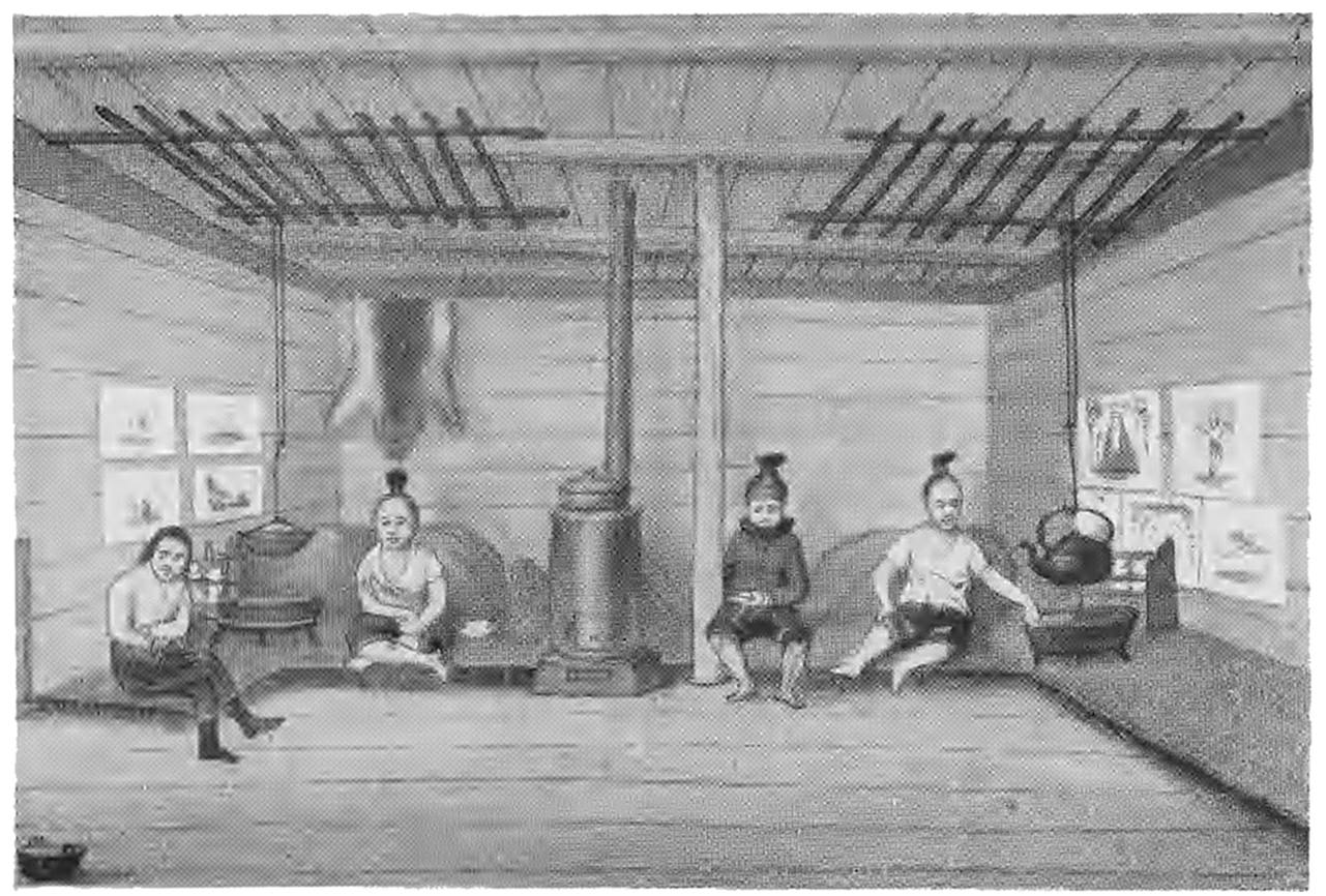
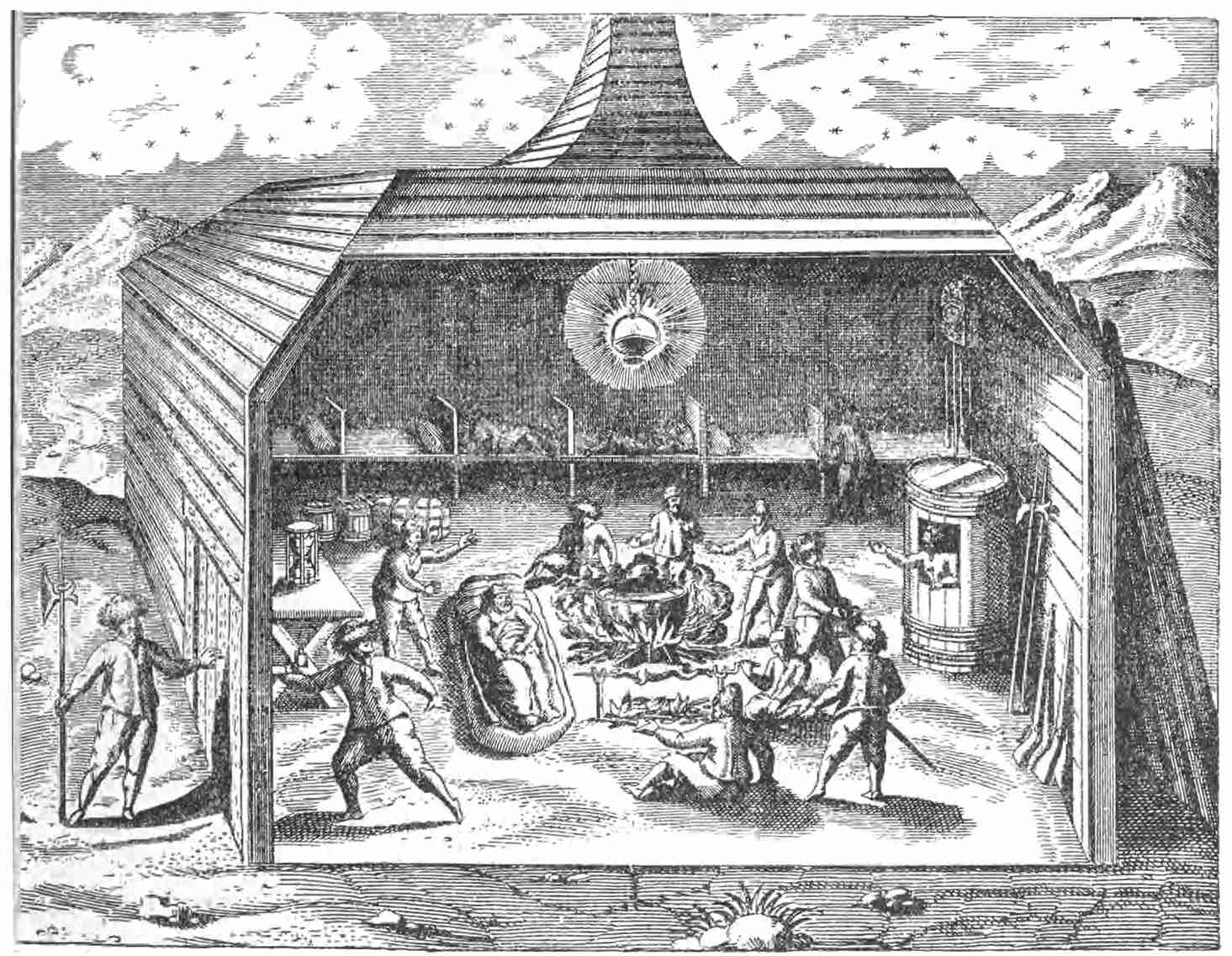
Interior of Greenland Hut
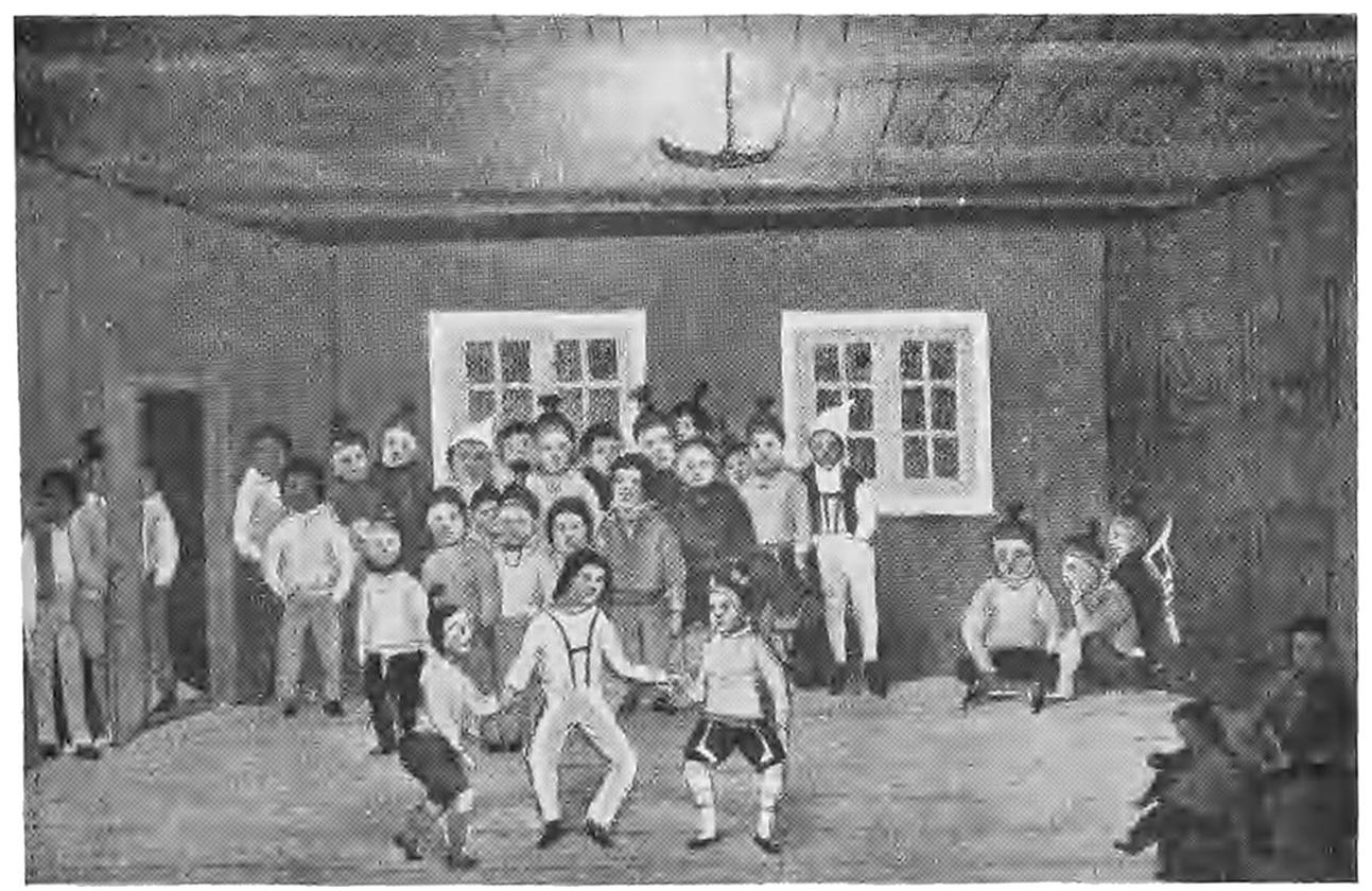
Greenlanders dancing
Equally ingenious is the use of an air bladder attached
to their harpoons to retard the seal in its rush when
struck, and to keep the harpoon floating if the quarry is
missed. The point of the harpoon is also so fitted that,
when the seal is struck, it slips out of the shaft, obviating
the danger of the shaft being broken by the animal’s
struggles, and of the barb slipping out of its body. The
point is attached to the shaft by a thong.
Seals provide material for clothes, boots, tents, and
food. The Greenland dogs are excellent for their purpose
and draw sledges 30 or 40 miles a day over smooth ice
easily; but the dog as a draught animal is an Asiatic
invention. The Greenland sledge consists of a couple
of boards for runners, 6 feet long, with cross pieces,
and two upright poles for guiding. All is kept together
by seal-skin thongs, thus affording elasticity. On smooth
ice a pace of 16 miles an hour can be attained, the load for
dogs being nearly 500 lb. Eskimo necessary furniture consists
of lamps, wooden tubs, dishes, and stone pots. Their
arms are bows and arrows, bird darts, javelins, and lances.
The wood required by the Greenland Eskimo is
provided by the Arctic current. Flowing down the east
coast of Greenland it is diverted by the Gulf Stream,
turns round Cape Farewell, and flows up the coast of
Greenland bearing abundance of drift wood. Again
meeting the Baffin Bay current, it is turned again down
into the Atlantic. This drift wood consists of coniferous
trees which must come from Siberia. Pieces 60 feet long
are found on the coast so far north as 60° 30′, one yielding
3 cords of wood in 63° N., and pieces of 12 to 30 feet are
not uncommon.
The Angekoks, like the Shamans of Siberia, are the
priests and physicians of the Eskimos, who believe in a
great first cause, and in spirits, especially evil spirits, who
have to be propitiated. They have myths and traditions,
but none that throw any certain light on their origin and
history. By far the best account of the arms, tools, and
utensils of the Eskimos of West Greenland is by Porsild7.
The most interesting tribe of Eskimos is that which
was discovered by Sir John Ross on the north coast
of Baffin’s Bay, probably descended from the last
Asiatic arrivals. Having no canoes their progress south
was stopped at the curving shores of Melville Bay,
300 miles round, nearly all occupied by glaciers coming
down to the sea. Ross named them the “Arctic Highlanders.”
They had dogs and sledges but no kayaks,
consequently there was no communication with the
Greenland Eskimos to the south.
The coast from Cape York to Etah, within Smith
Sound, is the country of the Arctic Highlanders. It is
broken by deep fjords, separated by magnificent headlands,
the breeding-places of guillemots and kittiwakes, and
the favourite home of millions of little auks or rotches.
The Arctic Highlanders are stout well-built little men,
thick-set and muscular, with round chubby faces, oblique
eyes, and small and very thick hands. With marvellous
endurance they are courageous, are ready to close with
a bear, and have been known to enter into a conflict
of four hours’ duration with a fierce walrus, on weak ice.
Without wood, without bows and arrows, without canoes,
they still secure abundance of food with their spears and
darts. In summer they live in seal-skin tents, in winter
their habitations are circular stone huts built at permanent
stations along the coast. Their utensils consist of shallow
cups made of seal-skin for receiving the water as it melts
from a lump of snow and flows down a shoulder blade of
a walrus, and of stone lamps. They eat their food raw
and in large quantities. Their weapons are a lance of
narwhal ivory and a harpoon, and nets to catch the little
auks and other birds. The Arctic Highlanders possessed
knives of meteoric iron, made by inserting in a row along
a slit made in a haft of stone or ivory a number of thin
flakes, carefully chipped to a circular form. This meteoric
iron came from three huge boulders at the back of
Bushnan Island, near Cape York.
The Arctic Highlander wears a shirt of bird-skin
neatly sewn together next to the skin, with the soft
down inwards, over which there is a loose kapetah or
jumper of fox-skin, tight round the neck, where a hood
is attached to it. The nessak or hood is lined with
bird-skins and trimmed with fox fur. The breeches,
called nannuk, are of bear-skin and come down to the
knees, and above are just in contact with the kapetah,
when the wearer is standing upright. On the feet bird-skin
socks are worn with a padding of grass, over which
come bear-skin boots. By means of their sledges these
hunters can move swiftly to the bear-hunting grounds,
and no hunters in the world display more indomitable
courage and presence of mind, or more skill and judgment
in the exercise of their craft. Their number, when first
discovered, was about 300. From an ethnological point
of view they are the most interesting of all savage tribes,
by reason of their wonderful exodus and their isolation.
We have now passed in review all the dwellers on the
Arctic Threshold, from Lapland round the northern shores
of Siberia and America to Greenland, considering them
with reference to their environment, and we have traced
the wanderings of the Onkilon until we find the last
remnant of the exodus on the northern shore of Baffin’s
Bay. Such a brief survey is a necessary introduction
to the history of Arctic enterprise.
CHAPTER IV ULTIMA THULE
The first tidings of the existence of the Arctic Regions
that reached the civilised world were due to the
voyage of a Greek navigator of great knowledge and
ability. The people of the Ionian city of Phocaea in
Asia Minor, scorning to submit to Median domination,
had formed a very flourishing commercial colony at
Massilia, near the mouth of the Rhône, on the southern
coast of Gaul. Strange products reached them from
unknown regions to the north, coming over great distances
and then down the river Rhône. These products
included tin and amber. The interest of the able and
imaginative Greeks of Massilia was aroused, and a strong
desire was felt that the regions whence this tin and
amber came should be discovered. Fortunately the colony
possessed a man eminently fitted to conduct an exploring
expedition, in the person of Pytheas, an astronomer and
mathematician. As it is alleged by Polybius that
Pytheas was in poor circumstances, it is probable that
the voyage he undertook was not his own venture, but
that he was placed in command of a government expedition.
It is certain that he prepared for his perilous
enterprise with great care. He first carefully fixed his
point of departure at Massilia by erecting a large gnomon
divided into 120 parts. Observing its shadow at noon
of the day of the solstice he found that its length was
42 parts of the gnomon, less one-fifth, that is 41⅘ths to
120, or 209 to 600. This proportion gave 70° 47′ 50″
for the altitude of the sun. The length of the longest
day was 15 hours 15 minutes. The obliquity of the
ecliptic was found to be 23° 51′ 15″, which was deducted
from the altitude. The complement of the result was the
latitude of the place less the semi-diameter of the sun.
With the semi-diameter added, the result is almost exactly
the latitude of the Marseilles observatory, 43° 18′ N.
Such accuracy is remarkable. The next step taken by
Pytheas was to fix upon the nearest star to the pole as
a guide for steering the ship. He found that there was
no star on the pole, but that there were two very close
to it. These would have been, in those days, β Ursæ
Minoris and α Draconis, and Pytheas used one of these
as his pole-star. During the voyage the latitudes were
obtained by observation of the longest days. This involved
long detentions at some of the ports.
The nearest approximation we can get to the date
of the voyage of Pytheas is the time of Alexander the
Great and of Aristotle, about 330 B.C.8
A Grecian ship in those days was strongly built on
regular principles, with sails on the mainmast, and rowing
power. A large vessel would be 150 to 170 feet long,
with a tonnage of 400 to 500, much larger and more
seaworthy than the crazy little Santa Maria in which,
1800 years afterwards, Columbus discovered the New
World.
Well provided with all the knowledge of his time,
Pytheas weighed anchor and began his coasting voyage
by the Pillars of Hercules and the Sacred Promontory,
the western limit of the known world. The Greek
ships of the time averaged about 50 miles a day.
Sailing on along the coast, Oestrymnis (Cape Finistère)
was reached, the probable farthest point of Himilco the
Carthaginian. The island of Uxisama (Ushant) is mentioned,
with an observation for the length of the longest
day equal to 49° N. Thence a direct course was shaped
for Cantion (Kent) where there was a long stay, and the
island of Britain was thus discovered. Here Pytheas
made a long journey into the interior, visiting Belerion
(Cornwall) and the tin mines, and noting several details
respecting the habits and customs of the people, our
remote ancestors. In those days Britain was almost entirely
in a wild state. The valleys were covered with
primeval forests, their lower parts were occupied by
vast swamps, and it was only on the downs and hill-ranges
that there were gwents or open clearings. Still,
the people raised wheat and other cereals, had domestic
animals, iron tools and arms, wooden chariots with iron
fittings, and ornaments of bronze and gold. Pytheas
must have traversed the great forest of Anderida on his
way to the tin mines, and he found the people hospitable.
They did not use open threshing-floors owing to the rains,
but threshed their corn in large barns. They stored
the corn in pits under ground, and made fermented
liquor from barley, which they used as wine. Their
houses were of wood and thatch, and Pytheas mentions
the war chariots, but adds that the chiefs were generally
at peace with each other.
When Pytheas returned to his ship in some haven of
Cantion he proceeded northwards. His next observation
gave 17 hours as the length of the longest day.
This would be in latitude 54° 2′ N., somewhere in the
neighbourhood of Flamborough Head. Still coasting to
the north in his great voyage of discovery, Pytheas
came to a point at the northern end of Britain which,
by a similar method of finding the latitude, must have
been Tarbat Ness in Ross-shire. As he advanced towards
the Arctic Circle he found that the cultivated
grains and fruits and almost all the domesticated animals
gradually disappeared. The people in the far north were
reduced to living mainly on herbs and roots. The
intrepid explorer still pressed onwards to discover the
northernmost point of the British Isles. Coasting along
the shores of Caithness and the Orkney Islands he finally
arrived, conjecturally, at Unst Island, the northernmost
of the Shetland Isles. Pytheas gives the name of Orcas
to this extreme point of the British Isles, a name which
in later times was transferred to the Orkneys or Orcades.
It was at Orcas that Pytheas received information
of an Arctic land called Thule9, at a distance of six days’
sail, and near the frozen ocean. There was no night
there in the summer solstice. During one season the
night was continuous, and during another it was continual
day. Pytheas does not say that Thule was an
island, nor that he had been there. It was possibly the
coast of Norway in the neighbourhood of Alstenoe and the
Vefsen-fjord. Pytheas also received reports of the physical
aspect of the Arctic region beyond Thule. His account
has been turned into nonsense by Strabo, copying from
the explorer’s adverse critic Polybius. Yet even as we
have it, the real meaning is clear enough. It is a good
description of a fog at the edge of broken-up pack ice
and sludge, “which can neither be travelled over nor
sailed through.”
Pytheas was thus not only the discoverer of Britain,
but the first explorer who received information respecting
the Arctic regions. He was, as Professor Rhys has
truly said, “one of the most intrepid explorers the world
has seen.” To have taken five observations of the
lengths of the longest days the voyage must have occupied
about six years. Sailing south from Orcas, Pytheas
returned to Cantion, and eventually to his home at
Massilia, whence he is said to have set out on another
expedition to examine the mouth of the Elbe, and the
sources of amber. He lived to return once more to his
home.
Pytheas wrote one, if not two books to describe the
events and results of his memorable voyages. Both are
unfortunately lost. We only know the story from the
extracts in Strabo and other later writers10.
The Ionians of Phocaea and Massilia had been trained
as mariners and students for generations, alike in the
mother city and in the colony, and all their admirable
qualities seem to culminate in the life work of Pytheas.
His learning and his discoveries form the fitting crown of
their history. Pytheas was a geographer and an explorer
in the highest sense. For he must have devoted long
years to qualify himself for his great task, and his attainments
placed him in the first rank of nautical astronomers
before he undertook his voyages into the unknown ocean.
CHAPTER V FIRST CROSSING OF THE THRESHOLD
There is one part of the Arctic and Sub-arctic regions,
and one only, where a country retaining the warmth
and the adaptability of the temperate zone as an abode
for civilised man extends far beyond the Arctic Circle,
and, as it were, connects the vast tracts of ice and snow
with the habitable earth. This is the Scandinavian
peninsula. It stretches northwards to 71° 10′ N., maintaining
a temperature throughout its length which
renders it fit for the abode of a race of men who have
been leaders in progress and civilisation. This remarkable
phenomenon is due to the flow of warm water from the
Atlantic, which passes northward along the coast of
Norway. The Atlantic current has the effect of ameliorating
a climate which would otherwise be of Arctic
severity, while at the same time it keeps off and checks
the polar icebergs in their southerly drift, so that ice is
never seen on the northern shores of Finmarken. Reclus
has very truly said that this current has played a chief
part in the modern history of mankind.
The Norsemen appear to have arrived in the Scandinavian
peninsula, and superseded the Finnish tribes,
a century or two before the Christian era. The physical
geography of the region moulded the thoughts and lives
of the new-comers. With a noble foundation to build
upon, their character was evolved by their environment.
The stormy seas and impenetrable fogs, the glories of the
fjords with their mighty cliffs and glittering cascades, the
valleys and lakes, the dense forests and mysterious ice
fjells—all were made to form settings for the long array
of fancies created by the glowing enthusiasm of the
Norsemen.
But the imagination of these people had a still wider
and loftier range. Influenced by the glories of nature
which surrounded them, they sought for the origin and
first impulses of created things and strove to make their
conceptions co-extensive with the universe, while they
peopled nature with supernatural agencies of all kinds.
Yet there was a proud humility in the loftiest flights of
their imaginations. They elaborated a mythology and
cosmogony, but alone among religious beliefs that of
the Norsemen recognised that there must be some greater
and higher order of things to follow that which, in the
youth of the world, sufficed partly to satisfy their own
aspirations. Fimbultyn, “he who sent the heat,” the
great Helper, the mighty God, would guide the new order
and live for ever.
The most beautiful myth in the northern mythology
is that of Arctic day and night, of Balder and Hoder.
It has been the theme of modern poets from Œhlenschlager
to Matthew Arnold. The death of the Sun-God, the
Deity of light and beneficence, through the treachery of
Lok, but by the unknowing hand of his blind brother
Hoder, the God of Darkness, is a myth the meaning of
which is obvious. But the story of his death, of the
mourning of all created things, and of the efforts to save
the beloved one from Hela, the Goddess of Death, is
deeply pathetic. The funeral of Balder attended by the
whole pantheon, including giants and dwarfs, each deity
with all his legendary attendants, and the launch of the
flaming ship bearing the body into the silent sea, reaches
the highest flight of poetic imagination.
Then Hermod, the messenger of the Gods, is sent
by the All-father, on Odin’s horse Sleipner, with an
order for the death-goddess Hela in Nifelheim, her abode
of ice and snow, to release Balder:—
“And he came down to ocean’s northern strand
At the drear ice, beyond the giant’s home:
Thence on he journeyed o’er the fields of ice
Still north, until he met a stretching wall
Barring his way.”
The Arctic Circle! He puts Sleipner at it, the celestial
steed clears it at a bound, and Hermod, the first Arctic
explorer, enters Nifelheim. But the mission fails, for
there was one thing that Odin could not do, and that was
to undo what he himself had ruled. So Hela held her
prey until the twilight of the Gods, when the old order
passed away.
The Norsemen arrived in the Scandinavian peninsula,
as we have seen, a century or two before the Christian
era, and the whole body of their beliefs and legends,
comprised in the Eddas, was written down mainly in the
14th century, so their gradual conception and evolution
occupied several centuries. The lives of these people
were passed in a hard struggle with Nature, in wild adventures
by fjord and forest, and in constant warfare.
The gods and giants seemed very near to them, to some
even visible in those young days of the world. In the
black clouds rolling down from the ice-fjells they saw the
mighty Thor followed by the hosts of Asgard, just as
they heard his pealing thunder. In the clang of battle
the Val maidens, sweeping through the air on their
celestial steeds, were realities. The temples and sacrificial
ceremonies of the Norsemen were sacred. The
seat-posts with deities carved on the ends, generally
Odin and Thor, were the most venerated possessions of
the chiefs.
As time passed, the districts along the coasts and in
the more accessible parts of the interior rapidly became
populous. Constant strife necessitated chiefs and leaders,
but the people loved their freedom, and the right of
speaking and voting in their assemblies. A free race,
divided into many communities by the obstacles of
Nature, continued to work out its destinies, and to
multiply on the isles and fjords until the crowded state
of their homes and the wild spirit of adventure drove
them to the building of ships and the search for new
homes beyond sea.
It is the proud boast of their descendants that the
Norsemen were the first people who definitely abandoned
the coast, and sailed boldly over the open sea. They
crossed the North Sea to Shetland, Orkney, Caithness,
and even Ireland, probably as early as the 6th century.
They were also established in the Lofoten Islands and on
the borders of Finmarken in those early days. There
the tales of their folk-lore seemed to lure them further
into the Arctic wilds. The fishermen of Værö and Röst,
the most southerly of the Lofotens, when out at sea in
stormy weather, fancied that they got a glimpse of a
green and fertile island which they called Udröst, sometimes
Alfland or the “elf land.” But when they sailed
towards its shore, it always disappeared in the clouds.
It was said that only the wise and good have ever been
on Udröst, and then only in thought. So says the
Lofoten song:—
“In the westerly sea, off the Halgoland shore,
An isle floats alluring and bright.
But as soon, we are told in the fishermen’s lore
As a sail comes completely in sight,
The clouds sink around it in darkness and mist
And the ship turns away on her keel;
For no man can land on those shores of the blest,
Nor can mortal its secrets reveal.
’Tis only in thought that wisdom can dwell
On the secrets of ice and of sea;
’Tis thus that the beautiful Alfland may well
Yield her wealth to the true devotee.
Let us stand then on Udröst if only in thought,
And there find the knowledge we seek:
The grand northern story as truthfully told
When we learn it from Andenäs peak.”
We hear the first authentic Arctic story from England’s
own king, Alfred—the most truly great, the
wisest, and the best monarch that ever ruled over any
country. Always working for the good of his people,
he translated the geographical work of Orosius for their
benefit, inserting his own priceless additions and comments.
Among them is the narrative of an Arctic
voyage obtained at first hand from a native of that
Halgoland whence Udröst was sometimes visible on the
horizon. The explorer, named Ohthere, came to Alfred’s
court to tell his story, and so it was saved from oblivion
by being inserted in the King’s edition of Orosius. King
Alfred describes Ohthere as a very wealthy man, owning
600 reindeer, horned cattle, sheep, and swine; as having
a small extent of tilled land, but deriving the chief
part of his revenues from the tribute of the Finns (as the
Lapps were called) in skins and feathers, whalebone,
and hides for making ropes. Ohthere gave the length of
a walrus as 15 feet, and of a whale as 96 feet. He told
the King that the best whale-fishing was off the coast
of Halgoland. Ohthere’s own home was at Gibostad on
the mainland of Senjen in the province of Halgoland,
“the land of fire,” or “of the northern lights.” It was
well within the Arctic Circle.
Ohthere wished to discover the coast beyond his ken,
so he undertook a most adventurous voyage to the north
and east, keeping the wild rocky shore on his starboard
hand, and the wide Arctic sea on what he called his
boec bord. He explored the whole of the Finmarken
coast, mentioning the business of fishing for walrus or
“horse-whales” as he called them, and he also described
the Lapps, who were met with up to the North Cape.
Ohthere reached the most northern point of Europe.
This is Nordkyn or Kinnerodde, at the eastern entrance
of the Laxe fjord; but on the island of Magerö the low
projecting spit of Knivskjärodde reaches still further
north to 71° 11′. The bold black headland of the North
Cape, with its flat summit and nearly vertical strata of
mica slate, has a height of 1005 feet, but a mile less
northing. The adventurous Ohthere was thus the first
to round the North Cape. He then shaped a course
eastward and finally entered the White Sea, sailing
round the Kola Peninsula as far as the mouth of the
Karzuga river, and coming into touch with people called
Terfinna and Beorma. The former were the Finns of
Ter, the old name for the Kola Peninsula; the Beormas
were the North Karelians. This was the extent of
Ohthere’s discoveries as recorded by King Alfred.
In those far-off days, when Alfred the Great was
devoting his life to the good of his people, England was
in the course of being made, and the Norsemen were
destined to have no small share in the making of it. But
it is worthy of note that even then the work of polar exploration
and the achievements of explorers were the
subjects of investigation by Alfred, an interest which has
been continued for a thousand years.
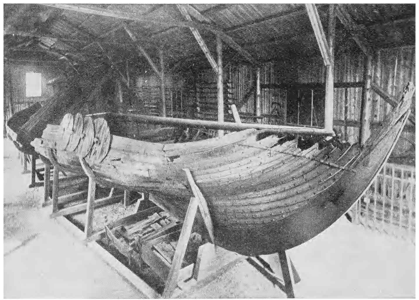
Viking Ship
The difficulty of communication by land, and the
innumerable bays and fjords in the country of the Norsemen
soon led to extensive ship-building, each district
doubtless following its own designs, to some extent, in
build and rig. Fortunately we know exactly the build
of the Viking ships, for one dating from the 9th century
was discovered in 1880, buried in the blue clay at Gokstad
near Sandefjord11. This Viking ship is of oak, clinker-built,
fastened and riveted with iron bolts. In those
days conifers had by no means superseded oaks in
southern Norway. The ship has the lines of an excellent
sea boat, 78 feet long over all, with a 66 ft. length of
keel and 16 feet beam, but only 4 feet in depth. There
was a mast and a long yard with a square sail, as well as
64 rowlocks for oars in the third row of planks from the
top. The steer oar was fitted on the starboard quarter
of the vessel, which was sharp at both ends and drew
very little water. Wooden shields were hung round the
bulwarks and the vessel contained utensils for cooking,
bedsteads, and various other articles. Hundreds of such
ships carried the Norse warriors along the coasts or to
distant shores, some of them, such as the “Ormen
lange” of Olaf Tryggvason, being probably much larger
than the interesting relic of Gokstad.
The time came—as well in Norway as in Denmark and
Sweden, and as it appears to come sooner or later in all
lands—when the most powerful of the numerous chiefs
forced the rest to submit, and united all into one kingdom.
“Harold of the fair hair” descended from the Ynglings
of Upsala, children of the God Frey, was the chief of
Ringerike and Vestfold in the south of Norway, a valiant
and persistent warrior. He succeeded in subjugating
the whole country, and founded a dynasty which lasted
for five centuries. Harold reigned from 860 to 930 A.D.
His reign was the period of adventurous expeditions and
of colonisation. The population was increasing, and
some of the chiefs could not brook the enforced allegiance
to an overlord. The spirit of adventure and discovery
was in the air. The northern Vikings loved the freedom
of a roving life upon the ocean. Brave and fearless,
they were controlled only by their code of honour, and
the precepts of Odin’s rules contained in the Havamel or
high song of Odin, and in the lay of the Valkyrie Sigfrida
alone restrained them. Their fleets were the terror of all
the coasts of western Europe, and no creek or haven was
safe from the ravages of their leaders. Such a man
was Rolf the Ganger, a chief in Nordmore, who finally
established himself as Duke of Neustria. His commanding
ability and statesmanship were shown by his great
and enduring achievement. Other Vikings settled in the
Faroes, Shetlands, Orkneys, Caithness, and the chief
harbours of Ireland. Naddod seized the Faroes, and in
863 Gardar Svafarson reached the coast of Iceland. It
is curious that both in the Faroes and in Iceland Irish
monks were found, who had gone there to find lonely places
as dwellings for anchorites. They went away on the arrival
of the Norsemen, as they would not live with heathens.
The great event of the period of Harold Haarfager
was the colonisation of Iceland. It was a forbidding
home, yet the leading men of the Norwegian fjords
settled there in numbers. Ingulf Ormsson, who came
in 875, was the first. Two years afterwards Gunnbjörn
Ulfson followed, sailing westward until he discovered
islets (doubtless on the east coast of Greenland) which
were afterwards called Gunnbjörn’s Skerries. He turned
back, and shaped a course for Iceland, which he had
passed without knowing it.
Iceland is separated from Norway by a wide and
stormy sea with a depth of 2000 fathoms, while it has
a sub-oceanic connection with the Faroes and the
Hebrides by banks and ridges with a depth of only 100
fathoms. The great volcanic mass of the island embraces
an area of 40,450 square miles just south of the Arctic
Circle and consists of snowy fjells pierced by active
volcanoes and very difficult of access. It has two
plateaux, built up by volcanic rocks of older and of
newer formation. The two deep bays of Breidifjord and
Hunafloi divide the island into two separate table-lands
connected by an isthmus only 4½ miles across, but 750
feet high. The only habitable parts of Iceland were and
still are the narrow strips of land along the sea shore,
and even the famous place where the Thingvalla or
assembly of the people was held is in a plain which was
formerly the bed of a lava stream, between the geyser
district and Reykjavik.
The voyage to Iceland was long and dangerous, the
difficulty of colonising insuperable to all but men endowed
with the Viking spirit. The first settlers sent tidings
that the sea abounded in fish, and that cattle could live
through the winter, so the tide of immigration continued.
The Icelanders elected their Judges, established district
courts, and were ruled by their own freely-elected Althing
or assembly, held on the banks of the lake called the
Thingvalla Vatn. This land of freedom, under the Arctic
Circle, became the fountain of northern mythology and
history, and it is to the Skalds of Iceland that we owe
nearly all our knowledge of the beliefs, as well as of the
deeds, of the ancient Norsemen. Iceland was also the
stepping-stone for further Arctic discovery.
The settlement of Iceland, with the roll of settlers, is
recorded in a famous work written by Ari Froði (1067–1148)
called the Landnamabók.
CHAPTER VI THE NORSEMEN IN GREENLAND
The enthralling story of the discovery of Greenland
and America, as the actual beginning of great Arctic
enterprises, must be introduced by some account of the
authorities on which it rests, for parts of it have been the
subjects of much criticism and dispute.
The earliest writer who mentions the deeds of the
Norsemen in Greenland was Adam of Bremen, a Canon
of the cathedral of that city and master of the cathedral
school, A.D. 1070. In those days Svend Estridsen, a
nephew (sister’s son) of England’s King Canute, was King
of Denmark, whose memory was a storehouse of facts
concerning the history of the Scandinavian races. Adam
of Bremen accordingly made a journey to his court and
spent some time there, and the King was his authority on
all he was able to write relating to Greenland. Adam’s
testimony is, therefore, earlier than, and quite independent
of Icelandic manuscripts, and becomes a test for the truth
of the sagas and traditions. In this lies its great importance
as an authority.
The detailed Icelandic narratives are two or three
centuries later. The first is the Hauksbok, composed not
later than 1334. Its name is derived from Hauk who
was Lagman of Iceland in 1295, and in whose handwriting
a portion is written. It contains the Saga of Erik the
Red. The second manuscript is the Flatey book or
Codex Flateyensis, so called from having belonged to
one Finsson who lived on Flat Island, near the Breidifjord
in Iceland. It is now in the Royal library at
Copenhagen, having been brought from Iceland by
Thormod Torfason (Torfœus) as a present to King
Frederick III of Denmark. It was written about the
year 1387 and contains the Saga of Olaf Tryggvason,
King of Norway, in which two narratives are interpolated,
the story of Erik the Red and the story of the Greenlanders.
The two versions in the Hauk book and the Flatey
book differ materially in the details, but the main facts
are the same. The version of the Hauk book is the
older and appears to be the more reliable, and in the
days of Hauk there was still communication with the
Greenland colony. Two complete vellum texts of the
Hauk book survive. The work, in addition to the Saga of
Erik the Red, contains the Saga of Thorfin Karlsefni.
Hauk, who was a descendant of Karlsefni, one of the
Greenland heroes, died in 1334.
We learn from the Hauksbok that there was a man
named Thorwald, living in the district of Stavanger, in
the south of Norway, with his son Erik the Red. They
had killed a man, and in consequence fled to Iceland
and settled at Hornstrandir in Haukadal, on the north
shore of Iceland’s north-west peninsula. Here Thorwald
died, and his son married a widow named Thorhild who
bore him three sons, Thorstein, Leif, and Thorwald.
He also had a natural daughter named Freidis.
Erik soon got into trouble again. His thralls caused
a landslide on Valthiof’s farm, for which a kinsman of
Valthiof, named Eyulf the Foul, killed them. Erik
retaliated by slaying Eyulf, as well as his friend Hrafn
“the duellist,” and being attacked by the friends of the
men he had killed, was driven from Haukadal. He then
went to settle on two small islands, called Oxney and
Sudrey, at the mouth of Breidifjord, naming his dwelling-place
Erikstad. Here he was soon again in trouble with
a neighbour named Thorgest, with whom he quarrelled.
Two of the sons of Thorgest with some others were killed,
and the two enemies began to keep large bodies of men
at their homesteads.
The people of Iceland were divided, but the adherents
of Erik the Red were the weakest. When the Court
met at Thorsness-thing, in spite of the efforts of his
friends, Erik and his people were condemned to outlawry.
The South-Western Extremity
of Greenland, showing the
Norse Settlement of
EAST BYGD
While Erik was concealed from his enemies who were
seeking for him, a ship was equipped by his friends, for he
had resolved to go in search of land which Gunnbjörn,
son of Ulf the Crow, reported that he had seen. Erik,
with his family and people, sailed out to sea from Sneefells
Jokul, and the famous voyage began, in the year 983.
Sailing westward, the adventurers rounded Hoitserkr, as
they called Cape Farewell, and the south-west coast of
Greenland was discovered, known afterwards as the
East Bygd.
The wanderers found that they had reached a land
with a climate like that of Iceland. The great ice current,
flowing down the east coast of Greenland and diverted
by the Gulf Stream, sweeps round Cape Farewell and is
closely packed along this shore until late in the season.
Almost the whole coast, with numerous islands and
entrances to the deep fjords, may be taken in at a glance
from Cape Farewell, or at least from Cape Christian to
Cape Desolation. It comprises the whole of the ancient
colony of the East Bygd. Great precipices face the sea,
with black mountains, 3000 to 4000 ft. high, rising above
them. Here and there, between them, a glimpse is
caught of the glistening inland ice. Between the rocks
and precipices the openings to the six deep fjords can be
made out, which penetrate from 30 to 40 miles inland.
The fjords, when frozen over in the winter, are colder
than the sea coast, but they are warmer in summer, and
there is then a rich vegetation. Groves of willows
8 feet high and of birch trees 14 feet high, rising out of
thick beds of juniper, angelica, alchemilla, and several
berries well known to the Norsemen, give beauty to
the shores of the inner creeks. Nor is suitable pasture
wanting for cattle and sheep. It might well receive the
name of Greenland, as Erik saw it and named it, in the
height of summer.
Erik wintered on an island called by his name, and
devoted the next summer season to exploration. Thus
they passed three winters, with the intervening exploring
seasons. Finally he selected a place far up the Einarsfjord
(Igalliko) for his homestead. It was named
Brattahlid because it was under a steep hill side.
Erik resolved to found a Greenland colony; he therefore
returned to Iceland and wintered under the protection
of a powerful friend named Ingulf the Strong, at Holmslatr,
on the south side of Hoamms-fjord. In the spring
he began to organise his expedition to form a settlement
in the new land. Many friends and adherents accepted
the invitation, and in 985 A.D. a fleet of ships arrived
in the fjords of Greenland with horses, cattle, sheep,
goats, and building materials. Red Erik made his home
with his wife and sons at Brattahlid. His friends
occupied the shores of the other fjords, which were called
by their names. Herjulf and his son Bjarni were in
the fjord nearest to Cape Farewell, called Herjulf’s fjord.
Ketil was in Ketil’s fjord, the next to the north, Rafn
occupied the Rafn’s fjord, Helgi Thorbrandsen was in
Alpte fjord, and so on with Einar, Hafgrim, Arnlang,
and other bold Vikings.
Erik and his followers still held the ancient faith,
and for twenty more years Odin and Thor presided over the
fortunes of Greenland. But it was a time of transition;
news of the “white Christ” had reached Iceland, and the
masterful Kings of Norway, Olaf the Saint and Olaf
Tryggvason, were introducing the new creed by force.
The first important event in the new colony was the
voyage of Leif, the son of Erik, to Norway in 999. He
was driven out of his course to the Hebrides, where he
passed the summer and became enamoured of a girl of
rare intelligence named Thorgunna. She had a son, Thorgils,
by him, and eventually brought him to Greenland to
take his place as the son of Leif. But Thorgunna remained
at her own home when Leif left the Hebrides and sailed
away to the court of the King of Norway at Nidaros
(Trondhjem). He was well received by Olaf Tryggvason,
who ordered him to become a Christian, and to return to
Greenland and proclaim Christianity to the settlers.
Leif took leave of the King, and again put to sea.
He encountered bad weather, and was tossed about for
many days and driven out of his course. At length he
came to a new land where there were currants and self-sown
corn, and also trees called mausar12. He had reached
the eastern coast of Newfoundland. Leif wintered at
this land, which he called Vinland. In the spring he
shaped a course for Greenland, and saved some people
off a wreck in mid-ocean on his way. One of the shipwrecked
men may have been Bjarni the son of Herjulf,
which perhaps accounts for the confused story in the
Flatey book, about Bjarni being the discoverer. Leif
arrived safely in his father’s homestead and introduced
Christianity13.
Old Erik was unwilling to forsake the faith of his
father. But his wife did so, and built a church near the
homestead, called Thorhilda’s Church, where those who
embraced Christianity could come to offer their prayers.
Settlers began to arrive in Greenland who were nominally
Christians, though imbued with the deeply-rooted ideas
of the old faiths. The change was gradual.
Among the first Christian settlers were one Thorbjörn
and his beautiful daughter Gudrid. This Thorbjörn
received with his wife Hallveig an estate in Iceland
called Langarbrekke or “the warm spring’s slope,” on
the southern side and near the outer end of the Cape
called Snowfellsness. The wife died, and Thorbjörn’s
motherless child was fostered and brought up by Halldis
and her husband, Orm of Arnastopi or the eagle’s crag,
a short distance to the north-east of Langarbrekke.
Gudrid, the foster child of Orm and Halldis, acted
such a prominent part in the history of the Greenland
colony and the discovery of America, that her story
cannot be passed over. Though converted to Christianity
Halldis had stored the child’s mind with all the
lore of the Asgård mythology. For various reasons her
father Thorbjörn resolved to join his friend Erik the Red
in Greenland, though he was blessed with many friends
in Iceland. He therefore sold his land and bought
a ship, which was fitted out in Hraunhavn, or the lava
haven. Thirty persons formed the crew, including Orm
and Halldis, who both died during the voyage. At length,
on the verge of winter, the ship reached Herjulfsfjord,
the most southern of the Greenland settlements, where
Thorbjörn and his daughter were hospitably received by
a settler named Thorkel, and passed a winter in his
house.
When the summer arrived Thorbjörn got his ship
ready, and sailed away with Gudrid until they came to
Brattahlid. They were received with open arms by Red
Erik and his family, and Erik gave Thorbjörn land on
Stokkaness, where a good farmstead was established.
Gudrid was married to Thorstein, the eldest son of Erik
the Red, and they went to live at a farm called Lysefjord.
But Thorstein died, and was soon followed by Thorbjörn.
So Gudrid became a great heiress, and Erik took her
to his home at Brattahlid, and treated her as his own
daughter.
It was the union of the young widow with Thorfin
Karlsefni, a young Icelandic chief of noble lineage,
descended from the renowned Ragnar Lodbrog, which
led to the discovery of America. One summer Karlsefni
fitted out his ship in Iceland, taking with him a follower
named Snorri Thorbrandsson and a crew of 40 men. At
the same time two men named Bjarni and Thorhall fitted
out another ship. The two ships put to sea together,
with the intention of sailing to Greenland. They arrived
at Brattahlid in the autumn and began to do a goodly
trade with Red Erik. Thorfin Karlsefni and his comrades
were invited to pass the winter there, and before
the winter was over he and Gudrid were united in
marriage.
Then there was mooted the project that Vinland, discovered
some years before by Leif, should be explored
and settled. Thorfin Karlsefni and his friend Snorri
fitted out their ship for the adventurous voyage and Bjarni
Grimolfson and Thorhall also joined with their ship.
Thorhall had long served Red Erik as his huntsman.
He was a man of great strength and gigantic stature.
Erik’s third son Thorwald accompanied him. There was
a third ship, the one in which Thorbjörn and Gudrid had
arrived in Greenland. Freidis, the natural daughter of
Erik, a proud and cruel woman, embarked in it with her
husband Thorward. Gudrid accompanied her husband.
This fleet of three knorrs—vessels such as the one
found at Gokstad—sailed for the land we now call America.
Karlsefni first steered northwards along the West Bygd
to get clear of the southern ice, and then stood across
the strait to the barren coast on the western side for two
days. Karlsefni landed in his boat, and finding large flat
stones (hellur) on the beach, called that country Helluland.
Sailing southward they next came to a country where
there were great woods and it was named Markland or the
forest land (Labrador). Then they sailed for many days,
rounding a cape where they found the keel of a ship and
so named it Keel-ness. The long coast-line on the starboard
side received the name of Furdustrandir or Wonder
Strand. At length Karlsefni anchored in a bay where
they found berries and self-sown wheat. It was the
Vinland of Leif. There was a strong current, so they
called an island in the bay Straumsey and the bay Straumfjord.
They landed their goods, and the live-stock
included cattle. Here Thorhall the hunter appears to
have mutinied, and to have sailed away in one of the
ships with nine men. The story says that he reached
Ireland, where he and his companions were maltreated
and enslaved. After the winter Karlsefni sailed southward
and came to a small land-locked bay, called Hop.
Here he built huts on the banks of a lake.
Karlsefni had discovered America. His first land was
what is now called Baffin Land, his next the coast of
Labrador, and the Vinland of Leif is the east coast of
Newfoundland. The Norsemen gave the name of Skrælings
to the natives they met with. They had several
encounters with them, in one of which Thorwald, the son
of Erik, was killed by a “one footer” (Einfœtingr).
The furthest southern point reached by Karlsefni is
a question of great interest. In the Flatey book Leif is
made to say that on the shortest day the sun was above
the horizon from Eyktarstad to Dagmalastad. We thus
obtain rough data for ascertaining the latitude of Vinland.
The Icelanders ascertained the various times of
the day by selecting conspicuous marks round their
houses, and noting the course of the sun with relation
to them. Names were given to the positions the sun
occupied at certain times of the day, and the Norsemen
were thus, from long practice, very accurate in assigning
the points of the compass at which the sun rose or set.
The Eyktarstad is clearly defined in an ancient Icelandic
book called Kristinretter. If the S.W. octant be divided
into thirds, the S.W. point being in the centre, it is
Eyktarstad when the sun has traversed two-thirds. This
gives the amplitude of the sun, when it set on the shortest
day at Vinland, W. 37 degrees 30′ S. The sun’s declination
in A.D. 1005 was 23 degrees 34′ 30″ N. With these data we
find the latitude of the point of observation on Vinland
to have been a little south of 49 degrees S., which would be in
Bona Vista Bay, on the east coast of Newfoundland14.
Karlsefni passed three winters in Vinland and here,
in the year 1007, his wife Gudrid bore him a son who
was named Snorri. From this American-born child was
descended the Lagman Hauk, the author of the Hauk
book, and many Danish families, including that of
Thorwaldsen, the famous sculptor. After the third
winter Karlsefni and his followers sailed away from
Vinland on their return.
The ship of Bjarni was driven out to sea in a gale,
and all perished except one boat’s crew which is said to
have reached Dublin. When the ship began to sink it
was found that the boat would only hold half the crew.
So they cast lots, and it fell to the lot of Bjarni to go
in the boat. When the lucky ones were all in the boat,
an Icelandic youth, who was left in the ship, cried out
“Dost thou intend, Bjarni, to forsake me?” “It must
be even so,” answered Bjarni. “Not such was the promise
thou gavest my father,” replied the youth. “So be it,
it shall not rest thus,” answered Bjarni. “Do thou
come hither and I will go to the ship, for I can see thou
art eager for thy life.” So he went on board again and
the youth got into the boat.
Karlsefni and Gudrid, with their little son, arrived
safely in Greenland, and remained at Brattahlid during
the following winter, with Erik and his son Leif. Then
they sailed to Iceland and lived to a good old age at
Reynistadr in the north, a little south of Skaga-fjord.
Their son Snorri succeeded them, and, as has been already
said, was the ancestor of many great people in Iceland
and Denmark15.
In the fulness of time old Erik the Red died at
Brattahlid, and was succeeded by his son Leif. He died
in 1021 A.D. Then Thorgils, Leif’s son by Thorgunna
of the Hebrides, took his place as owner of Brattahlid
and chief of the Greenland settlers. Later, in the same
century, we hear of Skald Helga being Lagmand of
Greenland. The colony throve and was prosperous.
Settlements, called the West Bygd, were formed to the
northward as far as the island of Disco. Several churches
were built of stone at the settlements on the deep fjords
of the East Bygd. There was an Augustinian monastery
of St Olaus at the head of Ketil-fjord, and churches of
St Nicholas and of Hoalsey in Hoalseyfjord. Ruins of
the latter are still standing at a place now called Kakortak,
near Julianshaab. The walls are of large and partly-hewn
stones, with four rectangular window openings and
two doorways. The chief entrance was at the west end,
with a large window above it. There are small niches in
the interior walls. The church is 51 feet long by 25,
the walls 4 feet thick, and their height 22 feet16. Opposite
to Brattahlid, up Einarsfjord, was the cathedral church
of Gardar, the see of a bishopric. The first bishop of
Greenland, named Adalbert, was consecrated in 1055 A.D.
Ruins in Kingoa-dal, S. Greenland.
The 11th century was a period of activity for the
Greenland colony. There was communication between
Iceland and Norway and the colony, and we are told
that Thorgrim Troble, the head man in Einarsfjord, went
to Norway and even to England, bringing back beautiful
clothes. In the next century, 1121, Bishop Erik is said
to have made a voyage to Vinland, and in 1124 Bishop
Arnold was consecrated by the Archbishop of Lund, and
arrived at Gardar. The Greenland settlers had cattle,
horses, and sheep, which were all stalled during the
winter. The churches and the foundations of the houses
were of stone, but timber was in great demand forhouses and outhouses. There must have been voyages
to cut wood in Markland and on the Wonder Strands, to
supplement the supply of drift wood17. We have few
notices of these voyages, however. The ancient annals of
Greenland are scanty. But we may be quite sure that,
with stalwart arm and poetic brain, these Norsemen did
what they had to do with all their might. Our chief
concern is with the Arctic discoveries away to the north
of the West Bygd. The most northern station for a long
time was in Disco Bay, at a place called Greipar. The
name for the most northern district was Nordsetur. The
fisheries were carried on with great activity. It is
certain that, later, there was a station at a place now
called Kingiktorsuak in 72° 55′ N., for the following
runic inscription was found there in 1834:—
ERLING SIGVASSON AND BJARNE TORTARSON AND EINDRID
ODSSON ON THE SEVENTH DAY BEFORE THE DAY OF VICTORY18
ERECTED THESE STONES MCXXXV.
Thence these gallant explorers, or others, pushed
still further north through the ice floes, and formed
a station which was probably in what is now called
Wolstenholme Sound, a little north of Cape York. It
was called Kroksfjordar Heidi or “The heights of the
winding fjord.”
Thirty years after the bold adventurers Erling,
Bjarni, and Eindrid had set up their stones in 72° 55′ N.,
an Arctic expedition started from Kroksfjord, of which
an account is given by a priest in Greenland named
Hallder, in a letter to his friend Arnold, who had also
been in Greenland but was then, in 1266, court chaplain
to Magnus Lagaboeter, King of Norway. The notice of
the letter in the Hauk book is so important with reference
to the Arctic discoveries of the Norsemen, that we must
consider it verbatim.
“This account was written by Priest Hallder from
Greenland to the Priest Arnold who was then King
Magnus Lagaboeter’s chaplain. He was in the ship that
brought Bishop Olaf to Greenland19, and they suffered
shipwreck off Iceland, and found in the sea some planks
which had been hewn with small adzes, and among them
there was one in which tools still remained. This summer
came people who had travelled further north than any
one until that time of whom accounts had been reported.
They found no signs but of Skrællings who had once
resided at the Kroksfjord, and the people thought it
might be the shortest way. Therefore the priests sent
a ship north of the farthest inhabitable district that had
yet been reached. They sailed away from Kroksfjord,
and they were out of sight of land. Then there came
a south wind with thick weather, and they let the ship
go before the wind. The storm ceased and it again
became light and they saw many islands, and different
kinds of game, both seals and whales, and great numbers
of bears. They came right into the bay, and the whole
coast came in sight, as well as the south coast with
glaciers, and south of them there were also glaciers as
far as they could see. There were signs that Skrællingers
had, in bygone times, lived in these places; but
they could not land because of the bears. They sailed
back for three days and found relics of Skrællingers.
Then they came to some islands south of Snaefell.
They sailed thence south to Kroksfjord, a long day’s
rowing. On Jacob’s mass day20 it froze at night, but
the sun shone both day and night, and was not higher
at noon than in the south, so that if a man lay across
a six-oared boat, stretched out under the gunwale, the
shadow from the side nearest the sun fell on his face, but
at midnight the sun was as high as it is at home in the
settlement when it is in the N.W. They then sailed home
to Gardar.”
The day of the summer solstice is implied as the time
of this observation. Proceeding upon this assumption
Professor Rafn21 calculated that, in the 13th century, on
the 25th of July, the sun’s declination was 17° 54′ N., and
the inclination of the ecliptic 23° 32′. Gardar was in
60° 55′ N. At the summer solstice, the height of the
sun there, when in the N.W., was 3° 40′, equivalent to
the midnight altitude of the sun on St James’s day
(July 25th) in latitude 75° 46′, which is the latitude of
Cape York.
The Norse explorers, starting from Kroksfjord (Wolstenholme
Sound) sailed into the north water of Baffin’s
Bay. They then went northwards from about 76° for
three doeg, 108 miles each doeg. This brought them
some distance up Smith Sound, beyond 80°. They saw
many islands and glaciers and then returned southward
for three doeg, coming to some islands, possibly the
Cary Islands. Thence a long day’s pull brought them
to Kroksfjord. Seven hundred years afterwards, a lofty
cairn, built by unknown hands, was found on Washington
Irving Island in Smith Sound.
It is not to be supposed that this was the only voyage
of the kind that was undertaken by the Norsemen
because it is the only one of which any record has reached
us. These enterprises must surely have constantly succeeded
one another, with a view to discovering fresh
fishing grounds. They must have been more or less continuous
for two centuries at least.
At its most flourishing time the Norse colony in
Greenland numbered about 2000 souls in 280 homesteads.
There were 12 churches in the East Bygd (the ruins of
five have been found), and four in the West Bygd, and
one monastery. But at the end of the 13th century the
prosperity of the colony began to wane. Its existence
depended upon annual intercourse with Norway, and
communication began to be more and more irregular.
There is a list of Bishops, but latterly few appear to have
visited their See. In 1341 a bailiff of the bishopric
named Ivar Bardsen was sent to Greenland to report
upon the state of affairs. He found the West Bygd
deserted. Ivar Bardsen made a valuable report, describing
the topography of the East Bygd settlements
in detail, and giving 54 place names22. In 1347 a Greenland
ship arrived in Iceland with 18 men on board.
She had been to Markland to cut wood, and had been
driven out of her course by a storm23. In the same year
King Magnus of Norway and Queen Blanche left 100
marks to Gardar Cathedral. But two years later the
Black Death decimated the Norwegians, and soon afterwards
all intercourse with Greenland ceased. Norway
was a province of Denmark for more than four centuries.
The fate of the Greenland colony has been variously
explained; by a change in the climate, by the Black Death,
or by the attacks of an army of Eskimos. But the climate
is exactly the same now as it was then, the Black Death
broke out in Norway after intercourse ceased, and the
Eskimos had always been living with the Norsemen,
having been in Greenland many centuries before the
Norsemen came. Moreover, the Eskimos could not
assemble and attack in large numbers24.
The disappearance of the colony after a lapse of two
centuries is fully accounted for by the neglect of the
Norwegians to send ships. The colony could not exist
without that help. Those settlers who remained gradually
died off, the survivors merging in the Eskimo population.
The vestiges confirm the narratives of the Sagas.
There are the stone church at Kakortak, the foundations
of churches and homesteads, the bones of oxen and goats
in the refuse heaps. Two grave-stones have also been
found. One marked the place where the body of Hroaldr
Kolgrimsson rested. It was found in 1831, two miles
north of Frederiksthal. The other is a stone with a
runic inscription, found nine miles from Julianshaab
in 1830:—
The history of the first period of Arctic discovery was
thus closed in mystery. Vigdis, daughter of Greenland,
seems to speak to us across the centuries. Her people
achieved a great work:—the coast of Finmarken to the
White Sea discovered; then Iceland, and finally the whole
west coast of Greenland from Cape Farewell to Smith
Sound, Baffin Land, Labrador, and Newfoundland. We
see in the qualities of these Norsemen all that is required
for the completion of the great work—energy, indomitable
perseverance, and dauntless courage combined with
practical enthusiasm. Such qualities were needed and
were not wanting to achieve the glorious work done by
the Norsemen. Such qualities were needed and have
not been wanting in the English race—which received a
large strain of Norman blood, and produced the chief
Arctic explorers of modern times—to complete what was
so well begun in those far-off days of old.
CHAPTER VII NICHOLAS OF LYNN. ZENO. MEDIEVAL NAUTICAL INSTRUMENTS
There was dwelling in Oxford, when Chaucer was
young, a scholar known as courteous Nicholas. He
lodged with an old carpenter who had married a very
young wife. He had a room to himself, and was devoted
to the study of astrology and mathematics. On shelves
at his bed head he had several books, including the
Almagest of Ptolemy, as well as an astrolabe, and angrim
stones used in numeration.
The poet Chaucer and the scholar Nicholas had tastes
in common. Both loved music and both studied what
was then known of the sphere and the means of fixing
positions. Chaucer wrote a treatise on the astrolabe
addressed to his little son Lowys in 1391 and called it
“brede and milke for children.” In this treatise Chaucer
mentions Nicholas with great respect. We shall not be
far wrong either in assuming Nicholas the scholar to
have been a friend of Chaucer, or in identifying him with
the Carmelite monk Nicholas of Lynn, who would take
his place as England’s first Arctic explorer if his work
had not been lost—a loss which is almost a national
calamity.
In 1360 Nicholas of Lynn undertook an expedition
to Norway and the isles beyond towards the pole, beginning
from 54° N. and fixing the latitudes with an
astrolabe. Hakluyt quotes Gerard Mercator as writing that
an English monk and mathematician of Oxford had been
in Norway and the islands in the north, describing all those
places and determining their latitudes by an astrolabe.
He is said to have written a work on his expedition
entitled Inventio Fortunata, which is lost; and another
work is attributed to him, De Mundi Revolutione. Dr Dee
wrote that Nicholas made five voyages into the northern
parts, and left an account of his discoveries.
Dr Nansen is the first writer I know who treats
Nicholas of Lynn seriously. He shows that the work
of Nicholas was known to Las Casas, who had read it,
and also to Martin Behaim, who on his globe places isles
all round the pole which are not shown on any older map
and, Nansen thinks, are evidently taken from Nicholas of
Lynn. The maps of Claudius Clavus, one of them quite
recently brought to light, and other medieval maps, also
probably derived their information from our forgotten
Nicholas. One would give a good deal to know which
were the northern islands that he visited. Evidently his
work had an influence on the productions of the cartographers
through the next century.
The Zeni map.
We owe much to the cartographers, and it is deeply
interesting to watch their gradual acquisition of fresh
knowledge, and their treatment of uncertain and disputed
points. But there have been cartographers of a different
kind who have invented and knowingly led students and
navigators astray. If such men gain a hearing, the
injury they do may endure for a century or more. Such
a man was Niccolo Zeno.
This Niccolo Zeno, of a noble Venetian family, published
what professed to be an account of the voyage of
two of his ancestors in the far north in the service of
a northern chief named Zichmni. Niccolo himself lived
in the 16th century (1515–1565) and the voyages of his
ancestors were supposed to have been made in the 14th
century. The narrative was accompanied by an extraordinary
map covered with names. It showed Greenland
brought round to join Norway, Iceland, a large island
called Friesland between Iceland and Greenland, lands
to the west near America called Estotiland and Drogeo,
and another large island in the Atlantic called Icaria.
Niccolo Zeno was accepted as an authority by Mercator
in his map of the world (1569) and by Ortelius (1570)
and the narrative found a place in Ramusio (1574).
Meanwhile the false information continued to mislead
travellers and navigators. On the first English globe
by Molyneux in 1572 Zeno’s Friesland and Drogeo are
shown. As late as 1631 Luke Fox has “Frisland” on
his polar card. The false information held its ground for
a hundred years.
Among modern writers there were differences of
opinion. In 1784, J. Reinhold Foster fully accepted all
Zeno’s story as true, and identified Zichmni with Sinclair,
Earl of Orkney. Maltebrun accepted the story, and
Humboldt was inclined to accept it. Lelewel accepted
it. Mr Major gave whole-hearted credence to Zeno’s
statements, and wrote a standard work on the subject
(1873). Desimoni (1878) claimed that Major had settled
the question.
There were other writers who were more or less
sceptical. Washington Irving rejected the story. Crantz
and Graah, eminent Danish travellers and writers, were
doubtful, and more or less incredulous. Admiral Zarhtmann
of Copenhagen rejected both narrative and map,
as did the learned Danish writer Steenstrup.
All this was before the discovery of medieval maps
which exposed the whole imposition. These were, especially,
the large map of Olaus Magnus (Venice 1539),
found in the Munich library in 1886, and the Zamoiski
map (1467), discovered at Warsaw in 1888; also a map
of North Europe and Greenland in the MS. Ptolemy at
Florence, and the edition of Ptolemy published at Ulm in
1482—the earliest printed map showing Greenland.
Most of the names on the Zeno map were supposed
to be original; due to their discoveries, and not existent
on any earlier map. The discovery of these earlier
medieval maps, however, has disposed of that delusion.
Of the 19 Zeno names on Iceland, 12 are in the Zamoiski
map, 3 in the Florence map, and the others in that of
Olaus Magnus. On the Cantino map in 1502 appears
Frisland, placed due north of Scotland. It is a clerical
error in copying Stillanda from the Cosa map. This is
the way Zeno got hold of the name Frislanda. The whole
was concocted by Niccolo Zeno and his publisher Marcoloni
in 1558, from materials on maps then existing.
The Zeno imposture was first studied by Professor
Storm, in the light of the Zamoiski and Olaus Magnus
maps, and he exposed the falsities of the narrative, and
the imposture of the map. The whole subject was discussed
in an exhaustive work by Mr F. W. Lucas, from
which the above details have been taken26. The mischief
done by the Zeno forgery, while it lasted, was very serious;
causing confusion in the work of cartographers as well
as mistakes in the reports of navigators.
* * * * *
In the period of the beginning of English Arctic exploration,
the instrument mainly used for finding the latitude
was the astrolabe. The cross-staff had been invented,
but was not in general use, nor was the quadrant with
a plumb-line, though it had been used by Columbus.
The astrolabe was a circular metal ring with inlet
plates and discs. These plates were fitted to drop into
an inner depression of the ring, the principal one being
called the rete. It consisted of a circular plate marked
with zodiacs sub-divided into degrees, with narrow
branching limbs having smaller tongues terminating in
points, each denoting the position of a star. The plates,
or “tables” as Chaucer calls them, were differently
marked for places having different latitudes. Within
all these scales of Umbra recta and Umbra versa there
is a division into 12 parts for taking and computing
heights and distances by an approximate method. The
alidada is a straight-edge across the ring moveable with
two sights, and a pin ties them all together.
Astrolabe in Gonville and Caius College, Cambridge (early 14th century)
The alidada is for taking the altitude of the sun, and
the rete adjusted to this altitude shows the hour of the
day. To take an observation the right thumb is put
into the ring of the astrolabe, and the left side is turned
against the light of the sun. The alidada or rule is moved
up and down until the rays of the sun shine through both
sights. Then the number of degrees the alidada is raised
from the little cross placed to show the east line is the altitude
of the sun, read off on the outer ring. The Spaniards
constructed their astrolabes small and heavy, to prevent
them from being blown about, not much over five inches
in diameter yet weighing 4 lbs. The diameter of the
English astrolabes was six or seven inches, sometimes more.
This instrument, invented by Hipparchus and developed
by Ptolemy, was in use until the days of Elizabeth.
It has a peculiar interest for those who are fond of
studying the history of maritime discovery, but it is by
no means simple in construction and it is necessary to
examine the astrolabe itself to understand it and its uses27.
Besides the astrolabe our earliest Arctic navigators
were supplied with large blank globes on which they
puzzled out the navigation problems, an armillary sphere,
a great chart with all that was known or conjectured
on it, smaller navigation charts, compasses and hourglasses,
and the regiment of Medina, translated from the
Spanish at the instance of the Arctic navigator Burrough.
With such slight and rather unreliable help our brave
seamen of the 16th century, in great peril and difficulty,
found their way over the trackless ocean, a way now
made easy for their descendants.
CHAPTER VIII FIRST ENGLISH VOYAGES TO THE NORTH-EAST. WILLOUGHBY. CHANCELLOR. BURROUGH. PET
Many reasons led English seamen to turn northward.
East and west were occupied by Portugal and by Spain,
and our own adventurers, rather later in the field, sought
the discovery of routes to Cathay and the Spice Islands
by northern ways. Our seamen had long traded with
Norway and Iceland. The more northern voyages received
hearty encouragement from our Plantagenet kings,
who granted charters in 1404, 1432, and 1463 for trade
with the Scandinavian nations. Richard III specially
favoured the Iceland voyages. William of Worcester,
in his chronicle, tells us of the enterprises of William
Canynge of Bristol, who sent his ships not only to the
Mediterranean and the Baltic, but so far as Iceland,
where one of his vessels of 160 tons was lost. Ships
also went northward from Lynn and other ports, and
before long the commercial ventures led to voyages of
discovery. It must always be remembered that the
notices of voyages to be met with in the 15th century
chronicles, few and far between, represented but a small
fraction of English maritime activity and of the voyages
actually undertaken. England was preparing silently,
but actively and strenuously, for her supremacy of the
sea, and for her great work in the Arctic regions.
Land was reported beyond the ocean to the westward
of Bristol, and as early as July 1480 we are told by
William of Worcester that a seaman named Thylde—the
most scientific seaman, it is added, in all England—led
an expedition in search of the unknown land, and was
absent for 64 days. Others followed in his wake. At
last the crew of the Bristol ship Matthew did actually
discover Newfoundland, or rather re-discover it, for it
was the Vinland of the Norsemen. This was in 1496,
and in the following years there were other voyages from
Bristol to the new land. Nine years afterwards the
Company of Merchant Adventurers received their charter,
and English Arctic enterprise was not very long in
starting under the auspices of that famous Company.
Mr Robert Thorne, a merchant of London who long
resided at Seville, and whose father had been an adventurer
to the new land, was one of those who urged the
importance of northern exploration. In a letter to the
English Ambassador at Madrid, and in another to
Henry VIII, he counselled the discovery of routes to
China and the Spice Islands by the north. He pointed
out that from the situation of this realm of England it
was nearest and aptest of all others for the prosecution
of such a discovery, which would win perpetual glory
for the King and infinite profit for his subjects. After
reaching the Pole, he said, the discoverers can decline
to which part they list.
Such words were as seed falling on fertile soil. Arctic
enterprise needed stimulus, however, and received it
from two young princes of great promise, both alas!
cut off in their prime—Edward VI and Prince Henry
of Wales. King Edward took a warm and personal
interest in the maritime prosperity of his country, and
in the science of navigation. His friend and companion,
Henry Sidney28, was imbued with the same feeling.
Under their auspices the first Arctic expedition was organised
and despatched by the Company of Merchant
Adventurers to undertake a voyage to Cathay by the
north-east. The whole subject was considered with the
greatest care as regards the management and discipline,
the ships, the merchandise to be taken, and the provisions.
The most important matter of all was the selection
of good commanders. Sir Hugh Willoughby, a most
valiant gentleman and well born, very earnestly requested
that he might be chosen to command the expedition.
Sir Hugh was a younger son of Sir Henry Willoughby,
Knight Banneret of Wollaton, who died in 1528, and
whose altar tomb is in Wollaton church29. Sir Henry left
three sons John, Edward, and Hugh, and Edward’s
grandson was the builder of the present fine old mansion
at Wollaton, near Nottingham. Hugh was connected,
by his father’s marriages, with two names afterwards
known in Arctic history, Markham and Egerton. He
himself married Joan, daughter of Sir Nicholas Strelly,
a Nottinghamshire neighbour. His portrait, now at Wollaton,
of which there is a replica in the Painted Hall at
Greenwich, is that of a tall and handsome man. He was
to be Captain-General of the expedition on board a ship
of 120 tons called the Bona Esperanza, with a crew of
36 officers and men30; the second ship was the Edward
Bonaventure of 160 tons, with a crew of 51 officers and
men; and the third was the Bona Confidentia of 90 tons,
with 28 officers and men. Sir Hugh had a relation with
him, named Gabriel Willoughby, among the merchants.
As second in command, Richard Chancellor was
selected from among many applicants, on the recommendation
of King Edward’s friend, Sir Henry Sidney, who
made a speech to the Merchant Adventurers, commending
an enterprise which, he said, would prove profitable and
honourable to our country. Chancellor had been in the
service of Sidney, who reminded the merchants that while
they found the means but remained at home, Chancellor
hazarded his life amongst the perils of the sea. He
concluded by saying, “If it fall so happily out that he
return again, it is your part and duty liberally to reward
him.” Chancellor was in the Edward Bonaventure as
chief pilot of the fleet, and he had with him Stephen
Borough as master of the ship, his brother William
Borough, and Arthur Pet, all destined later to become
famous as Arctic navigators. The master of the Bona Confidentia
was Cornelius Durforth, whose young son sailed with
him as a seaman. King Edward VI addressed a “letter
missive,” in several languages, to the potentates inhabiting
the north-east parts of the world toward the
mighty empire of Cathay, commending the right valiant
and worthy Sir Hugh Willoughby to their good offices.
The three ships left Ratcliffe on May 10th, 1553, and
started with the ebb. They were towed by their boats,
the sailors being dressed in sky-coloured cloth, and
passing Greenwich there was a great crowd on the shore,
and the courtiers stood at the windows of the palace,
the ships saluting. But, alas! the young King who had
taken great interest in the expedition, receiving news of
it from his friend Henry Sidney, was on his deathbed.
There was a detention at Harwich owing to some of the
provisions being bad, but on the 23rd of June the little
squadron stood out to sea from Orfordness.
It was not until the 14th of July that Halgoland was
sighted, the home of Ohthere, the first Arctic navigator.
They visited Udröst, on the Arctic Circle and had friendly
intercourse with the people of the Lofoten Islands. They
also touched at Senjen, but off the coast of Finmarken,
Chancellor, in the Edward Bonaventure, parted company
in a gale of wind. Sir Hugh Willoughby, with his own
ship and the Bona Confidentia, searched for the port of
Vardö, which he called “Wardhouse,” the rendezvous.
But strong breezes obliged him to shape a course to the
eastward, and on the 14th of August he came in sight of
land in 72° N. He hoisted out the boat, but could not
reach the coast owing to the water being shoal. Sir Hugh
had discovered Novaya Zemlya, at the part now called the
“Goose Coast,” It was known to the adventurers of those
days as “Willoughby’s Land,” but was shown on some
maps as a separate island31. Sir Hugh continued to work
up along the coast for three days, but the Bona Confidentia
was leaking badly, and it was decided to seek a harbour
in Finmarken in order to repair her. After beating about
for some days Sir Hugh finally brought the two vessels
into a haven at the mouth of the river Arzina, near
Kegor on the coast of Lapland. Here he determined to
winter, as animals were seen both on land and sea, but
no human dwellers could be found.
The gallant explorer and all his companions perished
before the spring’s arrival, though some survived into
January. The ship was found by some Russian fishermen,
and Mr Killingworth, the Company’s agent in Russia, sent
a ship to bring the property home. Sir Hugh Willoughby’s
journal and his will, with other papers, were recovered.
Milton, in his history of Muscovia, says that the ship
was also despatched on her return, “but being unstaunch
as is supposed, she sunk by the way with her dead, and
them also that brought them.” Milton was, however,
mistaken. The ships returned safely to England under
the command of John Buckland, with the body of Sir
Hugh Willoughby and his effects. Like La Perouse and
Franklin, Sir Hugh Willoughby, England’s first Arctic
explorer, perished in the midst of his discoveries—a
glorious close to his honourable career.
Chancellor, in the Edward Bonaventure, after parting
from the other two vessels, proceeded to Vardö, where
he waited for seven days. He then continued the
voyage, entered the White Sea, and obtained supplies
and information from the Russians at Kholmogori,
afterwards called Archangel. He was told that the
country was ruled by a king named Ivan Vasilivitch,
and eventually it was arranged that he should make
a journey to Moscow, where he was well received, travelling
back to his ship, and making the return voyage
to England. He had discovered Russia, and an important
trade between the two countries was begun. It
would be difficult to over-estimate the commercial importance
of our first Arctic expedition.
The Muscovy Company received a charter of incorporation
in February 1555, and in June Richard Chancellor
was sent on a second voyage with two ships, the Edward
Bonaventure and the Philip and Mary. George Killingworth
accompanied him as the Company’s agent. Chancellor
again visited Moscow, and rejoined the Edward Bonaventure
at Kholmogori with a Russian Ambassador, in
July 1556. In November she arrived off Pitsligo, near
Aberdeen, where she was driven on the rocks during a
heavy gale. Chancellor perished in an attempt to reach
the shore in a boat, but the Russian Ambassador was
safely landed, and honourably received in London. The
narrative of Chancellor’s first voyage was written in Latin
by Edward Adam, the learned young schoolmaster to
King Edward’s pages, who received his information from
Chancellor himself. It is given in English by Hakluyt.
The first Arctic expedition thus opened the trade to
Russia, a great service, the first of many which Polar
exploration has done to this country. But we must
leave the Company’s agents actively engaged in the
establishment of that trade to follow the course of discovery.
Of the crew of Chancellor’s ship, we hear again
of at least six. The two merchants John Hasse and
Richard Johnson were useful agents whose reports are
given by Hakluyt. John Buckland, the master’s mate,
commanded the ship which went to recover the journal
and effects of his chief, Sir Hugh Willoughby. Stephen
and William Burrough and Arthur Pet continued the
work of discovery, and the two former became very
distinguished naval officers.
Stephen Burrough is the third name on our Arctic
roll of honour, following Willoughby and Chancellor.
He was born at Borough in the parish of Northam near
Bideford in Devonshire, in 1525, and was Master of the
Edward Bonaventure under Chancellor at the age of 28.
His brother William was eleven years younger, and
served as a sailor boy under Stephen. In 1556 a pinnace
called the Searchthrift was fitted out by the Muscovy
Company for discovery, and Stephen Burrough was
entrusted with the command. His brother William went
with him. On the 27th of April the Searchthrift was
at Gravesend, and was visited by the managers of the
Company and several ladies, who after a collation on
board, distributed liberal presents to the men, and gave
a banquet followed by dancing at the Christopher Inn.
On the 29th they left Gravesend, and by the end of
May the Searchthrift was off the well-known headland
to which Burrough gave the name North Cape.
Thence the explorers sailed along the Murman coast,
as the Russians call the northern shore of the Kola
Peninsula. It consists of high and precipitous granite
cliffs with some harbours towards the western end. At
the river Kola the English voyagers met with a number of
Russian boats called lodias, chiefly belonging to Kholmogori
(Archangel), with 20 oars and a crew of 24 men
each. They were engaged in walrus and salmon fishing.
The Russian captains were extremely friendly, presenting
Burrough with loaves of bread, oatmeal, and
fish, and piloting him along the coast. Crossing the
entrance to the White Sea, Burrough sighted Kolguev
Island, the mouth of the Petchora, and Kaninnoss,
learning the names from his Russian friends. By the
middle of July the Searchthrift sighted land right ahead,
with distant mountains to the north. This, he learnt,
was called Waigatz, and the northern land Novaya Zemlya.
Part of its western coast, further to the north, had,
as we have seen, already been discovered by Sir Hugh
Willoughby.
Stephen Burrough discovered the strait, 25 miles wide,
between Waigatz and Novaya Zemlya, which rightfully
bears his name. The limit of knowledge was then the
mouth of the Obi, but Burrough, pestered by ice, fogs,
and gales of wind, was unable to penetrate into the
Kara Sea. He landed on Waigatz, an island 70 miles
long by 20 to 25 broad, consisting of a limestone ridge
on the east side, and a lower shaley ridge to the west,
with a swampy plain covered with small lakes between.
The climate is extremely severe in the winter, but in
the short summer the ground is covered with wild flowers.
There are acres of flowering plants a foot high, including
a delicate pink-blossomed crucifer, a yellow poppy, and
a sort of lousewort (Melampyrum sylvaticum) of many
colours, from glorious yellows to rich pinks. Buttercups
carpet wide areas, and one water-loving species floats
on the meres and tarns like a miniature water-lily,
filling the air with its fragrance. There are stunted
willows a foot high but no other wood-forming plant.
Birds are numerous, and the peregrine falcon and the
rough-legged buzzard nest on the cliffs of the island.
The approach of winter obliged our explorers to give
up their attempt for that year, and on the 11th September
Burrough brought the Searchthrift to Kholmogori, intending
to renew his efforts in the following year. But the orders
of the Company were that he should shape a homeward
course, and in the autumn of 1557 he returned to the
Thames.
Both the brothers, Stephen and William, became
distinguished officers, showing what an admirable training
Arctic service is for the navy, both in its executive and
scientific branches. Stephen Burrough induced Richard
Eden to translate the Arte de Navegar of Martin Cortes,
then the best book on navigation, thus securing the
means whereby our seamen could obtain instruction. In
1563 he became Chief Pilot in the Medway, with the duty
of instructing and examining officers in the art of navigation.
He died in July, 1584, and was buried at Chatham.
His brother William continued to serve the Muscovy
Company in voyages to the White Sea, and in 1570 he
commanded a fleet bound to Narva in the Baltic. Both
brothers were very attentive in observing the variation
of the compass during the voyage to Waigatz, and in
1581 William Burrough published his Discourse of the
Variation of the Needle. He became Comptroller of the
Navy in 1583, and commanded the fleet which conveyed
the Earl of Leicester from Harwich to Flushing in 1585.
He constructed charts and prepared sailing directions,
besides serving with Drake at Cadiz, and under Lord
Howard against the Spanish Armada. His chart of the
mouth of the Thames was the best until the first trigonometrical
survey was made by Murdoch Mackenzie in
179032. He died in 1599. For such valuable services
as these, the Arctic expeditions which trained the
Burroughs to observe and to act promptly and judiciously
are doubtless not a little to be thanked.
For more than 20 years after the return of the
Searchthrift the northern voyages were devoted to the
promotion of Russian trade and not to discovery, but
in 1580 Sir George Barne, a prominent citizen of London,
with his colleague, Sir Rowland Hayward, resolved to
fit out a small expedition with the object of continuing
the discoveries made by Stephen Burrough. They equipped
two small vessels, the George of London, 40 tons, and the
William of London, 20 tons. Arthur Pet of Ratcliffe,
who had been a seaman in the Edward Bonaventure,
received command of the George with a crew of nine men
and a boy, including Hugh Smith, an intelligent person
who wrote an account of the voyage. The William was
entrusted to Charles Jackman of Poplar, with a crew of
five men and a boy. Nicholas Chancellor, perhaps one
of the two sons of Richard, who caused him so much
anxiety when he sailed into the unknown with Sir Hugh
Willoughby, sailed with Pet as merchant. They were
supplied with letters from the Queen. Sailing directions
were drawn up by William Burrough, with instructions
for observing; a paper of advice was written for them
by Dr Dee, and a note on the commercial aspects of
the enterprise by Richard Hakluyt. Under these excellent
auspices the two tiny little vessels set out on the
voyage to Cathay by the north-east.
Leaving Harwich on the 30th May, 1580, the two
boats rounded the North Cape, and arrived at Vardö
on the 23rd June. When they put to sea again the
William was obliged to stop at Kegor for repairs, while
the George continued her easterly course until she came
in sight of the coast of Novaya Zemlya. Here she was
beset in the ice, and, having been extricated with some
difficulty, she reached the Bay of Petchora, and sighted
Waigatz on the 18th July. Six days afterwards the
William joined company again; but her stern post was
broken, her rudder was hanging loose, and she would
not steer. The combined crews set to work to remedy
the damage by passing hawsers round the stern of the
William and hauling them taut at a capstan, and they
were again able to steer her.
Captain Pet discovered the strait between Waigatz
and the mainland, and the two boats passed through it
and made several attempts to bore through the ice,
sometimes entering the pack, and occasionally making
slight progress by sailing along lanes of water left between
the grounded ice and the shore. In August, when they
found it impossible to penetrate the ice, they gave up the
attempt. Passing the shoals of Kolguev Island, the
William again parted company in a fog on the 22nd
August. Captain Pet brought the little George safely
back into the Thames on the 25th of September. Jackman
was less fortunate. The William wintered in the Trondhjem
fjord, sailed in company with a Danish vessel bound
for Iceland in the spring, but was never heard of more.
The fearless audacity of these gallant seamen in attempting
to achieve the north-east passage in such frail
vessels is worthy of admiration, for they were well
aware of the dangers and obstacles.
The moral effect of our earliest Arctic voyages was
far-reaching and enduring. They excited a spirit of
emulation in our seamen, and aroused a desire for honourable
distinction in northern enterprise and discovery which
was deep and lasting. The immediate and practical effect
was the opening of a lucrative trade with Russia.
CHAPTER IX BARENTSZ. LINSCHOTEN. DE VEER
In the struggle for independence against Spain in
the height of her power, the Dutch nation saw the
necessity for making every effort to increase her commerce
in order to obtain the sinews of war, and it thus came
about that, while in the fight for freedom England and
Holland were close allies and friends, it was inevitable
that in matters of trade there should be rivalry.
It was not long before the Dutch, seeing the great
success of England’s trade with Russia by the White
Sea, began to follow so promising a lead. In 1565
a ship from Enkhuizen arrived at a spot on the coast
of Russian Lapland to which the name of Kola was
given, and formed a settlement. In the next year two
merchants from Antwerp, starting from Kola, reached
the mouth of the Onega, and made a journey to Moscow.
Next, a trustworthy person was found to make a voyage
to Kholmogori to learn the Russian language and if
possible to establish commercial relations.
The name of the person selected was Oliver Brunel,
a native of Brussels. He was the founder of the White
Sea trade of the Dutch, and their first Arctic navigator.
Brunel made a remarkable journey in the country of
the Samoyeds, crossing the river Petchora and reaching
the banks of the Obi. He was successful in acting as
an agent for Russian merchants, and in 1578 a Dutch
ship anchored for the first time at the mouth of the
Dwina. It was quickly followed by another ship owned
by Balthazar de Moucheron, and thus the Dutch trade
with the White Sea was established.
Willem Barentsz.
(Originally a vignette in a chart published in Amsterdam between 1613 and 161533.)
It was Balthazar de Moucheron, an eminent merchant
of Middelburg, who conceived the project of imitating
the English adventurers, and sending two vessels to
discover a north-east route to China. One was the
Swan of Keer in Walcheren, commanded by Cornells Nai
of Enkhuizen, the other the Mercury of Enkhuizen under
Brant Tetgales. They were to attempt a passage by
the Waigat. The merchants of Amsterdam fitted out a
vessel also named the Mercury but, acting under the
advice of the cosmographer Plancius, they adopted
another route, and resolved to attempt a passage round
the northern end of Novaya Zemlya. The commander
of this second Mercury was Willem Barentsz, a native
of the island of Terschelling, an accomplished seaman
and pilot. He had translated the sailing directions of
Ivar Bardsen the Greenlander34, and the journal of
Arthur Pet; showing the close attention he had paid
to the former history of northern enterprise. Barentsz
understood the science of navigation, and was an excellent
observer.
The three vessels, with Cornelis Nai as Admiral,
sailed from the Texel on the 4th June, 1594. On the
29th Barentsz parted company to pursue his more
northern route, while Nai and Tetgales shaped a course for
Waigatz. It was agreed that, if they had to return,
they were to wait for each other until September at
Kildin, on the coast of Lapland.
Barentsz came in sight of Novaya Zemlya in 73° 25′ N.
on July 4th, and, proceeding northwards along the coast,
passed Cape Nassau in 76° 20′ N. on the 10th. Here the
land turns nearly due east, with many glaciers, and hills
rising to 2000 feet behind them. Off the coast are the
two Orange Islands, each about half a mile long, with
precipitous sides and flat summits about 100 feet above
the sea. Hitherto Barentsz had been in a fairly open
sea, but on rounding Cape Nassau he was stopped by
floes of ice. He persevered in an attempt to pass through
them for some days, but on the 3rd of August he was
obliged to begin the homeward voyage. Between Cape
Nassau and the Orange Islands Barentsz had put his
ship about no less than 81 times, and had sailed over
1546 miles including all the tacks. On the 15th of
August he reached Matthew Island on the south coast
of Novaya Zemlya, where he met Nai and Tetgales.
They had passed through Pet Strait, and had gone for
a short distance into the Kara Sea. All three vessels
returned to Holland in September. The narrative of
his first voyage was written by Barentsz himself.
Novaya Zemlya, showing entrances to Kara Sea.
A well-known traveller and writer, Jan Huygen van
Linschoten, sailed with Tetgales in the Enkhuizen ship.
Linschoten was born at Haarlem in 1563. At the age
of 16 he joined his brothers, who were merchants at
Seville. He went thence to Lisbon, and obtaining a place
in the suite of the Archbishop of Goa sailed for India
in 1583. He remained at Goa until 1589, when he took
ship at Cochin to return with his friend Dirk Gerritz,
who had been 26 years in the East and had been to China
and Japan as gunner of a Portuguese ship. Dirk Gerritz
wrote notes upon China and India, and in 1598 he was pilot
in the first Dutch voyage through the Straits of Magellan.
Linschoten stopped on his homeward voyage at Terceira,
one of the Azores, for more than two years, which enabled
him to give a full account of the memorable fight of the
Revenge. At length he got back to Holland in September
1592 and wrote his Itinerary, which was published in
1596. He was an indefatigable collector of information
of all kinds, and his book of travels is most fascinating35.
But, while busily engaged upon it, Linschoten’s attention
was diverted by the project of de Moucheron for the
discovery of the North-east Passage, and he sailed with
Tetgales as supercargo36.
It was Linschoten’s sanguine report expressing a full
conviction that the northern route to the Indies was
discovered which induced the Dutch merchants to undertake
a second voyage on a larger scale. Seven vessels
were fitted out, two in Zeeland, two from Enkhuizen,
two from Amsterdam, and one from Rotterdam. The
Griffin and Swan from Zeeland were again under Cornelis
Nai, the Hope of Enkhuizen was commanded by Tetgales,
and Barentsz had the Greyhound of Amsterdam and was
chief pilot. Linschoten, Jacob van Heemskerk, and
Jan Cornells Rijp were the supercargos. Linschoten was
also a Commissioner on behalf of Prince Maurice of
Orange and the States General.
The ships assembled at the Texel and sailed on the
2nd July, 1595. On the 19th August they reached the
entrance of Pet Strait which was closed with ice, “most
frightful to behold,” writes Linschoten. Parties were
sent across Waigatz Island to report on the state of the
ice in the Kara Sea. Barentsz himself crossed to the
mainland to get information from the Samoyeds, and
several efforts were made to pass through the ice, but
all in vain. The crews began to murmur. The attempt
was accordingly abandoned and the fleet returned to
Holland in October37.
The total failure of this voyage caused great disappointment,
and the States General decided that no
further attempt should be made at the public expense.
Barentsz, however, supported by Plancius, persisted in
the opinion that a passage might be effected round the
north of Novaya Zemlya, so the merchants of Amsterdam
were induced to fit out one more expedition. It consisted
of two vessels, one commanded by Jacob van Heemskerk,
the other by Jan Cornells Rijp. Barentsz went with
Heemskerk as chief pilot.
On the 9th June, 1596, the two ships came to a small
steep island north of the Finmarken coast which received
the name of Bear Island38. It appears that the plan
was to keep away from Waigatz Island, where failure
had attended the second voyage, and instead to shape
a northerly course.
A wonder in the heavens, and how we caught a bear.
The Finmarken coast is separated from Bear Island
by a sea 280 miles wide with a depth of 300 fathoms.
A wild cheerless waste presents itself on the north-western
half, covered with lakes and marshes, while the south-eastern
part is mountainous. Mount Misery rises to 1760
feet in height. The formations are of carboniferous limestones
and sandstones with rich coal beds on the north
coast. Bear Island may be considered as the southernmost
headland of the submarine plateau out of which Spitsbergen
and Franz Josef Land rise.
Only 105 miles to the north is the South or Look-out
Cape of Spitsbergen. The Dutch explorers, on leaving
Bear Island, continued on a northerly course from the
13th to the 19th June. But no part of Spitsbergen was
sighted until they reached its north-western point in
79° 49′ N. A marvellous fight with a bear is recounted
by Gerrit de Veer, and two landings on the coast to
get ballast and birds’ eggs. There was another landing
on the 23rd to observe the variation of the compass.
Then, as the ice stopped the way northward, a southerly
course was shaped on June 28th. The land was supposed
to be a part of Greenland. By the 1st July they were
again at Bear Island.
How our ship stuck fast in the ice.
There was much dispute between Barentsz and Rijp
as to the course, and it ended in Rijp returning with his
ship to Holland. Heemskerk, under the guidance of
Barentsz, then made for Novaya Zemlya, and coasted
along to the northward, until he doubled Cape Nassau,
and passed the furthest point reached by Barentsz on
his first Voyage. Here the ship was beset and, after
fruitless attempts to extricate themselves from the ice
by tacking about in various directions, Heemskerk and
Barentsz found themselves on the west side of a bay
which was named Ice Haven. Here “they were forced,
in great cold, poverty, misery, and grief to stay all the
winter.” This was on the 26th August. The heavy pack
ice drifted into the bay, gave the ship several severe nips,
and firmly wedged her between grounded masses of pack
ice. But the ice was seen to be in motion in the offing
until Christmas.
The crew consisted of 17 souls all told. Fortunately
there was a large supply of driftwood, and with this,
eked out by planks from the ship, they built a house,
32 feet long by 20 broad, into which they removed all
their provisions and valuables. A chimney was fixed in
the centre of the roof, a Dutch clock was set up and
made to strike the hours, bed-places were fixed along
the walls, and a wine cask was converted into a bath.
Snowstorms and gales of wind prevailed throughout the
winter, which had the good effect of drifting snow round
the house as high as the roof and thus raising the
temperature within.
They entered upon the year 1597 “with great cold,
danger, and disease”; but strove to keep up their
spirits by mild festivity on Twelfth-night, their meal
consisting of a little wine and pancakes of meal and oil.
Foxes were caught in traps, and occasionally a bear was
shot, but sickness began to appear from want of exercise
and unwholesome food. The little ship’s boy died,
Barentsz himself had long been ill, and a man named
Claas Adrianszoon was also in an almost hopeless state.
When the summer came and open water appeared
it was found that the ship was too much damaged by
the ice to be seaworthy, so it was resolved to retreat in
the boat and the schuit39. Barentsz wrote a paper giving
an account of their proceedings, which was placed in
the chimney. They then dragged down the remaining
provisions and merchants’ goods to the boats, and loaded
them. Willem Barentsz, who was unable to walk, was
brought down to the boats on a sledge. Claas Adrianszoon
was conveyed in the same manner; and the forlorn people
divided themselves between the two boats, each of which
took one of the sick men. They all signed a letter stating
their reason for abandoning the ship, except four who
either could not write or were too ill to sign.
“So committing themselves to the will and mercy
of God, with a west-north-west wind, and on indifferent
open water, they set sail and put to sea,” on the 13th
of June, 1597. They reached the Orange Islands, and
landed at Point Desire to melt snow and fill their beakers,
and to get birds’ eggs for the sick. Here Captain
Heemskerk fell into the water and nearly lost his life;
but he was rescued, and dried his clothes at the fire of
driftwood they had made to melt the snow. From the
Orange Islands they sailed about 20 miles to Ice Point.
The boats being close together the captain hailed Willem
Barentsz to know how he did. Barentsz replied “I am
well, mate, and I hope to be able to run before we come
to Wardhaus.” Gerrit de Veer, the mate, was in the
same boat with Barentsz. “Gerrit,” he said, “if we are
near the Ice Point [the northernmost point of Novaya
Zemlya] just lift me up again. I must see that point
once more.”
On the 17th June the boats were beset by the ice,
“it came so fast upon us that it made our hair stand
upright on our heads, it was so fearful to behold.” The
boats were hauled up on the ice and repaired. The
two sick men were laid on the floe. Barentsz seemed
better, and had some discussion with Gerrit de Veer
about the chart. Then he said “Gerrit, give me to
drink.” He had no sooner swallowed the water than
he was taken with a sudden spasm and died. Claas
Adrianszoon died soon afterwards. On the 22nd they got
the boats into open water and again made sail.
With much labour, and frequent difficulties with the
ice, the two boats made their way southwards along the
coast of Novaya Zemlya until, on the 28th July, they
fell in with two Russian lodias. By this time they were
all suffering, more or less, from scurvy. The Russians
sailed away towards Waigatz Island. The Dutchmen
though very sick, and scarcely able to pull their oars,
also managed to reach the island where, to their great
joy, they found plenty of scurvy grass, which cured them.
They had heard of its healing virtues in Holland, and they
now ate the leaves in handfuls.
Part of Hondius’s Map of 1611, showing Barentsz’s Discoveries.
At length the weary voyagers reached Kola in Lapland,
where they found a Dutch ship commanded by the very
same Jan Cornelis Rijp who had parted company with
them in the previous year. On the 30th of August he
came and welcomed them with great joy as if they had
risen from death to life again. He brought a barrel of
beer, wine, spirits, bread, meat, salmon, and sugar to
comfort and relieve them. At Kola they left the two
boats in which they had sailed over 600 miles “whereat
the inhabitants could not sufficiently wonder.” On the
17th September the homeward voyage was commenced
in the ship of Jan Cornelis Rijp. Still very weak, but
rapidly recovering, they reached Amsterdam on the 1st of
November, 1597, in the same clothes they wore in Novaya
Zemlya, and were received by Prince Maurice.
The narrative of this remarkable voyage was simply
but well written by Gerrit de Veer, the mate, and faithful
companion of Barentsz in his last two voyages40.
Willem Barentsz deservedly holds a high place in the
roll of Arctic worthies. He was a good sailor, and an
accomplished pilot and navigator. As an observer he
was careful and remarkably accurate. But he possessed
still higher qualities. He was resolute and persevering,
and, while taking all possible precautions, he was ready
to run some risk in order to secure success. He knew
well that to be over cautious was to secure nothing, and
that some slight dash of recklessness was the very essence
of achievement. Hence his deeds exceeded those of all
others in that 16th century. He was trusted by his men,
and anxiety was mingled with their sorrow at the loss of
their “chief guide and only pilot.”
For 278 years the winter quarters of Barentsz remained
unvisited. The north-east point of Novaya
Zemlya was never again rounded until the spell was
broken by the Norwegian, Captain Elling Carlsen, who
reached the Ice Haven of Barentsz on September 7th,
187141. He saw the house standing at the head of the
bay, with large puncheons standing round it, and found
the interior exactly as represented in the old drawing
which illustrates the narrative of Gerrit de Veer. There
was the row of standing bed-places, the Dutch clock,
the halberd and muskets, the great kettles and cooking-pans
over the fireplace, the instruments, and the books
that had beguiled the weary hours of that long night.
One book was a translation of the Spanish work of
Medina on navigation, another a chronicle of Holland,
another a Dutch translation of Mendoza’s History of
China. There was also a Dutch version of Arthur Pet’s
journal. Implements and utensils of all kinds too there
were, down to the flute and the small shoes of the poor
little ship’s boy who died during the winter42.
Relics from Barentsz’s hut. (National Museum, Amsterdam)
The exact manner of the house wherein we wintered.
Queen Elizabeth took great interest in the northern
voyages of her own subjects and of her Dutch allies.
We find Sir Francis Vere, her General in the Netherlands,
sending home a full account of the first voyage of
Barentsz on 7th October 159443, and adopting Linschoten’s
sanguine views of the ultimate commercial success of the
enterprise, which was to be renewed in the following
year. This letter was the consequence of an order from
the Queen to keep her fully informed respecting the
maritime, and more especially the Arctic, undertakings
of the Dutch.
CHAPTER X SIR MARTIN FROBISHER
It was more than 20 years after the expedition of
Willoughby to the north-east that the efforts towards
the north-west were commenced. Their inception was due
to Martin Frobisher, one of the greatest of the Elizabethan
seamen.
Born at Altofts, in the parish of Normanton in
Yorkshire, about 1535, Martin was a nephew of Francis
Frobisher, who had been Mayor of Doncaster. His
father, Bernard Frobisher, died in Martin’s infancy, and
his mother sent the boy, being one of several children,
to the care of her brother, Sir John Yorke, in London.
Martin is described as “a youth of great spirit and bold
courage, and natural hardiness of body.” His uncle
seems to have found him more than he could manage,
so he sent him to sea. Martin’s first voyage was to
the coast of Guinea in 1554, and for many years he
continued to make voyages to Africa and to the Levant,
becoming a thorough sailor, but without much book
learning. Yet he was deeply impressed with the importance
of Arctic discovery very early in his career.
His great ambition was to lead an expedition and to
discover the strait which must, he thought, lead into
the ocean discovered by Magellan on the north side of
America, as Magellan’s Strait leads into it on the south.
Frobisher saw service in Ireland, and it has been
suggested with much probability that he there became
acquainted with Sir Henry Sidney, the Lord Deputy.
This was the friend of the young King, Edward VI, who
on the part of his sovereign, took an active interest in
the expedition of Sir Hugh Willoughby, and obtained the
appointment of Richard Chancellor as second in command.
Sidney would naturally take an equal interest in the
project of Frobisher, would encourage his enthusiasm,
and exert his influence to enable him to realise his ardent
longing. So it was that Sidney’s brother-in-law, Ambrose
Dudley, Earl of Warwick, took the matter in hand,
brought it before Queen Elizabeth, and secured her
approval.
The discourse of Sir Humphrey Gilbert to prove a
passage to Cataya and the East Indies was printed in
1576, but it had been written some years before, and its
powerful advocacy was no small help to the persuasions
of Frobisher. It is divided into ten chapters. The first
is to prove the existence of a passage from authority,
in the second is the proof from reason, and the third
shows that America must be an island. The next four
chapters discuss the traditions that the passage had been
sailed through44, and the eighth contests the reasons given
by Anthony Jenkinson for preferring a north-east passage.
In the ninth it is argued that a north-west route will
be more commodious for traffic, and in the tenth the
manifold advantages of the discovery are set forth. At
the close of his discourse Sir Humphrey exclaims: “He
is not worthy to live at all who for fear or danger of
death shunneth his country’s service or his own honor,
since death is inevitable, and the fame of virtue immortal.”
The advocacy of Sir Humphrey Gilbert and the
support of the Queen’s ministers and courtiers enabled
Frobisher to make progress in collecting funds. A difficulty
was raised by the Muscovy Company, represented
by Mr Michael Lock, who maintained that the voyage
was contrary to the Company’s privileges. But the
Privy Council ordered the Company either to make the
attempt itself, or to grant a licence to Frobisher to do
so, and the latter alternative was preferred. Moreover
Frobisher won over Michael Lock to his side, a most
important ally.
Sir Martin Frobisher
Lock’s father was an Alderman of London, and
Michael was born in 1532. The father, Sir William
Lock, was a mercer, and was also Agent-beyond-the-seas
in divers affairs for Henry VIII. After keeping his son
at school until he was 13, he sent him to France and
Flanders to learn the language. Michael afterwards
passed through nearly all the countries of Christendom,
had command of a large ship in the Levant trade for
three years, and then settled in London as a merchant.
He was an ardent geographer, and had made a large
collection of books, maps, and instruments. He became
an enthusiastic partner of Frobisher, and they together
began to sell shares in the venture, and succeeded in
raising £875 for the projected voyage. This sum was
quite inadequate, but Lock patriotically came forward
and guaranteed the rest on his own personal security.
Two small vessels, the Michael of 25 tons, and the
Gabriel of 20 tons, were fitted out in the Thames, with
a small pinnace of 7 tons to be used in going ahead to
sound and look out, and to explore bays and inlets.
Michael Lock’s maps and charts were diligently examined
and discussed, and frequent councils were held at which
Frobisher and Lock were assisted by Stephen Burrough,
Sir Humphrey Gilbert, and the learned Dr Dee. The
master and mate of the Gabriel, Christopher Hall and
James Best, also received instructions from Dr Dee in
the use of instruments and in computation. At length
all was ready. On June 17th, 1576, the little squadron
anchored off Greenwich Palace, and fired a salute. The
Queen stood at an open window and waved her hand,
also sending the adventurers a gracious message that she
had “good liking of their doings.” Proceeding down
the river the crew received the Sacrament at Gravesend,
and on the 18th Harwich was left astern and the voyage
began.
Passing the Shetland Islands on June 26th a furious
gale was encountered and the little pinnace foundered
with the loss of four men. The Michael, commanded by
one Owen Gryffyn, deserted soon afterwards and returned
with a report that the Gabriel was lost. Frobisher
held resolutely on his way and sighted the south coast
of Greenland, which was supposed to be a (fabulous)
land shown on the fanciful Zeno chart with which he
was supplied and called Frieslanda. The little Gabriel
continued her westward course with 18 men all told,
amidst drifting icebergs and dense fogs. Another gale
sprang up with a fearful sea, coming on so suddenly that
there was no time to shorten sail. Her canvas pressed the
ship down until she was on her beam ends, and the men
were seized with despairing panic. The captain rushed
up with an axe in his hand, ran along the channels on
the weather side, and cast off the foretack, relieving her
of pressure from the foresail. He then ran aft and cut
away the mizzen mast. The ship slowly began to right
herself, and was got before the wind. Seeing this the
affrighted crew made a rush to cut away the main shrouds,
thinking further relief from pressure would complete what
their captain had done. But Frobisher drove them back,
ordering them to desist. As it was, the mainmast was
sprung, and had to be fished.
On the 28th July high land was sighted, receiving
the name of Queen Elizabeth’s Foreland. But the ice
was floating in masses, and a huge iceberg split up close
to the little craft as she drifted past. A landing was
effected on an island, which was named after Christopher
Hall, the master. The men brought back grass and
flowers, and a piece of black stone which was destined
to have a malign influence on Frobisher’s project of
discovery. He sailed up a channel with land on either
side, which received the name of Frobisher’s Strait, and
succeeded in establishing apparently friendly traffic with
the Eskimos. But the traffic ended in a catastrophe.
The boat, with five men, went away and, contrary to
orders, pulled out of sight of the ship to barter for skins.
Neither men nor boat were ever heard of again. It was
a great calamity, for there was no other boat and the
men were a serious loss. Frobisher succeeded in capturing
one savage, with his kayak, but this was poor
consolation. On the 26th August the return voyage was
commenced and by the 9th October the Gabriel was once
more in the Thames.
Owing to the false report of the Michael, Frobisher
and his people had been given up for lost. They had
a hearty welcome and the gallant leader was well received
at court. All would have proceeded satisfactorily for
the resumption of the work of discovery, if it had not
been for the black stone. Michael Lock got hold of it,
forgetting that “all that glisters is not gold.” He took
it to the Assay Master of the Tower who pronounced it to
be iron pyrites. Then he went to another assayer named
Wheeler, who made the same report. Next he appealed
to an Italian named Aquello, who was more complaisant.
He produced a little gold dust. When he was asked
how he had found gold where the other assayers declared
there was none, his cynical reply was “Bisogno sap ere
adulare la natura.”
Lock then spread the report that there were rich
gold mines in Frobisher Strait. There was great excitement.
A gold-mining company was formed called the
“Cathay Company,” and a charter was granted on the
17th March, 1577. The Queen took shares to the amount
of £1000, and lent one of her ships, the Aid of 200 tons.
She named the newly discovered land “Meta Incognita.”
The subscriptions came in rather slowly, but Lock
guaranteed the balance, and became Governor of the
Company.
Frobisher took command of the second expedition
on May 25th, 1577. It consisted of three vessels. The
Aid, the Queen’s vessel, was Frobisher’s flag-ship, with
George Best as his lieutenant, Christopher Hall as master,
and 30 gentlemen volunteers and soldiers. The Gabriel
of 20 tons was commanded by Edward Fenton and had a
crew of 18 men, with William Smyth as master. Gilbert
Yorke, possibly a cousin of Frobisher, had the Michael of
about 25 tons, with a crew of 16 men. They sailed from
Blackwall on the 26th May, and next day the Vicar of
Gravesend came on board the Aid and administered the
Sacrament to officers and men.
On July 7th land, which was believed to be the
Frieslanda of Zeno, was sighted, and an attempt was
made to cross or get through the ice and land, but it
proved impracticable. This was of course Greenland.
Sailing onwards the Michael lost her topmasts in a gale
but succeeded in regaining her consorts, and a few days
afterwards the land discovered during the first voyage
was reached. The object of the expedition was to load
the ships with the black micaceous stones which were
supposed to be gold ore, and had nothing to do with
Arctic discovery. The gallant admiral, however, thought
far more of rescuing the men who were believed to have
been captured by the Eskimos on his former voyage
than of the imaginary gold ore. He tried every means,
attempted negotiation with the savages, and made
searches, but all in vain. Some of their clothes were
found in the Eskimo tents, and there can be little doubt
that they were murdered. The ships returned with their
cargoes of black stones, and the voyagers received just
praise from the Queen. Her Majesty “rejoiced at their
great forwardness in this so dangerous toiling and faithful
attempt, especially she praised so good order of government,
so good agreement, every man so ready in his calling
to do whatsoever the General should command.” Elizabeth
had rightly formed a very high opinion of the ability and
capacity of Martin Frobisher.
The worthless character of the stones was not yet
exposed and the feeling was stronger than ever for
further supplies. There was to be a colony formed at
the Countess of Warwick’s Sound. A timber house was
embarked, and miners were engaged from Cornwall.
There were many gentlemen volunteers, and no less
than 15 vessels were engaged:—
Aid
(Admiral)
Martin Frobisher
Thomas Allin
(Vice Admiral)
Yorke
Judith
(Lieut.-Gen.)
Fenton
Ann Frances
Best
Hopewell
Carew
Bear
Philpot
Thomas (of Ipswich)
Tanfield
Emanuel (of Exeter)
Courtenay
Emanuel (Busse) (of Bridgewater)
Newton
Francis (of Foy)
Moyles
Moon
Upcot
Salomon (of Weymouth)
Randal
Dennis
Kendal
Gabriel
Harvey
Michael
Kinnersley
The Queen received the captains at Greenwich, and
threw a gold chain round the neck of “her loving friend
Martin Frobisher.” The fleet sailed from Dover on
May 31st, 1578, and shaped a course down channel.
The Admiral had issued an order prohibiting swearing
or card-playing, and ordering that there was to be Divine
service daily in every ship. Most of the ships were
chartered, and the Admiral had not the same control
over them as if they had been Queen’s ships, which
increased his difficulties.
Frobisher’s Discoveries.
After crossing the North Atlantic Frobisher again sighted
Greenland, still supposed to be the Frieslanda of the Zeno
map, and once more attempted to land. This time he
was successful. Taking the pinnace, and accompanied by
Fenton and Christopher Hall, he forced his way through
the pack ice, and reached a bay where there were Eskimos
in their kayaks and a summer encampment of tents.
He intended to continue his discoveries but a dense
fog came on, and he was obliged to return and attend
to the needs of the fleet. Frobisher was thus the first
to land in Greenland since the colony was abandoned
to its fate by the Norwegians.
During eight days the ships were crossing the ice-laden
strait, making for the land of the false gold ore
which had been visited during the two previous voyages.
They were in much danger, encountering furious gales
of wind, amidst icebergs and drifting packs. One day
there was a violent concussion on board the Salomon, as
if she had run stem on to an iceberg; and a whale rose
under her bows. She was brought up all standing, and
soon afterwards the whale was seen dead, floating on
the surface. Another vessel lost her topmasts in a gale,
but at last land was in sight and they were off Frobisher’s
Strait. The entrance, however, was blocked by the pack.
The Queen’s Foreland and Lock’s Island, names given in
the previous voyages, could be seen over the wide extent
of ice.
Frobisher attempted to force his way through.
Sending the pinnace ahead to seek out leads, he entered
the pack in the Aid, with the other vessels following in
line. There were numerous icebergs, and some vessels,
going very slow, ran against them, but without receiving
much damage. At last the Aid was stopped by a floe of
no great width, and men were sent in boats to attempt to
cut through it. Up to this time the weather had been
fine, but suddenly a gale of wind sprang up, closed the
pack between the ships and the open sea, and placed
them in great danger. Several were closely beset, others
severely nipped. The Dennis was forced against an
iceberg and sank, the crew being saved by the boats
sent to cut the floe. Every contrivance was resorted to
that they could devise to save the rest of the fleet. The
loss of the Dennis was very serious, as she carried half
the prepared timber for the house or fort for the proposed
colony. The great peril lasted for 13 hours, during
which time the men, expecting death every moment,
worked like true English seamen. Next morning the
wind veered round and drifted away the pack between
the ships and the open sea. This was on the 3rd July.
On the 9th another effort was made to reach the land. A
very strong current was noted to the south-west “the noise
of the stream being like the waterfall of London Bridge,”
The largest iceberg, which they called “Salomon’s Porch”
was measured and found to be 330 feet high.
They were at the entrance of what is now known as
Hudson’s Strait, too far to the south. Frobisher suspected
this, but a wide opening leading westward was
before him, and he cared much more for discovery than
for the supposed gold ore. After all, discovery was included
in his instructions. Christopher Hall was strong
against the attractive openings being Frobisher’s former
strait, and words ran high. The Admiral lost his temper
and was in a great rage. Hall was mutinous and would
not keep company. The Aid entered the newly-discovered
strait, followed by six or seven other vessels
with like-minded loyal captains. Frobisher went on to
the westward for six or seven days, meeting with natives
on shore with whom he bartered, and noting much animal
life. He had discovered what is now called Hudson’s Strait.
The great explorer longed to push on, but there was his
duty to the Cathay Company, his duty to bring home
shiploads of worthless stones. So, on the first fine day,
Frobisher had to observe for latitude, and of course
found himself 60 miles too far south45.
His duty obliged him to give up his discoveries and
return to the sordid work of loading the ships with black
stones. On the 28th July the Aid was forced through
the pack into the Countess of Warwick’s Sound, other
ships following, and the miners set to work collecting
their rubbish. The first part of the voyage was completed,
and many dangers had been overcome, difficulties
encountered, and experience in ice navigation gained.
A solemn service of thanksgiving was held. The chaplain
was Master Wolfall, a patriotic clergyman who had given
up a good living to serve his country in a dangerous
enterprise. He now preached an eloquent sermon of
thanksgiving and encouragement, shortly afterwards administering
the Sacrament to the crews on shore.
Autumn was approaching. The Thomas of Ipswich
had already deserted. As half the timber intended for
the fort was lost in the Dennis it was resolved that the
idea of a colony must be abandoned. The ships were
accordingly loaded and began the return voyage. Before
their arrival, however, it had at last been discovered that
the stones were worthless. The bubble burst, the shareholders
had to pay, and Frobisher for a time was reduced
to poverty. But the great Queen knew his worth, and
did not lose sight of him.
Frobisher had many good and loyal comrades in his
Arctic voyages. First and foremost was George Best,
who wrote the narrative of the voyage; next Christopher
Hall, a fine seaman but not equally loyal; Edward
Fenton, who afterwards served against the Spanish
Armada; Gilbert Yorke, who did good service afterwards
in the West Indies, his Arctic service standing him in
good stead; and Charles Jackman, pilot of the Aid, an
excellent and loyal officer who lost his life, as already
recorded, in the North-east Passage enterprise with Arthur
Pet.
The provisions supplied for Frobisher’s voyages were
sufficient if they were good of their kind. They consisted
of biscuit (16 tons for five months for 115 men),
meal 30 tons, beer, wine, salt beef and pork, peas,
stock-fish, butter, cheese, oatmeal, rice (a small quantity),
raisins, almonds, and liquorice, sea coal 30 tons, wood
14 tons, and charcoal. The whole was in 240 barrels of
4 bushels. The ration was 1 lb. per man per diem, and
a gallon of beer46.
The Emanuel, busse, of Bridgewater, of which Newton
was captain, reported that on his voyage home in 57° 30′
he sailed for three days along a high and well-wooded
coast. The master, James Leach, and T. Wiars, a passenger,
corroborated the statement. The island, known
as the “Land of Busse” was shown by Plancius and
on the Molyneux globe. Hall expected to see it in 1605,
and subsequently said that he did see it in 1606. Seller
placed it with defined shape, and names of points, harbours,
and mountains. Several captains in the 17th
century reported that they had seen it. Fifty years
after the last time it was alleged to have been sighted in
1671, it was reported to have been submerged, and it then
became the “sunken land of Busse.” Lieut. Pickerskill,
in the Lion in 1776, sought for it, and struck a bank
in 57° N. with 330 fathoms. Sir John Ross found no
bottom in 180 fathoms. There never was any such
island. If the people on board the busse ever saw
anything, it was a part of the south coast of Greenland.
They can have taken no observations, and were trusting
to badly-kept dead reckoning47.
Sir Martin Frobisher was one of our great Arctic
heroes. He was imbued with enthusiasm for discovery
in the interests of his country. Of dauntless courage,
great capacity for work, and the gift of endearing men to
him by his noble qualities, he was also quick tempered,
but as quickly appeased. His Arctic training and experience
were helpful in his after career of great services
to the country in the West Indies, in the Channel, and
in the defeat of the Spanish Armada, when he was
knighted. In 1594 Frobisher was called away from his
home in Yorkshire to command the Channel Fleet, and,
with a land force under Sir John Norris, to drive the
Spaniards out of the fort of Crozon near Brest. During
the siege Frobisher, while leading on his men, was
mortally wounded; but Crozon was taken by storm.
The Admiral was taken on board the Vanguard, his
flag-ship. The Queen sent him a letter in her own handwriting.
The wound need not have been mortal, but the
surgeon who extracted the ball left the wadding behind,
and the neglect was fatal. The great seaman and explorer
died on November 22nd, 1594. Queen Elizabeth,
whose extraordinary insight into character was one great
element in the success of her reign, put complete trust
in Frobisher, and from 1589 she employed no other
admiral during his lifetime. Frobisher had unswerving
faith in his religion, and devoted loyalty to his Queen.
In the dangers of storm and ice, as under the fire of his
country’s enemies, he ever combined presence of mind,
forethought, and prudence, with heroic bravery and dash
when the moment for action came. Among the Elizabethan
worthies Sir Martin Frobisher justly takes his
place in the first rank48.
CHAPTER XI JOHN DAVIS
A substantial yeoman in the days of the great
Queen possessed a small freehold called Sandridge on the
banks of the Dart, in the parish of Stoke Gabriel. This
yeoman had two sons, John Davis the future Arctic
navigator, and his brother Edward, the former born in
1550. The Dart, in this part of its course, widens out,
and has all the appearance of a lake surrounded by
wooded hills, the leafy boughs touching the water at
high tide. The view is closed in by the richly wooded
heights of Greenway Court, which was the home of
Humphrey and Adrian Gilbert and their half brother
Walter Raleigh. All these boys were fast friends. The
Gilbert and Davis boys often met, and made excursions
together. Young Davis also had other friends. A mile
beyond the neighbouring village of Dittisham was the
manor house of Bozomzele, where dwelt Sir John Fulford,
his wife, Lady Dorothy, daughter of the Earl of Bath,
and several children about the same age as young Davis.
Here he was always welcome, and one of his Bozomzele
playfellows, Faith Fulford, later became his wife.
John Davis was not in the same social position as
his life-long friends Adrian Gilbert and Walter Raleigh
or the Fulfords, but he certainly received a classical
education, probably at Totnes grammar school. He
went to sea at an early age and was away from home for
about 14 years. He returned, at the age of 28, an
experienced seaman, skilled in the scientific branch of
his profession, and recognised as a captain of known
valour and conduct, in whom merchants were willing to
repose trust and confidence. He had succeeded to the
property at Sandridge, and on September 29th, 1582, he
married Faith Fulford.
Young Davis, master of his friend Sir Humphrey
Gilbert’s Discourse on a North-west Passage to Cathay,
was deeply interested in an enterprise which would so
greatly benefit his country, and was filled with a desire
to undertake the leading of such an expedition. His
friend Adrian Gilbert—at this time a neighbour, having
rented the manor house of Stoke Gabriel—was equally
enthusiastic. The two friends rode up to London together,
and Gilbert introduced Davis to Dr Dee, the
famous alchemist and mathematician at Mortlake, and
to the great statesman Sir Francis Walsingham. The
four experts examined all available sources of information,
and consulted together. The great difficulty was
to ascertain the position of Sir Martin Frobisher’s discoveries,
which could not be reconciled with the Zeno
map. Still, the main object of finding a passage was
most important, and a successful appeal was made to
the merchants of London. Sir Walter Raleigh entered
into the plans of the friend of his boyhood with characteristic
ardour, and he induced the Queen to grant
a charter for the discovery to John Davis, Adrian Gilbert,
and himself. Raleigh recommended his associates to the
good offices of Master William Sanderson, a wealthy
merchant and one of the most enlightened adventurers
of his time, who resolved to give liberal support to the
expedition. He superintended the preparations, and his
relative, John Janes, went out as supercargo. In the
spring of 1585 Davis was busily engaged in fitting out
at Dartmouth. He had two small vessels, the Sunshine
of London of 50 tons, and the Moonshine, built at
Dartmouth, of only 35 tons. Davis and Janes were in
the Sunshine with the master, William Eston, a master’s
mate, gunner, boatswain, carpenter, eleven seamen, four
musicians to please the natives, and a boy. The Moonshine
was commanded by William Bruton, with John
Ellis as master.
On the 7th June, 1585, the two ships left Dartmouth
harbour. With Eston the master, Davis made a careful
survey of the provisions and a calculation of the time
they would last. They consisted of salt meat and cod,
biscuit and peas, butter and cheese, with beer. The
clothing was entirely woollen. As contrary winds detained
the ships for several days at the Scilly Islands,
Davis employed his time in visiting every island of the
group, plotting and describing every isle and rock, and
making a regular survey for the use of navigators.
A fair wind at last sprang up and took them northward
over the Atlantic, where one or two porpoises were harpooned,
and a number of whales seen. It was on the
20th July, 1588, that Greenland, the country of the old
Norse colony, was sighted, and Davis named it the
“Land of Desolation”: for “the irksome noise of the
ice and the loathsome view of the shore bred strange
conceits among us.” This was on the east side. Davis
considered that he was well to the westward of the
Frieslanda of Zeno, and in the channel between Labrador
and Greenland as shown on Mercator’s map, so, after
rounding the southern point, he steered north and on the
29th sighted land in 64° 15′ N. The wind being strong
from the north he anchored in a fjord, which was named
Gilbert Sound. It is the Godthaab of the Danes49.
On the Greenland coast the numerous small granite
islands scattered in great numbers at the entrances of
the deep fjords, are well clothed with moss, grasses, and
wild flowers in the summer, and embosomed in a deep
blue sea on which bergs and pack-ice float here and there,
and become distorted on the horizon by refraction.
Nowhere does nature present a more lovely scene.
Davis, with Janes and Eston, landed on a small
island and had his first interview with the Eskimos.
He was followed by the captain of the Moonshine with
the four musicians, and a good understanding was soon
established. Next day many kayaks were darting round
the ships, and there was perfect confidence. Five kayaks
and some native clothing were purchased. On the 1st of
August Gilbert Sound was left and, shaping a W.N.W.
course, the opposite shore was sighted in 66° 40′ N.,
anchorage being found in a bay which Davis called after
his old school—Totnes Road. He then discovered and
examined the entrance to Cumberland Gulf. He was
very observant of the fauna and flora, the bears, five of
which were killed, the seals, and the numerous birds,
and he described Ranunculus glacialis and Papaver
alpinum. The men had complained of the insufficiency
of the food in such a climate, and a new dietary was
framed. Every mess of five men was to receive 4 lb. of
biscuit daily, 12 quarts of beer, 6 stock-fish, and an extra
gill of peas on salt meat days.
From various indications, Davis was inclined to believe
that Cumberland Gulf was a strait, but a northwesterly
gale had driven the ships from the land, and
on August 26th he determined to begin the homeward
voyage. He considered that his discoveries had materially
increased the amount of knowledge which must
be collected before the passage was likely to be found.
Davis was warmly welcomed by his steadfast friend
Adrian Gilbert, and he addressed a hopeful letter to
Sir Francis Walsingham. He then went up to London,
and gave a personal account to the Secretary of State
and to Master Sanderson.
For the second expedition, which was immediately
decided upon, the merchants of Devonshire subscribed
liberally. The little fleet was composed of four ships,
the Mermaid of 120 tons, the Sunshine, the Moonshine, and
the North Star, a pinnace of 10 tons. Davis himself was
in the Mermaid with his friend Janes, and Henry Morgan,
a servant of Master Sanderson, joined the expedition
as purser. Davis had resolved to divide his fleet. The
Sunshine under Captain Pope, with the pinnace, was
to seek for a passage on the east side of Greenland as
far as 80° N., and they parted company on the 7th of
June. The Mermaid and Moonshine sighted the southern
extremity of Greenland on the 15th, but Davis was
unable to land owing to the pack-ice extending for several
leagues off the shore. He therefore gave it the name
of Cape Farewell, and once more entered the strait which
will bear his name for all time. Encountering very
severe weather it was not until the 29th that anchorage
was found near Gilbert Sound, where the Eskimos received
their old friends with joyous welcome. Davis put
together a small pinnace which had been brought out
in pieces, and explored some of the fjords and inlets, also
making long excursions inland to observe the character
and products of Greenland. Athletic sports and football
matches were then organised. In long jumping the English
beat the natives, but in wrestling matches the strangers
found their match. A vocabulary was collected of the
Eskimo language, and Davis wrote a very graphic account
of these interesting people.
The Voyages of John Davis.
The season was very unfavourable, there was much
heavy pack, the ships were nearly beset after leaving
Gilbert Sound, and the crews became despondent. Davis
therefore made for the land again and reached it in
66° 30′ N., at a place now known as Old Sukkertoppen.
Here it was resolved that the Mermaid should return
home, while Davis in the Moonshine continued the work
of discovery with volunteers. On the 15th of August he
crossed the strait, encountering much foul weather, in spite
of which the gallant explorer surveyed the west coast of
Davis Strait from the 67th to the 57th parallel. He found
such enormous quantities of birds breeding on the cliffs
that he was led to suppose that there must be a similar
abundance of fish in the sea. He therefore hove the
ship to, and in a short time the men caught a hundred
cod. “The hook was no sooner over the side than presently
a fish was taken.” After examining the coast of
Labrador, and the north coast of Newfoundland, where
there was a serious encounter with the Micmac Indians,
Davis shaped his course for England on the 11th September,
finally arriving at Dartmouth in October, 1586.
Meanwhile the Sunshine and pinnace had reached Iceland,
whence there was an attempt to approach the east coast
of Greenland, but the ice was too closely packed, and
Captain Pope sailed round Cape Farewell to Gilbert
Sound, returning to England on the 6th October. The
account of this voyage was written by Henry Morgan.
Davis had lost faith in Cumberland Gulf as a strait,
but he had discovered another great opening to the south
which he thought might be one, not knowing that
Frobisher had already discovered and sailed up it for
six days. He also had good grounds for the belief that
these tentative expeditions could be made to pay their
expenses by bringing home cargoes of fish. He therefore
resolved to continue the enterprise although the
west country merchants had lost heart. For a short
time he enjoyed the pleasures of home at Sandridge,
discussing the prospects with his neighbour and life-long
friend Adrian Gilbert. The two friends rode up to
London together, were encouraged by the Lord Treasurer
and Sir Francis Walsingham, and obtained the necessary
funds from Master Sanderson and other patriotic merchants.
The new Arctic fleet consisted of the Elizabeth of
Dartmouth, the Sunshine, the Ellen, a clinker-built pinnace,
and another small pinnace taken out in pieces. The
Moonshine was worn out. Davis had resolved to try
and make the expedition pay its expenses by fishing.
He was a most popular commander, and men who had
once served with him always wanted to serve again.
John Janes, the nephew of Master Sanderson, again
accompanied him, and he appointed a native of his own
parish of Stoke Gabriel, named John Churchward, as pilot
of the Ellen.
At midnight on the 19th May the three little vessels
Sunshine, Elizabeth, and Ellen sailed out of Dartmouth
harbour before a fresh gale from the north-east. The
Sunshine sprang a leak which could only be kept under
by 500 strokes of the pump during each watch, and the
Ellen was such a bad sailer that she had to be towed.
On the 16th June, in spite of these drawbacks, the three
vessels came to anchor in Gilbert Sound. Davis was so
anxious that the expedition should pay its expenses that
he determined to despatch both the Sunshine and the
Elizabeth to the fishery, and to continue his voyage of
discovery in the little pinnace Ellen of barely 20 tons.
Then John Churchward reported that the Ellen had
sprung a leak and that it required 300 strokes of the
pump every watch to keep her clear of water. In this
wretched little craft the explorers were to hazard their
lives. All felt the crisis to be serious. Some hesitated.
John Davis considered the matter, and his decision was
worthy of him. He told his people that it would be
better to end their lives with credit than to return with
infamy and disgrace. The crew accepted his words as
final and resolved to live and die together.
At midnight therefore on the 21st June all sailed from
Gilbert Sound, the two barks for the fishing voyage, and
Davis in the pinnace to continue the work of discovery.
Proceeding northward along the west coast of Greenland,
to which he gave the name of the London Coast, Davis took
an observation on the 30th which showed the pinnace to be
in 72° 12′ N. A lofty perpendicular cliff, in reality one
of several small islands off the coast, was named after
the friend and chief promoter of the expedition “Sanderson
his Hope,” for here it was that there seemed to be the
chiefest hope of a passage. Sanderson his Hope rises to
the height of 850 feet above the sea, perpendicular save
for narrow ledges on which myriads of looms and kittiwakes
rear their young.
Davis was now obliged to alter course to the west
owing to a strong northerly wind, and ran for 40 leagues
in that direction without sighting land. Throughout the
voyage he paid close attention to the phenomena of
terrestrial magnetism, and did his best to increase the
data for studying the properties of the magnet during
all his voyages. The observations for variation at
London have been continuous since 1580, and Davis
had studied the work of another Arctic navigator, William
Burrough, whose Discourse of the Compass and Magnetic
Needle appeared in 1581, followed in 1585 by Robert
Norman’s New Attractive.
While engaged in these observations, Davis found the
progress of the little Ellen suddenly checked by broad
floes stretching across her path. This was the famous
“middle pack” drifting towards the Atlantic, sometimes
extending for 200 miles, with an average thickness of
eight feet. A lane of water was followed for some distance
but it proved deceptive, and the Ellen was lucky in
being able to escape from it without being beset. Davis
then coasted along the southern edge of the pack and
succeeded in reaching the western side of the Strait.
By midnight of the 19th July the Ellen was off the
entrance of Cumberland Gulf. Sailing along the coast
they sighted Frobisher Strait and “Meta Incognita”
without knowing that they were Frobisher’s discoveries,
for the map-makers had placed them on the other side,
in Greenland. The Ellen also crossed the entrance of
the great strait which Frobisher had discovered, and
Davis named the point on the south side Cape Chidley,
after an old friend in Devonshire. The confused current
which Frobisher likened to the waterfall then existent at
London Bridge, appears to have been called by Davis
“the furious overfall” as shown on the Molyneux globe
and the “new map” of 1599. Davis in his log and Janes
in his narrative describe it as “a mighty overfall, with
divers circular motions like whirlpools in such sort as
forcible streams pass through the arches of bridges.”
The rendezvous of the fishing vessels was in 54° N. on the
coast of Labrador, where the Ellen waited until the 15th
August, and then shaped a course for England, arriving
at Dartmouth on the 15th September, 1587. The logs
of the Sunshine and Elizabeth have not been preserved,
but we may hope that their cargoes remunerated Master
Sanderson and the other subscribers, and paid the expenses
of the expedition50.
The discoveries of Davis were most important. He
converted the Arctic regions from a confused myth into
a defined area. He not only described and mapped the
extensive tracts explored by himself, but he clearly
pointed out the work cut out for his successors. He
lighted Hudson into his strait, as Luke Fox truly said.
He lighted Baffin into his bay. He lighted Hans Egede
to the scene of his Greenland labours. He did more.
His true-hearted devotion to the cause of Arctic discovery,
his patient scientific research, his loyalty to his
employers, his dauntless courage and enthusiasm, his
care for the welfare of his men, form an example which
has been a beacon light to the best Arctic explorers for
all time.
When Davis returned from his last Arctic voyage,
England was threatened by the Spanish Armada and
there could be no thought but for her defence. Our
Arctic navigator was also an expert pilot of the Channel,
and had constructed a chart with soundings, mainly from
his own surveys. His ability and zeal were well known,
but he could only obtain the command of a small vessel
of 20 tons called the Black Dog to act as tender to
the Lord Admiral. She served throughout the war.
Davis afterwards commanded the Drake to unite with
the squadron of the Earl of Cumberland and prey upon
Spanish commerce, joining him between Flores and Fayal
in the Azores. These war services had the satisfactory
result of enriching Davis with prize money and enabling
him to undertake an expedition having geographical discovery
for its main object.
The admirable character of the subsequent services
of John Davis was due in great measure to the influence
of his Arctic training and experience, but the plan of
the present work makes it impossible to recount those
services in detail. In joining the second expedition of
Cavendish to the South Sea, the object of Davis was to
discover the passage thither by the north, entering on
the west side. In an evil hour Davis consented to unite
forces with Cavendish, and commanded the Desire of
120 tons, contributing a large sum to the expedition.
The terrible story of the dangers and sufferings in the
Straits of Magellan and how through them all Davis
diligently surveyed and prepared sailing directions, and
the disastrous voyage home, are all graphically described
by his friend Janes. This failure of the venture on which
all the hopes of Davis had been set was heart-breaking.
All his money was lost. To add to his affliction he
returned to Sandridge only to find that his wife had
deserted him, and that his three little boys were motherless.
Davis’s energy was in no way weakened by his sorrows
and misfortunes. For two years he lived in retirement
at Sandridge, busily engaged on his two works, The
Seaman’s Secrets and the World’s Hydrographical Description.
The first was dedicated to his old Admiral, Lord
Howard of Effingham, on the 20th August, 1594. It
was a book of instruction intended for sailors, a work
on practical navigation, treating exclusively on “those
things that are needfully required in a sufficient seaman.”
“I distrust not,” he wrote, “but that all honest-minded
seamen and pilots of reputation will gratefully accept
this book, only in regard of my friendly good-will towards
them, for it is not only in respect of my pains, but of
my love that I would receive favourable courtesy51.”
But Davis’s work was by no means limited to promoting
the safety of English ships by his surveys and charts, and
greatly assisting their navigation by the publication of his
Seaman’s Secrets. He did much towards the improvement
of instruments for observing for latitude. The Davis
quadrant was the forerunner of the plan of taking angles
by reflection and was a great improvement on the cross-staff.
It came into general use, and held its own until
the invention of Hadley’s quadrant in 1731. There was
even one in use on board the Royal George when she
sank at Spithead52. Davis’s other work, The World’s
Hydrographical Description is a learned disquisition on
the discovery of a north-west passage to Cathay, and on
the advantages to be derived from Arctic exploration.
Davis’s career as a seaman and explorer did not
terminate until many years later when, on December
27th, 1605, he was murdered by Japanese pirates off
the coast of Malacca. As chief pilot of the first Dutch
expedition to the East Indies in 1598, and again in the
service of the East India Company under Sir James
Lancaster, he did good work in eastern waters. But his
Arctic explorations were over. As a consummate pilot,
a scientific seaman, and a great discoverer he takes rank
among the foremost sea worthies of the glorious reign of
Queen Elizabeth53.
CHAPTER XII THE MERCHANT ADVENTURERS AND RICHARD HAKLUYT
The merchant adventurers who supplied the funds
for Arctic expeditions, often at considerable sacrifice,
and generally from patriotic motives, deserve niches in
the temple of fame as much as the actual explorers.
One could not have existed without the other.
Among the earliest was Master William Sanderson,
the promoter and supporter of the three voyages of
Davis. This man was one of the most liberal and enlightened
adventurers of his time. He was a merchant
of great wealth, a member of the Fishmongers’ Company,
and was married to a niece of Sir Walter Raleigh. Before
embarking on the venture proposed by Davis and Gilbert
he carefully studied the subject in all its bearings; and,
with other information, a discourse on the voyages to
the north-east was prepared for him by Mr Henry Lane.
When fully convinced, Master Sanderson most liberally
provided the largest share of the funds, and superintended
all the preparations.
Geography owes Sanderson another large debt of
gratitude. The cost of the first English globes, constructed
by Emery Molyneux, was defrayed by him.
These two globes, celestial and terrestrial, which are
still to be seen in the Library of the Middle Temple, are
each two feet in diameter, and are beautifully executed.
They were completed in 1592, and received additions in
1603. Such was the importance attached to them that
they formed the subject of special treatises by Hues and
Hood, and were elaborately described by Blundeville.
The discoveries of Davis, who probably assisted Molyneux,
are shown in detail. The arms of Sanderson, with his
quarterings, are painted on one of the globes with an
inscription.
A still greater promoter of Arctic enterprise was Sir
Thomas Smith. Descended from a long line of yeomen
in Wiltshire, his father was Thomas Smith of Ostenhanger
in Kent, better known as “Customer” Smith, having
been for many years one of the farmers of the Queen’s
Customs. He succeeded his father as Customer to Queen
Elizabeth and became a wealthy and successful London
merchant, inheriting from his father the manor of
Bidborough, and an estate in the parish of Sutton-at-Hone
in Kent, called Brooke Place, where he built a large
house. It was his great merit to have furthered maritime
enterprise and discovery throughout a long life, not
mainly for the sake of gain, but for the honour of his
country.
Sir Thomas Smith was an active member of the
Muscovy Company, and was among those adventurers
who despatched the first ships to Spitsbergen. He also
took a leading part in the foundation of the East
India Company, and was elected its first Governor in
1600. He was knighted by James I at the Tower on
May 13th, 1603, and in the following year was sent as
Ambassador to Muscovy by way of Archangel. At
Moscow he obtained special privileges for English merchants
from Boris Godenoff. He returned in the following
year, and was afterwards employed, on several occasions,
in affairs of state connected with commerce.
Sir Thomas Smith was re-elected Governor of the
East India Company in 1607, and again in 1609, when
for his great services, and for having procured the first
and second charters, the Company offered the sum of
£500 for his acceptance, but he declined to take more
than half the sum. The East India Company flourished
under his wise and energetic administration, and in 1610
the largest merchant ship that had ever been built was
launched in the presence of the King, and named Trade’s
Increase. At the same time the King placed a gold
chain round the neck of the Governor of the Company,
with his Majesty’s portrait attached.
While thus developing the trade with India, Smith
was ever mindful of Arctic discovery. As a manager of
the Muscovy Company he sent Jonas Poole to Spitsbergen,
and induced the East India Company to send Captain
Weymouth in search of a passage to Cathay. In 1612
he became the first Governor of a new Company called
the “North West Company,” formed with the special
object of finding the passage to Cathay. Sir Thomas
gathered round him as colleagues Sir Dudley Digges,
Sir Francis Jones, Sir John Wolstenholme, Sir William
Cockayne, Sir James Lancaster, Richard Wyche, Ralph
Freeman, and William Stone, all names well known in
Arctic geography.
In 1615 Sir Thomas Smith was once more re-elected
Governor of the East India Company. The enterprises
of these Companies received his unceasing and laborious
attention. Again in 1618 and again in 1620 he was
re-elected. At length in July 1621, he was allowed to
retire, after serving the East India Company for 20 years.
He resigned from weakness and old age, after having
created and fully established the prosperity of a famous
body which, in after years, was destined to found a great
Empire.
Sir Thomas Smith fostered and encouraged the
scientific branch of a seaman’s profession, and lectures
on navigation were delivered at his house by Dr Hood,
and by Edward Wright, of Gonville and Caius College,
Cambridge, the introducer and adapter of Mercator’s projection.
At the same time he was careful to ensure the
safety of the journals of voyages sent out under his auspices
by furnishing materials to Hakluyt and afterwards to
Purchas. He was the perfect model of an enlightened
and patriotic merchant adventurer. This great man died
on the 4th September, 1625, and there is a monument
to his memory in the south aisle of the church at Sutton-at-Hone,
with a long inscription54.
One of the most active among the colleagues of
Sir Thomas Smith in the encouragement of Arctic enterprise
was Sir Dudley Digges. He came of a scientific
family. His grandfather Leonard Digges was an accomplished
mathematician, architect, and surveyor, to whom
we owe the invention of the theodolite55. His father
Thomas Digges, one of the most eminent mathematicians
of his time, was Muster Master to the Queen’s Army in
the Netherlands and prepared exhaustive reports on
fortifications with plans56. Dudley Digges was born in
1583, and was educated at Oxford under Dr Abbot, afterwards
Archbishop of Canterbury. He took his degree,
studied at the Inns of Court, travelled on the continent,
and was knighted on his return. He married Mary,
daughter of Sir Thomas Kempe and heiress of Chilham
near Canterbury, where he built a stately mansion and
had ten children57.
In 1615 Sir Dudley Digges published a very able reply
to an attack on the East India Company, in which he
gave an interesting account of their ships, and of the
progress of their trade. From that time he was intimately
connected with the projects of Sir Thomas Smith,
who was a relation of his wife. Sir Dudley was sent on
an embassy to Russia in 1618 and an account of this
voyage to Archangel is preserved in manuscript at
Oxford. It gives, among other things, an account of the
Samoyeds, of the vegetation round Archangel, and of the
Russian boats and sailing vessels. Sir Dudley was also
employed in a negotiation at the Hague.
Sir Dudley was returned to Parliament in 1621 and
again in 1626 for the County of Kent. He was a liberal
politician and was one of the chief instigators of the
charges against the Duke of Buckingham, for which he
was committed to the Tower by Charles I. When released
he continued to uphold the rights of the people,
and in 1628 boldly protested against the King’s command
to the Speaker that no member should speak against
the government. In April 1636 he was made Master of
the Rolls. He died on March 18th, 1639, at the age of
56, and was buried in Chilham church; one “whose
death the wisest men reckon among the public calamities
of these times.” He was a learned lawyer, an able diplomatist
and a great promoter of Arctic discovery.
Alderman Sir Francis Jones was another active colleague
of Sir Thomas Smith in the encouragement of
maritime enterprise. He was of a Shropshire family,
citizen and haberdasher of London, Alderman of Aldgate
Ward and Lord Mayor. He was also one of the farmers
of Customs and was knighted on March 12th, 1617.
Sir Francis resided at Welford, where he died in 1622.
The father of Sir John Wolstenholme, the patron of
Baffin, also named John, was a native of Derbyshire.
He came to London and, after making a fortune, established
himself at Stanmore Magna near Harrow. His
son was born in 1562, and became an active promoter
of voyages for the discovery of a passage to Cathay.
He was knighted at Whitehall, built the church at
Stanmore at his sole expense, and dying at the age of
77 in November 1639 was buried at Stanmore, where
there is a handsome monument to his memory.
Alderman William Cockayne was Governor of the
Eastland Company and the London planters in Ulster,
and it was under his direction that the City of Londonderry
was founded. He became Lord Mayor and was
knighted in 1616. He was also a Director of the East
India Company, and a warm supporter of Arctic voyages.
Sir James Lancaster was a native of Basingstoke.
He commanded the first English voyage to the East
Indies, and also the first voyage of the East India Company.
After his return in 1603 he was knighted, and
served as a Director of the East India Company. Sir
James was wealthy and lived in something more than
comfort at his house in St Mary Axe, actively promoting
voyages of discovery. He died in June 1618, and left
a large sum to found a school at Basingstoke58.
Richard Bell was another London merchant who
embarked in various enterprises having discovery as
their object. He was a member of the East India
Company, also of the North-west Passage Company, and
in 1618 he is mentioned as having fitted out two ships
for the discovery of some island in the West Indies. He
died before 1622. One of the branches of Gilbert Sound
was named Bell’s river by Hall.
Quite as important to posterity as the liberality and
patriotism of the merchant adventurers were the labours
of Richard Hakluyt. Without his indefatigable diligence
much valuable help would have been lost to the explorers
and many precious documents would have been lost
to us.
Born of a good Herefordshire family in 1553, we first
hear of Hakluyt at Westminster School, “that fruitful
nursery,” as he called it. His thoughts were early
turned to geographical studies. It was his hap, he tells
us, to visit a cousin and namesake, who was a gentleman
of the Middle Temple, on whose table he found some
books on cosmography and a map of the world. The
curiosity and interest of the boy were aroused. His
cousin began by giving explanatory answers to his eager
questions, giving him a regular lecture on the divisions of
the earth, and ending with a disquisition on the commodities
and requirements of each country. From the
map he took him to the Bible and made him read the
23rd and 24th verses of the 107th Psalm, “They that
go down to the sea in ships and occupy their business in
great waters.”
This geographical discourse made so deep an impression
on the boy that he never forgot it. He was
then told, he says, “things that were of high and rare
delight to his young nature.” He made a resolution
from which he never swerved, that he would continue
to study that subject of geography, the doors of which
had been so happily opened to him.
In 1570 Hakluyt became a student of Christ Church,
Oxford. The study of geography had completely fascinated
him. He did not neglect his regular work and
took his degree in due course, but as soon as his time was
his own he devoured every narrative of adventure that
he could get hold of, and mastered six languages in
order to be able to read them. He soon began to see
two great failings of his country, and set himself to work
with patriotic zeal to remedy them. The first was the
ignorance of our seamen as regards the scientific part of
their profession. The second was the absence of records,
and the way in which important voyages and travels were
allowed to fall into oblivion. He strove during a long life,
with great ability and untiring perseverance, to remedy
these defects.
Hakluyt’s first public service was the delivery of
lectures on the construction and use of maps, spheres,
and nautical instruments, “to the singular pleasure and
general contentment of his auditory,” as he tells us.
He constantly urged on the attention of those in authority
the importance of establishing a permanent lectureship
on navigation in the port of London. He looked upon
the loss of journals, narratives, and similar documents
as a great national calamity, and he devoted his life to
the application of a remedy. His first book, published
in 1582, was entitled Divers Voyages touching the Discoveries
of America. It was the first impetus to colonisation.
Virtually, Raleigh and Hakluyt were the founders
of those colonies which eventually formed the United
States.
Hakluyt entered holy orders, and went to Paris for
five years 1583–1588, as chaplain to the English Embassy,
during which time he worked assiduously at the object
of his life. Returning to England he was made a Canon
of Bristol Cathedral and rector of Wetheringsett in
Suffolk. His Principall Navigations, a folio volume, was
published in 1589, as soon as he returned from Paris.
In 1598 the first volume of his more complete work
appeared, the two others following in the two succeeding
years, and later several other books were brought out
under his auspices.
Memorial Tablet to Richard Hakluyt in Bristol Cathedral
The great work of Hakluyt, the Principall Navigations
in three folio volumes, is a monument of useful labour.
Nothing could stop or daunt him when there was a chance
of obtaining new information. He rode 200 miles to
have an interview with the last survivor of Hore’s expedition
to America in 1536. He saved many journals
and narratives from destruction, and the deeds they
record from oblivion. His work gave a stimulus to
colonial and maritime enterprise, and it even inspired
our literature. Shakespeare and Milton owe much to
Hakluyt. He supplied information and lists of commodities
of various countries and commercial instructions
to the East India Company and to others engaged in
similar enterprises. As the years passed on, to quote his
own quaint language, he “continued to wade still further
and further in the sweet studie of the historie of cosmographie,”
and he achieved his great task, which was, in
his own words “to incorporate into one body the torn
and scattered limbs of our ancient and late navigations
by sea.” He declared geography and chronology to be the
sun and moon, the right eye and the left, of all history.
When Hakluyt died, on the 23rd November, 1616,
he was Archdeacon of Westminster and had reached his
sixty-fourth year. He left a large collection of materials
which came into the hands of the Rev. Samuel Purchas,
who, in due course, published Hakluytus Posthumus or
Purchas his Pilgrimes, an invaluable work, though marred
by injudicious curtailments and omissions. To the student
of Arctic history the works of Hakluyt are indispensable.
In them are to be found the journals and narratives, or
all that could be saved of them, between the date of the
earliest English voyages, and that of Hakluyt’s death.
CHAPTER XIII GREENLAND VOYAGE OF HALL AND BAFFIN
The Norse colony in Greenland had been abandoned
to its fate for more than two centuries. The annual
knorr or ship had ceased to be sent, and during that
long period the Norwegians had shown no sign of conscience,
and remained careless and indifferent. At last
a king of Denmark and Norway arose who was not so
callous. Christian IV was the noblest and most patriotic
Sovereign of the House of Oldenburg. He resolved to send
an expedition to succour the lost colony or to ascertain
its fate, the re-discovery of Greenland by Davis having
become known to him.
Three ships were fitted out. The Trost59 (Consolation)
built by Davis Balfour, shipbuilder to the Danes from
1597 to 1634, was commanded by John Cunningham, a
captain in the Danish navy, and the mate was James
Hall of Hull, who is said to have been to Greenland
before. The second ship, Den Röd Löve, parted company
and returned. The third was the Katten, a pinnace, in
charge of another Englishman named John Knight.
The expedition sailed from Copenhagen on the 2nd
May, 1605, and sighted Greenland on the 30th. The Trost
and pinnace sailed on until they came to in the neighbourhood
of a cliff which was named Mount Cunningham60
between headlands which were named Anne and Sophia61
after the Queen and Queen Dowager of Denmark. This
was in the neighbourhood of the modern settlement of
Holsteinborg. Hall went on in the pinnace with Knight
as far as 69° N. The Trost had anchored in King
Christian’s Fjord62 on the 12th June. The Danes kidnapped
five natives, and the Trost and Katten returned
safely to Elsinore on the 10th August. Hall was appointed
a mate in the Danish Navy, but the thoughts of
the Danes had been diverted from the lost colony to the
hope of material gain, mistaking the glittering lumps of
mica for silver ore. A new expedition was fitted out in
1606 under Goolske Lindenow, with Hall again as pilot
and mate. It consisted of the same three vessels and
two others, the Ornen and Gilliflower. This was a mere
search for imaginary silver ore, but in 1607 the Trost
went again to try to find Eriksfjord, but did nothing
without Hall. Again several Eskimos were kidnapped
with their kayaks and brought back to Denmark. In a
race at Elsinore these men easily beat the Danish boats,
but they did not long survive captivity.
Christian IV then gave up his attempts to find the
lost colony, and James Hall returned to England, eager
to embark once more on discoveries in the direction of
Greenland, and full of projects respecting silver ore and
other mineral wealth63. He had with him a faithful young
follower, a Scarborough lad named William Huntriss, who
had accompanied him in all his voyages, and was so
proficient a navigator that King Christian had granted
him a special allowance.
Hall succeeded in persuading four great merchant
adventurers to aid him in a voyage of discovery to
Greenland in 1612. His partners were Sir Thomas Smith,
Sir James Lancaster, Sir William Cockayne, and Master
Richard Bell. Two small vessels were fitted out at Hull,
the Patience (140 tons) and Heartsease (60 tons).
That great seaman and scientific observer William
Baffin first appears in history as pilot on board Hall’s
ship, the Patience, an experienced seaman in the prime of
life. I have been baffled in all my attempts to discover
even a single fact respecting his birth-place and early
history. Every parish register in London and the suburbs
was searched, and only six persons of the name of Baffin
were found64. We find that a daughter of a William Baffin
was baptised in the church of St Thomas the Apostle,
in Vintry Ward within the City of London, in 1609,
three years before Baffin joined Hall’s expedition. This
Ward includes Queenhithe, a landing-place frequented
by sailors, and a likely locality for a seaman to take up
his abode while on shore. We know that Baffin had
a wife, for she gave a good deal of trouble to the East
India Company after his death. Susan may have been
his daughter. But Baffin himself, though probably a
Londoner, must have been constantly at sea, and probably
raised himself, by his good conduct and talent,
from a very humble position. There is no indication of
the name at Hull.
If Baffin was not a Hull man, he probably was not
known to Captain Hall. It may, therefore, be conjectured
that one of the merchant adventurers associated
with Hall in the voyage, perhaps Sir Thomas Smith,
knowing Baffin’s worth and ability, recommended him as
chief pilot of the Patience. Andrew Barker was Master of
the Heartsease, William Huntriss mate, and John Gatonby,
quartermaster65. All were Yorkshiremen. The expedition
finally left the Humber and made sail for Greenland on
the 22nd April, 1612.
The real interest attaching to the expedition is the
record of Baffin’s observations and the fact that it was
his first Arctic voyage.
Cape Farewell was sighted on the 14th May. Gatonby,
on board the Heartsease, named a green and inviting-looking
promontory Cape Comfort, and on the 26th the
two vessels anchored in 64° 15′ N. at the mouth of a
fjord which was named the Harbour of Hope. It was the
Gilbert Sound of Davis, the modern Godthaab. Hall
proceeded to explore the fjord in a boat, and named two
of its arms Bell and Lancaster rivers after two of the
merchant adventurers. A cliff or hill received the name
of Huntcliff from its resemblance to Huntcliff Foot near
Redcar on the Yorkshire coast. Leaving the Patience
in Gilbert Sound, Hall went on northwards to explore
in the Heartsease with Baffin, going as far as Christian
Fjord in 66° 25′ N. and Cunningham Fjord in 67° 25′.
They then went south again to Rommel’s Fjord in
66° 54′ N., the modern Holsteinborg. On the 27th June
the two vessels were together in Cockayne Sound66, the
modern Sukkertoppen, in 65° 25′ N.
The Eskimos were in a very dangerous mood. Five
had been kidnapped with their kayaks by the Danes
when Hall was with them, and one had been killed.
The relations, who recognised Hall, were sullen and
revengeful. The poor captives had tried to return in
their kayaks, had even put to sea in them to cross the
ocean, but were followed and brought back. They were
overwhelmed with grief. One wept whenever he saw
a mother with her child, reminding him of his own wife
and child. They all soon died of home sickness. As they
never returned, their friends sought for opportunities
for vengeance. They had already killed one sailor, when
on the 22nd July Hall came to land in his boat where
there was a party of Eskimos. One of them came within
four yards and shot a dart at Hall, hitting him in the
right side. The wound was mortal and he died the next
day. On his death Andrew Barker succeeded him as
Commander of the expedition, and Huntriss was appointed
Captain of the Heartsease.
Baffin had been most diligent with his observations.
Like Davis he paid special attention to terrestrial magnetism,
taking frequent observations for variation, and
his latitudes were fairly accurate. He was also constantly
thinking out the means of finding the longitude. One
attempt by moon’s culmination was ingenious, and shows
his mastery of the subject and inventive faculty. Mr
Coles67 says, “It is most surprising that Baffin should
have obtained even such an approximation as he did,
and his method of observing with two plumb lines is
both original and ingenious.”
Baffin, in the portion of his narrative that has been
preserved, gives a description of the country and of the
animals he saw. He describes the Eskimo kayak and
umiak, and in his walks on shore and climbs up the
mountain sides he notices several plants. He mentions
the dwarf birch and willow four feet high, the crowberry
(Empetrum nigrum), the angelica, sorrel, scurvy grass,
orpine, and a yellow-flowered stone-crop.
The Patience and Heartsease put to sea on their return
voyage on the 4th August, and beat up against a foul
wind. Baffin was now on board the Heartsease, which
parted company with the Patience in a gale on September
4th. On the 15th she arrived in Yarmouth Roads and
Captain Huntriss took her on to the Thames, entering
the river on the 19th. He caused the flag to be hoisted
half mast, in token of the death of his beloved Commander
James Hall, and the ship was brought up to St Katherine’s
Pool. On September 17th, 1612, Barker brought the
Patience into Hull Roads68.
William Baffin, under the auspices of Sir Thomas
Smith, then entered the service of the Muscovy Company
and made two voyages to Spitsbergen69.
CHAPTER XIV EARLY SPITSBERGEN VOYAGES
The greatest English navigator in the Spitsbergen
quadrant during the first century of the renewal of
Arctic discovery was Henry Hudson. Scarcely anything
is known of the personal history of this famous sailor
previous to the last four years of his life, during which
his four voyages were undertaken.
Hudson was a servant of the Muscovy Company, he
had a house in London, was married and had children.
His selection is a proof that he was an experienced
seaman. It has been conjectured that he was a grandson
of another Henry Hudson who died when he was an
Alderman of London in 155570. There is also some reason
for the belief that Thomas Hudson, a merchant of London
who had a house at Mortlake and was a promoter of the
voyage of John Davis, was his uncle and guardian71.
Our first introduction to him is sufficiently striking.
After morning service on the 19th April, 1607, a party
of sailors might have been seen to issue from the door
of St Ethelburga’s church in Bishopsgate Street, where
they had partaken of the Holy Communion with the
parishioners, and to wend their way to the river side.
At the head of the little procession was the master,
Henry Hudson, with his little son John by his side,
followed by William Collins the mate, John Colman the
boatswain, and James Young, most vigilant of look-out
men. Then came the men, John Cooke, James Benbery,
James Scrutton, John Playse, Thomas Baxter, Richard
Day, and James Knight. These eleven men and a boy
formed the crew of the little Hopewell of 80 tons, waiting
for them at Ratcliffe, for in four days she was to sail
on her great enterprise. The intention was to find the
passage to Cathay by sailing due north from Spitsbergen,
instead of north-west.
Hudson had studied the accounts of the voyages of
Stephen Burrough, Arthur Pet, and William Barentsz.
He was led to the conclusion that the attempts to the
eastward had offered small hope of success, so he reverted
to the advice of Master Thorne to shape a course northward
and make boldly for the Pole itself. It was then
thought that ice did not form on the open sea, but only
on the coast in bays and inlets.
On the 1st May, 1607, the Hopewell sailed from
Gravesend, was off the Shetlands on the 26th, and on
13th June was in sight of very high land. James Young
was the first to report it, so it received the name of Cape
Young. Soon a coast-line was visible extending for 9
leagues. It was the east coast of Greenland. Hudson
always calls it Groneland, while the name of Greenland
(or Newland) is given to Spitsbergen in accordance with
the belief of Barentsz. He got the first name from the
misleading Zeno map72.
Behind Cape Young a high mountain, like a round
castle, received the name of the Mount of God’s Mercy.
On the 22nd, Hudson found himself in 72° 38′ N., and
high land was again sighted in 73° N., which received
the name of Hold-with-Hope.
Hold-with-Hope is a little to the south of the
Pendulum Islands, visited by Clavering 200 years afterwards,
and is a position which does credit to the skill
and perseverance of Hudson and his companions. His
conclusion was that he was too far to the westward, so
he resolved to follow the edge of the ice to the north-east,
seeking for an opening. This course brought the little
Hopewell to 78° N., and in sight of the Newland or
Greenland of Barentsz, afterwards named Spitsbergen.
This was on June 27th, when Hudson supposed himself
to be near the “Vogel Hoek” (Bird Cape) of Barentsz.
Unfortunately Hudson’s own journal is lost. We have
only the journal of one of the men named John Playse.
It was no doubt copied from the Master’s log, but in
such a way that it is not possible to make out the
Hopewell’s track by it. After encountering some severe
weather, she seems to have passed down the strait between
the foreland and the mainland of Spitsbergen, doubled
the southern point, and then shaped a northerly course
until the 80th parallel was reached. On the 12th July,
William Collins the mate saw the land, called Newland
by the Hollanders, bearing S.S.W. 12 leagues distant,
but Hudson continued to stand to the north. He
found that a green-coloured sea was most free from ice
and that an azure blue sea was an icy sea. At noon
on the 14th the land was approached where there was
a bay with very high and rugged mountains at the head
of it, and high land at the entrance, with an island
which received the name of Cape Collins after the mate.
The bay was named Whale Bay. Here Colman and
Collins with two other men landed, reporting many footprints
of animals, deer-antlers, and much drift-wood.
A cape to the north-west of Cape Collins received the
name of Hakluyt’s Headland. Hudson again stood along
the edge of the ice which closed in upon the land to the
eastward. Eventually he came to the conclusion that
there was no passage to the north on those meridians,
and he resolved to steer southward. He thus discovered
the whole western coast of Spitsbergen. He examined
the inlet afterwards named Bell Sound, rounded the most
southern point of the land, and traced the coast for some
distance to the east of it.
This western coast of Spitsbergen, first made known
by Henry Hudson, is well described by Scoresby. He
tells us how its cliffs rise by steep acclivities from the
very margin of the ocean to a stupendous height, the
masses of purest snow contrasting with the protruding
dark-coloured rocks. The valleys, opening towards the
coast, terminate inland with a transverse line of ice-field
showing an unbroken surface for many leagues in extent.
On the southern part of the coast there are isolated
mountains with conical or ridged summits, occasionally
terminating in sharp peaks. Further north the mountains
are more disposed in chains than in the south,
with an inferior range running parallel with the shore,
whence ridges project into the sea, and terminate in
mural precipices.
Part of
NORTH-WEST
SPITSBERGEN
“There is indeed a kind of majesty not to be conveyed
in words in the extraordinary accumulations of snow
and ice in the valleys, and in the peaks rising above
the ordinary elevation of the clouds and terminating in
crests of everlasting snow. Approaching the shore under
shelter of the impenetrable density of a summer fog,
sometimes the mist disperses like the drawing of a curtain,
when the strong contrast of light and shade, heightened
by a cloudless atmosphere and powerful sun, bursts on
the senses in a brilliant exhibition resembling the production
of magic.”
But these beautiful scenes were not the only attraction.
Around them they noted the vast flocks of birds,
the numerous seals and walrus, and the great abundance
of whales. Hudson had discovered a source of wealth
which served to enrich two countries in the ensuing
centuries.
In the end of July, Hudson decided on bearing up
for his return to England. He passed Cherry or Bear
Island on the 1st August, and a few days afterwards
another important discovery was made. A lofty peak
was seen, rising out of the sea to a height of 5836 feet.
It is on an island about 30 miles long by 10 broad,
in 71° N., and is now known to be the lofty termination
of a submarine volcanic range running out N.E. from
Iceland. Hudson gave the island the name of Hudson’s
Touches73. The north-eastern cape was named Young’s
Foreland, doubtless because the peak was first sighted
by that sharp-eyed look-out man James Young; and
another cape, almost exactly in 71° N., was named
Point Hudson. This island has since, without any
justification, been called Jan Mayen.
After leaving Hudson’s Touches the little Hopewell
put into the Faroes on the 15th August, and on the same
day in September she arrived in the Thames. It is not
recorded whether Hudson again took his crew to St Ethelburga’s
church to offer up a thanksgiving, but it is more
than probable. Thus ended this memorable voyage.
Hudson had tried the route recommended by Master
Robert Thorne and had found it to be impracticable, but
his employers were willing to send forth another expedition
under his command. He therefore decided to try
the north-east plan, conceiving that if he could once
either get round the north end of Novaya Zemlya, or
through Burrough or Pet Straits, and round Cape Tabin,
which is shown on the old charts as the northern point
of Asia, the rest of the voyage to China would offer no
difficulties. This, then, was his plan for a second voyage.
He had a third way in his mind, for the Dutch on their
latest charts had shown Kostin Shar as a strait through
Novaya Zemlya.
The little Hopewell was again fitted out and sailed on
the 22nd April, 1608, with a crew of 14 in all, including
Hudson’s little son74. On the 3rd June the North Cape
was sighted and on the 12th, in 75° 30′ N., the ice was
encountered, and the ship’s head was turned to the east.
Having examined the edge of the ice for a long distance
the Hopewell was in sight of the Novaya Zemlya coast in
72° 25′ N., on the 26th July, at the place called Swarte
Klip by the Dutch. Juet and Cooke, the mate and the
boatswain, went on shore with two men, and reported
having seen antlers and traces of deer, many streams of
water, and long grass. In the evening Stacey the carpenter
and Ladley the other mate landed and saw much driftwood
and a great number of birds. They brought some
moss and wild flowers on board. Many walrus were seen
in 71° 15′, but none were killed.
When the compact character of the ice-floes between
Spitsbergen and Novaya Zemlya deprived Hudson of
all hope by a northerly course, his intention was to
pass by the Waigat and the mouth of the river Obi to
Cape Tabin, the supposed northern point of Asia. But
now a hope was conceived that the quantity of walrus
might defray the expense of the expedition, and also
that there might be a better passage to the east side of
Novaya Zemlya by way of Kostin Shar, as the bay in
which he was had been named—the Dutch believing it
to be a strait. On the 2nd July the boat was sent on
shore with the mate, and brought back four dozen birds,
half a boat-full of drift-wood, and a report of many reindeer.
But a careful examination showed that the Kostin
Shar was only a deep bay and not a strait, to Hudson’s
great disappointment. On the 6th, all hope was abandoned
of finding a passage by the north-east.
Hudson then resolved to ascertain whether “Willoughby
Land” was in the position in which it was placed
on his chart, because if so he considered it would be a
good place for walrus. So he shaped a westerly course.
But no such land was seen, for in reality “Willoughby
Land” was the very land of Novaya Zemlya which they
had been visiting. On the 18th July the North Cape was
again sighted; and the Hopewell arrived at Gravesend
on the 26th August, 1608. Hudson tells us that having
found the routes by the north pole and the north-east
impracticable, he had resolved to try the north-west the
same year, taking the route of Lumley’s Inlet and the
“Furious Overfall” mentioned by Davis. But the season
was far spent and he felt it to be his duty to his employers
to return.
Hudson’s next voyage was in the service of the Dutch
in 1609, when he discovered the river which bears his
name, and it was not until 1610 that he was enabled to
undertake the enterprise he had in his heart, an attempt
by way of the “Furious Overfall” of John Davis. But
that sad episode belongs to another part of the Arctic story.
Of the great commercial as well as geographical
importance of the two first voyages of Hudson there can
be no question. They led the way to the famous Spitsbergen
whale fishery. In 1609 the Muscovy Company
sent Captain Jonas Poole to complete the work of Hudson,
and he carefully examined the whole of the west coast
of Spitsbergen, naming Bell Sound, Ice Sound, and
several other positions. He wrote interesting journals
which are given in Purchas, and he had a prosperous
career before him. But unfortunately he was “miserably
and basely murdered between Radcliffe and London,”
after his return in 1611.
The reports of Hudson and Poole made it manifest
that there was great wealth to be derived from the
fishery in the seas round the New Land. In 1612 the
Muscovy Company obtained a Charter from James I
excluding all others from the fishery, English or foreign,
so that henceforward it would be a question which had
the strongest fleet. Christian IV thereupon put in a claim
on the ground first that the country was Greenland, and
then that it was part of Norway. The Dutch obtained
a Charter, similar to that of the Muscovy Company,
from Prince Maurice. Dunkirk privateers and Biscayners
also began to arrive at the fishery. The grand work of
discovery, though never quite lost sight of by the English,
was practically put aside, and the sordid greed of wealth-seekers
was substituted.
The first appearance of the Dutch was in 1612, when
a ship arrived at the fishery piloted by an Englishman
named Bonner. In that year also, Captain Marmaduke,
one of the most able and dashing sailors on the Spitsbergen
side in those days, with a crew from his native
town of Hull, boldly pushed forward to make discoveries,
and we are told by Fotherby, a reliable authority, that
he reached 82° N.
The country was called “King James his Newland”
by the Muscovy Company, and Greenland by the Dutch
and Danes and also for long by the English.
In 1613 the Muscovy Company fitted out a large fleet
under the command of Benjamin Joseph, an experienced
seaman. The Admiral or leading ship was the Tiger of
200 tons, with Joseph in command and William Baffin
as pilot. The Matthew of 250 tons was Vice-Admiral,
and Captain Marmaduke appears to have commanded
her, with Fotherby as pilot. Thomas Edge, who afterwards
did such good service as a discoverer as well as
a whaling captain, was also in the fleet. The Rear-Admiral
was the Gamaliel of 200 tons, the fourth ship
was the John and Francis of 180 tons, and the fifth the
Annula of 140 tons. There was also a pinnace of 60 tons
called the Richard and Barnard. The fleet left the
Thames on the 13th May, and by the 1st June, all the
ships being in company, they were off Prince Charles’s
Island on the west coast of Spitsbergen, anchoring in
Sir Thomas Smith’s Bay between Prince Charles’s Island
and the mainland of Spitsbergen. On the 4th June they
killed their first whale.
At first the English were quite ignorant of the art
of whale-killing, and this, the most important part of
the business, was left to two dozen Basques who were
shipped for the voyages and ordered “to be used very
kindly and friendly, being strangers, and leaving their
own country to do us service.”
In the middle ages a whale frequented the Bay of
Biscay (Balaena Biscayensis) rather smaller than the right
whale, but differing very little in other respects. It is
now extinct. The fishermen of Biscay and Guipuzcoa
had been engaged in pursuing this whale from time
immemorial, and the dangerous occupation had trained
a most expert and daring race of sailors along those
coasts. They did not use ships in their whaling. There
were atalayas or watch-towers on the heights above the
little fishing towns, whence signals were made that
a whale was in the offing, and instantly the boats started
in pursuit. The King and the Church shared the profits.
Fernando III of Castile and Leon in about 1220 decreed
that “si mactaveris aliquam ballenam dabis mihi unam
tiram a capite usque ad caudam sicut forma est.” The
churches received part of the whalebone, and in the
church at Lequeitio there is a most interesting record of
whales caught, with occasional notes of happenings, extending
over a century. A whale figures in the coat-of-arms
of St Jean de Luz, Fuenterrabia, Guetaria, and
Motrico. When the Muscovy Company began to send
fleets to Spitsbergen, it was the custom to enter one or
two boats’ crews of Basques from St Jean de Luz or
San Sebastian to attack and kill the whales, while the
rest of the crews got the gear ready on shore for boiling
down. But it was not long before the English had
learnt their lesson from the Basques and become expert
harpooneers.
Captain Joseph found as many as 17 foreign ships on
the Spitsbergen coast. All submitted to his superior
force, some were ordered away, and a few were allowed
to fish on the condition of surrendering half their catch
to the English ships.
Baffin showed the same diligence in observing for
latitude and magnetism (dip and variation) as in his
voyage to Greenland, and he records a very interesting
observation for ascertaining the sun’s refraction75. Whatever
may be thought of the accuracy of these original
observations, the activity of Baffin’s brain and his
constant efforts on every opportunity to improve the
art of navigation are most remarkable.
Captain Joseph’s fleet returned with full cargoes in
September76. We have two narratives of the voyage of
1613, one by Baffin himself and the other by Fotherby77.
In 1614 there was a different story, for the Dutch
were the strongest. They were in great force under
Antoine Monier, their fleet consisting of 14 ships protected
by three or four men-of-war. The English fleet was
much weaker. Captain Joseph was again in command
with nine ships and two pinnaces. He was on board
the Thomasine with Baffin and Fotherby, and again the
gallant Marmaduke was with them, in the Heartsease.
Sailing from Tilbury on the 4th May, 1614, and running
through loose pack on the 20th, it suddenly closed and
they were beset for some days, eventually reaching the
coast. Sailing northwards as far as Hakluyt Headland
they sighted the formidable Dutch fleet, which was
avoided, and the Thomasine proceeded to Fairhaven,
where a snug anchorage was found in 79° 34′, and named
by Fotherby Trinity Harbour.
The interest of the voyage of 1614 consists in the
expeditions of discovery made by Baffin and Fotherby
to the north and east in shallops or open boats. In three
or four expeditions they made their way round Hakluyt
Headland to the eastward, a coast which Captain Marmaduke
had already discovered in 1612. The royal arms
were set up in several prominent places. The explorers
were at Cape Barren (Vogelsang) Saddle Island (Cloven
Cliff) Redcliffe Bay, Point Welcome, and Wyche’s Sound,
which was thoroughly explored down to Point Deceit at
the farthest end. They walked over Red Beach, where they
were joined by Captain Marmaduke, who discovered it.
Passing onwards they rounded Cape Desire, and discovered
the great channel which was named Sir Thomas
Smith’s Inlet (Hinlopen Strait). These extensive discoveries
in open boats reflect great credit on the three
able and adventurous explorers. The Thomasine returned
to Wapping on October 4th, with full cargo and all in
good health78.
There were bickerings and occasional collisions between
English and Dutch in the succeeding summers.
The English fleets were led by Thomas Edge, one ship
being nominally for discovery. At last there was a sort
of agreement that the Dutch and Danes should have the
north-west corner from Fairhaven to Hakluyt Headland,
and the north coast—much the best stations for whales;
while the English were to have the west coast bays from
Fair Foreland, the northern point of Prince Charles
Island, to the south point of Spitsbergen.
The Dutch fishery brought great wealth to Holland.
A station, called Smeerenburg, was founded at the south-eastern
end of Amsterdam Island, which for many years
had all the appearance of a large town, with warehouses,
blubber-boiling sheds, dwelling huts, and even a church.
Smeerenburg began to decline from 1644, when the whales
retreated from the coast and were only taken at sea.
But, until 1770, the Dutch fishery throve.
Captain Edge was mindful of discovery as well as
of the main business of whaling. He explored to the
south and east, and sighted Wyche Land79 far to the
east. Indeed he and his predecessors completed the
whole outline of the Spitsbergen archipelago, except
North-East Land, some gaps being filled in by the Dutch.
As the voyages of English and Dutch were contemporaneous,
it is not always clear to which nation the
discovery of each portion of coast should be attributed,
though it is certain that places discovered and named
by the English now have Dutch names on the charts80.
In 1630 an English crew wintered in Spitsbergen for
the first time, in a hut in Bell Sound, and all survived
and were taken home in the following summer. In
1634 some Hollanders were left to winter at Smeerenburg
but they all died.
The archipelago of Spitsbergen, thus discovered by
English and Dutch in the early part of the 17th century,
is 250 miles in length, from 76° 35′ N., to 80° 35′ N.,
with a width of 200 miles. It is a wild region of barren
mountains and glaciers, with some splendid scenery. It
is fairly well stocked with animal life both on land and
in its seas; bears, foxes, hares and birds on land; whales,
walrus, seals, and fish in its seas. Other discoveries connected
with the Spitsbergen group, especially as regards
its internal physiography and geology, were reserved for
later times.
CHAPTER XV EARLY VOYAGES TO HUDSON’S BAY Knight—Hudson—Button and the North-West Company
Sir Thomas Smith was urgent in his efforts to induce
the Directors of the East India Company to take up the
question of a northern passage to Cathay, but they were
lacking in enthusiasm. At last, in July 1601, the question
appeared on the Minutes. It was not until January
1602, however, that the Directors were induced to pass
a resolution that “this Company has an express interest
in a voyage to discover a north-west passage” and that
ships were to be got ready with all expedition.
Two vessels, the Discovery and Godspeed, were fitted
out and provisioned for 16 months. The command was
given to Captain Weymouth, who sailed from Ratcliffe
on the 2nd May, 1602. But there was a mutiny headed
by the Chaplain, a Mr Cartwright81, and Weymouth was
forced to return. At first the Directors resolved to
make another attempt, with Weymouth in command of
one ship, but most of the Directors were lukewarm,
and on January 26th, 1603, it was resolved that the
voyage should be given up.
Sir Thomas Smith, in spite of the obstruction of his
colleagues, continued to press the Arctic question on
their notice, and at last succeeded in obtaining grants
in aid. In this way an expedition was fitted out under
the command of John Knight, an able and experienced
seaman who had commanded the little pinnace Katten
in the first Danish expedition to Greenland in 1605, and
after whom Captain Hall had named the Knight Islands82.
He now had the Hopewell of 40 tons with Edward Gorrell
as his mate, and sailed from Gravesend under the auspices
of the Muscovy Company on the 18th April, 1606. Leaving
the Orkneys on the 12th May, the first ice was sighted
on the 3rd June and after a dangerous collision with an
iceberg, the Hopewell reached the coast of Labrador near
the position of Nain in 56° 48′ N. Here Knight’s journal
ends abruptly on June 26th83.
It is from another source that we learn the remainder
of the story. The Hopewell seems to have got as far as
the entrance to Hudson’s Strait, and was anchored in
a bay. Captain Knight, his brother, the mate Gorrell,
and three men landed on an island six miles from the
ship. They were well armed and carried instruments to
make a survey. It was in the forenoon. The boat was
to wait for them, with two men, the trumpeter and one
Oliver Brunel. The Captain’s party walked over a hill
and were never seen or heard of again. Presently a crowd
of natives came over the hill and tried to seize the boat,
but the two men shoved her off. Search was useless,
and the survivors were in great distress, for the Hopewell
had damaged her rudder and had sprung a serious leak.
The crew constructed a temporary rudder with the
pintles made of iron bands off the Captain’s chest. For
the leak they took the main bonnet, thrummed it with
oakum and passed it over the place. Worn out with
watching and hard work, they at length reached Dartmouth
in September 1606. This sequel of the sad story
was written in the Captain’s journal book by Oliver
Brunel, one of the boat keepers84.
Four years elapsed before Sir Thomas Smith could
get his colleagues together to enter upon the risk of
another expedition. But in 1610, together with his
patriotic friends Sir Dudley Digges, Sir James Lancaster,
Sir Francis Jones, and Sir John Wolstenholme, he arranged
another voyage of discovery. Several noblemen and
others also joined in the venture.
That renowned sailor Henry Hudson had returned
from the discovery of the river which bears his name,
and was at once selected to command the new expedition.
His ship was the Discovery of 55 tons. Hudson, as the
event proved, was unwise in his selection of men to serve
in the expedition85. He took Juet, a treacherous rascal,
as mate, whose character he ought to have known, as
he had been in his second and third expeditions. Once
more he took his young son Jack, who had just reached
the age of 17. Out of a complement of 23 there were
not more than half a dozen men who could be depended
on, when the time for testing them came. The object
of the expedition was to seek a passage by the wide opening
pointed out by Davis, where a “furious overfall” is
marked on the Molyneux globe.
Sailing from Greenhithe on the 22nd April, 1610, the
Discovery made a prosperous voyage to Iceland, where
there were the first signs of insubordination; Green, who
appears to have been a man of thoroughly bad character,
having assaulted and beaten the surgeon. Hudson made
sail from Iceland and shaped a course direct for the
opening indicated by Davis. He then navigated his
ship down the strait which bears his name, with little
or no obstruction from ice, until the entrance to the
great bay was reached—the Mediterranean of America
as it has been called—which was ever afterwards to be
known as Hudson’s Bay. The island on the south side
of the entrance was named Digges and it was observed
that myriads of birds were breeding there. Hudson’s
journal unfortunately comes to an end on the 3rd of
August, the day the Discovery arrived off Cape Digges.
The story is continued by Habakuk Prickett, whose
narrative, that of an unscrupulous time-server, is open
to suspicion, besides being confused and unsatisfactory.
During the three months following the arrival off Cape
Digges, it is not clear what Hudson was doing, or what
course he took.
Hudson must certainly have discovered all the east
coast of Hudson’s Bay, for in November he found himself
obliged to winter in the south-eastern part, now called
James Bay. There were fir trees on shore, yielding
plenty of fuel, and some game to eke out the stock of
provisions on board. The ship was frozen in. A spirit
of mutiny and discontent appeared during the long and
dreary nights, which was fostered by one or two designing
villains. The mate Juet had been disrated for misconduct
and the vindictive old man was ripe for mischief.
Green was only too glad to join in any mutinous conspiracy,
and William Wilson, who had superseded Clements
as boatswain, was not behindhand in disloyalty. It is
probable that at first the conspiracy was confined to
these three. There were privations during the winter,
and John Williams, the gunner, fell ill and died. The
provisions had run very low, but Hudson hoped to obtain
a sufficient supply for the return voyage by salting down
birds at Cape Digges. On the 18th of June, 1611, the
Discovery broke out of winter quarters, and a course
was shaped for Hudson’s Strait.
Meanwhile the conspirators, who had been joined by
three of the seamen, Thomas, Pierce, and Moter, matured
their diabolical plan. They thought, or pretended to
think, that there would not be enough food to take them
to England, and they conceived the infamous scheme of
turning the sick and weak adrift in a boat, to reduce the
number of mouths. As they knew that Hudson and the
few loyal men would not consent to this, they included
them among their intended victims. The murderers had
kept their secret well, and there was no suspicion of the
plot. Prickett must be included among the criminals.
He says that Green and Wilson came to his bunk three
days after the ship left winter quarters, assuring him
that the course they proposed to take was unavoidable.
He asserts that he entreated them to desist, but he
never gave information to his Captain, and was evidently
a time-serving rascal. Being a servant of Sir Dudley
Digges the conspirators spared him to tell lies for them
on their return.
The day was fixed and the mutineers passed the greater
part of the night in whispered talk, arranging details,
and going to Mathews the cook and others to gain them
over. Staffe, the carpenter, slept on the poop. In the
morning they were on deck, standing at the hatchway,
waiting for the Captain to come up. Hudson was
entirely without suspicion. He got up as usual, and,
stepping on the deck, was seized by Thomas and Bennet
Mathews the cook, while W. Wilson tied his hands behind
his back. The unfortunate captain struggled and called
for help and Staffe the carpenter and two other loyal
men ran to his assistance, only to be overpowered by
the mutineers, who had got possession of the ship. The
shallop, an open boat, was then hauled up alongside.
The poor sick men were pulled out of their berths, and
forced into the boat, including Mr Woodhouse. Hudson
when he saw what was intended, as a last hope called
upon Prickett to remonstrate with the mutineers, but
the rascal kept in his berth, shamming illness, and said
not a word. Staffe, the carpenter, would have been
allowed to remain, but he declared that he would rather
die with true men than live as the associate of cowards.
He got into the boat with his chest. Then young Hudson,
who had been his father’s companion in all his voyages,
was dragged out of his berth and forced into the boat.
Arnold Ladley, another good man and true, went into
the boat rather than remain with such infamous wretches,
giving his candid opinion of them as he went over the
side. John King, another loyal man, also got into the
boat; Captain Hudson followed. The shallop was cast
adrift with nine men crowded into her, one fowling-piece,
some powder and shot, an iron pot, and a little meal.
One of the sick alone deserved his fate, a man named
Michael Butt. He had readily agreed to the captain and
his son being cast adrift, and so thought he was safe.
But Mathews the cook declared that his chum, Sylvanus
Bond, should not go, so Butt, kicking and struggling,
cursing and swearing, was forced into the boat in Bond’s
place.
The ship stood clear of the ice, and then hove to while
the mutineers ransacked the captain’s cabin. This aroused
a hope in the minds of the forlorn men in the boat that
the villains had relented. They pulled with all their
might and soon came close to the ship again. But they
were doomed to cruel disappointment. As they came
alongside, the mainsail was let run, yards braced to the
wind, and topsails hoisted. The murderers fled as if
from an enemy. Hudson and his doomed companions
were never heard of more.
“Hudson’s unburied bones for ever sleep
In the dim silence of the caverned deep;
Left on the wide and lonely wave to die
He fix’d in scorn his proudly mournful eye,
Where the light breath of the invisible gale
Seem’d to dissolve the fast-receding sail.”
Thirteen remained on board, with different degrees of
guilt. Juet, Green, W. Wilson, Moter, Pierce, Thomas
and Mathews were criminals of the worst type. Bylot,
who was made captain, and Prickett were criminal consenting
parties through cowardice. Francis Clements was
equally criminal. Bond the cooper, and Edward Wilson
the surgeon were less guilty, and the boy Sims was
probably not to blame.
On the 29th July, 1611, the Discovery hove to off
Cape Digges and the five ringleaders went on shore
unarmed. They were met by a party of Eskimos. Two
were bartering for venison, two were picking sorrel, one
was boat-keeper. Suddenly the savages attacked them.
All were mortally wounded as they were tumbling into
the boat. Green was killed outright; the others lingered
for a few days, but all died. Never was retribution so
quick, sudden, and complete.
Bylot took charge and there were seven other survivors,
Clements, Prickett, Mathews, Bond, E. Wilson, Moter and
the boy Sims. They shot about 300 birds off Cape Digges,
and put themselves on an allowance of half a bird a day
and a little meal; Mathews the cook keeping the birds’
bones and frying them in candle-grease. Bylot after
clearing Hudson Strait shaped a course for Ireland. The
last bird was in the steep tub when they sighted Dursey
Island and anchored in Bere Haven. Bylot and Prickett
hurried up to London to report. They must have told
some uncommonly clever lies, for no proceedings were
taken and both were employed again.
Henry Hudson was a great seaman and an enthusiastic
discoverer. His two well-conducted voyages in the
Spitsbergen quadrant led to most important results and
his discovery of the Hudson River was equally memorable
in its consequences. In his last fatal voyage he discovered
Hudson’s Bay. He was a great and a good man, though
not quite on the same plane with Davis and Baffin.
A younger son of Hudson received employment from
the East India Company on the ground that “his father
had perished in the service of his country.”
Sir Thomas Smith and his colleagues had continued
their efforts for the supply of funds for Arctic discovery
during the absence of Hudson, and they bore fruit.
The promoters sued to be incorporated as a Company to
be called “The Governor and Company of the Merchants
of London, Discoverers of the North-west Passage.”
The Common Seal had on one side the royal arms with
the Company’s title round it, on the other three ostrich
feathers, having Jurat ire per altum across and Tibi
serviat ultima thule round them. Sir Thomas Smith was
appointed the first Governor. With him were Sir Dudley
Digges, Sir Francis Jones, Sir James Lancaster, Sir John
Wolstenholme, Sir E. Mansell, Sir W. Cockayne, and
Richard Wyche as Directors; Sir A. Dawes, Richard
Hakluyt, the Earls of Salisbury, Southampton, Nottingham,
and other nobles and a long list of others, were
venturers. The date of the Charter was July 26th, 1612.
Young Prince Henry of Wales took a deep interest in
the undertaking as is shown by the ostrich feathers on
the obverse of the seal; and, in consultation with his
friend Sir Walter Raleigh, he drafted and signed the
instructions for the first voyage. He was our Prince
Henry the Navigator86.
The object of the first voyage of the Company was
to follow up the work left incomplete by Hudson. Two
vessels were selected, fitted out, and supplied with provisions
for 18 months. An officer of tried valour and
experience named Thomas Button was entrusted with
the command, and the undertaking was under the special
patronage of Prince Henry. Thomas Button was the
son of Miles Button of Duffryn in Glamorganshire, whose
family had been seated there for seven generations.
Thomas was born at Duffryn and went to sea in 1592.
He was in the West Indies with Captain Newport in
1603, and commanded a king’s ship in 1609. Button’s
ship for the expedition to Hudson’s Bay was the Resolution,
the second ship being the Discovery under Captain
Ingram. A relation named Gibbons, and a friend named
Hawkridge accompanied him, while Bylot and Prickett,
whose lies had prevented their cowardly acquiescence in
the mutiny against Hudson from being found out, were
both on board the Resolution.
The expedition reached Cape Digges without encountering
any difficulties from ice in Hudson Strait, and
remained there three weeks in order to put a pinnace
together that had been taken out in pieces. Button
then entered Hudson’s Bay and proceeded westward,
discovering the southern coast of Southampton Island
and the off-lying islets, to one of which he gave the name
of Mansell Island after his relation Admiral Sir Edward
Mansell, to another “Cary’s Swan’s Nest,” to a third
“Hopes Checked,” because there his expectation of
making progress received a check. Bad weather came
on, and late in August Button sought refuge in a small
creek on the western side of Hudson’s Bay, which was
named Port Nelson after the master of the Resolution,
who died and was buried there. Button was thus the
discoverer of the western side of Hudson’s Bay as Hudson
was of the eastern side. Button determined to winter
at Port Nelson, and at once set his people to work to
procure as much game as possible. They got in a large
supply of ptarmigan, but the winter was very severe and,
although they had fresh food, the health of the men
suffered from the intense cold. It is interesting to find
how important the amusement of the crews and the
occupation of their minds during the Arctic winters was
considered from the very first. We have seen how
Barentsz arranged a Twelfth-night entertainment. Button
kept the men’s minds employed by requiring them to
answer questions respecting the expedition and its objects,
and by thus interesting them in the work on which they
were engaged.
Sir Thomas Button
In June, 1613, the ice broke up, and the ship
left winter quarters and reached Cape Digges. In returning
by Hudson Strait it was discovered that the
land on which Cape Chidley is situated is an island, and
the ships passed through the strait which is thus formed.
The expedition returned to England in the autumn of
1613. Button’s relation, Captain Gibbons, started on
another expedition in 1614, with Bylot as his mate in
the Discovery. Before he could enter Hudson Strait he
was driven by the ice into a bay on the coast of Labrador
where he remained for 20 weeks and then returned home.
The crew called the bay “Gibbons his Hole.”
Button’s journal was never published, and we are
indebted to Luke Foxe, a later explorer, for all the information
that has reached us respecting his voyage.
In 1618 he was in command on the coast of Ireland. He
was Rear Admiral in the fleet of Sir Edward Mansell,
which was sent against the Algerine pirates in 1620, and
in 1623 he was again employed in suppressing piracy.
He became Admiral Sir Thomas Button, married Mary,
daughter of Sir Walter Rice of Dynevor and, dying in
April 1634, left a son who succeeded him at Duffryn.
The expedition of Sir Thomas Button to Hudson’s
Bay was ably conducted, and resulted in considerable
additions to geographical knowledge.
CHAPTER XVI WILLIAM BAFFIN
When Baffin was to the fore, good scientific work
was certain to be done. He had shown this in his first
polar voyage to Greenland, distinguished by the longitude
observation by moon’s culmination; he had shown it by
his observation for sun’s refraction, and by others during
his two voyages to Spitsbergen. Now the North West
Company was so fortunate as to secure his services.
It is strange that Bylot should have been appointed
Master of the Discovery in her fourth projected voyage
to seek for the passage by Hudson Strait. No doubt he
told a plausible story, or Prickett told it for him, yet
his character still bore the taint of Hudson’s murder.
The old seaman had been in three Arctic voyages, and
was obliging and friendly when all went well, but there
was nothing heroic about him. Baffin, who was only
rated as mate and associate of the master, did all the
work, directed the courses, took the observations, kept
the tabulated log, and wrote the journal. He was on
excellent terms with Bylot throughout, and said of him
simply that “he was a man well experienced that wayes.”
The Discovery, though only 55 tons, carried a complement
of 14 men and two boys.
Baffin’s map of Hudson Strait.
Sir John Wolstenholme and Mr Allwyn Cary, the
ship’s husband, came on board at St Katherine’s on the
15th March to see that all was well, give promises of
rewards, and wish the explorers God speed. On the
23rd the ship was at the Downs and proceeded down
Channel. But they were met by a furious gale and
sought shelter at the Scilly Islands and again at Padstow.
At last the Discovery got away on her voyage, and on
the 6th May the land near Cape Farewell was sighted.
Two days afterwards the ship was amongst icebergs and
Baffin calculated the height of one and found it to be
240 feet. As the coast on the opposite side of Davis
Strait was approached the Discovery’s course was checked
by a line of closely-packed ice. The boldest course is
usually the wisest, and on this occasion the ship’s bows
were put straight at the obstacle and she forced her way
into it. For six days the explorers were working their
way through the ice and drifting slowly to the south. At
last the pack became looser, they got clear, and soon afterwards
sighted Resolution Island on the north side of the
entrance to Hudson Strait. They anchored on the west
side of that island and Baffin landed. On the 18th they
were off islands on the north side of the strait, where
dogs and Eskimo tents were seen, so they anchored and
Baffin again went on shore. In one of the tents he
found a leather bag containing little images of men, and
one with a woman and child at her back. He took them,
and put some useful articles in the tent in exchange,
the people having fled. The place was named Salvage
Island.
Proceeding westward along the north shore of the
Strait, Baffin paid close attention to the tides and currents
with a view to ascertain the direction of the passage,
if it existed. Sighting Nottingham and Salisbury Islands
the Discovery came to a small new island which, owing
to the noise caused by the grinding of the ice, received
the name of Mill Island.
It was on the 22nd June that Baffin took his memorable
lunar observation for longitude. “While we were
fast enclosed with ice, and the weather fair and clear,
I saw both the sun and moon very clear. So I fitted my
instruments to take both the almicanter and azimuth of
the sun, and also of the moon.” He then describes
a complete lunar observation. Not having an instrument
with which he could measure so large an angle,
he resorted to the method of measuring the distance,
which was 104°, by the difference of azimuth87. The
almicanters are small circles parallel to the horizon, and
therefore the observed altitudes.
This method of finding the longitude was first suggested
by John Werner of Nuremberg in 1514, and again
by Gemma Frisius in 1545. But Baffin’s observation is
the first recorded attempt to take a lunar at sea. Baffin
obtained the time of the moon being on the meridian
at London from Searle’s ephemeris, and at Wittenberg
from that of Origanus88. He took another observation
for longitude by the method previously adopted by
him in Cockayne Sound. Sir Edward Parry, when
passing up the strait in 1821, was much interested in
these very remarkable observations by Baffin. Sir
Edward had seen the account in Purchas but not the
manuscript, where the result given is still more accurate.
As regards the study and practice of nautical astronomy,
Baffin was undoubtedly a genius.
Having completed the survey of the north side of
the Hudson Strait, the Discovery stood over to the
eastern coast of Southampton Island, reaching a point
which was given the name of Cape Comfort. Here the
various signs were again watched for any evidence of a
passage by the ice-laden sea to the north-west. Baffin’s
conclusion that there is no passage by what is now called
Frozen Strait was based on the increased quantity of
ice, the water becoming less deep, and the sight of land
bearing N.E. by E., circumstances which led him to
suppose that he was at the entrance of a wide bay. He,
therefore, relinquished the enterprise so far as this route
was concerned. Sir Edward Parry felt a warm sympathy
for the efforts of his distinguished predecessor, and in
1821 he named an island Baffin Island near Cape Comfort,
“out of respect to the memory of that able and enterprising
navigator.” He also named a headland on
Southampton Island Cape Bylot, as being probably the
westernmost point seen from the Discovery in that July
of 1615.
On the 29th July the Discovery was anchored off
Cape Digges, and the men succeeded in killing 70 birds
“which are called willocks” (looms), for there are such
numbers that “in few places else the like is to be seen.”
Nothing remarkable took place during the voyage
home, and the Discovery arrived safely at Plymouth all
well, and without the loss of man or boy. It was a well-conducted
expedition, made memorable by Baffin’s scientific
observations. We have the tabulated log kept by
Baffin during the voyage, his report and journal, and the
manuscript chart drawn by himself. Besides numerous
observations for latitude and 27 for variation of the
compass, he took the first lunar ever observed at sea.
Baffin’s report to the Merchant Adventurers was that
he considered a passage by way of Hudson Strait to be
doubtful, but he was of opinion that there was a passage
and that it must be by Davis Strait. Accepting the
opinion of so high an authority, the five leading adventurers,
Sir Thomas Smith, Sir Dudley Digges, Sir Francis
Jones, Sir John Wolstenholme, and Sir James Lancaster
patriotically resolved to send an expedition by way of
Davis Strait. The Discovery was once more got ready,
with Mr Allwyn Cary, who had fitted her out for her
former voyage, as ship’s husband. Old Bylot was again
Master and this time Baffin’s rating was that of pilot.
Seventeen men formed the crew.
On the 26th March, 1616, the little Discovery left
Gravesend on her fifth polar voyage. She encountered
strong westerly gales and sought shelter in Dartmouth
for 11 days, and for a day in Plymouth, but at last she
got fairly on her voyage. The first land that was sighted
was the coast of Greenland at Cockayne Sound, but
Baffin did not stop, pressing onwards until he reached
Hare Island to the north of Disco in 70° 26′ N. On
the last day of April, Hope Sanderson, the furthest
point of Davis, was reached, and next day the progress
of the Discovery was checked by heavy floes. Anchorage
was found near some islands whence the native men
fled, but some girls were left behind and received help
from the explorers, so Baffin gave the name of “Women
Islands” to the group. One of the islands is now the
Danish station of Upernavik in 72° 48′ N. Kingitok, the
most northern station, is in 72° 55′ N.
Baffin, knowing nothing of the ice movements,
attempted to force his way through the middle pack,
a very risky and perilous course to take. As the ship
was forced onwards between the floes, they got closer
and closer “until we could see no place to put in the
ship’s head.” Then the able navigator wisely stood in
towards the shore, and anchored off Cape Shackleton
among many islands in 73° 45′. Here Eskimos came in
their kayaks to barter, with seal-skins and the horns of
narwhals, and the place was accordingly named Horn
Sound. They stayed there for six days, making sail
again on the 18th of May. Fortunately 1616 was a
remarkably open year and the Discovery sailed across
Melville Bay in two days. Two hundred and thirty-four
years afterwards it took the writer forty days.
Baffin was now in the open water to the north of the
bay, formed by the drifting of ice to the south. Many
narwhals were noticed, and on the 2nd July the ship was
off a headland in 76° 35′ N. which received the name of
“Sir Dudley Digges his Cape.” They then passed a sound
with several bays and inlets, and an island forming two
entrances, which was named Wolstenholme Sound. Passing
onwards a gale began to blow from W. by S. which split
their foresail, and when it cleared a little they found
themselves embayed in a sound. Standing over to the
south-east side, an anchor was let go, but both anchor
and cable were lost. The wind blew with such fury that
they could find no anchorage, and were obliged to stand
off and on. In the afternoon the wind had less force
and they stood out. Many whales were seen in the
sound, so it received the name of Whale Sound, in
77° 30′ N.
Baffin then anchored off an island he named Hakluyt
Island, between Sir Thomas Smith’s Sound to the north,
and Whale Sound to the south, but it was such bad
weather that the boat could not land. Of Sir Thomas
Smith’s Sound, Baffin says that it runs to the north of
78° and that “it is admirable in one respect because in
it is the greater variation of the compass of any part
of the known world; for by divers good observations
I found it to be above five points, or 56° variation to the
westward.” “Also this sound seemeth to be good for
the killing of whales, it being the greatest and largest
in all the bays.”
It was blowing very hard when the Discovery left her
anchorage off Hakluyt Island, and next day a group of
islands was sighted which received the name of Cary
Islands, after Mr Allwyn Cary, their ship’s husband.
Baffin then stood over to the west side, and sighted
land at the entrance of a sound which was named “Sir
Francis Jones his Sound.” A boat was sent on shore,
and the crew, on their return, reported that they saw
many sea horses, but no signs of people. This was the
only landing that was effected in the north part of the
bay. On the 12th July the Discovery was off another
great opening in 74° 20′ N. which was called “Sir James
Lancaster’s Sound.”
Baffin’s Discoveries.
Baffin concluded that all the openings were bays.
He was right as regards Wolstenholme and Whale Sounds.
But those named after Sir Thomas Smith, Sir Francis
Jones, and Sir James Lancaster are channels leading to
the Polar Ocean, not sounds.
In returning south the Discovery had to run through
much ice, and Baffin was never able to reach the land
on the west side, which he was anxious to do, so as to
obtain green food for the sick, for scurvy had attacked
them. Richard Wayman, the cook, died on the 26th
July, and Master Herbert89, with two or three others,
was very ill. So Baffin stood over to the Greenland
side, and reaching Cockayne Sound on the 28th an
abundant supply of scurvy grass, sorrel, and orpine was
gathered, while the natives brought salmon peel to
barter. The scurvy grass was boiled in beer, and made
into salads with sorrel. In a week all were restored to
health, and on the 6th August, 1616, they were homeward
bound. The Irish coast was sighted on the 25th, and
on the 30th the Discovery anchored in Dover roads.
Purchas has printed the brief narrative of Baffin, and
his very interesting letter to Sir John Wolstenholme in
which he says that though there is no passage by Baffin’s
Bay, voyages might be profitable from the whalebone
and oil, the seal-skins, and the walrus and narwhal ivory.
In this he was right, and his discovery led to the annual
acquisition of wealth for many years.
We only have in Purchas the Briefe and True Relation
and the letter to Sir John Wolstenholme; but in the
Relation Baffin says, “all these sounds and islands the
map doth truly describe.” We are then treated to the
following exasperating note by Purchas, “This map of
the author, with the tables of his journal” (the tabulated
log) “and sailing were somewhat troublesome and too
costly to insert.” The mischief done by the loss to
posterity of these precious documents endured for two
centuries. It led to such confusion in the ideas of map-makers
that at last the very existence of Baffin’s Bay
was doubted. On the map of Luke Foxe (1635) it is
shown correctly90. But Hondius published a version
quite different from the reality, and others followed him.
In Moll’s Atlas (1720) both the correct delineation of
Luke Foxe and the very erroneous one of Hondius and
his imitators are given. Van Keulen and D’Anville
caused still greater confusion. In the Maltebrun atlas
(1812) there is a slight improvement. Daines Barrington
gives what he calls “a circumpolar map according to
the latest discoveries.” He treats Baffin’s Bay as a semicircular
dotted line with “Baffin’s Bay according to the
relation of W. Baffin in 1616 but not now believed” written
across it. Finally in Sir John Barrow’s Chronological
History of the Voyages to the Arctic Regions (1818) Baffin’s
Bay is entirely expunged, Davis Strait being made to
open northwards on a blank space. Thus, owing to the
omission of the map and log by Purchas, the great discovery
of Baffin became at length entirely ignored and
discredited.
Baffin, on his return from his great discovery in 1616,
had made five voyages to the Arctic regions. The fjords
and islets of west Greenland, the glaciers and ice floes
of Spitsbergen, the tidal phenomena of Hudson Strait,
and the secrets of the far northern bay which he unveiled,
were all familiar to him. He had practically investigated,
and deeply pondered over the absorbing questions of
polar discovery. As an astronomical observer and navigator
his unwearied diligence was as remarkable as his
talent. If he was an untaught man who had risen from
a humble origin, he had so far educated himself as to be
able to write letters which are not only well expressed,
but graced with classical allusions.
Baffin, who was probably past middle age when he
returned from his great discovery, then entered the service
of the East India Company, being rated as Master’s Mate,
under Captain Shilling, on board the Anne Royal, one of
the fleet which was got ready in the winter of 1616. His
most important service during the voyage 1617–1619 was
the survey of parts of the Red Sea and the Persian Gulf.
There is the following entry in the Court’s minutes on the
1st October, 1619, “William Baffin, a master’s mate in
the Anne, to have a gratuity for his pains and good art in
drawing out certain plots of the coast of Persia and the
Red Sea which are judged to have been very well and
artificially performed.”
In the following year Captain Shilling was selected
to command the Company’s fleet. He was on board
the London, and, at his special recommendation, Baffin
was appointed Master. The Company’s fleet encountered
the Portuguese off Jáshak, near the entrance of the
Persian Gulf in December 1620, and the fight continued
without intermission for nine hours. The Portuguese
ships then anchored to repair damages. The English,
after raking them, put into Jáshak Roads on the coast of
Mekran. A second and more decisive encounter took
place on the 28th December, when the Portuguese were
defeated, but the victory was dearly bought by the death
of Captain Shilling, who was interred at Jáshak on the
9th January 1621.
Captain Baffin remained in command of the London,
and the fleet returned to Surat. The English then made
a treaty with Abbas the Great, Shah of Persia, to drive
the Portuguese out of Ormuz, a Persian port which they
had occupied since 1515. The English fleet, consisting
of five ships, arrived at an open roadstead on the Persian
coast near Ormuz, where news was received that the
Portuguese had erected a fort on the island of Kishm
to protect some wells. It was necessary to take it before
investing Ormuz. The Kishm fort was already beleagured
by a Persian army, and the English fleet arrived there
on the 20th January, 1622.
After two days, Captain Baffin went on shore with
his mathematical instruments, to take the height and
distance of the castle wall so as to find the range “for
the better levelling of his guns.” But while he was so
engaged he was hit by a shot from the fort, and killed on
the spot91.
Baffin’s geographical discoveries were extensive and
his scientific observations were not only valuable at the
time but were of permanent use. Without his numerous
magnetic observations Professor Hansteen could not have
constructed his first magnetic chart. Baffin’s devoted
zeal and untiring industry, his genius as an inventive
observer, his gallantry and intrepidity, and his great
services have secured for him a permanent and an honourable
place among the naval worthies of the Elizabethan
era, side by side with Frobisher and Davis.
CHAPTER XVII JENS ERIKSEN MUNK. FOXE AND JAMES. WOOD
Sir John Wolstenholme was one of the most persistent
of the Merchant Adventurers and, after Baffin’s
return, he fitted out a ship in 1619 for John Hawkridge,
the friend of Button who had accompanied him on his
voyage. But Hawkridge never got beyond the entrance
to Hudson Strait.
The sailor King of Denmark then resolved to have
a turn at the North-west Passage and appointed Jens
Eriksen Munk to command an expedition.
The early adventures of this gallant Danish seaman
are not without interest. His father had an estate at
Barbo near Arendal in Norway, but the boy Jens was
brought up by an aunt at Aalborg in Jutland from the
time that he was nine years old. Three years later, in
1591, he was sent in charge of a Friesland skipper to
England, and thence to Oporto to learn the language,
in the employment of a Portuguese named Duarte Duez.
Duez sent the boy at the age of 13 to his brother
Miguel Duez at Bahia in Brazil. On his arrival young
Munk found that Miguel Duez was gone, so the boy
went on a returning ship to go home. The ship was
attacked by a French privateer and sunk, only seven of
the crew being saved, including the Danish boy. He
was landed at Bahia destitute, and became a shoemaker’s
apprentice for eleven, and a portrait painter’s boy for
six months. At last Miguel Duez came back, and young
Munk was with him for three years. In 1598 two Dutch
vessels arrived, and the Spaniards on shore formed a plot
to seize them. They were saved by the youthful Dane.
Getting wind of the treachery, he swam off to the ships
in the night, and warned them just in time. The Dutchmen
were grateful, and enabled their saviour to return
to Copenhagen. In 1601, Munk entered the service of
a merchant named Hendrik Rommel, and made voyages
to the Baltic ports and to Spain. He became a Captain
in 1605 and made a voyage on his own account to Iceland
for a cargo of sulphur, then to Archangel and Kolguev
Island, where he was wrecked. In 1610 he made a voyage
to Novaya Zemlya. In 1611 he received a commission
as Captain in the Danish Royal Navy, and was in a naval
action with the Swedes, but peace was signed in 1613.
Next he accompanied Jacob Ulfeldt in an embassy to
Spain, and in 1616 we find him at St Jean de Luz engaging
Basques for the whale fishery.
Christian IV could not have found a better man to
command his Arctic expedition than Jens Eriksen Munk,
then aged 40. He was to lead two exploring ships, the
Eenhiörningen (Unicorn) and Lamprenen (Lamprey), sailing
from Copenhagen on the 9th May, 1619. When Munk
sighted Cape Farewell he humorously remarked that he
who gave it the name never wished to see it again. The
two exploring vessels had to make their way through
much ice before they could enter Hudson Strait.
Crossing Hudson’s Bay Munk decided upon wintering
on the west side, at a place now called Port Churchill,
where they anchored in September, and moored with
six hawsers on the 28th during a terrible snow-storm.
Captain Munk did his best for the health of his people.
He sent them out to gather whortleberries and crowberries,
and to shoot ptarmigan, and also procured white
whale flesh. There was weekly divine service and Holy
Communion, and exercise for the men, who were sent
out on ski. But the dreaded scurvy appeared very early.
The first death was on December 13th, the surgeon of
the Lamprey. There was a solemn service on Christmas
Day, but the chaplain, Rasmus Jensen, took to his bed
a few days afterwards and died in February. Those
who were strong enough were sent to gather berries for
the sick. Day after day more and more were prostrated.
Men were dying almost every day. At the end of March,
Munk wrote, “commenced my greatest sorrow and
misery, attending all day to the sick. I was then like
a wild and lonely bird.” On the 1st of April his own
young nephew, Erik Munk, died, then his Lieutenant,
Morits Stygge, then the mate, a young Englishman named
John Watson. Munk had baths prepared for the survivors,
and on April 20th he shot three ptarmigan.
Still there were deaths daily. Those smitten with the
scurvy suffered great pains in the loins, the body turning
blue and brown, and becoming powerless, the mouth in
a miserable condition, with all the teeth loose. Captain
Munk was at last too weak to bury the dead. Only
three besides himself were left in June. He wrote a note
asking anyone that came to bury him. He and the other
survivors crawled about on shore, seeking for any green
thing. Towards the end of June they caught some fish,
and got some every day. They began to gain strength,
and in the middle of July they were strong enough to
get the little Lamprey ready for sea, leaving the larger
vessel, and the four survivors at length sailed, arriving
at Bergen on the 25th September, 1620.
After this appalling experience Munk needed some
rest. His ability, however, was well known to the King
and he was later much employed. During the early
part of the Thirty Years War he was in command in the
Weser. He became an Admiral, and died in 162892.
After Munk’s disastrous voyage there was a pause
for a dozen years, and then Luke Foxe, with his diligent
research, whole-hearted enthusiasm, and quaint humour
engages our attention.
Foxe was a Yorkshireman and almost certainly from
Hull. He tells us that he was sea bred from a boy and
had been in voyages to the Baltic and the Mediterranean.
He had evidently received a good education and was
well read. He had an excellent opinion of himself, and
was very young when he applied to Captain Knight to
take him as his mate. He was reminded of his youth
and he afterwards admitted that he had been rather
presumptuous. Foxe was much with John Tappe, a
bookseller with a shop on Tower Hill, who published
the Maryner’s Book, and a translation of the Arte de
Navegar by Martin Cortes. This friend enabled him to
study Arctic history. Foxe also had the great advantage
of securing the friendship of Henry Briggs, the famous
mathematician, Professor of Astronomy at Oxford, who
introduced the practical use of logarithms. When Foxe
resolved to get command of an Arctic expedition, it
was through Briggs that he obtained the patronage of Sir
Thomas Roe, the ambassador, who had returned from India.
In 1631, with the help of the Trinity House, Luke
Foxe, full of intense eagerness, secured his heart’s desire.
He was allowed to have H.M.S. Charles, an old gunboat
of 70 or 80 tons, which had seen much service, and had
been ordered to be sold. The Master, whose name is
never given, and the mate Yourin or Hurin, were not of
his choosing, having been appointed by the Trinity House.
Of the Master, Foxe says he was “the most arrogant bull
calf that ever went or came as Master and the most
faint-heartedest man.” The crew consisted of 20 men
and 3 boys, and the ship was provisioned for 18 months.
Foxe was against the use of tobacco as “a thing good for
nothing,” but all the men smoked.
The Charles sailed from Deptford on the 5th of May,
1631, going north about, instead of down channel.
Another expedition had sailed from Bristol nearly at the
same time and with the same object, under the command
of Captain James. He sighted Greenland encompassed
about with ice, and worked continually to keep clear of it.
Passing down Hudson Strait and between Nottingham
Island and Cape Digges, Captain James, as we shall see,
met the Charles in Hudson’s Bay on the 29th August.
Foxe first came to Lumley Inlet on the west coast of
Davis Strait, really Frobisher Strait, which Davis did not
realise. Davis named it after Lord Lumley who had
“built the pier of that distressful poor fisher town
Hartlepool at a cost of £2000, and was a great favourer
of Davis.” In Hudson Strait the progress of the Charles
was much impeded by ice from the 23rd June to the 4th
July. Foxe describes the ice and also mentions the use
of log and line for registering the ship’s run93.
Captain Thomas James.
In the middle of July Foxe tried to sail between
Nottingham and Salisbury Islands, but he was stopped
by the ice in his attempt to go to the north-west, as
others had been before him. He therefore turned to
the south and made his way along the south coast of
Southampton Island, sighting Mansel Island and Cary’s
Swan’s Nest, named by Button. Foxe then discovered
the wide opening between the west side of Southampton
Island and the main land, without finding the narrow
strait at the northern end. Supposing it to be a deep
bay, he named it after his patron, “Sir Thomas Roe’s
Welcome.” An island was named “Briggs his Mathematics”
on the 31st July, after the great mathematician
to whom we owe the use of logarithms, who had died
a few months before Foxe sailed on his voyage of
discovery. Our explorer then visited the winter quarters
of Button and Munk, finding the remains of their ships,
but, convinced that there was no passage on the west
side of Hudson’s Bay, he resolved to return to the east
side of Southampton Island and make another attempt
by the north-west.
In crossing Hudson’s Bay the Charles came in sight
of another vessel, which proved to be the Henrietta Maria,
commanded by Captain James. The two exploring ships
stopped to communicate and Captain James entertained
Captain Foxe at dinner, the ships then proceeding on
their respective ways on the 1st September. Captain
James wintered at Charlton Island in the extreme south-east
angle of Hudson’s Bay. The party underwent the
most terrible suffering, but the ship arrived safely in
England in the autumn of 163294.
On the 7th September the Charles was off the south
point of Southampton Island. Much hampered by ice
Foxe reached Mill Island of Baffin, and then stood over
to the north main land at a point he called King’s Cape.
He was now in the locality where Baffin turned back,
judging from the indications that there was only a large
bay ahead. All beyond would, therefore, be new discovery.
He had reached what we now know as Fox
Channel. Sailing onwards, he passed two promontories,
20 leagues apart, which he named Lord Weston’s Portland
and Cape Dorchester; then, on the 22nd, in
66° 47′ N., he reached his furthest point, which he rather
pompously called “North-West Foxe his furthest.” He
was on his way to a north-west passage or rather to one
lane by which the two oceans unite, for it could never
be a passage. The discovery was completed in after
years by Parry, Ross, Rae, and M’Clintock.
Part of Foxe’s Map, 1635.
Foxe had found his master and mate to be nuisances
and hindrances throughout the voyage, and the former
was very pusillanimous. Now his difficulties were much
increased by the spread of sickness among the crew.
His decision to return without risking a winter was no
doubt right. He took all possible means at his disposal
for the good of the sick, and established a dietary of
four beef days in the week. Passing Cape Chidley on
the 15th, the Charles arrived off the Downs on the 31st
October, 1631, “not having lost one man nor boy, nor
any manner of tackling.”
The account of his voyage published by Luke Foxe
is a remarkable book in several respects. It is the first
attempt to give a history of all the Arctic voyages which
preceded his own, from the account of Othere’s voyage
given by King Alfred down to his own time. It contains
the only narrative that has been preserved of the voyage
of Button. His own story is that of a well-conducted
and, on the whole, successful expedition. Above all,
“North-West Foxe,” as he calls himself, has given us the
quaintest and most amusing narrative in the whole
range of Polar literature, which is fairly voluminous.
His too obvious self-conceit and very high estimation of
the merits of North-West Foxe himself may well be
forgiven for the sake of his quaint remarks and the
amusing style of his writing. Foxe’s book is an acquisition
to Arctic literature.
One more rather unimportant expedition closes the
first period of Arctic endeavour. John Wood was a
Master’s mate in the Sweepstakes under Sir John Narborough
when a voyage was undertaken through Magellan’s
Strait to Chile in 1669. He gave want of employment
and aversion to an idle life as reasons for submitting
a plan to Government for discovering the north-east
passage. The plan met with the approval of Samuel
Pepys, the Secretary to the Admiralty, and Wood received
the command of the Speedwell, with the Prosperous pink
as a tender. The Speedwell also had the eminent hydrographer
Grenville Collins on board. The expedition
sailed on the 28th May, 1676; the polar pack between
the North Cape and Novaya Zemlya was reached on the
22nd June, and Novaya Zemlya was sighted on the
26th. But there was no one on board with any experience
of ice navigation; the Speedwell grounded on the 29th
and became a wreck. Fortune, however, favoured the
crew. There was no loss of life, and all the members
of the expedition returned home in the pink, arriving
in the Thames on the 24th August.
The civil war and the unsettled state of the country
gave pause to Arctic work until the 18th century, but
this “Elizabethan era” of polar discovery as it may comprehensively
be termed, forms a truly magnificent record.
Novaya Zemlya and the two straits on either side of the
Waigat discovered, the greater part of the Spitsbergen
shores delineated, portions of the eastern side of Greenland
sighted, the whole west coast of Greenland from
Cape Farewell to Smith Sound discovered or re-discovered,
the whole western side of Baffin’s Bay and Davis Strait
traced, Hudson Strait, Hudson’s Bay, and Fox Channel
discovered, and this mostly in frail little vessels of from
10 to 100 tons, with few appliances, no comforts, instruments
most difficult to work with any accuracy, and very
limited means. But the Elizabethan heroes had fortitude,
indomitable energy, and the strongest sense of duty, and
were influenced by that loyalty and patriotism without
which no country can remain great. Virtute non armis
fido was their motto. The splendour and magnitude of
their achievements remains unsurpassed.
CHAPTER XVIII HANS EGEDE AND DANISH GREENLAND
In the beginning of the 18th century there was living
at Vogen, in the diocese of Trondhjem in Norway, a priest
named Hans Egede, who for some years had been engaged
solely in his parochial duties. In about 1708, when his
age was 26, he became deeply impressed with the story
of the abandonment of the Greenland colony. The fact
that Christians had formerly lived in Greenland, that
they had been abandoned to their fate, and that the
world had heard of them no more, preyed upon his mind.
He felt that it was the duty of every Norwegian to help
in the search for them. If no one else had that feeling
he, a poor parish priest, would do so single-handed. He
was torn by conflicting duties to his parish, and to his wife
and children, but his Greenland duty seemed the most
urgent. This inward impulse was the strongest, and in
1710 he addressed a petition on the subject to his Bishop.
The reply commended the project, but dwelt on the
almost insuperable difficulties.
Hans Egede was looked upon as a fanatic, as a knight
errant. At first no one would listen to him. He went
to Bergen to try and get support, but none could be
obtained, though some were touched by his zeal. One
great comfort was that after a time his wife embraced
the idea and became as enthusiastic as her husband.
At last, in 1718, he determined to go to Copenhagen
and appeal to his King. Frederick IV admired the good
priest’s devotion to a noble cause, encouraged him in
his efforts, and used the royal influence for raising funds.
At last a sum of £2000 was got together, while the King
gave £40 towards the equipment of a vessel and granted
a salary of £60 a year to Egede.
A vessel called the Hope was bought, and the adventurous
priest embarked with the crew and his wife and
four little children, a party altogether of forty souls. The
2nd May, 1721, was the memorable day when the Hope
sailed from Bergen, and the history of modern Danish
Greenland was commenced.
Though ice was found blocking up the approaches to
the Greenland coast, a lane of water was seen apparently
leading to the land, and the little vessel was steered into
it. But the ice closed, and she was beset, a dense fog
being followed by a strong gale, and for some time the
adventurers were in danger. The gale had the effect of
clearing away the ice, so that at last the Hope was brought
safely into Gilbert Sound of Davis. Hans Egede called
it Bell’s River. He appears to have been ignorant of
the details of Davis’s voyages, but he must have known
the expedition of Hall, who named one of the branches
of the fjord Bell’s river, after Mr Richard Bell, and the
other after Sir James Lancaster. Hans Egede set up
the house he had brought out in pieces on an island in
Gilbert Sound, the native name of which was Kenget,
renamed by him Haabetsö or Hope Island. At first the
Eskimos were very friendly and Egede at once began to
learn the language. But neither he nor his people were
at all efficient in hunting and fishing, and they could
only occasionally get food from the natives. The consequence
was that scurvy broke out, and most of his people
returned in the Hope when the navigable season arrived.
But in 1723 two ships arrived with provisions and the
good news that the King had imposed a Greenland
assessment for the support of the colony.
It was found that the Dutch had long frequented
Davis Strait for the whale fishery. Several ships arrived
every year and they made use of two or three harbours,
but had no permanent settlement.
In the second year after his arrival Hans Egede
undertook a boat voyage in search of the lost Greenland
colony. The distance was great from Gilbert Sound to
Cape Farewell, and then round to the east side of Greenland,
for the general belief then was that the “East
Bygd” of the Norsemen was on the east coast. On
Egede’s map Frobisher’s Strait was shown to pass through
Greenland, instead of on the other side of Davis Strait,
and he naturally relied upon being able to make a short
cut to the east coast by passing through it. This was
the last time that anyone was misled by the errors of
Niccolo Zeno’s chart. For the first land of Frobisher was
supposed to be the Friesland of Zeno, in which case the
second land would be Greenland. In reality the first
land was Greenland, and the second land of Frobisher
was the other side of Davis Strait.
Hans Egede proceeded along the coast to the southward,
examining the principal fjords, discovering the
ruins of the church at Kakortak95 and other vestiges of
the Norsemen, little thinking that all the time he was
in the “East Bygd,” which he supposed to be on the
other side of Greenland. He looked out anxiously for
Frobisher’s Strait, which of course he never found, and
went almost as far as Cape Farewell. The lateness of
the season at last obliged him to return.
Hans Egede then devoted all his energies to the
instruction and conversion of the Eskimos, who were
scattered in small bodies along the coast. He carefully
sought out any words in their language that resembled
those of the Norsemen96. Probably he thought that these
Greenlanders had Norse blood in their veins, that in fact
they represented all that remained of the lost colony.
The Danish Government came to the conclusion that
Greenland might be a valuable acquisition and there was
still a desire to reach the east coast where the East Bygd
of the Norsemen was supposed to be. In 1728 Major
Paar arrived as Governor with five ships, one of them
a man-of-war, bringing materials for a fort and a garrison,
as well as horses for crossing to the East Bygd, so little
was the inland ice then understood. Major Paar removed
the settlement from Kenget Island to the mainland, on
the south side of Gilbert Sound, where it received the
name of Godthaab, and is now the capital of Danish
Greenland. Unfortunately a form of scurvy broke out
and the people died off rapidly, the mortality continuing
until the spring of 1729, when the survivors were sent
home, and this first attempt at a colony came to an end,
leaving Hans Egede almost in despair. His eldest son
Paul was sent to Copenhagen to complete his education.
Governor Paar made an attempt to comply with his
instructions about the east coast. On April 25th, 1729,
he set out with a party of seven men to explore the
Amaralik Fjord, but found it impossible to make any
progress on the inland ice, and returned on the 7th of
May. On the map in the English translation of the book
by Hans Egede there is a strait passing right across
Greenland from Disco Bay with the following legend:—“It
is said that these streights were formerly passable but
now they are shoot up with ice.” All the names from Ivar
Bardsen are scattered along the east side of Greenland in
this map of 1740.
The attempt to form a colony had a very injurious
result for the mission, as it made most of the natives
move northwards to Disco Bay.
The death of King Frederick IV, who had steadily
supported Egede and the Greenland enterprise, seemed
to be a mortal blow. The Government of his successor,
Christian VI, saw no probability of any commercial
advantage, and considered that the ten years of missionary
efforts had produced little or no result. An order was
therefore issued that the colony was to be given up,
Hans Egede being given the option either to return with
the rest or to remain. He resolved to stay, ten sailors
volunteering to stand by him, and after much importunity,
a year’s provisions were left with him. His
youngest son Nils was now old enough to assist his
father, and undertook the commercial part of the work,
going about to collect blubber and other products, and
striving, when possible, to take the part of a catechist.
But privations and anxieties were telling upon Egede. A
feeling of despondency was beginning to weigh him down,
and he was only encouraged to perseverance by the
heroic constancy of his wife.
At last hope was revived. In May, 1733, a ship
arrived with the news that the Greenland trade was to
be continued, and that the King would make an annual
grant of £400 a year to the mission. In the same ship
three Moravian missionaries arrived who formed a station
which they called “New Herrnhuth,” a few miles from
Godthaab, and worked in harmony with the Danish
missionaries97. But progress was still further delayed by
an appalling calamity. An Eskimo boy who had been
at Copenhagen brought back the smallpox. It spread
like wildfire, and threatened to wipe out the whole
Eskimo race. The sufferings were terrible and several
thousands died.
Hans Egede’s eldest son Paul had returned, and gave
lessons in the Eskimo language, of which he was a master,
having learnt it from childhood, to the Moravian missionaries.
He afterwards had charge of the mission station
of Christianshaab in Disco Bay until 1740. The devoted
wife of Hans Egede died in December 1735, a true
Christian heroine, full of zeal for the conversion of the
natives and of helpful care for their welfare. With the
loss of his brave wife Hans Egede felt that his work was
at an end and sailed with his daughters and his youngest
son on the 9th August, arriving at Copenhagen on the
24th September, 1736. His wife’s remains were taken
with him, and interred in St Nicholas churchyard.
Hans Egede had made a beginning. He had sown
the good seed. He left four missionaries and two catechists
in Greenland, twenty or thirty adult converts, and
about a hundred baptized children. He had formed
rather a high opinion of the Eskimo character after an
experience extending over 15 years. He looked upon the
Greenlanders as even-tempered and good-natured, of
orderly behaviour and hating every kind of strife. There
was no thieving among themselves, though foreigners
were considered fair game. They were hospitable, and
every one was content with his own state and condition.
On the arrival of Hans Egede at Copenhagen he had
an audience of the King, who appointed him Superintendent
of the Greenland Mission, with a salary of
£100 a year. He passed the last years of his life in
retirement with his daughters on the island of Falster,
where he died, in his 73rd year, on the 5th November,
175898.
The Danish Government took both the Greenland
Mission and the trade under royal protection. For it
began to be understood that there was wealth in the
products of Greenland, in the whalebone and oil, the
skins of seals, deer, and foxes, the walrus and narwhal
ivory, and the eider-down. There were to be royal
factors and storehouses, side by side with missionaries
and churches. Stations were to be formed at intervals
along the coast, to be visited annually by ships which
were to receive the products collected by the factors
during the year. The larger stations consisted of the
factor’s house, storehouse, and smithy, the mission house
and church, and the native huts.
The most southern station, Frederikshaab, was formed
in 1742 by Jacob Severin, a merchant of Jutland. About
40 miles to the north of this station is the famous Eis
blink, a great ice mass whose “glance” or “blink” in
the sky is seen for many leagues out at sea. It forms
a vast ice bridge over the fjord, two leagues across and
eight leagues long and the ebb tides take quantities of
ice out to sea, under the bridge. Further north is the
bay which Hans Egede called Fischer’s Fjord, in lat.
63° N. Here a station was formed in 1754, and, four
years later, on the same island, the Moravians settled
their second mission, which they called Lichtenfels.
These were the only stations south of Godthaab in the
early days.
To the north, the station of Sukkertoppen was founded
in 1755, and in 1759 Holsteinborg was established, and
named after Count Holstein, President of the Missions
College. The first factor was Nils Egede, younger son
of the great missionary. Holsteinborg is well placed in
an excellent harbour with the numerous Knight Islands
in the offing. Fifty miles further north is the station of
Egedesminde which was founded by Nils Egede in
1759, who gave it that name in memory of his father.
In Disco Bay a settlement was formed by order of Jacob
Severin as early as 1734 and named Christianshaab.
Paul Egede was the first missionary there99. Claushavn
was established further north in 1752. The shores and
islands of Disco Bay were, at that time, the most populous
part of Greenland. Another station was founded there
in 1741, which was named Jacobshavn in memory of the
Director of trade, Jacob Severin. In the south entrance
of the Waigat the station of Rittenbenk was founded in
1755, and at the other end that of Noursoak in 1758.
In those days nothing was known further north, but
these 12 stations had factors, and were annually visited
by ships to receive the year’s collection of blubber and
skins. Some 20 years later, in 1774, the station of
Julianshaab was founded in the far south.
Danish Greenland has since continued on much the
same lines. The Royal Trade Monopoly was established
by a statute in 1774, and the system of collecting the
products along the coast commenced. There are 176
inhabited places scattered over 1000 miles of coast, and
60 trading stations where the products are collected
and sent to the chief stations. Besides the yield of the
cryolite mine these products consist of oil, the skins of
seal, reindeer, fox and bear, eider-down, feathers, whalebone,
narwhal horns, walrus tusks, and dried cod; the
net revenue being about £6600 a year, not including the
cryolite royalty.
The Danish Mission is also a government institution,
there being eight missionaries with small salaries, besides
catechists, not counting the Moravian missionaries with
four stations.
CHAPTER XIX THE HUDSON’S BAY COMPANY. HEARNE AND MACKENZIE, COOK AND PHIPPS
We have seen how quickly a lucrative trade and
remunerative returns followed on the heels of Arctic
discoveries. It was so in the Spitsbergen seas, it was so
in Greenland and Davis Strait, and now we shall see
that it was so in Hudson’s Bay. The Hudson’s Bay
Company, under the auspices of Prince Rupert, was
founded in 1668, and an expedition was sent out, consisting
of the ship Nonsuch, under the command of
Captain Zachariah Gillam. That officer wintered with
his crew in Rupert’s river and established a station called
Fort Charles. A charter was granted by which the sole
right to trade in Hudson’s Bay and Strait was given to
the Company, with territorial rights and jurisdiction.
Stations were formed and a trade in furs was established
with the Indians, who received European goods in
exchange.
Discovery was not altogether neglected, although
nothing was thought of but trade during the first 50 years.
In 1720 a sloop was sent on a voyage of discovery under
two officers named Knight and Barlow, but they were
never heard of more. A Captain Scroggs was sent in
search, but without result. Again in 1737 a sloop and
shallop were despatched by the Company, also without
result.
In 1741 a Mr Arthur Dobbs became the chief projector
of an expedition to discover a north-west passage by
Hudson’s Bay. The Admiralty gave assistance, and
Captain Christopher Middleton received the command of
an old bomb vessel called the Furnace, with a pink
called the Discovery, under Captain William Moore, as
a consort. Arriving late in the season of 1741, Captain
Middleton resolved to winter in the Churchill river,
housing his men in an old fort. In February, 1742,
scurvy broke out. The only efficacious treatment was
not then understood, and Captain Middleton’s panacea
was plenty of rum with sugar to make punch. There were
some deaths in March but not enough to hinder the
expedition, and in July 1742 the voyage was resumed, the
plan being to explore the great opening called by Luke
Foxe “Sir Thomas Roe his Welcome,” and to seek a
passage by that route. The cape on the western side
of the sound in 65° 10′ N. Middleton named Cape Dobbs.
Proceeding up the Welcome he discovered an opening
which at first seemed likely to lead to the desired passage,
but it turned out to be the estuary of a river which was
named the Wager River, after Sir Charles Wager, then
First Lord of the Admiralty. A point of land was named
Cape Hope, because hopes of a passage were revived on
rounding it and further north another opening to the
west was seen, but it could not be explored owing to the
ice and the state of the weather. It received the name
of Repulse Bay. Then Frozen Strait was discovered at
the head of the Welcome and, on climbing a high hill,
Middleton saw that the coast trended south-east to the
Cape Comfort of Baffin, thus proving the insularity of
Southampton Island. The expedition then shaped a
course down Hudson Strait, arriving in the Thames in
October 1742.
Middleton had done his work well, and had made
some important discoveries. But he was subjected to
an unjustifiable attack100 from Mr Dobbs, the projector,
who accused the explorer of stating that the Wager
River was only a river when he knew it to be a strait.
Dobbs had sufficient influence to enable him to raise
funds for a second expedition. Two vessels, the Dobbs
and the California, were fitted out and despatched under
the command of Captain Moore, who fully confirmed
Middleton’s report. Mr Ellis wrote the history of this
voyage, and pointed to Chesterfield Inlet as a possible
passage. Accordingly Captain Christopher was sent to
settle the question in the sloop Churchill in 1761, and
again with Captain Norton in 1762, when the survey of
Chesterfield Inlet was completed.
Hudson Bay.
The next expedition of the servants of the Hudson’s
Bay Company was by land, and was conducted by
Samuel Hearne, who had been a naval officer. Through
the Indians who traded with the Company’s factories
rumours were received of a tribe which possessed copper
mines on a river which emptied itself into a northern
sea, and the Governor of Fort Prince of Wales on the
Churchill river resolved to despatch an expedition to
ascertain the truth of these rumours.
Hearne made two false starts. In the first journey
he was robbed by Indians, in the second, when some
months on the way, he had to return owing to an accident
to his great Cotton’s quadrant. At last he set out
in December, 1770, under the guidance of a remarkable
Indian chief, named Matonabi, and without any European
companion. This guide was the son of a northern Indian
by a slave woman. His father had died, and the boy
was adopted and brought up by the Governor of Fort
Prince of Wales, who employed him as a hunter. He
was a fine man, of nearly six feet, and possessed of many
good moral qualities. He had been on an embassy to a
powerful tribe, establishing peace and trade, and had also
visited the Coppermine river. It was indeed owing to his
report that the expedition was undertaken. Matonabi’s influence
was so great that he was made Chief of the northern
Indians, and caused great quantities of furs to be brought
to the Churchill factory.
The method of travelling was for each man to drag
his own little sledge. These one-man sledges were 8 to
9 feet long by 12 to 14 inches wide, made of boards
a quarter of an inch thick sewn together with thongs
of deer-skin, with wooden cross-bars on the upper side.
The fore part was turned up so as to form a semicircle,
to prevent the sledge from diving into soft snow. The
trace was a strip of leather with a loop across the shoulders.
The snow-shoes were 4½ feet long by 13 inches broad.
The country crossed by Hearne and Matonabi, accompanied
by a large party of Indians with their wives
and children, was fairly well supplied with game. In
May, 1771, a lake was reached where they began to build
canoes and were joined by more Indians, eager to rob
and massacre the Eskimos.
The women and children were left behind, and the
party of Indians, in company with Hearne and Matonabi,
entered the Arctic regions, and began the descent of the
Coppermine River on July 14th, 1771. Then five
Eskimo tents came in sight on the left bank. The Indians
put on their war-paint, formed an ambuscade, and
approached stealthily. The wretched Eskimos were completely
taken by surprise, and Hearne was an unwilling
witness of a horrible massacre. One young girl clung to
Hearne’s legs, writhing in agony while the Indians drove
their spears into her.
Hearne continued his voyage down the Coppermine
River with his bloodthirsty companions, until he reached
the mouth on July 18th, 1771. He found that it was
full of islets and shoals, with many seals on the ice
outside. For 30 miles there had been nothing but barren
hills and marshes. Above that distance there were stunted
pines and dwarf willows on the river banks. In returning,
he visited one of the surface copper mines. He gives an
interesting account of the musk oxen, deer, wild geese,
salmon, and other sources of food-supply, and of the
building habits of beavers, and describes the Eskimo
weapons and mode of life.
Alexander Mackenzie
On June 29th, 1772, Hearne returned to Fort Prince
of Wales, and was soon afterwards rewarded by being
made Governor. But in 1782 a French Expedition under
La Pérouse destroyed the fort, carrying off Hearne and
the other Company’s servants as prisoners. Hearne was
several years a prisoner of war, and only returned to
London to die. This disaster so affected the faithful
Matonabi that he committed suicide.
It was 18 years after Hearne’s discovery of the mouth
of the Coppermine that a young man named Alexander
Mackenzie undertook to trace the course of another
river, flowing north from the Great Slave Lake. This explorer
was not one of the Hudson’s Bay Company’s servants,
but at an early period of life he had been led, with
commercial views, to the vast region north-west of Lake
Superior. His voyage down the river which received his
name was undertaken in six canoes, chiefly manned
by French Canadians. Starting in June, 1789, he
reached the numerous channels which form the estuary
of the Mackenzie river on July 13th, and thus was the
second European to reach the American polar ocean.
The river journey was over 1000 miles in length.
Mackenzie was knighted in recognition of the value of
his discovery.
It was in a year between the dates of the two river
mouth discoveries that Captain Cook, during his third
voyage, made his researches in the Arctic Sea between
the two continents of Asia and America. The Resolution
under the command of the great navigator himself, and
the Discovery under Captain Clerke, were commissioned
in 1776, but it was not until August, 1778, that they
crossed the Arctic Circle. The first Lieutenant of the
Discovery was James Burney, so well known to geographers
as the historian of voyages in the Pacific, and
the writer of an interesting account of Cook’s Arctic
discoveries.
The Sandwich Islands had been discovered on January
18th, 1778, and on August 4th the Resolution and Discovery
anchored off Sledge Island in 64° 30′ N. The
westernmost extremity of the American continent in
Bering Strait, 65° 45′ N., received the name of Prince
of Wales Cape. Captain Cook then stood over to the
Asiatic side, and landed to investigate the Tchuktches,
of which tribe he gives an interesting account. Continuing
his exploring work he crossed Bering Strait, and
proceeded along the American coast, naming a cape
after another Arctic explorer, Lord Mulgrave. On the
18th August the two ships were close to the edge of a very
heavy pack which was drifting towards the coast. The
furthest point seen was very low and much encumbered
with ice. Captain Cook gave it the name of Icy Cape, in
lat. 70° 29′ N., long. 161° 42′ W. This was the furthest
point reached on the American side.
Captain Cook found himself in a narrow lane in shoal
water with the ice coming down upon the ships. He plied
to the westward, making short boards between the ice
and the shore. On the 19th the ships were among loose
pieces, and were brought to at the edge of a close pack.
There were immense herds of walrus on the ice, which
afforded them a welcome change of diet from the salt
beef. Much attention was given to soundings and to
the force and direction of the currents. The sea in
Bering Strait is shallow, and the strait exercises no
influence on the general direction of the movement of
the water. The principal current in the strait is tidal
and intermittent, flowing north with the flood and south
with the ebb.
From the 21st to the 29th of August the exploring
ships were sailing along the coast of Asia, which was low,
with elevated land behind. The furthest point was in
lat. 65° 56′ N., long. 179° 11′ W., and received the name
of Cape North. The thick weather made it prudent to
return. The greatest depth north of Bering Strait was
30 fathoms, the current slight. Passing through Bering
Strait on a southerly course, the distance across between
Tchuktchi-nos and Prince of Wales Cape was found to
be 13 leagues. The ships arrived at a large bay on the
American side, which received the name of Norton Sound,
after the Speaker of the House of Commons (Lord
Grantley). Here spruce was collected to make spruce
beer, and the men were sent on shore to collect berries,
for Captain Cook was ever thoughtful for the health of
his people. A corporal of Marines, John Ledyard, volunteered
to go in search of settlers in one of the frail baidor,
a light wooden-frame boat covered with whale skin, and
he brought back two Russians whose information was very
useful to Captain Cook101.
Captain Cook’s expedition returned to the Sandwich
Islands, where the great navigator was murdered. There
was to have been a second voyage to the Arctic regions
in the next navigable season. Captain Clerke succeeded
to the command, but he was in a dying state. In April,
1779, the Resolution and Discovery arrived at Petropaulovsky
in Kamschatka, where they were most hospitably
received by the Russian Governor, and in July the ships
again passed through Bering Strait, and were among the
ice in lat. 69° 20′ N. But on the 27th further attempts were
relinquished and it was decided to return to England.
Captain Clerke died on the 23rd of August.
The Arctic discoveries of Captain Cook extend on the
Asiatic side to Cape North, and on the American side
to Icy Cape. For nearly 50 years the knowledge of the
polar sea north of America was bounded by Cook’s
Icy Cape, with the mouths of the two rivers Coppermine
and Mackenzie.
A gun brig had been fitted out to meet Captain Cook
in Baffin’s Bay, the Lion, commanded by Lieutenant
Pickersgill, who had served in Cook’s second voyage.
But he never got north of 68° 14′, though he fixed several
positions in Davis Strait. He left the Scilly Islands June
20th, 1776, with instructions to protect the whalers from
any attacks from colonial rebels, as well as to meet Captain
Cook’s expedition102. In the following year the Lion was
sent north again, under Lieutenant Young, but did still
less.
Our Government then had a far clearer perception
of their duties as regards discovery than is the case now.
By Acts George II cap. 17 (1745) and George III cap. 6
(1776) £5000 were offered for reaching 89° N. and £20,000
for making the North-West Passage. In 1818 a further
attempt to stimulate discovery was made by offering
proportionate rewards for reaching high latitudes from
83° to 89°. But it was due to the persistent representations
of a private geographer that the Government itself
was induced to take action.
The Hon. Daines Barrington—brother of the excellent
Dr Shute Barrington, Bishop of Durham, and friend of
Gilbert White of Selborne—was born in 1727, and after
leaving Oxford became a barrister, and eventually a
Bencher of the Inner Temple and Recorder of Bristol.
He was a Fellow of the Royal Society and of the Society
of Antiquaries, and the author of a translation of King
Alfred’s work on Orosius. He was deeply interested
in northern voyages, and collected many accounts of
ships reaching high latitudes from English and Dutch
whaling captains. He published the information he had
collected in his Possibility of approaching the North Pole
asserted103, and at the same time made strong representations
to the Royal Society on the scientific importance of
a northern voyage. At last he induced that body to make
an appeal to the Government, and Lord Sandwich, then
First Lord of the Admiralty, resolved that an expedition
should be fitted out and despatched.
Two ship-rigged bomb vessels, the Racehorse and
Carcass, were selected and specially strengthened. Captain
Constantine John Phipps, the eldest son of Lord Mulgrave,
a scientific officer and a good seaman, received the
command of the expedition on board the Racehorse, and
Captain Lutwidge was appointed to the Carcass. The Board
of Longitude appointed Mr Israel Lyons as astronomer.
Great pains were taken with the outfit, but the ships were
not intended to winter. The surgeon, Dr Irving, had
invented an apparatus for distilling fresh from salt water,
which was very simple, but answered its purpose admirably.
Lord Sandwich visited the ships on the 22nd
April, and on June 4th, 1773, the expedition left the
Nore.
Phipps’s expedition was well conducted throughout.
A latitude of 80° 50′ N. was reached, and the edge of the
ice was examined along all the meridians north of
Spitsbergen, without a sign of any opening. Near the
Seven Islands the ships were closely beset, the ice piling
up to a great height, and there seemed little hope of
extricating them without a strong north-east wind.
A party was sent to an island about 12 miles off, under
a midshipman, named Walden, to see if any open water
was in sight from its summit. He reported that there
was water to the westward. The island received the
name of Walden. Boats were also sent to see if a passage
could be found into open water. One of the boats of
the Racehorse was attacked by a herd of walrus, and was
in danger of being swamped when she was rescued by
one of the boats of the Carcass under the command of
Horatio Nelson, a young midshipman not quite 15
years old.
The same young midshipman was keeping the middle
watch on board the Carcass, when a bear came in sight,
and he started off after it with a musket and one companion.
A fog came down over the ice, and when it
rose young Nelson and his friend were seen at a considerable
distance, attacking the bear. A gun was fired
which frightened their intended quarry, and the boys
returned. Nelson’s excuse to his Captain was that he
wanted the bear’s skin for his father.
The danger to the ships appeared to be so imminent
that preparations were made to abandon them, and all
the boats were got ready. At the same time all sail was
made, and taking advantage of every slight opening, the
ships at length reached open water. They passed Hakluyt
Headland, and came to anchor in Smeerenburg Harbour
in company with some Dutch whalers. Very heavy weather
was encountered during the voyage home, but the ships
reached the Thames safely and were paid off in October,
1773.
This was an ably conducted expedition, and should
have shown the folly of attempting to approach the pole
by trying to make headway against ice drifting south,
without the refuge of a land-floe. But it did not. Captain
Phipps published an interesting narrative of the voyage,
prefaced by a review of former attempts, with some
valuable scientific appendixes. He succeeded to the
barony of Mulgrave on his father’s death in the following
year, and marrying into an old naval Yorkshire family,
Cholmley of Howsham, left an only daughter when he
died in 1792. Captain Phipps was among the ablest of
our scientific Arctic explorers104.
One important interest connected with the expedition
of Captain Phipps is the presence of Nelson as a midshipman
on board the Carcass. The future hero thus
gained his first naval experience in the Arctic regions,
as other naval heroes of lesser fame have done before
and since his time. Nelson’s continued friendship for,
and correspondence with, his old captain show that
his Arctic work was not forgotten in after life. It is
this phase of exploration that has the highest importance.
Great as are the commercial advantages obtained from
Arctic discovery, and still greater as are its scientific
results, the most important of all are its uses as a nursery
for our seamen, as a school for our future Nelsons, and
as affording the best opportunities for distinction to young
naval officers in time of peace.
CHAPTER XX RUSSIAN ARCTIC DISCOVERIES
The Russians have taken no inconspicuous part in
Arctic discovery. If we look at a map of 130 years ago,
such an one as is used to illustrate the book of Daines
Barrington or Scoresby’s Arctic Regions, we shall see the
whole continuous coast line delineated in the Siberian
quadrant, while in the American quadrant there is nothing
beyond Icy Cape but the mouths of the Coppermine and
Mackenzie rivers. Moreover, in the achievement of their
discoveries, the Russians often had to overcome even
greater dangers and hardships than their fellow explorers
in the other quadrants.
In the earlier period of the occupation of Siberia
by the Russians, the Arctic portions were discovered by
Cossack leaders engaged in the reduction of northern
native tribes, the Samoyeds, Ostiaks, Tunguses, and later
the Tchuktches. As early as 1610 a Cossack had reached
the mouth of the Yenisei. In 1636 the Lena and the
mouth of the Yana were discovered, and by 1644 the
Cossack Stadukhin was on the banks of the Kolyma, and
gave the first account of the Tchuktches. Two years
afterwards Issai Ignatieff and some fur-hunters made the
first attempt to navigate beyond the mouth of the
Kolyma.
Simon Deshneff was the most enterprising of the
Cossack pioneers. With another Cossack named Ankudinoff,
he built two small vessels in the Kolyma and
faced the icy Siberian sea. Ankudinoff was wrecked, but
Deshneff fought a battle with the Tchuktches, and navigated
his little craft through Bering Strait into the Gulf
of Anadyr. For six years Deshneff was a prominent
figure in establishing Russian ascendancy in those distant
regions. He is last heard of in 1653, but his ultimate
fate is unknown.
It was in 1734 that trained and educated explorers
first began to take the place of pioneer Cossacks. Where
English and Dutch had failed, Russian officers, after
persevering attempts and the loss of more than one
vessel, succeeded. They made the voyage from Archangel
to the Obi. Then vessels were built at Tobolsk, and
after one failure, when his vessel was wrecked, Lieutenant
Owzin reached the mouth of the Yenisei in 1737. He
was succeeded by Lieutenant Minin, who surveyed the
course of the Yenisei from Yeniseisk to the mouth, and
sent Sterlegoff on a voyage northward, who reached a
latitude of 75° 26′ N.
It was the object of the Russian Admiralty to examine
the whole of the Siberian coast either in sailing vessels
or by the use of sledges, and for this purpose they divided
the coast into sections to be undertaken by different expeditions.
Vessels called kotchys were built in the Siberian
rivers, but the most successful work was done by sledge
travelling. The native methods were adopted, and the
narti of the Tunguses and Tchuktches became the exploring
sledge of Russian officers. The runner of a Siberian
narti of the best construction is 5 feet 10 inches long, its
width 1 foot 9 inches, height of runner 10¼ inches. The
runners are of birch-wood, and the upper surface of the
sledge of willow shoots, woven together. All the parts
are fastened with hide thongs. Before use the sledges
are turned over and water is poured on the runners to
produce a thin crust of ice which glides easily over the
snow. In summer these ice runners (wodiat) cannot be
used and whalebone is sometimes substituted. A well-loaded
sledge requires a team of 12 dogs, and they will
drag 1260 lb. in spring, but 360 lb. is a heavy load in the
intense cold of winter.
The earliest attempt to round the extreme northern
point of Siberia from the east side was made by Lieutenant
Prontchishcheff, who sailed down the Lena from Yakutsk
in 1735, accompanied by his wife. Hampered by ice, they
were obliged to winter at the mouth of the Olenek. In the
next season Prontchishcheff forced his way nearly to the
extreme point, but he found the ice quite impenetrable.
He and his wife died at their winter quarters, leaving
the command to the mate Chelyuskin, who returned.
The Government at St Petersburg was still bent on
rounding the extreme northern point of Siberia. Lieutenant
Cheriton Laptef was appointed to command a
second expedition, with Chelyuskin as his mate. They
sailed from Yakutsk in July, 1739, descended the river
Lena, and reached Cape St Thaddei in 76° 47′ N., but
they were stopped by the ice, and forced to winter at
a permanent settlement of Tunguses at the mouth of
the Khatanga river. Convinced of the impossibility of
rounding the cape, Laptef resolved to return to the
Lena, but his vessel was caught in a furious gale, she
sprang a leak, and when the wind went down, the crew
escaped to the land with much difficulty. The vessel
drifted away and probably sank. Laptef and his people
were left without resources, and underwent the most
dreadful sufferings. Many died of hunger and cold. At
length they reached the old wintering-place on the banks
of the Khatanga. In April, 1741, Chelyuskin was sent
with sledges to trace the coast line and discover its
northern point, which is in 77° 30′ N. In this he succeeded,
and this extreme northern point of Asia has since been
known as Cape Chelyuskin. Laptef explored the Taimyr
peninsula, and traced the river from its rise in the Taimyr
lake to the sea. The whole party reached the Yenisei,
and arrived at Yeniseisk at the end of August.
In the period from 1760 to 1766 a fur-trader named
Shalaroff made two expeditions and sighted the Liakhov
islands, but his vessel was ultimately destroyed by the ice,
and he died, with his crew, of cold and misery. He was
the first to examine the great inlet called Chaun Bay.
Bering’s Voyage from Kamschatka to North America.
(From a chart of 1741 drawn by a member of Bering’s expedition; it contains
one of the few original drawings of the extinct sea-cow.)
It was at an earlier date than this, however, that the
Czar Peter, just before his death in 1725, gave his instructions
to Captain Vitus Bering, a Dane in the Russian
service. Bering was despatched from St Petersburg to
the furthest point of Siberia, with sailors and shipwrights.
Two vessels were built, one at Okhotsk the other in
Kamschatka, called the Fortune and the Gabriel. Sailing
in July, 1728, Bering ascertained the existence of the strait
between Asia and America which now bears his name.
His second voyage was abortive, but in the third and
final one in 1741 he left Okhotsk in a vessel called the
St Peter, with a consort—the St Paul—commanded by
Lieutenant Chirikof. George Wilhelm Steller was with
Bering as a naturalist. The Aleutian Islands were explored
and the grand peak of Mount St Elias was discovered and
named. Scurvy broke out among the crew and the commodore
himself was attacked by it. In November the St
Peter was wrecked on the island which afterwards received
the name of the ill-fated discoverer. Bering was very ill.
He was carried on shore and placed in a trench dug in
the side of a sand-hill. Here he was almost buried alive,
for the sand kept continually rolling down, and he
requested that it might not be moved as it kept him
warm. In this miserable condition Bering died on
December 8th, 1741. Steller, who was the ship’s surgeon,
as well as naturalist, was very anxious to procure fresh
food for his patients. He attributed the cure of those who
recovered from the scurvy to the flesh of the sea-otter.
Nine hundred skins of these were collected, for which the
Chinese at Kiakta, on the Russian frontier, would pay
at the rate of £30 a piece. Thirty of the crew died on
the island, and the rest made their way to Kamschatka
in a boat built from the wreck of the St Peter. Steller
discovered a rare and previously unknown species of
manatee or sea cow, which was named Rhytina Stelleri.
This animal not long after became extinct.
Next to Bering Strait the most important Russian
Arctic discovery was the group of islands off the coast
between the mouths of the Lena and Indigirka, now
known as the Liakhov or New Siberian Islands. They
consist of five large and some small islands between
73° 10′ and 76° 10′ N. Liakhov, the most southerly, is only
25 miles from the Siberian coast at Sviatoi-nos. It is
50 miles long and 30 broad. At a distance of 55 miles
N.N.W. of Liakhov is Kotelnoi, 100 miles long by 60
broad. To the east Kotelnoi is connected by a sandbank
with Faddiev (Thaddei) Island, which is 50 miles
long by 30, with a narrow spit 35 miles long running out
to the north-west. Faddiev is separated from New
Siberia Island by a strait 15 miles across, and Bennett
Island lies due north of the latter.
This group, which is very remarkable for several
reasons, was discovered in 1770 by a fur-hunter named
Liakhov. He had seen a great herd of reindeer coming
south over the ice, and rightly concluded that there was
land to the northward. This led to his discovery of
Liakhov and Maloi Islands and in 1773 of Kotelnoi Island.
Faddiev and Belkova Islands were discovered in 1805,
New Siberia in 1806, and Bennett Island in 1881.
With the exception of a few granite hills, practically
the whole soil of Liakhov Island was found to consist
of mammoth bones. Kotelnoi is composed of strata of
the Devonian period and Silurian coral. But New Siberia
with its “Hills of Wood” is the most curious island
of all. On its northern coast there are lofty and precipitous
rocks of sandstone. The “wood hills,” 210 feet
high, are formed of horizontal sandstone strata alternating
with bituminous trunks of trees. On the summit there
are long rows of tree-trunks fixed perpendicularly into
the rock, and projecting 7 to 10 inches. The “wood
hills” extend for more than three miles along the coast.
The largest trunk is 10 inches in diameter, the wood is
friable, black with a slight gloss, and not very hard.
The mammoth ivory from Liakhov Island soon became
a source of commercial profit; indeed, the quantity that
was carried off by Liakhov and his successors was
enormous. In 1821 a merchant brought back 20,000 lb.
of ivory, each mammoth tusk averaging a weight of 108 lb.
In 1809 Sannikoff collected 10,000 lb. of ivory. The
supply continued, and in 1856 and 1857 great boats are
mentioned in the river Lena, laden with fossil ivory.
At Yakutsk, from 1825 to 1831, the sale of ivory amounted
to 54,000 lb. annually, besides 5700 lb. sold in other
markets. Middendorf’s calculation was that the annual
sales amounted to 110,000 lb., representing 1000 individual
mammoths. A very large proportion of this ivory comes
from Liakhov Island, and there appears to be no
diminution in the supply. There is also believed to be
a vast additional store on the sea bottom, as tusks are
found in abundance when the sea recedes after a long
continuance of easterly winds.
Sannikoff saw land to the north of the New Siberian
Islands, but was prevented from reaching it owing to
open water. This was the Bennett Island, discovered by
De Long in 1881, in 76° 38′ N. and 148° E. He explored
17 miles of the south coast of the island, and found
great numbers of birds breeding on the cliffs. Here also
mammoth tusks were met with. A barren rocky ice-capped
islet, named Jeannette Island, was also discovered
by him, and another named Henrietta Island, 27 miles
away.
Hedenström, a Russian officer residing at Yakutsk,
was employed by the Government to survey the New
Siberian Islands in 1809, accompanied by Sannikoff, and
he was occupied on this service for three years.
In 1821 Lieutenant (afterwards Admiral) Anjou was
sent to make a more accurate survey, and to discover
the land reported by Sannikoff to the north of Kotelnoi
Island. He crossed the ice with narti or dog sledges,
but at a distance of 40 miles north of Kotelnoi he was
stopped by unsafe ice on two occasions. On April 9th
he started over the ice to the eastward of New Siberia,
and again met with thin ice at a distance of 60 miles
from the land. His conclusion was that all efforts to
advance on sledges to any considerable distance from the
land would prove unavailing owing to thin ice and open
water. He completed a survey of the New Siberian
group of islands.
North-eastern Siberia.
North-western Siberia.
While Anjou was surveying these islands, his friend
Baron Wrangell was also occupied in exploration and
research with his headquarters at Nijni Kolymsk. He
made four sledge journeys over the Polar Sea from 1820
to 1823, in the narti or dog sledges already mentioned.
He considered March to be the best time of the year for
travelling, because it is then easier work for the dogs.
The dogs were fed on frozen herrings. The men wore
reindeer-skin shirts, leather boots lined with fur, a fur
cap, and reindeer-skin gloves. The party had a reindeer-skin
conical tent, 12 feet across on the ground and 10 feet
high, with a light framework of six poles. When they
camped they lighted a fire in the centre of it, and were
half smothered by the smoke. Each man slept on a bear-skin,
and there was a reindeer-skin coverlet for every two.
In his first journey Wrangell surveyed the coast from
the mouth of the Kolyma eastward to Cape Chelagskoi,
with the temperature sometimes as low as -31° Fahr.
His second journey, starting on March 27th, 1821, was
undertaken to see how far he could go over the ice to the
northward, away from the Siberian coast. At a distance
of two miles from the shore the party had to cross a chain
of high and rugged hummocks five miles wide. Beyond,
the ice was fairly level, but after advancing for 140 miles
Wrangell found the ice to be weak and rotten owing to
large patches of brine being lodged on the snow. It was
therefore deemed prudent to commence their retreat on
April 4th. They returned to Nijni Kolymsk on the 28th
after an absence of 36 days, having travelled over 800
miles, averaging 22½ miles a day.
Wrangell was much struck by the wonderful skill
displayed by the sledge drivers in finding their way by
the wave-like ridges of snow formed by the wind. These,
formed on the level sea ice by any wind of long continuance,
are called sastrugi in Siberia. The ridges always
indicate the quarter from which the prevailing winds blow.
The inhabitants of the tundras often travel over several
hundred miles with no other guide than these sastrugi.
They know by experience at what angle they must
cross the greater and lesser waves of snow in order to
arrive at their destination, and they never err. It often
happens that the true permanent sastrugi have been
obliterated by temporary winds, but the traveller is not
deceived. His practised eye detects the change, he
carefully removes the recently drifted snow, and corrects
his course by the lower sastrugi, and by the angle formed
by the two.
On his third journey, Wrangell started northwards
from the coast on March 16th, 1822, chiefly with the
object of ascertaining the truth of a native rumour that
there was high land in that direction. But again, after
travelling for many days through ranges of hummocks,
showing there must have been heavy ice pressure during
the winter, he came to weak unsafe ice at a distance of
170 miles from the land. He was away 55 days and went
over 900 miles, a little over 16 miles a day. May 5th
saw them back at Nijni Kolymsk.
The fourth journey was begun on March 14th, 1823.
At Cape Chelagskoi a Tchuktche chief told Wrangell
that, on a clear summer’s day, snow-covered mountains
might be descried at a great distance to the north, and
that herds of reindeer sometimes came across the ice,
probably from thence. The natives concurred in stating
that Cape Jakan was the nearest point to this northern
land. Wrangell struck off to the north when he had
gone a little way beyond Cape Chelagskoi. A violent
gale came on, and cracked and broke up the ice, placing
the party in considerable danger. They only succeeded
in crossing the cracks owing to the incredibly swift pace
of the dogs. Wrangell was obliged to turn back at
a distance of only 70 miles from the land. Even then
the men had to ferry themselves across many cracks
on pieces of ice, the dogs swimming and towing, the
temperature of the sea being +28° Fahr. This was in the
end of March. Lanes of water were opening in all
directions and, without a boat, the little party was
placed in a position of extreme danger. The gale dashed
the pieces of ice together with a loud crashing noise,
and broke some of the floes into fragments. The dogs
alone saved them. Land was reached on the 27th March,
and Wrangell continued the coast survey for some time
longer, returning to Nijni Kolymsk on May 10th, after
an absence of 78 days, having travelled over 1530 miles.
The unknown land sighted from Cape Jakan was seen
by Captain Kellett in 1849, and by Captain Long, an
American whaler. Captain Kellett landed on an islet
near it in 71° 18′ N., 175° 24′ W., in 1849, which he found
to be a solid mass of granite, almost inaccessible on all sides,
about 4½ miles long by 2½ across. It was named Herald
Isle. But it was not until 1881 that Lieutenant Berry,
U.S.N., landed on and explored the land seen from Cape
Jakan. It is in 70° 57′ N. and 178° 10′ W., and is
70 miles long from east to west. Its distance from the
nearest point of the Siberian coast is 80 miles. Two
ridges run parallel to the north and south shores, and
between them is undulating country traversed by streams
fed by the melting snow. Mammoth tusks and bones
were found by Lieutenant Berry’s party, as well as
relics of Siberian tribes. The hills rise to a height of
2500 to 3000 feet. It has been named Wrangell Island,
after the Russian explorer who encountered such great
dangers in seeking for it. The Russian explorers came to
the conclusion that there was a great deal of open water
in summer to the north of the Siberian coast.
In 1843 Middendorf was sent to explore the region
which terminates in Cape Chelyuskin. He went by land,
descending the river Khatanga, and reached the Taimyr
lake in June. In August he got to the shores of the
Polar Sea and sighted the Cape, whence he saw open
water and no ice blink in any direction. The rise and fall
of the tide was 36 feet. F. Schmidt was also sent by the
Imperial Academy of Sciences at St Petersburg to examine
the country between the Obi and Yenisei, and to amplify
the work of Middendorf.
The Russians were also occupied with the exploration
of Novaya Zemlya, an incentive being given to the
merchants of Archangel by the belief that silver ore was
to be found. As the search for the philosopher’s stone
led to many discoveries in chemistry, and the quest for
El Dorado had as its consequence important discoveries
in South America, so this imaginary silver ore was the
cause of the discoveries along the Novaya Zemlya coast.
Novaya Zemlya is a long narrow strip of land stretching
away N.E. for some 500 miles with the Barentsz Sea on
its western and the Kara Sea on its eastern side, and
separated at its southern extremity from Waigatz Island
by Burrough Strait. It is divided into two islands by
the narrow Matyushin Strait.
The southern island is 160 miles long, and there are
a few Samoyed settlements on its shores. The northern
island is quite uninhabited. The southern part of it is
called Lutke Land after the Russian Admiral who surveyed
the western coast, and the northern part is Barentsz Land.
The two islands form an arc or curve with the concave
side towards the Kara Sea from lat. 70° 30′ to nearly 77° N.
They are a continuation of the Ural system and consist of
a range of mountains with peaks of black clay and slate
chiefly, rising to 4000 feet, and land covered by an ice sheet,
with glaciers sometimes descending to the water’s edge.
The rocks are Upper Silurian or Devonian. The climate
is colder than that of Spitsbergen.
Opposite to Waigatz is Cape Menschikoff, the southern
point of Novaya Zemlya, the coast trending thence
westward to the deep bay called Kostin Shar, with the
island of Meshdusharsky at its entrance. The Kostin
Shar hills have a formation of grey primitive limestone,
like the northern part of the Ural mountains. North of
the Kostin Shar, on the west coast, is Goose Land, a
low stretch of coast extending from 71° 30′ to 72° 10′,
a distance of 40 miles. It consists of grass flats and small
lakes, the breeding-place of geese and swans, and in the
short summer the flowering plants cover the land with
as beautiful a carpet as on the Waigatz. Belusha Bay,
where there is a Samoyed settlement, is on the South
Goose coast, and there are submerged reefs, as well as
rocks and islets, which render the navigation dangerous.
Goose Land ends to the north at Moller Bay, the northern
termination of which is Cape Britvin (= Razor). Here
the coast line rises to 300 or 400 feet, in raised beaches,
and there is a depth of only 10 to 20 fathoms four miles
from the shore. Nameless Bay is bounded on all sides
but the west by high hills, from 800 to 1500 feet above
the sea, which slope downwards, and terminate in precipitous
limestone cliffs, with a sheer face of a hundred
feet, broken by narrow ledges. These cliffs form the
famous “loomeries,” extending along the southern side
of the bay for three miles, and here, during the breeding
season, the birds congregate in countless myriads.
The entrance to the Matyushin Strait has Cape
Saulen on the south side, and Silver Cape, 1885 feet high,
on the north. On both sides of the strait the mountains
rise in a series of lofty peaks, covered with snow, and with
glaciers resting on their sides. Through this mountainous
region the deep and narrow channel called the
Matyushin Shar winds from the Barentsz to the Kara
Sea. It is nowhere two miles across, and in some places
contracts to a quarter of a mile, and the winding of the
strait gives the appearance of passing through a succession
of lakes surrounded by lofty mountains and
overhanging precipices, while many glaciers pour down
the mountain sides almost to the water’s edge. At the
eastern end there is a deep inlet on the northern side.
Throughout this region the raised terraces give evidence
of the land having been upheaved to a height of from
500 to 600 feet. The eastern coast of Novaya Zemlya is
comparatively low and barren. It has many bays and
harbours and all the promontories terminate in steep
cliffs. The beautiful little grass, Pleuropogon Sabinii,
which is found in Franz Josef Land, but is very rare in
other parts of the Arctic regions, grows in profusion in
Novaya Zemlya and was found by Colonel Feilden at
Belusha Bay of South Goose Land, in Nameless Bay, and
in the valleys on both sides of the Matyushin Strait.
The west coast of Lutke Land forms a succession of
large indentations, and there are glaciers at the head of
almost every bay, winding between the mountain ranges.
Beyond Admiralty Peninsula the coast trends more to the
east, and at Cape Nassau, in 76° 20′ N., it turns almost
due east. Here many glaciers extend along the coast, and
the hills appear to be from 1000 to 2000 feet in height.
Off the northern coast are the two Orange Islands, each
about half a mile long, with precipitous sides and flat
summits about a hundred feet above the sea. The
eastern shores of Barentsz and Lutke Lands are low and
barren.
The first circumnavigation of Novaya Zemlya is attributed
to a pilot named Loshkin in 1760, and eight years
afterwards Lieutenant Rosmyssloff wintered in the
Matyushin Shar and made a survey. From 1821 to
1824 Admiral Lutke made an admirable survey of the
whole west coast of Novaya Zemlya during four summers.
Subsequently the pilot Zinvolka made several exploring
voyages, in one of which he was accompanied by Professor
Baer105, who made large botanical and zoological collections.
Zinvolka’s last voyage was in 1838, when he died
during the winter in Cross Bay.
The Russians also made expeditions to Spitsbergen.
Their plan was to form a depôt in Bell Sound, and
Lieutenant Nemtinoff built five houses there in 1764,
where stores were landed. In May 1765 Captain Vassili
Tchitschakoff sailed from Archangel in command of three
small vessels, did battle with the ice during two months,
but could never get further north than 80° 26′. He
returned to Archangel, and was sent to make another
attempt in the following year. He reached a latitude
of 80° 30′ and then gave it up. The Russians had passed
two winters in Bell Sound, in charge of the stores.
The praise which Baron Wrangell bestows on the
gallant Russian officers and sailors, who faced and overcame
hardships and dangers of no ordinary kind, and did
such splendid exploring work during more than two
centuries, is justly their due. It is satisfactory to reflect
that the Arctic discoveries of the Russians led to no
barren results. They were the direct causes of the
establishment of a lucrative fur trade, and of an equally
flourishing trade in fossil ivory. Such have been the
almost inevitable results of Arctic enterprises, which
enrich communities while they confer great benefits on
science.
CHAPTER XXI THE BRITISH WHALE FISHERY AND THE SCORESBYS
A history of polar discovery would be incomplete
without some notice of the whaling trade in the Spitsbergen
Seas and in Davis Strait, for scientific observations
were taken by some of the whaling captains, and many
discoveries were made. Their duties, of course, obliged
them to give the first place to the work on which they
were employed. Sir Martin Conway puts it very well
when he says of Scoresby that “he never neglected
business in the cause of science, but was always mindful
of science when business permitted.”
The Dutch, at first our rivals, were for a long series
of years far superior to the English as successful whale-fishers.
While the English continued to fish round Bell
Sound and the number of their vessels decreased year
by year, the Dutch, when the whales ceased to come to
the bays, sought them by facing the dangers of the open
sea, abandoned Smeerenburg, adopted new methods,
and became very expert.
When the learned Frederik Martens of Hamburg
made a voyage to Spitsbergen in 1671, on board a whaling
ship called the Jonah in the Whale, he found Smeerenburg
quite deserted. His history of the voyage contains
the first detailed account of Spitsbergen, with notices of
the fauna and flora106. Although Smeerenburg was so
early abandoned, the Dutch fishery continued to flourish
for another century, enriching the communities of the
Netherlands with products annually yielding great wealth.
In 1709 their fishery in Davis Strait was commenced.
In the unsuccessful whaling captain Zorgdrager the
Dutch found a diligent historian107.
The revival of the English whale-fishery was due to
the fostering care of Sir Robert Walpole’s government.
In 1733 a bonus of 30s. per ton was offered to owners of
whaling ships, increased to 40s. in 1740. Then the
fishery began to flourish. Previously there were only
from three to six ships going north, but in 1749 there
were 40, soon increased to over a hundred from Hull
and London. In 1787 there were 162 English and
23 Scottish whalers, and in 1788 there were 255 ships
going to the Spitsbergen seas and Davis Strait, bringing
back 5989 tons of oil, 380 tons of whalebone, and 13,386
skins of seals and bears. It was then considered safe to
reduce the bounty, the British whale-fishery being established
on a firm basis. From 1788 to 1790 London was
the chief port, Hull being a good second in 1788 with 29
sail for Spitsbergen, and 7 for Davis Strait. Whitby
began the whaling business in 1753. Mr Pitt, by an
Act of Parliament (26 Geo. III, c. 41) enumerated the
conditions constituting a whaling ship, the crew, boats,
implements, lines, etc., with so many apprentices according
to tonnage, to be indentured between the ages
of 12 and 20. The Act was altered and amended by
later Acts down to that of 1815 (55 Geo. III, c. 32).
The whalers were vessels of 300 to 400 tons, doubled
and strengthened with plates of half-inch iron round the
stem. The working of the sails was arranged so as to
be done by the fewest men, a bentick boom being fitted
for the foresail instead of tacks and sheets108. The look-out
had to be many hours at the mast-head, watching the
ice and looking out for whales. As this duty had often
to be performed in the intensest cold, the “crow’s-nest”
was invented to protect the look-out men from the
weather. The improved top-gallant crow’s-nest, used
since 1807, was invented by Scoresby. It was fixed at
the head of the main top-gallant mast, with nothing
above it and consisted of a cylindrical frame 4½ feet
by 2½, covered with painted canvas, open above, and
closed below with a square hatch which served as
the entrance. There was a small seat, and places for
the telescope and other instruments. A screen worked
on the upper hoop of the crow’s-nest, 2 to 3 feet long
and 1 foot high, which was moveable, and adjusted to
windward. The vessels carried six or seven boats,
carvel-built, 26 to 28 feet long by 5 feet 9 inches beam,
of fir planks half an inch thick; the keel, gunwales,
stern and stem posts being of oak. They had six oars,
16 feet long, the steer oar being 18 to 20 feet. The oars
were fixed to thole-pins by rope grummets. When the
ship reached the fishing ground, the boats were kept at
the davits, ready to lower. The whale lines, beautifully
“flaked down” in the boats, were of 2½-inch rope, and a
total of 4320 feet of length was carried in the six lines
supplied to each boat, each line being 120 fathoms. A
bollard for passing them round was fixed near the boat’s
stem.
The harpoon consisted of socket, shank, and “mouth”
or point with barbs or “withers,” and was 3 feet long.
Later, the harpoon gun came into use. Lances were
6 feet long, the socket, into which is fitted a stock or
handle, a shank 5 feet, and a sharp point 8 inches long.
The fore ganger is an important part of the harpoon
gear. It consists of 8 or 9 yards of 2½-inch rope, spliced
round the shank of the harpoon, the swelling socket
preventing it from being drawn off when the harpoon is
thrown. When a harpoon is ready with stock and foreganger,
it is said to be “spanned in.” The point, when
not in use, is guarded by a shield of oiled paper.
Each boat had two harpoons, six or eight lances,
a pole and flag to signal when a whale is struck, and
a tail knife to perforate the tail or fins of a dead whale.
There was also an axe for cutting the line if necessary,
the mik to support the stock of the harpoon, and a
piggon for baling and for wetting the running lines to
prevent the bollard from catching fire.
It was thought politic to arouse the zeal of the chief
officers by giving them an interest in the work. The
captain got three guineas for each fish, 10 to 20 shillings
per ton of oil, and a twentieth of the value of the cargo
besides. A harpooneer got six shillings per ton of oil
and 10 shillings for every fish he struck. The chief mate
was generally a harpooneer. The “speksioneer,” who
directs the cutting of the blubber, the boat-steerers, line
managers, coopers, carpenters, etc., were also given an
interest in getting a full ship.
Sailing in the end of March the whaling fleet made the
ice in 70° to 72° N.; the sea between 78° and 79° being
most productive. Then the captain was in the crow’s-nest
for long hours at a stretch, conning the ship through
the ice, watching every change, and looking out for
whales; all on board being on the alert and watching for
every sign from the crow’s-nest.
Foremost among a splendid set of men stand the two
Scoresbys for the Spitsbergen fishery, and Captain
Marshall for that of Davis Strait.
Thanks to the pious tribute of his son we can trace
the career of the senior William Scoresby from his boyhood.
He was born at Nutholm farm near Cropton,
about 20 miles from Whitby, and was intended to follow
his father’s profession of a farmer. But at the age of
eighteen he resolved to go to sea, and got a recommendation
to Mr Chapman, an opulent ship-owner at Whitby.
He walked to Whitby one February day, and got a berth
in a ship destined for the Baltic, but as she was not
sailing until April, he set out for his home, taking a short
cut across the moors. When miles from any house, he
encountered a furious gale with a blinding snow-storm,
and lost all the tracks. He was in no little danger.
But he had noted the angle of the wind while he was
on the road, and by that means he recovered the track
and finally reached a house nearly exhausted. The
intelligence and endurance he evinced on this occasion
foreshadowed his future career. In his Baltic voyages,
while doing his duty as a foremast hand and learning
seamanship, young Scoresby also diligently studied the
theory and practice of navigation.
In 1782 Scoresby joined the Speedwell cutter, taking
stores to Gibraltar, but he had the ill-fortune to be
captured and became a prisoner of war in Spain. He
fled from San Lucar, and his final escape appears to have
been due to the sympathy of some Spanish girls for the
handsome young Englishman. They fed him and concealed
him, until at last he got on board a cartel, and
returned home. After his return he married and was two
or three years at home. In 1785 he entered the whaling
trade on board the Henrietta, Captain Crispin Bean, and
devoted himself to the work. After his fifth voyage he
was made speksioneer and second mate, when the
whaler was laid up. When Captain Bean retired, he
recommended Scoresby to succeed him, and in 1792 he
became Captain of the Henrietta and afterwards of the
Resolution of Whitby, 290 tons.
We may here glance for a moment at the ordinary
mode of procedure in the taking of a whale. Directly
one is viewed from the crow’s-nest the look-out man
gives notice, and instantly a boat is lowered and another
follows. The harpooneer pulls the bow, the line manager
the stroke oar. The whale is dull of hearing but quick
of sight. He seldom remains more than two minutes
on the surface, and is generally 10 to 15 minutes below,
moving half a mile or more. The knowledge and skill
needed to harpoon him during his short stay on the
surface will be understood. There is often danger when
the fish is struck, from the violent movement of fins
and tail.
The moment a wounded whale goes down the flag
is shown from the boat, and there is a cry on deck,
“A fall! a fall!” In an instant all hands are on deck,
boats lowered, and many of the crew go away half
dressed. When struck a whale goes down to a great
depth. Sometimes a whale gets under the ice and will
run all the line out in ten minutes, when it is probably
lost. One or two turns of the line are taken round the
bollard, but the line flies out at such a pace that smoke
rises and it has to be kept wetted. If the line runs foul
the boat is drawn under water.
The struck whale goes down into the depths at a rate
of ten miles an hour, and keeps under water for half
an hour or more. The longest recorded time is 56
minutes. When, after a dive to 700 or 800 fathoms, the
great beast returns to the surface, he is again harpooned
and plied with lances, blood rises from the blow holes, he
turns on his side and expires.
All the boats in a line then tow the carcase to the
ship, and it is cleared of lines and placed alongside with
the tail abreast the fore chains and the head at the
ship’s stern. The process of flensing follows, the blubber
being 2 or 3 feet thick. The band between the fins
and head is called the kent. The kent purchase is passed
from the kent to the head of the mainmast, and the
fall taken to the windlass. The upper surface of the
carcase is then raised one-fifth out of the water, with the
belly up. The harpooneers then go down with “spurs”
(iron spikes strapped to the foot) to prevent slipping,
and boys in boats are in attendance with knives. The
speksioneer directs the operations. The blubber is divided
into oblong pieces or strips by blubber spades and knives.
Spek tackles109 are fixed to each strip and flay it off, being
worked with winches. The spek tackle consists of two
single blocks, one fast to guys between the fore and main
mast, the other fast to the blubber by a strop. The
blubber pieces, half a ton to a ton in weight, are received
on deck by the boat-steerers and line-managers, the former
dividing it into smaller pieces with strand knives, the latter
passing it between decks with pick haaks down the main
hatchway. It is received by two men called kings, who
pack it in the flens gut. As soon as the strips are off, the
whale is turned on its side by the kent purchase taken to
the windlass. The whalebone is thus exposed, and is
taken off on one side by bone handspikes and bone
knives and spades, with the help of the spek tackle. It is
split into junks on deck with bone wedges, and stowed
away. Then there is another kenting. When the flensing
is finished the carcase generally sinks. If it floats it is
attacked by thousands of gulls and fulmars. The
flensing of 20 to 30 tons of blubber can be completed in
three or four hours, the average time. It is an extremely
difficult operation, however, when the sea is rough.
Some casks have been cleared out of the hold, and the
space is called the flens gut. When it is full of blubber
comes the operation of making off110. This is the freeing
of blubber from all extraneous matter, cutting it into
small pieces, and stowing it in the casks. The skee-man
directs these operations. The spek trough is an
oblong box over the place where the casks are to be
filled. The surface of the lid forms a table, on which
pieces of the whale’s tail are placed as chopping blocks.
A canvas tube, called a eull, is then led down to the
hold. The kings then throw the blubber out of the
flens gut. It is received by the krengers, who remove all
the muscular parts called kreng. The harpooneers then
slice off the skin, and the boat-steerers divide the blubber
into blocks 4 inches in diameter. The line managers
receive it in the hold by the eull, and put it in the
casks through the bung-holes. Their cries were “let lob”
when they wanted the blubber to come down, and “rip
the eull” when it was to be stopped. In the early
days of the fishery the making off was always done on
shore. The jaw-bones, 25 feet long, were brought home
to make posts and arches for gateways: still to be seen
in the country round Hull and even further afield.
It will be seen that the catching of a whale was not
the mere harpooning with the attendant danger and
excitement, but that it entailed a long and very hard
day’s work, with incessant labour and the exercise of
much skill and intelligence. It was a splendid nursery
for our seamen, combined with the dangers of ice
navigation and the constant need for a bright look-out.
In 1806 Captain Scoresby had his son with him on
board the Resolution as Chief Officer. Both were good
sailors and navigators and unrivalled as whaling officers.
The son had the advantage of a better education, and was
devoted to scientific research. Both were unostentatiously
religious, as all our great Arctic heroes have been.
In 1806, the Scoresbys determined to see how far
north it was possible to go, entering the ice in 76° N.
on the 28th of April. Captain Scoresby found the ice
to be of extraordinary width and compactness. He
pressed into a pack which, to ordinary apprehension,
was impenetrable. There was a strong ice blink along
the northern horizon which, to all minds on board but
one, precluded hope. But Scoresby, narrowly scanning
this ice blink from the crow’s-nest, discerned a blueish
grey streak below the ice blink, and closely skirting the
horizon. He knew this to be an indication of open water
beyond the pack. The watchful veteran detected another
sign. He perceived occasionally a very slight motion of
the water between the lumps of ice near the ship. He
knew that this could only arise from a distant swell,
which must proceed from an open sea either to the north
or to the south. The distance he had penetrated into
the ice and the unmixed ice blink to the south, convinced
him that it did not come from that quarter. With this
conviction came the resolution to push on through the
formidable body of consolidated ice before him. Every
effort was made. It was then that Scoresby invented the
practice of sallying, which consisted in the whole crew
running across from one side of the ship to the other in
order to make her roll, and so break up the ice close
round her. Then boats were lowered quickly from the
bowsprit to break up the ice ahead. When a lane of
water was formed, there was tracking and towing. All
this hard work and perseverance was finally rewarded,
and at length an open sea was reached, bounded in the
north by the solid polar pack. On the 24th May the
latitude was found to be 81° 30′ in 19° E. Though the
ice was fixed and solid to the north, there was an open
sea, with a water sky, from E.N.E. to S.E. This is the
furthest north ever reached by a sailing ship on the
Spitsbergen meridians111.
With the distinction of this highest latitude Captain
Scoresby returned with a full ship. After four more years
of full ships, he resigned the command of the Resolution
to his son in 1810. The elder Scoresby lived on until
1829 as a respected citizen of Whitby and saw his son’s
successful career not only as a whaling captain, but also
as a universally esteemed man of science.
The younger Scoresby went to the fishery for three
years in the Resolution and in 1813 was transferred to
the Esk, a larger ship. The dangers from the ice were
far more serious than those to which men were exposed
in capturing whales. Many ships were lost in this way,
and the risks run are well exemplified in Scoresby’s
account of the perilous position of the Esk in 1816. It
was blowing hard with a heavy sea when the vessel
came upon the ice on the 30th April. It freshened to a
furious gale, the sea mountains high with huge blocks
of ice tossing in the foam. Scoresby tried to wear ship,
but she failed to go round, and fell off to leeward with
terrible force. She continued to beat against the ice
wall, threatened with destruction every moment. All the
time Scoresby was in the crow’s-nest.
When the gale subsided it was found that there were
8½ feet of water in the hold. At first an attempt was
made at fothering, passing a thrummed sail under the
leak. But it was found that 22 feet of the keel and
9 feet of the garboard strake were broken and turned
at right angles, so that the sail could not be passed under
the leak. Then an attempt was made to heave the ship
down alongside the ice-floe. Stores were landed on the
ice, scuttles were caulked and hatches closed. Hawsers
were passed under the bottom, clenched to the mainmast,
and then led to purchases on the ice. The keel
was in this way drawn to the edge of the floe, while
anchors were suspended from the tops on the other side.
The crews of other ships came to help. But the attempt
had to be given up, though an effort to cut off the broken
parts of the keel and garboard strake was successful, and
it became possible to pass the thrummed sail under the
leak. Half the cargo was given to another whaler, as
the price of staying by the Esk on the way home; and
Captain Scoresby was welcomed and rewarded on his
return for his splendid seamanship in saving the good
ship under his command.
In 1820 the Baffin was specially built at Liverpool,
and Scoresby made commercial profit in her, as well as
discovering and surveying part of the east coast of
Greenland. In the same year he published his great
work on the Arctic regions. He was devoted to science
and corresponded with Sir Joseph Banks and Professor
Jameson of Edinburgh. His book on the Arctic regions
immediately became the standard work on the subject,
and has not been superseded by anything of equal merit
down to the present day. A few years after its publication
Scoresby resolved to terminate his successful career
as a whaling captain and take holy orders. With this
object in view he went to Queens’ College, Cambridge,
took his degree, was ordained, and became D.D. in 1839.
For seven years, from 1840 to 1847, he was Vicar of
Bradford, and after his retirement he lived chiefly at
Torquay. He specially worked at terrestrial magnetism,
but other branches of science received attention from
him and he was elected a Fellow of the Royal Society.
His last work was a most interesting life of the elder
Scoresby entitled My Father. Dr Scoresby died at Torquay
on March 21st, 1857112.
The Scoresbys stand in the front rank, combining
most able and efficient work as seamen and whaling
captains with zealous promotion of discovery and scientific
research. At the same time Captain Marshall of
Hull held a like position in the Davis Strait fishery.
By these fisheries, due to the discoveries of our earlier
Arctic worthies, several communities in England and
Scotland were enriched during a long series of years,
and the welfare of the whole kingdom was advanced.
Further discovery received advocacy through the reports
of whaling captains, and an unequalled nursery for
British seamen was securely established.
CHAPTER XXII BUCHAN AND ROSS
Polar exploration had been neglected since the return
of Captain Phipps owing to the protracted European war,
which came to an end in 1815. But the duty of prosecuting
it had never been forgotten, and the authorities,
being educated and patriotic men, were quite ready to
consider suggestions favourably. The country is indebted
for those suggestions to William Scoresby. In 1817 he
found that the Spitsbergen seas were unusually clear of ice
between 74° and 80° N., and he represented to Sir Joseph
Banks what a favourable time there appeared to be for
expeditions of discovery. Sir Joseph brought Scoresby’s
letter to the notice of Sir John Barrow, the Secretary
of the Admiralty, who strongly represented the advisability
of despatching expeditions to discover the connection
of the Atlantic and Pacific Oceans north of the
American continent. One was to proceed by way of
Spitsbergen and the North Pole, the other by Davis
Strait and the bay supposed to have been discovered
by Baffin.
Four whalers were purchased by the Admiralty and
strengthened for special service in the ice—the Isabella,
385 tons, and Alexander, 252 tons, for Baffin’s Bay; the
Dorothea, 370 tons, and Trent, 250 tons, for the North Pole.
Captain Buchan, R.N., who had recently been employed
on the Newfoundland coast and had made an important
journey into the interior of that island, received command
of the Dorothea in the Spitsbergen and North Pole expedition,
with Lieutenant John Franklin as his second, on
board the Trent. Buchan’s first Lieutenant was Arthur
Morell, with Charles Palmer and William J. Dealy as
mates, George Fisher as astronomer, and Cyrus Wakeman
as clerk. In the Trent with Franklin were Lieutenant
F. W. Beechey, son of the artist Sir William Beechey,
Andrew Reid and George Back, mates, and Alexander
Gilfillan as surgeon.
This expedition left the Thames in April, 1818, and
was at Lerwick on the 1st of May. The Trent was
leaking badly, and every effort to find the place, while
they were at Lerwick, failed. It was a serious matter,
as half the watches were occupied in pumping, which
entailed a great amount of extra labour, when the
ordinary work was almost as much as they could do.
On entering the icy region Buchan’s expedition was
met by a furious gale, and took refuge in Magdalena Bay.
The expedition was fortunate in its historian, for Morell,
the first Lieutenant of the Trent, was a man of high
literary attainments as well as an accomplished artist.
The attack on one of the boats of the Trent by walrus is as
admirably described by his pen as it is portrayed by his
pencil. He also relates the ascent of “Rotche Hill,”
2000 feet high, and describes the little-auks or ‘rotches’
flying in such crowds that thirty came down in one shot.
It was calculated that 4,000,000 were on the wing.
When the two ships again put to sea they were driven
into the pack-ice north of the north-east point of Spitsbergen.
There was a heavy swell, and the huge masses
of ice were crashing and grinding together, breaking in
pieces, and covering the sea with brash ice for miles.
All night they were striving to keep the ships’ heads to
the sea, while the leak in the Trent increased, and all
hands were at the pumps. Pressing along a lead to the
north of Cloven Cliff, they were stopped by the ice,
and laid out ice anchors. Here they were beset for
13 days.
The leak on board the Trent had long been a serious
drawback to her efficiency, indeed ever since she left
the Thames. At last its position was discovered. Old
Sir George Back used to tell the story. The Assistant
Surgeon, when lying half asleep in his berth, thought he
heard water flowing into the ship below the deck. He
listened and feeling sure, he reported. The spirit room
was cleared, and it was found that a bolt-hole had been
left open. A remedy was at once applied and, to the
great joy of all on board, the work at the pumps was
no longer necessary.
While the ships were beset a party was sent to reach
the shore. A dense fog came down, and the men could
not find their way back, being on the verge of perishing
before they could be rescued, after 18 hours’ exposure.
Meanwhile the ships were pushed southward, and at length
reached open water. Great efforts had been made to attain
a high latitude, and they advanced to 80° 34′ N., but the
ships were exposed to great pressure, the Trent being
raised four feet out of the water and some of the Dorothea’s
beams were sprung. After the ships were released, Captain
Buchan gave up all idea of trying the state of the ice by
the Seven Islands to the eastward, and determined to
examine the prospect in the direction of Greenland.
When the two ships were sailing along in sight of the
main pack on the 30th of July a furious gale sprang up
and the Dorothea bore up to seek shelter within the ice.
The Trent could find no opening. Huge masses were
broken up and tossed up and down on the waves, the
ship being in such violent motion that the bell tolled
incessantly until it was muffled. It was as if they were
surrounded by battering rams. When the wind went
down it was found that the Dorothea was very seriously
injured, beams being sprung and timbers broken. The
two ships took refuge in Fairhaven. By the end of
August the repairs were finished so far as was possible,
but it was considered necessary that the Dorothea should
return, and that the Trent should keep with her. The two
vessels arrived in the Thames on the 22nd October, 1818;
all on board eager to volunteer again for Arctic service.
Buchan’s expedition was doomed to failure, for it was
an impossible route, as Phipps and Scoresby had already
shown. It is hopeless to struggle against the great
Arctic drift with no land floe to hold on by. Still there
was gain. The experience of ice navigation at its worst,
acquired by several zealous naval officers, was a gain.
Beechey’s excellent narrative, illustrated by his own
graphic pencil, is one of the very best Arctic books113.
We must now turn to the story of the companion
expedition. The Isabella and Alexander were well
strengthened, and destined for more important Arctic
work. Owing to the suppression of Baffin’s log book
and map by Purchas, the existence of Baffin’s Bay had
come to be considered doubtful. On the map in Daines
Barrington’s book, as already stated, there is printed over
the site of Baffin’s Bay “according to the relation of
W. Baffin in 1616, but not now believed.” It was accordingly
resolved by the Admiralty that the expedition
should proceed up Davis Strait, verify the discovery of
Baffin, and seek a passage.
Lord Melville was the First Lord of the Admiralty,
and his colleagues, Sir J. S. Yorke, Sir George Hope, and
Sir Graham Moore, were enlightened and accomplished
naval officers. For the command of the expedition Sir
George Hope recommended his old shipmate, John Ross,
as zealous and energetic and a thorough seaman. This
officer, born in 1777, was the fourth son of the Rev.
Andrew Ross of Ballaroch in Wigtonshire, by Elizabeth,
daughter of Robert Corsane, Provost of Dumfries.
Entering the navy at a very early age, he served for
four years, and was then in the merchant service for
some years. Returning to the navy he served under
Sir James Saumarez in the Baltic and the White Sea,
where he fixed the longitude of Archangel by occultation
of Jupiter’s satellite. In 1812 he became a commander.
He was in three actions, and was wounded in every one.
After his promotion he had command of the Briseis.
The selection of Ross was very carefully made, and
his second in command was Lieutenant Edward Parry,
on board the Alexander. The two first Lieutenants were
Robertson in the Isabella and Hoppner, a son of the
artist, in the Alexander. The younger aspirants for
Arctic fame, all to be heard of again, were A. M. Skene,
J. Bushnan, Joseph Nias, and the Commander’s nephew
James C. Ross. Drs Edwards, Beverley, and Fisher were
the surgeons. Captain Sabine, R.E., joined the Isabella
for magnetic observations. An Eskimo interpreter was
also secured in the person of John Sacheuse, who had
found his way from Greenland to Leith. He was recommended
as a useful member of the expedition by Captain
Basil Hall, R.N.
The expedition sailed in April, 1818, proceeded up
Davis Strait, and. reached Hare Island off the north-west
cape of Disco I. on June 17th. Here 45 whalers were
found waiting to go north, and Ross received the excellent
advice from the captain of the whaler Larkin to “stick
to the land floe.” The reason why all the attempts
by the Spitsbergen route failed is that there is no land
floe to stick to. On July 2nd the Isabella and Alexander
were off Sanderson’s Hope, the further point of Davis,
and entering upon Baffin’s work. Up to this time the
whalers had never been north of 75° 10′.
The formidable ice-encumbered sea to the north
received from Ross the name of Melville Bay. Here
they were beset, pressure raised the ships out of the water,
and they had to track through narrow lanes in the ice.
The point at the north end of Melville Bay, so well known
in after years, received the name of Cape York. Between
Cape York and Cape Dudley Digges the crimson snow was
seen from the ships, and Mr. Beverley landed on August
17th, and Ross’s nephew on the 18th, to collect specimens
of it114.
It was on the 9th of August that people were first
seen, coming over the ice in dog sledges. Sacheuse was
sent out to meet them, but found that they spoke a
different dialect from his own. Afterwards several were
induced to come on board. A most interesting people
had been discovered, for they had been isolated, possibly,
for centuries. Captain Ross took great pains to collect
information about them. He minutely described their
persons, clothing, and weapons, and careful drawings were
made of a dog sledge, narwhal-horn spear, and a knife
made of thin circles of meteoric iron fixed into a bone
handle. The iron was said to come from a place near
called Sewallik. Ross and Sacheuse also collected 38
words, 24 of which had the same meaning as in the
Greenland Eskimos’ language. Sacheuse declared that
the tradition of his people was that they came from the
north and pointing to the newly-discovered men, exclaimed,
“These are our fathers.” Captain Ross gave
them the name of Arctic Highlanders, and called the
heights at the back, from Wolstenholme Sound of Baffin
to Melville Bay, the Duneira Mountains.
The expedition then proceeded northwards, re-discovering
Wolstenholme and Whale Sounds, and the Cary
Islands. But here Captain Ross began to make fatal
mistakes. He passed too far south of Sir Thomas Smith’s
Sound of Baffin to ascertain whether it was a channel,
though he named the two points at the entrance after
his two ships. It was the same with Sir Francis Jones’s
Sound. He entered and advanced some distance up
Sir James Lancaster’s Sound, but unfortunately he
fancied that he saw high land across it, which he named
the Croker Mountains after the Secretary to the Admiralty.
He then sent Lieut. Parry, Captain Sabine, and a party
on shore at a point on the south side of Lancaster Sound,
which he named Cape Byam Martin, to take possession
and make collections. This practically brought their
work to an end, and a homeward course was set.
On his return Captain Ross wrote in the highest terms
of the correctness of Baffin’s latitudes, and quite restored
the good name of that illustrious navigator.
The mistakes of Captain Ross may well be forgiven,
for his expedition was in many ways most fruitful in
results. Among other researches, he took special pains to
obtain specimens from great depths. For this purpose
he invented a very ingenious contrivance which he called
a deep sea clam, and on the 1st of September, 1818, in
73° 37′ N. he brought up a beautiful Caput medusae in
1000 fathoms. It was the first time any animal was
brought up from anything approaching this depth.
A new and very interesting gull was also discovered by
Captain Sabine on an island in Melville Bay, the Xema
sabinii, usually found associated with the Arctic tern.
The most important results of Ross’s expedition,
however, were the restitution of Baffin’s good name as
a navigator and discoverer, the discovery of the Arctic
Highlanders, and the training of several young naval
officers in ice navigation. The greatest practical result
was that his voyage showed the way to the whalers,
and that by reaching the north water of Baffin’s Bay
they would find another very lucrative whale fishery.
It was another example of the use of Arctic enterprises
in furthering the commercial prosperity of the country
which encourages them.
On the return of Ross’s expedition there was an
outcry about the supposed closing of Lancaster Sound,
as some of the officers believed it to be a wide channel
leading westward. Lieut. Parry was decidedly of that
opinion. Sir John Barrow strongly represented the doubt
to the Board of Admiralty, and it was decided that
another expedition should be despatched in 1819.
CHAPTER XXIII PARRY AND HIS SCHOOL
Sir Edward Parry was one of the greatest of Arctic
discoverers. Without an equal as an organiser and
administrator, unsurpassed as a leader of men, he was
an accomplished officer and a bold and resolute navigator,
knowing when to take risks and when to avoid them.
Parry was a very perfect sailor, thoroughly well read in
all that concerned his enterprises, thoughtful and levelheaded.
While promoting hilarity and good-fellowship,
he was, through life, deeply yet unostentatiously religious.
He was the beau ideal of an Arctic officer.
Parry was the son of a physician at Bath, where he
went to school. As a boy he was tall and athletic, very
popular, with a good ear for music, a talent for acting,
and a habit of doing all he had to do with all his might.
Miss Cornwallis, a friend of the family and a near relation
of the Admiral then in command of the fleet blockading
Brest, obtained an appointment for him. Young Parry
could not have entered the service under better auspices.
He continued to serve in the Channel, Baltic, and North
Sea, always fortunate with his captains and winning
their regard, until he attained the rank of Lieutenant.
His next service was on the coast of Scotland, and one
season his ship was employed to protect the returning
whalers, when he made his first acquaintance with pack
ice. In these days Parry was devoted to the study of
navigation and surveying. He made several useful
surveys of harbours in Scotland, which his captain sent
to the Hydrographer, and he wrote a little book on
nautical astronomy for the use of young officers which his
father caused to be printed. It contained useful directions
for finding stars in the northern hemisphere.
In 1813 he served on the North American station,
and was engaged in an important and very dangerous
boat action up the Connecticut river, when between
40 and 50 privateers and letters-of-marque vessels were
burnt. On this station Parry formed a life-long friendship
with Charles Martyn, the Admiral’s secretary, who was
about the same age, but died young in 1825.
After the peace Parry was anxious to be employed
in an exploring expedition. He had been much interested
in African discovery, and had read the narrative of
Clapperton with deep interest. He therefore volunteered
for Tuckey’s Congo expedition, but could not get back
in time to join it. His letter and his little book on
nautical astronomy were shown to Sir John Barrow,
who was so pleased with them that he recommended
Parry, whose age was then 28, for the command of the
Alexander in Ross’s expedition. He then had had 15 years
of service, and had necessarily acquired a considerable
knowledge of ice navigation during Ross’s re-discovery
of Baffin’s Bay.
The Lords of the Admiralty, as we have seen, were not
satisfied with Captain Ross’s report. It was thought
that there should have been a closer examination of the
sounds at the head of Baffin’s Bay, and accordingly it
was resolved that another expedition should be despatched
to discover whether Lancaster Sound opened on to a
channel leading to Bering Strait. Lieut. Parry received
the command of the expedition, and nearly all the
officers and men who had served in the Buchan and Ross
expeditions volunteered to go with him. They were to
receive double pay.
The memorable success of this expedition was perhaps
due to the youthfulness of the officers. The oldest was
Captain Sabine, R.E., the astronomer, who was 30.
Beechey, Parry’s first Lieutenant, the accomplished artist
and writer of the Trent, was 23. The other Lieutenant,
Hoppner from the Alexander, was about the same age.
The remaining executive officers were eight young midshipmen
aged from 17 to 19, three rather more.
Two vessels were selected. The Hecla was a very
strong bomb vessel of 375 tons, built at Hull in 1815.
Her consort was a slow-sailing old gun brig, the Griper
of 130 tons, with a deck of 6 feet raised upon her, to
increase stowage. Lieut. Liddon commanded her. Both
were barque rigged, the object being to restrict the
number of men working the vessels. Stores and provisions
were got on board for three years115. The main objects of
the expedition were the advancement of the knowledge of
geography and navigation, as well as of science generally.
On the 21st of July, 1819, the Hecla and Griper were
off Sanderson’s Hope, when Parry counted 88 icebergs
from the crow’s-nest. He boldly determined not to creep
northwards along the land floe of Melville Bay, but to
force a passage through the middle pack direct for
Lancaster Sound. An older man would have hesitated.
But there is no great success without risks, and young
men take them. The ice was only 80 miles wide in that
most favourable year, and Parry was at the entrance
of Lancaster Sound by the 28th July.
It would be difficult to imagine a more exhilarating
moment than that when the Croker mountains were
found to have no existence and the wide channel was
discovered, leading into an unknown region. The lofty
cliffs, with their scored sides like pillars and buttresses,
form a grand portal to the unknown, as Dr Fisher
described them, “like an immense wall in ruins, rising
almost perpendicular from the sea.” There was a fresh
breeze, and the Hecla ran quickly up the channel, with
mast-heads and rigging crowded with officers and men
eagerly looking westward.
Then there was some ice obstructing a westward
course, but a wide channel opened to the south. Parry
sailed down it for 150 miles, giving it the name of the
Prince Regent, while the western land was called North
Somerset, after Parry’s own county. A strong ice-blink
across the channel induced him to turn north again into
the westward channel. Then a wide open channel was
discovered to the north and received the name of Wellington,
but that was not the way. Westward Ho! was the
cry, with new discoveries and new islands in every watch:
Cornwallis Island, named after Parry’s first naval patron;
Cape Hotham after one of the Lords who signed his
instructions; Griffith Island after Admiral Griffith, who
was first Lieutenant of the Culloden at the battle of
St Vincent. On into the unknown sailed the Hecla and
Griper. Upwards of 20 islands were discovered and
named, the group collectively being called the North
Georgian Islands. Pressing westward no landing was
effected until an island was reached which was honoured
with the name of the Comptroller, Sir Thomas Byam Martin.
A more promising land was found, within sight of Melville
Island, the Arctic paradise. Without knowing it Parry
had passed the barren limestone isles, and his first landing
was on the more promising carboniferous region.
Sailing along the south coast of Melville Island, so
named after the First Lord of the Admiralty, the expedition
crossed the 110th meridian and thus became entitled
to the bounty of £5000. In September the young ice was
forming fast, and the Hecla and Griper were brought into
snug quarters by sawing a long channel through the ice.
The top-gallant and topmasts were sent down, all but the
maintopmast which was left as a guide to returning
sportsmen, and waggon-cloth housings were rigged over
the upper decks.
One of Parry’s greatest merits as an Arctic explorer
was his success in bringing officers and men through the
long winter in good health. This was due to his forethought,
power of organisation, genial disposition, and
warm sympathy for all who served with him. He had
prepared for a winter before leaving England. The
closest attention was given to the prevention of damp
between decks by means of hot air from the Sylvester
stove. Good bread was baked, beer was brewed, and
rules were enforced respecting diet, clothing, and above
all sufficient daily exercise. Parry wisely realised the
equal importance of exercising the minds of his people.
A school was opened to teach reading and writing,
accomplishments which were not so general in those
days as they are now. A newspaper, edited by Captain
Sabine, and entitled the North Georgian Gazette, kept the
officers amused, and they, in their turn, devoted themselves
to the amusement of the men. Parry was himself
a good musician, playing on the violin, and a capital
actor. A theatre was erected on the upper deck in spite
of the intense cold, and the farces popular in those days
were performed by the officers, with songs between the
acts. An operetta entitled the “North-West Passage”
was also composed by Parry and acted with great applause.
By these various means, and by giving the closest attention
to every detail, the first modern Arctic winter was
a splendid success. The gunner had slight symptoms of
scurvy which were soon removed, and one man died of
some other disease, but all the rest emerged from the winter
in perfect health.
On the approach of summer Parry resolved to equip
an expedition to explore the interior of Melville Island.
The party was to consist of himself as leader, Captain
Sabine, R.E., Dr Fisher, two midshipmen named Nias
and Reid, two serjeants of marines, two privates, and
two seamen. Tents were taken, consisting of blankets
passed over a ridge rope, supported by two boarding
pikes. Provisions were loaded on a cart made of boards
and the wheels of a field-piece. There were three weeks’
provisions, and the diet per man per day—which was
insufficient—was: 1 lb. biscuit, ⅔ lb. of preserved meat,
1 oz. salep powder, 1 oz. sugar, and half a pint of rum.
Besides dragging the cart with 800 lb. of provisions and
tents, officers and men carried spare clothing and sleeping-bags
on their backs as knapsacks, 17 to 20 lb. each.
Small faggots of firewood were also taken.
The party reached the northern coast of Melville
Island, and some land seen to the north-east and supposed
to be an island was named after Captain Sabine. In
returning, Parry kept more to the westward, towards
a range always in sight which the party called the Blue
Mountains. In an Arctic June the climate is not severe,
and they travelled at night, sleeping in the comparative
warmth of the day. As the party approached the
southern coast, or rather the deep gulf on the south
side of Melville Island afterwards called Liddon’s Gulf,
they entered a deep ravine. The scenery was grand and
imposing. In the steepest part the axle-tree of the cart
split in two. It was impossible to repair it, so it was
left, the wood of the cart being used to make a good
fire to cook their ptarmigan.
The Parry Islands.
Two reindeer were also shot, and musk oxen, hares,
ducks, and brent geese were seen. The ravine of the
broken cart was called “Bushnan’s Cove.” Parry described
it as “one of the pleasantest and most habitable
spots we have seen in the Arctic regions.” Mosses,
dwarf willows, saxifrages, and ranunculi were found
growing. Owing to the breakdown of the cart, the
loads that each man had to carry on the return march
to the ships were from 60 to 70 lb. On the 15th of June
the ships were reached after an absence of a fortnight.
The details of this journey are specially interesting
because it was the first naval Arctic travelling of modern
times.
Until the ships could be got out of their winter prison,
shooting parties were sent in various directions for fresh
food, and 3766 lb. were obtained, consisting of 3 musk
oxen, 24 deer, 68 hares, 53 brent geese, 59 ducks, and
144 ptarmigan. An inscription was carved on a huge
block of sandstone 12 feet high and 22 feet long by
Dr Fisher. It will for centuries commemorate the wintering
of Parry’s Arctic expedition in Melville Island.
When the ships got free of the ice, Parry again shaped
a course to the west as far as Cape Dundas, meeting with
large, heavy, and extensive fields of ice, which were
quite impenetrable. This was the heavy ice-flow from
the polar ocean which finally impinges on the north-west
coast of King William Island. Nothing more could be
done, and Parry resolved to return home, surveying the
west coast of Baffin’s Bay to 68° 15′. The exploring
ships arrived at Peterhead on the 29th of October, and
were paid off at Deptford on December 21st, 1820, all in
excellent health.
This is one of the most memorable of all the Arctic
voyages. It practically settled the question of a connection
between the two oceans. Great discoveries were made,
and important scientific observations were recorded. An
Arctic winter was faced with preservation of health and
Arctic travelling was commenced. Men of science as
well as sailors received excellent training. This was the
only expedition which has produced a President of the
Royal Society and a President of the Royal Geographical
Society. Besides the training of Arctic officers who
continued in that branch of the service, Parry’s first
voyage brought out qualities which shone forth in after
years at the battle of Navarino and in the first China war116.
The Arctic discoverers were received with enthusiasm
by their countrymen, and the authorities justly placed
the greatest reliance on the skill and judgment of Parry,
who was promoted to the rank of Commander.
Captain Parry thought quite correctly that a passage
could not be forced by a sailing vessel on the parallel of
the south coast of Melville Island. His conclusion was
that it could only be effected along the north coast of
North America, in which again he was quite right. But
at that time only the mouths of the Mackenzie and
Coppermine were discovered, and the distribution of land
and water to the north of America was known to be
excessively complicated. Parry advised that the next
attempt should be by way of Hudson’s Bay.
The Admiralty accordingly resolved to despatch Parry
on a second Arctic voyage. He was to investigate and
settle doubtful questions about Middleton’s Frozen Strait
and Repulse Bay, and then to get hold of the north-west
corner of North America, and if possible to follow that
coast to Bering Strait. The Griper was too small, a bad
sailer, and ill adapted for the work. The great point
was to select two vessels with equal sailing qualities and
of equal size. Two bomb vessels were therefore commissioned,
the Fury of 377 tons by Captain Parry and the
Hecla by Captain G. F. Lyon, with Hoppner as his first
Lieutenant. The other Lieutenants were three of Parry’s
midshipmen in the Hecla, Nias, Reid, and Palmer.
Bushnan117 was Assistant Surveyor; James Ross, still
a midshipman, was in every voyage. Three new midshipmen
who were afterwards distinguished as Arctic
men appear for the first time in the second voyage,
Sherer, Crozier, and Bird118.
Dr Fisher, who had published his journal of the first
voyage, also joined the expedition, as well as Mr Hooper,
the purser, who had been in the Alexander and Hecla, a
genial person who took five characters in the theatricals
at Winter Harbour119. The Rev. George Fisher120 took Captain
Sabine’s place as astronomer. Captain Lyon was an
officer of varied accomplishments, a capable traveller,
a good writer, and an excellent artist.
Several improvements were made in the arrangements.
The Sylvester stove, an excellent invention, was better
placed, and supplied more constant currents of warm
air. A tank was fitted over the galley fire for melting
snow. Hammocks were substituted for standing bed-places
for the men, and the allowance of Gamble’s
preserved meat and soup was increased. Greater economy
in stowage was secured by having the spirits above proof;
and more flour for baking bread was supplied instead of
biscuit. The expedition sailed in May, 1821121.
In passing through Hudson’s Strait it is pleasant to
find how warmly Parry appreciated the merits of his
great predecessor Baffin as a navigator and observer.
An island was named after him near his farthest point
on Southampton Island.
Parry had to choose whether he would reach Repulse
Bay by Sir Thomas Roe’s Welcome or by Frozen Strait.
Dobbs had declared that Frozen Strait did not exist,
but Parry preferred the evidence of Captain Middleton
to that of his malignant critic, and resolved to proceed
up Fox Channel and along the eastern side of Southampton
Island. It was very difficult navigation, but
Parry was a consummate ice navigator, and he succeeded
in reaching and passing through the Frozen Strait of
Middleton, and in examining Repulse Bay. Thus the
first part of his instructions was complied with.
The next duty was to examine the coast to the northward
until an opening was reached. This was done with
great care until the winter set in; every inlet, some of
considerable depth, being surveyed in the boats. Winter
quarters were found under the shelter of an island, and
the same routine was established as at Melville Island.
The theatre was rigged in much greater splendour,
dresses had been supplied, and there were performances
once a fortnight. The most successful night was when
the “Rivals” of Sheridan was acted by the whole
strength of the company. Captain Lyon, as Captain
Absolute in the “Rivals,” went through the last act
with two fingers frost-bitten.
Eskimo parties visited the ships during the winter,
and received much assistance in food. One of the women
was a very intelligent draughtsman, and showed Parry
by the use of her pencil not only a strait to the north,
but also that he was on the eastern side of a great
peninsula. It received the name of Melville Peninsula.
On the 2nd of July the ships were extricated from their
winter quarters by sawing a long passage through the
ice, and on the 12th a fine fresh-water river was discovered,
with a magnificent waterfall 100 feet in height.
Rich vegetation clothed its banks, and reindeer were
seen browsing with their fawns. It received the name
of the Secretary to the Admiralty, Sir John Barrow.
In August the long-looked-for opening was at length
discovered. It was found to be a strait, about two
miles in width, but loaded with ice. It was named
Fury and Hecla Strait. The ships forced their way
into it for some distance, but the main body of ice was
firm, and young ice was forming. After beating about
for several days in a heavy pack, they at length reached
their second winter quarters at the island of Igloolik, near
the entrance to the strait, where they found a colony
of Eskimo. Many of them were old friends at Winter
Island. The habits and customs of these natives were
carefully studied, and an extensive vocabulary was made
of their language.
After leaving Igloolik in the middle of August, 1823,
the wind fell, the ships were beset, and drifted down
Fox Channel in constant danger. At length they were
liberated in Hudson’s Strait and returned to England.
Besides the geographical discoveries and the studies of
Eskimo life, the scientific results of Parry’s second voyage
were published in a special volume, and Captain Lyon
also published his narrative of the voyage. Parry was
promoted to the rank of Post Captain.
Parry’s discoveries led to the conclusion that an eastern
portion of the polar sea was at no great distance from
Repulse Bay, and could be reached by crossing the
Melville Peninsula to the gulf called Akuli by the Eskimo.
It was considered a point of great interest to trace the
coast as far as the mouth of the Coppermine river. For
this purpose the Colonial Secretary, Lord Bathurst,
decided to employ Captain Lyon without loss of time,
and the Admiralty supplied the Griper, a little vessel
very ill adapted for such service, to take him to Repulse
Bay, where he was to winter and begin his journey in
the spring of 1825.
Captain Lyon left England on the 19th June, 1824,
and after passing through Hudson Strait, endeavoured
to reach Repulse Bay by way of Sir Thomas Roe’s
Welcome. He was most unfortunate. There was thick
weather on the 1st September and the water rapidly
shoaled, so Captain Lyon came to with two bowers
and a stream anchor. There was a tremendous sea
running and the ship was pitching bows under. It was
high tide, the fall 12 to 15 feet, so that at low water the
total destruction of the ship seemed inevitable. The
long boat was got ready, and at dawn a low beach was
seen on which a terrific surf was running. At six the
ship was lifted by a tremendous sea, and struck the
ground with great violence along the whole length of
the keel. Lyon thought this was the forerunner of her
total wreck. All hope of saving her was gone. It is
impossible to read Lyon’s narrative, describing the
magnificent behaviour of all his men, without feelings
of admiration and pride. At 6 p.m. the rudder rose, and
broke up the after lockers. Then the pressure ceased,
and in the morning the anchors were weighed and the
ship was saved.
In a few days thick weather, with heavy seas, came
on again. Lyon let go both bowers and the sheet anchor;
the seas swept them fore and aft, while streams of heavy
ice kept driving down upon the ship. The wind increased
to a hurricane and all the cables parted. The trysails
were set, but the fore trysail gaff went and could not be
lowered, every rope being encrusted with a thick coating
of ice. They were still 80 miles from Repulse Bay, with
no hope of ever reaching it, and accordingly Captain Lyon
reluctantly decided on returning to England. He bore
up with a sad heart on the 15th September. Yet such
a grand story of the pluck and endurance of British
seamen so admirably told is worth much more than
the journey from Repulse Bay to Cape Turnagain, if
it could have been accomplished. Captain Lyon, so
enthusiastic, so dauntless, so able and so beloved, is one
of the greatest ornaments of polar history122.
Parry thought that Fury and Hecla Strait opened
upon a sea which communicated with Prince Regent’s
Inlet, and here again he was right. His idea was in
a third voyage to take that route, and there was a prospect
of co-operation. Franklin was again exploring the
northern coast, while Captain Beechey, Parry’s old
first Lieutenant, was conducting a scientific voyage in
H.M.S. Blossom in the direction of Bering Strait, and
extending discovery from the Icy Cape of Captain Cook
to Cape Barrow.
At that period there was no lack of enthusiasm, and
expedition followed on expedition in rapid succession.
The Hecla was commissioned by Captain Parry, and the
Fury by his old and faithful comrade in all his northern
voyages, Captain Hoppner, on January 17th, 1824. Of
Parry’s old shipmates in former voyages, besides Hoppner,
there were Sherer and James Ross, now Lieutenants;
Crozier and Bird, still midshipmen; and Mr Hooper, the
purser. The most distinguished of the new officers were
Lieut. Foster, the Assistant Surveyor123, and Horatio
T. Austin, first Lieutenant of the Fury.
The Arctic ships were accompanied by a transport
which filled them up at the Whale Fish Islands in Disco
Bay. Here, on one of the smallest islets, the observatory
was set up, and Lieut. Foster set to work with his magnetic
instruments. Captain Parry and Hoppner went in
a boat to the Danish settlement of Lievely on Disco
Island, where they made the acquaintance of Lieut.
Graah, the explorer of East Greenland.
On reaching the ice, Parry again resolved to attempt
the middle pack, but this time he was doomed to disappointment.
The ice was closely packed, and for
upwards of 40 days they were battling with it. At
length they reached Lancaster Sound, but it was late
in September before they entered Prince Regent’s Inlet.
Parry resolved to take up winter quarters on the east
side, in Port Bowen, which he had discovered in 1819.
As at Melville Island there was a very well attended
school under the superintendence of Mr Hooper, the
Purser, and Captain Parry was convinced that to the
moral effect it produced on the minds of the men were
owing their cheerfulness, good order, and in some measure
the excellent state of health which prevailed through
the winter. At Captain Hoppner’s suggestion there was
a change in the amusements. Masquerades were substituted
for theatricals and with great success. In the
spring there were some travelling parties. Captain
Hoppner got over some very difficult country inland,
Ross and Sherer went north and south. But the great
event was the capture of a “payable” whale by these
two redoubtable young Arctics, who had also achieved
a similar success during Parry’s second voyage.
On the 20th of July the ships were released from their
winter quarters and, standing over to the west side,
began to shape a course to the south. Then the ice
in the centre of the channel approached the land, and
drove both ships on shore. They were got off, but the
Fury was seriously damaged, officers and men being
nearly exhausted by their efforts to keep her afloat.
On the 21st August she was once more driven on to
a stony beach under a very lofty perpendicular cliff,
and hopelessly stranded. The hold was full of water.
The greater part of her stores were landed and she was
abandoned, officers and men being taken on board the
Hecla. The Hecla reached Peterhead on the 12th of
October, 1825, all hands in excellent health.
For a time Parry’s Arctic work was laid aside, and
on the 23rd of October, 1826, he was married to Isabella,
daughter of Lord Stanley of Alderley. Meanwhile his
proposal to attempt an approach to the Pole by way of
Spitsbergen was under the consideration of the Admiralty.
The idea was to make the attempt in boats, which might
be hauled over intervening ice. The Admiralty approved,
and the Hecla was ordered to be commissioned again,
Mrs Parry hoisting the pennant, to the delight of all the
old Arctics at Deptford. At this time Parry was also
filling the office of Hydrographer at the Admiralty. His
hands were pretty full.
The officers of the Hecla were Lieutenants James
C. Ross, Crozier, and Foster, Assistant Surgeon Beverley,
and Mr Halse the purser, who had served in all Parry’s
expeditions.
The Hecla rounded Hakluyt Headland and reached
the high latitude of 81° 5′ N. on June 14th, 1827. Parry
then placed the ship in a good harbour called Hecla
Cove, on the north coast of Spitsbergen, in 79° 55′ N.
and 16° 53′ E. Crozier was left in command, and Foster
was fully occupied with his scientific observations. The
two boats, called the Enterprise and Endeavour, left
Hecla Cove on the 21st of June, Parry and Dr Beverley
being in the first, James Ross and Bird in the second,
with ten seamen and two marines in each. The boats
were flat-bottomed, 20 feet long, with an extreme width
of 7 feet carried well fore and aft. Their timbers were
of tough oak and hickory. On the outside of the frame
a new system of planking was adopted, in order to secure
elasticity in the frequent concussions with the ice. It
consisted first of a covering of waterproof canvas coated
with tar, then a thin fir plank, then a sheet of felt, and
lastly a thin oak plank, all secured to the timbers by
screws. On each side of the keel there was a strong
runner shod with metal, on which the boat rested when
on the ice. A hide span across the fore part of the
runners had two horsehair drag-ropes attached to it.
The boats had two thwarts, a locker at each end, and
a light framework along the sides for provisions and
spare clothing; they carried a bamboo mast and tanned
duck sail, 14 paddles, and a steer oar. They started with
71 days’ provisions. The weight of each boat was 1539 lb.,
when loaded 3753 lb., or 268 lb. per man, besides four
light sledges weighing 26 lb. each. The daily allowance
for each man was 10 oz. of biscuit, 9 oz. of pemmican,
1 oz. of cocoa, and a gill of rum. They slept in the boats
and travelled at night.
When they started the weather was calm and clear,
and as they paddled past the Seven Islands with loose
sailing ice ahead the prospect looked very favourable.
But on the 23rd they came to the close pack and hauled
the boats up on the ice in 81° 12′ 5″ N. The travelling
work then began and was most laborious and disheartening.
The floes were of small extent intersected by high ridges
of hummocks, necessitating constant launching and hauling
up of the boats. The snow was soft, and there were
pools of water knee-deep on the floes. It was not until
July 7th that they reached a level floe, and on the 11th
ridges of hummocks 30 and 40 feet high were again encountered.
On the 22nd they at length came to large floes
some miles in extent, but it was too late. The southerly
drift of the ice was increasing to such an extent that they
lost by drift as much as they gained by many hours of
laborious and fatiguing work at the drag-ropes. Parry at
length determined to retrace his steps. His highest
latitude was 82° 45′, the highest that anyone attained
for the next half-century. They were 172 miles from the
Hecla, having travelled over 292 miles of ground—200 by
water before reaching the ice and 92 over the floes.
After an absence of 61 days the boats reached Hecla
Cove on the 21st August, and the ship arrived in the
Thames on the 6th of October, 1827. If Parry had
wintered in Hecla Cove and started in February he would
have probably reached a much higher latitude. But
success was not possible owing to the southerly drift of
the polar ice. The weight of 264 lb. per man was much
too great to drag for a lengthened period, and the daily
allowance of food was too small. Experience would
have corrected these details, and Sir Edward Parry, it
should be remembered, was the pioneer of Arctic travelling
without the mistakes of others to guide him.
Parry returned to his work as Hydrographer. Of his
companions, James Ross, Crozier, and Bird afterwards
won renown as Antarctic discoverers.
Parry was knighted on the 29th of April, 1829.
Although his Arctic work was over, he was hard at work
and in harness for the rest of his life. In 1829 he was
offered the difficult post of Agent to the Australian
Agricultural Company. Its affairs had been neglected and
mismanaged, and the Directors turned to Parry, as a most
able organiser, to restore their affairs to a proper footing.
He was appointed Commissioner to the Agricultural
Company in New South Wales, receiving also the D.C.L.
at Oxford. He held the appointment for several years,
returning to England in June, 1834. In 1839 he organised
the Holyhead Packet Service, and in the same year
became Comptroller of Steam Machinery. During Parry’s
time as Comptroller an immense advance was made in the
use of steam, and it was due to his strong advocacy that
the screw propeller was adopted for naval ships. In 1846
he was appointed Captain Superintendent of Haslar
Hospital and Clarence Yard, a position which he occupied
for five years, retiring in 1851.
Sir Edward took the warmest interest in the searches
for his intimate and dear friend Franklin. His visit to
the Assistance at Greenhithe was ever a sacred memory
to us all. In 1853 he was appointed Lieutenant-Governor
of Greenwich Hospital, and began to reside in January,
1854. He died at Ems on the 8th of July, 1855, and was
buried at Greenwich.
Sir Edward Parry, as we have said, must be ranked
as one of the greatest of polar explorers. No one else had
so many and such great qualifications. His life was
wholly devoted first to his country and next to the good
of his fellow men. It has been the privilege of few men
to have done so much good in his generation. His life
story has been beautifully told by his son, and should be
read by all.
CHAPTER XXIV DISCOVERY OF THE NORTH COAST OF AMERICA. FRANKLIN—RICHARDSON—BACK—DEASE—SIMPSON—RAE
Hitherto the northern coasts of North America had
remained completely unknown save for the work of
Hearne and Mackenzie, and it was felt that something
should be done to fill up the large area of blank on the
map. The Secretary of State for the Colonies now resolved
that, with the co-operation of the Hudson’s Bay
Company, the coast-line should be discovered and surveyed.
The officer selected for this arduous duty was Lieutenant
John Franklin, who had just returned from the
command of the Trent in the Spitsbergen seas. Few
officers of his age had seen so much service. A Lincolnshire
lad, born at Spilsby and educated at Louth Grammar
School, Franklin entered the navy at the age of 14, and
in his very first ship, the Polyphemus, he was at the
battle of Copenhagen and closely engaged. Next he
joined the discovery ship Investigator under his relative
Captain Flinders124, and was for two years engaged in the
survey of the coast of the great island to which Flinders
gave the name of Australia. At last the old Investigator
was found to be no longer seaworthy. She was condemned,
and her captain, officers, and crew were embarked
on board H.M.S. Porpoise for a passage to England.
Entangled among the reefs off the coast of Queensland,
the Porpoise ran on shore, became a wreck, and young
Franklin found himself one of 94 souls on a sandbank.
Flinders went in an open boat to Port Jackson, 750 miles
off, and returned with help, and eventually Franklin got a
passage in a vessel bound for Canton, with the object of
returning home in one of the East India Company’s ships.
He was taken on board the Earl Camden, Commodore Dance,
and sailed with the China fleet of merchantmen, when
as signal midshipman he took part in an ever-memorable
action. In the Straits of Malacca the French Admiral
Linois was encountered with a line-of-battle ship and three
frigates, and after a sharp fight the French retreated, and
were chased for three hours by the English merchantmen.
In 1804 Franklin joined the Bellerophon at the blockade
of Brest, and on the 21st of October, 1805, was at the
battle of Trafalgar, when he was once more signal midshipman.
His next service was on board the Bedford,
escorting the royal family of Portugal to Rio. He
became a Lieutenant in 1808 and served in the Walcheren
expedition. In 1813 he convoyed a fleet of merchantmen
to the West Indies, and his last war service was a severe
but successful action with American gun-boats near New
Orleans.
Franklin gladly accepted the appointment offered to
him by the Colonial Office to take command of an expedition
to co-operate with Hudson’s Bay Co. in exploring
the north coast of America and surveying it. His colleagues
were Dr Richardson, who had sole charge of the
natural history work; two midshipmen named Back and
Hood, selected for their proficiency as artists, and a blue-jacket
named Hepburn. Other members of the expedition
were to be engaged in the country, Hudson’s Bay men
and Canadian voyageurs.
George Back was then aged 22. He had entered the
navy in 1808 on board the Arethusa, and served in boat
actions on the north coast of Spain, where in his last
fight 14 of his crew were killed out of 18. Back was
taken prisoner while making an attack on a battery of
heavy guns at Lequeitio and was detained at Verdun
until 1814. On regaining his liberty he served in the
Akbar under Sir J. Byam Martin at Flushing, and afterwards
on the North American station. He passed for
Lieutenant in 1817, and in the following year joined the
Trent under Franklin in the Spitsbergen voyage. Franklin
gladly secured the gallant young officer’s services again
for his first land expedition.
It was a difficult task, as the narrative of Hearne
made sufficiently clear. The explorers were to discover
the north coast of America from the mouth of the
Coppermine eastward. The party reached York Factory
in Hudson’s Bay in August, 1819, and Fort Chipewyan
early in 1820. In July they were at Fort Providence on
the north-east side of the Great Slave Lake, and early in
August they set out for the Coppermine river, wintering
at a station which was built on Winter Lake, and called
Fort Enterprise. The fatigue and difficulty of travelling
thus far were enormous. Franklin calculated that all the
portages, each having to be traversed four times, made
together 150 miles.
One of the North West Co.’s men having joined the
expedition, the party now consisted of six Englishmen
and twenty-six others, principally Canadian voyageurs.
Franklin arranged with the Indians that, on his return,
there should be supplies of food and Indians at Fort
Enterprise.
The descent of the Coppermine river was then commenced,
and the mouth was reached on the 21st of July,
1821. Franklin and his gallant companions then embarked
on the polar sea in their frail bark canoes. It was
a rock-bound coast, fringed with masses of ice which
rose and fell with every motion of the tempestuous sea,
and the undertaking was in the highest degree perilous
in canoes only fit for lake navigation. Franklin nevertheless
persevered in the discovery of the coast-line until
the 18th of August, when he felt obliged to begin the
return voyage. Their provisions were nearly run out,
and they were disappointed at not meeting with any
Eskimos, from whom they might have obtained supplies.
Their furthest point was named Point Turnagain, and was
6½° of longitude to the east of the mouth of the Coppermine.
Franklin decided to land in Arctic Sound, at the
mouth of a river he had named after Hood, and make
direct for Fort Enterprise, rather than return by the
Coppermine. He hoped to find more game by the new
route. The canoes were broken up in order to construct
smaller and lighter boats for carrying round the portages,
and they left the banks of the Hood river on the 3rd of
September, making straight for Fort Enterprise. The
country proved to be stony and barren, there was no
game, and their stock of provisions was soon exhausted.
All they had to subsist on was tripe de roche, a noxious
unwholesome lichen. At last, on the 10th of September,
after six days of starvation, a herd of musk oxen was seen,
and one was killed.
Affairs were so serious that young Back volunteered
to make his way to Fort Enterprise and send back
Indians with the supplies that had been ordered to be
collected there. Back started on the 4th of October,
Fort Enterprise being then 24 miles distant. The rest
followed, several in a state of extreme weakness. Some of
the men got weaker every day. At last it was settled
that Dr Richardson, with Hood and Hepburn, should
remain with the sick, while Franklin, with the stronger
men, went on to Fort Enterprise for help.
Franklin, living on tripe de roche, took four days to
reach Fort Enterprise and, on his arrival, found to his
horror and dismay that there were no Indians there,
no provisions, and that the place was quite abandoned.
There was a hurried note from Back saying that he had
gone on in search of Indians, and that if he found none,
he intended to walk to Fort Providence. He added that
it was doubtful whether, in his debilitated condition, he
could make the journey. The temperature at Fort
Enterprise was 15° to 20° below zero.
On the 29th Dr Richardson and Hepburn quite unexpectedly
arrived at Fort Enterprise. They had a sad
tale to tell. They were the only survivors of their
party, the others having died of cold and starvation.
But the horrors were made far more appalling by the
crimes of a Canadian voyageur named Michel. There
was little doubt that he had murdered two of his comrades,
and feasted on their bodies, getting fat and strong
while the others became weaker every day, and were at
his mercy. He then shot Hood through the head, while
the others were away collecting tripe de roche, and
they found the body of their murdered friend on their
return. Their only chance of survival now was the death
of Michel. Dr Richardson undertook the duty, and shot
him. The two survivors then walked on to Fort Enterprise.
Here they all remained in the last stage of starvation
until on the 7th of November three Indians arrived
with food, having been sent by Back, and their lives were
saved. The Indians treated the starving explorers with
the greatest kindness, attending to all their wants until
they arrived at Fort Providence on the 11th December.
Back’s sufferings while in search of help had been
quite as severe as those of his comrades he had left
behind. His sole food consisted of a pair of leather
trousers, a gun-cover, and an old shoe, with a little tripe
de roche. At length, after some days, he fell in with the
Indians and sent them with food to Fort Enterprise.
Reaching Fort Providence he found Franklin’s commission
as Commander, and his own as Lieutenant. On his
arrival in England Franklin was promoted to the rank of
Captain on November 20th, 1822.
Franklin was busily employed, while in England, in
writing the narrative of his expedition, and in August
1823 he married Miss Eleanor Porden. Their married life
was a brief one, for she died in February 1825, soon after
Franklin’s departure on his second expedition, leaving a
daughter.
When Parry sailed on his third voyage by way of
Prince Regent’s Inlet, it was resolved that Captain
Beechey, in the Blossom, should co-operate by way of
Bering’s Strait, while another land expedition was despatched
to the north coast of America. Captain Franklin
and Lieut. Back were to explore to the westward of the
Mackenzie River, while Dr Richardson and Mr Kendall
were to survey the coast between the mouths of the
Mackenzie and Coppermine. Three boats were specially
built for the expedition, combining lightness with stability.
The largest was 26 feet long, the other two 24 feet.
The expedition left England in February, 1825. For
a few days the explorers rested at Fort Resolution, the
only station of the Hudson’s Bay Company on the
Slave Lake, and then proceeded to the Mackenzie River,
which was reached on the 2nd of August. They descended
the river to the Hudson’s Bay post called Fort
Norman. Lieut. Back, accompanied by Mr Dease of
the Hudson’s Bay Company, was then sent to the Great
Bear Lake to select a site and build a house for winter
quarters. Franklin and Kendall went down the Mackenzie
to its mouth. They all returned to Fort Franklin on
the Great Bear Lake in 65° 11′ 50″ N. to winter. The
party consisted of 15 seamen and marines, nine Canadian
voyageurs, and some Indians with their families. Another
boat was built and named the Reliance.
The two parties, led by Franklin and Richardson,
left Fort Franklin on the 24th of June, 1826, descended
the Mackenzie River together, and parted west and east
where the delta commenced, on the 3rd of July. In
making his way along the coast to the westward Franklin’s
boats were often in danger from heavy masses of ice,
and suffered long detentions from foul weather. On the
18th of August he found it necessary to give up any
attempt to proceed further, having discovered 374 miles
of new coast. He named his furthest point Cape Beechey.
Captain Beechey in the Blossom was off Icy Cape by the
middle of August, and sent a boat to meet Franklin,
and the two boats were within 160 miles of each other,
but Beechey and Franklin were not destined to meet.
Beechey discovered Point Barrow.
Franklin and Back returned to Fort Franklin on the
21st of September. Meanwhile Dr Richardson and
Kendall had discovered and surveyed the coast between
the mouths of the Mackenzie and Coppermine, returning
to Fort Franklin by the Coppermine River.
The large island facing the north coast has received
several names, but the Dominion Government wisely determined
that it shall be known by one only—Victoria
Island. The strait between Victoria and the mainland
was named after the two boats in which Richardson and
Kendall embarked, Dolphin and Union.
The expedition returned to England in September,
1827, after an absence of over 2½ years, having surveyed
a coast-line of more than 1000 miles, hitherto unknown.
Back was promoted to the rank of Commander, and
Franklin was knighted in 1829. On the 5th of November,
1828, he married en secondes noces Jane the daughter of
John Griffin of Bedford Place, who both on her father’s and
mother’s (Jeanne Guillemard) side was of Huguenot stock.
He commanded the Rainbow frigate in the Mediterranean
from 1830 to 1834, and was appointed Governor of
Tasmania in 1837. Franklin’s narratives of his two
expeditions were published in quarto volumes beautifully
illustrated by Captain Back’s drawings.
The next expedition to the north coast of America
was a private one. A Committee raised the necessary
funds, and the plan was to descend a river which was
supposed to have its rise in the Great Slave Lake, and
to fall into the Polar Sea. The object was to obtain
tidings of, and to succour, the expedition of the Rosses,
which had not been heard of for some years. Captain
Back received the command, and his companion was
Dr Richard King, a medical man. Only three other men
were taken from England. The explorers started in
February 1833, 15 men were engaged, and the expedition
reached the Great Slave Lake. The source of what
Back called the Great Fish River was discovered, but
its course was found to be tortuous and full of rapids.
Back, therefore, caused two boats to be built, specially
adapted for river navigation, and for being taken over
the portages. They were sharp at both ends, with good
beam, and plenty of floor for stowage. They were 30 ft.
long over all, 24 ft. keel, with extra oars, masts, and
tillers. Their lower parts were carvel, and the upper
clinker-built. Runners, plated with iron, were fixed on
either side of the keel, so that they could easily be drawn
over ice by six dogs and two men. Eight men formed
the crew.
Captain Back and Dr King were thus well equipped
for discovering the course of the Great Fish River. But
at this juncture the news was received of the safety of
the Rosses, and it did not seem justifiable to do more
than descend the river to its mouth. This Back did,
finding that the river has a violent and tortuous course
of 530 miles, sometimes expanding into large lakes, and
having 83 falls and cascades. The estuary was surveyed,
together with a large island named Montreal. Back
intended to have traced the coast as far as Cape Turnagain,
but only got 15 miles westward to Capes Richardson
and Maconochie. Captain Back and Dr King both
published narratives of the Great Fish River expedition.
There still remained unexplored the coast line from
Franklin’s furthest to Cape Barrow on the west side,
and from Cape Turnagain to Repulse Bay on the east.
The Hudson’s Bay Company resolved to undertake these
discoveries. Peter Warren Dease, who had assisted the
Franklin Expedition, and Thomas Simpson were selected
for the duty. Simpson was a very intelligent and
energetic young Scot, born at Dingwall in Ross-shire
in 1808. Dease was much older. The equipment was
arranged at Fort Chipewyan. The two boats were
clinker-built, 24 ft. keel by 6 ft. beam, each with a small
oiled-canvas canoe. They were named the Castor and
Pollux. Thirty bags of pemmican, each weighing 9 lb.,
and 10 cwt. of Red River flour were taken for the
whole season. The daily ration per man was 3 lb. of
pemmican.
Descending the Mackenzie, Simpson pushed on along
the coast, passing and naming the Colville river. When
stopped by ice he resolved to reach Cape Barrow by
land. He took eight men each with a load of 40 lb.,
including pemmican and flour, a blanket, ammunition
and instruments, and one man carried a canvas canoe.
They encountered very bad weather, but they reached
the long low spit of land which Captain Beechey had
named Cape Barrow, and were welcomed by the Eskimos
settled there. Simpson returned to the Mackenzie, and
ascended that river to his winter quarters at Fort
Confidence.
In the following year Simpson went down the Coppermine
river, to discover the coast to the eastward. On
the 17th of July, 1838, the voyage was commenced. On
reaching Cape Turnagain, Franklin’s furthest point,
Simpson went on by land with five of the Company’s
servants and two Indians. Each man carried a weight
of 50 lb., including a tent, a canvas canoe, a kettle, two
axes, and provisions for ten days. Open water was seen
along the shores of Victoria Island while the continental
coast was choked with ice. The party, after this excursion
on foot, returned by the Coppermine to Fort Confidence
to winter.
On June 15th, 1839, Simpson set out again for the
Coppermine river on foot, arriving where three men had
been left in charge of the boat and baggage. The boat
sailed past Cape Turnagain, and on the 11th of August
the discoverers came to the strait, about ten miles wide,
between the continent and King William Island. It was
named Simpson Strait. On the 12th there was a tremendous
thunderstorm, with torrents of rain, and the
next day they reached Cape Ogle at the mouth of the
Great Fish River.
On the 16th Simpson landed on Montreal Island, where
a depôt left by Back was found. He then crossed the
strait to King William Island and explored its southern
coast for nearly 60 miles, until it turned north at Cape
Herschel, where a lofty cairn was erected, on August 26th,
1839. They also went eastward along the American
coast beyond the Great Fish River, calling their furthest
point after their boats “Castor and Pollux.” In returning,
Simpson explored the south coast of Victoria Island.
Geographers were not satisfied until the region had
been explored between Simpson’s furthest and the Gulf
of Akuli on the west side of Melville Peninsula, reported
by Parry’s Eskimo draughtswoman. The Geographical
Society urged the importance of this discovery on the
Admiralty, and the old bomb vessel Terror was commissioned
by Captain Back, with much the same instructions
as were given to Captain Lyon in 1824. Many of
Back’s officers had won or were to win distinction. His
first Lieutenant, Smyth, an artist of no mean powers, was
the second Englishman to descend the Amazon. Owen
Stanley had served under Franklin in the Rainbow and
became a very distinguished surveyor in Australian seas,
McMurdo was afterwards with Ross in his Antarctic
voyages, Graham Gore perished with Franklin, and
M’Clure was the discoverer of a North West Passage.
These splendid officers received their polar training under
Back, in the icy storms of Fox Channel.
On the 14th of June, 1836, the Terror left Chatham.
Passing down Hudson’s Strait, Back chose Parry’s route
by Fox Channel for reaching Repulse Bay. The Terror
was soon beset, and on the 13th of September they were
a few miles from land, off Cape Comfort. The ship was
closely wedged between blocks of ice, with no water in
sight and was drifted backwards and forwards between
Cape Comfort and Baffin Island. In this situation they
entered upon an Arctic winter of exceptional severity.
In the depth of winter the ice broke up, and huge masses
continually dashed against the ship. She remained locked
in the ice for four months, and dragged helplessly about,
until at length she was liberated towards the end of
July, 1837. Nothing could be finer than the conduct
of Captain Back and his officers throughout this trying
time. The Terror, battered and leaky, crossed the
Atlantic almost in a sinking state. Early one morning
they came in sight of the Irish coast. The first Lieutenant
came down to the Captain, who was in his cot, “Captain
Back, Sir!” “Yes, what is it?” “The ship’s sinking,
Sir.” “Very good, Smyth, call me again at eight bells.”
That day they reached safety in Lough Swilly.
In 1845 Sir George Simpson determined to complete
the discovery of the Gulf of Akuli, starting from a base at
Repulse Bay, which was to be reached by boats from
Fort Churchill. The command of the expedition was
given to Dr John Rae, one of the Company’s factors.
The boats were constructed at York factory, clinker-built,
22 feet by 7 feet 6 inches, with two lug sails and a jib.
The crew consisted of six Orkney men and two Canadian
half-breeds. On July 24th, 1846, they arrived at Repulse
Bay, where they wintered, having obtained 63 deer,
172 ptarmigan, 5 hares, and 116 salmon. They built
a stone house, with a roof of moose skin, and made
toboggan sledges, 6 to 7 feet long and 17 inches wide,
of battens from the boats.
On the arrival of spring Rae resumed his journey,
starting on April 5th. He had two sledges, each drawn
by four dogs and six men. A snow house was built each
night. The food was pemmican, reindeer tongues, flour,
tea, chocolate, and sugar. Rae carried the books and
instruments himself, a weight of 35 lb. The rations were
1½ lb. of pemmican daily for each man and ⅓ lb. of flour,
but they obtained a seal from the Eskimo, and had seal
meat for eight days. They explored the west side of the
Gulf of Akuli as far as Lord Mayor’s Bay of Ross and
returned May 5th, having proved that there is no outlet
to the westward as was expected.
Rae’s next journey was for 28 days, from May 13th
to June 9th, to explore the west side of Melville Peninsula
as far as the entrance to Fury and Hecla Strait. The
party, travelling over soft snow, only got within ten
miles of the Strait. Rae says that he traced 655 miles
of new coast. He certainly settled the question of any
sea from Fury and Hecla Strait to Cape Turnagain, and
proved that Boothia was a peninsula, not an island.
The Gulf of Akuli is the termination of Prince Regent’s
Inlet.
In 1818, as we have seen, nothing was known of the
northern coast of America but the mouths of the Mackenzie
and Coppermine rivers. In 1848 the whole coast had
been mapped, from the Icy Cape of Cook to the Fury
and Hecla Strait of Parry, a distance of 1000 miles.
Franklin, Richardson, Back, Dease, Simpson, and Rae
were the discoverers, and their achievements entailed
deeds of heroism such as have never been surpassed,
and seldom equalled, in the whole history of discovery.
CHAPTER XXV JOHN ROSS, JAMES ROSS, AND THE NORTH MAGNETIC POLE
After his return from the re-discovery of Baffin’s Bay,
Captain Ross must have continually regretted his mistake
about Lancaster Sound. He was discredited, and longed
to have another opportunity given him. When Parry
returned from his northern journey in 1827, Captain Ross
offered his services to the Admiralty to lead another expedition
for the discovery of a North West Passage. His
idea was to take up the plan of Parry’s third voyage and
seek for a passage at the south end of Prince Regent’s Inlet.
The Admiralty declined, but he was fortunate enough to
find an old friend who was willing to supply the funds.
This was Sheriff Felix Booth, who gave him £18,000
towards the expenses of an expedition. Captain Ross
bought an old packet that used to run from Liverpool to
the Isle of Man. She was only 85 tons, but her stowage
was increased by raising 5½ feet upon her, and she was
fitted with an engine and paddle-wheels, but the engine
was scamped and badly made, and proved useless. She
was named the Victory. Captain Ross persuaded his
nephew to go with him. James C. Ross, now 29 years of
age, had been with his uncle in the Isabella and with
Parry in all his voyages, and in his last northern journey.
In all his Arctic service he had been a diligent observer,
giving special attention to magnetism. He also studied
natural history and was a careful collector: moreover
his prowess had been shown in having killed and secured
more than one payable whale. He was the life and soul
of his uncle’s expedition, and such success as it obtained
was mainly due to him.
Mr Thom, who had been with Captain Ross in the
Isabella, was purser, and Dr M’Diarmid, surgeon. Blanky,
the first mate, had been with Lyon in the Griper, and
with Parry in the Hecla in 1827. The second mate,
Thomas Abernethy, was a character who served in many
expeditions, whom I knew well in after years. He was
born at Peterhead in 1802 and went to sea at the early
age of ten, serving in several voyages to Davis Strait.
He had been ten years at sea when he was wrecked in
the Fury in 1825. He was with Parry in 1827, and was
afterwards gunner of the Blossom. Abernethy was a very
handsome man with a well-knit frame, and was resourceful
and thoroughly reliable. The crew consisted of nine good
men, and seven weak or useless hands.
On July 5th, 1829, the little Victory was off Cape
Farewell. After a short stay at Holsteinborg she was
very fortunate in passing through the ice of the middle
pack, and it must have been with strange feelings that
Captain Ross entered Lancaster Sound, and sailed over
his Croker Mountains. The ship entered Prince Regent’s
Inlet, visited the beach where the Fury was wrecked,
so well known in after years as “Fury Beach,” and sailed
onwards to the south, hoping for an opening westward.
Upwards of two hundred miles of previously unknown
coast-line were thus revealed. Captain Ross gave to this new
land the name of Boothia Felix, in honour of his generous
friend who fitted out the expedition, and ultimately the
Victory was established in winter quarters in “Felix
Harbour” on the coast of Boothia in latitude 69° 59′ N.
It was not until January, 1830, that Eskimos were met
with. Their dwellings, which they could build in 45
minutes, were circular domes of snow, 10 feet in diameter,
entered by a long passage. Light was given to the interior
by an oval piece of clear ice, half-way up the dome.
The stone lamp was fed with oil and moss, and the
cooking-dish was also of stone. They used canoes for
fishing in the summer, and a very remarkable kind of
sledge in the winter, drawn by dogs. To construct this a
number of salmon are packed together into a cylinder
7 feet long and wrapped up in skins well corded with
thongs. Two of these cylinders are pressed into the shape
of runners, and left to freeze. Cross-bars made of the
legs of deer or musk oxen are then fixed across, and the
bottom of the runner is covered with a mixture of mossy
earth and water, which freezes to the depth of two inches.
The icy surface is then made smooth so as to run easily
over the snow.
Captain Ross gave a very good character to this
Eskimo tribe, whom he named Boothians. They are very
affectionate to children, and treat their aged people
kindly. They are also very kind to their dogs, never
driving them for more than four days in succession, seldom
so much, and then giving them a day or two’s rest. The
tribe only numbered about 160 souls, and were quite
uncontaminated by civilisation. Like the Eskimos of
Igloolik the Boothians proved intelligent geographers.
One of them drew a chart showing that Prince Regent’s
Inlet ended with the Gulf of Akuli, and that there was no
channel leading westward, a statement which was afterwards
confirmed by Dr Rae. James Ross, who conducted
all the travelling, received much assistance from these
people. They lent him dogs, sometimes drove them for
him, and gave him much useful information.
The young commander started on his first journey
with a sledge and six dogs on March 11th, 1830. Several
short journeys followed. At last he crossed the Isthmus
of Boothia, 15 miles wide, with a large lake in the middle,
and reached the western sea. On May 17th he commenced
the great journey with Abernethy, first crossing
the isthmus and turning northwards. He had 31 days’
provisions and eight dogs. He discovered a bay or
channel with a large island in it, which was named
Matty Island. Crossing the channel, Ross and Abernethy
left everything they could spare, and pushed onwards to
the northern point, named Cape Felix, which was 200
miles from the ship. The newly-discovered coast was
named King William Land, and Ross appears to have
thought that it was part of the mainland of North
America. The coast then trended to the south, to a
point which Ross named Point Victory (69° 37′ 49″ N).
Here a cairn six feet high was built, and a canister deposited
in it with an account of their proceedings. The
furthest point visible to the S.W. received the name of
Cape Franklin.
On May 30th, 1830, the return journey was commenced,
and they reached their depôt the next day, ultimately
arriving at the ship in safety. The dogs, which had been
overworked, had been useless after the eighth day.
James Ross had been very diligent in taking magnetic
observations, and had deduced from them the position of
the magnetic pole. After the second winter he commenced
his journey to the exact spot with Blanky and
Abernethy, and accompanied by Captain Ross as far as
the western sea. On the 31st May, 1831, the party arrived
at their destination. They discovered some abandoned
snow huts which they found very useful. The land was
low near the coast, rising into ridges of 50 or 60 feet
about a mile inland. The dip of the needle was 89° 59′
and there was total inaction of the horizontal needle.
The British flag was fixed at the magnetic pole in
70° 5′ 17″ N. and 76° 16′ 4″ W. Leaving Blanky with the
party, James Ross and Abernethy went on, and at their
furthest point found the coast line still running north.
Here they built a cairn of stones. In returning to the
ship they were detained by a gale, and did not reach it
until the 13th of June, an absence of 17 days. A large
supply of fish had been secured during the summer.
During the three summer seasons it had never been
possible to get the Victory clear of the ice. She left Felix
Harbour only to be driven into another hard by, which
was named Victory Harbour. A third winter was approaching,
and it thus became evident that it would be
absolutely necessary to abandon the ship and retreat to
Fury Beach in the ensuing summer. After the third
winter preparations were accordingly made for a retreat,
and on May 29th, 1832, the ship was abandoned. They
travelled on, going round every bay and inlet owing to
the roughness of the ice outside. James Ross with a
sledge crew of the strongest men, Abernethy and Park,
pushed on to Fury Beach, and returned with supplies of
food for the sick and weak. On July 1st they all arrived
at Fury Beach, and a house was built for the winter.
There were plenty of birds, 50 dovekies being shot on
the 7th, and 100 on the 17th.
At Fury Beach they found three of the Fury’s boats,
and Captain Ross and his nephew, with selected crews,
proceeded in them to see the state of the ice in Lancaster
Sound. They got as far as Leopold Harbour, and on
September 2nd Captain Ross climbed the hill on the
south side, about 600 feet high, but could see nothing
but closely-packed ice. Returning, they left the boats
in Batty Bay, and journeyed on to Fury Beach, where
they passed a wretched winter—their fourth. The fifth
summer found them weak and desponding. Their only
hope was to meet a whaler in Lancaster Sound, and for
this they set out. First there was a long journey to the
boats in Batty Bay, the sick being dragged on sledges.
Only two men had died, a man who had consumption
when he shipped, and Mr Thomas, the carpenter. Fortunately
the boats met with the Isabella whaler in Lancaster
Sound, the same vessel in which Captain Ross had re-discovered
Baffin’s Bay in 1818. They were hospitably
received, and reached England in the following October.
Never before had explorers passed four consecutive
winters in the Arctic regions. The results were commensurate
with their perseverance. Upwards of 260
miles of coast line were discovered in the ship, and the
sledge journeys of James Ross covered another 500 miles
of newly-discovered land. The position of the magnetic
pole was fixed, and a large collection of natural history
specimens was made.
The gallant explorers were very cordially welcomed
in England. Captain Ross was knighted and all he had
expended was refunded to him. James Ross was made
a Post-Captain, and many of the crew received recognition
of their services. A Committee of the House of Commons
refunded to Felix Booth the £18,000 he had expended
on the expedition, and he was created a Baronet. Sir
John Ross was appointed Consul at Stockholm in 1838.
Captain James Ross was soon employed on the
magnetic survey. His services were needed in 1836 for
the relief of some whalers supposed to have been frozen
up. He fitted out a ship called the Cove at Hull,
taking Crozier with him as First Lieutenant, and Erasmus
Ommanney, then a young Lieutenant, who got his first
experience of ice navigation in this voyage. The mate was
A. J. Smith, who was afterwards with Ross in the Erebus.
James Ross had now served fourteen navigable seasons
and eight winters in the Arctic regions, a record never
reached by any other man.
CHAPTER XXVI THE FRANKLIN EXPEDITION
When Sir James Ross returned from the Antarctic
expedition, there were the two well-fortified bomb vessels,
the Erebus and Terror, ready for Arctic work.
Sir John Barrow was still Secretary of the Admiralty,
and as eager as ever for the discovery of a North West
Passage. There were the ships and he knew the best
man in the navy to command them. James Fitzjames
made the acquaintance of young John Barrow at the
time when he was in the Excellent, passing out as a
gunnery lieutenant, and he afterwards became acquainted
with his father. Fitzjames was certainly an exceptionally
fine character, and held a splendid record. He was in
all the operations on the coast of Syria in 1840, and soon
afterwards he and his friend Charlwood were specially
selected to take out a steamer for Colonel Chesney’s
expedition, transport her in pieces across the desert, and
put her together for service on the Euphrates. He
served for two years with Chesney in Mesopotamia, and
was the gunnery lieutenant of the Cornwallis during
the China War. He was in nearly all the actions, including
the command of the rocket brigade at the taking
of Nankin, when he was severely wounded. Fitzjames
wrote a graphic and most amusing history of the war in
verse, which was published. Promoted to the rank of
Commander for his distinguished services, he received
command of the Clio brig, and was very usefully employed
in the Persian Gulf. It was at this time that
John Barrow hinted to him the possibility of Arctic work,
and he at once eagerly volunteered.
When he paid off the Clio in October, 1844, the proposal
was further discussed with Sir John Barrow.
Before long it was settled, so far as the Secretary of the
Admiralty could settle it, that there should be an expedition
with Fitzjames in command, and his friend
Charlwood in the second ship.
Sir John Franklin
Fitzjames was an orphan, an excellent sailor, full of
zeal and devoted to his profession. He was exceedingly
popular, and an officer of rare ability, with a talent for
organisation and the management of men, the beau ideal,
in short, of an Arctic leader. But Sir John Barrow
reckoned without his Lords. They approved the scheme,
but pronounced Fitzjames, who was 33, and four years
older than Parry in his first voyage, to be much too
young to have the command.
Sir John Franklin had just returned from Tasmania,
where he had made an excellent Governor. But in the
last year he had suffered much annoyance from the insubordinate
and disloyal intrigues of the Colonial Secretary.
Lord Stanley, then Secretary of State for the
Colonies, took the part of the intriguer and not only
treated Sir John Franklin with great injustice but with
flagrant discourtesy. Franklin came home very sore at
heart, and when he heard of the expedition he pressed
for the command. But he was nearly 60, at least 20
years too old. Sir James Ross, fifteen years younger,
had been offered it, but declined on the score of age.
Lady Franklin wrote that “such an appointment would
do more than anything else to counteract the effect of
Lord Stanley’s tyranny and injustice.” “I dread exceedingly
the effect on his mind of being without
honourable and immediate employment.” Lord Haddington,
the first Lord, then consulted Sir Edward Parry,
who represented that the refusal of Sir John’s application
would be a severe blow to him. He was appointed
with some hesitation and misgiving. Sir John Barrow
then assured Fitzjames that he would have the command
of the second ship. But Captain Crozier, who was at
Naples, came back and laid claim to the second ship as
an experienced Arctic officer. He was appointed, though
much too old. All this was a bitter disappointment to
Fitzjames. But when Sir John Barrow told him he
could go as commander under Franklin if he thought it
worth his while, he at once accepted. He was delighted
with Franklin and they worked together in perfect
harmony.
Fitzjames naturally had a good deal to do with the
appointment of officers. The First Lieutenant of the
Erebus was Graham Gore, who was at the battle of
Navarino, and with Sir George Back in the Terror. He
served in the China war under Nias, who had been
Parry’s midshipman in his first two voyages and was “a
man of great stability of character, a very good officer,
and the sweetest of tempers” wrote Fitzjames. The second
Lieutenant was Le Vescomte, who was First Lieutenant
with Fitzjames in the Clio; the third, Fairholme, had been
through trying adventures in Africa. When in command
of a prize slaver he was wrecked on the African coast and
captured by the Moors, who carried him off as a prisoner,
but he was ultimately rescued by some French negroes on
the Senegal. He next served with Fitzjames in the Ganges
in the Mediterranean, afterwards volunteering for Trotter’s
Niger expedition. He went up the river as far as
Egga, but was invalided. Afterwards he was in the
Excellent and Superb until he joined the Erebus. He was
a zealous, smart young officer, as also was Des Voeux,
who was with Fitzjames in the Cornwallis. He was then
“a most unexceptionable, light-hearted, obliging young
fellow.” Of the two youngest officers, Sargent and
Crouch, many good things were said. In the Terror were
Hodgson, who was with Fitzjames in the Cornwallis, and
Irving, a relation of Sir George Clerk of Penicuick125, who
had had experience of roughing it in the Australian bush.
Hornby—a good officer and messmate but a little disappointed
at having so long to wait for his promotion—and
young Thomas, were the mates in the Terror. Dr Goodsir,
a man of considerable scientific attainments, was the
naturalist in the Erebus, and Macdonald, the Assistant
Surgeon of the Terror, had been for a cruise in a whaler,
and had some knowledge of the Eskimo language.
Sir Edward Parry was often down at Woolwich when
the ships were fitting out, giving Fitzjames the benefit of
his experience. The Erebus was an old bomb vessel of
370 tons, very strongly built, and with a capacious hold.
The Terror was also a bomb vessel, rather smaller, of
340 tons, repaired after Back’s voyage, and specially
strengthened. Fitzjames was very anxious to have steam
power. There was little time, but it was arranged that
each ship should have a small auxiliary engine and screw,
to propel them a few knots during calms. This was the
first time a screw steamer was used in Arctic service.
Crowds of visitors came to see the ships before they
left Woolwich. On the 18th of May Sir John Franklin
performed divine service for the first time, off Greenhithe,
and on the 19th the expedition started with the brightest
prospects.
Franklin’s instructions were to make for the coast of
North America by passing west of Cape Walker, high
land seen by Parry at a distance, to the south of Barrow’s
Strait. He was also authorized to try a route by Wellington
Channel, if he found it free of ice.
At the Whale Fish Islands the observatory for
magnetic observations was set up on the same little
island where Parry had done similar work in his third
voyage. From here they sailed away to battle with
the ice. The Erebus and Terror were last seen by the
Prince of Wales whaler, Captain Dannett, in 74° 48′ N.,
66° 13′ W. All were well and in remarkable spirits.
The expedition reached Lancaster Sound. Wellington
Channel was found to be clear of ice, and Sir John
Franklin was persuaded to try that route. Passing
Cape Riley, Fitzjames must have noticed the excellent
winter quarters formed by Beechey Island. Reid, the
Greenland pilot of the Erebus, and Blanky of the Terror,
who had served with Ross, were in their respective crow’s
nests, reporting “Water ahead! large water!” So the
ships sailed gaily up the channel for a hundred miles,
reaching 77° N. There they were stopped by impenetrable
floes of heavy ice. The ships’ heads were accordingly
turned to the south and they sailed down
a strait which they discovered between Cornwallis and
Bathurst Islands, finally taking up winter quarters in
the snug harbour formed by Beechey Island. Great
discoveries had been made, and no expedition had ever
accomplished so much in a first season.
The winter at Beechey Island was no doubt passed
happily. There was scientific work, and such a genial
commander as Fitzjames would be sure to have provided
plenty of amusement for officers and men. In the spring
a workshop and an observatory were built on shore, and
a garden was laid out with all the flora of North Devon.
The naturalist had a station at Cape Riley. Shooting
camps were formed at Cape Bowden to the north, and
Caswall’s Tower to the east, sending in supplies of fresh
food for the ships’ companies. But a cloud loomed upon
their horizon, for the terrible discovery was made that
the greater part of the tinned provisions were unfit for
food. A third winter would be fatal.
Three men died during the winter, but on the whole
the explorers must have emerged from their winter-quarters
full of hope and bright anticipations. The
water was making fast in the offing. A canal was cut
to the edge of the ice, and at last the good ships were free.
A record was certainly left in the cairn, but it was never
found. We do not know whether any attempt was made
to push westward from Cape Walker, in accordance with
the instructions. If so, the impracticable character of the
ice would soon have been discovered. Then the explorers
would turn for a passage to the east of Cape
Walker. Parry had seen this cape as a distant land to
the south. Probably he saw a coast as well, which led
him to call it a cape rather than an island. Nothing was
known between the north coast of North Somerset and
Cape Walker. It was evidently a very open season.
The ships sailed on without hindrance, making discoveries
of land on either side, all on board full of excitement
and hope. At length they reached the latitude of Ross’s
magnetic pole. Then the fatal choice was made.
It was all open to the south. If they had continued
on their southerly course the two ships would have
reached Bering Strait. There was the navigable passage
before them. But alas! the chart-makers had drawn
an isthmus (which only existed in their imagination)
connecting Boothia with King William Land. So the
explorers thought that the only way was round the
western side of King William Land. They altered course
to the west, and were lost. For they were soon beset
in that mighty ice-pack which flows down from the great
polar ocean and impinges on the north-west coast of
King William Land. The ships were in a precarious
position, yet they must still have been full of hope that
they would reach the coast of North America in the next
navigable season. They were drifting very slowly to the
west.
In the spring of 1847 travelling parties were organised.
Fitzjames provided them with records in tin cylinders to
be deposited in cairns. The records were as follows:
H.M. ships Erebus and Terror Wintered in the ice in
Lat. 70° 5′ N. Long. 98° 23′ W.
28 May 1847.
Having wintered in 1846–47126 at Beechey Island in Lat. 74° 43′ 28″ N.
Long. 91° 39′ 15″ W. after having ascended Wellington Channel to
Lat. 77° and returned by the west side of Cornwallis Island.
Sir John Franklin commanding the expedition,
All well.
Party consisting of 2 officers and 6 men left the ships on Monday
24th May 1847.
Gm Gore, Lieut. Chas. F. Des Voeux, Mate.
One party, probably led by Fitzjames himself, went east
for magnetic observations, passing Cape Felix of Ross. The
other, under Graham Gore, advanced southwards to the
Cape Herschel of Simpson, and thus discovered the North
West Passage. Franklin’s party was thus the first to discover
the connection of the Atlantic and Pacific Oceans.
When the travelling parties returned they found that
Sir John Franklin was dying. He heard of the discovery of
the North West Passage, he was confident that the ships
would get clear in the summer, and he was in comparative
comfort. Doubtless he bade farewell to officers and men,
sent messages to Lady Franklin, and died happy and full
of hope. His funeral is admirably portrayed in the
bas-relief below his statue, by one who knew the Arctic
regions well. The beautiful epitaph in Westminster Abbey
is by Franklin’s nephew-in-law, the poet Tennyson127—
Not here! the cold North hath thy bones, and thou
Heroic sailor soul
Art passing on thy happier voyage now
Toward no earthly pole.
The date of Sir John Franklin’s death was the 11th of
June, 1847.
Whoever finds this paper is requested to forward it to the Secretary of
the Admiralty, London, with a note of the time and place at which it was
found: or, if more convenient, to deliver it for that purpose to the British
Consul at the nearest Port.
Qu’inconque trouvera ce papier est prié d’y marquer le tems et lieu ou
il l’aura trouvé, et de le faire parvenir au plutot au Secretaire de l’Amirauté
Britannique à Londres.
Cualquiera que hallare este Papel, se le suplica de enviarlo al Secretario
del Almirantazgo, en Londrés, con una nota del tiempo y del lugar en
donde se halló.
Een ieder die dit Papier mogt vinden, wordt hiermede verzogt, om her
zelve, ten spoedigste, te willen zenden aan den Heer Minister van de
Marine der Nederlanden in ’s Gravenhage, of wel aan den Secretaris der
Britsche Admiraliteit, te London, en daar by te voegen eene Nota,
inhoudende de tyd en de plaats alwaar dit Papier is gevonden geworden.
Finderen af dette Papiir ombedes, naar Leilighed gives, at sende
samme til Admiralitets Secretairen i London, eller nœrmeste Embedsmand
i Danmark, Norge, eller Sverrig. Tiden og Stœdit hvor dette er fundet
önskes venskabeligt paategnet.
Wer diesen Zettel findet, wird hier-durch ersucht denselben an den
Secretair des Admiralitets in London einzusenden, mit gefälliger angabe
an welchen ort und zu welcher zeit er gefundet worden ist.
J. Netherclife Senr. Farsun 6th 113 St Martin’s Lane
London. John Murray, Albemarle Street. 1859
Lieut. Graham Gore, his warm-hearted and steadfast
friend, soon followed his beloved commander. With the
rest there was hope of release during the summer months,
but, as the month of September came to a close, hope
must have given way to something like despair. For the
ships had been much knocked about in their slow drift
from off Cape Felix to about fifteen miles from Cape
Victory of Ross, a distance of about 30 miles. If they
ever got free of the ice it was doubtful whether they would
float. There was scarcely sufficient food for the third winter,
and what remained was slow poison. Nine officers and
thirteen men died during that fearful winter, and the rest
were much reduced and very weak.
Crozier and Fitzjames must have known the danger
only too well. There must be a retreat by Back’s Fish
River, but only the strongest would be able to get so far
and none were really strong. Fitzjames set to work to
prepare two boats for the ascent of the river, taking as
his model the boat described by Sir George Back and
Dr King. The boats were originally carvel-built. For
the seven upper strakes thin fir planks were substituted
clinker-fashion, for the sake of lightness. Above the
upper strake a weather-cloth, nine inches wide, was
battened down round the gunwale, supported by 24
stanchions, so placed as to serve as thole pins for rowing.
Six paddles were made for each boat, and they were
provided with masts and sails, and sloping canvas
awnings. The boats were 28 feet long and 7 feet 3 inches
in beam. The sledges on which they were to be
carried until they reached the open water required very
careful consideration. There might be very rough
ground, and it seems to have been thought that it would
not be safe to sacrifice strength for lightness. The
sledges, therefore, consisted of solid oak runners 23 feet
4 inches long, 8 inches high, and 2½ inches thick, with
five oak cross-bars 4 feet long, bolted down to the
runners, which were shod with iron. On the cross-bars
there were supporting chocks for the boat, securely
lashed. The drag ropes were 2¾-inch whale lines, the
weight of the sledge 650 lb. Food and fuel for 103 men
for 30 days would weigh 10,600 lb. If all hands dragged,
the weight would even then be 200 lb. per man. It was
indeed a forlorn hope. If succour came down the river in
1848 some might be saved. Crozier and Fitzjames did all
for their people that was possible. The date of abandoning
the ships was fixed at April 22nd, 1848. Boats’ cooking
apparatus, pickaxes, spades, silver of the officers’ messes
and other things of the sort for barter with the natives
were taken and much clothing. There were also mementos
of those who had passed away, taken for their relations,
such as Sir John’s orders, a few books, and watches.
The travelling parties, with the two heavy boat
sledges, started on their journey with a full knowledge
of their condition, and that many must fall by the way.
No more heroic band ever went forth to die. They had
made great discoveries and had served their country
right well.
They reached Cape Victory of Ross, on King William
Island, and encamped. Lieut. Irving found the cairn
erected by Graham Gore in the previous year, and brought
the printed form, with the lines written on it, mentioned
on p. 243, to Captain Fitzjames. Fitzjames had some
ink thawed, and wrote round the margin:—
In 1848, H.M. Ships Terror and Erebus were deserted on the 22nd
April 5 leagues N.N.W. of this, having been beset since 12 Sept. 1846,
the officers and crews consisting of 105 souls under the command of
Captain F. R. M. Crozier landed here in Lat. 69° 37′ 42″ N. and Long.
98° 41′. This paper was found by Lieut. Irving under the cairn
supposed to have been built by Sir James Ross in 1831 4 miles to
the northward where it had been deposited by the late Commander
Gore in June 1847. Sir James Ross’s pillar has not however been found,
and the paper has been transferred to this position, which is that in
which Sir J. Ross’s pillar was erected—Sir John Franklin died on the
11th June 1847, and the total loss by deaths in the Expedition has
been to this date 9 officers and 15 men.
James Fitzjames, Captain H.M.S. Erebus.
F. R. M. Crozier, Captain and Senior Officer.
And start on to-morrow 26th for Back’s Fish River.
On the 26th, in the early morning, preparations were
made for a start. The men had much less strength than
they supposed. Much had to be left behind. The boat’s
cooking apparatus, shovel, pickaxe, canvas, blankets,
even Hornby’s sextant, a dip circle, the doctor’s medicine
chest, and a pile of warm clothing were left, the latter
making a heap four feet high.
Even thus lightened the boats were still much too
heavy. Many of the men dropped and died; Crozier
probably succumbed early at the cape which now bears
his name, where a grave was found. A few reached Todd
Island with one boat. The other had been left, full of
a great variety of things, near Cape Crozier. The survivors
crossed the strait and reached the bay formed
by the long promontory ending at Cape Richardson.
A few wandered inland. All perished. When the ice
loosened the Erebus sank. The Terror was drifted on to
the American coast, and ransacked by the Eskimos. Then
a gale drove her off the rocks into deep water, and she
too sank.
A veil should be drawn over the last struggles of
brave men fighting cold, disease, and hunger. One likes
to think that Captain Fitzjames, the chivalrous, the
sympathetic, the dauntless leader, was perhaps the last,—that
he tended them all and saw them all depart before
him; and that then
His soul to him who gave it rose
God led it to its long repose
Its glorious rest.
And though Fitzjames’s sun has set
Its light shall linger round us yet
Bright, radiant, blest.
CHAPTER XXVII THE SEARCH FOR FRANKLIN. I.
The sad fate of Sir John Franklin and his gallant
companions is rendered still more melancholy by the
reflection that some at least of them might have been
saved. When no news arrived in 1846 prompt measures
should have been taken, but the Admiralty asked advice
and did nothing.
Dr King, who accompanied Sir George Back down
the Great Fish River in 1833, made earnest and repeated
appeals to the Admiralty and to the Colonial Office in
1847 to send a relief party down that river, and he pointed
out quite correctly the position where the Erebus and
Terror had been beset. His letters were not even answered.
For Sir James Ross told them there was not
any reason for anxiety and gave a strongly expressed
opinion that the crews of the Erebus and Terror would
never under any circumstances make for the Great Fish
River. Other authorities concurred. This sealed their
fate. Admiral Beechey alone thought that a boat should
be sent down that river.
The year 1848 arrived, but no news reached England.
Sir John Richardson was accordingly sent out to examine
the coast between the Mackenzie and Coppermine rivers,
but not to extend his voyage to the mouth of the Fish
River, where even then he might have saved a few.
Two ships, the Enterprise and Investigator, were also
fitted out to go to the relief of the lost expedition, and
Sir James Ross received the command. He was on
board the Enterprise, and his old Antarctic first lieutenant
Bird, who had been his companion in three of Parry’s
voyages, was Captain of the Investigator. But Sir James
went in the full conviction that he would meet the
Erebus and Terror, or that they would pass him and that
he would find them in the Thames on his return.
In his ship were M’Clure, who had been with Back in
the Terror, and M’Clintock, greatest of sledge travellers,
who was then entering upon his glorious Arctic career.
M’Clintock found a good friend in Sir James, who took
a great liking for the young lieutenant. Sir James was
then forty-eight, with an experience of polar work unrivalled
by that of any living man, but he was somewhat
shaken by Antarctic work, and lacked elasticity and the
qualities of his youth, when he was foremost in keeping
his shipmates in high spirits and good health. In person
he was short but powerfully built, and was remarkable
for his aquiline nose and very piercing black eyes.
The expedition was unfortunate. It was stopped by
closely-packed floes across Barrow Strait and across
Prince Regent’s Inlet. There was nothing for it but to
take refuge for the winter in Port Leopold, at the north-east
end of North Somerset.
From this position Sir James could only send a
travelling party in the spring for 80 miles to Fury Beach,
to ascertain whether any of Franklin’s people had visited
the shore there; while he himself made a more extended
journey along the northern and western shores of North
Somerset. This journey is specially memorable as the
initiation of M’Clintock in that art of sledge travelling
which he afterwards brought to such perfection.
Sir James Ross arranged for an absence of 40 days,
travelling with M’Clintock and two sledges, each dragged
by six men. The two tents were 9 feet by 6. They
travelled at night, starting after a cup of luke-warm cocoa.
Luncheon at midnight consisted of a few mouthfuls of
biscuit and frozen meat, with some snow water and half
a gill of rum. After the tent was pitched supper consisted
of 1 lb. of meat, and 1 lb. of biscuit and the other
half gill of rum with lime-juice. But the meat was pork
including bone, or preserved meat not weighing nearly
what was pretended. It was really less than half a pound
of meat, and was quite insufficient.
On reaching Cape Bunny, the north-west point of
North Somerset, which proved to be an island, they left
the coast discovered by Parry in 1819 and, turning south,
entered on a previously unknown region. The furthest
point to the south in 72° 38′ was reached on June 6th,
whence land, seen at a distance of fifty miles, was named
Cape Bird. They little knew how near they were to the
solution of the Franklin mystery.
The sledge travellers reached the Enterprise again on
June 23rd. The strength of all the men was much impaired,
mainly from insufficiency of food. Four broke
down altogether, one having to be carried on the sledge.
The return journey had been a period of intense labour,
constant exposure, and insufficient food. M’Clintock
alone returned well. They had gone over five hundred
miles in thirty-nine days. The weight to be dragged
per man was too great, and the whole scheme required
revision. Still, it was the greatest Arctic sledge journey
that had ever been made up to that time. M’Clintock
noted everything, down to the minutest detail, and with
the eye of genius saw the numerous improvements that
might be made, and the great future that sledge travelling
had in the work of polar discovery.
As the summer advanced scurvy broke out, and it
was only kept in check by the very large number of
birds (2300) that were shot. A long lane had to be cut
through the ice, and it was not until quite the end
of August that the ships were clear of their winter
quarters. Sir James Ross had intended to continue the
search in Barrow Strait, but on the very day after
leaving Port Leopold the ships were closely beset and
drifted helplessly down Lancaster Sound into Baffin’s
Bay. They were not released until September 24th,
having been firmly fixed in the drifting ice for 24 days.
There was nothing for it but to return to England, which
they did in the full expectation that they would find the
Franklin expedition safely returned before them. Bitter
was their disappointment.
In the spring of 1849 the old North Star frigate, under
Mr Saunders, the Master who served in the Terror with
Sir George Back, was sent out with stores to enable Sir
James Ross to continue the search, but he too was unfortunate.
Unable to get through the ice of Melville Bay
in time, he was obliged to winter in Wolstenholme Sound
on the Greenland coast. In the summer of the succeeding
year Mr Saunders landed a depôt of provisions at
Admiralty Inlet in Lancaster Sound and returned to
England.
The results of Sir James Ross’s expedition were the
discovery of 150 miles of coast on the western side of
North Somerset, the certainty that none of Franklin’s
people had been to Fury Beach, and above all the experience
gained by M’Clintock. Ross and Bird, who had
commenced as Parry’s faithful and loyal midshipmen,
had now completed their polar careers128.
The country was now thoroughly alarmed when it
was too late; the warmest sympathy was felt throughout
the civilised world, and the Government was forced to
take steps on a large scale. The Enterprise and
Investigator were re-commissioned and despatched to
search by way of Bering Strait, under the command of
Captains Collinson and M’Clure, while the Plover was
stationed near Cape Barrow as a depôt ship. Two strong
bluff-bowed, barque-rigged vessels of 410 and 430 tons,
named the Resolute and Assistance, were strengthened and
fitted out in the yards of Green and Wigram respectively,
and two sharp-bowed screw steamers were bought as
tenders, and named the Pioneer and Intrepid. These
four vessels, under the command of Captain T. H. Austin,
were to search by way of Lancaster Sound. Captain
Ommanney was to have the Assistance, with M’Clintock,
Mecham, and Vesey Hamilton. Sherard Osborn was to
command the Pioneer, J. Bertie Cator the Intrepid. The
Admiralty also bought two brigs, which were named
the Lady Franklin and Sophia, for another expedition
under Captain Penny, a well-known whaling captain in
those days. Old Sir John Ross, with some aid from
Sir Felix Booth and others, managed to fit out a small
schooner called the Felix, towing the Mary, a decked
boat.
Sir John Ross declared that Franklin had promised to
leave a record for him at Cape Hotham. He had with
him Lieutenant Philips, who had been in Ross’s Antarctic
expedition on board the Erebus, and that old polar
veteran Abernethy. Lady Franklin, with marvellous
intuition, felt very strongly that one important route
was being omitted—that by Prince Regent’s Inlet. She
therefore equipped another schooner named the Prince
Albert, under Commander Forsyth, to search in that direction.
That warm-hearted and philanthropic American,
Mr Grinnell, also fitted out and despatched two small
vessels from New York, the Advance and Rescue. Thus
no less than twelve vessels were despatched in 1850
in search of Franklin’s expedition.
Since the Enterprise was paid off, M’Clintock had been
studying all the details of sledge travelling. He joined
the Assistance at Woolwich directly he was appointed,
and was absorbed in the work of fitting-out. In Captain
Austin he found an officer with a genius for organisation
who had been brought up to Arctic work in the
splendid school of Parry. He examined into every detail;
if care and forethought availed anything there would be
no scurvy where Austin commanded. He secured the
health and comfort of the men in the winter by fixing
the Sylvester stove on the keelson, and sending warm
air from it round the living decks, while bathing and
all washing was done in the holds, so that the living decks
were kept dry and wholesome. Austin was a short, stout
man, of florid complexion, fifty years of age and thus
rather too old for sledge-work, but he was full of vivacity
and life, very kind-hearted, and most sympathetic and
thoughtful for those under his command. If there ever
was justification for employing an Arctic commander at
the age of fifty, it was in the case of Austin. The perfect
health of all in the four ships was due to him.
The present writer served on the Assistance under
Ommanney. Sir Edward Parry, now near the close of
his well-spent life, visited the ships at Greenhithe, and
bade us God speed with a few earnest words which went
to our hearts. Owing to constant adverse winds in
the Atlantic we did not reach the Whale Fish Islands
until the 15th of June. We filled up with stores from
the transport and on the 25th reached the edge of the
Melville Bay ice, where we overtook Penny’s brigs. Then
on to battle with that ice for many arduous days, and to
come out victorious.
Parry had twice attempted the middle pack. The
first time he was successful, but the second time he
suffered long detention. It is better to stick to the land
floe in Melville Bay and run no risks. Forty days of
hard work, towing, tracking, blasting, and cutting docks
amidst the fairy scenery of refracted icebergs saw our
squadron through the ice and off Cape York, in company
with Penny’s brigs, the Felix and the Prince Albert.
We gazed on “the crimson cliffs of Beverley,” which
were a very pale, scarcely perceptible pink, but dear
old Sir John Ross, who was visiting us, staunchly defended
the brilliant crimson as correctly depicting, in
his book, the colour the snow had in 1818. Here too
we were visited by a party of Sir John’s “Arctic Highlanders,”
and one of them, a lad of about eighteen named
Kalahierua, who also received the names of Erasmus
after Captain Ommanney and York after the cape,
accepted an invitation to cast in his lot with us, and
came on board. Like the Eskimo of Igloolik who drew
the Melville Peninsula with such accuracy for Parry, our
friend Kalahierua had a wonderful eye for topography.
When asked to draw a map of his country he took the
pencil and delineated the coast-line with marvellous
accuracy, making marks to indicate islands and bird-frequented
cliffs, leaving a space where glaciers reach the
sea, and marking the places where his people had winter
stations, mentioning the names. The northern part of
the map was then unknown, but it was afterwards proved
to be quite correct.
The Resolute and Pioneer went to Pond’s Bay for
news, while the Assistance and Intrepid proceeded direct
to Lancaster Sound, discovering a fine harbour near Cape
Warrender, with some interesting Eskimo remains.
On the 19th of August, before sunset, it was blowing
a stiff gale with thick weather. The Assistance, under
close-reefed topsails, drifted rapidly to leeward, rolling
her lee boats into the water. The chief anxiety was
whether there was ice to leeward, and whether the gale
would last long enough to drive the ship down upon it,
in which case the heavy sea which was running would
effect her destruction in a very few minutes. Next day
the wind moderated, and we passed between Leopold
Island and the mainland of North Somerset. Crossing
Lancaster Sound on the 20th, Captain Ommanney proceeded
on board the Intrepid to land at Cape Riley,
which, with Beechey Island, forms a good harbour.
This cape is a cliff rising from the sea, with a talus of
fallen rocks and stones at its base. Strange things were
reported on shore. There were numerous remains of a
camping party, and among the relics a long staff with
a cross-piece at the end, secured with spun yarn, and
four bent pieces of cask hoop fastened to it. This had
probably been used with a net for catching specimens.
The officers of the Assistance thought that the winter
quarters of Sir John Franklin must be off Beechey
Island, but Captain Ommanney seeing open water before
him resolved to push onwards.
The other ships soon afterwards arrived at Beechey
Island, and discovered Franklin’s winter quarters: first
Penny’s brigs, followed by the Resolute and Intrepid, then
the Felix and the two American vessels. The Prince
Albert had gone home, nobody knew why. After the
most exhaustive search, no record could be found. The
cause of its disappearance will never be known.
The Assistance was beset for some days in Wellington
Channel, and then rounded Cape Hotham, the south-east
point of Cornwallis Island. Again the ship was stopped
by the ice, within 150 yards of a low gravelly promontory
where the ice was piled up to a height of 20 feet. On
the morning of September 6th, the tide setting rapidly to
the eastward, a heavy floe struck the ship, which sustained
severe pressure and was listed over to port, forced
astern, and raised 3½ feet out of the water. The kedge
anchor was set in the ice to hold the ship, but the fluke
gave and snapped off and the rest of the anchor was
hurled into the air. The shank was then imbedded in the
ice and the chain secured to it, and this, with four large
hawsers, at last held the ship. Next day a northerly
wind drove the ice off shore. The Intrepid discovered a
bay suited for winter quarters on the south coast of
Cornwallis Island, which was named Assistance Harbour.
But the cry was still Westward Ho! Pushing onwards,
the Assistance and Intrepid were finally stopped
by an immense field of ice extending from Griffith Island
to Cape Walker, entirely precluding further progress.
On September 10th the Resolute and Pioneer joined
company, then Mr Grinnell’s schooners, and Penny’s brigs
were seen in the offing. It was then that I made the
acquaintance of Dr Kane on board the Rescue. But
progress for that year was finally stopped. The American
vessels were unprepared for a winter and parted company
to return home. Like Ross’s ships, however, they were
beset in Lancaster Sound and were forced to winter
while being drifted down Baffin’s Bay, their crews suffering
great hardships and privations. Penny’s brigs, and the
little Phoenix with Sir John Ross on board, wintered in
Assistance Harbour.
The squadron of Commodore Austin—a brevet rank
universally given to him by his followers—had to winter
in the pack between Cornwallis and Griffith Islands, but
within a short walk of the latter. Never, before or since,
had so large a body of men assembled together in the
Arctic regions, never for a nobler purpose, and never
better organised. The arrangements for keeping the living
decks dry and sweet, for bathing and washing clothes,
for ventilation, and for exercise, were admirable, and
perfect health was maintained. All hands were kept fully
employed and amused. The chief work was the preparation
for the search by sledge travelling. There were
various classes of instruction for the men, and a class for
navigation. A fine theatre on the upper deck, with a
beautiful proscenium and appropriate scenery, was erected
on board the Assistance. There were plays every fortnight,
one acted by the officers and another by the men, winding
up with a pantomime and songs composed for the occasion.
For the play-bills, printed on silk, wood blocks were cut
of the Royal arms and other adornments. A monthly
newspaper called the Aurora appeared on board the
Assistance, the Illustrated Arctic News in the Resolute,
and another more short-lived paper called the Minavilins.
The Commodore revived the bal masqué on board the Resolute,
in memory of those in which he had taken part in
the winter of Parry’s third voyage; and there was also
the “Intrepid Saloon.” Ashore the ravines of Griffith
Island were explored in the winter walks, and collections
of fossils made.
Captain Austin had a permanent Sledge Committee of
heads of departments. But he was a good judge of character;
he had the great merit of appreciating M’Clintock,
and every detail was practically left to that officer. He
had inaugurated autumn sledge travelling and depôts
had been established for the spring journeys.
The sledges were made of Canada elm, the cross-bars
of ash. The upper and lower pieces were called the bearer
and the runner, the uprights being tenoned through them.
A shoeing of ⅛-inch iron, 3 inches wide and slightly
convex on its under surface, was riveted and clinched to
the runner. The length of a ten-man sledge was 13 feet,
of a six-man sledge 9 feet. The cross-bars were lashed on
with strips of hide whilst warm and wet, so that drying
would shrink them and make all tight. The width of
the bearer was 2½ inches, and there were six uprights,
and six cross-bars 3 feet long. At each corner there
were light iron stanchions dropped into sockets, forming
supports to the sides of a canvas tray or boat capable of
ferrying the sledge crew across water. The weight of
the sledge was 125 lb. The tents were 15 feet long by
8 feet high, of closely woven duck, the head-rope of
horsehair. The four tent-poles were of ash, pointed at
one end with metal, 9 ft. 8 in. in length; the weight
of tent and poles 55 lb. Seven flannel or felt sleeping
bags weighed 42 lb., and a wolf or buffalo robe over all
40 lb., waterproof floor-cloth 12 lb., and shovel 5½ lb.
The cooking apparatus consisted of a spirit-lamp
holding 1½ gills, a kettle with a short spout and two
handles fitted on it, and the stand, all weighing 17 lb.
Then there were knapsacks for spare clothes, and a
sundry bag. The irreducible constant weights amounted
to 440 lb.
besides salt, pepper, curry, and onion powder. The fuel
for this ration would be 21½ oz. of spirits of wine, or
rather over a pint. The provisions and fuel for seven
men for forty days weighed 876 lb., which in addition to
the constant 440 lb. gave a total of 1316 lb., or 220 lb.
per man at starting, the weight being reduced by 22 lb.
each day.
M’Clintock’s plan was that each division of sledges
should have an auxiliary sledge to fill them up at a distance
of 50 miles from the ship; and each extended sledge was
to have a limited sledge to fill it up at a hundred miles
further. At an average rate of only ten miles a day this
would enable the extended sledges to advance 350 miles
from the ships, picking up depôts as they returned.
The dress consisted of flannel waistcoats and drawers,
woollen socks with a square of blanket folded over them,
and duck boots with leather soles or moccasins in
extreme cold. Box-cloth trousers, waistcoat with chamois
leather sleeves, and a box-cloth monkey jacket were worn,
and over all a white duck jumper as a snow repeller, with
chamois leather on the shoulders, and pockets for ammunition,
watch, and note-book. The head covering was a fur
cap with ear-flaps. A water-bottle covered with flannel
was carried next the flannel waistcoat, but until June the
water always became ice. The weight of an entire suit
was from 16 to 20 lb.
March was the coldest month, the mean being -34° Fahr,
and the minimum -53° Fahr. From March 10th nothing
was thought of but making the sledge equipments complete.
The Commodore issued a series of questions in
minutest detail relating to the various requirements.
These details are of the greatest importance, because
they constitute the original basis of sledge travelling, of
which Leopold M’Clintock was the founder. He placed
a most comprehensive means of search for our missing
countrymen in the hands of the Commodore. Nothing to
be compared with it, in magnitude and efficiency, has
ever been seen in the Arctic regions before or since.
There were, including Penny’s crews, no less than 220 men
ready to start, all full of zeal and enthusiasm.
Commodore Austin had no clue as to the position of
the missing crews, and at that time little was known of
the region to be searched. He accordingly resolved to
explore in every direction to the utmost extent of the
means at his disposal. Penny undertook Wellington
Channel. He had a team of dogs and the best dog driver
in Greenland in the person of a Dane named Carl Petersen,
a man of large experience and full of ancient lore as well
as modern knowledge. M’Clintock and two other parties,
led by Aldrich and Bradford, took the direction of Melville
Island. Captain Ommanney led another division to Cape
Walker, and smaller parties were to examine the intermediate
coasts and islands. Altogether, search parties
were despatched in eight different directions.
Each sledge had a name, motto, and flag. They
exercised all through March, and April 4th was the
day selected for starting, the starting-point being at the
north-west point of Griffith Island. The sledges with
their crews went in two long columns to the appointed
place with colours flying, a splendid sight, the Commodore
delivered a spirit-stirring address to the assembled
travellers, paying a just tribute to all they owed to the
genius of M’Clintock, and the explorers started in two
great divisions, one to the west and the other to the
south.
The ice surface was fairly good, though sometimes
interrupted by lines of hummocks. Sails were set with
the wind aft or on the quarter, the tent poles being used
as sheers and as a yard, and the floor-cloths for a sail.
Under favourable circumstances this was a great success.
Large square kites, invented by Mr Leigh Smith’s father,
were partially successful.
We travelled at night and slept in the day-time. As
soon as the tent was pitched, the floor-cloth was put
down, sleeping-bags laid out, and the buffalo robe placed
over them. The men took it in turn to be cook of the
mess, supper consisting of pemmican, biscuit, and grog.
Boots were taken off, feet carefully examined for frost-bites,
snow blindness doctored with vinum opii (“open
eye” the men called it) and then all got into their bags.
Songs and stories followed until all were overcome by
sleep. “Is the chronometer wound”? was the form of
saying good night. In the evening the agony of having
to force our feet into boots frozen as hard as iron had to
be undergone. Breakfast consisted of cocoa or tea and
biscuit. Everything being packed, the journey began at
6 P.M., the officer falling in to the drag-ropes except when
he was wanted to guide the sledge or shoot a bear. There
was a short halt for luncheon consisting of hard frozen
pork fat, biscuit, and a tot of rum. But it was difficult
to drink out of a pannikin without leaving the skin of
the lips attached to it. The process called for considerable
caution, but I had a piece of blanket on purpose to put
over the rim. The time of marching was from 8 to
10 hours.
The region to the south was quite unknown except
Cape Walker, which can be seen at a great distance.
Captain Ommanney, leading the southern division, reached
that lofty cliff. Then Mecham explored the island on
which it is situated; Lieut. Browne was sent down to
the east coast of the newly-discovered land, exactly in
the direction of the lost ships if he had only known it;
Vesey Hamilton examined Lowther Island; while Captain
Ommanney and Sherard Osborn made a long journey down
to the west side of the new land which was named after
the Prince of Wales. Osborn observed the tremendous
ice in what has since been named M’Clintock Channel,
and it was clear to him that Franklin could never have
passed in that direction. Captain Ommanney travelled
round a very extensive bay. The Cape Walker division
of sledges did its work thoroughly well.
M’Clintock marched to the westward130, with two other
extended parties, one under Lieut. Aldrich of the Resolute
examining the eastern shores of Bathurst Island, and
the other under Dr Bradford taking the west side of
Melville Island. M’Clintock himself went along the
southern coast of Melville Island, reaching and passing
Cape Dundas, the furthest western point of Sir Edward
Parry. M’Clintock was then in high hopes of finding
traces of some of Franklin’s parties, as there was an idea
that Sir John might have passed up Wellington Channel
and made his way to the north of Melville Island. It
was thought that a retreating party might have made its
way to Bushnan Cove, as Parry had given such a pleasant
description of that ravine. Thither M’Clintock went, but
only to find the wheels of Parry’s cart and the bleached
bones of the ptarmigan his party had eaten. He then
marched overland to Parry’s winter quarters, and encamped
at the foot of Parry’s sandstone rock with the
inscription carved by Dr Fisher.
The wayworn sledge travellers started on their return
on May 27th. They had had the advantage of fresh
food from musk oxen, hares, and ptarmigan, and additional
fuel from bear’s blubber. But with the summer
the most harassing kind of sledge travelling began. Large
pools of water formed on the ice floes, and the men often
got wet through in ice-cold water. A mixture of ice and
snow formed a crust over these pools of water, but not
strong enough to bear, and through these they had to wade
and struggle as best they could. At length M’Clintock and
his gallant band arrived alongside the Assistance on July
4th. Up to that date it was the greatest Arctic feat on
record. M’Clintock’s party had been 80 days away,
44 outward and 36 home, and had made 770 miles, reaching
a distance of 300 miles from the ship. Their rate was
10½ miles a day, and they were detained 2½ days by
gales.
Thus was Captain Austin’s extensive scheme of search
ably and completely carried out by the officers who served
under him, with exemplary fortitude, zeal, and intelligence.
There were only three amputations of toes, and one death
from frost-bite. Of all Arctic expeditions, Captain
Austin’s was perhaps the happiest, the healthiest, the
best administered, and the most successful. Its sledge
travellers covered 7025 miles on foot, dragging the
sledges themselves, and discovered 1225 miles of new
land.
It was necessary to cut and blast lanes for the ships
to reach open water. Lieut. Mecham ably conducted the
blasting operations. The ships were free on the 11th of
August, after having been frozen up for eleven months.
Captain Austin then proceeded to search Jones Sound in
the Pioneer as far as the ice would admit, while the
Assistance visited the Cary Islands in Baffin’s Bay. The
Intrepid had an unprecedented experience. She had been
up Jones Sound in company with the Pioneer and was
making for the rendezvous on August 27th when the ice
closed round, and she was obliged to make fast to a floe.
Soon the floe was in motion and moving rapidly towards
a large grounded iceberg. Before the vessel could be
extricated she was driven with a frightful crash against
the berg at 5 P.M. The vessel rose to the heavy pressure
and two whaleboats and the dinghy were at once got out
on the floe. Soon the vessel’s taffrail was 40 feet and
her bow 30 feet up the side of the berg, the masses of ice
rising nearly 10 feet above the bulwark. The crew
prevented huge pieces from falling on board with capstan
bars. Then the pressure ceased, the piled-up masses sank
from alongside, and the ship was left suspended on the
side of the berg by two small wedge-pieces, one at the
stern post the other at the bow. It seemed inevitable
that she must fall over on her broadside and be smashed.
At 2 A.M. the pressure began again, the ice piling up in
a frightful manner, and crushing the boats on the floe to
atoms. It was blowing hard from S.E. If the vessel had
fallen over, Lieut. Cator knew that all must perish. But
at 2 P.M. the pressure ceased quite suddenly, and the
ship shot down into the water, and was safe. This is
probably the most extraordinary and appalling danger
that any ship ever went through in the Arctic regions.
The squadron returned to England on October 4th.
Captain Austin had conducted the expedition with
exceptional ability and success. M’Clintock had gained
more Arctic experience. He had been first lieutenant of
the best-administered and happiest ship that ever crossed
the Arctic Circle, he had made life-long friendships, and
his genius had created Arctic sledge travelling.
Sherard Osborn, enthusiastic, accomplished, and a
perfect leader of men, was the complement of M’Clintock,
of whom he was a friend through life. Mecham possessed
the qualities of both, and some which were specially his
own, a very true and perfect gentleman. Vesey Hamilton
was thoroughly to be depended upon to do all that was
expected from him and to do it well. All were genial
friends and the best of messmates. These were the rising
Arctic men when Austin’s expedition returned131.
Disappointed with Captain Forsyth’s return, Lady
Franklin sent out the Prince Albert again with orders
to search to the south of North Somerset. She alone
seems to have had an intuition of the right direction.
She gave the command to Mr William Kennedy of the
mercantile marine, who was accompanied by Lieut. Bellot,
a distinguished young French naval officer. The Prince
Albert wintered in Batty Bay on the north-east coast of
North Somerset, and a sledge journey was undertaken in
the spring of 1852. Kennedy used flat-bottomed Indian
sledges and dogs. After a long stay at Fury Beach he
worked south and discovered a strait between North
Somerset and Boothia, since named Bellot Strait, and
passed through it. If he had then obeyed his instructions
and gone south he would probably have discovered the
fate of Franklin. He turned north, and returned to Batty
Bay by the north coast of North Somerset. The exact
route is uncertain, as the narrative is confused, but he
was away 97 days. There seemed a fatality against the
right direction being taken.
CHAPTER XXVIII THE SEARCH FOR FRANKLIN. II.
When Captain Austin’s expedition returned the people
of England were as determined as ever that the search
should continue. But the advisers of the Admiralty in
Committee were quite convinced that Franklin’s ships
were not where they had passed two winters and were
lost, and that the region where our lost countrymen had
suffered and died need not be visited. A majority of
them held to the fatuous notion that Franklin had gone
up Wellington Channel, and was far to the north. Under
these circumstances it was, they considered, really quite
useless to continue the search. But the father of Lieut.
Cresswell pointed out that the Enterprise and Investigator
had not been heard of, that there was cause for anxiety,
and that one or both might need succour.
It will be remembered that the Enterprise and Investigator,
accompanied by the Plover, had been sent to attack
the problem from the western side. Captain Collinson
took the Enterprise through Bering Strait and made his
first winter quarters in Prince Albert Sound on the west
coast of Victoria Island, the Plover being stationed permanently
as a depôt ship near Cape Barrow. In the
spring Collinson himself explored the east coast of the
long and narrow Prince of Wales’s Strait, being absent
from the ship for 51 days. Murray Parkes, a mate of
the Enterprise, reached the northern mouth of the strait,
crossed the channel, and leaving the sledge owing to
heavy ice, arrived at Melville Island on foot and thus
discovered a second North-West Passage. His remarkable
journey had occupied 74 days. Collinson’s second winter
was in Cambridge Bay in Dease Strait. He thence made
a journey of 49 days to Gateshead Island, where he was
almost in sight of the Erebus and Terror off Cape Victory.
The Investigator had parted company. Captain M’Clure,
who on October 20th had sighted Melville Island, wintered
off the Princess Royal Isles in Prince of Wales Strait in
1850–51. The following summer the ship passed round
the south of Banks Island, worked her way with great
difficulty up the west coast, and wintered in a harbour
on the north coast which M’Clure named the Bay of God’s
Mercy. From this haven she was destined never to move,
the winters of 1851–2, 1852–3, being passed there. Banks
Land had only been sighted by Parry at a great distance.
M’Clure’s discovery of the great island was an achievement
of the first rank. These proceedings of Collinson and
M’Clure were of course unknown in England when it was
resolved to despatch the four ships again, the Assistance
and Pioneer to go up Wellington Channel, the Resolute
and Intrepid to press onwards to Melville Island. The
Franklin search could in no way be furthered by sending
in directions he could never have taken, but the relief
of the Investigator proved to be a service of the utmost
importance.
Common sense pointed to M’Clintock and Sherard
Osborn as the proper leaders for the two divisions. Both
possessed unequalled recent Arctic experience, both were
men of tried ability, liked and respected by all who had
served under them. The Admiralty, however, preferred
an old officer with bad health, no Arctic experience, and
the reputation of being the most unpopular man in the
navy, Sir Edward Belcher. It would have been enough
that he should bring misery, disaster, and failure on his
own division, but both were under his orders. Sherard
Osborn was with him in command of the Pioneer. The
officer to command the second division, Captain Kellett,
was also old and inexperienced, but fortunately very unlike
Belcher. He had been a distinguished surveying officer
in his time, and now he wisely left things to his staff.
Hearty, joyous, with a charming manner, Captain Kellett
gave pleasure wherever he went. M’Clintock commanded
the Intrepid, Mecham was Kellett’s first lieutenant, Vesey
Hamilton was Mecham’s friend and supporter—the very
cream of the rising Arctic generation.
Critical position of H.M.S. Investigator on the North Coast of Baring Island, Aug. 20th, 1851
The expedition left the Thames April 15, 1852, and
M’Clintock acquired great skill in handling the Intrepid
in the ice of Melville Bay, where the Resolute received a
very severe nip, and was raised 8 feet out of the water,
being for some time in great danger. The squadron reached
Beechey Island August 14th, where the North Star was to
remain as a depôt ship. Next day the two divisions parted
company. The Assistance and Pioneer proceeded up Wellington
Channel to winter in a harbour in 77° 52′ N., while
the Resolute and Intrepid went on to Melville Island with
little difficulty, where they found winter quarters in a
bay sheltered by Dealy Isle, so named after a midshipman
of the Hecla, in 74° 56′ N.
We must pause here for a moment to record a modest
but successful expedition carried out in the same season
of 1852 by Captain Inglefield, who in the little Isabel,
piloted by wonderful old Abernethy, went for a summer
cruise up Baffin’s Bay. He reached the entrance of Smith
Sound and saw that it was an important channel leading
to the polar ocean—really Smith Channel. To the land
on the west side, which was discovered by Baffin but not
named by him, he gave the name of Ellesmere Island.
M’Clintock decided upon a system of autumn travelling
for laying out depôts on a much larger scale than in the
previous expedition. This time he was absent 40 days,
and went over 260 miles. Four other autumn travelling
parties laid out depôts, Mecham doing 212 miles in 25 days,
Vesey Hamilton 84 miles in 16 days. Mecham made a
very important discovery. He found a record left by
Captain M’Clure of the Investigator on Parry’s sandstone
rock, in the spring of 1852. M’Clure gave the position
of the ship in the Bay of Mercy, and added that if the
Investigator was not again heard of, she would probably
have been carried into the polar pack west of Melville
Island, in which case any attempt to succour him would
be useless—a very noble thing for a man in his position
to have written.
The plan for sledge travelling in the spring was that
M’Clintock was to explore as far as possible to the north
and west, Mecham to the west, and Vesey Hamilton to
the north. On March 10th a sledge was sent to communicate
with the Investigator in the Bay of Mercy, a
distance of 160 miles.
M’Clintock’s two large sledges, when loaded, weighed
2000 lb., or 228 lb. per man on starting. Of the sledge
crew of 1851 Salmon was still well and hearty. George
Green, ice quartermaster, was captain of the sledge, an
excellent man; Henry Giddy, boatswain’s mate, was almost
equally good. May 4th, 1853, was a day to be remembered,
the beginning of the greatest sledge journey but one on
record. The sledges were drawn up in two lines with
their banners displayed, and started. M’Clintock and
his depôt sledge advanced over the land to Cape Nias.
Mecham and Nares went away under sail to the westward,
with a fair wind.
M’Clintock and De Bray, a young French naval officer
lent to the expedition, proceeded with the depôt sledge
along the north coast to Cape Fisher, the extreme point seen
by Parry. Here De Bray and the depôt sledge returned,
while M’Clintock turned south to make sure of connecting
his work with that of Mecham. He travelled along the
west coast of Melville Island and considered that it presented
the most beautiful Arctic scenery he had ever seen.
A great unknown land had long been in sight to the westward
to which he gave the name of Prince Patrick Island.
It was on May 14th, 1853, that M’Clintock landed on his
new discovery at Point Wilkie, named after his old sledge
captain, and geologically a place of great importance, as
exhibiting a patch of has formation with fossils. The
north end of Prince Patrick Island was reached on the
11th June, and M’Clintock went on to some islands which
he named the Polynia Isles. In the offing there was a line
of very heavy pack ice, with hummocks 35 ft. high.
The most northern point reached was 77° 43′, and here,
sending back the sledge to the depôt, the explorer
proceeded down the western coast with a satellite sledge
over flat sand-banks, with a continuous line of stupendous
hummocks in the offing. They rejoined the parent sledge
on the 25th June. M’Clintock’s next discovery was named
Emerald Isle, most of the usual Arctic plants and abundant
moss being found on it. The return journey entailed
terrible work owing to the water on the floes.
M’Clintock had been away 105 days and the sledge
had gone over 1030 geographical miles in 99 marches, at
a rate of 10½ miles a day.
The examination of bays and inlets with the satellite
sledge amounted to 62½ miles, making the whole distance
1210 geographical or 1408 statute miles. The lowest
temperature was -24° Fahr.; the number of positions fixed
was 22. This journey was by far the greatest Arctic effort
with sledges that has ever been made by men alone.
Mecham did splendid work to the eastward. Nares132
commanded the depôt sledge, and Mecham’s sledge captain
was James Tullett, a capital sailor, who was in
the Assistance. Travelling over the south-west part of
Melville Island Mecham crossed a strait, and discovered
an island which received the name of Eglinton, where
Nares left the depôt and returned. Another journey
across a strait brought Mecham to the south-west point
of Prince Patrick Island. He then explored its southern
and western coasts until he reached a point within
16 miles of M’Clintock’s furthest, coming from the
north. Mecham’s principal discovery was the remains of
trees. At Cape Manning, on the south coast, there were
a considerable number of stems of trees with the bark
on, 90 feet above the sea. Returning, Mecham crossed
the land during the three last days of May and found,
in a ravine, a tree protruding 8 feet, and several others
with a circumference of 4 feet.
The young explorer then connected his work with that
of M’Clintock on the east side of Prince Patrick Island,
thus making these vast discoveries complete. He got
plenty of fresh food for his people, killing four musk oxen,
seven reindeer, sixteen hares, forty ptarmigan, twelve
ducks and geese, and two plover. He was absent 91 days,
and went over 1006 geographical or 1173 statute miles,
thus averaging 12½ miles a day. His discoveries amounted
to 785 miles of new country.
Vesey Hamilton explored the northern extremity of
Melville Island, called the Sabine Peninsula, starting on
the 27th April with a seven-man sledge and a satellite
sledge. The captain of his sledge was Ice-Quartermaster
George Murray, who had served in both the expeditions
of Ross and Austin. He was a seaman of long experience
and great ability, with literary talent of no mean order,
as his contributions to the Aurora Borealis show. Having
explored the whole eastern side of Melville Island,
Hamilton crossed the channel with his satellite and two
men to Bathurst Island, where he met Sherard Osborn, who
had explored the northern side of this island with its two
deep inlets, and sighted another large island to the north
which was named after Mr Findlay, the cartographer.
Hamilton then returned to his main sledge, and reaching
the extreme northern point of the Sabine Peninsula,
discovered two islands which were named Vesey Hamilton
and Markham after his old messmates in the Assistance.
He returned to the ship after an absence of 54 days,
having covered 663 statute miles, and made some interesting
discoveries. This completed the extensive explorations
of 1853, comprising 1800 miles of coast line.
The officers and crew of the Investigator had been
rescued from the fate of Franklin and his people by
Mecham’s discovery of M’Clure’s record. On the arrival
of the sledge with the good news at the Bay of Mercy,
Captain M’Clure travelled to the Resolute to discuss
arrangements with Captain Kellett. It was determined
to abandon the Investigator, officers and crew being housed
on board the Resolute and Intrepid. Thus was a third
North West Passage discovered.
Lieut. Cresswell of the Investigator with 26 officers
and men were despatched to the North Star at Beechey
Island to be sent home at the first opportunity. The
Admiralty had sent out the Phoenix, commanded by
Captain Inglefield, and the Breadalbane transport, under
Mr Fawckner, Master R.N., to communicate. The Breadalbane
was crushed by the ice off Beechey Island and
sank. Captain Inglefield had brought out with him
Lieut. Bellot, the young French officer who had been
with Kennedy. Most unfortunately the ice floe on which
he was, with some men, got adrift. It was never known
exactly what happened, but he must have slipped off the
ice and was drowned. Lieut. Cresswell and his party went
home in the Phoenix.
Mindful of the possibility that Captain Collinson might
reach Melville Island in the Enterprise, Captain Kellett
built a large house, 40 feet by 14, of stone with a wooden
roof covered with painted canvas, in which a depôt was
placed of seven months’ provisions for sixty men, and a
cairn was built on Dealy Island, 42 tons of stone being
used in its construction.
Lieut Cresswell’s party sledging over hummocky ice
In August, 1853, the Resolute and Intrepid broke out
of winter quarters, but it was an ice-encumbered season,
and by November 11th the two vessels were again fixed
in winter quarters 26 miles S.W. of Cape Cockburn on
Bathurst Island. The Assistance and Pioneer had also
left their winter quarters at the west end of Grinnell Land
(a prolongation of North Devon) and had attempted to
come down Wellington Channel. They too, however, had
been stopped by the ice, and had to winter 52 miles north
of Beechey Island.
The winter passed happily enough on board the
Resolute and Intrepid, but it was necessary to report to
Sir Edward Belcher, and Hamilton was accordingly despatched
with two men and a team of nine dogs. He
brought back an order to abandon the ships. It was not
explicit, however, and it assumed that Captain Kellett
was of the same mind. M’Clintock then returned and
tried to persuade Sir Edward Belcher not to commit
what amounted to a crime. He told the intending
perpetrator that there was every reason to expect that
the ships would get clear, but the only result was an
explicit order to abandon them!
It was mainly during these journeys that M’Clintock
gained his experience in the use of dogs. He covered
the distance from the Resolute to the North Star in five
days, and the 52 miles thence to the Assistance in 24 hours.
The whole distance there and back was 460 miles, occupying
15 days, an average of 31 miles per day. Wrangell,
on the coast of Siberia, made an average of 29 miles a
day for 22 days. M’Clintock had one man with him, and a
team of twelve dogs. He found that two dogs require the
same weight of food as one man, and when properly fed
and not overworked, a dog can draw a man’s full load for
a distance about one-fourth greater than a man would.
If both man and dog are lightly laden, a dog will double
the distance which the man could do. The final conclusion
was that for a very long period and a very long
distance men are superior to dogs. At their best, dogs
should be well fed and well treated, and should not be
overworked. Then they are invaluable for keeping up
communications to distances not exceeding 300 miles.
Belcher’s disgraceful order had to be obeyed. He
intended to crowd all four crews on board the North Star,
but luckily Captain Inglefield arrived in the Phoenix with
the old frigate Talbot, so that there was little crowding.
The court martial was obliged to acquit Belcher because
his instructions gave him such wide discretion, but his
sword was returned in a silence more damning than words.
Sherard Osborn, whom Belcher had placed under arrest,
and Lieut. May, against whom he had reported, were both
immediately promoted.
The ships would almost certainly have got free later
in the season. The Resolute actually did drift out, was
picked up by an American vessel in Davis Strait, and
courteously restored by the United States to our
Admiralty.
These three search expeditions effected an enormous
increase in the knowledge of the Arctic regions. Thousands
of miles of unknown lands were brought to light, and the
diligent collecting and observations of officers enabled a
good general idea to be formed of the geology of the
newly-discovered region and of the tidal phenomena. The
discoveries also opened a new area for exploration to the
westward quite distinct from the region of the Parry
Islands. Like all great discoveries Prince Patrick Island
pointed to further research. It is the complete examination
of the area now known as the Beaufort Sea which
M’Clintock’s discoveries indicate. Meanwhile the great
sledge journeys stand alone and unapproached.
Mecham’s final sledge journey was perhaps the most
brilliant achievement. Accompanied by Krabbé, Master
of the Intrepid, he started with two good sledge crews on
April 3rd, 1854. Advancing to Cape Providence they
entered the first range of heavy hummocks, and forced
their way through it for five miles. As they approached
Banks Island they were constantly entangled during
dense fogs among intricate hummocks and deep snow.
On reaching the land Krabbé parted company for the Bay
of Mercy, in order to report on the condition of the
Investigator. He found her heeling over and with her
orlops full of ice, and she no doubt sank soon afterwards.
He was five days landing all her stores and provisions.
Mecham proceeded down Prince of Wales Strait, and
arrived at Princess Royal Island on May 4th. There he
found a document stating that further information would
be found on an island in 72° 36′ N., and pushing on,
found this second document. He then began his return
journey, heard of the abandonment of the vessels, and
went on to Beechey Island. In 70 days Mecham had
travelled 1157 geographical, or 1336 statute miles, the
average rate outwards being 18½ miles, and homewards
23½ miles a day. M’Clintock wrote—“Mecham’s journey
is a most splendid feat, topping all previous ones in speed
as well as distance.”
Frederick Mecham was promoted to the rank of Commander
on the 21st October, 1854. A thorough seaman
and navigator, a good officer, and an excellent messmate,
he was endowed with indomitable pluck and the gift of
communicating his enthusiasm to those who served under
him. Musical, an actor, a good artist, and well informed,
he was foremost in the work of keeping the men amused
during the winter. His consideration for others and his
charming manners endeared him alike to officers and men,
and his sledge crews were devoted to him. Mecham was
appointed to the Vixen on the Pacific station, and died
at Honolulu on February 16th, 1858, at the early age of
twenty-nine, a great loss to the navy and to his country.
His Arctic achievements still remain unapproached.
CHAPTER XXIX DISCOVERY OF THE FATE OF FRANKLIN
The Crimean War broke out in 1854, and public
attention was absorbed by it. On March 23rd of that
year the names of Sir John Franklin and his officers were
removed from the Navy list, but not without a protest
from Lady Franklin. Suddenly, only four months later,
some startling news arrived. Dr Rae of the Hudson’s Bay
Company reported on July 19th that, during a journey
to survey the west coast of Boothia, he met some Eskimos
in Pelly Bay who said that, some years before, they had
seen about thirty men dragging a boat southward over
the ice, and that later the bodies of several men were
found on an island near the mouth of a great river. They
had several articles belonging to officers of the Franklin
Expedition, including nine pieces of plate and Sir John’s
Guelphic Order.
Public attention being occupied elsewhere, the Admiralty
considered it enough to ask the Hudson’s Bay
Company to send someone down the Great Fish River
to Montreal Island, which lies at its mouth. Mr Anderson
was sent, without an Eskimo interpreter, reached Montreal
Island, found some fragments of a boat and various
articles, and then returned. The Admiralty thought that
sufficient had been done.
Lady Franklin petitioned the Prime Minister, urging
that 135 officers and men of the British Navy had laid
down their lives after sufferings of unexampled severity
in the service of their country, as truly as if they had
fallen in action. “Surely,” she added, “I may plead for
such men that the bones of the dead be sought for, that
their records be unearthed, that their last written words
be saved from destruction. It is a sacred mission, and
this final search is all I ask.” The reply was a cold refusal,
and Lady Franklin realised that, if anything was to be
done, she must depend upon her own resources. She did
not hesitate, but at once came forward herself to fulfil the
duty, and M’Clintock entered upon the completion of his
long and zealous efforts by accepting the mission which
was to crown his Arctic achievements.
Lady Franklin had unbounded confidence in Captain
M’Clintock, and gave him a perfectly free hand. She
set aside £20,000 of her own fortune for the voyage, and
there were subscriptions to the amount of £3000, with
which she purchased the Fox, a steam yacht of 177 tons.
The expedition was fitted out at Aberdeen, and the public
departments were allowed to give some help. Lieut.
W. R. Hobson, who had served in the Plover, got leave
to go as senior executive. Captain Allen Young of the
mercantile marine, young, active, energetic, and full of
zeal, entered as Master and contributed £500. Dr David
Walker went as surgeon, and a very great acquisition
was Carl Petersen, the Dane who was Penny’s dog-driver
and who knew Greenland and its seas so well. The whole
number of souls on board the Fox was twenty-four, and
fifteen had served in former search expeditions. William
Harvey, the chief petty officer, was Captain Austin’s
boatswain’s mate in the Resolute, and afterwards in the
North Star, a thorough seaman and a first-rate sledge
traveller. One great advantage to M’Clintock was that
Captain Austin was at Deptford and could give him
much assistance.
On July 1st, 1857, the Fox was well on her way to
Greenland. Ten dogs were obtained at Lievely, and two
young Eskimos were engaged as seal hunters and dog-drivers.
M’Clintock had already been through Melville
Bay three times, but 1857 was the worst ice year on
record. Constant south-east winds kept the ice closely
packed.
The Fox had made 110 out of the 170 miles required to
cross the bay, and there was hope if only a northerly
wind would spring up. September came, however, and
M’Clintock soon realised that their fate was inevitable—a
winter in the drifting pack. It was a perilous position.
The vessel drifted southwards for 1194 geographical miles
in 242 days, and was liberated in April, 1858, under
appalling circumstances. On the 24th the approach to
the edge of the ice became evident from the swell. The
ice fragments dashed against each other and against the
ship. Sail was made and the Fox slowly bored her way
through. Next day the swell had become a heavy sea, the
waves thirteen feet high, dashing huge fragments of ice
against the ship. Pieces of iceberg 60 or 70 feet high
were dispersed through the pack, and one blow from any
of them would have been instant destruction. At length,
towards night, the brave little vessel ran through straggling
pieces into an open sea.
After eight months of perilous drifting, finished off by
two such days and nights, most people would have sought
rest in a port. No one who knew M’Clintock would
doubt what he would do. Without a moment’s hesitation
he turned the ship’s head northward again. The year
1858 was much more favourable, and by August 11th the
Fox was off Cape Riley. M’Clintock ran down Peel Sound
for 25 miles, when he was stopped by unbroken ice
extending from shore to shore. He therefore took the
alternative route by Prince Regent’s Inlet, and by the 21st
the Fox was half-way through Bellot Strait. A few miles
of pack ice barred the way, but early in September she
passed right through the strait, but again there was a
barrier, and finally she was obliged to be placed in winter
quarters in a bay at the eastern entrance of the strait,
which was named Port Kennedy. However, she was well
within reach of the deeply interesting region to be
examined.
It was arranged that in the spring there were to be
three expeditions, each with a four-man sledge with
weights reduced to 200 lb. at starting, and one dog
sledge with driver and a team of seven, dragging 100 lb.
per dog at starting. The small number of men made the
dogs necessary. Hobson was to examine the north coast
of King William Island, cross to Gateshead Island, and
connect Collinson’s with Wynniatt’s furthest, thus completing
the outline of Victoria Island. Allen Young was
to discover the southern side of Prince of Wales Island.
M’Clintock himself with Petersen was to search the estuary
of Back’s Fish River and the whole coast of King William
Island.
Depôts were laid out during the autumn, and by Allen
Young in the depth of winter. M’Clintock undertook a
winter journey with temperature -33° to -48° Fahr., intending
to build snow huts instead of taking a tent; but it
took two hours to build them. His object was to fall in
with Eskimos and obtain information, which he did; nearly
all having some plunder from the Erebus or Terror. One
of them stated that a ship had been crushed by the ice out
at sea. The journey of 26 days in the depth of winter
embraced 360 miles and completed the discovery of the
coast line of North America. It also revealed the only
north-west passage for ships between Boothia and King
William Island.
April 2nd was the appointed day for starting on the
long journeys. Petersen was to drive M’Clintock’s dog
sledge. M’Clintock and Hobson travelled together as far
as Cape Victoria, when the latter crossed to Cape Felix,
M’Clintock pressing onwards to the Great Fish River. On
meeting his Eskimo friends again he was told—what was
concealed before—-that a second ship had been driven on
shore. Many more relics were seen in their possession.
Hobson landed at Cape Felix on King William Island
and found the remains of an encampment which had been
hastily abandoned, for tents and clothes were left behind.
Marching onwards he came to the large cairn with a
quantity of gear strewn round it, and a tin cylinder
containing the famous document written by Fitzjames,
which announced the fate of Franklin and the expedition.
Hobson, stricken with scurvy, felt unable to carry out the
rest of his instructions, but two of his men went on and
discovered a large boat. The return journey was then
commenced and the Fox was reached on June 14th after
an absence of 74 days. Latterly Hobson had to be carried
on the sledge. He left in a cairn for M’Clintock a report
and lists of all the articles seen.
M’Clintock continued his advance to the south,
obtaining from the natives several spoons and articles
of plate belonging to officers, and other relics. They said
that many white men had dropped by the way as they
marched, and that some had been buried and others not.
On the 15th May M’Clintock reached Montreal Island.
It was thoroughly searched, but nothing of importance
was found. On the 24th M’Clintock again crossed the
frozen sea to King William Island and followed the shore
along which the retreating crews must have marched.
On the 25th a human skeleton, with some fragments of
clothing which were those of an officer’s steward, was found
on a gravel ridge. The pockets had contained a brush,
a comb, and a pocket-book. The shroud of snow no
doubt concealed many other skeletons. On reaching Cape
Herschel M’Clintock was full of hope that Simpson’s
cairn might contain a record, but there was nothing.
On May 29th he reached the extreme western point of
King William Island (69° 8′ N. and 100° 8′ W.) which
he named Cape Crozier.
M’Clintock had now arrived on Hobson’s tracks. The
coast was a series of limestone ridges, and to seaward
there was a rugged surface of crushed-up pack. On the
30th May the camp was formed alongside the boat found
by Hobson about 50 miles from Point Victory. M’Clintock
has given a most interesting account of it and its contents.
It contained two skeletons and was full of relics of all
kinds133. On June 2nd M’Clintock reached the cairn at
Point Victory, and realised the whole sad story. “All
the coast-line,” he wrote, “along which the retreating
crews performed their fearful march must be sacred to
their names alone.”
M’Clintock had completed his immortal work. For
ten years he had devoted all his energies and all the
powers of his mind, first to the rescue of the lost
explorers, then to ascertain their fate. Success had
now crowned his efforts and the mystery of the sad fate
of Franklin’s expedition was at last made clear to the
world. M’Clintock and his party had marched round
King William Island. They returned to the ship on
June 19th after an absence of 76 days, having travelled
over 920 miles and discovered 800 miles of new coast
line, and the only navigable North West Passage.
Allen Young commenced his journey on April 7th,
with old Harvey as captain of his sledge, Hobday and
Haselton seamen, and Florance, a stoker, as crew. He
also took a dog-sledge. Crossing the Franklin Channel,
so named by M’Clintock, he landed at Cape Eyre on
Prince of Wales Island and proceeded to explore the low
and desolate southern coast. Finding that he had not
sufficient provisions to reach Osborn’s furthest and so
complete the exploration of the great island with all his
men, he sent back the rest with the sledge, in charge of
Harvey, to Cape Eyre. He and Hobday went on with
the dog-sledge, and on May 7th reached the table-topped
hills seen by Sherard Osborn in 1851, and so completed
the discovery. Young then made a gallant attempt to
cross the channel to Victoria Island, but this was impossible,
it being a mass of stupendous hummocks with
deep fissures between them, and a retreat was therefore
made to the sledge at Cape Eyre. He then completed
the discovery of the eastern shore of Prince of Wales
Island as far as Browne’s furthest in 1851. Next he
crossed the channel to Ross’s furthest, and completed
the discovery of the west side of North Somerset thence
to Bellot Strait, taking frequent observations for latitude
and longitude. He and his men were nearly worn out
by the long period of hardships when they were met by
M’Clintock on June 27th. It was a splendid journey, rich
in geographical discovery.
The Fox was now got ready to return. The engines
had been taken to pieces for the winter, the engineer had
died, and the stokers knew nothing about the machinery.
So M’Clintock tucked up his sleeves, went down into the
engine room, and got the engines into working order with
his own hands. There was no one else on board who
could have done it. On August 10th, 1859, the Fox was
freed from winter quarters, M’Clintock working the engines
himself for several days, until the vessel was got under
sail. She arrived in the Thames and was taken into the
dock at Blackwall on September 23rd.
The whole nation was full of admiration at the way
in which this great and memorable success had been
achieved. Lady Franklin was more than satisfied at the
result of the expedition, and felt unable to express her
admiration and gratitude for its Commander. His officers
and men were devoted to him, and presented him with
a gold chronometer, “reminding him of that perfect
harmony, that mutual esteem and good will, which
made our ship’s company a happy little community, and
contributed materially to the success of the expedition.”
The Queen conferred upon M’Clintock the honour of
knighthood, but the great explorer could not even then be
spared from Arctic work. The Admiralty undertook to
run a line of deep sea soundings from the Faroes, by
Iceland and Greenland, to Labrador. This important
duty was entrusted to Sir Leopold M’Clintock in command
of the Bulldog, and was thoroughly well done, during the
severe Arctic summer of 1860.
At last Sir Leopold returned to the regular naval
service, hoisting his flag twice, and after his retirement
became a very active Elder Brother of the Trinity House.
After serving his country for an unbroken active period
of seventy-seven years, he died in harness on November
17th, 1907, at the age of 89, one of the best and greatest
of Arctic explorers.
CHAPTER XXX THE EAST COAST OF GREENLAND. SCORESBY—CLAVERING—GRAAH—KOLDEWEY
The east coast of Greenland is difficult of access owing
to the great flow of ice from the polar basin. Until the
days of Scoresby it was only sighted from a distance.
Henry Hudson was the first to discover it, and give it
the quaint name of “Hudson’s Hold with Hope” in 73° N.
On the old Dutch maps of Peter Plancius (1666) and
Van Keulen (1707) we find “Land van Lambert” as far
north as 78° 20′; “Land van Edam” in 77° 10′ N., seen
in 1655; “Gael Hamke” in 74°, seen in 1654. Cape Bruer
Ruys and Bontekoe Island on the Dutch chart were
identified by Clavering, as well as Gael Hamke Bay.
These were merely the sighting of high land at a distance.
In the summer of 1822 the younger Scoresby, in his
Liverpool ship, resolved to combine whaling with geographical
discovery. He forced his way through the ice
into open water near the coast in company with two
other whalers, one commanded by his father. This
eminent Arctic navigator completed a careful survey,
landing at several points, from Gael Hamke Bay to as far
south as 69° N. He made botanical and geological collections,
and completed a chart of his discoveries.
In the very next year Scoresby was followed by one
of the most promising of Arctic voyagers who, like Mecham,
was cut off in his prime. Douglas Clavering was the
eldest son of General Clavering by Lady Augusta Campbell,
daughter of the fifth Duke of Argyll. Born at Holyrood
House in 1794 he served as a midshipman under Captain
Broke in the famous action between the Shannon and
Chesapeake. But young Clavering’s bent was in the
direction of the scientific branches of his profession, and
the friendship he formed with Captain Sabine led that
distinguished officer to apply for the Pheasant for his
pendulum observations in the tropical zones because
Clavering commanded her. These were successfully taken
and useful observations were also made with reference to
the equatorial currents.
The Board of Admiralty then decided that Sabine
should swing the seconds pendulum in Norway, Spitsbergen,
and, if possible, on the east coast of Greenland. For this
service Clavering, then a Fellow of the Royal Society,
received command of the Griper, the old gun brig of Parry’s
first voyage. Sabine completed his pendulum observations
in Norway and Spitsbergen, and Captain Clavering proceeded
to the difficult service of forcing the Griper through
the heavy ice drift to the East Greenland coast. First he
tried to force the ship through in Lat. 77° 30′ N. but found
an unbroken field 200 miles across. Then he tried vainly
again in 75° 30′, but finally reached the coast water in
74° 5′ S., and found an island where his friend Sabine
could establish his observatory134. While the pendulum
was being swung, Clavering was intent on geographical
discovery and on completing a survey. His furthest
northern points were two rocks called Ailsa and Haystack.
The island they had first discovered, and one of its
headlands, recalled memories of the Chesapeake action, and
were named Shannon Island and Cape Philip Broke. A
great bay was identified as Gael Hamke’s, but the most
important result of Clavering’s expedition was the discovery
of natives as far north as this bay, in 74° N. This
position is an immense distance from those in the southern
part of the east coast where Eskimos were afterwards found,
and no natives have ever been met with since anywhere
near the place where Clavering fell in with them. It was
on the 18th of August, 1823, that he and his small party
came across a seal-skin tent pitched on the beach, on the
north side of Gael Hamke Bay. This tent was 12 feet in
circumference and five feet high, the frame being of wood
and whale’s bone. There were also a small seal-skin canoe,
harpoons, and spears tipped with what appeared to be
meteoric iron. The natives fled and hid behind rocks, but
eventually they returned and became friendly. They
were clothed in seal-skin with the hair inwards. Men,
women, and children all told, only numbered twelve.
It is very improbable that this small family of Eskimos
had worked their way northwards over the immense
distance from the settlements near Cape Farewell. The
alternative is that they were descendants of the emigrants
who found their way to the upper reaches of Sir Thomas
Smith’s Channel many centuries ago. One branch went
south bringing with it the tradition of the uminmak or
musk ox; the other, still following the uminmak, reached
the east coast, and slowly took a long road to extinction.
Nearly fifty years passed away between Clavering’s voyage
and the next visit to this part of the east coast, and in
the interval the dwellers in Gael Hamke Bay had become
extinct, leaving many vestiges.
On August 20th Captain Sabine’s tents and instruments
were embarked; the Griper was in sight of Scoresby’s
discoveries further south until the 13th September, when
there was a gale which drifted her to the southward
amongst heavy floes and loose ice. They lost three ice
anchors and the kedge, but Clavering bored his way
through the ice into the open sea, where he encountered
a series of heavy gales, making the coast of Norway
on the 23rd. Pendulum observations were taken at
Trondhjem, and the Griper reached Deptford on the
19th of December, 1823135.
The next attempt to explore the east coast of Greenland
was from the extreme south. Captain Graah of the
Danish navy organised an expedition in March, 1829, at
Nenortalik, the nearest settlement to Cape Farewell on
the west side136. It consisted of four native boats, two
being kayaks and two the larger women’s boats. On
reaching the east side the masses of ice piled on the beach
rendered their progress very slow. Graah went on with
one boat, sending the rest back on June 23rd, and by
the 28th he had advanced as far north as 65° 18′ N.
where he was stopped by an insurmountable barrier of
ice. He went back to a place called Nugarlik in 63° 22′ N.,
where he wintered. On this coast between 60° and 65° N.
Graah found 500 to 600 inhabitants. He returned to the
settlements on the west side of Greenland in 1830. His
object was to find the lost colony, for it was not then
understood that the East Bygd was on the west side137.
The distance from Graah’s furthest to the southern
point of Scoresby’s survey remained undiscovered, and its
exploration was reserved for Danish seamen. Dr Petermann
had long been urging his countrymen to join the
noble band of Arctic explorers, and in the spring of 1868
he fitted out a small vessel at his own risk, with Karl
Koldewey, a native of Hoya in Hanover, in command.
Unable to approach the east coast of Greenland, that able
navigator made for the Spitsbergen seas, attaining a
latitude of 81° 5′ N., sailing down Hinlopen Strait, sighting
Wiche’s Land, and returning to Bergen on September 30th,
1868.
Interest in Arctic work was thus aroused in Germany,
a committee was formed, and it was resolved again to
despatch an expedition under Koldewey to the east coast
of Greenland. A vessel of 143 tons was built at Bremershaven,
at a cost of £3150, and named the Germania. The
schooner Hansa, of only 76¾ tons, was bought as a consort,
with Captain Hegeman of Oldenburg in command.
Captain Koldewey’s expedition sailed from Bremershaven
on the 15th June, 1869, and reached the edge of
the ice in 74° 47′ N. On September 14th the Hansa was
closely beset and drifted south all through the winter
until she was destroyed by the ice. Officers and crew
then took to their three boats and eventually reached
the Danish settlement of Friedrichsthal. Meanwhile the
Germania worked her way through the ice, and reaching
land on the 5th August, her winter quarters were finally
fixed in a small bay in one of Clavering’s Pendulum
Islands, in 74° 24′ N. Julius Payer, a Lieutenant in the
Austrian army who was born at Teplitz in 1842, was the
moving spirit of the expedition in the work of sledge-travelling
and in the ascent of glaciers and mountains.
He made one journey in September, but the principal
work was undertaken after the winter was over. The
details were not thought out with that close attention
and full knowledge of all that has gone before which
alone can secure great results; nevertheless, all being
quite new to the work, the journey was highly creditable,
as the ice surface was very bad. Captain Koldewey
and Lieutenant Payer were the leaders, and starting on
the 24th March they reached their furthest point in 77° N.
on the 15th April. A lofty cape in 76° 47′ N. was named
Cape Bismarck. Then, as there were no depôts and
provisions were running short, the return journey was
commenced, and they reached the ship on the 27th April.
The distance covered, there and back, was about 300 miles
and took 35 days, during eight of which they were confined
to the tent by gales. Omitting these, their rate was
a little over ten miles a day. Four other short sledge
journeys were made. As soon as the vessel was freed
from her winter quarters, exploration was commenced
along the coast and a branching fjord was discovered
in 73° 15′ N. extending far into the interior of Greenland.
It received the name “Franz Josef.” Along its shores
two peaks, 7218 and 11,417 feet high respectively, were
named after Petermann and Payer. The scenery was
described as magnificent, exceeding in beauty, says Payer,
anything to be seen in the Alps. After the discovery of
this large fjord the Germania returned to Bremen in
September, 1870.
Some years before, Messrs Anthony Gibbs & Co. employed
Mr T. W. Tayler, a chemist and an enthusiast who
believed in the lost colony, to form a settlement on the
east coast in 63° N. He made two attempts, in 1863 and
1864. The failure to penetrate through the ice in 1863
was attributed to the vessels being unsuitable. In 1864
Mr Tayler had the Erik whaler of 412 tons, a well-fortified
ship. She forced her way through the ice for some
distance, but eventually had to give up the attempt and
the project was abandoned.
About 1870 and following years eight British whalers
frequented the Spitsbergen seas, and occasionally approached
the east coast of Greenland. The most enterprising
whaling captains on this side were David Gray in
the Eclipse of 295 tons, and his brother John Gray in the
Hope of 350 tons; both steamers built by Messrs Hall
of Aberdeen. The Active 380 tons, Jan Mayen 337,
Mazanthien 408, and Windward 320 tons, were old sailing
vessels converted into screw steamers; while the Pole
Star and Queen were sailing vessels. Captain David Gray
was especially zealous in his efforts to combine geographical
work with his whaling.
CHAPTER XXXI SPITSBERGEN EXPEDITIONS BEFORE 1872
We have seen how flourishing the Spitsbergen whale
fishery became and how admirably its history was written,
the Dutch by Zorgdrager, and the English by Scoresby.
But when the annual slaughter began to make these
animals scarce there was eagerness to discover new fishing
ground.
Theunis Ys was one of the most experienced navigators
in the ice to the eastward, and one of the first who sought
for whales in that direction. Captain Willem de Vlamingh
followed him in 1664 and even rounded the northern point
of Novaya Zemlya, reaching a latitude of 82° 10′ N.
Along the north coast of Spitsbergen the Dutch whalers
never went east of the Seven Islands, which they discovered,
or of Hinlopen Strait. This is conclusive from
the evidence of Martens in 1671, a most reliable authority
as regards the seventeenth century. But early in the
eighteenth century, two Dutch captains, Cornelis Giles
and Outger Rep, went far to the eastward and Giles or
Gillis sighted what has since been called Gillis Land. He
also found that what is now known as Hinlopen Strait
was not an inlet as had been supposed but a navigable
strait138.
The Russians took the lead in Spitsbergen in the
eighteenth century, their plan being to form a depôt in
Bell Sound. In 1764 Lieut. Nemtinoff was sent to build
houses and to land stores there, to form a base whence
to push through the ice to the Pacific. In the following
year the expedition under Captain Vassili Tschitschagoff,
of which Nemtinoff’s voyage was the precursor, left Archangel.
But Tschitschagoff had the misfortune to meet with
a bad ice year and did little or nothing. He tried again
in 1766 and got as far north as 80° 28′, but he was
stopped by the ice, and the project was given up as
hopeless. A party of Russians in charge of stores had
twice wintered in Bell Sound.
For a century the eastern side of Spitsbergen remained
almost unknown. It is to the Norwegian sealing captains,
and to Professor Mohn of Christiania, who watched
over and utilised their work, that most of our knowledge
of this side is due. The Norwegian fishery dates from
about 1820, but for many years they kept on the west
side, only by degrees working along the north coast to
the eastward. In 1863, however, the adventurous Captain
Carlsen completed the circumnavigation of Spitsbergen
for the first time. In the next year Captains Tobiesen,
Aarström, and Mathilas were not so fortunate. They made
their way down the east coast, but, becoming closely
beset, were obliged to abandon their vessels and retreat
in boats up Hinlopen Strait, traversing 700 miles before
they were picked up. In 1872 Captain Altman sailed
up the east side from the south, and sighted Wyche’s
Land, which was discovered by the English in 1617. It
proved to be composed of three islands. Captain Nils
Johnsen succeeded in landing on one of these islands,
and named a lofty cliff Cape Nordenskiöld. In 1872
Captain Nilsen in the Freia also sighted the Wyche Islands,
naming a high mountain Harfagrehangen, it being the
thousandth anniversary of Norway’s union into one
kingdom.
The scientific researches of the Swedes in Spitsbergen
were begun in 1858. They were undertaken to institute
a preliminary survey for measuring an arc of meridian,
and also for geological and biological collections. In
1864 Nordenskiöld and Duner took astronomical observations
at eighty different positions on shore, and fixed the
heights of numerous mountain peaks. In 1868 the Swedes,
in the steamer Sofia, reached the latitude of 81° 42′ N.
and in 1870 Baron von Heuglin and Count Zeil, in a vessel
commanded by the Norwegian captain Nils Isaksen, explored
Edge and Barentsz Islands, and Freeman strait,
which divides them. They found a vast accumulation of
drift-wood on the southern shore of the strait.
English yachts have also frequented the Spitsbergen
seas, since Mr Lamont set the example in 1858. In 1864 the
yachting voyage of Mr Birkbeck was of interest, because
he was accompanied by the distinguished ornithologist
Professor Newton of Cambridge. One of the greatest of
Arctic yachtsmen as a scientific explorer was Mr Benjamin
Leigh Smith, who in 1871 explored the north coast of
Spitsbergen, the Seven Islands, and North-east Land,
and attained the high latitude of 81° 24′ N. in 18° E.
He also made voyages to Spitsbergen in 1872 and 1873.
In the latter year he was in the Diana yacht with several
friends, while Captain Walker took the Sampson to Cobbe
Bay, to fall back upon in case of accidents. He also took
several deep sea soundings, and did most useful work in
relieving the Swedish expedition. Leigh Smith’s enthusiasm
lay deep, and he was not without inventive talent.
The result of his practice as a navigator was the invention
of an instrument to facilitate the computation of time at
sea from the usual sights taken for that purpose, and also to
act as a check on errors when the time has been computed
in the usual manner139. Such a man was likely to leave
his mark. He did so. By his observations he corrected
the longitudes, and considerably extended the north coast
of North-east Land to the eastward.
The Swedish expedition of 1872, under Professor Nordenskiöld,
was composed of the steamer Polhem, the brig
Gladan, and the steamer Onkel Adam. The Polhem was
commanded by Lieut. Palander. He, with other officers
and professors, were to remain through the winter at
Mossel Bay in a dwelling-house of six rooms, taken out in
pieces. Sledges and 40 reindeer were shipped at Tromsö,
with 3000 sacks of reindeer moss. Unluckily the animals
all escaped soon after they were landed, and the two other
vessels, detained by the ice, were obliged to winter with
the Polhem. Six fishing vessels were also frozen in. In
April Nordenskiöld and Palander started on a sledge
journey with 14 men. Rounding Cape Platen on North-east
Land, they struck inland, and marched across the
snow-covered hills to Hinlopen Strait which they crossed,
and so got back to Mossel Bay. They were away 60
days. In the summer Leigh Smith arrived in the Diana
and supplied the crews with fresh provisions. The Swedish
expedition returned to Tromsö on August 6th, 1873.
One other Spitsbergen expedition must be mentioned.
Lieut. Payer, who had been the moving spirit in the sledge
journeys of Koldewey’s expedition, was bent on continuing
his Arctic explorations. He found a coadjutor in Lieut.
Weyprecht of the Austrian Navy, an officer of very high
scientific attainments. They hired a small vessel of 70 tons,
the Isbjörn, at Tromsö with the idea of following the Gulf
Stream into an imaginary polar basin, by keeping to the
eastward of Spitsbergen. Attempting to reach Gillis Land
they found the fogs very frequent, preventing observations,
and, on August 31st, 1871, they were in Lat. 78° 41′ N.
Then sailing east they sighted Novaya Zemlya and returned
to Tromsö in October.
Meanwhile the Norwegian sealers began to frequent
Novaya Zemlya. Carlsen had reached the mouth of the
Obi in 1869. In 1870 about sixty Norwegian sailing
vessels went to the seas round Novaya Zemlya. Captain
Johannesen circumnavigated these islands, and Captain
Carlsen did the same in 1871. The information collected
by the Norwegian fishermen induced Payer and Weyprecht
to select this route for an expedition they had projected.
CHAPTER XXXII FRANZ JOSEF LAND AND ITS EXPLORERS
The cruise in the Isbjörn was preparatory to a
successful effort on the part of Lieutenants Payer and
Weyprecht to raise funds for an Arctic expedition. Their
plan was to round the north end of Novaya Zemlya and
make discoveries to the eastward. Their vessel, the
Tegethoff, fitted out at Bremershaven, was a steamer of
200 tons and 100 h.-p., with a crew of 22 men. They
left Bremershaven on the 13th June, 1872, and sighted
Novaya Zemlya on the 3rd August. By October the
Tegethoff was closely and hopelessly beset, drifting about
at the mercy of wind and tide, to the north of Novaya
Zemlya. In the summer of 1873 the crew were fully
engaged in seal hunting; and on the 30th August an
entirely unknown land was sighted in 79° 43′ N. and
59° 33′ E. In November an island was reached by a party
from the ship, and then the explorers entered upon their
second winter of 1873–74.
Weyprecht cared most for his meteorological and
magnetic observations, but Payer was very eager to
explore the newly-discovered land, which received the
name of Franz Josef Land. Payer paid a just tribute
to M’Clintock in attributing such success as he attained
to following the great sledge traveller’s advice. He prepared
for a month’s journey, taking four sacks of provisions
each containing sufficient for seven days for seven men,
and they succeeded in obtaining some bear meat. He is
clear as to the comfort of hot grog in the intense cold
of the night. The sledging party, with dogs as auxiliaries,
started on March 25th, and on April 12th, 1874, the
furthest point was reached in 82° 5′ N., 165 miles from
the ship. They returned to the Tegethoff on the 25th
April, and some shorter excursions were afterwards made.
Payer’s general idea of this great discovery was that
Franz Josef Land consisted of two masses of land, which
were named Zichy and Wilczek after the two chief
supporters of the expedition, separated by a channel
which was named Austria Sound. It was afterwards
found to consist of an archipelago of smaller and more
numerous islands than Payer supposed. His furthest
point was Cape Fligely, but the land he thought he saw
further north, and called Petermann Land, has since been
found not to exist.
As the ship remained immoveable in the summer of
1874, it was found necessary to abandon her and retreat
in the boats. After a long journey over the ice, they
launched the three boats on the open sea, were picked
up by a Russian schooner, and arrived safely at Tromsö
on the 3rd September. Lieut. Payer was an accomplished
artist, as well as a sledge traveller; and in after
years he painted several fine pictures illustrating some
of the last and most pathetic scenes connected with the
Franklin expedition.
The next addition to our knowledge of Franz Josef
Land was supplied by that enterprising and persevering
yachtsman Leigh Smith. He had a vessel built, suitable
for ice navigation, which he named the Eira. She was
a steamer of 360 tons and 50 h.-p., 150 ft. long by
25 ft. beam, manned by 25 men all told. Leigh Smith’s
companions were Lofley the master, the surgeon Dr Neale,
and Mr W. G. A. Grant. The great problem which
Leigh Smith had to determine was whether there was
a practicable route across the ice-laden Barentsz Sea,
between Spitsbergen and Novaya Zemlya, to Franz Josef
Land. Leigh Smith forced his way through the pack
and sighted land on the 14th August, 1880—a new part
of Franz Josef Land to the westward.
There were many large icebergs, but they were quite
unlike those of Davis Strait, being flat masses like the
Antarctic bergs. Leigh Smith and Grant landed at several
places, making collections of the flora and of rock specimens.
The extent of the new coast line discovered and
explored was 110 miles, and of that seen 150 miles.
There was great abundance of walrus and seals. This was
one of the most important summer cruises ever made in
the Arctic regions.
Julius Payer
The second cruise of the Eira in 1881 was disastrous.
No less than ten days of ice navigation, towards the end
of July, were required to reach the coast, the floes being
closely packed together. Gun-cotton was found to be
very useful in blasting the ice. Franz Josef Land was
sighted on the 23rd July, and the Eira reached a point
further west than was possible in the previous year,
Cape Lofley being the extreme western point discovered.
Some days were then spent at Cape Flora dredging and
collecting plants and fossils.
On the 21st August the pack ice came in with the
tide, and the Eira, caught and crushed between it and
the ground floe, at once filled and went down. Her
yards, catching on the ice, held her for a few seconds,
but they soon broke in the slings with a loud crash as she
settled. She sank in 11 fathoms, and looking down from
the ice, she could be seen quite distinctly. All hands
had been employed getting provisions out on the ice
and saving everything that could be got at until just
before she sank. Some spars and planking floated up
and were secured. During the rest of August the men
were busily engaged in building a hut of turf and stones,
collecting drift-wood, and shooting walrus, bears, and
looms, for their existence depended on obtaining sufficient
fresh animal food. During the autumn 21 walrus,
13 bears, and 1200 looms were shot. They had saved
from the vessel 1500 lb. of flour, 400 lb. of bread, a barrel
of salt meat, 1000 lb. of preserved meat, 800 tins of soups,
besides preserved vegetables, tobacco, some cases of
whisky and brandy, and 7 cwt. of coal. All hands kept
in perfect health throughout the winter, a fact which
reflects great credit on Dr Neale.
On the 21st June, 1884, Leigh Smith and his party
set out on their perilous voyage in four boats, and after
42 days the shipwrecked sailors sighted the coast of
Novaya Zemlya on August 2nd. Near the entrance to
the Matyushin Shar they met the Hope, under the command
of Sir Allen Young, who had come out to search
for the missing crew, and all returned home in safety.
There was an interval of ten years before the investigation
of Franz Josef Land was resumed. Its next
explorer, Frederick G. Jackson, was destined to do good
work there. He began by a preliminary journey in the
country of the Samoyeds and the Lapps in 1893, carefully
studying their dress and equipments, and to some
extent adopting them. Mr. Harmsworth, the newspaper
proprietor, having found the funds, the Windward, an
old whaler, was bought, and an expedition fitted out.
Jackson was a keen sportsman, and a man of original
mind, ready to adopt the well-tried methods of his predecessors,
but quite as ready to invent new contrivances,
or to make improvements as experience suggested. He
had with him Lieut. Armitage, an excellent officer of
the P. and O. service, as surveyor and astronomer,
Dr Koettlitz as surgeon and geologist, and three other
men of science. As the Windward was to land the party
and return, a log house was taken in pieces, besides four
ponies and sixteen dogs for sledge work, and three years’
provisions.
The house was built on Northbrook Island, where
there was likely to be a supply of walrus and bear, as
strong currents prevented the formation of permanent
ice. Unfortunately the Windward was obliged to winter
also, and scurvy broke out, but she returned in the following
summer. After a short preliminary run of a week,
the important journey northwards was commenced on
the 16th April, 1895, with three ponies drawing six
sledges, and provisions for 63 days; but the journey
actually only occupied 26 days. The sledges were 9 ft.
6 in. long, with a width of only 18 in., which is much
too narrow. The allowance of food per man per day
was 3 lb.—about the same as M’Clintock’s scale. Their
aluminium cooking apparatus (5½ lb.) was an invention
of Jackson’s, and they provided themselves against an
arrest of progress on meeting water by taking an aluminium
boat (150 lb.) and a canvas kayak.
The clothing was an imitation of that worn by the
Lapps—militzas or loose frocks with the fur inside,
and tobacks or hay-stuffed boots for the feet. Jackson
wore knee breeches of warm cloth, a loose jumper of
thick woollen stuff, a close-fitting cap covering ears and
back of the neck, a cloth mask, and a light linen covering.
The tent was a low cone, difficult to pitch in a gale. It
was pitched for luncheon, and warm tea was made, with
biscuit, cheese, and bacon. They had no sleeping-bags.
The great trouble was the slushy condition of the snow
and the frequent snowstorms. This first journey established
the fact that the western half of Franz Josef Land
was not one land but an archipelago, and that a channel
passed up to a wide northern sea. Two hundred and
seventy miles of new coast line were discovered. In the
second season Jackson had the great pleasure of rescuing
Nansen and Johansen from their perilous, indeed almost
hopeless position. In the third season a longer journey
was undertaken, part of it over the glacier of the western
island. Only one pony had survived; this died on the
journey, and the deaths of dogs reduced the number
to five. Again the snow was soft and slushy, and the
snowstorms so frequent that during the whole journey
of 55 days only thirteen were fine. At its conclusion
they had explored 250 miles in a direct line, probably
travelling nearly 500—a very remarkable journey. The
results were important. The western islands of the
group were discovered and explored, the most western
point was ascertained, and its distance from Spitsbergen
found to be 250 miles. After three winters the Windward
brought the Jackson expedition safely back to England
in September 1887.
We owe our knowledge of the extremely interesting
Franz Josef group chiefly to the labours of Payer, Leigh
Smith, and Jackson. Nansen discovered the furthest
portion north, and the group has been used as a base
to attempt journeys to the Pole. Cagni, Wellman, and
Captain Fiala of the Ziegler Expedition (1903–1906)
have also added to our information, the latter by a
careful survey and map. We can now take a general
view of the results of these discoveries.
The Franz Josef group of over fifty large and small
islands extends for 270 miles from west to east between
the meridians of 42° and 64° E. and for 140 miles from
south to north between 79° 50′ and 82° 5′ N. The group
rises from the same submarine plateau as Spitsbergen,
forming part of the same system, though the land mass is
further to the north than that of Spitsbergen. The
northern coast of the North-east Land of Spitsbergen just
crosses the 80th parallel, while only a few small islets of
the Franz Josef group are to the south of it.
The Franz Josef archipelago is divided by the Austria
Sound of Payer and the British Channel of Jackson
into three groups, named respectively the Wilczek, Zichy,
and Alexandra groups. East of Austria Sound there
are two large islands, Wilczek and Graham Bell, forming
the eastern limit of the group. The Wullerstorf mountain
on Wilczek Island rises to a height of 2409 ft. To the
north of Graham Bell Island are the small islets discovered
by Nansen, who named them Hoitland.
West of Austria Sound are the numerous islands,
large and small, which form the Zichy group; while
to the north is Kronprinz Rudolf Island with its Middendorf
glacier. The northern point of Kronprinz Rudolf,
called Cape Fligely, is the northern extremity of the
whole group140.
On the west side of the British Channel are Northbrook,
Bruce, Isabel, and Bell Islands. At the west end
of Northbrook Island is Cape Flora, where was “Elmwood,”
Jackson’s winter quarters; and between Mabel
and Bell Islands is Eira Harbour, where Leigh Smith
wintered. Westward are the two large islands of Prince
George and Alexandra. The former, 90 miles long by
68, is almost covered with glaciers, and forms the western
shore of the British Channel, with the Armitage, Arthur
Harmsworth, and Albert Edward Islands to the north.
On the northern horizon Jackson reported open water,
which he named Queen Victoria Sea. The westernmost
island, believed to be separated from Prince George
Island by Cambridge Bay or Strait, is called Alexandra
Island, and is also nearly covered with glaciers, but with
low land along its northern shore. It is 120 miles long
by some 50 miles wide.
Payer describes the lands seen from Austria Sound
as covered with fields of ice, while rows of basaltic
columns, rising tier above tier, stand out as if crystallized,
but the natural colour of the rock is not visible, even
the steepest walls of rock being covered with ice. The
mountains are table-shaped and rise to heights of from
2000 to 3000 feet, and the predominating formation
resembles the dolerite of Greenland, though coarser
grained and of a dark yellowish-green colour. Payer
also observed terraced beaches covered with débris containing
organic remains. The small snow-covered islets
reached by Nansen from the north are composed of a
coarse-grained basalt. The western half of the Franz
Josef group was more thoroughly explored by Jackson
and Armitage, with the aid of their able and accomplished
companions, during four summers and three winter
seasons 1894–97.
Dr Koettlitz, the geologist of Mr Jackson’s expedition,
from the results of three years of observation combined
with the reports of Payer and Leigh Smith, has been
able to give a fairly good general view of the past history
and present appearance of the Franz Josef group. He
looks upon the numerous islands as the fragments of an
old table-land, doubtless connected with other lands
from which it is now separated by wide seas, and he
places the existence of this continental land in the Jurassic
period. But the principal feature of the group, as was
also observed by Payer, is the basalt or the dolerite of
which the plateau formation consists. This basaltic
rock formation is from 500 to 600 feet in perpendicular
height, and Dr Koettlitz dates it from Jurassic times;
in which case all strata that may have been laid down
after this period have disappeared through denudation,
or are buried under the ice sheets. When the hills were
clothed with those plants of the Jurassic age which have
been recognised among the fossils that have been brought
home, the climate must have been mild and genial, and
the land was connected with Spitsbergen.
The present flora of Franz Josef Land is almost confined
to terraces or slopes with a southern aspect, and is poor
as compared with that of Spitsbergen. But it gives
some little colouring to the dreary summer landscape,
and in the neighbourhood of loomeries there are many
bright-coloured mosses141.
There are very few mammals on these desolate islands.
Polar bears, however, frequent the neighbouring floes in
considerable numbers, and wander about all the winter.
The Austrians shot over 60, Nansen 19, and 120 were
seen by the Jackson-Harmsworth expedition. The Arctic
hare was not met with, and foxes were very rarely seen
at “Elmwood,” though they made themselves at home
at Nansen’s winter quarters. Bones and antlers of deer
were found on the raised beaches, and it is not easy
to account for their presence. They might possibly have
come with drift-wood. White whales, narwhals, and three
kinds of seals were seen, and walruses were abundant142.
The snowy owl is a frequenter of Franz Josef Land,
suggesting the presence of its favourite food, but lemmings
were not met with. Snow buntings are widely spread
over the islands, and remain from April to October, and
the Lapland bunting also comes in smaller numbers in
May, as well as the shore lark. Brent geese arrive in
June, but the eider duck is rare. There are ptarmigan,
first seen by members of the Zeigler expedition. The
wading birds comprise turnstones, sanderlings, and two
sandpipers. The very rare Ross’s gull was found by Nansen
breeding in considerable numbers. The glaucous gull,
fulmar, kittiwake, and arctic tern also visit the group, and
the ivory gulls breed there abundantly. The red-throated
diver comes, but is rare. Looms and dovekies visit the
southern coast, and the little-auks are numerous. The
whole number of species of birds visiting Franz Josef Land
is 23, against 33 in Spitsbergen, and 43 in Novaya Zemlya.
The Franz Josef group of islands may be considered
geologically as part of Spitsbergen, both being fragments
of the same continental land of Jurassic times143. The
143 miles of ice-covered sea between Cape Mary Harmsworth,
the northernmost point of Alexandra Land, and
Cape Leigh Smith on North-east Land has not yet been
explored. The sea to the east of Wilczek and Graham
Bell Islands is also unknown.
During the period from August 1872 to the following
February the Tegethoff was drifted in a north-easterly
direction from Cape Nassau of Novaya Zemlya, which
is in longitude 62° E., to 71° 38′ E., a distance of about
125 miles, and from February to the next October, in
latitude 79° N., she drifted westward until she reached
the land ice on the south coast of Franz Josef. These
drifts appear to have been due to the prevailing winds.
The sea to the south of Franz Josef Land, between
Spitsbergen and Novaya Zemlya, has received the name
of the Barentsz Sea. Its greatest depth is 230 fathoms,
and over the greater part of the area the depth is not
more than 100 fathoms. The ice is always kept well out
of sight of the European coast by the Atlantic current,
and when the line of the pack is met with in about 74° N.,
it is found to be sufficiently loose for navigation northwards
during some part of the summer, the general drift
being to the westward, but varying with the winds.
CHAPTER XXXIII THE ROUTE BY SMITH SOUND. KANE—HAYES—HALL—NARES—MARKHAM
When my old messmate Admiral Sherard Osborn
and I resolved to agitate until the Government was
induced to dispatch another Arctic expedition, we
selected the route of Sir Thomas Smith’s Channel as the
one most likely to afford valuable scientific results. We
strongly deprecated a mere rush for the North Pole, as
not only useless in itself, but also as hindering important
geographical work.
The Northern Sound seen by Baffin in 1616 was
discovered by Captain Inglefield in 1852 to be a wide
channel leading to the polar ocean, and the land on its
western side, facing Greenland—also discovered, but not
named, by Baffin—received the name of Ellesmere Island
from Inglefield. He found the entrance of Smith Sound
to be 36 miles across. His extreme northern point was
78° 28′ 21″ N.
In 1853 the American, Dr Kane, in the little brig
Advance of 120 tons, with a crew of 17 men, started for
Smith Sound very poorly equipped144. He had some
thought of completing the search for Franklin in this
direction, but his main idea was to push his way as far
north as possible in the brig until he reached the (imaginary)
open polar sea. The Advance was stopped by the
ice only nine miles north of Inglefield’s most northern
position, and there Kane was forced to winter, in a place
which he named Rensselaer Harbour, on the east side
of the Sound in 78° 37′ N. The coast consists of precipitous
cliffs 800 to 1200 feet high, with a belt of ice
about 18 feet thick resting on the beach145.
Some short sledge journeys were undertaken in the
spring, and Dr Kane himself went as far as a large discharging
glacier, to which he gave the name of Humboldt.
His steward, a man named Morton, with the Eskimo
Hans Hendrik and a team of dogs, crossed the front of
the glacier, and saw some open water caused by a strong
current, the extent of which he exaggerated. Unable
to extricate the Advance, Dr Kane and his people had
to face a second winter, unprovided either with fuel or
with anything but salt provisions. Scurvy soon attacked
them, but they were saved by the kindly natives, who
shared with them the proceeds of their hunting. Half
the brig being burnt for fuel and the provisions nearly
spent, Dr Kane abandoned her on May 17th, 1855, and
the whole party retreated to the Danish settlement of
Upernivik, which they reached on August 6th, 83 days
after abandoning the brig. The story of their hardships
and sufferings, as told in the charming narrative of the
accomplished leader, is very interesting. His work contains
the best account of the Arctic Highlanders, from
whom they received so much kindness and hospitality.
It is, however, to be regretted that from the exaggerated
story of his steward, Dr Kane should have built up such
an untenable theory as that of an open polar sea, for
it misled many persons for a long time.
Dr Hayes, the surgeon of the Advance, obtained
funds for an expedition to follow in the wake of Dr Kane.
He sailed from Boston on July 10th, 1860, in the United
States, a schooner of 133 tons, with a crew of 15 men.
The little craft was blown out of Smith Sound three
times before she was at last fixed in winter quarters,
ten miles north-east of Cape Alexander, the western
portal of the Sound, and 20 miles south of Kane’s winter
quarters. Dr Hayes began his sledge travelling on April
4th in the following year. He started with 12 men,
14 dogs, and a metallic boat on runners; but the latter
was sent back, and the party was reduced to four men
and two dog sledges. Crossing the Sound, they reached
the coast of Ellesmere Island on May 10th, and travelled
northwards until the 18th. There was great abundance
of animal life and consequent exemption from scurvy at
his winter quarters, which he called Port Foulke. The
schooner was broken out of the ice on July 10th and
returned safely to Boston in October, 1861.
Ten years afterwards an expedition in the same
direction was undertaken by an American named Hall.
He was not a seaman, and possessed no scientific attainments,
but he was endowed with undaunted persistence
and enthusiasm and a very interesting personality.
He was most deeply impressed with the sad story of
the Franklin expedition, and for five consecutive years
sought for relics along the south coast of King William
Island, living with the Eskimos. In 1870 he began his
agitation for an expedition to reach the North Pole, and
the Navy Department handed over to him a river gunboat
called the Periwinkle, of 387 tons. Hall changed her
name to the Polaris146.
A seaman was necessary to command the vessel, and
Captain Buddington of New London, who had made
thirteen whaling voyages, was selected, Captain Tyson
being his chief mate. Dr Emil Bessels, who had been with
the German expedition of 1869, had charge of the scientific
work. Morton and the Eskimo, Hans Hendrik, who were
with Dr Kane, joined, also three other Eskimos, friends
of Hall, named Joe, Hannah, and their daughter Silvie.
The outward voyage was fortunate. During August of
1871, Hall sailed up Sir Thomas Smith’s Channel with
little difficulty from the ice until he reached a latitude
of 82° 16′ N., on August 30th. The winter quarters
were in a harbour on the Greenland side, named Thank
God Bay, in 81° 38′ N.
Hall, with his dogs, went for a short autumn journey
as far as an inlet which he named Newman Bay, its
northern cape, called Brevoort, being in 82° 2′ N. and
61° 20′ W. He was taken ill on his return, became
partially paralyzed, and died on November 8th. He
was buried on shore, and a monument has been erected
to his memory. Captain Buddington resolved upon
returning without attempting anything further. On
August 12th, 1872, the ship was again free, but once
more became beset, and drifted out of Smith Sound by
the current. On October 15th she was again beset, and
so severely nipped that boats and provisions were got
out on the ice. Suddenly the ice eased off, but Tyson
and seventeen others, including several Eskimos, were
left on the floe. This ice floe continued to drift to the
south, but the means of building snow shelters were
found on it, many birds were shot, and the Eskimo,
Hans Hendrik, killed more seals than the whole party
could consume. After a long drift down Baffin’s Bay,
the forlorn people were picked up in 53° 35′ N. by the
Tigress, Captain Bartlett, who took them to St John’s,
Newfoundland, in good health.
Meanwhile the Polaris was driven to the north again
by a southerly gale, and ran on shore at Littleton Island
near the entrance of Smith Sound. Here the fourteen
remaining men passed a second winter, plentifully supplied
with fresh provisions by the friendly Arctic Highlanders.
They built two boats, and began a southern voyage in
July, 1873, until they were picked up by the English
whaler Ravenscraig, whence they were transferred a few
days later to the whaler Arctic (on which Capt. A. H.
Markham was at the time) and brought to England. All
the journals were in charge of Dr Bessels, himself an
accomplished naturalist and good observer, and his results
were afterwards published.
This is all that was then known of the route by
Sir Thomas Smith’s Channel. Inglefield announced the
opening to the Polar Sea, and Hall’s river steamer found
her way through the ice to the further end. But here
again many were misled, for the chart that was first
produced made the land on the west side continue to
trend due north towards the pole. Correct information
from Dr Bessels, however, prevented Sherard Osborn and
myself from being deceived by the chart, and our conclusion
was that the most valuable Arctic work would be
to discover and explore the coasts facing the polar ocean.
On January 23rd, 1865, Sherard Osborn had read his
able paper advocating the renewal of Arctic research
before a very crowded meeting of the Geographical
Society. All the survivors of the old expeditions who
could possibly come were there, and many other men
of distinction in the scientific world. All were impressed
by the eloquence of the gallant sailor, as well known
for his great service in the Sea of Azof as for his Arctic
work. All were convinced. The Government must once
more undertake the duty. It was a most encouraging
beginning, but in March Osborn was obliged to leave
England, handing over to me the onerous duty of continuing
the fight single-handed.
On the 10th April, 1865, I read a paper at a meeting
of the Geographical Society on the best route for Arctic
exploration, but Sir Roderick Murchison caused a letter
from Dr Petermann assailing my position to be read at the
same time, and advocating a route north of Spitsbergen,
long known to be impracticable. This apple of discord
threw back the good cause for several years, but I continued
to work hard at the propaganda, and not without success.
Sherard Osborn returned to England in 1872, and read
a paper before the Geographical Society on April 22nd,
pointing out Dr Petermann’s errors and quoting Nordenskiöld,
Payer, and his own man Koldewey against
him. The Spitsbergen route was no more heard of, but
great delay had been caused.
We grew more hopeful, and in December, 1872, a deputation
waited on Mr Lowe and Mr Goschen. It met with
a very unsatisfactory reception, but the idea was getting
a firm grip of the public mind, which was shown in several
ways. My work, The Threshold of the Unknown Region,
which dealt with the subject, went through four editions
in two years, and was translated into French. It was
thought desirable that a naval officer should make a
preliminary cruise and observe the change that steam
power had made in ice navigation. Valuable information
would thus be acquired and the published narrative of such
a voyage would keep up the interest of the public in Arctic
work. Commander Albert H. Markham volunteered for
this service, and embarking on board the Dundee whaler
Arctic, Captain Adams, sailed from that port in May 1873.
Lieut Parr, R.N., H.M.S. Alert
Cdr A. H. Markham, R.N., H.M.S. Alert
Sir George Nares
Lieut P. Aldrich, R.N., H.M.S. Alert
Lieut L. A. Beaumont, H.M.S. Discovery
When the whalers were all sailing vessels there was
usually much detention, and sometimes considerable loss,
in passing through Melville Bay. In 1850 the ice offered
such opposition to progress that the whole fleet gave it
up in despair. In 1830 the whole whaling fleet was
nipped against the land floe 40 miles south of Cape
York, the floes overlapping each other. Nineteen ships
were destroyed, but a few escaped by digging deep docks
in the land ice. A thousand men were encamped on the
floes, and the loss amounted to £142,000.
Commander Markham found a very different state
of things in 1873. The whaling fleet consisted of ten
ships, the largest being the Arctic of 439 tons. She
made a very quick passage through Melville Bay, reaching
the north water on June 9th. This enabled Commander
Markham to visit Port Leopold, Fury Beach, and Prince
Regent’s Inlet as far as Cape Garry, as well as to learn
all the mysteries of the industry, and take his share in
the pursuit and capture of whales. The Arctic returned
after the capture of twenty-eight whales, yielding nearly
15 tons of bone and 265 tons of oil, worth £18,925. The
publication of Commander Markham’s most interesting
narrative much increased the feeling in favour of Arctic
enterprise. The battle had indeed been a hard and
long-contested one, but victory was in sight. On November
17th, 1874, the Prime Minister, Lord Beaconsfield,
announced that the Government would despatch an
Arctic expedition for the encouragement of maritime
enterprise, and for the exploration of the region round
the North Pole. Nothing could be more satisfactory.
We had deprecated a mere rush to the Pole itself as
useless, but we had been constantly urging the exploration
of the region round the Pole for twelve long years.
But the matter passed into the hands of the Admiralty,
and all our arguments, supported by those of the various
learned Societies, were totally disregarded. It was
announced that the main object of the expedition was
to attain the highest latitude and, if possible, to reach
the North Pole!
Fortunately, Sir Leopold M’Clintock was the Admiral
Superintendent at Portsmouth dockyard, where the
expedition was fitted out, Dr Lyall and Mr Lewis of
the Assistance (1852–54) being responsible for the provisions.
The Alert, a 17-gun sloop, was strengthened
and prepared for Arctic service147; and by my advice
a sealer, built at Dundee in 1873 and named the Bloodhound,
was purchased for the second ship. She was the
best possible model for a vessel for Arctic service148.
Captain Nares, who had served on board the Resolute
in 1852–54, when he was in charge of Mecham’s depôt
sledge, was recalled from the Challenger to take command
of the expedition. The Captain of the second ship was
Captain Stephenson, Albert Markham being Commander
of the Alert, and Lewis Beaumont first lieutenant of
the Bloodhound, whose name was changed to the Discovery.
The officers Aldrich, May, Parr, Giffard, Egerton, Archer,
Rawson, and Conybeare, nearly all attained distinction
in after life, thanks to an Arctic training. Captain Feilden
was the naturalist of the Alert, Mr Hart of the Discovery.
The surgeons were Drs Colan and Moss in the Alert, Ninnis
and Coppinger with Captain Stephenson.
A volume was printed by the Geographical Society
and presented to the Expedition, containing papers on
Arctic geography and ethnology, and another manual
was prepared by the Royal Society on various branches
of science in their connection with the regions proposed
to be visited. The sledge equipments were in the able
and efficient hands of Sir Leopold, and were of course as
perfect as it was possible to make them149. The provisions
for ships and sledges were the same as for the search
expeditions, or were intended to be the same. The
Valorous paddle steamer was in company, to fill up the
exploring ships at Disco, and take a line of deep-sea
soundings across the Atlantic during her return voyage.
The immense crowd, brought by trains from all parts
of England, which was assembled on Southsea Common
on the 29th May, 1875, when the Arctic ships left Portsmouth
Harbour, was a proof that a proper spirit had
at length been aroused. Men and officers were the pick
of the service, and the expedition started under most
promising conditions. It encountered terrific gales, however,
in crossing the Atlantic, and it was not until July
6th that the three vessels arrived at Lievely or Godhavn,
on the south coast of Disco Island. The Alert and
Discovery were here filled up with stores and provisions
by the Valorous, took on board dogs, and with them
a Dane named Petersen (not the great Carl Petersen)
and the Eskimo Frederick. Parting company with the
Valorous at Ritenbenk, they sailed down the Waigat
fjord north of Disco, and on July 19th arrived at Proven,
where the services of the veteran Hans Hendrik were
secured for the Discovery150.
As the season was late Captain Nares took the middle
pack, and reached the north water of Baffin’s Bay in
34 hours. At the end of July a small depôt was left at
Cape Isabella, the western entrance of Sir Thomas Smith’s
Channel, but soon afterwards the ships were beset near
Cape Sabine, and detained by the ice for five days. At
last there was a lead to the north, but the Alert was
for some time in great danger of being forced up the
side of a berg. There were heavy falls of snow and much
danger from the drifting floes, and on August 8th they
had to cut a dock in order to avoid a serious nip. At
length Lady Franklin Bay was reached, and fixed upon
as the winter quarters of the Discovery. The Alert
pushed on, and fortunately a south-west gale drove the
pack off the shore, and enabled Captain Nares to take
a narrow channel along the coast, and reach “Floe-berg
Beach” facing the great polar ocean, where the vessel
was hauled inside some huge masses of ice, which from
their size and formation, received the name of “floe
bergs.” Here, in 82° 30′ N., within a hundred yards of a
low beach, were her winter quarters, about 50 miles from
those of the Discovery. No ship had ever wintered so
far north before. There was some autumn travelling in
spite of soft snow, a depôt being laid out forty miles from
the ship. A most severe winter was cheerfully faced, the
men being kept interested and amused with a school,
lectures, and other entertainments, while the Royal
Arctic Theatre was opened again after an interval of
twenty-one years. The chaplain, Mr Pullen, author of
Dame Europa’s School, was fortunately endowed both
with dramatic and poetic talent, adapting plays with
much literary skill and writing excellent verses; and
Dr Moss was an artist of more than ordinary talent.
In other successful expeditions we have had to deal
with the work of strong and healthy men. Now we
have to contemplate the heroic, indeed almost miraculous
efforts of men who attained great results in spite of the
ravages of a terrible and deadly disease. The seeds of
scurvy had taken root throughout the winter, and no
one knew it. The travelling parties had started before
the calamity became known, and of 121 men in the two
ships there were 56 cases of scurvy, 42 in the Alert, but
only 14 in the Discovery, in which ship a larger supply of
fresh meat was obtained from musk oxen.
Captain Nares had now to consider how to carry out
his instructions. He was ordered to reach the highest
latitude, and if possible the Pole itself. Exploration was
to be quite secondary. Before him was a frozen sea
consisting of huge ice masses and lines of heavy crushed-up
ice, and he expected the pack to break up and be
in movement in the spring. He did not think that an
important advance could be made unless a coast-line
could be found trending north. He accordingly determined
to send out three sledge parties, one westward,
another eastward, and another north over the frozen sea,
though he did not expect that the latter could proceed
for any great distance.
Sub-Lieut. George Le Clerc Egerton, R.N.
Lieut. Wyatt Rawson, R.N.
A preliminary journey was undertaken to open communication
with the Discovery by the two youngest
officers, Egerton and Rawson, with the Dane, Petersen,
and a team of nine dogs. They had hardly gone two
marches when the Dane collapsed, covered with frost
bites, and suffering from cramp. The two young officers
did all that was possible for him, but his condition was so
serious that he had to be put on the sledge and taken
back to the ship. It was found necessary to amputate
both feet, but it was in vain, and he died on the 14th
May. Meanwhile, on March 20th, Egerton and Rawson
started again, and reached the Discovery151.
The 3rd of April was the day fixed upon for the start
of the main sledge parties, Markham north over the
frozen sea, Aldrich west along the north coast of Ellesmere
Island. Captain Nares, in compliance with his instructions,
decided to send the sledge crews north dragging
two boats as well as their sledge with provisions, which
necessitated going over the same ground four or five
times, thus allowing the travellers only to attain a very
short distance from the ship. Sir Leopold M’Clintock
would have put the whole strength of the expedition
on the northern journey, and would easily have achieved
the distance with healthy men. No boats would have
been taken, but the sledges would have been made
convertible into boats in the event of lanes of water
barring progress. There could be no depôts, but supporting
sledges would have been used to advance the
main sledge to the pole, and to meet it in returning.
The distance to the Pole and back was much shorter
than some of the sledge journeys successfully made
during the search expeditions. But alas! the indispensable
condition of healthy men was wanting.
Commander Markham and Lieutenant Parr reached
the autumn depôt at Cape Joseph Henry on the 10th
April, 1876, and commenced their journey over the frozen
sea with the thermometer at -33° Fahr. They encountered
small floes surrounded by broad fringes of hummocks,
across which roads had to be made for the sledges. Even
then the sledges could only be got over by standing
pulls, while the ground had to be gone over four times,
dragging up the boat sledges. The work was tremendous,
and the officers worked harder than the men, with less
rest. Soon scurvy began to appear, the two first cases
on the 16th and 17th April. On the 19th Commander
Markham abandoned one of the boats. On the 24th
the sledge crews were all day cutting a lane through
hummocks. On the 11th May Markham reached the
limit of human endurance and their furthest north in
83° 20′ 26″ N. Soundings were taken in 73 fathoms,
showing that they were still on the continental shelf.
On the 13th May the return journey was begun, on the
17th the second boat was abandoned, and on the
5th June the land was reached. Next day Lieutenant
Parr started alone for the ship for help, for only three
men, including Commander Markham, could drag the
sledge. Two men were unable to walk, and were placed
on the sledge; one died. The heroic resolution of all
concerned enabled them to struggle on to the last in
spite of difficulties and hardships, and the courage displayed
while in the grip of this dread disease was magnificent.
The party had gone over 600 miles.
Lieutenant Pelham Aldrich’s western party had meanwhile
made important discoveries along the north coast
of Ellesmere Island during an absence of 84 days from
the ship. He travelled over 630 miles, nearly all his
sledge crew being more or less disabled by scurvy. His
most northern point was 83° N., and was named Cape
Columbia.
The third principal effort was to be made along the
north coast of Greenland. From April 10th to 18th
Egerton and Rawson crossed the channel between
Greenland and Ellesmere Island to pioneer a route,
returning on the latter date. Lieutenant Beaumont of
the Discovery was to command the party. On the 16th
April he and Dr Coppinger arrived at the Alert with two
8-man sledges. There Rawson joined them with another
sledge, and on the 20th they all crossed the channel to
Greenland, with a fourth depôt sledge. On May 5th
Coppinger parted company, and on the 11th Rawson
followed with a man on his sledge who had shown
symptoms of scurvy.
Beaumont proceeded along the Greenland north coast,
a new discovery. On May 19th he reached his turning
point, naming a distant cape to the north-east Cape
Britannia. His furthest point was in 82° 18′ N. and
50° 40′ W.
Soon after the return journey was commenced the
whole sledge crew was attacked with scurvy. Three
only, including Beaumont himself, were able to drag
the sledge, the others being carried forward by relays.
A dreadful disaster seemed imminent, but thanks to
the foresight and energy of Rawson, Coppinger, and the
Eskimo, Hans Hendrik, it was averted. They pushed
forward to the rescue, and when they reached Polaris
Bay only the officers were able to drag. Here there was
a long rest, while the stricken men were revived on fresh
seal meat. On August 8th Beaumont and Coppinger
started to cross the channel to the Discovery with the
now convalescent men, in a 15-ft. ice boat. After a
most arduous and perilous voyage over the drifting ice,
the ship was reached on the 15th. Beaumont had been
away 132 days.
Meanwhile, Lieutenant Archer had discovered and
surveyed a long and narrow fjord running south from
Lady Franklin Bay. This was an admirable piece of
work, but the most important discovery was that of a
deposit of coal of the Miocene period, with many impressions
of plants, near the winter quarters of the Discovery.
The outbreak of scurvy led Captain Nares to return
to England, and although the geographical work fell
far short of what would have been achieved had they
escaped the disease, it was still of great interest and value,
while the other scientific results were of the highest importance.
The ships reached Portsmouth 2nd November, 1876.
The geographical results were the discovery of 300 miles
of coast-line facing the polar ocean, valuable observations
on the structure of the ice in this region, and, through
the tidal observations, the discovery of the insularity of
Greenland152. The important magnetic, meteorological,
and tidal observations were under the immediate superintendence
of Captain Nares. The great value of the
other scientific results was mainly due to that very
able naturalist, Captain Feilden. This officer had seen
much service in India during the Mutiny, in China, and
during the Civil War in North America on the Confederate
side. His special study was ornithology, but he had
a sound knowledge of other branches of natural history
and of geology, and was indefatigable as an observer and
collector.
Great as the scientific value of the collections was
found to be, the conclusions to be derived from the
discoveries when combined with those of former expeditions
were of quite equal importance. We are able
to understand the enormous pressure exerted by the ice
along the newly-discovered coasts, and we see exactly
the same thing as described by M’Clintock on Prince
Patrick Island, by M’Clure on Banks Island, and by
Collinson, in a less degree, on the coast north of America.
The conclusion was inevitable that a current drives the
ice across the polar ocean from east to west, with a set
down the east coast of Greenland. This discovery threw
a new light on the whole polar economy, and for this
reason, combined with the scientific results, the Nares
expedition must occupy a very high place in the annals
of Arctic enterprise. My own conclusion at the time,
based on the considerations above indicated, was that
there was a deep ocean north of Franz Josef Land, and
that a great result would be obtained by a vessel drifting
across it with the current from Eastern Siberia towards
Greenland.
CHAPTER XXXIV SIR ALLEN YOUNG AND THE PANDORA . AMUNDSEN AND THE NORTH WEST PASSAGE.
In the same year that the English Arctic expedition
was despatched, Sir Allen Young determined to see
whether it was an open year for passing through the
navigable north-west passage discovered by Sir Leopold
M’Clintock. This depends upon the winds. If very
strong winds from the north have been prevalent, the
passage down Franklin Channel is choked with ice and
impassable. If this has not been the case, the passage
can be made. Sir Allen Young bought the gunboat
Pandora from the Admiralty, a vessel built at Devonport
for speed, and commissioned by my old friend Ruxton
in 1863. She was well strengthened for Arctic work
at Southampton. Allen Young bore the expense with
some assistance from Lady Franklin and Lieutenant
Lillingston, R.N., who went as his chief officer. The
second was Navigating Lieutenant Pirie, and an ardent
young Dutch naval officer named Koolemans Beynen
joined as a volunteer. The Pandora was provided with
a steam cutter, which proved very useful, three whaleboats,
and four other boats.
Allen Young paid a very interesting visit to the
cryolite mine in South Greenland153 where he found his
old ship, the Fox. He took in a supply of coals at Kudlisit
in Disco, and was fortunate in passing through the ice
of Melville Bay. After leaving letters for the Alert and
Discovery on one of the Cary Islands, he proceeded up
Lancaster Sound to examine the depôt on Beechey
Island. He then went down Peel Sound in very thick
weather. He was entering upon his own ground, his
discoveries during the journey from the Fox in 1859.
Then came a great disappointment. Dense pack ice
extended right across the channel near Levesque Island
and there was nothing to the southward but solid pack,
with a strong ice-blink beyond 72° 14′ N. Cape Bird,
the northern portal of Bellot Strait, was distant about
10 miles. Young ascended Roquette Island (about 200 feet)
but there was nothing to be seen but unbroken pack
extending from shore to shore and he inclined to the belief
that the only way was by Bellot Strait. He reluctantly
beat to the northward, and by September 7th was clear of
Lancaster Sound. He landed again at the Cary Islands
and fortunately found letters from the Alert and the
Discovery. These he brought home, arriving at Spithead
October 16th, 1875.
The cause of the Franklin disaster was that no provision
was made against unavoidable detention or other
misfortune, either by stationing a depôt ship to fall back
upon, or by sending a relief ship. I represented to the
Admiralty the importance of taking some such step in the
case of the Nares expedition, and Sir Allen Young agreed
with me. But the Admiralty authorities only awoke to
the necessity when it was too late to send an expedition
themselves. They therefore requested Sir Allen Young to
undertake the duty with the Pandora, giving up his own
cherished plans for the North West Passage. He felt
bound to consent. This time he took Lieutenant
Arbuthnot, R.N., as his second, as well as Navigating
Lieutenant Pirie, Koolemans Beynen, and an Austrian
naval officer, the late Admiral Alois Ritter von Becker.
The Pandora was to take out letters to Littleton Island
or Cape Isabella, and if possible bring back despatches
from Captain Nares.
The Pandora (Captain Allen Young) in Peel Strait
Sailing in May, 1876, the Pandora again obtained
coal at Kudlisit, and proceeded to Melville Bay, where
a very different reception awaited her from the welcome
she had found in the previous year. The bad time
began with dense fogs. Then she encountered furious
gales, being in great danger from icebergs crushing
through the floes and threatening instant destruction.
At one time she was so severely nipped that every preparation
was made to abandon her, and take to the
boats. They had no sooner got into the North Water
of Baffin’s Bay than a gale sprang up off the Cary Islands,
which increased to a frightful storm from the south-east.
No previous voyagers had ever experienced the like in
that part. On the 1st of August it moderated, and a
landing was effected on one of the Cary Islands, but
nothing was found. The Pandora arrived at Littleton
Island, within the entrance of Smith Sound, on the
3rd August.
Allen Young then determined to reach Cape Isabella,
on the west side of Smith Sound, expecting to find despatches
from the Nares expedition there. In this he was
successful, and Arbuthnot and von Becker went on shore
to examine the cairn which had been erected the previous
year by Commander A. H. Markham on the summit of the
cape. The boat had to be forced through drifting ice, but
reached the shore. A record was found, dated July 29th,
1875, and signed by Nares. Next day Young began to
think that a cask which Arbuthnot believed to be full of
provisions ought to have been examined for letters, and
determined to return to Cape Isabella to do this. As the
Cape was approached, it blew so hard and the sea was so
covered with drifting ice that it was not safe to send a boat,
and for a whole month the vessel fought gales of wind,
drifting floes, and danger in many forms, before a
landing was ultimately effected. The cask was found to
be empty! Nothing remained but to return home, for
all possibility of making their way to the north was prevented
by the solid pack. Letters were left at Cape
Isabella and Littleton Island. On the voyage home a
very pleasant visit was paid to the Arctic Highlanders
in Whale Sound, “kind and simple people, robust and
healthy, who offered us everything they had.” On the
11th September the Pandora left Upernivik, and on the
16th of the following month the Alert and Discovery
were sighted in mid-Atlantic on their voyage home.
Portsmouth was reached on November 3rd, 1876.
The two voyages of the Pandora, under the command
of a great seaman, a great discoverer, and a most popular
commander, are well worthy of record, and Sir Allen
Young’s admirable but modest narrative is a model of
the way in which an Arctic story should be told.
Although Nordenskiöld’s wonderful expedition in the
Vega had brought the protracted struggle for the North
East Passage to a successful conclusion, the North West
Passage, though known throughout the greater part of
its extent, still remained unconquered. It fell to a
Norwegian with seven companions in a small fishing boat
to accomplish this remarkable journey. The Gjoa, a
cutter-rigged herring-boat, fitted with a 13 h.-p. motor,
under command of Roald Amundsen, with a crew of
seven men, sailed from Christiania June 16th, 1903, and
arrived off Godhavn on July 24th. Melville Bay offered
fortunate ice conditions, and they reached Dalrymple
Rock, where 105 cases of stores had been left for them,
on August 15th. They now had 4245 gallons of petrol
aboard. Erebus Bay in Beechey I. was reached August
22nd, and the season being an exceptionally favourable
one they made rapid progress, and passing down the east
side of King William Land found Simpson Strait leading
to the westward quite free from ice. But, though it was
tempting to press on, they were on the look-out for a
wintering spot for magnetic observations, and they were
fortunate enough to discover an ideal situation in a small
sheltered bay in the south-east part of King William
Land. Here stores were landed and houses and an observatory
built in mid-September. The bay was named
Gjoahavn. Meanwhile Lund the mate and Hansen the
astronomer were sent to an island in the middle of Simpson
Strait, known to be the resort of reindeer in the autumn,
and returned with twenty. At Hall Point, the southern
end of King William Land, two skeletons of white men
were found, which were considered to be undoubtedly
those of two members of the Franklin expedition, who,
it will be remembered, made their retreat southward
along the western shore of King William Land. Reindeer
became later very numerous even at Gjoahavn itself, as
many as 13 being shot in one day by a single sportsman.
Birds too, such as geese and ptarmigan, were also plentiful.
Later, Eskimos appeared; they were very friendly and
some remained all the winter. They were afterwards
found to be very numerous.
Sledging journeys of a modest nature were made in
the spring and surveys taken, etc. The summer and
autumn passed and they prepared for a second winter
(1904–5). Constant work was carried on at the observatories.
The lowest temperature recorded this winter
was -50° Fahr., and was thus much milder than the
previous one, when -80° had been registered, while at
the end of March the thermometer was +17° Fahr.,
instead of -40°. When the weather was sufficiently
established Hansen and Ristvedt started by sledge with
75 days’ provisions to make a rough survey, if possible,
of part of the east side of Victoria Land. They took two
sledges and 12 dogs with their food for 70 days, and
started on April 2nd. On May 26th they reached their
furthest point north on the western shore of M’Clintock
Channel, and safely returned June 25th, having been
successful in their object.
On August 13th, 1905, the Gjoa once more got under
way on her westward journey. The observations, magnetic
and other, had been kept continuously for 19 months,
and the large number of Nechilli Eskimos who had been
in their neighbourhood, or had come long distances to see
them, had also given them abundant opportunity for
ethnological notes on these people. Fortune still favoured
the expedition, the sea proved sufficiently clear of ice,
and though they had an anxious time navigating through
the shoals and islands which lay between Nordenskiöld I.
and the Royal Geographical Society’s group, they had
cleared Dease Strait on the 19th of August, and Union
Strait four days later. Off Baring Land on August 26th
they met the first whaler from the Bering Strait side, and
had, as they thought, practically accomplished their task.
They were still a long way from having done so, however,
for a few days later they encountered heavy pack at
King Point, off the mouth of the Mackenzie River, and
here they were reluctantly compelled to pass a third
winter. There were many Eskimos here, and at Herschel
I., 35 miles away, five whalers were wintering. While at
King Point the magnetic observer, Wijk, died of pneumonia.
Early in August, 1906, the Gjoa resumed her
voyage, passed through Bering Strait without further incident,
and arrived at Nome August 31st, thus completing
a voyage of extraordinary pluck and endurance, and it
must be added, of scarcely less extraordinary good fortune.
CHAPTER XXXV WEYPRECHT’S PLAN FOR SYNCHRONOUS OBSERVATIONS. THE GREELY EXPEDITION
On the 18th September, 1875, Lieutenant Weyprecht,
the colleague of Lieutenant Payer when Franz Josef Land
was discovered, delivered an address to a meeting of
German savants at Gratz in which he urged that, in the
greed for discovery, scientific research was often neglected.
The object of Arctic expeditions, he said, should be a
nobler one than mapping and naming ice-bound coasts,
or reaching a higher latitude than a predecessor. The
North Pole, he held, had no greater significance for science
than any other point in the higher latitudes. His contention
was that meteorological and magnetic observations,
to be really valuable to science, must be synchronous,
and that they must be taken at selected stations round
the Arctic regions, the instruments identical, the instructions
identical, and the observations synchronous for at
least a year.
Lieutenant Weyprecht’s views received respectful
attention, and were adopted by an international polar
conference at Hamburg in 1879 and by another at
St Petersburg in 1882. Proposals were then made to all
the countries likely to take part, and finally the following
arrangements were made to carry out Weyprecht’s
scheme.
The United States agreed to station Lieutenant Ray
at Point Barrow, and Lieutenant Greely at Lady Franklin
Bay, in Smith Sound. The Austrians sent Captain
Wohlgemuth to Jan Mayen Island, and the Germans
Dr Giese to Cumberland Inlet in Davis Strait. England
arranged for observations to be taken at Fort Rae on the
Great Slave Lake, Russia established stations at Novaya
Zemlya and at the mouth of the Lena, and the Danes sent
Dr Paulsen to Godthaab in Greenland. The Swedes were
represented by Dr Ekholm at Ice Fjord in Spitsbergen,
and the Norwegians observed at the Alten Fjord. The
Dutch intended to establish a station at Port Dickson in
Siberia, but unfortunately the vessel conveying the observer
and his instruments was wrecked. The synchronous
observations were commenced at these stations in the
summer of 1882, and continued for a year, in accordance
with the previously arranged plan.
One of these expeditions, the only one which concerns
our subject, combined geographical discovery with the
main object—that sent up Smith Sound by the United
States. It was composed entirely of officers and men of
the army, under the command of Lieutenant Greely of
the Signal Corps. Under him the officers were Lieutenants
Kislingbury and Lockwood, and Dr Pavy as
surgeon and naturalist. There were five sergeants belonging
to the signal corps, three of infantry, and two
of cavalry, altogether ten sergeants, one corporal, nine
privates, and two Eskimo hunters. The steamer Proteus
was hired to land the party at Lady Franklin Bay,
the Discovery’s winter quarters. This was effected on
August 18th, 1881, and as soon as the stores and provisions
were landed and the house erected, the Proteus
departed.
It was arranged that the Proteus should return to
bring the observers home in the summer of 1882, but
no other precaution was taken. It was quite possible
that a vessel might find it impracticable to reach Lady
Franklin Bay owing to ice conditions, or that she might
founder, as actually happened. The commander of the
expedition ought to have insisted upon a depôt being
landed at Cape Sabine, or some other point in Smith
Sound, complete in all respects for 24 men for nine
months; such a depôt as Captain Kellett left at Melville
Island. The neglect of this precaution was disastrous.
The house at Lady Franklin Bay, which was named
Conger, was comfortable, and the various observations,
meteorological, magnetic, pendulum, and tidal were commenced.
But unfortunately the personnel of the expedition
did not form a very united family. There was
resistance to the Commander’s instructions for winter
routine. Lieutenant Kislingbury resigned his appointment
in the expedition and wished to return, but was
too late. He remained as a volunteer. The surgeon was
frequently insubordinate and was at last put under arrest,
and later there was trouble with one of the sergeants
named Cross. Lieutenant Lockwood was the life and
soul of the expedition. He undertook short journeys in
the autumn, laying out depôts, and upwards of a hundred
musk oxen were seen, and many shot, so that fresh
meat could be served out three times a week. During
the dark winter months Lieutenant Lockwood edited a
paper entitled The Arctic Moon, with illustrations by
himself.
An expedition along the north coast of Greenland
had been decided upon, and during March Lieutenant
Lockwood undertook a preliminary journey across the
channel to Thank God Harbour, visiting Hall’s grave.
A depôt was also placed at Cape Sumner.
On the 2nd April Lockwood’s expedition started,
consisting of the dog-sledge Antoinette with a team
of eight dogs, and some supporting sledges. At Cape
Britannia on the north coast of Greenland, near Beaumont’s
furthest, all the supporting sledges were sent
back, a depôt was left, and on April 30th Lockwood
proceeded with Sergeant Brainard and the Eskimo
Frederick. The sledge was loaded with 25 days’ rations
for three persons weighing 230 lb., 300 lb. of dog pemmican,
constant weights 176 lb., the sledge itself 80 lb.,
total 786 lb. As they advanced the snow became soft,
and a portion of the load was thrown off, to be picked
up on the return journey. The ice foot further on was
smooth and the dogs went at a trot, the men sitting on
the sledge by turns. On the 14th May they reached
their furthest point, which was called Lockwood Island.
On the 15th observations were taken, the result being
Lat. 83° 24′ N., Long. 40° 46′ 30″ W. The return was
without incident, and Conger was reached June 1st.
The dogs had done well and enabled a good journey of
two months to be made.
Lockwood’s coast-line extends for 110 miles of longitude,
or altogether 150 miles. It consists of a succession
of high, rocky, and precipitous promontories, with intervening
inlets, and a mass of snow-clad mountains inland.
Along the shore was what was called a tidal crack, varying
in width, supposed to be caused by the motion of the
polar pack. Lieutenant Greely rightly concluded from
the regularity of the surface in the fjords or inlets, that
this was really the north coast of Greenland, and not a
separate land as later alleged by Peary.
Greely himself started on an expedition inland on
June 26th, and this journey, combined with a shorter
one in the spring, resulted in the discovery of an extensive
lake, and enabled him to obtain a clear idea of this part
of the great island, his furthest point being 175 miles
from Conger. A number of Eskimo bone implements and
remains of sledges, of considerable antiquity, were found
and brought back. But now began the first hint of the
misfortunes that were to befall them. The Proteus, the
relief vessel which was to bring the expedition home,
was anxiously expected but never arrived, and a second
winter had therefore to be faced.
On April 25th, 1883, Lieutenant Lockwood started for
a month’s exploration westward. He succeeded in crossing
the island to a fjord on the west coast to which he gave
the name of Greely, and down this he and Sergeant
Brainard travelled for 25 miles. To the south of the
fjord the country appeared to be covered by an immense
ice-cap with an unbroken series of cliffs from 125 to 200
feet in height.
It was decided to commence a retreat on the 18th
August, with a steam launch, a whale-boat, and two
English ice-boats, carrying 50 days’ provisions, to take
them to Cape Dobbin, where they expected to find a
ship. All the records of observations as well as the
reports of sledge journeys were placed in tin cases carefully
soldered. They picked up the English depôt at
Cape Collinson (240 rations of meat and 120 of bread)
and reached Cape Hawke with 60 days’ provisions. On
October 2nd they landed at Wade Point with 35 days’
food for 25 men. All the boats, except one ice-boat,
had been abandoned. On the 9th Sergeant Rice arrived
at Cape Sabine and obtained news. The Proteus had
foundered on the 23rd July, and her commander Lieutenant
Garlington and crew had escaped to the east
coast. The English depôt was found. The members of
the expedition reached Cape Sabine and built a hut with
the boat for a roof. Greely was obliged, on November 1st,
to reduce the daily rations to the smallest amount
that would support life—meat 4 oz. and biscuit 6 oz.,
altogether a total of only 14¼ oz. There were some
instances of theft of rum and provisions, but not many.
In January Sergeant Cross died. Though some of the
party were indefatigable in searching for game they were
not fortunate, the bag consisting only of one small
seal, one bear, twenty-four foxes, fourteen ptarmigan
and sixty dovekies. The last issue of rations was on
May 24th, after which the deaths from starvation began,
though during May Sergeant Brainard had managed to
get 475 lb. of shrimps and 81 lb. of sea-weed. That
gallant and loyal soldier, James Lockwood, died on the
9th April, Dr Pavy on the 16th, and Kislingbury on the
1st June. Greely was left without an officer. All the
non-commissioned officers, except Brainard, fell victims
of starvation, as well as six of the privates and the two
Eskimos. Private Henry had been detected stealing
bacon, and afterwards strips of leather. He was stronger
than any of the others, and they became frightened of
him, so Lieutenant Greely ordered him to be shot. This
was done on June 6th, 1884. The six survivors, Greely,
Brainard, Connell, Long, Fredericks, and Biederlich, were
reduced to the very last extremity when on June 22nd a
relief vessel arrived, commanded by Captain Sedley, and
saved them.
Greely was in a most difficult position during the
expedition owing to the insubordination of two out of
three of his officers, which set a bad example to the men.
There were possibly faults on both sides, and Greely may
have been injudicious, but he conducted an exceptionally
arduous and difficult service with ability and consideration
for others, and to the very last did not fail in his duty to
those dependent upon him.
Lieutenant (now General) Greely succeeded in bringing
back the most valuable part of his work. It is published
in two large quarto volumes which are admirably edited
(Washington, 1888). The work opens with Greely’s lucid
and thoroughly honest report, and contains the reports
and diaries of all the sledge travellers, and the meteorological,
tidal, and magnetic observations during the whole
sojourn in Lady Franklin Bay.
Lieutenant P. H. Ray carried out the Weyprecht
scheme at Point Barrow with diligence and ability. His
results, contained in a large quarto volume (Washington,
1885), in addition to the narrative, comprise the meteorological,
magnetic, and tidal observations, together with
ethnographical and linguistic studies of the natives of
Point Barrow.
CHAPTER XXXVI THE NORTH EAST PASSAGE — NORDENSKIÖLD — WIGGINS — DE LONG
Nordenskiöld is a name which not only recalls much
and varied Arctic work, but also most valuable researches
connected with historical geography. Its bearer, the
late Nils Adolf Erik, Baron Nordenskiöld, was born at
Helsingfors in 1832, of an ancient and distinguished
Swedish family settled in Finland. His father was a
well-known man of science, and the young Nordenskiöld
became a trained chemist and mineralogist. He settled
at Stockholm in 1857 and soon began to turn his attention
to Arctic exploration. In 1858 he was geologist in
Torell’s Spitsbergen expedition; in 1861, with Duner, he
was taking preliminary observations for the Spitsbergen
measurement of an arc of the meridian; in 1868 he
reached the highest northern latitude attained by a ship;
in 1870 he made his first journey over the inland ice of
Greenland; and, later, he wintered in Spitsbergen and
made the inland journey across North-East Island. The
funds for these expeditions were to a large extent supplied
by Baron Oscar Dickson, the munificent supporter of
Swedish Arctic enterprise.
In 1873 Nordenskiöld turned his attention to the
North East Passage by the Siberian coast, believing that
it might become a highway for commerce. In that year
he reached the Yenisei by the Kara Sea, and discovered
an excellent harbour which he named after his generous
supporter, Oscar Dickson. In 1875 he again crossed the
Kara Sea in the Ymer. These were pioneer voyages.
His great expedition, with the financial support of King
Oscar, of Oscar Dickson, and of the Russian merchant
Sibirikoff, was fitted out in 1878.
A ship named the Vega, built at Bremen in 1872, of
oak with a skin of greenheart, was purchased. She was
of 300 tons, 150 ft. long, by 29 ft. beam, and 16 ft.
depth of hold, barque rigged, with a screw propeller and
engines of 60 horse-power. The leader of the expedition
was Nordenskiöld himself, the captain of the ship
Lieutenant Louis Palander, a distinguished Swedish
naval officer who had previously been in Spitsbergen
with Nordenskiöld. The other officers were Lieutenant
Brusewitz of the Swedish navy, Lieutenant Hovgaard of
the Danish navy, Lieutenant Bove of the Italian navy,
and Lieutenant Nordqvist of the Russian army. There
were also three scientific men (one being the surgeon),
two engineers, a boatswain, and 15 seamen of the Swedish
navy, besides three Norwegian seal-fishers, 30 all told.
The Vega took 300 tons of coal and two years’ provisions,
and was accompanied by two of Sibirikoff’s cargo vessels
for the Yenisei, and the Lena for the river of that name.
The Vega left Tromsö on the 21st July, 1878, with the
three other vessels in company, and anchored in Pet
Strait, between Waigats Island and the mainland of the
Samoyeds, on the 30th. The ship stood out into the Kara
Sea, and rounded White Island. There seems to be little
or no risk of running ashore on the coast, for the currents
from the Obi and Yenisei flow northward at a rate of
two to five miles. All went well, and on the 6th August
the Vega and Lena were safely anchored in Dickson
Harbour, while Sibirikoff’s two vessels proceeded up the
Yenisei river.
From this point the exploring voyage began, and was
well described in Palander’s letters to me at the time.
Cape Taimyr was reached on the 10th of August, and floe
ice was encountered with thick fogs. It may be mentioned
that very important corrections of longitude had
to be made all along the Siberian coast, and between
Dickson Harbour and Cape Taimyr several islands previously
unknown were discovered.
On the 19th of August the Vega rounded Cape
Chelyuskin, the most northern point of the Old World,
which was found to be in 77° 36′ N. and 103° 25′ E.
Palander then stood more out to sea in hopes of finding
unknown islands, but the quantity of drift ice by which
the ship was soon surrounded led him to seek the coast
again, and he found a navigable though narrow channel
between the land and the pack. On August 28th the
Vega was off the mouth of the Lena, and the little
steamer destined for service on that river parted company.
The strong current from the river Lena sent the Vega
70 miles to the north. It was observed that in all the
islands on the Siberian coast the northern sides were
quite precipitous, while those towards the coast were
low, often sloping into sand-banks. Until September 3rd
there was beautiful weather with little ice, and the Bear
Islands, 35 miles from the mouth of the Kolyma, were
reached. Here the four basaltic pillars, 44 feet high,
reported by Wrangel, were sighted, looking exactly like
four lighthouses. Here also the explorers had their first
snow-fall, and the ship was stopped by heavy floes
cemented together, so Palander again made for the land,
and found a narrow channel. This eastern part of the
voyage was by far the most difficult, and very slow
progress was made in shallow water, with much drift
ice and fog, the steam launch being constantly ahead
sounding. From the 8th to the 11th, when Cape Jakan
was passed, the explorers were working through pack ice
with a depth of only four fathoms. But fortune, which
had hitherto been so propitious, now deserted them, and
on the 28th September the Vega, when almost within
reach of success, was forced to winter on the coast and
remain for nearly ten months. Palander thought, however,
that 1878 was a bad ice year, and that generally
a vessel with steam power could pass from Norway to
Japan in one season.
On the 18th of July, 1879, a strong south wind drifted
the ice off the shore, and the Vega was free. On the 20th
she passed East Cape, and Bering Strait was crossed
several times for the purpose of taking soundings. They
were at Bering Island on August 14th, and Yokohama
was reached on the 2nd September, 1879. The hearty
welcome that Nordenskiöld received on his return from
this famous voyage was worthy of the great explorer’s
well-established position in the world of science.
The results of Nordenskiöld’s famous voyage were the
correction of the longitudes along the coast of Siberia,
the numerous soundings (no less than 5000 casts of the
lead having been taken), the observations and collections,
and not least, the lengthened study of the Tchuktchi
race which they had been able to make during the long
detention in winter quarters. The two divisions of coast
and reindeer Tchuktchis numbered 3000. The former daily
visited the Vega during the winter, in parties numbering
from ten to twenty, were allowed to go where they liked,
and never attempted to steal anything. Palander found
them good-natured, friendly, hospitable, and honest.
Nordenskiöld’s activities did not cease with this, the
greatest of his achievements. He made a second journey
over the inland ice of Greenland, effected a landing
on the east coast, and encouraged the aspirations of
young men such as Björling and Kallstenius, whose
melancholy fate was a cause of sorrow to him154. After
he was ennobled Nordenskiöld lived chiefly at his beautiful
country seat of Dalbyo, where I twice visited him. His
latest labours, in bringing to light and publishing medieval
maps and charts and portolans in two splendid volumes,
were not the least important. His researches and discoveries
threw much new light on the history of
cartography. When he died a vast amount of knowledge
died with him, and there passed away from among us an
illustrious man of science, a great explorer, a great
geographer, and a man of whom his countrymen may well
be proud155.
While Nordenskiöld was engaged in his Siberian
labours, there was an enthusiastic English master mariner
who was also filled with the idea of opening a trade with
Russia by the Arctic Sea. Joseph Wiggins was born in
1832 at Norwich, between which place and London his
father drove the “Nelson” coach three times a week, until
railroads superseded coaches. At fourteen Joseph went to
sea, and became master of a ship trading to the Mediterranean
when he was twenty-one. From 1868 to 1874 he
was examiner in navigation at Sunderland, and in the
latter year his mind became full of ideas about opening a
Russian trade by the north. He was a practical and very
persevering man, with whom thought was soon followed
by action. On June 3rd, 1874, he sailed in the Diana of
103 tons, successfully crossed the ice-bound Kara Sea to
the river Obi, and returned. In 1875 he went to Archangel
in a Yarmouth ship, called the William. In 1876, with help
from the Russian merchant Sibirikoff and Mr Gardiner,
he sailed in the Thames of 120 tons, and reached the
Yenisei river. Leaving her there with the crew on board,
he returned overland by way of Petrograd. He went out
again to his ship, accompanied by Mr Seebohm, the
distinguished ornithologist, who had long desired to
investigate the bird-life of this region. They arrived at
the town of Yeniseisk on April 5th, 1877, and reached the
Thames at the Kureika, lower down the river Yenisei,
on the 23rd. The crew were in good health, but the ship
had to be cut out of the ice. No sooner was the Thames
free than she ran on a sand-bank on her way down the
river and was finally abandoned. The Ibis, a little vessel
belonging to Seebohm, was uninjured, but all the crew of
the Thames except three refused to go home in her. Mr
Seebohm, who made a valuable ornithological collection,
calculated that 50,000 acres of ice passed down the river
in the spring, at the rate of ten to twenty miles an hour,
and his description of the break-up of the ice on these
great Siberian rivers is of extraordinary interest. He
returned home overland, as did Wiggins and the rest of
the crew of the Thames.
The next venture of Wiggins was very successful.
In concert with Mr Oswald Cattley, who chartered the
Warkworth of 650 tons for a voyage to the Obi, he sailed
from Liverpool on August 1st, 1878, reached the Obi,
and was back in the Thames by October 2nd with a
cargo of wheat. In 1879 speculators rushed in and
spoiled the business. Nine large steamers, all quite unfit
for ice navigation, were chartered for the Obi, where
5000 tons of Siberian goods were ready for them. But
the masters of the steamers were frightened of the ice
and came home without cargoes, thus thoroughly discrediting
the enterprise. Wiggins gave it up in disgust,
but some years afterwards, encouraged by Sir Robert
Morier, the English Ambassador at Petrograd, he was
induced to take the Phoenix of 273 tons to the Yenisei,
and he made several other voyages until 1896. This
fine specimen of an English master mariner had become
a perfect pilot of the Kara Sea, and a most worthy
successor of Burrough, Pet, and Jackman. I had the
pleasure of presenting him with one of the awards of the
Royal Geographical Society for his excellent services in
the Kara Sea, and he received other recognitions. He
died, aged 73, on September 13th, 1905156.
Another expedition, connected more or less with the
voyage of Nordenskiöld and the Siberian Sea, was planned
and commanded by Lieutenant George W. De Long of
the United States Navy, and financed by Mr Gordon
Bennett of the New York Herald. The expedition had
the great advantage of being under naval discipline, the
commander receiving instructions from the Secretary of
the Navy. Mr Gordon Bennett induced Sir Allen Young
to sell him the Pandora as the vessel for the new expedition.
At this time Lieutenant De Long was in England,
and I had the pleasure of making his acquaintance. He
was a good seaman, a scientific officer, and an agreeable
companion. Trained to the management and care of
seamen De Long was undoubtedly the best of all the
American arctic commanders, and he well fulfilled the
trust that was placed in him. The Pandora was taken
to San Francisco—for the object of the expedition was
to make discoveries by way of Bering Strait—but,
ignoring the vessel’s previous fine record, and in spite of
sailors’ customs and beliefs, her name was changed to
the Jeannette.
Captain De Long was accompanied by two naval
lieutenants, Danenhower and Chipp, and a naval engineer,
Melville, with Dr Ambler as surgeon, and the ice pilot
Dunbar. The expedition, with 32 men and 40 dogs, left
San Francisco on 8th July, 1879, a few days before
Nordenskiöld got free from his winter quarters among
the Tchuktchis. Passing through Bering Strait and
sighting Herald Island, the vessel was soon afterwards
beset and drifted helplessly to the north-west. De Long’s
hope was that she would be freed when she reached a
part of the ocean far from land where the floes might
disperse, but this never happened. Two winters were
passed during this wearisome drift, but De Long knew
how to keep up the spirits of his people by his own
unfailing cheerfulness, and by promoting good-fellowship
and various amusements. On March 12th, 1881, they
were in 74° 54′ N., having drifted 320 miles to the north-west
since sighting Herald Island, but they were still on
the continental shelf, the depth being only 38 fathoms,
increasing, after a month, to 85 fathoms. The rate of
drift seemed to increase. From April 21st to 25th it was
47 miles, in a direction N. 69° W. On May 16th, in
76° 47′ N., a small island was sighted, and on the 24th
another in 77° 8′ N. A dog sledge, under Melville, was
sent to visit one of them, returning on June 5th. They
were outliers of the Liakhov group, and were named
Jeannette and Henrietta Islands respectively. On June
11th the depth was only 33 fathoms, and the ice was
in a threatening condition. Suddenly the vessel was
subjected to tremendous pressure. Provisions and everything
that could be saved were at once got out on the
ice together with the boats, and on June 12th, 1881,
after long and faithful service on the African coast, in
Baffin’s Bay, Peel Sound, and Smith Sound, and lastly in
this long drift, the staunch old gunboat sank to the
bottom of the Siberian Sea.
De Long found himself in command of a whale-boat
and two cutters, with 4950 lb. of pemmican and 1120 lb.
of biscuit and 32 souls to save from death. Their position
was in 77° 14′ 57″ N. and 154° 58′ E., far away from land.
The boats were mounted and secured on sledges, and
held ten men each, the first with De Long and Ambler,
the second with Melville and Danenhower, and the third
with Chipp and Dunbar. There were six tents.
De Long made for the Liakhov or New Siberian
Islands, but with much soft snow and dangerous openings
in the ice their progress was slow. On July 29th land
was discovered in 76° 38′ 17″ N., the most northern of
the New Siberian group, consisting of volcanic rock, with
a vein of bituminous coal. It received the name of
Bennett Island. All were then well, with 23 dogs, and
30 days’ provisions, but De Long himself was suffering
much from the state of his feet. From the New Siberian
Islands the three boats then started for the mouth of the
Lena, De Long intending to lead his people to the first
Russian settlement he could find.
In crossing from the island to the Siberian coast the
boats encountered a furious gale of wind and were
separated. Chipp and his boat’s crew were never heard
of again. Melville and Danenhower, however, with their
men, landed on one part of the Lena delta, and De Long
on another. The latter in vain tried to find their way to
a Russian settlement. Provisions failed, and all, save two,
perished. Melville and Danenhower were more fortunate,
reaching Yakutsk on the 30th December, 1881, and Melville
at once organised a search for his lost commander.
A relief expedition had meanwhile been fitted out at
San Francisco, and in June 1881 the Rodgers sailed under
the command of Lieutenant Berry, U.S.N. That intelligent
officer made a complete survey and examination
of the small Wrangell Island, in sight from Cape Chelagskoi,
about which Dr Petermann and others had written
so inaccurately. He wintered in St Lawrence Bay, and
then made his way to Yakutsk, to join Melville in the
search. The bodies of De Long and Ambler were found
close to each other on the island of Boren-Bjelkoi; they
had died nobly, martyrs to science, and devoted to duty
to the last.
De Long was a naval officer of promise, and a noble
character. He impressed me greatly with his thoroughness.
In his last letter to his wife he wrote: “I feel my
responsibility, and I hope I appreciate the delicate position
I am placed in, of leading and directing so many people
of my own age. I hope God will aid me in what I have
undertaken, and will bring me through it in safety and
with credit.” Mrs De Long resolved to publish the whole
of her husband’s copious journals, and she acted wisely,
for they form one of the most interesting of Arctic books.
She wrote to me—what every reader will endorse—“the
journals show so convincingly the zeal, perseverance, and
devotion of the leader, that I am anxious that they should
have as large a circulation as possible.”
De Long’s expedition, though unfortunate, was not
without useful results. The history of the drift, so
carefully and accurately recorded, is valuable geographically
and will always be of assistance to future explorers.
CHAPTER XXXVII GREENLAND AND ITS INLAND ICE—NORDENSKIÖLD, NANSEN, PEARY
The inland ice of Greenland was for centuries one of
the greatest Arctic problems—an entirely unknown area
of 750,000 square miles. So little was its formation
understood in the first half of the eighteenth century
that Governor Claus Paars, Greenland’s first and only
governor, took out horses with the idea of riding across
it to the supposed lost colony on the east side. He
was disabused when he sailed up to the end of the
Amaralikfjord, reached the inland ice and, after a march
of two hours, was stopped by a crevasse.
No one knew what there might be within that vast
region. The Eskimos were often on its edge when hunting
the reindeer, but had never ventured far. They were
terrified at the mighty solitude. At last curiosity overcame
fear in the case of a trader named Lars Dalager,
who was at Frederikshaab, one of the most southern
Greenland stations. With a few Eskimos, he went up
to the head of a fjord to the south of the iisblink on
September 2nd, 1751, and advanced for a few days over
very rough ice. He noticed the extreme cold of the
inland ice and sighted mountain peaks which he supposed
to be on the eastern coast, but they have since been
found to be nunataks or mountain peaks rising out of
the great snowy expanse. He returned to his boat after
five days. The men of science who visited Greenland
somewhat later, Fabricius in the days of Krantz, and the
German Geisecke in 1806–13, only reached the edge of
the inland ice, though it engaged much of their attention.
The well-known Alpine traveller Whymper made two
attempts from Disco Bay in 1867 and 1872, but without
result. Several persons, such as Steenstrup, Kornerup,
and Holm, made observations on the rate of movement
of the glaciers and it was found to vary in different
localities.
The first really serious expeditions were those of
Nordenskiöld in 1870 and 1883. In the former year the
accomplished Swedish explorer selected the northern
arm of the Auleitsivik fjord, twenty miles north of
Godthaab, as his point of entrance into the unknown.
He was accompanied by the botanist Dr Berggren. On
the 19th July they reached the ice cap by a cleft, and
finding the surface impassable for a sledge they abandoned
it, and went on with a few necessaries on their backs.
Passing the region of broken-up ice and cleft and favoured
by good weather, they came to a perceptible rise, with
a smoother surface, and reached their furthest point
2200 feet above the sea and 30 miles west of the Auleitsivik
fjord, returning after six days. Nordenskiöld found
rivers and streams on the surface. The explorers went
along the bank of one great river until the whole mass
of water poured down a perpendicular cleft into the
depths.
In 1883 Nordenskiöld again came out to Greenland in
the steamer Sophia, funds being supplied by Baron Oscar
Dickson, that munificent supporter of Arctic research.
Nordenskiöld believed that the inland ice was not an
unbroken mass, but that there were islands with bare
rocks and some vegetation, the abode of reindeer and
ptarmigan. He started from the same place as in 1870,
with a party of ten, including two Lapps with ski. In
18 days they had advanced 73 miles and attained a
height of 5000 feet. They were stopped by soft sludgy
snow, but Nordenskiöld sent on the Lapps, who returned
with a report that they had been 145 miles further,
reaching a height of 5800 feet, and that there was nothing
but an endless unbroken surface of snow. Yet the sight
of two ravens rather confirmed Nordenskiöld in the belief
that the expanse of snow was relieved by oases. The great
Swedish savant was 31 days on the inland ice.
Adolf Erik Nordenskiöld
Meanwhile, Dr Rink, the learned and accomplished
Danish Inspector of Greenland, had warmly advocated
further research as far back as 1876. The Danish savant
Steenstrup observed the rate of movement of glaciers in
1876 and 1877, and in 1878 an expedition was undertaken
into the interior by Lieutenant Jensen. This was a very
interesting journey and revealed the character of the
inland ice in the far south. Jensen entered by the
Fredrickshaab iisblink, and crossed the expanse of snow
as far as the Nasuasak nunatak, which was one of the
peaks seen by Dalager, 4700 feet above the sea. He had
three small one-man sledges with three weeks’ provisions.
The ice was very rough and broken, and the men suffered
from snow blindness. But the nunataks were reached,
and Jensen ascended one of them to a height of 5000 feet,
obtaining an extensive view. They are known as the
Jensen nunataks. The journey on the inland ice occupied
31 days, from July 3rd to August 3rd.
The next attempt was made in 1886 by Peary in Disco
Bay, in the same place that Whymper had previously
selected. Robert Peary was a civil engineer employed in
the American naval dockyard service; a very resolute
and determined man who had conceived the ambition of
taking a share in Arctic discovery. His companion was
the Danish lieutenant Maigaard. Their point of entrance
was in 69° 30′. They took thirty days’ provisions, which
were carried on two sledges, 9 feet long and 13 inches
wide, weighing 23 lb. each, their shelter for the night
being a tarpaulin between the sledges. They advanced
over the inland ice for 24 days, from June 8th to July 2nd,
meeting with a “fohn” wind which made the snow soft
and sticky, and they were also delayed by snowstorms.
In returning, the wind was at their backs, so they rigged
up the tarpaulin on some alpenstocks and sailed back at
great speed, 22, 27, and even more miles a day. They
returned on July 24th.
The name of Fridtjof Nansen will for ever be coupled
with the first crossing of the inland ice of Greenland. It
was here that his genius in conceiving a great plan for
discovery, his ability as a leader, and his mastery of
details first began to develop. From the first he was
something more than an explorer. Born on the 18th of
October, 1861, young Nansen was of good lineage on
both sides, and in his after life he proved the truth
of Holberg’s saying “Det er min tro noget i at vaere
kommen af godt folk.” He became a naturalist, and as
his character developed its chief points were devoted
patriotism, breadth of view, and love of science, above
all of scientific accuracy. He had reached the age of 27,
when, after a study of the labours of Jensen and Nordenskiöld,
he resolved to achieve the crossing of Greenland,
conceiving that science would benefit more especially by
discoveries respecting the meteorology of the inland ice.
Nansen, who had determined on crossing from east to
west, had already been for a cruise on the east coast of
Greenland and had made acquaintance with the character
of its difficult navigation. The study of the necessary
equipment was undertaken with his never-failing care and
intelligence. His party was to number six, and he had
to consider the nature of the ground and the climate,
while, as in all Arctic travelling, lightness had to be the
main consideration. His sledges, of which he took five,
were of ash, the upper part light and slender. They
weighed 28 lb., and were 9½ feet long by 20 inches wide,
the runners shod with thin steel plates. They were
turned up at both ends, with a chair-back-like bow for
pushing and steering, and every joint was lashed, no
metal being used.
The tent was in five pieces of waterproof canvas, with
two uprights and one cross pole of bamboo, the guy-ropes
made fast to crampon-like hooks. The sleeping bags were
of reindeer skin, with hood-shaped flaps to button over
the head, each to hold three men.
Nansen rightly decided that woollen clothes were the
best, as avoiding condensation. He paid specially close
attention to the foot gear. Woollen stockings were worn
next the skin, then thick goat’s-hair socks, and over
these came the finneskos of the Lapps with the hair
outside, stuffed, as is the Lapp custom, with a grass
(Carex vesicaria). Large woollen mitts were used, and
fur caps with ear-flaps. The cooking apparatus consisted
of a spirit-lamp with a copper tin-lined boiler above, tall
and cylindrical, with a copper flue carried through the
centre, by which the hot air passed to a broader and
shallower copper vessel over the boiler to melt snow in,
all cased in thick felt. With this apparatus and 12 oz.
of spirits a gallon of chocolate and rather less of water
was obtained in an hour. The provisions consisted of
Beauvais dried meat (which contained insufficient fat),
meat biscuits, chocolate with meat powder, pea soup
with fat, and tea. Some luxuries such as condensed milk
and whortleberry jam were taken, but Nansen was very
strongly opposed to the use of spirits and tobacco, as
being injurious stimulants. The instruments consisted of
a theodolite and stand, a pocket sextant, artificial horizon,
azimuth compass, four watches, thermometer, boiling-point
thermometer, and aneroids. Four of the sledges
when loaded had a weight of 200 lb. each, the fifth of
400 lb.
Nansen was a master of ski-travel. This method of
winter locomotion has been used by his countrymen from
time immemorial, and by himself from childhood, and
truly the speed attained and the feats performed by
Norwegian experts are marvellous. On very soft snow,
however, the Canadian snow-shoe is preferable.
Of his five comrades Otto Sverdrup was the son of a
Helgeland farmer with forest property, and was born on
October 31st, 1855. He had been 17 years at sea. Olaf
Dietrichsen, a surgeon and a keen sportsman, was aged 25,
and Kristian Trana, aged 24, was a forester. The others
were two Lapps, both young men.
The expedition started in June, 1888, and the Jason,
a Norwegian sealer, took them to the edge of the ice on
the east coast of Greenland and some distance into it.
The explorers then took to their boats, but it was long
before they could reach the land. Drifted to the south,
they came to an Eskimo encampment at Cape Bille, and
having reached the inner lead of water on the 15th August,
boats were at length hauled up on the beach and the
great journey was commenced. From the 17th to the
20th they were detained by storms with heavy rain, but
the 22nd saw the ascent commenced in fine weather.
The ice was heavily crevassed and nunataks were visible
here and there.
By the 26th the party had reached a height of 6000 ft.,
and by the end of the month the elevation was 7930 ft.
Hitherto they had worn Canadian snow-shoes, but on
September 2nd it was found that ski could be used, even
when dragging the sledges, and the national mode of
progression was gladly adopted for the remaining nineteen
days. The explorers were surprised at the great difference
between the temperature of day and night on this lofty
plateau in September. The thermometer showed -4°
in the day, and -40° Fahr. at night. Furious gales of
wind were frequent.
The summit was 8250 ft. above the sea, and from
September 17th there was a pronounced fall to the
westward. Sail was now set on the sledges, portions of
the tent being used for that purpose. This day a snow
bunting was seen. The crevasses and fissures again began
to appear, and on the 20th the summits of the western
Greenland mountains were in sight. The sermik suak or
inland ice thus proved to be a vast extent of smooth
level snow with a margin of broken and fissured ice.
The head of the Ameralik-fjord was at length reached
after 40 days on the inland ice.
The explorers were still sixty miles from the Danish
settlement of Godthaab, and it was decided that while
Nansen and Sverdrup constructed a boat and went down
the fjord the rest should proceed by land. The framework
of the boat consisted of two bamboos and a ski staff.
The difficulty was the ribs, which were made of the
branches of the dwarf willows growing on the banks of
the fjord, and the canvas covering them entailed much
labour in sewing with a sailmaker’s needle as they were
without a “palm.” The oars were bamboos with forked
willow-branches with canvas stretched across. It was a
fairly good boat, and only required baling every ten
minutes. After a great feast on cranberries the two
explorers started and managed to make their way in her
to Godthaab. The others also arrived safely, and all
were very hospitably received for the winter, returning
to Norway in the following year.
It was a splendid achievement. The central water-parting
was found to be 125 miles from the east, and 226
from the west side, the greatest elevation measured being
8970 ft. Supposing the average land surface under the ice
to rise to 2000 ft., the thickness of the ice-cap would be
nearly 7000 ft. The excavating power of the glaciers is
enormous, and the pressure causing the melting of the
snow and the discharge of an enormous quantity of
water into the sea, counteracts any increase above caused
by the excessive precipitation occurring from the warm
winds blowing from the sea. Nansen found the moisture
to be so great as to be near saturation. Out of 40 days
on the inland ice there were 16 days of snow and 4 of rain.
The meteorological results were the most important outcome
of the expedition, because the deductions from them
apply to regions far beyond the limits of Greenland. It was
a fine piece of exploring work, and the name of Nansen will
for all time be coupled with the first crossing of Greenland.
Peary, who, as already mentioned, had made an
attempt at crossing with Maigaard in 1886, succeeded in
raising funds for another expedition in 1891. His design
was to traverse the inland ice from Whale Sound in the
north of Baffin’s Bay, where he would find the tribe of
Arctic Highlanders. Here a steamer landed him, accompanied
by Mrs Peary, Dr Frederick Cook, aged 26, a
hunter named Gibson, a young Norwegian aged 20
named Eivind Astrup, a meteorologist named Vershoef,
and Henson, a coloured man from Virginia, aged 23.
Some short sledge and boat trips were made; the house,
taken out in pieces, was built; and the winter was passed
in preparations for the journey over the inland ice.
Peary, a man of great energy and indomitable resolution,
claimed to have inaugurated a new departure in
Arctic exploration. He held that only small parties can
do effective work; that fur clothing is better than
woollen, and indeed absolutely essential; that tents and
sleeping bags are unnecessary luxuries; and finally that
all traction should be by dogs, and that by killing a
portion of the dogs for dogs’ food the original load will
last longer. But, at all events as regards the latter, few
humane Englishmen will agree with him. Dogs are invaluable
for keeping open communications, and for depôt
work; but they ought to be well fed, well treated, and
not overworked. There is a fine passage in Captain Scott’s
Voyage of the Discovery on this subject:—
“To pretend that dogs can be made greatly to increase
the radius of action without pain, suffering, and death, is
futile, and this sordid necessity robs sledge-travelling of
much of its glory. In my mind no journey ever made
with dogs can approach the height of that fine conception
which is realised when a party of men go forth to face
hardships, dangers, and difficulties by their own unaided
efforts, and by days and weeks of hard physical labour
succeed in solving some problem of the great journey.”
Peary started with Astrup, Cook, and Gibson in April,
1892. By May 24th the true inland ice had been reached,
and the supporting party with Cook and Gibson returned.
Already the number of dogs had been reduced to 13.
Peary and Astrup continued over the inland ice, reaching
an elevation of 6000 ft. On June 26th they came in
sight of the sea, and from July 1st they were travelling
over mountainous crests and ridges until they reached a
summit whence they had a view of a great bay. Musk
oxen were seen and one was secured. By July 7th they
were back on the inland ice, and returned on August 6th.
Only five dogs had survived. Peary claims to have
travelled a distance of 1400 miles in 80 days—about
17 miles a day.
Dr Cook had been getting through some useful
anthropological work in the meantime, making a census
of the Arctic Highlanders, taking measurements of both
sexes at different ages, and recording their habits and
customs.
In 1893 Peary undertook another expedition. Accompanied
by Mrs Peary, with Captain Bartlett in command
of his steamer Falcon, he made, as before, for Whale
Sound. Fourteen persons were landed and the Falcon
returned. A winter house was built and on September
12th Mrs Peary gave birth to a daughter. On March 8th,
1894, the start was made for the inland ice journey. On
the 13th eight dogs were killed as food for the others.
Astrup and another man broke down, and had to be sent
back on sledges. The rest went on, but were stopped
by a gale on March 22nd, and when it subsided two dogs
were found dead, and two more men were obliged to
return. In this journey tents and sleeping bags were
taken, in spite of their being previously held to be
“unnecessary luxuries,” The party got 128 miles from
Whale Sound, where a large depôt was left, at 5500 ft.
above the sea, a smaller one having been deposited earlier.
Here they were forced to return.
Later, Astrup made a reconnaissance of Melville Bay,
and the recesses of Whale Sound were explored.
Another winter was passed at the house, and preparations
were made for a second attempt at the inland ice.
On April 1st, 1895, Peary started with a man named
Lee, the coloured man Henson, four natives, six sledges,
and sixty dogs. The first depôt could not be found,
being buried under the snow, and—a far more serious
blow—they also failed to find the second depôt with all
their pemmican, 1400 lb. On entering the fourth week
the party began the eastward slope with only 17 dogs
left out of 42. The survivors had to be fed with dogs
and soon only 11 were left. One cannot help feeling glad
when Peary and his two comrades had to get into the
drag-ropes themselves. At last they left the ice and
pushed on to the land in the hope of finding musk oxen,
and reaching the valley succeeded in shooting two of
these animals and a hare.
When the return journey was begun on June 3rd
Peary had nine dogs and fourteen days’ rations for them,
and thirty days’ half rations of biscuits and oil, and
seventeen of frozen meat for the men. On the 10th
there were only six dogs, and on the 22nd one alone
survived. The men had four biscuits left when they
reached the house at Whale Sound.
The results which Peary claimed were the discovery
of Independence Bay, of the northern end of Greenland,
of a channel dividing that great mass of land from large
islands to the north, and of Greenland’s insularity, and
for many years these features have been shown on the
maps. It has now been found that he did not discover the
actual north end of Greenland, and that his channel does
not exist. Peary nevertheless did real good in improving
the condition of the Arctic Highlanders by supplying them
with canvas and improved weapons. With better means
of obtaining sustenance the death rate is said to have
decreased and there are signs of an increase in the
population of this most interesting northern tribe.
Dr Cook’s census gave the number at 233. Peary
discovered near Cape York, and brought home, the three
great meteoric stones from which the Arctic Highlanders
used to obtain the iron for their knives.
CHAPTER XXXVIII THE TRANS-POLAR DRIFT. NANSEN AND THE VOYAGE OF THE FRAM
Fridtjof Nansen, our foremost living Arctic worthy,
a devoted scientific enquirer and a profound student
of Arctic history, had always taken a broad view of
the Arctic problem, mainly with reference to currents
and ocean depths. But the discovery of articles on the
coast of Greenland which had drifted westward from the
wreck of the Jeanette off the Liakhov Islands, first gave
him the idea of his great enterprise157. Nansen conceived
the project of forcing a vessel into the pack on the Siberian
side, and being drifted across the polar ocean. From
most Arctic experts the idea received no encouragement
whatsoever, but I had a full belief, based on careful
study, in the successful issue of such an expedition158.
Every article of equipment down to the minutest
detail was Nansen’s own conception. Originality has
always been a marked feature of his character. The
matter of first importance then, in his projected enterprise,
was the building of a special vessel to come out
uninjured after the long Arctic drift. In Mr Colin Archer
of Laurvik Nansen found a constructor, careful and
resourceful as himself, with long experience in boat
and ship-building. The son of a Scotch boat-builder
who had settled in Norway early in the last century,
Colin Archer was brought up to the craft, and he was
the very man to turn Nansen’s ideas into realities. The
result was the Fram. The main points were great
strength, and sides constructed in such a manner that
the ship would readily rise during ice pressure. She
was also to have large carrying capacity, her beam
being nearly a third of her length159. She was provided
with a triple-expansion engine, and her rig was that
of a three-masted fore-and-aft schooner. But the main
object of Nansen and Colin Archer was that “she should
slip like an eel out of the embraces of the ice.”
Nansen’s friend, Baron von Toll, went to the New
Siberia Islands in May 1893, and established a depôt
of a month’s provisions at the house he built in 1886
on the coast of Kotelnoi Island. Dogs were to be stationed
at Khabarova in Pett Strait.
The crew of the Fram numbered 13 including the
commander. Sverdrup, the companion of Nansen on the
inland ice of Greenland, was the master; Sigurd Scott
Hansen, a first lieutenant in the navy, went as navigator
and scientific observer; Dr Blessing was surgeon.
In July 1893, the Fram sailed from Norway on this
great and novel enterprise, and on the 29th of that month
the dogs were taken on board at Khabarova. Nansen
crossed the Kara Sea, and proceeded along the coast
of Siberia, discovering several small islands. On
September 8th, Cape Chelyuskin was rounded. On the
16th a northern course was shaped, a little to the west
of the new Siberian Islands, and for some days good
progress was made. It was not until the 25th of
September that the Fram was finally frozen in and the
famous drift began. Scott Hansen took astronomical
observations every second day, and a snow house was
built on the floe for magnetic observations. Deep sea
soundings, with temperatures at various depths, were
periodically taken.
In October 1893 the first great pressure was experienced.
The ice was piling up around the Fram, tossing
itself into lofty ridges, and breaking against her sides.
In January 1894 matters looked so serious that preparations
were made to abandon the ship, but she withstood
and rose to any pressure, thus fully confirming the correctness
of Colin Archer’s structural plan.
The drift during the first year, from September 1893
to September 1894, was 189 miles in a northerly direction,
from 78° N. to 82° N. In the second winter Nansen
resolved to leave the ship with one companion, make
an attempt to reach the Pole, and return by Franz
Josef Land and Spitsbergen. Sverdrup was to complete
the voyage. Nansen selected Frederik Hjalmar Johansen,
a native of Skien, then aged 28, as his companion. He
took 28 dogs, intending to feed them on each other.
His sledges—which were too narrow—were the same
pattern as on the Greenland journey, the runners 3⅙ in.
wide and slightly convex, covered with a thin plate
of German silver, and with loose well-tarred guard-runners
of maple underneath the metal ones160. Two
kayaks were carried on the sledges, as open lanes of
water were sure to be encountered. His clothing was
woollen, his shoes made of the skin of the hind leg of a
reindeer filled with “senegraes” or sedge (Carex arenaria).
Leather Lapp boots were used for warmer weather. The
tent was square at the base, ending in a point with a central
pole, and had a canvas floor. The double sleeping-bags
were of reindeer skin.
Nansen’s cooking apparatus was rather complicated.
Petroleum was found to generate more heat than spirit
in comparison with the weight, 4 gallons lasting 100
days with two hot meals a day. The lamp, called a
“Primus,” was of German silver with lid and cap of
aluminium, and heated two boilers and a vessel for
melting snow. For food there was a sort of pemmican,
fish flour, dried boiled potatoes, pea soup, butter, chocolate,
and biscuit. This was no improvement on
M’Clintock’s scale of diet.
Starting on the 14th March, 1895, the ship being
in 84° N., there was good travelling for the first week.
But on the 29th ridges of hummocks commenced, and
there was trouble with the sledges, which capsized,
and holes were torn in the kayaks. The travelling got
worse and worse, with ridge after ridge of hummocks,
and occasional lanes of water only covered with thin
ice. After 26 days Nansen, who had reached a latitude
of 86° 28′ N., had to turn south and make for the land.
It was very hard work, the dogs were much reduced
both in numbers and in strength, and in May the
travellers came to soft snow up to the knees. In June
there was water on the floes, the lanes were opening,
and the five surviving dogs were nearly starving. On
the 5th June they halted for the very necessary business
of repairing the kayaks. The open water stopped all
progress with sledges and they were now obliged to
launch the kayaks with the sledges on them. Two
dogs only were left.
Land was at length sighted on the 24th July, the
Hoidtenland group, as Nansen named it, consisting of
Eva, Liv, and Adelaide Isles, all covered with glaciers.
These little islets are specially interesting, because
Ross’s roseate gull (Rhodostethia rosea) was here found
to be numerous, and the group appeared to be their
breeding place.
Proceeding on their perilous voyage, Nansen and
Johansen found that they could make safer and quicker
progress by securing the kayaks together. On August 28th
they reached an island in the Franz Josef group, where
they resolved to winter. They built a hut, and having
managed to shoot some walrus, they made lamps in which
to burn the oil. But they were in a very precarious position,
and suffered great hardships, remaining in these
wretched winter quarters from August 1895 to May 1896.
On May 17th, 1896, the voyage was continued with
kayaks lashed and a sail set. They were stopped twice
by gales of wind. Then there was very nearly a fatal
disaster. The two men were busy on shore, when Johansen
suddenly cried out that the kayaks were adrift. It was
too true, and their loss would be certain death. They
were lashed together and drifting along. Nansen plunged
into the ice-cold water with his clothes on. He swam
to them but was nearly exhausted before he could get
a hold. At last he tumbled on to them, stiff and half-frozen,
and in paddling them back to the shore he coolly
took his gun and shot two little auks. He was, however,
more dead than alive and it was long before Johansen,
using all possible means, could recover him. In the
end of June they again patched the kayaks, and were
starting on the perilous voyage to Spitsbergen, when they
had the extraordinary good fortune to be found by
Jackson. They received most cordial hospitality, and
embarked in Jackson’s relief ship for Norway, which
they reached safely in August 1896.
Meanwhile the drift of the Fram had been ably
continued by Captain Sverdrup, with deep-sea soundings
and temperatures. On the 17th August 1895 the vessel
sustained another severe nip, but rose to it easily. One
more winter, that of 1895–96, was passed, and on May 7th
1896 Sverdrup found that the Fram was in 83° 45′ N.,
and 12° 50′ E., with Spitsbergen to the south. He
determined to force his way into open water, and in
28 days he had worked the ship through 180 miles of
closely-packed ice, reaching the navigable sea to the north
of Spitsbergen and sighting land after 1041 days.
The Fram arrived off Danes Island, where my friend
Arnold Pike, who has all the makings, with opportunities,
of a first-rate Arctic explorer, had built a house, wintering
there in 1888–89. In 1897 he cruised east of Spitsbergen
and landed on the Wiche Islands. His house in Danes
Gat was used by the ill-fated Andrée when he was preparing
to start in his balloon, and Sverdrup and his companions
found the latter there with the steamer Virgo. But the
season was not favourable, and Andrée returned to
Sweden. In 1897 he was again at Pike’s house, and on
July 11th ascended with two companions in the balloon
Eagle. They were never more heard of.
The Fram arrived in Norway a few days after Nansen,
and the whole party were once more united, and were
welcomed with unbounded enthusiasm by their countrymen
at Christiania.
The drift of the Fram, with its continuous scientific
observations, worked out exactly as Nansen hoped and
expected. The results threw new light on the whole
Arctic problem. Nansen lifted the veil, and his expedition
was the most important in modern times. It was discovered
that there was a deep ocean to the north of
Spitsbergen and Franz Josef Land, extending beyond
the Pole, and the whole of the vast annual harvest of
ice which drifts south between Spitsbergen and Greenland
comes from the north of the Fram’s track. Nansen
fixed the position of the Siberian continental shelf and
found that beyond it there was an ocean with a depth
of 2000 fathoms, which is covered with a continual
breaking and shifting expanse of drift ice. The most
striking result of the deep-sea soundings was that while
the surface water was very cold, there was warmer
water in the depths.
The results of the expedition were published in six
folio volumes, containing reports on the biology by
Professors Collett and Sars, the geology of Franz Josef
Land, and the bathymetrical, astronomical, meteorological,
and magnetic observations. The most valuable
and interesting papers are those by Nansen himself on
the bathymetrical features of the polar seas, and on
the continental shelves.
At the great meeting in February 1897 in the Albert
Hall Nansen received a memorable welcome from his
English friends. The late King Edward, then Prince
of Wales, who was present, suggested to me that, though
the popular reception had been a great success, he thought
that there should also be a meeting to discuss the scientific
results of Nansen’s expedition. Acting on this advice
I called such a meeting and the result was the best
discussion I have ever heard at any meeting of the Geographical
Society. It appeared to me, as I stated at the
time, that the light thrown upon the Arctic problem by
Nansen not only extended our knowledge positively, but
had the effect of piecing together what appeared before to
be fragmentary, and of making detached pieces fit into
their proper places and form a consistent whole.
Nansen continued the work in which he took the
deepest interest—the bathymetrical features of the
Norwegian Sea, his chief aim being the greatest attainable
accuracy in the construction of instruments and the
working out of results161. In 1914 he accompanied a
Russian expedition through the Kara Sea to the Yenisei,
and went by land across Siberia as far as Vladivostok.
The result was a most interesting narrative, but it is the
appendix which will prove most valuable to polar students
and navigators. He here gives a list of all the Kara Sea
expeditions from Stephen Burrough in 1556 to the date
at which he wrote, with the results of their voyages; and
then, with the information derived both from books and
from his own experience, he explains the causes of the
prevalence of obstructive ice and of its absence. His
conclusion is that steamers should very rarely fail to get
through the ice of the Kara Sea162.
The great literary achievement of Fridtjof Nansen
was the publication of the valuable work entitled In
Northern Mists—Arctic Exploration in Early Times (1911).
It is a monumental work, entailing an incredible amount
of careful research, and the materials are put together
and presented with the skill and judgment of a master
hand. In his deeply interesting introduction, Nansen
answers the question “What were they seeking in the ice
and cold,” by a quotation from the old Norse chronicle,
the King’s Mirror:—
If you wish to know what men seek in this land, or why men journey
thither in so great danger of their lives, then it is the threefold nature
of man that draws him thither. One part of him is emulation and
desire of fame, for it is a man’s nature to go where there is likelihood
of great danger, and to make himself famous thereby. Another part
is the desire of knowledge, for it is man’s nature to wish to know
and see those parts of which he has heard, and to find out whether
they are as it was told him or not. The third part is the desire of gain,
seeing that men seek after riches in every place where they learn
that profit is to be had, even though there is great danger in it.
Nansen himself puts it more tersely yet scarcely less
impressively. “From first to last the history of polar
exploration is a single mighty manifestation of the
power of the unknown over the mind of man.”
CHAPTER XXXIX THE PARRY ARCHIPELAGO—SVERDRUP
The very important voyage of Captain Sverdrup may
be looked upon as a sequel to the voyage of Nansen.
The same generous patrons of Arctic enterprise, Axel
Heiberg and the brothers Ringnes, resolved to equip
another Arctic expedition and, by the advice of Nansen,
the command was offered to Sverdrup, the selection of
the route being left to the commander.
Sverdrup accepted; the Fram was lent by the Government,
and a crew of sixteen selected. Victor Braumann,
a first lieutenant in the Royal Norwegian Navy, aged
28, was Sverdrup’s second. The cartographer was a
lieutenant of cavalry named Gunnerius Ingvald Isachsen,
and the mate Olaf Roanes of the Lofoten Islands. A
Swede named Simmons went as botanist, Edward Buy
as biologist, and Schei as geologist.
The Fram sailed from Laurvik (where Colin Archer
had made some repairs) on the 25th June 1898, obtained
dogs at Lievely, and proceeded to Smith Channel, where
she was stopped by impenetrable ice just north of Cape
Sabine. On August 18th she anchored in Rice Strait,
which became her winter quarters. A visit was received
from an Arctic Highlander named Kolotangva. Excellent
exploring work was done during the spring of 1899.
Sverdrup himself crossed an isthmus rich in musk oxen
and other game, and discovered the western shore of
Ellesmere Island. Isachsen was on the inland ice, and
Schei did some excellent geological work.
In the summer Sverdrup found the ice in Sir
Thomas Smith’s Channel closely packed, and therefore
resolved to attempt discoveries up the channel named
by Baffin after Sir Francis Jones, taking with him an
abundant supply of walrus meat. Jones Sound had
previously been visited by whalers, and in August 1851
Captain Austin had entered it with the Pioneer and
Intrepid and proceeded up it until he was stopped by
ice extending from shore to shore. Captain Inglefield
had the same experience in 1852. Sverdrup was more
fortunate, and on September 3rd found winter quarters
on the northern shore, at a place which was named
Havnfjord.
The autumn travelling during October was devoted
to laying out depôts. Sverdrup had two-man tents,
double-lined, 6 ft. by 5 ft. and 5 ft. high in the middle,
the lower part of the sides being vertical for a foot.
There was just room for two men and the cooking
apparatus. They had a capital smith and metal-worker
on board, named Olsen, who made odometers for the
sledges. The diet for travelling was unusually varied.
Besides pemmican, biscuit, cocoa, and sugar, which are
necessaries, there were coffee, butter, pea-soup, vegetables,
dried fruit, egg powder, groats, potatoes, meat fat,
golden syrup, and fish flour.
The main depôt was at a place which was named
Björnberg. The spring travelling parties, with 55 dogs
in splendid condition, started in March, limited parties
accompanying them to Björnberg and beyond. There
were three extended parties, Sverdrup and Fosheim;
Isachsen and Hassel; and the geologist Schei and
Hendricksen, who had been in the Fram with Nansen.
Very interesting discoveries were made. The west coast
of Ellesmere Island was found to be indented with deep
winding fjords, afterwards explored by the scientific
staff. The great island named after Consul Axel Heiberg
was discovered, and as islands were seen to the westward,
the two extended parties separated, Sverdrup going
north and Isachsen west. Axel Heiberg Island consists
of high precipitous cliffs, and there were pressed-up
hummocks off the coast of extraordinary height. The
two islands discovered by Isachsen and named after
the brothers Ringnes were of low altitude. The extended
parties made very fine journeys, resulting in important
discoveries. Sverdrup was 76 days away, Isachsen
92 days, and the scientific party 78 days.
When the Fram got out of her winter quarters
Sverdrup proceeded westward up Jones Sound. Its
western end is blocked by land with two narrow channels
leading to the Polar Sea. Some of the names are those
of Sir Edward Belcher, who made a journey in 1853 along
the north coast of Grinnell Peninsula, from the winter
quarters of the Assistance in Northumberland Inlet.
The coast of North Devon turns north, forming the Colin
Archer Peninsula, followed by North Kent Island with
Cardigan Strait on the North Devon side, and what
Sverdrup called Hell Gate on the Ellesmere Island side.
Both these straits lead north and south.
The Fram entered Cardigan Strait and reached the
north end against a strong current. She was ultimately
drifted out of the strait, and excellent winter quarters
were found near Hell Gate on the north side of Jones
Sound, a long narrow inlet free of ice which was named
Gaasefjord. Around it there were grassy stretches
with small tarns and a lake three miles long, and the
country abounded in game. The third winter passed
with all in good health. As many as 20 walrus and 18
musk oxen had been obtained.
The travellers started on the 1st April to continue
their very important discoveries. This time Sverdrup
had Schei the geologist with him as a companion, while
Isachsen again took Hassel. Sverdrup discovered the
whole west coast of Ellesmere Island to within a short
distance of Aldrich’s furthest on the north coast, naming
the north-west point Lands Lowk. He also discovered
the whole east coast of Axel Heiberg Island, and the
northern point facing the Polar Sea was named Svartevæg.
The channel between these two points was named
after Fridtjof Nansen. Isachsen explored Ellef Ringnes
and Asmund Ringnes Islands, as well as the west coast
of Axel Heiberg Island.
The travelling parties returned in June, but the ice
blocked up the Gaasefjord and the Fram was far up.
A few months hard work blasting and cutting enabled
them to get the ship several miles nearer the water,
but six miles still remained when they realised that their
work was in vain. The boats were accordingly sent away
for walrus meat, and a fourth winter had to be faced.
When the spring once more returned, Captain Sverdrup
decided upon sending a party down Wellington Channel
to examine the state of the depôts at Beechey Island.
They found the house in ruins, old Sir John Ross’s
boat wantonly injured, and the depôt robbed. Isachsen
and Buy meanwhile explored the south coast of Jones
Sound, and all the parties had returned to the ship
by July.
This year the ice cleared out of the fjord and the
Fram was soon beyond Gaasefjord on her return home,
after four winters. The explorers arrived in Christiania
in September 1902. Captain Sverdrup had very ably
conducted a most successful expedition, Lieut. Isachsen
had specially distinguished himself as a sledge traveller.
Meteorological, magnetic, and tidal observations were
regularly taken throughout the long period, and the
biological and geological collections were of quite exceptional
interest.
The discoveries of Sverdrup and Isachsen complete
the delineation of the great Parry Archipelago, for Axel
Heiberg and the Ringnes Islands must be included in
it, especially from a geological point of view. Ellesmere
Island, North Devon, and Baffin Island stand apart as
more allied to Greenland in character. The Parry
Archipelago presents quite a different aspect, both
geologically and physiographically, and is fairly uniform
in structure, with similar strata representing different
geological periods, when wanting in one place supplemented
in another. Thus the indications of the has
formations discovered by M’Clintock on Prince Patrick
Island, and by Sherard Osborn on the north point of
Bathurst Island, were repeated in the discoveries of
Sverdrup’s expedition. On the other hand in Baumann
Sound, on the west coast of Ellesmere Island, there was
a coal field and impressions of tertiary plants such as
are found on Disco Island and the Noursoak Peninsula
in Greenland.
On the whole it may be said that the Sverdrup
expedition made the largest addition to our Arctic
knowledge of any other since the return of the Franklin
search expeditions.
Captain Gunnar Isachsen continued his affection for
Arctic work, and took special interest in bathymetrical
researches. He made further valuable oceanographical
investigations during his Spitsbergen expedition in 1910.
CHAPTER XL ATTEMPTS TO REACH THE NORTH POLE. CAGNI—COOK—PEARY
The present writer, throughout the sixty years and
more of his connection with polar research, has always
deprecated the diverting of exploring energy to dashes
for the Pole, if this be the sole object.
In former days the enterprise of reaching the Pole
was looked upon as including important discoveries,
and the opening of a route to the east. It was for these
objects that John Davis made his attempt; that the
Government in the eighteenth century offered a reward
for reaching 89° N.; that Phipps, Buchan, and Scoresby
tried how far north it was possible to go in a ship, and
Parry with boats and sledges. Sir George Nares was
ordered to attempt an approach to the Pole in the
erroneous belief, inspired by Hall’s map, that the land
trended north, in which case such a journey would
have useful results. But since Nansen’s discovery that
the Pole is in an ice-covered sea there was no longer
any special object to be attained in going there, except
for magnetic observations.
Nansen made an interesting journey northwards
which showed the character of the ice to be crossed.
As the floes are in motion during a great part of the year,
and there is danger from the lanes of water that form
and much obstruction from the lines of hummocks
thrown up by ice pressure, progress is difficult and
uncertain. Nansen wisely took kayaks with him, capable
of carrying the sledges across lanes of water.
The Duke of the Abruzzi was bitten with the idea
of reaching the Pole by way of Franz Josef Land, following
Nansen’s route and adopting his plans for sledge, tent,
and other travelling equipage. He bought a Norwegian
sealer and was fortunate in reaching the northern part
of Franz Josef Land (near Cape Fligely) for winter
quarters. But a severe frost-bite, necessitating the
amputation of a finger, prevented him from leading
the main journey. His place was ably filled by his second
in command, Captain Cagni of the Italian Navy.
Captain Cagni arranged his scheme for travelling
with great care. His sledges and tents were on Nansen’s
pattern, but he altered the reindeer-skin sleeping bags
so as to have room for three persons. Three limited
parties of four sledges each were to enable the fourth
extended party to start full after the 45th day. The
sledges constantly required repairs, and were in worse
condition every day. Captain Cagni encountered the
same difficulties as Nansen from lines of pressed-up
hummocks and lanes of water. He succeeded in getting
a few miles beyond Nansen’s furthest to 86° 33′ N.
Detentions by gales of wind and other misfortunes
threw out the original scheme, but the most important
lesson taught by Cagni’s journey is the danger of steering
in a wrong direction, and the absolute necessity for
frequent observations to obtain true bearings. As he
approached the land again he found that he was fifty
miles out in longitude. This shows the necessity for
taking amplitude observations of the sun whenever it
is possible. In going towards the Pole it is still more
essential, for to attempt to reach a point like the Pole
without a true course constantly verified must inevitably
lead to error. Cagni and his party suffered great hardships
before they succeeded in reaching the ship again.
Peary commenced the first of his three attempts to
reach the North Pole in 1896, when he reported having
been to 85° N., travelling from the north coast of Ellesmere
Island. His plan was to hire the sledges and dogs
of the Arctic Highlanders and to get the natives to drive,
so that the white man merely has to walk alongside.
The Danes have always travelled in this way; indeed it
is a necessity when the white man has no companion or
only one or two, and nothing could be better for journeys
along the Greenland coast or over the inland ice. Peary,
who holds that the fewer white men in an expedition the
greater its chance of success, also thinks that the Eskimo
dress of furs is the best, but there is much difference of
opinion on this point.
The Arctic Highlanders, whose sledges and dogs and
skill as drivers enabled Peary to make his journeys,
deserve the greatest credit. All explorers speak warmly
of their generosity, their hospitality and trustworthiness,
as well as of their prowess in hunting. Such praise is
well deserved163. Kane, who has given the best account
of the Arctic Highlanders, was indebted to them for
much kind assistance, and Allen Young bore similar
testimony.
Peary, who was a man of exceptional perseverance
and indomitable energy, was well backed financially,
and was able to proceed to his third attempt on the Pole
in a well-found steamer. The most northern accessible
coast—the north coast of Ellesmere Island—is of course
the best point of departure. Great ranges of pressed-up
hummocks and open lanes of water were to be expected,
with the danger of being drifted with the pack. Both
Nansen and Cagni provided themselves with kayaks, and
M’Clintock was always prepared for the necessity of
having to cross water. Peary, however, appears to have
made no such provision. He reported having reached
87° N. in 1906, but he was in great danger from inability
to cross the open lanes of water, and from miscalculations.
He returned with the intention of making another
attempt.
He was preceded by a similar attempt, made with
much smaller means, by his former colleague Dr Cook.
In July 1907 a schooner yacht belonging to a Mr Bradley
arrived at Etah, near the entrance to Smith Sound.
Stores were landed at Anoatok, 25 miles from Etah,
and Mr Bradley departed, leaving Dr Cook and Mr
Rudolf Francke at Anoatok, where they built a house
of packing-cases with a roof of shingles. Dr Cook had
been ethnologist in Peary’s first expedition and had
acquired the Eskimo language as spoken by the Arctic
Highlanders. He had also served in the Belgian Antarctic
expedition.
Anoatok, which lies in lat. 78° 20′ N., is the most
northern settlement of the Arctic Highlanders, and here
250 Eskimos were established with their dogs. During
the winter Cook was busy making sledges. These were
of hickory, 12 ft. in length and only 2½ ft. wide, the width
of runner 1⅛ in. The dress adopted was much the same
as that of the Eskimos. The principal food was to be
pemmican made by Armour of Chicago. A 10 ft.
collapsible canvas boat with wooden frame was considered
essential. The party which started from Anoatok on
February 19th, 1908, consisted of Cook, Francke, nine
Arctic Highlanders, and 103 dogs in prime condition,
with 11 sledges carrying 4000 lbs. of supplies.
The party crossed Smith Sound to Cape Sabine, and
then took the route discovered by Sverdrup across
Ellesmere Island and proceeded up the west coast of
that island. Abundance of game was met with, and
Svartevæg, the most northern point of Axel Heiberg
Island, was reached. This was to be Cook’s point of
departure for the Pole. He took leave of his Arctic
Highlanders, only retaining two lads of about 20, named
Etukishuk and Ahwilak, as his companions, and proceeded
with two sledges, 26 dogs, and the collapsible boat.
Francke had already returned. The provisions were
almost untouched, as the party had been able to live
on the game its members had shot during the journey
of 400 miles from Anoatok. An important depôt was
left at Svartevæg.
The final start was made on March 18th, 1908, the
travelling being difficult owing to the lines of hummocks
caused by ice pressure and the lanes of water. On
March 30th Cook sighted land to the westward in
84° 50′ N. which he named Bradley Land, but he did
not alter his course to examine it. On April 21st he
reports having taken a sun’s meridian altitude which
gave a latitude of 89° 57′, but he must have been mistaken,
both overrating his distances and failing to make sure
of his direction by observations. He doubtless did
make a long journey over the ice, in a more or less
northerly direction; but without observations to obtain
true bearings, no reliance can be placed upon his positions.
Cook’s instruments were a sextant and a glass artificial
horizon adjusted by screws and spirit levels. He also
relied on shadow observations, and on an odometer
fitted to his sledge. But there is no mention of any
observations for true bearing of the sun and that he
made none is conclusively proved by the fact that in
returning he was unable to follow his outward tracks
and his route was consequently far to the west of
Svartevæg, until at length he found himself in Hassel
Strait between the two Ringnes Islands, unable to reach
his depôt.
Cook was in great difficulties, but eventually he found
his way to Jones Sound, thanks to the collapsible boat
and to the efficiency and resourcefulness of the two
Eskimo lads. The party wintered at Cape Sparbo in
Jones Sound on the north-west coast of North Devon.
Cartridges had run out and they had no native weapons.
It was due to the wonderful skill and energy of the
two young Arctic Highlanders that weapons were contrived
out of unpromising materials, and sufficient game
obtained to enable them to live through the winter.
In the spring they had to make the long journey from
Jones Sound to Anoatok, a great part of the route being
over new ground. Eventually Cook returned by a Danish
ship, having gone from Smith Sound across Melville
Bay to Upernivik. He left his instruments and some
notes behind to be taken back in the next ship, considering
that there was danger of losing them if he had
taken them with him on his long journey.
Peary, with strong financial support, fitted out a
well-found steamer, the Roosevelt, in the following year,
with Captain Bartlett, a native of Newfoundland, as
Master. With him went his secretary, Ross Marvin,
Dr Goodsell as surgeon, two volunteers named Macmillan
and Borup, and his negro servant Henson. There were
22 men all told when the steamer started in July 1908,
and at Etah 22 Eskimo men, 17 women, and 246 dogs
were taken on board. On August 18th the voyage was
resumed, and on September 4th the neighbourhood of
the Alert’s winter quarters was reached, and autumn
parties were sent forward to Cape Colombia to form a
depôt, this being Peary’s starting-point for the Pole.
In order that the expedition might be of some use,
the American Coast and Geodetic Survey officials arranged
that there should be tidal observations, and that soundings
to fix the position of the continental shelf should be
taken. Tidal observations had already been taken and
discussed by the Alert and the Discovery. The Roosevelt
observations also included 29 days at Cape Aldrich.
The continental shelf with a depth of 100 fathoms extends
for about 46 miles from the land. In latitude 85° 23′ N.
the sounding was only 310 fathoms.
The distance from Cape Colombia to the Pole and
back is 826 miles, a distance which had been greatly
exceeded in the sledge journeys of the British officers
of the Franklin search expeditions. M’Clintock made
a journey of 1210 miles in 99 days without the help of
dogs, and Lieut. Mecham travelled over 1336 miles,
the average rate outwards being 18½ miles, and on the
return journey 23½ miles per diem; a feat that has never
been beaten by dog-sledging. The peculiar difficulty of
Peary’s undertaking was caused by the drift and by the
open lanes of water. Against the latter formidable obstacle
he again appears to have taken no precautions.
In February 1909 the sledging parties proceeded to
Cape Colombia, Bartlett starting on the 15th, and Peary
with two Arctic Highlanders, two sledges, and 16 dogs on
the 22nd. On the last day of February Bartlett started
for the north, as a pioneer party to cut leads through
the ridges of hummocks, and thus make the route easier
for the sledges that were to follow. On March 1st Peary
started with his own sledges and the limited sledges—24
men, 19 sledges, and 133 dogs. Iglus were used instead
of tents, which was a mistake, and the scale of diet
was practically much the same as M’Clintock’s, the great
master of Arctic sledge travelling.
On the 5th March they came to a lane of open
water, which detained them for several days owing
to lack of means for crossing it. “During five days
Peary paced up and down deploring his luck.” Afterwards
they crossed seven lanes of water on young ice.
Bartlett was the last to return, after taking an observation
with the resulting latitude of 87° 46′ 49″ N. Thus 280
miles had been traversed in a month and they were 133
miles from the Pole. The speed had been calculated at
under 15 miles a day.
From this spot Peary went on for the Pole with only
his negro servant and four Eskimos, five sledges and
40 dogs. It was a great mistake to enter upon what
he considered the most important part of his journey
without any white companion, more especially as bearings
and distances do not appear to have been ascertained by
observations. For help in making these rough estimates,
and for such observations as were taken, a colleague was
imperatively necessary.
Directly Peary parted from Bartlett his estimated
distances were more than doubled, and the course was
assumed to be due north. Peary refers to the meridian
of Cape Colombia as if he had never deviated from that
meridian during the whole journey. Yet there is no record
of the latitude and longitude of Cape Colombia having
been fixed164, and no mention of any observations for
amplitude during the whole journey. Without such
observations it would not be possible to keep on the
same meridian. Yet, after journeys during four days
estimated at from 25 to 30 miles a day, a meridian altitude
of the sun was taken which gave a latitude of 89° 25′ N.
or 97 miles due north from the position where Bartlett
observed. Without amplitude observations this would
not be possible, so that there must be mistakes in the
observations for this and subsequent meridian altitudes.
The sun was very near the horizon at noon at that time
of the year. The distances were, perhaps naturally,
over-estimated. Peary was very fortunate in being able
to follow his tracks during his return journey, in spite
of a furious gale which might have obliterated them.
It is to be hoped, in the interests of geographical
discovery and of science, that there will now be an end
of the North Pole except as a necessary point on maps
of the world, and that the energies of explorers will
hereafter be turned to more useful work. A complete
series of magnetic observations at the 90th degree of
north latitude would, however, be important in the
opinion of those who believe that terrestrial magnetism
is connected with the earth’s axis.
CHAPTER XLI KOOLEMANS BEYNEN AND THE VOYAGES OF THE WILLEM BARENTSZ . SIR MARTIN CONWAY AND SPITSBERGEN. CAPTAIN BERNIER AND CANADIAN ARCTIC LANDS
The voyages of Sir Allen Young in the Pandora
had as one result the training of the character of an
enthusiastic young Arctic navigator whose brief career
was so brilliant and impressive that no Arctic history
would be complete without some account of it.
Laurens Rijnhart Koolemans Beynen was born at
the Hague on the 11th March 1852, and became a midshipman
in the Royal Dutch Navy in 1871. He saw
service in the North Sea, on the coast of Guinea, and in
Sumatra, returning home and obtaining his Lieutenant’s
commission in 1874. Beynen had read much of the
former glories of the Dutch navy, and had thought
over the possibility of restoring them. He felt that,
owing to exclusive steamer service in well-known seas,
and to enervating work in the Indian Archipelago,
Dutch seamen had lost much of their skill and spirit.
He therefore desired to see new fields of enterprise
occupied by his seafaring countrymen, to serve as a
counterpoise to the less instructive service in the Dutch
Indies. Above all, he considered voyages of discovery
in the Arctic seas to be the most fitted to call forth a
new spirit among Dutch seamen. Full of these ideas
young Beynen called upon Commodore Jansen, with
whom he was not previously acquainted, as the officer
who was most likely to sympathise with them165. It so
happened that Jansen had just received a letter from
Captain Allen Young, and another from myself, asking
whether a young Dutch naval officer could not be
appointed to serve in the Pandora. Jansen warmly
sympathised with the aspirations of the young officer,
and he received permission to join the vessel.
Beynen could not fail to learn much under such a
splendid seaman as Allen Young, and he became
acquainted with ice navigation in its many phases
during the season of 1875, returning with much knowledge
and increased enthusiasm. In the winter of 1876, at my
request, he undertook to edit a second edition of the
voyages of Barentsz for the Hakluyt Society. The work
entailed much research, and he accomplished it with
diligence and considerable literary ability. It is a standard
work which is frequently referred to. Beynen then
served under Allen Young in the second voyage of the
Pandora and proved himself to be very useful in peculiarly
trying circumstances166.
Beynen was for a short time in the training ship
for boys, cruising in the North Sea, and he then devoted
himself heart and soul to the Arctic propaganda, delivering
lectures all over the country. His bright enthusiasm was
infectious, and an influential Arctic Committee was
formed167. Sufficient funds were collected to enable the committee
to build a small schooner at Amsterdam, specially
strengthened for ice navigation. She was launched
on April 6th, 1878, and named the Willem Barentsz.
Lieut. A. de Bruyne received the command and Koolemans
Beynen went as his second, with Lieut. Speilman for the
magnetic observations, and an adventurous young
Englishman W. J. A. Grant—an Oxford undergraduate,
who had also served with Leigh Smith—as photographer.
Commodore Jansen drew up the instructions. He considered
that the Barentsz Sea would make an excellent
training ground for Dutch seamen, but that the first
voyage should be confined within the limits of what is
easily attainable. He thought that, by yearly increasing
knowledge and experience, his countrymen might in
time be in a position to undertake more hazardous and
difficult voyages.
The Willem Barentsz went direct to Amsterdam Island,
near the north-west point of Spitsbergen, and the Dutch
explorers visited the site of Smeerenburg, repairing some
of the tombstones. They then dredged and sounded
over the Barentsz Sea. In Beynen’s words they made
“a scientific examination of the sea that bears the name
of the greatest of our mariners.” Beynen in his letters,
describes with a graphic pen the incidents of the voyage,
and the various encounters with the ice.
On the little schooner’s return the young officer who
had been the mainstay of the expedition was ordered
to the East Indies and died of fever at Macassar. His
loss was deeply felt by many friends, for there was a
charm about the young enthusiast which endeared him
to all. But none mourned for the youth so full of promise,
cut off before he reached his prime, more deeply than
Admiral Jansen, who looked upon him almost as a son.
In 1879 Sir Henry Gore-Booth and Captain A. H.
Markham, R.N., chartered the little Norwegian cutter
Isbjörn, and made an extensive exploration of the shores
of Novaya Zemlya, and the Kara Sea, with the object of
reporting on the state of the ice and other important
matters of a similar nature in those waters. They were
in company with the Willem Barentsz for some days in
the Matyushin Strait.
The Arctic voyages of the Willem Barentsz were
continued for six more years. In 1879 Lieut. A. de
Bruyne again commanded, with Lieut. H. van
Brockhuyzen as his second. In this voyage Franz
Josef Land was sighted and large and valuable collections
were made. The voyages of 1880 and 1881 were commanded
by van Brockhuyzen, but in 1880 the Willem
Barentsz was driven on shore and the work of the season
lost. She was re-floated and thoroughly repaired, and
Lieut. Hoffmann conducted the voyage of 1882. The
two last voyages in 1883 and 1884 were commanded
by Lieut. Dalen. The impetus that Koolemans Beynen
had given to Dutch Arctic enterprise must have been
great, seeing that these voyages were continued for six
years after his death168. Useful scientific work was done
during all the voyages, and it is much to be regretted
that the good work was not continued and its scope
extended by the people of the Netherlands.
* * * * *
Although the scientific exploration of a country such
as Spitsbergen after its discovery and the delineation of
its coasts, mountain ranges, and islands, hardly comes
within the scope of the present work, mention of some
important work in this group cannot be omitted. In 1898
the Swedish and Russian expeditions began the measurement
of an arc of meridian in Spitsbergen, which was
completed in 1890. In 1890 also, Dr Nathorst made
an important circumnavigation of the Spitsbergen group,
thoroughly exploring Giles Land, and the Wiche Islands.
There have been numerous visits of yachts, as well as
vessels coming with scientific objects; even a company
has been formed to work the veins of coal discovered.
But the most important recent Spitsbergen work has
been the expedition in 1896 to cross the main island
for the first time. Up to that time the interior of Spitsbergen
was practically unknown.
Sir Martin Conway undertook this achievement with
four companions—Mr. Garwood, a mountaineer and
geologist; Dr Gregory, the author of The Great Rift
Valley of Africa; Mr. Trevor Battye, who had previously
made a very thorough survey of Kolguev Island in 1894169,
as geologist; and Sir Martin’s cousin, Mr. H. E. Conway,
as the artist. The expedition was quite successful and
a valuable and very interesting narrative describing
the interior of Spitsbergen was the result. The route
was from Advent Bay to Agadh Bay on the east coast.
The party also visited the north coast and Walden
Island, and passed down Hinlopen Strait. In the following
year Sir Martin Conway and Mr. Garwood explored
the interior between Klaas Bille and Wijde Bays, and
made an ascent of the Horn-sands-tind. This is not
all, however, that Arctic students owe to Sir Martin
Conway. Besides his First Crossing of Spitsbergen he
has published a History of Spitsbergen from its discovery
to the beginning of the scientific exploration of the
country, with a complete discussion of the nomenclature—a
most useful feature, as the English and
Dutch were discovering and naming at the same time,
and overlapping each other170. Sir Martin has also edited
some early Spitsbergen voyages for the Hakluyt Society.
* * * * *
One of the most recent Arctic events is the transfer
to the Dominion Government of all the islands north
of America previously forming part of the territories of
the British Crown. These islands consist of Baffin
Island, North Devon, Ellesmere Island, and the whole
of the Parry Archipelago.
The Dominion Government resolved to fit out and
send a steamer to take formal possession. The Gauss
was bought, which had been specially built at Kiel
for Antarctic service in 1900, a vessel of 436 tons net,
with a length of 165 and a width of 37 ft. The command
was given to Captain Bernier, who in 1902 had endeavoured
to obtain funds for a vessel to drift across the
Pole, taking deep sea soundings,—an able and efficient
commander who had made a preliminary voyage up
Barrow Strait in 1907.
Commander Bernier had three executive officers, two
engineers, a purser, surgeon, historiographer, meteorologist,
geologist, naturalist, and 31 men; 43 all told.
Leaving Quebec in July 1908, the Gauss proceeded up
Davis Strait and Baffin Bay to Etah in Smith Sound.
Bernier then entered Lancaster Sound, and went up
Barrow Strait, Melville Sound, and M’Clure Strait,
examining the Resolute’s large depôt at Dealy Island.
He wintered in Parry’s Winter Harbour, sending two
parties across to annex Banks Island and Victoria Island.
Leaving Winter Harbour on August 12th, 1909, he
proceeded to sound Byam Martin and Austin Channels,
and sailed down Barrow Strait to Navy Board Inlet,
which he entered, passing down the channels and coming
out at Pond’s Bay. He returned to Canada after completing
a well planned and most successful voyage.
The geographic board of Canada have done excellent
service to Arctic geography by taking in hand the question
of nomenclature, making a complete list of place names,
and giving single names to islands which had previously
been covered with names like an advertisement hoarding,
without reference to geographical features.
CHAPTER XLII EAST COAST OF GREENLAND—DANISH EXPEDITIONS
The discovery of the east coast of Greenland by the
Danes should take an important place in the history of
Arctic enterprise. Their objects were most praiseworthy,
the work was done with thoroughness, dangers and
difficulties were faced with dauntless courage, and the
history was told with ability, and above all with modesty.
Finally success crowned their efforts. There is a dramatic
unity in the whole story which is fascinating.
We have seen that some pioneer work had been done
by Scoresby, Clavering, and Koldewey on part of this
coast, and the Danish Captain Graah had made an
important voyage in 1828–30. Otherwise the whole of
the eastern coast, from Cape Farewell to 82° 30′ N.
where the northern coast begins, remained to be discovered
and explored. The Danes undertook this great
work with splendid resolution and zeal, and went steadily
on until it was completed171.
The great work was commenced in 1879 with the
despatch of the schooner Ingulf of the Royal Danish
Navy, with Commander Mourier and Lieut. Wandel on
board, to make a careful examination of the edge of
the ice on the east Greenland coast from latitudes 65°
to 69°. After this preliminary expedition another was
despatched in 1883 under Lieut. Gustav Holm, with
Lieut. Garde as second, both of the Royal Danish Navy,
who were to follow in the track of their distinguished
predecessor, Captain Graah, and penetrate beyond the
furthest point reached by him. The expedition left
Copenhagen on the 3rd May 1883, and arrived on the
18th July at Nanortalik, where head-quarters were to
be established, a short distance west of Cape Farewell.
Lieut. Holm arranged to use the Eskimo umiaks or
women’s boats, which are made of a light wooden frame
with seal-skin covering, flat-bottomed, easy to haul up
on the ice, to carry, or to repair, and at the same time
capable of taking a fairly good load. While the huts
for winter quarters were being constructed at Nanortalik,
Lieut. Holm was forming a large depôt, exploring the
most southern fjords, and establishing pleasant relations
with the east coast natives. He returned on the 16th
of September, and found the winter quarters ready.
The main expedition, consisting of four umiaks
with five women rowers, and seven kayaks, started from
Nanortalik on the 5th May 1884; but found progress
very slow through the ice, and there was much detention.
On the 27th June a gale of wind scattered the floes
near the shore and some progress was made. Towards
the end of July it was arranged that Garde, with a
young scientific student named Peter Eberlin, should
return to Nanortalik, making collections by the way,
while Holm, with Hans Knudsen (another scientific
assistant) and the very intelligent interpreter Johan
Petersen, pushed onwards to the north with two umiaks,
six Eskimo men and two women, and a year’s provisions.
The furthest point attained by Captain Graah—the
Dannebrog Islands in 65° 18′ N.—was reached on the
25th August, the entrance to the Sermilik Fjord was
next passed, and Tasuisarsik reached in 65° 37′ N., where
Holm determined to pass the winter.
This proved to be an important base whence the
explorers could examine the intricate fjords and islands
of a district known to the natives by the name of Angmagsalik,
and all the winter they had constant communication
with a hitherto unknown tribe of Eskimo. Lieut. Holm
explored the chief part of the great Sermilik Fjord, and
during the winter, with the aid of the interpreter Petersen,
he was able to study the traditions and folk-lore of the
natives and to make a large and important ethnographic
collection. He also investigated the ice movements,
and came to the conclusion that Angmagsalik was the
most accessible position along the east Greenland coast.
The reason for this appears to be that the numerous
islands, obstructing and dividing the current, cause it to
increase its force, so that here the ice floes are dispersed
in July and August. Lieut. Holm began his return
journey in July, was met by Lieut. Garde, who had
made many excursions up the numerous fjords, and finally
arrived at Copenhagen on October 3rd, 1885.
The most important result of Holm’s admirable
exploring work was the discovery of the district of
Angmagsalik, whence there could be annual communication
with Denmark. Baron Nordenskiöld, in the Sofia, had
penetrated the ice belt in 1883, and landed on September
4th in 65° 36′ N., remaining until the next day, thus
confirming the conclusions of Lieut. Holm. In 1894
Holm, who had now attained the rank of Captain, had
the great satisfaction of selecting a site, and founding
the settlement of Angmagsalik in 65° 30′ N. It is
situated on the slope of a hill, on the east side of a large
island in the Tasuisarsik Fjord. The first colonial
manager was Captain Holm’s old comrade Johan Petersen,
who has conducted the combined civilising and commercial
undertaking with eminent ability for twenty
years, in co-operation with two missionaries. The
natives have concentrated their stations round the
Danish settlement and have received help during periods
of want and hunger. Nearly the whole East Greenland
population, numbering 550, have now been baptized, and
the people have adapted themselves to the use of the
articles the Danish store contains. South of Angmagsalik
the whole of this coast is depopulated, the last Eskimo
in the extreme south having moved in 1900 to the west
coast.
The botanist H. C. Kruuse, with his wife, wintered
at Angmagsalik in 1901–2, and has since published an
exhaustive work on the flora of East Greenland172: and
Hr W. Thalbitzer, also with his wife, passed the winter
of 1905–6 at the same settlement, devoting himself to
ethnological and linguistic researches and the study of
Eskimo folk-lore173. In co-operation with Hr Thuren,
he has also given an account of the melodies of the
Eskimos of the east coast.
East Coast of Greenland
The next important work was the discovery of the
coast between Holm’s furthest and the part surveyed
by Scoresby. In 1891 the Hecla, a sealing vessel of Tronsberg,
was hired, and an expedition commanded by Lieut.
C. Ryder of the Royal Danish Navy left Copenhagen on
the 7th June. Two months later she steamed into
Scoresby Sound and anchored about a hundred miles
beyond the entrance; whence several excursions were
made in boats. Ryder wintered in Scoresby Sound, and
the whole of that complicated system of long branching
fjords was discovered and explored. In the next season
all progress southward near the coast was stopped by
masses of floe ice along the shore. Ryder was obliged
to work his way out to sea and, after touching at the
point where Nordenskiöld had landed, he returned to
Denmark, the portion of coast south of Scoresby Sound
alone remaining to be discovered. Excellent scientific
work was done by his expedition.
The next Danish work of exploration, by which at
length the discovery of East Greenland from Cape Farewell
to Cape Bismarck was completed, is known as the
Carlsbergfondet Expedition174. It was commanded by
Lieut. G. Amdrup of the Royal Danish Navy. On a
previous occasion, in 1884, Amdrup had reached Angmagsalik,
where he wintered and did some good exploring
work to the north in the following spring, examining the
great Ikersuak glacier. On the 19th July, 1885, having
mapped a considerable length of coast-line, and made
large geological and ethnological collections, he had
reached Agga Island in 67° 32′, so that it would be
between this point and Scoresby Sound that he had to
extend his survey.
Lieut. Amdrup, in addition to the advantages of experience,
had a very talented and efficient staff. Hartz,
who had been botanist with Ryder, was to take command
when Amdrup was away on the boat voyage. The rest
of the scientific staff consisted of Kruuse, another botanist,
with Deichmann and Jensen as zoologists, Lieut. Koch
of the Danish Army as surveyor and draughtsman, and
Otto Nordenskiöld, nephew of the great Arctic explorer,
as geologist. The instructions for the expedition were
signed by Admiral Wandel and Captain Holm.
On the 14th June, 1900, the Antarctic sailed from
Copenhagen with Amdrup and his scientific staff175. Amdrup
was to complete the survey from Scoresby Sound to
Angmagsalik in a boat, while Hartz continued the
researches connected with the region round Scoresby
Sound. On arriving off Cape Dalton in 69° 25′ N.,
Lieut. Amdrup left the ship, and set out on his boat
voyage on July 21st accompanied by young Mikkelsen
and two seamen. The voyage occupied 44 days, and
on September 2nd Angmagsalik was reached. Meanwhile
Hartz, in the ship, explored the coast from Cape Dalton
to Scoresby Sound, thence proceeding to Angmagsalik
to pick up Amdrup and his party. Large and valuable
collections were made, excellent series of observations were
taken, and the work was brought to a most successful
conclusion. The Amdrup expedition marks a period in
Arctic history. It completed the discovery and mapping
of the whole of the east coast of Greenland from Cape
Farewell to Cape Bismarck.
A far more dangerous and difficult enterprise now
faced the gallant Danish explorers, namely the discovery
of the unknown region from Cape Bismarck to the furthest
north, a distance, of 400 miles176.
The American explorer Peary, using Eskimos and
their dogs, had been working to reach the north coast
of Greenland from 1898 to 1902. His first winter was
at Cape Dobbin on the west coast of Ellesmere Island,
another was passed at Etah, whence, starting on the 4th
March, 1900, he made his way to the Discovery’s winter
quarters in Lady Franklin Bay. Setting out from that
position on April 15th, he travelled along the north
coast of Greenland, passing the discoveries of Beaumont
and Lockwood. From Lockwood Island in 83° 34′ N.,
which he reached on May 8th, he went onwards to a
latitude of 83° 39′ N., which appears to be the most
northern point of Greenland. On the 19th he passed
a promontory which he named Cape Bridgman, and his
furthest point was called Cape Clarence Wycloff in
Lat. 82° 57′ 7″ N. and Long. 23° 9′ W., where a cairn was
built. He had his man Henson and an Eskimo with him,
and a team of dogs. During the last two days he was
enveloped in a dense fog. He began his return on
May 22nd and reached the Discovery’s winter quarters
on June 10th. The cairn in 82° 57′ N. would, therefore,
be the point the Danes would have to reach in order
to complete the discovery of the east coast.
The great work was undertaken by a young Dane
named Mylius Erichsen, who was born at Viborg in
Jutland in 1872. He had visited the Danish settlements
on the west coast of Greenland, had crossed Melville
Bay, and wintered at Cape York; and he was now filled
with the patriotic desire to place the crown on the
edifice of Danish discovery. The task had become a
sacred one for him, and with such an impulse he
thought the goal must be reached if human power could
attain it.
The Duc d’Orléans had shown how far north a
ship might go, and the advice of experienced Arctic
explorers was that Erichsen should winter on board
ship, in a position to the north of Cape Bismarck, if
possible. The necessary funds were raised, with help
from the Government and the Carlsberg Fund, and a
Norwegian sealer of 450 tons was bought and named
the Danmark. She was built at Peterhead in 1885, was
well fortified against the ice, and had been fitted with a
screw propeller in 1892. A spacious laboratory was
built before the main hatchway; and besides four
others, she took two motor boats. Most of the sledges,
which were fitted with odometers, were made on board
from Eskimo models, and 100 dogs were brought from
West Greenland. A motor carriage was also taken.
Erichsen was chief of the expedition, and Lieut. Trolle
of the Royal Danish Navy second in command and
captain of the ship. The cartographer was Lieut. Höeg
Hagen of the Danish Army, and Lieut. Johan Peter
Koch of the General Staff of the Danish Army, who had
done excellent surveying and cartographic work in the
Amdrup expedition as well as in Iceland, and who had
experience as a seaman, having qualified as master of
small ships, was the surveyor. The geologist was Jarner,
Johansen marine zoologist, Lindhard surgeon, Lundager
botanist, Manniche ornithologist, Wegener meteorologist
and physicist. The first mate was Lieut. Bistrup of the
Royal Danish Navy, the second and third mates Christian
and Gustav Trostrup, two artists Bertelsen and Frus
went as engineers, and such was the enthusiasm felt
for the expedition that two university students, Freuchen177
aged 20 and Hagerup a Norwegian, volunteered as
stokers, as well as Knudsen who was carpenter of the
ship. An ice pilot, Karl Ring, a steward, and four
seamen completed the complement. In addition there
were the three Eskimo dog drivers Brönlund (who had
been a curate at Jacobhavn), Tobias Gabrielsen, and
Olsen from Ritenbenk—27 all told.
The expedition, which was known as the Danmark
Expedition, left Copenhagen on the 24th June, 1906,
and after a long struggle with the ice the Danmark
was off Koldewey Island on the 13th August. Proceeding
northwards a large depôt was landed at Cape Marie
Valdemar. Winter quarters were established near Cape
Bismarck in Lat. 76° 46′ N., Long. 18° 37′ W., in a
sheltered bay which was named Danmark Havn. The
explorers were thus on the very threshold of an undiscovered
region. During the following two years constant
journeys were made for various scientific purposes, for
laying out depôts, surveying, collecting specimens, etc.
The neighbourhood of Cape Bismarck was thus most
thoroughly explored and surveyed.
Meanwhile there were diligent preparations during the
winter for the great northern journeys. There were two
extended sledge parties and two depôt sledge parties,
each with a team of 8 or 9 dogs and a load of 810 lb.
This was to give two months’ provisions for men, and
one for dogs. The first sledge had Erichsen, Hagen, and
the dog driver Brönlund; the second, Koch, the artist
Bertelsen, and the dog driver Tobias Gabrielsen. The
auxiliary sledges were under Wegener and Trostrup.
The departure took place on the 28th March, Trostrup
going back on the 22nd April and Wegener on the 26th.
The explorers adopted an excellent plan of placing
strips of walrus hide on the runners of the sledges with
the hair outwards. Water was then poured along the
hide, which becoming ice, was held in place by the
hair. This was found to be an immense help to the dogs
in dragging.
Erichsen and Koch went on in company until the
1st May, when they separated. Koch was to go
north to Peary’s furthest, and Erichsen to explore the
channel, which Peary stated to exist, separating Greenland
from the so-called Peary Land. The travelling had been
bad, with many snow-covered fissures dangerous for
the dogs, and lines of heavy pressed-up ice. A depôt
sufficient to bring both sledges back safely had been
left in what was called Lambert Land, from that name
occurring on some old Dutch charts in 78° N. The land
projected much further east than was shown on the
map, which increased the distance by 180 miles178.
When Erichsen and Koch parted they each had
15 days’ provisions for men, the same for dogs and 25 of
petroleum for fuel. Koch’s way was difficult, over
hummocks and soft snow very ill suited for dogs. Land
was not in sight. A course was shaped for the land, and
it was reached on the 7th May, six musk oxen being
obtained on the same day. On the 12th Peary’s cairn
was found in 82° 57′ N., and the discovery of the east
coast of Greenland was completed. Koch continued to
advance as far as Cape Bridgman, which was reached
on May 21st. He was much hindered by dense fogs,
but was able to carry out the exploration of Hyde Fjord.
On the 21st, in spite of strict economy, the fuel ran
out, but the supply left at the depôt was afterwards
found. Both Koch and his companion, the artist
Bertelsen, suffered seriously from living on musk ox
meat. On the 27th of May they quite unexpectedly
met Erichsen and Hagen. Erichsen’s party had shot
21 musk oxen, which had caused a good deal of delay.
They had explored Danmark’s Fjord, and Hagen had
made excellent sketches of this inlet. The inland ice
was bounded by cliffs of great height, and apparently
inaccessible. On the 28th Erichsen drove west into what
was called Independence Sound, while Koch began the
return journey, seeing that the depôts were in order
for Erichsen as he passed them. On June 23rd Koch’s
party reached the ship after an absence of 88 days, the
distance covered being 1200 miles measured by odometer.
This approaches the achievements of M’Clintock and
Mecham, but with the difference that while the English
did all the work themselves, the Danes had the work
done for them by dogs and dog drivers. Tobias, the
Eskimo, however, had made the finest dog-sledge journey
on record.
But tragedy was at hand; Erichsen, Hagen, and
Brönlund did not return. Relief expeditions were sent
out in the autumn but found no signs of them. The
second winter passed in sorrow and anxiety: it was
felt that they must have perished.
Several sledge journeys were undertaken during the
winter to lay out depôts, and also with geographical
and other scientific objects. The most important, consisting
of four men, Bertelsen (in command), Wegener,
Weinschank, and Lindhard, was conducted in the good
old British way by men dragging their own sledge. They
started on the 1st March with a load of 180 lb. per man.
On the 9th they commenced the ascent of the inland ice,
which they found rough, with a surface like that of an
undulating sea. On the 13th they determined to take
the tent and sledge no further, and Wegener and Weinschank
went on to the great “nunatak” or snow-free land
seen in the distance. They found that the inland ice
ended in a vertical wall 90 feet high, but they succeeded
in finding a place to descend, and thus landed on this
extensive “nunatak,” an important discovery. It received
the name of “Dronning Luisa Land.” The distance across
the inland ice to the “nunatak” was 24 miles. The party
returned on the 3rd of April with collections of plants,
rocks, and fossils.
The expedition in search of their lost leader and
his comrades started March 10th. It consisted of Captain
Koch and Tobias, each with a sledge and team of ten dogs,
and on March 19th they reached the depôt on Lambert
Land with great difficulty owing to fog, a head wind,
and drifting snow. They found the snow-covered entrance
to a small cave, and when some snow had been removed
they could distinguish the outlines of a human being
in a reindeer coat. It was Brönlund. At his feet was
a bottle with his diary, and the chart sketches drawn
by Hagen. The diary was in Eskimo and a single page
was written in Danish. It announced that the two
others perished in November in Seventy-nine Fjord
after an attempt to return by the inland ice. “I arrived
here,” it ran, “by waning moon, and can go no further
owing to frost-bites on feet and the darkness. Hagen
died on the 15th of November, and Mylius about ten
(two?) days later.” Koch returned to the ship on
March 26th.
Brönlund’s diary was translated by Dr Christian
Rasmussen, lecturer in Greenlandic at Copenhagen, and,
with the two records found by Mikkelsen, the story of
the fatal but fruitful journey of the heroic Danes can
be pretty clearly made out. They had been misled by
Peary’s erroneous map. On parting with Koch they
drove away to the land in about 82° N. and first discovered
a long fjord turning S.W. for nearly 150 miles which they
named Danmark Fjord. They then entered another
narrow fjord of about the same length running west
and ending near the position where Peary placed his
“Navy Cliff179.” As there was no Independence Bay,
Erichsen called this fjord “Independence Sound.” He
discovered that it ended, and that the channel across
Greenland was imaginary. The Danish explorers arrived
at the head of this fjord on June 8th and remained
there, mapping and exploring, for several days. Two
branch fjords were discovered, one to the south named
after Hagen, and one to the north after Brönlund.
In the Arctic regions the summer has not the extreme
cold of the Antarctic summer, but it brings greater
suffering to the explorer. Water forms on the floes,
often more than knee deep, open water suddenly appears
cutting off communications, and long delays are caused
before young ice will bear. To these obstacles the
gallant Danish explorers were exposed, though they
were fortunately able to obtain a certain amount of
game. The summer was the cause of their destruction.
It was passed near the entrance of Danmark Fjord
from June to August. The snow was soft and deep,
and water-making, and at last there was no ice across
the fjord. They had to travel over the hills to reach
a fresh hunting ground at Sjellands Sletten. Here musk
oxen, hares, brent geese, and ptarmigan were obtained.
But the dogs were failing, and much reduced in number.
Foot-gear was wearing out, and Hagen, with Brönlund’s
help, tried to make boots out of the leather bag for the
sextant. Fuel was all used, but there was some driftwood,
and one of the sledges was broken up. At length,
in October, the ice bore, and the return journey was
commenced along the coast to Lambert Land depôt.
But their troubles continued. They were stopped by
open water at Antarctic Bay, and had no alternative
but to take to the inland ice. Nearly exhausted, with
few dogs left, it took them four days to drag the sledge
up to the ice cap. They continued to work their way
south, dying men, but unconquered and resolute to the
last. They were not perishing from want of food, but
from frost-bites, illness, misery, and exhaustion. They
descended into Seventy-nine Fjord on their way to the
Lambert Land depôt, and then the end came. It had
been a terrible journey. Hagen died on the 15th of
November, Erichsen two days afterwards. Taking his
diary and Hagen’s maps and drawings, Brönlund staggered
on to the depôt, where as we have seen, his body was
found by Koch. The bodies of the two noble explorers
rest in the midst of their vast discoveries.
Erichsen had organised and conducted the expedition
with great energy and quite exceptional ability. His
last great journey was splendid in its conception, in its
scientific results, and in its heroic end. He was an
ideal leader and beloved by his companions. Hagen,
too, was no less a loss to science, an observer of the
first rank and a dauntless enthusiast.
Lieut. Trolle succeeded to the command of the
expedition. The energy and unceasing activity of its
members was marvellous, and a mere list even of the
various expeditions would need more space than can be
given here. One of the most important, led by the geologist
Jarner, was the complete survey and exploration
of Clavering’s Ardencaple Inlet, which was examined and
mapped up to the two upper branches during 42 days in
the spring, large collections of plants and fossils being
made, and men and dogs returning in excellent condition.
For the extent of discoveries made, and for the
continuous activity of all its members during two winters
and three working seasons the Danmark Expedition
has few equals. Its members did much scientific work,
and did it thoroughly, bringing home valuable observations
and large collections. The winter quarters were
left on July 21st, and the ship finally arrived at Copenhagen
on the 23rd August, 1908.
The quest of any further information respecting the
Erichsen expedition was a worthy object, and it called
forth the zealous enthusiasm of Einar Mikkelsen, the
gallant young explorer who had already served in the
expedition of Captain Amdrup, and had later won fame
from his fine effort in the Beaufort Sea. He received
the warm encouragement of his former chief Amdrup, of
Captain Holm, and others; a Committee was formed, a
fund was raised, half contributed by the Danish Government,
and the Alabama of Stavanger (only 40 tons) was
bought, strengthened, equipped, and supplied with 18
months’ provisions. Dogs were obtained in Greenland.
Mikkelsen had with him Lieut. Laub of the Danish Navy,
Lieut. Jorgensen of the Danish army, Iver Iversen, a
naval engineer, Olsen and Paulsen, mates, and the carpenter,
Carl Unger.
The Alabama sailed from Copenhagen on the 20th of
June, 1909, and after many difficulties and much danger
from the ice arrived safely off Shannon Island. An
autumn journey was made to the place where Brönlund
died, which proved a most dangerous undertaking. It
was indeed a race for life against water, thin ice, and
darkness. The body was found, a grave was built over
it, and memorials were deposited. The party returned
on December 18th, 1909, after an absence of 95 days, one
of the most remarkable autumn Arctic journeys on record.
During the first winter, in the hope of finding documents,
Mikkelsen resolved to undertake a journey to
Danmark Sound by crossing the glacial land, a novel and
hazardous undertaking. He made direct for the head of
the fjord, and for part of the way was accompanied by
Lieut. Laub with another dog sledge. Mikkelsen had only
one companion, the engineer Iver Iversen, a good cook,
an expert dog driver, and a man of many accomplishments.
The two sledges carried respectively 600 and 650 lb. of
provisions and were drawn one by nine and the other by
eleven dogs.
Greenland
On April 1st Mikkelsen and Laub found that they were
by observation no less than 15 miles south of their dead
reckoning, much to their surprise and dismay—only another
proof of the uselessness of dead reckoning unless
checked by astronomical observations. It was intended
that Laub should travel round the west side of the large
nunatak called Dronning Luisa’s Land and then return
round the south end. At the north end of the land there
was a little moss here and there, but no sign of any living
thing. Bad weather, excessively difficult marching, and
shortage of provisions obliged Laub and his two companions
to return by the way they came, and on reaching the
winter quarters they found that the Alabama had filled
and sunk, and their shipmates were in a tent. Eventually,
however, they were able to build a house with some of the
ship’s timbers.
Meanwhile Captain Mikkelsen and his companion
Iversen continued their march, making a very remarkable
and difficult journey across the inland ice direct to the
head of the Danmark Fjord which, it will be remembered,
had been discovered by Erichsen. On May 18th they
reached the head of the fjord. Several remains of
Erichsen’s party were found, then a record, and ultimately
a second record. Erichsen recorded this discovery of the
long fjord, at the head of which was Peary’s furthest
point, with two fjords branching from it. He had also
found that Peary’s strait across Greenland had no existence.
This information was important, as Mikkelsen had
intended to return by the imaginary channel and the
west coast of Greenland, in which case he and his companion
would probably have perished. As it was, the
return by the coast with the dogs worn out, deep soft
snow, and much surface water, was a sufficiently dangerous
undertaking. Mikkelsen was for some time unable to
walk, and the explorers went through great hardships.
At length, after terrible sufferings, the two men returned
to the winter quarters, only to find that their ship
had sunk and that all their companions had gone home
in a vessel that arrived in the summer. A house, needing
much repair and full of snow, had been built out of timber
from the wreck, and there were provisions. In view of
the paucity of game, their companions considered that
they would serve the absent men best by returning when
there was a chance, thus avoiding the consumption of
the remaining provisions. “They were all persuaded that
Captain Mikkelsen would succeed in fighting his way
through, armed as he was with iron energy and great
Arctic knowledge, and with a companion who would stick
to him through thick and thin.”
At last a vessel arrived to rescue them, after three
winters, and the two heroic explorers were brought safely
back to Copenhagen. This expedition, with its aspirations
accomplished and its valuable results, stands high
in the polar record. Mikkelsen’s reward was the appreciation
of his work by the scientific geographers of all
countries. His interesting narrative is contained in the
Story of the Alabama Expedition, 1909–1912.
The expedition across Greenland led by Knud Rasmussen,
a Dane born in Greenland, is of very special
interest because it inaugurates what is intended to be a
permanent system of exploring work, which at the same
time undertakes the protection of the Arctic Highlanders,
that most interesting tribe, quite uncontaminated by
contact with civilisation when first discovered by Sir John
Ross in 1818 and visited by the writer in 1850. Under
modern conditions the protection of the Danish Government
is much needed by these well-intentioned but simple
and isolated people.
With this most laudable object Rasmussen in July
1910 formed a settlement among these people in Wolstenholme
Sound, which he called “Thule.” In the following
year, becoming anxious for the safety of Mikkelsen and
his companion, he organised an expedition to cross
Greenland with the hope of relieving them. This was the
main object, discovery being secondary.
Rasmussen’s expedition was a thoroughly efficient one.
He was accompanied by two Eskimos and by young
Freuchen who had served with Erichsen, a joyous comrade,
a cartographer, and possessed of hardihood and
great endurance. With four sledges and 54 dogs they
started from the Clements Markham glacier, a little to
the north of Whale Sound, on the 19th of April, 1912.
They soon found that tents were much better than snow
huts, and the walrus meat they took with them kept the
dogs in good condition. The highest part of Greenland
on this meridian was found to be 7300 feet. In descending
into the Danmark Fjord of Erichsen some dogs fell over
precipices, but otherwise all were in good condition. Their
rate of travelling was fast, 17 journeys bringing them to
Danmark Fjord, 504 miles. Rasmussen travelled down
Danmark Fjord for 72 miles, until he reached the sea, and
then proceeded up another fjord of great length, running
nearly east and west. This was all Erichsen’s ground.
It was found that the coasts of the fjord were more frequented
by game and had more vegetation on the north
than on the south side. On June 17th the head of the
long fjord was reached, some extensive ice-free land was
discovered, and a glacier leading to the inland ice. Peary’s
record was found by Freuchen, on a height quite at the
end of the fjord. His incomplete observations, as already
stated, caused the recording of a non-existent channel
from the east to the west coast of Greenland, and the
publication of quite erroneous maps for many years.
At the end of the long fjord discovered by Erichsen,
which he called Independence Fjord, Rasmussen found
a steep glacier, and on the north side a valley full of
flowers, which he named Valmuedalen, or the valley of
poppies. Here the party rested for a few days and shot
several musk oxen. The return was commenced on
August 8th by ascending the glacier with great difficulty.
They still had 27 dogs; and Thule was safely reached on
September 15th, 1912. The return journey alone covered
621 miles, the double journey 1200 miles—the finest ever
performed by dogs.
By this remarkable and well-conducted journey Rasmussen
corrected the errors on our maps and made
important discoveries. It is his intention, while guarding
the interests and looking after the welfare of the Arctic
Highlanders from his station at Thule in Wolstenholme
Sound, to undertake further exploring expeditions.
In the same year Dr de Quervain, a Swiss, made a journey
over the inland ice of Greenland, much further south, from
Jacobshavn in Disco Bay, on a S.E. course to Angmagssalik
on the east coast. His highest point was 8200 feet.
The latest journey across Greenland from the east to
the west coast was specially interesting because ponies
were used instead of dogs. Captain Koch, the accomplished
companion of Mylius Erichsen, when he decided
upon undertaking a much more northern crossing, resolved
to attempt the difficult enterprise with ponies. Sixteen
of these were landed, but unfortunately there was a
stampede and only ten ponies were recaptured. The
companions of Captain Koch were three Danes named
Larsen, Wegener, and Vigfus. The intention was to
winter at the interesting Dronning Luisa nunatak, but
after two months of hard work it was found that the
complete ascent could not be made before winter set in,
and it became necessary to establish winter quarters on
the icy ascent. To add to their misfortune Captain Koch
fell down a crevasse and broke his leg. They had brought
the materials for a house, which was duly erected, and
served its purpose well during the winter, though—72°
Fahr. was registered. Several ponies died and others
were used for food.
By the spring Captain Koch had recovered from his
very serious accident and the march across Greenland, a
distance of 700 miles on this meridian, was commenced
on April 20th with five ponies and five sledges. Violent
storms had to be faced and the ponies suffered severely
from exhaustion and snow blindness. No land was seen
from May 6th until July 2nd. A height of nearly 9800 ft.
was attained in 43° W. and 74° 30′ N. On July 4th the
margin of the ice on the west side was reached, and the
last remaining pony was killed. The descent was made,
and a fjord called Lax (salmon) Fjord was crossed on a
raft constructed of the sledge and poles. They were then
weather-bound without food for 35 hours. The party
was ultimately rescued by a sailing boat, which took them
to the Danish settlement of Proven.
The difficulties encountered, the dangers faced and
overcome, the sufferings bravely endured, the scientific
work throwing light on the climatic conditions and physiography
of the Greenland interior, place all these Danish
enterprises very high in the glorious record of polar
discovery.
CHAPTER XLIV CONCLUSION
The long and glorious story of Arctic discovery is
drawing to a close. Two unknown areas of unequal
importance remain. One is the extensive region now
known as Baffin Island, which needs thorough exploration,
and will doubtless receive it from the Dominion
Government in due time. The other is the part known
as the Beaufort Sea, a much more extensive unknown
area from Prince Patrick and Baring or Banks Islands
westwards to the Liakhov Island between the 70th and
80th parallels of North Latitude, and indeed much
further to the north. Future explorers have still before
them the problem of the distribution of land and water
over this unknown region. Ever since I collected vestiges
of Eskimo encampments along the shores of the Parry
Islands and became convinced that the wanderers came
from the west, I have been inclined to expect the discovery
of land in this area. The description of the ice off the
west coast of Banks Island confirmed me in the belief of a
land-locked sea. Deductions from the additional knowledge
furnished by the Nares Expedition rather shook
my belief on some grounds, but the apparent impossibility,
if there is no land, of all the ice over so vast an ocean
escaping between Spitsbergen and Greenland was an argument
on the other side. Professor Spencer and Dr Harris
support the view that there is undiscovered land northward
over the Beaufort Sea on grounds connected with
tidal phenomena. Dr Harris’s view is that this land is
of great extent, stretching away far to the north. The
existence of an archipelago, of continental land, or of
a continuous ocean is the problem to be solved—the
remaining Arctic achievement of the future.
Impressed with this conviction I read a paper at a
meeting of the Royal Geographical Society on
November 13th, 1905, on “The Next Great Arctic
Discovery,” and subsequently Einar Mikkelsen very
gallantly undertook the enterprise, but with inadequate
means. He was only able to show his pluck, energy,
and resourcefulness. He made a fine journey over the
ice to the northward of the Alaska coast, and ascertained
the position of the edge of the continental shelf. He
encountered a wide lane of water stopping his return,
but at once set to work to contrive a means of crossing,
and succeeded. The difficulties Mikkelsen overcame by
his resourcefulness and the way in which he met disasters
proved that, with funds at his command, he was fitted
for the leadership of a large expedition. At the same time
that the gallant young Dane was struggling with adversity,
including the loss of his little vessel, Mr. Harrison was
doing excellent geographical work in the delta of the
Mackenzie River and making himself thoroughly acquainted
with the Eskimo inhabitants. The discovery
of this region was later undertaken by the Government
of Canada, but the expedition ended in failure.
We may now look back on all the expeditions,
extending over more than a thousand years, that we
have passed in review, and sum up the result as regards
Arctic lands. The islands on the continental shelves
and the bordering continental lands must be regarded
as comprising the whole of the terrestrial Arctic Regions,
and geographers should look upon problems connected
with those regions from that point of view. On the
Siberian side the shelf is described to us from careful
personal observation by Nansen. We see the group
of New Siberian Islands rising from it, with their mammoth
ivory and cliffs of fossil wood. We then contemplate
the land masses of Novaya Zemlya, Franz Josef Land,
and Spitsbergen rising from the Barentsz and Kara Seas,
with the marvellous tale they tell of the former condition
of the region in recent geological times. Next, on the
further side of the great southerly ice-stream, is the
continental mass of Greenland, with its glaciation only
surpassed in grandeur and extent by the Antarctic ice-cap.
Then come the somewhat analogous land masses
of Baffin and Ellesmere Islands, with the separating
straits and channels, and finally the intricate Parry
Archipelago to the north of the American continent.
These lands bordering on or rising from the continental
shelf form the Arctic Regions as we know them. But
between the Parry Archipelago and the Siberian shelf
there is the vast area in and to the north of the Beaufort
Sea, to which I have just referred and of which we know
almost nothing. Our knowledge of the Arctic regions will
remain incomplete until this area has been discovered and
explored.
When we now look back on the history of Arctic
enterprise from the earliest times it is impossible not
to be struck with the high qualities it brought so frequently
to light, and the fine record of courage and endurance
it presents for our admiration. The objects have differed,
but there has throughout been the same splendid contempt
for danger and hardship, and the same resourcefulness
and habit of quick decision brought out by the nature
of the work on which the explorers were engaged.
The Norsemen, and afterwards the Danes, have
been the colonisers, undertaking the hardest and most
difficult work of all, and they furnish a record of commercial
success and civilising influence on the natives
which places them in the first rank among Arctic labourers
in a hard but fruitful field. Next come the English
adventurers seeking for a shorter route to India by the
north-west, the north-east or the north; and thereafter the
period of fishers and trappers, when it was shown of what
immense value were the products of the Arctic regions.
First the Dutch established whale-fisheries in Spitsbergen
and Davis Strait, and then the English who, in the person
of Scoresby, combined commercial profit with scientific
research. The labours of these daring whale-fishers
enriched and gave prosperity to numerous communities,
while beginning later, but working contemporaneously,
we see the Hudson’s Bay Company opening up the
wilderness, accumulating wealth, and largely influencing
Europeans and natives for good.
The Russians, too, achieved a great work in delineating
the whole northern coast of Siberia. Then came the
great era of Ross, Parry, and Franklin; a time of heroic
effort, of vast discoveries, and above all of the ceaseless
training of men in ice-work, the training of men, that
is, alike for science and for war. In this Arctic work
we see the nursery of a Nelson, a Riou, a Nias, a Sherard
Osborn, and such men as Sabine, Beechey, and Foster.
The expeditions in search of Sir John Franklin and
his gallant companions raised Arctic work to the highest
plane it has yet attained. The motive was the highest
that has ever actuated polar or any other discovery,
the cause of humanity. Very extensive discoveries were
made and the art of sledge travelling with men was
brought nearly to perfection.
After the completion of the Franklin search and the
return of the Nares expedition, Americans, Norwegians,
Swedes, and Austro-Hungarians stepped in. The best
of the American Arctic leaders were Greeley and De
Long, although their expeditions ended in misfortune,
for they were instructed officers, with a strong feeling
of responsibility and of the obligations of duty. The
work they did was well done and reliable. The expeditions
of Nordenskiöld and Nansen stand by themselves owing
to the personality of those leaders. The Swede was a
man of high scientific and literary attainments, the
Norwegian alike a man of action and a profound student,
an unusual combination. He is endowed with rare
gifts. His ideas almost amounted to prescience, and he
was equally sagacious in working them out to practical
conclusions. He drew back the veil which had concealed
the Arctic secret. Although the English occupy the first
place in Arctic discovery, yet it was begun and was completed
by Scandinavians—by Erik the Red and Fridtjof
Nansen.
In the history of mankind since the Christian era,
the annals of Arctic discovery occupy a very glorious
place. They run like a bright silver thread through
the darker tales of war and crime, for the most part
showing the nobler side of the qualities of our race.
PART II THE ANTARCTIC REGIONS
CHAPTER XLV THE GREAT SOUTHERN CONTINENT
The Far South waited much longer for the attention
of mankind than the Arctic regions. Antarctica has had
no dwellers on the threshold, no demigod clearing its
circle on Sleipner or any other fabled horse, no Norsemen
daring its icy solitudes, scarcely even a tradition; although
the anonymous Franciscan, in the fourteenth century, when
he was in Prester John’s country, heard that the four rivers
of Paradise flowed from an inaccessible mountain of great
height at the south pole180.
The Antarctic regions were first approached by Europeans
by following the coast line of the continent which
stretches furthest south. Magellan, with that indomitable
perseverance which characterised him, continued, in spite
of all difficulties, to force his way south until he discovered
the strait which led him into the Pacific Ocean.
After that it was the contrary winds, driving ships to
the south, which led to further discoveries in an Antarctic
direction. The next Spanish fleet which passed through
the Strait after Magellan was under the command of
Garcia Jofre de Loaysa, with Sebastian del Cano as
second in command. Seven vessels sailed from Coruña
in 1525, one of the smallest being the St Lesmes, with
Francisco de Hozes as captain. This little craft of 80 tons
was blown out of the strait, and driven down as far south
as 55°, sighting land, the eastern end of Staten Island.
Adverse gales also drove Sir Francis Drake to new discoveries.
In October, 1578, he thus unintentionally fell
in with “the uttermost part of lands towards the South
Pole.” The latitude was 56° S. and “there was no
maine nor iland to be seen to the southwards; the
Atlantic Ocean and the South Sea meeting in a most large
and free scope.” Drake named this southern cape of the
island after the great Queen, Cape Elizabeth, the Cape
Horn of the Dutch. Twenty years afterwards another
discovery-causing gale produced results. An expedition
of four vessels and a small pinnace left Holland in
June, 1598, under the command of Jacob Mahu, whose
death placed it under Simon de Cordes. The object was
to visit the coasts of Chile and Peru for plunder, and then
cross the Pacific. After leaving the Strait of Magellan all
the ships were scattered. The flag-ship Hope reached
Japan in April, 1600, where the pilot, an Englishman
named William Adams, was detained until his death,
though he was able to send home very interesting letters.
The little pinnace of 18 tons named Blijde Boodschap
(Good News) was driven down to 64° S., where her Captain,
Dirk Gerritsz, saw “high land with mountains covered
with snow, like the land of Norway181.” M. Gerlache has
named the islands which he discovered, and which, with
Graham Land form the Gerlache channel—“Dirk Gerritsz
Archipelago,” for his latitude shows that this was possibly
the land he sighted. Returning northwards in search of
his consorts, Dirk Gerritsz put into Valparaiso, where his
ship was taken by the Spaniards and he was wounded. He
was sent a prisoner to Lima, but news of his proceedings
reached Holland, though not of his fate.
On June 14th, 1615, an expedition left Holland apparently
with the object of finding a way to the Pacific
to the south of Magellan’s Strait. Willem Cornelisz
Schouten of Hoorn commanded the Eendracht of 220 tons,
with Jacob le Maire, a son of the owner, as principal
merchant. In January, 1616, Schouten discovered the
strait between Tierra del Fuego and an island which he
named Staaten Island. The strait was named after Le
Maire. He thought the island was part of the Antarctic
Continent. On the 29th the most southern land was
sighted—the Cape Elizabeth of Drake—and named Cape
Horn. When the Spanish Government heard of these
proceedings they fitted out an expedition to verify the
Dutch discoveries. It consisted of two caravels commanded
by two brothers named Nodal. They carried
out their instructions with ability and success from
September, 1618 to July, 1620, passing through the Strait
of Le Maire, rounding Cape Horn, and being the first to
circumnavigate Tierra del Fuego. They gave the name of
San Ildefonso to Cape Horn. Moreover they got still
nearer to the Antarctic regions, discovering rocks in
56° 31′ 8″, fifty-seven miles S.W. of Cape Horn, which
they named Diego Ramirez after their pilot.
Ortelius’ Map of the World
While the explorers, by the action of adverse gales,
were thus painfully making discoveries in the far south,
the map-makers were presenting geographical students
with a vast southern continent. In the map of the
world by Ortelius (Antwerp, 1570) the outline of this
“Terra Australis” is carried round the world as far
north, in some places, as the tropic of Capricorn.
Australia is included in it, but New Guinea is an island.
There is the mysterious gold-yielding province called
Beach, on a peninsula near Java Minor. In the G. de
Jode’s map of 1578, New Guinea is made part of Terra
Australis. Mercator, in his Duisburg map of 1587, has
the Beach province and Java Minor, following Ortelius.
The map of 1589 makes New Guinea an island again.
The southern continent is shown in the same way on the
Molyneux globe. The Mercator Atlas, published by
Hondius at Amsterdam in 1623, represents the Terra
Australis in the same way as Ortelius, as does the Hexham
Atlas, even after the return of Schouten and Le Maire.
All these maps treat Tierra del Fuego as a promontory
of the great Terra Australis. This vast continent
of the map-makers originated in some idea that
the amount of land in the two hemispheres should balance
each other. Its effect was, on the whole, useful, for it
led to a desire among men of action to look for and
discover the unknown land, and it is always a good
thing when anyone undertakes to look for anything.
It was while serving with Mendaña, in his second
voyage, that Pedro Fernandez de Quiros conceived his
grand project, after studying and pondering over the maps
of the world with their great southern continent. He
thought that here might be a discovery as famous as that
achieved by Columbus or Da Gama. After long waiting
he at length obtained an order from Philip III to the
Viceroy of Peru, to fit out an expedition with himself in
command, for the discovery of the Antarctic continent.
Quiros proceeded to Lima in 1603, but it was two years
before the two small vessels were equipped and ready
for sea. The plan of Quiros was to steer E.S.E. from
Callao until he reached the latitude of 30° S., when he
fully expected to have arrived at the southern continent
shown on the maps. He continued on this course from
December 21st to January 22nd, when he was in 26° S.
There was a great swell from the south, and the men
became alarmed. Quiros then came to the unlucky
resolution of altering course to E.N.E. His excuse was
that the crew were mutinous and that he was ill in bed.
If he had gone on he would have discovered New Zealand.
Thus ended, rather ignominiously, the first intended
Antarctic voyage. Quiros discovered the New Hebrides,
and his second in command finally separated Australia
from New Guinea by discovering Torres Strait, but the
Antarctic project came to an end.
About this time there was a Memorial written by
a Chilean lawyer named Juan Luis Arias, on the discovery
of an antarctic continent and the conversion of
its inhabitants. This Memorial contains the statement
that Juan Fernandez, the navigator who discovered
the quickest route from Callao to Valparaiso, led an
expedition from Chile which discovered the coast of
the southern continent, landed on it, and had communication
with the natives. But the story is not authentic182.
More than a century passed without any further thought
of the reputed continent round the antarctic pole. In
1675 an English merchant named Anthony La Roche,
returning from the South Pacific, discovered the land
to which Captain Cook afterwards gave the name of
South Georgia. In 1738, the French East India Company
sent two vessels under the command of Captain
Lozier Bouvet to discover a peninsula in the South
Atlantic said to form part of the southern continent.
Bouvet sighted land in 54° S. and 11° E., but did not
ascertain whether it was a peninsula or an island. He
called it Cap Circoncision183.
Hitherto the discoveries in the far south had for the
most part been accidental, and there had only been one
real antarctic expedition, that of Quiros, which too soon
altered course from south, hesitating near the threshold,
and met with failure in consequence.
CHAPTER XLVI CAPTAIN COOK—BELLINGSHAUSEN
It was a bright page in English history when our
Government awoke to its duties in taking a lead in
discovery. In the instructions, dated June 17th, 1764,
to Commodore Byron, who was despatched to the Pacific
in that year, that duty is recognised in a very noble
passage:—
Whereas nothing can redound more to the honour of this nation
as a maritime power, to the dignity of the crown of Great Britain,
and to the advancement of the trade and navigation thereof than to
make discoveries of countries hitherto unknown; and whereas there is
reason to believe that lands and islands of great extent, hitherto unvisited
by any European Power may be found, His Majesty, conceiving
no conjuncture so proper for an enterprise of this nature as a time of
profound peace, which his kingdoms at present happily enjoy, has
thought fit that it should now be undertaken.
In this spirit our Government resolved to despatch
an expedition with the object of deciding the question
of the existence of a great southern continent such as
had long been delineated on maps of the world. Two
vessels built at Whitby, the Resolution (462 tons) and
Adventure (336 tons) were selected, and carefully fitted
out at Woolwich and Deptford with great store of antiscorbutics.
Captain Cook received his appointment on
November 28th, 1771, with Captain Furneaux as his
second, on board the Adventure. Cook had with him two
of the Lieutenants who were in his first voyage, Clerke
and Pickersgill. Another Lieutenant, James Burney, was
the future Admiral and author of Voyages to the South
Sea184. One of the midshipmen, Vancouver, was the future
explorer and surveyor of the north-west coast of America.
Johann Reinhold Forster and his son were appointed as
naturalists, and the Board of Longitude sent Mr Wales
to make astronomical observations. The Board also
supplied four chronometers, three by Arnold, and one
by Kendall on Harrison’s principle185. This was the first
British Antarctic Expedition.
On November 22nd, 1772, the expedition left the
Cape with the object of examining the edge of the ice
between that meridian and that of New Zealand. The
course was south, the two vessels keeping company, and
after some very severe weather the first iceberg was
sighted on the 10th December in Lat. 50° 20′ 3″ and
2° east of the Cape. On the 14th, after passing many
icebergs, the edge of the pack ice was reached. The
17th January, 1773, was a memorable day, for in the
forenoon the Antarctic Circle was crossed for the first
time in the history of civilised man, in 39° 35′ E. The
latitude at noon was 66° 36′ 30″ S., and in the evening
30 icebergs were in sight, and much sailing ice. Captain
Cook perseveringly continued to examine the edge of the
ice for many days, until on March 26th, 1773, after being
122 days at sea and sailing over 3660 leagues, but never
once sighting land, Dusky Bay in New Zealand was
reached.
Tahiti and other islands were then visited, and on
November 26th, 1773, the Resolution left New Zealand to
resume her Antarctic work. On December 14th she was
among icebergs and loose ice in 64° 55′ S. and 163° 20′ W.
Captain Cook continued his course to the south and on
the 20th December crossed the Antarctic Circle for the
second time, surrounded by icebergs and loose pack,
with very thick weather. On the 26th the sea was dotted
with more than 300 bergs. A closely-packed mass of
ice, extending east and west as far as could be seen, was
reached on the 30th January, 1774. Captain Cook
counted 97 ice hills within the pack, many of them very
large, and looking like a ridge of mountains rising one
above another until they were lost in the clouds. Cook
adds that a mile within the pack there was solid ice in
one continuous compact body, rather low and flat, but
seeming to increase in height as it was traced to the
south, in which direction it extended beyond their sight.
The latitude was 71° 10′ S., longitude 106° 54′ W.
Cook did not believe that it would have been impossible
to force a way through this pack, but he thought
that it would not be justifiable to take a ship like the
Resolution into such danger. He therefore shaped a
northern course from this point, arriving at Easter
Island on the 11th March, 1774.
After making numerous important discoveries during
the rest of the year 1774, the great navigator left New
Zealand on November 10th and the Resolution sailed
across the South Pacific, making for Cape Horn. On
the 19th of December they anchored in a bay on the
south-west coast of Tierra del Fuego, called Christmas
Sound. On the 28th they resumed their voyage,
rounded Cape Horn, passed through the Strait of Le
Maire, and sailed along the north coast of Staten Island,
of which Cook wrote an interesting account. On the
15th January, 1775, land was sighted in latitude 54°,
consisting of some small islands to which the name of
South Georgia was given. On the 31st another discovery
was made, which received the name of Sandwich Land.
The Cape was reached on March 21st. The expedition
arrived at Portsmouth in July, 1775.
Captain Cook had made the circuit of the southern
ocean in a high latitude, and had entirely swept away
the vast and imaginary Terra Australis of the map-makers.
He was, however, of opinion that there was
continental land of great extent nearer the pole, and that
he had seen part of it when he was at his extreme south.
He was thus the first to see land within the Antarctic
Circle. It was also his belief that the antarctic continent
extended furthest to the north opposite the
southern Atlantic and Indian Oceans owing, for one
reason, to the greater degree of cold. In this he was
quite correct.
* * * * *
Many years passed before any further attempts at
geographical discovery were made in this region. At
length, however, the Russian Government, in July, 1819,
sent an expedition to the southern seas, consisting of
two vessels, the Vostak under Captain Bellingshausen,
commander of the expedition, and the Mirnyi under
Captain Lazareff. Bellingshausen, like Cook, made the
circuit of the southern ocean in high latitudes. He
reached the edge of the pack in 69° 30′, and in March,
1820, arrived at Van Diemen’s Land. In October of the
same year he again sailed and kept to a high latitude,
between 60° and 67°, in the South Pacific. In January
1821 he reached 70°, his furthest south, in Long. 92° 10′ W.
a short distance to the eastward of Cook’s furthest, but
not so far south. On the 11th of this month he discovered
an island in 69° S. and 91° W., nine miles long and apparently
of very considerable altitude, but he was a long
way off. He named it Peter Island. The discovery is
important as indicating the extension of the continental
shelf to that point. Alexander Land was sighted further
east, in the same high latitude, but at a distance of
40 miles. In July, 1821, Bellingshausen’s expedition returned
to Cronstadt.
CHAPTER XLVII THE SOUTH SHETLANDS. FOSTER—WEDDELL
Discovery south from Patagonia made very slow
progress. After three hundred years knowledge had only
reached Cape Horn, the rocks of Diego Ramirez, and the
distant view of land in 64° seen by Dirk Gerritsz. His
discovery, granting the latitude, must have been the
string of islands near the north-west coast of Graham
Land. At last a vessel on her way from Monte Video to
Valparaiso was, like the Good News of Dirk Gerritsz, driven
far to the south. This was a brig called the Williams
of Blythe, commanded by Captain William Smith. She
was in 61° S. when land was sighted in February, 1819,
and in a subsequent voyage, in October, Captain Smith
entered a bay, named by him George’s Bay, in one of the
largest of a group of islands. The group lay between 61°
and 63° S. and 54° and 63° W. A chart was drawn by
William H. Goddard, no doubt one of Captain Smith’s
officers, and the group was named the South Shetlands.
There were twelve islands reported and innumerable
rocks. A channel over 300 miles in width separates the
South Shetlands from Tierra del Fuego.
When Captain Smith arrived at Valparaiso in November
1819, he found there the senior officer, Captain Shirreff,
R.N., of H.M.S. Andromache. Captain Shirreff took a
great interest in the discovery of the South Shetlands,
and it was agreed that the discoverer should take
Mr Bransfield, the Master of the Andromache, with three
other officers186 and some bluejackets to carry out an
extensive survey. The agreement was dated December
16th, 1819; and Mr Bransfield received full instructions
for his guidance in making a survey of the newly discovered
land. The Williams of Blythe, with the naval
surveyors, arrived at George’s Bay on the 16th of
January, 1820. The season was late, but Mr Bransfield
surveyed the islands discovered by Smith and got as far
south as 63°. He returned to Valparaiso May 27th187.
Graham Land and South Shetlands
The South Shetlands were the breeding grounds of
immense numbers of fur seals, and the news of this wealth
spread with incredible rapidity, so that in the very next
year there were from 30 to 50 American sealing vessels
among the islands, altering Captain Smith’s names, and
committing ruthless destruction. The pitiless slaughter
could have but one result and in two or three years the fell
work was done—the seals were practically exterminated.
Fanning188, the historian of these voyages, tells us that
the objects were sealing and discovery, but there can be
little doubt which was the preponderating motive. It is
much to be regretted that there was no authority to keep
within some bounds the cupidity of the sealers. In two
years 320,000 fur seals had been destroyed, besides at
least 100,000 young, owing to the loss of their mothers.
In 1821, the American Captains Pendleton, Williams,
Dunbar, and Palmer were at work. The volcano on
Deception Island was found to be active, and some
islands to the S.W. were discovered, not including Trinity
Island of the Admiralty Charts, which has been called
Palmer Island, in 63° 25′ S. and 57° 55′ W. Trinity Land is
on Bransfield’s chart. Captain Palmer continued to
make sealing voyages until 1829. The South Orkney
Islands were discovered by the English sealing captain
Powell in 1820.
In 1829 Captain Foster came to the South Shetlands
in the course of his scientific voyage, with the object of
taking pendulum observations, which occupied him for
two months189. He also explored the volcano on Deception
Island. This very distinguished scientific Arctic
officer, born in 1796, began his career in the Conway
under Captain Basil Hall. He was with Clavering on
the east coast of Greenland, with Parry in his third voyage,
and also surveying in Spitsbergen in 1827, and his observations
were so meritorious that he was elected F.R.S.,
and received the Copley Medal. He commissioned the
Chanticleer in 1827 for pendulum observations and other
scientific work, and made an excellent survey of Staten
Island, and some of the South Shetland Islands. He
was accidentally drowned in the river Chagres in 1831,
and a monument was erected to his memory in the
church of his native village, Woodplumpton. Some
officers were serving on board the Chanticleer with Captain
Foster who were afterwards well known in the service,
Austin the Commodore of the chief Franklin search
expedition, Collinson, leader of another search expedition
and Deputy Master of the Trinity House, and Kendall
the eminent surveyor190. Dr Webster, the surgeon, wrote
the narrative of the voyage of the Chanticleer.
Thus was discovery in the direction of the Antarctic
regions, on the South American meridians, slowly prosecuted,
and the South Shetland Islands were an important
step in advance. But they are north of the Antarctic
Circle, and thus do not strictly speaking come
within the range of this book, belonging rather to the
geography of South America.
The first Antarctic voyage after the return of
Bellingshausen penetrated much further to the south, under
a very able leader. James Weddell was born in London
(or Ostend?) August 24th, 1787, and his father, who was
a working upholsterer, died soon after James was born.
The boy was bound apprentice in a Newcastle collier,
and afterwards made several voyages in a West Indiaman
until 1808, when having got into trouble owing to a
disagreement with his captain, which resulted in his
knocking the latter down, he was sent on board H.M.S.
Rainbow. Here he was rated a midshipman. He read
much, carefully studied navigation, and in 1810 was
appointed Master of the Firefly, and later of the Thalia.
In 1812 he was appointed to the brig Avon under Commander
George (afterwards Sir George) Sartorius. After
1814 he was for three years on half pay. Sir George
Sartorius spoke of Weddell as one of the most efficient
and trustworthy officers he had met with in the course
of his professional life.
In 1822 Mr Strachan of Leith engaged Captain
Weddell to conduct a sealing adventure in the Antarctic
seas in the brig Jane of Leith, 160 tons, with a crew of
22 officers and men. The cutter Beaufoy of London,
65 tons, 13 officers and men, was to be her consort,
commanded by Matthew Brisbane.
Sailing from the Downs on the 17th September, 1822,
Weddell proceeded direct for the Antarctic ice, and on
January 12th, 1823, he was in sight of the east end of the
South Orkneys. He landed there on the 15th and
secured 116 sea leopard skins. Still sailing south, Weddell
found himself on the 7th February among many icebergs,
one of them two miles long and 250 feet high.
He crossed the Antarctic Circle, and on the 14th, in Long.
68° 28′ W., there were 66 icebergs in sight. The current
was flowing N. 58° E., 27 miles in four days. But on
February 16th, in 70° 26′ S. the sea was smooth and the
bergs had nearly disappeared. In 72° 33′ S. there was
not a particle of ice to be seen. Weddell’s furthest south
was attained on the 20th February 1823, in 74° 15′ S.
and 34° 16′ W. There were three icebergs in sight, many
whales, and innumerable birds, and it was very clear
weather. The sea received the name of “King George IV
his Sea.” In returning, Weddell met with less ice in 65° S.
in the end of February than he did in the end of January.
On the 12th March he sighted South Georgia (54° 2′)
and anchored in Adventure Bay.
It should be remembered that Weddell was only
incidentally a discoverer, and that his business was
sealing. His age was 35 when he reached his furthest
south. He continued to command merchant vessels, and
in May, 1831, in the Eliza, he gave assistance to Biscoe
in Tasmania. He died unmarried on September 9th,
1834, in Norfolk Street, Strand, in very straitened circumstances.
In 1839 Weddell’s portrait was presented
to the Royal Geographical Society by Mr John Brown,
the author of a work on the search for Sir John Franklin.
Captain Weddell was a fine specimen of a courageous and
thoroughly efficient British seaman.
CHAPTER XLVIII ENDERBY AND HIS CAPTAINS: BISCOE—KEMPE—BALLENY
Charles Enderby is a name which should ever receive
honour from geographers. Though engaged in the Antarctic
sealing trade, his captains always had orders to
pay as close attention to geographical research and
discovery as their work permitted them, and he was well
served in this respect by the able navigators in his
employment. Mr Enderby was for ten years on the
Council of the Royal Geographical Society, and was an
old and respected friend of the present writer.
The most important Enderby voyages of discovery
were under the command of Captain John Biscoe, who,
like Weddell, was a naval officer. He left the Falkland
Islands in 1830 in a brig named the Tula, with the cutter
Lively, Captain Avery, in company, steering south, and
before the end of December he was amongst pack ice and
bergs. On December 29th he was off the Sandwich Land
of Cook, which he was instructed to visit; but no vestige
of seal or sea elephant could be found. Biscoe, therefore,
continued his voyage. On the 21st of January, 1831,
he crossed the Antarctic Circle. By the 25th February
the Tula was in 66° 8′ S. and 43° 54′ W. In the morning
there was appearance of land, in the intervals of snow
squalls, with many bergs and ice fields round the ship.
The icebergs became innumerable, and there was a strong
N.E. swell. Captain Biscoe considered that he could
proceed no further with safety. The land appeared to
be like the North Foreland, the cliffs being about the
same height, probably ice cliffs resting on land. From
the fore top Captain Biscoe, with a good glass, could
trace the coast for 30 or 40 miles. He made an effort
to reach the land in a boat, but the ice was too closely
packed. On February 28th, the latitude being 66° 7′ S.,
longitude 49° 6′ E., high land was again sighted, with
black peaks rising above the snow. For two days an
attempt was made to reach it. Biscoe named a clearly
seen point Cape Ann, in 65° 25′ S. and 49° 18′ E. Next
day a furious gale was encountered, lasting without
intermission until the 8th of March. These gales were
frequent, and scurvy broke out among the crew. In
April only one man, one boy, the two mates, and Biscoe
himself were able to stand, so it was thought advisable
to shape a course for New Zealand. The newly discovered
land received the name of Enderby Land.
The Tula reached the Derwent river in Tasmania,
and luckily found the Eliza, Captain Weddell, at anchor.
The veteran Antarctic navigator at once sent a boat’s
crew to moor the Tula and the sufferers from scurvy
were all sent to the hospital.
On October 10th, 1831, the Tula and her consort
sailed from Tasmania, and continued their voyage of
discovery. Biscoe’s plan, in crossing the South Pacific,
was to pass over Captain Cook’s track, and seek for
land W.S.W. of the South Shetlands. On the 15th
February, 1832, in Lat. 67° 15′ S., Long. 69° 29′ W., land
was sighted at a distance of about three miles. Biscoe
named the island after Queen Adelaide. He wrote:—
It has a most imposing and beautiful appearance, having one very
high peak running up into the clouds., occasionally appearing both
above and below them. One third of the mountains, which are about
4 miles in extent from north to south, have only a thin scattering of
snow over their summits. Towards the base the other two thirds are
buried in a field of snow and ice of the most dazzling whiteness. This
bed of snow and ice is about four miles in extent, and slopes gradually
down to cliffs 10 or 12 feet high; it is split in every direction, for at
least 2 or 300 yards from its edge inwards, and appears to form icebergs,
only waiting for some severe gales or other cause to break
them adrift and put them in motion.
During the following days distant high mountains
were in sight, and the Tula passed several islands. On the
19th February a small island in 65° 20′ S. and 66° 38′ W.
was more closely examined, and named Pitt Island. On
the 21st Biscoe went away in a boat, and explored a deep
inlet of the mainland. He named the highest mountain
after the king, Mount William, in 64° 45′ S., and the second
highest Mount Moberly, after one of his old captains.
On the 3rd March the Tula and her cutter were safely
anchored in New Plymouth, South Shetland.
The new discovery received the name of Graham
Land after the First Lord of the Admiralty. It was
an island or long promontory with a lofty mountain
range occupying its interior, extending from an unknown
distance in the Antarctic regions across the circle, and
far into the south temperate zone.
Very severe weather was encountered at the South
Shetlands, and the Tula was in great danger, but she
arrived safely at Berkeley Sound in the Falkland Islands
on April 29th, 1832, with a cargo of sea-elephant skins.
Another of Enderby’s captains named Kempe, on
board the Magpie in 1832, sighted land to the eastward
of Enderby Land, which has been named Kempe Land,
but no journal or report has been preserved.
Enderby was not discouraged by some losses, and in
1838 he determined, in conjunction with some other
merchants, to send another expedition to the south.
The captain had special instructions to push as far south
as possible in hopes of discovering land in a high southern
latitude. There were two vessels, the schooner Eliza
Scott of 154 tons, commanded by John Balleny, and the
cutter Sabrina, H. Freeman, Master. We have the
narratives of Captain Balleny, and of John McNab,
second mate of the Eliza Scott. On the 3rd December
the two little vessels anchored in Chalky Bay, at the S.W.
extremity of the middle island of New Zealand; and on
the 7th January, 1839, they proceeded on their Antarctic
voyage. Running southwards through pack ice and
amongst bergs, they had reached 68° S. by the 2nd
February. On the 9th land was sighted in 66° 37′ S.
and the captain soon made out three islands. Next
day Balleny stood towards the land, and made out high
perpendicular cliffs, but was prevented from a nearer
approach by the ice. The observed latitude was 66° 22′ S.
In the evening of the 12th Captains Balleny and Freeman
approached the shore in the cutter’s boat. The cliffs
were perpendicular, the gullies filled with ice, and smoke
was seen to be rising from the mountain peaks. Freeman
jumped out and picked up a few stones, but there was
no beach and he was up to his waist in water. The
group consisted of five islands, three large and two small,
the highest, called Young Island, rising to a peak to which
the name of Freeman was given, this being the island
on which he landed. The five islands were given the
names of the five merchants who co-operated with
Enderby in the venture—Young, Borradaile, Buckle,
Sturge, and Row. The whole group was named the
Balleny Islands.
Captain Balleny then steered westward near the
Antarctic Circle, encountering severe weather and much
ice. In the night of March 4th the two little vessels
were in a hazardous position, surrounded by icebergs in
thick weather, with severe snow squalls which compelled
them to heave to. On March 2nd in 64° 58′ S. and
121° 8′ E. they sighted land to the southward, the vessels
being surrounded by drift ice. The land was seen both
by Balleny and by McNab the second mate, who thought
it was not more than one mile to windward. It received
the name of Sabrina Land. The appearance of land was
again seen on March 3rd. The fixed character of the
ice to the south showed the proximity of land of considerable
extent.
This voyage of the Eliza Scott and Sabrina is very
remarkable. That such tiny little vessels should have
passed along that dangerous coast, amidst fogs and snow
squalls, in imminent danger of collision with bergs and
heavy drift ice on all sides, speaks volumes for the
seamanlike skill, watchfulness, and nerve of the navigators.
They must be credited with the discovery of a third part
of the coast of the southern continent.
Great credit is also due to Mr Enderby, the patriotic
promoter of the expeditions which carried out this
hazardous work. The discovery of Graham Land, of three
points of the north coast of the Antarctic continent—Enderby
Land, Kempe Land, and Sabrina Land, and of
the Balleny Islands, is due to the enterprise and perseverance
of one who may justly take rank with the
merchant adventurers of the days of the great Queen.
CHAPTER XLIX DUMONT D’URVILLE AND WILKES
In the year 1840 there were two exploring expeditions
in the Pacific, a French and an American, and the
commissions of both were drawing to a close. Both,
however, intended to make runs towards the Antarctic
Circle before returning home. Captain Dumont D’Urville
had two ships, the Astrolabe and the Zélée, Com. Jacquinot,
under his command. When he sailed southward from
Hobart Town on January 1st, 1840, his intention was
only to make a new exploration along the edge of the
pack ice. Icebergs were first encountered on the 16th
January, and on the 19th as many as 59 were counted
round the ships. Their perpendicular walls towered over
the masts, and the spectacle was at once grand and
terrifying. D’Urville imagined himself in the narrow
streets of a city of giants. Having threaded his way
among the icebergs, he found the newly-discovered land
only a few miles distant, covered with snow, and rising
to a height of 6000 feet. D’Urville sailed along the coast
to the westward, noticing some projecting headlands and
shallow bays, but always faced by an ice wall which
rendered all landing impossible. Some bare islets were
seen, and each ship sent a boat towards them with two
officers, MM. Duroch and Dubourget. After two hours’
hard pulling the boats reached one of the islets and the
observers landed, collected rock specimens, and hoisted
the French flag. The islet was one of a group of eight or
ten, separated from the nearest coast by rather less than
a mile.
Dumont D’Urville gave the name of Adélie to the
newly-discovered land, and Cape Découverte to a promontory
sighted in the morning.
For some days the French corvettes encountered a
furious gale while surrounded by icebergs, and were in
considerable danger, but the wind moderated and on
January 30th they came in sight of an ice cliff, varying
in height from 100 to 150 feet, and forming a long line
westwards. D’Urville gave it the name of the Côte Clarie.
The French expedition bade a final farewell to the
polar regions on February 1st, 1840, and returned to
Hobart Town. Important discoveries had been made,
officers and men all vieing with each other in zeal and
loyalty. It was a well conducted and successful voyage.
Dumont D’Urville had also previously surveyed part
of the South Shetlands in 1838. He passed Clarence
and Elephant Islands and, sailing down Bransfield Strait,
discovered the north end of Graham Land without
knowing it, which he named after Louis Philippe. An
island to the east was named after the Prince de Joinville.
He also saw a channel with the coast of Graham Land on
one side, and Trinity with other islands on the other. To
this he gave the name Orleans Channel.
* * * * *
The American expedition was commanded by Captain
Wilkes, its object being chiefly to explore the Pacific, in
a voyage of circumnavigation. Captain Wilkes concluded
it with a visit to the edge of the ice south of Australia,
following in the wake of Captain Balleny and also of
Captain Dumont D’Urville.
The American squadron consisted of the Vincennes,
Captain Wilkes, the Porpoise, Peacock, and Flying Fish
tender. The tender parted company in 48° S. and went
back. The Peacock also returned owing to severe injuries
received from the ice. The Vincennes and Porpoise
continued the voyage and on the 16th January they
were at the edge of the ice, nearly on the Antarctic Circle
and in 154° 30′ E. Here land was reported by the Porpoise
“mountains seen”; “two peaks distinctly seen, very
clear, few clouds.” Wilkes saw some land himself, and
called it Ringgold’s Knoll. Land was also visible from
the Vincennes, “every appearance of land, believed to
be such by all on board.” All this was nevertheless a
mistake, due to the deceptive appearance of ice and
clouds.
In 1850 Captain Tapsell, in a sealer called the Brisk,
sighted the Balleny Islands and then sailed west to
Long. 143° E., finding no land. It is now known that
the coast trends S.E. from Adélie Land, and could
not possibly have been sighted from Wilkes’s position.
Wilkes reported having sighted land or appearance of land
3000 feet high several times, seen over the fast ice, and
he was within a few miles of a coast beyond Sabrina Land,
which he called Knox Land. He then stood to the north
and reported land ahead trending north in 64°, which he
called Termination Land, but we now know that this
does not exist.
Captain Wilkes’s theory has been proved to be quite
correct—that there is a continuous land forming a coast-line
of 2000 miles and more, and he certainly made out
the distant land on several occasions, as Balleny and
Dumont D’Urville had done before him, but his subsequent
controversies are to be deplored.
CHAPTER L FIRST ANTARCTIC VOYAGE OF SIR JAMES ROSS
The great Antarctic expedition commanded by Sir
James Ross had magnetic research and not geography
for its immediate object. It originated with Colonel
Sabine, who read a paper on terrestrial magnetism at
the meeting of the British Association at Newcastle in
August, 1838, which led to a deputation being nominated
to approach the Government. The deficiency in our
knowledge of terrestrial magnetism in the southern
hemisphere, it was considered, should be supplied by
observations of magnetic direction and intensity in high
southern latitudes between the meridians of New Holland191
and Cape Horn, and Her Majesty’s Government was
urged to appoint a naval expedition expressly directed
to that object.
Lord Melbourne acceded to the request, and Sir James
Ross received his commission to command the expedition
on the 8th April, 1839. The Erebus, a bomb vessel of
370 tons, strongly built and with a capacious hold, was
selected for Sir James Ross, and the Terror, of 340 tons,
a similar vessel which had been thoroughly repaired after
her disastrous voyage with Sir George Back, was chosen
for Ross’s second in command, Commander Crozier. The
complement of each ship amounted to 64 persons.
The officers were not only thoroughly efficient; there
were among them men who were distinguished in their
profession and whose record is worthy of remembrance.
Sir James Ross was by far the most experienced Arctic
officer then living. He had passed through no less than
nine Arctic winters and seventeen navigable seasons,
was the most eminent magnetic observer next to Sabine,
an admirable collector, and an unequalled navigator.
Crozier was his old friend and messmate in the Arctic
regions, and was also a practised magnetic observer.
The first Lieutenants were worthy to serve under
such men. Lieutenant Bird of the Erebus, son of the
Rev. Godfrey Bird, Rector of Little Witham, was a
distinguished Arctic officer, highly thought of by Parry
as well as by Ross. Knowing his work thoroughly he
was steady, reliable, and calm in moments of danger.
As a midshipman he had seen service at the blockade of
Brest and the battle of Algiers. Archibald M’Murdo of
the Terror, grandson of Major M’Murdo, the friend of the
poet Burns, was an officer of more than ordinary ability,
whose brother Sir Herbert was equally distinguished as
a soldier, and as the right hand of Sir Charles Napier
in Sind. Archibald served in the Blonde with Sir Edmund
Lyons in the operations against the Turks in the Morea,
and later in the Alligator under Captain Lambert in the
East Indies and New Zealand. He was promoted in 1836
for his intrepidity and skill in recovering a crew of wrecked
whalers from the clutches of the Maoris. He served in
the disastrous voyage of the Terror with Sir George Back,
who had a very high opinion of his capacity, and he was
first Lieutenant of that ship until ill health obliged him
to return home. He afterwards commanded the Contest
on the coast of Africa, became a Rear-Admiral, and died
in December, 1875.
Of the other Lieutenants John Sibbald was a steady,
capable officer, and Wood a good surveyor. Phillips of
the Terror, a very active enthusiastic officer, was a good
seaman, and a man of ability and sound sense. He
afterwards showed those qualities in the Arctic regions
under Sir John Ross, when I knew him well.
Of the Mates, Oakley was a good observer and a useful
young officer, and Alexander Smith was well known to
Sir James Ross, having served under him in Davis Strait,
on board the Cove. Moore was a young officer endowed
with no ordinary ability, energy, and tact. He commanded
the Pagoda afterwards, when she was sent south
to complete some of Ross’s magnetic work. In command
of the Plover he made a boat voyage to Cape Barrow; he
became a Rear Admiral, Fellow of the Royal Society,
and Governor of the Falkland Islands 1855–62. He died
in 1870.
Dr McCormick and Dr Robertson undertook the
geology and zoology. McCormick, enthusiastic, energetic,
and tireless, had been Assistant-Surgeon in the Hecla
with Sir Edward Parry. Afterwards he commanded a
boat to examine the western side of Wellington Channel
in 1852 during the Franklin search. In his old age
Dr McCormick published an interesting narrative of
his three polar voyages, and was quite indefatigable in
helping and advising us when we were fitting out for
the search expedition in 1850. Dr Robertson of the
Terror was equally hard working, but not so excitable
and sensitive. He was afterwards Surgeon of the Enterprise
with Sir James Ross in the first Franklin search
expedition.
Of the Assistant-Surgeons, Sir Joseph Hooker, though
then a very young man, was already a skilled botanist.
He was a most valuable member of the expedition, and
his future eminence had some of its roots within the
Antarctic circle. His colleague Dr Lyall of the Terror,
a zealous botanist, was a scientific student of rare ability
and had a distinguished career. He was afterwards
naturalist of the Acheron, New Zealand surveying ship
from 1847 to 1852, then surgeon of the Pembroke during
the Russian war, and afterwards of the Plumper, surveying
ship in the North Pacific. He was surgeon of the Assistance
in the Arctic expedition of 1852–54, and made
a valuable collection of plants in Wellington Channel.
Dr Lyall, after a very useful career, died as a Deputy
Inspector, on the 25th February, 1895.
Mr Tucker, Master of the Erebus, was a very capable and
efficient officer, afterwards Staff Commander and a useful
member of the Thames Conservancy Board. Mr Cotter
was Master of the Terror. Henry Yule, the second
Master of the Erebus, was a good surveyor and continued
his service in that capacity on the Home Survey. John
Davis, second Master of the Terror, was an officer of
much ability, a good surveyor, and an excellent artist.
He had previously served under Captain FitzRoy on
board the Beagle in Magellan’s Strait. He executed the
charts and drawings for Sir James Ross, for which he
received the special thanks of the Hydrographer. Afterwards
he was employed as a surveyor in the Fox with
Sir Allen Young in 1862, and Naval Assistant to the
Hydrographer from 1863 to 1876. His most interesting
letter to his sister in 1843 was printed in 1891. Retired
as Staff Captain in 1876, he was the author, jointly with
his son, of the Azimuth Tables. Captain Davis died on
the 30th January, 1877.
Mr Hallett, Purser of the Erebus, had previously been
with Sir James Ross in the Cove in 1836. He afterwards
served on the coast of Africa, where he died. George
Moubray, the clerk in charge of the Terror, was thought
so highly of that he received the very responsible appointment
of Naval Agent and Storekeeper at Constantinople
during the Crimean war, and was afterwards Storekeeper
at Malta for some time, retiring as a Paymaster-in-Chief
with the Greenwich pension. The gunner of the Erebus
must not be left out, as he was a very exceptional
character and had very wide Arctic experience. Thomas
Abernethy, born at Peterhead in 1802, was an experienced
seaman when he joined the Fury in Parry’s third Arctic
expedition in 1824, and was very active and useful in all
the work at Fury Beach. He was with Parry again in
1827, and second mate of the Victory with the Rosses
during the Boothian expedition 1829–33. When the
boatswain of the Erebus fell overboard in a heavy sea
on the voyage out and was drowned, Abernethy and
Oakley commanded the two boats that were lowered for
his rescue. Oakley’s boat was struck by a sea which
knocked four of the crew out of her. Abernethy, whose
boat was again alongside ready to be hoisted up, immediately
pushed off and succeeded in saving the crew of
Oakley’s boat from their perilous position. Abernethy
was a splendid seaman. He served again with Sir James
Ross in the Enterprise, and finally with old Sir John Ross
in the Felix. He died at Peterhead on April 13th, 1860192.
With this exceptionally distinguished staff and two
well-equipped and strongly built ships, Sir James Ross
sailed from the Thames on his great enterprise on the
30th September, 1839. After visiting and exploring
Kerguelen Island, the expedition arrived at Tasmania on
August 16th, 1840. Sir John Franklin was then Governor,
and gave every assistance in his power. The chief thing
was the erection of an observatory for synchronous
observations. Sir John selected the site and, with
convict labour, the building, with its pillars carried
down to the bed rock, was erected in nine days. Sir
John named it Rossbank. Lieutenant Kay, R.N., was
placed in charge, with two Mates named Dayman and
Scott as assistants. Kay, who was a Fellow of the
Royal Society, had served in the Chanticleer with Captain
Foster, and in the Rainbow with Sir John Franklin.
The magnetic observations of the expedition were under
the immediate superintendence of Commander Crozier,
and were continued uninterruptedly every hour throughout
the day and night193.
Sir James Ross heard of the voyages of Dumont
D’Urville and Wilkes, and received advice from the
latter about the best places he had seen for entering the
ice. But Sir James had no intention of shaping a
course in their direction. Captain Balleny had been
much further south than either of them, having attained
a latitude of 69° S., finding an open sea. Sir James,
therefore, resolved to proceed on Balleny’s meridian,
about 170° E.
On November 13th, 1840, the expedition sailed, Sir
John Franklin remaining on board the Erebus until she
reached the mouth of the Derwent, when he returned in
his tender. Sir James Ross touched at Auckland Island
and Campbell Island, and on January 1st the Antarctic
Circle was crossed, and the warm clothing supplied by
the Admiralty was served out. Passing a great many
icebergs with a strong breeze from the N.W., the main
pack was reached on the 5th, and Sir James resolved to
put the bows of the two old sailing ships straight on to
it and force his way through. The pack is always
closest and most difficult to penetrate at the edge, and
more open inside. After about an hour’s hard bumping,
and receiving several heavy blows, the outer edge was
forced, and the inside ice was found to be much lighter
and more scattered than it appeared to be when viewed
from a distance. During the following days the ships
were bored through the pack, steering south for the
supposed position of the magnetic pole.
They had been six days in the pack when, on January
10th, in the middle watch, Lieutenant Wood reported
that land was distinctly visible right ahead. It rose in
lofty peaks, but was still very distant. They were in
71° 15′ S. Next day they were fairly close to the land,
the northern point of which was named Cape Adare.
Soundings were obtained in 160 fathoms. The mountains,
crowned with snowy peaks, attained a height of from
7000 to 10,000 ft. They were named the Admiralty
Range, and the peaks were called after the then Lords
of the Admiralty. The principal peak, nearly 10,000
feet high, was, however, named after Sir Edward Sabine,
who was with Ross in two Arctic voyages.
Here the variation was 44° and the dip 86°, which according
to Sir James Ross’s calculation placed the magnetic
pole in 76° S. and 1450 26′ E., or about 500 miles inland194.
With some difficulty Ross, Crozier, and several officers
landed on a small island near the coast, covered with
penguins, in 71° 56′ S. and 171° 7′ E., giving it the name
of Possession Island. In very bad and stormy weather
a further range of lofty mountains came in sight whose
peaks were named after friends of the Royal Society
and the British Association, while an island received the
name of Coulman, and its northern point Cape Anne,
the name of Sir James’s fiancée.
On the 27th January the ships were in sight of
another island which was named after Sir John Franklin.
The two captains with several officers went on shore in
two boats. There was a heavy surf beating on the
rocks but Ross and a few others effected a landing.
Hooker, however, fell into the sea, and was nearly
drowned before he could be hauled into the boat, more
dead than alive from the intense cold. His condition
made it necessary to return to the ship as soon as possible,
Ross having collected several specimens of rock. The
island is in 76° 8′ S., and is 12 miles long by 6 broad.
On the same day the ships sighted a mountain
12,400 ft. high, emitting flame and smoke in great profusion.
Sir James Ross named it Mount Erebus, and an
extinct volcano to the eastward 10,900 ft. high, Mount
Terror. A small round island, which had been in sight
all the morning, was called Beaufort Island.
Ross and his officers were astonished at the sight of
a mighty ice cliff 100 feet high, with a uniform level
summit, stretching away to the eastward from the
peninsula or island of the volcanoes. It was a bitter
disappointment, as they hoped to have gone much
further south. As the ships approached the volcanoes
two capes were recognised and named after Crozier and
Bird, Sir James Ross taking the opportunity of expressing
his affectionate regard for his two old Arctic
messmates, who were giving him such invaluable help.
The bay formed by the island of volcanoes was called
after M’Murdo, the first Lieutenant of the Terror, “a
compliment that his zeal and skill well merited.” The
ice cliffs were higher than the masthead, so that little
could be seen, but some peaks were made out, rising
above the line of cliffs, and looking more distant than
they really were owing to the haze. These Ross named
the Parry mountains, after his revered old commander
with whom he had served in all but one of his Arctic
voyages. The peaks were really the tops of islands at
the back of the volcanoes, but the mistake was natural,
indeed inevitable under the circumstances.
When within three or four miles of the great ice
barrier, Sir James Ross altered course to the eastward to
ascertain its extent. Mount Erebus was then emitting
smoke and flames in great volume, affording a grand
spectacle. Good progress was made in sailing along the
ice barrier but no rent or fissure could be seen throughout
its whole extent. On the 29th, after sailing along the
barrier for a hundred miles, the ships being in 77° 47′ S., it
was still seen stretching away to the east. The soundings
showed that the outer edge of the ice was not resting on
the ground. Bad weather came on with much snow,
and the barrier was only seen at intervals as they continued
their course to the east. Ross wrote of the
barrier as a “mighty and wonderful object, far beyond
anything we could have thought of or conceived.” The
furthest south of the two ships was in 78° 5′ S.
Mt Erebus from the South
On the 13th February Ross gave up any attempt to
go further along the barrier and resolved to steer for the
magnetic pole and seek for a harbour in which to winter.
The course was set for Franklin Island. On the 16th Mount
Erebus was again sighted, and there was a splendid view
of the whole line of coast. A great number of whales
of two kinds were visible. Upon the cape ahead of the
ships was conferred the name of Professor Gauss of
Göttingen “who has done more than any other philosopher
of the present day to advance the science of
terrestrial magnetism.” The range of mountains which
Ross considered to be the seat of the magnetic pole was
called after Prince Albert.
The course was now northward along the coast. Two
capes named after Captain Washington, the Secretary of
the Royal Geographical Society, and Captain Johnson,
R.N., were seen to enclose a bay which was called after
Lieutenant Wood of the Erebus195. On February 20th the
breeze freshened to a gale and next day they were off
Cape Adare. Rounding this, the northern coast was
reached, the furthest point seen being Cape North. The
line of coast presented perpendicular ice cliffs, and no
landing was possible. The course was therefore set to
the N.W., and on the 2nd March land was seen ahead
appearing like two islands, but really peaks of one of the
Balleny Islands. On the 6th April, 1841, the Erebus and
Terror arrived in the Derwent river, Tasmania.
CHAPTER LI SECOND ANTARCTIC VOYAGE OF SIR JAMES ROSS
TheErebus and Terror were refitting at Hobart Town
from April to July, 1841, when they proceeded to Port
Jackson. The chief object of Captain Ross was to
obtain a series of magnetic observations for comparison
with those made at Hobart Town. From Port Jackson
the expedition went to the Bay of Islands in New Zealand.
During these visits Dr Hooker had opportunities of
making collections and observations which are embodied
in his great work, the Flora Antarctica.
On November 23rd, 1841, the expedition sailed from
New Zealand, and Sir James Ross shaped a course for
Chatham Island, chiefly for magnetic purposes. After
a short visit he steered south for the main pack and
pushed boldly into the ice on the 18th December.
Christmas Day was passed closely beset in the pack,
near a chain of eleven icebergs, and in a thick fog.
On New Year’s eve they were in the same place.
This would be called an impenetrable pack. But there is
no such thing as an impenetrable pack for men like Sir
James Ross, and he had resolved to force the ships
through it. On the 9th January they were still at the
same place as on Christmas Day, with no apparent prospect
of moving. But Sir James still persevered. On the
20th it blew a gale of wind, and they were in the midst of
large masses of ice with a very heavy swell. No ordinary
ship would have stood the hammering from the masses of
ice for half-an-hour. The rudder of the Terror was broken
and rendered useless. When the weather moderated it
took a whole day to ship the spare rudder owing to the
gudgeons being bent. Both ships had been in imminent
danger, and for the first time Sir James Ross looked
anxious and careworn. They had been 40 days going
a hundred miles. On the 20th February they encountered
a frightful gale, the spray dashing over the ships and
becoming ice as it touched the deck. Sir James would
not turn back, and on the 28th they reached a latitude
of 78° 10′ S. The great ice barrier was in sight; not so
high as the part they had seen the previous year, but
more irregular.
The season was advanced and it became necessary to
give up further exploration and turn the ships’ heads in
a northerly direction. On the 1st March a magnificent
range of icebergs was in sight, extending in an unbroken
chain as far as the eye could discern from the masthead.
On the 4th a furious gale was encountered and on the
12th several bergs were again seen during thick weather.
There were constant squalls of snow concealing the bergs
from view. Suddenly a large berg was seen ahead, and
quite close. The Erebus was hauled to the wind on the
port tack with the expectation of being able to weather it.
At that moment the Terror came in sight running down
upon her consort. It was impossible for her to clear
both the berg and the Erebus, so that collision was inevitable.
The Erebus hove all aback to diminish the
violence of the shock, but the concussion was terrific
nevertheless. Bowsprit and fore-topmast were carried
away and the ships, hanging together, dashed against
each other with fearful violence. The Terror’s anchor
and cat-head were carried away, the yard-arms came in
contact at every roll, smashing the booms and boom
irons. All this time there was a heavy sea, and both
ships were drifting on the berg. The men behaved
splendidly when ordered up to loose the main topsail.
Sir James resolved to brace the yards bye, and haul the
main tack on board, sharp aback, an expedient that had
never before been resorted to in such weather. It was
three quarters of an hour before this could be done.
The ship gathered stern way, plunging her stern into the
sea and washing away the gig and quarter boats, while
her lower yard arms actually scraped the rugged face of
the berg. In a few minutes the ship reached the iceberg’s
western end, the under-tow alone preventing her from
being dashed to pieces against it. No sooner had the ship
cleared it than another iceberg was seen astern, against
which the ship was running. The space between the
bergs did not exceed three times the breadth of the ship.
The only chance was to pass between the bergs. This
was happily accomplished. She dashed through the
narrow channel between two perpendicular walls of ice,
and the next moment she was safe in smooth water
under their lee. As Sir James said, “the necessity of
constant and energetic action to meet the momentarily
varying circumstances of our situation left us no time to
reflect on our imminent danger.”
Sir James Ross then shaped a direct course round
Cape Horn to the Falkland Islands before strong westerly
gales, and on April 6th the two ships sailed up Berkeley
Sound and anchored in Port Louis. Commander Crozier
and Lieutenant Bird had been promoted, and Smith
the Mate had also received his Lieutenancy. Lieutenant
M’Murdo was invalided, and Lieutenant Sibbald took
his place on board the Terror. On the 22nd June the
Carysfort, Captain Lord George Paulet, arrived, with a
large supply of provisions sent by Commodore Purvis,
as well as a new bowsprit.
The refitting of the Erebus and Terror proceeded
steadily, and by the end of July both ships were in good
order and ready for sea. During the stay of the Antarctic
Expedition at the Falkland Islands the Governor, Captain
Moody, supported by the opinion of Sir James Ross,
removed the settlement from Port Louis to Port William,
Lieutenant Sibbald was left at Port William to carry on
a system of magnetic observations upon such a plan as
to secure a satisfactory record, while the ships proceeded
to Cape Horn for synchronous observations.
On the 8th September, 1842, the Erebus and Terror
sailed from Port William, and encountered very severe
weather during their voyage towards Cape Horn. But
the day was fine when they sighted the famous promontory
on the 18th, passing it at a distance of a mile and a
half and anchoring off St Martin’s Cove in 55° 51′ 20″ S.,
67° 32′ 10″ W. An observatory was set up on Hermit
Island. While the magnetic work was proceeding, Dr
Hooker made a specially interesting botanical collection.
On November 13th the expedition returned to the Falkland
Islands, meeting the Philomel, Captain Sulivan, who
was engaged in surveying the group. The Falkland Islands
were left again on the 17th December for a third visit to
the Antarctic. All hands on board had been diligently
at work; careful magnetic, meteorological, and tidal
observations being taken wherever they were.
The first iceberg was met with on December 24th in
61° S., soon afterwards the main pack came into view,
and on the 28th land was sighted which appeared to be
the northern cape of Dumont d’Urville’s Joinville Island.
An examination of part of the South Shetland Islands
was then begun.
CHAPTER LII THIRD ANTARCTIC VOYAGE OF SIR JAMES ROSS
Sir James Ross began his survey of part of the
South Shetland Islands when he reached the north-west
coast of Joinville Island of Dumont d’Urville. On
December 28th, 1842, he sighted the conical islet to which
he gave the name of Etna, then passed an enormous
glacier descending from an elevation of 1200 feet into the
ocean, where it presented a vertical cliff 100 feet high.
Near it, and evidently broken away from its face, was the
greatest aggregation of icebergs that Sir James ever
remembered to have seen collected together. Shaping
a southerly course, numerous rocky islets appeared
amongst heavy fragments of ice which completely concealed
them until the ships were quite close. They were
named Danger Isles, and the southernmost islet received
the name of Charles Darwin. A great number of the
largest sized black whales were seen here, and Sir James
thought that a valuable whale fishery might be established
in these localities.
A point of land supposed to be the southern point
of Joinville Island, but since found to be on a separate
island, was given the name of Commodore Purvis, commanding
the Alfred on the Brazilian station; a remarkable
peak was called Mount Percy after the Admiral at the
Cape, and an island off Cape Purvis after Lord George
Paulet. There appeared to be a passage between Joinville
Island and Louis Philippe Land (the northern end
of Graham Land) into Bransfield Strait. The most striking
feature in these discoveries was considered to be Mount
Haddington (7050 ft.), named after the First Lord of the
Admiralty. It is on the large island to the south, since
known as James Ross Island. The great gulf between
Graham Land and Joinville Island was called Erebus
and Terror Bay. A very small brown islet to the south,
a quarter of a mile across, with a crater-like peak of 760 ft.
was given the name of Admiral Sir George Cockburn.
On January 6th, 1843, Captains Ross and Crozier landed
on this volcanic islet, and Dr Hooker, who was with
them, found that the flora consisted of nineteen species,
all mosses, lichens, and algae. Two out of the five mosses
were new. Cockburn Island is in 64° 12′ S. and 59° 49′ W.
The inlet between James Ross Island and Seymour and
Snow Hill Islands—afterwards found to be a channel—was
named after the Admiralty; and what was thought
to be a promontory and called after Admiral Sir George
Seymour, has since been found to be an island (Seymour
Island), rendered famous in after years for its yield of fossils.
From Seymour Island a course was shaped to the
S.S.W. on January 7th, passing along Snow Hill Island.
Upon the southern point of James Ross Island the name
of Captain Foster of the Chanticleer, Ross’s lamented old
Arctic messmate, was conferred.
On the 8th there was a dense fog, and icebergs with
much loose ice surrounded the ships, which were secured
to the land ice until the 12th, when Sir James resolved
to endeavour to trace this land ice to the S.E. But the
ships were quite enclosed, and it was accordingly determined
to force them through the pack, a long and
arduous as well as a hazardous struggle, for they were
sustaining severe pressure. On the 4th February however,
in latitude 64° S., the vessels were clear of the
ice with which they had been battling for nearly six
weeks. The hope was that on reaching the meridian of
40°, where Weddell had penetrated so far to the southward,
Ross and Crozier would also find the sea so clear as to
admit of their reaching a high southern latitude.
On the 14th February Weddell’s track was crossed in
65° 13′ S., but there was a dense pack. Dumont d’Urville
found the same conditions and not so far south. In the
following days there were snow-falls, and a heavy sea,
yet on March 1st the Erebus and Terror once more crossed
the Circle and entered the Antarctic regions, accompanied
by several whales, a sooty albatross, blue and white petrels,
and Cape pigeons. On the 4th they passed the highest
latitude attained by Bellingshausen and crossed the 70th
parallel. Next day they were in 71° 10′ S. and ran into
the pack for thirty miles, but the young ice was so strong
and the season so late that it became necessary to work
out again, after reaching 71° 30′ S. A gale sprang up
with a heavy snow-fall, the sea was running very high,
and the thick weather caused continual apprehension of
collision with one of the numerous bergs. It was a
fearful night, and next day there was not the least mitigation
of the force of the gale. Sir James expressed his
admiration at the seamanlike manner in which Captain
Crozier and the officers of the Terror kept their station
in the face of such difficulties, and at the vigilance,
activity, and cool courage of Commander Bird.
The third Antarctic voyage of Sir James Ross was
now drawing to a close, and he resolved to shape his course
for the Cape of Good Hope. On the 4th April, 1843, the
two ships anchored in Simon’s Bay, close to the Winchester,
flag-ship of Admiral Percy. There was not a
single individual in either ship on the sick list. Refitting,
refreshing the crew, and comparing instruments occupied
the time until the end of the month, and on April 30th
the voyage home was commenced. The ships arrived at
Woolwich and were paid off in September, 1843.
In the conduct of these Antarctic voyages by Sir
James Ross the first thing that strikes one is his extraordinary
skill in ice navigation, his fearlessness and
resolution. Very few captains would have persevered,
in the face of such imminent dangers, in the long struggle
with the pack for forty days; but Sir James was determined
to examine the further end of the great ice barrier,
and nothing could stop him. In the collision close to
the icebergs, under circumstances of appalling danger,
this great commander showed a seamanlike skill, a presence
of mind, and a quickness of decision such as has
never been surpassed. These rare gifts and his unfailing
nerve saved the ship. His next great quality was his
perseverance in conducting the magnetic observations,
his unceasing care in taking every opportunity to secure
advantageous positions for observing, and in obtaining
accuracy. He took the same care as regards meteorological
observations, deep sea soundings, and tidal observations196.
He was most attentive in promoting the
welfare and health of his officers and men, and in all his
work he certainly was assisted by an exceptionally
diligent and accomplished staff.
Referring to the uninterrupted observations that were
taken during the course of the expedition he himself said
“they will elucidate several points of importance and
interest in science, while they present others for elucidation
and afford a basis of comparison, should a sound
mode of prosecuting inquiry be adopted.”
Ross’s geographical discoveries were of the utmost
importance and interest. They threw a completely new
light on the economy of the southern continent, and
pointed the way to future discoveries in the far south197.
At the request of Sir James Ross Admiral Percy,
Commander in Chief on the Cape Station, chartered a
merchant vessel called the Pagoda with the object of
taking a series of magnetic observations in the direction
of Enderby Land. The command was given to Mr Moore,
who had served in the Terror. He was accompanied by
Captain Henry Clerk of the Royal Artillery, a scientific
officer, son of Sir George Clerk, Bart., M.P., of Penicuick,
and by Dr Dickson, Assistant-Surgeon of the Winchester,
flag-ship at the Cape. The duty was satisfactorily performed
during 1844–45, and an account of the voyage was
afterwards written by Dr Dickson in the United Service
Magazine for June and July 1850.
CHAPTER LIII ANTARCTIC OCEANOGRAPHY
After the days of Sir James Ross various causes led
to the development of what was almost a new science,
that of Oceanography. It included not only measurement
of depths, but also of the temperatures at different
depths, the study of plankton or surface ocean life, and of
life in the depths. I remember what a revolution it
caused in one’s ideas. When I went to sea we were
taught that there was enormous pressure at great depths,
sufficient to prevent the existence of life, for in descending
the sea water got heavier and heavier under pressure.
It was held that at 2000 fathoms a man would bear on
his body a weight equal to 20 locomotive engines each
with a goods train loaded with pig iron. The answer to
this is that water is almost incompressible, so that the
density of sea water at 2000 fathoms is scarcely appreciably
increased. Facts send theories to the four winds.
Sir James Ross was himself much impressed with the
importance of deep sea sounding with serial temperatures,
and he was the first to adopt the method of sounding by
time with weight and marked line, the principal conditions
to ensure accuracy being rapidity of descent and regularity.
The advance of the science depended on the invention
of improved apparatus and instruments until they were
brought to perfection.
The project of laying cables across the Atlantic gave
the first impetus to these improvements. Brooke’s198
sounding-apparatus was on the principle of disengaging
weights. In 1856 the American Captain Derryman took
twenty-four deep sea soundings with Brooke’s apparatus
on a great circle from St John’s to Valentia. In July,
1857, Lieutenant Dayman on board H.M.S. Cyclops was
ordered to carry a line of soundings from Valentia to
Trinity Bay, using an apparatus which was a modification
of that invented by Brooke. Thirty-four soundings were
taken. They were singularly uniform, 1700 to 2400
fathoms, and showed a light brown muddy sediment,
and minute hard particles, animal organisms (Foraminifera)
with skeletons composed of carbonate of lime. In
the autumn of 1858 Lieutenant Dayman, in H.M.S.
Gorgon, took another line of soundings from the S.E.
angle of Newfoundland to Fayal, and from Fayal to the
Channel. In the following year, in H.M.S. Firebrand, he
took another series across the Bay of Biscay and along
the coast of Portugal to Malta. Later, Captain Shortland,
in H.M.S. Hydra, took deep sea soundings from Malta
to Bombay.
Great energy continued to be shown, and in 1860
the Bulldog was commissioned by Sir Leopold M’Clintock,
to take a line of soundings from the Faroes by Greenland
to Labrador. The sounding machine was an adaptation
of Ross’s deep-sea clam with Brooke’s principle of
disengaging weights. The Bulldog brought up specimens
from 600 to 2000 fathoms.
Hitherto oceanographic operations had been chiefly
directed to the practical purpose of preparing for the
laying of cables on the bed of the ocean, but the obtaining
of specimens at great depths caused science to step in.
Dr Carpenter and Dr Wyville Thomson were anxious to
go into the whole question of the physical and biological
conditions of the sea bottom, and in the autumn of 1868
the Admiralty lent the Lightning gunboat, in which the
two savants worked for two stormy months between
Scotland and the Faroes. They found that there was
abundance of animal life at the bottom of the sea, and
that the fauna was in many respects peculiar. The results
were considered so interesting that the Admiralty placed
the Porcupine gunboat at the disposal of Dr Carpenter,
Dr Wyville Thomson, and Mr Gwyn Jeffreys for two successive
seasons. They then succeeded in dredging to a
depth of 2435 fathoms and found that even at that depth
the invertebrates were fairly represented. An invention
to protect the thermometer bulbs from being irregularly
compressed under great pressure made the deep sea temperature
determinations fairly trustworthy. Dr Wyville
Thomson found that “public interest was now fairly
aroused in the new field of research.”
A circumnavigating expedition was then suggested to
traverse the great ocean basins, and prepare sections showing
their physical and biological conditions. Mr Lowe,
who was then Chancellor of the Exchequer, approved the
plan, and the Challenger, a corvette of 2306 tons and
1234 h.-p., was selected for the service. All but two of
her guns were taken out and she was fitted out entirely
for deep sea sounding and dredging operations. The
Challenger sailed in January, 1873, under the command
of Captain Nares, with Dr Wyville Thomson as head of the
scientific staff. There were four Lieutenants, Maclear,
Aldrich, Bromley, and Bethell, and five scientific assistants
to Dr Wyville Thomson, Buchanan (Physicist) Moseley,
John Murray, Willemoes-Sühn, and Wild. The ship was
fitted with all the latest inventions that twenty years of
study and experience had produced.
After having thrown much light on the depths and the
fauna of tropical oceans, the Challenger approached the
Antarctic regions early in 1873. She met with dense
fogs in 65° 42′ S. on February 19th, but Captain Nares
continued a southward course and the vessel crossed the
Antarctic Circle in 78° 22′ E. She then followed the edge
of the pack for 150 miles eastward to within 15 miles of
Wilkes’s supposed Termination Land. The soundings
gave depths of from 1250 to 1975 fathoms. Westward
of 80° E. very few icebergs were met with, but eastward
of 92° E. they were very numerous. It was thought
that there was no land for a considerable distance between
70° and 80° E. The depths showed that the continental
shelf had not been reached on those meridians. This
particular region to the east of Kempe Land has not
since been visited and it offers a very interesting, and
possibly a successful route for future explorers.
The science of oceanography has progressed considerably
since the days of the Challenger; great improvements
have been made in the varied apparatus connected with
it, and the work has become at once more easy and more
accurate. Steam power is indispensable, rendering reliable
deep sea soundings possible and ice navigation much
easier.
Some years after the return of the Challenger, the
Germans despatched the Valdivia on a deep sea sounding
expedition. She left the Cape in November, 1898, and
reached the drift ice in 56° 45′ S. Further progress was
stopped in 64° 15′ S. and 54° 20′ E. A depth of 3000
fathoms was obtained, and specimens of gneiss, granite,
and schist, as well as a mass of red sandstone, were brought
up, probably dropped by icebergs. The ocean floor
between Kerguelen Island and Enderby Land was strongly
folded, a depth of 1300 fathoms alternating with great
abysses of 2000 and 3000 fathoms. Many lines of soundings
are still needed from the known areas near the southern
extremities of America, Africa, Australia, and New Zealand
to the southern continental shelves, as well as along
the edges of the shelves themselves. Great progress,
however, has been made in this respect within the last
fifteen years, large collections have been obtained, and
the Antarctic ocean depths have been sounded in several
directions with important physical and biological results.
CHAPTER LIV REVIVAL OF ANTARCTIC EXPLORATION
After the return of Sir James Ross a quarter of a
century elapsed and the Antarctic regions remained
neglected. While Sherard Osborn and I were working
for the despatch of an Arctic expedition, we were equally
resolved to use every effort for the revival of Antarctic
research and to see Sir James Ross’s splendid discoveries
continued by a worthy successor. From 1872 Osborn
was collecting data for an Antarctic expedition, but my
accomplished and energetic old messmate died in 1875.
Still I had others to help, Sir Vesey Hamilton, Sir Joseph
Hooker, who was always encouraging, and above all
Captain Davis, who served with distinction under Sir
James Ross as surveyor and artist. On February 26th,
1869, Captain Davis read a paper on antarctic discovery,
proposing Sabrina Land, discovered by Balleny, as a
station for the transit of Venus. He also presented the
Geographical Society with a large map of the Antarctic
regions, showing the tracks of explorers. Then on
March 19th, 1870, Sir Vesey Hamilton read a critical
paper on a book purporting to be the voyages of an
American, Captain Morrell, showing that the statements
were impossible, and the whole story apocryphal and of
no use to us for reference or in any other way. These
papers aroused some interest, and in September, 1885, the
British Association appointed an Antarctic Committee
which in 1887 reported in favour of further exploration.
Sir Graham Berry, the representative of the Colony
of Victoria in London, took a great interest in our efforts,
and induced the colonial authorities to promise a vote
of £5000 if Her Majesty’s Government would give another
£5000. I saw Sir Graham on November 30th, 1887, and
arranged to have private representations made to the
Ministers concerned. But on January 3rd, 1888, Her
Majesty’s Government refused to join the Colony of
Victoria in granting £5000, enclosing a characteristic
report from the Board of Trade to the effect that there
were no trade returns from the Antarctic regions. Then
Oscar Dickson, the munificent Swedish promoter of polar
voyages, offered to give the £5000 to the Victoria Government
which our Government had refused, but then the
Colony drew back. During this time we were warmly
supported by Baron Müller of the Botanical Gardens at
Melbourne, by Captain Pascoe, R.N., and by other geographers
in that colony. From Baron Müller especially I
received most enthusiastic letters, Sir Erasmus Ommanney
actively supported and raised the Antarctic question at
the Berne Congress, while Captain Davis continued to
work steadily in the good cause until his death.
In 1892 I heard from Captain David Gray that it
was intended to send three Scotch whalers to the south,
in consequence of the numbers of whales mentioned in
the narrative of Sir James Ross. Accordingly the Active,
Balaena, and Diana were despatched, but the result was
disappointing. They never even crossed the Antarctic
Circle. The Active, in South Shetland waters, found that
what was supposed to be Joinville Island really consisted
of two islands, one much larger than the other; the
smaller one, which the Active sailed round, was named
Dundee Island. That was all: the voyage was not
pecuniarily successful and was not repeated.
The Norwegian, Captain Larsen of the Jason, was much
more enterprising. He landed on Sir George Seymour’s
Island in 1892, and found several pieces of fossil wood
and some fossil bivalves, a most important discovery.
His voyage was considered so promising in Norway that
in the following year he was sent again in the Jason with
two other vessels in company, the Hertha and Castor.
On the 18th November, 1893, Larsen again landed on
Sir George Seymour’s Island to make collections, and
then proceeded down the east coast of Graham Land,
the best side for an advance south. In 65° 44′ S. he named
a lofty peak Mount Jason. He observed several deep
fjords, and the ice terraces resting on the slope of the
mountains with their bases on the sea bottom. They
are similar to the ice-foot up Smith Sound, but on a
gigantic scale. On the 6th December Larsen had reached
68° 10′ S. and could have gone further, had he not remembered
that his chief business was sealing. On the
9th December he discovered an island quite snow-covered,
which he named Veiro. In 65° 20′ S. Robertson Island
was discovered, and two other islands—one of them the
cone of a volcano—were named Christensen (after the
well-known builder at Sandefjord who fitted out the
Jason) and Lindenberg Sukkertop. Captain Larsen went
over the ice on ski to Christensen Island, and from it
he saw five volcanic islets which were named Oceana,
Castor, Hertha, Jason, and Larsen. Captain Eversen of
the Hertha made his way to the west side of Graham
Land and sighted Adelaide Island, in November, 1893.
He went as far south as 69° 10′ S.
When Captain Larsen returned to Sandefjord he came
to see me at Laurvik on July 23rd, 1894, and presented
me with some of the fossil wood found on Sir George
Seymour’s Island. Sir Archibald Geikie, to whom I
afterwards gave them, was inclined to think that it was
drift-wood, because it showed perforations. Larsen’s two
voyages, in their way so important, were certainly a great
help to our efforts by interesting geographers, and it
was with no small degree of pleasure that I presented
Captain Larsen with one of the Geographical Society’s
awards—that bequeathed by Sir George Back.
When I was elected President of the Royal Geographical
Society in 1893, I resolved that no efforts should
be spared to secure the despatch of a properly equipped
Antarctic expedition: the main object being to make
further discoveries in connection with the great Antarctic
continent which had received the name of Antarctica.
No sooner was this known than enterprises sprang up in
all directions—Norwegian, Belgian, Scottish, German,
Swedish, and French. Without any concerted action,
except as regards the Germans, none of these touched
Antarctica, but roved as free lances, so that it will be
quite convenient to deal with them separately before
treating of the preparations for the Antarctic expedition
of the Royal and Royal Geographical Societies.
CHAPTER LV PRIVATE EXPEDITIONS—BORCHGREVINK—GERLACHE—NORDENSKIÖLD—BRUCE—DRYGALSKI—CHARCOT—FILCHNER — Borchgrevink — De Gerlache — Nordenskiöld — Bruce — Drygalski — Charcot — Filchner
It was in 1894 that Mr Svend Foyn, the great Norwegian
shipowner, sent a vessel southwards to determine
whether the despatch of whaling ships to Antarctic seas
would be remunerative. She was commanded by Captain
Christensen, and he reached Cape Adare and Robertson
Bay of Sir James Ross. The voyage was not repeated,
but there was a volunteer on board named Carstens
Borchgrevink who, in 1898, induced Sir George Newnes
to supply the funds for an expedition under his command.
Borchgrevink bought a Norwegian sealer named the
Pollux, of 521 tons, built in Arendal, Captain Jensen
being master. Re-named the Southern Cross she left
Hobart 19th December, 1898, and arrived at Cape Adare
17th February, 1899, and the landing party was put on shore
in Robertson Bay, with a house taken out in pieces.
Here the party wintered, it being arranged that the ship
should return for them next summer. Nothing of any
importance was possible in the way of sledge travelling
from Robertson Bay. But there was a very able staff—Mr
Colbeck, R.N.R., the magnetic observer and surveyor,
Mr Bernacchi the physicist, Hanson (who died during the
winter and was buried at Cape Adare) and Hugh Evans
the biologists. All the staff did their work admirably,
and the results were published by the authorities of the
British Museum in 1902. When the ship returned she
followed the track of Sir James Ross’s ships. Borchgrevink
landed on the barrier and then returned to New
Zealand.
The Belgian Expedition was well supported by
patriotic subscribers. Captain de Gerlache was chosen to
command it, and in February, 1896, there were sufficient
funds to enable him to buy a suitable ship in Norway—the
Patria of 241 tons, built at Svelvig near Drammen
in 1884. She was very thoroughly refitted and strengthened
at Sandefjord, and on June 19th I spent the day
there and was very favourably impressed by the efficiency
and ability of the Belgian Commander and above all
by his modesty. Lieutenant Lecointe was his second in
command, Arçtowski went as geologist, Racovitza as
naturalist, Danco as magnetic observer, and Dr Cook,
who had been with Peary in Whale Sound, as surgeon.
Roald Amundsen was 2nd Lieutenant. The Patria was
renamed the Belgica.
The expedition of de Gerlache approached the South
Shetlands at the western end of the group by Smith
and Low Islands to the Gulf of Hughes, which is an
expansion of the Orleans Channel discovered by Dumont
d’Urville. The Belgica then proceeded down a channel
with the north-west coast of Graham Land on one side,
and four large islands on the other which de Gerlache
named Liège, Brabant, Gand, and Anvers. The channel,
which was named after de Gerlache, led into the Pacific
Ocean. The scenery on both sides was magnificent.
Captain de Gerlache gave as many opportunities of
landing as possible, and M. Arçtowski, the geologist, was
specially eager to examine the rocks and the glaciation.
At his first landing he found eruptive rocks of great density,
of a deep green colour. He next landed on Trinity or
Palmer Island. The rocks were erratic, from a moraine,
and consisted of granite, and also of numerous ancient
eruptive rocks. The latitude was 63° 57′ S. The landings
of Arçtowski and his messmates were, in fact, very
numerous as the Belgica steamed down Gerlache Channel,
with interesting glacial and geological results; the officers
meanwhile making surveys of the coast. Arçtowski
thought that the channel and the islands were once
covered with a vast glacier. He found some evidence
that the glaciers were now receding.
On leaving the channel the Belgica ran south along
the western coast of Graham Land, passing many flat-topped
icebergs. The Circle was crossed and the Antarctic
regions entered on the 14th February, 1898. De Gerlache
tried to approach the Alexander Island of Bellingshausen,
but was stopped by the pack. It was, however, sighted.
The coast beyond seemed to turn to the east. The
Alexander Island glaciers were found not to reach the
sea, coalescing in a gigantic ice-foot or terrace.
De Gerlache then left the coast of Graham Land and
the Belgica was steered westward into the Pacific on
February 24th, being in 69° 30′ S. Working through the
closely-packed ice the ship had reached a latitude of
71° 31′ S. on the 20th March, in longitude 85° 16′ W.
The young ice was forming fast, and it became evident
that they would have to winter in the pack. During that
dreary winter the ship drifted from 85° to 90° W., the
Peter Island of Bellingshausen being in 92°. As summer
approached it was necessary to cut a canal to the open
water, but at length the Belgica was clear of the ice on
March 14th, 1899.
Over the area that the vessel drifted during the winter
the depth averaged about 270 fathoms. This was a
continental shelf, showing that the land was at no great
distance to the south. At the edge of the shelf to the
north there was an abrupt descent to 800 fathoms.
This discovery of the edge of the continental shelf
in the Pacific Ocean is important, combined with the
discoveries of Bellingshausen. But all the work done by
this expedition was well done and has increased our
knowledge of the geology and glaciation of Graham
Land. Captain de Gerlache conducted the expedition
with ability and success. He has since done very useful
Arctic work in the same ship, with the Duc d’Orléans.
M. Arçtowski’s excellent paper on the exploration of
Antarctic lands during the voyage of the Belgica was
included in the Royal Geographical Society’s Antarctic
Manual199.
The Swedish expedition, which was equipped at
Gothenburg in 1901, was intended to investigate the
geology of the south-west part of the South Shetlands,
where fossils were first made known by Captain Larsen,
and to complete and rectify the topography. The
command was given to Dr Otto Nordenskiöld, an eminent
Swedish geologist with Arctic experience, and a nephew
of Baron Nordenskiöld. With him was associated another
distinguished geologist, Gunnar Andersson, who was to join
after the first year. The ship, named the Antarctic, was
commanded by Anton Larsen, who as already stated had
done splendid work on the east coast of Graham Land.
With him was Lieutenant Duse of the Norwegian army
as cartographer, and Lieutenant Sobral of the Argentine
Navy joined at Buenos Aires as magnetic and meteorological
observer.
Leaving Gothenburg in October, 1901, the Antarctic,
after putting into Falmouth, reached the Falkland Islands
on the 1st January, 1902. Proceeding to the South
Shetland Islands it was decided that Nordenskiöld should
winter as near the fossil-bearing island of Sir George
Seymour as possible. A sheltered position was selected
on the neighbouring Snow Hill Island, where the house was
set up and provisions, instruments, and other necessaries
landed. The party consisted of Nordenskiöld, Ekelof the
surgeon, the Argentine Lieutenant Sobral, a very useful
person named Bodman, and two seamen. May and June
were months of storm, but the rest of the winter was
safely passed, and in October Nordenskiöld, who had obtained
some dogs at the Falkland Islands, started on an
expedition to the south. He was just a month away, but
did not get as far south as the Antarctic Circle. Later
in November he made two journeys to Seymour Island to
collect fossils, with very important results.
The Antarctic returned to the Falkland Islands,
whither Dr Gunnar Andersson had arrived. Taking him
on board, Captain Larsen spent some time in exploring
South Georgia, and then proceeded to Tierra del Fuego,
entering the Beagle Channel. The needs of the Antarctic
were supplied at the Argentine settlement of Ushuaia
while Andersson explored the interior. The course was
then south, passing Deception and Trinity Islands, and
surveying the Orleans Channel. The ultimate destination
was Nordenskiöld’s winter quarters, to take all on board
and return. But Dr Andersson wanted to undertake
some exploring, and was landed at Hope Bay, at the
extreme north-west end of Graham Land, in order to
reach Nordenskiöld by land. His companions were
Lieutenant Duse and a seaman. Insuperable obstacles
intervened to prevent the completion of their journey,
and they returned to Hope Bay, where they built a stone
hut. The abundance of penguins and seals prevented
any danger from starvation or scurvy, and Dr Andersson
found that the locality was rich in fossils.
The Antarctic had left in order to embark the party
with Nordenskiöld, but she was beset off Joinville Island,
drifted away, and underwent great pressure in the pack.
This continued, her ribs were broken and she began to
sink, but there was fortunately time to get all the boats
out and fill them with provisions and stores before the
ship foundered off Paulet Island. The shipwrecked crew
pulled to the shore and Captain Larsen established
winter quarters and built a stone house. In the spring
Dr Andersson and his party succeeded in reaching Nordenskiöld’s
winter quarters, and a little later Captain Larsen
manned a boat and went to Hope Bay only to find
Andersson and his comrades gone. He then went on to
Nordenskiöld’s winter quarters, where he found both
parties all well.
When the Nordenskiöld expedition did not return
after the first winter, grave anxiety was felt. The
Argentine Government ordered their naval attaché in
London, a young officer named Julio Irizar, to obtain
all the necessary equipment, and then to proceed to
Buenos Aires and take command of a relief ship. He
came to me for advice, and the able Antarctic Secretary
of the Royal Geographical Society, Mr Cyril Longhurst,
gave him all possible assistance with regard to equipment.
After visiting Norway for furs and other gear, he sailed
for Buenos Aires and took command of the Uruguay
relief ship. On the 8th November, 1903, he arrived off
Snow Hill Island, and took all the Swedes on board with
their valuable collections. Thence proceeding to Paulet
Island he ultimately found the shipwrecked crew, and all
were taken safely home. Captain Irizar conducted his
relief expedition with remarkable skill and ability from
start to finish.
The geographical results of the Nordenskiöld expedition
were the surveys which completed our knowledge
of the intricate topography of the south-western part of
the South Shetlands, correcting former work of Ross and
d’Urville, and discovering much that was new. The
geological results were of great importance, for they
point to the connection of Graham Land with South
America at a recent geological period. Graham Land and
most of the islands belong to the region of folding and of
Andine eruptives. The rocks are plutonic and, according
to Nordenskiöld, belong or are closely related to a peculiar
type of eruptives characteristic of the American cordilleras
throughout their length. Ross Island and Vega Island
are volcanic, composed of basalt and lava flows. Paulet
Island also contains cones of eruption.
In the fossils of Hope Bay, Dr Andersson discovered
a very rich Jurassic flora, consisting of conifers, mare’s
tails, and ferns in profusion. In abundance of species
Hope Bay far surpasses all Jurassic floras hitherto known
in South America. They are fresh-water deposits. The
Seymour and Snow Hill formations are Cretaceous. There
are many ammonites, cephalopods, bivalves, and trunks
of fossil wood in the sandstone; there are also birds, and
a mammal belonging to the Tertiary period. On Cockburn
Island there was a curious conglomerate of pecten shells,
formed on basaltic tuff in Pliocene times.
In Jurassic times the land must have been covered
with rich vegetation in a mild and uniform climate. At
Hope Bay the fresh-water lake flora has close affinity
with the contemporaneous floras of India and Europe.
After the Cretaceous surface was lifted above the sea
level, mountain ranges were formed. The South Shetland
Islands were once a clearly-marked mountain range
parallel to that of Graham Land, and the Gerlache
channel was a longitudinal valley.
During the Miocene period there were violent eruptions
causing a great accumulation of volcanic tuff. The
fauna of this period was closely allied to the Miocene
fauna of Patagonia. On Seymour Island five new genera
of fossil penguins and the large cetacean, Zeuglodon, were
found in the Tertiary beds; also the impressions of large
and very distinct leaves of an Araucaria, a beech tree, and
ferns.
Patagonia was connected by land with Graham Land,
and spread out to a great width. At that time the warm
coast current from Brazil would have flowed down to
the coasts of Antarctica, causing that region to be much
warmer than it is now. These geological facts give rise
to alluring and not altogether impossible conjectures.
The results of the Nordenskiöld expedition were of great
value, serving to connect, as they do, the Andes with the
Antarctic mountain range of Graham Land, and perhaps
with a continuous range further south. The expedition
was without comparison the most important of all the
private enterprises which have undertaken discoveries in
the far south in recent years, except of course the great
expeditions of Captain Scott200.
The expedition under Mr Bruce was for a very short
time south of the Antarctic circle, most of its two years
and a half duration being devoted to scientific investigations
in two islands of the South Orkneys.
Mr Bruce was a natural history student. In that
capacity, in 1893, he made a voyage to the south in one
of the whalers, the Balaena, Captain Robertson. From
1894–96 he was at the meteorological station on the
summit of Ben Nevis, and in 1896–97 he served under
Jackson during his last winter in Franz Josef Land.
Having received a promise of support from Mr James and
Major Andrew Coats, wealthy manufacturers at Paisley,
he went to Norway and bought an old vessel of 400 tons
called the Hecla, which required much repair. Captain
Robertson was master of the ship, which was renamed the
Scotia, and there was a scientific staff. The main object
appears to have been deep sea sounding. The Scotia sailed
on the 2nd November 1902, and in the first year she crossed
the Antarctic Circle, went south as far as 70° 25′, and
then returned to winter at the South Orkneys.
The two islands of the South Orkneys, called Laurie
and Coronation, were discovered by a sealing captain
named Powell in the Dove in 1821. They had been
visited by Weddell, who named them, by Dumont
d’Urville in 1838, and by Larsen in 1893. Bruce and his
staff took meteorological, magnetic, and tidal observations,
and made biological and geological researches and
collections. Silurian fossils were found, and some evidence
was obtained to show that the Patagonian coast once
extended to these islands and beyond them.
In the second season the Scotia crossed the Antarctic
Circle in 32° W. on February 27th, 1904, finding a depth
of 2630 fathoms. The ship was now in King George’s
Sea of Weddell. Icebergs of immense size were met with,
far too large to have come off the mountain slopes. They
pointed to a vast glacial formation analogous to Ross’s
ice barrier. On the 3rd March, when in 72° 18′ S. and
17° 59′ W. with a depth of 1131 fathoms, a line of ice
cliffs 100 to 180 feet high was sighted, but could not be
approached nearer than two miles. These cliffs were
probably resting on land which is a continuation of the
coast of Antarctica from Enderby Land. The line of
cliffs was traced for 150 miles, and a sounding on the
continental shelf gave 159 fathoms. Mr Bruce named
the ice cliffs Coats Land. On the 9th March, the
Scotia was in 74° 1′ S. and 22° W. and on the 14th she
was headed north. The soundings obtained were from
2000 to 2600 fathoms. On the 27th the Antarctic Circle
was again crossed, the Scotia having been 28 days south
of it. After a second winter at the South Orkneys the
expedition returned.
German scientific students had long taken a great
interest in Antarctic research, and Dr Neumeyer, a native
of Frankenthal near Worms, did more than anyone else
out of England to arouse an interest in the subject. He
had been in charge of the observatory at Melbourne from
1858 to 1862, and afterwards became chief of the Seewarte
at Hamburg. When the German Antarctic expedition
was decided upon and funds were raised, it was
wisely resolved to build a vessel specially for the service,
to be named the Gauss after the great magnetician of
Göttingen. She was built at Kiel of the best dry oak
and pitch pine. Her gross tonnage was 650, her length
165 ft., breadth 37 ft., depth 22 ft., speed when laden
5 knots. She could carry 600 tons of coal, and was well
adapted for Antarctic work.
Professor Neumeyer was of opinion that, to secure
adequate results, the command should be given to a
naval officer. But eventually Dr Erik von Drygalski
was selected, a physicist who had studied glacial action
in Greenland and was the author of a work on the subject201.
An accomplished scientific staff accompanied him, and
Captain Hans Ruser was Captain of the ship and navigator.
The Gauss left Kerguelen Island on the 31st January,
1902, entering the ice in February, and working for the
Termination Land of Wilkes, which was not found.
Land was sighted, but the Gauss wintered in the pack
outside the Antarctic Circle in 66° 13′ S. All the scientific
staff were diligently at work, and valuable series of
meteorological and magnetic observations were taken by
Dr Friedrich Bidlingmaier of Potsdam. The other members
of the scientific staff were Dr Ernst Van Hoffen,
Dr Hans Gazert, and Dr Emil Philippi. In the summer
a travelling party reached the land, distant about 50
miles. A conical mountain consisting of volcanic rock
was discovered and named Gaussberg, and collections
were made. A line of ice cliffs was seen, extending from
89° to 94° E., which was named König Wilhelm II Land.
The place where the Gauss wintered was over a comparatively
shallow bank, within the continental shelf. The
ship was freed on February 8th, 1903, and reached Cape
Town on June 9th.
It is to be regretted that Dr Drygalski did not go
south on a meridian nearer to Kempe Land, when it is
probable that he would have been more successful from
a geographical point of view. Antarctic work was given up
by the Germans, and the Gauss was sold to the Canadian
Government202.
Dr Charcot, son of the celebrated physician, an
energetic and gifted Frenchman, endowed with a peculiar
charm of manner, undertook to continue the work on
the coast of Graham Land. He sailed for the south in
a little vessel called the Français in 1903 and passed a
winter at Wandel Island, afterwards cruising for some
distance along the coast of Graham Land. Returning
to France he resolved to construct and equip a small
steamer specially for Antarctic work. She was built at
St Malo in 1908 and named the Pourquoi Pas (450 h.-p.,
length 131 ft., beam 30 ft.), and Charcot sailed in her
from Havre August 15th, 1908. From Punta Arenas he
sailed south, and examined the coasts of Adelaide Island
of Biscoe, landing on one of a group of small islets on the
15th January, 1909. The winter was passed at Petermann
Island. In the summer of 1909–1910 he followed the edge
of the pack as far as 125° W., sighting Bellingshausen’s
Peter Island on January 16th, 1910. He had previously
sighted the Alexander I Land of Bellingshausen on board
the Français at a distance of 60 miles, on January 11th-13th,
1905. After again sighting it, he shaped a course into
the South Pacific, when south of 70°, calling a distant
appearance of land Charcot Land after his father. He
returned to Rouen June 5th, 1910.
These two voyages comprise a useful piece of polar
work. Dr Charcot has won the admiration of all who
know him, and all true Britons feel a regard for the
gallant Frenchman when they remember his camaraderie
and affection for Captain Scott.
In 1911 Filchner, an officer in the Prussian army,
came forward to raise funds for an Antarctic expedition,
announcing that there was much talk of theories, but
that he was going to cut the Gordian knot by going to
see. Having raised the necessary funds, Filchner’s plan
was to explore the Weddell Quadrant to its apex. He
bought a Norwegian whaler built at Arendal and named
the Njord, and took with him a scientific staff, Dr Koenig
of Vienna being the naturalist, and Dr Heinrich Seelheim
the geographer. The master of the ship was Captain
Jorgensen. The expedition left Hamburg in May, 1911,
with all the equipment for long inland journeys, including
three motors.
Filchner went the right way to work. There was no
impenetrable pack for him. He put the ship’s stem
straight at it, somewhere near Weddell’s furthest, and
forced her through. After battling with the pack over
120 miles the ship came out into open water, and land
was sighted in 76° 35′ extending to 79°. There was an
ice barrier to the westward. Unfortunately the ship was
carried away to the north before she could be properly
secured, and she drifted about in the ice-cumbered sea
during the winter. The new land was named after the
late venerable Regent of Bavaria. Captain Jorgensen
died before the ship returned to Buenos Aires.
CHAPTER LVI PREPARATIONS FOR THE SOCIETIES’ ANTARCTIC EXPEDITION
In May 1893 I was elected President of the Royal
Geographical Society, and resolved that an Antarctic
expedition should be despatched, preferably by Government,
as the encouragement of maritime enterprise,
especially in a school so favourable to the acquisition of
valuable experience as the polar regions, has always been
my special aim. I found that Dr Murray of the Challenger
agreed with me that the expedition should be under
naval control, and he consented to open the campaign
by reading a paper at a meeting of the Royal Geographical
Society on November 27th, 1893.
It was a great meeting, reminiscent of the splendid
opening of the Arctic campaign by Sherard Osborn, and
Sir John Murray’s address was eloquent and convincing.
Apart from the main object, the duties of an expedition,
as outlined by Dr Murray, would be:—
1. To determine the nature and extent of the Antarctic Continent.
2. To penetrate into the interior.
3. To ascertain the depth and nature of the ice-cap.
4. To observe the character of the underlying rocks and their
fossils.
5. To obtain as complete a series as possible of magnetic and
meteorological observations.
6. To observe the depths and temperatures of the ocean.
7. To take pendulum observations.
8. To sound, trawl, and dredge.
He added that observations such as the above were
especially desirable “for the more definite determination
of the distribution of the land and water of our planet,
for the solution of many problems concerning the ice age,
for the better determination of the internal constitution
and superficial form of the earth, and for a more complete
knowledge of the laws which govern the motions of the
atmosphere and hydrosphere.”
The approval of the great meeting was unanimous
Sir Joseph Hooker, the Duke of Argyll, and other eminent
men of science and naval officers expressing themselves
strongly in favour of the project. A dash to the Pole was
not advocated, but rather a steady, continuous, and
systematic exploration of the antarctic region.
Our efforts to induce the Government to undertake
an expedition failed, and need not be dwelt upon here.
The Admiralty, however, offered to lend instruments, and
later, thanks to the exertions of Admiral Sir Anthony
Hoskins, there was liberality in giving leave, on full pay,
to officers and men.
Articles in magazines had to be published, lectures to
be delivered, circulars to be sent out, and the desperately
uphill work of raising funds for a private expedition
undertaken. In December, 1895, I proposed that the
expedition should be undertaken by the Royal Geographical
Society. There was some opposition and delay,
but at length, on April 12th, 1897, the R.G.S. Council
agreed to subscribe and raise funds. As the Royal
Society is the scientific adviser of the Government,
that eminent body was asked to unite with the Royal
Geographical Society, and its President and Council
consented on February 24th, 1898. The Council of the
Geographical Society consented to a grant of £5000 for
the expedition, on June 20th of that year.
By that time I had collected only £14,000 when on
March 24th, 1899, Mr Longstaff asked me if £25,000 would
enable the expedition to start. I assured him that it
would, on a small scale, and he at once sent a cheque.
This was an example of princely munificence which
entitles its generous donor to take rank with the merchant
adventurers of the days of Elizabeth. For similar
patriotic munificence Sir Felix Booth received a baronetcy;
Oscar Dickson received a barony. Longstaff received the
admiration and gratitude of his countrymen, and a very
honourable niche in polar history. On June 22nd, 1899,
the First Lord of the Treasury promised a grant, and
the Treasury afterwards announced that this would
amount to £40,000 on condition that an equal sum was
raised privately. We then had only £37,000, but the
R.G.S. Council at once granted an additional £3000
to make up the required sum.
I considered it necessary, as did Sir William White,
that a wooden ship should be specially built for the
service. In consultation with Captain Creak, R.N., C.B.,
Superintendent of compasses at the Admiralty, I found
that he also thought it necessary from the point of view
of magnetic observations. Sir William White advised me
to secure the services of Mr W. C. Smith, C.B., of the
Controller’s Department at the Admiralty, to prepare the
designs and specifications. Mr Smith very kindly undertook
the duty, with the permission of Admiral Sir Arthur
Wilson, the Controller. A Ship Committee was appointed
on April 10th, 1899, meeting first on the 26th203.
It was decided that the ship should be of wood, and
that the lines of the old Discovery of the 1876 expedition
should be followed as closely as possible. It was then
considered whether the new ship should have a midship
section, like the Fram, of a peg-top character to facilitate
her rising to ice pressure, but as there is not the same
likelihood of severe nips in the south, it was thought
better to have an ordinary section, with a view to the
probability of heavy weather conditions. A complement
of 43 souls was to be arranged for, with accommodation
equal in all respects to a man-of-war of the same size,
and there was to be stowage for two years’ provisions
and 335 tons of coal. The ship was to be of 400 I.H.P.
and fitted with a two-bladed lifting screw. Mr Smith
adopted a special plan for shipping and unshipping the
rudder.
That the ship should be absolutely free from magnetic
qualities was impossible, owing to the engine and boilers.
But in order that there should be as little as possible,
steel and iron were excluded from a space having a
radius of 30 feet from where the magnetic observatory
was placed.
Instead of the usual square stern, a round form of
stern was adopted, which gave better protection to the
rudder and screw and was much more satisfactory in
heavy seas. It gave the helmsman nearly dry quarters.
The length of the ship on the water line was finally
fixed at 179 ft., the breadth 34 ft., the depth amidships
18 ft. She was to be barque-rigged and of 735 gross and
483 registered tonnage. The framing throughout was of
oak, the keel of elm. The boats were a sailing cutter
(which was not taken south), four 26-foot whalers, and
two Norwegian prams.
The Dundee Shipbuilders Company undertook her
construction for £34,050 and £10,322 for the engines, and
on March 16th, 1900, the keel was laid. On March 21st,
1901, Lady Markham launched the ship at Dundee, and
gave her the name of the Discovery. She left Dundee on
the 3rd June, was in the East India Docks for 55 days
loading, and on August 1st she arrived at Stokes Bay204.
I had selected the fittest commander in my own mind
in 1887, when I was on board the Active in the West
Indies, the guest of my cousin Commodore Markham, then
in command of the training squadron, the other ships
being the Rover, Volage, and Calypso. When we were at
St Kitts, March 1st, 1887, the lieutenants got up a service
cutter race. The boats were to be at anchor with awnings
spread. They were to get under way and make sail,
beat up to windward for a mile, round a buoy, down
mast and sail, pull down to the starting point, anchor
and spread awning again. The race tried several qualities.
For a long time it was a close thing between two midshipmen,
Robert Falcon Scott and Hyde Parker. However,
Scott won the race and on the 5th he dined with us.
He was then 18, and I was much struck by his intelligence,
information, and the charm of his manner. My experience
taught me that it would be years before an expedition
would be ready, and I believed that Scott was the destined
man to command it. At Vigo we were thrown together
again, when my young friend was torpedo lieutenant of
the Empress of India, and I was more than ever impressed
by his evident vocation for such a command. When the
time came for the selection I consulted Captain (now
Admiral Sir George) Egerton, an Arctic officer with a wide
knowledge of men and much experience in the service.
He sent me several names, but Scott’s was first, and he
had excellent testimonials. As a torpedo lieutenant he
had gone through a special course of training in surveying,
and he wrote the whole section on mining survey in the
Torpedo Manual, and suggested all the instruments to be
used. He had a thorough knowledge of the principles of
surveying and of surveying instruments, as well as of
electricity and magnetism. Seven of the ships in which
he had served were masted, and frequently under sail.
Scott was now just the right age for a leader of a
polar expedition, and admirably adapted for such a
responsible post from every point of view. He was
recommended very strongly by Captain Egerton, by his
Admiral, and also by the First Lord and the First Sea
Lord of the Admiralty. Yet there was long and tedious
opposition from Joint Committees, Special Committees,
Sub-Committees and all the complicated apparatus which
our junction with the Royal Society involved, harder to
force a way through than the most impenetrable of ice-packs.
But we got through and I had the pleasure of
signing Scott’s appointment on the 9th June, 1900. On
the 30th he was promoted to the rank of Commander,
the numerous committees were gradually got rid of, and
Scott took command.
Albert Armitage, a Worcester boy and a very efficient
P. and O. officer, who had served throughout Jackson’s
expedition and was with Jackson on his long sledge
journey round Alexandra Land, was selected by me as
Navigator and in charge of magnetic observations at sea,
and was approved by Captain Scott.
Some years before, on June 14th, 1892, I was in a river
steamer going down to Greenhithe to see the boat-race between
the Conway and Worcester cadets. I saw on board a
young Conway cadet who bore a remarkable resemblance
to Wyatt Rawson, the gallant Arctic officer in the expedition
of 1875–76. The boy, Charles Royds, was his nephew,
and I found that he was most anxious to get into the
navy. He succeeded in July, 1892. His career was meritorious
and he won golden opinions from his captains. He
was the first to volunteer, and no better man could be
found as First Lieutenant. He also took charge of the
meteorology. He was a good musician, both vocal and
instrumental, a thorough seaman, and a good all round
man. Scott wrote of him that he was a first-rate worker,
an excellent officer, popular with the men, and the right
man in the right place as First Lieutenant.
Michael Barne was Scott’s special choice. The
younger son of Colonel and Lady Constance Barne of
Sotterley in Suffolk, and great-grandson of Admiral Sir
George Seymour, he was born in 1877. He was always
ready to help any one, full of good humour, the most
unselfish of mortals, and entirely to be trusted in any
position of responsibility. He had charge of all the deep
sea apparatus and performed the duty right well.
The Engineer Lieutenant, Reginald Skelton, was an
officer of great ability. In addition to his very arduous
work in the engine room, he had charge of the dark room,
stored all the negatives of interest, assisted with the
pendulum observations, and, with Dr Wilson, did all the
bird-skinning.
No more Lieutenants could be obtained from the
Admiralty, so Captain Scott had to turn elsewhere and
accepted Ernest Shackleton as the junior executive. He
had been in the merchant service since 1890, and was
very energetic and zealous. I got him made a Sub-Lieutenant
in the Naval Reserve.
Dr Koettlitz, the surgeon, had served in Jackson’s
expedition., Dr Edward Wilson, of Gonville and Caius
College, Cambridge, also surgeon, was the vertebrate zoologist.
He had quite the keenest intellect of any one on
board, and possessed great artistic talent, with a marvellous
capacity for work. The special scientific staff consisted
of Mr Hodgson, the invertebrate zoologist, Curator of the
Plymouth Museum; Mr Ferrar, a very able young geologist,
a graduate of Sidney Sussex College, Cambridge; and Mr
Bernacchi the physicist, who had previously been in the
Southern Cross Antarctic expedition.
The Admiralty was liberal as regards volunteers,
allowing 22 petty officers, able seamen, and stokers to
join, and two marines, all excellent men. Indeed the
whole ship’s company exclusive of the officers was naval
except Clark, the cook’s mate and laboratory attendant,
and Weller, who was in charge of the dogs.
A colossal amount of work and responsibility fell upon
the shoulders of Captain Scott. Fortunately we had, in
the person of Mr Cyril Longhurst, an admirable hard
working and conscientious secretary, though he was then
very young. Close attention was given to the supply of
provisions, as one of the most important considerations.
The food for the sledge travellers was mainly pemmican.
It used to be made at Clarence Yard of the very best
quality, but the art was lost. Scott had to fall back
upon the very inferior article made at Chicago, and a
better kind manufactured by Beauvais at Copenhagen.
He himself visited the Beauvais factory, and ultimately
took 500 lb. of American and 1500 lb. of Beauvais’ pemmican.
Extreme care was taken in the examination of
the preserved meats, soups, vegetables, and fruits. Dr
Collingridge, medical officer for the city of London, appointed
Mr Spadaccini for this duty, and 10,250 lb. in
1542 packages of other provisions were accepted, and
231 lb. rejected. But Captain Scott was deeply impressed
with the urgency of supplying fresh meat to his people
whenever it was possible.
Our dockyards had also lost the tradition of the
clothing, sledge equipments, and sledges, which had been
brought almost to perfection as supplied to the Franklin
search expeditions. Scott had to turn to Norway for
these things, and he was a good deal guided by Armitage,
whose experience was the most recent, though he saw
to the matter himself in Norway. The peltry, reindeer
sleeping-bags, 4 bales of Lapland grass, and 70 pairs of
ski (7 ft. h in.) were supplied from this source, as well
as nine 9 ft. sledges of Nansen’s pattern with broad ski
runners, five of 7½ ft., and five iron shod and fastened to
be used for work in winter quarters205.
Scott thought that it might be useful to have a captive
balloon, whence to reconnoitre and obtain more extensive
views, and the idea was strongly supported by Sir Joseph
Hooker. Accordingly the necessary gear was provided, and
an officer and two men went to Aldershot for instruction.
The balloon was of the army pattern, and the gas was
taken in sixty heavy tubes which were stowed on deck.
There were also dynamos, for electric lighting. When the
steam-driven dynamos were not at work, an iron-sailed
windmill could be fitted, driving the dynamo at its base
and thus supplying the accumulators with electric current.
Most of the instruments were lent by the Admiralty—astronomical,
magnetic, meteorological, pendulum, and
seismograph, as well as sounding gear with all the newest
inventions, and dredging nets.
Baron Richthofen suggested to me that there should
be synchronous observations at as many other observatories
as possible. Captain Creak fully concurred and, in
concert with him, I wrote to the observatories at Kew,
Falmouth, Potsdam, Bombay, Mauritius, Melbourne, and
Christ Church (N.Z.), also making arrangements with the
Argentine Government for Staten Island, and for observations
at Kerguelen Island, and with the Gauss. The
object was to obtain a series of synoptic charts which
would allow of the variations in the magnetic conditions
of the whole earth being traced in detail during a definite
period, and so provide the necessary basis from which
alone the fundamental principles of terrestrial magnetism
can be more closely approached. The observing stations to
take part in this international co-operation were distributed
over the globe with a uniformity never before attained.
The observations were of two classes: (1) of the three
elements at intervals of an hour on certain terminal days,
so as to obtain a comprehensive view of the diurnal
variations of terrestrial magnetism, (2) of the three
elements during one specified hour on each term day, to
trace the course of individual disturbances. The Discovery,
the Gauss, and all the observatories were supplied
with identical forms for term days and term hours;
declination, horizontal force, vertical force. The magnetic
observations were the most carefully planned and
completely thought out of all the branches of scientific
work carried on by the expedition.
There was a complete supply of meteorological instruments
under the able management of Lieutenant Royds,
a most careful and accurate observer and recorder, and
the observations were two-hourly, taken by the officers
of the watch. Special instruments were taken out for
use on shore including spirit thermometers graduated as
low as -90° Fahr., and a Dines pressure anemometer. A
photographic spectrometer was to be used for observing
the auroras.
The most important question to be decided was the
direction the expedition should take. To consider it with
care and understanding we divided the regions within the
Antarctic Circle into four quadrants—the Victoria Quadrant
from 90° E. to 180°, the Ross Quadrant from 180° E.
to 90° W., the Weddell Quadrant from 90° W. to 0°, and
the Enderby Quadrant from 0° to 90° E. We knew from
Captain Cook’s conclusion, and he was always right, that
there was an extensive continent round the south pole,
and that the coast line came furthest north to the south
of Australia and the Cape, and receded furthest south in
the King George IV Sea of Weddell and the Pacific. The
correctness of Captain Cook’s view as regards the northern
extension was proved by the discoveries of Balleny,
Biscoe, and Kempe and confirmed, as regards Balleny’s
discoveries, by Dumont d’Urville and Wilkes. Apparently,
in most parts of this coast, access would be impossible
owing to the lofty ice cliffs. Moreover, merely sighting
ice cliffs at a distance is of no use. The great discoveries
of Sir James Ross offered far better opportunities of
landing. I felt that the chief point should be the finding
of the land of Antarctica, not the ice cap which conceals
everything. The land would be found on coasts facing
east, the east coast of Victoria Land, and east coast of
Graham Land; the ice cliffs occur mainly on northern
and western-facing coasts.
The main object of the expedition, then, would be to
explore this Antarctic continent by land, to ascertain its
physical features, and above all to discover the character
of its rocks, and to find fossils throwing light on its
geological history. We therefore decided that the Discovery
should follow in the wake of Sir James Ross, and winter
on the Victorian coast. I was anxious that everything
else should be left to the discretion of Captain Scott.
The instructions were drafted in January 1901. The
first paragraph stated the objects to be discovery and exploration.
Importance was also attached to a magnetic
survey and to meteorological, oceanographic, geological,
biological, and physical investigations and researches.
After paragraphs dealing with the relations with a chief
of the scientific staff—who, perhaps fortunately, did not
go out, for there could have been no fitter chief of the
scientific staff than Scott himself—particular attention
was called to the discovery of new coast lines, of the
depth and nature of the ice cap, of the nature of the
mountain ranges, and of the underlying fossiliferous
rocks. Co-operation with the German expedition was
enjoined whenever possible. Attention was drawn to the
region to the east of the Great Barrier, which was entirely
unknown, and an effort was to be made to discover land
in the Ross Quadrant. Equal importance was attached to
an examination of the Barrier, of the volcanic region, and
to journeys to the west and south. Discretion to winter
with the ship was left to Captain Scott. All mention of
the south pole as an objective was carefully avoided.
I planned an Antarctic Manual on the lines of the
Arctic Manuals prepared for the expedition of 1875–76,
securing the services of Mr G. Murray as editor. It proved
very useful, the first part containing instructions and
information by leading men of science, and the second
part being the narratives of Biscoe, Balleny, Dumont
d’Urville, and Wilkes, with papers on polar travelling by
Sir Leopold M’Clintock and on the exploration of Antarctic
lands by Arçtowski.
In July 1901 the great work of fitting out the expedition
was fast approaching completion. The Geographical Club
gave the officers a farewell dinner at Greenwich on the 3rd.
There were many toasts, and Captain Scott did a very
graceful thing in proposing the health of our Secretary,
Mr Longhurst, “with whom,” he said, “he had worked
so pleasantly for nearly a year, and whose services had
been so valuable to the expedition.” On the 16th the
Bishop of London visited the Discovery, held service and
delivered a very impressive address to officers and men206.
He presented the books for divine service, and a prayer
which he had written for daily use.
On August 5th, 1901, when the Discovery was at Cowes,
the King and Queen went on board, and his Majesty
made a charming speech to the men. Then the good
ship started on her mission. No finer set of men ever
left these shores, nor were men ever led by a finer
captain.
CHAPTER LVII THE SOCIETIES’ ANTARCTIC EXPEDITION First Year.
Lyttelton, New Zealand, was selected for the head-quarters
of the expedition in the southern hemisphere.
It was a long voyage thither and there was natural
anxiety respecting the behaviour of the new ship. As
time went on, however, Captain Scott became more and
more satisfied with her seaworthy qualities. She proved
wonderfully stiff and, as her sail area was small, it was
rarely necessary to shorten sail, even in the most violent
gales. She was wonderfully free of water on the upper
deck, and the peculiar rounded shape of her stern gave
additional buoyancy to the after part and caused her to
rise more quickly to the seas. One day, driving before
a very heavy gale, the ship made 223 knots in the
24 hours.
In 51° S. and 131° E. a very interesting magnetic area
was reached, where there appeared to be a curious inconsistency
in the distribution of magnetic force to the north
of the magnetic pole. Captain Scott, therefore, resolved
to proceed south for some distance to explore this area
more effectively. On November 15th the 60th parallel
was crossed, and next day the first ice was seen. Soon
loose pack ice was all round the ship. They were within
200 miles of Adélie Land in 62° 50′ S. when the ship’s
head was reluctantly turned again to the north. The
soundings at the furthest south were 1750, then 2300 and
2500 fathoms. Scott noticed and was much interested in
the abundance and variety of bird life, most of the birds
being familiar to those who have rounded the Horn.
On the 22nd Macquarie Island was reached, and the first
penguin rookery was visited. On the 30th November
they arrived at Lyttelton and the ship was docked.
After a thorough refit, the receipt of more and supplementary
provisions, and the enjoyment of much genuine
hospitality, the Discovery was again ready for sea on the
21st December. Besides the dogs, there were 45 sheep
on deck. A short service of farewell was held by the
Bishop of Christchurch on the mess deck, and the voyage
was continued.
The first iceberg was sighted in 65° 30′ S. on the
2nd January, 1902, and by evening as many as seventeen
could be counted. On the 3rd the Antarctic Circle was
crossed. Soundings were taken in 2040 fathoms. Soon
afterwards the pack was entered, and they forced their way
through grinding floes, taking advantage of every favourable
lead when the ice loosened. Seals and penguins were
plentiful on the pack, and very tame, for the only dangers
they knew were in the sea. On the 8th a strong water
sky was reported, and soon they were in a clear open sea,
after only five days in the pack. There was a well-defined
edge to the pack, which indicated the presence of southerly
winds at this season. There must have been heavier
obstruction than was met with by Sir James Ross, for
he got through, in bluff-bowed sailing ships, in four days.
Far to the south the high mountain peaks of Victoria
Land were visible. Scott anchored in Robertson Bay,
which is formed by the long peninsula of Cape Adare, but
next day the anchor was weighed and the southward
course continued.
It is very difficult to write an abstract of this voyage,
for the perils of ice navigation, the lovely scenery in fine
weather, and the gallant struggles against the ice helped
by gales of wind and tides, are so delightfully described
by Captain Scott that condensation seems impossible. A
visit to the land, south of Cape Washington, satisfied Scott
that there were possible winter quarters in a bay which
he named Granite Harbour from the huge granite boulders
on the beach. By 8 a.m. on January 21st the Discovery
was in the middle of M’Murdo Sound, with fine views of
the lofty mountains and of Mounts Erebus and Terror.
A landing was effected on the north side of Cape Crozier,
and Scott, with Dr Wilson and Royds, climbed to a height
of 1350 ft., whence they obtained a glorious view of Ross’s
great ice barrier. For the first time this extraordinary
formation was seen from above.
Adélie Penguins
Emperor Penguin with chick
Captain Scott then proceeded to make a closer examination
and survey, with soundings, of the barrier ice-cliffs.
Sir James Ross, with sailing ships and with bad weather,
was unable to do this thoroughly. The work was done
with great care, the height of the cliffs, which attained
280 ft. in the highest part, was measured at intervals,
photographs were taken, and frequent soundings, the
depth varying from 350 to 400 fathoms. It was found
that their course throughout had been south of the position
of the barrier in Ross’s time, and that they had sailed
continuously over sea which in his day had been covered
with a solid ice sheet. On January 29th they were eastward
of the extreme position reached by Sir James in 1842.
Passing a deep bay in the barrier Scott pushed still further
to the eastward; and on the 30th new land was sighted.
Soundings varied from 88 to 265 fathoms. Most of the
surrounding icebergs were aground, young ice was formed,
and Scott resolved to shape a westward course on February
1st. The coast-line was now clearly seen for many miles,
with sharp peaks rising to 2000 and 3000 feet, the bare
rock appearing in a few places. The new discovery was
a country of considerable altitude and extent, and of
great importance as fixing the limit of the great ice barrier.
Captain Scott then steered for the inlet he had seen
when standing to the east, and found that the ice cliffs
were only 20 feet high, and in one place not higher than
the ship’s bulwarks. Here he anchored and made fast.
There were great numbers of seals on the sea-ice. Armitage
and Bernacchi, with a light sledge equipment, marched
up the ice valley to the south.
On February 4th preparations were commenced for a
balloon ascent, in one of the army captive balloons for
lifting a single observer. Scott himself ascended to 800
feet, from which height the nature of the barrier surface
could be well seen as a series of long undulations running
east and west, each wave occupying a space of two or
three miles. Shackleton made the next ascent with a
camera, and took some photographs, and in the evening
Armitage returned, after having crossed and examined
several of the undulations. At this place a quantity of
seal meat was obtained.
The Discovery was then taken under sail along the
barrier cliffs and was in M’Murdo Sound again on
February 8th, where an excellent position for winter
quarters was selected, with a view to a good starting-point
for travelling parties. On one side was Mount
Erebus and the lower hills ending in an abrupt point—Cape
Armitage—on the other the lofty mountains of the
Victoria range. The ship was to be the home, and the
large hut was erected on shore, with two small huts for
magnetic instruments, consisting of a wooden framework
covered with sheets of asbestos. The kennels for the
dogs were arranged on the hill side, below the huts.
The selected place was at the southern extreme of a long
tongue of land jutting out from the slopes of Mount
Erebus. The hills on it formed a semicircle, the hut
being on its western extreme which was called Hut Point.
Behind, the hills rose to 500 ft., and to the north was a
fine mass called Castle Rock.
There were ski races and football, and also limited
sledge journeys, which discovered that the land of the
volcanoes was, as Ross suspected, an island; that there
were three small volcanic islets further south (named
Black, Brown, and White), that the ice barrier came up
to the foot of the mountains, and that the great Victoria
range extended far to the south.
A journey was planned to Cape Crozier to be led by
the Captain himself, but an accident to his knee while
on ski prevented him from going, and Royds took command,
with Skelton, Koettlitz, Barne, and eight men,
divided into two teams, and each assisted by four dogs.
Experience in sledge travelling was of course wholly
wanting and had to be acquired. They started on March
4th.
Eight (Wild, Weller, Heald, Plumley, Quartley, Evans,
Hare, and Vince) were sent back on the 9th under Lieut.
Barne. On the 11th they left their tent and walked onward,
thinking they were close to the ship. A blizzard came
on and they found themselves on a steep slope, could
see nothing, but tried to keep close together. Suddenly
Hare disappeared, then Evans went. Barne and Quartley
left the rest to search for Evans. Then they suddenly
found themselves on the edge of a precipice. Vince shot
past Wild, and went over the edge. With the greatest
difficulty Wild, Weller, Heald, and Plumley climbed back,
reached some rocks, and ultimately groped their way to
the ship.
Armitage was at once despatched with a relief party
and a sledge laden with warm clothing and medical
comforts, and fortunately not in vain. They came upon
Lieut. Barne with two men, and learnt that when Barne
left the rest in search of Evans, he found himself flying
down an icy slope at a furious pace until he was stopped
by soft snow. Within a few feet of him was Evans, then
Quartley came hurtling down. The soft snow saved all
three, for they were on the brink of the precipice over
which poor Vince had been hurled.
All hope of finding young Hare, a lad of 18 who had
been shipped at Lyttelton, had been given up. But on
March 13th, a solitary figure was seen staggering towards
the ship. It was Hare, exhausted and famished, but
free from frost bites. He had been buried in the snow
for thirty-six hours without food. His preservation was
little short of miraculous. Of Vince’s fate, however,
there could be no doubt, though his body was never found.
He was a fine young seaman, very popular, always
obliging and cheerful. A cross, firmly fixed, was erected
to his memory. Royds and his companions returned
some days afterwards.
The explorers now entered upon a very severe
Antarctic winter in 77° 52′ S. All the scientific observers
were soon steadily at work, and occupations were found
for officers and men alike. Every Tuesday, after dinner,
there was a debate in the ward-room on a given subject.
The South Polar Times came out periodically, edited by
Shackleton, and most beautifully illustrated by Dr Wilson.
Some of the men, as well as officers, contributed. The
men acted the drama of the “Ticket-of-Leave Man” in
the large hut, with Barne as stage manager.
Captain Scott, throughout the winter, was diligently
studying the problems connected with sledge travelling.
In many respects Arctic sledging conditions differ from
those of the Antarctic regions. The cold in the spring
and summer is very much more severe in the south, where
the thermometer often falls below -60° Fahr. On the
other hand the southern traveller escapes the misery of
water on the floes, which renders travelling in an Arctic
summer so very arduous. Another striking difference is
that while the Arctic traveller usually travels over sea
ice, often hindered by ranges of hummocks, the Antarctic
explorer does most of his work over land ice. The land ice
is the most formidable, not only from the deep furrows
ploughed by the wind, but also from the dangerous
chasms and crevasses. Scott was impressed with the
necessity of attention to the minutest details in studying
the art of Antarctic sledge travelling.
The sledges were built at Christiania. Their great fault
was in being too narrow, causing them to capsize more
readily, it being necessary to pile the load much higher.
They had five pairs of uprights and cross bars. The width
of the sledges was only 17 inches, the runners 3¾ inches
wide; two sledges were 12 ft. long, six 11 ft., and three
7 ft.207 The best width of runner-surface depends on the
nature of the snow, and can only be decided after sufficient
experience. The Danes have an excellent plan of attaching
a ski-runner of walrus-hide in dealing with soft snow.
Scott conceived the idea, having to deal with fewer
men, of dividing the sledging crews into units of three,
each unit having its own tent and equipment complete.
The great advantage of this plan is that, when advisable,
a party can be split up into threes, or three can be
detached from it. Each article was, therefore, designed
for the requirements of three men. The tents were bell-shaped
and made of the lightest green Willesden canvas,
spread on five bamboo poles 7 ft. long and united at the
top. They were thus 5 ft. 6 in. high, and 6 ft. in diameter
on the floor, with a skirting edge on which to pile snow;
their weight with the floor cloth was 30 lb. Scott considered
the sleeping bags of the greatest importance.
They were made on board of reindeer skin, some for one
man, but most of them to contain three men, which is a
great advantage as regards weight. The fur was inside,
and there was a flap to be drawn over the occupants and
made fast. Their weight was 40 lb. Seven of M’Clintock’s
sleeping bags only weighed 42 lb. but there was
also a wolf or buffalo robe weighing 40 lb.
Scott’s arrangements for diet while travelling were
adopted after careful study and much thought. Experts
place our ordinary food under three headings—the
nitrogenous food supplied by meats, the fats, and the
carbohydrates or farinaceous foods. Supposing all to be
water-free, the allowance he adopted was 29 ounces per
man, 25 being the allowance in the army on war footing.
For polar travelling a much larger allowance is necessary.
Water cannot be entirely excluded, though it is a dead
and useless addition to the weights. Ordinary cooked
meat contains 54 per cent. of moisture. This moisture in
food was reduced to a minimum, yet it increased the
29 ounces of actual food to about 35 ounces208. Our ration
in the Arctic Regions was 42 ounces per man per day.
We could not do without 1 lb. of pemmican, and we
also included lime-juice ½ ounce, tobacco ½ ounce, and
3¾ ounces (¾ of a gill) of rum. Fanaticism has deprived
Antarctic travellers of the latter most comforting and
useful part of the ration. On the whole the pemmican
allowance might well have been increased, by omitting
plasmon and cheese.
The manufacture of the best pemmican is a lost art.
Scott obtained most of his from Beauvais of Copenhagen.
It contained 20 per cent. of water, but that I sent out in the
Morning made by the Bovril Company was better. But
the substantial dish with the Discovery travelling parties
was a mixture of pemmican, bacon, and other ingredients,
forming a thick soup which they called “hoosh.”
Scott adopted the cooking apparatus invented and
used by Nansen, made of aluminium for lightness. It
takes as long to reduce ice to a liquid state at very low
temperatures as it does to boil the water, so that double
the quantity of fuel is needed. Boiling water was made
from snow in twelve minutes. The “Primus” lamp of
Nansen’s pattern was also adopted. Paraffin oil was used
for fuel. Each tin contained a gallon, weighed 10 lb., and
was the allowance for three men for ten days.
The constant weights for two sledges were 568½ lb.
and 630 lb. could be devoted to provisions, a total of
1200 lb., i.e. about 200 lb. per man at starting. Our constant
weights in the Arctic regions were 440 lb., provisions
840 lb., making a total of 1280 lb.
Ski were given a fair trial, but all were novices, and it
was found that a party on foot invariably beat a party on
ski.
For clothing, furs were eschewed, thick cloth was
used, and over all a suit of thin and loose gaberdine,
consisting of a blouse and breeches, fitting closely, however,
about the neck, wrists, and ankles. “Balaclava” helmets
were the head-gear, with special protection for the ears
and back of the neck. In summer, when the glare was
great, broad-brimmed felt hats were preferred. For the
hands, fur or felt mitts were worn over long woollen half-mitts.
For the feet finneskos were used. These are Lapp
reindeer-fur boots, the soles being of the hard skin of
reindeer legs. Two pairs of socks were worn and the
boots were stuffed with fine hay before they were put on.
There were three kinds of goggles in use, one wire gauze
with smoked glass, another a piece of leather with a slit
in place of the glass, the third made out of a piece of wood
with cross slits cut for the eyes. The latter, used also by
the Eskimos, were the best, but attacks of snow blindness
could not be altogether prevented.
Scott adopted a quite different kind of hauling gear
from any hitherto used. Instead of working from the
shoulder, a broad band of webbing was worn round the
waist with braces for supports. The two ends of the
band were fastened by an iron ring to which a rope was
attached, secured to the trace. The men were thus
upright when pulling, and Scott believed that the weight
was thus distributed evenly over the upper part of the
body, which made the pulling easier, and gave greater
freedom for breathing.
With regard to the use of dogs there were two ways of
treating them. There was the idea of bringing them all
back safe and well, which was M’Clintock’s way, and there
was the way of getting the greatest amount of work
possible out of them, regardless of everything else, and
using them as food, which was Nansen’s and Peary’s way.
If dogs are treated with humanity, they are in the writer’s
opinion not so good as men in a long journey, and Scott
had an unconquerable aversion to the employment of
them in the second way. The dogs, twenty in number,
had been obtained from Siberia, but five were lost in
various ways before the travelling season arrived.
Chasm separating Ice and Land in Lat. 82° S.
Having thus settled every part of the equipment down
to the minutest detail Scott then proceeded to plan the
work for the coming season. He himself was to lead the
journey to the south: Armitage was to attempt the main
ridge of mountains, provided with ice axes, crampons, and
ropes. Several shorter journeys were to precede them.
Royds and Skelton made their way to Cape Crozier to see
to the record post, as a signal to a relief ship, and returned
on October 24th, having discovered the breeding-place of
the Emperor penguins. On the 30th the supporting party,
under Lieut. Barne, left for Depôt A, where Scott had
already established provisions.
On November 2nd the southern party started under
the command of Captain Scott, with Dr Wilson, Sub-Lieut.
Shackleton, R.N.R., and the dogs. Barne was
caught up just as he was rounding White Island. Odometers
had been manufactured on board, the wheel being
attached to the sterns of the sledges, so that a rough
dead-reckoning could be kept, provided that the route
was straight and the course observed and known. Stockfish
had been brought for the diet of the dogs, and though
it had been taken by the advice of an experienced authority
on dog-driving it soon became apparent that it was having
a permanently bad effect on them. The food must have
deteriorated on the passage through the tropics. Advances
could only be made by relays, going over 15 miles
to make 5 miles good.
On November 25th the latitude was 80° S. On
December 2nd they were passing a magnificent range of
mountains running S.E. and N.W., with peaks 10,000 feet
above the sea, and long rounded snow capes merging into
the barrier. A deep chasm cut them off from any nearer
approach to the land. For 31 days they had been at the
wearisome relay work, as it was impossible to drag the
whole load, but at length a suitable place for a depôt
was found, called Depôt B. Throughout the journey
Dr Wilson was indefatigable, spending two or three hours
at the end of each fatiguing day, sitting at the door of
the tent, sketching the splendid mountainous coast to the
west. Scott wrote:—
The beauty of the scene before us is much enhanced when the sun
circles low to the south, we then get the most delicate blue shadows,
and purest tones of pink and violet on the hill slopes. There is rarely
any intensity of shade—the charm lies in the subtlety and delicacy of
the colouring and in the clear softness of the distant outline.
Their furthest point was reached in 82° 17′ S. December
30, 1902. The views of the land were here extremely
interesting. The cliffs rose to a height of 1800 feet, ending
in the snow expanse which rose into ridges and peaks. In
colour the cliffs were a rich deep red, further on nearly
black. The most distant peak to the south, far beyond
the 83rd parallel, was christened Mount Longstaff. To
the S.W. “there was a splendid twin-peaked mountain
which, even in such a lofty country, seemed as a giant
among pigmies.” Captain Scott named it Mount Markham.
One more unsuccessful attempt was made to reach the
land, but it was impossible owing to an intervening
chasm.
On the return journey the few surviving dogs were
useless, and the men had to drag the sledge, deriving
occasional help from the sail. On the 14th January,
Shackleton broke down altogether. The only hope was to
keep him on his legs, doing nothing, for the other two
could not possibly have dragged him all the way on the
sledge. On the 15th the two last of the dog team died,
but on the 28th the depôt was reached and they again had
plenty of food. Shackleton struggled along on ski, in a
deplorable state, Scott and Wilson dragging the sledge,
and on the 30th they put Shackleton on it and dragged
him also. Next day he managed to walk again; his two
gallant companions being nearly worn out. The ship was
finally reached on February 3rd, 1903. In 94 days they
had gone over 800 miles, or counting relays 960 miles.
The return with their disabled comrade was nothing less
than heroic.
The western party started on December 2nd, Armitage
and Skelton with ten men forming the extended party;
Koettlitz, Ferrar, and Dellbridge (Assistant Engineer) with
six others the limited party. Armitage’s plan was to
attempt the ascent of the mountains near a vast pile of
moraine material which he had seen on a reconnoitring
journey. The party ascended a steep snow-slope which
divides two masses of bare rocky foot-hills, and rises to a
plateau separating them from the higher mountains beyond.
Armitage reached an elevation of 5000 ft., and obtained a
view of a glacier, afterwards called the Ferrar Glacier, winding
inland between high rocky cliffs. Here the supporting
party returned, while Armitage and Skelton with the rest
of the extended party continued to ascend the steep snow
slopes, most arduous and toilsome work. At 6000 ft. they
were stopped by an outcrop of rock, and Armitage then resolved
to attempt the descent into the Ferrar Glacier, a fall
of 1800 feet. In this his party succeeded. On December
18th they commenced the ascent of the glacier, and by
January 1st, 1903, were 7500 feet above the sea. One of
the men broke down and was left in a tent with half the
party, while Armitage pushed on with the rest until his
elevation was over 8900 feet. In returning Armitage fell
down a crevasse, and was saved with great difficulty.
They returned to the ship on the 19th, after having discovered
a practicable route to the interior. It was a
piece of excellent pioneer work.
Many shorter but useful sledge journeys were made by
Koettlitz, Ferrar, Hodgson, and Bernacchi which threw
much light on the volcanic region, where the numerous
craters show the result of a very remarkable volcanic
outburst. Thus Koettlitz proved the insularity of Black
Island, examined the northern side of Minna Bluff, and
ascended to the summit of Brown Island, 2750 ft. in
height.
As the summer advanced the anxious work of freeing
the boats, which had sunk deep in the snow, was undertaken;
equally laborious work was entailed in getting the
ship ready for sea, and well-founded hopes were entertained
that a relief ship would arrive.
CHAPTER LVIII THE SOCIETIES’ ANTARCTIC EXPEDITION The Morning
The dreadful disaster to the Franklin Expedition was
entirely due to the absence both of a relief ship and a
depôt ship; and the necessity of providing one has ever
since been recognised. We had promised Captain Scott
that such a ship should be provided to take out provisions
and letters, bring back any invalids, and afford relief and
the means of return if anything had happened to the
Discovery. Captain Scott had furnished full information
respecting places where records would be found, and
other directions for finding his ship.
There was no time to be lost. I first carefully considered
what ships suitable for arctic work were available
in Scotland, but the only one was the Terra Nova and her
price was beyond our means. This ship was built in
1884 and had been employed in Newfoundland; she
would have suited admirably had sufficient funds been
forthcoming. I therefore turned to Norway in August,
1900, where I had an excellent adviser and friend in
Captain Bonnevie of Laurvik, who had been surveyor for
the Veritas, the Norwegian Lloyds, since 1874, a good
seaman who had had immense experience. There were
a dozen ships. Of these four were too small, though
strongly built, others had dry rot. The only one that
would suit was the Morgen, but her price was £6000, and
I then had no money in hand.
The Morning
It became necessary to raise funds and bring down
the price of the Morgen. The Council of the Royal
Geographical Society subscribed nothing, but the Royal
Society generously sent me £500. With his usual munificence
Mr Longstaff subscribed £5000, and later Sir Edgar
Speyer gave another £5000. With these exceptions
very rich people refused to help. But hundreds of our
countrymen with small means sympathized and sent all
they could afford. Money came from officers in South
Africa and on the Gold Coast, in the Sudan and Uganda,
from a Gurkha regiment at Chitral, from 24 Admirals and
Captains, from several men-of-war, and a large and most
generous subscription from the acting Sub-Lieutenants at
Greenwich. One schoolboy, who was saving up his
money to buy a bicycle, sent 5s., a real act of sympathy
and self-sacrifice. Mr Cyril Longhurst was untiring and
indefatigable in seconding my efforts. I also appealed to
the Government, as there were 32 naval officers and men
on board the Discovery, who ought not to be abandoned
to their fate. The reply was that the Government denied
any responsibility and expressed surprise at being asked.
On the other hand the New Zealand Government granted
£1000. From Norwich, due to the exertions of Mr and
Mrs Colman, nearly £200 was received. The Duke of
Westminster kindly gave the use of Grosvenor House for
a concert, which yielded £483. On February 14th the
Prince of Wales sent for me to enquire about my progress
and subscribed £50, while His Majesty the King gave
£100. By July 2nd, 1902, the receipts amounted to
£22,000.
I then went to Norway again and met Captain
Bonnevie at Tönsberg to inspect the Morgen. Mr
William Colbeck, R.N.R., then Chief Officer of the Montebello
(Wilson line) accompanied me, as I had decided upon
offering him the command, and ultimately I succeeded in
getting the price of the vessel reduced to £3,880. The
Morgen was built specially for strength by Mr Svend
Foyn of Tönsberg. The engines were old-fashioned but
strong, the boilers strong and serviceable. I bought the
vessel on October 23rd, 1901, and became the managing
owner, and on the 30th she was delivered over to Bonnevie
as our agent. Her length was 140 ft., breadth 31 ft.,
depth 16½ ft., tonnage 452. I had her painted black, with
a white ribbon like the dear old Assistance, with Morning
on her stern in white. On arrival in England she was
handed over to Messrs Green of Blackwall for considerable
repairs and alterations, which were effected under
the superintendence of Lieut. Colbeck.
William Colbeck, born at Hull in 1871, was educated
at Hull grammar school, and went through a six months’
course of navigation before going to sea as an apprentice,
at the age of 15. He passed for first Mate in July 1892,
and got a Master’s extra-certificate in 1897. Since 1900
he had served as chief officer of the Montebello under
Captain Pepper. After going through a course of
magnetism at Kew, he joined the Newnes Antarctic
Expedition as navigator, cartographer, and one of the
magnetic and meteorological observers. He proved himself
to be an acute and intelligent observer and his
descriptions of parts of the coast of Victoria Land are
excellent. He had acquired experience in Antarctic ice
navigation. There could not be a better man to command
our relief ship, and he was appointed on February 10th,
1902. After some delay, he received his commission as
a Lieutenant R.N.R. and I had the pleasure of conferring
upon him Sir George Back’s geographical award for his
former services in the Antarctic regions.
Captain Colbeck chose for his chief officer Mr Rupert
England, who held the same position on board the Angelo
of Wilson’s line. He was a steady attentive officer who
knew his work, and saw that the men did theirs. Mr
Morrison, the engineer, was an excellent and zealous
officer, always making the best of everything. Dr Davidson,
the surgeon, a distinguished student and medallist
of Edinburgh University, was an excellent doctor and very
popular. Two friends, formerly cadets of the Worcester,
came to volunteer, Evans a naval Sub-Lieutenant, and
Doorly a P. and O. officer, and they were very anxious to
be taken as junior executive officers. Evans had excellent
certificates, was keen, able, and full of zeal. Gerald Doorly
was a musician, an athlete, and a student, in the racing
boat’s crew of the Worcester, and Queen’s Gold Medallist
on board that ship. He proved to be very popular and
clever, always bright and cheerful, and a hard worker.
Then came Mulock, a naval Sub-Lieutenant who was very
pressing and said he must go; so I got leave from the
Admiralty for him also. He was an acquisition, for he
had served in the Triton surveying ship under Captain
Cust, who had the highest opinion of him. He was a
surveyor and an excellent draughtsman. There were two
midshipmen, Maitland Somerville and a son of Captain
Pepper.
For the crew, as a nucleus, Captain Colbeck got several
volunteers from his old ship the Montebello, and the rest
appeared satisfactory. Cheetham, the boatswain from the
Montebello, was a very smart respectable man who could
be trusted to take charge of a watch. He continued in
the service and now has a long record of Antarctic work.
The officers were entertained at dinner by the Geographical
Club, when a glee was sung specially composed
for the occasion. Afterwards the Bishop of Stepney
kindly came on board and conducted a farewell service.
The ship was loaded with letters and papers, and supplies
of all kinds for the Discovery. I had been rather anxious
about the pemmican, and I sent out a fresh supply which
I believed to be very good, manufactured by the Bovril
Company.
During the long voyage to Lyttelton all went well;
and the ship was received in New Zealand with cordial
hospitality. On the 6th December, 1902, they sailed for
the Antarctic. The Morning met with adverse winds and
frequent gales at first, until she reached 60° S. in longitude
170° 30′ E., when Captain Colbeck was able to stand away
to the south with a W.S.W. wind and fine clear weather.
He decided to work south between longitudes 178° and
180° E., well to the eastward of the Balleny Islands.
The Antarctic Circle was crossed on Christmas Day in
179° 30′ E., when icebergs became numerous. At 2 p.m.
two small islands were sighted, and later the Morning
steamed round them. The largest was about 1¼ miles
long and three-quarters of a mile broad, rising to about
250 ft. The other islet or rock was only about 200 ft. in
diameter and 250 ft. high. Captain Colbeck, accompanied
by Mulock and two others, effected a landing with some
difficulty on a beach on the southern side of the larger
island, and collected some rock specimens. Thousands
of birds were on both islands. Mulock made a careful
survey and the position was fixed. It received the name
of Scott Island and is a discovery of special interest, from
its isolated position.
Making her way through much heavy pack ice, the
Morning came in sight of the lofty mountains of Victoria
Land on the 3rd January, 1903, when a very heavy gale
was encountered. On the 8th Captain Colbeck landed at
Cape Adare and then proceeded to the south, guided in
his search by the information in Captain Scott’s letter.
Reaching Franklin Island, England landed and searched
the beach, but could find no record. Captain Colbeck
and Mulock then landed at Cape Crozier and found the
record announcing the position of the winter quarters
of the Discovery in M’Murdo Sound. The Morning then
proceeded to Cape Bird and announced her arrival to
the Discovery by signal. The mails, stores, and provisions
were transferred to the Discovery with all possible
speed. The distance between the ships was six miles of
ice, and 14 tons of stores were transported, officers and
men carrying out the work with admirable zeal and
determination. The Mornings dragged the loads to a
half-way flag, and the Discoveries took them on—a heavy
job completed with alacrity and despatch.
Some invalids and others, including Shackleton, were
sent home in the Morning; and Mulock, an acquisition
as a draughtsman, surveyor, and good messmate, was
transferred to the Discovery.
On the 2nd March the Morning began her return
voyage, arriving at Lyttelton on the 25th, ready to
return again for the relief of the Discovery in the ensuing
year. England had proved himself to be an indefatigable
worker and an excellent seaman. Evans had been of great
assistance in the navigation of the ship, and in the work
of transporting the stores over the ice. Doorly had kept
the meteorological records. All had done well. Above all
Captain Colbeck had proved that there could be no better
man to perform the very important duties which the
command of the Morning entailed.
CHAPTER LIX THE SOCIETIES’ ANTARCTIC EXPEDITION Second Year.
The arrival of the Morning with letters and fresh
supplies of stores and provisions was a very welcome
incident for the explorers, though the precaution had
been taken to collect the largest possible supply of seal
and other fresh meat. The need for constant exercise
had been kept in view; there was a good deal of hockey
on the ice, dancing, and other amusements. The second
winter thus passed without sickness and in the pleasantest
fashion.
When the travelling season approached Captain Scott
decided that there should be a journey over the mountains
to the west, led by himself, one to the south under Barne
and Mulock, and one to the south-east over the barrier
ice under Royds and Bernacchi, besides several shorter
journeys for specific purposes.
Captain Scott started on September 9th, 1903, with
Mr Skelton, Evans, Lashly, Mr Dailey, and Handsley. The
first object was to find a new road to the Ferrar Glacier,
and to lay out a depôt. The discovery of a route by New
Harbour was made, and the glacier was entered. It lay
between massive cliffs like a ribbon of blue, down the
middle of which ran a dark streak caused by a double line
of boulders—a median moraine. The depôt was placed
on this moraine, 2000 ft. above the sea. Scott observed
that where Antarctic glaciers run east and west the south
side is much broken up and decayed, while the north side
is comparatively smooth and even. The reason is that
the most direct and warmest rays of the sun fall on the
south side of a valley, and here the greatest amount of
summer melting takes place.
Scott’s party returned, and found that Barne had
laid out a depôt S.E. of White Island, the temperature
being as low as -70°. Royds had reached Cape Crozier
and found that the Emperor penguins had hatched out
their young.
Barne and Mulock began their extended journey on
October 6th to Barne Inlet. Scott’s party started on
their very difficult enterprise of discovering the ice cap
on the 12th. His party was a combination of three
separate parties. The first consisted of Captain Scott,
Mr Skelton, Mr Feather the boatswain, Evans, Lashly,
and Handsley. Secondly there was the geological party,
consisting of Mr Ferrar with Kennar and Weller. The
third, the auxiliary supporting party, consisted of Dailey
the carpenter, and two other men, Williamson and
Plumley. An absence of nine weeks was calculated for
the extended party, and six weeks were allowed to
Mr Ferrar for his geological studies. They started with
four 11-ft. sledges, and no animal traction, dragging 200 lb.
each at starting.
One of the noblest passages in Scott’s great work
compares the use of dogs with that of men for traction.
Admitting that dogs, ruthlessly used, increase the distances
that may be reached he adds:—
“To pretend that they can be worked to this end without pain, suffering,
and death is futile. The introduction of such sordid necessity must
and does rob sledge-travelling of much of its glory. To my mind no
journey ever made with dogs can approach the height of the fine
conception which is realised when a party of men go forth to face
hardships, dangers, and difficulties with their own unaided efforts
and by days and weeks of hard physical labour succeed in solving
some problem of the great unknown. Surely in this case the conquest
is more nobly and splendidly won.”
On October 18th the condition of the sledges obliged
them to return. Only one remained sound. On the
others the German silver on the runners was split to
ribbons and the wood deeply scored. Leaving the sound
sledge and a large depôt they hurried back to the ship,
the last march covering 36 miles. The sledges were
repaired, and Ferrar now took a smaller 7 ft. sledge.
The final start was made on October 26th; and they
crossed the sea ice at a rate of 25 miles a day. There was
continual trouble with the runners, and Mr Skelton with
the stokers of the party were kept at work with pliers,
files, and hammers, stripping off the torn metal and
lapping fresh pieces over the weak places.
On November 3rd they had reached a height of 7000 ft.
The majestic cliffs were below them and they gazed over
the summits of mountains to the eastward. Next day it
was blowing a full gale, and there was only just time to get
the tents up when it burst upon them. It was a week
before they were able to move again, and throughout the
whole time the gale raged incessantly.
The delight of being able to start again may be
imagined, and on the 13th they had reached the summit
at a height of 8900 ft. with five weeks’ provisions in hand.
They found themselves on a great snow plain with a level
horizon all round, but above it to the east rose the tops
of mountains. Captain Scott had discovered the great
Antarctic ice-cap.
The gale had blown away the nautical tables so that
the observations could not be worked out until their
return. Scott’s inventive talent came into play. He could
calculate the declination for certain fixed days, and having
ruled a sheet of his note-paper in squares, he plotted these
points on the squares, and joined them with a curve.
It was afterwards found that the curve was nowhere more
than 4′ in error. It gave him the latitude with as much
accuracy as was needed at the time.
The cold on the ice-cap was intense, -44° Fahr. But
they had reached the lofty plateau, leaving the mountain
peaks behind, and before them lay the unknown. Scott
resolved to press onwards. On November 22nd he went
on with Evans and Lashly, the rest returning.
From a magnetic point of view this was a very
interesting region. The travellers were directly south of
the magnetic pole, and the north end of the compass
pointed south, or a variation of 180°!
Of Scott’s two companions, Evans, who had been a
gymnastic instructor in the navy, was a man of herculean
strength. Lashly had been a non-smoker and a teetotaller
all his life, and had the largest chest measurement
in the ship. The progress made was rapid, though they
had to struggle over a sea of broken and distorted snow-waves,
causing frequent capsizes of the far-too-narrow
sledge. The night temperature continued as low as -40°,
and, judging from the sastrugi, the wind blows from west
to east across the ice-cap, often with great violence, and
as the summer temperature is -40° the cold of the winter
may be imagined. The little party of three resolutely
pushed on to the westward until November 30th. They
had gone for 200 miles over the ice-cap, and could see
nothing beyond but a further expanse of the terrible
plateau. Yet, “After all,” writes Scott,
“it is not what we see that inspires awe, but the knowledge of what
lies beyond our view. We see only a few miles of ruffled snow bounded
by a vague wavy horizon, but we know that beyond that horizon are
hundreds and even thousands of miles which offer no change to the
weary eye ... nothing but this terrible limitless expanse of snow.
It has been so for countless ages and it will be so for countless more.... Could
anything be more terrible than this silent wind-swept
immensity?”
On December 1st the little party turned their steps
homewards. Day by day they struggled on over rough
snow ridges in thick weather. On the 15th all were
precipitated down a steep slope for 200 ft., finding themselves
sore and bruised at the bottom, and near the upper
entrance of the glacier. It was a month since Scott had
seen any known landmark. They started again, Scott in
the middle and a little in front, Lashly on his right, and
Evans on his left. They had been going for a quarter
of an hour when Scott and Evans suddenly disappeared
down a crevasse. Almost by a miracle Lashly saved
himself from following, and sprang back with his whole
weight on the trace. The sledge rushed past him and
jumped the crevasse down which Scott and Evans had
gone. The two who had fallen were dangling at the ends
of their traces with blue walls of ice on each side and a
fathomless abyss below. Scott struggled on to a thin
shaft of ice wedged between the walls of the chasm,
guiding Evans’s feet to the same support. The great
danger was that the intense cold would soon render them
powerless. There was no time to lose, and Scott by a
desperate effort managed to swarm up the trace and
flung himself on the snow. With the united efforts of
Scott and Lashly Evans was also landed on the surface.
Both were terribly frost-bitten. On the same evening
they reached their nunatak depôt and next day, by a
long march, arrived at the main depôt. There were no
further troubles, and the three reached the ship on the
23rd December.
In his absence of fifty-nine days Scott and his companions
had travelled over 725 miles, but for nine days
they had been confined to the tent by gales of wind.
The distance, therefore, was accomplished in fifty marching
days, a daily average of 14½ miles. Taking the whole
eighty-one days of absence they had covered 1098 miles
at a little under 15½ miles a day. They had reached the
limit of possible performance, under the hardest conditions.
This is, in some respects, the greatest polar journey on
record without dogs. The only comparison can be with
the journeys of M’Clintock and Mecham. But they had not
the intense cold, the danger from crevasses, and the great
height to climb. Nor can any one journey be compared
with it as regards the value and importance of its results.
Scott discovered the vast Antarctic ice-cap and explored
it for 200 miles, and his observations enabled Captain
Chetwynd to fix the position of the south magnetic pole.
Barne and Mulock marched to the south, but, after
leaving Minna Bluff, they were much hampered by
southerly gales which confined them to the tent for ten
days. They had barely reached the mouth of the inlet
which they were to explore when they were obliged to
return. The ground was scarcely passable, and they had
to cross wide crevasses, and clamber over steep ridges.
Mulock was indefatigable in the use of the theodolite, so
that this stretch of coast-line has been very accurately
plotted. But the most important result of Barne’s journey
was the discovery that the ice on the barrier moved.
Depôt A lay on an alignment with a small peak on Minna
Bluff and Mount Discovery in 1902. Barne found the
depôt was no longer on with this small peak and Mount
Discovery and, therefore, that it must have moved. Thirteen
and a half months after the establishment of Depôt
A Barne measured the displacement, and found that it
had moved 608 yards. Barne and his party were absent
68 days.
The journey of Royds and Bernacchi over the ice of
the barrier to the S.E. occupied thirty days. Scott wrote,
“It deserves to rank very high in our sledging efforts, for
every detail was carried out in the most thoroughly
efficient manner.” A very interesting series of magnetic
observations were taken by Bernacchi, who carried with
him the Barrow dip circle, a specially delicate instrument.
The party returned on the 10th December, having accomplished
an exceedingly fine journey. There were several
shorter journeys. Dr Wilson was at Cape Crozier again
to study the habits of the Emperor penguins during twelve
days, and Armitage explored the Koettlitz glacier, previously
only seen from Brown Island, and obtained some
excellent photographs.
Captain Scott ordered all the parties, when they returned
from sledging and had rested, to join the sawing
camp about ten miles to the north, where work was being
proceeded with for cutting the ship out of the ice. But
it was soon found that the task was an impossible one,
and it was accordingly relinquished.
The Morning was got ready for her second voyage,
with arrangements complete for taking all the Discovery’s
officers and men on board if necessary, which was very
unlikely. But the Government began to interfere. The
Terra Nova, Captain MacKay, was bought and sent out
as well as the Morning, which was quite unnecessary and
a great waste of public money, for all that was required
could have been perfectly done by the Morning. The two
ships arrived at the edge of the ice on the 5th January,
1904. The Discovery was freed from the ice on the 16th
February. A large wooden cross, with an inscription, had
been made in memory of Vince, and this was erected on
the summit of Hut Point before their departure.
On the 17th a furious gale of wind sprang up. A heavy
anchor was down. Steam was got up, but the wind was
more powerful and the ship was driven upon a shoal near
Hut Point at 11 a.m. The gale kept increasing in force,
the seas broke over the Discovery’s starboard quarter and
she listed heavily to port, the keel constantly pounding
and grinding on the stones. Late in the afternoon the
wind abated and the ship began working astern. The
engines were put full speed astern, and she slid gently into
deep water. There was no leakage, an eloquent testimony
to the solid structure of the ship, and what showed every
sign of becoming a great disaster was happily averted.
The Discovery then received her coal from the relief
ships, Colbeck reducing himself to the very narrowest
limits, keeping just enough to take him back to New
Zealand. Scott intended to explore westward from Cape
North. In the voyage northward the rudder was damaged,
and the Discovery, after rounding Cape Adare, anchored
in Robertson Bay, where the rudder was shifted. As
soon as the spare rudder was in place the vessel put to
sea again, February 25th, and was soon in the thick of the
icebergs. There was a great mass of closely-packed ice
towards Cape North. Captain Scott, therefore, altered
course and sighted the Balleny Islands on the 2nd March,
afterwards proceeding west to beyond 159°E., where the
ship was actually behind Wilkes’s alleged land. On
March 4th she was in 67° 23′ S. and 155° 30′ E., and it was
quite clear that Eld’s Peak and Ringgold’s Knoll did not
exist. Cape Hudson is also imaginary, and there is no case
for any land near that latitude eastward of Adélie Land.
The coast turns S.E. to Cape North. On April 1st the
Discovery arrived at Lyttelton, where a most cordial
reception awaited her.
The Discovery sailed again June 8th, completing her
magnetic survey across the South Pacific. Passing
through Magellan Strait, Port Stanley was visited for coal,
and on the 10th September the good ship was anchored
at Spithead. Never has any polar expedition returned
with so great a harvest of results. The discoveries alone
were remarkable—the entirely new land of King Edward
VII, the nature of the ice on the barrier, the great Victorian
range of mountains, the volcanic region of Ross and the
smaller islands, the glaciers and the remarkable phenomenon
of their recession, the great Antarctic ice-cap over
which Captain Scott and two companions travelled for
200 miles, the discovery of the position of the south
magnetic pole, and the lines of deep sea soundings with
serial temperatures and dredgings. Yet these are only
the skeleton which is provided with flesh and blood by
the scientific results and observations which are contained
in the twelve large volumes published on the voyage.
Captain Scott’s own narrative, in two volumes,
beautifully illustrated by Dr Wilson, was worthy of the
expedition. It was his first literary effort, but the great
explorer had a natural gift, and there are few polar stories
to be compared with the Voyage of the Discovery either
in literary merit or in scientific interest.
CHAPTER LX SHACKLETON’S ATTEMPT TO REACH THE POLE
Shackleton’s expedition to reach the South Pole
differed from any previous one in that ponies were
employed. Great care was exercised in the equipment,
the sledges were built in Christiania, and ten 12 ft.,
eighteen 11 ft., and two 7 ft. were taken. Woollen
garments were almost exclusively used, with an outer
suit of wind-proof gaberdine; fur being restricted to the
sleeping bags, and to foot and hand coverings. “Finnesko”
boots filled with sennegrass were, however, largely used.
A hut, 33 ft. by 19 ft., was taken out in pieces ready
for erection, lighted with acetylene gas and heated by
anthracite. There were 15 Manchurian ponies, nine
Siberian dogs, and a motor car, but much was not expected
of either of the two latter modes of traction.
The intention was to land a shore-party, which was to
winter, and though the scientific work of the expedition was
not to be sacrificed, one of the main objects was to reach
the South Pole. The ship’s staff consisted of 14 officers
and crew under the command of Lieut. R. N. England,
R.N.R., who had been first officer in the Morning; the
shore party were also 14, with Shackleton as commander.
Professor T. W. E. David was Director of the scientific
staff, Dr Douglas Mawson physicist, Mr J. Murray
biologist, Mr Raymond Priestley and Sir Philip Brocklehurst
geologists, and Lieut. J. B. Adams meteorologist.
The vessel purchased for the expedition was the Nimrod,
a not very suitable craft, being small and not able to
make more than six knots under steam. She proved,
however, to be better than was anticipated.
On July 30th, 1907, the Nimrod left the East India
Docks for New Zealand, King Edward and Queen Alexandra
and others of the Royal party paying a visit to the
ship at Cowes. She reached Lyttelton and sailed on New
Year’s Day, 1908, for the south, being towed to the edge
of the pack, a distance of over 1500 miles, and meeting
with very heavy weather. After trying along the Barrier
for a place for winter quarters a landing was ultimately
made close to Cape Royds at Ross I. under great difficulties,
and on February 22nd the Nimrod left on her return
voyage to New Zealand.
On March 5th an expedition with a supporting party
was arranged to ascend Mt Erebus, and in this they
were successful; the summit, which was estimated at
13,370 ft., being reached on March 10th. A striking
feature was found to be the vast quantity of large and
perfect felspar crystals on the snow around the crater.
Preliminary sledge journeys were made from August
to get all hands into practice, and visits were made to
Hut Point of the Discovery expedition, whither ultimately
everything needed for the journey to the South Pole was
brought, in order that the start might be made from the
most southern point possible. Depôts were also laid out.
Ill luck befell them with the ponies, only four being left
at the start. It was resolved that the sledge loads should
be limited to 650 lb., the sledge itself weighing 60 lb.
The daily rations for the polar journey per man were as
follows:—Pemmican 7½ oz., biscuit 16 oz., cheese or
chocolate and cocoa 2·7 oz., plasmon and quaker oats
each 1 oz., sugar 4·3 oz., emergency ration 1·5 oz., total
34 oz. This was doubtless an insufficient quantity, the
pemmican allowance especially being much too small.
On October 29th the southern party, consisting of
Adams, Marshall, and Wild, under Shackleton, started,
accompanied by a supporting party who returned on
November 7th. The ponies did well, but crevasses
rendered the going very dangerous and narrow escapes
more than once occurred. Later the surface became soft,
and on November 21st the first pony had to be shot,
and a week later two others, the conditions being very
bad. On December 1st the latitude of 83° 16′ was
reached and they were left with one pony, which pulled
one of the sledges while the other was dragged by themselves.
Misfortune, however, was soon to overtake them,
for on December 7th the last pony fell down a crevasse,
and complete disaster was only just avoided.
The sledges had now to be dragged by the explorers
unaided, but by December 16th they had crossed over
100 miles of dangerously crevassed glacier and were at
an altitude of some 6000 ft. The ground steadily rose,
and on December 28th an altitude of 10,199 ft. was
attained. The party suffered from a kind of mountain
sickness, and the lessening food, combined with failing
strength, made it evident that success was beyond their
powers. They persevered for a few days longer, until
January 9th, 1909, when the flag was hoisted in what was
calculated to be Lat. 88° 23′ S., and the return march
was begun. This was a desperate struggle against
starvation, failing strength, and disease, for a form of
dysentery attacked all of the party, and it was only by
providential fortune that Shackleton and Wild were able
to reach the Nimrod (which by this time had arrived) on
March 1st, and the others three days later. The explorers
had done all that was humanly possible on a somewhat
inadequate supply of food, due mainly to an insufficiently-considered
scheme of depôt-laying. A noteworthy fact
was that both on the outward and the return journey
the wind had been very greatly in their favour.
During the absence of Shackleton and his companions
on their southward march, the Western Party, consisting
of Armitage, Priestley, and Brocklehurst, did some work
in the western mountains and obtained a valuable series
of geological specimens. On their way back, while
encamped on the sea ice, it broke up, and they were
carried out to sea. Their position seemed desperate, for
some miles of open water separated them from the shore,
and the day passed without relief, but by the greatest
good fortune the floe was at length swept back into
contact with the shore ice for a few seconds and they
were just able to get across.
A third expedition was meanwhile being undertaken
by the Northern Party, which was also composed of
three men—Professor David, Mawson, and Mackay.
The main object was accurately to determine the position
of the South Magnetic Pole, and to reach it, while if
possible a rough geological survey of the coast of Victoria
Land was to be made if time and opportunity permitted.
Typical Loose Pack—Mt Melbourne in distance
The start was made on October 5th, and twelve days
later, after landing at Cape Bernacchi, the Union Jack
was hoisted and Victoria Land taken possession of for
the British Empire. Progress was very slow, only about
four miles a day being covered by relay work. The
Drygalski Glacier, however, was reached in the beginning
of December, whence the party turned inland, and on
January 16th the mean position for the magnetic pole,
as calculated by Mawson, was reached in Lat. 72° 25′ S.,
Long. 155° 16′ E. The return was made to the depôt
left by them on the Drygalski Glacier, and this was
attained on February 3rd after desperately hard work
and many narrow escapes from falling into crevasses.
Next day they were picked up by the Nimrod, having
brought their work to a successful termination. The
remaining parties were then picked up and the Nimrod
arrived safely in Lyttelton on March 25th.
CHAPTER LXI AMUNDSEN’S JOURNEY TO THE SOUTH POLE
Shackleton’s attempt to reach the South Pole was
soon followed by another and more successful one. The
Norwegian, Amundsen, whose conquest of the North-west
Passage had fascinated him with Arctic work, had formed
a project of drifting across the North Pole after the
manner of Nansen. Funds for such an expensive expedition,
however, were difficult to obtain, and it was while
awaiting events that the idea occurred to him of making
a bid for fame and the South Pole together, the latter
goal requiring less time and hence less expense. But the
affair was kept secret, and when on August 9th, 1910, the
Fram left Norway under Roald Amundsen with 110 dogs
and 18 men, she left for an unknown destination. Reaching
Madeira on the 5th September this was announced to
be the South Pole.
There were several points of difference between the
Norwegian expedition and those led by Scott and
Shackleton. The first, and perhaps the most important,
was that dogs were to form the motive power, instead of
men as in Scott’s, or men plus ponies as in Shackleton’s
journey. All the Norwegians had been practised ski-runners
from childhood, but the English were very
indifferent performers in this respect. The English
always used woollen clothing, the Norwegians only wore
it in moderate temperatures, invariably using fur for the
extreme cold. It was not a teetotal expedition, though
alcohol was apparently only served out about twice a
week. The aim was to make seal meat as much as possible
the basis of their rations, and whether owing to this or
not the fact remains that there was not a single case of
scurvy throughout.
On January 2nd, 1911, the Antarctic Circle was
crossed, and a few hours later the pack was sighted.
Fortune favoured them and they got through it with
great rapidity—“a four days’ pleasure-trip,” Amundsen
called it. They were no less favoured in finding Ross
Sea free from icebergs, and on January 11th they reached
the Great Barrier and altered course due east for the
Bay of Whales, their destination, which they reached on
the following day. Their hut was in 78° 40′ S. and
164° W., three miles from the edge of the Barrier, and
150 ft. above the sea. Great herds of seals were found
here—Weddell’s seals and “crab-eaters”—but at that
time not many penguins. The crew were now divided into
two parties. It had been decided to despatch the Fram
on an oceanographical cruise while the Polar journey was
attempted, and with her went ten men under Capt.
Nilsen. The party to be left on shore consisted of eight.
Without loss of time the hut, “Framheim,” which had
been brought out in pieces, was erected, and the party
set to work to shoot and store seals, of which they soon
had a pile of 100 or more. On February 4th Capt. Scott’s
ship, the Terra Nova, entered the bay on its way from
M’Murdo Sound.
On February 10th the first expedition for the placing
of depôts started; it consisted of four men and three
sledges, each drawn by six dogs, and left a depôt in Lat.
80° S., a distance of 93 miles, which took them 4½ days.
They drove back in two days, running no less than 62
miles in one day. On February 22nd the second depôt
expedition started, consisting of eight men, seven sledges,
and 42 dogs. They passed the depôt in 80° S., and reached
81° S. on March 3rd, where they left a depôt of 1234 lb.
of dogs’ pemmican, and three men returned. They
flagged their depôts for a distance of 5½ miles at right
angles on each side, the flags being about 1000 yards
apart, so that they should be sure of not missing them.
The weather was very cold for the season, -49° Fahr.
Five days later, March 8th, Lat. 82° S. was attained, and
1370 lb. of pemmican placed in depôt. But the dogs
had suffered greatly and they could not get farther. They
got back to the base March 21st, having lost 8 dogs
altogether. On March 31st the third depôt party left
for Lat. 82° S., returning April 11th, and by the time winter
arrived they had a total of 3 tons of supplies in their
depôts.
Anxious to lose no time, they started for their attempt
on the Pole on September 8th, but it was soon evident
that it was far too early, the temperature being -60°
Fahr. or thereabouts, and the party returned after
reaching the first depôt in 80° S. and leaving further
stores there.
At length, on October 19th, 1911, the final start was
made—five men, Amundsen, Bjaaland, Wisting, Hassel,
and Hanssen, with four sledges, each with 13 dogs.
Under favourable conditions the pace attained was very
fast, and 4½ miles per hour was covered with the greatest
ease. They now began the system of putting up beacons
of snow, 6 ft. high, each of which was numbered and gave
the distance and direction of the next one to the north.
They were put up about every 13th or 15th kilometre,
and 150 of them were erected. After 81° S. they were
put up every 9 kilometres. The final depôt at 82° S.
was reached and left on November 6th, and the latitude
of 83° on November 8th, and here provisions for 5 men
and 12 dogs for four days were left.
On November 10th they approached the great mountain
chain, the mighty peaks of which rose to heights of
15,000 ft., and on the 12th made their depôt in Lat. 84° S.
leaving provisions for 5 men and 12 dogs for five days,
as well as matches and about 4 gallons of paraffin. Three
days later they were in 85° S. It was from here that
they decided to make their dash for the Pole—a distance
there and back of 683 English miles—and it was resolved
to take 60 days’ provisions on the sledges, leaving the
remainder, 30 days, in depôt. The weather was very
fine, and in this respect they were peculiarly fortunate.
On the 17th they began their passage through the
mountain range and found it easier than they had
expected. The dogs were in admirable condition, and
nearing 86° S. they found the heat positively disagreeable,
and “sweated as if they were running races in the tropics.”
Twenty-four dogs were killed for food on reaching the
divide, and a rest of five days taken, partly owing to a
blizzard. Great difficulties now beset them on the
glacier on the farther side, and one day only 2½ miles
were covered. In Lat. 87°, however, things improved,
and December 4th and following days they progressed at
the rate of some 25 miles a day. On the 6th they passed
Lat. 88° S., and were at an altitude of a little over 11,000 ft.
A meridian altitude was obtained in 88° 16′ S. on December
7th, and a little later Shackleton’s record of 88° 23′
was beaten. Two miles farther they camped and left
220 lb. of stores. They were suffering greatly from frost
sores on the face and shortness of breath. On the 14th
December, 1911, the Pole was reached without further
adventure. After a series of observations the return
journey was begun on the 17th. On January 6th they
reached the Barrier and met with much snow and a
temperature of 17° Fahr. The remaining dogs were in
very good condition, and 34 miles were made one day.
On January 25th, 1912, they were all safely back at
“Framheim” with eleven dogs. The journey of 1860
miles had taken 99 days. It was a miracle of forethought
and organisation, the success of which was greatly aided
by remarkably favourable weather conditions, and no
doubt also by the fact that the explorers were all practised
ski-runners. All returned in perfect health.
CHAPTER LXII MAWSON’S EXPEDITION
It had always been desired that that portion of the
coast of Antarctica which faces Australia, along which
Balleny, and afterwards Wilkes and Dumont d’Urville,
had sailed more than sixty years ago, should be landed
upon and explored. The coast is not one that faces
eastward, and much accessible land could not be expected.
It was assumed that there would probably be ice cliffs
for the most part, and the ice-cap inland. Still, exploration
of this locality was very desirable.
Mr. Mawson209 undertook the difficult enterprise. He
had made a very fine journey to the South Magnetic Pole
during Shackleton’s Expedition, and was deeply interested
in Antarctic problems. Born in Australia he wished his
expedition to be mainly an Australian undertaking. The
Aurora, a fine steamer, was purchased and Captain Davis
received the command. There could be no better man,
both as a sailor and an enthusiast in the work of deep-sea
sounding. Frank Wild, who had been both on the Discovery
and the Nimrod, was appointed to command a
second landing party. Dr Mertz was the naturalist.
Ninnis, a 2nd Lieut. of the Royal Fusiliers, son of my old
friend Dr Belgrave Ninnis of the Discovery in the Arctic
expedition of 1875–6, first wrote to me from Pietermaritzburg,
full of Antarctic enthusiasm, in September 1909,
and his excellent qualifications obtained for him a place
on the scientific staff of the Aurora.
The Aurora left Hobart December 2nd, 1911, arriving
at Macquarie Island on the 11th to land five men, who
were to install and manage the wireless telegraph. On
Christmas Day the voyage to the south was resumed.
On January 3rd, 1912, the ice cliffs were sighted, 50 to
80 ft. high, and the Aurora sailed along them all day.
On the 6th she crossed the Antarctic Circle and sighted
Adélie Land, with small rocky islets off the coast. On
the 8th a landing was effected, and winter quarters were
established in 66° 48′ S. and 143° 5′ E. Mawson landed
with Dr Mertz, Lieut. Ninnis, and 15 men, all hands
working hard at landing the hut, stores, and provisions.
Their quarters were at the western end of Adélie Land, in
a bay with ice cliffs on both sides. It received the name
of Commonwealth Bay.
On January 19th, 1912, the Aurora sailed eastward
to land another party of eight men under Frank Wild.
They met with many icebergs and heavy pack, but the
Côte Clarie of Dumont d’Urville had disappeared. From
the 24th to the 27th the Aurora encountered gales and
heavy seas. It was not until February 19th in Lat.
66° 18′ 28″ S. and Long. 94° 58′ E. that Captain Davis
found a place on the ice cliffs to land Wild’s party and
their provisions, and it was only with the greatest
difficulty that Wild got his stores on shore and managed
to haul them up to the top of the ice cliff. The two
stations were 1200 miles apart. Having passed the winter
on this ice, Wild and his companions made two important
journeys. One was nearly to Sabrina Land, the other
connected Wild’s base with Kaiser Wilhelm II Land.
The Aurora returned to Hobart on March 11th, 1912.
In the spring Dr Mawson, with Dr Mertz and Ninnis,
undertook a journey with dogs over the ice cap to the
S.E. While travelling over the ice, many days after
leaving the winter station, the sledge, dogs, and Ninnis
suddenly disappeared down a crevasse and were seen no
more. Mawson and Mertz were left with scarcely any
food and only six dogs, and began to make their way
back, undergoing terrible privations from which Dr Mertz
died. Mawson, now the sole survivor, succeeded in
reaching the winter quarters after 31 days of untold
hardship and danger.
The loss of Lieut. Ninnis was deeply felt by his friends.
He was full of life and energy, and deeply interested in his
work. He had the makings of a very good officer, in whatever
branch of the service he might have been employed.
The Aurora had arrived off the winter quarters in
January, 1913, but was unable to wait for the return of
Mawson himself, so that he and sixteen men were left to
face a second winter. On February 23rd, however,
Captain Davis reached Wild’s station, taking him and his
party on board, and bringing them back to Hobart. The
Aurora returned again the next summer, picking up
Mawson on December 13th, 1913. After carrying out
some important oceanographical work she reached
Adelaide on February 26th, 1914.
The result of this expedition was the final connecting up
of the northern coast of Antarctica from Lieut. Pennell’s
discovery to Kaiser Wilhelm II Land, which was found,
as I anticipated, to be the edge or northern boundary of
the ice cap, with scarcely any visible land. It is from
coasts with eastern aspects that interesting discoveries
will be made. A further valuable result were the lines
of deep sea soundings taken by Captain Davis.
CHAPTER LXIII CAPTAIN SCOTT’S LAST EXPEDITION I.
The ideal of Captain Scott was completeness, and he
put it into practice in his second expedition. This is the
reason that the areas discovered from his chosen M’Murdo
base are far more exhaustively explored, as regards every
branch of science, than any other area within either the
Arctic or Antarctic Circles.
After four years of naval service Scott entered upon
the organisation of his final expedition. In September
1908 he was happily married to Miss Kathleen Bruce,
who gave signal encouragement and help to her husband
in all his work connected with the expedition. With such
help the labour of preparation was much lightened, and
the work of collecting the funds, a tedious and wearisome
business, was fairly successful. Sir Edgar Speyer consented
to act as treasurer, Mr. George Wyatt was business
manager, and Mr. Drake, R.N., secretary. In September,
1909, the Terra Nova, the largest of the Dundee whalers,
was purchased from Messrs Bowring of Liverpool, and
handed over in the West India Docks on November 8th.
She was barque-rigged, built in 1884, was of 744 tons
gross and 450 net register; with a length of 187 ft.,
beam 31 ft., depth 19 ft. Scott had been elected to the
Royal Yacht Squadron, so the Terra Nova flew the white
ensign. Most of the interior re-fitting was entrusted to
Lieut. Evans, who was to be captain on the way out,
but to land when the station for wintering was reached.
The provisions were most carefully selected and packed.
Special 4-inch theodolites were constructed for sledge
travelling, and there were 8 chronometers and 12 deck
watches. Ponies and good teams of dogs were obtained
from Siberia by Mr. Meares, Commander Wilfred Bruce
meeting him at Vladivostock. They were brought to
New Zealand with two Russian drivers.
The expedition had two 12-ft. and thirty ordinary
sledges, ordered at Christiania. Captain Scott was very
anxious that his experiments with motor sledges should
be successful, for he disliked the use of dogs or ponies,
and hoped that motor traction would be the remedy.
He made trials, both in the Alps and in Norway, which
gave every hope of success, and three motor sledges were
taken out. One was lost in landing; the other two went
well on the surface of the barrier, and the system of
propulsion was quite satisfactory, but their use had to be
abandoned owing to the over-heating of the air-cooled
engines, a defect which could undoubtedly be remedied.
Captain Scott was quite on the right tack, and with
more experience, his idea of polar motors will hereafter
be made feasible, a consummation which was very dear
to his heart.
The financial position made a relief ship impossible,
and it was arranged that the Terra Nova should land the
exploring party with their provisions and a suitable house
ready for erection, going back to New Zealand for the
winter and returning in the next navigable season.
The Admiralty were fairly liberal in their permission
for naval officers and men to join the Terra Nova.
There were four Lieutenants—Evans, Pennell, Campbell,
and Rennick. A young Lieutenant of the Indian Marine,
named Bowers, was also allowed to go, but in his case
the Indian Government was the reverse of liberal. Captain
Oates of the Inniskilling Dragoons was a volunteer, and
an invaluable acquisition. Two naval surgeons were
allowed to join, Dr Atkinson and Dr Levick. Dr Wilson
of the Discovery was chief of the scientific staff and a host
in himself. Besides the two Russians there were twelve
men to land, all naval. Of these, five were old Discoveries.
Lashly and Edgar Evans were Scott’s companions during
his great journey over the ice-cap. Crean and Williamson
were also thoroughly reliable men, the former having
been Captain Scott’s coxswain in the Victorious.
With the most complete collection of scientific instruments
and appliances Captain Scott resolved to have the
largest and most efficient scientific staff that ever left
these shores. Instead of the two biologists of the
Discovery he took four, Dr Wilson, Mr. Nelson, Mr. Cherry
Garrard, and Mr. Lillie; instead of one geologist he took
three, Mr. Griffith Taylor, Mr. Debenham, and Mr Priestley,
one of them a specialist in physiography; instead of one
physicist he took two, Dr Simpson and Mr Wright; besides
a photographer of great ability, Mr. Ponting. A young
Sub-Lieutenant of the Norwegian navy, named Tryggve
Gron, came as a ski expert, Mr. Day as motor engineer,
and Mr. Meares in charge of the dogs.
The Terra Nova left the docks on June 1st, and arrived
at Stokes Bay on June 3rd, 1910. They were all cordially
received by the Commander-in-Chief at Portsmouth and
at Cardiff there was another enthusiastic reception.
During the voyage out the Terra Nova touched at Simon’s
Bay, Melbourne, and Lyttelton; large and very generous
subscriptions to the expedition being received from Cape
Colony, Australia, and New Zealand.
After a stay of a month at Lyttelton, where the ponies
and dogs were taken on board, and a valuable addition
was made to the executive officers in the person of Scott’s
brother-in-law, Wilfred Bruce, the Terra Nova finally
sailed for the Antarctic regions on November 29th, 1910.
Three days had not passed before the explorers encountered
a furious storm from the S.W., lasting from
December 1st to 3rd. The ship, hove to under a main
lower topsail, laboured heavily and big seas began to come
on board. The ponies suffered greatly, and Captain Oates
and Dr Atkinson worked incessantly throughout the gale,
dragging the poor beasts on to their legs again. The
solid water which came on board lifted the coal bags and
flung them against the rest of the deck cargo, acting like
battering rams and gradually loosening the lashings of the
petrol cases and forage bales. Soon the whole of the deck
cargo was in danger, and there was nothing for it but to
heave the coal bags overboard and re-lash the petrol cases.
But the seas were continually breaking over the crew,
and now and again they were completely submerged.
Worse was to come. It was reported that the pumps
were choked and that the water, steadily gaining, was now
over the stokehold plates. Every effort was being made
to keep the fires fed, but a considerable part of the water
on the upper deck found its way below. Then it was
discovered that the main engine pump was also choked.
The water gained to the lower level of the boilers, and
the order had to be given to draw fires. The ship was
very deeply laden, and it did not need the addition of
much water to get her water-logged. As the water was
gaining and there were no pumps available, the only
resource left was an attempt at baling, yet the idea of
baling a ship out by hand seemed ludicrous. Nevertheless
all the officers and scientific staff fell to, working two
hours’ spells all day and night, passing up buckets of
water from hand to hand.
Captain Scott felt that, at all hazards, they must get
at the hand pump suctions, and ordered a hole to be made
in the steel bulkhead behind the boiler. All this time
the gale was raging as furiously as ever. About midnight
the hole through the bulkhead was completed, and Evans
and Bowers crawled through to the pump suctions and
found them choked with coal. This was got out, and the
pump on being tried again gave a good stream once more.
By morning the level of the water was brought under the
stokehold plates again. Very slowly the wind and sea
had been moderating and in the afternoon of December
3rd they were able to continue the voyage. Two ponies
had dropped never to rise again, with the minor losses of
10 tons of coal, 65 gallons of petrol, and a case of the
biologists’ spirits. The ship had been in great danger.
This terrible experience in its absorbing interest stands side
by side with Ross’s story of the collision among the icebergs.
On December 9th the Terra Nova entered the pack in
65° 5′ S. and 178° E. There was a long detention, unlike
the fortunate voyage of the Discovery, and it was not
until December 30th that the ship was extricated in
71° 30′ S., having had to force her way through 370 miles
of ice. On January 3rd, 1911, Cape Crozier was sighted,
the ship entered M’Murdo Sound, and on the 4th she was
off the winter quarters at Cape Evans, 14 miles north of
the Discovery’s winter quarters. The landing was at once
commenced. In a week the house, stores, coals, animals,
and equipments were all on shore. In a fortnight the
house was built and habitable, and in three weeks everything
was ready for the depôt journey.
A Tilted Berg, showing the old surface inclined to the left
Typical Bergs. Terra Nova in distance
One part of Captain Scott’s plan was that Lieut.
Campbell should explore King Edward VII Land with
Dr Levick, Mr. Priestley the geologist, three men, and two
ponies. The Terra Nova, now commanded by Lieut.
Pennell, accordingly took the party with their house and
stores, leaving M’Murdo Sound on January 26th, but
unfortunately no landing could be found at King Edward
VII Land. Lieut. Pennell then took them to Balloon
Bay, where there is a landing on the barrier, but the place
was found to be already occupied by Amundsen’s party.
Campbell, in consequence, gave up the plan of landing
there, and returned to Cape Evans and left the ponies.
He then went on in the Terra Nova, intending to land at
Smith Inlet, or as near Cape North as possible. But once
more fortune was against him, the ice prevented the ship
from approaching the land, and the whole coast back to
Cape Adare was found to consist of inaccessible ice cliffs.
Ultimately the party were landed in Robertson Bay, where
they wintered. Sledging was attempted, but the ice near
the coast proved too rotten to be trustworthy, and no
exploring could be done in the direction of Cape North.
On January 8th, 1912, the Terra Nova arrived and took
the party on board, landing them again near Mt Melbourne
with six weeks’ sledging rations only. But grave misfortune
was in store for them. The ship was prevented by
dense pack from picking them up again and they were
forced to winter, living in an ice cave with little besides
penguins and seals for their food. These great privations
were met with the greatest fortitude and cheerfulness,
and in October they started with their sledge, reaching
Cape Evans safely November 7th, 1912.
After landing Campbell’s party, Lieut. Pennell again
shaped a course to the westward, and discovered a long
line of new coast beyond Cape North, from 68° 30′ S. and
158° 15′ E. to 69° 50′ S. and 163° 29′ E. On March 8th
the Terra Nova was beset, and from March 20th a S.W.
gale took her to Stewart Island. After being thoroughly
overhauled and repaired the ship was chartered by the
New Zealand Government to survey the channel between
the north point of the North Island and the Three Kings
Islands, 38 miles to the N.W. The survey occupied three
months, and Lieut. Rennick drew the resulting chart,
since published by the Admiralty. In the next winter
Lieut. Pennell conducted another survey for the New
Zealand Government, this time of Admiralty Bay, the
chart being drawn by Lieut. Rennick. “It was a great
thing,” Pennell thought, “to have such long and continuous
work for all hands during the winter.” Lieut.
Wilfred Bruce was a most valuable addition to the executive
staff on board, and Mr. Lillie was indefatigable as
a collector. Very valuable lines of deep sea soundings
were taken southwards from New Zealand, and a large biological
collection was made. Indeed the Terra Nova made
no unimportant addition to the results of the expedition.
Captain Scott was meanwhile preparing for one of the
greatest feats in man-drawn sledge travelling that has
ever been achieved, comparable with the splendid journeys
of M’Clintock and Mecham. There was much to be done
and no time to lose. A great depôt had to be laid out
during the autumn, a hundred and thirty miles to the
south. Scott started on January 25th from Cape Evans
with 12 men, 8 ponies, and 26 dogs, with 14 weeks’ food
and fuel (5385 lb.), 3680 lb. of compressed fodder, 1400 lb.
of dog biscuit and 15 sacks of oats.
The journey was along the coast of Ross Island,
passing the well-remembered places and the great hut
at the Discovery’s winter quarters. The first depôt was
formed in 77° 55′, to the S.E. of Cape Armitage, called the
home depôt. This was “Corner Camp.” On the 12th
February the party passed Minna Bluff, and rested at
Bluff Camp; on the 15th the place for the final depôt
was reached in 79° 28′ S., where 2181 lb. of provisions were
deposited. This was the “One-ton Depôt.”
In returning, a short cut was attempted by Scott with
the dog teams nearer the coast, where the ice turned out
to be heavily crevassed. On the 20th February they
covered 35 miles. Next day they were about 12 miles
inshore from Corner Camp. The men were running by
the sledges. Suddenly Dr Wilson shouted “Hold on to
the sledge,” and as he spoke the whole team of dogs sank
through the snow down a crevasse, and hung by their
harness far down the abyss. Scott hauled the sledge clear
and anchored it. The dogs were howling dismally. Two
had dropped out of their harness and landed on a snow
bridge far below. Cherry Garrard brought the Alpine
rope they had with them; the sledge was unloaded, and
run across the gap. The dogs were then hauled up two
by two until eleven of the thirteen were recovered, the
other two loose ones being on the snow bridge 65 ft.
down the chasm. Scott made a bowline in the Alpine
rope and was lowered down. He reached the bridge,
fastened the first dog to the rope, which was hauled up,
and then the second. Lastly he himself, with some effort,
was hauled to the surface. It was all the other three
could do, the cold being intense and their fingers badly
frost-bitten. Scott of course was in great danger, but
he had insisted upon going down. It was characteristic
of him that “he wanted to take such a good opportunity
of examining the sides of a crevasse.”
A greater disaster overtook the ponies in the return
journey, coming from the Barrier on to the sea ice. It
suddenly broke up, forming lanes of water, and notwithstanding
every exertion to save them, two were lost on
the ice and others succumbed to the furious icy gales.
The year had been quite exceptional in this respect.
There had already been four furious southerly gales. It
was not until April 13th that Captain Scott returned to
Cape Evans.
The abode for the winter had been carefully planned.
The walls and roof had a double thickness of boarding,
with sea-weed on both sides of the frames. On the south
side Bowers built a long annex to contain spare clothing
and provisions for immediate use. On the north was the
stable, and a short distance away was a solid block of ice in
which two caverns were dug, one for a larder, the other
for differential magnetic instruments. Near this cavern
there was a hut for absolute magnetic observations, and
on a small hill above, on which was a flag-staff, were the
meteorological instruments.
The house, below the hill, was on a long stretch of bleak
sand, with many tons of provision cases ranged in neat
blocks in front of it. The interior was divided into two
rooms. Two-thirds of the area was for the 16 officers and
members of the scientific staff, the other third for the
9 men210. In the officers’ quarters there was a dark room,
a space for the physicist and his instruments, a space for
charts, instruments, and chronometers, and on the sides
the 16 bed-places. Arrangements for light, warmth, and
cooking were very satisfactory. The ten surviving ponies
were made comfortable in their stables by the Russian
lads.
The last day of the sun was April 23rd. Throughout
the winter there was much to be done and many calculations
to be made respecting the great journey. Everyone
was always busy and the daily exercising of the horses
was no simple task. Every Sunday divine service was
held. There were frequent lectures, generally on subjects
connected with Antarctic travelling or scientific work,
often illustrated, and always followed by a discussion.
So the winter passed, with the most perfect good fellowship.
The South Polar Times was again started under
the editorship of Cherry Garrard, well aided by Dr Wilson’s
admirable illustrations.
Dr Wilson was anxious to visit the emperor penguin
rookery in order to secure eggs of the bird at such a stage
as would furnish a series of early embryos by which alone
the particular points of interest in the development of the
bird could be worked out—this penguin being supposed
to be the nearest approach to the primitive form. The
journey entailed the risk of travelling in the winter and
in darkness, for the birds nest in the coldest season of
the year, early in July.
The party consisted of Dr Wilson, Lieut. Bowers,
and Cherry Garrard, with two sledges and provisions for
five weeks. They started on June 27th, 1911, and next
day passed round Cape Armitage, and turned in the
direction of Cape Crozier. At night the temperature was
-56° Fahr. On July 11th, off Mount Terror, the wind
from S.S.W. blowing a gale, brought the temperature up
in a most extraordinary way to +7° Fahr., with heavy
snow-fall. On the 15th they got to a height overlooking
the barrier cliffs, with a magnificent view, the whole
range of pressure ridges at their feet, looking “as if
giants had been ploughing with ploughs that made
furrows fifty or sixty feet deep.” The Ross Sea was
completely frozen over, except an open lead along the
coast. On this height at about 800 ft. they built a stone
hut. On the 19th they made an unsuccessful attempt to
descend to the rookery and next day the hut was finished.
Then at last they effected a descent. Six eggs were
collected and three birds were killed and skinned. Returning,
the ascent was extremely difficult and hazardous.
A heavy gale was blowing on the 22nd from S.S.W. and
the tent was blown clean away. They took refuge in the
hut, but next day the force of wind had risen to a storm,
and the roof of the hut was blown away. At last the
wind went down and they all started in search of the
tent, which Bowers found a quarter of a mile from the
place where it had been pitched, but fortunately undamaged.
Without the tent it is doubtful whether any
of them would have survived. The return journey in
darkness and intense cold was terrible, the bags were
saturated and hard frozen. Hut Point was reached on
the last day of July, and the home at Cape Evans on
August 1st.
Emperor Penguin Rookery, Cape Crozier
Scott wrote:—
“The Cape Crozier party returned after enduring for five weeks the
hardest conditions on record. It forms one of the most gallant stories
in polar history. That man should wander forth in the depth of a
polar winter to face the most dismal cold and the fiercest gales in darkness
is something new; that they should have persisted in their efforts
in spite of every adversity for five full weeks, is heroic. It makes a
tale for our generation which I hope will not be lost in the telling.”
From that time all was preparation and calculation
for the great journey. The ponies were to take them to
the foot of the glacier, where they would be killed for
fresh food; the dog teams were also to go thus far, as far
as they could be taken without cruelty. The hope that
the motor sledges would be useful auxiliaries was vain.
Scott had looked forward to their revolutionizing polar
traction, but was doomed to disappointment.
From the foot of the glacier to the Pole, a distance of
450 miles, the extended party would be able to reach their
goal by the help of two limited parties, making three
parties of four men each to start. Six depôts were to
be placed at intervals. The most careful calculations
were made about the quantity in each depôt and the
quantity to be taken by each returning party, and it
was found in practice that every detail of equipment was
right.
Before starting, Captain Scott, with Dr Simpson,
Bowers, and Edgar Evans went for a fortnight on what
he called a remarkably pleasant and instructive spring
journey. The party went a long way up the Ferrar
Glacier, and Scott was able to measure the movement of
the glacier, finding it to be at the rate of 24 to 32 feet in
7½ months.
On the 1st November, 1911, Captain Scott started on
his last great journey. The ponies were in fine form, due
to the care of Captain Oates through the winter. They
drew 450 lb. each. On the 15th “One-ton Depôt” was
reached, 130 miles from Cape Evans. On arriving at the
entrance to the Beardmore Glacier the ponies were shot
for fresh food. They had done their work well. Meares
and the dog teams returned home.
From December 5th to the 9th a furious gale was
blowing with heavy snow-fall. This most unfortunate
storm not only caused serious delay, but also filled the
lower part of the glacier ravine with soft snow, retarding
progress and causing awful toil.
The three final units of four were:—
Scott
Commander Evans
Atkinson
Wilson
Bowers
Wright
Oates
Crean
Cherry Garrard
E. Evans
Lashly
Keohane
The ascent was hard work, and falls down crevasses
to the length of the harness were quite common, but on
the 22nd December the summit was reached at 7100 ft.
in 85° 13′ S., 161° 55′ E. and here the “Upper Glacier
Depôt” was formed. At this point Atkinson, Wright,
Cherry Garrard, and Keohane bade farewell—alas! a
long farewell—to their beloved chief, and returned.
Pushing steadily on, the two remaining parties reached
86° 55′ 47″ S. and formed another depôt, consisting of a
week’s provisions for both units. It was named “Three-Degree
Depôt.” On January 2nd, 1912, the camp was
in 87° 32′ S. Long. 160° 40′ E., and 9600 ft. above the
sea. Here Bowers joined the extended party, raising the
number to five. The last limited party, consisting of
Commander Evans, Crean, and Lashly, bade farewell
and set out on the return journey. Evans was attacked
by scurvy, became rapidly worse, and near Corner Camp
was unable to go further. Lashly remained to nurse him,
while Crean went off alone for help. Fortunately Dr
Atkinson was at Hut Point and came at once to the
rescue. Evans was brought safely down, and got on
board the Terra Nova211.
Scott, with his four gallant companions, was left
within 140 miles of the South Pole, with provisions for a
month, and depôts at proper intervals in their rear.
CHAPTER LXIV CAPTAIN SCOTT’S LAST EXPEDITION The End
Scott and his companions could now easily reach their
goal. On the 4th January they were 10,280 ft. above the
sea, the soft snow giving them very heavy work. They
were still ascending slightly, reaching 10,320 ft. on the
5th, on the 6th 10,470 ft., and on the 7th 10,570 ft.
“It is quite impossible,” wrote Scott, “to speak too highly of my
companions. Wilson ever on the look-out to alleviate the small pains
and troubles incidental to the work, ever thinking of some fresh
expedient to help the camp life, tough as steel on the traces, never
wavering from start to finish. Evans a giant worker with a really
remarkable head-piece. It is only now I realize how much has been
due to him. Little Bowers remains a marvel—he is thoroughly
enjoying himself. He has not made a single mistake in making up the
dépôts, and at all times knows exactly how we stand. Nothing comes
amiss to him, and no work is too hard. Oates goes hard the whole
time, and does his share of camp work.”
The highest point had now been passed and they were
descending again. On the 15th at 89° 26′ 57″ S. the
height was only 9920 ft. On the 16th, still descending,
they were in 89° 42′ S. Scott had been for some time
apprehensive of the possibility of the Norwegian expedition
under Amundsen having forestalled them. The doubt
was now to resolve itself into certainty. In the afternoon
march Bowers’ keen eyes detected an unusual object in
the distance, which proved to be a black flag tied to a
sledge-bearer. Around were the remains of a camp and
tracks of men and dogs, and it was only too evident that
the Norwegians had succeeded in their endeavour. Two
days later Scott’s party arrived at the tent left by
Amundsen, and found his record dated December 16th,
just a month previously. It was a terrible disappointment
and no doubt was not without its depressing effect on
their spirits on the homeward journey. The weather,
moreover, was of an unusually trying character, a strong
wind blowing with the thermometer at -22° Fahr. and
a curious damp cold feeling in the air. “This is an awful
place,” writes Scott, “and terrible enough for us to have
laboured to it without the reward of priority.”
A cairn was built on the South Pole, and the Union
Jack was hoisted. The altitude was 9500 ft. a descent
of 1000 ft. from 88° S.
On the 19th January the return march was commenced,
and they had a very hard time before them.
Oates was feeling the cold more than the others, and
Evans was never the same man after leaving the Pole.
These were danger signals; both got frost-bitten so easily.
There seems to be nothing in the Arctic regions to be
compared with the wonderful storm-tossed sastrugi which
here so perplexed and delayed them. On January 31 the
Three-Degree Depôt was reached. The 9th February
was a grand day. They steered for a moraine under
Mount Buckley, which proved so interesting that Scott
determined to spend the day there geologising. Above
them rose a perpendicular cliff of sandstone, weathering
rapidly and carrying veritable coal seams. Wilson found
several plant impressions, one a piece of coal with beautifully-traced
leaves in layers. There were some excellently
preserved impressions of thick stems, showing cellular
structure. Altogether they had a most interesting afternoon,
“and the relief of being out of the wind and in
a warmer temperature is inexpressible.” Some 35 lb.
weight of fossils were taken on the sledge. This discovery
throws most important light on the geological history of
Antarctica.
The return journey was continued. On February
16th poor Evans had quite collapsed in mind and body.
He caused much delay and the rest felt that they were in
a desperate position with a sick man on their hands at
such a distance from home. Here was the risk which
could not be foreseen, and which seemed so unlikely to
arise. All that the very best arrangement can possibly
do is to leave a margin for detentions. That margin had
been overpassed, and there was danger. The arrangements
were admirable, the depôts fairly easily found, but
their contents were not calculated for such a long detention.
Evans died in the tent on February 17th, a sad and
unexpected end for such a fine and useful hand, and one
supposed to be the strongest of the party. On February
18th they had reached the Lower Glacier Depôt and were
entering upon the march over the barrier ice. They began
to use the horse meat.
The survivors encountered most extraordinary, indeed
for the time of year quite abnormal, degrees of cold, and
they were retarded by unusually bad surface. They reached
the Middle Barrier Depôt on the 2nd March but found a
shortage of oil, due to a leak, leaving hardly sufficient to
take them to the next depôt. The temperature was -40°.
Captain Oates disclosed the state of his feet, which were
most seriously frost-bitten. Every circumstance was
against them, and the danger was rapidly increasing.
The surface continued terrible and retarded them fatally.
“Amongst ourselves,” wrote Scott, “we are unendingly
cheerful, but what each man feels in his heart I can only
guess.” By the 6th Oates was unable to pull, and suffering
great pain. He got worse and worse; but was always
cheery, and never made a complaint. On the 17th the
end came. It was blowing a gale. He said “I am just
going outside and may be some time.” He knew they
would never leave him and that he was increasing their
danger. He nobly resolved to sacrifice himself. “It was
the act of a brave man and an English gentleman. We
all hope to meet the end in a similar spirit, and assuredly
the end is not far.” Hope was departing. On Sunday
March 21st they were only eleven miles from One-ton
Depôt, getting more and more unequal to the work.
Yet they had brought the great extra weight of 35 lb. of
fossils all the way, a monument to the heroism of the
gallant discoverers. Scott was now in as bad case as
Oates had been. The tent was pitched, Wilson and
Bowers intending to go to the depôt and back for fuel.
But a furious gale, rendering the journey impossible, blew
for several days from S.W. This was the final blow. Scott
wrote letters to relations and friends until death caused
his pencil to drop from his hand. Every sentence was
intended to give them consolation and comfort. He also
left a touching appeal to his countrymen. He died as he
had lived, one of the most beautiful characters in our
generation. When found by the search party Wilson and
Bowers lay with their sleeping-bags closed over their
heads, in the attitude of sleep. Scott had died later.
The flaps of his sleeping-bag were thrown back. The
little wallet containing his note-books was under his
shoulder, and one arm was flung across Wilson’s body.
The search party, led by Dr Atkinson, started on the
30th of October, 1912. The excellent mules had arrived
on board the Terra Nova in the spring. Seven mules and
eight men set out from Hut Point, with Wright in
command, two dog teams following with Dr Atkinson,
Cherry Garrard, and Demetri212.
On the morning of the 12th November, 1912, they
found the tent. It was pitched well and had withstood
the furious gales. Each man recognised the bodies. All
their gear was recovered, and the sledge was dug out with
their belongings and the precious fossils. Then the bodies
were covered with the outer tent and the burial service
was read. A mighty cairn was built above them, and it
was surmounted by a cross made out of two skis. On
either side two sledges were up-ended and fixed firmly in
the snow. Between the eastern sledge and the cairn a
bamboo was placed containing a metal cylinder and the
following inscription:—
This cross and cairn were erected over the bodies of Captain Scott, R.N.,
Dr Wilson, M.B., and Lieut. Bowers, R.I.M. a slight token to perpetuate
their successful and gallant attempt to reach the Pole. This they did
on January 17th, 1912. Inclement weather with lack of fuel was the
cause of their death. Also to commemorate their two gallant comrades,
Captain Oates of the Inniskilling Dragoons, who walked to his death
to save his comrades about eighteen miles south of this position; and
Seaman Edgar Evans, who died at the foot of the glacier.
“The Lord gave and the Lord taketh away, blessed be the name of
the Lord.”
It was signed by all the members of the party. They
then marched south to search for the body of Captain
Oates; but “the kindly snow had covered the body,
giving it a fitting burial.” Here, as near the site as they
could judge, they built another cairn to his memory,
placing on it a small cross and the following record:—
Hereabouts died a very gallant gentleman, Captain Oates of the
Inniskilling Dragoons. In March 1912, returning from the Pole, he
walked willingly to his death to try and save his comrades, beset by
hardships. This note is left by the Relief Expedition of 1912.
It was signed by Dr Atkinson and Mr. Cherry Garrard.
Returning they bade a final farewell to their lost friends.
Dr Atkinson wrote:—
There, alone in their greatness, they will lie without change or
bodily decay, with the most fitting tomb in the world above them.
The results of Captain Scott’s expedition are of great
importance. He arranged that the geologists should make
a thorough geological survey of the region from Granite
Harbour to Koettlitz Glacier, extending thirty miles
inland where possible. This was done, and they also
made a very interesting ascent to the crater of Mount
Erebus, an account of which was written by Mr. Priestley.
The results in the other branches of science were of no
less importance, and furnish a splendid and convincing
answer to those who question the use of polar expeditions.
But of far greater service are the examples set to their
countrymen by the lost heroes, and the experience gained
by the young naval officers of the expedition.
The dying appeal of Captain Scott met with a prompt
response. Seldom has the nation, both at home and
beyond seas, been so deeply touched. On February 14th,
1913, there was a memorial service at St Paul’s at which
the King and the Queen Mother were present. Scott’s
widow was given the rank to which her heroic husband
would have been raised. An appeal for funds to meet all
demands received a most generous and ample response.
The widows and orphans were suitably provided for, all
the liabilities of the expedition were met, a bounty was
given to the members of the expedition, provision was
made for the publication of results, and a large sum was
left for memorials.
In the whole range of polar history there is no greater
name than that of Robert Falcon Scott. A life of devotion
to duty, latterly of devotion to scientific discovery, was
closed by a heroic and glorious death. A man with rare
gifts both of head and heart, those gifts were nobly used
through life, and were never more prominent than in his
last fatal march and in the hour of death.
CHAPTER LXV REMAINING ANTARCTIC WORK
The great object of Antarctic exploration is to discover
the outline of the Antarctic continent, and to study
its physiography so far as the great ice-cap will admit of
such researches. Among those who took an intelligent
interest in this important question was the late Duke of
Argyll’s father, who had the firmest grasp of the subject
and the deepest insight. His view was that our efforts
should be directed to discovering the physiography of this
continental land previous to its being almost entirely
concealed by the ice-cap. In that way alone—combined
with series of deep sea soundings radiating from the
shores of Antarctica to lands to the north—could its
geological history, and possible former connection with
other lands, be ascertained. Impressed with these views,
we saw that those coasts must be sought where the
mountains are more or less clear of the assumed ice-cap.
The northern coasts forming the eastern half of the
Victoria and all the Enderby Quadrant appeared to be
ice cliffs only, and therefore unsuited. It was evident that
coasts and mountains with an eastern aspect would alone
enable us to obtain the desired knowledge. There are
two such eastern coasts. These are the western side of
the Ross Sea facing east, and the western side of the
Weddell Sea, the coast of Graham Land facing east.
Victoria Land was selected for the first attempt, and
a grand result was achieved by Captain Scott in his
two expeditions. The great Victorian chain of mountains
was traced from the Antarctic Circle to the apex of the
quadrant, a distance of 1200 miles. The volcanic region
of Ross Island was thoroughly explored. The basaltic
irruptions were observed, together with the primitive
rocks; the great unaltered formation now known as the
“Beacon Sandstone” was discovered, the movements and
character of its glaciers were noted, a complete geological
survey was made from Granite Harbour to Koettlitz
Glacier, and the peaks were measured. To crown all,
Captain Scott and Dr Wilson made a large collection of
the fossil flora which established the geological period of
the rock formation. These fossils weighed 35 lb., but
though worn out, and with strength failing fast, the
gallant explorers would not leave them, but dragged these
records, until they died. There is no more glorious and
more touching event in the whole range of polar history.
Captain Scott observed that the Victorian mountains
turned in the direction of Graham Land, and this conclusion
now has to be proved. A branch seems to run
down to the coast and to terminate in the heights of
King Edward VII Land, thus enclosing the vast bay
filled with Mr Ferrar’s “Ross piedmont.” It would not
be surprising to find a minor range branching off to
Enderby Land, which Biscoe described as mountainous.
The land and islands with an eastern aspect on the
other side of Antarctica were partly explored by Captain
Larsen, who made an important voyage down the east
coast of Graham Land, and the fossil remains have been
collected and described by Nordenskiöld and Gunnar
Andersson. Next to Captain Scott’s great discoveries, the
work of the Swedes has thrown most light on the former
history of Antarctica.
There is something very fascinating in considering
the analogy between the Ross and Weddell Seas and their
shores on opposite sides of Antarctica. The Victorian
Mountains on one side match the Graham Land mountains
on the other. The interest is increased by the probability
that they form one chain, and by the discovery that
there are volcanic rocks peculiar to the Andes which have
been found in Graham Land. Then there are the enormous
icebergs in both seas pointing to the need for the
further study of the wonderful ice-cap which conceals so
much of Antarctica from our knowledge.
The Antarctic ice-cap was discovered and explored by
Captain Scott, who penetrated into its solitudes for two
hundred miles from the mountain range. Dr Mawson
has also examined it from another direction. There is
little or no interest in travelling over its monotonous
surface, but numerous borings would reveal its depth and
solid contents, as suggested by the late Sir John Murray.
The greatest interest connected with the Antarctic ice-cap
is to be found in the study of its glaciers, and of its
edges, possibly mighty cliffs like the Ross piedmont,
whence the vast icebergs are discharged.
Barrier Berg Aground off King Edward VII Land
The most important geographical discoveries which
remain to be revealed in the Antarctic regions are the
coasts and interiors of the Weddell and Ross Quadrants.
A great part of the eastern side of Graham Land is
still undiscovered, and it is not known whether it is a
peninsula or an island. A plan for the exploration of this
important area was ably sketched out by Lieut. Barne,
but nothing has yet been done. The continuation of the
Victorian chain of mountains possibly to Graham Land,
800 miles in length, likewise calls for investigation as a
part entirely unknown. An ancient connection between
Antarctica and South America may be revealed, when
the warm current flowing south down the east side of the
latter continent was not diverted but flowed directly
into the far south. But these are but a tithe of the
problems which Antarctica still offers. There is the
enterprise of crossing the mountains to ascertain the
character of the much smaller section of the continent in
the Ross Quadrant; there is the survey of the southern
part of Graham Land; the exploration of the coast to the
eastward; the problem of the origins of the great icebergs.
The Weddell Quadrant calls for an immense amount of
geographical and other scientific work, which would give
full occupation for more than one expedition.
In the Ross Quadrant there is a coast line of 1100
miles in extent to be discovered. Captain Scott’s work
on King Edward VII Land on one side, Alexander and
Charcot Lands on the other, are the boundary posts to
this undiscovered Edwardian coast. All we know is that
Captain Cook saw land in 71° S., that Bellingshausen
sighted Peter Island a little further to the east, and that
the Belgian expedition wintered over the continental
shelf in about 71° S. The land is probably not a hundred
miles further south. The ice-pack floats north from the
coast during the navigable season, and in that case a
ship might navigate along the Edwardian coast. It is
possible that there may be one or more deep indentations,
like the Ross Sea, when there would be a coast or coasts
facing east whose exploration would throw further
important light on the history of Antarctica.
Finally, in the Enderby Quadrant there is the
“Challenger Gap” to be explored, so as to complete an
examination of the region from Gaussberg to Kempe
Land.
Fixed stations for meteorological, magnetic, and tidal
observations ought to be established to carry out this
excellent and useful work within the Antarctic Circle
during a course of years, similar to that which Captain
Scott achieved in M’Murdo Sound during four years. In
no other part of the Arctic or Antarctic regions have
observations been taken in one place for so long a time.
But they are needed on other spots all round Antarctica.
There are many true lovers of geographical exploration
for its own sake in the present generation, who look upon
achievement as its own reward. We may, therefore,
hope that the great work initiated by the Societies with
such splendid results will be renewed by successors to
Scott and Wilson, and that they will again and again
raise the standard of duty and useful, if perilous, achievement.
For such men there is a note of encouragement
and sympathy deep down in the hearts of all true Britons.
CHRONOLOGY OF POLAR VOYAGES AND EXPLORATIONS — I. Arctic — II. Antarctic (including near approaches to Antarctic Circle)
BRIEF BIBLIOGRAPHY OF POLAR VOYAGES AND TRAVELS — II. Antarctic
[Limited to narratives of general interest, no attempt being made to include
special reports and memoirs on scientific results.]
Abruzzi, Duke of the. Farther North than Nansen; being the voyage of
the Polar Star. Illustrations. La. 8o. 1901.
Amundsen, Roald. The North-West Passage; being the record of a voyage
of exploration of the Ship Gjöa, 1903–1907. 2 vols. Maps and illustrations.
8o. 1908.
Back, Sir G. Narrative of the Arctic Land Expedition to the mouth of
the Great Fish River ... in 1833–35. Map and illustrations. 8o. 1836.
Baffin, William. The Voyages of W. B., 1612–22. Ed. by Sir Clements
R. Markham. (Hakluyt Society Publication, No. 63.) Maps and
illustrations. 8o. 1881.
Barents, Willem. The Three Voyages of W. B. to the Arctic Regions in
1594–96. By Gerrit de Veer. Ed. by Lieut. Koolemans Beynen.
(Hakluyt Society Publication, No. 54.) 2nd ed. Maps and illustrations.
8o. 1876.
—— Reizen van W. B., Jacob van Heemskerck, Jan Corneliz Rijp, en
Anderen ... verhaald door Gerrit de Veer, uitgeg. door S.P. L’Honoré
Naber. (Werken uitgeg. door De Linschoten Vereeniging, XIV, XV.)
2 vols. Maps and illustrations. La. 8o. The Hague, 1917.
Barrow, Sir John. Chronological History of Voyages into the Arctic
Regions.... Map. 8o. 1818.
—— Voyages of Discovery and Research within the Arctic Regions, from
the year 1818 to the Present Time.... Maps and portraits. 8o. 1846.
Beechey, Capt. F. W. Voyage of Discovery towards the North Pole,
performed in H.M.SS. Dorothea and Trent, 1818. Map and illustrations.
8o. 1843.
Belcher, Sir Edward. The Last of the Arctic Voyages; being a narrative
of the Expedition in H.M.S. Assistance ... 1852–54. 2 vols. Maps and
illustrations. La. 8o. 1855.
Bernier, Capt. J. E. Report on the Dominion Government Expedition
to Arctic Lands ... on board the C.G.S. Arctic, 1906–1907. Map and
illustrations. La. 8o, Ottawa, 1909.
Collinson, Sir Richard. Journal of H.M.S. Enterprise, on the Expedition
in search of Sir John Franklin’s Ships by Behring Strait, 1850–55....
Maps and illustrations. 8o. 1889.
Conway, Sir W. M. and others. The First Crossing of Spitsbergen. Maps
and illustrations. La. 8o. 1897.
—— No Man’s Land: a History of Spitsbergen.... Maps and illustrations.
La. 8o. Cambridge, 1906.
Davis, John. The Voyages and Works of J. D. the Navigator. Ed. by
Sir A. H. Markham. (Hakluyt Society Publication, No. 59.) Maps
and illustrations. 8o. 1880.
De Long, George W. The Voyage of the Jeannette.... Ed. by Emma De
Long. 2 vols. Maps and illustrations. 1883.
Ellis, Henry. Voyage to Hudson’s Bay ... in 1746–47. Maps and illustrations.
8o. 1748.
Fiala, A. Fighting the Polar Ice. Map and illustrations. La. 8o. 1907.
Fox, Capt. Luke. North-west Fox; or, Fox from the North-west Passage....
Maps and diagram, sm. 4o. 1635.
—— The Voyages of Capt. Luke Fox and Capt. Thomas James in search
of a N.W. Passage. With narratives of the earlier North-west voyages
of Frobisher, Davis, Weymouth, Hall, Knight, Hudson, Button,
Gibbons, Bylot, Baffin, Hawkridge, and others. Ed. by Miller Christy.
(Hakluyt Society Publications, Nos. 88, 89.) 2 vols. Maps and illustrations.
8o. 1894.
Franklin, Sir John. Narrative of a Journey to the Shores of the Polar
Sea, in 1819–22. Maps and illustrations. 4o. 1823.
—— Narrative of a Second Expedition ... 1825, 1826 and 1827. Maps and
illustrations. 4o. 1828.
Frobisher, Sir Martin. The Three Voyages of Sir M. F.... By George
Best. Ed. by Sir R. Collinson. (Hakluyt Society Publication, No. 38.)
Maps and illustrations. 8o. 1867.
Greely, Gen. Adolphus W. Three Years of Arctic Service; an account of
the Lady Franklin Bay Expedition of 1881–84. 2 vols. Maps and
illustrations. La. 8o. 1886.
—— Handbook of Polar Discoveries. 4th ed. Maps. 8o. 1910.
Hakluyt, Richard. The Principal Navigations ... of the English Nation....
3 vols. Sm. Folio. 1599–1600.
[Also reprint in 12 vols. 8o. Glasgow, 1903–1905.]
Hall, Charles, F. Narrative of the Second Arctic Expedition ... to
Repulse Bay, etc., etc., 1864–69. Ed. by J. E. Nourse. Maps and
illustrations. 4o. Washington, 1879.
—— Narrative of the North Polar Expedition, U.S. Ship Polaris.... Ed.
by Rear-Adm. C. F. Davis. Maps and illustrations. 4o. Washington,
1876.
Hayes, Isaac I. The Open Polar Sea:... Voyage of Discovery towards the
North Pole in the Schooner United States. Maps and illustrations. 8o.
1867.
Hudson, Henry. H. H. the Navigator. Original Documents.... Collected ...
by G. M. Aster. (Hakluyt Society Publication, No. 27.) Maps. 8o.
1860.
Jackson, Frederick George. A Thousand Days in the Arctic. 2 vols.
Maps. La. 8o. 1899.
James, Capt. Thomas. The Strange and dangerous Voyage of, in his
intended discovery of the North-west Passage into the South Sea....
Map. Sm. 4o. 1633.
Middleton, Christopher. Attempts made for the Discovery of a passage
into the South Seas by the North-west.... (In Harris’s Collection of
Voyages, vol. 2, 1748.)
Mikkelsen, Einar. Conquering the Arctic Ice. Maps and illustrations.
8o. 1909.
—— Lost in the Arctic.... Alabama Expedition, 1909–12. Maps and
illustrations. La. 8o. 1913.
Müller, G. F. Voyages et Découvertes faites par les Russes le long des
Côtes de la Mer Glaciale. 2 vols. Map. Sm. 8o. Amsterdam, 1766.
Munk, Jens, and others. Danish Arctic Expeditions, 1605–20. Ed. by
C. C. A. Gosch. 2 vols. (Vol. 2: The Expedition of Capt. Jens Munk
to Hudson’s Bay ... in 1619–20.) (Hakluyt Society Publications, Nos.
96, 97.) Maps and illustrations. 8o. 1897.
Nansen, Fridtjof. The First Crossing of Greenland. 2 vols. Maps and
illustrations. 8o. 1890.
—— Farthest North.... Voyage of Exploration of the Ship Fram, 1893–96.
2 vols. Maps and illustrations. La. 8o. 1897.
—— In Northern Mists: Arctic Exploration in early times. 2 vols. Maps
and illustrations. La. 8o. 1911.
Nares, Sir George. Narrative of a voyage to the Polar Sea during 1875–76....
2 vols. Maps and illustrations. 1878.
Nathorst, A. G. Två Somrar i Norra Ishafvet. 2 vols. Maps and illustrations.
Stockholm, 1900.
Nordenskiöld, Baron A. E. The Voyage of the Vega round Asia and
Europe. 2 vols. Maps and illustrations. 8o. 1881.
Osborn, Capt. Sherard. The Discovery of the North-west Passage by
H.M.S. Investigator, by Capt. R. M’Clure, 1850–54. Ed. by Comm. S.
Osborn. Map and illustrations. 8o. 1856.
Parry, Adm. Sir W. E. Journal of a voyage for the Discovery of a N.W.
Passage ... in 1819–20. Maps and illustrations. 4o. 1821.
—— Journal of a Second Voyage ... in 1821–23. Maps and illustrations.
Appendix to same. Illustrations. 4o. 1824.
—— Journal of a Third Voyage ... in 1824–25. Maps and illustrations. 4o.
1826.
—— Narrative of an Attempt to reach the North Pole ... in 1827. Maps
and illustrations. 4o. 1828.
Payer, Julius von. New Lands within the Arctic Circle.... Discoveries of
the Tegetthoff, 1872–74. 2 vols. Maps and illustrations. 8o. 1876.
Peary, Robert Edwin. Northward over the ‘Great Ice.’ 2 vols. Maps
and illustrations. 8o. 1898.
—— Nearest the Pole. Maps and illustrations. La. 8o. 1907.
—— The North Pole. Map and illustrations. La. 8o. 1910.
Phipps, Capt. Constantine John (Afterwards Lord Mulgrave). A
Voyage towards the North Pole ... 1773. Maps and illustrations. 4o.
1774.
Purchas, Samuel. Purchas his Pilgrimes. 4 vols. Maps and illustrations.
Folio. 1625.
Rae, Dr John. Narrative of an Expedition to the Shores of the Arctic
Sea in 1846 and 1847. Maps. 8o. 1850.
Ross, Sir John. Voyage of Discovery in H.M. Ships Isabella and Alexander.
Maps and illustrations. 4o. 1819.
—— Narrative of a Second Voyage in search of a N.W. Passage ... including
the reports of Capt. J. C. Ross. Maps and illustrations. 4o. Appendix
to same. Illustrations. 4o. 1835.
Sverdrup, Otto. New Land. Four Years in the Arctic Regions. (Translated
from the Norwegian.) 2 vols. Maps and illustrations. La. 8o.
1904.
Bellingshausen, F. G. Two Voyages of Exploration in the Antarctic
Ocean ... in the Corvettes Vostok and Mirnyi. 2 vols, and Atlas. [In
Russian.] 4o, Atlas, folio. St Petersburg, 1831.
[Also abridged German translation by Gravelius, Leipzig, 1902.]
Bernacchi, Louis. To the South Polar Regions. Maps and illustrations.
8o. 1901.
Borchgrevink, Carstens Egeberg. First on the Antarctic Continent....
British Antarctic Expedition, 1898–1900. Maps and illustrations. 8o.
1901.
[Brown, R. N. Rudmose, R. C. Mossman, and J. H. Harvie Pirie.] The
Voyage of the Scotia. Maps and illustrations. 8o. 1906.
Bull, H. J. The Cruise of the Antarctic to the South Polar Regions.
Illustrated. 8o. 1896.
Burn Murdoch, W. G. From Edinburgh to the Antarctic. An Artist’s
Notes and Sketches during the Dundee Antarctic Expedition of 1892–93.
Chapter by W. S. Bruce. Map and illustrations. 8o. 1894.
Charcot, Jean B. Journal de l’Expédition Antarctique Française, 1903–05.
Le Français au Pôle Sud. Map and illustrations. La. 8o. Paris
[1906.]
—— Le Pourquoi Pas? dans l’Antarctique ... 1908–10. Map and illustrations.
La. 8o. Paris, 1910.
Cook, James. A Voyage towards the South Pole and Round the World.
3 vols. Maps and illustrations. 4o. 1777.
Drygalski, Erich von. Zum Kontinent des eisigen Südens. Deutsche
Südpolarexpedition ... 1901–1903. Maps and illustrations. 4o. Berlin,
1904.
Fanning, Edmund. Voyages round the World, with.... Voyages to the
South Seas, etc., etc. Illustrated. 8o. 1834.
Gerlache, Adrien de. Voyage de la Belgica. Quinze Mois dans Antarctique.
Map and illustrations. La. 8o. Paris and Brussels, 1902.
Mawson, Sir Douglas. The Home of the Blizzard. Story of the Australasian
Expedition, 1911–14. 2 vols. Maps and illustrations. La. 8o. 1915.
Mill, Hugh Robert. The Siege of the South Pole. Maps and illustrations.
8o. 1905.
Ross, Sir James Clark. A Voyage of Discovery and Research in the
Southern and Antarctic Regions during the years 1839–43. 2 vols.
Maps and illustrations. 8o. 1847.
Scott, Robert Falcon. The Voyage of the Discovery. 2 vols. Map and
illustrations. 8o. 1905.
—— Scott’s Last Expedition. Vol. 1. Journals of Capt. Scott. Vol. 2.
Reports of the Journeys and Scientific work undertaken by Dr E. A.
Wilson, etc. Arranged by Leonard Huxley, with a Preface by Sir
Clements R. Markham. 2 vols. Maps and illustrations. La. 8o. 1913.
Shackleton, Sir Ernest. The Heart of the Antarctic: being the story of
the British Antarctic Expedition, 1907–09. Introduction by Hugh
Robert Mill. Account of Journey to South Magnetic Pole, by Prof.
T. W. Edgeworth David. 2 vols. Maps and illustrations. La. 8o. 1909.
—— South. The Story of Shackleton’s Last Expedition, 1914–17.
Illustrated. 8o. 1919.
Urville, J. S. C. Dumont D’. Voyage au Pôle Sud et dans l’Océanie ...
pendant ... 1837–40. 22 vols. La. 8o and Atlas 7 vols, folio. Paris,
1842–54.
[Vols. 1–10 = Histoire du Voyage.]
Webster, W. H. B. Narrative of a Voyage to the South Atlantic Ocean
in 1828–30, in H.M. Sloop Chanticleer under the command of Capt.
Henry Foster. 2 vols. Maps and illustrations. 8o. 1834.
Weddell, James. A voyage towards the South Pole performed in the
years 1822–24.... Maps and illustrations. 8o. 1825. Second ed. 1827.
Wilkes, Charles. Narrative of the U.S. Exploring Expedition, 1838–42.
5 vols. and Atlas. Maps and illustrations. La. 8o. Philadelphia, 1845.
FOOTNOTES
1Névé is the upper portion of a glacier, the top layers of which are
more nearly in the condition of snow, and in the whole of which much
air is mingled with the ice. It is rather frozen snow than ice.
2 Dr Rink gives a list of 25 discharging glaciers. Of these, beginning
from the south, the principal ones are:
(1) Sermilik (near Cape Farewell).
(2) Narsalik.
(3) Godthaab.
(4) Jacobshavn.
(5) Jasiusak (into the Waigat).
(6) Omenak Fjord.
(7) Stor Kangerdlugsuatsiak.
(8) Upernivik.
3 It takes a very long time for lichens to form. The bones of the
ptarmigan which Sir Edward Barry and his party had eaten on Melville
Island in 1820 were clean and free from any growth when found 30 years
afterwards.
4 I paid very special attention to the vestiges of these wanderers
when I served in those regions. All the articles mentioned were found
by myself in 1851.
7Studies on the Material Culture of the Eskimo in West Greenland (Kjøbenhavn,
1915), Morten P. Porsild.
8 The work of Pytheas was known to Dicaearchus, a pupil of Aristotle,
and the date of the voyage was, therefore, probably not later than the
time of Aristotle.
9 The word Thule, in its forms Thyle, Thull, Tell, means ‘a limit’ in
ancient Saxon; and we thus have Telemarken in Norway.
11 The name of Viking is derived from Vik, a bay or creek, and the
patronymic Ing, i.e. “Children of the bays,” whence they sallied forth as
sea rovers.
12 The mausar, which was highly prized, may have been some kind of
maple or birch.
13 According to the Flatey book, Bjarni, the son of Herjulf, was in Norway
when his father left Iceland to settle in Greenland. Hearing this when
he came to Iceland, he continued his voyage to join his father. He is
said to have discovered a new land before reaching his father’s homestead
in Herjulfsfjord. This led to the voyage of Leif to visit the newly-discovered
land. The two stories in the Hauk book and the Flatey book are
so different that they cannot be fitted together, and it is necessary to
adopt one and reject the other. That in the Hauk book is the older,
the more coherent, and probably nearer to the truth.
14 Professor Rafn, and those who have followed him, thought Dagmalastad
and Eyktarstad denoted hours of the day, and that the former
was 8 a.m. and the latter 4 p.m. This gave nine hours for the duration
of the shortest day, which would be in latitude 42° 21′ N. But Dagmal
and Eykt were points of the horizon, not hours of the day. The Norsemen
had no means of knowing the hours. In 1885 Professor Gustav Storm
gave the correct interpretation of the passage, and showed that the
position must have been south of 49° N., but not far to the south of that
latitude. The inhabitants met with by the Norsemen in Markland and
called by them Skrællings are held by Tholbitzer to have been Eskimos.
In Vinland the natives appear to have been Algonquin Indians.
15 The different events which, according to the Hauk book, occurred
in Karlsefni’s voyage, are scattered over several voyages in the Flatey
book, the companions of Karlsefni being made the leaders of separate
expeditions at different times. There is a voyage of Thorstein which
failed, a voyage of Thorwald who was killed by Skrællings, a voyage
of Karlsefni, and a voyage of Fredis in company with two brothers whom
he murdered. The two accounts are contradictory as regards some of
the details.
16 The Kakortak ruin was discovered by Hans Egede in 1723. It was
visited by Lieut. Graah in 1827 who first described it, with careful
measurements. It was again visited by Sir Leopold M’Clintock in 1860.
17 These are recorded in the Icelandic annals, which commence in 1260.
Another series is appended to the Flatey book and dates from 1395.
22 The sailing directions of Ivar Bardsen were published in English
by Purchas, from a copy which had belonged to Henry Hudson. Rafn,
in the Antiquitates Americanae, gave the text of an early copy found in
the Faroes, with a Latin translation. Mr Major, in his Voyages of the Zeni,
gives an English translation of the Latin version.
23 We learn this from a parchment MS., known as the Skalholt Annals,
believed to have been written in 1347.
24 The drawings by Christianised Eskimos of Godthaab which have
been printed, and are supposed to represent traditions about their conquest
of the Norsemen, merely represent what the Danes told them.
26Voyages of the Brothers Zeni, by F. W. Lucas (Stevens, 1897).
27 There are several astrolabes in the British Museum, one of 1280,
another of 1342; one at King’s College, Cambridge (1540); two at Gonville
and Caius College, one of early 14th century date, the other, rather
later, formerly belonged to Caius himself; one at South Kensington
(1374); one at Oriel College, Oxford, in rather bad condition; three at
Merton College, one of 1350, another 1571, and a third very heavy one.
At Merton there is also a very old quadrant of 12-inch radius, and a small
disc of brass with pointers. At the Bodleian there is a Persian astrolabe.
Mr Hyett’s astrolabe at Painswick House has 21 stars marked and one
ring at the back; 36 festivals are marked. The number of English Saints
shows it to be English. The interesting astrolabe which belonged to
Sir Francis Drake is at Greenwich, its date is 1572. It belonged to the
Earl of Chesterfield, who gave it to the Rev. T. Bigsby in 1783. Mr Bigsby
gave it to King William IV, who presented it to Greenwich in 1833.
28 Father of Sir Philip Sidney, and of Robert, 1st Earl of Leicester
of that family.
29 The first wife of Sir Henry Willoughby, Sir Hugh’s father, was
Margaret, daughter of Sir Robert Markham of Cotham. His third wife
was Ellen, daughter of John Egerton of Winehill in Cheshire. Sir Henry
had four wives. His effigy on the monument at Wollaton has two small
wives on each side.
30 Besides Willoughby there were a master and his mate, six merchants,
a master gunner, a boatswain and his mate, a carpenter, a purser, two
surgeons, and 20 men.
31 Moxon (1676) places Willoughby Land near the south-east corner of
Spitsbergen. On the map in Harris’s voyage (1748) it is an island half-way
between Spitsbergen and Novaya Zemlya.
32 I believe this is now in Lord Salisbury’s collection at Hatfield.
33 Reproduced by kind permission of the publisher, from Dr A. D. de Vries’s
Oud-Holland (Binger, 1882).
34 Found by Purchas among the papers of Hakluyt, v. ante, p. 51.
35 An excellent English edition of the voyage of Linschoten to the East
Indies in two vols. was printed for the Hakluyt Society in 1885; edited
by Mr Arthur C. Burnell and Mr Tiele of Utrecht.
36 Linschoten wrote a very interesting account of this voyage with
Tetgales in 1594.
37 Linschoten’s narrative of this second voyage was published in 1601,
the 3rd edition in 1638. On his return Linschoten settled at Enkhuizen and
became Treasurer of the town. Here he was the friend of Lucas Waghenaer,
author of the best sailing directions of that time. Linschoten published
a translation of the History of the West Indies, by Acosta. He died in
1611, aged 48. De Veer wrote an account of the proceedings of Barentsz’s
ship during the second voyage.
38 In 1603 Stephen Bennet came to the same island and named it
Cherrie Island, after his patron Sir Francis Cherrie, an Adventurer of
the Russia Company.
40 The narrative of Gerrit de Veer was translated and edited for the
Hakluyt Society by Dr Beke in 1852. A new edition was edited, at my
request, by that gallant young Dutch Arctic officer Koolemans Beynen
in 1876.
41 Another Norwegian Captain named Gundersen reached the Ice
Haven of Barentsz in August 1875.
42 These relics were deposited in the model room of the Naval Department
at the Hague.
44 Maldonado, a Spaniard, published an account of a navigable strait,
called the Strait of Anian, from the east side of America to the Pacific,
coming out north of Cape Mendocino in California.
45 Chancellor had used the cross-staff. Frobisher had been supplied with
a similar instrument called a “ballestilla,” which he used in preference
to the astrolabe, both being among the instruments and charts bought at
a cost of £47. 0s. 8d. of Humphrey Cole and others. The cross-staff was
described by Gemma Frisius, and Gunter’s was a yard long, with a cross-piece
of 26½ inches. The staff, which was of wood, was graduated, and the
cross-piece was moved along it until, looking through the sight near the
eye, the two objects were covered of which the angle was to be measured.
In observing for the latitude the two objects were the sun and the horizon,
the angle giving the altitude.
46 The authorities for the Arctic voyages of Frobisher are first the
interesting narrative of George Best (Hakluyt, III) and the narrative of
Dionise Settle (Hakluyt, III); Christopher Hall’s account in the Harl.
MSS. 167, fol. 165; the Journal of the Judith, Harl. MSS. 167, fol 41;
Edward Sellman, Narrative of Thomas Ellis (Hakluyt, III); State Papers
(Dom., Eliz.). Admiral Sir Richard Collinson edited the Voyages of
Frobisher for the Hakluyt Society. There is a well written and painstaking
life of Sir Martin Frobisher by the Rev. Frank Jones (Longman,
1878).
47 Mr Miller Christy very thoroughly investigated the question of the
Land of Busse, and wrote an exhaustive monograph on the subject. See
Hakluyt Society’s No. XCVI, Appendix B.
48 The following names were given by Frobisher to places discovered on
his voyages:—
1. Beare’s Sound.
2. Best’s Bulwock.
3. Best’s Cape.
4. Best’s Blessing.
5. Dyer’s Sound.
6. Hall Island.
7. Hall Sound.
8. Jackman’s Sound.
9. Fenton’s Fortune.
10. Five Men’s Sound.
11. Jonas Mount.
12. Frobisher Strait.
13. Gabriel Islands.
14. Haidon’s Nests.
15. Hatton Island.
16. Leicester Island.
17. Lok Island.
18. Meta Incognita (name given by the Queen).
19. Mistaken Strait (Hudson’s Strait).
20. Oxford Mount.
21. Queen Elizabeth’s Foreland.
22. Queen’s Cape.
23. Sussex (Countess of) Mine.
24. Sussex (Earl of) Island.
25. Trumpet’s Island.
26. Walsingham Cape.
27. Warwick Mount.
28. Warwick (Countess of) Sound and Island.
29. Winter’s Furnace.
30. Yorke Sound (in Greenland).
49 It must be remembered that Davis was entirely ignorant of the
Norse colony and of the Icelandic Sagas, which were only brought to
light by Professor Rafn in our own day.
50 The narratives of the first and third voyages were written by
Mr Janes, those of the second by Davis himself. They are all in Hakluyt,
and, with the other writings of Davis, have been edited for the Hakluyt
Society by Admiral Sir Albert Markham. The present writer’s life of Davis,
which records his great services in much more detail than is here possible,
was published in 1889.
51 An account of the contents of The Seaman’s Secrets is given in the
present writer’s life of Davis, and it is printed in extenso in Admiral Sir
Albert Markham’s Voyages of John Davis.
53 The following names were given by John Davis in the Arctic regions.
1. Chidley (or Chudleigh) Cape, S. entrance to Hudson Strait.
2. Cumberland (Earl of) Gulf.
3. Darcy Island, Labrador.
4. Desolation Land and Cape, S. Greenland.
5. Dyer Cape, North point of Exeter Sound.
6. Exeter Sound, Baffin Land.
7. Farewell Cape, S. point of Greenland.
8. Furious Overfall, Hudson Strait.
9. Gilbert Sound, Greenland 64° 15′ (Godthaab).
10. God’s Mercy Cape, N. entrance of Cumberland Gulf.
11. London Coast, West Coast of Greenland.
12. Raleigh Mount, Baffin Land.
13. Sanderson His Hope, 72° 12′ N., Baffin Bay.
14. Totnes Road, 66° 40′ N., Baffin Land.
15. Walsingham Cape, Baffin Land.
16. Warwick (Earl of) Foreland, Baffin Land.
54 A portrait of Sir Thomas Smith was engraved by Simon de Passe,
dated 1617. The engraving is bound up in T. Grenville’s copy of the
Embassy to Russia and in a book called the Surgeon’s Mate, which is dedicated
to Sir Thomas. By his wife Sarah, daughter of William Blunt, who
married secondly Robert Sidney Earl of Leicester, Sir Thomas had a son,
Sir John Smith, who married a daughter of Sir Philip Sidney’s “Stella”
and his son Robert married Waller’s “Sacharissa.”
55 The works of Leonard Digges were edited and published by his son:
Tectonicum, a book on land-surveying (4to, 1556), Pantometria, a geometrical
treatise (folio, 1591).
56 Thomas Digges wrote Alæ sive Scalæ Mathematicæ (4to, 1573),
Arithmetical Military Treatise (4to, 1579), Stvatioticos, a geometrical
treatise necessary for the practice of soldiers (4to, 1590), with an account
of the proceedings of the Earl of Leicester for the relief of Sluys, also
Description of the Celestial Orbs (1599), and England’s Defence (folio, 1686).
57 The eldest son, Thomas Digges, succeeded to Chilham and died in
1687. His son Leonard died in 1718 leaving a son Thomas, whose second
son West Digges was a celebrated comedian. Chilham was finished in 1616
and the names of Sir Dudley Digges and his wife Mary Kempe are carved
over the door.
58 See the writer’s volume The Voyages of Sir James Lancaster to the
East Indies, edited for the Hakluyt Society in 1877.
61 Cape Sophia is Proestefjeld (1170 ft.), just north of Holsteinborg.
62 Amerdluk Fjord, or Itivdlek, in the opinion of Steenstrup.
63 In 1881 I first drew attention to a manuscript Report to the King
of Denmark in the British Museum, with 4 maps (21 leaves, small 4to). It
was printed for the first time in the Hakluyt Society’s volumes on Danish
Expeditions. Probably when Hall left Denmark he did not send it in,
but took it with him and presented it to James I.
64 This search was undertaken by the kindness of the late Colonel
Chester. In the Parish Register of St Margaret’s, Westminster, Richard,
son of John Baffin, was baptised on Sept. 30th, 1603, Joseph, Elizabeth,
and William Baffin died of the plague in 1609, and Margaret Baffin, a child,
was buried on June 8th, 1612. In the Register of the church of St Thomas
Apostle, in the City, there is one entry of the name: Susan, daughter of
William Baffin, was baptised on 15th Oct. 1609. This church was burnt in
the great fire, and was not rebuilt.
65 John Gatonby may have been a native of Winestead, for he dedicated
his narrative (in Churchill’s Voyages) to Sir Christopher Hildyard of that
place. Gatonby was a well-known Hull name. I have failed to find any
further trace of young Huntriss, the Scarborough lad, though the name
still exists in that town.
67 Navigation Instructor and for many years Map Curator to the
Royal Geographical Society.
68 Andrew Barker was an experienced seaman. He was admitted a
younger brother of the Hull Trinity House in 1594, and was three times
Warden. He presented one of the lights of the stained glass in the
East window of the Chapel of the old Trinity House at Hull, a figure of
St James the Less. There still hangs in the hall of the House the kayak
presented by Barker.
69 The names given in Greenland by Hall are as follows; those while
with the Danish Expedition are marked (D). The persons after whom the
places were named are given in brackets.
Anne Cape (D). (Queen of Denmark), in sight from Cape Sophia.
Bell’s River. (One of the Venturers), branch of Godthaab Fjord corrupted
to Baal.
Brunei Cape (D). (Dutch Venturer), Burnitt on Admiralty Chart is wrong.
Oliver Brunei (see p. 130) was for some time in the Danish service.
Christian’s Fjord (D). (King Christian IV), 66° 25′ N., close to Cape
Anne; is called by Gatonby King’s Fjord.
Cockayne Sound. (Sir W. Cockayne), incorrectly spelt Cocken on maps,
65° 25′ The modern Sukkertoppen.
Comfort Cape. (Named by Gatonby.)
Cunningham Mount (D). (Leader of first Danish Voyage), Itivdlek.
Cunningham Fjord (D). (Leader of first Danish Voyage), Itivdlek Fjord
or Amerdluk, 67° 25′ N.
Gabriel Mount.
Hope Harbour. Gilbert Sound of Davis. Modern Godthaab, 64° 15′ N.
Huntcliff Mount. (After Huntcliff Foot near Redcar), in Godthaab Fjord.
73Purchas, III, p. 464, reprinted by Asher in his Hudson’s Voyages,
p. 146. Among some protests of the Muscovy Company against Dutch
encroachments, in the State Paper Office, there is one by a Captain
Millworth in which Hudson’s Touches is mentioned.
74 The following were the names of the crew: Henry Hudson (Master),
and his son John Hudson, Robert Juet (Master’s Mate), Arnold Ladley
(Mate), John Cooke (Boatswain), Philip Stacey (Carpenter), John Braunch
(Cook), John Barnes, John Adrey, James Scrutton, Michael Pearce (or Pierce),
Thomas Hilles, Richard Tonson, Robert Rayne, and Humphrey Gilby.
75 “We were against Fair Foreland in 79° N.” [north end of Prince
Charles Island]. “The night was very clear with fair weather, also calm,
by which I had a very good opportunity to find the sun’s refraction.
For beholding it about a north-north-east sun, by a common compass,
at which time the sun was at the lowest, it was but one-fifth of his body
above the horizon, having about four-fifth parts below, so near as I could
guess. His declination for that instant was 10° 35′ N., being at noon
in the 2° 7′ of Virgo, his daily motion was 58′ whose half being twenty-nine,
to be added to the former, because it was at twelve hours after
noon. I say his place at the instant was 2° 26′ of Virgo, whose declination
was as before 10° 35′; the latitude of the place was 78° 47′ whose
complement was 11° 13′ the declination being subtracted from the complement
of the pole’s elevation, leaveth 38′, four-five part of which 12′,
which being subtracted from 38 leaveth 26′ for refraction. But I suppose
the refraction is more or less according as the air is thick or clear, which
I leave for better scholars to discuss; but this I thought good to note
for the better help of those who do profess this study.”
76 In December 1615, Captain Joseph was appointed to command the
fleet of the East India Company, consisting of the Charles and Unicorn
(the Journal is in the India Office, No. 20). In 1617 he was slain in a fight
with a Portuguese carrack. His widow received a pension.
77 The family of Fotherby was from Grimsby. Martin Fotherby of
Grimsby had two sons, Charles, Dean of Canterbury, who died in 1619,
and Martin, Bishop of Salisbury. There is an elaborate tomb of the
Dean in Canterbury Cathedral. Robert Fotherby was of the same
family. His narratives of his three Spitsbergen voyages show that he
had received a classical education, was observant, intelligent, and a
thorough seaman. He afterwards entered the service of the East India
Company, probably made one voyage to India, and was agent to the
company at Deptford and in 1621 at Blackwall. He probably died in
that employment.
78 In 1617 Captain Marmaduke proposed to the King that he should be
employed to make the north-east passage, but I have failed to discover
anything more of his history.
79 Since found to be three islands; the proper name of the group
being Wyche Islands.
80 For instance Wyche’s Sound, discovered by Baffin and Fotherby
in 1614, if not by Marmaduke in 1612, is now called Wijde Bay, a name,
as Sir Martin Conway has pointed out, that was never heard of before
1670.
81 This reverend but mutinous gentleman had previously been in
Persia with the Shirleys.
82 These islands are off Cape Sophia on the Greenland coast, a fact
that the writer has good cause to remember, as he was once aground on
them, and in some danger.
83 I found Knight’s Journal among some other papers thrown aside
in a very damp place in the tower of the India Office, and printed it at
the end of my volume of Sir James Lancaster’s voyages, edited for the
Hakluyt Society. A version of it is given by Purchas, but much is
omitted.
84 Brunel was a Dutchman. He had proposed to Christian IV to
discover the lost colony of Greenland, and was probably in Hall’s first
voyage. A Cape on the Greenland coast was named after him. The
story of Oliver Brunel was brought to light by S. Müller and Koolemans
Beynen, the very able young editor of the 2nd edition of the Barentsz
voyages.
85 The names and rank of the crew were as follows:
1. Henry Hudson (Captain).
2. John Hudson (Captain’s son).
3. Robert Juet (Mate).
4. Robert Bylot (Mate).
5. John King (Mate).
6. Edward Wilson (Surgeon).
7. Francis Clements (Boatswain).
8. William Wilson (Boatswain).
9. John Williams (Gunner).
10. Philip Staffe (Carpenter)
11. Sylvanus Bond (Cooper).
12. Bennet Mathews (Cook).
13. Henry Green (Clerk).
14. Habakuk Prickett (servant of Sir D. Digges).
15. Thomas Woodhouse (mathematical student).
16. Arnold Ladley (or Ludlow), A.B.
17. Michael Pierce, A.B.
18. John Thomas, A.B.
19. Adrian Moter, A.B.
20. Syriack Fanner, A.B.
21. Adam Moore, A.B.
22. Michael Butt, A.B.
23. Nicholas Sims (Boy).
86 Prince Henry died November 6th, 1613, aged 18 years and a half.
87 This distance would be greatly in error, unless the declinations of
both heavenly bodies were the same.
88 John Searle, a licensed surgeon, published his ephemeris in 1609.
It was from 1609 to 1617, and the book also contained a correction of
time in respect of several meridians, a list of places with latitude and
longitude in time, and a table for converting degrees and minutes into
time. David Origanus was the author of an ephemeris for the years from
1595 to 1650. His meridian was Wittenberg.
89 I have not been successful in my attempts to discover who Master
Herbert was. He was probably a gentleman volunteer.
90 This map is excessively rare. It is only to be found in one or two
copies of Foxe’s book. The British Museum copy has not got it, but
a facsimile has been inserted.
91 The Portuguese Admiral, Ruy Freire de Andrada, and 17 guns were
captured when the Kishm fort was taken. Ormuz then surrendered and
was handed over to Shah Abbas.
92 La Peyrère’s account in his Relation du Groenland is unreliable and
inaccurate.
Munk’s narrative, Navigatio Septentrionalis (Copenhagen, 1621), has
been edited for the Hakluyt Society (1897) by Mr Gosch.
93 This is the first place in which I have found the use of log and line
mentioned, although it had been known for at least 60 years; indeed
an obscure passage in Pigafetta seems to suggest its use by Magellan.
Bourne, in his Regiment of the Sea, published in 1573, describes the
log-ship as so made that it remains where it falls into the water, while
the line runs out during a fixed interval by a minute glass. The intervals
between the knots on the log line are to a minute as a mile is to an hour.
In Bourne’s Inventions or Devices, No. 21, published in 1578, the inventor
of the log and line is said to be Humphrey Cole of the Mint in the Tower;
the maker of the instruments for Frobisher’s first and second voyages
bought in 1576.
94 It is interesting to note the equipment necessary to enable a mathematical
captain to observe efficiently in 1631. Captain James had:—
96 Hans Egede made out half a dozen words to be common to Eskimos
and Norsemen. Quan, the word for angelica, is nearly the same in both
languages. In Eskimo Kona is a woman, in Norse Kone; in Eskimo
Nerriok to eat, in Norse Naere; Nise, the word for porpoise, is the same
in both languages. Ashes is Asket in Eskimo, in Norse Aske. In Eskimo
a lamp is Kollek, in Norse Kolle.
97 Count Zinzendorf was the founder of the congregation from Moravia,
formed to promote the conversion of the heathen. He built a station
on one of his estates in 1728, which was called Herrnhut. From hence
missionaries went forth—chiefly to the West Indies, Greenland, and
Labrador—known as Moravian missionaries. “Herrnhut” means “the
Lord’s keeping.”
98 Egede was the author of two books, one on the history of the
Greenland Mission, the other a description of Greenland.
99 Paul Egede was afterwards a Professor at Copenhagen, and Provost
of the Royal Danish Mission.
100 “A cruel attack on the reputation of a skilful and intrepid navigator.”
John Barrow.
101 Ledyard was one of those remarkable men that Arctic service so
often produces. He had been befriended by Sir Joseph Banks, who
encouraged him in his enthusiasm for travel. Having been to Kamschatka
by sea, Ledyard resolved to find his way there by land. He
crossed to Ostend with no more than ten guineas in his pocket, made
his way to Stockholm, and walked thence, round the Gulf of Bothnia,
to St Petersburg. There he obtained permission to accompany a party
with stores to Yakutsk and thence to Okhotsk. But, for some unknown
reason, he was arrested, hurried back across Siberia, and put across the
frontier near Königsberg. Quite destitute, he ventured to draw a small
cheque on Sir Joseph Banks which enabled him to reach England. The
African Association had just been formed, and Sir Joseph selected this
resolute and fearless traveller as the best man to execute the instructions
of the Association. Ledyard was to make his way from Senaar to the
Niger. He set out in June 1788, but his career was brought to a premature
close by fever at Cairo.
103 Second edition 1818. Daines Barrington was also the author of
Observations on the Statutes, 1766; Naturalist’s Calendar, 1767; Miscellanies,
1781; and of contributions to the Archaeologia and Philosophical
Transactions. He died at the Temple on March 11th, 1800, aged 73.
104A Voyage towards the North Pole, 1773 (4to, pp. 76 and 177), Bowyer
and Nichols, 1774. Sir Albert Markham also published the narrative of
a midshipman named Floyd, who was serving on board the Racehorse, in
a book entitled Northward Ho (Macmillan, 1879). Sir Albert obtained a
correct list of the officers from the Admiralty.
105 A Corresponding Member of the Royal Geographical Society, 1843.
He died in 1876.
106 F. Martens. Voyage to Spitzbergen. Translation edited for the
Hakluyt Society by Adam White (1855).
107 C. G. Zorgdrager. Bloeyende Opkomst der Aloude en Hedendaagsche
Groenlandsche Visscherij (Amsterdam, 1720).
108 A bentick boom is a long straight spar to which the clews of the foresail
are secured.
111 The Swedish steamer Sophia reached 81° 42′ in 1868.
112 His life was written by his nephew, Scoresby Jackson.
113 Commander Buchan again served on the Newfoundland coast in
the Grasshopper from 1820 to 1823. Fifteen years afterwards he was
lost in the Upton Castle coming home from India, that Indiaman being
heard of for the last time on December 8th, 1838.
114 Sir John Ross was much hurt at the doubting remarks and criticisms
respecting the brilliant crimson on his plate of the crimson snow. They
still rankled 32 years afterwards when the present writer served with
him, and he wrote an article on the subject in our Arctic periodical, the
Aurora Borealis. Mr Bauer, of Kew Gardens, it appears, pronounced the
crimson snow to be of the genus Uredo, allied to “smut” in wheat, and
he grew some in snow. It was first green, then as bright a crimson as in
Ross’s plate. Ross called it Uredo nivalis of Bauer in his 2nd edition.
115 Much attention was given to the provisioning. There were the
preserved meats and soups of Donkin and Gamble; Burkitt’s essence
of malt, hops, and spruce; lemon juice, vinegar, sauerkraut, pickles, and
herbs as antiscorbutics. Coal was used for ballast, 70 chaldrons in the
Hecla, 34 in the Griper. The Admiralty supplied warm clothing and wolf-skin
blankets for the men without any charge.
116 Cyrus Wakeman, in the Dorothea with Buchan, and the Griper,
1819–20, was afterwards at the battle of Navarino, where his splendid
gallantry is recorded by Lady Bourchier in her Memoirs of Sir Edward
Codrington, II, p. 102 (Longman, 1873). He died in the Niger expedition.
Sir Joseph Nias, K.C.B., was in the Alexander, Hecla, and Fury with
Parry, 1818–23. He distinguished himself in the Herald during the first
China war, at the capture of the forts of the Bocca Tigris and in all the
operations in the Canton river, becoming Rear-Admiral in 1857. In 1855
he married Isabella, only child of John Laing of Montagu Square, where
he died December 16th 1879.
117 Bushnan, on his return, was appointed to Franklin’s land journey,
but died before starting, in 1825.
118 All three were with Parry again in his third voyage.
119 Mr Hooper was with Parry in his third voyage. Afterwards he
for some time held the post of Secretary to Greenwich Hospital. He
died in 1833.
120 The Rev. G. Fisher was afterwards Head Master of Greenwich
School from 1834 to 1863. He died in 1873.
121 The instructions for Parry’s second expedition were signed by Sir
George Cockburn, Sir Henry Hotham, and Sir George Clerk.
122 Captain Lyon served on board the Albion at the battle of Algiers.
He made an important journey from Tripoli to Mouzourk and wrote an
excellent account of a very little known country. In 1825 he married
Lucy, daughter of Lord Edward Fitzgerald, who died in 1826. In 1828
he published a journal of travels in Mexico. This accomplished and
much beloved officer died in 1832.
123 Henry Foster, son of the Rev. Henry Foster of Woodplumpton near
Preston, was born in 1796. He was a midshipman in the Conway with
Captain Basil Hall on the Pacific Station, an excellent school for young
officers; then in the Griper with Clavering, Assistant Surveyor in Parry’s
third voyage, and in the voyage of 1827, when he explored Hinlopen Strait.
His magnetic work was published in the Philosophical Transactions of
1826, for which he received the Copley Medal of the Royal Society. In
1827 he became a Commander, and the Duke of Clarence gave him the
command of a discovery ship owing to his exceptionally high scientific
attainments. He commissioned the Chanticleer in 1827 with Horatio
T. Austin as his first Lieutenant. Foster was chiefly engaged in pendulum
observations, going as far south as the South Shetlands and surveying
Staten Island. He was drowned in the Chagres river, when engaged in
determining the meridian distance between Chagres and Panama on
February 5th, 1833. The polar story would be incomplete without a
notice of one of the most distinguished of Arctic scientific officers.
124 Or rather connection. The step-mother of Flinders was Franklin’s
aunt on the mother’s side.
125 The Civil Lord of the Admiralty who signed Parry’s instructions.
127 Under the title Versus Tennysoniani no less than 165 renderings of
“Not here ...” etc., in Greek, Latin, Sanscrit, Arabic, German, Italian, and
French, etc. were published by Canon Wright in 1882 at the Cambridge Press,
written by Archbp. Benson, Canon Ainger, Dean Bradley, Prof. Butcher,
Dr Haig-Brown, Dr Butler, Master of Trinity, Calverley, Prof. Cowell, Farrar,
Gladstone, Jebb, Lord Lyttelton, Dean Merivale, Max Müller, Prof. Palmer,
Lord Selborne, Bp. Wordsworth, and others. (Ed.)
128 Ross died on April 3rd, 1861, after seventeen polar navigable seasons,
and nine Arctic winters; Captain Bird retired an Admiral and died in his
83rd year on December 3rd, 1881.
129 Pemmican is a preparation of beef from which all that is fluid has
been evaporated over a wood fire. The fibre is then pounded, and mixed
with an equal weight of pounded beef fat.
130 M’Clintock’s sledge crew in his first great journey deserve a niche
in the Arctic temple of fame. James Wilkie, captain of the sledge, aged
33, was a splendid seaman, zealous, cheerful, and humorous. James Hoile,
a fine, tall man of 25, excellent in all respects, a sailmaker. James Dawson,
aged 23, was a good-looking foretopman. John Salmon, a small, wiry
man, who was with M’Clintock in the Enterprise, was really the strongest
of all. Hood and Jim Heels were Marines, the former a shoemaker, aged
31, the latter, aged 24, sang a good song.
131 Captain Austin was afterwards Superintendent of Deptford Dockyard
during the Crimean War, a post of great importance at that time,
Admiral, K.C.B., and Admiral Superintendent of Malta Dockyard in 1863;
he died in 1865. Captain Ommanney, in the Eurydice, commanded the
squadron in the White Sea. In 1853 he had the Hawke in the Baltic;
and the Brunswick in the West Indies until 1860. He was Captain
Superintendent at Gibraltar in 1864, retiring a K.C.B. in 1874. He died
in December 1904, aged 91.
132 Mate in the Resolute, then aged 22, afterwards Sir George Nares, K.C.B.,
died January, 1915.
133 Among these was a devotional book which Sir George Back had
given to his old shipmate Gore. It was restored to Sir George, who to the
day of his death always kept it on his drawing-room table under a glass
case.
134 The Observatory on Pendulum Island was in 74° 32′ 19″ N. and
18° 50′ W.
135 Clavering’s fate was a sad one. He sailed in command of the
Redwing from Sierra Leone in the summer of 1827, and was never heard
of again, though some wreckage was found on the coast.
136 There had been two early attempts to explore the east coast before
Graah’s expedition. In 1752 Walloe got as far as 60° 28′, and Giesecke,
a German, got to 60° 9′ in 1806.
137 Captain Graah’s narrative was translated by Gordon Macdougall,
and published by the Royal Geographical Society in 1837.
138 At my request the late Commodore Jansen searched the Dutch
archives, and wrote an admirable memoir on the ice years in the Novaya
Zemlya and Spitsbergen Seas, with notices of the chief Dutch voyages
and discoveries. The same accomplished officer was the author of the
chapter on Land and Sea Breezes in Maury’s Physical Geography of the
Sea.
139 The instrument consists of four arcs graduated so as to read to
30 with the verniers. Two of these arcs, representing the altitude and
latitude, are moveable. The two others, which represent the declination
and hour circle, are fixed. In using it the verniers of the proper arcs
are set to the declination, the altitude, and the latitude respectively.
The readings on the hour circle will then show the hour angle.
140 The northern lands which Payer thought he saw from Cape Fligely,
and which he named Oscar and Petermann Lands, as well as the north-easterly
extension of Kronprinz Rudolf Island from Cape Fligely to
Cape Sherard Osborn, have since been found by Captain Cagni to have
no existence.
141 The Franz Josef flora includes the ubiquitous Saxifraga oppositifolia,
Cardamine bellidifolia, Arenaria sulcata, Draba alpina, Cerastium alpinum,
Papaver nudicaule, and Cochlearia fenestrata. A rare and beautiful grass,
Pleuropogon sabinii, was also found, only previously known at Melville
Island, at one or two places up Prince Regent’s Inlet, and in Novaya
Zemlya, where it is abundant. Only 27 flowering plants have been collected
in Franz Josef Land, and 25 mosses.
142 The price of walrus hides has risen since they have been found to
be the best material for burnishing parts of bicycles. The steamer Balaena
was, therefore, sent to Franz Josef Land in 1897, and obtained 500 hides,
while about 1500 were lost owing to the animals sinking when dead, so
that this monstrous slaughter amounted to 2000, not counting the number
of young that must also have perished.
143 The great depth found by the Sophia to the north of Spitsbergen
pointed to a deep ocean as existing north of the whole Spitsbergen and
Franz Josef system. I formed this deduction in 1876, and Nansen’s
discovery afterwards proved it to be correct.
144 I knew Dr Kane when he served in Grinnell’s relief expedition, of
which he wrote the history. His was certainly a charming personality,
talented, cheerful, and enthusiastic.
145 Kane adopted the Danish name of ice-foot (Iis-fod) for this permanent
frozen ridge or terrace.
146 It is a singular fact that the changing of names of Arctic vessels
has frequently coincided with misfortune. The names of all the ships
but one in the Franklin search were changed, and all were lost except
the Fox, and her name was not changed.
147 Length 160 ft., extreme breadth 33·4 ft., depth of hold 17 ft.,
tonnage 751, nominal h.-p. 60.
148 Length 166 ft., extreme breadth 30 ft., depth of hold 18 ft.,
tonnage 668, nominal h.-p. 43.
149 Each sledge had its flag, which, at my suggestion, was designed on
proper heraldic rules. The cross of St George at the hoist, the fly swallow-tailed,
party per fess with the colours of the sledge-commander’s arms, and
his crest or principal charge over all, a border or fringe of the colours of
the arms. The same pattern was adopted for the sledge flags of Captain
Scott’s Antarctic expeditions.
150 Hans Hendrik was born at the German missionary station of
Fiskernäs in Greenland, and had become a good kayaker and hunter
when he agreed to join Dr Kane’s expedition, where he was under the
protection of Carl Petersen. He was with Morton when he reported
having seen the open polar sea. After Kane’s second winter Hans joined
the Arctic Highlanders and married a girl named Markut. Hans and his
wife later joined Hayes’s expedition, and afterwards settled at Upernivik.
In August, 1871, they joined Hall’s expedition, and were left on the floe
which drifted down Baffin’s Bay, where, as we have seen, Hans saved
the rest of the party by his skill as a huntsman. He was most useful
in some of the sledge journeys from the Discovery. In 1877 he wrote
his memoirs in Eskimo, which were translated into English by Dr Rink
(Trübner, 1878). He afterwards lived at Upernivik.
151 Rawson was mortally wounded at the battle of Tel-el-Kebir, while
serving as naval aide-de-camp to Sir Garnet Wolseley. Admiral Sir George
Egerton, K.C.B., became Commander-in-Chief at Devonport.
152 Tidal observations, under the direction of Lieutenant Archer, were
taken in 81° 45′ N., during 7 months; and in 82° 25′ N., for two months.
They were reported upon by Professor Houghton (Nares, II, p. 356).
153Ivigtut, the cryolite mine, is about 16 miles up the Arsak fjord.
Cryolite is a white mineral found on the gneiss of S.W. Greenland and
nowhere else—a double hydro-fluorate of soda and alumina. In 1857
a licence was given to a company to work the mine to the amount of
about 26 ship-loads yearly.
154 In 1892 these two young Swedish enthusiasts started with the object
of exploring the part of Ellesmere Island between Jones and Smith Sounds.
They bought a small cutter of 37 tons at St John’s, Newfoundland, and
went up Baffin’s Bay to the Cary Islands. In 1893 a whaler found her
driven on shore at one of the Cary Islands and full of ice. There was a
record written by Björling asking that, if nothing was heard of them
in 1893, relief might be sent to Clarence Point on Ellesmere Island. They
went away in an open boat. I appealed for funds and collected £100 as a
help to Nordenskiöld’s fund for sending a steamer. She went, but nothing
more was ever found or heard of these gallant youths.
155 Both his sons inherited much of the ability of their father. The
eldest died young, but not before he had done valuable ethnographic
work. The younger, Erland, now Baron Nordenskiöld, has made two
journeys among the Amazonian Indians, with excellent ethnographic
and linguistic results.
156 Sir Fridtjof Nansen, in an Appendix to his Through Siberia, has lately
made a record of all voyages across the Kara Sea from the voyage of
Burrough in 1556 to the present day, with notes on the state of the ice in
each year. His conclusion is that in the great majority of years it is possible
to reach the Siberian rivers through the Kara Sea, though there are great
variations in the quantity of ice in different years. He thinks it very improbable
that these differences are caused by winds and sea currents from
the north. His conclusion is that the ice that is met with is formed in the
Kara Sea itself, and that the differences of ice conditions are caused by
differences in the winters. In a cold winter, with little precipitation, more
ice will be formed, and little ice will melt in a cold spring and summer.
When there is a warm winter and heavy snow-fall succeeded by a warm
spring and summer, the melting of the ice will proceed rapidly, and there will
be a fairly ice-free Kara Sea. Nansen’s remarks on the navigation of the
Kara Sea are extremely valuable, based on the most complete information
and long experience of ice conditions.
157 Announced in the Morgenblad by Professor Mohn in 1884.
158 Quite unknown to Nansen I had come to a similar conviction in
contemplating the results of the Nares expedition. In my Report on the
origin, proceedings, and results of this expedition (R. G. S. Proceedings,
1877), I pointed out that a current flowed across the polar sea from the
eastern to the western hemisphere, that Franz Josef Land was part of the
Spitsbergen group, rising from the same plateau with a deeper sea to the
north, and that to overstep the boundary of the known polar sea, though
attended by great difficulties, would reward with important discoveries
the future explorer who boldly forced his way north in this direction.
My Report came to Nansen’s knowledge after his return home.
159 Length of keel 102 feet, length of deck 128 feet, beam 36 feet, depth
17 feet, thickness of ship’s side 24 to 28 inches. In the stern the oak beams
were 4 feet thick.
160 The British sledges 1850–9 were 3 feet wide, the runners of metal,
3 inches wide, and slightly convex.
161 See Nansen’s “Oceanography of the North Polar Basin” in Vol. III
of the results of the expedition, the “Bathymetrical Features” in Vol. IV,
also The Sea West of Spitsbergen (Christiania, 1912) and the oceanographic
observations of the Isachsen Spitsbergen expedition, by Bjørn Helland
Hansen and Fridtjof Nansen.
162Through Siberia (Heinemann, 1914). Appendix on the navigation of
the Kara Sea.
163 The writer was shipmate with one of them for more than a year,
and there could not be a better disposed lad or a more reliable comrade
when travelling.
164 He may have adopted the position fixed by the observations of
Lieut. Aldrich. The sun was below the horizon when Peary started.
165 Commodore Jansen was one of the most active and accomplished
of the honorary corresponding members of our Royal Geographical Society
of his time and the chief promoter of the revival of Arctic voyages
in Holland. He saw much service in the Royal Dutch Navy, joining
its surveying branch, and was for several years engaged on a survey in
the Riouw Archipelago, the Straits of Sunda, and elsewhere. As a Lieutenant
on board the frigate Prins van Oranje he served in the West Indies,
and during a visit to Washington in 1851 formed a life-long friendship
for Maury, the great American hydrographer. He contributed the chapter
on land and sea breezes to Maury’s Physical Geography of the Sea and
in 1864 published an important work The Latest Discoveries in Maritime
Affairs. In the following year he became a Commodore in the Royal
Dutch Navy, and was appointed to superintend the building of the ironclad
Prins Hendrik, which he afterwards commanded. In 1868 he retired from
active service, after a distinguished naval career of 35 years. At my
request Jansen examined the Dutch archives with a view to a study of
ice navigation in the Spitsbergen and Barentsz seas, and the results of his
researches were published in the R. G. S. Proceedings (Old Series, IX. 9, 163).
In 1873 he was appointed a Councillor of State, and attained the rank of
Rear Admiral. He died in September 1894, aged 77.
166 Beynen published De Reis van de Pandora in den Zomer van 1876.
167 The Committee consisted of the Baron van Wassenaer van Catwyck,
Councillor of State Commodore Jansen, Franzen van de Putte, Professor
Buys Ballot, Professor Veth, Jonkheer J. K. J. de Jonge (Treasurer).
168 Lady Markham’s translation of the Life of L. R. Koolemans Beynen
by Charles Boissevain was published by Sampson Low in 1885.
171 The Danish Committee for the geographical and geological investigation
of Greenland was formed in 1876, and a valuable periodical, the
Meddelelser on Grönland, containing the narratives of the explorers and
the scientific results of the expeditions, has ever since been published
at Copenhagen.
172 “Botanical Exploration of the East Coast of Greenland between
65° 35′ and 74°30′ N.” by Chr. Kruuse (1904), Meddelelser on Grönland
(Heft. 30, Afd. I), Kjöbenhavn, 1907.
173 Thalbitzer has published papers on the poetry and music of the
East Greenlanders, on their angekoks or priests, and on their dialect.
174 So called after a patriotic brewer named Carlsberg, who left his
brewery to a Trust, the profits to be expended on scientific work. As
the brewery is a lucrative business, the help to exploration from this
source has been very important.
175 A Swedish expedition under Professor Nathorst in the Antarctic
had reached Scoresby Sound in July 1899, and afterwards explored and
mapped the previously unknown and complicated system of fjords forming
the inner branches of Davy Sound, proving that they were connected
with Franz Josef Fjord. In September 1899 Nathorst left the coast,
and his ship the Antarctic was used in the following year for the Carlsbergfondet
Expedition.
176 His Royal Highness Philippe Duc D’Orléans made a voyage to that
part of the coast on board the Belgica with M. Gerlache as his master in
1905. He stood northwards along the land ice, and succeeded in effecting
a landing to the north of Cape Bismarck in 77° 36′ N. On July 31st he was
in 78° 16′, the furthest north ever attained by a ship on this coast, and he
could see as far as 78° 30′. In August he again landed in 77° 36′, the place
receiving the name of Cape Philippe.
177 Freuchen, who came from Nykjøbing on the island of Falster, went
on a voyage to West Greenland as a stoker in order to obtain preliminary
training.
178 The easternmost point is in 81° 24′ N. and 12° W.
179 Peary’s point at the place he calls “Navy Cliff,” where he says
he saw the sea and called it “Independence Bay,” is over a hundred
miles from the sea or any bay. He may have seen the end of the long
narrow fjord which Erichsen discovered. But his channel across Greenland
does not exist, and there is continuous land between the position Peary
gives to his Navy Cliff and his Heilprin Land to the north.
180Book of the Knowledge of all the Kingdoms, p. 35 (Hakluyt Society,
Series II, vol. XXIX, 1912.)
182 Dalrymple and Burney take it seriously. I included it among the
documents in my Voyages of Quiros, but I now quite agree with my old
friend Benjamin Vicuña Mackenna that it is a fabrication. (See Vicuña
Mackenna’s Historia de Juan Fernandez.)
183 Cook and Ross searched for this small island in vain, but several
of Mr Enderby’s sealing vessels found and visited Bouvet Island.
185 This chronometer is now in the museum of the United Service
Institution.
186 Mr Poynter, Master’s Mate, Mr Blake and Mr Bone, Midshipmen.
Blake was eventually Admiral Patrick Blake, who did excellent service in
the first China war, and was afterwards Captain of the Juno in the Pacific
1845–49.
187 The writer’s uncle, John Markham, was an acting Lieutenant on
board the Andromache, and he made a copy of Mr Bransfield’s first chart.
There are 21 names on it.
188 Mr Fanning wrote Voyages round the World, containing reports of the
voyages of Pendleton and Palmer.
190 Kendall wrote an account of Deception Island in the first volume of
the Journal of the Royal Geographical Society.
191 The name Australia had not then come into use.
192 The present writer was personally acquainted with Admiral Bird,
Lieutenant Phillips, Mr Tucker, Dr McCormick, Sir Joseph Hooker,
Dr Lyall, Admiral Moore, Captain Davis, and Mr Abernethy.
193 Rossbank Observatory was in latitude 42° 52′ 27″ S. and longitude
147° 27′ 30″ E., 205 feet above the sea.
194 Gauss’s position was 66° S. and 146° E. Scott’s observations gave
72° 51′ S. and 156° 25′ E.
195 On January 31st there was “an unaccountable decrease of variation
from 96° E. to 77° E., and then an increase of 16°. Ross formed the opinion
that they had passed one of those extraordinary magnetic points first
observed during Sir Edward Parry’s second voyage, near the eastern
entrance of Hecla and Fury Strait.” Sir James Ross, Voyage to the
Southern Seas, 1, 229.
196 Sir Joseph Hooker told me that Sir James was not only an accurate
observer, but also a good collector, taking the deepest interest in the
geological and biological researches.
197 The following treat of Ross’s Third Antarctic Voyage:—
(a) A Voyage of Discovery and Research in the Southern and Antarctic
Regions 1839–43 (2 vols. 8vo.), by Sir James Clark Ross.
(b) Voyages of Discovery in the Arctic and Antarctic Seas (2 vols., large
8vo.), by R. McCormick.
(c) Captain J. E. Davis: Letter to his sister describing events of Sir
James Ross’s voyage, and especially the iceberg collision. Printed for
the Royal Societies Antarctic Expedition.
(d) MS letter from C. J. Sullivan, armourer of H.M.S. Erebus, describing
Antarctic scenery, the iceberg collision, and other events.
198 A pupil of Captain Maury, the great American hydrographer.
199Quinze Mois dans l’Antarctique, par le Commandant de Gerlache
(Hachette, 1902), 106 illustrations and chart, pp. 284.
“Exploration of Antarctic Lands,” by Henryk Arçtowski, in the Antarctic
Manual.
200Antarctica, or Two Years amongst the Ice of the South Pole, by Dr Otto
Nordenskiöld and Dr Gunnar Andersson, 1905.
On the Geology of Graham Land, by Dr Gunnar Andersson. (Uppsala,
1906.)
201Die gevidde Formation der Eisgeit (Berlin, 1887), and Grönlands
Gletscher und Inlandeis.
202Zum Kontinent des eisigen südens, von Erik von Drygalski (Berlin, 1904).
203 The Committee consisted of the following persons:—
Sir Clements Markham, Pres.
Admiral Sir Leopold M’Clintock.
Vice-Admiral Pelham Aldrich.
Captain Ettrick Creak, R.N.
Admiral Sir R. Vesey Hamilton.
Admiral Sir Anthony Hoskins.
Rear-Admiral Sir George Egerton.
Sir John Murray.
Admiral Sir George Nares.
Admiral Sir Albert Markham.
Rear-Admiral Sir William Wharton.
Captain Field (Hydrographer).
204 The house flag of the Discovery was made at Dundee:—the cross of
St George at the hoist, the fly swallow-tailed, party per fesse, argent and
azure (for ice and sea), and bearing the globe of the Royal Geographical
Society. Bordure argent and azure.
205 The sledge flags were of the same pattern as in the Arctic expedition
of 1875–6. The cross of St George at the hoist to denote that, whatever
family the bearer may belong to, he is first and foremost an Englishman.
The fly is divided per fess with colours of the arms of the officer, undivided
if one colour, with the crest or principal charge in the arms, swallow-tailed,
with a border or fringe of the colours of the arms.
206 The text of the Bishop’s address was “Behold how good and how
pleasant it is for brethren to dwell together in unity” (Psalm cxxxiii. 1).
207 M’Clintock’s sledges were 9 ft. and 11 ft. long, 3 ft. 2 in. wide, 11½
inches high, with 6 uprights and 6 cross bars, the runners were of ½-inch
iron, 3 inches wide and slightly convex. All were lashed with strips of
hide, put on warm and wet, so that they shrank and made all tight.
208 The ration adopted by Scott was as follows in ounces per day:—Biscuit
12·0, oatmeal 1·5, pemmican 7·6, bacon and pea-flour 2·6, plasmon
2·0, cheese 2·0, chocolate 1·1, cocoa O·7, sugar 3·8. In addition, ¾ lb. of tea,
½ lb. of onion powder, ¼ lb. of pepper and ⅖ lb. of salt was allowed per week
to each unit of three men.
209 Sir Douglas Mawson was born in 1882, the son of Mr. R. E. Mawson,
of Otley, in Yorkshire. He was educated at Sydney University and
graduated as Bachelor of Mining Engineering 1901, Bachelor of Science
1904, Doctor of Science 1909. He was Lecturer in Mineralogy at Adelaide
University in 1905.
210 These were Anton and Demetri, the two Russian dog-drivers, and
seven men of the Royal Navy:—Edgar Evans, Lashly, and Crean, who had
all been on the Discovery, and Keohane, Forde, Hooper, and Clissold, the
two latter respectively steward and cook.
211 For their courageous services in this affair Lashly and Crean received
the Albert Medal.
212 Atkinson, Wright, Cherry Garrard, Gran, Lashly, Crean, Williamson,
Nelson, Archer, Hooper, Keohane, and Demetri, formed the search party.
CAMBRIDGE: PRINTED BY J. B. PEACE, M.A., AT THE UNIVERSITY PRESS.
Transcriber’s Notes
New original cover art included with this eBook
is granted to the public domain.
Punctuation, hyphenation, and spelling were made
consistent when a predominant preference was found
in the original book; otherwise they were not changed.
Simple typographical errors were corrected; unbalanced
quotation marks were remedied when the change was
obvious, and otherwise left unbalanced.
The List of Illustrations has been resequenced
to match the sequence in which the illustrations
actually appear in the original book. Portions
of it have been restructured slightly.
The List of Illustrations indicates that two
sketches are in color, but they are not.
Illustrations in this eBook have been positioned
between paragraphs and outside quotations. In versions
of this eBook that support hyperlinks, the page
references in the List of Illustrations lead to the
corresponding illustrations.
Transcriber added column separator lines to the Chronology and made
the columns narrower. The columns are centered, as they were in the
original book.
Footnotes, originally at the bottoms of the pages
on which they were referenced, have been
collected, sequentially renumbered, and moved
to the end of the main text, just before the
Index.
The index was not checked for proper alphabetization
or correct page references.