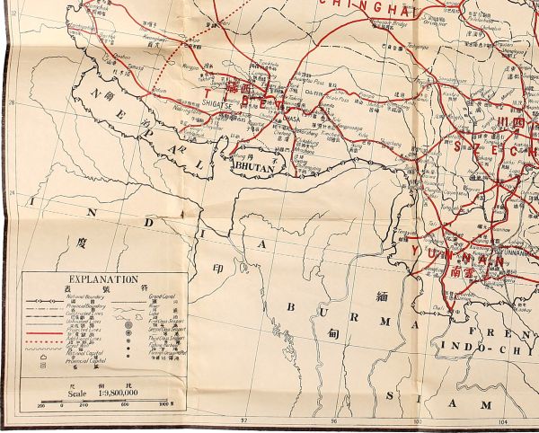
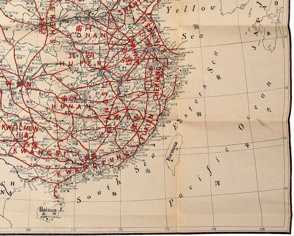
In my first and third programs, I have described my
plans for the Northwestern Railway System and the
Southwestern Railway System. The former is for the
purpose of relieving the congestion of population in the
coast districts and the Yangtze Valley by opening up
for colonization the vast unpopulated territory in
Mongolia and Sinkiang, as well as of developing the
Great Northern Port. The latter is for the purpose of
exploiting the mineral resources of Southwestern
China, as well as of developing the Great Southern
Port—Canton. More railroads will be needed for the
adequate development of the whole country. So in this
fourth program, I shall deal entirely with railroads
which will complete the 100,000 miles proposed in my
introductory part of this International Development
Scheme. The program will be as follows:
I. The Central Railway System.
II. The Southeastern Railway System.
III. The Northeastern Railway System.
IV. The Extension of the Northwestern Railway System.
V. The Highland Railway System.
VI. The Establishment of Locomotive and Car Factories.
This will be the most important railway system in
China. The area which it serves comprises all of China
Proper north of the Yangtze and a part of Mongolia
and Sinkiang. The economic nature of this vast region
is that the southeastern part is densely populated while
the northwestern part is thinly populated, and that the
southeastern part possesses great mineral wealth while
the northwestern part possesses great potential agricultural
resources. So every line of this system will surely
pay as the Peking-Mukden line has proved.
With the Great Eastern Port and the Great Northern
Port as termini of this system of railroads, I propose
that, besides the existing and projected lines in this
region, the following be constructed, all of which shall
constitute the Central Railway System.
- a. The Great Eastern Port-Tarbogotai line.
- b. The Great Eastern Port-Urga line.
- c. The Great Eastern Port-Uliassutai line.
- d. The Nanking-Loyang line.
- e. The Nanking-Hankow line.
- f. The Sian-Tatung line.
- g. The Sian-Ninghsia line.
- h. The Sian-Hankow line.
- i. The Sian-Chungking line.
- j. The Lanchow-Chungking line.
- k. The Ansichow-Iden line.
- l. The Chochiang-Koria line.
- m. The Great Northern Port-Hami line.
- n. The Great Northern Port-Sian line.
- o. The Great Northern Port-Hankow line.
- p. The Hoangho Port-Hankow line.
- q. The Chefoo-Hankow line.
- r. The Haichow-Tsinan line.
- s. The Haichow-Hankow line.
- t. The Haichow-Nanking line.
- u. The Sinyangkang-Hankow line.
- v. The Luszekang-Nanking line.
- w. The Coast line.
- x. The Hwoshan-Kashing line.
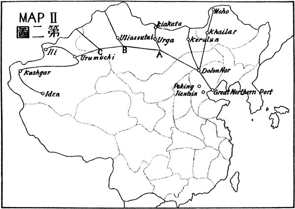
This line begins at the Great Eastern Port on the
seaboard, and runs in a northwesterly direction to
Tarbogotai on the Russian frontier, covering a distance
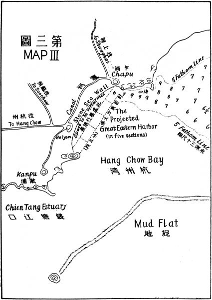
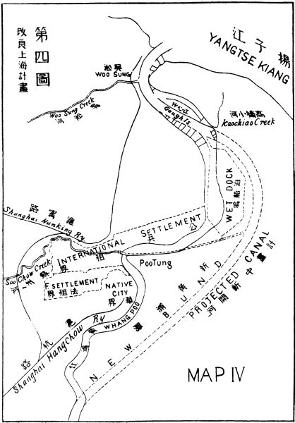
of about 3,000 miles. If Shanghai be the Great
Eastern Port, the Shanghai-Nanking Railway will
form its first section. But if Chapu be chosen, then
this line should skirt the Taihu Lake on the southwest
through the cities of Huchow, Changhing, and Liyang
to Nanking, then crossing the Yangtze at a point south
of Nanking, to Chiantsiao and Tingyuen. Thence, the
line turns westward to Showchow and Yingshang, and
enters Honan province at Sintsai. After crossing the
Peking-Hankow line at Kioshan, and passing Piyang,
Tanghsien, and Tengchow, it turns northwestward to
Sichwan and Kingtsekwan, and enters the province of
Shensi. Ascending the Tan Kiang Valley, it passes
through Lungkucha and Shangchow, and crosses the
Tsinling Pass to Lantien and Sian, the capital of
Shensi, formerly the capital of China. From Sian, it
goes westward, following the valley of the Weiho. It
passes through Chowchih, Meihsien, and Paoki and
enters the province of Kansu at Sancha, thence proceeding
to Tsinchow, Kungchang, Titao, and Lanchow, the
capital of Kansu. From Lanchow it follows the old
highway which leads into Liangchow, Kanchow,
Suchow, Yumen, and Ansichow. Thence it crosses the
desert in a northwesterly direction to Hami, where it
turns westward to Turfan. At Turfan this line meets
the Northwestern Railway System and runs on the
latter's track to Urumochi and Manass where it leaves
that track and proceeds northwesterly to Tarbogotai on
the frontier, crossing the Shair Mountain on the way.
This line runs from one end of the country to the other
encountering in its entire length of 3,000 miles only
four mountain passes, all of which are not impassable
for they have been used from time immemorial, as
trade highways of Asia.
This line starts from the Great Eastern Port and uses
the same track as line (a) as far as Tingyuen, the
second city after crossing the Yangtze River at Nanking.
From Tingyuen, its own track begins and the line
proceeds in a northwesterly direction to Hwaiyuan, on
the Hwai River, thence to Mongcheng, Kwoyang, and
Pochow. Turning more northward, it crosses the
Anhwei border into Honan, and passing through
Kweiteh it crosses the Honan border into Shantung.
After passing through Tsaohsien, Tingtao, and Tsaochow,
it crosses the Hoangho and enters Chihli province.
Passing through Kaichow it re-enters Honan to
Changteh, thence it follows the Tsingchangho valley,
in a northwesterly direction, across the Honan border
into Shansi. Here the line enters the northeastern
corner of the vast iron and coal field of Shansi. After
entering Shansi, the line follows the river valley to
Liaochow and Yicheng, and crosses the watershed into
the Tungkwoshui Valley to Yutse and Taiyuan. From
Taiyuan, it proceeds northwestward through another
rich iron and coal field of Shansi to Kolan. Thence, it
turns westward to Poate, where it crosses the Hoangho
to Fuku, in the northeastern corner of Shensi. From
Fuku, the line proceeds northward, cuts through the
Great Wall into the Suiyuan District and crosses the
Hoangho to Saratsi. From Saratsi, the line runs in a
northwesterly direction across the vast prairie to Junction
A of the Northwestern Trunk Line, where it joins
the common track of the Dolon Nor-Urga line to Urga.
This line runs from a thickly populated country at one
end in Central China to the vast thinly populated
but fertile regions of Central Mongolia, having a
distance of about 1,300 miles from Tingyuen to
Junction A.
Starting from the Great Eastern Port, this line follows
line (a) as far as Tingyuen, and line (b) as far
as Pochow. At Pochow, it branches off on its own track
and proceeds westward across the border to Luye, in
Honan. Thence it turns northwestward to Taikang,
Tungsu, and Chungmow where it meets the Hailan line
and runs in the same direction with it to Chengchow,
Jungyang, and Szeshui. From Szeshui it crosses the
Hoangho to Wenhsien, thence to Hwaiking and over
the Honan border into Shansi. It now passes through
Yangcheng, Chinshui, and Fowshan to Pingyang
where it crosses the Fen River and proceeds to Puhsien
and Taning, then westward to the border where it
crosses the Hoangho into Shensi. Thence it proceeds
to Yenchang, and follows the Yenshui Valley to
Yenan, Siaokwan, and Tsingpien. Then running
along the south side of the Great Wall, it enters
Kansu, and crosses the Hoangho to Ninghsia. From
Ninghsia, it proceeds northwestward across the
Alashan Mountain to Tingyuanying at the edge of
the desert. Thence it proceeds in a straight line northwestward
to Junction B of the Northwestern Railway
System, where it joins that system and runs to Uliassutai.
This part of the line passes through desert and
grassland both of which could be improved by irrigation.
The distance of this line from Pochow to
Junction B is 1,800 miles.
This line runs between two former capitals of China,
passes through a very populous and fertile country, and
taps a very rich coal field at the Loyang end. It starts
from Nanking, running on the common track of lines
(a) and (b) and branches off at Hwaiyuan westward
to Taiho. After passing Taiho, it crosses the Anhwei
border into Honan. Thence it runs alongside the left
bank of the Tashaho to Chowkiakow, a large commercial
town. From Chowkiakow, it proceeds to Linying
where it crosses the Peking-Hankow line thence to
Hiangcheng and Yuchow where the rich coal field of
Honan lies. After Yuchow it crosses the Sungshan
watershed to Loyang where it meets the Hailan line
running from east to west. This line is about 300
miles from Hwaiyuan to Loyang.
This line will run alongside the left bank of the
Yangtzekiang, connecting with Kiukiang by a branch
line. It starts on the opposite side of Nanking and goes
southwest to Hochow, Wuweichow and Anking, the
capital of Anwei province. After Anking, it continues
in the same direction to Susung and Hwangmei, where
a branch should be projected to Siaochikow, thence
across the Yangtze River to Kiukiang. After Hwangmei,
the line turns westward to Kwangchi, then northwestward
to Kishui, and finally westward to Hankow.
It covers a distance of about 350 miles through a
comparatively level country.
This line starts from Sian and runs northward to
Sanyuan, Yaochow, Tungkwan, Yichun, Chungpu, Foochow,
Kanchuan, and Yenan, where it meets the Great
Eastern Port-Uliassutai line. From Yenan, it turns
northeastward to Suiteh, Michih, and Kiachow on the
right bank of the Hoangho. Thence it runs along the
same bank to the junction of the Weifen River with
the Hoangho (on the opposite side), where it crosses
the Hoangho to the Weifen Valley and proceeds to
Singhsien and Kolan, there crossing the Great Eastern
Port-Urga line. From Kolan, it proceeds to Wuchai
and Yangfang, where it crosses the Great Wall to Sochow
and then Tatung there meeting the Peking-Suiyuan
line. This line is about 600 miles long. It
passes through the famous oil field in Shensi, and the
northern border of the northwestern Shansi coal field.
At Tatung, where it ends, it joins the Peking-Suiyuan
line and through the section from Tatung to Kalgan it
will connect with the future Northwestern System
which will link Kalgan and Dolon Nor together.
This line will start from Sian in a northwesterly
direction to Kingyanghsien, Shunhwa, and Sanshui.
After Sanshui, it crosses the Shensi border into Kansu
at Chengning and then turns west to Ningchow. From
Ningchow, it follows the Hwan Valley along the left
bank of the river up to Kingyangfu and Hwanhsien,
where it leaves the bank and proceeds to Tsingping and
Pingyuan, where it meets the Hwan River again and
follows that valley up to the watershed. After crossing
the watershed, it proceeds to Lingchow, then across the
Hoangho to Ninghsia. This line covers a distance of
about 400 miles and passes through a rich mineral and
petroleum country.
This is a very important line connecting the richest
portion of the Hoangho Valley with the richest portion
of the central section of the Yangtze Valley. It starts
from Sian on the track of line (a), crosses the Tsingling
and descends the Tankiang Valley as far as
Sichwan. At this point, it branches off southward
across the border into Hupeh, and following the left
bank of the Han River, passes Laohokow to Fencheng,
opposite Siangyang. After Fencheng, it follows continuously
the same bank of the Han River to Anlu,
thence proceeding in a direct line southeastward to
Hanchwan and Hankow. This line is about 300 miles
long.
This line starts from Sian almost directly southward,
crosses the Tsingling Mountain into the Han Valley,
passes through Ningshen, Shihchuan, and Tzeyang,
ascends the Jenho Valley across the southern border of
Shensi into the province of Szechwan at Tachuho.
Then crossing the watershed of the Tapashan into the
Tapingho Valley, it follows that valley down to Suiting
and Chuhsien. Thence it turns to the left side of the
valley to Linshui and follows the trade road to Kiangpeh
and Chungking. The entire distance of this line is
about 450 miles through a very productive region and
rich timber land.
This line starts from Lanchow southwestward and
follows the same route as line (a) as far as Titao.
Thence, it branches off and ascends the Taoho Valley
across the Minshan watershed into the Heishui Valley
following it down to Kiaichow and Pikow. After
Pikow, it crosses the Kansu border into Szechwan and
proceeds to Chaohwa, where the Heishuiho joins the
Kialing. From Chaohwa, it follows the course of the
Kialing River down to Paoning, Shunking, Hochow,
and Chungking. The line is about 600 miles long,
running through a very productive and rich mineral
land.
This line passes through the fertile belt of land
between the Gobi Desert and the Altyntagh Mountain.
Although this strip of land is well watered by numerous
mountain streams yet it is very sparsely populated,
owing to the lack of means of communication. When
this line is completed, this strip of land will be most
valuable to Chinese colonists. The line starts from
Ansichow westward to Tunhwang, and skirts the
southern edge of the Lobnor Swamp to Chochiang.
From Chochiang, it proceeds in the same direction via
Cherchen to Iden where it connects with the terminus
of the Northwestern System. With this System, it
forms a continuous and direct line from the Great
Eastern Port to Kashgar at the extreme west end of
China. This line from Ansichow to Iden is about 800
miles in length.
This line runs across the desert alongside the lower
part of the Tarim River. The land on both sides of the
line is well watered and will be valuable for colonization
as soon as the railroad is completed. This line is about
250 miles in length and connects with the line that runs
along the northern edge of the desert. It is a short cut
between fertile lands on the two sides of the desert.
This line runs from the Great Northern Port in a
northwesterly direction by way of Paoti and Siangho
to Peking. From Peking it runs on the same track
with the Peking-Kalgan Railway to Kalgan, where it
ascends the Mongolian Plateau. Then it follows the
caravan road northwestward to Chintai, Bolutai, Sessy,
and Tolibulyk. From Tolibulyk, it takes a straight line
westward crossing the prairie and desert of both the
Inner and Outer Mongolia to Hami where it connects
with the Great Eastern Port-Tarbogotai line which
runs almost directly west to Urumochi, the capital of
Sinkiang. Thus, it will be the direct line from
Urumochi to Peking and the Great Northern Port.
This line is about 1,500 miles in length, the greater part
of which will run through arable land and so when it
is completed it will form one of the most valuable railways
for colonization.
This line will run westward from the Great Northern
Port to Tientsin. From here it runs southwestward to
Hokien, passing through Tsinghai and Tachen. From
Hokien, it runs more westerly to Shentseh, Wuki, and
Chengting where it joins the Chengtai line as well as
crosses the Kinhan line. From Chengting it takes the
same road as the narrow gauge Chengtai line which
has to be reconstructed into standard gauge so as to
facilitate through trains to Taiyuan and farther on.
From Taiyuan it runs southwestward to Kiaocheng,
Wenshui, Fenchow, Sichow, and Taning. After Taning
it turns westward and crossing the Hoangho, it
turns southwestward to Yichwan, Lochwan, and
Chungpu where it joins the Sian-Tatung line and
runs on the same tracks to Sian. Its length is about
700 miles over very rich and extensive iron, coal, and
petroleum fields, as well as productive agricultural
lands.
This line starts from the Great Northern Port skirting
the coast to Petang, Taku, and Chikow, thence to
Yenshan and crosses the Chili border into Shantung
at Loling. From Loling, it goes to Tehping, Linyi and
Yucheng where it crosses the Tientsin-Pukow line,
proceeds to Tungchang and Fanhsien, and then crosses
the Hoangho to Tsaochow. After Tsaochow it passes
the Shantung border into Honan, crossing the Hailan
line to Suichow. From Suichow it proceeds to Taikang
where it crosses line (c), then to Chenchow and Chowkiakow
where it crosses line (d) and thence to Siangcheng,
Sintsai, Kwangchow, and Kwangshan. After
Kwangshan it crosses the boundary mountain into
Hupeh, passing through Hwangan to Hankow. This
line is about 700 miles long, running from the Great
Northern Port to the commercial center of central
China.
This line starts from the Hoangho Port in a southwesterly
direction to Pohsing, Sincheng, and Changshan,
then across the Kiauchow-Tsinan line to Poshan.
Thence it ascends the watershed into the Wen Valley
to Taian where it crosses the Tientsin-Pukow line to
Ningyang and Tsining. From Tsining it proceeds in a
straight line southwestward to Pochow in Anhwei,
and Sintsai in Honan. At Sintsai it joins the Great
Northern Port-Hankow line to Hankow. The distance
of this line from the Hoangho Port to Sintsai is about
400 miles.
This line starts at Chefoo on the northern side of
the Shantung Peninsula and crosses that Peninsula to
Tsimo, on the southern side, via Laiyang and Kinkiakow.
From Tsimo it proceeds southwestward across
the shallow mud flat at the head of Kiauchow Bay in a
straight line to Chucheng. After Chucheng it crosses
the watershed into the Shuho Valley to Chuchow and
Ichow, then proceeds to Hsuchow where it meets the
Tientsin-Pukow line and the Hailan line. From
Hsuchow it runs on the same track with the Tientsin-Pukow
line as far as Suchow in Anhwei, then branches
off to Mongcheng and Yinchow, and crosses the border
into Honan at Kwangchow, where it meets the Great
Northern Port-Hankow line and proceeds together to
Hankow. This line from Chefoo to Kwangchow is
about 550 miles in length.
This line starts from Haichow following the Linhung
River to Kwantunpu, then turns westward to Ichow.
From Ichow it turns first northward then northwestward,
passing by Mongyin and Sintai to Tai-an. At
Tai-an it joins the Tsinpu line and proceeds in the same
track to Tsinan. This line covers a distance, from
Haichow to Tai-an, of about 110 miles, tapping the
coal and iron fields of southern Shantung.
This line starts at Haichow in a southwesterly direction,
goes to Shuyang and Sutsien, probably in the
same route as the projected Hailan line. From Sutsien
it proceeds to Szechow and Hwaiyuan, where it crosses
the Great Eastern Port Urga and Uliassutai lines.
After Hwaiyuan it goes to Showchow and Chenyangkwan,
thence continuing in the same direction across
the southeastern corner of Honan and the boundary
mountain into Hupeh, proceeds to Macheng and Hankow,
covering a distance of about 400 miles.
This line goes from Haichow southward to Antung
then inclining a little south to Hwaian. After Hwaian
it crosses the Paoying Lake (which will be reclaimed
according to the regulation of the Hwaiho in Part IV,
Program II) to Tienchang and Luho, thence to Nanking.
Distance, about 180 miles.
This line starts from Sinyangkang to Yencheng, then
crossing the Tasung Lake (which will be reclaimed) to
Hwaian. From Hwaian it turns southwestward passing
over the southeastern corner of the Hungtse Lake
(which will also be reclaimed) to Suyi, in Anhwei.
After Suyi, it crosses the Tientsin-Pukow line near
Mingkwang, to Tingyuen, where it meets lines (b) and
(c). After Tingyuen, it proceeds to Lu-an and Hwoshan,
then crosses the boundary mountain into Hupeh
passing through Lotien to Hankow, a distance of about
420 miles.
This line starts at Luszekang, a fishing harbor to be
constructed at the extremity of the northern point of
the Yangtze Estuary. From Luszekang it proceeds
westward to Tungchow where it turns northwestward
to Jukao, and then westward to Taichow, Yangchow,
Luho, and Nanking. This line is about 200 miles long.
This line starts at the Great Northern Port, and follows
the Great Northern Port-Hankow line as far as
Chikow, where it begins its own line. Keeping along
the coast, it crosses the Chili border to the Hoangho
Port, in Shantung, then proceeds to Laichow where it
takes a straight cut away from the coast to Chaoyuan
and Chefoo, thus avoiding the projected Chefoo-Weihsien
line. From Chefoo it proceeds southeastward
through Ninghai to Wenteng, where one branch
runs to Jungcheng and another to Shihtao. The main
line turns southwestward to Haiyang and Kinkiakow,
where it joins the Chefoo-Hankow line, and follows
it as far as the western side of Kiauchow Bay, thence
southward to Lingshanwei. From Lingshanwei the
line proceeds southwestward along the coast to Jichao,
and crosses the Shantung border into Kiangsu, passing
Kanyu to Haichow. Thence it proceeds southeastward
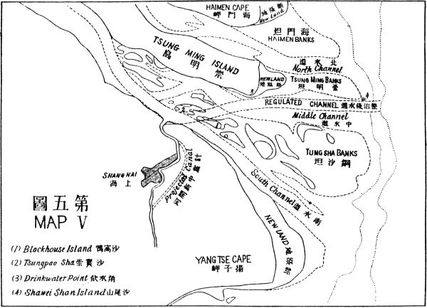
to Yencheng, Tungtai, Tungchow, Haimen, and Tsungming
Island which will be connected with the mainland
by the regulation works of Yangtze embankment.
From Tsungming trains can be ferried over to Shanghai.
This line from Chikow to Tsungming is about
1,000 miles in length.
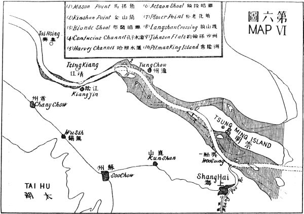
This line starts from Hwoshan to Shucheng and
Wuwei, then across the Yangtze River to Wuhu. After
Wuhu it goes to Kaoshun, Liyang, and Ihing, then
crosses over the northern end of Taihu (which will
be reclaimed) to Soochow, where it meets the Shanghai-Nanking
line. From Soochow it turns southward
to Kashing on the Shanghai-Hangchow line. This
line runs over very populous and rich districts
of Anhwei and Kiangsu provinces, covering a
distance of about 300 miles, which will form the
greater part of the shortest line from Shanghai to
Hankow.
This system covers the irregular triangle which is
formed by the Coast line between the Great Eastern
and the Great Southern Ports, as the base, by the
Yangtze River from Chungking to Shanghai, as one
side, and by line (a) of the Canton-Chungking Railway
as the other side, with Chungking as the apex. This
triangle comprises the provinces of Chekiang, Fukien,
and Kiangsi, and a part respectively of Kiangsu,
Anhwei, Hupeh, Hunan, and Kwangtung. This region
is very rich in mineral and agricultural products, especially
iron and coal deposits which are found everywhere.
And the whole region is thickly populated.
So railway construction will be very remunerative.
With the Great Eastern Port and the Great Southern
Port and the second-and third-class ports that lie
between the two as termini of this system of railroads,
I propose that the following lines be constructed:
- a. The Great Eastern Port-Chungking Line.
- b. The Great Eastern Port-Canton Line.
- c. The Foochow-Chinkiang Line.
- d. The Foochow-Wuchang Line.
- e. The Foochow-Kweilin Line.
- f. The Wenchow-Shenchow Line.
- g. The Amoy-Kienchang Line.
- h. The Amoy-Canton Line.
- i. The Swatow-Changteh Line.
- j. The Nanking-Siuchow Line.
- k. The Nanking-Kaying Line.
- l. The Coast Line between the Great Eastern and Great Southern Ports.
- m. The Kienchang-Yuanchow Line.
This line connects the commercial center of western
China—Chungking—with the Great Eastern Port in
almost a straight route south of the Yangtze River. It
starts from the Great Eastern Port and goes to Hangchow,
then through Linan, Ghanghwa, to Hweichow,
in Anhwei. From Hweichow it proceeds to Siuning
and Kimen, then crosses the border into Kiangsi and
passing Hukow reaches Kiukiang. From Kiukiang it
follows the right bank of the Yangtze, crosses the
Hupeh border to Hingkwochow and then proceeds to
Tungshan and Tsungyang, where it passes over the
border to Yochow in Hunan. From Yochow it takes
a straight line across the Tungting Lake (which will
be reclaimed) to Changteh. From Changteh it proceeds
up the Liu Shui Valley, passing through Tzeli,
and crossing the Hunan border to Hofeng, in Hupeh
and then to Shinan and Lichwan. At Shinan a branch
should be projected northeastward to Ichang, and at
Lichwan another branch should be projected northwestward
to Wanhsien, both on the left side of the Yangtze
River. After Lichwan it crosses the Hupeh border
into Szechwan, passing Shihchu to Foochow, then
passes the Wukiang and proceeds along the right side
of the Yangtze River as far as lines (a) and (b) of the
Canton-Chungking Railway and then crosses together
on the same bridge to Chungking on the other side
of the river. The length of this line including branches,
is about 1,200 miles.
This is a straight line from one first-class seaport to
another. It starts from the Great Eastern Port and
goes to Hangchow, then turning southwestward, follows
the left bank of the Tsien Tang River through
Fuyang, Tunglu to Yenchow and Chuchow. Then it
proceeds across the Chekiang-Kiangsi border to
Kwangsin. From Kwangsin it goes through Shangtsing
and Kinki to Kienchang, then proceeds to Nanfeng,
Kwangchang, and Ningtu. After Ningtu it
proceeds to Yutu, Sinfeng, Lungnan, and crossing the
boundary mountain of Kiangsi and Kwangtung, to
Changning. Thence via Tsungfa it goes to Canton,
covering a distance of about 900 miles.
This line starts from Foochow, goes by way of
Loyuan and Ningteh to Fuan, and then proceeds across
the Fukien-Chekiang border to Taishun, Kingning,
Yunho, and Chuchow. Thence it proceeds to Wuyi,
Yiwu, Chukih, and Hangchow. After Hangchow it
goes to Tehtsing and Huchow and then crosses the
Chekiang border into Kiangsu. Then it proceeds by
way of Ihing, Kintan, and Tanyang to Chinkiang. This
line is about 550 miles in length.
This line starts from Foochow and following the
left bank of the Min River and passing Shuikow and
Yenping reaches Shaowu. After Shaowu, it proceeds
across the Fukien border into Kiangsi and then passes
through Kienchang and Fuchow to Nanchang, the
capital of Kiangsi. From Nanchang it proceeds to
Hingkwo, in Hupeh, and passes on to Wuchang, the
capital of Hupeh. It covers a distance of about 550
miles.
This line starts from Foochow, crosses the Min
River and proceeds by way of Yungfu, Tatien, Ningyang,
and Liencheng to Tingchow. Thence it crosses
the Fukien-Kiangsi border to Shuikin. From Shuikin
it proceeds to Yutu and Kanchow and then to Shangyiu
and Chungyi. After Chungyi it crosses the
Kiangsi-Hunan border to Kweiyanghsien and Chenchow,
where it crosses the Canton-Hankow line to
Kweiyangchow. Thence it continues to Sintien, Ningyuan,
and Taochow, where it meets lines (a) and (b)
of the Canton-Chungking Railway. After Taochow it
turns southward following the Taoho Valley to the
Kwangsi border and then crossing it, proceeds to
Kweilin. This line covers a distance of about 750
miles.
This line begins from the new Wenchow Port and
follows the left bank of the Wukiang as far as Tsingtien.
From Tsingtien it proceeds to Chuchow and
Suenping and turns westward across the Chekiang
border to Yushan in Kiangsi. After Yushan it goes to
Tehsing, Loping, and then skirting the southern shore
of Poyang Lake goes through Yukan to Nanchang,
the capital of Kiangsi. From Nanchang it proceeds to
Juichow, Shangkao, and Wantsai, then crosses the
Kiangsi border to Liuyang in Hunan, and Changsha,
the capital of Hunan. After Changsha it goes to Ningsiang,
Anhwa, and Shenchow where it connects with
line (a) of the Canton-Chungking Railway, and with
the Shasi-Singyi line. This line covers a distance of
about 850 miles.
This line starts from the new port of Amoy and
goes to Changtai, then following the Kiulungkiang to
Changping, Ningyang, Tsingliu, and Kienning. After
Kienning it proceeds across the Kiangsi border to
Kienchang, where it connects with the Great Eastern
Port-Canton line, the Foochow-Wuchang line, and the
Kienchang-Yuanchow line. This line covers a distance
of about 250 miles.
This line starts at the new port of Amoy, and proceeds
to Changchow, Nantsing, and Siayang, where it
crosses the Fukien border to Tapu, in Kwangtung.
From Tapu it goes to Tsungkow, Kaying, Hinning,
and Wuhwa. After Wuhwa it crosses the watershed
between the Hankiang and the Tungkiang rivers to
Lungchan, then following the Tungkiang down to Hoyun,
it crosses another watershed to Lungmoon,
Tsengshin and Canton. This line covers a distance of
about 400 miles.
This line starts from Swatow, proceeds to Chaochow,
Kaying, and then crosses the Kwangtung border
to Changning in Kiangsi. From Changning it crosses
the watershed into Kungkiang Valley and follows that
river down to Hweichang and Kanchow. From Kanchow
it proceeds to Lungchuan, Yungning, and
Lienhwa, where it crosses the Kiangsi border into
Hunan. After that, it proceeds to Chuchow and
Changsha, the capital of Hunan. From Changsha it
goes to Ningsiang, Yiyang, and Changteh where it
ends, connecting with the Great Eastern Port-Chungking
line, and the Shasia-Singyi line. This line covers
a distance of about 650 miles.
This line starts from Nanking and runs along the
right bank of the Yangtze to Taiping, Wuhu, Tungling,
Chichow, and Tungliu. After Tungliu it passes over
the Anhwei border into Kiangsi, at Pengtseh, and goes
to Hukow. At Hukow it meets the Great Eastern
Port-Chungking line and crosses the bridge together
with that line to the projected Poyang Port. From the
Poyang Port it runs along the west shore of the Poyang
Lake through Nanking and Wucheng to Nanchang,
where it meets the Wenchow-Shenchow and Foochow-Wuchang
lines. From Nanchang it proceeds up the
Kan Kiang Valley, via Linkiang to Kian, where it
crosses the projected Kienchang-Yuanchow line. After
Kian, it proceeds to Kanchow where it crosses the
Foochow-Kweilin line. Thence it goes to Nankanghsien
and Nanan. After Nanan it crosses the boundary
mountain, Tayuling, into Kwangtung at Nanyung,
thence passes through Chihing to Siuchow, where it
meets the Canton-Hankow line. This line covers a distance
of about 800 miles.
This line starts from Nanking, proceeds to Lishui
and Kaoshun and then crosses the Kiangsu border into
Anhwei at Suencheng. From Suencheng it proceeds to
Ningkwo and Hweichow. After Hweichow it crosses
the Anhwei border into Chekiang, passing through
Kaihwa, Changshan, and Kiangshan, and leaving Chekiang
enters Fukien at Pucheng. From Pucheng it
proceeds via Kienningfu to Yenping where it crosses
the Foochow-Wuchang line and then goes through
Shahsien and Yungan to Ningyang, where it meets the
Foochow-Kweilin and Amoy-Kienchang lines. From
Ningyang it proceeds to Lungyen and Yungting, then
joining the Amoy-Canton line at Tsungkow proceeds
together to Kaying, its terminus. This line runs over
a distance of about 750 miles.
This line starts from the Great Southern Port—Canton—proceeds
in the same direction as the Canton-Kowloon
line as far as Shelung and then goes its own way
following the course of the Tungkiang River to Waichow.
From Waichow it proceeds to Samtochuck,
Haifung, and Lukfung, then turning northeastward
goes to Kityang and Chaochow. After Chaochow it
goes to Jaoping, then crossing the Kwangtung-Fukien
border to Chaoan. Thence it proceeds to Yunsiao,
Changpu, Changchow, and Amoy. From Amoy it
proceeds to Chuanchow, Hinghwa, and Foochow, the
capital of Fukien. After Foochow it proceeds in the
same direction as the Foochow-Chinkiang line, as far
as Fuan, then turns eastward to Funing, and northward
to Futing. After Futing it crosses the Fukien
border into Chekiang and proceeds through Pingyang
to Wenchow. At Wenchow it crosses the Wukiang
and proceeds to Lotsing, Hwangyen, and Taichow.
Thence, it proceeds through Ninghai to Ningpo, its
own terminus, where it connects with the Ningpo-Hangchow
line, thus linking it up with the Great
Eastern Port via Hangchow. This line covers a distance
from Canton to Ningpo of about 1,100 miles.
This line starts from Kienchang and runs through
Yihwang, Loan, Yungfeng, and Kishui to Kian, where
it crosses the Nanking-Siuchow line. After Kian it
proceeds to Yungsin and Lienhwa where it meets the
Swatow-Changteh line. Thence it crosses the Kiangsi
border into Hunan, at Chaling, then through Anjen to
Hengchow where it crosses the Canton-Hankow line.
From Hengchow the line proceeds to Paoking where
it crosses line (a) of the Canton-Chungking Railway
then westward to Yuanchow, its terminus, where it
joins with the Shasi-Singyi line. This line covers a
distance of about 550 miles. The total length of this
Southeastern Railway System is about 9,000 miles.
This system will cover the whole of Manchuria, a
part of Mongolia, and a part of Chihli province—an
area of nearly 500,000 square miles, with a population
of 25,000,000. This region is surrounded by mountains
on three sides and opens on the south to the Liaotung
Gulf. Amidst these three mountain ranges lies
a vast and fertile plain drained by three rivers—the
Nonni on the north, the Sungari on the northeast, and
the Liaoho on the south. This part of China was once
regarded as a desert, but since the completion of the
Chinese Eastern Railway it has been found to be the
most productive soil in China. It supplies the whole of
Japan and a part of China with nitrogenous food in
the form of soya bean. This bean, the wonderful
properties of which were early discovered by the Chinese,
contains the richest nitrogenous substance among
vegetables and has been used as a meat substitute for
many thousand years. Vegetable milk is extracted
from this bean, and from this milk various kinds of
preparations are made. The extraction from this bean
has been proved by modern chemists to be richer than
any kind of meat. The Chinese and the Japanese have
used this kind of artificial meat and milk from time
immemorial. Recently food administrators in Europe
and America have paid great attention to this meat
substitute, while the export of soya bean to Europe
and America has steadily increased. This Manchu-Mongolian
plain is destined to be the source of the
world's supply of soya bean. Besides soya bean, this
plain also produces a great quantity of various kinds
of grains, and supplies the entire Eastern Siberia with
wheat. The Manchurian mountains are exceedingly
rich in timber and minerals—gold being especially
found in great quantities in many localities.
Railway construction in this region has proved to be
a most profitable undertaking. At present there are
already three railway systems tapping this rich country,
viz., the Peking-Mukden line, the best paying railroad
in China, the Japanese South-Manchurian Railway,
also a very remunerative line, and the Chinese Eastern
Railway, the best paying portion of the whole Siberian
system. Besides these, there are many lines projected
by the Japanese. In order to develop this rich region
properly a network of railways should be projected.
Before dealing with the separate lines of this network
of railways, I should like to propose a center for
them, just as the spider's nest is to a cobweb. I shall
name this central city "Tungchin," the Eastern Mart,
which should be situated at a point southwest of the
junction of the Sungari and Nonni rivers, about 110
miles west by south from Harbin, and will be in a
more advantageous position than the latter. This new
city will be the center not only of the railway system but
also of the inland water communication when the
Liaoho-Sungari Canal is completed.
With the projected city of Tungchin as a center, I
propose the following lines:
- a. The Tungchin-Hulutao line.
- b. The Tungchin-Great Northern Port line.
- c. The Tungchin-Dolon Nor line.
- d. The Tungchin-Kerulen line
- e. The Tungchin-Moho line.
- f. The Tungchin-Korfen line.
- g. The Tungchin-Yaoho line.
- h. The Tungchin-Yenchi line.
- i. The Tungchin-Changpeh line.
- j. The Hulutao-Jehol-Peking line.
- k. The Hulutao-Kerulen line.
- l. The Hulutao-Hailar line.
- m. The Hulutao-Antung line.
- n. The Moho-Suiyuan line.
- o. The Huma-Chilalin or Shihwei line.
- p. The Ussuri-Tumen-Yalu-Coast line.
- q. The Linkiang-Dolon Nor line.
- r. The Chikatobo-Sansing or Ilan line.
- s. The Sansing or Ilan-Kirin line.
- t. The Kirin-Dolon Nor line.
This is the first line that radiates from this projected
Manchurian railway center, and is the shorter of the
two direct lines that lead to the ice-free ports on the
Liaotung-Chihli Gulf. It runs almost parallel to the
South Manchurian Railway, the distance between the
two lines being about 80 miles at the northern end, converging
to 40 miles at Sinmin, and diverging again
after that point. According to the original agreement
with the former Russian Government, no parallel line
within 100 miles was allowed to be built. But such
restriction must be abolished under this new International
Development Scheme for the benefit of all concerned.
This line starts from Tungchin, and proceeds
southward across the vast Manchurian plain by Changling,
Shuangshan, Liaoyuan, and Kangping, to Sinmin
in a straight line covering a distance of about 270 miles.
After Sinmin, the line joins the Peking-Mukden Railway
and runs on the same track for a distance of
about 130 miles to Hulutao.
This line is the second that radiates from this railway
center direct to a deep water ice-free seaport. It
starts from Tungchin, proceeding in a southwesterly
direction, passes Kwangan, midway between Tungchin
and the West Liaoho, and many other small settlements
before it crosses the Liaoho. After crossing the
Liaoho, it enters the mountainous regions of the Jehol
district by a valley to Fowsin, a hsien city, and crosses
the watershed into the Talingho Valley. After passing
through the Talingho Valley, the line crosses
another watershed into the Luan Valley by a branch of
the same river. Then it penetrates the Great Wall and
proceeds to the Great Northern Port by way of Yungping
and Loting. The whole length of this line is
about 550 miles, the first half of which is on level
land and the second half in mountainous country.
This is the third line that radiates from the railway
center and proceeds nearly in a westerly direction across
the plain to Taonan where it crosses the projected
Aigun-Jehol line (Japanese), and also meets the termini
of two other projected lines, the Changchun-Taonan
and the Tsengkiatun-Taonan (Japanese). After
Taonan, the line turns more southward by skirting
along the foothills of the southeastern side of the
Great Khingan range where vast virgin forests and
rich minerals are found. Then it passes through the
upper Liaoho Valley formed by the Great Khingan
Mountain on the north, and the Jehol Mountain on the
south and through the towns of Linsi and Kingpang
to Dolon Nor, where it meets the trunk line of the
Northwestern Railway system. This line covers a
distance of about 480 miles, a greater part of which
is on level land.
This is the fourth line that radiates from the Tungchin
Railway center. It runs in a northwesterly direction
almost parallel with the Harbin-Manchuli line of
the Chinese Eastern Railway, the distance between the
two lines varying from 100 to 130 miles. The line
starts from Tungchin on the north side of the junction
of the Nonni and Sungari rivers and proceeds westward
across the Nonni River to Talai, and then turns
northwestward across the plain into the valley of the
north branch of the Guileli River. After entering the
valley, it follows the stream up to its source, then
crosses the Great Khingan Mountain watershed into the
Mongolian Plain by the Khalka River, and follows the
right bank of this river to the north end of Bor Nor
Lake. Thence it turns directly westward to the Kerulen
River, and follows the south bank of the river to
Kerulen. This line covers a distance of about 630
miles.
This is the fifth line that radiates from this railway
center. It starts from the north side of the junction
of the Nonni and Sungari rivers, and proceeds northwestward
across the northern end of the Great Manchurian
Plain to Tsitsiha. At Tsitsiha, it joins the
projected Kinchow-Aigun line and proceeds together
northwestward alongside the left bank of the Nonni
River as far as Nunkiang where it separates from the
other. Thence it resumes the northwesterly direction
and proceeds into the upper Nonni Valley until the
headwater is reached. Then it crosses the northern
extremity of the Great Khingan Range to Moho,
where it joins the terminus of the Dolon Nor-Moho
line. This line is about 600 miles long. About a
quarter of this length runs on the plain, the second
quarter runs along the lower Nonni Valley, the third
along the Upper Valley, and the fourth runs in mountainous
but gold-bearing regions, where only physical
difficulties are to be expected.
This is the sixth line from the railway center. It
also starts on the northern side of the Nonni-Sungari
junction, and proceeds across the plain by the cities
Chaotung and Tsingkang. After Tsingkang it crosses
the Tungkun River, proceeds to Hailun, and then,
ascending the Tungkun Valley, crosses the watershed
of the Little Khingan Mountain. Thence it descends
into the Korfen Valley and proceeds by Chelu to
Korfen on the right bank of the Amur River. This
line covers a distance of 350 miles, two thirds of which
run on comparatively level land and one third in mountainous
district. This is the shortest line from Tungchin
to the Amur River and the Russian territory on
yonder side.
This is the seventh line that radiates from this railway
center. It starts from the northern side of the
Nonni-Sungari junction and traverses the plain on the
left of the Sungari River by Chaochow, then crosses
the Chinese Eastern Railway, and the Hulan River to
Hulan. After Hulan, it proceeds to Payen, Mulan,
and Tungho, then crosses the Sungari River to Sansing,
now called Ilan. Thence it proceeds into the
Wokan Valley and crosses the watershed by Chihsingshitse
and Takokai into the Noloho Valley and passing
by various villages and towns along this river to
Yaohohsien, ends at the junction of the Noloho and
the Ussuri River. This line covers a distance of 500
miles in very fertile country.
This is the eighth line that radiates from this railway
center. It starts from the eastern side of the Nonni-Sungari
junction and proceeds in a southeasterly direction
on the right side of the Sungari River to Fuyu
or Petunai and various towns along the road on the
same side of the river until it comes across the Harbin-Talien
Railway, then turns away from the road and
proceeds eastward to Yushu and Wuchang. After
Wuchang, the line turning more southward, proceeds
to Fengtechang and then follows the same direction to
Omu. At Omu, it crosses the Mutan River, then
proceeds to Liangshuichuan and Shehtauho, where it
joins the Japanese Hweining-Kirin line and proceeds
together to Yenchi. This line covers a length of about
330 miles through very rich agricultural and mineral
country.
This is the ninth line that radiates from the Tungchin
railway center. It starts from the south side of
the Nonni-Sungari junction and proceeds in a southeasterly
direction across the plain to Nungan. After
Nungan, it crosses the Itung River and proceeds continuously
in the same direction across several branches
of the same river to Kiudaichan, where it joins the
Changchun-Kirin line and proceeds together as far as
Kirin. After Kirin, it goes its own way following the
right bank of the Sungari River in a southeasterly
direction to the junction of Lafaho River and turns
southward along the same bank of the Sungari to
Huatien. After Huatien, it continues in the same
course up to Toutaokiang, as far as Fusung, then turns
southeastward into the Sunghsiangho Valley and
proceeds upward to the Changpeh Shan watershed by
skirting the south side of the Celestial Lake, then turns
southward following the Aikiang River to Changpeh
on the Korean frontier. This line covers a distance
of about 330 miles. Some great difficulties are to be
overcome in the last portion of the line where it crosses
the Changpeh watershed.
With this line I shall begin to deal with a new group
of the Northeastern Railway System which will make
Hulutao, the ice-free port on the Liaotung Gulf as
their center and terminus. This, the first line, starts
from Hulutao and proceeds westward up the Shaho
Valley to Sintaipienmen. Thence it crosses the mountainous
district through Haiting, Mangniuyingtse, and
Sanshihkiatse to Pingchuan, and continues in the same
direction to Jehol or Chengteh. After Jehol, it
proceeds by the old imperial highway to Lwanping,
then turns southwestward to Kupehkow where it
penetrates the Great Wall. Thence it follows the same
highway through Miyun and Shunyi to Peking. This
line covers a distance of about 270 miles.
This is the second line of the Hulutao radiation. It
starts from this seaport and proceeds northward
through the mountainous region of Jehol by Kienping
and Chihfeng. Thence, the line follows the highway
across the Upper Valley of Liaoho to Chianchang,
Sitoo, Takinkou, and Linsi. After Linsi, it proceeds
up the Lukiako Valley and crosses the watershed at the
southern extremity of the Great Khingan Mountain,
through Kanchumiao and Yufuchih. Then it proceeds
to Payenbolak, Uniket, and Khombukure where
it joins with the Dolon Nor-Kerulen line and proceeds
together to Kerulen. This line up to Khombukure
covers a distance of about 450 miles, tapping a very
rich mineral, timber, and agricultural country.
This, the third line, starts from Hulutao and proceeds
by way of Chinchow along the west side on the
Talingho River to Yichow, where it crosses the
Talingho to Chinghopienmen and Fowsin. After
Fowsin, the line goes northward to Suitung, thence,
crossing the Siliaoho to Kailu, it proceeds between the
Great and Little Fish Lakes to Kinpan and Tachuan.
Then it proceeds across the Great Khingan Mountain
into the Oman Valley and follows the same river to
Hailar. This line covers a distance of about 600 miles
passing through rich mineral and agricultural land and
virgin forests.
This, the fourth line, starts from Hulutao and proceeding
northeastward, follows the course of the
projected Liaoho-Hulutao Canal, and then goes eastward
to Newchwang and Haicheng. From there it
proceeds southeastward to Sinmuchen, where it joins
the Antung-Mukden line and proceeds together to
Antung on the Korean border. This line covers a
distance of about 220 miles. This together with the
Hulutao-Jehol-Peking line will make the shortest line
from Antung and beyond, i.e., Korea, to Peking.
With this as the first I am going to deal with another
group of lines in this system. These will be the
circumferential lines which link up the radii from the
Tungchin center in two semicircles, the outer and the
inner. This Moho-Suiyuan line starts from Moho and
proceeds along the right bank of the Amur River to
Ussuri, Omurh, Panga, Kaikukang, Anlo, and Woshimen.
After this point, the river bends more southward
and the line follows the same bend to Ankan,
Chahayen, Wanghata, and Huma. From Huma, it
proceeds to Sierhkenchi, Chila, Manchutun, Heiho,
and Aigun where it meets the terminus of the Chinchow-Aigun
line. After Aigun, the line turns more
eastward to Homolerhchin, Chilirh, and Korfen where
it meets the terminus of the Tungchin-Korfen line.
Thence it proceeds to Wuyun, Foshan, and Lopeh.
After Lopeh, it goes to Hokang at the junction of the
Amur and Sungari. At this point, the line crosses the
Sungari River to Tungkiang and proceeds to Kaitsingkow,
Otu, and Suiyuan where it ends. This line covers
a distance of 900 miles running all its way through the
gold-producing region.
This is merely a branch of the Moho-Suiyuan line.
It starts from Huma and follows the Kumara River
passing by the Taleitse Gold Mine and Wapalakow
Gold Mine. Then it proceeds up the Kumara River
in a westerly and southwesterly direction to its southern
source and there it crosses the watershed into the
Halarh Valley, thence descending the valley to Chilalin
or Shihwei. This line covers a distance of about 320
miles running in an extremely rich gold district.
This, the second line of the outer semicircle, starts
by continuing the first line at Suiyuan, and proceeds
along the left bank of the Ussuri River, passing
Kaulan, Fuyeu, and Minkang, to Yaoho, where it
meets the terminus of the Tungchin-Yaoho line. From
Yaoho, it runs parallel to the Russian Ussuri Railway
on the east side of the river as far as Fulin. After
Fulin, it parts from the Russian line by turning westward
following the Mulingho River to Mishan on the
northwestern corner of the Hanka Lake. Thence it
goes to Pinganchin, turns southward alongside the
boundary line and crosses the Harbin-Vladivostok
line at Siusuifen Station to Tungning. After Tungning,
it continues the same southward course alongside
the boundary line to a point between Szetaukow
and Wutaukow, then turns westward to Hunchun, and
northwestward to Yenchi where it meets the projected
Japanese Hweining-Kirin line. From Yenchi, it follows
the Japanese line to Holung, and proceeds southwestward
by the left side of the Tumen River across
the watershed into the Yalu Valley, where it meets the
Tungchin-Changpeh line. After Changpeh it turns
westward and northwestward following the right bank
of the Yalu to Linkiang, thence southwestward, still
following the right bank of the Yalu, to Tsianhsien
and then continues in the same direction, along the
Yalu bank, to Antung, where it meets the Antung-Mukden
Railway. After Antung, it proceeds to
Tatungkow at the mouth of the Yalu, thence along
the coast to Takushan and Chwangho, then westward
through Situn and Pingfangtien to join the South
Manchurian Railway at Wukiatun. This line covers
a distance of 1,100 miles, which runs from end to end
right along the southeastern boundary of Manchuria.
This is the third line of the outer semicircle of the
Tungchin railway center, and connects the radiating
lines south of the center. It starts from Linkiang at
the southwestward turn of the Yalu River, and proceeds
across the mountainous region passing by
Tunghwa, Hingking, and Fushun, to Mukden, where
it crosses the South Manchurian Railway. From
Mukden, it goes together with the Peking-Mukden line
as far as Sinmin, where it crosses the Tungchin-Hulutao
line and proceeds northwestward through
Sinlihtun to Fowsin. After Fowsin the line enters the
hilly district of the upper Liaoho Valley, and proceeds
to Chihfeng, after passing through numerous small
villages and camping places in this vast pasture. After
Chihfeng the line proceeds through the Yinho Valley
by Sanchotien, Kungchuling, and Tachientse, to
Famuku, thence follows the Tulakanho to Dolon Nor,
covering a distance of about 500 miles.
This is the first line of the inner semicircle which
connects the radiating lines from the Tungchin railway
center on the northeast. It starts from Chikatobo on
the upper reach of the Amur, and proceeds eastward
and southeastward through many valleys and mountains
of the Great Khingan Range to Nunkiang. After
Nunkiang, it goes in a more southerly direction to
Keshan, thence to Hailun, and then crosses the Sungari
to Sansing or Ilan. This line covers a distance of
about 700 miles, passing through an agricultural and
gold-producing country.
This is the second line of the inner semicircle. It
starts from Sansing and proceeds southwestward along
the right bank of the Mutan River through Tauchan,
Erchan, Sanchan, and Szuchan, to Chengtse where it
crosses the Harbin-Vladivostok line. Then it goes to
Ninguta, after crossing over the Mutan River from
right to the left bank. After Ninguta it proceeds
southwestward passing through Wungcheng, Lanchichan,
Talachan, and Fungwangtien, to Omu. From
Omu it joins the Japanese Hweining-Kirin line and
proceeds westward to Kirin. This line covers a distance
of about 200 miles, along the fertile Mutan
Valley.
This is the third line of the inner semicircle in the
Tungchin system. It starts from Kirin and follows
the old highway westward to Changchun where it
meets the termini of the Chinese Eastern Railway from
the north and the Japanese South Manchurian Railway
from the south. After Changchun, it proceeds across
the plain to Shuangshan where it meets the Tungchin-Hulutao
line and the Japanese Szupingkai-Chengkiatun-Taonan
line. From Shuangshan, it crosses the
Liao River to Liaoyuan, thence it traverses the vast
plain, crossing the Tungchin-Great Northern Port line
and goes to Suitung where it meets the Hulutao-Hailar
line. After Suitung, it proceeds up the Liao Valley
where it comes across the Hulutao-Kerulen line and
then crosses the watershed to Dolon Nor where it ends.
This line covers a distance of 500 miles. This completes
the cobweb system of the projected North-Eastern
Railway. The total length of this entire
system is about 9,000 miles.
The Northwestern Railway System covers the region
of Mongolia, Sinkiang, and a part of Kansu, an
area of 1,700,000 square miles. This territory exceeds
the area of the Argentine Republic by 600,000 square
miles. Argentina is now the greatest source of the
world's meat supply, while the Mongolian pasture is
not yet developed, owing to the lack of transportation
facilities. As Argentina has superseded the United
States in supplying the world with meat, so the Mongolian
pasture will some day take the place of
Argentina, when railways are developed and cattle
raising is scientifically improved. Thus the construction
of railroads in this vast food-producing region is
an urgent necessity as a means of relieving the world
from food shortage. In the first program of this
International Development Scheme, I proposed 7,000
miles of railways for this vast and fertile region, for the
purpose of developing the Great Northern Port, and
relieving the congested population of southeastern
China. But this 7,000 miles of railways form merely
a pioneer line. In order to develop this virgin continent
properly, more railways have to be constructed.
Therefore in this plan, namely, the Extension of the
Northwestern Railway System, I propose the following
lines:
- a. The Dolon Nor-Kiakata line.
- b. The Kalgan-Urga-Tannu Ola line.
- c. The Suiyuan-Uliassutai-Kobdo line.
- d. The Tsingpien-Tannu Ola line.
- e. The Suchow-Kobdo line.
- f. The Northwestern Frontier line.
- g. The Tihwa or Urumochi-Ulankom line.
- h. The Gaskhiun-Tannu Ola line.
- i. The Uliassutai-Kiakata line.
- j. The Chensi or Barkul-Urga line.
- k. The Suchow-Urga line.
- l. The Desert Junction-Kerulen line.
- m. The Khobor-Kerulen-Chikatobo line.
- n. The Wuyuan-Taonan line.
- o. The Wuyuan-Dolon Nor line.
- p. The Yenki-Ili line.
- q. The Ili-Hotien line.
- r. The Chensi-Kashgar line and its branches.
This line starts from Dolon Nor and proceeds in a
northwesterly direction, following the caravan road
across the vast pasture to Khorkho, Kuoto, and
Suliehto. After Suliehto, it crosses the boundary line
into Outer Mongolia by the same road to Khoshentun,
Lukuchelu, and Yangto. Thence it crosses the Kerulen
River to Otukunkholato, and enters the hilly region
where it crosses the Kerulen watershed and the Chikoi
watershed. The water from the Kerulen watershed
flows into the Amur, and thence into the Pacific Ocean,
while the water from the Chikoi watershed flows into
Lake Baikal, and thence to the Arctic Ocean. After
crossing the Chikoi watershed, it follows a branch of
the Chikoi River to Kiakata. This line covers a distance
of about 800 miles.
This line starts from Kalgan at the Great Wall, and
proceeds northwestward up the plateau, crosses a range
of hills into the Mongolian prairie, and goes to
Mingan, Boroldshi, Ude, and Khobor, where it crosses
the Dolon Nor-Urumochi trunk line. After Khobor,
it proceeds across the vast and rich pasture of Mubulan,
then proceeds in a straight line through Mukata and
Nalaiha to Urga. From Urga, it goes into the hilly
district crossing Selenga Valley to a point opposite the
southern end of Lake Kos Gol, and then turns northward
across a range of mountains to Khatkhyl on the
southern shore of Kos Gol. After Khatkhyl, it skirts
Kos Gol Lake along the western shore for some distance,
then turns northwestward and westward, following
the course of the Khua Kem River to a point near
its exit at the frontier line, then turns southwestward
up the Kemtshik Valley to its headwater, passes
through Pakuoshwo, and ends at the boundary line
between the Russian and Chinese territories. This line
covers a distance of about 1,700 miles.
This line starts from Suiyuan in the northwestern
corner of Shansi, and proceeds in a northwesterly
direction across the hilly country into the Mongolian
pasture to Tolibulyk, where it crosses the Great Northern
Port-Hami line, and the Great Eastern Port-Urga
line. After Tolibulyk, it proceeds in a straight line in
the same direction passing through Barunsudshi to the
capital of Tuchetu. Thence it continues in the same
straight line northwestward to Gorida. After Gorida,
it follows the caravan road to Kolitikolik where it
crosses the Great Northern Port-Urumochi trunk
line. From Kolitikolik, the line turns northwestward,
then westward and proceeds across many streams and
valleys and passes by many small towns to Uliassutai.
At Uliassutai, it crosses the B. Junction-Frontier
branch of the Great Eastern Port-Urumochi line.
After Uliassutai, the line proceeds westward following
the trade road, passes through Khuduku, Bogu,
Durganor, and Sakhibuluk to Kobdo. Thence the line
turns northwestward to Khonga, Ukha, and Clegei,
then westward to Beleu and ends at the frontier. This
line is about 1,500 miles long.
This line starts from Tsingpien at the Great Wall,
on the northern border of Shensi, proceeds through the
Ordos country by Bonobalgasun, Orto, and Shinchao,
and then crosses the Hoangho to Santaoho. From
Santaoho, it proceeds across Charanarinula Mountain
into Mongolian prairie in a northwesterly direction to
Kurbansihata where it crosses the Peking-Hami line,
then it goes to Unikuto and Enkin, where it crosses
the Great Northern Port-Urumochi line. After Enkin,
the line enters into a valley and watered district, proceeds
northward to Karakorum, and then turns northwestward
across various streams and valleys of the
tributary of the Selenga River by Sabokatai and
Tsulimiau. After Tsulimiau, it proceeds in the same
direction across the Selenga River, follows its branch,
the Telgir Morin River, up to its source and crosses
the watershed into Lake Teri Nor. Then it follows
the outlet of the Teri Nor to the Khua Kem River,
where it ends by joining the Kalgan Urga-Tannu Ola
line. This line covers a distance of about 1,200 miles.
This line starts from Suchow in a northwesterly
direction penetrating the Great Wall at Chiennew, and
proceeds to the coal field, about 150 miles from Suchow.
Then it goes to Habirhaubuluk and Ilatoli. A
short way from this place the line comes across the
Peking-Hami line and then proceeds to Balaktai.
After this the line passes a bit of pure desert to Timenchi.
After entering the hilly and watered country
it proceeds to Gaskhiu where it crosses the Great
Northern Port-Urumochi trunk line. After Gaskhiun,
it proceeds to Wolanhutok, Tabateng, and Tabutu
where it joins the Kucheng and Kobdo highway and
following it, proceeds to Kobdo, through Batokuntai
and Sutai. Here the line ends, covering a distance of
about 700 miles.
This line starts from Ili following the Urumochi-Ili
line to Santai, on the eastern side of Zairam Lake, then
proceeds northeastward by itself to Tuszusai on the
west side of Ebi Lake. After Tuszusai it proceeds to
Toli where it crosses the Central Trunk line, that is,
the Great Eastern Port-Tarbogotai line. Thence it
goes to Namukotai and Stolokaitai by passing through
a vast forest and a rich coal field. From Stolokaitai,
the line follows the highway and proceeds to Chenghwaszu,
the capital of Altai province. Thence it
crosses a mountain range by the Urmocaitu Pass into
the Kobdo Valley, and follows the course of the Kobdo
River to Beleu where it joins the Suiyuan-Kobdo line
and proceeds to Clegei. From Clegei, it proceeds by
itself to Tabtu via Usungola and Ulamkom. At Tabtu,
it joins the other line again and proceeds together to
the Khua Kem River in the Tannu Ola district. It
then turns eastward ascending the river to the junction
of the Bei Kem and Khua Kem rivers, then starts again
on its own course, following the former river and proceeds
up to its source in a northeasterly direction ending
at the frontier. This line covers a distance of about
900 miles.
This line starts from Tihwa following the Dolon
Nor trunk line to Fowkang, then proceeds by its own
route almost northward through Chipichuan to Khorchute.
From Khorchute, it turns northeastward and
proceeds across a hilly district to Kaiche, then to
Turhuta, where it crosses a branch line from Junction
C. of the Great Northern Port-Urumochi line. After
Turhuta, it turns northward, proceeds up the Pakaningale
Valley to Zehoshita, and then crosses the Tilikta
Pass. Thence it turns northeastward proceeding
across the newly cultivated country to Kobdo. After
Kobdo, it proceeds through a fertile plateau, by crossing
many rivers and skirting many lakes to Ulankom,
where it ends by joining the Northwestern Frontier
line. It covers a distance of about 550 miles.
This line starts from Gaskhiun and proceeds northeastward
across a hilly and watered country through
Hatonhutuk and Talangjoleu, to Pornulu. After
Pornulu, the line proceeds across the Sapkhyn Valley
by Huchirtu and Porkho to Uliassutai where it meets
the Suiyuan-Kobdo, and the Great Eastern Port-Uliassutai
lines. After Uliassutai, the line proceeds northward
to a quite new country by first crossing the headwaters
of Selenga, then the headwaters of the Tess
River. In the Tess Valley the line crosses a vast virgin
forest. After emerging from this forest it proceeds
northwestward across the watershed into the Khua
Kem Valley in Tannu Ola and ends by joining the
Northwestern Frontier line. This line covers a distance
of about 650 miles.
This line starts from Uliassutai and runs on the
track of the Gaskhiun-Tannu Ola line, until it reaches
the Eder River, a branch of the Selenga. Then, turning
off eastward, it begins its own course and proceeds
downward following the course of the Eder River,
crossing the Tsingpien-Tannu Ola line, to the junction
of this river with the Selenga. There it joins the
Kalgan-Urga-Tannu Ola line and proceeds together
eastward in the common track for some distance until
the other line turns southeastward, when this line turns
northeastward following the Selenga down to Kiakata.
This line covers a distance of about 550 miles, running
through a fertile valley.
This line starts from Chensi or Barkul and proceeds
northeastward across a cultivated region through Tutaku
to Urkesiat. After Urkesiat, it crosses the Suchow-Kobdo
line, then traverses the vast pasture on
the north side of the Gobi Desert to Suchi and Dalantura.
Thence it turns more northward across the Great
Eastern Port-Uliassutai line, and the Dolon Nor-Urumochi
line to Tashunhutuk. After this point the line
crosses the Suiyuan-Uliassutai line at Ologai and
proceeds over the watershed into the Selenga Valley
where it crosses the Tsingpien-Tannu Ola line at
Sabokatai. From here it turns eastward across a hilly
and watered region to Urga. This line covers a distance
of about 800 miles.
This line starts from Suchow and proceeds by Kinta
to Maumu, and then follows the Taoho or Edsina
River, which waters this strip of oasis, to the lakes.
Thence it crosses the Gobi Desert, where it meets the
crossing lines of the Peking-Hami and the Great Eastern
Port-Uliassutai railways and with them forms a
common junction. From this junction it proceeds
across desert and pasture lands to another railway
crossing which is formed by the Suiyuan-Kobdo and
Tsingpien-Tannu Ola lines, also forming a common
junction together. Thence it proceeds into pasture
land through Hatengtu and Tolik to Sanintalai, where
it crosses the Dolon Nor-Urumochi line. After Sanintalai,
the line proceeds through Ulanhoshih and many
other small towns and encampments to Urga. This
line covers a distance of about 700 miles. One third
of this length is through the desert and the other two
thirds through watered pasture land.
This line starts from the Desert Junction, proceeds
northeastward to the postural land and crosses the
Tsingpien-Tannu Ola line south of Ulan Nor Lake.
Thence it proceeds to the Tuchetu Capital where it
crosses the Suiyuan-Kobdo line. After the Tuchetu
Capital it goes across a pasture to Junction A. From
Junction A. it proceeds to Ulanhutuk and Chientingche,
then crosses the Kalgan-Tannu Ola line to Zesenkhana.
From Zesenkhana, the line follows the course of the
Kerulen River down in a northeasterly direction to the
city of Kerulen, where it crosses the Dolon Nor-Kerulen
line, and meets the Kerulen-Tungchin line. This line
covers a distance of about 800 miles.
This line starts from Khobor, the crossing junction
of the Dolon Nor-Urumochi, and the Kalgan-Urga-Tannu
Ola lines, and proceeds northeastward across a
vast pasture to Khoshentun, where it crosses the Dolon
Nor-Kiakata line. After Khoshentun, it proceeds in
the same direction across a similar pasture to Kerulen,
where it crosses the Dolon Nor-Kerulen line. Then it
proceeds first along the right bank of the Kerulen
River, then crosses to the left side, and passes along
the northwestern side of Hulan Lake. After Hulan
Lake, the line crosses the Chinese Eastern Railway, and
the Arguna River, then proceeds along the right bank
of the river to Chikatobo, where the line ends by joining
the Dolon Nor-Moho and the Chikatobo-Sansing
lines. This line covers a distance of about 600 miles.
The first half of it runs on dry land and the second
half on watered land.
This line starts from Wuyuan at the northwest bend
of the Hoangho and proceeds northeastward across the
Sheiten Ula Mountain and pasture to Tolibulyk, where
it meets the crossing junction of three lines—the Peking-Hami
line, the Suiyuan-Kobdo line, and the Great
Eastern Port-Urga line. From Tolibulyk the line proceeds
continuously in the same direction across a
pasture to Khobor where it meets the crossing junction
of the Dolon Nor-Urumochi and the Peking-Urga lines,
and also the terminus of the Khobor-Kerulen line.
After Khobor the line turns more eastward and runs
across the Dolon Nor-Kiakata line midway to Khombukure,
where it crosses the Dolon Nor-Kerulen and
the Hulutao-Kerulen lines. From Khombukure the
line proceeds to Dakmusuma, where it crosses the
Dolon Nor-Moho line. Thence it goes eastward across
the Great Khingan Mountain to Tuchuan, then turns
southeastward to Taonan, where it ends. This line
covers a distance of about 900 miles.
This line starts from Wuyuan and proceeds northeastward
across the Sheiten Ula Mountain to Maomingan,
where it crosses the Great Eastern Port-Urga line.
Then it proceeds across the vast pasture and the Suiyuan-Kobdo
line to Bombotu, where it passes over the
Peking-Hami line. After Bombotu, the line turns eastward
and proceeds across the Kalgan-Urga-Tannu
Ola line, then goes to Dolon Nor, where it ends by
joining the Dolon Nor-Mukden-Linkiang line, which
forms a direct route from the upper Hoangho Valley
to the rich Liaoho Valley. This line covers a distance
of about 500 miles.
This line starts from Yenki or Karashar, and proceeds
northwestward across the mountain pass into
the Ili Valley. It then follows the Kunges River downward,
in a westerly direction, traversing a most fertile
valley, to Ining and Kuldja or Ili, the principal city
of the Ili district near the Russian border, where it
joins the Ili-Urumochi line. This line covers a distance
of about 400 miles.
This line starts from Ili or Kuldja, proceeds southward
across the Ili River, then eastward along the left
side of the river and then southeastward and southward
to Bordai. From here it turns southwestward
into Tekes Valley and proceeding upward crosses the
Tekes River to Tienchiao and then ascends the mountain
pass. After the mountain pass the line turns southeastward,
traverses a vast coal field and then turns
southwestward to Shamudai, where it crosses the Turfan-Kashgar
line. From Shamudai it turns southward
across the fertile zone of the north side of the Tarim
Valley, to Bastutakelak. Then it proceeds southwestward
to Hotien passing by on the way many small
settlements in the fertile zone of the Hotien River
which flows across the desert. At Hotien the line meets
the Kashgar-Iden line. After Hotien the line proceeds
upward to the highland south of the city and ends at
the frontier. This line covers a distance of about 700
miles.
This line starts from Chensi and proceeds southwestward
along the Tienshan pasture through Yenanpoa,
Shihkialoong, and Taolaitse to Chikoching, then
along the Tienshan forest through Wutungkwo, Tungyenchi,
Siyenchi, and Olong to Sensien, where it
crosses the Central Trunk line. After Sensien it proceeds
along the northern edge of the Tarim Desert
through Lakesun City and Shehchuan to Hora, where
it crosses the Cherchen-Koria line. From Hora the line
proceeds along the course of the Tarim River, passing
by many new settlements, fertile regions, and virgin
forests, to Bastutakelak, where it crosses the Ili-Hotien
line. Thence it goes through Pachu to Kashgar where
it meets the Urumochi-Iden line. After Kashgar it proceeds
northwestward to the frontier where it ends.
Attached to this line are two branches. The first branch
proceeds from Hora southwestward through many
oases to Cherchen. The second proceeds from Pachu
southwestward along the Yarkand River to Sache and
then westward to Puli near the frontier. This line
including the branches covers a distance of about 1,600
miles. The total length of this entire system is about
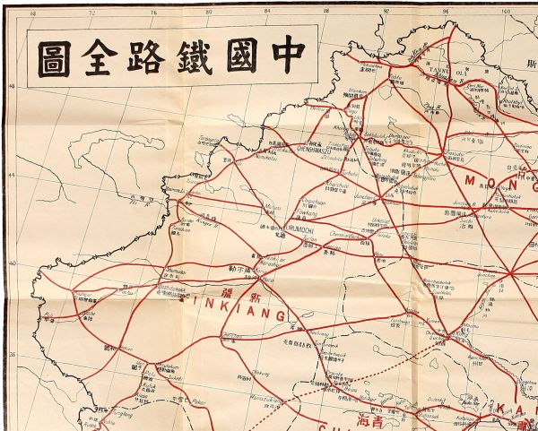
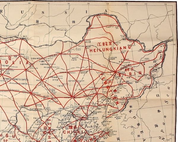
16,000 miles. See general map.
This, the last part of my railway program, is the
most difficult and most expensive undertaking of its
kind; consequently, it must be the least remunerative of
all the railway enterprises in China. So no work should
be attempted in this part until all the other parts are
fully developed. But when all the other parts are
well equipped with railways then railway construction
in this highland region will also be remunerative, despite
the difficulties and the highly expensive work in
construction.
The highland region consists of Tibet, Kokonor, and
a part of Sinkiang, Kansu, Szechwan, and Yunnan, an
area of about 1,000,000 square miles. Tibet is known
to be the richest country in the world for gold deposits.
Furthermore the adjacent territories possess rich agricultural
and pastural lands. This vast region is little
known to the outside world. The Chinese call Tibet
"the Western Treasury," for, besides gold, there are
other kinds of metals especially copper, in great quantities.
Indeed the name of the Western Treasury is
most appropriately applied to this unknown region.
When the world's supply of precious metals are exhausted,
we have to resort to this vast mineral bearing
region for supply. So railways will be necessary at
least for mining purposes. I therefore propose the
following lines:
- a. The Lhasa-Lanchow line.
- b. The Lhasa-Chengtu line.
- c. The Lhasa-Tali-Cheli line.
- d. The Lhasa-Taklongshong line.
- e. The Lhasa-Yatung line.
- f. The Lhasa-Laichiyaling line.
- g. The Lhasa-Nohho line.
- h. The Lhasa-Iden line.
- i. The Lanchow-Chochiang line.
- j. The Chengtu-Dzunsasak line.
- k. The Ningyuan-Cherchen line.
- l. The Chengtu-Menkong line.
- m. The Chengtu-Yuankiang line.
- n. The Suifu-Tali line.
- o. The Suifu-Mengting line.
- p. The Iden-Gortok line.
This is the most important line of this system for
it connects the capital city of Tibet—a vast secluded
region with several millions of people—with the central
trunk line of the country. The route which it passes
through is inhabitable and is already slightly inhabited
in the region between the ends of the proposed line.
So it will probably be a paying line from the beginning.
This line starts from Lhasa, following the old imperial
highway in a northward direction and proceeds by
Talong to Yarh, which lies on the southeastern side of
Tengri Nor Lake. After Yarh, the line turns more
eastward and proceeds across the watershed from the
Sanpo Valley to the Lukiang Valley by the Shuangtsu
Pass. Thence turning more eastward the line proceeds
across the headwater of the Lukiang to that of the
Yangtze by passing many valleys, streams, and mountain
passes. Then it crosses the main body of the
Upper Yangtze, which is here known as the Kinshakiang,
over the Huhusair Bridge. After crossing the
bridge, it turns southeastward, then eastward across
the Yangtze Valley into the Hoangho Valley, where it
passes through many small towns and encampments
into the Starry Sea region. At the Starry Sea, the line
passes between the lakes of Oring Nor and Tsaring
Nor. Thence it turns northeastward across the southeast
valley of the Zaidam region, and returns into the
Hoangho Valley again. Then it proceeds through
Katolapo and various towns to Dangar, now called
Hwangyuan, situated near the border between Kansu
and Kokonor. After Dangar, the line turns southeastward
following the course of the Sining River, proceeds
downward through a very rich valley and passes
through Sining, Nienpai, and hundreds of small towns
and villages to Lanchow. This line covers a distance
of 1,100 miles.
This line starts from Lhasa and proceeds northeastward
on the former imperial highway by Teking and
Nanmo to Motsukungchia. Thence it turns southeastward
and northeastward to Giamda. From Giamda,
the line turns northward, then northeastward where
it proceeds through the Tolala Pass to Lhari. After
Lhari the line goes in an easterly direction and passes
Pianpa, Shihtuh, and many small towns to Lolongchong.
Thence it crosses the Lukiang by the Kayu
Bridge and then turns northeastward to Kinda
and Chiamdo. After Chiamdo, the line instead of
following the imperial highway southeastward to
Batang, turns northeastward, following another
trade route, and proceeds to Payung at the northwestern
corner of Szechwan. From Payung,
it proceeds across the Kinshakiang over the bridge
near Sawusantusze. The line then turns southeastward,
enters the Ichu Valley and proceeds downward
to Kantzu on the Yalung River. Thence it proceeds
to Chango and Yinker, to Badi on the Great Golden
River, and Mongan on the Little Golden River. After
Mongan, the line goes through the Balan Pass to
Kwanhsien, and entering the Chengtu Plain, reaches
Chengtu by Pihsien. This line covers a distance of
about 1,000 miles.
This line starts from Lhasa by the same track as
the Lhasa-Chengtu line as far as Giamda. From
Giamda, it proceeds by its own track southeastward,
following a branch of the Sanpo River to Yulu, where
this branch joins its main stream. After Yulu, it follows
the left bank of the Sanpo River passing by Kongposaga
to Timchao. From Timchao, the line turns
away from the Sanpo River and proceeds in an
eastward direction to Timchong city, Ikung, Kuba, and
Shuachong. After Shuachong, the line proceeds southeastward
to Lima, thence eastward to Menkong on the
Lukiang. From Menkong, the line turns southward
and goes along the right bank of the Lukiang passing
Samotung to Tantau. Then crossing the Lukiang, it
proceeds across the watershed through Gaiwa village
to the Lantsang (or Mekong) River, and to Hsiaoweisi
beyond it. After Hsiaoweisi, it follows the river
bank to the Chenghsin Copper Mine, thence it turns
away from the river and proceeds by Hosi, Erhyuan,
Tengchow, and Shangkwang to Tali. From Tali, the
line proceeds to Hsiakwang, Fengyi, Menghwa, and
then meets the Lantsang River again at Paotien.
Thence it follows the left bank southward right through
to Cheli, where it ends. This line covers a distance
of 900 miles.
This line starts from Lhasa and proceeds southward
by way of Teking to the Sanpo River where turning
eastward it follows the left bank of the river to Sakorshong.
After crossing the Sanpo River to Chetang, it
proceeds southward by Chikablung, Menchona, Tawang,
Dhirangjong to Taklongshong and continues
farther on until it reaches the Assam frontier. This
line covers a distance of 200 miles.
This line starts from Lhasa and proceeds southwestward
by Chashih following the former imperial highway
by Yitang and Kiangli to Chushui. At Chushui, it
crosses to Sanpo River over the Mulih Bridge to Chakamo
on the south side, thence to Tamalung, Paiti,
Tabolung, and Nagartse. After Nagartse, the line
turns westward to Jungku, Lhaling, and Shachia. At
Shachia, the line leaves the former imperial highway
and turns southwestward again and proceeds via Kula
to Yatung at the Sikkim border. This line covers a
distance of 250 miles.
This line starts from Lhasa and proceeds northwestward
by Chashih following the former imperial road
to Little Taking, and westward to Yangpachin and
Sangtolohai. Thence turning southwestward, it proceeds
to Namaling and Tangto, and crosses the Sanpo
River at Lhaku. After Lhaku, the line turns westward
to Shigatse, the second important city in Tibet whence
it proceeds in the same direction to Chashihkang, Pangcholing,
and Lhatse all on the right side of the Sanpo
River. From Lhatse, a branch line starts southwestward
via Chayakor and Dingri to Niehlamuh on the
Nepal border. The main line, however, crosses to the
left side of the Sanpo River and proceeds on the same
highway via Nabringtaka to Tadum where another
branch line proceeds southwestward to the Nepal
border. The main line continues northwestward via
Tamusa and Choshan to Gartok, thence turning westward
it proceeds to Laichiyaling on the Sutlej River
and ends on the Indian border. This line, including the
two branches, covers a distance of 850 miles.
This line starts from Lhasa and runs in the same
track as line (f) to Sangtolohai where it proceeds by
its own line northwestward to Teching, Sangchashong,
and Taktung. Thence, it enters into the richest gold
field in Tibet and through Wengpo, Tulakpa, Kwangkwei,
and Ikar reaches Nohho, where the line ends. It
covers a distance of 700 miles.
This line starts from Lhasa, following the common
track of lines (f) and (g) to the southwestern corner
of Tengri Lake, whence it proceeds by its own track
northwestward by Lungmajing, Tipoktolo and four or
five other small places to Sari. After Sari, the line
penetrates a vast tract of uninhabited land to Pakar
and Suketi. Thence crossing the mountain passes and
descending from the highland to the Tarim Basin
through Sorkek to Yasulakun, the line joins the Cherchen-Iden
railway of the Northwestern System and
proceeds on the same track to Iden. This line covers
a distance of 700 miles.
This line starts from Lanchow, on the same track of
the Lhasa-Lanchow line as far as the southeastern
corner of the Lake Kokonor. Thence it proceeds on its
own track by skirting along the southern shore of Lake
Kokonor to Dulankit, where it turns southwestward to
Dzunsasak. From Dzunsasak, the line proceeds in a
westerly course along the southern side of the Zaidam
Swamp, and passes Tunyueh, Halori, and Golmot to
Hatikair. After Hatikair, the line turns northwestward
by Baipa, Nolinjoha, to Orsinte. Thence turning
more northward, it proceeds across the mountain range
by Tsesinvitusuik and Tuntunomik to Chochiang,
where it ends by joining the Ansi-Iden and Chochiang-Koria
lines, covering a distance of 700 miles.
This line starts from Chengtu and proceeds to Kwanhsien
on the track of the Lhasa-Chengtu line, thence
northward on its own track by Wenchuan, to Mauchow.
Then, it proceeds northwestward following the course
of the Minkiang to Sungpan. After Sungpan, it ascends
the Min Valley passing Tungpi to Shangleyao,
where it crosses the watershed from the Yangtze River
side to that of the Hoangho. Thence the line proceeds
to Orguseri, and following a branch of the Hoangho
to the northwestern turn of its main stream, it proceeds
along its right bank via Chahuntsin to Peilelachabu.
There it crosses the Hoangho to the northwest turn of
the old imperial road, where it joins the Lhasa-Lanchow
line and proceeds as far as Lanipar. Then
turning northwestward, it proceeds by its own line to
Dzunsasak, where it ends by joining the Lanchow-Chochiang
line. This line covers a distance of 650
miles.
This line starts from Ningyuan and proceeds in a
northwestward direction via Hwaiyuanchen to the
Yalungkiang. Then it ascends along the left side of
that river to Yakiang, and crossing to the right side
of that river it proceeds by the old post road to Siolo,
where it turns away from the river and follows the
same post road to Litang. From Litang it proceeds
in the same direction but follows another road to
Kangtu, on the left side of the Kinshakiang. Following
the same side of the river, it proceeds to Sawusantusze,
where it crosses the Lhasa-Chengtu line. After
Sawusantusze, the line continues in the same direction
and follows the same side of the Kinshakiang via Tashigompa,
to the Huhusair Bridge, where it crosses the
Lhasa-Lanchow line. Then following a northern
branch of the Kinshakiang to its source and crossing
the watershed, it proceeds along the caravan road by
Hsinszukiang and Olokung to Cherchen, where it ends,
covering a distance of about 1,350 miles. This is the
longest line of this system.
This line starts from Chengtu and proceeds southwestward
by Shuangliu, Hsintsin, Mingshan, to Yachow.
From Yachow, it turns northwestward and
proceeds to Tienchuan, then westward to Tatsienlu,
Tunyolo, and Litang. After Litang, the line proceeds
southwestward through Batang and Yakalo, to Menkong,
covering a distance of about 400 miles of very
mountainous country.
This line starts from Chengtu on the same track of
the Chengtu-Menkong line, proceeds to Yachow and
thence by its own track in the same direction via Jungching,
to Tsingliu. After Tsingliu, the line proceeds
southward through Yuehsi to Ningyuan, where it
meets the head of the Ningyuan-Cherchen line. After
Ningyuan, it goes to Kwaili, then crosses the Kinshakiang
to Yunnanfu where it crosses the Canton-Tali
line. From Yunnanfu, it proceeds along the west side
of the Kunming Lake to Kunyang, and through Hsinshing,
Hsingo, to Yuankiang, where the line ends by
joining the Canton-Szemo line. It covers a distance of
about 600 miles.
This line starts from Suifu and proceeds along the
left bank of the Yangtze River to Pingshan and Lupo.
After Lupo, it turns away from the river in a southwesterly
direction and scales the Taliangshan
Mountains to Ningyuan, where it crosses the Chengtu-Yuankiang
line and meets the termini of the Canton-Ningyuan
line and the Ningyuan-Cherchen line.
Thence continuing in the same direction, it crosses the
Yalungkiang to Yenyuan and Yungpeh. After Yungpeh,
the line turns more southward, across the Kinshakiang
to Sincheng and thence to Tali, where it ends
by meeting the Canton-Tali line and the Lhasa-Tali
line. It covers a distance of about 400 miles.
This line starts from Suifu on the same track as the
Suifu-Tali line as far as Lupo. From Lupo, it goes
on its own track across the Yangtze River here known
as the Kinshakiang, and follows the right side of that
river upward to its southward bend where it crosses the
Chengtu-Yuankiang line, to Yuanmow. From Yuanmow,
it proceeds to Tsuyung, where it crosses the
Canton-Tali line, thence to Kingtung. After Kingtung,
it proceeds southwestward across the Lantsangkiang
or Mekong River, to Yunchow, thence turning
southwestward, it follows a branch of the Lukiang
River to Mengting and ends on the frontier. This line
covers a distance of about 500 miles.
This line starts from Iden, and proceeds southward
along the Keriya River to Polu, thence following the
caravan road up the highland to Kuluk. From Kuluk,
it proceeds southwestward via Alasa and Tunglong to
Nohho, where it meets the terminus of the Lhasa-Nohho
line. After Nohho, it skirts around the eastern
end of the Noh-tso-Lake to Rudok and proceeds southwestward
to Demchok, on the Indus River. From
Demchok, it proceeds southeastward following the
Indus River up to Gartok, where it ends by joining the
Lhasa-Laichiyaling line. This line covers a distance of
about 500 miles. This highland system totals about
11,000 miles.
The railways projected in the Fourth Program will
total about 62,000 miles; and those in the First and the
Third Programs about 14,000 miles. Besides these,
there will be double tracks in the various trunk lines,
which will make up a grand total of no less than
100,000 miles, as stated in the preliminary part of these
programs. With this 100,000 miles of railways to be
constructed in the coming ten years, the demands for
locomotives and cars will be tremendous. The factories
of the world will be unable to supply them,
especially at this juncture of reconstruction after the
great world war. So the establishment of locomotive
and car factories in China to supply our own demands
of railway equipment will be a necessary as well as a
profitable undertaking. China possesses unlimited supplies
of raw materials and cheap labor. What we need
for establishing such factories is foreign capital and experts.
What amount of capital should be invested in
this project, I have to leave to experts to decide.
I suggest that four large factories should be started
simultaneously at the beginning—two on the coast and
two on the Yangtze. Of those on the coast, one should
be at the Great Northern Port, and the other at the
Great Southern Port—Canton. Of those on the
Yangtze, one should be at Nanking and the other at
Hankow. All four are in centers of both land and
water communication, where skilled labor can easily
be obtained. They are also near our iron and coal
fields. Besides these four great factories, others should
be established at suitable centers of iron and coal fields
when our railways will be more developed.
All the factories should be under one central control.
The locomotives and cars of our future railways should
be standardized so as to make possible the interchange
of parts of machinery and equipment. We should also
adopt the standard gauge, that is, the 4 feet 8½ inch
gauge which has been adopted by most of the railways
of the world. In fact, almost all the railways hitherto
built in China are of this gauge. The purpose of the
proposed standardization is to secure the highest efficiency
as well as the greatest economy.