Few in the multitude of us who now handle maps
are without some vague awe at the Old English
lettering of the names of ancient things, such as
Merry Maidens, Idlebush Barrow, Crugian Ladies,
or the plain Carn, Long Barrow, or Dolmen. Not
many could explain altogether why these are impressive.
We remember the same lettering in old
mysterious books, and in Scott’s Marmion and
Wordsworth’s Hartleap Well. We are touched in
our sense of unmeasured antiquity, we acknowledge
the honour and the darkness of the human inheritance.
Most impressive of all, because they
recur across many counties, are the names of roads,
like the Sarn Helen of Wales, the Pilgrims’ Way of
England. It is part of their power that they have
no obvious and limited significance, and were certainly
not bestowed by king or minister as names
are given by a merchant to his commodities. Instead
of “London Road” we see “Watling Street”;
instead of “North Road” there is “Foss Way”
or “Ermine Street.” But all these make some
appeal, however fantastical, to the intelligence.
“Icknield Street” or “Icknield Way” makes no
such appeal. It is the name of two apparently distinct
roads: one with a Roman look running north
and south through Worcestershire and Warwickshire,
the other winding with the chalk hills through
Suffolk, Cambridgeshire, Hertfordshire, Bedfordshire,
Buckinghamshire, Oxfordshire, Berkshire,
and Wiltshire. I shall confine myself as far as
possible to this second road. It runs south-westwards
from East Anglia and along the Chilterns to
the Downs and Wessex; but the name is mysterious.
For centuries—since Holinshed—it was supposed to
be connected with the East Anglian kingdom of the
Iceni: only fifty years ago Guest confidently translated
it as the warpath of the Iceni, and connected
it with the names of places along its course, such
as Icklingham, Ickleton, and Ickleford. To-day, it is
pointed out with equal confidence that “according
to philological laws Iceni would have produced in
England a form beginning with Itch- or Etch-.”
Dr. Henry Bradley cannot believe that there was
any knowledge of the Iceni in Berkshire, but finds
it “a natural supposition” that the road was called
after a woman named Icenhild, though he points
out that no such person or name is known in myth
or history.
It is a pleasure to see a learned man of the
twentieth century thus playing at the invention of a
twilight deity as the patroness of an old road, like the
Helen or Elen of Wales. Two hundred years ago
his invention would have been wholly serious and
generations of equally serious and less inventive
antiquaries would have followed him. There have
been other explanations. Camden, at the same time
as Holinshed, accepted the connection with the
Iceni, but “what the origin of the name should
be,” he says in his Suffolk, “as God shall help me,
I dare not guess, unless one should derive it from
the wedgy figure of the county, and refer to its lying
upon the ocean in form of a wedge. For the Britons
in their language call a wedge Iken....” John
Aubrey had it from “Mr. Meredith Lloyd” that
“Ychen is upper, as to say the upper country or
people,” and that “Ychen” also signifies “oxen.”
Wise, in 1738, linked it with the name of Agricola,
because of the significant core of Ick, or in the
form “Ryknield,” rick. Willis, in 1787, said that
the road took its name from the Itchen, believing
that it began at Southampton and went parallel to
that river to Winchester; and that Iken-eld was
the Saxon name for the Old Iken Street. The poet
William Barnes, lover of ancient Britons, said that
it might come from a word meaning high or upper,
either because it was “an upcast way” or because
it was the “upper or eastern road,” while Ryknield
seemed to him to come from a word meaning
a trench, and therefore a “hollow way.” And still
nobody knows or believes that anybody else knows.
The name, therefore, throws no light at present on
the use or history of the road.
Much has been written about the Icknield Way
by antiquaries from the sixteenth to the nineteenth
centuries. Most of them regarded the road as one
of the four royal roads or Roman roads of Britain,
on the authority not of local evidence and direct
examination, but of half-mythic laws and histories.
The earliest of these are “The Laws of Edward the
Confessor.” Here four roads are mentioned—Watlinge
strete, Fosse, Hikenilde strete, and
Erminge strete—two of them extending across
the breadth of the land and two throughout
the length; and travellers on them were
protected by the king’s peace. But Liebermann
assigns as a probable date to these
laws a year between 1130 and 1135: Pollock and
Maitland, in their History of English Law, condemn
the work as a compilation of the last years of
Henry I; having something of the nature of a political
pamphlet and being adorned with pious legends,
“its statements, when not supported by other
evidence, will hardly tell us more than that sane
men of the twelfth century would have liked these
statements to be true.” The French version of the
“Laws of William the Conqueror” is almost word
for word the same as the Laws of the Confessor in
the matter of the royal roads: the Latin version
omits Hykenild strete. Roger de Hoveden, in 1200,
uses almost the same words: so does Henry of
Huntingdon in 1130, except that he describes the
Icknield Way as going out of the east into the west.
Mr. Harold Peake suggests to me that these writers
may all have had as their inspiration the brilliant
Geoffrey of Monmouth, who wrote the History of
the British Kings in the early twelfth century. He
tells us, in language not more credible than that
of “The Dream of Maxen” in the Mabinogion, that
King Belinus commanded four roads to be made
over the length and breadth of the island:—
“Especially careful was he [King Belinus] to
proclaim that the cities and the highways that led
unto the city should have the same peace that
Dunwallo had established therein. But dissension
arose as concerning the highways, for that none
knew the line whereby their boundaries were determined.
The king therefore, being minded to leave
no loophole for quibbles in the law, called together
all the workmen of the whole island, and commanded
a highway to be builded of stone and mortar that
should cut through the entire length of the island
from the Cornish sea to the coast of Caithness, and
should run in a straight line from one city unto
another the whole of the way along. A second also
he bade be made across the width of the kingdom,
which, stretching from the city of Menevia on the
sea of Demetia as far as Hamo’s port, should show
clear guidance to the cities along the line. Two
others also he made to be laid out slantwise athwart
the island so as to afford access unto the other cities.
Then he dedicated them with all honour and dignity,
and proclaimed it as of his common law, that condign
punishment should be inflicted on any that
should do violence to other thereon. But if any would
fain know all of his ordinances as concerning them,
let him read the Molmutine laws that Gildas the
historian did translate out of the British into Latin,
and King Alfred out of the Latin into the English
tongue.”
This great north-and-south road is like Ermine
Street, the slantwise roads might be Watling Street
and the Foss Way, and that across the width from
Menevia to “Hamo’s port,” the Icknield Way. As
Geoffrey makes one road go from the Cornish sea to
Caithness, so Henry of Huntingdon takes his Fosse
Way from Totnes to Caithness. Henry, as is
known, had read part or all of Geoffrey’s book before
it was given to the world and made an abstract of
it; and the romancer had warned him to be silent
as to the British kings, because he had not that
book in the British tongue, brought from Brittany by
Walter, Archdeacon of Oxford, and translated
into Latin by Geoffrey himself. Here, as usual,
it can safely be said that Geoffrey’s words are not
pure invention; but what his authority in writing or
tradition may have been appears to be undiscoverable.
He may have used some tradition which was
the basis also of the account of the Empress Helen’s
road-making in “The Dream of Maxen.” He may
have used the so-called laws of Dynwal Moel Mud—“before
the crown of London and the supremacy
of this island were seized by the Saxons”—who
measured the length and breadth of the island, in
order “to know its journeys by days.” (Laws and
Institutes of Wales: Vendotian Code.) Henry
of Huntingdon may well have been a meek adapter
of Geoffrey’s majestic statements, and some local
knowledge of his own may have helped him to put
names upon the roads of Belinus. To this second
road from St. David’s (Menevia) to Hamo’s port or
Southampton he gives the name of Ichenild or Ikenild.
Walter Map, in De Nugis Curialium (circa 1188),
speaks of Canute holding London and the land
beyond Hickenild, and Edmund the rest; the
Anglo-Saxon Chronicle says that Edmund had
Wessex and Canute the “north part” or Mercia;
and these two together help to define the road.
Whether Henry of Huntingdon’s history owed
anything to Geoffrey, Robert of Gloucester’s metrical
chronicle (circa 1300) certainly did, for he refers
to Belinus as the road-maker; but, like Henry, he
calls the road from Totnes to Caithness the Fosse.
Of the Icknield Street he says that it went from east
to west, and also, apparently, that it was the road
from St. David’s to Southampton through Worcester,
Cirencester, and Winchester. A writer of circa 1360,
Ralph Higden, mentions Belin, and he gives two
theories about the Fosse, but evidently himself knows
nothing. He calls the east-and-west road from
St. David’s to Southampton Watling Street.
His fourth road goes from south to north, from
St. David’s, by Worcester and Birmingham, Lichfield
and Derby, Chesterfield and York, to Tynemouth;
and its name varies in different manuscripts
from Rikenildstrete to Hikenilstrete. Guest has
pointed out that Higden was following Geoffrey.
In the Eulogium Historiarum (1362) this road goes
from south to north from St. David’s to Tynemouth,
and is called once Belinstrete, and three times
Hykeneldstret or Hikeneldstret. The author does
not mention Ermine Street, but two Belinstretes, the
other going from St. David’s to Southampton.
It is likely that none of these men except Geoffrey
and perhaps Henry could have mapped the roads.
The one map of the period showing the roads
is such as they might have been expected to make.
It belongs probably to the thirteenth century and
was reproduced by Hearne, from a British Museum
manuscript, in Vol. V of his edition of Leland’s
Itinerary (1710). It shows the four roads by means
of lines and a brief description—his Fosse going in
the approved manner from Totnes to Caithness, the
Ermine Street due north and south, the Watling
Street from south-east to north-west. Ykenild
Street goes straight across from west to east. The
artist’s description of this as of the other roads
is almost word for word from Henry of Huntingdon.
But there are these differences and additions:
the western extremity of the Icknield Way is not
called St. David’s, but Salisbury, which is thus placed
due north of Totnes where St. David’s should be;
the eastern—or, as he calls it, the southern—is
St. Edmunds. At the point of intersection with
Watling Street he writes “Dunstaple,” which is
accurate. Thus he is original only in his description
of the Icknield Way. In putting “Meridies” by
St. Edmunds he made a slip due to his drawing
the map with its north end on the right side. It is
impossible to decide the extent of his mistake in
marking Salisbury at the west end of the road.
He may have believed that it went to Salisbury,
but have been afraid to deviate from the received
opinion that it was an east-and-west road; or he
may simply have put Salisbury in mistake for
St. David’s. Giving Bury St. Edmunds as the
eastern termination suggests local knowledge which
the accurate position of Dunstable confirms. He
may have been a man of the eastern counties who
thought that Salisbury was not only the end of the
road, as travellers told him, but a city in the west.
Holinshed, in his Chronicles (1586), mentions Geoffrey
as the authority for the origin of the four great
roads, and, after quoting him, goes on to describe
an “Ikenild or Rikenild” beginning somewhere
in the south and going through Worcester, Birmingham,
and Chesterfield to the mouth of the Tyne.
“I take it,” he says, “to be called the Ikenild,
because it passed through the kingdome of
the Icenes. For albeit that Leland and others following
him doo seeme to place the Icenes in Norffolke
and Suffolke; yet in mine opinion that cannot well
be doone, sith it is manifest by Tacitus that they laie
neere unto the Silures, and (as I gesse) either in
Stafford and Worcester shires, or in both, except my
conjecture doo fail me.” Here it is to be noticed,
first, that he gives Ikenild and Rikenild as alternative
names of one road and, second, that he sees the
resemblance between “Ikenild” and “Iceni.” He
has evidently thought about the matter, but he
shows no trace of local knowledge or curiosity.
Camden (1586) also only mentions the road in his
introduction to the subject of the Iceni; though
he has to speak of many places touched by the road,
he ignores the fact, if he ever knew it. The poet
Drayton, in his Polyolbion (1616), substitutes
“Michael’s utmost Mount” for Totnes at the south
end of the Fosse Way, and takes Watling Street
from Dover to “the farth’st of fruitful Anglesey,”
and he writes like a Warwickshire man of the
country where those two roads cross (Song xiii,
II, 311 et seq.; Song xxvi, II, 43 et seq.). In the
“Sixteenth Song” of Polyolbion he makes Watling
sing of herself and her “three sister streets”:—
Since us, his kingly ways, Mulmutius first began,
From sea again to sea, that through the Island ran.
Which that in mind to keep posterity might have,
Appointing first our course, this privilege he gave,
That no man might arrest, or debtors’ goods might seize
In any of us four his military ways.
Having sung of the Fosse, Watling continues:—
But O, unhappy chance! through time’s disastrous lot,
Our other fellow streets lie utterly forgot:
As Icning, that set out from Yarmouth in the East,
By the Iceni then being generally possest,
Was of that people first term’d Icning in her race,
Upon the Chiltern here that did my course imbrace:
Into the dropping South, and bearing then outright,
Upon the Solent Sea stopt on the Isle-of-Wight.
“Rickneld” he takes from St. David’s to Tynemouth.
It is very clear that Drayton had read Geoffrey
or a disciple. The notes to Polyolbion reveal the
fact that Selden accepted Molmutius and his laws.
“Take it upon credit of the British story” are his
words. He accepted also King Belin and the making
of the four roads; but having noticed that authorities
vary as to their courses and even their names,
he is content to say, “To endeavour certainty in
them were but to obtrude unwarrantable conjecture,
and abuse time and you.” Evidently he knew
these roads as a whole neither from personal knowledge
nor from contemporary report, but only from
books. Had he known anything he would have
betrayed it, for he digresses to tell the little that
he knows of “Stanstreet in Surrey.”
Drayton apparently knew more, though perhaps
all his knowledge was not available for verse. He
is the first to distinguish clearly between the Ricknield
and the Icknield Street. He takes the Icknield
Way from Yarmouth to the Solent; the definite
“Yarmouth,” now for the first time connected
with the road, the use of the variant Icning, the
connection with the Chilterns, the crossing of
Watling Street—all suggest local knowledge. Here
more than ever it is to be wished that Drayton had
either written his book in prose or had given his
authorities and his actual notes of local lore. He
was a great lover of England and of Wales, and could
have written one of the finest prose books of the
seventeenth century had he put down what he
knew without ramming it into the mould of rhyme.
Of all these men except Drayton and the man
who drew the map, none betrays personal knowledge
of the road. They are all writing of something
either too generally known to need explanation or
of something which they know only from other
writers. All their words together hardly do more
than prove that there was or had formerly been a
road, known as Ricknield or Icknield Street; or at
most that there were or had been three roads bearing
those names—one from St. David’s east and then
north to Tynemouth; a second running south-westwards
across the east of England from
Norfolk to Southampton; and a third from
St. David’s to Southampton. The second seems to
owe nothing to Geoffrey, and all the local knowledge,
such as it is, is so far connected with this.
In 1677 appeared a book by one who had not only
heard of the four royal roads, but had met with
what he believed to be one of them. This was
Robert Plot’s Natural History of Oxfordshire. He
says:—
“Of the four Basilical, Consular, or Prætorian
ways, or Chemini majores, I have met with but
one that passeth through this County, the discovery
whereof yet I hope may prove acceptable,
because not described before, or its footsteps any
where noted by Sir H. Spelman, Mr. Camden, or
any other Author that I have read or could hear of:
whereat indeed I cannot but very much wonder,
since it is called by its old name at very many places
[Ikenildway] to this very day. Some indeed call
it Icknil, some Acknil, others Hackney, and some
again Hackington, but all intend the very same
way, that stretches it self in this County from
North-east to South-west; coming into it (out of
Bucks) at the Parish of Chinner, and going out
again over the Thames (into Berks) at the Parish
of Goreing. The reason, I suppose, why this way
was not raised, is, because it lies along under the
Chiltern Hills on a firm fast ground, having the
hills themselves as a sufficient direction: which
is all worth notice of it, but that it passes through
no town or village in the County, but only Goreing;
nor does it (as I hear) scarce any where else, for
which reason ’tis much used by stealers of Cattle:
and secondly, that it seems by its pointing to come
from Norfolk and Suffolk, formerly the Kingdom
of the Iceni, from whom most agree (and perhaps
rightly enough) it received its name Icenild or
Ikenild; and to tend the other way westward
perhaps into Devonshire and Cornwall, to the
Land’s End.”
He adds, with some triumph, that Holinshed was
much mistaken, but he suspends his judgment because
he has read in Dugdale’s Antiquities of
Warwickshire of an “Ickle-street” in that county.
He prints a map showing the road passing, all on
its right hand as it goes south, the villages of
“Kempton,” Chinner, Oakley, Crowell Kingston,
Aston Rowant, Lewkner, Sherborne, Watlington,
the Britwells, Ewelme, Croamish Gifford, Nuneham,
Warren, Mungewell, the three Stokes, and then
south of Goring Church. He adds that under
“Stokenchurch Hills,” about Lewkner and Aston
Rowant, there are two Icknield ways, an upper
and a lower; and here it may be mentioned that
Hearne’s diary for September 29th, 1722, has the
entry:—
“I went thro’ Ewelm, a ¼ of a mile from which
is Gouldsheath, and about 2 furlongs east said
Ewelm passeth the lower Hackneyway.”
Plot gives a substance to a name. He proves the
existence of a road bearing the name of Icknield
and variations of it, and having a course along the
Chilterns, like Drayton’s road. He does not exaggerate;
in fact, he thinks it a poor sort of road
when compared with the Icknield Street through
Staffordshire, of which he says:—
“I look upon this of Staffordshire as the most
remarkable of the two, and so to be that Iknild
street, which is usually reckoned to be one of the
four basilical or great ways of England, and not
that of Oxfordshire, this being raised all along and
paved at some places, and very signal almost
wherever it goes, whereas that of Oxfordshire is
not so there, whatever it may be in other counties.”
The next evidence is eighteen years later, and
comes from the maps by Robert Morden illustrating
Gibson’s edition of Camden’s Britannia (1695). His
map of Hertfordshire suddenly introduces us to a
road called the Icknal or Icnal Way, running west
from Royston—perhaps even from Barley, three
miles south-east of Royston—through Baldock,
then more and more south-east, over the Lea to
the north of Luton, through Dunstable, and so,
leaving on its right hand Toternhoe, Edlesborough,
Ivinghoe, and Marsworth, going out of the map
with Wilston on its right. In the map of Buckinghamshire
this road is continued through Wendover,
and passes Princes Risborough and Bledlow. In
the map of Oxfordshire it is called “Icknield Way,”
and follows a line like that in Plot’s map, crossing
“Grime’s Dike,” leaving Ipsden and Woodcot on
its left, reaching the Thames on the south of
Goring Church. The Berkshire map does not show
any road of this or similar name, or any one corresponding
to it. Nor is the road to be found on the
maps of Essex, Cambridgeshire, Suffolk, or Norfolk.
The extension of it through Buckinghamshire
and Hertfordshire may well have come
from the local knowledge of Morden or a collaborator.
There must have been abundant information
of the kind used by Plot which escaped antiquaries
who were thinking about a royal road, a
majestic basilical or consular way, running from
St. David’s to Southampton, or farther. John
Aubrey (died 1697), the man to tap this local lore,
had nothing to say of any such road in his own
county of Wiltshire, but he left some rough notes.
He connects “Iceni” with “Ikenild,” and remarks
(on the authority of Wren) that there were three
Itchings on Ikenel Street, including Itching Stoke
in Hampshire, where the Pilgrims’ Way fords the
Itchen. He says also that a Mr. Sherwood told
him of “an Ikenil way from North Yarmouth to
Plymouth; the country people will say, ‘Keep
along the Ikenil Way,’ scilicet the Wallington Hills.”
Wallington is two miles south-east of Baldock and
south of the Icknield Way, and through it ran a
parallel road (mentioned in Archæological Journal,
Vol. XXV) from Barley, by Therfield, Strethall,
Sandon, and Wallington to Clothall; but the term
“Wallington Hills” does not exclude the Icnal
Way marked in Morden’s map. The precise North
Yarmouth may also have been accurate, and I
should be inclined to believe that at that day men
sometimes went between Plymouth and North
Yarmouth by a road or chain of roads known
through perhaps a very large part of its course by
some such name as Ikenil Way.
A period of antiquarian conjecture and invention
was now beginning, with exploration often of an
active kind, but usually kept sternly in obedience
to speculation. At the end of the sixth volume of
Hearne’s Leland (1710) is an essay supposed to be
by Roger Gale (1672-1744). He has no doubt
about “four great roads,” but regards the story
of Molmutius and Belinus as exploded, and says
that “nobody now questions but that” the Romans
made them. He distinguishes, “as does Mr.
Drayton,” between Icknield and Ricknield, and
complains of the old confusion. The Icknield Way,
“which has its rise and name from the people
called Iceni,” he finds first “with any certainty
near Barley in Herts,” as in Robert Morden’s map;
but he suggests an eastern continuation through
Ickleton, “and so by Gogmagog hills, and over
Newmarket Heath to Ikesworth, not two miles
south from St. Edmundsbury,” and possibly to
Burgh Castle, near Yarmouth. Returning westward,
he describes a course which might have been
taken from Morden’s map, except that in the
neighbourhood of Luton it touches Streatley instead
of Leagrave, and goes to Houghton Regis as well
as to Dunstable. But having reached Buckinghamshire,
he cannot find it “anywhere apparent to the
eye ... except between Princes Risborrow and
Kemble in the Street, where it is still call’d Icknell
Way.” These are words which suggest that the
eye was not his own. In Oxfordshire he leaves
the road to Plot. At Goring and Streatley he does
not know what to do, because his guides—Henry
of Huntingdon and Drayton and others—disagree.
He conjectures a continuation to Southampton,
another through Speen to Salisbury and beyond,
where he has found the name “Aggleton Road,”
locally given to the road near Badbury Castle, the
Roman road from Old Sarum to Dorchester. He
thinks “Aggleton Road” can have no connection
with Ickleton, but he shows no other reason for
believing that his Roman road is the Icknield Way.
In 1724 appeared the Itinerarium Curiosum of
Gale’s friend William Stukeley (1687-1765), M.D.,
F.R.S., F.R.C.P. Here he describes an exploration of
the Icknield Way. He takes it through Ickleton
and, like Gale, through Streatley, near Luton; he
mentions the lovely prospect from the northern
sides of the Chilterns and a few more place-names.
East of Ickleton, or his newly discovered Roman
camp at Great Chesterford, he speaks of the road
going along the boundary between Essex and
Cambridgeshire “towards Icleworth in Suffolk.”
He thinks the road Roman. Beyond the Thames
he has no uncertainty like Gale. He says straight
out that at Speen “the great Icening-street road
coming from the Thames at Goring ... crosses
the Kennet river”; also that he found it a little
north of Bridport going to Dorchester, and accompanied
it “with no small pleasure.” If he had any
reason for calling any part of this road “the great
Icening Street of the Romans,” it has never been
discovered, nor has anything else confirmed his
view, except that Leland saw two Roman milestones
between Streatley and Aldworth, which have
been seen since, but never described except in
rumour. William Stukeley, M.D., F.R.S., F.R.C.P.,
who read “Oriuna” for “Fortuna” on a coin, and so
invented the belief that one Oriuna was the wife of
Carausius, was soon afterwards unanswerably questioned
and plainly contradicted on matters of fact
by Smart Lethieullier (1701-60) and Richard Willis.
He is chiefly memorable here because the now
venerable title of Via Iceniana was conferred by
him on the road which he chose to believe the
Icknield Way. The title, translated back into
Icknield Street, is still generally accepted.
Francis Wise (1697-1767) found the road where
Gale had lost it, beyond the ford at Streatley. In
his book on Some Antiquities in Berkshire he says
that it loses its name at Streatley, but is “visible
enough” to Blewbury and known as the Great
Reading Road. From Blewbury through Upton
and Harwell this road is called the Portway,
yet he thinks that it may be the Icknield Way
notwithstanding; or, if not, there is an alternative to
the south, lost in the ploughland until near Lockinge
it becomes a raised way called “Icleton Meer”;
while after Wantage it is the “Ickleton Way,” going
“all under the hills between them and Childrey,”
Sparsholt, Uffington, so under White-horse-hill,
leaving Woolston and Compton on the right, thence
to Ashbury and Bishopstone. He thought
that it was making rather for Avebury than
for Salisbury. This road is marked as Eccleton
Street in Roque’s fine eighteenth-century map of
Berkshire, though it is not easy to be certain of the
road indicated by the name, except that it runs at
the foot of the hills.
Richard Willis, in an essay posthumously published
in Archæologia, VIII (1787), claims to be the
discoverer of two Roman roads which “fortunately”
crossed one another near his house at Andover.
One of these was the road from Southampton by
Winchester and Cirencester to Gloucester, and this
was, he says, “I doubt not the Ikeneld Street.”
He does not say why he is certain, but his authority
or inspiration was probably Geoffrey or a disciple.
He had an eye for old roads, but too generally
honoured them with the name of Roman. He
noticed the old road leaving his supposed Icknield
Street on the right a mile south of Ogbourne St.
George, and going north-east to the inn now
called “The Shepherd’s Rest” at Totterdown,
which is on the Roman road from Speen to
Cirencester. Among several roads connecting
this Roman “Icknield Street” with the Ermine
Street he mentions a road which he calls a
causeway, from Royston to Ogbourne St. George,
or at least to Bishopston and Wanborough. This
has been called Icknield Street, but he will call it
the “Oxford Icknield Street,” which, he says, from
coinciding with his real Icknield Street at Wanborough,
acquired its name. It would be as reasonable
to say that London took its name from the
London County Council, or that Julius Cæsar took
his from Julius Cæsar Scaliger. The unquestionable
fact—known to him from Morden’s map, from
Plot, and from Wise—that there is a road with the
name of Icknield Way, or a variant of it, between
Royston and Wanborough, he regards as a “stumbling
block,” because it stands in the way of theorists
less insolent than himself.
Lysons’ Magna Britannia (1806) brings together
two more such opposites as Wise and Willis. In
“Berkshire” a letter is quoted from a Mr. Church,
surveyor of Wantage, describing the Berkshire road,
where Wise had been uncertain, in its eastern half.
Mr. Church writes:—
“The Ickleton-way has been ploughed up across
Wantage East Field till it enters Charlton (a hamlet
of Wantage); it then passes through West Lockinge.
It is lost across Mr. Bastard’s park in East Lockinge,
but appears again from that park to Ginge
Brook, in Ardington parish. It passes by White’s
barn in Sparsholt-court manor, and is afterwards
ploughed up for some way, but appears again,
after crossing the Newbury-way, by Wiltshire’s
and Halve-hill barns, in East Hendred parish;
from thence through the parishes of Harwell, West
Hagbourne, and the hamlet of Upton, to the village
of Blewbury, and through the parishes of Aston
Tirrold, and Cholsey, to Moulsford on the Thames,
and thence to Streatley; from Upton to Streatley
it forms part of the new turnpike road from Wantage
to Reading.” From Upton station to the east
edge of Lockinge Park this road is now an almost continuous
series of cart-tracks known—at least, in the
neighbourhood of East Hendred, which it leaves
half a mile to the north—as Ickleton Street
or Ickleton Meer. This evidence of 1911,
confirming statements made a hundred and
two hundred years ago, is sufficient to identify
that portion of the road as Ickleton
Street. Beyond Wantage, Wise’s description can be
applied only to the modern road from Wantage to
Bishopston, or as far as the “Calley Arms” at
Wanborough. East of Upton the modern road to
Streatley—the old Reading turnpike—has a rival in
a series of cart-tracks through Blewbury and the
Astons, and possibly to be connected with the
“Papist Way” near Cholsey.
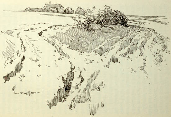
“Ickleton Meer,” Hagbourne Hill, near Upton, Berks.
Thus there is traditional authority for giving the
name of Ickleton Street or Way to a series of roads
in Berkshire between Bishopston and Streatley, and
the name of Icknield or Icnal Way to a road leading
from Royston to Goring; and hence a probability
that the two were united by the ford between Streatley
and Goring. To this can be added a strong impression
that this road came from a Norfolk port
and went westward to Avebury, and thence or by
another route into Devon or Cornwall; but not
one writer, except perhaps Aubrey’s friend, proves
or even implies a contemporary use of this road
throughout its course; while Drayton and Plot
suggest that it had fallen into decay in their
time.
Along with “Mr. Church, surveyor of Wantage,”
in Lysons’ Berkshire, appeared a bishop, John
Bennet (1746-1820), Bishop of Cloyne from 1794
until his death. Without any argument or evidence
he makes the following pronouncement, heralded
by the editorial opinion that “his researches have
enabled him to speak with certainty on the subject”:—
“The Ikeneld enters Berkshire from Oxfordshire
at Streatley, where it seems to have divided: one
branch by the name of the Ridgeway continued on
the edge of the high ground by Cuckhamsley and
White-horse-hill into Wiltshire; pointing, as Mr.
Wise observes, rather to Avebury or the Devizes
than Salisbury; while the other branch went from
Streatley, perhaps by Hampstead and Hermitage,
under the name of the West Ridge, to Newbury,
and thence it may be to Old Sarum.”
At first he seems to misunderstand Wise, and to
suppose that his Ickleton Street was a road on the
unpopulated ridge and not in the valley past a
string of villages, and he goes on afterwards to assert
that this valley road is Roman and seems to come
from a spot near or rather below Wallingford. In
1806 the Rev. Henry Beeke (Archæologia, XV)
expressed the opinion that the Icknield Way crossed
the Thames at Moulsford. As Bennet gives no
reason he makes no apology. His reason for giving
the name of West Ridge to a road running east of
its fellow must have been that it went through the
village of Westridge, where doubtless the road was
called the Westridge Way, as the road from Chevington
is called the Chevington Way, and so on.
He had apparently no reason for choosing the
Ridgeway except that it came from the same ford
at Streatley reached by the Icknield Way at Goring.
Nevertheless, he has been so persistently followed
that the Ridgeway is now given by the Ordnance
Survey the alternative title of “Icknield Way,”
and also of “Roman Road,” which even the bishop
said it was not; some Berkshire people even call
the Ridgeway the Icknield Way because it is the
“Government name”; and “West Ridge Way”
is attached with all the honour of Old English
lettering to the more easterly road. Bennet equals
Stukeley in the grandeur of his fiction and the
veneration which it has earned. In Lysons’ Cambridgeshire
(1808) he takes the road through Newmarket,
herein coinciding with later-proved facts,
but continues it to Ickleton on the east of the
modern turnpike along a course never yet identified.
Men who were not bishops now begin to exercise
themselves in suggesting roads which may have
been continuations of this Ickleton or Icknield Way.
They print their opinions with varying degrees of
certainty. In 1829 Dr. Mason, rector of Orford,
in Suffolk (Archæologia, XXIII), traces it, “after
it leaves Ixworth,” to Buckenham and thence by
two forks to Caistor and to Burgh Castle. Samuel
Woodward, in 1830 (Archæologia, XXIII), also
assumes that it passes through Buckenham, Ixworth,
and Bury St. Edmunds. In 1833 Alfred John Kempe
(Archæologia, XXVI) takes it for granted that the
road “crossed the kingdom from Norwich towards
Old Sarum.” With an “I need hardly observe,”
he connects the road with the Iceni, and explains
it as “the Iken-eld-strete, that is, the old street or
way of the Iceni.” Arthur Taylor (Archæological
Institute: Memoirs, 1847; Norwich volume) connects
the road with Norwich Castle Hill, which he
believes to be British. Like the Ordnance Survey
map, he takes it through Newmarket, Kentford,
Cavenham, Lackford, and Thetford. Like Bennet,
both Woodward and Taylor regard the road as a
British trackway. But Taylor earns his chief distinction
by the possession of a deed “apparently of
the reign of Henry iii,” relating to premises at
Newmarket and “extending upon Ykenildweie.”
In 1856, in the form of a discourse afterwards
embodied in his Origines Celticæ (1883), Edwin Guest
wrote a long account of the Icknield Way. He
mentions as evidence charters of the tenth century
referring to estates in Berkshire between Blewbury
and Wayland’s Smithy, so minute, he says, as almost
to be sufficient foundation for a map, but not to
enable him to trace the road; for he accepts
Bennet’s substitution of the Ridgeway. North of
the Thames his earliest evidence is a parchment,
possibly of the fourteenth century, relating to the
foundation of Dunstable Priory at a place where
the two royal roads of Watling and Ickneld cross,
a place of woods and robbers near Houghton. He
quotes a “letter testimonial of 1476” proving
that this trackway, west of Dunstable, was known
as Ikeneld Strete. He takes the road from Icklingham
and through Ickleton and Ickleford because
that is a possible course and because he believes
those names to be connected with “Iceni” and
“Icknield.” What was the one great road described
as Icknield Street in the Laws of the Confessor he
finds it hard to define. But he can find no traces
of Roman construction in the road. Inspired by
the map showing Salisbury at the end of the road,
he suggests that “most probably” it joined the
Ridgeway east of Avebury and continued along its
course, as recently described by Sir Richard Colt
Hoare.
Messrs. Woodward and Wilks, in their history of
Hampshire (1861-9), are well acquainted with the
many theories of the road, and “on the whole see
most reason” for agreeing with Drayton, but also for
giving the name to the Roman road from Winchester
to Cirencester and Gloucester, or another Roman
road running north-west of Basingstoke. They
speak of the allegation that in ancient deeds the
road to Gloucester is designated as Hicknel or
Hicknal Way; but these have not been identified.
C. C. Babington, in his Ancient Cambridgeshire
(1883), speaks of the road as easily traced from
Thetford to Kentford, and he regards Woodward’s
British way from Norwich by Wymondham and
Attleborough to Thetford as a continuation. But
he has no documentary evidence, no tradition, and
no local name to support his conjectures at any
point between Norwich and Royston, except at
Newmarket. He could not find Bennet’s road from
Newmarket east of the turnpike. Probably the
bishop meant the roads west of Westley Waterless,
past Linnet Hall, west of Weston Colville, West
Wratting and Balsham; it is improbable that he
did more than fly over them in fancy. He is
satisfied that where the parish, and afterwards
the county, boundaries coincide with the present
road from Newmarket it is the Icknield Way,
especially as at Stump Cross the county boundary
follows the sudden turn out of the main road along
a little-used lane leading over the Cam to Ickleton.
From Ickleton to a point near Chrishall Grange and
a tumulus—where for a mile the lane is a county
boundary—it is uncertain; but from that point to
Noon’s Folly he is content with the “nearly disused
track,” which near there again becomes a
county boundary. Thus he connects Newmarket and
Royston by a road of the same character as the
well-warranted parts of the Icknield Way without
any evidence but probability.
The Rev. A. C. Yorke (Proceedings of the Cambridge
Antiquarian Society, 1903) prefers the road
known as Ashwell Street, which runs for some miles
nearly parallel with the supposed Icknield Way
and is most clear from Ashwell, north of Baldock,
to Melbourn, north-east of Royston. In a lucid
and vigorous article he says that “there can be
no doubt” that “Ashwell Street is the original
Icknield Way.” He is willing to give up the name
of one road, take away the name from another
road which has borne it since 1695, and in one
place since Henry the Third, and give it to the
first which has never borne it, so far as he knows.
He thinks the so-called Icknield Way from Newmarket
to Hitchin, Roman; just as others think
his Ashwell Street Roman, Mr. F. Codrington, e.g.,
holding that Ashwell Street was an alternative
course, leaving the Icknield Way at Worsted Lodge
and returning at Wilbury Camp.
Mr. W. G. Clarke (Norwich Mercury, Oct. 8, ’04, etc.;
Knowledge, II, 99) attempts to connect Newmarket
with Norwich and call the road the Icknield Way.
He suggests a route over the Kennett at Kentford
and the Lark at Lackford; then to Icklingham All
Saints, and following the boundary of the hundreds
of Blackbourn and Lackford to Thetford, having
crossed the road from Newmarket to Thetford at
Marmansgrave, and that between Bury and Thetford
a few yards north of Thetford Gasworks, where
the remains of a British settlement were found in
1870. He crosses the Little Ouse and Thet where
the Nuns’ Bridges now are. On the other side “the
logical and undoubtedly correct continuation of the
Icknield Way” is by Castle Lane and Green Lane.
A find of Celtic and Roman pottery at the south
end of Green Lane, old thorns in the fields between
Green Lane and Roudham Heath, old banks on the
heath near Peddars’ Way, “which it crosses about
half a mile from where Peddars’ Way is joined by
the Drove,” a “Bridgham tradition” of a waggon
road over Roudham Heath, and the battle of
Ringmore, fought there between Sweyn and Ulfketel,
the find of bronze weapons and flint axes at Attleborough,
and the supposed British origin of Norwich
Castle Hill, take him by these places. From Norwich
he goes by Sprowston, Rackheath, Wroxham,
Hoveton, Beeston, over the Ant by the “Devil’s
Ditch,” or “Roman Camp,” at Wayford to Stalham
and to Happisburgh. Except that Stalham is
near Hickling, this route has nothing—no local
map, no documents—to entitle it to be called the
Icknield Way.
Mr. Beloe (Cambridge Antiquarian Society, Proceedings,
VII) suggests an easterly line beyond
Newmarket by a supposed junction with the Ailesway
from Newmarket, by Brandon Ferry and
Narford to Hunstanton.
Mr. J. C. Tingey (Norfolk Archæology, XIV) agrees
that such a junction may have been used, but prefers
a line through Ickburgh and Cockley Cley, crossing
the Wissey at Mundford. He also proposes another
route from Lackford almost to Thetford, which he
avoids, crossing the Ouse on to Snarehill, with its
many tumuli, because he thinks an early traveller
would have done this. Then, with no trace of a
road, he goes over Snare Hill to Shadwell Park, the
Harlings, Uphall, Kenninghall to Banham, where a
street was once called Tycknald Street (Blomefield’s
History of Norfolk); or he could reach Banham
from Elvedon, Barnham, and Rushford. After
Banham he leaves a gap of twelve miles, hastening
to Swainsthorpe, south-east of Norwich, where he
has found a Hickling Lane, called “Icklinge Way,”
in a seventeenth-century conveyance, where it is
said to lead to Kenninghall. He has also found in
Blomefield a mention of “the way called Ykeneldsgate,”
in that parish, dated 1308.
The partly lost line of this lane he has made out
through Mulbarton; beyond which he is struck
by the place-names of Keningham, Kentlow, and
Kenninghall, noticing the other similar names on or
near the supposed Icknield Way—Kentford, Kennet,
Kensworth (once “Ikensworth”), Kennett, in
Wiltshire, and, beyond Exeter, Kenn and Kenn
Ford. Other documents of 1482 and 1658 relating
to the next parish to Swainsthorpe, Stoke Holy
Cross, enable him to extend the road with some
probability eastward. They also show that the
road was known at about the same time as Hickley
Lane in one parish, and Stoke Long Lane in another.
Most remarkable of all, he has found in Blomefield
mention of “the way called Ykeneldsgate” in the
same parish of Stoke Holy Cross, in 1306. He
suggests reaching Haddiscoe as his “port in Celtic
times,” by Framingham Earl, Bergh Apton, Thurton
Church, Loddon, and Raveningham. He sternly
avoids Norwich as post-Roman, and Bury for the
same reason. At the same time he admits the probability
of branches to those places when they became
important. Thus he shows that he has in his mind
one road, with one name, and that something like
Icknield Street, going from sea to sea, not only in
the Confessor’s time, but before the Romans.
It is impossible even to outline the multitudinous
conjectures at the north-east end of the Icknield
Way. At the south-west conjecture has been all
but silenced by Stukeley’s invention of the Via
Iceniana and Bennet’s substitution of the Ridgeway,
both stupefying fictions.
For two hundred years these conjectures have
been multiplied and become venerable by repetition.
Plot thinks that the road might go from Norfolk
to Devon and Land’s End. Gale fancies Caistor and
Burgh Castle at one end, and, as Stukeley did, Exeter
at the other. Dr. Beeke “supposes” it went from
Streatley towards Silchester, also that it crossed
the Thames at Moulsford. Colt Hoare speaks of it
as connecting Old Sarum with Dorchester and
Winchester. Arthur Taylor takes it for granted
that it came from “Cornwall or some extreme
point in the south-west of Britain” to Norwich and
Hickling. Isaac Taylor says that it went from
Norwich to Dorchester and Exeter. Mr. H. M.
Scarth conjectures that the road crossing the main
street of Silchester, which runs east and west, may
have been an extension of the Icknield Way from
Wallingford to Winchester. In Social England Col.
Cooper King, following Stukeley, takes the road to
Exeter, Totnes, and Land’s End; following Bennet,
he takes it along the Ridgeway. Elton calls it
briefly a road from Norwich through Dunstable and
Silchester to Southampton, and to Sarum and the
western districts.
The theorists and conjecturers have done little
to ascertain the course of a road which can safely
be called the Icknield Way. By far the greater part
of the work has been done by men who used chiefly
local tradition. Plot in Oxfordshire, Wise in Berkshire,
perhaps Robert Morden or an unknown
assistant in Hertfordshire. The best of the conjecturers
have only linked up the authenticated
parts in a probable manner. Most have been too
busy with their own views to be anything but
benevolent to others. But in 1901 appeared one
with no theory and without benevolence, Professor
F. Haverfield. In a chapter on “Romano-British
Norfolk,” in the Victoria County History of that
county, he pronounces that the Icknield Way is not
a Roman road; that it has nothing to do with the
Iceni or Norfolk or Suffolk; that the name Icknield
and the names like Ickleton and Kenninghall of places
on the road, or supposed parts of it, cannot, for
philological reasons, be connected with the Iceni.
At present he is unanswerable, though his mind is
of a type which commands more interest when it
affirms than when it denies.
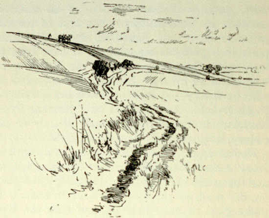
Icknield Way, near Ipsden, Oxfordshire.
Since the time of Wise little has been done
except to add proofs of the antiquity of the
road under the Chilterns and the Berkshire
Downs. In his day it was known from Royston
to Bishopston. Taylor showed that it touched
Newmarket, but no more. Mr. Tingey shows that
it went through Stoke Holy Cross in Norfolk,
but little or nothing has been done to fill the gap
between his fragment of Hickling Lane and Newmarket.
Even the road between Newmarket and
Royston depends for its title only on its respectability
as a county and parish boundary. Reaching
the Thames there is no certainty of the principal
ford; but Streatley must have been one, and from
there to Bishopston the main line of the road is clear
enough. A man may follow the whole of this road
in a few days, and be upon a beaten track if not
a hard road everywhere, except for a few hundred
yards near Ipsden, and two or three miles from
the east side of Lockinge Park. The two lengths
north and south of the Thames make a road of
uniform character, keeping almost entirely to
the chalk, but below the steepest wall of the hills.
From Dunstable westward this wall on the left
or south of the road is an unmistakable guide to
the traveller; as far as Swyncombe he has only to
cling to the foot of the wall and he is on the Icknield
Way. Beyond the Thames the Downs make a
guiding wall equally clear and continuous. It
belongs to what Mr. Harold Peake, in his “Prehistoric
Roads of Leicestershire” (Memorials of Old Leicestershire),
calls the “hill-side” type of road, which
“winds along the sides of hills just above the alluvium.
Marshes and low-lying ground are avoided,
but small streams do not offer so great an obstacle
as in the case of the ridge-roads.” He compares
it with the Pilgrims’ Way from Winchester to
Canterbury, which it closely resembles, except
that it keeps always on the northern slopes, instead
of the southern, and commands throughout its
course views of a wide, fertile valley northward.
Until the enclosures and the metalling of roads
the ruts and hoof-marks of the Icknield Way were
probably spread over a width of from a hundred
yards to a mile, according to convenience or necessity;
from century to century its course might
vary even more. Thus the modern road between
Kentford and Newmarket is at several points some
distance from the Cambridge and Suffolk boundary,
which is supposed to follow the Icknield Way.
A deed already mentioned proves that the road
was known in Newmarket itself.
Beyond Newmarket the modern road is marked
as the Icknield Way, but is only a parish boundary,
or rather close to one, for one mile in the first eight,
and is not authenticated by any known documents.
Nor is any parallel road in the same direction a
boundary line. That it is on an old line of road is
certain from the number of tumuli which formerly
dotted the surrounding heath. It goes through
three dykes, two, eight, and thirteen miles from
Newmarket, and it has been conjectured both
that the dykes defend the road and that the road
was made by an invader to pierce the dykes; one
antiquary asserts that the fosse of the Brent Ditch
“has evidently been filled up to admit the road.”
From a little beyond the eighth milestone and
Fleam Dyke the road is a parish boundary, with
very short interruptions between the eleventh and
twelfth, as far as the fourteenth, where it becomes
the Cambridge and Essex boundary. Turning
west beyond the fifteenth, it is followed for some
distance by the county boundary, and is thrice
rejoined by it, the third time for two miles before
entering Royston. By this sharp turning to the
west it avoids a Roman camp at Great Chesterford,
and passes what Camden called the “ancient
little city” of Ickleton, where in his time traces
of the “Burrough banks” could plainly be seen.
Near Abbey Farm at Ickleton are the remains of
a priory. Where it is again a county boundary
beyond Ickleton, near “a tumulus opened by the
late Lord Braybrooke,” it is a farm road, and
continues as such in a clear line through arable
land and alongside hedges, until it joins the main
road into Royston. Here it goes over Burloes Hill,
where many indications of ancient burials have
been found.
From Royston onwards, as has been seen, the
road is marked in a map of 1695. It is mentioned,
says Beldam (Archæological Journal, XXV),
in documents of the twelfth and thirteenth centuries
among the monuments of Royston Priory,
as “Hickneld” and “Ykenilde.” There are hut-circles
on the heath to the west, associated with
neolithic implements. At Royston, as at Baldock
and Tring, gold coins of Cunobelin have been found;
and here the road crosses Ermine Street. West
of Royston the road is again a county boundary,
and goes for miles between many tumuli. “A
small Roman habitation” was opened at Slip End
near Odsey by Lord Braybrooke. At “Slip Inn”
it bounds parishes instead of counties. There is a
manor-house and moat at Bygrave, and a tumulus
on Metley Hill opposite. Here it passes between
two unenclosed parishes, Bygrave and Clothall.
It goes along the edge of Baldock, where they
have found neolithic and Bronze Age implements
and coins of Cunobelin and of “Icenian type,”
and Roman urns: here is the crossing of Stane
Street from Godmanchester to Colchester. For
five miles beyond Baldock the road is a parish
boundary. It touches a camp at Wilbury Hill,
and near it they have found “a great variety
of coins of the Roman emperors” and a small
copper blade, coins of Constantine, bones and
ashes. Ickleford, where it ceases to be a boundary,
has produced palæolithic evidences, and the neighbourhood
of Hitchin, a mile south, palæolithic and
neolithic and late Celtic. Two miles farther on
it is a parish boundary for a mile and a half, and
then the Hertford and Bedford boundary to the
top of Telegraph Hill. Ravenspurgh Castle is a
mile north of it on the Barton Hills. It turns along
Dray’s Ditches and enters the road from Barton
to Luton. Here the parish boundary goes straight
across, following a lane, to Great Bramingham Farm
and, with a break, to Chalton, from which the road
might have gone through to Houghton Regis
and “the British town of Maiden Bower,”
and to the north of Dunstable. But the
line of the road is continued from Dray’s
Ditches across the Luton road to Limbury, and
over the Lea at Leagrave Marsh, passing, near the
moats and the remains of a nunnery at Limbury, the
fortification of Waulud’s Bank, and the scene of
many finds of coins and neolithic implements.
This line is clear on Morden’s seventeenth-century
map. A new street called “Icknield Way” and a
footpath lead with recent interruptions into the
Luton and Dunstable road, which is for some time
a parish boundary. Here it begins to follow under
the Downs, which have traces of Celtic huts.
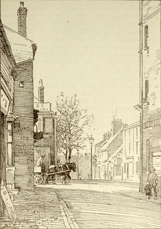
Icknield Way, crossing Watling Street, Dunstable.
The crossing of Watling Street at Dunstable is
vouched for by Dugdale’s ancient parchment
relating to the foundation of the priory, and by
the map of the four royal roads. Between two
barrows at Dunstable an ancient trackway used
to be traceable to the British camp of Maiden
Bower. In the Catalogue of Ancient Deeds (I,
II, III) there are various references to
tenements in the west field or west street
extending upon Ikenild-strete, viz. between
the time of Edward III and Henry VI. West
of Dunstable the direction but not the course
of the road is proven by a “letter testimonial” of
1476, where a cross is mentioned standing “in the
field of Toternho, the which cross standeth in
Ikeneld Stret, to the which cross the way leading
from Spilmannstroste directly stretcheth and extendeth,
at which place there hath been a cross
standing from time that no mind is.” Toternhoe
parish now includes three-quarters of a mile of
the supposed Icknield Way, from the inn at the
turning to Kensworth Common, as far as Well
Head, and between these points the cross may have
stood. Round about the road here are many
tumuli on the open downs, and traces of Celtic
huts. Toternhoe has a camp not a mile from Maiden
Bower, which is in Houghton Regis. A chalk pit
three-quarters of a mile north-east of the “Plough”
yielded Roman coins in 1769. The “Ykenyldewey”
is mentioned in the description of a piece of land
at Edlesborough, south-west of Dunstable, in
1348 (Close Rolls, Edward III); and the “Ikenyldstret”
at Eaton Bray, close by, in the time
of Edward II and Richard II (Catalogue of Ancient
Deeds, I, II, III). The villages of Edlesborough and
Eaton Bray are visible a little north of the road.
Passing under Beacon Hill and its tumulus, the road
enters one from Leighton Buzzard to Aldbury and
Wigginton, and out of this road, at points a little
north and a little south of the entrance, run two
roads marked as the “Lower” and “Upper”
Icknield Way, keeping more or less parallel courses
as far as Lewknor, where the lower is supposed
to join the upper. Neither is a parish or county
boundary. At Aston Clinton the “Lower” is
crossed and deflected by Akeman Street, which
it enters for a mile in a north-westerly direction.
Aston has yielded late Celtic pottery. At Weston
Turville the “Lower” passes, near the manor-house,
a place where a Roman amphora was found in 1855.
Akeman Street and several other roads cross and
deflect the “Upper” Way. After traversing Wendover
you have a camp and barrow on Balcombe
Hill, a little to the south. A Danish entrenchment
comes down to it from Swyncombe Downs near
Britwell. It crosses Grim’s Ditch at Foxberry
Wood. Flint implements have been found along
its course, e.g. in Pulpit Wood at Great Kimble, and
at Bledlow. At Whiteleaf, above Monks Risborough,
and also above Bledlow, men have carved the turf
into crosses, which may be modifications of much
earlier phallic forms. British coins, inscribed and
uninscribed, have been found at Wendover and
Ellesborough, Roman coins between Ipsden and Glebe
Farm. Only beyond, where the upper and lower roads
are supposed to have united, does the track coincide
with a parish boundary, and that but seldom and
only for short distances. In Buckinghamshire it
was known in the year 903, and mentioned in a
“record by King Eadweard, at the request of
Duke Aethelfrid, who had lost the original deed
by fire, of a grant by Athulf to his daughter Aethelgyth
of land at East Hrisan Byrg, or Princes
Risborough” (Cartularium Saxonicum, No. 603). It
is there called “the Icenhylte,” and the boundary
of the land in question runs along it as far as “the
heathen burials.” Through Oxfordshire, from
Chinnor to Goring and the Streatley ford, the road
is authenticated by Plot’s map; but routes to
the other fords are at present conjectural. Streatley
meant the longest way round for travellers going
west through Berkshire, but it offered the driest
approaches on both hands and the narrowest
possible strip of wet land at the crossing. In
summer at least Wallingford would attract westward
travellers; and there is a thirteenth-century
reference in the Abingdon Chronicle to Ikeneldstrete
as running from Wallingford to Ashbury. Men
using this ford would have turned out of the Streatley
track at Gypsies’ Corner; and here, or a mile
or two beyond, near Ipsden, they could branch to
Moulsford and the Stokes.
Beyond Streatley there is at first only one road
westward on the dry and rising land. This is the
main road between Reading and Wantage, with a
fork to Wallingford. Mr. Church, of Wantage
(1806), pronounced this road to be the Ickleton
Way as far as Upton, and his word may be taken
to prove at least that this was the local name.
For anyone crossing at Streatley and going west
under the hills, instead of along the ridge, there is
no other road; and even from Moulsford and
Wallingford men would be forced, by the river on
one side and bad ground on the other, to enter this
road at Upton, if not at Blewbury, or before.
The ford at Streatley is said to be Roman. Roman
pottery has been found in the river, and coins on
the south bank. Roman coins by the hundred,
dating from 43 B.C. to A.D. 383, have been ploughed
up in the neighbourhood. “Near Aston” coins,
A.D. 267-74, have been found. They have dug up
Roman things in Blewbury Fields, on Hagbourne
hill, at Hendred, on Charlton Downs, at Wantage,
at Letcombe Regis, in the Dragon Hill near the
White Horse, at Woolston, and at Ashbury. Implements
of the Bronze Age have been recorded at
Cholsey, Moulsford, Blewbury, Hagbourne Hill,
Wantage, Letcombe Bassett. Wallingford has yielded
palæolithic, neolithic, Bronze Age, and later evidences.
These things, and more that could be mentioned,
suggest ancient settlements and communications
below the downs. Ickleton Street would seem
likely to have been the main line of travel here,
and a series of Saxon charters prove that such it
was.
A grant of land by Edmund to Ælfric, and by
him to Abingdon, shows that an Ichenilde Wege
went through Blewbury in 944, and that the
Ridgeway was distinct and at some distance from it;
a grant in 903 by Eadweard to Tata the son of
Æthelhun and by him to Abingdon, one by Edgar
to Ælfric and by him to Winchester in 973, and
one by Edgar to Ælfstan and by him to Winchester
in 970, show it at Harwell (Kemble,
Codex
Diplomaticus, Nos. 1080, 578, 1273). In the grant
of 903 the boundary starts at a brook, the Swyn
Brook, and goes along the Harwell Way to the
Icenhilde Wey, then up the old wood-way by
the east of Harwell Camp to a warren, and so up
to the stone on the Ridgeway, then on and back to
the Ridgeway, and down on the other side of Harwell
Camp to the Icenhilde Wey, farther down
to a spring and an elder bed, evidently in the
low land. This shows that the Icknield Way was
a road running between the Ridgeway and the
lowest land. A grant of land made in 955 by
Eadred to Ælfheh and by him to Abingdon at
Compton Beauchamp (Kemble, No. 1172) proves
the same. The boundary starts at the Ridgeway,
and goes to the Icenhilde Wey, and on to the
Swyn Brook, and back again past a barrow to the
Icenhilde Wey, and up to the Ridgeway, and over
hills, slades, and a green way back to Wayland’s
Smithy. A grant of Æthelstan to Abingdon, of
land in Woolston, Compton, and Ashbury (Kemble,
No. 1129), and another (No. 1168) mention as
landmarks Ikenilde Strete, then what is probably
Uffington Castle, and other places on the downs;
then what is probably Ælfred’s Castle and two
barrows and the Ikenilde Strete again, and finally
a rush bed in the low land. A grant by Æthelwulf
to Winchester and Bishop Stigand in 854 of lands
at Wanborough (Kemble, No. 1053) describes
a boundary passing downs and coombes to the
source of the Hlyd (there is a Lyde spring at Ashbury),
along the stream to a ditch, past the Dorc
stream, the Smit stream, and a black pit, over the
Icknield Way at or near some heathen burial place,
and so to down country with a white pit, two
stones, and a coombe, etc.—and from a study of
the district Mr. Harold Peake concludes that “the
Icknield Way crossed the parish very near the
modern road which on the Ordnance Map bears
this name, though I fancy it ran originally a few
hundred yards to the north.” It is clear, then, that
the Icknield Way ran as far as Wanborough between
the highest and lowest ground along a course
similar to that of Wise’s Ickleton Street. The
road mentioned must either be Wise’s road or
another of similar course which has been superseded
by it in name and use, and can hardly be
other than that now called on the Ordnance Map
the Port Way.
Thus the road from Newmarket—or at least
from Royston—by Streatley to Wanborough parish
is a venerable and continuous one, which bore
almost the same name at its extremities—Ykenildeweie
at Newmarket in the time of Henry III,
Icenhilde Weg at Wanborough in 854. That it is
Icknield Street, one of the “four royal roads,”
is proved only by its coming out of the east and
going westward, and by its crossing Watling Street
at Dunstable, as does the Ykenildstrete of the
thirteenth-century map. Unlike the other three
roads, the Icknield Way appears not to have been
Romanized at any point, and, assuming that it
had in the Middle Ages the importance suggested
by its rank with these roads, its primitive character
would explain its decay. Nothing rescued it as
pilgrimages rescued that part of an ancient east-and-west
road now known as the Pilgrims’ Way
from Winchester to Canterbury (The Old Road, by
Hilaire Belloc). Its western object had apparently
been so deeply lost in Drayton’s time that the
poet took it to Southampton, though whether this
line is to be traced to Geoffrey of Monmouth’s
bold definition or to contemporary usage cannot
easily be decided. That this road through Newmarket
and Streatley is the one in Drayton’s
mind is certain.
Of the other roads called Icknield Street, most,
if not all, of them difficult, where not impossible,
to connect with this road as continuations or as
branches, one is particularly interesting here.
Dr. Macray’s “MS. Catalogue of Magdalen College
Deeds” contains several mentions of Ikenildwey or
Hykenyldewey in descriptions of boundaries at
Enham, near Andover, in Hampshire. One belonging
to 1270 refers to land “in the east field of
Enham, on the north of the highway called Ikenildwey”;
another of 1317 to two acres of land in Enham
Regis in a field called Bakeleresbury; “of the which
one acre lies between the land of Gilbert Slyk on
either side, extending south to Ikenildwe ...”;
one of 1337 to arable land in the fields of Andover,
of which half an acre extends “above Hykenyldewey
to the east,” between other estates in the north
and south, while another acre in the same field
extends “above Laddrewey to the north.” I
conclude from these descriptions that the Hykenyldewey
here ran east and west, and it is not a region
of winding roads. Batchelor’s Barn and Walworth
cottages, about a mile east of Andover, seem to
contain memories of “La Werthe,” “La Walwert,”
and “Bakeleresbury.” Both the barn and the
cottages lie close to the south side of the Harrow
Way, which here goes east and west on its way from
Farnham to Weyhill. Walworth cottages are on
the east of the intersection of the Harrow Way
and the north-westward Roman road from Winchester
to Wanborough Nythe, and not a mile
south of the intersection of this Roman road with
the north-eastward Port Way from Old Sarum to
Silchester. Between the Harrow Way and the
Port Way, and in this part of its course almost
parallel with them, is a road from Stoke and Newbury.
One of these roads is perhaps the road referred
to in the deeds as “Hykeynldewey.” The
Harrow Way, which still bears its name in the
neighbourhood, is not likely to have been the road.
The Port Way appears to be purely Roman. If
the road from Stoke were the Icknield Way, it
might have connected Streatley with Winchester
and Southampton, yet if it went to Winchester and
Southampton, it can hardly have been the road
which is several times called Ikenilde Street in
records of the perambulations of the Hampshire
forests. The survey of Buckholt Forest, under
Edward I, for example, contains the passage:
“Begin at the Deneway ... and so always by the
divisions of the counties of Southampton and Wilts
to th’ Ikenilde Street, and thence by the same
to La Pulle”; and “from Pyrpe-mere to th’
Ikenilde and so by the same road to Holeweye.”
This road I cannot identify, but a road touching
both Enham and Buckholt Forest would probably
reach Old Sarum.
There is an Icknield Street, marked as such on
the Ordnance Map, going north from Weston sub-edge
to Bidford, and, after a gap, from Stadley
north towards Birmingham. It goes for some
miles parallel to a much higher Ridgeway. It
leaves the Fosse Way four miles south of Stow-in-the-Wold,
near Bourton-on-the-Water, and is the road
described by Codrington as Ricknild Street. But
Codrington refers to a part of it—where the railway
crosses it at Honeybourne station—as called
Ricknild or Icknield Street, and to the lane north
of Bidford going towards Alcester as Icknield Street.
This road, or a longer one in part coinciding with
it, was first called Icknield Street by Ralph Higden
in the fourteenth century. It was one of his four
royal roads, and went from St. David’s to Worcester,
Birmingham, and Derby. Some of the manuscripts
of his work called the road Ryckneld, which
spelling may or may not have been due to the local
knowledge of a scribe; both English translators or
their scribes retain the R, calling the road Rykenildes
strete or Rikenilde Street. Mr. W. H. Duignan
(Notes on Staffordshire Place Names) quotes references
to this road in the twelfth century—between
Lichfield and Derby—as Ikenhilde, Ykenild, and
Ricnelde; in the thirteenth century as Rikelinge
and Ykenilde; in the fourteenth century as Rykeneld
strete. He also gives instances which seem to
prove that there were unconnected roads known
as Ricknield Street in the thirteenth century; and
mentions a place now called Thorpe Salvin, lying
on no known Ricknield Street, but once known as
Rikenild-thorp. Selden found a deed mentioning
Ricknield Street as a boundary near Birmingham,
and Dugdale one of 1223 relating to Hilton Abbey.
The Eulogium of 1362, when it does not call
Higden’s road Belinstrete, calls it Hykeneldstret,
though when Gale quotes it he makes it Rykeneldstrete.
Stukeley calls it “the Ricning Way,” and
complains of Plot for calling it Icknil Way; yet
he himself heard it called the Hickling Street
near the crossing of Watling Street. Holinshed
calls it “Ikenild or Rikenild.” In the time of the
second and third Edwards there were men named
after Ikenilde or Hikenilde strete (Pat. Rolls) in
Worcestershire. One of them was a man of Alvechurch,
which lies west of the road between Stadley
and Birmingham; and there was an Ikeneld street
in the sixteenth century within the lordship of
Allechurche in Worcestershire.
Drayton first distinguished between an eastern
Icknield Street and a western Ricknield Street.
He evidently knew the Icknield Way along the
Chilterns, and his words about Rikneld Street as
coming from Cambria’s farther shore until the road
“On his midway did me in England meet,”
suggest that he knew the road as a Warwickshire
man, and that his distinction was not wantonness
or the precision of ignorance. Gale accuses the
road of taking the name of Ickle or Icknild Street
without any just title. Guest also believes that
the western road “gradually attached to itself the
name of Icknield Street” as a famous name to
which it had no right. Wise, in search of something
to help him, suggests Hickling as the origin
of the name, but knowing of Ryknield, he is tempted
also by Rickley in Essex—confesses the temptation—and
“must now beg leave to call” the road
“the Great Ickle or Rickle way.” This use of
Rickling reminds me of a woman living in a cottage
beside the Ridgeway, near Chiseldon. I asked her
the name of the road, and she said, with some
hesitation, “The Rudgeway.” I asked why it was
so called, and she said she did not know. I
asked where it went, and she answered, “Oh,
over there!”—pointing west, “—to Rudge, I
suppose,” Rudge being near Westbury. An antiquary
in the Gentleman’s Magazine (1787) comfortably
explains the variation as due to the British
particle “yr” prefixed. But no one has found a
Ricknield or a Rickling or any such name along
the course of the road from Newmarket to Wanborough.
It seems likely that Icknield, like Watling and
Ermine, was a generic name for a road, whether
due to its use by cattle, to Professor Bradley’s Lady
Icenhild, or to something else. One such road in
Worcestershire and the west, and another in the east
tending westward, were possibly at one time well
known as continuous routes over long stretches of
country. The two could be connected. Ermine
Street passed through Wanborough Nythe at the
west end of the Icknield Way from East Anglia,
went north-west to Cirencester, and thence both
north-east to Stow-on-the-Wold where it touched
the Ricknield Street and the Fosse Way, and
north-west to Gloucester, and so to Worcester or
to Kentchester and the south-west of Wales.
Another ancient road from near Tring, the Akeman
Street, would take travellers on the Icknield Way
due west to Cirencester, where they could branch
as they pleased to Gloucester and Wales or the north.
Thus at both ends of Ermine Street and Akeman
Street or their continuations there were roads known
as Icknield Street; it is even possible that the whole
system was officially given the one name of Icknield
Street, and such a system might fitly be called a
royal road. An eastern extension of the road to a
depôt and several ports in Norfolk is practically
certain, though it has not yet been discovered or
satisfactorily reconstructed. A south-western or
western extension beyond Wanborough is almost
equally certain. There is no need to look for a
road that is all of one type. Without antiquarianism
or modern regularity only common and continued
travel throughout its course can preserve a road.
Even during this extended use of it variants will
be discovered from time to time and used as alternatives
or substitutes. As soon as this use ceases
portions of the road begin to decay, and soon those
few having the old need for it will have found
another way. Each kind of civilization doubtless
has its own special kind of road, and gradually
old roads are so transformed or combined
as to form such a road. But invaders or newly
organized people have to take what roads they find,
unless they have Roman will, forethought, and
resource to make their own; though by good fortune
men suddenly needing a road may find an
old one ready as did the pilgrims from the south
and west to Canterbury who used the Pilgrims’
Way. Men wishing to travel from east to west,
especially in the south of England, would have
found many tracks and roads of all types ready to be
linked so as to form a connection between important
points of trade, government, or religion. When it
became possible to traverse England safely, meeting
foreign faces and strange tongues but subjects of
one king, traders and travellers would piece together
according to need the old roads which different
ages had confirmed—the high and most ancient
roads like the Ridgeway and the Harrow Way, late
roads skirting the bases of the hills, pure Roman
roads fearing nothing, and Romanized trackways.
The Icknield Way may have been such a combination.
The Danes might have combined it with the
Ridgeway in 1005, when they burnt Wallingford
and went by Cholsey and Cuckhamsley to Kennet.
They probably used the road along the Chilterns
when they burnt Thetford and Cambridge and turned
south to the Thames; and other parts of it when
they stole inland from their ships through Norwich
to Thetford. Sweyn may have gone along it when
he went to Wallingford, and so over the Thames
westward to Bath, where the western men submitted
and gave hostages and he became king of the
whole people. Giraldus may have trodden it in
South Wales. At an earlier age, as Mr. Moray
Williams has suggested, the Icknield Way might
have been the line of the Iceni in their alleged
migration westward, after the defeat of Boadicea.
It should have been Imogen’s pathway to Milford
Haven. There are not many early references to the
travel upon the road. It would be used chiefly by
traders and travellers from a distance. Plot remarked
that it passed through no towns or villages
in Oxfordshire, and this, in his day, made it convenient
for stealers of cattle. A road used by strange
travellers and robbers waiting for them was not
a likely one for small settlements and local use.
When it was spoken of as the way the oxen go—unless
the phrase implied a road along which came
oxen from a distance—it may already have been
degenerating. Guest says: “Your guide will talk
of the long lines of pack-horses that once frequented
the ‘Ickley Way,’ as if they were things of yesterday;
and a farmer in the Vale of Aylesbury told
me ... that in the popish times they used to go
on pilgrimage along it from Oxford to Cambridge.”
Messrs. Jordan and Morris (Introduction to the Study
of Local History and Antiquities) speak of the road
as connecting the flint-knappers’ settlement at
Brandon with Avebury and Stonehenge: “The
men of Wiltshire would wish to obtain flint
instruments from Brandon; men from Brandon
to have access to Avebury and Stonehenge.” But
Wiltshire men would not go to Suffolk in search
of flints except for a wager.
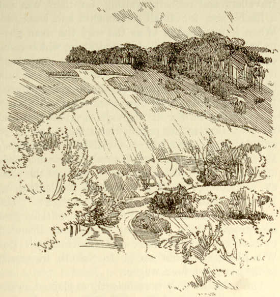
The Icknield Way is sufficiently explained as the
chief surviving road connecting East Anglia and
the whole eastern half of the regions north of the
Thames, with the west and the western half of the
south of England. For the men of Norfolk, Suffolk,
Cambridge, Bedford, Hertford, Buckingham, and
Oxford, it did what the Harrow Way did for men of
Kent, Surrey, Sussex, and East Hampshire.


