THE MOUNTAINS.
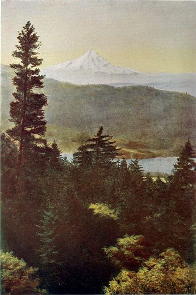
Silent and calm, have you e'er scaled the height
Of some lone mountain peak, in heaven's sight?
—Victor Hugo.
There stood Mount Hood in all the glory of the alpen glow, looming immensely high,
beaming with intelligence. It seemed neither near nor far. . . . The whole mountain
appeared as one glorious manifestation of divine power, enthusiastic and benevolent, glowing
like a countenance with ineffable repose and beauty, before which we could only gaze with
devout and lowly admiration.—John Muir.
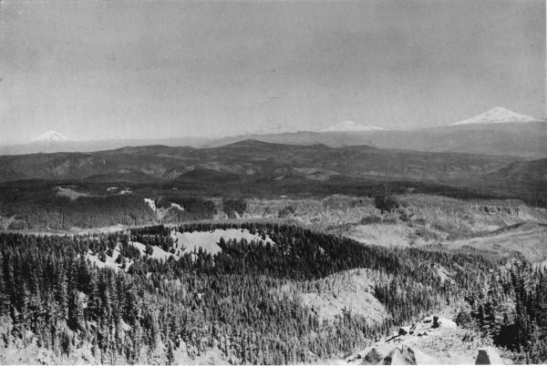
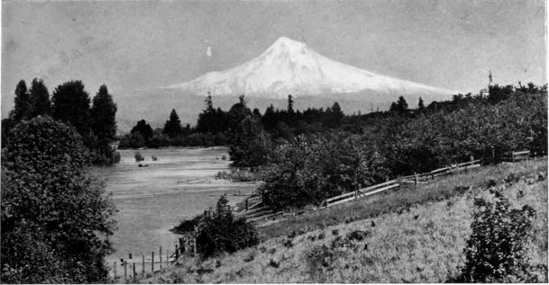
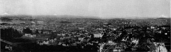
FROM the heights which back the city of Portland on the west, one may
have a view that is justly famous among the fairest prospects in America.
Below him lies the
restless city, busy with
its commerce. Winding
up from the south comes
the Willamette, its fine
valley narrowed here by
the hills, where the river
forms Portland's harbor,
and is lined on either side
with mills and shipping.
Ten miles beyond, the
Columbia flows down
from its canyon on the
east, and turns northward,
an expanding waterway for great vessels, to its broad pass through the
Coast Range. In every direction, city and country, farm and forest, valley
and mountain, stretches a noble perspective. From the wide rivers and
their shining borders, almost at sea level, the scene arises, terrace upon terrace,
to the encircling hills, and spreads across range after range to the
summits of the great Cascades.
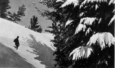 Winter on Mount Hood. The roof of the club house of the Portland
Snow-shoe Club is seen over the ridge.
Winter on Mount Hood. The roof of the club house of the Portland
Snow-shoe Club is seen over the ridge.
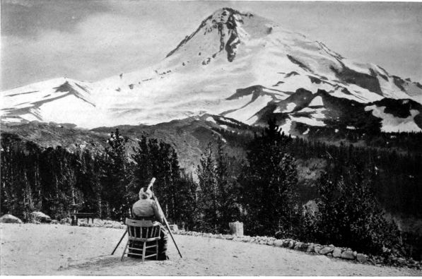
COPYRIGHT, G. M. WEISTER
Watching the climbers from the plaza at Cloud Cap Inn, northeast side of Mount Hood. Immediately in
front, Eliot glacier is seen, dropping into its canyon on the right. On the left is Cooper Spur, from
which a sharp ascent leads to the summit of the peak.
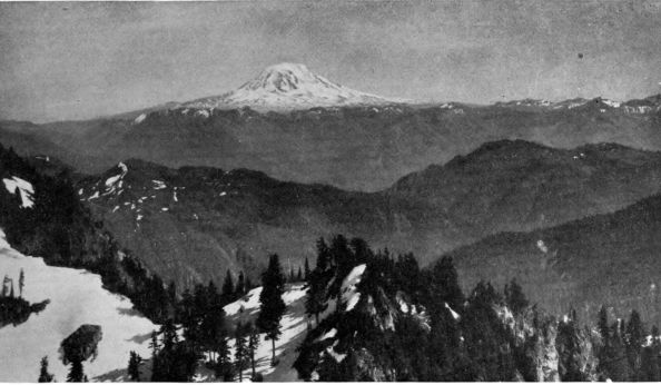
Dominating all are the snow-peaks,
august sentinels upon the horizon. On a
clear day, the long line of them begins far
down in central Oregon, and numbers six
snowy domes. But any average day includes
in its glory the three nearest, Hood,
Adams, and St. Helens. Spirit-like, they
loom above the soft Oregon haze, their
glaciers signaling from peak to peak, and
their shining summits bidding the sordid
world below to look upward.
 Mount Hood, elevation 11,225 feet
Nature has painted canvases more
colorful, but none more perfect in its
strength and rest. Here is no flare of the
desert, none of the flamboyant, terrible
beauty of the Grand Canyon. It is a land
of warm ocean winds and cherishing sunshine, where the emeralds and jades
of the valleys quickly give place to the bluer greens of evergreen forests that
cover the hill country; and these, in turn, as distance grows, shade into the
lavenders and grays of the successive ranges. The white peaks complete the
picture with its most characteristic note. They give it distinction.
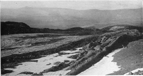 Lower end of Eliot glacier, seen from Cooper Spur, and showing the lateral moraines which this receding
glacier has built in recent years.
Lower end of Eliot glacier, seen from Cooper Spur, and showing the lateral moraines which this receding
glacier has built in recent years.
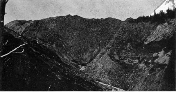 Snout of Eliot glacier, its V-shaped ice front heavily covered with morainal debris.
Such a panorama justifies Ruskin's bold assertion: "Mountains are the beginning
and end of all natural scenery." Without its mountains, the view from
Council Crest would be as uninteresting as that from any tower in any prairie
city. But all mountains are not alike.
In beginning our journey to the three
great snow-peaks which we have
viewed from Portland heights, it is
well to define, if we may, the special
character of our Northwestern scene.
We sometimes hear the Cascade
district praised as "the American
Switzerland." Such a comparison
does injustice alike to our mountains
and to the Alps. As a wild, magnificent
sea of ice-covered mountain tops,
the Alps have no parallel in America.
As a far-reaching system of splendid
lofty ranges clothed in the green of
dense forests and surmounted by
towering, isolated summits of snowy
volcanoes, the Cascades are wholly
without their equal in Europe. This
is the testimony of famous travelers
and alpinists, among them Ambassador
Bryce, who has written of our
Northwestern mountain scenery:
We have nothing more beautiful in Switzerland
or Tyrol, in Norway or in the Pyrenees.
The combination of ice scenery with woodland scenery of the grandest type is to be found
nowhere in the Old World, unless it be in the Himalayas, and, so far as we know, nowhere
else on the American continent.
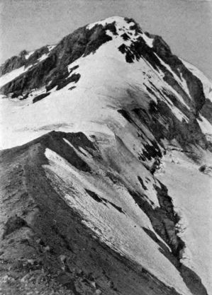 Cone of Mount Hood, seen from Cooper Spur on
northwest side. A popular route to the summit
leads along this ridge of volcanic scoriæ
and up the steep snow slope above.
Cone of Mount Hood, seen from Cooper Spur on
northwest side. A popular route to the summit
leads along this ridge of volcanic scoriæ
and up the steep snow slope above.
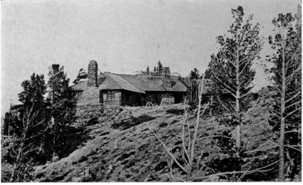 Cloud Cap Inn, north side of Mount Hood. Elevation 5,900 feet.
In his celebrated chapter of the "Modern Painters" which describes the
sculpture of the mountains, Ruskin draws a picture of the Alps that at once
sets them apart from
the Cascades:
The longer I stayed
among the Alps, the more
I was struck by their being
a vast plateau, upon
which nearly all the highest
peaks stood like
children set upon a table,
removed far back from
the edge, as if for fear of
their falling. The most
majestic scenes are produced
by one of the great
peaks having apparently
walked to the edge of the
table to look over, and
thus showing itself suddenly
above the valley in its full height. But the raised table is always intelligibly in existence,
even in these exceptional cases; and for the most part, the great peaks are not
allowed to come to the edge of it, but remain far withdrawn, surrounded by comparatively
level fields of mountain, over which the lapping sheets of glacier writhe and flow. The result
is the division of Switzerland into an upper and lower mountain world; the lower world
consisting of rich valleys, the upper world, reached after the first steep banks of 3,000 to
4,000 feet have been surmounted, consisting of comparatively level but most desolate
tracts, half covered by glacier, and stretching to the feet
of the true pinnacles of the chain.
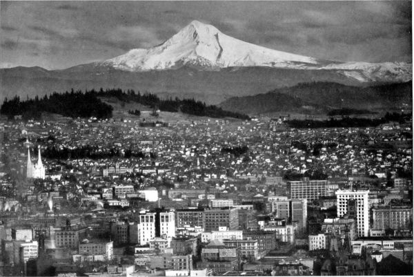
COPYRIGHT, G. M. WEISTER
Portland's White Sentinel, Mount Hood. Telephoto view from City Park, showing a portion of the city, with modern buildings and smoke of factories.
COPYRIGHT, G. M. WEISTER
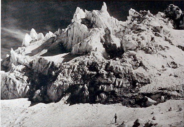 Ice cascade on Eliot glacier, Mount Hood.
Nothing of this in the Cascades! Instead, we
have fold upon fold of the earth-crust, separated
by valleys of great depth. The ranges rise from
levels but little above the sea. For example, between
Portland and Umatilla, although they are
separated by the mountains of greatest actual
elevation in the United States, there is a difference
of less than two hundred and fifty feet, Umatilla,
east of the Cascades, being only two hundred and
ninety-four feet above tide. Trout Lake, lying
below Mount Adams, at the head of one of the
great intermountain valleys, has an elevation of
less than two thousand feet.
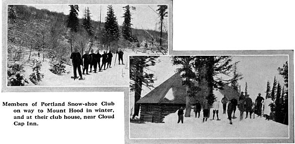
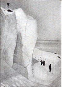 Portland Snow-shoe Club members
on Eliot glacier in winter.
Portland Snow-shoe Club members
on Eliot glacier in winter.
Thus, instead of the Northwestern snow-peaks
being set far back upon a general upland and hidden
away behind lesser mountains, to be seen only after one has reached the
plateau, thousands of feet above sea level, they actually rise either from comparatively
low peneplanes on one side of the Cascades, as in the case of St.
Helens, or from the summit of one of the narrow, lofty ridges, as do Hood
and Adams. But in either case, the full elevation is seen near at hand and
from many directions—an elevation, therefore, greater and more impressive
than that of most of the celebrated Alpine summits.
COPYRIGHT, G. M. WEISTER
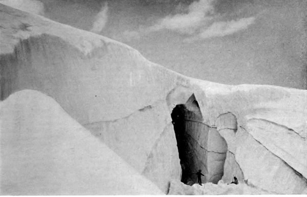 Snow-bridge over great crevasse, near head of Eliot glacier.
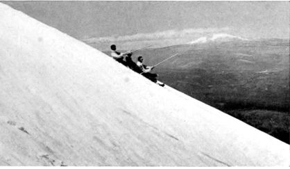
COPYRIGHT, G. M. WEISTER
Coasting down east side of Mount Hood, above Cooper Spur.
Mount Adams in distance.
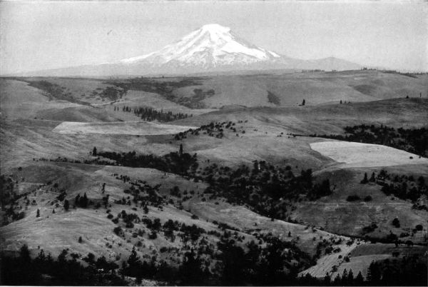
COPYRIGHT, G. M. WEISTER
Mount Hood from the hills south of The Dalles, showing the comparatively timberless country east of the Cascades. Compare this treeless region, as well
as the profile of Mount Hood here shown, with the view from Larch Mountain.
Famous as is the valley of Chamonix, and noteworthy as are the glaciers
to which it gives close access, its views of Mont Blanc are disappointing. Not
until the visitor has
scaled one of the
neighboring aiguilles,
can he command a
satisfactory outlook
toward the Monarch
of the Alps. And nowhere
in Switzerland
do I recall a picture
of such memorable
splendor as greets the
traveler from the
Columbia, journeying
either southward, up
the Hood River Valley
toward Mount Hood, or northward,
up the White Salmon Valley toward
Trout Lake and Mount Adams. Here
is unrolled a wealth of fertile lowlands,
surrounded by lofty ranges made
beautiful by their deep forests and
rising to grandeur in their snow-peaks.
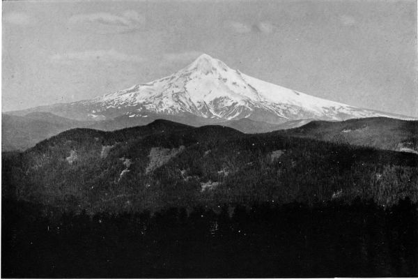
COPYRIGHT, L. J. HICKS
Mount Hood, seen from Larch Mountain, on the Columbia River. View looking southeast across the heavily forested ranges of the Cascades to the deep
canyons below Ladd and Sandy glaciers.
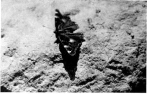 Butterfly on the summit of Mount Hood.
Leaving the canyon of the Columbia,
in either direction the road follows
swift torrents of white glacial water
that tell of a source far above. It
crosses a famous valley, among its
orchards and hayfields, but always in view of the dark blue mountains and
of the snow-covered volcanoes that rise before and behind, their glaciers shining
like polished steel in the sunlight.
So the visitor reaches the
foot of his mountain. Losing
sight of it for a time, he follows
long avenues of stately trees as
he climbs the benches. In a few
hours he stands upon a barren
shoulder of the peak, at timber line. A new world confronts him. The
glaciers reach their icy arms to him from the summit, and he breathes
the winds that sweep down from their fields of perennial snow.
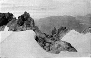 Fumarole, or gas vent, near Crater Rock.
It is all very different from
Switzerland, this quick ascent from
bending orchards and forested hills to
a mighty peak standing white and
beautiful in its loneliness. But it is so
wonderful that Americans who love
the heights can no longer neglect it,
and each year increasing numbers are
discovering that here in the Northwest
is mountain scenery worth traveling
far to see, with very noble mountains
to climb, true glaciers to explore, and the widest views of grandeur and
interest to enjoy. Such sport combines recreation and inspiration.
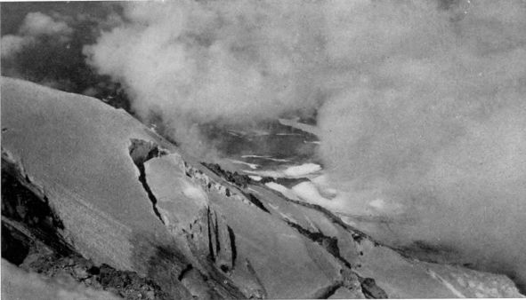 Looking across the head of Eliot glacier from near the summit of Mount Hood.
The traveler from Portland to either Mount Hood or Mount Adams may
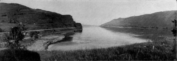
go by rail or steamer to Hood River, Oregon, or White Salmon, Washington.
These towns are on opposite banks of the Columbia at its point of greatest
beauty. Thence he
will journey by automobile
or stage up the
corresponding valley
to the snow-peak at
its head. If he is
bound for Mount
Hood his thirty-mile
ride will bring him to
a charming mountain
hotel, Cloud Cap Inn,
placed six thousand
feet above the sea, on
a ridge overlooking
Eliot glacier, Hood's
finest ice stream.
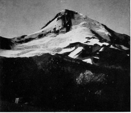 Mount Hood at night, seen from Cloud Cap Inn. This view is from a
negative exposed from nine o'clock until midnight.
Mount Hood at night, seen from Cloud Cap Inn. This view is from a
negative exposed from nine o'clock until midnight.
If Mount Adams
be his destination, a
ride of similar length
from White Salmon
will bring him merely
to the foot of the mountain. The stages run only to Guler, on Trout Lake, and
to Glenwood. Each of these villages has a comfortable country hotel which may
be made the base for fishing and hunting in the neighborhood. Each is about
twelve miles from the snow-line. At either place, guides, horses and supplies
may be had for the trip to the mountain. Glenwood is nearer to the famous
Hellroaring Canyon and the glaciers of the southeast side. Guler is a favorite
point of departure for the south slope and for the usual route to the summit.
Another popular starting point for Mount Adams is Goldendale, reached
by a branch of the North Bank railway from Lyle on the Columbia. This
route also leads to the fine park district on the southeastern slope, and it has
a special attraction, as it skirts the remarkable canyon of the Klickitat River.
Many parties also
journey to the mountain
from North
Yakima and other
towns on the Northern
Pacific railway.
Hitherto, all such
travel from either
north or south has
meant a trip on foot
or horseback over interesting
mountain
trails, and has involved the necessity of packing in camp equipment and supplies.
During the present summer, a hotel is to be erected a short distance
from the end of Mazama glacier, at an altitude of about sixty-five hundred
feet, overlooking Hellroaring Canyon on one side, and on the other a delightful
region of mountain tarns, waterfalls and alpine flower meadows. Its
verandas will command the Mazama and Klickitat glaciers, and an easy
route will lead to the summit. With practicable roads from Goldendale and
Glenwood, it should draw hosts of lovers of scenery and climbing, and aid
in making this great mountain as well known as it deserves to be.
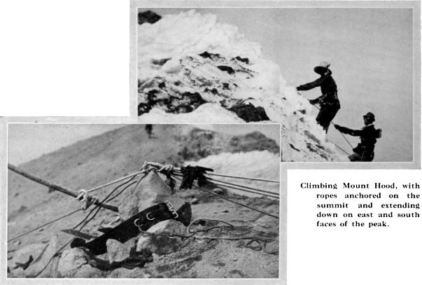
Visitors going to Mount Hood from Portland have choice of a second very
attractive hotel base in Government Camp, on the south slope at an altitude
of thirty-nine hundred feet. This is reached by automobiles from the city,
over a fair road that will soon be a good road, thanks to the Portland Automobile
Club. The mountain portion of this highway is the historic Barlow
road, opened in 1845, the first wagon road constructed across the Cascades.
As the motor climbs out of the Sandy River valley, and grapples the steep
moraines built by ancient icefields, the traveler gets a very feeling reminder
of the pluck of Captain Barlow and his company of Oregon "immigrants" in
forcing a way across these rugged heights. But the beauty of the trip makes
it well worth while, and Government Camp gives access to a side of the peak
that should be visited by all who would know how the sun can shatter a big
mountain with his
mighty tools of ice.
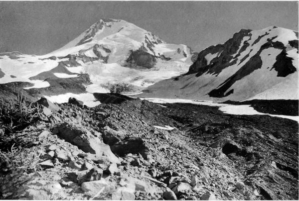 North side of Mount Hood, seen from moraine of Coe glacier. This glacier flows down from the summit, where its snow-field adjoins that of Eliot glacier (left). West of the Coe, the Ladd glacier is seen, separated from the former by Pulpit Rock, the big crag in the middle distance, and Barrett Spur, the high ridge on the right.
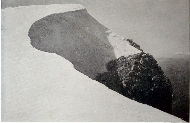
COPYRIGHT, G. M. WEISTER
Looking west on summit of Mount Hood, with Mazama Rock below.
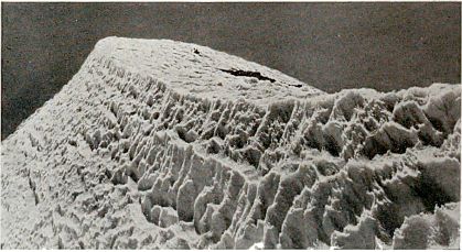 Summit of Mount Hood, from Mazama Rock, showing the sun-cupped ice of midsummer.
The hotel here
was erected in 1900
by O. C. Yocum,
under whose competent
guidance
many hundreds of
climbers reached the
summit of Mount
Hood. The Hotel
is now owned by
Elisha Coalman, who
has also succeeded to
his predecessor's office as guide. During the last year he has enlarged his inn,
and he is now also building comfortable quarters for climbers at a camp four
miles nearer the snow line, on the ridge separating White River glacier from
Zigzag glacier.
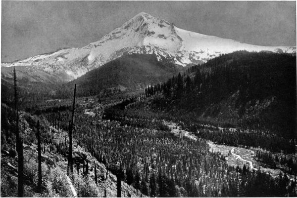 Mount Hood, seen from Sandy River canyon, six miles west of snow line. This important picture begins with Barrett Spur and Ladd glacier on the north
sky line (left). On the northwest face of the peak is the main Sandy glacier, its end divided by a ridge into two parts. The forested "plowshare"
projecting into the canyon is Yocum Ridge. South of it the south branch of the Sandy river flows down from a smaller glacier called the Little
Sandy, or Reid. The broad bottom of this canyon and the scored cliffs on its sides show that it was formerly occupied by the glacier.
Mount Hood, seen from Sandy River canyon, six miles west of snow line. This important picture begins with Barrett Spur and Ladd glacier on the north
sky line (left). On the northwest face of the peak is the main Sandy glacier, its end divided by a ridge into two parts. The forested "plowshare"
projecting into the canyon is Yocum Ridge. South of it the south branch of the Sandy river flows down from a smaller glacier called the Little
Sandy, or Reid. The broad bottom of this canyon and the scored cliffs on its sides show that it was formerly occupied by the glacier.
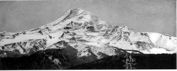
Mount Hood is the highest mountain in Oregon, and because of a general
symmetry in its pyramidal shape and its clear-cut, far-seen features of rock and
glacier, it has long been recognized as one of the most beautiful of all American
snow peaks. Rising from the crest of the Cascades, it presents its different
profiles and variously
sculptured faces to the entire
valley of the Columbia,
east and west, above
which it towers in stately
magnificence, a very king
of the mountains, ruling
over a domain of ranges,
valleys and cities proud
of their allegiance.
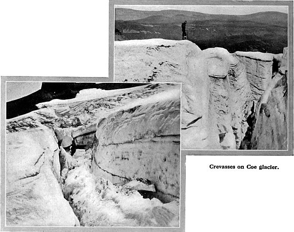
On October 20, 1792,
Lieutenant Broughton, of
Vancouver's exploring expedition
in quest of new
territories for His Majesty George III., discovered from the Columbia
near the mouth of the Willamette, "a very distant high snowy mountain,
rising beautifully conspicuous," which he strangely mistook to be the source
of the great river. Forthwith he named it in honor of Rear Admiral Samuel
Hood, of the British Admiralty who had distinguished himself in divers naval
battles during the American and French Revolutions.
The mountain has been climbed more often than any other American
snow-peak. The first ascent was made on August 4, 1854, from the south
side, by a party under Captain Barlow, builder of the "immigrant road."
One of the climbers, Editor Dryer of The Oregonian, published an account
of the trip in which,
with more exactness
than accuracy, he
placed the height of
the mountain at
18,361 feet! The most
notable ascent by a
large party took place
forty years later,
when nearly two hundred
men and women
met on the summit,
and there, with parliamentary
dispatch
bred of a bitter wind,
organized a mountain
club which has since
become famous. For
its title they took the
name "mazama,"
Mexican for the
mountain goat, close
kin to the Alpine
chamois. Membership
was opened to those who have scaled a snow-peak on foot. By their
publications and their annual climbs, the Mazamas have done more than
any other agency to promote interest in our Northwestern mountains.
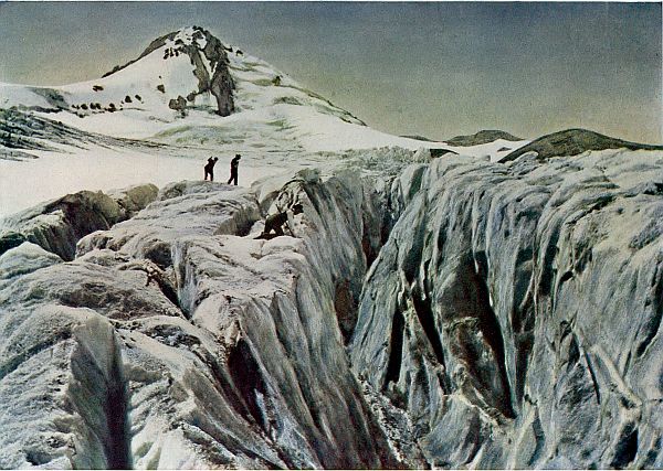
COPYRIGHT, G. M. WEISTER
Mount Hood, with Crevasses of Eliot Glacier in foreground.
"Evermore the wind
Is thy august companion; yea, thy peers
Are cloud and thunder, and the face sublime
Of the blue mid-heaven."—Henry Clarence Kendall.
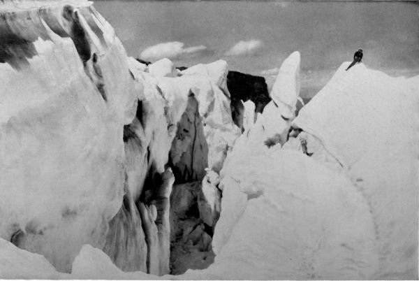
COPYRIGHT, G. M. WEISTER
Crevasses and Ice Pinnacles on Eliot Glacier, Mount Hood.
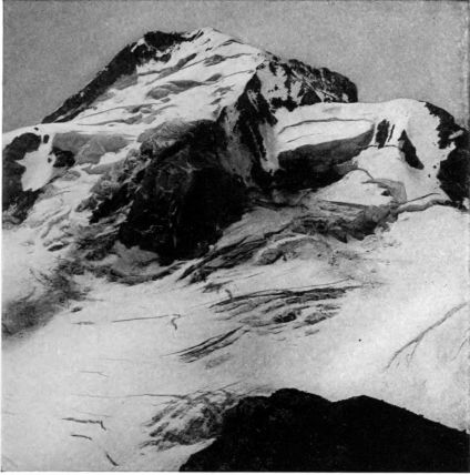 Mount Hood, seen from the top of Barrett Spur. On the left, cascading
down from the summit, is Coe glacier; on the right, Ladd glacier.
The high cliff separating them is "Pulpit Rock."
Mount Hood, seen from the top of Barrett Spur. On the left, cascading
down from the summit, is Coe glacier; on the right, Ladd glacier.
The high cliff separating them is "Pulpit Rock."
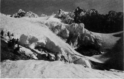 Ice Cascade, south side of Mount Hood, near head of White River glacier.
Mount Hood stands, as I have said, upon the summit of the Cascades.
The broad and comparatively level back of the range is here about four
thousand feet above
the sea. Upon this
plane the volcano
erected its cone,
chiefly by the expulsion
of scoriæ
rather than by extensive
lava flows, to
a farther height of
nearly a mile and a
half. There is no
reason to suppose
that it ever greatly
exceeded its present
altitude, which government
observations
have fixed at 11,225
feet. Its diameter at
its base is approximately
seven miles
from east to west.
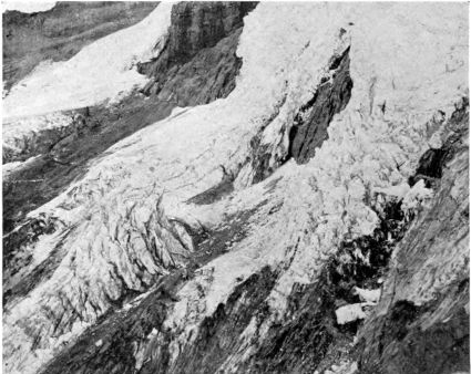 Little Sandy or Reid glacier, west side of Mount Hood.
Compared with
Mount Adams, its
broken and decapitated
northern neighbor,
Mount Hood,
although probably
dating from Miocene
time, is still young
enough to have retained
in a remarkable
degree the general
shape of its
original cone. But
as we approach it from any direction, we find abundant proof that powerful
destructive agents have been busy during the later geological ages.
Already the summit plateau upon which the peak was built up has been
largely dissected by the glaciers and their streams. The whole neighborhood
of the mountain is a vastly rugged district of glacial canyons and eroded
water channels, trenched deep in the soft volcanic ashes and the underlying
ancient rock of the range. The mountain itself, although still a pyramid, also
has its story of age and loss. Its eight glaciers have cut away much of its
mass. On three sides they have burrowed so deeply into the cone that its
original angle, which surviving ridges show to have been about thirty degrees,
has on the upper
glacial slopes been
doubled. This is well
illustrated by the views
shown on pages 58, 61,
69 and 71.
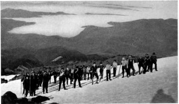 Portland Y. M. C. A. party starting for the summit at daybreak.
South side of Mount Hood.
Portland Y. M. C. A. party starting for the summit at daybreak.
South side of Mount Hood.
This cutting back
into the mountain has
greatly lessened the
area of the upper
snow-fields. The reservoirs
feeding the
glaciers, are therefore
much smaller
than of old, but, by
way of compensation, present a series of most interesting ice formations
on the steeper slopes. In this respect, Mount Hood is especially noteworthy
among our Northwestern snow-peaks. While larger glaciers are
found on other mountains, none are more typical. The glaciers of Hood
especially repay study because of their wonderful variety of ice-falls, terraces,
seracs, towers, castles, pinnacles and crevasses. Winter has fashioned a
colossal architecture of wild forms.
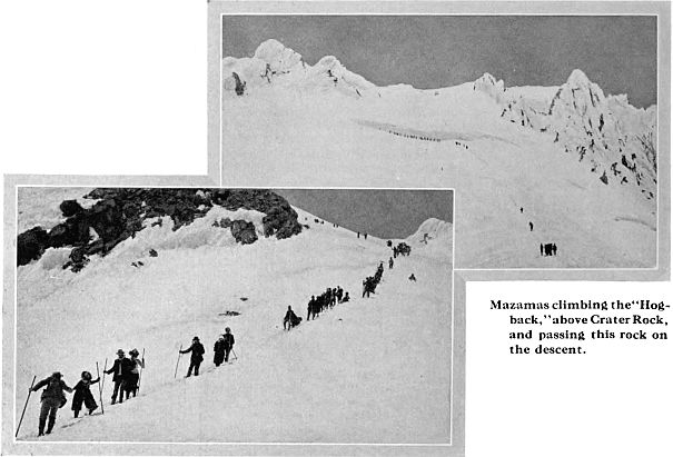
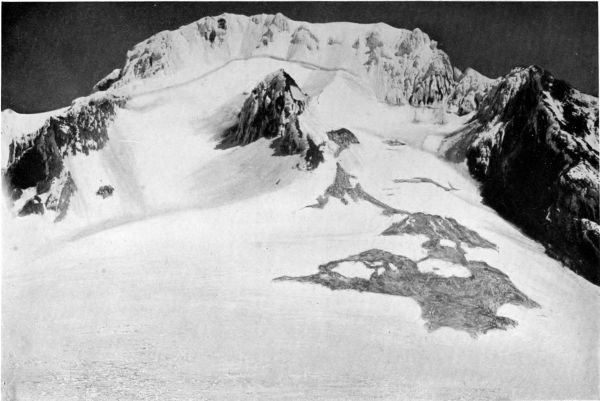 Crater of Mount Hood, seen from south side. Its north rim is the distant summit ridge. Steel's Cliff (right) and Illumination Rock (left) are parts of
east and west rims. The south wall has been torn away, but the hard lava core remains in Crater Rock, the cone rising in center. Note the climbers
ascending the "Hog-back" or ridge leading from Crater Rock up to the "bergschrund," a great crevasse which stretches across the crater at head of
the glaciers. The ridge in foreground is Triangle Moraine. On its right is White River glacier; on left, the fan-shaped Zigzag glacier.
Crater of Mount Hood, seen from south side. Its north rim is the distant summit ridge. Steel's Cliff (right) and Illumination Rock (left) are parts of
east and west rims. The south wall has been torn away, but the hard lava core remains in Crater Rock, the cone rising in center. Note the climbers
ascending the "Hog-back" or ridge leading from Crater Rock up to the "bergschrund," a great crevasse which stretches across the crater at head of
the glaciers. The ridge in foreground is Triangle Moraine. On its right is White River glacier; on left, the fan-shaped Zigzag glacier.
Ye ice-falls! ye that from the mountain's brow
Adown enormous ravines slope amain,—
Torrents, methinks, that heard a mighty voice,
And stopped at once amid their maddest plunge!
Motionless torrents! silent cataracts!
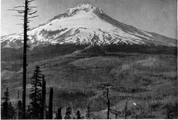 South side of Mount Hood, seen from crag on Tom-Dick-and-Harry Ridge, five miles from the snow-line.
A thousand feet below is the hotel called "Government Camp," with the Barlow road, the first
across the Cascades. On left are Zigzag and Sand canyons, cut by streams from Zigzag glacier above.
South side of Mount Hood, seen from crag on Tom-Dick-and-Harry Ridge, five miles from the snow-line.
A thousand feet below is the hotel called "Government Camp," with the Barlow road, the first
across the Cascades. On left are Zigzag and Sand canyons, cut by streams from Zigzag glacier above.
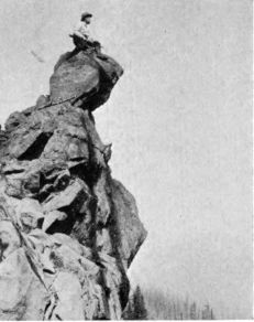 Crag on which above view was taken.
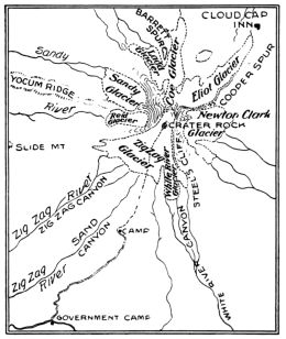
The visitor who begins his acquaintance
with Mount Hood on the north side has, from
Cloud Cap Inn, four interesting glaciers within
a radius of a few miles. Immediately before the
Inn, Eliot glacier displays its entire length of
two miles, its snout being only a few rods away.
West of this, Coe and Ladd glaciers divide the
north face with the Eliot. All three have
their source in neighboring reservoirs near the
summit, which have been greatly reduced
in area. This, with
the resulting shrinkage
in the glaciers,
is shown by the high
lateral moraines left
as the width of the
ice streams has lessened.
On the east
slope is a fine cliff
glacier, the Newton
Clark, separated from
the Eliot by Cooper
Spur, a long ridge
that furnishes the
only feasible north-side
route for climbers
to the summit.
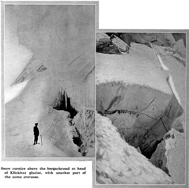
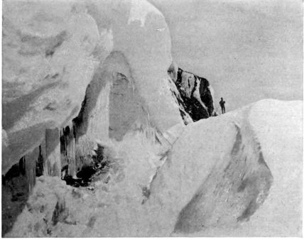 Part of the "bergschrund" above Crater Rock. A bergschrund is a
crevasse of which the lower side lies much below its upper side. It
is caused by a sharp fall in the slope, or by the ice at the head of a
glacier pulling away from the packed snow above.
Part of the "bergschrund" above Crater Rock. A bergschrund is a
crevasse of which the lower side lies much below its upper side. It
is caused by a sharp fall in the slope, or by the ice at the head of a
glacier pulling away from the packed snow above.
Climbing Cooper
Spur is a tedious
struggle up a long
cinder slope, but it
has its reward in fine views of the near-by glaciers and a wide outlook over
the surrounding country. A tramp of three miles from the Inn covers the easier
grade, and brings the climber to a height of eight thousand feet. A narrow,
snow-covered chine now offers a windy path to the foot of the steeper slope
(See p. 60). The climb ends with the conquest of a half-mile of vertical elevation
over a grade that tests muscle, wind and nerve. This is real mountaineering,
and as the novice clutches the rocks, or carefully follows in the steps cut
by the guide, he recalls
a command well
adapted to such trying
situations:
"Prove all things;
hold fast that which
is good." But the
danger is more apparent
than real, and
the goal is soon
reached.
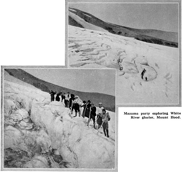
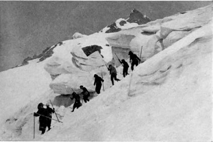 Prof. Harry Fielding Reid and party exploring Zigzag glacier, south side
of Mount Hood. Illumination Rock is seen beyond.
Prof. Harry Fielding Reid and party exploring Zigzag glacier, south side
of Mount Hood. Illumination Rock is seen beyond.
The south-side
route, followed by
the Barlow party of
1854, was long
deemed the only
practicable trail to
the summit. Many years later, William A. Langille discovered the route up
from Cooper Spur. The only accident charged against this path befell a stranger
who was killed in trying to climb it without a guide. Its steepness is, indeed,
an advantage, as it requires less time than the other route. Climbers frequently
ascend by one trail and descend by the other, thus making the trip between
Cloud Cap Inn and Government Camp in a day.
The actual summit of Mount Hood is a narrow but fairly level platform,
a quarter of a mile long, which is quickly seen to be part of the rim of the ancient
crater. Below it, on the north, are the heads of three glaciers already mentioned,
the Eliot, Coe and Ladd; and looking down upon them, the climber
perceives that here the mountain has been so much cut away as to be less a
slope than a series
of precipices, with
very limited benches
which serve as gathering
grounds of snow.
(See pp. 55, 67 and
70.) These shelves
feed the lower ice-streams
with a diet of
avalanches that is
year by year becoming
less bountiful as
this front becomes
more steep. Soon, indeed, geologically speaking, the present summit, undermined
by the ice, must fall, and the mountain take on a new aspect, with a lower,
broader top. Thus while the beautiful verse which I have quoted under the
view of Mount Hood from White Salmon (p. 56) is admirable poetry, its last line
is very poor geology. This, however, need not deter any present-day climbers!
On the south side of the summit ridge a vastly different scene is presented.
Looking down over its easy slope, one recognizes even more clearly than from
the north-side view that Mount Hood is merely a wreck of its former graceful
cone, a torn and disintegrating remnant, with very modest pretensions to symmetry,
after all, but still a fascinating exhibit of the work of such Gargantuan
forces as hew and whittle such peaks.
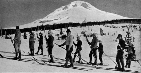 Portland Ski Club on south side of Mount Hood, above Government Camp.
The crater had a diameter of about half a mile. Its north rim remains in
the ridge on which our climber stands. All the rest of its circumference has
been torn away, but huge fragments of its wall are seen far below, on the right
and left, in "cleavers" named respectively Illumination Rock and Steel's Cliff.
One of these recalls several displays of red fire on the mountain by the Mazamas.
The other great abutment was christened in honor of the first president
of that organization.
Apart from these ridges, the entire rim is missing; but below the spectator,
at what must have been the center of its circle, towers a great cone of lava,
harder than the andesitic rocks and the scoriæ which compose the bulk of the
mountain. This is known as Crater Rock. It
is the core of the crater, formed when the molten
lava filling its neck cooled and hardened. Around
it the softer mass has worn down to the general
grade of the south slope, which extends five
miles from just below the remaining north rim
at the head of the glaciers to the neighborhood
of Government Camp, far down on the Cascade
plateau. The grade is much less than thirty
degrees. Over the slope flow down two glaciers,
the Zigzag on the west, and the White River
glacier on the east, of Crater Rock.
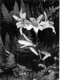 Mount Hood Lily.
(L. Washingtonianum)
It is sometimes said that the south side of
the old summit was blown away by a terrific
explosion. That is improbable, in view of Crater
Rock, which indicates a dormant volcano when
the south side was destroyed. The mountain was doubtless rent by ice rather
than by fire. The mass of ice and snow in and upon the crater broke apart
the comparatively loose wall, and pushed its shattered tuffs and cinders far
down the slopes. Forests were buried, old canyons were filled, and the whole
southwest side of the mountain was covered with the fan-shaped outwash
from the breach. Through this debris of the ancient crater the streams at the
feet of the glaciers below are cutting vast ravines which can be seen from the
heights above. (See
illustrations, pp. 77-81.)
The central situation
of Mount Hood makes
the view from its summit
especially worth
seeking. From the Pacific
to the Blue Mountains,
south almost to
the California line, and
north as far, it embraces
an area equal to a great
state, with four hundred
miles of the undulating
Cascade summits
and a dozen calm and
radiant snow-peaks. The
Columbia winds almost
at its foot, and a multitude
of lakes, dammed
by glacial moraines and lava dikes, nestle in its shadow. This view "covers
more history," as Lyman points out, than that from any other of our peaks.
About its base the Indians hunted, fished and warred. Across its flank rolled
the great tide of Oregon immigration, in the days of the ox-team and settler's
wagon. It has seen the building of two states. It now looks benignly down
upon the prosperous agriculture and growing cities of the modern Columbia
basin, and no doubt contemplates with serenity the time when its empire shall
be one of the most populous as it is one of the most beautiful and fertile regions
in America. No wonder the shapely mountain lifts its head with pride!
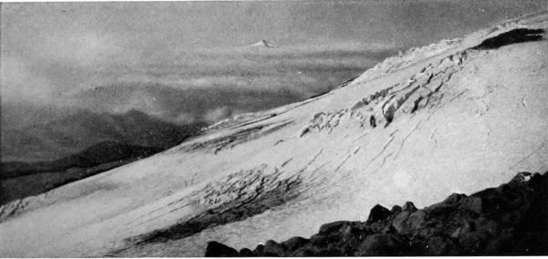 Newton Clark glacier, east side of Mt. Hood, seen from Cooper Spur, with Mt. Jefferson fifty miles south.
Returning to the glaciers of the north side, we note that all three end at
an altitude close to six thousand feet. None of them has cut a deep, broad
bed for itself like the great radiating canyons which dissect the Rainier National
Park and protect its glaciers down to a level averaging four thousand feet.
Instead, these glaciers lie up on the side of Mount Hood, in shallow beds which
they no longer fill; and are banked between double and even triple border
moraines, showing successive advances and retreats of the glaciers. (See illustration,
top of p. 59.) The larger moraines stand fifty to a hundred feet
above the present ice-streams, thus indicating the former glacier levels. No
vegetation appears on these desolate rock and gravel dikes. The retreat of
the glaciers was therefore comparatively recent.
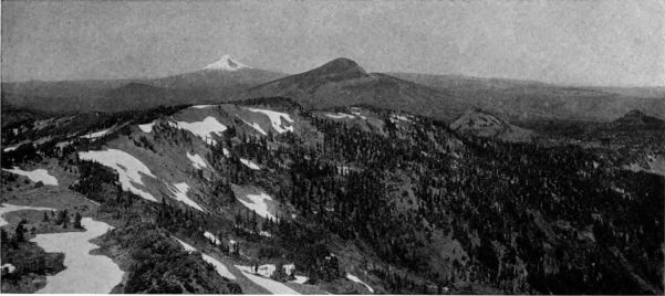 Looking from Mount Jefferson, along the summits of the Cascades, to Mount Hood.
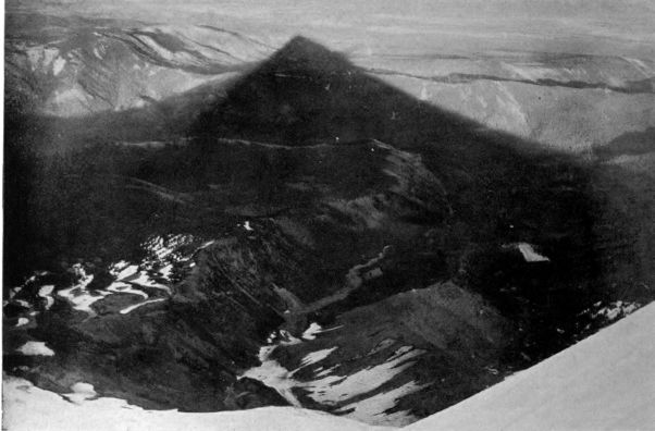
COPYRIGHT, G. M. WEISTER
Shadow of Mount Hood, seen from Newton Clark glacier shortly before sunset. View shows two branches
of East Fork of Hood River, fed by the glacier, and the canyon of the East Fork, turning north. Beyond
it (left) are Tygh Hills and wheat fields of the Dufur country. On the right is Juniper Flat, with
the Deschutes canyon far beyond.
 Snout of Newton Clark glacier.
COPYRIGHT, B. A. GIFFORD
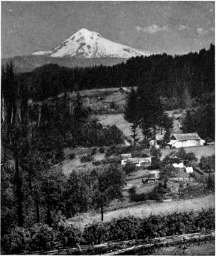
Mount Hood and Hood River, seen from a point twenty miles north of the mountain.
Eliot glacier has been found by measurement near its end, to have a movement
of about fifty feet a year. On the steeper slope above, it is doubtless
much greater. All the three glaciers are heavily covered, for their last half
mile, with rocks and
dirt which they have
freighted down from
the cliffs above, or
dug up from their
own beds in transit.
None of the lateral
moraines extends
more than two or
three hundred yards
below the snout of
its glacier. Each glacier,
at its end, drops
its remnant of ice into
a deep V-shaped
ravine, in which, not
far below, trees of
good size are growing.
Hence it would not seem that
these north-side glaciers have ever
extended much farther than they do
at present. The ravine below Eliot
glacier, however, half a mile from
the snout, is said to show glacial
markings on its rocky sides. It is
evident, in any case, that the deep
V cuttings now found below the glaciers
are work of the streams. If
these glaciers extended farther, it
was at higher levels than their present
stream channels. As the glaciers
receded, their streams have cut the
deep gorges in the soft conglomerates.
Between Eliot and Coe glaciers are
large snow-fields, ending much farther
up than do the glaciers; and below
these, too, the streams have trenched
the slope. (See illustration, p. 57.)
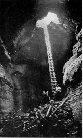 Lava Flume near Trout Lake, about thirty feet
wide and forty feet high.
Lava Flume near Trout Lake, about thirty feet
wide and forty feet high.
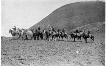 Y. M. C. A. party from North Yakima at Red Butte, an extinct
volcano on north side of Mount Adams.
Y. M. C. A. party from North Yakima at Red Butte, an extinct
volcano on north side of Mount Adams.
Between Coe and Ladd glaciers
is a high rocky ridge known as Barrett
Spur, from which, at nearly
8,000 feet, one may obtain glorious
views of the peak above, the two
glaciers sweeping down its steep face
and the sea of ranges stretching westward. (See illustrations, pp. 69 and 75.)
Barrett Spur may have been part of the original surface of the mountain, but
is more likely the remnant of a secondary cone, ice and weathering having
destroyed its conical shape. From its top, the climber looks over into the
broad-bottomed canyon of
Sandy River, fed by the large
and small Sandy glaciers of
the west slope. (See pp. 71
and 76.) This canyon and
that of the Zigzag River,
south of it, from Zigzag glacier,
are "plainly glacier-sculptured,"
as Sylvester declares.
The same is true of the canyon
lying below the White
River glacier, on the southeast
slope. In journeying to
Government Camp, one may
see abundant evidence of the glacial
origin of the Sandy and Zigzag canyons.
The White River Canyon has
been thoroughly explored and described
by Prof. Reid.
All three of these wide U-shaped
canyons were once occupied by great
glaciers, which left their record in the
scorings upon the sides of the gorges;
in the mesas of finely ground moraine
which they spread over the bottoms
and through which the modern rivers
have cut deep ravines; in trees broken
and buried by the glaciers in this drift;
in the fossil ice lying beneath it, and
in huge angular boulders left standing
on the valley floors, several miles
from the mountain.
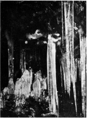 Ice Cave in lava beds near Trout Lake.
Sandy glacier extends three hundred
feet farther down the slope than
do the north-side glaciers, but the
Zigzag and White River glaciers, flowing out of the crater, end a thousand feet
higher. This is due not only to the smaller reservoirs which feed them and
to their southern exposure, but also doubtless to the easier grade, which holds
the ice longer on the slope. On the east side of the peak is a broad ice-stream,
the Newton Clark glacier, which also ends at a high altitude, dropping its ice
over a cliff into deep ravines at the head of East Fork of Hood River. This
glacier, well seen from Cooper
Spur, completes the circuit of the
mountain. (See pp. 83 and 84.)
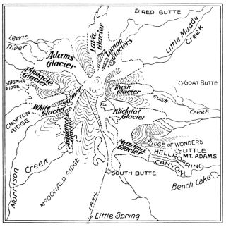 Mount Adams, elevation 12,307 feet.
Sylvester suggests that Mount
Hood may not be extinct but sleeping.
For this, however, there is
little more evidence that may be
discovered on other Northwestern
peaks. About Crater Rock, steam
jets are found, gas escapes, and
the rocks are warm in many places.
"Fumaroles" exist, where the residuary
heat causes openings in the
snow bed. Sylvester reports dense
smoke and steam issuing from Crater
Rock by day and a brilliant
illumination there at night, in
August, 1907. But volcanoes sometimes contradict prophecy, and no further
intimations of trouble having since been offered, this display may be deemed
the last gasp of a dying monster rather than an awakening toward new life.
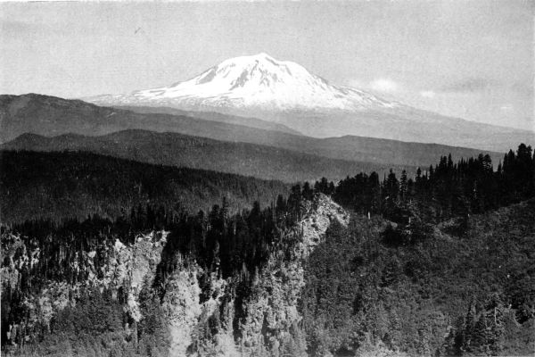
COPYRIGHT, G. M. WEISTER
Telephoto view of Mount Adams, from the northeast side of Mount St. Helens, at elevation of 7,000 feet, overlooking the densely timbered ranges of the
Cascades.
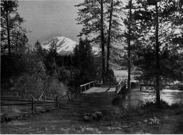 Mount Adams from Trout Creek, at Guler, near Trout Lake; distance twelve miles.
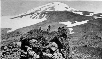 Climbers on South Butte, the hard lava neck of a crater on south slope,
left by weathering of the softer materials of its cone. Elevation,
7,800 feet. The usual route to summit leads up the talus on right.
Climbers on South Butte, the hard lava neck of a crater on south slope,
left by weathering of the softer materials of its cone. Elevation,
7,800 feet. The usual route to summit leads up the talus on right.
Going up the White Salmon Valley toward Mount Adams, the visitor quickly
realizes that he
is in a different geological
district from
that around Mount
Hood. The Oregon
peak is mainly a pile
of volcanic rocks
and cinders ejected
from its crater. Little
hard basalt is
found, and in all its
circumference I
know of only one
large surface area of
new lava. This is a
few miles north of
Cloud Cap, and so recent that no trees grow on it. But north of the Columbia,
one meets evidences of comparatively recent lava sheets in many parts of
the valley. Some obviously have no connection with Mount Adams; they
flowed out of fissures on the ridges. But these beds of volcanic rock become
more apparent, and are less covered with soil, as we approach the mountain,
until, long before timber line is reached, dikes and streams of basalt, as yet
hardly beginning to disintegrate, are found on all sides of the peak.
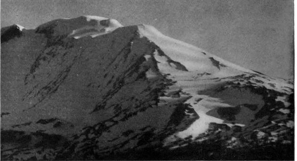 Dawn on Mount Adams, telephotographed from Guler, at 4 a. m., showing the three summit peaks, of
which the middle one is the highest. The route of the climbers is up the south slope, seen on right.
Dawn on Mount Adams, telephotographed from Guler, at 4 a. m., showing the three summit peaks, of
which the middle one is the highest. The route of the climbers is up the south slope, seen on right.
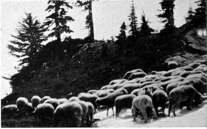 Foraging in the snow. The Mount Adams country supports hundreds
of large flocks of sheep.
Foraging in the snow. The Mount Adams country supports hundreds
of large flocks of sheep.
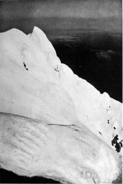
COPYRIGHT, G. M. WEISTER
Steel's Cliff, southeast side of Mount Hood. In the distance is seen Juniper Flat, in eastern Oregon.
The form and slope of Mount Adams tell of an age far greater than
Mount Hood's, but its story is not, like that of Hood, the legible record of
a simple volcanic cone. It wholly lacks the symmetry of such a pile. Viewed
from a distance, it
sits very majestically
upon the summit of
one of the eastern
ranges of the Cascades.
As we approach, however,
it is seen to
have little of the conical
shape of Hood,
still less that of graceful
St. Helens, which
is young and as yet
practically unbroken.
Its summit has been
much worn down by
ice or perhaps by
explosions. Some of its sides are deeply indented, and all are vastly irregular in
angle and markings—here a face now too steeply cut to hold a glacier, but
showing old glacial scorings far down its slope; there another terraced and
ribbed with waves and dikes of lava. The mountain is a long ridge rather than
a round peak, and close inspection shows it to be a composite of several great
cones, leaning one upon another,—the product of many craters acting in
successive ages. On its ancient, scarred slopes, a hundred modern vents have
added to the ruggedness and interest
of the peak. Many of these
blowholes built parasitic cones, from
which the snows of later centuries
have eroded the loose external mass,
leaving only the hard lava cores
upstanding like obelisks. Other
vents belched out vast sheets of
rock that will require a century
more of weathering to make hospitable
even to the sub-alpine trees
most humble in their demands for soil.
COPYRIGHT, G. M. WEISTER.
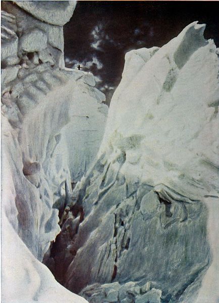
Ice Castle and great Crevasse, near the head of Eliot Glacier, Mt. Hood.
"Touched by a light that hath no name,
A glory never sung,
Aloft on sky and mountain wall
Are God's great pictures hung."—Whittier.
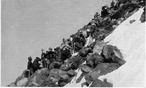 Mazamas climbing a 40° stairway of shattered basalt, north side of Mount Adams.
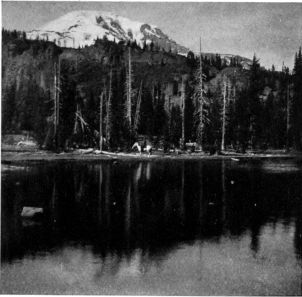 Mount Adams from one of the many lakes on its
southeast slope. On ridge above, near the end
of Mazama glacier, a hotel is to be erected.
Mount Adams from one of the many lakes on its
southeast slope. On ridge above, near the end
of Mazama glacier, a hotel is to be erected.
Mount Adams therefore presents
a greater variety of history, a more
complex and fascinating problem
for the student to unravel, than
any of its neighbors. This interest
extends to the district about it, a country of new lava flows covering much of
the older surface. The same conditions mark the region surrounding the
newer peak, St. Helens, thirty miles west. In each district, sheets of
molten rock have been poured across an ancient and heavily forested land.
Thus as we travel up the rich valleys leading from the Columbia to either
peak, we meet everywhere the phenomena of vulcanism.
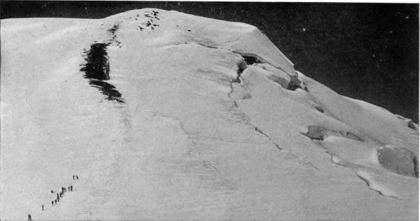 Climbers ascending from South Peak to Middle Peak on Mount Adams, with the "bergschrund" above
Klickitat glacier on right. This central dome is about 500 feet higher than South Peak.
Climbers ascending from South Peak to Middle Peak on Mount Adams, with the "bergschrund" above
Klickitat glacier on right. This central dome is about 500 feet higher than South Peak.
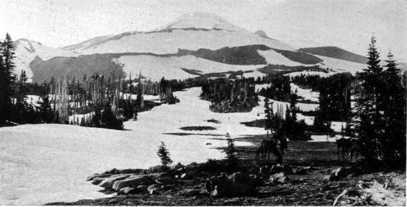 Mount Adams, seen from Happy Valley, south side. Elevation about 7,000 feet. Mazama glacier is on right.
The lava sheet flowing around or over a standing or fallen tree took a perfect
impression of its trunk and bark. Thousands of these old tree casts
are found near both Adams and St. Helens. Where the lava reached a watercourse,
it flowed down in a deeper stream, a river of liquid rock. Lava is
a poor conductor of heat; hence the stream cooled more quickly on the surface
than below. Soon a crust was formed, like the ice over a creek in winter.
Under it the lava flowed on and out, as the flood stopped, leaving a gallery
or flume. Later flows filled the great drain again and again, adding new
strata to its roof, floor and
sides, and lessening its bore.
Long after the outflows
ceased, weathering by heat
and frost broke openings
here and there. Many of the
flumes were choked with drift.
But others, in the newer
lava beds, may be explored
for miles. It was from the
lava caves of northern California
that the Modoc Indians
waged their famous
war in the Seventies.
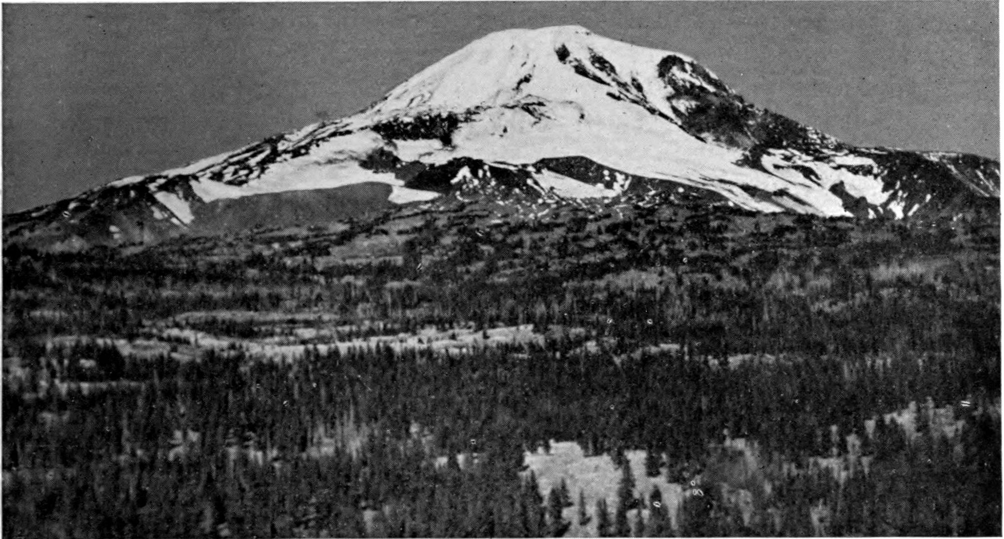 Mount Adams, from Snow-Plow Mountain, three miles southeast of the snow line; elevation 5,070 feet,
overlooking the broad "park" country west of Hellroaring Canyon.
Mount Adams, from Snow-Plow Mountain, three miles southeast of the snow line; elevation 5,070 feet,
overlooking the broad "park" country west of Hellroaring Canyon.
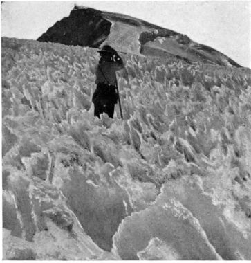
COPYRIGHT, S. C. SMITH
Wind-whittled ice near the summit of Mount Adams.
The disintegration of the
lava galleries in the Mount
Adams field has of course produced
caves of all sorts and
sizes. Where one of these is
closed at one end with debris,
so that the summer air
cannot circulate to displace the heavier cold remaining from winter, the cave,
if it has a water supply, becomes an ice factory. The Trout Lake district
has several interesting examples of such glacieres, as they have been named,
where one may take refuge from July or August heat above ground, and, forty
feet below, in a cave well protected from sun and summer breeze, find great
masses of ice, with more perhaps still forming as water filters in from a surface
lake or an underground spring. The Columbia River towns as far away
as Portland and The Dalles formerly obtained ice from the Trout Lake caves,
but at present they
supply only some
near-by farmers.
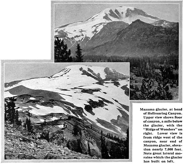
Mount Adams
is ascended without
difficulty by
either its north or
south slope. On
the east and west
faces, the cliffs and ice cascades appall even the expert alpinist. As yet, so
far as I can learn, no ascents have been made over these slopes. The southern
route is the more popular one. It leads by well-marked trails up from
Guler or Glenwood, over a succession of terraces clad in fine, open forest;
ascends McDonald Ridge, amid increasing barriers of lava; passes South
Butte, a decaying pillar of red silhouetted against the black rocks and white
snow-fields; crosses many a caldron of twisted and broken basalt,—"Devil's
Half Acres" that once were the hot, vomiting mouths of drains from the
fiery heart of the peak; scales
a giants' stairway tilted to
forty degrees, overlooking
the west branch of Mazama
glacier on one side and a small
unnamed glacier on the other;
and at last gains the broad
shoulder which projects far
on the south slope. (See
illustrations, pp. 89 and 93.)
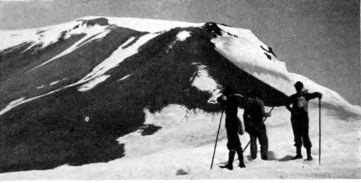 Nearing the summit, south side.
Here, from a height of
nine thousand feet, we look down on the low, wide reservoir of Mazama glacier
on the east, and up to the ice-falls above Klickitat glacier on the higher
slopes beyond. The great platform
on which we stand was built
up by a crater, three thousand feet
below the summit. The climb to
it has disclosed the fact that the
mountain is composed mostly of
lava. Some of the ravine cuttings
have shown lapilli and cinders, but
these are rarer than on the other
Northwestern peaks. The harder
structure has resisted the erosion
which is cutting so deeply into the lower slopes of Hood. On Mount Adams,
not only do the glaciers, with one or two notable exceptions, lie up on the
general surface of the mountain, banked by their moraines; but their streams
have cut few deep ravines.
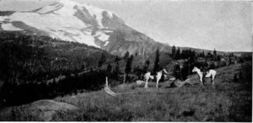 An Upland "Park," west of Hellroaring Canyon.
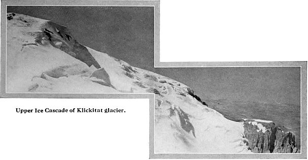
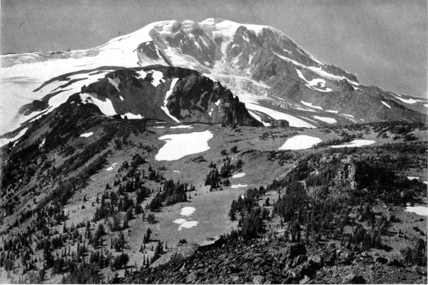 Mount Adams, from the Ridge of Wonders, showing the great amphitheater or "cirque" of Klickitat glacier, fed by avalanches from the summit plateau.
This is the most important example of glacial sculpture on the mountain. Beyond, on the right, is seen the head of Rusk glacier, while on the left
is Mazama glacier. Note the stunted sub-alpine trees scattered thinly over this ridge, even up to an altitude of 7,000 feet.
Mount Adams, from the Ridge of Wonders, showing the great amphitheater or "cirque" of Klickitat glacier, fed by avalanches from the summit plateau.
This is the most important example of glacial sculpture on the mountain. Beyond, on the right, is seen the head of Rusk glacier, while on the left
is Mazama glacier. Note the stunted sub-alpine trees scattered thinly over this ridge, even up to an altitude of 7,000 feet.
From this point, the
route becomes steeper, but
is still over talus, until the
first of the three summit elevations,
known as South
Peak, is reached. This is
only five hundred feet below
the actual summit, Middle
Peak, which is gained by a
short, hard pull, generally
over snow. (See p. 94.) The north-side route is up a long, sharp ridge
between Lava and Adams glaciers (p. 104). Like the other path, its grade
is at first easy; but its last half mile of elevation is achieved over a slope
even steeper, and ending in a longer climb over the snow. Neither route, however,
offers so hard a finish as that which ends the Mount Hood climb. From
the timber-line on either side, the ascent requires six or seven hours.
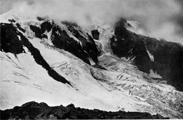 Storm on Klickitat Glacier, seen from the Ridge of Wonders.
The summit ridge is nearly a
mile long and two-thirds as wide.
It is the gathering ground of the
snows that feed Klickitat, Lyman,
Adams and White Salmon glaciers.
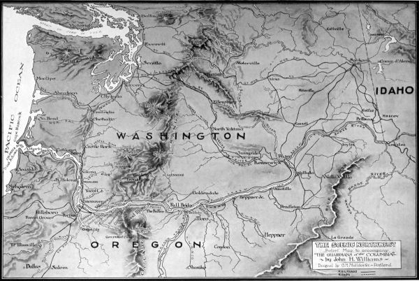
(See map, p. 87.) Mazama, Rusk,
Lava, Pinnacle and Avalanche glaciers lie beneath cliffs too steep to carry
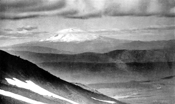
ice-streams. Their income is mainly collected from the slopes, and if they
receive snow from the broad summit at all, it is chiefly in the avalanches of
early summer. Nearly all the glaciers, however, are thus fed in part, the
steep east and west faces making Mount Adams famous for its avalanches.
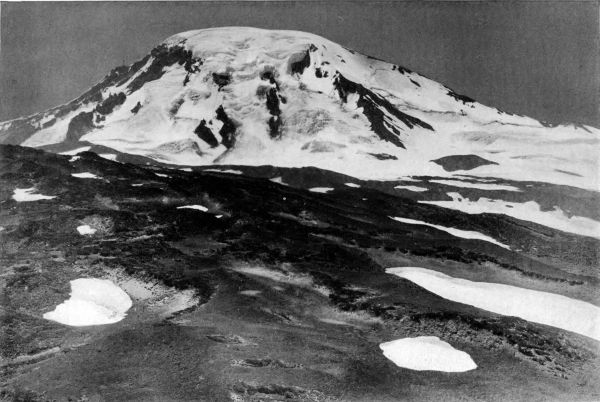 Mount Adams, seen from the northeast, with the Lyman glaciers in center, Rusk glacier on extreme left, and Lava glacier, right. The ridge beyond Lava
glacier is the north-side route to the summit. The Lyman glaciers, like Adams glacier on the northwest side, are noteworthy for their cascades of ice.
Mount Adams, seen from the northeast, with the Lyman glaciers in center, Rusk glacier on extreme left, and Lava glacier, right. The ridge beyond Lava
glacier is the north-side route to the summit. The Lyman glaciers, like Adams glacier on the northwest side, are noteworthy for their cascades of ice.
From the summit on either side, the climber may look down sheer for
half a mile to the reservoirs and great ice cascades of the glaciers below. It is
seen that with the exception of the Rusk and Klickitat, which are deeply
embedded in canyons, the glaciers spread out, fan-like, on the lower slopes,
and are held up by their moraines. Most of them end at elevations considerably
above six thousand five hundred feet.
The difference in this respect between Adams
and Hood is due, no doubt, to lighter rainfall.
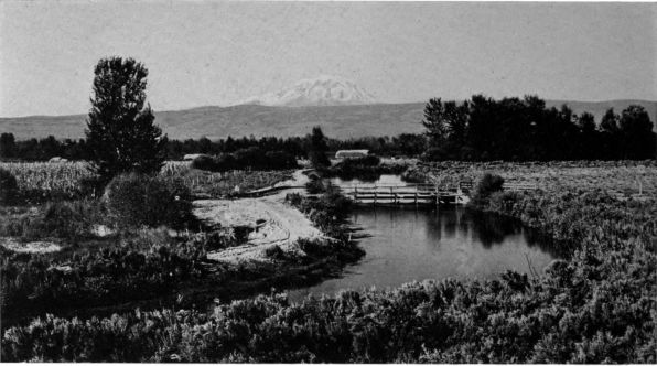
COPYRIGHT, ASAHEL CURTIS
Mount Adams from Sunnyside, Washington, with irrigation "ditch" in foreground.
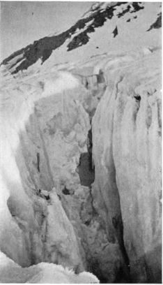 Crevasse in Lava glacier, north side of
Mount Adams.
Crevasse in Lava glacier, north side of
Mount Adams.
Of the two glaciers just mentioned the
Klickitat is the larger and more typical.
The Rusk, however, is of interest because it
flows, greatly crevassed, down a narrow flume
or couloir on the east slope. Its bed, Reid
suggests, may have been the channel of "a
former lava flow, which, hardening on the
surface, allowed the liquid lava inside to
flow out; and later the top broke in." The
Klickitat glacier lies in a much larger canyon,
which it has evidently cut for itself. This
is one of the most characteristic glacial
amphitheaters in America, resembling, though
on a smaller scale, the vast Carbon glacier
cirque which is the crowning glory of the
Rainier National Park. The Klickitat basin
is a mile wide. Into it two steep ice-streams
cascade from the summit, and avalanches
fall from a cliff which rises two thousand feet
between them. (See pp. 98 and 99.)
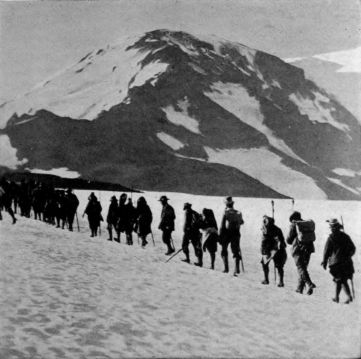 North Peak of Mount Adams, with The Mountaineers beginning
their ascent, in 1911. Their route led up the
ridge seen here, which divides Lava glacier, on the left,
from Adams glacier, on extreme right.
North Peak of Mount Adams, with The Mountaineers beginning
their ascent, in 1911. Their route led up the
ridge seen here, which divides Lava glacier, on the left,
from Adams glacier, on extreme right.
The glacier is more than
two miles long. It ends at
an elevation of less than six
thousand feet, covered with
debris from a large medial
moraine formed by the junction
of the two tributary
glaciers. Like the other
Mount Adams glaciers, and
indeed nearly all glaciers in
the northern hemisphere, it
is shrinking, and has built
several moraines on each
side. These extend half a
mile below its present snout,
and the inner moraines are
underlaid with ice, showing
the retreat has been recent.
South of the Klickitat
glacier, a part of the original
surface of the peak remains
in the great Ridge of Wonders.
Rising a thousand feet above the floor of Hellroaring Canyon, which
was formerly occupied by Mazama glacier, now withdrawn to the slope above,
this is the finest observation point on the mountain. "The wonderful views
of the eastern precipices and glaciers," says Reid, "the numerous dikes, the
well preserved parasitic cone of Little Mount Adams, and the curious forms
of volcanic bombs scattered over its surface entirely justify the name Mr. Rusk
has given to this ridge."
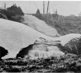 Snow Bridge over Killing Creek, north of Mount Adams.
Adams glacier, upon the
northwest slope, with a length
of three miles, is the largest on
the mountain. This and the
two beautiful ice streams on the
northeast, named after Prof. W.
D. Lyman, are notable for their
ice-falls, half-mile drops of
tumbling, frozen rivers.
The naming of the mountain
was a result of the movement
started by Hall J. Kelley,
the Oregon enthusiast, in 1839.
The northwestern snow-peaks,
so far as shown in maps of the
period, bore the names given by
Vancouver as part of his annexation
for George III. The utility, beauty
and historic fitness of the significant
Indian place names did not occur to
a generation busy in ousting the Indian
from his land; but our grandfathers
remembered George III.
Kelley and other patriotic men of the
time proposed to call the Cascades the
"Presidents' Range," and to christen
the several snow-peaks for individual
ex-presidents of the United
States. But the second quarter of the
last century knew little about Oregon,
and cared less. The well-meant but
premature effort failed, and the only
names of the presidents which have
stuck are Adams and Jefferson. Lewis
and Clark mistook Mount Adams for
St. Helens, and estimated it "perhaps
the highest pinnacle in America."
The Geological Survey has found its
height to be 12,307 feet. Mount
Adams was first climbed in 1854 by
a party in which were Col. B. F. Shaw, Glenn Aiken and Edward J. Allen.
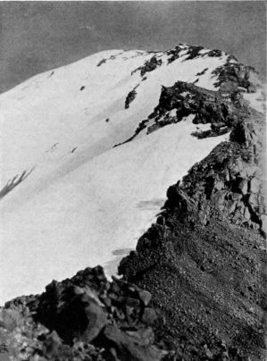 North-side Cleaver, with Lava glacier on left. This
sharp spine was climbed by The Mountaineers
and the North Yakima Y. M. C. A. party in 1911.
North-side Cleaver, with Lava glacier on left. This
sharp spine was climbed by The Mountaineers
and the North Yakima Y. M. C. A. party in 1911.
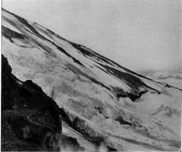 Looking across Adams glacier, northwest side of Mount Adams,
from ridge shown above.
Looking across Adams glacier, northwest side of Mount Adams,
from ridge shown above.
The world was indebted for its first knowledge of Mount St. Helens to Vancouver.
Its name is one of the
batch which he fastened in
1792 upon our Northwestern
landmarks. These honored a
variety of persons, ranging
from Lord St. Helens, the
diplomat, and pudgy Peter
Rainier, of the British Admiralty,
down to members of
the explorer's crew.
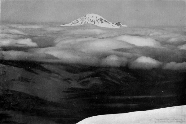
"The Mountain that Was 'God'," the great peak which the Indians reverenced and named "Tacoma," seen above the clouds of a rainy day, from the
summit of Mount Adams, distant forty miles.
"This," said a well-known lecturer, as the
picture was thrown upon his screen, "is the
scene the angels look down upon!"
The youngest of the Cascade
snow-peaks, St. Helens
is also the most symmetrical
in its form, and to many of its
admirers the most beautiful.
Unlike Hood and Adams, it
does not stand upon the
narrow summit of one of
the Cascade ranges, but rises west of the main ridges of that system from
valley levels about one thousand feet above the sea. Surrounded by comparatively
low ridges, it thus presents its perfect and impressive cone for
almost its entire height of ten thousand feet.
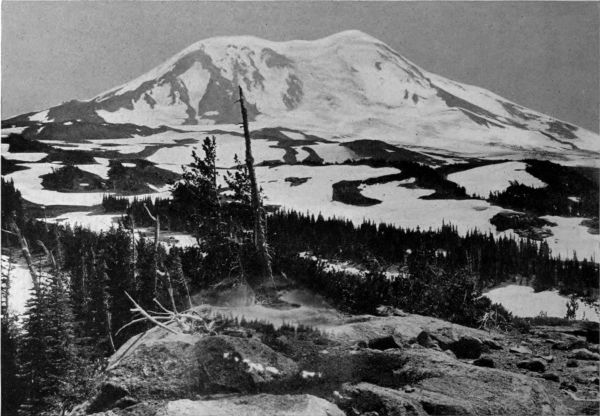 Northwest slope of Mount Adams, with Adams glacier, three miles long, the largest on the mountain.
It has an ice-fall of two thousand feet. The low-lying reservoir of Pinnacle glacier is on extreme right,
and the head of Lava glacier on left.
Northwest slope of Mount Adams, with Adams glacier, three miles long, the largest on the mountain.
It has an ice-fall of two thousand feet. The low-lying reservoir of Pinnacle glacier is on extreme right,
and the head of Lava glacier on left.
The mountain is set well back from the main traveled roads, in the great
forest of southwestern Washington. It is the center of a fine lake and river
district which attracts sportsmen as well as mountain climbers. A large company
visiting it must carry in supplies and camp equipment, but small parties
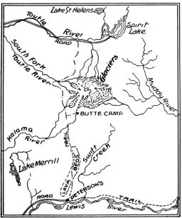
may find accommodation at Spirit Lake on the north, and Peterson's ranch
on Lewis River, south of the peak. The first is four, the second is eight, miles
from the snow line. Visitors from Portland, Tacoma or Seattle, bound for
the north side, leave the railway at Castle Rock, whence a good automobile
road (forty-eight miles) leads to the south side of Spirit Lake. Peterson's
may be reached by road from Woodland (forty-five miles) or from Yacolt
(thirty miles). Well-marked trails lead from either base to camping grounds
at timber line. The mountain is climbed by a long, easy slope on the south,
or by a much steeper path on the north.
Like Mount Adams, St. Helens is largely built of lava, but the outflows
have been more recent here than upon or near the greater peak. The volcano
was in eruption several times between 1830 and 1845. The sky at Vancouver
was often darkened, and ashes were carried as far as The Dalles. To these
disturbances, probably, are due the great outflows of new lava covering the
south and west sides of the mountain, and much of the country between it and
the North Fork of Lewis River. The molten stream flowed westward to Goat
Mountain and the "Buttes," of which it made islands; threw a dike across a
watercourse and created Lake Merrill; and turning southward, filled valleys
and overwhelmed good forest with sheets of basalt. Upon the slope just north
of Peterson's, a great synclinal thus buried
presents one of the latest pages in the volcanic
history of the Columbia basin.
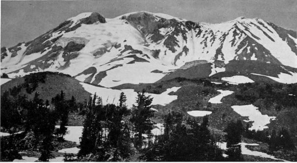 Mount Adams from the southwest, with White Salmon glacier (left) and Avalanche glacier (right) flowing
from a common source, the cleft between North and Middle Peaks. The latter, however, derives
most of its support from slopes farther to right. Note the huge terminal moraines built by these
glaciers in their retreat. Pinnacle glacier is on extreme left.
Mount Adams from the southwest, with White Salmon glacier (left) and Avalanche glacier (right) flowing
from a common source, the cleft between North and Middle Peaks. The latter, however, derives
most of its support from slopes farther to right. Note the huge terminal moraines built by these
glaciers in their retreat. Pinnacle glacier is on extreme left.
 Mount St. Helens, elevation 10,000 feet.
Many hours may be spent with interest
upon this lava bed. It is an area of the wildest
violence, cast in stone. Swift, ropy
streams, cascades, whirling eddies, all have
been caught in their course. "Devil's Punch
Bowl," "Hell's Kitchen," "Satan's Stairway"
are suggestive phrases of local description.
The underground galleries here are
well worth visiting. Tree tunnels and wells
abound. Most important of all, the struggle
seen everywhere of the forest to gain a foothold
on this iron surface illustrates Nature's
method of hiding so vast and terrible a
callus upon her face. It is evident that the
healing of the wound began
as soon as the lava cooled,
and that, while still incomplete,
it is unceasingly
prosecuted. (See p. 111.)
The first volcanic dust
from the uneasy crater of
St. Helens had no sooner
lodged in some cleft opened
by the contraction of cooling
than a spore or seed
carried by the wind or
dropped by a bird made a
start toward vegetation.
Failing moisture, and
checked by lack of soil, the
lichen or grass or tiny
shrub quickly yielded its
feeble existence in preparation
for its successor. The
procession of rain and sun
encouraged other futile
efforts to find rootage.
Each of these growths
lengthened by its decay
the life of the next. With
winter came frost, scaling
flakes from the hard surface,
or penetrating the
joints and opening fissures
in the basalt. Further
refuge was thus made
ready for the dust and
seeds and moisture of another
season. The moss
and plants were promoters
as well as beneficiaries of
this disintegration. Their
smallest rootlets found the
water in the heart of the
rocks, and growing strong
upon it, shattered their
benefactors.
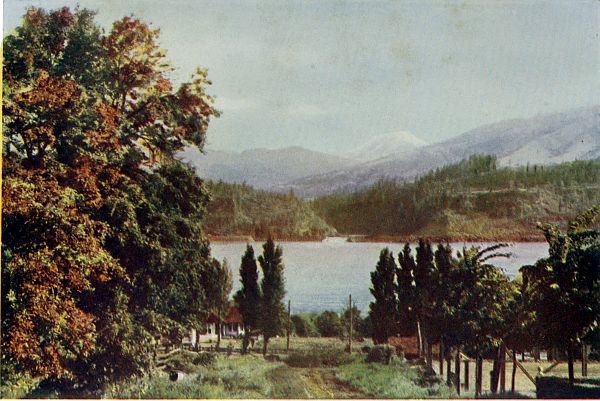
COPYRIGHT, B. A. GIFFORD
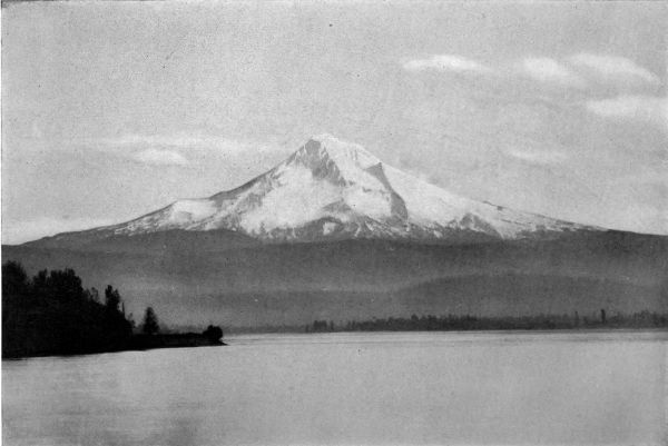
Columbia River and Mount Adams, seen from Hood River, Oregon.
"And forests ranged like armies, round and round
At feet of mountains of eternal snow;
And valleys all alive with happy sound,—
The song of birds; swift streams' delicious flow;
The mystic hum of million things that grow."—Helen Hunt Jackson.
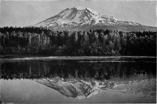
COPYRIGHT, KISER PHOTO CO.
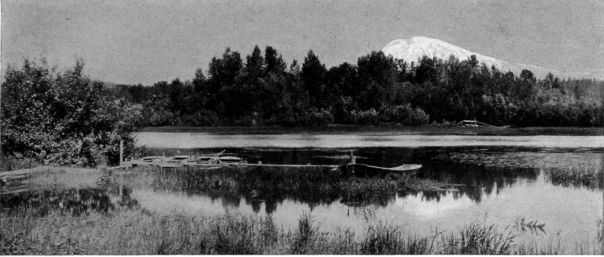
Southwest side of Mount Adams, reflected in Trout Lake, twelve miles south of the mountain.
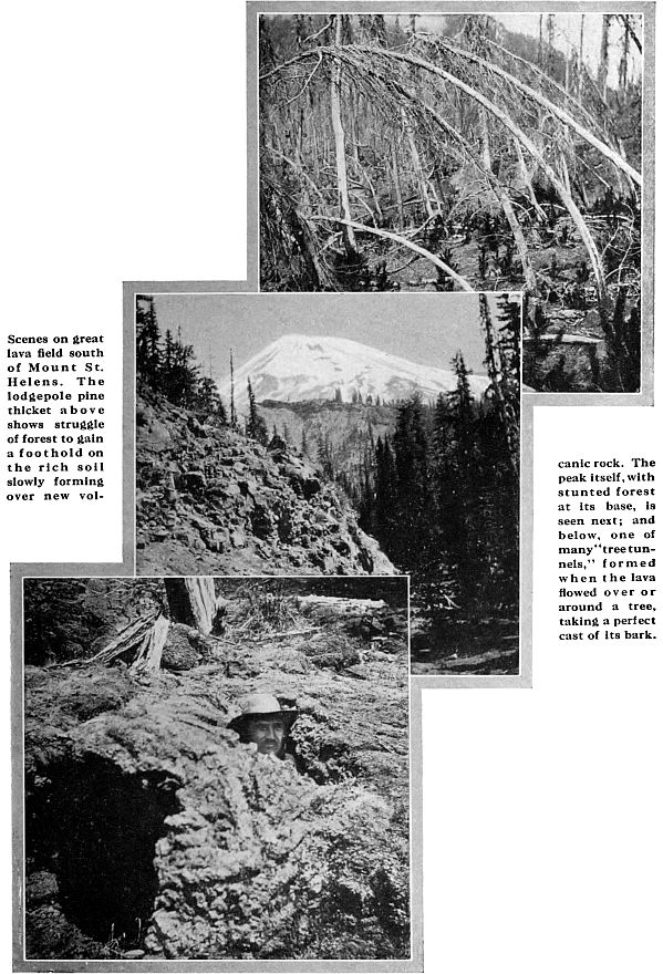
Soon more ambitious enterprises
were undertaken.
Huckleberry bushes, fearless
even of so unfriendly a
surface, started from every
depression among the rocks. The first
small trees appeared. Weakling pines,
dwarf firs and alders, shot up for a
few feet of hurried growth in the
spring moisture, taking the unlikely
chance of surviving the later drought.
Here and there a seedling outlasted
the long, dry summer, and began to
be a real tree. Quickly exhausting its
little handful of new earth, the daring
upstart must have perished had not
the melting snows brought help.
They filled the hollows with wash
from the higher slopes. The treelets
found that their day had come, and
seizing upon these rich but shallow
soil beds, soon covered them with
thickets of spindling lodgepole pines
and deciduous brush. Such pygmy
forests are at length common upon
this great field of torn and decaying
rock, and all are making their contributions
of humus year by year to
the support of future tree giants.
These will rise by survival of the fittest as the forest floor deepens and spreads.
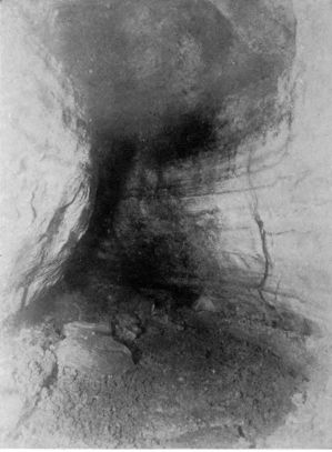 Lava Flume south of Mount St. Helens, a tunnel
several miles in length, about twenty feet high
and fifteen feet wide.
Lava Flume south of Mount St. Helens, a tunnel
several miles in length, about twenty feet high
and fifteen feet wide.
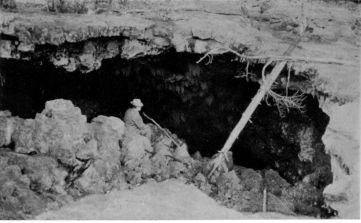 Entrance to Lava Cave shown above. Note strata in roof,
showing successive lava flows; also ferns growing from roof.
Entrance to Lava Cave shown above. Note strata in roof,
showing successive lava flows; also ferns growing from roof.
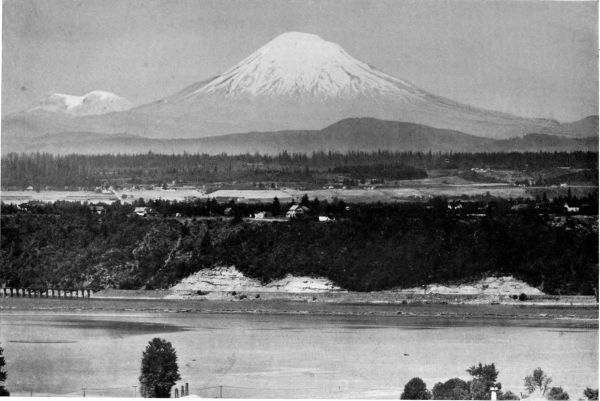 Telephotograph of Mount St. Helens, from the lower part of Portland, with the summit peaks of Mount Rainier-Tacoma in distance on left, and the Willamette
River in foreground.
Telephotograph of Mount St. Helens, from the lower part of Portland, with the summit peaks of Mount Rainier-Tacoma in distance on left, and the Willamette
River in foreground.
St. Helens, although much visited, has not yet been officially surveyed
or mapped. Its glaciers are not named, nor has the number of true ice-streams
been determined. Those on the south and southwest are insignificant.
Elsewhere, the glaciers are short and broad, and with one exception,
occupy shallow beds. On the southeast, there is a remarkable cleft, shown
on page 115, which is doubtless due to volcanic causes rather than erosion,
and from which the largest
glacier issues. Another typical
glacier, distinguished by
the finest crevasses and ice-falls
on the peak, tumbles
down a steep, shallow depression
on the north slope,
west of the battered parasitic
cone of "Black Butte."
West of this glacier, in turn,
ridges known as the "Lizard"
and the "Boot" mark the
customary north-side path
to the summit. (See p. 118.)
Beyond these landmarks, on the west side of the peak, a third considerable
glacier feeds South Toutle River. The ravines cut by this stream will repay
a visit. (See p. 116.)
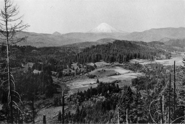
COPYRIGHT, JAS. WAGGENER, JR.
Mount St. Helens, from Chelatchie Prairie on Lewis River, distance twenty miles. Shows a typical farm clearing in the forest.
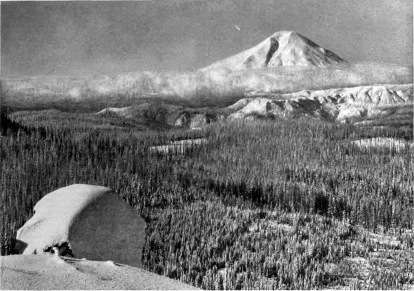 Mount St. Helens, seen from Twin Buttes, twenty miles away, across the Cascades. View shows the remarkable
cleft or canyon on the southeast face of the peak.
Mount St. Helens, seen from Twin Buttes, twenty miles away, across the Cascades. View shows the remarkable
cleft or canyon on the southeast face of the peak.
The slopes not covered with new lava sheets and dikes exhibit, below
the snow-line, countless bombs hurled up from the crater, with great fields
of pumice embedding huge angular rocks that tell a story not written on
our other peaks. These hard boulders, curiously different from the soft materials
in which they lie, were fragments of the tertiary platform on which the
cone was erected. Torn off by the volcano, as it enlarged its bore, they were
shot out without melting or change in substance. On every hand is proof
that this now peaceful snow-mountain, which resembles nothing else so much as
a well-filled saucer of ice cream, had a hot temper in its youth, and has passed
some bad days even since the coming of the white man.
The mountain was first climbed in August, 1853, by a party which included
the same T. J. Dryer who, a year later, took part in the first ascent of Mount
Hood. In a letter to The Oregonian he said the party consisted of "Messrs.
Wilson, Smith, Drew and myself." They ascended the south side. The
other slopes were long thought too steep to climb, but in 1893 Fred G. Plummer,
of Tacoma, now Geographer of the United States Forest Service, ascended
the north side. His party included Leschi, a Klickitat Indian, probably
the first of his superstitious race to scale a snow-peak. The climbers found
evidence of recent activity in two craters on the north slope, and photographed
a curious "diagonal moraine," as regular in shape as a railway embankment,
which connected the border moraines of a small glacier. The north side has
since seen frequent ascents.
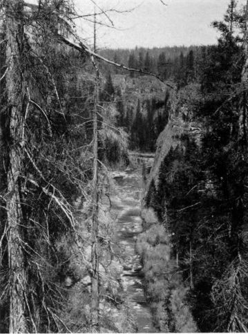
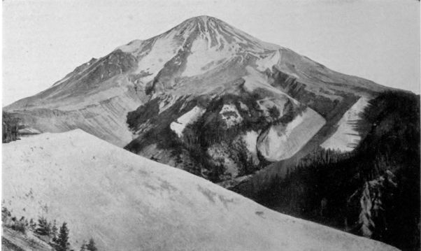 Canyons of South Toutle River, west side of St. Helens. These vast trenches in the soft pumice show
by their V shape that they have been cut by streams from the glaciers above, rather than by the
glaciers themselves, which, on this young peak, have probably never had a much greater extension.
Canyons of South Toutle River, west side of St. Helens. These vast trenches in the soft pumice show
by their V shape that they have been cut by streams from the glaciers above, rather than by the
glaciers themselves, which, on this young peak, have probably never had a much greater extension.
The Mazamas, who had climbed St. Helens from the south in 1898, again
ascended it in 1908,
climbing by the Lizard
and Boot. This
outing furnished the
most stirring chapter
in the annals of American
mountaineering.
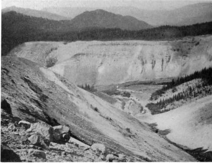 Lower Toutle Canyon, seen on left above. Note shattered volcanic bomb.
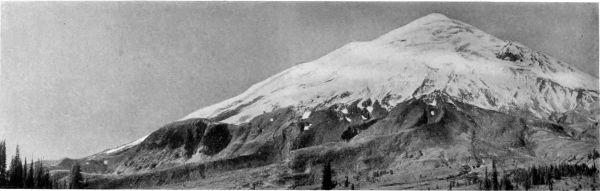 Northeast side of Mount St. Helens, from elevation of 6,000 feet, with Black Butte on the right.
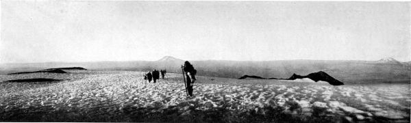 The Mazamas on summit of St. Helens shortly before sunset. The rocks showing above the snow are parts of the rim of the extinct crater. Mount Adams
is seen, thirty-five miles away, on the right, while Rainier-Tacoma is forty-five miles north. Photograph taken at 7:15 p. m. The party did not get
back to their camp till long after midnight.
The Mazamas on summit of St. Helens shortly before sunset. The rocks showing above the snow are parts of the rim of the extinct crater. Mount Adams
is seen, thirty-five miles away, on the right, while Rainier-Tacoma is forty-five miles north. Photograph taken at 7:15 p. m. The party did not get
back to their camp till long after midnight.
The north-side
route proved unexpectedly
hard. After
an all-day climb, the
party reached the
summit only at seven
o'clock. The descent
after nightfall required
seven hours.
The risk was great.
Over the collar of ice
near the summit, at a grade of more than sixty degrees, the twenty-five men and
women slowly crept in steps cut by the leaders, and clutching a single fifty-foot
rope. Later came the bombardment of loose rocks, as the party scattered
down the slope. I quote from an account by Frank B. Riley, secretary
of the club, who was one of the leaders:
The safety of the entire party was in the keeping of each member. One touch of hysteria,
one slip of the foot, one instant's loss of self-control, would have precipitated the line, like
a row of bricks, on the long plunge down the ice cliff. Eight times the party stood poised on
its scanty foothold while the rope was lowered. When, after an hour and a half, its last
member stepped in safety upon the rocks, there yet lay before it five hours of work ere the
little red eyes below should widen into welcoming campfires.
Over great ridges, down into vast snowfields, for hours they plunged and slid, while
scouts ahead shouted back warning
of the crevasses. On, out of the
icy clutch of the silent mountain,
they plodded. And then, at last,
the timber, and the fires and the
hot drinks and the warm blankets
and the springy hemlock boughs!
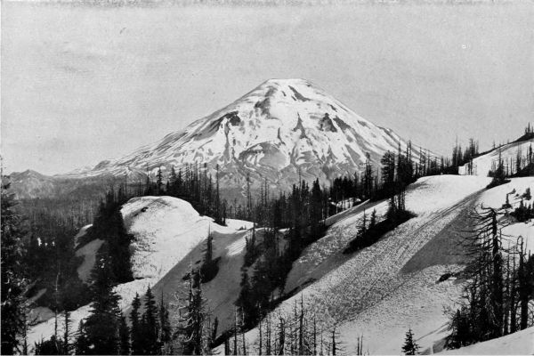 North side of St. Helens in winter, seen from Coldwater Ridge, overlooking Spirit Lake. Shows the long ridge called "the Lizard," because of its shape,
with "the Boot" above it. On the northeast slope is "Black Butte," probably a secondary crater.
North side of St. Helens in winter, seen from Coldwater Ridge, overlooking Spirit Lake. Shows the long ridge called "the Lizard," because of its shape,
with "the Boot" above it. On the northeast slope is "Black Butte," probably a secondary crater.
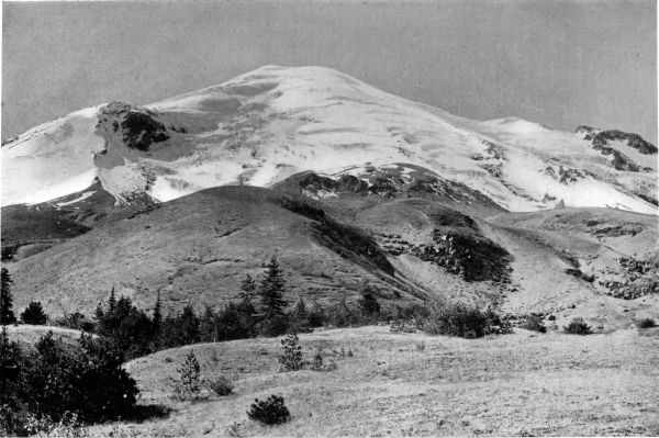 St. Helens, north side, seen from one mile below snow line. Note the slight progress made by the forest upon the scant soil of the pumice ridges; also, how
greatly the angle of the sides, as viewed here at the foot of the peak, differs from that shown in Dr. Lauman's fine picture taken on Coldwater Ridge,
five miles north. Both show the mountain from the same direction, but the near view gives no true idea of its steepness. Black Butte is on the left.
St. Helens, north side, seen from one mile below snow line. Note the slight progress made by the forest upon the scant soil of the pumice ridges; also, how
greatly the angle of the sides, as viewed here at the foot of the peak, differs from that shown in Dr. Lauman's fine picture taken on Coldwater Ridge,
five miles north. Both show the mountain from the same direction, but the near view gives no true idea of its steepness. Black Butte is on the left.
Even this was not the
most noteworthy adventure
of the outing. One evening,
while the Mazamas gathered
about their campfire
at Spirit Lake, a haggard
man dragged himself out of the forest, and told of an injured comrade lying
helpless on the other side of the peak. The messenger and two companions—Swedish
loggers, all three—had crossed the mountain the morning before.
After they gained the summit and began the descent, a plunging rock had
struck one of the men, breaking his leg. His friends had dragged him down
to the first timber, and while one kept watch, the other had encircled the
mountain, in search of aid from the Mazamas.
Immediately a relief party of seven strong men, led by C. E. Forsyth of Castle
Rock, Washington, started back over the trailless route by which the messenger
had come. All night they scaled ridges, climbed into and out of canyons, waded
icy streams. Before dawn they reached the wounded laborer. Mr. Riley says:
It was impossible to carry the man back through the wild country around the peak. Below,
the first cabin on the Lewis River lay beyond a moat of forbidding canyons. Above slanted
the smooth slopes of St. Helens. Placing the injured man upon a litter of canvas and alpine
stocks, they began the ascent of the mountain with their burden. The day dawned and grew
old, and still these men crawled upward in frightful, body-breaking struggle. Twelve hours
passed, and they had no food and no sleep, save as they fell unconscious downward in the
snow, as they did many times, from fatigue and lack of nourishment. At four o'clock, Anderson
was again on the summit. Then, without rest, came the descent to the north. Down
precipitous cliffs of ice they lowered him, as tenderly as might be; down snow-slopes seared
with crevasses, shielding him from the falling rocks; over ridges of ragged lava, until in the deepening
darkness of the second night they found themselves again at timber. But in the net-work
of canyons they had selected the wrong one, and were lost. Here, at three o'clock, they were
found by a second relief party, and guided over a painful five-mile journey home.
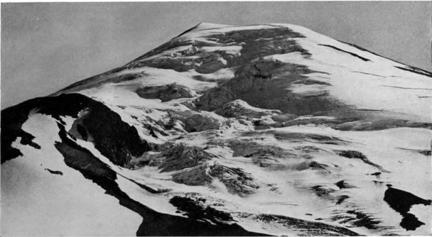 Finest of the St. Helens glaciers, north side, with Black Butte on left. It is proposed to call this
"Forsyth glacier," in honor of C. E. Forsyth, leader in a memorable rescue.
Finest of the St. Helens glaciers, north side, with Black Butte on left. It is proposed to call this
"Forsyth glacier," in honor of C. E. Forsyth, leader in a memorable rescue.
It was day when camp was reached. In an improvised hospital, a young
surgeon, aided by a trained nurse, both Mazamas, quickly set the broken
bones. Then they sent their patient comfortably away to the railroad and a
Portland hospital. Before the wagon started, Anderson, who had uttered no
groan in his two days of agony, struggled to a sitting posture, and searched
the faces of all in the crowd about him.
"Ay don't want ever to forget how you look," he said simply; "you who
have done all this yust for me."
It is fitting that such an event should be commemorated. With the
approval of Mr. Riley and other Mazamas who were present at the time, I
would propose that the north-side glacier already described, the most beautiful
of the St. Helens ice-streams, be named "Forsyth glacier," in honor
of the leader of this heroic rescue.
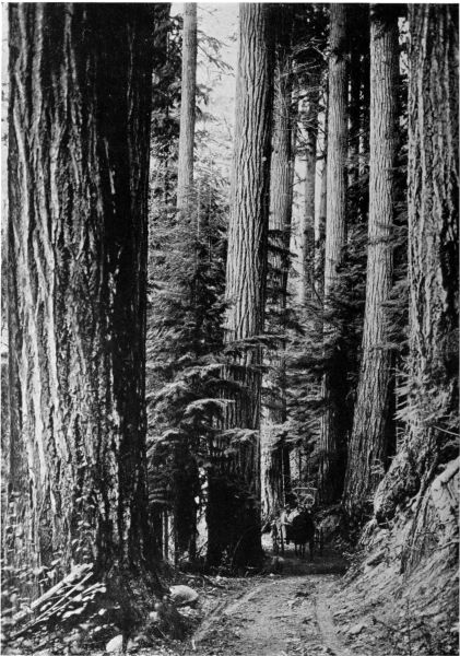
COPYRIGHT, ASAHEL CURTIS
Road among the Douglas Firs.
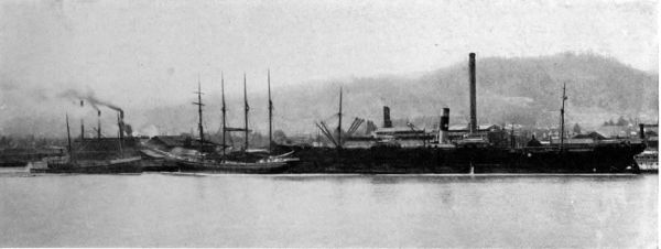 Ships loading lumber at one of Portland's large mills.
 III.
THE FORESTS
By HAROLD DOUGLAS LANGILLE
As the lowlander cannot be said to have truly seen the element of water at all, so even
in his richest parks and avenues he cannot be said to have truly seen trees. For the resources
of trees are not developed until they have difficulty to contend with; neither their tenderness
of brotherly love and harmony, till they are forced to choose their ways of life where there
is contracted room. The various action of trees, rooting themselves in inhospitable rocks,
stooping to look into ravines, hiding from the search of glacial winds, reaching forth to the
rays of rare sunshine, crowding down together to drink at sweetest streams, climbing hand
in hand the difficult slopes, gliding in grave procession over the heavenward ridges—nothing
of this can be conceived among the unvexed and unvaried felicities of the lowland forest.—Ruskin: "Modern Painters."
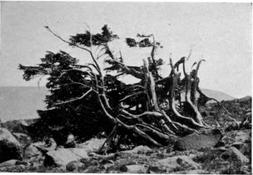 Outposts of the Forest. Storm-swept White-bark Pines
on Mount Hood.
Outposts of the Forest. Storm-swept White-bark Pines
on Mount Hood.
STAND upon the icy summit of any one of the Columbia's snow-peaks, and
look north or west or south across the expanse of blue-green mountains
and valleys reaching to
the sea; your eyes will rest
upon the greatest forest the
temperate zone has produced
within the knowledge of man.
Save where axe and fire
have turned woodland into
field or ghostly "burn," the
mantle is spread. Along the
broad crests of the Cascades,
down the long spurs that lead
to the valleys, and across the
Coast Range, lies a wealth of
timber equaled in no other
region. The outposts of this
great army of trees
will meet you far
below.
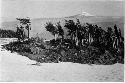 Alpine Hemlocks at the timber-line on Mt. Adams. Mt. Hood in distance.
Rimming about
your peak, braving
winds and the snows
that drift in the lee
of old moraines, and
struggling to break
through the timber-line,
six thousand
feet above the sea,
somber mountain
hemlocks (Tsuga
mertensiana) and
lighter white-bark
pines (Pinus albicaulis) form the thin vanguard of the forest. They meet the
glaciers. They border the snow-fields. They hide beneath their stunted,
twisted forms the first deep gashes carved in the mountain slopes by eroding
streams. Valiant protectors of less sturdy trees and plants, their whitened
weather-sides bear witness to a fierce struggle for life on the bleak shoulders
of the peaks.
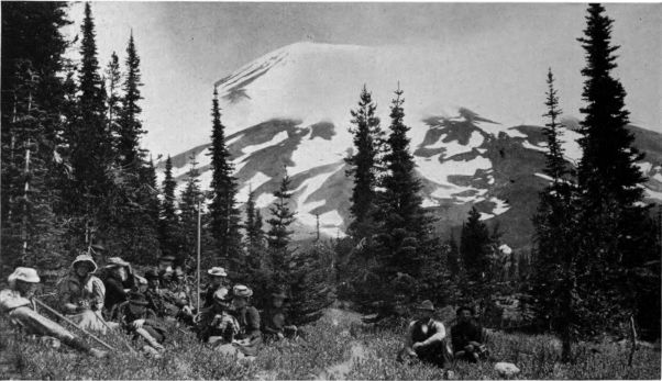 Mazama Party resting among the sub-alpine firs in a flower-carpeted "park" at the
foot of Mount St. Helens
Mazama Party resting among the sub-alpine firs in a flower-carpeted "park" at the
foot of Mount St. Helens
Make your way, as the streamlets do, down to the alpine glades, on the
high plateaus, where anemone, erythronium and calochortus push their buds
through lingering snow-crusts. The scattered trees gather in their first groups.
Just within their
shelter pause for
a moment. Vague
distance is narrowed
to a diminutive
circle. The
mystery of vastness
passes.
Sharp indeed is
the division between
storm-swept barren and
forest shelter.
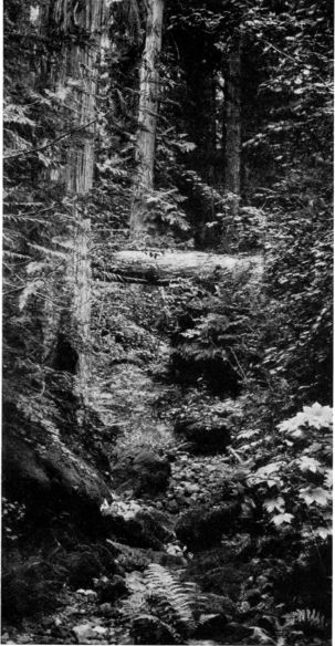 A Lowland Ravine. Cedars, Vine Maples, Devil's Club
and Ferns, near Mount St. Helens.
A Lowland Ravine. Cedars, Vine Maples, Devil's Club
and Ferns, near Mount St. Helens.
Here ravines,
decked with
heather, hold
streams from the
snowdrifts—streams
that hunt
the steepest descents,
and glory
in their leaps from
rock to rock and
from cliff to pool.
If it be the spring-time
of the mountains—late
July—the
mossy rills will
be half concealed
beneath fragrant
white azaleas that
nod in the breezes
blowing up with the ascending sun and down with the turn
of day. Trailing over the rocks, or banked in the shelter
of larger trees, creeping juniper (Juniperus communis), least
of our evergreens, stays the drifting sands against the
drive of winds or the wash of melting snows.

COPYRIGHT, KISER
The "Noble" Fir.
Along the streams and on sunny slopes and benches
are the homes of the pointed firs. Seeking protection from
the storm, the spire-like trees cluster in tiny groves, among
which, like little bays of a lake, the grassy flowered meadows
run in and out, sun-lit, and sweet with rivulets from the
snows above. If you do not know these upland "parks,"
there is rare pleasure awaiting you. A hundred mountain
blossoms work figures of white and red and orange and
blue in the soft tapestry of green. In such glades the hush is deep. Only
the voice of a waterfall comes up from the canyon, or the whistle of a
marmot, the call of the white-winged crows and the drone of insects break
the stillness.
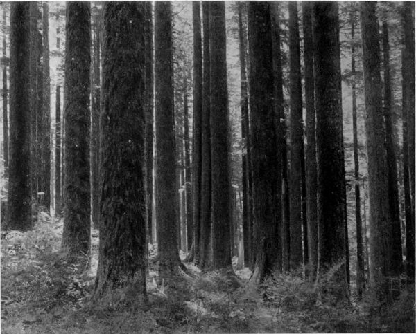 Dense Hemlock Forest, lower west slope of Mount Hood.
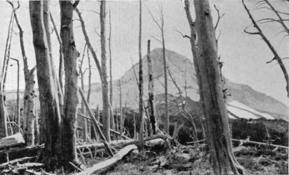 Mount Hood from Ghost-tree Ridge. Whitened trunks of trees killed by
forest fires.
Mount Hood from Ghost-tree Ridge. Whitened trunks of trees killed by
forest fires.
The outer rank
of hemlock and fir
droops its branches
to the ground to
break the tempest's
attack. Within, silver
or lovely fir
(Abies amabilis)
mingles with hardier
forms. Its gray,
mottled trunks are
flecked with the
yellow-green of
lichen or festooned
with wisps of moss
down to the level of the big
snows. And here, a vertical
mile above the sea, you meet
the daring western hemlock
(Tsuga heterophylla), which
braves the gale of ocean and
mountain alike, indifferent to
all but fire. It is of gentle
birth yet humble spirit. It
accepts all trees as neighbors.
You meet it everywhere as
you journey to the sea. But
on the uplands only, in a
narrow belt like a scarf
thrown across the shoulders
of the mountain, sub-alpine
fir (Abies lasiocarpa) sends
up its dark, attenuated
spires, in striking contrast
with the rounded crowns of
its companions.
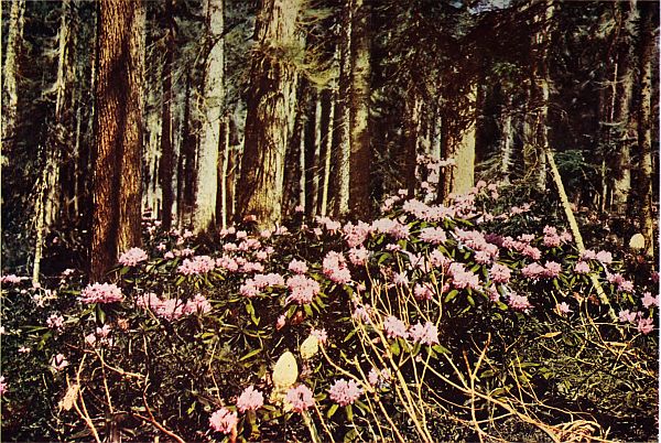
An Island of Color in the Forest. Rhododendrons and Squaw Grass on the west slope of Mount Hood.
"The common growth of mother-earth
Suffices me,—her tears, her mirth,
Her humblest mirth and tears."—Wordsworth.
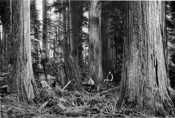
COPYRIGHT, ASAHEL CURTIS
Group of Red Cedars, five to eight feet in diameter.
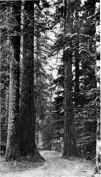 On the road to Government Camp, west of Mount Hood. Broadleaf
Maple on extreme right; Douglas Firs arching the roadway,
and White Fir on left.
On the road to Government Camp, west of Mount Hood. Broadleaf
Maple on extreme right; Douglas Firs arching the roadway,
and White Fir on left.
A little lower, the transition
zone offers a noteworthy
intermingling of species.
Down from the stormy
heights come alpine trees to
lock branches with types
from warmer levels. Here
you see lodgepole pine (Pinus
murrayana), that wonderful
restorer of waste places which
sends forth countless tiny
seedlings to cover fire-swept
areas and lava fields with
forerunners of a forest.
Here, too, you will find western white pine (Pinus monticola), the fair lady
of the genus, whose soft, delicate foliage, finely chiseled trunk, and golden
brown cones denote its gentleness; and Engelmann spruce (Picea Engelmannii)
of greener blue than any other, and hung with pendants of soft seed cones,
saved from pilfering rodents by pungent, bristling needles.
Here also are western larch or tamarack (Larix occidentalis); or, rarely,
on our northern peaks, Lyall's larch (Larix Lyallii), whose naked branches
send out tiny fascicles of soft pale leaves; and Noble fir (Abies nobilis), stately,
magnificent, proud of its supremacy over all. And you may come upon a
rare cluster of Alaska cedar (Chamæcyparis nootkatensis), here at its southern
limit, reaching
down from the
Coast range of
British Columbia
almost to
meet the Great
sugar pines
(Pinus lambertiana)
which
come up from
the granite
heights of the
California sierra
to play an important
role in
the southern
Oregon forests.

COPYRIGHT, WEISTER
Where man's a pygmy.
A Noble Fir, 175 feet
to first limb.
Across the
roll of ridge and
canyon, you see
them all; and
when you come
to know them
well, each form,
each shade of
green, though
far away, will claim your recognition. Yonder, in a hollow
of the hills, a cluster of blue-green heads is raised above
the familiar color of the hemlocks. Cross to it, and stand
amidst the crowning glory of Nature's art in building trees.
About you rise columns of Noble firs, faultless in symmetry,
straight as the line of sight, clean as granite shafts. Carry
the picture with you; nowhere away from the forests of
the Columbia can you look upon such perfect trees.
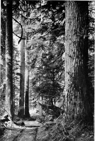 Firs and Hemlocks, in Clarke County, Washington.
Westward of the Cascade summits the commercial
forest of to-day extends down from an elevation of about
3,500 feet. Intercepted by these heights, the moisture-laden
clouds are emptied on the crest of the range. Eastward,
the effects of decreasing precipitation are shown both
in species and in density. Tamarack, white fir and pines
climb higher on these warmer slopes. Along the base
of the mountains, and beyond low passes where strong
west winds drive saturated clouds out over level reaches,
western yellow pine (Pinus ponderosa) becomes almost the
only tree. Over miles of level lava flow, along the upper
Deschutes, this species forms
a great forest bounded on the
east by rolling sage-brush
plains that stretch southward
to the Nevada deserts.
Beyond the Deschutes drainage,
where spurs of the Blue
mountains rise to the levels
of clouds and moisture, the
forest again covers the hills,
spreading far to the east
until it disappears again in
the broad, treeless valley of
Snake river. North of the
Columbia the story is the
same. From the lower slopes
of Mt. Adams great rolling
bunch-grass downs and prairies
reach far eastward. Here
and there, over these drier
stretches, stand single trees
or clusters of western juniper
(Juniperus occidentalis).
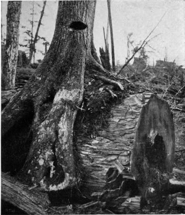 Fifty-year-old Hemlock growing on Cedar log. The latter,
which was centuries old before it matured and fell, was
still sound enough to yield many thousand shingles.
Fifty-year-old Hemlock growing on Cedar log. The latter,
which was centuries old before it matured and fell, was
still sound enough to yield many thousand shingles.
But on the west slope of
the Cascades, and over the Coast range, the great forests spread in unbroken
array, save where wide valleys have been cleared by man or hillsides stripped
by fire. Here, in the land of warm sea
winds and abundant moisture, the famous
Douglas fir (Pseudotsuga taxifolia), Pacific
red cedar (Thuja plicata) and tideland
spruce (Picea sitchensis) attain their greatest
development. These are the monarchs
of the matchless Northwestern forests, to
which the markets of the world are looking
more and more as the lines of exhausted
supply draw closer.
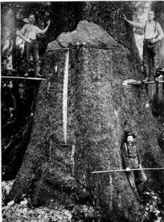 Sawyers preparing to "fall" a large
Tideland Spruce.
Sawyers preparing to "fall" a large
Tideland Spruce.
Douglas fir recalls by its name one
of the heroes of science, David Douglas, a
Scotch naturalist who explored these forests
nearly ninety years ago, and discovered
not only this particular giant of the
woods, but also the great sugar pine and
many other fine trees and plants. As a
pioneer botanist, searching the forest,
Douglas presented a surprising spectacle
to the Indians. "The Man
of Grass" they called him,
when they came to understand
that he was not bent
on killing the fur-bearing
animals for the profit to be
had from their pelts.
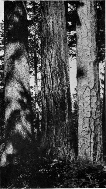 Sugar Pine, Douglas Fir, and Yellow Pine.
The splendid conifer which
woodsmen have called after
him is one of the kings of all
treeland. The most abundant
species of the Northwest, it is
also, commercially, the most
important. Sometimes reaching
a height of more than 250
feet, it grows in remarkably
close stands, and covers vast
areas with valuable timber that
will keep the multiplying mills
of Oregon and Washington
sawing for generations. In
the dense shade of the forests,
it raises a straight and stalwart
trunk, clear of limb for a hundred
feet or more. On the older
trees, its deeply furrowed bark
is often a foot thick. Trees
of eight feet diameter are at
least three hundred years old,
and rare ones, much larger,
have been cut showing an age
of more than five centuries.
To these areas of the greatest
trees must come all who would know the real spirit of the forest, at once
beneficent and ruthless. Here nature selects the fittest. The struggle for soil
below and light above is relentless. The weakling, crowded and overshadowed,
inevitably deepens the forest floor with its fallen trunk, adding to the humus
that covers the lavas, and nourishing in its decay the more fortunate rival
that has robbed it of life. Here, too, with the architectural splendor of the
trees, one feels the truth of Bryant's familiar line:
The groves were God's first temples.
The stately evergreens raise their rugged crowns far toward the sky, arching
gothic naves that vault high over the thick undergrowth of ferns and vine
maples. In such scenes, it is easy to understand the woodsman's solace, of
which Herbert Bashford tells in his "Song of the
Forest Ranger:"
I would hear the wild rejoicing
Of the wind-blown cedar tree,
Hear the sturdy hemlock voicing
Ancient epics of the sea.
Forest aisles would I be winding,
Out beyond the gates of Care;
And in dim cathedrals finding
Silence at the shrine of Prayer.
* * * *
Come and learn the joy of living!
Come and you will understand
How the sun his gold is giving
With a great, impartial hand!
How the patient pine is climbing,
Year by year to gain the sky;
How the rill makes sweetest rhyming
Where the deepest shadows lie!
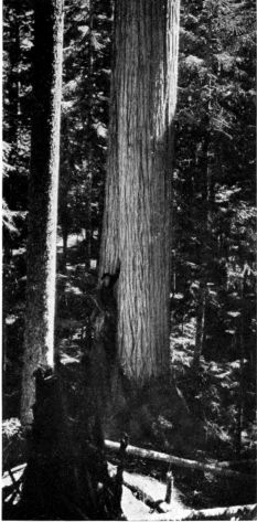 Yellow Cedar, with young Silver Fir.
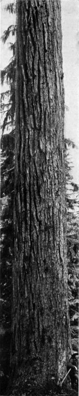
COPYRIGHT, GIFFORD
One of the Kings of Treeland—A
Douglas Fir.
Fir, spruce and cedar you will see along the
slopes of the Cascades in varying density and grandeur,
from thickets of slender trees reclaiming
fire-swept lands to broken ranks of patriarchs whose
crowns have swayed
before the storms of
centuries. Among
the foot hills, the pale
gray "grand" or white
firs (Abies grandis)
rear their domes
above the common
plane in quest of
light, occasionally
attaining a height of
275 feet, while the
lowly yew (Taxus
brevifolia), of which
the warrior of an
earlier time fashioned
his bow, overhangs
the noisy streams. In
the same habitat,
where the little rivers
debouch into the valleys,
you may see
the broad-leaf maple,
Oregon ash, cottonwood,
and a score of
lesser deciduous trees on which the filtered rays of sunshine play in softer tones.
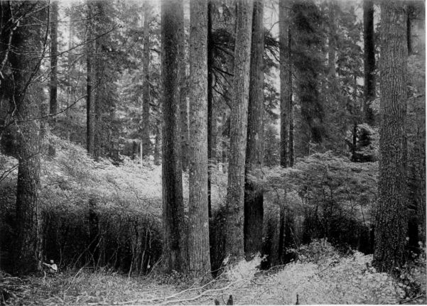
COPYRIGHT, JAS. WAGGENER, JR.
Firs and Vine Maples in Washington Forest.
Here and there in the Willamette valley you meet foothill yellow pine
(Pinus ponderosa var. benthamiana), near relative of the western yellow
pine. Oregon oak (Quercus garryana) occurs sparingly throughout the valleys,
or reaches up the western foothills
of the Willamette, until it meets
the great unbroken forest of the
Coast Range.
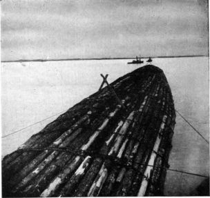 Towing a log raft out to sea, bound for the California
markets.
Towing a log raft out to sea, bound for the California
markets.
The dense lower forests are never
gaily decked, so little sunlight enters.
But in early summer, back among
the mountains, you may find tangles
of half-prostrate rhododendron, from
which, far as the eye can reach, the
rose-pink gorgeous flowers give back
the tints of sunshine and the iridescent
hues of raindrops. Mingled with
the flush of "laurel" blossoms are
nodding plumes of creamy squaw
grass, the beautiful xerophyllum.
Often this queenly upland flower
covers great areas, hiding the desolation wrought by
forest fires. Its sheaves of fibrous rootstocks furnish
the Indian women material for their basket-making;
hence the most familiar of its many names. The varied
green of huckleberry bushes is everywhere. They are
the common ground cover.
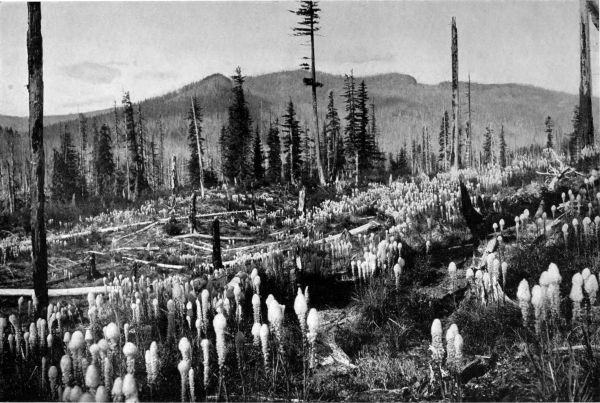 A "Burn" on the slopes of Mount Hood, overgrown with Squaw Grass. Such fire-swept areas are quickly covered with mountain flowers, of which
this beautiful cream-colored plume is one of the most familiar. Its roots yield a fiber used by the Indians in making baskets.
A "Burn" on the slopes of Mount Hood, overgrown with Squaw Grass. Such fire-swept areas are quickly covered with mountain flowers, of which
this beautiful cream-colored plume is one of the most familiar. Its roots yield a fiber used by the Indians in making baskets.

COPYRIGHT, GIFFORD
A Noble Fir.
In valley woodlands, the dogwood, here a tree of
fair proportions, lights up the somber forest with round,
white eyes that peer out through bursting leafbuds,
early harbingers of summer. The first blush of color
comes with the unfolding of the pink and red racemes
of flowering wild currant. Later, sweet syringa fills
the air with the breath of orange blossoms; and spirea,
the Indian arrowwood, hangs its tassels among the
forest trees or on the bushy hills. But the presence of
deciduous trees and shrubs, as well as their beauty, is
best known in autumn, when maples brighten the woods
with yellow rays; when dogwood and vine maple paint
the fire-scarred slopes a flaming red, and a host of other
color-bearers stain the cliffs with rich tints of saffron
and russet and brown.
Coming at last to
the rim of the forest,
you look out over the
sea, where go lumber-laden
ships to all the
world. Close by the
beach, dwarfed and
distorted by winds of
the ocean, and
nourished by its fogs,
north-coast pine
(Pinus contorta) extends
its prostrate
forms over the cliffs
and dunes of the shore,
just as your first acquaintance,
the white-bark
pine, spreads
over the dunes and
ridges of the mountain.
They are brothers
of a noble race.
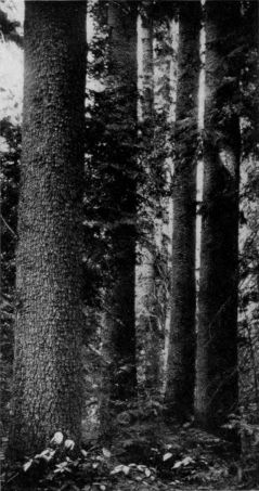 Western White Pine.
You have traversed
the wonder-forest
of the world, and on your journey
with the stream you may have
come to know twenty-three species
of cone-bearers, all indigenous
to the Columbia country. Of these,
one is Douglas fir, nowise a true fir
but a combination of spruce and
hemlock; seven are pines, four true
firs, two spruces, two hemlocks, two
tamaracks or larches, two cedars,
two junipers, and the yew.
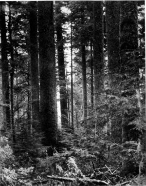 A Clatsop Forest. On extreme right is a Silver Fir,
covered with moss; next are two fine Hemlocks,
with Tideland Spruce on left.
A Clatsop Forest. On extreme right is a Silver Fir,
covered with moss; next are two fine Hemlocks,
with Tideland Spruce on left.
So many large and valuable trees
of so many varieties can be found
nowhere else. A Douglas fir growing
within the watershed of the Columbia
is twelve feet and seven inches in
diameter. A single stick 220 feet
long and 39 inches in diameter at
its base has been cut for a flagpole
in Clatsop county. A spruce twenty
feet in diameter has been measured.
Such immense types are rare, yet
in a day's tramp through the Columbia forests one may see many trees
upwards of eight feet in diameter. One acre in the Cowlitz river watershed
is said to bear twenty-two trees, each eight feet or more at its base.
Though no exact measurements can be cited, it is likely that upon different
single acres 400,000 feet, board measure, of standing timber may be
found. And back among the Cascades, upon one forty-acre tract, are
9,000,000 feet—enough to build a town. Manufactured, this body of timber
would be worth $135,000, of which about $100,000 would be paid to labor.
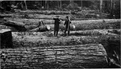 A Carpet of Firs; 300,000 feet, cut on one acre in a Columbia forest.
Along the Columbia
you will hear
shrill signals of the
straining engines
that haul these gigantic
trees to the
rafting grounds. Up
and down the broad
river ply steamboats
trailing huge log-rafts
to the mills.
Each year the logging
railroads push
farther back among
the mountains, to
bring forth lumber for Australia, the Orient, South America, Europe and
Africa. Many of our own states, which a few years ago boasted "inexhaustible"
forests, now draw from this supply.
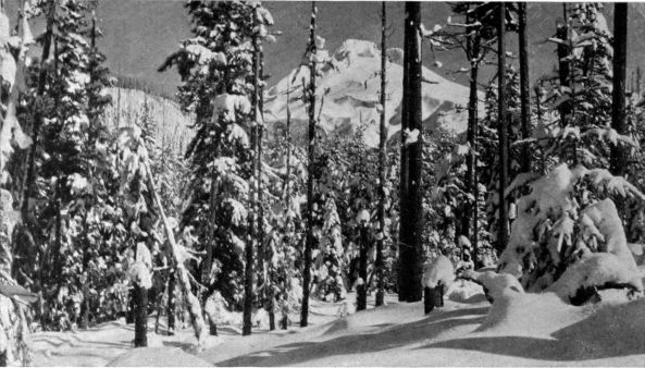 Winter in the forest. Mount Hood seen from Government Camp road. Twenty feet of snow.
Since 1905 Washington has been the leading lumber-producing state of
the Union, and Oregon has advanced, in one year, from ninth to fourth place.
The 1910 production of lumber in these states was 6,182,125,000 feet, or 15.4
per cent. of the total output of the United States. The same states, it is
estimated, have 936,800,000,000 feet of standing merchantable timber,
or a third of the country's total.
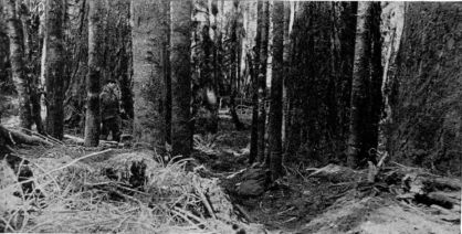 Rangers' Pony Trail in forest of Douglas and Silver Firs.
This is the heritage which the centuries of forest life have bequeathed.
Only the usufruct of it is rightfully ours. Even as legal owners, we are nevertheless
but trustees of that which was here before the coming of our race, and
which should be here in great quantity when our trails have led beyond the
range. Our duty is
plain. Let us uphold
every effort to give
meaning and power
to the civil laws
which say: "Thou
shalt not burn;" to
the moral laws which
say: "Thou shalt not
waste." Let us understand
and support
that spirit of conservation
which
demands for coming
generations the fullest
measure of the
riches we enjoy. For
although the region
of the Columbia is
the home of the greatest
trees, centuries
must pass ere the
seedlings of to-day
will stand matured.
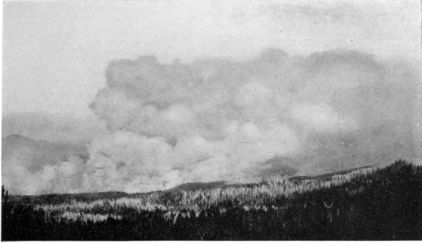 Forest Fire on east fork of Hood River. From a photograph taken at
Cloud Cap Inn five minutes after the fire started.
Forest Fire on east fork of Hood River. From a photograph taken at
Cloud Cap Inn five minutes after the fire started.
Reforestation is indispensable
as insurance.
Let us see to
it that the untillable
hills shall ever bear these matchless forests, emerald settings for our snow-peaks.
On their future depends, in great degree, the future of the Northwest.
As protectors of the streams that nourish our valleys, and perennial treasuries
of power for our industries, they are guarantors of life and well-being
to the millions that will soon people the vast Columbia basin.
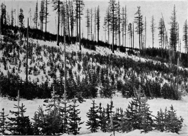 Reforestation—Three generations of young growth; Lodgepole Pine in foreground; Lodgepole and
Tamarack thicket on ridge at right; Tamarack on skyline.
Reforestation—Three generations of young growth; Lodgepole Pine in foreground; Lodgepole and
Tamarack thicket on ridge at right; Tamarack on skyline.
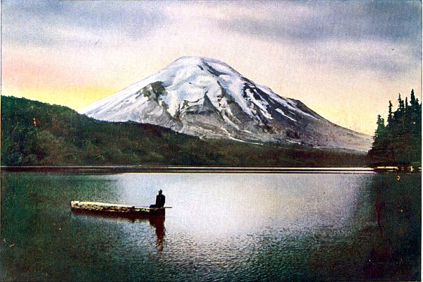
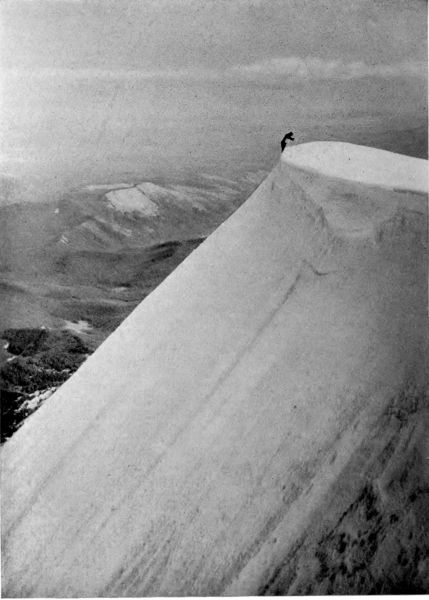
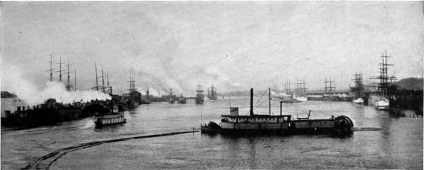 Willamette River at Portland, with ships loading wheat and lumber for foreign ports.