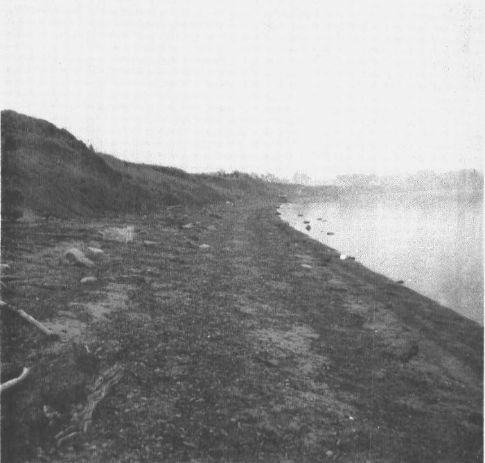
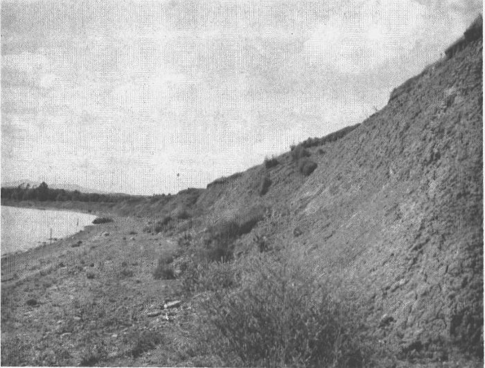
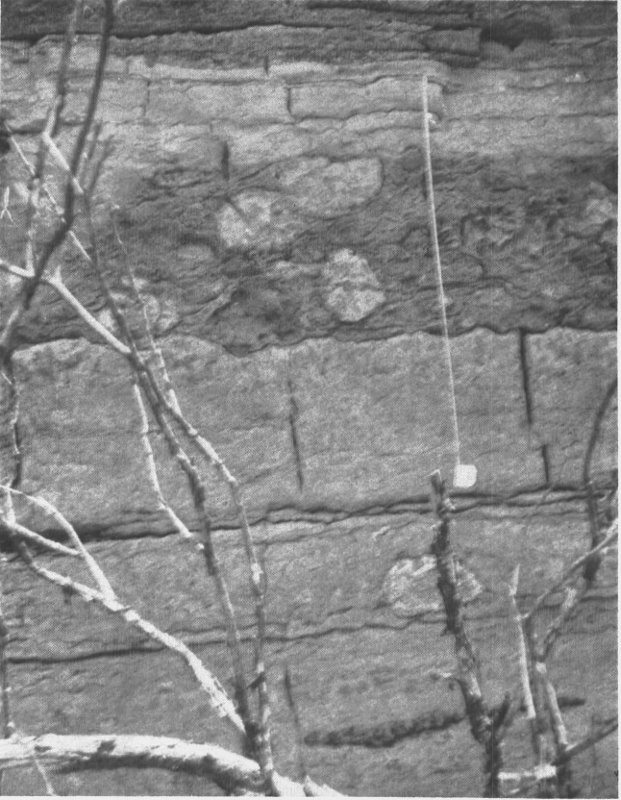
The best location in the park for a good look at the clays which cover
the entire Park area is along the lake beach (see Figs. 4 and 8). The bank
averages 23 feet in height measured from the beach to the top of the
bank. The width of the beach varies seasonally and during storms as
the water level of Lake Champlain fluctuates (see Figs. 4 and 8). A walk
along the beach will reveal some interesting facts about the composition
of the beach and the adjacent clay banks.
One cannot help observing the scarcity of sand[10] on the beach. The
only adjacent material to build this beach is clay, which here contains a
small quantity of sand and some concretions containing lime. The sickle
shape of Button Bay keeps most foreign sand from the beach. The small
patches of sand present soon give way to blue clay[11] which, in many
places, forms the base of the beach. This blue clay can also be seen in
the base of the bank in the southern portion of the Park, where it underlies
and is therefore older than the brown clay.[12]
Actually very little of the blue clay is exposed in the Park. From other
locations along the shore of Lake Champlain and in the more inland
areas of the Champlain Lowlands geologists have found many clues to
help our understanding of its history.
15
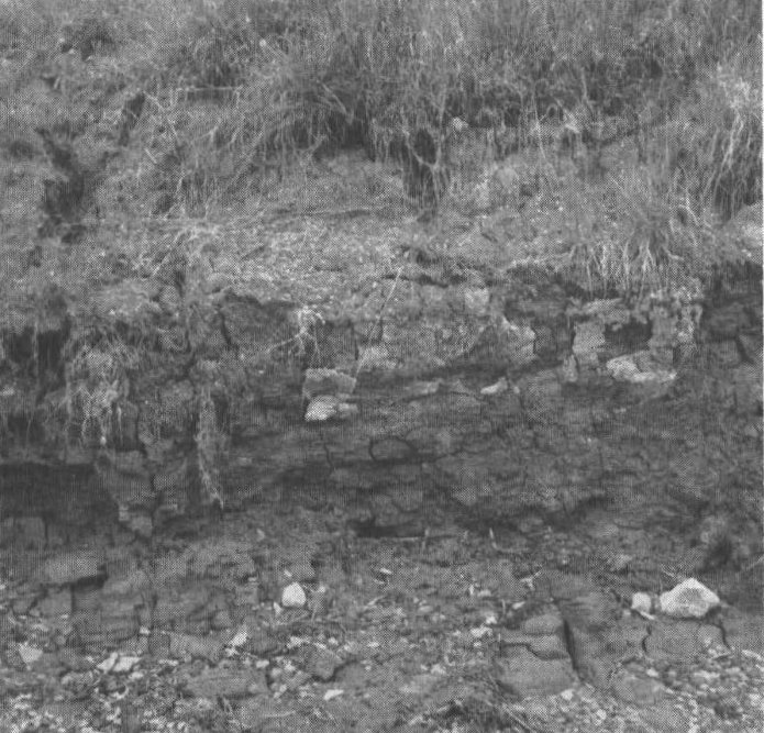
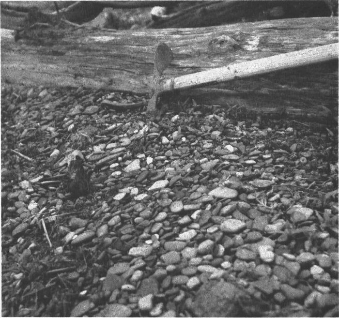
Figure 9A. View of
the Brown Clay at the
base of the clay-cliff,
Button Bay State
Park. For scale, note
the small ballpoint pen
resting on top of ledge
(left of center). A close-up
view of this ledge
(pen in same location)
is seen in Figure 10.
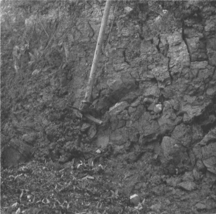
Figure 9B. Close-up
view showing general
characteristics of the
Brown Clay. Notice
the vertical cracks in
the clay. These cracks
or joints are very common
in the clays of this
State Park.
16
In August 1849 the incomplete skeleton of a whale[13] was found in a
railroad cut being excavated for the Rutland and Burlington Railroad.
This cut was located approximately 12 miles south of Burlington and a
mile east of Lake Champlain. The significant fact about this “find” is
that these bones were found in the same type of blue clay that occurs
at the beach in Button Bay State Park. Clam and oyster shells (Pelecypods)
were found in association with the whale bones. These pelecypod
shells[14] and the whale bones show that these animals lived and died in
cold marine waters. Lake Champlain today is a fresh-water lake and
the fish and other organisms in it are those of fresh, not salty water.
Yet the blue clays (and we are soon to learn, the brown clays) hold
evidence proving the existence of sea water in an area where a fresh-water
lake is found today. Can this be explained?
The brown clay forms most of the Park’s clay banks (see Figs. 9A and
9B). It can be examined easily by the visitor. The bank is composed of
clay and variable amounts of fine sand[15] in thin lens-shaped bodies. The
hard dry outer clay, if rain has not just fallen, of the upper 15 feet of the
bank appears light brown or tan-white and commonly contains interspersed
white and blue streaks. In the section of the bank which was the
object of detailed study, two conspicuous convoluted beds[16] were found,
one 5 feet above the beach, the other nearly 2 feet above the first.
Shells of pelecypods[17] occur at two and perhaps three levels within the
bank. They can be seen easily in many slumped clay bodies along the
beach (see Fig. 10, in which the shells are mainly Macoma and Saxicava).
These shells once belonged to living animals whose very close relatives
and identical younger generations are found living today in cold Arctic
17
waters. Brown clays were deposited in a marine Champlain Sea. How
did these marine waters get into the Champlain Valley?
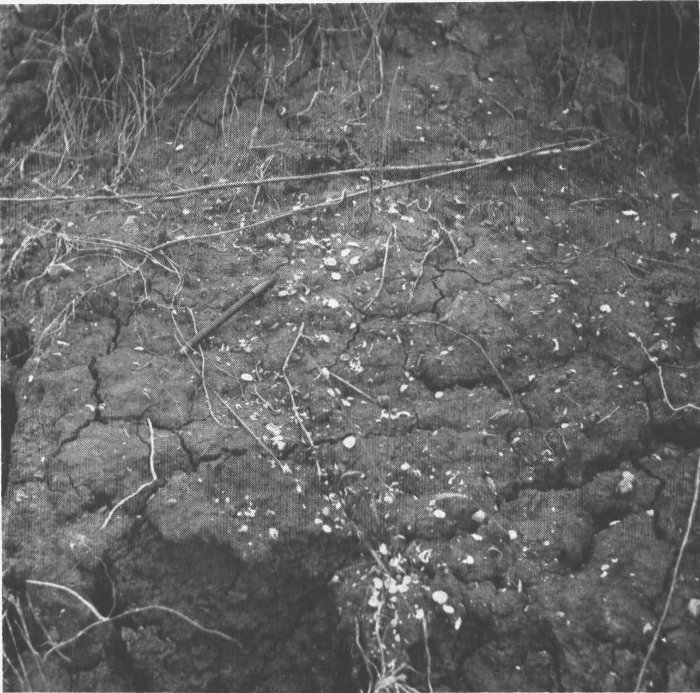
Figure 10. Close-up view showing the pelecypod (clam) shells which occur within
the Brown Clays. Note small Ballpoint pen for scale. These shells tell us of the marine
origin for these clays. The pelecypods here are Saxicava and Macoma.
Remember from the previous discussion of Lake Vermont that as the
Champlain ice lobe retreated into Canada, fresh water from Lake Vermont
began to seep through the ice lobe into the St. Lawrence Valley.
This seepage caused a gradual lowering of the Lake Vermont water-level
until the lake reached a stage lower than the marine waters of the
St. Lawrence Sea. Soon the sea water began to flood Lake Vermont and
true marine conditions were reached. These marine waters reached as
18
far south as Whitehall, New York, which is located near the southern
end of present-day Lake Champlain.
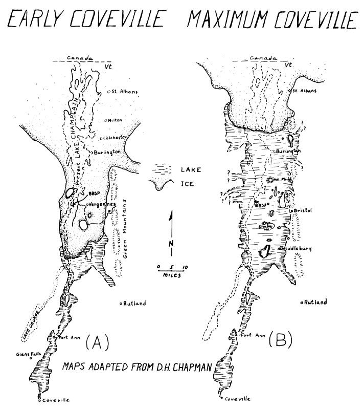
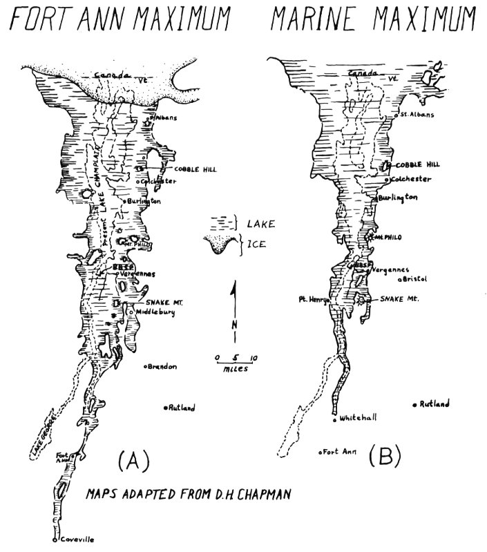
The maximum area covered by the Champlain Sea did not equal the
greatest size attained by the fresh waters of Lake Vermont. For instance,
the sea did not extend as far east as the Green Mountains except in the
very northernmost region of Vermont. In the vicinity of Button Bay
State Park these waters extended less than a mile east of Vergennes,
and the towns of Middlebury, Hinesburg and Charlotte would have been
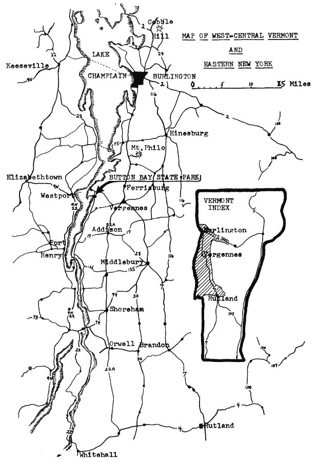
entirely above water (see map, Fig. 7B).
It has been postulated that marine waters extended throughout the
length of the Champlain Valley and into the Hudson Valley, forming a
continuous strip of marine water from the Gulf of St. Lawrence to the
Atlantic Ocean at the mouth of the Hudson River. If this were true,
New England would have been an island only a few years ago (geologically
speaking). The weight of evidence available today does not support
the prior existence of this connecting ribbon of sea water. Today Lake
Champlain contains fresh water again, and the marine conditions have
retreated back into the Gulf of St. Lawrence. What happened to permit
a return to fresh water conditions?
The lakes and lake-stages discussed are known from the presence of
various shoreline features, most of which are now “high and dry.” Each
lake or lake-stage has its own set of lake-level features. An interesting
fact emerges from a study of any one former lake. The present elevation
above sea level of delimiting lake-level features is not the same throughout.
To explain this more fully, the present elevation of those features
formed when the Champlain Sea was at its maximum extent will be
examined.
At Shelburne Falls the present elevation of these features is 300 feet,
at St. Albans 440 feet, and at Roxton, Quebec, 552 feet. It will be noted
that proceeding from south (Shelburne Falls) to north (Roxton) a difference
of over 250 feet is found between features formed at an identical
time in the past. The water in any lake is practically level. It therefore
follows that the present 300, 440 and 552 foot elevations of the
shoreline features are the result of subsequent tilting of the earth’s
surface. Perhaps the following reference to the water level of present
Lake Champlain will help in your understanding of this tilting.
The present-day average level of the water in Lake Champlain is
about 92 feet above the level of the Atlantic Ocean. This water-level
elevation is constant throughout the extent of Lake Champlain and is
19
not, say, 92 feet at Button Bay and 192 feet at Burlington. Again, the
only way that features demonstrating past lake margins or levels could,
for any one lake or lake-stage, now exist at different elevations would
be if some earth movements took place after the formation of the features,
resulting in a change from their original elevations.
The earth’s crust has been tilted, higher in the north than in the south,
during recent times. This tilting provides the clue to the formation of
present-day Lake Champlain. Major tilting took place after the maximum
marine invasion. Tilting continued, at a decreasing rate, perhaps,
to the present day. This tilting, with greater relative rise in the northwest,
eventually reached a point where marine waters were excluded
from the Champlain Basin.
Fresh water slowly diluted the salty marine water. The lake gathered
more and more fresh water through rain and melting snow, and a new
outlet formed in the north, in the approximate location of the present
Richelieu River. The area of Lake Champlain slowly increased to its
present size, and the clays which once formed lake and sea bottom became
the “hard earth” of the Champlain Lowlands. Continued tilting
caused flooding of the streams, especially in the southern portion of
Lake Champlain, such as the now swampy Otter Creek and its tributary
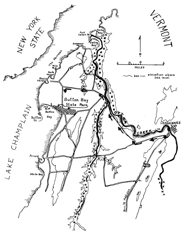
Dead Creek (see map, Fig. 2). This concludes the story of the Park
clays. From the rocks which crop out within a short walking distance of
Button Bay State Park a much older segment of geologic history can be
studied.