From the year 876 the Danes became colonists
and settlers. Raid and plunder gave place to
peaceful pursuits. The English Chronicle says
that in "this year Halfdene apportioned the lands
of Northumbria; and they henceforth continued
ploughing and tilling them." This colonisation of
Deira by the Danes was soon followed in other
districts. The greater part of central Britain with
the whole of the north and east came entirely under
Scandinavian rule.
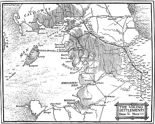
THE VIKING SETTLEMENTS
In 877 trading is recorded by the Sagas from
Norway, in a shipload of furs, hides, tallow and
dried fish, which were exchanged for wheat, honey,
wine and cloth. Thus early was established the
increase in comfort and wealth, as evidenced by
the erection of Christian monuments early in the
tenth century.
The origin of "long-weight" and "long-hundred"
count is traceable to the Danish settlements.
This peculiar reckoning survives in the
selling of cheese 120 lbs. to the cwt., and in the
counting of eggs, 120 to the hundred. The timber
trade counts 120 deals to the hundred. On the
East Coast fish are counted 132 to the hundred.
Six score to the hundred is still popular in
Westmorland measure of crops and timber. This
Danish method of count was derived from the
Icelandic term "hundred" which meant 120.
Professor Maitland, in his "Domesday Book and
Beyond," says that the number of sokemen or free
men, owing certain dues to the Hundred Court, or
to a lord, who were masters of their own land, like
the customary tenants of Cumberland, was greater
in Norfolk and Suffolk than in Essex, and that in
Lincolnshire they formed nearly half the rural
population. At the time of Domesday the number
of serfs was greatest in the West of England, but
none are recorded in Yorkshire and Lincolnshire.
In the manors bearing English names the sokemen
numbered two-fifths of the population, while in those
manors with Danish names they formed three-fifths
of the population. (Boyle.)
In the Danelaw they represent the original
freeholders of the settlement and owed obedience
to the local "Thing" or "Trithing Court." In
those districts which were not conquered by Edward
the Elder the freeholders settled and prospered,
and with the spread of Christianity they became
independent proprietors and traders.
The presence of Danish place-names marks the
district which they conquered, including the counties
of Lincoln, Nottingham, Derby, Leicester, Rutland,
and Northampton. In the rest of Mercia few of
these names are to be found, viz., in Cheshire,
Shropshire, Staffordshire, Worcester, Gloucester,
Hereford and Oxfordshire. The eastern part of
the Danish district came to be known as the Five
Burghs, namely, Derby, Leicester, Lincoln, Stamford
and Nottingham. From the year 880 when
Halfdene divided the lands of Deira among his
followers the conditions of life became those of
colonists, and the Danes settled down to cultivate
their own lands, learning the language of the earlier
Angles, teaching them many words, and ways of
northern handicraft, and gradually intermarrying
and forming the vigorous character of body and
mind which denotes the modern Englishman.
From the middle of the tenth century men bearing
Anglo-Danish names held high positions in the
Church; Odo was Archbishop of Canterbury, his
nephew Oswald was Bishop of Worcester and
afterwards Archbishop of York in succession to
Oskytel, and many Norse names appear as witnesses
to Royal Charters.
The hatred still existed against these barbarous
Danes, and it is recorded in the Saxon Chronicle
that the Saxons learned drunkenness from the
Danes, a vice from which before they were free.
This character is strangely contrasted by the story of
John of Wallingford, that "they were wont, after
the fashion of their country, to comb their hair every
day, to bathe every Saturday, Laugardag, 'bath
day,'—and to change their garments often, and to
set off their persons by many such frivolous devices.
And in this manner laid siege to the virtue of the
women."
If we are to accept the evidence of Lord Coke,
we are indebted to the Danish invasion for our
propensity to make Ale the national beverage.
This eminent authority says that King Edgar, in
'permitting' the Danes to inhabit England, first
brought excessive drinking among us.
The word Ale came into the English language
through the Danish öl. At any rate after the
advent of the Norsemen, the English left off
drinking water and began to drink ale as the
regular everyday beverage of the people.
The term 'beer' was used by the Anglo-Saxons,
but seems to have fallen into desuetude until the
name was revived to distinguish 'ale' from
hopped ale.'—From "Inns, Ales, and Drinking
Customs of Old England," by Frederick W.
Hackwood.
Green the historian in his "Conquest of England"
says the names of the towns and villages of Deira
show us in how systematic a way southern Northumbria
was parted among its conquerors.... "The
English population was not displaced, but the lordship
of the soil was transferred to the conqueror. The
settlers formed a new aristocracy, while the older
nobles sank to a lower position, for throughout Deira
the life of an English thane was priced at but half
the value of a 'northern hold.'" The inference to
be drawn from this passage is that the English
lords of the soil were replaced by Danish ones, the
English settlers remained in possession of their
ancient holdings. In the course of time the two
races amalgamated, but at the Norman Conquest
this amalgamation had only been partially effected.
In the districts where the Danes settled they formed
new villages, in which they lived apart from the
general Anglian population. Had they not done so
the memory of their settlement could never have
been perpetuated by the Danish names given to their
homes. Every group of isolated Danish place-names
teaches the same fact, and there are many
such groups. This is the case in the Wirral district
of Cheshire, the peninsula between the Mersey and
the Dee, where we find such names as Raby,
Greasby, Frankby, Irby, Pansby, Whitby and
Shotwick, and in the centre of the district the village
called Thingwall. While throughout the rest of the
county scarcely a Danish name can be found, and as
these names were conferred by the Danish settlers
it is impossible not to believe that under analogous
conditions the names in other districts were conferred
in the same way. Where a new village was planted
midway between two older villages, its territory
would be carved in varying proportions out of the
lands of the earlier settlements. Sometimes certain
rights of the older villages were maintained in the
territory of which they had been deprived. Thus in a
Danish village of Anlaby, the lands whereof were
carved out of the adjoining townships of Kirk Ella
and Hessle, the respective rectors of these parishes
had curiously divided rights to both the great and the
small tithes; whilst in the neighbouring instance of
the Danish Willerby, carved out of Kirk Ella and
Cottingham, the rector of Kirk Ella took all the
great tithes, and the rector of Cottingham took all
the small tithes. This method of Danish village
formation explains a curious point. The foundation
of the earlier Anglian settlements preceded the
development of the great road system of England.
Leaving out of consideration the Roman roads and
the comparatively few British roads, the former of
which have relation to nothing but the military needs
of that all conquering people, our existing road
system is due to the Anglo-Saxon. Our old roads
lead from one village to another and each village
is a centre from which roads radiate. The Danish
villages were, on the contrary, usually roadside
settlements. New settlements were formed on the
vast fringes of wood and waste which surrounded
the cultivated lands of the older English villages.
The road existed and the one village street was
formed along the line. Such wayside settlements
are Carnaby and Bessingby, on the road from
Bridlington to Driffield. When, as was sometimes
the case, the new settlement was planted at a little
distance from the existing road a new road running
at right angles from the old one and leading directly
to the settlement was formed. Skidby, Towthorp,
Kirby, Grindalbythe and many others are cases in
point. One consequence of such conditions of
formation would be that where the English
settlements were most numerous the Danish
settlements would be few and small, because there
was less land available in such districts for their
formation. While, on the other hand, where
English settlements were more sparsely scattered
the Danish settlements would be more numerous,
and comparatively large. Taking a large district
like the East Riding, the average area of the
Danish townships may be expected to fall below
that of the Anglo-Saxon. The facts comply with
all these tests.
Thus to take the townships with Danish names,
and compare with similar districts of Anglo-Saxon
names, we arrive at the conclusion as to whether the
district was thickly populated before the coming of
the Danes. Many Anglo-Saxon villages are to be
found along the course of the Roman road, which
coincides with the modern one of to-day. The two
classes of population found only in Danish districts,
the Sochmanni and the "liber tenentes," are wholly
absent in purely English districts. Both held land
exempt from villain services, which was a condition
of tenure introduced by the Danes. This fact
shatters the theory of Green that English settlers
were communities of freemen. They were in fact
communities of bondmen, villains, bordars, cottars,
and serfs, the last holding no lands, but being bound
to the soil as chattels, and the rest holding their
lands, "at the will of the lord," and in return for
actual services. What then was the Sochman?
The lawyer of to-day will answer, "He is one who
held land by 'socage,' tenure." Although in
Domesday this "sochman" is confined to Danish
districts, a fact which is recognised in the laws of
Edward the Confessor. After the Conquest a type
of tenure more or less closely corresponding to that
by which the earlier sochman held his land, was
gradually established over the whole kingdom.
Tenants who owned such tenures were called
"sochmen," and the tenure itself was called
"socage." A distinction was drawn between "free
socage" and "villain socage." The fuller development
of the feudal system which followed the
Conquest greatly complicated all questions of land
tenure. New conditions of holding superior to that
of "socage" were introduced. Thus in the pages of
Britton, who always speaks in the person of the
King, we read: "Sochmanries are lands and tenements
which are not held by knights' fee, nor by
grand serjeantries, but by simple services, as lands
enfranchised by us, or our predecessors, out of
ancient demesnes." Bracton is more explicit. He
defines free socage as the tenure of a tenement,
whereof the service is rendered in money to the chief
lords, and nothing whatever is paid, "ad scutum et
servitium regis." "Socage," he proceeds, "is
named from soke, and hence the tenants who held in
socage are called sochmanni, since they are entirely
occupied in agriculture, and of whom wardship and
marriage pertain to the nearest parents in the right
of blood. And if in any manner homage is taken
thereof, as many times is the case, yet the chief lord
has not on this account, wardship and marriage,
which do not always follow homage." He then
goes on to define "villain socage." The essential
principle of socage tenure is rent in lieu of services.
It is to this fact no doubt that the vast impetus which
was given to the coinage of England soon after the
coming of the Danes is largely due.
As Mr. Worsaäe says, the Danish coiners
increased to fifty in number from the reign of
Aethelred to Edward the Confessor, and the
greater number exercised this vocation at York and
Lincoln. Thus the sochmanni were found only in
the settlements of the people who had created in
England a tenure of land free from servile obligations.
The manner of fixing these early settlements of
land was the same in Ireland, in the East Riding of
Yorkshire, and in Lincolnshire. The same custom
is still observed by our modern colonists who launch
out into the Australian bush. The land was staked
out by the settler from the highest ridge downwards
to the creek of the river or shore. By this means
the settler obtained on outlet to the open sea. The
homestead was built by the bondr or husbandman,
on the sheltered ground between the marsh and hill.
These settlements became byes, and were encircled
by a garth, or farmyard. The names of some Norse
farms and settlements became composed of a Norse
prefix and Saxon ending. Thus we find Oxton
"the farm of the yoke," in the hollow of a long
ridge. Storeton, from stortun or "big field."
Many of these names are repetitions of places
which exist in Cumberland, Denmark, and the Isle
of Man. Raby and Irby were smaller farms on the
boundary of large byes, and were derived from the
Danish chief Ivar. Each homestead had its
pastures and woods, which are denoted by the
terminals "well," "wall," and "birket," found in
such names as Crabwall, Thelwall, Thingwall.
"Thwaites" or "Hlither" were sloping pastures,
cleared of wood, between the hill and marsh, used
for grazing cattle and sheep. This system of
agriculture is of Norse origin, and many such
"thwaites" are to be found in Wallasey, Lancashire,
and the Lake district. Calday and Calder, recorded
in Domesday, "Calders," derived from kalf-gard,
are names existing in Calderstones, at Wavertree,
and Calday near Windermere, as well as at
Eastham and in Scotland. Each large settler had
summer pastures for cattle on the highland or moor,
called "soeters" or "saetter," a shelter seat for the
dairymaids. From this custom we derive the names
Seacombe, Satterthwaite, Seathwaite, Seascale, and
Sellafield. As the population increased the large
estates were divided among the families of the early
settlers, and these upland pastures became separate
farms. Evidence that these early Norsemen were
Christians is found in the name Preston, in Domesday.
Prestune, the farm of the priest: who in these
early days farmed his own land. From its position
this farm became known as West Kirby.
The stone crosses of Nelson and Bromborough
prove that these churches were founded early in the
eleventh century.
The Danish character of Chester at this date is
shown by the fact that it was ruled by "lawmen,"
in the same manner as the Five Boroughs (vide
Round's "Feudal England," p. 465), and its growing
wealth and importance was due to the trading
intercourse through the Danish ships with Dublin.
Coming from the north-east another Norse and
Danish settlement sprang up round Liverpool.
Though we have no distinct historical record, the
place names indicate the centre was at Thelwall
(Tingwall). Such names are Roby, West Derby,
Kirkby, Crosby, Formby, Kirkdale, Toxteth, found
in Domesday as "Stockestede," Croxteth, Childwall,
Harbreck, Ravensmeols, Ormskirk, Altcar,
Burscough, Skelmersdale.
Out of forty-five names of places recorded in
Domesday in West Derby Hundred, ten are Scandinavian,
the rest might be interpreted in either
dialect.
All other names in Domesday in South
Lancashire are Anglo-Saxon, which only amount
to twelve: the reason for the small number of
names being that the land was for the most
part lying waste, and was thus free from assessment.
Thus we find on the present map that
Norse names form a large number which are not
recorded in Domesday. Many of these would be
later settlements. In West Derby the names of
three landowners appear in this survey with Norse
names, while three others are probably Norse, and
seven Saxon.
Following the fall of the Danish dynasty the
districts of South Lancashire formed part of
Cheshire and we find the names of six "Drengs"
around Warrington, possessing Norman names,
while only one bears a Norse name. The word
"Dreng" being Norse, would infer that the tenure
was of "danelaw" origin and not of Anglo-Saxon.
The founder of the Abbey of Burton-on-Trent,
Wulfric Spot, held great tracts of land in Wirral
and West Lancashire, which are named in his Will
dated 1002. Thus the "Bondr" here held his land
under Mercian rules, from which the hides and
hundreds were similar to those of the previous
"danelaw."
Lancashire was the southern portion of Deira,
which was one of the two kingdoms, Bernicia being
the other, into which the conquests of Ida, king of
Northumbria, were on his death divided. In
559 A.D. Ida died, and Aella became King of Deira,
and afterwards sole King of Northumbria, until
587 or 589. In 617, Edwin son of Ella was King
of Northumbria, the greatest Prince, says Hume
the historian, of the Heptarchy in that age. He
was slain in battle with Penda of Mercia. In 634
the kingdom was again divided, Eanfrid reigning
in Bernicia, and Osric in Deira. Then Oswald,
saint as well as king, appears to have reunited the
two provinces again under his kingship of Northumberland.
Authorities, in more than one instance,
vary as to the exact dates, within a year or two.
The Saxon kingdom of Northumbria reached
from the Humber to the Forth, and from the North
Sea to the Irish Sea. For two centuries after the
death of Ecgfrith the Saxon king and the battle of
Nectansmere, history only records a succession of
plunder and pestilence.
Green the historian says "King after king was
swept away by treason and revolt, the country fell
into the hands of its turbulent nobles, its very fields
lay waste, and the land was scourged by famine and
plague."
The pirate Northmen or Vikings as they were
called first, began to raid the coast of England with
their fleets with the object of plunder. The English
Chronicle records their first attacks in the year 787.
"Three of their ships landed on the western shores,
these were the first ships of Danish men that sought
the land of Engle-folk."
The Monastery of Lindisfarne was plundered six
years later by their pirate ships, and the coast of
Northumbria was ravaged, Jan., 793.
The following year they returned and destroyed
the monasteries of Wearmouth and Jarrow. This
was the beginning of the Norse raids on our Eastern
shores.
In 875 Halfdan returned from his campaign
against Alfred and the year after he divided the
lands of Northumbria amongst his followers. In
many parts we find groups of Scandinavian place-names
so close and thick, says Mr. W. G. Collingwood
in his "Scandinavian Britain," that we must
assume either depopulation by war, or the nearly
complete absence of previous population.
There is no reason to suppose that the earlier
Vikings depopulated the country they ravaged.
Spoil was their object and slaughter an incident.
As Canon Atkinson has shown in his "Analysis
of the Area of Cleveland under Cultivation at
Domesday Period," very little of the country in
that district was other than moor or forest at the
end of the eleventh century, and that most of the
villages then existing had Scandinavian names.
His conclusion is that these districts were a wilderness
since Roman and prehistoric days, and first
penetrated by the Danes and Norse: except for
some clearings such as Crathorne, Stokesley,
Stainton, and Easington, and the old monastery at
Whitby.
This conclusion receives support, says Mr.
Collingwood, from an analysis of the sculptured
stones now to be seen in the old Churches and sites
of Cleveland. It is only at Yarm, Crathorne,
Stainton, Easington, and Whitby, that we find
monuments of the pre-Viking age, and these are the
products of the latest Anglian period.
At Osmotherley, Ingleby, Arncliffe, Welbury,
Kirklevington, Thornaby, Ormesby, Skelton, Great
Ayton, Kirkdale, and Kirkby-in-Cleveland are
tombstones of the tenth and eleventh centuries. It
is thus evident that the Angles were only beginning
to penetrate these northern parts of Yorkshire when
the Vikings invaded and carried on the work of
land settlement much further. Further extension
was made by the Norse from the West Coast, as
the place-names show. Monuments of pre-Viking
art work exist at places with Scandinavian names,
such as Kirkby-Moorside, Kirkby-Misperton, and
Kirkdale; while in other cases only Viking age
Crosses are found at places with names of Anglian
origin, such as Ellerburn, Levisham, Sinnington,
Nunnington.
This would indicate that some Anglian sites were
depopulated and refounded with Danish names,
while others had no importance in Anglian times
but soon became flourishing sites under the Danes.
In the west of Yorkshire the great dales were
already tenanted by the Angles, but the moors
between them, and the sites higher up the valleys,
were not the sites of Churches until the Danish
period. (See "Anglian and Anglo-Danish Sculpture
in the North Riding," by W. G. Collingwood.
Yorks. Arch. Journal, 1907.)
Yorkshire at the time of the Domesday survey
was carucated and divided into Ridings and
Wapentakes. Thingwall, near Whitby. (Canon
Atkinson, site lost.) Thinghow, near Ginsborough
(now lost), and Thinghow, now Finney Hill, near
Northallerton. (Mr. William Brown, F.S.A.)
Tingley, near Wakefield; Thingwall, near Liverpool;
Thingwall in Wirral, may have been Thingsteads.
(W. G. Collingwood.)
Names of places ending in -ergh, and -ark are
dairy-farms from setr and saetr. Names with ulls-
as prefix, such as Ulpha, Ullscarth, Ullswater,
record the fact that wolves inhabited the hills.
Beacons were kept up in olden days on hills
which bear the names of Warton, Warcop, Warwick
and Warthole. Tanshelf, near Pontefract, is
derived from Taddenesscylfe, Blawith and Blowick
from Blakogr—blackwood. Axle, Acle, arcle from
öxl, the shoulder.
"There is one entry in the Anglo-Saxon
Chronicle which must be mentioned here as it
throws light upon an archæological discovery of
considerable importance. In 911 the Chronicle
records that the Danish army among the Northumbrians
broke the peace and overran the land of
Mercia. When the King learned that they were
gone out to plunder, he sent his forces after them,
both of the West Saxons and the Mercians; and
they fought against them and put them to flight,
and slew many thousands of them...."
"There is good reason to believe," as Mr.
Andrew shows (Brit. Numis. Jour. i, 9), "that the
famous Cuerdale hoard of Silver coins, which was
found in 1840 in a leaden chest buried near a
difficult ford of the Ribble on the river bank about
two miles above Preston, represents the treasure
chest of this Danish army, overtaken in its retreat to
Northumbria at this ford and destroyed."
*****
Then follows a process of reasoning in support
of the above conclusion, based upon the place of
minting and the dating of the coins.
"The bulk of the coins, however, were Danish,
issued by Danish Kings of Northumbria, many of
them from York."
Besides the Cuerdale find of 10,000 silver coins
and 1,000 ounces of silver there are records given
of other Danish finds.—From the Victoria County
History of Lancashire, Vol. I., see Coins.
Each historian of this important event has
claimed a different site, in as many parts of
England. In Grose's "Antiquities" we find the
allied Scotch, Welsh, Irish, and Danes, the Northumbrian
army, under Anlaf were totally defeated,
in 938 at Brunanburgh (Bromridge, Brinkburn), in
Northumberland, when Constantine, King of the
Scots, and six petty Princes of Ireland and Wales,
with twelve Earls were slain. This description is
given in the Anglo-Saxon Chronicle. The honour
of claiming the Lancashire site on the river Brun
near Burnley, belongs to the late Mr. Thomas
Turner Wilkinson, a master of Burnley Grammar
School, who claimed it for Saxifield in 1856.
We are indebted to Mr. Jas. T. Marquis, a
member of the Lancashire and Cheshire Antiquarian
Society, for the following summary of evidence
which he placed before the above Society during
the winter session of 1908–9, and which will be
found recorded in the Transactions of the Society.
He says, "There is overwhelming testimony in
favour of the site on the Lancashire Brun."
The reasons for claiming this site are simply two.
An old writer spells Brinkburn—Brincaburh, and
there is an artificial mound proving a fight.
Camden gives Brunford, near Brumbridge in
Northumberland, as the place where "King Athelstane
fought a pitched battle against the Danes."
This might easily be, but not the battle we refer to.
There is no reason given except the word "ford."
Gibson suggests that it must have been "somewhere
near the Humber," although he finds a
difficulty in carrying Constantine and the little King
of Cumberland so high into Yorkshire. The other
places suggested are Brumborough in Cheshire,
Banbury in Oxfordshire, Burnham and Bourne in
Lincolnshire, Brunton in Northumberland, but no
good reason beyond a name, and an embankment
in some cases, but not all. Brownedge in
Lancashire has been suggested, with excellent
reasons.
Dr. Giles and others suggest that the name
should be Brumby instead of Brunanburh. Ingram
in his map of Saxon England places the site in
Lincolnshire, near the Trent, but without assigning
good reasons. Turner observes that the "Villare"
mentions a Brunton in Northumberland, and Gibson
states what may still be seen in maps of a century
old, "that in Cheshire there is a place called
Brunburh near the shores of the Mersey." This
last would be a serious competitor if there was a
river Brun, or tumuli, or ford, or battlefield: but
nothing is claimed, only the name suggested.
Brunsford or Brunford. Let us first establish
the site of the "burh," which is a hill that shields
or protects a camp, town, or hamlet. The question
is, where was the "tun" or village on the Brun?
It was in Saxon times usual for the folk to settle
near a "burh" for the protection afforded by an
overlord who occupied it.
It was also the custom of the early missionaries
to establish a feldekirk by setting up a Cross near
to the hamlet, where they used to preach Christianity
and bury their dead.
Tradition says it was intended to build the
Church on the site of the Cross, but that God willed
it otherwise. God-ley Lane would be the lane
which led from the village in Saxon times to God's
Lea or God-ley, on which was the new church and
burial ground. Thus the new town would take its
modern name from the ground on which the Church
stood, namely Brun-ley, Bron-ley, and Burn-ley.
The cross, built in Saxon times to mark the spot
where Christianity was first preached, stood at the
foot of the "burh" near the Brun, and thus the
early name would be Brunford.
The records of Domesday Book contain no
mention of Burnley. To the east and west would
be the vast forest of Boulsworth and Pendle, while
the valleys would be marshes and swamps. The
ancient roads went along the hill sides, and there
is an ancient road from Clitheroe by Pendle passing
along the east side of the hill, now almost obliterated,
leading to Barrowford. The ancient road on
this east side of the valley, was on the Boulsworth
slope from Brunford, via Haggate and Shelfield,
to Castercliffe, Colne, and Trawden which gave its
name to the forest, and Emmott.
Dr. Whitaker tells us that in his day, "in the
fields about Red Lees are many strange inequalities
in the ground, something like obscure appearances
of foundations, or perhaps entrenchments, which the
levelling operations of agriculture have not been
able to efface. Below Walshaw is a dyke stretching
across from 'Scrogg Wood' to 'Dark Wood.'"
The ninth century annalist says, "The Northmen
protected themselves according to custom, 'with
wood and a heap of earth,'" A Walshaw would
therefore be a wall of wood. Nothing was safer,
when attacked by bowmen, than a wood. Such was
the Brun-burh. This burh at Red Lees with
mounds and ditches, in a half circle on each side
of the Causeway, would have the same appearance
on being approached from the east and south-east
as the eleventh century "burh" at Laughton-en-le-Morthen
in Yorkshire.
The ancient way referred to in Dr. Whitaker,
from Burnley to Townley, would be from the
Market Cross, along Godley Lane to the Brunford
Cross, up over the ridge to the top of Brunshaw,
along the Causeway to Lodge Farm, through the
Deer Park, through the Watch Gate at the foot of
the hill, and up to Castle Hill at Tunlay.
Although Egbert was called the first King of
England, his son Alfred the Great at the height of
his power only signed himself "Alfred of the West
Saxons, King."
England was still governed under the three provinces
at the time of Henry I., namely Wessex,
Mercia, and Danelagh. The latter province comprised
the whole tract of country north and east of
Watling Street. Mercia included the lands north
of the Mersey. Danish Northumbria or Deira
comprised the lands to the west of the Pennines.
Amongst the hills north of the Ribble the hostile
nations could meet in security. Saxon-Mercia
north of the Mersey, surrounded by alien nations,
and having been itself conquered from that claimed
as the Danelaw, would be the most likely where
those nations could meet in time of peace, and was
the debatable land in time of war.
After the death of Alfred, when Edward the
Elder claimed overlordship, the Danes rose in
revolt in the north. It is recorded that he and his
warrior sister "the Lady of the Mercians" abandoned
the older strategy of rapine and raid, for that
of siege and fortress building, or the making and
strengthening of burhs.
Edward seems to have recovered the land
between the Mersey and the Ribble, for soon after
leaving Manchester, the Britons of Strathclyde, the
King of Scots, Regnold of Bamborough who had
taken York at this period, and the Danish Northumbrians
take him to be father and lord. The
place is not mentioned, but must be somewhere
between Boulsworth and Pendle.
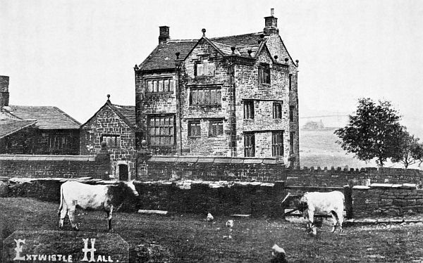
Extwistle Hall, near Eamott, marks an ancient boundary.
The same thing happened when Athelstan
claimed his overlordship. Profiting by following
his father's example, he would travel from burh to
burh, and his route would not be difficult to trace,
namely, Thelwall, Manchester, Bacup, Broad Dyke,
Long Dyke, Easden Fort, Copy Nook, Castle Hill,
Watch Gate, Brunburh, Broadbank, Castercliffe,
Shelfield, Winewall, Eamot.
The Anglo-Saxon Chronicle says that "A.D. 926,
Sihtric perished, and King Athelstan ruled all the
Kings in the Island, the Northumbrians, Constantine
King of Scots, Ealdred of Bamborough, and
others, which they confirmed by pledges and oaths at
a place Eamot on the 4th of the ides of July and
they renounced idolatry."
Everything points to the fact that Brunanburgh
gave its name to this battle. This part of the
Saxon king's dominions being the one place where
all the hostile nations could meet before the attack.
There is no other river Brun in northern Mercia,
and the Saxon Chronicle says the battle was fought
near Brunanburh.
Ethelward says Brunandune (river and dale).
Simeon gives Wendune (Swindon). Malmesbury
and Tugulf names Brunanburh or Bruford. Florence
of Worcester "near Brunanburh." Henry of
Huntingdon gives Brunesburh, and Gaimar has
Brunswerc, which we have in Worsthorne, which
is known to be derived from Wrthston, the town
of Wrth. In the Annales Cambriae it is styled
the "Bellum Brun" (the Battles of the Brun).
This would explain the many names.
William of Malmesbury says that the field was
"far into England." We have Brownedge and
Brownside. In addition to all this we have
"Bishops Leap," S'Winless Lane, Saxifield, Saxifield
Dyke. We have also a Ruh-ley, a Red Lees,
directly opposite to which we have a traditional
battlefield and battlestone, also a High Law Hill,
and Horelaw Pastures, a number of cairns of stones,
a small tumuli; all of which may be said to be near
the hillfort Brunburh.
From the two Ordnance maps, "six inch to the
mile," one of Briercliffe, and the other of Worsthorne,
it may be seen that the roads from Slack,
near Huddersfield, pass through the Pennine range,
one by the long Causeway, on the south of the
position and on the southern side, near Stipernden,
is "Warcock Hill. From here running north, are
a series of ridges, Shedden Edge, Hazel Edge,
Hamilton Hill, to the other road from Slack, passing
through the hills at Widdop, and immediately
on the north side at Thursden is another Warcock
Hill. From Warcock Hill to Warcock Hill would
stretch the army of Anlaf in their first position.
From the north end of the position a road north to
Shelfield and Castercliffe, by means of which he
would be joined by his Welsh allies, from the
Ribble, via Portfield, and his Strathclyde and
Cumbrian allies from the north. From this end of
the position there is a road due west to the Broadbank,
where there is the site of a small camp at
Haggate.
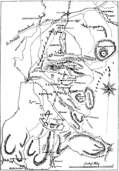
From here Anlaf would send his Welsh allies
under Adalis, and his shipmen under Hryngri, for
the night attack on the advancing Saxons as they
crossed the Brunford. They fell on them somewhere
on the site of Bishop's House Estate, but
were afterwards beaten back across the estates
known as Saxifield. Two days afterwards both
sides prepared for the great struggle near the burh,
and Anlaf, taking his cue from his opponent,
advanced his left and took possession of the hill
near Mereclough, afterwards called High Law
(Round Hill), and the pastures behind still known
as Battlefield, with a stone called Battlestone in the
centre of it.
Constantine and the Scots were in charge of the
hill, and the Pict, and Orkney men behind. His
centre he pushed forward at Brown Edge, to the
"Tun of Wrst." While his right touched
S'Winden Water under Adalis with the Welsh and
shipmen.
Two days before the great battle Athelstan
marched out of Brunburh at the north end, and
encamped somewhere on the plain called Bishop's
House Estate, his route by the Brunford, and
probably S'Winless Lane.
We are told that Anlaf entered the camp as a
spy, and ascertaining the position of Athelstan's
tent, formed the night attack for the purpose of
destroying him. Athelstan, however, leaving for
another part of his position on the Brun, gave
Wersthan, Bishop of Sherborne, the command.
The Bishop met his death somewhere on the
estate, the Pasture being known as Bishop's Leap,
which undoubtedly gave its name to the estate.
Adalis, the Welsh Prince, had done this in the
night attack, probably coming by way of Walshaw,
and Darkwood. Alfgier took up the command,
with Thorolf on his right and Eglis in support in
front of the wood. Alfgier was first assaulted by
Adalis with the Welsh and driven off the field,
afterwards fleeing the country. Thorolf was
assaulted by Hryngr the Dane, and soon afterwards
by Adalis also, flushed with victory. Thorolf
directed his colleague Eglis to assist him, exhorted
by his troops to stand close, and if overpowered to
retreat to the wood. Thorolf or Thorold the
Viking was the hero of this day, near the Netherwood
on Thursden Water. He fought his way to
Hryngr's standard and slew him. His success
animated his followers, and Adalis, mourning the
death of Hryngr, gave way and retreated, with his
followers back over Saxifield to the Causeway camp
at Broadbank.
Whatever took place at Saxifield the enemy left
it entirely, and the decisive battle took place at the
other end of Brunburh. In walking up S'Windene,
by S'Winden Water, the district on the right
between that river and the Brun is called in old
maps Roo-ley and in older manuscripts Ruhlie,
marked in Thomas Turner Wilkinson's time, with
a cairn and tumulus. Some distance further on we
find Heckenhurst. The roads down from the burh
are at Rooley and at Brownside and at Red Lees
by the Long Causeway leading to Mereclough.
Athelstan placed Thorolf on the left of his army,
at Roo-ley, to oppose the Welsh and irregular Irish
under Adalis. In front of Brownside (Burnside)
was Eglis with the picked troops, and on Eglis'
right opposite Worsthorne, Athelstane and his
Anglo-Saxons.
Across the original Long Causeway on the Red
Lees, with the burh entrenchments immediately at
his back, was the valiant Turketul, the Chancellor,
with the warriors of Mercia and London opposite
Round Hill and Mereclough.
Thorolf began by trying to turn the enemy's right
flank, but Adalis darted out from behind the wood,
now Hackenhurst, and destroyed Thorolf, and his
foremost friends on Roo-ley or Ruhlie. Eglis
came up to assist his brother Viking, and encouraging
the retreating troops by an effort destroyed the
Welsh Prince Adalis, and drove his troops out of
the wood. The memorial of this flight was a cairn
and tumulus on Roo-ley.
Athelstan and Anlaf were fighting in the centre
for the possession of (Bruns) Weston, neither
making much progress, when the Chancellor
Turketul, with picked men, including the Worcester
men under the magnanimous Sinfin, made a flank
attack at Mereclough, and breaking through the
defence of the Pict and Orkney men, got to the
"Back o' th' Hill." He penetrated to the Cumbrians
and Scots, under Constantine, King of the
Grampians. The fight was all round Constantine's
son, who was unhorsed. The Chancellor was
nearly lost, and the Prince released, when Sinfin,
with a mighty effort, terminated the fight by slaying
the Prince.
On Round Hill, down to one hundred years ago,
stood a cairn called High Law. When the stones
were made use of to mend the roads, a skeleton was
found underneath. That would, I believe, be a
memorial of the fight.
At "Back o' th' Hill," a blind road leads through
what in an old map, and in tradition is called
"Battlefield," and the first memorial stone is called
"Battlestone." Another similar stone is further on.
Following the blind road through Hurstwood, the
Chancellor would find himself at Brown End, near
Brown Edge. At the other end of the position,
Eglis having won the wood, would be in the neighbourhood
of Hell Clough, ready to charge at the
same time as Turketul, on the rear of Anlaf's army.
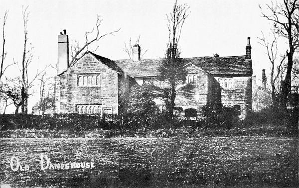
Old Daneshouse
At this point of the battle, Athelstan, seeing this,
made a successful effort and pushed back the centre.
Then began the carnage, the memorials of which
are still to be seen on Brown Edge, Hamilton
Pasture, Swindene, Twist Hill, Bonfire Hill, and
even beyond. Those who could get through the
hills at Widdop would do so: others however
would take their "hoards" from the camps at
Warcock Hill and other places, and burying their
"treasures" as they went along, pass in front of
Boulsworth, and over the moor through Trawden
Forest, between Emmott and Wycollar.
If the Saxon description of the battle, in Turner's
"History of the Anglo-Saxons" be read and compared
with the Ordnance maps before named, the
reader will see that there is no other place in
England which can show the same circumstantial
evidence nor any place, having that evidence, be
other than the place sought for.
Danes House, Burnley, is thus referred to by the late
Mr. T. T. Wilkinson, F.R.A.S.:—"Danes House is
now a deserted mansion situated about half-a-mile to
the north of Burnley, on the Colne Road. It has been
conjectured there was a residence on the same site
A.D. 937, when Athelstan, King of the South Saxons,
overthrew with great slaughter, at the famous battle
of Brunanburgh, Anlaf, the Dane, and Constantine,
King of the Scots. Tradition states that it was
here that Anlaf rested on his way to the battlefield
from Dublin and the Isles, hence the name Danes
House. The present deserted mansion has undergone
little change since it was re-erected about the
year 1500." This house has now been pulled down.
This mighty entrenchment is over 600 yards in
length and for over 400 yards of the line is 18 yards
broad at the bottom. No satisfactory solution has
yet been offered of the cause of this gigantic work
or of the use to which it was put originally. Speaking
of it Newbigging ("History of Rossendale")
says:—
"The careful investigations of Mr. Wilkinson
have invested this singular work with more of
interest than had before been associated with it, by
his having with marked ability and perseverance,
collected together a mass of exhaustive evidence,
enforced by a chain of argument the most conclusive,
with regard to the much debated locality of the
great struggle between the Saxons and the Danes,
which he endeavours, and most successfully, to
show is to be found in the immediate neighbourhood
of Burnley, and in connection with which the earthwork
in question constituted, probably, a not unimportant
adjunct."
Again, he says:—
"If Saxonfield (Saxifield) near Burnley, was the
scene of the engagement between the troops of
Athelstan and Anlaf, then it is in the highest degree
probable that one or other of the rival armies, most
likely that of the Saxon King, forced, or attempted
to force a passage through the valley of the Irwell
and that there they were encountered by the confederated
hosts intrenched behind the vast earthwork
at Broadclough that commanded the line of
their march. Whether this was taken in flank or
rear by the Saxon warriors, or whether it was
successful in arresting their progress, or delaying a
portion of their army, it is impossible to determine;
but that it was constructed for weighty strategical
purposes, under the belief that its position was of
the last importance, so much of the remains of the
extraordinary which still exists affords sufficient
evidence."


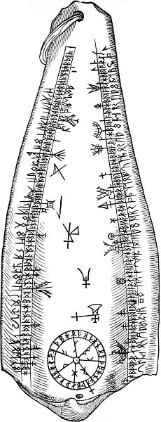
 but occasionally
with other marks to denote the date of certain
special Festivals.
but occasionally
with other marks to denote the date of certain
special Festivals.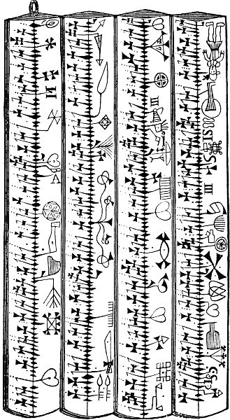


 .
.