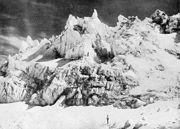
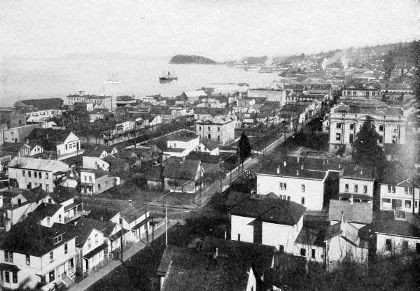
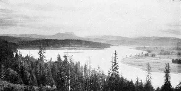
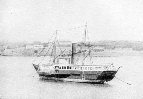
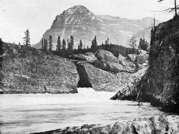
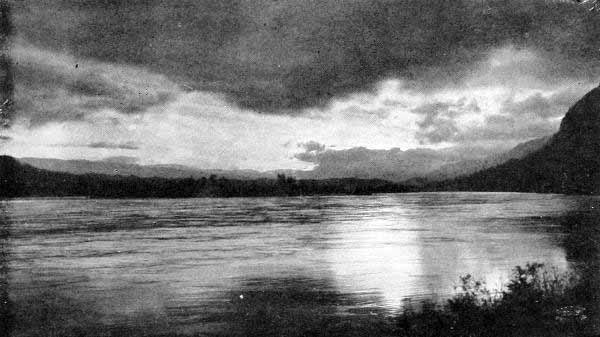
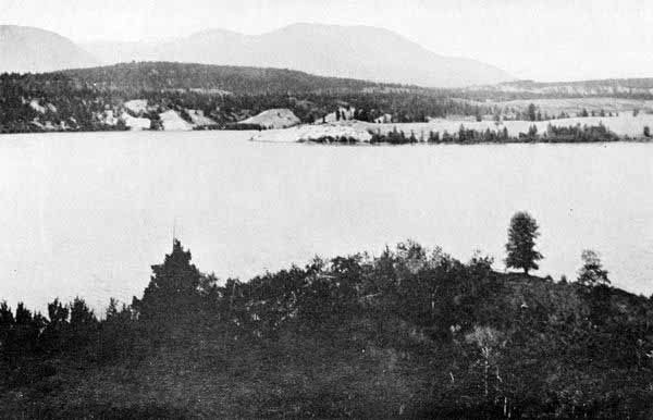
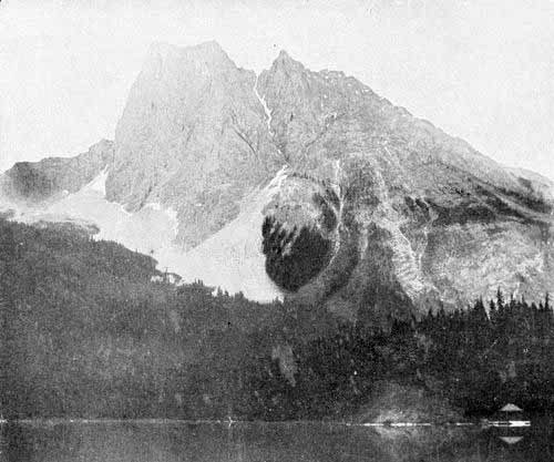
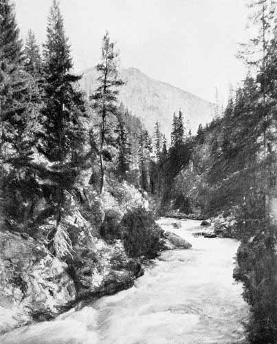
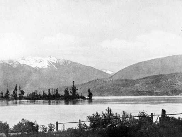
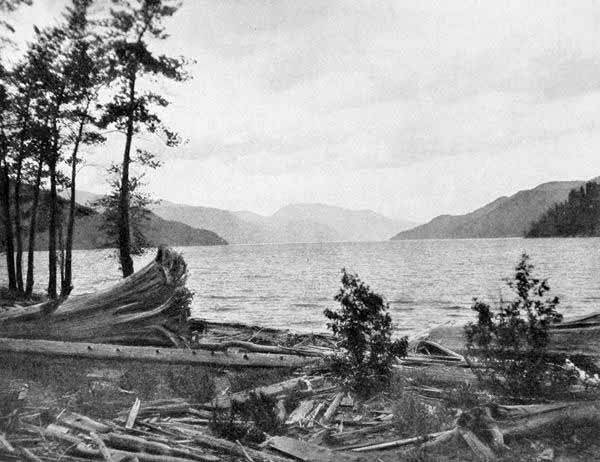
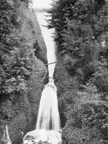
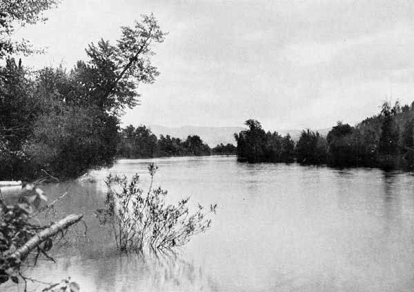
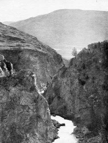
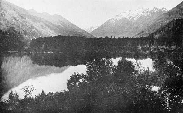
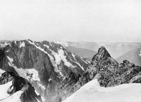
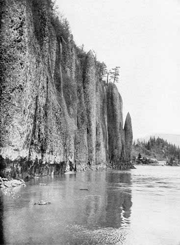
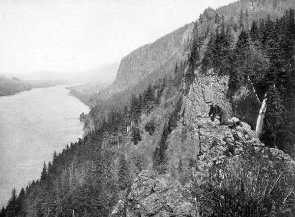
The Land where the River Flows
Contrasts—The Two Islands—Uplift—Volcanic Action—Flood—Age of
Ice—Story of Wishpoosh and Creation of the Tribes—Outline of the Mountain Systems—Peculiar Interlocking of the Columbia and the
Kootenai—The Cascade Range—The Inland Empire—The Valleys West of the Cascade Mountains—The Forests—The Climate—The
Native Races and Some of their Myths—Story of the Kamiah Monster—The Tomanowas Bridge at the Cascades—Origin of Three Great
Mountains—The Chinook Wind—Myths of the Unseen Life—Klickitat Story of the Spirit Baby—Beauty of the Native Names.
Wonderfully varied though rivers are, each has a physiognomy of its own.
Each preserves its characteristics even in the midst of constant
diversity. We recognise it, as we recognise a person in different changes
of dress. The Ohio has one face, the Hudson another, and each keeps its
essential identity. The traveller would not confuse the Rhine with the
Danube, or the Nile with the Volga.
Even more distinctive than most rivers in form and feature is the
Columbia, the old Oregon that now hears far other sounds than “his own
dashings,” the River of the West, the Thegayo, the Rio de los Reyes, the
Rio Estrachos, the Rio de Aguilar, the many-named river which unites all
parts of the Pacific North-west. It is to its records of romance and
heroism, of legend and history, as well as to its alternating scenes of
stormy grandeur and tranquil majesty that the reader’s attention is now
invited. Though among the latest of American rivers to be brought under
the control of civilised men, the Columbia was among the earliest to
attract the interest of the explorers of all nations, and the struggles of
international diplomacy over possession were among the most momentous in
history. The distance of the Columbia from the centres of population and
the difficulty of reaching it made its development slow, and for this
reason its pioneer stage lasted longer than would otherwise have been the
case. In this part of its history there was a record of pathos, tragedy,
and achievement not surpassed in any of the annals of our country, while,
in its later phases, the North-west has had the sweep and energy of growth
and power characteristic of genuine American development. Finally, by
reason of scenic grandeur, absorbing interest of physical features, the
majesty and mystery of its origin in the greatest of American mountains,
the swift might of its flow through some of the wildest as well as some of
the most beautiful regions of the globe, and at the last by the peculiar
grandeur of its entrance into the greatest of the oceans, this “Achilles
of Rivers” attracts alike historian, scientist, poet, statesman, and lover
of nature.
“A land of old upheaven from the abyss,” a land of deepest deeps and
highest heights, of richest verdure here, and barest desolation there, of
dense forest on one side, and wide extended prairies on the other; a land,
in brief, of contrasts, contrasts in contour, hues, productions, and
history;—such is that imperial domain watered by the Columbia River and
its affluents. To the artist, the poet, the scientist, and the sportsman,
this region presents noble and varied scenes of shore, of mountain, of
river, of lake, while to the romancer and historian it offers a wealth of
native legend and of record from the heroic ages of American history.
As a fit introduction to the picture of the land as it now appears, there
may be presented a brief record of the manner in which it was wrought into
its present form. Professor Thomas Condon of Oregon thought that the first
land to rise on the Pacific Coast was composed of two islands, one in the
region of the Siskiyou Mountains of Northern California and Southern
Oregon, and the other in the heart of what are now the Blue Mountains and
Saw-tooth Mountains of North-eastern Oregon, South-eastern Washington, and
Western Idaho. Other geologists have doubted the existence of the second
of these two islands.
Those islands, if both existed, were the nuclei of the Pacific Coast
region. The rock consisted of the earlier granite, sandstone, and
limestone crust of the earth. For long ages these two islands, washed by
the warm seas of that early age, and bearing a life now found in the
tropics, were slowly rising and widening their boundaries in all
directions.
Next, or perhaps as early, to respond to the pressure of the shrinking
crust of the earth and to appear above the sea, was the vast cordon of
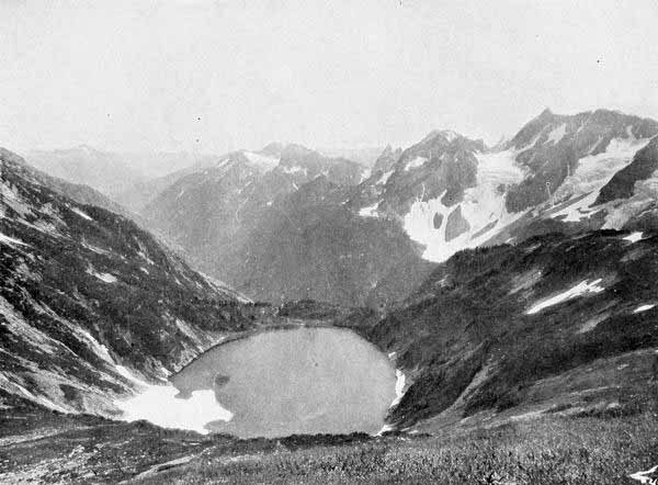
pinnacled peaks which compose the present Okanogan and Chelan uplift,
granite and porphyry, broken by volcanic outflow. These peaks are veined
with gold, silver, and copper.
That first age of mountain uplift was ended by the coming on of the age of
fire. The granite upheaval of the Blue and the Cascade Mountains was blown
apart and cracked asunder by volcanic eruption and seismic force. A vast
outflow of basalt and andesite swept westward from the Blue Mountains to
meet a similar outflow moving eastward from the Cascades. Thus, throughout
the Columbia Basin, the surface is mainly of volcanic rock overlying the
shattered fragments of the original earth crust. At many points, however,
the primeval granite or sandstone surface was not covered, while at
frequent intervals the breaking forth of the fiery floods transformed
those original rocks into various forms of gneiss, porphyry, and marble.
But the greatest result of the age of volcanic outflow was the elevation
of the stupendous isolated snow peaks which now constitute so striking a
feature of Columbian landscapes.
With the close of the age of fire, the mountain chains were in place, as
they now stand, but the plains and valleys were not yet fashioned. Another
series of forces must needs come to elaborate the rude outlines of the
land. And so came on the third great age, the age of flood. The upheaval
of the mingled granite and volcanic masses of the Cascade and Blue
Mountains, while at the same time the Rockies were undergoing the same
process, imprisoned a vast sea over the region now known by Westerners as
the Inland Empire. In the depths of this sea the sediment from a thousand
torrents was deposited to fashion the smooth and level valleys of the
Yakima, the Walla Walla, the Spokane, and lesser streams, while a similar
process fashioned the valleys of the Willamette and other streams between
the Cascades and the Coast Mountains westward.
But while the age of flood was shaping the great valley systems, a fourth
age—the age of ice—was working still other changes upon the plastic
land. The mountains had been reared by upheaval and volcanic outflow to a
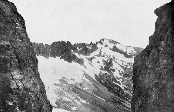
stupendous height. Then they became glaciated. The whole Northern
Hemisphere, in fact, took on the character of the present Greenland.
Enormous glaciers descended the flanks of the mountains, gouging and
ploughing out the abysmal cañons which now awe the beholder, and scooping
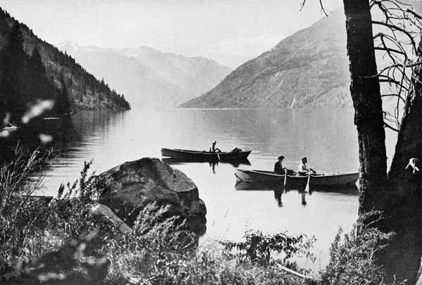
out the deeps where Chelan, Cœur d’Alene, Pend Oreille, Kaniksu, and
other great lakes delight the vision of the present day.
Such were the forces that wrought the physical features of the land where
the River flows. We do not mean to convey the impression that there was a
single age of each, and that they followed each other in regular
chronological order. As a matter of fact there were several eras of each,
interlocked with each other: upheaval, fire, flood, and frost. But as the
resultant of all, the Columbia Basin assumed its present form. The great
forces which have thus fashioned this land manifested themselves on a
scale of vast energy. Evidences of upheaval, fire, flood, and glacier are
exhibited on every side, and these evidences constitute a testimony of
geological history of the most interesting nature. Long before this record
of the rocks had found a white reader, the native red man had read the
open pages, and interpreted them in the light of his ardent fancy.
The Indian conception of the flood, involving also that of the creation
of the native tribes, is one of the most fantastic native legends. This is
the story of the great beaver, Wishpoosh, of Lake Kichelos. According to
this myth the beaver Wishpoosh inhabited that lake on the summit of the
Cascade Mountains, the source of the Yakima River.
In the time of the Watetash (animal people) before the advent of men, the
king beaver, Wishpoosh, of enormous size and voracious appetite, was in
the evil habit of seizing and devouring the lesser creatures and even the
vegetation. So destructive did he become that Speelyei, the coyote god of
the mid-Columbia region, undertook to check his rapacities.
The struggle only made the monster more insatiate, and in his wrath he
tore out the banks of the lake. The gathered floods swept on down the
cañon and formed another great lake in the region now known as the
Kittitas Valley.
But the struggle between Wishpoosh and Speelyei did not end, and the
former in his mad fury went on thrashing around in this greater lake. For
a long time the rocky barriers of the Umtanum restrained the flood, but at
last they gave way before the onslaughts of the wrathful beaver, and the
loosened waters swept on down and filled the great basin now occupied by
the fruit and garden ranches of the Cowiche, Natchees, and Atahnum. In
like fashion the restraining wall at the gap just below Yakima city was
torn out, and a yet greater lake was formed over all the space where we
now see the level plains of the Simcoe and Toppenish. The next lake formed
in the process covered the yet vaster region at the juncture of the
Yakima, Snake and Columbia rivers. For a long time it was dammed in by
the Umatilla highlands, but in process of time it, too, was drained by the
bursting of the rocky wall before the well-directed attacks of Wishpoosh.
The yet greater lake, the greatest of all, now formed between the Umatilla
on the east and the Cascade Mountains on the west. But even the towering
wall of the Cascades gave way in time and the accumulated floods poured on
without further hindrance to the open sea.
Thus was the series of great lakes drained, the level valleys left, and
the Great River suffered to flow in its present course. But there is a
sequel to the story of the flood. For Wishpoosh, being now in the ocean,
laid about him with such fury that he devoured the fish and whales and so
threatened all creation that Speelyei perceived that the time had come to
end it all. Transforming himself into a floating branch, he drifted to
Wishpoosh and was swallowed. Once inside the monster, the wily god resumed
his proper size and power; and with his keen-edged knife proceeded to cut
the vitals of the belligerent beaver, until at last all life ceased, and
the huge carcass was cast up by the tide on Clatsop beach, just south of
the mouth of the Great River. And now what to do with the carcass?
Speelyei solved the problem by cutting it up and from its different parts
fashioning the tribes as each part was adapted. From the head he made the
Nez Percés, great in council and oratory. From the arms came the Cayuses,
powerful with the bow and war-club. The Klickitats were the product of the
legs, and they were the runners of the land. The belly was transformed
into the gluttonous Chinooks. At the last there was left an indiscriminate
mass of hair and gore. This Speelyei hurled up the far distance to the
east, and out of it sprung the Snake River Indians.
Such is the native physiography and anthropogenesis of the land of the
Oregon.
If now one could rise on the pinions of the Chinook wind (the warm south
wind of the Columbia Basin, of which more anon), and from the southern
springs of the Owyhee and the Malheur could wing his way to the snowy
peaks in British Columbia, from whose fastnesses there issues the foaming
torrent of Canoe River, the most northerly of all the tributaries of the
Great River, he would obtain, in a noble panorama, a view of the land
where the River flows, in its present aspect, as fashioned by the
elemental forces of which we have spoken. But not to many is it given thus
to be “horsed on the sightless couriers of the air,” and we must needs use
imagination in lieu of them. Even a map will be the safest guide for most.
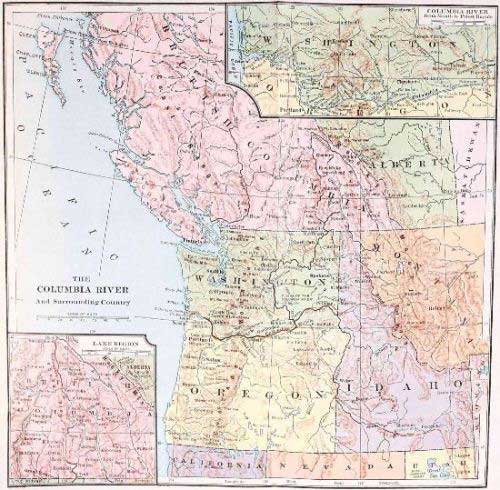
Inspection of the map will show that the distance to which we have
referred covers twelve degrees of latitude, while the distance from the
source of the Snake River in the Yellowstone National Park to the Pacific
requires a span of fifteen degrees of longitude. The south-eastern part of
this vast area occupying Southern Idaho is mainly an arid plain; arid,
indeed, in its natural condition, but, when touched by the vivifying
waters in union with the ardent sun, it blossoms like a garden of the
Lord. Upon these vast plains where the volcanic dust has drifted for ages,
now looking so dismal in their monotonous garb of sage-brush, the millions
of the future will some time live in peace and plenty, each under his own
vine and apple-tree. On the eastern boundary, all the way from Western
Wyoming to Eastern British Columbia, stand cordons of stupendous
mountains, the western outposts of the great Continental Divide. These
constitute one spur after another, from whose profound cañons issues river
after river to swell the torrents of the turbid and impetuous Snake on its
thousand-mile journey to join the Columbia. Among these tributary streams
are the Payette, the Boisé, the Salmon, and the Clearwater. Yet farther
north, beyond the system of the Snake, are the Bitter Root, the Missoula,
the Pend Oreille, the Spokane, and the Kootenai (we follow here the
American spelling, the Canadian being Kootenay), with almost innumerable
affluents, draining the huge labyrinths of the Bitter Root Mountains and
the Silver Bow.
Thus our northward flight carries us to the international boundary in
latitude 49 degrees.
Far beyond that parallel stretches chain after chain of divisions of the
great Continental Range, the Selkirks, the Gold Range, Purcell’s Range,
sky-piercing heights, snow-clad and glaciated. Up and down these
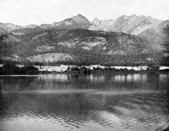
interlocking chains the Columbia and the Kootenai, with their great lakes
and unexplored tributaries, seem to be playing at hide-and-seek with each
other. These rivers form here one of the most singular geographical
phenomena of the world, for so strangely are the parallel chains of
mountains tilted that the Kootenai, rising in a small lake on the western
flank of the main chain of the Canadian Rockies and flowing south, passes
within a mile of the source of the Columbia at Columbia Lake, separated
only by a nearly level valley. Connection, in fact, is so easy that a
canal once joined the two rivers. From that point of contact the Kootenai
flows far south into Idaho, then makes a grand wheel to the north-west,
forming Kootenai Lake on the way, then wheeling again in its tortuous
course to the west, it joins the greater stream in the midst of the
majestic mountain chains which stand guard over the Arrow Lakes. And
meanwhile where has the Columbia itself been journeying? After the parting
from the Kootenai it flows directly north-west between two stupendous
chains of mountains. Reaching its highest northern point in latitude 52
degrees, where it receives the Canoe River, which has come two hundred
miles or more from the north, it turns sharply westward, finding a
passageway cleft in the mountain wall. Thence making a grand wheel toward
the south, it casts its turbid floods into the long expanse of the Arrow
Lakes, from which it emerges, clear and bright, soon to join the Kootenai.
And how far have they journeyed since they parted? The Columbia about six
hundred miles, and the Kootenai hardly less, though having passed within a
mile of each other, flowing in opposite directions.
It will be readily seen from this description that the mountains which
feed the Columbian system of rivers on the east and north, are of singular
grandeur and interest. But now as we bear our way southward again we
discover that another mountain system, yet grander and of more curious
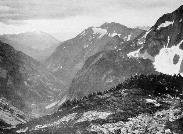
interest, forms the western boundary of the upper Columbia Basin. This is
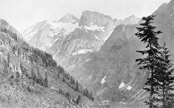
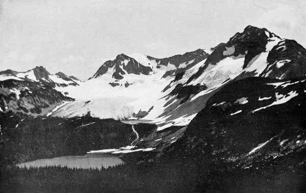
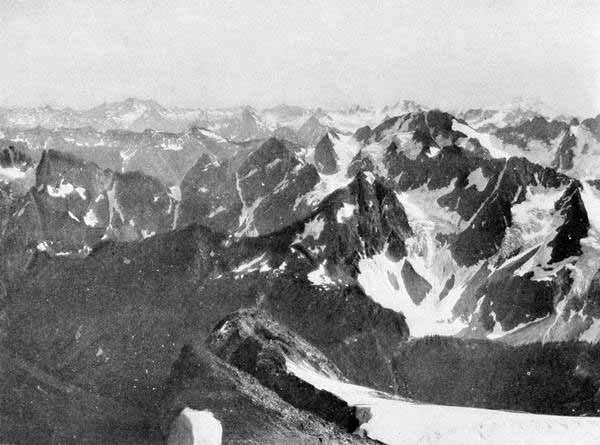
the Cascade Range. Sublime, majestic, mysterious, this noble chain of
mountains, with its tiaras of ice, its girdles of waterfalls, its
draperies of forest, its jewels of lakes, must make one search long to
find its parallel in any land for all the general features of mountain
charm. But over and beyond those more usual delights of the mountains,
the Cascade Range has a unique feature, one in which it stands unrivalled
among all the mountains of the earth, with the exception possibly of the
Andes. This is the feature of the great isolated snow peaks, stationed
like sentinels at intervals of from thirty to sixty miles all the way from
the British line to California. There is nothing like this elsewhere on
the North American continent. The Sierras of California are sublime, but
their great peaks are not isolated monarchs like those of the Cascades.
The high Sierras are blended together in one mountain wall, in which no
single peak dominates any wide extended space. But in the long array of
the Cascades, five hundred miles and more from the international boundary
to the California line, one glorious peak after another uplifts the banner
and sets its regal crown toward sunrise or sunset, king of earth and air
to the border where the shadow of the next mountain monarch mingles with
its own. Hence these great Cascade peaks have an individuality which gives
them a kind of living personality in the life of any one who has lived for
any length of time within sight of them.
From the north, moving south, we might gaze at these great peaks, and find
no two alike. Baker—how much finer is the native name, Kulshan, the Great
White Watcher—first on the north; Shuksan next, the place where the
storm-winds gather, in the native tongue; then Glacier Peak, with its
girdle of ice, thirteen great glaciers; Stewart next with its dizzy horn
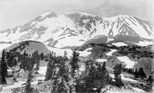
of rock set in a field of snow; then the great king-peak of all, Rainier,
better named by the natives, Takhoma, the fountain breast of milk-white
waters; and after this, Adams, or in the Indian, Klickitat, with St.
Helens or Loowit near at hand on the west; then, across the Great River,
Hood or Wiyeast, with its pinnacled crest; next southward, Jefferson with
its sharp chimney whose top has never yet been touched by human foot; yet
beyond, the marvellous group of the Three Sisters, each with its separate
personality and yet all together combining in one superb whole; then Mt.
Scott, Mt. Thielson, Diamond Peak, Mt. Pitt, and with them we might well
include the truncated cone of Mt. Mazama, once the lordliest of the chain,
but by some mighty convulsion of nature, shorn of crown and head, and now
bearing on its summit instead the most singular body of water, Crater
Lake, on all the American continent.
Fifteen is the number of the great peaks named, but there are dozens of
lesser heights, snow-crowned and regal. The great Cascade chain is,
therefore, the noblest and most significant feature of the topography of
the land of the Columbia. Between the Rocky Mountains and the Cascades
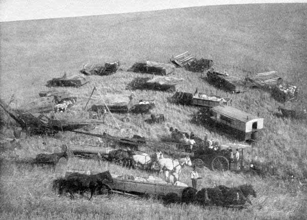
lies what is locally known as the Inland Empire, mainly a continuous
prairie or series of prairies and valleys, wheat land, orchard land,
garden land, fertile, beautiful, attractive, broken by an occasional
mountain spur, as the irregular mass of the Blue Mountains, but
substantially an inhabited land, reaching from Colville, Spokane, and the
Okanogan on the north to the Klamath valleys on the south, a region five
hundred miles long by two hundred wide, a goodly land, one difficult to
excel in all the potentialities of use for human needs.
Such are the distinguishing features of the Columbia Basin on the east
side of the Cascade Mountains.
To the west of those mountains is another vast expanse of interior
valleys, not so large indeed and not more fertile, but even more
beautiful, and by reason of earlier settlement and contiguity to the
ocean, better developed.
This series of valleys is enclosed between the Cascade Mountains and the
Coast Range, and in a general way parallels the Inland Empire already
described. But this statement should be qualified by the explanation that
North-western Washington consists of the Puget Sound Basin, which is a
distinct geographical system, while South-western Oregon consists of the
Umpqua and Rogue River valleys, and these valleys though commercially and
politically a part of the Columbia system, are geographically separate,
since they debouch directly into the Pacific Ocean. There is left,
therefore, for the Columbia region proper west of the Cascade Mountains,
the Willamette Valley in Oregon, and the valleys of the Lewis, Kalama, and
Cowlitz in Washington, with several smaller valleys on each side. The
Willamette Valley is the great distinguishing feature of this part of the
Columbia Basin. A more attractive region is hard to find. Mountains
snow-clad and majestic, the great peaks of the Cascades already described,
guard it on the east, while westward the gentler slopes of the Coast Range
separate it from the sea. Between the two ranges lies the valley, two
hundred miles long by about a hundred broad, including the foot-hills, a
succession of level plains, oak-crowned hills, and fertile bottoms. Not
Greece nor Italy nor the Vale of Cashmere can surpass this earthly
paradise in all the features that compose the beautiful and grand in
nature.
Geologists tell us that this Willamette region was once a counterpart of
Puget Sound, only with less depth of water, and that, as the result of
centuries of change, the old-time Willamette Sound has become the
Willamette Valley. It has now become the most thickly settled farming
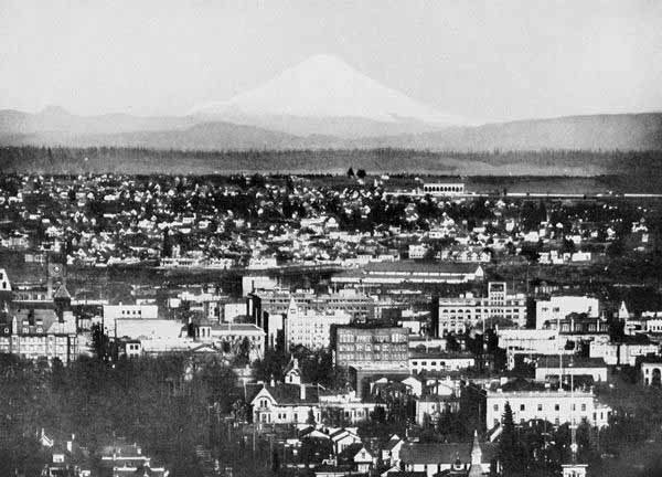
region of the Columbia Basin, and, as its fitting metropolis, Portland
sits at the gateway of the Willamette and Columbia, the “Rose City,”
handsomest of all Western cities, to welcome the commerce of the world.
The valleys on the Washington side of the Columbia make up together a
region of great beauty, fertility, and productiveness, perhaps a hundred
miles square, and, though yet but partially developed, contain many
beautiful homes.
The larger part of the Columbia Valley west of the Cascade Mountains is,
in its natural state, densely timbered. Here are found “the continuous
woods where rolls the Oregon and hears no sound but his own dashings.”
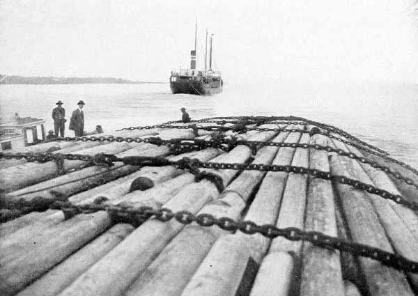
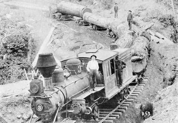
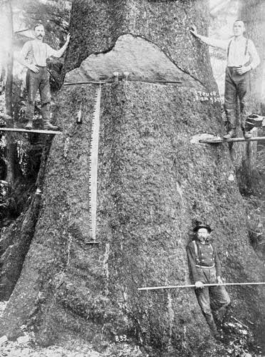
These great fir, spruce, cedar, and pine forests, extending a thousand
miles along the Pacific Coast from Central California to the Straits of
Fuca (and indeed they continue, though the trees gradually diminish in
size, for nearly another thousand miles up the Alaska coast), constitute
the world’s largest timber supply. The demands upon it have been
tremendous during the past twenty years, and the stately growths of
centuries have vanished largely from all places in the near vicinity of
shipping points. Yet one can still find primeval woods where the coronals
of green are borne three hundred feet above the damp and perfumed earth,
and where the pillars of the wood sustain so continuous a canopy of
foliage that the sunlight is stopped or filters through only in pale and
watery rays. Hence all manner of vines and shrubs grow with almost tropic
profusion, though with weak and straggling stems.
Throughout the entire Pacific North-west the soil is of extraordinary
fertility. It is largely of volcanic dust as fine as flour and seems to
contain the constituents of plant life in inexhaustible abundance. Even in
the arid belts of Eastern Oregon, where to the eye of the stranger the
appearance is of a hopeless waste, those same elements of plant food
exist, and with water every manner of tree or vine or flower bursts
quickly into perfect life.
The climate of the Columbia Basin is a puzzle to the stranger, but in most
of its aspects it quickly becomes an equal delight. As is well known, the
Japan ocean current exercises upon the Pacific Coast an effect similar to
that of the Gulf Stream on Ireland and England. Hence the states of the
Columbia Valley are much warmer in winter than regions of the same
latitude on the Atlantic Coast or in the Mississippi Valley. Though the
average temperature is higher, yet it is cooler in summer on the Pacific
Coast than on the Atlantic. The Pacific climate has much less of extremes.
The State of Washington has about the same isothermal line as North
Carolina. There is, however, another feature of the Columbia climate not
so well known to non-residents, which is worthy of a passing paragraph.
This is the division of the country by the Cascade Mountains into a humid
western section and a dry eastern one. The mountain wall intercepts the
larger part of the vapour rising from the Pacific and flying eastward, and
these warm masses of vapour are condensed by the icy barrier and fall in
rain on the western side. Hence Western Oregon and Washington are damp and
soft, with frequent clouds and fogs. The rainfall, though varying much, is
in most places from forty to fifty inches a year. But east of the mountain
wall which has “milked the clouds,” the air is clear and bright, the sun
shines most of the year from cloudless skies, and there seems to be more
of tingle and electricity in the atmosphere. The rainfall ranges from ten
to thirty inches, and in the drier parts vegetation does not flourish
without irrigation.
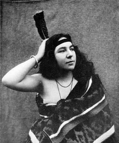
Any view of primeval Oregon would be incomplete without a glimpse of the
native race, that melancholy people, possessed of so many interesting and
even noble traits, whose sad lot it has mainly been to struggle against
the advent of a civilisation which they could not understand nor resist,
and before which they have melted away in pitiful impotency. But they have
at least had the highest dignity of defeat, for they have died fighting.
They have realised the conception of the Roman Emperor: “Me stantem mori
oportet.”
The Oregon Indians have essentially the same characteristic traits as
other Indians, secretiveness, patience, vindictiveness, stoicism; and, in
their best state, fidelity and boundless generosity to friends.
The poor broken fragments of the once populous tribes along the Columbia
cannot but affect the present-day observer with pity. Most of the tangible
memorials of this fallen race have vanished with them. Not many of the
conquerors have been sympathetic or even rational in their treatment of
the Indians. Hence memorials of memory and imagination which might have
been drawn from them and treasured up have vanished with them into the
darkness. Yet many Indian legends have been preserved in one manner and
another, and these are sufficient to convince us that the native races are
of the same nature as ourselves. Some of the legends which students of
Indian lore have gathered, will, perhaps, prove interesting to the reader.
A quaint Nez-Percé myth accounts for the creation as follows: There was
during the time of the Watetash a monster living in the country of Kamiah
in Central Idaho. This monster had the peculiar property of an
irresistible breath, so that when it inhaled, the winds and grass and
trees and even different animals would be sucked into its devouring maw.
The Coyote god, being grieved for the destruction wrought by this monster,
made a coil of rope out of grass and with this went to the summit of
Wallowa Mountains to test the suction power of the monster. Appearing like
a tiny spear of grass upon the mountain, he blew a challenge to the
monster. Descrying the small object in the distance Kamiah began to draw
the air inward. But strange to say, Coyote did not move. “Ugh, that is a
great medicine,” said the monster. Coyote now took his station upon the
mountains of the Seven Devils, a good deal closer, and blew his challenge
again. Again the Kamiah monster tried to breathe so deeply as to draw the
strange challenger into his grasp, but again he failed. “He is a very big
medicine,” he said once more. And now Coyote mounted the top of the Salmon
River Mountains, somewhere near the Buffalo Hump of the present time, and
again the monster’s breath failed to draw him. The baffled Kamiah was now
sure that this was most extraordinary medicine. In reality, Coyote had
each time held himself by a grass rope tied to the mountain.
Coyote now called into counsel Kotskots, the fox. Providing him with five
knives, Kotskots advised Coyote to force an entrance into the interior of
the monster. Entering in, Coyote found people in all stages of emaciation,
evidently having had their life gradually sucked out of them. It was also
so cold and dark in the interior that they were chilled into almost a
condition of insensibility. Looking about him, Coyote began to see great
chunks of fat and pitch in the vitals of the monster, and accordingly he
rubbed sticks together and started a fire, which being fed with the fat
and pitch, soon grew into a cheerful glow. Now, armed with his knives, he
ascended the vast interior until he reached the heart. He had already
directed Kotskots to rouse up and gather together all the emaciated
stowaways and provide that when the monster was cut open they should see
how to rush out into the sunlight. Great as was the monster Kamiah, he
could not stop the persistent hacking away at his heart which Coyote now
entered upon. When the fifth knife was nearly gone, the heart dropped down
and Kamiah collapsed into a lifeless mass. The people under the guidance
of Kotskots, burst out into the sunshine and scattered themselves abroad.
It must be remembered that these were animal people, not human. Coyote
called upon them to wait until he should have shown them a last wonder,
for, cutting the monster in pieces, he now began to fashion from the
pieces a new race of beings to be called men. The portion which he cut
from the head he flung northward, and of this was fashioned the Flathead
tribe. The feet he cast eastward, making them the Blackfeet. So he
continued, making new tribes here and there. But at the last Kotskots
interposed an objection. “You have made no people,” he said, “for the
valley of the Lapwai, which is the most beautiful of all.” Realising the
force of the suggestion, Coyote mixed the blood of the monster with water
and sprinkled it in a rain over the entire valley of the Clearwater. From
these drops of blood and water, the Nez Percé tribe was formed. The heart
of the monster is still to be seen by all travellers in that country,
being a heart-shaped hill in the valley of Kamiah.
Perhaps the most perfect and beautiful of all Indian fire myths of the
Columbia, is that connected with the famous “tomanowas bridge” at the
Cascades. This myth not only treats of fire, but it also endeavours to
account for the peculiar formation of the river and for the great snow
peaks in the near vicinity. This myth has various forms, and in order that
it may be the better understood, we shall say a word with respect to the
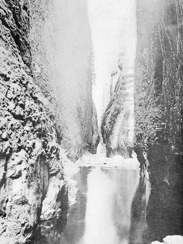
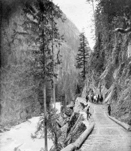
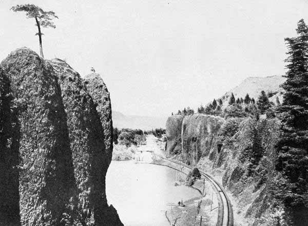
peculiar physical features in that part of the Columbia. The River, after
having traversed over a thousand miles from its source in the heart of the
great Rocky Mountains of Canada, has cleft the Cascade Range asunder with
a cañon three thousand feet in depth. While generally swift, that portion
between The Dalles and the Cascades is deep and sluggish. There are,
moreover, sunken forests on both sides visible at low water, which seem
plainly to indicate that at that point the river was dammed up by some
great rock slide or volcanic convulsion. Some of the Indians affirm that
their grandfathers have told them that there was a time when the river at
that point passed under an immense natural bridge, and that there were no
obstructions to the passage of boats under the bridge. At the present time
there is a cascade of forty feet at that point. This is now overcome by
government locks. Among other evidences of some such actual occurrence as
the Indians relate, is the fact that the banks at that point are gradually
sliding into the river. The prodigious volume of the Columbia, which here
rises from fifty to seventy-five feet during the summer flood, is
continually eating into the banks. The railroad has slid several inches a
year at this point toward the river and requires frequent readjustment. It
is obvious at a slight inspection that this weird and sublime point has
been the scene of terrific volcanic and probably seismic action. One
Indian legend, probably the best known of their stories, is to the effect
that the downfall of the bridge and consequent damming of the river was
due to a battle between Mt. Hood and Mt. Adams,—or, some say, Mt. St.
Helens—in which Mt. Hood hurled a great rock at his antagonist; but,
falling short of the mark, the rock demolished the bridge instead. This
event has been made use of by Frederick Balch in his story, The Bridge of
the Gods.
But the finer, though less known legend, which unites both the physical
conformation of the Cascades and the three great snow mountains of Hood,
Adams, and St. Helens, with the origin of fire, is to this effect.
According to the Klickitats, there was once a father and two sons who came
from the east down the Columbia to the region in which Dalles City is now
located, and there the two sons quarrelled as to who should possess the
land. The father, to settle the dispute, shot two arrows, one to the
north and one to the west. He told one son to find the arrow to the north
and the other the one to the west, and there to settle and bring up their
families. The first son, going northward, over what was then a beautiful
plain, became the progenitor of the Klickitat tribe, while the other son
was the founder of the great Multnomah nation of the Willamette Valley. To
separate the two tribes more effectively, Sahale, the Great Spirit, reared
the chain of the Cascades, though without any great peaks, and for a long
time all things went in harmony. But for convenience’ sake, Sahale had
created the great tomanowas bridge under which the waters of the Columbia
flowed, and on this bridge he had stationed a witch woman called Loowit,
who was to take charge of the fire. This was the only fire in the world.
As time passed on Loowit observed the deplorable condition of the Indians,
destitute of fire and the conveniences which it might bring. She therefore
besought Sahale to allow her to bestow fire upon the Indians. Sahale,
greatly pleased by the faithfulness and benevolence of Loowit, finally
granted her request. The lot of the Indians was wonderfully improved by
the acquisition of fire. They began to make better lodges and clothes and
had a variety of food and implements, and, in short, were marvellously
benefited by the bounteous gift.
But Sahale, in order to show his appreciation of the care with which
Loowit had guarded the sacred fire, now determined to offer her any gift
she might desire as a reward. Accordingly, in response to his offer,
Loowit asked that she be transformed into a young and beautiful girl. This
was accordingly affected, and now, as might have been expected, all the
Indian chiefs fell deeply in love with the guardian of the tomanowas
bridge. Loowit paid little heed to any of them, until finally there came
two chiefs, one from the north called Klickitat and one from the south
called Wiyeast. Loowit was uncertain which of these two she most desired,
and as a result a bitter strife arose between the two. This waxed hotter
and hotter, until, with their respective warriors, they entered upon a
desperate war. The land was ravaged, all their new comforts were marred,
and misery and wretchedness ensued. Sahale repented that he had allowed
Loowit to bestow fire upon the Indians, and determined to undo all his
work in so far as he could. Accordingly he broke down the tomanowas
bridge, which dammed up the river with an impassable reef, and put to
death Loowit, Klickitat, and Wiyeast. But, inasmuch as they had been noble
and beautiful in life, he determined to give them a fitting commemoration
after death. Therefore he reared over them as monuments, the great snow
peaks; over Loowit, what we now call Mt. St. Helens; over Wiyeast, the
modern Mt. Hood; and, above Klickitat, the great dome which we now call
Mt. Adams.
Of the miscellaneous myths which pertain to the forces of nature, one of
the best is that accounting for the Chinook wind. All people who have
lived long in Oregon or Washington have a conception of that marvellous
warm wind which in January and February suddenly sends them almost summer
heat amid snow banks and ice-locked streams, and causes all nature to
rejoice as with a resurrection of spring time. Scarcely anything can be
imagined in nature more picturesque and dramatic than this Chinook wind.
The thermometer may be down nearly to zero, a foot of snow may rest like a
pall on the earth, or a deadly fog may wrap the earth, when suddenly, as
if by the breath of inspiration, the fog parts, the peaks of the mountains
may be seen half stripped of snow, and then, roaring and whistling, the
warm south wind comes like an army. The snow begins to drip like a pressed
sponge, the thermometer goes with a jump to sixty, and within two hours we
find ourselves in the climate of Southern California. No wonder the
Indians personified this wind. We personify it ourselves.
The Yakima account of the Chinook wind was to the effect that it was
caused by five brothers who lived on the Columbia River, not far from the
present town of Columbus. Now there is at rare intervals in this country a
cold north-east wind, which the Indians on the lower Columbia call the
Walla Walla wind because it comes from the north-east. The cold wind was
caused by another set of brothers. Both these sets of brothers had
grandparents who lived near what is now Umatilla. The two groups of
brothers were continually fighting each other, sweeping one way or the
other over the country, alternately freezing or thawing it, blowing down
trees and causing the dust to fly in clouds, and rendering the country
generally very uncomfortable. Finally, the Walla Walla brothers sent a
challenge to the Chinook brothers to undertake a wrestling match, the
condition being that those who were defeated should forfeit their lives.
It was agreed that Speelyei should act as umpire and should inflict the
penalty by decapitating the losers. Speelyei secretly advised the
grandparents of the Chinook brothers to throw oil on the wrestling ground
so that their sons might not fall. In like manner he secretly advised the
grandparents of the Walla Walla brothers to throw ice on the ground.
Between the ice and the oil it was so slippery that it would be hard for
any one to keep upright, but inasmuch as the Walla Walla grandfather got
ice on the ground last, the Chinook brothers were all thrown and killed.
The eldest Chinook had an infant baby at home, whose mother brought him up
with one sole purpose in view, and that was that he must avenge the death
of his father and uncles. By continual practice in pulling up trees he
became prodigiously strong, insomuch that he could pull up the largest fir
trees and throw them about like weeds. The young man finally reached such
a degree of strength that he felt that the time had come for him to
perform his great mission. Therefore he went up the Columbia, pulling up
trees and tossing them around in different places, and finally passed over
into the valley of the Yakima, where he lay down to rest by the creek
called the Setas. There he rested for a day and a night, and the marks of
his couch are still plainly visible on the mountain side.
Now, turning back again to the Columbia, he sought the hut of his
grandparents, and when he had found it, he found also that they were in a
most deplorable condition. The Walla Walla brothers had been having it all
their own way during these years and had imposed most shamefully upon the
old people. When he learned this, the young Chinook told his grandfather
to go out into the Columbia to fish for sturgeon, while he in the meantime
would lie down in the bottom of the boat and watch for the Walla Walla
wind. It was the habit of these tormenting Walla Walla wind brothers to
wait until the old man had got his boat filled with fish, and then they,
issuing swiftly and silently from the shore, would beset and rob him. This
time they started out from the shore as usual, but to their great
astonishment, just as they were about to catch him, the boat would shoot
on at miraculous speed and leave them far behind. So the old man landed
safely and brought his fish to the hut. The young Chinook then took his
grandparents to a stream and washed from them the filth which had gathered
upon them during all those years of suffering. Strange to say, the filth
became transformed into trout, and this is the origin of all the trout
along the Columbia.
As soon as the news became known abroad that there was another Chinook
champion in the field, the Walla Walla brothers began to demand a new
wrestling match. Young Chinook very gladly accepted the challenge, though
he had to meet all five. But now Speelyei secretly suggested to the
Chinook grandfather that he should wait about throwing the oil on the
ground until the ice had all been used up. By means of this change of
practice, the Walla Walla brothers fell speedily before the young Chinook.
One after another was thrown and beheaded until only the youngest was
left. His courage failing, he surrendered without a struggle. Speelyei
then pronounced sentence upon him, telling him that he must live, but
could henceforth only blow lightly, and never have power to freeze people
to death. Speelyei also decreed that in order to keep Chinook within
bounds he should blow his hardest at night time, and should blow upon the
mountain ridges first in order to prepare people for his coming. Thus
there came to be moderation in the winds, but Chinook was always the
victor in the end. And thus at the present time, in the perpetual flux and
reflux of the oceans of the air, when the north wind sweeps down from the
chilly zones of Canada upon the Columbia Basin, his triumph is but
transient. For within a few hours, or days at most, while the cattle are
threatened with destruction and while ranchers are gazing anxiously about,
they will discern a blue-black line upon the southern horizon. In a short
time the mountain ridges can be seen bare of snow, and deliverance is at
hand. For the next morning, rushing and roaring from the South, comes the
blessed Chinook, and the icy grip of the North melts as before a blast
from a furnace. The struggle is short and Chinook’s victory is sure.
Nearly all our native races had a more or less coherent idea of a future
state of rewards and punishments. “The happy hunting ground” of the
Indians is often referred to in connection with the Indians of the older
part of the United States. Our Indians have ideas in general quite
similar. Some believe that there is a hell and a heaven. The Siskiyou
Indians in Southern Oregon have a curious idea similar to that of the
ancient Egyptians as well as of the Mohammedans. This is to the effect
that the regions of the blessed are on the other side of an enormously
deep chasm. To pass over this, one must cross on a very narrow and
slippery pole. The good can pass, but the bad fall off into empty space,
whence they reappear again upon the earth as beasts or birds.
The Klickitat Indians, living along The Dalles of the Columbia have a fine
legend of the land of spirits. There lived a young chief and a girl who
were devoted to each other and seemed to be the happiest people in the
tribe, but suddenly he sickened and died. The girl mourned for him almost
to the point of death, and he, having reached the land of the spirits,
could find no happiness there for thinking of her. And so it came to pass
that a vision began to appear to the girl at night, telling her that she
must herself go into the land of the spirits in order to console her
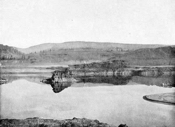
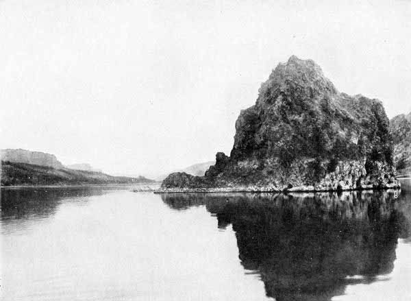
lover. Now there is, near that place, one of the most weird and funereal
of all the various “memaloose” islands, or death islands, of the Columbia.
The writer himself has been upon this island and its spectral and volcanic
desolation makes it a fitting location for ghostly tales. It lies just
below the “great chute,” and even yet has many skeletons upon it. In
accordance with the directions of the vision, the girl’s father made ready
a canoe, placed her in it, and passed out into the Great River by night,
to the memaloose island. As the father and his child rowed across the dark
and forbidding waters, they began to hear the sounds of singing and
dancing and great joy. Upon the shore of the island they were met by four
spirit people, who took the girl, but bade the father return, as it was
not for him to see into the spirit country. Accordingly the girl was
conducted to the great dance-house of the spirits, and there she met her
lover, far stronger and more beautiful than when upon earth. That night
they spent in unspeakable bliss, but when the light began to break in the
east and the song of the robins was heard from the willows on the shore,
the singers and the dancers fell asleep.
The girl, too, had gone to sleep, but not soundly like the spirits. When
the sun had reached the meridian, she woke, and now, to her horror, she
saw that instead of being in the midst of beautiful spirits, she was
surrounded by hideous skeletons and loathsome, decaying bodies. Around her
waist were the bony arms and skeleton fingers of her lover, and his
grinning teeth and gaping eye-sockets seemed to be turned in mockery upon
her. Screaming with horror, she leaped up and ran to the edge of the
island, where, after hunting a long time, she found a boat, in which she
paddled across to the Indian village. Having presented herself to her
astonished parents, they became fearful that some great calamity would
visit the tribe on account of her return, and accordingly her father took
her the next night back to the memaloose island as before. There she met
again the happy spirits of the blessed, and there again her lover and she
spent another night in ecstatic bliss. In the course of time a child was
born to the girl, beautiful beyond description, being half spirit and half
human. The spirit bridegroom, being anxious that his mother should see the
child, sent a spirit messenger to the village, desiring his mother to come
by night to the memaloose island to visit them. She was told, however,
that she must not look at the child until ten days had passed. But after
the old woman had reached the island, her desire to see the wonderful
child was so intense that she took advantage of a moment’s inattention on
the part of the guard, and, lifting the cloth from the baby board, she
stole a look at the sleeping infant. And then, dreadful to relate, the
baby died in consequence of this premature human look. Grieved and
displeased by this foolish act, the spirit people decreed that the dead
should never again return nor hold any communication with the living.
In concluding this chapter we cannot forbear to call the attention of our
readers to the rare beauty of many of the native Indian names of
localities. These names always have some significance, and ordinarily
there is some such poetic or figurative conception involved in the name as
plainly reveals the fact that these rude and unfortunate natives have the
souls of poets beneath their savage exterior. It is truly lamentable that
some of the sonorous and poetic native names have been thrust aside for
the commonplace and oft-repeated names of Eastern or European localities
or the still less attractive names of discoverers or their unimportant
friends.
Think of using the names Salem and Portland for Chemeketa and Multnomah,
the native names. Chemeketa means “Here we Rest,” or, some say, the “Place
of Peace,” for it was the council ground of the Willamette Valley Indians.
But the Methodist missionaries thought that it would have a more Biblical
sound and conduce to the spiritual welfare of the natives to translate the
word into its equivalent, Salem. So they spoiled the wild native beauty of
the name for all time. Multnomah means “Down the Waters.” But two Yankee
sea captains, with a sad deficiency of poetry in them, tossed up a coin to
decide whether to employ the name of Boston or Portland, the native town
of each, and the latter won the toss.
Oregon has been more fortunate than Washington in its State name, for it
has the unique name, stately and sonorous, which old Jonathan Carver first
used for the River and which is one of the most distinctive of all the
names of States. But whether Oregon is Indian, Spanish, French, or a
corruption of something else, or a pure invention of Carver’s is one of
the mooted points in our history. Idaho, too, has one of the most
mellifluous of names, meaning the “Gem of the Mountains.”
All three States have many beautiful and appropriate names of rivers,
lakes, mountains, and cities. Such are Chelan, “Beautiful Water”;
Umatilla, “The Wind-blown Sand”; Walla Walla, “Where the Waters Meet”;
Shuksan, “The Place of the Storm Winds”; Spokane, “The People of the Sun”;
Kulshan, “The Great White Watcher”; Snoqualmie, “The Falls of the Moon
God.” Seattle derives its name from the old chief Seattle, or Sealth.
The most bitterly disputed name of all is Tacoma vs. Rainier, as the
name of the greatest of our mountains. The name of Rainier was derived by
Vancouver from that of an officer of the British navy, a man who never
knew anything of Oregon and had no part or lot in its discovery or
development. Tacoma, or more accurately, Takhoma (a peculiar guttural
which we cannot fully indicate), was the native Indian name, meaning,
according to some, “The Great White Mountain,” and according to others
meaning “The Fountain-breast of Milk-white Waters.”
With these glances at the character of the land, and its native
inhabitants, we are now ready to see how they became known to the world.
Tales of the First White Men along the Coast
Nekahni Mountain and Tallapus—Quootshoi and Toulux—Original Beauty of Clatsop Plains—The
Story Told by Celiast and Cultee—Casting of the “Thing” upon the Beach—The Pop-corn—Burning of the Ship—Konapee,
the Iron-worker—Franchère’s Account of Soto—The Treasure Ship on the Beach at Nekahni Mountain—The Black Spook and
Mysterious Chest—The Inscription Still Found on the Rock—The Beeswax Ship—Quiaculliby.
We have told something of the mountains, rivers, and lakes which make up
the framework of our Pacific North-west. We have also tried to see the
land through the eyes of the native red men, and have called back a few of
the grotesque, fantastic, sometimes heroic, sometimes pathetic legends
which they associated with every phase of their country.
Now the very centre of Indian lore, the Parnassus, the Delphi, the Dodona,
of the lower Columbia River Indians, is the stretch of mingled bluff,
plain, lake, sand-dune, and mountain, marvellously diversified, from the
south shore of the Columbia’s mouth to the sacred Nekahni Mountain. It is
a wonderously picturesque region. From it came Tallapus, the Hermes
Trismegistus of the Oregon Indians. Its forests were haunted by the
Skookums and Cheatcos. From the volcanic pinnacles of Swallallochast, now
known as Saddle Mountain, the thunder bird went forth on its daily quest
of a whale, while at the mountain’s foot Quootshoi and Toulux produced the
first men from the monstrous eggs of that same great bird. In short, that
region was rich in legend, as it was, and still is, in scenic beauty.
It is said by the Indians that a hundred years or more ago it was much
finer than now, for the entire breadth of Clatsop Plains was sodded with
deep green grass and bright with flowers almost the whole year through.
This bright-hued plain lay open to the sea, and across its southern end
flowed three tide streams, having the aboriginal names of Nekanikum,
Ohanna, and Neahcoxie.
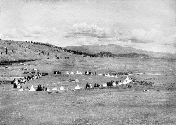
It was a veritable paradise for the Indians. The forests were filled with
elk (moosmoos) and deer (mowitch), while fish of almost every variety
thronged the waters, from that king of all fish now known as the royal
chinook of the Columbia down to such smaller fry as the smelt and the
herring, which even now sometimes so throng the lesser streams that the
receding tide leaves them by the thousands on the muddy flats. On the
beach were infinite numbers of clams; and as an evidence of their
abundance we can now see shell mounds by the acre, in such quantity,
indeed, that some of the modern roads have been paved with shells.
This favoured region was the home of the Clatsops. There, too, according
to the legends, the first white men landed. The story of the first
appearance of the white men has reached our own times in various forms,
but the most coherent account is through the word of Celiast, an Indian
woman who died many years ago, but who became the wife of one of the
earliest white settlers and the mother of Silas Smith, now dead, but known
in his time as one of the best authorities on Indian history. Celiast was
the daughter of Kobaiway, a chieftain whose sway extended over the land of
the Clatsops in the time of the Astor Company a century ago. Celiast was
in fact the best authority for many of the Indian legends. But she is not
alone in the knowledge of this appearance of the white men, for a number
of other Indians tell the substance of the same tale. Among others an old
Indian of Bay Centre, Washington, by the name of Charlie Cultee, related
the story to Dr. Franz Boas, whose work in the Smithsonian Institute is
known as among the best on the native races. This is the story, a
composite of that of Celiast and that of Cultee.
It appears that an old woman living near the ancient Indian village of
Ne-Ahkstow, about two miles south of the mouth of the Great River (the
Columbia) had lost her son. “She wailed for a whole year, and then she
stopped.” One day, after her usual custom, she went to the seaside, and
walked along the shore towards Clatsop. While on the way she saw something
very strange. At first it seemed like a whale, but, when the old woman
came close, she saw that it had two trees standing upright in it. She
said, “This is no whale; it is a monster.” The outside was all covered
over with something bright, which they afterwards found was copper. Ropes
were tied all over the two trees, and the inside of the Thing was full of
iron.
While the old woman gazed in silent wonder, a being that looked like a
bear, but had a human face, though with long hair all over it, came out of
the Thing that lay there. Then the old woman hastened home in great fear.
She thought this bearlike creature must be the spirit of her son, and that
the Thing was that about which they had heard in the Ekanum tales.
The people, when they had heard the strange story, hastened with bows and
arrows to the spot. There, sure enough, lay the Thing upon the shore, just
as the old woman had said. Only instead of one bear there were two
standing on the Thing. These two creatures,—whether bears or people the
Indians were not sure,—were just at the point of going down the Thing
(which they now began to understand was an immense canoe with two trees
driven into it) to the beach, with kettles in their hands.
As the bewildered people watched them they started a fire and put corn
into the kettles. Very soon it began to pop and fly with great rapidity up
and down in the kettles. The pop-corn (the nature of which the Clatsops
did not then understand) struck them with more surprise than anything
else,—and this is the one part of the story preserved in every version.
Then the corn-popping strangers made signs that they wanted water. The
chief sent men to supply them with all their needs, and in the meantime he
made a careful examination of the strangers. Finding that their hands were
the same as his own, he became satisfied that they were indeed men. One of
the Indians ran and climbed up and entered the Thing. Looking into the
interior, he found it full of boxes. There were also many strings of
buttons half a fathom long. He went out to call in his relatives, but,
before he could return, the ship had been set on fire. Or, in the
language of Charlie Cultee, “It burnt just like fat.” As a result of the
burning of the ship, the Clatsops got possession of the iron, copper, and
brass.
Now the news of this strange event became noised abroad, and the Indians
from all the region thronged to Clatsop to see and feel of these strange
men with hands and feet just like ordinary men, yet with long beards and
with such peculiar garb as to seem in no sense men. There arose great
strife as to who should receive and care for the strange men. Each tribe
or village was very anxious to have them, or at least one of them. The
Quienaults, the Chehales, and the Willapas, from the beach on the north
side, came to press their claims. From up the river came the Cowlitz, the
Cascades, and even the Far-off Klickitat. The different tribes almost had
a battle for possession, but, according to one account, it was finally
settled that one of the strange visitors should stay with the Clatsop
chief, and that one should go with the Willapas on the north side of the
Great River. According to another, they both stayed at Clatsop.
From this first arrival of white men, the Indians called them all
“Tlehonnipts,” that is, “Of those who drift ashore.” One of the men
possessed the magical art of taking pieces of iron and making knives and
hatchets. It was indeed to the poor Indians a marvellous gift of Tallapus,
their god, that they should have a man among them that could perform that
priceless labour, for the possession of iron knives and hatchets meant the
indefinite multiplying of canoes, huts, bows and arrows, weapons, and
implements of every sort. The iron-maker’s name was Konapee. The Indians
kept close watch of him for many days and made him work incessantly. But,
as the tokens of his skill became numerous, his captors held him in great
favour and allowed him more liberty. Being permitted to select a site for
a house, he chose a spot on the Columbia which became known to the
Indians, even down to the white occupancy of the region, as “Konapee.”
Among other possessions, Konapee had a large number of pieces of money,
which, from the description, must have been Chinese “cash.” From this some
have inferred that Konapee must have been a Chinaman, and the wrecked ship
a Chinese or Japanese junk. This does not, however, follow. For the
Spaniards had become entirely familiar with China, and any Spanish vessel
returning from the Philippine Islands or from China would have been likely
to have a supply of Chinese money on board.
There is an interesting bit of testimony which seems to belong to this
same story of Konapee. It is found in the book by Gabriel Franchère in
regard to the founding of Astoria, the book which was the chief authority
of Irving in his fascinating narrative entitled Astoria. Franchère
describes meeting an old man, eighty years old, in 1811, at the Cascades,
whose name was Soto, and who said that his father was one of four
Spaniards wrecked on Clatsop beach many years before. His father had tried
to reach the land of the sunrise by going eastward, but having reached the
Cascades was prevented from going farther and had there married an Indian
woman, Soto’s mother. It is thought likely that the father of Soto was
Konapee. The two stories seem to fit quite well. If this be true, it is
likely that Konapee’s landing was as early as 1725. If all the details of
Konapee’s life could be known, what a romance might be made of it! There
is no reason to suppose that he ever saw other white men or ever got away
from the region where the fortune of shipwreck had cast him. Yet he was in
possession of one of the greatest geographical secrets of that country,
for the hope of the discovery of some great “River of the West,” the
elusive stream which many believed to be a pure fabrication of Aguilar and
other old navigators, had enticed many a “marinere” from many a far
“countree.”
In any event it is probable that the Columbia River Indians had got a
general knowledge of the whites and their arts from Konapee long before
the authentic discovery of the river was made. Especially it seems that
from him they got a knowledge of iron and implements fashioned from it.
Captain Cook mentions that when he visited the coast in 1780 the Indians
manifested no surprise at the weapons or implements of iron. In fact even
all whites who supposed themselves to be the first to visit this coast
found the Indians ready to trade and especially eager to get iron. A new
era of trade and business seems to have been inaugurated among these
Clatsops and Chinooks dating from about the supposed time of Konapee. But
he was by no means the only one of his race to be cast upon the Oregon
shore. There is a story of a treasure ship cast upon the beach near
Nekahni Mountain. This mountain, the original home of Tallapus, while on
its summit the great chief god Nekahni himself dwelt, is one of the
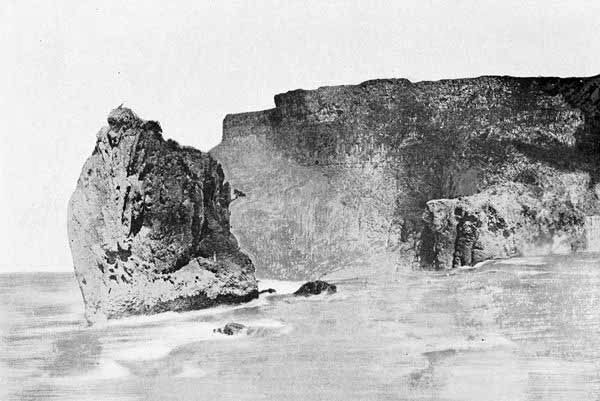
noblest pieces of Nature’s art all along the shore. Fronting the ocean
with a precipitous rampart of rock five hundred feet high and thence
rising in a wide sweeping park clad in thick turf, and dotted here and
there with beautiful spruce and fir trees, to an elevation of twenty-five
hundred feet, the sacred Nekahni presents as fine a combination of the
beautiful and sublime as can be seen upon a whole thousand miles of coast.
It was a favourite spot with the natives. For lying upon its open and
turfy slopes they could gaze upon many miles of sea, and could no doubt
light up their signal fires which might be seen over a wide expanse of
beach. Very likely there, too, they celebrated the mysterious rites of
Nekahni and Tallapus.
One pleasant afternoon in early summer, a large group of natives assembled
upon the lower part of Nekahni, almost upon the edge of the precipitous
cliff with which it fronts the sea. Gazing into the offing they saw a
great object like a huge bird drawing near from the outer sea. It
approached the shore, and then from it a small boat with a number of men
and a large black box put out to land. Coming to the beach the men took
out the box and also a black man whom the Indians supposed to be a spook
or evil demon. Going a little way up the beach the men dug a hole into
which they lowered the box, and then having struck down the black man they
threw him on top of the box and, covering it up, they returned to the
ship, which soon disappeared from sight. On account of the black man
buried with the box, the superstitious Indians dared not undertake to
exhume the contents of the grave. But the story was handed from one
generation to another, and it came to constitute the story of the
“treasure ship.”
In recent times the idea that here some chest, with gold and jewels in
the most approved style of buried fortunes, might be found has caused much
searching. The ground has been dug over for the sight of the regulation
rusty handle which is to lead to the great iron-bound chest with its
doubloons of gold and crucifixes of pearls. Parties have come from the
Eastern States to join the search. One party even secured the guidance of
spirits who professed to locate the treasure. But though the spirit-led
enthusiasts turned over every stone and dug up the sand for many feet
along the beach, they found never an iron-bound chest, and never a sign of
the treasure. There is, however, in plain sight now, on a rock at the foot
of Nekahni Mountain, a character cut in the rock bearing a rude
resemblance to a cross. Some think it looks more like the letters, I.H.S.,
the sacred emblem of the Catholic Church. There is also what seems to be
quite a distinct arrow pointing in a certain direction. But the treasure
remains unfound.
The next legend of the prehistoric white man is that of the “Beeswax
Ship.” This, too, has a real confirmation in the presence of large
quantities of beeswax at a point also near Nekahni Mountain, just north of
the mouth of the Nehalem River. Some naturalists claimed at one time that
this substance was simply the natural paraffine produced from the products
of coal or petroleum. But more recently cakes of the substance stamped
with the sacred letters, “I.H.S.,” together with tapers, and even one
piece with a bee plainly visible within, may be considered incontestable
proof that this is indeed beeswax, while the letters, “I.H.S.” denote
plainly enough the origin of the substance in some Spanish colony. An
interesting point in connection with this is the historical fact that on
June 16, 1769, the ship San José left La Paz, Lower California, for San
Diego, and was never heard from again. Some have conjectured that the San
José was the “Beeswax Ship,” driven far north by some storm or mutiny. As
to the peculiar fact that a ship should have been entirely loaded with
beeswax it has been conjectured that some of the good padres of the
Spanish Missions meant to provide a new station with a large amount of wax
for the sake of providing tapers for their service, the lighted candles
proving then, as they do now, a matter of marvel and wonder to the
natives, and, with other features of ceremonial worship, having a great
effect to bring them into subjection to the Church.
The Indian legend runs on to the effect that several white men were saved
from the wreck of the “Beeswax Ship,” and that they lived with them. But
having infringed upon the family rights of the natives, they became
obnoxious, and were all cut off by an attack from them. One story,
however, asserts that there was one man left, a blue-eyed, golden-haired
man, that he took a Nehalem woman, and that from him was descended a
fair-complexioned progeny, of which a certain chieftain who lived at a
beautiful little lake on Clatsop plains, now known as Culliby Lake, was
our Quiaculliby.
Such in brief survey, are some of the stories which preserve the record of
the space betwixt the Indian age of myth and the period of authentic
discovery.
How all Nations Sought the River from the Sea and how they Found it
Search for Gold—Economic Effects—Early Extension of Exploration
Westward—Cortez—Magellan—Aguilar—Fables of the Sea—Shakspere and
Swift—Maps—Great Wars of the Seventeenth Century and Downfall of
Spain—Long Delay—Resumption of Exploration—Spanish Settlement of
California—Russia and Behring—Perez—Heceta—Cook—Fur-trade—Gathering of Nations—The
Yankees—Gray and Kendrick—Meares and Vancouver—The Complete
Discovery—Strife between England and the United States.
The period of the Renaissance is one, which by reason of splendid
achievements in literature, in art, in science, and in discovery, can
hardly be duplicated. We are here especially concerned with the
discoverers. A mingling of motives impelled those dauntless spirits
onward, and among the most potent was the greed for gold. Much American
history is bound up with the mad rush for the precious metals, and the
spread of exploration from the West Indies and Mexico, the first centres
of Spanish power, was one of its results. Only eight years after the
landing of Columbus on San Salvador, the Portuguese Gaspar Cortereal had
conceived the idea of a north-west passage, which in some unexplained
manner became known as the Strait of Anian. In 1543, the Spaniards
Cabrillo and Ferrelo coasted along the shores of California, and the
latter was doubtless the first white man to look upon the coast of Oregon.
In 1577, England appeared in the person of that boldest and most
picturesque of the half-discoverers, half-pirates, of that time, Francis
Drake. In that year he set forth on the wonderful voyage in which he
plundered the treasures of the Spanish Main, cut the golden girdle of
Manila, queen of the Spanish Orient, skirted along the coast of California
and Oregon, and at last circumnavigated the globe. Brilliant as were
Drake’s exploits, they did not result in the discovery of our Great River.
In 1592, just a century after Columbus, Juan de Fuca, whose name is now
preserved in the strait leading to Puget Sound, is said to have made that
voyage which is regarded by most historians as a myth, but which affords
so fascinating a bit of narration that it ought to be true. Two hundred
years later John Meares, the English navigator, attached the name of the
stout old Greek pilot to that inlet now familiar to ships of all nations.
With the passage of a few years more, explorations upon the western shore
of America began to assume a more definite form. In 1602 the best equipped
squadron thus far sent out left Acapulco under command of Vizcaino, with
the aim of carrying out Monterey’s great purpose for the northward
extension of Spanish power. The fleet being scattered by storm, the
fragata in command of Martin Aguilar ran up the coast as far as latitude
43 degrees. There they found a cape to which they attached the name still
held, Cape Blanco. From that point, following the north-westerly trending
of the coast, they soon came abreast of a “rapid and abundant river, with
ash trees, willows, and brambles, and other trees of Castile upon its
banks.” This they endeavoured to enter, but from the strength of the
current could not. “And seeing that they had already reached a higher
latitude than had been ordered by the viceroy and that the number of the
sick was great, they decided to return to Acapulco.” Torquemada, the
historian, from whom the account is taken, goes on to say:
It is supposed that this river is one leading to a great city, which
was discovered by the Dutch when they were driven thither by storms,
and that it is the Strait of Anian, through which the vessels passed
in sailing from the North Sea to the South Sea; and that the city
called Quivera is in those parts; and that this is the region referred
to in the account which His Majesty read, and which induced him to
order this expedition.
The interesting question arises, Was the river the Columbia? It is the
only large river on the Oregon coast, though the Umpqua, if at flood
stage, might have given the impression of size. The latitude is not right,
either, though the Spanish narrator does not say how far north of Cape
Blanco they went. But whether or not Aguilar really went so far north as
the Columbia, his voyage was one of much interest. It gave Spain a warrant
to claim the western coast of America; it still further strengthened the
idea of the Strait of Anian; it seemed to confirm the romantic conception
of a great city or group of cities with civilised inhabitants along that
passage way, and it gave the first name to the river, the Rio de Aguilar.
Thenceforth the navigators of all nations accepted as the primary object
of their search some great river of the West. Hidden in the fogs of fancy,
as it lay shrouded in truth in the mists of the ocean, the supposed Rio
de Aguilar yet held the spell of enchantment over many an “ancient
mariner” of many a land. Whatsoever nation could actually find the river
and establish a definite claim to first discovery, would have, by the
generally accepted usage of nations, the right of occupation and
ownership.
That was a fruitful time for fables of the sea, and around the Great River
many of them gathered. The original of Baron Munchausen seems to have
existed in the persons of Captain Lorenzo Ferrer de Maldonado and Admiral
Pedro Bartolomé de Fonte. The first of these worthies, whose voyage was
said to have been made in 1588, describes in a very circumstantial manner
his passage through the Strait of Anian and his exit upon the Asiatic side
of the continent. This he averred was marked with a very remarkable rocky
eminence which rendered it wonderfully adapted to fortification and
defence, the mountain being so steep, in fact, that a missile dropped from
the summit would fall directly upon a ship in mid-channel. It is thought
by some students that some unchronicled Spanish navigator may have
actually made the inland passage up the Alaskan coast and that some report
of it may have become transformed into Maldonado’s story. Fonte’s story
seems to have first appeared in a London publication in 1708, though his
voyage was alleged to have been made in 1640. He told a marvellous tale of
a great river which led to a magnificent lake on whose banks stood a great
city. The river he located in latitude 53 degrees, and he named it the Rio
de los Reyes, or River of Kings. This is far north of the Columbia, but
the account persisted in popular idea for a long time. The name became
associated with those of the Rio de Aguilar and the River of the West.
These and other similar tales, the flotsam and jetsam of ocean myths, gave
something of inspiration and suggestion to literature. For even long
before the alleged exploits of Fonte, the fertile mind of Shakspere had
conceived of Caliban and Ariel and other fancies of the age of Western
adventure. And in the next century the prince of political satirists,
Jonathan Swift, had located almost exactly at the mouth of the Rio de
Aguilar, the land of the Brobdingnagians, while the countries into which
the veracious Gulliver was thrown at a later time, Luggnagg and
Blubdubrib, were in the Pacific at a somewhat indefinite distance from the
land of the Giants.
The land of the Oregon was in short, the land of the great unexplored and
of boundless fancy. Some of the old maps illustrating that period are of
much interest. Zaltieri’s map of 1566 shows a generally accurate
conception of the eastern part of America and of the western coast of
Mexico and California, but the entire continent above about latitude 60
degrees is occupied with a mare septentrionale incognito. Luck’s map of
1582 presents a fairly good conception of Florida and Mexico, but is
entirely astray on the western coast. The Wytfliet-Ptolemy map of 1597 has
a singularly indented coast running nearly east and west in the location
of Oregon, while Cape Blanco and a river, the Rio de los Estrachos, in
about latitude 51 degrees, seem to be an attempt to denote Aguilar’s cape
of 1543, and to locate the river by still another name, though in a
higher latitude. Maldonado’s map of the Strait of Anian of 1609 is
manifestly manufactured to suit the occasion, and is interesting only as
showing how far mendacity and gullibility could travel hand in hand.
But now the first age of discovery on the coast of Oregon drew to a close.
It cannot be said that much of tangible knowledge had been attained.
Puzzling questions had been raised. Labyrinths of conjecture, with no
definite clues for exit, had been entered. Fascinating romances had been
so interwoven with probable fact that no one could untangle them. A
general conception of a great river and a great north-west passage had
been held up with some distinctness as the goal of navigators. Finally,
most important of all, what had been seen was of so enticingly interesting
a nature and seemed to promise results so important, that they furnished a
motive for continued exploration. It certainly looked as though the
nations would continue the search for the Great River of the West. Spain
had the inside track of all, though Drake and Cavendish and Hawkins had
run down many a richly laden treasure galleon and had laid the booty at
the feet of the Virgin Queen, and many an embittered buccaneer of French
or English race had hounded the flag of Spain across the breadth of half
the seas.
But a great change was impending. There was a new shuffle of the cards in
the hands of the Fates and the Furies as the seventeenth century moved on
apace. Spain’s time had come. Her cup of iniquity was now full. Her whole
measure of national policy had been the sword for the pagan and the
inquisition for the heretic. The banished Moors of Granada and the
murdered “Beggars” of Holland and the wasted Incas and Montezumas of
America united to call down the vengeance of Nemesis upon the destroyer of
a fair world’s peace.
The stupendous struggles engendered by the Reformation, culminating in the
Thirty Years’ War, went on almost without pause for over a century. That
strife, ending at Westphalia in 1648, saw Spain prostrate and the
principle of religious toleration triumphant. But almost immediately
another struggle arose, the natural successor of the first, the struggle
against the absolute monarchy of the Bourbons. As may well be seen, the
nations of Europe were so enchained in the strife against Pope and King
that they had little thought for new discoveries. Over a hundred and sixty
years passed after the voyage of Aguilar before there was another serious
movement of discovery on the coast of Oregon.
This new movement of Pacific exploration, destined to continue with no
cessation to our own day, was ushered in by Spain. There was even yet much
vitality in the fallen mistress of the world. Impelled by both religious
zeal and hope of material gain, the immigration of 1769 went forth from La
Paz to San Diego and Monterey. That inaugurated the singular and poetic,
in some aspects even beautiful, history of Spanish California, an era
which has provided so much of romance and poetry for literature in the
California of our own times. The march of events had made it plain to the
Spanish Government that, if it was to retain a hold on the Pacific Coast,
it must bestir itself. Russia, England, and France, released in a measure
from the pressure of European struggles, were fitting out expeditions to
resume the arrested efforts of the sixteenth century. It seemed plain also
that colonial America was going to be an active rival on the seas. And
well may it have so seemed, for, in the sign of the Yankee sailor, the
conquest was to be made.
But just at that important juncture a most favouring condition arose for
Spain. The government of England precipitated the struggle of the American
Revolution. France soon joined to strike her island rival a deadly blow by
assisting in the liberation of the colonies. For the time, Spain had
nearly a clear field for Pacific discovery, so far as England and France
were concerned. As for Russia, the danger was more imminent. Russia had,
indeed, begun to look in the direction of Pacific expansion a long time
prior to the Spanish immigration to California. That vast monarchy,
transformed by the genius of Peter the Great, had stretched its arms from
the Baltic to the Aleutian Archipelago, and had looked from the frozen
seas of Siberia to the open Pacific as a fairer field for expansion. Many
years elapsed, however, before Peter’s great designs could be fulfilled.
Not till 1741 did Vitus Behring thread the thousand islands of Sitka and
gaze upon the glaciated crest of Mt. St. Elias. And it was not till thirty
years later that it became understood that the Bay of Avatcha was
connected by the open sea with China. In 1771 the first cargo of furs was
shipped directly from Avatcha to Canton. Then first the vastness of the
Pacific Ocean was comprehended. Then first it was understood that the same
waters which lashed the frozen ramparts of Kamchatka encircled the coral
islands of the South Sea and roared against the stormy barriers of Cape
Horn.
The Russians had not found the Great River, though it appears that Behring
in 1771 had gone as far south as latitude 46 degrees, just the parallel of
the mouth of the Columbia. But he was so far off the coast as not to see
it.
Three Spanish voyages followed in rapid succession: that of Perez in 1774,
of Heceta in 1775, and of Bodega in 1779. The only notable things in
connection with the voyage of Perez were his discovery of Queen
Charlotte’s Island, with the sea-otter furs traded by the natives, the
first sight of that superb group of mountains which we now call the
Olympic, but which the Spaniards named the Sierra de Santa Rosalia, and
finally the fine harbour of Nootka on Vancouver Island, named by Perez
Port San Lorenzo, for years the centre of the fur-trade and the general
rendezvous of ships of all nations. But no river was found.
With another year a still completer expedition was fitted out, Bruno
Heceta being commander and Francisco de la Bodega y Quadra, second in
command. This voyage was the most important and interesting thus far in
the history of the Columbia River exploration. For Heceta actually found
the Great River, so long sought and so constantly eluding discovery. On
June 10, 1775, Heceta passed Cape Mendocino, and entered a small bay just
northward. There he entered into friendly relations with the natives and
took solemn possession of the country in the name of His Catholic Majesty
of Spain. Sailing thence northward, he again touched land just south of
the Straits of Fuca, but there he met disaster at the ill-omened point
subsequently named Destruction Island. For there his boat landing for
exploration was set upon by the savage inhabitants, and the entire
boat-load murdered. Moving southward again, on August 15th, in latitude 46
degrees 10 minutes, Heceta found himself abreast of some great river.
Deciding that this must be indeed the mysterious Strait of Fuca, or the
long concealed river of the other ancient navigators, he made two efforts
to enter, but the powerful current and uncertain depths deterred him, and
he at last gave up the effort and bore away for Monterey. Three additional
names were bestowed upon the River at this time. Thinking the entrance a
bay, Heceta named it, in honour of the day, Ensenada de Asuncion. Later it
was more commonly known as Ensenada de Heceta, while the Spanish charts
designated the river as Rio de San Roque. The name of Cabo de Frondoso
(Leafy Cape) was bestowed upon the low promontory on the south, now known
as Point Adams, while upon the picturesque headland on the north which we
now designate as Cape Hancock, the devout Spaniards conferred the name of
Cabo de San Roque, August 16th being the day sacred to that saint.
The original account given by Heceta is so interesting that we insert it
here:
On the 17th day of August I sailed along the coast to the 46th degree,
and observed that from the latitude 47 degrees 4 minutes to that of 46
degrees 10 minutes, it runs in the angle of 18 degrees of the second
quadrant, and from that latitude to 46 degrees 4 minutes, in the angle
of 12 degrees of the same quadrant; the soundings, the shore, the
wooded character of the country, and the little islands, being the
same as on the preceding days.
On the evening of this day I discovered a large bay, to which I gave
the name Assumption Bay, and a plan of which will be found in this
journal. Its latitude and longitude are determined according to the
most exact means afforded by theory and practice. The latitudes of the
two most prominent capes of this bay are calculated from the
observations of this day.
Having arrived opposite this bay at six in the evening, and placed the
ship nearly midway between the two capes, I sounded and found bottom
in four brazas [nearly four fathoms]. The currents and eddies were so
strong that, notwithstanding a press of sail, it was difficult to get
out clear of the northern cape, towards which the current ran, though
its direction was eastward in consequence of the tide being at flood.
These currents and eddies caused me to believe that the place is the
mouth of some great river, or of some passage to another sea. Had I
not been certain of the latitude of this bay, from my observations of
the same day, I might easily have believed it to be the passage
discovered by Juan de Fuca, in 1592, which is placed on the charts
between the 47th and the 48th degrees; where I am certain no such
strait exists; because I anchored on the 14th day of July midway
between these latitudes, and carefully examined everything around.
Notwithstanding the great difference between this bay and the passage
mentioned by De Fuca, I have little difficulty in conceiving they may
be the same, having observed equal or greater differences in the
latitudes of other capes and ports on this coast, as I will show at
the proper time; and in all cases latitudes thus assigned are higher
than the real ones.
I did not enter and anchor in this port, which in my plan I suppose to
be formed by an island, notwithstanding my strong desire to do so;
because, having consulted with the second captain, Don Juan Perez, and
the pilot Don Christoval Revilla, they insisted I ought not to attempt
it, as, if we let go the anchor, we should not have men enough to get
it up, and to attend to the other operations which would be thereby
necessary. Considering this, and also, that in order to reach the
anchorage, I should be obliged to lower my long boat (the only boat I
had) and to man it with at least fourteen of the crew, as I could not
manage with fewer, and also as it was then late in the day, I resolved
to put out; and at the distance of three leagues I lay to. In the
course of that night, I experienced heavy currents to the south-west,
which made it impossible to enter the bay on the following morning, as
I was far to leeward. These currents, however, convinced me that a
great quantity of water rushed from this bay on the ebb of the tide.
The two capes which I name in my plan, Cape San Roque and Cape
Frondoso, lie in the angle of 10 degrees of the third quadrant. They
are both faced with red earth and are of little elevation.
On the 18th I observed Cape Frondoso, with another cape, to which I
gave the name of Cape Falcon, situated in the latitude of 45 degrees
43 minutes, and they lay at an angle of 22 degrees of the third
quadrant, and from the last mentioned cape I traced the coast running
in the angle of 5 degrees of the second quadrant. This land is
mountainous, but not very high, nor so well wooded as that lying
between the latitudes of 48 degrees 30 minutes, and 46 degrees. On
sounding I found great differences: at a distance of seven leagues I
got bottom at 84 brazas; and nearer the coast I sometimes found no
bottom; from which I am inclined to believe there are reefs or shoals
on these coasts, which is also shown by the colour of the water. In
some places the coast presents a beach, in others, it is rocky.
A flat-topped mountain, which I named the Table, will enable any
navigator to know the position of Cape Falcon without observing it; as
it is in the latitude of 45 degrees 28 minutes, and may be seen at a
great distance, being somewhat elevated.
It may be added that the Cape Falcon of Heceta was the bold elevation
fronting the sea, known now as Tillamook Head, while the Table Mountain
was doubtless what we now call Nekahni Mountain, both points especially
the scenes of Indian myth.
Such was the actual discovery of the Columbia River, and as such the
Spaniards justly laid claim to Oregon. Their treaty with the United States
in 1819 was the formal conveyance of their claims to us. Nevertheless
Heceta only half discovered the River. It seems very strange that with the
all-important object of two centuries’ search before him, he should so
readily have succumbed to the fear of the powerful outstanding current.
But the Spaniards were not in general the patient and persistent students
of the shores that the English and Americans were. Their charts were in
general worthless. Nevertheless Spain came nearest “making good” of any of
the European powers. In 1779 Bodega and Arteaga sailed far north and
sighted a vast snow peak “higher than Orizaba,” which was doubtless St.
Elias. In the same year Martinez and De Haro established themselves at
Nootka. Subsequent voyages of Bodega, Valdez, and Galiano, and their first
circumnavigation of Vancouver Island (named by them Quadra’s Island, but,
by mutual courtesy and good-will of the British and Spanish rivals,
designated Vancouver’s and Quadra’s Island), gave them a clear title to
the Pacific Coast of North America from latitude 60 degrees to Mexico.
But “that is another story.” What of the Great River? In the very year of
the declaration of American independence, the most elaborate expedition
yet fitted out for western discovery, set forth from England in command of
that Columbus of the eighteenth century, Captain James Cook. After nearly
two years of important movements in the Southern Hemisphere and among the
Pacific Islands, Cook turned to that goal of all nations, the coast of
Oregon. But the same singular fatality which had baffled many of the
explorers thus far, attended this most skilful navigator and best equipped
squadron thus far seen on Pacific waters. For Cook passed and repassed the
near vicinity of both the Straits of Fuca and the Columbia River, but
without finding either. Killed by the treacherous natives of Hawaii in
1778, Cook left a great name, a more intelligent conception of world
geography than was known before, and greatly strengthened claims by Great
Britain to the ownership of pivotal points of the Pacific. Of all the
great English navigators, Cook is perhaps best entitled to join the grand
chorus that sings the Songs of Seven Seas. But he did not see the Great
River of the West. What had become of it? After the fleeting vision which
it accorded to Heceta, it seemed to have gone into hiding.
But a new set of motives came into play immediately after Cook’s voyage.
The two ships, the Resolution and Discovery, took with them to China a
quantity of furs from Nootka. A few years earlier, as previously stated,
the Russian fur-trade from Avatcha to China had been inaugurated. A great
demand for peltries sprang up at once. A new régime dawned in Chinese and
East India trade. Gold, silver, and jewels had not thus far rewarded the
search of explorers. They were reserved for our later days of need. But
the fur-trade was as good as gold. The North Pacific Coast, already
interesting, assumed a new importance in the eyes of Europeans. The
“struggle for possession” was on. The ships of all nations converged upon
the fabled Strait and River of Oregon. English, Dutch, French, Portuguese,
Spanish, Americans, began in the decade of the eighties to crowd to the
land where the sea-otter, beaver, seal, and many other of the most
profitable furs could be obtained for a trifle. The dangers of trading and
the chances of the sea were great, but the profits of success were yet
greater.
The fur-trade began to take the place of the gold hunt as a matter of
international strife. The manner in which our own country, weak and
discordant as its different members were when just emerging from the
Revolutionary War, entered the lists, and by the marvellous allotment of
Fortune or the design of Providence, slipped in between the greater
nations and secured the prize of Oregon, is one of the epics of history,
one which ought to have some native Tasso or Calderon to celebrate its
triumph.
Following quickly upon the conclusion of the American War, came a series
of British, French, and Russian voyages, which gradually centred more
particularly about Vancouver Island and Nootka Sound. The British exceeded
the others in numbers and enterprise. Among them we find names now
preserved at many conspicuous points on the northern coast: as Portlock,
Hanna, Dixon, Duncan, and Barclay. The most notable of the French was La
Pérouse, who was best equipped for scientific research of any one. A
number of Russian names appear at that period, most of which may yet be
found upon the maps of Alaska, as Schelikoff, Ismyloff, Betschareff,
Resanoff, Krustenstern, and Baranoff.
But none of them set eyes on the River, and it seemed more mythical than
ever. As a result, however, of their various expeditions, incomplete
though they were, each nation followed the usual practice of claiming
everything in sight, either in sight of the eye or the imagination, and
demanded the whole coast by priority of discovery.
Never did a geographical entity seem so to play the ignis fatuus with
the world as did the River. Thirteen years elapsed from the discovery of
the Rio San Roque by Heceta before any one of the dozens who had meanwhile
passed up and down the coast, looked in again between the Cabo de Frondoso
and the Cabo de San Roque. Then there came on one negative and two
positive discoveries, and the elusive stream was really found never to be
lost again.
The negative discovery was that of Captain John Meares in 1788. Since
England afterwards endeavoured to make the voyages of Meares an important
link in her chain of proof to the ownership of Oregon, it is worthy of
some special attention. It happened on this wise. Meares came first to the
coast of Oregon in 1786, in command of the Nootka to trade for furs for
the East India Company. With the Nootka was the Sea-Otter, in command
of Captain Walter Tipping. Both seem to have been brave and capable
seamen. But disaster followed on their track. For having sailed far up the
coast, they followed the Aleutian Archipelago eastward to Prince William’s
Sound. Separated on the journey, the Nootka reached a safe haven, but
her consort never arrived, nor was she ever heard of more. The Nootka,
after an Arctic winter of distress and after losing a large part of the
crew through the ravages of scurvy, abandoned the trade and returned to
China. Discouraged by the outcome, the East India Company abandoned the
American trade and confined themselves henceforth to India.
But Meares, finding that the Portuguese had special privileges in the
fur-trade and in the harbour of Nootka, entered into an arrangement with
some Portuguese traders whereby he went nominally as supercargo, but
really as captain of the Felice, under the Portuguese flag. With her
sailed the Iphigenia with William Douglas occupying a place similar to
that of Meares. In estimating the subsequent pretensions of Great Britain,
the student of history may well remember that these two mariners, though
Englishmen, were sailing under the flag of Portugal.
Reaching again the coast of Oregon, Meares looked in, June 29, 1788, at
the broad entrance of an extensive strait which he believed to be the
mythical Strait of Juan de Fuca of two centuries earlier, but which he did
not pause to explore. He had resolved to solve the riddle of the Rio San
Roque or the Ensenada de Asuncion or de Heceta, and turned his prow
southward. On July 5th, in latitude 46 degrees 10 minutes, he perceived a
deep bay which he considered at once to be the object of his search.
Essaying to enter, he found the water shoaling with dangerous rapidity and
a prodigious easterly swell breaking on the shore. From the masthead it
seemed that the breakers extended clear across the entrance. With rather
curious timidity for a bold Briton right on the eve of a discovery for
which all nations had been looking, Meares lost courage and hauled out,
attaching the name Deception Bay to the inlet and Cape Disappointment to
the northern promontory, the last a name still officially used.
Meares left as his final conclusion in the matter, the following
memorandum: “We can now assert that there is no such river as that of St.
Roc exists, as laid down in the Spanish charts.” In view of this statement
of the case it would certainly seem that he could not be accepted as a
witness for English discovery, even if the Portuguese flag had not been
flying at his masthead.
After bestowing the name of Lookout upon the great headland christened
Cape Falcon by Heceta and known to us as Tillamook Head, Meares squared
away for Nootka, and there he spent a very profitable season in the
fur-trade.
But into the harbour of Nootka that same year of 1788, there sailed the
ship of destiny, the Columbia Rediviva, in command of John Kendrick.
With the Columbia came the Lady Washington, commanded by Robert Gray.
These were the advance guard of Yankee ships which the energies of our
liberated forefathers were sending forth as an earnest of the coming
conquest of Oregon by the universal Yankee nation.
Gray and Kendrick were engaged in the fur-trade, and their energy and
intelligence made it speedily profitable. It took a long time and a long
arm, sure enough, in that day, to complete the great circuit of the
outfitting, the bartering, the transferring, the return trip, and the
final sale;—three years in all. The ship would be fitted out in Boston or
New York with trinkets, axes, hatchets, and tobacco, and proceed by the
Horn to the coast of Oregon,—six months or sometimes eight. Then up and
down the coast, as far as known, they would trade with natives for the
precious furs, making a profit of a thousand per cent. on the investment.
Gray on one occasion got for an axe a quantity of furs worth $8000. The
fur-barter would take another six or eight months. Then with hold packed
with bales of furs, the ship would square away for Macao or Canton, six or
eight months more. In China, the cargo of furs would go out and a cargo of
nankeens, teas, and silks go in, with a great margin of profit at both
ends. Then away again to Boston, there to sell the proceeds of that three
years’ “round-up” of the seas, for probably ten times the entire cost of
outfitting and subsistence. The glory, fascination, and gain of the ocean
were in it, and also its dangers. Of this sufficient witness is found in
vanished ships, murdered crews, storm, scurvy, famine, and war. But it was
a great age. Gray and Kendrick were as good specimens of their keen,
facile, far-sighted countrymen, as Meares and Vancouver were of the
self-opinionated, determined, yet withal manly and thorough Britons.
Among other pressing matters, such as looking out for good fur-trade in
order to recoup the Boston merchants who had put their good money into the
venture, and looking out for the health of their crew, steering clear of
the uncharted reefs and avoiding the treacherous natives, Gray and
Kendrick remembered that they were also good Americans. They must see that
the new Stars and Stripes had their due upon the new coast.
The first voyage of the two Yankee skippers was ended and they set forth
for another round in 1791, but with ships exchanged, Gray commanding the
Columbia on this second voyage. The year 1792 was now come, and it was a
great year in the annals of Oregon, three hundred years from Columbus,
two hundred from Juan de Fuca. The struggle between England and Spain over
conflicting rights at Nootka, which at one time threatened war, had been
settled with a measure of amicability. As a commissioner to represent
Great Britain, Captain George Vancouver was sent out, while Bodega y
Quadra was empowered to act in like capacity for Spain. Spaniards and
Britons alike realised that, whatever the Nootka treaty may have been,
possession was nine points of the law, and both redoubled their efforts to
push discovery, and especially to make the first complete exploration of
the Straits of Fuca and the supposed Great River. There were great names
among the Spaniards in that year, some of which still commemorate some of
the most interesting geographical points, as Quimper, Malaspina, Fidalgo,
Caamano, Elisa, Bustamente, Valdez, and Galiano. A list of British names
now applied to many points, as Vancouver, Puget, Georgia, Baker, Hood,
Rainier, St. Helens, Whidby, Vashon, Townsend, and others, attests the
name-bestowing care of the British commander.
In going to Nootka as British commissioner, Vancouver was under
instructions to make the most careful examination of the coast, especially
of the rivers or any interoceanic channels, and thereby clear up the many
conundrums of the ocean on that shore. With the best ship, the war sloop
Discovery, accompanied by the armed tender Chatham, in command of
Lieutenant W. R. Broughton, and with the best crew and best general
equipment yet seen on the coast, it would have been expected that the
doughty Briton would have found all the important places yet unfound.
That the Americans beat him in finding the River and that the Spaniards
beat him in the race through the Straits and around Vancouver Island, may
be regarded as due partly to a little British obstinacy at a critical
time, but mainly due to the appointment of the Fates.
On April 27, 1792, Vancouver passed a “conspicuous point of land composed
of a cluster of hummocks, moderately high and projecting into the sea.”
This cape was in latitude 46 degrees 19 minutes, and Vancouver decided
that here were doubtless the Cape Disappointment and Deception Bay of
Meares. In spite of the significant fact that the sea here changed its
colour, the British commander was so prepossessed with the idea that
Meares must have decided correctly the nature of the entrance (for how was
it possible for an English sailor to be wrong and a Spaniard right?) that
he decided that the opening was not worthy of more attention and passed on
up the coast. So the English lost their second great chance of being first
to enter the River.
Two days later the lookout reported a sail, and as the ships drew
together, the newcomer was seen to be flying the Stars and Stripes. It was
the Columbia Rediviva, Captain Robert Gray, of Boston. In response to
Vancouver’s rather patronising queries, the Yankee skipper gave a summary
of his log for some months past. Among other things he stated that he had
passed what seemed to be a powerful river in latitude 46 degrees 10
minutes, which for nine days he had tried in vain to enter, being repelled
by the strength of the current. He now proposed returning to that point
and renewing his effort. Vancouver declined to reconsider his previous
decision that there could be no large river, and passed on to make his
very elaborate exploration of the Straits of Fuca and their connected
waters, and to discover to his great chagrin, that the Spaniards had
forestalled him in point of time.
The vessels parted. Gray sailed south and on May 10, 1792, paused abreast
of the same reflex of water where before for nine days he had tried vainly
to enter. The morning of the 11th dawned clear and favourable, light wind,
gentle sea, a broad, clear channel, plainly of sufficient depth. The time
was now come. The man and the occasion met. Gray seems from the first to
have been ready to take some chances for the sake of some great success.
He always hugged the shore closely enough to be on intimate terms with it.
And he was ready boldly to seize and use favouring circumstances. So, as
laconically stated in his log-book, he ran in with all sail set, and at
ten o’clock found himself in a large river of fresh water, at a point
about twenty miles from the ocean.
The geographical Sphinx was answered. Gray was its Œdipus, though
unlike the ancient Theban myth there was no need that either the Sphinx of
the Oregon coast or its discoverer perish. The River recognised and
welcomed its master.
The next day the Columbia moved fifteen miles up the stream. Finding
that he was out of the channel, Gray stopped further progress and turned
again seaward. Natives, apparently friendly disposed, thronged in canoes
round the ship, and a large quantity of furs was secured.
The River already bore many names, but Gray added another, and it was the
one that has remained, the name of his good ship Columbia. Upon the
southern cape he bestowed the name of Adams, and upon the northern, the
name Hancock. These also remain.
The great exploit was completed. The long sought River of the West was
found, and by an American. The path of destiny for the new Republic of the
West was made secure. Without Oregon we probably would not have acquired
California, and without a Pacific Coast, the United States would
inevitably have been but a second-class power, the prey to European
intrigue. The vast importance of the issue then becomes clear. Gray’s
happy voyage, that Yankee foresight and confidence in his seamanship and
intuitive suiting of times and conditions to results which marks the vital
turning points of history, differentiate Gray’s discovery from all others
upon our north-west coast.
As we view the matter now, a century and more later, we can see that our
national destiny, and especially the vast part that we now seem at the
point of taking in world interests through the commerce of the Pacific,
hung in the balance to a certain extent upon the stubborn adherence by
Vancouver, the Briton, to the preconceived opinion that there was no
important river at the point designated by his Spanish predecessor, and
the contrasted readiness of the American Gray to embrace boldly the
chances of some great discovery. It is true that the “Oregon Question” was
not to be settled for several decades. Much diplomacy and contention,
almost to the verge of war, were yet to come, but Gray’s fortunate dash,
“with all sail set, in between the breakers to a large river of fresh
water,” gave our nation a lead in the ultimate adjustment of the case,
which we never lost.
We have said that there was one negative discovery—that of Meares—and
two positive ones. Gray’s was one of the two, and that of Broughton, in
command of the Chatham accompanying Vancouver, was the other.
On the 20th of May, the Columbia Rediviva—a most auspicious name—bade
adieu to the scene of her glory, and with the Stars and Stripes floating
in triumph at her mizzen-mast, turned northward. Again the American
captain encountered Vancouver and narrated to him his discovery of the
Columbia. With deep chagrin at his own failure in the two most important
objects of discovery in his voyage, the British commander directed
Broughton to return to latitude 46 degrees 10 minutes, enter the river,
and proceed as far up as time allowed.
Accordingly, on October 21st, the companion ships parted at the mouth of
the River, the Discovery proceeding to Monterey, while the Chatham
crossed the bar, described by Broughton as very bad, and endeavoured to
ascend the bay that stretched out beautiful and broad before them. But
finding the channel intricate and soundings variable, the lieutenant
deemed it advisable to leave the ship at a point which must have been
about twenty miles from the ocean, and to proceed thence in the cutter.
There is one thing observable in Vancouver’s account of this expedition of
Broughton, and that is extreme solicitude to establish these two
propositions:—first, that the lower part of the Columbia is a bay and
that its true mouth is at a point above that reached by Gray; and second,
that the River is much smaller than it really is. It is hard to reconcile
the language used in Broughton’s report as given by Vancouver with the
supposition of candour and honesty. For while it is true that the lower
part of the River is of bay-like expanse from four to nine miles in width,
yet it is entirely fresh and has all river characteristics. One of the
points especially made by Gray was that he filled his casks with fresh
water. Moreover, the bar is entirely at the ocean limit. So completely
does the River debouch into the Ocean, in fact, that in the great flood of
1894 the clams were killed on the ocean beaches for a distance of several
miles on either side of the outer headlands through the freshening of the
sea.
As to the size of the River, Broughton gives its width repeatedly as half
a mile or a quarter of a mile, whereas it is at almost no point below the
Cascades less than a mile in width, and a mile and a half is more usual.
Broughton expresses the conviction that it can never be used for
navigation by vessels of any size. In view of the vast commerce now
constantly passing in and out, the absurdity of that idea is and has been
for years sufficiently exhibited. The animus of the British explorers is
obvious. By showing that the mouth of the River was really an inlet of the
sea, they hoped to lay a claim to British occupancy as against Gray’s
discovery, and by belittling the size of the River they hoped to save
their own credit with the British Admiralty for having lost so great a
chance for first occupation.
Broughton ascended the River to a point near the modern town of Washougal.
He bestowed British names after the general fashion, as Mt. Hood, Cape
George, Vancouver Point, Puget’s Island, Young’s Bay, Menzies’ Island,
and Whidby’s River. With true British assurance, he felt that he had
“every reason to believe that the subjects of no other civilised nation or
state had ever entered this river before; in this opinion he was confirmed
by Mr. Gray’s sketch, in which it does not appear that Mr. Gray either saw
or was ever within five leagues of its entrance.” Therefore he “took
possession of the river, and the country in its vicinity, in His Britannic
Majesty’s name.”
In view of all the circumstances of Gray’s discovery, and his impartation
of it to the British, this language of Vancouver has a coolness, as John
Fiske remarks, which would be very refreshing on a hot day.
On November 10th, the Chatham crossed the bar outward bound for Monterey
to join the Discovery.
Such, in rapid view, were the essential facts in the long and curiously
complicated finding of our River. We see that various nations bore each a
part. We see the foundation of the subsequent contention between Great
Britain and the United States.
The First Steps across the Wilderness in Search of the River
Jefferson and Ledyard—Verendrye—Montcachabe, the Indian—The
Indians—The Canadians—Results of the Louisiana Purchase—Fitting out
the Lewis and Clark Expedition—The Winter with the Mandans—Crossing
of the Great Divide—Meeting of Sacajawea and Cameahwait—Descent from
the Mountains to the Clearwater and Kimooenim—Canoe Journey Down the
Snake and Columbia—First Sight of Mt. Hood—Clark in the Rôle of a
Magician—The Timm or Great Falls—The Sunken Forests—First
Appearances of the Tide—The Winter of 1805-06 at Fort Clatsop—The
Beginning of the Return Trip—Faithfulness of the Indians—Reception
of Lewis and Clark in the States—The Hunt Expedition—The Voyageurs
and Trappers—Slow Progress to the Snake River—Disasters and Distress
along the “Accursed Mad River”—Starvation—New Year’s Day of 1812—A
Respite from Suffering in the Umatilla—First Sight of the Columbia
and the Mid-winter Descent to Astoria—Melancholy Lot of Crooks and
Day—Results of the Hunt Expedition.
The Pacific North-west was discovered both by land and by sea. To Thomas
Jefferson, the great apostle of Democracy, is due the gathering of
American interests in the far West, and the opening of the road by which
American sovereignty was to reach the Pacific. His great mind outran that
of the ordinary statesman of his time, and, with what seems at first sight
the strangest inconsistency in our political history, he was the
State-rights theorist and at the same time the creator of nationality
beyond any other one of our early statesmen. Away back in 1786, Jefferson
met John Ledyard, one of Cook’s associates in his great voyage to the
Pacific Ocean, and grasped from the eager and energetic Yankee sailor, the
idea of American destiny on the Pacific Coast. The fertile mind of
Jefferson may justly be considered as the fountain of American exploration
up the Missouri, across the crest of the Shining Mountains, as they then
called the Rockies, and down the Columbia to the Pacific. Although
Jefferson never himself took any steps beyond the Alleghanies, he was the
inspiration of all the Americans who did take those steps.
Since we are speaking of first steps across the wilderness we should not
forget that those of other nationalities than ours first crossed the
American continent. The honour of the pioneer expedition to the crest of
the Rocky Mountains belongs to the Frenchman, Verendrye. In 1773 he set
forth from Montreal for the Rocky Mountains, and made many important
explorations. His party is said to have reached the vicinity of the site
of Helena, but never saw the sunset side of the Great Divide.
We are told by the interesting French writer, La Page, that the first man
to proceed across the continent to the shores of the Pacific was a Yazoo
Indian, Montcachabe or Montcacht Ape by name. According to the story, his
two-year journey across the great wilderness through every species of
peril and hardship, savage beasts and forbidding mountains and deserts,
hostile Indians often barring his progress for many days, was one of the
most remarkable explorations ever made by man. This Yazoo Indian with the
long name was a veritable Columbus in the nature of his achievements. But
results for the world could hardly follow his enterprise.
The first traveller to lead a party of civilised men through the Shining,
or the Stony Mountains, finally known as Rocky Mountains, to the Pacific
Ocean, was Alexander Mackenzie, a canny Scotchman, leading a party of
Scotch and French Canadian explorers. In 1793 he reached the Pacific Coast
at the point of 52 degrees 24 minutes 48 seconds north latitude. His
inscription upon a rock with letters of vermilion and grease, were read
many years afterwards: “Alexander Mackenzie, from Canada by land, July 22,
1793.”
But the explorations of Canadians were too far north to come within the
scope of the Pacific North-west of our day. We must therefore take up the
American expeditions which proceeded from the master mind of Jefferson.
The first of these was the expedition of Lewis and Clark. This expedition
did more to broaden the American mind and to fix our national destiny than
any similar event in our whole history.
As soon as Jefferson was inaugurated president, he had urged upon Congress
the fitting out of an expedition “to explore the Missouri River and such
principal streams of it as, by its course of communication with the waters
of the Pacific Ocean, whether the Columbia, Oregon, Colorado, or any other
river, may offer the most direct and practical water communication across
the continent, for the purposes of commerce.”
But before anything had actually been accomplished in the way of
exploration, that vast and important event, the Louisiana Purchase, had
been effected. The significance of this event was but little understood at
the time, even by statesmen, but Jefferson realised that a great thing
had been accomplished towards the development of the nation. His
enthusiasm and hopefulness spread to Congress and to the leaders of
opinion throughout the land. A like enthusiasm soon possessed the mass of
population, and emigration westward began. Already the older West was
teeming with that race of pioneers which has made up the life and the
grandeur of the nineteenth century. The American hive began to swarm. “Out
West” began to mean something more than Ohio and Kentucky. The distant
sources of the Missouri and the heights of the Shining Mountains, with all
the fantastic tales that had been told of them, were drawing our
grandfathers farther and farther from the old colonial America of the
eastern coast, and were beginning to modify the whole course of American
history. The atmosphere of boundless expectation gathered over farm and
town in the older States and the proposed expedition of Lewis and Clark
fascinated the people as much as the voyage of Columbus fascinated the
Spain of his day.
And what manner of men were in charge of this expedition, thus filled with
both interest and peril? Meriwether Lewis was the leader of the party. He
was a captain in the U. S. Army who was well known to Jefferson and who
had been selected by him as possessed of the endurance, boldness, and
energy which made him the fittest man within Jefferson’s knowledge for the
duties of commander. His whole life, from his boyhood days in Virginia,
had been one of bold adventure. It is related that at the tender age of
eight, he was already illustrious for successful midnight forays upon the
coon and possum. He had not received a scientific education, but
immediately upon receiving the appointment of commander of the expedition,
he entered with great energy upon the acquisition of knowledge along
geographical lines which would best fit him for preserving an accurate
record of his journey. William Clark, the lieutenant of the expedition,
was also a United States officer, a man of very good judgment, boldness,
and skill in organising his work, and readiness in meeting every kind of
emergency. The party was made up of fourteen United States regular
soldiers, nine Kentucky volunteers, two French voyageurs, a hunter, an
interpreter and a negro servant. The soldiers were offered the munificent
bounty of retirement upon full pay, with a grant of land. By Jefferson’s
directions, the party were encouraged to keep complete records of all they
saw and did. They carried out the instruction so fully that seven journals
besides those of Lewis and Clark themselves, were carefully kept, and in
them a record was made of every important, as well as unimportant,
discovery, even down to the ingredients of their meals and their doses of
medicine. It is safe to say that no expedition was ever more fully or
accurately reported. Although not a single one of the party possessed
literary attainments, there is nevertheless a singular charm about the
combined record which has been recognised to this day by repeated editions
of the work. It was well understood that the success of the expedition
depended largely upon making friends with the Indians, and the explorers
were therefore completely fitted out with beads, mirrors, knives, and all
manner of trinkets.
The summer of 1804 was spent in an easy and uneventful journey of five
months up the Missouri to the country of the Mandan Indians, in what is
now Dakota. There they determined to winter. The winter was devoted to
making the acquaintance of Indians and to collecting botanical and
zoölogical specimens, of which they sent President Jefferson a large
amount by a portion of the party which now left them and descended the
River. And, while speaking of their relations to Indians, it is very
interesting to note the attitude Jefferson instructed them to take in
respect to the native tribes. He insisted upon a policy of peace and
good-will toward all the tribes upon the route. It is observable that
Jefferson refers in a most considerate and friendly manner to the Indians,
and instructs the explorers to arrange, if possible, to have some of the
more important chiefs induced to come back with the explorers to the city
of Washington. He also points out the desirability of urging any bright
young Indians to receive such arts as might be useful to them when in
contact with the white men. Jefferson even goes so far as to advise the
explorers to take along vaccine matter that the Indians might be
instructed in the advantages of vaccination. A number of medallion medals
were made that were intended to be given as presents to Indian chiefs, the
inscription of which was “Peace and Friendship,” with the design of
clasped hands. These medals, it may be remarked, seem to have been prized
by the Indians as among their greatest treasures. Several of them have
been found in Indian graves; one even in a grave of the Nez Percé Indians
in Idaho.
While among the Mandans, the expedition was joined by the most attractive
personage in it, that is to say, Sacajawea. This young Indian woman, the
only woman in the expedition, seems to have furnished the picturesque
element in the composition of the party, and she has in later days become
the subject of great interest on the part of students of Pacific Coast
history.
Mt. Adams from the South.
Photo. by W. D. Lyman.
On April 7th, everything was in readiness for resuming their journey up
the River. The explorers embarked again in a squadron of six canoes and
two pirogues.
On the twelfth day of August, an advance party of the explorers crossed
the Great Divide of the Rocky Mountains, the birthplace of mighty rivers.
Descending the western slope, they found themselves in the country of the
Shoshone Indians. Captain Lewis was leading this advance expedition, and,
as he neared the highest point of the pass, he realised the significance
of the transition from the waters of the Missouri to those of the
Columbia. A quotation from his narrative at this most interesting point of
the journey gives the reader a better conception than any description
could, of the feelings of the explorers:
The road was still plain, and as it led directly toward the mountains,
the stream gradually became smaller, till after their advancing two
miles further, it had so greatly diminished in width that one of the
men in a fit of enthusiasm, with one foot on each side of the rivulet,
thanked God that he had lived to bestride the Missouri. As they
proceeded, their hope of seeing the waters of the Columbia rose to
almost painful anxiety; when at the distance of four miles from the
last abrupt turn of the stream, they reached a small gap formed by the
high mountains which recede on either side, leaving room for the
Indian road. From the foot of one of the lowest of these mountains,
which arises with a gentle ascent of about half a mile, issued the
remotest water of the Missouri. They had now reached the hidden
sources of that river, which had never before been seen by civilised
man; and as they quenched their thirst at the chaste and icy
fountain,—as they sat down by the brink of that little rivulet, which
yielded its distant and modest tribute to the parent ocean,—they felt
themselves rewarded for all their labours and difficulties. They left
reluctantly this interesting spot, and pursuing the Indian road
through the interval of the hills, arrived at the top of a ridge from
which they saw high mountains, partially covered with snow, still to
the west of them. The ridge on which they stood formed the dividing
line between the waters of the Atlantic and the Pacific Oceans. They
found the descent much steeper than on the eastern side, and at the
distance of three-quarters of a mile, reached a handsome, bold creek
of cold, clear water running to the westward. They stopped to taste
for the first time the waters of the Columbia.
The party was now upon the western slope of the Great Divide, in the
vicinity of the present Fort Lemhi in Eastern Idaho. They supposed that
they were almost to the Pacific, not realising that a thousand miles of
difficult and dangerous travel and more than two months of time still
separated them from their wished-for goal. The journey, in fact, from the
springs of the Missouri to the navigable waters of the Columbia, proved to
be the most critical of the whole series.
Soon after passing the crest of the mountains, the party encountered a
band of sixty Indians of the Shoshone tribe, coming to meet them at full
speed, upon fine horses, and armed for battle. Captain Lewis, who always
showed great discretion with Indians, took the Stars and Stripes in his
hand, and advanced alone to meet the party. As soon as the Indians
perceived that he was a white man, they showed signs of great rejoicing,
and the three leaders of the war-party, dismounting, embraced the American
captain with great exuberance, shouting words which he afterwards
discovered meant, “We are rejoiced! We are rejoiced!” The valiant captain,
however, was much more pleased with the hearty good-will of their
intentions than in the manner of its expression, inasmuch as they had
transferred a good portion of the war paint from their own faces to his.
Lewis now brought up his companions and entered upon a long and friendly
conference with the chief of the party, whose name was Cameahwait. Captain
Lewis, as the representative of the great American nation, set forth to
the eager listeners about him, a glowing report as to the benevolence of
the Great Father at Washington, and his desire that his brothers of the
West should come into friendly relations with him and trade their furs for
the beads and blankets and knives which the Indians so highly prize. He
also explained to them that they would receive from his government guns
and ammunition which would enable them to cope with the dreaded Sioux or
the pitiless Blackfeet. Captain Lewis also greatly aroused the curiosity
of these Indians by indicating to them that he had with him a woman of
their tribe, and also a man who was perfectly black and yet not painted.
He now made a proposition to Cameahwait to go back with him and his
companions to the forks of the Missouri where they had left the main party
with their goods and boats. Cameahwait very gladly agreed to do this and
also to provide them with horses for the journey westward to the navigable
waters of the Columbia.
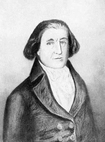
Capt. Robert Gray.
The Columbia Rediviva.
After a journey of several days upon the back trail, the party found
themselves again at the forks of the Missouri, but, somewhat to their
surprise and consternation, the main party was not there. The Indians at
first were very much excited, and, believing that they had been deceived
and that the white men were enticing them to destruction, they were at the
point of wreaking vengeance upon them. But with great tact and boldness,
Lewis gave the chief his gun and ammunition, telling him that if it proved
that he had been a deceiver, they might instantly kill him. Reassured, the
Indians proceeded onward and in a short time they could descry the boats,
making their way slowly up the impetuous stream toward a bold promontory
where the Indians were stationed. In the bow of the foremost boat was
seated Sacajawea, clad in her bright red blanket, and gazing eagerly at
the group of Indians, thinking it possible that they might be of her own
tribe. As the boat approached the band, the keen-sighted little Indian
woman soon perceived that these people were indeed of her own Shoshone
tribe. Quickly disembarking, she made her way to them, when suddenly her
eyes fell upon the chief, Cameahwait. Then to the astonishment of the
white men who were with her, she broke forth suddenly into a torrent of
tears which were soon changed into joyful smiles as the chief, with almost
as much emotion as herself, rushed forward to embrace her. She then
explained to Captain Lewis that Cameahwait was her own brother, whom she
had not seen since, as a little girl, she had been seized by the Mandans
and carried into captivity.
Of course there was now the kindliest feeling between the party of
explorers and the Indians. They found everything that they needed, horses,
provisions, and guides, placed at their disposal. They were at that time,
as would be seen by an inspection of the map, at the head waters of Salmon
River. They hoped that they might find a route down that powerful stream
to navigable water. But the Indians assured them that the river was white
with foam for many miles and disappeared in a chain of terrific snowy
mountains. It became necessary, therefore, to find a more northerly route,
and on the last day of August, with twenty-nine horses, having bidden a
hearty good-bye to the hospitable Shoshones, they turned north-westward
and soon became entangled in the savage ridges and defiles, already
spotted with snow, of the Bitter Root Mountains.
They were at this time among some of the upper branches of the second
largest tributary of the Columbia, named by them Clark’s Fork, though at
the present time more commonly known by the more rhythmic title of Pend
Oreille. After several days of the most difficult, and indeed dangerous,
journeying of their entire trip, they abandoned the northern route, turned
southward, and soon reached the wild and beautiful stream which they
called the Kooskooskie, commonly known to modern times as the Clearwater,
one of the finest of all the fine rivers of Idaho, the “Gem of the
Mountains.”
But they were not yet by any means clear of danger. The country still
frowned on them with the same forbidding crags, and the same blinding snow
storms as before. They were approaching the starvation point. The craggy
precipices were marked with almost daily accidents to men and beasts.
Their only food was the flesh of their precious horses. Under these
harassing circumstances, it was decided that the wisest thing was for
Captain Clark to take six of his best men and press rapidly forward in
search of game and a more favourable country. After a hard journey of
twenty miles, he found himself upon the crest of a towering cliff, from
which stretched in front a vast open plain. This was the great plain, now
covered with wheat-fields and orchards, lying east and north of the
present city of Lewiston, Idaho. Having made their way down the
declivities of the Bitter Root Mountains to the prairie, where they found
a climate that seemed almost tropical after the bitter cold of the high
mountains, the advance guard camped and waited for the main party to come
up.
Rejoicing at their release from the distressing conditions of their
passage of the Bitter Root Mountains, they passed onward to a beautiful
mountain-enclosed valley, which must have been in the near vicinity of
what is known as the Kamiah Valley of the present time. Here they found
themselves with a large body of Indians who became known subsequently as
the Nez Percés. These Indians appeared to be the most honest, intelligent,
and attractive they had yet met,—eager to assist them, kind and helpful,
although shrewd and business-like in their trading.
The Nez Percés imparted to them the joyful news that the Great River was
not far distant. Seeing the Clearwater to be a fine, navigable stream, the
explorers determined to abandon the weary land journey and once more
commit their fortunes to the waters. They left their horses with the Nez
Percés, asking that they should meet them at that point in the following
spring when they expected to be on their return trip. The scrupulous
fidelity with which the Nez Percés carried out their trust is some
evidence of the oft-made assertion that the treachery characteristic of
the Indians was learned afterwards from the whites.
With five large and well-filled canoes, and with a good supply of eatables
and all the other necessaries of life, the explorers now cast themselves
upon the clear, swift current of the Kooskooskie, and on the 10th of
October reached that striking and interesting place where the beautiful
modern town of Lewiston is located, at the junction of the Clearwater and
the Snake. The turbid, angry, sullen Snake, so striking a contrast with
the lesser stream, received from the explorers the name of Kimooenim, its
Indian name. Subsequently they christened it Lewis’s Fork, but the still
less attractive name of Snake is the one by which it is universally known.
The journey of a hundred and twenty miles from the junction of the
Clearwater and the Snake to the junction of the latter stream with the
mighty Columbia, seems to have been a calm and uneventful journey, though
the explorers record every manner of event, whether important or
unimportant. Knowledge of their approach seems to have reached the Indian
world, and when on October 16th they reached the point where the modern
city of Pasco is located, they were met by a regular procession of two
hundred Indians. The two great rivers were then at their lowest point in
the year, and they found by measurement that the Columbia was 960 yards in
width and the Snake, 575 yards. In the glimmering haze of the pleasant
October day they noted how the vast, bare prairie stretched southward
until it was broken by the rounded summits of the Blue Mountains. To their
astonishment, they found that the Sohulks, who lived at the junction of
the rivers, so differed from other Indians that the men were content with
one wife and that they would actually assist her in the drudgery of the
family life. After several days spent in rest and getting fish, which
seemed to throng the river in almost countless numbers, they resumed their
journey upon the magnificent flood of the Columbia. Soon after passing
what we now call the Umatilla Highland, they caught their first glimpse,
clear-cut against the horizon of the south-west, of the bold cone of Mt.
Hood, glistening with its eternal snows. Landing upon the broad prairie
near where Umatilla is now located, Captain Clark shot a crane and a duck.
He then perceived a group of Indians who were almost paralysed with terror
and yet able to make their way with considerable expedition to a little
group of tepees. Having entered one of these, Captain Clark discovered
thirty-two Indians, men, women, and children, all of whom seemed to be in
the greatest terror, wailing and wringing their hands. Endeavouring by
kind looks and gestures to soothe their perturbation, Captain Clark held
up a burning glass to catch a stray sunbeam with which to light his pipe.
Whereupon the consternation of the Indians was redoubled, to be soothed
only by the arrival of the two Indian guides who were accompanying the
party. The terrified Indians explained to the guides that they knew that
Captain Clark must have some bad medicine about him, for he had dropped
out of the sky with a dead crane and a duck, accompanied by a terrible
noise.
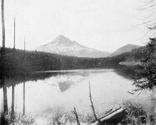
Mt. Hood from Lost Lake.
Photo. by E. H. Moorehouse.
The Indians being now convinced that he was a mortal man, and, moreover,
having heard the sound of the violin which the negro servant carried with
him, became so enamoured with the strangers that they stayed up with them
all night, and in the morning collected by hundreds to bid them good-bye.
The Indians had now given them to understand that in a short time they
would reach the place which they knew as “Timm.” This seems to have been
an Indian word for falls. It still appears in the name Tumwater Falls
applied to the falls at Celilo on the Columbia. A weird, savage place this
proved to be; crags of basalt, thrust through the soil, like clenched
hands, seemed almost to grasp the rushing river. Making several portages,
the voyagers reached that extraordinary place now called The Dalles, or
the “big chute,” where all the waters of the Columbia are squeezed into a
crack only a hundred and fifty feet in width. The River, in fact, is
“turned on edge.” The explorers, finding the shore so rough that it was
difficult to carry their boats over, steered boldly through that witch’s
caldron. Though they must have been carried with frightful rapidity
through the boiling stream, they reached the end of the cataract without
accident. At this point they began to be aware of the fact that they were
reaching the sphere of the white traders from the ocean, for they began to
see blankets, axes, brass kettles, and other articles of civilised
manufacture. The Indians, too, were more saucy, suspicious, and
treacherous than those of the upper country.
Being launched upon the calm, deep flood of the River below The Dalles,
they observed the phenomenon of the submerged forest, which at a low state
of water is still conspicuous. They correctly inferred that this indicated
a damming up of the River at some recent time. They thought indeed that it
could not have been more than twenty years previous. We know, however,
that submerged trees or piles, as indicated by remains of old Roman
wharves in Britain, may remain intact for hundreds of years. This place on
the Columbia is, however, one of the most interesting of its many
interesting phenomena. It is evident that within very recent times,
geologically speaking, there was a prodigious rock-slide from the
mountains which closed the River, producing the cataract of the Cascades
and raising the River above, some forty feet.
Here the explorers had their last portage. On the second day of November
they reached the foot of the Cascades and perceived the movement of the
tide, which made it plain to them that the ocean was near at hand. Yet, in
reality, it was much farther than they thought, for the majestic lower
River extends one hundred and sixty miles from the foot of the last
cataract to the Pacific. It is interesting to notice comments made by the
explorers upon the green and fertile islands at the lower end of the
Cascades, and that spired and turreted volcanic cliff which they called
Beacon Rock, but which we know now as Castle Rock.
The rest of the journey of Lewis and Clark was a calm floating down the
tranquil flood of the lower Columbia in the midst of the fog and clouds
which at that season of the year generally embrace all objects. On
November 7th the mist suddenly broke away before them, the bold
mountainous shores vanished in front, and, through the parted headlands,
they looked forth into the expanse of the ocean.
Eliot Glacier, Mt. Hood.
Photo. by E. H. Moorehouse.
Their journey was now ended. They had demonstrated the possibility of
crossing the continent and of linking together the waters of the Missouri
and the Columbia.
The winter of 1805-06 was spent in log buildings at a point named by the
explorers, Fort Clatsop, situated on the Lewis and Clark River at the
south side of the Columbia a few miles from the present site of Astoria.
The location of this fort has been identified in modern times, as has also
the location of the salt cairn, upon what is now known as the Seaside
Beach, commemorated by an inscription.
One of the interesting little human touches in the narrative of Captain
Lewis describes the casting of a whale upon Clatsop Beach and the journey
of the party to see the great marine curiosity, as well as to secure some
of its fat and blubber. The Indian woman, Sacajawea, was to be left behind
to keep camp while they were all at the beach, but she put up the earnest
plea that inasmuch as she had never seen any such curiosity as the “big
fish,” and as she had journeyed all those weary miles from the country of
the Mandans, it seemed hard that she should be denied the privilege of
satisfying her eyes with a view of the whale. Lewis remarks that the
request of the poor woman seemed so reasonable that they at once fixed up
camp in such manner that it could be left, and took her with them, to her
intense satisfaction.
After four months spent in the fogs and mists of the coast, and without
seeing any of the ships which the Indians said were accustomed to come in
considerable numbers during the spring and summer, the party turned their
faces homeward on the 23d of March, 1806. The commander posted upon the
fort a notice which read as follows:
The object of this last is that through the medium of some civilised
person who may see the same, it may be made known to the world that
the party consisting of the persons whose names are hereunto annexed
and who were sent out by the Government of the United States to
explore the interior of the continent of North America, did penetrate
the same by way of the Missouri and Columbia Rivers, to the discharge
of the latter into the Pacific Ocean, at which they arrived on the
14th day of November, 1805, and departed on their return to the United
States by the same route by which they had come.
They also gave to the chiefs of the Clatsops and Chinooks certificates, to
which they attached great importance and which were afterwards exhibited
to other explorers, setting forth the just and hospitable treatment which
these Indians had accorded the party.
The return from Fort Clatsop to the Missouri was in the main a pleasant
and successful journey without extraordinary event, except the fact that
upon their return they discovered the Willamette River, which, strange to
say, had eluded their observation on their journey down the River in
November. The journal contains the somewhat quaint statement that the
chief cultivable region which they discovered in Oregon was Wapatoo
Island, now known as Sauvie’s Island, at the mouth of the Willamette. They
express the conviction that that fertile tract of country and the region
adjoining might sometime support a population of fifty thousand people.
They seem to regard this as an extraordinary prophecy of prosperity.
Inasmuch as there are already over four times that number of people in the
city of Portland, it would seem that Lewis and Clark were hardly “boomers”
in the modern sense of the word.
One interesting thing in connection with the Lewis and Clark expedition
receives special emphasis from them in the account of their return
journey, and that is, the faithfulness, honesty, and devotion of the
Indians when entrusted with any charge, as the care of horses or canoes.
This character of the Indians was so marked that one can hardly avoid the
conclusion that the subsequent troubles with the Indians were due very
largely to abuse by the whites.
No better summary can be given of the scope of this historic journey than
that by Captain Lewis himself in his journal. He says:
The road by which we went out by way of the Missouri to its head is
three thousand ninety-six miles; thence by land by way of Lewis River
over to Clark’s River and down that to the entrance of Traveller’s
Rest Creek, where all the roads from different routes meet; thence
across the rugged part of the Rocky Mountains to the navigable waters
of the Columbia, three hundred and ninety-eight miles, thence down the
river six hundred and forty miles to the Pacific Ocean, making a total
distance of four thousand one hundred and thirty-four miles. On our
return in 1806 we reduced the distance from the Mississippi to the
Pacific Ocean to three thousand five hundred and fifty-five miles.
The safe return of the explorers to their homes created a sensation
throughout the United States and the world. Leaders and men were suitably
rewarded. Though the expedition was not marked by many remarkable
adventures or dramatic events, and though the narration given by the
explorers is of a plain and simple kind with no attempt at literary
ornamentation, yet occurring, as the expedition did, at such a peculiar
juncture in our history, and having such an effect to bridge the chasm
between the old time and the new, this Lewis and Clark expedition has
continued to receive, and justly, more attention than any other journey in
our history. President Jefferson, paying a tribute to Captain Lewis in
1813, expressed himself thus:
Never did a similar event excite more joy throughout the United
States; the humblest of its citizens have taken a lively interest in
the issue of this journey and looked with impatience for the
information it would furnish. Nothing short of the official journals
of this extraordinary and interesting journey will exhibit the
importance of the service, the courage, devotion, zeal, and
perseverance, under circumstances calculated to discourage, which
animated this little band of heroes, throughout the long dangerous,
and tedious travel.
The expedition of Lewis and Clark may justly be considered as constituting
the first steps across the wilderness. The breadth of the American
continent was now known. The general relations of its rivers and mountain
systems and prairies were understood. Something of its prodigality of
resources became set forth to the world. A dim consciousness of the
connection of this vast Pacific domain with the progress of American
destiny appeared to our grandfathers. And although the wilderness
traversed by this complete expedition did not come into possession of the
United States for many years, yet it might well be said that our
subsequent acquirement of it was due to the Lewis and Clark expedition.
Of the many remarkable explorations which followed, with all of their
adventure and tragedy, we cannot here speak. For several years all the
expeditions to the far West were the outgrowth of the fur-trade. Most
remarkable of these early journeys was that of the Hunt party which was
the land division of the great Astor movement to establish the Pacific Fur
Company. That company was established by John Jacob Astor of New York for
the purpose of making a bold and far-reaching attempt to control the
fur-trade of the Pacific Coast in the interests of the United States.
While the sea division was upon its journey around Cape Horn, the land
division was in process of organisation at St. Louis. Wilson Price Hunt,
the commander of this division, was the second partner in the Astor
company. He had been merchandising for some years at St. Louis, and had
become impressed with the financial profits of the fur-trade as well as
with the vast possibilities of American development on the continent. Hunt
was a fine type of the pioneer promoter of that age. Brave, humane,
cheerful, and resolute, he appears to us as the very flower of the
adventurous Argonauts who were searching for the seal and beaver fleeces
of the far West.
With Hunt were associated four other partners of the expedition, Crooks,
McKenzie, Miller, and McCellan. Accompanying the party were two English
naturalists, Bradbury and Nuttall, who did the first scientific study of
the Rocky Mountain region. There were forty Canadian voyageurs whose
duties consisted of rowing, transporting, cooking, and general drudgery.
The remaining twelve of the party consisted of a group of American hunters
and trappers, the leader of whom was a Virginian named John Day. The
company was in all respects fitted out most bountifully.
There were at that time two great classes of trappers. The first and most
numerous were the Canadian voyageurs. These were mainly of French
descent, many of them being half-breeds. Almost amphibious by nature and
training, gay and amiable in disposition, with true French vivacity and
ingenuity, gliding over every harsh experience with laugh and song,
possessed of quick sympathies and humane instincts which enabled them to
readily find the best side of the Indians,—these French voyageurs
constituted a most interesting as well as indispensable class in the
trapper’s business.
The free trappers were an entirely different class of men. They were
usually American by birth, Virginia and Kentucky being the homes of most
of them. Patient and indefatigable in their work of trapping, yet, when on
their annual trip to the towns, given to wild dissipation and savage
revellings, indifferent to sympathy or company, harsh and cruel to the
Indians, bold and overbearing, with blood always in their eyes, thunder in
their voices, and guns in their hands, yet underneath all of their harsh
exterior having noble hearts, could they but be reached, these now
vanished trappers have gone to a place in history alongside of the old
Spartans and the followers of Pizarro and Cortez in Spanish conquest.
Of the many adventures of the Hunt party on the journey up the Missouri,
we cannot speak. For some reason, although taking a more direct route than
did Lewis and Clark, and having, to all appearance, a better equipped
party, they did not make so good time. Guided by Indians, they crossed
chain after chain of mountains, supposing each to be the summit, only to
find another yet to succeed. At last on the 15th of September, they stood
upon a lofty eminence over which they could gaze both eastward and
westward. Scanning attentively the western horizon, the guide pointed out
three shining peaks, whose bases, he told them, were touched by a
tributary of the Columbia River. These peaks are now known as the Three
Tetons.
And now the party set forth upon the long descent of the western slope,
passing mountain after mountain and stream after stream, some of the way
in boats which the voyageurs made from the green timber of the forests,
and much of the way being obliged to carry their effects around cataracts
and rapids, and thus losing much time. Nevertheless, they found one long
stretch of over a hundred miles upon the upper Snake which they navigated
with comparative ease. But having reached what is now known as the Seven
Devils country in South-western Idaho, they found themselves in a chain of
rapids and precipitous bluffs where neither boats nor horses, apparently
nothing but wings, could be of service. This was in fact the beginning of
over a hundred miles of the most ragged and inaccessible region upon the
whole course of the Snake River, a region which even to this day contains
neither road nor steamboat route, and by which the great State of Idaho is
separated into two divisions, neither directly accessible to the other by
any ordinary modes of travel.
After a forty-mile tramp up and down the river, Hunt decided that the only
way to escape the difficulties with which they were surrounded, was to
divide the party into four divisions, hoping that one of them might find
game and a way out of the forbidding volcanic wastes in which they were
beleaguered. Two of the parties soon returned. One, being in charge of
McKenzie, continued upon its course northward and reached the mouth of the
Columbia, without ever again seeing the main party.
During the weeks that followed, the main party, lost amid the great
mountains which lie eastward from the present vicinity of Baker City and
Wallowa Lake, suffered all the torments of famine and cold. In places the
river ran through volcanic sluiceways, roaring and raging; in some cases,
although within hearing, yet entirely inaccessible, so that although
within sound of its angry raving, the travellers were often obliged to lie
down with tongues parched and swollen for lack of water. The party applied
to this long volcanic “chute” the name of the Devil’s Scuttle-hole, and to
the river they applied the name La Rivière Maudite Enragée, or “Accursed
Mad River.”
The lives of the party were evidently at stake. In the emergency Hunt
determined to divide his force into two divisions, one on the north and
one on the south side of the river. From the 9th of November until the
first part of December they urged on this dismal and heart-sickening
march. They passed a few wretched Indian camps where they managed to
secure dogs for food, and once they got a few horses. The frightened and
half-starved Indians could give them no clear information as to the
location of the Great River, but they signified that they supposed it to
be yet a long way off. The party was evidently approaching something, for
gigantic snowy mountains now loomed dimly through the winter mists.
Finding it impossible to make headway against blinding snowstorms and up
the icy crags, they turned their course down to the river itself and made
a cheerless camp. In the morning they were startled by seeing upon the
opposite side of the river, a group of men more wretched and desolate than
themselves. It soon appeared that this was the other party, which had
entirely failed in finding either food or guidance from the Indians.
Finding it necessary that some provision should be made for these dying
men, Hunt constructed a rude canoe from the limbs of trees and the skin of
one of the horses. In this crazy craft one of the daring Canadian
voyageurs made his way with some of the horse meat, which, poor as it
was, was sufficient to save life for the time.
With their little remaining strength, they pressed on down the river until
they reached another small village of the wretched Snake Indians. Urging
these Indians to provide for them a guide, and at last securing one by the
most bounteous offers of rewards, Hunt succeeded in gathering all of his
party together, with the exception of six sick men whom they were obliged
to leave to the tender mercies of the Indians.
For another fortnight, the cold and hungry party floundered painfully
through the snow across the rugged mountains which lie between what we now
know as the Powder River Valley and the Grande Ronde. Reaching a lofty
mountain height on the last day of December, they looked far down into a
fair and snowless prairie, bathed in sunshine and appearing to the
winter-worn travellers like a gleam of summer. Moreover, they soon
discerned a group of Indian lodges which they judged were well supplied
with dogs and horses. Thither hastening eagerly, they soon found
themselves in a beautiful valley, which from their description must have
been the Grande Ronde Valley. Beautiful at all times, it must have seemed
trebly so to these ragged and famished wanderers.
The next morning the new year of 1812 shone in upon them bright and
cheerful, as if to make amends for the stern severity of the outgoing
year. And now the Canadians insisted upon having their New Year’s holiday.
Not even death and famine could rob the light-hearted voyageurs of their
festivals. So with dance and song and with dog meat, roasted, boiled,
fried, and fricasseed, they met the newly-crowned year with their Gallic
happiness and abandon.
The Indians assured them that they could reach the Great River within
three days. But they found it twice that, and their way led across another
lofty chain of snowy mountains, before the canopy of clouds which hung
above them parted. There, looking far down from their snowy eyre, they
beheld the boundless and sunny plains of the Great River. Swiftly
descending the slopes of the mountains, they emerged upon that finest land
of all Eastern Oregon, the plains of the Umatilla. Here they found the
tribe of the Tushepaw Indians with thirty-four lodges and two hundred
horses. More significant than these to Hunt were axes, kettles, and other
implements of white construction, indicating that these Indians had
already come into communication with the traders upon the lower River. In
answer to his eager questions, the Tushepaws informed him that the Great
River was but two days distant and that a small party of white men had
just descended it. Being now certain that this was the advance guard which
had left him at the Devil’s Scuttle-hole, Hunt felt sure that they were
safe and was therefore relieved of one great anxiety.
After a few days’ rest upon the pleasant prairies and in the comparatively
genial climate of the Umatilla, the party set forth upon horses obtained
from the Tushepaws, and after a pleasant ride of two days across the
rolling prairie, they beheld flowing at their feet, a majestic stream,
deep and blue, a mile in width, sweeping toward the sunset, evidently the
Columbia. At the great falls of the River, known to the Indians as the
Timm or the Tumwater, just above what we now call Dalles City, Hunt
exchanged his horses for canoes. This last stage of two hundred and twenty
miles by boat down the River, was calm and peaceful and a refreshing rest
after the distress and disaster of their winter journey through the
mountains. Not till the 15th of February, however, did they reach the
newly christened town of Astoria. Rounding the bluffs of Tongue Point,
they beheld with full hearts the Stars and Stripes floating over the only
civilised abode west of St. Louis. Westward they saw the parted headlands
between which the River pours its floods into the ocean. As the boats drew
near the shore, the whole population, trappers, sailors, and Indians, came
down to meet them. Foremost in the crowd they saw the members of the party
which had gone on ahead through the Snake River Mountains. Having had no
hope that Hunt and his men could survive the famine and the cold, these
members of the advance guard were the more rejoiced to see them. The
Canadians, with their French vivacity, rushed into each other’s arms,
sobbing and hugging like so many schoolgirls. Even the nonchalant
Americans and the stiff-jawed Scotchmen smiled and gave themselves up to
the gladness of the hour. The next two or three days were mainly devoted
to eating and telling stories.
As we have seen, they had lost several of their number from starvation and
drowning along the banks of the Snake River. They had also left six sick
men with the Indians in the heart of the mountains. They had little hope
of ever seeing these again, but the next summer the party on their way up
the Columbia River, saw two wretched looking beings, naked and haggard,
wandering on the river bank near the mouth of the Umatilla. Stopping to
investigate, they discovered that these were Day and Crooks, the leaders
of the party which they had left behind. Their forlorn plight was relieved
with food and clothes, and, having been taken into the boat, they related
their dismal tale. It appeared that they had been provided sufficiently by
the Indians to sustain their lives through the winter. In the spring they
had left the Canadians among the Indians, and had set forth in the hope of
reaching the Great River. But having reached The Dalles, they had been
robbed of rifles and ammunition, stripped of their clothing, and driven
forth into the wilderness. They were almost at the point of a final
surrender to ill-fortune when they beheld the rescuing boat. So, with
joyful hearts, they turned their boat’s prow to Astoria, which they
reached in safety. But poor Day never regained his health. His mind was
shattered by the hardships of his journey, and he soon pined away and
died. The barren and rugged shores of the John Day River in Eastern Oregon
take on an added interest in view of the sad story of the brave hunter who
discovered them, and who wandered in destitution for so many days beside
them. Strange to say, the four Canadians who remained among the Indians
were afterwards found alive, though utterly destitute of all things. Hence
it appears that the loss of life in this difficult journey was not great.
The journeys here narrated may be considered as covering what we have
designated as the first steps across the wilderness. Within a few years,
many parties of trappers, explorers, and adventurers, with some
scientists, and a little later, parties of missionaries, made their way
over the great plains, through the defiles of the mountains, and down the
barren shores of the Snake River to the Columbia and the sea. Each party
had its special experiences, and made its special contribution to
geographical or commercial advancement. But to the parties led by Lewis
and Clark and by Hunt, we must accord the greatest meed of praise for
having broken the first pathways across the continent and for having
linked the two oceans by the footsteps of civilised men.
The Fur-Traders, their Bateaux, and their Stations
Importance of the Fur-trade as Connected with all Other Parts of the
History—Fur-hunters Compared with Gold-hunters—Sea-otter—Ledyard’s
Exploration—The European Inaugurators of the Trade—Beginnings of the
American Trade—The Great British Companies and their Struggles with
the French—Mackenzie’s Journey across the Continent—Thompson’s
Descent of the Columbia—Union of the Two Great Canadian
Companies—The American Fur Companies—Henry’s Fort—The Winship
Enterprise on the River—John Jacob Astor and the Pacific Fur
Company—Rivalry with the North-westers—Arrangements for Expeditions
by Land and Sea, and the Personnel of these—Voyage of the Tonquin
and her Disastrous Approach of the River—Founding of
Astoria—Appearance of Thompson and the North-westers—Interior
Expedition and Founding of Fort Okonogan—McDougall, the Smallpox
Chief and Bridegroom of the Indian Princess—Evil Tidings in Regard to
the Tonquin—Other Disasters—War of 1812 and Sale of Astoria to the
North-westers—Restoration of Astoria to the Americans—Monopolisation
of the River by the Hudson’s Bay Company—Their Expeditions—Hard Lot
of Madame Dorion and her Children—Adventures of Alexander Ross—The
Forts and General Plan of Work—Fort Vancouver and its Remarkable
Advantages—Dr. McLoughlin, or the “White Eagle”—Profits of the
Fur-trade—The Canoes and Bateaux and the Voyageurs—The Routes of
the Brigades—Later Americans.
As the reader will doubtless already have discovered, we are presenting
the history of the River topically rather than chronologically. The
various great stages of progress, discovery by sea, discovery by land,
fur-trade, Indian wars, missionary undertakings, international contests,
beginnings of steamboat navigation, and settlement, overlap each other,
and each topic compels us in a measure to anticipate its successors. This
is especially true of the topic treated of in this chapter.
The fur-trade was an important factor in the eras of discovery both by
land and by sea, in the Indian wars and in the era of settlement, while
the strife of nations for the possession of the land of Oregon is almost a
history of the fur companies and their international policies. Remembering
this synthetic nature of these features of our history, we shall
endeavour, with as little repetition as possible, to present a coherent
picture of that great era of the fur-traders.
Without doubt one of the earliest uses to which man has put the lower
animals is that of clothing his body in their captured skins. The
acquisition of furs has been a special feature of the colder climes. It is
obviously also a feature of discovery and conquest, for it is the
wilderness only which yields any considerable number of fur-producing
animals. Thus navigation, commerce, discovery, invention, economics,
finally international wars and policies, have been rooted to a large
degree in this primal business. The fur-hunters have held the hunters of
gold and precious stones and spicery a close race in the rank of world
movers. Indeed it may well be questioned whether results of greater moment
to humanity have not proceeded from the quest for furs than from that for
gold.
The Spaniards expended their energies in the gold and silver hunt in
Mexico and Peru and annihilated the races of those lands in their pitiless
rapacity. The other great exploring nations of the sixteenth century,
especially the French, while not indifferent to the possibility of
encountering the precious metals, found more certain and permanent results
in the less feverish and dazzling pursuit of the wild animals of the
wilderness. Neither the hunters for gold nor those for peltries were the
state-builders and home-builders without whom our American Union would not
exist. But they were the avant-couriers of both. Our land of Oregon has
had the peculiar fortune of being opened by both for both.
China furnished the most active and convenient market for furs to those
who secured their supplies on the Pacific Coast of North America. The
Russians were the first Europeans to enter the Chinese market, and they
began their voyages as early as 1741.
The sea-otter seems to have had its chief habitat on the Pacific shore
from Oregon to Alaska, and, as the ships of all nations began to crowd
upon the location of the fabled Strait of Anian, the trade with the
natives for these precious furs became constantly augmented, until the
curious and interesting creatures, so fatally attractive, were added to
the long list of “lower creatures” whom the greed of the “higher
creatures” has exterminated. A book by Coxe published in London in 1787
first made known to the English-speaking people the rich profits of the
Russians from the transportation of the sea-otter skins to China. He
instanced a case of a profit of $50,000 from a single cargo. It had,
however, been known in 1785 from the report of the voyage of Captain Cook
that the North-west Coast of America contained a new source of wealth from
the accumulation of these furs by the Indians and their eager desire to
trade them for trinkets and implements of civilised manufacture.
The first American to comprehend the greatness of the fur-trade on the
North-west Coast of the Pacific, both as a means of profit to himself and
as a patriotic impulse to direct his own nation into the channels of
westward expansion, was John Ledyard. Thomas Jefferson and John Paul Jones
became deeply interested in Ledyard’s extravagant hopes of future wealth
and glory, but all his efforts came to naught, and in 1788 this brilliant
adventurer, just on the eve of setting out to explore the interior of
Africa, suddenly put an end to his own life at Cairo, Egypt. Ledyard
should always be remembered by his countrymen, for, though his glowing
visions were unfulfilled, he was an important link in the great chain
which bound Oregon to our own country.
During these same years, several Englishmen, already noted in the chapter
on discovery, Portlock, Dixon, Hanna, Barclay, and Meares, were actively
engaged in the fur-trade, while the voyages of La Pérouse and Marchand
carried the flag of France on the same quest, and Spain’s once illustrious
emblem of world dominion was borne by Quadra, Valdes, Galiano, Fidalgo,
Quimper, Caamano, and several others. While these explorers all were
impelled in part by national pride and diplomacy, the hope of sharing the
spoils of the sea-otter droves was the chief lure to the tempestuous seas
of the North Pacific.
In Bullfinch’s Oregon and El Dorado is a very interesting narration of
the inception of the American part in the fur-trade of Oregon. In a
building known as the Coolidge Building in Boston a company were gathered
together in 1787 discussing the reports, then first made public, of Cook’s
voyages. Mr. Joseph Barrell, a rich merchant of Boston, was much impressed
with Cook’s account of the chances of barter with the Indians for furs and
the disposal of them in China for yet more profitable cargoes of teas,
silks, and other characteristic commodities of that land. As a result of
this conference, a company was formed in Boston to prosecute such
enterprise, the members of the company, Messrs. Barrell, Brown, Bulfinch,
Darby, Hatch, and Pintard, being among the foremost of the business men in
Boston in that good year of the creation of the American Constitution.
The enterprising Yankees rapidly drew to the front, so that during the
years from 1790 to 1818, the records show one hundred and eight American
vessels regularly engaged in the business, while only twenty-two English,
with a few Portuguese and French are found. It should, of course be
remembered that the tremendous strife of the Napoleonic Wars was
engrossing the attention of European nations during that time. So well
known did the Boston navigators become in that period that the common name
of Americans used by the Oregon Indians was “Bostons.” Robert Gray, the
discoverer of the Columbia River, was fitted out by Bulfinch and others of
the first Boston Company. During the period under consideration the
profits of the traffic were usually very great, though variable, sometimes
actual losses being incurred, while disaster from wreck, storm, scurvy,
and murderous Indians was frequent. During the two years, 1786 and 1787,
if Dixon is to be followed, there were sold in Canton five thousand eight
hundred sea-otter hides for $160,700. Swan figures that with the four
years ending with 1802, forty-eight thousand five hundred skins were sold.
Sturgis states that he knew a capital of $50,000 to yield a gross income
of $284,000. He relates that he had collected as high as six thousand fine
skins in a single voyage and once secured five hundred and sixty of the
best quality in one day. The Indians, however, learned to become very
expert traders, and as they discovered the eagerness with which the whites
sought their furs, they raised the price. They became, moreover, very
capricious and unreliable, so that the phenomenal profits could no longer
be obtained.
The stage of the history of the fur-trade of which we have thus far spoken
may be called its first era of a free-for-all rush to the new seas, with
no vast moneyed interests in any position of leadership. But commercial
conditions were already in existence which were bound to reverse the
situation.
Great operators, gigantic companies, foreshadowings of the great trusts of
the present, with monopolistic aims, were seeking the ear of the British
Government, while enterprises, larger, though not so monopolistic, were
rapidly forming in the United States. The great monopolies of Europe had
indeed existed long prior to the period of the Oregon fur-traders. As far
back as the beginning of the sixteenth century, De Monts, Pontgrave,
Champlain, and other great French explorers had secured monopolies on the
fur-trade from Louis XIII. and his minister, Richelieu. Later La Salle,
Hennepin, D’Iberville, and others had the same advantages. The St.
Lawrence, the Great Lakes, and the upper Mississippi were the great
“preserve” of these great concessionaires. The English and their American
Colonists set themselves in battle array against the monopolistic Bourbon
methods of handling the vast domain which the genius and enterprise of De
Monts and Champlain had won for France, with the result that upon the
heights of Abraham the Fleur-de-Lis was lowered before the Cross of St.
George, and North America became English instead of Gallic, and one of the
world’s milestones was set for good. Then by one of those beautiful
ironies of history which baffle all prescience, victorious Britain
violated the principles of her own conquest and adopted the methods of
Bourbon tyranny and monopoly, with the result that another milestone was
set on the highway of liberty and the new continent became American
instead of European.
But out of the struggles of that century, French, English, and American,
out of the final distribution of territory, by which England retained
Canada and with it a large French and Indian population, mingled with
English and Scotch,—out of these curious comminglings, economic,
commercial, political, religious, and ethnic, grew the great English fur
companies, whose history was largely wrought out on the shores of the
Columbia, and from whose juxtaposition with the American State-builder the
romance and epic grandeur of the history of the River largely comes.
Many enterprises were started by the French and English in the seventeenth
century, but the Hudson’s Bay Company became the Goliath of them all. The
first charter of this gigantic organisation was granted in 1670 by Charles
II. to Prince Rupert and seventeen others, with a capital stock of ten
thousand five hundred pounds. From this small beginning, the profits were
so great that, notwithstanding the loss of two hundred thousand pounds
from the French wars during the latter part of the century, the Company
declared dividends of from twenty-five to fifty per cent.
The field of operations was gradually extended from the south-eastern
regions contiguous to Hudson’s Bay until it embraced the vast and dreary
expanses of snowy prairie traversed by the Saskatchewan, the Athabasca,
the Peace, and finally the Mackenzie. Many of the greatest expeditions by
land under British auspices which resulted in great geographical
discoveries were primarily designed for the expansion of the fur-trade.
Just at the critical moment, both for the great Canadian Fur Company, as
well as for discovery and acquisition in the region of the Columbia, a
most important and remarkable champion entered the lists. This was the
North-west Fur Company of Montreal. It was one of the legitimate
consequences of the treaty of Paris in 1763, ceding Canada to Great
Britain. The French in Canada became British subjects by that treaty, and
many of them had extensive interests as well as experience in the fur
business. Furthermore a number of Scotchmen of great enterprise and
intelligence betook themselves to Canada, eager to partake of the
boundless opportunities offered by the new shuffle of the cards. These
Scotchmen and Frenchmen became natural partners in the foundation of
enterprises independent of the Hudson’s Bay monopoly. In 1783 a group of
the boldest and most energetic of these active spirits, of whom the
leaders were McGillivray, McTavish, Benjamin and Joseph Frobisher,
Rechebleve, Thain, and Frazer, united in the formation of the North-west
Fur Company. Bitter rivalry soon arose between the new company and the old
monopoly. Following the usual history of special privilege, the old
company, which had now been in existence one hundred and thirteen years,
had learned to depend more on privilege than on enterprise, and had become
somewhat degenerate. The North-westers “rustled” for new business in new
regions. In 1789 Alexander Mackenzie, as one of the North-westers, made
his way, with incredible hardship, down the river which bears his name to
the Frozen Ocean. A few years later he made the first journey to the shore
of the Pacific, commemorating his course by painting on a rock on the
shore of the Cascade Inlet, north-east of Vancouver Island, these words:
“Alexander Mackenzie, from Canada, by land, the twenty-second of July, one
thousand seven hundred and ninety-three.”
As a result of the new undertakings set on foot by the North-westers and
the reawakened Hudson’s Bay Company, both companies entered the Columbia
Valley. The struggle for possession of Oregon between the English and
American fur companies and their government was on. In the summer of 1810
David Thompson of the North-west company crossed the continental divide by
the Athabasca Pass in latitude 52° 25′. The North-westers had heard of the
Astor enterprise in New York and realised that they must be up and doing
if they would control the land of the Oregon. Although the character of
soil, climate, and productions of the Columbia Valley was but imperfectly
known, enough had been derived from Lewis and Clark, and from ocean
discoveries to make it plain that the Columbia furnished the most
convenient access to the interior from the sea, and that its numerous
tributaries furnished a network of boatable waters unequalled on the
Western slope, while there was every reason to suppose that its forests
abounded in fur-bearing animals and that its climate would admit of much
longer seasons of work than was possible in the biting winters of the
Athabasca. It became vital to the continental magnitude of the designs of
the Canadian companies that they control Oregon.
For greater topical clearness we will anticipate a little at this point
and state that after several years of intense rivalry it became plain to
the British Parliament that it was suicidal to allow a policy of division
in the face of a common enemy. Hence in 1821, by act of Parliament, the
two companies were reorganised and united under a charter which was to
last twenty-one years (and as a matter of fact was renewed at the end of
that time), and under the provisions of which the North-westers were to
have equal shares in both stock and offices, though the name of the
Hudson’s Bay Company, was retained. It will be remembered therefore, that
up to the year 1821, the two great Canadian companies were distinct, and
that during that time the North-west Company was much the more active and
aggressive in the Columbia Valley, but that after that date the entire
force of the Canadian Companies was combined under the name of the old
monopoly. But however bitter the first enmity of the Canadian rivals, they
agreed on the general proposition that the Americans must be checkmated,
and during the score of years prior to their coalition they were seizing
the pivotal points of the Oregon country. During the next two decades
they created a vast network of forts and stations, and reduced the country
contiguous to the River and its tributaries to a system so elaborate and
interesting as to be worthy of extended study. We can sketch only its more
general features. And the more perfectly to understand them, we must
arrest here the story of the great Canadian monopoly and bring up the
movement of the American fur companies.
It may be noted, first of all, that by reason of the quicker colonisation
and settlement and consequent establishment of agriculture and other arts
pertaining to home life, the region of the United States east of the
Mississippi never became the natural habitat of the trapper and fur-trader
to anything like the degree of Canada and the western part of our own
land. Nevertheless extensive fur interests grew up on the Mississippi
during the French régime, and in 1763-4 August and Pierre Choteau located
a trading post on the present site of St. Louis, and the fascinating
history of that great capital began.
Most of the American trading companies confined their operations to the
east side of the Rocky Mountains. But the Missouri Fur Company of St.
Louis, composed of a miscellaneous group of Americans and
Hispano-Gallo-Americans, under the presidency of Manuel Lisa, a bold and
enterprising Spaniard, took a step over the crest of the mountains and
established the first trading post upon the waters of the Columbia. This
was in 1809. Andrew Henry, one of the partners of the aforesaid company,
crossed the mountains in that year and a year later built a fort on a
branch of Snake River. This seems to have been on what subsequently
became known as Henry’s River. It was in one of the wildest and grandest
regions of all that wild grand section of Snake River. Henry’s River
drains the north side of the Three Tetons, while the south branch, known
afterwards as Lewis and finally as Snake River, drains the south of that
group of mountains. Henry must be remembered as the first American and
the first white man recorded in history who built any structure upon any
tributary of our River, and the year was 1810. Both Henry and his Company
had hopes of accomplishing great things in the way of the fur-trade in
that very favourable region. But the next year the Indians were so
threatening that the fort was forsaken and the party returned to the
Missouri. When the Hunt party in the fall of 1811 sought refuge at this
point they found only a group of abandoned huts, with no provisions or
equipment of which they could make any use.
But though Henry’s fort was but a transient matter, his American
countrymen were beginning to press through the open gateways of both
mountain and sea. In the early part of 1809 the Winship brothers of
Boston, together with several other keen-sighted Yankees, formed a project
for a definite post on the Columbia River, proposing to reach their
destination by ship. Accordingly they fitted out an old vessel known as
the Albatross, with Nathan Winship as captain, William Gale as captain’s
assistant, and William Smith as first mate. Captain Gale kept a journal of
the entire enterprise, and it is one of the most interesting and valuable
of the many ship’s records of the North-western Coast.
Setting sail with a crew of twenty-two men and an excellent supply of
stores and ammunition, and abundance of tools and hardware for erecting
needful buildings, the Albatross left Boston in the summer of 1809.
After a slow and tedious, but very healthful and comfortable voyage,
stopping at the Hawaiian Islands on the route, the Albatross reached the
mouth of the Columbia River on May 26, 1810. Many American and other ships
had entered the mouth of the River prior to that date, but so far as known
none had ascended any considerable distance. Apparently Gray and Broughton
were the only shipmasters who had ascended above the wide expanse now
known as Gray’s Bay, while the Lewis and Clark expedition contained the
only white men who had seen the river above tide-water. The Winship
enterprise may be regarded with great interest, therefore, as the first
real attempt to plant a permanent establishment on the banks of the River.
Winship and his companions spent some days in careful examination of the
river banks and as a result of their search they decided on a strip of
valley land formed by a narrowing of the River on the north and an
indentation of the mountain on the south. This pleasant strip of fertile
land is located on the south bank of the lordly stream, and its lower end
is about forty-five miles from the ocean. Being partially covered with a
beautiful grove of oak trees, the first to be seen on the ascent of the
River, the place received the name of Oak Point. It may be noted that this
name was subsequently transferred to a promontory nearly opposite on the
north bank, and this circumstance has led many to locate erroneously the
site of the first buildings designed for permanent use on the banks of
the Columbia. And such these were, for the Lewis and Clark structures at
what they called Fort Clatsop, erected four and a half years earlier, were
meant only for a winter’s use. But the Winship party had glowing visions
of a great emporium of the fur-trade, another Montreal or St. Louis, to
inaugurate a new era for their country and themselves. They designed
paying the Indians for their lands and in every way treating them justly.
They seem in short to have had a very high conception of the dignity and
worth of their enterprise. They were worthy of the highest success, and
the student of to-day cannot but grieve that their high hopes were dashed
with disaster.
Tying the Albatross to the bank on June 4th, they entered at once with
great energy on the task of felling trees, rearing a large log house,
clearing a garden spot, in which they at once began the planting of seeds,
and getting ready to trade with the natives. But within four days the
River began to rise rapidly, and the busy fort-builders perceived to their
dismay that they had located on land subject to inundation. All the work
thus far done went for naught, and they pulled their fort to pieces and
floated the logs down stream a quarter of a mile to a higher place. There
they resumed their buildings with redoubled energy. But within a week a
much more dangerous situation again, and this time permanently, arrested
their grand project. This time it was the very men toward whom they had
entertained such just and benevolent designs, the Indians, who thwarted
the plans. For, as Captain Gale narrates in a most entertaining manner, a
large body of Chinooks and Cheheeles, armed with bows and arrows, and some
muskets, made their appearance, announcing that they were on their way to
war against the Culaworth tribe who had killed one of their chiefs a year
before. But the next day the Indians massing themselves about the whites,
gave such plain indications that the previous declaration was a pretence
that the party hastily got into a position of defence. Their cannon on
board the Albatross had already been loaded in anticipation of
emergencies, and so plain was it that they could make a deadly defence
that the threatened attack did not come. A long “pow-wow” ensued instead,
and the Chinooks insisted that the builders must select a site lower down
the river. After due consideration the party decided that any determined
opposition by the Indians would so impair their enterprise, even though
they might be able to defend themselves, that it would be best to seek a
new location. Accordingly they reloaded their effects, dropped down the
River, and finally decided to make a voyage down the California coast and
return the next year. Return they did, but by that time the next year the
Pacific Fur Company had already located at Astoria the first permanent
American settlement, and the Winship enterprise faded away. That the
design of the Winships was not at all chimerical is apparent from the fact
that within twenty years the Hudson’s Bay Company had made of Vancouver,
sixty miles farther up the River, the very kind of a trading entrepôt of
which the Winships had dreamed. Their dream was reasonable, but the time
and place were unpropitious.
A quotation from Captain Gale’s journal will give a conception of his
feelings:
June 12th.—The ship dropped
further down the River, and it was now determined to abandon all attempts to force a settlement. We have
taken off the goats and hogs which were left on shore for the use of
the settlement, and thus we have to abandon the business, after
having, with great difficulty and labour, got about forty-five miles
above Cape Disappointment; and with great trouble began to clear the
land and build a house a second time, after cutting timber enough to
finish nearly one-half, and having two of our hands disabled in the
work. It is, indeed, cutting to be obliged to knuckle to those whom
you have not the least fear of, but whom, from motives of prudence,
you are obliged to treat with forbearance. What can be more
disagreeable than to sit at the table with a number of these rascally
chiefs, who while they supply their greedy mouths with your food with
one hand, their bloods boil within them to cut your throat with the
other, without the least provocation.
On the way out of the River Captain Winship learned that the Chinooks
designed capturing his vessel, and would doubtless have done so, had not
his vigilance prevented.
While the crew of the Albatross were engaged in these adventures the
largest American Fur Company yet formed was getting ready to effect a
lodgment on the shores of the Columbia. This was the Pacific Fur Company.
John Jacob Astor was the founder of this enterprise. Though unfortunate in
almost every feature of its history and its final outcome, this company
had a magnificent conception, a royal grandeur of opportunity, and it
possessed also the felicity, shared by no one of its predecessors, of the
genius of a great literary star to illuminate its records. To Washington
Irving it owes much of its fame. Yet the commercial genius of Astor could
not prevent errors of judgment by the management any more than the
literary genius of Irving was able to conceal their errors, or the genius
of American liberty able to order events so as to prevent victory for a
time by the “Britishers.” As we view the history in the large it may be
that we shall conclude that the British triumph at first was the best
introduction to American triumph in the end.
John Jacob Astor may, perhaps, be justly regarded as the first of the
great promoters or financial magnates who have made the United States the
world’s El Dorado. Coming from Germany to this land of opportunity after
the close of the Revolutionary War, he soon manifested that keen intuition
in money matters, as well as intense devotion to accumulation, which has
led to the colossal fortunes of his own descendants and of the other
multimillionaires of this age. Having made quite a fortune by transporting
furs to London, Mr. Astor turned to larger fields. With his broad and keen
geographical and commercial insight, he could readily grasp the same fact
which the North-westers of Montreal were also considering, that the
Columbia River might well become the key to an international fur-trade, as
well as a strategic point for American expansion westward. He made
overtures to the North-westers for a partnership, but they declined. Then
he determined to be the chief manager, and to associate individual
Americans and Canadians with himself. With the promptitude of the skilful
general, he proceeded to form his company and make his plan of campaign in
time to anticipate the apparent designs of the active Canadians. They saw,
as well as Astor did, the magnitude of the stake and at once made ready to
play their part. For, as already noted, David Thompson crossed the Rockies
by the Athabasca Pass in 1810, spent the winter at Lake Windermere on the
Columbia River, and in the summer of 1811 reached Astoria, only to find
the Astor Company already established there. It should be especially noted
that the Thompson party was the first to descend the River from near its
source to the ocean, although of course Lewis and Clark had anticipated
them on the portion below the junction of the Snake with the main River.
Mr. Astor’s plans provided for an expedition by sea and one by land. The
first was to convey stores and equipment for founding and defending the
proposed capital of the empire of the fur-traders. Of the expedition by
land under Hunt we have already given a full account in the preceding
chapter, since its events rather allied it to the era of exploration than
that of the traders. The organisation of Mr. Astor’s company provided that
there should be a capital stock of a hundred shares, of which he should
hold half and his associates half. Mr. Astor was to furnish the money,
though not to exceed four hundred thousand dollars, and was to bear all
losses for five years. The term of the association was fixed at twenty
years, though with the privilege of dissolving it in five years if it
proved unprofitable. The general plan and the details of the expedition
had been decided upon by the master mind of the founder with statesmanlike
ability. It comes, therefore, as a surprise to the reader that Mr. Astor
should have made a capital mistake at the very beginning of his
undertaking. This mistake was in the selection of his associates and the
captains of some of his ships. Of the partners, five were Americans and
five were Canadians. Two only of the Americans remained with the company
long enough to have any determining influence on its policies. Take the
fact that the majority of the active partners and almost all the clerks,
trappers, and other employees of the company were Canadians, and put it
beside the other fact that war was imminent with Great Britain and did
actually break out within two years, and the dangerous nature of the
situation can be seen. Of the ship-captains, the first one, Captain
Jonathan Thorn of the Tonquin, was a man of such overbearing and
obstinate nature that disaster seemed to be fairly invited by placing him
in such vitally responsible a position. The captain of the second ship,
the Beaver, was Cornelius Sowles, and he seems to have been as timid and
irresolute as Captain Thorn was bold and implacable. Both lacked judgment.
It was probably natural that Mr. Astor, having had his main prior
experience as a fur-dealer in connection with the Canadians centring at
Montreal, should have looked in that direction for associates. But
inasmuch as war between England and the United States seemed a practical
certainty, it was a great error, in founding a vast enterprise in remote
regions whose ownership was not yet definitely recognised, to share with
citizens of Great Britain the determination of the important issues of the
enterprise. It would have saved Mr. Astor great loss and chagrin if he had
observed the maxim: “Put none but Americans on guard.” As to the captains
of the two vessels, that was an error that any one might have made. Yet
for a man of Astor’s exceptional ability and shrewdness to err so
conspicuously in judging the character of the men appointed to such
important places seems indeed strange.
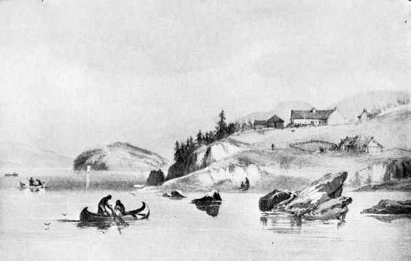
Astoria in 1845.
From an Old Print.
Astoria. Looking up and across the Columbia River.
Photo. by Woodfield.
To these facts in regard to the personnel of the partners, the captains,
and the force, must be added two others; i. e., war and shipwreck. The
combination of all these conditions made the history of the Astoria
enterprise what it was. Yet, with all of its adversity, this was one of
the best conceived, and, in most of its details, the best equipped and
executed of all the great enterprises which have appeared in the
commercial history of our country. As an element in the development of the
land of the Oregon, it must be accorded the first place after the period
of discovery.
The Tonquin left New York on September 6, 1810. She carried a fine
equipment of all things needed for founding the proposed emporium. She was
manned by a crew of twenty-one and conveyed members of the fur-trading
force to the number of thirty-three. Stopping at the Sandwich Islands, an
added force of twenty-four natives was taken aboard. At various times on
the journey the rigid ideas of naval discipline and the imperious temper
of Captain Thorn came near producing mutiny among the partners and clerks.
When the Tonquin hove to off the mouth of the Columbia on March 22,
1811, the eager voyagers saw little to attract. The wind was blowing in
heavy squalls, and the sea ran high. Nevertheless the hard-hearted Captain
issued orders to the first mate, Fox, with a boat’s crew of four men, to
go into the foaming waves and sound the channel. The boat was
insufficiently provided, and it seemed scarcely short of murder to
despatch a crew under such circumstances. But the tyrannical captain would
listen to no remonstrances, and the poor little boat went tossing over the
billows on her forlorn hope. Such indeed it proved to be, for neither
boat nor any one of the crew was ever heard of again. This was a wholly
unnecessary sacrifice of life, for the Tonquin was in no danger, and
time could just as well have been taken for more propitious weather.
The next day, the wind and sea having abated, the Tonquin drew near the
dreaded bar, but, no entrance that satisfied the captain appearing, the
ship again stood off to spend the night in deep water. On the next day,
the 24th, the wind fell and a serene sky seemed to invite another attempt.
The pinnace in command of Mr. Aikin, with two white men and two Kanakas,
was sent out to find the channel. Following the pinnace the ship moved in
so rapidly under a freshening breeze that she passed the pinnace, the
unfortunate men on board finding it impossible to effect an entrance and
being borne by the refluent current into the mad surge where ocean tide
and outflowing river met in foamy strife. So the pinnace disappeared. But
meanwhile the crew had all their energies engaged to save the Tonquin.
For the wind failed at the critical moment and the ship struck the sands
with violence. Night came on. Had the men been classically trained (as in
fact Franchère was) they might have remembered Virgil, Ponto nox incubat
atra. But they had no time for classical or other quotations. Hastily
dropping the anchors they lay to in the midst of the tumult of waters, in
that worst of situations, on an unknown coast in the dark and in storm.
But as Franchère expresses it, Providence came to their succour, and the
tide flooding and the wind rising, they weighed the anchors, and in spite
of the obscurity of the night, they gained a safe harbour in a little
cove inside of Cape Disappointment, apparently just about abreast of the
present town of Ilwaco.
Thus the Tonquin was saved, and with the light of morning it could be
seen that she was fairly within the bar. Natives soon made their
appearance, desirous of trading beaver-skins. But the crew were in no mood
for commerce while any hope existed for finding the lost sailors. Taking a
course toward the shore by what must have been nearly the present route
from Ilwaco to Long Beach, the captain and a party with him, began a
search and soon found Weeks, one of the crew of the pinnace. He was stark
naked and suffering intensely from the cold. As soon as sufficiently
revived he narrated the loss of the pinnace in the breakers, the death of
three of the crew, and the casting of himself and one of the Kanakas upon
the beach. The point where they were cast would seem to have been near the
present location of the life-saving station.
The two survivors of the ill-fated pinnace having been revived, the party
returned to the Tonquin, which was now riding safely at anchor in the
bay on the north side of the river, named Baker’s Bay by Broughton
nineteen years before. Joy for their own escape from such imminent perils
was mingled with melancholy at the loss of their eight companions of the
two boats, and with the melancholy there was a sense of bitterness toward
the captain, who was to blame, at least for the loss of the small boat.
But now the new land was all before them where to choose, and since
Captain Thorn was in great haste to depart and begin his trading cruise
along the coast, the partners on the Tonquin, Messrs. McKay, McDougal,
David Stuart, and Robert Stuart, decided somewhat hurriedly to locate at
the point which had received from Lieutenant Broughton the name of Point
George. Franchère gives a pleasant picture of the beauty of the trees and
sky, and the surprise of the party to find that, though it was only the
12th of April when they set to work upon the great trees which covered the
site of their chosen capital, yet spring was already far advanced. They
did not then understand the effect of the Japan current upon the Pacific
Coast climate.
An incident of special interest soon after landing was the appearance on
June 15th of two strange Indians, a man and a woman, bearing a letter
addressed to Mr. John Stuart, Fort Estekatadene, New Caledonia. These
two Indians wore long robes of dressed deerskins with leggings and
moccasins more like the Indians of the Rocky Mountains. They could not
understand the speech of the Astoria Indians nor of any of the mixture of
dialects which the white men tried on them, until one of the Canadian
clerks addressed them in the Knisteneaux language with which they seemed
to be partially familiar. After several days of stay at the fort the two
wandering Indians succeeded in making it clear to the traders that they
had been sent out by a clerk named Finnan McDonald of the North-west Fur
Company from a fort which that company had just established on the Spokane
River. They said that they had lost their way and in consequence had
descended the Tacousah-Tessah (and this Franchère understood to be the
Indian name for the Columbia, though the general impression among the
Indians is that Tacousah-Tessah, or Tacoutche-Tesse, signified Frazer
River). From the revelation gradually drawn from these two Indians (and
the surprising discovery was made that they were both women) the very
important conclusion was drawn that the North-west Fur Company was already
prepared to contest with the Astor Company the possession of the River.
The peculiar feature of the situation was that the most of the Astorians,
though American by the existing business tie, were Canadian and British by
blood and sympathy, and hence were very likely to fraternise with the
Montreal traders.
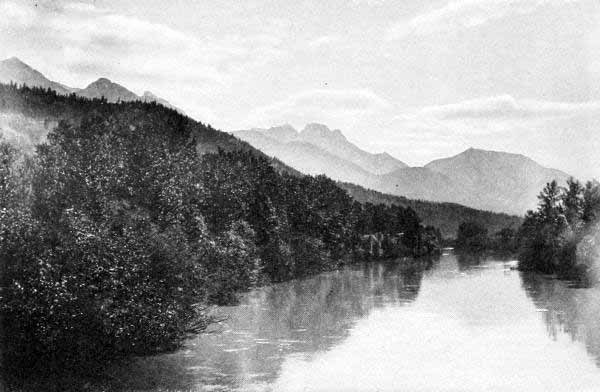
One of the Lagoons of the Upper Columbia River, near Golden, B. C.
Photo. by C. F. Yates, Golden.
Saddle Mt., or Swallalochost, near Astoria, Famous in Indian Myth.
Photo. by Woodfield.
However the Astorians decided to send an expedition into the interior to
verify the story given by the two Indian women, but, just as they were
ready to go, a large canoe with the British flag floating from her stern
appeared, from which, when it had reached the landing, there leaped ashore
an active, well-dressed man who introduced himself as David Thompson, of
the North-west Company. This was the same man, the reader will remember,
who had crossed the Rocky Mountains the year before, had wintered near the
head of the River, and had then descended it, seeking a location for the
Columbia River emporium of the Canadian company. But he was too late. It
was quite strange by what narrow margins on several occasions the British
failed to forestall the Yankees.
On July 23d the delayed expedition of the Astorians set forth far to the
interior, and as a result of their investigations, David Stuart, in charge
of the party, began the erection of a trading house at the mouth of the
Okanogan, five hundred and forty miles above Astoria. It was on September
2, 1811, that this post was begun, and hence Fort Okanogan may be
regarded as the first American establishment in the present State of
Washington. It was antedated a few months by the post of the North-west
Company at the entrance of the Little Spokane into the Spokane, near the
present site of the City of Spokane.
During the fall of 1811 the Indians around Astoria became very
threatening. Direful rumours, too, in regard to the destruction of the
Tonquin began to disquiet the Astorians. In the emergency the wary
McDougall, then acting as the head of the Company, bethought himself of a
very effective expedient. He had learned that dreadful loss of life among
the Indians had resulted a few years before from smallpox and that the
Indians were mortally afraid of it. Calling into his room several of the
principal chiefs, he asked if they remembered the smallpox. Their serious
faces were sufficient proof that they did. McDougall then held up a small
vial and continued with awful solemnity: “Listen to me. I am the great
smallpox chief. In this little bottle I keep the smallpox. If I uncork the
bottle and let it out I will kill every man, woman, and child of the
Indians. Now go in peace, but if you make war upon us I will open the
bottle, and you will die.” The chiefs filed out in terror, and peace was
preserved.
McDougall still further cemented the bond of union with the natives by
becoming united in wedlock with the daughter of Comcomly, the one-eyed
chieftain of the Chinooks. After numerous and thorough ablutions had
somewhat mitigated the oiliness and general fishiness of the Chinook
princess, she was clad in the most brilliant style of the native beauty, a
grand holiday was declared at Astoria, and white men and Indians joined
in the wedding feast and made the welkin ring with their demonstrations.
Thus did the daughter of Comcomly become the first lady of the land, and
thus did peace brood over the broad waters of the lower River.
During the winter of 1811-12 the two instalments of the Hunt party made
their appearance, after their distressful journey from St. Louis as
already narrated in Chapter IV. In May, 1812, the company’s ship Beaver
arrived from New York, loaded with stores and trading equipment, and
bringing a considerable addition to the force of men. In the following
month sixty men were despatched up-river, and by them a trading post was
located at Spokane and another on the Snake River somewhere near the
present site of Lewiston, while one section of the party went across the
mountains and down the Missouri to convey dispatches to Mr. Astor.
At this stage of the history of the Astoria enterprise, every aspect was
encouraging. The trade in furs on the Spokane, the Okanogan, the Snake,
the Cœur d’Alene was excellent, a successful cruise along the coast by
the Beaver seemed sure, and the Indians about the mouth of the River
were friendly and well disposed. Mr. Astor’s great undertaking seemed sure
to be crowned with success. In the midst of all the signs of hope came
tidings of dismay. It became known with certainty that the Tonquin had
been destroyed. This appalling disaster was related directly to the
Astoria Company by the only survivor. This was an Indian of the Chehalis
tribe whose name is given by Irving as Lamazee, by Ross as Lamazu, and by
Bancroft as Lamanse. He had escaped from the Indians who had held him
after the destruction of the Tonquin and had finally found his way to
Astoria, there to tell his tale, one of the most sanguinary in the long
roll of struggles with the Indians. The next great disaster was the
wrecking of the Lark, the third of the Company’s ships from New York.
During the same period Mr. Hunt, the partner next in rank to Mr. Astor and
the one above all who could have acted wisely and patriotically in the
forthcoming crisis, had gone in the Beaver on a trading cruise among the
Russians of Sitka, and by a most remarkable series of detentions he had
been kept away from Astoria for over a year.
To cap the climax of misfortunes, the War of 1812 burst upon the knowledge
of the fur-traders and seemed to force upon such of the partners as were
of British nationality the question of their paramount duty. As a result
of the crisis, McDougal and McKenzie, although against the wishes of the
other partners present, sold out to the agent of the North-westers, who
had repaired at once to Astoria upon knowledge of the declaration of war.
Thus the great Astoria enterprise was abandoned, and the Stars and Stripes
went down and the Union Jack went up. Soon after the transfer, the British
man-of-war Raccoon, Captain Black, arrived at Astoria, expecting to have
seized the place as a rich prize of war. Imagine the disgust of the
expectant British mariners to discover that the post had already been sold
to British subjects, that their long journey was useless, and that their
hopes of prize money had vanished.
With the close of the War of 1812 a series of negotiations between the
ministers of the two countries took place in regard to the possession of
the River, by which it was finally decided that Astoria should be restored
to the United States. Accordingly, on the 6th of October, 1818, the
British Commissioners, Captain F. Hickey, of His Majesty’s Ship Blossom,
and J. Keith, representing the North-west Fur Company, signed an act of
delivery restoring Fort George (Astoria) to the United States. Mr. J. B.
Prevost, Commissioner for the United States, signed the act of acceptance.
Astoria was once again American property.
Steamer Beaver, the First Steamer on the Pacific, 1836.
Portland, Oregon, in 1851.
From an Old Print.
While the River was now nominally in possession of the United States, it
was practically under the control of the British fur companies. The
Pacific Fur Company ceased to operate, and the North-westers entered upon
active work both by sea and land in exploring the vast and profitable
domain which the misfortunes of their American rivals, supplemented in a
most timely manner by the treachery of McDougall and McKenzie, had put
within their power. The canny Scotchmen, McDougall, McTavish, McKenzie,
McDonald, and the various other Macs who now guided the plans of the
North-westers, signalled their entrance into power by despatching
companies to the various pivotal points of the great Columbia Basin, the
Walla Walla, Yakima, Okanogan, Spokane, and Snake rivers. Two incidents
may be related to illustrate the character of people and the conditions of
that wilderness period.
A party of ninety men in ten canoes left Astoria for up-river points on
April 4, 1814. While passing the mouth of the Yakima, about three hundred
and fifty miles up the River, the men were surprised to see three canoes
putting out from shore and to hear a child’s voice calling out, “Arretez
donc! arretez donc!” Stopping to investigate, the party found in one of
the boats the Indian wife of Pierre Dorion, with her children. Dorion,
with five other Canadians, had gone the previous summer with a party under
command of John Reed of the Astor Company. While trapping and hunting,
deep in the mountains of Snake River, the party had been massacred by
Indians. The woman and her two boys had alone escaped the massacre. It was
the dead of winter and the snows lay deep on the Blue Mountains. But the
wife of Dorion found shelter in a remote fastness of the mountains,
putting up a bark hut for a shelter and subsisting on the carcasses of
some of her horses. In the spring, the pitiful little company of mother
and children descended to Walla Walla and found there more kindly disposed
natives, who cared for them and turned them over to the protection of the
whites. A more thrilling story of suffering and heroism than this of
Madame Dorion and her children has never come up from the chronicles of
the wild West.
Equally illustrative of the life of the fur-traders is the account given
by Alexander Ross of one of his many adventures in the Columbia country.
In 1814 Ross went from Okanogan to Yakima to secure horses. With him were
four other whites and three Indian women. The Yakima Valley was then as
now a paradise of the Indians. There the tribes gathered by the thousands
in the spring to dig camas, to race horses, and to gamble, as well as to
form alliances and make plans for war. When the little company of traders
reached the encampment, they discovered to their astonishment that it was
a veritable city. Six thousand men, women, and children, with ten thousand
horses, and uncounted dogs and many shackled bears and wolves, were strewn
across the plain. It was a dangerous situation for the traders, for it
became plain to them that the Indians were unfriendly. But assuming an air
of careless bravado, Ross proceeded to display his store of trinkets for
the purpose of starting a traffic in horses. Assuming a very hilarious
manner the Indians would seize and drive away the animals as fast as the
white men got them. Then the Indians began to deprive them of clothes and
food. Finally they made ready to seize their three women as slaves. Ross
managed to have the women escape temporarily, but then the savages were
worse than ever. Matters reached a crisis when an obstreperous chief named
Yaktana snatched a knife from the hands of one of the Canadians. A
desperate struggle was just at the point of breaking out, which would
inevitably have resulted in the death of all the white men, when a sudden
intuition flashed through the quick mind of Ross, and rushing between the
combatants he handed his own knife, a much more elegant one, to Yaktana,
saying in a friendly tone, “This is a chief’s knife. Take it and give back
the other.” There was an instant revulsion. Yaktana was so much flattered
that he turned at once into a stanch supporter of the shrewd trader. Food
was brought. The horses were restored. Equipment was provided. The three
women were regained, and the company made their way without further
trouble to Okanogan.
We have already mentioned the important fact that in 1821 the two great
Canadian Companies, the North-western and the Hudson’s Bay, decided to
unite. With the union, the great era of fur-trade in the Columbia Basin
fairly began, to continue about twenty-five years, yielding then to the
American immigrant. That twenty-five years of the dominance of the great
Fur Company contained nearly all the poetry and romance as well as the
profit and statesmanship of the business. The entire region of the River,
as well as that of the Puget Sound country, was mapped out in a most
systematic manner with one chief central fort, Vancouver on the Columbia.
A more magnificent location for the purpose cannot be conceived. It is now
the site of a flourishing city and of the United States Fort Headquarters
for the North-west, generally conceded to be the finest fort location in
the United States. Fort Vancouver was established in 1825 upon a superb
bench of land gently sloping back from the River for two miles. Great
trees fringed the site, Mt. Hood lifted its pinnacled majesty sixty miles
to the eastward, the sinuous mazes of the Willamette Valley stretched out
far southward, while the lordly River was in full view a dozen miles up
and down. Every natural advantage and delight which wild nature could
offer was here in fullness. Ships could readily ascend the hundred miles
from the ocean to unload their merchandise and take on their cargoes of
precious furs, the furs collected at the outlay of so much toil and
suffering over the area of hundreds of miles. Every species of game and
fish abounded in the waters and along the banks of the River. Deer and elk
tossed their antlers between the stately firs of the upland, and pheasant
and grouse whirred among the branches. Geese, cranes, ducks, and swans, in
countless numbers, darkened the lagoons amid the many islands enclosed by
the mouths of the Willamette and the adjacent waters of the larger stream.
Fish of many varieties, the royal Chinook salmon, king of food fish, being
at the head in beauty and edibility, though surpassed in size by the
gigantic sturgeon, which sometimes weighed a thousand pounds, abounded in
the River. No epicure of the world’s capitals could command such viands as
nature brought to the doors of the denizens of Fort Vancouver.
The fort itself was laid out on a scale of amplitude suitable to the
spaciousness of the site. It was enclosed with a picket wall twenty feet
high, with massive buttresses of timber inside. This enclosure was a
parallelogram seven hundred and fifty by five hundred feet. Inside were
about forty buildings, the governor’s residence of generous dimensions
being in the centre. Two chapels provided for the spiritual needs of the
company, while schoolhouse, stores, “bachelors’ halls,” and shops of
various kinds attested the variety of the needs. Along the bank of the
River, outside the enclosure, lay quite a village of cottages for the
married employees, together with hospital, boathouses, granaries,
warehouses, threshing mills, and dairy buildings.
Taken altogether Fort Vancouver was the model fort of the western slope.
Moreover, the fertile soil and genial, humid climate soon encouraged the
factors of the Company to experiment with gardens and orchards, and,
within a few years after founding, fifteen hundred acres of land were in
the finest state of productivity, while three thousand head of cattle,
twenty-five hundred sheep, three hundred brood mares, and over a hundred
milch cows, added their bounteous contributions to the already plentiful
resources of the fort.
With this rich larder, with the spacious buildings, with the annual
arrivals and departures of ships by sea and fleets of bateaux by river,
with hunting trips and Indian policies, with the intercoast traffic with
the Russians on the north and the Spaniards on the south,—there was as
much to engage and delight the minds of these people as if they had lived
in the heart of civilisation.
Any account of Fort Vancouver would be incomplete without some reference
to Dr. John McLoughlin, chief factor of the Company in the Columbia
district from 1824 to the time of his retirement from the Company in 1846
and settlement at Oregon City, Oregon, as an American citizen. Rarely has
any one in the stormy history of the Columbia Basin received such
unvarying and unqualified praise as has this truly great man. Physically,
mentally, and morally, Dr. McLoughlin was altogether exceptional among the
mixed population that gathered about the emporium of the traders. Six feet
four inches in height, his noble and expressive face crowned with a great
cascade of snowy hair, firm yet kindly, prompt and businesslike yet
sympathetic and helpful, “Old Whitehead” or “White Eagle,” as the Indians
called him, was a true-born king of men.
We have said that Fort Vancouver was the great central fort. The others
commanding the pivotal points upon the River and its tributaries were
Fort Hall and Fort Boisé on the Snake, Spokane House on the Spokane near
the present metropolis of the Inland Empire, Fort Colville on the river of
the same name near its junction with the Columbia, Fort Okanogan at the
junction of the stream of that name with the great River, Fort Owen in the
Cœur d’Alene region, Fort Simcoe in the Yakima country, Fort Walla
Walla, first known as Fort Nez Percé, on the Columbia at the mouth of the
Walla Walla, and Fort George on the former site of Astoria. These forts
were all laid out in the same general fashion as Fort Vancouver, though no
one was so large, elaborate, or comfortable. Besides the forts there were
a number of small trading posts. The chief furs procured in the interior
were beaver, and those on the coast were sea-otter. Many others, as the
mink, sharp-toothed otter, fox, lynx, raccoon, were found in abundance.
The profits of the business were immense. Alexander Ross relates that he
secured one morning before breakfast one hundred and ten beaver skins for
a single yard of white cloth. Ross spent one hundred and eighty-eight days
alone in the Yakima country. During that time he collected one thousand
five hundred and fifty beavers, besides other peltries, worth in the
Canton market two thousand two hundred and fifty pounds, which cost him in
his objects of trade only thirty-five pounds. That was while Ross was
connected with the Astor Company.
In completing this necessarily hurried chapter on the fascinating era of
the fur-traders, we cannot omit a brief reference to the movements of the
regular brigades of boats up and down the River, for these comprised a
great part of both the business and the romance of the age. The course of
these brigades was from the southern shores of Hudson Bay, through
Manitoba, to the crest of the Rockies at the head of the Columbia. Water
was utilised to the greatest possible extent, while at the portages and
across the mountains horse-power and man-power were employed. Once afloat
upon the Columbia, the brigades braved most of the rapids, paying
occasional toll of men and goods to the envious deities of the waters, yet
with marvellous skill and general fortune making their way down the
thousand or more miles from Boat Encampment to Fort Vancouver. The descent
was easy compared with the ascent. The first journey of the east-bound
brigade of the North-westers from Astoria to Montreal was in 1814, and it
required the time from April 4th to May 11th to reach the mouth of Canoe
River, the point at which they entered upon the mountain climb to the head
of the Athabasca.
The boatmen were French-Canadians, a hardy, mercurial, light-hearted race,
half French, with the natural grace and politeness of their race, and
having the pleasant patois which has made them the theme of much popular
present-day literature. They were half Indian, either in tastes and
manners or in blood, with the atmosphere of forests and streams clinging
to every word and gesture. They were perhaps the best boatmen in the
world. Upon those matchless lakes into which the Columbia and its
tributaries expand at intervals the fur-laden boats would glide at ease,
while the wild songs of the coureurs des bois would echo from shore to
shore in lazy sibilations, apparently betokening no thought of serious or
earnest business. But once the rapids were reached, the gay and
rollicking knight of the paddle became all attention. With keen eyes fixed
on every swirl or rock, he guided the light craft with a ready skill which
would be inconceivable to one less daring and experienced. The brigades
would run almost all the rapids from Death Rapids to the sea, making
portages at Kettle Falls, Tumwater or Celilo Falls, and the Cascades,
though at some stages of the water they could run down even them. They
always had to carry around those points in ascending the River. In spite
of all the skill of the voyageurs the Columbia and the Snake, the Pend
Oreille and the Kootenai have exacted a heavy toll of life from those who
have laid their compelling hands upon the white manes of chute and
cataract. Many, even of the voyageurs, are the human skeletons that have
whitened the volcanic beds of the great streams.
The boats used by the fur brigades were either log canoes obtained of the
Indians or bateaux. The former were hollowed from the magnificent cedars
which grew on the banks of the River, sometimes fifty or sixty feet long,
with prow carved in fantastic, even beautiful fashion. They would hold
from six to twenty persons with from half a ton to two or three tons of
load, yet were so light that two men could carry one of the medium size
while four could handle one of any size around a portage. But the
voyageurs never took quite so much to the canoes as did the Indians,
whose skill in handling them in high waves is described by Ross and
Franchère as something astonishing. And even the Indians of the present
show much the same ability, though the splendid cedar canoes are no
longer made, and only here and there can one of the picturesque survivors
be seen.
The bateaux were boats of peculiar shape, being built very high and broad
so that in an unloaded condition they seemed to rest on the water almost
like a paper shell. Both ends were high and pointed as prows. They were
propelled with oars and steered with paddles. One of the usual size was
about thirty feet long and five feet wide. Being of light-draft,
double-enders, capable of holding large loads and yet easily conveyed
around portages, more steady and roomy than canoes, these bateaux were the
typical Columbia River medium of commerce during the era of the
fur-traders. They, too, have mainly vanished from the scenes of their
former glory. Canoes, bateaux, cries and yells of Indians, songs of
voyageurs, have gone into the engulfing limbo of the bygone, along with
the keen-eyed Scotch factor and the sharp-featured Yankee skipper. Yet the
swans and geese and ducks still darken the more placid expanses of the
River and the salmon still start the widening circles in almost
undiminished numbers, while the glaciated heights of Hood and Adams and
St. Helens (we would rather say Wiyeast, Klickitat, and Loowit) still
stand guard over the unchanging waters.
This part of our topic has mainly centred upon the British possession of
the River. A full history of the fur era on the River would demand a
chapter on the later attempts of three remarkable men to reestablish
American interests in the disputed territory. These men were Jedediah
Smith, Capt. E. L. Bonneville, and Nathaniel J. Wyeth. But though these
men belong properly to this era, their efforts in the fur-trade were
relatively unimportant in comparison with the influence of their lives in
the direction of permanent American occupation. It seemed the appointment
of destiny that the American should play second fiddle to his British
rival in the fur-trade. But as tenfold, a thousandfold compensation, the
American farmers, home-builders, and tradesmen were to acquire final
possession of one of the goodliest lands on which the Stars and Stripes
has ever floated. The bateaux and canoes must needs give way to the
steamboat and the launch, the coureur des bois to the lumberman and the
miner and farmer, and the picturesque emporium of the British fur-trader
on the River to the modern American city. We shall, therefore, more
fittingly chronicle the later American fur-traders as a part of the march
of their countrymen to permanent ownership of Oregon.
The Coming of the Missionaries to the Tribes of the River
Journey of the Nez Percé Chiefs to Find the White Man’s Book of
Life—Interest Excited among Christian People by this Event—Methodist
Church Leads in Preparing for a Missionary Party—Jason Lee and his
Mission near Chemeketa—The Reinforcement by the
Lausanne—Importance of Jason Lee as a Force in Oregon History—The
Missions of the American Board at Walla Walla, Lapwai, and
Tshimakain—Preliminary Journey of Whitman and Parker in 1835—The
Wedding Journey from Missouri to the Columbia in 1836—Dr. Whitman and
his Associates and their Traits of Character—On the Summit of South
Pass—Whitman’s Waggon—Arrival at Vancouver and Conference with
McLoughlin—Locations of the Missionaries—Reinforcement in
1838—Friendship of the Nez Percés—First Printing Press—Whitman’s
Ride in 1842-43—The Catholic Missions—Fathers Blanchet, Demers, and
De Smet—Influence of the Missions.
In 1832 a strange thing happened. Four Indians appeared in St. Louis
seeking the “White Man’s Book of Life.” At that time General William Clark
was superintendent of Indian affairs, located at St. Louis. He was
familiar with the Western Indians and had greatly sympathised with them.
Learning of these strange Indians and their stranger quest, General Clark
sought them, and entered into communication with them. It is usually
stated that these Indians were Flatheads from the Pend Oreille region, but
Miss Kate Macbeth, a missionary for many years to the Nez Percés, became
convinced that three were Nez Percés and the fourth a Flathead. How they
had learned that the white man had a “Book of Life” is not known. Captain
Bonneville’s journal states that Pierre Pambrun had given many of the
Oregon Indians instruction in the rudiments of the Catholic worship. Some
have conjectured that Jedediah Smith, a noted American trapper, and, most
remarkable of all, a devout Christian, may have imparted religious
thoughts to them. Miss Macbeth believed that the motive of the mission was
to find Lewis and Clark, the explorers, whose visit in 1804-05 had
produced a profound impression on the Nez Percés. The first published
account of these four Indians appeared in the New York Christian
Advocate for March 1, 1833. This was in the form of a letter from G. P.
Disoway, in which he enclosed a letter to himself from his agent, William
Walker, an interpreter for the Wyandotte Indians. Walker was at St. Louis
at the time, and met these four Indians in General Clark’s office. He was
much impressed with their appearance, and learned that General Clark had
given them as full an account as possible of the nature and history of
man, of the advent of the Saviour, and of His work for men. Walker states
that two of the four men died in St. Louis, and as to whether the others
reached their native land he did not know.
In the Illinois Patriot of October, 1833, the same topic was taken up,
together with the statement that Walker’s report had excited so much
interest that a committee of the Illinois Synod had been appointed to
investigate and report on what seemed the duty of the churches in the
premises. The committee accordingly went to St. Louis and confirmed the
account by conference with General Clark. They also made it an object to
learn all available facts in regard to the general conditions among the
Indians west of the Rocky Mountains.
One of the most valuable records in respect to these Indians is from
George Catlin, the noted painter and student of Indian life. Catlin was on
the steamer going up the Missouri toward Fort Benton with these two
remaining Indians on their homeward journey. His account of them in the
Smithsonian Report for 1885 is thus:
These two men, when I painted them, were in beautiful Sioux dresses
which had been presented to them in a talk with the Sioux, who treated
them very kindly, while passing through the Sioux country. These two
men were part of a delegation that came across the mountains to St.
Louis, a few years since, to inquire for the truth of representation
which they said some white man had made among them, that our religion
was better than theirs, and that they would all be lost if they did
not embrace it. Two old and venerable men of this party died in St.
Louis, and I travelled two thousand miles, companion with these two
fellows, toward their own country, and became much pleased with their
manners and dispositions. When I first heard the objects of their
extraordinary mission across the mountains, I could scarcely believe
it; but, on conversing with General Clark on a future occasion, I was
fully convinced of the fact.
It appears from still another account of the matter that the two surviving
Indians were disappointed in that they did not actually get possession of
the “Book.” A speech of one of the chiefs as he left General Clark has
been published in a number of books, and is well worthy of preservation.
It should be stated, however, that this speech has no authentic source,
nor does it appear anywhere how it was obtained. It is commonly stated
that it was “taken down” at the time by one of the clerks in General
Clark’s office. The historian Mowry is authority for the statement that
one of the Indians gave the substance of the speech to the missionary,
Spalding, at a later time. It has, also, a somewhat conventionalised
sound. Yet with whatever discredit may be cast upon it, it possesses so
many elements of interest that it may well be given here. This is the
reported speech.
I come to you over the trail of many moons from the setting sun. You
were the friend of my fathers, who have all gone the long way. I came
with an eye partly open for my people, who sit in darkness. I go back
with both eyes closed. How can I go back blind, to my blind people? I
made my way to you with strong arms through many enemies and strange
lands that I might carry back much to them. I go back with both arms
broken and empty. Two fathers came with us. They were the braves of
many winters and wars. We leave them asleep here by your great water
and wigwams. They were tired in many moons and their moccasins wore
out.
My people sent me to get the White Man’s Book of Heaven. You took me
to where you allow your women to dance, as we do not ours, and the
book was not there. You took me to where they worship the great Spirit
with candles, and the book was not there. You showed me images of the
good spirits and the pictures of the good land beyond, but the book
was not among them to tell us the way. I am going back the long and
sad trail to my people in the dark land. You make my feet heavy with
gifts and my moccasins will grow old in carrying them, yet the book is
not among them. When I tell my poor blind people after one more snow,
in the big council, that I did not bring the book, no word will be
spoken by our old men or by our young braves. One by one they will
rise up and go out in silence. My people will die in darkness, and
they will go on a long path to other hunting grounds. No white man
will go with them, and no White Man’s Book to make the way plain. I
have no more words.
Taken altogether, it may be said that this event, as preserved in these
various ways, constitutes one of the most pleasing and significant, though
pathetic, incidents in Indian history. It was, moreover, pregnant with
results. It might almost be said that it was the key to American
possession of Oregon. For upon the acquisition of the story by the
Christian people of the United States, there rose an immediate demand that
something be done to carry the Gospel to the Indians of the Oregon
country. This story was interpreted as a Macedonian cry. The period was
one of strong religious feeling, as well as missionary zeal. The
warm-hearted followers of the Cross felt at once that here was a
providential opening to honour that Cross and to advance its kingdom upon
the western border of civilisation.
The Methodist Church was first to take up the work of sending forth
missionaries to the Oregon Indians. To Wilbur Fiske of Wesleyan University
seems due the credit of the first move. He enlisted the interest of Jason
Lee, a former student at Wesleyan University, but then engaged in
missionary work in the province of Quebec. Lee was a tall, athletic young
man, full of zeal and consecration, not polished or graceful in manner,
but powerful in spirit. He grasped at once the great possibilities in the
proposition of Dr. Fiske, and, going to Boston, became appointed by the
New England Conference as superintendent of a mission to Oregon. Daniel
Lee, Cyrus Shepard, and P. L. Edwards were named his associates.
In 1834, this mission band learned that Nathaniel Wyeth, famous as a
fur-trader, was expecting to cross the continent, sending his goods by the
brig May Dacre to the Columbia River. Such an opportunity was too
favourable to be lost, and the Methodist Board at once opened negotiations
with Captain Wyeth, with the result that this first missionary company to
Oregon went with him and arrived safely at Vancouver on the Columbia, the
headquarters of the Hudson’s Bay Company. The May Dacre reached her
destination soon after, and thus Mr. Lee and his comrades found themselves
at the threshold of their labours. The first intention had been to locate
among the Nez Percés and Flatheads, the ones from whom the Macedonian cry
had gone up. But Dr. McLoughlin, the chief factor at Vancouver, who had
received them with the utmost interest and cordiality, persuaded them that
the Willamette Valley would be a more promising field. Its advantages were
obvious. It was directly on water navigation to the sea, and within easy
distance of it. It was so near the chief entrepôt of the Hudson’s Bay
Company as to be comparatively safe and accessible to all mails. The
valley was of extraordinary scenic charm and salubrious climate. The
natives, moreover, seemed more tractable and peaceful than those of the
upper valley. Accordingly the Methodist brethren ascended the Willamette
to a point near a group of farms which had been located by French
employees of the Hudson’s Bay Company on what is known now as French
Prairie. One of these Frenchmen was Joseph Gervais, and from him the
subsequent town of Gervais was named. The mission was located on the
Willamette near Chemawa, the present site of the United States Indian
School. It was ten miles north of Chemeketa, which was the great Indian
Council Ground, or Peace Ground, from which fact the missionary applied to
it the name of Salem,—a change of name more commendable for piety than
for taste.
Jason Lee set to work at once with zeal, patience, and intelligence, to
inaugurate the work to which he had consecrated his life. At times his
efforts seemed to be well rewarded. Then pestilence would attack the
Indians, followed by suspicion and excitement, as a result of which all
the gains would be lost. The work among the whites and their half-breed
families was more encouraging than that with the Indians. At the best,
Indians have been inconstant and unreliable in respect to religious
instruction.
In 1837 a strong reinforcement arrived, among whom were Dr. Elijah White,
destined to become a man of note as Superintendent of Indian Affairs.
In 1838, Rev. Daniel Lee and Rev. H. K. W. Perkins established a new
station at Wascopum, now the location of The Dalles. In the same year
Jason Lee returned East to secure an addition to the mission. His efforts
were crowned with success. Five missionaries, one physician, six
mechanics, four farmers, one steward, and four female teachers, with a
number unclassified,—in all thirty-six adults and seventeen
children,—reached the Columbia River on the good ship Lausanne, under
charge of Captain Spalding, on May 21, 1840. This was the most notable
company that had yet reached our Great River. Among them were men and
women who contributed in a great degree to the subsequent growth of
Oregon. Of the number were Revs. Gustavus Hines, Alvin Waller, J. P.
Richmond, and J. H. Frost; Dr. Ira L. Babcock, George Abernethy,
afterwards governor of the territory, J. L. Parrish, and L. H. Judson. All
the men were accompanied by their wives, and most of them had children.
They were, in short, the advance guard of the American home-builders in
Oregon, and as such they deserve a special place on the roll of honour.
With this added force, it was possible to enlarge the work, in both
secular and religious lines, both among the whites and the Indians. A
mission was started at Clatsop on the south side of the mouth of the
Columbia under Mr. Parrish, one at the falls of the Willamette, and
another on Tualatin Plains, under Mr. Hines, while still another was
located by Mr. Richmond at Nisqually on Puget Sound.
As time passed on, it became more and more evident that this work was to
become less for Indians and more for the incoming whites. The whole aspect
of it changed. The Methodist Board in New England decided that they were
not justified in maintaining the missions, and these were discontinued
during the decade of the forties.
Out of the mission at Chemeketa grew Willamette University, one of the
most prominent educational institutions of Oregon.
Jason Lee returned to the East and died in Canada in 1845. His life,
though short, was heroic and influential. He looms large on the background
of the history of the Columbia. In brief retrospect, it may be said of
him that he combined religious zeal with shrewd common sense and capacity
to see and adapt himself to the business and political conditions of his
time and place. This capacity is illustrated by his shrewd management of a
bold and enterprising character named Ewing Young. This man was about
starting a distillery in the Willamette Valley. Knowing the ruinous
effects of intoxicants on Indians, the missionaries strongly opposed the
enterprise. But knowing also that Young was a man of force and capacity
and much more valuable as a friend than as an enemy, Mr. Lee accomplished
the abandonment of the distillery by indirection, and at the same time
gained one of the most important steps in the development of the country.
For he induced Young to undertake the great work of driving into the
Willamette Valley a large herd of cattle from California. To the settlers
beginning to locate on the fat pasture land along the Willamette and its
tributaries, this was a stage in history of priceless moment. Up to that
time the only cattle in the country belonged to the Hudson’s Bay Company
and it was not their policy to encourage American settlers.
Another fact in connection with Jason Lee constitutes a landmark in the
history of American acquisition of Oregon. This was a memorial prepared by
him, with the assistance of P. L. Edwards and David Leslie, and signed by
practically all the adult men then accessible in the Willamette Valley,
thirty-six in number, addressed to the United States Congress and praying
that the Government would consider the importance of the Columbia River
country and the question of acquisition. This memorial was dated March
16, 1838, and was taken by Mr. Lee to the East and given to Senator Linn
of Missouri, in January, 1839. Senator Linn was so aroused over the
boundless possibilities offered to westward expansion that he introduced a
bill in the Senate calling for the establishment of Oregon Territory and
the occupation of it by the military forces of the United States. Though
this bill did not become a law, it constituted a rallying cry for the
friends of American possession, which had results of utmost importance.
In short, to Jason Lee, more than to any other one, unless we except Dr.
Marcus Whitman, of whom we shall speak later, must be attributed the
inauguration of that remarkable chain of causes and effects, a long line
of sequences, by which Oregon and our Pacific Coast in general became
American possessions, and the international destiny of our nation was
secured.
From the Methodist missions of Lower Columbia we turn to the Presbyterian
and Congregational missions of the upper River and its tributaries. The
American Board of Foreign Missions was at that time under the joint
control of three religious bodies, Presbyterian, Congregational, and Dutch
Reformed. At the instance of the last named body, the Board in 1835
commissioned Rev. Samuel Parker of Ithaca, N. Y., and Marcus Whitman,
M.D., of Rushville, N. Y., to make a reconnaissance of the country of the
Columbia, with the view of a mission. Under the protection of the American
Fur Company, the two spiritual prospectors journeyed as far as Green
River. There deciding that what they learned of the land beyond the Rocky
Mountains warranted the carrying out of the missionary project, they
determined to part company, Dr. Whitman returning to the “States” for
reinforcements, and Dr. Parker going onward through Oregon to the mouth of
the Columbia, and proceeding thence by ship to Honolulu, whence he
returned by water to his home. Dr. Parker was an elderly man, somewhat
pedantic and notional in his ways, but withal full of energy and zeal in
the cause. He was not so popular with trappers and frontiersmen as his
companion. For Whitman was a young, athletic man, capable of any degree of
fatigue, very ready in proffering his professional or other services to
those in need. There was a bonhommie and general disregard of the
conventionalities in Whitman that caused the rough spirits of the border
to “take to” him at once, while they rather looked askance at the more
straight-laced ecclesiastic. But Parker was a man worthy of all respect
for his qualities both of mind and purpose. He was a keen observer, and
has left us, as his contribution to history, his Travels beyond the Rocky
Mountains, one of the most readable and valuable books of travel in our
western literature. His journey was, in fact, the first one across the
continent, after that of Lewis and Clark, which produced a book of high
standard.
Dr. Whitman made his way at once to his home in New York, accompanied by
two Nez Percé Indians. Arriving late on Saturday night he stopped with his
brother, and no one else of the village knew of his arrival, until at the
hour of service the next morning, he appeared in the aisle followed by his
two Indians. His appearance was so like that of an apparition that his
usually staid and proper mother lost her head entirely, and leaped to her
feet, shouting “Why, there is Marcus!” The equilibrium of the meeting was
for the time almost destroyed.
Within a few months, Dr. Whitman was married to Narcissa Prentiss. He
persuaded Rev. H. H. Spalding and wife, who had hitherto planned to go as
missionaries to the Osage Indians, to join them for Oregon. W. H. Gray was
secured to go with the party as secular manager.
And now began the famous “Wedding Journey” from New York to the banks of
the Columbia. It included within itself the romance, the pathos, the
devotion, the heroism, and at the last, the tragedy of missions.
The History of Oregon, by W. H. Gray, is the chief original authority
for this journey, though the women of the party kept journals which are of
great value. It would seem that all the members of the party were of
marked personality. Dr. Whitman was a tall, spare man, with deep blue
eyes, wide mouth, iron-grey hair, of inflexible resolution, and very set
when his mind was once made up, though flexible and even variable till
that point had been reached. He was of enormous physical strength and
endurance, with a constitution, as one who knew him later told the writer,
“like a saw-mill.”
Mrs. Whitman was a woman of liberal education for those times, large,
fair-haired, blue-eyed, dignified, and somewhat reserved (rather
“starchy,” the mountain men thought her), very ladylike, refined, and
attractive. One of the pathetic and interesting things about her is
related by Mrs. Martha J. Lamb in the Magazine of American History, in
1884. This relates the fact that the church of which Miss Prentiss (Mrs.
Whitman) was a member in Plattsburg, N. Y., held a farewell service for
her, and in the course of it the minister gave out the hymn:
Yes, my native land, I love thee,
All thy scenes, I love them well;
Friends, connections, happy country,
Can I bid you all farewell.
The entire congregation joined heartily in singing, but before the hymn
was ended voice after voice was choked with sobs, and in the last words
the clear, sweet soprano voice of Miss Prentiss was heard alone,
unwavering, like a peal of triumph.
Mr. Spalding was a very different man from Dr. Whitman and has not been so
well treated by historians. He is said to have been more nervous and
crotchety, though of remarkable industry and intense likes and dislikes,
which he never scrupled to express in vigorous fashion. The fact remains,
however, that his mission was altogether the most successful of all those
founded in Oregon.
Mrs. Spalding was tall, dark, rather coarse featured, and of fragile
health. It is truly wonderful that with such a handicap she should have
been able to accomplish the arduous journey to Oregon. She was less
fastidious and reserved than Mrs. Whitman and adopted the policy of taking
the habits and manners of the Indians in greater degree, whereas her more
dignified sister believed in the policy of trying to raise the Indians to
her own level. The Indians therefore understood Mrs. Spalding better. The
Indians always desired the privilege of entering Mrs. Whitman’s private
room unannounced, and, if possible, of seeing her at her bath or toilette.
Her natural objection to such intrusion was a chronic grievance which
resulted in the suspicion by the Indians that she was conspiring against
them.
W. H. Gray, the secular agent, was a young, fine-looking, daring, and
athletic man, very skilful in making and handling boats, teams, waggons,
and anything else of a practical nature. He was so positive and even
violent in his views as to alienate many with whom he came in contact. Yet
he was one of the manliest men that ever came to Oregon, and was
intimately connected with nearly every important event in the history of
the Columbia River, navigation included. His four sons, all born in
Oregon, became steamboat captains and pilots, and without question, no one
family has been so intimately associated with the River as has the Gray
family. If any one group of people could be said to have filed a claim on
the River, it is the family of W. H. Gray. Gray’s history is of high
value, yet so intense was his hatred of the Hudson’s Bay Company and of
the British in general, as well as of Roman Catholics, that his book has
been subjected to unsparing criticism by later writers.
The little missionary band of five, accompanied by the two Nez Percé
Indians who had gone East with Whitman the year before, joined the
westbound caravan of the American Fur Company, and journeyed with them the
greater part of the way. One of the most thrilling and suggestive moments
in their journey was when they stood on the summit of the Rockies at South
Pass. There they looked down the westward maze of mountains and valleys
drained by the Snake River and its tributaries as these swept west to join
the Columbia and thence proceed to the Pacific. With that vision before
them, they spread the Stars and Stripes to the breeze and kneeling upon
the turf, they took possession of the great unknown to the westward in the
name of God and the American Union. Nobly was the claim maintained, though
with it came the crown of martyrdom.
Whitman desired above all other things to demonstrate the feasibility of a
waggon road to the Pacific. He therefore insisted on taking his
waggon,—“Chick-chick-shaile-kikash,” the Indians called it, in
attempted onomatopœia. His demonstration was successful, though the
trouble was infinite. He was compelled to leave the waggon at the Hudson’s
Bay Fort on the Boisé, near the present site of Boisé City, with the
intention of getting it the next year. The Hudson’s Bay people used every
effort to discourage Whitman in his waggon enterprise, though according to
Gray, they made much use of the vehicle in their fort.
On September 2, 1836, the mission party reached the Hudson’s Bay Company’s
fort at the mouth of the Walla Walla, a little more than four months and
two thousand two hundred miles from the banks of the Missouri to those of
the Columbia.
But the journey was not complete, for their definite location must yet be
selected. They proceeded now in bateaux down the Great River to Vancouver,
the headquarters of the Hudson’s Bay Company’s empire. There Dr.
McLoughlin, the chief factor, met them with his own peculiar cordiality,
and yet with the dignity befitting the head of so great an establishment.
He was a noble man, and though business considerations and the orders of
the directors of the company would have led him to “freeze out” the
Americans, yet humanity and his own genial nature forbade him to withhold
the cordial hand from the mission band. The fort and two ships in the
river were arrayed in gala attire in honour of the event. Dr. McLoughlin
did the honours of his spacious hall to Mrs. Whitman and Mrs. Spalding in
a style that would have graced a baronial mansion.
By Dr. McLoughlin’s advice, since the Methodist mission had been located
in the Willamette Valley, Whitman decided to establish himself among the
Cayuses in the beautiful and fertile valley of the Walla Walla, at
Waiilatpu, the “Place of the Rye-grass.” Spalding accepted the urgent
appeal of the Nez Percés to go a hundred and twenty-five miles eastward to
Lapwai on the Clearwater, near the modern site of Lewiston. Both stations
were fair to look upon, with every natural advantage. It proved, however,
that the Cayuses were fierce and intractable, while the Nez Percés, though
warlike and manly, were also docile, ambitious to learn, and predisposed
to friendly relations with the Americans.
In 1838, the American Board of Foreign Missions sent a reinforcement to
the field, consisting of Revs. Elkanah Walker, Cushing Eells, A. B. Smith,
and their wives. Mr. Gray, who had returned the previous year in order to
organise this reinforcement, had found a wife, and with her was now
accompanying this second missionary band to Oregon.
Messrs. Walker and Eells located at Tshimakain, on what is now called
Walker’s Prairie, near Spokane. Mr. Smith went to Kamiah up the
Clearwater, about sixty miles from Mr. Spalding’s station at Lapwai.
Time fails to speak of the many interesting events marking each of the
missions. They were all located in singularly attractive spots, and every
one of the missionaries made great progress in cultivating the ground,
building mills, houses, and fences, and interesting the Indians in the
arts of peace. It is true that when the novelty of the white man’s ways
had passed, many of the natives lost all interest. Yet upon the Spokanes
and the Nez Percés, lasting influences were wrought. The Nez Percés in
particular, under the influence of their noble and intelligent chief,
Hal-hal-tlos-sot, or Lawyer, almost decided the fate of American
institutions in the upper Columbia River region for years.
One of the especially interesting events in connection with the Nez Percé
mission was the acquisition by Mr. Spalding of the first printing-press
used west of the Rocky Mountains. This was donated by the church of Rev.
H. Bingham at Honolulu in 1839. The indefatigable Spalding, with the
assistance of his wife, who had unusual powers as a linguist, began at
once reducing the Nez Percé language to a written form and printing in it
translations of hymns and portions of the Bible. Some of these first books
of the Columbia River are still in existence. The venerable printing-press
is in the museum of the Oregon Pioneer Society at Portland.
The most dramatic and influential event in connection with the missions of
the Columbia, one of the most so in all American history, was Dr.
Whitman’s mid-winter ride in 1842-43 from Waiilatpu to St. Louis. Dr.
Whitman, in common with Jason Lee, soon began to perceive that the
Columbia Valley possessed resources and a location which would inevitably
make it the seat of a civilised population. The corollary of this was that
the mission must conform to the movements of the whites and in time cease
to be simply an Indian mission. He perceived another thing. That was the
purpose of the Hudson’s Bay Company to hold Oregon under English
possession and keep it a wilderness for the sake of the fur-trade. The
corollary of that was that, if American families could be induced to
locate in Oregon, they would in time topple the scale in favour of
American ownership.
The value of Oregon was then but dimly understood among the Americans.
Webster, Benton, and others of the great statesmen are on record in the
Congressional Globe with many disparaging remarks upon “that worthless
Columbia River country.”
Whitman watched all signs with anxious eye. Negotiations between England
and the United States indicated a probable surrender to the former. The
American Board was considering the abandonment of the mission. Looking
over the broad field of the future of the American nation with a
statesman’s vision, Dr. Whitman readily saw that the interests of his
country and of Christian civilisation demanded the acquisition of Oregon.
Those interests were in jeopardy. He made the great resolution to proceed
at once to the “States” with the threefold aim: confer with the officers
of the American Board on the retention of the mission, confer with
President Tyler, Secretary Webster, and such others of the officers of
government as he could see at Washington, and finally help organise and
lead back to Oregon an American immigration. His fellow-missionaries
strongly opposed his purpose. They felt that it was abandoning the
religious aims of the mission to take up political questions. But he
declared that he had not expatriated himself by becoming a missionary. Go
he would. The undertaking seemed chimerical, even desperate. But Whitman
was bold, athletic, persistent, possessing all the qualities of a hero.
With a single white companion, A. L. Lovejoy, and one or more Indian
guides, he left Waiilatpu on October 3, 1842. His journey through snow,
ice, wind, hunger, peril, and deprivation of every sort, has been ofttimes
described. The extent of his influence in securing the adoption by our
Government of the policy of retaining Oregon has become the theme of
earnest, even acrimonious discussion. The simple fact remains that Oregon
was “saved” to the American Union. The missionaries Lee and Whitman bore,
each his part, and a great one, in the great final result. It is not too
much to say that of the various lines of influence by which the valley of
the Columbia became American territory, that of missions was one of the
strongest.
The Catholic missions of the Columbia Valley have found several
chroniclers, of whom the most valuable are Rev. F. N. Blanchet and Rev.
Pierre J. De Smet. The former in his book, The Catholic Church in
Oregon, gives a clear and circumstantial account of the founding and
carrying on of the work in the Willamette Valley. The latter in his
Oregon Missions, and Western Missions and Missionaries, has given a
singularly graphic and interesting report on religious progress, and with
it many charming descriptions of the scenery and other natural conditions
of the country.
Father Blanchet, in company with Rev. Modest Demers, went from Montreal to
Vancouver, a journey of over four thousand miles, in 1837. At the Little
Dalles of the Columbia, near the present Northport, a lamentable disaster
cost the lives of twelve of the company with whom they were travelling.
Reaching Vancouver on November 24, 1837, they received from Dr.
McLoughlin, who had himself been brought up a Catholic, a most cordial
welcome, though apparently not more cordial than the good man had given
Lee, the Methodist, and Whitman, the Presbyterian. The fact that there
were so many French Canadians in the country made the way of the Catholic
Fathers easier than that of the other missionaries. For the French, with
their gayety, sociability, and usual habit of intermarriage with the
Indians, were much more popular with them than were the more harsh and
reserved British and Americans. In fact the Catholic Fathers found a
building all ready for their use at the historic town of Champoeg on the
Willamette, thirty miles above Portland. There in 1836, the French
settlers had built a log church, the first church building in Oregon. It
is rather sad to relate that petty dissensions and jealousies marred the
relations between the Catholics and the Methodists. But both alike were
zealous and indefatigable in promoting the secular and religious interests
of both red men and white men.
While Fathers Blanchet and Demers and their associates were busily engaged
in the Willamette Valley, Father de Smet had come in 1840 into the
Flathead country, in what is now Northern Idaho. His first mission was
St. Mary’s, on the Flathead River, founded by the planting of the cross on
September 24, 1841. Other missions were soon established on Cœur
d’Alene Lake and Pend Oreille Lake. Branching out from them were missions
in Colville, and ultimately in the Walla Walla, Yakima, Wenatchee, and
Chelan valleys.
De Smet greatly overestimated the number of Indians, reckoning those in
Oregon at one hundred and ten thousand. He numbered his converts by the
thousands. So pressing seemed the needs that in 1843, he went to Europe
for reinforcements. He was very successful in his quest, returning the
following year in the ship L’Indefatigable, from Antwerp, accompanied by
four fathers, six sisters, and several lay brothers. He gives a thrilling
account of his entrance of the Columbia River on July 31, 1844. He vividly
portrays the terrors of the bar with the mighty surges dashing across the
entrance. The captain did not understand the channel and became diverted
from the true course, which was then by the north channel, and got into
the south. The latter is now the main channel, but then was dangerous. De
Smet piously regards their escape from wreck as due to the special
interposition of divine providence, and to the favour extended to them
because of its being the day sacred to St. Ignatius Loyola, founder of
their order. De Smet’s brilliant and poetical descriptions of the grandeur
of the river and its forests denote a keen appreciation of nature and a
facile pen.
Demers, De Smet, and Blanchet entered upon their work with such energy
that by the time of De Smet’s report in 1844 there had been established
four dioceses in the region tributary to the Columbia; viz., Oregon City,
Walla Walla, Fort Hall, and Colville. Oregon City was the Metropolitan See
and in charge of Rev. F. N. Blanchet. Walla Walla was under the direction
of Rev. Magloire Blanchet, who at that date had charge also of Forts Hall
and Colville. Eleven chapels had been erected at different points; five in
the Willamette Valley, one at Vancouver, one on the Cowlitz, one on
Cœur d’Alene Lake, one on Pend Oreille Lake, one at Kettle Falls on the
Columbia near Colville, and one near Calispell among the Flatheads. There
were three schools; one being St. Mary’s among the Flatheads, while at St.
Paul’s on the Willamette, there were two, a college for boys, still the
site of a college, and a girls’ academy. Twelve clergymen were engaged at
that time in the work, and the number was soon increased to twenty-six by
another reinforcement from Europe. With the reinforcement were also seven
female teachers.
Each of these three chief groups of missions had its special aims,
methods, and results. The Catholic was more exclusively religious, while
the Protestants passed over readily from their initial religious aims to
the domain of political and educational interest. The net result was
tremendous in the history of the country.
Among the educational institutions growing directly out of the labours of
the missionaries we may mention Willamette University at Salem, the direct
successor of the Methodist mission at Chemeketa; Whitman College at Walla
Walla, founded by Cushing Eells as a memorial to Marcus Whitman; Pacific
University at Forest Grove, Oregon, founded by a later set of
Congregational Home Missionaries; and the Catholic College at St. Paul’s,
the successor of the school founded in 1839 by Blanchet.
They rest from their labours and their works do follow them.
The Era of the Pioneers: their Ox-teams and their Flatboats
Events and Men who led the Way to the Pioneer Age—Kelley, Wyeth, and
Bonneville—Ewing Young—Farnham, Shortess, and the “Oregon
Dragoons”—The Wilkes Expedition—The Star of Oregon, and the Cattle
Enterprise—Dr. John McLoughlin and the Americans—Dr. Marcus Whitman
and his Winter Ride, and the Immigration of 1843—Retrospect of J. W.
Nesmith—Features of the Journey across the Plains—Whitman’s
Services—Getting the Waggons across the Plains—Reaching the River
and Building Boats—Delights and then Distress of the Descent of the
River—Battle with the River—Condition in which they Reached
Vancouver, and their Reception by Dr. McLoughlin—Subsequent
Immigrations—The Barlow Road—The Donation Land Law—Quotation from
Jesse Applegate.
The pioneer era was ushered in by the coming to Oregon of fur-hunters,
missionaries, and little bands of adventurers, who together composed the
nucleus of that American community which formed the Provisional Government
of 1843. There were certain individuals, too, whose agency in leading the
way to the immigration movement was so unique as to deserve mention.
One of these was Hall J. Kelley of Boston. He was a native of New
Hampshire and a Harvard graduate. As early as 1815, when seventeen years
old, he conceived the idea of the colonisation of Americans in Oregon. He
was a man of high scholarship, philanthropic spirit, and patriotic
purpose. He was a dreamer and idealist, planning to form a community on
the Columbia, as one of the Utopias which minds of that stamp, from Plato
down, have been fond of locating somewhere in the unexplored West. After
making a great effort, with partial success, to enlist Congress in his
schemes, he succeeded in organising a company of several hundred, and by
1828 shaped the definite plan of going to St. Louis and following the
route of the fur companies across the plains to the River of Oregon. But
opposition by those same fur companies, and adverse criticism by the press
broke up his enterprise for that time. In 1832 he started with a small
party for the land of his dreams by the route through Mexico and
California. In California, he met with Ewing Young, an American of great
natural abilities and some education. Young and Kelley, brainy and
original men, the former from shrewd commercial instinct and the latter
from philanthropic dreams, formed a little company, and proceeded overland
from California to Oregon. This was in the autumn of 1834. When, after
some disasters, the company of eleven reached the Columbia, Young took up
a great tract of land in the Chehalem Valley, where he devoted himself to
stock-raising. Kelley, having become an invalid, went in distress to Fort
Vancouver, where Dr. McLoughlin treated him with kindness, though the
exclusive “Britishers” would not admit him to “social equality.” The other
members of the company were scattered in various directions, but some of
them remained till American occupancy became an accomplished fact.
This company of 1834,—the same year that the Methodist missionaries
under Jason Lee arrived—may be considered the advance guard of American
immigration. Kelley, upon his return to New England by way of the Sandwich
Islands, disseminated much useful information about Oregon. To him,
without doubt, is to be attributed much of the subsequent wave of interest
which swept on toward American immigration. As first a New England college
man, educator, and social theoriser, and then a leader of the pioneer
movement to Oregon, Hall J. Kelley is worthy of permanent remembrance.
Ewing Young became distinguished for leading the party which in 1837 drove
a band of seven hundred cattle from California to Oregon. This even marked
an epoch in preparing for immigration and subsequent American possession.
One of the peculiarly noteworthy facts in connection with Young’s
enterprise, is that Dr. McLoughlin, the Hudson’s Bay Company’s magnate,
who had at first discountenanced Young on account of a charge of stealing
brought against him from California, and who frowned upon the cattle
enterprise for fear of American influence, became reconciled to both Young
and the cattle, and subscribed liberally to the enterprise.
Nearly contemporary with Kelley and Young were Bonneville and Wyeth.
Bonneville was a well-educated French-American, a West Pointer, and
holding the commission of captain in the United States Army. His ardent
and imaginative disposition became fired with the thought of a far western
expedition, and in 1832 he organised a fur-traders’ company of a hundred
and ten men. Though not realising his dreams of a fortune in furs,
Bonneville made many interesting and valuable observations upon the
Salmon, Clearwater, Snake, and Columbia rivers. He became thoroughly
imbued with the romance and scenic grandeur of the far West. Upon his
return to New York, he had the good fortune to meet Washington Irving at
the home of John Jacob Astor. Irving had already felt the irresistible
fascination which the River of Oregon has wrought upon all poetical
natures, and the result of this meeting was one of Irving’s most charming
volumes, Bonneville’s Adventures, a volume which became another potent
force in turning toward the Pacific slope the thoughts of the eager,
restless people of the frontier.
Still another in the group of men who led the way to immigration was
Nathaniel Wyeth. He was a talented, well-educated, and energetic
Bostonian. So distinguished a personage as James Russell Lowell has said
of him: “He was a very remarkable person, whose conversation I valued
highly. A born leader of men, he was fitly called Captain Nathaniel Wyeth
as long as he lived.”
Wyeth conceived the idea of a great trading company on the Columbia, whose
operations would necessarily create rivalry with the British. His design
was to send companies across the continent to the Columbia head-waters and
to maintain also ship connection by way of Cape Horn. He believed that a
ship load of salmon from the Columbia River to the Atlantic sea-board
would be a paying venture. On so large a scale did he lay out his
enterprise that he expected soon to have a business of two hundred
thousand dollars a year. But he looked beyond the fur and salmon business
to American possession and settlement, at least south of the River to the
California line. He therefore embraced in his view the building of
enterprises which should lead up to and then profit by American
immigration. Wyeth spent five years in Oregon, having many interesting
adventures, and as many business reverses. As was the case with Astor, the
British fur-traders proved too powerful for the Yankee. Among other
undertakings, he built a fort on Sauvie’s Island at the mouth of the
Willamette, which he called Fort William. He desired to make this the
basis of his trade, and he expected the Indians to go there to trade. But
such was the influence of the Hudson’s Bay people and their employees with
the Indians that Wyeth’s fort had no trade. It was during those years that
a frightful pestilence swept the natives away like flies, and there was
great fear among them that Wyeth’s fort might harbour the scourge. The
period of Wyeth’s enterprise in Oregon extended from the spring of 1832 to
the autumn of 1836. Though not a business success, it had a great bearing
on the creation of an interest in Oregon, and on preparing for immigration
a few years later. It opened the eyes of many Americans to the attractions
of Oregon and to the tremendous power and profits of the Hudson’s Bay
Company.
The next movement may be called a real immigration to Oregon. It consisted
of a party of nineteen, commonly known as the “Peoria party,” since they
went from Peoria, Ill. Jason Lee, the missionary of Chemeketa, delivered a
lecture at that place in 1838, and so much interest in Oregon was aroused
that in the year following, the Peoria party, the first regular party
from the Mississippi Valley, set forth for the River of the West. Their
leader, T. J. Farnham, christened his followers the “Oregon Dragoons” and
Mrs. Farnham gave them a flag with the inscription, “Oregon or the Grave.”
Farnham declared his purpose to seize Oregon for the United States.
The Peoria party had the good fortune to have two writers in the number,
whose accounts possess rare interest. These writers were the leader
Farnham, and Robert Shortess. The party went to pieces at Bent’s Fort on
the Arkansas, but its members reached Oregon somewhat in driblets during
that year, and the one following. Shortess reached the Whitman Mission at
Walla Walla in the fall of 1839, and there he remained until the following
spring, when he went down the River to The Dalles. From The Dalles, he
made his way over the Cascade Mountains to the Willamette Valley, and
there he lived many years. Farnham also finally reached Oregon, but his
avowed mission was unfulfilled. Shortess says of him: “Instead of raising
the American flag and turning the Hudson’s Bay Company out-of-doors, he
accepted the gift of a suit of clothes and a passage to the Sandwich
Islands, and took a final leave of Oregon.” But upon his return to the
“States,” Farnham published a Pictorial History of Oregon and
California, a book of many interesting features, and one which played a
worthy part in waking the people of the Mississippi Valley to the
attractions of the Pacific Coast.
Soon after the close of Wyeth’s enterprise, there were two notable
government expeditions to the Columbia River. One was commanded by Sir
Edward Belcher of the British Navy, and the other by Lieutenant Charles
Wilkes of the American Navy. The Wilkes expedition was one of the most
interesting and important ever undertaken by the United States Government.
The squadron consisted of two sloops-of-war, the Peacock and the
Vincennes, the store ship, Relief, the brig, Porpoise, and the
schooners, Sea Gull and Flying Fish. This fine squadron took up its
principal station on Puget Sound, from which extensive surveys were made,
one across the mountains to Fort Okanogan; another of the Cowlitz Valley
and the Columbia River as far as Wallula.
One of the most important results of this elaborate Wilkes expedition was
to establish in the minds of officers of the Government the essential
unity of all parts of the Pacific Coast and the boundless opportunities
offered to American immigration. Wilkes and his intelligent officers
readily grasped, and conveyed through an elaborate report to the
government, the idea that Puget Sound was an inherent and integral part of
Oregon and that the Columbia Basin was essential to the proper development
of American commerce upon the Pacific. They may also have forecast the
time when California with her girdles of gold and chaplets of freedom
would spring, Athena-like, from the Zeus brain of American enterprise. The
control of the River was the key to the control of the entire coast from
San Diego to the Straits of Fuca;—and American ownership should have
extended to Sitka.
A memorable calamity occurred to the squadron upon its entrance to the
River, and that was the loss of the Peacock on the Columbia River bar.
The oft-depicted terrors of the River were realised at that time, and yet
it was not the River’s fault for the Peacock was out of the channel.
The spit is known as “Peacock Spit” to this day.
Among the many episodes connecting Wilkes with the early immigration was
the building of the schooner Star of Oregon and her voyage to California
for cattle. This was in 1842. It will be remembered that Ewing Young had
made a successful trip from California with cattle. But as the population
of the Columbia had increased, there was a great desire among the settlers
to obtain a larger number of cattle to let loose upon the rich pasture
lands of the Willamette Valley. A little group of Americans conceived the
adventurous project of building a schooner of Oregon timber, sailing with
her to California, exchanging her there for stock, and driving the band
across the country home again. The schooner was built by Felix Hathaway,
Joseph Gale, and Ralph Kilbourne. The oak and fir timber of which the
vessel was built was cut on Sauvie’s Island, at the mouth of the
Willamette, and in due time she was launched and taken to Willamette Falls
for fitting. A difficulty arose. Dr. McLoughlin refused to sell sails,
cordage, and other materials. He had the only supply in Oregon. In despair
the enterprising ship-builders appealed to Lieutenant Wilkes. He felt a
keen interest in their laudable undertaking and made a visit to McLoughlin
to try to change his resolution. By assuring the Doctor that he would be
responsible both for all the bills, as well as for the good conduct of the
party, he induced him to allow the requisition for all materials necessary
to complete the gallant craft. Gale was the only sailor in the party.
Having satisfied Wilkes that he was qualified to command a ship, and
having received from him a present of a flag, an ensign, a compass,
kedge-anchor, hawser, log line, and two log glasses, the captain flung the
flag to the Oregon breeze and turned the prow of the Star of Oregon
toward the River’s mouth. She may be remembered as the first sea-going
vessel built of Oregon timber. Crossing the Bar in a storm, she sped
southward in a spanking breeze, all hands seasick except Gale. He held the
wheel thirty-six hours continuously, and in five days “dashed through the
portals of the Golden Gate like an arrow, September 17, 1842.”
As it was too late to get the cattle back to Oregon that fall, the party
sold their schooner for three hundred and fifty cows, wintered in
California, and the next spring drove to the Columbia twelve hundred and
fifty head of cattle, six hundred head of mules and horses, and three
thousand sheep. This was an achievement which made the way for immigration
clearer than ever before, and in a most effective manner united the
American settlers with the American government. Some of the Hudson’s Bay
Company people could begin to see the handwriting on the wall. Dr.
McLoughlin saw most quickly and most clearly, and as elsewhere narrated,
began to transfer his interests to the American side. This fine old man
was big-brained, big-bodied, and big-souled, a natural American, though
compelled to work for the British fur monopolists for the time. He admired
the independent spirit of the incoming Yankee immigrants, even when the
joke was on him. He afterwards told with much gusto of an American named
Woods crossing the Columbia to Vancouver to try to get goods. He found his
credit shaky, and somewhat piqued, he exclaimed: “Well, never mind, I
have an uncle back East rich enough to buy out the whole of your old
Hudson’s Bay Company!” “Well, well, Mr. Woods,” demanded the autocrat,
“who may this very rich uncle of yours be?” “Uncle Sam,” was the unabashed
and characteristic American reply. “Old Whitehead” also appreciated,
though he was obliged to manifest a dignified disapproval, when two young
men from New York, having reached the fort on the River, were asked about
their passports. Laying their hands on their rifles they replied, “These
are an American’s passports.”
These small miscellaneous immigrations were in continuance from about 1830
to 1842. In the latter year a hundred came. In 1843, as elsewhere related,
the Provisional Government was instituted. At the very same time, the
immigration of 1843 was on its way to the River.
This immigration of 1843 was in many respects the most remarkable of all.
It was the first large one, and it was a type of all. It will be
remembered that Dr. Marcus Whitman had made his great winter ride in
1842-43 across the Rockies to St. Louis, with a double aim. First he
wished to see the officers of the American Board of Missions, and then to
enlist the American government and people in the policy of holding Oregon
against the manifest aims of the British. There was already a tremendous
interest felt in Oregon among the people of Missouri, Illinois, and the
other great prairie States. Whitman’s opportune arrival and his announced
purpose to guide an immigration to the Columbia became widely known, and
brought to a focus many vaguely-considered plans.
J. W. Nesmith, subsequently one of the most prominent pioneers and a
member of each House of Congress from Oregon, has given a humorous account
of the manner of starting this immigration of 1843, of which he was a
member, which is so characteristic that we quote it here.
Mr. Burnett, or as he was more familiarly styled, “Pete,” was called
upon for a speech. Mounting a log the glib-tongued orator delivered a
glowing florid address. He commenced by showing his audience that the
then western tier of states and territories were crowded with a
redundant population, who had not sufficient elbow room for the
expansion of their enterprise and genius, and it was a duty they owed
to themselves and posterity to strike out in search of a more expanded
field and a more genial climate, where the soil yielded the richest
return for the slightest amount of cultivation,—where the trees were
loaded with perennial fruit,—and where a good substitute for bread,
called La Camash, grew in the ground; where salmon and other fish
crowded the streams; and where the principal labour of the settlers
would be confined to keeping their gardens free from the inroads of
buffalo, elk, deer, and wild turkeys. He appealed to our patriotism by
picturing forth the glorious empire we should establish upon the
shores of the Pacific,—how with our trusty rifles we should drive out
the British usurpers who claimed the soil, and defend the country from
the avarice and pretensions of the British Lion,—and how posterity
would honour us for placing the fairest portion of the land under the
Stars and Stripes.... Other speeches were made full of glowing
descriptions of the fair land of promise, the far-away Oregon, which
no one in the assemblage had ever seen, and about which not more than
half a dozen had ever read any account. After the election of Mr.
Burnett as captain, and other necessary officers, the meeting, as
motley and primitive a one as ever assembled, adjourned with “three
cheers” for Captain Burnett and Oregon.
Peter Burnett to whom Nesmith here refers, was the same who became the
first governor of California.
By the walnut hearth-fires in many a home of the prairie States and at the
corn-huskings and quilting bees the talk of Oregon and the forests of the
Columbia, and the rich pasture lands of the Willamette, and the salmon and
game, and genial climate and majestic mountains, went the rounds. Interest
grew into enthusiasm, enthusiasm waxed hot, and in the early spring the
great immigration of 1843 set forth from Westport, Missouri, for the
Columbia waters. Though the immigration of 1843 was the earliest of any
size and the first with any number of women and children, it had perhaps
the least trouble and misfortune and the most romance and gayety and
enthusiasm of any. The experience of crossing the plains was one which
nothing else could duplicate;—the hasty rising in the chill damp of the
morning, the preparing the cattle and horses for the long, hard drive, the
rounds of the waggons to strengthen bolts and tires and tongues, the
loading of the rifles for possible hostile Indians or buffalo, the setting
forth of the scouts on horseback, the long train strung across the dusty
plain, the occasional bands of wild Indians emerging like a whirlwind from
the broad expanse, and then the approaching cool of night with its hurried
rest on the rough prairie sod. Sometimes there were nights of storm and
stampede and darkness. Sometimes savage beasts and savage men startled the
train, or one of the stupendous herds of buffalo went thundering across
the prairie. Then came the first glimpse of snowy heights, then of deep
cañons, and then the summit was attained, and far westward stretched the
maze of plains and mountains through which the Snake River, the greatest
of the tributaries of the Columbia, took its swift way.
During most of the journey, Dr. Marcus Whitman was guide, physician, and
friend. While severe controversy has arisen as to the extent of his
services in organising the immigration, the testimony is unvarying as to
the value of his presence with the train. Last to bed at night and first
up in the morning, attending both people, cattle, and horses in their
sicknesses and accidents, ahead of the train on horseback to find the
passes of the hills and the fords of the rivers, the watcher by night and
the pilot by day, the missionary doctor was the veritable “Mr. Greatheart”
of the immigration.
Great was the astonishment of Captain Grant, commandant of the Hudson’s
Bay Fort Hall on Snake River, near the present Pocatello, when the long
train filed past the enclosure. Grant had known Whitman before and was
aware of his stubborn determination and patriotic purpose. But Grant
attempted just the same to dissuade the immigrants of 1843 from going
farther with their waggons, declaring the Blue Mountains to be impassable.
The doughty doctor simply laughed quietly and told the immigrants to push
on, and he would see them through. But just as they were entering the
rough defiles of the Blue Mountains, a band of Indians from Waiilatpu,
headed by Sticcus, came to meet the train, searching for Whitman, telling
him that his medical services were in great demand at Lapwai. The
much-needed guide turned over the pilotage of the train to Sticcus, and he
himself hastened on to minister to the sick at Lapwai. As he passed
through Waiilatpu he learned that the threatening conduct of the Indians
had led Mrs. Whitman to go to Vancouver, and that during his absence the
Indians had burned his mill and committed other depredations. But it was
his lot to labour and suffer. He had become accustomed to it.
The event proved that Sticcus was a thoroughly capable guide. For, though
not speaking a word of English, he made his directions so well understood
by pantomime that, as Mr. Nesmith has said, he led them safely over the
roughest mountain road that they ever saw. And so in due time the train
emerged from the screen of timber on the Blue Mountains. Stretched wide
before them, lay the plains of Umatilla and Walla Walla, while in the far
distance the River of the West poured through the arid waste. Yet farther
the snow summits of the Cascades ridged the western sky. After a brief
pause at Waiilatpu, the train reached the banks of the River. The
immediate vicinity of the section of the River first reached is very dry
in autumn. Aside from the River itself, the immediate scene is desolate
and forbidding. But probably those immigrants of ’43 gazed upon the blue
flood, a mile wide and hastening to the western ocean, with feelings
almost akin to those which swelled the hearts of the Pilgrims landing from
the Mayflower. This was another epic of state-making, and one generation
after another of the Americans who have wrought such achievement may well
turn back to join hands with those before.
Doubtless the immigrants, as they stood by the River in the pleasant haze
of the October afternoon, felt as though their journey was substantially
at an end. Being now at Fort Walla Walla on the river of that name, they
paused to make ready for the last stage of the journey, little realising
what perils and sufferings it would entail. Dr. Whitman and Archibald
McKinley, the chief factor at the fort, advised them to leave their cattle
and waggons to winter on the Walla Walla, while they pursued their way
down the stream on flatboats. Part of the company accepted the advice, but
a number determined to keep all their belongings together and to take
their road along the bank of the River to The Dalles, and there make their
flatboats.
To those who remained on the Walla Walla now fell the difficult task of
constructing flatboats. Huge, uncouth, structures they were, made of
timber gathered on the river bank. But when loaded and pushed out into the
swift current, steered with immense sweeps in the stern, these flatboats
afforded to the footsore and exhausted immigrants a delightful change. Out
of the dust, off the rocks, away from the sage-brush, with more of laugh
and song than they had had for many a day, they swept gaily on. For a
hundred miles or more the elements were propitious. With the bright
sunshine, the clear, cool water, the majestic snow-peaks in the distance,
the easily gliding boats,—this seemed the pleasantest part of the entire
journey. But after The Dalles had been reached and the two divisions of
the company were again united and on their way down the River to the
Cascades, disaster began to haunt them. At the Cascades, a boat with
several members of the Applegate family, one of the most prominent in the
immigration as well as afterwards, was overturned in the rapids, and three
of the party drowned in the boiling surge. Two were saved in a way that
seems almost miraculous. One of these was a young boy, the other a young
man. The boy was very active and an excellent swimmer. After the
overturning of the boat he was carried two miles in the current, part of
the time being entirely sucked under by the whirling under-current. After
being tossed with violence betwixt rock and wave till it seemed that he
must expire, he was suddenly spewed forth upon a ledge of slippery rock,
to which he clung desperately till he had recovered breath. Then he drew
himself up on a narrow shelf, and at the same instant saw the young man
swept by. Reaching forth, the brave boy managed to bring the struggling
man to the same shelter with himself. But when they had regained
sufficient strength to examine their surroundings, they discovered that
they were on a rocky niche from which they could find no ascent of the
ragged precipitous cliff. They were in a trap. Looking across the River,
they could see that the bank was smooth and that on that side lay the
trail. Young Applegate saw that a reef extended a considerable part of the
way across the River, and desperate as the attempt seemed, he resolved to
pick his way along the reef to a point whence he might swim to the other
shore. It was his only chance for life. Fearful as were the odds, the
daring lad accomplished his aim. He emerged on the further end of the
reef. Looking around, he discovered that his comrade had not possessed the
nerve to follow. And then,—most wonderful of all,—back he went to assist
his more timid fellow. In this, too, he succeeded, and after a return in
which they should have been drowned a dozen times, they both reached the
farther end of the reef. There casting themselves again into the
inhospitable flood, they buffeted their way to shore. Battered, bruised,
exhausted, they yet recovered and lived to a good old age to tell the tale
of their fight with the Columbia River.
From the Cascades to Vancouver, the company suffered more than in all the
rest of their journey. The fall rains were at hand, and it poured with an
unremitting energy such as no one can realise who has not seen a rain
storm on the lower River. Food had become almost exhausted. Clothing was
in rags. Tired, hungry, wet, cold, disheartened, the immigrants who had so
jauntily descended the River to this “Strait of Horrors,” presented a most
woful appearance. It actually seemed that many must perish. But in the
crisis, help came. One of the party managed to procure a canoe and
hastened down the River to Fort Vancouver. As soon as Dr. McLoughlin
learned that nearly nine hundred men, women, and children were beleaguered
in the mist and chill, he equipped boats with flour, meat, and tea, and in
his choleric excitement, waving his huge cane, bade the boatman hurry to
the rescue. It was not business for the good Doctor to thus aid and abet
American immigrants, and the directors of the Hudson’s Bay Company and the
cold-blooded Sir George Simpson, Governor-in-chief, disapproved. But it
was humanity, and that ever predominated in the mind of “Old Whitehead.”
The next night he caused vast bonfires to be alight along the bank, and
gathered all the eatables and blankets that the place afforded. When the
boat loads of the battered, but rescued Americans drew near, the Doctor
was on the bank to meet them, to hand out the women and children, to
administer the balm of cheery words and warmth and food. Few were the
travellers on the River, none were the immigrants of ’43, who would not
rise up and call him blessed.
After this happy pause at Vancouver, the immigration passed on to the
Willamette Falls, then the centre of operations in Oregon, and there they
were soon joined by the chosen men who had driven their thirteen hundred
head of cattle by the trail over the Cascade Mountains, a task toilsome
and even distressing, but one that was accomplished. After an inactive
winter in the mild, muggy, misty Oregon climate, the immigrants of ’43
spread abroad in the opening spring to secure land, each his square mile,
as the Provisional Government provided, and as the American government was
contemplating.
Such was the coming of the immigrants to the River. Subsequent
immigrations bore a general resemblance to that of 1843. Each had its
special feature. That of 1845 was conspicuous for its size. It was three
thousand strong. It was also illustrious for the laying out of the road
across the Cascade Mountains near the southern flank of Mt. Hood. This
noble and difficult undertaking was carried through by S. K. Barlow and
William Rector. It was a terrific task, and was not completed the first
year. Cañons, precipitous rocks, morasses, sand-hills, tangled forests,
fallen trees, criss-crossed and interlaced with briars and vines and
shrubbery of tropical luxuriance, such as no one can appreciate who has
not seen an Oregon jungle,—these were the obstructions to the Barlow
Road. But they were vanquished and in 1846 and thence onward the
immigrants made this the regular route to the Willamette Valley. So steep
was Laurel Hill on the western slope that waggons had to be let down by
ropes from level to level. The marks of the ropes or chains are still seen
on the trees of Laurel Hill. The immigration of 1852 was sadly conspicuous
for the devastations of cholera. Many a family was broken in sunder and
some even were entirely eliminated by the dreadful plague. The
immigrations of 1854 and 1855 were notable for the Indian outbreaks, and
especially for the atrocious butchery of the Ward family near Boisé in the
earlier year, the most pitiless Indian outrage in Oregon history.
From 1850 onward for some years the Donation Land Law of Congress was a
great lure to immigrants, for by it a man and wife could obtain a section
of land. A single man could take up half a section. That situation
encouraged early marriages. Girls were in great demand. It was not
uncommon to see fourteen-year-old brides. Some narrators relate having
found married women in the woods of the Columbia who were playing with
their dolls! But though the immigrations varied in special features, they
were all alike in their mingling of mirth and melancholy, of toil and
rest, of suffering and enjoyment, of heroism, and self-sacrifice. They
embodied an epoch of American history that can never come again. To have
been an immigrant from the Missouri to the Columbia was an experience to
which nothing else on earth is comparable. It confers a title of American
nobility by the side of which the coronets of some European dukes are
tawdry and contemptible. Perhaps no one ever better phrased the spirit of
Oregon immigration than Jesse Applegate of the train of ’43, one of the
foremost of Oregon’s builders, long known as the “Sage of Yoncalla.” So
fitting do we deem his language that we quote here an extract from one of
his addresses.
The Western pioneer had probably crossed the Blue Ridge or the
Cumberland Mountains when a boy and was now in his prime. Rugged,
hardy, and powerful of frame, he was full to overflowing with the love
of adventure, and animated by a brave soul that scorned the very idea
of fear. All had heard of the perpetually green hills and plains of
Western Oregon, and how the warm breath of the vast Pacific tempered
the air to the genial degree and drove winter back to the North. Many
of them contrasted in imagination the open stretch of a mile square of
rich, green, and grassy land, where the strawberry plant bloomed
through every winter month, with their circumscribed clearings in the
Missouri bottoms. Of long winter evenings neighbours visited each
other, and before the big shell-bark hickory fire, the seasoned walnut
fire, the dry black-jack fire, or the roaring dead elm fire, they
talked these things over; and as a natural consequence, under these
favourable circumstances, the spirit of emigration warmed up; and the
“Oregon fever” became as a household expression. Thus originated the
vast cavalcade, or emigrant train, stretching its serpentine length
for miles, enveloped in vast pillars of dust, patiently wending its
toilsome way across the American continent.
How familiar these scenes and experiences with the old pioneers! The
vast plains, the uncountable herds of buffalo; the swift-footed
antelope; the bands of mounted, painted warriors; the rugged
snow-capped mountain ranges; the deep, swift, and dangerous rivers;
the lonesome howl of the wild wolf; the midnight yell of the
assaulting savage; the awful panic and stampede; the solemn and silent
funeral at the dead hour of night, and the lonely and hidden grave of
departed friends,—what memories are associated with the Plains
across!
Conflict of Nations for Possession of the River
The Six Nations at First Engaged in the Conflict—The Three Left in
it—Claims by Sea of Spain, England, and the United States—Claims by
Land—Rivalries of the Great Fur Companies—Capture of Astoria by the
English—Its Restoration to the United States—Appearance of Fort
George in 1818—Joint Occupation Treaty of 1818—Florida Treaty of
1819—Treaty with Russia in 1825—Forces on the Side of England and
those on the side of the United States—American Triumph
Inevitable—Policy of the Hudson’s Bay Company in Contrast with that
of the American Immigration—Indifference of the American
Government—Utterances of Some American Statesmen—Doings of the
American People—Gathering of the Little American Colony in the
Willamette Valley—Need of Government—First Meeting at
Champoeg—Advice of Commodore Wilkes that they Delay—The “Wolf
Meetings”—Second Meeting at Champoeg, and Establishment of the
Provisional Government—Its Chief Provisions—Thornton’s Account of
the “Hall” at Champoeg—Peter H. Burnett—Dr. McLoughlin’s
Position—Triumphs of the American Immigrant over the Great Fur
Company—McLoughlin and Whitman—Movements of Diplomacy between
England and the United States—Webster, Linn, Benton, and
Calhoun—Inconsistent Positions of the Democratic Party—Polk and the
Platform of 54 Degrees 40 Minutes, or Fight—Near Approach of
War—Compromise on the Line of 49 Degrees—Momentous Nature of the
Issue—Triumph of American Home-builders.
Earlier chapters of this volume have already developed some of the
essential elements in the complicated strife of the maritime nations of
the world for possession of the land of the Oregon. This brief chapter
will endeavour to recapitulate and group those steps, and to trace the
course of events by which the line finally was drawn on the parallel of 49
degrees.
As we have seen, the many-named river, and the fact that it was the key to
a vast region and that the shores of the ocean contiguous to it seemed to
abound in the finest of furs, was a lure to Portuguese, Frenchman,
Russian, Spaniard, Englishman, and American. The first three became early
eliminated from the conflict, and the last three fought the triangular
battle to its ending with the final result that Uncle Sam inserted his
broad shoulders between Mexico and the 49th parallel, and thus controls
the choicest land of the sunset slope of the continent.
Spain, England, and the United States each had a valid claim to Oregon.
Spain, by the partial discovery of the River by Heceta in 1775, by the
voyages of Bodega and Arteaga in the same year and again in 1779, and by
the voyage of Valdez and Galiano around Vancouver Island in 1792, together
with many other voyages of a less definite nature by illustrious
navigators, as Malaspina, Bustamente, Elisa, and others, had a strong
position. Yet she had failed to clinch her discoveries or to take
effective possession.
Great Britain could point to the elaborate examinations of Cook and
Vancouver. The latter had made a minute investigation of the noble group
of waters whose outlet preserves the name of the old Greek pilot of
Cephalonia, Juan de Fuca; and his Lieutenant Broughton had entered the
Columbia River and proceeded over a hundred miles up the stream. The
nomenclature given to both the River and the Sound regions by Vancouver
had been the first in any sense complete. So England, too, had a strong
claim.
And what were the claims of the United States? First and foremost was the
discovery by Robert Gray of the River and his actual twenty-five-mile
ascension of it in May, 1792. He had gone much farther than Heceta, who
had only looked in, but he had not gone so far as Broughton. The latter
indeed, claimed, and his government followed him in the claim, that Gray
had not really been in the River at all, but was only in an estuary of the
sea into which the River flowed. But that, to any one who has seen the
River, is too much of a forced construction to stand serious examination.
Moreover, Gray antedated Broughton by some months.
Turning from sea claims to land claims, England could point to Alexander
Mackenzie as having crossed the continent in 1792, and as having reached
the veritable ocean at Cascade Inlet. But it again was a very strained
construction to extend that claim so far as to include the lower Columbia
Valley. The United States could justly advance as a sufficient offset, the
expedition of Lewis and Clark in 1804. In 1811 David Thompson had
traversed the entire length of the Columbia for the British flag, only to
find the Astor Company already established under the Stars and Stripes at
the mouth of the River. From these essential facts out of many, we can
easily draw the conclusion that no one of these three contestants could
justly be too arrogant and exclusive. Some degree of modesty was befitting
each.
We have already seen the rivalries of the great fur companies, the
Hudson’s Bay and the North-western of the British, and the Pacific of the
Americans, and the effect of the War of 1812 on their fortunes. As a
result of that war the Pacific Fur Company sold out to the North-westers,
and a few years later the North-westers united with the Hudson’s Bay
Company under the name of the latter. To all appearance the Yankee was
worsted, and the Briton in possession of the River.
But the Treaty of Ghent in 1815, closing the War of 1812, provided that
all territory taken by either party should be restored. The boundary line
west of the Lake of the Woods was left undrawn. John Jacob Astor now
applied to the Government to restore his captured property on the
Columbia, stating that if again in possession, he would resume his former
operations. The United States Government accordingly notified Great
Britain of its intention to re-occupy the fort at the Columbia’s mouth.
For two years the communication lay unanswered. In September, 1817, the
sloop-of-war, Ontario, Captain J. Biddle, was despatched to the Columbia
with Mr. J. B. Provost as special agent, under instructions to assert the
claim of the United States to the territory of the River. This decisive
move compelled Great Britain to come out from under cover. A long and
tedious diplomatic warfare ensued. Meanwhile the Ontario was pursuing
her long journey around Cape Horn. In 1818, an agreement was reached to
the effect that Astoria should be formally restored to the United States,
but that the North-western Fur Company should be allowed to remain in
actual possession. Captain Biddle of the Ontario had left Mr. Provost in
Chile and had proceeded to the Columbia to take possession. Captain
Sheriff, commandant of the British ships in the Pacific, being in
Valparaiso, in H. M. S. Blossom, learning of Mr. Provost’s presence
there, conceived the happy thought that it would be an international
courtesy to invite Mr. Provost to accompany him to Astoria. Accordingly on
October 1, 1818, the Blossom pushed her bow across the Bar, and on the
6th the formal ceremony of transfer from the Union Jack to the Stars and
Stripes took place. Captain J. Hickey of the Blossom represented Great
Britain, Mr. J. Keith acted for the North-west Fur Company, while Mr.
Provost stood for the United States. It seems to have been a very
good-natured affair throughout. Placards were posted at the capes on both
sides of the River declaring the change of sovereignty. Fort George was
quite a powerful structure at that time, consisting of a strong stockade
of fir logs twelve feet high, enclosing a parallelogram one hundred and
fifty by two hundred and fifty feet, having within it dwellings, shops,
store houses, and magazines. On the walls were two eighteen-pound cannon,
six six-pounders, four four-pound carronades, two six-pound cohorns, and
seven swivels. The day of transfer must have been a very picturesque day
among the many such in Astoria’s history. We can imagine the soft October
haze floating over Cape Hancock, and the long, lazy swell of six thousand
miles of sea, thundering across Point Adams.
One interesting feature of Mr. Provost’s presence at Astoria was his
observation of the bar at the entrance of the River. This had generally
been represented to the world as something frightful. It is often so
represented at the present time. Mr. Provost in a letter to Secretary of
State, John Quincy Adams, says that there is a spacious bay, by no means
so difficult of ingress as has been represented. He states that there is
a bar across the mouth of the River, at either extremity of which there
are sometimes appalling breakers; but that there is a channel of nearly a
league in width with a depth of twenty-one feet at the lowest tides. He
thinks, therefore, that with proper buoys the access to vessels of almost
any tonnage may be rendered secure. This statement in regard to the Bar is
of much interest as furnishing a basis for comparison with the present
conditions. The depth at low tide now is about twenty-six feet, the
increase probably being due to the jetty.
The logic of the restoration of Astoria to the United States, while at the
same time the British Fur Company was left in practical possession, was
realised in the Joint Occupation Treaty of 1818. By this singular
arrangement it was agreed that any country on the north-west coast of
America that may be claimed by either power shall be open for ten years to
the vessels, citizens, and subjects of the two powers.
In 1819 another very important step was taken; viz.: the Florida Treaty
with Spain. By this, Spain retired to the line of 42 degrees, ceding to
the American Republic all her rights above that line. With her own claims
joined to those of Spain, the Republic would seem to be able to snap her
fingers at England. But, with characteristic tenacity, the latter power
made ready to insist all the more strenuously upon her claims. In 1825
England and the United States agreed with Russia upon the line of 54
degrees 40 minutes, as the southern line of Russian claims. With Spain and
Russia out of it, Oregon was left for England and the United States to
fight over. The Joint Occupation Treaty was to last ten years, with the
privilege of renewal. Meanwhile what were the factors in the struggle for
possession? There was on the side of England the Briarean monopoly of the
Hudson’s Bay Company, supported by a disciplined and intelligent
government. But the English people were not in it. On the American side
the Government was strangely indifferent. There were several ambitious
attempts to control the situation by American trading and fur companies.
But the essential forces were the American immigrant, the American
missionary, the Declaration of Independence, and the ox-team. Those were
the champions of America. They were the Davids against the Goliaths of
British monopoly. At first thought it seemed that Goliath would have a
“walk-over.” The case seemed hopeless for the Americans.
But to the deeper observer, American triumph was inevitable. It was the
Age of Democracy. The conception both of popular government and of
individual ownership of land, with which went the corollary of “equal
opportunities for all men and special privileges for none,” was graven
deep upon American character. With these things there went, of necessity,
the disapproval of slavery and the support of free labour. Still further
there went, by the same logic, the doctrine of unity and continental
expansion. These various influences have constituted the broad foundation
on which were reared the towers and battlements of American nationality.
In previous chapters we have outlined the operations of the Hudson’s Bay
Company, the coming of the missionaries, and the immigrations of
Americans. The policy of the Hudson’s Bay Company was to keep the country
a wilderness, to maintain amicable relations with the Indians, and to
depend mainly on the fur-trade for the great profits of their enterprise.
The policy of the American immigrants was to build homes, cities, roads,
steamboats, mills, develop the country, crowd out the natives, and depend
on mining, farming, stock-raising, lumbering, for their profits; not
profits of a monopoly located in a distant money centre, but profits of
the individual worker on his own land. The difference was world-wide. It
represented two different conceptions of government and of life itself.
But though the American people had the manifest destiny of expanding to
the Pacific, the Government was strangely supine. We say “strangely,” but
it was not so strange after all. Congress was dominated by the South in
the interest of slavery, and by the East in the interest of the tariff.
Calhoun usually led the South, and he weighed everything in the scales of
slavery. Webster governed Eastern sentiment largely, and he spoke for New
England manufacturers. It is true that Clay was at all times a power in
the councils of the nation, and Clay’s constant word was nationalisation
and expansion. But even Clay was so committed to the tariff that he did
not always appreciate the possibilities of the “West-most West.” The
Presidents of the period from 1819 to 1846 were from the South or the
Atlantic seaboard and not usually inclined to regard the far West with
special interest.
The American people were away ahead of the American government in the
struggle for possession of Oregon. A few of the utterances of leading
statesmen of that period as significant of their conception of Oregon,
may be given here. Benton, who became later the greatest champion of
Oregon, was so imperfectly informed in 1825 that he spoke thus: “The ridge
of the Rocky Mountains may be named as a convenient, natural, and
everlasting boundary. Along this ridge the western limit of the Republic
should be drawn, and the statue of the fabled god Terminus should be
erected on its highest peak, never to be thrown down.” But Benton
improved, for later referring to the Columbia, he said, “That way lies the
Orient.” Webster said of Oregon: “What do we want of this vast, worthless
area, this region of savages and wild beasts, of shifting sands and
whirlwinds of dust, of cactus and prairie dogs. To what use could we ever
hope to put these great deserts or these great mountain ranges,
impenetrable and covered to their base with eternal snow? What can we ever
hope to do with the western coast, a coast of three thousand miles,
rock-bound, cheerless, and uninviting, and not a harbour on it? What use
have we of such a country? Mr. President, I will never vote one cent from
the public treasury to place the Pacific Coast one inch nearer Boston than
it is now.” And that was “God-like Dan!” Dayton expressed himself thus:
“God forbid that the time should ever come when a State on the shores of
the Pacific, with interests and tendencies of trade all looking toward the
Asiatic nations of the East, shall add its jarring claims to our
distracted and already overburdened confederacy.” The National
Intelligencer doubtless expressed a common sentiment in the following:
“Of all the countries upon the face of the earth, Oregon is one of the
least favoured by nature. It is almost as barren as Sahara and quite as
unhealthy as the campagna of Italy.”
Such an estimate by American statesmen was all right to the Hudson’s Bay
Company. They wished such an estimate and had taken pains to foster it.
But while the gullible American statesmen were thus accepting just the
version which their rivals were disseminating, the hard-handed and
hard-headed, though not hard-hearted frontiersmen of Missouri and Illinois
and Iowa were packing their ox-teams and starting across the desert for
that Sahara on the Columbia River. Also one Marcus Whitman, a missionary
physician of the Walla Walla, was floundering in the snows of the Sierra
Madre and crossing the Arkansas through broken ice, in order to tell the
benighted statesmen what the land of the Oregon really was like. The
American people were busy, and the statesmen looked askance. And so, a few
here and a few there, by trail or ship, adventurers, missionaries,
sailors, trappers, there was formed a gathering in the Willamette of the
advance guard of American home-builders. They began to call out of the
wilderness to Uncle Sam.
As a result of the coming of the missionaries and of the small
immigrations of the thirties and early forties, together with the
settlement in the Willamette Valley of various French-Canadian employees
of the Hudson’s Bay Company, there was enough of a population to demand
some sort of organised society.
W. H. Gray made a summary of population in 1840 to consist of two hundred
persons, of whom a hundred and thirty-seven were American and sixty-three
Canadian. Up to 1839 the only law was the rules of the Hudson’s Bay
Company. In that year the Methodist missionaries suggested that two
persons be named as magistrates to administer justice according to the
ordinary rules of American law. This was the first move looking to
American political organisation. In 1839 and 1840 memorials were presented
to the Senate by Senator Linn of Missouri at the request of American
settlers praying for the attention of Congress to their needs. But, not
content with lifting their voices to the home land, they proceeded to
organise for themselves.
At that time, Champoeg, a few miles above the falls of the Willamette and
located pleasantly on the west bank of that river, was the chief
settlement. There, on the seventh of February, 1841, a gathering of the
settlers was held “for the purpose of consulting upon steps necessary to
be taken for the formation of laws, and the election of officers to
execute them.” Jason Lee, the Methodist missionary, was chairman of the
meeting, and he outlined what he deemed the needed method of establishing
a reign of law and order. The meeting proved rather a conference than an
organisation and the people dispersed to meet again at the call of the
chairman.
A week later an event occurred which brought most forcibly to the minds of
the settlers the need of better organisation. This was the death of Ewing
Young, one of the most prominent men of the little community. He left
considerable property, with no known heirs and no one to act as
administrator. It became clear that some legal status must be established
for the settlement. Another meeting was held, in which it was determined
that a government be instituted, having the officers usual in an American
locality. The work of framing a constitution was entrusted to a committee,
in which the five different elements, the Methodist missionaries, the
Catholics, the French Canadians, the independent American settlers, and
the English, had representation. The committee was instructed to confer
with Commodore Wilkes of the American Exploring Squadron, just at that
time in the River, and Dr. McLoughlin, the Hudson’s Bay magnate. Wilkes
advised the settlers to wait for added strength and for the United States
Government to throw its mantle over them. The committee decided that his
advice was sound and indefinitely adjourned. Constitution building rested
for a time along the shores of the Willamette.
In 1841 and 1842, two hundred and twenty Americans reached Oregon,
doubling the population.
The Americans were ill at ease without a government and kept agitating the
question of another meeting. But the English and the Catholic influences
opposed this. Some diplomacy was needed. The irrepressible Yankees were
equal to it. They determined to draw the settlers together under the
announcement of a meeting for the purpose of discussing the means of
protecting themselves against the ravages of the numerous wild beasts of
the valley. W. H. Gray was the leading spirit in this enterprise. In a
most picturesque and valuable account of it, John Minto has developed the
thought that the founding of the Oregon State bore a striking resemblance
to that stage in the Roman state, subsequently celebrated in the festival
of Lupercalia, wherein the first organisation was for defence against the
wild beasts. So the Willamette witnessed again the gathering of the
clans, Americans, English, French, half-breeds, Catholics, Protestants,
Independents, all coming together to protect themselves against the bears,
cougars, and wolves. The meetings were usually known thereafter as the
“wolf meetings.”
James O’Neil was made chairman of this historic gathering. With the
astuteness characteristic of American politicians, a previous
understanding had been made between Mr. O’Neil and the little coterie of
which Mr. Gray was the manager, that everything should be shaped to the
ultimate end of raising the question of a government. As soon, therefore,
as the ostensible aim of the meeting had been attained, W. H. Gray arose
and broached the all-important issue. After declaring that no one could
question the wisdom and rightfulness of the measures looking to protecting
their herds from wild beasts, he continued:
How is it, fellow-citizens, with you and me, and our wives and
children? Have we any organisation on which we can rely for mutual
protection? Is there any power in the country sufficient to protect us
and all that we hold dear, from the worse than wild beasts that
threaten and occasionally destroy our cattle? We have mutually and
unitedly agreed to defend and protect our cattle and domestic animals;
now, therefore, fellow-citizens, I submit and move the adoption of the
two following resolutions, that we may have protection for our lives
and persons, as well as our cattle and herds: Resolved that a
committee be appointed to take into consideration the propriety of
taking measures for the civil and military protection of this colony;
Resolved that this committee consist of twelve persons.
There spoke the true voice of the American state-builder, the voice of the
Declaration of Independence and the Constitution. The resolutions were
passed and the committee of twelve appointed, mainly Americans. The
committee met at the Falls of the Willamette, which by that time was
becoming known as Oregon City. Unable to arrive at a definite decision,
the committee issued a call for a general meeting at Champoeg on May 2d.
Pending the meeting, there was a general policy of opposition developed
among the French Canadians in the interest of the Hudson’s Bay Company and
England. This opposition threatened the overthrow of the entire plan. It
was, however, checkmated in an interesting fashion. George W. Le Breton
was one of the leading settlers and occupied a peculiar position. He was
of French origin, from Baltimore to Oregon, and had been a Catholic. His
existing affiliations were with the Americans. He was keen, facile, and
well educated. He discovered that the Canadians had been drilled to vote
“No” on all questions, irrespective of the bearing which such a vote might
have on the leading issue. Le Breton accordingly proposed that measures be
introduced upon which the Canadians ought to vote “Yes.” These tactics
were carried out. The Canadians were confused thereby. Le Breton watched
developments carefully and, becoming satisfied that he could command a
majority, rose and exclaimed, “We can risk it, let us divide and count!”
Gray shouted, “I second the motion!” Jo Meek, famous as one of the
Mountain Men, stepped out of the crowd and said, “Who is for a divide? All
in favour of an organisation, follow me!” The Americans speedily gathered
behind the tall form of the erstwhile trapper. A count followed. It was a
close vote. Fifty-two voted for, and fifty against. The Americans would
have been outvoted had it not been that Le Breton, with two French
Canadians, François Matthieu and Étienne Lucier, voted with them. The
defeated Canadians withdrew, and the Indians, who lined the banks of the
River to discover what strange proceedings the white men were engaged in,
perceived from the loud shouts of triumph that the “Bostons” had won.
Though the victory was gained by so scanty a margin, it was gained, and it
was decisive. It was one of the most interesting events in the history of
Oregon or the United States, for it illustrates most vividly the inborn
capacity of the American for self-government.
The new government went at once into effect. The constitution formulated
by the committee and adopted by the meeting at Champoeg provided that the
people of Oregon should adopt laws and regulations until the United States
extended its jurisdiction over them. Freedom of worship, habeas corpus,
trial by jury, proportionate representation, and the usual civil rights of
Americans were guaranteed. Education should be encouraged, lands and
property should not be taken from Indians without their consent. Slavery
or involuntary servitude should not exist.
The officers of government consisted of a legislative body of nine
persons, an executive body of three, and a judiciary of a supreme judge
and two justices of the peace, with a probate court and its justices, and
a recorder and treasurer. Every white man of twenty-one years or more
could vote. The laws of Iowa were designated to be followed in common
practice. Marriage was allowed to males at sixteen and females at
fourteen. One of the most important provisions was the land law. This
permitted any individual to claim a mile square, provided it be not on a
town site or water-power, and that any mission claims already made be not
affected, up to the limit of six miles square. This land law was framed
upon the general conception of the proposed Linn bill already brought
before Congress. The land law allowed land to be taken in any form, but
since there was no existing survey, each man had to make his own survey.
The first elected executive committee consisted of David Hill, Alanson
Beers, and Joseph Gale. Within a year an amendment was made to the
constitution providing for a governor. George Abernethy, a former member
of the Methodist mission, was chosen to fill the place.
Outer things were pretty crude in the little colony on the Willamette,
though brains and energy were there in abundance. J. Quinn Thornton
expressed himself as follows on the “Oregon State House,” which he says
was in several respects different from that in which laws are made at
Washington City:
The Oregon State House was built with posts set upright, one end set
in the ground, grooved on two sides, and filled in with poles and
split timber, such as would be suitable for fence rails, with plates
and poles across the top. Rafters and horizontal poles, instead of
iron ribs, held the cedar bark which was used instead of thick copper
for roofing. It was twenty by forty feet and therefore did not cover
three acres and a half. At one end some puncheons were put up for a
platform for the president; some poles and slabs were placed around
for seats; three planks, about a foot wide and twelve feet long,
placed upon a sort of stake platform for a table, were all that was
believed necessary for the use of the legislative committee and the
clerks.
There are several facts in connection with the inauguration of this
Provisional Government of Oregon which are almost equal to itself in
interest. One of these is that Peter H. Burnett, a lawyer and the most
notable member of the emigration of 1843, rendered the opinion that, by
the spirit of American institutions, the Provisional Government might be
regarded as possessing valid authority. Going in a few years to
California, Mr. Burnett incorporated the same principles into the
government of that State and became its first governor.
Another most significant fact was the attitude of the Hudson’s Bay
Company. That great organisation was of course opposed to American
ownership and to the Provisional Government. At first, the management
under Sir James Douglas (Dr. McLoughlin had been superseded by Douglas
because of his supposed leaning toward the Americans) affected to ignore
the government framed at Champoeg, declaring loftily that the company
could protect itself. Dr. McLoughlin, in his very interesting account of
this, says that the Americans adopted in 1845 a provision in the
constitution that no one should be called to do any act contrary to his
allegiance. This provision struck him as designed to enable British
subjects to join the organisation. Dr. McLoughlin was so pleased with the
wise and liberal spirit which this evinced that he prevailed on Douglas to
join the Provisional Government. The family was now complete. The American
farmers and immigrants and missionaries had triumphed over the autocratic
government of the great fur company. The American idea—government of the
people, by the people, and for the people—was vindicated. The local
battle was won for the Yankee.
Before leaving this great epoch of the history of the River, it will
interest the reader to know that Dr. McLoughlin, so conspicuous in the
story thus far, removed to Oregon City, and became an avowed American
citizen, living on the claim on which he filed at the Falls. Much trouble
subsequently arose between him and the Methodist mission people
represented by Rev. A. F. Waller. Harder yet, Congress was led by Delegate
Thurston of Oregon, to exclude him from the benefit of the Donation Land
Law. The final result was that the great-hearted ex-king of the Columbia
lost the most of his claim on the ground that he was an alien at the time
of taking it. The Hudson’s Bay Company directors chose to disapprove his
acts in bestowing provisions upon the weary and hungry and ragged American
immigrants, and they charged him personally with the cost. This, in
addition to the loss of his claim, rendered him almost penniless and sadly
embittered his old age. He said that he supposed he was becoming an
American, but found that he was neither American nor British, but was
without a country. It is pleasant to be able to record the fact that the
Oregon Legislature restored his land in so far as the State controlled it,
but this was only just before his death.
Of all the brave and big-souled men who bore their part in redeeming
Oregon and the Columbia from the wilderness, John McLoughlin has stood at
the head of the column, side by side with Marcus Whitman, the American
physician and missionary. Though identified at first with rival interests
and conflicting aims, McLoughlin and Whitman had many traits in common,
and the story of their lives and life-work in Oregon should be written in
one chapter. No one that ever knew or sympathised with Oregon history has
failed to give his meed of praise to both Whitman and McLoughlin. No one
ever stood on the hill at Waiilatpu and viewed the mission home of Whitman
in the fertile vale of the Walla Walla, the scene of martyrdom and
anguish, without joining it in mind with the expanse of the Columbia at
Vancouver and recalling “Old Whitehead,” and his large-minded and humane
lordship for twenty years of the land of the Oregon. Nor can one withhold
the thrill of indignation at the cold-blooded commercialism of the
Hudson’s Bay Company, and at the petty ingratitude of some Americans,
which together brought darkness to the old hero’s last days.
But though American Democracy was winning a bloodless triumph on the
Columbia, it seemed by no means certain that American diplomacy would win
on the Potomac. Webster, as Secretary of State under Harrison and during
part of Tyler’s administration, represented the conservative councils of
the New England seaboard, and was inclined to yield to England in respect
to the Oregon boundary.
Senator Linn of Missouri was the most steadfast friend of American
occupancy. He was the one to frame land bills to encourage American
immigration, and in his hands the memorials of the settlers on the
Columbia had been placed. But in 1843, he died, with his work undone.
Benton, his colleague, had meanwhile become fully as pronounced, and he
pursued the same policy with uncompromising and volcanic energy.
But a curious and anomalistic alignment of interests and parties now
arose. The Oregon question became entangled with those of Texas and
slavery. Calhoun became Tyler’s Secretary of State upon Webster’s
resignation. While the Democrats in general were more inclined to western
expansion than the Whigs, yet the slaveholders of the South were much more
interested in Texas than in Oregon. The Provisional Government of Oregon
had prohibited slavery. Calhoun was ready to fight Mexico for the
possession of Texas, but he did not want to fight England for possession
of Oregon. Nevertheless, he did not dare to offend the West by a square
back-down on Oregon. He therefore adopted a policy of “masterly
inactivity.” He believed that if war arose with England, we would lose
“every inch of Oregon,” for England could hurry a fleet to the Columbia
River from China in six weeks, whereas American ships would have to double
Cape Horn, and an American army would have to cross the continent under
every disadvantage of transportation. But time, he believed, would win all
for the Americans.
In this conception, Von Holst thinks Calhoun was wise. Roosevelt in his
Life of Benton, thinks that the war, if there had been war, would have
been fought out in Canada, and that, while Calhoun was not wrong in
desiring delay, he should never have abated one jot in demanding all of
Oregon up to 54 degrees 40 minutes.
The Democratic platform on which Polk was elected President, demanded “54
degrees 40 minutes,” and, in popular clamour, the words, “or fight,” were
added. Oregon, Texas, and slavery were practically the issues on which
Polk was elected. His inaugural address declared our title to Oregon to be
“clear and unquestionable.” Great excitement ensued, for if Congress stood
by the President, war was almost inevitable, unless England yielded. To
the surprise of the world, however, James Buchanan, the yielding, not to
say shifty, Secretary of State under the new administration, now announced
the willingness of our Government to compromise on the line of 49 degrees.
But here another complication ensued. Pakenham, the British envoy,
declined, in almost insulting terms, to accept 49 degrees. Polk thereupon
withdrew the proposition and in his next message stated that “no
compromise which the United States ought to accept can be effected.” At
the same time he advised the cancellation of the Joint Occupation Treaty.
It seemed now that the conflict between the nations for the possession of
the River would surely eventuate in war. Senator Cass of Michigan fanned
the flame by a speech declaring that “War is almost upon us.” The
committees on Foreign Relations in both House and Senate proposed
resolutions to notify England at once of the close of the Joint Occupation
Treaty. Excitement rose to fierce heat, and the standing of marine risks
and commercial ventures at once showed the popular sentiment. “Fifty-four,
forty, or fight!” was the spirit of Congress.
But now Calhoun found himself betwixt the devil and the deep sea. He did
not really wish to get all of Oregon, for fear of the effect on slavery.
Yet he dared not throw cold water on the tremendous spirits of patriotism
and ambition in the West demanding Oregon. A compromise was the only
recourse. Powerful men of the “Moderates” in both England and the United
States brought their influence to bear. Calhoun caused Lord Aberdeen,
Foreign Secretary of England, to understand that the President would again
take up the line of 49 degrees. Lord Aberdeen directed Pakenham to revive
the negotiations which had been somewhat rudely broken off. The Senate
reconsidered the situation more calmly and opened the way to a new treaty.
This was consummated and signed by President Polk on June 15, 1846, and
confirmed by the Senate on June 19th. The line of 49 degrees was accepted.
The Great River was divided by that line nearly equally between the two
nations, there being about seven hundred and fifty miles in American
territory and six hundred and fifty in British.
The decision of the ownership of the River was one of the most momentous
in American history. If we had not got Oregon, we probably would not have
got California. And without the Pacific Coast, the history of the Great
Republic would be essentially different, and the history of the world
would be essentially different.
The Oregon Question owed much of its interest to its very complicated
nature. It was at first a question between the governments of five
different nations, England, France, Russia, Spain, and the United States.
In time it became a question between England and the United States. Then
it was a question between Oregon immigrants and British Fur Company. Then
it became a question between slavery and freedom. This was still further
complicated by the fact that it was also a question between West, East,
and South. Different factions of different parties still further
complicated it. It was in truth a manifold question, and in its final
solution we read some of the most vital of American traits and movements.
Out of it all the settlers of the River may justly be said to have emerged
with highest credit. The American home-builder, the great Democracy of the
West, the inborn impulse to expand and to nationalise,—these were the
essential factors in the triumph. The settlers on the Willamette, the
constitution-makers of Champoeg, the immigrants and the missionaries, had
already gained the day before diplomacy took it up.
The Times of Tomahawk and Fire-Brand
Extent of Indian Troubles in the Region of the Columbia—Destruction
of the Tonquin—Conflicting Policies of the British and the
Americans in Regard to the Fur-trade—Advances in Settlement by
Americans, and Indian Opposition—The Whitman Mission and its
Relations to the Indians, and to the Hudson’s Bay Company—The
Pestilence of 1847—The Whitman Massacre—Mr. Osborne’s
Reminiscences—Saving of the Lapwai and Tshimakain Missions—The
Cayuse War—Great War of 1855-56—Kamiakin and Peupeumoxmox—Governor
I. I. Stevens of Washington Territory and his Efforts to Make
Treaties—The Walla Walla Council and the Division among the
Indians—Pearson and his Ride—Outburst of Hostilities and the
Destruction that Followed—Conflict between the Regulars and the
Volunteers—Battles of Walla Walla, Cascades, and Grande Ronde—Second
Walla Walla Council—An Unsatisfactory Peace—Continued Incoming of
Prospectors and Land-seekers—Third Indian War—Disastrous Steptoe
Campaign—Garnett’s Campaign in the Yakima—Wright’s Campaign to
Spokane and Overthrow of Indian Power—Peace Proclaimed and the
Country Thrown Open to Settlement—Nez Percé War of
1877—Hallakallakeen, or Joseph, the Indian Warchief—His Melancholy
Fate—The Bannock War.
Columbia River history has had its full share of Indian wars. To narrate
these in full would transcend the limits of this chapter. Even during the
era of discovery desperate affrays with the natives were a common
experience of explorers. Captain Gray of the Columbia lost a boat’s crew
of seamen at Tillamook. The ship Boston was seized in 1803 by the wily
old chief Maquinna at Nootka.
In 1812 the Tonquin, the first vessel of the Pacific Fur Company, in
command of Captain Thorn, was captured at some point to the north of the
Columbia River, variously known as Eyuck Whoola on Newcetu Bay, or Newity
Bay, or Newcetee. She was, as a result of the capture, blown up by the
explosion of her own powder magazine. Gabriel Franchère and Alexander
Ross, of the Astoria party, are the original authorities for this dramatic
story. Irving has made the event a leading feature of his charming
Astoria. H. H. Bancroft has discussed it at length in his history of the
Pacific Coast. In recent years Major H. M. Chittenden in his valuable
book, History of the American Fur Trade, presents new testimony of much
interest. But whatever discrepencies existed in the records, the general
truth remains that the ship and all her crew, with the exception of one
Indian, disappeared, and great was the loss to the traders at Astoria as a
result.
For more than three decades after the destruction of the Tonquin there
were no serious Indian conflicts. The Hudson’s Bay Company carried out
consistently the general policy of harmony with the natives. Most of the
employees were of French Canadian origin, and, with their general
sociability, they were more popular with the Indians than the Americans
usually have been. But with the incoming of American missionaries,
trappers, explorers, and immigrants, the situation changed. Conflicts of
interests, ambitions, and national aims led both Americans and British to
be somewhat more ready to encourage the hostile and suspicious disposition
of the natives. Chiefly, however, the cause of the changing attitude of
the natives must be attributed to the perception by the more intelligent
of the fact that the actual occupation of the country by white farmers,
home builders, and land owners, meant their own destruction. Though this
truth dawned on them only vaguely and gradually, they had begun to be
somewhat familiar with it by the decade of the thirties.
The founding of American missions during that decade, as narrated earlier,
at Chemeketa, Walla Walla, Lapwai, and Tshimakain, and, during the years
following, the obvious intent of the Americans to draw immigration to the
country, prepared the way for the first and perhaps the most ferocious,
though by no means the greatest, of the four principal wars which we plan
to consider. This first one was the war connected with the Whitman
massacre.
We have already described the founding of the Whitman Mission at
Waiilatpu, six miles from the present site of Walla Walla, and twenty-six
miles from the Hudson’s Bay fort on the Columbia, known as Fort Walla
Walla. We have also told of Whitman’s journey across the continent in the
mid-winter of 1842-43, of his efforts to secure the attention of Congress
and of the Executive to the importance of the Oregon country, and of his
return to Walla Walla in 1843, with the first large immigration of
American settlers.
After the incoming of this immigration, it became more than ever clear to
the more intelligent Indians that this movement of settlers portended a
change in their whole condition. Their wild life could not co-exist with
farming, houses, and the fixed and narrowed limits of the white man’s
life. Moreover, since they saw the antagonism between the Americans and
the Hudson’s Bay Company, and since the latter was obviously more
favourable to perpetuating the life of the wilderness, the natives were
naturally drawn into sympathy with the latter. Still further, since the
Americans were Protestants and naturally affiliated with the Whitman
Mission and its associated missions, and since the Hudson’s Bay people
were mainly Catholics and interested in maintaining the missionary methods
adapted to the régime of the fur-traders, there became injected into the
situation the dangerous element of religious jealousy.
Dr. Whitman perceived that he was standing on the edge of a powder
magazine, and, during the summer of 1847, he arranged to acquire the
mission property of the Methodists at The Dalles, a hundred and sixty
miles down the River, intending to remove thither in the spring. But
meanwhile, the explosives being all ready, the spark was prepared for
igniting them.
During the summer of 1847 measles became epidemic among the Indians. Their
method of treating any disease of which fever was a part was to enter a
pit into which hot rocks had been thrown, then casting water on the rocks,
to create a dense vapour, in which, stripped of clothing, they would
remain until thoroughly steamed. Thence issuing, stark naked and dripping
with perspiration, they would plunge into an icy cold stream. Death was
the almost inevitable result in case of measles. Whitman, who was, it
should be remembered, a physician, not a clergyman, was skilful and
devoted in his attentions, yet many died. Now just at that time a
renegade half-breed known as Jo Lewis seems to have become possessed with
the diabolical mania of massacre. He made the Indians think that Whitman
was poisoning them. Istickus or Sticcus, a Umatilla Indian and a warm
friend of Whitman, had formed some impression of the plot and suggested
the danger. Whitman’s intrepid spirit laughed at this, but Mrs. Whitman,
though equally intrepid, seems to have felt some premonition of the swift
coming doom, for the mission children found her in tears for the first
time since the death of her beloved little girl eight years before. The
Doctor tried to soothe her by declaring that he would arrange to go down
the River at once. But on that very day, November 28, 1847, the
picturesque little hill rising a hundred feet above the mission ground,
now surmounted by the granite shaft of the Whitman monument, was observed
to be black with Indians. It was evident from various sinister aspects
that something was impending.
On the next day, November 29th, at about one o’clock, while Dr. Whitman
sat reading, a number of Indians entered the room. Having gained his
attention by the usual request for medicines, one of them, afterwards said
by some to have been Tamahas, and by others have been Tamsaky, rushed
suddenly upon the Doctor and struck his head with a tomahawk. Another
wretch named Telaukait, to whom the Doctor had been the kindest friend,
then cut and hacked the noble face of the philanthropist. The work of
murder thus inaugurated went on with savage energy. The men about the
mission were speedily slain, with the exception of a few who were in
remote places and managed by special fortune to elude observation. Mrs.
Whitman, bravely coming forward to succour her dying husband, was shot in
the breast and sank to the floor. She did not die at once, and it is said
by some of the survivors, then children, that she lingered some time,
being heard to murmur most tender prayers for her parents and children.
Mrs. Whitman was the only woman killed. The other women and girls were
cruelly outraged and held in captivity for several days.
William McBean was at that time in charge of the fort at Walla Walla, and
with a strange disregard of humane feelings, he shut the door of the fort
in the face of one of the escaped Americans, and a little later served the
Osborne family in the same manner. McBean sent a courier down the River to
convey the tidings to Vancouver, but this courier did not even stop at The
Dalles to warn the people, though they were not attacked. James Douglas
was then chief factor at Vancouver, as successor to Dr. McLoughlin. As
soon as he was apprised of the massacre, he sent Peter Skeen Ogden with a
force to rescue the survivors. Ogden acted with promptness and efficiency,
and by the use of several hundred dollars’ worth of commodities ransomed
forty-seven women and children. Thirteen persons had been murdered.
One of the most distressing experiences was that of the Osborne family. Of
this Mr. Osborne says:
As the guns fired and the yells commenced I leaned my head upon the
bed and committed myself and family to my Maker. My wife removed the
loose floor. I dropped under the floor with my sick family in their
night clothes, taking only two woollen sheets, a piece of bread, and
some cold mush, and pulled the floor over us. In five minutes the room
was full of Indians, but they did not discover us. The roar of guns,
the yells of the savages, and the crash of clubs and knives and the
groans of the dying continued till dark. We distinctly heard the dying
groans of Mrs. Whitman, Mr. Rogers, and Francis, till they died away
one after the other. We heard the last words of Mr. Rogers in a slow
voice calling “Come, Lord Jesus, come quickly.” Soon after this I
removed the floor and we went out. We saw the white face of Francis by
the door. It was warm as we laid our hand upon it, but he was dead. I
carried my two youngest children, who were sick, and my wife held on
to my clothes in her great weakness. We had all been sick with
measles. Two infants had died. She had not left her bed in six weeks
till that day, when she stood up a few minutes. The naked, painted
Indians were dancing the scalp dance around a large fire at a little
distance. There seemed no hope for us and we knew not which way to go,
but bent our steps toward Fort Walla Walla. A dense cold fog shut out
every star and the darkness was complete. We could see no trail and
not even the hand before the face. We had to feel out the trail with
our feet. My wife almost fainted but staggered along. Mill Creek,
which we had to wade, was high with late rains and came up to the
waist. My wife in her great weakness came nigh washing down, but held
to my clothes. I braced myself with a stick, holding a child in one
arm. I had to cross five times for the children. The water was icy
cold and the air freezing some. Staggering along about two miles, Mrs.
Osborne fainted and could go no farther, and we hid ourselves in the
brush of the Walla Walla River, not far below Tamsukey’s (a chief)
lodges, who was very active at the commencement of the butchery. We
were thoroughly wet, and the cold fog like snow was about us. The cold
mud was partially frozen as we crawled, feeling our way, into the dark
brush. We could see nothing, the darkness was so extreme. I spread one
wet sheet down on the frozen ground; wife and children crouched upon
it. I covered the other over them. I thought they must soon perish as
they were shaking and their teeth rattling with cold. I kneeled down
and commended us to my Maker. The day finally dawned and we could see
the Indians riding furiously up and down the trail. Sometimes they
would come close to the brush and our blood would warm and the shaking
would stop from fear for a moment. The day seemed a week. Expected
every moment my wife would breathe her last. Tuesday night, felt our
way to the trail and staggered along to Sutucksnina (Dog Creek), which
we waded as we did the other creek, and kept on about two miles when
my wife fainted and could go no farther. Crawled into the brush and
frozen mud to shake and suffer on from hunger and cold, and without
sleep. The children, too, wet and cold, called incessantly for food,
but the shock of groans and yells at first so frightened them that
they did not speak loud. Wednesday night my wife was too weak to
stand. I took our second child and started for Walla Walla; had to
wade the Touchet; stopped frequently in the brush from weakness; had
not recovered from measles. Heard a horseman pass and repass as I lay
concealed in the willows. Have since learned that it was Mr. Spalding.
Reached Fort Walla Walla after daylight; begged Mr. McBean for horses
to get my family, for food, for blankets, and clothing to take to
them, and to take care of my child till I could bring my family in,
should I live to find them alive. Mr. McBean told me I could not bring
my family to his fort.
Mr. Hall came in on Monday night, but he could not have an American in
his fort, and he had put him over the Columbia River; that he could
not let me have horses or anything for my wife and children, and I
must go to Umatilla. I insisted on bringing my family to the fort, but
he refused; said he would not let us in. I next begged the priests to
show pity, as my wife and children must perish and the Indians
undoubtedly would kill me, with no success. I then begged to leave my
child who was not safe in the fort, but they refused.
There were many priests in the fort. Mr. McBean gave me breakfast, but
I saved most of it for my family. Providentially Mr. Stanley, an
artist, came in from Colville, narrowly escaped the Cayuse Indians by
telling them he was “Alain” H. B. He let me have his two horses, some
food he had left from Rev. Eells and Walker’s mission; also a cap, a
pair of socks, a shirt, and handkerchief, and Mr. McBean furnished an
Indian who proved most faithful, and Thursday night we started back,
taking my child, but with a sad heart that I could not find mercy at
the hands of the priests of God. The Indian guided me in the thick
darkness to where I supposed I had left my dear wife and children. We
could see nothing and dared not call aloud. Daylight came and I was
exposed to Indians, but we continued to search till I was about to
give up in despair when the Indian discovered one of the twigs I had
broken as a guide in coming out to the trail. Following these he soon
found my wife and children still alive. I distributed what little food
and clothing I had, and we started for the Umatilla, the guide leading
the way to a ford.
Mr. McBean came and asked who was there. I replied. He said he could
not let us in; we must go to Umatilla or he would put us over the
river, as he had Mr. Hall. My wife replied she would die at the gate
but she would not leave. He finally opened and took us into a secret
room and sent an allowance of food for us every day. Next day I asked
him for blankets for my sick wife to lie on. He had nothing. Next day
I urged again. He had nothing to give, but would sell a blanket out of
the store. I told him I had lost everything, and had nothing to pay;
but if I should live to get to the Willamette I would pay. He
consented. But the hip-bones of my dear wife wore through the skin on
the hard floor. Stickus, the chief, came in one day and took the cap
from his head and gave it to me, and a handkerchief to my child.
The Whitman massacre was a prelude to the Cayuse War. It should be
remembered that, the year before the massacre, the Oregon country had, by
treaty with Great Britain, become the property of the United States. No
regular government had yet been inaugurated, but the Provisional
Government already instituted by the Americans met on December 9th and
provided for sending fourteen companies of volunteers to the Walla Walla.
These were immigrants who had come to seek homes and their section of
land, and it was a great sacrifice for them to leave their families and
start in mid-winter for the upper Columbia. But they bravely and
cheerfully obeyed the call of duty and set forth, furnishing mainly their
own equipment, without a thought of pecuniary gain or even reimbursement.
Cornelius Gilliam, an immigrant of 1845 from Missouri, was chosen colonel
of the regiment. He was a man of great energy and courage, and though not
a professional soldier,—none of them were,—had the frontier American’s
capacity for warfare. The command pushed rapidly forward, their way being
disputed at various points. At Sand Hollows the Indians, led by Five Crows
and War Eagle, made an especially tenacious attempt to prevent the
crossing of the Umatilla River. Five Crows claimed to have wizard powers
by which he could stop all bullets, and War Eagle declared that he could
swallow all balls fired at him. But at the first onset the wizard was so
badly wounded that he had to retire and “Swallow Ball” was killed. Tom
McKay had levelled his rifle and said, “Let him swallow this.”
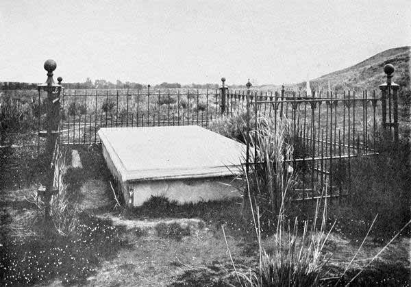
Grave of Marcus Whitman and his Associate Martyrs at Waiilatpu.
Photo. by W. D. Chapman.
The way was now clear to Waiilatpu, which the command reached on March
4th. The mangled remains of the victims of the massacre had been hastily
interred by the Ogden party, but coyotes had partially exhumed them. The
remains were brought together by the volunteers and reverently, though
rudely, buried at a point near the mission, a place where a marble crypt
now encloses the commingled bones of the martyrs. A lock of long, fair
hair was found near the ruined mission ground which was thought surely to
be from the head of Mrs. Whitman. It was preserved by one of the
volunteers and is now one of the precious relics in the historical museum
of Whitman College.
The Cayuse War dragged along in a desultory fashion for nearly three
years. The refusal of the Nez Percés and Spokanes and the indifference of
the Yakimas to join the Cayuses made their cause hopeless, though there
were several fierce fights with them and much severe campaigning. In 1850
a band of friendly Umatilla Indians undertook to capture the chief band of
the Cayuses under Tamsaky, which had taken a strong position about the
head waters of the John Day River. After a savage battle Tamsaky was
killed and most of the warriors captured. Of these, five, charged with the
leading part in the Whitman massacre, were hanged at Oregon City on June
3, 1850. It remains a question to this day, however, whether the victims
of the gallows were really the guilty ones. The Cayuse Indians were quite
firm in their assertion that Tamahas, who, by one version, struck Dr.
Whitman the first blow, was the only one of the five concerned in the
murder.
Thus ended the first principal war in the Columbia Basin. It was quickly
followed by another, which was so extensive that it may be well called
universal. This was the War of 1855-56. This was the greatest Indian war
in the entire history of the Columbia River.
As we have seen, the American home-builders had outmatched the English
fur-traders in the struggle for possession. On the 3d of March, 1853,
Washington Territory, embracing the present States of Washington and
Idaho, with parts of Wyoming and Montana, was created by Act of Congress,
and Isaac I. Stevens was appointed governor. This remarkable man entered
with tremendous energy upon his task of organising the chaos of his great
domain. The Indian problem was obviously the most dangerous and pressing
one. There were at that time two remarkable chiefs of the mid-Columbia
region, natural successors of Philip, Pontiac, Black Hawk, and Tecumseh,
possessing those Indian traits of mingled nobleness and treachery which
have made the best specimens of the race such interesting objects of
study. These Indians were Kamiakin of the Yakimas, and Peupeumoxmox of the
Walla Wallas.
Cayuse Babies 1.
(Copyright by Lee Moorehouse, 1898.)
Cayuse Babies 2.
(Copyright by Lee Moorehouse, 1898.)
In 1855 the great war broke out almost simultaneously at different points.
There were six widely scattered regions especially concerned. Four of
these, the Cascades, the Yakima Valley, the Walla Walla, and the Grande
Ronde, were on or adjacent to the River. The others were the Rogue River
region and Puget Sound. So wide was the area of this war that intelligent
co-operation among the Indians proved impracticable. This, in fact, was
the thing that saved the whites. For there were probably not less than
four thousand Indians on the war-path, and if they had co-operated, the
smaller settlements, possibly all in the country except those in the
Willamette Valley, might have been annihilated.
The first efforts of Governor Stevens were to secure treaties with the
Indians. Having negotiated several treaties in 1854 with the Puget Sound
Indians, the governor passed over the Cascade Mountains to Walla Walla in
May, 1855. There during the latter part of May and first part of June, he
held a great council with representatives of seventeen tribes. Lieutenant
Kip, U. S. A., has preserved a vivid account of this great gathering, one
of the most important ever held in the annals of Indian history. According
to Lieutenant Kip, there were but about fifty men in the escort of the
daring governor, and if he had been a man sensible to fear he might well
have been startled when there came an army of twenty-five hundred Nez
Percés under Halhaltlossot, known as Lawyer by the whites. Two days later
three hundred Cayuses, those worst of the Columbia River Indians, surly
and scowling, led by Five Crows and Young Chief, made their appearance.
Two days later a force of two thousand Yakimas, Umatillas, and Walla
Wallas came in sight under Kamiakin and Peupeumoxmox. The council was soon
organised. Governor Stevens and General Palmer, the latter the Indian
Agent for Oregon, set forth their plan of reservations, all their speeches
being translated and retranslated until they had filtered down among the
general mass of the Indians. Then there must be a great “wawa,” or
discussion by the Indians. It soon became apparent that there were two
bitterly contesting parties. One was a large faction of Nez Percés led by
Lawyer, who favoured the whites. The other faction of the Nez Percés, with
all the remaining tribes, were set against any treaty. With remarkable
skill and patience, Governor Stevens, with the powerful assistance of
Lawyer, had brought the Indians to a point of general agreement to the
creation of a system of reservations. But suddenly there was a commotion.
Into the midst of the council there burst the old chief Looking Glass
(Apashwahayikt), second only to Lawyer in influence among the Nez Percés.
He had made a desperate ride of three hundred miles in seven days,
following a buffalo hunt and a raid against the Blackfeet, and as he now
burst into the midst, there dangled from his belt the scalps of several
slaughtered Blackfeet. As quoted in Hazard Stevens’s Life of Governor
Stevens, he began his harangue thus: “My people, what have you done?
While I was gone you sold my country. I have come home and there is not
left me a place on which to pitch my lodge. Go home to your lodges. I will
talk with you.” Lieutenant Kip declares that though he could understand
nothing of the speech of Looking Glass to his own tribe, which followed,
the effect was tremendous. All the evidence showed that Looking Glass was
a veritable Demosthenes. The work of Governor Stevens was all undone.
But later the Governor and Lawyer succeeded in rallying their forces and
gaining the acquiescence of the Indians to the setting aside of three
great reservations, one on the Umatilla, one on the Yakima, and the third
on the Clearwater and the Snake. These reservations still exist, imperial
domains in themselves, though now divided into individual allotments. The
acquiescence of the Indians in this treaty, as the sequel proved, was
feigned by a number of them, but for the time it seemed a great triumph
for Governor Stevens. From Walla Walla the Governor departed to the
Cœur d’Alene, the Pend Oreille, and the Missoula regions to continue
his arduous task of negotiating treaties.
This great Walla Walla Council cannot be dismissed without brief reference
to an event, not fully known at the time, but which subsequent
investigation made clear, and stamped as one of the most dramatic in the
entire history of Indian warfare. This event was the conspiracy of the
Cayuses and Yakimas to kill Governor Stevens and his entire band, and then
exterminate the whites throughout the country. While the acceptance of the
treaty was still pending, Kamiakin and Peupeumoxmox were framing the
details of this wide-reaching plot, which was indeed but the culmination
of their great scheme of years. Kamiahkin was the soul of the conspiracy.
He was a remarkable Indian. He was of superb stature, and proportions,
over six feet high, sinewy and active. Governor Stevens said of him: “He
is a peculiar man, reminding me of the panther and the grizzly bear. His
countenance has an extraordinary play, one moment in frowns, the next in
smiles, flashing with light and black as Erebus the same instant. His
pantomime is great, and his gesticulation much and characteristic. He
talks mostly in his face and with his hands and arms.” He was withal a
typical Indian in treachery and secretiveness. Peupeumoxmox was similar in
nature, but was older and less capable.
Exactly opposite to these was Halhaltlossot, or Lawyer, the Solon of the
Nez Percés. Lawyer became convinced of the existence of this conspiracy
and went by night to the camp of Governor Stevens and revealed it. He
concluded his revelation by saying: “I will come with my family and pitch
my lodge in the midst of your camp, that those Cayuses may see that you
and your party are under the protection of the head chief of the Nez
Percés.” When it became clear to the conspiring Cayuses and Yakimas that
Lawyer’s powerful division of the Nez Percés was sustaining the little
band of whites, they did not execute their design. Lawyer and his Nez
Percés saved the day for the whites.
And yet the sequel is one of the most lamentable examples of the
miscarriage of justice in Indian affairs that we have any record of. The
friendly Nez Percés saved the whites. The unfriendly faction of the Nez
Percés, led by Joseph and Looking Glass, finally yielded and accepted the
treaty. But they did this with certain expectations in regard to their
reservation. This was set forth to the author by William McBean, a
half-breed Indian, son of the McBean who was the commandant of the
Hudson’s Bay post at Wallula. McBean the younger was a boy at the time of
the council at Walla Walla. He was familiar with all the Indian languages
spoken at the council and in appearance was so much of an Indian that he
could pass unquestioned anywhere. Governor Stevens asked him to spy out
the situation and learn what the Nez Percés were going to decide. The
result of his investigations was to show that the whole decision hinged on
the understanding by Joseph’s faction that, if they acquiesced in the
treaty and turned their support to the whites, they might retain perpetual
possession of the Wallowa country in North-eastern Oregon as their special
allotment. Becoming finally satisfied that this would be granted them,
they yielded to the Lawyer faction and thus the entire Nez Percé tribe
made common cause with the whites, rendering the execution of the great
plot of Kamiakin and Peupeumoxmox a foredoomed failure. But now for the
sequel. Though it was thus clear in the minds of Joseph and his division
of the Nez Percés that the loved Wallowa (one of the fairest regions that
ever the sun shone on and a perfect land for Indians) was to be their
permanent home, yet the stipulation, if indeed it were intended by
Governor Stevens, never became definitely set down in the “Great Father’s”
records at Washington. The result was that when, twenty years later, the
manifold attractions of the Wallowa country began to draw white
immigration, the Indians, now under Young Joseph, son of the former chief,
stood by their supposed rights and the great Nez Percé War of 1877 ensued.
And now, to resume the thread of our discourse, we may note that Governor
Stevens proceeded on his laborious mission to the Flatheads in the region
of the Cœur d’Alene and Pend Oreille lakes in what is now Northern
Idaho. After protracted and at times excited discussion, a treaty was
accepted by which an immense tract of a million and a quarter acres was
set apart for a reservation. From Pend Oreille, Governor Stevens with his
little force, now reduced to twenty-two, crossed the Rockies to Fort
Benton.
But what was happening on the Walla Walla? No sooner was the governor
fairly out of sight across the flower-bespangled plains which extended two
hundred miles north-east from Walla Walla, than the wily Kamiakin began to
resume his plots. So successful was he, with the valuable assistance of
Peupeumoxmox, Young Chief, and Five Crows, that the treaties, just
ratified, were torn to shreds, and the flame of savage warfare burst forth
across the entire Columbia Valley.
Hazard Stevens, in his invaluable history of his father, gives a vivid
picture of how the news reached them in their camp thirty-five miles up
the Missouri from Fort Benton. Summer had now passed into autumn. A
favourable treaty had been made with the Blackfeet. On October 29th, the
little party were gathered around their campfire in the frosty air of fall
in that high latitude, when they discerned a solitary rider making his way
slowly toward them. As he drew near they soon saw that it was Pearson, the
express rider. Pearson was one of the best examples of those scouts whose
lives were spent in conveying messages from forts to parties in the field.
He usually travelled alone, and his life was always in his hand. He seemed
to be made of steel springs, and it had been thought that he could endure
anything. “He could ride anything that wore hair.” He rode seventeen
hundred and fifty miles in twenty-eight days at one time, one stage of two
hundred and sixty miles having been made in three days. But as he slowly
drew up to the party in the cold evening light, it was seen that even
Pearson was “done.” His horse staggered and fell, and he himself could not
stand or speak for some time. After he had been revived he told his story,
and a story of disaster and foreboding it was, sure enough.
All the great tribes of the Columbia plains west of the Nez Percés had
broken out, the Cayuses, Yakimas, Palouses, Walla Wallas, Umatillas, and
Klickitats. They had swept the country clean of whites. The ride of
Pearson from The Dalles to the point where he reached Governor Stevens is
one of the most thrilling in the annals of the River. By riding all day
and night, he reached a horse ranch on the Umatilla belonging to a noted
half-breed Indian, William McKay, but he found the place deserted. Seeing
a splendid horse in the bunch near by, he lassoed and saddled him. Though
the horse was as wild as air, Pearson managed to mount and start on. Just
then there swept into view a force of Indians who, instantly divining what
Pearson was trying to do, gave chase. Up and down hill, through vale, and
across the rim-rock, they followed, sending frequent bullets after him,
and yelling like demons, “Whupsiah si-ah-poo, Whup-si-ah!” (“Kill the
white man!”) But the wild horse which the intrepid rider bestrode proved
his salvation, for he gradually outran all his pursuers. Travelling
through the Walla Walla at night Pearson reached the camp of friendly Nez
Percé Red Wolf on the Alpowa the next day, having ridden two hundred miles
from The Dalles without stopping except the brief time changing horses.
Snow and hunger now impeded his course. Part of the way he had to go on
snowshoes without a horse. But with unflinching resolution he passed on,
and so now here he was with his dismal tidings.
The despatches warned Governor Stevens that Kamiakin with a thousand
warriors was in the Walla Walla Valley and that it would be impossible for
him to get through by that route, and that he must therefore return to the
East by the Missouri and come back to his Territory by the steamer route
of Panama. That meant six months’ delay. With characteristic boldness,
Governor Stevens at once rejected the more cautious course and went right
back to Spokane by the Cœur d’Alene Pass, deep already with the winter
snows, suffering intensely with cold and hunger, but avoiding by that
route the Indians sent out to intercept him. With extraordinary address,
he succeeded in turning the Spokane Indians to his side. The Nez Percés,
thanks to Lawyer’s fidelity, were still friendly, and with these two
powerful tribes arrayed against the Yakimas, there was still hope of
holding the Columbia Valley.
After many adventures, Governor Stevens reached Olympia in safety.
Governor Curry of Oregon had already called a force of volunteers into the
field. The Oregon volunteers were divided into two divisions, one under
Colonel J. W. Nesmith, which went into the Yakima country, and the other
under Lieutenant-Colonel J. K. Kelley, which went to Walla Walla. The
latter force fought the decisive battle of the campaign on the 7th, 8th,
9th, and 10th of December, 1855. It was a series of engagements occurring
in the heart of the Walla Walla Valley, a “running fight” culminating at
what is now called Frenchtown, ten miles west of the present city of Walla
Walla. The most important feature of it all was the death of the great
Walla Walla chieftain, Peupeumoxmox. But though defeated and losing so
important a chief, the Indians scattered across the rivers and were still
unsubdued.
In March, 1856, the sublime section of the Columbia lying between The
Dalles and the Cascades became the scene of a series of atrocities the
most distressing in the entire war. The Klickitats swooped down upon the
defenceless settlers and massacred them with revolting cruelty. They
vanished like a whirlwind, but men whom the writer has known have related
to him how the volunteers, returning to the scenes of desolation, found
all houses destroyed and the carcasses of cattle thrown into the springs
and wells. They found the naked bodies of the girls and women with stakes
driven through, and those of men horribly mutilated. In savage humour, the
Indians had killed the hogs and left parts of human bodies in their
mouths. One interesting fact connected with the campaign at the Cascades
is that General Phil Sheridan fought his first battle there. The old Block
House on the north side of the River, nearly opposite the present Cascade
Locks, existed until a few years ago, and there was Sheridan’s first
battle.
Meanwhile Governor Stevens had organised a force of Washington volunteers.
As the year 1856 progressed, it seemed more plain that the discord which
developed between the regulars under command of General John E. Wool and
the volunteers would result in fatal weakness. Nevertheless Governor
Stevens and Governor Curry kept pressing the movements of their backwoods
soldiers with unflagging energy. They were at last rewarded with a measure
of success. For Colonel B. F. Shaw, commanding the Washington volunteers,
learning that the hostiles were camped in force in the Grande Ronde
Valley, made a rapid march from Walla Walla across the western spur of the
Blue Mountains and struck the collected force of Indians a deadly blow,
scattering them in all directions and ending the war in that quarter.
But the end had not yet come in Walla Walla. Governor Stevens determined
to hold another great council at the site of the first. Leaving The Dalles
on August 19th, he pressed on to Shaw’s camp, two miles above the
present location of Walla Walla. On September 5th, Colonel E. J. Steptoe,
with four companies of regulars, arrived at the same place and made camp
on the site of the present fort.
Col. B. F. Shaw, who Won the Battle of Grande Ronde in 1856.
By Courtesy of Major Lee Moorehouse.
And now came on the second great Walla Walla council. The tribes were
gathered as before, and were aligned as before. The division of Nez Percés
under Lawyer stood firmly by Stevens and the treaty. The others did not.
The most unfortunate feature of the entire matter was that Colonel
Steptoe, acting under General Wool’s instructions, thus far kept secret,
refused to grant Stevens adequate support and subjected him to
humiliations which galled the fiery Governor to the limit. In fact, had it
not been for the vigilance of the faithful Nez Percés of Lawyer’s band,
Stevens and his force would surely have met the doom prepared for them at
the first council. The debt of gratitude due Lawyer is incalculable.
Spotted Eagle ought to be recorded, too, as of similar devotion and
watchfulness. Governor Stevens afterward declared that a speech by him in
favour of the whites was equal in feeling, truth, and courage to any
speech that he ever heard from any orator whatever.
But in spite of oratory, zeal, and argument, nothing could overcome the
influence of Kamiakin, Owhi, Quelchen, Five Crows, and others of the
Yakimas and Cayuses. Nothing was gained. They stood just where they were a
year before. The fatal results of divided counsels between regulars and
volunteers were apparent.
The baffled Governor now started on his way down the River, but not
without another battle. For, as he was marching a short distance south of
what is now Walla Walla city, the Indians burst upon his small force with
the evident intention of ending all scores then and there. But Colonel
Steptoe came to the rescue, and with united forces the Indians were
repulsed.
That was the last battle on the Walla Walla. Colonel Steptoe established a
rude stockade fort on Mill Creek in what is now the heart of the present
Walla Walla city, and went into winter quarters there in 1856-57. Governor
Stevens returned to Olympia and launched forth a bitter arraignment
against Wool. The latter, however, was in a position of vantage and issued
a proclamation commanding all whites in the upper country to go down the
River and leave the Cascade Mountains as the eastern limit of the white
settlement. Thus ended for a time this unsatisfactory and distressing war.
To all appearances Kamiakin and his adherents had accomplished all they
wanted.
But this was not the end. Gold had been discovered in Eastern Washington.
Vast possibilities of cattle raising were evident on those endless
bunch-grass hills. Although there was as yet little conception of the
future developments of the Inland Empire in agriculture and gardening, yet
the keen-eyed immigrants and volunteers had scanned the pleasant vales and
abounding streams of the Walla Walla and the Umatilla and the Palouse, and
had decided in their own minds that, Wool or no Wool, this land must be
opened. In 1857 the Government decided on a change of policy and sent
General N. S. Clarke to take Wool’s place. General Clarke opened the
gates, and the impatient army of land hunters and gold hunters began to
move in. Meanwhile, Colonel Wright and Colonel Steptoe, though formerly
they had closely followed Wool’s policy, now began to experience a change
of heart. Out of these conditions the third Indian war, in 1858, quickly
succeeded the second, being indeed its inevitable sequence.
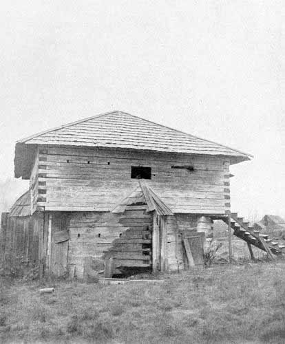
Fort Sheridan on the Grande Ronde, Built by Philip Sheridan in 1855.
By Courtesy of Major Lee Moorehouse.
Three campaigns marked this third war. The first was conducted by Colonel
Steptoe against the Spokanes and Cœur d’Alenes, and ended in his
humiliating and disastrous defeat. The second was directed by Major
Garnett against the Yakimas, resulting in their permanent overthrow. The
third was conducted by Colonel Wright against the Spokanes and other
northern tribes who had defeated Steptoe. This was the Waterloo of the
Indians, and it ushered in the occupation and settlement of the upper
Columbia country.
The Steptoe expedition was the most ill-starred event in the whole history
of the North-west, unless we except that of the destruction of the
Tonquin. Colonel Wright was then in command of the new Fort Walla Walla,
located in 1857 on the present ground. Perceiving his former error in
giving the turbulent and treacherous natives undisputed sway, he ordered
Colonel Steptoe to go with two hundred dragoons to the Spokane region and
subject the restless tribes centring there. Steptoe’s force was well
equipped in every way except one. The pack train was heavily laden, and an
inebriated quartermaster conceived the brilliant idea of lessening the
burden by leaving out the larger part of the ammunition. Even aside from
this fatal blunder, Colonel Steptoe seems to have had no adequate
conception of the vigour and resources of the Indians.
As before, the Nez Percés were the faithful friends of the whites.
Timothy, a Nez Percé chief living on Snake River at the mouth of the
Alpowa, put them across the wicked stream, then running high with the May
freshet, and went on with them as guide.
On May 16, 1858, the force reached a point near four lakes, probably the
group of which Silver Lake and Medical Lake are the chief ones, a few
miles west of Spokane. Here was gathered a formidable array, Spokanes,
Pend Oreilles, Cœur d’Alenes, Okanogans, and Colvilles, the hosts of
the upper country. Steptoe was soldier enough to perceive that it was time
for caution, and he halted for a parley. Saltese, a brawny chief of the
Cœur d’Alenes, declared to him that the Indians were ready to dispute
his farther progress, but that if the white men would retire the Indians
would not molest them. A friendly Nez Percé, seeing the duplicity of
Saltese, struck his mouth, exclaiming, “You speak with a double tongue.”
The force turned back and that night all seemed well. But at nine o’clock
the next morning, while the soldiers were descending a cañon to Pine
Creek, near the present site of Rosalia, a large force of Indians burst
upon them like a cyclone. As the battle began to wax hot, the terrible
consequences of the error of lack of ammunition began to become manifest.
Man after man had to cease firing. Captain O. H. P. Taylor and Lieutenant
Gaston commanded the rear-guard. With extraordinary skill and devotion
they held the line intact and foiled the efforts of the savages to burst
through. Meanwhile the whole force was moving as rapidly as consistent
with formation on their way southward. Taylor and Gaston sent a messenger
forward, begging Steptoe to halt the line and give them a chance to load.
But the commander felt that the safety of the whole force depended on
pressing on. Soon a fierce rush of Indians followed, and, when the surge
had passed, the gallant rear-guard was buried under it. One notable figure
in the death-grapple was De May, a Frenchman, trained in the Crimea and
Algeria, and an expert fencer. For some time he used his gun barrel as a
sword and swept the Indians down by dozens with his terrific sweeps. But
at last he fell before numbers, and one of his surviving comrades relates
that he heard him shouting his last words, “O, my God, my God, for a
sabre!”
But the lost rear-guard saved the rest. For they managed to hold back the
swarm of foes until nightfall, when they reached a somewhat defensible
position a few miles from the towering cone of what is now known as
Steptoe Butte. There they spent part of a dark, rainy, and dismal night,
anticipating a savage attack. But the Indians, sure of their prey, waited
till morning. Surely the first light would have revealed a massacre equal
to the Custer massacre of later date, had not the unexpected happened. And
the unexpected was that old Timothy, the Nez Percé guide, knew a trail
through a rough cañon, the only possible exit without discovery. In the
darkness of midnight the shattered command mounted and followed at a
gallop the faithful Timothy on whose keen eyes and mind their salvation
rested. The wounded and a few footmen were dropped at intervals along the
trail. After an eighty-mile gallop during the day and night following, the
yellow flood of Snake River suddenly broke before them between its
desolate banks. Saved! The unwearied Timothy threw out his own warriors as
a screen against the pursuing foe, and set his women to ferrying the
soldiers across the turbulent stream.
Thus the larger part of the command reached Fort Walla Walla alive.
One of the most extraordinary individual experiences connected with the
Steptoe retreat, was that of Snickster and Williams. Some of the survivors
question the correctness of this, and others vouch for its accuracy. It
perhaps should not be set down as proven history. Snickster and Williams
were riding one horse, and could not keep up with the main body. The
Indians, therefore, overtook and seized them before they reached the Snake
River. In a rage because of having been balked of their prey, the Indians
determined to have some amusement out of the unfortunate pair, and told
them to go into the river with their horse and try to swim across. Into
the dangerous stream, two thousand feet wide, almost ice-cold, and with a
powerful current, they went. As soon as they were out a score of yards,
the Indians began their fun by making a target of them. The horse was
almost immediately killed. Williams was struck and sank. Snickster’s arm
was broken by a ball, but diving under the dead horse, and keeping himself
on the farther side till somewhat out of range, and then boldly striking
across the current, which foamed with Indian bullets, he reached the south
side of the river and was drawn out, almost dead, by some of Timothy’s
Nez Percé Indians.
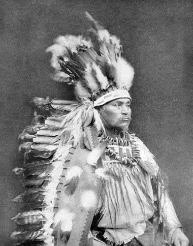
Tullux Holiquilla, a Warm Springs Indian Chief,
Famous in the Modoc War as a Scout for U. S. Troops.
By Courtesy of Major Lee Moorehouse.
With the defeat of Steptoe, the Indians may well have felt that they were
invincible. But their exultation was short-lived. As already noted,
Garnett crushed the Yakimas at one blow, and Wright a little later
repeated Steptoe’s march to Spokane, but did not repeat his retreat. For
in the battle of Four Lakes on September 1st, and that of Spokane Plains
on September 5th, Wright broke for ever the power and spirits of the
northern Indians.
The treaties were thus established at last by war. The reservations,
embracing the finest parts of the Umatilla, Yakima, Clearwater, and
Cœur d’Alene regions, were set apart, and to them after considerable
delay and difficulty the tribes were gathered.
With the end of this third great Indian war and the public announcement by
General Clarke that the country might now be considered open to
settlement, immigration began to pour in, and on ranch and river, in mine
and forest, the well-known labours of the American state-builders and
home-builders became displayed. The ever-new West was repeating itself.
The Valley of the Columbia now rested from serious strife for a number of
years. But in 1877, an echo of the war of 1855 suddenly startled the
country, and provided an event to which lovers of the tragic and romantic
in history have ever since turned with deep interest. This was the “Joseph
War” in the Wallowa. Our readers will recall that the so-called Joseph
band of Nez Percés opposed the Walla Walla Treaty at first, but finally
acquiesced, with what they understood was the stipulation that they
should possess the Wallowa country as their permanent home. The Joseph of
that time was succeeded by his son, whose Indian name was Hallakallakeen,
“Eagle Wing.” He was the finest specimen of the native red man ever
produced in the Columbia Valley. Of magnificent stature and proportions,
with a rare dignity and nobility, which wider opportunities would have
made remarkable, and with a career of mingled light and shade, pathos and
tragedy, Hallakallakeen will go down into history with a record of
passionate devotion from his followers and unstinted encomiums from most
of his opponents.
Joseph loved the Wallowa with a passionate affection, and made at first
every effort to maintain amity with his white neighbours. But when the
Government violated what he had regarded its sacred pledge and permitted
entrance upon the lands which he claimed, he refused to abide by the
decision and led out his warriors to battle. The Nez Percés, though few in
number, could fight face to face with white men, and could use white men’s
weapons and white men’s tactics. At a desperate battle at White Bird Cañon
they routed the detachment in command of Colonel Perry. The result was to
put arms, ammunition, and provisions in abundance into the hands of the
Indians and hope into their hearts.
General O. O. Howard, then commanding the department of the Columbia, now
assumed command and began so vigorous a campaign against Joseph that the
Indian chief plainly saw that with all his activity he could not avoid
being seized in the closing arms of Howard’s command. The interesting
details of the marches, countermarches, desperate encounters, sometimes
favourable to white man and sometimes to red, are to be found in General
Howard’s own book. At last, with marvellous skill and good fortune, Joseph
eluded capture and adopted the desperate resolution of crossing the Bitter
Root Mountains by the Lolo trail, descending the Missouri, and ultimately
reaching the Canadian line beyond the land of the Sioux. Encumbered as he
was with his women, children, and entire movable possessions, obliged to
forage and hunt on the way, and avoiding pursuers in rear as well as
forces coming to meet him in front, fighting frequent and some of the time
successful battles,—the Nez Percé chieftain exhibited qualities of
leadership and resources of mind and body which offer materials for a
historical romance equal to De Quincey’s Flight of the Kalmuck Tartars.
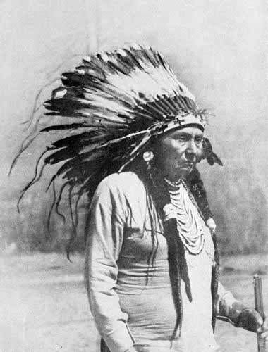
Hallakallakeen (Eagle Wing) or Joseph, the Nez Percé Chief.
By T. W. Tolman.
Howard’s tireless pursuit in the rear and the active and intelligent
co-operation of Gibbon and Miles, who ascended the Missouri to meet the
fleeing Nez Percés, resulted at last in their capture at Bear Paw Mountain
on the Milk River in Montana.
General Howard says that the campaign from the beginning of the Indian
pursuit across the Lolo trail until the embarkation on the Missouri for
the homeward journey, including all stoppages and halts, extended from
July 27th to October 10th, during which time his command marched one
thousand three hundred and twenty-one miles. He says that Joseph,
encumbered with women, children, and possessions, traversed even greater
distances, “for he had to make many a loop in his skein, many a deviation
into a tangled thicket, to avoid or deceive his enemy.” Howard pays the
highest tribute to his Indian foe and declares that some of his
operations are not often equalled in warfare.
Joseph’s subsequent career was a melancholy one. Transported with his band
to Oklahoma, the wild eagle of the Wallowa so pined away on the flat
prairie and begged so piteously to be allowed to return to the waters of
the Columbia, that his request was granted. But so intense was the feeling
among the people who had suffered from their dangerous enemy that this
poor fragment of the Nez Percés was placed on the Colville Reservation in
Northern Washington. There the restless heart of the Nez Percé Bonaparte
was eaten out by bitter yearnings for his loved Wallowa.
He had an occasional proud and interesting hour. At the time of General
Grant’s obsequies at New York, Joseph was in Washington to see the “Great
Father” about his reservation. General Miles, who greatly admired the hero
of the Lolo trail, asked him to ride with himself at the head of the
funeral procession. Mounted on a magnificent charger, Joseph rode solemnly
through the streets of the metropolis by the side of the conqueror of Bear
Paw Mountain, and there were not wanting those who said that the Indian
was the finer horseman and the finer-looking man.
But Joseph died at his camp on the Nespilem without ever seeing Wallowa.
His last request was that he be buried there. He remained an Indian to the
last, not ordinarily living in a house or wearing civilised costume or
even speaking English, though perfectly able to do so. His life might have
been happier had he never been known to fame.
Camp of Chief Joseph on the Nespilem, Wash.
Photo. by T. W. Tolman, Spokane.
The next year after the Joseph War, or in 1878, occurred the Bannock War,
the scene of which was mainly Umatilla County in Oregon and other parts
adjoining the River. Though at first, as has happened so many times, the
Indians met with successes, the end was their inevitable defeat.
With the close of the Bannock War it may be said that Indian warfare
practically ended. The war-whoop ceased to be heard and the tomahawk was
brandished no more along the Columbia.
When the Fire-Canoes Took the Place of the Log-Canoes
Variety of Craft that have Navigated the Columbia—The Beaver,
Carolina, Columbia, and Lot Whitcomb—Beginning of Steamboating
above the Cascades—Steamboats above The Dalles—Rival Companies on
the River—The Oregon Steam Navigation Company—Great Business
Developments of the Decade of the Sixties—Specimen Shipments in
1862—The Steamboat Ride from Portland to Lewiston—Some of the
Steamboat Men of the Period—Story of W. H. Gray and his Sailboat on
the Snake River—Descending The Dalles—Captain Coe’s Account of the
First Steamboat Ride on the Upper Columbia and the Snake—Navigation
above Colville and on the Lakes—The Locks and Prospects of Future
Navigation—Remarkable Trips on the River—Some Steamboats of the
Present.
We have learned that our River has been navigated by boats of almost every
description. At one time it was the hollowed cedar-log canoes of the
aborgines. Again, the bateaux of the trappers were the chief craft to cut
the blue lakes and the white rapids. At yet other times it was the
flat-boats of the immigrants. Sailing ships of every sort—frigates,
galleons, caravels, men-of-war, full-rigged ships, barks, brigs,
schooners, and sloops—crowded early to the silver gate of the River.
In due process of time the “Fire-canoes,” as the natives called steamers,
let loose their trails of smoke amid the tops of the “continuous woods.”
The Beaver, a small steamship belonging to the Hudson’s Bay Company
and sent from England, entered the River in 1836, the first steamer to ply
these waters. The Company afterwards sent her to Puget Sound, and, if we
are correctly informed, she is still afloat on the Gulf of Georgia. In
1850 the first American steamship, the Carolina, crossed the Bar. In the
same year a little double-ender, called the Columbia, began running
between Portland and Astoria.
Tirzah Trask, a Umatilla Indian Girl—Taken as an Ideal of Sacajawea.
Photo. by Lee Moorehouse, Pendleton.
The first river steamer of any size to ply upon the Willamette and
Columbia was the Lot Whitcomb. This steamer was built by Whitcomb and
Jennings. J. C. Ainsworth was the first captain, and Jacob Kamm was the
first engineer. Both these men became leaders in every species of
steamboating enterprise. In 1851 Dan Bradford and B. B. Bishop inaugurated
a movement to connect the up-river region with the lower river by getting
a small iron propeller called the Jason P. Flint from the East and
putting her together at the Cascades, whence she made the run to Portland.
The Flint has been named as first to run above the Cascades, but the
author has the authority of Mr. Bishop for stating that the first steamer
to run above the Cascades was the Eagle. That steamer was brought in
sections by Allen McKinley to the upper Cascades in 1853, there put
together, and set to plying on the part of the river between the Cascades
and The Dalles. In 1854, the Mary was built and launched above the
Cascades, the next year the Wasco followed, and in 1856 the Hassalo
began to toot her jubilant horn at the precipices of the mid-Columbia. In
1859 R. R. Thompson and Lawrence Coe built the Colonel Wright, the
first steamer on the upper section of the River. In the same year the same
men built at the upper Cascades a steamer called the Venture. This craft
met with a curious catastrophe. For on her very first trip she swung too
far into the channel and was carried over the upper Cascades, at the point
where the Cascade Locks are now located. She was subsequently raised,
rebuilt, and rechristened the Umatilla.
This part of the period of steamboat building was cotemporary with the
Indian wars of 1855 and 1856. The steamers, Wasco, Mary, and Eagle
were of much service in rescuing victims of the murderous assault on the
Cascades by the Klickitats.
While the enterprising steamboat builders were thus making their way
up-river in the very teeth of Indian warfare, steamboats were in course of
construction on the Willamette. The Jennie Clark in 1854 and the Carrie
Ladd in 1858 were built for the firm of Abernethy, Clark & Company. These
both, the latter especially, were really elegant steamers for the time.
The close of the Indian wars in 1859 saw a quite well-organised steamer
service between Portland and The Dalles, and the great rush into the upper
country was just beginning. The Señorita, the Belle, and the
Multnomah, under the management of Benjamin Stark, were on the run from
Portland to the Cascades. A rival steamer, the Mountain Buck, owned by
Ruckle and Olmstead, was on the same route. These steamers connected with
boats on the Cascades-Dalles section by means of portages five miles long
around the rapids. There was a portage on each side of the River. That on
the north side was operated by Bradford & Company, and their steamers
were the Hassalo and the Mary. Ruckle and Olmstead owned the portage
on the south side of the River, and their steamer was the Wasco. Sharp
competition arose between the Bradford and Stark interests on one side and
Ruckle and Olmstead on the other. The Stark Company was known as the
Columbia River Navigation Company, and the rival was the Oregon
Transportation Company. J. C. Ainsworth now joined the Stark party with
the Carrie Ladd. So efficient did this reinforcement prove to be that
the Transportation Company proposed to them a combination. This was
effected in April, 1859, and the new organisation became known as the
Union Transportation Company. This was soon found to be too loose a
consolidation to accomplish the desired ends, and the parties interested
set about a new combination to embrace all the steamboat men from Celilo
to Astoria. The result was the formation of the Oregon Steam Navigation
Company, which came into legal existence on December 20, 1860. Its stock
in steamboats, sailboats, wharf-boats, and miscellaneous property was
stated at $172,500.
Such was the genesis of the “O. S. N. Co.” In a valuable article by Irene
Lincoln Poppleton in the Oregon Historical Quarterly for September,
1908, to which we here make acknowledgments, it is said that no assessment
was ever levied on the stock of this company, but that from the proceeds
of the business the management expended in gold nearly three million
dollars in developing their property, besides paying to the stockholders
in dividends over two million and a half dollars. Never perhaps was there
such a record of money-making on such a capitalisation.
The source of the enormous business of the Oregon Steam Navigation Company
was the rush into Idaho, Montana, and Eastern Oregon and Washington by the
miners, cowboys, speculators, and adventurers of the early sixties. The
up-river country, as described more at length in another chapter, wakened
suddenly from the lethargy of centuries, and the wilderness teemed with
life. That was the great steamboat age. Money flowed in streams. Fortunes
were made and lost in a day.
When first organised in 1860, the Oregon Steam Navigation Company had a
nondescript lot of steamers, mainly small and weak. The two portages, one
of five miles around the Cascades and the other of fourteen miles from The
Dalles to Celilo Falls, were unequal to their task. The portages at the
Cascades on both sides of the River were made by very inadequate wooden
tramways. That at The Dalles was made by teams. Such quantities of freight
were discharged from the steamers that sometimes the whole portage was
lined with freight from end to end. The portages were not acquired by the
company with the steamboat property, and as a result the portage owners
reaped the larger share of the profits. During high water the portage on
the Oregon side at the Cascades had a monopoly of the business, and it
took one-half the freight income from Portland to The Dalles. This was
holding the whip-hand with a vengeance, and the vigorous directors of the
steamboat company could not endure it. Accordingly, they absorbed the
rights of the portage owners, built a railroad from Celilo to The Dalles
on the Oregon side, and one around the Cascades on the Washington side.
The company was reorganised under the laws of Oregon in October, 1862,
with a declared capitalisation of two million dollars.
Business on the River in 1863 was something enormous. Hardly ever did a
steamer make a trip with less than two hundred passengers. Freight was
offered in such quantities at Portland that trucks had to stand in line
for blocks, waiting to deliver and receive their loads. New boats were
built of a much better class. Two rival companies, the Independent Line
and the People’s Transportation Line, made a vigorous struggle to secure a
share of the business, but they were eventually overpowered. Some
conception of the amount of business may be gained from the fact that the
steamers transported passengers to an amount of fares running from $1000
to $6000 a trip. On April 29, 1862, the Tenino, leaving Celilo for the
Lewiston trip, had a passenger load amounting to $10,945, and a few trips
later reported receipts of $18,000, for freight, passengers, meals, and
berths. The steamships sailing from Portland to San Francisco showed
equally remarkable records. On June 25, 1861, the Sierra Nevada conveyed
a treasure shipment of $228,000; July 14th, $110,000; August 24th,
$195,558; December 5th, $750,000. The number of passengers carried on The
Dalles-Lewiston route in 1864 was 36,000 and the tons of freight were
21,834.
It was a magnificent steamboat ride in those days from Portland to
Lewiston. The fare was sixty dollars; meals and berths, one dollar each. A
traveller would leave Portland at five A.M. on, perhaps, the
Wilson G. Hunt, reach the Cascades sixty-five miles distant at eleven A.M., proceed
by rail five miles to the upper Cascades, there transfer to the Oneonta
or Idaho for The Dalles, passing in that run from the humid, low-lying,
heavily timbered West-of-the-mountains, to the dry, breezy, hilly
East-of-the-mountains. Reaching The Dalles, fifty miles farther east, he
would be conveyed by another portage railroad, fourteen miles more, to
Celilo. There the Tenino, Yakima, Nez Percé Chief, or Owyhee was
waiting. With the earliest light of the morning the steamer would head
right into the impetuous current of the River, bound for Lewiston, two
hundred and eighty miles farther yet, taking two days, sometimes three,
though only one to return. Those steamers were mainly of the
light-draught, stern-wheel structure, which still characterises the
Columbia River boats. They were swift and roomy and well adapted to the
turbulent waters of the upper River.
The captains, pilots, and pursers of that period were as fine a set of men
as ever turned a wheel. Bold, bluff, genial, hearty, and obliging they
were, even though given to occasional outbursts of expletives and
possessing voluminous repertoires of “cuss-words” such as would startle
the effete East. Any old Oregonian who may chance to cast his eyes upon
these pages will recall, as with the pangs of childhood homesickness, the
forms and features of steamboat men of that day; the polite yet determined
Ainsworth, the brusque and rotund Reed, the bluff and hearty Knaggs, the
frolicsome and never disconcerted Ingalls, the dark, powerful, and
nonchalant Coe, the patriarchal beard of Stump, the loquacious
“Commodore” Wolf, who used to point out to astonished tourists the
“diabolical strata” on the banks of the River, the massive and
good-natured Strang, the genial and elegant O’Neil, the suave and witty
Snow, the tall and handsome Sampson, the rich Scotch brogue of McNulty,
and dozens of others, whose combined adventures would fill a volume. One
of the most experienced pilots of the upper River was Captain “Eph”
Baughman, who has been running on the Snake and Columbia rivers for fifty
years, and is yet active at the date of this publication. W. H. Gray, who
came to Waiilatpu with Whitman as secular agent of the mission, became a
river man of much skill. He gave four sons, John, William, Alfred, and
James, to the service of the River, all four of them being skilled
captains. A story narrated to the author by Captain William Gray, now of
Pasco, Washington, well illustrates the character of the old Columbia
River navigators. W. H. Gray was the first man to run a sailboat of much
size with regular freight up Snake River. That was in 1860 before any
steamers were running on that stream. Mr. Gray built his boat, a fifty-ton
sloop, on Oosyoos Lake on the Okanogan River. In it he descended that
river to its entrance into the Columbia. Thence be descended the Columbia,
running down the Entiat, Rock Island, Cabinet, and Priest Rapids, no mean
undertaking of itself. Reaching the mouth of the Snake, he took on a load
of freight and started up the swift stream. At Five-mile Rapids he found
that his sail was insufficient to carry the sloop up. Men had said that it
was impossible. His crew all prophesied disaster. The stubborn captain
merely declared, “There is no such word as fail in my dictionary.” He
directed his son and another of the crew to take the small boat, load her
with a long coil of rope, make their way up the stream until they got
above the rapid, there to land on an islet of rock, fasten the rope to
that rock, then pay it out till it was swept down the rapid. They were
then to descend the rapid in the small boat. “Very likely you may be
upset,” added the skipper encouragingly, “but if you are, you know how to
swim.” They were upset, sure enough, but they did know how to swim. They
righted their boat, picked up the end of the floating rope, and reached
the sloop with it. The rope was attached to the capstan, and the sloop was
wound up by it above the swiftest part of the rapid to a point where the
sail was sufficient to carry, and on they went rejoicing. Any account of
steamboating on the Columbia would be incomplete without reference to
Captain James Troup, who was born on the Columbia, and almost from early
boyhood ran steamers upon it and its tributaries. He made a specialty of
running steamers down the Dalles and the Cascades, an undertaking
sometimes rendered necessary by the fact that more boats were built in
proportion to demand on the upper than the lower River. These were taken
down the Dalles, and sometimes down the Cascades. Once down, they could
not return. The first steamer to run down the Tumwater Falls was the
Okanogan, on May 22, 1866, piloted by Captain T. J. Stump.
The author enjoyed the great privilege of descending the Dalles in the D.
S. Baker in the year 1888, Captain Troup being in command. At that
strange point in the River, the whole vast volume is compressed into a
channel but one hundred and sixty feet wide at low water and much deeper
than wide. Like a huge mill-race this channel continues nearly straight
for two miles, when it is hurled with frightful force against a massive
bluff. Deflected from the bluff, it turns at a sharp angle to be split in
sunder by a low reef of rock. When the Baker was drawn into the suck of
the current at the head of the “chute” she swept down the channel, which
was almost black, with streaks of foam, to the bluff, two miles in four
minutes. There feeling the tremendous refluent wave, she went careening
over and over toward the sunken reef. The skilled captain had her
perfectly in hand, and precisely at the right moment, rang the signal
bell, “Ahead, full speed,” and ahead she went, just barely scratching her
side on the rock. Thus close was it necessary to calculate distance. If
the steamer had struck the tooth-like point of the reef broadside on, she
would have been broken in two and carried in fragments on either side.
Having passed this danger point, she glided into the beautiful calm bay
below and the feat was accomplished. Captain J. C. Ainsworth and Captain
James Troup were the two captains above all others to whom the company
entrusted the critical task of running steamers over the rapids.
In the Overland Monthly of June, 1886, there is a valuable account by
Captain Lawrence Coe of the maiden journey of the Colonel Wright from
Celilo up what they then termed the upper Columbia.
This first journey on that section of the River was made in April, 1859.
The pilot was Captain Lew White. The highest point reached was Wallula,
the site of the old Hudson’s Bay fort. The current was a powerful one to
withstand, no soundings had ever been made, and no boats except canoes,
bateaux, flatboats, and a few small sailboats, had ever made the trip. No
one had any conception of the location of a channel adapted to a
steamboat. No difficulty was experienced, however, except at the Umatilla
Rapids. This is a most singular obstruction. Three separate reefs, at
intervals of half a mile, extend right across the River. There are narrow
breaks in these reefs, but not in line with each other. Through them the
water pours with tremendous velocity, and on account of their irregular
locations a steamer must zigzag across the River at imminent risk of being
borne broadside on to the reef. The passage of the Umatilla Rapids is not
difficult at high water, for then the steamer glides over the rocks in a
straight course.
In the August Overland of the same year, Captain Coe narrates the first
steamboat trip up Snake River. This was in June, 1860, just at the time of
the beginning of the gold excitement. The Colonel Wright was loaded with
picks, rockers, and other mining implements, as well as provisions and
passengers. Most of the freight and passengers were put off at Wallula, to
go thence overland. Part continued on to test the experiment of making way
against the wicked-looking current of Snake River. After three days and a
half from the starting point a few miles above Celilo, the Colonel
Wright halted at a place which was called Slaterville, thirty-seven miles
up the Clearwater from its junction with the Snake. There the remainder
of the cargo was discharged, to be hauled in waggons to the Oro Fino
mines. The steamer Okanogan followed the Colonel Wright within a few
weeks, and navigation on the Snake may be said to have fairly begun.
During that same time the city of Lewiston, named in honour of Meriwether
Lewis, the explorer, was founded at the junction of the Snake and
Clearwater rivers.
While parts of the Columbia and it chief tributary, the Snake, were thus
opened to navigation by 1860, no “fire-canoe” had yet appeared on that
magnificent stretch of navigable water from Colville into the Arrow Lakes.
From contemporary files of the Daily Mountaineer of The Dalles, we learn
that Captain Lew White launched the Forty-nine in November, 1865, at
Colville. In December the Forty-nine ascended the Columbia one hundred
and sixty miles, nearly to the head of lower Arrow Lake, whence, meeting
floating ice, she returned. From the Mountaineer we learn also that in
the early months of 1866 a steamer was constructed at the mouth of Boisé
River for navigation of the far upper Snake. At the same time also the
steamer Mary Moody was constructed by Z. F. Moody, on Pend Oreille Lake,
the first steamer on any of the lakes except the Arrow Lakes of the
Columbia.
With the close of the decade of the sixties, it may be said that the
Columbia and its tributaries had fairly entered upon the steamboat era.
While many steamers were added within the succeeding years, the steamboat
business was never so active on the upper River as during that early age.
After the building of the railroads along the River and into interior
valleys and eastward, it became apparent that the heavy handicap of
rehandling freight at two portages would forbid the steamers from
competing with the railroads. In 1879 the Oregon Steam Navigation Company
sold out to the Villard interests for $5,000,000, and the Oregon Railroad
and Navigation Company was the result.
Since that time there have been few steamboats on that part of the River
above The Dalles. The section between The Dalles and the Cascades was
joined to the tide-water section by the opening of the Government locks at
the Cascades in 1896, and since that time many of the finest steamers on
the River do an immense tourist business between The Dalles and Portland.
It is only a question of a few years till the locks at Celilo will be
completed, and then the whole vast Inland Empire, with its enormous
production, will be thrown open to the sea. Then there will come on a new
age of steamboat navigation, and with it the electric railroad. The
steamer and the trolley car will set the whole Columbia Basin next door to
tide-water. When improvements now in view by Government are completed, our
River will be one of the most superb steamer courses in the world. That
may truthfully be said already of the two hundred and twenty miles from
The Dalles to the Ocean, as well as of the three hundred miles from Kettle
Falls, Washington, to Death Rapids, B. C.
The Government engineers in Senate Document, 344, February, 1890, name the
amount of navigable water on the Columbia and its tributaries at 1664
miles. This may, perhaps, be an underestimation, since President Roosevelt
has recently referred to it as twenty-five hundred miles, in which he
probably included the lakes. Generally speaking, the rivers of the Pacific
slope descend from high altitudes in comparatively short distances, and
are necessarily swift. Hence we can expect no such vast extent of
navigable water on them as the Mississippi and its affluents offer. Aside
from the Columbia itself, the main streams, east of the Cascade Mountains
offering steamboat transportation, are the Snake, Okanogan, and Kootenai,
together with Lakes Pend Oreille, Chelan, Cœur d’Alene, Flathead,
Okanogan, Kootenai, Arrow, Christina, and Slocan. On the west side are the
Willamette, Cowlitz, and Lewis rivers.
It would fill a volume to narrate even a tithe of the thrilling tales of
daring and tragedy which gather around the subject of boating in all its
forms on the Columbia.
One of the most remarkable steamboat journeys was that elsewhere described
in this work, under command of Captain F. P. Armstrong, of the North
Star, from Jennings, Montana, on the Kootenai to Canal Flats and thence
through the canal to Lake Columbia. With that should be coupled as equally
daring and more difficult, the trip down Snake River, from the Seven
Devils to Lewiston, in a steamer piloted by Captain W. P. Gray.
Undoubtedly the most remarkable journey in any other sort of craft than a
steamboat was that undertaken by a party of eighteen miners in 1865. They
built a large sailing boat at Colville and in her ran up the entire course
of the River, never having their boat entirely out of water, though our
informant says that they must have had her on skids part of the way. They
reached the very head of the Columbia, over seven hundred miles above
their starting point, hauled their boat across Canal Flats, launched her
again on the Kootenai, and so descended that furious stream to Fort Steele
on Wild Horse Creek. The full history of that journey would be deserving
of a place in any record of daring exploration.
In concluding this chapter, it may be said that there are now upon the
lower Columbia some of the swiftest and most beautiful “fire-canoes” in
the world. These ply on the two great scenic routes, one from Portland to
Astoria, and the other from Portland to The Dalles. The most noted of
these swift steamers at present writing are the Hassalo (No. 2), the T.
J. Potter, the Charles D. Spencer, and the Bailey Gatzert.
Era of the Miner, the Cowboy, the Farmer, the Boomer, and the Railroad Builder
Early Gold-hunters—Gold in California—Effects of that Discovery on
the Columbia River Country—Growth of Towns on the Columbia—Discovery
of Gold in the Colville Country—Gold on the Clearwater—Stampede to
the Idaho Mines—Cowboys Rush in with the Miners—Sudden Development
of Industries at Walla Walla, Lewiston, and Other Towns—Profits and
Fare in the Mines in 1861—The Hard Winter—Development of the Farming
Industry—The Boomers—The Hard Times—The Railroad Age—Beginning of
Railroading in the Willamette Valley—Ben Holladay—Transcontinental
Railways—Henry Villard—His Great Building and his Downfall—The
Present Railroads on the River—Dr. D. S. Baker and the Pioneer
Railroad on the Upper River.
The age of gold in the Columbia pressed hard upon that of the trappers.
But it dawned first far south.
The Spaniards had sought the precious metals with boundless energy. Richly
had the treasures of the Montezumas and the Incas rewarded their reckless
cupidity. But as they moved northward they met with nothing but
disappointment. The El Dorados of their ardent fancy had vanished as they
turned toward Oregon and California.
In 1848 the guns of Stockton and Fremont thundered the salvos of American
occupation over the Sierras. Just as the sovereignty of Uncle Sam was
acknowledged, the long-sought discovery of gold startled the world.
In 1838 a gay, mercurial Switzer, Captain Sutter, had made his way with a
band of trappers across the plains to Oregon, and thence had gone to
California. A dashing adventurer, without money, but with boundless
sang-froid and bonhommie, Sutter had marvellously interested all whom
he met and in some inexplicable manner had got money and credit sufficient
to build a fort and start an immense ranch on the Sacramento, almost on
the site of the present capital of the Golden State. “Sutter’s fort”
became one of the most notable places in California. In 1844 James W.
Marshall went to the Columbia, but after only a year’s stay made his way
to California. In 1847 he entered into partnership with Sutter in a
sawmill enterprise at Coloma on the south fork of the American River.
There, while at work in the mill-race on the 19th of January, 1848,
Marshall discovered shining particles. Gold!
The discovery was made, and soon the secret was out. And then—! There
never was anything quite comparable to what followed. The first and
greatest of the great stampedes for gold took place.
When the tidings reached Oregon it was as though a prairie fire were
running over the country. Men went fairly mad. Throngs, hardly stopping to
take their ploughs from the furrow, mounted their horses, galloped off up
the Willamette, through the lonely valleys of the Umpqua and the Rogue
River, over the Siskiyou, and down the Sacramento, where a fortune could
be had for the digging.
All the stress and strain of American life and history reached the utmost
intensity in the fever strife for gold on the Sacramento. The Willamette
and Columbia were almost equally stirred. During the first two years of
the gold excitement homes on the Columbia were well-nigh deserted. Then
the Oregonians began to drift back again. Some came with gold-bricks in
their pockets and sacks of gold-dust in their packs. Some came broken in
health and spirits, sick with disappointment. Some did not come at all,
and their bones found unmarked graves in the pestilential ditches of the
Sacramento.
But the shrewder Oregonians perceived that they had better than a gold
mine in the trade with California. Grain, fruit, eggs, lumber,—these were
in such demand that frequently twenty ships at a time were moored by the
dense forests of the lower Willamette waiting for cargoes. Gold-dust was
the universal medium, and it seemed to be cheaper than anything else. Four
bushels of Oregon apples brought five hundred dollars in gold-dust in San
Francisco. Tons of eggs were sold for a dollar apiece in the gold mines.
Portland, the lonely little village on the Willamette, with just enough of
a foothold by the edge of the forest to keep from rolling into the River,
sprang at a bound into the rank of a city. The huge firs were dug out, and
wharves went in. The face of nature, even, as well as that of industry and
politics, was transformed by that gold-dust in Marshall’s mill-race on the
Sacramento.
But, most of all, the disposition of the people was changed. The serene,
idyllic, pastoral age passed, and the fierce lust for wealth, the
boundless imagination, the fever in the veins, came on. Why should there
not be gold as well by the Columbia as by the Sacramento! The men who had
come down the Columbia in search for homes and grass-land for cattle, now
began to retrace their steps and turn again up the River in search of the
precious metals. Nor was it long before discovery of gold in the region
tributary to Colville was made known. The first discovery was at the mouth
of the Pend Oreille River. A regular stampede ensued. Other discoveries on
a greater scale were soon to follow. During the early days of the gold
excitement of California, a Nez Percé Indian had wandered on to the
Sacramento. He made acquaintance with a group of miners, who became
impressed with his general force and dignity. Among these miners was E. D.
Pearce, and to him the Indian gave a vivid account of his home in the
wilds of what is now Idaho. He told also a tale of how he with two
companions were once in the high mountains, when they beheld in the night
a light of dazzling brilliance, with the appearance of a refulgent star.
The Indians looked at this with awe as the eye of the Great Spirit. But in
the morning they summoned courage sufficient to investigate, and found a
glittering ball that looked like glass. It was so embedded in the rock
that they could not dislodge it. It was clear to them that this was some
great “tomanowas.” On hearing this fantastic story, the mind of Pearce was
kindled with the idea that perhaps the Indians had found an immense
diamond. He determined to seek it. After several years he made his way up
the Columbia and reached Walla Walla. From that point he ranged the
mountains of Idaho, but for a long time met no success. With a company of
seven men, he entered upon an elaborate search, which finally so much
aroused the suspicion of the Indians that they ordered him from the
country. Nothing daunted, however, he induced a Nez Percé woman to guide
the party from the Palouse to the Lolo trail, from which they reached an
unfrequented valley on the north fork of the Clearwater. There one of the
party, W. F. Bassett, tried washing a pan of dirt, with the result that he
got a “colour.” This was the first discovery of gold in Idaho, and the
spot was where Oro Fino afterwards stood.
Fall was coming on, and after digging out a small amount of dust, the
party deemed it wise to return to the settlements for a more thorough
outfitting. Accordingly, they went to Walla Walla and located with J. C.
Smith, to whom they imparted their secret. So impressed was Mr. Smith with
the tidings that he organised a party of fifteen, with whom he returned
just at the opening of the winter of that same year, 1860. Soon shut in by
deep snows in inaccessible mountains, the little company built five rude
huts, and in the intervals of the storms they dug for gold along the
streams, meeting with such success that in March Mr. Smith made his way to
Walla Walla with $800 in gold-dust. The dust was sent to Portland. Now
ensued another gold excitement and stampede almost equal to that of ’49 in
California.
As the miners rushed into Idaho, every other species of industry rushed up
the River with them. The cowboy came side by side with the miner. In fact,
already following close on the heels of the Indian war, had come an
inrush of cattle, horses, and sheep. During the last years of the decade
of the fifties, stockmen had driven from the Willamette Valley thousands
of head of stock to the rich pasture lands of the Walla Walla, Umatilla,
and Yakima. When the gold discoveries of 1860 and 1861 became known, the
activities of the cowboys were multiplied, added bands of stock were
driven in, all the wild and extravagant features of a combined cowboy and
mining age, vendors of “chain-lightning and forty-rod,” gamblers,
prostitutes, murderers,—and with them missionaries and teachers,—became
reproduced again on the shores of the Columbia, Snake, Clearwater, Salmon,
Walla Walla, and other rivers of the Inland Empire. It was another of
those wild eras in which the worst and the best that are in human nature
jostled each other at every turn.
Transportation problems followed close upon the cowboy and the miner. The
Oregon Steam Navigation Company, organised in 1860, began within a year to
run steamboats from Portland to Lewiston, with portage railroads around
the Cascades and the Dalles. Stage lines were started from Umatilla, Walla
Walla, and Lewiston, within a year or two after the gold discoveries of
Oro Fino. Prairie-schooners, huge waggons, sometimes three in tandem
fashion, drawn by a team of twenty mules, with jingling bells, driven with
a “single line,” formed the approved system of hauling freight over the
mountain roads. In addition to the stages and prairie-schooners, however,
thousands of mules and horses were driven with pack-saddles over the
trails and roads. Then was the time when “throwing the diamond hitch”
became a fine art. Then was the time, too, when it behooved stage-drivers
and packers to be handy with a “gun,” for “road-agents” were plentiful and
vigilant. Many a man with a pack-saddle loaded with gold-dust, or
sometimes with whiskey or even “canned goods,” “passed in his checks”
under some over-shadowing tree or behind some sheltering rock.
Both the distresses and the successes of that epoch are well illustrated
by extracts from some of the newspapers of the time. From issues of the
Washington Statesman of Walla Walla, we learn that flour was at one time
a dollar a pound; beef, thirty to fifty cents a pound; bacon, sixty;
beans, thirty; rice, fifty; tea a dollar and a half; tobacco, a dollar and
a half; sugar, fifty cents; candles, a dollar. Some of these staples could
not be had at all. Physicians, when they got into the mines, would charge
twenty dollars a visit. Board was from five to ten dollars a day,
frequently more.
But as an offset to the expense and frequent positive suffering, we gather
the following item from an issue of the Statesman in December, 1861:
S. F. Ledyard arrived last evening from the Salmon River mines, and
from him it is learned that some six hundred miners would winter
there; that some two hundred had gone to the south side of the river,
where two streams head that empty into the Salmon, some thirty miles
south-east of the present mining camp. Coarse gold is found, and as
high as one hundred dollars per day to the man has been taken out. The
big mining claim of the old locality belongs to Mr. Weiser of Oregon,
from which two thousand six hundred and eighty dollars were taken out
on the 20th, with two rockers. On the 21st, three thousand three
hundred and sixty dollars were taken out with the same machines.
The Statesman for December 13, 1861, contains the following:
During the week past not less than two hundred and twenty-five pack
animals, heavily laden with provisions, have left this city for the
mines. A report in relation to a rich strike by Mr. Bridges of Oregon
City seems to come well authenticated. The first day he worked on his
claim (near Baboon Gulch) he took out fifty-seven ounces; the second
day he took out one hundred and fifty-seven ounces; the third day, two
hundred and fourteen ounces; and the fourth day, two hundred ounces in
two hours.
As an ounce of gold was worth sixteen dollars, it will be seen that Mr.
Bridges of Oregon City had truly “struck it rich.”
Within a year, a million and a half dollars in gold-dust had been taken
from those mines. Anticipated demands led cattlemen to rush still larger
numbers of stock into the upper Columbia Basin, and traders brought in yet
larger supplies of goods into Walla Walla and Lewiston, as well as the
mining camps themselves. A considerable part of these goods, we regret to
narrate, consisted of material for spirituous refreshments. That the said
refreshments were of a stalwart character may be inferred from a
reminiscence of a traveller to Walla Walla, who relates that upon going
into one of the numerous saloons, he found the floor covered with sawdust,
and upon asking for whiskey, he received with it a whisk-broom. Feeling
puzzled as to the intent of the latter, and not wishing to reveal his
ignorance, he waited till another man came in. Waiting for developments,
he found that the object of the broom was to sweep off a place on the
floor to have a fit on, for the whiskey was sure to produce one. After
having got through his fit, the happy (?) purchaser would return the broom
and go on his way.
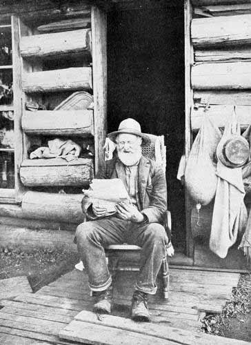
An Oregon Pioneer in his Cabin.
Photo. by E. H. Moorehouse.
Just as miners, cowboys, and traders were plunging eagerly into every form
of enterprise, the famous “hard winter” of ’61 descended upon the country.
It was almost a Minnesota winter. There was snow on the ground from
December 1st to March 22d, something never known before or since in the
Columbia Basin. Cattle could find no food and perished by the thousands.
Miners were found frozen into the stiff crust. In the rude cabins, with
wide cracks into which the snow drifted, the few women and children in the
Inland Empire fought a distressing and frequently losing fight. Even in
the Willamette Valley where houses were more comfortable, supplies more
plentiful, and the weather less severe, the conditions were hard enough.
At Portland the price of hay was eighty dollars a ton. In Eastern Oregon
it could not be obtained for any price, and the maintenance of life by
cattle depended entirely on their endurance.
But with the coming on of tardy spring, the rush up the River was resumed,
and the game went on. Seven millions in gold was reported in 1862, besides
almost as much, as was estimated, taken out in ways of which no record was
reported.
At Florence in February, 1862, flour was a dollar a pound; butter, three
dollars; sugar, a dollar and a quarter; coffee, two dollars; boots, thirty
dollars a pair.
The enormous profits, as well as enormous expense, of developing those
mines hastened the coming of the farmer. Among the throng that passed
madly into the mountains for gold, and among the throng that drove the
wide-horned cattle over the bunch-grass hills, there were a few keen-eyed
observers who asked themselves if wheat and corn and potatoes and barley
and fruit-trees might not grow on those broad prairies, and especially
along the numerous watercourses descending from the Blue Mountains.
A farm here and there at some favourable point beside some favouring
stream, followed in two or three years by a flour-mill, then a few apples
whose bright red cheeks and fragrant smell showed that the upper Columbia
lands could match those of the Willamette, then an experimental
wheat-field or barley-field on the high bunch-grass prairies,—and, almost
before people realised it, the farmer was standing up beside the miner and
the stockman, as tall and broad and important as either. The plough and
the hoe and the mowing-machine took their places beside the pick and
gold-pan and quirt and schapps and spurs as symbols of Columbia River
nobility.
The “boomer” was the logical result of the development of mine and range
and farm and garden and orchard. If people were going to eat and travel
and raise wheat and cattle, they must inevitably buy and sell. And if they
were going to buy and sell, they must needs “boom.” The decade of the
eighties was the great age of the boom in real estate along the Columbia
and its tributaries. Then, as also upon Puget Sound, cities were founded
with most extravagant size and expectations—on paper. Farm lands changed
hands rapidly. If a man could raise nothing else on his land, he could at
least raise the price. That was the time when the boomer boomed, the
promoter promoted, and the sucker sucked. It was a great age, but alas, it
was followed by an awakening, similar to that which follows a night of
carousal, when the next day brings a dark-brown taste in the mouth and a
very heavy head. The decade of the nineties was dolorous along the River
and in the mines and forests and farms and town-lots and additions and
suburbs adjoining.
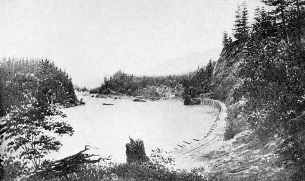
Old Portage Railroad at Cascades in 1860.
A Log-boom Down the River for San Francisco.
Photo. by Woodfield.
Interlocked with the days of miner, cowboy, rancher, and boomer, was
another age of equal importance and one that was both result and cause of
the others. This was the age of the railroad builder.
Transportation by the River was a great feature of traffic in the fifties
and sixties. But, during the second of those decades, the people of
Portland began to realise that the time had arrived for rails as well as
sails. The first great transcontinental railroad, the Union Pacific and
Central Pacific, was in active process of building between California and
Omaha. A fever of railroad building spread to the Columbia River people.
Railroads were projected from Portland on both sides of the Willamette, up
the valley, with the view of ultimate connection with California. Surveys
were made by S. G. Elliott from Marysville, California, to Portland in
1863. It was October, 1870, when the first train reached Salem, the
capital of the State. The road was known as the Oregon Central Railroad,
and its manager and ultimately its chief owner was Ben Holladay, the most
famous railroad man of that period in Oregon. In 1871 and 1872, railroad
building was extended on the west side of the Willamette. The lines on
both sides were reorganised under Mr. Holladay’s control as the Oregon
and California Railroad.
Meanwhile the air was full of discussion of a transcontinental line to the
Pacific Northwest. The conception of a Northern Pacific railroad was
nothing new. Away back in 1853, Governor I. I. Stevens and Captain George
B. McClellan had made a reconnaissance across the Rocky and Cascade
Mountains and over the great plains of the Columbia, for the purpose of
ascertaining a route for a northern line. They pronounced the route
feasible, but the time had not yet come for such an undertaking. In a
letter to McClellan of April 5, 1853, Governor Stevens states the route to
be from St. Paul to Puget Sound by the great bend of the Missouri River.
It is interesting to note that this is nearly the course afterwards
followed.
Work on the Northern Pacific was begun in the vicinity of Kalama on the
Columbia in 1870. The financial panic of 1873 resulted in the failure of
Jay Cooke & Company, the backers of the enterprise, and for several years
railroad work was at a standstill.
In 1879 there came to Oregon the greatest railroad builder of that era,
Henry Villard. He was a true financial genius, daring, far-seeing,
persistent, and self-reliant. With the quick grasp of a statesman, Mr.
Villard perceived that the Columbia River was the key to a boundless
opportunity. He saw that a central line up the Columbia with branches
north, east, and south-east, might be thrust like a wedge between the
Northern Pacific and the Union Pacific and control both. In pursuance of
this conception he made three rapid moves. The first was the
incorporation of the Oregon Railway and Navigation Company. The second was
the formation of the “blind pool” and the Oregon and Transcontinental
Company. The third was the acquisition of a controlling interest in the
Northern Pacific Railroad. The three years up to and including 1883 were
years of almost feverish activity along the River. The line of the Oregon
Railroad and Navigation Company between Wallula and Portland was pushed on
with tireless energy. Rock bluffs were split off by enormous charges of
dynamite, or were tunnelled through. The road was indeed built so hastily
and the curves were in some cases so extreme that much work had to be done
over at later times.
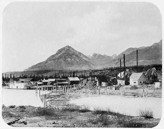
Lumber Mill and Steamboat Landing at Golden, B. C.
Photo. by C. F. Yates.
A part of Villard’s plan in pushing the work so hastily was to divert the
Northern Pacific system to the River, and make Portland rather than Puget
Sound the western terminus. The undertaking seemed to be crowned with
success. The connection was made. A gorgeous celebration, the greatest
ever held in the Columbia River country, commemorated, in October, 1883,
the completion of the transcontinental railroad to tide-water on the
Columbia River. But in the very hour of victory, the sceptre fell from
Villard’s hands. His downfall was as sudden and dramatic as his rise. By
clever jobbing of the market, the Wright interests regained possession of
the majority of the Northern Pacific stock, the transcontinental pool
broke, and at the very time that Mr. Villard was being worshipped at
Portland as the financial god of the North-west, he learned that his
gigantic enterprise had fallen into the hands of the enemy. But in spite
of defeat the work of Villard was assured, and his name and fame as the
champion railroad builder of the Columbia River was established.
After the Wright interests had regained possession of the Northern
Pacific, that great system was pushed to Puget Sound. The Oregon Short
Line was carried to a connection with the Union Pacific system. Thus two
independent transcontinental lines reached the River. Yet later the
Southern Pacific system acquired control of the Oregon and California
Railroad, and, by joining the sections, connected the Columbia River with
the Golden Gate. Through connecting lines the Canadian Pacific Railroad
gained access to the Columbia River. There are, therefore, four distinct
transcontinental railroad systems into the valley of our River. Two more
are rapidly approaching completion. As a logical result, too, many local
and connecting lines have been built. The Astoria and Columbia River
Railroad, on the Oregon side of the River, joins Portland to Astoria and
Seaside and the other resorts of the ocean beach. The Oregon Railway and
Navigation Company has continuous connection on the south side of the
Columbia and Snake rivers to Riparia on the latter stream, and thence by a
road on the north side, owned jointly with the Northern Pacific, to
Lewiston, Idaho. The most remarkable of all these connecting and joint
roads is the Portland, Seattle, and Spokane Railroad, commonly called the
“North Bank Road.” This is supposed to be the joint property of the
Northern Pacific and Great Northern railroads. It is one of the many
monuments in the West to the financial genius and tireless energy of James
J. Hill. It was completed in 1908, between Pasco and Portland, and at
the first of the year following, from Pasco to Spokane. It is said to be
the most expensively and scientifically built road in the United States,
having curves and grades reduced to a minimum, being, in fact, a
continuous descent from near Spokane to tide-water. Its builders evidently
expect stupendous traffic, and every feature of the line is adjusted to
such expectation.
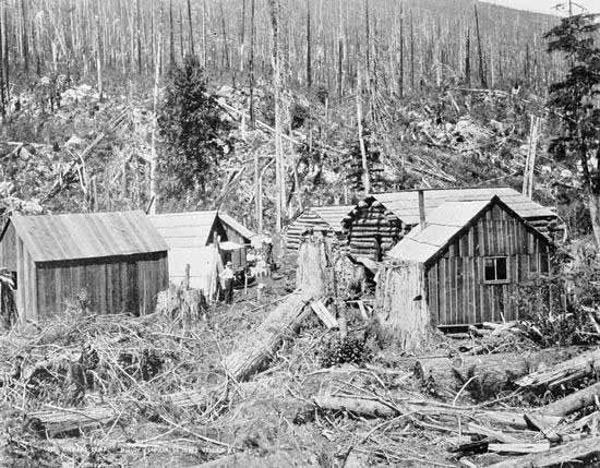
A Typical Lumber Camp.
Photo. by Trueman.
Any account of the great railroads joining the Inland Empire to the River
and thence to the seaboard would be incomplete without reference to the
pioneer of them all, the “Strap-iron” narrow-gauge from Walla Walla to
Wallula. This line was forced by the exigencies of the times, but it
commemorates the rare commercial foresight and ability of a man, who, in
native business genius, ranks with the foremost in the history of the
Columbia Valley. This man was Dr. D. S. Baker, a native of Illinois, an
immigrant to the Columbia in 1848, and a settler in Walla Walla in 1860.
Perceiving the vast latent resources of the Inland Empire, he invested in
land, founded a bank, became a partner in a store, and during much of the
time was also actively engaged in his profession of medicine.
In 1863, the Oregon Steam Navigation Company was running boats from
Portland to Lewiston, over four hundred miles, having short railroad
portages at the Cascades and The Dalles. That was the most active era of
the mines in Idaho. Rates from Portland to up-river points were as
follows: freight from Portland to Wallula, $50.00 per ton; to Lewiston,
$90.00; fare from Portland to Wallula, $18.00; to Lewiston, $28.00. (The
rates had been much higher a year or two earlier.) From Wallula to Walla
Walla, freight was hauled by prairie-schooners at from $10.00 to $12.00 a
ton, thirty miles. Needless to say, the company piled up a fortune.
Dr. Baker saw the possibilities of the region and, almost unaided, with
every difficulty and discouragement, constructed a narrow gauge, with
wooden rails, on which strap-iron was fastened. An astonishing amount of
business was soon developed, steel rails were substituted, and the
business made a fortune for its builder. It was absorbed by the Oregon
Steam Navigation Company. But Dr. Baker’s strap-iron road may be
considered the true progenitor of the railroads of the upper Columbia.
During these first years of the twentieth century, the shores of the River
have echoed with the sound of whistles on many a new road, but the
distinguishing mark has been the construction of electric roads. The lower
Willamette Valley, centring at Portland, has become fairly swarming with
electric roads. Spokane has become almost an equal centre of electric
lines, while Walla Walla is following close behind her larger sisters in
the procession. When lines already constructed from Spokane southward are
joined to a system projected from Walla Walla northward and westward,
there will be a complete system of independent electric lines from all
parts of Eastern Washington and North-eastern Oregon to steamboat
connections on the River, and thence to tide-water. The significance of
this as a commercial fact cannot be realised as yet.
A Logging Railroad, near Astoria.
Photo. by Woodfield.
The Present Age of Expansion and World Commerce
Population and Productions of the Region on the River and its
Tributaries—Extent of its Navigability—Improvements Needed—Kinds of
Traffic—Local Traffic—Transcontinental Traffic—World
Traffic—Advantages of the River Route for these Kinds of Traffic—The
Bar—The Competition of Puget Sound—The Combination of River Route
and Sound Route.
We have traced the successive eras which have brought the land of the
Oregon from a wilderness to a group of powerful young American States,
abounding in resources and filled to the brim with hope and enthusiasm. We
have followed the River through its eras of canoe, bateau, flatboat,
sail-ship, and steamboat, and we have seen railroads built along its
banks. It remains only to cast a brief final glance at the River in its
present age, and to forecast something of what seems its sure future.
It may be said that the population of those parts of Oregon, Washington,
Idaho, Wyoming, and Montana, which are embraced in the watershed of the
Columbia, is probably nearly a million and a quarter. The population of
the area in British Columbia is scanty, but rapidly increasing.
The productive capacity is very great. A rough estimate of production in
the valley of the Columbia for the year 1908 would probably give a grain
production of seventy million bushels, a lumber output of three billion
feet, a mineral output worth sixty million dollars, and a combined output
of pastoral, horticultural, fishing, and miscellaneous industries of fifty
millions of dollars.
Such figures indicate that the Columbia River is already a factor in world
commerce. Yet its development is but begun. What is to be its part in the
world commerce of the future?
Inspection of a map will show that the Columbia possesses the only
water-level route from the vast productive regions of the Inland Empire to
the seaboard. As has been shown in the course of this volume, the River is
navigable throughout the larger part of its course from Revelstoke in
British Columbia to the ocean. In that distance there is one canal, with
locks. That is at the Cascades, sixty-five miles from Portland. Before the
River can be continuously navigable it will be necessary that a canal be
constructed to overcome the obstructions at the Dalles, a few miles above
the city of that name, another at Priest Rapids, seventy miles above
Pasco, and still another at Kettle Falls. The Government is already
engaged in the first of these works. The second seems comparatively near
of accomplishment by reason of work done and projected by a powerful
irrigation company. Nothing has yet been done at Kettle Falls, but it
would be comparatively a light task to provide canal and locks at that
point. Besides these larger obstructions there are several rapids at
points between Kettle Falls and the Dalles which impede navigation at
certain stages of water. The Government has made surveys of these
sections of the River, and has announced that with comparatively small
outlay the rocks and reefs may be removed, the channels deepened and
straightened, and the River made navigable. One thing may be emphasised in
this connection, and this is that the Columbia River has mainly a rocky
bed, and hence work on the channels is permanent. It will not cut and
fill, nor pile up islands and bars as does the Missouri.
In view of the capability of the River to carry great water traffic, and
in view of the fact that railroad traffic is seeking and will still more
seek the down-hill grade to the sea, it becomes a question of great
interest what the future commerce of the River will be.
It is evident that there will be three kinds of traffic: local,
transcontinental, world-wide. Each is bound to be vast beyond the
calculations or even the imagination of the present. The local traffic is
sure to be immense, for it is estimated that there is a million acres of
land immediately contiguous to the River, irrigable and adapted to
intensive farming. Present experience shows that five or ten acres of such
land are sufficient to support a family. Many cities and towns are sure to
grow upon the banks of the River. Its banks will sometime become populated
like those of ancient Nile. Besides the immediate region of the River,
there are millions upon millions of acres of land more remote, the great
wheat fields and stock ranges and valley lands of tributary streams, and
these broad areas will seek the river route. Much of this immense local
traffic of the future will be conveyed by steamboats and barges.
The second class of traffic will be the transcontinental. All the
railroads across the continent, except those down the Columbia, are
obliged to climb the Cascade Mountains, four thousand feet or more in
height. With difficulty two powerful locomotives pull a freight train of
forty cars up the grades, and at some points even a third is needed. But a
single locomotive will pull eighty cars on the level grades of the River
roads. In the even keener competition bound to come, this advantage of
grades and curves will be a factor of immense importance.
The third class of future commerce is the world-wide. No western American
can contemplate the future of the world without being persuaded that the
Pacific Ocean and its shores will be the scene of the greatest problems of
the twentieth century. If this prove true, that world commerce of the
Pacific will seek that point of the American continent which most swiftly
and cheaply communicates with the eastern side of the continent and with
Europe. Granting that a large part of world commerce will pass through the
Panama Canal, there will still be, without question, an immense trade
between the Orient and such points in our own country as are so far from
the Atlantic seaboard that a transcontinental route is a necessity.
Moreover, even for our Atlantic seaboard and for Europe, there will be
large amounts of products, for the transit of which time will be a great
object. Hence we may be sure that there will be extensive world commerce
across the American continent. If so, where will it cross? Inspection of a
globe demonstrates that the Columbia River route is shortest, and, for
reasons already given, it is cheapest of all.
Puget Sound is its only present competitor. But the water-grade through
the Cascade Mountains, along the banks of the Columbia, constitutes an
advantage beyond the reach of permanent competition. Here, however, the
critic comes in and claims that the Bar at the mouth of the River forbids
entrance of the largest ships. This in a measure is true, though the
difficulties of the Columbia Bar have been grossly exaggerated. There are
over twenty-five feet of water on the Bar at the lowest tide. The
flood-tide adds from six to twelve feet. In any ordinary weather, forty
feet of water is safe enough for any vessel. But if marine architecture is
going to keep pace with growing commerce, we may soon have ships drawing
forty or fifty feet of water. If so, the Bar may indeed seriously block
the heaviest commerce. Some observers have, therefore, believed that the
big freights of the future will enter the Straits of Fuca, go to some one
of the Puget Sound ports, thence pass by rail across the low tract of
country between the Sound and the Columbia River, and proceed thence by
the River route to the interior and eastward. This would combine the
advantages of the two great routes of the Pacific North-west, abundant
depth of water, low altitudes, and easy grades. This would, in truth, come
nearest to realising the dream of the old navigators, the Strait of Anian.
In any event, the future world will look to our River as the goal of
markets as well as of vision, and as a highway of nations both for
freights and for tourists.