PREFACE
In no department of science is the slow and chequered progress of investigation
more conspicuous than in that branch of Geology which treats of
volcanoes. Although from the earliest dawn of history, men had been
familiar with the stupendous events of volcanic eruptions, they were
singularly slow in recognizing these phenomena as definite and important
parts of the natural history of the earth. Even within the present century,
the dominant geological school in Europe taught that volcanoes were mere
accidents, due to the combustion of subterranean beds of coal casually set
on fire by lightning, or by the decomposition of pyrites. Burning mountains,
as they were called, were believed to be only local and fortuitous appearances,
depending on the position of the coal-fields, and having no essential connection
with the internal structure and past condition of our planet. So long
as such fantastic conceptions prevailed, it was impossible that any solid
progress could be made in this branch of science. A juster appreciation of
the nature of the earth's interior was needed before men could recognize
that volcanic action had once been vigorous and prolonged in many countries,
where no remains of volcanoes can now be seen.
To France, which has led the way in so many departments of human
inquiry, belongs the merit of having laid the foundations of the systematic
study of ancient volcanoes. Her groups of Puys furnished the earliest
inspiration in this subject, and have ever since been classic ground to which
the geological pilgrim has made his way from all parts of the world. As
far back as the year 1752, Guettard recognised that these marvellous hills
were volcanic cones that had poured forth streams of lava. But it was
reserved for Desmarest twelve years later to examine the question in detail,
and to establish the investigation of former volcanic action upon a broad
and firm basis of careful observation and sagacious inference. His method
of research was as well conceived as the region of Auvergne was admirably
fitted to be the field of exploration. He soon discovered that the volcanoes
of Central France were not all of one age, but had made their appearance in
a long series, whereof the individual members became less perfect and distinct
in proportion to their antiquity. Beginning with the cones, craters, and
lava-streams which stand out so fresh that they might almost be supposed
to have been erupted only a few generations ago, Desmarest traced the
volcanic series backward in time, through successive stages of the decay and
degradation wrought upon them by the influence of the atmosphere, rain
and running water. He was thus able, as it were, to watch the gradual
obliteration of the cones, the removal of the ashes and scoriæ, and the
erosion of the lava-streams, until he could point to mere isolated remnants
of lava, perched upon the hills, and overlooking the valleys which had been
excavated through them. He showed how every step in this process of
denudation could be illustrated by examples of its occurrence in Auvergne,
and how, in this way, the various eruptions could be grouped according to
their place in the chronological sequence. To this illustrious Frenchman
geology is thus indebted, not only for the foundation of the scientific study
of former volcanic action, but for the first carefully worked out example of
the potency of subærial erosion in the excavation of valleys and the transformation
of the scenery of the land.
While these fruitful researches were in progress in France, others of
hardly less moment were advancing in Scotland. There likewise Nature had
provided ample material to arrest the attention of all who cared to make
themselves acquainted with the past history of our globe. Hutton, as a
part of his immortal Theory of the Earth, had conceived the idea that
much molten material had been injected from below into the terrestrial
crust, and he had found many proofs of such intrusion among the rocks
alike of the Lowlands and Highlands of his native country. His observations,
confirmed and extended by Playfair and Hall, and subsequently by
Macculloch, opened up the investigation of the subterranean phases of
ancient volcanic action.
Under the influence of these great pioneers, volcanic geology would have
made steady and perhaps rapid progress in the later decades of last century,
and the earlier years of the present, but for the theoretical views unfortunately
adopted by Werner. That illustrious teacher, to whom volcanoes seemed to
be a blot on the system of nature which he had devised, did all in his
power to depreciate their importance. Adopting the old and absurd notion
that they were caused by the combustion of coal under ground, he laboured
to show that they were mere modern accidents, and had no connection with
his universal formations. He proclaimed, as an obvious axiom in science,
that the basalts, so widely spread over Central and Western Europe, and
which the observations of Desmarest had shown to mark the sites of old
volcanoes, were really chemical precipitates from a primeval universal ocean.
Yet he had actually before him in Saxony examples of basalt hills which
entirely disprove his assertions.
Fortunately for the progress of natural knowledge, Werner disliked the
manual labour of penmanship. Consequently he wrote little. But his wide
range of acquirement, not in mineralogy only, his precision of statement, his
absolute certainty about the truth of his own opinions, and his hardly
disguised contempt for opinions that differed from them, combined with his
enthusiasm, eloquence and personal charm, fired his pupils with emulation
of his zeal and turned them into veritable propagandists. Misled as to the
structure of the country in which their master taught, and undisciplined to
investigate nature with an impartial mind, they travelled into other lands
for the purpose of applying there the artificial system which they had learnt
at Freiberg. The methodical but cumbrous terminology in which Werner
had trained them was translated by them into their own languages, where it
looked still more uncouth than in its native German. Besides imbibing
their teacher's system, they acquired and even improved upon his somewhat
disdainful manner towards all conclusions different from those of the Saxon
Mining School.
Such was the spirit in which the pupils of Werner proceeded to set the
"geognosy" of Europe to rights. The views, announced by Desmarest, that
various rocks, far removed from any active volcano, were yet of volcanic origin,
had been slowly gaining ground when the militant students from Saxony
spread themselves over the Continent. These views, however, being irreconcilable
with the tenets enunciated from the Freiberg Chair, were now either
ignored or contemptuously rejected. Werner's disciples loved to call themselves
by their teacher's term "geognosts," and claimed that they confined themselves
to the strict investigation of fact with regard to the structure of the
earth, in apparent unconsciousness that their terminology and methods were
founded on baseless assumptions and almost puerile hypotheses.
With such elements ready for controversy, it was no wonder that before
long a battle arose over the origin of basalt and the part played by volcanoes
in the past history of the globe. The disciples of Werner, champions of a
universal ocean and the deposition of everything from water, were dubbed
Neptunists, while their opponents, equally stubborn in defence of the potency
of volcanic fire, were known as Vulcanists or Plutonists. For more than a
generation this futile warfare was waged with extraordinary bitterness—dogmatism
and authority doing their best to stop the progress of impartial
observation and honest opinion.
One of the most notable incidents in the campaign is to be found in the
way in which the tide of battle was at last turned against the Wernerians.
Cuvier tells us that when some of the ardent upholders of the Freiberg faith
came to consult Desmarest, the old man, who took no part in the fray, would
only answer, "Go and see." He felt that in his memoir and maps he had
demonstrated the truth of his conclusions, and that an unprejudiced observer
had only to visit Auvergne to be convinced.
By a curious irony of fate it was from that very Auvergne that the
light broke which finally chased away the Wernerian darkness, and it was
by two of Werner's most distinguished disciples that the reaction was
begun.
Daubuisson, a favourite pupil of the Freiberg professor, had written and
published at Paris in 1803 a volume on the Basalts of Saxony, conceived
in the true Wernerian spirit, and treating these rocks, as he had been
taught to regard then, as chemical precipitates from a former universal
ocean. In the following year the young and accomplished Frenchman
went to Auvergne and the Vivarais that he might see with his own eyes
the alleged proofs of the volcanic origin of basalt. Greatly no doubt to his
own surprise, he found these proofs to be irrefragable. With praiseworthy
frankness he lost no time in publicly announcing his recantation of the
Wernerian doctrine on the subject, and ever afterwards he did good service
in making the cause of truth and progress prevail.
Still more sensational was the conversion of a yet more illustrious
prophet of the Freiberg school—the great Leopold von Buch. He too
had been educated in the strictest Wernerian faith. But eventually, after
a journey to Italy, he made his way to Auvergne in 1802, and there, in
presence of the astonishing volcanic records of that region, the scales seem
to have fallen from his eyes also. With evident reluctance he began to
doubt his master's teaching in regard to basalt and volcanoes. He went into
raptures over the clear presentation of volcanic phenomena to be found in
Central France, traced each detail among the puys, as in the examination of
a series of vast models, and remarked that while we may infer what takes
place at Vesuvius, we can actually see what has transpired at the Puy de
Pariou. With the enthusiasm of a convert he rushed into the discussion
of the phenomena, but somehow omitted to make any mention of Desmarest,
who had taught the truth so many years before.
Impressed by the example of such men as Daubuisson and Von Buch,
the Wernerian disciples gradually slackened in zeal for their master's tenets.
They clung to their errors longer perhaps in Scotland than anywhere else
out of Germany—a singular paradox only explicable by another personal
influence. Jameson, trained at Freiberg, carried thence to the University of
Edinburgh the most implicit acceptance of the tenets of the Saxon school,
and continued to maintain the aqueous origin of basalt for many years
after the notion had been abandoned by some of his most distinguished
contemporaries. But the error, though it died hard, was confessed at last
even by Jameson.
After the close of this protracted and animated controversy the study
of former volcanic action resumed its place among the accepted subjects
of geological research. From the peculiarly favourable structure of the
country, Britain has been enabled to make many important contributions
to the investigation of the subject. De la Beche, Murchison and Sedgwick
led the way in recognizing, even among the most ancient stratified formations
of England and Wales, the records of contemporaneous volcanoes and
of their subterranean intrusions. Scrope threw himself with ardour into
the study of the volcanoes of Italy and of Central France. Maclaren
made known the structure of some of the volcanic groups of the lowlands of
Scotland. Ramsay, Selwyn, and Jukes, following these pioneers, were the
first to map out a Palæozoic volcanic region in ample detail. Sorby, applying
to the study of rocks the method of microscopic examination by
thin slices, devised by William Nicol of Edinburgh for the study of fossil plants,
opened up a new and vast field in the domain of observational geology, and
furnished the geologist with a key to solve many of the problems of volcanism.
Thus, alike from the stratigraphical and petrographical sides, the
igneous rocks of this country have received constantly increasing attention.
The present work is intended to offer a summary of what has now been
ascertained regarding the former volcanoes of the British Isles. The
subject has occupied much of my time and thought all through life.
Born among the crags that mark the sites of some of these volcanoes, I was
led in my boyhood to interest myself in their structure and history. The
fascination which they then exercised has lasted till now, impelling me to
make myself acquainted with the volcanic records all over our islands,
and to travel into the volcanic regions of Europe and Western America for
the purpose of gaining clearer conceptions of the phenomena.
From time to time during a period of almost forty years I have communicated
chiefly to the Geological Society of London and the Royal Society
of Edinburgh the results of my researches. As materials accumulated, the
desire arose to combine them into a general narrative of the whole progress
of volcanic action from the remotest geological periods down to the time
when the latest eruptions ceased. An opportunity of partially putting this
design into execution occurred when, as President of the Geological Society,
the duty devolved upon me of giving the Annual Addresses in 1891 and
1892. Within the limits permissible to such essays, it was not possible to
present more than a full summary of the subject. Since that time I have
continued my researches in the field, especially among the Tertiary volcanic
areas, and have now expanded the two Addresses by the incorporation
of a large amount of new matter and of portions of my published
papers.
In the onward march of science a book which is abreast of our knowledge
to-day begins to be left behind to-morrow. Nevertheless it may
serve a useful purpose if it does no more than make a definite presentation
of the condition of that knowledge at a particular time. Such a statement
becomes a kind of landmark by which subsequent progress may be measured.
It may also be of service in indicating the gaps that have to be filled up,
and the fields where fresh research may most hopefully be undertaken.
I have to thank the Councils of the Royal Society of Edinburgh and
the Geological Society for their permission to use a number of the illustrations
which have accompanied my papers published in their Transactions
and Journal. To Colonel Evans and Miss Thom of Canna I am indebted for the photographs
which they have kindly taken for me. To those of my colleagues
in the Geological Survey who have furnished me with information
my best thanks are due. Their contributions are acknowledged
where they have been made use of in the text.
The illustrations of these volumes are chiefly from my own note-books
and sketch-books. But besides the photographs just referred to, I have
availed myself of a series taken by Mr. Robert Lunn for the Geological
Survey among the volcanic districts of Central Scotland.
Geological Survey Office,
28 Jermyn Street, London,
1st January 1897.
CHAPTER I
Earliest Knowledge of Volcanoes—Their Influence on Mythology and Superstition—Part
taken by Volcanic Rocks in Scenery—Progress of the Denudation of Volcanoes—Value
of the Records of former Volcanoes as illustrating Modern Volcanic Action—Favourable
Position of Britain for the Study of this Subject.
Among the influences which affected the infancy of mankind, the most
potent were those of environment. Whatever in outer nature stimulated or
repressed courage, inventiveness, endurance, whatever tended to harden or
to weaken the bodily faculties, whatever appealed to the imagination or
excited the fancy, became a powerful factor in human development.
Thus, in the dawn of civilization, the frequent recurrence of earthquakes
and volcanic eruptions throughout the basin of the Mediterranean could not
but have a marked effect on the peoples that dwelt by the borders of that
sea. While every part of the region was from time to time shaken by
underground commotion, there were certain places that became specially
noteworthy for the wonder and terror of their catastrophes. When, after
successive convulsions, vast clouds of black smoke rose from a mountain and
overspread the sky, when the brightness of noon was rapidly replaced by
the darkness of midnight, when the air grew thick with stifling dust and a
rain of stones and ashes fell from it on all the surrounding country, when
streams of what looked like liquid fire poured forth and desolated gardens,
vineyards, fields and villages—then did men feel sure that the gods were
angry. The contrast between the peacefulness and beauty of the ordinary
landscape and the hideous warfare of the elements at these times of volcanic
fury could not but powerfully impress the imagination and give a colour to
early human conceptions of nature and religion.
It was not only in one limited district that these manifestations of
underground convulsion showed themselves. The islands of the Ægean
had their volcanoes, and the Greeks who dwelt among them watched their
glowing fires by night and their clouds of steam by day, culminating now
and then in a stupendous explosion, like that which, in prehistoric time,
destroyed the island of Santorin. As the islanders voyaged eastward they
would see, on the coast of Asia Minor, the black bristling lavas of the
"Burnt Country," perhaps even then flowing from their rugged heaps of
cinders. Or when, more adventurously still, they sailed westward into the
Tyrrhenian waters, they beheld the snowy cone of Etna, with its dark
canopy of smoke and the lurid nocturnal gleam of its fires; while from time
to time they witnessed there on a still more stupendous scale the horrors of
a great volcanic eruption.
From all sides, therefore, the early Greek voyagers would carry back
to the mother-country marvellous tales of convulsion and disaster. They
would tell how the sky rapidly darkened even in the blaze of mid-day, how
the land was smothered with dust and stones, how over the sea there spread
such a covering of ashes that the oarsmen could hardly drive their vessels
onward, how red-hot stones, whirling high overhead, rained down on sails and
deck, and crushed or burnt whatever they fell upon, and how, as the earth
shook and the sea rose in sudden waves and the mountain gave forth an
appalling din of constant explosion, it verily seemed that the end of the
world had come.
To the actual horrors of such scenes there could hardly fail to be added
the usual embellishments of travellers' tales. Thus, in the end, the volcanoes
of the Mediterranean basin came to play a not unimportant part in Hellenic
mythology. They seemed to stand up as everlasting memorials of the
victory of Zeus over the giants and monsters of an earlier time. And as
the lively Greek beheld Mount Etna in eruption, his imagination readily
pictured the imprisoned Titan buried under the burning roots of the mountain,
breathing forth fire and smoke, and convulsing the country far and
near, as he turned himself on his uneasy pallet.
When in later centuries the scientific spirit began to displace the
popular and mythological interpretation of natural phenomena, the existence
of volcanoes and their extraordinary phenomena offered a fruitful field for
speculation and conjecture. As men journeyed outward from the Mediterranean
cradle of civilization, they met with volcanic manifestations in
many other parts of the world. When they eventually penetrated into the
Far East, they encountered volcanoes on a colossal scale and in astonishing
abundance. When they had discovered the New World they learnt that, in
that hemisphere also, "burning mountains" were numerous and of gigantic
dimensions. Gradually it was ascertained that vast lines of volcanic activity
encircle the globe. By slow degrees the volcano was recognized to be as
normal a part of the mechanism of our planet as the rivers that flow on the
terrestrial surface. And now at last men devote themselves to the task of
critically watching the operations of volcanoes with as much enthusiasm as
they display in the investigation of any other department of nature. They
feel that their knowledge of the earth extends to little beyond its mere outer
skin, and that the mystery which still hangs over the vast interior of the
planet can only, if ever, be dispelled by the patient study of these vents of
communication between the interior and the surface.
If, however, we desire to form some adequate idea of the part which
volcanic action has played in the past history of the earth, we should be
misled were we to confine our attention to the phenomena of the eruptions
of the present day. An attentive examination of any modern volcano will
convince us that of some of the most startling features of an eruption no
enduring memorial remains. The convulsive earthquakes that accompany a
great volcanic paroxysm, unless where they actually fissure the ground, leave
little or no trace behind them. Lamentably destructive as they are to
human life and property, the havoc which they work is mostly superficial.
In a year or two the ruins have been cleared away, the earth-falls have been
healed over, the prostrated trees have been removed, and, save in the memories
and chronicles of the inhabitants, no record of the catastrophe may survive.
The clouds of dust and showers of ashes which destroyed the crops and
crushed in the roofs of houses soon disappear from the air, and the covering
which they leave over the surface of a district gradually mingles with
the soil. Vegetation eventually regains its place, and the landscape becomes
again as smiling as before.
Even where the materials thrown out from the crater accumulate in
much greater mass, where thick deposits of ashes or solid sheets of lava bury
the old land-surface, the look of barren desolation, though in some cases it
may endure for long centuries, may in others vanish in a few years. The
surface-features of the district are altered indeed, but the new topography
soon ceases to look new. Another generation of inhabitants loses recollection
of the old landmarks, and can hardly realize that what has become so
familiar to itself differs so much from what was familiar to its fathers.
But even when the volcanic covering, thus thrown athwart a wide tract
of country, has been concealed under a new growth of soil and vegetation, it
still remains a prey to the ceaseless processes of decay and degradation which
everywhere affect the surface of the land. No feature of a modern
volcano is more impressive than the lesson which it conveys of the reality
and potency of this continual waste. The northern slopes of Vesuvius, for
example, are trenched with deep ravines, which in the course of centuries
have been dug out of the lavas and tuffs of Monte Somma by rain and
melted snow. Year by year these chasms are growing deeper and wider,
while the ridges between them are becoming narrower. In some cases,
indeed, the intervening ridges have been reduced to sharp crests which are
split up and lowered by the unceasing influence of the weather. The slopes
of such a volcanic cone have been aptly compared to a half-opened umbrella.
It requires little effort of imagination to picture a time, by no means
remote in a geological sense, when, unless renovated by the effects of fresh
eruptions, the cone will have been so levelled with the surrounding country
that the peasants of the future will trail their vines and build their cots over
the site of the old volcano, in happy ignorance of what has been the history
of the ground beneath their feet.
What is here predicted as probable or certain in the future has
undoubtedly happened again and again in the past. Over many districts of
Europe and Western America extinct volcanoes may be seen in every stage
of decay. The youngest may still show, perfect and bare of vegetation, their
cones and their craters, with the streams of lava that escaped from them.
Those of older date have been worn down into mere low rounded hills, or
the whole cone has been cleared away, and there is only left the hard core
of material that solidified in the funnel below the surface. The lava-sheets
have been cut through by streams, and now remain in mere scattered patches
capping detached hills, which only a trained eye can recognize as relics of
a once continuous level sheet of solid rock.
By this resistless degradation, a volcanic district is step by step stripped
of every trace of its original surface. All that the eruptions did to change
the face of the landscape may be entirely obliterated. Cones and craters,
ashes and lavas, may be gradually effaced. And yet enough may be left to
enable a geologist to make sure that volcanic action was once rife there.
As the volcano marks a channel of direct communication between the
interior of the earth and the atmosphere outside, there are subterranean as
well as superficial manifestations of its activity, and while the latter are
removed by denudation, the former are one by one brought into light. The
progress of denudation is a process of dissection, whereby every detail in the
structure of a volcano is successively cut down and laid bare. But for this
process, our knowledge of the mechanism and history of volcanic action
would be much less full and definite than happily it is. In active volcanoes
the internal and subterranean structure can only be conjectured; in those
of ancient date, which have been deeply eroded, this underground structure
is open to the closest examination.
By gathering together evidence of this nature over the surface of the
globe, we learn that abundantly as still active volcanoes are distributed on
that surface, they form but a small fraction of the total number of vents
which have at various times been in eruption. In Italy, for example, while
Vesuvius is active on the mainland, and Etna, Stromboli and Volcano
display their vigour among the islands, there are scores of old volcanoes that
have been silent and cold ever since the beginning of history, yet show by
their cones of cinders and streams of bristling lava that they were energetic
enough in their day. But the Italian volcanic region is only one of many
to be found on the European Continent. If we travel eastward into Hungary,
or northward into the Eifel, or into the heart of France, we encounter
abundant cones and craters, many of them so fresh that, though there is no
historical record of their activity, they look as if they had been in eruption
only a few generations ago.
But when the geologist begins to search among rocks of still older date
than these comparatively recent volcanic memorials, he meets with abundant
relics of far earlier eruptions. And as he arranges the chronicles of the
earth's history, he discovers that each section of the long cycle of geological
ages has preserved its records of former volcanoes. In a research of this
kind he can best realize how much he owes to the process of denudation.
The volcanic remains of former geological periods have in most cases been
buried under younger deposits, and have sunk sometimes thousands of feet
below the level of the sea. They have been dislocated and upheaved again
during successive commotions of the terrestrial crust, and have at last been
revealed by the gradual removal of the pile of material under which they
had lain.
Hence we learn that the active volcanoes of the present time, which
really embrace but a small part of the volcanic history of our planet, are
the descendants of a long line of ancestors. Their distribution and activity
should be considered not merely from the evidence they themselves supply,
but in the light derived from a study of that ancestry. It is only when we
take this broad view of the subject that we can be in a position to form
some adequate conception of the nature and history of volcanoes in the
geological evolution of the globe.
In this research it is obvious that the presently active volcano must be
the basis and starting-point of inquiry. At that channel of communication
between the unknown inside and the familiar outside of our globe, we can
watch what takes place in times of quiescence or of activity. We can
there study each successive phase of an eruption, measure temperatures,
photograph passing phenomena, collect gases and vapours, register the fall
of ashes or the flow of lavas, and gather a vast body of facts regarding the
materials that are ejected from the interior, and the manner of their
emission.
Indispensable as this information is for the comprehension of volcanic
action, it obviously affords after all but a superficial glimpse of that action.
We cannot see beyond the bottom of the crater. We cannot tell anything
about the subterranean ducts, or how the molten and fragmental materials
behave in them. All the underground mechanism of volcanoes is necessarily
hidden from our eyes. But much of this concealed structure has
been revealed in the case of ancient volcanic masses, which have been buried
and afterwards upraised and laid bare by denudation.
In yet another important aspect modern volcanoes do not permit us to
obtain full knowledge of the subject. The terrestrial vents, from which we
derive our information, by no means represent all the existing points of
direct connection between the interior and the exterior of the planet. We
know that some volcanic eruptions occur under the sea, and doubtless vast
numbers more take place there of which we know nothing. But the conditions
under which these submarine discharges are effected, the behaviour
of the outflowing lava under a body of oceanic water, and the part
played by fragmentary materials in the explosions, can only be surmised.
Now and then a submarine volcano pushes its summit above the sea-level,
and allows its operations to be seen, but in so doing it becomes practically
a terrestrial volcano, and the peculiar submarine phenomena are still effectually
concealed from observation.
The volcanic records of former geological periods, however, are in large
measure those of eruptions under the sea. In studying them we are permitted,
as it were, to explore the sea-bottom. We can trace how sheets of
coral and groves of crinoids were buried under showers of ashes and stones,
and how the ooze and silt of the sea-floor were overspread with streams of
lava. We are thus, in some degree, enabled to realize what must now
happen over many parts of the bed of the existing ocean.
The geologist who undertakes an investigation into the history of
volcanic action within the area of the British Isles during past time, with a
view to the better comprehension of this department of terrestrial physics,
finds himself in a situation of peculiar advantage. Probably no region on
the face of the globe is better fitted than these islands to furnish a large
and varied body of evidence regarding the progress of volcanic energy in
former ages. This special fitness may be traced to four causes—1st, The remarkable
completeness of the geological record in Britain; 2nd, The geographical
position of the region on the oceanic border of a continent; 3rd, The singularly
ample development to be found there of volcanic rocks belonging to a
long succession of geological ages; and 4th, The extent to which this full
chronicle of volcanic activity has been laid bare by denudation.
1. In the first place, the geological record of Britain is singularly complete.
It has often been remarked how largely all the great periods of
geological time are represented within the narrow confines of these islands.
The gaps in the chronicle are comparatively few, and for the most part are
not of great moment.
Thanks to the restricted area of the country and to the large number of
observers, this remarkably full record of geological history has been studied
with a minute care which has hardly been equalled in any other country.
The detailed succession of all the formations has been so fully determined
in Britain that the very names first applied here to them and to their subdivisions
have in large measure passed into the familiar language of geology
all over the globe. Every definite platform in the stratigraphical series
has been more or less fully worked out. A basis has thus been laid for
referring each incident in the geological history of the region to its proper
relative date.
2. In the second place, the geographical position of Britain gives it
a notable advantage in regard to the manifestations of volcanic energy.
Rising from the margin of a great ocean-basin and extending along the edge
of a continent, these islands have lain on that critical border-zone of the
terrestrial surface, where volcanic action is apt to be most vigorous and
continuous. It has long been remarked that volcanoes are generally placed
not far from the sea. From the earliest geological periods the site of
Britain, even when submerged below the sea, has never lain far from the
land which supplied the vast accumulations of sediment that went to form
the Palæozoic and later formations, while, on the other hand, it frequently
formed part of the land of former geological periods. It was thus most
favourably situated as a theatre for both terrestrial and submarine volcanic
activity.
3. In the third place, this advantageous geographical position is found
to have been attended with an altogether remarkable abundance and persistence
of volcanic eruptions. No tract of equal size yet known on the
face of the globe furnishes so ample a record of volcanic activity from the
earliest geological periods down into Tertiary time. Every degree of
energy may be signalized in that record, from colossal eruptions which piled
up thousands of feet of rock down to the feeblest discharge of dust and
stones. Every known type of volcano is represented—great central cones
like Etna or Vesuvius, scattered groups of small cones like the puys of
France, and fissure- or dyke-eruptions like those of recent times in Iceland.
Moreover, the accurate manner in which the stratigraphy of the country
has been established permits each successive era in the long volcanic history
to be precisely determined, and allows us to follow the whole progress of
that history stage by stage, from the beginning to the end.
These characteristics may be instructively represented on a map, such
as that which accompanies the present volume (Map I.). The reader will
there observe how repeatedly volcanic eruptions have taken place, not
merely within the general area of the British Isles, but even within the
same limited region of that area. The broad midland valley of Scotland
has been especially the theatre for their display. From the early part of
the Lower Silurian period, through the ages of the Old Red Sandstone,
Carboniferous and Permian systems, hundreds of volcanic vents were active
in that region, while in long subsequent time there came the fissure-eruptions
of the Tertiary series.
4. In the fourth place, the geological revolutions of successive ages
have made this long volcanic chronicle fully accessible to observation. Had
the lavas and ashes of one period remained buried under the sedimentary
accumulations of the next, their story would have been lost to us. We
should only have been able to decipher the latest records which might
happen to lie on the surface. Fortunately for the progress of geology,
the endless vicissitudes of a continental border have brought up the very
oldest rocks once more to the surface. All the later formations of the
earth's crust have likewise been upraised and exposed to denudation during
long cycles of time. In this manner, the rocky framework of the country
has been laid bare, and each successive chapter of its geological history may
be satisfactorily deciphered. The singularly complete volcanic chronicle,
after being entombed under younger deposits, has been broken up and
raised once more into view. The active vents of former periods have been
dissected, submarine streams of lava have been uncovered, sheets of ashes
that fell over the sea-bottom have been laid bare. The progress of denudation
is specially favoured in such a variable and moist climate as that
of Britain, and thus by the co-operation of underground and meteoric causes
the marvellous volcanic records of this country have been laid open in
minutest detail.
There is yet another respect in which the volcanic geology of Britain
possesses a special value. Popular imagination has long been prone to see
signs of volcanic action in the more prominent rocky features of landscape.
A bold crag, a deep and precipitous ravine, a chasm in the side of a mountain,
have been unhesitatingly set down as proof of volcanic disturbance.
Many a cauldron-shaped recess, like the corries of Scotland or the cwms
of Wales, has been cited as an actual crater, with its encircling walls still
standing almost complete.
The relics of former volcanoes in this country furnish ample proofs to
dispel these common misconceptions. They show that not a single crater
anywhere remains, save where it has been buried under lava; that no trace
of the original cones has survived, except in a few doubtful cases where
they may have been preserved under subsequent accumulations of material;
that in the rugged tracts, where volcanic action has been thought to have
been most rife, there may be not a vestige of it, while, on the other hand,
where the uneducated eye would never suspect the presence of any remnant
of volcanic energy, lavas and ashes may abound. We are thus presented
with some of the most impressive contrasts in geological history, while, at
the same time, this momentous lesson is borne in upon the mind, that the
existing inequalities in the configuration of a landscape are generally due
far less to the influence of subterranean force than to the action of the
superficial agents which are ceaselessly carving the face of the land.
Those rocks which from their hardness or structure are best able to withstand
that destruction rise into prominence, while the softer material around
them is worn away. Volcanic rocks are no exception to this rule, as the
geological structure of Britain amply proves.
In the following chapters, forming Book I. of this work, I propose to
begin by offering some general remarks regarding the nature and causes of
volcanic action, so far as these are known to us. I shall then proceed to
consider the character of the evidence that may be expected to be met with
respecting the former prevalence of that action at any particular locality
where volcanic disturbances have long since ceased. The most telling evidence
of old volcanoes is naturally to be found in the materials which they
have left behind them, and the reader's attention will be asked to the special
characteristics of these materials, in so far as they give evidence of former
volcanic activity.
As has been already remarked, many of the most prominent phenomena
of a modern volcano are only of transient importance. The earthquakes
and tremors, and the constant disengagement of steam and gases, that play so
conspicuous a part in an eruption, may leave no sensible record behind them.
But even the cones of ashes and lava, which are piled up into mountainous
masses, have no true permanence: they are liable to ceaseless erosion by
the meteoric agencies of waste, and every stage in their degradation may be
traced. In successive examples we can follow them as they are cut down
to the very core, until in the end they are entirely effaced.
We may well, therefore, ask at the outset by what more enduring
records we may hope to detect the traces of former volcanic action. The
following introductory chapters will be devoted to an attempt to answer
this question. I shall try to show the nature and relative importance
of the records of ancient volcanoes; how these records, generally so
fragmentary, may be pieced together so as to be made to furnish the
history which they contain; how their relative chronology may be established;
how their testimony may be supplemented in such wise that the
position of long vanished seas, lands, rivers, and lakes may be ascertained;
and how, after ages of geological revolution, volcanic rocks that have lain
long buried under the surface now influence the scenery of the regions
where they have once more been exposed to view.
From this groundwork of ascertained fact and reasonable inference, we
shall enter in Book II. upon the story of the old volcanoes of the British Isles.
It is usual to treat geological history in chronological order, beginning with
the earliest ages. And this method, as on the whole the most convenient,
will be adopted in the present work. At the same time, the plan so persistently
followed by Lyell, of working backward from the present into
the past, has some distinct advantages. The volcanic records of the later
ages are much simpler and clearer than those of older times, and the
student may, in some respects, profitably study the history of the Tertiary
eruptions before he proceeds to make himself acquainted with the scantier
chronicles of the eruptions of the Palæozoic periods. But as I wish to
follow the gradual evolution of volcanic phenomena, and to show how volcanic
energy has varied, waxing and waning through successive vast intervals
of time, I will adhere to the chronological sequence.
CHAPTER II
The Nature and Causes of Volcanic Action—Modern Volcanoes.
A volcano is a conical or dome-shaped hill or mountain, consisting of
materials which have been erupted from an orifice leading down from the
surface into the heated interior of the earth. Among modern and recent
volcanoes three types may be recognized. In the first and most familiar
of these, the lavas and ashes ejected from the central vent have gathered
around it by successive eruptions, until they have built up a central cone
like those of Etna and Vesuvius. As this cone grows in height and
diameter, lateral or parasitic cones are formed on its flanks, and may become
themselves the chief actively erupting vents. This type of volcano, which
has been so long well known from its Mediterranean examples, was until
recently believed by geologists to be the normal, or indeed the only, phase of
volcanic energy on the face of the earth.
A modification of this type is to be found in a few regions where fragmentary
discharges are small in amount and where the eruptions are almost
wholly confined to the emission of tolerably liquid lava. A vast dome
with gently sloping declivities may in this way be formed, as in the
Sandwich Islands and in certain parts of Iceland.
The second type of volcano is at the present day extensively developed
only in Iceland, but in Tertiary time it appears to have had a wide range
over the globe, for stupendous memorials of it are preserved in North-Western
Europe, in Western America, and in India. It is distinguished
by the formation of numerous parallel fissures from which the lava gushes
forth, either with or without the formation of small cinder-cones along the
lines of the chasms.
The third type is distinguished by the formation of groups of cinder-cones
or lava-domes, which from their admirable development in Central
France have received the name of Puys. From these vents considerable
streams of lava have sometimes been discharged.
Without entering here into a detailed inquiry regarding the nature and
causes of Volcanic Action, we may with advantage consider briefly the two
main factors on which this action appears to depend.
1. Much uncertainty still exists as to the condition and composition of
the earth's interior. The wide distribution of volcanoes over the globe,
together with the general similarity of materials brought by them up to the
surface, formerly led to the belief that our planet consists of a central mass
of molten rock enclosed within a comparatively thin solid crust. Physical
arguments, however, have since demonstrated that the earth, with such a
structure, would have undergone great tidal deformation, but that in actual
fact it has a greater rigidity than if it were made of solid glass or steel.
From all the evidence obtainable it is certain that the temperature
of the earth's interior must be high. The rate of increase of this temperature
downward from the surface differs from place to place; but an
increase is always observed. At a depth of a few miles, every known substance
must be much hotter than its melting point at the surface. But at
the great pressures within the earth, actual liquefaction is no doubt prevented,
and the nucleus remains solid, though at a temperature at which,
but for the pressure, it would be like so much molten iron.
Any cause which will diminish the pressure may allow the intensely
hot material within the globe to pass into the liquid state. There is one
known cause which will bring about this result. The downward increment
of temperature proves that our planet is continually losing heat. As the
outer crust is comparatively cool, and does not become sensibly hotter by
the uprise of heat from within, the hot nucleus must cool faster than the
crust is doing. Now cooling involves contraction. The hot interior is contracting
faster than the cooler shell which encloses it, and that shell is thus
forced to subside. In its descent it has to adjust itself to a constantly
diminishing diameter. It can do so only by plication or by rupture.
When the terrestrial crust, under the strain of contraction, is compressed
into folds, the relief thus obtained is not distributed uniformly over the
whole surface of the planet. From an early geological period it appears to
have followed certain lines. How these came to be at first determined we
cannot tell. But it is certain that they have served again and again, during
successive periods of terrestrial readjustment. These lines of relief coincide,
on the whole, with the axes of our continents. The land-areas of the globe
may be regarded as owing their existence above sea-level to this result of
terrestrial contraction. The crust underneath them has been repeatedly
wrinkled, fractured and thrust upward by the vast oceanic subsidence around
them. The long mountain-chains are thus, so to speak, the crests of the
waves into which the crust has from time to time been thrown.
Again, the great lines of fracture in the crust of the earth probably lie
in large measure within the land-areas, or at least parallel with their axes
and close to their borders. Where the disposition of the chief ruptures and
of the predominant plications can be examined, these leading structural
features are found to be, on the whole, coincident. In the British Islands,
for instance, the prevalent trend of the axes of folding from early Palæozoic
to Tertiary time has been from south-west to north-east. How profoundly
this direction of earth-movement has affected the structure of the region is
shown by any ordinary map, in the long hill-ranges of the land and in the
long inlets of the sea. A geological map makes the dependence of the
scenery upon the building of the rocks still more striking. Not only have
these rocks been plicated into endless foldings, the axes of which traverse
the British Islands with a north-easterly trend: they have likewise been
dislocated by many gigantic ruptures, which tend on the whole to follow
the same direction. The line of the Great Glen, the southern front of the
Highlands, and the northern boundary of the Southern Uplands of Scotland,
are conspicuous examples of the position and effect of some of the greater
fractures in the structure of this country.
The ridging up of any part of the terrestrial crust will afford some relief
from pressure to the parts of the interior immediately underneath. If, as
is probable, the material of the earth's interior is at the melting point
proper for the pressure at each depth, then any diminution of the pressure
may allow the intensely heated substance to pass into the liquid state. It
would be along the lines of terrestrial uplift that this relief would be given.
It is there that active volcanoes are found. The molten material is forced
upward under these upraised ridges by the subsidence of the surrounding
regions. And where by rupture of the crust this material can make its way
to the surface, we may conceive that it will be ejected as lava or as stones
and ashes.
Viewed in a broad way, such appears to be the mechanism involved in
the formation and distribution of volcanoes over the surface of the earth.
But obviously this explanation only carries us so far in the elucidation of
volcanic action. If the molten magma flowed out merely in virtue of the
influence of terrestrial contraction, it might do so for the most part tranquilly,
though it would probably be affected by occasional sudden snaps, as
the crust yielded to accumulations of pressure. Human experience has
no record of the actual elevation of a mountain-chain. We may believe
that if such an event were to happen suddenly or rapidly, it would be
attended with gigantic catastrophes over the surface of the globe. We
can hardly conceive what would be the scale of a volcanic eruption
attending upon so colossal a disturbance of the terrestrial crust. But
the eruptions which have taken place within the memory of man have
been the accompaniments of no such disturbance. Although they have
been many in number and sometimes powerful in effect, they have
seldom been attended with any marked displacement of the surrounding
parts of the terrestrial crust. Contraction is, of course, continuously and
regularly in progress, and we may suppose that the consequent subsidence,
though it results in intermittent wrinkling and uplifting of the terrestrial
ridges, may also be more or less persistent in the regions lying outside these
ridges. There will thus be a constant pressure of the molten magma into
the roots of volcanoes, and a persistent tendency for the magma to issue at
the surface at every available rent or orifice. The energy and duration of
outflow, if they depended wholly upon the effects of contraction, would thus
vary with the rate of subsidence of the sinking areas, probably assuming
generally a feeble development, but sometimes bursting into fountains of
molten rock hundreds of feet in height, like those observed from time to
time in Hawaii.
2. The actual phenomena of volcanic eruptions, however, show that a
source of explosive energy is almost always associated with them, and that
while the transference of the subterranean molten magma towards the
volcanic vents may be referred to the results of terrestrial contraction, the
violent discharge of materials from those vents must be assigned to some
kind of energy stored up in the substance of the earth's interior.
The deep-seated magma from which lavas ascend contains various
vapours and gases which, under the enormous pressure within and beneath
the terrestrial crust, are absorbed or dissolved in it. So great is the tension
of these gaseous constituents, that when from any cause the pressure on the
magma is suddenly relieved, they are liberated with explosive violence.
A volcanic paroxysm is thus immediately the effect of the rapid escape
of these imprisoned gases and vapours. With such energy does the
explosion sometimes take place, that the ascending column of molten lava is
blown into the finest impalpable dust, which may load the air around a
volcano for many days before it falls to the ground, or may be borne in the
upper regions of the atmosphere round the globe.
The proportion of dissolved gases varies in different lavas, while the
lavas themselves differ in the degree of their liquidity. Some flow out
tranquilly like molten iron, others issue in a pasty condition and rapidly
congeal into scoriæ and clinkers. Thus within the magma itself the amount
of explosive energy is far from being always the same.
It is to the co-operation of these two causes—terrestrial contraction and
its effects on the one hand, and the tension of absorbed gases and vapours
the other—that the phenomena of volcanoes appear to be mainly due.
There is no reason to believe that modern volcanoes differ in any essential
respect from those of past ages in the earth's history. It might, indeed,
have been anticipated that the general energy of the planet would manifest
itself in far more stupendous volcanic eruptions in early times than those of
the modern period. But there is certainly no geological evidence in favour
of such a difference. One of the objects of the present work is to trace the
continuity of volcanic phenomena back to the very earliest epochs, and to
show that, so far as the geological records go, the interior of the planet has
reacted on its exterior in the same way and with the same results.
We may now proceed to inquire how far volcanoes leave behind them
evidence of their existence. I shall devote the next two or three chapters
to a consideration of the proofs of volcanic action furnished by the very
nature of the materials brought up from the interior of the earth, by the
arrangement of these materials at the surface, by the existence of the actual
funnels or ducts from which they were discharged above ground, and by the
disposition of the masses of rock which, at various depths below the surface,
have been injected into and have solidified within the terrestrial crust.
CHAPTER III — i. LAVAS — ii. VOLCANIC AGGLOMERATES, BRECCIAS AND TUFFS
Ancient Volcanoes: Proofs of their existence derived from the Nature of the Rocks erupted
from the Earth's Interior. A. Materials erupted at the Surface—Extrusive Series.
i. Lavas, their General Characters. Volcanic Cycles. ii. Volcanic Agglomerates,
Breccias and Tuffs.
The materials brought by volcanic action from the earth's interior have
certain common characters which distinguish them from other constituents
of the terrestrial crust. Hence the occurrence of these materials on any
part of the earth's surface affords convincing proofs of former volcanic
eruptions, even where all outward trace of actual volcanoes may have been
effaced from the topographical features of the ground.
Volcanic products may be classed in two divisions—1st, Those which
have been ejected at the surface of the earth, or the Extrusive series; and
2nd, Those which have been injected into the terrestrial crust at a greater
or less distance below the surface, and which are known as the Intrusive
series. Extrusive rocks may be further classified in two great groups—(i.)
The Lavas, or those which have been poured out in a molten condition
at the surface; and (ii.) The Fragmental Materials, including all kinds of
pyroclastic detritus discharged from volcanic vents.
Taking first the Extrusive volcanic rocks, we may in the present chapter
consider those characters in them which are of most practical value in the
investigation of the volcanic phenomena of former geological periods.
The term Lava is a convenient and comprehensive designation for all
those volcanic products which have flowed out in a molten condition. They
differ from each other in composition and structure, but their variations are
comprised within tolerably definite limits.
As regards their composition they are commonly classed in three divisions—1st,
The Acid lavas, in which the proportion of silicic acid ranges from
a little below 70 per cent upwards; 2nd, The Intermediate lavas, wherein
the percentage of silica may vary from 55 to near 70; and 3rd, The Basic
lavas, where the acid constituent ranges from 55 per cent downwards.
Sometimes the most basic kinds are distinguished as a fourth group under
the name of Ultrabasic, in which the percentage of silica may fall below 40.
The structures of lavas, however, furnish their most easily appreciated
characteristics. Four of these structures deserve more particular attention:
1st, Cellular, vesicular or pumiceous structure; 2nd, The presence of glass, or
some result of the devitrification of an original glass; 3rd, Flow-structure;
and 4th, The arrangement of the rocks in sheets or beds, with columnar and
other structures.
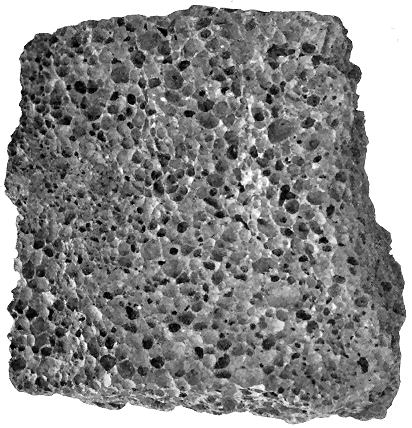
Fig. 1.—Vesicular structure, Lava from Ascension Island, slightly less than natural size.
1. The CELLULAR, VESICULAR, SCORIACEOUS or PUMICEOUS STRUCTURE of
volcanic rocks (Fig. 1) could only have arisen in molten masses from the
expansion of imprisoned vapours or gases, and is thus of crucial importance
in deciding the once liquid condition of the rocks which display it. The
vesicles may be of microscopic minuteness, but are generally quite visible
to the naked eye, and are often large and conspicuous. Sometimes these
cavities have been subsequently filled up with calcite, quartz, agate, zeolites
or other mineral deposition. As the kernels thus produced are frequently
flattened or almond-shaped (amygdales), owing to elongation of the steam-holes
by movement of the lava before its consolidation, the rocks containing
them are said to be amygdaloidal.
This structure, though eminently characteristic of superficial lavas, is
not always by itself sufficient to distinguish them from the intrusive rocks.
Examples will be given in later chapters where dykes, sills and other
masses of injected igneous material are conspicuously cellular in some parts.
But, in such cases, the cavities are generally comparatively small, usually
spherical or approximately so, tolerably uniform in size and distribution,
and, especially when they occur in dykes, distributed more particularly
along certain lines or bands, sometimes with considerable regularity (see
Figs. 90, 91, and 236).
Among the superficial lavas, however, such regularity is rarely to be
seen. Now and then, indeed, a lava, which is not on the whole cellular,
may be found to have rows of vesicles arranged parallel to its under or
upper surface, or it may have acquired a peculiar banded structure from the
arrangement of its vesicles in parallel layers along the direction of flow. The
last-named peculiarity is widely distributed among the Tertiary lavas of
North-Western Europe, and gives to their weathered surfaces a deceptive
resemblance to tuffs or other stratified rocks (see Figs. 260, 310 and 311).
It will be more particularly referred to a few pages further on. In general,
however, we may say that the steam-cavities of lavas are quite irregular in
size, shape and distribution, sometimes increasing to such relative proportions
as to occupy most of the bulk of the rock, and in other places disappearing,
so as to leave the lava tolerably compact. When a lava presents
an irregularly vesicular character, like that of the slags of an iron-furnace, it
is said to be slaggy. When its upper surface is rugged and full of steam-vesicles
of all sizes up to large cavernous spaces, it is said to be scoriaceous,
and fragments of such a rock ejected from a volcanic vent are spoken of as
scoriæ.
Attention to the flattening of the steam-vesicles in cellular lavas, which
has just been alluded to as the result of the onward movement of the still
molten mass, may show, by the trend and grouping of these elongated cavities,
the probable direction of the flow of the lava before it came to rest. Sometimes
the vesicles have been drawn out and flattened to such a degree
that the rock has acquired in consequence a fissile structure. In other
instances, the vesicles have been originally formed as long parallel and even
branching tubes, like the burrows of Annelids or the borings of Teredo.
Some remarkable examples of this exceptional structure have been obtained
from the Tertiary plateau-basalts of the Western Isles, of which an example
is represented in Fig. 2.
In many cases the vesicles extend through the whole thickness of a
lava. Frequently they may be found most developed towards the top and
bottom; the central portion of the sheet being compact, while the top and
bottom are rugged, cavernous or scoriaceous.
Though originally the vesicles and cavernous spaces, blown open by the
expansion of the vapours dissolved in molten lava, remained empty on the
consolidation of the rock, they have generally been subsequently filled up
by the deposit within them of mineral substances carried in aqueous solution.
The minerals thus introduced are such as might have been derived
from the removal of their constituent ingredients by the solvent action of
water on the surrounding rock. And as amygdaloids are generally more
decayed than the non-vesicular lavas, it has been generally believed that the
abstraction of mineral material and its re-deposit within the steam-vesicles
have been due to the influence of meteoric water, which at atmospheric
temperatures and pressures has slowly percolated from the surface through
the cellular lava, long after the latter had consolidated and cooled, and even
after volcanic energy at the locality had entirely ceased.
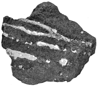
Fig. 2.—Elongation and branching of steam-vesicles in a lava, Kilninian, Isle of Mull, a little less
than natural size.
Examples, however, are now accumulating which certainly prove that, in
some cases, the vesicles were filled up during the volcanic period. Among
the Tertiary basalt-plateaux of the Inner Hebrides, for instance, it can be
shown that the lavas were already amygdaloidal before the protrusion of the
gabbros and granophyres which mark later stages of the same continuous
volcanic history, and even before the outpouring of much of the basalt of
these plateaux. Not improbably the mineral secretions were largely due to
the influence of hot volcanic vapours during the eruption of the basalts.
This subject will be again referred to in the description of the Tertiary
volcanic series.
Vesicular structure is more commonly and perfectly developed among
the lavas which are basic and intermediate in composition than among
those which are acid.
While the existence of a highly vesicular or scoriaceous structure may
generally be taken as proof that the rock displaying it flowed out at the
surface as a lava, other evidence pointing to the same conclusion may often
be gathered from the rocks with which the supposed lava is associated.
Where, for example, a scoriaceous lava is covered with stratified deposits
which contain pieces of that lava, we may be confident that the rock is an
interstratified or contemporaneous sheet. It has been erupted after the
deposition of the strata on which it rests, and before that of the strata
which cover it and contain pieces of it. In such a case, the geological date
of the eruption could be precisely defined. Illustrations of this reasoning
will be given in Chapter iv., and in the account of the volcanic series
of Carboniferous age in Central Scotland, where a basic lava can sometimes
be proved to be a true flow and not an intrusive sill by the fact that
portions of its upper slaggy surface are enclosed in overlying sandstone,
shale or limestone.
2. The presence of GLASS, or of some result of the devitrification of an
original glass, is an indication that the rock which exhibits it has once been
in a state of fusion. Even where no trace of the original vitreous condition
may remain, stages in its devitrification, that is, in its conversion into a
stony or lithoid condition, may be traceable. Thus what are called spherulitic
and perlitic structures (which will be immediately described), either
visible to the naked eye or only observable with the aid of the microscope,
afford evidence of the consolidation and conversion of a glassy into a lithoid
substance.
Striking evidence of the former glassy, and therefore molten, condition
of many rocks now lithoid is to be gained by the examination of thin
slices of them under the microscope. Not only are vestiges of the original
glass recognizable, but the whole progress of devitrification may be followed
into a crystalline structure. The primitive crystallites or microlites of
different minerals may be seen to have grouped themselves together into
more or less perfect crystals, while scattered crystals of earlier consolidation
have been partially dissolved in and corroded by the molten glass. These
and other characteristics of once fused rocks have to a considerable extent
been imitated artificially by MM. Fouqué and Michel Lévy, who have fused
the constituent minerals in the proper proportions.
Since traces of glass or of its representative devitrified structures are so
abundantly discoverable in lavas, we may infer the original condition of most
lavas to have been vitreous. Where, for instance, the outer selvages of a
basic dyke or sill are coated with a layer of black glass which rapidly passes
into a fine-grained crystalline basalt, and then again into a more largely
crystalline or doleritic texture in the centre, there can be no hesitation in
believing that glassy coating to be due to the sudden chilling and consolidation
of the lava injected between the cool rocks that enclose it. The part
that solidified first may be regarded as probably representing the condition
of the whole body of lava at the time of intrusion. The lithoid or crystalline
portion between the two vitreous outer layers shows the condition
which the molten rock finally assumed as it cooled more slowly.
Some lavas, such as obsidians and pitchstones, have consolidated in the
glassy form. More usually, however, a lithoid structure has been developed,
the original glass being only discoverable by the microscope, and often not
even by its aid. Two varieties of devitrification may be observed among
lavas, which, though not marked off from each other by any sharp lines, are
on the whole distinctive of the two great groups of acid and basic rocks.
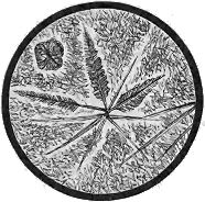
Fig. 3.—Microlites of the Pitchstone of
Arran (magnified 70 diameters).
(1) Among the acid rocks, what is called the Felsitic type of devitrification
is characteristic. Thus, obsidians pass by intermediate stages from a
clear transparent or translucent glass into a
dull flinty or horny mass. When thin slices
of these transitional forms are examined under
the microscope, minute hairs and fibres or
trichites, which may be observed even in the
most perfectly glassy rocks, are seen to increase
in number until they entirely take
the place of the glass. Microlites of definite
minerals may likewise be observed, together
with indefinite granules, and the rock finally
becomes a rhyolite, felsite or allied variety
(Fig. 3).
At the same time it should be observed
that, even in the vitreous condition of a
lava, definite crystals of an early consolidation were generally already
present. Felspars and quartz, usually in large porphyritic forms, may
be seen in the glass, often so corroded as to indicate that they were in
course of being dissolved in the magma at the time of the cooling and solidification
of the mass. In obsidians and pitchstones such relics of an earlier
or derived series of crystallized minerals may often be recognized, while in
felsites and quartz-porphyries they are equally prominent. Where large
dispersed crystals form a prominent characteristic in a rock they give rise
to what is termed the Porphyritic structure.
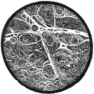
Fig. 4.—Perlitic structure in Felsitic
Glass, Isle of Mull (magnified). |
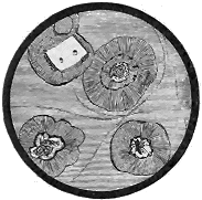
Fig. 5.—Spherulitic structure
(magnified). |
Accompanying the passage of glass into stone, various structures make
their appearance, sometimes distinctly visible to the naked eye, at other
times only perceptible with the aid of the microscope. One of these structures,
known as Perlitic (Fig. 4), consists in the formation of minute curved
or straight cracks between which the vitreous or felsitic substance, during its
contraction in cooling, assumed a finely globular form.
Another structure, termed Spherulitic (Fig. 5), shows the development
of globules or spherules which may range from grains of microscopic minuteness
up to balls two inches or more in diameter. These not infrequently
present a well-formed internal fibrous radiation, which gives a black cross
between crossed Nicol prisms. Spherulites are more especially developed
along the margins of intrusive rocks, and may be found in dykes, sills and
bosses (see Figs. 375 and 377). Where the injected mass is not thick it
may be spherulitic to the very centre, as can be seen among the felsitic
and granophyric dykes of Skye.
Some felsitic lavas possess a peculiar nodular structure, which was
developed during the process of consolidation. So marked does this arrangement
sometimes become that the rocks which display it have actually been
mistaken for conglomerates. It is well exhibited among the Lower Silurian
lavas of Snowdon, the Upper Silurian lavas of Dingle, and the Lower Old
Red Sandstone lavas near Killarney.
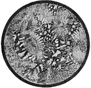
Fig. 6.—Micropegmatitic or Granophyric
structure in Granophyre, Mull (magnified). |
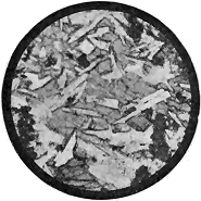
Fig. 7.—Ophitic structure in Dolerite,
Gortacloghan, Co. Derry (magnified). |
A marked structure among some intrusive rocks, especially of an acid
composition, is that called Micropegmatitic or Granophyric. It consists in a
minute intergrowth of two component minerals, especially quartz and felspar,
and is more especially characteristic of certain granitic or granitoid rocks
which have consolidated at some distance from the surface and occur as
bosses, sills and dykes. It is also met with, however, in some basic sills.
Examples of all these and other structures will occur in the course of the
following description of British volcanic rocks.
(2) The second type of devitrification, conspicuous in rocks of more
basic composition, is marked by a more complete development of crystallization.
Among basic, as among acid rocks, there are proofs of the consolidation
of definite minerals at more than one period. Where the molten
material has suddenly cooled into a black glass, porphyritic felspars or
other minerals are often to be seen which were already floating in the
magma in its molten condition. During devitrification, however, other felspars
of a later period of generation made their appearance, but they are
generally distinguishable from their predecessors. Probably most basic and
intermediate rocks, when poured out at the surface as lavas, were no longer
mere vitreous material, but had already advanced to various stages of progress
towards a stony condition. These stages are still to some extent traceable
by the aid of the microscope.
Microlites of the component minerals are first developed, which, if the
process of aggregation is not arrested, build up more or less perfect crystals
or crystalline grains of the minerals. Eventually the glass may be so completely
devitrified by the development of its constituent minerals as to be
wholly used up, the rock then becoming entirely crystalline, or to survive
only in scanty interstitial spaces. In the family of the basalts and dolerites
the gradual transition from a true glass into a holocrystalline compound
may be followed with admirable clearness. The component minerals have
sometimes crystallized in their own distinct crystallographic forms (idiomorphic);
in other cases, though thoroughly crystalline, they have assumed
externally different irregular shapes, fitting into each other without their
Proper geometric boundaries (allotriomorphic).
A specially characteristic feature of many basic rocks is the presence of
what is termed an Ophitic structure (Fig. 7). Thus the component crystals
of pyroxene occur as large plates separated and penetrated by small needles
and crystals of felspar. The portions of pyroxene, divided by the enclosed
felspar, are seen under the microscope to be in optical continuity, and to have
crystallized round the already formed felspar. This structure is never found
in metamorphic crystalline rocks. It has been reproduced artificially from
fusion by Messrs. Fouqué and Michel Lévy.
The name Variolitic is applied to another structure of basic rocks
(Fig. 8), in which, especially towards the margin of eruptive masses, abundant
spheroidal aggregates have been developed from the size of a millet-seed
to that of a walnut, imbedded in a fine-grained or compact greenish matrix
into which the kernels seem to shade off. These kernels consist of silicates
arranged either radially or in concentric zones.
3. Flow-structure is an arrangement of the crystals, vesicles, spherulites,
or devitrification-streaks in bands or lines, which sweep round any
enclosed object, such as a porphyritic crystal or detached spherulite, and
represent the curving flow of a mobile or viscous mass. Admirable examples
of this structure may often be observed in old lavas, as well as in dykes and
sills, the streaky lines of flow being marked as distinctly as the lines of foam
that curve round the boulders projecting from the surface of a mountain-brook.
Flow-structure is most perfectly developed among the obsidians, rhyolites,
felsites and other acid rocks, of which it may be said to be a frequently
conspicuous character (Fig. 9). In these rocks it is revealed by the parallel
arrangement of the minute hair-like bodies and crystals, or by alternate
layers of glassy and lithoid material. The streaky lines thus developed are
sometimes almost as thin and parallel as the leaves of a book. But they
generally show interruptions and curvatures, and may be seen to bend round
larger enclosed crystals, or to gather into eddy-like curves, in such a manner
as vividly to portray the flow of a viscous substance. These lines represent
on a minute scale the same flow-structure which may be traced in large
sheets among the lavas. The porphyritic crystals and the spherulites are
also drawn out in rows in the same general direction. Sometimes, indeed,
the spherulites have been so symmetrically grouped in parallel rows that
they appear as rod-like aggregates which extend along the margin of a dyke.
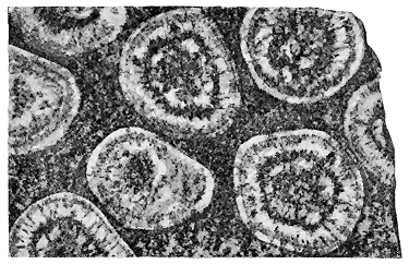
Fig. 8.—Variolitic or Orbicular structure, Napoleonite, Corsica (nat. size).
Among lavas of more basic composition flow-structure is not so often
well displayed. It most frequently shows itself by the orientation of
porphyritic felspars or of lines of steam-vesicles. Occasionally, however,
sheets of basalt may be found in which a distinct streakiness has been
developed owing to variations in the differentiation of the original molten
magma. A remarkable and widespread occurrence of such a structure
is met with among the Tertiary basalt-plateaux of the Inner Hebrides and
the Faroe Islands. In the lower parts of these thick accumulations of successive
lava-sheets, a banded character is so marked as to give the rocks the
aspect of truly stratified deposits. The observer, indeed, can hardly undeceive
himself as to their real nature until he examines them closely. As a full
description of this structure will be given in a later chapter, it may suffice
to state here that the banding arises from two causes. In some cellular
lavas, the vesicles are arranged in layers which lie parallel with the upper
and under surfaces of the sheets. These layers either project as ribs or
recede into depressions along the outcrop, and thus impart a distinctly
stratified aspect to the rock. More frequently, however, the banded
structure is produced by the alternation of different varieties of texture,
and even of composition, in the same sheet of basalt. Lenticular seams of
olivine-basalt may be found intercalated in a more largely crystalline
dolerite. These differences appear to point to considerable variations in
the constitution of the magma from which the lavas issued—variations
which already existed before the discharge of these lavas, and which showed
themselves in the successive outflow of basaltic and doleritic material during
the eruption of what was really, as regards its appearance at the surface, one
continuous stream of molten rock. It is impossible to account for such
variations in the same sheet of lava by any process of differentiation in
the melted material during its outflow and cooling. Analogous variations
occur among the basic sills and bosses of the Tertiary volcanic series of
Britain. These, as will be more fully discussed in later chapters, indicate
a considerable amount of heterogeneity in the deep-seated magma from which
the intrusive sheets and bosses were supplied (see vol. ii. pp. 329, 342).
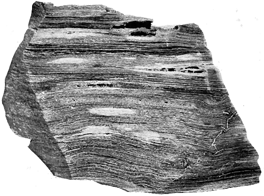
Fig. 9.—Flow-structure in Rhyolite, Antrim, slightly reduced.
It is a common error to assume that flow-structure is a distinctive
character of lavas that have flowed out at the surface. In reality some
of the most perfect examples of the structure occur in dykes and sills, both
among acid and basic rocks. Innumerable instances might be quoted from
the British Isles in support of this statement.
Although, in the vast majority of cases, the presence of flow-structure
may be confidently assumed to indicate a former molten condition of the
rock in which it occurs, it is not an absolutely reliable test for an igneous
rock. Experiment has shown that under enormous pressure even solid
metals may be made to flow into cavities prepared for their reception.
Under the vast compression to which the earth's crust is subjected during
terrestrial contraction, the most obdurate rocks are crushed into fragments
varying from large blocks to the finest powder. This comminuted
material is driven along in the direction of thrust, and when it comes to
rest presents a streakiness, with curving lines of flow round the larger
fragments, closely simulating the structure of many rhyolites and obsidians.
It is only by attention to the local surroundings that such deceptive resemblances
can be assigned to their true cause.

Fig. 10.—Lumpy, irregular trachytic Lava-streams (Carboniferous), East Linton, Haddingtonshire.
4. The DISPOSITION OF LAVAS IN SHEETS OR BEDS is the result of
successive outflows of molten rock. Such sheets may range from only a
yard or two to several hundred feet in thickness. As a rule, though with
many exceptions, the basic lavas, such as the basalts, appear in thinner beds
than the acid forms. This difference is well brought out if we compare,
for instance, the massive rhyolites or felsites of North Wales with the thin
sheets of basalt in Antrim and the Inner Hebrides. The regularity of the
bedded character is likewise more definite among the basic than among
the acid rocks, and this contrast also is strikingly illustrated by the two
series of rocks just referred to. The rhyolites and felsites, sometimes also
the trachytes and andesites, assume lumpy, irregular forms, and some little
care may be required to trace their upper and under surfaces, and to
ascertain that they really do form continuous sheets, though varying much
in thickness from place to place (Fig. 10). Like modern acid lavas, they
seem to have flowed out in a pasty condition, and to have been heaped up
round the vents in the form of domes, or with an irregular hummocky or
mounded surface. The basalts, and dolerites, and sometimes the andesites,
have issued in a more fluid condition, and have spread out in sheets of more
uniform thickness, as may be instructively seen in the sea-cliffs of Antrim, Mull,
Skye, and the Faroe Islands, where the horizontal or gently-inclined flows
of basalt lie upon each other in even parallel beds traceable for considerable
distances along the face of the precipices (Figs. 11, 265, and 286). The andesites
of the Old Red Sandstone (Figs. 99, 100) and Carboniferous series (Figs.
107, 108, 111, 112, 113, 123) in Scotland likewise form terraced hills.
The length of a lava-stream may vary within wide limits. Sometimes an
outflow of lava has not reached the base of the cone from the side of which
it issued, like the obsidian stream on the flanks of the little cone of the
island of Volcano. In other cases, the molten rock has flowed for forty or
fifty miles, like the copious Icelandic lava-floods of 1783. In the basalt-plateaux
of the Inner Hebrides a single sheet may sometimes be traced for
several miles.
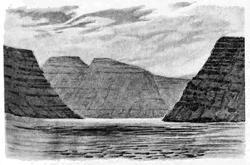
Fig. 11.—View at the entrance of the Svinofjord, Faroe Islands, illustrating the terraced forms
assumed by basic lavas. The island on the left is Borö,
that in the centre Viderö, and that on the right Svinö.
Some lavas, more especially among the basic series, assume in cooling a
Columnar structure, of which two types may be noticed. In one of these the
columns pass with regularity and parallelism from the top to the bottom of
a bed (Figs. 171, 225). The basalt in which Fingal's Cave, in the isle of
Staffa, has been hollowed out may be taken as a characteristic example
(Fig. 266a). Not infrequently the columns are curved, as at the well-known
Clam-shell Cave of Staffa. In the other type, the columns or prisms are
not persistent, but die out into each other and have a wavy, irregular shape,
somewhat like prisms of starch. These two types may occur in successive
sheets of basalt, or may even pass into each other. At Staffa the regularly
columnar bed is immediately overlain with one of the starch-like character.
The columnar structure in either case is a contraction phenomenon, produced
during the cooling and shrinking of the lava. But it is difficult to say what
special conditions in the lava were required for its production, or why it
should sometimes have assumed the regular, at others the irregular form.
It may be found not only in superficial lavas but in equal perfection in
some dykes and intrusive sills or injections, as among the Tertiary volcanic
rocks of the island of Canna (Figs. 307 and 308).
The precipitation of a lava-stream into a lake or the sea may cause the
outer crust of the rock to break up with violence, so that the still molten
material inside may rush into the water. Some basic lavas on flowing into
water or into a watery silt have assumed a remarkable spheroidal sack-like
or pillow-like structure, the spheroids being sometimes pressed into shapes
like piles of sacks. A good instance of this structure occurs in a basalt at
Acicastello in Sicily.[1] A similar appearance will be described in a later
chapter as peculiarly characteristic of certain Lower Silurian lavas associated
with radiolarian cherts in Britain and in other countries (Fig. 12).
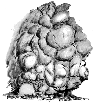
Fig. 12.—Sack-like or pillow-form structure of basic lavas (Lower Silurian), Bennan Head,
Ballantrae, Ayrshire.
It probably seldom happens that a solitary sheet of lava occurs among
non-volcanic sedimentary strata, with no other indication around it of former
volcanic activity. Such an isolated record does not seem to have been met
with in the remarkably ample volcanic register of the British Isles. The
outpouring of molten rock has generally been accompanied with the ejection
of fragmentary materials. Hence among the memorials of volcanic eruptions,
while intercalated lavas are generally associated with sheets of tuff,
bands of tuff may not infrequently be encountered in a sedimentary series
without any lava. Instances in illustration of these statements may be
culled from the British Palæozoic formations back even into the Cambrian
system.
A characteristic feature of some interest in connection with the flow of
lava is the effect produced by it on the underlying rocks. If these are not
firmly compacted they may be ploughed up or even dislocated. Thus the
tuffs of the Velay have sometimes been plicated, inverted, and fractured by
the movement of a flowing current of basalt.[2] The great heat of the lava
has frequently induced considerable alteration upon the underlying rocks.
Induration is the most common result, often accompanied with a reddening
of the altered substance. Occasionally a beautifully prismatic structure has
been developed in the soft material immediately beneath a basalt, as in
ferruginous clay near the village of Esplot in the Velay, in which the close-set
columns are 50 centimetres long and 4 to 5 centimetres in diameter.[3]
Changes of this nature, however, are more frequent among sills than among
superficial lavas. Many examples of them may be gathered from the
Scottish Carboniferous districts.
Variations of structure in single lava-sheets.—From what has
been said above in regard to certain kinds of flow-structure among basic
rocks, it will be evident that some considerable range of chemical, but more
particularly of mineralogical, composition may be sometimes observed even
within the same sheet of lava. Such differences, it is true, are more frequent
among intrusive rocks, especially thick sills and large bosses. But they
have been met with in so many instances among superficial lavas as to show
that they are the results of some general law, which probably has a wide
application among the surface-products of volcanic action. Scrope expressed
the opinion that in the focus of a volcano there may be a kind of filtration
of the constituents of a molten mass, the heavier minerals sinking through
the lighter, so that the upper portions of the mass will become more felspathic
and the lower parts more augitic and ferruginous.[4]
Leopold von Buch found that in some of the highly glassy lavas of the
Canary Islands the felspar increases towards the bottom of the mass, becoming
so abundant as almost to exclude the matrix, and giving rise to a compound
that might be mistaken for a primitive rock.[5]
Darwin observed that in a grey basalt filling up the hollow of an old
crater in James Island, one of the Galapagos group, the felspar crystals
became much more abundant in the lower scoriaceous part, and he discussed
the question of the descent of crystals by virtue of their specific gravity
through a still molten lava.[6]
Mr. Clarence King during a visit to Hawaii found that in every case
where he broke newly-congealed streamlets of lava, "the bottom of the flow
was thickly crowded with triclinic felspars and augites, while the whole
upper part of the stream was of nearly pure isotropic and acid glass."[7] This
subject will be again referred to when we come to discuss the characters of
intrusive sills and bosses, for it is among them that the most marked petrographical
variations may be observed. Examples will be cited both from
the intrusive and extrusive volcanic groups of Britain.
Volcanic cycles.—Closely related to the problem of the range of structure
and composition in a single mass of lava is another problem presented
by the remarkable sequence of different types of lava which are erupted
within a given district during a single volcanic period. Nearly thirty years
ago Baron von Richthofen drew attention to the sequence of volcanic
materials erupted within the same geographical area. He showed, more
especially from observations in Western America, that a definite order of
appearance in the successive species of lava could be established, the earliest
eruptions consisting of materials of an intermediate or average composition,
and those of subsequent outflows becoming on the whole progressively more
acid, but finishing by an abrupt transition to a basic type. His sequence was
as follows: 1. Propylite; 2. Andesite; 3. Trachyte; 4. Rhyolite; 5. Basalt.[8]
This generalisation has been found to hold good over wide regions of
the Old World as well as the New. It is not, however, of universal application.[9]
Examples are not uncommon of an actual alternation of acid and
basic lavas from the same, or at least from adjacent vents. Such an alternation
occurs among the Tertiary eruptions of Central France and among those
of Old Red Sandstone age in Scotland.
The range of variation in the nature of the eruptive rocks during the
whole of a volcanic period in any district may be termed "a volcanic cycle."
In Britain, where the records of many volcanic periods have been preserved,
a number of such cycles may be studied. In this way the evolution of the
subterranean magma during one geological age may be compared with that
of another. It will be one of the objects of the following chapters to trace
out this evolution in each period where the requisite materials for the
purpose are available. We shall find that back to Archæan time a number
of distinct cycles may be observed, differing in many respects from each
other, but agreeing in the general order of development of the successive
eruptions. Leaving these British examples for future consideration, it may
be useful to cite here a few from the large series now collected from the
European continent and North America.[10]
Among the older rocks of the European continent, Prof. Brögger has
shown that in the Christiania district the eruptive rocks which traverse the
Cambrian and Silurian formations began with the outburst of basic material
such as melaphyre, augite-porphyrite, and gabbro-diabase, having from about
44 to about 52 per cent of silica. These were followed by rocks with a
silica-percentage ranging from about 50 to 61, including some characteristic
Norwegian rocks, like the rhomben-porphyry. The acidity continued to
increase, for in the next series of eruptions the silica-percentage rose to
between 60 and 67, the characteristic rock being a quartz-syenite. Then
came deep-seated protrusions of highly acid rocks, varieties of granite,
containing from 68 to 75 per cent of silica. The youngest eruptive
masses in the district show a complete change of character. They are
basic dykes (proterobase, diabase, etc.).[11]
The same author institutes a comparison between the post-Silurian
eruptive series of Christiania and that of the Triassic system in the Tyrol,
and believes that the two cycles closely agree.[12]
During Tertiary time in Central France more than one cycle may be
made out in distinct districts. Thus in the Velay, during the Miocene
Period, volcanic activity began with the outpouring of basalts, followed
successively by trachytes, labradorites and augitic andesites, phonolites
and basalts. The Pliocene eruptions showed a reversion to the intermediate
types of augitic andesites and trachytes, followed by abundant
basalts, which continued to be poured forth in Pleistocene time.[13]
Further north, in Auvergne, where the eruptions come down to a later
period, the volcanic sequence appears to have been first a somewhat acid
group of lavas (trachytes or domites), followed by a series of basalts, then
by andesites and labradorites, the latest outflows again consisting of basalts.[14]
Not less striking is the succession of lavas in the Yellowstone region,
as described by Mr. Iddings. The first eruptions consisted of andesites.
These were followed by abundant discharges of basalt, succeeded by later
outflows of andesite, and of basalt like that previously erupted. After a
period of extensive erosion, occupying a prolonged interval of time, volcanic
energy was renewed by the eruption of a vast flood of rhyolite, after which
came a feebler outflow of basalt that brought the cycle to a close, though
geysers and fumaroles show that the volcanic fires are not yet entirely
extinguished below.[15]
But not only is there evidence of a remarkable evolution or succession
or erupted material within the volcanic cycle of a single geological period.
One of the objects of the present work is to bring forward proofs that such
cycles have succeeded each other again and again, at widely separated
intervals, within the same region. After the completion of a cycle and the
relapse of volcanic energy into repose, there has been a renewal of the
previous condition of the subterranean magma, giving rise ultimately to a
similar succession of erupted materials.
If we are at a loss to account for the changes in the sequence of lavas
during a single volcanic cycle, our difficulties are increased when we find
that in some way the magma is restored each time to somewhat the same
initial condition. Analogies may be traced between the differentiation
which has taken place within a plutonic intrusive boss or sill and the
sequence of lavas in volcanic cycles. It can be shown that though the
original magma that supplied the intrusive mass may be supposed to have
had a fairly uniform composition deep down in its reservoir, differentiation
set in long before the intrusive mass consolidated, the more basic constituents
travelling outwards to the margin and leaving the central parts
more acid. If some such process takes place within a lava-reservoir, it
may account for a sequence of variations in composition. But this would
not meet all the difficulties of the case, nor explain the determining cause
of the separation of the constituents within the reservoir of molten rock,
whether arising from temperature, specific gravity, or other influence. This
subject will be further considered in connection with intrusive Bosses.
Another fact which may be regarded as now well established is the
persistence of composition and structure in the lavas of all ages. Notwithstanding
the oft-repeated cycles in the character of the magma, the materials
erupted to the surface, whether acid or basic, have retained with wonderful
uniformity the same fundamental characteristics. No part of the contribution
of British geology to the elucidation of the history of volcanic action is
of more importance than the evidence which it furnishes for this persistent
sameness of the subterranean magma. An artificial line has sometimes been
drawn between the volcanic products of Tertiary time and those of earlier
ages. But a careful study of the eruptive rocks of Britain shows that
no such line of division is based upon any fundamental differences.
The lavas of Palæozoic time have of course been far longer exposed to
alterations of every kind than those of the Tertiary periods, and certain
superficial distinctions may be made between them. But when these accidental
differences are eliminated, we find that the oldest known lavas exhibit the
same types of structure and composition that are familiar in those of Tertiary
and recent volcanoes. Many illustrations of this statement will be furnished
in later chapters. As a particularly striking instance, I may cite here the
most ancient and most modern lavas of the Grand Cañon of the Colorado.
Mr. Walcott and Mr. Iddings have shown that in the Lower Cambrian, or
possibly pre-Cambrian, formations of that great gorge, certain basic lavas
were contemporaneously interstratified, which, in spite of their vast antiquity,
are only slightly different from the modern basalts that have been poured
over the surrounding plateau.[16]
The chief lavas found in Britain.—Of the lavas which have been
poured out at the surface within the region of the British Isles, the following
varieties are of most frequent occurrence. In the acid series are Rhyolites
and Felsites, but the vitreous forms are probably all intrusive. The intermediate
series is represented by Trachytes and Andesites (Porphyrites),
which range from a glassy to a holocrystalline structure. The basic series
includes Dolerites, Diabases, Basalts, Limburgites (or Magma-basalts, containing
little or no felspar), and Picrites or other varieties of Peridotites.
The intrusive rocks display a greater variety of composition and structure.
The coarser fragmentary materials thrown from volcanic vents are
known as Agglomerates where they show no definite arrangement, and
especially where they actually fill up the old funnels of discharge. When
they have accumulated in sheets or strata of angular detritus outside an
active vent they are termed Breccias, or if their component stones have
been water-worn, Conglomerates. The finer ejected materials may be comprehended
under the general name of Tuffs.
Although these various forms of pyroclastic detritus consist as a rule
of thoroughly volcanic material, they may include fragments of non-volcanic
rocks. This is especially the case among those which represent the earliest
explosions of a volcano. The first efforts to establish an eruptive vent
lead to the shattering of the terrestrial crust, and the consequent discharge
of abundant debris of that crust. The breccias or agglomerates thus produced
may contain, indeed, little or no truly volcanic material, but may be
made up of fragments of granite, gneiss, sandstone, limestone, shale, or
whatever may happen to be the rocks through which the eruptive orifice
has been drilled. If the first explosions exhausted the energy of the vent,
it may happen that the only discharges from it consisted merely of non-volcanic
debris. Examples of this kind have been cited from various old
volcanic districts. A striking case occurs at Sepulchre Mountain in the
Yellowstone Park, where the lower breccias, the product of the earliest
explosions of the Electric Peak volcano, and attaining a thickness of 500
feet, are full of pieces of the Archæan rocks which underlie the younger
formations of that district.[17] These non-volcanic stones do not occur among
the breccias higher up. Obviously, however, though most abundant at
first, pieces of the underlying rocks may reappear in subsequent discharges,
wherever by the energy of explosion, fragments are broken from the walls
of a volcanic chimney and hurled out of the crater. Illustrations of these
features will be given in the account of the British Carboniferous, Permian
and Tertiary volcanic rocks.
It will be obvious that where the component materials of such fragmentary
accumulations consist entirely of non-volcanic rocks, great caution
must be exercised in attributing them to volcanic agency. Two sources of
error in such cases may here be pointed out. In the first place, where
angular detritus has been precipitated into still water, as, for instance,
from a crag or rocky declivity into a lake, a very coarse and tumultuous
kind of breccia may be formed. It is conceivable that, in course of
time, such a breccia may be buried under ordinary sediments, and may
thereby be preserved, while all trace of its parent precipice may have
disappeared. The breccia might resemble some true volcanic agglomerates,
but the resemblance would be entirely deceptive.
In the second place, notice must be taken of the frequent results of
movements within the terrestrial crust, whereby rocks have not only been
ruptured but, as already pointed out, have been crushed into fragments.
In this way, important masses of breccia or conglomerate have been formed,
sometimes running for a number of miles and attaining a breadth of several
hundred feet. The stones, often in huge blocks, have been derived from
the surrounding rocks, and while sometimes angular, are sometimes well-rounded.
They are imbedded in a finer matrix of the same material, and
may be scattered promiscuously through the mass, in such a way as to
present the closest resemblance to true volcanic breccia. Where the
crushed material has included ancient igneous rocks it might deceive even
an experienced geologist. Indeed, some rocks which have been mapped and
described as volcanic tuffs or agglomerates are now known to be only
examples of "crush-conglomerates."[18]
Not only have vast quantities of detritus of non-volcanic rocks been
shot forth from volcanic vents, but sometimes enormous solid masses of
rock have been brought up by ascending lavas or have been ejected by explosive
vapours. Every visitor to the puys of Auvergne will remember the
great cliff-like prominence of granite and mica-schist which, as described long
ago by Scrope, has been carried up by the trachyte of the Puy Chopine,
and forms one of the summits of the dome (Fig. 344). The same phenomenon
is observable at the Puy de Montchar, where large blocks of granite
have been transported from the underlying platform. Abich has described
some remarkable examples in the region of Erzeroum. The huge crater of
Palandokän, 9687 feet above the sea contains, in cliff-like projections from
its walls as well as scattered over its uneven bottom, great masses of
marmorised limestone and alabaster, associated with pieces of the green
chloritic schists, serpentines and gabbros of the underlying non-volcanic
platform. These rocks, which form an integral part of the structure of the
crater, have been carried up by masses of trachydoleritic, andesitic and
quartz-trachytic lavas.[19] Examples will be given in a later chapter showing
how gigantic blocks of mica-schist and other rocks have been carried many
hundred feet upwards and buried among sheets of lava or masses of agglomerates
during the Tertiary volcanic period in Britain (Fig. 262).
In the vast majority of cases, the fragmentary substances ejected by
ancient volcanic explosions, like those of the present day, have consisted
wholly or mainly of material which existed in a molten condition within
the earth, and which has been violently expelled to the surface. Such
ejected detritus varies from the finest impalpable dust or powder up to
huge masses of solid rock. These various materials may come from more
than one source. Where a volcanic orifice is blown out through already
solidified lavas belonging to previous eruptions, the fragments of these lavas
may accumulate within or around the vent, and be gradually consolidated
into agglomerate or breccia. Again, explosions within the funnel may
break up lava-crusts that have there formed over the cooling upper surface
of the column of molten rock. Or the uprising lava in the chimney may
be spurted out in lumps of slag and bombs, or may be violently blown out
in the form of minute lapilli, or of extremely fine dust and ashes.
Although in theory these several varieties of origin may be discriminated,
it is hardly possible always to distinguish them among the products of
ancient volcanic action. In the great majority of cases old tuffs, having
been originally deposited in water, have undergone a good deal of decomposition,
and such early alteration has been aggravated by the subsequent
influence of percolating meteoric water.
Where disintegration has not proceeded too far, the finer particles of
tuffs may be seen to consist of minute angular pieces of altered glass, or of
microlites or crystals, or of some vitreous or semi-vitreous substance, in
which such microlites and crystals are enclosed. It has already been stated
that the occurrence of glass, or of any substance which has resulted from
the devitrification of glass, may be taken as good evidence of former volcanic
activity.
Most commonly, especially in the case of tuffs of high antiquity, like
those associated with the Palæozoic formations, the fresh glassy and microlitic
constituents, so conspicuous in modern volcanic ashes, are hardly to be
recognised. The finer dust which no doubt contained these characteristic
substances has generally passed into dull, earthy, granular, or structureless
material, though here and there, among basic tuffs, remaining as palagonite.
In the midst of this decayed matrix, the lapilli of disrupted lavas may
endure, but it may be difficult or impossible to decide whether they were
derived from the breaking up of older lavas by explosion, or from the
blowing out of the lava-crusts within the funnel.
The cellular structure, which we have seen to be a markedly volcanic
peculiarity among the lavas, is not less so in their fragments among the
agglomerates, breccias and tuffs; indeed it may be said to be eminently
characteristic of them. The vesicles in the lapilli, bombs, and blocks are
sometimes of large size, as in masses of ejected slag, but they range down
to microscopic minuteness. The lapilli of many old tuffs are sometimes
so crowded with such minute pores, as to show that they were originally
true pumice.
The composition of tuffs must obviously depend upon that of the lavas
from which they were derived. But their frequently decayed condition
makes it less easy, in their case, to draw definite boundary-lines between
varieties. In a group of acid lavas, the tuffs may be expected to be also
acid, while among intermediate or basic lavas, the tuffs will generally be
found to correspond. There are, however, exceptions to this general rule.
As will be afterwards described in detail, abundant felsitic tuffs may be
seen among the andesitic lavas of Lower Old Red Sandstone age in Scotland,
and rhyolitic tuffs occur also among the Tertiary basalts of Antrim.
As a rule, basic and intermediate tuffs, like the lavas from which they
have been derived, are rather more prone to decomposition than the acid
varieties. One of their most characteristic features is the presence in them
of lapilli of a minutely vesicular pumice, which will be more particularly
described in connection with volcanic necks, of which it is a characteristic
constituent. Occasional detached crystals of volcanic minerals, either entire
or broken, may be detected in them, though perhaps less frequently than
in the agglomerates. The earthy matrix is generally greenish in colour,
varying into shades of brick-red, purple and brown.
The acid tuffs are, on the whole, paler in colour than the others, sometimes
indeed they are white or pale grey, but graduate into tones of
hæmatitic red or brown, the varying ferruginous tints being indicative of
stages in the oxidation of the iron-bearing constituent minerals. Small
rounded lapilli or angular fragments of felsite or rhyolite may be noticed
among them, sometimes exhibiting the most perfect flow-structure. As typical
examples of such tuffs, I may refer to those of the Pentland Hills, near
Edinburgh, and those that lie between the two groups of basalt in Antrim.
Fig. 13.—Alternations of coarser and finer
Tuff.
Thrown out promiscuously from active vents, the materials that form
tuffs arrange themselves, on the whole,
according to relative size over the surface
on which they come to rest, the largest
being generally grouped nearest to the
focus of discharge, and the finest extending
farthest from it. As the volcanoes of which
records have been preserved among the geological
formations were chiefly subaqueous,
the fragmentary substances, as they fell into
water, would naturally be to some extent
spread out by the action of currents or
waves. They would thus tend to take a
more or less distinctly stratified arrangement.
Moreover, as during an eruption there might be successive paroxysms of
violence in the discharges, coarser and finer detritus would successively
fall over the same spot. In this way, rapid alternations of texture
would arise (Fig. 13). A little experience will enable the observer to
distinguish between such truly volcanic variations and those of ordinary
sedimentation, where, for instance, layers of gravel and sand repeatedly
alternate. Besides the volcanic nature of the fragments and their non-water-worn
forms, he will notice that here and there the larger blocks may
be placed on end—a position the reverse of that usual in the disposal of
aqueous sediments, but one which is not infrequently assumed by ejected
stones, even when they fall through some little depth of water. Further,
the occurrence of large pieces of lava, scattered at random through deposits
of fine tuff, would lead him to recognize the tumultuous discharges of a
volcanic focus, rather than the sorting and sifting action of moving water.
Admirable illustrations of these various characteristics may be gathered
in endless number from the Palæozoic volcanic chronicles of Britain. I may
especially cite the basin of the Firth of Forth as a classical region for the
study of Carboniferous examples.
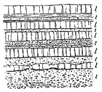
Fig. 14.—Alternations of Tuff (t, t,) with
non-volcanic sediment (l, l).
When the conditions of modern volcanic eruptions are considered, it will
be seen that where ejected ashes and stones fall into water, they will there
mingle with any ordinary sediment that may be in course of deposition at
the time. There will thus be a blending of volcanic and non-volcanic
detritus, and the transition between the two may be so insensible that no
hard line of demarcation can be drawn.
Such intermingling has continually taken
place during past ages. One of the first
lessons learnt by the geologist, who begins
the study of ancient volcanic records, is
the necessity of recognizing this gradation
of material, and likewise the frequently
recurring alternations of true tuff with
shale, sandstone, limestone or other entirely
non-volcanic detritus (Fig. 14). He soon
perceives that such facts as these furnish
him with some of the most striking proofs
of the reality and progress of former
eruptions. The intermingling of much ordinary detritus with the volcanic
material may be regarded as indicative either of comparatively feeble activity,
or at least of considerable distance from the focus of discharge. It
is sometimes possible to trace such intermixtures through gradually augmenting
proportions of volcanic dust and stones, until the deposit becomes wholly
volcanic in composition, and so coarse in texture as to indicate the proximity
of the eruptive vent. On the other hand, the gradual decrease of the
volcanic ejections can be followed in the upward sequence of a series of
stratified deposits, until the whole material becomes entirely non-volcanic.
The occurrence of thin partings of tuff between ordinary sedimentary
strata points to occasional intermittent eruptions of ashes or stones, the
vigour and duration of each eruptive interval being roughly indicated by the
thickness and coarseness of the volcanic detritus. The pauses in the volcanic
activity allowed the deposit of ordinary sediment to proceed unchecked.
The nature of such non-volcanic intercalations gives a clue to the physical
conditions of sedimentation at the time, while their thickness affords
some indication of the relative duration of the periods of volcanic repose.
A little reflection will convince the observer that in such a section as
that represented in Fig. 14 the volcanic intercalations must be regarded as
a mere local accident. Evidently the normal conditions of sedimentation at
the time these strata were accumulated are indicated by the limestone bands
(l, l). Had there been no volcanic eruptions, a continuous mass of limestone
would have been deposited, but this continuity was from time to time
interrupted by the explosions that gave rise to the intercalated bands of
tuff (t, t).
The application of these rules of geological evidence will be best understood
from actual examples of their use. Many illustrations of them will
be subsequently given, more especially from the volcanic records of the
Carboniferous period.
One of the most interesting peculiarities of interstratified tuffs is the
not infrequent occurrence of the remains of plants and animals imbedded
in them. Such remains would have been entombed in the ordinary sediment
had there been no volcanic eruptions, and their presence in the tuffs
is another convincing proof of contemporaneous volcanic action during the
deposition of a sedimentary series. But they may be made to furnish much
more information as to the chronology of the eruptions and the physical
geography of the localities where the volcanoes were active, as will be set
forth farther on.
Tuffs, as already remarked, frequently occur without any accompaniment
of lava, although lavas seldom appear without some tuff. We thus
learn that in the past, as at present, discharges of fragmentary materials
alone were more common than the outflow of lava by itself. The relative
proportions of the lavas and tuffs in a volcanic series vary indefinitely. In
the Tertiary basalt-plateaux of Britain, the lavas succeed each other, sheet
above sheet, for hundreds of feet, with few and trifling fragmental intercalations.
Among the Carboniferous volcanic ejections, on the other hand, many
solitary or successive bands of tuff may be observed without any visible
sheets of lava. Viewed broadly, however, in their general distribution
during geological time, the two great groups of volcanic material may be
regarded as having generally appeared together. In all the great volcanic
series, from the base of the Palæozoic systems up to the Tertiary plateaux,
lavas and tuffs are found associated, much as they are among the ejections
of modern volcanoes. They often alternate, and thus furnish evidence as to
oscillations of energy at the eruptive vents.
Now and then, by the explosions from a volcano at the present day, a single
stone may be ejected at such an angle and with such force as to fall to the
ground at a long distance from the vent. In like manner, among the volcanic
records of former periods, we may occasionally come upon a single block of
lava imbedded among tuffs or even in non-volcanic strata. Where such a
stone has fallen upon soft sediment, it can be seen to have sunk into it,
pressing down the layers beneath it, and having the subsequently deposited
layers heaped over it. An ejected block of this nature is represented among
the tuffs shown in Fig. 13. Another instance from a group of non-volcanic
sediments is given in Fig. 15, and is selected from a number of illustrations
of this interesting feature which have been observed among the Lower
Carboniferous formations of the basin of the Firth of Forth. A solitary
block, imbedded in a series of strata, would not, of course, by itself afford a
demonstration of volcanic activity. There are various ways in which such
stones may be transported and dropped over a muddy water-bottom. They
may, for example, be floated off attached to sea-weeds, or wrapped round
by the roots of trees. But where a block of basalt or other volcanic rock
has obviously descended with such force as to crush down the deposits on
which it fell, and when lavas and tuffs are known to exist in the vicinity,
there can be little hesitation in regarding such a block as having been
ejected from a neighbouring vent, either during an explosion of exceptional
violence or with an unusually low angle of projection.
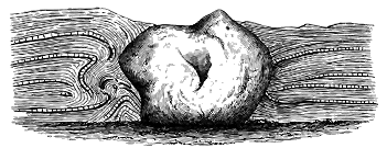
Fig. 15.—Ejected block of Basalt which has fallen among Carboniferous shales and limestones,
shore, Pettycur, Fife.
In conclusion, reference may conveniently be made here to another
variety of fragmental volcanic materials which cannot always be satisfactorily
distinguished from true tuffs, although arising from a thoroughly
non-volcanic agency. Where a mass of lava has been exposed to denudation,
as, for instance, when a volcanic island has been formed in a lake or
in the sea, the detritus worn away from it may be spread out like any
other kind of sediment. Though derived from the degradation of lava,
such a mechanical deposit is not properly a tuff, nor can it even be included
among strictly volcanic formations. It may be called a volcanic conglomerate,
rhyolitic conglomerate, diabase sandstone, felsitic shale, or by any
other name that will adequately denote its composition and texture. But
it may not afford proof of strictly contemporaneous volcanic activity. All
that we are entitled to infer from such a deposit is that, at the time
when it was laid down, volcanic rocks of a certain kind were exposed
at the surface and were undergoing degradation. But the date of their
original eruption may have been long previous to that of the formation of
the detrital deposit from their waste.
Nevertheless, it is sometimes possible to make sure that the conglomerate
or sandstone, though wholly due to the mechanical destruction of already
erupted lavas, was in a general sense contemporaneous with the volcanoes
that gave forth these lavas. The detrital formation may be traced perhaps
up to the lavas from which it was derived, and may be found to be intercalated
in the same sedimentary series with which they are associated.
Or it may contain large bombs and slags, such as most probably came either
directly from explosions or from the washing down of cinder-cones or other
contemporaneously existing volcanic heaps. Examples of such intercalated
conglomerates will be given from the Lower Old Red Sandstone of Central
Scotland and from the Tertiary volcanic plateaux of the Inner Hebrides.
CHAPTER IV — iii. TYPES OF OLD VOLCANOES — iv. DETERMINATION OF THE RELATIVE GEOLOGICAL DATES OF ANCIENT VOLCANOES — v. HOW THE PHYSICAL GEOGRAPHY ASSOCIATED WITH ANCIENT VOLCANOES IS ASCERTAINED
Materials erupted at the Surface—Extrusive Series—continued. iii. Types of old Volcanoes—1.
The Vesuvian Type; 2. The Plateau or Fissure Type; 3. The Puy Type. iv.
Determination of the relative Geological Dates of ancient Volcanoes. v. How the
Physical Geography associated with ancient Volcanoes is ascertained.
Having now taken note of the various materials ejected to the surface from
volcanic orifices, we may pass to the consideration of these orifices themselves,
with the view of ascertaining under what various conditions volcanic
action has taken place in the geological past. We have seen that modern
and not long extinct volcanoes may be grouped into three types, and a
study of the records of ancient volcanoes shows that the same types may
be recognized in the eruptions of former ages. The following chapters will
supply many illustrations of each type from the geological history of the
British Isles. In dealing with these illustrations, however, we must ever
bear in mind the all-powerful influence of denudation. We ought not to
expect to meet with the original forms of the volcanoes. Some little
reflection and experience may be required before we can realize under what
aspect we may hope to recognize ancient and much-denuded volcanoes. It
may therefore be of advantage to consider here, in a broad way, which of
the original characters are most permanent, and should be looked for as
mementoes of ancient volcanoes after long ages of denudation.
The three forms of ancient volcanoes now to be discussed are—1st, the
Vesuvian type; 2nd, the Plateau or Fissure type; and 3rd, the Puy type.
1. The Vesuvian Type.—In this kind of volcano, lavas and fragmental
ejections are discharged from a central vent, which is gradually built up
by successive eruptions of these materials. As the cone increases in size,
parasitic cones appear on its sides, and in the energy and completeness of
their phenomena become true volcanoes, almost rivalling their parent
mountain. Streams of lava descend upon the lower grounds, while showers
of dust and ashes are spread far and wide over the surrounding country.
If a transverse section could be made of a modern Vesuvian cone, the
volcanic pile would be found to consist of alternations of lavas and tuffs,
thickest at the centre, and thinning away in all directions. At some
distance from the crater, these volcanic materials might be seen to include
layers of soil and remains of land-vegetation, marking pauses between the
eruptions, during which soil accumulated and plants sprang up upon it. Where
the lavas and ashes had made their way into sheets of fresh water or into
the sea, they would probably be found interstratified with layers of ordinary
sediment containing remains of the animal or vegetable life of the time.
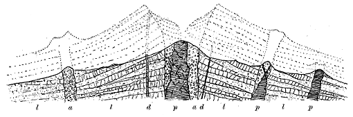
Fig. 16.—Effects of denudation on a Vesuvian cone.
Conceive now the effects of prolonged denudation upon such a pile of
volcanic rocks. The cone will eventually be worn down, the crater will
disappear, and the only relics of the eruptive orifice may be the top of the
central lava-column and of any fragmental materials that solidified within
the vent (Fig. 16). The waste will, on the whole, be greater at the cone
than on the more level areas beyond. It might, in course of time, reach
the original surface of the ground on which the volcano built up its heap
of ejected material. The central lava-plug might thus be left as an isolated
eminence rising from a platform of older non-volcanic rocks, and the distance
between it and the dwindling sheets of lava and tuff which came out of it
would then be continually increased as their outcrop receded under constant
degradation.
This piece of volcanic history is diagrammatically illustrated in Fig. 16.
The original forms of the central volcano and of its parasitic cones are
suggested by the dotted lines in the upper half of the Figure. All this
upper portion has been removed by denudation, and the present surface of
the ground is shown by the uppermost continuous line. The general structure
of the volcanic pile is indicated underneath that line—the lenticular sheets
of lava and tuff (l, l), the dykes (d, d), and the lavas (p, p) and agglomerates
(a, a) of the central vent and of the subordinate cones.
The waste, though greatest on the higher ground of the great cone,
would not stop there. It would extend over the flatter area around the
volcano. Streams flowing over the plain would cut their way down through
the lavas and tuffs, eroding ravines in them, and leaving them in detached
and ever diminishing outliers on the crests of the intervening ridges. We
can easily picture a time when the last of these relics would have been worn
away, and when every vestige of the volcanic ejections would have been
removed, save the lava-column marking the site of the former vent.
Every stage in this process of effacement may be recognized in actual
progress among the extinct volcanoes of the earth's surface. Probably
nowhere may the phenomena be more conveniently and impressively studied
than among the volcanic districts of Central France. On the one hand, we
meet there with cinder-cones so perfect that it is hard to believe them to
have been silent ever since the beginnings of history. On the other hand,
we see solitary cones of agglomerate or of lava, which have been left
isolated, while their once overlying and encircling sheets of ejected material
have been so extensively worn away as to remain merely in scattered patches
capping the neighbouring hills. Valleys many hundreds of feet in depth
have been cut by the rivers through the volcanic sheets and the underlying
Tertiary strata and granite since the older eruptions ceased. And yet these
eruptions belong to a period which, in a geological sense, is quite recent.
It is not difficult to contemplate a future time, geologically not very remote,
when in the valley of the Loire not a trace will remain of the wonderfully
varied and interesting volcanic chronicle of that district, save the plugs that
will mark the positions of the former active vents.
In the British Islands, ancient volcanoes of the Vesuvian type are well
represented among the Palæozoic systems of strata. Their preservation has
been largely due to the fact that they made their appearance in areas that
were undergoing slow subsidence. Their piles of erupted lava and ashes
were chiefly heaped up over the sea-floor, and were buried under the sand,
silt and ooze that gathered there. Thus covered up, they were protected
from denudation. It is only in much later geological ages that, owing to
upheaval, gradual degradation of the surface, and removal of their overlying
cover of stratified formations, they have at last been exposed to waste. The
process of disinterment may be observed in many different stages of progress.
In some localities, only the tops of the sheets of lava and tuff have begun
to show themselves; in others, everything is gone except the indestructible
lava-plug.
These inequalities of denudation arise not only from variations in the
durability of volcanic rocks, but still more from the relative position of
these rocks in the terrestrial crust, and the geological period at which, in
the course of the general lowering of the surface, they have been laid bare.
Not only are volcanic rocks of many different ages, and lie, therefore, on
many successive platforms within the crust of the earth: their places have
been still further dependent upon changes in the arrangement of that crust.
Fracture, upheaval, depression, curvature, unconformable deposition of strata,
have contributed to protect some portions, while leaving others exposed to
attack. Hence it happens that the volcanic record varies greatly in its
fulness of detail from one geological system or one district to another.
Some chapters have been recorded with the most surprising minuteness, so
that the events which they reveal can be realized as vividly as those of a
modern volcano. Others, again, are meagre and fragmentary, because the
chronicle is still for the most part buried underground, or because it has been
so long exposed at the surface that only fragments of it now remain there.
In the descriptions which will subsequently be given of ancient British
volcanoes of the Vesuvian type, it will be shown that at many successive
periods during Palæozoic time, and at many distinct centres, lavas and tuffs
have been piled up to a depth of frequently more than 5000 feet—that is to
say, higher than the height of Vesuvius. Sometimes the vent from which
these materials were ejected can be recognized. In other places, it is still
buried under later formations, or has been so denuded as to be represented
now merely by the column of molten or fragmental rock that finally
solidified in it. Examples will be quoted of such ancient vents, measuring
not less than two miles in diameter, with subsidiary "necks" on their flanks,
like the parasitic cones on Etna.
I shall show that while the ejected volcanic products have accumulated
in greatest depth close to the vent that discharged them, they die away as
they recede from it, sometimes so rapidly that a volcanic pile which is
7000 feet thick around its source may entirely thin out and disappear in a
distance of not more than ten or twelve miles. I shall point out how, as
the lavas and tuffs are followed outwards from their centre, they not only
get thinner, but are increasingly interstratified among the sedimentary
deposits with which they were coeval, and that in this way their limits,
their age, and the geographical conditions under which they were accumulated
can be satisfactorily fixed.
As illustrations of the Vesuvian type in the volcanic history of Britain,
I may refer to the great Lower Silurian volcanoes of Cader Idris, Arenig,
Snowdon and the Lake District, and to the Old Red Sandstone volcanoes
of Central Scotland.
2. The Plateau or Fissure type is, among modern volcanoes, best
developed in Iceland, as will be more fully detailed in Chapter xl. In that
island, during a volcanic eruption, the ground is rent open into long parallel
fissures, only a few feet or yards in width, but traceable sometimes for
many miles, and descending to an unknown depth into the interior. From
these fissures lava issues—in some cases flowing out tranquilly in broad
streams from either side, in other cases issuing with the discharge of slags
and blocks of lava which are piled up into small cones set closely together
along the line of the rent. It was from a fissure of this kind that the
great eruption of 1783 took place—the most stupendous outpouring of lava
within historic time.
By successive discharges of lava from fissures, or from vents opening on
lines of fissure, wide plains may be covered with a floor of rock hundreds or
thousands of feet in thickness, made up of horizontal beds. The original
topography, which might have been undulating and varied, is completely
buried under a vast level lava-desert.
The rivers which drained the country before the beginning of the
volcanic history will have their channels filled up, and will be driven to
seek new courses across the lava-fields. Again and again, as fresh
eruptions take place, these streams will be compelled to shift their line of
flow, each river-bed being in turn sealed up in lava, with all its gravels,
silts and drift-wood. But the rain will continue to fall, and the drainage
to seek its way seaward. When the last eruption ceases, and the rivers are
at length left undisturbed at their task of erosion, they will carve that lava-floor
into deep gorges or open valleys. Where they flow between the
lavas and the slopes against which these ended, they will cut back the
volcanic pile, until in course of time the lavas will present a bold mural
escarpment to the land that once formed their limit. The volcanic plain
will become a plateau, ending off in this vertical wall and deeply trenched by
the streams that wind across it. And if the denudation is continued long
enough, the plateau will be reduced to detached hills, separated by deep and
wide valleys.
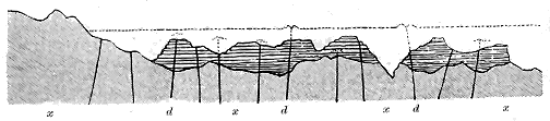
Fig. 17.—Section to illustrate the structure of the Plateau type.
This geological history is illustrated by the diagram in Fig. 17. The
stippled ground underneath (x, x) represents the original undulating surface of
the country on which the plateau eruptions were poured out. The lavas of
these eruptions are shown by the horizontal lines to have entirely buried
the heights and hollows of the old land, and to have risen up to the upper
dotted line, which may be taken to mark the limit reached by the accumulation
of volcanic material. The dark lines (d, d) which come up
through the bedded lavas indicate the dykes with their connected vents.
Denudation has since stripped off the upper part of the volcanic series
down to the uppermost continuous black line which represents the existing
surface of the ground. The level sheets of lava have been deeply trenched,
and in one instance the valley has not only been cut through the volcanic
pile, but has been partly eroded out of the older rocks below. To the
right and left, the lavas end off abruptly in great escarpments.
The succession of events here depicted has occurred more than once in
Britain. The Plateau type is chiefly developed in this country among the
great Tertiary basalt districts of Antrim and the Inner Hebrides, which
reappear in the Faroe Islands, and again still farther north in Iceland.
But it also occurs among the volcanic rocks of the Old Red Sandstone and
Carboniferous periods.
As compared with the other volcanic types, that of the Plateaux is
distinguished by the wide extent of surface which its rocks cover, by the
great preponderance of lavas over tuffs, and by the regularity and persistence
of the individual sheets of rock. In Britain, the plateau-lavas are even still
often approximately horizontal, and lie piled on each other in tolerably regular
beds to a thickness of 1000, and in one place to more than 3000 feet.
They form wide level or gently undulating tablelands, which rise in bold
escarpments from the surrounding country and have been deeply carved
into valleys. The sides of their cliffs and slopes are marked by parallel
lines of terrace, arising from the outcrop of successive sheets of lava (Figs.
11, 265).
With the Tertiary basalt-plateaux are connected thousands of dykes, that
follow each other along nearly parallel lines in a general north-westerly direction,
and mark the position of fissures up which the molten lava ascended.
Occasional necks of agglomerate or basalt indicate the sites of some of the
eruptive vents.
The Carboniferous volcanic plateaux have been more extensively denuded
than those of Tertiary age, so that a large number of their vents have been
laid bare. In general these vents are of comparatively small size, though
larger than those of the Carboniferous Puys. In some districts, abundant
dykes traverse the rocks on which the plateaux rest, though the fissures
seem to have been less numerous than in Tertiary time.
3. The Puy type, as before remarked, takes its name from the well-known
puys, or volcanic cones, of Central France. Volcanoes of this type
form conical hills, generally of small size, consisting usually of fragmental
materials, sometimes of lava. Where a cone is partially effaced by a second,
and even by a third, successive slight shiftings of the vent are to be inferred
(see Figs. 29 and 214). In many cases, no lava has issued from such cones,
nor were the ashes and cinders dispersed far from the vent. Hence, in the
progress of denudation, cones of this kind are easily effaced.
From the uniformity of composition of their materials, the simplicity and
regularity of their forms, and their small size, it may be inferred that many
of these cones were the products of single eruptions. They may conceivably
have been thrown up in a few days, or even in a single day. The history of
Monte Nuovo, in the Bay of Naples, which was formed within twenty-four
hours in the year 1538, is a memorable example of the rapidity with which
a cone more than 400 feet high may be thrown up at some distance from a
central vent.
The smallest independent volcanoes are included in the Puy type. In
many instances the diameter of the funnel has not exceeded a few yards;
the largest examples of the type seldom exceed 1000 feet in width.
Where lavas have been discharged, as well as ashes and stones, a more
vigorous activity is indicated than where merely cones of tuff were formed.
The lavas may come from more than one side of a cone, and may flow in
opposite directions for a distance of several miles. It is observable that
considerable streams of lava have issued from the base of a cinder-cone
without disturbing it. The molten rock has found a passage between the
loose materials and the surface on which they rest,[20] though, in some cases,
the cone may have been thrown up after the emission of the lava.
In the history of a puy there is commonly a first discharge of fragmentary
material; then lava may flow out, followed by a final discharge of loose stones
and ashes. Hence the products of such a vent group themselves into three
layers—two of breccia separated by an intervening sheet of lava.[21]
Great changes are wrought on puys and their connected lavas and tuffs
during the progress of denudation. The cones are eventually destroyed, and
only a stump of agglomerate or lava is left to mark its place. The connection
of a lava-stream with its parent vent may likewise be effaced, and the lava
itself may be reduced to merely a few separate patches, perhaps capping a
ridge, while the surrounding ground has been hollowed into valleys. If the
waste continues long enough, even these outliers will disappear, and nothing
but the neck or stump of the little volcano will remain.
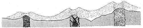
Fig. 18.—Diagram illustrating the structure and denudation of Puys.
The accompanying diagram (Fig. 18) may help to make these changes
more intelligible. The upper dotted lines show the original forms of three
puys with the covering of loose materials discharged by them over the surrounding
ground. The lower shaded portion represents the surface as left by
denudation, and a section of the three vents beneath that surface. The whole
of the cones and craters has here been swept away, and only the volcanic
"neck" is in each case left. In the vent to the right, the material that
fills it up is a coarse agglomerate, which projects as a rounded dome above
the surrounding country. The central pipe is filled with fragmentary
materials, through which molten rock has risen, giving off dykes and
veins. In the vent to the left hand, only lava is seen to occupy the orifice,
representing the column of molten rock which solidified there and brought
the activity of this little volcano to an end. It will be observed that in
each of these volcanic hills the present outlines are very far from being those
of the original volcano, and that the eminence projects because of its greater
resistance to the forces of denudation that have not only removed the superficial
volcanic material, but have made some progress in lowering the level of
the ground on which that material was accumulated.
The typical area for the study of Puys is the extraordinarily interesting
volcanic region of Central France. There the volcanic cones are clustered
in irregular groups, sometimes so close as to be touching each other; elsewhere
separated by intervals of several miles. They may be traced in all
stages of decay, from the most perfect cones and craters to the isolated
eminence that marks the site of a once active chimney. Their lavas, too,
may be seen as detached fragments of plateaux, many hundred feet above the
valleys that have been excavated since they flowed.[22]
Another well-known region of modern Puys is that of the Eifel, where
the cones and craters are often so fresh that it is difficult to believe them
to be prehistoric.[23] One of the most remarkable denuded puy-regions in
Europe covers a wide territory in the Swabian Alps of Würtemberg. No
fewer than 125 denuded necks filled with tuff, agglomerate and basalt have
there been mapped and described. They are of higher antiquity than the
Upper Miocene strata, and have thus probably been exposed to prolonged
denudation. In external aspect and internal structure they present the
closest parallel to the Carboniferous and Permian "necks" of Britain described
in Books VI. and VII. of the present work.[24]
Among the Palæozoic volcanoes of Britain many admirable illustrations
of the Puy type are to be found. Their cones are almost always entirely
gone, though traces of them occasionally appear. The "necks" that show the
position of the vents are in some districts crowded together as thickly as
those of Auvergne. During the Carboniferous and Permian periods in
Central Scotland, clusters of such little volcanoes must have risen among
shallow lagoons and inland sheets of water, casting out their ashes and
pouring forth their little streams of lava over the water-bottom around them
and then dying out. As these eruptions took place in a region that
was gradually subsiding, the cones and their ejected ashes and lavas
were one by one submerged, the looser materials being washed down and
spread out among the silt, sand or mud, and enveloping the remains of any
plants or animals that might be strewn over the floor of the lake or sea.
Hence the Puys of Palæozoic time in Britain have been preserved with
extraordinary fulness of detail. They have been dissected by denudation,
both among the hills of the interior and along the margin of the sea. Their
structure can thus be in some respects made out even more satisfactorily
than that of the much younger and more perfect cones of Central France.
In themselves, accumulations of volcanic materials do not furnish any
exact or reliable evidence of the geological period in which they were
erupted. The lavas of the early Palæozoic ages may, indeed, on careful
examination, be distinguished from those of Tertiary date, but, as we have
seen, the difference is rather due to the effects of age and gradual alteration
than to any inherent fundamental distinction between them. In all essential
particulars of composition and internal structure, the lavas of the Cambrian
or Silurian period resemble those of Tertiary and modern volcanoes. The
igneous magmas which supply volcanic vents thus appear to have been very
much what they are now from early geological epochs. At least no important
difference, according to relative age, has yet been satisfactorily
established among them.
But although the rocks themselves afford no precise or trustworthy clue
to their date, yet where they have been intercalated contemporaneously
among fossiliferous stratified formations, of which the geological horizon can
be determined from included organic remains, it is easy to assign them
to their exact place in geological chronology. A determination of this kind
is only an application of the general principle on which the sequence of the
geological record is defined. A few illustrations will suffice to make this
point quite obvious.
Among the volcanic tuffs in the upper part of Snowdon various fossils
occur, which are identical with those found in the well-known Bala Limestone.
As the accepted reading of such evidence, we conclude that these
tuffs must therefore be of the same geological age as that limestone. Now
the position of this seam of rock has been well established as a definite
horizon in the series of Lower Silurian formations. And we consequently
without hesitation place the eruptions of the Snowdon volcano on that same
platform, and speak of them as belonging to the Bala division of the Lower
Silurian period.
Again, in West Lothian the tuffs and lavas ejected from many scattered
puys were interstratified among shales and limestones in which the characteristic
fossils of the Carboniferous Limestone are abundant. There cannot,
therefore, be any doubt that these eruptions were much younger than those
of Snowdon, and that they took place at the time when the Carboniferous
Limestone was being deposited. We thus speak of them as belonging to
volcanoes which were active in that early part of the Carboniferous period
to which the thick Mountain Limestone of Ireland and Derbyshire belongs.
As yet another illustration of the determination of geological age, an
example from the plateau-type of eruption may be given. The great basalt-plateaux
of Antrim and the Inner Hebrides are built up of lavas that lie
unconformably on the Chalk. They are thus proved to be later than the
Cretaceous system, and this deduction would hold true even if no organic
remains were found associated with the volcanic rocks. But here and there,
intercalated between the basalts, lie layers of shale, limestone and tuff containing
well-preserved remains of plants which are recognizable as older
Tertiary forms of vegetation. This fossil evidence definitely places the date
of the eruptions in older Tertiary time.
It is clear that, proceeding on this basis of reasoning, we may arrange
the successive volcanic eruptions of any given district, make out their order
of sequence in time, and thus obtain materials for a consecutive history of
them. Or, proceeding from that district into other regions, we may compare
its volcanic phenomena with theirs, determine the relative dates of their
respective eruptions, and in this way compile a wider history of volcanic
action in past time. It is on these principles that the general and detailed
chronology of the volcanic rocks of the British Isles has been worked out,
and that the following chapters have been arranged.
While the materials erupted from old volcanic vents tell plainly enough
their subterranean origin, they may leave us quite in the dark as to the
conditions under which they were thrown out at the surface. Yet a careful
examination of the strata associated with them may throw much light
on the circumstances in which the eruptions took place. Many of the
results of such examination will be given in subsequent chapters. I will
here submit illustrations of how four different phases of physical geography
during former volcanic eruptions may be satisfactorily determined.
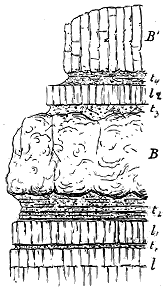
Fig. 19.—Section illustrating submarine
eruptions; alternations of lavas and tuffs with limestones
and shales full of marine organisms.
1. Submarine Eruptions.—As by far the largest accessible part of the
crust of the earth consists of old marine sediments, it is natural that the
volcanic records preserved in that crust should
be mainly those of submarine eruptions. That
many lavas during the geological past were poured
out upon the sea-bottom is plainly shown by the
thick beds of marine organisms which they have
overspread and which lie above them (Fig. 19).
In Central Scotland, for example, sheets of basalt
have flowed over a sea-bottom on which thick
groves of crinoids, bunches of coral and crowds
of sea-shells were living. Not less striking is
the evidence supplied by bands of tuff. Around
Limerick, for instance, the thick Carboniferous
Limestone is interrupted by many thin layers
of tuff marking intervals when showers of volcanic
dust fell over the sea-bottom, killing off the
organisms that lived there. But the limestone
that overlies these volcanic intercalations is again
crowded with fossils, proving that the crinoids,
corals and shells once more spread over the place
and flourished as abundantly as ever above the
tuff.
The accompanying diagram (Fig. 19) illustrates
these statements. At the bottom a thick mass of limestone (l) full of crinoids,
corals, brachiopods and other marine organisms bears witness to a long time
of repose, when the clear sea-water teemed with life. At last a volcanic
explosion took place, which threw out the first seam of tuff (t). But this
was only a transient interruption, for the accumulation of calcareous sediment
was immediately resumed, and the next band of limestone was laid down.
Thereafter a more prolonged or vigorous eruption ejected a larger mass of
dust and stones, which fell over the bottom and prevented the continuation
of the limestone. But that the sea still abounded in life is shown by the
numerous organisms imbedded in the second stratified band of tuff. At
last an access of volcanic vigour gave vent to a stream of slaggy lava, which
rolled over the sea-bottom and solidified in the thick sheet of amydaloidal
basalt marked B. This outflow was followed by a further discharge of
ashes and stones, which, from their absence of stratification, may be supposed
to have been the result of a single explosion, or at least to have fallen too
rapidly for the marine currents to rearrange them in layers. When the
water cleared, the abundant sea-creatures returned, and from their crowded
remains limestone once more gathered over the bottom. Yet the volcanic
history had not then reached its close, for again there came a discharge of
ashes, followed by the outpouring of a second lava, which consolidated as a
sheet of columnar basalt (B').
It is not necessary, in order to prove the eruptions to have been submarine,
that organic remains should be found in the tuffs or between them.
If the volcanic ejections are intercalated among strata which elsewhere can
be proved to be marine, their discharge must obviously have taken place
under the sea. The vent that discharged them may have raised its head
above the sea-level, but its lavas and tuffs were spread out over the adjoining
sea-floor.
2. Lacustrine Eruptions.—The same line of evidence furnishes proof
that some volcanoes arose in inland sheets of water. If their products are
interstratified among sandstones, gravels and shell-marls, wherein the remains
of land-plants, insects and lacustrine shells, are preserved, we may be confident
that the eruptions took place in or near to some lake-basin. The
older lavas and tuffs of Central France supply an instructive example of such
an association. In Britain, the abundant and extensive outpouring of lavas
and tuffs during the time of the Lower Old Red Sandstone probably occurred
in large lakes. Among the sediments of these bodies of water, interstratified
between the volcanic sheets, remains of land-plants are abundant, together
with, here and there, those of myriapods washed down from the woodlands,
and of many forms of ganoid fishes.
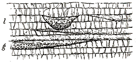
Fig. 20.—Diagram illustrating volcanic eruptions on a
river-plain.
3. Fluviatile Eruptions.—Volcanoes have sometimes arisen on river-plains
or on the edges of valleys
and gorges, and have poured
out their lavas and discharged
their ashes over the channels
or alluvial lands of the streams.
Volcanic materials, usurping the
water-channels, bury or are
interstratified with fluviatile
sand or shingle, containing perhaps
remains of the vegetation
or animal life of the surrounding land. There may thus be a constant
shifting of the river-courses, and a consequent deposit of fluviatile sediment
at many successive levels among the lavas and tuffs. In Fig. 20 some
of these changes are indicated in a series of bedded lavas (l). The lower
part of the diagram shows the dying out of a bed of river gravel (g)
against the sloping end of a lava-stream, and the sealing up of this intercalation
by a fresh outpouring of lava. Higher up in the diagram a section
is shown of a gully or ravine which has been cut out of the lavas by a
stream, and has become choked up with water-worn detritus. Subsequent
outflows of lava have rolled over this channel and sealed it up. Examples
of such intercalations of lava with old river deposits, and of the burying
of water-courses, will be cited in the account of the Tertiary volcanic plateaux
of Britain in Chapter xxxviii.
4. Terrestrial Eruptions.—That volcanoes in former times broke out on
land as well as in water may readily be expected. But it is obvious that
the proofs of a terrestrial origin may not be always easy to obtain, for every
land-surface is exposed to denudation; and thus the relics of the eruptions
of one age may be effaced by the winds, rains, frosts and rivers of the next.
In assigning any volcanic group to a terrestrial origin, we may be guided
partly by negative evidence, such as the absence of all trace of marine
organisms in any of the sedimentary layers associated with the group. But
such evidence standing by itself would not be satisfactory or sufficient. If,
however, between the sheets of lava there occur occasional depressions,
filled with hardened sediment full of land-plants, with possibly traces
of insects and other terrestrial organisms, we may with some confidence
infer that these silted-up hollows represent pools or lakes that gathered
on the surface of the lava-sheets, and into which the vegetation of the
surrounding ground was blown or washed. Rain falling on the rugged
surface of a lava-field would naturally gather into pools and lakes, as the
bottoms of the hollows became "puddled" by the gradual decay of the rock
and the washing of fine silt into the crevices of the lava.
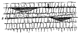
Fig. 21.—Diagram illustrating volcanic eruptions on a
land-surface.
Again, it may be expected that prolonged exposure to the air would give
rise to disintegration of the lava
and to the consequent formation
of soil. Terrestrial vegetation
would naturally spring up
on such soil; trees might take
root upon it. Hence, if another
lava-flood deluged the surface,
the soil and its vegetable mantle
would be entombed under the
molten rock.
These geological changes are represented diagrammatically in Fig. 21.
Two hollows among the lavas are there shown to have been filled with silt,
including successive layers of vegetation now converted into coal. One of
the soils (s) is marked between the lavas, and the charred stump of a tree
with its roots still in another layer of soil higher up is seen to have been
engulphed in the overlying sheet of melted rock.
Admirable illustrations of this succession of events are to be encountered
among the great Tertiary basaltic plateaux which cover so large an area in
the north-west of Europe. Not only has no trace of any marine organism
been found among their interstratified sedimentary layers, but they have
yielded a terrestrial flora which is preserved in hollows between the
successive sheets of basalt. A full account of these rocks will be given in
Book VIII.
CHAPTER V — I. Vents of Eruption — i. Necks of Fragmentary Materials — ii. Necks of Lava-form Material — iii. Distribution of Vents in Relation to Geological Structure-lines — iv. Metamorphism in and around Volcanic Vents—Solfataric Action — v. Inward Dip of Docks towards Necks — vi. Influence of Contemporaneous Denudation upon Volcanic Cones — vii. Stages in the History of old Volcanic Vents
Underground Phases of Volcanic Action. B. Materials injected or consolidated beneath the
Surface—Intrusive Series: I. Vents of Eruption—i. Necks of Fragmentary Materials;
ii. Necks of Lava-form Materials; iii. Distribution of Vents in relation to Geological
Structure-Lines; iv. Metamorphism in and around Volcanic Cones, Solfataric Action;
v. Inward Dip of Rocks towards Necks; vi. Influence of contemporaneous Denudation
upon Volcanic Cones; vii. Stages in the History of old Volcanic Vents.
In our profound ignorance of the nature of the earth's interior, we know as
yet nothing certain regarding the condition and distribution there of those
molten materials which form the prime visible source of volcanic energy.
By the study of volcanoes and their products we learn that the fused substances
are not everywhere precisely the same and do not remain absolutely
uniform, even in the same volcanic region. But in what manner and from
what causes these variations arise is still unknown. We are further aware
that the molten magma, under a centre of volcanic disturbance, manifests
from time to time energetic movements which culminate in eruptions at the
surface. But what may be the exciting cause of these movements, to what
depth they descend, and over what extent of superficies they spread, are
matters regarding which nothing better than conjecture can as yet be
offered. It is true that, in some cases, a magma of fairly uniform composition
has been erupted over a vast tract of the earth's surface, and must
have had a correspondingly wide extent within the terrestrial crust. Thus
in the case of the older Tertiary volcanic eruptions of North-Western
Europe, basalt of practically the same composition was discharged from
thousands of fissures and vents distributed from the south of Antrim northward
beyond the Inner Hebrides, through the chain of the Faroe Islands
and over the whole breadth of Iceland. Under the British Isles alone, the
subterranean reservoirs of molten lavas must have been at least 40,000 square
miles in united area. If they stretched continuously northwards below the
Faroe Islands and Iceland, as is highly probable, that is, for 600 miles
further, their total extent may have been comparable to such a region as
Scandinavia.
Was this vast underground body of lava part of a universal liquid mass
within the globe, or was it rather of the nature of one or more lakes or large
vesicles within the crust? We can only offer speculation for answer. On
the other hand, there seems to be good proof that in some districts, both now
and in former geological periods, such differences exist between the materials
ejected from vents not far distant from each other as to show the existence
of more limited distinct reservoirs of liquid rock underneath.
Some of the questions here asked will be further dealt with in later
pages in connection with such geological evidence as can be produced
regarding them. But it will be found that at every step in the endeavour
to ascertain the origin of volcanic phenomena difficulties present themselves
which are now and may long remain insoluble.
It is a general belief that the first stage in the formation of a volcano
of the Vesuvian type by the efforts of subterranean energy is the rending of
the terrestrial crust in a line of fissure. Some of the most remarkable
groups of active volcanoes on the face of the globe are certainly placed in
rows, as if they had risen along some such great rents. The actual fissure,
however, is not there seen, and its existence is only a matter of probable
inference. Undoubtedly the effect of successive eruptions must be to conceal
the fissure, even if it ever revealed itself at the surface.
What is supposed to have marked the initial step in the formation of a
great volcano is occasionally repeated in the subsequent history of the mountain.
During the convulsive shocks that precede and accompany an eruption,
the sides of the cone, and even sometimes part of the ground beyond,
are rent open, occasionally for a distance of several miles, and on the fissures
thus formed minor volcanoes are built up.
It is in Iceland, as already stated, that the phenomena of fissures are
best displayed. There the great deserts of lava are from time to time
dislocated by new lines of rent, which ascend up to the surface and stretch
for horizontal distances of many miles. From these long narrow chasms
lava flows out to either side; while cones of slag and scoriæ usually form
upon them. This interesting eruptive phase will be more fully described
in the chapters dealing with the Tertiary volcanic rocks of Britain.
There can be no doubt, however, that in a vast number of volcanic vents
of all geological periods no trace can be discovered of their connection with
any fissure in the earth's crust. Such fissures may indeed exist underneath,
and may have served as passages for the ascent of lava to within a greater
or less distance from the surface. But it is certain that volcanic energy has
the power of blowing out an opening for itself through the upper part of the
crust without the existence of any visible fissure there. What may be the
limits of depth at which this mode of communication with the outer air is
possible we do not yet know. They must obviously vary greatly according
to the structure of the terrestrial crust on the one hand, and the amount
and persistence of volcanic energy on the other. We may suppose that
where a fissure terminates upward under a great depth of overlying rock,
the internal magma may rise up to the end of the rent, and even be injected
laterally into the surrounding parts of the crust, but may be unable to complete
the formation of a volcano by opening a passage to the surface. But
where the thickness of rock above the end of the fissure is not too great,
the expansive energy of the vapours absorbed in the magma may overcome
the resistance of that cover, and blow out an orifice by which the volcanic
materials can reach the surface. In the formation of new cones within the
historic period at a distance from any central volcano, the existence of an
open fissure at the surface has not been generally observed. When, for
example, Monte Nuovo was formed, it rose close to the shore among fields
and gardens, but without the appearance of any rent from which its
materials were discharged.
That in innumerable instances during the geological past, similar vents
have been opened without the aid of fissures that reached the surface, will be
made clear from the evidence to be drawn from the volcanic history of the
British Isles. So abundant, indeed, are these instances that they may be
taken as proving that, at least in the Puy type of volcanoes, the actual vents
have generally been blown out by explosions rather than by the ascent of
fissures to the open air.
In cases where, as in Iceland, fissures open at the surface and discharge
lava there, the channel of ascent is the open space between the severed walls
of the rent. Within this space the lava will eventually cool and solidify as
a dyke. It is obvious that a comparatively small amount of denudation
will suffice to remove all trace of the connection of such a dyke with the
stream of lava that issued from it. Among the thousands of dykes belonging
to the Tertiary period in the British Islands, it is probable that many
may have served as lines of escape for the basalt at the surface. But it is
now apparently impossible to distinguish between those which had such a
communication with the outer air and those that ended upward within the
crust of the earth. The structure of dykes will be subsequently discussed
among the subterranean intrusions of volcanic material.
In an ordinary volcanic orifice the ground-plan is usually irregularly
circular or elliptical. If that portion of the crust of the earth through
which the vent is drilled should be of uniform structure, and would thus
yield equally to the effects of the volcanic energy, we might anticipate that
the ascent and explosion of successive globular masses of highly heated
vapours would give rise to a cylindrical pipe. But in truth the rocks of
the terrestrial crust vary greatly in structure; while the direction and force
of volcanic explosions are liable to change. Hence considerable irregularities
of ground-plan are to be looked for among vents.
Some of these irregularities are depicted in Fig. 22, which represents
the ground plan of some vents from the Carboniferous volcanic districts of
Scotland. They are all drawn on the same scale. Other examples will be
cited in later chapters from the same and other parts of the British Isles.
Some of the most marked departures from the normal and simple type
of vent occur where two orifices have been opened close to each other, or
where the same vent has shifted its position (Figs. 29, 125, 205, and 214).
Curiously irregular or elongated forms may thus arise in the resultant
"necks" now visible at the surface. Many striking examples of these
features may be seen among the Carboniferous and Permian volcanoes to be
afterwards described. Occasionally where an open fissure has served as a
vent it has given rise to a long dyke-like mass (No. 1 in Fig. 22).
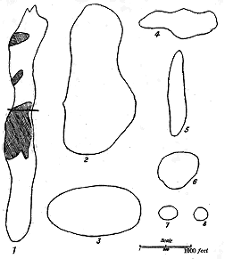
Fig. 22.—Ground-plans of some Volcanic vents from
the Carboniferous districts of Scotland.
1. Linhope Burn, near Mosspaul, Roxburghshire; the
shaded parts are intrusions of trachytic material. 2.
Hazelside Hill, two miles W. from Newcastleton,
Roxburghshire. 3. St. Magdalen's, Linlithgow. 4.
South-west side of Coom's Fell (see
Fig. 174). 5. Neck
on Greatmoor, Roxburghshire. 6. Pester Hill, Tarras
Water. 7. Head of Routing Burn, S.E. side of Hartsgarth
Fell, Liddesdale. 8. Hartsgarth Flow, Liddesdale.
The size of a volcanic vent may vary indefinitely from a diameter of
not more than a yard or two up to
one or two or more miles. As a
rule, the smaller the vents the more
numerously are they crowded together.
In the case of large central
volcanoes like Etna, where many
subsidiary vents, some of them forming
not inconsiderable hills, may
spring up along the sides of the
parent cone, denudation will ultimately
remove all the material that
was heaped up on the surface, and
leave the stumps or necks of the
parasitic vents in groups around the
central funnel.
Each volcanic chimney, by which
vapours, ashes or lava are discharged
at the surface, may be conceived to
descend in a more or less nearly
vertical direction until it reaches the
surface of the lava whence the eruptions
proceed. After the cessation
of volcanic activity, this pipe will be
left filled up with the last material
discharged, which will usually take
the form of a rudely cylindrical column reaching from the bottom of the crater
down to the lava-reservoir. It will be obvious that no matter how great may
be the denudation of the volcano, or how extensive may be the removal of
the various materials discharged over the surrounding ground, the pipe or
funnel with its column of solid rock must still remain. No amount of
waste of the surface of the land can efface that column. Successively lower
and yet lower levels may be laid bare in it, but the column itself goes still
further down. It will continue to make its appearance at the surface until
its roots are laid bare in the lava of the subterranean magma. Hence, of
all the relics of volcanic action, the filled-up chimney of the eruptive vent
is the most enduring. Save where it may have been of the less deep-seated
nature of a "hornito" upon a lava-stream, we may regard it as practically
permanent. The full meaning of these statements will be best understood
from a consideration of the numerous illustrations to be afterwards given.
The stumps of volcanic columns of this nature, after prolonged denudation,
generally project above the surrounding ground as rounded or conical
eminences known as "Necks" (Fig. 23. See also Figs. 52, 82, 102, 109,
123, 133, 144, 178, 192, 195, 203, 204, 209, 294, 298, 306 and 310).
Their outlines, however, vary with the nature of their component materials.
The softer rocks, such as tuffs and agglomerates, are apt to assume the form
of smooth domes or cones, while the harder and especially the crystalline
rocks rise into irregular, craggy hills. Occasionally, indeed, it may happen
that a neck makes no prominence on the surface of the ground, and its
existence may only be discoverable by a careful examination of the geological
structure of the locality. Now and then an old vent will be found not to
form a hill, but to sink into a hollow. Such variations, however, have
little or no reference to original volcanic contours in the history of the
localities which display them. They arise mainly from the differing hardness
and structure of the materials that have filled the vents, and the consequent
diversity in the amount of resistance which they have offered
to the progress of denudation.
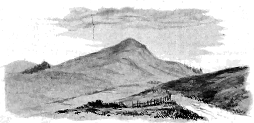
Fig. 23.—View of an old volcanic "Neck" (The Knock, Largs, Ayrshire, a vent of
Lower Carboniferous age).
The materials now found in volcanic funnels are of two kinds:
1st, Fragmentary, derived from volcanic explosions; and 2nd, Lava-form,
arising from the ascent and consolidation of molten rock within the funnel.
By far the most satisfactory evidence of a former volcanic orifice is
furnished by a neck of fragmentary materials. Where "bosses" of crystalline
rock rise to the surface and assume the outward form of necks, we cannot
always be certain that they may not have been produced by subterranean
intrusions that never effected any connection with the surface. In other
words, such bosses may not mark volcanic orifices at all, though they may
have been part of the underground protrusions of volcanoes in their
neighbourhood. But where the chimney has been filled with debris, there
can be no doubt that it truly marks the site of a once active volcano. The
fragmentary material is an eloquent memorial of the volcanic explosions
that drilled the vent, kept it open, and finally filled it up. These
explosions could not have taken place unless the elastic vapours which
caused them had found an escape from the pressure under which they lay
within the crust of the earth. Now and then, indeed, where the outpouring
of lava or some other cause has left cavernous spaces within the crust, there
may conceivably be some feeble explosion there, and some trifling accumulation
of fragmentary materials. But we may regard it as practically certain
that the mass of tumultuous detritus now found in volcanic necks could
not have been formed unless where a free passage had been opened from
the molten magma underneath to the outer surface of the planet.
Considerable diversity may be observed in the nature and arrangement
of the fragmentary materials in volcanic necks. The chief varieties may be
arranged in four groups: (1) Necks of non-volcanic detritus; (2) Necks of
volcanic agglomerate or tuff; (3) Necks of agglomerate or tuff with a
central plug of lava; and (4) Necks of agglomerate or tuff with veins,
dykes or some lateral irregular mass of lava.
(1) Necks of non-volcanic Detritus.—During the first convulsive efforts of
a volcanic focus to find a vent at the surface, the explosions that eventually
form the orifice do so by blowing out in fragments the solid rocks of
the exterior of the terrestrial crust. Of the detritus thus produced, shot
up the funnel and discharged into the air, part may gather round the mouth
of the opening and build up there a cone with an enclosed crater, while part
will fall back into the chimney, either to accumulate there, should the explosions
cease, or to be thrown out again, should they continue. In the
feeblest or most transient kinds of volcanic energy, the explosive vapours
may escape without any accompanying ascent of the molten magma to the
surface, and even without any sensible discharge of volcanic "ashes" from
that magma. In such cases, as I have already pointed out, the detritus of
the non-volcanic rocks, whatever they may be, through which volcanic energy
has made an opening, accumulate in the pipe and eventually consolidate
there. Examples of this nature will be adduced in later chapters from the
volcanic districts of Britain.
Where only non-volcanic materials fill up a vent we may reasonably
infer that the eruptions were comparatively feeble, never advancing beyond
the initial stage when elastic vapours made their escape with explosive
violence, but did not lead to the outflow of lava or the discharge of ashes.
In the great majority of necks, however, traces of the earliest eruptions have
been destroyed by subsequent explosions, and the uprise of thoroughly
volcanic fragments. Yet even among these fragments, occasional blocks
may be detected which have been detached from the rocks forming the walls
of the funnel.
The general name of Agglomerate, as already stated, is given to all
accumulations of coarse, usually unstratified, detritus in volcanic funnels,
irrespective of the lithological nature of the materials. For further and
more precise designation, when an agglomerate is mainly made up of
fragments of one particular rock, the name of that rock may be prefixed as
sandstone-agglomerate, granite-agglomerate, basalt-agglomerate, trachyte-agglomerate.
Volcanic agglomerate is a useful general term that may
include all the coarser detritus ejected by volcanic action.
Where volcanic explosions have been of sufficient violence or long
continuance, the upper part of the funnel may be left empty, and on the
cessation of volcanic activity, may be filled with water and become a lake.
The ejected detritus left round the edge of the orifice sometimes hardly
forms any wall, the crater-bottom being but little below the level of the
surrounding ground. Explosion-lakes are not infrequent in Central France
and the Eifel (Maare). A more gigantic illustration is afforded by the
perfectly circular crater of Coon Butte in Arizona, about 4000 feet in
diameter and 600 feet deep. It has been blown out in limestone, the
debris of which forms a rampart 200 feet high around it. Examples will
afterwards be cited from the Tertiary volcanic plateaux of North-Western
Europe. Vents may also be formed by an engulphment or subsidence of
the material, like that which has taken place at the great lava cauldron of
Hawaii, still an active volcano. The picturesque Crater Lake of Oregon is
an admirable instance of this structure.
(2) Necks of Agglomerate or Tuff.—In the vast majority of cases, the explosions
that clear out a funnel through the rocks of the upper part of the
crust do not end by merely blowing out these rocks in fragments. The
elastic vapours that escape from the molten lava underneath are usually
followed by an uprise of the lava within the pipe. Relieved from the
enormous pressure under which it had before lain, the lava as it ascends is
kept in ebullition, or may be torn into bombs which are sent whirling up
into the air, or may even be blown into the finest dust by the sudden
expansion of the imprisoned steam. If its ascent is arrested within the
vent, and a crust is formed on the upper surface of the lava-column,
this congealed crust may be disrupted and thrown out in scattered pieces
by successive explosions, but may re-form again and again.
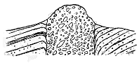
Fig. 24.—Section of neck of agglomerate,
rising through sandstones and shales.
In many vents, both in recent and in ancient times, volcanic progress
has never advanced beyond this early stage of the ejection of stones and
dust. The column of lava, though rising near enough to the surface to
supply by its ebullition abundant pyroclastic
detritus, coarse and fine, has not flowed out
above ground, nor even ascended to the top
of the funnel. It may have formed, at the
surface, cones of stones and cinders with
enclosed craters. But thereafter the eruptions
have ceased. The vents, filled up with
the fragmentary ejected material, have given
passage only to hot vapours and gases. As these gradually ceased, the
volcanoes have become finally extinct. Denudation has attacked their sides
and crests. If submerged in the sea or a lake, the cones have been washed
down, and their materials have been strewn over the bottom of the water.
If standing on the land, they have been gradually levelled, until perhaps
only the projecting knob or neck of solidified rubbish in each funnel has
remained to mark its site. The buried column of compacted fragmentary
material will survive as the only memorial of the eruptions (Fig. 24. For
views of necks formed of agglomerate or tuff see Figs. 23, 82, 102, 123,
144, 178, 192, 203, 204, 209, 210, 212, 216).
The volcanic agglomerates of such vents sometimes include, among
their non-volcanic materials, pieces of rock which bear evidence of having
been subjected to considerable heat (see vol. ii. p. 78). Carbonaceous shales,
for instance, have had their volatile constituents driven off, limestones have
been converted into marble, and a general induration or "baking" may be
perceptible. In other cases, however, the fragments exhibit no sensible
alteration. Fossiliferous limestones and shales often retain their organic
remains so unchanged that specimens taken out of the agglomerate cannot
be distinguished from those gathered from the strata lying in situ outside.
Some stones have evidently been derived from a deeper part of the chimney,
where they have been exposed to a higher temperature than others, or they
may have been lain longer within the influence of hot ascending vapours.
The volcanic materials in agglomerate range in size from the finest dust
to blocks several yards in length, with occasionally even much larger
masses. The proportions of dust to stones vary indefinitely, the finer
material sometimes merely filling in the interstices between the stones, at
other times forming a considerable part of the whole mass.
The stones of an agglomerate may be angular or subangular, but are
more usually somewhat rounded. Many of them are obviously pieces that
have been broken from already solid rock and have had their edges rounded
by attrition, probably by knocking against each other and the walls of the
chimney as they were hurled up and fell back again. Their frequently
angular shapes negative the supposition that they could have been produced
by the discharge of spurts of still liquid lava. As already stated, they
have probably been in large measure derived from the violent disruption of
the solidified cake or crust on the top of the column of lava in the pipe.
Many of them may have been broken off from the layer of congealed lava
that partially coated the rough walls of the funnel after successive uprises
of the molten material. Among them may be observed many large and
small blocks that appear to have been derived from the disruption of true
lava-streams, as if beds of lava had been pierced in the formation of the
vent, or as if those that congealed on the slopes of the cone had been broken
up by subsequent explosions. These fragments of lava are sometimes strongly
amygdaloidal. A characteristic feature, indeed, of the blocks of volcanic
material in the agglomerates is their frequent cellular structure. Many
of them may be described as rough slags or scoriæ. These have generally
come from the spongy crust or upper part of the lava where the imprisoned
steam, relieved from pressure, is able to expand and gather into vesicles.
Less frequently evidence is obtainable that the blocks were partially or
wholly molten at the time of expulsion. Sometimes, for example, a mass
which presents on one side such a broken face as to indicate that it came
from already solidified material, will show on the other that its steam-vesicles
have been pulled out in such a way as to conform to the rounded
surface of the block. This elongation could only take place in lava that
was not yet wholly consolidated. It seems to indicate that such blocks
were derived from a thin hardened crust lying upon still molten material,
and that they carried up parts of that material with them. As each stone
went whirling up the funnel into the open air, its melted part would be
drawn round the gyrating mass, and would rapidly cool there.
In other cases, we encounter true volcanic bombs, that is, rounded or
bomb-shaped blocks of lava, with their vesicles elongated all round them
and conforming to their spherical shape. Sometimes such blocks are
singularly vesicular in the centre, with a more close-grained crust on the
outside. Their rapid centrifugal motion during flight would allow of the
greater expansion of the dissolved steam in the central part of each mass,
while the outer parts would be quickly chilled, and would assume a more
compact texture. Bombs of this kind are met with among ancient volcanic
products, and, like those of modern volcanoes, have obviously been produced
by the ejection of spurts or gobbets of lava from the surface of a mass
in a state of violent ebullition. Occasionally they are hollow inside, the
rotation in these cases having probably been exceptionally rapid.
Passing from the larger blocks to the smaller fragments, we notice the
great abundance of nut-like subangular or rounded pieces of lava in the
agglomerates. These include lumps of fine grain not specially vesicular,
and probably derived from the disruption of solidified rock. But in many
agglomerates, especially those associated with the outpouring of basalts or
other basic lavas (as those of Carboniferous and Tertiary age described in
later chapters), they comprise also vast numbers of very finely cellular
material or pumice. These pumiceous lapilli have been already alluded to
as ingredients of the stratified tuffs. But they are still more characteristic
of the necks, and reach there a larger size, ranging from the finest grains up
to lumps as large as a hen's egg, or even larger.
The peculiar distinctions of this ejected pumice are the extreme minuteness
of its vesicles, their remarkable abundance, their prevalent spherical
forms, and the thinness of the walls which separate them. In these
respects they present a marked contrast to the large irregularly-shaped
steam-cavities of the outflowing lavas, or even of the scoriæ in the
agglomerates.
This characteristic minutely vesicular pumice is basic in composition.
Where not too much decayed, it may be recognized as a basic glass. Thus
among the remarkable agglomerates which fill up the Pliocene or Pleistocene
vents of the Velay, the fragments consist of a dark very basic glass, which
encloses such a multitude of minute steam-cavities that, when seen under the
microscope, they are found to be separated from each other by walls so thin
that the slice looks like a pattern of delicate lace.[25] In necks of earlier
date, such as those of older Tertiary, and still more of Palæozoic, time, the
glass has generally been altered into some palagonitic material.
This finely pumiceous substance appears to be peculiar to the vents and
to the deposits of tuff immediately derived from them. It is not found, so
far as I know, among any of the superficial lavas, and, of course, would not be
looked for among intrusive rocks. It was evidently a special product of the
volcanic chimney, as distinguished from the mass of the magma below. We
may perhaps regards it as in some way due to a process of quiet simmering
within the vent, when the continual passage of ascending vapours kept
the molten lava there in ebullition, and gave it its special frothy or finely
pumiceous character.
The compacted dust, sand or gravelly detritus found in necks, and
comprised under the general name of Tuff, consists partly of the finer particles
produced during the violent disruption of already solidified rocks, partly of
the detritus arising from the friction and impact of stones ascending and
descending above an active vent during times of eruption, and partly of
the extremely light dust or ash into which molten lava may be blown by
violent volcanic explosions. In old volcanic necks, where the rocks have
long been subjected to the influence of percolating meteoric water, it is not
perhaps possible to discriminate, except in a rough way, the products from
these three sources. The more minutely comminuted material has generally
undergone considerable alteration, so that under the microscope it seldom
reveals any distinctive structures. Here and there in a slide, traces may
occasionally be detected of loose volcanic microlites, though more usually
these can only be found in lapilli of altered glass or finely pumiceous
lava.
The composition of the detritus in a neck of agglomerate or tuff has
almost always a close relation to that of any lavas which may have been
emitted from that vent. If the lavas have been of an acid character, such
as rhyolites, felsites or obsidians, the pyroclastic materials will almost
always be found to be also acid. Where, on the other hand, the lavas
have been intermediate or basic, so also will be the tuffs and agglomerates.
Occasionally, however, as has already been pointed out, from the same or
closely adjoining vents lavas of very different chemical composition have been
successively erupted. Felsites or rhyolites have alternated with diabases,
basalts or andesites. In such cases, a commingling of acid and basic
detritus may be observed, as, for example, among the volcanoes of the Old
Red Sandstone. It has even happened sometimes that such a mixture of
material has taken place when only one class of lavas has been poured out
at the surface, as in the agglomerates that fill vents among the basalts of
the Inner Hebrides. But we may be sure that, though not discharged at
the surface, the lavas of which pieces are found in the tuffs must have
risen high enough in the vents to be actually blown out in a fragmentary
form. The occurrence of felsitic fragments among the otherwise basic
agglomerates of Mull and Skye will be described in subsequent pages,
likewise the intercalation of rhyolitic detritus between the basalts of
Antrim. A similar association occurs among the modern vents of Iceland.
Among the contents of the tuffs and agglomerates that occupy old
volcanic vents, some are occasionally to be observed of which the source is
not easily conjectured. Detached crystals of various minerals sometimes
occur abundantly which were certainly not formed in situ, but must have
been ejected as loose lapilli with the other volcanic detritus. Where these
crystals belong to minerals that enter into the composition of the lavas of
the district in which they are found, they may be regarded as having
probably been derived from the explosion of such lavas in the vents, the
molten magma being blown into dust, and its already formed crystals
being liberated and expelled as separate grains. But it seems to be
extremely rare to find any neighbouring lava in which the minerals in
question are so largely and so perfectly crystallized as they are in these
loose crystals of the neck. The beautifully complete crystals of augite
found in the old tuffs of Vesuvius and on the flanks of Stromboli may
be paralleled among Palæozoic tuffs and agglomerates in Britain. Thus the
necks belonging to the Arenig and Llandeilo volcanoes of southern Scotland
are sometimes crowded with augite, varying from minute seed-like grains
up to perfectly formed crystals as large as hazel nuts. The conditions
under which such well-shaped idiomorphic minerals were formed were
probably different from those that governed the cooling and consolidation
of the ordinary lavas.
But besides the minerals that may be claimed as belonging to the
volcanic series of a district, others occur not infrequently in some tuff-necks,
the origin of which is extremely puzzling. Such are the large felspars,
micas, garnets and the various gems that have been obtained from necks.
The large size of some of these crystals and their frequently perfect crystallographic
forms negative the idea that they can, as a rule, be derived from
the destruction of any known rocks, though they may sometimes be conceivably
the residue left after the solution of the other constituents of a
rock by the underground magma, like the large residual felspars enclosed in
some dykes. The crystals in question, however, seem rather to point to
some chemical processes still unknown, which, in the depths of a volcanic
focus, under conditions of pressure and temperature which we may speculate
about but can perhaps hardly ever imitate in our laboratories, lead to the
elaboration of the diamond, garnet, sahlite, smaragdite, zircon and other
minerals.[26] Examples of such foreign or deep-seated crystals will be
described from the probably Permian necks of Central Scotland.
Whatsoever may be the source and nature of the fragmentary materials
that fill old volcanic vents, they present, as a general rule, no definite arrangement
in the necks. Blocks of all sizes are scattered promiscuously through
the agglomerate, just as they fell back into the chimney and came to rest there.
The larger masses are placed at all angles, or stand on end, and are sometimes
especially conspicuous in the centre of a neck, though more usually dispersed
through the whole. Such a thoroughly tumultuous accumulation is precisely
what might be expected where explosions have taken place in still liquid
and in already consolidated lavas, and where the materials, violently discharged
to the surface, have fallen back and come finally to rest in the chimney of
the volcano.
Nevertheless, this absence of arrangement sometimes gives place to a
stratification which becomes more distinct in proportion as the material of
the vent passes from coarse agglomerate into fine tuff. It is possible that
the existence and development of this structure depend on the depth at
which the materials accumulate in the funnel. We may conceive, for
instance, that in the lower parts of the chimney, the stones and dust,
tumultuously falling and rebounding from projections of the rugged walls,
will hardly be likely to show much trace of arrangement, though even there,
if the explosions continue to keep an open though diminishing passage in
the vent, alternations of coarser and finer layers, marking varying phases of
eruptivity, may be formed in the gradually heightening pile of agglomerate.
Rude indications of some such alternations may sometimes be detected in
what are otherwise quite unstratified necks.
In the upper part of a volcanic funnel, however, close to and even
within the crater, the conditions are not so unfavourable to the production
of a stratified arrangement. As the pipe is filled up, and the activity of
eruption lessens, explosions may occur only from the very middle of the
orifice. The debris that falls back into the vent will gather most thickly
round the walls, whence it will slide down to the central, still eruptive hole.
It will thus assume a stratified arrangement, the successive layers lying at
the steepest angles of repose, or from 30° to 35°, and dipping down in an
inverted conical disposition towards the centre. If the process should
continue long enough, the crater itself may be partially or completely filled
up with detritus (Fig. 25).
Of this gradual infilling of a volcanic chimney with stratified agglomerate
and tuff, examples belonging to different geological periods will be cited in
subsequent chapters. I may here especially allude to one of the most recently
observed and best marked illustrations, which occurs on the west side of
Stromö, in the Faroe Islands (see Figs. 310, 311, 312). A neck has there been
filled up with coarse agglomerate, which is rudely stratified, the layers dipping
steeply into the centre, where the tumultuous assemblage of large blocks
no doubt points to the final choking up of the diminished orifice of explosion.
The walls of the neck are nearly vertical, and consist of the bedded basaltic
lavas through which the vent has been opened. They terminate upward
in a conical expansion, evidently the old crater, which has subsequently
been filled up by the inroads of several lava-streams from adjacent vents.
It is here manifest that the bedded agglomerate belongs to the uppermost
part of the volcanic funnel.
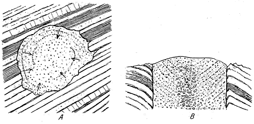
Fig. 25.—Neck filled with stratified tuff. A. ground plan; B. transverse section.
Where vents have been filled up with tuff rather than with agglomerate,
the stratified structure is best developed. Alternations of coarser and
finer detritus give rise to more or less definite layers, which, though inconstant
and irregular, serve to impart a distinctly stratified character
to the mass. Where there has been no subsequent disturbance within a
vent, these layers show the same inward dip towards the centre just referred
to, at the ordinary angles of repose. Now and then, where a neck with
this structure has been laid bare on a beach, its denuded cross-section presents
a series of concentric rings of strata from the walls towards the centre.
Good illustrations of these features are supplied by the probably Permian
necks of eastern Fife (Figs. 25 A and 217).[27]
It has frequently happened, however, that, owing to subsidence of the
materials filling up the vents or to later volcanic disturbances, the compacted
tuffs have been broken up and thrown into various positions, large masses
being even placed on end. Among the Carboniferous and Permian necks
of Central Scotland such dislocated and vertical tuffs are of common occurrence
(see Figs. 145, 218). If, as is probable, we are justified in regarding
the stratified parts of necks as indicative of the uppermost parts of volcanic
funnels, not far from the surface, the importance of this inference
will be best understood when the Carboniferous and Permian volcanoes are
described.
(3) Necks with a central Lava-plug.—Some vents of agglomerate or tuff
are pierced by a plug of lava, as may be instructively seen in many of the
Carboniferous and Permian necks of the centre and south of Scotland (Fig. 26;
compare also Figs. 148, 174, 207, and 226). Where this structure
shows itself, the contrast in hardness and durability between the more
destructible fragmentary material and the solid resisting lava leads to a
topographical distinction in the outer forms of necks. The smooth declivities
of the friable tuffs are crowned or interrupted by more craggy features,
which mark the position of the harder intrusive rock.
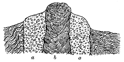
Fig. 26.—Section of neck of agglomerate (a a) with
plug of lava (b).
The plug, like the pipe up which it has risen, is in general irregularly
circular in ground-plan. It may be conceived to be a column of rock,
descending to an unknown depth into the interior, with a casing of
pyroclastic debris surrounding it. It may vary considerably in the proportion
which its cross-section bears to that of the surrounding fragmental
material. Sometimes it does not occupy more than a small part of the
whole, often appearing in the centre.
In other cases, it more than equals
all the rest of the material in the
vent, while instances may be noted
where only occasional patches of
tuff or agglomerate are visible between
the lava-plug and the wall
of the pipe. From these we naturally
pass to the second type of vent,
where no fragmentary material is to
be seen, but where the chimney is now entirely filled with some massive
once-molten rock.
A neck with a lava-plug probably contains the records of two stages in
volcanic progress, the first of which, indicated by the tuff or agglomerate,
was confined to the discharge of fragmentary materials; while the second,
shown by the lava-plug, belonged to the time when, after the earlier
explosions, lava ascended in the vent and solidified there, thus bringing
the eruptions from that particular orifice to an end. Where a small central
column of lava rises through the tuff, we may suppose that the funnel had
been mainly choked up by the accumulation in it of ejected detritus, which
was compacted to a solid mass adhering to the wall of the funnel, but
leaving a central orifice to be kept open by the gradually waning energy of
the volcano. By a final effort that impelled molten rock up that duct and
allowed it to consolidate there, the operations of the vent were brought
to a close.
Where, on the other hand, only occasional strips of tuff or agglomerate
are to be found between the lava-plug and the wall of the pipe, the last
uprise of lava may be supposed to have been preceded by more vigorous
explosions which cleared the throat of the volcano, driving out the accumulated
detritus and leaving only scattered patches adhering to the sides of
the funnel.
There is, no doubt, some downward limit to the production of fragmentary
material, and if we could lay bare successive levels in the chimney of
a volcano we should find the agglomerate eventually replaced entirely
by lava.
The materials of the lava-plugs vary widely in composition. Sometimes
they are remarkably basic, and present rocks of the picrite or limburgite
type; in other cases they are thoroughly acid rocks such as felsite and
granophyre. Many intermediate varieties may be found between these
extremes. It is noteworthy that, in districts where the lavas erupted to
the surface have been andesitic or basaltic, the material which has finally
solidified in the vents is often more acid in composition, trachytic rocks
being specially frequent.
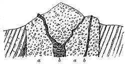
Fig. 27.—Section of agglomerate neck (a a) with
dykes and veins (b b).
(4) Necks with Dykes, Veins, or irregular intrusions of Lava.—While
the presence of a central plug of
lava in a neck of fragmental material
may indicate that the vent was
still to some extent open, there is
another structure which seems to
point to the ascent of lava after
the funnel has been choked up.
Numerous instances have been
observed where lava has been
forced upward through rents in a
mass of tuff or agglomerate, and has solidified there in the form of dykes
or veins (Fig. 27). Illustrations of this structure abound among the Carboniferous
and Permian necks of Britain. Here, again, though on a less
marked scale, the contrast in the amount and character of the weathering
of the two groups of rock gives rise to corresponding topographical features,
which are especially observable in cliffs and coast-sections, where the dykes
and veins project out of the tuffs as dark prominent walls (Figs. 135, 149,
166, 168, 219, 221, 222).
These intrusive injections are generally irregular in their forms, the
lava having evidently been driven through a mass of material which, not
having yet consolidated sufficiently to acquire a jointed structure, afforded
few dominant lines of division along which it could ascend. Now and
then, however, sharply defined dykes or veins, which at a distance look
like dark ribbons, may be seen running vertically or at a high angle, and
with a straight or wavy course, through the fine compacted tuff of a vent.
Frequently the injected material has found its readiest line of ascent along
the walls of the funnel, between the tuff and the surrounding rocks.
Occasionally it has made its way into rents in these rocks, as well as
into the body of the neck.
It is worthy of remark in passing that complete consolidation of the fragmentary
material does not appear to be always requisite in order to allow
of the formation of such fissures as are needed for the production of
dykes. A singularly interesting illustration of this fact may be seen on
the northern crest of the outer crater of the Puy Pariou in Auvergne. A
dyke of andesite 8 or 10 feet broad may there be traced running for a
distance of about 300 yards through the loose material of the cone. The
rock is highly vesicular, and the vesicles have been elongated in the direction
of the course of the dyke so as to impart a somewhat fissile structure to
the mass.
There can be little doubt that the dykes and veins which traverse necks
of agglomerate belong to one of the closing phases in the history of the
vents in which they occur. They could only have been injected after the
pipes had been so choked up that explosions had almost or entirely ceased,
and eruptions had consequently become nearly or quite impossible. They
show, however, that volcanic energy still continued to manifest itself by
impelling the molten magma into these extinct funnels, while at the same
time it may have been actively discharging materials from other still open
vents in the same neighbourhood.
With regard to the composition of these dykes and veins, it may be
remarked that in a district of acid lavas they may be expected to be felsitic
or rhyolitic, sometimes granophyric. Where, on the other hand, the lavas
poured out at the surface have been intermediate or basic, the veins in the
necks may be andesites, basalts or other still more basic compounds. But
it is observable, as in the case of the lava-plugs, that the injections into the
necks may be much more acid than any of the superficial lavas. The
advent of acid material in the later part of a volcano's history has been
already alluded to, and many examples of it will be given in this work.
After all explosions and eruptions have ceased, heated vapours may
still for a long period continue to make their way upward through the
loose spongy detritus filling up the vent. The ascent of such vapours, and
more particularly of steam, may induce considerable metamorphism of the
agglomerate, as is more particularly noticed at p. 71.
The second type of neck is that in which the volcanic pipe has been
entirely filled up with some massive or crystalline rock. As already
remarked, it is not always possible to be certain that bosses of rock, having
the external form of necks of this kind, mark the sites of actual volcanic
orifices. Eruptive material that has never reached the surface, but has been
injected into the crust of the earth, has sometimes solidified there in forms
which, when subsequently exposed by denudation, present a deceptive
resemblance to true volcanic necks. Each example must be examined by
itself, and its probable origin must be determined by a consideration of all
the circumstances connected with it. Where other evidence exists of
volcanic activity, such, for instance, as the presence of bedded tuffs or
intercalated sheets of lava, the occurrence of neck-like eminences or bosses
of felsite, andesite, dolerite, basalt or other eruptive rock, would furnish a
presumption that these marked the sites of some of the active vents of the
period to which the tuffs and lavas belonged.
If a neck-like eminence of this kind were found to possess a circular
or elliptical ground-plan, and to descend vertically like a huge pillar into
the crust of the earth; if the surrounding rocks were bent down towards
it and altered in the manner which I shall afterwards describe in detail;
if, moreover, the material composing the eminence were ascertained to be
closely related petrographically to some parts of the surrounding volcanic
series, it might with some confidence be set down as marking the place of
one of the active vents from which that series was ejected.
The chief contrast in external form between this type of neck and that
formed of fragmentary material arises from differences in the relative durability
of their component substance. The various kinds of lava-form rock
found in necks are, as a whole, much harder and more indestructible than
agglomerates and tuffs. Consequently bosses of them are apt to stand out
more prominently. They mount into higher points, present steeper declivities,
and are scarped into more rugged crags. But essentially they are
characterized by similar conical outlines, and by rising in the same solitary
and abrupt way from lower ground around them (see Figs. 109, 133, and
195, 294).
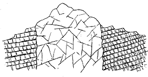
Fig. 28.—Section of neck filled with massive rock.
Various joint-structures may be observed in these necks. In some
cases there is a tendency to separate into joints parallel to the bounding
walls, and occasionally this arrangement goes so far that the rock has
acquired a fissile structure as if it were composed of vertical strata. In
other instances, the rock
shows a columnar structure,
the columns diverging
from the outer margin, or
curving inwards, or displaying
various irregular
groupings. More usually,
however, this jointing is
so indefinite that no satisfactory
connection can be
traced between it and the
walls of the orifice in which the rock has solidified.
Some of the most remarkable examples of necks ever figured and
described are those to which attention was called by Captain Dutton as
displayed in the Zuni plateau of New Mexico, where, amid wide denuded
sheets of basalt, numerous prominent crags mark the sites of eruptive vents.
The basalt of these eminences is columnar, the columns standing or lying
in all sorts of attitudes, and in most cases curved.[28] In the Upper Velay, in
Central France, numerous conspicuous domes and cones of phonolite rise
amidst the much-worn basalt-plateau of that region (Fig. 345). Many
instances will be cited in later chapters from the British Isles.
Where the positions of true volcanic necks can be accurately determined,
it is interesting to study their distribution and their relation to the main
lines of geological structure around them. Sometimes a distinct linear
arrangement can be detected in their grouping. Those of the Lower Old
Red Sandstone of Central Scotland, for instance, can be followed in lines for
distances of many miles (Map No. III). Yet when we try to trace the connection
of such an arrangement with any known great lines of dislocation in
the terrestrial crust, we can seldom establish it satisfactorily. In the case of
the Scottish Old Red Sandstone just cited, it is obvious that the vents were
opened along a broad belt of subsidence between the mountains of crystalline
schist on the north, and those of convoluted Silurian strata on the south,
either margin of that belt being subsequently, if not then, defined by lines
of powerful fault. No vents have risen along these faults, nor has any
relation been detected between the sites of the volcanic foci and dislocations
in the area of ancient depression.
Indeed, it may be asserted of the vents of Britain that they are usually
entirely independent of any faults that traverse at least the upper visible
part of the earth's crust. They sometimes rise close to such lines of
fracture without touching them, but they are equally well developed where
no fractures are to be found. Now and then one of them may be observed
rising along a line of fault, but such a coincidence could hardly fail occasionally
to happen. From the evidence in the British Isles, it is quite
certain that if volcanic vents have, as is possible, risen preferably along
lines of fissure in the terrestrial crust, these lines are seldom those of the
visible superficial faults, but must lie much deeper, and are not generally
prolonged upward to the surface. The frequent recurrence of volcanic
outbursts at successive geological periods from the same or adjacent vents
seems to point to the existence of lines or points of weakness deep down
in the crust, within reach of the internal molten magma, but far beneath
the horizon of the stratified formations at the surface, with their more
superficial displacements.
While sometimes running in lines, old volcanic vents of the Vesuvian
and Puy types often occur also in scattered groups. Two or three may be
found together within an area of a few hundred yards. Then may come
an interval where none, or possibly only a solitary individual, may appear.
And beyond that space may rise another sporadic group. These features
are well exhibited by the Carboniferous and Permian series of Scotland, to
the account of which the reader is referred.
A large neck may have a number of smaller ones placed around it, just
as a modern Vesuvian cone has smaller parasitic cones upon its flanks. An
instructive example of this arrangement is to be seen at the great vent of
the Braid Hills belonging to the Lower Old Red Sandstone and described in
Chapter xx. Other instances may be cited from the Carboniferous and
Permian volcanic series (see Figs. 90, 148, 213).
Not infrequently the irregularities in the ground-plan of a neck, as
already remarked, may be accounted for on the supposition that they
mark the site of more than one vent. Sometimes, indeed, it is possible to
demonstrate the existence of two or even more vents which have been
successively opened nearly on the same spot. The first orifice having
become choked up, another has broken out a little to one side, which in
turn ceasing to be effective from the same or some other cause, has been
succeeded by a third (Fig. 29). The three cones and craters of the little
island of Volcanello supply a singularly perfect recent instance of this
structure (Fig. 214). Here the funnel has twice shifted its position, each
cone becoming successively smaller and partially effacing that which preceded
it. In Auvergne, the Puy de Pariou has long been celebrated as
an example of a fresh cinder-cone partially effacing an earlier one. In the
much denuded Palæozoic volcanic tracts of Britain, where the cones have
long since disappeared and only the stumps of the volcanic cylinders are
left, many illustrations occur of a similar displacement of the funnel, especially
among the volcanoes of the Carboniferous system.
Among the irregularities of necks that may indicate a connection with
lines of fissure, reference may be made here to dykes or dyke-like masses
of agglomerate which are sometimes to be seen among the volcanic districts
of Britain. In these cases the fragmentary materials, instead of lying in a
more or less cylindrical pipe, appear to fill up a long fissure. We may
suppose that the explosions which produced them did actually occur in
fissures instead of in ordinary vents. The remarkable Icelandic fissures
with their long rows of cinder cones are doubtless, at least in their upper
parts, largely filled up with slag and scoriæ. Some illustrations of this
structure will be given in the account of the Carboniferous volcanic rocks
of Scotland (see No. 1 in Fig. 22).
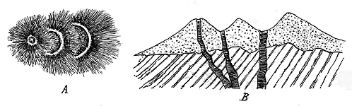
Fig. 29.—Successive shiftings of vents giving rise to double or triple cones.
A, ground-plan; B, vertical section.
There is yet another consideration in regard to the form and size of
necks which deserves attention. Where the actual margin of a neck and
its line of vertical junction with the rocks through which it has been
drilled can be seen, there is no room for dispute as to the diameter of the
original funnel, which must have been that of the actual neck. But in
many cases it is impossible to observe the boundary; not merely because
of superficial soil or drift, but occasionally because the volcanic detritus
extends beyond the actual limits of the funnel. In such cases the necks
have retained some portion of the original volcanic cone which accumulated
on the surface around the eruptive vent. It may even chance that what
appears to be a large neck would be considerably reduced in diameter, and
might be shown to include more than one pipe if all this outer casing could
be removed from it. In Fig. 30, for example, a section is given of a neck (n)
from which on the right-hand side all the cone and surrounding tuffs (t)
have been removed by denudation, the original form of the volcano being
suggested by the dotted lines. On the left side, however, the tuffs which
were interstratified with the contemporaneous sediments are still connected
with the neck, denudation not having yet severed them from it. The overlying
strata (l, l) which originally overspread the extinct volcano have been
bent into an anticline, and the neck of the vent has thus been laid bare by
the removal of the crest of the arch.
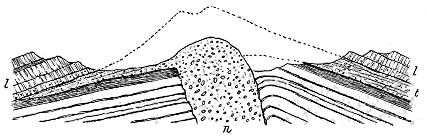
Fig. 30.—Section to show the connection of a neck with a cone and surrounding bedded tuffs.
The instances where a structure of this kind is concealed are probably
fewer in number in proportion to their antiquity. But among Tertiary
cones they may perhaps not be so rare. The possibility of their occurrence
should be kept in view during the investigation of extinct volcanoes. The
term Neck ought not properly to be applied to such degraded volcanic
cones. The true neck still remains preserved in the inside of them. As
illustrative of the structure here referred to, I may cite the example of the
Saline Hill (Fig. 148) and of Largo Law (Fig. 226), both in Fife.
The prolonged ascent of hot vapours, stones, dust and lava, in the
funnel of a volcano must necessarily affect the rocks through which the
funnel has been driven. We may therefore expect some signs of alteration
in the material forming the walls of a volcanic neck. The nature of the
metamorphism will no doubt depend, in the first place, on the character and
duration of the agents producing it, and in the second, on the susceptibility
of the rocks to undergo change. Mere heat will indurate rocks, baking
sandstone, for instance, into quartzite, and shales into porcellanite. But
there will almost invariably be causes of alteration other than mere high
temperature. Water-vapour, for instance, has probably always been one of
the most abundant and most powerful of them. The copious evolution of
steam from volcanoes is one of their most characteristic features at the
present day, and that it was equally so in past time seems to be put beyond
question by the constantly recurring vesicular structure in ancient lavas
and in the lapilli and ejected blocks of old agglomerates and tuffs. Direct
experiment has demonstrated, in the hands of various skilful observers,
from the time of Sir James Hall to that of Professor Daubrée, how powerfully
rocks are acted upon when exposed to superheated vapour of water
under great pressure. But the steam of volcanoes often contains other
vapours or mineralizing agents dissolved in it, which increase its metamorphic
influence. The mineral acids, for instance, must exert a powerful
effect in corroding most minerals and rocks. At the Solfatara of Naples
and at other volcanic orifices in different parts of Italy, considerable alteration
is seen to be due to this cause.
Bearing these well-known facts in mind, we may be prepared to find
various proofs of metamorphism around and within old volcanic vents.
The surrounding rocks are generally much hardened immediately contiguous
to a neck, whether its materials be fragmental or massive. Sandstones,
for example, are often markedly bleached, acquire the vitreous lustre
and texture of quartzite, lose their usual fissility, break irregularly into angular
blocks, and on an exposed surface project above the level of the unaltered
parts beyond. Shales are baked into a kind of porcelain-like substance.
Coal-seams are entirely destroyed for economic purposes, having been burnt
into a kind of cinder or fused into a blistered slag-like mass. Limestones
likewise lose their usual bluish-grey tint, become white and hard, and
assume the saccaroid texture of marble.
The distance to which this metamorphism extends from the wall is,
among the exposed necks in Britain, smaller than might be anticipated.
Thus I have seldom been able to trace it among those of Carboniferous or
Permian age for more than 15 or 20 yards in ordinary arenaceous and
argillaceous strata, even where every detail of a neck and its surroundings
has been laid bare in plan upon a beach. The alteration seems to reach
furthest in carbonaceous seams, such as coals.
It is evident that the element of time must enter into the question of
the amount of metamorphism produced in the terrestrial crust immediately
surrounding a volcanic pipe. A volcano, of which the eruptions
begin and end within an interval of a few days or hours, cannot be
expected to have had much metamorphic influence on the rocks through
which its vent was opened. On the other hand, around a funnel which
served for many centuries as a channel for the escape of hot vapours, ashes
or lava to the surface, there could hardly fail to be a considerable amount of
alteration. The absence or comparatively slight development of metamorphism
at the Carboniferous and Permian necks of Scotland may perhaps
be regarded as some indication that these volcanoes were generally short-lived.
On the other hand, more extensive alteration may be taken as
pointing to a longer continuance of eruptive vigour.
The same causes which have induced metamorphism in the rocks surrounding
a volcanic vent might obviously effect it also among the fragmentary
materials by which the vent may have been filled up. When the
eruptions ceased and the funnel was left choked with volcanic debris, hot
vapours and gases would no doubt still continue for a time to find their
way upward through the loose or partially compacted mass. In their ascent
they would permeate this material, and in the end produce in it a series of
changes similar to, and possibly even more pronounced than, those traceable
in the walls of the vent. Instances of this kind of metamorphism will be
cited in the following chapters (see in particular p. 404).
One concluding observation requires to be made regarding the relation
of old volcanic necks to the rocks which immediately surround them.
Where a vent has been opened through massive rocks, such as granite,
felsite, andesite or basalt, it is generally difficult or impossible to determine
whether there has been any displacement of these rocks, beyond the
disruption of them caused by the explosions that blew out the orifice.
But where the pipe has been drilled through stratified rocks, especially
when these still lie nearly flat, the planes of stratification usually
supply a ready test and measure of any such movement. Investigation of
the volcanic rocks of Britain has shown me that where any displacement
can be detected at a neck, it is almost invariably in a downward direction.
The strata immediately around the vent tend to dip towards it, whatever may
be their prevalent inclination in the ground beyond (Fig. 24). This is the
reverse of the position which might have been expected. It is so frequent,
however, that it appears to indicate a general tendency to subsidence at the
sites of volcanic vents. After copious eruptions, large cavernous spaces may
conceivably be left at the roots of volcanoes, and the materials that have filled
the vents, losing support underneath, will tend to gravitate downwards, and
if firmly welded to their surrounding walls may drag these irregularly down
with them. Examples of such sagging structures are abundantly to be seen
among the dissected vents of the Carboniferous and Permian volcanic series
of Scotland.
It must be remembered that former vents, except those of the later geological
periods, are revealed at the surface now only after extensive denudation.
As a rule, the volcanoes that formed them appeared and continued in eruption
during periods of general subsidence, and were one by one submerged
and buried beneath subaqueous deposits. We can conceive that, while a
volcanic cone was sinking under water, it might be seriously altered in form
and height by waves and currents. If it consisted of loose ashes and stones,
it might be entirely levelled, and its material might be strewn over the floor
of the sea or lake in which it stood. But, as has been already pointed out,
the destruction of the cone would still leave the choked-up pipe or funnel
from which the materials of that cone had been ejected. Though, during
the subsidence, every outward vestige of the actual volcano might disappear,
yet the agglomerate or lava that solidified in the funnel underneath would
remain. And if these materials had risen some way within the cone or
crater, or if they reached at least a higher level in the funnel than the surrounding
water-bottom or land-surface, the destruction of the cone might
leave a projecting knob or neck to be surrounded and covered by the accumulating
sediments of the time. It is thus evident that the levelling of a
cone of loose ashes during gradual subsidence, and the deposition of a contemporary
series of sedimentary deposits, might give rise to a true neck,
which would be coeval with the geological period of the volcano itself.
In practice it is extremely difficult to decide how far any now visible
neck may have been reduced to the condition of a mere stump or core of a
volcano before being buried under the stratified accumulations of its time.
In every case the existence of the neck is a proof of denudation, and perhaps,
in most cases, the chief amount of that denudation is to be ascribed
not to the era of the original volcano, but to the comparatively recent
interval that has elapsed since, in the progress of degradation, the volcanic
rocks, after being long buried within the crust, were once more laid bare by
the continuous waste and lowering of the level of the land.
Let us now try to follow the successive stages in the history of a
volcano after its fires had quite burnt out, and when, slowly sinking in the
waters of the sea or lake wherein it had burst forth, it was buried under an
ever-growing accumulation of sedimentary material. The sand, mud, calcareous
ooze, shell-banks, or whatever may have been the sediment that was
gathering there, gradually crept over the submerged cone or neck, and
would no doubt be more or less mixed with any volcanic detritus which
waves or currents could stir up. If the cone escaped being levelled, or if
it left a projecting neck, this subaqueous feature would be entombed and
preserved beneath these detrital deposits. Hundreds or thousands of feet of
strata might be laid down over the site of the volcano, which would then
remain hidden and preserved for an indefinite period, until in the course of
geological revolutions it might once again be brought to the surface.
These successive changes involve no theory or supposition. They must
obviously have taken place again and again in past time. That they
actually did occur is demonstrated by many examples in the British Isles.
I need only refer here to the interesting cases brought to light by mining
operations in the Dairy coal-fields of Ayrshire, which are more fully described
in Chapter xxvii. (p. 433). In that district a number of cones of tuff, one
of which is 700 feet in height, have been met with in the course of boring
and mining for ironstone and coal. The well-known mineral seams of the
coal-field can be followed up to and over these hidden hills of volcanic tuff
which in the progress of denudation have not yet been laid bare (Fig. 146).
The subsidence which carried down the water-bottom and allowed the
volcanic vents to be entombed in sedimentary deposits may have been in
most cases tolerably equable, so that at any given point these deposits
would be sensibly horizontal. But subsequent terrestrial disturbances
might seriously affect this regularity. The sedimentary formations, piled
above each other to a great depth, and acquiring solidity by compression,
might be thrown into folds, dislocated, upheaved or depressed. The buried
volcanic funnels would, of course, share in the effects of these disturbances,
and eventually might be so squeezed and broken as to be with difficulty recognizable.
It is possible that some of the extreme stages of such subterranean
commotions are revealed among the "Dalradian" rocks of Scotland.
Certain green schists which were evidently originally sediments, and
probably tuffs, are associated with numerous sills and bosses of eruptive
material. The way in which these various rocks are grouped together
strikingly suggests a series of volcanic products, some of the crushed bosses
recalling the forms of true necks in younger formations. But they have
been so enormously compressed and sheared that the very lavas which
originally were massive amorphous crystalline rocks have passed into fissile
hornblende-schists.
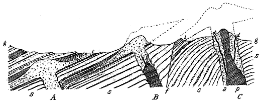
Fig. 31.—Diagram illustrating the gradual emergence of buried volcanic cones through the influence
of prolonged denudation.
Among the Palæozoic systems of Britain, however, where considerable
fracture and displacement have taken place, examples of successive stages in
the reappearance of buried volcanic cones and necks may be gathered in
abundance. As an illustrative diagram of the process of revelation by the
gradual denudation of an upheaved tract of country, Fig. 31 may be
referred to (compare also Fig. 147).
Here three volcanic vents are represented in different stages of re-emergence.
In the first (A) we see a cone and funnel which, after having been
buried under sedimentary deposits (s, s,) have been tilted up by subterranean
movements. The overlying strata have been brought within the influence
of denudation, and their exposed basset edges along the present surface of
the land (g, g) bear witness to the loss which they have suffered. Already,
in the progress of degradation, a portion of the volcanic materials which,
ejected from that vent, were interstratified with the contemporaneous
sediments of the surrounding sea-floor, has been exposed at t. A geologist
coming to that volcanic intercalation would be sure that it pointed to the
existence of some volcanic vent in the neighbourhood, but without further
evidence he would be unable to tell whether it lay to right or left, whether
it was now at the surface or lay still buried under cover of the stratified
deposits which were laid down upon it.
In the second or central example (B) we have a pipe and cone which
have been similarly disturbed. But in this case denudation has proceeded
so far as to reveal the cone and even to cut away a portion of it, as shown
by the dotted lines to the right hand. Owing, however, to the general
inclination of the rocks towards the left, that side of the cone, together with
the tuffs or lavas connected with it, still lies buried and protected under
cover of the sedimentary formations (s, s).
The third example (C) shows a much more advanced stage of destruction.
Here the whole of the cone has been worn away. All the lavas and tuffs
which were ejected from it towards the right have likewise disappeared,
and strata older than the eruptions of this vent now come to the surface
there. To the left, however, a little portion of its lavas still remains at l,
though all the intervening volcanic material has been removed. That
solitary fragment of the outpourings of this volcano once extended further
to the left hand, but the occurrence of the large dislocation (f) has carried
this extension for down below the surface. The vent in this instance,
owing to its position, has suffered more from denudation than the other two.
Yet, judged by the size of its neck, it was probably larger than either
of them, and threw out a more extensive pile of volcanic material. Its
funnel has been filled with agglomerate (a), through which a central plug
of lava (p) has ascended, and into which dykes or veins (d, d), the last efforts
of eruption, have been injected.
This diagram will serve to illustrate the fact already so often insisted on,
that although denudation may entirely remove a volcanic cone, and also all
the lavas and tuffs which issued from it, the actual filled-up pipe cannot be
so effaced, but is practically permanent.
CHAPTER VI — II. Subterranean Movements of the Magma — i. Dykes and Veins — ii. Sills and Laccolites — iii. Bosses (Stocks, Culots)
Underground Phases of Volcanic Action—continued. II. Subterranean Movements of the
Magma: i. Dykes and Veins; ii. Sills and Laccolites; iii. Bosses (Stocks, Culots)—Conditions
that govern the Intrusion of Molten Rock within the Terrestrial Crust.
In the foregoing pages attention has been more specially directed to those
aspects of volcanic energy which reveal themselves above ground and in
eruptive vents. We have now to consider the various ways in which the
molten magma is injected into the crust of the earth.
Such injection must obviously take place during the expulsion of volcanic
materials to the surface. If the explosive violence of an eruption,
or the concomitant movements of the earth's crust, should lead to ruptures
among the subterranean rocks, the molten magma will be forced into these
rents. It is evident that this may happen either with or without any
discharge of lava at the surface. It may be either entirely a plutonic, that
is, a deep-seated phenomenon, or it may be part of a truly volcanic series
of events.
It is clear that, by the study of old volcanoes that have had their
structure laid bare by denudation, we may hope to obtain fresh light in
regard to some of the more deeply-seated features of volcanic energy, which
in a modern volcano are entirely concealed from view. A little reflection
will convince us that the conditions for consolidation within the crust are
so different from those at the surface that we may expect them to make
themselves visible in the internal characters of the rocks.
An essential distinction between underground propulsions of molten
rock and superficial outflows of the same material lies in the fact that
while the latter are free to take any shape which the form and slope of
the ground may permit, the subterranean injections, like metal poured into
a mould, are always bounded by the walls of the aperture into which they
are thrust. According, therefore, to the shape of this aperture a convenient
classification of such intrusions may be made. Where the molten
material has risen up vertical fissures or irregular cracks, it has solidified
as Dykes and Veins. Where it has been thrust between the divisional
planes either of stratified or unstratified rocks, so as to form beds, these are
conveniently known as Sills, Laccolites or Intrusive Sheets. Where it has
taken the form of large cylindrical masses, which, ascending through the
crust, appear at the surface in rounded, elliptical or irregularly-shaped
eminences, these are called Bosses (Stocks, Culots).
Further contrasts between the superficial and subterranean consolidation
of molten material are to be found in the respective textures and minute
structures of the rocks. The deep-seated intrusions are commonly characterized
by a general and markedly greater coarseness of crystallization than
is possessed by lavas poured out at the surface. This difference of texture,
obviously in great measure the result of slower cooling, shows itself in acid,
intermediate, and basic magmas. A lava which at the surface has cooled as
a fine-grained, compact black basalt, in which neither with the naked eye nor
with the lens can the constituent minerals be distinctly determined, may
conceivably be represented at the roots of its parent volcano by a coarse-textured
gabbro, in which the felspars and pyroxenes may have grown into
crystals or crystalline aggregates an inch or more in length. Mr. Iddings
has pointed out that the various porphyrites which form the dykes and
sills of Electric Peak are connected with a central boss of coarsely crystalline
diorite.[29] Examples of the same relation from different volcanic centres in
Britain will be cited in later chapters.
This greater coarseness of texture is shown by microscopic examination
to be accompanied by other notable differences. In particular, the glassy
residuum, or its devitrified representatives, which may be so frequently
detected among the crystals of outflowing lavas, is less often traceable in the
body of subterranean intrusive rocks, though it may sometimes be noticed
at their outer margins where they have been rapidly chilled by contact with
the cool upper part of the crust into which they have been impelled.
Various minerals, the constituents of which exist in the original magma,
but which may be hardly or not all recognisable in the superficial lavas,
have had leisure to crystallize out in the deep-seated intrusions and appear
sometimes among the components of the general body of the rock, or as well-terminated
crystals in its drusy cavities.
Considerable though the variations may be between the petrographical
characters of the intrusive and extrusive rocks of a given district and of the
same eruptive period, they appear generally to lie within such limits as to
suggest a genetic relation between the whole series. Conditions of temperature
and pressure, and the retention or escape of the absorbed vapours which
play so large a part in volcanic activity, must exercise great influence on
the crystallization of constituent minerals, and on the consolidation and
ultimate texture of the rocks. Slow cooling under great pressure and with
the mineralizing vapours still largely retained seems to be pre-eminently
favourable for the production of a holocrystalline texture in deep-seated
portions of the magma, while rapid cooling under merely atmospheric
pressure and with a continuous disengagement of vapours, appears to be
required for the finer grain, more glassy structure, and more vesicular
character of lavas poured out at the surface.
Besides these differences, however, there is evidence of a migration of
the constituent minerals in the body of large intrusive masses before consolidation.
In particular, the heavier and more basic constituents travel
towards the cooling margin, leaving the central portions more acid. This
subject will be more fully considered in connection with the internal constitution
of Bosses, and some British examples will then be cited.
Reference, however, may here be made to one of the most exhaustive and
instructive studies of the relations of the subterranean and superficial erupted
rocks of an old volcano, which will be found in the monograph by Mr. Iddings
on Electric Peak and Sepulchre Mountain in the Yellowstone Park of
Western America. From the data there obtainable he draws the deduction
that one parent magma, retaining the same chemical composition, may result
in the ultimate production of rocks strikingly different from each other in
structure and mineralogical constitution, yet chemically identical. Electric
Peak includes the central funnel filled up with coarsely crystalline diorite,
and having a connected series of sills and dykes of various porphyrites.
Sepulchre Mountain, separated from its neighbouring eminence by a fault of
4000 feet, displays some of the superficial discharges from the vent—coarse
breccias with andesite-lavas. These rocks are not chemically distinguishable
from the intrusive series, but the lavas are, on the whole, more glassy, while
the materials of the bosses, sills and dykes are more crystalline. The latter
display much more visible quartz and biotite.[30]
By practice in the field, supplemented by investigation with the aid of
the microscope, a geologist acquires a power of discriminating with fair
accuracy, even in hand specimens, the superficial from the subterranean
igneous rocks of an old volcanic district.
Denudation, while laying bare the underground mechanism of an ancient
volcano, has not always revealed the evidence of the actual structural relations
of the rocks, or has first exposed and then destroyed it. Sometimes
a mass of eruptive rock has been worn down and left in such an isolated
condition that its connection with the rest of the volcanic network cannot
be determined. So far as its position goes, it might perhaps be either a
remnant of a lava-stream or the projecting part of some deeper-seated
protrusion. But its texture and internal structure will often enable a
confident opinion to be expressed regarding the true relations of such a
solitary mass.
For the study of these manifestations of volcanic energy, the British
Isles may be regarded as a typical region. It was thence that the word
"dyke" passed into geological literature. Thousands of examples of both
dykes and veins may be seen from the Outer Hebrides southwards across
the length and breadth of the southern half of Scotland, far into the north
of England and towards the centre of Ireland. They may be found cutting
the crests of the mountains and extending as reefs below the level of
the sea. They are thus exposed in every conceivable divergence of position
and in endless varieties of enclosing rock. Moreover, they can be shown
to represent a vast range of geological time. One system of them belongs
to some remote part of the Archæan periods, another is as young as the
older Tertiary ages.
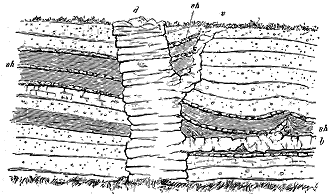
Fig. 32.—Dyke, Vein and Sill.
The dyke (d) rises along a small fault among sandstones, shales, and ironstones (sh), and gives off a vein (v) and an
intrusive sheet or sill (b).
Full details regarding these interesting relics of volcanic activity will
be given in later chapters, especially in Chapters xxxiv. and xxxv. It
may suffice here to note that each of the three types of old volcanoes above
described has, in Britain, its accompaniment of dykes and veins. The plateaux,
however, present by far the most abundant and varied development of them.
The dykes of this series are characterized not only by their prodigious
numbers in and around some of the plateaux, but by the long distances to
which they may be traced beyond these limits. They are chiefly found in
connection with the Tertiary basalt-plateaux, though the Carboniferous
andesite-plateaux present a feebler display of them. The Tertiary dykes
are pre-eminently distinguished by their persistent rectilinear lines, sometimes
for distances of many miles, and their general north-westerly direction.
They form a vast system extending over an area of some 40,000
square miles. Throughout that wide region their persistence of direction
and of petrographical characters point to the former existence of one or
more reservoirs of an andesitic and basaltic magma underneath the northern
half of Britain, and to the rupture of the crust overlying this subterranean
reservoir by thousands of parallel fissures. They thus constitute perhaps
the most astonishing feature in the volcanic history of Tertiary time.
The dykes and veins connected with the puys are mainly to be found at
or close to the vents. Not infrequently they traverse the agglomerates of
the necks, and are sometimes to be traced to a central pipe or core of
basalt.
The larger cones are likewise intersected with similar vertical, inclined
or tortuously irregular walls of intruded lava. Occasionally a radiate
arrangement may be observed in such cases, like that noticeable at some
modern volcanoes, the dykes diverging from the eruptive centre.
Many dykes exist regarding which there is no evidence to connect
them with any actual volcanic rocks. They have been injected into fissures,
but whether this took place during volcanic paroxysms, or owing to some
subterranean movements which never culminated in any eruption, cannot be
decided.
The question of the age of dykes, like that of intrusive masses of all
kinds, is often difficult or impossible to decide. A dyke must of course be
younger than the rocks which it traverses, and a limit to its antiquity is thus
easily fixed. But we cannot always affirm that because a dyke stops short
of a particular rock, or series of rocks, it is older than these. The Hett
Dyke, in the north of England, rises through the Coal-measures, but stops
at the Magnesian Limestone; yet this cessation does not necessarily imply
that the dyke was in place before the deposition of that limestone. The
structure may have arisen from the dyke-fissure having ended at the bottom
of the limestone. Where dykes rise up to the base of an unconformable
formation without in any single case entering it, and where fragments of
them are enclosed in that formation, they must be of higher antiquity, and
must have been laid bare by extensive denudation before the unconformable
strata were deposited upon them. The great system of dykes in the Lewisian
Gneiss of the north-west of Scotland is in this way proved to be much more
ancient than the Torridon Sandstones under which it passes (Figs. 35, 36).
Where two dykes cross each other, it is sometimes not difficult to decide
upon their relative antiquity. In intrusive rocks, the finest-grained parts
are those which lie nearest the outer margin, where the molten material was
rapidly chilled by coming in contact with cool surfaces of rock. Such
"chilled margins" of closer grain are common characteristics of dykes.
Wherever a dyke carries its chilled margin across another dyke, it must be
the younger of the two, and wherever such a margin is interrupted by
another dyke, it must belong to the older.
As a rule, the uprise of molten material in a fissure has so effectually
sealed it up that in the subsequent disturbances of the terrestrial crust the
fissure has not been reopened, though others may have been produced near
it, or across it. Sometimes, however, the enormous tension to which the
crust was exposed opened the fissure once more, sometimes even splitting
a dyke along its centre, and a new ascent of molten rock took place within
the rent. Hence double or treble or compound dykes have been produced.
The second or later infillings are generally somewhat different from the
original dyke. Occasionally, indeed, they present a strong contrast to it.
Thus, among the dykes of Skye examples occur where the centre is occupied
by an acid granophyre, while the sides are occupied by dykes of basalt.
Instances of this compound type of dyke will be given in the account of
the Tertiary volcanic rocks of Britain.
It is obvious that in a wide fissure the central portion may remain
molten for some time after the sides have consolidated. If the fissure
served as a channel for the ascent of lava to the surface, it is conceivable
that the central still fluid part might be driven out and be replaced by
other material from below, and that this later material might differ considerably
in composition from that which first filled the opening. Such,
according to Mr. Iddings, has been the probable history of some of the
dykes at the old volcano of Electric Peak.[31] But we can hardly suppose
that this explanation of compound dykes can have any wide application. It
could only hold good of broad fissures having an outlet, and is probably
inadmissible in the case of the numerous compound dykes not more than
10 or 15 feet in diameter, where the several bands of rock are sharply
marked off from each other. The abrupt demarcation of the materials in
these dykes, their closer texture along their mutual boundaries, the indications
of solution of the older parts of the group by the younger, and of
injection of the latter into the former, show that they belong to separate and
unconnected intrusions. These questions will be again referred to in the
account of the British Tertiary dykes (Chapter xxxv. vol. ii. p. 159).
Another kind of compound dyke has arisen from the manner in which
the original fissure has been produced. While, in general, the dislocation
has taken the form of a single rectilinear rent, which on opening has left
two clean-cut walls, cases occur where the rupture has followed several
parallel lines, and the magma on rising into the rents appears as two or
more vertical sheets or dykes, separated by intervening partitions of the surrounding
rock. Examples of this structure are not infrequent among the
Tertiary dykes of Scotland. One of these may be noticed rising through
the cliffs of Lewisian gneiss on the east coast of the island of Lewis,
south of Stornoway. One of the most extraordinary instances of the same
structure yet observed is that described by Professor A. C. Lawson from the
Laurentian rocks at the mouth of White Gravel River, on the N.E.
coast of Lake Superior. In a breadth of only about 14 feet no less than
28 vertically intrusive sheets or dykes of diabase, from 1 inch to 6½
inches broad, rise through the granite, which is thus split into 27 thin
sheets. The diabase undoubtedly cuts the granite, some of the sheets
actually anastomosing and sending veins into the older rock.[32]
From the evidence supplied by the modern eruptions of Iceland, it is
evident that gaping fissures, which are filled by ascending lava and
thereby converted into dykes, in many instances serve as channels by
which molten rock escapes to the surface. It would be interesting if
any test could be discovered whereby those dykes could be distinguished
which had ever established a connection with the outer air. If the lava
continued to ascend in the fissures, and to pour out in superficial streams
for a long time, the rocks on either side would be likely to undergo
considerably more metamorphism than where there was only one rapid
injection of the magma, which would soon cool. Possibly in the much
greater alteration of the same rocks by some dykes than by others, a sign of
such a connection with the surface may survive. This subject will be again
referred to in the account of the Tertiary dykes of Britain in Book VIII.,
where the whole of the phenomena of this phase of volcanic action will be
fully discussed (see vol. ii. p. 163).
The word "sill," derived from a remarkable sheet of eruptive rock in the
north of England, known as the Great Whin Sill (Chapter xxix.), is now
applied as a convenient general term to masses of intrusive material, which
have been injected between such divisional planes as those of stratification,
and which now appear as sheets or beds (Fig. 33). These masses are likewise
called Intrusive Sheets, and where the injected material has accumulated
in large blister-like expansions, these are known as Laccolites (Fig. 34).
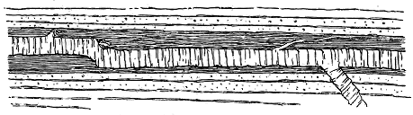
Fig. 33.—Section of Sill or Intrusive Sheet.
Sills vary from only an inch or two up to 500 feet or more in thickness.
Lying, as they frequently do, parallel with strata above and below them,
they resemble in some respects true lava-sheets erupted contemporaneously
with the series of sediments among which they are intercalated. And,
indeed, cases occur in which it is hardly possible to decide whether to regard
a given mass as a sill or as a superficial lava. In general, however, sills
exhibit the coarser texture above referred to as specially characteristic of
subterranean eruptive masses. Moreover they are usually, though not
always, free from the vesicular and amygdaloidal structures of true surface-lavas.
Their under and upper surfaces, unlike the more scoriaceous parts of
lavas, are commonly much closer in grain than the general body of the
mass; in other words, they possess chilled borders, the result of more rapid
consolidation by contact with cooler rock. Again, instead of conforming to
the stratification of the formations among which they lie, as truly interstratified
lavas do, they may be seen to break across the bedding and pursue
their course on a higher or lower platform. The strata that overlie them,
instead of enclosing pieces of them and wrapping round irregularities on
their surface, as in the case of contemporaneously erupted lava-sheets, are
usually indurated, sometimes even considerably altered, while in many cases
they are invaded by veins from the eruptive sheet, or portions of them are
involved in it, and are then much hardened or metamorphosed.
The petrographical character of the sills in a volcanic district depends
primarily on the constitution of the parent magma, whence both they and the
outflowing lavas have issued. Where the lavas are rhyolites or felsites the
sills are acid, where basalts have been erupted the sills are basic, though
there has often been a tendency towards the appearance of more acid
material, such as trachyte. As we have seen, considerable differences in
petrographical characters may arise between the intrusive and extrusive
offshoots from the same parent magma during the course of a volcanic
cycle. This question will be more appropriately discussed together with
the leading characters of Bosses.
Between the upper and under surface of a thick sill considerable petrographical
variation may sometimes be observed, especially where the rock is
of basic constitution. Differences both of texture and even to some extent
of composition can be detected. Sometimes what have been called "segregation
veins" traverse the mass, consisting of the same minerals as the
general body of the rock, but in larger crystals and in somewhat different
proportions. That these veins belong to the period of original consolidation
appears to be shown by the absence of fine-grained, chilled margins, and by
the way in which the component crystals of the veins are interlocked with
those of the body of the rock. Other veins of finer grain and more acid
composition probably belong to a later phase of consolidation, when, after
the separation and crystallization of the more basic minerals, the more acid
mother liquor that remained was, in consequence of terrestrial movements,
injected into cracks in the now solidified, though still highly heated, rock.
Examples of these features will be cited from various geological formations
in the following chapters.
Reference has already been made to the difference occasionally perceptible
between the constitution of the upper and that of the under portions of superficial
lavas. A similar variation is sometimes strongly marked among sills,
especially those of a basic character, the felspars remaining most abundant
above, while the olivines and augites preponderate below. Mr. Iddings has
observed some excellent illustrations of this character in the great series of
sills connected with the volcanic pipe of Electric Peak in the Yellowstone
country.[33] Some examples of the same structure will subsequently be cited
from the Carboniferous volcanic series of Central Scotland.
The greatest extreme of difference which I have observed in the petrographical
characters of any group of sills is that displayed by the Tertiary
gabbros of Skye. These rocks occur as sheets interposed among the bedded
basalts, and injected between each other in such a manner as to form thick
piles of rudely stratified sills. They possess a remarkable banded structure,
due to the aggregation of their component minerals in distinct layers, some
of which are dark in colour, from the abundance of their iron-ore, pyroxene
and olivine; while others are light-coloured, from the predominance of their
felspar. From the manner in which the component minerals of one band
interlace with those of the contiguous bands, it is quite certain that the
structure is not due to successive injections of material among already
consolidated rocks, but belongs to the original conditions of expulsion of the
gabbro as a whole. It seems to indicate that the magma which supplied
the sills was at the time of its extrusion heterogeneous in composition, and
that the banding arises from the simultaneous or rapidly successive protrusion
of different portions of this variously-constituted magma. The details of
the structure will be described in the general account to be given of the
Tertiary volcanic rocks (Chapters xliii. and xliv.).
Besides such visible differences in the composition of sills, others much
less obtrusive may occasionally be detected with the aid of microscopic or
chemical research. The outer parts of some sills are thus discovered to be
more basic or more acid than the inner portions. Or evidence may be
obtained pointing to the probable melting down of surrounding rocks by
the erupted magma, with a consequent local change in the chemical and
mineralogical constitution of the mass.
In regard to their position in the geological structure of an old volcanic
district I may here remark that sills, seldom entirely absent, are more
especially developed either among the rocks through which the volcano has
driven its vent, or about the base of the erupted lavas and tuffs. Many
illustrations of this distribution will be described from the various volcanic
areas of Britain belonging to Palæozoic and Tertiary time. At the base of
the great Cambrian and Lower Silurian volcanic series of Merionethshire,
sills are admirably developed, while among the basaltic eruptions which closed
the long volcanic record in the north of Ireland and the Inner Hebrides,
they play a notable part.
From the frequent place which sills take at the base of a volcanic series,
it may be inferred that they generally belong to a late phase in the history
of an eruptive episode or cycle, when the orifices of discharge had become
choked up, and when the volcanic energy found an easier passage laterally
between the strata underneath the volcanic pile or between the sheets of
that pile itself, than upward through the ever-increasing thickness of ejected
material.
While there is an obvious relation between most sills and some eruptive
centre in their neighbourhood, cases occur in which no trace of any contemporaneous
volcano can be found, but where the intrusive sheet remains as the
sole evidence of the movements of the subterranean magma. The Great
Whin Sill, one of the most extensive intrusive sheets in the British Isles, is an
instance of this kind. Though this large mass of injected material can be
traced for a distance of about 80 miles, and though the strata beneath and
above it are well exposed in innumerable sections, no evidence has yet been
detected to show that it was connected with any vent that formed a volcano
at the surface (see vol. ii. p. 2). The absence of this evidence may, of
course, arise from the failure of denudation to uncover the site of the vent,
which may possibly still remain buried under the Carboniferous strata that
overlie the sill towards the south-east. But it may be due to the non-existence
of any such vent. We can quite conceive that volcanic energy should
sometimes have failed to complete the formation of an actual volcano.
Aided by subterranean movements, it might have been potent enough
to disrupt the lower parts of the terrestrial crust, to propel the molten
magma into fissures, even to inject it for many miles between the planes
of stratification, which would be lines of least resistance, and yet in default
of available rents, might have been unable to force its way through the
upper layers and so reach the surface. Examples of such incompleted
volcanoes are perhaps to be recognized among solitary sills, which not infrequently
present themselves in the geological structure of Britain. But
the positive decision of this question is almost always frustrated by the
imperfection of the evidence, and the consequent possibility that a connected
vent may still lie concealed under overlying strata.
Besides the more usual intrusions of molten material in the form of sheets
of which the vertical thickness bears but a small proportion to the horizontal
extent, there occur also large and thick cakes of intruded material in which
the vertical thickness may approach, or perhaps even surpass, the horizontal
diameter. These dome-shaped or irregular expansions form a connecting
link between ordinary sills and the bosses to be subsequently described.
They have received the name of Laccolites from Mr. G. K. Gilbert, who worked
out this peculiar type of structure in the case of the Henry Mountains in
southern Utah[34] (Fig. 34). The same type has since been found distributed
over Arizona and Colorado, and it has been recognized as essentially that of
many eruptive masses or bosses in all parts of the world.
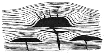
Fig. 34.—Ideal section of three Laccolites. (After Mr. Gilbert.)
In Western America, owing in large measure to the previously undisturbed
condition of the sedimentary formations, the relations of the injected
igneous material to these formations can be satisfactorily ascertained. The
geological structure of the various isolated laccolites thus clearly presented,
helps to explain the structure of other intrusive bodies which, having
been injected among plicated and dislocated rocks, do not so readily admit
of interpretation.
In Colorado, Utah and Arizona the eruptive magma, usually a porphyrite,
diorite or quartz-porphyry, has risen in one or more pipes, and has then
intruded itself laterally between the planes of the sedimentary formations
which, over the centre of intrusion, have been pushed upward into a vast dome-shaped
or blister-like elevation. The horizon on which this lateral and
vertical expansion of the intruded material took place would seem to have
lain several thousand feet below the surface. It ranges from the Cambrian
to the Tertiary formations. Subsequent denudation has cut down the upraised
mantle of sedimentary layers, and has revealed more or less of the
igneous rock underneath, which is thus allowed to protrude and to be affected
by atmospheric erosion. In this way, wide plains of horizontal or gently
undulating Secondary and Tertiary strata have been diversified by the
appearance of cones, detached or in groups, which have become more peaked
and varied in outline in proportion as their original sedimentary covering
has been removed from them. The largest of the laccolitic masses in the
Henry Mountains is about 7000 feet deep and about 4 miles in diameter.
Less than one-half of the cover of overarching strata has been removed, and
denudation has cut deeply into the remaining part.
That the type of structure, so well exhibited among the Henry
Mountains, has not been more abundantly recognized elsewhere probably
arises from the fact not that it is rare, but that the conditions for its
development are seldom so favourable as in Western America. Obviously
where stratified rocks have been much disturbed, they cease to furnish
definite or regular platforms for the reception of eruptive material, and to
afford convenient datum-lines for estimating what was probably the shape
of the intruded magma. We may believe that the effect of the propulsion
of eruptive material is usually to upheave the overlying crust, and thus to
give rise to a laccolitic form of intrusion. The upheaval relatively to the
surrounding country will be apt to be practically permanent, the intruded
body of rock being welded to the surrounding formations, and forming in this
way a solid and resisting core directly united by pipes or funnels with the
great magma-reservoir underneath. On the other hand, where the molten
rock, instead of consolidating underground, has been copiously discharged at
the surface, its emission must tend towards the production of cavernous
spaces within the crust. The falling in of the roofs of such caverns
will give rise to shocks of earthquakes. Subsequent uprisings of the
magma may fill these spaces up, and when the rock has solidified in the
form of laccolites or bosses, it may effectually put an end there to further
eruptions.
Some contact metamorphism may be observed along the upper and under
surfaces of large sills. The rocks over the American laccolites have sometimes
been highly altered. But as the change is the same in kind as that
attendant upon Bosses, though generally less in degree, it will be considered
with these intrusive masses. The problems in terrestrial physics suggested
by the intrusion of such thick and persistent masses of eruptive material as
those which form sills and laccolites will likewise be discussed in connection
with the mechanism of the remaining intrusive masses which have now to
be described.
The term Boss has been applied to masses of intrusive rock which form
at the surface rounded, craggy or variously-shaped eminences, having a
circular, elliptical or irregular ground-plan, and descending into the terrestrial
crust with vertical or steeply-inclined sides (Fig. 28). Sometimes they can
be seen to have pushed the surrounding rocks aside. In other places they
seem to occupy the place of these rocks through which, as it were, an
opening has been punched for the reception of the intrusive material.
Occasionally, more especially in the case of large bosses, like those in
which granite so frequently appears, the eruptive mass may be observed to
rise here and there in detached knobs through the surrounding rocks, or to
enclose patches of these, in such a manner as to indicate that the large body
of eruptive material terminates upward in a very irregular surface, of which
only the more prominent parts project through the cake of overlying rocks.
In true bosses, unlike sills or laccolites, we do not get to any bottom on
which the eruptive material rests. Laccolites, indeed, may be regarded as
intermediate between the typical sill and the typical boss. The difference
between a laccolite and a boss lies in the fact that the body of the laccolite
does not descend into an unknown depth in the crust, but lies upon a
platform on which it has accumulated, the magma having ascended by one
or more ducts, which generally bear but a small proportion in area to the
mass of the laccolite. The boss, on the other hand, is not known to lie on
any horizon, nor to proceed from smaller ducts underneath, but plunges as a
great pillar or irregular mass, which may frequently be noticed to widen downwards
into the crust. There can be no doubt, however, that many masses of
eruptive rock, which, according to the definition here given, should be called
bosses, would be found to be truly laccolites if their structure below ground
could be ascertained. It is obvious that our failure to find any platform
on which the body of a boss lies, may arise merely from denudation having
been as yet insufficient to lay such a platform bare. It is hardly probable
that a boss several miles in diameter should descend as a column of that
magnitude to the magma-reservoir from which its material came. More
probably it has been supplied through one or more smaller ducts. The large
boss now visible at the surface may thus be really a laccolitic expansion on
one or more horizons. M. Michel Lévy lays stress on the general widening
of granitic bosses as they descend into the crust.[35] While his observations
are supported by many illustrations from all parts of the globe, and
are probably true of the deeper-seated masses of granite, it is no less
true that numerous examples have been met with where a granite boss is
sharply marked off from the rocks which it has invaded and on which it may
be seen to lie. Apart from the cases where granite seems to form part of a
vast internal, once molten mass, into which its encircling gneisses seem
to graduate, there are others in which this rock, as now visible, has been
injected into the crust as a boss or as a laccolite. Instances will be described
in later chapters where such bosses have risen through Cambrian, Silurian,
Devonian and Carboniferous formations. It may be said that between such
granitic intrusions and volcanic operations no connection can be traced. But
reasons will be brought forward in later chapters to regard some of the
granitic bosses as parts of the mechanism of Palæozoic volcanoes. It will
also be shown that among the intrusive rocks of the Tertiary volcanic series
of Britain there occur bosses of truly granophyric and granitic material.
Hence, though mainly what is called a "plutonic" rock, granite has made
its appearance among the subterranean protrusions of volcanoes.
It is no doubt true that many intrusive masses, which must be included
under the general name of bosses, have probably had no connection whatever
with volcanic action properly so called. They are plutonic injections,
that is, portions of the subterranean magma which have been intruded into
the terrestrial crust during its periods of disturbance, and have not been
accompanied with any superficial discharges, which are essential in truly
volcanic energy. It has been proposed to draw a distinction between such
deep-seated intrusions and those which represent volcanic funnels.[36] If this
were always practicable it would certainly be desirable. But the distinction is
not one that can in every case be satisfactorily drawn. Even in regard to
granitic bosses, which may generally be assumed to be plutonic in origin,
the British examples just referred to have in all likelihood been connected
with undoubted volcanic outbursts. Without, therefore, attempting here to
separate the obviously volcanic necks of eruptive material from the probably
plutonic bosses, I propose to describe briefly the general characters of bosses
considered as a group of intrusive rocks, together with the phenomena
which accompany them, and the conditions under which they may have
been injected.
Bosses, whether of plutonic or volcanic origin, are frequently not merely
single masses of eruptive rock, but are accompanied with a system of dykes
and veins, some of which can be traced directly into the parent-mass, while
others traverse it as well as the surrounding rocks. Hence the history of a
boss may be considerably more complex than the external form of the mass
might suggest.
The petrographical characters of bosses link them with the other underground
injections of igneous material, more especially with sills and laccolites.
Indeed, on mere lithological grounds no satisfactory line could be drawn
between these various forms of intrusive rocks. The larger the mass the
more coarsely crystalline it may be expected to be. But the whole range
of structure, texture and composition, from those of the narrowest vein to
those of the widest boss, constitutes one connected series of gradations.
Acid, intermediate and basic rocks are abundantly displayed among the
bosses. Huge masses of granite, granophyre, quartz-porphyry, felsite or
rhyolite, represent the acid series. Intermediate varieties consist of trachyte,
phonolite, diorite, andesite or other rock. The basic bosses include varieties
of gabbro, dolerite, basalt, picrite, and other compounds.
In a boss of large size, a considerable range of texture, composition and
structure may often be observed. The rock is generally much coarser in
grain than that of thin sills or dykes. Sometimes it exhibits a finer texture
along the margin than in the centre, though this variation is not usually so
marked as in sills and dykes. The rapidly-chilled and therefore more
close-textured selvage seems to have been developed much more fully in
small than in large masses of eruptive material. The latter, cooling more
slowly, allowed even their marginal parts to retain their heat, and sometimes
perhaps even their molten condition, longer than small injections.
Some influence must also have been exercised by the temperature of the
rocks into which the eruptive material was intruded. Where this temperature
was high, as in deep-seated parts of the crust, it would allow the
intrusive magma to cool more slowly, and thus to assume a more coarsely
crystalline condition. The absence of a close grain round the margins of
granitic bosses may be due to this cause.
But a much more important distinction may be traced between the
central and marginal parts of some large bosses and thick sills. I have
already alluded to the fact that while the middle of a large intrusive mass
may be decidedly acid, taking even the form of granite, the outer borders
are sometimes found to be much more basic, passing into such a rock as
gabbro, or even into some ultra-basic compound. Between these extremes of
composition no sharp division is sometimes discoverable, such as might have
been expected had the one rock been intruded into the other. The differences
graduate so insensibly into each other as to suggest that originally
the whole mass of the rock formed one continuous body of eruptive material.
It is possible that in some cases the magma itself was heterogeneous at the
time of intrusion.[37] But the frequency of the distribution of the basic
ingredients towards the outer margin, and the acid towards the centre, points
rather to a process of differentiation among the constituents of the boss
before consolidation. In some instances the differentiation would appear
to have taken place before crystallization to any great extent had set in,
because the minerals ultimately developed in the central parts differ from
those at the sides. In other cases, the transference of material would seem
to have been in progress after the component minerals had crystallized out
of the magma, for they are the same throughout the whole intrusive mass,
but differ in relative proportions from centre to circumference.[38]
As illustrations of these features I may cite two good examples, one
from Scotland and one from England. The mass of Garabol Hill, in the
Loch Lomond district, consists mainly of granite, occupying an area of about
12½ square miles. Messrs. Dakyns and Teall have shown that while the
central portions consist of granite, the south-eastern margin affords a remarkable
series of intermediate rocks, such as hornblende-biotite-granite, tonalite
(quartz-mica-diorite), diorite and augite-diorite, which lead us outwards into
highly basic compounds, including wehrlites (olivine-diallage rocks), picrites
(olivine-augite rocks), serpentine (possibly representing dunites, saxonites,
and lherzolites), and a peculiar rock consisting essentially of enstatite,
diallage, brown hornblende and biotite. The authors regard the whole of
these widely different rocks as the products of one original magma, the more
basic marginal area having consolidated first as peridotites, followed by
diorites, tonalites and granites in the order of increasing acidity. The most
acid rock in the whole series consists of felspar and quartz, is almost devoid
of ferro-magnesian minerals, and occurs in narrow veins in the granite and
tonalite. It indicates that after the segregation and consolidation of the
whole boss, ruptures occurred which were filled in by the ascent of the very
latest and most acid remaining portion of still fluid magma.[39]
The case of Carrock Fell in Cumberland has been described by Mr. A.
Harker, who has ascertained that the gabbro of this boss has in its central
portions a specific gravity of less than 2·85 and a silica-percentage sometimes
as high as 59·46, whilst its marginal zone gives a specific gravity
above 2·95 and a silica-percentage as low as 32·50. The migration of the
heavy iron ores towards the margin is readily apparent to the naked eye,
and is well established by chemical analysis, the oxides of iron amounting in
the centre to 6·24 (Fe2O3 3·60, FeO 2·64), and at the margin to 25·54
(Fe2O3 8·44, FeO 17·10).[40] Neither in this instance nor in that of Garabol
Hill has any evidence been noticed which would suggest that the basic and
acid rocks belong to different periods of intrusion. They pass so insensibly
into each other as to form in each case one graduated mass.
From these and other examples which have been observed, it is difficult
to escape the conclusion that the differences between the basic margin and
the acid centre are due to some process of segregation or differentiation while
the mass was still in a liquid condition, and its constituents could pass from
one part of the boss to another. According to Professor Brögger, it may be
stated as a general law that differentiation sets in during consolidation,
and is determined by, and dependent on, the laws of crystallization in a
magma, in so far as the compounds which, on given conditions, would first
crystallize out, diffuse themselves towards the cooling margin so as to produce
in the contact-stratum a peculiar chemical composition in the still
liquid material before crystallization takes place.[41]
If during the process of differentiation, and before consolidation, injections
of the magma occur, they may be expected to differ in character according
to the portion of the magma from which they are derived. Professor Brögger
believes that among the basic eruptive rocks of Gran in the Christiania district,
one and the same magma has in the bosses solidified as olivine-gabbro-diabases,
and in the dykes as camptonites, bostonites, pyroxenites, hornblendites,
and more acid augite-diorites.[42]
Various opinions have been propounded as to the cause or causes of this
so-called differentiation, but none of them are entirely satisfactory. We
must await the results of further exploration in the field and of continued
research in the laboratory.
What appears to have taken place within a subterranean molten magma
which has been propelled into the earth's crust as a boss or laccolite, with
or without a connected system of dykes, may possibly be made to throw
some light on the remarkable changes in the characters of lavas successively
erupted from the same vent during the continuance of a volcanic cycle.
Whether or not any such process of differentiation can be proved to take
place within a subterranean volcanic reservoir, the sequence of erupted lavas
bears a curious resemblance to the order in which the constituents of some
large bosses succeed each other from margin to centre. The earliest lavas
may be of an intermediate or even basic character, but they generally tend
to become more acid. Nevertheless alternations of basic and acid lavas
which have been noted in various districts would seem to show that if there
be a process of differentiation in the magma-basins, it is not regular and
continuous, but liable to interruption and renewal. The return to basic
eruptions, which so often marks the close of a volcanic cycle, is likewise not
easily explicable on the supposition of continuous differentiation.
Where no sensible evidence of differentiation is traceable in the general
body of a large intrusive mass, indications that some such process has there
been in progress are perhaps supplied by the more acid dykes or veins,
and the so-called "segregation veins," which have been already alluded to
as traversing large intrusive masses. Though these portions differ to a
greater or less extent in texture and composition from the main substance
of the boss, the differences are not such as to prevent us from regarding them
as really parts of the same parent magma. The veins, which are more
acid than the rock that they traverse, may be regarded as having emanated
from some central or deeper-seated part of a boss, which still remained fluid
after the marginal or upper portion had consolidated sufficiently far to be
capable of being rent open during subterranean disturbance. But that the
mass, though coherent enough to be fissured, still remained at a high temperature,
may be inferred from the general absence of chilled edges to these
veins. The evidence of differentiation supplied by "segregation veins" has
been referred to in the case of Sills.
The study of the petrographical variations in the constitution of large
eruptive bosses has a twofold interest for the geologist. In the first place,
it affords him material for an investigation of the changes which a volcanic
magma undergoes during its eruption and consolidation, and thereby provides
him with some data for an elucidation of the cause of the sequence of
erupted products during a volcanic cycle. In the second place, it yields to
him some interesting analogies with the structures of ancient gneisses, and
thus helps towards the comprehension of the origin and history of these
profoundly difficult but deeply fascinating rocks.
Bosses, like sills, occur in the midst of volcanic sheets, and also as solitary
protrusions. Where they rise amidst interstratified lavas and tuffs they
may often be recognized as occupying the position of volcanic vents. They
are then necks, and their characters in this connection have already been
given. Where, however, as so frequently happens, they appear among rocks
in which no trace of any contemporaneous volcanic material is to be detected,
their relation to former volcanic activity remains uncertain.
Of this doubtful nature some of the most notable examples are supplied
by the great granitic bosses which occur so frequently among the older
Palæozoic rocks of Britain. The age of these can sometimes be approximately
fixed, and is then found to correspond more or less closely with some volcanic
episode. Thus the granite-bosses of Galloway, in the south of Scotland,
disrupt Upper Silurian strata, but are older than the Upper Old Sandstone.
Hence they probably belong to the period of the Lower Old Red Sandstone,
which was eminently characterized by the vigour and long continuance of
its volcanoes. The granite of Arran and of the Mourne Mountains can be
shown by one line of reasoning to be younger than surrounding Carboniferous
formations, by other arguments to be probably later than the Permian period,
and by a review of the whole evidence to form almost certainly part of the
volcanic history of Tertiary time.
But even where it can be shown that the uprise of a huge boss of
eruptive material was geologically contemporaneous with energetic volcanic
action, this coincidence may not warrant the conclusion that the boss therefore
marks one of the volcanic centres of activity. Each example must be
judged by itself. There have, doubtless, been many cases of the intrusion
of molten material in bosses, as well as in sills, without the establishment
of any connection with the surface. Such incompleted volcanoes have been
revealed by denudation after the removal of a great thickness of superincumbent
rock. The evidence which would have decided the question to
what extent any of them became true volcanic vents has thus been destroyed.
We can only reason tentatively from a careful collation of all the facts that
are now recoverable. Illustrations of this kind of reasoning will be fully
given in subsequent chapters.
It has been supposed that a test for the discrimination of a subterranean
protrusion from a true volcanic chimney may be found in the condition of
the surrounding rocks, which in the case of the prolonged flow of molten
matter up a vent would be likely to undergo far more metamorphism than
would be the case in the injection of a single eruptive mass.[43] But, as
has been already pointed out, no special or excessive metamorphism of the
encircling rocks is noticeable around many vents. There is certainly no
more alteration contiguous to numerous true necks than around bosses, which
there is no reason to suppose ever communicated directly with the surface,
and which were probably the result of a single intrusion. We must always
remember that the denudation which has revealed these bosses has generally
removed the evidence of their upward termination and of their possible
connection with any volcanic ejections. Many of them may mark the sites
of true vents from which only single eruptions took place. The opening of
a volcanic vent does not necessarily imply a prolonged ascent of volcanic
material. In a vast number of cases the original eruption was the first and
last effort of the volcano, so that in such circumstances there seems no more
reason for much alteration of the walls of the chimney than for the metamorphism
of the rocks round a boss, laccolite, sill or dyke.
The metamorphism produced by intrusions of molten material upon the
rocks with which they have come in contact has long been studied. Its
amount varies so greatly in different cases that the conditions on which it has
specially depended are not easily determined. Three factors have obviously
been of great importance—first, the bulk of the intruded material; secondly,
the chemical composition and lithological texture and structure of the
rocks affected; and thirdly, the constitution and temperature of the invading
magma.
1. It is clear that a huge boss of eruptive material will be likely to
effect much more alteration of the surrounding rocks than a small boss, sill
or dyke. Its initial temperature will probably be higher at the time of its
assuming its final place than that of the same material after it has found
its way into the narrower space of a thin sill or dyke. It will likewise
take much longer to cool. Hence the influence of its heat and its vapours
will continue to act long after those of the dyke or sill have ceased to
manifest themselves.
2. It is equally evident that much of the resultant metamorphism will
depend on the susceptibility of the rocks to change. An obdurate material
such as pure quartz-sand, for example, will resist further alteration than
mere hardening into quartzite. Shales and mudstones may be indurated
into cherty substances of various textures. Limestones and dolomites, on
the other hand, may become entirely crystalline, and may even have new
minerals, such as garnet, tremolite, pyroxene, etc., developed in them. Hence
in comparing the amount of metamorphism attendant on two separate bosses
we must always take into account the nature of the rocks in which it
has been induced.
3. But perhaps the most effective cause of variation in the nature and
amount of contact metamorphism has been the constitution of the eruptive
magma. A broad distinction may be drawn between the alteration produced
by basic and by acid rocks. The intrusion of basic material has
often produced singularly little change, even when the eruptive mass has
been of considerable size. The greatest amount of alteration is to be found
where the basic boss has caught up and enveloped portions of the surrounding
rocks. Thus where the gabbro of Carrock Fell has invaded the basic
Lower Silurian lavas of the Lake District, the enveloped portions of the
latter show considerable modification. Their groundmass becomes darker
and more lustrous, the felspars assume a clearer appearance and lose some
of their conspicuous inclusions, the pyroxenic constituents are converted
into pale amphibole, and the glassy base disappears. At the actual line of
contact the felspars of the lavas have become disengaged from their original
matrix, which seems to have been dissolved and absorbed in the gabbro-magma.
Brown mica has been exceptionally developed in the altered lava.
At the same time, a change is noticeable in the character of the gabbro
itself near the contact. Brown mica is there to be seen, though not a
constituent of the rock elsewhere. The eruptive material has incorporated
the basic groundmass of the lavas, leaving the felspars undissolved.[44]
Much more serious are the changes produced by intrusions of acid
material, though here again the metamorphism varies within wide limits,
being sometimes hardly perceptible, and in other cases advancing so far as
to convert mere sedimentary material into thoroughly crystalline rocks.
Small sills and dykes of felsite and granophyre may produce very slight
change even upon shales and limestones, as may be seen among the eruptive
rocks of Skye and Raasay. Large bosses of granophyre, and still more
of granite, have been accompanied with the most extensive metamorphism.
Round these eruptive masses every gradation may be traced among sandy
and argillaceous sediments, until they pass into crystalline mica-schists,
which do not appear to be distinguishable from rocks of Archæan age.
Admirable examples of this extreme alteration may be observed around the
great granite bosses of Galloway.[45] Again, among calcareous rocks a transition
may be traced from dull grey ordinary fossiliferous limestones and
dolomites into pure white crystalline marbles, full of crystals of tremolite,
zoisite, garnet and other minerals. The alteration of the fossiliferous Cambrian
limestones of Strath in Skye by the intrusive bosses of Tertiary granite
well illustrates this change.[46]
Without entering further here into the wide subject of contact metamorphism,
to which a large literature has now been devoted, we may note
the effects which have been produced in the eruptive material itself by its
contact with the surrounding rocks. Not only have these rocks been
altered, but very considerable modifications have likewise taken place in the
active agent of the change.
Sometimes the alteration of the invading material has been effected
without any sensible absorption of the mineral constituents of the rocks
invaded. This appears to be the case in those instances where sheets of
basalt, intruded among coals or highly carbonaceous shales, have lost their
compact crystalline character and have become mere clays. In the coal-fields
of Britain, where many examples of this change have been noted, the
igneous material is known as "white trap." The iron oxides have been in
great part removed, or, together with the lime of the component minerals,
have been converted into carbonates. Traces of the original felspar crystals
may still be detected, but the groundmass has been changed into a dull,
earthy, friable and decomposed substance.
Nearly always, however, the alteration of the intrusive magma has
resulted from the incorporation of portions of the surrounding rocks.
Reference has been made above to the alteration of the Carrock Fell gabbro
by the absorption of some of the basic lavas around it. But still more
remarkable is the change produced in some acid rocks by the incorporation
of basic material into their substance. Professor Sollas has described in
great detail a remarkable instance of this effect in the probably Tertiary
eruptive rocks of the Carlingford district in the north-east of Ireland.
He has ascertained that the eruptive gabbro of that district is older
than the granite, for it is traversed by granophyre dykes which enclose
pieces of it. The granophyre dykes, on the other hand, often show a
lithoidal or chilled margin, which is not visible in the gabbro. He believes
that the gabbro is not only older than the acid protrusions, but was
already completely solid, traversed by contraction-joints, and probably fractured
by earth-movements, before the injection of the granophyric material,
which at the time of its intrusion was in a state of extreme fluidity, for it
has found its way into the minutest cracks and crevices. He has especially
studied the alteration produced by the granophyre upon the enclosed
pieces of basic rock. The diallage, isolated from the other constituents
of the gabbro, may commonly be seen to have broken up into numerous
granules, like the augite grains of basalt, while in some cases biotite and
hornblende have been developed with the concomitant excretion of magnetite.
The acid rock itself has undergone considerable modification owing
to the incorporation of basic material into its substance. Professor Sollas
distinguishes the following varieties of the rock:—Biotite-granophyre, biotite-amphibole-granophyre,
augite-granophyre, diallage-amphibole-augite-granophyre.[47]
Similar phenomena have been described by Mr. Harker as occurring
where granophyre has invaded the gabbro of Carrock Fell.[48] The same
observer has more recently detected some interesting examples furnished
by injections of Tertiary granophyre in the agglomerates of Skye. The
acid rock is roughly estimated by him to have taken up about one-fourth of
its bulk of gabbro fragments. He has investigated the minute structure of
the rock thus constituted, and has been able to recognize the augite of the
original gabbro, in various stages of alteration and completely isolated, the
other minerals having been dissolved in the acid magma.[49]
It is not easy to comprehend the conditions under which large masses
of molten material have been injected into the crust of the earth. The two
main factors in volcanic action—terrestrial contraction and the energy of the
vapours in the magma—have no doubt played the chief part in the process.
But the relative share of each and the way in which the enormous load of
overlying rock has been overcome are not readily intelligible.
Let us first consider for a moment the pressure of the superincumbent
crust under which the injection in many cases took place. The Whin Sill
of England may serve as a good illustration of the difficulties of the problem.
This notable mass of intrusive rock has been forced between the stratification
planes of the Carboniferous Limestone series in one, or sometimes more than
one, sheet. It stretches for a horizontal distance of not less than 80 miles
with an average thickness of between 80 and 100 feet. From the area
over which it can be traced its total extent underground must be at least
400 square miles (see Chapter xxix.).
In any single section the Whin Sill might be supposed to be a truly
interstratified sheet, so evenly does it seem to be intercalated between the
sedimentary strata. But here and there it diverges upward or downward
in such a way as to prove it to be really a vast injected sheet. The age of
the injection cannot be precisely fixed. It must be later than the Carboniferous
Limestone. There is no trace of any stratigraphical break in the
Carboniferous system of the region traversed by the sill. If the injection
took place during the Carboniferous period, it does not appear to have been
attended with any local disturbance, such as we might suppose would have
been likely to accompany the extravasation of so enormous a mass of igneous
material. If the date of injection be assigned to the next volcanic episode
in the geological history of Britain—that of the Permian period—it will
follow that the Whin Sill was intruded into its present position under the
superincumbent weight of the whole of the Carboniferous system higher
than the platform followed by the injected rock. The overlying body of
strata would thus exceed 5000 feet in thickness, or in round numbers would
amount at least to an English mile. The pressure of this mass of superincumbent
material, at the depth at which the injected magma was forced
between the strata, must have been so gigantic that it is difficult to believe
that the energy of the magma would have been able to achieve of itself so
stupendous a task as the formation of the Great Whin Sill.
The volume of injected material is likewise deserving of special attention.
Many sills exceed 300 or 400 feet in thickness; and some laccolites must
enormously surpass these limits. The intrusion of so vast a body of new
material into the terrestrial crust will necessitate either a corresponding elevation
of that part of the crust overlying the injected magma or a subsidence
of that part underlying it, or some combination of both movements. It is
conceivable that, where the body of protruded magma was large and the
thickness of overlying crust was small, the expansive force of the vapours
under high tension in the molten rock may have sufficed for the uplift.
This result will be most likely to be effected around a volcanic chimney
where the magma has the least amount of overlying load, and encounters
that relief from pressure which enables it to become a powerful agent in
terrestrial physics.
But in the case of the larger bodies of injected rock, especially where
they do not seem to have been accompanied by the opening of any volcanic
vents, the propulsion of the igneous material into the crust has probably been
effected as a consequence of disturbance of the terrestrial crust. When the
strain of contraction leads to the pushing upward of the terrestrial areas
intervening between wide regions of subsidence, even though the differential
movement may be slight, the isogeotherms undergo deformation. The
intensely hot nucleus is squeezed upward, and if in the process of compression
ruptures take place in the crust, and cavities in it are consequently
opened, the magma will at once be forced into them. Such ruptures may
be expected to take place along lines of weakness. Rocks will split along
their stratification-planes, and the tendency to separation along these lines
may be aided by the readiness of the energetic magma to find its way into
and to enlarge every available opening. Hence we may expect that, besides
vertical fractures, leading to the production of dykes and bosses, there will
often be horizontal thrusts and ruptures, which will give rise to the formation
of sills.
There is still another feature of terrestrial contraction which may help
us to follow the behaviour of the magma within the crust. Plication of the
crust is one of the most characteristic results of the contracting strain.
Where a great series of sedimentary formations has been violently compressed
so that its component strata have been thrown into rapid folds and squeezed
into a vertical position, the portion of the crust thus treated may possibly be
on the whole strengthened against the uprise of molten material through it.
But the folding is often accompanied with dislocation. Not only are the
rocks thrown into endless plications, but portions of them are ruptured and
even driven horizontally over other parts. Such greatly disturbed areas of
the crust are not infrequently found to have been plentifully injected with
igneous rocks in the form of dykes, veins, sills, laccolites and bosses.
The elevation of a mountain-chain is known to be accompanied with a
diminution of density in the crust underneath. Mr. O. Fisher has suggested
that along such lines of terrestrial uplift there may be a double
bulge in the crust, one portion rising to form the upheaved land and the
other sinking down into the hot nucleus. If the lighter descending crust
were there melted it might form a magma ready to be poured out as lava
on the opening of any vent. The lava thus ejected would be of the lighter
kinds. It has been remarked as certainly a curious fact that the lavas
which issue from high mountain ranges are generally much more acid than
the heavy basic lavas which are so characteristic of volcanoes close to the
level of the sea.
But even where no actual mountain-chain is formed, there are gentle
undulations of the crust which no doubt also affect the isogeotherms. If
any series of disturbances should give rise to a double system of such
undulations, one crossing the other, there would be limited dome-shaped
elevations at the intersections of these waves, and if at the same time actual
rupture of the crust should take place, the magma might find its way
upward under such domes and give rise to the formation of laccolitic
intrusions. Cessation of the earth-movements might allow the intruded
material slowly to solidify without ever making an opening to the surface
and forming a volcano. Doubtless many sills, laccolites and bosses represent
such early or arrested stages in volcanic history.
Propelled into the crust at a high temperature, and endowed with great
energy from the tension of its absorbed vapours and gases, the magma will
avail itself of every rent which may be opened in the surrounding crust,
and where it has succeeded in reaching the surface, its own explosive
violence may enable it to rupture the crust still further, and open for
itself many new passages. Thus an eruptive laccolite or boss is often fringed
with veins, dykes and sills which proceed from its mass into the rocks around.
The question how far an ascending mass of magma can melt down
its walls is one to which no definite answer can yet be given. Recent
observations show that where the difference in the silica percentage between
the magma and the rock attacked is great, there may be considerable
dissolution of material from this cause. Allusion has already been made
to Mr. Harker's computation that some of the acid granophyres of Skye have
melted down about a fourth of their bulk of the basic gabbros. If such a
reaction should take place between the magma of a boss, sill or laccolite and
the rocks among which it has been intruded, great changes might result in
the composition of the intruded rock. We are not yet, however, in
possession of evidence to indicate that absorption of this kind really takes
place on an extensive scale within the earth's crust. If it did occur to a
large extent, we should expect much greater varieties in the composition of
eruptive rocks than usually occur, and also some observable relation between
the composition of the igneous material and that of the rocks into which it
has been injected. But enough is not yet known of this subject to warrant
any decided opinion regarding it.
CHAPTER VII
Influence of Volcanic Rocks on the Scenery of the Land—Effects of Denudation.
As considerable popular misapprehension exists respecting the part which
volcanism has played in the evolution of the existing topography of the
earth's surface, and as the British Isles, from their varied geological
structure, offer special facilities for the discussion of this subject, it may
not be out of place to devote a final section of the present Introduction to
a consideration of the real topographical influence of volcanic action.
With modern, and especially with active, volcanoes we need not here
concern ourselves. Their topographical forms are well known, and give rise
to no difficulty. The lofty cones of the Vesuvian type, with their widespread
lavas and ashes, their vast craters and their abundant parasitic
volcanoes; the crowded, but generally diminutive, cones and domes of the
puy type, so well displayed in Auvergne, the Eifel and the Bay of Naples;
and the vast lava deserts of the plateaux, so characteristically developed in
Iceland and Western America, illustrate the various ways in which volcanic
energy directly changes the contours of a terrestrial surface.
But the circumstances are altered when we deal with the topographical
influence of long extinct volcanoes. Other agencies then come into play,
and some caution may be needed in the effort to disentangle the elements
of the complicated problem, and to assign to each contributing cause its own
proper effect.
Reference has already been made to the continuous denudation of
volcanic hills from the time that they are first erupted. But the comparative
rapidity of the waste and the remarkable topographical changes
which it involves can hardly be adequately realized without the inspection
of an actual example. A visit to the back of Monte Somma, already alluded
to, will teach the observer, far more vividly than books can do, how a
volcanic cone is affected by daily meteoric changes. The sides of such
a cone may remain tolerably uniform slopes so long as they are always
being renewed by deposits from fresh eruptions. But when the volcanic
activity ceases, and the declivities undergo no such reparation, they are
rapidly channelled by the descent of rain-water, until the furrows grow by
degrees wide and deep ravines, with only narrow and continually-diminishing
crests between them. If unchecked by any fresh discharge of volcanic
material, the degradation will at last have removed the whole cone.
It is thus obvious that purely volcanic topography, that is, the terrestrial
scenery due directly to the eruption of materials from within the earth, can
never become in a geological sense very old. It can only endure so long as
it is continually renewed by fresh eruptions, or where it is carried down by
subsidence under water and is there buried under a cover of protecting
sediments. When, therefore, we meet with volcanic rocks of ancient date
exposed at the surface, we may be quite certain that their present contours
are not those of the original volcano, but have been brought about by the
processes of denudation.
It is true that, in the general erosion of the surface of the land, volcanic
rocks of ancient date sometimes rise into wonderfully craggy heights, including,
perhaps, cones and deep crater-like hollows, which to popular imagination
betoken contours left by now extinguished volcanic fires. Examples of
such scenery are familiar in various parts of Britain; but the resemblance
to recent volcanic topography is deceptive. There are, indeed, a few hills
wherein the progress of denudation seems not as yet to have entirely
removed the lavas and tuffs that gathered round the original vents. Some
of the tuff-cones of eastern Fife, for example, present cases of this kind.
Again, the great granophyre domes and cones of the Tertiary volcanic series
of the Inner Hebrides, though they have undoubtedly been extensively
denuded, may possibly retain contours that do not greatly differ from those
which these protruded bosses originally assumed under the mass of rock
which has been removed from them. Nevertheless, putting such doubtful
exceptions aside, we may confidently affirm that hills composed of ancient
volcanic material give no clue to the forms of the original volcanoes.
It can hardly be too often repeated that the fundamental law in the
universal decay and sculpture of the land is that the waste is proportioned
to the resistance offered to it: the softer rocks are worn down with comparative
rapidity, while the harder varieties are left projecting above them.
As a general rule, volcanic rocks are more durable than those among which
they are interstratified, and hence project above them, but this is not always
the case. No universal rule can, indeed, be laid down with regard to the
relative durability of any rocks. While, therefore, topographic contours
afford a valuable indication of the nature and disposition of the rocks below
the surface, they cannot be relied upon as in all circumstances an infallible
guide in this respect. No better proof can be offered of the caution that
is needed in tracing such contours back to their origin than is furnished
by the old volcanic rocks of Britain. These eruptive masses, consisting
usually of durable materials and ranging through a vast cycle of geological
time, usually rise into prominent features and thus support the general law.
But they include also many easily eroded members, which, instead of
forming eminences, are worn into hollows. They include, in short, every
type of scenery, from featureless plains and rolling lowlands to craggy and
spiry mountains.
The first point, then, which is established in an investigation of the
topographical influence of old volcanic rocks is that their prevailing
prominence arises from relative durability amidst universal degradation.
When we proceed further to inquire why they vary so much from each
other in different places, and how their complicated details of feature have
been elaborated, we soon learn that such local peculiarities have arisen
mainly from variations in the internal structure and grouping of the rocks
themselves.
Here again the general law of sculpture comes into play. The local
features have depended upon the comparative resistance offered to the
sculpturing agents by the different portions of a volcanic series. Each
distinct variety of rock possesses its own characteristic internal structure.
The lines along which atmospheric disintegration will most effectually carry
on its carving work are thus already traced in the very substance and
architecture of the rock itself. Each rock consequently yields in its own
way to the processes of disintegration, and thus contributes its own distinctive
share to topographical feature.
Among the massive rocks abundant examples of such special types of
weathering may be cited, from the acid and basic series, and from superficial
lavas as well as from intrusive bosses and sills. Acid bosses, such as those
of granite, granophyre and quartz-porphyry, tend to weather into blocks and
finally into sand, and as this tendency is somewhat uniformly distributed
through the rocks, they are apt to assume rounded, dome-shaped or conical
forms which, at a distance, may seem to have smooth declivities, but on
examination are generally found to be covered with a slowly-descending
sheet of disintegrated blocks and debris (Fig. 346). When less prone to
decay, and especially where traversed by a strongly-defined system of vertical
joints, they may shoot up into tower-like heights, with prominent spires and
obelisks. Basic bosses, when their materials decay somewhat rapidly, give
rise to analogous topographical forms, though the more fertile soils which
they produce generally lead to their being clothed with vegetation. Where
they consist of an obdurate rock, much jointed and fissured, like the gabbro
of the Inner Hebrides, they form exceedingly rugged mountains, terminating
upward in serrated crests and groups of aiguilles (Figs. 331, 333).
Acid lavas that have been superficially erupted weather into irregularly
craggy hills, like the flanks of Snowdon. Those of intermediate
composition, where they have accumulated in thick masses, are apt to
weather into conical forms, as may be seen among the Cheviot, Pentland
and Garleton Hills (Figs. 109, 110, 133); but where they have been poured
out in successive thin sheets they have built up undulating plateaux with
terraced sides, as among the Ayrshire and Campsie Fells and the hills of
Lorne (Figs. 99, 107). Basic lavas have issued in comparatively thin sheets,
frequently columnar or slaggy, forming flat-topped hills and terraced escarpments,
such as are typically developed among the Tertiary basalt-plateaux
of the Inner Hebrides and the Faroe Islands (Figs. 11, 265, 283, 284, 286).
One of the most frequent causes of local peculiarities of topography
among old volcanic rocks is the intercalation of very distinct varieties of
material in the same volcanic series. Where, for instance, lavas and tuffs
alternate, great inequalities of surface may be produced. The tuffs, being
generally more friable, decay faster and give rise to hollows, while the
lavas, being more durable, project in bold ridges or rise into mural escarpments
(Fig. 265). Again, where dykes weather more readily than the rocks
which they traverse, they originate deep narrow clefts, while where they
weather more slowly than the rocks around them, they project as dark ribs.
Thus in Skye some dykes which rise through the obdurate gabbro are
marked by chasms which reach up even to the highest crests of the
mountains (Fig. 333), while of those which run in the pale crumbling
granophyre, some stand up as black walls that can be followed with the
eye across the ridges even from a long distance.
Many further illustrations of these principles might be cited here from
the old volcanic districts of Britain. But they will present themselves
successively in later chapters. For my present purpose it is enough to
show that the scenery of these districts is not directly due to volcanic action,
but is the immediate result of denudation acting upon volcanic rocks,
modified and directed by their geological structure.
It may, however, be useful, in concluding the discussion of this subject,
to cite some typical volcanic regions in the British Isles as illustrations of
the relations between geology and topography, which, besides impressing the
main lesson here enforced, may serve also to show some of the striking contrasts
which geology reveals between the present and former conditions of
the surface of the globe. Among these contrasts none are more singular
than those offered by tracts where volcanic action has once been rife, and
where the picture of ancient geography presented in the rocks differs so
widely from the scenery of the same places to-day as to appeal vividly to the
imagination.
The first district to which I may refer where ancient volcanic rocks are
well developed is that of Devonshire. The story of the Devonian volcanoes
will be told in some detail in later chapters, when it will be shown that the
eruptions were again and again renewed during a long course of ages. Yet,
abundant as the intercalated lavas and tuffs are, they can hardly be said to
have had any marked effect on the scenery, though here and there a harder
or larger mass of diabase rises into a prominent knoll or isolated hill.
When the amount of volcanic material in this region is considered, we may
feel some surprise at the trifling influence which it has exerted in the general
denudation of the surface.
To one who wanders over the rich champaign of southern Devonshire,
and surveys from some higher prominence the undulating tree-crowned
ridges that slope down into orchard-filled hollows, and the green uplands
that sweep in successive waves of verdure to the distant blue tors of Dartmoor,
the scene appears as a type of all that is most peaceful, varied and
fertile in English landscape. In the trim luxuriance that meets the eye on
every side, the hand of man is apparent, though from many a point of
vantage no sound may be heard for a time to show that he himself is anywhere
near us. Yet ever and anon from the deep lanes, hidden out of
sight under their canopy of foliage, there will come the creak of the groaning
waggon and the crack of the waggoner's whip, as evidence that there are
roads and human traffic through this bosky silent country.
Amid so much quiet beauty, where every feature seems to be eloquent
of long generations of undisturbed repose, it must surely stir the imagination
to be told that underneath these orchards, meadows and woodlands lie
the mouldering remnants of once active and long-lived volcanoes. Yet we
have only to descend into one of the deep lanes to find the crumbling lavas
and ashes of the old eruptions. The landscape has, in truth, been carved out
of these volcanic rocks, and their decomposition has furnished the rich loam
that nourishes so luxuriant a vegetation.
Not less impressive is the contrast presented between the present and
former condition of the broad pastoral uplands of the south of Scotland.
Nowhere in the British Islands can the feeling of mere loneliness be more
perfectly experienced than among these elevated tracts of bare moorland.
They have nothing of the grandeur of outline peculiar to mountain tracts.
Sometimes, for miles around one of their conspicuous summits, we may see
no projecting knob or pinnacle. The rocks have been gently rounded off
into broad featureless hills, which sink into winding valleys, each with its
thread of streamlet and its farms along the bottom, and its scattered remnants
of birch-wood or alder-copse along its slopes and dingles. Across miles of
heathy pasture and moorland, on the summits of this great tableland, we may
perchance see no sign of man or his handiwork, though the bleating of the
sheep and the far-off barking of the collie tell that we are here within the
quiet domain of the south-country shepherd.
In this pastoral territory, also, though they hardly affect the scenery,
volcanic rocks come to the surface where the foldings of the earth's crust
have brought up the oldest formations. Their appearance extends over
so wide an area as to show that a large part of these uplands lies on
a deeply-buried volcanic floor. A whole series of submarine volcanoes,
extending over an area of many hundreds of square miles, and still in great
part overlain with the accumulated sands and silts of the sea-bottom, now
hardened into stone, underlies these quiet hills and lonely valleys.
A contrast of another type meets us in the broad midland valley of
Scotland. Around the city of Edinburgh, for instance, the landscape is
diversified by many hills and crags which show where harder rocks project
from amidst the sediments of the Carboniferous system. On some of these
crags the forts of the early races, the towers of Celt and Saxon, and the
feudal castles of the middle ages were successively planted, and round their
base clustered for protection the cots of the peasants and the earliest homesteads
of the future city. Beneath these crags many of the most notable
events in the stormy annals of the country were transacted. Under their
shadow, and not without inspiration from their local form and colour, literature,
art and science have arisen and flourished. Nowhere, in short, within
the compass of the British Isles has the political and intellectual progress of
the people been more plainly affected by the environment than in this
central district of Scotland.
When now we inquire into the origin and history of the topography
which has so influenced the population around it, we find that its prominences
are relics of ancient volcanoes. The feudal towers are based on sills and
dykes and necks. The fields and gardens, monuments and roadways, overlie
sheets of lava or beds of volcanic ashes. Not only is every conspicuous
eminence immediately around of volcanic origin, but even the ranges of blue
hills that close in the distant view to south and north and east and west are
mainly built up of lavas and tuffs. The eruptions of which these heights
are memorials belong to a vast range of geological ages, the latest of them
having passed away long before the advent of man. But they have left
their traces deeply engraven in the rocky framework of the landscape.
While human history, stormy or peaceful, has been slowly evolving itself
during the progress of the centuries in these fertile lowlands, the crags and
heights have remained as memorials of an earlier history when Central
Scotland continued for many ages to be the theatre of vigorous volcanic
activity.
As a final illustration of the influence of volcanic rocks in scenery, and
of the contrast between their origin and their present condition, I may cite
the more prominent groups of hills in the Inner Hebrides. In the singularly
varied landscapes of that region three distinct types of topography
attract the eye of the traveller. These are best combined and most fully
developed in the island of Skye. Throughout the northern half of that
picturesque island, the ground rises into a rolling tableland, deeply penetrated
by arms of the sea, into which it slopes in green declivities, while along
its outer borders it plunges in ranges of precipice into the Atlantic. Everywhere,
alike on the cliffs and the inland slopes, long parallel lines of rock-terrace
meet the eye. These mount one above another from the shores
up to the flat tops of the highest hills, presenting level or gently-inclined
bars of dark crag that rise above slopes of debris, green sward and bracken.
It is these parallel, sharply-defined bars of rock, with their intervening strips
of verdure, that give its distinctive character to the scenery of northern
Skye. On hillside after hillside and in valley after valley, they reappear
with the same almost artificial monotony. And far beyond the limits of
Skye they are repeated in one island after another, all down the chain of the
Inner Hebrides.
In striking contrast to this scenery, and abruptly bounding it on the
south, rise the Red Hills of Skye—a singular group of connected cones.
Alike in form and in colour, these hills stand apart from everything around
them. The verdure of the northern terraced tableland here entirely disappears.
The slopes are sheets of angular debris,—huge blocks of naked
stone and trails of sand, amidst which hardly any vegetation finds a footing.
The decay of the rock gives it a pale yellowish-grey hue, which after rain
deepens into russet, so that in favourable lights these strange cones gleam
with a warm glow as if they, in some special way, could catch and reflect
the radiance of the sky.
Immediately to the west of these pale smooth-sloped cones, the dark
mass of the Cuillin Hills completes the interruption of the northern tableland.
In almost every topographical feature these hills present a contrast to the
other two kinds of scenery. Their forms are more rugged than those of
any other hill-group in Britain (Fig. 331). Every declivity among them is
an irregular pile of crags, every crest is notched like a saw, every peak is
sharpened into a pinnacle. Instead of being buried under vast sheets of
their own debris, these hills show everywhere their naked rock, which seems
to brave the elements as few other rocks can do. Unlike the pale Red
Hills, they are dark, almost black in tone, though when canopied with cloud
they assume a hue of deepest violet.
Each of these three distinct types of topography owes its existence to
the way in which a special kind of volcanic rock yields to the influences of
denudation. The terraced tableland of the north is built up of hundreds of
sheets of basaltic lava, each of the long level ledges of brown rock marking
the outcrop of one or more of these once molten streams. The black rugged
mass of the Cuillin Hills consists of a vast protruded body of eruptive
material, which, in the form of endless sills and bosses of gabbro and
dolerite, has invaded the basalt-plateau, and has now been revealed by the
gradual removal of the portion of that plateau which it upraised. The
pale cones and domes of the Red Hills mark the place of one of the last
protrusions in the volcanic history of Britain—that of large masses of an
acid magma, which broke through the basalt-plateau and also disrupted
the earlier gabbro.
In no part of North-Western Europe has volcanic activity left more
varied and abundant records of its operations than in these three contiguous
tracts of Skye. It is interesting therefore to note the striking contrast
between the former and the present landscapes of the region. The lavas
of the basaltic tableland crumble into a rich loam, that in the mild moist
climate of the Hebrides supports a greener verdure than any of the other
rocks around will yield. The uplands have accordingly become pasture-grounds
for herds of sheep and cattle. The strips of lowland along the
valleys and in the recesses of the coast-line furnish the chief tracts of
arable land in the island, and are thus the main centres of the crofter
population. The bays and creeks of the much-indented shores form
natural harbours, which in former days attracted the Norse sea-rovers, and
supplied them with sites for their settlements. Norse names still linger
on headland and inlet, but the spirit of adventure has passed away, and a
few poor fishing-boats, here and there drawn up on the beach, are usually
the only token that the islanders make any attempt to gather the harvest
of the sea.
The mountain groups which so abruptly bound the basalt-plateau on
the south, and present in their topographical features such distinctive
scenery, comprise a region too lofty, too rugged and too barren for human
occupation. The black Cuillins and the pale Red Hills are solitudes left
to the few wild creatures that have not yet been exterminated. The
corries are the home of the red deer. The gabbro cliffs are haunts of the
eagle and the raven. Where patches of soil have gathered in the crannies
of the gabbro, alpine plants find their home. In the chasms left by the
decay of the dykes between the vertical walls of their fissures, the winter
snows linger into summer, and conceal with their thick drifts the
mouldering surface of the once molten rock beneath them. On every side
and at every turn a mute appeal is made to the imagination by the strange
contrasts between the quiet restfulness of to-day, when the sculpture-tools
of nature are each busily carving the features of the landscape, and the
tumult of the time when the rocks, now so silent, were erupted.
The general discussion of the subject of Volcanism in this Introduction
will, I hope, have prepared the reader who has no special geological
training for entering upon the more detailed descriptions in the rest of this
treatise. As already stated, the chronological order of arrangement will be
followed. Beginning with the records of the earliest ages, we shall follow
the story of volcanic action down to the end of the latest eruptions.
Each great geological system will be taken as a whole, representing a
long period of time, and its volcanic evolution will be traced from the
beginning of the period to the close. Some variety of treatment is
necessarily entailed by the wide range in the nature and amount of the
evidence for the volcanic history of different ages. But where practicable,
an outline will first be given of what can be gathered respecting the
physical geography of each geological period in Britain. In the description
which will then follow of the volcanic phenomena, an account of the
general characters of the erupted rocks will precede the more detailed
narrative of the history of the volcanic eruptions in the several regions
where they took place. References to the published literature of each
formation will be given in the first part of each section, or will be introduced
in subsequent pages, as may be found most convenient.
CHAPTER VIII PRE-CAMBRIAN VOLCANOES — i. THE LEWISIAN (ARCHAÆN) GNEISS — ii. THE DALRADIAN OR YOUNGER SCHISTS OF SCOTLAND — iii. THE GNEISSES AND SCHISTS OF ANGLESEY — iv. THE URICONIAN VOLCANOES — v. THE MALVERN VOLCANO — vi. THE CHARNWOOD FOREST VOLCANO
The Beginnings of Geological History—Difficulties in fixing on a generally-applicable
Terminology—i. The Lewisian (Archæan) Gneiss; ii. The Dalradian or Younger
Schists of Scotland; iii. The Gneisses and Schists of Anglesey; iv. The Uriconian
Volcanoes; v. The Malvern Volcano; vi. The Charnwood Forest Volcano.
The early geological history of this globe, like the early history of mankind,
must be drawn from records at once scanty and hardly decipherable. Exposed
to the long series of revolutions which the surface of the planet has undergone,
these records, never perhaps complete at the first, have been in large
measure obliterated. Even where they still exist, their meaning is often
so doubtful that, in trying to interpret it, we find little solid footing, and
feel ourselves to be groping, as it were, in the dimness of mythological
legend, rather than working in the light of trustworthy and intelligible
chronicles. These primeval records have been more particularly the objects
of sedulous study during the last twenty years all over Europe and in North
America. A certain amount of progress in their decipherment has been
made. But the problems they still present for solution are numerous and
obscure. Fortunately, with many of these problems the subject of the
present treatise is not immediately connected. We need only concern
ourselves with those which are related to the history of primeval volcanic
activity.
To the earliest and least definite division of the geological annals
various names have been applied. Some writers, believing that this period
preceded the first appearance of plants or animals upon the globe, have
named it Azoic—the lifeless age of geological history. But the absence of
any hitherto detected trace of organic existence among the oldest known
rocks cannot be held to prove that these rocks were formed before the
advent of living things on the surface of the earth. The chance discovery
of a single fossil, which might at any moment be made, would show the
name "Azoic" to be a misnomer. Other geologists, believing that, as a
matter of fact, organic structures of low types do actually occur in them,
have called these old rocks "Eozoic," to denote that they were deposited
during the dawn of life upon our planet. But the supposed organisms
have not been everywhere accepted as evidence of former life. By many
able observers they are regarded as mere mineral aggregates. Another
term, "Archæan," has been proposed for the primeval ages of geological
history, which are recorded in rocks that carry us as far as may ever be
possible towards the beginnings of that history.
In choosing some general term to include the oldest known parts of the
earth's crust, geologists are apt unconsciously to assume that the rocks thus
classed together represent a definite section of geological time, comparable,
for instance, to that denoted by one of the Palæozoic systems. Yet it is
obvious that, under one of these general terms of convenient classification, a
most multifarious series of rocks may be included, representing not one but
possibly many, and widely separated, periods of geological history.
In many countries the oldest sedimentary accumulations, whether
fossiliferous or not, are underlain by a series of crystalline rocks, which
consist in great part of coarse massive gneisses and other schists. All over
the world these rocks present a singular sameness of structure and composition.
What might be found below them no man can say. They are in
each country the oldest rocks of which anything is yet known, and whatsoever
may be our theory of their origin, we must, at least for the present,
start from them as the fundamental platform of the terrestrial crust.
But though crystalline rocks of this persistent character are widely
distributed, both in the Old World and in the New, they in themselves
furnish no means of determining their precise geological age. No method
has yet been devised whereby the oldest gneiss of one country can be shown
to be the true stratigraphical equivalent of the oldest gneiss of another.
Palæontology is here of no avail, and Petrology has not yet provided us
with such a genetic scheme as will enable us to make use of minerals and
rock-structures, as we do of fossils, in the determination of geological
horizons. All that can be positively affirmed regarding the stratigraphical
relations of the rocks in question is that they are vastly more ancient than
the oldest sedimentary and fossiliferous formations in each country where
they are found. The "Lewisian" gneiss of the north-west of Scotland, the
"Urgneiss" of Central Europe, and the "Laurentian" gneiss of Canada
occupy similar stratigraphical positions, and present a close resemblance in
lithological characters. We may conveniently class them under one common
name to denote this general relationship. But we have, as yet, no means of
determining how far they belong to one continuous period of geological
history. They may really be of vastly different degrees of antiquity.
From the very nature of the case, any name by which we may choose to
designate such ancient rocks cannot possess the precise stratigraphical value
of the terms applied to the fossiliferous formations. Yet the convenience of
possessing such a general descriptive epithet is obvious.
Until much more knowledge of the subject has been gained, any
terminology which may be proposed must be regarded as more or less
provisional. The comprehensive term "pre-Cambrian" may be usefully
adopted as a general designation for all rocks older than the base of the
Cambrian system, irrespective of their nature and origin. Already it is well
known that under this term a vast series of rocks, igneous and sedimentary,
is included. In some regions several successive formations, or systems of
formations, may be recognized in this series. But until some method has
been devised for determining the stratigraphical relations of these formations
in different regions, it would seem safest not to attempt to introduce general
names for universal adoption, but to let the sequence of rocks in each distinct
geological province be expressed by a local terminology. This caution is
more especially desirable in the case of sedimentary deposits. We may
surmise as to the equivalence of the rocks called Huronian, Torridonian
and Longmyndian, but whilst so much is mere conjecture, it is certainly
injudicious to transfer the local names of one province to the rocks of another.
The only relaxation of this general precaution which I think may at
present be made is the adoption of a common name for the oldest type of
gneisses. The term "Archæan" has been applied to these rocks, and if it
is used simply to express a common petrographical type, occupying the
lowest horizon in the stratigraphical series of a country, it has obvious
advantages. But I would still retain the local names as subordinate terms
to mark the local characteristics of the Archæan rocks of each province.
Thus the "Laurentian" rocks of Canada and the "Lewisian" rocks of
Scotland are widely-separated representatives of the peculiar stratigraphical
series which is known as Archæan.
The pre-Cambrian rocks of Britain include several distinct systems or
groups. How far those of even one part of this comparatively limited
region are the proper equivalents of those of another and distant part is a
problem still unsolved. Hence each distinct area, with its own type of rocks,
will here be treated by itself. The following rock-types will be described:
I. The Lewisian (Archæan) Gneiss; II. The Younger (Dalradian) Schists
of Scotland; III. The Gneisses and Schists of Anglesey; IV. The Uriconian
Group; V. The Malvern Group; VI. The Charnwood Forest Group (see Map I.).
The British Isles are singularly fortunate in possessing an admirable
development of pre-Cambrian rocks. These ancient masses rise up in
various parts of the islands, but the region where they are most extensively
displayed, and where their stratigraphical position and sequence are most
clearly shown, lies in the north-west of Scotland.[50] In that territory they
form the whole chain of the Outer Hebrides, and likewise extend as an
irregular selvage along the western margin of the counties of Sutherland
and Ross. The lowest known platform of the fossiliferous formations has
there been discovered and has been traced for a distance of more than 100
miles. From this definite horizon, the high antiquity of all that lies
below it is impressively demonstrated. The accompanying diagram (Fig. 35)
will explain the general relations of the various geological formations
of the region.
In certain dark shales (b) which occupy a well-defined and readily-traceable
position among the rocks of Sutherland and Ross, numerous specimens of
the trilobite genus Olenellus, together with other fossils, have been found.
By common consent among geologists, the zone of rock in which this genus
appears is taken as the lowest stage of the Cambrian system. In Britain
it marks the oldest known group of fossiliferous strata—the platform on
which the whole of the Palæozoic systems rest.
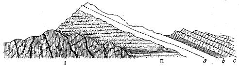
Fig. 35.—Diagram illustrating the stratigraphical relations of the pre-Cambrian and Cambrian rocks
of the North-west Highlands of Scotland.
c, Durness Limestones, with Upper Cambrian and perhaps Lower Silurian fossils, 1500 feet, top nowhere seen.
b, Serpulite grit and "fucoid" shales, 70 to 80 feet, containing the Olenellus-zone. a, Quartzite, with
abundant annelid tubes, about 600 feet. II. Red Sandstones and Conglomerates, sometimes 8000 feet or more
(Torridonian). I. Gneiss with dykes, etc. (Lewisian).
From the definite geological epoch indicated by this platform, we can go
backward into pre-Cambrian time, and realize in some measure how prodigious
must be the antiquity of the successive groups of rock which emerge
from beneath the base of the Palæozoic systems. Nowhere is this antiquity
more impressively proclaimed than in the north-west of Scotland. From
below the Olenellus-zone with its underlying sheets of quartzite (a), a thick
group of dull red sandstones and conglomerates (II.) rises into a series of
detached conical or pyramidal mountains, which form one of the most
characteristic features in the scenery of that region. As this detrital formation
is well developed around Loch Torridon, it has been termed Torridonian.
It attains a thickness of at least 8000 or 10,000 feet, and is traceable all
the way from the extreme northern headlands of Sutherland to the southern
cliffs of the island of Rum.
In judging of the chronological significance of the geological structure
of the north-west of Scotland, we are first impressed by the stratigraphical
break between the base of the Cambrian system and the Torridonian
deposits below. This break is so complete that here and there the thick
intervening mass of sandstones and conglomerates has been nearly or
wholly removed by denudation before the lowest Cambrian strata were
laid down. Such a discordance marks the passage of a protracted interval
of time.
Again, when the composition of the Torridonian rocks is considered,
further striking evidence is obtained of the lapse of long periods. The
sandstones, conglomerates and shales of this pre-Cambrian system present
no evidence of cataclysmal action. On the contrary, they bear testimony
that they were accumulated much in the same way and at the same rate
as the subsequent Palæozoic systems. In that primeval period, as now,
sand and silt were spread out under lakes and seas, were ripple-marked by
the agitation of the water, and were gradually buried under other layers of
similar sediment. The accumulation of 10,000 feet of such gradually-assorted
detritus must have demanded a long series of ages. Here, then, in
the internal structure of the Torridonian rocks, there is proof that in
passing across them, from their summit to their base, we make another vast
stride backward into the early past of geological history.
But when attention is directed to the relations of the Torridonian strata
to the rocks beneath them, a still more striking proof of an enormously
protracted period of time is obtained. Between the two series of formations
lies one of the most marked stratigraphical breaks in the geological structure
of the British Isles. There is absolutely nothing in common between them,
save that the conglomerates and sandstones have been largely made out of
the waste of the underlying gneiss. The denudation of the crystalline
rocks before the deposition of any of the Torridonian sediments must have
been prolonged and gigantic. The more, indeed, we study the gneiss, the
more do we feel impressed by the evidence for the lapse of a vast interval
of time, here unrecorded in rock, between the last terrestrial movements
indicated by the gneiss and the earliest of the Torridonian sediments.
In this manner, reasoning backward from the horizon of the Olenellus-zone,
we are enabled to form some conception of the vastness of the antiquity
of the fundamental rocks of the North-west Highlands. The nature and
origin of these rocks acquire a special interest from a consideration of their
age. They contain the chronicles of the very beginnings of geological
history, in so far as this history is contained in the crust of the earth.
No part of the geological record is so obscure as this earliest chapter, but
we need not here enter further into its difficulties than may be necessary
for the purpose of understanding what light it can be made to throw on
the earliest manifestations of volcanic action.
Under the term Lewisian Gneiss (I. in Fig. 35) a series of rocks is comprised
which differ from each other in composition, structure and age,
though most of them possess such crystalline and generally foliated characters
as may be conveniently included under the designation of gneiss. The complexity
of these ancient crystalline masses was not recognized at the time
when Murchison called them the "Fundamental" or "Lewisian" gneiss.
It is only since the Geological Survey began to study and map them
in full detail that their true nature and history have begun to be understood.[51]
The researches of the Survey have shown the so-called Lewisian
gneiss to comprise the following five groups of rock: 1. A group of
various more or less banded and foliated rocks which form together the
oldest and chief part of the gneiss (Fundamental complex); 2. Highly basic
dykes cutting the first group; 3. Dykes and sills of dolerite, epidiorite and
hornblende-schist; 4. A few dykes of peculiar composition; 5. Gneissose
granite and pegmatite.
The first of these groups, forming the main body of the gneiss, has
been critically studied on the mainland from Cape Wrath to Skye. But
its development in the Outer Hebrides has not yet been worked out,
although the name "Lewisian" was actually taken from that chain of
islands. So far as at present known, however, the gneiss of the Hebrides
repeats the essential characters of that of the mainland.
Mr. Teall, as the result of a careful investigation in the field and with
the microscope, has ascertained that on the mainland between Skye and
Cape Wrath the rocks of the "fundamental complex" are essentially composed
of olivine, hypersthene, augite (including diallage), hornblende,
biotite, plagioclase, orthoclase, microcline and quartz. He has further
observed that these minerals are associated together in the same manner as
in peridotites, gabbros, diorites and granites. Treating the rocks in
accordance with their composition and partly with their structure, but
excluding theoretical considerations, he has arranged them in the following
five subdivisions:—
1. Rocks composed of ferro-magnesian minerals, without felspar or quartz—Pyroxenites,
Hornblendites.
2. Rocks in which pyroxenes are the dominating ferro-magnesian constituents, felspar
always being present, sometimes quartz: A, Without quartz, Hypersthene-augite-rocks
(pyroxene granulites; rocks of the Baltimore-gabbro type) and
augite-rocks (gabbros); B, With quartz, Augite-gneiss.
3. Rocks in which hornblende is the prevalent ferro-magnesian constituent: A, Without
quartz, or containing it only in small quantity; rocks basic in composition:
(a) massive or only slightly foliated (Amphibolites, as epidote-amphibolite,
zoisite-amphibolite, garnet-amphibolite); (b) foliated (Hornblende-schist). B,
With quartz; rocks intermediate or acid in composition: (a) with compact
hornblende and a granular structure (Hornblende-gneiss proper); (b) with hornblende
occurring in fibrous or other aggregates; (c) with compact hornblende
and a more or less granulitic structure (Granulitic hornblende-gneiss).
4. Rocks in which biotite is the predominant ferro-magnesian constituent; felspar and
quartz both present: (a) Biotite occurring as independent plates or in aggregates
of two or three large individuals (Biotite-gneiss); (b) Biotite occurring in
aggregates of numerous small individuals (rare type); (c) Biotite occurring as
independent plates in a granulitic structure.
5. Rocks in which muscovite and biotite are present, together with felspar and quartz—Muscovite-biotite-gneiss.
These, though not forming a well-defined natural
group, are placed together for purposes of description. They are all foliated,
some having the aspect of mica-schists, others being typical augen-gneisses,
or light grey gneisses with abundant oligoclase and inclusions of microlitic
epidote.
The rocks of each of these types are usually restricted to relatively
small areas, and they succeed each other with much irregularity all the way
from Skye to Cape Wrath. Their chemical and mineralogical composition
proves them to have decided affinities with the plutonic igneous masses of
the earth's crust.
The only exceptions to this prevalent igneous type occur in the
districts of Gairloch and Loch Carron, where the gneiss appears to be
associated with a group of mica-schists, graphitic-schists, quartzites and
siliceous granulites, limestones, dolomites, chlorite-schists and other schists.
That these are altered sedimentary formations can hardly be doubted.
What their precise relations to the fundamental complex of the gneiss may
be has not yet been satisfactorily determined. They are certainly far older
than the Torridon sandstone which covers them unconformably. Possibly
they may represent a sedimentary formation still more ancient than the
gneiss.
Save these obscure relics of a pre-Torridonian system of strata, the
gneiss never presents any structure which suggests the alteration of clastic
constituents. Everywhere its mineral composition points to a connection
with the subterranean intrusions of different igneous magmas, while the
manner in which its different rock-groups are associated together, and the
internal structure of some of them, still further link it with phenomena
which will be described in succeeding chapters as parts of the records of
volcanic action.
An interesting feature of the fundamental complex, as bearing on the
origin of the gneiss, is to be found in the occurrence of bosses and bands
which are either non-foliated or foliated only in a slight degree. These
comparatively structureless portions present much of the character of bosses
or sills of true eruptive rocks. They occur in various parts of Sutherland
and Ross. Their external margins are not well defined, and they pass
insensibly into the ordinary gneiss, the dark basic massive rocks shading
off into coarse basic gneisses, and the pegmatites of quartz and felspar
which traverse them merging into bands of grey quartzose gneiss.
So far, therefore, as present knowledge goes, the main body or fundamental
complex of the Lewisian gneiss in the North-west Highlands of
Scotland consists of what may have been originally a mass of various
eruptive rocks. It has subsequently undergone a succession of deformations
from enormous stresses within the terrestrial crust, which have been
investigated with great care by the Geological Survey. But it presents
structures which, in spite of the abundant proofs of great mechanical
deformation, are yet, I venture to think, original, or at least belong to the
time of igneous protrusion before deformation took place. The alternation
of rocks of different petrographical constitution suggests a succession of
extravasations of eruptive materials, though it may not be always possible
now to determine the order in which these followed each other. In the
feebly foliated or massive bands and bosses there is a parallel arrangement
of their constituent minerals or of fine and coarse crystalline layers which
recalls sometimes very strikingly the flow-structure of rhyolites and
other lavas. This resemblance was strongly insisted on by Poulett Scrope,
who believed that the laminar structure of such rocks as gneiss and mica-schist
was best explained by the supposition of the flow of a granitic magma
under great pressure within the earth's crust.[52]
The conviction that these parallel structures do, in some cases, really
represent traces of movements in the original unconsolidated igneous
masses, not yet wholly effaced by later mechanical stresses, has been greatly
strengthened in my mind by a recent study of the structures of various
eruptive bosses, especially those of gabbro in the Tertiary volcanic series of
the Inner Hebrides. The banded structure, the separation of the constituent
minerals into distinct layers or zones, the alternation of markedly
basic with more acid layers, and the puckering and plication of those bands,
can be seen as perfectly among the Tertiary gabbro bosses of Skye as in
the Lewisian gneiss (see Figs. 336 and 337). It cannot be contended that
such structures in the gabbro are due to any subsequent terrestrial disturbance
and consequent deformation. They must be accepted as part of the
original structure of the molten magma.[53] It seems to me, therefore, highly
probable that the parallel banding in the uncrushed cores of the Lewisian
gneiss reveals to us some of the movements of the original magma at the
time of its extrusion and before it underwent those great mechanical
stresses which have so largely contributed to the production of many of its
most characteristic structures.
While the material of the oldest gneiss presents many affinities to plutonic
rocks of much younger date, a wide region of mere speculation opens out
when we try to picture the conditions under which this material was
accumulated. Some geologists have boldly advanced the doctrine that the
Archæan gneisses represent the earliest crust that consolidated upon the
surface of the globe. But these rocks offer no points of resemblance to the
ordinary aspect of superficial volcanic ejections. On the contrary, the
coarsely-crystalline condition even of those portions of the gneiss which
seem most nearly to represent original structure, the absence of anything
like scoriæ or fragmental bands of any kind, and the resemblances which
may be traced between parts of the gneiss and intrusive bosses of igneous
rock compel us to seek the nearest analogies to the original gneiss in deep-seated
masses of eruptive material. It is difficult to conceive that any
rocks approaching in character to the gabbros, picrites, granulites and
other coarsely-crystalline portions of the old gneiss could have consolidated
at or near the surface.
When the larger area of gneiss forming the chain of the Outer
Hebrides is studied, we may obtain additional information regarding the
probable origin and the earliest structures of the fundamental complex of
the Lewisian gneiss. In particular, we may look for some unfoliated
cores of a more acid character, and perhaps for evidence which will show
that both acid and basic materials were successively protruded. We may
even entertain a faint hope that some trace may be discovered of superficial
or truly volcanic products connected with the bosses which recall those of
later date and obviously eruptive nature. But up to the present time no
indication of any such superficial accompaniments has been detected. If
any portions of the old gneiss represent the deeper parts of columns of
molten rock that flowed out at the surface as lava, with discharges of fragmentary
materials, all this superincumbent material, at least in the regions
which have been studied in detail, had disappeared entirely before the
deposition of the very oldest part of the Torridonian rocks, unless some
trace of it may remain among the pebbles of the Torridonian conglomerates,
to which reference will be immediately made.
So far, then, as the evidence now available allows a conclusion to be
drawn, the Lewisian gneiss reveals to us a primeval group of eruptive rocks
presenting a strong resemblance to some which in later formations are connected,
as underground continuations, with bedded lavas and tuffs that
were erupted at the surface; and although no proof has yet been obtained
of true volcanic ejections associated with the fundamental complex, the
rocks seem to be most readily understood if we regard them as having
consolidated from igneous fusion at some depth, and we may plausibly infer
that they may have been actually connected with the discharge of volcanic
materials at the surface. The graphite-schists, mica-schists, and limestones
of the Gairloch and Loch Carron may thus be surviving fragments
of the stratified crust into which these deep-seated masses were intruded,
and through which any volcanic eruptions that were connected with them
had to make their way.
The limited areas occupied by the several varieties of rock in the
fundamental complex suggests the successive protrusion of different magmas,
or of different portions from one gradually changing magma. Mr. Teall
has ascertained that whenever in this series of rocks the relative ages of
two petrographical types can be clearly ascertained, the more basic is older
than the more acid.
But besides all the complexity arising from original diversity of area,
structure and composition among the successive intrusions, a further
intricacy has been produced by the subsequent terrestrial disturbances, which
on a gigantic scale affected the north-west of Europe after the formation of
the fundamental complex of the old gneiss, but long before the Torridonian
period. By a series of terrestrial stresses that came as precursors of those
which in later geological times worked such great changes among the rocks
of the Scottish Highlands, the original bosses and sheets of the gneiss were
compressed, plicated, fractured and rolled out, acquiring in this process a
crumpled, foliated structure. Whether or not these disturbances were
accompanied by any manifestations of superficial volcanic action has not
yet been determined. But we know that they were followed by a succession
of dyke-eruptions, to which, for extent and variety, there is no parallel
in the geological structure of Britain, save in the remarkable assemblage
of dykes belonging to the Tertiary volcanic period[54] (Fig. 36).
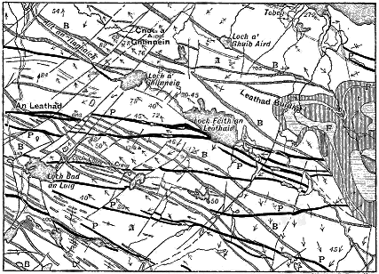
Click on image to view larger.
Walker & Boutall sc.
Fig. 36.—Map of a portion of the Lewisian gneiss of Ross-shire.
Taken from Sheet 107 of the Geological Survey of Scotland on the scale of one inch to a mile. The white ground
(A) marks the general body of the Lewisian gneiss. This is traversed by dykes of dolerite (B), which are cut by
later dykes of highly basic material (peridotite, picrite, etc., P). The gneiss and its system of dykes is overlain
unconformably by the nearly horizontal Torridon Sandstone (t), which is injected by sheets of oligoclase-porphyry
(F).
For the production of these dykes a series of fissures was first opened
through the fundamental complex of the gneiss, having a general trend
from E.S.E. to W.N.W., running in parallel lines for many miles, and so
close together in some places that fifteen or twenty of them occurred
within a horizontal space of one mile. The fissures were probably not all
formed at the same time; at all events, the molten materials that rose in
them exhibit distinct evidence of a succession of upwellings from the
igneous magma below.
Considered simply from the petrographical point of view, the materials
that have filled the fissures have been arranged by Mr. Teall in the following
groups: 1. Ultrabasic dykes, sometimes massive (peridotites), sometimes
foliated (talcose schists containing carbonates and sometimes gedrite);
2. Basic dykes which where massive take the forms of dolerite and epidiorite,
and where foliated appear as hornblende-schist, the same dyke often
presenting the three conditions of dolerite, epidiorite and hornblende-schist;
3. Dykes of peculiar composition, comprising microcline-mica rocks and
biotite-diorite with macro-poikilitic plagioclase; 4. Granites and gneissose
granites (biotite-granite with microcline); 5. Pegmatites (microcline-quartz
rocks with a variable amount of oligoclase or albite).[55]
Distinct evidence of a succession of eruptions can be made out among
these rocks. By far the largest proportion of the dykes consists of basic
materials. The oldest and most abundant of them are of plagioclase-augite
rocks, which, where uncrushed, differ in no essential feature of structure or
composition from the dolerites and basalts of more modern periods, though
they have been plentifully changed into epidiorite and hornblende-schist.[56]
They present, too, most of the broad features that characterize the dykes
of later times—the central more coarsely-crystalline portion, the marginal
band of finer grain, passing occasionally into what was probably a basic
glass, and the transverse jointing. They belong to more than one period
of emission, for they cross each other. They vary in width up to nearly
200 feet, and sometimes run with singular persistence completely across
the whole breadth of the strip of gneiss in the west of Sutherland and
Ross. Dozens of dykes have been followed by the Geological Survey for
distances of ten or twelve miles.
Later in time, and much less abundant, are certain highly basic dykes—peridotites
with schistose modifications—which cut across the dolerites
in a more nearly east-and-west direction. There are likewise occasional
dykes of peculiar composition, which, as above stated, have been distinguished
by Mr. Teall as microcline-mica rocks and biotite-diorite.
Last of all comes a group of thoroughly acid rocks—varieties of granite
and pegmatite—which form intrusive sheets and dykes. The granites
contain biotite with microcline, and are sometimes gneissose. The pegmatites
are microcline-quartz rocks with a variable amount of oligoclase or
albite. These dykes coincide in direction with the basalts and dolerites,
but they are apt to run together into belts of granite and pegmatite, sometimes
1500 feet broad.
Up to the present time no evidence has been found of any superficial
outpouring of material in connection with this remarkable series of dykes
in the Lewisian gneiss. That they may have been concomitant with true
volcanic eruptions may be plausibly inferred from the close analogy which,
in spite of their antiquity and the metamorphism they have undergone, they
still present to the system of dykes that forms a part of the great Tertiary
volcanic series of Antrim and the Inner Hebrides. The close-set fissures
running in a W.N.W direction, the abundant uprise into these fissures of
basic igneous rocks, followed by a later and more feeble extravasation of
acid material, are features which in a singular manner anticipate the
volcanic phenomena of Tertiary time.
There can be no question as to the high antiquity of these dykes.
They were already in place before the advent of those extraordinary vertical
lines of shearing which have so greatly affected both the gneiss and the
dykes; and these movements, in turn, had long been accomplished before
the Torridon Sandstone was laid down, for the dykes, with their abundant
deformation, run up to and pass beneath the sandstone which buries them
and all the rocks with which they are associated. Though later than the
original fundamental complex, the dykes have become so integral and
essential a part of the gneiss as it now exists that they must be unhesitatingly
grouped with it.
With so wide an extension of the subterranean relics of volcanic
energy, it is surely not too much to hope that somewhere there may have
been preserved, and may still be discovered, proofs that these eruptive rocks
opened a connection with the surface, and that we may thus recognize
vestiges of the superficial products of actual Archæan volcanoes. Among
the pebbles in the conglomerates of the Torridon Sandstone there occur,
indeed, fragments of felsites which possess great interest from the perfection
with which they retain some of the characteristic features of younger
lavas. Mr. Teall has described their minute structure. They are dark,
purplish, compact rocks, consisting of a spherulitic micropegmatitic, micropoikilitic
or microcrystalline groundmass, in which are imbedded porphyritic
crystals or crystal-groups of felspar, often oligoclase. These spherulitic
rocks occasionally show traces of perlitic structure. They bear a striking
resemblance to some of the Uriconian felsites of Shropshire, pebbles from
which occur in the Longmynd rocks.[57] These fragments suggest the
existence of volcanic materials at the surface when the Torridon Sandstone
was deposited. Possibly they may represent some vanished Lewisian lavas.
But the time between the uprise of the dykes and the formation of the
Torridonian series was vast enough for the advent of many successive
volcanic episodes. The pebbles may therefore be the relics of eruptions
that took place long after the period of the dykes.
Among the Torridonian strata no undoubted trace of any contemporaneous
volcanic eruptions has been met with.[58] The only relics of volcanic
rocks in this enormous accumulation of sediments are the pebbles just
referred to, which may be referable to a time long anterior to the very
oldest parts of the Torridonian series.
That Archæan time witnessed volcanic eruptions on a considerable scale,
and with great variety of petrographical material, has recently been shown
in detail by Mr. Otto Nordenskjöld from a study of the rocks of Småland
in Sweden. He has described a series of acid outbursts, including masses
of rhyolite and dacite, together with agglomerates and tuffs, likewise basic
eruptions, with dioritic rocks, augite-porphyrite and breccia. He refers
these rocks to the same age as most of the Scandinavian gneisses, and remarks
that though they have undergone much mechanical deformation and
metamorphism, they have yet here and there retained some of their distinctive
volcanic structures, such as the spherulitic.[59] When the large
area of Lewisian gneiss forming the chain of the Outer Hebrides is investigated
it may possibly supply examples of a similar series of ancient volcanic
masses.
We now come to one of the great gaps in the geological record. The
Lewisian gneiss affords us glimpses of probable volcanic activity at the very
beginning of geological history. An enormous lapse of time, apparently
unrepresented in Britain by any geological record, must be marked by the
unconformability between the gneiss and the Torridon Sandstone. Another
prodigious interval is undoubtedly shown by the Torridonian series. Neither
this thick accumulation of sediment nor the Cambrian formations, which to
a depth of some 2000 feet overlie the Torridon Sandstone, have yielded
any evidence of true superficial eruptions, though they are traversed by
numerous dykes, sills and bosses. The age of these intrusive masses
cannot be precisely fixed; a large proportion of them is certainly older
than the great terrestrial displacements and concurrent metamorphism of the
North-West Highlands.
While from the Lewisian gneiss upward to the highest visible Cambrian
platform in Sutherland, no vestige of contemporaneous volcanic rocks is to
be seen, the continuity of the geological record is abruptly broken at the
top of the Durness Limestone. By a series of the most stupendous dislocations,
the rocks of the terrestrial crust have there been displaced to
such a degree that portions have been thrust westward for a horizontal
distance of sometimes as much as ten miles, while they have been so
crushed and sheared as to have often lost entirely their original structures,
and to have passed into the crystalline and foliated condition of
schists. Portions of the floor of Lewisian gneiss, and large masses of the
Torridon Sandstone, which had been buried under the Cambrian sediments,
have been torn up and driven over the Durness Limestone and quartzite.
Though much care has been bestowed by the officers of the Geological
Survey on the investigation of the complicated mass of material which,
pushed over the Cambrian strata, forms the mountainous ground that lies
to the east of a line drawn from Loch Eribol, in the north of Sutherland, to
the south-east of Skye, some uncertainty still exists as to the age and
history of the rocks of that region. For the purposes of this work,
therefore, the rest of the country eastwards to the line of the Great Glen—that
remarkable valley which cuts Scotland in two—may be left out of
account.
To the east of the Great Glen the Scottish Highlands display a vast
succession of crystalline schists, the true stratigraphical relations of which
to the Lewisian gneiss have still to be determined, but which, taken as a
whole, no one now seriously doubts must be greatly younger than that
ancient rock. Murchison first suggested that the quartzites and limestones
found in this newer series are the equivalents of those of the North-West.
This identification may yet be shown to be correct, but must be regarded as
still unproved. Traces of fossils (annelid-pipes) have been found in some of
the quartzites, but they afford little or no help in determining the horizons
of the rocks. In Donegal, where similar quartzites, limestones and schists
are well developed, obscure indications of organic remains (corals and
graptolites) have likewise been detected, but they also fail to supply any
satisfactory basis for stratigraphical comparison.
Essentially the schists of the Scottish Highlands east of the Great
Glen consist of altered sedimentary rocks. Besides quartzites and limestones,
there occur thick masses of clay-slate and other slates and schists,
with bands of graphitic schist, greywacke, pebbly grit, quartzite, boulder-beds
and conglomerates. Among rocks that have been so disturbed and
foliated it is necessarily difficult to determine the true order of succession.
In the Central Highlands, however, a certain definite sequence has been
found to continue as far as the ground has yet been mapped. Were the
rocks always severely contorted, broken and placed at high angles, this
sequence might be deceptive, and leave still uncertain the original order of
deposition of the whole series. But over many square miles the angles of
inclination are low, and the successive bands may be traced from hill to
hill, across strath and glen, forming escarpments along the slopes and outliers
on the summits, precisely as gently-undulating beds of sandstone and
limestone may be seen to do in the dales of Yorkshire. It is difficult to
resist the belief, though it may, perhaps, be premature to conclude, that this
obvious and persistent order of succession really marks the original sequence
of deposition. In Donegal also a definite arrangement of the rock-groups
has been ascertained which, when followed across the country, gives the
key to its geological structure.[60]
In the order of succession which has been recognized during the
progress of the Geological Survey through the Central and Southern Highlands,
it is hard in many places to determine whether the sequence that
can be recognized is in an upward or downward direction. Two bands of
limestone, which appear to retain their relative positions across Scotland for
a distance of some 230 miles, may afford a solution of this difficulty, and if,
as is probable, they are to be identified with the similar limestones of
Donegal, Mayo and Galway, their assistance will thus be available across a
tract of more than 400 miles. What is regarded as the lower zone of
limestone is particularly well seen about Loch Tay; what is believed to be
the upper is typically displayed in the heart of Perthshire, about Blair-Athol.
From under the Loch Tay Limestone a great thickness of mica-schists,
"green schists," schistose grits and conglomerates, slates and greywackes,
emerges up to the border of the Highlands. Above that calcareous band
thick masses of mica-schist and sericite-schist are succeeded by a well-marked
zone of quartzite, which forms the mountains of Ben-y-Glo and Schihallion,
and stretches south-westward across Argyllshire into Islay and Jura. The
second or Blair-Athol Limestone lies next to this quartzite. If the limestones
are identical with those of Donegal, Mayo and Galway, the quartzites
may doubtless be also regarded as continued in those of the same Irish
counties, where they form some of the most conspicuous features in the
scenery, since they rise into such conspicuous mountains as Erigal, Slieve
League, Nephin, and the twelve Bins of Connemara.
The age of this vast system of altered rocks has still to be determined.
It is possible that they may include some parts of the Torridonian series, or
even here and there a wedge of the Lewisian gneiss driven into position by
gigantic disruptions, like those of the North-West Highlands. But there
can be no doubt that the schists, quartzites and limestones form an assemblage
of metamorphosed sedimentary strata which differs much in variety
of petrographical character, as well as in thickness, from the Torridonian
sandstone, and which has not been identified as the equivalent of any known
Palæozoic system or group of formations in Britain. It may conceivably
embrace the Cambrian series of the North-West Highlands, and also the
sedimentary deposits that succeeded the Durness Limestone, of which no
recognizable vestige remains in Sutherland or Ross.
That the metamorphic rocks east of the line of the Great Glen are at
least older than the Arenig formation of the Lower Silurian system may be
inferred from an interesting discovery recently made by the officers of the
Geological Survey. A narrow strip of rocks has been found which, from
their remarkable petrographical characters, their order of sequence and their
scanty fossil contents (Radiolaria), are with some confidence identified with
a peculiar assemblage of rocks on the Arenig horizon of the Silurian system
in the Southern Uplands of Scotland, to which fuller reference will be made
in Chapter xii. This strip or wedge of probably Lower Silurian strata
intervenes between the Highland schists and the Old Red Sandstone in
Kincardineshire, Forfarshire and Dumbartonshire. It has been recognized
also, occupying a similar position, in Tyrone in Ireland. The schists in some
places retain their foliated character up to the abrupt line of junction with
the presumably Lower Silurian strata, while in other districts, as at Aberfoyle,
they have been so little affected that it is hardly possible to draw a line
between the Highland rocks and those of this border-zone, which indeed are
there perhaps more metamorphosed than the Highland grits to the north
of them. The metamorphism of the schists may have been mainly effected
before the final disturbances that wedged in this strip of Silurian strata
along the Highland border, though some amount of crushing and schist-making
seems to have accompanied these disturbances. No trace of any
similar strip of Palæozoic rocks has ever been detected among the folds of
the schists further into the Highlands. But some of the Highland rocks
in the region of Loch Awe lose their metamorphosed character, and pass
into sedimentary strata which, so far as petrographical characters are concerned,
might well be Palæozoic.
Until some clue is found to the age of the Younger or Eastern schists,
quartzites and limestones of the Highlands, it is desirable to have some short
convenient adjective to distinguish them. As a provisional term for them
I have proposed the term "Dalradian," from Dalriada, the name of the old
Celtic kingdom of the north of Ireland and south-west of Scotland.[61]
The special feature for which this Dalradian series is cited in the present
volume is the evidence it furnishes of powerful and extensive volcanic
action. In a series of rocks so greatly dislocated, crumpled and metamorphosed,
we cannot look for the usual clear proofs of contemporaneous
eruptions. Nevertheless all over the Scottish Highlands, from the far coast
of Aberdeenshire to the Mull of Cantyre, and across the west of Ireland
from the headlands of Donegal into Galway, there occurs abundant
evidence of the existence of rocks which, though now forming an integral
part of the schists, can be paralleled with masses of undoubtedly volcanic
origin.

Fig. 37.—Section showing the position of Sills in
the mica-schist series between Loch Tay and Amulree.
a, Mica-schist; b, b, Sills.
Intercalated in the vast pile of altered sediments lie numerous sheets
of epidiorite and hornblende-schist, which were erupted as molten materials,
not improbably as varieties of diabase-lava. Most of these sheets are
doubtless intrusive "sills," for they can be observed to break across from one
horizon to another. But some of them may possibly be contemporaneous
lava-streams. A sheet may sometimes be followed for many miles, occupying
the same stratigraphical platform. Thus a band of sills may be traced from
the coast of Banffshire to near Ben Ledi, a distance of more than 100
miles. Among the hornblendic sills of this band some occur on a number
of horizons between the group of Ben Voirlich grits and the Ben-y-Glo
quartzite. One of the most marked of these is a sheet, sometimes 200 feet
thick, which underlies the Loch Tay Limestone. Another interesting group
in the same great band has been mapped by the Geological Survey on the
hills between Loch Tay and Amulree, some of them being traceable for several
miles among the mica-schists with which they alternate (Fig. 37).
In Argyllshire also, between Loch Tarbert and Loch Awe, and along the
eastern coasts of the islands of Islay and Jura, an abundant series of sheets
of epidiorite, amphibolite and hornblende-schist runs with the prevalent
strike of the schists, grits and limestones of that region. Similar rocks
reappear in a like position in Donegal, where, as in Scotland, the frequency
of the occurrence of these eruptive rocks on the horizons of the limestones
is worthy of remark. The persistence, number and aggregate thickness of
the sills in this great band mark it out as the most extensive series of intrusive
sheets in the British Isles.
In addition to the sills there occur also bosses of similar material, which
in their form and their obvious relation to the sheets recall the structure
of volcanic necks. They consist of hornblendic rocks, like the sills, but are
usually tolerably massive, and show much less trace of superinduced foliation.
Besides the obviously eruptive masses there is another abundant group
of rocks which, I believe, furnishes important evidence as to contemporaneous
volcanic action during the accumulation of the Dalradian series. Throughout
the Central and South-Western Highlands certain zones of "green schist"
have long occupied the attention of the officers of the Geological Survey.
They occur more especially on two horizons between the Loch Tay Limestone
and a much lower series of grits and fine conglomerates, which run through
the Trossachs and form the craggy ridges of Ben Ledi, Ben Voirlich and
other mountains near the Highland border. In the lower group of "green
schists," thick hornblendic sills begin to make their appearance, increasing
in number upwards. The upper group of "green schists" lies between two
bands of garnetiferous mica-schist, above the higher of which comes the
Loch Tay Limestone. The peculiar greenish tint and corresponding mineral
constituents of these schists, however, are likewise found diffused through
higher parts of the series.
So much do the "green schists" vary in structure and composition that
no single definition of them is always applicable. At one extreme are
dull green chlorite-schists, passing into a "potstone," which, like that of
Trondhjem, can be cut into blocks for architectural purposes.[62] At the
other extreme lie grits and quartzites, with a slight admixture of the same
greenish-coloured constituent. Between these limits almost every stage may
be met with, the proportion of chlorite or hornblende and of granular or
pebbly quartz varying continually, not only vertically, but even in the
extension of the same bed. The quartz-pebbles are sometimes opalescent,
and occasionally larger than peas. An average specimen from one of the
zones of "green schists" is found, on closer examination, to be a thoroughly
schistose rock, composed of a matrix of granular quartz, through which
acicular hornblende and biotite crystals, or actinolite and chlorite, are
ranged along the planes of foliation.
That these rocks are essentially of detrital origin admits of no doubt.
They differ, however, from the other sedimentary members of the Dalradian
series in the persistence and abundance of the magnesian silicates diffused
through them. The idea which they suggested to my mind some years ago
was that the green colouring-matter represents fine basic volcanic dust,
which was showered out during the accumulation of ordinary quartzose,
argillaceous and calcareous sediments, and that, under the influence
of the metamorphism which has so greatly affected all the rocks of the
region, the original pyroxenes and felspars suffered the usual conversion
into hornblendes, chlorites and micas. This view has occurred also to my
colleagues on the Survey, and is now generally adopted by them.
Not only are these "green schists" traceable all through the Central
and South-Western Highlands, rocks of similar character, and not improbably
on the same horizons, reappear in the north-west of Ireland, and
run thence south-westward as far as the Dalradian rocks extend. If we
are justified in regarding them as metamorphosed tuffs and ashy sediments,
they mark a widespread and long-continued volcanic period during the time
when the later half of the Dalradian series was deposited.
Besides the extensive development of basic sills which, though probably
in great part later than the "green schists," may belong to the same prolonged
period of subterranean activity, numerous acid protrusions are to
be observed in the Dalradian series of Scotland and Ireland. That these
masses were erupted at several widely-separated intervals is well shown by
their relation to the schists among which they occur. Some of the great
bosses and sills of granite were undoubtedly injected before the metamorphism
of the schists was completed, for they have shared in the foliation of the
region. Others have certainly appeared after the metamorphism was complete,
for they show no trace of having suffered from its effects. Thus some
of the vast tracts of newer granite in the Grampian chain, which cover
many square miles of ground, must be among the newest rocks of that area.
They have recently been found by Mr. G. Barrow, of the Geological Survey,
to send veins into the belt of probably Lower Silurian strata which flanks
the Highland schists. They are thus later than the Arenig period. Not
impossibly they may be referable to the great granite intrusions which formed
so striking a feature in the history of the Lower Old Red Sandstone.
In the island of Anglesey an interesting series of schists and quartzites
presents many points of resemblance to the Dalradian or younger schists of
the Highlands. At present the geologist possesses no means of determining
whether these Welsh rocks are the equivalents of the Scottish in stratigraphical
position, but their remarkable similarity justifies a brief allusion
to them in this place. Much controversy has arisen regarding the geology
of Anglesey, but into this dispute it is not necessary for my present purpose
to enter.[63] I will content myself with expressing what seems to me,
after several traverses, to be the geological structure of the ground.
There are two groups of rocks in Anglesey to which a pre-Cambrian
age may with probability be assigned. In the heart of the island lies a
core of gneiss which, if petrographical characters may be taken as a guide,
must certainly be looked upon as Archæan. In visiting that district with
my colleague Mr. Teall I was much astonished to find there so striking a
counterpart to portions of the Lewisian gneiss of the north-west of Sutherland
and Ross. The very external features of the ground recall the
peculiar hummocky surface which so persistently characterizes the areas of
this rock throughout the north-west of Scotland. If the geologist could be
suddenly transported from the rounded rocky knolls of Sutherland, Ross-shire
or the Hebrides to those in the middle of Anglesey, south of Llanerchymedd,
he would hardly be aware of the change, save in the greater verdure
of the hollows, which has resulted from a more advanced state of decomposition
of the rocks at the surface, as well as from a better climate and
agriculture.
When we examine these rocky hummocks in detail we find them to
consist of coarse gneisses, the foliation of which has a prevalent dip to
N.N.W. Some portions abound in dark hornblende and garnets, others
are rich in brown mica, the folia being coarsely crystalline and rudely
banded, as in the more massive gneisses of Sutherland. Abundant veins
of coarse pegmatite may here and there be seen, with pinkish and white
felspars and milky quartz. Occasionally the gneiss is traversed by bands
of a dark greenish-grey rock, which remind one of the dykes of the north-west
of Scotland. There are other rocks, some of them probably intrusive
and of later date, to be seen in the same area; but they require more
detailed study than they have yet received.
The relation of this core of gneiss and its associated rocks to the second
group of pre-Cambrian rocks has not hitherto been satisfactorily ascertained.
The core may conceivably be an eruptive boss in that group, and may have
acquired its foliation during the movements that produced the foliation of
the surrounding schists. But it seems more probable that the gneiss is
much older than these schists, though it would undoubtedly participate in
the effects of the mechanical movements which gave rise to their deformation,
cleavage and foliation.
The second group of rocks occupies a large area in the west and in the
centre and south of Anglesey. The schists of which it consists are
obviously in the main a clastic series. One of their most conspicuous
members is quartzite, which, besides occurring sporadically all over the
island, forms the prominent mass of Holyhead Mountain. There are likewise
flaggy chloritic schists, green and purple phyllites or slates, and bands
of grit, while parts of the so-called "grey gneiss" consist of pebbly sandstones
that have acquired a crystalline structure. That some order of
sequence among these various strata may yet be worked out is not impossible,
but the task will be one of no ordinary difficulty, for the plications
and fractures are numerous, and much of the surface of the ground is
obscured by the spread of Palæozoic formations and superficial deposits.
These Anglesey schists are so obviously an altered sedimentary series
that it is not surprising that they should have been regarded as metamorphosed
Cambrian strata. All that can be positively affirmed regarding
their age is that they are not only older than the lowest fossiliferous rocks
around them—that is, than Arenig or even Tremadoc strata—but that
they had already acquired their present metamorphic character before these
strata were laid down unconformably upon them. There is no actual proof
that they include no altered Cambrian rocks. But when we consider their
distinctly crystalline structure, and the absence of such a structure from any
portion of the Cambrian areas of the mainland; when, moreover, we reflect
that the metamorphism which has affected them is of the regional type,
and can hardly have been restricted to merely the limited area of Anglesey;
we must agree with those observers who, in spite of the absence of positive
proof of their true geological horizon, have regarded these rocks as of much
higher antiquity than the Cambrian strata of the neighbourhood. No one
familiar with the Dalradian rocks of Scotland and Ireland can fail to be
struck with the close resemblance which these younger Anglesey schists bear
to them, down even into the minutest details. Petrographically they are
precisely the counterparts of the quartzites and schists of Perthshire and
Donegal, and a further connection may be established of a palæontological
kind. The upper part of the Holyhead quartzite was found by Mr. B. N.
Peach and myself in the autumn of the year 1890 to be at one place
crowded with annelid-pipes, and I subsequently found the same to be the
case with some of the flaggy quartzites near the South Stack.
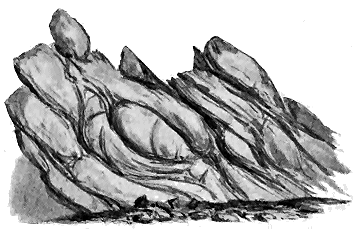
Fig. 38.—Sketch of crushed basic igneous rock among the schists, E. side of Porth-tywyn-mawr,
E. side of Holyhead Straits.
For the purpose of the inquiry which forms the theme of this work,
the feature of greatest interest about these younger schists of Anglesey is
the association of igneous rocks with them. They include bands of dark
basic material, the less crushed parts of which resemble the diabases of
later formations, while the sheared portions pass into epidiorites and true
hornblende-schists. As in other regions where eruptive rocks have been
crushed down and changed into the schistose modification, it is frequently
possible to see groups of uncrushed cores round which, under severe
mechanical stresses, the rock has undergone this conversion. Lines of
movement through the body of the rock may be detected by bands of schist,
the gradation from the solid core to the hornblende-schist being quite
gradual. The accompanying figure (Fig. 38) represents a portion of one of
these crushed basic igneous rocks on the east side of Holyhead Straits.
As in the Dalradian series of the Highlands, many, perhaps most, of
these igneous bands are probably intrusive sills, but others may be
intercalated contemporaneous sheets. They occur across the whole breadth
of the island from the Menai Strait to the shores of Holyhead.
Besides these undoubtedly igneous rocks, the green chloritic slates of
Anglesey deserve notice. They are well-bedded strata, consisting of
alternations of foliated fine grit or sandstone, with layers more largely
made up of schistose chlorite. The gritty bands sometimes contain pebbles
of blue quartz, and evidently represent original layers of sandy sediment,
but with an admixture of chloritic material. The manner in which this
green chloritic constituent is diffused through the whole succession of
strata, and likewise aggregated into bands with comparatively little quartzose
sediment, reminds one of the "green schists" of the Central Highlands
and Donegal, and suggests a similar explanation. Taken in connection
with the associated basic igneous rocks, these chloritic schists seem to me
to represent a thick group of volcanic tuffs and interstratified sandy and
clayey layers. If this inference is well founded, and if we are justified
in grouping these Anglesey rocks with the Dalradian schists of Scotland
and Ireland, a striking picture is presented to the mind of the wide
extent and persistent activity of the volcanoes of that primeval period
in Britain.[64]
Along the eastern borders of Wales a ridge of ancient rocks, much broken
by faults and presenting several striking unconformabilities, has long
been classic ground in geology from the descriptions and illustrations of
Murchison's Silurian System.[65] The main outlines of the structure of
that district, first admirably worked out by this great pioneer, were
delineated on the maps and sections of the Geological Survey, wherein it
was shown that in the Longmynd an enormously thick group of stratified
rocks, which, though unfossiliferous, were referred to the Cambrian system,
rose in the very heart of the country; that to the east of these rocks lay
strata of Caradoc or Bala age; that by a great hiatus in the stratigraphy
the Upper Silurian series transgressively wrapped round everything below it;
that yet again the Coal-measures crept over all these various Palæozoic formations,
followed once more unconformably by Permian and Triassic deposits.[66]
Besides all this evidence of extraordinary and repeated terrestrial movement,
it was found that the region was traversed by some of the most
powerful dislocations in this country, while to complete the picture of
disturbance, many protrusions of igneous rocks were recognized.
In a territory so complicated, though it had been sedulously and
skilfully explored, there could hardly fail to remain features of structure
which had escaped the notice of the first observers. In particular, the
igneous rocks had been dealt with only in a general way, and they
consequently offered a favourable field for more detailed study; while by a
more searching examination of some of the rocks for fossils, important
corrections of the earlier work might yet be made.
A notable step towards a revision of the received opinions regarding the
igneous rocks of this region was taken by Mr. Allport, who showed that the
so-called "greenstone" included masses of devitrified spherulitic pitchstones
and perlites, together with indurated volcanic breccias, agglomerates and
ashes.[67] Subsequently Professor Bonney described more fully the petrographical
characters of the Wrekin igneous rocks, confirming and extending
the observations of Mr. Allport.[68]
But the correction of the prevalent error as to the geological age of
these rocks was due to Dr. Callaway, who, after spending much time and
labour in ascertaining, by a careful search for fossils, the position of the
superincumbent rocks (wherein he discovered Cambrian organisms), and in
a detailed investigation of the structure and relationships of the igneous
masses themselves, was led to regard them as part of an ancient pre-Cambrian
ridge; and he proposed for the volcanic group the name of
Uriconian, from the name of the former Roman town which stood not far
to the west of them.[69] He has shown how essentially volcanic this ancient
series of rocks is, how seldom they present any clearly-marked evidence of
stratification, and how small is the proportion of sedimentary material
associated with them.[70]
Subsequently Professor Lapworth, by his discovery of the Olenellus-fauna,
marking the lowest known fossiliferous Cambrian zone in the Wrekin
district, and his recognition of Cambrian fossils under the Coal-measures of
Warwickshire, supplied valuable evidence for the discussion of the geological
position of the older rocks of the Midlands. He has mapped in minute
detail the rocks of the Wrekin, and has exhausted all the evidence that is
at present obtainable on the subject. But unfortunately the publication of
his researches is still delayed.[71]
It is now recognized that the core of the ancient ridge, extending from
near Wellington through the Wrekin, Caer Caradoc and other hills, until it
sinks beneath the Upper Silurian formations, is formed of igneous rocks
that consist partly of lavas, partly of volcanic breccias and fine tuffs. The
lavas are thoroughly acid rocks of the felsitic or rhyolitic type. One of
them, about 100 feet thick, which forms a prominent feature on the flanks
and crest of Caer Caradoc, shows abundant finely-banded flow-structure,
often curved or on end, while its bottom and upper parts are strongly
amygdaloidal, the cavities being occasionally pulled out in the direction of
flow and lined with quartz or chalcedony. Some of the detached areas of
eruptive rocks show the beautiful spherulitic and perlitic structures first
noticed in this region by Mr. Allport. More recently the structures of
these acid rocks have been described by Mr. F. Rutley.[72]
The breccias and tuffs appear to consist mainly of felsitic material. In
the coarser varieties, fragments of finely-banded felsite may be noticed, while
the finer kinds pass into a kind of hornstone (hälleflinta), which in hand-specimens
could hardly be distinguished from close-grained felsite. In
some places, these pyroclastic rocks are well stratified, but elsewhere no
satisfactory bedding can be recognized in them. Various other rocks, which
are probably intrusive, occur in the ridge. At either end of the Wrekin
there is a mass of pink microgranite, while at Caer Caradoc numerous sheets
of "greenstone," intercalated in the fine tuffs, sweep across the hill. Mr.
Rutley has published an account of these basic rocks, which he classes as
"melaphyres," or altered forms of basalt or andesite.[73] That at least some
of them are intrusive is manifest by the way in which they ramify through
the surrounding strata. But others are so strongly amygdaloidal and slaggy
that they may possibly be true interbedded lavas, though there may be
some hesitation in admitting that such basic outflows could be erupted in
the midst of thoroughly acid ejections.[74] Leaving these doubtful flows out
of account, we have here a group of undoubted volcanic rocks represented
by acid lavas and pyroclastic materials, by intrusive bosses of acid rocks,
and by younger basic sills. The general lithological characters of these
masses and the sequence of their appearance thus strongly resemble those of
subsequent Palæozoic volcanic episodes.
The geological age of this volcanic group is a question of much interest
and importance in regard to the history of volcanism in this country. An
inferior limit to the antiquity of the group can at once be fixed by the fact
that, as originally pointed out by Dr. Callaway, the quartzite which overlies
the volcanic rocks passes under a limestone containing Cambrian fossils in
which Professor Lapworth has since recognized Olenellus, Paradoxides and
other Lower Cambrian forms. The eruptions, therefore, must be at least as
old as the earlier part of the Cambrian period. But it is affirmed that the
quartzite rests with a complete unconformability on the volcanic rocks. If
this be so, then the epoch of eruption must be shifted much farther back.

Fig. 39.—Section across the Uriconian series of Caer Caradoc.
S3, Upper Silurian; S2, Bala group; S1, Arenig group; C, Cambrian; L, Longmyndian; u, Uriconian;
f f, faults.
The evidence adduced in favour of this great break appears to me to be
threefold. In the first place, the quartzite contains fragments of the
volcanic rocks. I do not think much stress can be laid on this fact. When
I visited the ground, what struck me most in the composition of the
quartzite was its singularly pure quartzose character, and the comparative
scarcity of felsite-pebbles in it. Any deposit laid down conformably upon
the top of the breccias and tuffs might obviously contain some of these
materials, while, if laid down unconformably, it might reasonably be
expected to be full of them. In the second place, this quartzite is alleged
to pass transgressively across the edges of successive sheets of the volcanic
group, and thus to have a quite discordant dip and strike. I failed to find
satisfactory evidence of this unconformability in the northern part of the
district. But in the Caer Caradoc area the quartzite does appear to steal
across the outcrops of the older rocks, which plunge at nearly right angles
in an opposite direction. In the third place, the felsitic volcanic group is
believed by Professor Lapworth to pass upwards into the Longmynd rocks.
Obviously, if this group lies at the very bottom of the vast Longmynd
series, the discordance between it and the quartzite must be enormous, and
the date of the volcanic eruptions must be placed vastly farther back in
geological antiquity. Though the evidence does not seem to me to amount
to clear proof, I am disposed, in the meantime, to accept it as affording the
most probable solution of the difficulties presented by the structure of the
ground.
The sequence of the rocks around Caer Caradoc is partly concealed by
surface accumulations, but if these could be cleared away the structure of
the ground would be, according to Messrs. Lapworth and Watts, as shown
in Fig. 39.[75]
If, then, this volcanic group underlies the whole of the Longmynd
series, and if, as it now appears, that series is older than the Olenellus-zone
of the Lower Cambrian rocks, we can hardly include the volcanic rocks of
the Wrekin and Caer Caradoc in the Cambrian system. They must belong
to a still older geological formation, and I think we cannot do better than
adopt for them Dr. Callaway's name, Uriconian.
There are still, however, many problems to be solved before the
geological history of that region is completely understood. The rocks of the
Longmynd must be more fully worked out. It is improbable that strata
which look so likely to yield fossils should for ever prove barren. The
lower half at least may be hopefully searched, although the upper massive
reddish sandstones and conglomerates offer less prospect of success. On the
west side of the Longmynd, above Pontesbury, there occurs a small area of
volcanic rocks like those of the Wrekin district, including a well-marked
nodular felsite and fine tuffs. These rocks have been regarded by Dr.
Callaway as another axis of the Uriconian series. It is very difficult, however,
by any combination of geological structures, to bring up a portion of
the very bottom of the Longmynd series and place it apparently at the top.
This is a feat which a detailed study of the region, and the detection of
unconformabilities in the Longmynd, may possibly accomplish. In the
meantime, however, I would venture to suggest whether it is not more
probable that we have here a detached area of much younger volcanic rocks,
like those which, in various districts, may be included in the Cambrian
system, and which will be referred to in some detail in subsequent pages.
Regarding the age and origin of the oldest rocks of the Malvern Hills
some controversy has arisen, and no general agreement has yet been reached.[76]
It is clear that the core of crystalline rocks which is overlain unconformably
by the Hollybush Sandstone must be older than the Upper Cambrian rocks.
There is no good evidence of any stratigraphical break in the Cambrian
system of England or Wales, and it may be reasonably inferred that the
break seen at the base of the Hollybush Sandstones indicates that the rocks
underneath that horizon are pre-Cambrian. Some portions of these
certainly very ancient rocks are gneisses or schists; others have been
described as "felsites," and have been regarded as passing into schists, and
as the original material from which portions of the foliated series of the
range have been produced by mechanical deformation. Not improbably the
whole series of rocks is of igneous origin, but has been subsequently
rendered more or less schistose.
There is one area where the rocks have escaped metamorphism, and
where they present some of the well-known features of ancient volcanic
materials. This tract was first indicated by Dr. H. B. Holl as one occupied
by "altered primordial rocks and post-primordial trap." Its evidently
igneous materials have been examined and described by different observers,
among whom Dr. Callaway has contributed some detailed papers on the
subject. More recently Professor Green, who had the advantage of sections
exposed in the excavations for the construction of a reservoir for supplying
water to Great Malvern, came to the conclusion that the rocks
consist mainly of felsites, having many of the characters of rhyolites.
With these are associated felsitic tuffs, while bands of dolerite, probably
intrusive, form likewise part of the series. So far as the somewhat meagre
evidence allows an opinion to be formed, there appears to be an alternation
of felsites, lavas and tuffs placed in a more or less vertical position, striking
in a northerly direction, and traversed by several sheets of intrusive dolerite.
No junction has been found between these unfoliated volcanic rocks
and the schists that form the core of the range. Judging merely from
their present relative condition, one would naturally infer that the volcanic
rocks must be the younger of the two groups. But, as Professor Green has
pointed out, it is conceivable that the latter may have locally escaped
crushing, and yet be of the same age as the felsites and epidiorites of the
neighbouring Raggedstone Hill, which have been in part considerably
affected by mechanical movements.[77]
For our present inquiry it is perhaps sufficient to take note that in the
heart of the Malvern Hills there lies a remnant of a volcanic district, probably
of pre-Cambrian age, the rocks of which had been raised up into a
vertical position so as to form islets or reefs in the sea in which the Upper
Cambrian strata (Hollybush Sandstone and Upper Lingula shales) were
deposited. Until some more precise evidence is obtained as to the geological
age of these rocks it may be convenient to place them provisionally with
the volcanic Uriconian series.
In the heart of England the great Triassic plain is diversified by the
uprise through it of the peaks and crests of an old Triassic land-surface,
which are embraced in the district known as Charnwood Forest. These
scattered eminences consist of materials not only immensely older than the
Trias, but once doubtless buried under thousands of feet of Palæozoic strata.
They had been laid bare by denudation and carved into picturesque crags
and pinnacles before the New Red Sandstone was deposited around and
above them.
To these vestiges of an early Mesozoic land, still half buried among
Triassic strata, a peculiar interest attaches from the obviously high antiquity
of their rocks and their uprise in the very centre of the island. Various
opinions have been expressed as to the age of their component rocks.
When they were mapped by the Geological Survey they were recognized to
be as old as any group of rocks then known, and they were accordingly
placed in the Cambrian system. More recent research has suggested that
they may be still more ancient, and may be regarded as pre-Cambrian.
The rocks of Charnwood Forest have been the subject of an exhaustive
research by the Rev. E. Hill and Professor Bonney, to whom most of our
knowledge regarding them is due. These observers first pointed out the
truly volcanic nature of the coarse clastic rocks of the district. They have
traced their relations in the field, and have likewise described their structure
and composition as shown by the microscope. Subsequently the district
has been re-mapped on the scale of six inches to a mile by Mr. Fox
Strangways for the Geological Survey, while Mr. W. W. Watts, another
member of the Survey, has studied the petrography of the ground, and has
traced the boundaries of the several rock-groups so far as these can be
determined. Confirming generally the stratigraphical arrangement sketched
by Messrs. Hill and Bonney, Mr. Watts has proposed the following classification
of the rocks:—[78]
| 7. |
Groby and Swithland slates. |
 |
The Brand series. |
6.
|
Hanging Rocks conglomerate
and Bradgate quartzite. |
| 5. |
Woodhouse beds (ashy grits). |
 |
The Maplewell series
(volcanic tuffs
and agglomerates). |
| 4. |
Slate-agglomerate of Roecliffe. |
| 3. |
Hornstone beds of Beacon Hill. |
| 2. |
Felsitic agglomerate of Benscliffe. |
| 1. |
Quartzose, felspathic and felsitic grits. |
The Blackbrook series. |
Under any computation or measurement, the total thickness of detrital
material in this series of formations must amount to several thousand feet.
The chief interest centres in the middle series, which consists largely of
fragmental volcanic rocks, with intercalations of slate and grit. As was
first shown by Mr. Hill and Professor Bonney, these volcanic materials
vary from exceedingly coarse agglomerates to fine, ashy or felspathic
slates. In most cases distinct bedding can be recognized in them, but
more particularly in the fine-grained material. Yet even among the
massive agglomerates a tendency may be seen towards an orientation of
the blocks with their long axes parallel. That this arrangement is not
entirely due to the effects of cleavage may be inferred from the many
exceptions to it, which would hardly have occurred had such powerful
cleavage affected the whole district, as would be needed to rearrange the
large blocks in the agglomerates. Besides, the coarser parts often intercalate
with fine felspathic grits, which distinctly mark the stratification of
the whole.
The remarkably coarse breccia of Benscliffe is mainly made up of blocks
of quartz-porphyry, felsite or rhyolite, with slate fragments. The Roecliffe
agglomerate, another extraordinarily coarse rock, consists of slate fragments
imbedded in an andesitic matrix, some of the blocks of slate being six
feet long. The finer tuffs have been ascertained to consist of felsitic or
andesitic detritus, sometimes forming exceedingly compact flinty rocks or
hornstones.
In this thick accumulation of detrital rocks we are presented with a
series of alternations of coarser and finer pyroclastic material, interstratified
among green, grey and purple slates and grits, which probably represent
the non-volcanic sediments of the time of eruption. The succession of
strata bears witness to a long series of eruptions of varying intensity, but
culminating at two distinct periods in the discharge of huge blocks of rock
(Benscliffe and Roecliffe agglomerates).
After some search I have been unable to detect a single vesicular fragment
among the stones in the breccias and tuffs, and Messrs. Hill and
Bonney were not more successful. Not a trace of anything in the least
degree scoriaceous is anywhere to be found. The paste in which the blocks
lie consists of such fine material as would result from the trituration of
felsite and slate. It contains many broken crystals of felspar, with grains
of clear quartz. A gradation can be traced from the coarser into the finer
bands of volcanic and non-volcanic material, fine slates being also interleaved
with highly-felspathic partings of grit.
Having looked with some care for a trace of a true volcanic neck in
the district, I have not seen anything that could be unhesitatingly so
designated. Even in the north-western part of the district, where the
breccias are coarsest, and there is least trace of ordinary sediments, some
signs of bedding can usually be detected in the position of the imbedded
stones and the partings of finer tuff. Both the coarser and finer detritus
suggest the kind of material discharged from vents before the uprise of any
lava. The entire absence of scoriaceous fragments is noteworthy, and the
abundance of slate blocks rather points to the early eruptions of a volcanic
focus. Possibly, while the chief centre of eruption lay towards the north-west,
numerous vents may have been opened all over the district, discharging
abundant showers of dust and stones, but seldom or never culminating in
the actual outpouring of lava.
No indubitable lava-sheet has, in my judgment, been yet recognized in
Charnwood Forest. Various opinions have been expressed as to some of
the more compact close-grained rocks, and even the verdicts of the same
observers have varied from time to time, the rocks once considered as felsites
being afterwards regarded as tuffs, and subsequently placed with the felsites
or andesites after all. It is not necessary for my present purpose to enter
into these questions, which are rather of local interest. I will only say
that, in my opinion, the rocks of Sharpley, Peldar, and Bardon Hill are
massive rocks, as they have finally been classed by Messrs. Hill and Bonney.
But I cannot look upon them as lavas, at least I have seen no evidence to
lead me to believe that they were ever erupted at the surface. I have fully
considered the arguments of Mr. Hill and Professor Bonney on this point.[79]
There can, I think, be no doubt of the close association of these felsitic
rocks and the breccias, but the structure of the rocks in the field seems to
me to be decidedly in favour of the view expressed above. The microscope
affords no assistance in the question.[80] The doubtful rocks seem to me rather
to be intrusive masses which have been protruded into the volcanic sedimentary
series among which they rise. They are acid, fine-grained, porphyritic
rocks, which would formerly have been included under the general name of
felsites or quartz-porphyries. Their coarse porphyritic parts rapidly pass
into close-grained felsitic material. Many of the blocks in the breccias
are precisely like parts of these rocks. It might hence be asserted
that these fragmental deposits are later than the eruptive bosses. At
least it is obvious that rocks of the same type as those of Sharpley,
Peldar, and Bardon Hill must have been disrupted to produce the coarse
breccias.
Later eruptive rocks, consisting of masses of syenite and granite, with
still younger dykes of dolerite, andesite, diorite and felsite, have successively
made their appearance, and add to the diversity of the igneous phenomena
of this district.
The question of the age of this isolated volcanic series is one of much
interest, but of great perplexity. Though a resemblance may be admitted
to exist between some of the slates and parts of the Cambrian system of
North Wales, the difference between the Charnwood rocks and the undoubted
Cambrian series of Warwickshire, only thirteen miles to the south-west,
is such as to indicate that the former are probably older than the
latter. While the Charnwood rocks have been intensely cleaved and
crushed, those of Warwickshire have undergone no such change. The
argillaceous strata in the one region have been converted into slates, in the
other they remain mere shales. Though cleavage is sometimes irregularly
developed, its rapid disappearance in so short a distance as the interval
between Charnwood Forest and Nuneaton seems most explicable if we
suppose that the rocks at the more easterly locality were cleaved before
those towards the west were deposited. If this inference be well grounded
the pre-Cambrian age of the Charnwood volcanoes would be established.
But the argument is not conclusive. No fossils of any kind have yet been
found in any of the old rocks of Charnwood.[81] Merely lithological resemblances
or differences are all that can be used as a guide to the geological
age of these masses. Mr. Watts has suggested that possibly the quartzite
of Bradgate (No. 6 of the Charnwood groups) may be the equivalent of the
quartzite which in Shropshire and Warwickshire forms the base of the
sedimentary Cambrian formations. If that correlation could be established,
the volcanic series below the quartzite in Charnwood might be regarded as
representing the Uriconian volcanic series of Shropshire.
CHAPTER IX CHARACTERISTICS OF THE CAMBRIAN SYSTEM IN BRITAIN
The Physical Geography of the Cambrian Period—The Pioneers of Palæozoic Geology in
Britain—Work of the Geological Survey in Wales—Subdivisions of the Cambrian
System in Britain.
In leaving the investigation of the pre-Cambrian rocks and entering upon
that of the Palæozoic systems, that is, the great series of sedimentary formations
which include the earliest records of organized life upon the surface of
the globe, the geologist feels much as the historian when, quitting the domain
of legend and tradition, he can tread firmly in the region of documentary
evidence. From the bottom of the Cambrian system upward through the
long series of geological formations, the chronicle, though often sadly incomplete,
is usually clear and legible. As we follow the lowest fossiliferous
strata across a territory, we recognize that they bear witness to the
same processes of denudation and deposition which have been going on
uninterruptedly on the face of the globe ever since. The beds of conglomerate
represent the gravels and shingles of old coast-lines and river-beds.
The sandstones recall the familiar features of sandy sea-bottoms not far
from land. The shales bear witness to the fall of fine sediment in stiller
water, such as now takes place in the deeper parts of seas and lakes. Notwithstanding
their vast antiquity, the strata themselves exhibit no exceptional
peculiarities of origin. They seem to be just such familiar deposits as are
gathering under fitting conditions at the present time.
Some writers have speculated on the far greater intensity of all geological
activities in the early times of the planet's history. But if we may
interpret the record of the stratified formations by the phenomena of to-day,
there is for these speculations no confirmation in the sedimentation of
the oldest stratified deposits. It is of course quite intelligible, if not probable,
that many geological forces may have been more vigorous in primeval
times than they afterwards became. But of the gigantic tides, prodigious
denudation and violent huddling together of the waste of the earth's
surface, which have been postulated for the early Palæozoic ages, there is
assuredly nowhere any indication among the stratified formations. In
those vast orderly repositories, layer succeeds layer among thinly-laminated
shales, as gently and equably as the fine silt of each tide sinks to-day
over the floor of a sheltered estuary. At the primeval period of
which these sediments are the memorial, the waters receded from flat
shores and left tracts of mud bare to the sky, precisely as they do still.
Then as now, the sun shone and dried such mud-flats, covering their surfaces
with a network of cracks; the rain fell in heavy drops, that left their
imprints on the drying mud; and the next tide rose so gently as to overflow
these records of sunshine and shower without effacing them, but
spreading over them a fresh film of sediment, to be succeeded by other
slowly-accumulating layers, under which they have lain preserved during
the long cycles of geological history.
That organized creatures had already appeared upon the earth's surface
before the beginning of the Cambrian period cannot be doubted. The
animal remains in the lowest Cambrian strata are far from being the simple
forms which might be expected to indicate the first start of animal life
upon the surface of the earth. On the contrary, though they are comparatively
scanty in types, and often rare or absent throughout a thick
mass of sedimentary deposits, they show beyond dispute that, when they
flourished, invertebrate life had already reached such a stage of advancement
and differentiation that various leading types had appeared which have
descended, in some cases with generic identity, down to our own day. There
must have been a long pedigree to these organisms of the oldest known
fossiliferous rocks. And somewhere on the earth's surface we may yet hope
to find the remains of their progenitors in pre-Cambrian deposits.
The researches of many explorers in Europe and North America have
brought to light an interesting series of organic remains from the Cambrian
system. Of the plants of the time hardly any traces have survived,
save some markings which have been referred to sea-weeds. The earliest
known sponges and corals occur in this system, likewise the ancestors of
the graptolites, which played so prominent a part in the life of the next or
Silurian period. There were already representatives of crinoids and star-fishes,
besides examples of the extinct group of cystideans. Sea-worms
crawled over the muddy and sandy sea-bottom, for they have left their
trails and burrows in the hardened sediments. Molluscs had by this time
appeared in their four great divisions of Brachiopods, Lamellibranchs, Gasteropods
and Cephalopods, though the forms yet discovered among Cambrian
rocks are comparatively few. The most abundant and characteristic inhabitants
of the Cambrian seas were the trilobites, of which many genera have
been disinterred from the strata. In the lowest fossiliferous Cambrian
group the trilobitic genus Olenellus, already referred to, is the characteristic
form. Higher up Paradoxides is predominant, while towards the top of the
system the most characteristic genus is Olenus.
From the organic remains which have been preserved, we may legitimately
infer the existence of others which have entirely disappeared. There
seems no reason to doubt that the leading grades of invertebrate life which are
wanting in the known Cambrian fauna were really represented in the Cambrian
seas. The chance discovery of a band of limestone may any day
entirely alter our knowledge as to the relative proportions of the several
divisions of the animal kingdom in the earliest Palæozoic rocks. Sand
is rather adverse to the preservation of a varied representation of the
organisms of the overlying sea-water. Mud is generally favourable, but calcareous
accumulations are greatly more so, and they usually consist almost
entirely of organic remains. Thus in the Cambrian series of the north-west
of Scotland the quartzites that form the lower group, though sometimes
crowded with worm-burrows, contain hardly any other sign of organisms.
The overlying shales, besides their abundant worm-castings, have yielded
perfect specimens of Olenellus and other fossils. But in the uppermost group,
consisting of limestones, every particle of the sediment appears to have passed
through the intestines of worms, and as it gathered on the sea-bottom it
enclosed and has preserved a varied and abundant assemblage of organisms,
including trilobites, gasteropods and a number of cephalopods. While in
the Cambrian rocks of Europe calcareous bands are comparatively rare, in
those of North America they are not infrequent. Hence it is largely from
American deposits that our knowledge of the Cambrian fauna has been
derived.
Not a vestige of any vertebrate organism has yet been detected among
the earlier Palæozoic sediments. So far as we know, there were no fishes
in the Cambrian seas. The highest organisms then existing were chambered
shells, a once abundant and singularly varied class, of which the living
Nautilus is now the sole representative.
In trying to realize the general geographical conditions of Cambrian
time, the geologist finds himself entirely without any evidence as to the
character of the terrestrial vegetation. We can hardly doubt that the land
was clothed with plants, probably including lycopods and ferns, possibly
even cycads and conifers. But no remains of this flora have yet been
recovered. Nor have any traces of land-animals been detected. All that
we yet know of the life of the period has been gleaned from marine sediments,
which show that the invertebrate population by which the sea was
then tenanted embraced some of the leading types of structure that have
survived through all the long vista of geological time down to our own
day.
Some of the shore-lines of the Cambrian waters may still be traced, and
it is possible to say where the land of the time stood and where lay the sea.
In the British area the largest relic of Cambrian land is found in the far
north-west of Scotland. Formed partly of the Lewisian Gneiss and partly
of the Torridon Sandstone, it takes in the whole chain of the Outer
Hebrides and likewise part of the present western seaboard of Sutherland
and Ross. Along the margin of that northern land the white sand was laid
down which now gleams in sheets of snow-like quartzite on most of the higher
mountains from Cape Wrath to Skye. The sea lay to the east and, so far
as we know, may have stretched across the rest of Scotland, and the north
and centre of England. Another vestige of the land of this ancient era occurs
in Anglesey. There, and likewise over scattered tracts in the Midlands,
and in the south-west of England, the geologist seems to descry the last
relics of islets that rose out of the Cambrian sea, and are now surrounded
with its hardened sediments.
While such was the general aspect of the region of the British Isles
during Cambrian time, volcanic action manifested itself at various localities
over the area, breaking out on the sea-bottom, and pouring forth sheets of
lava and showers of ashes, which mingled with the sand and silt that were
settling there at the time. In the northern or Scottish tract no trace of
this subterranean activity has been found; but in the English Midlands
and over much of Wales abundant evidence has been obtained to show that
in those districts the Cambrian period was marked by frequent and prolonged
eruptions.
As its name denotes, the Cambrian system is typically developed in
Wales. It was there that Sedgwick first worked out the stratigraphical
relations of its ancient sediments, and that Murchison demonstrated the
succession of organic remains contained in them, applying to them the
principles of classification laid down by William Smith in regard to the
Secondary formations. It was there too that some of the earliest and
most memorable achievements were made in the investigation of ancient
volcanic rocks. Sedgwick and Murchison, besides the admirable work
which they accomplished in establishing the stratigraphy of the older
Palæozoic formations, clearly recognized that among these formations there
were preserved the records of contemporaneous submarine eruptions. Sedgwick
showed that the mountainous masses of eruptive rock in North Wales
were really lavas and ashes, which had been discharged over the sea-floor at
the time when the ancient sediments of that region were deposited, while
Murchison established the same fact by numerous observations in the east
and south of Wales, and in the bordering English counties. De la Beche
had found similar evidence among the "grauwacke" rocks of Devonshire.[82]
Following in the track thus opened up by these great masters, the officers
of the Geological Survey were enabled to unravel, as had never before been
attempted, the complicated structure of the old volcanic regions of Wales.
At the outset of the following discussion I wish to express my admiration
of the labours of the early pioneers who thus laid for us the foundation of
our knowledge of volcanic action in the Palæozoic periods. To De la Beche
and his associates in the Survey a special measure of gratitude is due from
all who have followed in their steps and profited by their work. When we
consider the condition of geological science, and especially of the department
of petrography, in this country at the time when these early and detailed
investigations were carried on, when we remember the imperfection of much
of the topography on the old one-inch Ordnance maps (which were the only
maps then available), when we call to mind the rugged and lofty nature of
the ground where some of the most complicated geological structures are
displayed, we must admit that at the period when these maps and sections
were produced they could not have been better done; nay, that as in some
important respects they were distinctly in advance of their time, their
publication marked an era in the progress of structural, and especially of
volcanic, geology. The separation of lavas and tuffs over hundreds of
square miles in a mountainous region, the discrimination of intrusive sheets
and eruptive bosses, the determination of successive stratigraphical zones of
volcanic activity among some of the oldest fossiliferous formations, were
achievements which will ever place the names of Ramsay, Selwyn, Jukes
and their associates high in the bede-roll of geological science. No one
ever thinks now of making a geological excursion into Wales without
carrying with him the sheets of the Geological Survey map. These form
his guide and handbook, and furnish him with the basis of information from
which he starts in his own researches.
But science does not stand still. The most perfect geological map that
can be made to-day will be capable of improvement thirty or forty years
hence. The maps of the Geological Survey are no exception to this rule.
In criticizing and correcting them, however, let us judge them not by the
standard of knowledge which we have now reached, but by that of the time
when they were prepared. It is easy to criticize; it is not so easy to
recognize how much we owe to the very work which we pronounce to be
imperfect.
The ancient volcanoes of Wales, thanks mainly to the admirable labours
of my former friend and chief, Sir Andrew C. Ramsay, have taken a familiar
place in geological literature. But a good deal has been learnt regarding
them since he mapped and wrote. The volcanic history, as he viewed it,
began in the Arenig period. The progress of subsequent inquiry, however,
has shown that there are volcanic rocks in Wales of much older date. I
shall show that the Cambrian period, both in South and North Wales, was
eminently volcanic.
Much controversy having arisen as to the respective limits and nomenclature
of the older Palæozoic rocks, let me state, at the outset of the
inquiry into the volcanic eruptions of Cambrian time, that under the term
"Cambrian" I class all the known Palæozoic rocks which lie below the
bottom of what is termed the Arenig group. It was maintained by Sir
Andrew Ramsay and his colleagues on the Geological Survey that on the
mainland of Wales no base is ever found to the Cambrian system. More
recently certain conglomerates have been fixed upon as the true Cambrian
base, both in South and North Wales, and endeavours have been made to
trace an unconformability at that line, all rocks below it being treated as
pre-Cambrian. But conglomerates do not necessarily mark a stratigraphical
discordance, and in South Wales there is no trace of any unconformability
between the strata above and below the supposed line of break.[83] Professor
Bonney has shown that in North Wales several zones of conglomerate have
been erroneously identified as the supposed basal platform of the Cambrian
series, and more recently Mr. Blake has pointed out that some of these
conglomerates are unquestionably Lower Silurian.
My own examination so far confirms the conclusions arrived at by these
observers. Like my predecessors in the Geological Survey, however, I have
been unable to detect anywhere in Caernarvonshire or Merionethshire a base
to the Cambrian system, and I am compelled to agree with them in
regarding as Cambrian (partly even as Lower Silurian) all the rocks from
Bangor to Llanllyfni, which have more recently been classed as pre-Cambrian.
But though thus supporting their general stratigraphy, I am bound to
acknowledge that they failed to recognize the existence of a great volcanic
series below the Arenig horizon. The existence of this series, noticed by
Sedgwick, was first definitely stated by Professor Hughes,[84] and his statements
have been confirmed and extended by subsequent observers, notably by
Professor Bonney and Mr. Blake. The Cambrian period is thus proved to
have been perhaps even more continuously volcanic than the Lower Silurian
period was in Wales.
The following table shows the subdivisions of the Cambrian system now
recognized in Britain:—
Wales.
(Ranging up to 12,000 feet or more.) |
Western England.
(About 3000 feet.) |
N.W. Scotland.
(About 2000 feet.) |
Upper or Olenus Zones. |
 |
Tremadoc Slates Lingula Flags (Lingulella, Olenus, etc. |
Shineton Shales (Dictyograptus or Dictyonema, Olenus, etc.). |
Limestones, about 1500 feet thick, divisible into seven groups
(Archæocyathus, Maclurea, Ophileta, Murchisonia,
Orthoceras, and vast quantities of annelid castings). |
Middle or Paradoxides Zones. |
 |
Menevian group (Paradoxides). |
Conglomerates and limestones (Comley), with Paradoxides, etc. |
Lower or Olenellus Zones. |
 |
Harlech and Llanberis group with basement volcanic rocks; bottom not seen. |
Thin quartzite passing up into green flags, grits, shales
and sandstone (Comley Sandstone), containing Olenellus. |
Shales ("fucoid beds"), with Olenellus, Salterella, etc.
Quartzites with annelid burrows. The base of the series lies unconformably on pre-Cambrian rocks. |
CHAPTER X THE CAMBRIAN VOLCANOES OF SOUTH WALES
In the southern part of the Principality of Wales a remarkably varied
display of British Cambrian volcanic rocks has been preserved. The
district around St. David's has the distinction of being the first in which
volcanic rocks of such high antiquity were recognized. As far back as the
year 1842, Ramsay found that "felspathic volcanic ash" was associated with
other proofs of igneous action, and this fact was recorded by him on the
published Horizontal Sections of the Geological Survey. Unfortunately he
afterwards came to regard the rocks as "altered Cambrian," thus following
certain hypothetical views which, as will be further alluded to in the sequel,
he had adopted in explanation of the phenomena in Caernarvonshire and in
Anglesey. The volcanic nature of these ancient materials was subsequently
rediscovered by Dr. Hicks, who has devoted much time and labour to their
study. Distinguishing the volcanic series of St. David's by the name
"Pebidian," he has contended that it forms a pre-Cambrian system separated
by an unconformability from the base of the Cambrian formations. He
likewise endeavoured to show that an older system of rhyolitic lavas, felsitic
breccias and hälleflintas could be distinguished, which he termed "Arvonian";
and more ancient still, a core of granitoid or gneissic rocks, which he
separated under the name of "Dimetian." My own investigation of the
ground thoroughly convinced me that there are no pre-Cambrian rocks at
St. David's; that the "Arvonian" and "Dimetian" series are merely
intrusive rocks (quartz-porphyry, granite, etc.) which have invaded the
volcanic series; and that the "Pebidian," instead of being a pre-Cambrian
formation on which the Cambrian base rests unconformably, is a group of
volcanic rocks into which the Cambrian strata pass down conformably, and
which in the St. David's district constitutes the lowest group of the Cambrian
system.[85]
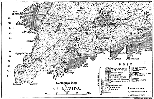
Click on image to view larger
Walker & Boutall sc.
Fig. 40.—Map of the volcanic district of St. David's.
The volcanic geology of St. David's possesses a special interest inasmuch
as it embraces a tolerably full development of various features which
characterize the volcanic groups of later Palæozoic systems. Though the
rocks are chiefly tuffs, they include also sheets of lava, as well as sills, dykes and
bosses. They show a remarkable range in chemical composition from quite
basic to highly acid materials. They present the amplest proofs of having
been erupted and spread out over the sea-bottom, and they likewise afford
clear evidence of alternation with the ordinary non-volcanic sediment of the
time to which they belong. In these respects they are particularly noteworthy,
for they prove that in the earliest Palæozoic ages the essential features of
volcanic action were already as well developed as in any subsequent epoch
of geological history.
The volcanic group of St. David's attains a visible thickness of about
1800 feet. Its upper part graduates upward into purple and green Lower
Cambrian sandstones. The base of the group is not seen owing to the
plicated structure of the district. Hence the total thickness of volcanic
material cannot be determined, neither can we tell on what it rests, whether
on a still lower sedimentary series or on some platform of pre-Cambrian
rocks.
The structure of the group, notwithstanding all that has been written
about it, has never yet been adequately worked out. The unfortunate and
barren controversy about supposed pre-Cambrian rocks at St. David's has
tended to obscure the real importance of these rocks as the oldest well-preserved
record of volcanic action in Britain. They deserve to be carefully
surveyed on maps of a large scale, in the same detailed manner as has been
so successfully applied to the elucidation of younger volcanic tracts. Until
such detailed investigation is made, any account of them which is given can
be little more than a general outline of the subject. The following description
is the result of my examination of the ground in company with my colleague
Mr. B. N. Peach, and afterwards with the late Mr. W. Topley.[86] A few
additional observations, from the subsequent exploration of Professor Lloyd
Morgan,[87] are incorporated in the narrative.
The geologist who traces these St. David's rocks in the field cannot
fail to be struck with their general resemblance to volcanic masses of later
Palæozoic date. Many of the lavas and tuffs are in outward characters
quite indistinguishable from those of the Lower Old Red Sandstone and
Carboniferous systems of Britain. So many points of detail may be observed
to be common to the Palæozoic eruptive rocks all over the country from
the Cambrian to the Permian periods as to indicate that volcanic
phenomena must have recurred under much the same conditions throughout
Palæozoic time.
By far the larger part of the Cambrian volcanic group of St. David's
consists of bedded tuffs, though a few lavas are interstratified in it,
particularly towards the top. The whole has subsequently been invaded by
acid protrusions, and lastly by basic dykes.
1. Bedded Tuffs and Lavas.—The tuffs, which are the predominant
members of the volcanic group, present many varieties of colour, from dark
purple, through tints of brick-red and lilac, to pale pink, yellow and creamy
white, but not unfrequently assume various shades of dull green. They
vary likewise in texture from somewhat coarse breccias or agglomerates,
through many gradations, into fine silky schists in which the tuffaceous
character is almost lost. Generally they are distinctly granular, presenting
to the naked eye abundant angular and subangular lapilli, among which
broken crystals of a white, somewhat kaolinized, felspar and fragments of
fine-grained felsite are often conspicuous. The greater part of the tuffs,
particularly the purple, red and dark-green varieties, which constitute so
large a proportion of the whole, has been derived from the explosion of
basic rocks similar in character to the diabases now found associated with
them. On the other hand, the paler varieties, both in the form of fine
tuffs and of breccias, have probably resulted mainly from the destruction of
more siliceous lavas, probably felsites (rhyolites) or other acid rocks.
That many of the tuffs are due to the destruction of diabase-lavas
may be surmised from their close general external resemblance to these
rocks, and from the way in which they are associated with the contemporaneous
sheets of diabase. Some of the dull dark-purple tuffs
might almost at first sight be mistaken for truly eruptive rocks. The
analyses of two typical examples of these basic tuffs (Nos. I. and II.), and
one (No. III.) of an intermediate variety containing an admixture of acid
fragments, are given in the subjoined table.
|
SiO2 |
Al2O3 |
Fe2O3 |
FeO |
MnO |
CaO |
MgO |
K2O |
Na2O |
H2O and
Loss on
Ignition. |
Total. |
Specific
Gravity. |
| I. |
51·25 |
20·41 |
3·02 |
3·91 |
0·21 |
4·53 |
7·22 |
2·93 |
1·82 |
5·02 |
100·32 |
2·84 |
| II. |
48·11 |
13·30 |
3·70 |
8·10 |
1·43 |
8·48 |
9·51 |
1·57 |
1·96 |
4·21 |
100·37 |
2·92 |
| III. |
61·54 |
16·30 |
4·40 |
3·66 |
0·32 |
3·08 |
2·99 |
1·62 |
2·81 |
2·99 |
99·71 |
... |
| I. |
Purplish-red shaly tuff from below olivine-diabase, Crag Rhosson. Analysis by Mr. J. S.
Grant Wilson. |
| II. |
Dull purple and green tuff from the lowest group of tuffs between Pen-maen-melyn and
Pen-y-foel. Analysis by Mr. Wilson. |
| III. |
Greenish shaly finely granular tuff, from road-side, north of Board Schools, St. David's.
Analysis by Prof. A. Renard of Ghent. |
Although the majority of the tuffs are more or less basic, they frequently
contain evidence in the form of small felsitic lapilli that acid lavas were
present in the eruptive vents, while the pale tuffs show that at the time of
their discharge it was these acid lavas and not the diabases that were
blown out by the explosions. Appended are three analyses of the acid
tuffs (Nos. IV. V. and VI.).
|
SiO2 |
Al2O3 |
Fe2O3 |
FeO |
MnO |
CaO |
MgO |
K2O |
Na2O |
H2O and
Loss on
Ignition. |
Total. |
Specific
Gravity. |
| IV. |
80·59 |
11·29 |
0·28 |
1·41 |
trace |
0·52 |
0·95 |
2·98 |
0·72 |
1·96 |
100·70 |
2·55 |
| V. |
73·42 |
12·09 |
0·91 |
3·13 |
0·25 |
2·94 |
1·12 |
1·67 |
3·88 |
1·28 |
100·69 |
2·74 |
| VI. |
72·63 |
16·23 |
2·70 |
0·48 |
... |
0·18 |
1·36 |
3·35 |
0·15 |
3·00 |
100·12 |
... |
| IV. |
Greenish felsitic breccia, Clegyr Hill; angular fragments of various felsites in a greenish
base. Analysis by Mr. J. S. Grant Wilson. |
| V. |
Grey granular felsitic tuff, Bridge over Allan River north from St. David's Board Schools.
Analysis by Mr. Wilson. |
| VI. |
Pale pinkish-white, finely schistose tuff—a characteristic sample of the "Porth-lisky
schists." Analysis by Prof. Renard. |
Many varieties of texture can be traced among the tuffs, from coarse
breccias or agglomerates, with blocks a yard or more in length, to fine
schistose mudstones or sericitic schists. One of the most remarkable of the
finer kinds, found near Pen-y-foel, is externally dirty-green, compact and
tolerably homogeneous, but with distinct evidence of its clastic character.
Under the microscope it is found to be composed mainly of lapilli of a
peculiar rock, which is characterized by the abundance and freshness of its
plagioclase (an unusual feature in the volcanic group of St. David's); by the
large, well-defined crystals (one of which measured 0·022 inch by 0·0125
inch) of augite; by large crystals replaced by green decomposition-products,
but having the external form of olivine; by the absence or scantiness of
any base or groundmass; and, in many of the lapilli, by the abundance of
spherical cells, either empty or filled up as amygdales with decomposition-products.
These spherical vapour-vesicles, so characteristic of the basic or
palagonitic lapilli in many Palæozoic volcanic vents, were found in one
fragment, where they were particularly abundant, to range from a
minimum of 0·0008 inch to a maximum of 0·0033 inch, with a mean of
about 0·0018. The rock from which these lapilli have been derived comes
nearest to one of the diabases from the same part of the district (which
will afterwards be referred to), but shows a closer approach to basalt rocks.
Another interesting tuff is that of which the analysis (No. II.) has
been given. It occurs not far from the horizon of the rock just described.
Under a low power, it is seen to be composed mainly of fragments of
diabase like the rocks of Rhosson and Clegyr Foig. These fragments are
subangular, or irregular in shape, and vary considerably in size. They are
sometimes finely cellular—the cavities, as in the case just referred to, being
spherical. The plagioclase crystals in the diabase-lapilli are everywhere
conspicuous; so also is the augite, which occurs in larger forms than in the
rock of Rhosson or Clegyr Foig. Next in abundance to these basic fragments
are rounded or subangular pieces of felsite. These weather out in
conspicuous grey rough projections on the exposed face of the rock; under
the microscope they are seen to consist of fine granular felsite, which shows
a groundmass remaining dark between crossed nicols, but with luminous
points and filaments, and an occasional spherulite giving the usual cross in
polarized light. Lapilli of an older tuff may here and there be detected.
A few angular and subangular grains of quartz are scattered through
the rock. The lapilli are bound together by a finely-granular dirty-green
substance.
As a typical illustration of the minute structure of the felsitic tuffs,
I may refer to the rock No. V. of the foregoing analyses. It is composed
mainly of fragments of various felsites, many of which show good flow-structure.
Large, and usually broken, crystals of orthoclase are dispersed
among the other ingredients. Here and there a fragment of diabase may
be detected; but I could find no trace of pieces of the peculiar microcrystalline
spherulitic quartz-porphyries of St. David's. There is but little
that could be called matrix cementing the lapilli together. The presence
of fragments of diabase may possibly reduce the proportion of silica and
increase that of magnesia, as compared with what would otherwise have
been present in the rock.
Some of the tuffs appear to have been a kind of volcanic mud. A
specimen of this nature collected from the road-side section, north of the
Board School, presents a finely-granular paste enclosing abundant angular
and subangular lapilli of diabase, a smaller proportion of felsite (sometimes
displaying perfect flow-structure), broken plagioclase crystals, and a greenish
micaceous mineral which has been subsequently developed out of the matrix
between the lapilli.
Though they lie in the sedimentary series above the main volcanic
group, I may refer here to certain thin bands of tuff at Castell, on account
of their interest in relation to the true Cambrian age of the volcanic group.
They are not quite so fresh as the tuff that occurs in thicker masses, but
their volcanic origin is readily observable. One band appears to be made
up of the debris of some basic rock, like the diabase of the district, through
which detached plagioclase crystals are scattered. The lapilli are subangular;
and around their border a granular deposit of hæmatite has taken
place, giving a red colour to the rock. Another band presents small angular
lapilli, almost entirely composed of a substance which to the naked eye, or
with a lens, is dull, white and clay-like, easily scratched, and slightly unctuous
to the touch. Under the microscope, with a low power, it becomes pale
greyish-green and transparent, and is seen to consist in large part of altered
felspar crystals, partially kaolinized and partially changed into white mica
and calcite. These scattered crystals are true volcanic lapilli, and have not
been derived from the mechanical waste of any pre-existing volcanic rock.
In the tuffs interstratified with the conglomerate, at the quarry above
Porth-clais, though much decomposed, crystals of plagioclase can likewise
still be traced. These strata are also true tuffs, and not mere detritus due
to mechanical degradation (see Fig. 41).
The general result of the study of the microscopic structure of the
Cambrian tuffs of St. David's may be briefly summed up as follows:—
1. These pyroclastic deposits are almost wholly composed of fragments
of eruptive rocks, sometimes rounded, but usually angular or subangular.
In the more granular varieties very little matrix is present; it consists of
fine debris of the same materials. No detached microlites have been noted,
such as are common among modern volcanic ashes; but there are abundant
ejected crystals. In these respects the Cambrian tuffs resemble those of
the other Palæozoic systems. A mingling of grains of quartz-sand may
indicate the intermixture of ordinary with volcanic sediment.
2. They may be divided into two groups—one composed mainly of
fragments of diabase or other similar basic rocks, the other of felsite. The
former group has doubtless been derived from the explosion of such rocks
as the diabase-sheets of the district. The felsitic tuffs have not been
observed to contain any fragments of the microcrystalline quartz-porphyries
of St. David's. They have been derived from true fine-grained felsites or
rhyolites. There are various intermediate varieties of tuff, due to the
mingling in various proportions of the two kinds of debris.
3. They are marked by the presence of some characteristic features
of the volcanic vents of later Palæozoic time, and in particular by presenting
the following peculiarities: (a) lapilli of a minutely-cellular pumice with
spherical cells; (b) lapilli with well-developed flow-structure; (c) lapilli
consisting of a pale green serpentinous substance resembling altered
palagonite and probably originally glass; (d) lapilli derived from the destruction
of older tuffs; and (e) lapilli consisting of ejected crystals, especially
of felspars, sometimes entire, often broken.
4. They frequently show that they have undergone metamorphism, by
the development of a pale greenish micaceous mineral between the lapilli,
the change advancing until the fine tuffs occasionally pass into fine silky
schists.
In my study of the St. David's district, I was unable to observe
any evidence that the basic and siliceous tuffs characterize two distinct
periods of volcanicity. From the foregoing analyses it appears that some
of the oldest visible tuffs which are seen between Pen-maen-melyn and
Pen-y-foel contain only 48·11 per cent of silica; while a specimen from
Porth-lisky yielded 72·63 per cent of that ingredient. Specimens taken
even from adjacent beds show great differences in the percentage of silica,
as may be seen in the analyses Nos. III. and V.
This alternation of basic and siliceous fragmental materials has its
parallel in the neighbouring eruptive rocks, some of which are olivine-diabases
containing only 45 per cent of silica, while others are highly
siliceous quartz-porphyries. But all the siliceous eruptive rocks, so far as I
have been able to discover, are intrusive, and belong, I believe, to a later
period than that of the volcanic group; in no single instance do they
appear to me to be true superficial lava-flows. On the other hand, the
basic eruptive rocks occur both as contemporaneous sheets and as intrusive
masses. The presence of both siliceous and basic lavas in the Cambrian
volcanic reservoirs, however, is proved by the character of the tuffs. It
would appear from the evidence at present known, that while the basic
lavas were most abundant in the vents during the volcanic period
recorded by the rocks of St. David's, furnishing the material for most of
the fragmental eruptions, and issuing in occasional superficial streams of
molten rock, the siliceous lavas did not flow forth at the surface, though
their debris was copiously discharged in the form of dust and lapilli.
The rise of both basic and acid lavas at different periods in the same or
adjoining vents, so familiar in recent volcanic phenomena, thus appears to
have also characterized some of the oldest examples of volcanic action. An
interesting parallel may be traced between the succession of events at St.
David's and that which occurred in the volcanic group of the Lower Old
Red Sandstone of the Pentland Hills, near Edinburgh, of which a detailed
account will be given in Chapter xx. of this volume. It is also worthy
of remark that in the latest of the volcanic episodes in British geology a
remarkable similarity to the St. David's volcanic group may be observed.
Some of the older Tertiary agglomerates are full of pieces of acid rocks
(felsites, rhyolites or granophyres), while the lavas poured out at the surface
were mainly basalts.
In the volcanic group of St. David's the tuffs contain evidence that
ordinary sedimentation was not entirely interrupted by the volcanic discharges.
Thus, in the Allan valley, west from the Cathedral, one of the
schistose tuffs is full of well-rounded pebbles of white quartz. Occasional
shaly bands indicate the deposit of mud with the tuffs.
Excluding the granites and porphyries (which are described at p. 155),
two kinds of eruptive rocks are associated with the volcanic group. One
of these is certainly intrusive and of late date, viz. dykes and veins of
diabase, to be afterwards referred to. The other kind occurs in long parallel
sheets, some of which, if not all, are true contemporaneous lava-streams,
erupted at intervals during the accumulation of the volcanic group. They
form prominent crags to the west of St. David's, such as Clegyr Foig, Rhosson,
and the rocky ground rising from the eastern shores of Ramsey Sound.
Their dip and strike coincide with those of the tuffs above and below them.
It is possible that some of these sheets may be intrusive sills intercalated
along the bedding of the tuffs; and in one or two cases I have observed
indications of what, on further and more careful exploration, may prove to
be disruption across the bedding.
But it is the interbedded sheets that possess the chief interest as
superficial lava-streams of such venerable antiquity. They present many
of the ordinary features of true lava-flows. In particular a slaggy structure
may be detected at the bottom of a sheet, the vesicles being here and there
lengthened in the direction of flow. Some of the sheets are in part
amygdaloidal. The alternation of these sheets with tuffs, evidently derived
from lavas of similar character, is another argument in favour of their
contemporaneous date. One of the best localities for studying these features
lies between Clegyr Foig and the coast, west of Rhosson.
The eruptive rocks thicken towards the south-west, as if the main vents
had lain in that direction. There are doubtless intrusive as well as
contemporaneously interbedded masses in the rough ground between Pen-maen-melyn
and Treginnis. To separate these out would be a most
interesting and beautiful piece of mapping for any competent geologist in
possession of a good map on a sufficiently large scale.
The interbedded lavas, so far as I have had an opportunity of studying
them, appear to present remarkable uniformity of petrographical characters.
Megascopically they are dull, fine-grained to compact, sparingly porphyritic,
ranging in colour from an epidote-green to dull blackish-green and dark
chocolate-brown. Some of them are finely porphyritic from the presence
of small glistening surfaces which present the colour and metallic lustre of
hæmatite and yield its characteristic streak. Obviously basic rocks, they
present, as I have said, a close external resemblance to many of the lavas of
the Lower Old Red Sandstone and Carboniferous districts of Scotland.
From their chemical composition and microscopic structure they may be
most appropriately ranged among the diabases. The analyses of two of
the most conspicuous diabases of this class in the district, those of Rhosson
(VII.) and Clegyr Foig (VIII.), by Mr. J. S. Grant Wilson, are shown in
the following table:—
|
SiO2 |
Al2O3 |
Fe2O3 |
FeO |
MnO |
CaO |
MgO |
K2O |
Na2O |
H2O and
Loss on
Ignition. |
Insoluble
Residue. |
Total. |
Specific
Gravity. |
| VII. |
45·92 |
18·16 |
1·18 |
9·27 |
0·19 |
7·19 |
10·07 |
1·78 |
2·12 |
4·22 |
0·04 |
100·14 |
2·96 |
| VIII. |
45·38 |
16·62 |
4·06 |
8·63 |
0·14 |
8·19 |
9·41 |
0·71 |
2·20 |
4·34 |
0·08 |
99·76 |
2·99 |
The two rocks here analyzed, likewise that from the crag south of Castell
and that from the cliffs at the southern end of the promontory between
Ramsey Sound and Pen-y-foel, show under the microscope a general similarity
of composition and structure. They present a variable quantity of a base,
which under a ⅕ objective is resolved into ill-defined coalescent globulites
and fibre-like bodies, that remain dark when rotated between crossed
nicols. In some varieties, as in part of Rhosson Crag, the base is nearly
lost in the crowd of crystalline constituents; in others, as in the crag south
of Castell, it forms a large part of the whole mass, and may be seen in
distinct spaces free from any crystalline particles. Through this base are
diffused, in vast numbers, irregularly-shaped grains of augite, seldom showing
idiomorphic forms. These grains, or granules, may perhaps average
about 0·003 inch in diameter. Plagioclase is generally hardly to be recognized,
though here and there a crystal with characteristic twinning may be
detected in the base. Magnetite occurs abundantly—its minute octahedra,
with their peculiar colour and lustre, being apparent with reflected light on
the fresher specimens, though apt to be lost as diffused ferruginous blotches
in the more decomposed varieties. But perhaps the most remarkable ingredient
is olivine. Red hæmatitic crystals are visible, even to the naked
eye, dispersed through the groundmass of the rocks. With a lens these
may be observed to be orthorhombic in form, and to be evidently pseudomorphs
after some mineral which has been converted chiefly into hæmatite.
Such red pseudomorphs are common in Carboniferous and Old Red Sandstone
lavas, where in some cases they appear to be after hornblende, and in
others after augite, but occasionally are suggestive of olivine, though with
no trace of the original substance of that mineral. In the lava associated
with the tuffs at the south end of the promontory between Ramsey Sound
and Pen-y-foel, however, certain large, well-developed pseudomorphs are
undoubtedly after olivine. They have the characteristic contour of that
mineral and its peculiar transverse curved and irregular fractures. The
average length of these pseudomorphs was found, from the measurement of
six examples, to be 0·023 inch, the largest being 0·034, and the smallest
0·014. Seen by transmitted light they present a structureless pale-green
material nearly inert in polarized light, round the borders and across
fissures in which an opaque substance has been developed, as serpentine
and magnetite have been grouped in the familiar alteration of olivine. The
opaque material is bright brick-red in reflected light, and is evidently
now chiefly oxidized into hæmatite. Every stage may be traced, from
orthorhombic forms with the incipient development of transverse fissures
filled with iron-oxide, to others of distorted shapes in which the ferruginous
matter occupies the whole, or nearly the whole, of the mould of the
original crystal.
The rocks now described differ from the Palæozoic andesites or "porphyrites,"
with which I am acquainted, in their more basic composition, in the
less abundance of their microscopic base, in the comparatively inconspicuous
development of their felspars of later consolidation, in the absence of large
porphyritic felspars of earlier consolidation, in the extraordinary prominence
of the granular augite, and in the presence of olivine. In composition and
structure they are essentially forms of olivine-diabase.
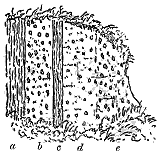
Fig. 41.—Section showing the interstratification
of tuff and conglomerate above Lower Mill, St. David's.
Above the volcanic group of St. David's lies a band of quartz-conglomerate
which has been taken by Dr. Hicks
to mark the base of the Cambrian system. This
rock, though mainly composed of quartz and
quartzite, contains fragments of the underlying
volcanic rocks. But that it does not mark any
decided break in the sedimentation, much less
the violent unconformability and vast interval
of time which it has been erroneously supposed
to do, is well illustrated by the occurrence of
bands of tuff, as well as diffused volcanic dust,
in the conglomerate and also in the green and
red shales and sandstones which conformably
overlie it. An example of this intercalation of
volcanic material is represented in Fig. 41. On the left side vertical layers
of fine reddish tuff (a) are succeeded by a band of quartz conglomerate
(b) of the usual character. Parallel to this conglomerate comes a band,
about six inches thick, of fine tuff (c), followed by ashy sandstone (d), which
graduates into conglomerate (e). No more complete evidence could be
desired of the perfect inosculation of the conglomerate with the volcanic
group. On the coast at Nun's Chapel similar evidence presents itself. The
conglomerate there contains some thin seams of tuff, and is intercalated
between a series of dull green agglomerates and tuffs and some greenish
shales and sandstones with layers of tuff.
Not less striking is the evidence of the contemporaneous eruption of fine
volcanic dust in the overlying shales and sandstones.[88] Some of the red
shales are full of this material, which here and there is gathered into the
thin seams or ribs of which the microscopic characters have already been
described. This diffused volcanic detritus marks, no doubt, the enfeebled
discharges of fine dust towards the close of the volcanic episode in the
Lower Cambrian period at St. David's. It would be difficult to find an
instance of a more perfect transition from a series of thoroughly volcanic
masses into a series of ordinary mechanical sediments.
2. Intrusive Granite and Quartz-Porphyry.—The heart of the volcanic
group is pierced by a mass of granite which also cuts the conglomerate and
overlying shales and sandstones on the east side. The age of this intrusive
boss cannot be more definitely fixed than by saying that it must be later
than the volcanic group. This rock has been the subject of a remarkable
amount of description, and has been dignified by being actually elevated into
a distinct Archæan "formation" composed of "highly crystalline gneissic
rocks," with "bands of limestone, hornblende, chlorite, and micaceous
schists."[89] Into this somewhat dreary chapter of English geological literature
it is fortunately not necessary to enter here. I will only say that the
rock is unquestionably a granite, with no essential differences from many
other bosses regarding which there has been no controversy. It is a holocrystalline
rock with a thoroughly granitic texture, and composed of the
ordinary minerals of granite—quartz, orthoclase and plagioclase, among
which a green chloritic mineral, more or less plentiful, probably represents
original hornblende, biotite or augite. Sometimes the quartz and felspar in
the body of the rock show a micropegmatitic arrangement, and the same
structure occurs in veins that traverse it. This structure gives the rock
some resemblance to the Tertiary granites and granophyres of Ireland and
Scotland.
This granite has undergone a good deal of decomposition, for its felspars
are turbid, and its original ferro-magnesian constituents are always
replaced by green chloritic aggregates, while epidote is also present. The
rock tends to become finer in grain towards the margin, and then sometimes
assumes a more decidedly pegmatitic structure, like graphic granite.
At the northern end of the granite ridge, a gradation can be traced from the
ordinary texture through increasingly fine-grained varieties until we pass
into a microcrystalline spherulitic porphyry. After a careful examination
of the ground I satisfied myself that the spherulitic quartz-porphyries, which
form a conspicuous feature in the geology of St. David's, are really offshoots
from this granitic core.[90]
These spherulitic rocks have been fully described.[91] They consist of a
base composed of a microcrystalline aggregate of quartz and orthoclase,
which is distributed between the spherulites. These have been developed in
remarkable beauty and perfection. While the microcrystalline structure is
everywhere recognizable, the spherulites occasionally disappear. But their
absence is merely local, and they may be found both in large dykes and
narrow veins. A further porphyritic structure is given to the rocks by the
presence in them of abundant quartz, which takes the form of conspicuous
rounded blebs or worn crystals sometimes distinctly dihexihedral, but with
somewhat blunted angles. Porphyritic plagioclase is also common. Flow-structure
is occasionally traceable. Some parts of these rocks where the
porphyritic elements are locally absent might be cursorily classed as felsites;
but they all possess a microcrystalline and not a felsitic base. They
cannot be confounded with the true felsites of which fragments occur in
the tuffs.
In addition to the parallelism that may be traced between the earliest
Palæozoic agglomerates and those of the youngest volcanic series of
Britain, a close analogy may also be noticed between the acid intrusive rocks
of the two widely-separated periods. In both cases we have a granitic
core sending out apophyses which assume a spherulitic structure and traverse
earlier volcanic products of the district.
These spherulitic quartz-porphyries of St. David's occur as bosses, dykes
(elvans) or veins, cutting through all horizons of the volcanic group, and in
one case apparently, if not actually, reaching the quartz conglomerate. One
of the best exposures of this intrusive character may be seen in the cliff
below Nun's Chapel, where the elvan runs along the face of the cliff through
the uppermost zone of the volcanic group, cutting the strata somewhat
irregularly. Apparently in connection with this dyke, a network of
intrusions of decomposed quartz-porphyry may be observed in the shales
along the face of the cliff immediately below Nun's Chapel. On the
whole, the intruded material has forced its way along the bedding-planes
of the shales, but has also broken across them, sending out finger-like
branches.
3. Diabase Dykes and Sills.—The latest rocks of the St. David's district
are dykes and intrusive sheets of diabase, which traverse all the other
formations. The dykes are specially abundant in the granite. One or two
may be detected in almost every artificial opening which has been made in
that rock; while on the coast-section they are here and there profusely
abundant. They are likewise frequent in the quartz-porphyries, and occur
also in the volcanic group as well as in the sandstones and shales above the
conglomerate, but become fewer in number as they recede from the granite
centre.[92]
In external characters, the rock composing these dykes and sheets may
be described as usually a dull dirty-green or yellowish-brown mass, to
which the old name of "wacke" might appropriately be given. It exhibits
the texture and mode of weathering of the more distinctly crystalline
members of the basalt family. It is occasionally amygdaloidal or cellular,
the kernels or cavities being arranged parallel with the sides of the
dyke. Here and there a rudely prismatic structure extends between the
walls.
The microscopic structure of this rock has been described by Professor
Judd, Mr. Davies and Mr. Tawney. It is a diabase, but more allied in
structure to true basalt than the olivine-diabase of the volcanic group. It
especially differs from the older rock in the abundance and freshness of its
felspars, in the comparative scarcity of its augite, and in the absence of
olivine. The magnesian silicates are very generally replaced by green
decomposition-products diffused through the mass. An occasional crystal
of hornblende, recognizable by its cleavages and dichroism, may be detected.
Some of the diabase dykes present excellent examples of flow-structure.
A beautiful instance occurs in a dyke that cuts the shales, in a small
cove to the east of Nun's Chapel. The shale and eruptive rock are in
contact; and the small acicular prisms of felspar, besides ranging themselves
in line parallel to the side of the dyke, stream round the larger
felspar crystals.
Some of the dykes or veins are only three inches broad. They send
out fingers, and sometimes break abruptly across from one line to another.
They appear generally to have followed the lines of joint in the granite, as
Mr. Tawney has observed;[93] consequently they must be posterior to the
development of the system of jointing in that rock.
Besides the abundant dykes, there has been a more limited extrusion of
the same material in sheets parallel (or approximately so) to the bedding of
the sandstones and shales. These sheets are well displayed at St. John's
Point, where evidence of their being intrusive, and not truly bedded, may
be seen along the fine cliffs which have been cut by the waves on this part
of the coast-line.
The sedimentary series which overlies the volcanic group of St. David's,
and contains the fossils of the lower part of the Cambrian system, gradually
loses all trace of volcanic material, as its members are followed upward in
stratigraphical order.[94] We thus learn that the eruptions of this district
came to an end in an early part of the Cambrian period. But as we shall
see in the following pages, volcanic activity was subsequently renewed at no
great distance in the next or Silurian period.
CHAPTER XI THE CAMBRIAN VOLCANOES OF NORTH WALES, THE MALVERN HILLS AND WARWICKSHIRE — NORTH WALES — THE MALVERN HILLS — WARWICKSHIRE
The Cambrian volcanic rocks in the northern part of the Welsh Principality
have their main development in Caernarvonshire. Southwards from that tract,
though the Lower Cambrian strata form a vast pile of sedimentary material
in the Harlech anticline, which is estimated by the Geological Survey to be
from 6000 to 7000 feet thick, they have yielded no trace of any contemporaneous
volcanic rocks.[95] The purple slates that rise along the centre of
the anticline dip below the grits and conglomerates on either side without
disclosing a glimpse of the base of the system. This enormous accumulation
of sedimentary deposits seems to diminish in thickness as it is traced
northwards, for towards the Menai Strait it does not reach more than a
fourth part of the depth which it is said to display in the Harlech anticline.[96]
In the Pass of Llanberis the series of grits that overlies the purple slates is
estimated to be about 1300 feet thick.[97] This gradual thinning away of
the Cambrian series towards the north was, in the opinion of Sir Andrew
Ramsay, accompanied by an increasing metamorphism of the lower portions
of the system. In his view, the long ridge of quartz-porphyry which
crosses the lower end of Llyn Padarn represents the result of the extreme
alteration of the stratified rocks. He believed that he could trace an
insensible passage from the slates, grits and conglomerates into the
porphyry, and he was led to the "conviction that the solid porphyry itself
is nothing but the result of the alteration of the stratified masses carried a
stage further than the stage of porcellanite, into the condition of that
kind of absolute fusion that in many other regions seems to have resulted
in the formation of granites, syenites and other rocks, commonly called
intrusive."[98] Certain structural lines in the quartz-porphyry he looked
upon as indicating "traces of stratification in a rock, the original felspathic
and quartzose material of which has been metamorphosed into true
porphyry."[99] In conformity with these ideas, the remarkable felspathic
strata which lie nearest the porphyry were regarded as metamorphosed
Cambrian rocks, and where similar rocks reappear over a large area near
Bangor they were coloured on the map with the same tint and lettering as
were used for the so-called "altered Cambrian" of Anglesey.
No one who has examined this Caernarvonshire ground can have failed
to find the sections which doubtless led my predecessor to form the convictions
to which he gave expression in the passages I have just quoted.
It is easy to see how these sections, wherein it is certainly difficult to draw
a sharp line between the igneous rock and the clastic materials derived
from it, would be welcomed as appearing to offer confirmation of the ideas
concerning metamorphism which were then in vogue. There cannot, however,
be any doubt that my friend was mistaken in his interpretation of the
structure of that part of the country. It is to me a subject of keen regret
that in his later years, when the subject was revived, he was no longer able
to re-examine this ground himself, for no one would have confessed more
frankly his error, and done more ample justice to those who, coming after
him, have been able in some parts to correct his work.
The quartz-porphyry, felsite or rhyolite of Llyn Padarn, as well as that
of Llandeiniolen, is not a metamorphic but an eruptive rock, as has been
demonstrated by Professors Hughes and Bonney. There is no true passage
of the sedimentary rocks into it; on the contrary, the conglomerates which
abut against it are in great part made out of its fragments, so that it was
already in existence before these Cambrian strata were deposited upon it.
These conclusions must be regarded as wholly indisputable. But most of
the critics of the work of the Geological Survey have proceeded to certain
further deductions. They have maintained that the presence of fragments
of the porphyry in the overlying conglomerate marks an unconformability
between the two rocks, that the conglomerate shows the base of the Cambrian
system, and that the porphyry is therefore pre-Cambrian.
These assertions and inferences do not seem to me to be warranted.
They have, in my judgment, been disproved by Mr. Blake,[100] who shows that
there is no break in the Cambrian series, that the various porphyries and
their accompaniments are parts of that series, and that there is no certain
proof of the existence of any pre-Cambrian rocks in the whole district.[101]
That the igneous rocks of the Llyn Padarn area mark a volcanic period
has been recognized by most writers since Professor Bonney pointed out the
flow-structure of the quartz-porphyry, and other proofs of active volcanic
eruptions have been traced by him, as well as by Professor Hughes and Mr.
Blake, in the stratified rocks which stretch north-eastwards to Bangor.
The extent and persistence of these ancient volcanic phenomena, and their
probable connection with the remarkable northward attenuation of the Cambrian
sedimentary rocks, deserve special attention.
It is generally agreed that the rocks variously termed quartz-porphyries,
felsites or rhyolites form the oldest members of this volcanic series.[102]
They come to the surface in two long ridges, one running from Caernarvon to
near Bangor, the other from Llanllyfni to Ann's Chapel, at the mouth of Nant
Francon (Map. II.). Whether the materials of these two ridges are parts of
one originally continuous sheet or group of sheets, or, if different protrusions,
whether they belong to the same geological horizon, or whether, as Mr.
Blake believes, they are distinct masses, separated by a considerable thickness
of detrital material, cannot in the present state of our knowledge be
positively decided. It seems to me probable that they are connected
underground, as a continuous platform beneath the overlying pyroclastic
materials.
These acid rocks have been regarded by some observers as intrusive
sheets, by others as lava-streams that were poured out at the surface. If
account be taken simply of their petrographical characters, they find their
nearest analogies among the intrusive quartz-porphyries of older geological
periods. The presence of flow-structure in them has been thought to
indicate that they were superficial streams. But this structure may be
found in dykes and intrusive sheets as perfectly as in lava-flows, so that it
cannot by itself be taken as proof of a surface-discharge of lava. It must
be confessed that, both in the main mass of quartz-porphyry and in the
abundant fragments of it in the overlying conglomerates and breccias, there
is an absence of such scoriform portions as one would naturally look for in
a superficial lava-stream;[103] while, on the other hand, the rock generally
presents the tolerably uniform flinty texture so familiar in intrusive sheets
of similar material.[104] My own impression is that these igneous masses were
probably erupted to the surface as long banks which rose above the waves;
that they were thus exposed to prolonged subærial and marine denudation;
that by this means any upper more cellular portions of the lava which may
have existed were broken up and pounded down into detritus, and thus that
what is now visible is a part of the eruptive rock which originally lay
at some depth within its body. This view is confirmed by a study of other
lavas which are found on different platforms in the detrital deposits that
overlie the Llyn Padarn quartz-porphyry.
That the material of each of the two main ridges is the result of more
than one eruption has been inferred from the supposed intercalation of
bands of slate and of breccia in the rock.[105] Considerable lithological
differences may be detected in each mass, but they are not greater than may
be observed in single sills and bosses. In some parts of the Llyn Padarn
porphyry a distinct nodular structure appears which shades off into bands
and lenticular streaks, reminding one of the characters of some of the Bala
rhyolites. Other portions are markedly brecciated, the separated fragments
being surrounded in a matrix of the rock, which shows flow-structure
sweeping past them. On Moel Gronw angular fragments of a dark pinkish
tint are scattered through the general mass. Again, some parts are
crowded with quartz-grains, while others are comparatively free of these,
and occasionally a spherulitic structure has been observed.[106]
The microscopic structure of this ancient eruptive rock has been studied
by Professor Bonney, who found that the general type was a compact dull
grey felsite, with porphyritic crystals of felspar and grains of quartz, closely
resembling some modern rhyolites. Though unable to detect any actual glass
in the base, he had no doubt that the rock was originally vitreous, and he
found abundant and fresh examples of the most perfect flow-structure.[107]
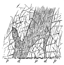
Fig. 42.—Basic dyke traversing quartz-porphyry
and converted into a kind of slate by cleavage. West side of Llyn
Padarn.
p p, quartz-porphyry; d d, dyke and connected
veins.
Reference may be made here to the remarkable influence of the intense
cleavage of the district upon this rock.[108] Along its southern margin, where
it has been exposed to pressure from the south-east, the quartz-porphyry
has been so crushed that it passes here
and there into a fine unctuous slate or
almost a schist. Nowhere can this change
be more clearly seen than on the slopes
of Mynydd y Cilgwyn. The cleavage
planes strike about N. 40° E., with an
inclination to dip towards the N.W.
Within a space of a few yards a series
of specimens may be collected showing at
one end an ordinary or only slightly-sheared
quartz-porphyry with abundant
quartz-blebs, and at the other a fine
greenish sericitic slate or phyllite, wherein
the quartz has been almost entirely
crushed down. Lines of shearing may be
detected across the breadth of the porphyry
ridge, each of them coinciding with
the prevalent trend of the cleavage. Sometimes
also certain basic dykes, which traverse the porphyry in some numbers,
have undergone considerable deformation from the same cause. Their thinner
portions are so well cleaved that they have been mistaken for included bands
of green slate (Fig. 42). But these cleaved branches may sometimes be
traced into a thicker and more solid dyke, whose uncrushed cores still
preserve the original character of the rock and prove it to be eruptive.
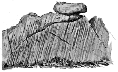
Fig. 43.—Section of well-cleaved tuff, grit and breccia passing up into rudely-cleaved conglomerate and
well-bedded cleaved fine conglomerate and grit. East side of Llyn Padarn.
The rocks which succeed the porphyry in the Valley of Llanberis are of
great interest, for they contain abundant proof of contemporaneous volcanic
activity, and they show that, so far from there being any marked hiatus
here, there is evidence of the persistence of eruptions even into the time of
the Llanberis Slates.[109] Considerable misapprehension has arisen from the
attempt to make one of the conglomerates the base of the Cambrian series,
and the real significance of the volcanic detrital strata in association with
it was consequently missed. The conglomerate does not lie on one definite
horizon. In truth, there are several zones of conglomerate, each with some
difference of composition, thickness or extent.[110] These may be well studied
both on the south and the north side of the porphyry ridge at the lower
end of Llyn Padarn. They are intercalated among fine tuffs, grits,
volcanic breccias and purple slates, sometimes full of fine ashy material.
On the south-east side of the ridge, where the rocks have suffered intense
cleavage, they assume a fissile unctuous character, and then resemble parts
of the cleaved Cambrian tuffs at St. David's. But on the north-west side,
where they have in large measure escaped the effects of the cleavage-movements,
their original structures are well preserved.
One of the first features of these detrital deposits to arrest attention is
the amount and variety of the fragments of igneous rocks in them. Some
of the conglomerates, though enclosing pebbles of quartz, quartzite, granite
and other rocks not found in situ in the immediate district, are mainly composed
of the debris of the quartz-porphyry of the ridge. Indeed, this
latter material appears to have contributed a large proportion of the
detritus of which the general body of strata here is made up. But there
are to be noticed among the contents of the conglomerates and breccias
pieces of many volcanic rocks not to be found on the porphyry ridge.
Among these, besides felsites showing sometimes beautiful flow-structure
(rhyolites) and various quartz-porphyries, there occur abundant fragments
of less acid lavas (andesites) and pieces of older tuffs. Some of the fragmental
rocks are green in colour, probably from the abundance of fine
basic volcanic dust in them. Certain bands are full of large angular pieces
of shale, similar in character to the Cambrian slates, and doubtless due to
the disruption of pre-existing Cambrian strata by volcanic explosions. It
is clear that from vents in this neighbourhood there continued to be an
abundant discharge of dust and various andesitic and other lapilli, which,
falling on the sea-floor, mingled there with the ordinary mechanical sediment
that was being deposited at the time.[111]
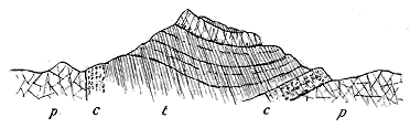
Fig. 44.—Section of Clegyr on the north-east side of Llyn Padarn, near the lower end.
But we have evidence that, during the period when these showers of
volcanic detritus were thrown out, streams of lava, though on a greatly
diminished scale, continued to be poured forth. The hill of Clegyr (Fig. 44),
near the lower end of Llyn Padarn, on the north-east side, consists
mainly of cleaved tuffs (t) and slates with conglomerates (c), overlying the
quartz-porphyry (p). Near the summit a band of felsite is intercalated in
these rocks.
Still more striking are the sections on the south-west side of the lake.[112]
Starting from the porphyry of the ridge, we cross a zone of conglomerate
and grit largely composed of the debris of the porphyry, until we reach a
band of felsite or quartz-porphyry, which at its eastern end is about ten
feet thick, while it seems to increase in dimensions westwards.[113] In the
centre the rock is dark purplish-red, exceedingly compact or flinty,
sprinkled with a variable proportion of quartz-blebs and felspar crystals.
Towards its southern or upper edge (for the rocks, though nearly vertical,
dip southwards) it has been cleaved into a variety of purple slate, and
would there at once be classed among the ordinary slates of the neighbourhood.
But the fissile character is merely a marginal structure which
the rock shares with the highly-cleaved tuffs that follow it. Traced westwards,
this bed is found to enclose a core of quartziferous porphyry, which,
though it has escaped from the most complete results of crushing, is nevertheless
cleaved along its margin as well as partially in its interior. It
would not be possible to distinguish parts of this intercalated less crushed
core from portions of the porphyry of the main ridge. The difference of
colour does not count for much, for even in this core the purple tint gives
place to greenish grey, and what in the centre at the east end is a solid
dark purplish-red felsite passes westward into a greenish slate, like that
already noticed on Mynydd y Cilgwyn.
The microscopical examination of this rock shows it to be a true felsite
of the rhyolitic type, which in the central uncleaved part exhibits a wavy
flow-structure like that found in the quartz-porphyry of the ridge. So
intense has been the cleavage in its upper part that the original structure
of the rock is there effaced. The immediately overlying tuffs, which are
likewise so thoroughly cleaved that it is not easy to draw a sharp and
continuous line between them and the intercalated lava, precisely resemble
those found below the conglomerate on the opposite side of the lake.
They include bands of coarse volcanic breccia as well as fine compact
material, showing the varying intensity of the volcanic discharges. Their
included stones consist of various felsites, andesites and slates.[114]
The thin sheet of interstratified quartz-porphyry here described is not
the only one to be found in the section. Others thinner and more intensely
cleaved lie among the tuffs higher up. They have been sheared into mere
pale unctous slates, but the remains of their quartz-blebs may still be
detected in them.
The tuffs, with their interstratified bands of porphyry, become more
and more mingled with ordinary argillaceous and sandy sediment as they
are followed in upward succession. Among them occur bands of grit and
fine conglomerate containing pebbles of porphyry and pieces of slate. Some
of these grits are mainly composed of white felspar, felsite and clear grains
of quartz, evidently derived from the disintegration of a rock like the
porphyry of the main ridge. As the ordinary sediment of the Llanberis
group sets in, the tuffs are restricted to thinner and more widely-separated
bands. Some thin layers of felspathic breccia, seen among the slates close
to the Glyn Peris Hotel, probably mark the last discharges of the slowly-expiring
vents of this region. Here, as at St. David's, from the most
ancient of our volcanic records, striking evidence is furnished of the gradual
extinction of volcanic action. Through many hundreds of feet of strata
which now supervene, representing the closing ages of the Cambrian and
the earlier ages of the Silurian period, no trace of volcanic material has
been found in this district until we reach the Bala lavas and agglomerates
of Snowdon and the Pass of Llanberis.
In the neighbourhood of Bangor another area of similar rocks wraps
round the northern end of the western porphyry ridge. The Geological
Survey map, in conformity with the ideas that governed its representation
of the older rocks of Anglesey and Caernarvon, colours
these as altered Cambrian. That this error should have been made,
or, when made, should not have been speedily corrected, is all the more
surprising when we consider the thorough mastery which the surveyors had
acquired of the aspects and the interpretation of ancient volcanic rocks in
Wales, and when, moreover, we remember that as far back as 1843, long
before the Survey of Caernarvonshire was published, Sedgwick had pointed
out the true volcanic nature of the rocks. That great pioneer recognized
the presence of "trappean conglomerates" and "trappean shales (Schaalstein)"
among these deposits at Bangor; but he could not separate them
from the Cambrian series of the rest of Wales.[115] And in his section he
represents them as undulating towards the east and passing under the
great mass of the Caernarvonshire slates and porphyries.
This interpretation, which I believe to be essentially accurate, was
modified by Professor Hughes, who, fixing on a conglomerate as the base of
the Cambrian system, regarded all the rocks below it, or what he termed
his "Bangor group," as pre-Cambrian.[116] He has been followed in this view
by subsequent writers;[117] but Mr. Blake has argued that here, as in the
Llanberis district, there is no evidence to separate the volcanic detrital
deposits above the porphyry from the Cambrian system.[118]
A little southward from Bangor the quartz-porphyry is overlain by a
most interesting group of fragmental rocks, the "Bangor group" of Professor
Hughes. Largely of volcanic origin, they must be some hundreds of
feet thick, and pass under the dark shales and grits of the Lower Silurian
(Arenig) series. Some of the most persistent bands among them are conglomerates,
which differ from each other in composition, but most of which
consist largely of fragments of various igneous rocks. Some of the coarser
masses might be termed agglomerates, for they show little or no trace of
bedding, and are essentially made up of blocks of volcanic material. There
are abundant beds of grit, sometimes pebbly or finely conglomeratic, alternating
with tuffs and with bands of more ordinary sediment. Courses of
purple shale and sandstone, green shale and dark grey sandy shale occasionally
occur to mark pauses in the volcanic explosions. Perhaps the most
striking feature in the pyroclastic materials is the great abundance of very
fine compact pale tuffs (hälleflintas of some writers), sometimes thinly
laminated, sometimes occurring in ribbon-like bands, each of which presents
internally a close-grained, almost felsitic or flinty texture.[119]
A cursory examination of the contents of the conglomerates, breccias
and grits shows them to consist largely of different felsites, with fragments
of more basic lavas. Some of these might obviously have been derived
from the rock of the porphyry ridge, but, as at Llyn Padarn, there is a far
greater variety of material than can be found in that ridge. Some of the
fragments show perfect flow-structure. Professor Bonney has described the
microscopic characters of some of these fragments, and has especially
remarked upon their glassy character. Among the slides prepared from
specimens collected by myself, besides the abundant fragments of felsite
(rhyolite), there are also numerous pieces of different andesitic lavas and fine
tuffs, as well as grains of quartz and felspar, and sometimes a good deal of
granular iron-ore.
That a large proportion of the material of the so-called "Bangor beds"
was directly derived from volcanic explosions can hardly be doubted.
There appears to have been a prolonged succession of eruptions, varying in
intensity, and somewhat also in the nature as well as in the relative fineness
of the material discharged. On the one hand, coarse massive agglomerates
were probably accumulated not far from the active vents, as the result
of more violent or transient explosions; on the other hand, exceedingly fine
and well-stratified tuffs, which attain a great thickness, serve to indicate
a phase of eruptivity marked by the long-continued discharge of fine
volcanic dust. Ordinary sediment was doubtless drifted over the sea-bottom
in this district during the volcanic episode, but the comparative
infrequence of distinct interstratifications of shale or sandstone may be taken
to imply that as a rule the pauses between the eruptions were not long
enough to allow any considerable accumulation of sand or mud to take
place.
No satisfactory proof has yet been obtained of any interstratified lavas
among the tuffs of the Bangor district. Some rocks, indeed, can be seen
on the road between the George Hotel and Hendrewen, which, if there
were better exposures, might possibly furnish the required proof; but at
present little can be made of them, for their relations to the surrounding
rocks are everywhere concealed.
From what I have now adduced, it is obvious that while both felsitic
and andesitic lavas existed within the volcanic foci, and were ejected in
fragments to form the tuffs and breccias, the lavas poured out at the
surface during the Cambrian period in Caernarvonshire were mainly, if not
entirely, felsites (rhyolites) in which the chief porphyritic constituent was
quartz. These lavas thus stand entirely by themselves in the volcanic
history of Wales. Though felsites of various types were afterwards poured
out, nothing of the same quartziferous kind, so far as we yet know, ever
again appeared. Further south, in Merionethshire, as will be shown in
Chapter xii., the Cambrian volcanic eruptions appear to have been on
the whole less acid, and to have begun with the outpouring of andesitic
lavas.
I have now to consider the relation of the volcanic group of Bangor
to the strata which overlie it. The geological horizon of these strata is
not, perhaps, very definitely fixed. It may be Arenig, possibly even older.
But for my present purpose it will be sufficient to consider the strata in
question as lying at the bottom of the Lower Silurian series. Professors
Hughes and Bonney have taken as their base a marked but impersistent
band of conglomerate. Mr. Blake, however, has more recently shown
that, as this band is succeeded by tuffs like those below it, it cannot be
claimed as marking the upper limit of the volcanic group. He therefore
classes it in that group and traces what he thinks is an overlap or
unconformability at the bottom of the Lower Silurian strata to the east.
Mr. B. N. Peach, who accompanied me in an examination of this ground,
agreed with me in confirming Mr. Blake's observation as to the position
of the conglomerate, which is undoubtedly overlain by the same flinty
felsitic tuffs as are found below it. But we were unable to trace any
unconformability. According to the numerous observations which we
made, there does not seem to be any discordance in strike or dip between
the flinty tuffs and the overlying shales and grits. The two groups of
rock appeared to us to be conformable and to pass into each other, as at
Llyn Padarn.[120]
An unconformable junction here would, in some respects, have been
welcome, for it would at once have accounted for the superposition of
Lower Silurian strata directly upon the Cambrian volcanic series, and for
the disappearance of the Llanberis slates and grits which form so conspicuous
a feature above the tuffs and conglomerates at Llyn Padarn. In the
absence of such a structure we must accept the order of succession as
apparently unbroken, and rely on some such explanation as was proposed by
Sir Andrew Ramsay to account for the overlap of the Arenig rocks on
everything older than themselves as they are traced northwards.[121] But
this explanation will not entirely remove the difficulties of the case. The
inosculation of the volcanic group of Bangor with the base of the Lower
Silurian series cannot be accounted for by any such overlap; it seems only
explicable on the supposition that the volcanic activity, which ceased in the
Llyn Padarn district about the time that the Llanberis Slates were deposited,
was continued in the Bangor area until Arenig time, or was then renewed.
The thick volcanic group of Bangor would thus be the stratigraphical
equivalent not only of the thin volcanic group of Llyn Padarn, but of the
overlying mass of strata up to the Arenig rocks. In confirmation of this
view, I shall show in a later chapter that volcanic action seems to have
been prolonged in Anglesey to a still later geological period, that it
appeared during the deposition of the Arenig strata, and that it attained a
great development throughout the time of the Bala group. That a series
of volcanic rocks, with associated cherty strata, may be the stratigraphical
equivalent of a great thickness of ordinary sediments in other districts
will be dwelt upon in the description of the Lower Silurian volcanic geology
of the Southern Uplands of Scotland.[122]
In the areas of North Wales which have now been described, volcanic
action appears to have begun and ended within the limits of the Cambrian
period. Southwards, in the district of Dolgelly, another distinct and, in
some respects, very different development of Cambrian volcanic activity may
be recognized. In that district there is evidence that the volcanoes which
distinguished the earlier part of the Silurian period had already begun
their eruptions during Cambrian time. As their records, however, are
intimately linked with those of Silurian age, an account of them is deferred
to the next chapter.
Although the chief surviving records of Cambrian volcanic action in
Britain are found in Wales, there is no evidence that the volcanoes of the
period lay chiefly in that region. It is certainly a suggestive fact that, in
the few districts where Cambrian strata appear from under younger formations
in England, they are generally accompanied with igneous rocks, though
the age of the latter may be older or later than the Cambrian period. If
the oldest Palæozoic rocks could be uncovered over the English counties, a
more abundant development of volcanic materials might be laid bare than
is now to be seen in Wales.
Taking, however, the extremely limited exposures of Cambrian strata,
we find two tracts that specially deserve attention. Reference has already
been made to the ancient eruptive rocks of the Malvern Hills, the
antiquity of which is proved by the position of the Cambrian fossiliferous
strata that overlie them. But these strata themselves include certain
igneous rocks which point to a recrudescence of eruptive energy in a far
later geological period.
Nearly half a century has passed away since John Phillips mentioned
the intercalation of igneous rocks in the series of strata which is
now classed as Upper Cambrian in the Malvern Hills. Since that date
hardly anything has been added to the information which he collected.
The existence of a group of rocks of such high antiquity, asserted to be of
truly volcanic origin, and the precise horizon of which could be fixed by the
stratigraphical aid of organic remains, seems to have almost dropped out of
sight. Phillips noted the occurrence of what he regarded as truly volcanic
materials in the Hollybush Sandstone and the overlying dark (Lingula)
shales, and he clearly recognized that a wide difference of age separated
them from the far more ancient igneous rocks of the central core of the
chain. The Hollybush Sandstones were observed by him to have "often a
trappean aspect and to be traversed with felspathic dykes." He found
the overlying black shales to include "layers of trappean ashy sandstone."
But it was at the top of these shales that he obtained what he regarded as
the most conspicuous evidence of contemporaneous volcanic action. He
there encountered a zone of "interposed trap rocks" varying up to 50 feet
in thickness, consisting of "porphyritic and greenstone masses, which,
erupted from below, have flowed in limited streams over the surface of the
black shales." He recognized amygdaloidal and prismatic structures among
them.[123] The position of these eruptive rocks is shown in Fig. 45.

Fig. 45.—Section across the Cambrian formations of the Malvern Hills, showing the position of the
intercalated igneous rocks (p p). After Phillips.
These rocks were afterwards observed and described by Dr. Holl, who
found what he considered to be four true lava sheets interstratified in the
Hollybush Sandstones. He noted the intercalation of "numerous beds of
volcanic ash, grit and lava" in the black shales.[124]
So far as I am aware, no more recent account of these rocks has been
published. Their true stratigraphical and petrographical relations require
to be more precisely determined. If they are really contemporaneous lavas,
they point to volcanic eruptions at the time when the middle division of
the Cambrian system was being deposited. If, on the other hand, they
should prove to be intrusive, they would indicate probable volcanic activity
in this part of England at some time later than the middle of the Cambrian
period.
Some fifty miles to the north-east of the Malvern Hills, in the heart of
the rich Midlands, and among the coal-fields and the New Red Sandstone to
which these Midlands owe so much of their manufacturing industry and
their agricultural fertility, another little tract of Cambrian rocks rises to
the surface on the east side of the Warwickshire coal-field between
Nuneaton and Atherstone. So unobtrusively do these ancient strata take
their place among their younger peers, that their venerable antiquity was
for a long time undetected.[125] They were actually regarded as parts of the
Carboniferous series, which at first sight they seem to underlie conformably.
It was not until 1882 that the mistake was corrected by Professor
Lapworth, who proved the rocks to be Cambrian by finding undoubted
Upper Cambrian fossils in them.[126] Subsequent investigation enabled him
to work out the detailed sequence of these strata. He found that the
supposed "Millstone Grit" is a thick-bedded quartzite perhaps 1000 feet
in thickness, and resembling the well-known quartzites of the Lickey and
Caer Caradoc. The "Coal-shales" proved to be a series (possibly 2000 feet
thick) of purple, green, grey and black shales, which from their fossils
could be paralleled with the dark shales of the Upper Cambrian series of
the Malvern Hills.[127] These shales are immediately overlain by the Coal-measures.
For our present inquiry, however, the chief feature of interest in these
discoveries is the recognition of a group of volcanic rocks underneath the
quartzite. This group was named the "Caldecote Volcanic Rocks" by
Professor Lapworth, who first recognized its nature and relations. Its
rocks have been studied by Mr. T. H. Waller[128] and Mr. F. Rutley,[129] and have
been traced upon a revised edition of the Geological Survey map by Mr.
A. Strahan.[130] They consist of a thin series of well-stratified tuffs
apparently derived from andesitic lavas. Their base is not seen owing to
the fault which brings down the New Red Sandstone against them. They
are surmounted by the quartzite, which at its base is conglomeratic and
contains blocks of the tuff. A mass of quartz-felsite is possibly intrusive
in these strata, and is associated with a diabase-porphyrite. In these
rocks, but still more in the shales which overlie them, numerous sills of
diorite and diabase occur. The total thickness of rocks from the lowest
visible part of the Caldecote volcanic series to the base of the Coal-measures
is probably between 2000 and 3000 feet.
There can be no doubt as to the geological position of the dark fossiliferous
shales and their underlying quartzite. The fact that the basement
conglomerate of the quartzite is partly made up of the underlying volcanic
series may possibly mark a wide difference of age between them, and may
indicate that the eruption of the tuffs took place long before Upper
Cambrian time. On the other hand, the tuffs have the same strike and
angle of dip with the quartzite, and as Professor Lapworth admits, the
break between them may not be of great moment. It is at least certain
that the intrusive sills of the district are later than the tuffs, and later also
than the sedimentary Cambrian groups.
CHAPTER XII CHARACTERS OF THE SILURIAN SYSTEM IN BRITAIN. THE ARENIG VOLCANOES — I. THE ERUPTIONS OF ARENIG AGE — i. MERIONETHSHIRE — ii. SHROPSHIRE — iii. SCOTLAND
The Land and Sea of Silurian time—Classification of the Silurian System—General
Petrography of the Silurian Volcanic Rocks—I. The Eruptions of Arenig Age.
The next great geological period, to which Murchison gave the name of
Silurian, has in Britain a fuller record than the period which preceded it.
The rocks that tell its history are more varied in origin and structure.
They are displayed at the surface over a far wider area, and, what gives
them special interest and value, they contain a much larger assemblage of
organic remains. For the immediate subject of the present volume, they
have likewise the additional attraction that they include a singularly complete
and widespread volcanic chronicle. They display in many admirable
sections the piled-up lavas and tuffs of scores of volcanoes, scattered all
over the three kingdoms, from the headlands of Kerry to the hills of
Lammermuir. They thus enable us to form a truer conception of what the
early Palæozoic volcanoes were than is possible from the more limited
evidence furnished by the Cambrian system.
At the beginning of the Silurian period most of the area of the British
Isles lay under the sea. But if we may judge from the sedimentary strata
which represent the floor of that sea, the water, during most of the time,
was of no great depth. There is evidence, indeed, that during a part of
the period the sea was deep enough to admit of the accumulation of wide
tracts of radiolarian ooze, with but little admixture of mechanical sediment.
But, for the most part, sand and mud were drifted from neighbouring
lands, the more important of which probably lay to the north, over what
are now the Highlands of Scotland and the north and north-west districts
of Ireland. No general change in topography or in physical conditions
took place at the close of Cambrian time. The older era glided insensibly
into the newer, unmarked by any such catastrophe as was once supposed
to have intervened at the end of each great geological period. There
are traces, indeed, of slight local disturbances, but these only make the
general gradual transition more marked.
Of the vegetation which covered the Silurian lands hardly anything is
known. Traces of lycopods and ferns have been detected, and these probably
formed the chief constituents in what must have been rather a sombre and
monotonous flora. The character of the terrestrial fauna is still hidden
from us, though we do know that insects winged their way through those
green flowerless forests, and that scorpions likewise harboured there.
That these primeval arachnoids were air-breathers is shown by their
breathing stigmata; and from the fact that they possessed a well-developed
poison-gland and sting, we may believe that there were already living at
the same time other land-animals, possibly of higher grade, on which they
preyed. But of these ancestral types no actual relics have yet been
discovered.
It is the life of the sea-floor that has mainly been chronicled among the
sedimentary formations. Taking the Silurian system as a whole, we find it
to be the repository of a remarkably varied assemblage of organisms.
Among the simpler forms, Radiolaria deserve especial notice, from their wide
range in space and time, and the comparative indestructibility of the
highly-siliceous, fine-grained, flinty strata, which have preserved them in
abundance and have a wide distribution over the British Isles. The
Graptolites, so specially characteristic of the system, range entirely through
it, and by their successive differences of specific and generic forms,
furnish a basis for the division of the whole series of rocks into more
or less definite stratigraphical zones. Hardly less important for purposes
of correlation are the Trilobites which in the Silurian period reached the
culmination of their development in regard to number of species and genera.
These interesting extinct types of crustacean life must have swarmed over
some parts of the sea-bottom, for their remains abound in its hardened silts.
The Brachiopods are likewise numerously represented among Silurian strata;
and since the vertical range of the species is generally not great, they serve
as useful guides in fixing stratigraphical horizons. Lamellibranchs,
Gasteropods, and Cephalopods become increasingly numerous and varied as
we follow the succession of strata from the base to the summit of the
Silurian system. That there were fishes also in the Silurian seas is
proved by the occurrence of their remains, more particularly in the higher
formations.
From the organic remains which have been preserved in the rocks, it
may be inferred that the animal life of the globe became more varied in
Silurian time; higher types made their appearance, until vertebrates took
the place of pre-eminence which they have ever since maintained.
The volcanic activity that had marked the passage of Cambrian time
in Britain was prolonged into the Silurian period. In North Wales,
indeed, it is clear that though the eruptions began in the earlier era of
geological history they continued to be comparatively feeble until they
broke out into full activity in the succeeding epoch. There is no hiatus
or essential difference between the volcanic phenomena, any more than
there is between the sedimentary deposits, of the two periods.
Although it may be only owing to the fact that the Silurian formations
come much more extensively to the surface of the land than the underlying
Cambrian are permitted to do, yet it is at least noteworthy that the relics
of Silurian volcanoes are spread over a far wider area of the British Isles
than those of the earlier period. Throughout a large part of Wales they
form some of the most prominent mountains, such as Cader Idris, the Arans,
Arenig Fawr, Moel Wyn, Moel Siabod, and Snowdon. They rise into the
picturesque hill-groups of the Lake District, they appear at many detached
places throughout the south of Scotland, and form conspicuous eminences in
Carrick. In Ireland they abound all down the east side of the island, and
even reappear on the far western headlands of the Dingle coast-line.
To the same pioneers, by whom the foundations of our knowledge of the
Cambrian volcanoes were laid, we are indebted for the first broad outlines
of the history of volcanic action in Silurian time. The writings of
Sedgwick and Murchison, but still more the detailed mapping of De la
Beche, Ramsay, Selwyn, Jukes, and the other members of the Geological
Survey, have given to the Silurian volcanic rocks of Wales a classic interest
in the history of geology. To these labours further reference will be made
in subsequent pages.[131]
The amount of material being so ample for the compilation of a record
of volcanic action in Britain during Silurian time, it will be desirable to
arrange it in stratigraphical order. For this purpose invaluable assistance
is afforded by the evidence of organic remains, whereby the whole Silurian
system has been subdivided into sections, each characterized throughout the
whole region by certain distinctive fossils. The following tabular statement
exhibits the chief stratigraphical divisions of the system, and the
short black lines in it mark the positions of separate volcanic platforms in
each of the three kingdoms:—
|
England |
Wales |
Scotland |
Ireland |
| Upper Silurian |
|
Ludlow Group |
... |
... |
... |
... |
| Wenlock Group |
... |
... |
... |
--- |
| Llandovery Group |
? |
... |
... |
... |
| |
|
|
|
|
| Lower Silurian |
|
Bala and Caradoc Group |
--- |
--- |
--- |
--- |
| Llandeilo Group |
--- |
--- |
--- |
--- |
| Arenig Group |
--- |
--- |
--- |
--- |
It will be most convenient, following the combined stratigraphical and
geographical arrangement of this table, to discuss first the volcanic history
of the Lower Silurian period as recorded in each of the three kingdoms, and
then that of the Upper Silurian.
Placing the upper limit of the Cambrian system at the top of the
Tremadoc group, we pass into the records of another series of volcanic
eruptions which marked various epochs during the Silurian period over the
area of the British Isles. The earliest of these volcanic episodes has left its
memorials in some of the most impressive scenery of North Wales. To the
picturesque forms sculptured out of the lavas and ashes of that early time,
we owe the noble range of cliffs and peaks that sweeps in a vast semicircle
through the heights of Cader Idris, Aran Mawddwy, Arenig, and Moel
Wyn. To the east other volcanic masses, perhaps in part coeval with
these, rise from amidst younger formations in the groups of the Berwyn and
Breidden Hills, and the long ridges of the Shelve and Corndon country.
Far to the south, traces of Silurian volcanoes are met with near Builth,
while still more remote are the sheets of lava and tuff interstratified
among the Lower Silurian rocks of Pembrokeshire, and those which extend
into Skomer Island.
The most important of these districts is unquestionably that of
Merionethshire. In this area, as was pointed out in the last chapter, the
eruptions certainly began before the close of the Cambrian period, for traces
of them occur in the Tremadoc and Lingula Flag groups. But below these
strata, in the vast pile of grits and conglomerates of the Harlech anticline,
there does not appear to be any trace of contemporaneous volcanic action.
At the time when the Geological Survey maps of this region were
prepared, the Cambrian and Lower Silurian rocks had not been subdivided
into the various palæontological groups which are now recognized. Nor
had any attempt been made to separate the various kinds of contemporaneous
igneous masses from each other and from the tuffs in so extensive
and complicated a mountain-region. The task undertaken by the Survey
was beset with difficulties, some of which geologists, furnished with the
advantages of a later time, can hardly perhaps realize. The imperfections
of the mapping were long ago recognized by the original surveyors, and
various corrections of them were made from time to time. First of all, the
volcanic rocks, which originally had been all massed under one colour, were
traced out separately on the ground, according to their structure and mode
of origin, and were distinguished from each other on the maps.[132] Subsequently
divisional lines were followed out between some of the larger
stratigraphical groups, the maps and sections were still further modified, and
the results were summed up in the volume on the Geology of North Wales.
[133]
But short of actually resurveying the whole of that rugged tract, it was
impossible to bring the maps abreast of the onward march of science.
They consequently remain, as a whole, very much as they were some thirty
or forty years ago.
Sir Andrew Ramsay, in his great Monograph on the geology of North
Wales, has described the Merionethshire volcanic district in considerable
detail. He seems finally to have come to the conclusion that the eruptions
of that area were included within the Arenig period.[134] He shows, indeed,
that on Rhobell Fawr the ejected materials lie directly on disturbed Lingula
Flags without the intervention of the Tremadoc group, which is nevertheless
present in full development in the near neighbourhood.[135] And in trying to
account for this remarkable fact he evidently had in his mind the possibility
that volcanic eruptions had taken place long before as well as after
the beginning of the deposition of the Arenig grit and slates.[136] He seems
eventually, however, to have looked on the Rhobell Fawr sections as exceptional
and possibly to be accounted for by some local disturbance and
intrusion of eruptive rock.[137] He clearly recognized that there were two
great epochs of volcanic activity during the Silurian period in Wales, one
belonging to the time of the Arenig, the other to that of the Bala rocks,
and he pointed out that the records of these two periods are separated by
a thick accumulation of sedimentary strata which, being free from interstratifications
of contemporaneous igneous rocks, may be taken to indicate
a long interval of quiescence among the subterranean forces.[138]
The lower limit of the Arenig rocks has been fixed at a band or bands
of grit or conglomerate (Garth grit) which can be followed with some slight
interruptions all round the great dome of Cambrian strata from Llanegrin
on the south to the shore at Criccieth on the north. The volcanic group
doubtless lies, generally speaking, above that basement platform. But,
besides the sections at Rhobell Fawr just referred to, where the volcanic
materials lie on the Lingula Flags, the same relation may, I think, be
observed on the north flank of Cader Idris. Messrs. Cole, Jennings, and
Holland have come to the conclusion that the eruptions began at a rather
earlier date than that assigned to them in the Survey Memoirs, and my
own examination of the ground led me to accept their conclusion.[139] I
inferred that the earliest discharges in the southern part of the region took
place in Cambrian time, at or possibly before the close of the deposition
of the Lingula Flags, and that intermittent outbursts occurred at many
intervals during the time when the Tremadoc and Arenig rocks were
deposited.
Important confirmation of this view of the Cambrian age of the earlier
volcanic eruptions of the Cader Idris region has recently been obtained by
Messrs. P. Lake and S. H. Reynolds who, in the ground intervening between
the lower slopes of Cader Idris and Dolgelly, have ascertained the existence
of a marked band of andesitic lava traceable for some distance in the upper
Lingula Flags. They have also observed a higher volcanic group reposing
upon the Tremadoc strata at the top of the Cambrian system, and consisting
of rhyolite with rhyolite-tuffs.[140]
Some of the most stupendous memorials of the earlier eruptions are
to be seen in the huge mountain mass of Rhobell Fawr (2403 feet). They
consist mainly of agglomerates and tuffs, one of the most remarkable varieties
of which is distinguished by its abundant scattered crystals of hornblende
and of augite. The fragments of rock included in these rocks are scoriæ
and lumps of various lavas, especially basaltic and trachytic andesites. The
tuffs become finer towards the top of the mountain where they are interleaved
with grits. Among the pyroclastic materials occasional lavas
(basaltic andesites) occur which may be contemporaneous streams, but
most of the lava-form rocks appear to be intrusive. They include dolerites
(augite-aphanites), basaltic andesites, and trachytic andesites.[141]

Fig. 46.—Section across Rhobell Fawr.
[142]
L L, Lingula flags;
t, tuffs and ashy slates;
s, slates and grits; F F, Arenig volcanic series; D, dolerite.
The materials from the Rhobell Fawr volcano are clearly distinguishable
from those of the Arenig volcanoes in the neighbourhood. The latter begin
to make their appearance among the black slates at the base of the northern
declivities of Cader Idris, and extend upward through that mountain into
the country beyond.
An upper limit to this volcanic group is not easily traceable; partly,
no doubt, from the gradual cessation of the eruptions and partly from the
want of any marked and persistent stratigraphical horizon near the top of
the group. Sir Andrew Ramsay, indeed, refers to the well-known band
of pisolitic iron-ore as lying at or near to the top of the Arenig rocks.[143]
There can be no doubt, however, that the volcanic intercalations continue
far above that horizon in the southern part of the district.
In spite of the extent to which the volcanic masses of the Arenig period
have been covered by later Palæozoic formations, it is still possible to fix
approximately the northern, western, and southern limits of the district
over which the ashes and lavas were distributed. These materials die out
as they are traced southwards from Cader Idris and north-westwards from
Tremadoc.[144] The greatest diameter of ground across which they are now continuously
traceable is about twenty-eight miles. They attain their greatest
thickness, upwards of 5000 feet, in Aran Mawddwy, which rises from
their most easterly escarpment. We may therefore infer that the main
vent or vents lay somewhere in that direction. The noble range of precipices
facing westwards shows how greatly the limits of the volcanic rocks
have been reduced by denudation. There can be little doubt that at least
the finer tuffs extended westwards as far as a line drawn from Tremadoc
to Llanegrin—that is, some fifteen miles or more beyond the cliffs of Aran
Mawddwy, thus stretching across much of the site of what is now the
great Harlech anticline.
This compact, well-defined volcanic area, in spite of the faults which
traverse it and the disturbed positions into which its rocks have been
thrown, is, in many respects, one of the simplest and most easily studied
among the Palæozoic formations of this country. Its main features have
been delineated on the maps of the Geological Survey and have been
described in Sir Andrew Ramsay's monograph. But these publications cannot
be regarded as more than a first broad, though masterly, outline of the
whole subject. There is an ample field for further and more minute
research wherein, with the larger and better Ordnance maps now available,
and with the advantage of the numerous modern petrographical aids, a
more exhaustive account may be given of the district. The whole volcanic
succession from base to summit is laid bare in innumerable magnificent
natural sections along ranges of hills for a distance of some forty miles, and
a careful study and re-mapping of it could not fail to add greatly to our
knowledge of the early history of volcanic action.[145]
According to the observations of the Geological Survey, the Arenig
volcanic rocks of Merionethshire naturally arrange themselves in three
great bands, each of which is described as tolerably persistent throughout
the whole district:—1st, a lower series of ashes and conglomerates, sometimes
3300 feet thick (Aran Mawddwy); 2nd, a middle group of "felstones"
and "porphyries," consisting partly of true contemporaneous lava-streams
and partly of intrusive sheets, and reaching a thickness of 1500
feet; 3rd, an upper series of fragmental deposits like that beneath, the
extreme thickness of which is 800 feet (Arenig mountain). A re-mapping
of the ground on the six-inch maps would, no doubt, show many local
departures from this general scheme.
The pyroclastic members of this volcanic series present many features
of interest both to the field-geologist and the petrographer; but they have
as yet been only partially studied. At the southern end of the district
it is remarkable to what a large extent the earliest eruptions must have
been mere gaseous explosions, with the discharge of comparatively little
volcanic material. Many of the tuffs that are interstratified with black
slates (? Lingula Flags) at the foot of the long northern slope of Cader
Idris, consist mainly of black-slate fragments like the slate underneath,
with a variable proportion of grey volcanic dust.
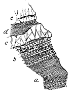
Fig. 47.—Section at the Slate
Quarry, Penrhyn Gwyn, north slopes of Cader Idris.
The accompanying section (Fig. 47) represents the arrangement of the
rocks exposed at the Slate Quarry of Penrhyn Gwyn. About 50 feet of
black slate (a) are there seen, the bedding in which
dips S. at 20°, while the cleavage is inclined towards
S.W. at a slightly higher angle. The next 20 feet
of slate (b) are distinguished by many intercalations
of slate-tuff or breccia, varying from less than an
inch to three feet in thickness. An intrusive sheet
of andesite (c), which varies from two or three to
ten feet in thickness, and is strongly cellular in the
centre, interrupts the slates and hardens them. Above
this sill the indurated slate and tuff (d), containing
abundant felspar crystals, pass under a flinty porphyritic
felsite (e) or exceedingly fine tuff, enclosing
a band of granular tuff. Beyond this band the black
slates with their seams of tuff continue up the hill and
include a sheet of slaggy felsitic lava 8 or 10 feet thick.
This section, affording as it does the first glimpse of the volcanic history
of Cader Idris, indicates a continued series of feeble gaseous discharges, probably
from one or more small vents, whereby the black clay on the sea-floor was
blown out, the fragments falling back again to be covered up under a gradual
accumulation of similar dark mud. By degrees, as the vigour of eruption
increased, lava-dust and detached felspar crystals were ejected, and eventually
lava rose to the surface and flowed over the sea-bottom in thin sheets.
But elsewhere, and likewise at a later period in this same southern part
of the district, the fragmental discharges consisted mainly of volcanic material.
Sir Andrew Ramsay has described the coarse conglomerates composed of
subangular and rounded blocks of different "porphyries," sometimes 20
inches in diameter, embedded in a fine matrix of similar materials. The
true nature of the component fragments in these rocks has still to be
worked out.
Messrs. Cole and Jennings have noticed that the grey volcanic dust of
the older slate-tuff of Cader Idris is seen under the microscope "to abound
in particles of scoriaceous andesite-glass, now converted into a green
palagonite."[146] Their investigations show that while the same kinds of
volcanic rocks continue to be met with from the bottom to the top,
nevertheless there is an increase in the acid character of the lapilli as the
section is traced upwards. Some of the fragments consist of colourless
devitrified glass, with pieces of pumice, as if derived from the breaking up
of previously-formed tuffs. Others resemble quartz-andesites, rhyolites, or
trachytes, while in at least one instance, somewhat low down in the section,
quartz-grains with intruded material point to the existence of some fairly
acid and vitreous lava.[147] On the south side of Llyn Cau, that is towards the
top of the volcanic group, I found a coarse agglomerate with blocks of felsitic
lavas, sometimes three feet across (see Fig. 48). This gradual increase of
acidity in the lapilli of the tuffs finds an interesting confirmation in the
contemporaneous lava-sheets to which I shall afterwards allude.
One of the most noticeable features in the tuffs of this volcanic group
is the great abundance of entire and broken crystals dispersed through them.
These crystals have certainly not been formed in situ, but were discharged
from the vents as part of the volcanic dust. They usually consist of felspar
which, at least in the southern portion of the district, appears generally to
be plagioclase. Frequent reference to these crystals as evidence of volcanic
explosions may be found in the publications of the Survey. Nowhere can
they be better seen than in the black slate-tuffs of Cader Idris. They are
there white, more or less kaolinized, and as they lie dispersed through the
black base, they give the rock a deceptive resemblance to some dark
porphyry. The large crystals of hornblende and augite abundantly scattered
through much of the tuff of Rhobell Fawr have been already referred to.
In the central parts of the district thick bands of ashes were mapped
by the Survey, and described as consisting almost wholly of volcanic materials,
but containing occasional thin bands of slate which suffice to mark pauses
in the eruptions, when ordinary sediment was strewn over the sea-bottom.
In the Cader Idris ground, on the other hand, interstratifications of non-volcanic
material are of such frequent recurrence as to show that there,
instead of constant and vigorous discharges accumulating a vast pile of
ashes, the eruptions followed each other after intervals of sufficient duration
to allow of the usual dark sediment spreading for a depth of many feet
over the sea-bottom.
One of the most interesting deposits of these interludes of quiescence is
that of the pisolitic ironstone and its accompanying strata on the north
front of Cader Idris (i in Fig. 48). A coarse pumiceous conglomerate with
large slag-like blocks of andesite and other rocks, seen near Llyn-y-Gadr,
passes upward into a fine bluish grit and shale, among which lies the bed
of pisolitic (or rather oolitic) ironstone which is so widely diffused over
North Wales. The finely-oolitic structure of this band is obviously original,
but the substance was probably deposited as carbonate of lime under quiet
conditions of precipitation. The presence of numerous small Lingulæ in
the rock shows that molluscan life flourished on the spot at the time. The
iron exists in the ore mainly as magnetite, the original calcite or aragonite
having been first replaced by carbonate of iron, which was subsequently
broken up so as to leave a residue of minute cubes of magnetite.[148]
Above the ironstone some more blue and black shale and grit pass under
a coarse volcanic conglomerate like that below, lying at the base of the high
precipice of Cader Idris. Hence this intercalated
group of sedimentary strata marks a
pause in the discharge of ashes and lavas,
during which the peculiar conditions of sedimentation
indicated by the ironstone spread
over at least the southern part of the volcanic
area. Some few miles to the east, where the
ironstone has been excavated near Cross Foxes,
the band is again found lying among tuffs and
grits full of volcanic lapilli.

Fig. 48.—Sketch-section across Cader Idris.
st, slates and tuffs and ashy slates; s, slates and grits; i, ironstone; b, volcanic breccias; a, slaggy andesitic and more basic lavas; e, microgranite or eurite; f, felsites;
d, "greenstone" (dolerites, diabases, etc.).
Between a lower and an upper band of
tuff in the Arenig volcanic group the Maps
and Memoirs of the Geological Survey distinguish
a central zone of "felspathic porphyry,"
which attains a maximum thickness
of 1500 feet (see Fig. 48). From Sir Andrew
Ramsay's descriptions, it is clear that he
recognized in this zone both intrusive and
extrusive sheets, and that the latter, where
thickest, were not to be regarded as one
mighty lava-flow, but rather as the result of
successive outpourings, with occasional intervals
marked by the intercalation of bands of slate
or of tuff. To a certain extent the intruded
sheets are separated on the map from the contemporaneous
lavas; but this has been done
only in a broad and sketchy way. One of the
most important, and at the same time most
difficult, tasks yet to be accomplished in this
district is the separation of the rocks which
were probably poured out at the surface from
those that were injected underneath it. My
own traverses of the ground have convinced
me that good evidence of superficial outflows
may be found in tracts which have been mapped
as entirely intrusive; while, on the other hand,
some of the so-called "lavas" may more probably
be of the nature of sills.
The petrography of the rocks, moreover,
still requires much study. Among the so-called
"felspathic porphyries" of the Survey
maps a considerable variety of texture, structure
and composition will doubtless be detected.
In the Descriptive Catalogue of Rock-Specimens
in the Museum of Practical Geology (3rd edit., 1862) the rocks that form
the "lava-streams of Llandeilo age," in Merionethshire, are named "felstone,"
"felspar-porphyry," "felstone-porphyry," "felspathic-porphyry," and "calcareous
amygdaloid."
The most interesting feature which my own slight personal acquaintance
with the region has brought before me is the clear evidence of a succession
from comparatively basic lavas in the lower part of the group to much more
acid masses in the higher part. In the Survey map numerous sheets of
intrusive "greenstone" are shown traversing the Lingula Flags, Tremadoc
slates, and lower part of the volcanic group along the northern slopes of
Cader Idris. The true intrusive nature of much of this material is clearly
established by transgressive lines of junction and by contact-metamorphism,
as well as by the distinctive crystalline texture of the rocks themselves.
But the surveyors were evidently puzzled by some parts of the ground.
Sir Andrew Ramsay speaks of "the great mass of problematical vesicular
and sometimes calcareous rock which is in places almost ashy-looking."
After several oscillations of opinion, he seems to have come finally to the
conclusion that this vesicular material, which occurs also in the upper part
of the mountain, passes into, and cannot be separated from, the undoubted
intrusive "greenstones."[149]
The true solution of the difficulty will be found, I believe, in the
recognition of a group of scoriaceous lavas among these greenstones. The
presence of a cellular structure might not be sufficient to demonstrate that
the rocks in which it appears are true lava-beds, for such a structure is far
from unknown both among dykes and sills. But in the present case there
is other corroborative testimony that some of these Cader Idris amygdaloids
were really poured out at the surface. Below Llyn-y-Gadr—the dark tarn
at the foot of the vast wall of Cader Idris—the beds of coarse volcanic
conglomerate (b in Fig. 48), to which I have already alluded, are largely
composed of blocks of the vesicular "greenstones" on which they lie.
These "greenstones," moreover, have many of the most striking characteristics
of true lavas (a in Fig. 48). They are extraordinarily cellular; their upper
surfaces sometimes present a mass of bomb-like slags with flow-structure,
and the vesicles are not infrequently arranged in rows and bands along
the dip-planes.
A microscopic examination of two slides cut from these rocks shows them
to be of a trachytic or andesitic type, with porphyritic crystals of a kaolinized
felspar embedded in a microlitic groundmass. The rocks are much impregnated
with calcite, which fills their vesicles and ramifies through their mass.
A few miles to the east some remarkable felsitic rocks take the place
of these vesicular lavas immediately below the pisolitic iron ore. I have
not determined satisfactorily their relations to the surrounding rocks, and
in particular am uncertain whether they are interbedded lavas or intrusive
sheets. Dr. F. H. Hatch found that their microscopic characters show a close
resemblance to the soda-felsites described by him from the Bala series of
the south-east of Ireland.
The slopes of Cader Idris are partly obscured with debris, from above
which rises the great precipitous face formed by the escarpment of
"porphyry," here intrusively interposed among the Arenig volcanic rocks.
This enormous sill will be referred to a little further on in connection
with the other intrusive sheets of the region.
The remarkably cellular rock which forms the peak of Cader Idris is
coloured on the Survey map as an intrusive sill of "greenstone," which in
the Memoir is said to alter the contiguous slates and to appear to cut
across them diagonally. I am disposed, however, to think that these
appearances of intrusion are deceptive. On the southern declivity of the
mountain this rock presents one of the most curious structures to be seen
in the whole district. Its surface displays a mass of spheroidal or pillow-shaped
blocks aggregated together, each having a tendency to divide
internally into prisms which diverge from the outside towards the centre.[150]
Some portions are extremely slaggy, and round these more solid portions finely
crystalline parts are drawn, suggestive rather of free motion at the surface
than of the conditions under which a subterranean sill must be formed.
The idea occurred to me on the ground that while the band of rock marked
as "greenstone" on the map is probably, in the main, an interstratified
lava, there may nevertheless be basic intrusions along its course, as in the
lower part of the mountain. The minute structure of this amygdaloid,
as revealed by the microscope, shows it to be an epidiorite wherein the
hornblende, paramorphic after augite, has been again partially altered along
the margins into chlorite.
The highest lavas of Cader Idris, forming the ridge to the south of
Llyn Cau, are separated from the amygdaloid just described by a thick
zone of black slate with thin ashy intercalations, beyond which comes the
coarse volcanic agglomerate already referred to as containing blocks of
felsite a yard or more in diameter. These lavas are true felsites, sometimes
beautifully spherulitic and exhibiting abundant flow-structure, like some
of the felsites of the next or Bala volcanic period.[151] The petrography of
these rocks still remains to be worked out.
The volcanic series of Cader Idris sweeps northward through the chain
of Aran and Arenig, and then curves westward through the group of
Manod and Moelwyn, beyond which it rapidly dies out. In its course of
about 45 miles it undergoes considerable variation, as may be seen by
comparing a section through Moelwyn with that through Cader Idris already
given. According to the researches of Mr. Jennings and Mr. Williams,[152] the
main mass of volcanic material in the northern part of the region consists of
fragmentary rocks varying in texture from agglomerates into fine tuffs, but
showing some differences in the succession of beds in different localities.
The Tremadoc group of strata clearly underlies the volcanic series of
these more northerly tracts. But it contains, so far as appears, no intercalation
of volcanic material. The inference may thus be drawn that the
eruptions began in the Cader Idris district, and did not extend into that of
Manod and Moelwyn until after the beginning of the Arenig period.
Above the Tremadoc group lies the well-marked and persistent band, about
13 feet thick, known as the Garth grit, which has been already referred to
as a convenient base-line to the Arenig group.
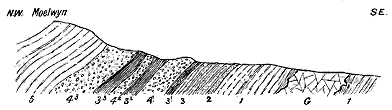
Fig. 49.—Section across the Moelwyn Range.
[153]
1, Tremadoc Group; 2, Garth or Arenig grit (base of Arenig group); 3, Arenig slates, etc.; 3
1, Lower slate band;
3
2, Middle slate band; 3
3, Upper slate band; 4
1, Lower agglomerate; 4
2, Middle agglomerate; 4
3, Upper
agglomerate; 5, Llandeilo group; G, Granite boss of Moel tan y Grisiau.
In this northern district, among the sediments which overlie the Garth
grit, layers of fine tuff begin to make their appearance, which north of
Cwm Orthin thicken out into a considerable mass between the grit and the
lowest of the great agglomerates. These tuffs, which mark the beginning of
the volcanic eruptions of the district, are followed by a band of slate which
in some places has yielded a Lingula, Orthis Carausii, and a Tetragraptus,
and points to an interval of quiescence in the volcanic history. We now enter
upon an enormous thickness of agglomerates and tuffs separated by several
bands of slate. Taking advantage of the slaty intercalations, Messrs.
Jennings and Williams have divided this great accumulation of fragmentary
volcanic material into three beds (Fig. 49). The matrix of the agglomerates
is compact and pale, so as to resemble and to have been called "felstone,"
but showing its fragmentary nature on weathered surfaces. The blocks
imbedded in this paste range up to sometimes as much as 11 feet in length
by 4 feet in width. Their minute petrographical characters have not been
studied, but the blocks are stated to consist for the most part of "slaty
and schistose fragments mixed with rounded pebbles of fine-grained
'felstone.'" They are heaped together as in true agglomerates. In the
upper agglomerate, fragments of cleaved slate containing Lingula have
been observed.
The name of "felstone" is restricted by Messrs. Jennings and Williams
to certain fine-grained varieties of rock, of which a thin band lies at the
base of the lower agglomerate, while another of considerably greater importance
occurs in the middle of the upper agglomerate. These bands
consist of a fine compact greenish base, and weather with a dull white crust;
sometimes, as in the thicker sheet, a columnar structure shows itself.
Whether these rocks are to be regarded as lavas or sills, or even as finer
varieties of tuff, is a question that awaits further inquiry. But it is clear,
from the investigation of the two observers just cited, that the pyroclastic
constituents must vastly preponderate in the volcanic series over the
northern part of the region. All these rocks, whether coarse or fine-grained,
appear to be rather acid in composition, and no evidence has yet been
obtained of a sequence among them from a more basic to a more acid series,
as in Cader Idris.
The highest agglomerate bed of the Manod and Moelwyn area is covered
by slates which contain Llandeilo graptolites. In this way, by means of
palæontological evidence, the upward and downward limits of the Arenig
volcanic series in this part of Wales are definitely fixed.
Hardly any information has yet been obtained as to the situation and
character of the vents from which the lavas and ashes of Merionethshire
were discharged. In the course of the mapping of the ground, the Geological
Survey recognized that, as the greatest bulk of erupted material lies in the
eastern and south-eastern parts of the region, the chief centres of emission
were to be looked for in that quarter, and that possibly some of the intrusive
masses which break through the rocks west of the great escarpment may
mark the site of vents, such as Tyddyn-rhiw, Gelli-llwyd-fawr, Y-Foel-ddu,
Rhobell Fawr, and certain bosses near Arenig.[154] The distribution of the
volcanic materials indicates that there were certainly more than one active
crater. While the southward thickening of the whole volcanic group points
to some specially vigorous volcano in that quarter, the notable thinning
away of the upper tuffs southward and their great depth about Arenig
suggest their having come from some vent in this neighbourhood. On the
other hand, the lower tuffs are absent at Arenig, while on Aran Mawddwy,
only nine miles to the south, they reach a depth of 3000 feet. Still farther
to the south these volcanic ejections become more and more divided by
intercalated bands of ordinary sediment. One of the most important
volcanoes of the region evidently rose somewhere in the neighbourhood of
what is now Aran Mawddwy. There seems reason to surmise that the
sites of the chief vents now lie to the east and south of the great escarpment,
buried under the thick sedimentary formations which cover all that
region.
If we are justified, on stratigraphical and petrographical grounds, in
connecting the lowest volcanic rocks of the Berwyn range with those of
Merionethshire, we may speculate on the existence of a group of submarine
vents, coming into eruption at successive intervals, from some epoch during
the period of the Lingula Flags up to that of the Bala rocks, and covering with
lavas and ashes a space of sea-bottom at least forty miles from east to west
by more than twenty miles from north to south, or roughly, an area of some
800 square miles.[155]
Besides the materials ejected to the surface, the ancient volcanic region
of Merionethshire was marked by the intrusion of a vast amount of igneous
rock between and across the bedding-planes of the strata deep underground.
One of the most prominent features of the Geological Survey map is the
great number of sills represented as running with the general strike of the
strata, especially between the top of the Harlech grits and the base of the
volcanic series. On the north side of the valley of the Mawddach, between
Barmouth and Rhaiadr Mawddach, in a distance of twelve miles the Survey
mapped "more than 150 intrusions varying from a few yards to nearly a
mile in length."[156] This zone of sills is equally marked on the south side of
the valley. It may be traced all round the Harlech anticline until it dies
out, as the bedded masses also do, towards Towyn on the south and about
Tremadoc on the north.
The presence of such a zone of intrusive sheets at the base of an ancient
volcanic series is a characteristic feature in the geology of Britain. It is
met with again and again among the Palæozoic systems, and appears on a
striking scale in association with the Tertiary basaltic plateaux of Antrim
and the Inner Hebrides. But nowhere, perhaps, is it more strongly developed
than beneath the Arenig group of lavas and tuffs in North Wales.
Abundant as are the protrusions marked on the Geological Survey map, they
fall short of the actual number to be met with on the ground. Indeed, to
represent them as they really are would require laborious surveying and the
use of maps on a far larger scale than one inch to a mile.
The vast majority of these sills are basic rocks, or, in the old and convenient
terminology, "greenstones." Those of the Cader Idris district have
been examined by Messrs. Cole and Jennings, who found that, notwithstanding
the considerable alteration everywhere shown by the abundant
epidote and calcite, the coarser varieties may be recognized as having originally
been dolerites approaching gabbro, with a well-developed ophitic character,
the general range of structure being from dolerites without olivine and
aphanites to andesitic rocks with an originally glassy matrix.[157] Dr. Hatch
confirmed this diagnosis from slides prepared from my specimens. The
ophitic structure is usually characteristic and well preserved, in spite of the
alteration indicated by epidote, chlorite, uralite, and leucoxene.
That this zone of "greenstone" sills belongs to the period of the
Merionethshire volcanoes may be reasonably concluded. The way in which
they follow the line of the great escarpment, their almost entire absence
from the Cambrian dome to the west, their cessation as the overlying lavas
and tuffs die out laterally, and their scarcity above the lower part of the
volcanic group, seem to indicate their close relationship to that group. Moreover,
that they must have been as a whole later than the main part of the lavas
and tuffs may be inferred from their position. The molten material of which
they were formed could hardly have forced its way between and across the
strata unless egress to the surface had been impeded by some thick overlying
mass. The "greenstones" may therefore be regarded as lateral emanations from
funnels of more basic lava towards the close of the volcanic period. Possibly
some at least of the highly slaggy and vesicular bands to which I have
referred may represent portions of this material, which actually flowed out
as streams of lava at the surface.
But there is likewise evidence of extensive intrusion of more siliceous
rocks. On the Geological Survey map, besides the numerous "greenstones,"
various sheets of "felspathic porphyry" are represented as running with the
general strike of the region, but here and there breaking across it. One of
the most remarkable of these acid sills is that which, in the noble precipice
of Cader Idris, has a thickness of about 1500 feet and a length of three or
four miles. It is shown on the map to be transgressive across other rocks,
and, as seen on the ground, it maintains the uniformity of texture which is
characteristic rather of sheets that have solidified underneath than of those
which have congealed with comparative rapidity at the surface. On a fresh
fracture the rock presents a pale bluish-grey tint, becoming yellowish or
brownish as the result of weathering. Its texture is finely granular, with
occasional disseminated felspars. Under the microscope a section of it was
found by Dr. Hatch to exhibit the characteristic structure of a microgranite,
a confused holocrystalline aggregate of quartz and felspar, with a few porphyritic
felspars. Messrs. Cole and Jennings have proposed to revive for
this rock Daubuisson's name "Eurite."[158]
A similar rock occurs at a lower horizon among the Lingula Flags at
Gelli-llwyd-fawr, two miles south-west of Dolgelly,[159] and much microgranite
has been injected along the slopes above Tyddyn-mawr.
The chronological relation of these acid sheets and bosses to the more
basic intrusions has not yet been definitely determined. That some of them
may have solidified in vents and may have been directly connected with the
protrusion of the later or more highly siliceous lavas is not at all improbable.
Others again would seem to belong to a much later geological period
than the Arenig volcanoes. In this late series the well-known boss of
Tan-y-grisiau near Festiniog should probably be included. This mass
of eruptive material was mapped by the Geological Survey as "intrusive
syenite." It has been more recently examined and described by Messrs.
Jennings and Williams as a granitite.[160] These observers have noticed not
only that it intrusively traverses and alters the Tremadoc group, but that
its intrusion appears to have taken place subsequent to the cleavage which
affects the Llandeilo as well as older formations. This granitic boss has
thus probably no connection with the Arenig volcanoes, but belongs to a
later period in the volcanic history of the Principality.
The remarkable scarcity of dykes in the volcanic districts of Wales has
been noticed by more than one observer. Among the intrusive "greenstones"
of Merionethshire some occasionally assume the dyke form, and
through the agglomerates and tuffs of Rhobell Fawr dykes of olivine-diabase
have worked their way. In the Festiniog district various altered andesitic
dykes have been noted. But there has been no widespread fissuring of the
ground and uprise of lava in the rents, such as may be seen in the Archæan
gneiss, and in the later Palæozoic, but still more in the Tertiary volcanic
regions. This feature becomes all the more notable when it is viewed in
connection with the great development of sills, and the evidence thereby
afforded of widespread and extremely vigorous subterranean volcanic action.
In the Merionethshire region there certainly was a long period of
quiescence between the close of the Arenig and the beginning of the Bala
eruptions. Moreover, no evidence has yet been found that active vents
ever again appeared in that district, the subterranean energy at its next
outburst having broken out farther to the east and north. In Anglesey,
however, where, as I shall point out, there is proof of contemporaneous
tuffs among the Arenig rocks, it is possible that a continuous record of
volcanic action may yet be traced from Arenig well onward into Bala time.
About 35 miles to the south-east of the great volcanic range of
Merionethshire a small tract of Arenig rocks rises from amidst younger
formations, and forms the picturesque country between Church Stoke and
Pontesbury. Murchison in his excellent account of this district clearly
recognized the presence of both intrusive and interstratified igneous rocks.[161]
The ground has in recent years been more carefully worked over by Mr.
G. H. Morton[162] and Professor Lapworth.[163]
At the top of the Arenig group of this district lies a zone of well-stratified
andesitic tuff and breccia (Stapeley Ash), with frequent intercalations
of shales, and occasionally fossiliferous.[164] There is thus satisfactory
proof of contemporaneous eruptions at intervals during the accumulation of
the later Arenig sediments. That there were also outflows of lava is
shown by the presence of sheets of augite- and hypersthene-andesite.
These volcanic intercalations form marked ridges, having a general northerly
trend. They are folded over the broad laccolitic ridge of Corndon, on the
east side of which they are thrown into a synclinal trough, so that successive
parallel outcrops of them are exposed. According to the mapping of
the Geological Survey they are thickest towards the west, and become
more split up with intercalated sediments as they range eastward.
Volcanic eruptions in this Shropshire region continued from the Arenig
into the Bala period. They are marked among the Llandeilo strata by
occasional tuffs and by two massive beds of "volcanic grit," described by
Murchison,[165] but they appear to have been rather less vigorous in the
interval represented by this subdivision of the Silurian system. Those of
Bala time gave forth abundant discharges of ash, of which the lowest
accumulation, locally known as the Hagley Ash, consists of andesitic
detritus. Occasional layers of tuff are intercalated in the overlying Hagley
Shales, above which comes an important band called the Whittery Ash,
"consisting of andesitic and rhyolitic breccias and conglomerates, fine ashes
with curious spherulitic or pisolitic structures, and bands of shale often
fossiliferous."[166] It is evident that the eruptions of the Shelve district came
from independent vents in that neighbourhood, and never reached the
importance of the great volcanoes of Arenig age in Montgomeryshire or of
Bala age in Caernarvonshire.

Fig. 50.—Section across the anticline of Corndon.
[167]
A, Arenig flags and shales; B, andesites and tuffs; C, intrusive dolerite.
Numerous dykes and sills traverse the rocks of this district. They
consist chiefly of hypersthene-dolerite. They appear to belong to a much
later period than the interstratified volcanic series; at least some of them
are found altering the Pentamerus limestones, and these must be later than
the Llandovery rocks.[168] The most important sill is that which forms
Corndon, the central igneous mass of the district. This body of dolerite
was ascertained by Mr. Watts not to be a boss but a laccolite, which
wedges out both towards the north-west and south-east, as shown in
Fig. 50.
Six miles to the north of the Shelve and Corndon district the Breidden
Hills rise on the border of Shropshire and Montgomeryshire, and include a
mass of volcanic material belonging to a distinct area of eruption. In the
ridge that extends for about three and a half miles through Moel-y-golfa
and Middletown Hill, a synclinal trough of volcanic rocks lies upon shales,
which from their fossils have been placed in the Bala group. The volcanic
series appears to exceed 1000 feet in thickness. The lowest part of it on
Moel-y-golfa consists of andesitic lavas about 400 feet thick, followed by
tuffs and volcanic conglomerates. The lavas resemble some of the "porphyrites"
of the Old Red Sandstone, and contain two forms of pyroxene—one
rhombic, probably enstatite, and the other monoclinic augite. There are
likewise considerable masses of intrusive rock, which are varieties of diabase
or dolerite.[169]
From the centre of England we must in imagination transport ourselves
into the Southern Uplands of Scotland, where a widely distributed
series of Silurian volcanic rocks has been preserved. It was, until
recently, supposed that the Silurian system north of the Tweed contains no
contemporaneously erupted volcanic rocks. Yet, as far back as the year
1860, I pointed to the abundant existence of volcanic detritus in these
strata throughout the southern counties as a probable indication of volcanic
activity at the time and in the area within which the strata were deposited.[170]
Some years later, when the microscope had been introduced as an aid to
field-geology, I sliced some of the Silurian sediments of that region and
found them, particularly certain shales and grits of Moffatdale, to contain a
large admixture of perfectly fresh unworn felspar crystals, which I felt
tolerably certain had been supplied by volcanic explosions. As no trace,
however, had then been detected of an intercalated volcanic group in any
part of the Silurian series of the south of Scotland, I used at that time to
speculate on the possibility of the volcanic detritus having been wind-borne
from the volcanoes of the Lake District. I had at that time no suspicion
that its source was rather to be sought under my feet. The presence of
volcanic rocks underneath the uplands of the south of Scotland would have
been a welcome explanation of the frequent felspathic composition of many
of the Silurian greywackes and shales of that region, and particularly the
abundance of andesitic and felsitic fragments in them.
It had been long known that the Scottish Silurian formations, besides
having undergone extensive plication, have also been injected by protrusions
of igneous material of various kinds. The intrusive character of many of
these is so obvious that a similar origin was attributed even to those bosses
which could not be proved to be intrusive. Recent work of the Geological
Survey, however, and more especially the numerous and careful traverses of
my friend and colleague Mr. Peach, have revealed the unlooked-for and
important fact that a large number of these supposed intrusions are really
portions of a volcanic group brought up on the crests of anticlinal folds, and
laid bare by denudation. This group can be traced for at least 100 miles
from north-east to south-west over a belt of country sometimes 30 miles
broad. Its original limits cannot be ascertained, but they obviously exceeded
those within which the rocks can now be seen. Nevertheless the present
boundaries embrace an area of nearly 2000 square miles. This Palæozoic
volcanic region is thus one of the most extensive in the British Isles.
Owing, however, to the constant plication of the strata, and the wide space
which the overlying sedimentary deposits are thus made to cover, the
volcanic group only comes occasionally into view, and thus occupies but a
mere fraction of the superficial extent of the region over which its scattered
outcrops appear. These exposures, sometimes only a few square yards in
extent, may always be looked for where the anticlinal folds bring up a
sufficiently low portion of the Silurian system; they prove that a vast
volcanic floor underlies the visible Lower Silurian grits and shales over the
length and breadth of the Southern Uplands of Scotland.
Without anticipating details which will properly appear in the official
Memoirs of the Geological Survey, I may briefly indicate the visible boundaries
of the volcanic group, and refer to some of the localities where it may best be
seen. The most easterly points where it has been recognized by Mr. Peach
stand on the crests of some sharp anticlinal folds near St. Mary's Loch and
near Leadburn and Winkstone in Peeblesshire. Farther westwards it appears
at many places along the northern border of the Silurian territory, as at
Romanno Bridge, Wrae, Kilbucho, Culter Water and Abington, the length and
breadth of each exposure depending partly on the breadth of the anticline
and partly on the depth to which it has been cut down by denudation.
Near Sanquhar the volcanic series opens out for a breadth of more than a
mile, and is seen at intervals across the wild moorlands of Carrick, until
from the Stinchar valley it widens out seaward and occupies much of the
coast-line of Ayrshire between Girvan and the mouth of Loch Ryan. It
probably rises again along a fold near Portpatrick, and it is seen at
various points along the southern borders of the Silurian uplands, as near
Castle-Douglas, at Glenkiln, Bell Craig near Moffat, and the head of Ettrickdale.
The best sections are those exposed along the coast to the north and
south of Ballantrae. When that ground was first examined by the Geological
Survey, the hypothetical views in regard to metamorphism already
referred to were in full ascendant, and the rocks were mapped on the same
general principles as those which had been followed in Wales. Professor
Bonney, however, a few years later recognized the true igneous nature of
many of the rocks. He found among them porphyrite lavas and agglomerates
which he regarded as of Old Red Sandstone age, likewise intrusive
serpentines and gabbros.[171]
The volcanic rocks of this wide district include both lavas and their
pyroclastic accompaniments, as well as intrusive sills and bosses of various
materials. They have recently been studied by Mr. J. J. H. Teall, and full
descriptions of them by him will appear in a forthcoming volume of the
Memoirs of the Geological Survey. He has ascertained that though
generally more or less decomposed, the lavas would be classed by German
petrographers as diabases and diabase-porphyrites. The former are compact
dark-green non-porphyritic rocks, often containing numerous small
spherical amygdales; while the latter are markedly porphyritic, enclosing
large phenocrysts of more or less altered plagioclase, often measuring half
an inch across. These two groups of rock are connected by transitional
varieties. They were probably, in the first instance, composed of plagioclase,
augite, iron-ores, and a variable quantity of imperfectly crystallized interstitial
matter.
Some of these rocks closely resemble in outward appearance the
andesites ("porphyrites") of the Old Red Sandstone of the district not
many miles to the north, that is, fine purplish-red rocks with a compact
base through which porphyritic felspars are abundantly scattered. Occasionally
they are markedly slaggy, and show even a ropy surface, while the
breccias associated with them contain blocks of similar slag.
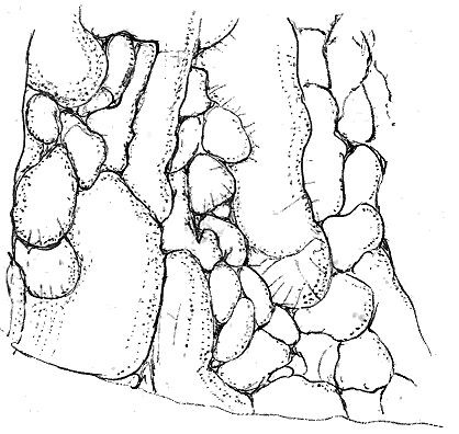
Fig. 51.—Structure in finely-amygdaloidal diabase lava, south of mouth of Stinchar River, Ayrshire.
The fine dots and circles mark the lines of amygdales.
But the most characteristic external feature of these lavas is their
tendency to assume irregularly-elliptical, sack-like or pillow-shaped forms.
On a weathered face they sometimes look like a pile of partially-filled sacks
heaped on each other, the prominences of one projecting into corresponding
hollows in the next. The general aspect of this structure is shown in Fig. 12,
which represents a face of rock about eight feet high and six feet broad.
The rocks exhibiting this peculiarity are usually finely amygdaloidal, and it
may be observed that the vesicles are grouped in lines parallel to the
outer surface of the pillow-like block in which they occur. The diagram in
Fig. 51 represents in ground-plan a surface about twelve feet square on
the shore immediately to the south of the mouth of the River Stinchar.
In the heart of the spheroids enclosed fragments of other lavas are sometimes
observable.
This singular structure has already (p. 184) been referred to as
strikingly displayed in a rock at the top of Cader Idris. It is found in
dark basic lavas probably of Arenig age, which will be afterwards referred
to as occurring along the southern flanks of the Scottish Highlands and
also in the north of Ireland. It has been observed by Mr. Teall among the
rocks of the Lizard, and has been described as occurring in Saxony and
California.[172] In these different localities it is associated with jaspers and
cherts, some of which contain abundant Radiolaria. The same structure has
been found among the variolitic diabases of Mont Genèvre,[173] and likewise in
some modern lavas, as in that of Acicastello already referred to (ante, p. 26).
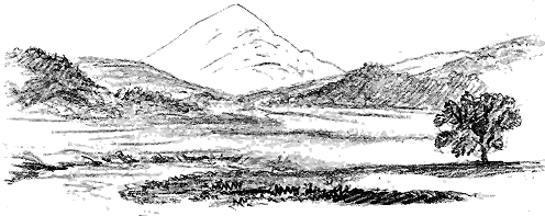
Fig. 52.—View of Knockdolian Hill from the east.
The volcanic agglomerates and breccias, in the south-west of Ayrshire,
attain a great development in several centres probably at or near the
original volcanic vents. They present several distinct petrographical types.
The remarkable neck-like hill of Knockdolian in the Stinchar Valley is made
of a coarse breccia composed mainly of angular pieces of dull greyish-green
fine-grained diabase. The breccias and agglomerates of Bennane Head in
some parts consist largely of broken-up shales, flinty mudstone, black
radiolarian flint or chert, and abundant fragments of andesites and felsites.
In other parts the volcanic material predominates, including angular and
subangular fragments of various somewhat basic lavas, lumps of vesicular slag
and pieces of pumice. Here and there much calcite is diffused through
the matrix in strings, veins and patches, which enclose the lapilli. The
agglomerate north of Lendalfoot possesses a greenish, somewhat serpentinous
matrix, through which immense numbers of tabular felspar crystals are
scattered. Similar crystals also occur abundantly in embedded blocks of
one of the purplish diabase-porphyrites, which occurs in mass on the shore
and inland, and closely resembles the rock of Carnethy in the Old Red
Sandstone volcanic series of the Pentland Hills.
Yet another and very distinct type of agglomerate is to be seen on the
Mains Hill south-east of Ballantrae. It is a coarse rock, enclosing blocks
up to a yard or more in diameter, of a fine compact purplish porphyrite,
with large crystals of plagioclase and smaller ones of augite. In some
places immense numbers of the small lapilli in the matrix consist of an
extremely fine vesicular pumice. Small perfect and larger broken crystals
of augite are likewise abundant in some of the greenish, more basic parts of
the mass. These greenish serpentinous parts and the numerous augite
crystals point to the explosion of some tolerably basic pyroxenic lava. A
similar dark green, almost black, rock, with augite crystals, which sometimes
measure a quarter of an inch in diameter, occurs near Sanquhar in
Nithsdale. It presents a close resemblance to the agglomerate of Rhobell
Fawr, already alluded to. So far as these Scottish agglomerates have yet
been microscopically examined, they have been found to be composed of
crystals, crystal-fragments, and lapilli derived partly from lavas similar to
those above described, and partly from felsitic and other rocks which have
not yet been observed here in the form of lavas.
The finer tuffs show likewise a considerable range of composition.
According to Mr. Peach's observations along the south-eastern parts of the
volcanic area, the ejected materials have consisted largely of fine dust
(probably in great measure felsitic), which towards the north-east is gradually
interleaved with ordinary sediment till the ashy character disappears.
As I have already remarked, there is reason to believe that the overlying
greywackes and shales derived part of their material either directly from
volcanic explosions or from the attrition of banks of lavas and tuffs exposed
to denudation.
But besides the interstratified lavas and fragmental rocks there occur
numerous intrusive masses which are so intimately associated with the
volcanic series that they may with little hesitation be regarded as forming
part of it. They consist of various gabbros and serpentines, which are
especially developed where the volcanic series comes out in greatest force in
the south-west of Ayrshire. They also include more acid intrusions which,
as in the case of the rock of Byne Hill, near Girvan, even assume the
characters of granite.
The dying out of the volcanic material towards the north-east probably
indicates that the vents of the period lay rather in the central or south-western
parts of the district. Unfortunately, the limited extent of the
exposures of the rocks makes it a hopeless task to search for traces of these
vents over by far the largest part of the area. There are two localities,
however, where the search may be made with better prospect of success.
One of these is a tract to the north of Sanquhar in Nithsdale, which
still requires to be studied in detail with reference to the sequence
and structure of its volcanic rocks. The other area is that south-western
part of Ayrshire which has been already cited as displaying so large a
development of the volcanic series. Here the coast-sections reveal the
intercalation of fossiliferous bands which show the true stratigraphical
horizons of the lavas and tuffs. Under Bennane Head, Professor Lapworth
some years ago found, in certain hardened black shales, a group of graptolites
which mark an undoubted Arenig platform.[174] Recently the ground has
been carefully re-examined by Messrs Peach and Horne, who have detected a
number of other fossiliferous zones which confirm and extend previous
observations. They have also been able to unravel the complicated
structure of the volcanic series, and to represent it on the 6-inch maps of
the Geological Survey, of which a reduction on the scale of 1 inch to a
mile is now in course of preparation. The following tabular summary,
taken partly from notes made by myself during a series of traverses of the
ground with Mr. Peach when the revision was begun, and partly from
memoranda supplied by that geologist himself, may suffice as a general
outline of the volcanic history of this exceedingly interesting and important
region.
| Llandovery. |
 |
Pentamerus grit.
Conglomerate (Mulloch Hill). |
| Caradoc. |
|
Shales, sandstones, grits, etc. (Ardmillan, Balcletchie). |
| Thick conglomerate (Byne Hill, Bennane, etc.). |
| Thick fossiliferous limestone (Stinchar, Girvan). (On this horizon come
the perlitic felsites and soda-felsites of Winkstone and Wrae.) |
| Sandstone (Orthis confinis) passing down into thick conglomerate. |
| [Unconformability.] |
| Upper Llandeilo. |
|
Green mudstones, grits and greywackes. |
| Thin band of dark mudstone with Upper Llandeilo graptolites. |
Arenig and Lower
and Middle Llandeilo. |
 |
Group of Radiolarian cherts (about 70 feet) with alternating tuffs. |
| Tuff or volcanic conglomerate, with occasional lava-flows. |
| Black shale (10 feet) with Arenig graptolites. |
| Volcanic breccias around local centres (Knockdolian, etc.). |
| Thick group of porphyrite and diabase lavas. |
| Red flinty mudstones with Arenig graptolites. |
| Porphyrites, etc. |
| Fine tuffs, etc., with Lower Arenig fossils. |
| Diabase lavas, etc. (base not seen). |
It will be noticed from this table that the bottom of the volcanic series is
not reached, so that no estimate can be formed of its full thickness, nor
on what geological platform it begins. Possibly its visible portions represent
merely the closing scenes of a long volcanic history, which, over the
area of the south of Scotland, extended into Cambrian time, like the contemporary
series of Cader Idris.
Among the lowest lavas there are interstratified courses of fine tuffs,
flinty shales and thin limestones, which sometimes fill in the hollows
between the pillow-like blocks above referred to. Among the characteristic
Lower Arenig graptolites of these intercalated layers are Tetragraptus bryonoides,
T. fruticosus, T. quadribrachiatus, and T. Headi together with Caryocaris
Wrightii. Considerable variation is to be seen in the development of the upper
part of the volcanic series. In some places the lavas ascend almost to the
top; in others, thick masses of breccia or agglomerate take their place. These
fragmentary materials are locally developed round particular centres, which
probably lie near the sites of active vents whence large quantities of pyroclastic
material were discharged. One of the volcanic centres must have
been situated close to the position of Knockdolian Hill already referred to.
The exceedingly coarse breccia of that eminence is rudely stratified in
alternations of coarser and finer material, which was probably to some extent
assorted under water around the cinder-cone that discharged it. The
date of the explosions of this hill has been ascertained by Mr. Peach from
the intercalation of black shales containing Arenig graptolites among the
breccias. Another vent lay somewhere in the immediate neighbourhood of
the Mains Hill agglomerate, if not actually on part of the site of that rock.
Though probably not more than a mile from the Knockdolian volcano, and
belonging to the same epoch of eruption, this vent, to judge from the
peculiarities of its ejected material, must have been quite distinct in its
source. A third vent lay somewhere in the immediate vicinity of Bennane
Head, and threw out the extraordinary masses of agglomerate and the sheets
of lava seen on the coast at that locality. A fourth may be traced by its
separate group of fine tuffs on the coast three miles south of Ballantrae.
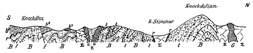
Fig. 53.—Section across the Lower Silurian volcanic series in the south of Ayrshire (B. N. Peach).
B, Interstratified lavas in Arenig group; t, tuffs; r, radolarian cherts; b2, Llandeilo group; b3 Caradoc group.
Σ, Serpentine. G, Gabbro.
A feature of singular interest in the material erupted from these various
centres of activity consists in the evidence that the explosions occurred at
intervals during the deposition of the Lower Silurian formations, and that
these formations were successively disrupted by submarine explosions. Mr.
Peach has found, for example, abundant pieces of the peculiar and easily
recognized radiolarian cherts imbedded in the volcanic series. That these
cherts were deposited contemporaneously with the volcanic eruptions is
proved by their intercalation among the breccias. Yet among these very
breccias lie abundant fragments of chert which must have already solidified
before disruption. It is thus evident that this siliceous ooze not only
accumulated but set into solid stone on the sea-floor, between periods of
volcanic outburst, and that such an occurrence took place several times in
succession over the same area.
These facts derive further interest from the organic origin of the chert.
It is now some years since Mr. Peach and his colleagues observed that between
the Glenkiln Shale with its Upper Llandeilo graptolites and the top of the
volcanic group in the central part of the Silurian uplands, alternations of
green, grey or red shaly mudstones and flinty greywackes are interleaved
with fine tuffs, and are specially marked by the occurrence in them of
nodules and bands of black, grey and reddish chert. This latter substance, on
being submitted to Dr. Hinde, was found by him to yield twenty-three new
species of Radiolaria belonging to twelve genera, of which half are new. It
thus appears that during the volcanic activity there must have been intervals
of such quiescence, and such slow, tranquil sedimentation in clear, perhaps
moderately deep water, that a true radiolarian ooze gathered over the
sea-bottom.[175]
That the deposition of this ooze probably occupied a prolonged lapse of
time seems clearly indicated by the evidence of the fossils that occur below
and above the cherts. The graptolites underneath indicate a horizon in the
Middle Arenig group, those overlying the cherts are unmistakably Upper
Llandeilo. Thus the great depth of strata which elsewhere constitute the
Upper Arenig and Lower and Middle Llandeilo subdivisions is here represented
by only some 60 or 70 feet of radiolarian cherts. These fine
siliceous, organic sediments probably accumulated with extreme slowness in
a sea of some depth and over a part of the sea-floor which lay outside the
area of the transport and deposit of the land-derived sediment of the time.[176]
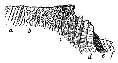
Fig. 54.—Section of part of the Arenig volcanic
group, stream south of Bennane Head, Ayrshire.
As an illustration of some of the characteristic features in the succession
of deposits in the volcanic series of the south-west of Ayrshire, the accompanying
section (Fig. 54) is inserted. In descending order we come first upon
a group of greywackes and grey
shattery mudstones (a), followed by
grey-green and dark banded cherts,
containing Radiolaria and much plicated.
Next comes a group of dark-grey,
black and red cherts, with
numerous partings and thin bands
of tuff and volcanic conglomerate (c).
The siliceous bands were certainly
deposited during the volcanic eruptions,
and they are moulded round the rugose, slaggy upper surface of the
band of lavas (d) on which they directly lie. These lavas have the sack-like
or pillow structure already described, and they enclose lumps of chert containing
Radiolaria. A few yards to the west of the line of section bands of
nodular tuff are interposed between the top of the lavas and the overlying
cherts, with which also they are interstratified. These tuffs contain blocks
of lava six inches or more in diameter. Below the belt of lavas come
black cherts and shales (e) succeeded below by volcanic breccias and tuffs
(f) alternating with shales in thin inconstant courses. These coarse detrital
rocks are thoroughly volcanic in origin, and they contain fragments of the
black cherts which lie still lower in the series. The whole depth of strata
represented in this section does not amount to much more than 100 feet.
While in some parts of the Ayrshire district the coarse breccias that
accumulated around their parent vents form most of the upper part of
the volcanic series, in others the lavas are succeeded by fine tuffs
which are intercalated among the ordinary sediments, and show a
gradual decline and cessation of volcanic energy. South of Ballantrae,
for example, the lavas occupy more than two miles of coast, in which
space they display hardly any intercalations of sedimentary material, though
they show more or less distinctly that they consist of many separate flows.
Where they at last end, bands of nodular and fine tuff make their appearance,
together with bands of ashy shale and the characteristic zone of the
red radiolarian cherts or flints. Above these, in conformable sequence,
come bands of black shale, containing abundant Upper Llandeilo graptolites,
overlain by greenish or olive-coloured shaly mudstones, which pass upward
into a thick overlying group of greywackes.
In this section the alternation of fine pyroclastic with ordinary sediment
shows that the volcanic eruptions in the southern part of the Ballantrae
district came to an end by a slowly-lessening series of explosions. The
ashy material gradually dies out, and does not reappear all through the
thick group of sandy and muddy sediments which here overlies the volcanic
series.
We thus learn from the evidence of the Ayrshire sections that volcanic
action was in full vigour in the south-west of Scotland during the Arenig
period, but gradually died out before the end of the Llandeilo period. The
rocks in which this volcanic history is chronicled have been very greatly
disturbed and plicated, so that though from their frequently vertical position
they might be thought to attain a vast depth, they very possibly do not
exceed 500 feet in thickness.
As the volcanic series is followed north-eastwards it exhibits a gradual
diminution in extent and variety, but this may be at least partly due to the
much less depth of it exposed on the crests of the narrow anticlines that
bring it to the surface. There is evidence in that region that the eruptions
did not everywhere terminate in the Llandeilo period, but were in some
districts prolonged into the age of the Bala rocks. Thus in the neighbourhood
of Sanquhar volcanic breccias, tuffs and lavas have been found by
Messrs. Peach and Horne intercalated in strata apparently belonging to
the Bala group. Again, in the district of Hartfell, a moderately coarse
volcanic agglomerate occurs in the heart of the so-called "barren mudstones"
of the Hartfell black-shale group, which, from its graptolites, is
placed on the horizon of the Bala rocks. At Winkstone, Hamilton Hill,
and Wrae in Peeblesshire, perlitic felsites and soda-felsites have been
detected by Messrs. Peach and Horne and determined by Mr. Teall. They
are associated with the Bala limestone, which in some of its conglomeratic
bands contains pebbles of felsite.
The intrusive rocks which accompany the Lower Silurian volcanic series
of the south of Scotland are best displayed in the south-west of Ayrshire,
between Girvan and Ballantrae, where they appear to be on the whole
later than at least the great mass of the interstratified lavas and
tuffs. The most abundant rocks and the earliest to be injected are
complex basic masses which include serpentine, olivine-enstatite rock,
troctolite, gabbro and other compounds, all which may be different modifications
of the same original basic magma. They do not show a finer texture
where they respectively meet, nor any other symptom of having been subsequently
intruded into each other, though they do exhibit such structures
along their lines of contact with the surrounding rocks, into which they
are intrusive. These more basic masses have subsequently been invaded by
irregular bosses and dyke-like protrusions, which, when small, are fine-grained
dolerites, but when in larger bodies take the form of gabbro,
sometimes exhibiting a mineral banding and foliated structure. These
banded varieties much resemble the banded Tertiary gabbros of Skye and
some parts of the Lewisian gneiss.
At the Byne Hill, near Girvan, a large intrusive boss or ridge displays
on its outer margin a fine-grained texture, where it comes in contact with
the serpentine. Further inwards it becomes a fine dolerite, passing into gabbro
and increasing in coarseness of grain as well as in acidity of composition,
through stages of what in the field would be called diorite and quartz-diorite,
into a central granitic rock, whereof milky or blue quartz forms the prominent
constituent. The intrusive rocks of this district have generally been injected
parallel to the stratification-planes, and take on the whole the form of sills.
Some time after the close of the volcanic episode in the Silurian period
of the south of Scotland, the rocks were locally subjected to considerable
disturbance and elevation, whereby parts of the volcanic series were exposed
to extensive denudation. Hence the overlying unconformable Caradoc
conglomerates are in some places largely made up of the detritus of the
volcanic rocks. It is interesting to find this evidence of waste during
the very next stage of the Silurian period, for it affords good evidence
that the extensive sheets of intrusive material could not have had any
large amount of overlying strata resting upon them at the time of their
injection. Pieces of these intrusive rocks, such as the serpentine, occur
abundantly in the Caradoc conglomerates, some of which indeed are
almost wholly composed of their detritus. Probably the total thickness
of the overlying cover of rock under which the sills were injected did
not amount to as much as 200 or 300 feet. Yet we see that among
the sills were coarse gabbros and granitoid rocks. We may therefore infer
that for the injection of such intrusive masses, great depth and enormous
superincumbent pressure are possibly not always necessary.
During the progress of the Geological Survey along the southern borders
of the Highlands, a remarkable group of rocks has been observed, intervening
as a narrow interrupted strip between the schistose masses to the north and
the great boundary-fault which brings the Old Red Sandstone in vertical
strata against them. Between Cortachy in Forfarshire and Stonehaven on
the east coast, these rocks have been mapped by Mr. G. Barrow, who has
carefully worked out their relations. They appear again between Callander
and Loch Lomond, where their extent and structure have been mapped by
Mr. C. T. Clough. For the purpose of our present inquiry two chief
features of interest are presented by these rocks. They include a group
of sedimentary strata among which occur bands of jasper or chert containing
radiolaria, and one of their most conspicuous members is a series of
volcanic rocks consisting chiefly of dolerites and basalts, some of which have
been much crushed and cleaved, but in which vesicular structures can still
occasionally be recognized.
The striking resemblance of both the aqueous and igneous members of
this marginal strip of rocks along the Highland border to the Arenig cherts
and their accompanying lavas in the south of Scotland, the remarkable
association of the same kinds of material in the same order of sequence, the
occurrence of radiolaria in the siliceous bands in both regions, furnish
strong presumptive evidence that a strip of Arenig rocks has been wedged
in against the Highland schists.
In many respects, these dull green diabasic lavas of the Highland
border resemble those of the Ayrshire coast. In particular, the same
peculiar sack-like or pillow-shaped masses are conspicuous in the Forfarshire
ravines. As in Ayrshire, igneous materials underlie the cherts
which are doubled over and repeated by many successive folds. Unfortunately,
it is only a narrow strip of these probably Arenig lavas that has
been preserved, and no trace has been detected of tuffs, agglomerates or
necks. If, however, we may regard the rocks as truly of Arenig age, they
furnish interesting additional proof of the wide extent of the earliest Silurian
volcanoes. The distance between the last Arenig volcanic outcrop in the
Southern uplands and the band of similar lavas along the margin of the
Highlands is about 50 miles. If the volcanic ejections were continuous
across the intervening tract, the total area over which the lavas and tuffs of
the Arenig volcanoes were distributed must be increased by at least 6000
square miles in Scotland.
But it is in the north of Ireland that this northern extension of what
may probably be regarded as an Arenig series of volcanic rocks attains its
greatest development. Of this Irish prolongation a brief account is given
in Chapter xiv., where the whole of the Silurian volcanic rocks of the
island are discussed.
CHAPTER XIII THE ERUPTIONS OF LLANDEILO AND BALA AGE — i. THE VOLCANO OF BUILTH AND ITS NEIGHBOURS — ii. THE VOLCANOES OF PEMBROKESHIRE — iii. THE CAERNARVONSHIRE VOLCANOES OF THE BALA PERIOD — iv. THE VOLCANIC CENTRE OF THE BERWYN HILLS — V. THE VOLCANOES OF ANGLESEY — vi. THE VOLCANOES OF THE LAKE DISTRICT (ARENIG TO CLOSE OF BALA PERIOD)
i. The Builth Volcano—ii. The Volcanoes of Pembrokeshire—iii. The Caernarvonshire
Volcanoes of the Bala Period—iv. The Volcanic District of the Berwyn Hills—v.
The Volcanoes of Anglesey—vi. The Volcanoes of the Lake District; Arenig
to close of Bala Period—vii. Upper Silurian (?) volcanoes of Gloucestershire.
The stratigraphical subdivisions of geology are necessarily more or less
arbitrary. The sequence in the sedimentary deposits of one region always
differs in some degree from that of adjoining regions. In drawing up a
table of stratigraphical equivalents for separate countries, we must be content
to accept a general parallelism, without insisting on too close an identity
in either the character of the strata or the grouping of their organic remains.
We need especially to guard against the assumption that the limit assigned
to a geological formation in any country marks a chronological epoch which
will practically agree with that denoted by the limit fixed for the same
formation in another country. The desirability of caution in this respect is
well shown by the vagueness of the horizons between the several subdivisions
of the Lower Silurian system. So long as the areas of comparison are near
each other, no great error may perhaps be committed if their stratigraphical
equivalents are taken to have been in a broad geological sense contemporary.
But in proportion as the element of distance comes in, there enters with it
the element of uncertainty.
Even within so limited a region as the British Isles, this difficulty makes
itself strongly felt. Thus, in the typical regions of Wales, the several subdivisions
of the Lower Silurian strata are tolerably well marked, both by
lithological nature and by fossils. But as they are followed into other parts
of the country, they assume new features, sometimes increasing sometimes
diminishing in thickness, changing their sedimentary character, and altering
the association or range of their organisms. The subdivisions into which the
geologist groups them may thus be vaguely defined by limits which, in
different parts of the region, may be far from representing the same periods
of time.
Hence, in trying to ascertain how far the volcanic eruptions of one area
during the Silurian period may have been contemporary with those of another
area, we must be content to allow a wide margin for error. It is hardly
possible to adhere strictly to the stratigraphical arrangement, for the geological
record shows that in the volcanic districts the sedimentary formations
by which the chronology might have been worked out are not infrequently
absent or obscure. It will be more convenient to treat the rest of the Lower
Silurian formations as the records of one long and tolerable definite section
of geological time, without attempting in each case to distinguish between
the eruptions of the successive included periods, so long as the actual
volcanic sequence is distinctly kept in view. I will therefore take the
history of each district in turn and follow its changes from the close of
the Arenig period to the end of Upper Silurian time. The stages in the
volcanic evolution of each tract will thus be clearly seen.
Above the Arenig group with its voluminous volcanic records comes the
great group of sediments known as the Llandeilo formation, in which also
there are proofs of contemporaneous volcanic activity over various parts of the
sea-floor within the site of Britain. We have seen that in the south of
Scotland the eruptions of Arenig time were probably continued into the
period of the Llandeilo rocks, or even still later into that of the Bala group.
But it is in Wales that the history of the Llandeilo volcanoes is most fully
preserved. A series of detached areas of volcanic rocks, intercalated among
the Llandeilo sediments, may be followed for nearly 100 miles, from the
northern end of the Breidden Hills in Montgomeryshire, by Shelve, Builth,
Llanwrtyd and Llangadock, to the mouth of the Taf river. But some 35 miles
further west another group of lavas and tuffs appears on the coast of Pembrokeshire,
from Abereiddy Bay to beyond Fishguard. The want of continuity in
these scattered outcrops is no doubt partly due to concealment by geological
structure. But from the comparative thinness of the volcanic accumulations
and their apparent thinning out along the strike it may be inferred that no
large Llandeilo volcano existed in Wales. There would rather seem to
have been a long line of minor vents which in the south-east part of the
area appear to have only discharged ashes. Certainly, if we may judge
from their visible relics, these eruptions never rivalled the magnitude of the
discharges from the Arenig volcanoes that preceded, or the Bala volcanoes
that followed them.
So far as the available evidence goes, the most important volcanic centre
down the eastern side of Wales during the Llandeilo period was one which
lay not far from the centre of the long line of vents just referred to. Its
visible remains form an isolated tract of hilly ground, some seven miles long,
and four or five miles broad, immediately north from the town of Builth.
This area is almost entirely surrounded by unconformable Upper Silurian
strata, so that its total extent is not seen, and may be much more considerable
than the area now laid bare by denudation.
The volcanic rocks of Builth were first described in the "Silurian
System." Murchison clearly recognized that they included some which
were "evolved from volcanic apertures during the submarine accumulation
of the Lower Silurian rocks," and also "unbedded volcanic masses which had
been intruded subsequently, dismembering and altering all the strata with
which they came in contact."[177] These igneous rocks were mapped in some
detail by the Geological Survey, and their general relations were expressed
in lines of horizontal section.[178] They were likewise described by Ramsay in
the Catalogue of the Rock-specimens in the Jermyn Street Museum, specimens
of them being displayed in that collection.[179] The tuffs and lavas were
distinguished, and likewise the intrusive "greenstones." But no attempt
was made towards petrographical detail.
This interesting district has recently been studied by Mr. Henry Woods,[180]
who has grouped the igneous rocks in probable order of appearance, as
follows:—1st, Andesites; 2nd, Andesitic ash; 3rd, Rhyolites; 4th, Diabase-porphyrite;
and 5th, Diabase.
Some of the andesites are described as intrusive in the Llandeilo strata.
The ash in its lower part contains numerous well-rounded pebbles of
andesite, usually five or six inches in diameter, but sometimes having a
length of two feet. It contains fossils (Orthis calligramma, Leptæna sericea,
Serpulites dispar, etc.), and as it is overlain with shales containing Ogygia
Buchii, it may be regarded as probably of Lower Llandeilo age. The
rhyolites are feebly represented, and some of them may possibly be intrusive.
Among them a nodular variety has been noticed, the nodules being solid
throughout, varying up to two inches in diameter, and formed of microcrystalline
quartz and felspar, with no trace of any radial or concentric
internal arrangement. The diabase-porphyrite, the most conspicuous rock
of the district, is intrusive in the andesites and ashes, and occurs in four
separate masses or sills. The diabases are all intrusive and of later date
than any of the other igneous rocks, and as they traverse also the Llandeilo
shales, they are probably considerably later than the previous eruptions.
But as they do not enter the surrounding Llandovery and Wenlock strata,
they are regarded by Mr. Woods as of intermediate age between the time
of the Llandeilo and that of the Upper Silurian formations.
About nine miles in a west-south-westerly direction from the southern
extremity of the Builth volcanic area, another much smaller exposure of
igneous rocks has been mapped by the Geological Survey at the village of
Llanwrtyd. This tract is only about three miles long and half a mile
broad. The volcanic rocks are represented as consisting of three or more
bands of "felspathic trap" interstratified in the Lower Silurian strata, and
folded into an anticline along the ridge of Caer Cwm. No published line of
section runs across this ground, and the band of rock does not appear to
have been described.[181]
Seventeen miles to the south-west a still feebler display of intercalated
volcanic material occurs in the Llandeilo formation near the village of
Llangadock. The Geological Survey map represents one or more bands of
ash associated with limestone, and thrown into a succession of folds. In
the Horizontal Section (Sheet III. Section 3) a band, 100 to 200 feet thick,
of "trappean ash" with fossils is shown among the shales, limestones and grits,
and in the Catalogue of Rock-specimens the same rock is referred to as
brecciated ash in connection with specimens of it in the Museum, which are
described as not purely ashy, but containing many slate-fragments and
broken felspar-crystals together with organic remains.[182]
About twenty-four miles still further in the same south-westerly
direction, two patches of "ash" are shown upon the Survey map, near the
mouth of the river Taf. No description of these rocks is given.[183]
In north-western Pembrokeshire, the observations of Murchison, De la
Beche and Ramsay showed the existence of an important volcanic district,
where numerous igneous bands are interstratified among the Lower Silurian
rocks, over an area extending from St. David's Head for thirty miles to
the eastward.[184] On the maps of the Geological Survey, lavas, tuffs, sills
and bosses were discriminated, but no description of these rocks was
published. Since the publication of the Survey map very little has yet
been added to our information on the subject.
There appear to have been at least three principal groups of vents.
One may be indicated by the bands of "felspathic trap" which have been
mapped as extending from near St. Lawrence for fourteen miles to the east.
Another must have existed in the neighbourhood of Fishguard. A third is
shown to have lain between Abereiddy Bay and Mathry, by the abundant
bands of lava and tuff and intrusive sills there to be seen.
Of these areas the only one which has yet been examined and described
in some detail is that of Fishguard, of which an account has recently been
published by Mr. Cowper Reed.[185] This observer has shown that the
eruptions began there during the deposition of the Lower Llandeilo rocks,
and continued intermittently into the Bala period. The earliest consisted
of felsites and tuffs intercalated between Lower Llandeilo black slates containing
Didymograptus Murchisoni, the tuffs themselves being sometimes
fossiliferous. A second great volcanic belt, composed of felsitic lavas,
breccias and tuffs, lies at the base of the Upper Llandeilo strata and shows
the maximum of volcanic energy. The breccias are partly coarse agglomerates,
which probably represent, or lie not far from, some of the eruptive
vents of the time. A higher band of lavas and breccias appears to
be referable to the Bala formation. The whole volcanic series is stated to
thin out towards the south-west, so that the chief focus of eruption probably
lay somewhere in the neighbourhood of Fishguard.
The lavas may all be included under the general term felsite. Their
specific gravity ranges from 2·60 to 2·76, and their silica percentage from
68 to 72. Mr. Cowper Reed observed among them three conspicuous types
of structure. Some are characterized by a distinct arrangement in fine
light and dark bands which rapidly alternate, and are sometimes thrown
into folds and convolutions. A second structure, observed only at one
locality, consists in the development of pale grey or whitish ovate nodules,
about half an inch in length, with a clear quartz-grain in their centre, or
else hollow. The third type is shown by the appearance of perlitic structure
on the weathered surface.[186]
The tuffs and breccias are chiefly developed at the base and top of each
volcanic group. Some of them contain highly vesicular fragments, as well
as pieces of slate and broken crystals of quartz and felspar.
A characteristic feature of this volcanic district is the occurrence in it
of sills and irregularly-intruded masses of "greenstone." Under that name
are comprised basalts, dolerites, andesitic dolerites with tachylitic modifications,
as well as diabases and gabbros.[187] Some of these rocks exhibit a
variolitic structure. As regards age, some of the intrusions appear to
have taken place before the tilting, cleavage and faulting of the strata. They
have not been noticed in the surrounding Upper Silurian strata, and we may
perhaps infer that here, as at Builth, they are of Lower Silurian date. Mr.
Cowper Reed, however, is inclined to regard the large Strumble Head masses
as later than the tilting and folding of the rocks.[188]
A few miles to the south-west of the Fishguard district, on the coast of
Abereiddy Bay, good sections have been laid bare of the volcanic rocks of
this region. Dr. Hicks has shown that the bands of tuff there displayed
are intercalated among the black slates of the Lower Llandeilo group, and
that there was probably a renewal of volcanic activity during the deposition
of the upper group.[189] But the volcanic history of this area still remains to
be properly investigated.
In southern Pembrokeshire two conspicuous bands of eruptive rocks
have long been known and described. Their general characters and distribution
were sketched by De la Beche,[190] and further details were afterwards
added by Murchison.[191] As traced by the officers of the Geological Survey,
they were represented as consisting of "greenstone," "syenite" and "granite."
The more northerly band was shown to run in a nearly east and west line
from Lawrenny to the Stack Rock, west of Talbenny, a distance of about
fourteen miles. The second band, placed a short way farther south, stretches
in the same general line, from Milford Haven at Dall Road into Skomer
Island, a distance of about seven miles.
The relations of these rocks to the surrounding formations and their
geological age have been variously interpreted. De la Beche regarded the
different masses as intrusive, and probably later than even the adjoining Coal-measures.[192]
Murchison, on the other hand, considered the bedded eruptive
rocks of Skomer Island to be undoubtedly lavas contemporaneous with the
strata among which they are intercalated.[193]
The rocks have been studied petrographically by various observers. Mr.
Rutley gave a full description of the remarkable nodular and banded felsites
of Skomer Island.[194] Mr. Teall has also noticed these rocks, likewise "a
magnificent series of basic lava-flows" in the same island, and a number of
"porphyrites." The basic lavas seemed to him to contain too much felspar
and too little olivine to be regarded as perfectly typical olivine-basalts, and
he found them to lie sometimes in very thin and highly vesicular sheets.
The "porphyrites" he placed "on the border-line between basic and intermediate
rocks."[195]
More recently this southern district of Pembrokeshire has been examined
by Messrs. F. T. Howard and E. W. Small, who have obtained further
evidence of the interbedded character of the igneous series. Below an
upper basalt they have noted the occurrence of bands of felsitic conglomerate,
sandstone, shale and breccia lying upon and obviously derived
from a banded spherulitic felsite, below which comes a lower group of
basalts. The age of this interesting alteration of basic and acid eruptions
has not been precisely determined, but is conjectured to be that of the
Bala or Llandovery rocks.[196]
Owing to the effects partly of plication and partly of denudation, the
rocks of the next volcanic episode in Wales, that of the Bala period, occupy
a less compact and defined area than those of the Arenig group in Merionethshire.
From the latter they are separated, as we have seen, by a considerable
depth of strata,[197] whence we may infer, with the Geological Survey,
that the eruptions of Arenig, the Arans and Cader Idris were succeeded by
a long period of repose, the Llandeilo outbreaks described in the foregoing
pages not having extended apparently into North Wales. When the next
outbreaks took place, the vents are found to have shifted northwards into
Caernarvonshire, where they fixed themselves along a line not much to the
east of where the Cambrian porphyries and tuffs now appear at the surface.
The lavas and ashes that were thrown out from these vents form the highest
and most picturesque mountains of North Wales, culminating in the noble
cone of Snowdon. They stretch northwards to Diganwy, beyond Conway,
and southwards, at least as far as the neighbourhood of Criccieth. They
die out north-eastwards beyond Bala Lake, and there can be but little doubt
that they thin out also eastwards under the Upper Bala rocks. The lavas
and tuffs that rise up on a similar horizon among the Bala rocks of the
Berwyn Hills evidently came not from the Snowdonian vents, but from
another minor volcanic centre some miles to the east, while still more
remote lay the vents of the Breidden Hills and the sheets of andesitic tuff
that probably spread from them over the ground east of Chirbury (Map II.).
The Caernarvonshire volcanic group extends from north to south for
fully thirty miles, with an extreme breadth of about fifteen miles; while, if
we include the rocks of the Lleyn peninsula, the area will be prolonged some
twenty miles farther to the south-west.
The general stratigraphical horizon of this volcanic group has been
well determined by the careful mapping of Ramsay, Selwyn and Jukes on
the maps of the Geological Survey. These observers brought forward
ample evidence to show that the lavas and tuffs were erupted during the
deposition of the Bala strata of the Lower Silurian series, that the Bala
Limestone is in places full of ashy material, and that this well-marked fossiliferous
band passes laterally into stratified volcanic tuffs containing the
same species of fossils.[198] But the progress of stratigraphical geology, and
the increasing value found to attach to organic remains as marking even
minor stratigraphical horizons, give us reason to believe that a renewed and
still more detailed study of the Bala rocks of North Wales would probably
furnish data for more precisely defining the platforms of successive eruptions,
and would thus fill in the details of the broad sketch which Sir Andrew
Ramsay and his associates so admirably traced. Besides the Bala Limestone
there may be other lithological horizons which, like the Garth grit and the
pisolitic iron-ore of the Arenig group, might be capable of being followed
among the cwms and crests as well as the opener valleys of Caernarvonshire.
Until some such detailed mapping is accomplished, we cannot safely
advance much beyond the point where the stratigraphy was left by the
Survey.
From the Survey maps and sections it is not difficult to follow the general
volcanic succession, and to perceive that the erupted materials must altogether
be several thousand feet in thickness from the lowest lavas in the north to
the highest on the crest of Snowdon. In that mountain the total mass of
volcanic material is set down as 3100 feet. But this includes only the
higher part of the whole volcanic group. Below it come the lavas of Y
Glyder-Fach, which, according to the Survey measurements, are about 1500
feet thick, while still lower lie the ancient coulées of Carnedd Dafydd and
those that run north from the vent of Y-foel-frâs, which must reach a united
thickness of many hundred feet. We can thus hardly put the total depth
of volcanic material at a maximum of less than 6000 to 8000 feet. The
pile is, of course, thickest round the vents of discharge, so that no measurement,
however carefully made at one locality, would be found to hold good
for more than a short distance.
Though little is said in the Survey Memoir of the vents from which this
vast amount of volcanic material was erupted, the probable positions of a
number of these orifices may be inferred from the maps. From the shore
west of Conway a series of remarkable eminences may be traced south-westwards
for a distance of nearly forty miles into the peninsula of Lleyn. At
the northern extremity of this line stands the prominent boss of Penmaen-mawr,
while southward beyond the large mass of Y-foel-frâs, with the smaller
knobs west of Nant Francon, and the great dome of Mynydd-mawr, the
eye ranges as far as the striking group of puy-like cones that rise from the
sea around Yr Eifl and Nevin. Some of these hills, particularly Y-foel-frâs,
were recognized by the Survey as vents.[199] But the first connected account
of them and of their probable relation to the volcanic district in which they
occur has been given by Mr. Harker in his exceedingly able essay on "The
Bala Volcanic Series of Caernarvonshire,"[200]—the most important contribution
to the volcanic history of Wales which has been made since the publications
of the Geological Survey appeared. I shall refer to these vents more specially
in the sequel. I allude to them here for the purpose of showing at the
outset the marvellous completeness of the volcanic records of Caernarvonshire.
So great has been the denudation of the region that the pile of lavas
and tuffs which accumulated immediately around and above these orifices has
been swept away. No trace of any portion of that pile has survived to the
west of the line of bosses; while to the east, owing to curvature and subsequent
denudation, the rocks have been dissected from top to bottom, until almost
every phase of the volcanic activity is revealed.
The volcanic products discharged from these vents consist of a succession
of lava-streams separated by bands of slate, tuff, conglomerate and breccia.
These fragmental intercalations, which vary from a few yards to many
hundred feet in thickness, are important not only as marking pauses in the
emission of lava or in the activity of the volcanoes, but as affording a means
of tracing the several lavas to their respective vents. Essentially, however,
the volcanic materials consist of lava-flows, the intercalations of fragmentary
materials, though numerous, being comparatively thin. The thickest accumulation
of tuffs is that forming much of the upper part of Snowdon. It is
set down by my predecessor at 1200 feet in thickness, but I should be
inclined to reduce this estimate. I shall have occasion to show that the
summit and upper shoulders of Snowdon are capped with andesites interstratified
among the tuffs. Sir Andrew Ramsay has referred with justice to
the difficulty of always discriminating in the field between the fine tuffs and
some of the lavas.[201] Yet I am compelled to admit that, if the ground were
to be re-mapped now, the area represented as covered by fragmental rocks
would be considerably restricted. Mr. Harker is undoubtedly correct when
he remarks that, taken "as a whole, the Bala volcanic series of Caernarvonshire
is rather remarkable for the paucity of genuine ashes and
agglomerates."[202]
The lavas of the Bala volcanic group, like those of the Arenig series,
were mapped by the Survey as "porphyries," "felstones," or "felspathic
traps." They were shown to be acid-lavas, having often a well-developed
flow-structure comparable with that of obsidian and pitchstone, and to
consist of successive sheets that were poured out over the sea-floor. Their
petrography has subsequently been studied more in detail by many observers,
among whom I need only cite Professor Bonney, Professor Cole, Mr. Rutley,
Mr. Teall, and Miss Raisin; the most important recent additions to our
knowledge of this subject having been made by Mr. Harker in the Essay
to which I have just referred.
The great majority of these lavas are thoroughly acid rocks, and present
close analogies of composition and structure to modern rhyolites, though I
prefer to retain for them the old name of "felsites." Their silica-percentage
ranges from 75 to more than 80. To the naked eye they are externally
pale greyish, or even white, but when broken into below the thick decomposed
and decoloured crust, they are bluish-grey to dark iron-grey, or even
black. They break with a splintery or almost conchoidal fracture, and
show on a fresh surface an exceedingly fine-grained, tolerably uniform
texture, with minute scattered felspars.
One of their most striking features is the frequency and remarkable
development of their flow-structure. Not merely as a microscopic character,
but on such a scale as to be visible at a little distance on the face of a cliff
or crag, this structure may be followed for some way along the crops of
particular flows. The darker and lighter bands of devitrification, with their
lenticular forms, rude parallelism and twisted curvature, have been compared
to the structure of mica-schist and gneiss. One aspect of this
structure, however, appears to have escaped observation, or, at least, has
attracted less notice than it seems to me to deserve. In many cases it is
not difficult to detect, from the manner in which the lenticles and strips of
the flow-structure have been curled over and pushed onward, what was the
direction in which the lava was moving while still a viscous mass. By
making a sufficient number of observations of this direction, it might in
some places be possible to ascertain the quarter from which the several
flows proceeded. As an illustration, I would refer to one of the basement-felsites
of Snowdon, which forms a line of picturesque crags on the slope
facing Llanberis. The layers of variously-devitrified matter curl and fold
over each other, and have been rolled into balls, or have been broken up
and enclosed one within the other (Fig. 55). The general push indicated
by them points to a movement from the westward. Turning round from
the crags, and looking towards the west, we see before us on the other side
of the deep vale of Llyn Cwellyn, at a distance of little more than three
miles, the great dome-shaped Mynydd-mawr, which, there is every reason to
believe, marks one of the orifices of eruption. It might in this way be
practicable to obtain information regarding even some of the vents that still
lie deeply buried under volcanic or sedimentary rocks.
That these felsites were poured forth in a glassy condition may be
inferred from the occurrence of the minute perlitic and spherulitic forms so
characteristic of the devitrification of once vitreous rocks. Mr. Rutley was
the first who called attention to this interesting proof of the close resemblance
between Palæozoic felsites and modern obsidians, and other observers have
since confirmed and extended his observations.[203]
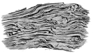
Fig. 55.—Flow-structure in the lowest felsite on the track from Llanberis to the top of Snowdon.
Length about 4 feet, height 2½ feet.
Another remarkable aspect of the felsites is that nodular structure so
often to be seen among them, and regarding the origin of which so much
has already been written. I agree with Professor Cole and Mr. Harker in
looking upon the "nodules" as derived from original spherulites by a process
of alteration, of which almost every successive stage may be traced until the
original substance of the rock has been converted into a flinty or agate-like
material. If this be the true explanation of the structure, some of the
original lavas must have exhibited perlitic and spherulitic forms on a
gigantic scale. There can, I think, be little doubt that this peculiar structure
was very generally misunderstood by the earlier observers, who naturally
looked upon it as of clastic origin, and who therefore believed that large
beds of rock consisted of volcanic conglomerate, which we should now map
as nodular felsite (pyromeride).[204]
While by far the larger proportion of the Caernarvonshire lavas consists
of thoroughly acid rocks, the oldest outflows are much less acid than
those erupted at the height of the volcanic activity, when the rocks of Snowdon
were poured forth.[205] But towards the close of the period there was apparently
a falling off in the acidity of the magma, for at the top of the group the
andesitic lavas to which I have already alluded are encountered. Sir
Andrew Ramsay has shown the existence of an upper "felstone" or "felspathic
porphyry," almost entirely removed by denudation, but of which
outliers occur on Crib-goch, Lliwedd, and other crests around Snowdon, and
likewise on Moel Hebog.[206] Mr. Harker alludes to these remnants, and
speaks of them as less acid than the older lavas, but he gives no details as
to their structure and composition.[207] In an examination of Snowdon I was
surprised to find that the summit of the mountain, instead of consisting of
bedded ashes as hitherto represented, is formed of a group of lava-sheets
having a total thickness of perhaps from 100 to 150 feet (6 in Fig. 56).
The apex of Yr Wyddfa, the peak of Snowdon, consists of fossiliferous shale
lying on a dull grey rock that weathers with elongated vesicles, somewhat
like a cleaved amygdaloid, but a good deal decomposed. A thin slice of this
latter rock shows under the microscope irregular grains and microlites of
felspar, with a few grams of quartz, the whole much sheared and calcified.
Below this bed comes a felsite, or devitrified obsidian, showing in places
good spherulitic structure, and followed by a grey amygdaloid. The latter
is a markedly cellular rock, and, though rather decayed, shows under the
microscope a microlitic felspathic groundmass, through which granules of
magnetite are dispersed.
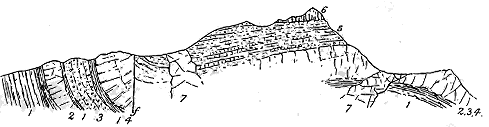
Fig. 56.—Section of Snowdon.
[208]
1. Grits and slates; 2. Felsite with good flow-structure; 3. Volcanic tuffs; 4. Felsite; 5. Tuffs with sheets of
felsite and andesite; 6. Group of andesitic lavas on summit of Snowdon; 7. Intrusive "greenstones."
Underneath this upper group of lavas lie the tuffs for which Snowdon
has been so long celebrated. But, as I have already stated, there does
not appear to me to be such a continuous thickness of fragmental material
as has been supposed. There cannot, I think, be any doubt that not
only at the top, but at many horizons throughout this supposed thick
accumulation of tuff, some of the beds of rock are really lava-flows.
Some of these lavas have suffered considerably from the cleavage which
has affected the whole of the rocks of the mountain, while the results
of centuries of atmospheric disintegration, so active in that high exposed
locality, have still further contributed to alter them. They consequently
present on their weathered faces a resemblance to the pyroclastic rocks
among which they lie. Where, however, the lavas are thicker and more
massive, and have resisted cleavage better, some of them appear as cellular
dull grey andesites or trachytes, while a few are felsites. Many instructive
sections of such bands among the true tuffs may be seen on the eastern
precipices of Snowdon above Glas-lyn.
It thus appears that the latest lavas which flowed from the Snowdonian
vent were, on the whole, decidedly more basic than the main body of felsites
that immediately preceded them. They occur also in thinner sheets, and
are far more abundantly accompanied with ashes. At the same time it is
deserving of special notice that among these less acid outflows there are
intercalated sheets of felsite, and that some of these still retain the
spherulitic structure formed by the devitrification of an original volcanic
glass.
Far to the south-west, in the promontory of Lleyn, another group of
volcanic rocks exists which may have been in a general sense contemporaneous
with those of the Snowdon region, but which were certainly
erupted from independent vents. Mr. Harker has described them as quartzless
pyroxene-andesites, sometimes markedly cellular, and though their
geological relations are rather obscure, he regards them as lava-flows interbedded
among strata of Bala age and occurring below the chief rhyolites of
the district. If this be their true position, they indicate the outflow of
much less highly siliceous lavas before the eruption of the acid felsites. In
the Snowdon area any such intermediate rocks which may have been
poured out before the time of the felsitic outflows have been buried under
these.
The tuffs of the Bala series in Caernarvonshire have not received the
same attention as the lavas. One of the first results of a more careful
study of them will probably be a modification of the published maps by a
reduction of the area over which these rocks have been represented. They
range from coarse volcanic breccias to exceedingly fine compacted volcanic
dust, which cannot easily be distinguished, either in the field or under the
microscope, from the finer crushed forms of felsite. Among the oldest tuffs
pieces of dark blue shale as well as of felsite may be recognized, pointing to
the explosions by which the vents were drilled through the older Silurian
sediments already deposited and consolidated. Sometimes, indeed, they
recall the dark slate-tuffs of Cader Idris, like which they are plentifully
sprinkled with kaolinized felspar crystals. The beds of volcanic breccia
intercalated between the lower felsites of Snowdon include magnificent
examples of the accumulation of coarse volcanic detritus. The blocks of
various felsites in them are often a yard or more in diameter. Among the
felsite fragments smaller scattered pieces of andesitic rocks may be found.
This mixture of more basic materials appears to increase upwards, the
highest ashes containing detritus of andesitic lavas like those which occur
among them as flows.
The tuffs in the upper part of Snowdon are well-bedded deposits made
up partly of volcanic detritus and partly of ordinary muddy sediment.[209]
Layers of blue shale or slate interstratified among them indicate that the
enfeebled volcanic activity marked by the fine tuffs passed occasionally into
a state of quiescence. As is well known, numerous fossils characteristic of
the Bala rocks occur in these tuffs. The volcanic discharges are thus
proved to have been submarine and to have occurred during Bala time.
I have already alluded to some of the probable vents from which the
lavas and tuffs were discharged, and to their position along a line drawn
from Penmaen-mawr into the peninsula of Lleyn. It will be observed that
they lie outside the area of the bedded volcanic rocks and rise through
parts of the Silurian system older than these rocks. The largest and most
important of them is unquestionably that formed by Y-foel-frâs and its
neighbouring heights. As mapped by the Geological Survey, this mass of
igneous rock is irregularly elliptical, measures about six square miles in
area, and consists mainly of intrusive "felstone-porphyry" passing into
"hornblendic greenstone."[210] Mr. Harker, however, has made an important
correction of this petrography, by showing that a large part of the area
consists of augitic granophyre, while the so-called "greenstone" is partly
diabase and partly andesitic ashes and agglomerates. He suggests that an
older vent has here been destroyed by a later and larger protrusion of
igneous matter.[211] This high and somewhat inaccessible tract of ground is
still in need of detailed mapping and closer study, for undoubtedly it is the
most important volcanic vent now visible in North Wales. My former
colleague in the Geological Survey, Mr. E. Greenly, spent a week upon it
some years ago, and kindly supplied me with the following notes of his
observations:—"The central and largest area of the neck is mainly occupied
with diabases and andesites, while the ashes and agglomerates, which are
intimately connected with them, seem to run as a belt or ring round them,
and to occur in one or more patches in the midst of them. Portions of
green amygdaloid run through the pyroclastic masses. Outside the ring of
agglomerate and ashes an interrupted border of felsite can be traced, which
may be presumed to be older than they, for a block of it was observed in
them. The granophyre, on the other hand, which is interposed between
the fragmental masses and the surrounding rocks on the western wall of the
vent, seems to be of later date. Dykes or small bosses of diabase, like the
material of the sills, pierce both the agglomerates and the rocks of the centre."[212]
No agglomerate appears to have been noticed by any observer among
the other supposed vents along the line that runs south-westwards from
Penmaen-mawr, to the promontory of Lleyn. These bosses are rudely
circular in ground-plan and rise vertically out of the Lower Silurian or
Cambrian strata, or partake more of the nature of lenticular sheets or
laccolites which have been thrust between the planes of bedding. There is
usually an observable alteration of the surrounding rocks along the line of
contact.
The material of these bosses is sometimes thoroughly acid, as is the
granophyre of Y-foel-frâs, the microgranite of Mynydd-mawr with its
riebeckite crystals, the augite-granite-porphyry of Clynog-fawr, and the
granophyric and rhyolitic quartz-porphyries of the Rivals. In other cases
the rock is of an intermediate grade, as in the enstatite-diorite of Penmaen-mawr,
the pyroxene-andesite of Carn Boduan, and the quartz-augite-syenite
of Llanfoglen.[213] A few bosses of still more basic material occur in the Sarn
district, including hornblende-diabase and hornblende-picrite. Sometimes
both the acid and the more basic rocks are found in the same boss, as in the
large mass of Y-foel-frâs.
It must be confessed that there is no absolute proof that any of these
masses mark the actual sites of eruptive vents, except probably the boss of
Y-foel-frâs. Some of them may have been intruded without establishing
any outlet to the surface.[214] But that a few of them really represent orifices
from which the Bala volcanic group was erupted may be plausibly inferred
from their neck-like form, from their positions with reference to the volcanic
district, from the obvious thickening of the lavas and tuffs in the direction
of these bosses, and from the petrographical relation that exists between
their component materials and rocks that were discharged at the surface.
This last-named feature has been well pointed out by Mr. Harker, who has
established, by a study of microscopic slides, a gradation from the granophyric
material of the bosses into structures greatly resembling those of the
bedded felsites, and likewise a close similarity between the intermediate
rocks of the other bosses and the andesites which have elsewhere been
poured out at the surface.[215] But perhaps the most impressive evidence
as to the sites of the chief centres of eruption is supplied by the lavas and
tuffs themselves as they thicken in certain directions and thin away in
others. This feature of their distribution has been well expressed in the
maps and sections of the Survey, and has been clearly summarized by Mr.
Harker.[216] The oldest lavas now visible lie at the northern end of the
district, and the vents from which they proceeded may, with considerable
probability, be placed somewhere in the tract which includes the chain
of bosses of Penmaen-mawr, Y-foel-frâs, and Y Drosgl. The chief centre
of eruption no doubt lay somewhere in the Snowdon tract, where the
lavas and tuffs attain their greatest thickness, and whence they thin away
in all directions. The Mynydd-mawr boss may be presumed to have been
one of the main vents. But there were not improbably others, now
concealed under the deep cover of their own ejections.
More diligent search, with a special eye to the discovery of such vents,
might indeed be rewarded, even in the midst of the volcanic district itself.
To the north-east of Capel Curig, for example, there is a prominent knob of
agglomerate,[217] which I visited with Mr. B. N. Peach, and which we regarded
as probably marking one of the minor vents. The material of this eminence
has a base which by itself would probably be regarded by the field-geologist
as a felsite. But through this compact matrix are dispersed abundant
stones of all sizes up to six inches or more in diameter. They are mostly
subangular or somewhat rounded-off at the edges, and generally markedly
cellular. Among them may be observed pieces of trachyte, felsite, and a
rock that is probably a devitrified pitchstone or obsidian. The vesicles in
these stones are sometimes lined with an acicular zeolite. Traces of rude
bedding can be detected, dipping at high angles. On the north-east side of
the hill finer agglomerate is seen to alternate with ashy grits and grey
shales, which, dipping E.N.E. at 20°-30°, pass under a group of felsites, one
at least of which retains a very fine perlitic structure and evidently flowed
as a true glass. Some of these lavas are full of enclosed pieces of various
flinty cellular and porphyritic felsites and andesites or trachytes, like the
stones which occur abundantly in the agglomerate. The connection of these
bedded lavas and tuffs with the agglomerate-neck seems obvious.
The Caernarvonshire volcanic area furnishes another admirable example
of the intrusion of basic sills as a final phase of eruptivity. These masses
have been carefully separated out on the maps of the Geological Survey,
which present a striking picture of their distribution and their relation to
the other igneous rocks. An examination of the maps shows at once that
the basic sheets tend to lie parallel with the bedding along certain horizons.
In the southern and western portions of the area they have forced themselves
among the Lower Silurian sedimentary strata that underlie the Bala volcanic
group—a position analogous to that taken by the corresponding sills of the
Arenig series. But they likewise invade the volcanic group itself. Along
the eastern borders of the district they abound, especially in the higher parts
of the volcanic pile, where they have been injected between the flows, and
have subsequently participated in the abundant plication of the rocks between
the mountains and the line of the River Conway.
The curvatures into which the rocks of the region have been thrown,
and the consequent breadth of country over which the volcanic sheets can
now be examined, furnish a much better field than Merionethshire for the
attempt to trace the probable centre or centres from which the basic magma
of the sills was protruded. A study of the Survey maps soon leads to a conviction
that the intrusions were not connected, except perhaps to a trifling
extent, with the great line of western vents. It is remarkable that the older
strata which emerge from under the volcanic group on its western outcrop are,
on the whole, singularly free from sills, though some conspicuous examples
are shown opposite to Mynydd-mawr, while a few more occur further north
along the same line. Their lenticular forms, their short outcrops, and their
appearance on different horizons at widely separated points seem to indicate
that the sills probably proceeded from many distinct subterranean pipes.
Their greater abundance along the eastern part of the district may be taken
to indicate that the ducts lay for the most part considerably to the eastward
of the line of western vents. They may have risen in minor funnels, like
that of Capel Curig.
It is noteworthy that so abundant an extravasation of basic material
should have taken place without the formation of numerous dykes. We
have here a repetition of the phenomena that distinguished the preceding
Arenig volcanic period in Merionethshire, and it will be remembered that
the Llandeilo eruptions of Builth were likewise followed by the injection of
large bodies of basic rock. As an enormous amount of igneous magma may
thus be impelled into the Earth's crust without the formation of dykes, it is
evident that the conditions for the production of sills must be in some
important respects different from those required for dykes.
No evidence has yet been obtained that any one of these sills established
a connection with the surface. Not a trace can be found of the outpouring
of any such basic lava-streams, nor have fragments of such materials been
met with in any of the tuffs. On the other hand, there is abundant proof
of the usual contact-metamorphism. Though the sills conform on the whole
to the bedding, they frequently break across it. They swell into thick
irregular masses, and thin out rapidly. In short, they behave as true
intrusive sheets, and not as bedded lavas.
In regard to their internal character, they show the customary uniformity
of texture throughout each mass. They are mapped under the general
name of "greenstones" by the Geological Survey, and are described in the
Memoir as hornblendic.[218] The more precise modern methods of examination,
however, prove them to be true diabases, in which the felspar has, as a rule,
consolidated before the augite, giving as a result the various types of diabasic
structure.[219]
The date of the intrusion of these basic sills can be fixed by the same
process of reasoning as was applied to those of the Arenig volcanic group.
Their connection with the other igneous rocks of Caernarvonshire is so
obvious that they must be included as part of the volcanic history of the Bala
period. But they clearly belong to a late stage, perhaps the very latest
stage, of that history. They probably could not have been injected into their
present positions, unless a considerable mass of rocky material had overlain
them. Some of them are certainly younger than the tuffs of Snowdon and
Moel Hebog, which belong to a late part of the volcanic period. On the other
hand, they had been intruded before the curvature and compression of the
region, for they share in the foldings and cleavage of the rocks among which
they lie. The terrestrial movements that produced this disturbance have
been proved to have occurred after the time when the uppermost Bala rocks
were deposited, and before that of the accumulation of the Upper Silurian
formations.[220] The epoch of intrusion is thus narrowed down to some part of
the Upper Bala period. With this subterranean manifestation, volcanic
action in this part of the country finally died out.
Among the thick group of sedimentary formations which overlies the
great volcanic ridge of the Arans and Arenig, and undulates eastwards across
the Bala Valley, occasional thin intercalations of tuff point to the existence
of another centre of volcanic activity which lay somewhere in the region of
the Berwyn Hills. The structure of this ground, first indicated by Sedgwick,
was investigated in detail by J. B. Jukes and his colleagues, whose work
was embodied in the Maps, Sections and Memoirs of the Geological Survey.[221]
The distinguishing characteristics of the volcanic rocks of this district are
the occurrence of both lavas and tuffs as comparatively thin solitary bands
in the midst of the ordinary sediments, and the persistence of these bands
for a distance of sometimes more than 24 miles. The position of the vent
or vents from which this extensive outpouring of volcanic material took
place has not been revealed. As the bands tend to thin away eastwards, it
may be surmised that the chief focus of eruption lay rather towards the
west, perhaps under the trough of Upper Silurian strata somewhere in the
neighbourhood of Llandderfel. There was probably another in the Hirnant
district.
The mapping of the officers of the Survey showed that in the Berwyn
Hills there are representatives of both the great volcanic periods of North
Wales. A lower series of "felstones and greenstones" probably belongs to
the older period, which began towards the end of Cambrian time and lasted
in some districts even into the time of the Llandeilo formation. An upper
group of tuffs, lying among the Bala rocks, is evidently equivalent, on the
whole, to the much thicker volcanic series of the Snowdon region.
The lowest visible volcanic rocks occur among the hills to the north-west
of Llanrhaiadr yn Mochnant. They are described as consisting of
felstone of a pale greenish-grey colour and compact texture, like those of
Arenig, and ashes distinctly interstratified with the slates. No exact
petrographical examination of these rocks has yet been made. From the
account given in the Survey Memoir there appears to be here a group of
lavas and tuffs intercalated in Llandeilo perhaps partly in Upper Arenig,
strata which form the broken dome of the Berwyn anticline. The lavas
are represented as lying on four or five platforms, a single band reaching a
thickness of 300 feet and separated from the next band by sometimes 1000
or 1500 feet of non-volcanic sediment.
These lower lavas, according to the measurements
of Jukes, are overlain by more than 4000 feet of
sedimentary strata before the upper or Bala volcanic
series is reached. Three successive "ash-beds"
constitute this upper series. Of these the lowest
band, about 50 or 60 feet thick, was named a
"greenstone ash" in contradistinction to a felstone
ash, and was not traceable for more than a short
distance. Above it, after an intervening thickness
of several hundred feet of sedimentary strata, comes
a second and much more continuous band of tuff,
known as the "Lower ash-bed," about 100 feet thick
on the west front of the Berwyn range. Still higher,
after an interval of about 1500 feet of slates, lies
the "Upper ash-bed," which on the same line of
section has a thickness of about 200 feet. This
is the most persistent of all the volcanic horizons,
for it can be followed continuously round the whole
range of the Berwyns until it is overlain by the
Carboniferous Limestone near Selattyn, a distance
of not less than twenty-four miles. The same band,
but much more feebly developed, has been traced
through the faulted country on both sides of Bala
Lake, where it formed a useful platform in the investigation
of the complicated geological structure
of that area. Along the north side of the Berwyn
Hills another thin band of tuff lies from 150 to
200 feet still higher up in the series, and has been
traced for a distance of about twelve miles. The
Bala limestone comes in about 800 or 1000 feet
above the "Upper ash-bed."

Fig. 57.—Section across the Berwyn Hills. (Reduced from Horizontal Section, Geol. Surv., Sheet 35).
L, Llandeilo Flags; B, Bala group; B L, Bala Limestone; t t, volcanic tuffs; D, intrusive "greenstones."
Besides the rocks now enumerated, the Survey
maps show the intercalation of four or five sheets
of "greenstone," which are represented as following
with marked regularity the strike of the strata.
Until these sheets have been more precisely examined
it is impossible to decide regarding their true petrographical
character, or to determine whether they
are sills, or interstratified lavas, or include rocks of
both these types.
We now turn to another part of the country, about which much has
been written and keen controversy has arisen. In the centre of Anglesey,
among the rocks grouped together by the Geological Survey as "altered
Cambrian," there occur masses of breccia, the probable volcanic origin
of which was, so far as I know, first suggested by Professor Hughes.[222] Dr.
Callaway regards them as pre-Cambrian,[223] while Professor Blake places
them in his "Monian system."[224] When I went over them some years ago,
I accepted the view that they are volcanic agglomerates.[225] Subsequent
examination, however, has convinced me that notwithstanding their remarkable
resemblance to true agglomerates they are not really of volcanic origin,
but are essentially "crush-conglomerates," like those in the Isle of Man, so
well described by Mr. Lamplugh.[226]
But though their present coarse, agglomerate-like structure is, I think,
entirely due to the mechanical crushing of the rocks in situ and not to
volcanic explosions, it does not follow that the rocks which have been
broken up do not contain evidence of volcanic action contemporaneous with
their original formation. Obviously, pyroclastic materials may be subjected
to deformation and disruption as well as any other components of the earth's
crust, and may be equally converted into crush-conglomerates. And in
Anglesey it can, I think, be shown that some of the rocks which have been
broken up were originally tuffs and volcanic breccias.
Throughout Anglesey the stratified rocks present evidence of having
undergone very great compression, deformation and rupture. Thus at
Llanerchymedd thick-bedded Lower Silurian grits, with their intercalations
of shale, have been broken up by numerous small faults, and have been
pushed over each other in large irregular blocks, the shales being now
pinched out, and now pressed up into the interstices between the dislocated
harder and more resisting grits. This condition of rupture may be regarded
as one of the stages towards the formation of a conglomerate by the crushing
together of rocks in situ. A few miles further south at the beginning
of the railway cuttings of Llangefni, green, red and purple slates and grits
appear in a rather more crushed state, and immediately beyond these strata
come the coarse breccias. Neither in their composition nor in their
structural condition do these Llangefni strata appear to be marked off from
the undoubted Lower Silurian rocks as parts of a different system.
The railway cuttings at Llangefni reveal a series of rocks which appear
to have been originally shales, with thin bands of siliceous grit. The
argillaceous portions of this series are now green and phyllitic, and remind
one of the finer parts of some basic tuffs among the older Palæozoic systems.
They include, however, pale flinty bands, such as might have been derived
from fine felsitic dust. The grits are for the most part fine-grained and
highly siliceous, but they include also coarser varieties with clear quartz-grains.
The enormous deformation which these strata have undergone is
at once apparent. They seem to have been plicated, ruptured and thrust
over each other, the harder parts surviving longest, but being eventually
broken into small fragments. Every stage may be traced from a recognizable
band of grit down to the rounded or elliptical pebbles of the same
material entirely isolated in this phyllitic matrix of crushed shale.
But while the volcanic origin of these coarsely-fragmental masses
cannot be maintained, there is elsewhere evidence that the older Palæozoic
rocks of Anglesey include relics of contemporaneous volcanic eruptions.
Seven miles to the south-east of Holyhead, in the basal Lower Silurian
conglomerates which, as before referred to, Mr. Selwyn found lying unconformably
on the green schists, there occur abundant fragments of
volcanic rocks, besides the prevalent detritus of the schists of the neighbourhood.
Some of the bands have somewhat the character of volcanic
breccias or tuffs, and they show an evident resemblance to portions of the
Bangor group and the rocks of Llyn Padarn, though they are doubtless of
much later age. That these volcanic fragments were not derived from the
waste of rocks of a much earlier period is made tolerably certain by the
intercalation of true tuffs among the black shales higher up in the order
of succession. Here, then, we have evidence of contemporaneous volcanic
action in the very basement Lower Silurian strata of Anglesey, which by
their fossil contents are shown to be on the horizon of the lowest Arenig
or even Tremadoc group.
But still further and fuller evidence of Silurian volcanism is to
be obtained by an examination of the northern coast-line. I have already
referred to the elliptical fault which is marked on the Geological Survey
map as running from the north-western headland to the eastern coast beyond
Amlwch. The necessity for inserting this fault, apart from any actual
visible trace of its occurrence, arose when the conclusion was arrived at
that the rocks of the extreme north of Anglesey were essentially altered
Cambrian strata.[227] For immediately to the south of these rocks black
shales, obviously Silurian, were seen to dip to the north—a structure which
could only be accounted for by a dislocation letting them down into that
position. The same necessity for a fault has of course been felt by all
writers who have subsequently treated the northern area as pre-Cambrian.
But it is deserving of notice that in the original mapping of the Survey no
continuous abrupt hiatus is shown by the line which was afterwards marked
as a continuous line of fault. On the contrary, on one of the field-maps
in, I believe, Mr. Selwyn's handwriting the remark occurs:—"The gradual
passage from the black shale to the upper green gritty slates of Llanfechell
is best seen at Bothedd, on road from Llanfaethlu to Llyn-llygeirian."[228]
It is no part of my aim to disprove the existence of faults along the line
referred to. These may quite well exist; but there is assuredly no one
gigantic displacement, such as the theory I am combating would require;
while any faults which do occur cannot be greatly different from the others
of the district, and do not prevent the true relations of the rocks from being
discoverable.
Where the supposed elliptical fault reaches the shore at Carmel Point,
the two groups of rock seem to me to follow each other in unbroken
sequence.[229] The black slates, which are admittedly Lower Silurian, dip
underneath a breccia and greenish (Amlwch) slates. Not only so, but
bands of similar black slates occur higher up, interstratified with and
shading-off into tuffs and greenish slates. Further, bands of coarse volcanic
breccia occur among the black slates south of the supposed break.
These, in accordance with the exigencies of theory, are represented as
separated by a network of faults from the black slates amid which they lie.
But good evidence may be found that they are truly interbedded in these
slates. In short, the whole of the rocks in that part of Anglesey form one
great series, consisting partly of black slates, partly of greenish slates, with
abundant intercalations of volcanic detritus. The age of the base of this
series is moreover determined by the occurrence of Bala fossils in a band of
limestone near Carmel Point.
The rocks which extend eastward along the coast from the north-western
headland of Anglesey are marked on the Survey map as "green, grey and
purple slates with conglomeratic and siliceous beds." The truly volcanic
nature of a considerable proportion of these strata has been clearly stated
by Mr. Blake.[230] As they dip in a general northerly direction, higher portions
of the series present themselves as far as the most northern projection of the
island near Porth Wen (Fig. 58). They have been greatly crumpled and
crushed, so that the slates pass into phyllites. They include some thick
seams of blue limestone and white quartzite, also courses of black shale containing
Lower Silurian graptolites. Among their uppermost strata several
(probably Bala) fossils, including Orthis Bailyana, have been obtained by
Professor Hughes. It has been supposed that the higher bands of black
shale may also have been brought into their present positions by faults, and
that they do not really belong to the series of strata among which they lie.
But this suggestion is completely disproved by the coast-sections, which
exhibit many thin interstratified leaves of black shale, sometimes less than
an inch thick. These and the ashy layers containing the Orthis and other
fossils form an integral part of the so-called "Amlwch slates."[231]
As evidence of the regular intercalation of the black shales and tuffs in
this sedimentary series, a portion of the coast section at Porth Wen is here
given (Fig. 58). The lowest member (1) of the series is a white quartzite
much jumbled in its bedding, but yet distinctly interstratified with the
other sediments, and containing intercalated courses of green tuff and highly
carbonaceous shale. Markings like worm-pipes are here and there to be
seen. The next group of strata (2) consists of black shale followed by yellow
conglomeratic sandstone and pebbly tuffs. The shales enclose rounded and
angular fragments of quartzite. The sandstone passes upward into pinkish
and yellowish conglomerate (3), with an abundant lustrous phyllitic matrix,
which when free from pebbles closely resembles some of the tuffs of Llyn
Padarn. The next band (4) is one of yellow, sandy, felspathic grit,
quartz-conglomerate and fine tuffs, with leaves of dark shale towards the
base. It was in the lower part of this band that the Orthis above mentioned
was found. The black shales contain markings which are probably
graptolites. Reddish quartzite and quartz-conglomerate (5) next succeed.
These strata have the same phyllitic base just noticed. The highest group
here shown is one of black, yellow and green shales mixed with patches
and bands of volcanic breccia and tuff, the whole being greatly disturbed,
cleavage and bedding seeming as it were to be struggling for the mastery.
These last strata look as if they were about to pass up vertically into the
ordinary dark Lower Silurian shales or slates.
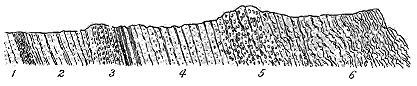
Fig. 58.—Section of the strata on the shore at Porth Wen, west of Amlwch.
There can be no doubt regarding the serious amount of crushing which
the rocks of this coast-line have undergone. Some of the bands might even
be described as "crush-conglomerates." Yet the intercalation of seams of
black shale and limestone, and the occurrence of the exactly similar but
thicker group of black shales at Porth Prydd, which are admitted to be
Lower Silurian, unite the whole series of strata as parts of one formation.
It thus appears that the area coloured "altered Cambrian" on the
Survey map, and regarded as pre-Cambrian by some later observers, is
proved by the evidence of fossils at its base, towards its centre and at its
top, to belong to the Lower Silurian series, probably to the Bala division.
That this was the geological horizon of part at least of the area was
recognized by Sir A. Ramsay, though he confessed himself unable "precisely
to determine on the north coast of Anglesey how much of the strata are of
Silurian and how much of Cambrian age."[232] Professor Hughes was the first
to suggest that the whole of these rocks should be referred to the Bala
group.[233]
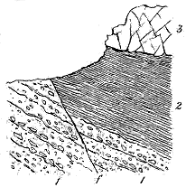
Fig. 59.—Section of intercalated black shale
in the volcanic series at Porth yr hwch, south of Carmel Point.
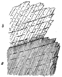
Fig. 60.—Green slates overlain with volcanic
breccia, Carmel Point, Anglesey.
I have dwelt on the determination of the true geological age of the rocks
of the north of Anglesey because of the diversity of opinion respecting
them, and because of their great interest in regard to the history of
volcanic action in Wales. These rocks contain a record of volcanic
eruptions, probably contemporaneous on the whole with those of the Bala
period in Caernarvonshire, yet independent
of them and belonging to a different type
of volcanic energy. Some of the vents
probably lay in the north-western part of
Anglesey. The materials ejected from
them were, so far as we know, entirely of
a fragmentary kind. Vast quantities of
detritus, largely in the form of fine dust,
were thrown out; but no trace has yet
been found of the outflow of any lava.
The lower part of this volcanic series consists
of bedded breccias which are sometimes
remarkably coarse. Their included
stones, ranging up to six inches or more
in diameter, are usually more or less
angular, and consist mainly of various felsites.
Layers of more rounded pebbles occasionally occur, while the bedding
is still further indicated by finer and coarser bands, and even by intercalations
of fine tuffs and ashy shales. Towards their upper limits some of
these volcanic bands shade off into pale
grey or greenish ashy shale, followed by
black sandy shale of the usual kind. The
relation of the peculiar greenish shale of
the Amlwch type to these tuffs and
breccias is well shown east of Carmel
Point. This shale is interleaved with
tuff and contains frequent repetitions of
finer or coarser volcanic breccia, as well
as occasional seams of black shale. An
illustration of this structure is given in
Fig. 59, where some yellow decomposing
breccias (1), cut by a fault (f), are overlain
by about 40 or 50 feet of black shale
(2), above which lies a flinty felsitic rock
(3) that appears to run in bands or dykes
through the agglomerate. At Carmel
Point (Fig. 60) a similar structure
may be observed to that at Llyn Padarn
already referred to (p. 163). The cleavage, which is well developed in the
green slates (a), is much more faintly marked in the overlying breccia (b),
but the bedding can still be detected in both rocks running parallel to
their mutual boundary-line. Beyond Porth Padrig, which lies east from
Carmel Point, the section may be seen which is shown in Fig. 61. Here
the blue or lead-coloured shale or slate (a) marked as Silurian on the
Geological Survey map passes up into a mass of fine yellowish felsitic tuff
and breccia (b). The shale at the junction intercalates in thin leaves with
the tuff.
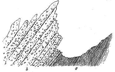
Fig. 61.—Blue shale or slate passing into volcanic breccia east of Porth Padrig, near Carmel
Point, Anglesey.
The breccias south of Carmel Point, though they are chiefly made up
of felsitic detritus, sometimes show a preponderance of fragments of shale.
They vary also rapidly in texture and composition. These variations may
indicate that the vent or vents from which their materials were derived
stood somewhere in the near neighbourhood, if indeed they are not to be
recognized in some of the boss-like eminences that rise above the shore.
At the same time, the enormous amount of crushing and shearing which
the rocks of this region have undergone has doubtless introduced crush-conglomerates
into the structure of the ground. And some patient labour
may be required before the nature and origin of the different fragmental
masses are determined.
Certain remarkably coarse, tumultuous breccias, exposed on the coast at
Mynyddwylfa and Cemmaes, were formerly regarded by me as volcanic
agglomerates. But more recent examination has satisfied me that these,
like the breccias at Llangefni, are not of volcanic origin but are crush-conglomerates.[234]
While the lower breccias are sometimes tolerably coarse, the volcanic
detritus becomes much finer in the higher parts of the Amlwch slates. Above
the limestones and black shales of Cemmaes volcanic breccias and ashes,
with limestone, quartzite, conglomerate and thin seams of black shale, continue
to the extreme northern headlands. The amount of fine volcanic
detritus distributed through these strata is very great. We can clearly make
out that while ordinary sedimentation was in progress, an almost constant
but variable discharge of fragmental materials took place from the vents in
the neighbourhood. Sometimes a special paroxysm of explosion would give
rise to a distinct band of breccia or of tuff, but even where, during a time
of comparative quiescence, the ordinary sand or mud predominated, it was
generally mingled with more or less volcanic dust.
Some bands of conglomerate in this group of strata deserve particular
notice. The most conspicuous of these, already referred to as seen at Porth
Wen, is made up of quartz and quartzite blocks, embedded in a reddish matrix
largely composed of ashy material, and recalling the red spotted tuffs of Llyn
Padarn. The occurrence of strong conglomerates near the top of a volcanic
series has been noted at St. David's, Llyn Padarn and Bangor. In none of
these localities, as I have tried to show, do the conglomerates mark an
unconformability or serious break between two widely-separated groups of
rock. The Anglesey section entirely supports this view, for the conglomerates
are there merely intercalations in a continuous sequence of deposits; they
are succeeded by tuffs and shales like those which underlie them. The
interposition of such coarse materials, however, may undoubtedly indicate
local disturbance, connected, perhaps, in this and the other localities,
with terrestrial readjustments consequent upon the waning of volcanic
energy.
The detailed geological structure of Anglesey is still far from being completely
understood. Besides the serious crushing here referred to, there is
reason to suspect that considerable plication, perhaps even inversion, of the
strata has taken place, and that, by denudation, detached portions of some
of the higher groups have been left in different parts of the island. The
occurrence of Upper Silurian fossils in several localities adds to the perplexity
of the problem by indicating that, among the folds and hardly distinguishable
from the older slates, portions of Upper Silurian formations
may have been caught and preserved. These difficulties, moreover, involve
in some obscurity the closing phases of volcanic activity in Wales; for until
they are, to some extent at least, removed, we shall be left in doubt whether
the vents in the north of Anglesey, which were in eruption probably during
Bala time, were the last of the long succession of Welsh volcanoes. If the
black shales of Parys Mountain are really referable to the horizon of the
Mayhill Sandstone, the two great igneous bands between which they lie would
seem to mark an outbreak of volcanic energy during Upper Silurian time.
No other indications, however, of eruptions of that age having been met
with in Great Britain (though they occur in the south-west of Ireland and
possibly in Gloucestershire), more careful investigation is required before
such a position can be safely assigned to any rocks in Anglesey.
Putting these doubtful rocks aside for the present, we may, in conclusion,
contrast the type of eruption in Anglesey with that of the great Snowdonian
region. While the Caernarvonshire volcanoes were pouring forth their
volumes of felsitic lava, and piling them up for thousands of feet on the
sea-floor, the northern Anglesey vents, not more than some five-and-twenty
miles away, threw out only stones and dust, but continued their intermittent
explosions until they had strewn the sea-bottom with detritus to a depth of
many hundred feet.
There is yet another feature of interest in this independent group of
submarine vents in Anglesey. Their operations appear to have begun
before the earliest eruptions of the Bala volcanoes in Caernarvonshire. Their
first beginnings may, indeed, have been coeval with the explosions that
produced the older Arenig tuffs of Merionethshire; their latest discharges
were possibly the last manifestations of volcanic energy in Wales. They
seem thus to bridge over the vast interval from Tremadoc to Upper Bala,
possibly even to Upper Silurian time. But we may, perhaps, connect them
with the still earlier period of Cambrian volcanism. I have referred to the
evidence which appears to show that the vents whence the lavas and tuffs of
Moel Trefan and Llyn Padarn were erupted gradually moved northwards, and
continued in eruption until after the beginning of the deposition of the black
slates that are generally regarded as Arenig. The Anglesey tuffs and breccias
may thus be looked upon as evidence of a still further shifting of the active
orifices northward. In this view, while the Aran and Cader Idris volcanoes
broke out in Upper Cambrian and continued through Arenig time, and the
Snowdonian group was confined to Bala time, a line of vents opened to the
north-west in the Cambrian period before the epoch of the Llanberis slates,
and, dying out in the south, continued to manifest a minor degree of energy,
frequently discharging fragmental materials, but no lava, over the sea-bottom,
until, towards the close of the Bala period, possibly even in Upper
Silurian time, they finally became extinct.
From the time of the appearance of Sedgwick's classic letters to Wordsworth,
no volcanic area of Britain has probably been so well known in a
general sense to the ordinary travelling public as the district of the English
Lakes. Many geologists have since then visited the ground, and not a few
of them have published additions to our knowledge respecting what is now
known as the Borrowdale Volcanic Series. The most elaborate and detailed
account of any part of it is that given by the late Mr. J. C. Ward in the
Geological Survey Memoirs, wherein he embodied the results of his minute
investigation and mapping of the northern portion of the district.[235] Notices
of the petrography of some of the more interesting rocks have subsequently
been published by Mr. Rutley, Professor Bonney, Mr. Harker, Mr. Marr,
Mr. Hutchings and others. But up to the present time no complete
memoir on the volcanic geology of the Lake District as a whole has
appeared. The sheets of the Geological Survey map present a graphic
view of the general distribution of the rocks, but so rapid has the progress
of certain branches of geology been since these sheets were published, that
the map is even now susceptible of considerable improvement.
In estimating the area over which the volcanic rocks of the Lake
District are spread, geologists are apt to consider only the tract which lies
to the south of Keswick and stretches southward to a line drawn from the
Duddon Sands to Shap. But it can easily be shown that this area falls
far short of the extent of that wherein the rocks can still be traced, and
yet further short of that over which the lavas and ashes originally spread.
For, in the first place, the volcanic group can be followed round the eastern
end of the mountain-group which culminates in Skiddaw, and along the
northern base of these heights to Cockermouth, though only a narrow fringe
of it emerges from underneath the Carboniferous series. It is thus manifest
that the volcanic rocks once stretched completely across Skiddaw and its
neighbours, and that they extend northwards below the Whitehaven Coal-field.
But, in the next place, far beyond these limits, volcanic rocks, which
there can be little doubt were originally continuous with those of the Lakes,
emerge from beneath the base of the Cross Fell escarpment,[236] and still further
to the east a prolongation of the same group rises for a brief space to the
surface from under the great limestone sheets of Upper Teesdale. Between
the north-western and south-eastern limits within which the rocks can now
be seen there intervenes a distance of some 11 miles, while the extreme
length of the tract from south-west to north-east is about 50 miles. Even
if we take these figures as marking the approximate boundaries of the
region covered by the volcanic ejections, it cannot be less than 550 square
miles. But this is probably much less than the original area.
The thickness of the accumulated volcanic materials is proportionate to
the large tract of country over which they have been spread. From
various causes, it is difficult to arrive satisfactorily at any precise statement
on this question. In a volcanic series bedding is apt to be obscure where,
as in the present case, there are no interstratified bands of ordinary sedimentary
strata to mark it off. It tends, moreover, to vary considerably and
rapidly within short distances, not only from subsequent unequal movements
of subsidence or elevation, but from the very conditions of original
accumulation. Mr. Ward considered that the maximum thickness of the
volcanic group of the Lake District might be taken to range from 12,000
to 15,000 feet.[237] Professors Harkness and Nicholson, on the other hand,
gave the average thickness as not more than 5000 feet.[238] My own impression
is that the truth is to be found somewhere between these two estimates,
and that the maximum thickness probably does not exceed 8000 or 9000 feet.
In any case there cannot, I think, be much doubt that we have here the
thickest accumulation of volcanic material, belonging to a single geological
period, anywhere known to exist in Britain.
The geological age of this remarkable volcanic episode is fortunately
fixed by definite palæontological horizons both below and above. The base
of the volcanic group rests upon and is interstratified with the upper part
of the Skiddaw Slate,[239] which from the evidence of its fossils is paralleled with
the Arenig rocks of Wales. The highest members of the group are interstratified
with the Coniston Limestone, which, from its abundant fauna, can
without hesitation be placed on the same platform as the Bala Limestone of
Wales, and is immediately followed by the Upper Silurian series. Thus
the volcanic history comprises the geological interval that elapsed between
the later part of the Arenig period and the close of the Bala period. It
begins probably not so far back as that of the Arenig group of Merionethshire,
and its termination was perhaps coincident with the dying out of the
Snowdonian volcanoes. But it contains no record of a great break or
interval of quiescence like that which separated the Arenig from the Bala
eruptions in Wales.
The materials that form this enormous volcanic pile consist entirely of
lavas and ashes. No intercalations of ordinary sedimentary material have
been met with in it, save at the bottom and at the top. The lower lavas,
well seen among the hills to the south of Keswick, were shown by Mr.
Ward to be intermediate between felsites and dolerites in regard to their
silica percentage, and he proposed for them the name of felsi-dolerites. They
are comprised in the group of the andesites or "porphyrites." From the
analyses published by Mr. Ward, the amount of silica appears to range up
to about 60 per cent.[240] They are usually close-grained, dull dark-grey to
black rocks, breaking, where fresh, with a splintery or conchoidal fracture,
showing a few minute striated felspars, apt to weather with a pale-brown or
yellowish-grey crust, and sometimes strongly vesicular or amygdaloidal.
They present many external resemblances to some of the "porphyrites" or
altered andesites of the Lower Old Red Sandstone of Scotland. A microscopic
examination of specimens collected by Dr. Hatch and myself from the
hills to the south of Keswick showed the rocks to be true andesites, composed
of a multitude of slender laths (sometimes large porphyritic crystals) of
felspar with a brownish glassy groundmass, and with some chloritic material
probably representing augite, but with no trace of quartz.[241]
Another type of andesite has been found by Mr. Hutchings to occur
abundantly at Harter Fell, Mardale, between the Nan Bield Pass and High
Street, and in the cliffs on the right side of the Kentmere Valley. It consists
of rocks mostly of a grey-green or grey-blue colour with resinous lustre
and extremely splintery fracture. They are augite-andesites of a much more
vitreous nature than the dominant type of lavas of the Lake District. Their
groundmass under the microscope is seen to have originally varied from a
wholly glassy base to an intimate mixture of glass and exceedingly minute
felspar-microlites. This groundmass is permeated with chlorite in minute
flakelets, and encloses numerous porphyritic sharply-defined felspar-crystals,
together with chlorite-pseudomorphs after augite.[242] Gradations from these
rocks to the ordinary more coarse-grained andesites may be observed.
Some of the andesites appear to have a trachytic facies, where the
felspars of the groundmass consist largely of untwinned laths and appear to
be mainly orthoclase.[243]
Among the lavas of the Lake District there occur many which are
decidedly more basic than the andesites, and which should rather be classed
among the dolerites and basalts, though they do not appear to contain olivine.
These rocks occur at Eycott Hill, above Easedale Tarn, Scarf Gap Pass, Dale
Head, High Scawdell, Seatoller Fell and other places. Analyses of those
from Eycott Hill were published by Mr. Ward, and their silica percentage
was shown to range from 51 to 53·3.[244] The microscopic characters of the
group have been more recently determined by Mr. Hutchings[245] and Messrs.
Harker and Marr.[246]
The andesitic and more basic lavas are particularly developed in the
lower and central part of the volcanic group. They rise into ranges of
craggy hills above the Skiddaw Slates, and form, with their accompanying
tuffs, the most rugged and lofty ground in the Lake District. They extend
even to the southern margin of the volcanic area at one locality to the south-west
of Coniston, where they may be seen with their characteristic vesicular
structure forming a succession of distinct flows or beds, striking at the
Coniston Limestone which lies upon them with a decided, though probably
very local, unconformability.[247] One of the flows from this locality was found
by Dr. Hatch, under the microscope, to belong to the more basic series. It
approaches a basalt, containing porphyritic crystals of fresh augite instead of
the usual felspars, and showing a groundmass of felspar microlites with some
granules of augite and dispersed magnetite. This local increase of basic
composition is interesting as occurring towards the top of the volcanic group.
A porphyritic and somewhat vesicular andesite, with large crystals of striated
felspar in a dark almost isotropic groundmass, occurs under the Coniston
Limestone near Stockdale.
Mr. Ward was much impressed with the widespread metamorphism which
he believed all the volcanic rocks of this region had undergone, and as a
consequence of which arose the difficulty he found in discriminating between
close-grained lavas and fine tuffs. There is, of course, a general induration
of the rocks, while cleavage has widely, and sometimes very seriously,
affected them. There is also local metamorphism round such bosses as the
Shap granite, but the evidence of any general and serious metamorphism
of the whole area does not seem to me to be convincing.[248]
With regard to the original structure and subsequent alteration of some
of the andesitic lavas, an interesting section has recently been cut along the
road up Borrowdale a little south of the Bowder Stone. Several bands of
coarse amygdaloidal lava may there be seen interstratified among tuffs. The
calcite amygdales in these rocks are arranged parallel to the bedding and
therefore in the planes of flow, while those lined with chlorite are more
usually deformed parallel to the direction of the cleavage. This difference
suggests that before the cleavage took place, not improbably during the
volcanic period, the rocks had been traversed by heated water producing
internal alteration and rearrangements, in virtue of which the vesicles along
certain paths of permeation were filled up with calcite, so as then to offer
some resistance to the cleavage, while those which remained empty, or which
had been merely lined with infiltrated substance, were flattened and pulled
out of shape. Messrs. Harker and Marr have shown that the amygdaloidal
kernels had already been introduced into the cellular lavas before the intrusion
of the Shap granite. In the account to be given of the Tertiary
plateau-basalts (Chapter xxxvi.) evidence will be adduced that this filling
up of the steam-cavities of lava may take place during a volcanic period,
and that it is probably connected with the passage of heated vapours or
water through the rocks.
Though acid lavas are not wholly absent from the central and lower
parts of the volcanic group, it is at the top that their chief development
appears to occur. These rocks may be grouped together as felsites or
rhyolites. They probably play a much larger part in the structure of the
southern part of the volcanic area than the published maps would suggest,
and a detailed survey and petrographical study of them would well reward
the needful labour.[249] A fine series of felsites is interbedded in the lower
part of the Coniston Limestone, and spreads out underneath it along the
southern margin of the volcanic district from the Shap granite south-westward
for some miles[250] (Fig. 62). Between the valleys of the Sprint and Kent
these felsites (which farther east are said to be 700 feet thick) may be seen
interposed between the limestone and the fossiliferous calcareous shales
below it, while from underneath the latter other sheets rise up into the range
of hills behind.
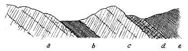
Fig. 62.—Section of felsites on the Coniston Limestone group, west of Stockdale.
a, Felsites more or less cleaved; b, Calcareous shales with fossils, much cleaved; c, Cleaved felsite;
d, Coniston Limestone; e, Stockdale Shales (with graptolites).
These acid lavas are generally grey, cream-coloured, or pink, with a
white weathered crust. Their texture when fresh is flinty or horny, or at
least extremely fine-grained and compact. They are seldom markedly
porphyritic. They frequently display good flow-structure, and sometimes
split up readily along the planes of flow. Occasionally the flow-lines on the
outer crust have broken up in the movement of the rock, giving rise to
irregular fragments which have been carried forward. Short, extremely
irregular, branching veins of a fine cherty felsitic substance, which occasionally
shows a well-marked flow-structure parallel to the walls, traverse
certain parts of a dark-grey felsite, near Brockstones, between the valleys of
the Kent and Sprint.[251] Occasionally a distinct nodular structure may be
observed in these acid lavas, sometimes minute, like an oolite, in other parts,
as on Great Yarlside, presenting large rounded balls. This nodular structure
is not confined to the lava-flows, but has been detected by Messrs. Harker
and Marr in what appears to be an intrusive rock near Shap Wells. The
microscopic characters of some of the Lake District rhyolites were described
by Mr. Rutley, who found them to exhibit beautiful perlitic and spherulitic
structures.[252] That such rocks as these were poured out in a vitreous condition,
like obsidian or pitchstone, cannot be doubted. Chemical analysis
shows that the Lake District rhyolites agree exactly with those of North
Wales in their composition. They contain about 76 per cent of silica.[253]
The rhyolitic lavas have been seriously affected by the general cleavage
of the region. In some places they have been so intensely cleaved as to
become a kind of fissile slate, and there seems good reason to believe that in
this altered condition they have often been mistaken for tuffs. Where they
assume a nodular structure, the nodules have sometimes been flattened and
elongated in the direction of the prevalent cleavage.
The abundance and persistence of thoroughly acid lavas along the
southern edge of the volcanic area where the youngest outflows are found,
is a fact of much interest and importance in the history of the eruptions of
this region. It harmonizes with the observations made in Wales, where in
the Arenig, and less distinctly in the Bala group, a marked increase in acidity
is noticeable in the later volcanic products. At the same time, as above
mentioned, there is evidence also of the discharge of more basic materials
towards the close of the eruptions, and even of the outflow of a lava
approaching in character to basalt.
According to the Geological Survey maps, by far the largest part of the
volcanic district consists of pyroclastic materials. When my lamented friend,
the late Mr. Ward, was engaged in mapping the northern part of the district,
which he did with so much enthusiasm, I had an opportunity of going over
some of the ground with him, and of learning from him his ideas as to the
nature and distribution of the rocks and the general structure of the region.
I remember the difficulty I had in recognizing as tuff much of what he had
mapped as such, and I felt that had I been myself required, without his
experience of the ground, to map the rocks, I should probably have greatly
enlarged the area coloured as lava, with a corresponding reduction of that
coloured as tuff. A recent visit to the district has revived these doubts. It
is quite true, as Mr. Ward maintains, that where the finer-grained tuffs have
undergone some degree of induration or metamorphism, they can hardly, by
any test in the field, be distinguished from compact lavas. He was himself
quite aware of the objections that might be made to his mapping,[254] but the
conclusions he reached had been deduced only after years of unremitting
study in the field and with the microscope, and in the light of experience
gained in other volcanic regions. Nevertheless I think that he has somewhat
exaggerated the amount of fragmental material in the northern part of
the Lake District, and that the mapping, so consistently and ably carried out
by him, and followed by those members of the Survey who mapped the rest
of the ground, led to similar over-representation there. Some portions of the
so-called tuffs of the Keswick region are undoubtedly andesites; other parts
in the southern tracts include intercalated bands of felsite as well as andesite.
But even with this limitation, the pyroclastic material in the Lake
District is undoubtedly very great in amount. It varies in texture from
coarse breccia or agglomerate, with blocks measuring several yards across,
to the most impalpable compacted volcanic dust. In the lower parts of the
group some of the tuffs abound in blocks and chips of Skiddaw Slate.
Some good examples of this kind may be seen in Borrowdale, below Falcon
Crag and at the Quayfoot quarries. Where the tuff is largely made up of
fragments of dark blue
slate, it much resembles
the slate-tuffs of Cader
Idris. Some of the pieces
of slate are six or eight
inches long and are now
placed parallel to the
cleavage of the rock.
Among the slate debris,
however, felspar crystals
and felsitic fragments
may be observed. Bands
of coarser and finer green tuff show very clearly the bedding in spite of
the marked cleavage (Fig. 63).
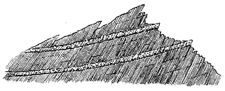
Fig. 63.—Fine tuff with coarser bands near Quayfoot quarries,
Borrowdale.
The highly-inclined fine lines show the cleavage. The more gently dipping
bands and lines mark the bedding.
But throughout the whole volcanic group the material of the tuff is
chiefly of thoroughly volcanic origin, and its distribution appears to agree on
the whole with that of the bedded lavas. In the older portions of the group
it is probably mainly derived from andesitic rocks, though with an occasional
intermingling of felsitic or rhyolitic detritus, while in the higher parts many
of the tuffs are markedly rhyolitic. Among the lapilli minute crystals of
felspar, broken or entire, may be detected with the microscope. Some
of the ejected ash must have been an exceedingly fine dust. Compacted
layers of such material form bands of green slates, which may occasionally
be seen to consist of alternations of coarser and finer detritus, now and then
false-bedded. Such tuffs bring vividly before the mind the intermittent
explosions, varying a little in intensity, by which so much of the fabric of
the Lake mountains was built up.
Breccias of varying coarseness are likewise abundant, composed of fragments
of andesite and older tuffs in the central and lower parts of the volcanic
group, and mainly of felsitic or rhyolitic detritus in the upper parts. Some
of these rocks, wherein the blocks measure several yards across, are probably
not far from the eruptive vents, as at Sourmilk Gill and below Honister
Pass. Generally the stones are angular, but occasionally more or less
rounded. Stratification can generally be detected among these fragmental
rocks, but it is apt to be concealed or effaced by the cleavage, while it is
further obscured by that widespread induration on which Mr. Ward has
laid so much stress. The extreme state of comminution of the volcanic
dust that went to form the tuffs has probably caused them to be more
liable to metamorphism than the lavas.[255]
Little has yet been done in identifying any of the vents from which
the vast mass of volcanic material in the Lake District was ejected. Mr.
Ward believed that the diabase boss forming the Castle Head of Keswick
marks the site of "one of the main volcanic centres of this particular district,"[256]
whence the great lava sheets to the southward flowed out. There
are obviously two groups of bosses on the northern side of the district, some
of which may possibly mark the position of vents. A few of them are
occupied by more basic, others by more acid rocks. It is not necessary
to suppose that the andesitic lavas ascended only from the former and the
felsites from the latter. While the felsites on the whole are younger than
the more basic lavas, they may have been erupted from vents which had
previously emitted andesites, so that the present plug may represent only
the later and more acid protrusions.
Besides the boss of Castle Head there are numerous smaller basic
intrusions farther down the Derwent Valley on either side of Bassenthwaite
Lake. Among these are the highly basic rocks forming the picrite on the
east side of the Dash Beck and the dykes on Bassenthwaite Common. All
these bosses, sills, and dykes rise through the Skiddaw Slates, but there is
no positive proof that they belong to the Lower Silurian volcanic series;
they may possibly be much later.
The most important and most interesting of all the intrusive masses
of basic material is that which constitutes a large part of the eminence
that culminates in Carrock Fell. The remarkable variations in the
composition of this mass have been already referred to. Mr. Harker has
shown that while the centre of the mass is a quartz-gabbro, it becomes
progressively more basic towards the margin. Through the gabbro a mass
of granophyre has subsequently made its way, and along the line of junction
has incorporated into its own substance so much of the basic rock as to
undergo a marked modification in its structure and composition. Whether
these intruded bodies of basic and acid material have ascended in one of
the old volcanic funnels and have been injected laterally in laccolitic fashion
has not been ascertained. Mr. Harker, indeed, is rather inclined to refer
the intrusions to a time not only later than the Borrowdale volcanoes, but
later even than the terrestrial movements that subsequently affected the
district and gave the rocks their present cleaved and faulted structures.
Besides the gabbro and granophyre of this locality, igneous activity has
manifested itself in the uprise of numerous later dykes and veins, intermediate
to basic in composition. Some of these are glassy (tachylyte) and
spherulitic or variolitic.[257]
Throughout the Lake District a considerable number of bosses of more
acid rocks rise through the Skiddaw Slates, and likewise through the volcanic
group even up to its highest members. Some of these bosses may possibly
indicate the site of volcanic vents. Two of them, which form conspicuous
features on either side of the Vale of St. John, consist of microgranite, and
rise like great plugs through the Skiddaw Slates, as well as through the
base of the volcanic group. The view of the more eastern hill, as seen
from the west, is at once suggestive of a "neck." These masses measure
roughly about a square mile each.
With the acid intrusions may possibly be associated some of the other
masses of granophyre, microgranite and granite (felsite, felstone, quartz-felsite,
syenitic granite, quartz-syenite, elvanite), which have long attracted
attention in this region. The largest of these intrusions is the tract of
granite which stretches from Eskdale down to near the sea-coast as a
belt about eleven miles long and from one to three miles broad. Another
large mass is the granophyre or "syenite" of Ennerdale. Numerous other
intrusions of smaller dimensions have been mapped.
To what extent any of these eruptive masses were associated with the
volcanic phenomena remains still to be worked out. There seems to be
little doubt that a number of them must belong to a much later period.
Mr. Harker has expressed his belief that the intrusion of some of these
igneous rocks was intimately associated with the post-Silurian terrestrial
movements of which cleavage is one of the memorials.[258] The Skiddaw
granite, though it does not touch any part of the volcanic group, but is confined
to the underlying Skiddaw Slates, was erupted after the cleavage of the
district, which affects the volcanic as well as the sedimentary series. In
other instances also, as in that of Carrock Fell, the intrusion seems to have
been later than the disturbances of the crust.[259] The amount of metamorphism
around some of the bosses of granite is considerable. That of
the Skiddaw region has been well described by J. C. Ward,[260] while that of
the volcanic group by the Shap granite has been carefully worked out by
Mr. Harker and Mr. Marr.[261]
The Shap granite comes through the very highest member of the
volcanic series, and even alters the Upper Silurian strata. It must thus be
of much younger date than the volcanic history of the Lake District. It
presents some features in common with the granite bosses of the south
of Scotland. Like these, it is later than Upper Silurian and older than
Lower Carboniferous or Upper Old Red Sandstone time. Its protrusion
may thus have been coeval with the great volcanic eruptions of the period
of the Lower Old Red Sandstone. It will accordingly be again referred to
in a later chapter.
It must be confessed that none of the large bosses of massive rocks,
whether diabases, gabbros, felsites, granophyres, or granites, appear to afford
any satisfactory proof of the position of the vents which supplied the lavas
and tuffs of the Lake District. Nor can such a decided accumulation of
the volcanic materials in certain directions be established as to indicate the
quarters where the centres of eruption should be sought. On the contrary,
the confused commingling of materials, and the comparative shortness of the
outcrop of the several sheets which have been traced, rather suggest that
if any one great central volcano existed, its site must lie outside of the
present volcanic district, or more probably, that many scattered vents threw
out their lavas and ashes over no very wide area, but near enough to each
other to allow their ejected materials to meet and mingle. The scene may
have been rather of the type of the Phlegræan fields than of Etna and
Vesuvius. If this surmise be true, we may expect yet to recognize little
necks scattered over the volcanic district and marking the positions of some
of these vanished cones.
What appears to have been one of these small vents stands near Grange
at the mouth of Borrowdale, where I came upon it in 1890. In the little
Comb Beck, the Skiddaw Slates are pierced by a mass of extremely coarse
agglomerate, forming a rudely-circular boss. The slates are greatly disturbed
along the edges of the boss, so much so, indeed, that it is in some places
difficult to draw a line between them and the material of the agglomerate.
That material is made up of angular blocks, varying in size up to three feet
long, stuck in every position and angle in an intensely-indurated matrix
formed apparently of comminuted debris like the stones. The blocks consist
of a finely-stratified shale, which is now hardened into a kind of hornstone,
with some felsitic fragments. I could see no slags or bombs of any
kind. There is no trace of cleavage among the blocks, nor is the matrix
itself sensibly cleaved. I believe this to be a small volcanic neck and not
a "crush-conglomerate." It has been blown through the Skiddaw Slates, and
is now filled up with the debris of these slates. Its formation seems to
have taken place before the cleavage of the strata, and its firm position and
great induration enabled it to resist the cleavage which has so powerfully
affected the slates and many members of the volcanic group.
It was the opinion of my predecessor, Sir Andrew Ramsay, and likewise
of Mr. Ward, that the Cumbrian volcanic action was mainly subærial.
This opinion was founded chiefly on the fact that, save at the bottom and
top of the series, there is no evidence of any interstratified sediment of non-volcanic
kind. The absence of such interstratification may undoubtedly
furnish a presumption in favour of this view, but, of course, it is by no
means a proof. Better evidence is furnished by the unconformability already
mentioned between the Coniston Limestone and the lavas on which it lies.
Besides angular pieces of lava, probably derived from direct volcanic explosion,
this limestone contains fragments of amygdaloidal andesite, and also
rolled crystals of striated felspar.[262] These ingredients seem to indicate that
some part of the volcanic group was above water when the Coniston Limestone
was deposited.
The absence of interstratifications of ordinary non-volcanic sediment in
the Borrowdale group might conceivably arise from the eruptions following
each other so continuously on the sea-floor, and at so great a distance from
land that no deposition of sand or mud from the outside could sensibly
affect the accumulation of volcanic material. Certainly some miles to the
east at the Cross Fell inlier, as already mentioned, there is evidence of the
alternation of tuffs with the sandy and muddy sediment of the sea-bottom.
Here, at the outer confines of the volcanic district, the ejected materials
evidently fell on the sea-floor, mingled there with ordinary sediment, and
enclosed the same organic remains. The well-defined stratification of many
of the fine tuffs is rather suggestive to my mind of subaqueous than of
subærial accumulation. At the same time, there seems no reason why,
here and there at least, the volcanic cones should not have risen above
the water, though their materials would be washed down and spread out by
the waves.
One of the most marked points of contrast between the Cumbrian and
the Welsh volcanic districts is to be found in the great paucity of sills in
the former region. A few sheets of diorite and diabase have been mapped,
especially in the lower parts of the volcanic group and in the underlying
Skiddaw Slates. On the other hand, dykes are in some parts of the district
not unfrequent, and certainly play a much more prominent part here than
they do in the Welsh volcanic districts. The majority of them consist of
felsites, quartz-porphyries, diorites, and mica-traps. But there is reason to
suspect that where they are crowded together near the granite, as around
Shap Fells, they ought to be connected with the uprise of the post-Silurian
granitic magma rather than with the history of the volcanic group.[263] If this
series of dykes be eliminated, there remain comparatively few that can with
any confidence be associated with the eruption of the Borrowdale rocks.
vii. UPPER SILURIAN (?) VOLCANOES OF GLOUCESTERSHIRE
A remarkable group of igneous materials has long been known to rise
among the Silurian rocks of the Tortworth district at the north end of the
Bristol coal-field. They were believed to be aqueous deposits in the Wernerian
sense by Weaver.[264] Murchison regarded them as intrusive sheets;[265] Phillips
looked on them as partly intrusive and partly interstratified.[266] They consist
largely of coarsely-amygdaloidal basalts, some of which have been microscopically
examined.[267] But their field-relations as well as their petrography
have not yet been adequately determined. They are represented on the
Geological Survey Map as forming a number of parallel bands in strata
classed as Upper Llandovery. If, as seems probable, some of them are
really interstratified, they form the youngest group of Silurian volcanic
rocks in England, Scotland, or Wales.
CHAPTER XIV THE SILURIAN VOLCANOES OF IRELAND — I. The Lower Silurian Series — i. Eruptions probably of Arenig Age — ii. Eruptions of Llandeilo and Bala Age — II. The Upper Silurian Series
Abundant as are the volcanic records of the Silurian period in England,
Wales and Scotland, the description of them would be incomplete without
an account of those of Ireland. The eruptions of Arenig, Llandeilo and
Bala time, which we have followed from the south of Caermarthenshire to
the borders of the Scottish Highlands, had their counterparts all down the
east of Ireland. The Irish register of them, however, supplies some details
which are less clearly preserved in the sister island. But the most distinctive
feature of the Silurian volcanic history in Ireland is the preservation
of memorials of eruptions during the Upper Silurian period. In no part
of Great Britain has any unquestionable trace been found of volcanic activity
during that part of the geological record, the last eruptions of which the age
is known being those of the Bala rocks. But in the south-west of Ireland
there is evidence that for a time active vents appeared over the sea-floor on
which the earlier deposits of Upper Silurian time were laid down.
It is in that part of Ireland which lies east of a line drawn from Strabane to
Dungarvan Harbour that the records of Lower Silurian volcanic activity are to
be found. In the north the development of volcanic rocks resembles that in
Scotland, in the south it corresponds rather with the volcanic districts of Wales.
The Irish Silurian volcanic rocks have been traced with more or less
detail on the maps of the Geological Survey. Since these maps were
published, however, great advances have been made in the study of the
petrography of volcanic rocks, as well as in the art of tracing their structure
upon maps. Much, therefore, now remains to be done to bring our knowledge
of the older volcanic history of Ireland abreast of that of the rest of
the British Isles. In the following summary I have had to rely mainly on
my own traverses of the ground, guided by the maps and memoirs of the
Survey, and with the personal assistance of some of my colleagues.
The remarkable zone of crushed cherts, igneous rocks and sandstones,
probably of Lower Silurian age, which I have referred to (p. 201) as wedged
in between the schists and the Old Red Sandstone along the southern margin
of the Highlands of Scotland, reappears in Ireland. It occupies an area in
the County Tyrone, about 24 miles long and about 9 miles broad at the
broadest part, but disappearing towards the north-east and south-west.[268]
Lying between the Palæozoic formations on the south and the schists on
the north, it occupies a similar position to the Scottish belt, but presents
a much broader area, and thus affords greater facilities for examining
the rocks. It presents the same indefinite or faulted boundaries as in
Scotland, so that its relations to the rocks along its flanks have not been
satisfactorily determined. That the rocks of this area are older than the
Silurian strata to the south of them seems to be established by the occurrence
of fragments of them in these strata, and that they are younger than
the schists may be inferred from their non-foliated character. But they
have undoubtedly undergone considerable crushing by powerful terrestrial
movements which have placed them in their present position.
The special feature of interest in this Irish area is the remarkable
development of volcanic materials which is there to be seen, spreading over
a far wider area than in Scotland. The rocks include lavas associated with
tuffs and agglomerates, likewise a varied series of intrusive masses.
The lavas are chiefly dull greenish, fine-grained rocks, having the general
character of diabases and "porphyrites." They are sometimes quite slaggy,
and where the amygdaloidal kernels remain, these are usually of calcite.
Under the microscope, the diabases show in some parts that their lath-shaped
felspars, and the augite which these penetrate, are tolerably fresh,
while in other parts fibrous chlorite, granular epidote and veins of calcite
bear witness to the metamorphism which they have undergone.
One of the most conspicuous features in some of these lavas is the
occurrence of the same sack-like or pillow-shaped structure which has been
already referred to as so marked among the Arenig lavas of Scotland.
Though the vesicles of these rocks are often quite uncrushed, showing that
there has been no general subsequent deformation of the whole mass, there
occur local tracts where evidence of considerable movement may be noticed.
Thus close to a mass of gneiss, and elsewhere along their margin, the lavas
are apt to be much jointed and broken with numerous lines of shear, along
which the crushed material assumes more or less of a schistose structure.
Yet in the solid cores between these bands of crushing the original forms of
the vesicles are retained.
These greenish lavas are occasionally interleaved with grey flinty mudstones,
cherts and red jaspers, which are more particularly developed immediately
above. In lithological character, and in their relation to the
diabases, these siliceous bands bear the closest resemblance to those of
Arenig age in Scotland. But no recognizable Radiolaria have yet been
detected in them.
Besides the more basic lavas, there occur also, but less abundantly, platy
felsitic rocks which have suffered much from shearing, and consequently
have acquired a fissile slaty structure.
The agglomerates are made up of angular, subangular and rounded
fragments imbedded in a matrix of similar composition. This matrix has
in places become quite schistose, and then closely resembles some parts of
the "green schists" of the Scottish Highlands. Of the inclosed stones
the great majority consist of various felsites, which, weathering with a thick
white opaque crust, are internally close-grained, dull-grey or even black, sometimes
showing flow-structure, and of all sizes up to eight inches in diameter
or more. There are also fragments of the basic lavas, and likewise pieces
of chert and jasper. On many of the rocky hummocks no distinct bedding
can be made out in the agglomerate, but in others the rock is tolerably well
stratified.
The tuffs are fine silky schistose rocks, and seem to have been largely
derived from basic lavas. They have suffered more than any of the other
rocks from mechanical deformation, for they pass into green chloritic schists.
Some portions of them are not unlike the slaty tuffs of Llyn Padarn in
Caernarvonshire.
Accompanying the fragmental volcanic rocks, some ordinary sedimentary
intercalations are to be found—red shales and pebbly quartzites, that
seem to have escaped much crushing. The true order of succession
in the volcanic series has not yet been determined. But apparently above
this series come some dark shales, such as might yield graptolites, pale grits
and occasional limestones.
Later than the lavas and the pyroclastic material are various intrusive
masses, which in bands and bosses form numerous craggy hills throughout
the area. So far as I have been able to observe, these rocks include two
groups. Of these the older consists of basic injections, such as gabbros
and allied rocks, some of which remind me of the so-called "hypersthene-rock"
of Lendalfoot, in Ayrshire. The coarser varieties, as at Carrickmore
or Termon rock, are sometimes traversed by fine-grained veins from an inch
to several feet in breadth. Portions of the slaggy diabases may be observed
inclosed in these intrusive masses. The younger group is of more acid
composition (granite, quartz-porphyry, etc.), and sends veins into the older.
Into the east of Ireland the Lower Silurian rocks are prolonged from
Scotland, from the Lake District and from Wales. Though greatly concealed
under younger formations across the breadth of the island, and occasionally
interrupted by what are regarded as older strata of Cambrian age, they
nevertheless occupy by much the larger part of the maritime counties
from Belfast Lough to the southern coast-line of Waterford, even as far as
Dungarvan Harbour. With the same lithological types of sedimentary
deposits as in other parts of the United Kingdom, they carry with them
here also their characteristic records of contemporaneous volcanic action.
Though nowhere piled into such magnificent mountain-masses as in Westmoreland
and North Wales, these records become increasingly abundant and
interesting as they are traced southwards, until they are abruptly terminated
by the coast-line along the south of the counties of Wexford and Waterford.
While much remains to be done, both in the field and in the laboratory
and microscope-room, before our acquaintance with the Irish Silurian volcanic
rocks is as complete as our knowledge of their equivalents in other portions of
the United Kingdom, a serious preliminary difficulty must be recognized in the
fact that the several geological horizons of these rocks have only been approximately
fixed. Great difficulty was experienced by the Geological Survey
in drawing any satisfactory line between the Llandeilo and Bala formations.
This arose not so much from deficiency of fossil evidence as from the way
in which the fossils of each group seemed to occur in alternating bands
in what were regarded as a continuous series of strata. Indeed, in some
localities it almost appeared as if the occurrence of one or other facies of
fossils depended mainly on lithological characters indicative of original
conditions of deposit, for the Llandeilo forms recurred where black shales
set in, while Bala forms made their reappearance where calcareous and
gritty strata predominated.[269] More recent work among the Silurian formations
in England and Scotland, however, indicates that the parallel repetition
of the two types of fossils is due to rapid and constant plication of the
rocks, whereby the two formations, neither of them, perhaps, of great thickness,
have been folded with each other in such a way that without the
evidence of an established sequence of fossils, or the aid of continuous
sections, it becomes extremely difficult to make out the stratigraphical order
in any district. When the ground is attacked anew in detail, with the
assistance of such palæontological and lithological horizons as have permitted
the complicated structure of the southern uplands of Scotland to be
unravelled, we may be enabled to tabulate the successive phases of the
volcanic history of the region in a way which is for the present impossible.
We have as yet no palæontological evidence that in the Silurian region of
the east of Ireland, which extends from Belfast Lough to the south coast of
County Waterford, any of the anticlinal folds bring up to the surface a
portion of the Lower Arenig formation, though possibly some of the lowest
visible strata may be of Upper Arenig age. A considerable part of the
region must be referred to the Llandovery and other Upper Silurian
formations, but the precise limits of the two divisions of the Silurian
system have not yet been determined, except for the region north of Dublin,
which has recently been re-examined for the Geological Survey by Mr.
F. W. Egan and Mr. A. M'Henry.
These observers have ascertained that, as in Southern Scotland, by far
the larger part of the Silurian region of the north-east of Ireland is occupied
by strata belonging to the upper division of the system. The Lower Silurian
formations, including the Llandeilo and Bala groups, form a belt varying up
to six miles in breadth, which stretches from the coast of Down, between the
mouth of Belfast Lough and Copeland Island, in a south-westerly direction
to near the valley of the Shannon in County Longford. South of this belt
the Lower Silurian rocks rise to the surface only here and there on the
crests of anticlinal folds, and it is in these scattered "inliers" that the volcanic
and intrusive rocks are found. So far as the available evidence goes,
the volcanic history of this part of Ireland is entirely to be assigned to
Lower Silurian time, and more especially to the interval between the beginning
of the Llandeilo and the close of the Bala period. I must for the
present content myself with this general limit of geological chronology, and
make no attempt to trace the relative antiquity of the igneous rocks in the
several districts in which they are distributed.[270]
Viewing the volcanic region of Eastern Ireland as a whole, we are first
struck by the feebleness of the manifestations of eruptivity in the north, and
their increasing development as we advance southwards. At the northern
end of the Silurian area in County Down, thin bands of "felstone" and
"ash" have been mapped by the Geological Survey as interstratified with
the highly inclined and plicated Silurian rocks.[271] As the latter are plainly
a continuation of the strata which have been mapped out zone by zone in
the south of Scotland, their igneous intercalations may be looked upon as
probably equivalents of some of those in the Silurian districts of Wigtonshire
and Kirkcudbrightshire. But in County Down no representative has
yet been detected of the Arenig and Llandeilo volcanic series of the southern
uplands of Scotland. Nor has more precise petrographical examination confirmed
the reference of any of the igneous rocks in the Silurian area of that
district to truly contemporaneously intercalated volcanic rocks. All the
eruptive material appears to be of an intrusive character. It occurs in the
form of dykes of lamprophyre or mica-trap belonging to the groups of minettes
and kersantites. Nothing definite is known of the age of these intrusions:
they are possibly referable to the time of the Lower Old Red Sandstone.[272]
Far in the interior several bands of "felspathic ash" and "massive
agglomerate" are shown on the Survey map as running through the counties
of Monaghan and Cavan.[273] In one locality south of the Drumcalpin Loughs
a large exposure of this ash is visible: "brown crumbly beds, with small
rounded pebbles, give place to a massive bed of agglomerate, the enclosed
blocks of which are always of one species of felstone, sometimes measuring
10 × 12 × 18 inches, and not always rounded." South of Carrickatee Lough,
and a few miles farther to the south-west, near Lackan Bridge, considerable
exposures of these rocks occur. One crag in particular displays a thickness
of more than 70 feet of "tough flaky breccias," "thick agglomerates with
small and large blocks of felstone," and "thin beds of fine pale green compact
grit without pebbles, and a few flags." "One of the flaky beds contains
numerous white worn crystals of felspar"; "the imbedded blocks of felstone
are of the usual kind—pale compact matrix showing dark oblong patches,
vesicular and amygdaloidal, the cavities being filled with chlorite."
Further south a more extensive area of igneous rocks has been mapped
on the borders of Louth and Meath, where, according to the Geological
Survey map, a group of lavas and tuffs extends for about twelve miles near
Slane.[274] Other bands of "ash" and "felstone" have been mapped in the
Silurian area south of Drogheda. Thus at Hilltown, west from the racecourse,
a "bluish crystalline felstone, showing in places lines of viscous
flow," is stated to be overlain by "indurated felspathic ash and tuff, felstone,
and indurated shale" in alternating beds.[275] On a recent visit to this locality
I found that the "porcellanite or indurated shale" is a greenish-grey chert,
full of Radiolaria and finely-diffused volcanic dust. This association of
radiolarian chert with contemporaneous volcanic activity is of much interest,
as showing the extension of the same physical conditions of the Lower
Silurian sea from Scotland into Ireland. The Lower Llandeilo age of the
volcanic intercalations in County Meath is further indicated by the occurrence
of Didymograptus Murchisoni in grey shales in the same neighbourhood
with the radiolarian cherts. In the Lower Silurian district of
Balbriggan numerous intrusive bosses and sills have been mapped by the
Geological Survey. I have found, however, that among these rocks there
occur bands of volcanic breccia, containing abundant angular fragments of a
minutely-vesicular pumice, and also that some of the diabase-masses display
the pillow-structure and amygdaloidal texture. Hence, though most of the
igneous rocks are no doubt intrusive, they appear to include lavas and tuffs
of Bala age.
When the numerous Silurian cores of the mountain-groups in the
interior of Ireland shall have been searched for traces of contemporaneous
volcanic action, it is not improbable that these will be found. One of the
smaller Silurian inliers which diversify the great Carboniferous plain, that
of the Chair of Kildare, has long been known to have igneous rocks associated
with its abundantly fossiliferous Bala limestone.[276] On recently visiting
this locality I found that, besides the amygdaloidal and porphyritic
andesites and basalts described by Jukes and Du Noyer, the fossiliferous
conglomerates contain pebbles of rocks like those of the Chair, together
with worn crystals of felspar, while intercalated with them are thin courses
of volcanic tuff. There is thus evidence here of contemporaneous volcanic
activity during the accumulation of the Bala group of strata. The limited
area over which the rocks are exposed, however, affords merely a glimpse
of this volcanic centre.
Crossing over the broad belt of Carboniferous Limestone through which
the Liffey flows into Dublin Bay, we come to the great continuous tract of
older Palæozoic rocks which stretches southward to the cliffs of Waterford.
Through this tract runs the huge ridge of the Wicklow and Carlow granite.
On the west side of this intrusive mass, bands of "greenstone-ash," as well
as "felspathic ashes," have been traced among the Silurian rocks by the
Geological Survey. But it is on the south-east side of the granite that the
volcanic intercalations are best displayed. Indeed, from Wicklow Head to
Dungarvan Harbour there is an almost continuous development of igneous
rocks, rising into rocky eminences, trenched into ravines by the numerous
streams, and laid bare by the waves in fine coast-cliffs. It is in this south-eastern
region, comprising the counties of Wicklow, Wexford and Waterford,
that the Irish Lower Silurian igneous rocks can best be studied.
There are obviously various distinct centres of eruption in this long belt
of country. The Rathdrum and Castletimon tract forms one of these.
Another of less size culminates in Kilpatrick Hill, a few miles to the
southward. Arklow Head marks the position of a third. The lavas and
tuffs which set in a few miles to the south of that promontory, and may
be said to extend without interruption to the south coast, were probably
thrown out by a series of vents which, placed along a north-east and south-west
line, united their ejections into one long submarine volcanic bank.
There can be no doubt that the most active vents lay at the southern end
of the belt, for there the volcanic materials are piled up in thickest mass,
and succeed each other with comparatively trifling intercalations of ordinary
sedimentary material. Some of these vents, as I shall relate in the sequel,
have been cut open by the sea along a range of precipitous cliffs.
The comparatively feeble character of the volcanic energy during Lower
Silurian time over the greater part of the south-east of Ireland is shown by
the great contrast between the thickness of the volcanic intercalations there
and in Wales and the Lake country, but still more strikingly by innumerable
sections where thin interstratifications of fine tuff or volcanic breccia occur
among the ordinary sedimentary strata, and are sometimes crowded with
Bala fossils. Some interesting illustrations of this feature are to be seen in
the Enniscorthy district, where layers of fine felsitic tuff, sometimes less than
an inch in thickness, lie among the shales. In some of the tuffs the lapilli
are fragments of trachytic or andesitic rocks.
A striking example of rapid alternations of pyroclastic material with
ordinary sediment lies far to the south in County Waterford, close to Dunhill
Bridge, where a group of fine volcanic breccias and grits has been
laid bare by quarrying.[277] These strata consist of coarser and finer
detritus, enclosing angular fragments of felsites and grey and black shale.
The felsite-lapilli vary in texture, some of them presenting beautiful flow-structure.
The stones are stuck at random through each bed, the largest
being often at the bottom. The beds of breccia vary from a few inches to
a foot or more in thickness. There can, I think, be little doubt that each
of these breccia-bands points to a single volcanic explosion, whereby felsitic
fragments were thrown out, mingled with pieces of the Silurian strata through
which the vents were drilled. In a vertical thickness of some fifty feet of
rock there must thus be a record of ten or twelve such explosions.
Nearer the active vents the fragmental deposits become, as usual, coarser
and thicker. But I have not observed any thick masses of tuff like those
of North Wales. So far as my examination has gone, the tuffs are mainly
felsitic. The so-called "greenstone-ash" of the Survey maps is certainly in
many cases not a true tuff. This term was proposed by Jukes for certain
apple-green to olive-brown flaky fissile rocks only found "in association with
masses of greenstone."[278] Some years ago I had occasion to make a series of
traverses in Wicklow and Wexford, and then convinced myself that in that
part of the country the "greenstone-ashes" were probably crushed bands of
basic sills. Dr. Hatch has proved this to be their origin from a series
of microscopic slides prepared from specimens collected by himself on the
ground.[279] In other cases the "greenstone-ashes" seem to be excessively-cleaved
or sheared felsites, which have acquired a soapy feel and a dull green
colour; but they also do include true tuffs. Thus, in one instance, at Ballyvoyle
cross-roads, in the south of County Waterford, a "greenstone-ash"
is a dull green tuff full of fragments of felspar (chiefly plagioclase) and
pieces of dark andesitic lavas. Another example may be found to the west
of the Metal Man, near Tramore, where the tuff is full of fragments of
felspar and shale cemented in a greenish-yellow material which may be
palagonite.
The felsites of the south-east of Ireland form by much the largest
proportion of the whole volcanic series. They occur as lenticular sheets
from a few feet to several hundred feet in thickness, and occasionally
traceable for some miles. On the whole, they are compact dull grey rocks,
weathering with a white crust. A geologist familiar with the contemporary
lavas of North Wales cannot fail to be struck with the absence of the coarse
flow-structure so often characteristic of the felsites in that region. This
structure, indeed, is not entirely absent from the Irish rocks, but it occurs,
so far, at least, as I have seen, rather as a fine streakiness than in the bold
lenticular bands so common in Caernarvonshire. In like manner the nodular
structure, though not entirely absent, is rare.[280]
Until these felsites have been subjected to more detailed investigation,
little can be said as to their petrography, and as to the points of resemblance
or difference between them and those of other Lower Silurian districts in
the United Kingdom. An important step, however, in this direction was
taken by Dr. Hatch, who studied them on the ground, in the laboratory,
and with the microscope. He found that some of them were soda-felsites
or keratophyres (with albite as their felspar), that others were potash-felsites
(with orthoclase as their felspar), while a third group contained both soda
and potash, the last-named greatly preponderating.[281] The existence of soda-felsites
had not been previously detected among British volcanic rocks, and
it remains to be seen how far they may occur in the large and somewhat
varied group of rocks combined under the general term "felsites." Dr.
Hatch believed that these rocks probably graduate into the normal or
orthoclase felsites; but it has not yet been possible to test this view on
the ground, nor to ascertain whether there is any essential difference between
the mode of occurrence of the two types.
Besides the more abundant felsites, occasional bands of andesite have
been detected. Various other eruptive rocks occur, probably in most or
all cases intrusive. Such are quartz-mica-diorites, quartz-diorites, augite-diorites
or proterobases, dolerites, gabbros, diabases and epidiorites.[282]
I have said that the chief theatre of eruption lay towards the south-west
end of the volcanic belt of the south-east of Ireland. The coast-line of
County Waterford, from Tramore westward to Ballyvoyle Head—a distance
of nearly fifteen miles—presents, perhaps, the most wonderful series of sections
of volcanic vents within the British Islands. No one coming from the
inland is prepared for either the striking character of the cliff scenery or
the extraordinary geological structure there presented, for the country is,
on the whole, rather featureless, and much of it is smoothed over and
obscured by a covering of drift, through which occasional knobs of the
harder felsites protrude. The cliffs for mile after mile range from 100
to 150 or 200 feet in height, and present naked vertical walls of rock,
trenched by occasional gullies, through which a descent may be made to
the beach. Throughout the whole distance agglomerates and felsites succeed
each other in bewildering confusion, varied here and there by the intercalation
of Lower Silurian shales and limestones involved and pierced by the
igneous rocks. Hardly any bedded volcanic material is to be recognized from
one end to the other. The sea has laid bare a succession of volcanic vents
placed so close to each other that it will be difficult or impossible to separate
them out. A careful study and detailed mapping of this marvellous coast-section,
however, is a task well worthy of the labour of any one desirous
of making himself acquainted with some of the conditions of volcanism
during older Palæozoic time.
At the east end of the section, black shales containing Llandeilo
graptolites, and calcareous bands full of Bala fossils, dip westward below a
group of soda-felsites and felsitic tuffs, which seem to lie quite conformably
on these strata. Here, then, we start with proof that the volcanic eruptions
of this locality began during some part of the Bala period. But immediately
to the west, these bedded igneous rocks are broken through by a neck
of coarse agglomerate stuck full of chips and blocks of shale, some of them
a foot long, with abundant fragments of scoriform and flinty felsites. Some
columnar dykes of dolerite cut through the neck, and a larger intrusion
seems to have risen up the same funnel. The bedded tuffs appear again for
a short distance, but they are soon replaced by a tumultuous mass of
agglomerate. And from this part of the coast onwards for some distance
all is disorder.
The agglomerates are crowded with blocks of various felsites and micro-granites
sometimes 18 inches in diameter, many of them presenting the
most exquisite streaky flow-structure. The angularity of these stones and
the abrupt truncation of their lines of flow prove that they were derived
from the shattering of already consolidated rocks. In other places the
ejected materials consist almost wholly of black shale fragments, but with
an intermixture of felsite-lapilli.
It is difficult to convey an adequate idea of the way in which the
agglomerates are traversed by dykes, veins and bosses of various felsites,
and of how these break in endless confusion through each other. Some
of the intrusive rocks are compact and amorphous, others are vesicular,
others close-grained and columnar. Again and again they present the
most perfect flow-structure, and it is noticeable that the lines of flow follow
the inequalities of the walls of the fissure up which the rock has ascended,
and not only so, but even of the surfaces of detached blocks of shale or
felsite which have been caught up and enclosed in the still moving
mass.
A few of these intrusive rocks were examined in thin slices by Dr.
Hatch. Most of them appear to be soda-felsites, but they include also
rather decomposed rocks, some of which are probably diorites and quartz-diorites.
Occasionally, thoroughly basic dykes (dolerite) may be observed.
In the midst of this tumultuous assemblage of volcanic masses, representing
the roots of a group of ancient vents, there occur occasional
interspaces occupied by ordinary stratified rocks. In the eastern part of
the section these consist mainly of black shale, sometimes with calcareous
bands, from which a series of Bala fossils has been obtained.[283] A very
cursory examination suffices to show that these intercalations do not mark
pauses in the volcanic eruptions. They are, in fact, portions of the marine
accumulations under the sea-floor through which the vents were blown;
they have been tossed about, crushed and invaded by dykes and veins of
felsite.
But certain other intercalated strips of stratified rocks present a special
interest, for they bring before us examples of volcanic ashes that gathered
on the sea-floor, but which were disrupted by later explosions. Thus, at the
Knockmahon headland, well-bedded felspathic grits and ashy shales occur,
thrown in among the general mass of eruptive material. As I have already
remarked, it is difficult or impossible to fix the horizons of the stratified
patches that are involved among the igneous ejections of this coast-section,
save where they contain recognizable fossils, but the intercalation of true
bedded tuffs among them is a proof that volcanic action had been in
operation there long before the outbreak of the vents which are now laid
bare along the cliffs.
In the south-east of Ireland there is the usual association of acid and
basic sills with the evidence of a superficial outpouring of lavas and ashes.
But these intrusive masses play a much less imposing part than in Wales.
They may be regarded, indeed, as bearing somewhat the same proportion to
the comparatively feeble display of extrusive rocks in this region that the
abundant and massive sheets of Merionethshire and Caernarvonshire do to
the enormous piles of lavas and tuffs which overlie them.
Among the acid intrusive sheets the most conspicuous are those mapped
by the Survey as "elvans." These rocks, as they occur in Wicklow and
Wexford, have been examined by Dr. Hatch, who finds them to be micro-granitic
in structure, occasionally exhibiting micropegmatitic or granophyric
modifications.[284] The true stratigraphical relations of these rocks have not
yet been adequately investigated. Those of them which occur on the flanks
of the great granite ridge are not improbably connected with that mass, and
if so are much younger than the Lower Silurian volcanoes.[285]
The basic sills, or "greenstones," consist largely of diabase, frequently
altered into epidiorite; they include also varieties of diorite.[286] That they
were intruded before the plication and cleavage of the rocks among which
they lie is well shown by their crushed and sheared margins where they are
in thick mass, and by their cleaved and almost schistose condition where
they are thinner. The intense compression and crushing to which they
have been subjected are well shown by the state of their component
minerals, and notably by the paramorphism of the original augite into
hornblende.
The scarcity of dykes associated with Silurian volcanic action is as
noticeable in the south-east of Ireland as it is in Wales. I have observed
a considerable number, indeed, but they are confined to the line of old vents
on the Waterford coast, and, but for the clear cliff-sections cut by the
sea, they would certainly have escaped observation, for they make no
feature on the ground in the interior. They are sometimes distinctly
columnar, and vary from less than a foot to many yards in width. They
traverse both the agglomerates and the intrusive felsites. Most of them are
of felsite, sometimes cellular; but in some cases they are dolerites. There
is obviously no clue to the dates of these dykes.
That some at least of the vents along the south coast of County
Waterford may be vastly younger than the Lower Silurian rocks through
which they have forced their way is suggested, if not proved, by a section
which is in some respects the most extraordinary of the whole of this
remarkable series. The occurrence of a group of red strata was carefully
noted by the late Mr. Du Noyer at Ballydouane Bay, when he was engaged
in carrying on the Geological Survey of that part of the country. At first
he regarded them as belonging to the Old Red Sandstone, which comes on
in great force only a few miles to the west; but he subsequently arrived at
the belief that they are really an integral part of the Lower Silurian rocks
of the district. Professor Jukes had previously expressed himself in favour
of this latter idea, which was thought to receive support from the occurrence
of some reddish strata in the Lower Silurian rocks of Tagoat, County
Wexford.[287]
The occurrence of red rocks among Silurian strata, which are not
usually red, might quite reasonably be looked for in the neighbourhood of
Old Red Sandstone, Permian or Triassic deposits. If these deposits once
spread over the Silurian formations, a more or less decided "raddling" of
the latter may have taken place. But in the present instance, though the
Old Red Sandstone begins not many miles to the west, no such explanation
of the colour of the strata is possible. The cliffs of Ballydouane Bay
consist of red sandstone, red sandy shale and conglomerate. The red tint
is of that dull chocolate tone so characteristic of the Lower Old Red Sandstone.
The conglomerates are immense accumulations of ancient shingle,
consisting largely of pieces of white vein-quartz and quartzite, sometimes a
foot long and often well water-worn. Some of the sandy beds are full of
large scales of white mica, as if derived from some granitic or schistose
region at no great distance. Taken as a whole, the strata are much less
indurated and broken than the Silurian grits and shales of the district;
some of them, indeed, weather into mere incoherent sand that crumbles
under the fingers. There does not appear to be any positive proof that the
red rocks are truly bedded with the ordinary Silurian strata, the junctions
being faulted or obscured by intrusive igneous masses.
Nowhere in the British Islands, so far as I am aware, is there a similar
group of strata among the Lower Silurian rocks. If they belong to so
ancient a series, they show that in the south of Ireland, during Lower
Silurian time, there arose a set of peculiar physical conditions precisely like
those that determined the accumulation of the Old Red Sandstone in the
same region at a later geological period. And in that case it is hardly
possible to conceive that these conditions could have been confined to the
extreme south of Ireland. We should certainly expect to meet with
evidence of them elsewhere, at least in the same Silurian region.[288]
While I hesitate to express a decided opinion in opposition to the
conclusions of such experienced observers as Jukes and Du Noyer, I incline
to believe that the rocks in question really belong to the Old Red Sandstone.
If such shall finally be determined to be their geological position, they will
supply evidence that some at least of the volcanic vents of the coast-line
cannot be older than the Old Red Sandstone. They are pierced by masses
of soda-felsite and by a coarse red agglomerate containing abundant pieces
of felsite. These volcanic rocks belong to the same type as those which
break through the undoubted Silurian rocks on either side. They may
thus come to prove a recrudescence of volcanic energy in this same district
at a much later geological period; and a new problem will arise to task the
skill of the most accomplished field-geologist and petrographer—to unravel
the structure and history of this chain of volcanic vents, and, in so doing,
to detect and separate the eruptions of Lower Silurian time from those of
the Lower Old Red Sandstone.
In the far west of Ireland, another group of Lower Silurian volcanoes has
left its remains in the mountainous tract of country between the western
shores of Lough Mask and Killary Harbour.[289] There appear to have been at
least three separate centres of eruption along a line stretching in a north-easterly
direction for about 16 miles from the western end of Lough Nafooey
to the hamlet of Derrindaffdery beyond Tourmakeady, where the older rocks
are unconformably overlain by the lower Carboniferous strata. As shown
by the mapping of the Geological Survey, the most northerly area, which
may be called the Tourmakeady centre, has a breadth of about a mile, and
dies out southward after a course of nearly six miles. About a mile to the
south-west of the last visible prolongation of its rocks, we encounter a second
volcanic centre which occupies an area of about a square mile in the valley
of Glensaul. The third centre stretches from the western shores of Lough
Mask across Lough Nafooey, where it forms a mass of high rugged ground,
and reaches a length of some six or seven miles before it finally dies out.[290]
The rocks in each of these three areas are similar. One of their distinguishing
features is the intercalation among them of a fossiliferous limestone
and calcareous fossiliferous tuffs, which contain well-preserved species
of organisms characteristic of the Bala division of the Lower Silurian rocks.[291]
There cannot be any question that these organisms were living at the time
the strata in which their remains occur are found. The most delicate
parts of the sculpture on Illænus Bowmanni and Orthis elegantula are well
preserved. Nor have the limestones been pushed into their present places
by volcanic agency, or by faults in the terrestrial crust. They are not only
regularly intercalated among the volcanic rocks, but the limestone in some
places abounds in volcanic dust, while above it come calcareous tuffs, also containing
the same fossils. It is thus clearly established that the volcanic
series now to be described has its geological age definitely fixed as that of
the Bala period.
The lavas of the Lough Mask region consist of felsites and andesites
with rocks of probably more basic composition. The felsites are generally
quartziferous porphyries, which occupy a considerable space in each of the
three districts. To what extent they are intrusive rather than interstratified
remains for investigation. Some of them have undoubtedly invaded
other members of the volcanic series. But, on the other hand, fragments
of similar quartz-porphyries and felsites abound in the intercalated bands of
volcanic breccia.
The andesites and more basic lavas are finely-crystalline or compact, dull-green
to chocolate-purple rocks, often resembling the "porphyrites" of the
Old Red Sandstone. Some of them are strongly vesicular, the cavities being
filled with calcite on fresh fracture, though empty on weathered surfaces.
The sack-like or pillow structure, already referred to as characteristic of many
Lower Silurian lavas, appears conspicuously among some of these rocks. At
Bohaun, nine miles south from Westport, where a prolongation of the volcanic
series rises to the surface from under the overlying coarse conglomerates, I
observed that, owing to the compression which the rocks have there
undergone, the pillow-shaped blocks have been squeezed together into rudely
polygonal forms, while their vesicles have been greatly drawn out in the
direction of tension. Where the rocks have been still more sheared, the
distinct pillow-shaped blocks with their vesicular structure disappear, while
the more fine-grained crusts that surround them have been broken up and
appear as fragments involved in a matrix of green schist.
Intercalated with the lavas are numerous bands of volcanic breccia and
fine tuff. The stones in these breccias consist chiefly of various felsites with
andesites and more basic lavas. But pieces of jasper, chert, shale and grit
are not infrequent. In some places abundant blocks of black shale are to be
noticed, probably derived from the Llandeilo group which exists below, and
which has here and there been ridged up to the surface in the midst of the
volcanic rocks.[292] Near Shangort I noticed in one of these breccias one block
measuring 12 feet, another 20 feet in length and 3 or 4 feet thick, composed
of alternating bands of grit and slate. It is interesting to note that these
strata had already undergone cleavage before disruption, the bands of slate
being strongly cleaved obliquely to the bedding. None of the Llandeilo or
other rocks in the neighbourhood display this structure. The blocks seem
to have been derived from some deeper group of strata. They are laid
down parallel with the rude bedding of the breccia in which they lie.
The fine tuffs and thin ashy limestones associated with the thicker
band of limestone show the renewal of volcanic explosions after the interval
marked by the calcareous deposit which is sometimes 20 or 40 feet thick.
In many places this limestone is brecciated and much mingled with volcanic
dust and lapilli. At Shangort, for example, the thick tolerably pure
limestone is truncated on the west and north sides by a coarse agglomerate
probably filling a volcanic vent. A few hundred yards further north,
beyond the interrupting agglomerate, the limestone reappears on the same
line of strike, but is then found to be nodular and brecciated and much
mingled with volcanic detritus. It lies among ashy grits and tuffs.

Fig. 64.—Diagram of the general relations of the different groups of rock in the Lower Silurian volcanic
district along the western shore of Lough Mask.
a, Llandeilo shales, cherts and grits; b, Volcanic breccias; c, Felsites and andesites; d, Tuffs and ashy grits and
shales; e, Limestone with Bala fossils; f, Calcareous tuffs and thin bands of ashy limestone with fossils; g,
Coarse conglomerate and grits; h, Wenlock strata resting unconformably on the Bala rocks and passing southwards
from these to overlie an older series of schists; *, Fault.
The general structure of the ground occupied by the Lough Mask volcanic
rocks is diagrammatically represented in Fig. 64. The thickness of the
volcanic series must amount to many hundred feet, but it has not been
precisely determined. The uppermost parts of the series pass under a great
thickness of coarse conglomerates and pebbly grits which form the ridge
of Formnamore, and stretch thence westwards along Killary Harbour and
through the Mweelrea mountains. These strata are classed as the Upper
Silurian on the Geological Survey map. Since, however, they conformably
overlie rocks containing Bala fossils, and in the Killary district include
green shales which have yielded fossils of the same age, they doubtless
belong in large part to the Lower Silurian division. The remarkable
coarseness of these conglomerates towards the south, and their rapid
passage into much finer grits and shales towards the north, probably
indicate that they were formed close to the shores of a land composed of
schistose rocks, quartzite and granite, of which the mountainous tracts of
Connemara are the last relics.
A base to the volcanic series is found in the occasional uprise of a short
axis of Llandeilo, or perhaps even upper Arenig strata, containing bands of
dark chert and black graptolitic shales. Unfortunately the relations of these
underlying rocks to the volcanic masses are not very clear, being obscured
by superficial accumulations and also by faulting. It is thus hardly
possible to be certain whether they pass up conformably into the base of the
volcanic series, or are covered by it unconformably.
The position of this isolated volcanic district in the far west of Ireland,
the abundance, variety and thickness of the erupted materials, and the definite
intercalation of these materials in the Bala or highest division of the Lower
Silurian series, acquire a special interest from the history of the nearest
Silurian volcanic area which has now to be described—that of the western
shores of the Dingle promontory.
The latest volcanic eruptions of Silurian time yet definitely known took
place during the accumulation of the Wenlock and Ludlow rocks in the far
west of Ireland. No satisfactory record of any contemporaneous phenomena
of a like kind has yet been met with in any other Upper Silurian district
in the British Isles, unless at Tortworth in Gloucestershire, as above
described. So far as at present known, only one centre of activity has
been preserved. It lies among the headlands of Kerry, where the land
projects furthest west into the stormy Atlantic. The occurrence of volcanic
rocks in this remote area and their geological horizon have been clearly
indicated on the maps of the Geological Survey. More than thirty years,
however, have elapsed since some of the mapping was done, and we must
therefore be prepared to find it, more especially in its petrography, capable
of modification and improvement now.
In the country known as the Dingle promontory, these traces of contemporaneous
volcanic rocks are to be observed at various localities and
on several horizons. To the east, near Anascaul, on the northern shore
of Dingle Bay, some tuffs occur in what are believed to be Llandovery
strata. But it is on the western coast, among the headlands and coves
that lie to the north and south of Clogher Head, that the best sections
are to be seen. The succession of the rocks in this locality was well
worked out by Du Noyer, and the Memoir prepared by him, with the
general introduction by Jukes, is an invaluable guide to the geologist who
would explore this somewhat inaccessible region.[293] The most important
correction that will require to be made in the work arises from a mistake as
to the true nature of certain rocks which were described as pisolitic tuffs,
but which are nodular felsites.
By far the most striking geological feature of this singularly interesting
and impressive coast-line is to be found in the interstratification of lavas
with bands of tuff among abundantly fossiliferous strata which, from their
organic contents, are unmistakably of the age of the Wenlock group. These
lavas occur in a number of sheets, separated from each other by tuffs and
other fragmental deposits. They thus point to a series of eruptions over
a sea-bottom that teemed with Upper Silurian life. They consist for the
most part of remarkably fine typical nodular felsites. The nodules vary in
dimensions from less than a pea to the size of a hen's egg. They are sometimes
hollow and lined with quartz-crystals. They vary greatly in number,
some parts being almost free from them and others entirely made up of
them. The matrix, where a fresh fracture can be obtained, is horny in
texture, and often exhibits an exceedingly beautiful and fine flow-structure.
On weathered faces there may be seen thick parallel strips and lenticles of
flow-structure like those of the Snowdon lavas. The upper portions of some
of the sheets enclose fragments of foreign rocks. The microscopic examination
of a few slices cut from these lavas shows them to be true felsites
(rhyolites) composed of a microcrystalline aggregate of quartz and felspar,
with layers and patches of cryptocrystalline matter, and only occasional
porphyritic crystals of orthoclase and plagioclase.
The pyroclastic rocks associated with these lavas vary from exceedingly
fine tuff to coarse agglomerate. Some of the finer tuffs contain pumiceous
fragments and pieces of grey and red shale; they pass into fine ashy sandstones
and shales, crowded with fossils, and into gravelly breccias made up
of fragments of different volcanic rocks.
But the most extraordinary of these intercalated fragmental strata is
a breccia or agglomerate, about 15 feet thick, which lies in a thick group of
fossiliferous dull-yellow, ashy and ochreous sandstones. The stones of this
bed consist chiefly of blocks of different felsites, varying up to three feet in
length. Some of them show most perfect flow-structure; others are spongy
and cellular, like lumps of pumice. The calcareous sandstone on the top of
the breccia is crowded with fossils chiefly in the form of empty casts, and
the same material, still full of brachiopods, crinoids, corals, etc., fills up the
interstices among the blocks down to the bottom of the breccia, where
similar fossiliferous strata underlie it.
Nowhere has the volcanic history of a portion of Palæozoic time been
more clearly and eloquently recorded than in this remote line of cliffs swept
by the gales of the Atlantic. We see that the ordinary sedimentation
of Upper Silurian time was quietly proceeding, fine mud and sand being
deposited, and enclosing the remains of the marine organisms that swarmed
over the sea-bottom when volcanic eruptions began. First came discharges
of fine dust and small stones, which sometimes fell so lightly as not seriously
to disturb the fauna on the sea-floor, but at other times followed so rapidly
and continuously as to mask the usual sediment and form sheets of tuff and
volcanic gravel. Occasionally there would come more paroxysmal explosions,
whereby large blocks of lava were hurled forth until they gathered in a
thick layer over the bottom. But the life that teemed in the sea, though
temporarily destroyed or driven out, soon returned. Corals, crinoids and
shells found their way back again, and fine sediment carried their remains
with it and filled up the crevices. The ejected volcanic blocks are thus
enclosed in a highly fossiliferous matrix.
A succession of lava-streams, of which the strongly-nodular sheet of
Clogher Head is the thickest and most conspicuous, mark the culmination
of the volcanic energy, and show how at this late part of the Silurian period
felsites that reproduce some of the most striking peculiarities of earlier time
were once more poured out at the surface. A few more discharges of tuff
and the outflow of a greenish flinty felsite brought this series of eruptions
to an end, and closed in Britain the long and varied record of older Palæozoic
volcanic activity.[294]
MAP OF THE SILURIAN VOLCANIC DISTRICTS OF NORTH WALES
Reduced from the Maps of the Geological Survey.
TO ACCOMPANY SIR ARCHIBALD GEIKIE'S "ANCIENT VOLCANOES OF BRITAIN"
Map II
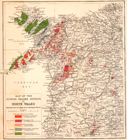 The Edinburgh Geographical Institute
Copyright
J. G. Bartholomew.
Click on map to view larger sized.
CHAPTER XV THE DEVONIAN VOLCANOES
Throughout the whole region of the British Isles, wherever the uppermost
strata of the Silurian system can be seen to graduate into any later series of
sedimentary deposits, they are found to pass up conformably into an
enormous accumulation of red sandstones, marls, cornstones, and conglomerates,
which have long been grouped together under the name of
"Old Red Sandstone." In England and Wales, in Scotland and in Ireland,
this upward succession is so well shown that at first British geologists
were naturally disposed to believe it to represent the normal order of the
geological record. When, however, Sedgwick and Murchison demonstrated
that in the counties of Devon and Cornwall a very different group of strata
contained an abundant assemblage of organic remains, including types which
Lonsdale showed to be intermediate between those of the Silurian and the
Carboniferous systems; when, moreover, this palæontological facies of the
south-west of England, termed by its discoverers "Devonian," was found to
be abundantly developed on the Continent, and to be there indeed the
prevalent stratigraphical type of the formations intervening between Silurian
and Carboniferous, geologists began to perceive that the Old Red Sandstone
must be regarded as the record of peculiar local conditions of sedimentation,
while the Devonian type was evidently the more usual development of the
same geological period.
From the remote Shetland Isles, across the whole of Scotland and
England, down to the northern shores of the Bristol Channel, the Old Red
Sandstone maintains its general characters. Nowhere, indeed, are these
characters more typically developed than in South Wales, where many
thousands of feet of red sediments, almost entirely devoid of organic
remains, emerge from under the escarpments of Carboniferous Limestone,
and stretch into broad uplands until they are lost at the top of the Silurian
system.
But when the geologist crosses the Bristol Channel to the opposite
shores of North Devon, he encounters a remarkably different assemblage of
rocks. It is true that he has not yet been able to detect there any equivalents
of the uppermost Silurian strata of Glamorganshire, nor does he find any
conspicuous band of Carboniferous Limestone, such as that which encircles
the Welsh Coal-field. He is thus unable to start from a known definite
horizon in the attempt to work out the order of succession, either in an
upward or downward direction. Lithological characters likewise afford him
no means of establishing any satisfactory parallelism. As he follows the
Devonian strata, however, he finds them to disappear conformably under the
Culm-measures, which, though strangely unlike the Carboniferous strata on
the opposite coast, are yet proved by their fossils to belong to the Carboniferous
system. Hence the Devonian type, like the Old Red Sandstone, is
proved to be immediately anterior to, and to graduate into, the Carboniferous
rocks.
There is no stratigraphical change in Britain so rapid and complete as
that from the Old Red Sandstone on the one side of the Bristol Channel to
the Devonian series on the other. No satisfactory explanation has yet been
found for this sudden transformation, which still remains one of the
unsolved problems in British geology.
As the observer follows the Devonian assemblage across the land to the
southern coast-line, he is conscious that its general characters, both lithological
and palæontological, depart more and more from the type of the Old
Red Sandstone, and approach more closely to the common Devonian facies of
the Continent. He is forced to admit that the Old Red Sandstone, notwithstanding
its extensive development in Britain, must be regarded as an
exceptional type of sedimentation, while the Devonian facies represents
that which is most widely prevalent, not only in Europe, but generally
over the world.
The broad estuary of the Bristol Channel unfortunately conceals from
view the tract which lies between the typical Old Red Sandstone of
Glamorganshire and the typical Devonian formations of Devonshire.
Whether this intervening space of some fifteen miles was occupied by
a physical barrier, which separated the respective areas of deposit of
these two types, or the circumstances of sedimentation in the one region
merged insensibly into those of the other, must remain matter for
speculation.
The geographical conditions betokened by the Old Red Sandstone will
be considered in the next chapter. There can be no doubt that those
indicated by the Devonian system were marine. The organic remains so
plentifully distributed through the argillaceous and arenaceous sediments of
that system, and so crowded together in its limestones, were obviously
denizens of the open sea. Yet the only tract of Britain over which this
sea can be shown to have spread was the south of England. To the north
of that belt, the site of Britain during Devonian time appears to have been
partly land and partly wide water-basins in which the Old Red Sandstone
was deposited.
In that half terrestrial half lacustrine territory that stretched northwards
to beyond the Shetland Isles, many volcanoes were active, of which
the chronicles will be described in later pages. The most southerly of
these centres of eruption yet known was the district of the Cheviot Hills.
Throughout the rest of England and Wales no trace of any contemporary
volcanic action has been detected in the Old Red Sandstone. It is true
that over most of that region rocks of this age have been concealed under
younger formations. Yet throughout Wales, where the Old Red Sandstone
attains so vast a thickness, and covers so wide an area, it has not yet
yielded a vestige of any contemporaneous volcanic eruptions.
But over the sea-floor that covered the south of England, and stretched
thence into the heart of Europe, abundant volcanoes have left behind them
proofs of their activity. The first geologist who recognized these proofs
and traced their extent on the ground appears to have been De la Beche,
who, by his detailed maps and careful description of the igneous rocks of
Devonshire, did so much to advance the study of ancient volcanic action.
This great pioneer not only determined the former existence of Devonian
volcanoes, but he was likewise the first to detect and map the volcanic rocks
associated with the Carboniferous and "New Red Sandstone" formations of
the same region. The broad outlines traced by him among the volcanic
products of these three geological periods in the south-west of England
still remain but little changed. Nor are they likely to be much improved
until the ground is resurveyed on a larger and more accurate map, and
with better petrographical equipment than were available in his day.
Not long after the observations of De la Beche came those of A. C.
Godwin-Austen, who devoted much time to a sedulous exploration of the
rocks of South Devon, and satisfied himself that contemporaneous volcanic
sheets were intercalated among the limestones of that district. "The coral
limestones," he says, "are in many places superincumbent on great sheets of
volcanic materials, with which, in some instances, as at North Whilborough,
they alternate." He pointed out that the interstratified volcanic rocks are
of two periods, one Devonian and the other Carboniferous.[295]
In his Geological Maps of Devon and Cornwall, which are to the present
time those issued by the Geological Survey, De la Beche made no attempt
to discriminate between the varieties of igneous rocks, save that the basic
"greenstones" were distinguished from the acid bosses of granite and the
elvans. But in his classic "Report" much more detail was inserted, showing
that he clearly recognized the existence both of volcanic ashes and of lavas,
as well as of intrusive sheets. At the outset of his account of the "Grauwacke,"
he remarks that the sedimentary deposits are accompanied with
igneous products, "a portion of which may also be termed sedimentary,
inasmuch as it would seem to have been deposited in beds among contemporaneous
rocks of the former description by the agency of water, after
having been ejected from fissures or craters in the shape of ashes and
cinders, precisely as we may now expect would happen with the ashes and
cinders ejected from volcanoes, particularly insular and littoral volcanoes,
into the sea."[296] Again he speaks of "two kinds of trappean rocks having
probably been erupted, one in the state of igneous fusion, and the other in
that of ash, during the time that the mud, now forming slates, was deposited,
the mixtures of volcanic and sedimentary materials being irregular from the
irregular action of the respective causes which produced them; so that though
the one may have been derived from igneous action, and the other from
the ordinary abrasion of pre-existing solid rocks, they were geologically contemporaneous."[297]
He recognized the origin of the amygdaloidal varieties of
rock, and by dissolving out the calcite from their cells showed how close
was their resemblance to modern pumice.[298]
Since these early researches many geologists have studied the igneous
rocks of Devonshire. I would especially refer to the labours of Mr.
Allport,[299] the late J. A. Phillips,[300] Mr. Rutley,[301] the late Mr. Champernowne,[302]
Mr. W. A. E. Ussher,[303] Mr. Hobson,[304] and General M'Mahon.[305] Mr.
Champernowne in particular has shown the abundance of volcanic material
among the rocks of Devonshire, and the resemblance which in this respect
they offer to the Devonian system of North Germany.
Unfortunately the geological structure of the Palæozoic rocks of the
South-west of England has been complicated to an amazing extent by
plication and fracture, with concomitant cleavage and metamorphism.
Hence it is a task of extreme difficulty to trace out with any certainty
definite stratigraphical horizons, and to determine the range of contemporaneous
volcanic action. Mr. Ussher has shown with what success this
task may be accomplished when it is pursued on a basis of minute mapping,
combined with a sedulous collection and determination of fossils.[306] But
years must necessarily elapse before such detailed work is carried over the
whole Devonian region, and probably not till then will the story of the
volcanic history of the rocks be adequately made out.
In the meantime, it has been established that while there is a singular
absence of igneous rocks in North Devon, a strip of country extending from
Newton Abbot and Torquay westwards by Plymouth across Cornwall to
Penzance contains abundant records of volcanic action. It has not yet
been possible to map out, among what were formerly all grouped together
as "greenstones," the respective limits of the bedded lavas and the tuffs, to
distinguish the true sills, and to fix on the position of the chief vents of
eruption. So intense have been the compression and shearing of the rocks
that solid sheets of diabase have been crushed into fissile schists, which can
hardly be distinguished from tuffs. Moreover, owing perhaps in large
measure to the mantle of red Permian (or Triassic) strata, which has been
stripped off by denudation from large tracts of this region once overspread
by it, the Devonian rocks have been deeply "raddled," or stained red. But
probably one of the main sources of difficulty in studying the petrography
of the area is to be found in the results of atmospheric weathering. Devonshire
lies in that southern non-glaciated strip of England, where the rocks
have been undergoing continuous decay since long before the Ice Age.
No ploughshare of ice has there swept off the deep weathered crust, so as to
leave hard surfaces of rock, fresh and bare, under a protecting sheet of
boulder-clay. It is seldom that a really fresh piece of any igneous rock
can be procured among the lanes and shallow pits of Devon, where alone,
for the most part, the materials are exposed.
Much, therefore, remains to be done, both in the stratigraphy and
petrography of the Devonian volcanic rocks of this country. To the late
J. A. Phillips geology is indebted for the first detailed chemical and
microscopical investigation of these rocks. He clearly showed the truly
volcanic origin of many of the so-called "greenstones." He believed that
certain "slaty blue elvans," which he found to have a composition
identical with that of altered dolerites, might be highly metamorphosed
tuffs, and that others might have been originally sheets of volcanic mud.
After studying the chemical composition and minute structure of a large
collection of "greenstones," he demonstrated that in all essential particulars
they were dolerites, though somewhat altered from their original character.[307]
Subsequently they were studied by Dr. Hatch, who found the fresher
specimens generally to possess an ophitic structure, while some are granular,
others porphyritic.[308]
Although the rocks have undergone so much crushing, solid cores of
them, showing the original structure, may be obtained, also examples of the
amygdaloidal, vesicular or slaggy character. They occur in sheets either
singly or in groups, and appear generally to be regularly interstratified in
the slates and grits. While some of these intercalations, especially the
amygdaloidal sheets, may be true superficial lavas, it can hardly be doubted
that others are sills, especially those which assume the crystalline structure
and composition of gabbros, and show an entire absence of the vesicular
structure. But no one has yet attempted to separate the two types from
each other.
With these rocks are associated abundant diabase-tuffs (schalstein),
frequently mingled with ordinary non-volcanic detrital matter, and shading
off into the surrounding grits and slates. There is thus clear evidence of
the outpouring of basic lavas and showers of ashes during the Devonian
period in the south-west of England, under conditions analogous to those
which characterized the deposition of the Devonian system in Nassau and
the Harz.
The exact range of these eruptions in geological time has still to be
ascertained. So far as at present determined, volcanic activity was not
awakened during the accumulation of the Lower Devonian formations. It
was not until the sporadic coral-reefs and shell-banks had grown up, which
form the basement limestones of the Middle Devonian group, that the first
eruptions took place. As Godwin-Austen, Champernowne and Mr. Ussher
have shown, some of these reefs were overwhelmed with streams of lava or
buried under showers of ashes. The volcanic discharges, however, were
peculiarly local, probably from many scattered vents, and never on any
great scale. Some districts remained little or not at all affected by them,
so that the growth of limestone went on without interruption, or at
least with no serious break. In other areas again the place of the limestone
is taken by volcanic materials.
The chief epoch of this volcanic action, marked by the "Ashprington
Volcanic Series," appears to have occurred about midway in the Middle
Devonian period. But in certain districts it extended into Upper
Devonian time. Intrusive sills of diabase may mark the later phases of the
volcanic history. But the occurrence of such sills even in the Upper
Devonian rocks, and the alteration of the strata in contact with them
(spilosite), point to the continuance or renewal of subterranean disturbance
even in the later Devonian ages, if not in subsequent geological time.
That volcanic activity accompanied the deposition of the Carboniferous rocks
of Devonshire has long been well known (see Chapter xxix.).
CHAPTER XVI THE VOLCANOES OF THE OLD RED SANDSTONE
Geological Revolutions at the close of the Silurian Period—Physical Geography of the
Old Red Sandstone—Old Lake-basins, their Flora and Fauna—Abundance of
Volcanoes—History of Investigation in the Subject.
We now enter upon the consideration of the records of a notable era in the
geological evolution of north-western Europe. Up to the close of the
Silurian period the long history embodied in the rocks presents a constant
succession of slowly sinking sea-floors. Wide tracts of ocean stretched over
most of Europe, and across the shifting bottom, sand and mud, washed from
lands that have long vanished, spread in an ever-accumulating pile. Now
and then, some terrestrial movement of more than usual potency upraised
this monotonous sea-bed, but the old conditions of ceaseless waste continued,
and fresh sheets of detritus were thrown down upon the broken-up
heaps of older sediment. All through the vast cycles of time denoted by
these accumulations of strata, generations of sea-creatures came and went in
long procession, leaving their relics amidst the ooze of the bottom. Genera
and families, once abundant, gradually died out, and gave place to others, the
onward march of life being slow but uninterrupted. Of the land of the
time or of the plants and animals that lived on its surface, hardly anything
is known. The chronicles that have come down to us are almost wholly
records of the vicissitudes of the ocean-bed.
Over the centre and south of Europe, the marine conditions of Silurian
time were prolonged, as we have seen, into the next period, when the
Devonian formations were deposited. In that wide region, no marked break
has been traced between either the sedimentation or the animal life of the
Silurian and Devonian periods. But in the north-west of Europe a striking
departure took place from the protracted monotony of marine conditions.
By a series of terrestrial movements that affected the area lying to the
north of the line of the Bristol Channel, and extended not only to the
furthest limit of the British Isles, but probably as far as Norway, and
perhaps even into northern Russia, the previous widespread conditions of
marine sedimentation were entirely altered. Instead of the fine oceanic
silts and sands with their abundant organic remains, and the thick limestones
with their masses of coral and crowds of crinoids, there were now
laid down, over these northern regions, vast piles of deep red sediment, from
which traces of animal life are almost wholly absent. The shelving land
against which these ferruginous sands and gravels gathered can still in part
be recognized. As the observer follows its margin, notes the varying local
peculiarities of its sediment, and detects, sometimes in great abundance,
remains of the vegetation which clothed it, the conviction grows in his
mind that the remarkable contrast between these deposits, known as the
Old Red Sandstone, and those of the Silurian and Devonian systems is not
to be accounted for by any mere rearrangement of the sea-bottom, or redistribution
of the land that supplied that sea-bottom with sediment. It
has long been the general belief among geologists that the subterranean
movements which, over the greater part of Britain, brought the deposition
of the Upper Silurian formations to a close, led to a total alteration of the
geography of the region affected, that the sea-floor was elevated, and
that, over the upraised tract, large lakes or inland seas were eventually
formed, in which the peculiar sediments of the Old Red Sandstone were
accumulated.
The records of this series of geographical changes are too fragmentary
to enable us to follow, except in a very general way, the sequence of events
in the transformation of the Silurian sea into the peculiar topographical
conditions in which the Old Red Sandstone was laid down. While there
was a widespread elevation of the sea-floor, and of such ridges of insular
land as may have risen above sea-level, the upheaval appears to have been
of a somewhat complicated kind, and to have been combined with many
local subsidences. The area of disturbance was probably thrown into a
series of parallel ridges and troughs, the former continuing to be pushed
upward, while the latter tended to subside. The ridges thus became land
surfaces, and their prolonged elevation may have more or less compensated
for the denudation to which, on their emergence, they were necessarily
exposed. The troughs, on the other hand, which sank down, may in many
cases have subsided below the sea. But where the general upheaval of the
crust was most pronounced, some of the depressions would be isolated above
sea-level and become lake-basins in the terrestrial areas.
Of some of these water-basins the outlines can still in some measure be
defined. The rocks that rose into hills around them, and from which their
enormous accumulations of detritus were derived, still partially survive. We
can explore these piles of sediment, and from them can form some idea of the
condition of the water in the lakes, and the nature of the vegetation on
the surrounding land. The frequent occurrence and exceeding coarseness of
the conglomerates, which appear on many successive horizons throughout
the deposits of these basins, probably indicate contemporaneous terrestrial
disturbances. The same causes that led to the wrinkling of the crust into
parallel ridges and troughs no doubt still continued in operation. From
time to time the ridges, much worn down by prolonged denudation, were
pushed upward, either by gradual uprise or by more rapid jerks. The
troughs may in like manner have been still affected by their old tendency
to subsidence. Hence, in spite of the effects of degradation and deposition,
it is possible that the ridges may not, on the whole, have varied much in
height, nor the basins in depth, during the time when thousands of feet were
stripped off the land and strewn in detritus over the bottoms of the lakes.
Let us try to realize a little more definitely the general aspect of the
region in which the Old Red Sandstone water-basins lay. As the axes of the
folds into which the crust of the earth was thrown ran in a north-east and
south-west direction, they gave this trend to the lakes and to the tracts of
land that separated them. These intervening ridges must in some instances
have been hilly or even mountainous. Thus, the Scottish Highlands rose
between two of the lakes, and poured into them an abundant tribute of
gravel, sand and silt. The terrestrial vegetation of the time has been
partially preserved. The hills seem to have been clothed with conifers,
while the lower slopes and swamps were green with sigillariæ, lepidodendra
and calamites. One of the most characteristic plants was Psilophyton, of
which large matted sheets were drifted across the lakes and entombed in
the silt of the bottom. A grass-like vegetation, with long linear leaves,
seems to have grown thickly in some of the shallows of the lakes.
Of the land animals we have still less knowledge than of the vegetation.
Doubtless various forms of insect life flitted through the woodlands, though
no relics of their forms have yet been recovered. But the remains of
myriapods have been found in Forfarshire.[309] These early relics of the
animal life of the land inhabited the woodlands, like our modern gally-worms,
and were swept down into the lakes, together with large quantities
of vegetation.
Some of the lakes, especially in the earlier part of their history,
abounded in eurypterid crustacea. These animals inhabited the seas in
Upper Silurian time, and appear to have been isolated in the water-basins
of the Old Red Sandstone. Certain species of Pterygotus, a Silurian genus
found also in the Lower Old Red Sandstone, reached a length of six feet.
But the most abundant forms of animal life were fishes. These furnish
additional evidence in favour of the lacustrine nature of the waters in which
they lived. Such characteristically marine forms as the sharks and rays of
the Silurian seas were replaced by genera of Acanthodians, Ostracoderms,
Dipnoids, Teleostomes, Placoderms, and Palæoniscids, which abounded in
the more northerly waters. The distinctive outward characters of many
of these early vertebrates were their bony scales and plates. Some of them
had their heads encased in an armature of bone, of large size and massive
thickness. In several genera the bone was coated with a layer of glittering
enamel. Even now, after the vast lapse of time since their day, the
cuirasses and scale-armour of these fishes keep their bright sheen in the
hardened sand and mud from which they are disinterred.
A difference is observable between the faunas of the different water-basins.
Even where the same genus occurs in two adjacent areas, the
species are often distinct. Two large lakes, separated by the tract of the
Scottish Highlands, had each its own assemblage of fishes, not a single
genus being common to the two basins. Such contrasts, whether the two
lakes were geologically contemporaneous, or the northern arose later than
the southern, undoubtedly indicate long-continued isolation and the gradual
evolution of new forms under different conditions of environment.[310]
Such, in brief, were the aspects of the physical geography of the time on
the further consideration of which we are now to enter. The subterranean
disturbances, so characteristic of the period, were accompanied by a display
of volcanic activity more widespread, perhaps, than any which had yet taken
place in the geological history of Britain. Nevertheless, it is worthy of remark
that this manifestation of underground energy did not begin with the commencement
of these displacements of the crust. The earliest eruptions only
took place after the geography of the region had been completely changed;
at least no trace of them is to be found in the earliest portions of the Old
Red Sandstone. After the last lingering Silurian volcanoes in the west of
Ireland had died out, a protracted quiescence of the subterranean fires
ensued. In the latest ages of Silurian time there was not in Britain, so far
as at present known, a single volcanic eruption. Not until after the inauguration
of the Old Red Sandstone topography, when the lakes had
taken shape and had begun to be filled with sediment from the surrounding
hills, did a series of new volcanoes burst into activity over the northern
half of Britain. Rising in the midst of the lakes in groups of separate
cones, these vents poured out floods of lava, together with clouds of ashes
and stones. Their sites, the history of their eruptions, and the piles of
material ejected by them, can still be ascertained, and I shall now proceed
to give some account of them.
The thick mass of sedimentary material known as the Old Red Sandstone,
lying between the top of the Silurian and the base of the Carboniferous
system, has been divided into two sections, which, however, are of
unequal dimensions, and doubtless represent very unequal periods of time.
The older series, or Lower Old Red Sandstone, is by far the more important
and interesting in its extent, thickness, palæontological riches, and, what
specially concerns us in the present inquiry, in its volcanic records.
Wherever its true base can be seen, this series passes down conformably
into Upper Silurian strata. It sometimes reaches a thickness of 15,000
and even 20,000 feet. There is generally a marked break between its
highest visible strata and all younger formations. Even the upper
division of the Old Red Sandstone rests unconformably upon the
lower.[311] Such a hiatus undoubtedly points to a considerable lapse of
geological time, and to the advent of important geographical changes
that considerably modified the remarkable topography of the older part
of the period.
The younger division or Upper Old Red Sandstone passes upward conformably
into the base of the Carboniferous system. Its red and yellow
sandstones, conglomerates and breccias, covering much more restricted areas,
and attaining a much less thickness than those of the lower division,
indicate the diminution and gradual effacement of the lakes of the older
time, and the eventual return of the sea to the tracts from which it had
been so long excluded. So vast an interval elapsed between the time
recorded in the deposits respectively of the two sections of the Old Red
Sandstone that the characteristic forms of animal life in the earlier ages
had entirely passed away, and their places had been taken by other types
when the diminished lake-basins of the second period began to be filled up.
Volcanic action also dwindled to such a degree that in contrast to the
abundant vents of the older period, only one or two widely scattered groups
of vents are known to have existed in the area of the British Isles during
the later period, and these, after a feeble activity, gave way to a prolonged
volcanic quiescence, which lasted until the earlier ages of the succeeding or
Carboniferous period.
Although geologists are in the habit of grouping the Old Red Sandstone
and the Devonian rocks as equivalent or homotaxial formations, deposited in
distinct areas under considerably different conditions of sedimentation, the
attempt to follow out the sequence of strata in Devonshire, and to trace some
analogy between the Devonian succession and that of the Old Red Sandstone,
presents many difficulties for which no obvious solution suggests itself.
Into these problems it is not needful to enter further than was done in the
last chapter. We may assume that not improbably some of the eruptions
now to be described were coeval with those of Devonian time in the south-west
of England, though we may hesitate to decide which of them should be
brought into parallelism.
As we trace the shore-lines of the ancient basins of the Lower Old Red
Sandstone, and walk over the shingle of their beaches, or as we examine the
silt of their deeper gulfs, and exhume the remains of the plants that shaded
their borders, and of the fishes that swarmed in their waters, we gradually
learn that although the sediments which accumulated in some of these basins
amount to many thousand feet in thickness; yet from bottom to top they
abound in evidence of shallow-water conditions of deposit. The terrestrial
disturbances above referred to continued for a vast interval, and while, as
already suggested, the floors of the basins sank, and the intervening tracts
were ridged up, as the results of one great movement of the earth's crust,
the denudation of the surface of the land contributed to the basins such a
constant influx of sediment as, on the whole, compensated for the gradual
depression of their bottoms.
We need not suppose that these movements of subsidence and upheaval
were uninterrupted and uniform. Indeed, the abundant coarse conglomerates,
which play so prominent a part in the materials thrown into the basins,
suggest that at various intervals during the prolonged sedimentation
subterranean disturbances were specially vigorous. But the occurrence of
strong unconformabilities among the deposits of the basins sets this question
at rest, by proving that the terrestrial movements were so great as sometimes
to break up the floor of a lake, and to place its older sediments on
end, in which position they were covered up and deeply buried by the
succeeding deposits.[312]
It is not surprising to discover, among these evidences of great terrestrial
disturbance, that eventually groups of volcanoes rose in long lines from the
waters of most of the lakes, and threw out enormous quantities of lava and
ashes over tracts hundreds of square miles in extent. So vast, indeed, were
these discharges, across what is now the Midland Valley of Scotland, that the
portions of sheets of lava and tuff visible at the surface form some of the
most conspicuous ranges of hills in that district, stretching continuously for
40 or 50 miles and reaching heights of more than 2000 feet above the
sea. Exposed in hundreds of ravines and escarpments, and dissected by the
waves along both the eastern and western coasts of the country, these
volcanic records may be studied with a fulness of detail which cannot be
found among earlier Palæozoic formations.
It might have been supposed that a series of rocks so well displayed
and so full of interest, would long ere this have been fully examined and
described. But they can hardly be said to have yet received, as a whole,
the attention they deserve. Without enumerating all the writers who, each
in his own measure, have added to the sum of our knowledge of the subject,
I may refer to the labours of Jameson,[313] Macknight[314] and Fleming,[315] among
the observers who began the investigation. But of the early pioneers, by far
the most important in regard to the igneous rocks of the Old Red Sandstone
was Ami Boué. While attending the University of Edinburgh, where
he took the degree of M.D. in the year 1816, he imbibed from Jameson a
love of mineralogy and geognosy, and for several years spent his leisure time
in personally visiting many parts of Scotland, in order to study the geological
structure of the country. Probably in 1820 he published in French his
now classic Essai.[316] The value of this work as an original contribution
to the geology of the British Isles has probably never been adequately
acknowledged. For this want of due recognition the author himself was no
doubt in some measure to blame. He refers distinctly enough to various
previous writers, notably to Jameson and Macculloch, but he mingles the
results of his own personal examinations with theirs in such a way that
it is hardly possible to ascertain what portions are the outcome of his own
original observations. Less credit has accordingly been given to him than
he could fairly have claimed for solid additions to the subjects of which
he treated. In the later years of his life I had opportunities of learning
personally from him how extensive had been his early peregrinations in
Scotland, and how vivid were the recollections which, after the lapse of half
a century, he still retained of them. Judged simply as a well-ordered
summary of all the known facts regarding the geology of Scotland, his
Essai must be regarded as a work of very great value. Especially important
is his arrangement of the volcanic phenomena of the country, which stands
far in advance of anything of the kind previously attempted. Under the
head of the "Terrain Volcanique," he treats of the basaltic formations, distinguishing
them as sheets (nappes, coulées) and dykes; and of the felspathic
or trachytic formations, which he subdivides into phonolites, trachytes,
porphyries (forming mountains and also sheets) and felspathic or trachytic
dykes. In the details supplied under each of these sections he gives facts
and deductions which were obviously the result of his own independent
examination of the ground, and he likewise marshals the data accumulated
by Jameson, Macculloch and others, in such a way as to present a more
comprehensive and definite picture of the volcanic phenomena of Scotland
than any previous writer had ventured to give.
The account which Boué wrote of the Old Red Sandstone and its
associated igneous rocks marked the first great forward step in the investigation
of this section of the geological record. He was the earliest observer to
divide what he calls the "roches feldspathiques et trappéennes" into groups
according to their geological position and mineralogical character, and to
regard them as of igneous origin and of the age, or nearly of the age, of the
red sandstone of Central Scotland.
Of later writers who have treated of the volcanic rocks of the Old Red
Sandstone, my old friend Charles Maclaren deserves special recognition.
His survey and description of the Pentland Hills embodied the first detailed
and accurate investigation of any portion of these rocks, and his Geology
of Fife and the Lothians may still be read with pleasure and instruction.[317]
Boué had indicated roughly on the little sketch-map accompanying his
Essai the chief bands of his felspathic and trappean rocks of the Old
Red Sandstone, but their position and limits were more precisely defined in
Macculloch's "Geological Map of Scotland," which was published in 1840,
five years after the sudden and tragic death of its author. The observers
who have more recently studied these rocks have been chiefly members of
the Geological Survey, and to some of the more important results obtained
by them I shall refer in the sequel.
For many years I have devoted much time to the investigation of the
Old Red Sandstone and its volcanic rocks. In the year 1859 I ascertained
the existence of the great hiatus between the Lower and Upper divisions
of the system.[318] A first sketch of the volcanic history of the Old Red
Sandstone was given by me in 1861,[319] which was subsequently enlarged and
filled in with more detail in 1879.[320] But it was not until 1892 that I
published a somewhat detailed outline of the whole subject, tracing the
history of volcanic action during the period of the Old Red Sandstone, the
distribution of the volcanoes, and the character of the materials erupted by
them.[321] This outline I now proceed to amplify, filling in details that were
necessarily omitted before, though there are still several districts regarding
which information is scanty.
In arranging the treatment of the subject I shall divide the record into
two main sections, the first and much the more important being devoted to
the Lower and the second to the Upper Old Red Sandstone. In the first
of these divisions it will be convenient to begin by taking note of the
distribution of the various districts over which the geological evidence is
spread. We may then proceed to consider the general character of the
volcanic rocks and the manner in which they are arranged in the stratigraphy
of the country, taking in consecutive order (1) the superficial lavas
and tuffs; (2) the vents; (3) the dykes and sills. From these general
considerations we may pass to the detailed history of events in each of the
separate volcanic areas, and thus obtain, as far as the evidence at present
permits, a broad view of the progress of volcanic action during the time of
the Lower Old Red Sandstone in Britain.
CHAPTER XVII
DISTRIBUTION OF THE VOLCANIC CENTRES IN THE LOWER OLD RED SANDSTONE—CHARACTERS
OF THE MATERIALS ERUPTED BY THE VOLCANOES
i. DISTRIBUTION OF VOLCANIC CENTRES
The area within which volcanic rocks belonging to the Lower Old Red Sandstone
appear is one of the most extensive regions over which the volcanic
eruptions of any geological period can be traced in the British Isles (Map I.).
Its northern limit reaches as far as the islet of Uya in Shetland, and its
southern appears in England in the Cheviot Hills—a distance of about
250 miles. But volcanic rocks of probably corresponding age occur even
as far to the south as the hills near Killarney. The most easterly
margin of this area is defined by the North Sea on the coast of Berwickshire,
and its extreme western boundary extends to near Lough Erne in
the north of Ireland—a distance of some 230 miles. If we include the post-Silurian
bosses and dykes, like those of Shap, and likewise the Devonian
volcanic rocks of Devon and Cornwall, as contemporaneous with those of
the Old Red Sandstone, the area of eruption will be greatly enlarged.
But leaving these out of account for the present, and confining our attention
to the Lower Old Red Sandstone series, we find that, within the wide
limits over which the volcanic rocks are distributed, a number of distinct
and often widely separated centres of eruption may be traced. Taking
these as they lie from north to south, we may specially enumerate the
following:—
1. The Shetland and Orkney Islands, together with the basin of the
Moray Firth. This region includes several distinct volcanic groups, of
which the most northerly extends through the centre to the north-western
headlands of the mainland of Shetland, another lies in the island of Shapinshay,
one of the Orkneys, while at least two can be recognized on the south
side of the Moray Firth. To this wide region of Old Red Sandstone I
have given the general designation of "Lake Orcadie."[322]
2. The basin of Lorne, on the west of the mainland of Argyllshire,
extending from Loch Creran to Loch Melfort and the hills on the west side
of Loch Awe.
3. The great central basin of Scotland, which, for the sake of distinctness,
I have called "Lake Caledonia,"[323] stretching between the Highlands
and the Southern Uplands, from the east coast south-westwards across Arran
and the south end of Cantire into Ireland as far as Lough Erne. Numerous
distinct volcanic groups occur in this great basin, and their volcanic
history will be discussed in detail in later chapters (see Map III.).
4. The basin of the Cheviot Hills and Berwickshire, with these hills as
the chief area, but including also other tracts, probably independent, which
are cut off by the sea along the eastern coast of Berwickshire between St.
Abb's Head and Eyemouth.
5. The Killarney tract, including the hills lying around Lough Guitane
in the east of County Kerry.
At the outset we may take note of a feature in the volcanic history
of Britain, first prominently noticeable in the records of the Old Red
Sandstone, and becoming increasingly distinct during the rest of the long
sequence of Palæozoic eruptions, namely, the persistence with which
the vents have been opened in the valleys and have avoided the high
grounds. I formerly dwelt on this relation, with reference to the Carboniferous
volcanic phenomena,[324] but the observation may be greatly extended.
With regard to the Old Red Sandstone of Central Scotland, though the
lavas and tuffs that were discharged over the floor of the sheet of water
which occupied that region gradually rose along the flanks of the northern
and southern hills, yet it was on the lake-bottom and not among the hills
that the orifices of eruption broke forth.
So far as I am aware, no undoubted vents of the age of the Lower Old
Red Sandstone have been detected among the high grounds of the Highlands
on the one hand, or among the Silurian uplands on the other,
although a fringe of the lavas may be traced here and there along the base of
the hills.[325] In some cases, doubtless, the position of the valleys may have
been determined by lines of fault that might well serve as lines of relief along
which volcanic vents would be opened. But in many instances it can be
proved that, though the vents have risen in valleys and low grounds, they
have not selected lines of fault visible at the surface, even when these
existed in their neighbourhood. Any fissures up which the volcanic
ejections made their way must have lain at great depths beneath the formations
that now form the surface rocks.
ii. CHARACTERS OF THE MATERIALS ERUPTED BY THE VOLCANOES
A general summary of the petrographical characters of the igneous rocks
of the Lower Old Red Sandstone may here find a place. Further details
will be given in the account of "Lake Caledonia," which is the typical area
for them; but, on the whole, the prevailing types in one region are found
to be repeated in the others.
1. Bedded Lavas.—Beginning with the lavas which were poured out at
the surface, we have to notice a considerable range of chemical composition
among them, although, as a rule, they are characterized by general similarity
of external appearance. At the one end, come diabases and other ancient
forms of basalt or dolerite, wherein the silica percentage is below or little
above 50. By far the largest proportion of the lavas, however, are porphyrites
or altered andesites, having about 60 per cent of silica. With these
are associated lavas containing more or less unstriped felspar and a somewhat
higher proportion of silica, which may be grouped as trachytes,
though no very sharp line can be drawn between them and the andesites. In
the Pentland Hills, and some other areas, orthophyres flowed out alternately
with the more basic lavas, and were associated with felsitic tuffs and
breccias.
It is noteworthy that the lava-sheets of the Lower Old Red Sandstone,
if we consider the character of the prevalent type, hold an intermediate
grade between the average chemical composition of those of Silurian and of
those of later Carboniferous time. On the one hand, they rarely assume
the character of thoroughly acid rocks, like the nodular rhyolites of the Bala
and Upper Silurian series;[326] on the other hand, they seldom include such
basic lavas as the basalts, so common among the puy-eruptions of the
Carboniferous system, and never, so far as I know, contain varieties comparable
to the "ultra-basic" compounds which I shall have occasion to
allude to as characteristic of a particular volcanic zone in that system.
(a) The Diabase-lavas are typically developed in the chain of the
Pentland Hills, where they form long bands intercalated between felsitic
tuffs—a remarkable association, to which I shall make more detailed
reference in a later chapter. They range in texture from a compact dark
greenish base to a dull earthy amygdaloid. One of their most remarkable
varieties is a fine-grained green porphyry, with large flat tabular crystals
of plagioclase arranged parallel to the direction of flow (Carnethy Hill).
Most of them, however, are more or less amygdaloidal, and some of them
(Warklaw Hill) strongly so. The following analyses, made in the laboratory
of the Royal School of Mines under the direction of Prof. E. Frankland,
show the chemical composition of some of the diabases of the Pentland
Hills:[327]—
|
SiO2 |
Al2O3 |
Fe2O3 |
FeO |
CaO |
MgO |
K2O |
Na2O |
H2O |
P2O5 |
CO2 |
| Carnethy Hill[328] |
51·16 |
22·27 |
2·94 |
4·02 |
5·61 |
3·46 |
2·42 |
2·58 |
3·42 |
0·48 |
1·28 |
Buiselaw.
Sp. grav.
2·80. |
|
Soluble
in HCl |
... |
1·30 |
1·53 |
1·14 |
2·43 |
0·98 |
... |
... |
... |
0·32 |
... |
Insoluble
in HCl |
52·00 |
17·46 |
7·85 |
... |
6·80 |
1·06 |
1·66 |
4·17 |
2·68 |
... |
... |
Warklaw
Hill.
Sp. grav.
2·77. |
|
Soluble
in HCl |
... |
5·23 |
7·32 |
... |
7·88 |
3·65 |
... |
... |
... |
0·12 |
5·01 |
Insoluble
in HCl |
47·77 |
13·08 |
0·84 |
... |
4·07 |
0·30 |
1·17 |
2·30 |
2·48 |
... |
... |
(b) The Andesites, or, as they were formerly called, Porphyrites,
which constitute by far the largest proportion of the lavas, have a
characteristic but limited range of lithological varieties. The prevailing
type presents a close-grained, rather dull texture, and a colour varying from
pinkish grey, through many shades of green and brown, to purplish red,
which last is, on the whole, the predominant hue. Minute lath-shaped
felspars may frequently be detected with the naked eye on fresh surfaces,
while scattered crystals, which are generally hæmatitic pseudomorphs after
some pyroxene, occasionally after hornblende or mica, may often be
observed. The usual porphyritic constituents are plagioclase felspars,
occasionally in abundant tabular crystals measuring half an inch or more
across, also one or more pyroxenes (augite, enstatite), and sometimes brown
or black mica. Where large felspar-crystals occur in a compact green
matrix, the rock assumes a resemblance to the verde antique of the ancients.[329]
One of the Cheviot andesites lying at the bottom of the series is distinguished
by its large and abundant plates of black mica.[330]
The texture of the andesites occasionally becomes faintly resinous, where
a considerable proportion of glass still remains undevitrified, as in the well-known
varieties from the Cheviot Hills, and in another pitchstone-like rock
from above Airthrey Castle in the Ochil Hills, near Bridge of Allan. It
sometimes presents a nodular or coarsely perlitic character, weathering out
in nut-like balls, like the rock of Buckham's Wall Burn in the Cheviot
Hills.[331] Much more frequent is a well-developed amygdaloidal structure,
which indeed may be said to be the most obvious characteristic of these
rocks as a whole. The steam-vesicles, now filled with agate, quartz, calcite
or zeolite, vary in size from mere granules up to large irregular cavities a
foot or more in diameter. Where the kernels are coated with pale-green earth
and lie in a dark brown matrix, they give rise to some of the most beautiful
varieties of rock in any volcanic series in this country, as may be seen on
the Ayrshire coast at Culzean and Turnberry. Some rocks contain the
vesicles only as rare individuals, others have them so crowded together as
to form the greater part of the cubic contents of the mass. When the
infiltration-products have weathered out, some of the amygdaloids present a
striking resemblance to recent slaggy brown lavas; lumps of them must
have been originally light enough to float in water.
My colleague in the Geological Survey, Mr. J. S. Grant Wilson, some
years ago made for me a large series of determinations of the specific gravity
of the volcanic rocks of the Lower Old Red Sandstone of Scotland. He
found that the andesites collected from various districts to illustrate the
more typical varieties of rock averaged about 2·66. He also made a series
of chemical analyses of a number of the same rocks from the Cheviot Hills,
where they are well preserved. The results are shown in the following
table:—
|
SiO2 |
Al2O3 |
Fe2O3 |
FeO |
MnO |
CaO |
MgO |
K2O |
Na2O |
H2O |
H2SO4 |
Loss. |
| Scawd Law |
59·29 |
16·30 |
1·77 |
3·70 |
·41 |
4·81 |
3·15 |
4·19 |
3·44 |
3·84 |
... |
... |
| Rennieston |
62·81 |
16·40 |
·55 |
3·27 |
·81 |
4·46 |
1·64 |
3·60 |
3·02 |
4·04 |
... |
... |
| Cunrieston |
63·38 |
15·77 |
·73 |
2·65 |
·08 |
4·44 |
1·88 |
1·88 |
4·54 |
4·69 |
... |
... |
| Duncan's Dubs |
59·44 |
16·15 |
1·05 |
2·83 |
·37 |
6·70 |
2·46 |
3·18 |
3·70 |
3·35 |
... |
... |
| Whitton Hill |
60·70 |
17·98 |
·66 |
2·58 |
·20 |
7·07 |
2·20 |
3·57 |
2·95 |
3·45 |
... |
... |
| Cuddies' Tops |
60·58 |
12·25 |
1·01 |
4·13 |
·15 |
4·40 |
2·86 |
2·19 |
3·61 |
... |
·55 |
2·15 |
| Cocklawfoot |
62·29 |
17·03 |
·93 |
2·44 |
·21 |
3·92 |
2·71 |
1·14 |
3·20 |
·29[332] |
·37 |
4·81 |
| Morebattle |
59·82 |
16·96 |
·20 |
6·57 |
·15 |
4·73 |
2·84 |
2·63 |
3·04 |
... |
trace |
1·98 |
The microscopic structure of the andesites of the Lower Old Red
Sandstone has been partially investigated, especially those of the Cheviot
Hills, by Mr. Teall[333] and by Dr. Petersen,[334] who both give chemical analyses
of the rocks. Much, however, still remains to be done before our knowledge
of this branch of British petrography can be regarded as adequate. The
groundmass in some of the rocks consists mainly of a brown glass with a
streaky structure (as in the well-known variety of Kirk Yetholm, and in
the rock, still more like pitchstone, from near Airthrey Castle in the Ochil
chain); more usually it has been devitrified more or less completely by
the appearance of felspathic microlites, until it presents a confused felspar
aggregate. The porphyritic felspars are often large, generally striped, but
sometimes including crystals that show no striping. They are frequently
found to be full of inclusions of the base, and these sometimes consist of
glass. The ferro-magnesian constituents are usually rather decomposed,
being now represented by chloritic pseudomorphs; but augite, and perhaps
still more frequently enstatite, may be recognized, or its presence may be
inferred among them. The beautiful resinous or pitchstone-like rock from
near Airthrey Castle has been found by Mr. Watts to be a glassy hypersthene-augite-andesite,
since among its phenocrysts of plagioclase, augite and
hypersthene both occur. Magnetite is commonly traceable, and apatite may
be occasionally detected. As the result of decomposition, calcite, chlorite and
limonite are very generally diffused through the rocks.[335]
(c) The lavas which may be separated as Trachytes offer no distinctive
features externally by which they may be distinguished from the andesites.
Indeed, both groups of rocks appear to be connected by intermediate
varieties. In the Cheviot Hills some of the lavas are found, on microscopic
examination, to contain a large admixture of unstriped porphyritic felspars,
which can occasionally be recognized as sanidine in Carlsbad twins. The
groundmass is sometimes a brown glass, but is usually more or less completely
devitrified, portions of it being inclosed in the large felspars. Chlorite,
pseudomorphic after augite or enstatite, may be detected, and sometimes a
brown mica. A specimen of one of these rocks, from a locality to the north-west
of Whitton, near Jedburgh, was found by Mr. J. S. Grant Wilson to
have the following composition:—
|
SiO2 |
Al2O3 |
Fe2O3 |
FeO |
MnO |
CaO |
MgO |
K2O |
Na2O |
H2O |
Total. |
N.W. of Whitton Hill,|
Jedburgh (No. 1938)
Sp. gr. 2·55. |
62·44 |
18·99 |
3·35 |
1·8 |
·25 |
1·84 |
1·37 |
5·02 |
2·65 |
2·48 |
100·19 |
(d) Acid rocks such as Felsites and Rhyolites are rare among the
lavas poured out at the surface during the time of the Lower Old Red
Sandstone. They occur in the Pentland Hills, also near Dolphinton in the
Biggar district, and in the Ochil Hills near Auchterarder, associated with
extensive accumulations of felsitic tuffs and breccias. They are usually
so much decomposed that it is hardly possible to procure fresh specimens
of them. Some of them display beautiful flow-structure. They appear to
be generally orthoclase-felsites or orthophyres. Dull, fine-grained to flinty
in texture, they hardly ever display free quartz, so that they can seldom be
placed among the typical rhyolites, though in their banded flow-structure
they often strongly resemble some lithoid varieties of these rocks, especially
such varieties as that represented in Fig. 9.
Mr. Watts, to whom I submitted, for microscopic examination, a
number of specimens from the Pentland and Ochil Hills, has found them to
"consist of a brown felsitic groundmass in which are embedded a generation
of small stumpy prisms of orthoclase and a set of larger phenocrysts,
generally consisting of orthoclase and plagioclase in equal proportions.
Brown mica is usually present and zircons are not uncommon." The rocks,
when they undergo weathering, pass into the varieties formerly comprised
under the name claystone.
The only nodular felsite of this age which I have met with is that
of Lough Guitane among the "Dingle Beds," near Killarney, to which
reference will be made in later pages.
2. Intrusive Bosses, Sills and Dykes.—While the interbedded lava-sheets
are mainly andesites, the intrusive rocks are generally more acid, and most
of them may be grouped under the convenient head of felsites. Some
intrusive andesites, and even more basic rocks, do indeed occur in dykes and
sills, as well as also filling vents. But the rule remains of general application
over the whole country that the materials which have consolidated in
the volcanic orifices of the Old Red Sandstone, or have been thrust among
the rocks in dykes, bosses or sills, are decidedly acid. In this series of
rocks a greater range of types may be traced than among the extrusive
lavas. At the one end we find true granites or granitites, as in the intrusive
bosses of Spango Water and of Galloway, which, for reasons which
I will afterwards adduce, may with some probability be assigned to the
volcanic history of the Lower Old Red Sandstone period. Among the
bosses, many of which probably mark the positions of eruptive vents, orthophyres
are especially prominent. These rocks frequently contain no
mica, but, on the other hand, they sometimes show abundant quartz in
their groundmass. The augite-granitite of the Cheviot Hills, so well
described by Mr. Teall, has invaded the bedded andesites of that region.[336]
A similar rock has been noticed by my brother, Prof. James Geikie,
associated with the Lower Old Red Sandstone volcanic rocks of the east of
Ayrshire. A remarkable petrographical variety has been mapped by Mr.
B. N. Peach, rising as a small boss through the lower part of the great
lava-sheets of the Ochil Hills, above Tillicoultry. It is a granophyric
quartz-diorite, which, under the microscope, is seen to be composed of short,
thick-set prisms of plagioclase, with abundant granophyric quartz, a
pleochroic hypersthene, and needles of apatite. Sometimes the pyroxene is
replaced by green chloritic pseudomorphs.[337]
At the other end of the series come the felsites, quartz-porphyries, mica-porphyrites,
minettes, vogesites, "hornstones" and "claystones" (or decayed
felsites), which have a close-grained texture, often with porphyritic felspars,
quartz or black mica, generally a whitish, pale buff, orange, pink or purplish-grey
colour, and a specific gravity of about 2·55.[338]
Though I class these rocks as intrusive, I am not prepared to assert
that in none of the instances where they occur as sheets may they possibly
have been erupted at the surface as lavas. In one or two cases the evidence
either way is doubtful, but as the great majority of the acid rocks can be
shown to be intrusive in their behaviour, I have preferred to keep them all
in the same category. I am prepared to find, however, that, as so vast an
amount of felsitic debris was ejected to form the tuffs, more of this material
may have flowed out in streams of lava than is at present recognized.
The following table shows the chemical composition of some acid sills
and dykes from the Lower Old Red Sandstone, as determined in the
laboratory of Prof. E. Frankland:
[339]—
|
SiO2 |
Al2O3 |
Fe2O3 |
MnO |
CaO |
MgO |
K2O |
Na2O |
P2O3 |
H2O |
| |
|
|
|
|
|
|
|
|
|
|
"Hornstone."
Torgeith Knowe,
Pentlands |
73·91 |
14·41 |
·76 |
·07 |
1·21 |
4·90 |
3·36 |
1·57 |
... |
·90 |
| |
|
|
|
|
|
|
|
|
|
|
"Hornstone."
Braid Hills[340] |
64·73 |
17·01 |
2·35 |
·24 |
4·19 |
·66 |
3·27 |
3·75 |
·26 |
2·78 |
| |
|
|
|
|
|
|
|
|
|
|
| Tinto, Lanarkshire: |
|
|
|
|
|
|
|
|
|
|
Soluble in hydro-
chloric acid |
·04 |
1·01 |
1·24 |
... |
·92 |
·52 |
... |
... |
·16 |
... |
| Insoluble in ditto. |
70·28 |
12·54 |
·43 |
... |
·91 |
... |
3·92 |
5·84 |
... |
1·99 |
The rock of Tinto, which may be considered typical of the prevailing
acid intrusive rocks of the series, presents several slightly different
varieties. Dr. Hatch, as the result of his examination of a number of
microscopic slides prepared from specimens taken by me from various parts
of the hill, found some to be minettes, showing small isolated crystals of
orthoclase and rare flakes of biotite, sometimes granules of quartz, imbedded
in a brown, finely microlitic groundmass of felspar powdered over with
calcite; while other specimens had a granular instead of a microlitic
groundmass, and contained a considerable amount of quartz in addition to
the constituents just mentioned. A conspicuous knob on the south side of
Tinto, called the Pap Craig, is a mass of augite-diorite, which has risen
through the other rocks[341] (see Fig. 93). The sills in the same region show
still further differences. Some are true "felspar-porphyries," and "quartz-porphyries"
varying in the relative abundance and size of their porphyritic
orthoclase and quartz, while others, by the introduction of hornblende or
pseudomorphs after that mineral, pass into vogesites.
Basic sills and bosses are chiefly developed among the Ochil and Sidlaw
Hills. They may generally be classed as diabases. But sometimes their
pyroxenic constituent is partly hypersthene, as in a coarsely crystalline boss
about a mile south of Dunning, which has been determined by Mr. Watts
to "consist of augite and hypersthene imbedded in and occurring amongst
large plagioclase prisms. Some iron-ore is also present; the rock is a
hyperite."
3. Tuffs and Agglomerates.—The fragmental materials, ejected from or
filling up the vents, vary from the finest compacted dust up to some of the
coarsest agglomerates in this country. In general they consist mainly of
detritus of andesite, and have been derived from the blowing up of already
consolidated masses of that rock. The fragments are usually angular, and
range from minute grains up to blocks as large as a cottage. The tuffs are
often more or less mixed with ordinary non-volcanic sediment, and as they
are traced away from the centres of eruption they pass insensibly into sandstones
and conglomerates.
But while, as might be expected, the tuffs are most commonly made up
of debris of the same kind of lavas as those that usually form the sheets
which were poured out at the surface, they include also bands of material
derived from the destruction of much more acid rocks. Throughout the
chain of the Ochil Hills, for example, in the midst of the bedded andesite-lavas,
many of the thin courses of fine tuff consist largely of felsitic
fragments, with scattered felspar crystals. The most remarkable examples
of this nature, however, are to be met with at the great vent of the Braid
Hills, in the chain of the Pentland Hills which runs south-westward from
it, and in the Biggar volcanic district still further south. These acid tuffs
are generally pale flesh-coloured or lilac in tint, and compact in texture, but,
like the felsitic lavas from which they were derived, they are apt to weather
into yellow or buff "claystones." The finer varieties are so compact as to
present to the naked eye no distinguishable grains; they might be mistaken
for felsites, and indeed, except where they contain recognizable fragments of
rock or broken crystals of felspar, can hardly be discriminated from them.
They consist of an exceedingly fine compacted felsitic dust. Here and
there, however, the scattered crystals of felspar and small angular fragments
of felsite, which may be detected in them, increase in number until
they form the whole of the rock, which is then a brecciated tuff or fine
volcanic breccia, made up of different felsites, among which, even with the
naked eye, delicate flow-structures may be detected. In these pale acid
tuffs, fragments of different andesites may often be observed, which increase
in number as the rocks are traced away from the main vents of eruption.
At my request my colleague, Mr. George Barrow, determined the silica
percentages in a few specimens which I selected as showing some of the
more characteristic varieties of these tuffs from the Braid and Pentland
Hills. His results are exhibited in the following table:—
|
Silica percentage. |
| 1. Quarry above Woodhouselee |
63·3 |
| 2. South-west side of Castlelaw Hill |
73·15 |
| 3. Quarry on road, ½ mile N.E. of Swanston (Braid Hill vent) |
74·1 |
| 4. South-west side of Castlelaw Hill |
75·0 |
| 5. Castlelaw Hill |
76·00 |
| 6. South side of White Hill Plantation |
90·00 |
From these analyses it may be inferred that the average amount of
silica in the more typical varieties is between 70 and 75 per cent. The
last specimen in the table, with its abnormally high percentage of acid,
must be regarded as an exceptional variety, where there has either been an
excessive removal of some of the bases, or where silica has been added by
infiltration.
The microscopic examination of these rocks has not added much to the
information derivable from a study of them in the field. In their most
close-grained varieties, as above remarked, they are hardly to be distinguished
from felsites. But they generally show traces of the minute
detrital particles of felsite of which they are essentially composed. The
brecciated varieties exhibit finely-streaked flow-structure in some of the
fragments. Pieces of andesite, grains of quartz, and other extraneous
ingredients appear in these rocks towards the southern limits of the
volcanic area of the Pentland Hills, where the acid tuffs are associated
with and pass laterally and vertically into ordinary non-volcanic sedimentary
strata. Further details as to the part which these tuffs play in
the volcanic history of the regions wherein they occur will be given in
later pages.
CHAPTER XVIII STRUCTURE AND ARRANGEMENT OF THE LOWER OLD RED SANDSTONE VOLCANIC ROCKS IN THE FIELD — i. BEDDED LAVAS AND TUFFS — ii. VENTS — iii. SILLS AND DYKES
We have now to consider the manner in which the various volcanic
products have been grouped around and within the orifices of discharge.
The first feature to arrest the eye of a trained geologist who approaches
them as they are displayed in one of the ranges of hills in Central Scotland
is the bedded aspect of the rocks. If, for example, he looks eastward from
the head of the Firth of Tay, he marks on the right hand, running for
many miles through the county of Fife, a succession of parallel escarpments,
of which the steep fronts face northwards, while their long dip-slopes
descend towards the south. On his left hand a similar but higher series
of escarpments, stretching far eastwards into Forfarshire, through the chain
of the Sidlaw Hills, repeats the same features, but in opposite directions.
If he stands on the alluvial plain of the Forth, near Stirling, and looks
towards the north, he can trace bar after bar of brown rock and grassy
slope rising from base to summit of the western end of the Ochil Hills.
If, again, from any height on the southern outskirts of the city of Edinburgh,
he lets his eye range along the north-western front of the chain of the
Pentland Hills, especially towards evening, he can follow the same parallel
banding as a conspicuous feature on each successive hill that mounts above
the plain. Or if, as he traverses the west of Argyllshire, he comes in
sight of the uplands of Lorne, he at once recognizes the terraced contours of
the hills between Loch Awe and the western sea, presenting so strange a
contrast to the rugged and irregular outlines of the more ancient schist and
granite mountains all around (see Fig. 99).
On a nearer inspection, the dominant topographical features are found
to correspond with a well-marked stratification of the whole volcanic series.
Where two sheets of andesite are separated by layers of tuff, sandstone or
conglomerate, a well-marked hollow will often be found to indicate the
junction-line; but even where the lavas follow each other without such
interstratifications, their differences of texture and consequent variations in
mode and amount of weathering usually suffice to mark them off from each
other, and to indicate their trend along the surface in successive terraces.
Even where the angles of inclination are high, the bedded arrangement can
generally be detected.
It is in the picturesque and instructive coast-sections, however, that the
details of this bedded structure are most clearly displayed. On both sides
of the country, along the shores of Ayrshire on the west, and those
of Kincardineshire and Forfarshire on the east, the volcanic group has
been admirably dissected by the waves. The lava-beds have been cut in
vertical section, so that their structure and their mode of superposition, one
over another, can be conveniently studied, while at the same time, the upper
surfaces of many of the flows have been once more laid bare as they existed
before they were buried under the sedimentary accumulations of the waters
in which they were erupted.
Though distinctly bedded, the Lavas show little of the regularity and
persistence so characteristic of those of Carboniferous and of Tertiary time.
Some of them are not more than from four to ten feet thick, and generally,
on the coast-cliffs, they appear to be less than fifty feet. A continuous
group of sheets can sometimes be traced for ten miles or more from the
probable vent of discharge.
That many of these lavas were erupted in a markedly pasty condition
may be inferred from certain of their more prominent characteristics.
Sometimes, indeed, they appear as tolerably dense homogeneous masses,
breaking with a kind of prismatic jointing; but more frequently they are
strongly amygdaloidal, and sometimes so much so that, as already stated,
the amygdales form the larger proportion of their bulk. Where the secondary
infiltration-products have weathered out, the rough scoriform rock looks as
if it might only recently have been erupted. In a few instances I have
observed an undulating rope-like surface, which reminded me of well-known
Vesuvian lavas. Usually the top and bottom of each sheet assume a
strikingly slaggy aspect, which here and there is exaggerated to such an
extent that between the more solid and homogeneous parts of two consecutive
flows an intermediate band occurs, ten or twelve feet thick, made up of
clinker-like lumps of slag, the interspaces being filled in with hardened
sand. In some cases these agglomeratic layers may actually consist in part
of ejected blocks; but the way in which many of the lavas have cooled in
rugged scoriaceous surfaces is as conspicuous as on any modern coulée. The
loosened slags, or the broken-up cakes and blocks of lava, have sometimes
been caught up in the still moving, pasty current, which has congealed
with its vesicles drawn out round the enclosed fragments, giving rise to a
mass that might be taken for a breccia or agglomerate. Now and then we
may observe that the upper slaggy portion of a sheet has assumed a bright
red colour from the oxidation of its ferruginous minerals; and from the
contrast it thus presents to the rest of the rock we may perhaps legitimately
infer that the disintegration took place before the outflow of the next
succeeding lava. If this inference be well founded, and it is confirmed by
other evidence which will be subsequently adduced, it points to the probable
lapse of considerable intervals
of time between some of the
outflows of lava.

Fig. 65.—Veins and nests of sandstone due to the washing
of sand into fissures and cavities of an Old Red Sandstone
lava. Turnberry Point, Ayrshire.
But perhaps the most
singular structure displayed
by these lavas is to be seen
in the manner in which they
are traversed by and enclose
portions of sandstone. Since I
originally observed this feature
on the Ayrshire coast, near
Turnberry Point, many years
ago,[342] I have repeatedly met
with it in the various volcanic
districts of the Lower
Old Red Sandstone across the
whole of the Midland Valley
of Scotland. The first and
natural inference which a
cursory examination of it suggests is that the molten rock has caught
up and carried along pieces of already consolidated sandstone. But a
little further observation will show that the lines of stratification in the
sandstone, even in what appear to be detached fragments, are marked by
a general parallelism, and lie in the same general plane with the surface
of the bed of lava in which the sandy material is enclosed. In a vertical
section the sandstone is seen to occur sometimes in narrow dykes with
even, parallel walls, but more usually in irregular twisting and branching
veins, or even in lumps which, though probably once connected with
some of these veins, now appear as if entirely detached from them
(Fig. 65). Frequently, indeed, the nodular slaggy andesite and the
sandstone are so mixed up that the observer may hesitate whether
to describe the mass as a sandstone enclosing balls and blocks of
lava, or as a scoriaceous lava permeated with hardened sand. A
close connection may be traced between these sandstone-inclosures and
the beds of sandstone interstratified between the successive lavas. We
can follow the sandy material downwards from these intercalated beds into
the andesites below them. On exposed upper surfaces of the lava, an
intricate reticulation of sandstone veins may be noticed, in each of which
the stratification of the material runs across the veins, showing sometimes
distinct current-bedding, but maintaining a general parallelism with the
bedding of the volcanic sheets and their fragmentary accompaniments (Fig. 66).
If we could remove the sandstone-veinings and aggregates, we should
find the upper surfaces of these igneous masses to present a singularly fissured
and slaggy appearance, reminding us of the rugged, rent and clinker-loaded
slopes of a modern viscous lava, like some of those in the Atrio del
Cavallo on Vesuvius.
There cannot, therefore,
be any doubt
that the sandstone,
so irregularly dispersed
through these
lavas, was introduced
originally as loose
sand washed in from
above so as to fill
the numerous rents
and cavernous interspaces
of the volcanic
rock. A more striking
proof of the subaqueous
character of
the eruptions could
hardly be conceived.
This interesting feature
in lavas erupted
under water is not confined to the volcanic series of the Old Red Sandstone.
We shall find that it is hardly less distinct among the basic lavas of the
Permian series both in Scotland and in Devonshire.
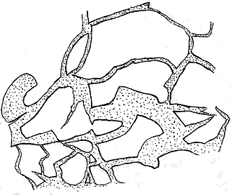
Fig. 66.—Ground-plan of reticulated cracks in the upper surface of an Old
Red Sandstone lava filled in with sandstone. Red Head, Forfarshire.
A remarkable exception to the general type of dark basic and intermediate
lavas is furnished by the pale, decomposing felsites of the Pentland
and Dolphinton Hills. Those which issue from the great eruptive
centre of the Braid Hills, alternate with the andesites and the diabases,
gradually diminishing like these in a southward direction and dying out
in some six or seven miles. Beyond the limits of these lavas, another
similar thick group was erupted from a separate vent at the northern end
of the Biggar district near Dolphinton. The same occurrence has been
ascertained also in the area of the Ochil chain. Fuller reference will be
made to these interesting rocks in the descriptions to be afterwards given
of the structure and history of the volcanic areas of the Pentland Hills, the
Biggar centre and the Ochil Hills.
It is certainly a notable feature in the volcanism of Old Red Sandstone
time that from the same, or from closely adjoining vents, lavas should be
alternately poured forth, differing so much from each other, alike in chemical
composition and petrographical characters, as andesites and diabases on the
one hand, and felsites on the other. Additional examples, from widely
different geological systems, will be cited in subsequent pages. It will be
shown that even in the very latest volcanic period in Britain, that of
older Tertiary time, highly basic and markedly acid materials were ejected
from the same centres of eruption.
The part taken by the Tuffs in the structure of the ground agrees with
what might have been expected in the accompaniments of extremely slaggy
and viscid lavas. These pyroclastic intercalations are, in most of the
volcanic districts, comparatively insignificant in amount, by far the largest
proportion of solid material ejected from the various vents having consisted
of streams of lava. Round or within some of the vents the fragmentary
materials attain a remarkable coarseness, as may be seen in the great
agglomerates of Dumyat, near Stirling, the largest of which is more than
700 feet thick. These massive accumulations doubtless represent a long
series of explosive discharges from the summit of the lava column in one or
more adjacent vents. Traced away from the orifices of emission, the tuffs
rapidly grow finer in grain, less in thickness, and more mixed with ordinary
detritus, until they pass into ordinary non-volcanic sediment or die out
between the lava-sheets.
Good sections, showing the nature and arrangement of the thin intercalations
of andesite-tuff between the successive outpourings of lava, may be
examined on the coast. Thus, near Turnberry Point, in Ayrshire, upwards
of a dozen successive flows of lava, with their sandy and ashy intervening
layers, are exposed in plan upon the beach, and partly also in section along
the cliffs on which the ruins of the historic castle of Turnberry stand.
(Figs. 95, 96, 97). Again, along the coast of Forfarshire, from the Red
Head to Montrose, the numerous sheets of andesite are separated by layers
of dull purplish tuff passing into conglomerate, with blocks of porphyrite a
yard or more in diameter.
The most remarkable interstratified tuffs in the Lower Old Red Sandstone
are the felsitic varieties. Those which proceed from the great vent of
the Braid Hills, extend south-westwards for eight or nine miles, and their
peculiar materials, mixed with ordinary sediment, may be traced several miles
further. They occur in successive sheets, which, from a maximum thickness
and number at the north end, gradually thin away southwards, like
the felsitic lavas which they accompany, and from the explosion of which
they no doubt were derived. They consist to a large extent of extremely fine
volcanic dust, and since they are generally much decomposed, it is often, as
already remarked, hardly possible to distinguish between them and the
equally decayed felsites. In some parts of the hills they present a distinct
fissile bedding; but still more satisfactory is the occasional fine brecciated
structure which they assume, when they are seen to consist of angular
lapilli of different felsites.
The amount of volcanic material ejected from the more important vents
was much greater than the height of the present hills would lead us to
suppose. The rocks have generally been tilted into positions much more
inclined than those which they originally occupied, so that to measure their
actual thickness we must take a line approximately perpendicular to the
dip. In this way we ascertain that the accumulated mass of lavas and
tuffs immediately outside the vent at the north end of the Pentland Hills
must be at least 7000 feet thick, for the base of the series is concealed
under the unconformable overlap of the Lower Carboniferous Sandstones, while
the top is cut off by a fault which brings down the
Carboniferous formations against the eastern flank of
the hills. Probably not less voluminous is the pile of
ejected material in the Ochil Hills, where, though the
base of the whole is concealed by the fault which throws
down the coal-field, some 6500 feet of lavas, tuffs and
conglomerates can be seen. There were thus, during
the time of the Lower Old Red Sandstone, more than
one volcano in Central Scotland which might be compared
in bulk of ejected material to Vesuvius.

Fig. 67.—Section across the volcanic series of Forfarshire.
a, conglomerates, sandstones and flagstones; b, sheets of andesitic lava.
That the eruptions were mainly subaqueous is indicated,
as I have shown, by the intercalated bands of
sandstone and conglomerate between the successive lavas,
as these are traced away from the centres of discharge,
and likewise, even more impressively, by the hardened
sand which has been washed into former fissures and
crevices in the lava. But that, in some cases, the volcanic
cones were built up above the surface of the lake
may be legitimately inferred from the remarkable
volcanic conglomerates which occur, more particularly
in the great chain of the Ochil and Sidlaw Hills.
These thick accumulations of well-rounded and water-worn
blocks are interspersed between sheets of andesite,
and are mainly made up of andesite fragments. Impressive
sections of them may be seen along the Kincardineshire
coast. The conglomerates are sometimes
so remarkably coarse, many of their blocks exceeding
two feet in diameter, and so rudely bedded, that it is
only by noting the position of oblong boulders that one
can make out the general direction of the stratification.
In their smooth rounded forms, these blocks resemble
the materials of storm-beaches on an exposed coast.
The trituration of the andesite fragments has given rise
to a certain amount of green paste, which firmly wraps
round the stones, and retains casts of them after they
have dropped out. It is further deserving of remark
that while in some districts, as in the central Ochils, the
materials were entirely derived from the destruction
of volcanic rocks, in others a large proportion of non-volcanic
materials is mingled with the debris of the
lavas. South of Stonehaven, for example, large boulders
of quartzite form a conspicuous feature in the conglomerates,
of which in places they make up quite half
of the total constituents. There can be little doubt, I
think, that the materials of these coarse detrital accumulations were gathered
together as shingle-beaches, and were derived in part from volcanic cones
which had risen above the level of the lake. They seem to suggest considerable
degradation of these cones by breaker-action, whereby blocks of
rock a yard or more in diameter could be rounded and smoothed.
Another inference deducible from such conglomerates, and to which I
have already alluded, is that considerable intervals of time took place
between some of the eruptions. Round the vents, indeed, where the
successive sheets of volcanic material follow each other continuously, it is
perhaps impossible to form any definite opinion as to the relative chronological
value of the lines of separation between different ejections. But
where some hundreds of feet of coarse conglomerate, chiefly composed of
well-rounded andesite blocks, intervene between two streams of lava, we
may conclude that the interval between the outpouring of these streams
must have been of considerable duration. Other evidence of a similar
tendency may be recognized in the intercalation of groups of varied sedimentary
accumulations, such as those which were deposited over the site of
Eastern Forfarshire and Kincardineshire during the time that elapsed
between two successive floods of lava. In the Den of Canterland, for
example, in the midst of the volcanic sheets we find interesting evidence of
one of these intervals of quiescence, during which layers of fine olive shales
were laid quietly down, while macerated vegetation, drifting over the lake-bottom,
was buried with remains of fishes, and abundant gally-worms
(Kampecaris, Archidesmus), washed from the neighbouring land.[343] So undisturbed
were the conditions of deposition that calcareous sediment gathered
round some of the organisms and encased them in limestone nodules.
In some of the districts the discharges of volcanic material were so
abundant or so continuous that no recognizable deposition of ordinary
sediment has taken place between them. Thus, at the north end of the
Pentland Hills the rocks are entirely of volcanic origin, and though, as we
trace them southwards away from the centre of eruption, they diminish in
thickness, they include hardly any interstratified sandstones and conglomerates
until they finally begin to die out.
The distances to which the lavas and tuffs have been erupted from the
chief vents of a district vary up to 15 or 20 miles. Those of the Pentland
Hills extend from the Braid Hill vent for 10 miles to the south-west.
Those of the Biggar centre stretch for about 16 miles to the north-east.
Those of the Ochil Hills, which probably came from a number of distinct
vents, can be traced for nearly 50 miles.
On the whole the actual vents of the volcanoes of Lower Old Red Sandstone
time are less clearly distinguishable than those of subsequent volcanic
periods. This deficiency doubtless arises from the geological structure of
the districts in which the formation is chiefly developed. Thus, in the
great Midland Valley of Scotland, where the Old Red Sandstone covers a
large part of the surface, the vents seem to have been placed along the
central parts of the long trough rather than among the older rocks on either
margin. Hence they are in large measure buried either under the volcanic
and sedimentary accumulations of their own period or under Carboniferous
strata.
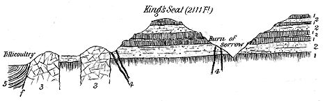
Fig. 68.—Section across two necks above Tillicoultry, Ochil Hills.
1 1, Andesite lavas; 2 2, Tuffs and volcanic conglomerates; 3 3, The two necks; 4 4, Dykes of felsite, etc.;
5, Coal-measures; f, Fault.
Certain bosses of massive rocks lying well within the volcanic area
may with some confidence be regarded as the sites of eruptive centres.
They occur either singly or in groups, and may be specially noticed along
the chain of the Ochil and Sidlaw Hills. Yet it seems to me probable
that these visible bosses, even if we are correct in regarding them as
marking the positions of true vents, do not indicate the chief orifices of
discharge. If we consider their size and their distribution with reference
to the areas of lava and tuff discharged at the surface, we are rather led to
look upon them as subsidiary vents, the more important orifices, from which
the main bulk of the eruptions took place, being still concealed under the
Carboniferous rocks of the Midland Valley. The bosses which rise through
different portions of the volcanic series are obviously not the oldest or original
vents. The great felsitic mass of Tinto in Lanarkshire (Fig. 93), indeed,
pierces strata which lie near the base of the Lower Old Red Sandstone, but
the smaller cone of Quothquan in its neighbourhood appears in the midst of
the lavas (Fig. 92). In the south-western part of the Ochil chain the bosses
or necks are chiefly small in size, seldom exceeding half a mile in diameter.
They have been filled sometimes with crystalline, sometimes with fragmental
materials. Two of them, containing the remarkable granophyric quartz-diorite
already referred to, emerge from among the tuffs in a low part of
the series, immediately above the village of Tillicoultry in Clackmannan
(Fig. 68). Two or three more, which are occupied by orthophyres and
quartz-felsites, pierce the volcanic group a few miles to the west of Loch
Leven. The whole of the visible bosses of the Ochil Hills may be regarded
as one connected group, subsidiary to the main orifices which lay rather
further to the south and west. More particular reference to this district
will be made in the following chapter (p. 303).
Vents which have been filled up with agglomerate, and which thus
furnish the most obvious proofs of their connection with the eruptions of
the volcanic series, though not frequent, may be observed in a number of
the volcanic districts. Their fragmentary materials generally consist mainly
of the detritus of andesites or diabases like those which form the bedded
lavas. But where more acid lavas have risen to the surface, fragments of
felsite may occur more or less abundantly. In the great vent of the Braid
Hills the tuffs and breccias are almost wholly acid. Non-volcanic materials
may often be found in the agglomerates, and occasionally even to the exclusion
of volcanic detritus. Thus, in the far north of Scotland several
examples occur among the Shetland Isles of necks filled entirely with
blocks of the surrounding flagstones and sandstones. Such cases, as has
been already pointed out, probably represent incompleted volcanoes, when
the explosive vapours were powerful enough to drill orifices in the crust of
the earth and eject the shattered debris from them, but were not sufficiently
vigorous or lasting to bring up any solid or liquid volcanic material to the
surface. These Shetland examples are further noticed on p. 345.
Necks of agglomerate in the Lower Old Red Sandstone vary in size from
a great orifice measuring two miles across to little plugs only a few yards in
diameter. They may be found in limited numbers in most of the volcanic
districts. No examples have been observed rising through older rocks than
the Old Red Sandstone, all the known instances being eruptive through
some part of the volcanic series or of the sandstones, and therefore not
belonging to the earliest eruptions.
The largest, and in some respects the most interesting, vent in the
Lower Old Red Sandstone, that of the Braid Hills near Edinburgh, described
in Chapter xx., covers an area of more than two square miles, and is filled
with felsitic breccias and tuffs, through which bosses and veins of acid and
basic rocks have been injected. It completely truncates the bedded lavas
and tuffs of the Pentland Hills, and not improbably marks the chief centre
from which these rocks were erupted. Several smaller necks rise a little
beyond its southern margin, marking, perhaps, lateral cones on the main
volcano.
In the small area of Lower Old Red Sandstone lying between Campbeltown
and the Mull of Cantyre, several necks of agglomerate occur, which
have been partly dissected by the waves along the shore, thus revealing their
internal structure and their relation to the surrounding conglomerates. An
account of them will be found at p. 311. One of the series, which lies back
from the coast-line, forms a prominent rounded hill measuring about 400
yards in its longest diameter. Its general contour is represented in
Fig. 82.
Of the eruptive bosses of massive rock outside the limits of the Old Red
Sandstone which may be plausibly referred to the volcanic phenomena of the
period, though they cannot be proved to be actually part of them, the most
notable are the bosses of granite and other acid material which rise through
the Silurian strata of the Southern Uplands of Scotland.[344] The largest are the
well-known masses of Galloway (Fig. 69), with which must be grouped the
bosses near New Cumnock, that of the Spango Water (Fig. 94), and those of
Cockburn Law and Priestlaw in Lammermuir, together with a number of
masses of felsitic material scattered over the same region, such as the Dirrington
Laws of Berwickshire (Fig. 70). These bosses present some points of
structure in common with true vents. They come like great vertical columns
through highly-folded and puckered strata, and, as they truncate the Llandovery
and Wenlock formations, they are certainly younger than the greater
part of the Upper Silurian series. They must be later, too, than the chief
plication and cleavage of these strata; but they are older than the Upper
Old Red Sandstone or basement Carboniferous rocks which contain pebbles
of them. Their date of eruption is thus narrowed to the interval between
the later part of the Upper Silurian period and the beginning of the Upper
Old Red Sandstone. I have myself little doubt that they are to be associated
with the volcanic epoch we are now considering, as it was the only
known great episode of igneous activity in this region during the interval
within which the protrusion of these granites must have taken place. In
the Cheviot Hills, indeed, we have evidence of the eruption of a large
mass of augite-granitite through the porphyrite-lavas of the Lower Old Red
Sandstone, with abundant veins projecting from it into them, as will be
narrated in later pages.[345]
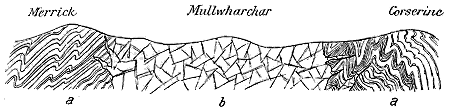
Fig. 69.—Section of the granite core between Merrick and Corscrine.
a, Silurian greywackes, grits and shales; b, granite.
Not improbably many other granite protrusions throughout the British
Isles are to be referred to the volcanic operations of the Lower Old Red
Sandstone. Such are those of the Lake District, notably that of Shap,[346] the
granites of Newry and Leinster in the east of Ireland, which are later than
the Silurian rocks and older than the Carboniferous Limestone, and the
younger Grampian granites, which pierce the presumably Arenig belt along
the Highland border. Whether or not these granitic protrusions were
connected with superficial volcanic discharges of which no remains have
survived, they seem to indicate the wide extent and remarkable vigour of
the subterranean igneous action of this geological period.
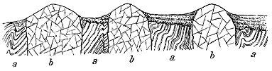
Fig. 70.—Section across the three Dirrington Laws, Berwickshire.
a, Upper Silurian strata; b, Necks probably of Lower Old Red Sandstone age; c, Upper Old Red Sandstone lying
unconformably both on a and b.
Viewed as a whole, the materials which now occupy the vents of the
volcanic chains in the Lower Old Red Sandstone of the British Isles are
more acid than the lavas erupted at the surface. In the Pentland district,
indeed, and in some other areas this acid material was ejected at intervals in
abundant discharges of dust and lapilli and in outflows of felsitic lavas,
while between these successive discharges copious streams of diabasic and
andesitic lavas, either from the same or from some closely-adjoining vent,
were poured out. Throughout the whole region, however, as a closing phase
of the volcanic history, the acid magma rose after the outpouring of the more
basic lavas and filled such chimneys of the volcanoes as were not already
blocked with agglomerate. It was probably after these pipes were plugged
that the final efforts of volcanic energy were expended in the protrusion of
the acid material as sills between the bedding-planes of the surrounding
rocks, and as dykes and veins in and around the vents.
Nowhere throughout the volcanic tracts of the Lower Old Red Sandstone
is there any such development of sills as may be seen beneath the Silurian
volcanic sheets of North Wales. Those which occur are most abundant in
the Lanarkshire district, to the north-west and south-west of Tinto, and in
the south of Ayrshire. From the village of Muirkirk to the gorge of the
Clyde, below the Falls, the Upper Silurian and Lower Old Red Sandstone
strata are traversed by numerous intrusive sheets of pink and yellow felsite,
quartz-porphyry, minette, lamprophyre and allied rocks, which are no doubt
to be regarded as part of the volcanic phenomena with which we are here
concerned. In the south of Ayrshire, between the villages of Dalmellington
and Barr, there is a copious development of similar sills, especially along one
or more horizons near the base of the Old Red Sandstone. Garleffin Fell,
Glenalla Fell, Turgeny and other heights are conspicuous prominences
formed of these rocks; above the sills lie thick conglomerates and sandstones
on which the great andesite-sheets rest.
In the Pentland Hills, as will be described in Chapter xx., a massive
felsitic sill forms a conspicuous feature along the north side of the chain,
and there are probably others which have not yet been separated from
the felsitic tuffs and orthophyres which they so much resemble.
Perhaps the most remarkable acid
sills in the Old Red Sandstone of
Britain are those which occur at the
extreme northern end of the region
among the volcanic phenomena of the
Shetland Isles (Figs. 71, 72). The
largest of them, consisting mainly of
granite and felsite, is believed to reach
a length of 20 and a breadth of from
three to four miles.[347]

Fig. 71.—Section of Papa Stour, Shetlands, showing sill of spherulitic felsite traversing Old Red Sandstone and bedded porphyrites
(Messrs. Peach and Horne).
1. Red sandstones and flagstones; 2. Purple diabase-porphyrites; 3. Great sheet of pink spherulitic felsite.

Fig. 72.—Section across Northmavine, from Okrea Head to Skea Ness, Shetland, showing dykes and connected sill of granite and felsite
(Messrs. Peach and Horne).
1. Schists, etc.; 2. Serpentine; 3. Granite and quartz-felsite; 4. Breccia of serpentine fragments; 5. Bedded andesites and tuffs. f, Fault.
A group of sills composed of a
bright red quartz-porphyry has been
traced along the southern flanks of
the Highlands for upwards of 18
miles.[348] This rock, already referred to
as the "Lintrathen porphyry," lies
chiefly among the conglomerates and
sandstones, but also intersects the lavas,
and may be later than the Old Red
Sandstone (p. 277). An extension of
it is found even on the north side of
the boundary fault, cutting the andesites
which there lie unconformably
on the schists.
Examples, however, occur of sills
much less acid in composition. In
the Dundee district, for instance, the
intrusive sheets are andesites and
diabases. They send veins into and
bake the sandstones among which they
have been intruded, and are sometimes
full of fragments of such indurated
sandstone, as may be well seen on
the northern shore of the Firth of
Tay, west of Dundee.
A conspicuous characteristic of
most of the volcanic tracts of the
Lower Old Red Sandstone is the comparative
scarcity of contemporaneous
dykes. In the band of acid sills
between Muirkirk and the Clyde, a considerable number of dykes
have been mapped, which must be regarded as due to the same series
of movements and protrusions of the magma that produced the adjacent
sills. Throughout the length of the Southern Uplands dykes of felsite,
minette, lamprophyre, vogesite and other varieties, which may also be
connected with the volcanic phenomena of the Lower Old Red Sandstone,
not infrequently occur among the Silurian rocks. On the
Kincardineshire coast, south of Bervie, a number of dykes of pink
quartz-porphyry traverse the conglomerates and sandstones. The coast
south of Montrose displays some singularly picturesque sections, where a
porphyry dyke running through andesitic lavas and agglomerates stands up
in wall-like and tower-like projections. On the shore at Gourdon, as well
as inland, intrusive dykes of serpentine occur. A line of these, possibly
along the same fissure, has been traced for more than a dozen of miles from
above Cortachy Castle to near Bamff. But there is no evidence to connect
them with the volcanic phenomena of the Old Red Sandstone. Not improbably
they belong to a later geological period.
One would expect to meet with a network of dykes in and around the
volcanic vents; but even there they are usually not conspicuous either for
number or size. In the great vent of the Braid Hills only a few have been
noticed. In the Ochil Hills groups of dykes of felsite and andesite may
be observed, especially near the necks. They are fairly numerous in the
neighbourhood of Dollar (see Fig. 68). One of the most abundant series
yet observed traverses the tract around the granite boss of the Cheviot
Hills, from which many dykes of granite, felsite, quartz-porphyry and andesite
radiate. This district will be more fully referred to in Chapter xxi.
Another remarkable development of dykes occurs in Shetland (Fig. 72),
where they consist of granite, felsite and rhyolite, and are associated with
the acid sills above referred to.
CHAPTER XIX VOLCANOES OF THE LOWER OLD RED SANDSTONE OF "LAKE CALEDONIA" — I. THE NORTHERN CHAIN OF VOLCANOES IN "LAKE CALEDONIA" — 1. The Montrose Centre — 2. The Sidlaw and Ochil Group — 3. The Arran and Cantyre Centre — 4. The Ulster Centres
Description of the several Volcanic Districts: "Lake Caledonia," its Chains of Volcanoes—The
Northern Chain: Montrose Group, Ochil and Sidlaw Hills, the Arran and
Cantyre Centre, the Ulster Centre.
I now propose to give some account of each of the districts which have been
separate areas of volcanic action during the time of the Lower Old Red
Sandstone, tracing its general structure, the arrangement and sequence of its
volcanic rocks and the history of its eruptions. As by far the most varied
development of the Old Red Sandstone is to be found in the great Midland
Valley of Scotland, and as it is there that the remarkable volcanic phenomena
of the system have been most abundantly displayed and are most clearly
recorded, I shall begin my description of the volcanic eruptions of the Lower
Old Red Sandstone with a detailed account of the different centres of
volcanic activity in that region. The phenomena are so fully displayed there
that a more summary treatment of the subject will suffice for the other
regions.
Under the designation of "Lake Caledonia," as already remarked, I
include the whole of the Midland Valley of Scotland between the Highlands
and the Southern Uplands, likewise the continuation of the same ancient
hollow by Arran and the south of Cantyre across the north of Ireland to
Lough Erne.[349] Throughout most of the area thus defined, the present limits
of the Lower Old Red Sandstone are sharply marked off by large parallel
faults. On the north-west side one, or rather a parallel series, of such dislocations
runs from Stonehaven along the flank of the Highland mountains
to the Clyde, thus traversing the whole breadth of the island. On the
south-east side another similar series of faults, which there skirts the edge
of the Silurian tableland, has nearly the same effect in precisely defining
the margin of the Old Red Sandstone. As thus limited, the tract has a
breadth of about 50 miles in Scotland, while the portion of it now visible
in the British Isles has an extreme length of about 280 miles (Map III.).
But though the boundary-faults determine, on the whole, the present
limits of the tract of Old Red Sandstone, they do not necessarily indicate
the shore-lines of the sheet of water in which that great series of deposits
was laid down. They point to an enormous subsidence of the tract between
them—a prolonged and extensive sagging of the strip of country that stretches
across the Midland Valley of Scotland into the north of Ireland.[350] This
downward movement began as far back as the close of the Silurian period,
but the marginal fractures and the disruption and plication of the thick
masses of sandstone and conglomerate which were accumulated in the lake
chiefly took place after the close of the period of the Lower Old Red Sandstone.
I think we may reasonably connect these movements with the general
sinking of the area consequent upon the enormous outpouring of volcanic
materials during that period.
Along both the northern and southern margins of the basin there
occur, on the farther side of the boundary faults, outlying patches of Lower
Old Red Sandstone that rest unconformably on the rocks forming the
flanks of the hills. These areas possess a peculiar interest, inasmuch as
they reveal some parts of the shore-line of the lake, and show the relation
between the earlier rocks and the sediments of the Old Red Sandstone.
We learn from them that the shore-line was indented with wide bays, but
nevertheless ran in a general north-easterly direction. It thus corresponded
in trend with the present Midland Valley, with the axes of plication among
the schists of the Highlands as well as among the Silurian rocks of the
Southern Uplands, and with the subsequent faulting and folding of the
Old Red Sandstone.
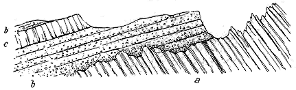
Fig. 73.—Section at the edge of one of the bays of Lower Old Red Sandstone along the northern
margin of Lake Caledonia, near Ochtertyre.
a, slates and phyllites; b, volcanic conglomerates; c, andesite-lava.
I may remark in passing that the conglomerates and other associated
materials which have been preserved in these bays and hollows beyond the
lines of the great faults, though they lie unconformably on the rocks beneath,
are not the basement portions of the Old Red Sandstone. On the contrary,
where their probable stratigraphical horizons can be recognized or inferred,
they are found to belong to parts of the series considerably above the base
of the whole. They point to the gradual sinking of the basin and the
creeping of the waters with their littoral shingles further and further up
the slopes of the hills on either side (Fig. 73).
But this is not all the evidence that can be adduced to show that the
limits of the lake extended considerably beyond the lines of dislocation
between which the present area of Old Red Sandstone mainly lies. No
one can look at the noble escarpments of the Braes of Doune on the one
side (Fig. 74), or walk over the upturned conglomerates and andesites which
flank the Lanarkshire uplands on the other, without being convinced that if
the effects of the boundary faults could be undone, so as to restore the original
structure of the ground, the prolongations of the rocks, now removed by
denudation, would be found sweeping far into the Highlands on the north
and into the Silurian Uplands on the south.
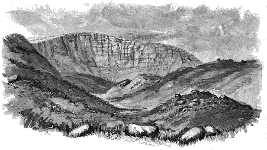
Fig. 74.—Craig Beinn nan-Eun (2067 feet), east of Uam Var, Braes of Doune. Old Red Conglomerate,
with the truncated ends of the strata looking across into the Highlands; moraines of Corry Beach
in the foreground.
If the area of "Lake Caledonia" were taken to be defined by the boundary
faults, it covered a space of about 10,000 square miles. But, as we know
that it certainly stretched beyond the limits marked by these faults, it
must have been of still greater extent. We shall probably not exaggerate
if we regard it as somewhat larger than the present Lake Erie, the superficies
of which is about 9900 square miles. In this long narrow basin the
remarkable volcanic history was enacted of which I now proceed to give
some account.
The Lower Old Red Sandstone of Central Scotland may be conveniently
divided into three great groups, each of which marks a distinct epoch in
the history of the basin wherein they were successively accumulated. The
lowest of these groups indicates a time of quiet sedimentation during which
the basin was defined by plication of the terrestrial crust, and when, by the
same subterranean movements, some parts of the floor of the lake were
pushed upward above water, and were then denuded and buried. The
middle group consists largely of volcanic rocks. It points to the existence
of lines of active volcanic cones situated along the length of the lake. The
uppermost group records the extinction of volcanic action and the gradual
obliteration of the lake, partly by the pouring of sediment into it, and
partly no doubt by the continued terrestrial movements which had originally
produced the basin.
It is evident from these records that though volcanic activity continued
vigorous for a vast period of time, it had entirely ceased in "Lake Caledonia"
long before the last sediments of the Lower Old Red Sandstone were
laid down. The great cones of the Ochil Hills, for example, sank below
the waters of the lake in which they had long been a conspicuous
feature, and so protracted was the subsidence of the lake-bottom that the
site of these volcanoes was buried under 8000 or 9000 feet of sandstones
and conglomerates, among which no trace of any volcanic eruptions has
yet been found. The sagging of the terrestrial crust over an area from
which such an enormous amount of volcanic products had been discharged
would doubtless be a protracted process. Long after the subsidence of the
lake-bottom and the accumulation of its thick mass of sediments, after even
the entire effacement of the topography and the deposition of the thick
Carboniferous formations over its site, the downward movement showed
itself in the production of gigantic north-east faults, and the sinking
of the Carboniferous rocks for several thousand feet. These dislocations,
as was natural, have run through the heart of some of the volcanic groups,
carrying much of the evidence of the ancient volcanoes out of sight, and
leaving us only fragments from which to piece together the records of a
volcanic period which is by no means the least interesting in the geological
history of this country.
Confining our attention for the present to the records of the middle or
volcanic group, we find evidence of a number of distinct clusters of volcanoes
ranged along the whole length of the basin. The independence of these
volcanic districts may be inferred from the following facts:—1st, The actual
vents of discharge may in some cases be recognized; 2nd, Even where these
vents have been buried, we may often observe, as we approach their probable
sites, a marked increase in the thickness of the volcanic accumulations, as
well as a great development of agglomerates and tuffs; 3rd, Traced in
opposite directions, the volcanic materials are found to thin away or even
to disappear. Those from one centre of discharge may be observed
now and then to overlap those from another, but the two series remain
distinct.
Reasoning from these data and studying the distribution of the various
volcanic areas, we are led to recognize the former existence of two parallel
chains of vents, running along the length of the lake at a distance from
each other of somewhere about twenty miles. They may be conveniently
distinguished as the northern and the southern chain.
The northern band runs from the coast-line near Stonehaven south-westward
through the Sidlaw and Ochil Hills. It is then abruptly truncated by a
large fault and by the unconformable superposition of the Carboniferous formations.
But 60 miles further to the south-west, where the Old Red Sandstone
comes out on the west side of the Firth of Clyde, a continuation of the volcanic
band has recently been detected by Mr. W. Gunn of the Geological Survey in
the Island of Arran. Twenty-five miles still further in the same direction a
much ampler development of the volcanic rocks occurs to the south of
Campbeltown in Cantyre. If we cross the 22 miles of sea that separate
the Argyllshire coast-sections from those of Red Bay in Ireland, we find
near Cushendall a repetition of the Scottish volcanic conglomerates,
while still further along the same persistent line, some 50 miles into the
interior, the hills of Tyrone include sheets of lava precisely like those
of Central Scotland. The total length of this northern chain of volcanoes
is thus not much less than 250 miles, and as its north-eastern end
is now cut off by the North Sea it must have been still longer. It ran
parallel to the north-western coast-line of the lake, at a distance which,
over the site of the Midland Valley of Scotland, seems to have varied from
10 to 20 miles, but which greatly lessened further to the south-west.
At a distance of some twenty miles to the south of the northern belt, the
second parallel chain of volcanoes ran in a nearly straight line, which is now
traceable from the southern suburbs of Edinburgh to the coast of Ayrshire,
a distance of about 75 miles, but as its north-eastern end is concealed
by Carboniferous formations, and its south-western passes under the sea, its
true length is probably considerably more.
If the areas which present evidence of distinct and independent vents
are grouped according to their positions on these two lines, they naturally
arrange themselves as in the following list:—
| I. |
Northern Chain of Volcanoes |
| 1. The Montrose Centre. |
| 2. The Sidlaw and Ochil Group. |
| 3. The Arran and Cantyre Centre. |
| 4. The Ulster Centres. |
| II. |
Southern Chain of Volcanoes |
| 5. The Pentland Volcano. |
| 6. The Biggar Centre. |
| 7. The Duneaton Centre. |
| 8. The Ayrshire Group. |
The distribution of these various volcanic areas will be most easily
understood from an examination of Map III. accompanying this volume.
Beginning at the north-eastern end of the area, we first encounter a
series of volcanic rocks which attain their maximum thickness in Forfarshire
around the town of Montrose. The main vents probably lay somewhere to the
east of the present coast, under the floor of the North Sea; at least no clear
indication of their existence either on the coast or inland has been detected.
From Montrose, both to the north-east and south-west, the lavas thin away,
becoming intercalated among the sandstones, flagstones and conglomerates,
and gradually dying out. The total length of the volcanic belt is about 18
miles, that is nine miles from the central thick mass in a north-easterly and
the same distance in a south-westerly direction.[351] The volcanic pile must be
several thousand feet thick, but owing to the prolongation of the great Ochil
anticline, the lavas roll over and do not allow their base to be seen. The
axis of the fold must pass out to sea, through the hollow on which the town
of Montrose stands. The volcanic series consists of andesite-sheets with
volcanic conglomerates. It contains little ordinary tuff, but the conglomerates
no doubt partly represent ejected fragmental material, as well as the
waste of exposed lavas. A section across the anticlinal fold from Forfar to
Panbride, a little to the south-west of Montrose, would reveal the structure
shown in Fig. 67.
In the north-eastern prolongation of the volcanic series from the
Montrose centre, successively lower members are exposed along the coast-line.
But the lavas are dying out in that direction, and sometimes many
hundreds of feet of ordinary sediment intervene between two successive
flows. It was in one of these long pauses near the top of the whole
pile of lavas that the strata of Canterland were deposited, to which reference
has already been made. South-west from Montrose the thick volcanic
mass rapidly diminishes, and is prolonged to the end only by three or four
bands separated by sandstones and flagstones. It is in these intercalated
groups of sedimentary material that the "Forfarshire flags" occur.
Nowhere can the details of the Old Red Sandstone volcanic rocks be
more conveniently studied than along the coast-section in this district from
the Red Head to Stonehaven. The rocks have not only been cut into
vertical cliffs, but along many parts of the shore they have been also laid bare
in ground-plan, so that a complete dissection of them is presented to the
geologist. At the south end, the top of the volcanic series appears at the
bold promontory of the Red Head. There, at the base of the cliffs of red
sandstone, the accompanying section may be seen. Beneath the red false-bedded
and sometimes pebbly sandstones (e), which form nearly the whole
precipice, lies a band of dull purplish ashy conglomerate (d), composed
almost wholly of fragments
of different andesites, imbedded
in a paste of the
same comminuted material.
Towards the south, this
rock rapidly becomes
coarser, until it passes into
a kind of agglomerate, in
which the andesite blocks
are sometimes a yard or
more in diameter. It includes
bands of sandstone,
which increase in number
and thickness towards the
north, and sometimes intervene
underneath the conglomerate.
The lowest rocks here visible are sheets of andesite or "porphyrite"
(a), separated from each other by irregular bright red layers of
tufaceous sand and agglomerate. These lavas are dull purplish-grey to
green, some of them being tolerably compact, others highly amygdaloidal,
with large steam-cavities often drawn out in the direction of flow.
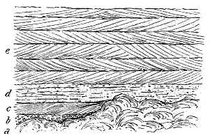
Fig. 75.—Section showing the top of the volcanic series at the
foot of the precipice of the Red Head, Forfarshire.
a, Top of slaggy andesite; b, coarse volcanic conglomerate; c, Red
sandstone; d, Tuff and volcanic conglomerate; e, Red sandstones.
One of the most striking features in the andesites of this coast is the
remarkable manner in which they include the veinings of pale green and red
sandstone already described (see Figs. 65, 66). Some of the sheets have in
cooling cracked into rude polygons. They are likewise traversed by large
cavernous spaces and intricate fissures or steam-cavities. Into all these
openings the sand has been washed, filling them up and solidifying into well-stratified
sandstone, the bedding of which is generally parallel with that
of the rocks that enclose it, the dip of the whole series of strata being
gently seawards. But a still more intimate mixture of the sand with the
lava-sheets is to be remarked where these rocks assume their most slaggy
character. In some of them the upper part, to a depth of ten or twelve feet,
consists of mere rugged lumps of slag which, while the mass was in motion,
were probably in large measure loose, and rolled over each other as they
were borne onward. The sand has found its way into all the interstices of
these clinker-beds, and now binds the whole mass firmly together. At first
sight, these bands might be taken for agglomerates of ejected blocks, and
as already suggested, some of the slags may have been thrown out as loose
pieces, but a little examination will show that in the main the rough
scoriaceous lumps are pieces of the lava underneath. In these instances,
also, it is clear that the blocks were in position before the fine sand was
sifted into their interspaces, for the pale green sandstone is horizontally
stratified through its intricate ramifications among the pile of dark
clinkers.
The seaward inclination of the rocks allows the succession of lavas to
be seen as the coast is followed westward into Lunan Bay. On the further
side of that inlet, after passing over a group of sandstones that underlie
the volcanic series of the Red Head, the observer meets with a second and
lower succession of lavas which in the five miles northward to Montrose
Harbour are admirably exposed both along coast-cliffs and on the beach.
They resemble those of the Red Head, being made up of alternations of highly
vesicular andesite with more compact varieties, and showing similar sandstone
veinings. Here and there, as at Fishtown of Usar, the sea has cut them
down into a platform from which the harder parts rise as fantastic half-tide
stacks. In some cases, the more durable rock consists of the slaggy upper
portions of the flows, and in one case this material stands up as a rude
pillar twelve feet high, composed of clinkers firmly cemented with veinings
of sandstone. The geologist who wanders over this coast-line is arrested at
every turn by the marvellously fresh volcanic aspect of many of the lavas.
Their upper parts are so cellular that if the calcite, chalcedony and other
infiltrated minerals were removed from their vesicles, they would be transformed
into surfaces of mere slag. In one respect would their antiquity
still be evident. These slaggy bands are generally a good deal reddened, as
if they had been long exposed to oxidation before being covered by the
overlying sheets of lava—a feature already cited, as probably indicating the
lapse of some considerable interval of time between successive outflows.
Along this coast-section the absence of intercalated tuffs is soon remarked.
The volcanic ejections seem to have consisted almost entirely
of andesitic lavas, though it is possible that here and there the very
slaggy bands between the more solid parts of the sheets may include a
little pyroclastic material. The lowest portion of the volcanic group here
visible is reached at Montrose Harbour, where, in the flagstones and shales
of Ferryden, the late Rev. Hugh Mitchell obtained some of the fossil-fishes
of the formation.
A space of more than three miles now intervenes where the rocks are
concealed by blown sand and other superficial accumulations. It is through
this hollow, as already stated, that the great Ochil anticline runs out to sea.
On the north side of the North Esk River, we again come upon the same
band of lavas as to the south of Montrose, but with a dip to the north-west.
This inclination, however, soon bends round more westerly, and the result
of the change is to expose a slowly descending section all the way to the
Highland fault at Stonehaven.
A picturesque line of high inland cliff, running northwards beyond St.
Cyrus, reveals with great clearness the bedded structure of the andesites.
But as one moves northward, owing to the change in the direction of dip,
one finally passes out of this volcanic belt and begins gradually to descend
into the thick Kincardineshire Old Red Sandstone. The amount of conglomerate
exposed along this part of the coast-line probably considerably
surpasses in thickness any other conglomerate series in the Lower Old Red
Sandstone of Britain. Throughout the enormous depth of sedimentary
material, the conglomerates are well-bedded, consisting of a dull green paste,
composed in large degree of comminuted andesitic debris, and interstratified
with green felspathic sandstones. They are often remarkably
coarse, the pebbles sometimes measuring three feet in length. Interposed
among them are some ten or twelve bands, probably often single outflows
of andesite, sometimes compact and porphyritic, at other times highly
amygdaloidal. Such is the succession of rocks for many miles along the
shore; and as the inclination varies from a little north of west to west, or even
west by south, the observer gradually passes over a thickness of rather more
than 2000 feet from the base of the St. Cyrus andesites to Gourdon. In this
accumulation of coarse, well water-worn material, with abundant intercalations
of finer sandstone and occasional sheets of lava, there is the record of prolonged
and powerful denudation with intermittent volcanic activity. Dykes
of a quartziferous porphyry cut the conglomerates, and at Gourdon they are
pierced by the intrusion of serpentine above referred to.
The proportion of andesite fragments in the conglomerates of this part
of the coast varies, but is generally much lower than that of the rocks from
the Highlands. Thus at Johnshaven, out of 100 blocks, broken promiscuously
from the conglomerate, I found that only 8 per cent were of andesite,
while 44 per cent were of quartzite, and the remainder consisted of various
quartz-porphyries, granites and schists. It is evident, therefore, that some
area of crystalline rocks was subjected to enormous waste, and that its detritus
was strewn over the floor of Lake Caledonia, at the same time that from the
Montrose volcanic vents many streams of andesitic lava were poured forth.
A vast mass of coarse conglomerate intervenes between Gourdon and
Dunnottar, and forms a nearly continuous line of precipices which in some
places rise 200 feet above the waves. The bedding is everywhere distinctly
marked, so that there is no difficulty in following the succession of the strata,
and estimating their thickness. From the last of the lavas at Gourdon
to the base of the conglomerates near Stonehaven, there lies an accumulation
of conglomerate at least 8000 feet thick. The boulders and pebbles in
these deposits are generally well-rounded, and vary up to four feet or more
in length. I observed one of quartz-porphyry at Kinneff which measured
seven feet long and six feet broad. The proportion of andesite fragments
in these conglomerates continues to be small. I ascertained that in the
coarsest mass at Kinneff they numbered only 14 per cent; at Todhead Point,
a mile and a half to the north, 20 per cent, and at Caterline, three quarters
of a mile further in the same direction, 21 per cent.
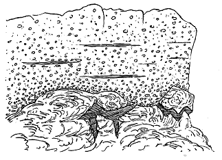
Fig. 76.—Andesite with sandstone veinings and overlying conglomerate.
Todhead, south of Caterline, coast of Kincardineshire.
In the midst of this gigantic accumulation of the very coarsest water-worn
detritus, there are still records of contemporaneous volcanic action.
Near Kinneff the beautiful andesite, with large tabular crystals of plagioclase,
alluded to on p. 274, occurs in the conglomerate.[352] South of Caterline
two flows, lying still lower in the system, project into the sea. One of
these presents a section of much interest. It shows a central solid portion,
jointed into rudely prismatic blocks, with an indefinite platy structure, which
gives it a roughly-bedded aspect. Its upper ten or twelve feet are sharply
marked off by their slaggy structure, ending upwards in a wavy surface like
that of the Vesuvian lava of 1858. Into its fissures, steam-cavities and
irregular hollows, fine sand has been washed from above, as at Red Head,
while immediately above it comes a coarse conglomerate of the usual character
(Fig. 76). Still lower
down, beneath some 900
feet of remarkably coarse
conglomerate, another
group of sheets of andesite
abuts at Crawton
upon the coast, with
which, at a short distance
inland, it runs
parallel for more than
two miles, coming back
to the sea at Thornyhive
Bay and at Maidenkaim.
We have then to pass
over about 5000 feet of
similar conglomerates,
until, after having crossed
several intercalated sheets of andesite, we meet with the last and lowest of
the whole volcanic series of this region in the form of some bands of porphyrite
at the Bellman's Head, Stonehaven. The peculiar geographical conditions that
led to the formation of the coarse conglomerates appear to have been established
at the same time that the volcanic eruptions began, for as we descend in
the long coast section, we find that the coarse sediment and the intercalated
lavas cease on the same general horizon. Below that platform lie some
5000 feet of red sandstones and red shales, yet the base of the series is
not seen, for the lowest visible strata have been faulted against the schists
of the Highlands. It is thus obvious that more than 5000 feet of sediment
had been laid down over this part of the floor of Lake Caledonia before the
first lavas were here erupted.
The volcanoes which poured out the masses of material that now form
the chain of the Ochil and Sidlaw Hills appear to have been among the most
vigorous in the whole region of Lake Caledonia. Their chief vents
probably lay towards the south-west in the neighbourhood of Stirling, where
the lavas, agglomerates and tuffs discharged from them reach a thickness of
not less than 6500 feet, without revealing their bottom. From that centre
the lavas range continuously for nearly fifty miles to the north-east, until
they reach the sea at Tayport; but they are prolonged on the north side of
the Firth of Tay from Broughty Ferry to near Arbroath, so as to overlap those
of the Montrose group. They thus attain a total length of nearly sixty
miles in a north-easterly line. How far they stretched south-west cannot
now be ascertained, for they have been dislocated and buried in that direction
under the Carboniferous formations of the Midland Valley.
It will be observed from the map (No. III.) that the great volcanic
ridge of the Ochil Hills continues unbroken for twenty-two miles, from
Stirling to Bridge of Earn. Thereafter it branches into two divergent portions,
one of which runs on through the north of Fife to the southern promontory
of the estuary of the Tay, while the other, after sinking below the alluvial
plains of the Earn and the Tay, mounts once more into a high ridge near
Perth, and thence stretches eastward into Forfarshire as the chain of the
Sidlaw Hills. This bifurcation is due to the opening out and denudation of
the great anticlinal fold above mentioned. The rocks in the northern limb
dip north-westward, those in the southern limb dip south-eastward. The
lower members of the Old Red Sandstone, underlying the volcanic series,
ought to be seen beneath them along the crest of the anticline. Unfortunately,
however, partly by the action of faults along the boundaries of the
volcanic bands, but chiefly from the unconformable overspread of Upper Old
Red Sandstone and Lower Carboniferous rocks across the plains of the Carse
of Gowrie and of the Earn, the lower parts of the system are there concealed
(see Fig. 78). As already remarked, this important anticlinal fold runs to
the north-east across Forfarshire, and passes out to sea north of Montrose.
Through the Ochil chain the fold runs obliquely in a south-westerly
direction, until it is truncated by the great fault which lets down the
Clackmannan coal-field. The total traceable length of this anticline is thus
about sixty miles. It flattens down towards the south-west; consequently
the rocks in the western part of the Ochil Hills are so gently inclined that
the same bands may be followed winding round the sides of the valleys, and
giving to the steep declivities the terraced contours to which allusion has
already been made (see Fig. 68). Another result of this structure is that
the base of the volcanic series is entirely concealed by its higher portions.
From an examination of the map it will be further obvious that the
whole wide plain of Strathmore—that is the great hollow, more than 80
miles long and about ten or twelve miles broad, which stretches between the
base of the Highland mountains and the north-western slopes of the Ochil
and Sidlaw chain—is underlain with volcanic rocks of Lower Old Red Sandstone
age. This plain lies on a broad synclinal fold, along the south-east
side of which the lavas, tuffs and conglomerates of the Ochil and Sidlaw
Hills dip under a thick accumulation of red sandstone and flagstone. On
the north-west side similar lavas and tuffs rise again to the surface, both on
the southern side of the great boundary faults, and also in the little bays
which here and there survive on the northern side of the dislocations
(Fig. 77). I have already alluded to these interesting relics of the shore-line
of Lake Caledonia, and to the fact that though they lie unconformably
on the Highland schists, they do not belong to the actual basement members
of the Old Red Sandstone (ante, p. 295, and Fig. 73). We have seen that
below the bottom of the volcanic series a thickness of 5000 feet of sandstones
and shales emerges on the Stonehaven coast, and yet that even there
the base of the whole system is not visible, owing to the effect of the Highland
boundary fault.
It is thus evident that over the bottom of Lake Caledonia a very thick
deposit of tolerably fine sedimentary material was spread before the commencement
of the Ochil and Sidlaw eruptions,—that when the lavas were poured
out and the coarse conglomerates began to be formed, these materials overlapped
the older deposits and gradually encroached upon the subsiding area
of the Highlands. The lavas rolled across the floor of the lake and entered
the successive bays of the northern coast-line, where their outlying patches
may still be seen.
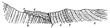
Fig. 77.—Section across the Boundary-fault of the Highlands at Glen Turrit, Perthshire.
s, Crystalline schists of the Highlands; c c, conglomerates and sandstones (Lower Old Red Sandstone) with interstratified
volcanic rocks (v v); f, fault.
From these facts it is clear that to the actually visible area of volcanic
material in the Ochil and Sidlaw region, and to the anticlinal tract whence
the andesites have been removed by denudation, we have to add the area
that lies under the plain of Strathmore, which may be computed to be at
least 800 square miles, making a total of probably not less than 1300
square miles. But it will be remembered that practically only one side of
the anticlinal fold is accessible to observation. We cannot tell how far in a
southerly direction the lavas of the Ochil Hills may extend. It is quite
possible that not a half of the total area covered by the eruptions of this
volcanic group is now within reach, either of observation or of well-founded
inference.
One further general characteristic of this volcanic district will be obvious
from an inspection of the map. While the thickest mass of lavas and tuffs,
lying towards the south-west, points to the existence of the most active vents
in that part of the area, the actual positions of these vents have not been
detected. Probably they lie somewhere to the south of the edge of the
Ochil chain, under the tract which is overspread with the coal-field. But
other and possibly minor orifices of eruption appear to have risen at
irregular intervals towards the north-east along the length of the lake. Thus
there are numerous bosses of felsitic and andesitic rocks among the central
Ochils, some of which may mark the positions of active vents. For some
miles to the east of that area an interval occurs, marked by the presence of
only a few small intrusive masses. But as the broad anticline of the Firth
of Tay opens out and allows the lower or pre-volcanic
members of the Old Red Sandstone to approach the
surface, another group of bosses emerges from the
lower sandstones and flagstones. Some of these
cover a considerable space at the surface, though
a portion of their visible area may be due to lateral
extravasation from adjacent pipes, the true dimensions
of which are thereby obscured. Some of the masses
are undoubtedly sills. In the case of Dundee Law
we probably see both the pipe and the sill which
proceeded from it; the prominent, well-defined hill
marking the former, while the band of rock which
stretches from it south-westwards to the shore belongs
to the latter. The material that forms the bosses and
sills in this neighbourhood is generally a dark compact
andesite. The rock of Dundee Law was found
by Dr. Hatch to show under the microscope "striped
lath-shaped felspars abundantly imbedded in a finely
granular groundmass, speckled with granules of magnetite,
but showing no unaltered ferro-magnesian
constituents." Here and there in the same district
a solitary neck may be observed filled with agglomerate
(Fig. 78).

Fig. 78.—Section across the chain of the Sidlaw Hills, near Kilspindie.
1. Lower Old Red Flagstones and Sandstones; 2. Andesite lavas; 3. Volcanic tuff; 4. Volcanic conglomerates and sandstones; N, Volcanic neck; 5. Upper
Old Red Sandstone under Carse of Gowrie, lying unconformably on the lower division; f, Fault; d, Basic dyke.
The variations in the structure of the Ochil and
Sidlaw volcanic group will be most easily understood
from a series of parallel sections. Beginning on the
north-eastern or Sidlaw branch of the volcanic band,
we find the arrangement of the rocks to be as is
shown in the accompanying figure[353] (Fig. 78). As
is usually the case in this region, the base of the
volcanic series is here concealed by the fault which
brings down the Upper Old Red Sandstone under
the alluvial deposits of the Carse of Gowrie. The
total thickness of the series in this section is about
2500 feet. The rocks consist of successive sheets
of andesite of the familiar types, varying in colour
through shades of blue, purple and red, and in texture
from a dull compact almost felsitic character to
more coarsely crystalline varieties. They are often
amygdaloidal, especially in the upper and lower
portions of the individual flows. They are not infrequently
separated from each other by courses of conglomerate or ashy
sandstone and grit. Of these intercalations four are of sufficient thickness
and persistence to be mapped, and are shown on the Geological Survey
Sheet 48. The stones in the conglomerates vary up to blocks two feet in
diameter, and consist chiefly of andesites, but include also some pink felsites
and pieces of greenish hardened sandstone. Generally they are more or
less well-rounded; but occasionally they become angular like those of volcanic
agglomerates.
One of the most interesting features in this section is the neck which at
Over Durdie rises through the volcanic series. Oval in form, it measures
630 yards in one diameter and 350 in another, and is filled with pinkish
granular tuff, full of andesitic lapilli and blocks. A much smaller neck of
similar material lies about 100 yards further to the south-west. There
seems no reason to doubt that these necks mark two of the volcanic vents
belonging to a late part of the volcanic history of the district.
The structure of the Sidlaw range is repeated among the hills of east
Fife on the southern side of the great anticlinal fold.[354] Thus a section from
near Newburgh on the Firth of Tay southward to near Auchtermuchty in
Stratheden gives the arrangement of rocks shown in Fig. 79. In this
traverse a thick mass of fragmental material occurs in the higher part of the
series of volcanic rocks. Though on the whole stratified and forming a
group of conglomerate-beds between the lavas, the material is in places an
amorphous agglomerate of volcanic blocks varying in size up to two feet in
diameter. These portions show abundant angular and subangular blocks,
many of which, after having undergone some attrition, have been finally
broken across before reaching their present resting-places. Sharply fractured
surfaces can be picked out of the felspathic ashy matrix. The stones are
chiefly varieties of andesite, but they include also pink felsites and pieces of
some older fine-grained tuff.

Fig. 79.—Section across the Eastern Ochil Hills from near Newburgh to near Auchtermuchty.
1. Lower Old Red Sandstones and conglomerates; 2. Andesite lavas; 3. Volcanic conglomerates; 4. Upper Old
Red Sandstone.
These fragmental materials form a local deposit about nine miles long,
and probably not less than 1700 feet thick. They are partly interstratified
with flows of andesite. Though, from the rounded forms of some of the
pebbles, wave-action may be inferred to have been concerned in their
accumulation, they seem to be mainly due to volcanic explosions. No trace,
however, has been found of the vent from which the eruptions took place.
Not improbably its site lies somewhere to the south in the area now concealed
under the Upper Old Red Sandstone and Carboniferous formations. The
large size of many of the blocks suggests that they do not lie far from their
parent focus of discharge. It is impossible to tell
how much of the volcanic series is here concealed by
the unconformable overlap of the younger formations.

Fig. 80.—Generalized section across the heart of the Ochil Hills, from Dunning on the north to the Fife Coal-field near Saline on the south.
1. Volcanic tuffs and agglomerates; 2. Andesite lavas; 3. Lower Old Red Sandstone and conglomerate; 4. Necks of felsitic rocks; 5. Upper Old Red Sandstone and
Calciferous Sandstones; 6. Representative of the Plateau lavas and tuffs of the Lower Carboniferous series; 7. Hurlet (Carboniferous) Limestone; 8. Dolerite sill;
9. Sandstones, shales and coals of the Carboniferous Limestone series; 10. Neck of the Puy series (Carboniferous); f, Fault.
A section across the centre of the Ochil chain,[355]
from Dunning in Strathearn to the Crook of Devon
and the Fife Coal-field, gives the structure which is
generalized in Fig. 80. At the north end the volcanic
series is found to be gradually split up into
separate lava-sheets until it dips under the red sandstones
of Strathearn. Traced southwards the rocks
become entirely volcanic. Some of their most conspicuous
and interesting members are pale felsitic
tuffs, which occupy a considerable tract of ground
about Craig Rossie, south-east of Auchterarder. As
the dip gradually lessens the harder lavas are able to
spread over wider tracts of ground, capping the hills
and ridges, while underneath them thick masses of
tuff and conglomerate are laid bare in the valleys.
A number of bosses of orthophyre rise through these
rocks and are accompanied by many veins and dykes
of similar material. It is not improbable that some
of these bosses, as already suggested, may represent
vents. They are especially prominent among the hills
due south of Auchterarder. One of these eminences,
known as the Black Maller, is composed of a typical
orthoclase-felsite without mica. Another, about four
and a half miles further south, forms the conspicuous
summit of Ben Shee overlooking Glen Devon, and
consists of a similar rock with a characteristic platy
structure.
No necks of agglomerate have been observed in
this part of the chain. It will be seen from the
section that the lowest visible parts of the Ochil
volcanic series are here truncated by a fault which
brings in the lower part of the Carboniferous system.
By a curious conjuncture, immediately on the south
side of this fault, a band of tuff appears, lying on
the platform of the Carboniferous "plateau-lavas,"
to be hereafter considered, and passing below the
well-known Hurlet seam of the Carboniferous Limestone,
while through these strata rises one of the puys
belonging to the second phase of volcanic activity in
Carboniferous time in Scotland.
The best sections to show the nature and sequence
of the volcanic series of the Ochil Hills are to be
observed at the west end of the chain. But as
the whole succession of rocks cannot conveniently
be obtained along one line, it is better to make
several traverses, starting in each case from a known
horizon. In this way, by means of three parallel
sections, we may obtain the whole series of lavas
and tuffs in continuous order. The first line of
section starts in the lowest part of the tuffs
represented at the bottom of the group in Fig. 80,
and runs up to the first thick ashy intercalation
among the lavas. Following this bed south-westward
to the Burn of Sorrow, we make from
that horizon a second traverse across the strike
to the summit of King's Seat Hill (2111 feet
above the sea), where we meet with a well-marked
lava which can be traced south-westwards, gradually
descending the southern escarpment of the
hills until it reaches the boundary fault near the
village of Menstrie. Starting again from this
definite horizon, we take a third line across the
top of Dumyat (1373 feet) to the plain of Sheriffmuir,
and there pass beyond the volcanic series
into the overlying red sandstones. Arranged thus
in continuous vertical sequence the succession is
found to be as represented in Fig. 81. The total
thickness of volcanic material amounts to more
than 6500 feet.
Fig. 81.—Diagram of the volcanic series of the Western Ochil Hills.
The bands with vertical lines are various lavas (a); the tuffs and volcanic breccias are shown by the dotted bands (b); the uppermost portion of the section above the last thick
group of lavas consists of conglomerates and sandstones (c) with a sheet of lava.
In this vast pile of volcanic ejections the
lavas are almost entirely andesites of the usual
characters. They include many slaggy and
amygdaloidal varieties, some beautiful porphyries
with large tabular felspars, likewise the resinous
or glassy variety already referred to as
occurring above Airthrey Castle. Their upper
and under surfaces show the same structure as
already described in those of the coast-sections in
the Montrose tract. They include also more acid
lavas, like the pale pink decomposing felsites of
the Pentland Hills.
The tuffs and conglomerates occur on many
platforms throughout the succession of lava-sheets.
They form the lowest visible part of the whole
volcanic series, but they are most abundant towards
the top, and are best displayed at the western
end of the hills. In Dumyat they form a conspicuous
feature. The whole of that hill consists of a constant alternation
of lavas (chiefly slaggy andesites, but including also one felsitic flow) with
bands of coarse and finer tuff and volcanic conglomerate. The greatest
continuous mass of this fragmental material is 600 or 700 feet thick.
From the extraordinary size of its included blocks it obviously must have
been formed of ashes, stones and huge pieces of lava ejected from some
vent in the near neighbourhood. Some of the individual blocks in this
mass are as large as a Highland crofter's cottage.
The uppermost lavas of Dumyat dip under a still higher series of coarse
volcanic conglomerates entirely made up of andesitic debris and reaching a
thickness of about 1000 feet. This enormous accumulation was probably
due partly to the abrasion of exposed cones and lava-ridges, and partly to
volcanic discharges of fragmentary materials. Yet it is worthy of note that
even amidst these evidences of the most vigorous volcanic activity we have
also proofs of quiet sedimentation and traces of the fishes that lived in the
waters of the lake. This particular zone of coarse conglomerate as it
extends in a south-westerly direction becomes finer, and its upper part
passes into a chocolate-coloured sandstone which has been quarried at
Wolfe's Hole, Westerton, Bridge of Allan, at a distance of about three
miles from where the line of section runs, which is embodied in the diagram,
Fig. 81. It was from this locality that the specimens of Eucephalaspis,
Pteraspis and Scaphaspis were obtained which were described by Professor
Ray Lankester.[356]
Above the last-named thick group of coarse volcanic conglomerates a
solitary sheet of dark slaggy andesite may be observed. This lava is then
overlain by the great depth of chocolate-coloured and red sandstones and
marls of the plain of Strathmore (c in Fig. 81). Nevertheless a few
hundred feet up in these sedimentary deposits we meet with yet one
further thin sheet of lava—the last known eruption of the long volcanic
history of this district.
Before quitting the Ochil range I may refer to the evidence there
obtainable as to the horizontal extent of separate sheets of lava. The
western end of this range affords great facilities for following out individual
beds of andesite along the bare terraced front of the great escarpment.
Thus, the easily recognizable porphyrite which caps King's Seat Hill, above
Tillicoultry (see Fig. 68), can be traced winding along the hill-slopes until
it descends to the plain, and is then lost under the great fault, at the foot
of Dumyat—a distance of more than six miles. There is, therefore, no
difficulty in supposing that from the Ochil line of vents streams of lava
should have rolled along the floor of the lake across to the base of the
Highland slopes, 10 or 12 miles distant. We cannot tell, of course,
whether any buried vents lie below the plain of Strathmore, but certainly
no unquestionable trace of vents has yet been found among the crystalline
rocks along the borders of the Highlands.[357]
Reference has already been made to the comparative scarcity of sills in
this region, and to the occurrence of the acid group of Lintrathen porphyry
and the more basic sheets between the Firth of Tay and Forfar. This
scarcity no doubt arises in part from the extent to which the rocks that
underlie the volcanic series are concealed. Yet it is noteworthy that along
the coast-section of these rocks near Stonehaven hardly any intrusive sheets
are to be seen.
It is unfortunate that the Ochil chain should be broken across and
buried under younger formations at the very place where some of the most
interesting vents in the whole area of the Old Red Sandstone might have
been looked for.[358] We have to pass westwards across the Firth of Clyde to
the Isle of Arran before we again meet with rocks of the same age and
character.
In the course of the recent work of the Geological Survey in that
island, Mr. W. Gunn has discovered that the Lower Old Red Sandstone
includes some interstratified volcanic rocks on the north side of North Glen
Sannox, and he has supplied me with the following notes regarding them.
"The area in which the volcanic intercalations occur is much faulted and
only a part of it has been mapped in detail, but the position of the interbedded
igneous rocks is quite clear. The Old Red Sandstone here consists
of three distinct members, the lowest of which is made up of coarse, well-rounded
conglomerates, alternating with sandstones and purple mudstones.
Above this, and apparently unconformable to it, is a middle series of light
coloured conglomerates and sandstones, the pebbles in which are mainly of
quartz. Finally comes an upper series of red sandstones and conglomerates,
which occupy nearly the whole of the coast section, and it is this series which
has generally been taken as the typical Old Red Sandstone of the island.
The volcanic series is intercalated between the middle and upper divisions
given above, and may be seen in several places on the hillside between the
shepherd's house at North Sannox and Laggan. It consists mainly of old
lava-beds of a dull reddish or purplish colour, often soft, and in places much
decomposed. It seems basic in character. A specimen from near the
Fallen Rocks, examined by Mr. Teall, was found to be too much altered for
precise determination, but was probably a basalt originally. These rocks do
not occur on the coast."
In the southern extremity of Cantyre some important relics of the
volcanic rocks of the Lower Old Red Sandstone have been recently
detected and mapped for the Geological Survey by Mr. R. G. Symes.[359]
This division of the system has been ascertained by him to be extensively
developed to the south of Campbeltown, and to include some small but
interesting remains of the volcanic action which was so marked a feature in
the areas of Lake Caledonia, lying further to the east. To the student of
volcanic geology, indeed, this small tract at the extreme southern end of
Argyllshire has a peculiar interest, for in no other part of the British Isles
have the phenomena of the eruptive vents of the Lower Old Red Sandstone
been more admirably laid bare. Not only are there necks in the interior
like that represented in Fig. 82; but others have been dissected by the
waves along the southern shore, and their relations to the deposits of
fragmentary material showered over the bottom of the lake have been
more or less clearly exposed.
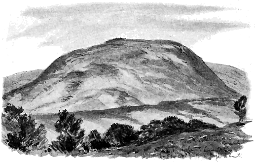
Fig. 82.—View of Cnoc Garbh, Southend, Campbeltown. A volcanic neck of Lower Old Red Sandstone
age, about 400 yards wide in its longer diameter.
At Keil Point, a little to the east of the most southerly headland of
the Mull of Cantyre, some reddish and purplish highly felspathic sandstones
(a in Fig. 83) dipping towards the east are found to pass upward into
coarse volcanic breccias (b), which, followed eastwards, lose almost all trace
of stratification, and are then abruptly succeeded by a neck of coarse
agglomerate (c) measuring 25 yards from north to south, where its limits
can be seen, and at least 12 yards from west to east. It is hardly possible
to distinguish between the breccias to the west and the agglomerate of the
neck, except by the rude bedding of the former which pass down into the
well-bedded sandstones.
The agglomerate is a thoroughly volcanic rock. The materials consist
chiefly of angular blocks of a pale purplish or lilac highly porphyritic mica-porphyrite,
with large white felspars and hexagonal tables of black mica.
These blocks might sometimes be mistaken for slags from their cavernous,
weathered surfaces, but this rough aspect is found on examination to be
due to the decay of their felspars.
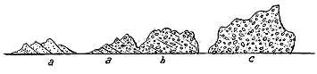
Fig. 83.—Section of volcanic series on beach, Southend, Campbeltown.
a, Fine reddish and purplish highly felspathic sandstones, largely composed of porphyry-debris and passing up into
coarse breccias; b, volcanic breccias, coarse and only rudely stratified, formed of blocks of porphyry, sandstone
fine tuff and andesite, together with water-worn quartzite pebbles derived from some conglomerate;
c, coarse unstratified agglomerate forming a neck.
Perhaps the most singular feature among the contents of this neck is
the number of well-rounded and smoothed pebbles and boulders of quartzite.
These are dispersed at random through the mass, and are often placed
on end. There can be no doubt that they are water-worn stones, but the
contrast of their smooth surfaces and rounded forms with the rough angular
blocks of igneous material is so striking as to lead at once to the conclusion
that they cannot have acquired their water-worn character in the deposit
where they now lie. Their positions and their occurrence with ejected
volcanic blocks suggest that they too were discharged by volcanic explosions.
They so exactly resemble the quartzite boulders and pebbles in
the neighbouring Old Red Conglomerates that there can be little hesitation
in regarding them as derived from these conglomerates. They seem to me
to have come from a lower part of the Old Red Sandstone, which was
shattered by volcanic energy either before the conglomerates were firmly
consolidated or afterwards by such violent explosions as served to separate
the pebbles from the matrix of the rock.
There occur also in the agglomerate blocks of fine tuff and ashy sandstone
sometimes four feet long, and often stuck on end, showing that the deposits
of earlier eruptions were broken up during the drilling of this little vent.
A few hundred yards further east a larger neck rises on the beach,
immediately to the south of the old Celtic chapel of St. Columba. It consists
also of exceedingly coarse agglomerate, with andesite blocks three and
four yards in diameter. It is about 125 yards broad from east to west,
on which sides it is seen to be flanked by coarse volcanic breccias and
conglomerates, resembling in composition the materials of the neck, but
showing an increasingly definite stratification as they are traced eastward
in the ascending succession of deposits. Following the section in still
the same easterly direction along the coast, we find that bands of fine
felspathic sandstone, marking probably intervals of quiescence, are again
and again succeeded by coarse brecciated conglomerates of igneous materials,
which may be inferred to have been due to a renewal of violent eruptions.
By degrees the evidence of stratification and of attrition among the
volcanic materials becomes more pronounced as the ascending section is
followed; blocks of andesite, even 18 inches or two feet in diameter, assume
well-rolled, rounded, water-worn forms, like the pebbles of quartzite associated
with them, and eventually the strata return to the usual aspect of the
conglomerates of the district.
I have never seen anywhere better proofs of volcanic explosions,
contemporaneous with a group of strata, and of the distribution of volcanic
fragmentary material round the vents. A further point of much interest is
the additional evidence furnished by this shore-section of considerable wave-action
during the accumulation of the coarse conglomerates. To give to
blocks of porphyrite two feet in diameter a smoothed and rounded form
must have required the action of water in considerable agitation.
From the volcanic breccias and conglomerates of the Mull of Cantyre to
the coast of Antrim in a straight line is a distance of little more than
twenty miles. On a clear day the Old Red Sandstone of Cross Slieve, and
the range of cliffs in which it abruptly descends to the sea between Cushendall
and Cushendun, can be distinctly seen from the Argyllshire shore. The
geologist who passes from the Scottish to the Irish sections cannot fail to
be impressed with the resemblance of the rocks in the two countries, and
with the persistence of the types of conglomerate in Lake Caledonia.
A picturesque section has been laid bare between the Coastguard
Station south of Cushendall and Cushendun Bay.[360] At the south side of the
little inlet of Cushendall, a compact dull quartz-porphyry is exposed in crags
along the shore. This rock ranges in colour from dark brown and purple to
pale-green and buff. Its texture also varies, as well as the proportion of its
felspar-crystals and quartz-blebs. Some parts have a cavernous structure,
like that of an amygdaloid, the small globular cavities being filled with
green decomposition products.
The stratigraphical relations of this rock are not quite clear, but it is
certainly older than the Old Red conglomerates which lie to the north of it,
for these are largely made up of its fragments. The matrix of these detrital
masses consists mainly of the comminuted debris of the porphyry. The
pebbles include all the varieties of that rock, and are tolerably well-rounded.
There is no distinct evidence of volcanic action among these
conglomerates. They resemble, however, many of the conglomerates in the
Midland Valley of Scotland, which, as in the case of those on the Forfarshire
and Kincardineshire coast, are in great part made of the detritus
of andesitic lavas. The Cushendall rocks become coarser as they are traced
northwards into lower members of the series, while at the same time the
proportion of porphyry-debris in their constitution diminishes, and materials
from the metamorphic series take its place. Thus at Cushendun the percentage
of quartz-pebbles rises to 70 or 80. These blocks, of all sizes up
to two feet or more in diameter, are admirably rounded and smoothed, like
those in the Stonehaven section and those among the conglomerates at the
south end of Cantyre. Fragments of the porphyry, however, still continue to
appear, and the matrix shows an admixture of the finer detritus of that rock.
I may remark in passing that no conglomerates of the Old Red Sandstone
show more strikingly than these at Cushendun the effects of mechanical crushing
subsequent to deposition and consolidation. In many parts of the rock it
is hardly possible to find a rounded block that has not been fractured. Some
of them, indeed, may be seen cut into half a dozen slices, which have been
pushed over each other under the strain of strong lateral or vertical pressure.
In the interior of the country, after passing over the broad Tertiary
basaltic plateau of Antrim, we come upon a large area of Lower Old Red
Sandstone in Tyrone. It stretches from Pomeroy to Loch Erne, a distance
of about 30 miles, and is about 12 miles broad. In lithological character
the strata of this tract exactly resemble parts of the deposits of Lake
Caledonia in Central Scotland. They include also a volcanic series which,
down to the smallest points of detail, may be paralleled in the sister island.[361]
This interesting westward prolongation of the volcanic record consists of
a number of outlying patches confined to the eastern part of the district.
The largest of these patches lies to the south of Pomeroy, where it forms
a line of hills about four miles long, and covers an area of some five square
miles. The rocks consist of successive sheets of andesite-lavas. These, as
a rule, are not markedly cellular, though they include some characteristic
amygdaloids. A distinguishing feature of some of the sheets is their remarkably
well-developed flow-structure. Thus on Sentry Box, at the north-western
end of the ridge, the fissility resulting from this structure so perfectly divides
the rock into parallel flags that the material might easily be mistaken for a
bedded rock. Where this structure has been produced in a cellular lava,
the cavities have been drawn out and flattened in the direction of flow.
I have not observed true tuffs in any of the sections traversed by me
in this district. But the conglomerates furnish abundant evidence of the
contemporaneous outpouring of the lavas. Thus, in a brook a little west of
Reclain, five miles south of Pomeroy, the section shown in Fig. 84 may be
seen. At the base lies a coarse conglomerate (a) largely composed of
andesite-debris, the stones being here, as elsewhere in the district, well
rounded. Then comes a series of green and reddish highly-felspathic sandstones
(b), followed by an exceedingly coarse conglomerate (c), formed mainly
of the debris of andesites, especially lumps of slag. Some of the stones
measure 18 inches in diameter, and all are well water-worn. Immediately
over this mass of detritus lies the lowest sheet of andesite-lava (d).

Fig. 84.—Section of the base of the volcanic series, Reclain, five miles south of Pomeroy.
Some sections visible in the neighbourhood of Omagh afford further
evidence of volcanic action at the time of the deposition of the Old Red
Sandstone of this region. At Farm Hill, a little to the east of the town,
felspathic sandstones and breccias enclose angular and subangular pieces of
various andesites, and occasionally even pieces of tuff. Near these strata a
decayed andesite occurs in the bed of a stream, and a fresher variety is
quarried at Farm Hill. A little further south another variety of andesite
is exposed in two quarries at Recarson Meeting-House—a fine granular
purplish-grey rock, with abundantly-diffused hæmatite
pseudomorphs, probably after a pyroxene, and sometimes
strongly amygdaloidal.
Fig. 85. Section of
shales and breccias at Crossna Chapel, north-east of Boyle.
a a, Green and grey shales; b b, green
and grey hard sandstones and grits, some bands strongly felspathic;
c, fine compact felspathic breccia, with angular chips of
different felsites and andesites, etc.
There can thus be no doubt that this region of Ulster
included several centres of volcanic activity during the
deposition of the red sandstones and conglomerates, and
that the lavas and volcanic conglomerates belonged to
precisely the same types as those of the same geological
age which occur so abundantly in Scotland.
Further south-west, near Boyle, in the county of
Roscommon, certain curious felspathic breccias in the Old
Red Sandstone have been mapped as "felstone."[362] So far
as I have been able to examine them, however, they are
entirely of fragmental origin. They contain pieces of
andesitic and felsitic rocks, with fragments of devitrified
glass, which undoubtedly point to the occurrence of
volcanic eruptions during their deposition, though no
tuffs and lavas appear to crop out in the narrow strip of
the formation there exposed.
The accompanying section (Fig. 85) may be seen on
the hills to the north-east of Boyle. Where quarried
on the road-side to the north of Boyle, the series
of deposits here represented contains a bed of coarse
and exceedingly compact breccia, similar to that just
referred to, but containing angular and subangular fragments six or eight
inches long. The joints of these compact strata are remarkably sharp and
clean cut, so that where the fragmentary character is not very distinct
the rocks might easily be mistaken on casual inspection for felsites.
CHAPTER XX VOLCANOES OF THE LOWER OLD RED SANDSTONE OF "LAKE CALEDONIA"— continued — II. THE SOUTHERN CHAIN OF VOLCANOES IN "LAKE CALEDONIA" — 5. The Pentland Volcano — 6. The Biggar Centre [366] — 7. The Duneaton Centre — 8. The Ayrshire Group of Vents
The Southern Chain—The Pentland Volcano—The Biggar Centre—The Duneaton
Centre—The Ayrshire Volcanoes.
We have now to note the leading features of the groups of volcanic rocks
distributed along the southern line of vents already described. At least
four different centres of eruption may be observed on that line. Their
mutual limits are, on the whole, better seen than those of the northern line,
for from the north-eastern to the south-western end of the volcanic belt the
Old Red Sandstone and rocks of older date are almost continuously exposed
at the surface. The encroaching areas of Carboniferous formations in
Lanarkshire and Ayrshire interrupt but do not entirely conceal the volcanic
tracts.
Beginning at the north-east end of the line we first come upon the
classic area of the Pentland Hills, for the study of which the geologist is
prepared by the admirable description of Charles Maclaren,[363] and the earlier
geognostical papers of Jameson.[364] The area mapped in detail is represented
in Sheet 32 of the Geological Survey of Scotland, published in 1859, and
described in the Memoir accompanying that sheet.
When in these early days I surveyed this ground I found it extremely
difficult to understand. Being then myself but a beginner in geology, and
the study of old volcanic rocks not having yet advanced much beyond its
elementary stage, I failed to disentangle the puzzle. Not until after more
than twenty years, largely spent in the investigation of volcanic rocks elsewhere,
had I an opportunity of resurveying the ground and bringing to its
renewed study a wider knowledge of the subject. A new edition of the
map was issued in 1892, and I shall here embody in my summary the
chief results obtained in the course of this revision.
The most obvious features in the Pentland area are the marked development
of the volcanic rocks at the north end of the chain, their rapid
diminution and disappearance towards the south-west, the abrupt truncation
of the bedded masses by the line of craggy declivity which forms the
northern termination of the hills, and lastly, the continuation of the volcanic
series northward in a totally different form in the lower eminences of the
Braid Hills.
The length of the whole volcanic tract is about eleven miles; its breadth
at the widest northern part is four miles, but from that maximum it dwindles
southwards and dies out in seven miles. Its western side is in large measure
flanked by the unconformable overlap of the Upper Old Red Sandstone and
Lower Carboniferous formations, though in some places the base of the
volcanic series is seen. The eastern boundary is chiefly formed by a large
fault which brings down the Carboniferous rocks against the volcanic ridge.
At the northern end, this ridge plunges unconformably under the Upper Old
Red Sandstone of the southern outskirts of Edinburgh.
The bedded aspect of the truncated end of the Pentland chain, as seen
from the north, has been already alluded to (p. 281). The rocks dip to the
south-east, hence the lower members of the series are to be found along the
north-west side of the hills.

Fig. 86.—Section across the north end of the Pentland Hills, from Warklaw Hill to Pentland Mains.
Length about five miles.
1. Upper Silurian grits and shales, not seen where the line of section crosses; 2 2. Andesites and diabases in
numerous interstratified sheets; 2 s. Intercalated sandstones and conglomerates; 3. Felsitic tuffs and
breccias and orthophyre sheets; n, Volcanic neck; 4. Lower Carboniferous strata lying unconformably on and
overlapping the volcanic series; 5. Calciferous Sandstones and Carboniferous Limestone series brought down
against the volcanic series by a fault (f).
It will be noticed from the Geological Survey map that the volcanic
rocks of the main body of the Pentland Hills are arranged in alternations of
somewhat basic and more acid bands. The most basic sheets are some
amygdaloidal diabases at the bottom of the whole series which make their
appearance in Warklaw Hill (Fig. 86). The greater number of the dark
lavas are varieties of andesite, sometimes tolerably compact, sometimes
highly cellular and amygdaloidal. But interstratified with these are thick
sheets of what used to be called "claystone," a term which here comprised
decayed felsites (orthophyres), and also felsitic tuffs and breccias. The remarkably
acid nature of some of these rocks has been already pointed out.
The total thickness of the volcanic series at the north end of the hills is
about 7000 feet, but as neither the top nor the bottom is there visible, it
may be considerably greater. At these maximum dimensions the rocks form
the high scarped front of the Pentland Hills, which rises into so prominent
a feature in the southern landscape of Edinburgh. A series of transverse
sections across the chain from north to south will illustrate its structure
and history. These I shall here describe, reserving for subsequent consideration
the great vent of the Braid Hills.
A section taken through the north end of the chain, where the maximum
depth of volcanic material is exposed, presents the arrangement
represented in Fig. 86. It will be seen that the base of the series is here
concealed by the unconformable overlap of the Lower Carboniferous rocks
on the west side, while the top is cut off by the great fault which on the
east side brings down the Midlothian Coal-field.
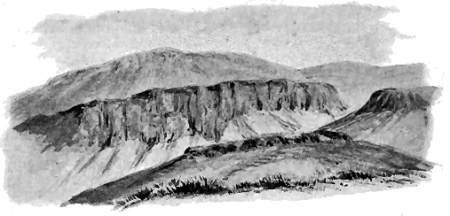
Fig. 87.—View of the lava-escarpments of Warklaw Hill, Pentland chain, from the north-west.
The Lower Carboniferous conglomerates (4) creep over the edge and up the
slopes of the volcanic series of the Pentland Hills. They contain abundant
pebbles of the lavas, and were evidently laid down along a shore from which
the Pentland rocks rose steeply into land. Though the actual base of the
lavas is not seen here, two miles further to the south highly-inclined
Upper Silurian shales and mudstones are found emerging unconformably
from under the volcanic pile, and similar strata probably underlie Warklaw
Hill as indicated in the figure. The Upper Silurian strata pass up into a
lower group of the Lower Old Red Sandstone, which has also been covered
unconformably by the volcanic series. In these underlying deposits we
have evidence of the pre-volcanic accumulations of the lake, which were
broken up and tilted at the beginning of the volcanic eruptions.
The lowest lavas, consisting of well-marked beds of diabase (2), present
their escarpments to the north-west and dip into the rising ground, as
sketched in Fig. 87. Their characters have been already noticed in the
general petrography of the Old Red Sandstone volcanic rocks. Dark solid
compact portions of them pass rapidly into coarsely cellular slag, especially
along the upper and under parts of the several sheets. No tuff has been
noticed between these basic flows, but here and there thin lenticular layers
of sandstone, lying in hollows of the lava-sheets, are connected with vertical
or highly-inclined ramifying veins of similar material, with the plains of
stratification passing across the breadth of the veins. These features are an
exact reproduction of those above described in Forfarshire and Kincardineshire.
The amygdales consist of chalcedony, crystallized quartz and calcite.
Torduff Hill, which rises to the east of Warklaw, consists of a mass of
coarse volcanic breccia or agglomerate (n), markedly felsitic in its materials.
It probably forms a neck marking a small volcanic vent, like some others
at the north end of the chain to be afterwards referred to.
In the lower part of Capelaw Hill, the next eminence in an easterly
direction, bedded andesites, with an intercalated band of sandstone and
conglomerate (2s), appear and pass under rocks of so decomposing a kind
that no good sections of them are to be found. The hill is covered with
grass, but among the rubbish of the screes pieces of felsite-like rocks and
breccias may be observed. Some of these blocks show an alternation of
layers of felsitic breccia with a fine felsite-like material which may be a
tuff. These rocks, conspicuous by the light colours of their screes, alternate
further up with other dark andesitic lavas, and run south-westward for
about five miles.
Beyond Capelaw Hill, upon a band of these pale rocks, comes a thick
group of sheets of dark andesite, which form the main mass of Allermuir
Hill. They are well seen from the south side and likewise from the north,
dipping towards the south-east at angles of from 35° to 40°, and weathering
along the crest of the hills into a succession of scars and slopes which show
the bedded character of the lavas.
At Caerketton Hill another band of pale material forms the conspicuous
craggy face so familiar in the aspect of the Pentland Hills as seen from
Edinburgh. This band consists of pale felsitic breccia, and amorphous,
compact, much-decayed rock, regarding which it is difficult to decide
whether it should be considered as a fine felsitic tuff, or as a decomposed
felsite. The band is better seen when traced southwards. The light colour
of its screes makes it easily followed by the eye even from a distance along
the hill-tops and declivities.
On the next hill to the south-west, known as Castlelaw Hill, this pale
band of rock is exposed in a few crags and quarries, and its debris, protruding
through the scanty herbage, slips down the slopes. On its north
side the screes display the same felsitic breccias and compact, decayed felsitic
rocks, occasionally showing a structure like the flow-structure of rhyolite.
The breccia which projects in blocks from the summit of the hill has been
quarried immediately below the crest on the south side, where it overlies
a thin intercalated band of a dull, much-decomposed porphyry.
The breccias are composed almost entirely of thoroughly acid rock-fragments,
as may be judged from the percentage of silica shown to occur
in them. These fragments vary from the finest lapilli up to angular pieces
several inches long. They not infrequently display a fine and extremely
beautiful flow-structure. It is thus quite certain that there are acid
breccias intercalated among the more basic lavas of the northern Pentlands,
and that among the constituents of these breccias are fragments of felsite
or perhaps even lithoid rhyolite.
We may therefore be prepared to find that actual outflows of felsitic
lava accompanied the discharge of these highly-siliceous tuffs. Unfortunately
the manner in which the rocks decay and conceal themselves under
their own debris makes it difficult to separate the undoubtedly fragmental
bands from those which may be true lavas. But an occasional opening,
and here and there a scattered loose block, serve to indicate that the two
groups of rock certainly do coexist in this pale band, which can be followed
through the chain for upwards of six miles until it is cut off by the eastern
boundary fault.
At the south-west end of Castlelaw Hill, where a quarry has been
opened above the Kirk Burn, blocks of felsite may be observed showing
flow-structure on a large scale. The bands of varied devitrification are sometimes
a quarter of an inch broad, and weather out in lighter and darker
tints. Some of them have retained their felsitic texture better than others,
which have become more thoroughly kaolinized. That these are not deceptive
layers of different texture in fine tuffs is made quite clear by some
characteristic rhyolitic structures. The bands are not quite parallel, but,
on the contrary, are developed lenticularly, and may be observed to be
occasionally puckered, and to be even bent back and folded over as in
ordinary rhyolites. There is no contortion to be observed among the
stratified tuffs of the hills. This irregularity in the layers is obviously
original, and can only be due to the flow of a moving lava.
On the east side of Castlelaw Hill, as shown in Fig. 86, dull reddish
andesites overlie the pale belt of felsitic rocks. Their lower bands are
marked by the presence of well-formed crystals of a dark green mica. Their
central and higher portions consist of porphyrites of the prevalent type,
both compact and vesicular. These lavas continue as far as any rock can
be seen. Beyond the boundary fault, the Burdiehouse Limestone and oil-shales
of the Lower Carboniferous series are met with, inclined at high
angles against the hills. It is impossible to say how much of the volcanic
series has here been removed from sight by the dislocation.
If now we move three miles further to the south-west and take a
second section across the Pentland Hills, it will be found to expose the
arrangement of rocks represented in Fig. 88. At the western end the
Upper Old Red Sandstones (4) and Lower Carboniferous series (5) are seen
lying unconformably on the upturned edges of the Upper Silurian shales (1).
North Black Hill consists of a large intrusive sheet of pale felsite (F) that
has broken through the Silurian strata and has in places thrust itself between
them and the conglomerates of the Lower Old Red Sandstone which lie
unconformably upon them. In the neighbouring Logan Burn, at the bottom
of the Habbie's Howe Waterfall, the felsite can be seen injected into the conglomerate.
The felsitic sill of North Black Hill runs for a mile and a half
along the western base of the volcanic series, and has a breadth of about
half a mile. It is the only important intrusive mass in the Pentland Hills.
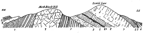
Fig. 88.—Section across the Pentland Hills through North Black Hill and Scald Law (length about
three miles).
To the south of the Silurian shales that lie against the southern flank
of North Black Hill, pale felsitic tuffs (3) occur, which are a continuation of
those already referred to as running southwards from Capelaw Hill. Above
them a series of andesites (2), with intercalated bands of tuff, sandstone
and conglomerate (2s), occupy the bottom of the Logan valley and part
of the slopes on both sides. In the thickest band of tuffs, which is well-exposed
along the road by the side of the Loganlee Reservoir, a group of
well-bedded strata occurs from less than an inch to a foot or more in thickness.
Generally they are pale in colour, and are made up of white felsitic
detritus, but with a sprinkling of dull purplish-red fragments, and occasional
larger rounded pieces of different andesites. Some of the rocks might be
called felspathic sandstones. Other bands in the group are dark purplish-red
in tint, and consist mainly of andesitic debris, with a dusting of white
felsitic grains and fragments. There would thus seem to have been showers
both of felsitic and of andesitic ashes and lapilli.
The dark lavas that overlie the tuffs are likewise well displayed along
the same road-section. They vary rapidly from extremely compact homogeneous
dark blue rocks, that weather with a greenish crust, to coarse,
slaggy masses and amygdaloids.

Fig. 89.—Section from the valley of the Gutterford Burn through Green Law and Braid Law to
Eight-Mile Burn.
These more basic lavas are a continuation of those of Allermuir Hill,
and, as at that locality, they plunge here also under the same band of white
tuffs, breccias and felsites (3), which has been referred to as stretching
southward from Caerketton Crags. This band must here be at least 500 feet
thick. It forms Scald Law (1898 feet) and the surrounding summits, and
thus occupies the highest elevations in the Pentland chain. It dips beneath
the uppermost group of andesites, which, as before, are here truncated by
the eastern fault (f), the Calciferous Sandstones and Carboniferous Limestone
series (6) being thrown against them.
A third section (Fig. 89), taken two miles still further south, shows a
remarkable attenuation of the volcanic series, and the appearance of a thick
group of conglomerates (2) lying conformably below that series, but resting
on the upturned edges of the upper Silurian shales (1). The thick Allermuir
porphyrites are here reduced to a few thin beds (3) intercalated among
the conglomerates and sandstones, amidst which the whole volcanic series
dies out southward. A detailed section of the rocks exposed on the western
front of Braid Law shows the following succession:—
White felsitic rocks of Braid Law (4 in Fig. 89).
Coarse conglomerate passing down into sandstone. About 20 feet visible.
Dark andesite, 4 feet.
Parting of yellow felspathic grit, 8 or 10 inches.
Andesite, 10 feet.
Hard felspathic grit, 6 feet.
Dark green amygdaloidal andesite, 2 feet.
Yellow felspathic sandstone and grit, 2 feet.
Dark green amygdaloidal andesite, 6 feet.
Felspathic grit and red and brown sandstone, 4 feet.
Dark andesite, perhaps 6 or 8 feet.
Great conglomerate with alternating courses of sandstone, rapidly increasing in
thickness southwards.
Above these dwindling representatives of the northern andesitic lavas
comes the continuation of the white band of tuffs and breccias of Caerketton
and Scald Law (4), which in turn dips under the highest group of
andesites. The Carboniferous strata (5) are brought in by the fault (f).
In little more than two miles beyond this line of section the volcanic
series disappears, and the Old Red Sandstone for a brief space consists only
of sedimentary deposits.
Besides the remarkable alternation of basic and acid ejections, there is a
further notable feature in the geology of the Pentland Hills. This volcanic
centre presents us with one of the most remarkable vents anywhere to be
seen among the volcanic rocks of Britain. The full significance of this
feature may best be perceived if we advance along the hills from their
south-western end. As has now been made clear, the volcanic materials
which begin about the line of the North Esk near Carlops rapidly augment
in thickness until, in a distance of not more than seven miles, they attain a
thickness of about 7000 feet, and then form the great scarped front of the
hills that look over Edinburgh. But at the base of that wall their continuity
abruptly ceases. The lower ground, which extends thence to the
southern suburbs of Edinburgh, and includes the group of the Braid Hills, is
occupied by another and more complex group of rocks in which the parallelism
and persistence so marked in the Pentland chain entirely disappear.
This abrupt truncation of the bedded lavas and tuffs marks approximately
the southern margin of a large vent from which at least some, if not most,
of these rocks were probably ejected. The size of this vent cannot be precisely
ascertained on account of the unconformable overspread of Lower
Carboniferous strata. But that it must have been a large and important
volcanic orifice may be inferred from the fact that the visible area of the
materials that fill it up measures two miles from north-east to south-west,
and a mile and a half from south-east to north-west, thus including a space
of rather more than two square miles. Its original limits towards the north
and south can be traced by help of the bedded lavas that partially surround
it, but on the two other sides they are concealed by the younger formations.
We shall probably not over-estimate the original area of the vent if we state
it at about four square miles.
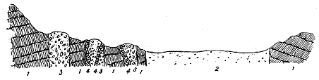
Fig. 90.—Section across the north end of the Pentland Hills, and the southern edge of the Braid Hill
vent. Length about two miles.
1 1. Andesites; 2. Fine tuffs, etc., of the Braid Hill vent; 3 3 3. Agglomerate in lateral necks with
felsitic intrusions (4).
The materials that now fill this important orifice consist mainly of "claystones,"
like those of the Pentland series—dull rocks, meagre to the touch,
varying in texture from the rough porous aspect of a sinter through stages
of increasing firmness till they become almost felsitic, and ranging in colour
from a dark purple-red, through shades of lilac and yellow, to nearly white,
but often strikingly mottled. A more or less laminar structure is often to
be observed among them, indicating a dip in various directions (but especially
towards the north) and at considerable angles. Throughout this exceedingly
fine-grained material, lines of small lapilli may occasionally be detected, also
bands of breccia, consisting of broken-up tuff of the same character, and
of fine "hornstone" and felsite, with delicate flow-structure. Exhibiting
on the whole so little structure, this tract may be regarded as consisting
largely of fine volcanic dust derived from the explosion of felsitic or orthophyric
lavas. Some portions indeed are not improbably composed of
decayed felsites, like those which present so many difficulties to the geologist
who would try to trace their course among the other lavas and tuffs of the
Pentland chain. Various veins, dykes and small bosses of felsite, andesite
and even more basic material, such as fine dolerite, have been intruded into
the general body of the mass.
On the outskirts of the main vent some subordinate necks may be
observed (3, 3 in Fig. 90), perhaps, like Torduff Hill, already noticed (Fig. 86),
marking lateral eruptions from the flanks of the great cone. Three
of these occur in a line more than half a mile long, possibly indicating a
fissure on the side of the old volcano, running in a south-westerly direction
from the southern edge of the vent. The smallest of them measures about
500 feet in diameter; the largest is oblong in shape, its shorter diameter
being about 500 feet, and its longer about 1000 feet. The materials that
fill these lateral vents are coarse agglomerates, traversed by veins and
irregular intrusions of a fine horny or flinty felsite.
From the acid character of most of the rocks that now fill the wide vent
of the Braid Hills it may be inferred that at least the last eruptions from it
consisted chiefly of acid tuffs and lavas. The upper portion of the volcanic
series being everywhere concealed, there are no means left to verify this
inference from an examination of the ejected material. It may be remarked,
however, that the pale yellow sandstones which lie on the east side of the
fault and are exposed in the Lyne Water above West Linton are in great
measure composed of fine felsitic material.[365] They certainly belong to a
higher horizon than the most southerly lavas of the Pentland Hills, and
if they have not derived their volcanic detritus from the Biggar volcanic
area, it may be assumed that they obtained it from the vent of the Braid
Hills. In any case they show that after the lavas of the southern end of
the Pentland Hills were buried, acid volcanic detritus continued to be
abundantly distributed over this part of the floor of Lake Caledonia.
Another distinct group of volcanoes had its centre about 25 miles
south-westward from the Braid vent, and on the same line as those of the
Pentland Hills. In no part of the basin can the isolation of the different
volcanic clusters be so impressively observed as in the area to the south-west
of these hills. On the one hand, the lavas and tuffs from the Braid
vent die out, and on the other, as we follow the conglomerates south-westwards,
a new volcanic series immediately makes its appearance.
The space between the last extremity of the Pentland lavas and the
beginning of the Biggar series does not exceed some 500 yards. It will be
remembered that the lower half of the Pentland volcanic series dies out long
before it reaches the southern end of the hills, and that it is by lavas on the
horizon of some of the dark andesites of Allermuir Hill that the volcanic
band is finally prolonged to its extreme southern limit. The most northerly
extension of the Biggar lavas lies somewhere on the same general platform.
But whereas, at the north end of the Pentland chain, the volcanic sheets
rest on the edges of the Upper Silurian shales, at the south end, several
hundred feet of coarse conglomerate and sandstone intervene between the
Silurian shales and the porphyrites. So rapidly does the bulk of these
sedimentary formations increase that in the course of two miles they must
be 3000 feet in thickness below the most northerly of the Biggar lavas just
referred to. But after that point, when they cross the Lyne Water, they
begin to be more and more interstratified with thin sheets of andesite. These
lavas, the beginning of the Biggar series, soon number nine or ten distinct
bands, and so quickly do they usurp the place of the sedimentary materials
that in a distance of not more than twelve miles they form, where traversed
by the river Clyde, the whole breadth of the visible tract of Old Red Sandstone,
to the exclusion of the conglomerates.
Unfortunately, soon after the lavas make their appearance at the north
end they are in great measure overlapped unconformably by the red sandstones
at the base of the Carboniferous system, but where the Medwin Water
has cut through this covering, they can be seen here and there underneath
on their southerly course.
A section through the northern end of the Biggar series, where the
successive lavas are dying out northwards among the conglomerates, shows
the structure given in Fig. 91. The sedimentary strata consist largely of
debris of andesite, and the lavas include dark red or purple andesites and
also pale felsites, both having the same characters as those of the Pentland
Hills.
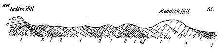
Fig. 91.—Section across the northern end of the Biggar volcanic group, from Fadden Hill to
beyond Mendick Hill.
1. Conglomerates and sandstones; 2. Lavas, the lowest being an olivine-diabase or basalt, the main mass
being andesites; 3. Felsites and tuffs; 4. Upper Old Red Sandstone. f, Fault.
In one important respect the volcanic series in the northern part of the
Biggar area differs from that of the Pentland Hills, for whereas the uppermost
parts of the latter are concealed by faults which bring down the Carboniferous
strata against the base of the hills, the lavas at the north end of
the Biggar district pass conformably under a thick group of Lower Old Red
conglomerates and sandstones. We thus learn that here the volcanic
eruptions ceased long before the close of the deposition of the Lower Old
Red Sandstone. The overlying sedimentary series is disposed in a long
synclinal trough, corresponding in direction with the general north-easterly
strike of the volcanic rocks which reappear from under the sandstones and
conglomerates along its south-eastern border, where they are abruptly truncated
by the fault (f, Fig. 92), which brings them against the flanks of the
Silurian Uplands. It is interesting to note that by this dislocation the lavas
of the Lower Old Red Sandstone are placed almost in immediate contact
with those of the Lower Silurian series, which appear here on the crests of
numerous anticlinal folds that are obliquely cut off by the fault.
There is yet another feature of interest in the northern part of the
Biggar volcanic centre. While the lowest visible lava is an olivine-diabase
not unlike parts of the Warklaw group of the Pentland Hills, those which
occur above it are partly andesites and partly orthoclase-felsites. The latter
form, among the hills near Dolphinton, an important group which reaches
its greatest development in the Black Mount (1689 feet). These rocks
cover a breadth of more than a mile of ground, and probably attain a thickness
of not less than 2000 feet. They so closely resemble in their general
characters the corresponding rocks of the Pentland Hills that a brief description
of them may suffice. As in that chain of hills, they are so prone
to decomposition that they are in large part concealed under a covering of
their own debris and of herbage, though their fragments form abundant
screes, and numerous projecting knobs of rock suffice to show the main
features of the lavas and their accompaniments.
The felsites weather into pale yellow and greyish "claystones," but
where fresher sections can be procured they often show darker tints of lilac
and purple. They are close-grained, sometimes flinty, generally porphyritic
with scattered highly-kaolinized white felspars, but without quartz, often
presenting beautiful flow-structure, and not infrequently showing a brecciated
appearance, which in the usual weathered blocks is hardly to be distinguished
from the breccia of interstratified tuffs.
A locality where some of these features may be satisfactorily examined
is a dry ravine in the farm of Bank, on the south-east side of the Black Mount.
Here the felsite possesses such a perfectly developed flow-structure as to
split into slabs which, dipping S.E. at about 25°, might deceive the observer
into the belief that it is a sedimentary rock. A fresh fracture shows the
laminæ of flow, many of which are as thin as sheets of paper, to be lilac in
colour, some of the more decomposed layers assuming tints of grey. The
felspars and micas are arranged with their long axes parallel to the lines
of flow. The rock is not vesicular, but it breaks up here and there into the
brecciated condition just referred to. Below the sheet which displays the
most perfect flow-structure, what is probably a true volcanic breccia makes
its appearance. It consists of angular fragments of a similar lilac felsite, of
all sizes up to pieces two or three inches in length, cemented in a matrix of
the same material stained reddish-brown. In this breccia the stones show
little or no flow-structure.
Above the group of felsites and felsitic breccias, grey andesites make
their appearance, like some of those in the Pentland Hills. They are sometimes
extraordinarily vesicular, the vesicles in the body of the rock being
filled with calcite, agate, etc. Such lavas must have been originally sheets
of rough slag. The elongated steam-vesicles have been partly filled up with
micaceous sand and fine red mud that were washed into crannies of the lava
in direct communication with the overlying water. It is evident that in the
northern part of the Biggar centre the succession of volcanic events followed
closely the order observable in the Pentland Hills, but on a feebler scale.
We may suppose that the lower diabases and andesites are the equivalents of
those of Warklaw and Allermuir, that the felsites and breccias were contemporaneous
with those of Capelaw, Caerketton and Castlelaw, and that the
last andesites made their appearance together with those which form the
highest lavas of the Pentland chain.
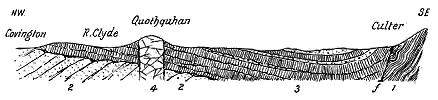
Fig. 92.—Section across the southern part of the Biggar volcanic group from Covington to Culter.
1. Lower Silurian strata; 2. Lower Old Red Sandstone (pre-volcanic group); 3. Andesite lavas with intercalated
sandstones and conglomerates; 4. Felsite neck. f, The boundary-fault on northern edge of Southern Uplands.
A section across the southern end of the Biggar volcanic belt shows less
diversity of structure (Fig. 92). The lavas (3) are there found to flatten
out and to spread unconformably over the older part of the Lower Old
Red Sandstone (2), which, as already stated, passes down into the Upper
Silurian shales. A few intercalations of conglomerate, mainly made up of
volcanic detritus, are here and there to be detected among these lavas. But
the chocolate sandstones and conglomerates that lie unconformably below
them contain no such detritus, for they belong to the pre-volcanic part of
the history of Lake Caledonia, and were here locally upraised, perhaps as
an accompaniment of the terrestrial disturbances that preceded or attended
the first outburst of volcanic energy. Followed south-westwards, the stratigraphical
break in the Lower Old Red Sandstone disappears, and, as will be
shown in the account of the Duneaton centre, a continuous succession can
there be traced from the Upper Silurian shales up into the volcanic series.
An interesting feature in this district is the felsitic boss of Quothquan
already alluded to (p. 288) as rising up through the andesites, and possibly
marking one of the vents of the district. It is one of a number of felsitic
intrusions in this neighbourhood, of which the most important is Tinto.
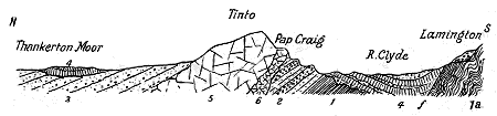
Fig. 93.—Section from Thankerton Moor across Tinto to Lamington.
1a. Lower Silurian; 1. Upper Silurian strata; 2. Lower Old Red Sandstone with two marked bands of conglomerate;
3. Lower Old Sandstone (pre-volcanic chocolate sandstones); 4. Andesite lavas with sandstones,
conglomerates and tuffs lying unconformably on No. 3; 5. Felsite sill of Tinto with the smaller sill of the
Pap Craig (6). f, Fault bounding the Silurian uplands on the north. A small patch of the unconformable
Lower Old Red conglomerate is seen on the south side of the fault.
A third section taken across Tinto, from Thankerton Moor on the north
side to Lamington on the south, will serve further to illustrate the great
unconformability in the Lower Old Red Sandstone of this district, and to show
the relation of the largest felsitic intrusion to the surrounding rocks (Fig. 93).
The conglomerates and sandstones that appear on the south slopes of Tinto
lie near the base of the Old Red Sandstone, and if we could bore among the
overlying andesites we should probably meet with the Upper Silurian shales
among or conformably beneath the red passage-beds, as in the Lesmahagow
district.
The andesitic lavas creep over the upturned denuded edges of these
strata and sweep round the flanks of Tinto. This conspicuous hill reaches
a height of 2335 feet above the sea, and consists of the felsitic rocks already
described (p. 278). Seen from many points of view it rises as a graceful cone,
distinguished from all the other eminences around it by the pinkish colour of
its screes. In reality it forms a continuous ridge which runs in an east and
west direction for about five and a half miles, with a breadth of about a
mile. Some part at least, and possibly the whole of this oblong mass, is in
the form of a sill or laccolite which dips towards the north. Conglomerates
and sandstones plunge under it on the southern side, and similar sandstones
overlie it on the north. If there be a neck in this mass, as one might infer
from the shape of the hill, its precise limits are concealed. The rock does
not break through the andesites, and may belong to an earlier period of
eruptivity than the lavas immediately around it. There were other, though
smaller, vents in the immediate neighbourhood. Besides the cone of
Quothquan just referred to, another may be marked by the felsite boss
which overlooks the village of Douglas, four miles to the south-west of the
Tinto ridge, while a third rises into a low rounded hill close to the village
of Symington.
The lavas spread out again to the south-west of Tinto in a group of
hills, until they are interrupted by a fault which brings in the Douglas
coal-field.[367] This dislocation abruptly terminates the Biggar volcanic band
in a south-westerly direction, after extending for a length of 26 miles, with
a breadth of sometimes as much as five miles.
Among the high bleak muirlands on the confines of the three counties of
Lanark, Ayr and Dumfries, traversed by the Duneaton Water, a distinct
volcanic area may be traced.[368] Its boundaries, however, cannot be satisfactorily
fixed. It is overspread with Carboniferous rocks both to the
north-east and south-west, so that its rocks are only visible along a strip
about seven miles long and two miles broad. On the north-western side its
lower members are seen lying interstratified among the sandstones and conglomerates
which thence pass down conformably into the Upper Silurian
series (Fig. 94). But although we thus get below the volcanic series we meet
with no vents or sills among the lower rocks. On the south-east side the
highest lavas and tuffs are overlain by some 5000 feet of red sandstones and
conglomerates (2, 3), which completely bury all traces of the volcanic history.
The volcanic series in this limited district reaches an estimated thickness
of 4000 feet, built up of purple and green
slaggy andesites, dark heavy diabases (melaphyres)
and tuffs, with abundant interstratification of sandstone,
especially towards the base. One of its chief
features of interest is the manner in which it
exhibits, better, perhaps, than can be found in any
of the other volcanic areas, the frequent and rapid
alternations of lavas and tuffs with sandstone and
conglomerate. In this part of the region the
volcanic discharges were obviously frequent and
intermittent, while at the same time the transport
and deposition of sediment were continuous. This
sediment consisted largely, indeed, of volcanic detritus
mixed with ordinary sand and silt. That
these conditions of sedimentation were not wholly
inimical to animal life is shown by the occasional
occurrence of worm-burrows in the ashy sandstones.[369]

Fig. 94.—Section across the Duneaton volcanic district from the head of the Duneaton Water to Kirklea Hill.
1. Silurian strata; 2. Lower Old Red Sandstone and conglomerate; 3. Coarse conglomerate; 4. Andesite-lavas; 5. Stratified tuffs; 6. Spango granite; 7. Upper Old
Red Sandstone.
The thick accumulation of sandstones and conglomerates
above the main mass of lavas has been
derived almost wholly from the waste of the volcanic
rocks (3). Blocks of andesite, well rounded
and often from six to twelve inches in diameter, may
be seen in the remarkable band of coarse conglomerate
which runs as a nearly continuous ridge
from the Nith to the Clyde—a distance of more
than twenty miles. Nothing impresses the geologist
more, as he wanders over this district, than the
evidence of the prodigious waste which the volcanic
series underwent before it was finally buried. Some
part of the detritus may have been supplied, indeed,
by occasional discharges of fragmental matter,
as has already been suggested in the case of the
Ochil and Montrose conglomerates. But the nature
of the pebbles in these masses of ancient shingle
shows them to be not bombs, but pieces worn away
from sheets of lava.
That the lavas underlie these piles of detritus
and extend southwards even up to the very edge
of the Silurian Uplands is shown by the rise of a
number of successive beds from under the trough
into which the conglomerate has been thrown.
These lavas, however, are almost immediately cut
off by the great boundary fault (f) which flanks the
Silurian territory. That they are not met with now to the south-east of
the dislocation, where they must once have lain, is an evidence of the great
denudation which the district has undergone. Fig. 94, which gives a section
across the broadest part of the area, from the edge of the Muirkirk coal-field
to the Silurian uplands, shows the general structure of the ground.
No satisfactory evidence regarding the position of any of the vents
of the period has been met with in this district. The rocks to the
south of the boundary-fault are older than the Old Red Sandstone, and
as they must have been for some distance overspread by the conglomerates,
sandstones and volcanic series, we might hope to find somewhere among
them traces of necks or bosses. The only mass of eruptive rock in
that part of the district is the tract of Spango granite which has been
already referred to in connection with the subject of the vents and granite
protrusions of Old Red Sandstone time. This mass, about four miles long
and two miles broad, rises through Silurian strata, and by means of the
boundary fault is brought against the higher group of conglomerates and
sandstones. The Silurian shales and sandstones around the granite have
undergone contact-metamorphism, becoming highly micaceous and schistose.
The ascent of this granite must have taken place between the upheaval and
contortion of the Upper Silurian strata, and the deposition of the higher
parts of the Lower Old Red Sandstone of this region. Its date might thus
come within the limits of the volcanic period. But one must frankly own
that there is no positive evidence to connect its production with the volcanic
history.
The original limits of the volcanic districts in the remaining portion of the
Old Red Sandstone area on the mainland of Scotland, from the valley of the
Nith to the Firth of Clyde, can only be vaguely indicated.[370] There is a difficulty
in ascertaining the south-western termination of the Duneaton area,
and in deciding whether the lavas and tuffs of Corsincone in Nithsdale
should be assigned to that district or be placed with those further to the
south-west. Between Corsincone and the next visible volcanic rocks of the
Lower Old Red Sandstone there intervenes a space of six miles, along which,
owing to the effect of the great fault that flanks the north-western margin
of the Southern Uplands, the Carboniferous Limestone and even the Coal-measures
are brought against the Silurian formations, every intermediate
series of rocks being there cut out. It may therefore be, on the whole,
better to include all the volcanic rocks on the left side of the Nith as part
of the Duneaton series. There will still remain a tract of five miles of
blank intermediate ground before we enter upon the volcanic rocks of
Ayrshire.
Owing to complicated faults, extensive unconformable overlaps of the
Carboniferous formations, and enormous denudation, the volcanic tracts of
Old Red Sandstone age in Ayrshire have been reduced to mere scattered
patches, the true relations of which are not always easily discoverable. One
of these isolated areas flanks the Silurian Uplands as a belt from a mile to
a mile and a half in breadth and about six miles long, but with its limits
everywhere defined by faults. A second much more diversified district
extends for about ten miles to the south-west of Dalmellington. It too
forms a belt, averaging about four miles in breadth, but presenting a singularly
complicated geological structure. Owing to faults, curvatures and denudation,
the volcanic rocks have there been isolated into a number of detached
portions, between some of which the older parts of the Old Red Sandstone,
and even the Silurian rocks, have been laid bare, while between others the
ground is overspread with Carboniferous strata. A third unbroken area
forms the Brown Carrick Hills, south of the town of Ayr, and is of special
interest from the fact that its rocks have been exposed along a range of sea-cliffs
and of beach-sections for a distance of nearly four miles. Other detached
tracts of volcanic rocks are displayed on the shore at Turnberry and Port
Garrick, on the hills between Mochrum and the vale of the Girvan, and on
the low ground between Dalrymple and Kirkmichael.
The isolation of these various outliers and separated districts is probably
not entirely due to the effects of subsequent geological revolutions. More
probably some of the areas were always independent of each other, and their
igneous rocks were discharged from distinct volcanic centres. We may
conjecture that one of these centres lay somewhere in the neighbourhood of
New Cumnock, for the lavas between that town and Dalmellington appear
to diminish in thickness and number as they are traced south-westward.
Another vent, or more probably a group of vents, may have stood on the
site of the present hills to the right and left of the Girvan Valley, south of
the village of Straiton. A third probably rose somewhere between Dailly
and Crosshill, and poured out the lavas of the ridges between Maybole and
the Dailly coal-field. The important centre of eruption that produced the
thick and extensive lavas of the Brown Carrick Hills may be concealed
under these hills, or may have stood somewhere to the west of Maybole.
Still another vent, perhaps now under the sea, appears to be indicated by
the porphyrites of the coast-section between Turnberry and Culzean Bay.
Owing to the complicated structure of the ground, several important
points in the history of the Old Red Sandstone of this region have not been
established beyond dispute. In particular, the unconformability which undoubtedly
exists in that system in the south-west of Ayrshire has not
been traced far enough eastwards to determine whether it affects the volcanic
belt east of Dalmellington, or whether the break took place before or after
the eruption of that belt. West of Dalmellington it clearly separates a
higher group of sandstones, conglomerates and volcanic rocks from everything
older than themselves. The structure is similar to that in the Pentland
Hills, a marked disturbance having taken place here as well as
there after a considerable portion of the Lower Old Red Sandstone had been
deposited. These earlier strata were upraised, and on their denuded ends
another group of sandstones and conglomerates was laid down, followed by
an extensive eruption of volcanic materials.
It is the upper unconformable series that requires to be considered here,
as it includes all the volcanic rocks of the Old Red Sandstone lying to the
west of the meridian of Dalmellington. The position of these rocks on
their underlying conglomerates is admirably exposed among the hills between
the valleys of the Doon and the Girvan, as well as on Bennan Hill to the
south of Straiton. The andesites rise in a craggy escarpment crowning long
green slopes that more or less conceal the conglomerates and sandstones below.
Along the coast-sections the structure of the volcanic rocks may be
most advantageously studied. The shore from the Heads of Ayr to
Culzean Castle affords a fine series of exposures, where every feature in the
succession of the lavas may be observed. Still more instructive, perhaps,
is the mile and a half of beach between Turnberry Bay and Douglaston, of
which I shall here give a condensed account, for comparison with the coast-sections
of Kincardineshire and Forfarshire already described.
The special feature of this part of the Ayrshire coast-line is the number
of distinct andesite sheets which can be discriminated by means of the thin
layers of sandstone and sandy tuff that intervene between them. In the
short space of a mile and a half somewhere about thirty sheets can be
recognized, each marking a separate outflow of lava. It was in this section
that I first observed the sandstone-veinings which have been described in
previous pages, and nowhere are they more clearly developed. Almost every
successive stream of andesite has been more or less fissured in cooling, and its
rents and irregular cavernous hollows have been filled with fine sand silted
in from above. The connection may often be observed between these sandstone
partitions or patches and the bed of the same material, which
overspread the surface of the lava at the time that the fissures were being
filled up.
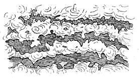
Fig. 95.—Cavernous spaces in andesite, filled in with sandstone,
John o' Groat's Port, Turnberry, Ayrshire.
The andesites of the Turnberry shore are of the usual dark purplish-red
to green colours, more or less
compact in the centre and
vesicular towards the top and
bottom. They display with
great clearness the large empty
spaces that were apt to be
formed in such viscous slaggy
lavas as they moved along the
lake-bottom. These spaces,
afterwards filled with fine sand,
now appear as irregular enclosures
of hard green sandstone
embedded in the andesite. The example shown in Fig. 95 may be
seen in one of the lavas at John o' Groat's Port.
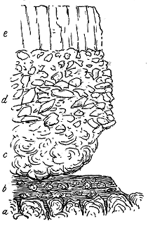
Fig. 96.—Section of andesites, Turnberry
Castle, Ayrshire.
From the arrangement of the veins of sandstone it is evident that
irregularly divergent, but often more or less stellate, fissures opened in the
lavas as they cooled. Sometimes, indeed, the molten rock appears to have
broken up into a shattered mass of fragments, as must often have happened
when lavas were poured over the lake-floor. What may be an instance of this
effect is to be seen on the cliff under the
walls of Turnberry Castle, whence the
annexed sketch (Fig. 96) was taken.
The lower andesite (a) is highly amygdaloidal
towards the top, and is traversed
in all directions with irregular veins and
nests of sandstone which can be traced
upward to the bed (b), consisting of sandstone,
but so full of lumps or slags of
amygdaloidal andesite that one is here
and there puzzled whether to regard it
as a sedimentary deposit, or as the upper
layer of clinkers of a lava-stream strewn
with sand. Above this fragmentary layer
lies another bed of andesite (c) of a
coarsely amygdaloidal structure, which
encloses patches of the underlying sandstone.
It passes upward, in a space of
from four to six feet, into a mass of
angular scoriaceous fragments (d) of all
sizes up to blocks 18 inches in length
cemented in a vein-stuff of calcite, chalcedony
and quartz. This brecciated structure ascends for about 13 or 14
feet, and is then succeeded by a greenish compact andesite (e), which further
north becomes amygdaloidal and much veined with sandstone, passing into
a breccia of lava fragments and sandstone.
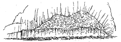
Fig. 97.—Lenticular form of a brecciated andesite (shown in
Fig. 96), Turnberry, Ayrshire.
MAP OF THE VOLCANIC DISTRICTS OF THE LOWER OLD RED SANDSTONE
OF "LAKE CALEDONIA" IN CENTRAL SCOTLAND & NORTH EAST IRELAND
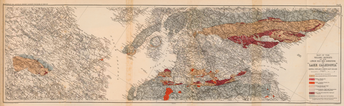
The Edinburgh Geographical Institute
Copyright
J. G. Bartholomew.
Click on map's left, middle, or right to view larger sized version.
The remarkable brecciated band (d) in this cliff, though 13 or 14 feet
in the centre, immediately thins out on either side, until in the course of a
few yards it completely disappears and allows the lavas c and e to come
together, as shown in Fig. 97. We may suppose that this section reveals
the structure of the terminal portion of a highly viscous lava which was
shattered into fragments as it moved along under water.
No clear evidence of the sites of any of the volcanic vents has yet been
detected in the Old Red Sandstone of Ayrshire. Possibly some of the
numerous felsitic bosses to the south-west of Dalmellington may partly mark
their positions. But the sills connected with the volcanic series are well
exposed in the 12 miles of hilly ground between Dalmellington and Barr.
Two groups of intrusive sheets may there be seen. The most numerous
consist of pale or dark-pink felsite, often full of crystals of mica. They
form prominent hills, such as Turgeny, Knockskae and Garleffin Fell. The
second group comprises various diabase-sheets which have been intruded
near the base of the red sandstones and conglomerates, over a distance of seven
miles on the north side of the Stinchar Valley above Barr. They attain
their greatest development on Jedburgh Hill, where they form a series of
successive sills, the largest of which unite northwards into one thick mass
and die out southward among the sandstones and conglomerates.
CHAPTER XXI VOLCANOES OF THE LOWER OLD RED SANDSTONE OF THE CHEVIOT HILLS, LORNE, "LAKE ORCADIE" AND KILLARNEY — THE CHEVIOT AND BERWICKSHIRE DISTRICT — "THE LAKE OF LORNE" — "LAKE ORCADIE" — The Killarney District
In the south-east of Scotland, and extending thence into the north of
England, the remains of several distinct volcanic centres of the Lower Old
Red Sandstone may still be recognized. Of these the largest and most
interesting forms the mass of the Cheviot Hills; a second has been partially
dissected by the sea along the coast south from St. Abb's Head; while
possibly relics of others may survive in detached bosses of eruptive rock
which rise through the Silurian formations of Berwickshire. The water-basin
in which these volcanic groups were active was named by me "Lake
Cheviot,"[371] to distinguish it from the other basins of the same geological
period (Map I.).
The volcanic rocks of the Cheviot Hills, though their limits have been
reduced by faults, unconformable overlap of younger formations and severe
denudation, still cover about 230 square miles of ground, and rise to
a height of 2676 feet above the sea. As they have been mapped in detail
by the Geological Survey, both on the English and the Scottish sides of the
Border, their structure is now known.[372] No good horizontal section, however,
has yet been constructed to show this structure—a deficiency which, it is
hoped, may before long be supplied.
This volcanic pile, consisting mainly of bedded andesites which rest
unconformably on the upturned edges of Wenlock shales and grits, presents
a most typical display of the lavas of the Lower Old Red Sandstone. These
rocks range from vitreous or resinous pitchstone-like varieties to coarsely
porphyritic forms, on the one hand, and to highly vesicular and amygdaloidal
kinds, on the other. Analyses of some of these rocks, and an account
of their petrography, have already been given.
The lavas are often separated by thin partings of tuff, and their upper
surfaces show the fissured character with sandstone infillings, so characteristic
among the lavas of "Lake Caledonia."[373] Tuffs form a very subordinate
part of the whole volcanic series. One of the most important bands is
a thick mass at the base of the series, lying immediately on the highly
inclined Silurian shales. The fragments are generally of a fine-grained
purple mica-andesite, often two or three feet and sometimes at least five
feet long. For a few feet near the bottom of this mass of tuff, pieces of
Silurian shale an inch in length may be noticed. Mr. Clough remarks that
distinct bedding is not usual among the tuffs. Though no doubt most
of the fragmental materials really lie intercalated between successive lava-streams,
yet some of the isolated patches of coarse volcanic breccia may
mark the sites of eruptive vents. One such probable neck has been mapped
on the Scottish side between Cocklawfoot, at the head of the Bowmont
Water, and King's Seat, while others may perhaps occur among the detached
patches that have been observed on the Northumbrian side. No thick conglomerates
or sandstones have been noticed in the Cheviot District. The
volcanic eruptions appear to have usually succeeded each other without the
spread of any notable amount of ordinary detritus over the floor of the
water-basin. It is difficult to estimate the total thickness of volcanic
material here piled up, but it probably amounts to several thousand feet.
The top of the series is not visible, having been partly removed by denudation
and partly buried under the Carboniferous formations.
It will thus be seen that the Cheviot area stands apart from the other
volcanic districts of the Lower Old Red Sandstone in the great relative
thickness of its accumulated lavas, the comparative thinness of its tuffs, and
the absence of the thick intercalations of coarse conglomerate so abundantly
developed among the volcanic series all over Central Scotland. But there
is yet another characteristic in which this area is pre-eminently conspicuous.
In the heart of the andesites lies a core of augite-granitite, around
which these rocks are traversed with dykes.
This interesting granitic boss rises into the highest summit of the whole
Cheviot range, and covers an area of rather more than 20 square miles.
While its petrographical characters have been described by Mr. Teall,
its boundary has been mapped by Mr. Clough, who found the line difficult
to trace, owing partly to the prevalent covering of peat, and partly to the
jagged and irregular junction caused by the protrusion of dykes from and
into the boss. He obtained evidence that the granite has broken through
the bedded andesites, and that it is in turn traversed by dykes composed of
a material indistinguishable from that of some of the flows. He therefore
considered that it is essentially of the same age as the rest of the volcanic
series, and "not improbably the deep-seated source of it."[374] Mr. Teall also,
from a chemical and microscopical examination of the rocks, drew a similar
conclusion.[375]
The andesites around the granite have undergone contact-metamorphism,
but the nature and extent of the change have not yet been studied. There
occur around the granite many dykes of felsite and quartz-felsite, to the
petrographical character of which reference has already been made. But
the most abundant and remarkable dykes of the district are those of a
reddish mica-porphyrite, of which Mr. Clough has mapped no fewer than
forty, besides those in the granitic area. He has called attention to the
significant manner in which all the dykes of the district tend to point in a
general way to the great core of granite, as if that were the nucleus from
which they had radiated.[376]
The central granite of the Cheviot Hills, with its peripheral dykes, has
no accompanying agglomerates nor any decided proof that it ever communicated
with the surface. When, however, we consider its petrographical
and chemical constitution, its position as a core among the bedded lavas,
and the intimate way in which it is linked with these rocks by the network
of dykes, we are, I think, justified in accepting the inference that it
belongs to the volcanic series. It possesses some curious and interesting
features in common with the great granophyre bosses of Tertiary age in
the Inner Hebrides. Like these it has no visible accompaniment of
superficial discharges. Yet it may have ascended by means of some central
vent or group of vents which, offering to it a weak part of the crust,
allowed it to communicate with the surface and give rise to the outflow of
lavas and fragmental ejections. In any case, it affords us a most interesting
and instructive insight into one of the deeper-seated ducts of a volcanic
region, and the relation of a volcanic focus to the ascent of the granitic
magma.
About twenty miles to the north of the Cheviot Hills, and separated
from them by the Carboniferous and Upper Old Red Sandstones which
spread across the broad plain of the Merse, a group of volcanic rocks has
been laid open in a singularly instructive manner along the coast of
Berwickshire, between the village of Eyemouth and the promontory of St.
Abb's Head. Not only the actual vents, but the lavas and tuffs connected
with them, have there been admirably dissected by the forces of denudation.
That this volcanic area was quite distinct from that of the Cheviot
Hills may be inferred from its coarse agglomerates, and from the fact that
when the rocks are followed inland in a south-westerly direction, that is,
towards the Cheviot area, they are found to diminish in thickness and to
disappear among the ordinary sediments. For the same reason we may
regard the area as independent of any vents which may have risen further
west about Cockburn Law and the Dirrington Laws. Unfortunately, however,
only a small part of the area comes into view, the rest of it lying
beneath the waters of the North Sea.[377]
Of the several vents dissected along this coast-line, one may be seen at
Eyemouth, filled with a very coarse tumultuous agglomerate of andesite
fragments embedded in a compact felspathic matrix, through which are
scattered broken crystals of felspar, and imperfect tabular crystals of black
mica. Another of similar character is exposed for more than a mile and a
half along the shore at Coldingham. It contains blocks, sometimes more
than a yard in diameter, of different varieties of andesite, and, as at Eyemouth,
is much invaded by veins and bosses of intrusive andesite.
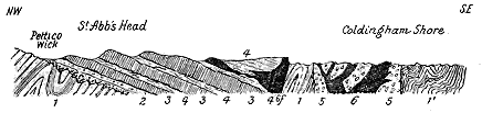
Fig. 98.—Section across the volcanic area of St. Abb's Head (after Prof. J. Geikie).
11. Silurian formations; 2. Lower Old Red Conglomerate and Sandstone; 3 3. Sheets of andesitic lava; 4. Volcanic
tuffs, largely composed of scoriæ in the higher parts; 5. Volcanic agglomerate of neck on shore; 6. Intrusive
andesites. f, Fault.
To the north of Coldingham, a series of bedded volcanic rocks which
form the picturesque headland of St. Abb's Head, are, according to the
estimate of Professor James Geikie, about 1000 to 1200 feet thick, but
neither their bottom nor their top is seen. The same observer found them
to consist of three groups of andesite sheets separated and overlain by
bedded tuffs. The lowest lavas have their base concealed under the sea,
and are covered by a thick band of coarse agglomeratic tuff, above which
lies the second group of andesites, about 250 feet thick. An intercalation
of various tuffs from 40 to 50 feet thick then succeeds, followed by the
third lava-group, 250 or 300 feet in depth. The highest member of the
series is a mass of bedded tuffs some 400 feet thick.
The andesites lie in beds varying from about 15 to about 50 feet or
more in thickness. They are fine-grained, purplish-blue, or greyish-blue,
often reddish rocks, of the usual type. Generally rather close-grained, they
are not as a rule very porphyritic, but often highly scoriaceous and amygdaloidal,
especially towards the top and bottom of each bed. The more
slaggy portions are sometimes so filled in with fine tuff that the rock might
be mistaken for one of fragmental origin.
The bedded tuffs are usually well stratified deposits. The most important
band of them is that which forms the highest member of the volcanic
series. It consists of successive beds that vary from fine red mudstones up
to volcanic breccias with blocks one foot or more in diameter. The
materials have been derived from the explosion of andesitic lavas. Most of
the lapilli are vesicular or amygdaloidal, and many of them have evidently
come from vitreous scoriaceous lavas. Professor Geikie remarks that "from
their highly vesicular character, they might well have floated in water at
the time of their ejection—they are in short mere cinders." He could
detect no trace of ordinary sediment in the matrix, the whole material
being thoroughly volcanic in origin.
The lavas, tuffs and agglomerates have been abundantly invaded by
intrusive rocks, chiefly andesites.[378]
The agglomerates of this Berwickshire coast extend for a short way inland
from the Coldingham and Eyemouth vents, but the fragmental material
soon becomes finer and more water-rolled, and assumes a distinctly stratified
structure, as it is gradually and increasingly interleaved with layers of
ordinary sediment. Hence in passing towards the south-west, away from
the coast-line, we are obviously receding from the vents of eruption and
entering into the usual non-volcanic deposits of the time. That these
deposits belong to the Lower Old Red Sandstone was first ascertained
during the progress of the Geological Survey in this district by the discovery
of abundant plant-remains in the form of linear grass-like strips, and also
pieces of Pterygotus in some of the green shales interstratified among fine
tuffs and ashy sandstones.[379] Before the volcanic detritus disappears from the
strata as they are followed in a south-westerly direction, the whole series
is unconformably overlain by the Upper Old Red Sandstone. The lower
division of the formation is not again seen until it rises from under the
southern margin of the plain of the Merse into the Cheviot Hills.
About ten miles to the south-west of the large Coldingham neck the great
boss of Cockburn Law and Stoneshiel Hill rises out of the Silurian rocks.[380]
Five miles still further in the same direction the group of the beautiful
cones of Dirrington (Fig. 70) overlooks the wide Merse of Berwickshire,[381]
and six miles to the north of these hills, in the very heart of Lammermuir,
lies the solitary boss of the Priestlaw granite.[382] To these protrusions of
igneous material reference has already been made as possible volcanic vents
connected with the eruptions of the Lower Old Red Sandstone. As regards
their age they must certainly be younger than the Llandovery rocks which
they disrupt, and older than the Upper Old Red Sandstone, of which the
conglomerates, largely made from their debris, lie on them unconformably.
It seems therefore probable that these great bosses may form a part of the
volcanic history of the Lower Old Red Sandstone period. But no positive
proof has yet been obtained that any one of them was the site of an eruptive
vent, and no trace has been detected around them of any lavas or tuffs
which might have proceeded from them.
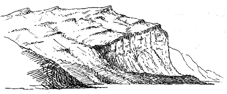
Fig. 99.—View of terraced andesite hills resting on massive conglomerate, south of Oban.
The basin of Lorne has not yet been carefully examined and described,
though various writers have referred to different parts of it (Map I.). My
own observations have been too few to enable me to give an adequate account
of it. The volcanic sheets of this area form a notable feature in the scenery
of the West Highlands, for they are the materials out of which the remarkable
terraced hills have been carved, which stretch from Loch Melfort to
Loch Creran (Fig. 99), and which reappear in picturesque outliers among
the mountains traversed by Glen Coe. Between the ancient schists that
form the foundation-rocks of this district and the base of the volcanic series,
lies a group of sedimentary strata which in the western part of the district
must be 500 feet thick. This group consists of exceedingly coarse breccias
at the bottom, above which come massive conglomerates, volcanic grits or
tuffs, fine sandstones and courses of shale. While the basement-breccias
are composed mainly of detritus of the underlying schists, including blocks
six feet long, they pass up into coarse conglomerates made up almost
entirely of fragments of different lavas (andesites, diabases, etc.), and more
than 100 feet thick, which often show little or no trace of stratification,
but break up into large quadrangular blocks by means of joints which cut
across the imbedded boulders. These volcanic conglomerates form some of
the more conspicuous features of the coast to the south and north of Oban,
and are well exposed in the Isle of Kerrera. They offer many points of
resemblance to those of Lake Caledonia, but no certain proof has been
noted that they belong to the Lower Old Red Sandstone. They have
obviously been derived from lava-sheets that were exposed to strong breaker-action,
which at the same time transported and rounded blocks of granite,
schist and other crystalline rocks derived from the adjacent hills. During
the intervals of quieter sedimentation indicated by the fine sandstones and
shales, volcanic explosions continued, as may be seen by the occurrence of
occasional large bombs which have fallen upon and pressed down the fine
ashy silt that was gathering on the bottom.
It would seem from the characters of some of the strata in this sedimentary
series that over the area of deposit portions of the shallower waters
were occasionally laid bare to the sun and air. Among the conglomerates
there lie certain bands of reddish sandy, ripple-marked, sun-cracked and
rain-pitted shales and fine sandstones. Such accumulations, indicative of
the ultimate exposure of fine sediment that silted up hollows in the great
banks of coarse shingle, may be noticed at the south end of the Island of
Kerrera, on at least two horizons which are separated from each other by
thick masses of conglomerate and fine felspathic grit. We may infer,
therefore, that the fine littoral mud, which gathered during pauses in the
heaping up of the coarse gravel and shingle, was occasionally laid dry.
Similar strata may be observed behind Oban, where the alternation of
exceedingly fine sediment and granular ashy bands is well exhibited.
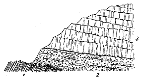
Fig. 100.—Section of lava-escarpment at Beinn Lora, north
side of mouth of Loch Etive, Argyllshire.
1. Phyllites; 2. Thick conglomerate; 3. Successive sheets of
andesite.
But the explosions that gave rise to the volcanic materials so largely
represented in these lower conglomerates, were merely preliminary to those
which led to the outflow of
the great sheets of lava that
now constitute so large a part
of the hills of Lorne. In the
few traverses which I have
made across different parts of
this district I have noted the
general resemblance of the
lavas to those of the Lower
Old Red Sandstone of the
Midland Valley of Scotland,
their bedded character, and
the occurrence of occasional
layers of stratified material
between them. The prominent features of these rocks, and their relation to
the volcanic conglomerates below them, and to the underlying slates and
schists are well displayed on Beinn Lora at the mouth of Loch Etive (Fig. 100).
There the black slates of the district are unconformably covered by
the coarse volcanic conglomerate, formed chiefly of blocks of andesite,
cemented in a hard matrix of similar composition. About 150 or 200 feet
of this material underlie the great escarpment of the lavas, which here rise
in successive beds to the top of the hill, 1000 feet above its base.
On the south side of Loch Etive the base of the volcanic series, with its
underlying conglomerate, may be followed westward to Oban and thence
southward to Loch Feochan. The lavas cover most of the ground from the
western shore eastwards to near Loch Awe. But this area is still very
imperfectly known. The Geological Survey, however, has now advanced
to this part of the country, so that we shall before long be in possession
of more detailed information regarding the character and sequence of its
volcanic history and the geological age of the eruptions.
Mr. H. Kynaston, who has begun the mapping of the eastern portion
of the district, finds that there, as further west, the bottom of the volcanic
series is generally a breccia or conglomerate. He has met with two leading
types among the lavas, the more abundant being strongly vesicular, the
other more compact. He has observed also numerous dykes and sills of
intrusive porphyrite, trending in a general N.N.E. and S.S.W. direction, and
pointing towards the great granite mass of Ben Cruachan.[383]
Mr. R. G. Symes has traced the volcanic series to the north and south
of Oban. While visiting with him part of his ground, I was much struck
with the evidence of an intrusive mass at the base of the volcanic series in
the Sound of Kerrera. A prominent feature on the east side of the channel,
known as Dun Uabairtich and 270 feet high, consists of andesite which
appears to combine both a central boss and a sill. The rock breaks through
the black slates and the overlying conglomerates and sandstones, and has
wedged itself into the unconformable junction between the two formations.
It is beautifully columnar on its sea-covered face, some of the columns
being 120 feet or more in length, and gently curved.
We now cross the whole breadth of the Scottish Highlands in order to
peruse the records of another of the great detached water-basins of the Old
Red Sandstone, which for the sake of brevity of reference I have named and
described as "Lake Orcadie" (Map I.). This area has its southern limits
along the base of the hills that enclose the wide Moray Firth. It spreads
northward over the Orkney and much of the Shetland Islands, but its boundaries
in that direction are lost under the sea. In the extensive sheet of
water which spread over all that northern region the peculiar Caithness Flags,
with their associated sandstones and conglomerates, were deposited to a total
depth of 16,000 feet. A sigillaroid and lycopodiaceous vegetation flourished
on the surrounding land, together with ferns, Psilophyton and conifers. The
waters teemed with fishes of which many genera and species have now
been described. The remains of these creatures lie crowded upon each
other in the flagstones in such a manner as to indicate that from time to
time vast quantities of fish were suddenly killed. Not impossibly, these
destructions may have been connected with the volcanic activity which has
now to be described.
In the year 1878 I called attention to the evidence for the existence of
contemporaneous volcanic rocks in the Old Red Sandstone north of the range
of the Grampians, and specially noted three localities where this evidence
could be seen—Strathbogie, Buckie and Shetland.[384] Since that time Messrs.
B. N. Peach and J. Horne have added a fourth centre in the Orkney Islands.
At present, therefore, we are acquainted with the records of four separate
groups of volcanic vents in Lake Orcadie.
The southern margin of this water-basin appears to have indented the
land with long fjord-like inlets. One of these now forms the vale of Strathbogie,
which runs into the hills for a distance of fully 20 miles beyond
what seems to have been the general trend of the coast-line. In this valley I
found a bed of dark vesicular diabase intercalated among the red sandstones
and high above the base of the formation, as exposed on the west side of the
valley near Burn of Craig. On the east side a similar band has since been
mapped for the Geological Survey by Mr. L. Hinxman who has traced it
for some miles down the Strath.[385] This latter band, as shown in Fig. 101,
lies not far above the bottom of the Old Red Sandstone of this district, and is
thus probably distinct from the Craig outcrop. There would thus appear to
be evidence of two separate outflows of basic lava in this fjord of the Old
Red Sandstone period.
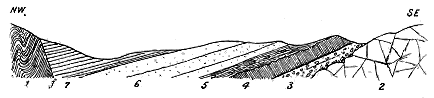
Fig. 101.—Section across Strathbogie, below Rhynie, showing the position of the volcanic band.
1. Knotted schists; 2. Diorite intrusive in schists; 3. Old Red Conglomerate; 4. Volcanic band; 5. Shales with
calcareous nodules; 6. Sandstones of Rhynie; 7. Shales and sandstones. f, Fault.
No vestige has here been found of any vent, nor is the lava accompanied
with tuff. The eruptions took place some time after the earlier sediments
of the basin were accumulated, but ceased before the thick mass of upper
sandstones and shales was deposited. A section across the valley gives the
structure represented in the accompanying diagram (Fig. 101).
Twenty-five miles further north a still smaller andesite band has been
detected by Mr. J. Grant Wilson among the sandstones and conglomerates
near Buckie.[386] It is a truly contemporaneous flow, for pebbles of it occur in
the overlying strata. But again it forms only a solitary bed, and no trace
of any accompanying tuff has been met with, nor of the vent from which it
came. Both this vent and that of Strathbogie must have been situated near
the southern coast-line of the lake.
At a distance of some 90 miles northward from these Moray Firth
vents another volcanic district lies in the very heart of the Orkney Islands.[387]
The lavas which were there ejected occur at the south-eastern corner
of the island of Shapinshay, where they are regularly bedded with
the flagstones. They consist of dark green olivine-diabases with highly
amygdaloidal and vesicular upper surfaces. Their thickness cannot be
ascertained, as their base is not seen, but they have been cut by the
sea into trenches which show them to exceed 30 feet in depth. The
position of the vent from which they came has not been ascertained.
Neither here nor in the Moray Firth area do any sills accompany the
interbedded sheets, and in both cases the volcanic action would seem to have
been of a feeble and short-lived character.
Much more important were the volcanoes that broke out nearly
100 miles still further north, where the Mainland of Shetland now
lies. I shall never forget the pleasure with which I first recognized the
traces of these eruptions, and found near the most northerly limits of the
British Isles proofs of volcanic activity in the Lower Old Red Sandstone.
Since my observations were published,[388] Mr. Peach, who accompanied me in
Shetland, has returned to the district, and, in concert with his colleague
Mr. Horne, has extended our knowledge of the subject.[389] The chief vent or
vents lay towards the west and north-west of the Mainland and North
Mavine; others of a less active and persistent type were blown out some
25 miles to the east, where the islands of Bressay and Noss now
stand. In the western district streams of slaggy andesite and diabase with
showers of fine tuff and coarse agglomerate were ejected, until the total
accumulation reached a thickness of not less than 500 feet. The volcanic
eruptions took place contemporaneously with the deposition of the red sandstones,
for the lavas and tuffs are intercalated in these strata. The lavas
and volcanic conglomerates are traceable from the southern coast of Papa
Stour across St. Magnus' Bay to the western headlands of Esha Ness, a
distance of more than 14 miles. They have been cut by the Atlantic
into a picturesque range of cliffs, which exhibit in some places, as at the
singular sea-stalk of Doreholm, rough banks of andesitic lava with the
conglomerate deposited against and over them, and in other places, as
along the cliffs of Esha Ness, sheets of lava overlying the conglomerates.
No trace of any vents has been found in the western and chief volcanic
district, but in Noss Sound a group of small necks occurs, filled with a coarse
agglomerate composed of pieces of sandstone, flagstone and shale. Messrs.
Peach and Horne infer that these little orifices never discharged any streams
of lava. More probably they were opened by explosions which only gave
forth vapours and fragmentary discharges, such as a band of tuff which is
intercalated among the flagstones in their neighbourhood.
But one of the most striking features of the volcanic phenomena of this
remote region is the relative size and number of the sills and dykes which
here as elsewhere mark the latest phases of subterranean activity. Messrs.
Peach and Horne have shown us that three great sheets of acid rocks
(granites and spherulitic felsites, to which reference has already been made,
p. 292) have been injected among the sandstones and basic lavas, that
abundant veins of granite, quartz-felsite and rhyolite radiate from these
acid sills, and that the latest phase of igneous action in this region was the
intrusion of a series of bosses and dykes of basic rocks (diabases) which
traverse the sills.
In the south of Ireland the Upper Silurian strata are followed upwards
conformably by the great series of red sandstones and conglomerates known
as the "Dingle Beds." Lithologically these rocks present the closest
resemblance to the Lower Old Red Sandstone of Central Scotland. They
occupy a similar stratigraphical position, and though they have not yielded
any palæontological data for comparison, there can, I think, be no hesitation
in classing them with the Scottish Lower Old Red Sandstone, and regarding
them as having been deposited under similar geographical conditions. They
offer one feature of special interest for the purpose of the present inquiry,
since they contain a well-marked group of contemporaneous volcanic rocks,
including nodular felsites, like those so characteristic of the Silurian period.
The area where this remote and isolated volcanic group is best developed
forms a range of high rugged ground along the northern front of the hills
that stretch eastward from the Lakes of Killarney. Their general distribution
is shown on Sheets 184 and 185 of the Geological Survey of Ireland;[390]
though I may again remark that petrography has made great strides during
the thirty years and more that have passed since these maps and their
accompanying Memoirs were published, and that, were the district to be
surveyed now, probably a considerable tract of ground coloured as ash would
be marked as felsite. At the same time the existence of both these rocks
here cannot be gainsaid.
The felsite was long ago brought into notice by Dr. Haughton, who
published an analysis of it.[391] It is also referred to by Mr. Teall for its
spherulitic structure.[392] Seen on the ground it appears as a pale greenish-grey
close-grained rock, sometimes exhibiting flow-structure in a remarkably
clear manner, the laminæ of devitrification following each other in wavy
lines, sometimes twisted and delicately puckered or frilled, as in some
schists. Portions of the rock are strongly nodular, the nodules varying in
size from less than a pea to that of a hen's egg.
The close resemblance of this rock to many of the Lower Silurian
nodular felsites of Wales cannot but strike the geologist. It presents
analogies also to the Upper Silurian felsites of Dingle. But its chief
interest arises from the geological horizon on which it occurs. Lying in
the so-called "Dingle-Beds," which may be regarded as the equivalents
of the Lower Old Red Sandstone of England and Scotland, it is, so far
as my observations go, the only example of such a nodular felsite of
later date than the Silurian period. We recognize in it a survival, as it
were, of the peculiar Silurian type of acid lava, the last preceding eruption
of which took place not many miles to the west, in the Dingle promontory.
But elsewhere this type does not appear to have survived the end of the
Silurian period.
The detrital rocks accompanying the felsite, in the district east of
Killarney, vary from such closed-grained felsitic material as cannot readily
be distinguished from the felsite itself to unmistakable felsitic breccias.
Even in the finest parts of them, occasional rounded quartz-pebbles may
be detected, while here and there a reddish shaly band, or a layer of fine
pebbly conglomerate with quartz-pebbles an inch in length, shows at once
the bedding and the dip. Mr. W. W. Watts, who, with Mr. A. M'Henry of
the Irish Staff of the Geological Survey, accompanied me over this ground,
found that a microscopic examination of the slides which were prepared
from the specimens we collected completely confirmed the conclusions
reached from inspection of the rocks in the field.[393] He detected among the
angular grains slightly damaged crystals of felspar, chiefly orthoclase.
Many portions of these felspathic grits much resemble the detrital Cambrian
rocks which in the Vale of Llanberis have been made out of the pale felsite
of that locality.
CHAPTER XXII VOLCANOES OF THE UPPER OLD RED SANDSTONE—THE SOUTH-WEST OF IRELAND, THE NORTH OF SCOTLAND — THE SOUTH-WEST OF IRELAND — THE NORTH OF SCOTLAND
In the northern half of Britain, where the Old Red Sandstone is so well
displayed, the two great divisions into which this series of sedimentary
deposits is there divisible are separated from each other by a strongly marked
unconformability. The interval of time represented by this break must
have been of long duration, for it witnessed the effacement of the old
water-basins, the folding, fracture, and elevation of their thick sedimentary
and volcanic accumulations, and the removal by denudation of, in some
places, several thousand feet of these rocks. The Upper Old Red Sandstone,
consisting so largely as it does of red sandstones and conglomerates,
indicates the return or persistence of geographical conditions not unlike
those that marked the deposition of the lower subdivision. But in one
important respect its history differs greatly from that which I have
sketched for the older part of the system. Though the Upper Old Red
Sandstone is well developed across the southern districts of Scotland from
the Ochil to the Cheviot Hills, and appears in scattered areas over so much
of England and Wales, no trace has ever been there detected in it of any
contemporaneously erupted volcanic rocks. The topographical changes
which preceded its deposition must have involved no inconsiderable
amount of subterranean disturbance, yet the volcanic energy, which had
died out so completely long before the close of the time of the Lower Old
Red Sandstone, does not appear to have been rekindled until the beginning
of the Carboniferous period.
Two widely separated tracts in the British Isles have yielded traces of
contemporaneous volcanic rocks in the Upper Old Red Sandstone. One
of these lies in the south-west of Ireland, the other in the far north of
Scotland.
The Irish locality is situated a few miles to the south of the town of
Limerick, where the Carboniferous Limestone has been thrown into long
folds, and where, along the anticlines, strips of the underlying red sandstones
have been brought up to the surface. Two such ridges of Upper Old Red
Sandstone bear, each on its crest, a small but interesting relic of volcanic
activity[394] (Map I.).
The more northerly ridge rises in the conical eminence of Knockfeerina
to a height of 949 feet above the sea. Even from a distance the
resemblance of this hill (Fig. 102) to many of the Carboniferous necks of
Scotland at once attracts the eye of the geologist. The resemblance is
found to hold still more closely when the internal structure of the ground is
examined. The cone consists mainly of a coarse agglomerate, with blocks
generally somewhat rounded and varying in size up to two feet in length. The
most prominent of these, on the lower eastern slopes, are pieces of a fine flinty
felsite weathering white, but there also occur fragments of grit and baked
shale. The matrix is dull-green in colour, and among its ingredients are
abundant small lapilli of a finely vesicular andesite or diabase. These
more basic ingredients increase in number towards the top of the
eminence, where much of the agglomerate is almost wholly made up of
them. No marked dip is observable over most of the hill, the rock appearing
as a tumultuous agglomerate, though here and there, particularly near
the top and on the south side, a rude bedding may be detected dipping
outwards. On the west side the agglomerate is flanked with yellow sandstone
baked into quartzite, so that the line of junction there between the
two rocks not improbably gives us the actual wall of the vent. The
induration of the surrounding sandstones is a familiar feature among the
Carboniferous vents. Some intrusive dark flinty rock traverses the agglomerate
near the top on the north side.
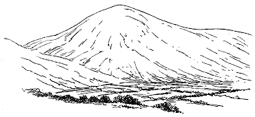
Fig. 102.—View of Knockfeerina, Limerick, from the north-east—a volcanic neck of
Upper Old Red Sandstone age.
Retiring eastwards from the cone, the observer finds evidence of the
intercalation of tuff among the surrounding Upper Old Red Sandstone. At
the east end of the village of Knockfeerina a red nodular tuff, with rounded
pieces of andesite, grit and sandstone, sometimes 12 inches long, is seen
to dip under yellow, grey and red sandstones and shales, while other shales
and sandstones underlie this tuff and crop out between it and the agglomerate.
There is thus evidence of the intercalation of volcanic tuff in the
Upper Old Red Sandstone of this district. And there seems no reason to
doubt that the tuff was ejected from the adjoining vent of Knockfeerina.
On the next ridge of Old Red Sandstone, which runs parallel to that of
Knockfeerina at a distance of little more than a mile to the south, another
mass of volcanic material rises into a prominence at Ballinleeny. On the
north side it consists of agglomerate like that just described, and is
flanked by sandstone baked into quartzite. Here again we probably see
the edge of a volcanic funnel. There may possibly be more than one vent
in this area. But well-bedded tuffs can be observed to dip away from
the centre and to pass under sandstones and shales which are full of
fine ashy material. Gradations can be traced from the tuff into ordinary
sediment. In this instance, therefore, there is additional proof of contemporaneous
volcanic action in the Upper Old Red Sandstone. There can be
no uncertainty as to the horizon of the strata in which these records have
been preserved, for they dip conformably under the shales and limestones
at the base of the Carboniferous Limestone series. They are said to have
yielded the characteristic fern Palæopteris of Kiltorcan.[395]
The only district in England or Scotland wherein traces of volcanic
action during the time of the Upper Old Red Sandstone have been observed
lies far to the north among the Orkney Islands, near the centre of
the scattered outliers which I have united as parts of the deposits of "Lake
Orcadie"[396] (Map I.). The thick group of yellow and red sandstones which
form most of the high island of Hoy, and which, there can be little doubt,
are correctly referred to the Upper Old Red Sandstone, rest with a marked
unconformability on the edges of the Caithness flagstones (Fig. 103). At
the base of these pale sandstones, and regularly interstratified with them,
lies a band of lavas and tuffs which can be traced from the base of the
rounded hills to the edge of the cliffs at the Cam, along the face of which
it runs as a conspicuous feature, gradually sloping to a lower level, till it
reaches the sea. At the Cam of Hoy it is about 200 feet thick, and consists
of three or more sheets of andesite. The upper 50 or 60 feet show a
strongly slaggy structure, the central portion is rudely columnar, and the
lower part presents a kind of horizontal jointing or bedding. There can be
no question that this rock is not a sill but a group of contemporaneous lava-flows.
Beneath it, and lying across the edges of the flagstones below, there
is a zone of dull-red, fine-grained tuff, banded with seams of hard red and
yellow sandstone. This tuff zone dies out to the eastward of the Cam.
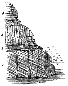 |
|
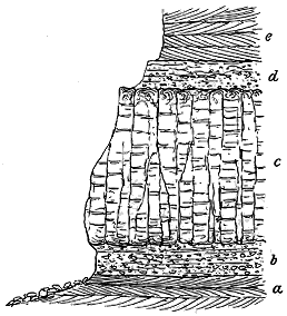 |
Fig. 103.—Section of the volcanic zone in the
Upper Old Red Sandstone, Cam of Hoy, Orkney.
1. Caithness flagstones; 2. Dull-red tuff and bands
of sandstone; 3. Lava zone in three bands; 4.
Yellow and red sandstone. |
Fig. 104.—Section of the volcanic zone in the Upper Old
Red Sandstone at Black Ness, Rackwick, Hoy. |
A few miles south of the Cam the
volcanic zone appears again as the platform
on which the picturesque natural
obelisk of the Old Man of Hoy stands.
Here the lava runs out as a promontory
from the base of the cliff, and on this
projection the Old Man has been left
isolated from the main precipice. The
cliffs of Hoy are traversed by numerous
small faults which have shifted the
volcanic zone. But on the great face
of rock behind the Old Man there appears
to be a second volcanic zone lying
several hundred feet above that just
described. It is probably this upper
zone which emerges from under the
hills a mile and a half to the south at
Black Ness in the bay of Rackwick.
A good section is there visible, which
is represented in Fig. 104. The ordinary
red and yellow sandstones (a) appear
from under the volcanic rocks at this
locality, and stretch southwards to the most southerly headland of Hoy.
The lowest volcanic band in the
section is one of red sandy well-bedded
tuffs (b). Some of the
layers are coarse and almost
agglomeratic, while others are
fine marly and sandy, with dispersed
bombs, blocks and lapilli
of diabase and andesite. Hard
ribs of a sandy tufaceous material
also occur. These fragmental
deposits are immediately overlain
by a dark-blue rudely prismatic
diabase with slaggy top
(c). It is about 150 feet thick
at its thickest part, but rapidly
thins away in a westerly direction.
It passes under a zone
of red tuff (d) like that below,
and above this highest member
of the volcanic group comes the
great overlying pile of yellow and reddish sandstone of Hoy. Followed
westward for a short distance, the whole volcanic zone is found to die out
and the sandstones below and above it then come together.
The interest of this little volcanic centre in Hoy is heightened by
the fact that the progress of denudation has revealed some of the vents
belonging to it. On the low ground to the east of the Cam, and immediately
to the north of the volcanic escarpment, the flagstones which there
emerge from under the base of the unconformable upper sandstones are
pierced by three volcanic necks which we may with little hesitation
recognize as marking the sites of vents from which this series of lavas and
tuffs was discharged (Fig. 105). The largest of them forms a conspicuous
hill about 450 feet high, the smallest is only a few yards in diameter, and
rises from the surface of a flagstone ridge. They are filled with a coarse,
dull-green, volcanic agglomerate, made up of fragments of the lavas with
pieces of hardened yellow sandstone and flagstone. Around the chief vent
the flagstones through which it has been opened have been greatly hardened
and blistered. The most easterly vent, which has been laid bare on the
beach at Bring, due east of Hoy Hill, can be seen to pierce the flagstones,
which, although their general dip is westerly at from 10° to 15°, yet at
their junction with the agglomerate are bent in towards the neck, and are
otherwise much jumbled and disturbed.
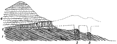
Fig. 105.—Section across the volcanic band and its associated necks, Hoy, Orkney.
1. Caithness flagstones; 2. Volcanic band lying on red sandstones and conglomerates and dying out eastwards; 3 3.
Two vents between the base of the hills and the sea; their connection with the volcanic band is shown by dotted
lines; 4. Overlying mass of Upper Old Red Sandstone forming the hills of Hoy.
On the northern coast of Caithness I have described a remarkable
volcanic vent about 300 feet in diameter, which rises through the uppermost
group of the Caithness flagstones. It is filled with a coarse
agglomerate consisting of a dull-greenish diabase paste crowded with
blocks of diabase, sometimes three feet in diameter, and others of red
sandstone, flagstone, limestone, gneiss and lumps of black cleavable
augite (Fig. 106).[397] The sandstones around it present the usual disrupted,
indurated and jointed character, and are traversed by a small diabase dyke
close to the western margin of the neck. Another similar neck has since
been found by the officers of the Geological Survey on the same coast.
That these volcanic orifices were active about the same time with those in
the opposite island of Hoy may be legitimately inferred.
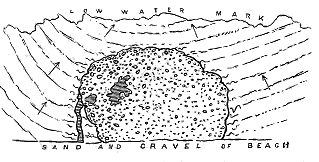
Fig. 106.—Ground-plan of volcanic neck piercing the Caithness Flagstone series on the beach near
John o' Groat's House.
These northern volcanoes made their appearance in a district where
during the preceding Lower Old Red Sandstone period there had been
several widely separated groups of active volcanic vents. So far as the
fragmentary nature of the geological evidence permits an opinion to be
formed, they seem to have broken out at the beginning, or at least at an
early stage, of the deposition of the Upper Old Red Sandstone, and to have
become entirely extinct after the lavas of Hoy were poured forth. No
higher platform of volcanic materials has been met with in that region.
With these brief and limited Orcadian explosions the long record of Old
Red Sandstone volcanic activity in the area of the British Isles comes to
an end.[398]
CHAPTER XXIII THE CARBONIFEROUS SYSTEM OF BRITAIN AND ITS VOLCANIC RECORDS
Geography and Scenery of the Carboniferous Period—Range of Volcanic Eruptions during
that time—I. The Carboniferous Volcanoes of Scotland—Distribution, Arrangement
and Local Characters of the Carboniferous System in Scotland—Sketch of the Work
of previous Observers in this Subject.
Within the area of the British Isles, the geological record is comparatively
full and continuous from the base of the Upper Old Red Sandstone
to the top of the Coal-measures. We learn from it that the local basins of
deposit in which the later portion of the Old Red Sandstone was accumulated
sank steadily in a wide general subsidence, that allowed the clear sea of the
Carboniferous Limestone ultimately to spread for some 700 miles from the
west coast of Ireland into Westphalia. Over the centre of England this
Carboniferous Mediterranean had a breadth of at least 150 miles, gradually
shallowing northwards in the direction of land in Scotland and Northern
Ireland. The gentle sinking of the floor of the basin continued until more
than 6000 feet of sediment, chiefly composed of the remains of crinoids,
corals and other marine organisms, had been piled up in the deeper parts.
Traces of the southern margin of this sea, or at least of a long insular
ridge that rose out of its waters, are to be seen in the protuberances
of older rocks which appear at intervals from under the Coal-measures
and later formations between the borders of Wales and the heart of
Leicestershire, and of which the crags of Charnwood Forest are among the
few peaks that still remain visible. To the south of this ridge, open sea
extended far southward and westward over the site of the Mendip Hills and
the uplands of South Wales.
The Carboniferous period, as chronicled by its sedimentary deposits, was
a time of slow submergence and quiet sedimentation, terrestrial and marine
conditions alternating along the margins of the sinking land, according as
the rate of depression surpassed or fell short of that of the deposition of
sediment. There is no trace of any general disturbance among the strata,
such as would be marked by an important and widely extended unconformability.
But many indications may be observed that the rate of
subsidence did not continue uniform, if, indeed, the downward movement
was not locally arrested, and even exchanged for a movement in the opposite
direction. It is difficult, for instance, to believe the ancient ridge of the
Midlands to have been so lofty that even the prolonged subsidence required
for the accumulation of the whole Carboniferous system was insufficient to
carry its highest crests below the level of the coal-jungles. More probably
the depression reached its maximum along certain lines or bands running in
a general north-easterly direction, the intervals between these lines sinking
less, or possibly even undergoing some measure of uplift. One of the subsiding
tracts, that of the wide lowlands of Central Scotland, was flanked on
the south by a ridge which, while its north-eastern portion was buried under
the Upper Old Red Sandstone and Lower Carboniferous rocks, remained
above water towards the south-west, and does not appear to have been
wholly submerged there even at the close of the Carboniferous period.
So abundant and varied are the sedimentary formations of Carboniferous
time, and so fully have they preserved remains of the contemporary plants
and animals, that it is not difficult to realise in some measure the general
aspect of the scenery of the time, and the succession of changes which it
underwent from the beginning to the end of the period. The land was
green with a luxuriant if somewhat monotonous vegetation. Large pine
trees flourished on the drier uplands. The lower grounds nourished dense
groves of cycads or plants allied to them, which rose as slim trees twenty or
thirty feet high, with long hard green leaves and catkins that grew into
berries. The swamps and wetter lands bore a rank growth of various gigantic
kinds of club-moss, equisetaceous reeds and ferns.
Nor was the hum of insect-life absent from these forests. Ancestral
types of cockroaches, mayflies and beetles lived there. Scorpions swarmed
along the margins of the shallow waters, for their remains, washed away
with the decayed vegetation among which they harboured, are now found
in abundance throughout many of the dark shales.
The waters were haunted by numerous kinds of fish quite distinct from
those of the Old Red Sandstone. In the lagoons, shoals of small ganoids
lived on the cyprids that peopled the bottom, and they were in turn preyed
on by larger ganoids with massive armature of bone. Now and then a
shark from the opener sea would find its way into these more inland waters.
The highest types of animal life yet known to have existed at this time were
various amphibians of the extinct order of Labyrinthodonts.
The open sea, too, teemed with life. Wide tracts of its floor supported
a thick growth of crinoids whose jointed stems, piled over each other
generation after generation, grew into masses of limestone many hundreds
of feet in thickness. Corals of various kinds lived singly and in colonies,
here and there even growing into reefs. Foraminifera, sponges, sea-urchins,
brachiopods, gasteropods, lamellibranchs and cephalopods, in many genera
and species, mingled their remains with the dead crinoids and corals to
furnish materials for the wide and thick accumulation of Carboniferous
Limestone.
Looking broadly at the history of the Carboniferous period, and bearing
in mind the evidence of prolonged depression already referred to, we can
recognize in it three great eras. During the first, the wide clear sea of the
Carboniferous Limestone spread over the centre and south of Britain, interrupted
here and there by islands that rose from long ridges whereby the sea-floor
was divided into separate basins. Next came a time of lessened
depression, when the sea-bottom was overspread with sand, mud and gravel,
and was even in part silted up, as has been chronicled in the Millstone
Grit. The third stage brings before us the jungles of the Coal-measures,
when the former sea-floor became a series of shallow lagoons where, as in
the mangrove-swamps of our own time, a terrestrial vegetation sprang up
and mingled its remains with those of marine shells and fishes.
Such a state of balance among the geological forces as is indicated by
the stratigraphy of the Carboniferous system would not prepare us for the
discovery of the relics of any serious display of contemporary volcanic
activity. And, indeed, throughout the Carboniferous rocks of Western
Europe there is for the most part little trace of contemporaneous volcanic
eruptions. Yet striking evidence exists that, along the western borders of
the continental area, in France as well as over much of Britain, which had
for so many previous geological ages been the theatre of subterranean activity,
the older half of Carboniferous time witnessed an abundant, though less
stupendous and prolonged, renewal of volcanic energy.
From the very commencement of the Carboniferous period to the epoch
when the Coal-measures began to be accumulated, the area of the British
Isles continued to be a scene of active volcanism. In the course of that
prolonged interval of geological time the vents shifted their positions,
and gradually grew less energetic, but there does not appear to have been
any protracted section of the interval when the subterranean activity became
everywhere entirely quiescent.
The geologist who traces, from older to younger formations, the progress
of some persistent operation of nature, observes the evidence gradually to
increase in amount and clearness as it is furnished by successively later
parts of the record. He finds that the older rocks have generally been so
dislocated and folded, and are often so widely covered by younger formations,
that the evidence which they no doubt actually contain may be difficult to
decipher, or may be altogether concealed from view. In following, for
instance, the progress of volcanic action, he is impressed, as he passes from
the older to the younger Palæozoic chronicles, by the striking contrast
between the fulness and legibility of the Carboniferous records and the
comparative meagreness and obscurity of those of the earlier periods. The
Carboniferous rocks have undergone far less disturbance than the Cambrian
and Silurian formations; while over wide tracts, where their volcanic
chapters are fullest and most interesting, they lie at the surface, and can
thus be subjected to the closest scrutiny. Hence the remains of the
volcanic phenomena of the later Palæozoic periods present a curiously
modern aspect, when contrasted with the fragmentary and antique look of
those of older date.
The history of volcanic action during the Carboniferous period in Britain
is almost wholly comprised in the records of the earlier half of that period,
that is, during the long interval represented by the Carboniferous Limestone
series and the Millstone Grit. It was chiefly in the northern part of the
region that volcanic activity manifested itself. In Scotland there is the
chronicle of a long succession of eruptions across the district of the central
and southern counties, from the very beginning of Carboniferous time down
to the epoch when the Coal-measures began to be accumulated. In England,
on the other hand, the traces of Carboniferous volcanoes are confined within
a limited range in the Carboniferous Limestone, while in Ireland they appear
to be likewise restricted to the same lower division of the system. During
the whole of the vast interval represented by the Coal-measures volcanic
energy, so far as at present known, was entirely dormant over the region of
the British Isles.
These general statements will be more clearly grasped from the accompanying
table, which shows the various sections into which the Carboniferous
system of Britain has been divided, and also, by black vertical lines, the
range of volcanic intercalations in each of the three kingdoms.
|
England. |
Scotland. |
Ireland. |
| Coal-measures. |
|
|
|
| |
 |
Upper Red Sandstones with
Spirorbis-limestone. |
|
|
|
Middle or chief coal-bearing
measures. |
|
|
|
| Gannister group. |
|
|
|
| Millstone Grit. |
|
 |
|
| |
|
Grits, flagstones and shales with
thin coals. |
|
|
| Carboniferous Limestone. |
|
|
| |
 |
Yoredale group of shales and grits
with limestones. |
|
|
Thick (Scaur or Main) Limestone
of England, with sandstones
and coals in Scotland. |
|
|
Lower Limestone Shale (Calciferous
Sandstones of Scotland). |
|
|
Such being the general range in time of the Carboniferous volcanic
phenomena, it may be convenient, in this preliminary survey, to take note of
the general distribution of the volcanic districts over the British Isles, as in
this way we may best realise the extent and grouping of the eruptions,
which will then be considered in further detail (see Map I.).
Not only were the Carboniferous volcanoes most abundant and persistent
in Scotland, but they attained there a variety and development which give
their remains an altogether exceptional interest in the study of volcanic
geology. They were distributed over the wide central valley, from the
south of Cantyre to beyond the mouth of the estuary of the Forth. On the
southern side of the Silurian Uplands, they were likewise numerous and
active. There is thus no considerable tract of Lower Carboniferous rocks in
Scotland which does not furnish its evidence of contemporaneous volcanic
action.
Although some portions of the Scottish Carboniferous igneous rocks
run for a short distance into England, it is remarkable that, when these
at last die out southwards, no other relics of contemporaneous volcanic
energy take their place. Along the Pennine chain, from the Border into
the heart of England, though natural sections are abundant, no trace of
included volcanic rocks appears until we reach Derbyshire. The whole
of that wide interval of 150 miles, so far as the present evidence goes,
remained during Carboniferous time entirely free from any volcanic eruption.
But from the picturesque country of the Peak southwards, the sea-floor of
the Carboniferous Limestone, in what is now the heart of England, was
dotted with vents whence the sheets of "toadstone" were ejected, which
have so long been a familiar feature in English geology. Beyond this
limited volcanic district the Carboniferous formations of the south-west
of England remain, on the whole, devoid of contemporaneous volcanic
intercalations, traces of Carboniferous volcanic action having been recognized
only in West Somerset and Devonshire. In the Mendip district and in the
ridges of limestone near Weston-super-Mare bands of cellular lava and tuff
have been observed. To the west of Dartmoor, Brent Tor and some of the
surrounding igneous masses may mark the positions of eruptive vents during
an early part of the Carboniferous period.
At the south end of the Isle of Man relics remain of a group of
vents among the Carboniferous limestones. Passing across to Ireland,
where these limestones attain so great a thickness and cover so large
a proportion of the surface of the island, we search in vain for any
continuation of the abundant and varied volcanic phenomena of Central
Scotland. So far as observation has yet gone, only two widely separated
areas of Carboniferous volcanic rocks are known to occur in Ireland.[399] One
of these shows that a little group of vents probably rose from the floor of
the Carboniferous Limestone sea, near Philipstown, in King's County. The
other lies far to the west in the Golden Vale of Limerick, where a more
important series of vents poured out successive streams of lava with showers
of ashes, from an early part of the Carboniferous period up to about the
beginning of the time of the Coal-measures.
The total area within which the volcanic eruptions of Carboniferous
time took place was thus less than that over which the volcanoes of the
Lower Old Red Sandstone were distributed, yet they were scattered
across the larger part of the site of the British Isles. From the vents
of Fife to those of Limerick is a distance of above 300 miles; from the
latter eastward to those of Devonshire is an interval of 250 miles; while
the space between the Devonshire volcanoes and those of Fife is about
400 miles. In this triangular space volcanic action manifested itself at
each of the apices, to a slight extent along the centre of the eastern side,
but with much the greatest vigour throughout the northern part of the
area.
Since the volcanic phenomena of Carboniferous time are exhibited on a
much more extensive scale in Scotland than in any other region of the
world yet studied, it will be desirable to describe that area in considerable
detail. The other tracts in Britain where volcanic rocks of the same age
occur need not be so fully treated, except where they help to a better
comprehension of the general volcanic history.
It is in the southern half of Scotland that the Carboniferous system is
developed (Map IV.). A line drawn from Machrihanish Bay, near the Mull
of Cantyre, north-eastward across Arran and Bute to the south end of Loch
Lomond, and thence eastward by Bridge of Allan, Kinross and Cupar to St.
Andrews Bay, forms the northern limit of this system. South of that line
Carboniferous volcanic intercalations are to be met with in nearly every
county across into the borders of Northumberland.
That we may follow intelligently the remarkably varied volcanic history
of this region, it is desirable to begin by taking note of the nature and
sequence of the sedimentary formations among which the volcanic rocks are
intercalated, for these serve to bring before us the general conditions of
the geography of the period. The subjoined table exhibits the subdivisions
into which the Carboniferous system in Scotland has been grouped:—
| Coal-measures. |
| |
|
Upper Red Sandstone group, nearly devoid of coal-seams. |
Coal-bearing, white, yellow and grey sandstones, dark shales and
ironstones (Upper Coal series). |
| Millstone Grit. |
| |
 |
Thick white and reddish sandstones and grits. |
| Carboniferous Limestone series. |
| |
|
Sandstones, shales, fireclays, coal-seams, ironstones and three seams
of marine limestone, of which the uppermost is known as the Castlecary
seam, the second as the Calmy or Arden, and the lowest as the Index
(Lower Coal series). |
Bands of marine limestone intercalated among sandstones, shales and some
coal-seams. A thick band of limestone lying at or near the bottom of
the group, traceable all over Central Scotland, is known as the Hurlet
or Main Limestone. Some higher and thinner seams are called Hosie's
(see Fig. 155). |
| Calciferous Sandstones.[400] |
| |
 |
In the basin of the Firth of Forth, below the Hurlet Limestone, comes
a varied series of white and yellow sandstones, black shales
(oil-shales), cyprid shales and limestones (Burdiehouse), and occasional
coal-seams (Houston), having a total depth of about 3000 feet. This local
group abounds in fossil plants, entomostraca and ganoid fishes. It passes
down into the Cement-stone group, which, however, is feebly developed in
this district, unless it is partly represented by the sandstones, shales,
limestones and coals just mentioned. |
Cement-stone group consisting of red, blue and green marls and shales, red
and grey sandstones, and thin bands of cement-stone: fossils scarce. |
Reddish and grey sandstones and shales, with occasional plant-remains,
passing down into the deep red (sometimes yellow) sandstones, red marls
and cornstones of the Upper Old Red Sandstone. |
From this table the gradual geographical evolution of the Carboniferous
period in Scotland may be gleaned. We observe that at the beginning,
the conditions under which the Old Red Sandstone had been accumulated
still in part continued. The great lacustrine basins of the Lower
Old Red Sandstone had indeed been effaced, and their sites were occupied
by comparatively shallow areas of fresh or brackish water in which
the Upper Old Red Sandstone was laid down. Their conglomerates and
sandstones had been uplifted and fractured. Their vast ranges of volcanic
material, after being deeply buried under sediment, had been once more laid
bare, and extended as ridges of land, separating the pools and lagoons
which they supplied with sand and silt. This singular topography had not
been entirely effaced at the beginning of the Carboniferous period, for we
find that many of the ridges which bounded the basins of the Upper Old
Red Sandstone remained as land until they sank beneath the waters in
which the earliest Carboniferous strata accumulated. Thus, while no trace
of an unconformability has yet been detected at the top of the Upper Old
Red Sandstone, there is often a strong overlap of the succeeding deposits.
At the south end of the Pentland Hills, for example, the Upper Old Red
Sandstone attains a thickness of 1000 feet, but only three miles further south
it entirely disappears, together with all the overlying mass of Calciferous
Sandstones, and the Carboniferous Limestone then rests directly on the
Lower Old Red Sandstone. Again, at the north end of the same chain the
upper division of the Old Red Sandstone dies out against the lower, which is
eventually overlapped by the Calciferous Sandstones.
The change from the physical conditions of the Scottish Old Red Sandstone
to those of the Carboniferous system was no doubt gradual and slow.
The peculiar red sandy sediment continued to be laid down in basins that
were apparently being gradually widened by access of water from the open
sea. Yet it would seem that in Scotland these basins still for a long time
continued saline or, from some other cause, unfavourable to life; for the red,
blue and green shales or marls, and occasional impure limestones or cement-stones
and gypseous layers, which were deposited in them, are in general
unfossiliferous, though drifted plants from the neighbouring land are here
and there common enough. The sediments of these early Carboniferous
waters are met with all over the southern half of Scotland, but in very unequal
development, and constitute what is known as the "Cement-stone
Group."
It was while these strata were in course of deposition that the earliest
Carboniferous volcanoes broke into eruption. In some localities a thickness
of several hundred feet of the Cement-stone group underlies the lowest lavas.
In other places the lavas occur in and rest on the Upper Old Red Sandstone
and have the Cement-stone group wholly above them; while in yet other
districts the volcanic rocks seem entirely to take the place of that group.
So vigorous was the earliest display of volcanic action in Carboniferous
times that from the borders of Northumberland to the uplands of Galloway,
and from the slopes of the Lammermuirs to Stirlingshire and thence across
the estuary of the Clyde to Cantyre, innumerable vents were opened and
large bodies of lava and ashes were ejected.
The Cement-stone group, save where succeeded by volcanic intercalations,
passes up conformably into the lowest crinoidal limestones of the
Carboniferous Limestone series. In the basin of the Firth of Forth, however,
the cement-stones, feebly represented there, are overlain by a remarkable
assemblage of white sandstones, black carbonaceous shales, or "oil-shales,"
cyprid limestones, occasional marine limestones and thin seams of coal, the
whole having a thickness of more than 3000 feet. These strata, unlike the
typical Cement-stone group, abound in fossils both vegetable and animal.
They prove that, over the area of the Forth, the insalubrious basins wherein
the red and green sediments of the Cement-stone group were laid down,
gave place to opener and clearer water with occasional access of the sea.
The peculiar lagoon-conditions which favoured the formation of coal were
thus developed in Central Scotland earlier than elsewhere in Britain. We
shall see in later pages that these conditions were accompanied by a fresh
outbreak of volcanic activity, in a phase less vigorous but more enduring
and extensive than that of the first Carboniferous eruptions.
The Carboniferous Limestone sea over the site of the southern half of
Scotland appears never to have reached the depth which it attained in
England and Ireland. To the north of it lay the land from which large
quantities of sand and mud were carried into it, as shown by the deep
accumulations of sandstone and shale, which far surpass in thickness the
few comparatively thin marine limestones intercalated in them. There is
thus a striking contrast between the thick masses of limestone in central
and south-western England and their dwindled representatives in the north.
Another marked difference between the Scottish and English developments
of this formation is to be noticed in the abundant proof that the comparatively
shallow waters of the northern basin were plentifully dotted over with
active volcanoes. The eruptions were especially vigorous and prolonged in
the basin of the Firth of Forth. They continued at intervals, even after the
peculiar geographical conditions of the Carboniferous Limestone had ceased.
But they had died out by the time of the beginning of the Coal-measures.
Owing to the number and variety of the natural sections, the Carboniferous
volcanic rocks of Scotland have been the subject of numerous observations
and descriptions, from the early days of geology down to the present
time. The mere enumeration of the titles of the various publications
regarding them would make a long list. These rocks formed the subject of
some of Hutton's early observations, and furnished him with facts from
which he established the igneous origin of "whinstone."[401] They supplied
Playfair with numerous apt illustrations in support of Hutton's views, and
he seems to have made himself thoroughly familiar with them.[402] In the
hands of Sir James Hall they became the groundwork of those remarkable
experiments on the fusion of whinstone which may be said to have laid the
foundation of experimental geology.[403] In the controversies of the Neptunian
and Plutonian schools these rocks were frequently appealed to by each side
in confirmation of its dogmas. The appointment in 1804 of Jameson to the
Chair of Natural History in the Edinburgh University gave increased
impetus to the study of the igneous rocks of Scotland. Though he did not
himself publish much regarding them, we know that he was constantly in
the habit of conducting his class to the hills, ravines and quarries around
Edinburgh, and that the views which he taught were imbibed and extended
by his pupils.[404] Among the early writers the names of Allan,[405] Townson,[406]
Lord Greenock,[407] and Ami Boué,[408] deserve especial mention.
The first broad general sketch of the Carboniferous igneous rocks of a large
district of the country was that given by Hay Cunningham in his valuable
essay on the geology of the Lothians.[409] He separated them into two series,
the Felspathic, including "porphyry" and "clinkstone," and the Augitic or Trap
rocks. To these he added "Trap-tufa," which he considered to be identical
in origin with modern volcanic tuff. It was the eruptive character of the
igneous rocks on which he specially dwelt, showing by numerous sections
the effects which the protrusion of the molten masses have had upon the
surrounding rocks. He did not attempt to separate the intrusive from the
interstratified sheets, nor to form a chronological arrangement of the whole.
Still more important was the sketch given by Maclaren, in his classic
Geology of Fife and the Lothians.[410] This author clearly recognized that
many of the igneous rocks were thrown out contemporaneously with the
strata among which they now lie. He constantly sought for analogies
among modern volcanic phenomena, and presented the Carboniferous igneous
rocks of the Lothians not as so many petrographical varieties, but as monuments
of different phases of volcanic action previous to the formation of
the Coal-measures. His detailed descriptions of Arthur Seat and the rocks
immediately around Edinburgh, which alone the work was originally intended
to embrace, may be cited as models of exact and luminous research.
The portions referring to the rest of the basin of the Forth did not profess
to be more than a mere sketch of the subject.
Various papers of more local interest, to some of which allusion will be
made in the sequel, appeared during the next quarter of a century. But
no systematic study of the volcanic phenomena of any part of Scotland
was resumed until the extension in 1854 of the Geological Survey to the
north of the Tweed by A. C. Ramsay. The volcanic rocks of the Lothians
and Fife were mapped by Mr. H. H. Howell and myself. The maps of that
district began to be published in the year 1859, and the Memoirs two years
later. In 1861, in a chronological grouping of the whole of the volcanic phenomena
of Scotland, I gave an outline of the Carboniferous eruptions.[411] By
degrees the detailed mapping of the Geological Survey was pushed across the
whole of the rest of the south of Scotland, and the Carboniferous volcanic
rocks of each area were then for the first time carefully traced and assigned
to their various stratigraphical horizons. In the following pages reference
will be given to the more important features of the Survey maps and
Memoirs. In the year 1879, availing myself of the large amount of
information which my own traverses and the work of the Survey had
enabled me to acquire, I published a Memoir on the geology and petrography
of the volcanic rocks of the basin of the Firth of Forth;[412] and lastly,
in my Presidential Address to the Geological Society in 1892, I gave a
summary of all that had then been ascertained on the subject of the volcanic
rocks of Carboniferous time in the British Isles.[413]
Two well-marked types of volcanic accumulations are recognizable in
the British Isles, which may be conveniently termed Plateaux and Puys.
1. Plateaux.—In this type, the volcanic materials were discharged
over wide tracts of country, so that they now form broad tablelands or
ranges of hills, reaching sometimes an extent of many hundreds of square
miles and a thickness of more than 1000 feet. Plateaux of this character
occur within the British area only in Scotland, where they are the predominant
phase of volcanic intercalations in the Carboniferous system.
It is noteworthy that the Carboniferous plateaux appeared during a
well-marked interval of geological time. The earliest examples of them date
from the close of the Upper Old Red Sandstone. They were all in vigorous
eruption during the time of the Calciferous Sandstones, but in no case did
they survive into that of the Hurlet and later limestones. They are thus
eminently characteristic of the earliest portion of the Carboniferous period.
2. Puys.—In this type, the ejections were often confined to the discharge
of a small amount of fragmentary materials from a single solitary
vent, and even where the vents were more numerous and the outpourings
of lava and showers of ash more copious, the ejected material usually
covered only a small area round the centres of eruption. Occasionally
streams of basic lava and accumulations of tuff were piled up into long
ridges. Volcanoes of this character were specially abundant in the basin
of the Firth of Forth, and more sparingly in Ayrshire and Roxburghshire.
They form the persistent type throughout the rest of the British Isles.
The Puys also occupy a well-defined stratigraphical position. They did
not begin until some of the volcanic plateaux had become extinct. From
the top of the Cement-stone group up into the Carboniferous Limestone
series, their lavas and tuffs are met with on many platforms, but none occur
above that series save in Ayrshire, where some of the eruptions appear to
have been as late as about the beginning of the Coal-measures.
Arranged in tabular form the stratigraphical and geographical distribution
of the two great volcanic types of the Carboniferous system in
Scotland will be more easily followed. I have therefore drawn up the
accompanying scheme:—
Location Key:
A. Ayrshire and Renfrewshire.
B. Stirlingshire.
C. West Lothian.
D. Midlothian.
E. East Lothian.
F. Fife.
G. Berwick & Roxburghshire. |
|
Plateau-type. |
Puy-type. |
|
A. |
B. |
D. |
E. |
G. |
A. |
B. |
C. |
D. |
E. |
F. |
G. |
| Coal Measures |
.. |
.. |
.. |
.. |
.. |
.. |
.. |
.. |
.. |
.. |
.. |
.. |
| Millstone Grit |
.. |
.. |
.. |
.. |
.. |
|
.. |
.. |
.. |
.. |
.. |
.. |
| Carboniferous Limestone Series. |
|
|
|
|
|
|
|
|
|
|
|
|
| |
|
Castlecary Limestone |
.. |
.. |
.. |
.. |
.. |
|
.. |
.. |
.. |
.. |
.. |
.. |
| Calmy " |
.. |
.. |
.. |
.. |
.. |
|
.. |
.. |
.. |
.. |
.. |
.. |
| Index " |
.. |
.. |
.. |
.. |
.. |
|
.. |
|
.. |
.. |
.. |
.. |
| Hurlet " |
.. |
.. |
.. |
.. |
.. |
.. |
.. |
|
.. |
.. |
.. |
|
| Calciferous Sandstone Series. |
.. |
.. |
.. |
.. |
.. |
.. |
.. |
|
.. |
.. |
.. |
|
| |
|
Burdiehouse Limestone
and Oil-shale Group |
|
|
.. |
..
|
.. |
.. |
.. |
|
|
.. |
.. |
|
| Cement-stone Group |
.. |
.. |
.. |
.. |
|
.. |
.. |
.. |
.. |
.. |
.. |
.. |
Red Sandstones passing down
into Upper Old Red Sandstone |
.. |
.. |
.. |
.. |
|
.. |
.. |
.. |
.. |
.. |
.. |
.. |
CHAPTER XXIV CARBONIFEROUS VOLCANIC PLATEAUX OF SCOTLAND
I. The Plateau-type restricted to Scotland—i. Distribution in the Different Areas of
Eruption—ii. Nature of the Materials erupted.
In the division of the Plateaux I group all the more copious eruptions
during the Carboniferous period, when the fragmentary materials generally
formed but a small part of the discharges, but when the lavas were poured
out so abundantly and frequently as to form lava-fields sometimes more than
2000 square miles in area, and to build up piles of volcanic material sometimes
upwards of 3000 feet in thickness. As already remarked, this phase
of volcanic action, especially characteristic of the earlier part of the Carboniferous
period across the south of Scotland, but not found elsewhere in the
same system in Britain, preceded the type of the Puys. Its eruptions extended
from about the close of the Old Red Sandstone period through that
section of Carboniferous time which was marked by the deposition of the
Calciferous Sandstones, but they entirely ceased before the accumulation of the
Main or Hurlet Limestone, at the base of the Carboniferous Limestone Series
of Scotland. Its stratigraphical limits, however, are not everywhere the same.
In the eastern part of the region, the lavas appear to be intercalated with, and
certainly lie directly upon, the Upper Old Red Sandstone containing scales
of Bothriolepis and other characteristic fishes, and they are covered by the
Cement-stone group of the Calciferous Sandstones. In the western district
a considerable thickness of Carboniferous strata sometimes underlies the
volcanic sheets. On the other hand, the type of the Puys, although it
appeared in Fife, Linlithgowshire and Midlothian during the time of the
Calciferous Sandstones, attained its chief development during that of the
Carboniferous Limestone, and did not finally die out in Ayrshire until the
beginning of the deposition of the Coal-measures.
i. DISTRIBUTION OF THE PLATEAUX
Notwithstanding the effects of many powerful faults and extensive denudation,
the general position of the Plateaux and their independence of each
other can still be traced. They are entirely confined, as I have said, to the
southern half of Scotland (see Map IV.). In noting their situations we are once
more brought face to face with the remarkable fact, so strikingly manifested
in the geological history of Britain, that volcanic action has been apt to recur
again and again in or near to the same areas. The Carboniferous volcanic
plateaux were poured out from vents, some of which not impossibly rose
among the extinct vents of the Old Red Sandstone. Another fact, to which
also I have already alluded as partially recognizable in the records of Old Red
Sandstone volcanism, now becomes increasingly evident—the tendency of
volcanic vents to be opened along lines of valley rather than over tracts of hill.
The vents that supplied the materials of the largest of the Carboniferous
volcanic plateaux broke forth, like the Old Red Sandstone volcanoes, along
the broad Midland Valley of Scotland, between the ridge of the Highlands
on the north and that of the Southern Uplands on the south. Others
appeared in the long hollow between the southern side of these uplands,
and the Cheviot Hills and hills of the Lake District. It is not a question
of the rise of volcanic vents merely along lines of fault, but over broad
tracts of low ground rather than on the surrounding or neighbouring
heights. It can easily be shown that this distribution is not the result of
better preservation in the valleys and greater denudation from the higher
grounds, for, as has been already remarked in regard to the volcanoes of the
Old Red Sandstone, these higher grounds are singularly free from traces of
necks which, had any vents ever existed there, would certainly have remained
as memorials of them. The following summary of the position and
extent of the Plateaux will afford some idea of their general characters:—
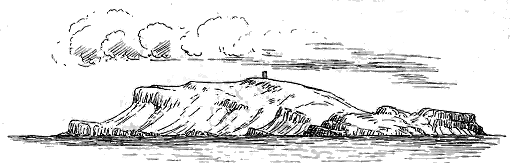
Fig. 107.—View of the escarpment of the Clyde Plateau in the Little Cumbrae, from the south-west.
1. The Clyde Plateau.—The chief plateau rises into one of the most
conspicuous features in the scenery of Central Scotland. Beginning at Stirling,
it forms the tableland of the Fintry, Kilsyth, Campsie and Kilpatrick
Hills, stretching westwards to the Clyde near Dumbarton. It rises again on
the south side of that river, sweeping southwards into the hilly moorlands
which range from Greenock to Ardrossan, and spreading eastwards along the
high watershed between Renfrewshire, Ayrshire, and Lanarkshire to Galston
and Strathavon. But it is not confined to the mainland, for its prolongation
can be traced down the broad expanse of the Firth of Clyde by the islands
of Cumbrae to the southern end of Bute, and thence by the east of Arran to
Campbeltown in Cantyre. Its visible remnants thus extend for more than
100 miles from north-east to south-west, with a width of some thirty-five
miles in the broadest part. We shall probably not exaggerate if we estimate
the original extent of this great volcanic area as not less than between 2000
and 3000 square miles.
It is in this tract that the phenomena of the plateaux are most admirably
displayed. Ranges of lofty escarpments reveal the succession of the several
eruptions, and the lower ground in front of these escarpments presents to us,
as the result of stupendous denudation, many of the vents from which the
materials of the plateau were ejected, while in the western portion of the area
admirable coast-sections lay bare to view the minutest details of structure.[414]
It will be seen from the map (No. IV.), that the Clyde plateau extends in
a general north-east and south-west direction. It is inclined on the whole
towards the east, where, when not interrupted by faults, its highest lavas
and tuffs may be seen to pass under the Carboniferous Limestone series.
Its greatest elevations are thus towards its escarpment, which, commencing
above the plains of the Forth a little to the west of Stirling, extends as a
striking feature to the Clyde above Dumbarton. On the south side of the
great estuary the escarpment again stretches in a noble range of terraced
slopes for many miles into Ayrshire. It is well developed in the Little
Cumbrae Island (Fig. 107), and in the south of Bute, where its successive
platforms of lava mount in terraces and green slopes above the Firth. Even
as far as the southern coast of Cantyre the characteristic plateau scenery
reappears in the outliers which there cap the hills and descend the slopes
(Fig. 108).
While the escarpment side of this plateau is comparatively unfaulted, so
that the order of succession of the lavas and their superposition in the sedimentary
rocks can be distinctly seen, the eastern or dip side is almost
everywhere dislocated. Innumerable local ruptures have taken place,
allowing the limestone series to subside, and giving to the margin of the
volcanic area a remarkably notched appearance. To the effects of this
faulting may be attributed the way in which the plateau has been separated
into detached blocks with intervening younger strata. Thus a complex
series of dislocations brings in a long strip of Carboniferous Limestone which
extends from Johnston to Ardrossan, while another series lets in the limestone
that runs from Barrhead to near Dalry. In each of these instances, the
continuity of the volcanic plateau is interrupted. To the same cause we owe
the occasional reappearance of a portion of the plateau beyond the limits of
the main mass, as for instance in the detached area which occurs in the
valley of the Garnock above Kilwinning.
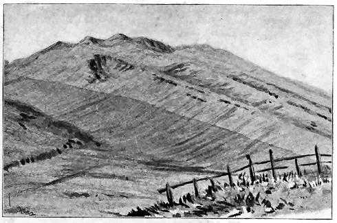
Fig. 108.—View of the edge of the Volcanic Plateau south of Campbeltown, Argyllshire.
The uppermost of the three zones is the volcanic series with its lava-ridges. The central band is the Upper Old
Red Sandstone, lying conformably beneath the lavas, with its cornstone which has been quarried. The lowest
band, tinted dark, is the Lower Old Red Sandstone, on which the other rocks rest unconformably.
Denudation has likewise come into play, not only in reducing the area of
the plateau, but in isolating portions of it into outliers, with or without the
assistance of faults. The site of the Cumbraes and Bute was no doubt at
one time covered with a continuous sheet of volcanic material, and there
appears to be no reason for refusing to believe that this sheet formed part of
that which caps the opposite uplands of Ayrshire. From the southern end
of Bute it is only about seven miles across to the shore of Arran near Corrie,
where the lavas and tuffs reappear. They are so poorly represented there,
however, that we are evidently not far from the limit of the plateau in that
direction. So vast has been the denudation of the region that it is now
impossible to determine whether the volcanic ejections of Campbeltown, which
occupy the same geological platform as those of Arran, Bute and Ayrshire,
were also actually continuous with them. But as the distance between the
denuded fragments of the volcanic series in Arran and in Cantyre is only
about 20 miles it is not improbable that this continuity existed, and thus
that the volcanic accumulations reached at least as far as the southern end
of Argyllshire, where they now slip under the sea.
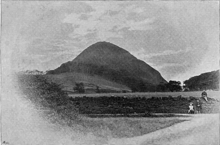
Fig. 109.—View of North Berwick Law from the east, a trachyte neck marking one of the chief vents of the Garleton Plateau. (From a photograph.)
This illustration and Figs.
119,
133 and
135 are from photographs taken by Mr. Robert Lunn for the Geological Survey.
2. The East Lothian or Garleton Plateau.—Some 50 miles to the
east of the Clyde volcanic district, and entirely independent of it, lies the
plateau of the Garleton Hills in East Lothian, which, as its limits towards
the east and north have been reduced by denudation, and towards the west
are hidden under the Carboniferous Limestone series of Haddington, covers
now an area of not more than about 60 square miles.[415] That the eruptions
from this area did not extend far to the north is shown by the absence of
all trace of them among the Lower Carboniferous rocks of Fife. A relic of
them occurs above Borthwick, in Midlothian, about twelve miles to the
south-west of the nearest margin of the plateau. The area over which the
lavas and tuffs were discharged may not have exceeded 150 square miles.
Small though this plateau is, it possesses much interest from the remarkable
variety of petrographical character in its lavas, from the size and composition
of its necks, and from the picturesque coast-line where its details have
been admirably dissected by the waves. In many respects it stands by
itself as an exception to the general type of the other plateaux.
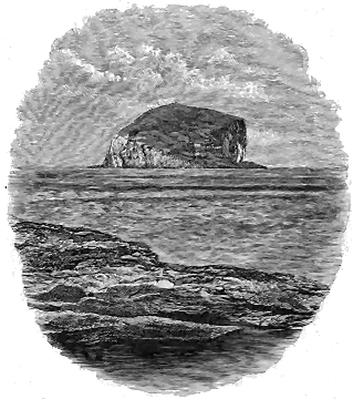
Fig. 110.—The Bass Rock, a trachytic neck belonging to the Garleton plateau, from the shore
at Canty Bay.
From its proximity to Edinburgh this volcanic area has been often
studied and described. The memoirs of Hay Cunningham and Maclaren
gave the fullest account of it until its structure was mapped by the Geological
Survey. Its scenery differs from that of the other plateaux chiefly in
the absence of the terraced contour which in them is so characteristic. The
peculiar lavas of the Garleton Hills form irregularly-uneven ground, rising
to not more than 600 feet above the sea. They slope gradually down to
the coast, where a succession of fine sections of the volcanic series has been
laid bare for a distance of altogether about ten miles. Nowhere, indeed,
can the phenomena of the plateau-tuffs and their association with the
Carboniferous strata be so well studied as along the coast-line from North
Berwick to Dunbar. Among the necks of this plateau distinguished for
their size, conspicuous prominence and component materials, the most important
are those that form the conical eminences of North Berwick Law
(Fig. 109), Traprain Law (Fig. 133), and the Bass Rock (Fig. 110).
3. The Midlothian Plateau.—On the same general stratigraphical
horizon as the other volcanic plateaux, a narrow band of lavas and tuffs can
be followed from the eastern outskirts of the city of Edinburgh into Lanarkshire,
a distance of about 23 miles. It is not continuously visible, often
disappearing altogether, and varying much in thickness and composition.
This volcanic tract, which may be conveniently termed the Midlothian
Plateau, is the smallest and most fragmentary of all the series. Its most
easterly outliers form Arthur Seat and Calton Hill at Edinburgh.[416] Three
miles to the south-west a third detached portion is known as Craiglockhart
Hill. After another interval of ten miles, the largest remaining fragment
forms the prominent ridge of Corston Hill (Fig. 111), whence a discontinuous
narrow strip may be traced nearly as far as the River Clyde.
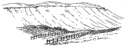
Fig. 111.—Corston Hill—a fragment of the Midlothian Plateau, seen from the north.
The volcanic rocks form a cake on the top, the slopes lying across the edges of the Calciferous Sandstones.
The well-known Arthur Seat and Calton Hill have been fully described
by Maclaren, and have been the subject of numerous observations by other
geologists.[417] They have been likewise mapped in detail on a large scale by
the Geological Survey, and have been described in the Survey Memoirs.
The rest of the plateau to the south-west is much less familiar.
In Fig. 112 the great escarpment which descends from the right
towards the centre is the sill of Salisbury Crags. The long dark crag
(Long Row) rising between the two valleys is the lowest of the interstratified
lavas. The slope that rises above it has been cut out of well-bedded
tuffs, on which lie the basalts and andesites in successive sheets that form all
the eastern or left side of the hill. The rocks around the summit belong to
a much later period of volcanic eruption, and are referred to in Chapter xxxi.
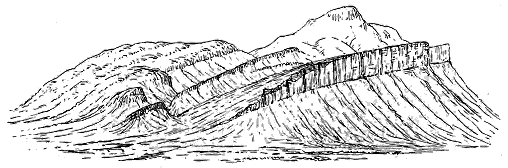
Fig. 112.—View of Arthur Seat from Calton Hill to the north.
The rocks of this plateau are comparatively limited in thickness, and
have a much more restricted vertical range than those of other districts.
At Arthur Seat and Corston Hill they begin above the cement-stones and
cease in a low part of the great group of white sandstones and dark shales
which form the upper half of the Calciferous Sandstones of Midlothian.
They do not ascend as high as the Burdiehouse Limestone, which to the
west of Corston Hill is seen to come on above them. One of their most
remarkable features is the manner in which they diminish to a single thin
bed and then die out altogether, reappearing again in a similar attenuated
form on the same horizon. This impersistence is well seen in the south-western
part of the area, between Buteland, in the parish of Currie, and
Crosswood, in the parish of Mid-Calder. The lowest more basic band may
there be traced at intervals for many miles without the overlying andesitic
group. Yet that andesites followed the basalts, as in other plateaux, is well
shown by large remnants of these less basic lavas left in Arthur Seat and
Calton Hill. On the extreme southern margin of the area also a thin band
of porphyrite with a group of overlying tuffs is seen above the red sandstones
near Dunsyre.[418] The eruptions over the site of this plateau seem to
have been much more local and limited than in the other plateaux. They
appear to have gathered chiefly around two centres of activity, one of which
lay about the position of Edinburgh, the other in the neighbourhood of
Corston Hill. It is worthy of remark that this tract of volcanic material
flanks the much older range of lavas and tuffs of the Pentland Hills and
wraps round the south-western end of this range, thus furnishing another
illustration of the renewal of volcanic activity in the same region during
successive geological periods.
4. The Berwickshire Plateau.—Another and entirely disconnected
area occurs in the broad plain or Merse of the lower portion of the valley
of the Tweed.[419] The northern limit of its volcanic tuff occurs in the River
Whitadder above Duns, whence the erupted materials rapidly widen
and thicken towards the south-west by Stitchell and Kelso, until they
die out against the flanks of the Cheviot Hills. The eastern extension of
the area is lost beneath the Cement-stone group which covers the Merse
down to the sea. Its western boundary must once have reached far beyond
its present limits, for the low Silurian ground in that direction is dotted
over with scattered vents to a distance of ten miles or more from the present
outcrop of the bedded lavas, extensive denudation having cleared away the
erupted materials and exposed the volcanic pipes over many square miles of
country. Among the more prominent of these old vents are the Eildon
Hills, Minto Crags and Rubers Law, as well as many other eminences
familiar in Border story.
The bedded volcanic rocks of this area form a marked feature in the
topography and geology of the district. They rise above the plain of the
Merse as a band of undulating hills, of which the eminence crowned by
Hume Castle, about 600 feet above the sea, is the most conspicuous height.
In the geological structure of this part of Scotland they are mainly interposed
between the Upper Old Red Sandstone and the base of the Carboniferous
system, which they thus serve to divide from each other. But their lowest
sheets appear to be in some places intercalated in the Old Red Sandstone,
so that their eruption probably began before the beginning of the Carboniferous
period. They form a band that curves round the end of the great
Carboniferous trough at Kelso and skirts the northern edge of the andesites
of the Lower Old Red Sandstone in the Cheviot Hills.
5. The Solway Plateau.—The last plateau, that of the Solway basin,
though its present visible eastern limits approach those reached by the lavas
from the Berwickshire area, was quite distinct, and had its chief vents
at some distance towards the south-west.[420] On the north-western flanks
of the Cheviot Hills, the Upper Old Red Sandstone is overlain by the
lowest Carboniferous strata, without the intercalation of any volcanic zone,
so that there must have been some intermediate ground that escaped being
flooded with lava from the vents of the Merse on the one hand, and of the
Solway on the other. The Solway lavas form a much thinner group than
those of Berwickshire. From the wild moorland between the sources of the
Liddell and the Rule Water, they run in a narrow and much-faulted band
south-westward across Eskdale and the foot of Annandale, and are traceable
in occasional patches on the farther side of the Nith along the southern
flanks of Criffel, even as far as Torrorie on the coast of Kirkcudbright—a
total distance of about 45 miles. It is probable that this long outcrop
presents merely the northern edge of a volcanic platform which is mainly
buried under the Carboniferous rocks of the Solway basin. Yet it exhibits
many of the chief characters of the other plateaux, and even occasionally
rivals them in the dignity of the escarpments which mark its progress
through the lonely uplands between the head of Liddesdale and the Ewes
Water (Figs. 113, 142).
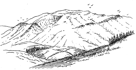
Fig. 113.—View of Arkleton Fell, part of the Solway Plateau, from the south-west.
The lower slopes below the single bird, round to the left side of the sketch, are on the Upper Old Red Sandstone;
the line of crag below the two birds marks the volcanic group above which lies an outlier of the Calciferous Sandstone
series, forming the upper part of the hill (three birds). The knobs under the four birds are bosses of
andesite.
The plateaux of the Merse and the Solway illustrate in a striking
manner the distribution of the volcanic eruptions along valleys and low
plains. The vents from which the lavas and tuffs proceeded are chiefly to
be found on the lower grounds, though these bedded volcanic rocks rise to a
height of 1712 feet (the Pikes) to the west of the Cheviot Hills. Between
the Silurian uplands of Selkirkshire and Berwickshire on the north and the
ridge of the Cheviot Hills on the south, the broad plain was dotted with
volcanic vents and flooded with lava, while to the south-west the corresponding
hollow between the uplands of Dumfries and Galloway on the one
side, and those of Cumberland on the other, was similarly overspread. The
significance of these facts will be more apparent when the grouping of the
vents has been described. We shall then also be better able to realize the
validity of the inference that the present plateaux are mere fragments
of what they originally were, wide areas having been removed from the one
side of them by denudation, and having been concealed on the other under
later portions of the Carboniferous system.
The same two plateaux likewise supply further illustrations of the outflow
of similar volcanic materials in the same locality at widely separated
intervals of time. They may be traced up to and round the margin of
the great pile of andesites of Lower Old Red Sandstone age forming the
Cheviot Hills.
ii. NATURE OF THE MATERIALS ERUPTED
The volcanic materials characteristic of the plateau-type of eruptions
consist mainly of lavas in successive sheets, but include also various tuffs
in frequent thin courses, and less commonly in thick local accumulations.
The lavas are chiefly andesites in the altered condition of porphyrites.
They vary a good deal in the relative proportions of silica. Some of them
are decidedly basic and take the form of dolerites and olivine-basalts. With
these rocks are occasionally associated "ultra-basic" varieties, where the
felspar almost disappears and the material consists mainly of ferro-magnesian
minerals. The more basic rocks are generally found towards the bottom of
the volcanic series, where they appear as the oldest flows. In the Garleton
Hills lavas of a much more acid nature are met with—true sanidine-trachytes,
which overlie the porphyrites and basalts of the earlier eruptions.
No adequate investigation has yet been made of the chemical and microscopic
characters of these various rocks, regarded as a great volcanic series
belonging to a definite geological age, though many of the individual rocks
and the petrography of different districts have been more or less fully
described. I cannot here enter into much detail on the subject, but must
content myself with such a summary as will convey some idea of the general
composition and structure of this very interesting volcanic series.
(a) Augite-olivine Rocks (Picrites and Limburgites).—Towards the
bottom of the plateaux there are found here and there sheets of "ultra-basic"
material, some of which appear to be bedded with the other rocks and to
have flowed out as surface-lavas, though it may be impossible to prove that
they are not sills. Thus at Whitelaw Hill, on the south side of the Garleton
Hills, a dark heavy rock is found to contain hardly any felspar, but to be
made up mainly of olivine and augite. Dr. Hatch has published a description
and drawing of this rock, together with the following analysis by Mr.
Player:[421]—
| Silica |
40·2 |
| Titanic oxide |
2·9 |
| Alumina |
12·8 |
| Ferric oxide |
4·0 |
| Ferrous oxide |
10·4 |
| Lime |
10·4 |
| Magnesia |
11·9 |
| Potash |
0·8 |
| Soda |
2·7 |
| Loss by ignition |
3·4 |
| Spec. grav. 3·03. |
99·5 |
(b) Dolerites and Basalts.[422]—These rocks are found both as interstratified
lavas and as intrusive masses. In the former condition they take a
conspicuous place among the sheets of the plateaux, but especially in the
lower parts of the series. They are dark, often black, usually more or less
porphyritic, with large felspars, frequently also large crystals of augite or
olivine, and may be described as porphyritic olivine-dolerites and olivine-basalts,
more rarely as olivine-free dolerites and basalts. Their groundmass
consists of short laths or microlites of felspar (probably labradorite) and
granules or small crystals of augite and magnetite, with sometimes a little
fibrous brown mica. The large porphyritic felspars are striped (probably
labradorite), the augites are frequently chloritized, and the olivines are
generally more or less serpentinized. But in some cases all these minerals
are as fresh as in a recent basalt. The rocks are sometimes beautifully
columnar, as at Arthur Seat.
Of these basic lavas conspicuous examples may be seen at Arthur Seat,
Calton Hill and Craiglockhart Hill. The eastern part of Arthur Seat,
known as Whinny Hill, furnishes examples of olivine-dolerites of the Jedburgh
type (p. 418). The beautiful basalt of Craiglockhart with its large
porphyritic olivines and augites has afforded a distinct type of Carboniferous
basalt (p. 418). The same type occurs on the Calton Hill in the cliff
below the gaol. Similar basic lavas are especially abundant and remarkable
in the Clyde plateau near Campbeltown in Argyllshire, and at the south end
of Bute and in the Cumbraes, where they are associated with an interesting
series of dykes and sills. But even where, as in the Garleton Hills, the lavas
are for the most part somewhat acid in composition, those first poured out,
which form the lowest band, include some typical olivine-basalts, of which a
characteristic example occurs at Kippie Law at the base of the Garleton
plateau (p. 418). It has been described by Dr. Hatch as exhibiting under
the microscope porphyritic crystals of felspar and olivine lying in a groundmass
composed of lath-shaped felspars, granular olivine and magnetite, and
microlitic augite. The olivine, originally the most abundant constituent, has
been converted into a fibrous aggregate of serpentine. All the minerals
are more or less idiomorphic, but especially the augite, which crowds the
groundmass in delicately-shaped prisms, most of which are terminated at
both ends by faces of the hemi-pyramid. The analysis of this rock is given
in the accompanying table of analyses of Garleton basalts. The Kippie Law
type of basalt was recognized by Dr. Hatch among the Geological Survey
collections from other districts, as in the intrusive bosses of Neides Law
and Bonchester near Jedburgh, and from the Campsie plateau a mile and a
half north of Lennoxtown.[423]
At Hailes Castle, in the Garleton plateau, the lower basic lavas include
another olivine-basalt somewhat more felspathic than that just described, and
at Markle quarry the rock is still more felspathic and contains the olivine
only in small sporadic grains. The composition of these basic rocks of the
Garleton plateau is shown in the subjoined table of analyses by Mr. J. S.
Grant Wilson:—
|
SiO2 |
Al2O3 |
Fe2O3 |
FeO |
MnO |
CaO |
MgO |
K2O |
Na2O |
H2O |
Total |
Kippie Law, specific
gravity 2·8 |
46·01 |
19·19 |
5·91 |
6·75 |
0·19 |
8·68 |
6·81 |
1·20 |
3·27 |
3·07 |
101·08 |
Hailes Castle, specific
gravity 2·76 |
49·07 |
19·43 |
10·58 |
2·35 |
0·32 |
7·87 |
4·36 |
0·98 |
3·31 |
2·26 |
100·53 |
Markle Quarry, specific
gravity 2·7 |
49·54 |
22·23 |
9·55 |
1·12 |
0·08 |
7·19 |
2·80 |
1·81 |
4·56 |
2·42 |
101·30 |
Olivine-dolerites are more especially developed in the district around
Jedburgh, where they form some of the most prominent bosses, such as
Dunian and Black Law. They show a sub-ophitic groundmass, with inconspicuous
porphyritic crystals, among which those of olivine are more prominent
than the felspars (p. 418).
(c) Andesites (Porphyrites).—These are the most abundant lavas of
the plateaux. They occur in every district, and usually form the main
constituents of the pile of volcanic material. They vary in colour from a
pale pinkish grey, through many shades of red, purple, brown and yellow,
to sometimes a dark green or nearly black rock. Their texture ranges
from almost semi-vitreous, through different degrees of compactness, to open,
cellular, slaggy masses. Generally through their base porphyritic felspars
are abundantly disseminated, sometimes in large, flat, tabular forms, like
those of the Lower Old Red Sandstone already referred to. The amygdaloidal
kernels consist of calcite, zeolites, chalcedony or quartz. It is
from the amygdaloids on either side of the Clyde that the fine examples of
zeolites have been chiefly obtained for which the south of Scotland has long
been famed. Occasionally, as at the south end of Bute, the andesitic lavas
display a marked columnar structure.
Under the microscope these rocks present the usual fine felted aggregate
of felspar microlites, with granules or crystals of magnetite and sometimes
pyroxene. The porphyritic felspars, often large and well defined, generally
contain inclusions of the groundmass. Occasionally some of the large porphyritic
constituents are augite, or pseudomorphs after that mineral. The
alteration of the rocks has oxidized some of the iron-ore and given rise to
the prevalent purplish and reddish tints.
(d) Trachytes.—Some of the most remarkable lavas to be found in
any of the plateaux are those which constitute a large part of the Garleton
Hills. They overlie the lower andesite and basalt platform, which surrounds
them as a narrow belt, while they occupy the central and much the largest
part of the area. They have been included among the porphyrites, but are
pale rocks, generally with a yellowish crust, presenting when quite fresh a
grey, compact, felsitic base with large porphyritic crystals of unstriped felspar.
A number of specimens selected as illustrative of the different varieties
have been analyzed and the results are stated in the subjoined table.[424] The
specific gravity of the rocks is about 2·6.
|
SiO2 |
Al2O3 |
Fe2O3 |
FeO |
MnO |
CaO |
MgO |
K2O |
Na2O |
H2O |
Total |
| Pepper Craig |
62·61 |
18·17 |
0·32 |
4·25 |
0·21 |
2·58 |
0·74 |
4·02 |
6·49 |
0·80 |
100·19 |
| Kae Heughs |
61·35 |
16·88 |
0·41 |
5·01 |
0·26 |
2·39 |
0·44 |
6·12 |
5·26 |
1·70 |
99·82 |
|
|
|
 |
|
|
|
|
|
|
|
| Hopetoun Monument |
62·50 |
18·51 |
4·39 |
... |
2·00 |
0·61 |
6·31 |
3·44 |
2·10 |
99·86 |
| Phantassie |
59·50 |
18·25 |
4·81 |
2·34 |
... |
2·10 |
0·70 |
6·30 |
5·03 |
1·60 |
100·63 |
| Bangley Quarry |
58·50 |
21·12 |
4·68 |
... |
... |
3·70 |
0·93 |
5·84 |
3·90 |
2·00 |
100·67 |
The microscopic characters of these rocks, as worked out by Dr. Hatch,
show them to be well-marked and wonderfully fresh sanidine-trachytes.
Some of them are porphyritic, with large crystals of perfectly unaltered
sanidine, sometimes also oligoclase. Small but well-formed crystals of
yellowish-green augite, in addition to the porphyritic felspars, are imbedded
in a fine groundmass composed chiefly of microlites of sanidine, but
with granules of augite and magnetite plentifully interspersed, and occasionally
prisms of apatite. There is a group in which the porphyritic felspars
are scarce or absent. In these there is little or no ferro-magnesian constituent.
Other trachytes, rather less basic than the augite-bearing varieties
here referred to, occur as bosses in the Garleton Hills district, and are
referred to in the following section (e).[425]
(e) Rocks of the Necks.—In the necks connected with the plateaux
other types of massive rock are to be found. Among these perhaps the most
frequent are trachytes, grey to pink in colour, but apt to weather yellow,
exceedingly compact, sparingly porphyritic, and with a peculiar platy
structure and waxy lustre. Rocks of this character also appear as sills and
dykes. Other varieties that occur in similar positions are more basic in
composition, including dark, coarse, granular diabases. In the Jedburgh
district the most frequent rocks are beautiful varieties of olivine-dolerite
and olivine-basalt, which form most of the prominent hills of the neighbourhood.
These bosses are sometimes associated with agglomerates as at
Rubers Law.
In the Garleton Hills district, some of the necks present another petrographical
type which directly connects them with the remarkable lavas of
the higher part of that plateau. Thus the rock of Traprain Law was ascertained
by Dr. Hatch to be a true phonolite. In its general platy structure
and sonorous ring under the hammer it reminds one of typical phonolites.
Under the microscope the rock is found to consist mainly of small lath-shaped
crystals of sanidine arranged in a marked minute flow-structure, but
with few porphyritic crystals. It contains small crystals and ophitic patches
of a light green soda-augite, with practically no magnesia in it. A small
quantity of iron-ore and isolated granules of apatite are also present, together
with patches of nepheline which, though generally decomposed and
replaced with zeolitic products, occasionally display six- and four-sided
crystal-contours. An analysis of the Traprain phonolite by Mr. Player is
subjoined:—[426]
| Silica |
56·8 |
| Titanic acid |
0·5 |
| Alumina |
19·7 |
| Ferric oxide |
2·2 |
| Ferrous oxide |
3·5 |
| Manganous oxide |
0·2 |
| Lime |
2·2 |
| Magnesia |
0·4 |
| Soda |
4·3 |
| Potash |
7·1 |
| Loss by ignition |
2·5 |
| Spec. grav. 2·588 |
99·4 |
The neck of North Berwick Law was found by Dr. Hatch to be a
trachyte, showing a plexus of lath-shaped sanidines that diminish in size
to minute microlites, but with no porphyritic or ferro-magnesian constituent.
The Bass Rock, though its geological relations are concealed by
the sea, is in all probability another neck of this district. It is likewise a
mass of trachyte, composed almost entirely of lath-shaped crystals of sanidine,
with no ferro-magnesian constituent, but a good deal of iron ore. It shows
none of the large porphyritic felspars so characteristic of the Garleton Hills
lavas, but it closely resembles the non-porphyritic varieties, particularly the
lavas of Score Hill, Pencraig, Lock Pit Hill, and Craigie Hill.[427]
(f) Tuffs.—The fragmentary ejections of the plateaux vary in texture
from the finest-grained tuffs to coarse agglomerates.[428] As they have been
derived from the explosion of andesite-lavas, they consist mainly of the debris
of these rocks. They are often deep red in colour, as for example those of
Dunbar, but are most frequently greenish. They have a granular texture,
due to the small lapilli of various porphyrites imbedded in a fine dust of
the same material. Grains of quartz, frequently to be detected even in
the finer tuffs, may either have been ejected from the volcanic vents, or
may have been grains of sand in the ordinary sediment of the sea-bottom.
Both at the base and at the top of the plateau-series, the tuffs are
interstratified with and blend into sandstones and shales, so that specimens
may be collected showing a gradual passage from volcanic into non-volcanic
detritus. In many of the tuffs of the necks fragments of sandstone and
other stratified rocks occur, representing the strata through which the vents
were drilled. In the tuffs of the Eaglesham district pieces of grey and pink
granite have been met with which, if they are portions of an old granite
mass below, must have come from a great depth.[429] In the coarser tuffs
and agglomerates a larger variety of lava-form rocks is to be found than
can be seen among the bedded lavas of the Plateaux. They include felsites
and quartz-porphyries, and more rarely basic lavas (diabases, etc.).
CHAPTER XXV GEOLOGICAL STRUCTURE OF THE CARBONIFEROUS VOLCANIC PLATEAUX OF SCOTLAND — 1. BEDDED LAVAS AND TUFFS — 2. VENTS — 3. DYKES AND SILLS — 4. Close of the Plateau-eruptions
1. Bedded Lavas and Tuffs; Upper Limits and Original Areas and Slopes of the
Plateaux; 2. Vents; Necks of Agglomerate and Tuff; Necks of Massive Rock;
Composite Necks; 3. Dykes and Sills; 4. Close of the Plateau-eruptions.
The structure of the various plateaux presents a general similarity, with many
local variations. Each plateau is built up entirely, or almost entirely, of sheets
of volcanic material, the intercalations of ordinary sedimentary layers being,
for the most part, few and unimportant, and usually occurring either towards
the base or the top of the volcanic series, though at a few localities interstratifications
of shale and sandstone, marking pauses in the eruptions,
occur throughout that series. The vents of eruption are in some instances
still to be recognized on the plateaux themselves. More usually they occur
on the lower ground flanking the volcanic escarpments, where they have
been laid bare by denudation. Dykes, though seldom abundant, are associated
with the plateaux, while the sills which may mark the latest manifestations
of volcanic energy, though not developed on so large a scale as
among the Cambrian and Silurian volcanoes, can nevertheless be distinctly
recognized.
It is a question of some interest to determine the geological date of the
commencement of the plateau-eruptions by fixing the precise stratigraphical
horizon on which the base of the volcanic series rests. I have already
referred to the fact that this base does not always lie on the same platform
among the Lower Carboniferous formations. In Berwickshire, as above
mentioned, the earliest eruptions appear to have taken place before the
close of the Upper Old Red Sandstone period. These are the earliest of
the whole series. In Cantyre, the lowest lavas and tuffs come directly upon
the sandstones, marls and cornstones of the Upper Old Red Sandstone. In
Stirlingshire, Renfrewshire and Ayrshire several hundred feet of the Cement-stone
group are sometimes interposed between the bottom of the volcanic
rocks and the top of the Old Red Sandstone. This divergence doubtless
indicates that the eruptions began earlier in some districts than in others.
But there were also probably unequal terrestrial movements preceding, and
perhaps accompanying, the volcanic outbursts. In the case of the Clyde
plateau, for example, if we examine its base in the neighbourhood of Fintry,
we find that it lies upon some 500 feet of Carboniferous white sandstone,
red and green marls and cement-stones, which rest on the Upper Old
Red Sandstone. Yet only eight miles to the eastward, this considerable
mass of strata disappears, and the bottom of the lavas comes down upon
the red sandstones. Five miles still further in the same direction the
volcanic masses likewise die out, and then the Carboniferous Limestone
series is found at Abbey Craig to lie, with scarcely any representative of the
Cement-stone group, on the Upper Old Red Sandstone (Fig. 114). Again, to
the south-west of Fintry, the zone of cement-stones below the volcanic series
continues to vary considerably in thickness and sometimes almost to disappear,
while in Ayrshire the lavas lie immediately on the red sandstones.
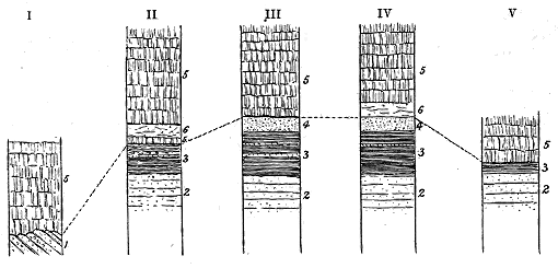
Fig. 114.—Vertical sections of the escarpment of the Clyde plateau from north-east to south-west.
I. Section at the east end of the Campsie Hills, four miles west from Stirling. II. Section above Glins, six miles
west from No. I. III. Section at Strathblane Hill, eight miles further south-west. IV. Section at Lang
Craig, east from Dumbarton, eight miles south-west from No. III. V. Section above Fort Matilda, Greenock,
eleven miles from the previous section and on the south side of the Clyde.
1. Lower Old Red Sandstone; 2. Upper Old Red Sandstone; 3. Carboniferous shales, sandstones and cement-stones
(the "Ballagan beds"); 4. Thick white sandstone which comes in above the Ballagan beds; 5.
Andesite lava-sheets; 6. Interstratified tuffs. The dotted lines connect the base of the volcanic series.
These irregularities, not improbably indicative of inequalities of subsidence
and of deposition, may have been connected with the subterranean
disturbances which culminated in the abundant outbreak of volcanic action.
But though the volcanic rocks of the plateaux may be traced overlapping the
underlying strata, no evidence has anywhere been detected of an unconformability
between them and the Lower Carboniferous or Upper Old Red
Sandstone series.
The successive sheets of lava in a plateau usually form thin and widespread
beds which are only occasionally separated by intercalations of tuff
or of red marl. In this, as well as in other respects, they present much
resemblance to the lavas of the Tertiary plateaux of Antrim and the Inner
Hebrides. They are generally marked off from each other by the slaggy
upper and under portions of the successive flows, and this structure gives a
distinctly bedded aspect to the escarpments, as in the Campsie and Largs
Hills, or still more conspicuously in Little Cumbrae (Fig. 107) and the
southern end of Bute. Considerable diversity of structure may be noticed
among these sheets. Some present a compact jointed centre passing up and
down into the slaggy material just referred to; others have assumed a vesicular
character throughout, the vesicles being often elongated in the direction of flow.
Where, as usually occurs, the vesicular is replaced by the amygdaloidal
structure, some of the rocks have long been famous for the minerals found
in their cavities. The beautiful zeolites of the Kilpatrick and Renfrewshire
Hills, for example, may be found in every large mineralogical collection in
the country. Well-developed columnar structure occasionally appears among
the lavas of the plateaux, but chiefly, so far as I have observed, in the lower
or more basic group, as in the basalts along the east side of the Dry Dam
at Arthur Seat.
In each plateau the lavas may be observed to thicken in one direction,
or more usually towards more than one, and this increase no doubt indicates
in which quarters the chief centres of discharge lay. Thus in the Clyde
plateau, several areas of maximum development may be detected. In
the Kilpatrick Hills the total thickness of lavas and tuffs exceeds 3000
feet (Fig. 120). Above Largs it is more than 1500 feet, rapidly thinning
away towards the south. The continuation of the plateau far to the north-east
in the Campsie Fells reveals a thickness of about 1000 feet of lavas
at Kilsyth, which become thicker further west, but eastward rapidly diminish
in collective bulk, until in about twelve or thirteen miles they disappear
altogether, and then, as already remarked, the Calciferous Sandstone series
closes up without any volcanic intercalation.
In the Solway plateau, the lavas attain a maximum development about
Birrenswark, whence they diminish in bulk towards the north-east and
south-west. The Berwickshire plateau reaches its thickest mass about
Stitchill, whence it rapidly thins away towards the north-east, until at a
distance of some twelve miles it disappears altogether, the last trace of
it in that direction being a band of tuff which dies out in the Calciferous
Sandstones to the north of Duns.
In the Midlothian Plateau, the development of the volcanic series is
more irregular than in any of the others. As already remarked, there
appear to have been at least two chief centres of discharge in this region, one
at Edinburgh and one some fourteen miles to the south-west. At the former,
the volcanic materials attain in Arthur Seat and Calton Hill a thickness of
about 1100 feet. In Craiglockhart Hill, three miles distant, they are still
about 600 feet thick. But beyond that eminence they cease to be traceable
for about eight miles, either because they entirely die out, or because their
dwindling outcrops are concealed under superficial deposits. As we approach
the south-western centre of eruption around Corston Hill a new volcanic
group begins and soon increases in bulk.
A distinguishing feature of the plateaux is found in the difference
between the lavas that were first erupted and those which followed them.
The earlier eruptions, as above remarked, were generally basic, sometimes
highly so. Thus at Arthur Seat the thick series of lavas which form
the eastern part of the hill have at their base several sheets of columnar
basalt, over which come the andesites that make up the main mass of the
erupted material. In the Calton Hill the same sequence may be observed.
Underneath the andesites of Campbeltown comes a well-marked and persistent
band of olivine-dolerite. Still more basic are some portions of the earliest
lavas of the Garleton plateau where, as already stated, rocks present themselves
composed mainly of olivine and augite.
It is worthy of notice that where the lavas of a plateau diminish greatly
in thickness or become impersistent, the lowest basic group may continue
while the overlying andesites disappear. This feature has been already
mentioned as well seen in the Midlothian plateau. The thick group of
andesites in Arthur Seat and Calton Hill is not to be found in the next
volcanic eminence, Craiglockhart Hill; but the basalts with their underlying
tuffs continue. In the south-western tract from Harper Rig to Hare
Law in Lanarkshire, the thin lava-band, which can be found only at
intervals along the line of outcrop of the volcanic series for about nine
miles, is a dolerite often highly slaggy in structure. Again, at Corrie in
Arran, the lavas which appear upon the shore, apparently at the extreme
western limits of the Clyde plateau, are basic rocks.
But whether or not the lowest and more basic lavas appear in
any plateau, the main mass of the molten material erupted has usually
consisted of varieties of andesite. The successive discharges of these intermediate
lavas have flowed out in sheets, some of which must have been
little more than heaps of clinkers and scoriæ, while others were more fluid
and rolled along with a ropy or slaggy surface. Occasionally the upper part
of an andesite shows the reddened and decomposed character that suggests
some degree of disintegration or weathering before the next lava-stream buried
it. The intervals between successive outflows of these lavas are not, as a rule,
defined by any marked breaks or by the intercalation of other material. In
general, the plateaux are mainly built up of successive sheets of lava which
have followed each other at intervals sufficiently short to prevent the accumulation
of much detritus between them. Thus the Campsie Hills have
the upper 600 feet of their mass formed of admirably-well-defined sheets of
andesite, separated sometimes by thin partings of tuff, but more usually only
by the slaggy vesicular surfaces between successive flows.
Where the lavas consisted of trachytes they were apt to assume more
irregular forms. Of this tendency the rocks of the Garleton Hills supply
an excellent example. As already stated, their lumpy character gives to
these hills an outline which offers strong contrast to the ordinary symmetrical
terraced contours of the andesitic plateaux.
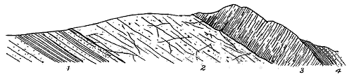
Fig. 115.—Section of Craiglockhart Hill, Edinburgh.
1. Red sandstones and clays; 2. Green stratified tuffs; 3. Columnar basalt; 4. Dark shales, ironstones
and sandstones, with plants.

Fig. 116.—Section of the bottom of the Midlothian Plateau, Linnhouse Water above Mid-Calder Oilworks.
1. Shales and cement-stones; 2. Sandstones; 3. Highly vesicular lava; 4. Tuffs and sandstone bands. f, Fault.
Although tuffs play, on the whole, a comparatively unimportant part
among the constituents of the plateaux, they attain in a few localities an
exceptionally great development, and even where they occur only as thin
partings between the successive lava-flows, they are always interesting
memorials of the volcanic activity of a district. In many portions of the
plateaux, the lowest members of the volcanic series are tuffs and agglomerates,
showing that the eruptions often began with the discharge of fragmentary
materials. Thus in the Midlothian plateau at Arthur Seat, though
the lowest interbedded volcanic sheet is a dolerite, it is immediately followed
by a series of bedded tuffs, before the main mass of the lavas of that hill
make their appearance. At Craiglockhart Hill, three miles distant (Fig. 115),
this lowest lava is absent, and a group of tuffs about 300 feet thick rests
immediately on the red Carboniferous sandstones and shales, and is overlain
by sheets of columnar basalt. The scoriaceous bottom of the latter rock may
here and there be seen to have cut out parts of the tuff as it rolled over the
still unconsolidated material. In the same district, a few miles further to the
south-west, some interesting sections of the Midlothian plateau are laid bare in
the streams which descend from the western slopes of the Pentland Hills. I
may cite, in particular, those exposed in the course of the Linnhouse Water.
At the railway viaduct near the foot of Corston Hill, a good section is
displayed of the Cement-stone group—thick reddish, purplish, and greenish-blue
marly shales or clays, with thin ribs and bands of cement-stone and
grey compact cyprid-limestone, as well as lenticular seams and thicker beds
of grey shaly sandstone, sometimes full of ripple-marks and sun-cracks.
These strata, which exactly reproduce the typical lithological characters of
the Cement-stone group of Stirlingshire (Ballagan Beds), Ayrshire and
Berwickshire, are surmounted by a group of reddish, yellow and brown
sandstones, sometimes pebbly and containing a band of conglomerate.
Among the stones in this band, pieces of the radiolarian cherts of the Lower
Silurian series of the Southern Uplands are conspicuous, likewise pieces of
andesite which may have come from the neighbouring Pentland Hills.
Above these strata lie the lavas of Corston Hill. These are highly
vesicular in some parts, and include bands of tuff which are well exposed
further down the same stream, immediately above the railway bridge near
the Mid-Calder oilworks (Fig. 116). There the lavas, though much decomposed,
show a highly vesicular structure with a rugged upper surface, in the hollows
and over the prominences of which fine flaky and sandy tuffs have been
deposited, while thin seams of vesicular lava are intercalated among
these strata.

Fig. 117.—Section of the top of the Midlothian Plateau in the Murieston Water.
The upper part of the same plateau, as exposed in the course of the
Murieston Water, contains evidence that the last eruptions consisted of
tuff. The highly slaggy lava (1 in Fig. 117) is there surmounted by a
thick mass of grey and greenish-white well-bedded granular tuff (2) including
occasional lumps of the basic lava, and passing up into black shale
(3). But that the volcanic eruptions continued during the accumulation of
the shale is proved by the intercalation of thin partings and thicker layers
of tuff in the black sediment. A short way higher up the Burdiehouse
Limestone comes in.
The great lava-escarpment of the Kilpatrick Hills rests on a continuous
band of tuff which is thickest towards the west, near the group of
vents above Dumbarton, while it thins away eastward and disappears in
Strathblane, the lavas then forming the base of the volcanic series. But
perhaps the most remarkable group of basal tuffs is that which underlies
the lavas of the Garleton plateau, to which further reference will be immediately
made.
Extensive accumulations of tuff form in one or two localities a large
proportion of the thickness of the whole volcanic series of a plateau. Thus
in the north-eastern part of Ayrshire, between Eaglesham and the valley of
the Irvine, the lavas die out for a space and give place to tuffs. During
the discharge of the fragmentary materials over that ground no lava seems
to have flowed out for a long period. Ordinary sediment, however, mingled
with the volcanic detritus, and there were even pauses in the eruptions when
layers of ironstone were deposited, together with thin impure limestone that
inclosed shells of Productus giganteus.[430]
In some of the plateaux, particularly within the older part of the volcanic
series, intercalations of ordinary sediment among the tuffs and lavas show
that eruptions occurred only occasionally, and that during the long intervals
between them the deposition of sand and mud went on as before. Thus
the lower 400 feet of the Campsie Fells are built up of slaggy andesites and
thick beds of fine-grained stratified tuff, with bands of red, green and grey
clays and cement-stone and a zone of white sandstone. The Calton Hill at
Edinburgh (Fig. 118) affords an excellent illustration of the interstratification
both of tuffs and ordinary sediments among the successive outflows of
lava. In the total thickness of about 1100 feet of volcanic material in
this hill, at least eight intervals in the discharge of the lavas are marked
by the intercalation of as many bands of nodular tuff, together with seams
of shale and sandstone more or less charged with volcanic detritus. The
highest lava is immediately covered by the white sandstones and black
shales of the Calciferous Sandstone series.
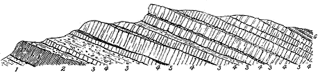
Fig. 118.—Section of Calton Hill, Edinburgh.
1. Lower Carboniferous sandstones; 2. Basic lava at the bottom of the volcanic series; 3. Tuff often interstratified
with sandstones and shales; 4. Sheets of andesite-lava frequently separated by layers of tuff; 5. Shale passing
into tuff; 6. White sandstone and black carbonaceous shales overlying the volcanic series.
The tuffs, as might be expected, are coarsest in texture and thickest in
mass where they approach most nearly to some of the vents of eruption,
and, on the other hand, become finer as they recede from these. As a rule,
they are distinctly stratified, and consist of layers varying in the size of
their component lapilli. Here and there, near the centres of discharge, the
bedding becomes hardly traceable or disappears, and the fragmentary
materials take the form of agglomerate.
In the admirable range of coast-cliffs which extend from North Berwick
to Dunbar, we learn that above the red sandstones at the base of the
Carboniferous system, a thick pile of volcanic ashes was accumulated by
numerous discharges from vents in the immediate neighbourhood. Some of
the explosions were so vigorous that blocks of different lavas, sometimes a
yard or more in length, were thrown out and heaped up in irregular mounds
and hollows. Others discharged exceedingly fine dust, and between these
two extremes every degree of coarseness of material may be recognized.
As an illustration of the remarkable alternation of coarse and fine
materials, according to the varying intensity of the volcanic paroxysm, Fig. 119
is here introduced. It represents a portion of the tuff-cliffs east of
Tantallon Castle, and shows at the bottom fine well-stratified tuff, over which
a shower of large blocks of lava has fallen. Fine detritus is seen to cover
the deposits of this shower, and successive discharges of large stones may be
noticed higher up on more or less well-defined horizons.
The space over which this pyroclastic material can now be traced, large
though it is, does not represent the whole of the original area included
within the range of the discharges of ash and stones, for much has been
removed by denudation. During pauses of various length between the
eruptions, waves and currents washed down the heaps of volcanic material
and distributed ordinary sediment over the bottom of the water. Hence,
abundantly interstratified in some parts of the tuff, seams of sandstone, blue
and green shale, cement-stone and limestone occur. One thick band of
limestone may be traced from near Tynningham House to Whittinghame,
a distance of about four miles; another patch appears near Rockville House;
and a third at Rhodes, near North Berwick. No fossils have been noticed
in these limestones. The calcareous matter, together sometimes with silica,
appears to have been supplied, at least in part, by springs, which may have
been connected with the volcanic phenomena of the district. The North
Berwick limestone, in particular, has the peculiar carious wavy structure
with minute mamillated interstices so common among sinters. It contains
grains of pyrites, flakes of white kaolin, which probably represent decayed
prisms or tufts of natrolite, and cavities lined with dog-tooth spar. Some
portions give out a strongly fœtid odour when freshly broken.
After the tuffs of the Garleton plateau had accumulated to a depth of
perhaps 200 feet or more, lavas began to be poured out. First came
basic outflows (olivine-basalts with picrites) and andesites (porphyrites),
which form a thin but continuous sheet all over the area. These were
succeeded by the series of trachytes which distinguish this area. Although
the observer remarks the absence there of the usual terraced arrangement,
yet from some points of view, particularly from the westward, a succession
of low escarpments and longer dip-slopes can be detected among
the trachytes of the Garleton Hills, while there can be no doubt that, in
spite of their irregular lumpy contours, these lavas lie as a great cake above
the lower platform of more basic flows (Fig. 10). There is evidence that
during the emission of the trachytes occasional eruptions of andesite took place.
Not the least striking and interesting feature of this plateau is the size and
distribution of its necks, to which reference will be made in the sequel.
The latest eruption in the Garleton area had ceased and the cones and
lava sheets had probably been buried under sediment before the commencement
of the deposition of the Hurlet or thick Main Limestone of the
Carboniferous Limestone series which lies immediately to the west of the
plateau.
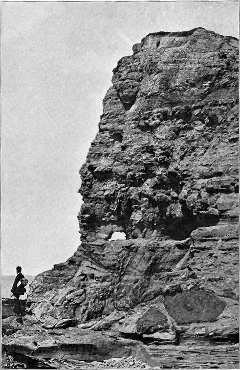
Fig. 119.—Cliff of tuff and agglomerate, east side of Oxroad Bay, a little east from Tantallon Castle,
East Lothian.
The tuffs of the plateaux are seldom fossiliferous, probably for the same
reason that fossils are scarce in the Cement-stone group which the plateau
volcanic rocks overspread and with which they are interstratified. Occasional
stems and other fragments of vegetation occur in the plateau-tuffs, as
in those of North Berwick, where I have found a decayed coniferous trunk
three feet in length. The green tuff at the base of the volcanic group of
Arthur Seat contains abundant macerated plant-remains, together with
scales of Rhizodus and other fishes. In some places the plants are represented
by trunks or roots, which appear to remain in their positions of
growth. A remarkable instance of this nature occurs in some bands of tuff
in the volcanic group of the east coast of the Isle of Arran, first brought to
notice by Mr. E. Wunsch,[431] and of which the plants have been so fully
investigated by Professor Williamson.[432]
Plant-remains also occasionally occur in the stratified layers intercalated
among the lavas and tuffs of the plateaux. Some of the best examples of
their occurrence are to be found in the shales and tuffs interstratified among
the enormous pile of volcanic material near Bowling. Not only does
abundant vegetable debris occur distributed through the detrital strata in the
volcanic series at that locality, but it is even aggregated into thin seams of
coal which have been examined and described by various observers.[433] It may
be remarked that the plant remains thus found intercalated in the volcanic
series, especially when they have been entombed in tuff, have often had
their internal structure admirably preserved, the organic tissues having
been delicately replaced by calcite or other petrifying medium. The
remarkably perfect structure of some of these plants has been demonstrated
by Professor Williamson, especially in the case of the Arran deposit just
referred to. Mr. John Young has also found the structure well preserved
among the Sigillariæ and Stigmariæ that occur in the stratified intercalations
between the lavas near Bowling.
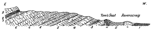
Fig. 120.—Section across part of the Clyde Plateau to the west of Bowling (reduced from Sheet 6
of the Horizontal Sections of the Geological Survey of Scotland).
1. "Ballagan Beds"; 2. White sandstone; 3. Tuffs, 600 feet thick, with a thin sheet of andesite; 4. Andesite
sheets, 500 feet; 5. Stratified tuffs with thin coals, shales, fireclays and plant-remains, 500 or 600 feet; 6 6.
A series of andesite-lavas, about 1500 feet thick, enclosing a thin coal-seam at *; 7. Stratified tuffs, 200 feet;
8. Shales with plants and coaly seams, 150 feet; 9. Base of another andesite series, which must be some
hundreds of feet thick; 10 and 11. Necks of agglomerate.
Upper Limits and Original Areas and Slopes of the Plateaux.—Where
the highest members of the volcanic series can be seen passing conformably
under the overlying Carboniferous strata they are frequently found to
be mainly composed of fine tuffs, the last feeble efforts of the plateau-volcanoes
having consisted in the discharge of showers of ashes. These
materials were mingled with a gradually increasing proportion of ordinary
mechanical sediment, which finally overspread and buried the volcanic tracts
of ground, as these slowly sank in the general subsidence of the region.
The characteristic corals, crinoids and shells of the Carboniferous Limestone
begin to appear in these ashy sediments. There is thus an insensible
passage from volcanic detritus into fossiliferous shales and limestones.
Examples of this gradation may be seen in many natural sections along
the flanks of the Ayrshire plateau from above Kilbirnie to Strathavon.
It is still possible to fix in some quarters the limits beyond which
neither the lavas nor the tuffs extended, and thus partially to map out
the original areas of the plateaux. For example, in certain directions the
Carboniferous formations can be followed continuously downward below the
Main Limestone, without the intervention of any volcanic material, or with
only a slight intermixture of fine volcanic lapilli, such as might have been
carried by a strong wind from some neighbouring active vents. By this
kind of evidence and by the proved thinning-out of the materials of the
plateau, we can demonstrate that in the north of Ayrshire the southern
limits of the great volcanic bank did not pass beyond a line drawn from near
Ardrossan to Galston. We can show, too, that the lavas of the Campsie
Fells ended off about a mile beyond Stirling before they reached the line of
the Ochil heights, and that the coulées which flowed from the Solway vents
did not quite join with those from the Berwickshire volcanoes.

Fig. 121.—Diagram illustrating the thinning away southwards of the lavas of the Clyde
Plateau between Largs and Ardrossan. Length about 10 miles.
1. Upper Old Red Sandstone; 2. Sandstones, shales, etc., with "Ballagan Beds"; 3. Tuffs; 4. Andesite lavas;
5. Carboniferous Limestone series.
Moreover, evidence enough remains to enable us to form a tolerably
clear conception of the original average slopes of the surface of some of
the plateaux. Thus in the great escarpment above Largs and the high
ground eastward to Kilbirnie the volcanic series, as already stated, must
be at least 1500 feet thick. This thick mass of lavas and tuffs thins away
southwards and probably disappears a short distance south from Ardrossan
in a space of about ten miles (Fig. 121). The original southward slope of
the plateau would thus appear to have been about 1 in 35. Again, the
northward slope of the same plateau may be estimated from observations in
the Campsie Fells. We have seen that above Kilsyth the total depth of
the volcanic sheets is about 1000 feet, while to the westward it is much
thicker. From the top of the Meikle Bin (1870 feet) above Kilsyth north-eastwards
to Causewayhead, where the whole volcanic series has died out,
is a distance of 12 miles, so that the slope of the surface of erupted materials
on this side was about 1 in 63 (Fig. 122).
Judging from the sections exposed along the faces of the escarpments,
we may infer that the volcanic sheets had a tolerably uniform surface
which sloped gently away from the chief vents, but with local inequalities
according to the irregularities of the lava-streams that were heaped up round
the vents and flowed outward in different directions and to various distances
from them. At the beginning, these flat volcanic domes were certainly
subaqueous. While they were being formed, continuous subsidence appears
to have been in progress. But the great thickness of the volcanic accumulations,
as in the Kilpatrick and Renfrewshire areas, and the paucity of
ordinary sedimentary strata among them, make it not improbable that at least
their higher parts rose above the water. Where this was the case there
may have been considerable degradation of the lava-banks before these were
reduced or were by subsidence submerged beneath the water-level. Evidence
of this waste is probably to be recognized in the bands of conglomerate,
occasionally of considerable thickness, which, particularly in some parts of
Ayrshire, intervene between the top of the volcanic group and the Hurlet
Limestone. As I shall have occasion to point out further on, there seems
to be some amount of evidence in favour of the view that a considerable
interval of time elapsed between the close of the plateau-eruptions and the
date of that widespread depression which led to the deposition of the Hurlet
Limestone over the whole of Central Scotland. If such an interval did
occur it would include a prolonged abrasion of any projecting parts of the
plateaux, and the production and deposition of volcanic conglomerate.
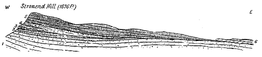
Fig. 122.—Diagram illustrating the thinning away eastwards of the lavas of the Clyde
Plateau in the Fintry Hills. Length about 12 miles.
1. Upper Old Red Sandstone; 2. White sandstone, blue shales and cement-stones ("Ballagan Beds"); 3. Andesite
sheet, about 100 feet thick; 4. Tuffs (250 feet), with an included band of ashy sandstone containing plant-remains;
5. Andesite lavas; 6. Carboniferous Limestone series, which to the east lies immediately on the
Upper Old Red Sandstone.
We have now to consider the external forms, internal contents and
distribution of the vents from which the material of the plateaux was discharged.
In the Carboniferous system these interesting relics of former
volcanoes are far more distinctly defined and better preserved than in older
geological formations. Moreover, in Scotland, they are laid bare to greater
advantage, both inland and along the sea-coast, and may indeed be studied
there as typical illustrations of this kind of geological structure.
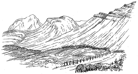
Fig. 123.—View of the two necks Dumgoyn and Dumfoyn, Stirlingshire, taken from the south.
These two necks form a conspicuous feature in front of and below the lava plateau, a portion of which is shown on
the right hand. The ground-plan of the same necks is shown in
Fig. 124.
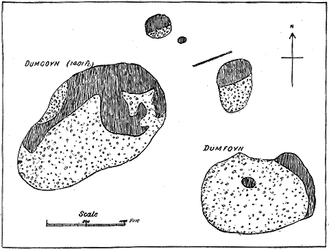
Fig. 124.—Ground-plan of Plateau-vents near Strathblane, Stirlingshire, on the scale of
6 inches to a mile.
In external form the necks connected both with the plateaux and the
puys generally rise from the surrounding ground as isolated, rounded, conical
or dome-shaped prominences, their details of contour depending mainly upon
the materials of which they consist. When these materials are of agglomerate,
tuff or other readily disintegrated rock, the surface of the domes is
generally smooth and grass-covered. Where, on the other hand, they consist
wholly or in part of dolerite, basalt, diabase, andesite, trachyte or other
crystalline rock, they present more irregular rocky outlines. Illustrations
of some of those varying forms are given in Figs. 23 and 123. In rare
instances the vent is marked at the surface not by a hill but by a hollow,
as in the great neck in the heart of the Campsie Fells (Fig. 128).
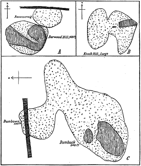
Fig. 125.—Ground-plans of double and triple necks in the Plateau series, on the scale of
6 inches to a mile.
A. Barwood Hill and Ravenscraig, east of Dumbarton, double vent. B. The Knock Hill, Largs, Ayrshire, double
vent (see
Fig. 23). C. Dumbowie and Dumbuck, east of Dumbarton, triple vent.
As regards their ground-plan, which affords a cross-section of the original
volcanic funnel, the plateau-vents present considerable variety. The simplest
cases are those in which the form is approximately circular or somewhat
elliptical. Here the outline corresponds to the cross-section of a single and
normal orifice. Some examples of this simple type are given in Fig. 124,
which represents a group of vents on the edge of the Clyde plateau near Strathblane.
The two larger necks here shown are the same which appear in the
view in Fig. 123.[434] Where two vents have been successively opened close to
each other, or where the same vent has shifted its position, the ground-plan
may be greatly modified. In some instances the double funnel can be distinctly
traced. Thus in the conspicuous Knock Hill above Largs in Ayrshire (Fig.
125, B) there are two conjoined necks, and such appears to be also the
structure shown by the ground-plan of the neck of Barwood Hill and
Raven's Craig, east of Dumbarton (Fig. 125, A).[435] But more complex
forms occur which point to a still larger number of coalescing necks.
A group of hills to the east of Dumbarton gives the ground-plan shown
in C, Fig. 125, where traces may be detected of three separate vents.
Still more irregular are long narrow dyke-like masses of tuff or agglomerate
which have probably risen along lines of fissure (Fig. 22, No. 1). The most
striking example of these, however, occur in association with the puys and
will be described in later pages.
Connected with their ground-plan is the relative size of the plateau-vents.
On the whole they are larger than those of the puy series. The
simple circular or elliptical type presents the smallest necks, some of them
not exceeding 100 feet in diameter. The more complex forms are generally
also of larger dimensions. By much the largest vent or connected group
of vents is that which lies among the uplands of Misty Law in the heart
of the Renfrewshire part of the Clyde plateau, where a connected mass of
tuff and agglomerate now occupies a space of about 4 miles in length
by 2½ miles in breadth (Fig. 129). It has not been found possible, however,
to trace the boundaries of the separate vents of this tract, nor to distinguish
the material of the necks from that which surrounds them.
Another large mass which from its shape may be conjectured to represent
more than one vent is the great tract north of Melrose, which measures
8800 by 4200 feet.[436]
The distribution of the necks can best be understood from the maps of
the Geological Survey, where they have been carefully indicated. As might
have been expected, they are not found outside the original limits within
which it may be reasonably inferred that the lavas and tuffs were erupted.
They occur most abundantly and attain their largest size in and around the
districts where the plateaux are most extensively developed. No doubt a
large number of them are concealed under these plateaux. A few appear at
the surface among the lavas and tuffs, but by far the largest number now
visible have been revealed by denudation, the escarpments having been cut
back so as to lay bare the underlying rocks through which the necks rise.
Thus, along the flanks of the great escarpment that extends from near Stirling
by Fintry and Strathblane to Dumbarton, more than two dozen of agglomerate
necks may be counted in a distance of about sixteen miles, while if the necks
of lava-form material are included, the number of vents must be about fifty.
Nowhere in Scotland do such necks form a more conspicuous feature in the
scenery as well as the geology than they do between Fintry and Strathblane,
where, standing out as bold isolated hills in front of the escarpments, their
conical and rounded outlines present a striking contrast to the terraced
escarpments behind them. I would especially refer again to the two
remarkable cones of Dumfoyn and Dumgoyn above Strathblane (Figs.
123, 124, 127). Along the west front of the hills between Gourock and
Ardrossan seventeen agglomerate-vents occur in a distance of sixteen miles.
In Roxburghshire a group of large agglomerate-necks is dotted over the
Silurian country around Melrose and Selkirk[437] (see Fig. 130).
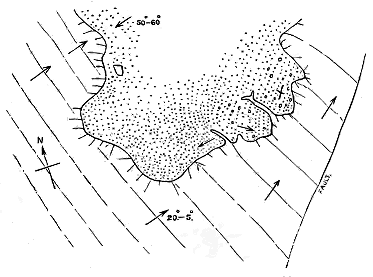
Fig. 126.—Ground-plan of tuff-neck, shore east of Dunbar.
The surrounding rocks are sandstones, which are much hardened round the vent in the zone marked by the short
divergent lines. The arrows mark the direction of dip. See "Geology of East Lothian," Mem. Geol. Survey, p. 44.
From the evidence of these necks it is plain that the volcanic materials
of the plateaux must in each case have been supplied not from great
central orifices, but from abundant vents standing sometimes singly, with
intervening spaces of several miles, often in groups of four or five within a
single square mile.
In the interior of the country, it is seldom possible to examine the actual
junction of necks with the rocks through which they rise, the boundary-line
being usually obscured by debris or herbage. On the coast, the vents of the
plateaux have not been bared by the sea so fully as in the case of the much
younger series of the east of Fife to be described in later pages. But
where the East Lothian plateau touches the shore, the waves have laid bare
a number of its minor vents, which have thus been dissected in ground-plan
on the beach. As an illustration of these vents an example is given in
Fig. 126, from the shore east of Dunbar. Here the sandstones, which are
inclined in an easterly direction at 20° to 25°, are pierced by an irregular
mass of tuff. It is observable that in this instance long tongue-like projections
of the sandstones protrude into the neck; more frequently the
material of a neck sends veins or dykes into the surrounding walls. A
volcanic chimney would seem to have been often much shattered and fissured
in the course of the volcanic explosions, and the fragmentary material has
fallen or been injected into the rents thus caused. As a rule, the rocks
immediately around the Carboniferous necks are more or less indurated, as
in this instance from the Dunbar shore.
The materials which have filled up the vents connected with the plateau-eruptions
generally consist of (a) agglomerates or tuffs, but occasionally of
(b) some kind of lava, and frequently (c) of both these kinds of rock
combined.
(a) Necks of Agglomerate or Tuff.—These materials vary greatly in the
nature and relative proportions of their constituents. Usually the included
blocks and lapilli are pieces of andesite, diabase, basalt or other lava, like
the rocks of the plateaux. But with these occur also fragments probably
detached from the sides of the funnels through which the explosions took
place, such as pieces of greywacke, sandstone, limestone and shale. Considerable
induration may be observed among these non-volcanic ingredients.
In some cases, as in that of the occurrence of pieces of granite referred
to on p. 382, the stones have probably been brought up from some considerable
depth. In others it is easy to see that the blocks have slipped
down from some higher group of strata now removed from the surrounding
surface by denudation. Some striking illustrations of this feature will be
cited from necks of the puy-series in the south of Roxburghshire (p. 476).
The lava blocks in the tuffs and agglomerates are usually rounded or
subangular. Pear-shaped blocks, or flattened discs, or hollow spherical balls
are hardly ever to be observed, though I have noticed a few examples in
the tuffs of Dunbar. A frequent character of the blocks is that of roughly
rounded, highly amygdaloidal pieces of lava, the cellular structure being
specially developed in the interior, and the cells on the outside being often
much drawn out round the circumference of the mass. Such blocks were
probably torn from the cavernous, partially consolidated, or at least rather
viscous, top of a lava column. Most of the stones, however, suggest that
they were produced by the explosion of already solidified lava, and were
somewhat rounded by attrition in their ascent and descent. The vents filled
with such materials must have been the scene of prolonged and intermittent
activity; successive paroxysms resulting in the clearing out of the hardened
lava column in the throat of the volcano, and in the rise of fresh lava, with
abundant ejection of dust and lapilli.
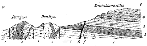
Fig. 127.—Section across the vents Dumgoyn and Dumfoyn, and the edge of the Clyde plateau above
Strathblane, Stirlingshire.
1. Upper Old Red Sandstone; 2. Shales, cement-stones and sandstones ("Ballagan beds"); 3. White sandstone;
4. Andesite lavas; 5. Agglomerate (shown by the dotted portions), traversed by intrusive diabase. f, Fault. D.
Late dolerite dyke.
Necks formed entirely of agglomerate are abundant among the vents
connected with the plateaux. As examples of them I may refer to the series
already mentioned as fronting the escarpment of the Clyde plateau from
Fintry to Largs. Another interesting group rises through the Silurian and
Old Red Sandstone rocks to the west of the escarpment of the Berwickshire
plateau, that near Melrose forming one of the largest in Scotland.
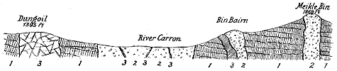
Fig. 128.—Section through the large vent of the Campsie Hills.
1. Andesite lavas; 2. Agglomerate and tuff; 3. Trachytic and andesitic intrusive rocks.

Fig. 129.—Diagrammatic section across the central vent of the Clyde plateau in Renfrewshire.
1. Andesite lavas; 2. Agglomerates and fine tuffs often much altered; 3. Dykes of trachytic and andesitic rocks;
4. Later dykes of dolerite and basalt.
Illustrations of the varying structure of these vents are given in the
accompanying figures. In Fig. 127, a section is drawn through the two necks
Dumgoyn and Dumfoyn, which have already been shown in outline and in
ground-plan. The relation of these two vents to the neighbouring plateau to
the right can here be seen. Fig. 128 gives a section taken through the
great vent of the Campsie Hills, with the minor adjacent necks of Dungoil,
Bin Bairn, and the Meikle Bin.
The diagram in Fig. 129 is meant to convey in a
general way what appears to be the structure of the
central vent of the Renfrewshire plateaux, to be afterwards
referred to. But, as already mentioned, the limits
of the various rocks are too much obscured to allow an
accurate delineation to be given of their areas and relations
to each other. The Berwickshire plateau supplies
abundant interesting examples of tuff necks which rise
through the Old Red Sandstone many miles distant from
the edge of the lavas. This structure is shown in
Fig. 130.

Fig. 130.—Section across Southern Berwickshire to show the relation of the volcanic plateau to the vents lying south from it.
1. Upper Silurian strata; 2. Upper Old Red Sandstone; 3. The volcanic plateau; 4. Agglomerate and tuff of the vents; 5. Basalt and dolerite; 6. Lower Carboniferous strata.
Indications may occasionally be observed of an
agglomerate vent having been first occupied by one kind
of material and then, after being in great measure cleared
out by explosions, having been subsequently filled up
with another. As an example of this structure I may
cite again the double neck of the Knock Hill a little
to the north of Largs, of which the outline is shown
in Fig. 23, and the ground-plan in Fig. 125, B. This
hill rises from the red sandstone slopes that front the
great Ayrshire plateau and forms a conspicuous cone
the top of which is rather more than 700 feet above the
sea. Its summit commands a remarkably extensive and
interesting panorama of the scenery of the Clyde, but
to the geologist perhaps the most striking feature in the
landscape is the range of terraced hills behind, mounting
up into the great vents of the Renfrewshire uplands.
On these declivities the successive lava-streams that have
built up the plateau can be seen piled over each other
for a thickness of more than 1000 feet, and presenting
their escarpments as parallel lines of brown crag with
green slopes between.
The Knock has had its upper part artificially dressed,
for lines of trench have been cut out of its rocks by some
early race that converted the summit of the hill into a
strongly intrenched camp. From the apex of the cone
the ground falls rapidly westward into a hollow, beyond
which rises a lower rounded ridge of similar materials.
It is possible that this western ridge may really form
part of the main hill, but the grass-covered ground does
not afford sufficient exposures of the rocks to settle this
point. From the contours of the surface, it may be
inferred that there are two closely adjacent vents, and
that the western and lower eminence is the older of the two. This
hill or ridge consists partly of a coarse agglomerate, and partly of veins and
irregular protrusions of a dark, compact, slightly cellular lava. The stones
in the fragmental rock are different olivine-basalts, or other basic lavas, and
sandstones. The paste is rough, loose and granular. The sandstone fragments
are much indurated and sometimes bleached.
The Knock itself is formed mainly of a remarkably coarse and strikingly
volcanic agglomerate. Round the outside, and particularly on the south-east,
the rock is finer in texture, compact, and gravelly, or like a mudstone, with
few or no imbedded blocks, dull-green to red in colour, and breaking with
a clean fracture which shows angular lapilli of various basalts or diabases.
At the southern end of the neck, where the surrounding red sandstone can
be seen within a few feet of the tuff, the latter is bright red in colour, and
contains much debris of red sandstone and marl. Possibly this finer tuff,
which is traceable as an irregular band round the outside of the neck, may
mark an older infilling of the vent than the agglomerate of the centre; but
there is no sharp line to be drawn between the two, though a hollow can
sometimes be traced on the surface where they join.
The agglomerate of this locality is one of the most characteristic among
the plateau-necks of the Clyde region. Its blocks sometimes measure from two
to three feet in diameter. They consist almost wholly of a dark crystalline
porphyritic olivine-basalt. These blocks are subangular in form, often with
clean-fractured surfaces. Though occasionally slightly cellular, they are
never slaggy so far as I could see, nor are any true scoriæ to be noticed
among them. The blocks suggest that they were derived from the disruption
of an already solidified mass of lava. The agglomerate is entirely
without any trace of stratification.
Through this tumultuous accumulation of volcanic debris some
irregular veins of olivine-basalt, sometimes glassy in structure, have been
injected, and reach nearly to the summit of the hill. This intrusive
material resembles generally some of the dark intrusive masses in the
Dumbartonshire necks. Like these, it exhibits a tendency to assume a
more or less distinctly columnar structure, its columns having the same
characteristic wavy sides and irregular curvature. The intrusive rocks in
the two eminences of the Knock may be paralleled among the stones in the
agglomerate. The neck on its north-eastern side rises steeply from the red
sandstones which it pierces, but which, although they are much jointed and
broken, are not sensibly indurated. Unfortunately the actual junction of
the igneous and sedimentary rocks is concealed under herbage.
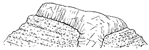
Fig. 131.—Section of south end of Dumbuck Hill. East of
Dumbarton.
As a rule, the fragmental materials of the plateau-necks are quite
unstratified. Their included blocks, distributed irregularly through the
mass, have evidently undergone little or no assortment after they fell
back into the vents. Occasionally, however, a more or less distinct
bedding of the agglomerate or tuff may be observed, the layers having
a tendency to dip inward into the centre. One of the most conspicuous
examples of this structure is to be found in the hill of Dumbuck, to
the east of Dumbarton. This neck, which forms so prominent a feature
in the landscape, presents a precipitous face towards the south, and allows
the disposition of its component materials to be there seen. The agglomerate
consists of a succession of rudely stratified beds of coarser and finer detritus,
which on both sides are
inclined towards the centre,
where a plug of fine-grained
olivine-basalt has risen and
spread out into a columnar
sheet above (Fig. 131). In
general form this basalt
resembles such intrusions
as that of Largo Law, to be afterwards described (Fig. 226), where
what may have been the hollow or bottom of the crater is filled with basalt.

Fig. 132.—Section across the East Lothian plateau to show the relative position of one of the necks.
1. Lower Carboniferous sandstones and shales; 2. Red and green tuffs with a seam of limestone (l); 3. Band of
basic sheets at the base of the lavas; 4. Trachytes; 5. Phonolite neck.
(b) Necks of Andesite, Trachyte, Dolerite, Diabase, or other massive Rock.—When
the vents have been filled by the uprise of some molten rock, it is
generally, as we have seen, of a more acid character than the ordinary lavas
of the plateaux. Frequently it consists of some variety of trachyte or
andesite, commonly of a dull yellow or grey tint and waxy lustre. Good
examples may be seen among the remarkable group of necks on either side
of the valley north of the village of Strathblane and in those above Bowling.
The three great necks in East Lothian, already alluded to,—Traprain Law
(Figs. 132, 133), North Berwick Law (Fig. 109), and the Bass Rock
(Fig. 110)—are masses of phonolite and trachyte, obviously related to the trachytes
of the adjacent plateau. A smaller but very perfect instance of a vent
similarly filled is to be seen in the same neighbourhood on the shore to the
east of North Berwick Law.[438]
Examples occur where the funnels of eruption have been finally sealed
up by the rise of more basic material, and this has happened even in a
district where most of the lava-form necks consist of trachyte or some other
intermediate lava. Thus, in the Campsie Fells, several such bosses appear,
of which the most conspicuous forms the hill of Dungoil (1396 feet, Fig.
128). Further west, among the Kilpatrick Hills, bosses of this kind are
still more numerous. The group of bosses near Ancrum and Jedburgh is
mainly made up of olivine-dolerites and olivine-basalts (Fig. 130). This more
basic composition of itself suggests that these bosses may be connected rather
with the puy- than with the plateau-eruptions.
(c) Necks of Composite Character.—In not a few examples, the vents
have been filled with agglomerate which has been pierced by a plug or veins
of lava-form material. Many illustrations of this composite structure may
be observed along the west front of the great escarpments from Fintry to
Ardrossan (see Figs. 124, 125, 127 and 128). In that region the intruded
rock is often a dull yellowish or grey trachytic or andesitic material.
Olivine-basalt is the chief rock intruded in the vents in the Dumbarton
district. Among the Roxburghshire vents, where the injected material is
commonly olivine-basalt or dolerite, it occasionally happens, as in Rubers Law,
that the uprise of the lava has almost entirely cleared out or concealed the
agglomerate, and in some of the bosses, where no agglomerate is now to be
seen, the basalt may have taken its place (Fig. 130).
The largest and most interesting vents connected with this type of
Carboniferous volcano, are those which occur within the limits of the
plateaux, where they are still surrounded with lavas and tuffs that probably
came out of them. Of these by far the most extensive and remarkable
lies among the high moorlands of Renfrewshire between Largs and
Lochwinnoch, where the ground rises to more than 1700 feet above the
sea (see Fig. 129). This area, as already remarked, is unfortunately much
obscured with drift and peat, so that the limits of its rocks cannot be so
satisfactorily traced as might be desired. I think it probable that several
successive vents have here been opened close to each other, but their erupted
ashes probably cannot be distinguished. Over a space measuring about four
miles in length by two and a half in breadth, the rocks exposed at the
surface are fine tuffs, breccias and coarse agglomerates, largely made up of
trachytic, andesitic or felsitic material, and pierced by innumerable protrusions
of various andesitic, trachytic or felsitic rocks in bosses and veins, as well
as also by dykes of a more basic kind, such as dolerites and basalts. Some
of the tuffs present a curiously indurated condition; and they are frequently
much decayed at the surface.[439] Another large mass of tuff and agglomerate
lies a little to the south-west of the main area.
After the explosions ceased, by which the vents were opened and the
cones of debris were heaped up, heated vapours would in many cases, as in
modern volcanoes, continue for a long while to ascend in the funnels. The
experiments of Daubrée on the effects of water and vapour upon silicates
under great pressure and at a low red heat, have shown how great may
be the lithological changes thereby superinduced. It is improbable that
where a mass of tuff and lava, lying deep within a volcanic vent, was
thoroughly permeated with constantly ascending heated vapours, it should
escape some kind of change. I am inclined to attribute to this cause the
frequent conversion of the sandstones round the walls of the vents into
quartzite. The most remarkable example of metamorphism within a vent
which I have observed among the plateaux, occurs in the heart of the
Campsie Fells, where, instead of forming a prominence, the neck is marked
by a great hollow, measuring about a mile in length and half a mile in
breadth (Fig. 128).[440] It is occupied mainly by a coarse tumultuous agglomerate,
like that of other necks in the same district, but with a matrix
rather more indurated, and assuming in certain parts a crystalline texture,
so as to be at first sight hardly distinguishable from some of the surrounding
andesites. Even in this altered condition, however, its included fragments
may be recognized, particularly blocks of sandstone which have been
hardened into quartzite. Numerous small veins of pink and yellow trachyte
traverse the agglomerate, and are found also cutting the bedded andesites
that encircle it.
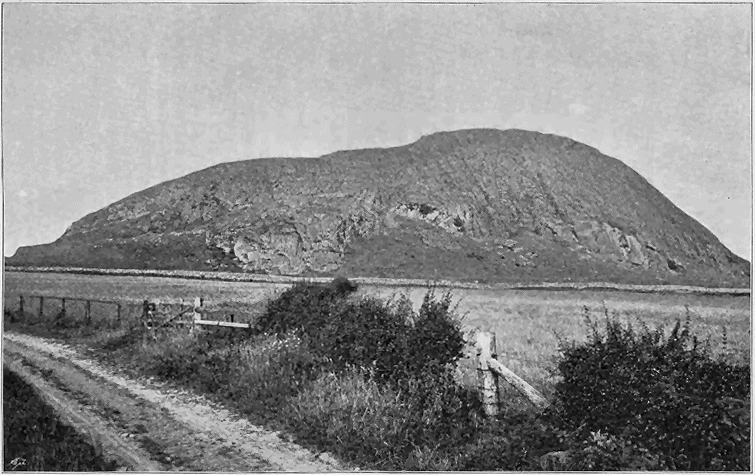
Fig. 133.—View of Traprain Law from the south, a phonolite neck of the Garleton Plateau.
Intrusive masses both in the form of dykes and of sills are of frequent
occurrence in connection with the Carboniferous volcanic plateaux. From
the variety of their component materials it may be inferred that these rocks
belong to different ages of intrusion.
Dykes.—The great majority of the Dykes consist of trachyte or of
andesite, resembling in lithological characters the material of the necks and
doubtless connected with its uprise. There occur also dykes of diabase,
basalt or dolerite. Some of the latter, especially those which run for many
miles, cutting every rock in the districts in which they occur, and crossing
large faults without deviation, are certainly long posterior to the plateau
volcanic period. Whether the small inconstant dykes of more basic composition,
found in the same districts with the trachytes, are to be looked
upon as part of the volcanic phenomena of the plateaux, is a question to
which at present no definite answer can be given. I shall have occasion to
show that in the next volcanic period the lavas that flowed from the puys
are more basic than most of those of the plateaux, and that they are
associated with more basic dykes and sills. In Roxburghshire, where it is
so difficult to distinguish between the denuded vents of the two periods,
the dark heavy olivine-basalts and dolerites of the bosses may possibly
belong rather to the later than to the earlier volcanic episode. And if
that be their true age, the dykes of similar material may be connected
with them. At the same time it must be remembered that the earliest
eruptions of the plateaux were markedly basic, that many vents in the
plateaux are pierced by basic intrusions, and that basic dykes may have been
associated with the uprise of the same magma.
The dykes occur in considerable numbers and in two distinct positions,
though these may be closely related to each other: 1st, among the rocks
outside and beneath the plateau-lavas, or cutting these lavas; and 2nd, in
and around the vents.
1. Among the rocks which emerge from under the Carboniferous
volcanic plateaux, dykes are sometimes to be observed in considerable
numbers. They may be compared to the far more extensive series connected
with the Tertiary basalt-plateaux, like which they may have had a
close relation to the actual building up of the successive sheets of andesite,
trachyte and basalt that were erupted at the surface. They are particularly
well developed in the Clyde plateau, where by extensive denudation they have
been admirably exposed. I would especially refer to those that traverse the
tract of red sandstones which underlie the volcanic series along the flanks of the
great escarpments from Fintry to Strathblane and Dumbarton, and between
Gourock and Ardrossan. These dykes have been dissected by the sea along
both sides of the estuary of the Clyde and in the islands of Cumbrae. In these
islands and in Bute they have recently been mapped in great detail for the
Geological Survey by my colleague, Mr. W. Gunn, who has supplied me with
notes of his observations on the subject, from which the following summary
is compiled.
"There are at least four distinct groups of intrusive rocks in the Greater
Cumbrae. The oldest of these is trachytic in character, and occurs
both as dykes and sheets, which run generally in the same E.N.E. direction.
The rock is usually pinkish in colour, sometimes grey or purplish. A
specimen from the dyke of the Hawk's Nest, north of Farland Point,
analyzed by Mr. Teall, was found to contain 11 per cent of alkalies,
principally potash, while the percentages of lime and iron were very low.
Sometimes these rocks are fine in grain with only a few porphyritic orthoclase
crystals, though numerous small crystals of this mineral are found
with the aid of the microscope. These red trachyte dykes are almost confined
to the Upper Old Red Sandstone, rarely entering the overlying white
Calciferous Sandstones, and never invading the plateau-lavas. They are
therefore probably of early Carboniferous age.
"The next group follows the same general direction, but clearly traverses
the trachytes, and must therefore be of later date. The dykes of this group
are the most numerous of the whole, the greater part of the island being
intersected by them. In the north-east corner about 40 of them may be
counted in half a mile of coast-line, some being of large size. All of them
which can be clearly made out are porphyritic olivine-basalts of the
type of the Lion's Haunch at Arthur's Seat. They are generally grey in
colour and finer at the edges than in the centre, which is often coarsely
porphyritic and amygdaloidal. Olivine seems always characteristic, but has
often been replaced by hæmatite or calcite. In Bute a good many dykes
have been mapped to the north of Kilchattan Bay resembling this basalt
series of Cumbrae, and running in the same direction. But they appear to
be all porphyritic andesites. The second group of dykes, though it cuts
the first and is thus proved to be later in date, is nevertheless confined
within the same stratigraphical limits. It may thus belong nearly to the
same period of intrusion.
"The dykes of the third group are dolerites without olivine, and follow
on the whole an east and west direction. They cut both of the two foregoing
sets of dykes, and likewise the lavas of the plateau. They must thus
belong to a far later period of intrusion. They may be connected with
other dykes and sills on the mainland, which traverse the Coal-measures,
and would thus be not older than late Carboniferous or Permian time.
"The fourth group of dykes intersects all the others, and is probably of
Tertiary age. The prevalent direction of these dykes in the Cumbraes is
N.N.W." The Tertiary dykes are more fully described in Chapters xxxiv. and
xxxv.
The great group of tuffs which underlies the lavas of the East Lothian
plateau is traversed by numerous dykes and sills, of which many good
examples may be seen in the coast-cliffs of North Berwick. Among these
rocks are beautiful olivine-basalts with singularly fresh olivine, as on the
shore at North Berwick. Some of them are still more basic, as in the case
of a limburgite intrusion at the Gin Head, Tantallon Castle.
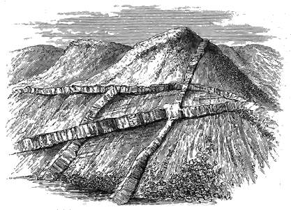
Fig. 134.—Veins and dykes traversing the agglomerate and tuff of the great Renfrewshire vent.
2. In the necks, dykes are sometimes abundant, and they may be
observed occasionally to traverse the surrounding lavas. They consist of
similar materials to those found outside the plateaux. Some of the larger
necks are intersected by a network of dykes and veins. The great vent or
group of vents among the uplands of Renfrewshire, already described (Fig.
129), furnishes some admirable examples of this characteristic volcanic
feature. An illustration from that locality forms the subject of Fig. 134.
The agglomerate which fills the large hollow among the Campsie Hills may
be quoted as another illustration (Fig. 128). Further instances will be
found in some of the sections given in preceding pages (see Figs. 124,
125, 127). The general aspect of a dyke in the volcanic series is shown
in Fig. 135.
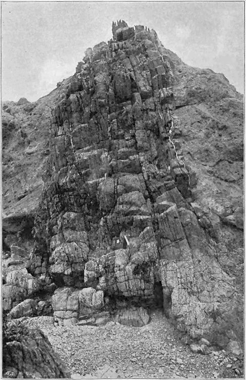
Fig. 135.—"The Yellow Man," a dyke in volcanic tuff and conglomerate on the shore a little east of
North Berwick.
The Sills associated with the plateau-type of Carboniferous volcanic
action form a less prominent feature than they do among the earlier
Palæozoic formations or in the puy-type which succeeded them. They
consist in general of short lenticular sheets of andesite or trachyte, like the
necks and dykes in proximity to which they commonly appear. The best
area for the study of them is the ground which stretches out from the
base of the great escarpments of the Campsie, Kilpatrick and Ayrshire
Hills (Fig. 136), where, among the agglomerate-vents and abundant dykes,
intrusive sheets have likewise been injected between the bedding-planes of
the red sandstones. But these sheets are of comparatively trifling dimensions.
Very few of them reach a mile in length, the great majority falling far
short of that size. In the Cumbraes and in Bute, Mr. Gunn has observed
that the trachytic, olivine-basalt and dolerite dykes are apt to pass into
intrusive sheets. That the sills, as well as the dykes and bosses of the
same material, are not of older date than the lavas of the plateaux is proved
by the manner in which they pierce these lavas, especially towards the
bottom of the series. The general absence of basic sills, when we consider
how thick a mass of these rocks has sometimes been poured out in the
plateaux, is not a little remarkable. Only in the basin of the Firth of
Forth do we encounter thick basic sills near the plateaux, such, for instance,
as Salisbury Crags at Edinburgh. But it is doubtful whether they ought
not rather to be classed with the sills of the puys, to be afterwards
described.
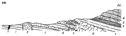
Fig. 136.—Trachytic sills, Knockvadie, Kilpatrick Hills.
1. Upper Old Red Sandstone; 2. "Ballagan Beds"; 3. Tuffs; 4. Lavas of the Plateau; 5. Agglomerate of necks;
6. Trachyte sills; 7. Dolerite dyke (? Tertiary).
The relative geological date when the eruptions of each plateau ceased
can fortunately be determined with much more precision than the time of
their beginning. The Hurlet Limestone, so well known as the lowest thick
calcareous seam in the Carboniferous Limestone series, of which it is
generally taken as the base, can be identified over the whole of Central
Scotland, and thus forms an excellent stratigraphical horizon, from which the
upward termination of the volcanic sheets underneath it can be measured.
When the volcanic episode of the plateau-eruptions came to an end,
such banks or cones as rose above the level of the shallow sea which then
overspread Central Scotland were brought beneath the water, as I have
already remarked, either by prolonged denudation or more probably in large
part by the continued subsidence of the region. The downward movement
may possibly for a time have been accelerated, especially in some districts.
Thus the Hurlet Limestone, though usually not more than five or six feet
thick, increases locally to a much greater thickness. At Petersfield, near
Bathgate, for example, it is between 70 and 80 feet in depth, while at
Beith, in North Ayrshire, it increases to 100 feet (Fig. 137), which is the
thickest mass of Carboniferous Limestone known to exist in Scotland. At
both of these localities the limestone lies upon a series of volcanic rocks,
and we may perhaps infer that the subsidence advanced there somewhat
more rapidly or to a greater extent, so as to form hollows in which the
limestone could gather to an abnormal depth. The water would appear to
have become for a time tolerably free from mechanical sediment. The
limestone is hence comparatively pure, and is extensively quarried all over
the country for industrial purposes. It is a crinoidal rock, abounding in
many species of corals, brachiopods, lamellibranchs, and gasteropods, with
trilobites, cephalopods, and fishes.

Fig. 137.—Section across the edge of the Clyde plateau, south-east of Beith.
1. Plateau-lavas; 2. Tuffs and volcanic conglomerates; 3. Hurlet Limestone; 4. Coal-bearing strata above the
limestone; 5. Dolerite dyke.
A variable thickness of strata intervenes between the top of the volcanic
series and the Main Limestone. Sometimes these deposits consist in large
measure of a mixture of ordinary sandy and muddy material with the
washed-down tuff of the cones, and probably with volcanic dust and lapilli
thrown out by the latest eruptions. Thus along the flank of the hills from
Barrhead to Strathavon, yellow and green ashy sandstones, grits and conglomerates
are succeeded by ordinary sandstones, black shales and ironstones,
while here and there true volcanic tuff and conglomerate make their appearance.[441]
Further west, in the Kilbirnie district, the limestone lies directly on
the tuffs that rest upon the andesites (Figs. 137, 138).
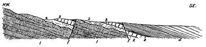
Fig. 138.—Section across the upper part of the Clyde plateau at Kilbirnie, Ayrshire.
1 1. Plateau-lavas; 2 2. Tuffs; 3 3. Hurlet Limestone; 4. Black-band Ironstone. f f. Faults.
But perhaps the most striking contrast between adjacent localities in
regard to the distance between the limestone and the top of the volcanic
series is to be observed along the southern front of the Campsie Fells. In
spite of the abundant faults which have there so broken up the regular
sequence of the rocks, we can see that at Banton and Burnhead the limestone
lies almost immediately on the volcanic series (Fig. 139). But a
little to the westward, sandstones, conglomerates, shales and thin limestones
begin to intervene between the volcanic series and the Hurlet Limestone
and swell out so rapidly that on Craigmaddie Muir and South Hill of
Campsie, only some five miles off, they must form a total thickness of not
less than from 600 to 800 feet of ordinary non-volcanic deposits, chiefly
thick pebbly sandstones (Fig. 140). Such local variations not improbably
serve to indicate hollows on the flanks of the plateaux that were filled up
with detritus before the depression and clearing of the water that led to the
deposition of the Hurlet Limestone.
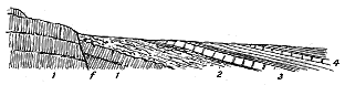
Fig. 139.—Section across the upper surface of the Clyde volcanic plateau, Burnhead, north-west of
Kilsyth.
1. Lavas of the plateau; 2. Tuffs; 3. Hurlet Limestone; 4. Hosie's Limestone; f, Fault.
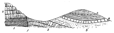
Fig. 140.—Section across the upper surface of the Clyde volcanic plateau at Campsie.
1. Shales, sandstones, cement-stones, etc. ("Ballagan Beds"); 2. Lavas of the plateau; 3. Thick white
sandstone and conglomerate; 4. Hurlet Limestone; 5. Hosie's Limestone; f. Fault.

Fig. 141.—Section across western edge of the Garleton plateau.
1. Trachyte lavas of the plateau; 2. Calciferous Sandstones; 3. Hurlet Limestone.
I have already remarked that the eruptions of the plateau period lasted
longer in the western than in the eastern parts of the region. In the
Garleton district, where the peculiar viscous trachytic lavas probably gave
rise to a more uneven surface or more prominent cones than was usual
among the andesitic plateaux, the eruptions ceased some time before the
deposition of the Hurlet Limestone. As the area sank, the successive zones
of the Calciferous Sandstones crept over the flanks of
the trachytes, until at last they had completely buried
these rocks before the limestone spread over the area
(Fig. 141). In consequence, probably, of the uneven
surface of this plateau, there is here a strong overlap
of the higher part of the Calciferous Sandstones. On
the west side of the volcanic area there can hardly
be more than some 200 feet of strata between the
top of the trachytic series and the limestone, while
on the south side there must be greatly more than
that thickness. This structure probably indicates that
the Garleton volcanoes became extinct after having
piled up a mass of tuffs and lavas to such a height
that its summits were not submerged until the area
had subsided 800 or 1000 feet in the waters, over the
floor of which the Calciferous Sandstones were laid
down. Hence, in spite of the proximity of the lavas
to the limestone, there may have been a vast interval
of time between their respective epochs, as has been
already suggested with regard to other plateaux.
This subject will be again referred to in discussing
the relative chronology of the plateaux and puys.
In the Berwickshire and Solway districts, the
extinction of the plateau-vents appears to have taken
place at a still earlier part of the Carboniferous period,
for there the andesites, while they rest on the Upper
Old Red Sandstone, are covered with at least the
higher group of the Calciferous Sandstones (Fig. 142).
The equivalent of the Hurlet Limestone of Central
Scotland must lie many hundred feet above them.
The submergence of the plateaux, and their entombment
under the thick Carboniferous Limestone
series, did not mark the close of volcanic activity
in Central Scotland during Carboniferous time. The
plateau-type of eruption ceased and was not repeated,
but a new type arose, to which I would now call the
reader's attention.

Fig. 142.—Section across the Solway plateau from Birrenswark to Kirtlebridge.
1. Upper Silurian strata; 2. Upper Old Red Sandstone; 3. Plateau-lavas; 4. Calciferous Sandstones and Carboniferous Limestone series; 5. Trias.
CHAPTER XXVI THE CARBONIFEROUS PUYS OF SCOTLAND — i. GENERAL CHARACTER AND DISTRIBUTION — ii. NATURE OF THE MATERIALS ERUPTED — A. The Lava-form Rocks — B. Tuffs
i. General Character and Distribution of the Puys; ii. Nature of the Materials
Erupted—Lavas Ejected at the Surface—Intrusive Sheets—Necks and Dykes—Tuffs.
After the beginning of the Carboniferous Limestone period, when eruptions
of the plateau-type had generally ceased, volcanic activity showed itself over
the area of the British Isles in a different guise both as regards the nature
of its products and the manner and scale of their discharge. Instead of
widely extended lava-sheets and tuffs, piled above each other sometimes to a
thickness of many hundred feet, and stretching over hundreds of square
miles, we have now to study the records of another phase of volcanism,
where scattered groups and rows of Puys, or small volcanic cones, threw out
in most instances merely tuffs, and these often only in trifling quantity,
though here and there their vents also poured forth lavas and gradually
piled up volcanic ridges which, in a few cases, almost rivalled some of the
plateaux. The evidence for these less vigorous manifestations of volcanic
activity is furnished (1) by layers of tuff and sheets of basaltic-lavas intercalated
among the strata that were being deposited at the time of the
eruptions, (2) by necks of tuff, agglomerate, or different lava-form rocks that
mark the positions of the orifices of discharge, and (3) by sills, bosses, and
dykes that indicate the subterranean efforts of the volcanoes. The comparatively
small thickness of the accumulations usually formed by these
vents, their extremely local character, the numerous distinct horizons on
which they appear, and the intimate way in which they mingle and alternate
with the ordinary Carboniferous strata are features which at once arrest the
attention of the geologist, presenting, as they do, so striking a contrast to
those of the plateaux.
From the clear intercalation of these volcanic materials on successive
platforms of the Carboniferous system, the limits of geological time within
which they were erupted can be fixed with considerable precision. It may
be said that, in a broad sense, they coincided with the period of the
Carboniferous Limestone, and certainly it was during the deposition of that
formation that the eruptions which produced them reached their greatest
vigour and widest extent. Here and there in Scotland evidence may be
found that the phase of the Puys began during that earlier section of
Carboniferous time recorded by the Calciferous Sandstones. This is
markedly the case in Liddesdale and the neighbouring territory. Over
the western part of Midlothian also, the eastern portion of West Lothian,
and the southern margin of Fife, abundant traces occur of puy-eruptions
during the deposition of the Calciferous Sandstones. Elsewhere in Central
Scotland there is no evidence of the vents having been opened until after
the deposition of the Hurlet Limestone, which, as we have seen, may conveniently
be taken as the base of the Scottish Carboniferous Limestone
series. The volcanoes remained active in West Lothian until near the close
of the time represented by that series; but in Ayrshire they continued in
eruption until the beginning of the accumulation of the Coal-measures.
These western examples of the puy-type are, so far as I am aware, the
latest known in Britain.
Whether or not the earliest puy-eruptions began before the latest
plateau-lavas and tuffs were accumulated is a question that cannot be readily
answered. It will be remembered that in the basin of the Firth of Forth
a thickness of more than 3000 feet of sedimentary strata, including the
Burdiehouse Limestone and numerous oil-shales as well as thin coal-seams,
lies above the red and green marls, shales, sandstones and cement-stones of
the Calciferous Sandstone series. This remarkable assemblage of strata is
absent in the western parts of the country, where the top of the Clyde
volcanic plateau is almost immediately overlain by the Hurlet Limestone.
If we were to judge of the sequence of events merely from the stratigraphy,
as expressed in such sections as Figs. 137, 138, 139 and 140, we might
naturally infer that as no trace of any break occurs at the top of the Clyde
plateau, the tuffs shading upward there into the limestone series, no
important pause in sedimentation took place, but that the last volcanic
eruptions were soon succeeded by the conditions that led to the deposition
of the widespread encrinite-limestones. If this inference were well founded
it would follow that while the plateau-eruptions in the west lasted till the
time of the Hurlet Limestone, those in the east ceased long before that time
and were succeeded by the puys of Fife and the Lothians. There would
thus be an overlap of the two phases of volcanic action.
I am inclined to believe, however, that in spite of the superposition
of the Hurlet Limestone almost immediately upon the volcanic rocks of
the Clyde plateau, and the absence of any trace of a break in the process of
sedimentation, a long interval nevertheless elapsed between the last eruptions
and the deposit of that limestone. The Campsie section (Fig. 140)
shows us how rapidly a thick mass of strata can come in along that horizon.
The volcanic ridges may have remained partly unsubmerged for such time
as was required for the subsidence of the Forth basin and the deposit of the
thick Calciferous Sandstone series there, and their summits may only have
finally sunk under the sea not long before the Hurlet Limestone grew as a
continuous floor of calcareous material over the whole area of central Scotland.
In these circumstances, the puy-eruptions of that basin would be
long subsequent to the eruptions of the Clyde plateau, as they certainly
were to those of the plateaux of Midlothian and the Garleton Hills.
In tracing the geographical distribution of the puy-eruptions we are first
impressed with the force of the evidence for their extremely local and
restricted character (Map IV.). Thus in the area of the basin of the Firth
of Forth, which may be regarded as the typical region in Britain for the study
of this form of Carboniferous volcano, traces of them are abundant to the
west of the line of the Pentland Hills. To the east of that line, however, not
a vestige of puy-eruptions, save a few sills of uncertain relationship, can be
detected, though the same series of stratigraphical horizons is well developed
on both sides of the Lothian coal-field. Again, to the westward of the
Forth basin over the area of Stirlingshire, Lanarkshire and Renfrewshire
lying to the north of the great volcanic plateau, no record of puy-eruptions
has been noticed. Immediately to the south of that plateau, however, these
eruptions were numerous in the north of Ayrshire. Yet the rest of the
Carboniferous area in that large county has supplied no relics of these
eruptions save at one locality—the Heads of Ayr. Lastly, while no trace
of any younger display of volcanic activity occurs in the Merse of Berwickshire,
east of the plateau series of that district, the ground immediately to
the west abounds in puys, and contains likewise extensive sheets of tuff and
beds of basic lavas connected with these vents.
Another fact which at once attracts notice in Scotland is the way in
which the puy-vents have generally avoided the areas of the plateaux,
though they sometimes approach them closely. As a rule, it is possible
to distinguish the tuffs and agglomerates which have filled up these vents
from those that mark the sites of the eruptive orifices of the plateaux.
There are, no doubt, some instances, as in Liddesdale, where puys have
appeared on the sites of the older lavas, but these are exceptional collocations.[442]
On the other hand, many examples may be found where puys have
risen in the interspace between the limits of the eruptions of two plateau-areas.
Thus the tract between the Clyde plateau-eruptions on the west
and those of the Garleton Hills on the east was dotted over with puys.
Again, the southern margin of the Clyde plateau in Ayrshire, from Dalry to
Galston is flanked with puys and long sheets of their lavas and tuffs.[443]
We have now to consider the nature of the materials erupted by the
volcanic activity of the puys. The geologist who passes from the study
of the plateau lavas to those of the puys at once remarks the prevalent
more basic character of the latter. The great majority of them are basalts,
generally olivine-bearing, in the various types embraced in the table on the
following page. The olivine-free dolerites are generally found as intrusive
bosses, sills and dykes. Such more acid rocks as andesites occur only
rarely, and still more seldom are quartziferous masses met with in some of
the bosses.
Dolerites and Basalts.—The great majority of the lava-form rocks
connected with the puys are basic in composition, and belong to the family
of the Dolerites and Basalts. They graduate, on the one hand, into ultra-basic
rocks such as limburgite and picrite, and on the other, into compounds
that approach andesites or trachytes in composition. A large series of
specimens from Central Scotland was studied a few years ago by Dr. Hatch,
who proposed a petrographical classification of the rocks, and arranged them
in a number of types which he named after localities where they are well
developed.[444] More recently the rocks have again been subjected to microscopic
investigation by my colleague Mr. Watts, who, confirming generally
Dr. Hatch's discriminations, has made some modifications of them. He has
furnished me with a revised classification (p. 418), based on purely petrographical
considerations. The doleritic and basaltic series may be grouped
into two divisions, one with, and the other without, olivine, and each division
may be further separated into a dolerite group, which presents an ophitic or
sub-ophitic structure, and a basalt-group in which the groundmass is made up
of felspar and granular augite, and possesses the "intersertal structure" of
Rosenbusch, or consists of idiomorphic augite embedded in felspar substance.
The term "sub-ophitic" is employed by Mr. Watts "to imply that the
augite grains are neither very large nor very continuous, optically, and that
they rarely contain entire felspar-crystals imbedded in them, merely the
ends of a group of these crystals as a rule penetrating into them."
Transitional forms occur between many of the following types by the
increase or diminution in the relative proportions of the constituents. Thus
it is not easy to draw a line between 2b and 2c; the latter again shades
into 2d and 2e by the decrease of the felspar.
Mr. Watts has further observed that the rocks containing no olivine
offer greater difficulties in classification than those in which that mineral is
present. "The very distinction," he remarks, "between dolerites and
basalts is less marked, the types are much less sharply distinguished, and
decomposition and masking of the structure are more common. While
using the term Dolerite for such rocks as have a sub-ophitic structure, I
have extended it to those rocks in which evidence exists that a great part
of the crystallization took place under intratelluric conditions. Although
not quite holocrystalline, the crystals of felspar, augite and magnetite are
large and the structure coarse-grained, while the groundmass is confined to
comparatively small interstitial patches. In these rocks there is usually no
one dominant porphyritic ingredient."
| I. The Olivine-bearing Series |
| 1. Olivine-Dolerites |
| 1a. |
Porphyritic elements inconspicuous, olivine being
the principal, and felspar of secondary importance; groundmass
sub-ophitic. |
} |
Jedburgh Type. |
| 1b. |
Strongly porphyritic; felspar-phenocrysts large;
olivine smaller; groundmass sub-ophitic. |
} |
Kilsyth Type. |
| 1c. |
Porphyritic olivine, but not felspar; groundmass
sub-ophitic. |
} |
Gallaston Type. |
| 2. Olivine-Basalts |
| 2a. |
Porphyritic olivine, augite and felspar; groundmass
of felspar-laths imbedded in granules of augite. |
} |
Lion's Haunch Type. (See Fig. 207.) |
| 2b. |
Porphyritic olivine and augite; groundmass of
felspar-laths imbedded in granules of augite. More rarely the
groundmass is made of idiomorphic augite imbedded in
felspar-substance. |
} |
Craiglockhart Type. |
| 2c. |
Porphyritic olivine abundant, augite much less common,
and felspar very rare or absent; groundmass with granular or
idiomorphic augite (one of the most common types). |
} |
Dalmeny Type. |
| 2d. |
Porphyritic olivine more common than augite; groundmass
of granules of augite set amongst lath-like felspars which are
much fewer in number than in 2c. |
} |
Picrite Type. |
| 2e. |
Porphyritic olivine more common than augite; groundmass
of idiomorphic augite imbedded in felspathic material which is
not abundant. |
} |
Limburgite Type. |
| 2f. |
Porphyritic olivine and felspar, without augite;
groundmass of granular or idiomorphic augite, with lath-shaped
felspars. |
} |
Kippie Law Type. (For analysis see p. 379). |
| II. The Non-olivine-bearing Series |
| 3. Olivine-free Dolerites |
|
Felspar, augite, magnetite in coarse-grained aggregate usually ophitic or sub-ophitic;
groundmass not plentiful. |
| 3a. |
Groundmass absent |
|
Ophitic Type. |
| 3b. |
Groundmass micropegmatitic |
|
Ratho Type. |
| 3c. |
Groundmass an unstriated felspar (not orthoclase) and
occasionally some interstitial altered glass or a little quartz. |
} |
Burntisland Sill Type. |
| 4. Doleritic Basalts |
|
Felspar, augite and magnetite in coarse-grained aggregate; groundmass rather
more plentiful and often in large patches. |
| 4a. |
Felspar and augite, related sub-ophitically where
together, but augite showing crystalline contours in contact
with the groundmass; some interstitial quartz and unstriated
felspar. |
} |
Bowden Hill Type. |
| 5. Basalts |
|
Finer-grained rocks, generally with a porphyritic ingredient and much scattered
interstitial matter in the groundmass. |
| 5a. |
Porphyritic felspar, and occasionally a little augite;
groundmass of granular augite, felspar needles and magnetite with
some interstitial matter. |
} |
Binny Craig Type. |
| 5b. |
Porphyritic felspars not conspicuous and small; the rock
mainly made up of a mesh of fine felspar-laths set amongst
granular augite, magnetite and base. |
} |
Tholeiite Type. |
| 5c. |
Similar to the last but even finer-grained, and with the } -
base in a cryptocrystalline condition. |
} |
Cryptocrystalline Type. |
Taking first the superficial lavas, I know of only one locality where
picrite occurs in such a position that it may be included among the
surface outflows. This is the quarry near Blackburn, to the east of Bathgate,
where I originally observed it.[445] The rock occurs there on the line
of the basalt-flows from the Bathgate Hills, and I mapped it as one of them
before the microscope revealed the remarkable composition of the mass. I
still believe it to be a lava like the "leckstone" described on p. 443, though
the other known examples of this rock in the basin of the Firth of Forth
are intrusive sheets. The rock locally known as "leckstone" or "lakestone"
has long been quarried for the purpose of constructing the soles of bakers'
ovens, as it stands a considerable temperature without cracking. Its microscopic
structure is now well known. As exposed in Blackburn quarry, an
interesting difference is observable between the lower and upper parts of the
sheet. The lower portion is a picrite, with abundant serpentinized olivine,
large crystals of augite, and a considerable amount of ores. The upper
portion, on the other hand, has plagioclase as its most abundant definite
mineral, with a minor quantity of minute prisms of augite and of iron-ores,
and scattered crystals of olivine. Here, within the compass of a few yards
and in one continuous mass of rock, we have a transition from a variety of
olivine-basalt into a picrite.
The great majority of the puy lavas belong to the olivine-bearing series.
A few of them are dolerites, but most are true basalts of the Dalmeny type,
of which typical examples may be seen at the Kirkton quarries, Bathgate,
and in the coast section between Pettycur and Kinghorn. Occasionally
they present transitions towards picrite, as in the sheet overlying the lowest
limestone at Kirkton, and in the lowest lava of King Alexander's Crag,
Burntisland. These puy lavas exhibit considerable variety of structure as
seen in the field. Some are solid, compact, black rocks, not infrequently
columnar and weathering into spheroidal exfoliating forms. Others are
somewhat granular in texture, acquiring green and brown tints by weathering,
often showing amygdaloidal kernels, and even passing into well-marked
amygdaloids. Many of them exhibit a slaggy structure at their upper and
under surfaces (Figs. 153, 170, 171). These external differences are an
index to the corresponding variations in composition and microscopic
structure enumerated in the foregoing tabular arrangement.
As a rule, the basic rocks which occur intrusively in connection with
the puys, especially where they form a considerable mass, have assumed a
much more coarsely crystalline texture than those of similar composition
which have been poured out at the surface. They are generally dolerites
rather than basalts. But with this obvious distinction, the two groups have
so much in common, that the geologist who passes from the study of the
subterranean phenomena of the Plateaux to that of the corresponding phenomena
of the Puys is at once impressed with the close relationship between
the material which, in the case of the puys, has consolidated above ground,
and that which has been injected below. There is no such contrast between
them, for example, as that between the basic and intermediate lavas of the
plateaux and the more acid intrusions associated with them.
By far the largest number of the basic sills, bosses and dykes associated
with the puys are somewhat coarsely crystalline dolerites without olivine.
They include, however, olivine-dolerites and basalts, and even some extremely
basic compounds. Of these last, a typical example is supplied by the now
well-known picrite of Inchcolm, in the Firth of Forth, which occurs as an
intrusive sheet among the Lower Carboniferous Sandstones.[446] In recent
years one or two other picrite-sills have been observed in the same district.
An interesting example has been described from a railway cutting between
Edinburgh and Cramond where the rock invades and alters shales. More
detailed reference to it will be made in the account of the sills connected
with the puys. Another instance of the occurrence of this rock is in a
railway cutting immediately to the west of Burntisland where it has been
intruded among the Calciferous Sandstones below the Burdiehouse Limestone.
Rocks approaching limburgite occur among the sills and bosses which
pierce the Carboniferous Limestone series of Fife between Cowdenbeath and
Inverkeithing. One of these is found at Pitandrew, near Fordel Castle.
Dr. Hatch observed that it consists of "numerous porphyritic crystals of
olivine, with a few grains of augite and an occasional small lath-shaped
crystal of felspar imbedded in a groundmass which is composed principally
of idiomorphic augite microlites, small crystals of a brown mica, granules of
magnetite and prisms of apatite. In addition, there is a considerable
amount of interstitial matter, which is partly colourless glass, and partly
shows a slight reaction between crossed nicols." Another example of the
same type of rock occurs as a plug or boss in the tuff-vent of the Hill
of Beath, and a further display of the limburgite type is to be seen in
Dunearn Hill near Burntisland.
Although olivine-basalts of the Dalmeny type are most frequently met
with as interstratified lavas, they also occur as bosses and sills. The typical
example from Dalmeny is itself intrusive. Other illustrations are to be
found in the Castle Rock of Edinburgh and in the sheets near Crossgates
and Blairadam in Fife. The presence or absence of olivine, however, may
sometimes be a mere accident of cooling or otherwise. I have shown that
in the same mass of rock at Blackburn a gradation can be traced from a
rock largely composed of altered olivine into one consisting mainly of felspar
with but little olivine, and another example occurs in the picrite-sill between
Edinburgh and Cramond. Dr. Stecher has ascertained that the marginal
portions of the sills in the basin of the Firth of Forth, which cooled first and
rapidly, and may be taken, therefore, to indicate the mineral composition of
the rock at the time of extrusion, are often rich in olivine, while that
mineral may be hardly or not at all discernible in the main body of the rock.[447]
Of the ordinary and characteristic dolerites without olivine which constitute
most of the intrusive masses, the various types enumerated in the
tabular arrangement are abundantly developed in Central Scotland. Thus
the normal ophitic type is displayed by the uppermost sill of the Burntisland
series, and by the rock which forms the plug of the Binns Hill neck
in Linlithgowshire. The Ratho type is well seen in the large sill at Ratho,
likewise in the extensive intrusive sheets in the west of Linlithgowshire as
at Muckraw and Carribber. The Burntisland sill type is shown by the
lower sills of Burntisland and by some others in the same region, especially
by that of Colinswell, and by another on the shore east from the Poorhouse,
near Kinghorn. The great boss among the Bathgate Hills likewise displays
it. The Bowden Hill type occurs in well-marked development at Bowden
Hill, three miles south-west of Linlithgow, and in the massive sill at St.
Margaret's, west from North Queensferry.
The non-olivine-bearing basalts are found in various bosses and sheets
in the basin of the Firth of Forth. Thus the Binny Craig type occurs in
the prominent and picturesque sill from which it is named, likewise among
the intrusive sheets near Kirkcaldy, in Fife. Sometimes the same mass of
rock displays more than one type of structure, as in the case of the great
Galabraes neck among the Bathgate Hills wherein both the Tholeiite and
Burntisland sill types may be recognized.
Some of the sills in West Lothian, as I pointed out many years ago,
contain bitumen and give off a bituminous odour when freshly broken.
They have been injected into bituminous shales or coal-seams.[448]
2. Andesites.—Rocks referable to this series appear to have been of
rare occurrence among the puy-eruptions. Examples of them containing as
much as 60 per cent of silica occur among the lavas of the Limerick basin.
Some of the necks and what may be sills in the same district likewise
consist of them.
3. Trachytes and Quartz-bearing Rocks.—Acid rocks, as I have
already said, are extremely rare among the puy-eruptions. The only important
examples known to me are those around the Limerick basin, where
they rise apparently in old vents and form conspicuous rounded or conical
hills. These rocks have been examined microscopically by Mr. W. W.
Watts. One of the most interesting varieties, which occurs at the Standing
Stone near Oola, was found by him to show quartz enclosing ophitically the
felspars which, with well-terminated prisms, project into it. Further west,
near Knockaunavoher, another boss occurs with conspicuous quartz. These
rocks have much in common with trachytes but have a wholly crystalline
structure. They will be described in the account of the Limerick basin.
The fragmental rocks connected with the puy-eruptions form a well-marked
group, easily distinguishable, for the most part, from the tuffs of
the plateaux. They vary from exceedingly fine compacted dust or volcanic
mud, through various stages of increasing coarseness of texture, to basalt-conglomerates
and tumultuous agglomerates.
The fragmentary material found in the necks of the puys is generally
an agglomerate of a dull dirty-green colour. The matrix ranges from a
fine compact volcanic mud to a thoroughly granular detritus, and sometimes
shows a spheroidal concentric structure in weathering. In this matrix the
lapilli are distributed with great irregularity and in constantly varying
proportions. They consist in large measure of a pale yellowish-green, sometimes
pale grey, very basic, finely vesicular, devitrified glass, which is generally
much decomposed and cuts easily with the knife. This highly basic
substance is a kind of palagonite. So minute are its vesicles that under
the microscope a thin slice may present a delicate lace-like network of
connected walls, the palagonite occupying much less space than the vesicles.
The material has been a finely frothed-up pumice.
Besides this generally distributed basic pumice, the stones in the
agglomerate of the necks likewise include fragments of older volcanic grits
or tuffs, blocks of basalt or diabase, as well as pieces of the Carboniferous
strata of the district, especially shale, sandstone and limestone. Not
infrequently also, they comprise angular blocks of fossil wood.
The materials which fill the necks are generally much coarser than
those that form intercalated beds. But while in numerous cases huge
blocks of basalt and large masses of sandstone, shale, limestone, ironstone or
other strata may be seen wrapped up in a matrix of coarse basalt-tuff, in
not a few instances the material in the necks may be observed to consist
of a tuff quite as fine as that of the interstratified bands. Such necks appear
to mark the sites of tuff-cones where only fine ashes and lapilli were ejected,
and where, after sometimes a brief and feeble period of activity, the orifice
became extinct.
The bedded tuffs interstratified with the ordinary Carboniferous strata
do not essentially differ in composition from the material of the necks.
They are basalt- (diabase-) tuffs and basalt- (diabase-) conglomerates, usually
dull green in colour and granular in texture, the lapilli consisting in great
measure of various more or less decayed basalts, but containing the same
highly vesicular basic glass or pumice above referred to. They are mainly
to be distinguished by their conspicuous stratification, and especially by their
rapid alternations of coarser and finer material, by the intercalation of shales,
limestones, sandstones or ironstones in them, and by the insensible gradations
by which they pass both vertically and laterally into ordinary sediments.
Occasional large blocks or bombs, indicating some paroxysm of
explosion, may be observed even among the finer tuffs, shales and other
strata, which round the sides of these masses have had their layers bent
down by the fall of heavy blocks.[449] Many of the bedded tuffs contain
fossils, such as crinoids, corals, brachiopods, fish-teeth or macerated fragments
of land-plants. Coal-seams also are occasionally interstratified among them.
Of the finer kinds, the best example is furnished by a remarkable group
of "green and red marls" which lie above a seam of coal (Houston Coal)
in the Calciferous Sandstones of West Lothian.[450] These strata, which differ
much from any of the rocks with which they are associated, are exceedingly
fine in grain, dull sage-green and brownish or chocolate-red in colour, not
well laminated like the shales, but breaking under the influence of weathering
into angular fragments, sometimes with a conchoidal fracture. They look
like indurated mud. Mr. H. M. Cadell, who has recently re-examined
them in connection with a revision of the Geological Survey Map (Sheet 32)
has found them passing into ordinary granular tuff.
Palagonitic-tuff is of frequent occurrence. It is met with in the Firth
of Forth district,[451] and Mr. Watts has detected fragments of palagonite among
the tuffs of the Limerick basin.
CHAPTER XXVII GEOLOGICAL STRUCTURE OF THE CARBONIFEROUS PUYS OF SCOTLAND — i. VENTS — ii. BEDDED TUFFS AND LAVAS — iii. SILLS, BOSSES AND DYKES
1. Vents: Relation of the Necks to the Rocks through which they rise—Evidence of the
probable Subærial Character of some of the Cones or Puys of Tuff—Entombment of
the Volcanic Cones and their Relation to the Superficial Ejections. 2. Bedded Tuffs
and Lavas—Effects of Subsequent Dislocations. 3. Sills, Bosses and Dykes.
The puy-type of volcanic hill differs widely in one respect from those
which we have hitherto been considering. In the earlier epochs of volcanism
within the British area, it is the masses of material discharged from the
vent, rather than the vents themselves which arrest attention. Indeed, so
copiously have these masses been erupted that the vents are often buried, or
their positions have been rendered doubtful, by the uprise in and around
them of sills and bosses of molten rock. But among the Carboniferous puys
the vent is often the only record that remains of the volcanic activity. In
some cases we know that it never ejected any igneous material to the surface.
In others, though it may be filled with volcanic agglomerate or tuff,
there is no record of any shower of such detritus having been discharged
from it. In yet a third class of examples, we see that lava rose in the
vent, but no evidence remains as to whether or not it ever flowed out above
ground. Other cases occur where beds of lava or of tuff, or of both together,
have been intercalated in a group of strata, but with no trace now visible of
the vent from which they came. The most complete chronicle, preserving
at once a record of the outflow of lava, of the showering forth of ashes and
bombs, and of the necks that mark the vents of eruption, is only to be found
in some of the districts.
I shall therefore, in the present instance, reverse the order of arrangement
followed in the previous chapters, and treat first of the vents, then of
the materials emitted from them, and lastly of the sills and dykes.
A large number of vents rise through the Carboniferous rocks of Scotland.
Some of these are not associated with any interbedded volcanic material,
so that their geological age cannot be more precisely defined than by saying
that they must be later than the particular formations which they pierce.
Some of them, as I shall endeavour to show, are in all probability of Permian
age. But many, from their position with reference to the nearest intercalated
lavas and tuffs, are to be regarded as almost certainly belonging
to the Carboniferous period. Those which are immediately surrounded by
sheets of lava and tuff, similar in character to the materials in the vents
themselves, may without hesitation be connected with these sheets as
marking the orifices of discharge.
The vents of the puys are in general much less than those of the
plateaux. Their smallest examples measure only a few yards in diameter,
their largest seldom much exceed half a mile.[452]
The dislocations of the Carboniferous system are probably on the whole
later than its volcanic phenomena. It is at least certain that the lavas and
tuffs of the puys have been extensively faulted, like the surrounding sedimentary
strata, and the vents seldom show any apparent relation to faults.
It may sometimes be observed, however, that the vents are arranged in lines
suggestive of fissures underneath. A remarkable instance of the linear distribution
is furnished by the chain of necks which extends from the Vale of
the Tweed at Melrose south-westwards across the watershed and down
Liddesdale. The most notable part of this line lies among the uplands to
the east of the Old Mosspaul Inn at the head of the Ewes Water. A string
of masses of agglomerate has there solidified in a fissure among the Silurian
greywackes and shales, running in a north-easterly direction for several
miles. The largest connected mass of agglomerate is 4700 feet long, and
from 350 to 600 feet broad (see No. 1 in Fig. 22). That this curious vent,
or connected line of vents along a great fissure, belongs to the puy-eruptions
of Liddesdale is shown by the abundant fragments of yellow sandstone and
cement-stone which occur in the agglomerate.[453]
Most frequently the vents are distributed irregularly in groups. As
examples of this arrangement I may cite those of the west of Fife, of West
Lothian and of the north of Ayrshire.
A convenient classification of the vents may be made by dividing them
into four groups according to the nature of the material that now fills them:
1st, Necks of non-volcanic debris; 2nd, Necks of tuff and agglomerate; 3rd,
Necks of similar materials, but with a central plug of basalt; 4th, Bosses of
basalt or other lava, without agglomerate or tuff.
1. Necks of Non-volcanic Debris.—In a few instances the orifices of
eruption have been filled up entirely with non-volcanic debris. They have
served as funnels for the discharge of explosive vapours only, without the
expulsion of any solid volcanic materials. At least no trace of fragmentary
lavas is met with in them, nor are any beds of tuff or lava intercalated
among the surrounding strata. Some interesting examples of this kind
were laid bare in the open ironstone-workings near Carluke in Lanarkshire.
They were circular in ground-plan, descended vertically into the strata, and
were somewhat wider at the top of the quarry than at the bottom. They
were filled with angular pieces of Carboniferous sandstone, shale, limestone,
ironstone and other rocks, these materials being rudely arranged with a
dip towards the centre of the neck, where the blocks were largest in size.
Though no fragments of igneous rocks were observed among the debris, a
few string-like veins of "white trap," or altered basalt, were seen to traverse
the agglomerate here and there. The necks and the strata surrounding
them were highly impregnated with pyrites and sulphate of lime.[454]
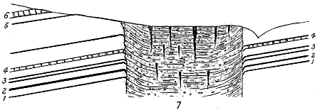
Fig. 143.—Section of volcanic vent at East Grange, Perthshire coal-field, constructed by Mr. B. N.
Peach from the rocks exposed in a railway-cutting, and from plans of ironstone- and coal-pits.
1. Three feet coal; 2. Ontake coal; 3. Upper and Lower Black-band Ironstones; 4. Index Limestone; 5. Gas
Coal and Janet Peat Coal; 6. Calmy Limestone; 7. Neck.
A vent of the same nature, but on a much larger scale, has been
mapped by Mr. Peach in the south of Perthshire, near East Grange, where
it rises through the higher coal-bearing part of the Carboniferous Limestone
series (Fig. 143). It has been encountered in the mining of coal and ironstone,
and its cross-section has been ascertained in the underground workings
which have been carried up to its margin. It measures 1500 feet in
diameter from east to west and 2000 feet from north to south. It does
not appear ever to have emitted any ashes or lava. Mr. Peach found it
filled with dark sandy crumbling clays, full of fragments of sandstone, shale
and coal. These sediments are arranged in layers that dip in the same
general direction as the strata surrounding the vent. They contain abundant
calcareous nodules of all sizes from that of a hazel-nut up to concretions
18 feet in diameter. The clays likewise include many of the common shells
and crinoids of the Carboniferous Limestone sea, and the same fossils are
enclosed in the nodules. A remarkable feature in this vent is the occurrence
of abundant vertical rents, which have been filled partly with the
same material that forms the nodules, and partly with sandstone.
The formation of the neck took place after the deposition of the Index
Limestone, and probably about the time of the accumulation of the next
limestone, which lies immediately to the west somewhat higher in the
series. It would appear that the eruption which produced this funnel gave
forth only gaseous explosions, and occurred on the sea-floor; that the low
crater-walls were washed down to such an extent that the sea entered and
carried some of its characteristic organisms into the lagoon or maar within;
further, that as the silt gathered inside, successive subsidences occurred,
whereby the sediment was rent by cracks into which sand and calcareous
mud were washed from above.[455]
Many necks occur wherein non-volcanic materials, though not forming
the whole of the agglomerate, make up by far the larger part, with only a
slight admixture of volcanic tuff between them. Among the Burntisland
necks of Fife, for instance, abundant fragments of the well-marked cyprid
limestone and shale may be observed, while at Niddry in Linlithgowshire
blocks several yards in length, and consisting of different layers of shale and
cement-stone still adhering to each other, may be seen imbedded at all angles
in the tuff.
Where only the debris of non-volcanic rocks occupies a vent, we may
infer that the volcanic action was limited to the explosion of steam, whereby
the rocks were dislocated, and an orifice communicating with the surface
was drilled through them, and that while no true volcanic rock in such a
case appeared, the pipe was filled up to perhaps not far from the surface by
the falling back of the shattered detritus. A little greater intensity or
farther prolongation of the volcanic action would bring the column of lava
up the funnel, and allow its upper part to be blown out as dust and lapilli;
while still more vigorous activity would be marked by the rise of the lava
into rents of the cone or its actual outflow at the surface. Every gradation
in this scale of progress may be detected among the Carboniferous volcanoes
of the basin of the Firth of Forth.
2. Necks of Tuff and Agglomerate.—The majority of the necks connected
with the puys consist of tuff or agglomerate. Externally they
generally appear as smooth rounded grassy hills that rise disconnected from
other eminences. In some districts their materials consist of a greenish
granular often stratified tuff, enclosing rounded balls of various basic lavas and
pieces of sandstone, shale, limestone or other strata through which they have
been drilled. This is their usual character in the Forth region. But in some
cases, the tuff becomes a coarse agglomerate, made up partly of large blocks
of basalt and other volcanic rocks and partly of the sedimentary strata
around them, of which large masses, many cubic yards in bulk, may be seen.
Among the enclosed fragments it is not unusual to find pieces of older
stratified tuff. These resemble in general petrographical character parts of
the tuff among which they are imbedded. Sometimes they have been
derived from previous tuffs which, interstratified among the sedimentary
strata, had been broken up by the opening of a new vent. But probably
in most cases they should be regarded as portions of the volcanic debris
which, having solidified inside the crater, was blown out in fragments by
subsequent explosions. In a modern volcano a considerable amount of
stratified tuff may be formed inside the crater. The ashes and stones
thrown out during a period of activity fall not only on the outer slopes of
the cone, but on the steep inner declivities of the crater, where they arrange
themselves in beds that dip at high angles towards the crater bottom. This
feature is well seen in some of the extinct cones in the Neapolitan
district. In some of the Scottish puys the tuff is stratified and has tumbled
down into a highly inclined or vertical position (Fig. 145).
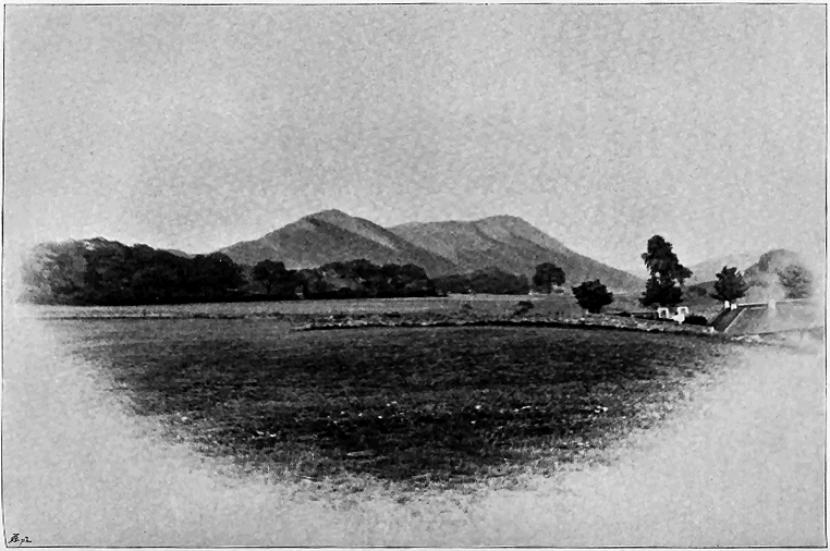
Fig. 144.—View of the Binn of Burntisland—a volcanic neck of agglomerate.
(This illustration and Figs.
145,
152,
153,
164,
166 and
168 are from photographs taken by Mr. Robert Lunn for the Geological Survey.)
As a good illustration of the variety and relative proportions of the
ejected blocks in the green tuff of the puy-vents, I may cite the following
table of percentages which I took many years ago in the tuff which rises
through the Cement-stone group on the beach at the Heads of Ayr.
| Diabase and basalt |
57 |
per cent. |
| Older tuff |
3 |
" |
Andesite (probably from Old Red Sandstone
volcanic series of the neighbourhood) |
14 |
" |
| Limestone (cement-stone, etc.) |
20 |
" |
| Shale |
3 |
" |
| Sandstone |
2 |
" |
| Fossil wood |
1 |
" |
|
100 |
|
While many examples might be cited where no molten rock of any
kind has risen in the vents, or where at least all the visible materials are of
a fragmentary character, yet small veins and dykes of basalt have not
infrequently been injected into the tuff or agglomerate. These seldom run
far, and usually present a more or less tortuous course. Thus, on the south
front of the Binn of Burntisland (Figs. 166, 168) a number of basalt-dykes,
which vary in breadth from five or six feet to scarcely so many inches,
bifurcate and rapidly disappear in the tuff, one of them ascending tortuously
to near the top of the cliff. They at once recall the appearance of the well-known
dykes in the great crater wall of Somma.
Though not by any means the largest or most perfect of the vents
in the basin of the Firth of Forth, the Binn of Burntisland, of which a
view is given in Fig. 144, may be cited in illustration of their general
characters. It presents in detail some of the most strikingly volcanic
aspects of scenery anywhere to be seen in that region. Consisting
of a dull green granular volcanic tuff, it rises abruptly out of the Lower
Carboniferous formations to a height of 631 feet above the sea. The
southern edge of this neck has been so extensively denuded, that it
presents steep craggy slopes and rugged precipices, which descend from
the very summit of the cone to the plain below—a vertical distance of
nearly 500 feet. Here and there the action of atmospheric waste has
hollowed out huge crater-like chasms in the crumbling tuff. Standing in
one of these, the geologist can realize what must have been the aspect of
the interior of these ancient Carboniferous volcanic cones. The scene at
once reminds him of the crater-walls of a modern or not long extinct
volcano. The dull-green rudely stratified tuff rises around in verdureless
crumbling sheets of naked rock, roughened by the innumerable blocks of lava,
which form so conspicuous an element in the composition of the mass. The
ribs or veins of columnar basalt run up the declivities as black shattered
walls. The frosts and rains of many centuries have restored to the tuff its
original loose gravelly character. It disintegrates rapidly, and rolls down
the slopes in long grey lines of volcanic sand, precisely as it no doubt did
at the time of its ejection, when it fell on the outer and inner declivities
of the original cone. Some of these features may be partly realized from
Fig. 145, which represents a portion of the south front of the hill. Sections
of this neck are given in Figs. 149 and 159.
(3) Necks of Tuff or Agglomerate with a Central Plug of Basalt or other
Lava.—It has often happened that, after the explosions in a vent have
begun to decrease in vigour, or have at last ceased, lava has risen in the
chimney and finally sealed it up. In such cases the main mass of the
rock may consist of tuff or agglomerate, which the enfeebled volcanic
activity has been unable to expel from the orifice, while a plug of basalt,
dolerite, or even more basic material, of much smaller dimensions, may have
risen up the pipe in the centre or towards one side. Binns Hill, West
Lothian, the Beath and Saline Hills of Fife, and Tinnis Hill in Liddesdale
are good examples of this structure. (See Figs. 26, 148, 149 and 174).
(4) Necks of Basalt, Dolerite, etc.—In other cases no fragmental material
is present in the vent, or possibly traces of it may be seen here and there
adhering to the walls of the funnel, the prevailing rock being some form of
lava. Necks of this kind are much less frequent in the puy- than in the
plateau-type. But examples may be found in several districts. The most
striking with which I am acquainted are those which form so picturesque a
group of isolated cones around the volcanic basin of Limerick, to be afterwards
described (Figs. 195, 196). The vents there have been filled by the
uprise of much more acid rocks than the lavas of the basin, for, as I have
already stated, they include even quartziferous trachytes. In the basin of
the Firth of Forth some prominent bosses of basalt probably mark the sites
of former vents, such as Dunearn Hill in Fife, the Castle Rock of Edinburgh,
and Galabraes Hill near Bathgate. Some striking vents which occur in
the Jedburgh district, in the debateable land between the plateau series on
the east and the puy-series on the west, show the nearly complete usurpation
of the funnel by basalt, but with portions of the tuff still remaining visible.
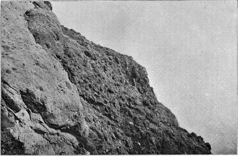
Fig. 145.—View of part of the
cliffs of vertical agglomerate, Binn of Burntisland.
Relation of the Necks to the Rocks through which they rise.—A remarkable
feature among the Carboniferous and Permian vents of central Scotland is
presented by the effect which has been produced on the strata immediately
surrounding them. In the interior of the country this effect is often
concealed by herbage, but where the rocks have been laid bare by the sea it
may be most instructively studied. In such shore-sections, a singular
change of dip is often observable among the strata round the edge of a vent.
No matter what may be the normal inclination at the locality, the beds are
bent sharply down towards the wall of the neck, and are frequently placed on
end. This structure (shown in Figs. 24, 143, 147, 148 and 149) is precisely
the reverse of what might have been anticipated, and can hardly be due to
upward volcanic explosions. It is frequently associated with considerable
metamorphism in the disturbed strata. Shales are converted into porcellanite
or various jaspery rocks, according to their composition. Sandstones
pass into quartzite, with its characteristic lustrous fracture. It is common
to find vents surrounded with a ring of this contact-metamorphism, which,
from the hardness and frequently vertical or highly inclined bedding of its
strata, stands up prominently on the beach (as in Figs. 126 and 210), and
serves to mark the position of the necks from a distance.
I have not been able to find an altogether satisfactory explanation of
this inward dip of the strata around vents. Taking it in connection with
the metamorphism, I am inclined to believe that it arose after the close of
the long-continued volcanic action which had hardened the rocks around the
volcanic pipe, and as the result of some kind of subsidence within the vent.
The outpouring of so much tuff and lava as escaped from many of the volcanoes
would doubtless often be apt to produce cavities underneath them, and
on the decay of volcanic energy there might be a tendency in the solid or
cavernous column filling up the funnel, to settle down by mere gravitation.
So firmly, however, did much of it cohere to the sides of the pipe, that if it
sank at all, it could hardly fail to drag down a portion of these sides. So
general is this evidence of downward movement in all the volcanic districts
of Scotland where the necks have been adequately exposed, that the
structure may be regarded as normal to these volcanic vents. It has been
observed among the shore-sections of the volcanoes of the Auckland
district, New Zealand. Mr. C. Heaphy, in an interesting paper upon that
district, gives a drawing of a crater and lava-stream abutting on the edge of
a cliff where the strata bend down towards the point of eruption, as in the
numerous cases in Scotland.[456]
Evidence for the probable subærial Character of some of the Cones or Puys
of Tuff.—From the stratigraphical data furnished by the basin of the Firth
of Forth, it is certain that this region, during a great part of the Carboniferous
period, existed as a wide shallow lagoon, sometimes overspread with
sea-water deep enough to allow of the growth of corals, crinoids, and
brachiopods; at other times, shoaled to such an extent with sand and mud
as to be covered with wide jungles of a lepidodendroid and calamitoid
vegetation. As volcanic action went on interruptedly during a vast section
of that period, the vents, though generally submarine, may occasionally have
been subærial. Indeed, we may suppose that the same vent might begin as
a subaqueous orifice and continue to eject volcanic materials, until, as these
rose above the level of the water, the vent became subærial. An instance
of a submarine vent has been cited from the Perthshire coal-field (p. 426).
Among the evidence which may be collected to show that some
Carboniferous volcanoes probably rose as insular cones of tuff above the
surrounding waters, the structure of the tuff in many necks may be
cited, for it suggests subærial rather than subaqueous stratification. The
way in which the stones, large and small, are grouped together in
lenticular seams may be paralleled on the slopes of many a modern
volcano. Another indication of this mode of origin is supplied by the
traces of wood to be met with in some of the tuff-necks. The
vents of Fife and Linlithgowshire contain these traces sometimes in
great abundance. The specimens are always angular fragments, and are
frequently encrusted with calcite.[457] Sometimes they present the glossy
fracture and clear ligneous structure shown by sticks of well-made
wood charcoal. In a neck at St. Magdalen's, near Linlithgow, the wood
fragments occur as numerous black chips. So far as can be ascertained
from the slices already prepared for the microscope, the wood is always
coniferous. These woody fragments seldom occur in the interstratified tuffs
or in the associated strata where Stigmaria, Lepidodendron, etc., are common.
They are specially characteristic of the necks and adjacent tuffs. The
parent trees may have grown on the volcanic cones, which as dry insular
spots would support a different vegetation from the club-mosses and reeds
of the surrounding swamps. As the fragments occur in the tuffs which, on
the grounds already stated, may be held to have been deposited within the
crater, they seem to point to intervals of volcanic quiescence, when the
dormant or extinct craters were filled with a terrestrial flora, as Vesuvius
was between the years 1500 and 1631, when no eruptions took place.
Some of the cones, such as Saline Hill and the Binn of Burntisland, may
have risen several hundred feet above the water. Clothed with dark pine
woods, they would form a notable feature in the otherwise monotonous
scenery of central Scotland during the Carboniferous period.
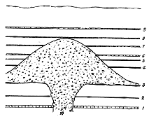
Fig. 146.—Diagram of buried volcanic cone
near Dalry, Ayrshire. Constructed from
information obtained in mining operations.
1. Hurlet Limestone. 2. Clayband Ironstone. 3.
Black-band Ironstone. 4. Borestone Coal.
5. Wee Coal. 6. Highfield Limestone. 7 and
8. Thin Limestones. 9. Linn Limestone. 10.
Volcanic neck and cone of tuff.
Entombment of the Volcanic Cones and their relation to the bedded Lavas
and Tuffs.—From the facts above detailed, it is evident that in most cases
the necks represent, as it were, the mere denuded stumps of the volcanoes.
As the puys took their rise in areas which, on the whole, were undergoing
a movement of subsidence, they were eventually submerged and buried
under sedimentary accumulations. Their loose ashes would be apt to be
washed down and strewn over the sea-bottom, so that only the lower and
inner part of a cone might remain. We can hardly hope to discover any
of the actual craters among these volcanic relics. The cones having been
submerged and buried under many hundred feet of sediment, their present
position at the surface is due to subsequent elevation and prolonged denudation.
It is obvious that there must still be many buried cones which the
progress of denudation has not yet reached. Some of these have been
revealed in the course of mining operations. Valuable seams of coal, ironstone
and oil-shale in the Scottish Carboniferous Limestone and Calciferous
Sandstone series are extensively worked, and in the underground operations
many illustrations of former volcanic action have been met with.
The most remarkable instances of the discovery of buried volcanoes have
occurred in the Dalry coal-field in the
north of Ayrshire. In one pit-shaft
about a mile and a half to the south-west
of the village of Dalry, a thickness
of 115 fathoms of tuff was passed
through, and in another pit 90 fathoms
of similar tuff were sunk into before the
position of the black-band ironstone of
that mineral field was reached by driving
levels through the tuff into the sedimentary
strata outside of it. Only a
short distance from these thick piles of
tuff, their place is entirely taken up by
the ordinary sedimentary strata of the
district. The working-plans of the
mines show the tuff to occur in irregular
patches and strips, between which the ironstone is workable. From these
data we perceive that the shafts have in some cases been sunk directly upon
the tops of puys of tuff, which were, in one case, nearly 700 feet, and in
another instance, 540 high[458] (Fig. 146).
It is obvious that from the condition of a completely buried and concealed
cone every stage may be expected to occur up to the deeply worn-down
neck representing merely the stump of the volcanic column. The
subjoined diagram (Fig. 147) may serve to illustrate this process of gradual
re-emergence.
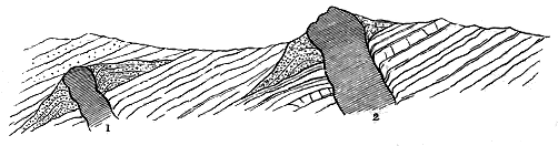
Fig. 147.—Diagram to illustrate how Volcanic Necks may be concealed and exposed.
1, Neck, still buried under the succeeding sedimentary accumulations; 2, Neck uncovered and denuded.
When, in the progress of denudation, a volcanic cone began to show
itself from under the cover of removed strata, it would still for a time maintain
its connection with the sheets of tuff or of lava which, when active, it
had erupted. A number of examples of this structure may be observed in
the basin of the Firth of Forth, where the degradation of the surface has
not yet proceeded so far as to isolate the column of agglomerate or tuff from
the sheets of tuff that were strewn around the old volcano. In such cases, the
actual limits of the vent are still more or less concealed, or at least no sharp
line can be drawn between the vent and its ejections. As an illustration
of this connection of a volcanic pipe with the materials ejected from it over
the surrounding country I would cite Saline Hill
in the west of Fife. That eminence rises to a
height of 1178 feet above the sea, out of a band
of tuff which can be traced across the country
for fully three miles. Numerous sections in the
water-courses show that this tuff is regularly
interbedded in the Carboniferous Limestone series,
so that the relative geological date of its eruption
can be precisely fixed. On the south of Saline
Hill, coal and ironstone, worked under the tuff,
prove that this portion of the mass belongs to
the general sheet of loose ashes and dust, extending
outwards from the original cone over the floor
of the sheet of water in which the Carboniferous
Limestone series of strata was being deposited.
But the central portion of the hill is occupied
by one or more volcanic pipes. A section across
the eminence from north-west to south-east would
probably show the structure represented in Fig.
148. Immediately to the east of the Saline Hill
lies another eminence, known as the Knock Hill,
which marks the site of another eruptive vent.
A coal-seam (the Little Parrot or Gas Coal) is
worked along its southern base, and is found to
plunge down steeply towards the volcanic rocks.
This seam, however, is not the same as that worked
under the Saline Hill, but lies some 600 feet below
it. Probably the whole of the Knock Hill occupies
the place of a former vent.

Fig. 148.—Section across the Saline Hills, Fife.
The thick parallel black lines mark the position of seams of coal and ironstone, some of which are worked under Saline Hill. T, Tuff of the
necks; t, Tuff at a little distance from the cone, interstratified with the ordinary sedimentary beds; B, Basalt. The larger eminence
is Saline Hill, the lower is Knock Hill.
A further stage of decay and denudation brings
before us the entire severance of the volcanic
column from the materials that were ejected from
it. An excellent example of this isolation of the
neck in the midst of surrounding masses of tuff
and lava which proceeded from it is presented by
the Binn of Burntisland, to which I have already
alluded. A section across that eminence gives the geological structure
represented in Fig. 149. The dip of the rocks away from the volcanic
pipe at this locality has been produced long after the volcanic phenomena
had ceased. The arch here shown is really the prolongation and final disappearance
of the great anticlinal fold of which the Pentland Hills form the
axis on the opposite side of the Firth. But if we restore the rocks to a
horizontal, or approximately horizontal position, we find the Binn of Burntisland
rising among them in one or more necks, which doubtless mark
centres of volcanic activity in that district. A series of smaller neck-like
eminences runs for two miles westward.
Striking as the forms of many of the necks
are, and much as their present conical forms resemble
those of active and extinct volcanoes, the evidence
of extensive denudation proves that these contours
are not the original outlines of the Carboniferous
vents, but are in every case the result of prolonged
waste. What we now see is a section of the volcanic
chimney, and the conical form is due to the
way in which the materials filling the chimney have
yielded to the forces of denudation.

Fig. 149.—Section across the Binn of Burntisland, in an East and West direction.
1, Sandstones; 2, Limestone (Burdiehouse); 3, Shales, etc.; b, b, Interstratified basalts; t t, Bedded tuff, etc.; T, Tuff of the
great neck of Burntisland; B, Basalt veins.
During at least the earlier part of the period of
the puys, in some districts or from certain vents,
such as those of East Fife, Western Midlothian,
Eastern Linlithgowshire, Northern Ayrshire, Heads
of Ayr and Lower Eskdale, only fine tuff seems to
have been thrown out, which we now find intercalated
among the surrounding strata. These eruptions,
neither so vigorous nor so long-continued as
those of the plateaux, never gave forth such thick
and widespread sheets of fragmentary materials as
those associated with the plateaux in East Lothian
and the north-east of Ayrshire. A single discharge
of ashes seems in many cases to have been the sole
achievement of one of those little volcanoes; at least
only one thin band of tuff may be discoverable to
mark its activity.
The tuff of these solitary bands is seldom coarse
in texture. It usually consists of the ordinary dull
green paste, with dust and lapilli of basic pumice.
The local variations in the tuffs of the puys generally
arise mainly from differences in the composition, size
and numbers of the included ejected blocks. Generally
the most abundant stones are pieces of different diabases, or basalts;
then come fragments from the surrounding Carboniferous strata, from older
tuffs and rarely from rocks of much deeper-seated origin.
Now and then the eruptions of tuff have consisted of extremely fine
volcanic dust, which, mingling with water, took the form of a compact mudstone,
as in the case of the Houston Marls (p. 423), which remind one
of a volcanic mud. But in most localities the discharge of tuff, though for
a time it may have completely obscured the ordinary contemporaneous
sedimentation, was intermittent, so that in the intervals between successive
showers of detritus, the deposition of non-volcanic sediment went on as
usual. Hence it is that bands of tuff, whether they lie among lavas or
among sedimentary formations, are apt to contain interstratifications of sandstone,
shale, limestone or other detrital deposit, and to pass insensibly into
these. The extremely gentle gradation from volcanic into non-volcanic
sediment, and the occasional reappearance of thin partings of tuff bring
vividly before the mind the slow dying out of volcanic energy among the
Carboniferous lagoons.
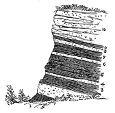
Fig. 150.—Section in old quarry, west of Wester
Ochiltree, Linlithgowshire. Calciferous Sandstone series.
The comparatively quiet character of the volcanic explosions, and the
contemporaneous undisturbed deposition of sediment during the earlier part
of the puy period, are exemplified in many sections throughout the areas
above enumerated, as will be more fully illustrated in subsequent pages.
Two typical examples may suffice for this general statement of the
characters of the discharges of tuff in the puy-eruptions. In the Linlithgowshire
quarry represented in Fig. 150, where about ten feet of strata have
been exposed, a black shale (1) of the usual carbonaceous character, so
common in the Oil-shale series of this region, may be seen at the bottom of
the section. It is covered by a bed of nodular
bluish-grey tuff (2) containing black shale fragments.
A second black shale (3) is succeeded
by a second thin band of fine pale yellowish
tuff (4). Black shale (5) again supervenes,
containing rounded fragments of tuff, perhaps
ejected lapilli, and passing up into a layer of
tuff (6). It is evident that we have here a
continuous deposit of black shale which was
three times interrupted by showers of volcanic
dust and stones. At the close of the third
interruption, the deposition of the shale was
renewed and continued, with sufficient slowness
to permit of the segregation of thin seams and
nodules of clay ironstone round the decomposing organic remains of the
muddy bottom (7). A fourth volcanic interlude now took place, and the
floor of the water was once more covered with tuff (8). But the old conditions
of deposit were immediately afterwards resumed (9); the muddy
bottom was abundantly peopled with ostracod crustaceans, while many
fishes, whose coprolites have been left in the mud, haunted the locality.
At last, however, a much more serious volcanic explosion took place. A
coarse agglomeratic tuff (10), with blocks sometimes nearly three feet in
diameter, was then thrown out, and overspread the lagoon.[459]
The second illustration may be taken from the admirable coast-section
between Burntisland and Kinghorn, where the number of intercalations of
tuff is very great. Besides thicker well-marked bands, successive innumerable
thin layers occur there among the associated zones of sedimentary
strata which separate the sheets of basalt. The character of these
tuff-seams may be inferred from the following details of less than two feet
of rock at Pettycur Point:—
| Tuff |
1·5 |
inch. |
| Limestone |
0·2 |
" |
| Tuff |
0·5 |
" |
| Shale |
0·2 |
" |
| Tuff |
0·1 |
" |
| Shale and tuff |
1·0 |
" |
| Shale |
0·2 |
" |
| Limestone |
0·5 |
" |
| Shale full of volcanic dust |
3·5 |
" |
| Shaly limestone |
1·5 |
" |
| Laminated tufaceous limestone |
2·0 |
" |
| Limestone in thin bands, with thin laminæ of tuff |
0·8 |
" |
| Granular tuff |
0·6 |
" |
| Argillaceous limestone, with diffused tuff |
0·9 |
" |
| Fine granular tuff |
0·7 |
" |
| Argillaceous limestone, with diffused tuff |
1·5 |
" |
| Laminated limestone |
0·1 |
" |
| Limestone, with parting of granular tuff in middle |
0·9 |
" |
| Tufaceous shale |
2·0 |
" |
| Limestone |
0·4 |
" |
| Shaly tuff |
1·25 |
" |
| Laminated limestone |
0·1 |
" |
| Tuff |
1·2 |
" |
|
21·65 |
inches. |
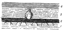
Fig. 151.—Ejected volcanic block in Carboniferous
strata, Burntisland.
1. Brown shaly fire-clay with rootlets, about five
inches; 2. Impure coal, five or six inches, pressed
down in its upper layers by the impact and
weight of the stone; 3. Green crumbling ashy
fire-clay, one foot, with its lower layers pressed
down by the stone while the upper layers rise
over it, showing that the stone fell at the time
when half this seam was deposited. The fire-clay
passes up into dark greenish and black ashy
shale (4) about six inches thick and containing
plant-remains. The stone is a pale diabase
weighing about six or eight pounds.
Such a section as this brings vividly before the mind a long-continued
intermittent feeble volcanic action during pauses between successive outbursts
of lava. In such intervals of
quiescence, the ordinary sediment of the
lagoons accumulated, and was mixed up
with the debris supplied by occasional
showers of volcanic dust. In this Fife
volcanic series, thin layers of sandstone,
streaked with remains of the Carboniferous
vegetation; beds of shale full of
cyprid-cases, ganoid scales, and fragmentary
ferns; thin beds of limestone, and
bands of fire-clay supporting seams of
coal, are interleaved with strata of tuff
and sheets of basalt. Now and then
a sharp discharge of larger stones is
seen to have taken place, as in the case
of the block many years ago described by me as having fallen and crushed
down a still soft bed of coal (Fig. 151).[460]
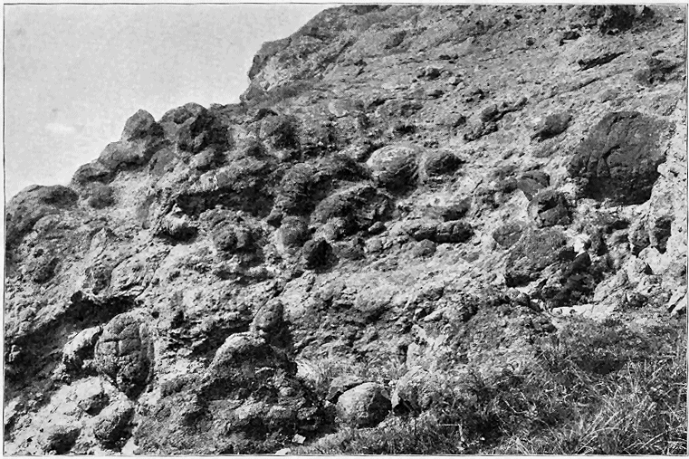
Fig. 152.—View of volcanic agglomerate becoming finer above. East end of Kingswood Craig, two miles east from Burntisland.
The Fife coast-section from which these details are taken supplies almost
endless instances of the varying characters of the pyroclastic materials of
the puy-eruptions. The very same cliff, bank or reef will show at one point
an accumulation of excessively coarse volcanic debris and at another thin
laminæ of the finest dust and lapilli. These rapid gradations are illustrated
in Fig. 152, which is taken from the east end of the Kingswood
Craig. The lower part of the declivity is a coarse agglomerate which passes
upward into finer tuff.
Besides the thin partings and thicker layers of tuff which, intercalated
among the sedimentary strata of the Carboniferous system, mark a comparatively
feeble and intermittent volcanic activity, we meet in some localities
with examples where the puys have piled up much thicker accumulations of
fragmentary material without any intercalated streams of lava, or interstratified
sandstone, shale or limestone. Thus the widespread Houston
marls above described reach a thickness of some 200 feet. The vents of
the Saline Hills in Fife covered the sea-floor with volcanic ashes to a depth
of several hundred feet. In the north of Ayrshire the first eruptions of the
puys have formed a continuous band of fine tuff traceable for some 15 miles,
and in places at least 200 feet thick.
Where volcanic energy reached its highest intensity during the time of
the puys, not only tuffs but sheets of lava were emitted, which, gathering
round the vents, formed cones or long, connected banks and ridges. Of
these there are four conspicuous examples in Scotland—the hills of
the Burntisland district, the Bathgate Hills, the ground between Dalry and
Galston in north Ayrshire, and a broken tract in Liddesdale. Nowhere
in the volcanic history of this country have even the minutest details of
that history been more admirably preserved than among the materials
erupted from puys in these respective districts.
Lava-cones, answering to solitary tuff-cones among the fragmental
eruptions, do not appear to have existed, or, like some of those in the great
lava-fields of Northern Iceland and Western America, must have been mere
small heaps of slag and cinders at the top of the lava-column, which were
washed down and effaced during the subsidence and entombment of the
volcanic materials. The lavas never occur without traces of fragmentary
discharges. Two successive streams of basalt may indeed be found at a
given locality without any visible intercalation of tuff, but proofs of the
eruption of fragmental material will generally be observed to occur somewhere
in the neighbourhood, associated with one or both of them, or with
other lavas above or below them.
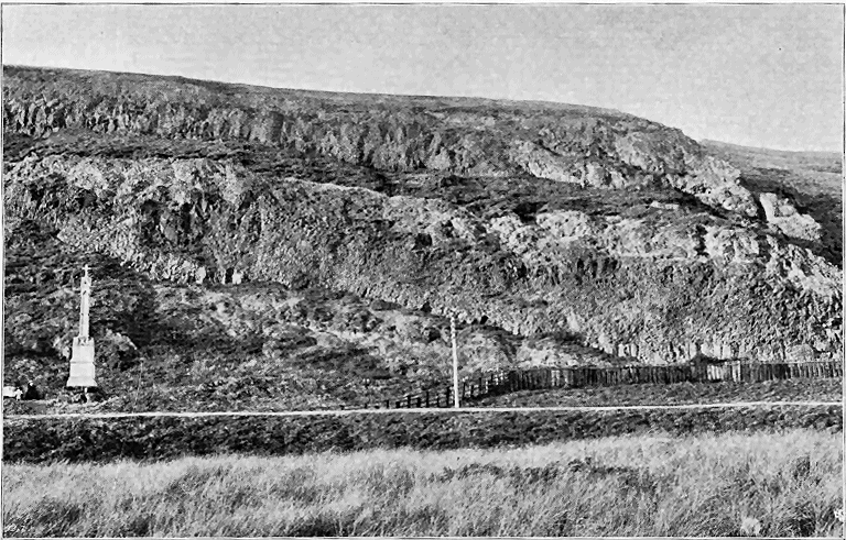
Fig. 153.—Alternations of
basalt and tuff with shale, etc., Kingswood Craig, Burntisland.
Where the phenomena of the puys have been most typically developed,
lavas and tuffs succeed each other in rapid succession, with numerous or occasional
interstratifications of ordinary sediment. Perhaps the most complete
and interesting example of this association is to be found on the coast between
Burntisland and Kirkcaldy, where, out of a total thickness of rock which
may be computed to be between 1500 and 2000 feet, it will probably be a
fair estimate to say that the igneous materials constitute four-fifths, or from
1200 to 1600 feet. The lavas are varieties of basalt ranging in character
from a black compact columnar to a dirty green earthy cellular or slaggy
rock. Each separate flow may be on the average about 20 or 30 feet in
thickness. Columnar and amorphous sheets succeed each other without any
interposition of fragmentary material (Fig. 171). But along the junctions of
the separate flows layers of red clay, like the bole between the basalts of the
Giant's Causeway, may frequently be noticed. The characteristic slaggy
aspect of the upper parts of these ancient coulées is sometimes remarkably
striking. The full details of this most interesting section will be given in
later pages (p. 470). But some of its more characteristic external features
may be understood from the views which are presented in Figs. 152, 153,
170, 171.
The general bedded character of the volcanic series is well shown in
Fig. 153, which represents the alternations of lavas and tuffs in the
Kingswood Craig two miles to the east of Burntisland. The harder
basalts will be seen to project as bold crags while the tuffs and other
stratified deposits between them give rise to grassy slopes and hollows. A
nearer view of the alternation of lavas and tuffs with non-volcanic sedimentary
deposits is supplied in Fig. 170, which is taken from a part of the Fife coast a
little further to the east than the last illustration. Here one of the limestones
of the Carboniferous Limestone series is overlain with shale and tuff, which,
being easily disintegrated, have been cut away by the waves, leaving the
lava above to overhang and fall off in blocks. The columnar structure of
some of the basalts of this coast is well brought out in Fig. 171, which
shows further how the columns sometimes merge into an amorphous part of
the same sheet.
These Fife basalts illustrate admirably the peculiarities of the sheets
of lava which are intercalated among the Carboniferous strata. They show
how easy it generally is to discriminate between such sheets and intrusive
sills. The true lavas are never so largely crystalline, nor spread out in
such thick sheets as the sills; they are frequently slaggy and amygdaloidal,
especially towards the top and bottom, the central portion being generally
more fine-grained and sometimes porphyritic. Where most highly cellular
they often decompose into a dull, earthy, dirty-green rock. Where they form
a thick mass they are usually composed of different beds of varying texture.
Except the differences between the more compact centre and the slaggy
layer above and below, the bedded lavas do not present any marked variation
in composition or structure within the same sheet. A striking exception
to this rule, however, is furnished by the Bathgate "leckstone" already
described.[461] This mass forms a continuation of the great basaltic ridge of
the Bathgate Hills, and though its exact relations to the surrounding strata
are concealed, it appears to be an interbedded and not an intrusive sheet.
The remarkable separation of its constituent minerals into an upper, lighter
felspathic layer, and a lower, heavier layer, rich in olivine, augite and iron-ores,
is a structure which might be more naturally expected to occur in
a sill. An instance of its development in an undoubted sill will be
described further on. Nevertheless, if we follow the trend of the volcanic
band of the Bathgate Hills southward for only two miles beyond the picrite
quarry, we find in the Skolie Burn a rock in many respects similar, and
quarried for the same purpose of building oven-soles. This "leckstone" is
there seen to be surmounted by a group of calcareous shales and thin
limestones. The section laid bare in the stream is represented in Fig. 154.
Immediately above the diabase, which is highly cellular, lies a green felspathic
sandstone or shale containing detached fragments of the amygdaloid together
with Lingulæ and other shells. There seems no reason to doubt that this
is a true interstratified lava.[462]
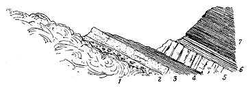
Fig. 154.—Section of the upper surface of a diabase ("leckstone") sheet, Skolie Burn, south-east
of Bathgate.
1. Slaggy diabase; 2. Green sandy shale and shaly sandstone containing Lingulæ, also pieces of slag from the underlying
lava, which are completely wrapped round in the sediment; 3. Yellow calcareous shelly sandstone; 4.
Dark shale with Spiriferæ, etc.; 5. Bed of blue crinoidal limestone; 6. Clays and thin coal; 7. Black and
blue calcareous shales and thin limestones.
Where the puys attained their greatest development in Scotland, they
rose in the shallow lagoons, and here and there from deeper parts of the
sea-bottom, until by their successive discharges of lavas and tuffs they
gradually built up piles of material, which, in the Linlithgow and Bathgate
district, may have been nearly 2000 feet in thickness. It must be remembered,
however, that the eruptions took place in a subsiding area, and that even the
thickest volcanic ejections, if the downward movement kept pace with the
volcanic activity, need not have grown into a lofty volcanic hill. Indeed,
largely as the lavas and tuffs bulk in the geology of some parts of Central
Scotland, their eruption does not seem to have seriously interfered with the
broader physical changes that were in progress over the whole region. Thus
the subsidence which led to the spread of a marine and limestone-making
fauna over much of Central Scotland included also the volcanic districts.
The limestones, formed of crinoids, corals and other marine organisms,
extended over the submerged lavas and tuffs, and were even interstratified
with them.
While the volcanic materials are found to replace locally the ordinary
Carboniferous sedimentary strata, it is interesting in this regard to note
that, during pauses in the volcanic activity, while the subsidence doubtless
was still going on, some groups of sandstones, shales or limestones extended
themselves across the volcanic ridges so as to interpose, on more than one
platform, a mass of ordinary sediment between the
lavas or tuffs already erupted and those of succeeding
discharges, and thus to furnish valuable
geological chronometers by which to define the
stratigraphical horizons of the successive phases of
volcanic energy.

Fig. 155.—Section across the volcanic ridge of the Linlithgow and Bathgate Hills, showing the intercalation of limestones that mark important
stratigraphical horizons.
1. Houston Coal; 2. Houston Marls and tuffs; 3. Interstratified sheets of basic
lavas with occasional tuffs and intercalations of shale, sandstone, etc.;
4. Tartraven Limestone; 5. Hurlet Limestone with tuffs, shales and sandstones
above and below; 6. Wardlaw Limestone; 7. Index Limestone; 8. Highest band of
tuff—upward limit of the volcanic series; 9 9. Volcanic necks; 10. Sill of
basalt; 11. Levenseat or Castlecary Limestone; 12. Millstone Grit; 13. Base
of Coal-measures; 14. Thick doleritic sill; 15. Dolerite dyke (? Tertiary).
The volcanic banks or ridges not improbably
emerged as islets out of the water, and were sometimes
ten miles or more in length. Their materials
were supplied from many separate vents along their
surface, but probably never attained to anything
approaching the elevation which they would have
reached had they been poured out upon a stable
platform. This feature in the history of the volcanic
ridges is admirably shown by the fact just
referred to, that recognizable stratigraphical horizons
can sometimes be traced right through the heart
of the thickest volcanic accumulations. One of
the largest areas of basalts and tuffs connected
with the puys is that of the Linlithgow and Bathgate
Hills, where, as already remarked, a depth of
some 2000 feet of igneous rocks has been piled
up. Yet several well-known seams of stone can
be traced through it, such as the Hurlet Limestone
and the Index Limestone (Fig. 155). Only
at the north end, where the volcanic mass is thickest
and the surface-exposures of rock are not continuous,
has it been impossible to subdivide the
mass by mapping intercalations of sedimentary
strata across it. It would thus seem that, even
where the amplest accumulations gathered round
the puys, they formed low flat domes, rather than
prominent hills, which, as subsidence went on and
the tuff-cones were washed down, gradually sank
under water, and were buried under the accumulating
silt of the sea-floor.
As a detailed illustration of the manner in
which the growth of organically-formed limestones
and the deposit of ordinary sediment took place
concurrently with the occasional outflow of lava-streams
over the sea-bottom, I may cite the section
presented in another Linlithgowshire quarry (Fig.
156). At the bottom of the group of strata there
exposed, a pale amygdaloidal, somewhat altered
basalt (A) marks the upper surface of one of the
submarine lavas of the period. Directly over it
comes a bed of limestone (B) 15 feet thick, the lower layers of which are
made up of a dense growth of the thin-stemmed coral Lithostrotion irregulare.
The next stratum is a band of dark shale (C)
about two feet thick, followed by about the same
thickness of an impure limestone with shale seams
(D). The conditions for coral and crinoid growth
were evidently not favourable, for this argillaceous
limestone was eventually arrested first by
the deposit of a dark mud, now to be seen in
the form of three or four inches of a black pyritous
shale (E), and next by the inroad of a large
quantity of dark sandy mud and drift vegetation,
which has been preserved as a sandy shale (F),
containing Calamites, Producti, ganoid scales and
other traces of the life of the time. Finally,
a great sheet of lava, represented by the uppermost
amygdaloid (G), overspread the area, and
sealed up these records of Palæozoic history.[463]
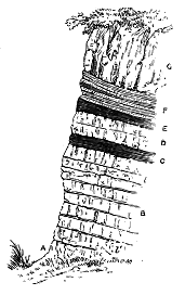
Fig. 156.—Section in Wardlaw
Quarry, Linlithgowshire.
Among the phenomena associated with the
Carboniferous volcanoes mention may, in conclusion,
be made of the evidence for the former
existence of thermal springs and saline sublimations or incrustations.
Among the plateau-tuffs of North Berwick, as has been already pointed out (p.
390), a fœtid limestone has been quarried, which bears indications of having
been deposited by springs, probably in connection with the volcanic action
of the district. The lower limestones of Bathgate furnish abundant laminæ
of silica interleaved with calcareous matter, the whole probably due to the
action of siliceous and calcareous springs connected with the active puys of
that district. Some portions of the limestone are full of cellular spaces,
lined with chalcedony.[464] A saline water has been met with among the
volcanic rocks to the west of Linlithgow, in a bore which was sunk to a
depth of 348 feet in these rocks without reaching their bottom. The
water that rose from the bore-hole was found to contain as much as 135
grains of chloride of sodium in the gallon. It is not improbable that this
salt was originally produced by incrustations on the Carboniferous lavas
immediately after their eruption, as has happened so often in recent times
at Vesuvius, and that it was then buried under succeeding showers of tuff
and streams of lava.[465]
Subsequent Dislocation of Bedded Lavas and Tuffs.—As the interstratified
volcanic materials were laid down in sheets at the surface, they necessarily
behave like the ordinary sedimentary strata, and have undergone with them
the various curvatures and fractures which have occurred since Carboniferous
times. Notwithstanding their volcanic nature, they can be traced
and mapped precisely as if they had been limestones or sandstones. This
perfect conformability with the associated stratified rocks is strikingly seen
in the case of the sheets of lava which lie imbedded in the heart of the
great volcanic ridge of Linlithgowshire. The overlying strata having been
removed from their surface for some distance, and the ground having been
broken by faults, these volcanic rocks might at first be taken for irregular
intrusive bosses, but their true character is that shown in Fig. 157, where
by a succession of faults, with a throw in the same direction, the upper
basalts of Bonnytoun Hill are gradually brought down to the level of the
Firth of Forth.
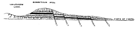
Fig. 157.—Section from Linlithgow Loch to the Firth of Forth.
One of the characteristic features of Central Scotland is the great
number, and often the large size and extraordinary persistence, of the masses
of eruptive, more or less basic material, which have been injected among the
Carboniferous strata. The precise geological age of these intrusions cannot,
of course, be more exactly defined than by stating that they are younger
than the rocks which they traverse, though in many cases their association
with the necks, lavas and tuffs is such as to show that they must be
regarded as part of the Carboniferous volcanic phenomena.
Sills.—With regard to the sills I have been led, for the following
reasons, to connect the great majority of them with the puys, though some
are certainly of far later date, while others should possibly be assigned
to the plateaux.
In the first place, the sills obviously connected with the plateaux are in
great measure intermediate, or even somewhat acid rocks, while those of the
puy series are much more basic. It is hardly possible, however, in all cases
to decide to which series a particular sill should be assigned. This difficulty
is particularly manifest in the western part of Midlothian, where the plateau
of that district exhibits such frequent interruption, and where it often consists
only of a single basaltic sheet. To the west of it lie the abundant
puys with their lavas and tuffs, and between the two volcanic areas
numerous sills of dolerite and diabase make their appearance. In the
difficulty of deciding to which series these sills should be referred, it will be
convenient to consider them with those of the puys.

Fig. 158.—Section across the Campsie Fells illustrating the contrast between the sills below and above the plateau-lavas.
1. Upper Old Red Sandstone; 2. "Ballagan Beds"; 3. Tuffs; 4. Lavas of the Campsie district of the Clyde plateau; 5 5. Necks belonging to the plateau volcanic series; 6. Trachytic
sills belonging to the plateau; 7. Carboniferous Limestone series; 8. Dolerite sills cutting the Carboniferous Limestone series. f, Fault.
A remarkable illustration of the contrast in petrographical character
between the typical sills of the plateaux and those
of the puys is furnished by the chain of the Campsie
Fells, where, on the north side, among the Calciferous
Sandstones which emerge from under the andesitic
lavas of the Clyde plateau, many intrusive sheets and
bosses of trachytic material may be seen, while on
the southern side come the great basic sills which,
from Milngavie by Kilsyth to Stirling, run in the
Carboniferous Limestone series (Fig. 158). A similar
contrast may be observed in Renfrewshire between
the trachytic sills below the plateau-lavas south of
Greenock and the basic sills above these lavas in the
Carboniferous Limestone series around Johnstone and
Paisley.
In the second place, the more basic sills, as a
rule, appear on platforms higher in stratigraphical
position than the plateaux, and wherever this is
their position there cannot be any hesitation in deciding
against their association with the older phase
of volcanic activity.
In the third place, the basic sills often occur in
obvious connection with the vents or bedded lavas
and tuffs of the puy series. A conspicuous example
of this dependence is supplied by the intrusive sheets
of Burntisland, underlying the basalts and tuffs of
that district in the immediate neighbourhood of some
of the vents from which these bedded rocks were
erupted (Fig. 159).
In the fourth place, even where no visible vents
appear now at the surface near the sills, the latter
generally occupy horizons within the stratigraphical
range indicated by the interbedded volcanic rocks.
It must be remembered that all the Carboniferous
vents were deeply buried under sedimentary deposits,
and that large as is the number of them which has
been exposed by denudation, it is probably much
smaller than the number still concealed from our
view. The sills are to be regarded as deep-seated
parts of the volcanic protrusions, and they more
especially appear at the surface where the strata
between which they were injected crop out from
under some of the higher members of the Carboniferous
system. Thus the remarkable group of sills
between Kilsyth and Stirling (Fig. 158) may quite
possibly be connected with a group of vents lying
not far to the eastward, but now buried under the higher parts of the
Carboniferous Limestone, Millstone Grit and Coal-measures. Again, the
great series of sills that gives rise to such a conspicuous range of hills in
the north and middle of Fife may have depended for its origin upon the
efforts of a line of vents running east and west through the centre of the
county, but now buried under the Coal-measures. Some vents, indeed, have
been laid bare in that district, such as the conspicuous groups of the Saline
Hills and the Hill of Beath, but many more may be concealed under higher
Carboniferous strata further east.
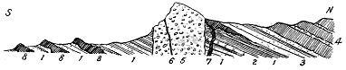
Fig. 159.—Section showing the position of the basic sills in relation to the volcanic series at
Burntisland, Fife.
1. Calciferous Sandstone series; 2. Burdiehouse Limestone; 3. Sandstones, shales and tuffs; 4. Basalts and tuffs,
with intercalations of sandstone, shale and limestone; 5. Agglomerate of the Binn of Burntisland neck; 6.
Basalt dyke; 7. Dyke and sill; 8 8 8. Three sills.
In the fifth place, the materials of which the sills consist link them in
petrographical character with those that proceeded from the puys. The
rocks of the intrusive sheets in West Lothian, Midlothian and Fife are very
much what an examination of the bedded lavas of the puys in the same
region would lead us to expect. There is, of course, the marked textural
difference between masses of molten rock which have cooled very slowly
within the crust of the earth and those which have solidified with rapidity
at the surface, the sills being for the most part much more coarsely crystalline
than the lavas, and more uniform in texture throughout, though
generally finer at the margins than at the centre. There is likewise the
further contrast arising from differences in the composition of the volcanic
magma at widely-separated periods of its extravasation. At the time when
the streams of basalt flowed out from the puys its constitution was comparatively
basic, in some localities even extremely basic. Any sills dating from
that time may be expected to show an equal proportion of bases. But
those which were injected at a long subsequent stage in the volcanic period
may well have been considerably more acid.
In actual fact the petrographical range of the sills reasonably referable
to the puy-eruptions varies from picrite or limburgite to dolerite without
olivine. The great majority of these sheets in the basin of the Firth of Forth,
where they are chiefly displayed, are dolerites (diabases), sometimes with, but
more frequently without, olivine. They include all the more coarsely crystalline
rocks of the region, though occasionally they are ordinary close-grained
basalts. Their texture may be observed to bear some relation to their mass,
so far at least as that, where they occur in beds only two or three feet or
yards in thickness, they are almost invariably closer-grained. A cellular or
amygdaloidal texture is seldom to be observed among them, and never where
they are largely crystalline. This texture is most often to be found in thin
sills which have been injected among carbonaceous shales or coals. These
intrusive sheets are generally finely cellular, and more or less decayed
("white trap").
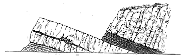
Fig. 160.—Sills between shales and sandstones, Hound Point, Linlithgowshire.
Differences of texture may often be observed within short distances in
the same sill, and likewise considerable varieties in colour and composition.
The most finely crystalline portions are, as usual, those along the junction
with the stratified rocks, the most crystalline occurring in the central parts
of the mass. A diminution in the size of the crystalline constituents may
be traced not only at the base, but also at the top of a sheet, or at any
intermediate portion which has come in contact with a large mass of the
surrounding rock. A good illustration is supplied by the intrusive sheet at
Hound Point (Fig. 160), to the east of South Queensferry, where some
layers of shale have been involved in the igneous rock, which becomes
remarkably close-grained along the junction.[466] This change in texture and
absence of cellular structure form a well-marked distinction between these
sheets and those which have flowed out at the surface as true lava-streams.
Some of the larger doleritic sills display a somewhat coarsely crystalline
texture in their central portions, and occasionally present a notable
micropegmatitic aggregate, which plays the part of interstitial substance
enclosing the other minerals. Mr. Teall has referred to the frequent occurrence
of this structure in the coarser parts of the Whin Sill of the north of
England.[467] It occurs also in a marked degree in the Ratho sill and in some
portions of the great doleritic sill of which the crags of Stirling form a part.[468]
But beside the differences in texture, mainly due to varying rates of
cooling, the sills sometimes exhibit striking varieties of composition in the
same mass of rock. These variations are more especially noticeable among
the larger sills, and particularly where the material is most markedly basic.
The special type of differentiation, so noticeable in the Bathgate diabase and
picrite mass already alluded to, is likewise well exhibited in an intrusive
sheet or group of sheets, recently exposed at Barnton, in the cutting of a
railway from Edinburgh to Cramond[469] (Fig. 161). The intrusive nature of the
several bands of igneous rock which occur here is made quite evident by the
alteration they have produced upon the shales with which they have come
in contact. It is the uppermost and most extensive of these sills which
specially deserves notice, for the differentiation of its constituents. It
stretches along the cutting for several hundred yards at an angle of dip of
about 15°. At the western or upper part of the mass its actual contact
with the superincumbent sedimentary strata is not visible, but as the
igneous rock is there a good deal finer in grain than elsewhere, its upper
surface cannot be many feet distant. The upper visible portion is a light
well-crystallized dolerite with a rudely bedded structure, the planes dipping
westwards at 15°. About 20 or 30 feet below the upper visible termination
of the mass, the dark ferro-magnesian minerals begin rapidly to increase in
relative proportion to the pale felspar, and the rock consequently becomes
dark-greenish brown. The change is particularly noticeable in certain
bands which run parallel with the general dip. There is no definite line
between the pale and dark body of the rock, the two graduating into each
other and the darker part becoming deeper in colour, heavier and more
decomposing, until it becomes a true typical picrite. Even in this ultra-basic
portion the same rude bedding or banding may be observed.

Fig. 161.—Section of Sill, Cramomd Railway, Barnton, near Edinburgh.
1. Baked shale; 2. Sill of very felspathic dolerite about, nine feet thick;
3. Baked shale, eight inches; 4. Dolerite showing chilled fine-grained edge
and adhering firmly to the shale below; it rapidly passes up into (5) Picrite
with white felspathic veins (6); 7. Junction of picrite and dolerite with a
similar vein along the line of contact; 8. Large globular body of dolerite
enclosing a mass of picrite.
Veins in which felspar predominates over the darker minerals traverse
the rock, sometimes parallel with the bedding, sometimes across it. They
vary from less than an inch to a foot in width, sometimes dividing and
enclosing parts of the surrounding mass. But that they are on the whole
contemporaneous with the sill itself, and not long subsequent injections, is
shown by the way in which the dark ferro-magnesian minerals project from
the picrite into the veins and lock the two together.
But besides these injections, which doubtless represent the last and
more acid portions of the magma injected into the basic parts before the
final consolidation of the whole, there are to be observed irregular concretionary
patches, of similar character to the veins, distributed through the
picrite. On the other hand, towards its base the sill becomes a coarse
dolerite round which the picrite is wrapped, and which encloses a detached
portion of that rock.
It is deserving of note that while the ultra-basic portion descends
almost to the very bottom of the sill, the lowest five feet show the same
change as occurs at the top of the mass. There the felspar rapidly begins
to predominate over the darker minerals, and the dolerite into which the
rock passes shows a fine-grained margin adhering firmly to the shales on
which it rests. This lower doleritic band, showing as it does the effect of
chilling upon its under surface, may be due to more rapid cooling and
crystallization, while in the overlying parts the mass remained sufficiently
mobile to allow of a separation of the heavier minerals from the felspars,
which appear in predominant quantity towards the top. It must be frankly
admitted, however, that we are still very ignorant of the causes which
led to this separation of ingredients in a few sills, while they were entirely
absent or non-efficient in most of them.
The intrusive character of the Carboniferous sills of Central Scotland
and their contact-metamorphism have been fully described, and some of
them have become, as it were, "household words" in geology.[470] Exposed in
so many fine natural sections in the vicinity of Edinburgh, they early
attracted the notice of geologists, and furnished a battle-ground on which
many a conflict took place between the Plutonist and Neptunist champions
at the beginning of the present century.
As the sills frequently lie in even sheets perfectly parallel with the
bedding of the strata between which they have been injected, care is required
in some cases to establish that they are of intrusive origin. One of the
most obvious tests for this purpose is furnished by the alteration they
produce among the strata through which they have made their way,
whether these lie above or below them. The strata are sometimes crumpled
up in such a manner as to indicate considerable pressure. They are occasionally
broken into fragments, though this may have been due rather to
the effects of gaseous explosions than to the actual protrusion of melted
rock. But the most frequent change superinduced upon them is an
induration which varies greatly in amount even along the edge of the same
intrusive sheet. Sandstones are hardened into quartzite, breaking with a
smooth clear glistening fracture. Coals are converted into a soft sooty
substance, sometimes into anthracite. Limestones acquire a crystalline
saccharoid structure. Shales pass generally into a kind of porcellanite, but
occasionally exhibit other types of contact-metamorphism. Thus below the
thick picrite sill at Barnton, near Edinburgh, the shales have assumed a
finely concretionary structure by the appearance in them of spherical pea-like
aggregates.
Another proof of intrusion is to be found in the manner in which sills
catch up and completely enclose portions of the overlying strata. The
well-known examples on Salisbury Crags (Fig. 162) are paralleled by scores
of other instances in different parts of the same region.
Moreover, sills do not always remain on the same horizon; that is,
between the same strata. They may be observed to steal across or break
through the beds, so as to lie successively between different layers. No
more instructive example of this relation on a small scale could be cited
than that of the intrusive sheet which has
been laid open in the Dodhead Limestone
Quarry, near Burntisland. As shown in the
accompanying figure (Fig. 163), this rock
breaks through the limestone and then spreads
out among the overlying shales, across which
it passes obliquely.
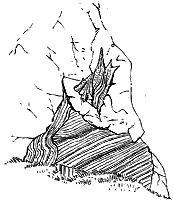
Fig. 162.—Intrusive dolerite sheet enclosing
and sending threads into portions of shale, Salisbury Crags,
Edinburgh.
Among the larger sills this transgressive
character is seen to be sometimes manifested
on a great scale. Thus, along the important
belt of intrusive rocks that runs from Kilsyth
to Stirling, the Hurlet Limestone lies in one
place below, in another above, the invading
mass, but in the intervening ground has been
engulphed in it. Similar evidence of the
widely separate horizons occupied by different
parts of the same sill is supplied at Kilsyth, where the intrusive sheet
lies about 70 or 80 fathoms below the Index Limestone, while at Croy, in
the same neighbourhood, it actually passes above that seam.[471]
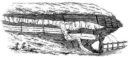
Fig. 163.—Intrusive sheet invading limestone and shale, Dodhead Quarry, near Burntisland.
Other interesting evidence of the intrusive nature of the Carboniferous
dolerite sills of Central Scotland is supplied by the internal modifications
which the eruptive rock has undergone by contact with the strata between
which it has been thrust. These alterations, though partly visible to the
naked eye, are best studied in thin slices with the aid of the microscope.
Tracing the variations of an intrusive dolerite outwards in the direction of
the rocks which it has invaded, we perceive change first in the augite. The
large crystals and kernels of that mineral grow smaller until they pass into
a granulated form like that characteristic of basalts. The large plates and
amorphous patches of titaniferous iron or magnetite give place to minute
particles, which tend to group themselves into long club-shaped bodies. The
labradorite continues but little affected, except that its prisms, though as
defined, may not be quite so large. The interstitial glassy groundmass remains
in much the same condition and relative amount as in the centre of the rock.
Along the line of contact, while the dolerite becomes exceedingly close-grained,
its felspar crystals are still quite distinct even up to the very edge.
But they become fewer in relative number, and still smaller in size, though
an occasional prism two or three millimetres in length may occur. They
retain also their sharpness of outline, and their comparative freedom from
enclosures of any kind. They tend to range themselves parallel with the
surface of the contact-rock. The augite exists as a finely granular pale green
substance, which might at first be taken for a glass, but it gives the characteristic
action of augite with polarized light. It is intimately mixed through
the clear glass of the groundmass, which it far exceeds in quantity. The
iron oxides now appear as a fine granular dust, which is frequently aggregated
into elongated club-shaped objects, as if round some inner pellucid or
translucent microlite. In patches throughout the field, however, the oxides
take the form of a geometrically perfect network of interlacing rods. This
beautiful structure, described and figured by Zirkel and others,[472] is never to
be seen in any of the dolerites, except close to the line of contact with the
surrounding rocks. It occurs also in some of the dykes. I have not
succeeded in detecting any microlites in the sandstones at the edge of a
dolerite sheet, though I have had many slices prepared for the purpose.
Where one of the dolerite sills has invaded sandstone, there is usually
a tolerably sharp line of demarcation between the two rocks, though it is
seldom easy to procure a hand-specimen showing the actual contact, for the
stone is apt to break along the junction-line. Where, however, the rock
traversed by the igneous mass is argillaceous shale, we may find a thorough
welding of the two substances into each other. In such cases the dolerite at
the actual contact becomes a dark opaque rock, which in thin slices under
the microscope is found to be formed of a mottled or curdled segregation
of exceedingly minute black grains and hairs in a clear glassy matrix, in
which the augite and felspar are not individualized. But even in this
tachylyte-like rock perfectly formed and very sharply defined crystals of
triclinic felspar may be observed ranging themselves as usual parallel to the
bounding surfaces of the rock. These characters are well seen in the
contact of the intrusive sheet of dolerite with shale and sandstone at Hound
Point (Fig. 160).
Another instructive example is furnished by the small threads which proceed
from the dolerite of Salisbury Crags, and traverse enclosed fragments of
shale (Fig. 162). Some of these miniature dykes are not more than one-eighth
of an inch in diameter, and may therefore easily be included, together
with part of the surrounding rock, in the field of the microscope. The dolerite
in these ramifications assumes an exceedingly fine texture. The felspar is the
only mineral distinctly formed into definite crystals. It occurs in prisms of an
early consolidation, sometimes one-fifth of an inch long, and therefore readily
recognizable by the naked eye. These prisms are perfectly shaped, contain
abundant twin lamellæ, and show enclosures of the iron of the base. They
had been already completely formed at the time of injection; for occasionally
they may be observed projecting beyond the wall of the vein into the
adjacent shale or sandstone, and they have ranged themselves parallel to the
sides of the vein.[473] The black ground, from which these large well-defined
crystals stand out prominently, consists of a devitrified glass, rendered dark
by the multitude of its enclosed black opaque microlites. These are very
minute grains and rudely feathered rods, with a tendency to group themselves
here and there into forms like portions of the rhombohedral skeletons
of titaniferous iron. So thoroughly fused and liquid has the dolerite been at
the time of its injection, that little threads of it, less than 1/100 of an inch in
diameter, consisting of the same dark base, with well-defined felspars, may
be seen isolated within the surrounding sedimentary rock. Minute grains
and rounded portions of the latter may also be noticed in the marginal parts
of the dolerite.
It is thus evident that specimens taken from the edge of an intrusive
sheet, where the rock has rapidly chilled and solidified, represent to us an
earlier stage in the history of the whole mass than specimens taken from
its central portions. In fact, a series of samples collected at short intervals
from the outer contact to the inner mass shows, as it were, the successive
stages in the consolidation of the molten rock.
From the observations just described, it appears that the triclinic
felspars began to assume the shape of large definite crystals before any of
the other minerals. These felspars already existed when the molten mass
forced its way among the shales, for they can be seen lying with their long
axes parallel to the surface of shale, precisely as, in the well-known flow-structures,
they behave round a large crystal embedded in the heart of a
rock. A few feet from where the consolidation was not so rapid, the iron
oxides have grouped themselves into incipient crystalline forms and skeleton
crystals; the felspar crystals abundantly occur, and the augite has been left
in the finely granular condition. Still further towards the interior of the
mass, the normal character of the dolerite is gradually assumed.[474]
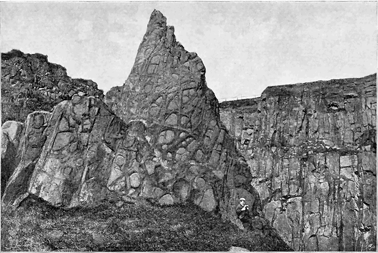
Fig. 164.—Spheroidal weathering of dolerite sill, quarry east of North Queensferry, Fife.
Where a sill has been injected among carbonaceous shales and coals it
has undergone great alteration along the contact, and if the sheet is only a
few inches or feet thick, the change extends throughout its whole mass.
Black basalts and dolerites, in such circumstances, pass into a substance
like a white or pale yellow clay, which at first might be mistaken for some
band of fire-clay intercalated among the other sediments. But evidence of
actual intrusion may usually be found, as where the igneous rock has caught
up or broken through the adjacent strata, besides altering them. Such
"white traps," as they have been called, have long been familiar in the coal-fields
of Scotland and Central England.
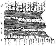
Fig. 165.—Two thin sills of "White Trap"
injected into black carbonaceous shale overlying the Hurlet Limestone,
Hillhouse Quarry, Linlithgow.
1. Hurlet Limestone; 2. Black shales; 3 3. Two sills
of "White Trap"; 4. Columnar Basalts.
As a good illustration of the behaviour of such thin sills among
carbonaceous shales I give here a section
(Fig. 165) exposed in the old limestone
quarry of Hillhouse, south of Linlithgow.
At the bottom lies the Hurlet Limestone
which has once been extensively mined
at this locality. Above it comes a
group of black shales which in turn are
surmounted by a sheet of beautifully
columnar basalt. The shales seem at
first sight to include two layers of pale
fire-clay, each only a few inches in thickness.
Closer inspection, however, will
show that these two thin intercalations
are really sills which, though on the
whole parallel with the bedding of the
shale, may be seen to cut across it, and
even at one place to send a finger into it. The upper example may also
be observed to diminish rapidly in thickness in one direction.
The dimensions of the sills vary within tolerably wide limits. Although
here and there the injected material dwindles down to an inch or less in
thickness, running away even into threads, it more usually forms sheets of
considerable depth. The rock of Salisbury Crags, for example, is fully 150
feet thick at its maximum. That of Corstorphine Hill is probably about
350 feet. The great sheet which runs among the lower limestones from
Kilsyth by Denny to Stirling has been bored through to a depth of 276
feet, but as the bore started on the rock, and not in overlying strata, some
addition may need to be made to that thickness.
The spheroidal weathering so characteristic of basic eruptive rocks is
nowhere more characteristically displayed than among the great doleritic
sills of the basin of the Firth of Forth. As an illustration of this structure
an example is taken here from the large sheet at North Queensferry
(Fig. 164).
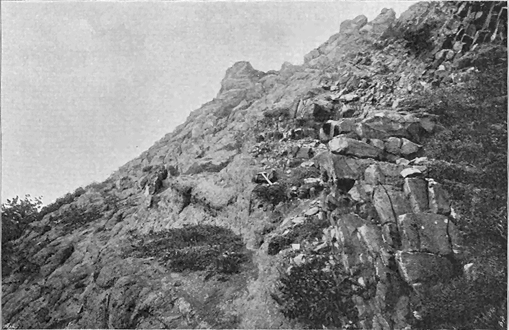
Fig. 166.—Dyke cutting the agglomerate
of a neck. Binn of Burntisland.
While one is struck with the great size and extent of some of the sills
connected with the puys, as compared with the small and local sheets
underneath the plateaux, there is a further fact regarding them that
deserves remark—their capricious distribution. Their occurrence seems to
have little or no relation to the measure of volcanic energy as manifested
in superficial eruptions. Thus in the north of Ayrshire, where a long
band of lavas and tuffs, pointing to vigorous activity, lies at the top of the
Carboniferous Limestone series, and where the strata underneath it are
abundantly exposed at the surface, the sills occur as thin and inconstant
bands in the central and eastern parts of the district only. The bedded
lavas and tuffs at the head of the Slitrig Water have no visible accompaniment
of sills. On the other hand, in the Edinburgh and Burntisland
districts, the sills bear a large proportion to the amount of bedded lavas and
tuffs, while in the Bathgate and Linlithgow district, where the superficial
eruptions were especially vigorous and prolonged, the sills are of trifling
extent.
It would seem from these facts that the extent to which the crust of
the earth round a volcanic orifice is injected with molten rock, in the form
of intrusive sheets between the strata, does not depend upon the energy of
the volcano as gauged by its superficial outpourings, but on other considerations
not quite apparent. Possibly, the more effectively volcanic energy
succeeded in expelling materials from the vent, the less opportunity was
afforded for subterranean injections. And if the protrusion of the sills took
place after the vents were solidly sealed up with agglomerate or lava, it
would doubtless often be easier for the impelled magma to open a way for
itself laterally between the bedding-planes of the strata than vertically
through the thick solid crust. The size and extent of the sills may thus
be a record of the intensity of this latest phase of the volcanic eruptions.

Fig. 167.—Boss of diabase cutting the Burdiehouse Limestone and sending sills and veins into the
overlying shales. Railway cutting, West Quarry, East Calder, Midlothian.
1. Burdiehouse Limestone; 2. Shales; 3. Diabase.
Bosses.—The rounded, oval or irregularly shaped masses of igneous rock
included under this head are found in some cases to be only denuded domes
of sills, as, for example, in the apparently isolated patches in the oil-shale
district of Linlithgowshire, which have been found to unite under ground.
(Compare Fig. 157). In other instances, bosses possibly, or almost certainly,
mark the position of volcanic funnels, as at the Castle Rock of Edinburgh,
Dunearn Hill, Burntisland, and Galabraes, near Bathgate. But many
examples occur which can only be regarded as the exposed ends of irregular
bodies of molten material which has been protruded upwards into the
Carboniferous formations. The area between Edinburgh and Linlithgow
and the hills of the north of Fife furnish many examples.
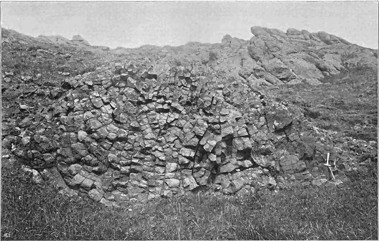
Fig. 168.—Side of columnar basalt-dyke
in the same agglomerate as in
Fig. 166.
The connection between bosses and intrusive sheets is instructively
exhibited in a railway cutting to the west of Edinburgh, where the section
shown in Fig. 167 may be seen. In the space of a few yards no fewer
than four distinct bands of diabase traverse the shale, thickening rapidly
in one direction and uniting with a large boss of more coarsely crystalline
material. Such connections must exist in all sills, for the material injected
as a sheet between stratified formations cannot but be united to some column,
dyke or irregular protrusion which descends to the parent magma in the
interior. But it is very rarely that the geologist is permitted to see them.
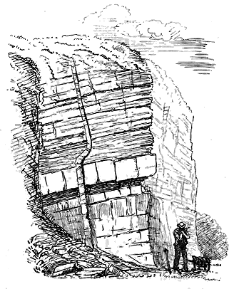
Fig. 169.—Dyke rising through the Hurlet Limestone and its overlying shales. Silvermine
Quarry, Linlithgowshire.
Dykes take a comparatively unimportant place in the eruptive
phenomena of the puys. They occur in some numbers, but on a small
scale, among the tuff vents, and there they can without much hesitation be
set down as part of the phenomena of eruption through these pipes. The
Binn of Burntisland, which has been so often referred to in this Chapter,
may again be cited as a typical vent for the display of this series of dykes
(Figs. 149 and 159). Two additional illustrations from this locality are
here given. In Fig. 166 a dyke of compact black basalt is seen on the
right hand running up the steep slopes of the agglomerate. Some of these
dykes are distinctly columnar, the columns diverging from the walls on each
side. Where the encasing agglomerate has been removed by the weather,
the side of the dyke presents a reticulated network of prism-ends. A
narrow basalt-dyke of this character near the top of the Binn vent is
represented in Fig. 168.
But dykes also occur apart from vents and without any apparent
relation to these. They are sometimes associated with sills and bosses in
such a manner as to suggest that the whole of these forms of injected
material belong to one connected series of intrusions. Among the Bathgate
Hills, for example, from which I have already cited instances of sills and a
boss, the section represented in Fig. 169 occurs. Yet in this same district
there is a group of large east and west dykes which cut all the other rocks
including the bedded lavas and tuffs, and must be of later date than the
highest part of the Coal-measures (Fig. 155).
It is difficult to ascertain the age of the dykes which rise through the
Carboniferous formations at a distance from any interbedded sheets of lava
and tuff, or from any recognizable vent. The south-east and north-west
dykes, increasing in number as they go westward, and attaining a prodigious
development in the great volcanic area of Antrim and the Inner Hebrides,
are probably of Tertiary date.[475] Others may possibly be Permian, while a
certain number may reasonably be looked upon as Carboniferous. In petrographical
characters the latter resemble the dolerites and basalts (diabases)
of the finer-grained sills.
CHAPTER XXVIII ILLUSTRATIVE EXAMPLES OF THE CARBONIFEROUS PUYS OF SCOTLAND — 1. BASIN OF THE FIRTH OF FORTH — 2. NORTH OF AYRSHIRE — 3. LIDDESDALE
The Basin of the Firth of Forth—North Ayrshire—Liddesdale.
Though many of the geological details of each of the Scottish districts of
Puys have been given in the foregoing pages, it will be of advantage to
describe in connected sequence the structure and geological history of a
few typical areas. By far the fullest and most varied record of this phase
of volcanic activity has been preserved in the basin of the Firth of Forth;
but the north of Ayrshire and the district of Liddesdale furnish also many
interesting characteristics.
Reference has already been made to the remarkable peculiarity in the
development of the lower part of the Carboniferous system in this district.[476]
Elsewhere throughout Scotland the Cement-stone group and the plateau
lavas are immediately overlain by the Carboniferous Limestone series. But
in the basin of the Firth of Forth a varied succession of strata, more than
3000 feet in thickness, intervenes between the Cement-stones and the
Hurlet Limestone. The lower portion of this thick mass of sediment may
represent a part of the Cement-stone group of other districts, but even if
some deduction is made on this account there remain many hundred feet of
stratified deposits, for which there does not appear to be any stratigraphical
equivalent elsewhere in Scotland. The distinguishing features of this series
of strata are the thick zones of white sandstone, with occasional bands of
fine conglomerate, the abundant seams of dark shale, often highly carbonaceous
(oil-shales), the cyprid limestones and the seams of coal. Such an association
of deposits may indicate a more humid climate and more varied conditions
of denudation and deposition than are presented by the typical Cement-stones.
The muddy floor of the shallow water must, in many places, have supported a
luxuriant growth of vegetation, which is preserved in occasional seams and
streaks of coal. Numerous epiphytic ferns grew on the subærial stems and
branches of the lycopodiaceous trees. Large coniferae clothed the higher
grounds, from which the streams brought down copious supplies of sediment,
and whence a flood now and then transported huge prostrate trunks of pine.
In the lagoons animal life abounded. Cyprids swarmed to such a degree as
to form by their accumulated remains bands of limestone, which in the well-known
Burdiehouse seam sometimes attain a thickness of 70 feet. Fishes
of many genera haunted the waters, for their scales, bones and coprolites are
found in profusion among the shales and limestones.
When the puys began their activity, this district was gradually dotted
over with little volcanic cones. At the same time it was affected by the
general movement of slow subsidence which embraced all Central Scotland.
Cone after cone, more or less effaced by the waters which closed over it, was
carried down and buried under the growing accumulation of sediment. New
vents, however, continued to be opened elsewhere, throwing out for a time
their showers of dust and stones, and then lapsing into quiescence as they
sank into the lagoon. Two groups of volcanoes emitted streams of lava and
built up two long volcanic ridges—those of Fife and West Lothian.
The occasional presence of the sea over the area is well shown by the
occurrence of thin bands of limestone or shale, containing such fossils as
species of Orthoceras, Bellerophon and Discina, which suffice to prove the
strata to be stratigraphical equivalents of the Lower Limestone shale, and
part of the Carboniferous Limestone of England (Fig. 170). Yet the
general estuarine or freshwater character of the accumulations seems satisfactorily
established, not only by the absence of undoubtedly marine forms
from most of the strata, but by the abundance of cyprids and small ganoids,
the profusion of vegetable remains, and the occasional seams of coal.
The portion of the Forth basin within which the puys are displayed
extends from near Leven in Fife, on the north, to Crosswood Burn near the
borders of Lanarkshire, on the south, a distance of about 36 miles, and from
near Culross in Fife and the line of the Almond River between Stirlingshire
and Linlithgowshire, on the west, to the island of Inchkeith on the east, a
distance of about 16 miles (Map IV.). But these limits do not precisely mark
the original boundaries of the eruptions. To the north and south, indeed,
we can trace the gradual dying out of the volcanic intercalations, until we
reach ground over which no trace of either lavas or tuffs can be detected.
To the east, the waters of the Firth conceal the geology of a considerable
area, the island of Inchkeith with its bedded lavas and tuffs showing that
these rocks extend some way farther eastwards than the position of that
island. But in Midlothian there is no evidence that any of the puy-eruptions
took place to the east of the line of the Pentland Hills. On the west side,
the volcanic rocks dip under the Millstone Grit and Coal-measures, so that
we do not know how far they extend in that direction. But as the Carboniferous
Limestone series, when it rises again to the surface on the west side
of the Stirlingshire coal-field, is destitute of included lavas and tuffs, the
westward limit of the eruptions cannot lie much beyond the line of the River
Almond. We shall probably be within the mark if we set down the original
area over which puys broke out and spread abroad their lavas and tuffs as
covering about 300 square miles of the lagoons and jungles of Central
Scotland.
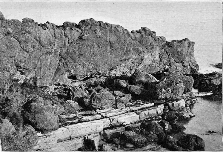
Fig. 170.—Junction of amygdaloidal
basalt with shales and limestone, Shore, half a mile east from Kinghorn, Fife.
(From a photograph by Mr. R. Lunn.)
I have already shown that the range in geological time of the puy-eruptions
in this district extends from a low horizon among the Calciferous
Sandstones through the Carboniferous Limestone series, up to nearly the
level of the Calmy Limestone, which lies not far from the top of that series.
The vertical thickness of strata between these two stratigraphical limits, when
there are no intercalated volcanic rocks, is probably more than 4000 feet.
The vents from which the volcanic materials were ejected, so far as they
are now to be observed at the surface, may be divided into two groups, one
lying to the north, the other to the south of the Firth of Forth. The
northern or Fife group may be followed over an area 15 miles long, and
about three miles broad. Some fifteen separate vents may be recognized in
it, distributed chiefly at the two ends of the belt, a cluster of about six rising
around Burntisland, while another of nearly as many appears at Saline. The
characters of some of these necks have been already given in the foregoing
pages.
The southern or West Lothian group includes about a dozen vents which
are scattered over an area of some 60 square miles, extending from the
coast-line between Borrowstounness and Queensferry southwards to Bathgate
and Uphall. In this group Binns Hill, a mile long by almost half a mile
broad, and rising to a height of nearly 300 feet above the sea, forms the
most prominent individual. But the vents are generally smaller in the
southern than in the northern group.
The manner in which the vents have been left filled with volcanic
material has been described in previous pages. Most of them are occupied
by tuff or agglomerate. In many cases the neck consists entirely of pyroclastic
detritus, as in most of the vents of eastern Linlithgowshire and many
of those in Fife. Not infrequently a column of basalt has risen in the
funnel and solidified there, as exemplified by Binns Hill and Saline Hill,
or the basalt has filled rents in the tuff and now appears in dykes like those
on the Binn of Burntisland (Figs. 148, 149, 159, 166, 168).
But it is possible that in some cases vents may be represented by bosses
of basalt or dolerite, unaccompanied by any agglomerate or tuff. Perhaps
the best example of this suggested origin is supplied by Galabraes Hill, which
rises through the Hurlet limestone and the volcanic series of the Bathgate
Hills, about a mile north-east from the town of Bathgate. This eminence
rises to a height of 940 feet above the sea, and consists of a rudely elliptical
boss of basalt, measuring 3500 feet in its greater and 3000 feet in its minor
axis. It disrupts the sedimentary and volcanic series, which can be traced
up to it on all sides. Some of the smaller circular or elliptical bosses in
eastern Linlithgowshire and western Fife may perhaps belong to the same
category. But undoubtedly most of the intrusive basalts and dolerites of
this volcanic region are sills.
Over the greater part of the district, only fine tuffs were ejected.
These occur as interstratifications among the ordinary sediments, and vary
from mere thin partings, marking the feeblest and briefest explosions, up to
continuous accumulations several hundred feet thick. As an example of the
least vigorous emission of tuff I may refer to the sections already given on
pp. 437, 438. The thicker bands are well illustrated by that which lies some
way above the Houston Coal, between Drumcross and West Broadlaw in Linlithgowshire,
and by the great mass of tuff which occurs immediately below the
Calmy Limestone on the River Avon near Linlithgow Bridge, and which
may be 300 feet thick.
It is a striking characteristic of the tuffs that they may be met with in
their solitary beds intercalated in the midst of ordinary sediments at a
distance from any other trace of volcanic activity, their parent vents not
being visible. I may cite in illustration an interesting case in the Swear
Burn, near the southern end of the volcanic district. A band of tuff about
ten feet thick lies there intercalated in a group of dark shales and thin coals.
Below it there is a seam of coal four inches thick, and among the blue shales
overlying it is another coal ten inches thick. The tuff is pale green, almost
white in colour, fine in texture, like a volcanic mud, while some of its component
beds, one foot in thickness, are made up of fine laminæ and are even
false-bedded. We might infer that the volcanic vent lay at some
distance, so that only the finest dust fell over the swamps in which the coal-vegetation
was accumulating, but for the presence of occasional blocks of
basalt one foot in diameter scattered through the tuff. When the eruptions
ceased, the deposition of ordinary mud and the accumulation of plant-remains
went on as before, and animal life crowded in again over the spot, for between
the partings of the coal above the tuff, abundant fragments of eurypterids
and scorpions may be found.
One of the most extensive volcanic discharges of fragmentary material
was that which produced the "Houston marls" already referred to. These
strata appear to mark a peculiar phase in the volcanic history of the Lower
Carboniferous rocks of the Firth of Forth, when exceedingly fine ash, or
perhaps even volcanic mud, was erupted in considerable quantity. The
"marls" attain in some places a thickness of nearly 200 feet, and can be
traced through most of the eastern part of Linlithgowshire, over an area of
perhaps more than 50 square miles. This volcanic platform, which has been
followed in mining for oil-shale, is one of the most extensive among the puy-eruptions.
The material, which probably came from one or more vents
among the Bathgate Hills, is not always of equal fineness, but passes into
and even alternates with ordinary granular tuff. Thus in the Niddry Burn,
above Ecclesmachan, the dull sage-green and brownish red Houston marls
contain a few inconstant layers of green tuff, in which may be noticed pieces
of black shale and lapilli of the usual basic pumice. Not far to the west,
beyond Wester Ochiltree, and thus probably nearer to the active vents that
ejected the dust and ashes, the Houston marls are replaced by or include a
bedded granular tuff or basalt-agglomerate, which lies above the 2-feet coal
of the district. The matrix of this rock is in part a dull green granular
mudstone, wrapping round the lapilli and ejected stones, which, when they
fall out under the action of the weather, leave casts of their forms behind
them. The enclosed fragments vary in size up to blocks three feet in
diameter, and consist in great measure of a compact volcanic grit, composed of
a fine mud mixed with minute fragments of black shale, grains of sand and
flakes of mica. There are likewise blocks of cement-stone and shale. Thin
courses of black shale interlaminated with the tuff show its bedding.
The thickest and most continuous accumulations of tuff occur round some
of the larger tuff cones, particularly round the Saline Hills, and in the
Burntisland district. In the first-named area the copious eruptions of
fragmentary material brought the volcanic history there to an end; but
around Burntisland they were only the prelude to a prolonged and varied
series of discharges.
I have already remarked that in the area of the puys of the Forth-basin,
while the majority of the vents were tuff-cones, and emitted only fragmentary
discharges, there were two well-marked tracts where lavas were poured out
extensively and during a long geological interval. One of those lies in the
southern, the other in the northern area.
The southern or Linlithgowshire lava-ridge forms now what are known
as the Bathgate and Linlithgow Hills. The lavas extend for about 14 miles
from north to south, dying out in both directions, while their present visible
breadth is about three miles at its widest part. The highest summit reaches
a height of about 1000 feet above the sea. The structure of this long ridge
reveals an interesting record of volcanic eruptions. It consists mainly of
sheets of basalt, sometimes separated by layers of tuff (Fig. 155). But
on one or two horizons the volcanic rocks cease, and ordinary sedimentary
deposits take their place. As has been already stated, the Main or Hurlet
Limestone can be traced through the heart of the volcanic masses. This
seam attains there an exceptional thickness of as much as 70 to 80 feet,
and is nowhere more abundantly fossiliferous. During its deposition there
seems to have been a subsidence of the area, together with a cessation of
volcanic activity for a time. The crinoids, corals, brachiopods, bryozoa,
lamellibranchs, gasteropods, cephalopods and fishes, which swarmed in the
clear water, built up a thick calcareous layer above the lavas and tuffs of
the sea-bottom.
Among the sandstones and shales that cover the limestone, bands of tuff
make their appearance, indicating the renewal of volcanic activity. These
are immediately surmounted by another thick pile of basalt-sheets. Subsequently,
during pauses in the eruptions, while the general subsidence continued,
renewed deposits of sediment spread over the submerged volcanic
bank. One of the longest periods of quiescence was that during which the
coals and even the Index Limestone of Bathgate crept northwards over the
sunken lavas and tuffs. But the whole of the ridge does not seem to have
disappeared at that time under water, at least these intercalated strata have
not been traced across the thick pile of volcanic material near Linlithgow.
During the final period of eruption, the outpouring of lava and discharge of
ashes, neither in united thickness nor in horizontal extent, equalled those
which had preceded them. When the volcanoes ceased their activity, the area
continued to sink, and over the submerged lavas marine organisms crowded
the sea-floor, so as to build up the Calmy Limestone. After that time
volcanic action seems to have become extinct in this region, for no trace of
any intercalated lava or tuff has been detected either in the overlying
Millstone Grit or in the Coal-measures. The total thickness of rock in the
Linlithgowshire volcanic ridge is about 2200 feet. It will probably not be
an exaggeration to place the proportion of lava and tuff in that depth of
material at nearly 2000 feet.
The northern or Fifeshire district over which lavas were abundantly
erupted stretches along the coast from Aberdour to Kirkcaldy and inland to
near Lochgelly, as well as seawards to Inchkeith. It may comprise an area
of about 30 square miles. In many respects this is the most important
locality in Britain for the study of Carboniferous volcanic history. The sea
has cut an admirable coast-section in which the structures of the rocks are
laid bare. The bottom and top of the whole volcanic series can be seen.
The vents and their relation to the lavas and tuffs that were emitted from
them may easily be made out; while the interstratification of well-known
seams of rock in the Scottish Carboniferous system permits the sequence
and chronology of the whole volcanic series to be traced with great
clearness.
Most of these features have already been described in foregoing pages,
for the district is a typical one for the study of Carboniferous volcanic
phenomena. Thus the group of vents about Burntisland has been illustrated
by the Binn of Burntisland rising among the bedded lavas and tuffs. The
characters of the Carboniferous basalt-sheets have been enumerated, together
with their intercalated layers of tuff and bole, and their fine partings of
ashy material that was thrown out over the lagoons during the intervals
between two outbursts of lava. But it may be of service if I insert here
a detailed section of the whole volcanic series as it is displayed along the
coast-section between Burntisland and Kinghorn. The lowest intercalated
lavas of that section lie a little above the horizon of the Burdiehouse
Limestone, and are thus probably rather earlier than those of Linlithgowshire.
The highest reach up to the base of the Hurlet Limestone. The
volcanic energy manifestly died out here long before it ceased on the south
side of the Firth. Yet so vigorous was its activity while it continued,
that it piled up one of the thickest masses of volcanic material anywhere
to be seen among the puy-eruptions of the British Isles. The following
tabular statement of the alternations of material in this great mass in
descending order, was drawn up by me on the ground many years ago,
before the construction of fortifications and other changes partly concealed
the rocks.
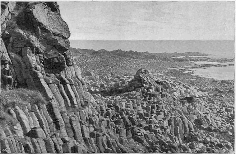
Fig. 171.—Columnar basalt, Pettycur, Kinghorn, Fife. (From a photograph taken for the Geological Survey by Mr. R. Lunn.)
Section of the Volcanic Series below the Hurlet or Main Limestone on the
Coast of Fife, west of Kinghorn, in descending order[477]
75. Reddish and white sandstones.
74. Shale with hard ribs of limestone and ironstone nodules. Fossils abundant.
73. Limestone, crinoidal, 8 or 9 feet.
72. Blue shale, becoming calcareous towards the top, where shells are plentiful.
71. Reddish false-bedded sandstones, with bands of reddish and blue shale.
70. Basalt in two sills separated by 2 or 3 feet of sandstone and shale.
69. Dark fissile sandy shale, passing up into white shaly sandstone, and including a thin
parting of impure coal.
68. Limestone (Hurlet or Main Seam) in a number of bands having a united thickness
of 25 feet. Abundant fossils.
67. Black shale becoming calcareous at top, and then enclosing abundant Productus, etc.,
8 or 10 feet.
66. Red and green tufaceous marl and tuff. About 30 feet.
65. Basalt, the lower part strongly amygdaloidal.
64. Tufaceous red marl and tuff; comparatively coarse below, becoming finer above, 3
or 4 feet.
63. Basalt, earthy and amygdaloidal, with an irregular bottom involving masses of the
shales below.
62. Dark calcareous shale and dull green tufaceous marly shale, 2 or 3 feet.
61. Crinoidal limestone in several bands with a united thickness of 10 feet.
60. Shale, 1 foot.
59. Fine green sandy tuffs in a number of bands of varying coarseness, about 6 feet.
58. Dark shale with abundance of Aviculopecten immediately under the tuffs above,
1½ feet.
57. Soft, light, marly shale with fragmentary plants, 1½ feet.
56. Dark fissile shale, full of fish-scales, plants, etc., 3 feet.
55. Basalt, rudely columnar, dark fine-grained in centre, becoming highly amygdaloidal
and scoriaceous at bottom and top.
54. Basalt, like the sheet above, vesicular at top and bottom, with a parting of red clay
on top.
53. Fissile rippled sandy shale, with plants, having a red and green marly parting at the
top, 12 or 14 feet.
52. Basalts; a group of beds, probably in part sills, involving three bands of sandstone
or quartzite.
51. Quartzite—a hard white altered sandstone, 2 to 3 feet.
50. Basalt, light green, earthy, amygdaloidal.
49. Sandstones and shales with plants, 25 feet.
48. Basalt, with a highly amygdaloidal central band. There may be several sheets here.
47. Green tufaceous shale and marl, 1 foot.
46. Basalt, dark, firm and amygdaloidal.
45. Sandstones and shales with plants.
44. Basalt forming west side of Kinghorn Bay, and including more than one sheet.
The rock is very black, compact, irregularly columnar, with the usual amygdaloidal
earthy band at the base, and forms the crag called the Carlinehead Rocks. An
irregular and inconstant band of dull green tufaceous shale, sometimes 2 feet thick,
serves to separate two of the basalt-sheets. Below it lies a remarkable scoriaceous
almost brecciated basalt, which has been broken up on cooling in such a manner
that at first it might be mistaken for a volcanic conglomerate.
43. Basalt, a compact black solid rock, with a vesicular and amygdaloidal bottom, about
40 feet. This sheet runs out into the promontory of Kinghorn Ness.
42. Basalt, firm, compact and highly amygdaloidal throughout, 15 feet.
41. Basalt, earthy, amygdaloidal and scoriaceous in the upper part, compact below.
40. Red tufaceous marl, clay or bole, a few inches thick.
39. Basalt: one of the most compact sheets of the whole series, about 40 feet. The
top is formed of a thick zone of scoriaceous and brecciated material, the bottom is
singularly uneven owing to the very irregular surface of the underlying bed.
38. Basalt more or less scoriaceous throughout, especially at the bottom, the vesicles being
drawn out round the slag-like blocks.
37. Green tufaceous shales with bands of fine green tuff, 7 to 8 feet. The lower bands
consist of a gravelly tuff passing up into a fine volcanic mudstone, with scattered
lapilli of basalt an inch or more in diameter.
36. Basalt, with an upper, earthy and highly amygdaloidal portion, 30 feet.
35. Tufaceous sandstone and shale, 6 to 8 feet.
34. Basalt, in a thick bed, having an earthy, slaggy top and a scoriaceous bottom.
33. Basalt, very slaggy below with a compact centre.
32. Basalt, like that below it.
31. Basalt, firm, compact, black rock, with a rough, green earthy band, from 6 inches to a
foot, at the bottom, and becoming again very slaggy at the top.
30. Green shale like that below the underlying limestone, a few inches in thickness.
29. Coarse, green, sandy tufaceous limestone, averaging 1 foot in thickness.
28. Black shale with plants, 12 or 14 feet, becoming green and tufaceous at the top.
27. Basalt—the most striking of the whole section—a fine compact black olivine-bearing
rock, beautifully columnar, 30 feet. The columns reach to within a foot of the
bottom of the bed and cease about 10 feet from the top, the upper portion of the
bed being massive, with vesicles which are drawn out parallel to the bedding of the
series. The lowest part of the bed is a broken brecciated band, 3 or 4 inches thick.
(See Fig. 171.)
26. Black shale with fragmentary plants, 3 feet.
25. Basalt, with plentiful olivine, 12 to 16 feet. The base is not highly scoriaceous, but
finely vesicular. Towards the top it becomes green, earthy and roughly brecciated.
It partly cuts out the tuff underneath.
24. Tuff, green, fine-grained and well-stratified, consisting chiefly of fine volcanic dust,
but becoming coarser towards the top, where it contains lapilli and occasional
bombs of highly vesicular lavas.
23. Black carbonaceous shale, 3 feet; approaching to the character of an impure coal in
the lower part, and becoming more argillaceous above with some thin nodular
calcareous bands.
22. Green tuff, 12 feet, well stratified and fine-grained, with minute lapilli of highly
vesicular basic lavas; becomes shaly at the bottom.
21. Basalt, compact, amygdaloidal, with highly vesicular upper surface, 20 feet.
20. Basalt, hard, black and full of olivine; an irregular bed 3 to 6 feet thick.
19. Basalt, dull brownish-green to black, full of kernels and strings of calcite, and showing
harder and softer bands parallel with upper and under surfaces, which give it
a stratified appearance.
18. Basalt, some parts irregularly compact, others earthy and scoriaceous. The distinguishing
feature of this bed is the abundance of its enclosed fragments of shale,
ironstone and limestone, which here and there form half of its bulk. The
roughly scoriaceous upper portion is especially full of these fragments. In the
ironstone balls coprolites may be detected, and occasional pieces of plant-stems are
embedded in the basalt. This lava has evidently broken up and involved some
of the underlying strata over which it flowed. This rock overhangs Pettycur
Harbour.
17. Shales and limestone bands more or less tufaceous, 8 to 10 feet, with plants, cyprids,
etc. The intercalation of fine partings of tuff in this band has been already
cited on p. 438, as an illustration of the feeble intermittent character of many
of the volcanic explosions between successive outflowings of lava.
Owing to a change in the direction of strike the rocks now wheel round and for
a time run nearly parallel with the coast-line, while they are partly concealed by
blown sand and herbage. The shales and limestones just mentioned are not constant,
and are soon lost, but about a quarter of a mile westward a band of tuff begins
on the same horizon or near it, and increases in thickness towards the west, where
it is associated with other sediments. The shore ceases to furnish a continuous
section, so that recourse must be had to the craggy slopes immediately to the north,
where the rocks can be examined on a cliff face (Fig. 153). There the tuff just referred
to, together with some overlying bands of sandstone, is seen to pass under the
group of basalts last enumerated. It is a green, stratified rock, perhaps 60 feet thick
at its maximum, but dying out rapidly to north-west and south-east. It encloses balls
of basalt and subangular and rounded fragments of sandstone, limestone and shale.
A mass of coarse volcanic agglomerate which is connected with it and cuts across
the ends of some of the basalts below, probably marks the position of the vent from
which the tuff was ejected (Fig. 152).
16. Black and grey shales forming a thin band at the summit of King Alexander's Crag.
15. Basalt, dark compact rock, with an upper and lower highly scoriaceous and amygdaloidal
band, 15 feet.
14. Black shales, tufaceous green shales, sandstone, and 6 inches of coal, forming a
group of strata about 12 feet thick between two basalts; plants and cyprids
abundant. (The coal seam is shown in Fig. 151.)
13. Basalt, dull, earthy and highly amygdaloidal, with abundant calcite in kernels and
veins; about 15 feet, but varying in thickness.
12. Basalt, forming a well-marked bed from 12 to 25 feet thick. It is a compact black
olivine-bearing rock, sparingly amygdaloidal, but showing the usual dull green,
earthy scoriform base. The upper surface is singularly irregular, having, in flowing,
broken up into large clinker-like blocks, which are involved in the immediately
overlying basalt. The bottom also is very uneven, for the basalt has in some places
cut out the underlying shales, so as to rest directly upon the basalt below.
11. Black shale, varying up to 6 inches, but sometimes entirely removed by the overlying
lava-stream.
10. Basalt, containing large irregularly spheroidal masses of hard black finely vesicular
material enclosed in more earthy and coarsely vesicular rock. The vesicles are
sometimes elongated parallel to the bedding, but have often been drawn out round
a spheroid; some of them measure nearly a foot in length by 2 or 3 inches in
breadth. The upper surface is uneven and coarsely amygdaloidal.
9. Basalt, hard black, with abundant olivine, and a columnar structure.
8. Green shale, 6 inches to 1 foot, much baked and involved in the overlying basalt.
7. Basalt, dull-green, earthy, amygdaloidal, varying from 10 to 40 feet in thickness.
6. Blue shale, disappearing where the basalt above it unites with that below.
5. Basalt with olivine, forming a thick irregular bed, which in some places is black and
compact, in others green, earthy and amygdaloidal. The upper part is particularly
cellular.
4. Sandstones forming a thick group of beds which have long been quarried for building-stone
at the Grange and elsewhere.
3. Black shales.
2. Limestone (Burdiehouse).
1. Sandstones, shales and thin limestones forming the strata at Burntisland through
which the sills of that district have been injected (Fig. 159).
The phenomena of sills are abundantly developed among the Carboniferous
rocks of the basin of the Firth of Forth, and some of the more
remarkable examples in this district have been already cited. Taking now
a general survey of this part of the volcanic history, I may observe that if
the sills are for a moment considered simply as they appear at the surface,
and apart from the geological horizons on which they lie, they form a wide
ring surrounding the Falkirk and Stirlingshire coal-field.
Beginning at the Abbey Craig, near Stirling, we may trace this ring as
a continuous belt of high ground from Stirling to the River Carron. Thence
it splits up into minor masses in different portions of the Carboniferous
system, and doubtless belonging to different periods of volcanic disturbance,
but yet sweeping as a whole across the north-eastern part of the Clyde
coal-field, and then circling round into Stirlingshire and Linlithgowshire.
There are no visible masses to fill up the portion of the ring back to Abbey
Craig. But through Linlithgowshire and the west of Edinburghshire a
number of intrusive sheets form an eastward prolongation of the ring.
Large as some of these sheets are at the surface, for they sometimes exceed two
or three square miles in area, a much larger portion of their mass is generally
concealed below ground. Mining operations, for example, have proved that
in the south-east of Linlithgowshire areas of intrusive rock which appear as
detached bosses or bands at the surface are connected underneath as portions
of one continuous sill, which must be several square miles in extent.

Fig. 172.—Section across the Fife band of Sills.
1. Upper Old Red Sandstone; 2. Calciferous Sandstones; 3. Carboniferous Limestone series; 4. Millstone Grit;
5. Coal-measures; 6. Dolerite Sills. f, Fault.
But it is in Fife that the sills reach their greatest development among
the Carboniferous rocks of Scotland (Fig. 172). A nearly continuous belt of
them runs from the Cult Hill near Saline on the west, to near St. Andrews
on the east, a distance of about 35 miles. This remarkable band
is connected with a less extensive one, which extends from Torryburn on
the west, to near Kirkcaldy on the east. In two districts of the Fife region
of sills, a connection seems to be traceable between the intrusive sheets and
volcanic vents, at least groups of necks are found in the midst of the sills.
One of these districts is that of the Saline Hills already described, the other
is that of Burntisland. In the latter case the evidence is especially striking,
for the vents are connected above with bedded lavas and tuffs, while below
lie three well-marked sills (Fig. 159).
It is certainly worthy of remark that sills are generally absent from
those areas where no traces of contemporaneous volcanic activity are to be
found. No contrast in this respect can be stronger than that between the
ground to the east and west of the old axis of the Pentland Hills. In the
western district, where the puys are so well displayed, sills abound, but in
the eastern tract both disappear.
Another question of importance in dealing with the history of these sills
is their stratigraphical position. By far the larger proportion of them lies
in the Carboniferous Limestone series. Thus the great sill between Stirling
and Kilsyth keeps among the lower parts of that series. On the same
general horizon are the vast sheets of dolerite which stretch through Fife in
the chain of the Cult, Cleish, and Lomond Hills on the one side, and in the
eminences from Torryburn to Kinghorn on the other, though the intrusive
material sometimes descends almost to the Old Red Sandstone. In Linlithgowshire
and Edinburghshire, as well as in the south of Fife, the sills
traverse the Calciferous Sandstone groups.
If the horizons of the sills furnished any reliable clue to their age, it
might be inferred that the rocks were all intruded during the Carboniferous
period, and as most of them lie beneath the upper stratigraphical limit of
the puy-eruptions, the further deduction might be drawn that they are
connected with these eruptions. I have little doubt that in a general sense
both conclusions are well-founded. But that there are exceptions to the
generalization must be frankly conceded. On close examination it will be
observed that the same intrusive mass sometimes extends from the lower
into the upper parts of the Carboniferous groups. Thus, in the west of
Linlithgowshire, a large protrusion which lies upon the Upper Limestones,
crosses most of the Millstone Grit, and reaches up almost as high as the
Coal-measures. Again, in Fife, to the east of Loch Leven, a spur of the
great Lomond sill, crossing the Carboniferous limestone, advances southward
into the coal-field of Kinglassie, In Stirlingshire and Lanarkshire numerous
large dolerite sheets have invaded the Millstone Grit and Coal-measures,
including even the upper red sandstones, which form the top of the Carboniferous
system in this region. It is thus obvious that if the puy-eruptions
in the basin of the Forth ceased towards the close of the deposition of the
Carboniferous Limestone series, there must have been a subsequent injection
of basic lava on a gigantic scale in central Scotland. I shall recur to this
subject in Chapter xxxi.

Fig. 173.—Section across the Upper Volcanic Band of north Ayrshire. Length about four miles.
1. Andesite lavas of the Clyde Plateau; 2. Tuffs closing the Plateau volcanic series; 3. Hurlet Limestone;
4. Carboniferous Limestone series with coal-seams; 5. Lower tuff zone of the Upper volcanic band; 6.
Basic lavas; 7. Upper tuff zone; 8. Basic sill; 9. Coal-measures.
In this part of the country another group of puys and their associated
tuffs and lavas may be traced from near Dairy on the west, to near Galston
on the east (Map IV.). The length of the tract is about sixteen miles, while
its breadth varies from about a furlong to nearly a mile and a half. I have
had occasion to allude to this marked band of volcanic materials which here
intervenes between the Carboniferous Limestone and the Coal-measures, and
from its position appears to mark the latest Carboniferous volcanoes. Its
component rocks reach a thickness of sometimes 600 feet, and as they dip
southwards under the Coal-measures, they may extend for some distance in
that direction. They have been met with in borings sunk through the
northern part of the Irvine coal-field. Even what of them can be seen at
the surface, in spite of the effects of faults and denudation, shows that they
form one of the most persistent platforms of volcanic rock among the puy-eruptions
of Scotland.
Where best developed this volcanic band has a zone of tuff at the
bottom, a central and much thicker zone of bedded basalts, and an upper
group of tuffs, on which the Coal-measures rest conformably. A few vents,
probably connected with it, are to be seen at the surface between Fenwick
and Ardrossan. But others have been buried under the Carboniferous sedimentary
rocks, and, as already described, have been discovered in the underground
workings for coal and ironstone (p. 434). These mining operations
have, indeed, revealed the presence of far more volcanic material below
ground than would be surmized from what can be seen at the surface.
Here and there, thin layers of tuff appear in brook-sections, indicating what
might be conjectured to have been trifling discharges of volcanic material.
But the prosecution of the ironstone-mining has proved that, at the time
when the seam of Black-band Ironstone of that district was accumulated, the
floor of the shallow sea or lagoon where this deposition took place was dotted
over with cones of tuff, in the hollows between which the ferruginous and
other sediments gathered into layers. That seam is in one place thick and
of good quality; yet only a short distance off it is found to be so mixed
with fine tuff as to be worthless, and even to die out altogether.[478]
A remarkable development of puys lies in that little-visited tract of
country which stretches from the valleys of the Teviot and Rule Water
south-westwards across the high moorland watershed, and down Liddesdale.
Through this district a zone of bedded olivine-basalts and associated tuffs
runs in a broken band which, owing to numerous faults and extensive
denudation, covers now only a few scattered patches of the site over which
it once spread. The geological horizon of this zone lies in the Calciferous
Sandstones, many hundred feet above the position of the top of the plateau-lavas
(Map IV.).
So great an amount of material has been here removed by denudation
that not only has the volcanic zone been bared away, but the vents which
supplied its materials have been revealed in the most remarkable manner
over an area some twenty miles long and eight miles broad. Upwards of
forty necks of agglomerate may be seen in this district, rising through the
Silurian, Old Red Sandstone, and lowest Carboniferous rocks. It fills the
geologist with wonder to meet with those stumps of old volcanoes far to the
west among the Silurian lowlands, sometimes fully ten miles away from the
nearest relic of the bedded lavas connected with them.[479] That these vents,
though they rose through ground which at the time of their activity was
covered with the volcanic series of the plateaux, do not belong to that series,
but are of younger date, has been proved in several cases by Mr. Peach.
He has found that among the blocks composing their agglomerates, pieces
of the sandstones, fossiliferous limestones and shales of the Cement-stone
group, overlying the plateau-lavas, are to be recognized. These vents were
therefore drilled through some part at least of the Calciferous Sandstones,
which are thus shown to have extended across the tract dotted with vents.
After the volcanic activity ceased, fragments of these strata tumbled down
from the sides into the funnels. Denudation has since stripped off the
Calciferous Sandstones, but the pieces detached from them, and sealed up at
a lower level in the agglomerates, still remain. Mr. Peach's observations
indicate to how considerable an extent sagging of the walls of these orifices
took place, with the precipitation not merely of blocks, but of enormous
masses of rock, into the volcanic chimneys. In one instance, between
Tudhope Hill and Anton Heights, a long neck, or perhaps group of necks,
which crosses the watershed, shows a mass of the red sandstone many acres
in extent, and large enough to be inserted on the one-inch map, which has
fallen into the vent (Fig. 175).

Fig. 174.—Section showing the connection of the two volcanic bands in Liddesdale.
1. Upper Silurian strata; 2. Upper Old Red Sandstone; 3. The lavas of the Solway plateau; 4. Agglomerate
neck with lava plug, belonging to the plateau system; 5. Calciferous Sandstone series; 6. Thick Carboniferous
Limestones; 7. Tuff, and 8. Lavas, of the upper volcanic band, connected with the puys; 9. Agglomerate
neck with lava plug belonging to the puy-system; 10. Basic sill.
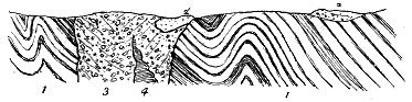
Fig. 175.—Diagram to show the position of a mass of Upper Old Red Sandstone which has fallen into
the great vent near Tudhope Hill, east of Mosspaul.
1. Upper Silurian strata; 2. Outlier of Upper Old Red Sandstone; 2´. Large mass of this formation in the vent;
3. Agglomerate of the neck with andesite intrusion (4).
The materials ejected from the Liddesdale vents include both basaltic
lavas and tuffs. The former are sometimes highly vesicular, especially
along the upper parts of the flows. They are thickest towards the north,
and in Windburgh Hill attain a depth of at least 300 or 400 feet. In
that part of the district they form the lower and main part of the volcanic
series, being there covered by a group of tuffs. But a few miles southwards,
not far to the west of Kershopefoot, they die out. The tuffs then form the
whole of the volcanic band which, intercalated in a well-marked group of
limestones, can be followed across the moors for some six miles into the
valley of the Esk, where an interesting section of them and of the associated
limestone and shales is exposed (Fig. 174). At Kershopefoot, a higher
band of basic lava overlies the Kershopefoot limestone, and can be traced in
scattered patches both on the Scottish and English side of the Border.
END OF VOL. I.
Printed by
R. & R. Clark, Limited, Edinburgh.
TO ACCOMPANY SIR ARCHIBALD GEIKIE'S "ANCIENT VOLCANOES OF BRITAIN"
Map IV.
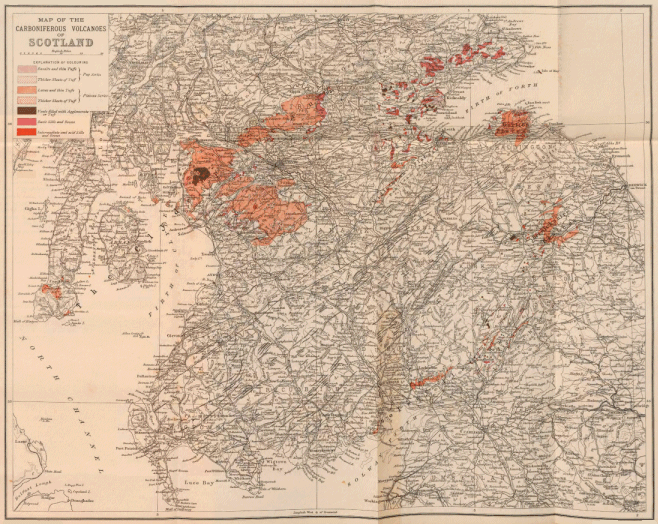 Click on map to view larger sized.
MAP OF THE CARBONIFEROUS VOLCANOES OF SCOTLAND
TO ACCOMPANY SIR ARCHIBALD GEIKIE'S "ANCIENT VOLCANOES OF BRITAIN"
Map I.
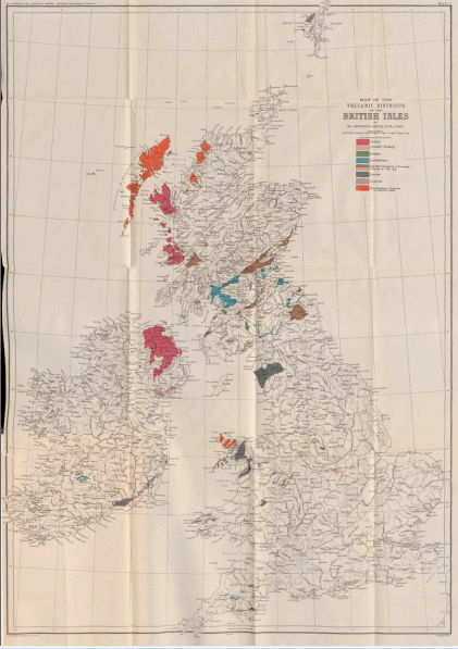 Click on map to view larger sized.
MAP OF THE VOLCANIC DISTRICTS OF THE BRITISH ISLES
BY Sir ARCHIBALD GEIKIE, D.C.L., F.R.S.
BY THE SAME AUTHOR.
TEXT-BOOK OF GEOLOGY. With Illustrations. Third Edition.
Revised and Enlarged. Medium 8vo. 28s.
CLASS-BOOK OF GEOLOGY. Illustrated with woodcuts. Second
Edition. Crown 8vo. 4s. 6d.
ELEMENTARY LESSONS IN PHYSICAL GEOGRAPHY. Illustrated
with woodcuts and ten plates. Fcap. 8vo. 4s. 6d. Questions for
the use of Schools. Fcap. 8vo. 1s. 6d.
PHYSICAL GEOGRAPHY. Illustrated. Pott 8vo. 1s.
[Science Primers.
THE SCENERY OF SCOTLAND VIEWED IN CONNEXION WITH
ITS PHYSICAL GEOLOGY. With a Geological Map and Illustrations.
Second Edition. Crown 8vo. 12s. 6d.
GEOLOGY. With Illustrations. Pott 8vo. 1s.
[Science Primers.
OUTLINES OF FIELD GEOLOGY. New and revised Edition. Extra
Fcap. 8vo. 3s. 6d.
GEOLOGICAL SKETCHES AT HOME AND ABROAD. With Illustrations.
8vo. 10s. 6d.
THE TEACHING OF GEOGRAPHY. Suggestions regarding principles
and methods for the use of teachers. Globe 8vo. 2s.
[Geographical Series.
GEOGRAPHY OF THE BRITISH ISLES. Pott 8vo. 1s.
[Geographical Series.
Box of Geological Specimens to illustrate Geikie's Primer of Geology.
10s. 6d.
MACMILLAN AND CO., Ltd., LONDON.
MACMILLAN AND CO.'S BOOKS FOR STUDENTS
OF
PHYSICAL GEOGRAPHY, GEOLOGY, AND MINERALOGY.
PHYSICS OF THE EARTH'S CRUST. By Rev. Osmond Fisher, M.A.,
F.G.S., Hon. Fellow of King's College, London. 2nd Ed., enlarged.
8vo. 12s.
TABLES FOR THE DETERMINATION OF THE ROCK-FORMING
MINERALS. Compiled by F. L. Loewinson-Lessing. Trans. by
J. W. Gregory, B.Sc., F.G.S. Glossary by Prof. G. A. J. Cole, F.G.S.
8vo. 4s. 6d. net.
MICROSCOPICAL PHYSIOGRAPHY OF THE ROCK-MAKING
MINERALS. By H. Rosenbusch. Trans. by J. P. Iddings. 8vo.
24s.
METEOROLOGY. By T. Russell. 8vo. 16s. net.
A POPULAR TREATISE ON THE WINDS. By W. Ferrel, M.A.,
Member of the American National Academy of Sciences. 8vo. 17s.
net.
ECONOMIC GEOLOGY OF THE U.S. By R. S. Tarr, B.S. 8vo.
16s. net.
ELEMENTARY PHYSICAL GEOGRAPHY. By R. S. Tarr, B.S.
Crown 8vo. 7s. 6d. net.
ELEMENTS OF CRYSTALLOGRAPHY, for Students of Chemistry,
Physics, and Mineralogy. By G. H. Williams, Ph.D. Crown
8vo. 6s.
POPULAR LECTURES AND ADDRESSES. By Lord Kelvin, P.R.S.,
Vol. II. Geology and General Physics. Crown 8vo. 7s. 6d.
THE PLANET EARTH. By R. A. Gregory, F.R.A.S. Crown 8vo. 2s.
PHYSIOGRAPHY. An Introduction to the Study of Nature. By the
Right Hon. T. H. Huxley, F.R.S. Illustrated. Crown 8vo. 6s.
SHORT STUDIES IN EARTH KNOWLEDGE. Introduction to Physiography.
By William Gee. Illustrated. Globe 8vo. 8s. 6d.
OUTLINES OF PHYSIOGRAPHY—THE MOVEMENTS OF THE
EARTH. By J. Norman Lockyer, F.R.S. Illustrated. Crown 8vo.
Sewed, 1s. 6d.
PHYSIOGRAPHY FOR BEGINNERS. By A. T. Simmons, B.Sc. Globe
8vo. 2s. 6d.
MACMILLAN AND CO. Ltd., LONDON.
Transcriber Note
Minor typos corrected. Text rearranged to avoid split paragraphs at full
page images.